Leaderboard


Popular Content
Showing content with the highest reputation since 11/26/17 in all areas
-
No matter where one stands on the issue of risk, this thread is an important and necessary conversation for climbers of all ages and skills. Like many climbers, I believe, my relationship and outlook on risk versus reward in climbing has been complicated from the very beginning. That relationship spans 26 years, more than half of my life. My view of risk has had many faces through the years, and it continues to be complex and fraught with contradictions. Which it should, if we are being honest with ourselves and continuing to play the game for the longhaul. Perhaps the most consistent element of it for me is that even in my younger age when I thought myself more 'bulletproof', I've always gone into every serious alpine climb with a very clear-eyed attitude as to the danger I was willingly embracing. "I could die on this trip", is something I silently recited to myself, as the plane lifted off in Talkeetna, or I stepped off the pavement in El Chalten, or I began traipsing up some Rockies drainage towards my objective. While just verbalizing these words didn't change the objective risks I would be facing, it allowed me to proceed with commitment and decisiveness into that zone, and to fully accept the potential consequences. It also served as a reminder of the responsibilities I had at home, the responsibility I had to get back home, which means that aforementioned commitment was not without conditions or limits. I don't regret any of the adventures I've undertaken over the years, nor my lifelong commitment to climbing. Yet in some respect, today I have an increasingly difficult time reconciling my desire to celebrate these memories, with a nagging question of why I have survived, when so many others I knew have not. My wife and I never had children, but I know that if we had, I would have done much less than I have. My wife is a saint for having tolerated so much time away, so much of our money spent, and so much worry that I have subjected her to, in what has been inarguably a selfish pursuit. We have been able to navigate it successfully out of a mutual recognition that a passion for something is what makes a person who they are. I think she has been simultaneously admiring of and appalled by my dedication. I became friends with Marc Leclerc a few years ago in Patagonia, where we shared a number of dinners and trips to Domo Blanco together. He seemed an astonishing soul to me, and someone who was extremely kind, humble and unassuming, especially considering the wavelength on which he was operating in his climbs. When I have observed some of the achievements and risks that he and others like him have taken, I am certainly impressed by the athleticism and the mind control they exhibit. And I've also just shaken my head in a manner that represents neither condemnation nor unbridled approval, but rather, an honest acknowledgement that these sorts of achievements are so far outside of my own abilities and comfort zones that I simply don't understand what they are. It is almost as though I'm watching an entirely different sport. It's tempting to frown on extreme risks, and yet as I myself have taken more than my own share, I'm not in a strong position to judge. In fact, I think we must recognize that their propensity and ability to take such risks is an intrinsic part of their character, the very thing for which we love those of this group that we know personally. And so if Bob's concern about applauding high risk has any merit- and I think that it does- I think it's that the community needs to be brutally honest with themselves about what we are witnessing, even if we choose to admire it. The brutal and honest truth for me is that I have ceased to even feel shock, much less surprise, by each one of these successive tragedies. Ryan, in fact was a good friend. Last fall as we unsuccessfully tried to synch up for some rock climbing in the Cascades, he glowingly told me how he didn't want to be away from his 2 year old son for very long, and that he no longer needed climbing to fill a void in his life. So heartbreaking to think back on this exchange now. But I fear that I've become so accustomed to these accidents as to be desensitized, out of a simple need to protect myself from a total meltdown. I have a photo from my own wedding, in 2006. In it, Lisa and I are surrounded by 7 of my closest friends. Three of them have since died in the mountains. A photo from one of the happiest days of my life now causes pain. Amidst the deaths of numerous casual friends through the years, the loss of Lara Kellogg, Joe Puryear, and Chad Kellogg, leaves a hole in my heart that can't ever be repaired. The widespread wreckage left behind from incidents like these can't be understated. A friend of mine here in Alaska who used to do some cutting edge stuff likes to remind me of why he scaled back the big alpine. "My wife says, you won't care when you’re gone, but I will". The losses that have touched me, my work commitments, being well over 40, and most recently, having a serious illness have all conspired to blunt the sharp edge of my formerly insatiable motivation for the mountains and big adventures. And yet I still do it, and I still hold ambitions on which I plan to execute in the near future. Amidst the flood of mixed emotions and out of a cloud of darkness, certain things have become clear. Two years ago, I was diagnosed with the ultra rare and very lethal adrenal cortical cancer. At the time, I thought that if I somehow survived it, getting a second chance on life, I could never justify taking serious risks for recreation anymore. Two years, two major surgeries, and a month of radiation treatments later, I'm somehow not only still here but cancer free, and throughout much of this time, I've been able to climb at full speed. I have so far gotten off easy. But I've deep dived into the world of this disease and what I've seen is neither pretty nor dignified. And I'm not out of the woods by a longshot. I know who I am and what has taken me to this point in my life. I've wrestled over and over again with how sustainable this activity is. I've simultaneously envied those like Marc who at a young age had the vision and heart to become committed in every fiber of his being to climbing mountains, and also had the talent to be one of the very best; but also guys like Simon McCartney, who at age 24, with Jack Roberts, established the hardest route ever done on Denali at the time, the massive southwest face. It was the zenith of what had been a meteoric few years of serious and groundbreaking alpine ascents for him. But high on this climb, Simon nearly succumbed to altitude illness in a harrowing ordeal, and afterwards, quit climbing cold turkey, moved to Australia, got married and started a successful business. Simon told me: "I knew what I needed from climbing at the time, each climb had to be harder and more audacious than the next. I could see exactly how that was going to end. I didn't want to die, not at that age". Simon is now 62 and has had a happy life. I've come to realize that as long as I have a chance of dying of cancer, and that if I could choose the manner of my death between that or climbing, I'll take the mountains. Ultimately, between the all or nothing of the above examples, I hope to walk a fine line right down the middle on my way out of this life, whenever and however that happens. Onward, and upward-8 points
-
My name was mentioned above (I think). It seemed in reference to my ability to stay alive and climb in the mountains. Just to be clear: I’m alive because I’ve been lucky. No more, no less. Sure, I try to mitigate risk as much as possible, but when you are going for it in the mountains on a regular basis, the odds of an accident increase. Climbing is a dangerous sport. It always has been. Life is dangerous too. I know that for me, climbing and skiing in the mountains is absolutely worth it. That said, the pain is crushing when someone is lost. Absolutely crushing. I still don’t know how to make sense of it, but I’ve accepted that there are many things I’ll never wrap my head around in this lifetime.7 points
-
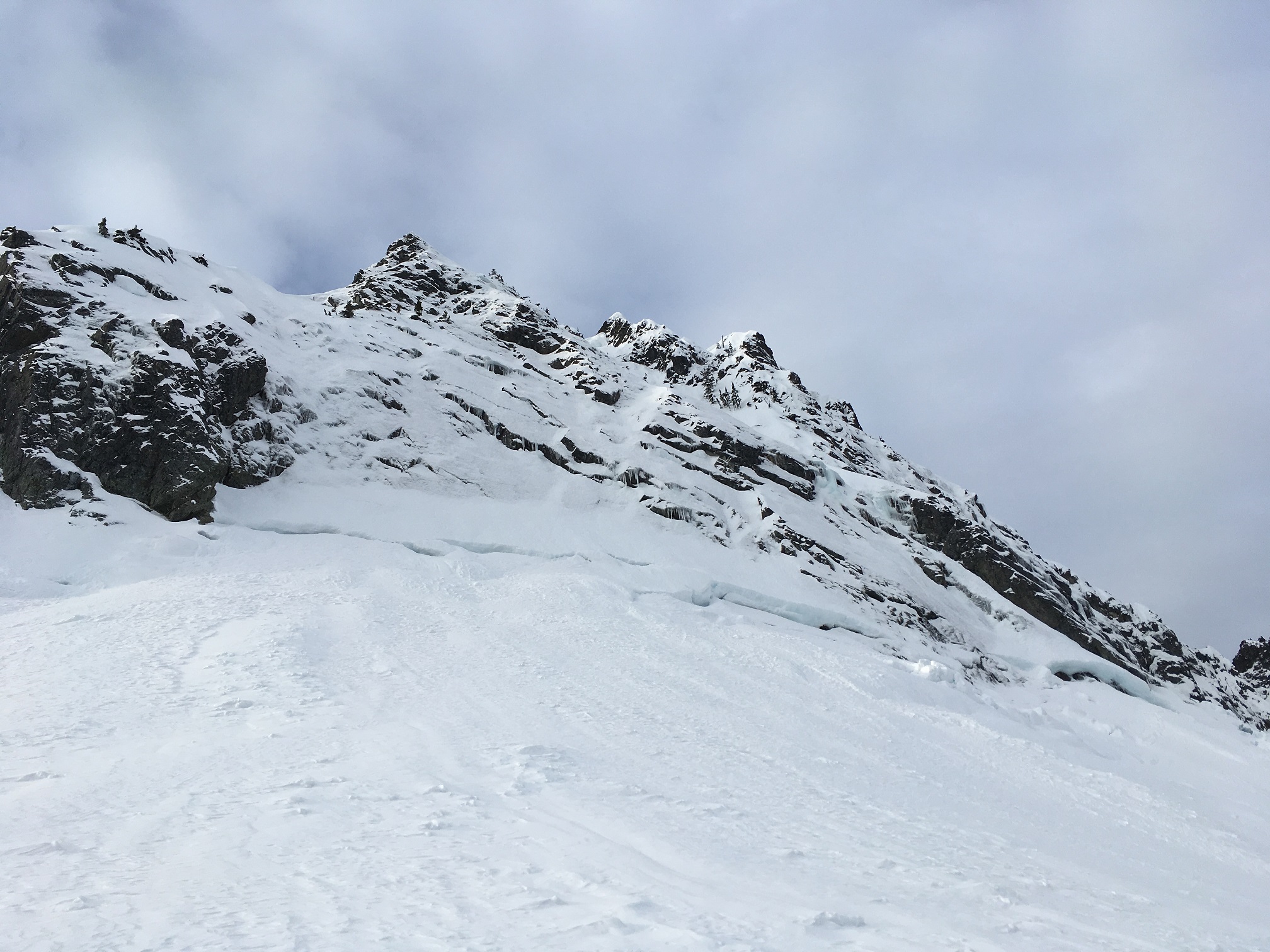
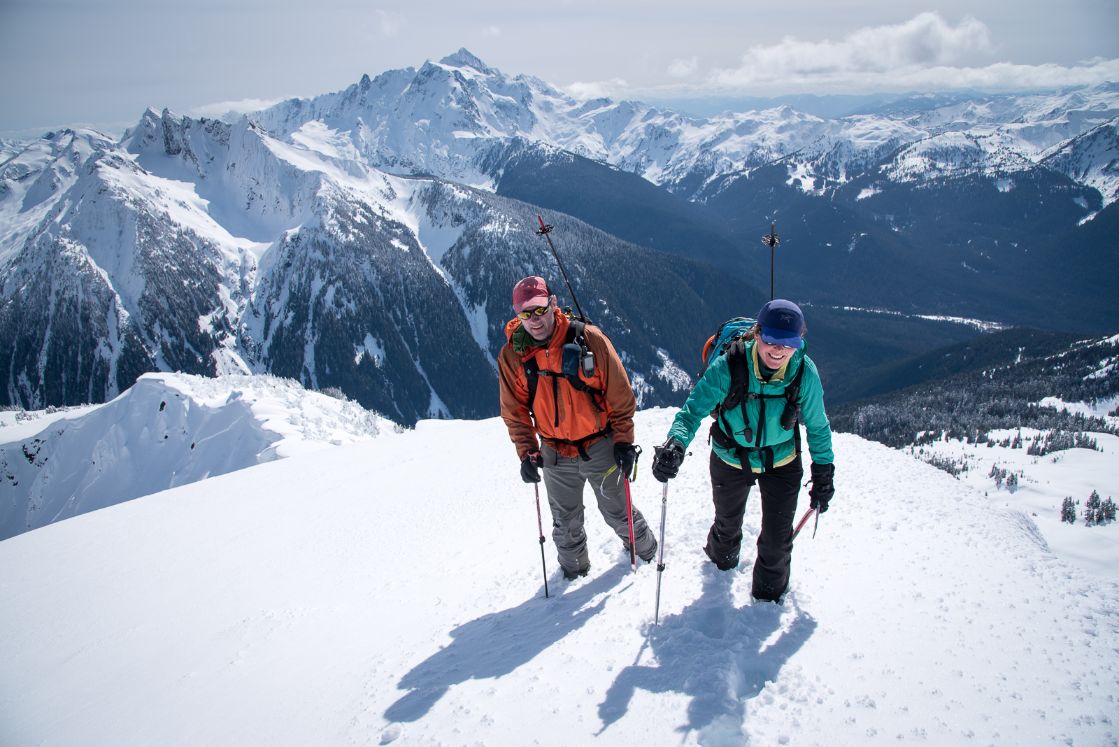
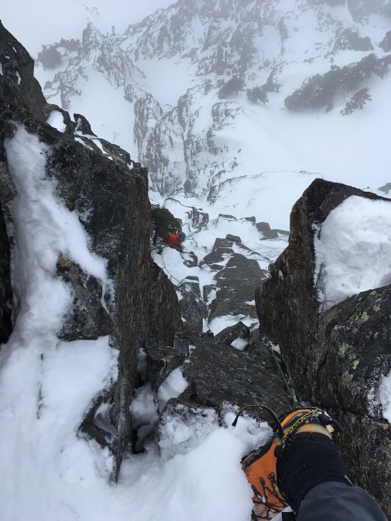
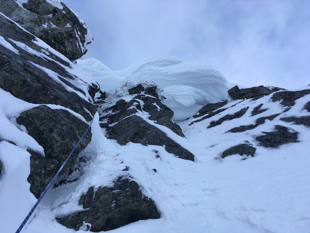
Trip: Chair Pk - NW Ridge Trip Date: 02/11/2018 Trip Report: More fun in winter I thought, especially with the amazing conditions. More alpine ice well adhered to the rock than I've ever seen in the Snoq area, neve even! Don, my long time climbing partner, and I had a blast in this puppy yesterday. The last 10' of the first pitch gaining the ridge was a good opener. The second pitch we traversed on the south side of the ridge up to a small notch with a chockstone, then up a short runout slab then a downward traverse to a small tree belay on the right. The third pitch went straight up to a steep hard (for me anyway) chimney topping out on the crest. Fantastic hooking! Running belay along the sharp crest and on to the top. I hope folks got out and got some in these incredible conditions! Left side of N face (yep, that's all good alpine ice and neve!): N Face route: 1st pitch top out: Don on runout slab (red dot), belay tree barely visible down and right: 3rd pitch: Looking down 3rd pitch top out: Running belay toward top: Gear Notes: Rock rack, no pins or screws needed Approach Notes: Casual, no floatation needed/wanted


 6 points
 -
Trip: Morocco, South Africa - multiple Trip Date: 12/30/2017 Trip Report: Africa Sampler Got a chance to do two Africa climbing trips this past year: two weeks in Morocco in May and two weeks in South Africa over Christmas. Polar opposites and not just in their location on the continent; the climbing in the two places could not have been any more different: bolted cracks vs. trad protected faces; well-traveled limestone vs. overgrown sandstone; easy approaches vs. steep bushwhacks; lots of climbers vs. none; sweet tea vs. booze. In Morocco, we checked out Taghia (pretty place but the really stunning lines were too hard for us) and Todra (less dramatic but with more moderates); in South Africa, we stuck to the Western Cape Province. We knew that Morocco had big walls with long climbs but were surprised to find 500 meter tall faces in the Western Cape. Morocco was easily self-organized. South Africa would’ve been as well until I stumbled onto a website describing some long traditional climbs in places I’ve never heard of. Ended up hiring the admin of that site and longtime local climber, Ross, to be our “fixer” – take us to those obscure gems but let us climb them on our own. Both places represent the easier shade of Africa travel – no coup d'etats, no jihadists. Though a community Facebook page called “Snakes Of South Africa” – where the good folks share their serpent run-ins – had us paranoid to the point of buying “snake gaiters”. People do get bitten and some die every summer in SA, particularly in rural areas. No mambas in Western Cape but almost everything else on the list. More spray and more photos on our site. Morocco South Africa Some Pics: Arriving in Marrakesh: Roadside eatery. Key beta: bring Tabasco sauce (family sized bottle is best). From Marrakesh, you drive 3ish hours into the Atlas Mountains where the road ends in the village of Zaouia Ahansal. From here, you hike 2 hours into the village of Taghia while a donkey carries your gear. First views of the climbing. Hiking through Taghia village to the climbing. Next day we climbed what is probably the easiest route there (6 pitch, 6a+) called La Reve d’Aicha. Looking up at Paroi des Sources (left) and Taoujdad. Did the first 4 (of 8) pitches of this l’Allumeur Du Reve Berbere route. Bailed off as it was baking in the sun and already plenty hard for us. Berber bridges. Some light canyoneering on a rest day. Views of Taoujdad. An 8 pitch line called El Geonauta on Taoujdad. Which features some spelunking. Arriving on the summit of Taoujdad Weren’t super thrilled with climbing in Taghia (hard) and so we decided to relocate to Todra Gorge. Apparently the scenic way to do this is to hike across the Atlas Mountains (35+km or about 12ish hours) which then puts you within a 2hr taxi ride of Todra. This unlucky donkey got to carry our junk on this little hike. A Berber family doing their own high mountain crossing. I woke up feeling sick the morning of the hike and so was dragging ass behind the donkey, his owner, and Shirley…have not suffered like that in a while. Village of Oussikis on the far side of the hike…Alhamdulillah!! Storks nesting atop a minaret of a mosque was a common sight. Town of Boumalne on the drive to Todra. We stayed in a guest house outside the gorge in Todra. The owner’s son is a climber and actively putting up new routes. But we were the only guests. An aqueduct at the mouth of Todra Gorge. Starting up a route called Tiwira, 6 pitch 6a+. Some views. Hiking off. Checking out the local Kasbah. Voie Abert climbs this pillar inside the gorge in about 8 or 10 pitches (6a+). High on the route. A large and old Kasbah Ait Benhaddou near the city of Ouarzazate. More Kasbah sights. At a roadside café. Maybe I cannot onsight Taghia’s 6b+, but I can sure put away watermelon like a mother… Souk in Marrakesh. Cat selling gold in the souk. Animal abuse at the Jamaa el Fna square in Marrakesh. Welcoming alcohol back in our lives during an overnight layover in Amsterdam. Amsterdam. And Amsterdam (man, those black shoes totally clash with the outfit). Shirley looking for a toilet during a long layover in London on the way to Cape Town. Arriving in Cape Town with Table Mountain in background: Final portion of a 3h approach to a route called Mooloo Face the following day – prow of the buttress visible at the head of the gully. 20+ pitches per description but easily linked into <10. Stretching our 70 meter cords and linking the first handful of pitches. I’m near the top & Shirley is belaying below. Photo by our “fixer” Ross. Arriving on top. Jonkershoek Twins (home of Mooloo Face). Freshly shed Cape cobra skin seen on approach. Hiking into Duiwelskloof with 500 meter walls towering above. We’d spend two nights there and climb a long (18 pitch) route called Lucifer the following day. Low on Lucifer the following morning. Shirley on Lucifer with Devil’s Tooth in the background. Crux of Lucifer. Note the 2 micro cam belay anchor. Very trad: ~500 meters of climbing and only fixed shit we saw were 2 ancient pins (2 more than on Mooloo). Money traverse pitch high on Lucifer. Shirley on the upper third. Hike off from the top was loooong but scenic. Kind of like Resolution Arete but with more time spent on top of the wall traversing rolling summits to access the descent gully. Ready for a beer. Snakes were never far from our minds. Did a bit of sightseeing during a 2 day break over Christmas. African penguin at Boulders Beach. Table Mountain from Cape Town. Some cragging at a place called Paarl Rocks – a collection of large granite domes sitting on top of a large hill. This is an area classic called Sands Of Time (4 pitches and about 5.9). Shirley and I on pitch 3. Photo by Ross. Did 2 routes in this here Yellowwood Amphitheater of Du Toits Kloof Mountains. Crux of a route called Lekker Time. Photo from the base by Ross. One more from Lekker Time (Afrikaans for Good Time). Four evening’s worth of sending. For the final climb, we hiked up to one of the Apostles (buttresses) of Table Mountain to climb Slangooli Frontal route. Morning approach. Ho-hum climbing mostly but with great views. A bit of vertical bushwhacking. The scenic hike down. Cape Town sights. Gear Notes: Bring Tabasco esp. for Morocco. No trad in Morocco (where we went); Mostly trad in Western Cape. Approach Notes: A mixed bag.6 points
-
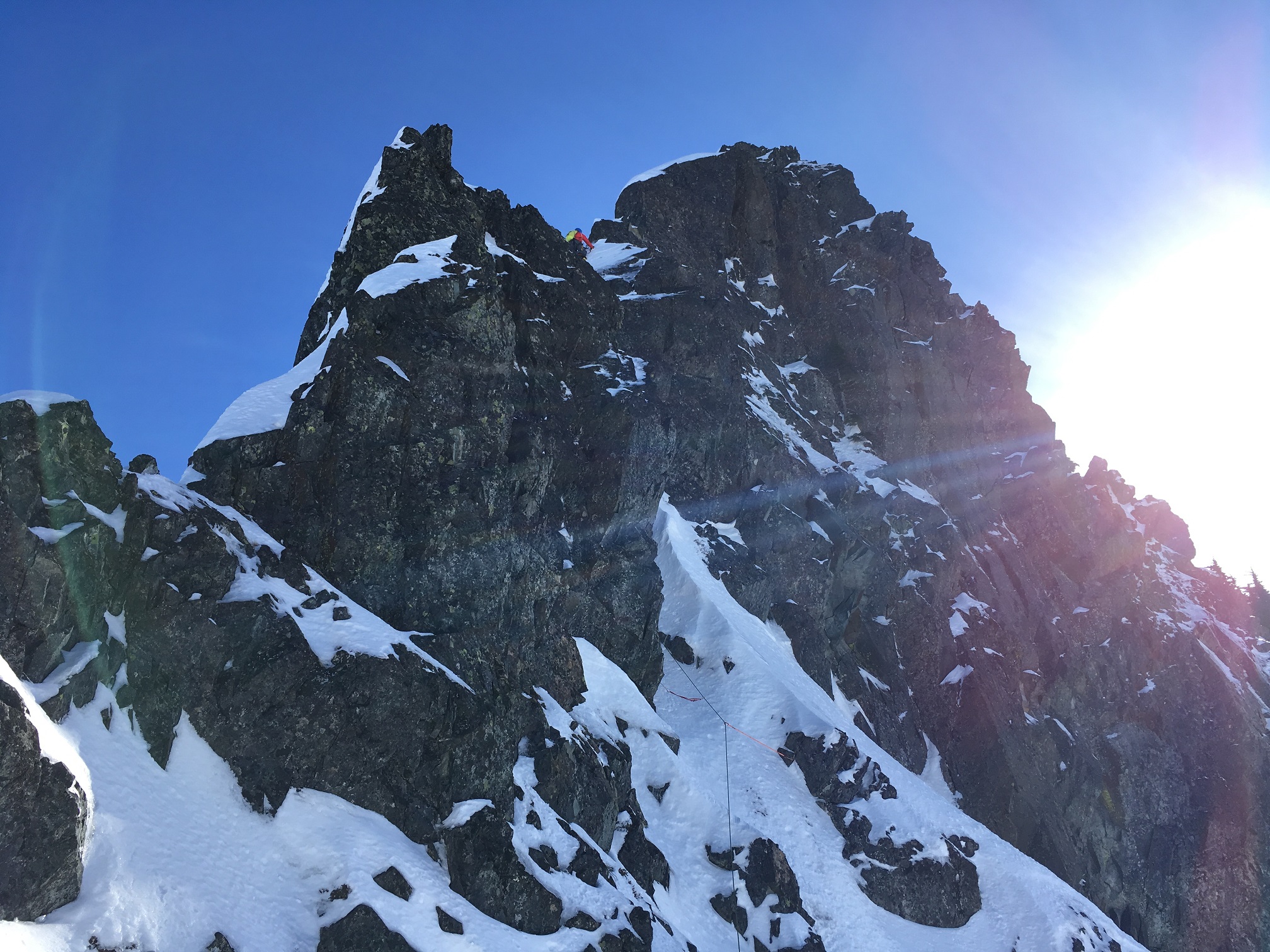
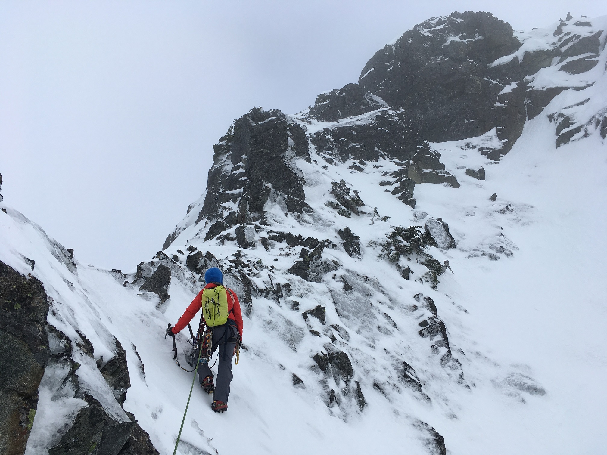
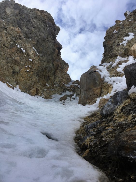
Trip: snoqualmie mountain - possible fa: the turf testament Trip Date: 03/31/2018 Trip Report: marko and i went kickin', scratchin', 'n stabbin' yesterday and unearthed a previously unheralded book of the bible: the turf testament. start a few hundred feet up the slot couloir at the large right facing book. pitches 1-2: two 60m pitches up rock & turf in the corner and some thin ice on the right face. pitch 3: climb a short corner, move easily left to the next book, & climb it to tree belay (<50m). [pitch 3 alternatives: a. possibly rightward escape on a treed ramp (may dead end on the ridge bordering the slot), or b. finish directly up very difficult looking roofs above.] pitch 4: climb up shallow right facing book with overlaps to difficult exit moves overlooking the roofs directly above the second belay (30m). [pitch 4 alternative: straight up through a short squeeze chimney to a difficult looking roof in main corner.] hike up the ridge between the slot and crooked couloirs to the summit rock band. pitch 5: up central chimney/gully to exit immediately left of cornices (30m). a pretty good photo of this route appears in martin volken's "backcountry skiing: snoqualmie pass". the route is very obvious to anyone skiing the slot so i would not be surprised if it has been climbed: any info would be appreciated. the route cannot be seen from the start of pineapple express. however, a party could climb the first 4(?) of p.e., then scope the route from there. if interested, they could cross the slot to the turf testament. if not, continue up p.e. are you ready to testify? Gear Notes: rock gear to 4"; screws to 13cm (for us); your choice of turf gear; a few pins (not used) Approach Notes: best via standard approach to nw face. dropping down the slot may work but has drawbacks (can't scope the route, pissed off skiers).5 points
-
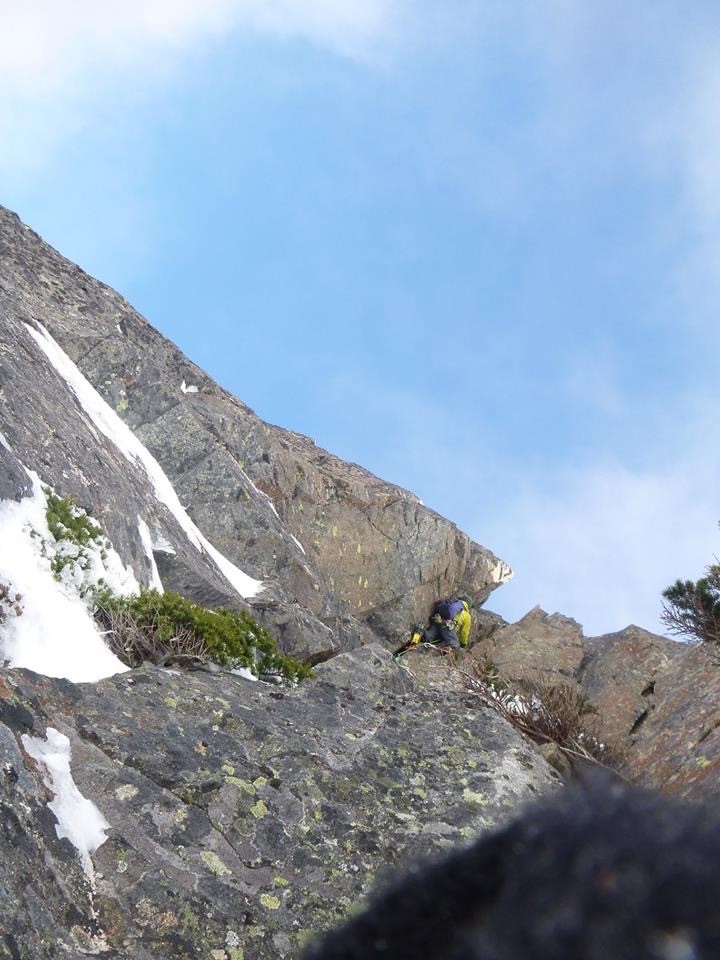
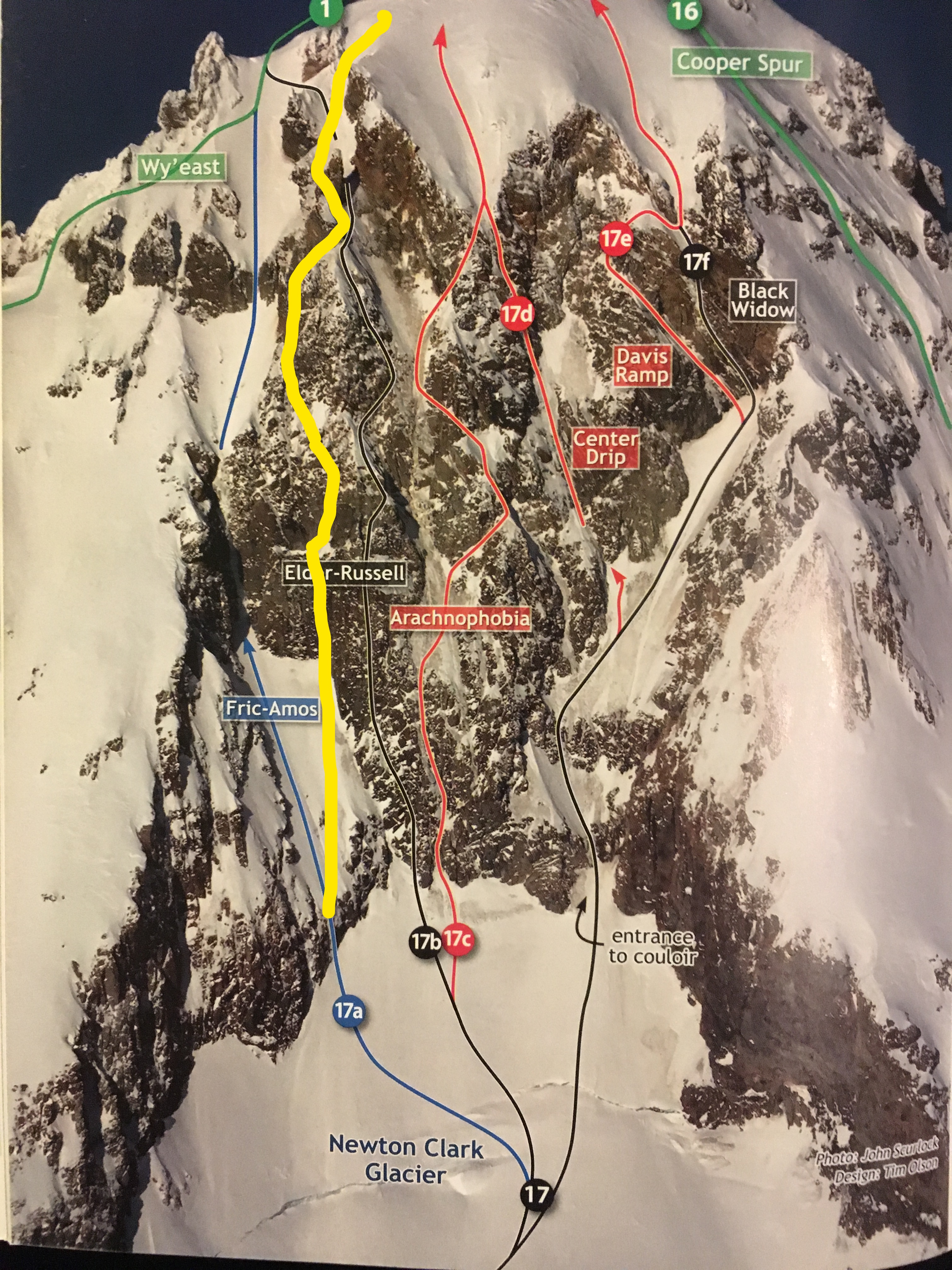
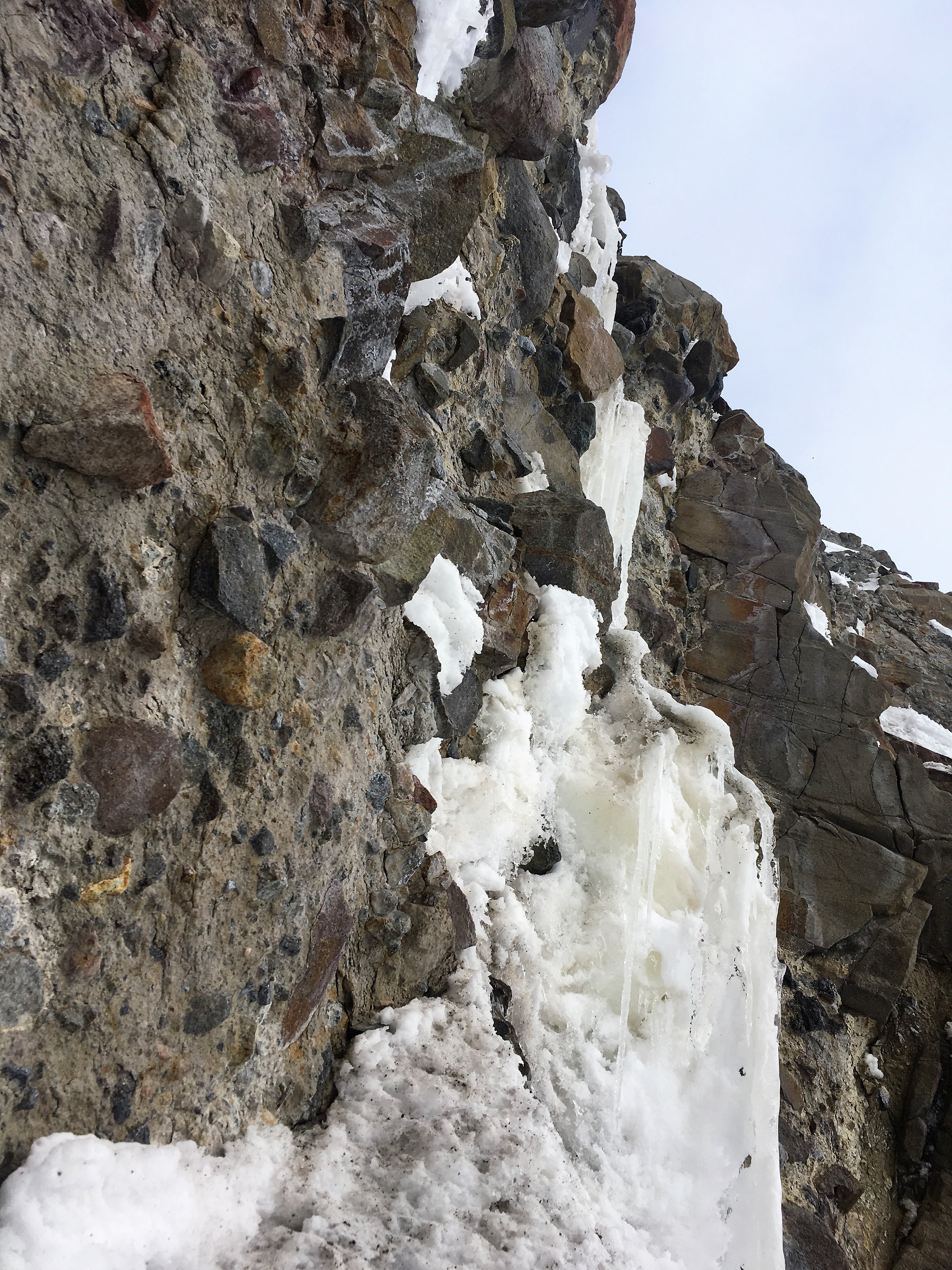
Trip: Mt. Hood - Three Little Monkeys - New Route on The Black Spider Trip Date: 03/31/2018 Trip Report: “Three Little Monkeys” New Route on the Black Spider, Mt. Hood OR WI4+ M5R Michael Getlin and Walter Burkhardt I was chatting with Wayne a few months back and he mentioned that there was some unclimbed potential on the left side of the Spider. A quick scouting mission showed a beautiful and long ice line between the existing Fric-Amos route and the Elder-Russel summer line. A fat long ice line it was not, but it seemed to have smears in all the right places so we gave it a go. We left Timberline at 5am with perfect high cloud cover that promised to keep the sun off the east-facing, concave wall. We crossed the bergschrund at 8:15 and started right in on what we thought would be the crux pitch. A few vertical mixed moves brought me to the hanging, detached ice dagger which proved fragile and delaminated. It was a type of fragile water ice climbing that I have never seen on Mt. Hood. It was strikingly similar to the first pitch of "Mean Streak" in Cody (we bailed). WI4+ (Not Mt. Hood grading) I brought Walter up and then set off to try and connect to another hanging dagger directly above but huge unsupported snow mushrooms guarded it. After sending one down on Walter I decided to try right. This proved to be the crux pitch of the route as rotten snow over near vertical mud lead to two distinct vertical mud chimneys. The second one was protectable, the first was not. It turns out though that in a pinch, the rock/mud takes decent sticks. Several times when I thought I was getting in trouble, I just wailed away at the rock face and my picks stuck like magic! Gotta love volcanoes. M5 R For the third pitch I jogged left again, trying to get back on the plumb line which proved a good guess as we found sound rock with interesting mixed moves and wonderful water ice that took good screws. WI3 M3 After bringing Walter up, I climbed up a narrow ice gully hoping to veer left and drop into the upper bowl through which the Fric-Amos route finishes. At this point it was getting late and we were looking for a quick exit. But to my surprise the bowl was guarded by a vertical snow fin that would have involved about 50 feet of unprotectable down climbing, so I veered right and then straight up, finding a path through wild gold-colored gendarmes that rose like turrets over the upper face. We popped into the sun and knew we were home free. WI3 In all we climbed five full length pitches, the last of which was mostly steep snow. I was lucky to share this experience with Walter. He was a great mentor to me when I first started going to the mountains and I owe him a good deal of credit for keeping me safe and motivated over the years. Note: In retrospect, it’s worth mentioning that the face was pretty dry when we climbed it. The start or Arachnophobia and the visible parts of the center drip looked more like rotten snow than solid alpine ice. I think when the face is fat, the line would be a very reasonable outing. I was surprised at how direct, steep, and sustained it was. I would love someone to give her a go in better ice conditions and see if that little kink in the second pitch could be ironed out. Our line in yellow Looking at the start from below - the face seemed dry to me but it was my first time up there so I don't really know. Approaching the line (Straight ahead) Mid way up the first pitch Walter Following P3 Looking up at the start of P4 Gear Notes: We brought a single 60m, 2 Pickets, 5 screws, 4 pins, and 4 cams (.5-2). We could have used a few smaller cams and a rack of nuts would have been nice Approach Notes: Timberline to top of palmer. Dropped our skis and crossed the white river at about 8800ft. 3:15 car to schrund in good conditions.


 5 points
 -
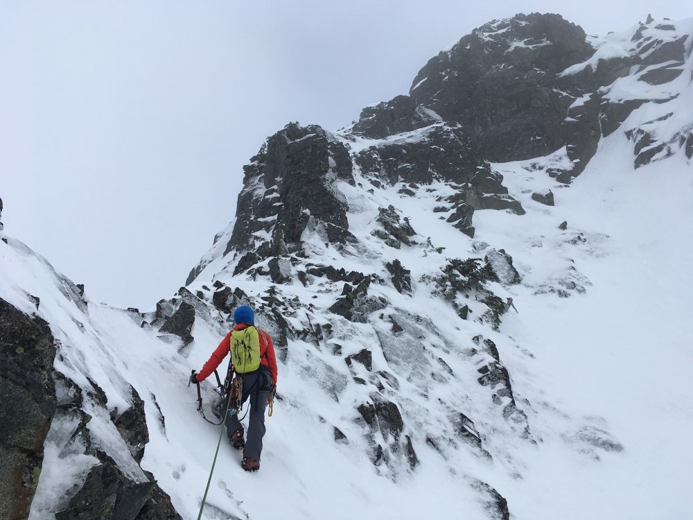
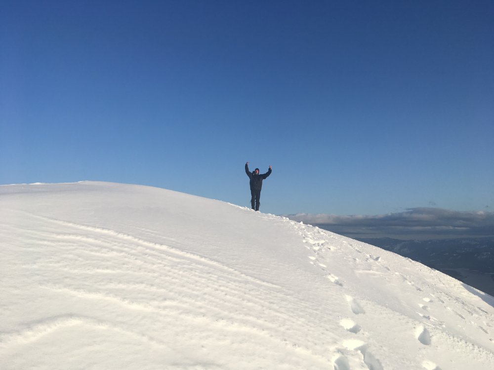
Trip: Dragontail Peak - Triple Couloirs Trip Date: 04/30/2017 Trip Report: The start of the spring alpine season has me thinking back to last year when I climbed the Triple Couloirs route. I had a blast climbing this route, for sure the best day I had out that season. I thought others might enjoy hearing about my adventure and perhaps find some of the tactics I used to go fast on the approach and route helpful for their own adventures, should we see a repeat of those perfect conditions again this year. With a young family and 9-5 job, I don't have much time for alpine climbing, and not much tolerance for risk either. And so I find myself doing less and less climbing and doing more trail running. It is just easier to slip out at nap time or after the kids are asleep and run around in the mountains for a couple hours. But, still a climber at heart, I keep a tick list of dream routes and make it a habit to monitor conditions throughout the season, 'just in case'. And so it was that, on the train to work one rainy April morning, I came across a great TR about a team who had third-classed the Triple Couloirs. I figured it would be out of condition before I found time to climb it but nevertheless, started checking weather forecasts for Leavenworth and formulating a plan. The following Saturday I'd hoped to ski up Baker with a buddy but the weather was terrible so we decided to postpone the trip. Then at nap time I checked the forecast for Leavenworth again and, to my surprise, Sunday looked really good. With the blessing of my better half, I packed up some gear and, after dinner, headed south in the driving rain. The plan was simple: Bivy, run the approach with a light pack, climb the route, run the descent, get back to Vancouver in time for dinner. But would it work? The skies cleared as I descended down towards Leavenworth and I had a nice, albeit short, bivy in the car. Awake and brewing coffee by 3:00am, I left the car just after 3:30am with trail running shoes on my feet and a very light pack. My pack contained boots (the original and still awesome LaSportiva Trango Ice), Grivel G20 crampons, Nomic ice tools (not the best choice for a route like this but it's all I've got), helmet, extra clothes, food, water, and some emergency gear (including inreach). Going superlight allowed me to run most of the approach. Normally for winter soloing I like to carry a rope and light rack so that I can bail if an ice tool or crampon breaks. For this route I chose to leave this stuff behind because the route looked to be in easy condition, down-climbable should equipment issues arise. I promised myself I would abort the climb if I came across unexpectedly difficult terrain. The road section of the approach, from the gate at the highway to the summer trailhead, passed easily at a light jog. About halfway up the road I passed a cougar sitting beside the road. This was my first encounter with such a big cat and, alone in the pre-dawn darkness, I was a bit spooked. I walked a good ways until I was sure I wasn't being followed, looking over my shoulder every five seconds and wondering how quickly I could get my trusty Nomics off my pack should I need them for self-defence. From the summer trailhead, the route up to Colchuck Lake was well packed and easy to follow. I arrived at Colchuk Lake faster than expected, around 2:30 after leaving the highway. The route looked absolutely incredible! At the end of the lake I geared up for the climb and stashed my running shoes and poles under a tree. Traveling on firm snow, the climbing above the lake was fun and easy. At the first couloir I met a team of climbers who had put in a nice boot pack up to that point. I continued up to the narrows, which would be the 'go/no go' point of my climb. Conditions in the narrows were as expected - firm snow and bits of ice, just a joy to climb. And so I continued upward and on into the second and then third couloirs. I didn't climb particularly quickly, it was just too much fun to rush through, plus it's not a place you'd want to take a tumble. But with a light pack and no gear to place the terrain passed by quickly and all too soon I was climbing out of the third couloir and into the sun. I reached the summit just a hair under the five hour mark. I could have spent the rest of the day napping on the summit under the warm sun but the plan was to be home to help with dinner so after a few minutes it was time to get moving again. The descent looked straightforward and indeed it was. Thirty minutes after leaving the summit I was back at the lake, chatting with a fellow Canadian on his own solo adventure. Above us I could see two teams on the Triple Couloirs. We were all enjoying a perfect day in the mountains. I changed back into running shoes, added microspikes for the descent, and bid adieu to Dragontail Peak. The descent back to the car made for a fun trail run. I passed some skiers partway down who were slowed by the icy conditions on the trail. For sure trail runners and microspikes were the fastest (and most fun?) way to travel on that terrain. Below the summer trailhead hikers were heading up the road in shorts and t-shirts under the warm mid-morning sun. The alpine world I had just left already felt like a distant memory. Was it just a dream? I arrived back at the car at 11:00am for a round-trip time of 7 hours 26 minutes. It had been an incredible morning of trail running and climbing. No suffering, nothing particularly risky, just uninterrupted flow in the mountains. After a sandwich and espresso in town, I hit the road back up to Vancouver, arriving home just in time for dinner. Gear Notes: Small pack with just the essentials Approach Notes: Bare ground and packed snow. Trail runners ideal, better to carry the mtn boots in the pack.5 points
-
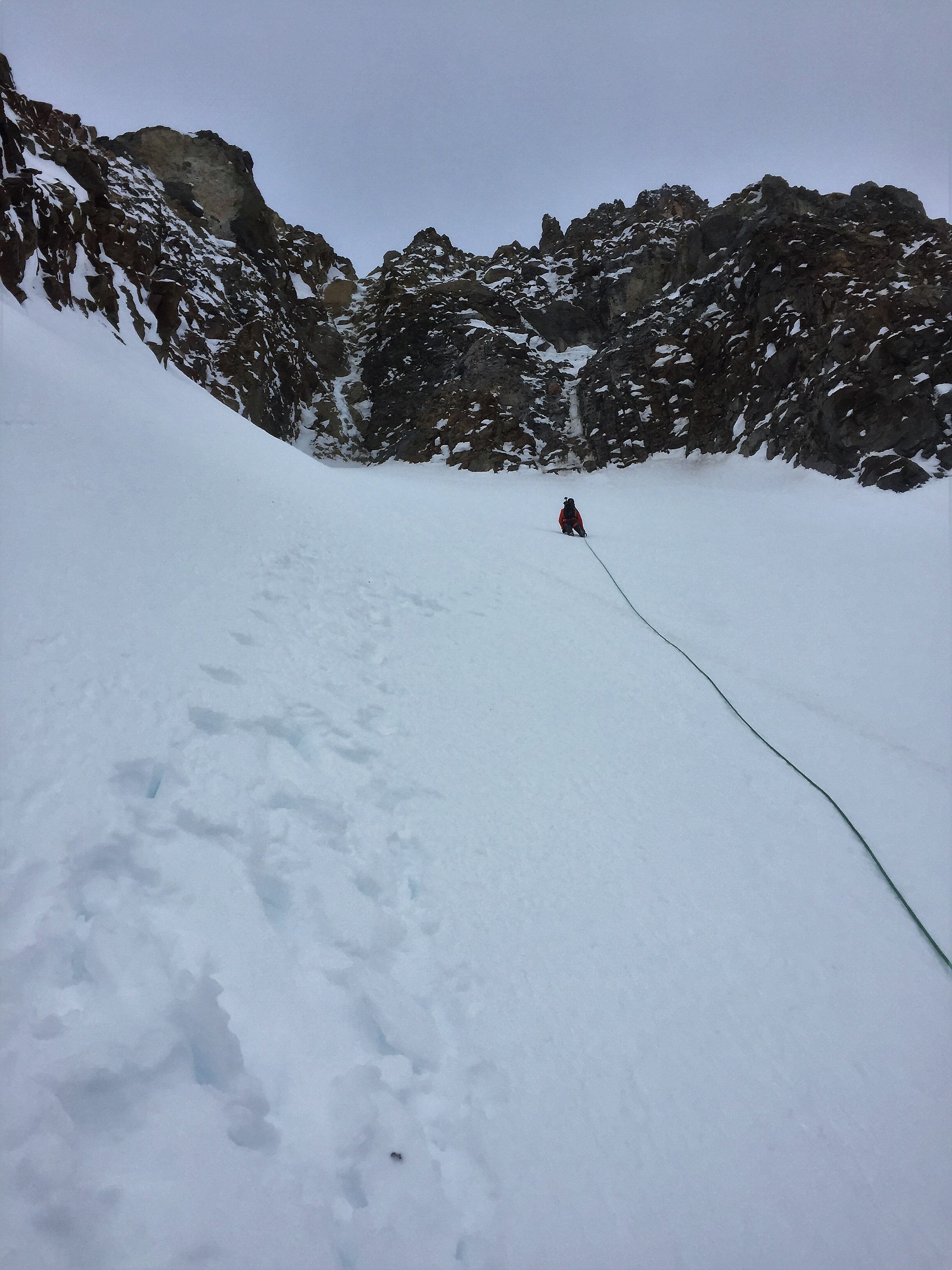
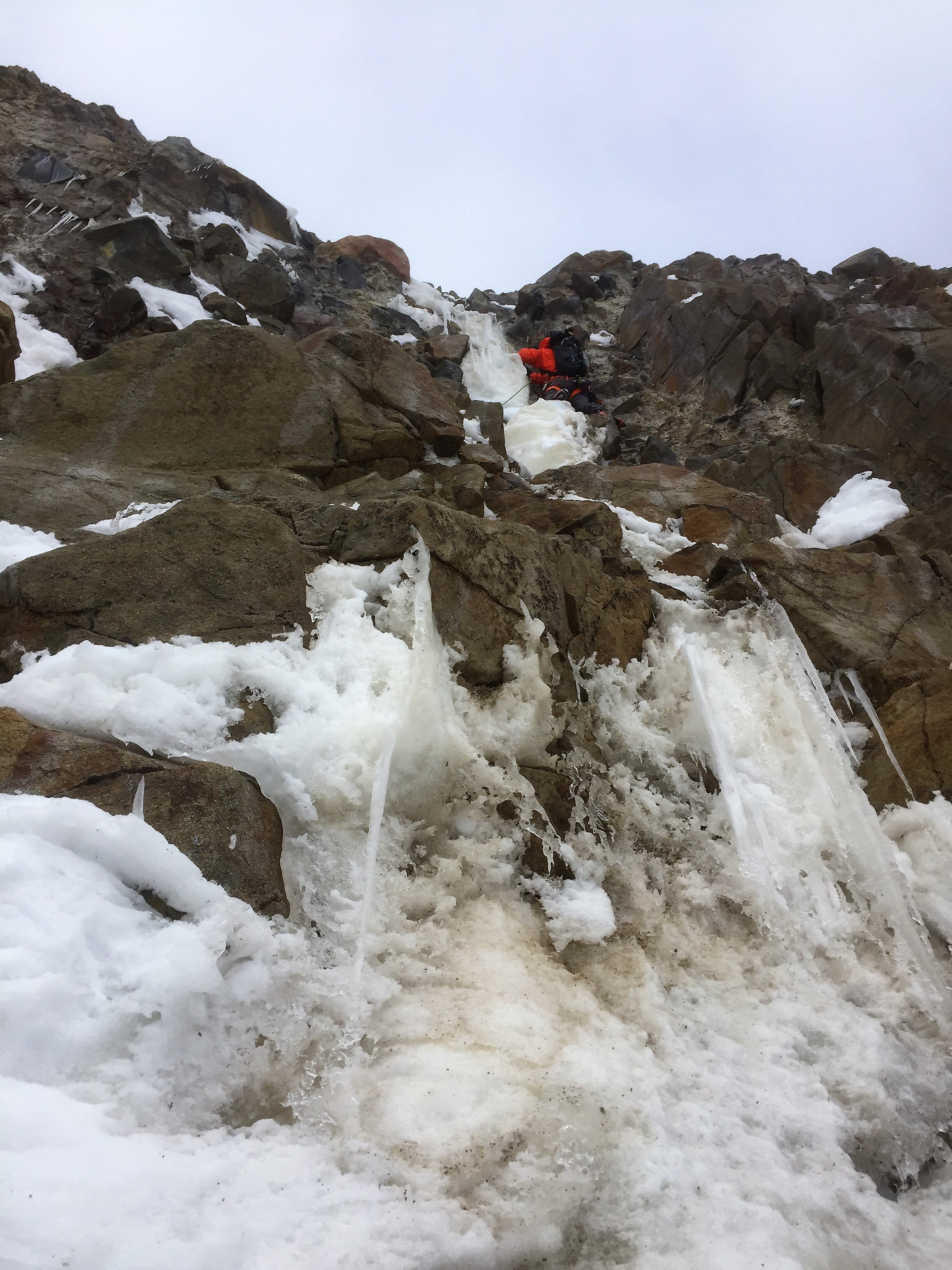
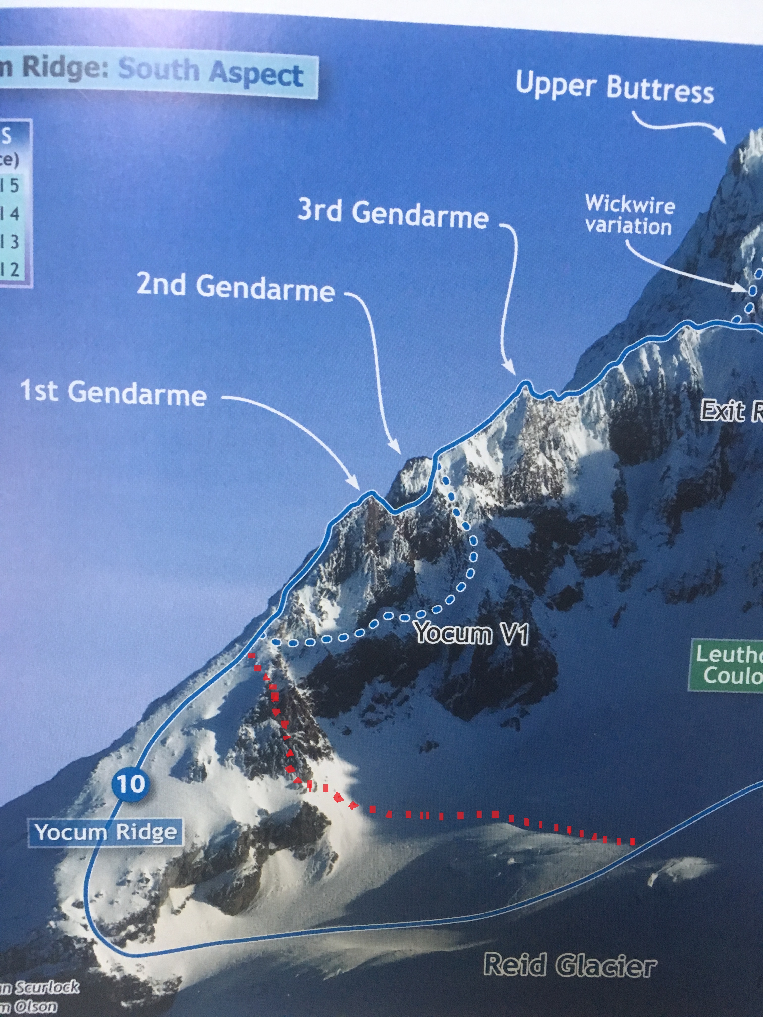
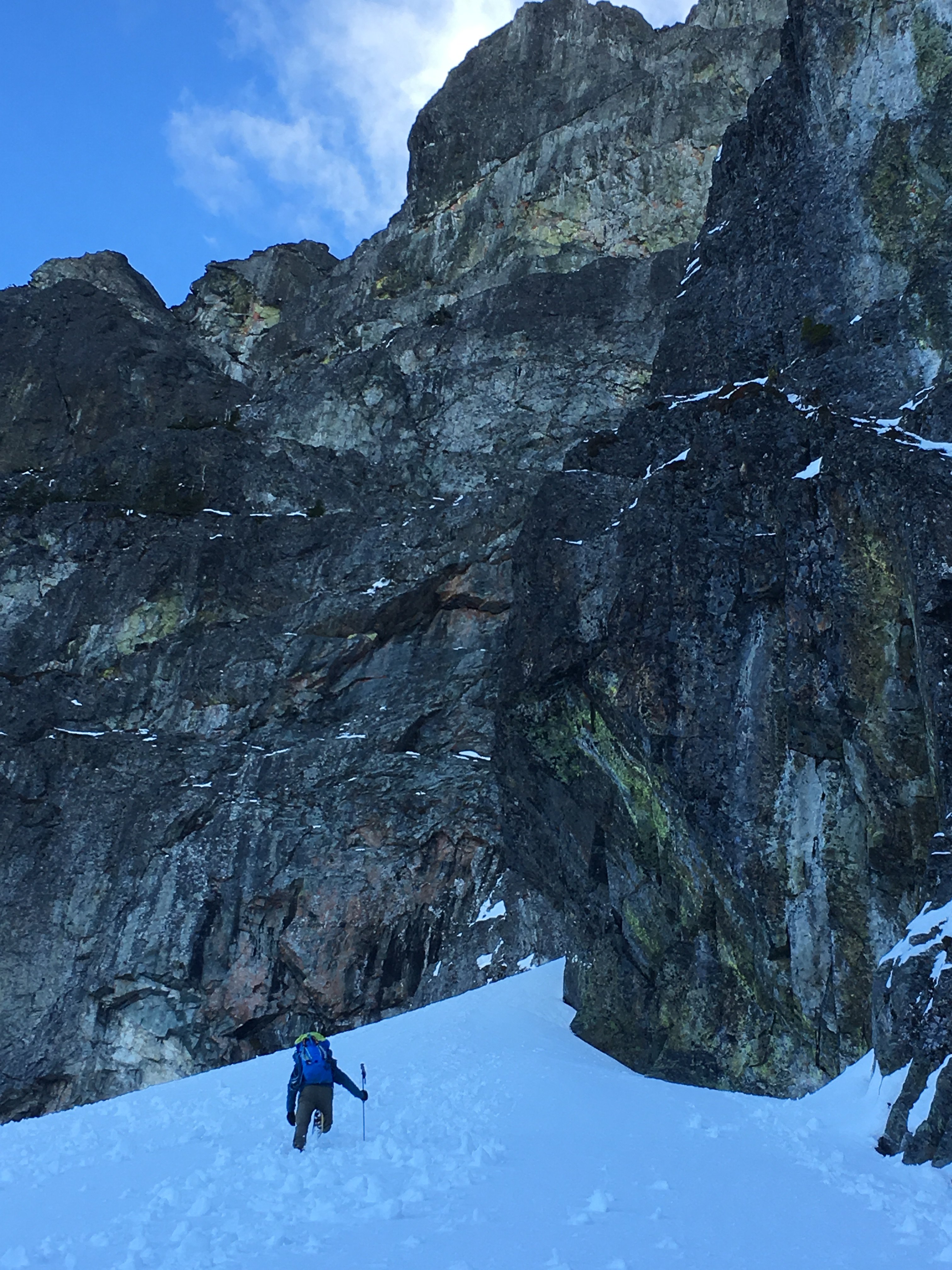
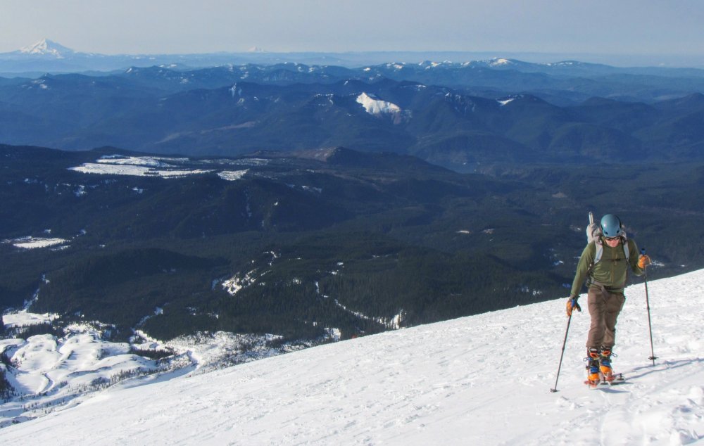
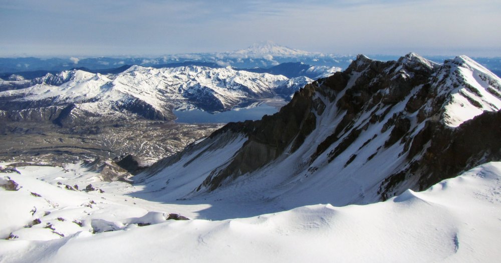
Trip: Mt Hood - Not Yocum Ridge (New Variation) Trip Date: 02/10/2018 Trip Report: I had to share this one for entertainment value.... Jacob and I have been poking at Yocum for a couple years now with very little (read none) success. After a very thorough study of weather patterns that lead to climbable conditions in the past, and a close look at my own weather notes over the years etc, I had determined that yesterday (Saturday) was the perfect day. We set out at a leisurely pace from the parking lot a bit after midnight and dropped our skis at the top of Palmer. The entire mountain was covered in a thick sheet of ice. It was PERFECT conditions for the more eccentric Mt Hood routes and we thought we finally had it in the bag. The slope going down from Illumination Saddle to the Reid would have taken bomber ice screws. It was nuts! As we crossed the glacier and looked up at the ridge, Jacob pointed out what he thought were the first, second and third gendarmes barely outlined against the few visible stars on a moonless night with intermittent cloud bands whipping through. I very confidently corrected him and showed him the first gendarme a little lower down the ridge. We soloed up to the base of what I thought was the first gendarme, hacked our a little belay ledge, and racked up. Ready to head-lock this beast, I confidently cruised straight up the gut of the feature in a steep mixed gully. The climbing was moderate and I had run out about 70 feet to a vertical mixed step above which I had spotted what looked like a good cam placement. Just as I was testing a pick placement (that of course failed and pulled a large chunk of rime off), my fancy, fully-charged Petzl smart headlamp died out of nowhere. Dark doesn't even do justice as a description. After about 3 minutes of positive self talk (read "calm the f*&^ down Mike") I blindly grabbed a sawed off 18" picket off my harness and started alternating between hitting it and my thumb. With unsettling ease, I placed it, clipped it, and started down climbing. Back at the belay, after a robust bout of barfies and armed with a working headlamp, I headed back up into the maelstrom. The pitch ended up being superb. Were it on a route, it would be a classic. It was complex and technical climbing on good rock with a wide variety of required skills and decent gear if one is a bit creative. The crux was an overhanging mixed sequence onto fragile thin ice but was reasonably well protected. After about an hour and a half and 65 meters, I set up a belay and brought Jacob up. Thinking we were near the top of the first gendarme, Jacob lead through around a corner to find a 500 foot low angle snow slope...leading up to the bottom of the first gendarme. In my haste, I had charged up the head wall on the south side of the ridge thinking it was the first gendarme. How I did this after years of studying this route is completely beyond me. I pride myself in good route-finding and in being well researched and prepared. But I made a rookie mistake by charging straight up when had I peeked around a corner 30 feet to my left I would have seen the whole route clearly, even in the dark. By the time we got up there the sun was out and the rime was falling. We new we were too far being schedule to send, so we soloed down the easy slope back to our start point. Before you head up, ALWAYS LOOK AROUND THE CORNER! Lucky for me Jacob has a sense of humor and headed back to Seattle satisfied to have done some interesting climbing while wasting a perfect weather window for a coveted objective. Good times! Anyway, I would like to add this new route variation to the annals of Mt. Hood climbing history. It goes at roughly 65M, 100 Degrees, WI-Silly, M-Notpayingattention. We'd like to call it the "Not Yocum Ridge" variation to the start of Yocum Ridge. Gear Notes: Pickets, Pins, Cams, Screws Approach Notes: Across the Reid
 5 points
 -
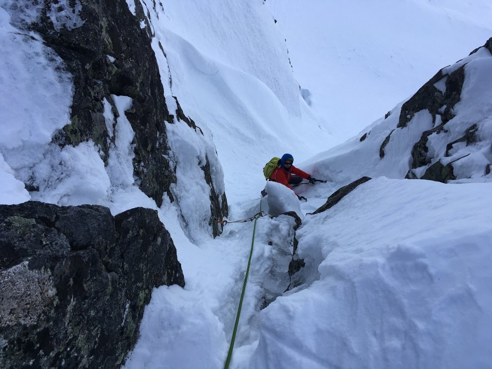
Trip: Dragontail Peak - Triple Couloirs Trip Date: 03/31/2018 Trip Report: Quick conditions update, for those of us that don't have facebook and like CC as a resource! Anthony and I climbed TC car to car yesterday. What little ice there is in the sections between couloirs was very thing, not well formed, and poor quality. We brought screws but didn't really place any (I think I placed one 10cm for the sake of it but it wouldn't of held anything). We climbed up the right side of the runnels which seemed to me to offer more rock pro, since the ice wasn't taking screws. Run out mixed climbing and lots of piton placing! The second pitch was the most sketchy; the start was a short section of fun with a thin smear of snice in an open corner that we climbed delicately, but pretty soon that turned into snow on a short blank face with no ice or snice to help. Forunately there was an old rapel tat slung around a horn that with some funky rock climbing was just in reach, and I swallowed my pride and used it as aid in desperation. With some ice, even just a little, it would have been super fun. The exit out of that section was also delicate and engaging. The third pitch was really fun with a neat bit that combined dry tooling, chimneying, and an exit onto thin delicate snice, followed by some uncoslidated snow to add to the spice. The pitch between second and third couloirs was the least difficult I think, but by then the lack of sleep was catching up and I found it harder and more awkward than it really should have been. Overall the snow quality was great. The wind was calm and the views stellar, and it was cold enough but not too cold! A second party just ahead of us climbed up the first couloir a bit then traversed over and rapelled into the top of the 2nd runnels pitch. Thank you to them for kicking steps! It was a really fun day out and the hardest mixed climbing in the alpine I've done so far, and while there were some rather scary and run out climbing, I had so much fun. I've come to the conclusion that if you want to climb winter/spring alpine in the Cascades, you have to get comfortable with mixed climbing, as its just too damn hard to reliably find ice. Photo of N Face: Gear Notes: We brought set of cams from .01-1, a set of stoppers, 5 knifeblades/bugaboos, 1 lost arrow, and (2) 10, (3) 13, and (2) 16 cm screws, and 2 pickets. We used all the KB's/bugaboos, all the cams from 0.2-1, and a selection of the smaller stoppers at some point, and the pickets as the anchor at the top of the crux pitch exiting 2nd couloir. Approach Notes: Trail is well packed5 points
-
Trip: Snoqualmie Mountain - New York Gully Trip Date: 03/16/2018 Trip Report: Jacob and I scratched our way up New York Gully yesterday. With visions of grandeur, i carried a full aid rack and bivy gear up there to try the upper head wall. With no prior knowledge of the rock type, this seemed totally reasonable. In reality, it was not! No wonder there's a beautiful unclimbed wall less than two miles from a 12 month parking lot. Anyway, the route is one of my favorites I've done in the range. We even placed an ice screw! Gear Notes: Waaaaaaaaaaaaaaaaaaaay too much. A run of cams, a few pins and a screw would have been plenty. Approach Notes: Armpit deep

 5 points
 -
Really sounding like a grumpy old man here, dude. When someone loses a friend or loved one do you tell them to not feel sad? I don’t know how you feel all the time, and it’s none of my business. The feelings police don’t have any solid ground to stand on. Empathy. Only good that can come from this type of thing. If you feel sad, that’s fine, if you’re surprised, concerned, heartbroken, totally okay. If posting on the internet helps you, go right ahead. No one can judge the appropriate level of grief for another person. All that you have to give is compassion and love. I dont feel feel very good right now, and I feel like many others are feeling the same way. Take care everyone, and I love all of you that make up this community.5 points
-
Trip: Hidden Lake Lookout - Winter Route #2 Trip Date: 02/10/2018 Trip Report: 2 miles from the trailhead was as far as the Toyota Tacoma would take us. The snow on the road that early in the morning icy enough to pull your car in directions you don’t want it to go when the road is only 12 feet wide. We decided to get an early start and ended up being the first group starting the trail at 7AM just after first morning light. After weighing our options we decided the weather was good and we started early enough to try a route neither of us have done before. Patrick got a GPS route from a skier that had done the hike a few weeks earlier using the Gaia app on his iPhone, isn’t technology great? We kept a map just in case but didn’t end up needing it due to our GPS giving us perfect signal the entire time. About a mile before the trailhead we started heading straight up through the trees. This route was great because, even though it’s steeper than the normal winter route, it’s more straightforward and cuts out some mileage. Our legs kept us pumping through the dense forest up to about 4800 ft where we decided to strap on the splitboards and continue ascending. Skiable snow starts at about 4200 ft as of right now but it was rock hard first thing in the morning. After getting above the trees at around noon a snack break was long overdue and we decided the view of Hidden Lake Peak was a good picnic spot. It was an incredible day, not a single cloud in the sky overhead and no sign of bad weather moving in. We got to the saddle shortly after and debated our options, a high traverse of the saddle and risking some cornices falling on us or a low traverse and adding another 30 minutes but having a much safer time. Avi concern was low for the day but we still tread lightly since the saddle is very seldomly touched during the winter. So we split skied as far as we could and rounded the ridge to finish our last part of the climb to the objective. We had to switch from split to A-frame and back a couple more times before we could strap in finally for the last part of the ascent. It was about 3PM when we finally reached the lookout with plenty of time to chill and settle in before sunset, the entire place to ourselves, the bluest of skies above us and the most beautiful view in the North Cascades within grasp. I love this place. I fired up the Jetboil and we restocked our water supplies with freshly melted powpow. As soon as the sun dipped over the Cascades we grabbed our Sony’s and started shooting every angle of the mountain range physically possible. The sky was on fire, I’ve never seen those shades of pink, purple and orange in such an incredible ensemble. A view like that will humble you unlike any other experience in life. We checked our photos and got some more stoke on the incredible sunset shots we took and then went to bed immediately. It was 20F in the cabin but our full ski get-ups, some fresh socks and our 30degree mummy bags kept us warm enough to pass out as soon as we hit the bed. And yes, there is a two person bed inside the lookout, maybe 3 if you’re feeling frisky. Anyways nature called me at about 8:30PM so I slapped my boots back on stumbled outside for a quick whiz. As I peered out into the darkness the sight of 5 headlamps stunned me. "What are they doing? It’s 3 hours after sunset and they just traversed the sketchiest part of the tour with headlamps." I beamed my 350 lumen headlamp straight at them and strobed it until it caught their attention and signaled back. So we left a light on to lead their way and I hopped back into my bag to wait for our new guests. The first dude rolled in shortly after, thank God they aren’t snowshoers. The group of 5 skiers and splitboarders were from British Columbia and did the Hidden Lake tour for their 3 day weekend. Needless to say we made some new friends that night, passing around the Fireball and boxed wine they so kindly hauled up the mountain and sharing our stories from the day. After a good nights rest we woke up to sunrise, boiled down some more snow and strapped back in. Said our goodbyes to the new homies and headed back down the icy slope back to the saddle. We hit a few patches of powder on the way down and decided to get a few shots of pow slashes with the breadth of the Cascades in the background. The skies were as clear as the day before even though the weather predictions called for 70% chance of precipitaion. It made this trip about as perfect as it could be for being so early in the season still. The descent was so awesome, we had untracked powder until the trees got too dense to even ski. Passed by a lone snowshoer that slept without a bivy just short of the saddle on a very exposed hillside, very stupid. I loved our route for the ascent but for the descent I’d say stick with the normal winter route, it’s much less dense tree skiing, only thing you have to worry about is not skiing past the trail back to the trailhead. To be honest the snow in the trees was awful. That early in the morning it was much too crunchy to enjoy but we leafed down back as far as we could, A-framed one last time and walked the remainder of the way back to the truck, ingesting everything that had just happened with some distance between us. This is my favorite place in the PNW, there is a reason most people don’t finish this winter objective, it’s rough and there’s a lot that can happen in such varied terrain as this. I hope this helps you get a day or 3 at the lookout safely with a good weather window. You need to do it whenever you get a chance. Stay safe out there. Check out my Insta @torrborrr Gear Notes: I stayed pretty lean besides the absolute essentials and safety items. Patrick took a 2 man tent just in case but I got away with a 30 degree bag and a warm puffy to spend the night in. Approach Notes: Snow started around 4200 ft and was rock hard first thing in the morning.


 5 points
 -
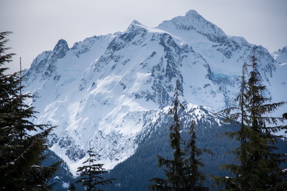
Trip: Hidden Lake Peak - West Trip Date: 02/12/2018 Trip Report: With @TorreyMoreno's recent TR on the HLL I don't need to say much on the conditions @Kitand I found earlier this week. I will say that the rime covering the peaks of the North Cascades is probably about as spectacular as I've seen. Pretty much the entire summit mass of Eldorado looks prime for new routes. Same with Dorado Needle, Forbidden.... everything. Wow! I hope someone was out getting after it. Really though, I know you all are mostly looking for glamour shots of Kit to get you through this work week. You came to the right spot. Early Morning Spire, Praying Mantis, Marble Needle, Dorado Needle (L-R): The Draughtpony gittin'er done: DAMN: J'Burg: Look at the ski potential of Mutchler! And Snowking! The Hidden Lake Lookout is plastered down there. And just a reminder that the lookout isn't on the true summit: Formidable, paging @skyclimb: Torment and Forbidden: What's App or it didn't happen: Dakobed: Weeeellllllllll, shoot. I thought I was going to work and look where I ended up? Better than expected on the way down: @Kit always packs his American flags: Gear Notes: Skis (+ski crampons), American flags, Hunter. Approach Notes: We parked the car at the USFS "washout", about 2.5 miles from the Cascade River Road, elevation 2500'. A 4X4 HC could have made it probably almost a mile farther before deep snow would force a stop. About 4 hours to the true summit, which is higher than the lookout. A bit over an hour down to the car. Much time and a few drams of whiskey on the summit.


 5 points
 -
Trip: Sherman Peak - Squak Glacier Trip Date: 01/14/2018 Trip Report: It's a little late for a conditions report but me Fred and Joel climbed Sherman Peak (the one on Baker) with skis/splitboard on 1-14-18. It took 15 hours with the 3+ miles of road skinning both directions. Conditions were actually really great except in the morning the sun/rain crust made for some hairy skinning until we got above around 6500'. Rain crust reflecting the sunrise: Skinning with ski crampons on, Joel decided to snowshoe the icy spots: We skinned more or less north up the ridge from the summer trailhead, using snow machine tracks where it helped with the trail breaking. Above tree line there was a solid crust, sometimes icy, but we never had to break trail again. By the time we were headed off the summit, about 2pm, everything had softened up nicely and even the wind affected areas were decent. We got back to the summer trailhead just about dusk for a blistering (literally) skin back to the truck. 6300 vertical feet of skiing total, plus some downhill skiing and some hiking. Sherman summit from the 9800' saddle at the crater rim: Looking back to the ski down on the way out: Gear Notes: skis, ski crampons, crampons, axe Approach Notes: 3.1 miles of road skinning from the sno-park closure. Good coverage from the TH to the summit.5 points
-
Trip: Stuart Range - various Trip Date: 04/16/2016 Trip Report: 2016 was a sick spring in the Stuart range for skiing. After spending a good part of the last decade skiing around in the range I have witnessed many healthy snow packs in the Cascades and the Stuart range will remain a little bony in comparison. Just east enough from the crest to miss out on some of the storms I guess. I have had my eyes on a few unskied lines in the range and when I took a little recon ski up into mountaineers creek area I got pretty excited to see the little ribbons of white snow connecting faces like I have been dreaming about! It was on! The next three descents went down between the 16th and 30th of April: First up was Sherpa peak. I talked Sam Duke into checking out the NE Couloirs. As far as I know nobody has skied from near the summit along the ridge into the couloir. I always try to honor peaks I am skiing by visiting their summits, Sherpa's summit is guarded by some great low 5th class scrambling with an airy summit. When you think you are out of climbable rock, you peak around the north side and a sidewalk of snow in the sky allows passage to a overhanging chimney that is easily scrambled through-after removing your pack and sliding through back into the brilliant sun on the summit! It was a great day to be up high in the range!! Having watched this movie maybe a little too many times, we were excited to try some "dry ski" techniques on our home range! We connected some good skiing with some legitimate scrambling with our skis on. Sam starts our ski off a little ways under the summit after we made the last of our rappels back to the shred sticks: Looking down the ridge to the top of the Couloir, we were able to keep our skis on for all of this section: Here is Sam detuning his brand new skis: And back into the Couloir we enjoyed pow down to the apron and then fast perfect spring corn down to the valley. Next up was the NW face of Colchuck peak. On the Sherpa trip Sam didn't have a bike, so on this trip he decided to borrow a bmx bike from a neighbor kid. Neglecting to notice the lack of brakes he ended up burning through the sole of both his shoes on the way out by putting his foot on the back tire to slow down. Style pointz: We also had our good friend Tom Murphy along for this trip, never one to miss a good adventure! I have skied the upper NW face on a couple of occasions as its the standard route from the top of the NEB to the summit. The NEB is a nice little couloir, but the real fun is on the NW face, steep and exposed I have always felt the draw to keep skiing down the face when the traverse back to the NEB starts. We found our way under the face from Mountaineers creek through giant Larch trees. It was a neat corner of the Range none of us had visited before. Not having much info on the route we headed straight up and after a little bit of scrambling we were on the snowfield that I knew connected to the upper faces, it was in the bag! The climb was smooth and uneventful, we were bumping rap music on the summit before we knew it! We put our skis on and Sam went first, the top of the NW face rolls over steeply. Before we knew it Sam came flying back out into view, waaaayyyyy down the face, it was RIPPER!! We all made huge fast GS turns down the exposed face, so good that no pictures were taken. We regrouped where the traverse to the NBC starts, we were electric with stoke. Now for some new terrain. I got to go first and brought us down to the only section we did not ski, it was a short 15m rap off of a little bush. What we did not see on the way up was a hidden couloir that connected to the lower face, we would not have to rappel or downclimb the sections we had climbed earlier! Just a short hop into the chute and we were home free! Here is a crappy shot of the face on the way out: The beers and bikes made descending from a melted out parking lot and road to a locked gate painless... Last but not least: The mighty Mount Stuart. Skiing off the summit of Mt Stuart is one of the most rewarding descents in the range in my opinion. Its just a magical place to be putting your skis on, and Ulrichs is without a doubt the plumb line! I have skied it three times and have always been curious about some of the other lines on the south face. For this trip I was with my good friend Matt Bowen, we have shared some amazing descents in the cascades together. We had to visit the summit, so rather than climbing the line and dealing with climbing the ridge to the summit we opted for an ascent of the Cascadian and then up and over the summit, making a series of rappels and scrambles down into the West Ridge Couloir. The WRC winds its way down allowing for a continuous descent, interesting to note on this day there were two other parties skiing the cascadian, neither of which visited the true summit. The Cascadian this day was melted out around 700 vert from the valley floor, while the WRC had snow all the way down to were we put skins back on to slog back up Longs making for a great alternate descent to the Cascadian if it is melted out and you arent planning on visiting the summit. This thing really is a fun ski! We had a great time finding our way down the ridge: A final look back up at the summit ridge: The snow was so perfect and it was really neat to explore a new place top down: I really cant recommend this descent enough...its a good one! Here's to another spring in the Stuart range! Gear Notes: ski stuff Approach Notes: bikes and IPAs4 points
-
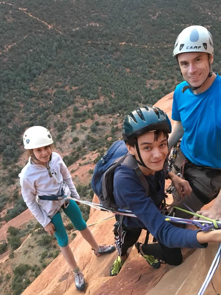
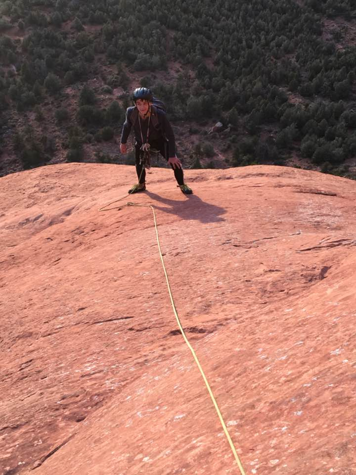
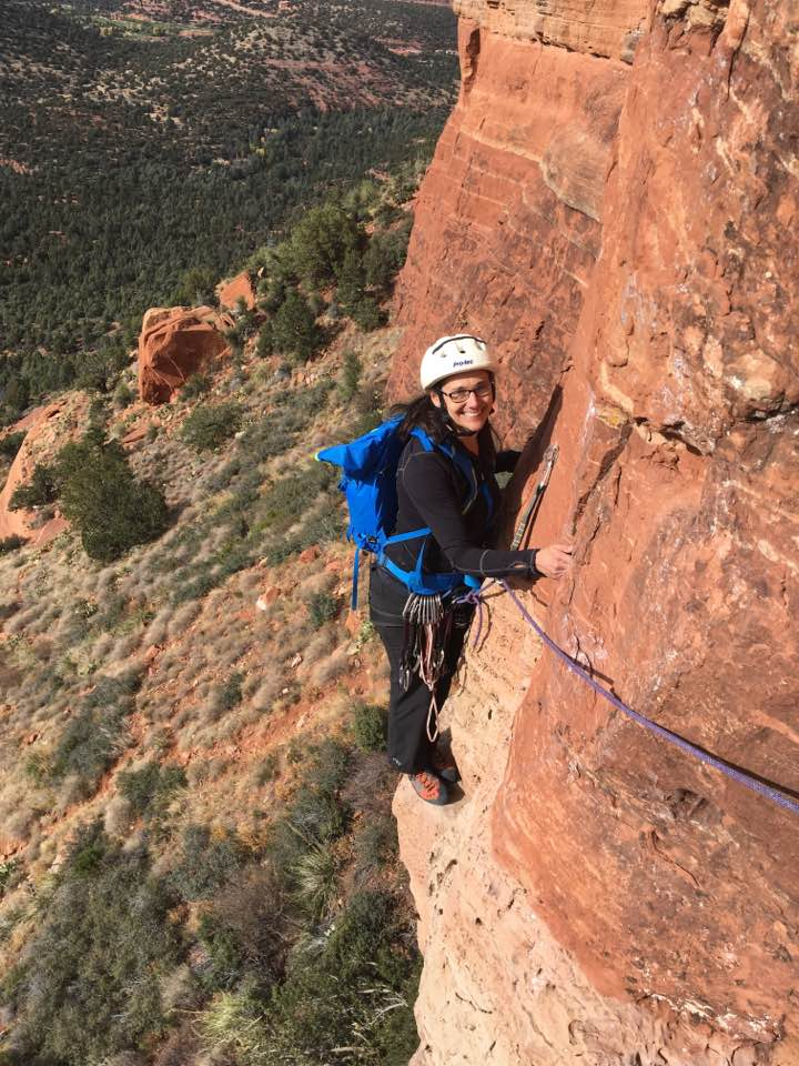
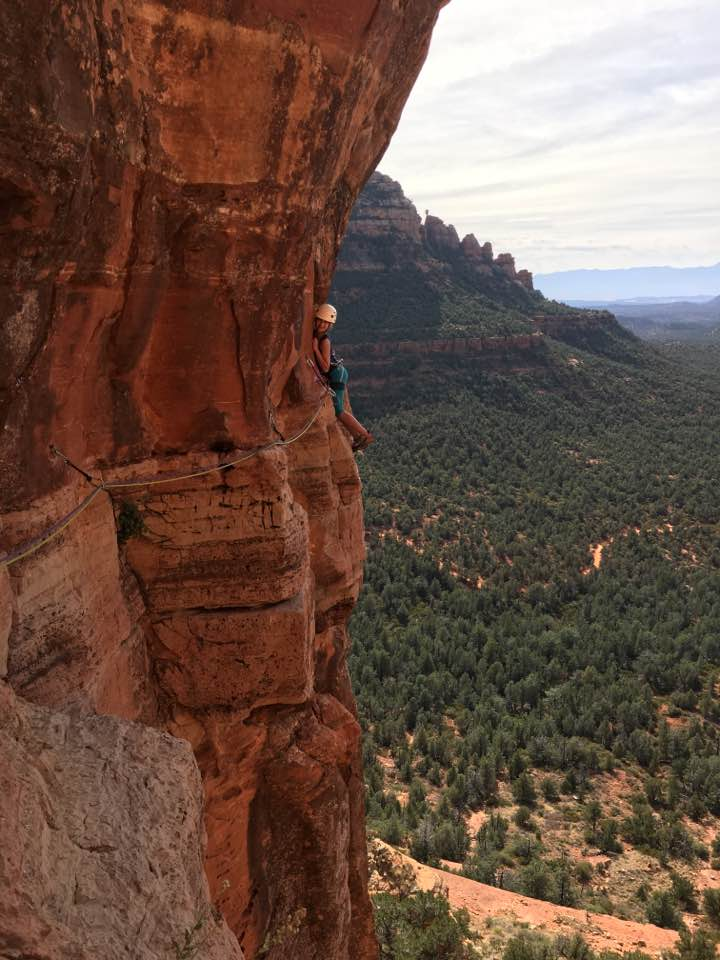
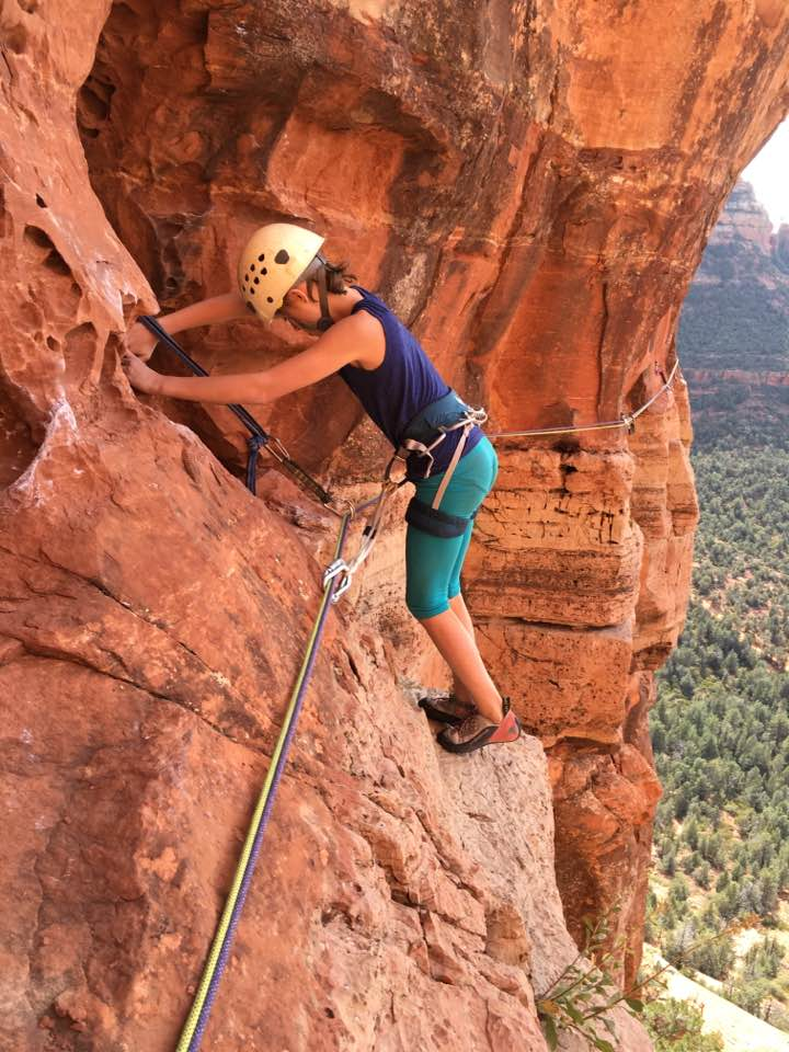
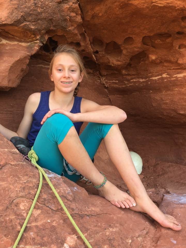
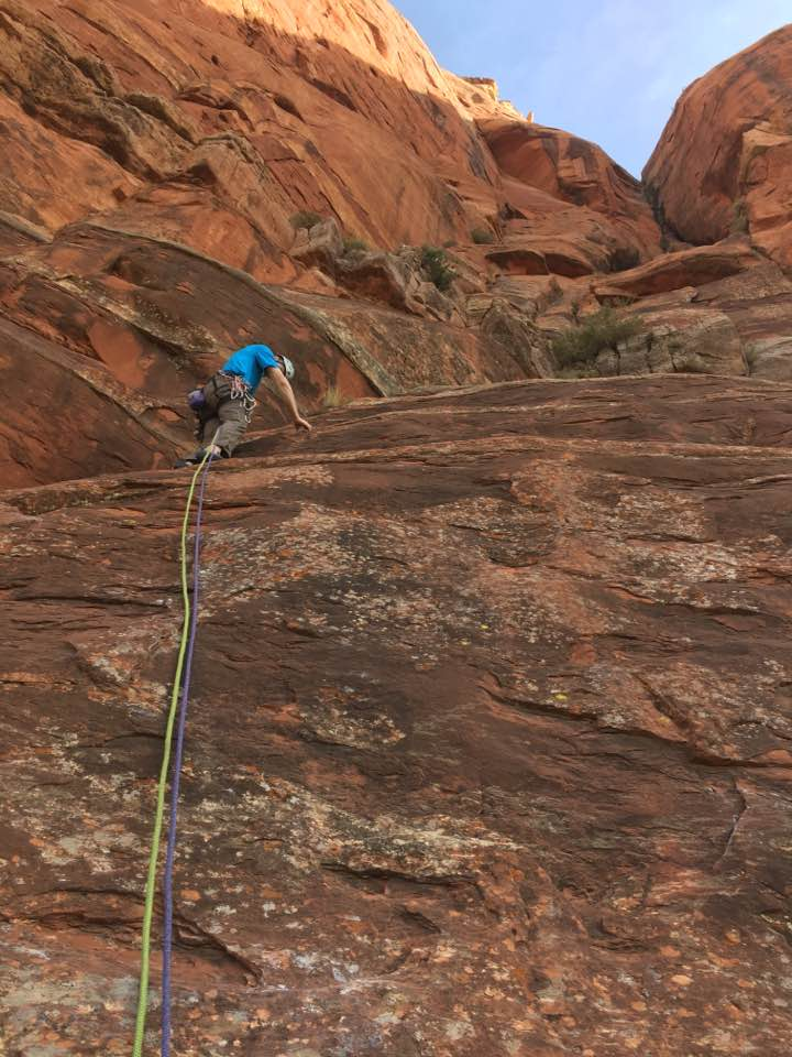
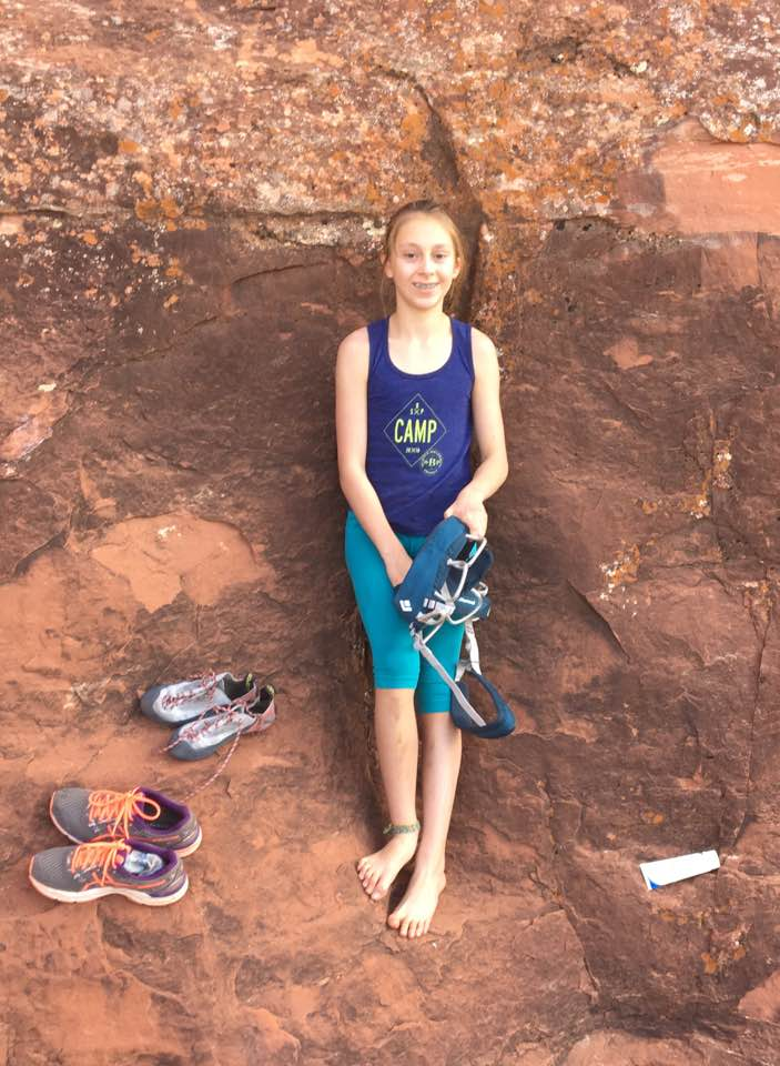
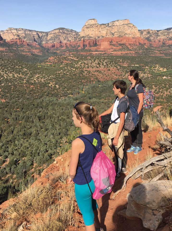
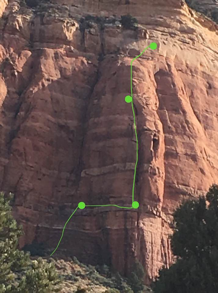
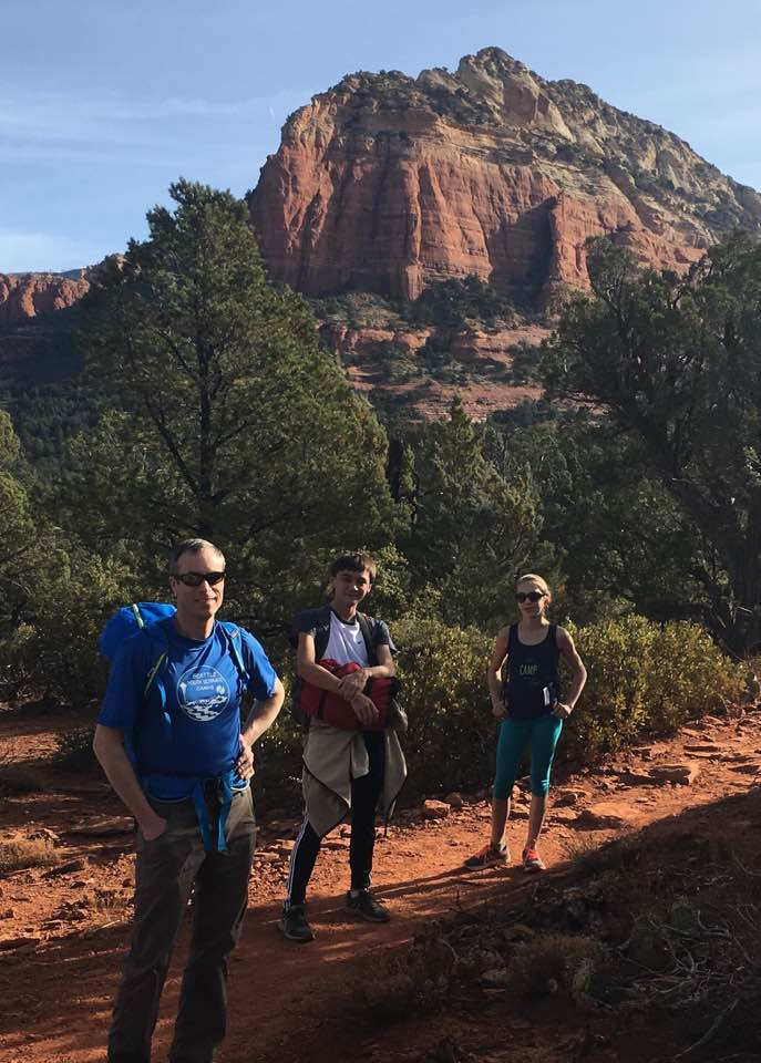
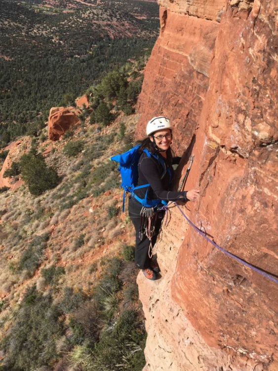
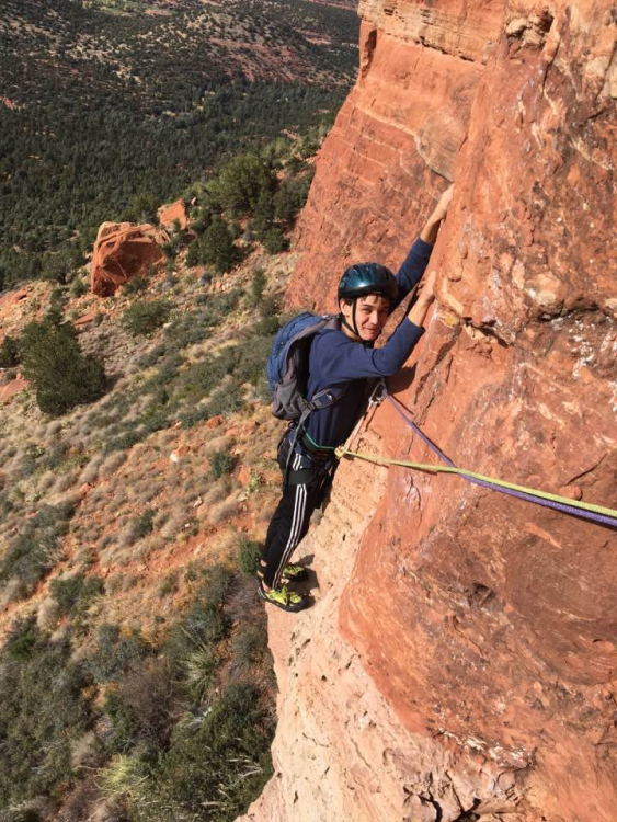
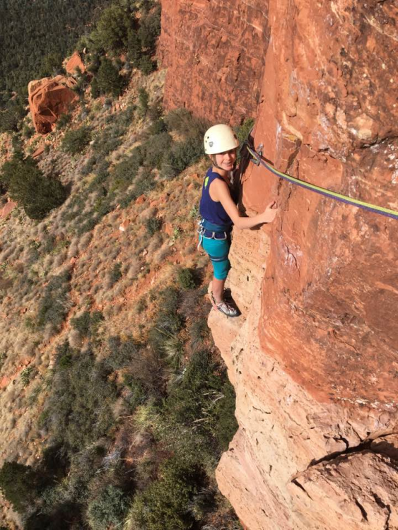
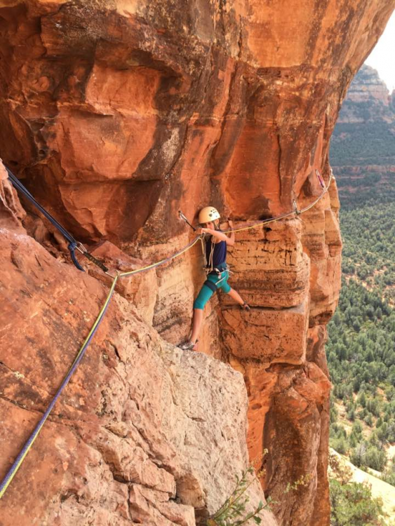
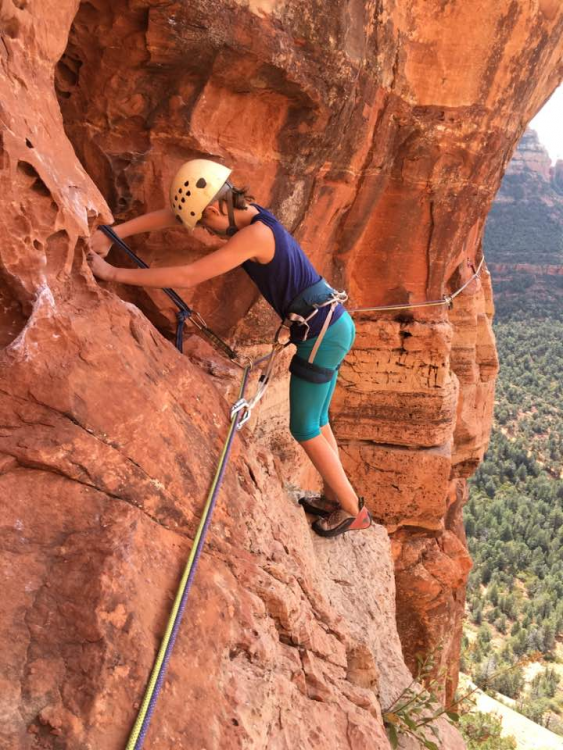
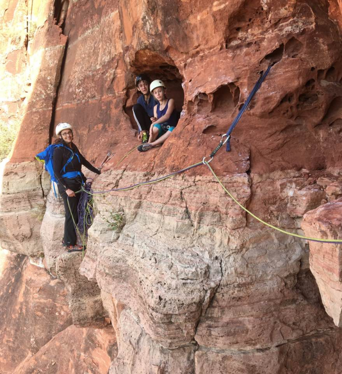
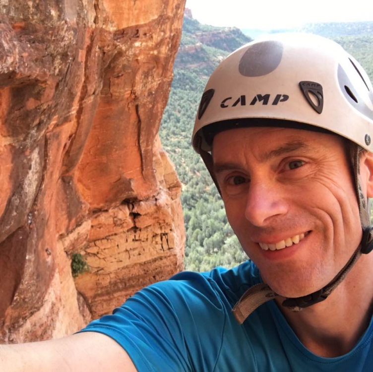
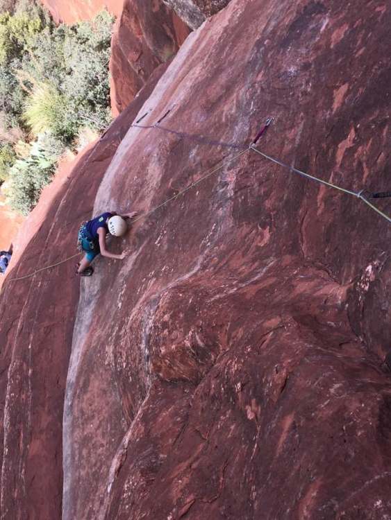
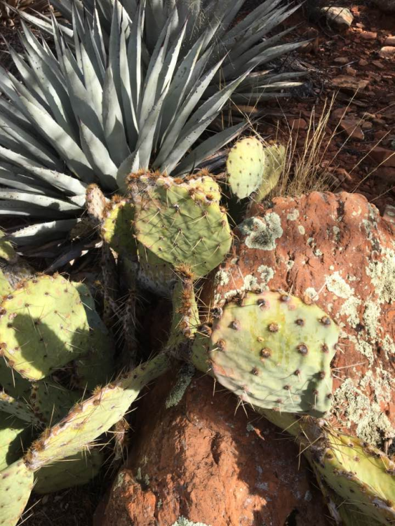
Trip: Sedona - Mars Attacks! Trip Date: 11/20/2017 Trip Report: Having an adventure that pushes you beyond your comfort zone is great....unless it's your daughter, a friend's child, and your wife on the other end of the rope when things go sideways. When my wife and I started dating we made a deal: I’d learn snowboarding, which she loves, and she’d learn climbing, my passion. We shared some good times on the rock many years ago, but in recent years we haven’t climbed together except in the gym. My daughter, now 12, started climbing early, but she’s only been outdoors a few times, on top rope or following single rope pitch bolted climbs. Dan, a close family friend, has really enjoyed the few times he’s climbed and was eager to do more. A quick trip to Arizona, a few hours from his family, provided an opportunity. I figured we’d just climb on some short, easy routes in the sunshine. I’d walk to the top, set up an anchor, toss down the rope, and belay. But then on our hike to Devil’s Bridge we saw climbers on a sun-drenched buttress across the valley. Gaping from flatland, I realized I was now the tourist gazing up at climbers instead of the climber looking down on tourists. I’m not ready to make that transition. So I did some research and looked up the route…. The climb we did is the prominent buttress in the upper center of this shot. It was Mars Attacks. Four pitches of 5.8. Each one holds a different mental and physical challenge. 400 feet of climbing with a traverse and two double-rope rappels to get off the top. I might be pushing too many envelopes at once by bringing three inexperienced climbers up the route, but I was confident I could get us safely up and down (green dots mark the belay stances at the top of a pitch.) … The approach started on the familiar trail to Devil's Bridge before heading North to a wash and a faint climber's trail around a cliff to the base of the wall. Somewhere in there we got off route and had to dodge some ankle-biting cacti, but we found our way... The trail contoured above a small cliff with great views back across the canyon... At the base of the wall, we got our gear together: two ropes, harnesses, and a variety of climbing gear. My daughter sticks to the wall even without her climbing shoes. The crux of the opening pitch is a holdless low-angled slab where you must trust your feet and the rubber in your shoes, balance on the balls of your feet with no handholds at all, and BELIEVE in order to climb. I lead the first pitch, scampering up moderate climbing to a high first bolt. 20 feet later I hit the crux slab. I puzzled for a bit, but hundreds of ascents in recent years have worn off the tiny features on the rock, which is now smooth and blank. I tried one sequence and started sliding, so I grabbed the protection to stop. We didn’t have all day, so I pulled on the quickdraw and stood on a bolt to get past the crux. I climbed the rest of the pitch clean and made it to the belay, an airy stance below a giant hueco. The others came up behind me, with a bit of tension on the rope to help them through the crux. They all did great on the rest of the pitch. At the belay there was a giant hueco worn into the rock by thousands of years of desert winds. It was a comfy spot for some to take off their shoes and take in the view. The second pitch is a horizontal traverse along a limestone dike in the middle of the red sandstone cliff. There are good holds most of the way, but the exposure is incredible. The limestone band protrudes from the cliff because the softer sandstone below it eroded away, leaving you staring down between your toes to the ground about a 100 feet below. If you fall, you will dangle in open space and might be unable to re-gain the limestone. I had a hard time sleeping the night before the climb, going over in my mind how we could all safely climb this pitch without risking a pendulum fall into space. First, I lead across. A came next, clipped to both ropes via slings but not tied into either one. Via ferrata style. She had to unclip one sling at a time to get around each bolt. If she fell she'd still be attached to both ropes and could easily get back on the wall. Here she is moving past one of the seven protection bolts that were placed by the first ascent party in 2000. Resting in a thin section. The Devil's Bridge trail is visible behind her. It was impossible to communicate on the second and third pitches, but we had just enough cell signal for texting. Here's a snapshot of our communication. We had a clear plan, and I knew Beth had enough climbing experience to belay me and make sure A and Dan could set off safely. Arriving at the end of the limestone band. Dan coming across second. He was tied into the end of the yellow rope and had one leash clipped to the blue rope, which would keep him from dangling in space if he fell. He didn't. Beth came last, tied into the end of the blue rope. She unclipped our gear from the bolts. She was totally solid and didn't fall. Two pitches down. Two to go. But we were moving slowly. I was having to check everything and do all of the work to keep the ropes and protection organized and untangled. We were always very safe, but we were slow. And it would catch up to us... The third pitch is a dark red vertical chasm, a slot, like an open book. The steep sandstone on one side of the corner has been worn by wind into crazy pockets called huecos. Some are tiny, others are large enough to climb into, and you’ll find every size in between. Then there is the crack, which varies between the width of a finger and a slot several feet wide. To ascend you must use a wide range of crack climbing techniques that are not very intuitive to the uninitiated, including hand and foot jamming, palming smooth walls to move your feet up in a stem, using your palm and upper arm in opposition while your arm is bent like a chicken wing in a wide crack, lie backing on a sloping rail, and more. I placed cams at wide intervals for efficiency and because I didn't have a lot of gear. Fortunately, the climbing wasn't too hard and the tough bits were well protected. Sometimes an accidental shot can yield an interesting image. This is looking back down from high on the third pitch. Lead climbing brings the mind into sharp focus. The world's deluge of distractions is swept away in the face of the immediate situation. The views from high on the wall were stunning, the air was still. At one point, a raven swirled on rising currents and circled our group curiously, wondering what these noisy, vulgar beasts, whose brethren provide such rich garbage down below, were doing up here in the land of wind and stone. The fourth pitch combines some awkward crack with slab and face moves and ends with a long, unprotected section of low angled rock where a fall by the leader is unlikely but would be bad. Dan climbed the final section of the final pitch... just as the sun was just about to head down below the horizon. Night would soon be upon us, and we still had to get down. Here we are about to make the first rappel, which runs down a clean face on the far side of the buttress. You can see the trail far down below us. I rigged everyone's rappels and then headed down first to look for the next bolt station just as the sky glowed orange and red in a beautiful sunset. But we didn't have any headlamps, a cardinal sin I acknowledged before we left the car in the morning. I've rappelled in the dark, but never without a headlamp, and I've never had inexperienced climbers rappel in the dark without a light. Good thing they're all strong of mind. I rappelled down the vertical face in gathering darkness, looking for a three bolt anchor mentioned in the guide. We'd never seen this part of the wall as it's on the other side of the buttress we climbed. And here's where I pushed things a bit farther than I'd intended, because I never found the bolts. I looked left and right between 45 meters to 55 meters down our 60 meter ropes. Nothing. Swinging back and forth across a blank cliff in near darkness without a light was a bit unnerving even for me. Our ropes wouldn't reach the ground, and although I could have ascended back up to our anchor above, it would have been very slow and difficult. We could have rappelled back down pitches 4 and 3 and then to the ground from there, but I'd read multiple stories of people getting their ropes stuck in the cracks we'd climbed, so that was surely a last resort. Instead, I swung over to the crack shown here and built an anchor using a few cams I just happened to still have on my harness. Truth be told. I'd put most of the rack in the pack my wife was carrying. Fortunately, I had the pieces I needed. Luck was with us. I clipped myself into this unplanned, makeshift belay spot and yelled off rappel so the others could come down to me. I held the rope ends as first A, then Dan, then Beth rappelled down in the dark to join me in this corner crack 150 feet off the ground. I pulled them each over to me from the blank face out right. We were safe, and I kept reminding them of this. The stars came out on a brilliant night. I was able to tuck my phone into my pants by my belly and shine light on our belay as we rigged to descend. This time I would just lower them one at a time to the ground. Thankfully, the rope reached. I lowered Beth into the darkness first, explaining that she'd need to climb up to the large ledge below us if the ropes didn't reach the ground. But she made it. We were safe, but well beyond our intended plans. Then again, that's where adventure begins. We made it down and used the light of my phone to hike out on the trail. The evening was calm and still and the Milky Way guided us back to the car. I ended up leaving two cams behind. Over the years I've gathered gear from the misadventures of other climbers. This time they can benefit from ours. No worries. An adventure to remember! Gear Notes: Headlamp would've been nice Approach Notes: Follow the trail


 4 points
 -
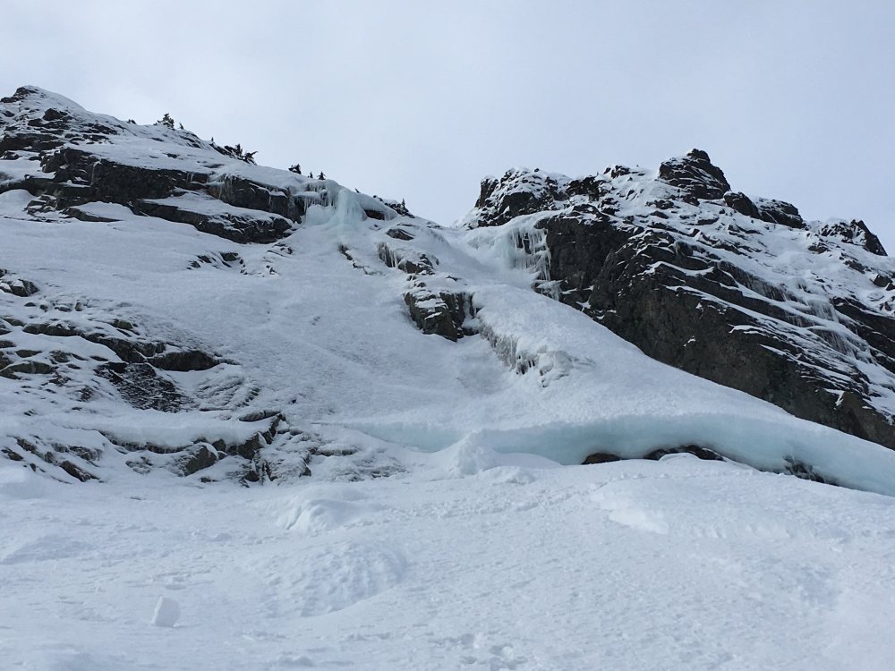
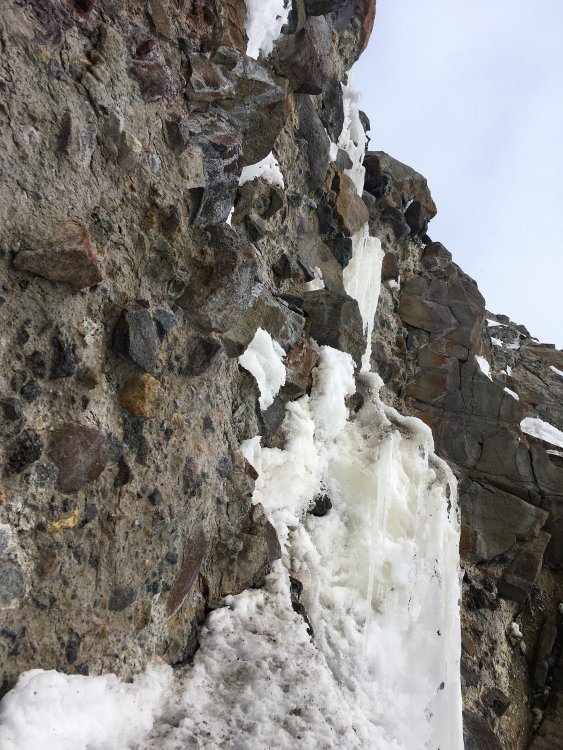
Trip: Colchuck Lake - Ice/Dragontail + Colchuck conditions Trip Date: 02/11/2018 Trip Report: Went up to Colchuck lake on Saturday thinking there may have been enough melt freeze lately to make ice fat on Dragontail, probably still too early this year. Some ice on the northern aspects but looked pretty spicy through zoomed in views. We climbed a neat consolation ice line on the lower flanks of Colchuck Balanced Rock and enjoyed the sunny and windless alpine ambience instead. Skinning the road required a fair bit of walking but booting up the summer trail was easy with a snowshoe track packed down. Nice and consolidated snowpack made for easy traveling. I feel like alpine climbing in the Cascades you can have good ice, good snow, or good weather. Oftentimes you can choose one. Getting two or three to align is elusive, rewarding when it happens though. Here are some conditions photos from February 10+11 of Triple Couloirs, Gerber-Sink, and an ice flow coming down the lower flanks of CBR with some vintage tat at the top. Gear Notes: Cascade winter grab bag. Two ropes would be nice Approach Notes: From Icicle Creek4 points
-
Trip: The Pickets - Himmelgeisterhorn - Wild Hair Crack Trip Date: 08/25/2017 Trip Report: Well, it would seem that I completely missed larch season this year as we were gone yanking on tufas in Greece and now ski season seems to be well on its way. It was another fine year of climbing, the hustle was put on in the spring to tie up some loose ends on larger Cascadian objectives which was immediately followed by a great deal of Mountain Loop cragging in Darrington and a lot of heavy packing and choss chucking to bolt a new route up by Mile High Club. Amongst all of that I did accomplish a long standing goal in the Pickets with my good buddy Imran, a tick of the Wild Hair Crack on Himmelgeisterhorn. Wild Hair Crack is a route that was established by Silas Wild, John Roper, and Russ Kroeker in 1981. For all the information you really need to know about the route and the hilarious story of it's conception go to John Roper's site Rhino Climbs. There's a lot of other great info there too if you look around a bit. Years ago, on a short and brutal traverse of the Pickets from the Chopping Block to Luna with the Running Dog we briefly stood in the notch of Otto-Himmel Col and gazed up slack jawed at the crack, knowing that we knew what it was but not being able to summon the name. Regardless, we figured we should probably come back and climb it and headed off down the Mustard Glacier to Frenzelspitz Camp where we immediately got smacked by a standard Picket thunderstorm on an otherwise bluebird day. A few years of shameless peakbagging had gone by since then as well as other trips into the Pickets but I had not yet focused up to get back to that beautiful piece of rock. Imran and I set a date early this year, weather window permitting and waited for the weekend to arrive. We've done so many trips together at this point that communication went as it often does these days, we knew which guy was in charge of what and which version he decided to show up with was completely up to him. Park and Ride time was decided upon and the supply of whiskey was double checked, the weather was looking bomber. Northgate, Arlington, Darrington, Marblemount, and Newhalem all in a row, we snapped pics of guidebook photos and headed up the trail just about 8AM. We made our way down into Crescent Creek Basin past the Chopping Block a little after noon passing one tent at the divide. The clouds had lifted as we made our way across the Barrier and now we suffered the sunny choss as we contoured around Crescent Creek and climbed up below Terror, making our camp at the obscenely beautiful promontory at 6300'. We gutted our packs, piled rocks over the important stuff and took advantage of our lightened feet by scrambling up the West Ridge of Terror, tagging the summit right at 5PM. Back at camp we rolled cigarettes, set up the tent and sipped Laphroaig telling jokes and watching the sunset. The next morning we dropped a little elevation right out of camp and then contoured old terminal moraines towards the hidden couloir that leads to Otto-Himmel Col. Last time I had been through here it was early season and we had just strolled to the top, this time it was a whole different animal. We predominantly stayed in the moat on the left stemming between ice and rock until being forced through a portal in the snow to the right side. Below the huge chockstone we scrambled up the rock on the left side and then back across smallish ledges right until back in the gulley above the chock. A few more feet of vert brought us to the Col and a bit of a breeze so we added some layers and got our gear on. I started up the righthand of the two large cracks and climbed for a ways until it appeared as though the rock might be of better quality over in the left crack. Imran was shouting at me to stay in the right side but I figured I'd go check out the other one at about half pitch. I liked what I saw so I continued up, I suppose following the right side is what is shown in Red Fred but both variations were climbed in the process of seeking the first ascent by Silas, Roper and Kroeker so I figured I'd split the difference on the first pitch. Both lines will take you to the base of the next pitch in a little alcove/cave below the offwidth chimney. If memory serves me there was a small slung chockstone here with what must have been some tasty cordage that a varmint had chewed through as well as some other old webbing that was in slightly better shape. I threw in a cam as backup and made an anchor to bring Imran up. Once he arrived all smiles as usual I set about getting my nerve up for the next lead. It looked big, slightly overhanging, and I could not see anywhere that took gear less than eight inches; 5.7? I'll bite. Up I went, the holds were...amazing! All the stances, everything was like a dream. I almost forgot about placing gear, which wouldn't have mattered anyways because unless you have a Big Bro or a length of 2X4 it doesn't matter until you are at least 20' out. The first placement is a small cam in a horizontal crack to the right of the crack, the next, about 5' higher is a bomber #1 or #2. The angle eases off after this and the pitch rambles up a ways nearing the ridge. Instead of heading over the ridge to the left we opted to continue up towards the subpoint angling slightly right to a weakness and chocked chimney just below the subpoint. I belayed Imran up while sitting on the chockstone and we unroped for the next bit of 3rd and 4th class terrain up and over the subpoint and across the ridge towards the true summit. There is a nice flat col before the final pitch up to the summit and we threw our packs down here and put the rope back on for safety sake. I placed a 0.5 or 0.75 in a feature to protect a bit of exposure but that was it. We had reached the top of the "Horn of the Sky Spirit" and the horizon was smoke free, giving us views for days. The summit is pretty small, we looked around for a summit register but could not locate one despite Jason and Tim reporting on it during their FA of Stonehenge. We hung out up there for quite a while but eventually decided we were hungry and we needed to figure out how to get down. We knew we didn't want to rappel the lower three pitches of the Wild Hair due to a lack of anchors for our single 70M rope (FA was with twin 50M ropes) and we didn't want to end up too far down the N face and have to come back up the Mustard Glacier. We had spotted a pretty nice looking anchor backed up with a nut and some fresh looking webbing just below the subpoint on the north aspect so we figured we'd start there. I ran the rope through, tied knots and chucked each half into the unknown. Looking down the face everything looked pretty ledgey but also decked out with areas of obviously loose rock so I exercised considerable caution keeping the rope free of debris. At about 25M I came upon a double piton anchor joined together with some old webbing but decided to try and angle off back towards a large boulder out right (skier's left), suspecting a possible anchor in that vicinity. I came up on the knots right as I touched on a ledge above the boulder, I unweighted the rope removed it from my belay device and scrambled around the boulder to find a nice looking rap anchor. Imran came down and we set the next rap angling hard back over the ridge towards Otto-Himmel Col. We found another anchor over the ridge and were able to rap into a small depression almost at level with the col with a slight ledge leading back to the col, I believe this is the depression and ledge described in the N. Face route description. Stoked to have made it back down on our single 70 with relative ease we rapped down past the chockstone and continued to rap most of the gulley on old suspect singlepoint anchors composed around sketchy rock or attached to jiggly pitons in jiggly rock. Eventually we emerged back in Crescent Creek Basin and rambled back to camp encountering a rather large and healthy set of mountain goats along the way. Somewhat begrudgingly we packed up camp and made our way back across the hot red choss to the Chopping Block where we set up camp for the night and encountered a curious Stoat for a split second before it went back to hunting down Pikas and other alpine morsels. Sunset was amazing in all directions and the nice view of Teebone Ridge had Fallen Angel stuck in my head for the rest of the trip but thanks to 4G service at the ridge I was able to scratch the media itch. In the morning we climbed the NE ridge of the Chopping Block staying generally on route but adding in a few short harder sections at the bottom and top for fun. Rapping this route with a single 70 is a bit of a rope stretcher and requires attention to detail. Finally, we packed up for good and headed down the Barrier gorging ourselves on blueberries the whole way back to Terror Creek. Another trip in the Pickets with a head full of ideas for the next time. I had the good fortune to talk to all the members of the first ascent team at this years Bulger Party and I think they got a kick out of the kids taking such pleasure in their route, it is a real gem! Thanks to Silas, Russ, and Roper for putting up the line! Okay, Pictures! Coming up the Barrier with clearing skies Crescent Creek choss heat. Terror! With Luna in the background. Camp life. Sunset from camp. Highly recommended accommodations at ca. 6300' Himmelgeisterhorn Starting up the right crack, the chimney of P2 can be seen above the left crack near the top of the rock in the picture. Imran climbing towards the top of P1, minimal gear was placed on ascent but lots of opportunities existed. Last Pitch Sky Spirit! Taking the ledge back to Otto-Himmel Col Super Crack! Late season gulley shenanigans. Sunset from Chopping Block camp. NE Ridge of the Chopping Block Picket Stoke! Gear Notes: Single rack of cams #00-#2, medium nuts, long runners, 70M rope, crampons, ice axe, whisky Approach Notes: Terror Creek to the Barrier to Crescent Creek Basin4 points
-
Trip: Mount St Helens - Worm Flows Trip Date: 04/22/2018 Trip Report: One million of my best friends and I were on MSH today. We left the Marble Mountain SnoPark at 3:30 AM, able to ski from the parking lot! I got a whole lot of practice with my ski crampons! Up to the crater rim a bit past 9, hung out in the sun for about an hour and a half, then skiied some amazing AMAZING snow -- ah yes, this is what they call corn -- under a bluebird sky!!!!!!! I love spring skiing!!! I got to ski most of it in a tank top and rolled-up pants. 😁😁😁 Got a little sticky toward the bottom of the fun, but not too bad. On a few of the steeper parts we skiied, we saw some rollerballs and one very small wet loose slide. What an amazing day!!! So much better than hiking Monitor Ridge in August! Gear Notes: Sunscreen, ski crampons, patience Approach Notes: Snow from the TH!

 3 points
 -
Trip: Goat Mountain - SW route Trip Date: 03/31/2018 Trip Report: The last hall pass before our Canadian Hut trip was put to good use this past Saturday. Goat has mocked me for decades as I've gazed north from the ski area and tours out of Heather Meadows. No longer! In the winter a Goat tour starts pretty low. So, with the cold breath of the GRAVEDIGGER on our backs, we skinned from the start of the Hannegan Road a bit over two miles to the start of the Goat Mountain summer trail. Toiling upwards on a fine day we ran across cougar tracks from the day before, a few minutes before Shuksan burst into view at treeline. Those would be about the only tracks we would see until we gained the Twin Lakes Road on the north side of Goat. Sefrit: We reached Goat col about 4-5 hours after leaving the cars and started to skin the final 600 feet to the true summit of Goat, which is the eastern one marked on the USGS quad. Soon, however, we realized that skis were going to be a liability with the wind slab cooking on the south aspect of the peak and dropped them in favor of booting to the summit. The proved to be a smart move, as significant wet slides swept this face below the ridge between the time we ascended and descended. We were able to effectively mitigate the hazard by sticking to the ridge in the trees and rocks. Tomyhoi watching us on the ascent: The summit was glorious on this still spring day and we spent a half hour snapping pictures and admiring the view. Unfortunately we couldn't linger long, since half of our party waited at the col and we had a long slog out the Twin Lakes Road ahead of us. Downward! The final few feet to the summit: Southern Pickets: Ruth and Triumph on the right: Sefrit again: Nooksack Tower: Tomyhoi again: Seahpo and Jagged Ridge: West Goat: Then it was time to ski! The lower we got the worse the snow was (and it didn't start out that great), until it was horrific breakable crust. At least we had nice views of Goat: The happy(ish) crew, minus me, before things got really ugly: One last look at GOAT: Gear Notes: skis, ski crampons, light axe if going for true Goat, a slogging attitude. Approach Notes: Hannegan Road to Goat summer trail to Goat col to Twin Lakes Road to ruin.


 3 points
 -
Apparently NWAC and the TAY website either don't welcome or downgrade your opinions and or observations. NWAC is a joint effort between the USFS Avalanche Center and the non profit NWAC. While anyone can submit observations, NWAC forecasters get to make the call on the amount of information publicly provided. Sometimes that means making a judgement on when there is sufficient or too much information. If you feel they are ignoring vital information you can keep plugging or file a complaint. NWAC is a member of the American Avalanche Association and the National Avalanche Center. Those are the organizations you can contact. In addition NWAC files all governing documents and tax returns. These are available for public review. TAY is a private website. Public/member input is encouraged, but if enough site users dislike how you express yourself online, the site owner or moderators can ban or block you. The only alternative left is starting your own blog or going to a similar website and expressing your views there. Cascade Climbers is a good way to meet and talk to others who may have similar interests. On the other hand it isn't the best place if your primary interest is expressing complaints about other websites or organizations. You can post trip reports and add condition observations here...3 points
-
@Chris Hopkins I'll be fairly blunt while you are welcome to post conditions here this continued vendetta you have with NWAC and TAY is not. The thing with TAY is between you and them. It doesn't serve any purpose here, it's mostly conjecture. If you feel this information is important for others to read you can go start a blog on Blogspot or WordPress.com.3 points
-
Just one shortie Snarg, used 3x in the blessed turf blobs. Some very crappy phone pics follow... The first page of the newest Testament: The first 3 meters off the ground: The next 15 meters, which set the tone for most of the climbing: Looking straight up last pitch and summit cornice. (The few other pics I took during the climb were too crappy for publication): Summit shot. If you look closely you can see the chiseled Fingers of Fate: This climb, in the conditions we found it, is harder and more sustained than NYG and PE and all their variations. Though Rolf said that's because we're old now. Praise be Turf for without it we are NOTHING!


 3 points
 -
So much discussion of risk is only "just-so stories". I survived because my risk decision making process and resultant acceptance of the risk of my activities was accurate, and somebody else died because they made a mistake. Except that that's horseshit. I got lucky many times. I fell off the north Apron 3rd class walk off ledge on a wet patch and caught myself on a tree at the lip of Voodoo Amour with my legs over the edge. I put a crampon through my gaiter on the approach ice to Cascade and slid for 100 m before self-arresting with a desperate overhand in the only patch of snow and turf on an otherwise entirely icy slab. I stopped for lunch or a snack twice only to have cornice collapses come down right where I would have been if I kept on going while climbing alpine routes. Any of those could have killed me. I wager everyone that's climbed has stories of close calls like that. Lucky isn't a learned behaviour. And it's nothing to moralize about.3 points
-
In an ideal world this would have been posted on the sites anniversary, Oct. 2, which would have been 17 years in existence. Also ideally this would have been posted three plus years prior when I first started working on the migration. We actually started talking about it much further back. Something I’ve learned is things don’t always work out like you planned, you just have to keep moving forward and learn from you past mistakes. I’d like to thank those who are still around, some of you who have been here from the beginning. I’m sorry to those of you who have given so much to this site in the form of great discussion and trip reports, to the moderators that dealt with so much of the not so great moments, and that I let you down in not keeping this place working better and in a more modern state. We'll make it up to you. Porter, thanks for helping keeping the stoke alive with me and being such an amazing friend. Trip Report Tool v1 I’ve got the new trip report search working. In some ways is a few steps back from the old search in that you can’t facet by month or forum. It’s a step forward in that it works and works well on mobile. http://cascadeclimbers.com/forum/tripreport This only works if you are logged in at the moment. This wasn’t by design just what happened as I added this on the work of the developer I hired who did the TR submission work. We’ll get that sorted out. What we have on deck will be polishing up some of the trip reports and probably adding better geographical data for being able to search trips on a map. We certainly view trip reports on this site as our crown jewel, we are just shy of 9000, and we’d like to make sure they are easy to find and easy to add. I think we’ve nailed the later with the forum upgrade and I’m confident we can come up with better search. The Future Like I said we have now been in existence for 17 years. Not many things on the internet can claim that. But the upgrade of the forum and the work we are doing now is the beginning and not the end. I was 24 when I started this site and really didn’t know a whole lot. I was trained as a biologist and had no experience or really knowledge of web communities. My (still) good friend Timmy and I just decided to create something. I’ll never forget an email I sent to a pretty notable local climber when we first started. I actually don’t remember what I asked him, but I remember his response “Good luck getting traffic, that will be hard”. He seemed pretty pessimistic, but he couldn’t have been more wrong. Getting the traffic ended up being easy, managing it was the hard part. There were certainly some real wild west early days with cc.com and it was difficult to know how to handle them, especially our spare time for what was a hobby. We’ve made mistakes. We can acknowledge that. And we have learned from them. There are people and behaviors that will no longer be welcome here. What is sad is many of those people just took their dump and left. I realize we have a bad rep with many people and that’s unfortunate. I also think it is what you make it, and maybe it’s time to give it second chance and be part of the solution. We’ve solicited a lot of feedback, we’ve read feedback posted on Facebook. We’ve taken a lot of it to heart. I understand Facebook is easier to use, they are a multi-billion dollar company with scientists who’s sole purpose is to get you hooked. I get that Mountain Project is a nice tool, I have nothing negative to say about them, but again they are owned by REI now and have huge coffers of money. It was also incredible to read how people met their climbing partners here, or even their partners in life. Yes there has been some bullshit, but there has also been a lot of good. Cascadeclimbers is a unique and local product: an opportunity to interact online as a community rather than as the product. We are not here harvesting you and your information. This is still a hobby for us. We turn down offers every year to sell this site as we know it’s not in it’s best interest, we know what will happen if a corporation take it over. We have turned down advertisers because we have stayed true to our commitment to supporting retailers. We run the site, we own the site, but the content belongs to the community. We will be better stewards of this place and we hope people will give it a second chance. To those sitting on the sidelines, sometimes reading, but not participating. I get that you don’t want deal with the spray, and I assure you things will be different forward. But I also challenge you because the only way to make something better is to make those positive contributions. If everyone just steps away because they don’t like certain things then all you are left with is what people don’t like. This is a community driven site and only works with contributions from the community. We will be better listeners and stewards; please be better contributors. Why we allow anonymity. This is actually pretty simple; we have no way to prove someone’s identity. Facebook doesn’t either. We also made this decision pretty early on because we felt this would make it a safer place for women to contribute, without a bunch of guys stalking them. Again keep in mind these decisions were made 17 years ago, but I still think it’s a valid point. We recently added JasonG to the moderator staff. You probably already know Jason from his Trip Reports and amazing photography. We are always on the lookout for trusted and committed people to help the site grow, so let us know if you are interested. We may have more roles in the future that need filling. And of course a huge thanks to all the existing moderators that have stuck with us through thick and thin. Our current path forward is pretty simple: We expect people to leave things better than you found it. If you can do that simple things you can be a part of this. If you can’t you will not be welcome here. We want the site to grow, in people, in posts, in trip reports, and new personal connections. Thanks for reading. Onward.3 points
-
It's a good discussion. Very good. I'm not at all suggesting otherwise. Just that it's very damn easy to armchair judge the risk choices of others without all the information and/or from the perspective on one's own abilities. And I'm not immune from it- sure seems like maybe Dean Potter and Dan Osman had adrenaline habits that led to increasingly risky behavior with narrower and narrower margins for error. If someone can go solo Astroman, which I couldn't aid up, all the power to them. It would be insane and too risky for me, and entirely within their abilities and risk margin. And in terms of the 'not being in a hurry to get out' thing you mentioned, I think it's helpful to evaluate one's motivations. If this kind of behavior becomes "need" and "have to" it's a pointer to an addiction that can easily overrule/cloud other aspects of risk evaluation.3 points
-
You are the person who has judged, I guess. It might be more accurate to say "Too much objective hazard for me". I would much rather be dependent on my speed and skills to get through that threatened slab section on Jberg than be stuck under a clusterfuck of bumblers knocking shit (and themselves) down on me on the Cleaver or below the Pearly Gates. Similarly, I fret less climbing up the Haystack Gully in thin, difficult ice conditions in winter than I do in summer when the hordes are sketching about above me. Only two people fully understand the risk on the Jberg route. Both measured it against their abilities and chose to proceed. To this day anyone else passing judgement on it is doing so with incomplete info. It's no different than big-mouth Krakauer writing a book about the 96 Everest disaster from the perspective of someone at sea level- the frame of metrics is just wrong. I've been in situations where I needed something from the lid of my pack and, as Beck Weathers said about his gloves, it might as well have been on the moon. "He should have just stopped and put on gloves" might make 100% sense at sea level, but at 28,000 feet or, as was my case, in 100+ MPH wind, it's nonsense. Thousands of people a year spend about the same amount of time under the Ingraham Icefall, where Peter Whitaker and team nearly got the chop, as we spent on those slabs. There is a trench-path below the icefall and with it comes a false sense of security. That said, Jens' (Klubberud, not Holsten) description in the TR he posted is more dramatic than I recall and than what I wrote for my TR and the AAJ article. My Dad came home from work in April of 2000, went for a run like he did almost every day, and then fell over dead at the kitchen sink from a heart attack. He didn't even have time to turn off the water or call out to my Mom, who was asleep one room away. Another friend had both his parents killed and his wife and newborn kid severely injured by a drunk driver as they stood at a crosswalk in Seattle. The only guarantee in life is death. In the mean time, I try to make conscious, reasoned, internally-referenced choices and refrain from judging the risks other take.3 points
-
Bill, I think events have made it very clear to Jens that luck plays a huge role. We live in a state of denial around that because it helps us to function, but sometimes events strip that illusion away. Sure, training, prep, and all that ala Messner makes a difference, but it's a fallacy that we're in control and if we just make the right choices everything will work out fine and predictably. For me, I think it was Craig Leubben's death in the relatlively mundane location of Torment's moat. a place many of us have been, that underlined the amount of random risk that defies preparation and planning.3 points
-
How To Climb ice in Oregon in March Step 1) Drive to the Tilly Jane trailhead Step 2) Hike / skin to 8,000 feet on the Eliot Glacier Step 3) Look to your left Step 4) Climb it
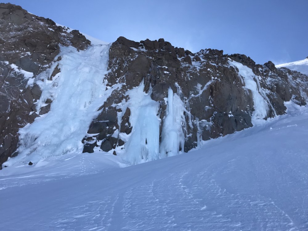 3 points
 -
Agreed. I think the general statistical pattern falls pretty neatly into a pattern where technical difficulty * objective hazards * repetition = increasing mortality, but there are enough noteworthy exceptions to the pattern to preclude any of us knowing how our particular coin-flips are going to turn out, much less that dialing our risk back to a particular level is going to guarantee that we die peacefully in our beds at an advanced age. Renotto Cassaratto (sp?) falling into a crevasse within view of basecamp after descending K2, Daryl Hatten falling out of a tree, Mugs Stump, Goran Kropp, are just the first few and I'm sure there are plenty more. My Dad wasn't a risk-taker, and action-sports had zero appeal to him. He did, however, have principles that he was determined to live by despite the fact that doing so entailed certain risks. He loved to jog, and it brought him a profound sense of peace and fulfillment. He also had atrial fibrilation and a pacemaker, and knew that physical activity above and beyond a particular threshold would elevate the risk of heart attack, etc. He also knew that an arrythmia or coagulopathy, or some combination of the two, could potentially strike him down while watching TV. So he kept jogging, and about 18 months ago he sustained some kind of a cardiac arrest while jogging on the Sound To Narrows, fell and broke his skull on the concrete and sustained a massive TBI. He spent the next several months hovering between a coma and a vegetative state where he could open his eyes and that was about it. Ultimately, his body was beginning to deteriorate so terribly that my Mother finally agreed that it was time to let him go. His accident happened three weeks before our youngest daughter and his final grandchild was born. Our oldest was four at the time and loved her Papa as much as anyone can love anything in the universe. He had an awful lot to live for, and it's possible that if he'd been able to accept a life where he'd never exert himself out of fear of overtaxing his heart that he could have lived many more years. But he couldn't. Our family suffered terribly as a result of his accident. Watching someone persist in limbo between death and consciousness for months is many orders of magnitude worse than someone simply dying. I was never sure if he understood the risks that I took, which despite being completely prosaic in the world of outdoor sports, always seemed completely bewildering to my parents. On some level, I think they both understood, and never held it against me. When he refused to stop being active - I understood, and I never held it against him. Even though I would never take the risks that folks pushing the boundaries take on, on some level - I understand their choices. You can do that, and mourn their passing even when you are at the epicenter of the grief their death causes.3 points
-
Trip: Baker Backcountry - An ode to the second half of February 2018 Trip Date: 02/28/2018 Trip Report: What a great way to end the month............ Gear Notes: go wide or go home Approach Notes: 5423 points
-
Here's the Yocum Ridge in fatter conditions, January 1980.
 3 points
 -
Trip: Coleman Pinnacle - West Ridge Trip Date: 02/10/2018 Trip Report: It finally stopped raining this past weekend! Us, and everyone else within a three hour drive descended on the Heather Meadows parking lot to get our vitamin D for the month. @dberdinka and friend were the smartest of the bunch, leaving the parking lot in the dark to ski in solitude out to Coleman Pinnacle - which happened to also be our objective for the day. We arrived on the summit to see the masses coming from every which direction to the col just to the west. It was by far the busiest I have seen the area immediately around the Pinnacle. Strangely, we were the only party that actually booted to the summit. C'mon people, no summit, no party! The ski conditions were predictably mediocre, matching the telemetry, with a few inches of low density snow poorly bonded to a supportive crust. It is probably pretty interesting up there right now given the new storm snow on top. But last Saturday it was a glorious day in the sun. And sometimes that is enough. That looks pretty OK More left @Trent: :C Coleman Pinnacle: A party got after it this particular morning: @wbk: The final bit to the summit: Slogging for the win: @Kit, @wbk, and @Trent: Fisher Chimneys look pretty spicy right now: Shuksan: The Portals: Rival faction: Better than expected: @Kit gunning for the tidy tracks: fin Gear Notes: skis Approach Notes: Ptarmigan Ridge from Heather Meadows.3 points
-
the first of these legends to die that i connected w/, in a real way talkeetna, 2003 - got good n' high w/ him n' his dog in the park right by the west rib pub - the 3 of us spent a couple hrs snoozing in the sun soon thereafter3 points
-
Trip: Aoraki Mount Cook - Linda Glacier Trip Date: 12/07/2017 Trip Report: For anyone interested, I recently traveled to New Zealand and successfully climbed Aoraki Mount Cook via the Linda Glacier, approaching from the valley floor via Ball Shelter and the Boys Glacier. Trip report and photos here: https://www.jeffreyjhebert.com/adventures/linda-glacier-on-aoraki-mount-cook Gear Notes: Pickets, screws, nuts; 2 tools; crevasse rescue gear; 70m single line Approach Notes: Just about everyone takes a helicopter to Plateau Hut these days. We hiked in. Due to to glacial recession and erosion, it's unsavory and somewhat dangerous to do so.
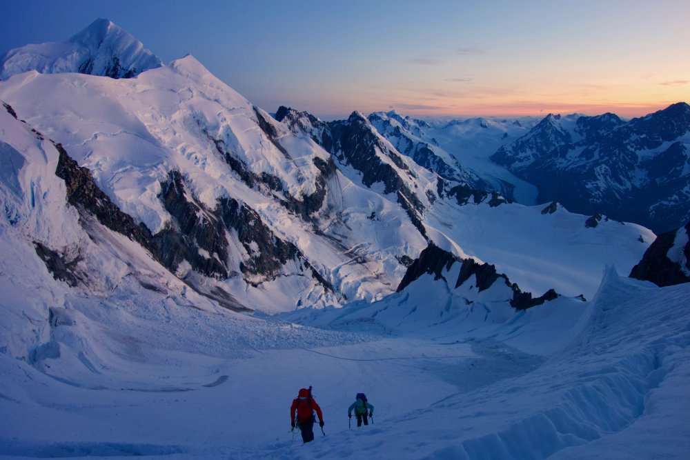 3 points
 -
Trip: Glacier Peak NF Beartooths - Catch-a-Sunrise 5.9 PG First Ascent Trip Date: 08/18/2017 Trip Report: This was an exceptionally memorable climb that I did with Elaine, which was her first trip into Montana's Beartooths. Myself; I have been coming to this mountain range many times since 2012, and have seen enough corners of it to hold my own against any of the local Montana Beartooth stompers, however this climb was exceptionally significant because it was on Glacier Peak. This was the last Montana 12er I had yet to summit, and I had been putting it off until the right time came where I could climb the North face Beckey Couloir Route. This is a rarely climbed route straight up the rugged north face of the mountain. I could have easily tagged its summit by walking up the talus from the Aero Lakes Basin, however I wanted this peak to be something more than that. Knowing the conditions dictating everything for this route, I had to find the perfect time, and as chance would have it, Elaine and I had that chance in mid August this year just a few days before the total solar eclipse (which we saw in Wyoming!). As an aside, for anyone wondering, yes I am still working on that Beartooth Guidebook. We had both just finished a successful climb of the East Ridge of the infamous Bears Tooth earlier in the week (see link above) and we were ready to tackle the main objective. The trip started on August 16th by driving up to the Goose Lake 4WD road from Cooke City and parking at the start of the 4WD road. It was a 4ish mile walk along the road to Goose Lake. We were hoping we would run into someone heading up willing to give us a lift but since that never happens, it didn't happen haha. Our late start of about 2:30pm also probably didn't help. We however hiked around the beautiful Goose Lake, and onward to the broad saddle between Iceberg and Sawtooth Peaks under beautiful sunny skies. Looking at Sawtooth Ridge from Goose Lake really inspired both of us to return one day to traverse that ridge. At 5pm we reached the saddle, and I remembered the last time I was here on a quick solo venture to Iceberg Peak and to get a firsthand look at the west face of GlacierPeak. The wind forced us to continue the cross country walking over loose talus and the occasional snowfield east towards Glacier Peak. We passed alongside the stunning Iceberg Lake until we reached the point where we started descending steeply down loose scree onto the large rock glacier that extends off to the north of Mount Wilse. It was a long and mostly uneventful walk as the sun was setting into the boulder strewn valley at the base of Glacier Peaks west face. The ankle twisting loose rocks on the rock glacier was somewhat slow going, and I knew we would not be able to reach the base of the Beckey Couloir before dark, so I began looking for a place to sleep for the night. The towers and monoliths that surrounded us in this valley were awe inspiring, with the added sunset effect really making the evening magical in an otherwise heinous walk, which now exceeded 10 miles. As my luck would have it though, right as dusk set in and headlights would have become mandatory, we got to the edge of the rock glacier, and shortly after dropping off found a beautiful little flat grassy meadow, with a small stream nearby that we could lay down for the night! This wasn't the first time this year that I got extremely lucky finding a place to camp right as total darkness was setting in. To save weight on what we knew was going to be a carry-over, and since we each already had ice tools, crampons and big boots, we didn't bring a tent. We simply threw the pads and sleeping bags down on the grass (or sedge, as it is apparently properly called according to Elaine) and cooked a nice dinner and quickly went to bed. With the perfect weather, we couldn't resist stargazing and looking for meteors for quite some time that first night, and thinking endlessly about the climb that lie ahead. I admit I was a little nervous mainly because I had been waiting to do this climb for years. Little did I know I was about to make probably the worst navigational error I have ever made in my climbing career. The next morning we started as soon as enough light broke the darkness of night, and continued hiking along the bottom of the west face, traversing the large talus fields until we could round the corner to the right and enter the basin below the north face. We hiked around a small tarn along the steepest part of the face below the northwest flank, and ascended once again until we reached a large snow couloir. It was roughly 8:30 in the morning when we reached the start of the couloir, and we took a nice snack break and switched into our mountaineering boots, put crampons on and layered appropriately. The climb was about to begin. We started soloing up the snow, and actually both felt comfortable remaining solo until we reached the upper end of the steep couloir, which felt like it had a max steepness of about 60 degrees. For her first steep snow climb, Elaine did amazing and felt confident the whole way. I recall thinking the couloir ended rather quickly as it felt like we only ascended about 600 feet before we hit rock but I didn't think much of it. All I knew is I was looking for a rib that bisected the couloir and it was 5 pitches of rock up to 5.7 up this rib directly to the summit. Well, as we were standing in the small moat at the top end of the couloir we were in, I saw what looked like a rib heading just above us, but the couloir didn't extend to the left of it, only continued up to the right. I figured the left side finger had dried out and started scrambling steep and loose 4th class up this feature as Elaine carefully followed. After maybe 100 feet we reached a nice ledge system and traversed leftward until I hit a 5.7 rock section. We finally busted out the rope and cams and I led this short pitch in my boots to a "ready to explode" ledge just below a 5.8+ hand crack that I wasn't comfortable leading in my boots. To save weight, I left my rock shoes thinking the route was only going to be 5.7, and just in case, Elaine brought hers, so she led up this 20 foot 5.8 crack and cut right into a large chimney. Since I didn't have any idea as to what each of the 5 pitches of the Beckey Couloir route entailed, I assumed we were on route, since the chimney wasn't too hard. Halfway up the chimney, Elaine made an anchor and belayed me up. She then continued up another pitch in the chimney to a huge ledge, which upon reaching myself, I really started to get confused. I still didn't know we were WAY off to the right of the actual Beckey Route, but upon looking up at how much more rock climbing we had to do, I was beginning to wonder. So we decided that moving left looked better, and Elaine led another pitch up somewhat runout 5.6 slab to a ledge, then I led up a somewhat garbage pitch on loose 5.4 to another ledge. We were now 5 pitches up from where we started roped climbing, and no end in sight. Rather than worry about how we might be off route, I continued focusing on the task of safely getting up this face. Elaine continued up our 6th pitch on now more difficult 5.8 terrain with less pro. I was glad she brought her rock shoes and she led these pitches beautifully. As she started up a short 5.8 7th pitch, we started seeing considerably harder, slabby terrain above us, and she found herself in an alcove with nowhere to feasibly climb. I climbed up to her to scout out what lie ahead and it didn't look good. Up and left was impossible, and a delicate traverse to the right was the only feasible way. I took over leading, leaving my pack with Elaine and started making the traverse laterally to the right, where it appeared we could enter a long easier ramp system that would hopefully take us to an easier looking rib off above us that appeared to go towards the summit. Lots of speculation I know, but knowing we only had one option at the time we had to traverse right. I managed to safely traverse across, but not without plenty of cursing, and make a good anchor. There wasn't much pro though so Elaine was rightfully hesitant to make the traverse knowing a fall would impose a large pendulum swing, especially doing it with two packs! I was able to talk her through it, despite not being able to see one another, however one move that required every bit of my long reach was very scary for her. I am amazed she pulled through. Once we both got past the traverse, I led up a long 60 meter pitch up an easy 4th-low 5th ramp and kept a watchful eye on any climbable spots above up to our left. I was able to definitely confirm that the easier looking rib above and left of us would lead to the summit area, however we needed to get on that rib, which was 70 feet above us and looked improbable. We decided since we couldn't see what was at the very top of the easier ramp we were currently on, as it curved left, it would be best to go as high as we could and see what was up there. Elaine continued up a right facing dihedral in a seam along the base of the steep wall that blocked easy access to the rib above. It was easy until she entered that left curving area, where she continued to mention small car sized loose blocks. At this point I couldn't see her, and after she spent 15 minutes or so contemplating it she went for a move, then fell. All I remember is hearing screams and watching her slide down the ramp on her pack popping two cams then stopping on her own (rope didn't end up weighted) as her pack got wedged into the dihedral she had climbed. Amazingly, she was ok despite taking a 30 foot fall, and after talking things through, she was able to calm down enough to build an anchor where she was, and allow me to go up and see what we were up against. When I got to the place she fell, I could see the large blocks she was mentioning, and found a spot to put one small nut and a 0.4 cam. That was going to have to do as I belayed her back up to me. I could see easier terrain and a ledge merely 20 feet above us, but that 20 feet was the scariest moment in both of our climbing careers. Since neither of us wanted to or was able to climb this section (mainly because we could not feasibly touch anything) I straddled the open book weighting the two pieces I placed, and with Elaine on belay, I pushed her up as high as I could until she could grab a solid hold above the two 7 foot long loose blocks. Thankfully she found something solid and was able to crawl onto the ledge just above. The scariest part of all this was that as this was all happening, I watched the nut I placed start to come loose, so as Elaine was midway up with huge rocks teetering right at my chest I also had to re-set that nut. This should have terrified me to absolutely no end, but I held my composure incredibly well...almost too well now that I look back. With Elaine now on a good ledge, I climbed up to her, which was a solid 5.9+ when I wasn't able to touch anything along the seam of the open book we were in. It was even harder in boots. We took a nice rest here, and realized we were not out of it yet. Another 25 feet of vertical improbable terrain was left until we got to easier ground. I saw three seams above me, and none of them looked good or offered much pro, but around a bulge to our left looked like a potential route, so I left my pack with Elaine and led out stepping out over some serious air and around the bulge, and found a beautiful 20 foot 5.8 hand crack that I just told myself I will climb regardless as to what was on my feet. I mustered up the energy to basically pull up on just hand jams with next to no help from my feet since those huge boots were not jamming in any crack! It was right when I reached the top of this crack that I realized we were going to actually top out on this face. I let out a huge sigh of relief and walked back right to a point where I was directly above Elaine and pulled my pack up, then belayed her up. I was very thankful I remembered to take a few photos of the sunset because it was truly spectacular, especially with Granite Peak (Montanas highest) staring at us from across the valley. Elaine continued on past me since I wasn't perched in the most comfortable of spots. It was quickly getting dark and I was really hoping we could get to the summit before dark. I led up one more pitch (now about 12 total), hoping this would be the last one, and I did reach the crest of the small rib we were looking up at all afternoon and was immediately blown away as to how suddenly it dropped off into a deep gash on a different part of the north face. It was very eerie coming up to this narrow, wildly exposed rib crest right as near darkness was setting in. Then I looked across this gash and saw another 200 feet of dead vertical rock silhouetted against the twilight and yelled out a loud "Oh sh##" Then I looked to my right and saw the rib continued up on easy terrain, and was thanking the heavens lol and I continued until I ran out of rope, hoping I would find some kind of flat spot to bivy for the night. When the rope ran out I came to a spot on the rib that was at the very least flat, but not very big. I didnt take a very hard look at it yet and quickly belayed Elaine up this last pitch. When she arrived, it was too dark to see what remained of the climb, and upon further inspection, we agreed we could both fit in the spot we were in for the night. We doctored up the area a bit and made a spot long enough for me and a second spot right next to it just big enough for Elaine to fit. I built a small rock wall on my outer side to keep me from falling off the rib at night, secured our packs with a couple cams, and put down the sleeping bags (thank goodness we had them!). We were not planning to spend a second night on this trip, as we originally were planning to climb up and over Glacier Peak and hike out the second day, so we didn't have any food to make. We both ate one clif bar from our snack reserves, and stared up at the starts for a long time, contemplating what we were doing. We were both thrilled and relieved to have mostly completed the route, and were confident there wouldn't be much more climbing to reach the summit. We gazed at the dark, moonless night sky contemplating life and admiring the stars. It was a crystal clear, warm and calm night...perched on a very narrow rib with huge drops to both sides of us. We were alone, free and in a state of euphoria. At this point I was nearly 100% sure we were doing a new route, and were walking on untouched ground. That was one of the best nights I have ever known, and made even more amazing to share with someone as amazing as Elaine. To add to the incredible nature of our bivy, as the night waned, and twilight gazed over the mountains, we watched a sunrise for the ages right over Granite Peak. We could finally really enjoy the views that surround us, as we were too intently focused on the climb the day before. We emerged from our perch shortly after sunrise and packed up our gear, which I then led up just one more 4th class pitch which dumped me onto the summit plateau!! I couldn't believe it, and let out a scream of joy. Elaine came up and we congratulated one another, had a quick break and packed away the rope. I looked up to the left and saw easy class 2 boulders that led to what looked like the summit just 40 feet above us. However, when we saw that the summit was a 10 minute walk to the south, up an additional 200 feet, I was at that point 100% sure we did not do the Beckey Route, and more than likely put up what would be both of our first, first ascent. When we finally reached the summit, I saw the top of the Beckey Couloir, and the whole route leading down directly below us. Elaine commented something along the lines of "Matt, that route looks so much easier!" along with a few joking criticisms that I have no idea where I am going etc etc...after all it was my fault we climbed the wrong route. I simply assumed the first couloir we came across on the approach was the Beckey Couloir, but take note...that is NOT true. The Beckey Couloir is much, much wider and longer than the couloir at the bottom of the route we climbed. My friend Vince from Bozeman pointed out after we returned from the climb that the couloir we climbed is called "Catch-a-Fire" Couloir, which had actually been skied some time ago, but after consulting with a few local climbers no one had known of the route we did above the couloir so we believe it's safe to claim this FA. In respect of whoever named that couloir before us, we named the route "Catch-a-Sunrise" to remember that gorgeous sunrise we witnessed from our bivy. See the topo below, and notice the much larger couloir well off to the left. THAT is the Beckey Couloir! k Back to the summit...I pulled out my bag of Oreos that I was saving for the summit, which was the only food I had left. We shared them and celebrated as I had finished my last Montana 12er in spectacular fashion. I knew we had a long walk out though, so after a 30 minute stay, and some awesome photos, we started down the south slopes towards Upper Aero Lake, and hiked all the way out and getting back to Bozeman in time to meet up with my friends Josh and Vince. Josh had taken a Greyhound over from WA to join us for the Eclipse in Wyoming, and we ate a nice dinner at Montana Ale Works. Shown below are photos we took from the summit and on the descent. A couple days later on August 21st, we had a group of 7 people atop Union Peak in the northern Wind River Range to watch the total solar eclipse, which capped one of the best weeks of my life. The experience of the solar eclipse was unlike any other experience I've ever had. During totality, you really are drawn to it in a non-explainable way, to the point where it was kind of mesmerizing, and mind-altering. Awestruck might be a good way to put it, but in a way that you cannot fathom unless you actually witness it. In the seconds leading up to totality, the lighting on the landscape turns a very strange, mostly colorless grey with a very off level of brightness. When the last rays of light do finally disappear, it turns way darker than I would have thought. There was actually sunset lighting in all directions, and a black hole in the sky. All I know is that I cannot wait to see the next one! Gear Notes: One alpine ice tool per person, crampons, mountaineering boots, rock shoes would have been nice to have... Also had two racks to 2" (one ultralight), single 60m rope, helmets! Approach Notes: From Cooke city, up the Goose Lake Jeep road to Goose Lake, over pass between Iceberg and Sawtooth Mountains, down valley below west face of Glacier Peak and around into basin below North Face. Lots and lots of talus!3 points
-
Trip: New Zealand - Mt. Cook / Mt. Aspiring Trip Date: 11/24/2017 Trip Report: Sepultura and I got a chance to do some climbing in the Antipodes last year; JasonG finally shamed me into submission! (I ran out of lame excuses!) Apologies for the subpar photographic skills and belated story. Having been to New Zealand twice and not even catching sight of Mt Cook, I was ready for another try. Sepultura, having some spare time in December, expressed interest in the attempt. It was on! The prime alpine season on the South Island is December to January. Historically, the summer weather on the South Island does not have long stretches of good weather like we get in the Cascades. The usual pattern is a day or three of good weather followed by a system of low clouds and precipitation. When you get the weather window down there, time to get with it! Due to scheduling conflicts, we arrived in Christchurch on November 20th, historically a bit early for the good weather. When we checked the forecast, however, it was for a stretch of fair weather and warm temperatures. It was go time! I can see it! Not wanting to waste any time, we rented a car and drove to Mt Cook Village the same day that we arrived. We arranged for a flight into the Plateau Hut for the next day, and re-checked the weather. To our surprise, the forecast was still for good weather for the next five days! Yard sale! Our alpine chariot Linda Glacier route goes just climbers left of the dirty snow We had the hut to ourselves the first night. This is a rather rare occurrence, as it is the starting point for most of the routes on the peak. After all of the travel and time changes, we decided to take a rest day and only do a short hike to the start of our intended route, Zurbriggen’s Ridge. It did not freeze overnight, and stayed hot all day. We went and scoped the start of the ridge, but rejected the route as to risky for us. To get on the route we would need to climb a small icefall; the weather was too warm and the snow too soft. Who knew, the weather being too good in New Zealand! Hut life! Mt. Cook. Zirbruggen's is the ridge center picture right side of the peak. That night the hut filled with 25 other climbers. A team of Kiwi guides was going to attempt Tasman, and another team of two Kiwis was going to attempt the Linda Glacier with us. Leaving the hut at 0130 the next morning we were about 30 minutes behind the Kiwi team, but caught them prior to entering the Linda Glacier. The glacier was pretty broken up with a few exciting bridge crossings with the warm temps. The ridge was mostly melted out easy rock, with new rap stations bolted every 30 meters. We reached the summit around 0830, and spent about 30 minutes basking in the mild weather. Tasman Upper rIdge At belay The summit On the descent, we met the Kiwi team at the top of the ridge, which was the end of the technical rock. As the leader passed us, the discussion turned to how far they were from the summit and time to get back to the hut. His answer was, “We have bivy gear. We can stay overnight if we need to!” However, when his partner came past us, his answer was. “He can bivy if he wants to. I’m not!” It seemed that they did not have good team communications! One of the "gun barrels" which must be traversed under on the route. We made it back to the hut, RT about 15 ½ hours, which seems pretty typical for the route. Relaxing in the hut with our whiskey, we kept an eye out for the Kiwis. No sign. Just before dusk, a helo shows up and disgorges a litter, a few rescuers, and gear. Apparently, one of the Kiwi team members had fallen somehow and injured his leg. They long-lined both back to the hut, staged them and flew them both back to the village that night. According to the DOC rangers we talked to the next day, the able member of the team was so pissed at the other that he wanted to call for his own helo (he had rescue insurance), but the rescue team would hear none of it! Back to the weather. We saw exceptionally good weather our entire trip. In fact, the locals told us that this was the best summer weather that they had seen in 20 years! But we did find the routes to be boney and broken up. In fact, the Kiwi team that tried Tasman was turned around on that peak and on Mt Dixon due to soft and dry conditions. Next on the agenda was a climb of Mitre Peak in Milford Sound. On researching the climb, we thought that it would be easy to get the ½ Km ride across the water to the start of the climb from one of the local kayak companies. So we showed up, and started asking the question. To our amazement, the answer was; “Submit your climbing resume to our management online. If you are approved, we may be able to fit you into our schedule. Oh, and the cost will be $150NZ per person, one way.” Now, I realize that they probably see a lot of tourists with no climbing experience wanting to get on the peak, but this was a bit too much. I wanted to submit a resume just to see if I could get approved, but couldn't waste the time. (I would have included the NF Trango Tower solo, SANS O2!) We hung around the dock trying to hitch a ride with the local fishermen with no success. We might have gotten a ride had we stayed longer, but did not want to waste the good weather. On to Aspiring! Mitre Peak For Mt. Aspiring, we wanted to climb the SW Ridge, a classic ridge climb that ends with a WI3 pitch to the summit pyramid. We hiked in from Pearl Flats to French Ridge Hut for the night. With the weather forecast staying warm and fair, we decided to take another rest day. The hut is often visited by Kea, a species of alpine parrot that are known for being inquisitive and intelligent, as well as destructive. Later in the day, a French couple showed up and pitched their tent near the hut. The Kea ended up tearing a hole in the tent and getting inside while they made their morning coffee inside the hut. The hike in Climbing French Ridge Kea! Some Kiwi humor Getting an early start, we initially followed a Kiwi father/daughter team up the ridge. Parting ways on the Bonar Glacier at sunrise, we finally started to be able to see the route. It looked pretty boney. Getting on the ridge, we needed to belay a rock section that is usually covered. Nearing the exit chimney, we could see that it was bare. Having only four cams for rock pro, we elected to traverse the South Face and exit on to the NW Ridge to the summit. The ridge Traversing On the summit Descending. Kiwi team below us. The route We finished the trip with a ridge traverse near Arthur’s Pass. I finally got to see Mt Cook! Thanks Sepultura for a great trip! And JasonG for all the beta! Killer Kea! Gear Notes: Alpine and glacier. Used rock pro for Cook, screws for exit pitch on Aspiring. Two tools nice. Approach Notes: Air into and out of Plateau Hut for Cook. Pearl Flats to French Ridge Hut For Aspiring.
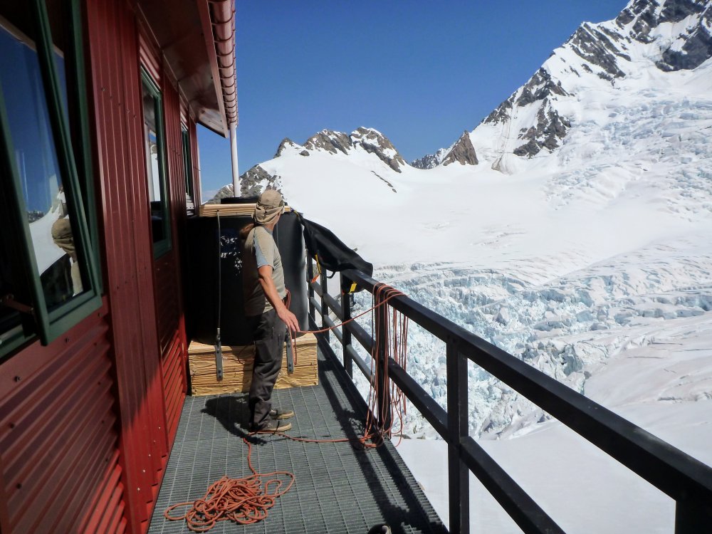
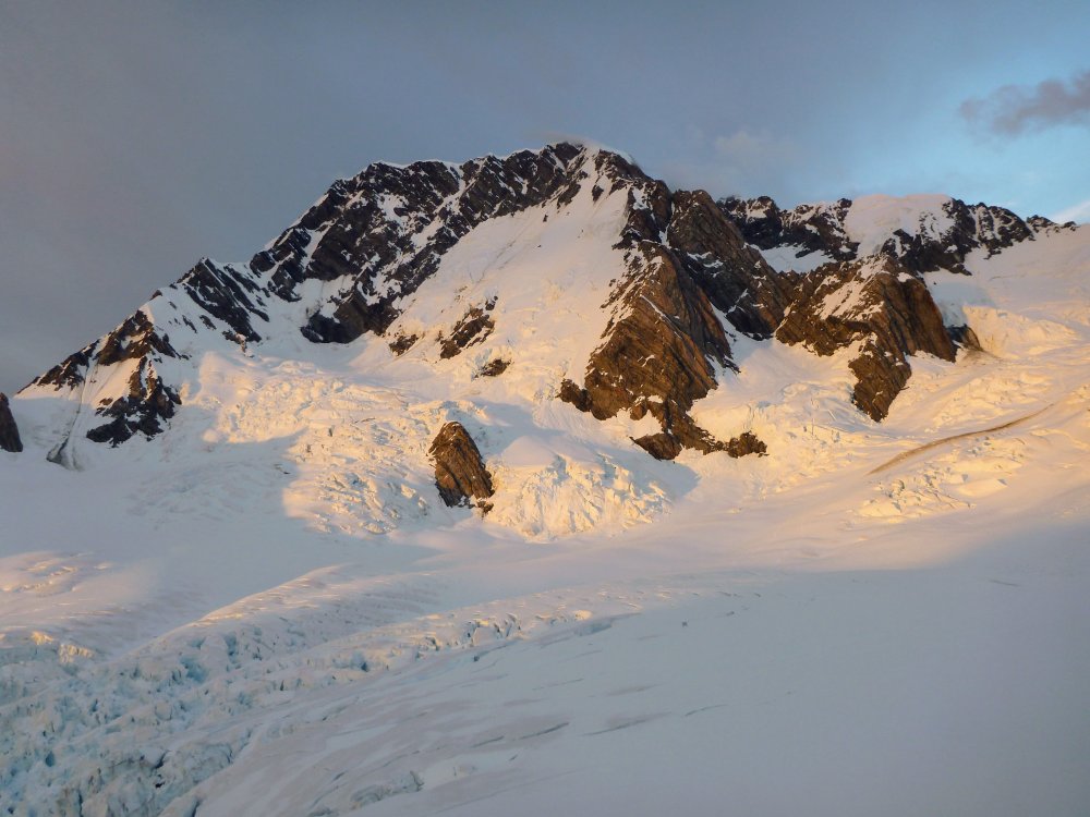
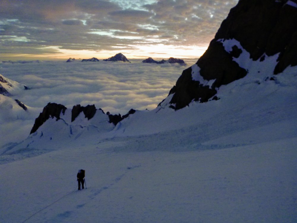
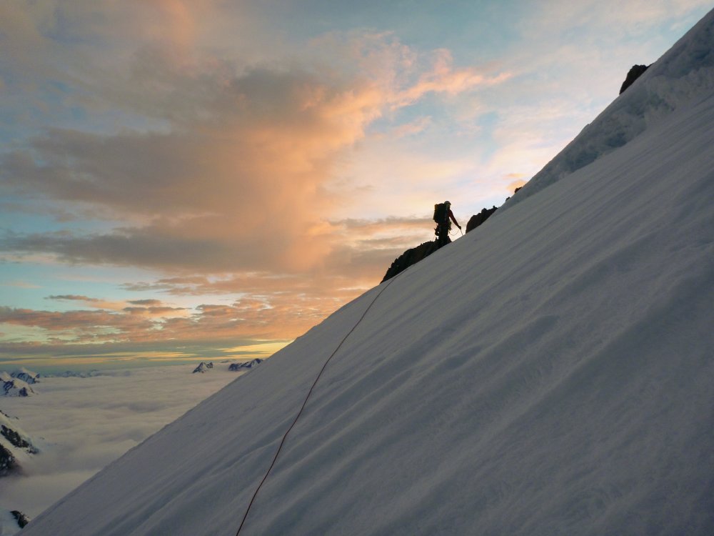
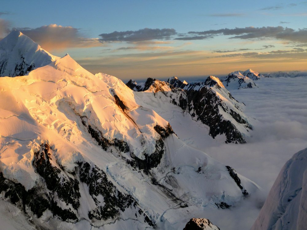
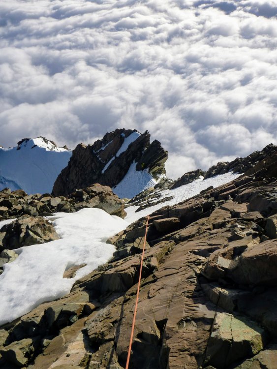
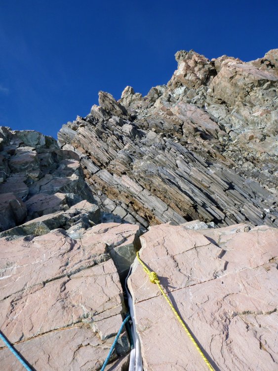
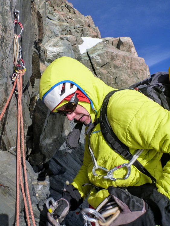

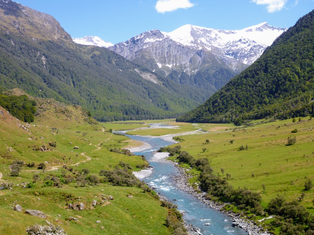
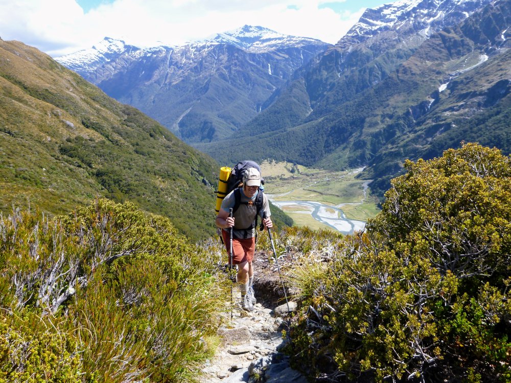
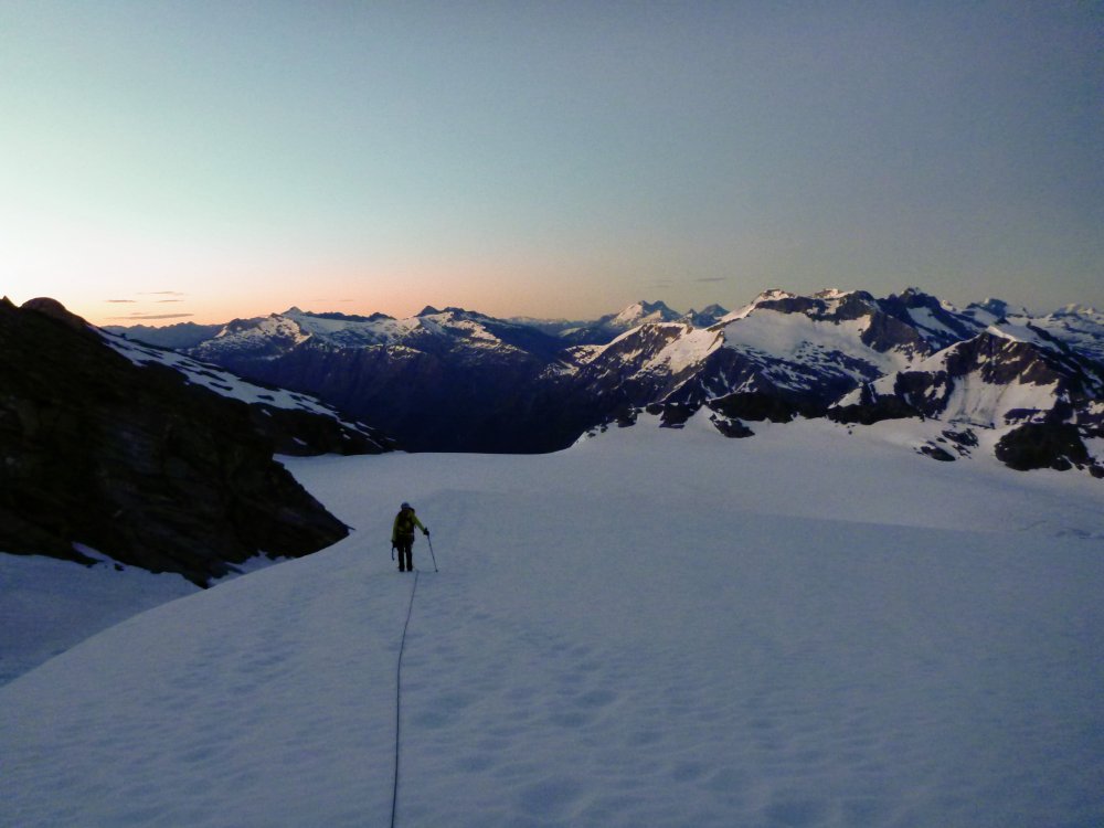

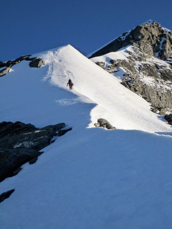
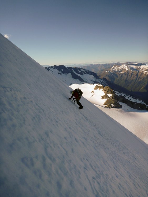
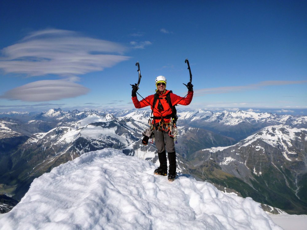
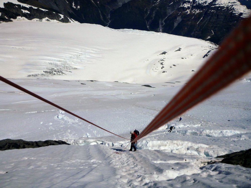
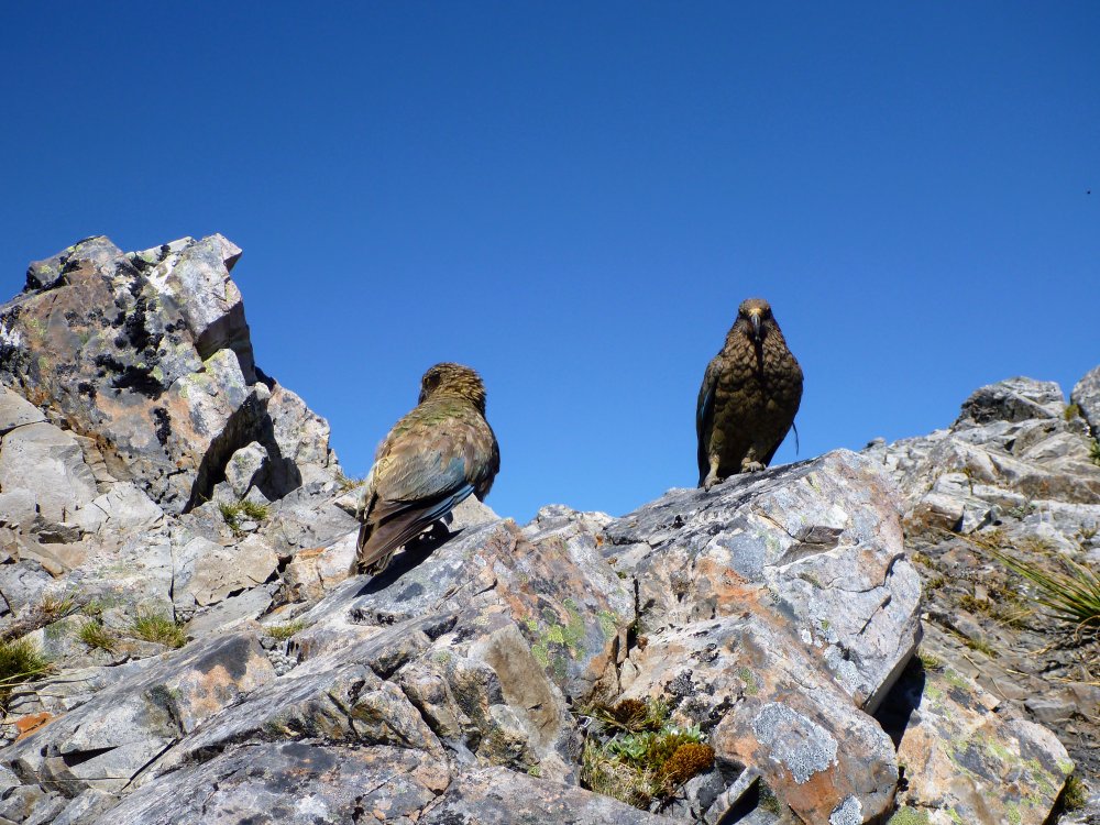
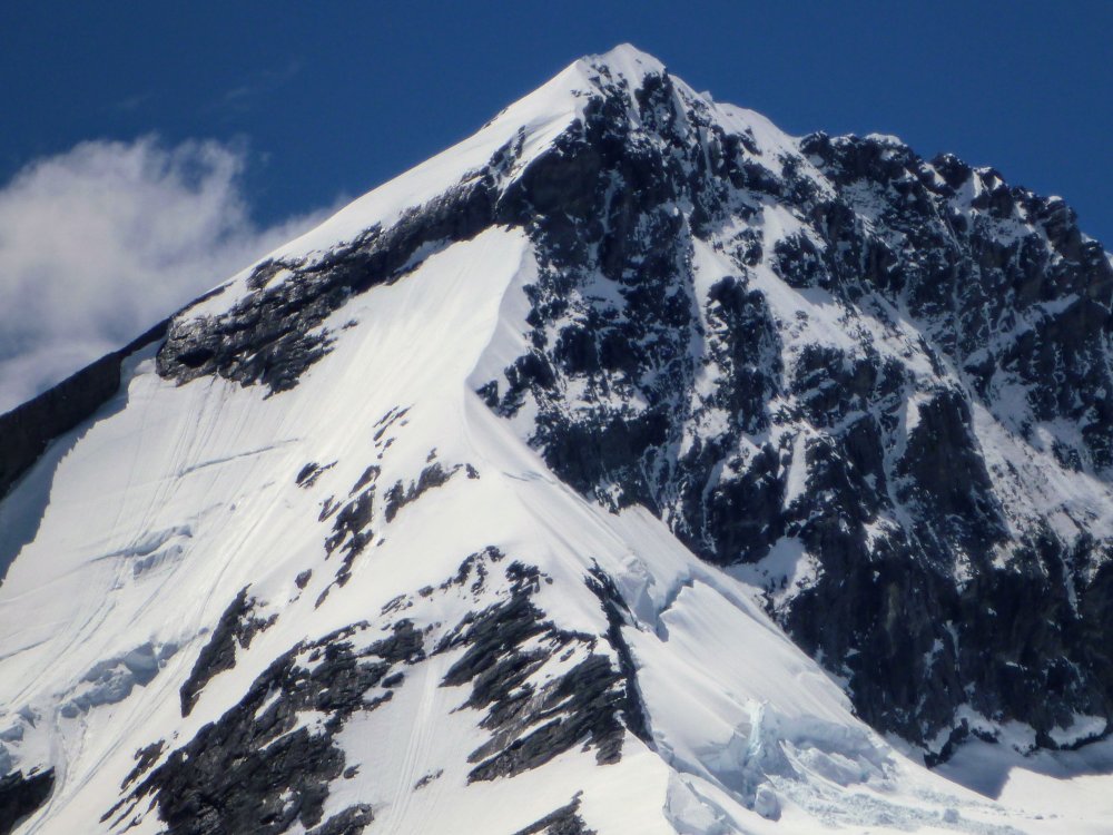 3 points
 -
Just wait until we unveil the all new DA TOOF FORUM! All TOOF, ALL THE TIME. Featuring world renown photography of this Cascade Jewel. Featuring tracking of all Toof records. Feature the largest collection of Toof TRs on the planet.3 points
-
I think social media has a lot to do with the decline of forums like this. It's a lot easier to click on an app, post a single photo with a little blurb, and call it good. Methods of sharing information changes quickly these days. Who knows how it'll all happen in 10 years? I also think that this board sparked a kind of golden age of Cascade climbing, and that that spark has kind of naturally fizzled out as people have pointed their lives in different directions. From what I see in my community, the current fads in climbing have shifted a little towards hard rock climbing at the crags, ski mountaineering, and bouldering. And what was wildly impressive in those disciplines 10 years ago has become a little more common and therefore less worth talking about publicly. There are still a lot of alpine first ascents waiting to be done, but many of them are hard, dangerous, and will be in the cold, icy season. To be honest, after a lot of close calls, that kind of climbing is less appealing to me than it once was. I haven't posted in years, and only recently started checking in again every now and then since I've decided to prioritize mountains in my life again. I'll say that this forum definitely helped shape who I am. There's no question that I'd be living somewhere else, have different friends, and have an entirely different life trajectory if it weren't for the people I met, the things I learned, and the places I learned about from this site. As tends to happen, my jobs got in the way of my mountain adventures for the last few years. I took care of that though. Quit my winter job because I was finding myself behind a desk more and more, and am back to being a ski bum. Will I post more TRs? I don't know...3 points
-
Just like everyone knows the best rock climbing area in Oregon is Beacon Rawk, in years like this one the best WA ice is found in Lil'wet. A cold air mass has been parked north of the border for the past several weeks so the ice up there now is good. On Saturday, Wayne and I climbed Capricorn = a classic Lillooet WI5 in the isolated Bridge River Valley. Sunday, we got the second ascent of Bitcoin Billionaire, a route first climbed a week ago by Danny O'Farrell, Hunter Lee and Steve Janes located a little out of view of the top of the pic above. It is a 7 pitch, M5/6, WI4 insta-classic with all the alpine essentials: a river ford, a snow slog to the base high up the valley, a fragile pillar start, two cool mixed chimneys, and a final phat curtain. The only thing missing was a bear attack, maybe someday.
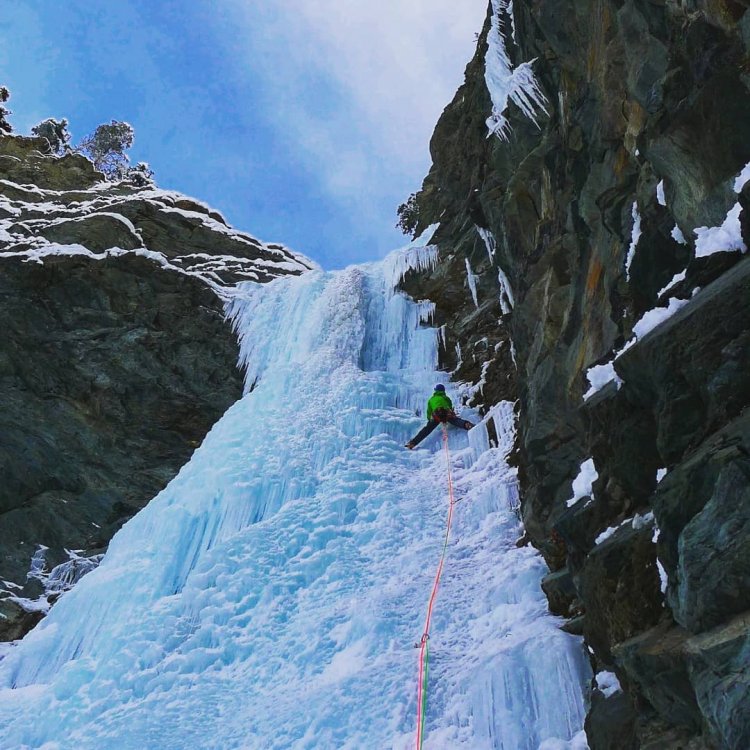
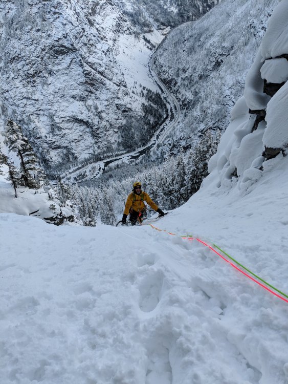


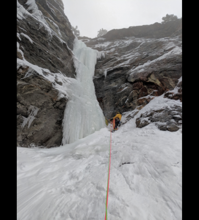
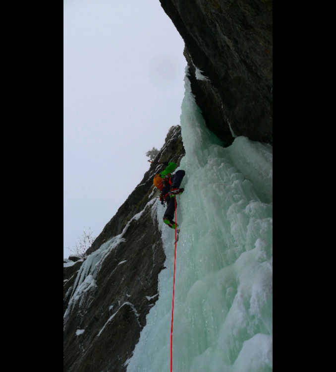
 3 points
 -
Trip: Plummer Peak - Standard Trip Date: 12/21/2017 Trip Report: I don't get to Rainier in the winter much, and I can see that I am missing out. Last week, I had the fortune of getting out for a day in the Tatoosh with Tim while the family and I were down staying in the Park for a few days before Christmas. And what a day it was! Several feet of dry snow, beautiful sunshine, and nobody around our intended destination- Plummer Peak. Well, I should say our Plan B destination. We had hoped to ski the Zipper on Lane this day, but stepping off the skis found us sinking to our waists. No thanks! Skiing off Plummer was a great consolation prize, especially since we had that whole part of the Tatoosh to ourselves. I'm used to the crowds of the Baker backcountry these days so it was a treat to not have another ski track (new or old) in sight anywhere. I need to remember to not look down my nose at the South Cascades! Lane Peak: Unicorn! Pinnacle Peak: Denman: Near the top of Plummer Lenticulars around Pinnacle: Pyramid Peak: Little Tahoma: Mackerel sky on the way back to the car: Gear Notes: skis! Approach Notes: Park at the Narada falls lot and skin up to the old road. Ski along until you come to the first Reflection lake, then leave the road and contour SW


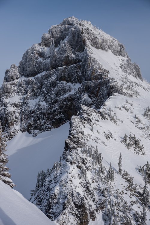
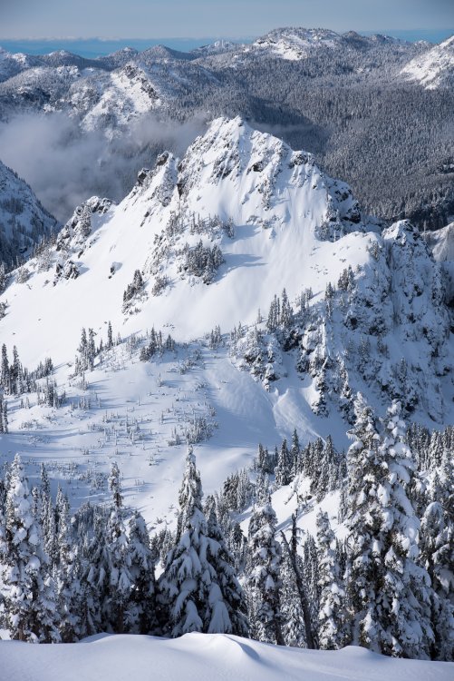

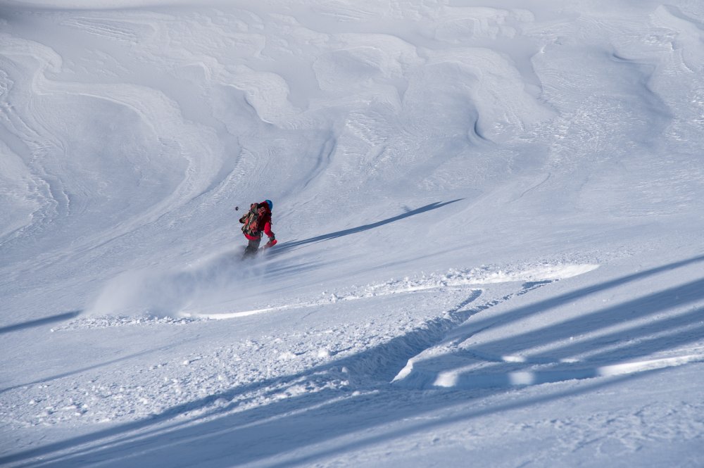


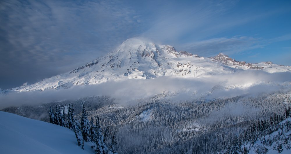
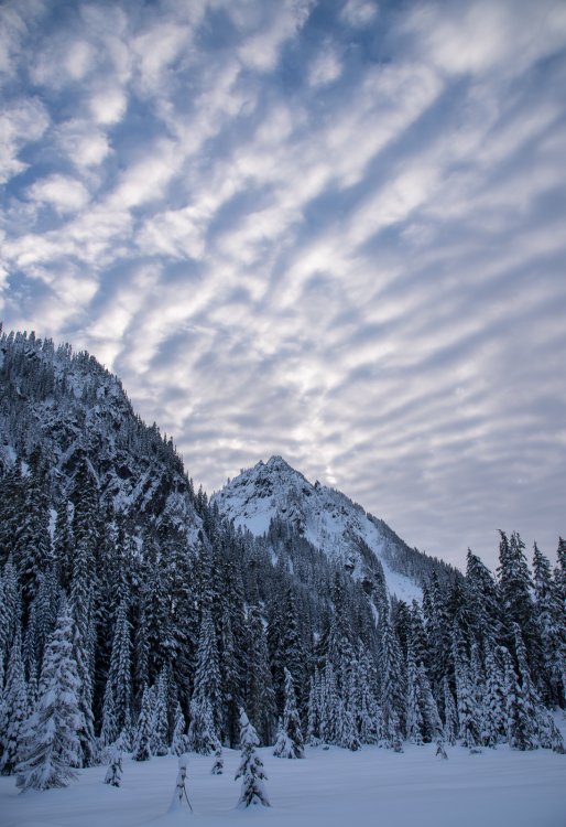 3 points
 -
Trip: Mt Hood - Reid Headwall - Iced up solo Trip Date: 12/09/2017 Trip Report: Went for a solo outing on the Reid Headwall last Saturday and found AMAZING ice conditions! Got lucky with great weather, no wind, and sick ice. By far my favorite route, and the best conditions I have found. I could tell you about it...but seeing is way more fun! Check out the climb in 4K! Gear Notes: Petzl Quarks, Petzl Lynx crampons Approach Notes: Timberline to I-Saddle3 points
-
Me, Andy, Joel and Fred climbed Shuksan via the Sulphide Glacier route the weekend of the 9th-10th. We took skis (and a split board) to within a few hundred feet of the summit, carrying them for only the first 2 miles of trail walking. It was strange to travel up into such warmer weather with the inversion going on. It was winter at Baker Lake, the lower parts of the mountain were spring like, and the summit was wintry again. We camped at the normal glacier camp on Saturday after getting an alpine start of 10:45 am from the TH. With the winter darkness setting in I think we went to bed about 6 or 7 pm, it was sweet to sleep for so long. Up at 5, moving at 6 we skinned up wind crust and crud to maybe a third of the way up the summit pyramid before switching to crampons and axes. Fred led the booting all the way to the top through wind crust on top of pow on top of verglas. The summit was amazing, quiet, lonely, and calm! After a somewhat mediocre upper portion the bottom half of the Sulphide was pretty good skiing due to the sun having warmed the wind crud. My light mountaineering skis were sub par in the crud, but everyone had fun. Back at camp at 11:30 for lunch and water in t-shirts. We did a combination of strategies on the descent, but two of us skied all the way to the dirt on the trail traverse below 3000' before booting it to the car. I think it is safe to say a good time was had by all! It was amazing to have the mountain to ourselves for like 28 hours. Views were fantastic and weather/conditions darn good. I was particularly glad to make it since I was 0-2 on ski attempts on this route. Hiking in wearing long underwear: Skinning up the ridge: Sunrise: Summit gully: Summit views:


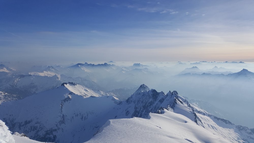 3 points
 -
Trip: Ulalach - via Squire Creek Pass Trip Date: 10/24/2017 Trip Report: Long live the mighty Cascade Climbers! My first TR on the new software, so we'll see how this goes..... Remember when it hadn't rained in months? When summer just didn't seem to end? This harkens back to that time, when the call of the fall spirited us away from work midweek. When nobody but us and the wolves roamed the high country of the Darrington hills (see below). It was also an excuse for Scott and I to harass the rest of our crew from a North Cascades summit via modern technology. This is becoming increasingly important, I hear. In case you're wondering Ulalach (think Ooo la la- Chinook for "onion") has great cell service. But more importantly, it is lonely up there. We didn't see much in the way of evidence of passage, and we honestly had to think a bit to puzzle the way to the top. It helped that I've started to not research climbs as thoroughly as in years' past. In this age of ridiculous beta, tuning out is a great way to increase the adventure, even on a day trip. Even if I had done some research, I wouldn't have found out that we could expect to see wolf tracks superimposed upon ours on the descent. Apparently this was news to the USFS, NPS and tribal wildlife bios that I consulted upon our return. Hopefully the Darrington locals can tolerate their new neighbors. Viva la mystery of the North Cascades! And the new software makes captioning WAY easier..... I'll actually label these, where it makes sense to: Darrington's version of the deepwater solo: Whitechuck from the trail below Squire Creek Pass: Ulalach!: Scott admires the mighty east face of Three Fingers from Squire Creek Pass: Whitehorse: Three Fingers: Salish Peak! North Peak of Three Fingers: Del Campo (L) and Big Four (R): Put Jumbo on your list!: The upper Squire Creek Valley, with Liberty on the left and Three Fingers on the right: Squire Creek Wall: Scott breathing deep the oniony glory of Ulalach: The hills are alive! There were pup tracks with the mama. They followed our tracks for a half mile or so, just below the pass.: Exfoliation Dome, perhaps the toughest summit to reach in WA under 5000': Gear Notes: Helmet. Ample opportunities for 5th class climbing off the scramble route. Approach Notes: Squire Creek Pass trail from Clear Creek road. From the pass follow your nose north. Stay on the east side of the ridge at first, until you can traverse into a saddle just south of the peak. From here, you will want to stay mostly on the ridge until forced to a right side ledge at a step. Follow weaknesses up and left back to ridge and finish on the west (left) side, pulling on shrubbery.


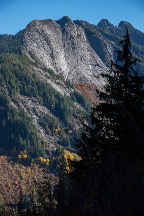
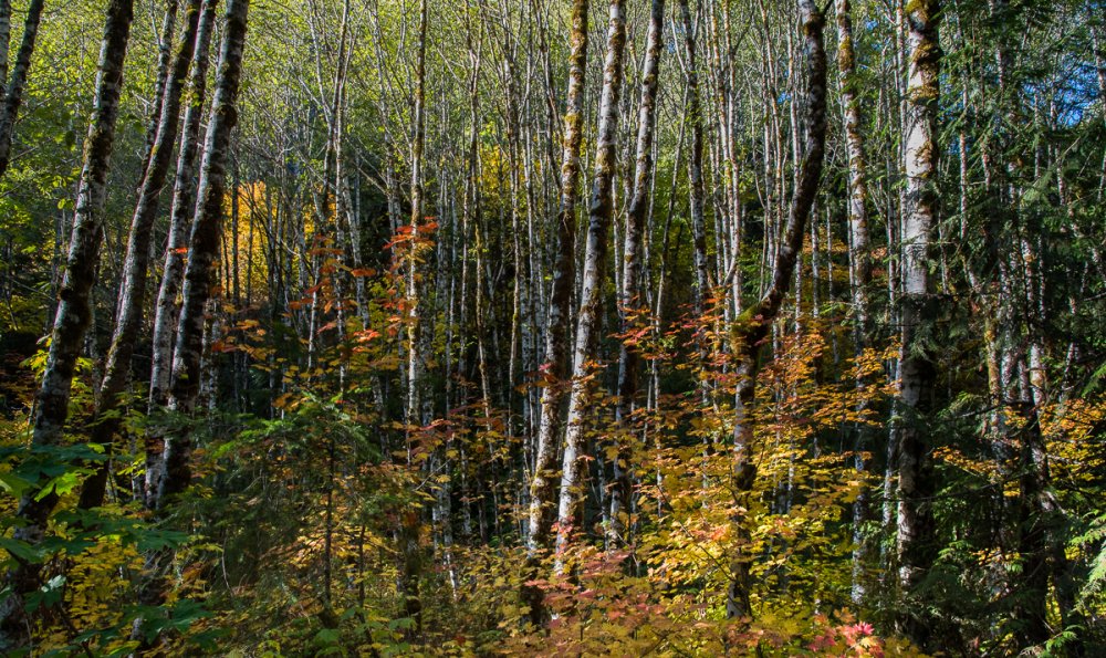 3 points
 -
Woohoo! I like the new look, thanks guys for the work! I've only been poking around a few minutes so these thoughts may change, but my initial comments: The front page looks good and snazzy. It highlights the blog posts and articles, but TRs are not mentioned at all except in a tiny box at the bottom (which leads to error code: 1S160/2 BTW). IMHO the best part of this site as a regular user are TRs and the Forum, I would love to see recent TRs and Forum posts highlighted up front. Or maybe TRs should be considered like articles/blog posts? That and I really hope my and everyone elses old TRs are accessible again eventually. I'm still figuring out this whole "recent activity" thing, not quite as easy to browse as the old "past 24 hrs" list, but I'll probably learn. The font and layout makes for a lot of scrolling there, maybe that can be optimized to not show "in the last hour" as it's own category (until we have a crazy busy site)? I am guessing this was a ton of work, so props to everyone!3 points
-
Thanks a lot for the work. One thing I really liked before was the ability to see all new trip reports at a glance. I like to read them all and don't necessarily click on each region. Thanks again for all the effort, maybe TRs participation will pick up!!!3 points
-
Page three of this thread has Ryan @akicebum and marc @marc_leclerc sharing bad partner stories back to back. Ryan's are pretty good.2 points
-
do you need help geolocating trip reports? If there's a list and there is some way to associate it with a spot on a map.. I would volunteer to help with that, 9000 is a big number but it can be done..2 points
-
Hi! I am 19, F, and a student of University of Puget Sound looking for a climbing partner. I have glacier experience and necessary gear, I am in training for big mountain expeditions and need someone to go out with me! I am motivated, hard working, and eager to learn new skills! I am looking to get on Rainier this spring and would love to explore other mountain ranges out here! Contact me if interested!2 points