JasonG
-
Posts
5271 -
Joined
-
Days Won
352
Everything posted by JasonG
-
This, for so much in life. Guile is lame.
-
 Yes, for sure! Glad to hear that it went off without a hitch, relatively. What a day out there.....
 -
There are none! No summit, no party.
-
for sale Ice climbing / drytooling indoor training tools
JasonG replied to Patrik_H's topic in The Yard Sale
Those look pretty cool!- 4 replies
-
- 1
-

-
- ice climbing
- dry tooling
- (and 4 more)
-
Attention all you hardmen and women....the table is set and the DEATH climbs (death picnic, death banquet, death smorgasbord, death fondue, death BBQ, etc.) on the North side of Table Mountain are served..... Don't worry, there won't be a wait to get a table.
-
Climb the South face of Lundin and post a TR about it @underscore_child! Here is a bit more info on the aspect of your desire: https://www.mountainproject.com/route/119738692/south-face https://www.mountainproject.com/route/119617555/south-face-2001-variation There is maybe another route on the face per Beckey, or maybe they found an easier start to the "2001 variation" back in 1975.
-
Great, thanks for the report from Shasta! It is still on my list, though I am thinking a spring ski might be the ticket, given the long drive (for me).
-
Yep. I think this is true. A lot depends on how the storm exits, and that is pretty nuanced. Like you said, they always come in windy on the big hills but it is a roll of the dice what the final few hours of snowfall look and bond like.
-
first ascent [TR] North Hozomeen Mtn - Zorro Face, IV 5.9 8/31/2013
JasonG replied to lunger's topic in North Cascades
Hahahaha. Thanks for the bump @olyclimber, and thanks to @rat and @lunger for doing what nobody else seems able to do, and surviving to write about it! -
Ask and ye shall receive! (It is just hidden, so if you really need it back, just let me know)
-
Grundens?
-
Great, again! Thanks for doing my homework @bedellympian!
-
Fun read, thanks for all the gory details! And, you'll want a pair of these if you're going to climb PNW ice.
-
Well, the mountains around here are pretty much getting loved to death these days @Indygraham22, so thus the lack of details online about some of these places. The weekend crowds are getting crazy! I will tell you that you are in the right ballpark though. You'll need to go off trail, however, to reach that particular tarn (just a generic name for a small alpine body of water). If you don't hike much, going off trail isn't super straightforward here in WA. There is a lot of steep terrain, brush, and changeable weather just looking to ruin your day. That said, I'd recommend downloading a mapping program like Gaia and the map for the particular area you are hiking. That plus a full charge should help a great deal if you get turned around. If the topo map is Greek to you, here is a good source for reading them: https://blog.gaiagps.com/how-to-read-topographic-maps/ And, for your home research, check out Caltopo: https://caltopo.com/map.html#ll=46.76409,-121.72993&z=15&b=t&o=n&n=0 You can toggle between the topo and the aerial and find that tarn you're looking for! In the process, you'll figure out how to get there from the nearest trail. Good luck!
-
[TR] Mount Curtis Gilbert - West Route 07/11/2020
JasonG replied to JasonG's topic in Southern WA Cascades
No, I have Anderson, Carrie, Tamanos, and Alta yet to do. I haven't exactly been putting it very high on my to-do list. It might take me a few more years at the rate that I'm going! -
Well, there is that. It is an entirely defensible position.
-
New sport climbing guidebook (kickstarter campaign)
JasonG replied to Bruce MacLachlan's topic in Climber's Board
The plot thickens. But it also reminds me why I prefer the lonesome brush to the crowded crags. -
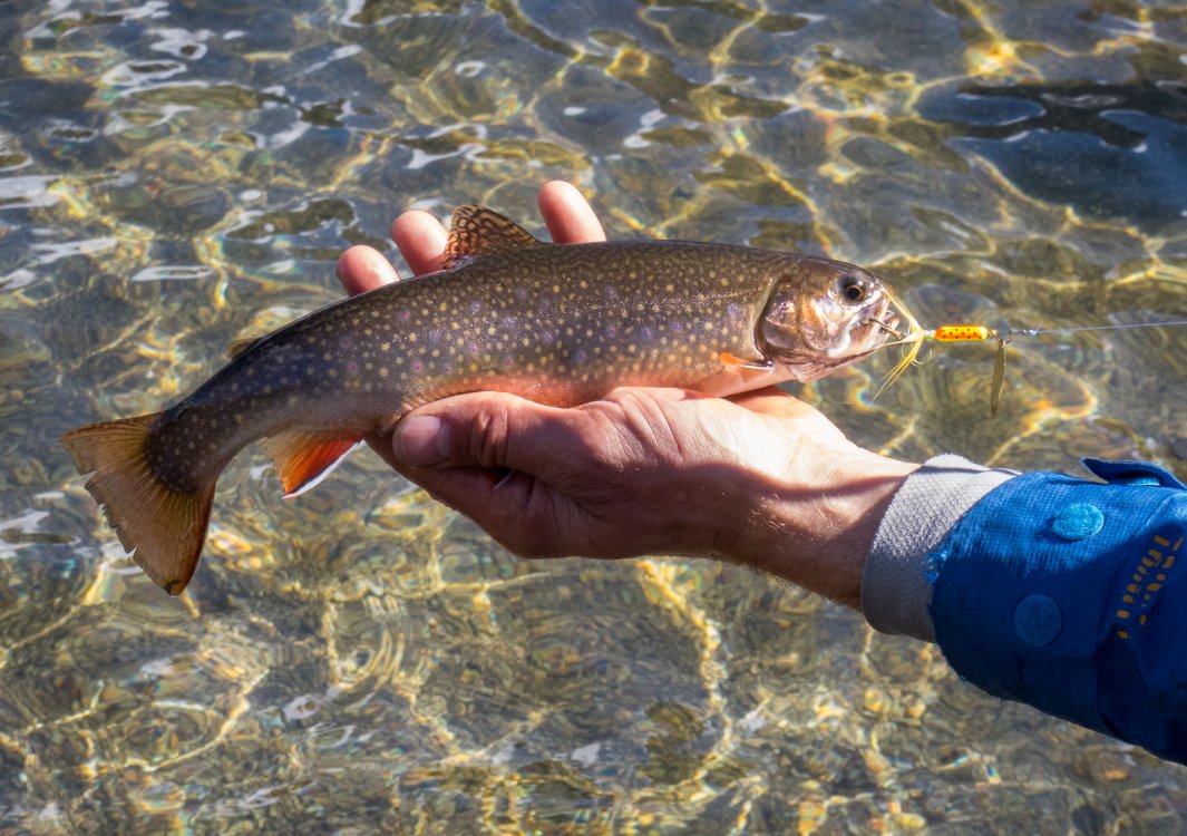
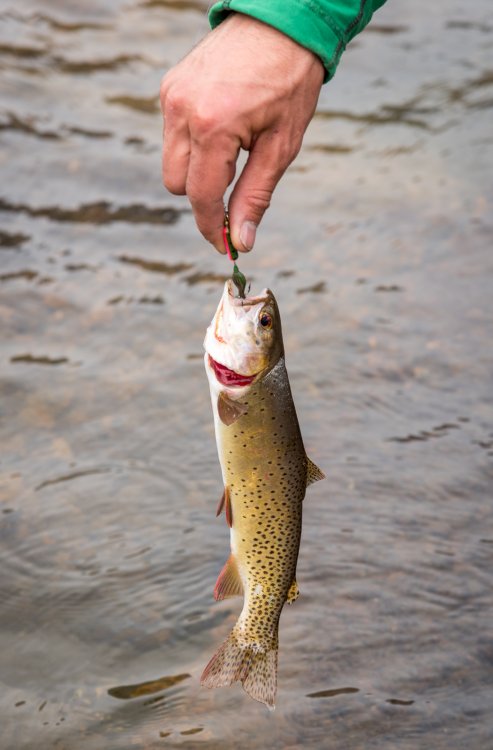
I do, but those fish weren't interested in my advanced techniques. Well one was, but I'm pretty sure something was wrong with him. It is probably the only lake in my life where I have seen spinners outfish flies by that margin. Sure, they're easier to fish with in many lakes, esp. with vegetated shorelines, but this was flat out ridiculous. You couldn't keep them off the spinners, it was practically every cast. And these were not small fish either! Meanwhile I am switching flies, sinking vs. floating lines, etc., etc. and NADA. @Trent had the record I think for fish hooked/landed on consecutive casts with a single spinner- 13??!!
-
So true @JayB! The window of conditions that favor snowshoes isn't nearly what the marketing tells you. That said, I am pained to admit that sometimes they are the proper tool.
-
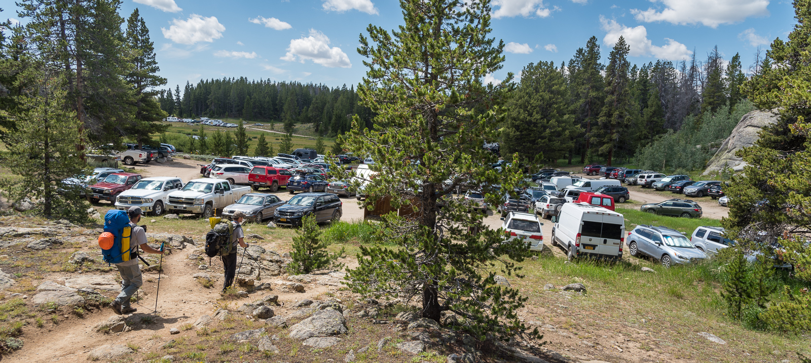
Yeah.....the story of the day, no matter the range. After driving for many hours, and not seeing that many people, I was surprised at the TH scene. I would say that 80-90% were backpackers. Backpacking is so huge right now, almost as big as snowshoeing!
-
Thanks, this is great!
-
Awesome story! I will have to get better at reading those. I guess I was thinking that the clouds would ride up over the summit if there was strong wind and precip? Do you have a good sense for when that happens, or what a time-eight would look like when it would? Or does the time-height accurately predict how high the moisture will be allowed to be pushed (before condensing and dropping out) over terrain?
-
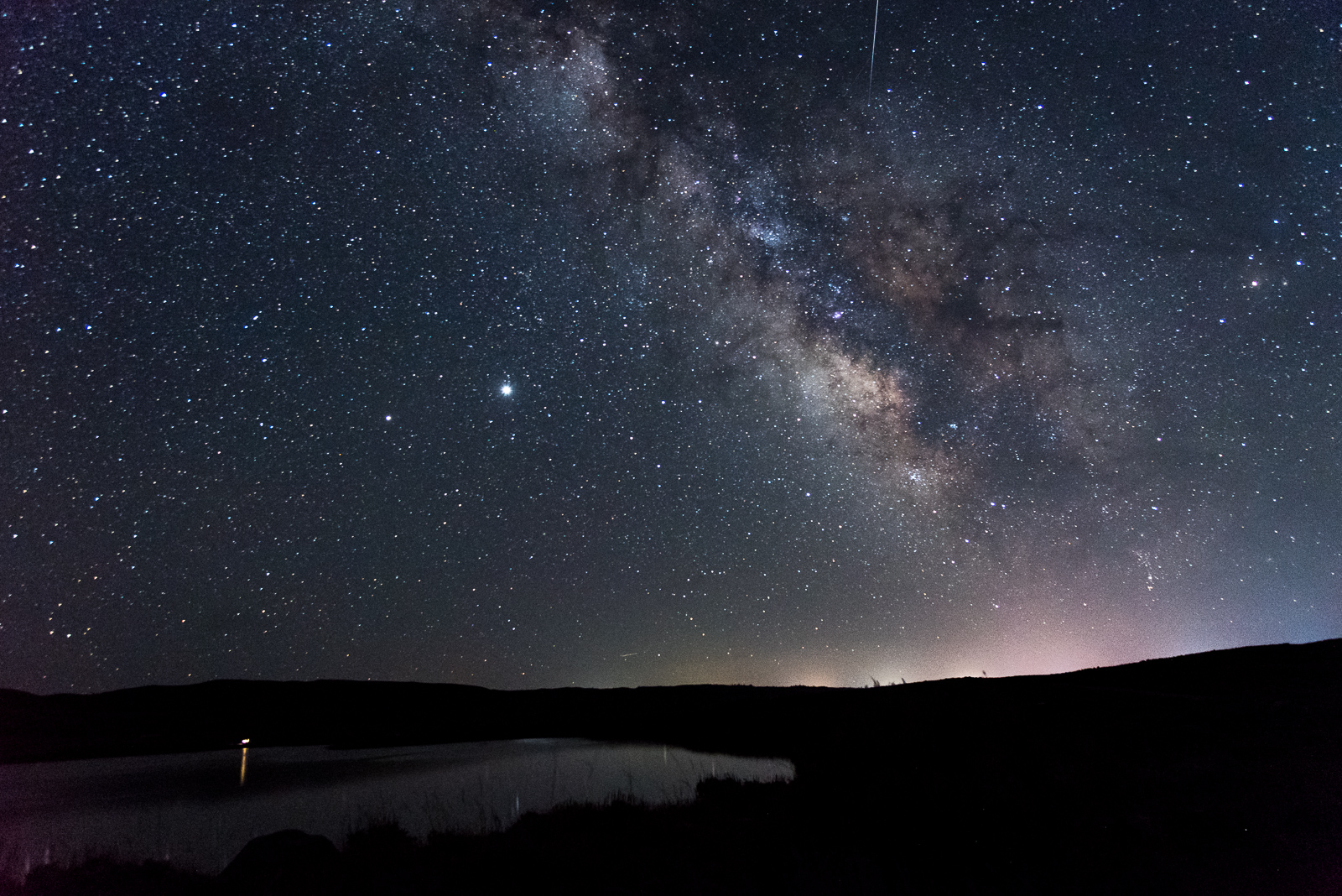
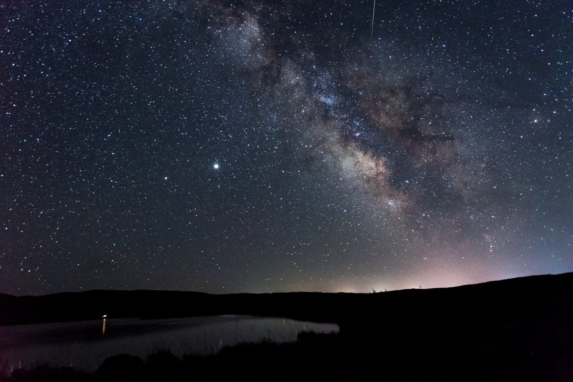
Thanks @Michael Telstad and @sfuji! I should have added that the busy trails and trailhead were mostly backpackers. The routes in the Cirque were quite a bit quieter than I was expecting, especially if you aren't on Pingora or Wolf's Head. Even on those classics, it wasn't terrible (party or two), and I have a very low tolerance for crowds. As far as camera gear, I lugged in my full frame D750 and a few lenses in. I didn't bring my 20mm( which would have been perfect since it is quite fast), but used by 24-70mm for those shots (f4 for 20-25 sec at high ISOs). Any longer than about 25 seconds at that focal length and the stars start to blur. I propped the camera on rocks to save the weight of a tripod.
-
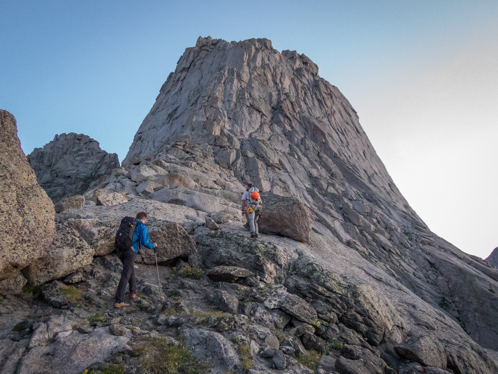
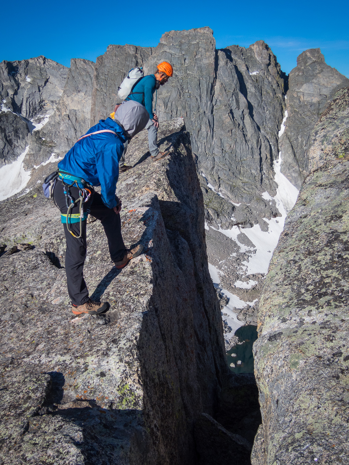
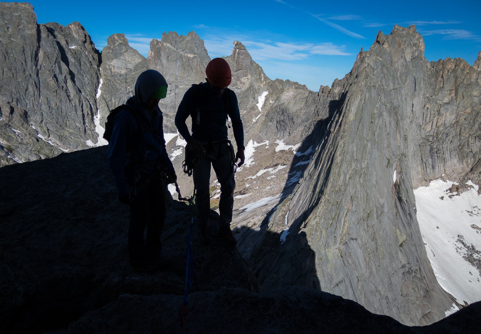
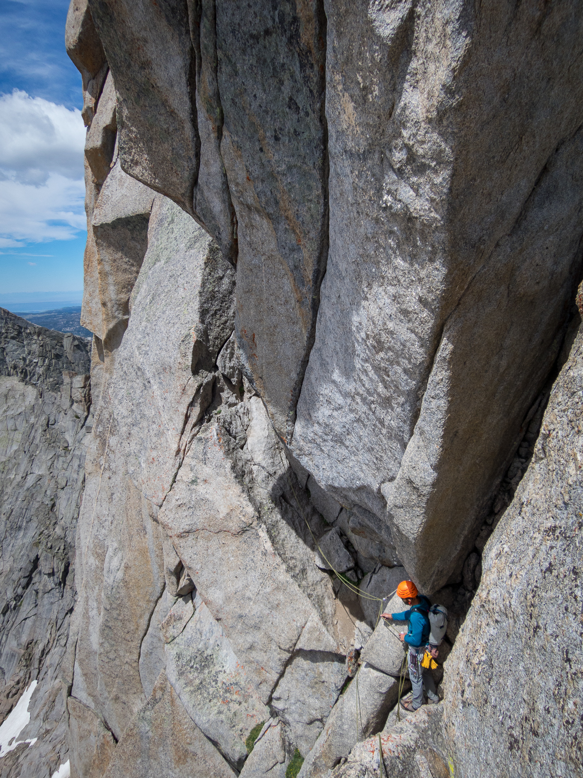
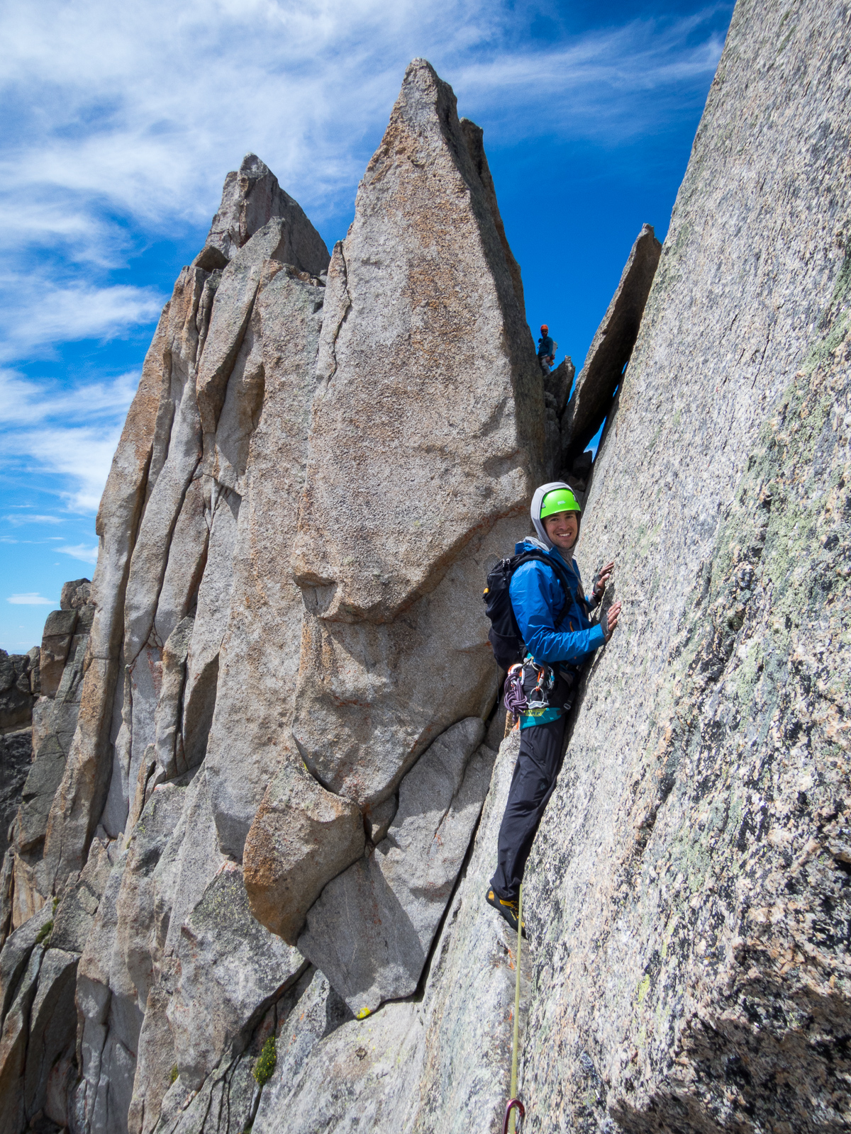
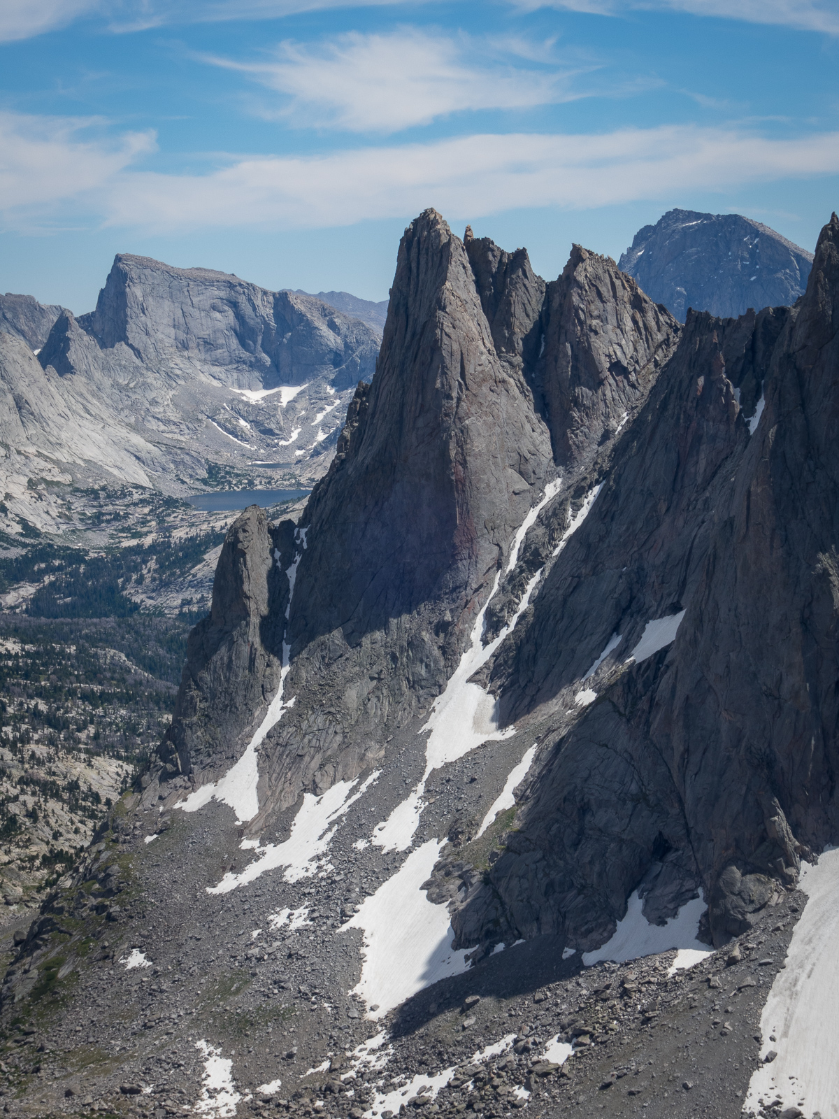
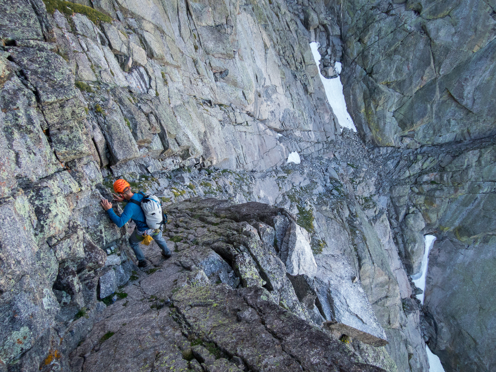
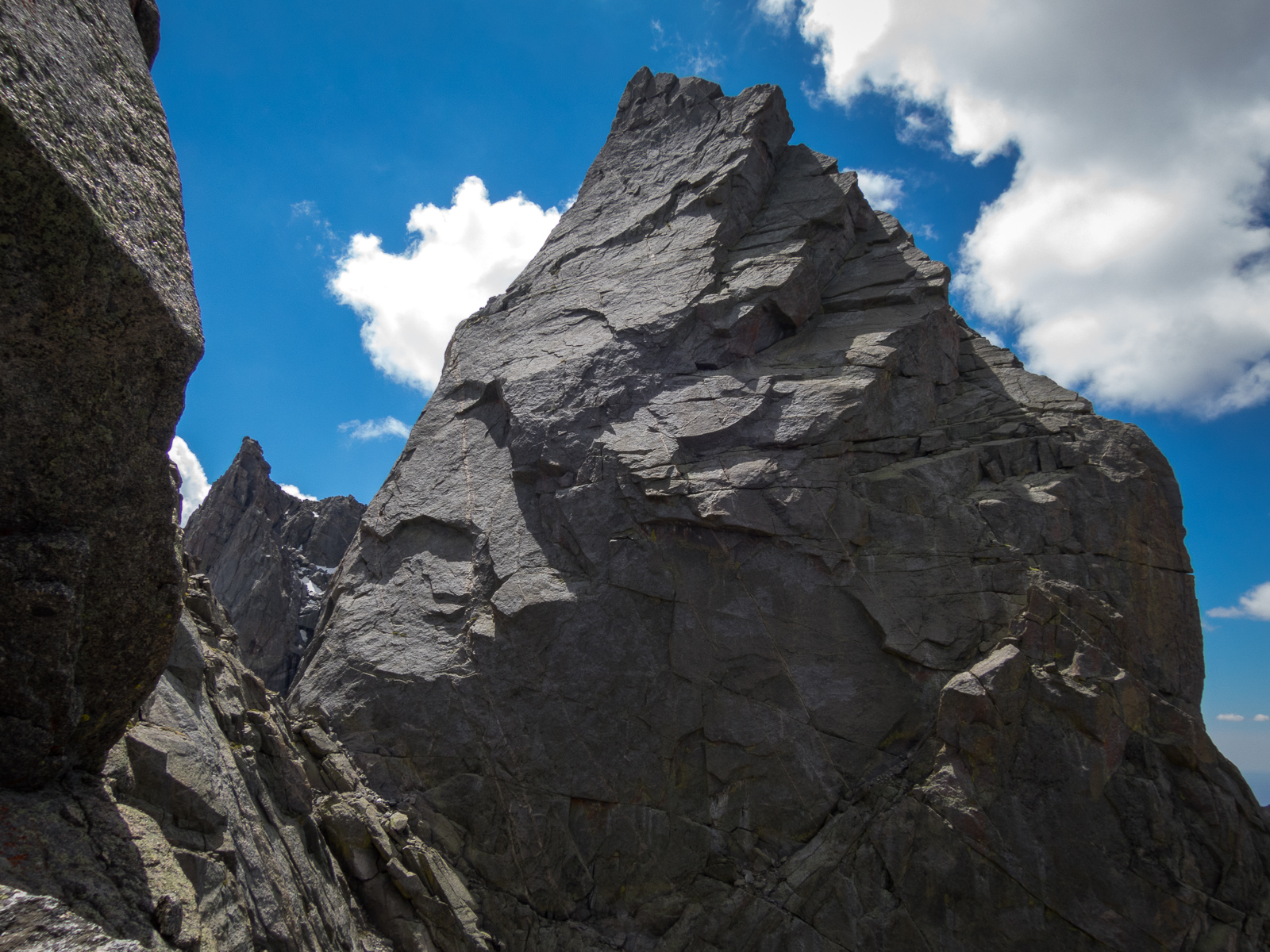
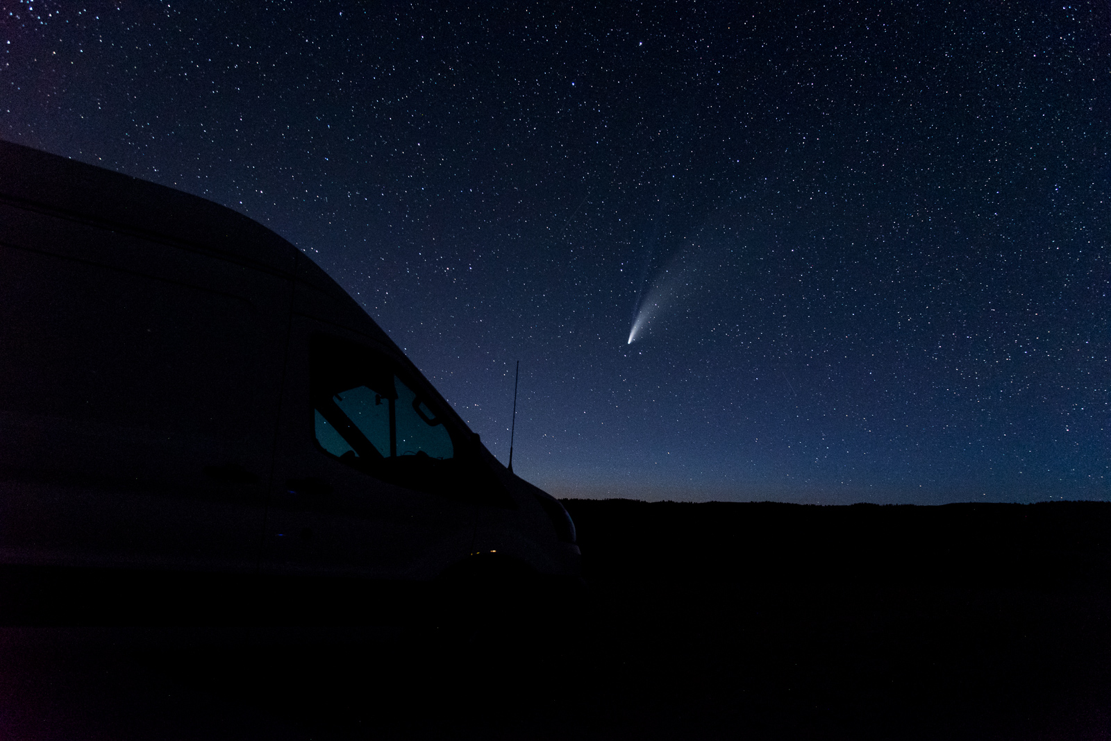
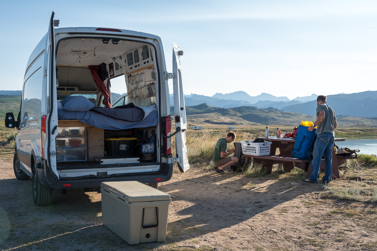
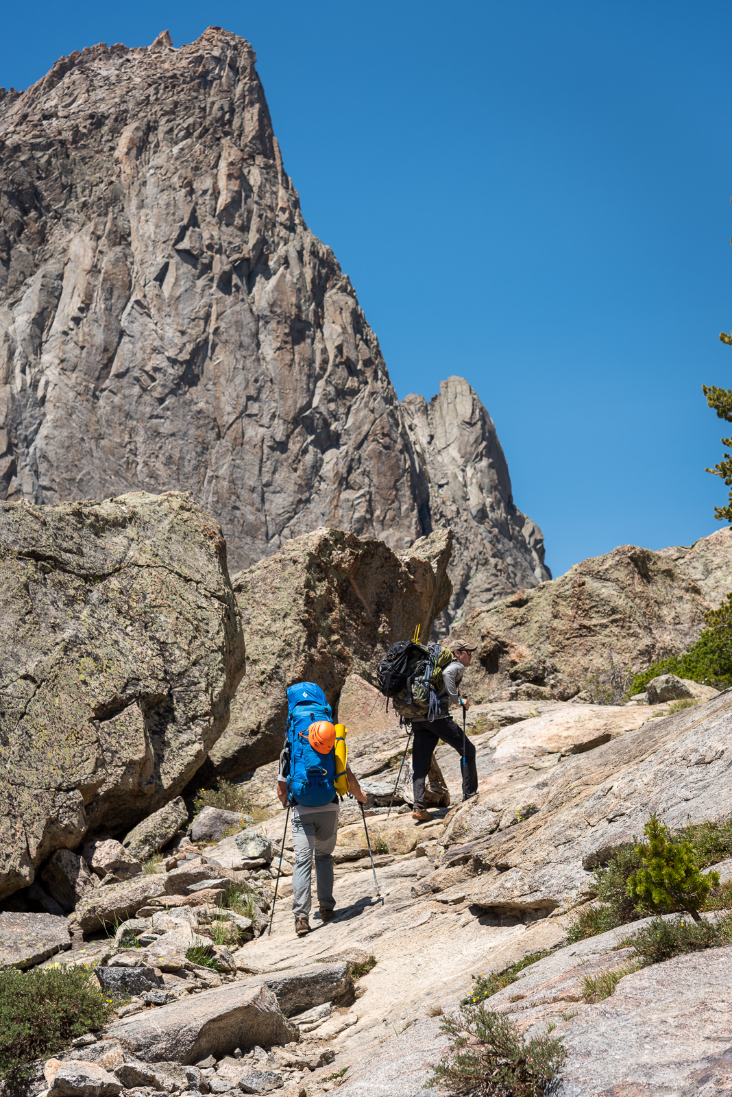
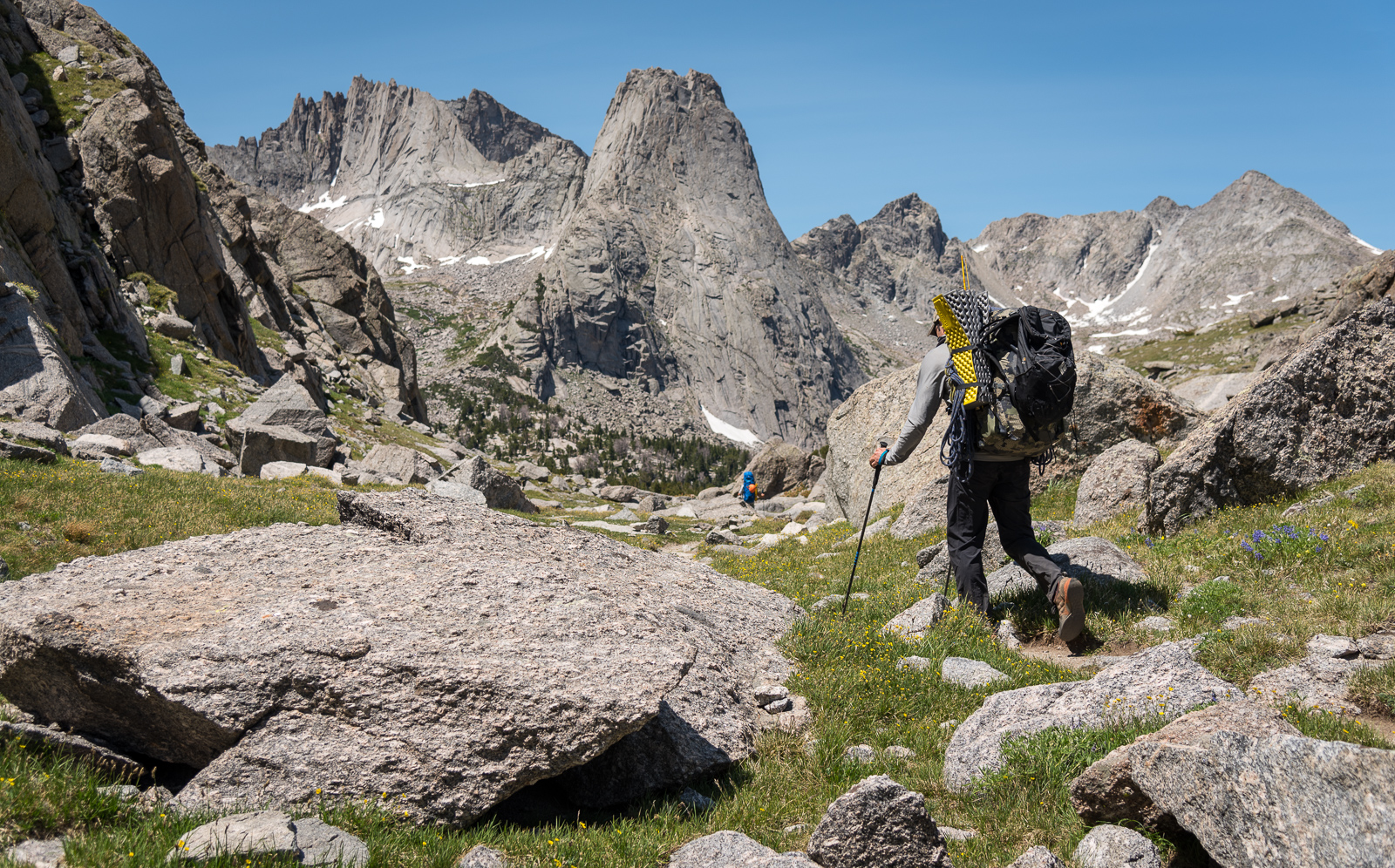
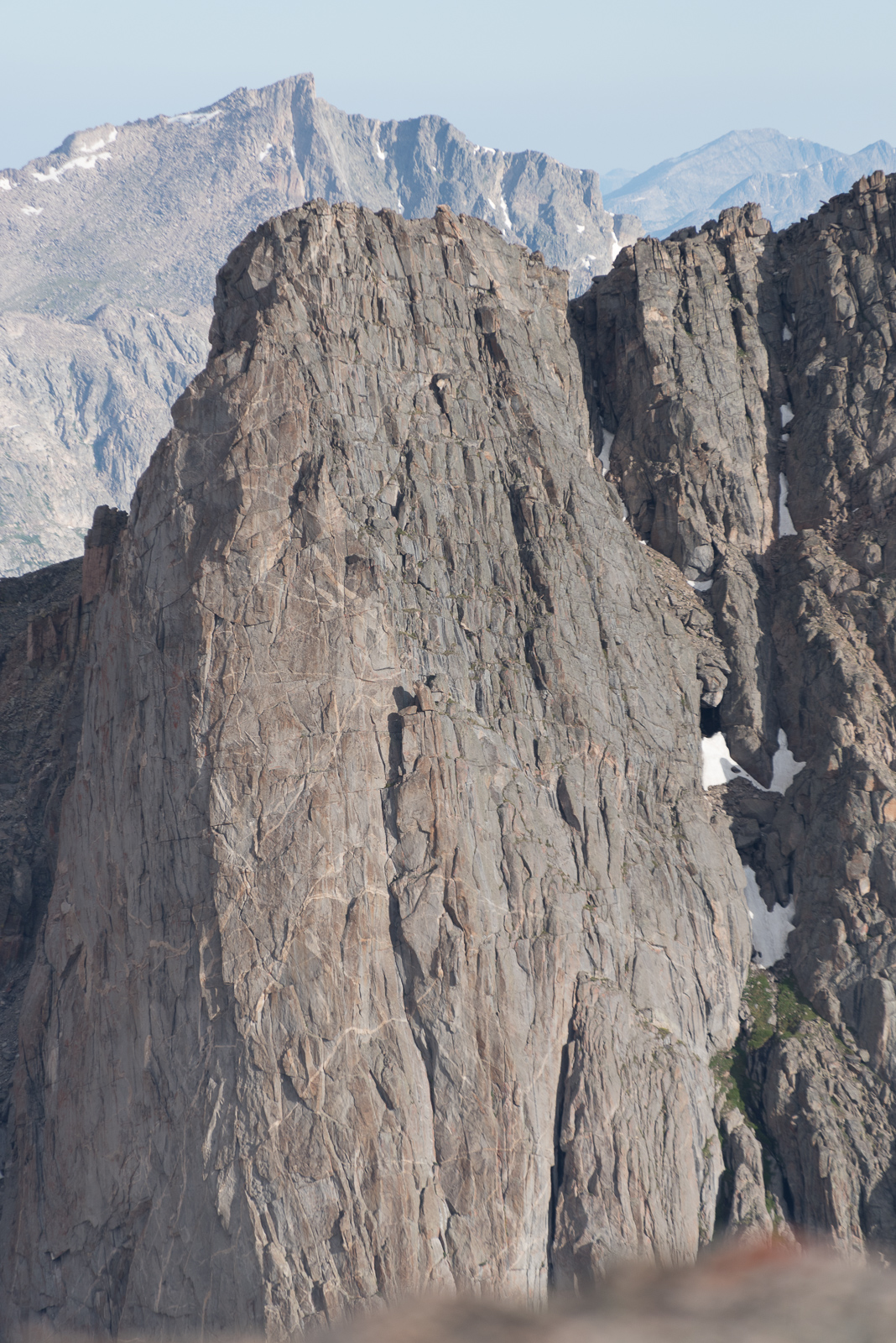
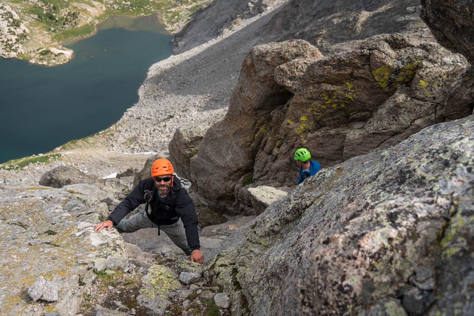
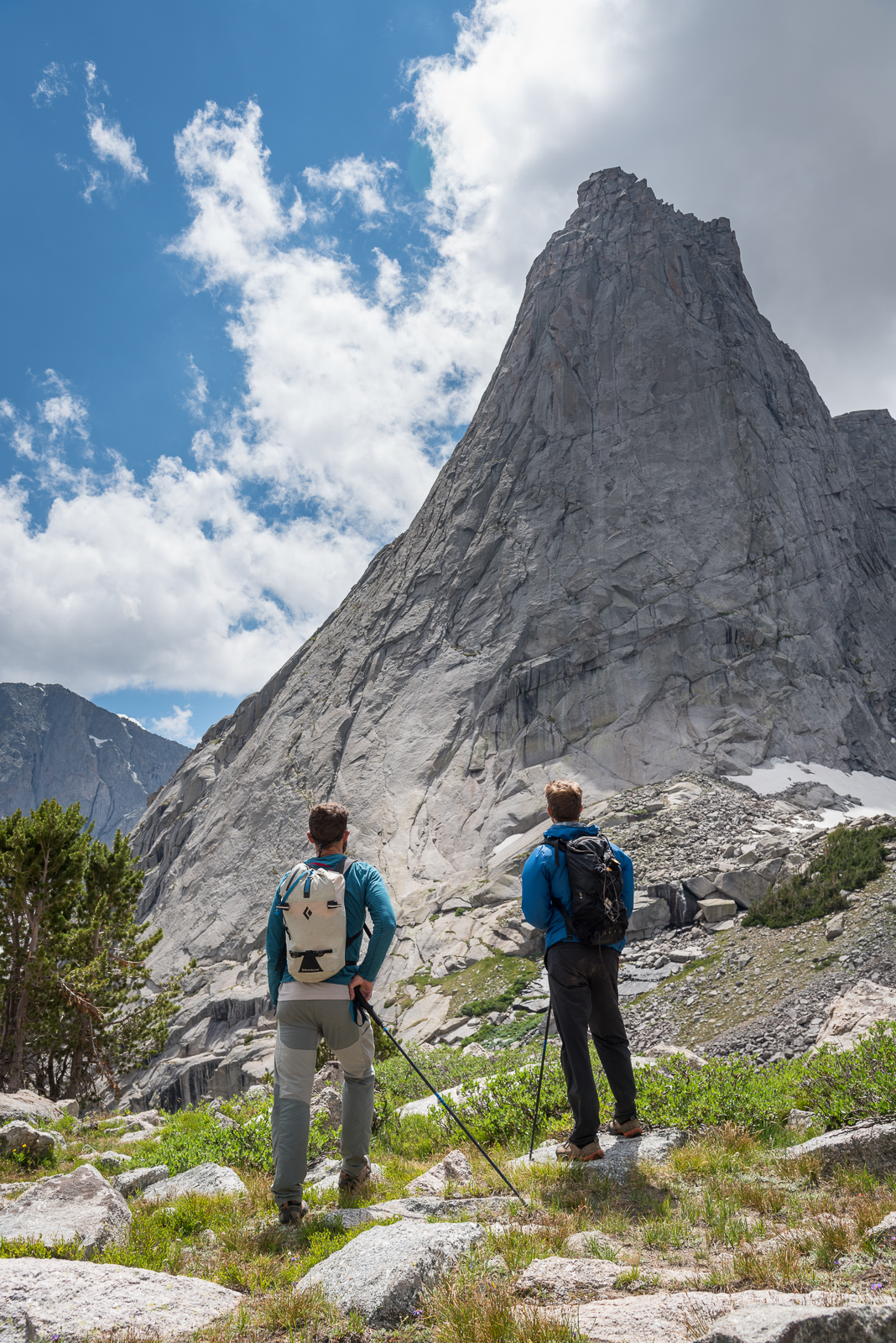
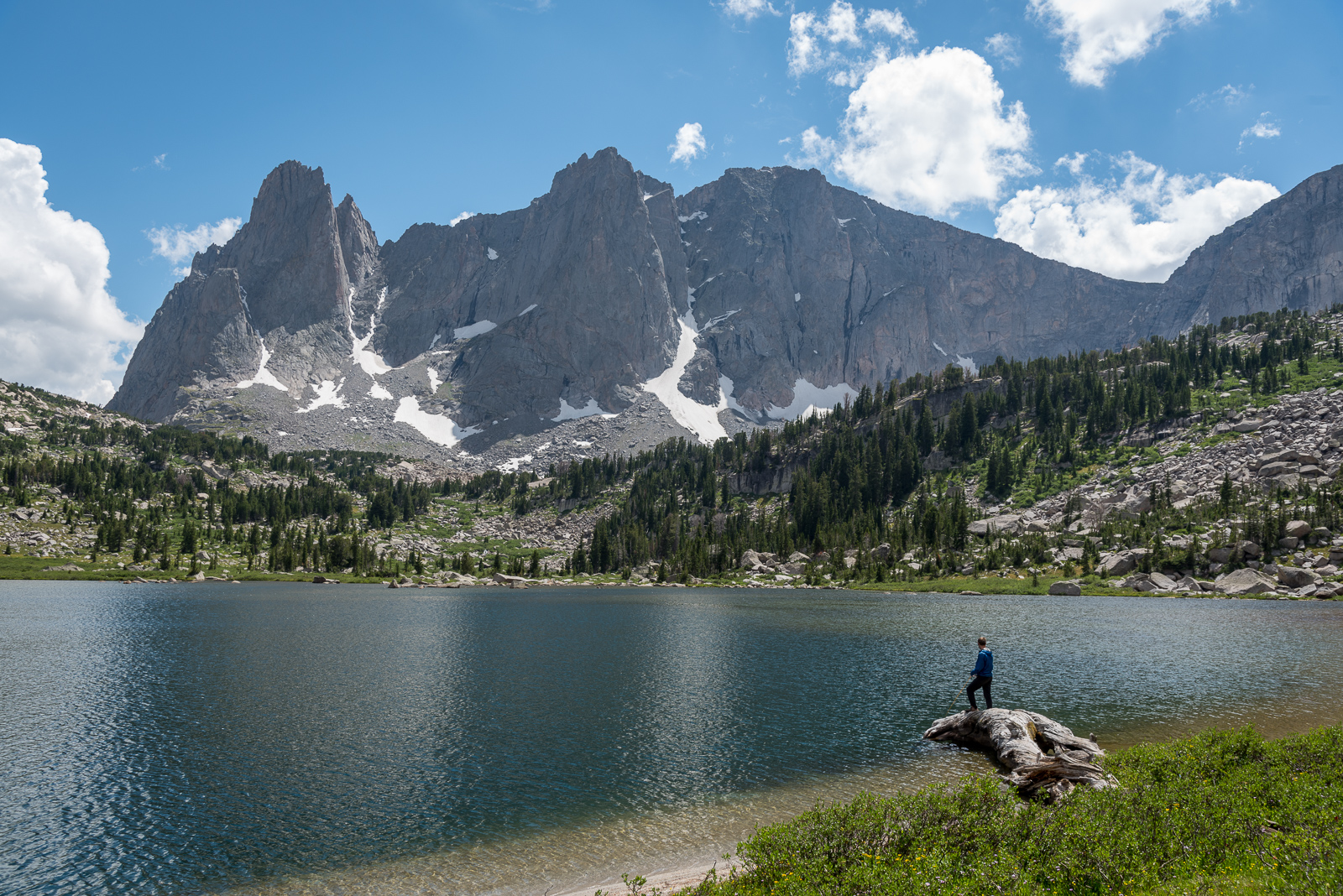
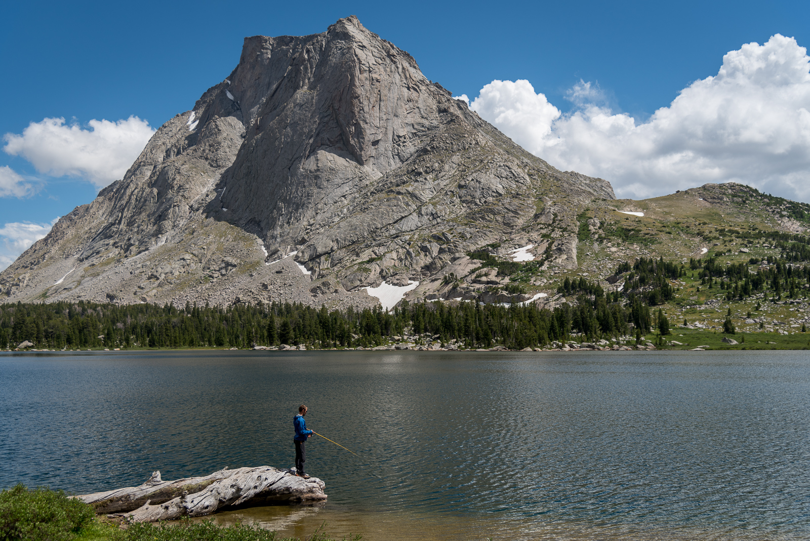
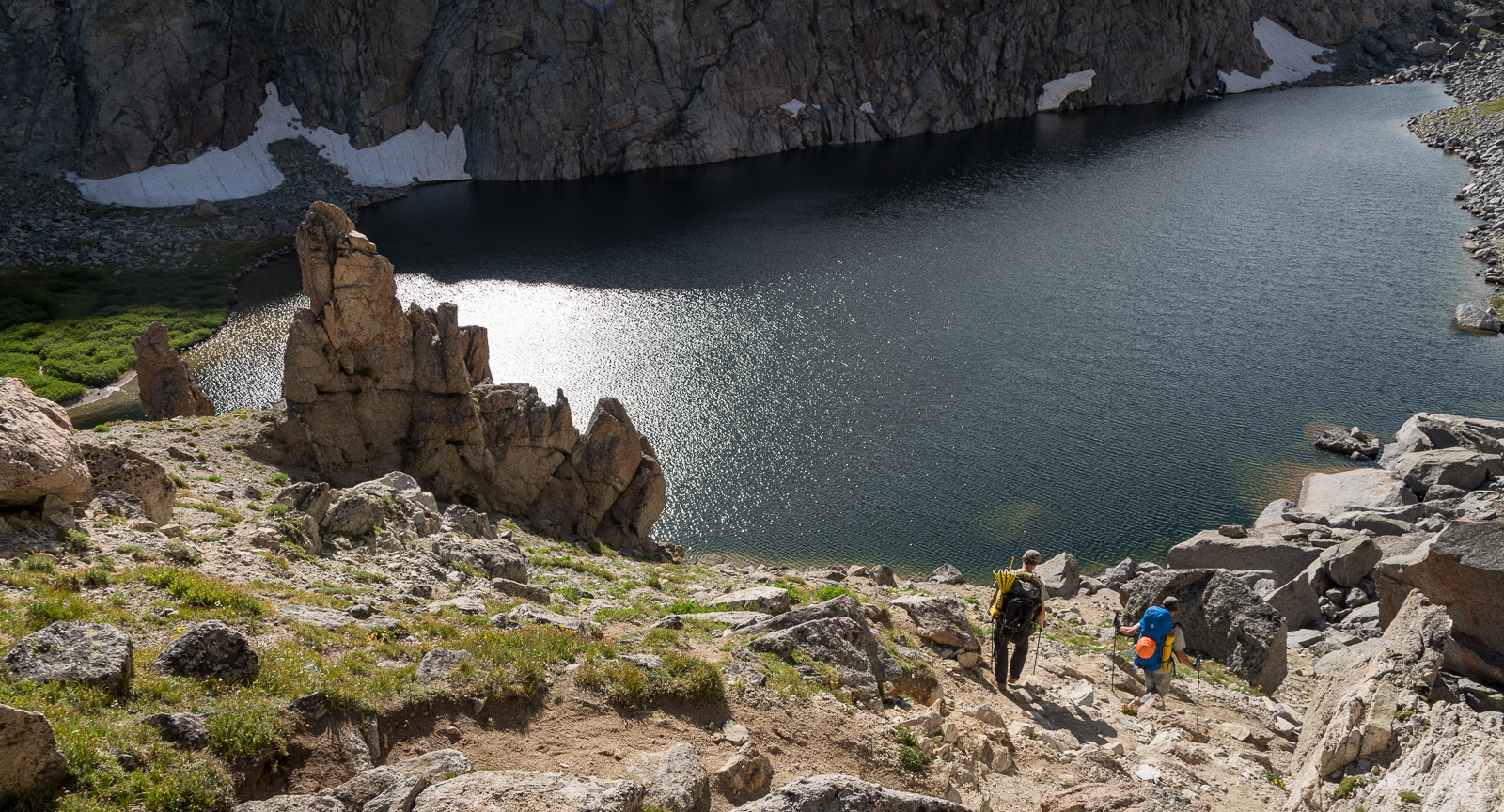
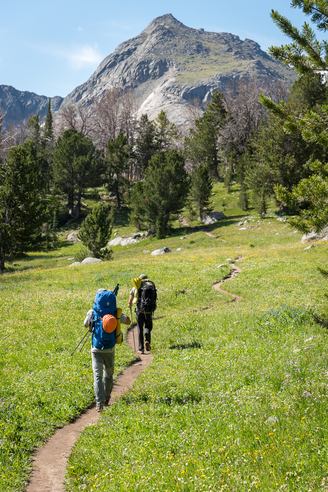
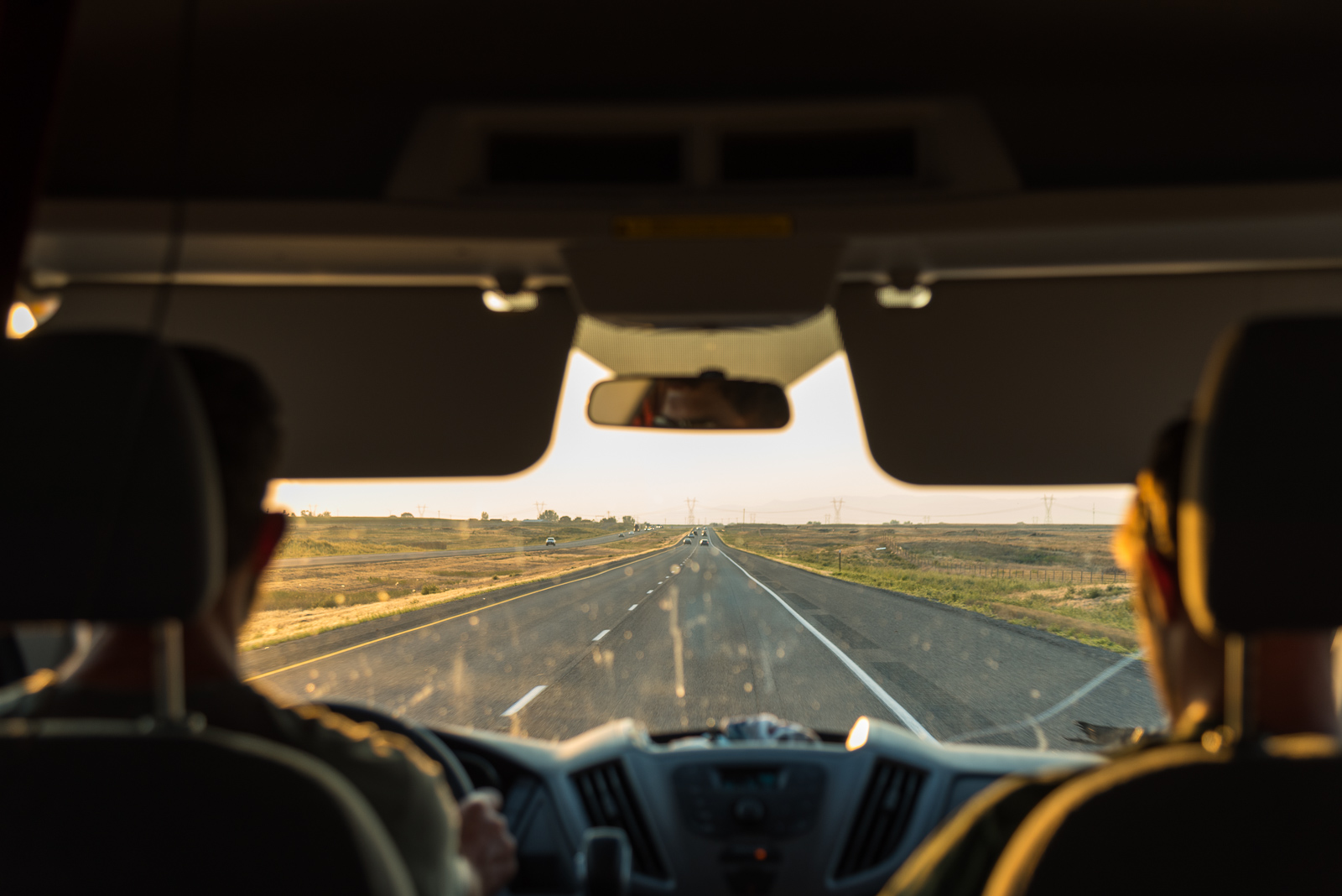
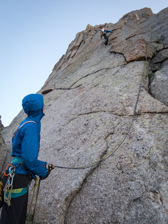
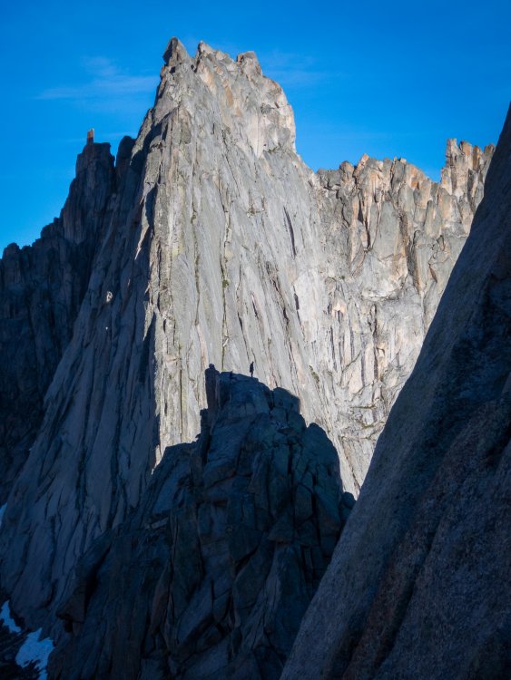
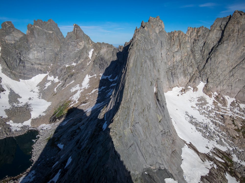
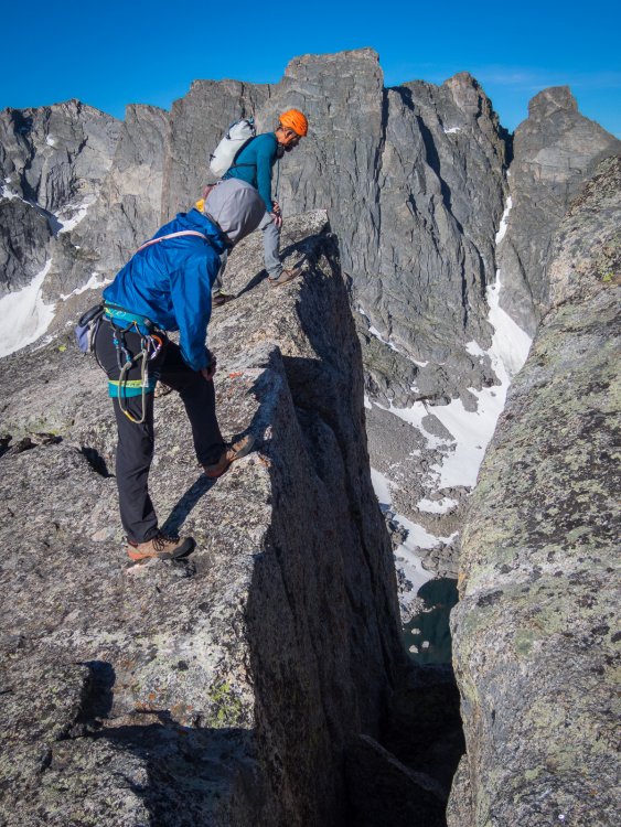
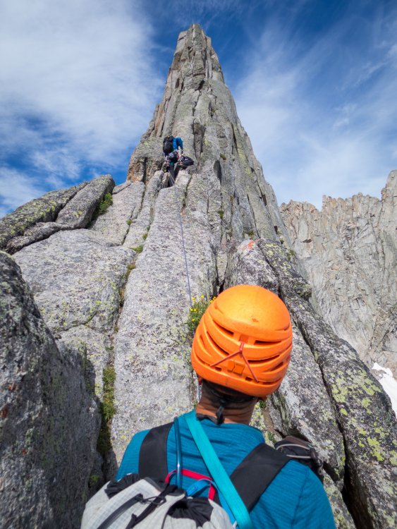
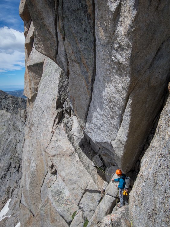
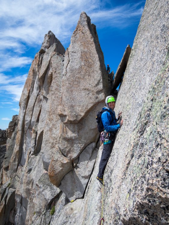
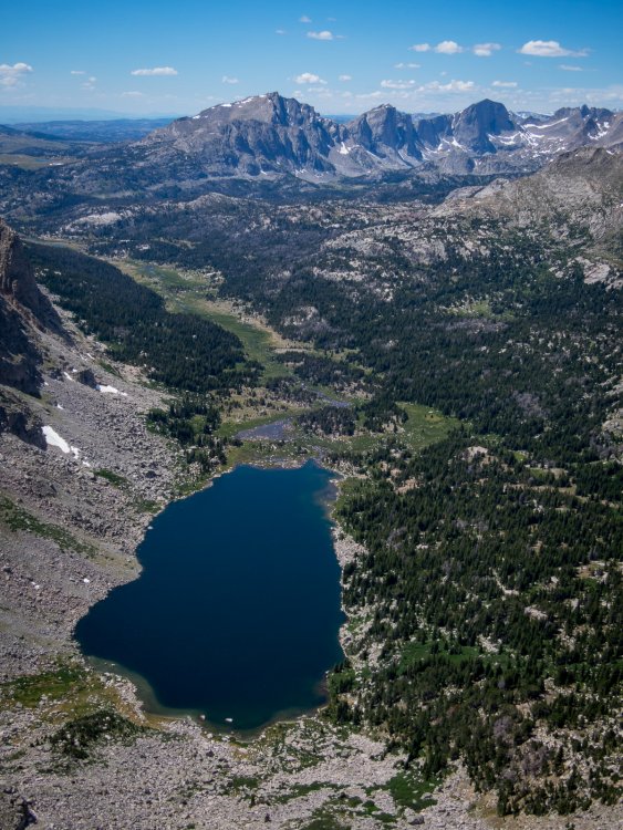
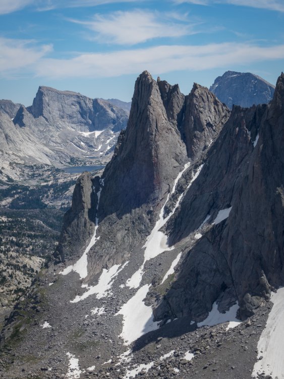
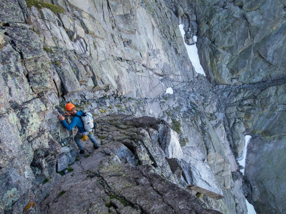
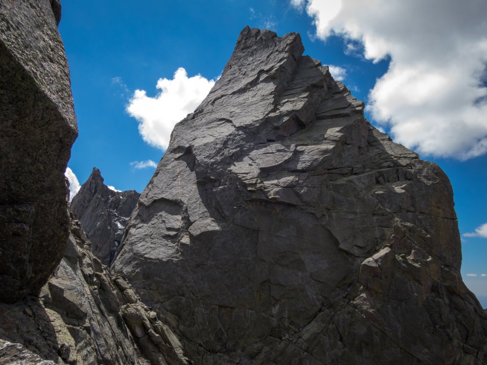
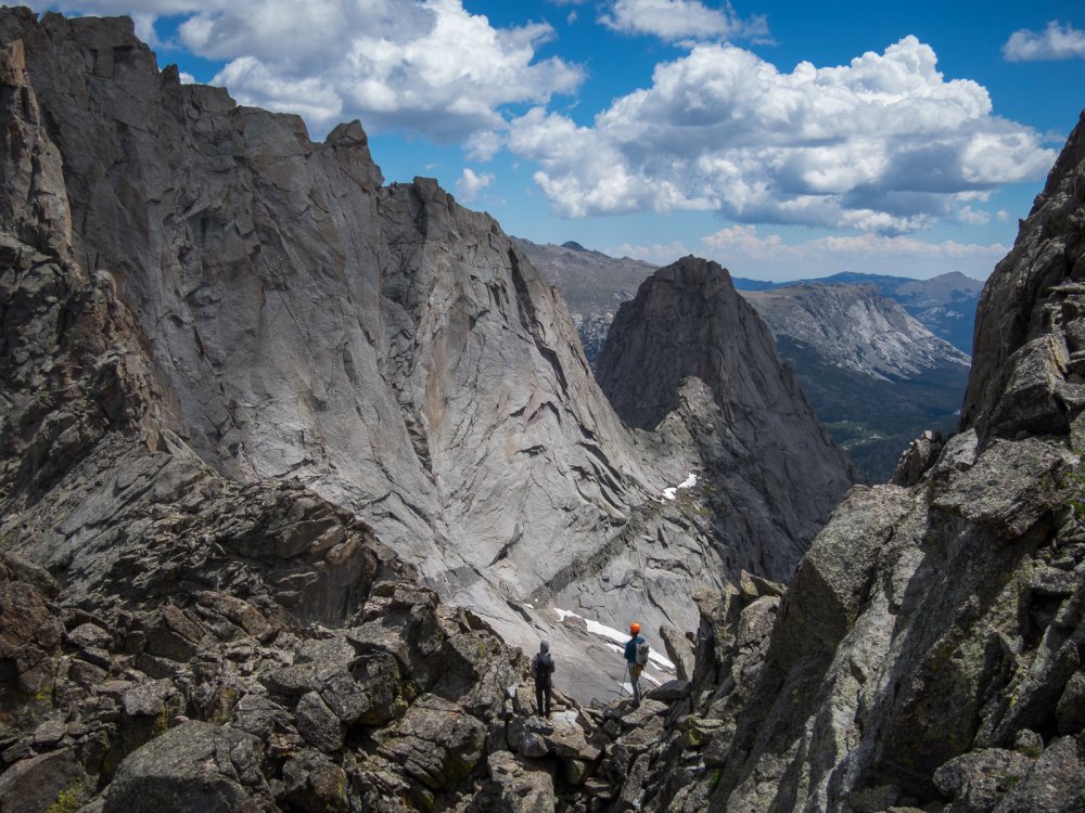
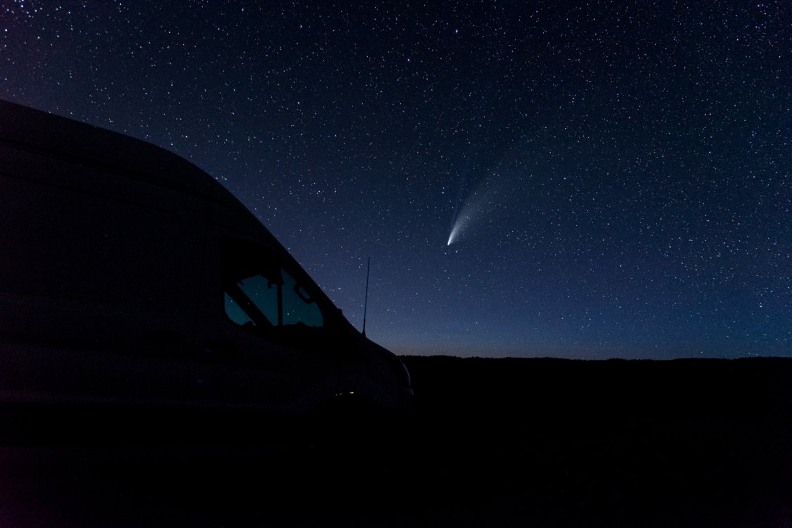
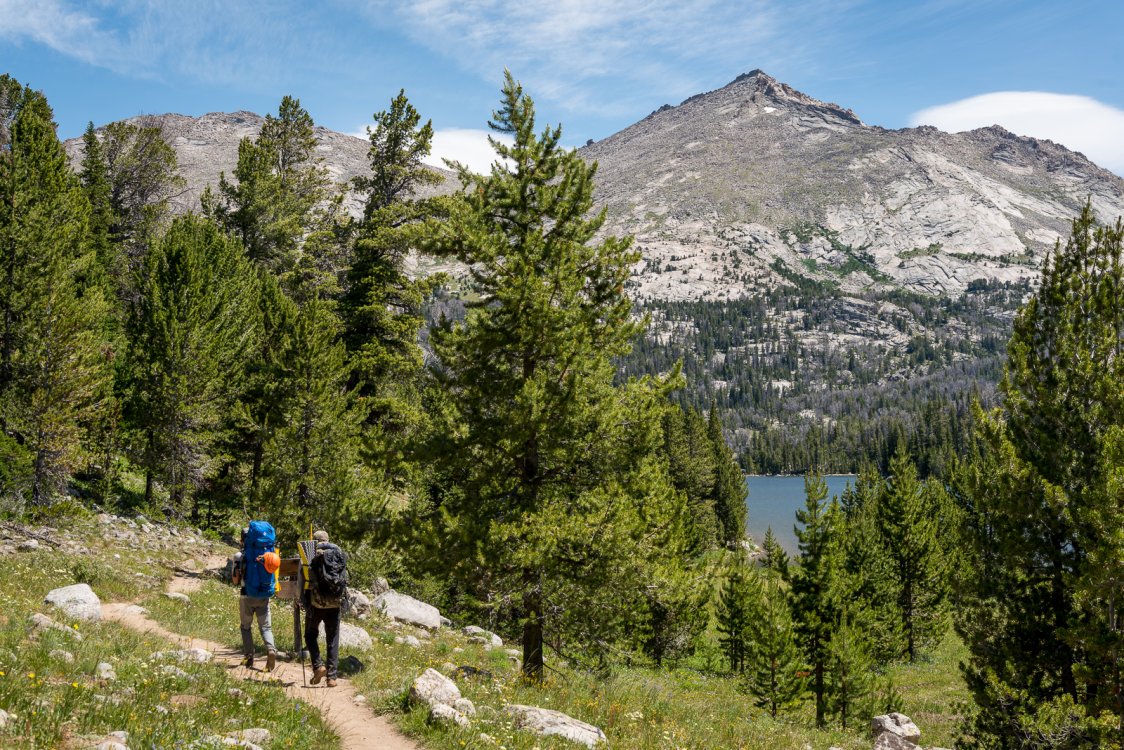
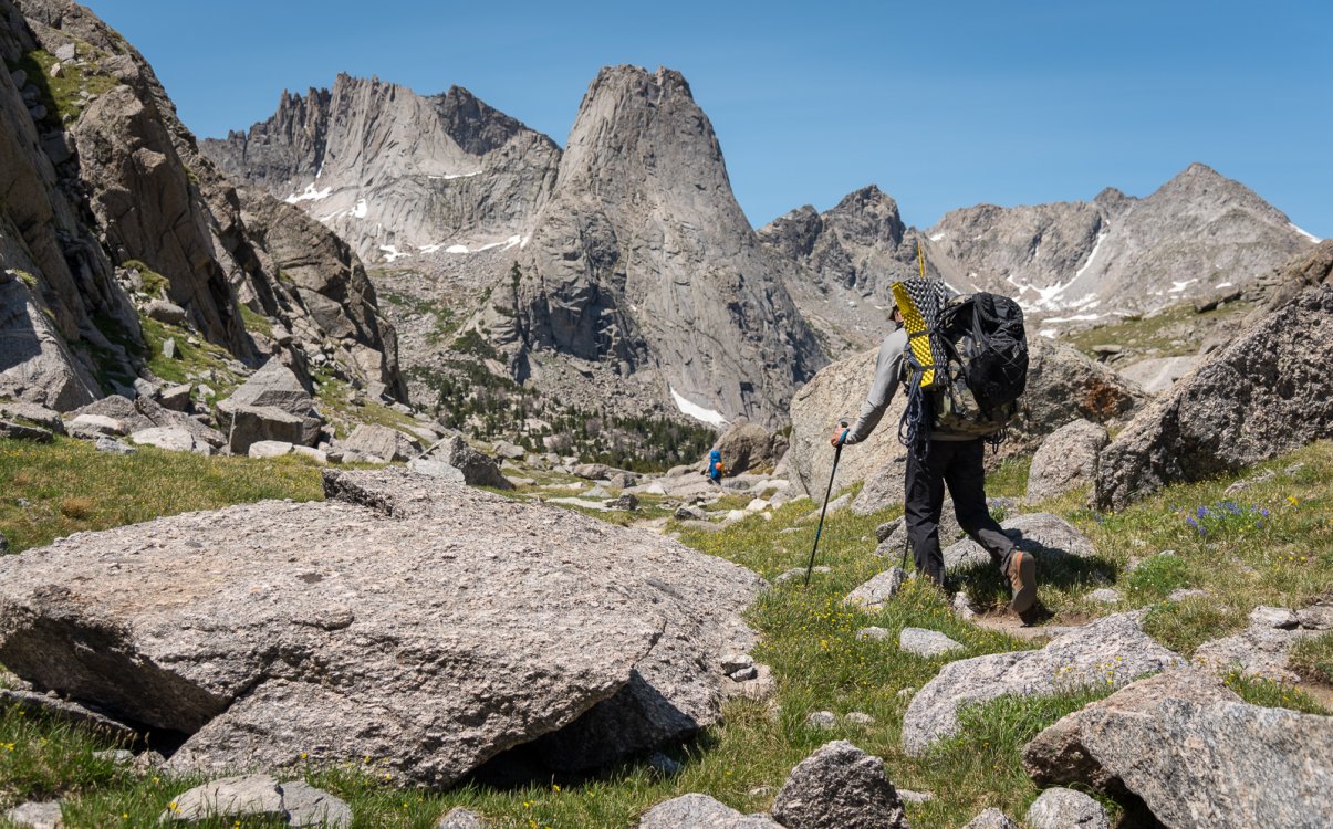
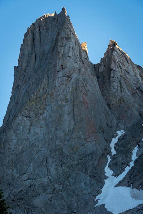
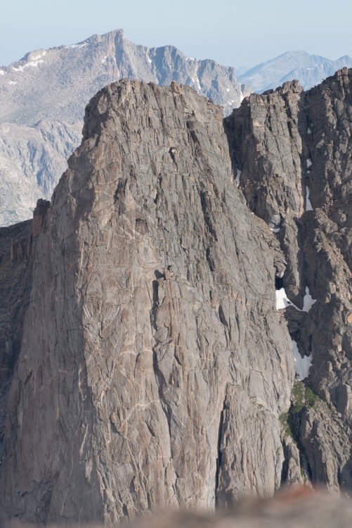
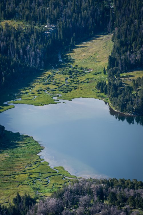
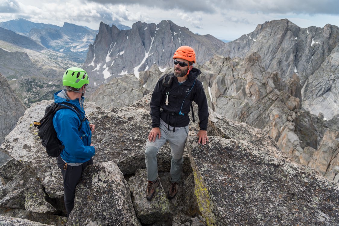
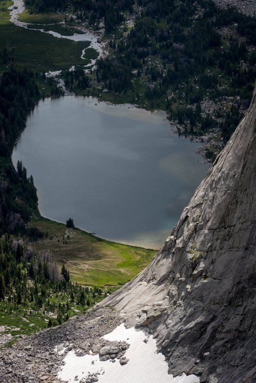
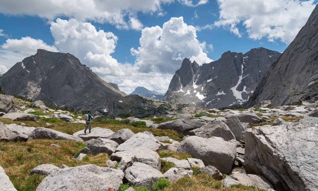
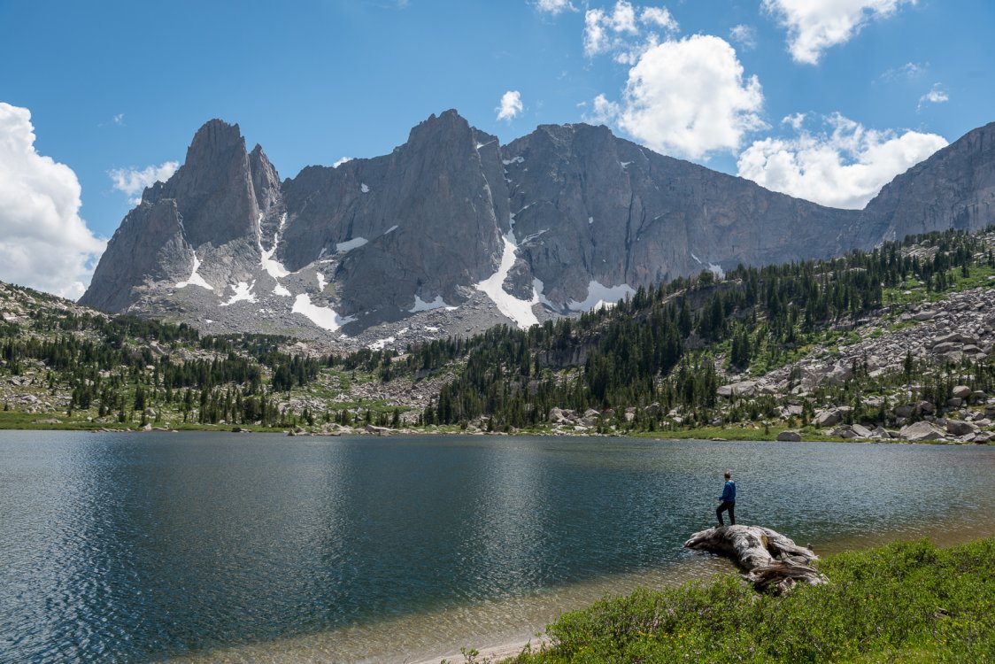
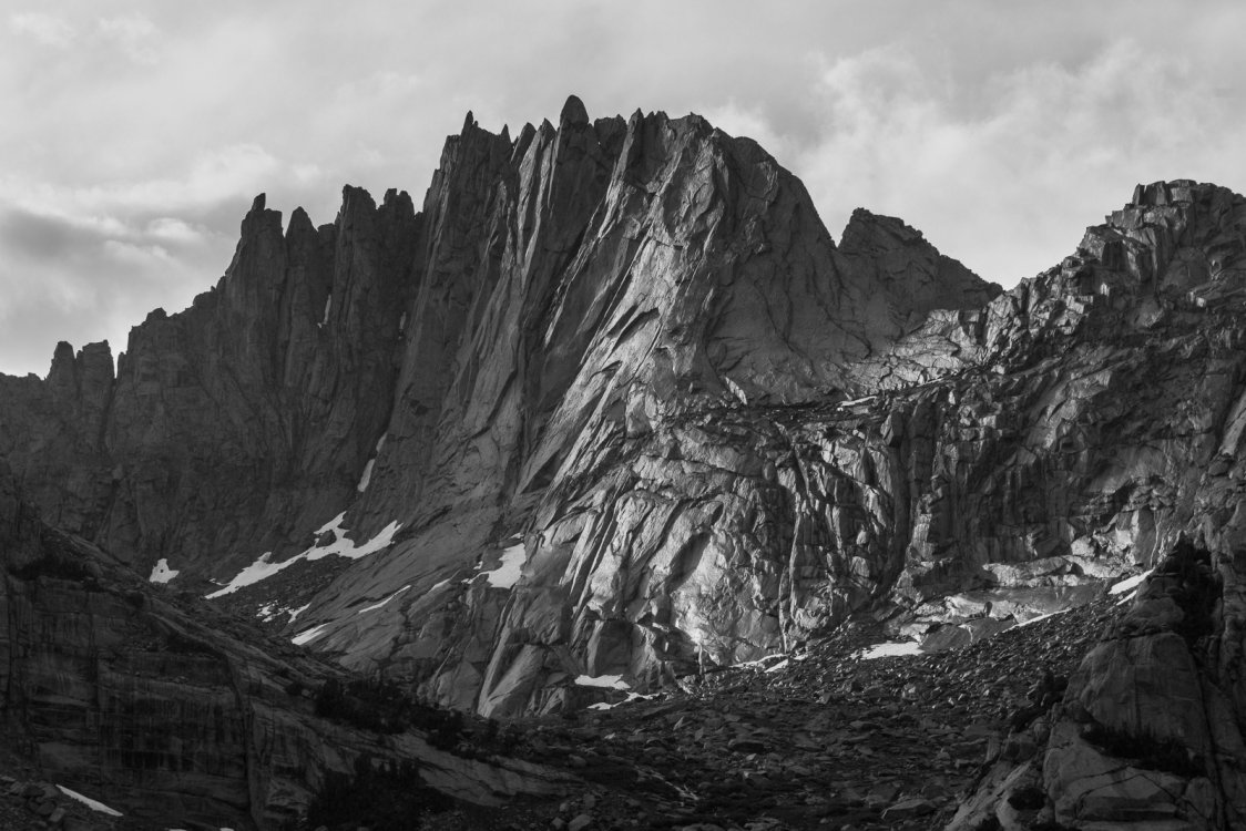
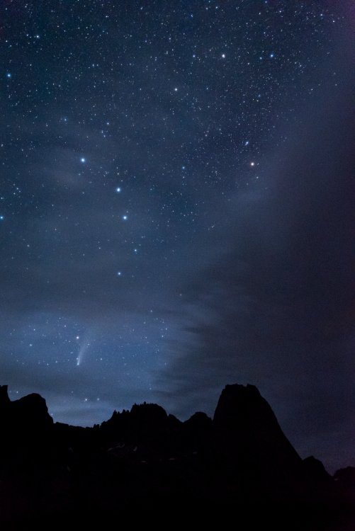
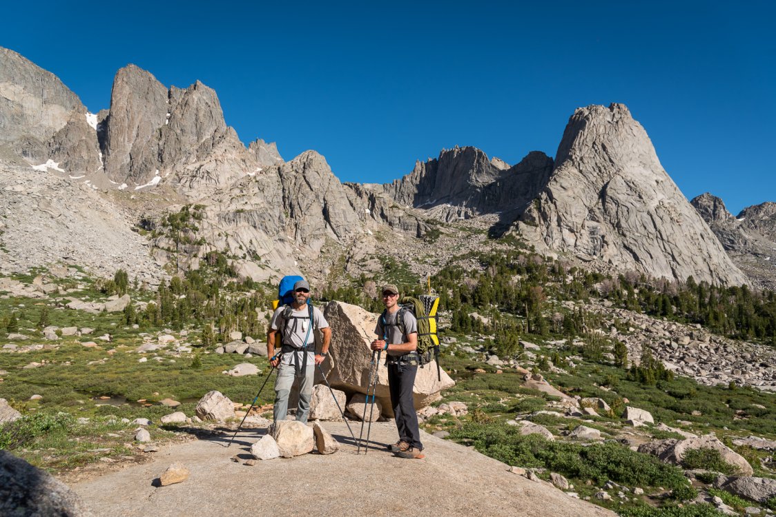
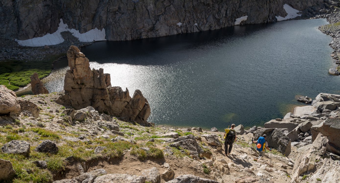
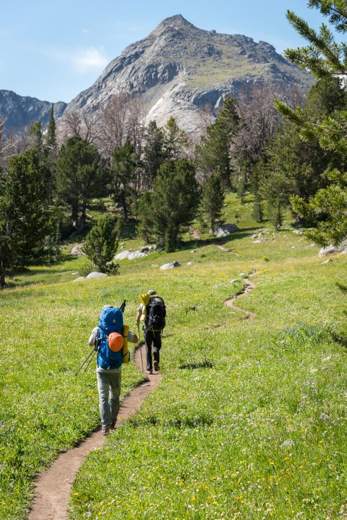
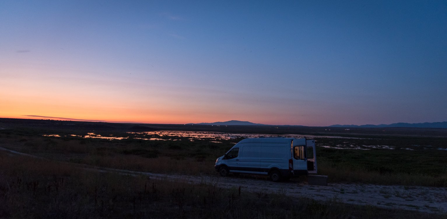
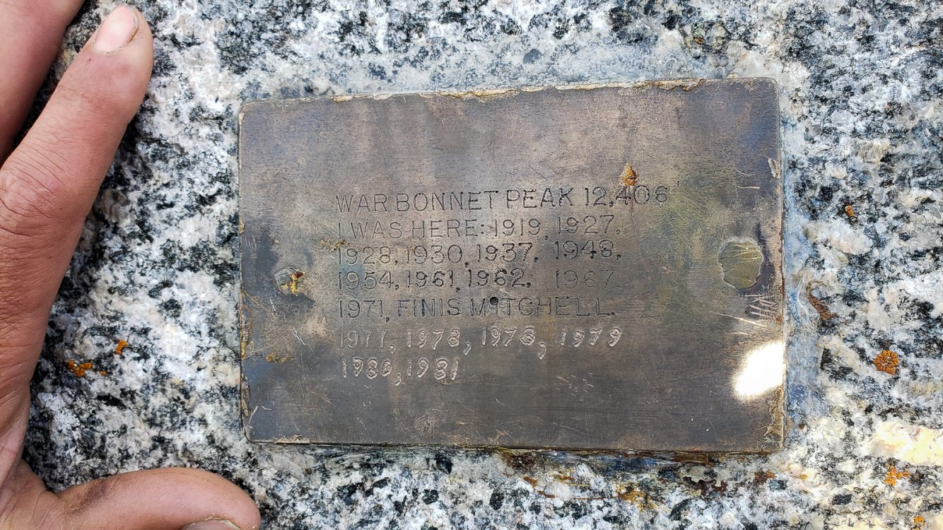
Trip: Wind River Range- Cirque of the Towers - Pingora, Wolf's Head, Overhanging, Warbonnet, Warrior, Bollinger Trip Date: 07/22/2020 Trip Report: And so the catch up continues from last year....We're up to July 2020 and the annual week long climbing trip with @Trent and whatever other partners in crime we can dredge up from the dark corners of the Skag. For 2020 it was JP and not only did he bring the gun show, but also the van that carried us in style to the TH. The destination last year was the mythical Cirque of the Towers in Wyoming's Wind River range, and it did not disappoint! But first we had to get there. It is a long drive! But we had JP's trusty steed and three drivers to blunt the trauma. Still, we were all surprised how busy the West was last summer. People were everywhere! Including at least 100 cars at the TH. The Cascades aren't the only busy place these days, but the skies are still pretty dark... Gearing up for the hike in before we get to the madhouse of the TH The hike in was quick and relatively painless by Cascadian standards, despite our big packs. The altitude was noticeable, however. We scored a great site as you first descend into the Cirque, which afforded great views of the popular peaks/routes. We were advised to bring a pair of binoculars for the inevitable epics that unfold wherever 50 Classic Climbs are located. Great advice! The weather was forecast to be great for the first few days, without the thunderstorms that are common in the range. We immediately hatched a plan to do the Cirque Traverse in two days. Day one would be the South Buttress of Pingora into the East Ridge of Wolf's head followed by a return to camp. Day 2 would be Overhanging Tower to Warbonnet, saving us from carrying bivy gear. The whole thing was supposed to be quite reasonable (~5.8) for a competent party, spread out over two days. We went to bed early, pretty psyched for the next couple days. And sure enough it dawned clear and we off early to Pingora, getting on it first. What a great, straightforward climb! The K-cracks especially were clean and super fun. Looking across to the East Ridge of Wolf's Head: Soon we were on top and looking at the next objective for the day. The storied East Ridge of Wolf's Head! We rapped into the Tiger Tower notch, climbed over Tiger and rapped into the start of the route. It gets wild right off the bat and stays aesthetic and exposed the whole way. A deserved classic! But not exactly straightforward routefinding, and very old school ratings. It felt harder than the 5.8 on Pingora! Hmmmmmm. But we figured it out, and made it all the way to the top in the end. We felt like we had really done something. Now, how do we get down to the Overhanging Tower col? A few raps, some choss, head scratching, and exposed scrambling, and we eventually found our way, pleased to have the first part of the traverse under our belts and supposedly the technical crux behind us. We chossed our way back to camp and prepared for a long day. We started before dawn again and made our way back up to the unsavory choss that guards the Overhanging col. Overhanging tower went down quickly with just a bit of exposed scrambling and we were left staring at the intimidating North Face of Shark's nose. How the hell? We had only brought a half rope and light rack, expecting to simul everything on this day (supposedly to 5.6 with careful routefinding- "act accordingly"). Hmmmmmm. Steve, descending towards Shark's Nose from Overhanging Tower. Careful!: You're supposed to corkscrew around this face, we made it about 2/3rds height before getting lost and intimidated. Both Steve and JP took turns on the sharp end trying to find a reasonable way up the Shark's Nose for three guys without much gear all moving together. Nothing felt casual enough to them and I politely declined to try myself. It all looked way harder than "5.6"! Turns out, we were right on route, just needed to have set up a proper belay and done a real pitch. Oh well....and so we retreated back to the col and camp and went fishing! The fishing is quite good at Lonesome Lake, if you bring a spinning rod. I didn't have hardly any luck with my fly rod, either at the surface or dredging the depths with buggers and a sinking line. A first for me in an alpine lake. JP absolutely slayed them, however! And then we had to come up with a new plan. JP and @Trent were gunning for the other 50 Classic, the NE face of Pingora, but I was worried about slowing them down if I tagged along. And so I came up with a plan to scramble Warbonnet and Warrior (the other end of the Cirque Traverse) while they went and climbed the very good looking rock of Pingora again (no photos from me of their day, maybe they'll add them?). I think we both had fun the next day, but I admit that I probably should have slowed them down instead. The scramble routes on Warbonnet and Warrior and super chossy and not that aesthetic! But great views nonetheless.... Up on the high summits I had good cell coverage so got a forecast. It was trending wet and cold for the next couple of days, especially the next morning. So, reconvened back at camp we thumbed through the guide and stumbled on Bollinger and the "Class 3" route up the NE ridge. By this point we knew to expect 4th class! The next day dawned stormy and wet so we lazed around camp until it looked more promising. Just in case we brought our fishing gear and cached it down at the lake on our way around Pingora to Bollinger. And, as expected, it wasn't straightforward 3rd class, but still good fun nonetheless and recommended if you have iffy weather in the Cirque. Afterwards, it was back to the lake for more fishing! We had one more possible day left to climb, but we also realized that if we left a day early we would have a day at home with our families before heading out to work. And so, satisfied, we enjoyed one last night in the Winds, drinking the rest our whiskey, watching Neowise, and spotting headlamps of tardy climbers on Pingora and Wolf's Head. The next day we slowly packed camp and sauntered out of the range, joining the masses on the trail and merging into the scrum of the parking lot and busy western highways. Where will next year take us? Gear Notes: Bug net and repellent! Standard rack. 60m rope, helmet. Binoculars for late evening "Must see TV" Approach Notes: Follow the herd


-
And here I thought it was Cpt. Caveman!