


JasonG
-
Posts
5269 -
Joined
-
Days Won
352
Everything posted by JasonG
-
 Looks like the weather is getting active so hard to say if you'll find anything to do on a big peak in 10 days. I'd bring skis, just in case, and check back in next week.
 -
The Glacier Creek road is washed out way low....like fully gone just above the bridge. I don't think hardly anyone is going up there these days.
-
Just imagine if you could zoom into the full res originals on a good monitor! The new camera and glass that I splurged on this winter has been a bit of a revelation. I should have done this glass upgrade 20 years ago but it took that long to wear down the Finance Minister!
-
Thanks for the kind words @Murray! I was just talking with some folks about this idea last week and the thing I always struggle with is how to organize a book....or what people would like to see. I can look at whatever of these image I want, whenever, and since images are so personal I often wonder if my idea for a good book wouldn't be YOUR idea for a good book on the North Cascades. Maybe that is the ticket....start a thread to crowdsource ideas and approach...... Even if @John_Scurlock told me once, "You want to know the way to make a small fortune in Photography? Start with a large fortune!"
-
It really is too bad @Dansjolseth@hotmail.c....you guys obviously put a lot of work into that one. It is beautiful and well made, but unfortunately the lid had blown off. We suspected lightning, but I guess maybe it could have been something else? That is a lot of weight to carry in there!
-
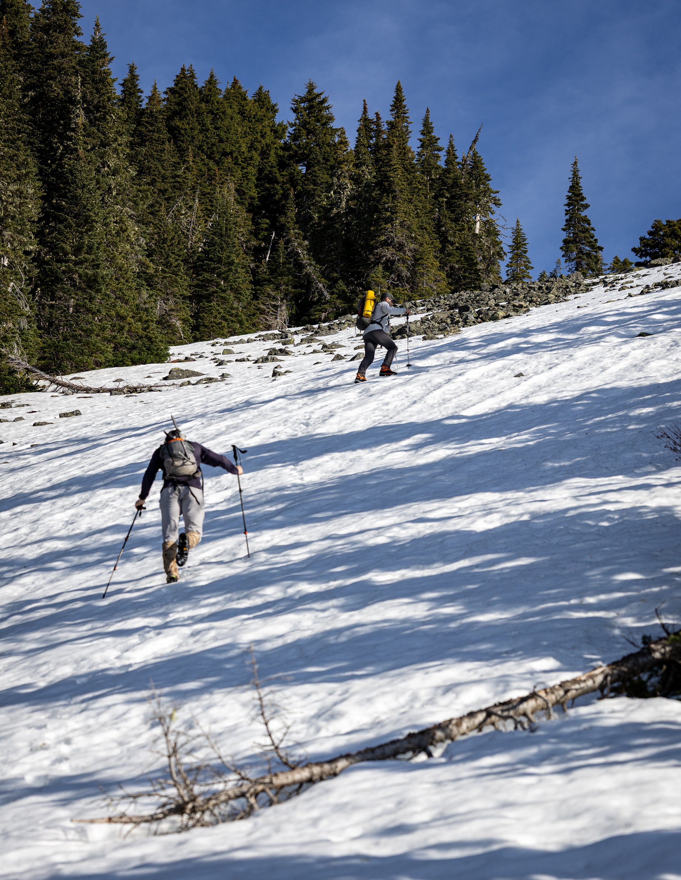
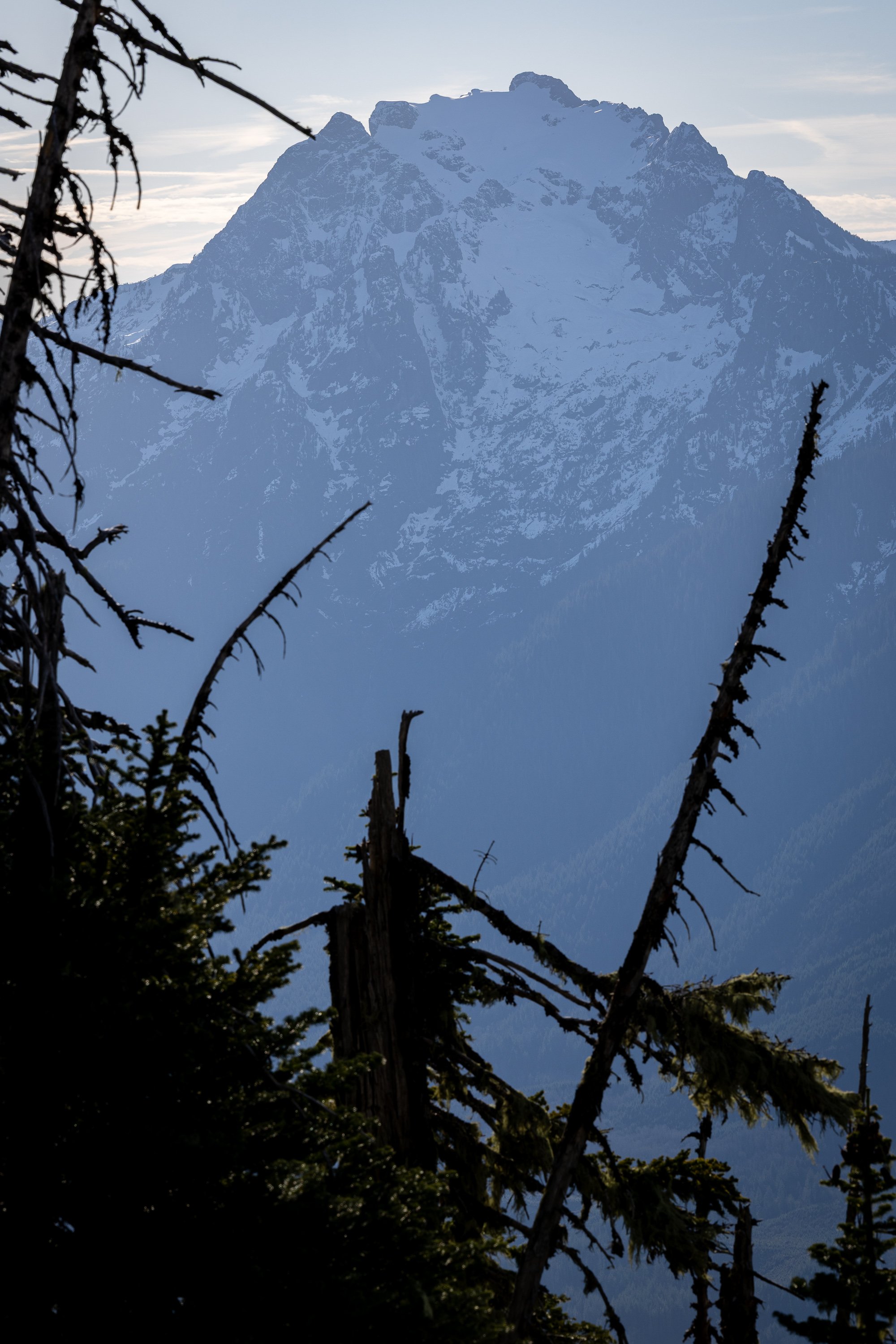
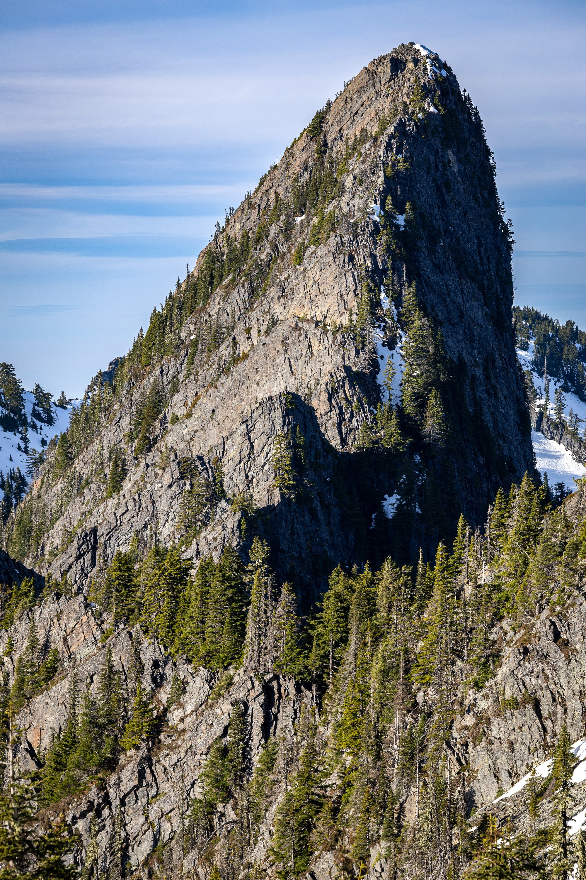
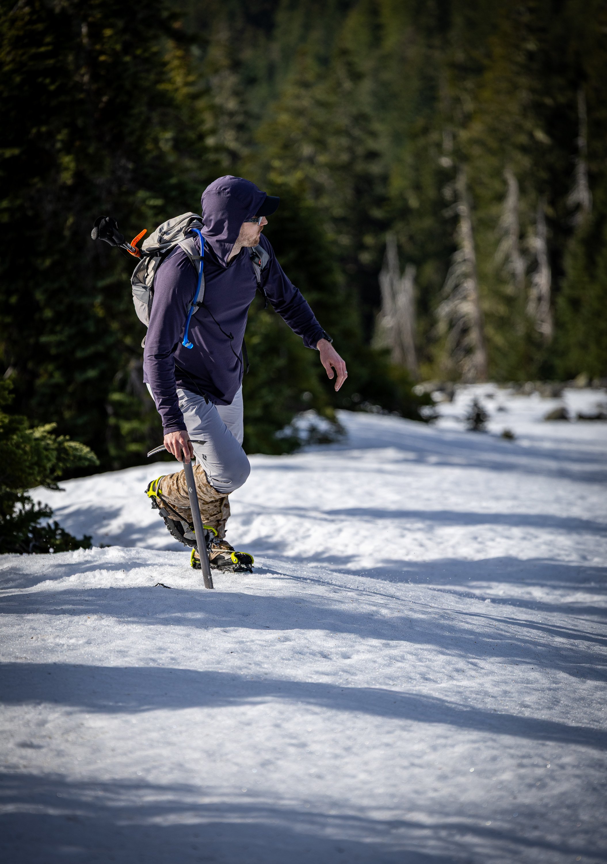
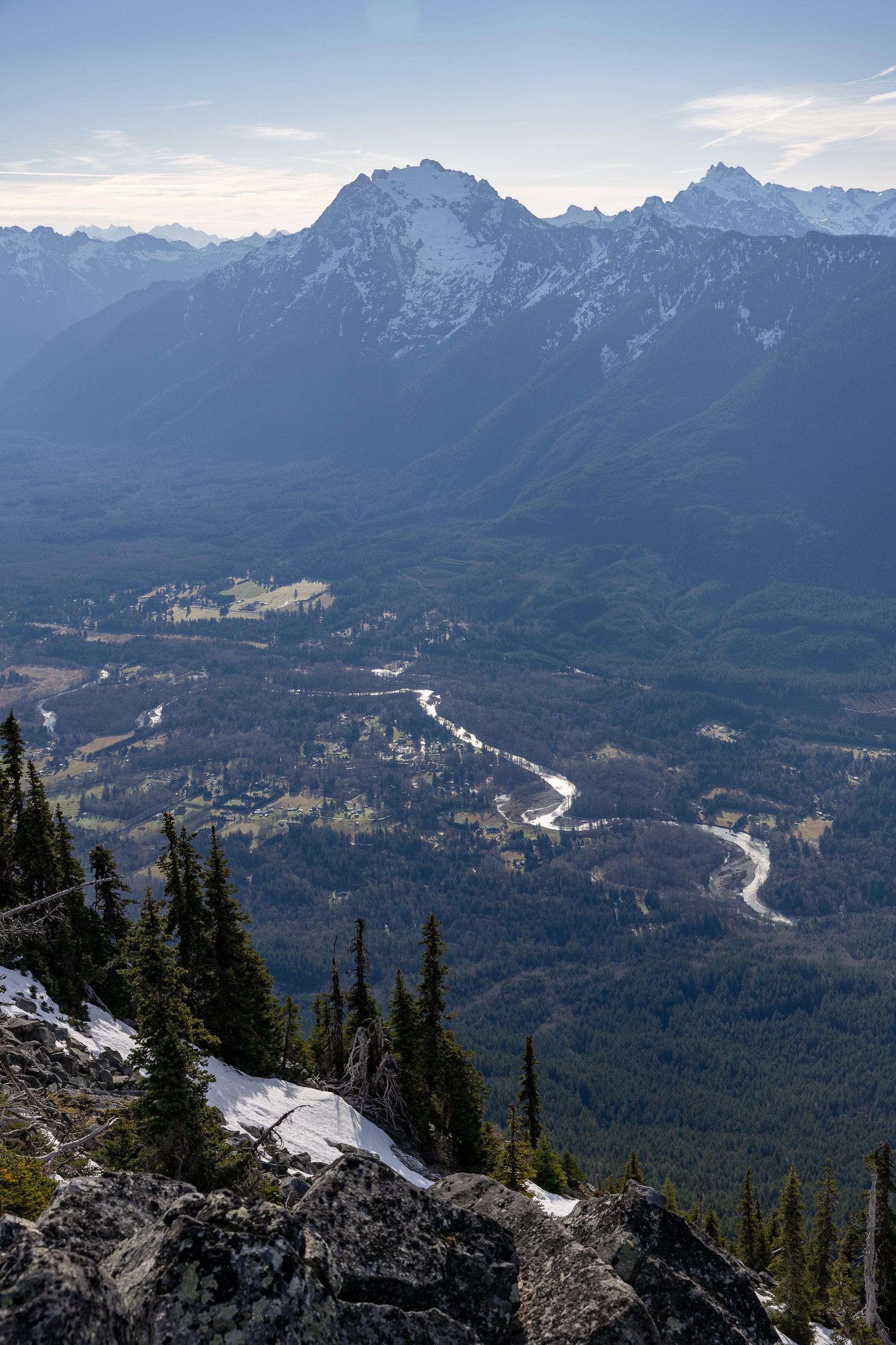
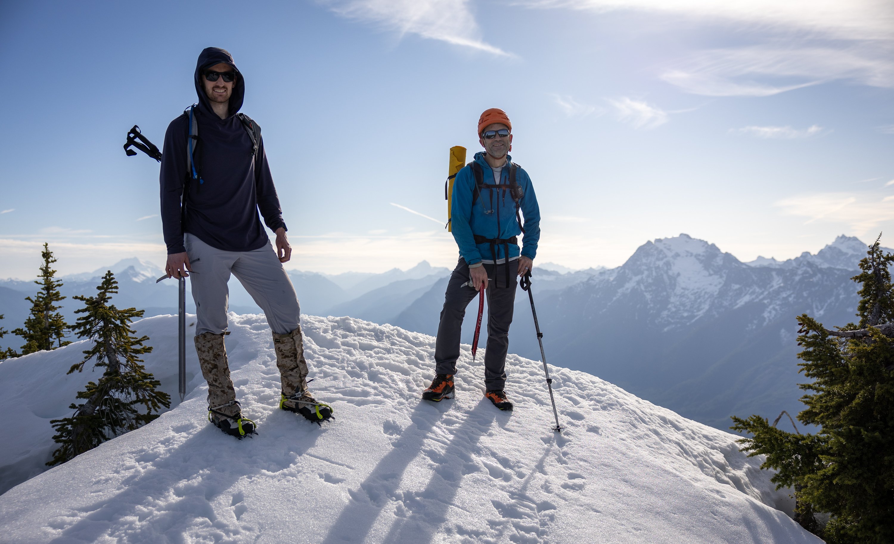
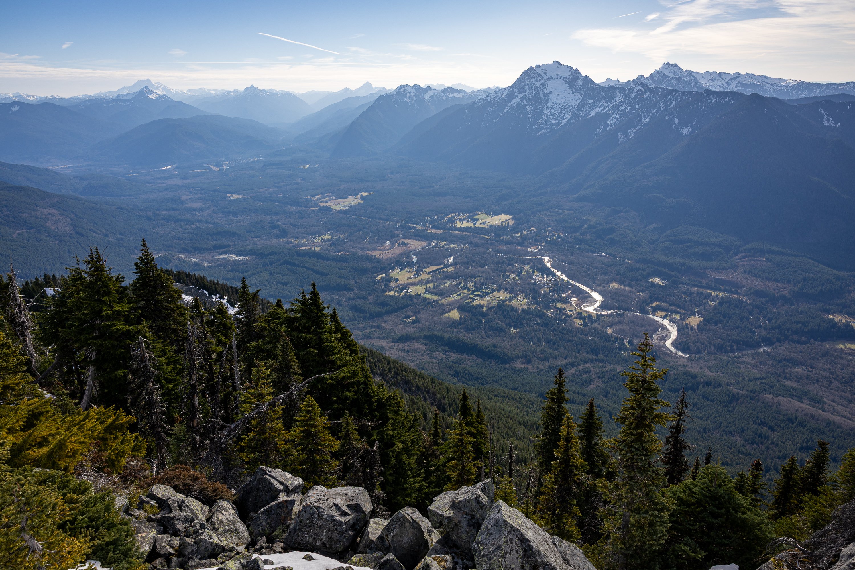
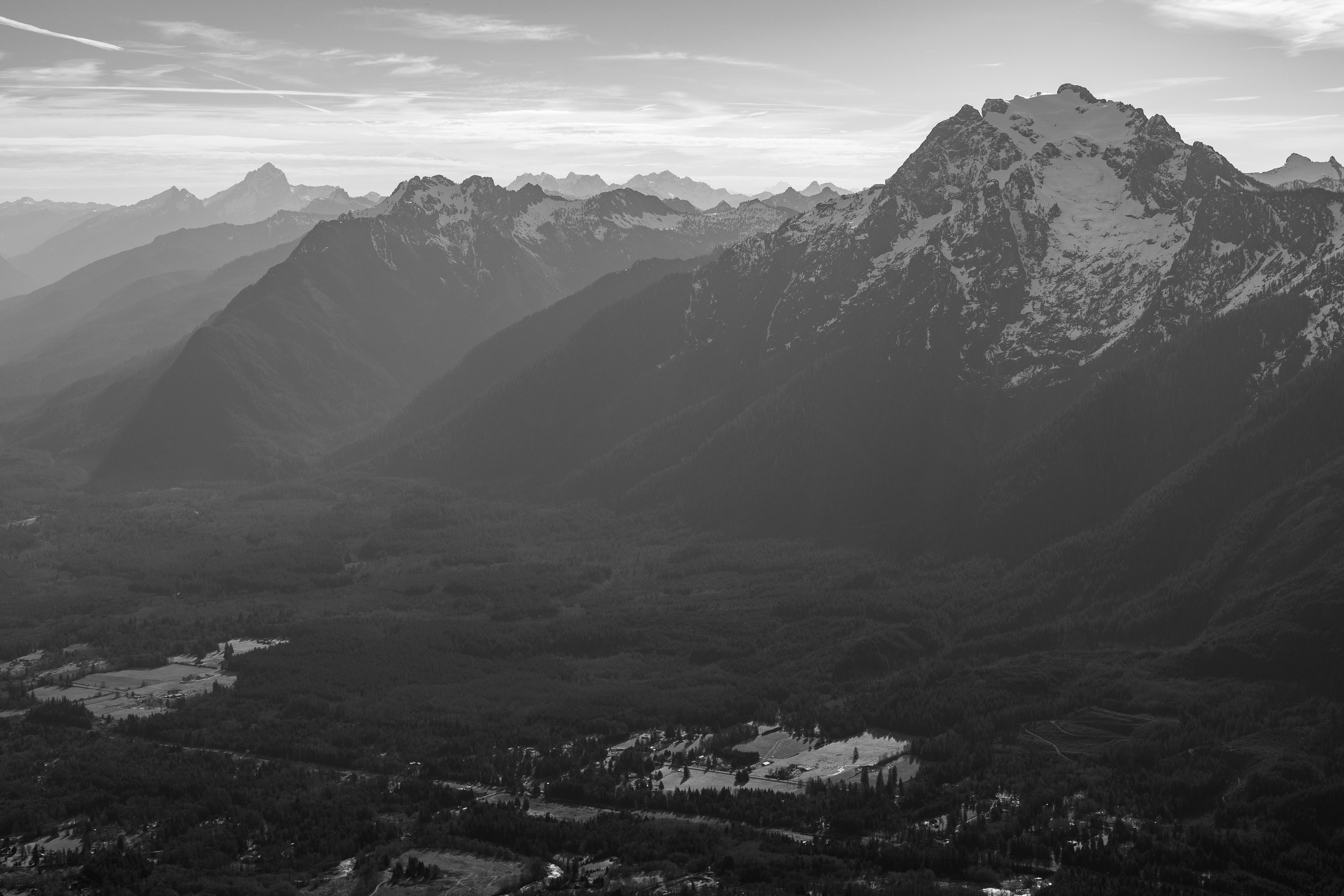
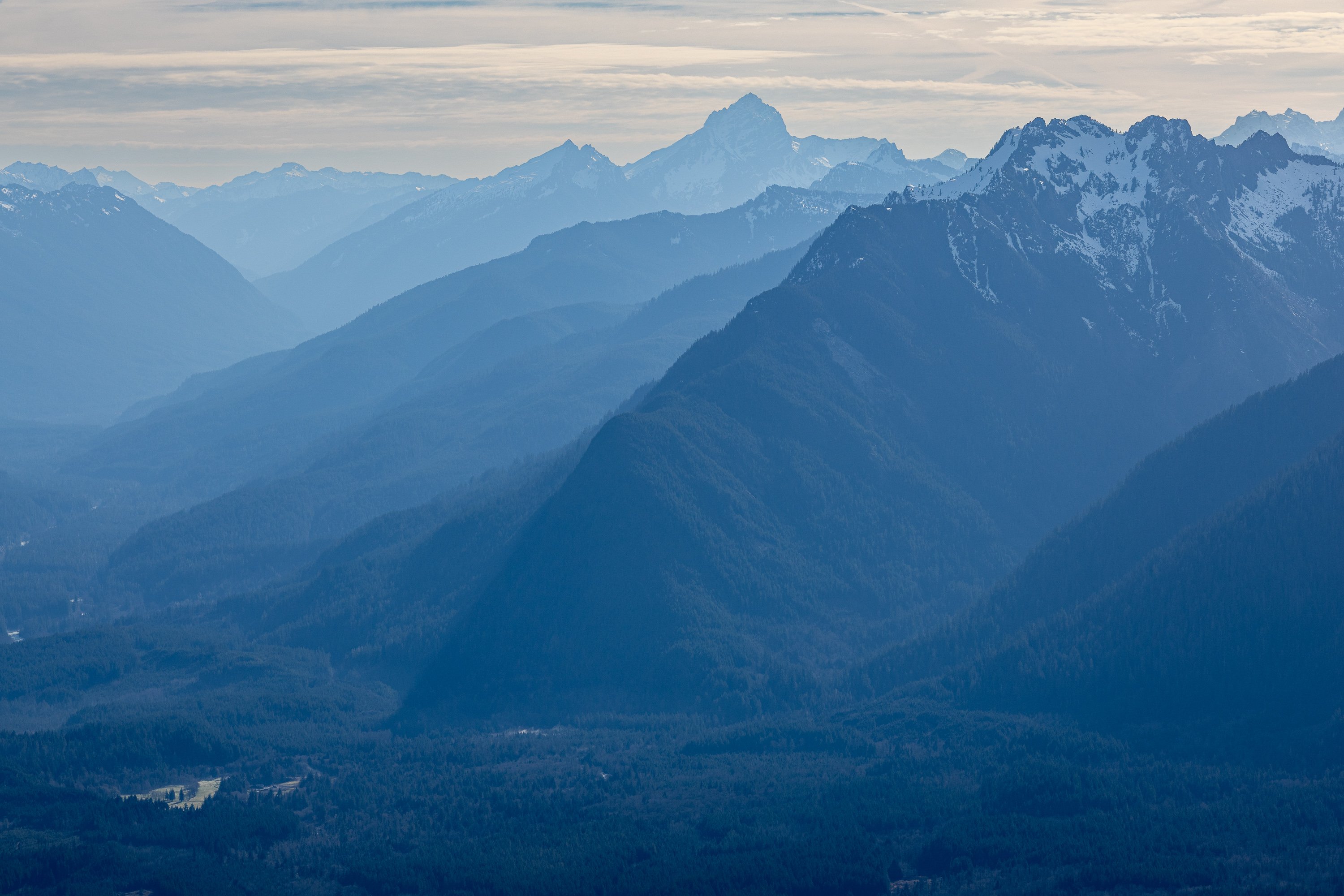
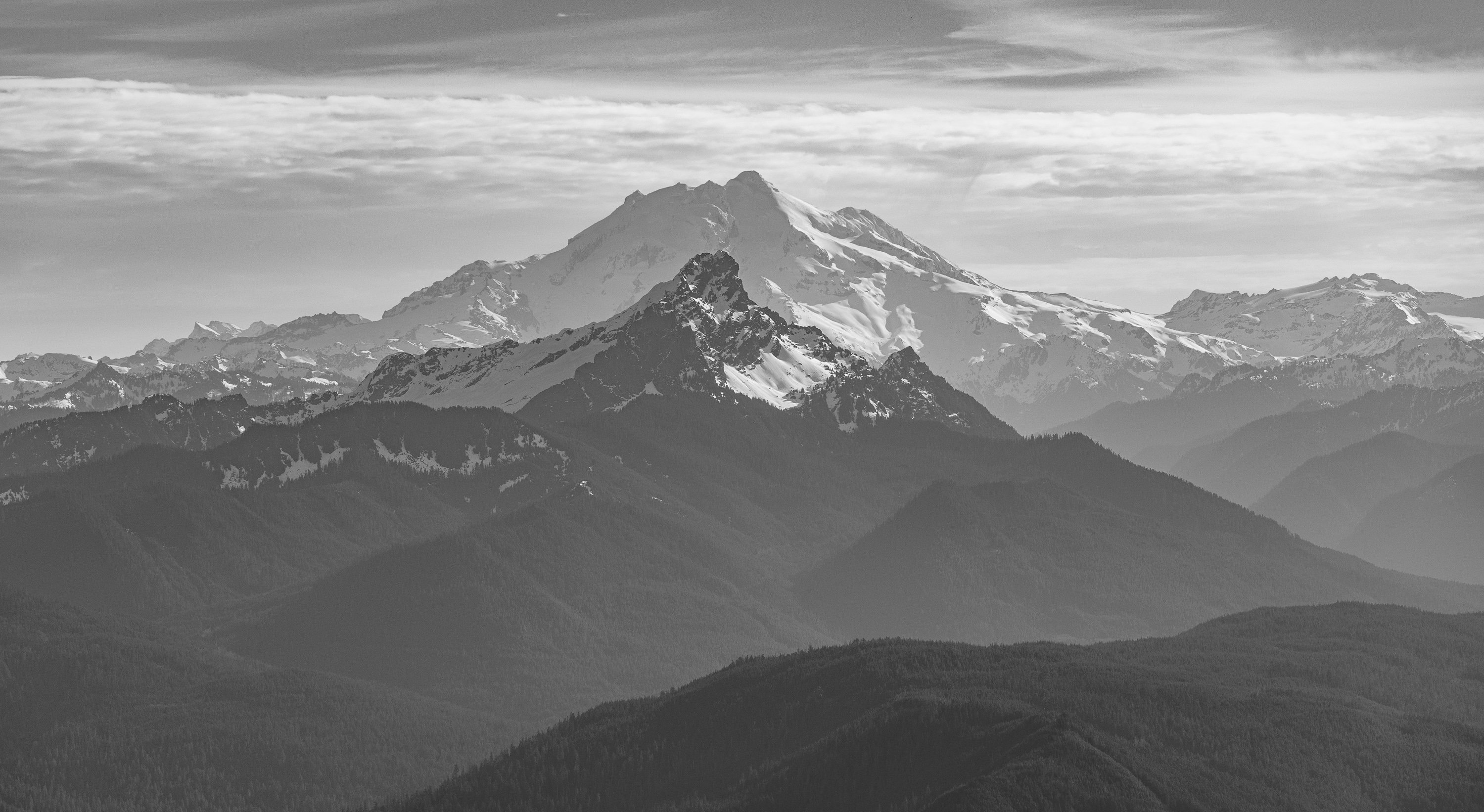
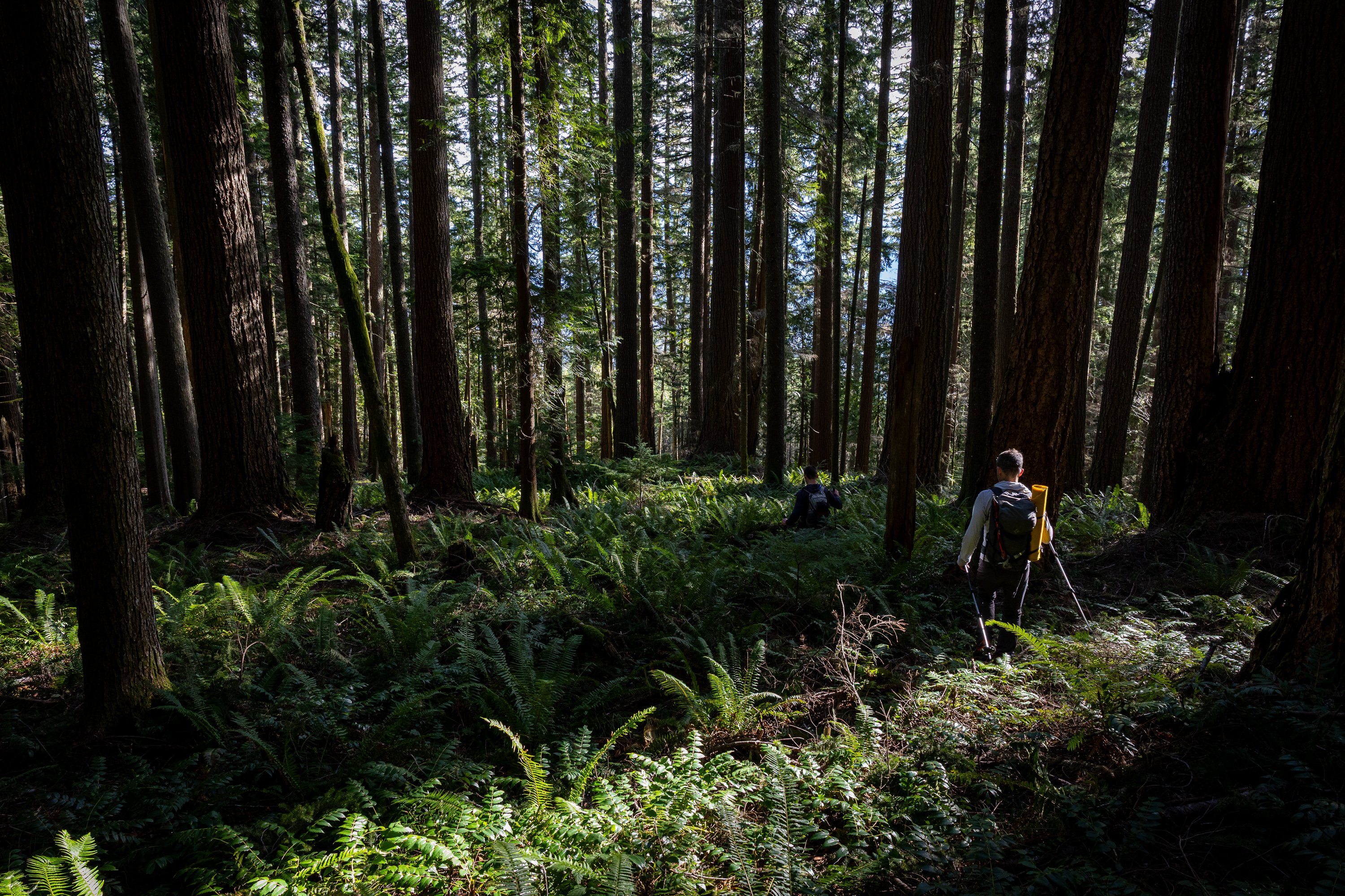
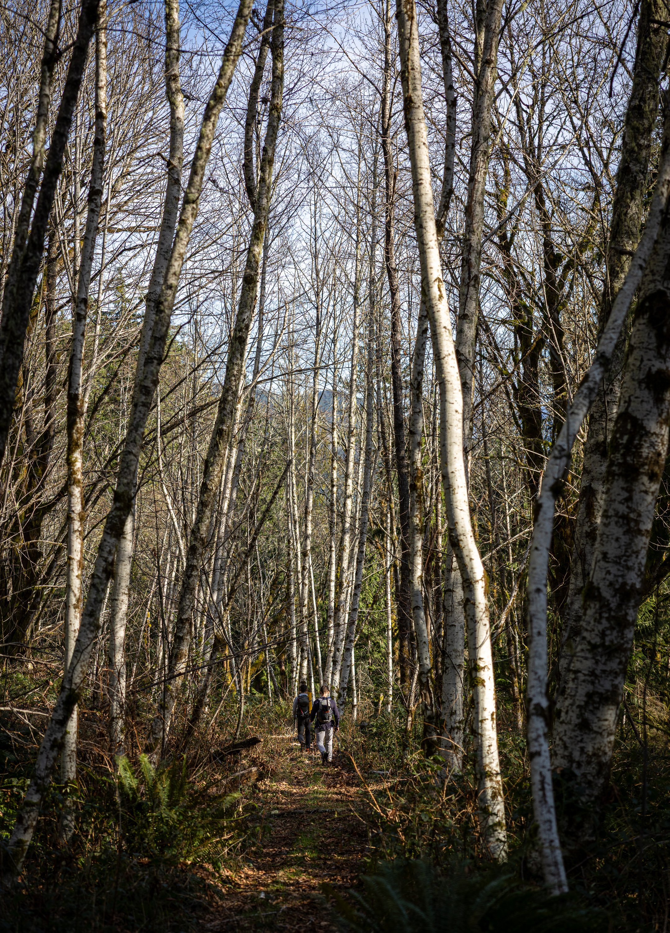
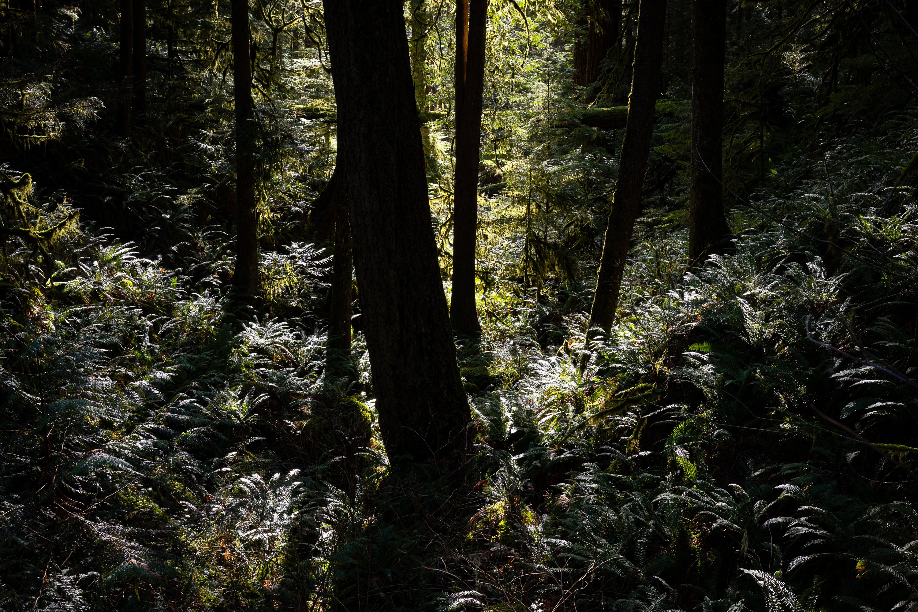
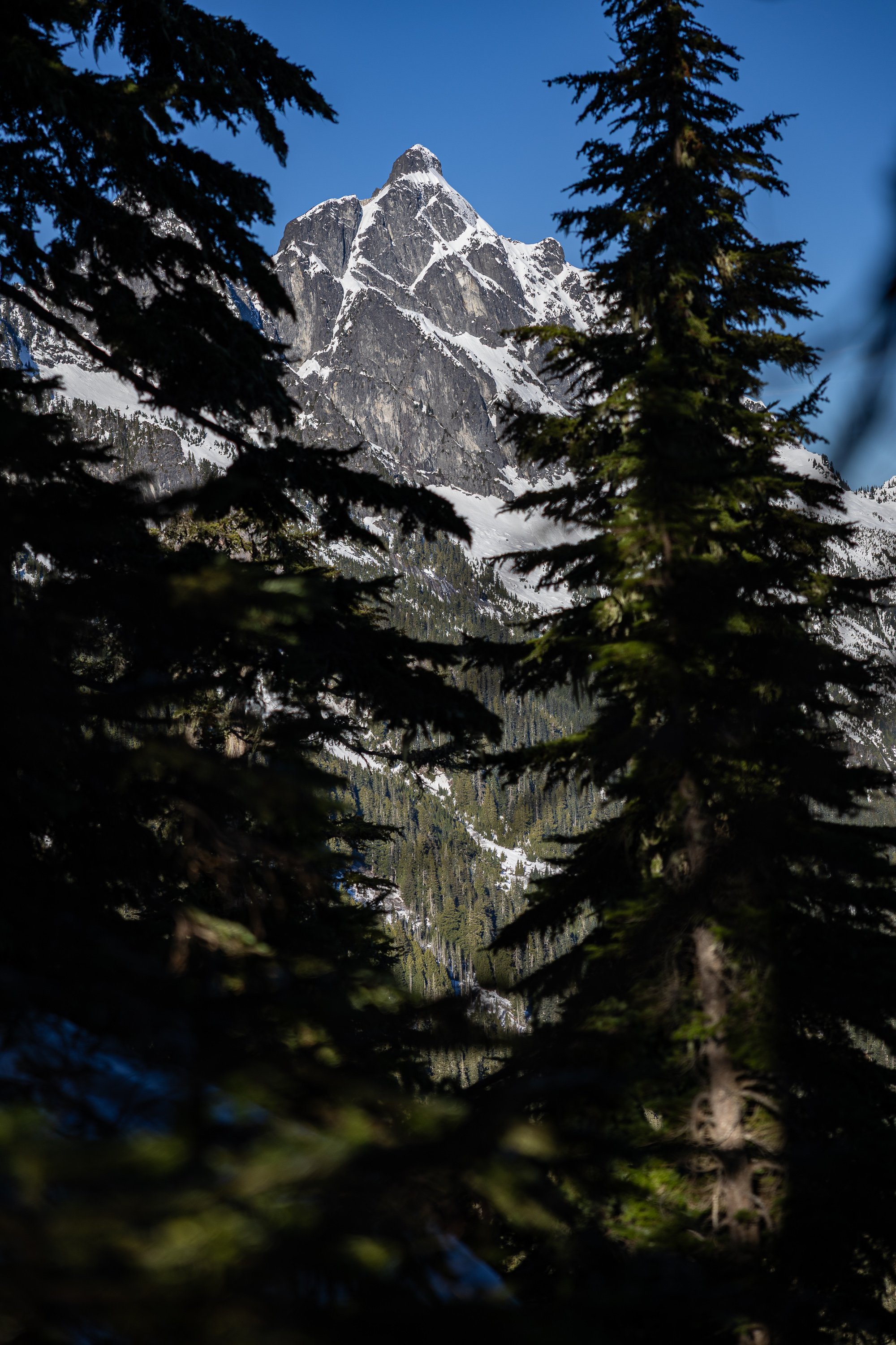
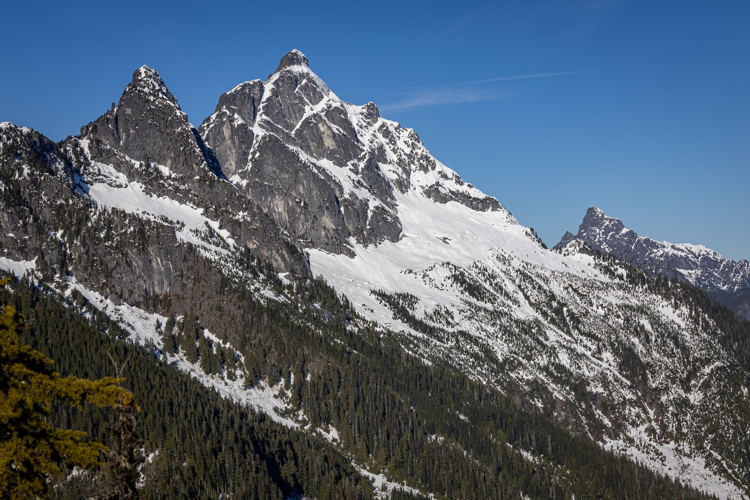
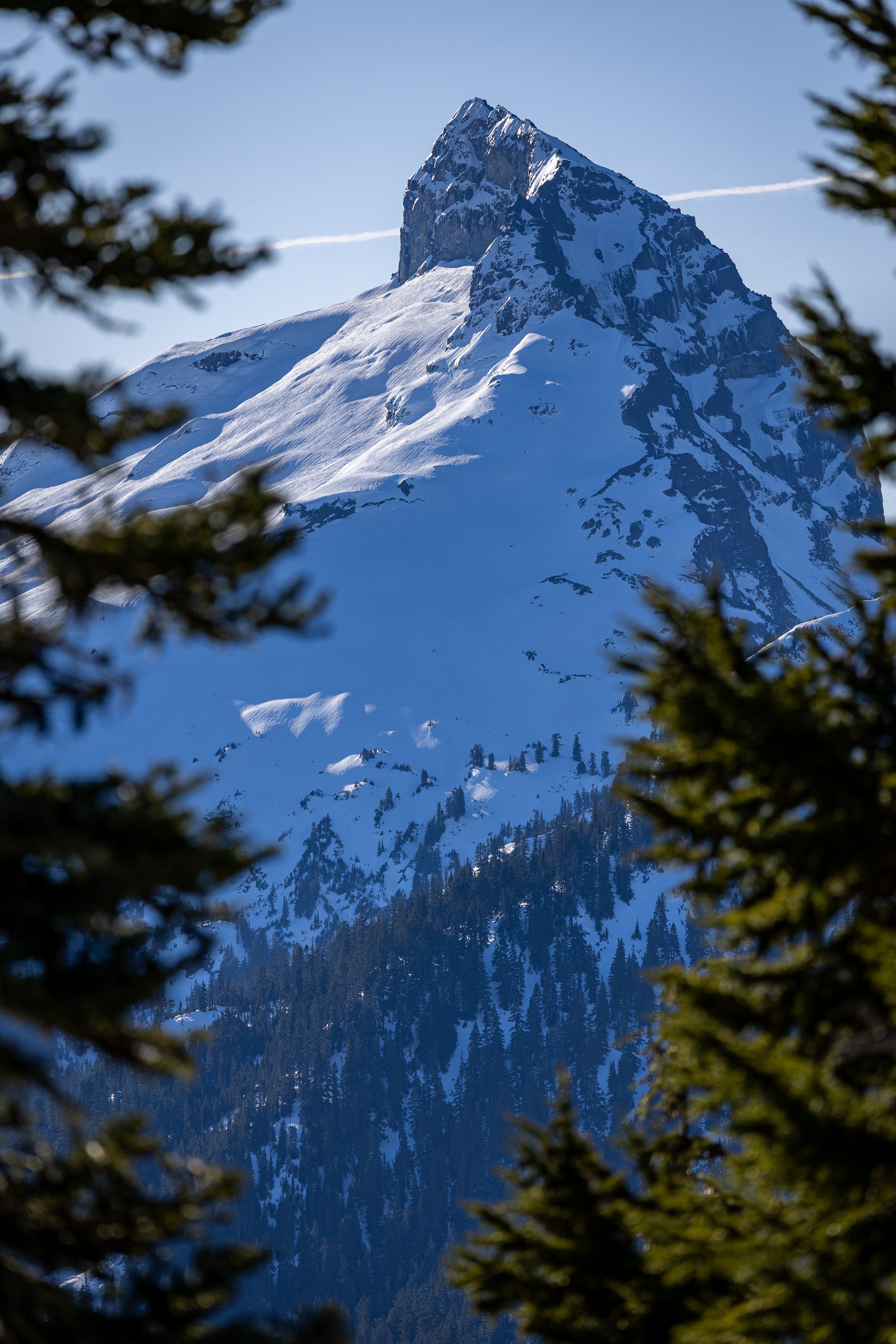
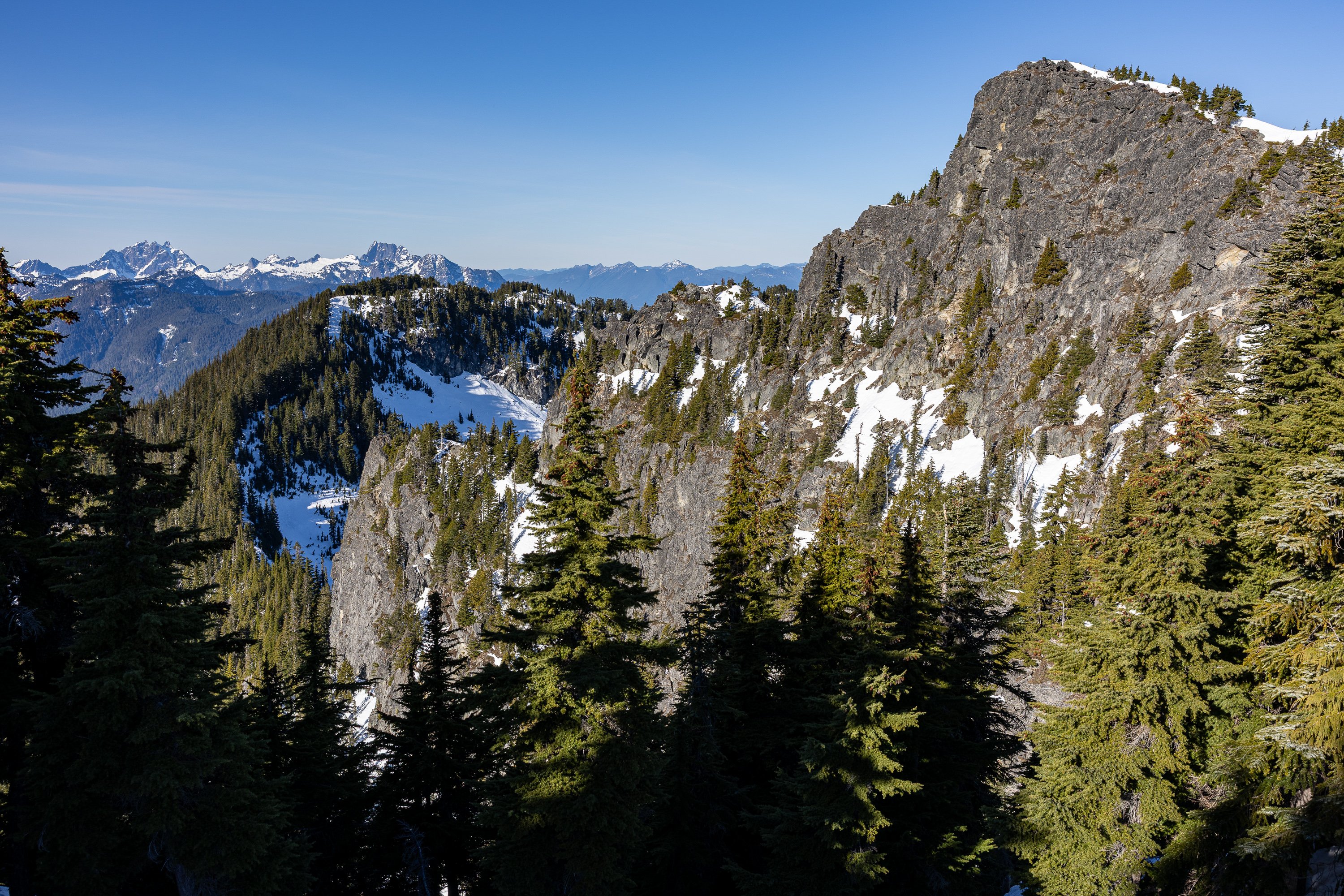
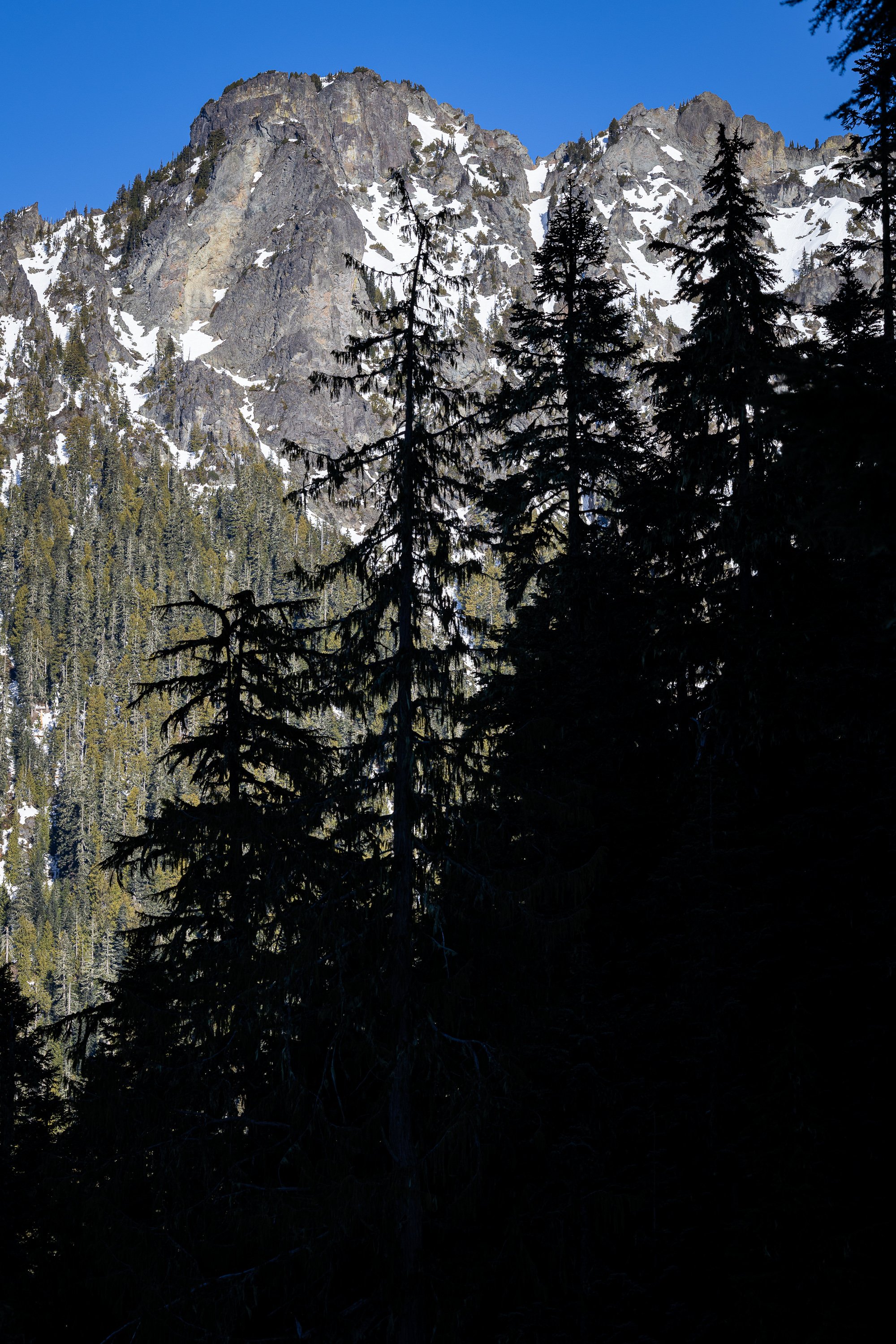
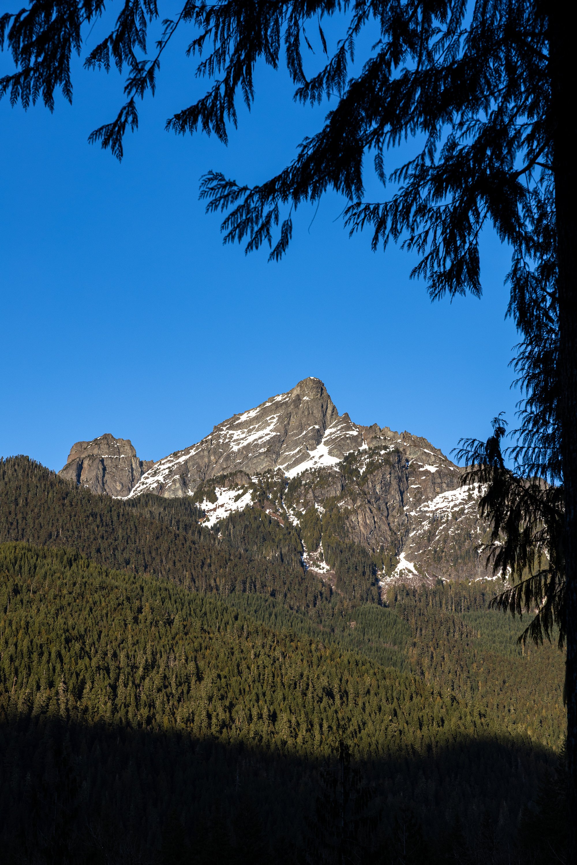
Trip: Mount Higgins - From the South Trip Date: 02/06/2026 Trip Report: This lack of powder is starting to grate on me, but at least we have some backyard mountains that are still beautiful despite the dearth of snow. Mount Higgins (Ska-dulvas) is among them. Despite many trips in the area over the past 30 years I had never been to the true summit of Higgins. It seems like, in the past few years, many ascents have come from the south via FR 1891 rather than from the Round Mountain trail (which was the former "standard" route). Being that it was winter, and the 18 road was likely blocked by snow patches, @Trent and Adam and I cast off into our own unknown on a beautiful Friday morning. In short, this is a pleasant trip. About 2 miles of brush-free road (thanks to the locals for cutting this out regularly) past a gate led to a turn off into a beautiful old Doug Fir grove, just along the west edge of an old clear cut. Several parties before us left the road into the clear-cut, but I think it better to walk a bit more and hit the older timber before ascending. And ascend you will! About 4k straight up steepening forest (open, thankfully) to a rib of sandstone that breaks up into a boulder field right before the ridge. As short walk along that and boom, the summit! It took us about 3 hours from the car to the top. The views were grand, and maybe grander, than expected, extending all across the North Cascades to the Sound (Whulge) and Olympics. The North Fork Stillaguamish is no slouch, as beautiful as the two maidens that fought over Qua-hae-eths (Round Mountain) so many years ago. Unlike the Indian legend, we had a peaceful time up high on Higgins, and delayed descending for almost an hour, enjoying the windless and weird warmth of an early February day. We hadn't hit snow on the way up until almost 4500' and didn't see more than about 4-5' of snow at the 5100' summit. It felt more like a late spring day up there, but I'll take any "winter" summit in the North Cascades! Adam and @trent heading for the summit ridge: Whitehorse (So-bahli-ahli) Skadulgwas (or Ska-dulvas): Adam chugging uphill: North Fork Valley and Whitehorse: Adam and @Trent on the summit: Looking up the NF Sauk to Sloan, with Jumbo on the right: Whitechuck and Glacier (Dakobed): Heading a short distance down to our lunch spot: Descending, with Skadulgwas and the NF Stillaguamish below: Beautiful Doug Fir and ferns on the lower slopes of Higgins: Brushed out FR 1891: Gear Notes: ice axe, crampons, maybe snowshoes in different conditions. Approach Notes: 371st to Valley View Road (FR 1891) for a few miles and then up!
-
Mountaineering Courses - BOEALPS or Washigton Alpine Club
JasonG replied to Sack's topic in Climber's Board
I've heard good things about both, but all the clubs are only as good as who is currently helping teach. So, none of my intel is very current I'm afraid.... Good luck, there is a long history of good experiences with basic climbing courses! I got my start in 1999's Mountaineers Basic class, where I met my wife....and the rest is history.- 1 reply
-
- 1
-

-
Great work @Otto! I appreciate your service to this access. We used it to good effect this past year on Bullen!
-
I'm not sure the geology over there should give you that much optimism. But, lucky for you, I'm often a curmudgeon.
-
@Josh Lewis!!! Glad that the new camera could prompt you to come back into the fray. I hope you are well! Post up a TR of what you have been up to these days!
-
Thank you @mtngrl. I never climbed with Jiri but he certainly seemed like someone I would have enjoyed getting out with. I am very sorry for your loss and I hope that you can find some comfort in the memories of the numerous adventures you were able to share with him.
-
And we are going to get a huge ridge next week so get yer tools sharpened folks!
-
DAMN, we need that TR!!
-
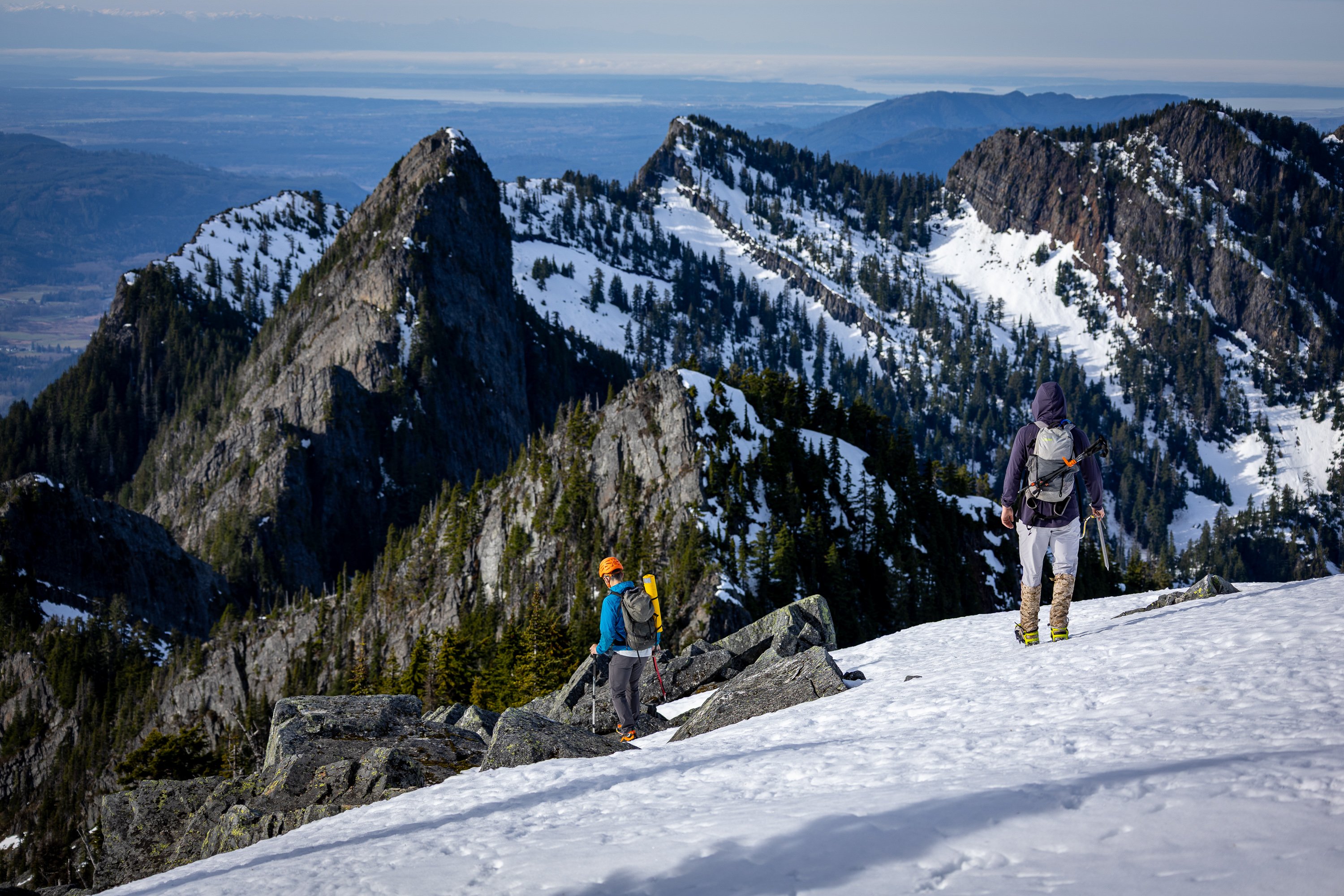
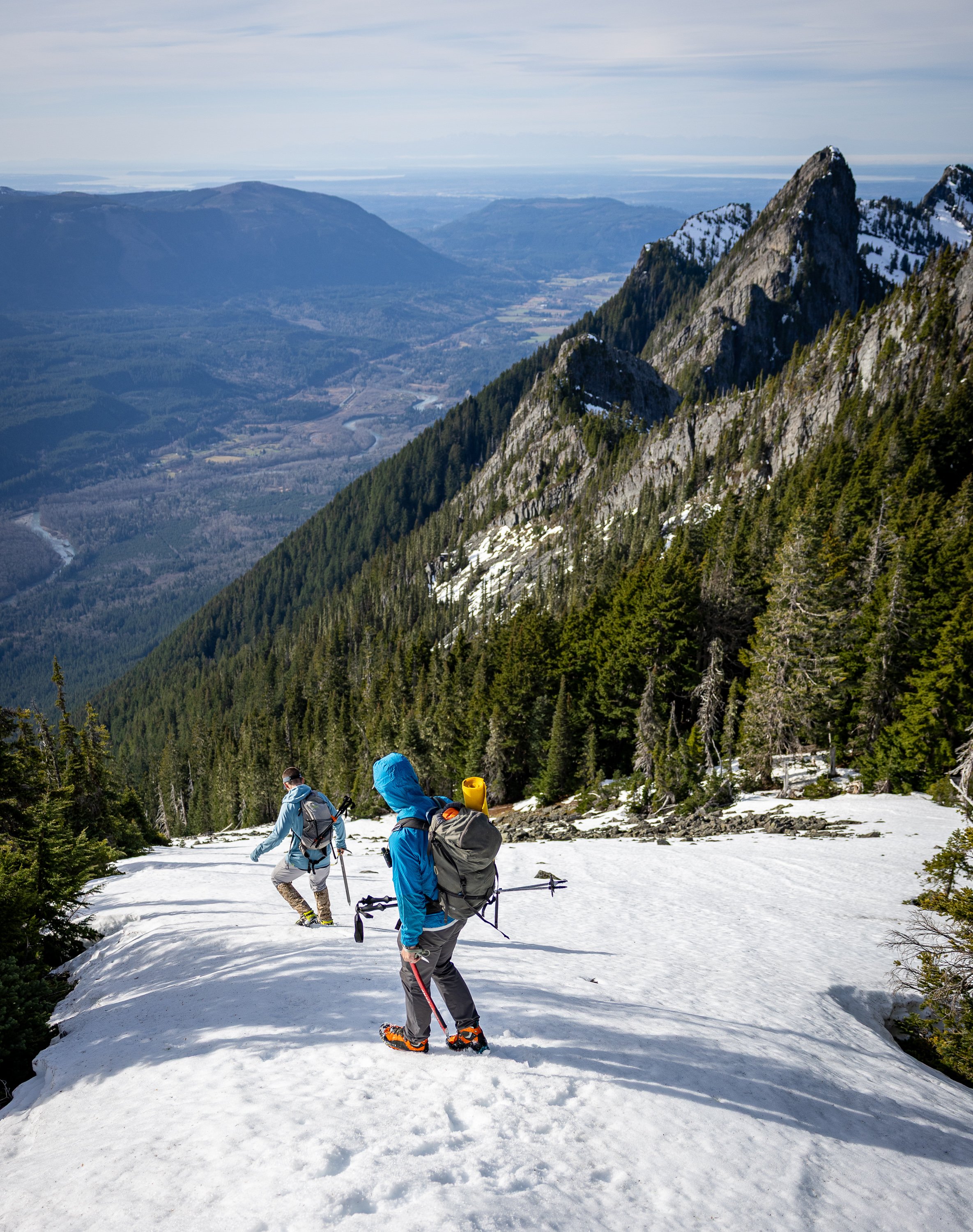
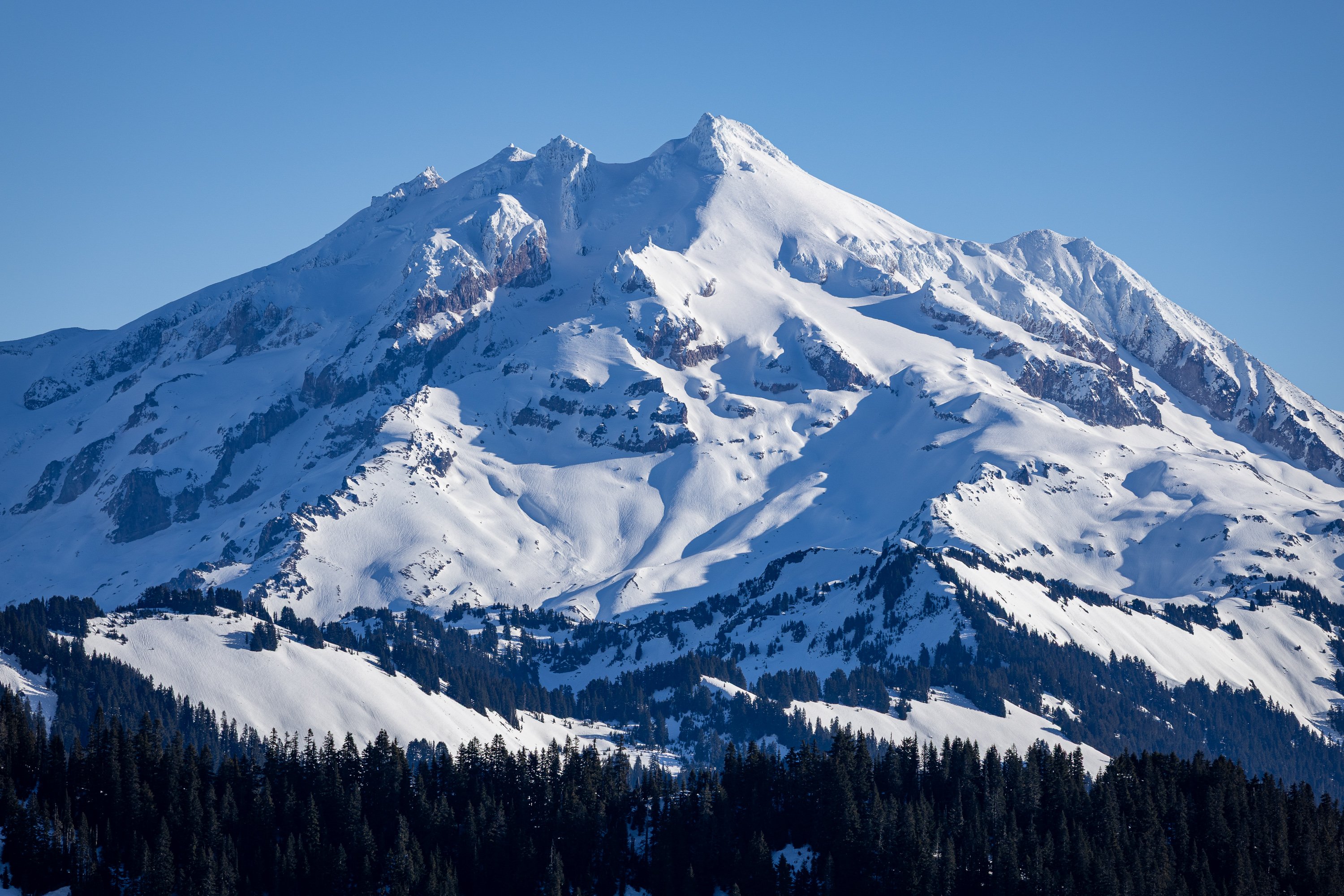
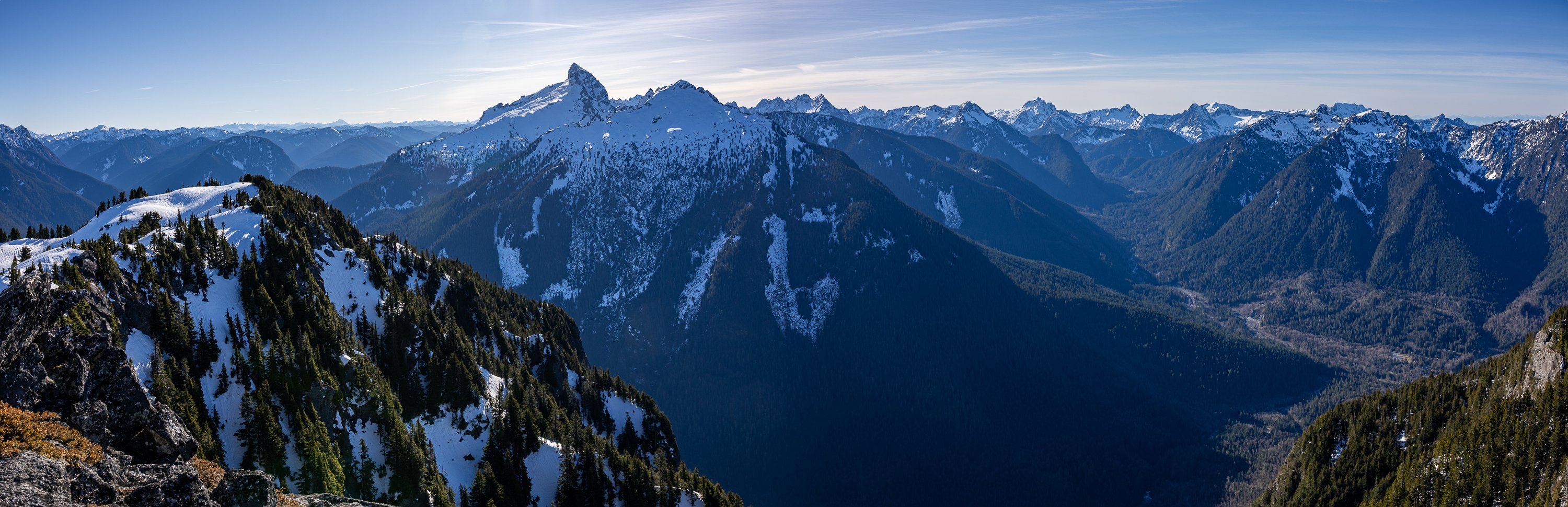
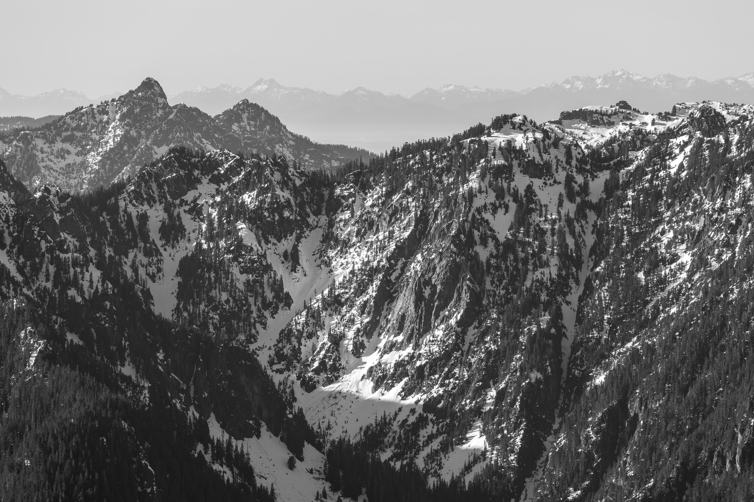
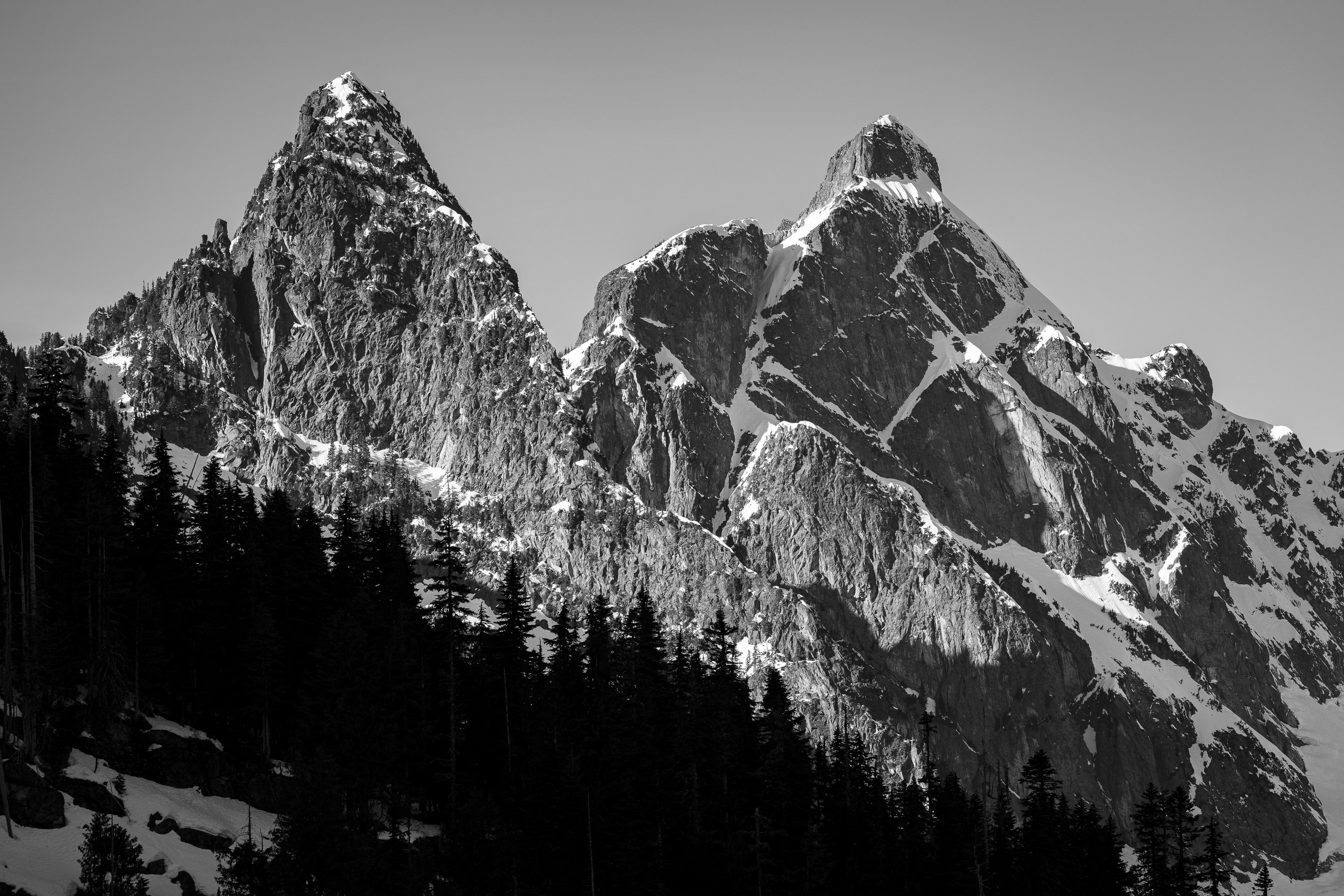
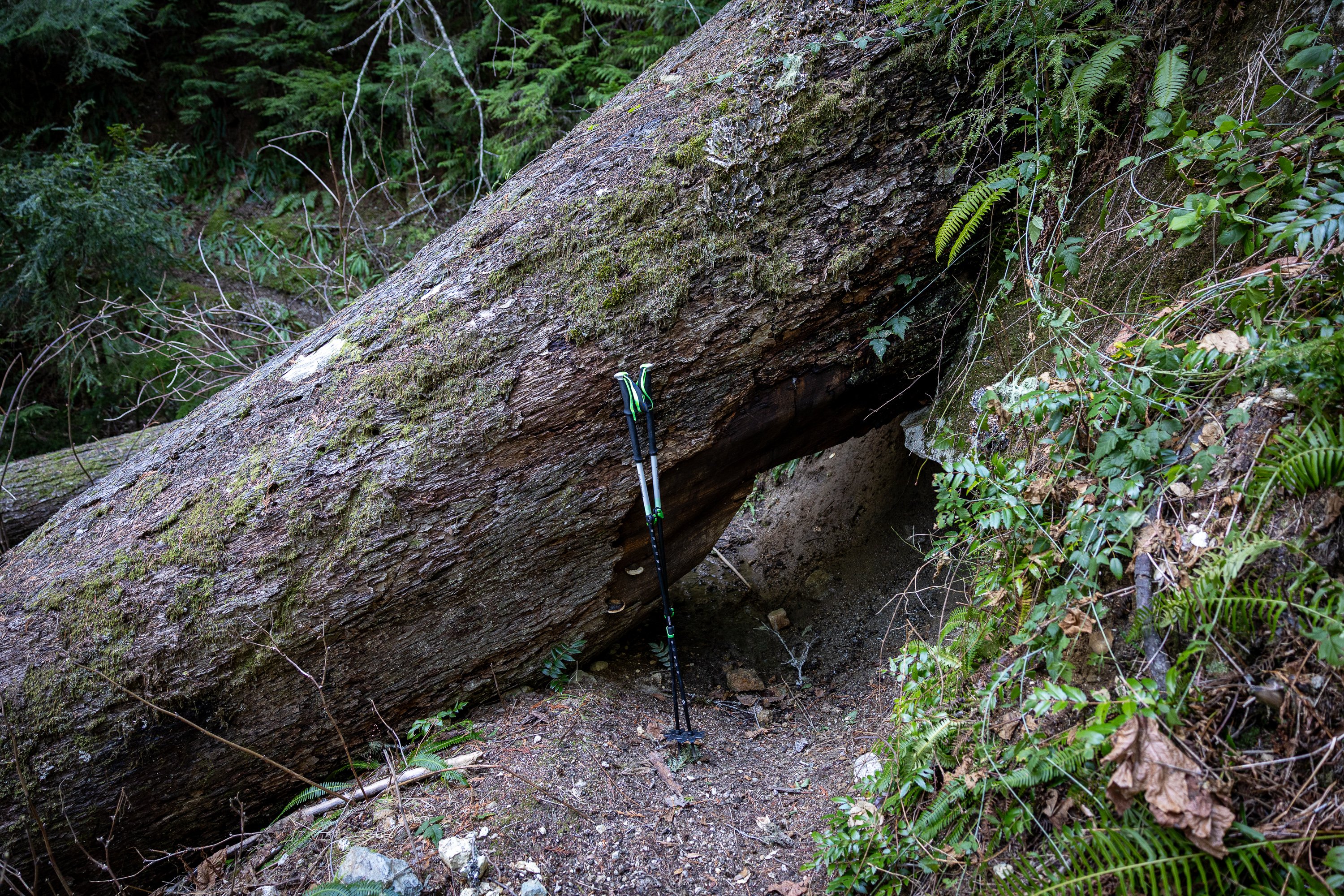
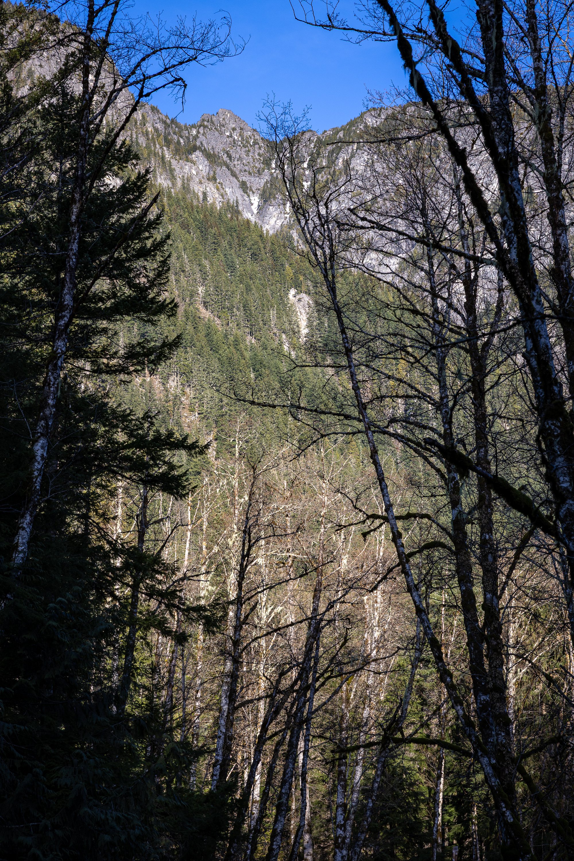
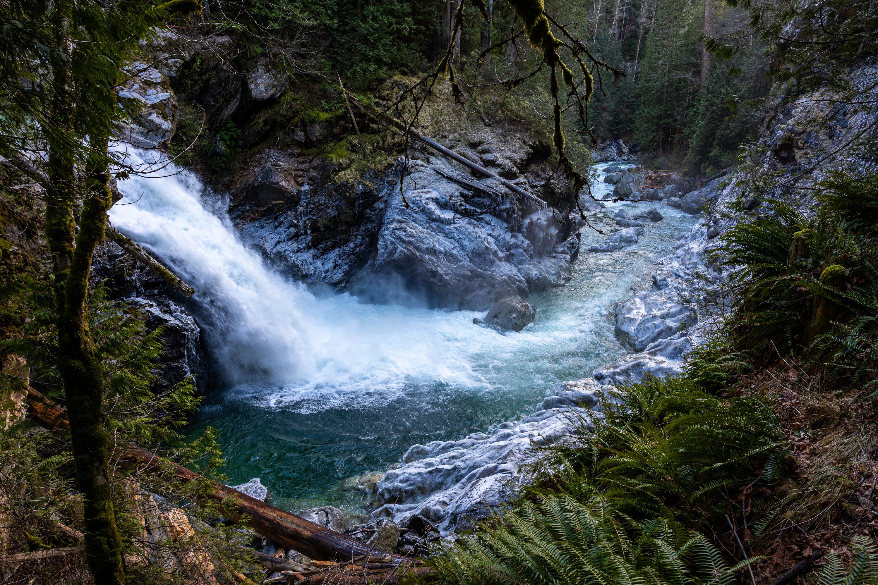
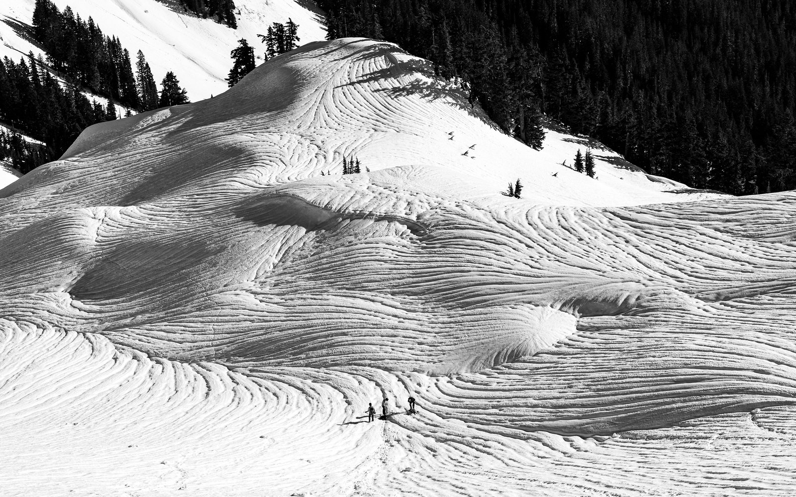
Trip: (Ira) Spring Mountain - East Ridge Trip Date: 01/25/2026 Trip Report: This long stretch of grim ski conditions had me casting about for other ideas in the North Cascades and Olympics (Ellinor, maybe I'll do a TR) these past few weeks. This past Sunday I cast off solo up the mountain loop highway from Darrington, aiming to get to the Lost Creek Ridge Trailhead. Surprisingly the MBSNF had a current report that you could drive all the way to the TH and indeed you could. Everything was in great shape, including to the turnoff for Pugh (not sure about the road up, however). 2wd would get you to the LCR trailhead at this time, which was somewhat surprising given the apocalyptic nature of this past December. Unsurprisingly, I was alone at the TH, and set off up the dry trail. It was generally in good shape, though with a good bit of blowdown in the first half mile or so. It had been 29 years since I'd hiked the trail and I had forgotten what large trees there are in this section of the Sauk. Of course, when they fall down, I wish they were a little smaller: Within a couple hours I found myself at Bingley Gap (hitting snow about 500' below gap), where I put on crampons, got out the axe and started up the steepening ridge. Views of Pugh and Sloan teased through the trees as I gained elevation: Within a few hundred feet above the Gap, the east ridge of Spring Mountain narrowed and steepened dramatically and I found myself doing some spicy scrambling in crampons sans helmet. Oops. (Don't worry, I found an easier way down to the north and below the ridge itself). Soon, Dakobed came into view: And then, not long after that, the summit of Spring, which was smaller and more noble than I was expecting: The view from the summit was sublime (about 3.5 hours from the car), extending across Sloan and the Monte Cristo peaks to the Olympics and up north past Darrington into the heart of the North Cascades. It was just me and a lone raven up above, croaking as it rode higher on the thermals. It was a beautiful day in the North Cascades. Out to Hall Peak and the Olympics: I stayed on the summit for about an hour (3 bars 5G service FYI), flinging digital poo at those that couldn't make it out with me that day. But I was a bit uncertain about the descent, since I didn't want to descend the way I had come up and left early enough to give myself some time to figure things out. Impressive views of the east side of Pugh slowed my pace on the way down. I had brought my new telephoto, which came in handy: Breccia Mountain: But I needn't have worried. Straightforward snow slopes (though steep-some facing in) were fairly easily followed from the summit all the way back to Bingley Gap. No sketchy scambling with crampons was required and within an hour I was on the trail bombing back to the car. I arrived early enough for a stop at the NF Sauk Falls (highly recommended), where a nice view of Spring Mountain was also had (summit is that middle rock): I hadn't seen anyone all day, nor a car, since leaving the pavement a bit south of Darrington. This was somewhat surprising to me, given that it was a beautiful Sunday, but then I remembered that there was a Seahawks game on. Too bad for those folks, I guess. I sat for a bit along the road as the sun sank west, admiring Whitechuck Mountain. I never get tired of a good day in the North Cascades. Gear Notes: axe, crampons, helmet Approach Notes: Lost Creek ridge trail to Bingley Gap. The east ridge can be followed, more or less to the summit from the Gap, though it can get spicy in places. An easier route drops a couple hundred feet on the north side of the Gap and then up and left through avy paths to the summit.

-
- 6
-

-
-
Sloan and Bedal this past Sunday:
-
Thanks for the report, that is a fun route!
-
Dakobed from Helmet Butte:
-
East side of Mt. Pugh two days ago.

-
Some great discussion here, if you haven't read it, but not probably that helpful since I think all right side talk?
-
Didn't a big chunk of the steeper part of the pillar fall down like 30+ years ago? I know some routes were affected, just not which.
-
I bumped that memorial thread about John Stoddard and there was MSFT talk on that one?
-
And now to this:
-
Thanks! Those were shot with a Canon R6 MarkII with Canon RF 24-70 f2.8 and 70-200 f4 lenses 🤓 And no, this isn't a reasonable kit to drag around the mountains. I recommend an iPhone.
-
Three weeks ago, when it was still winter:
-
Speaking of what we want to preserve on this site....this thread is a great read. Here's to you Mr. Stoddard!
