Leaderboard


Popular Content
Showing content with the highest reputation since 11/26/17 in all areas
-
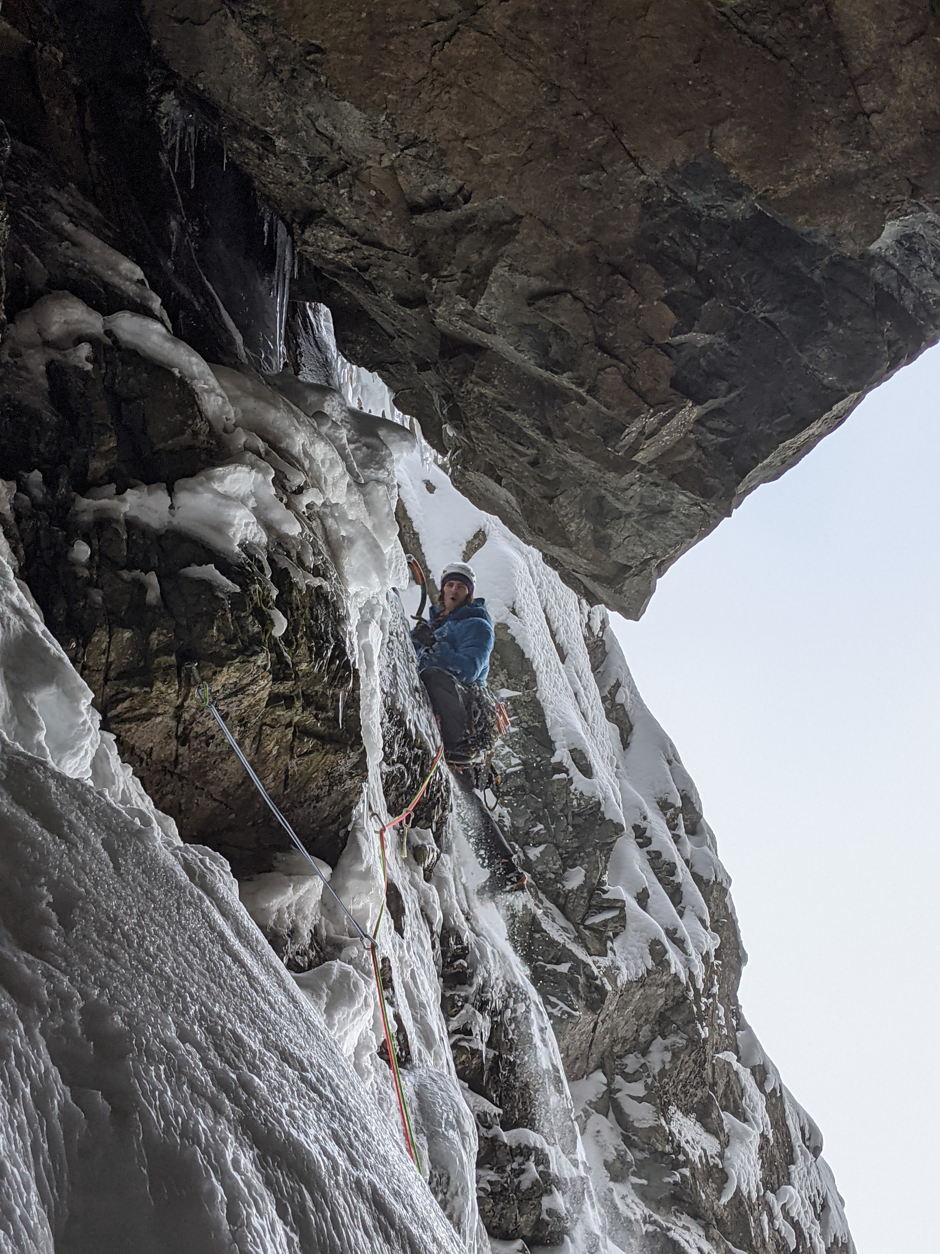
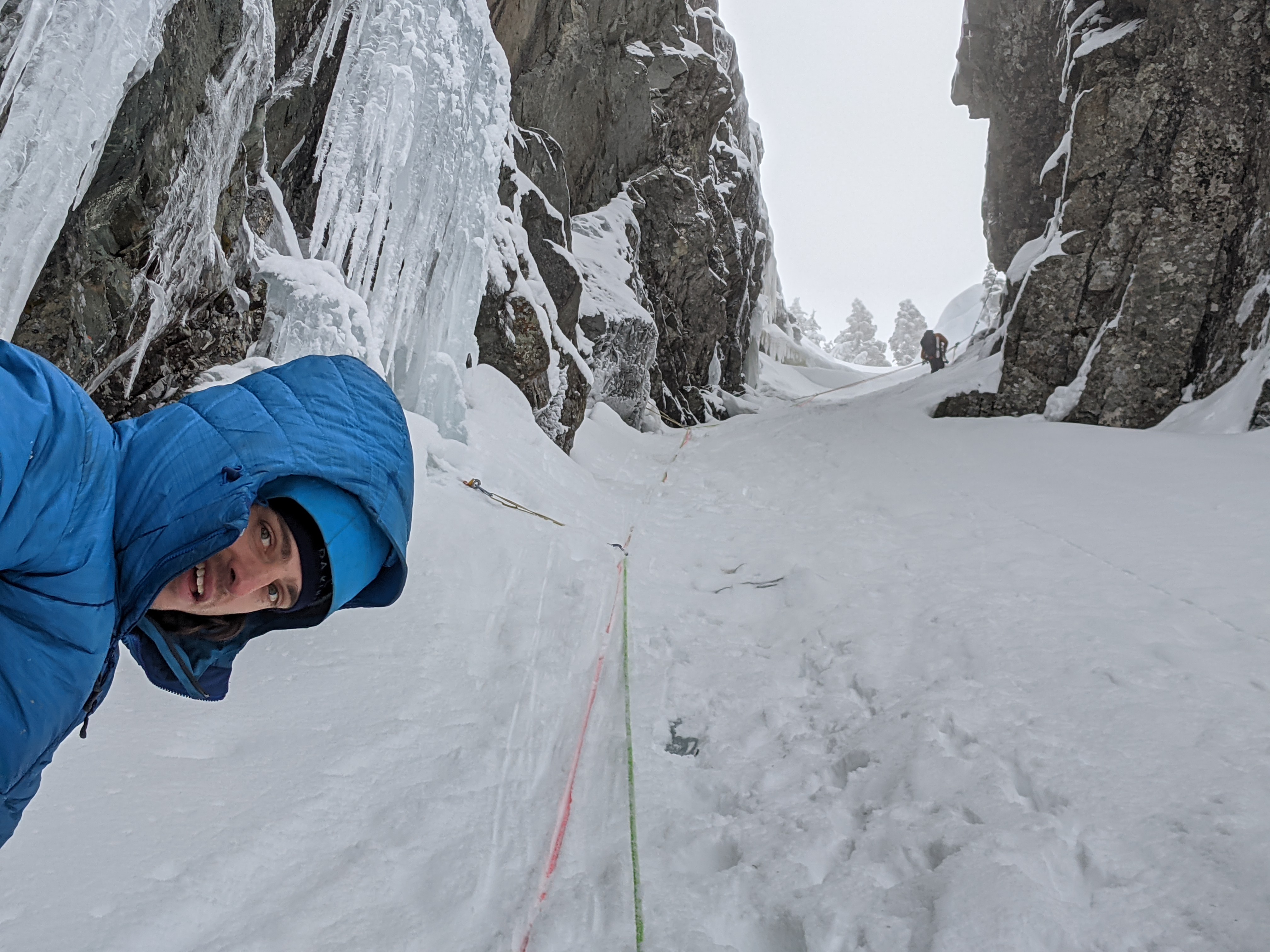
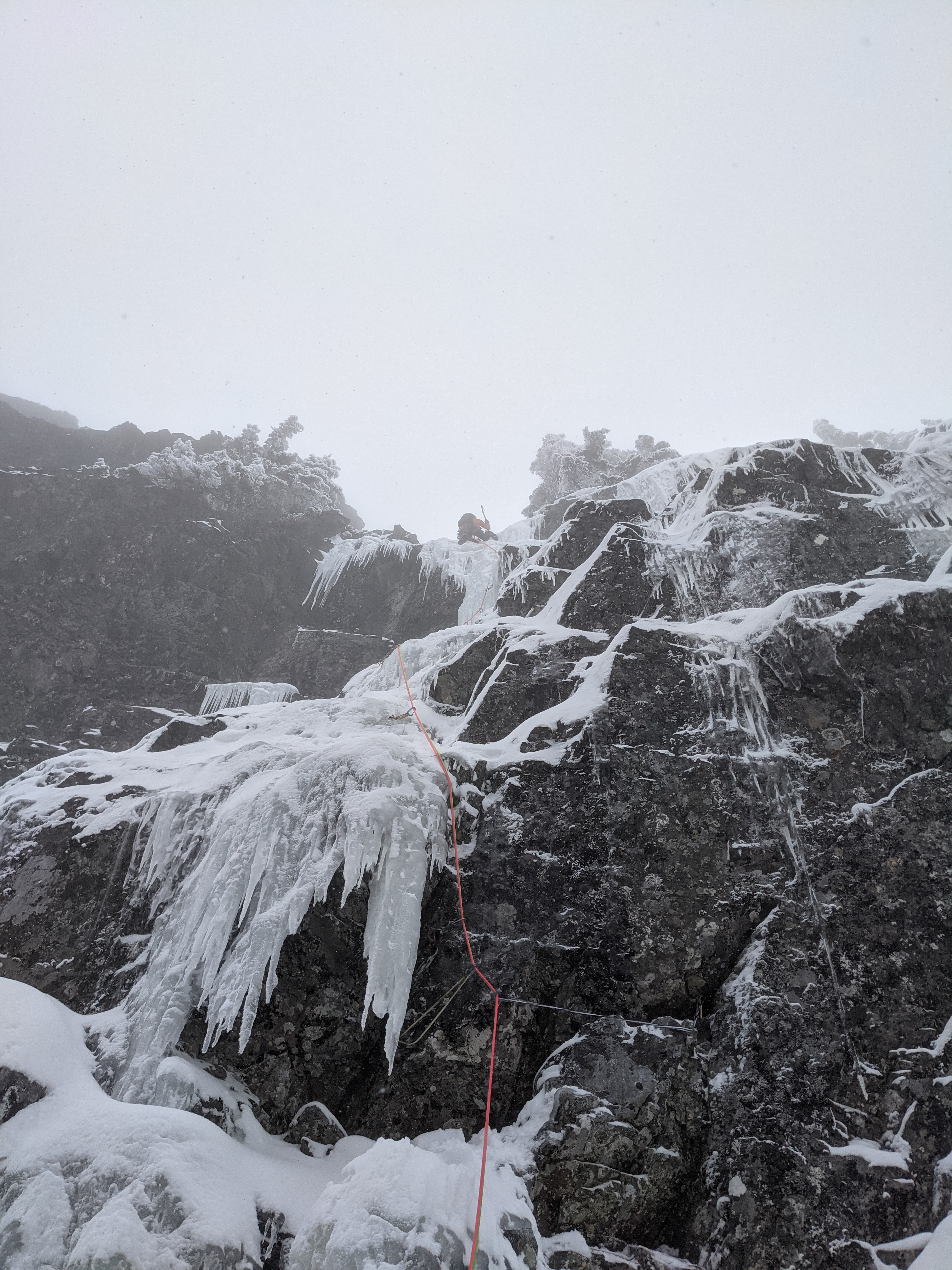
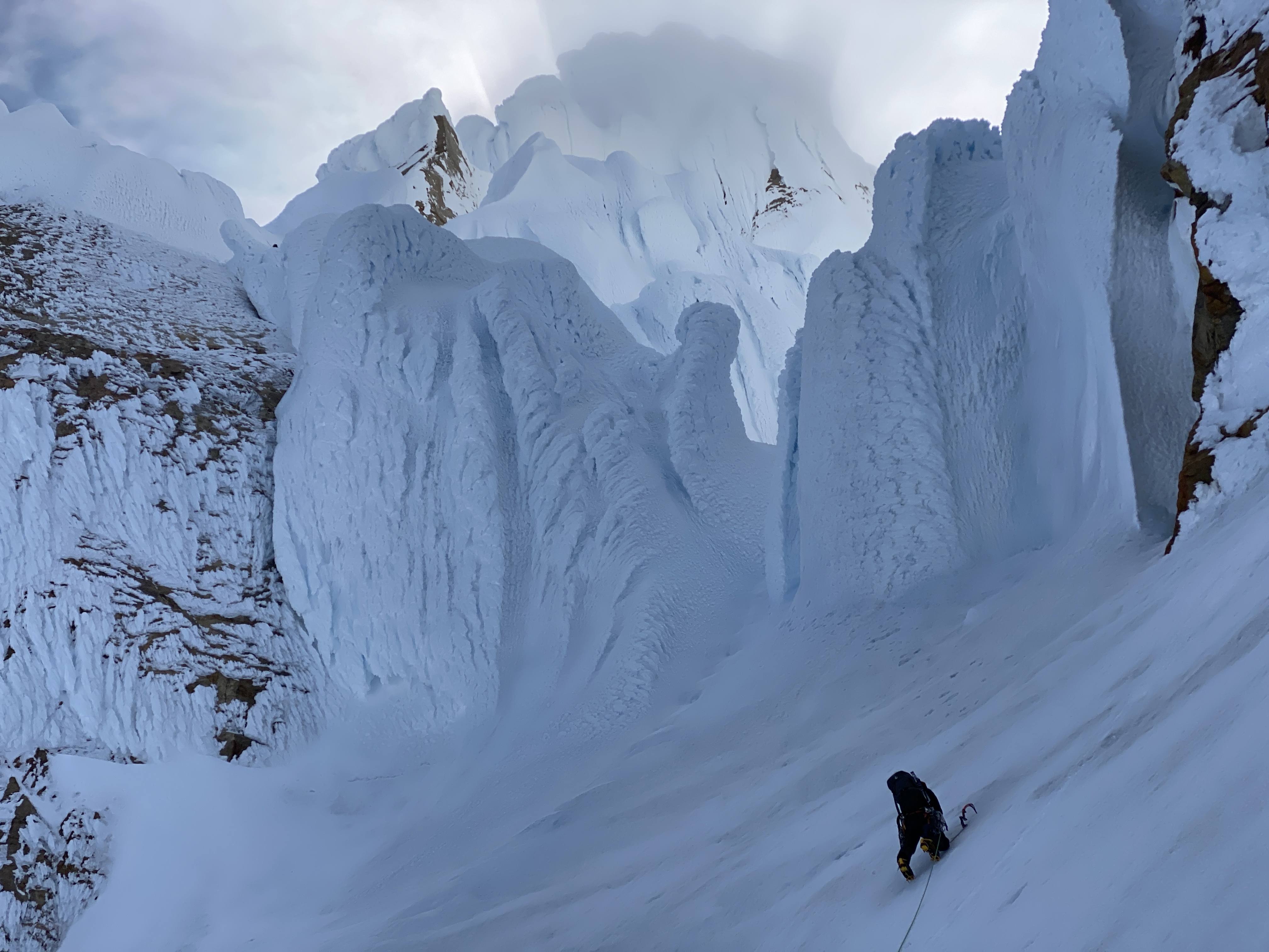
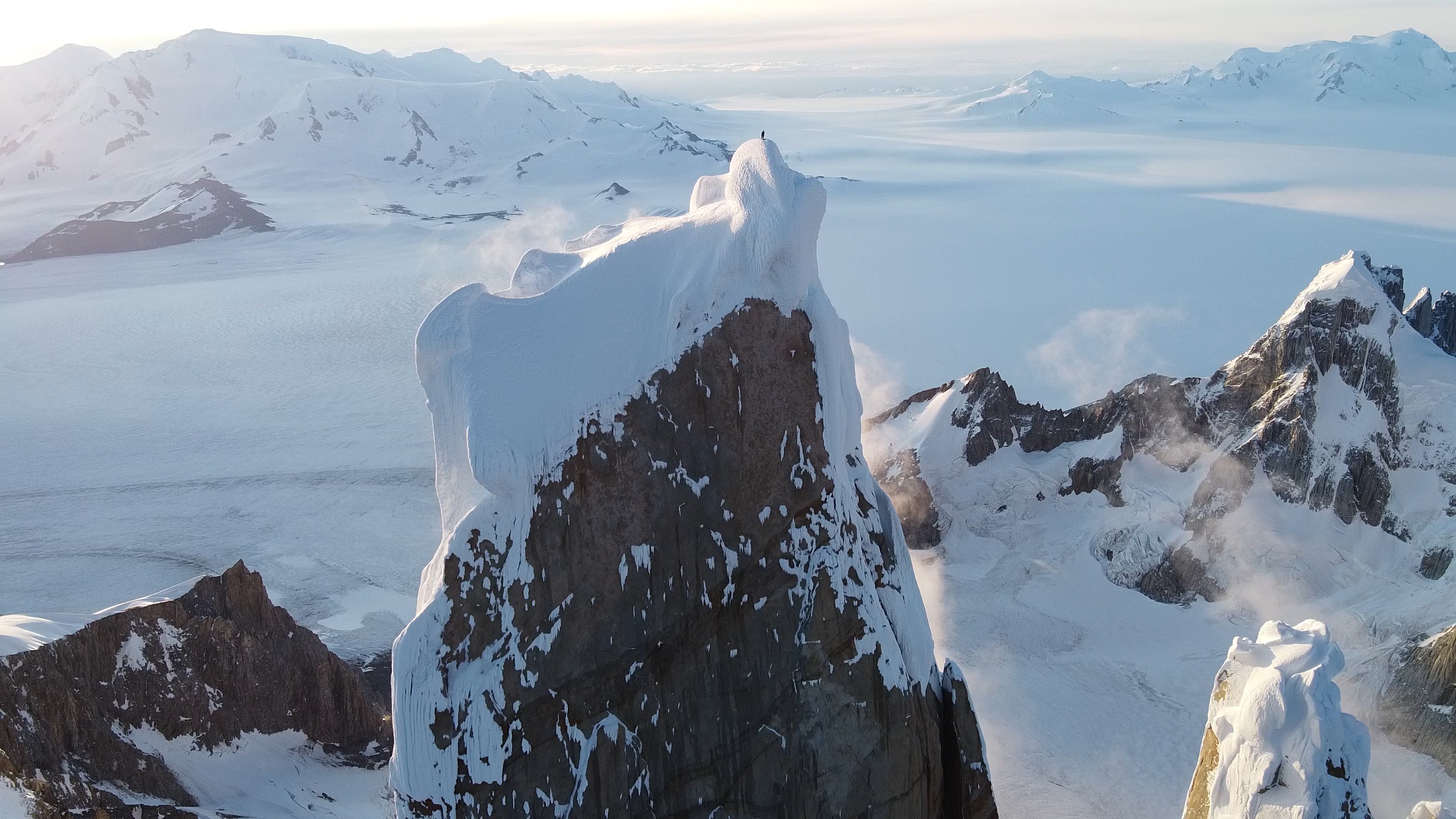
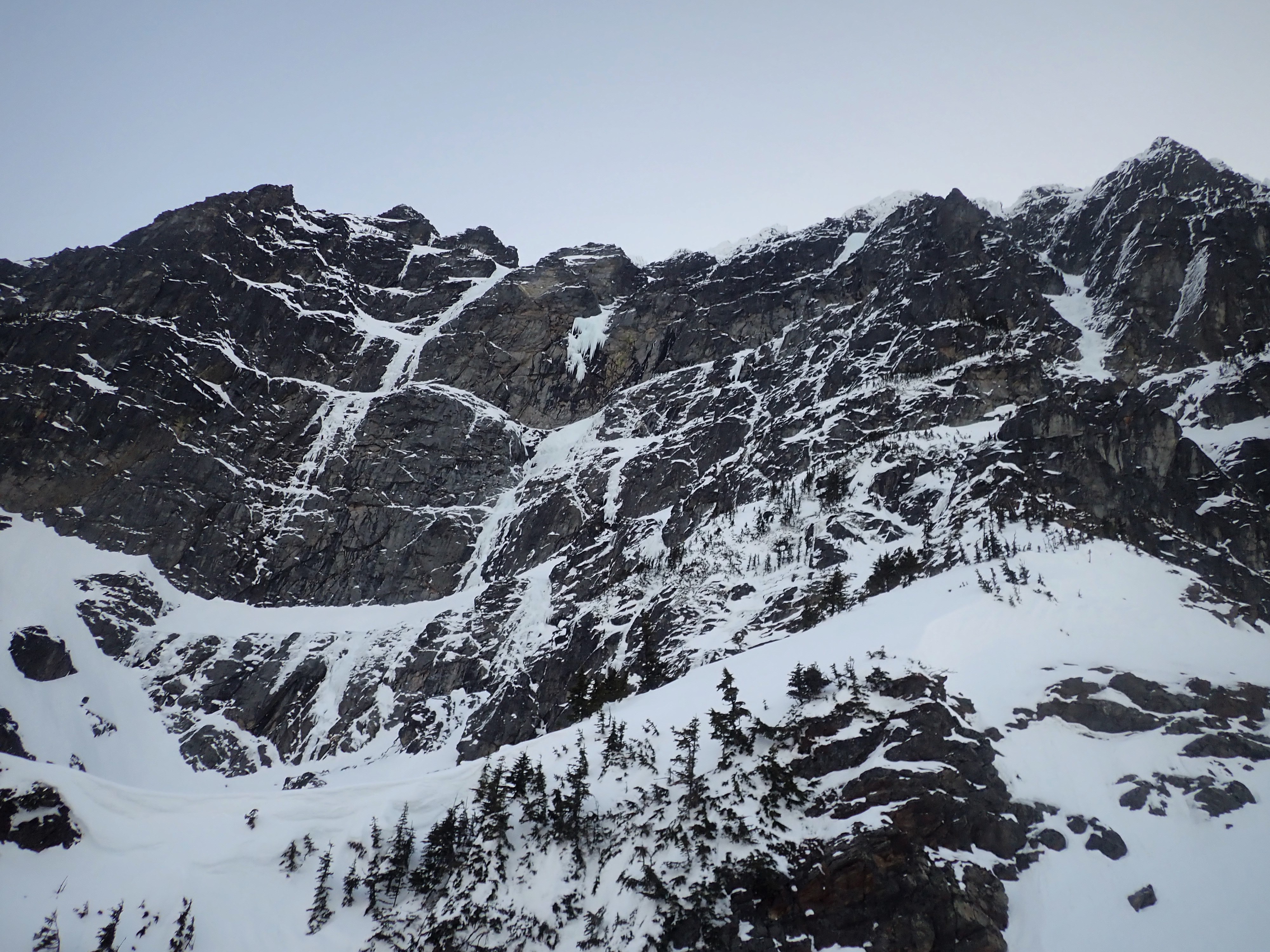
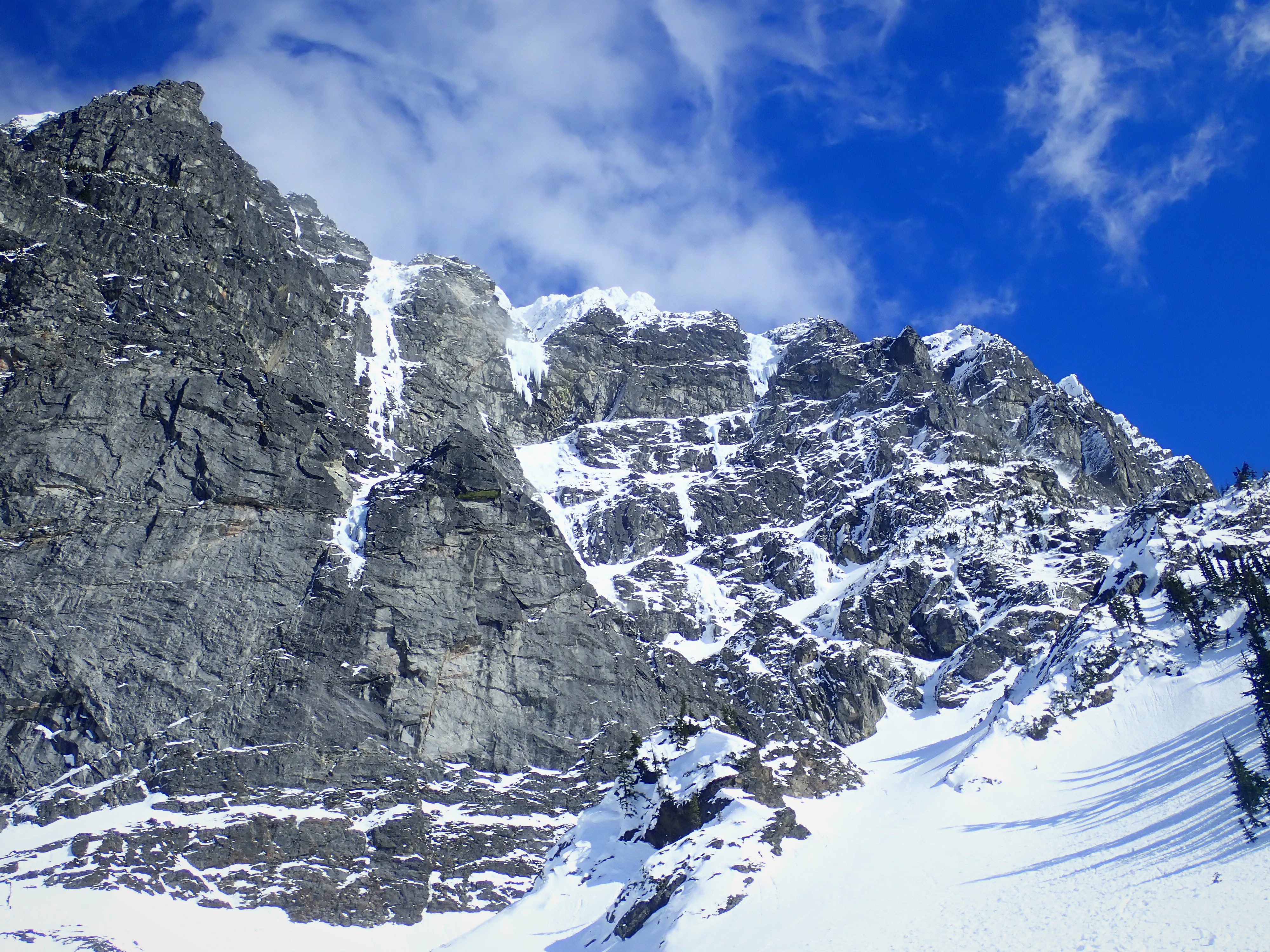
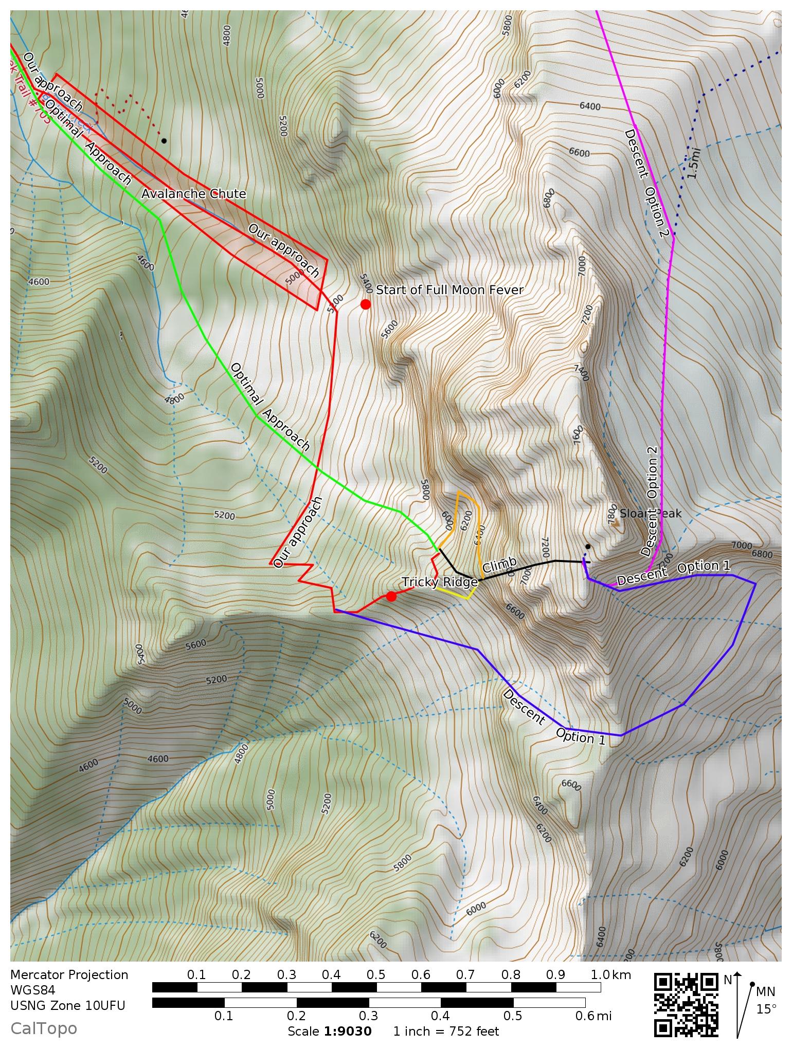
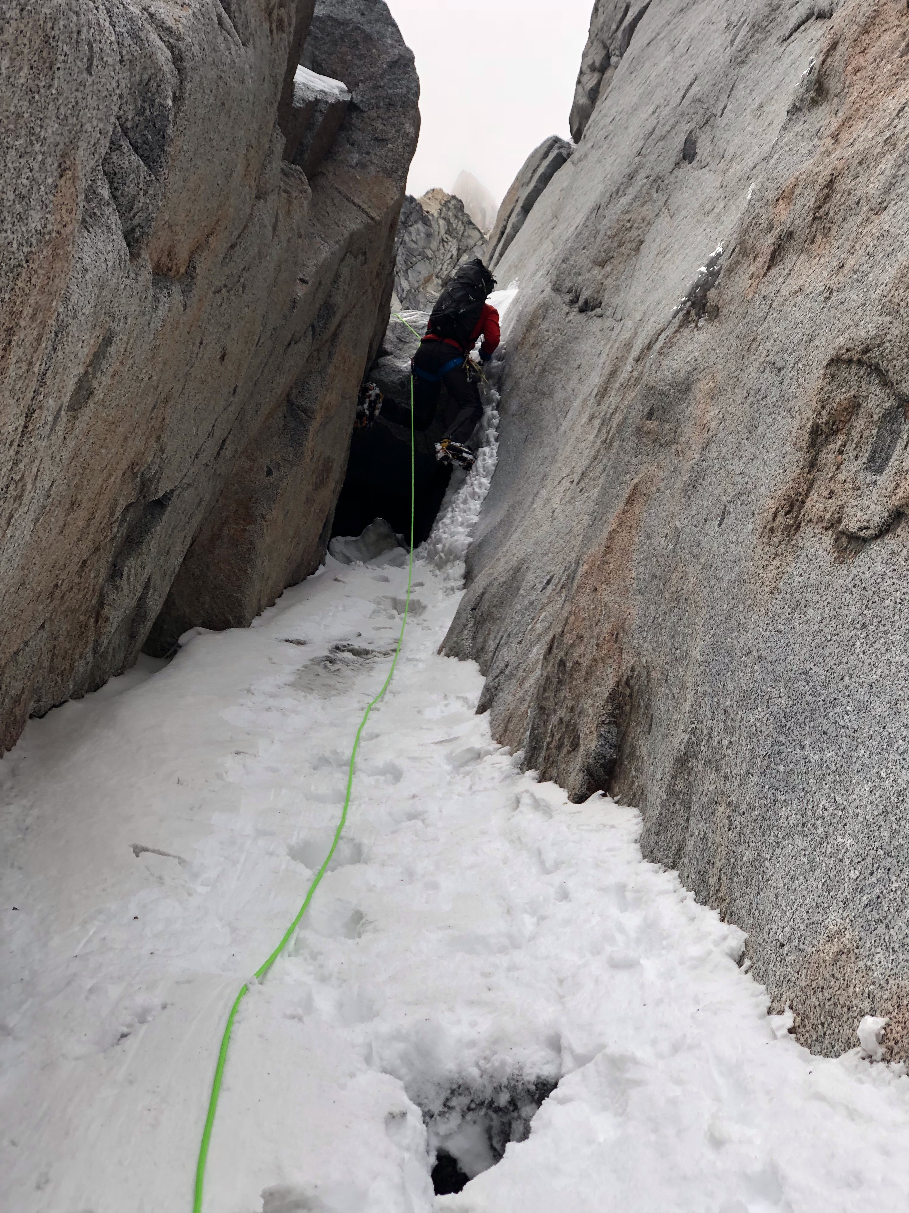
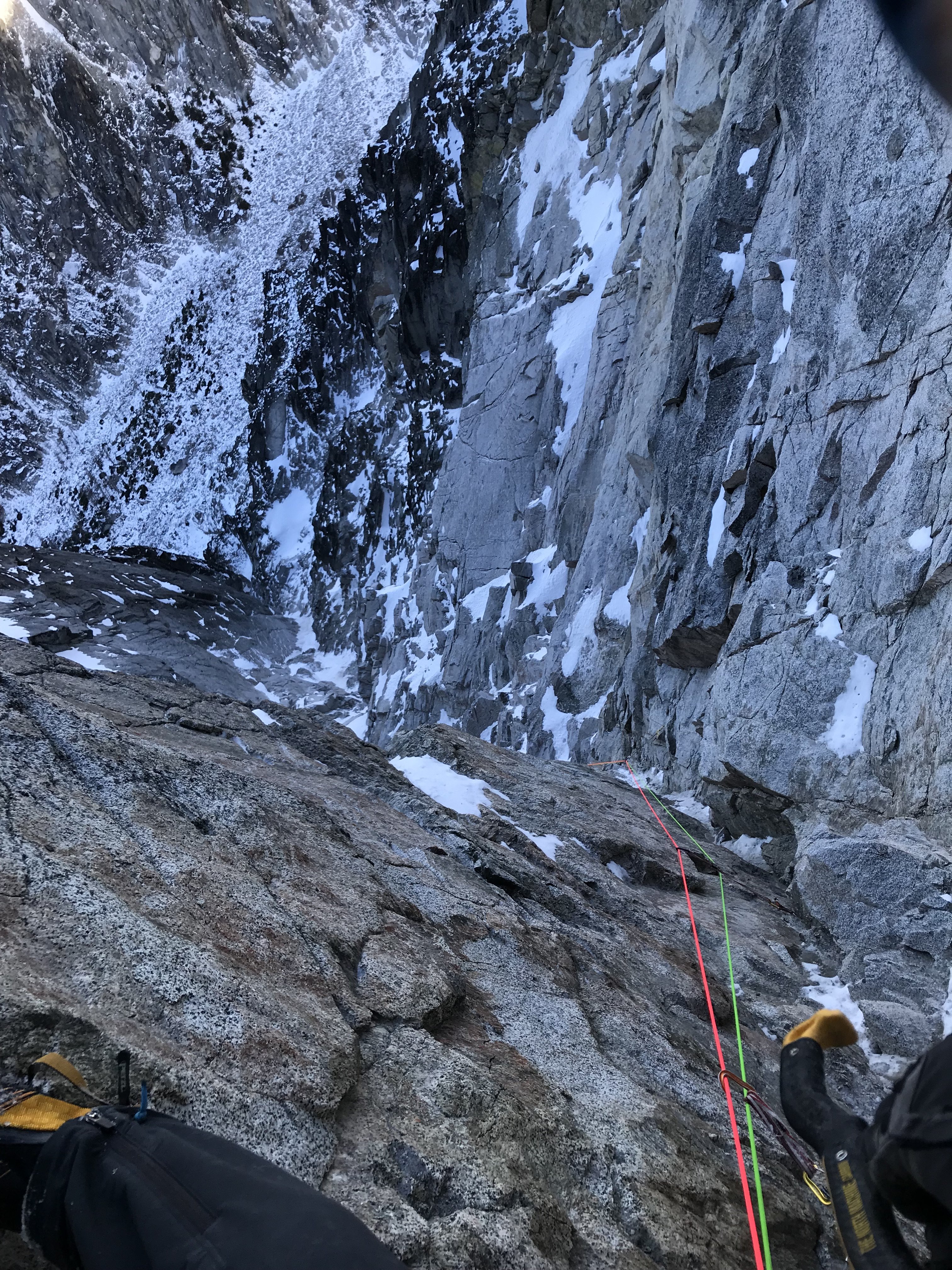
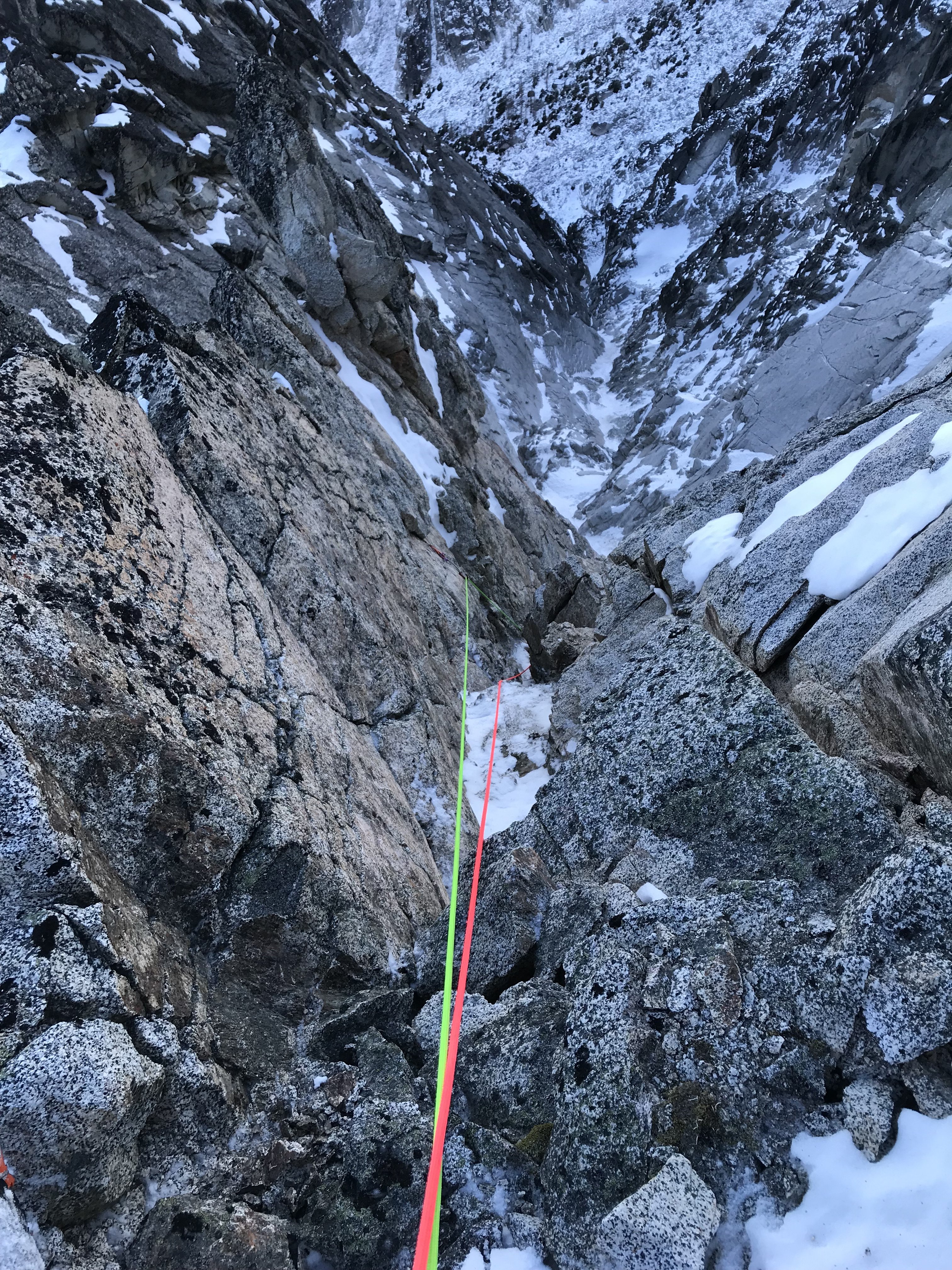
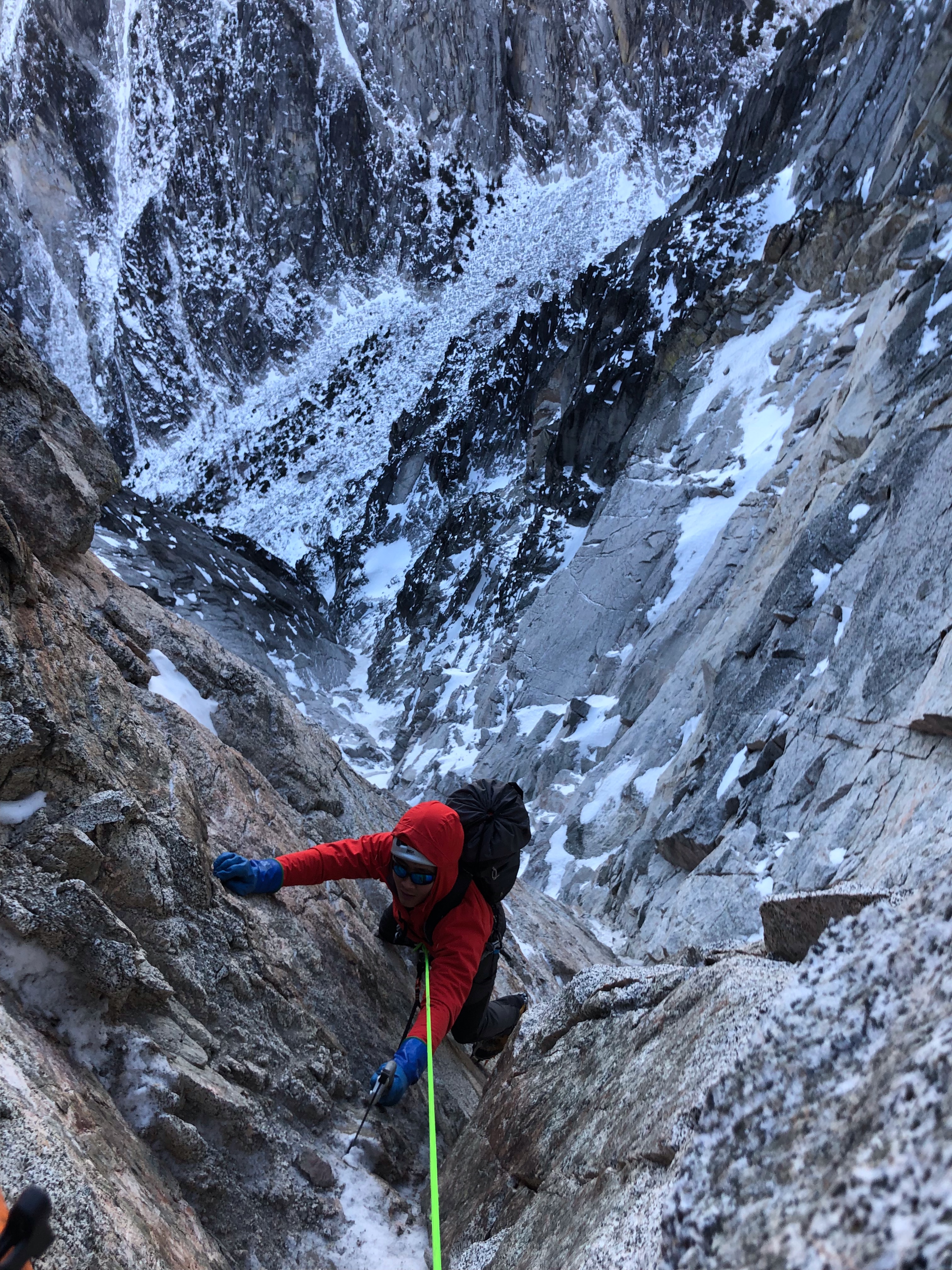
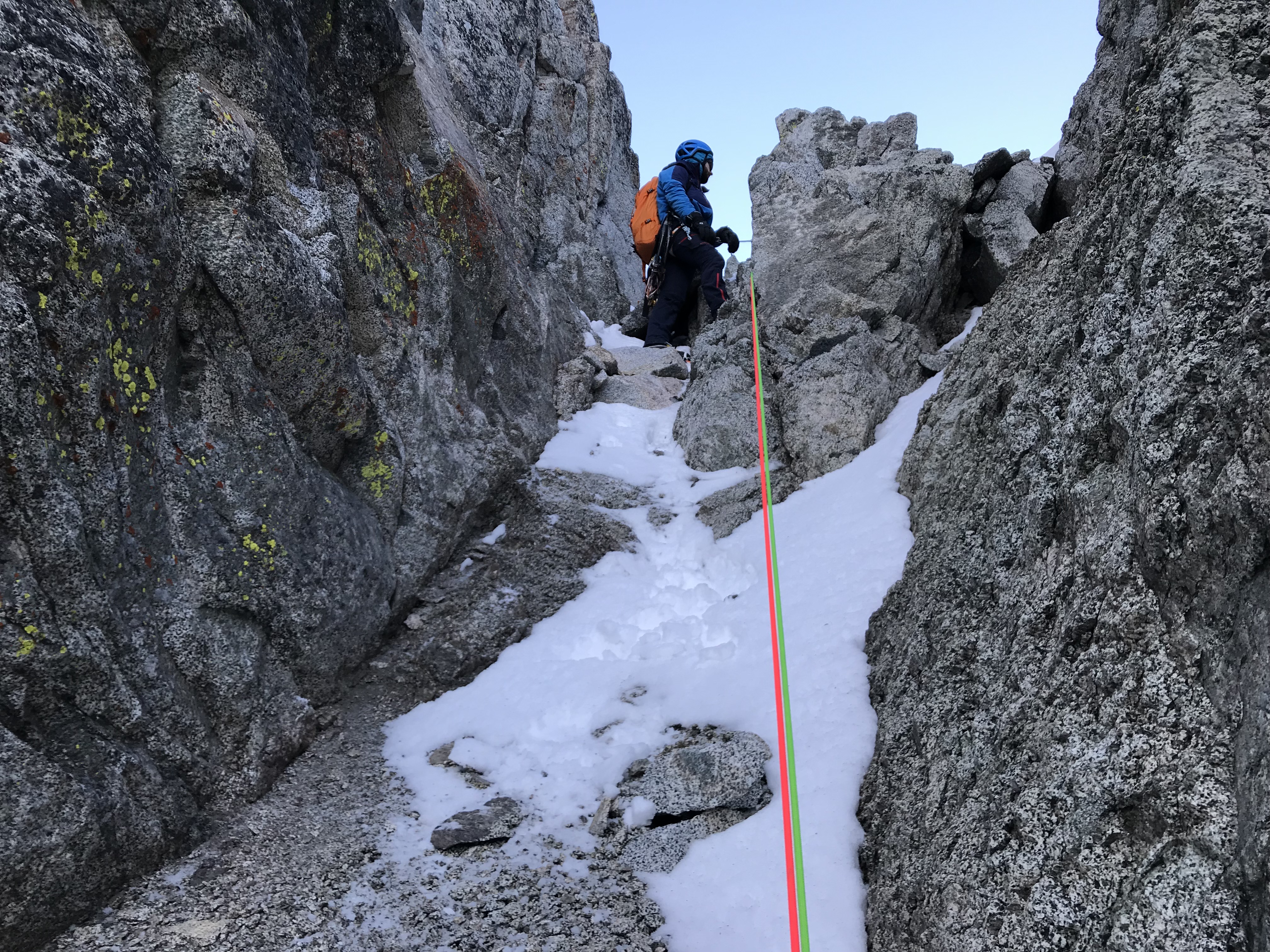
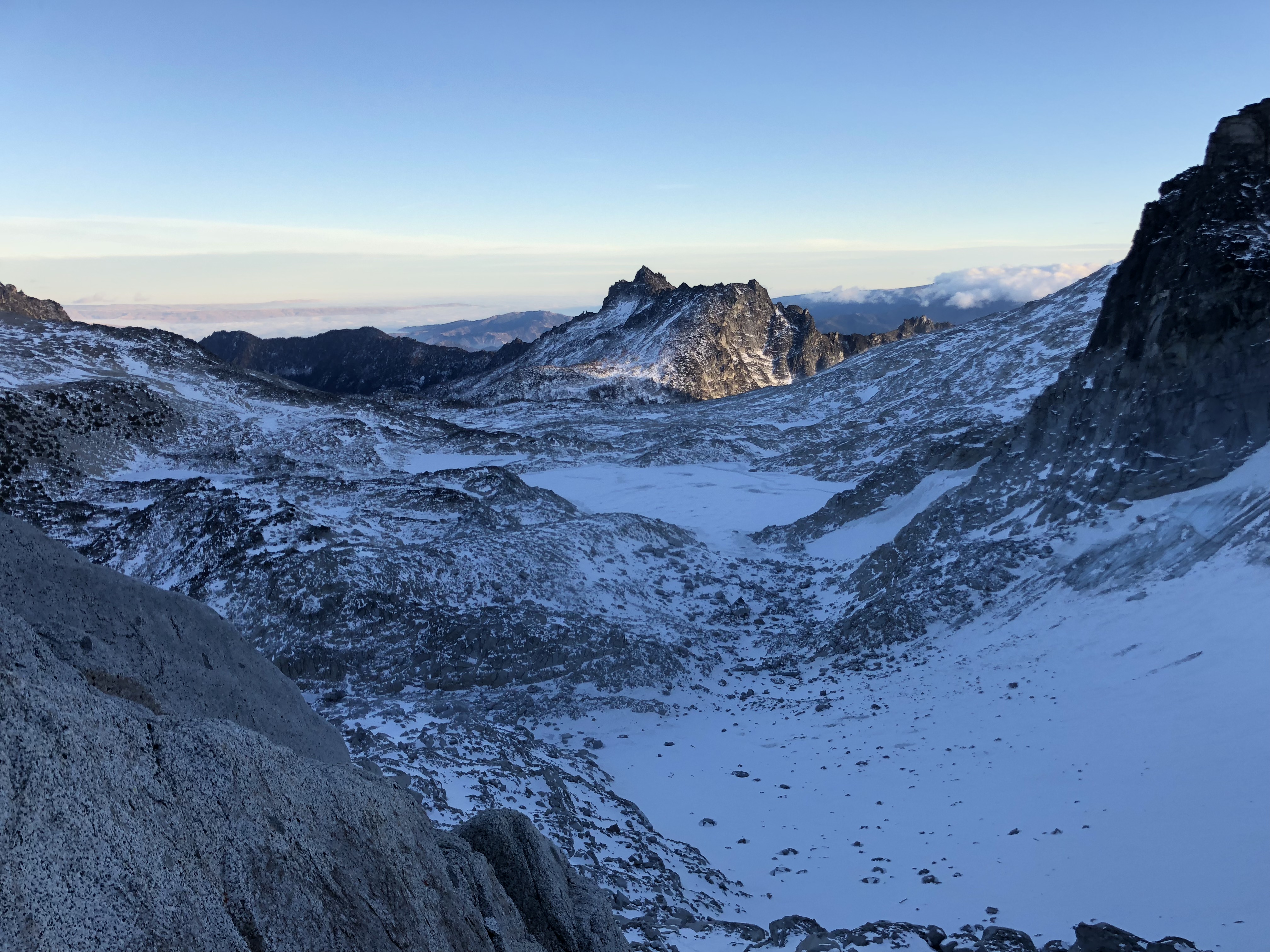
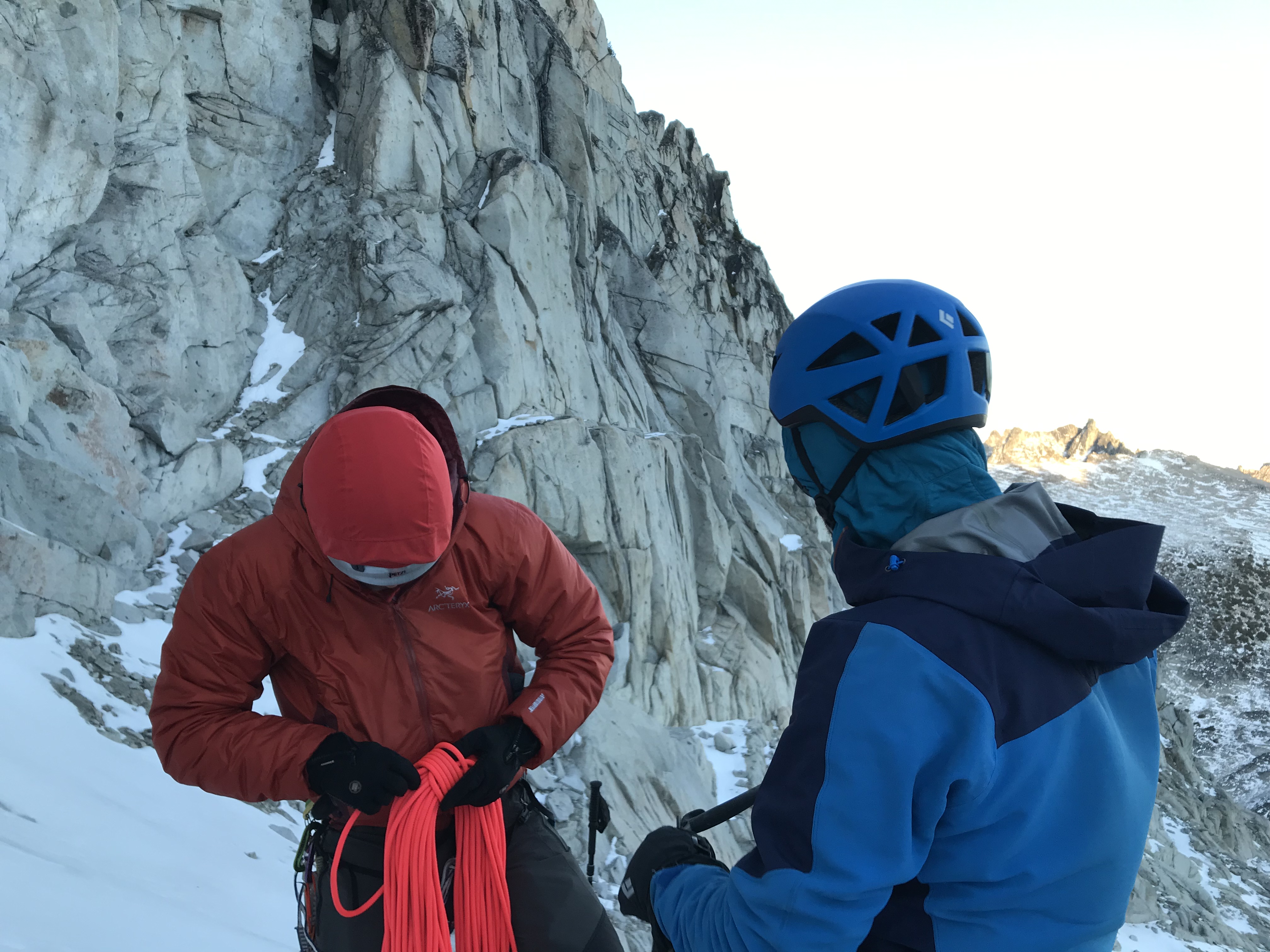
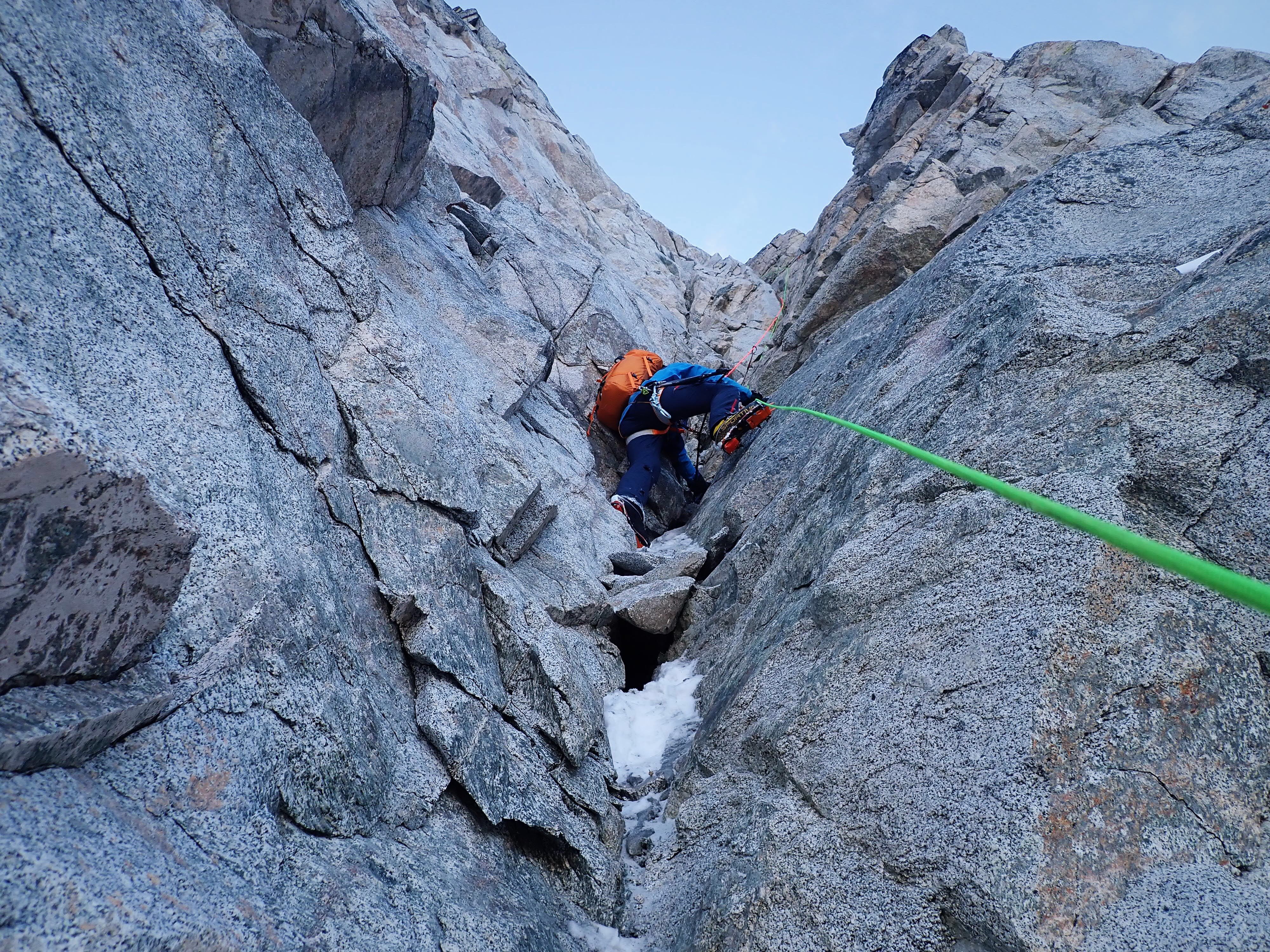
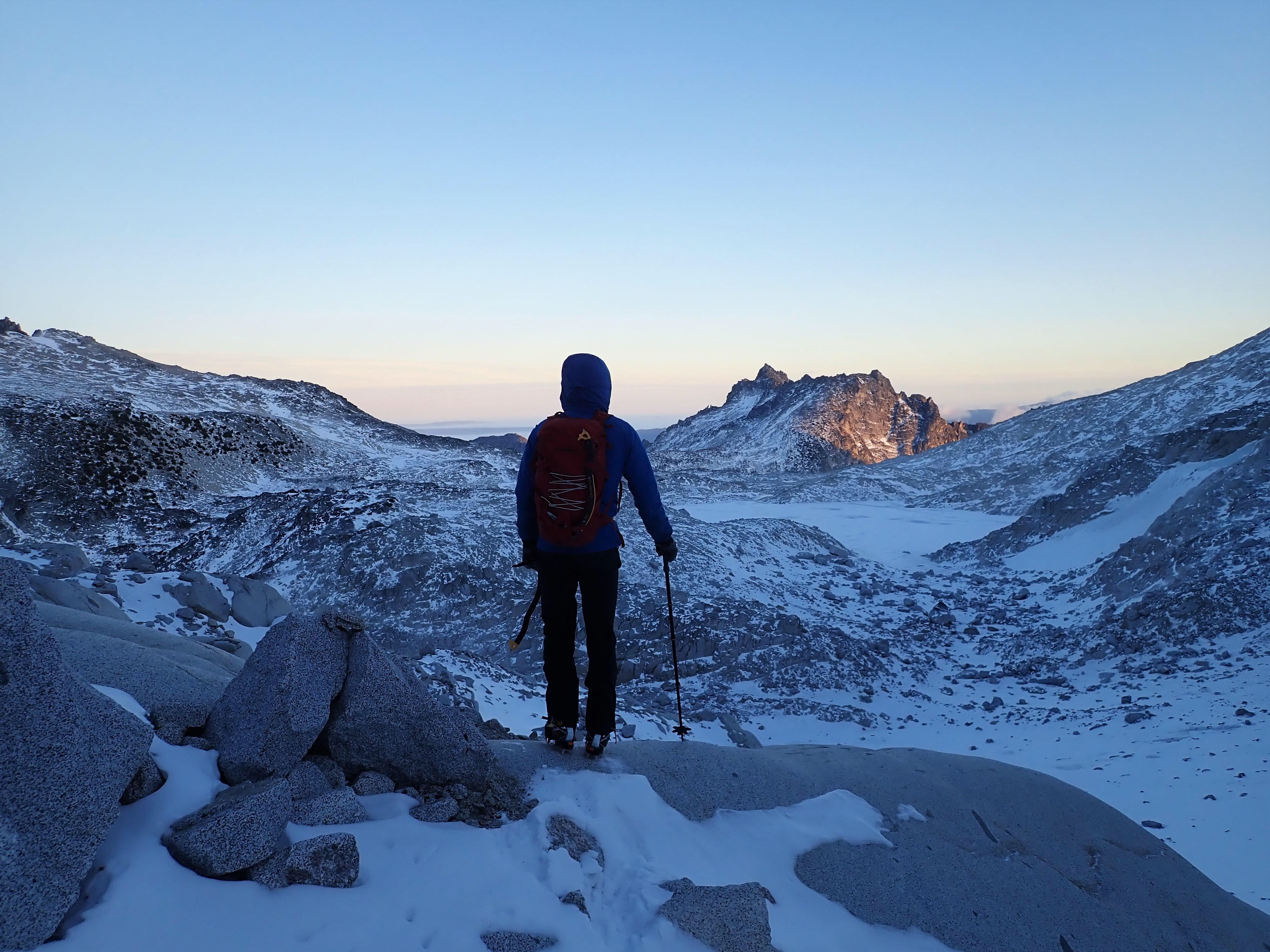
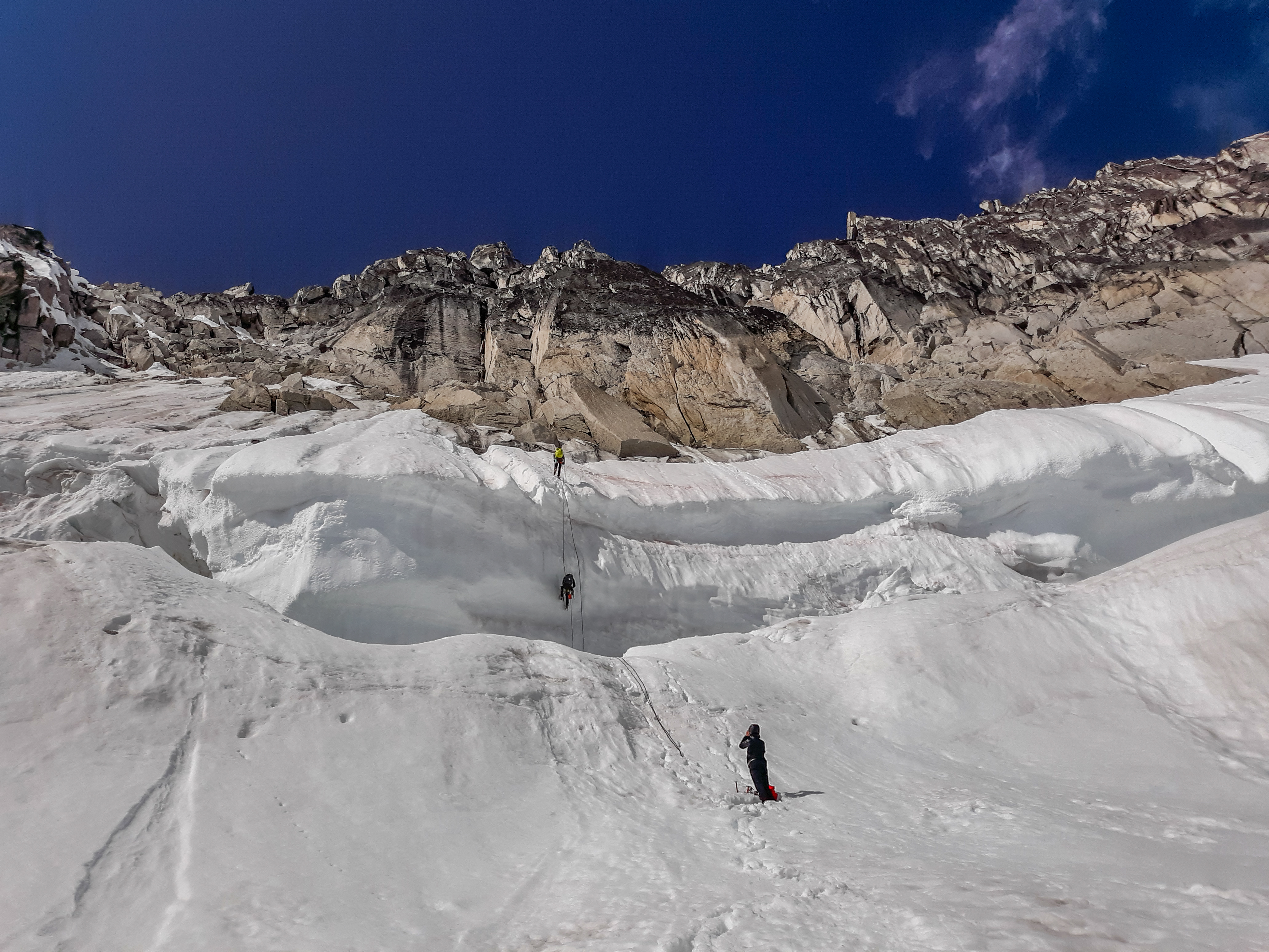
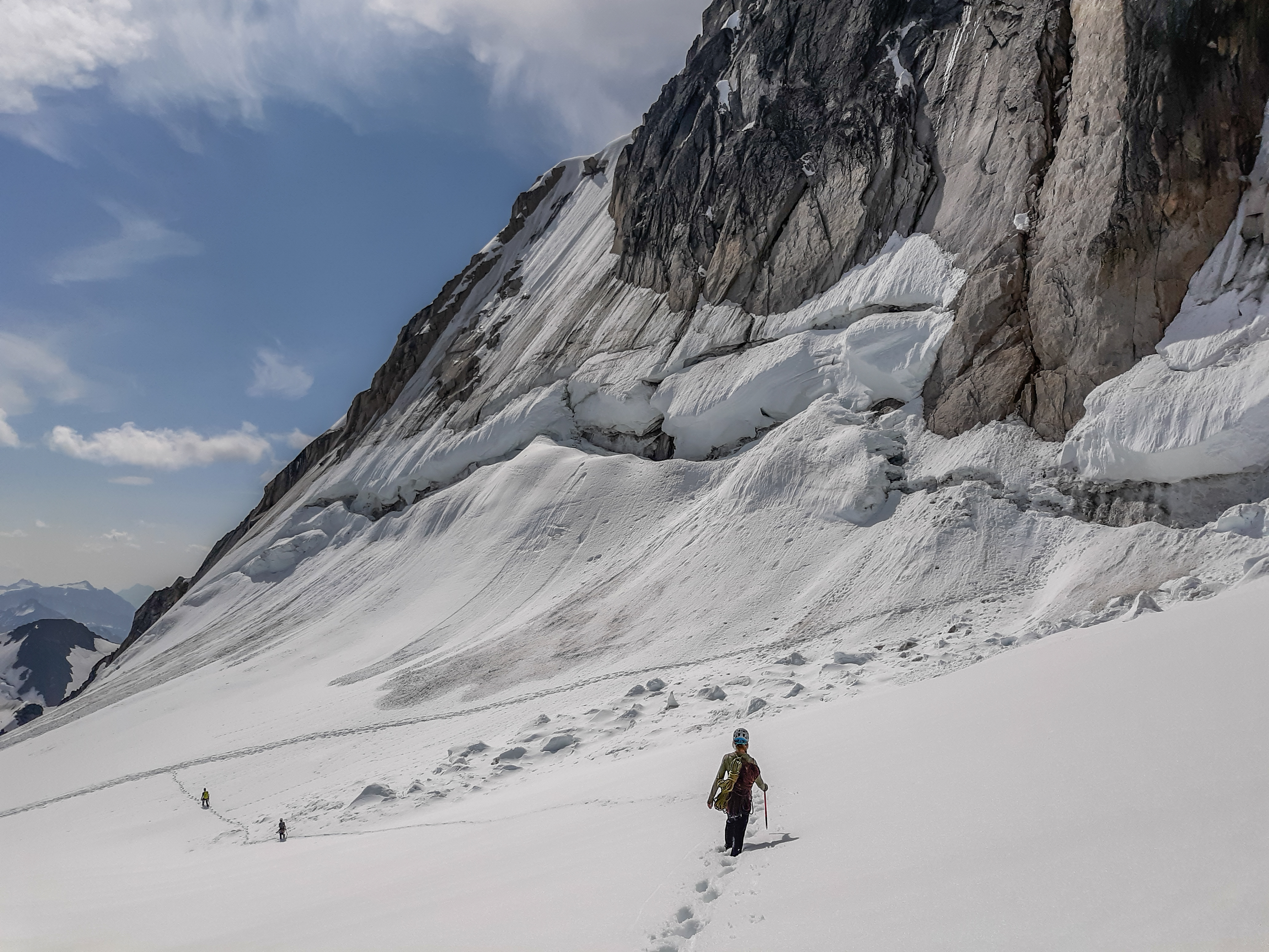
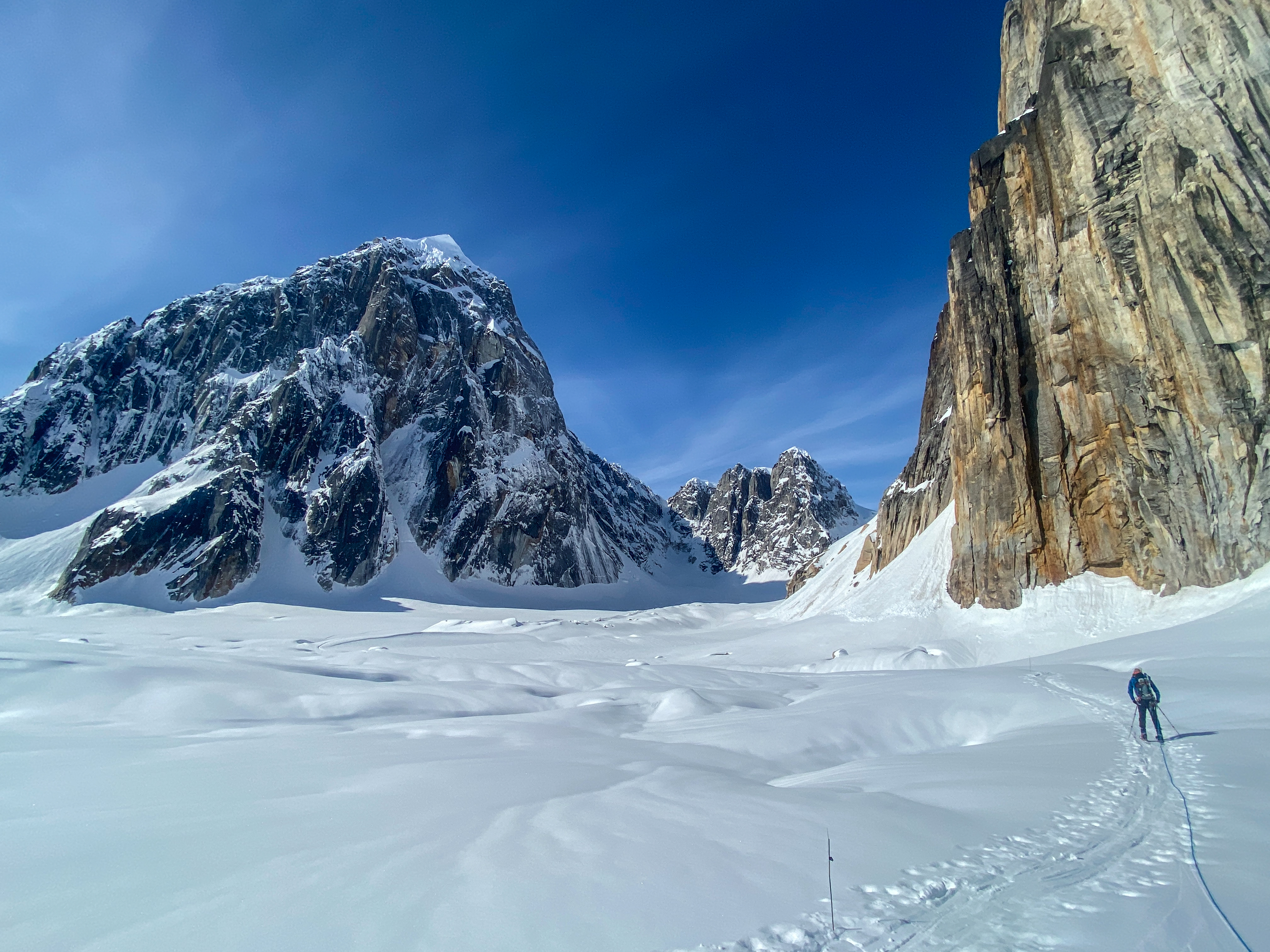
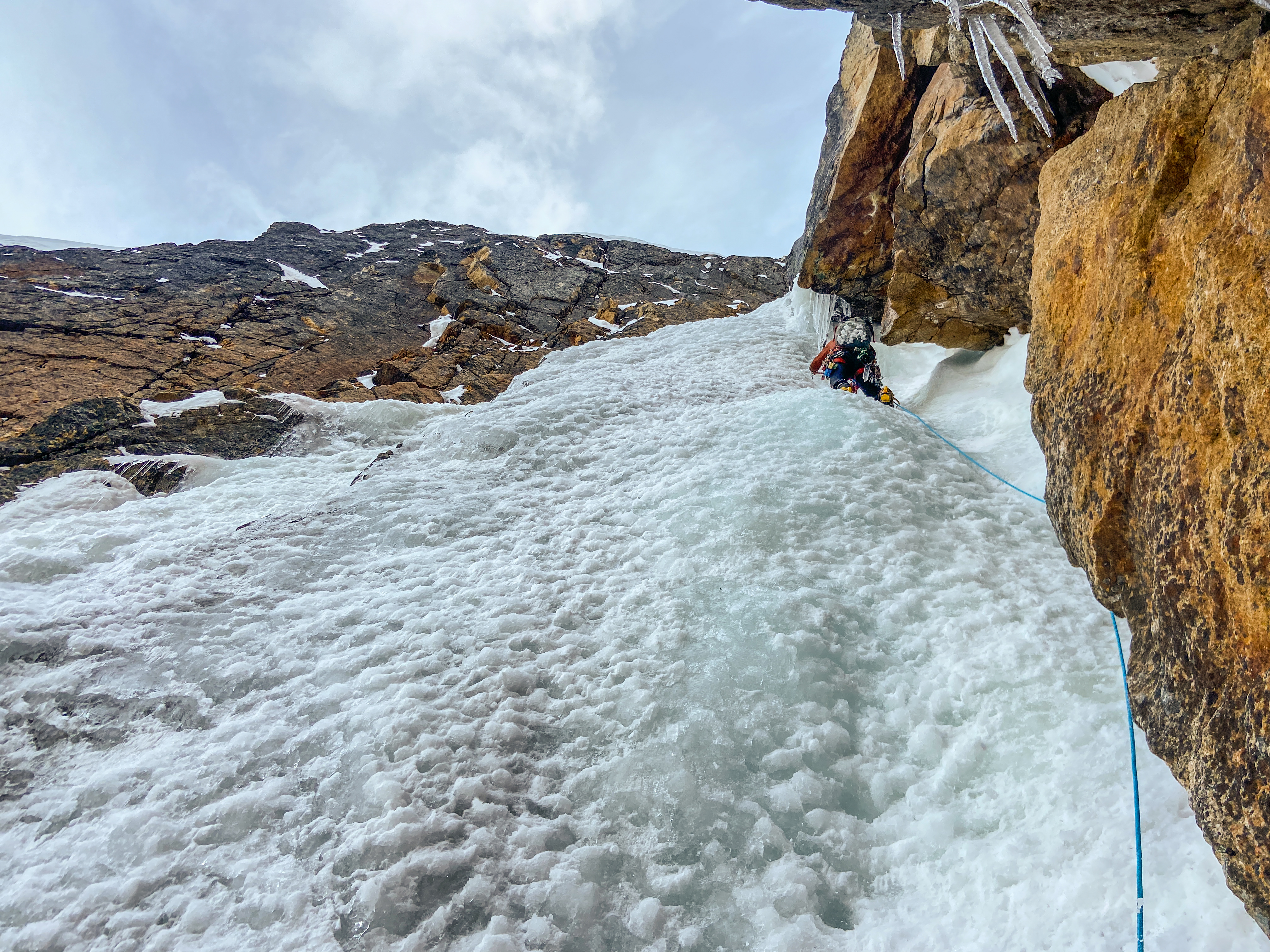
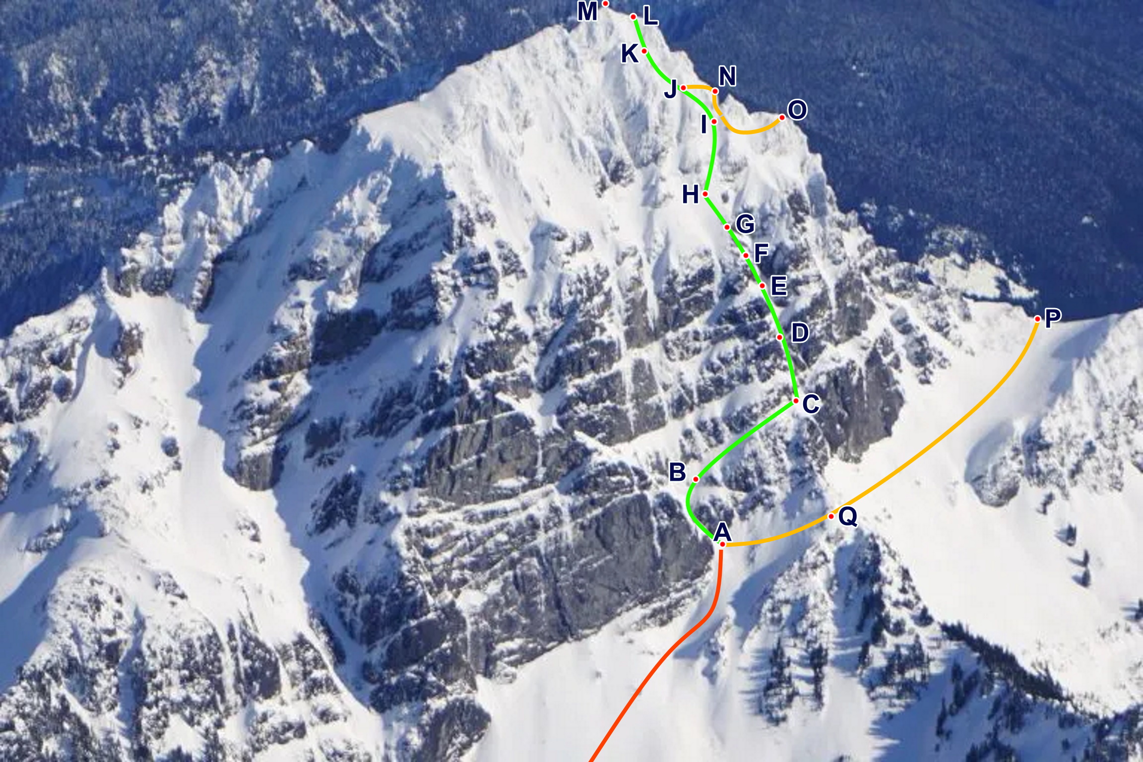
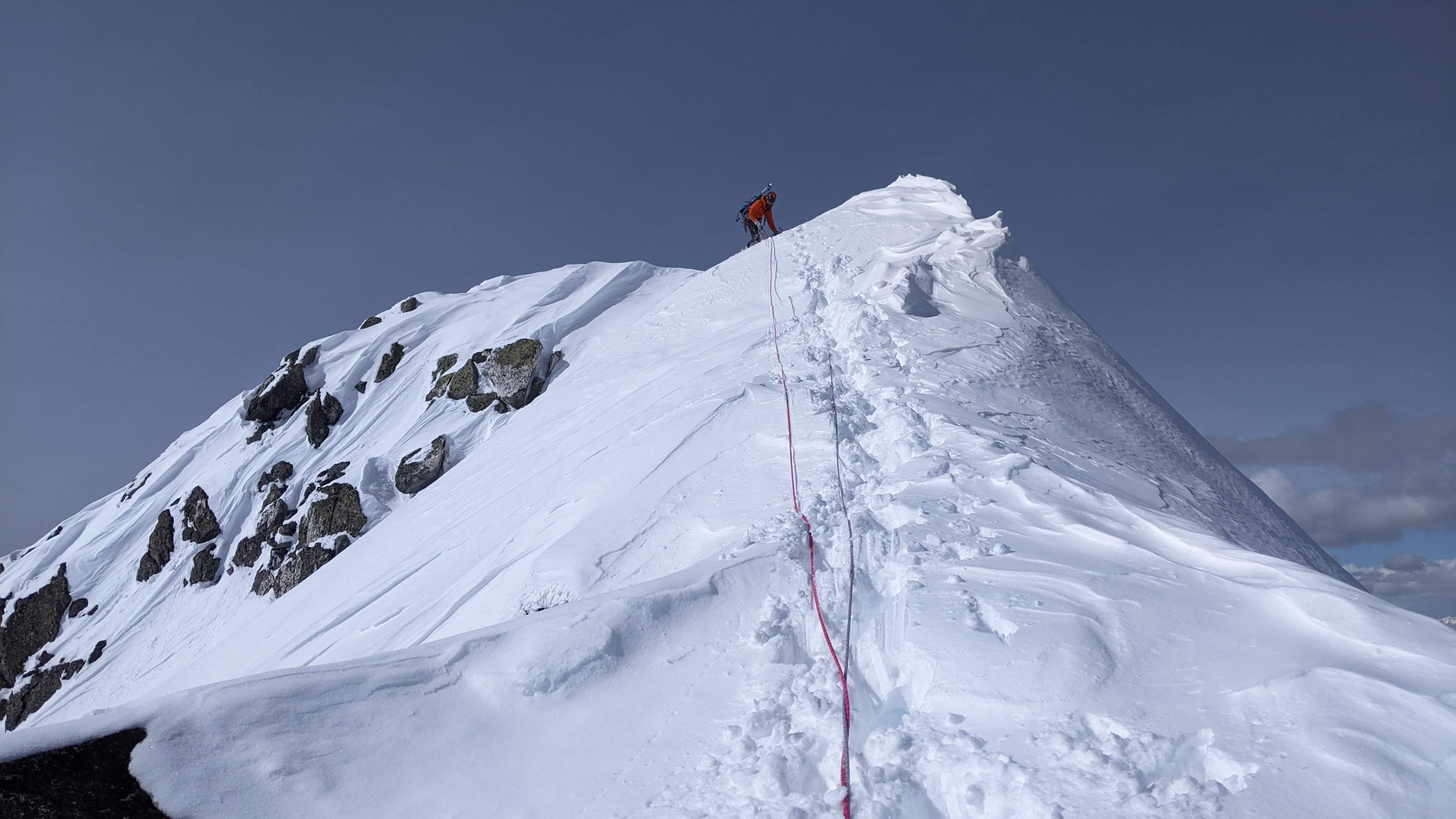
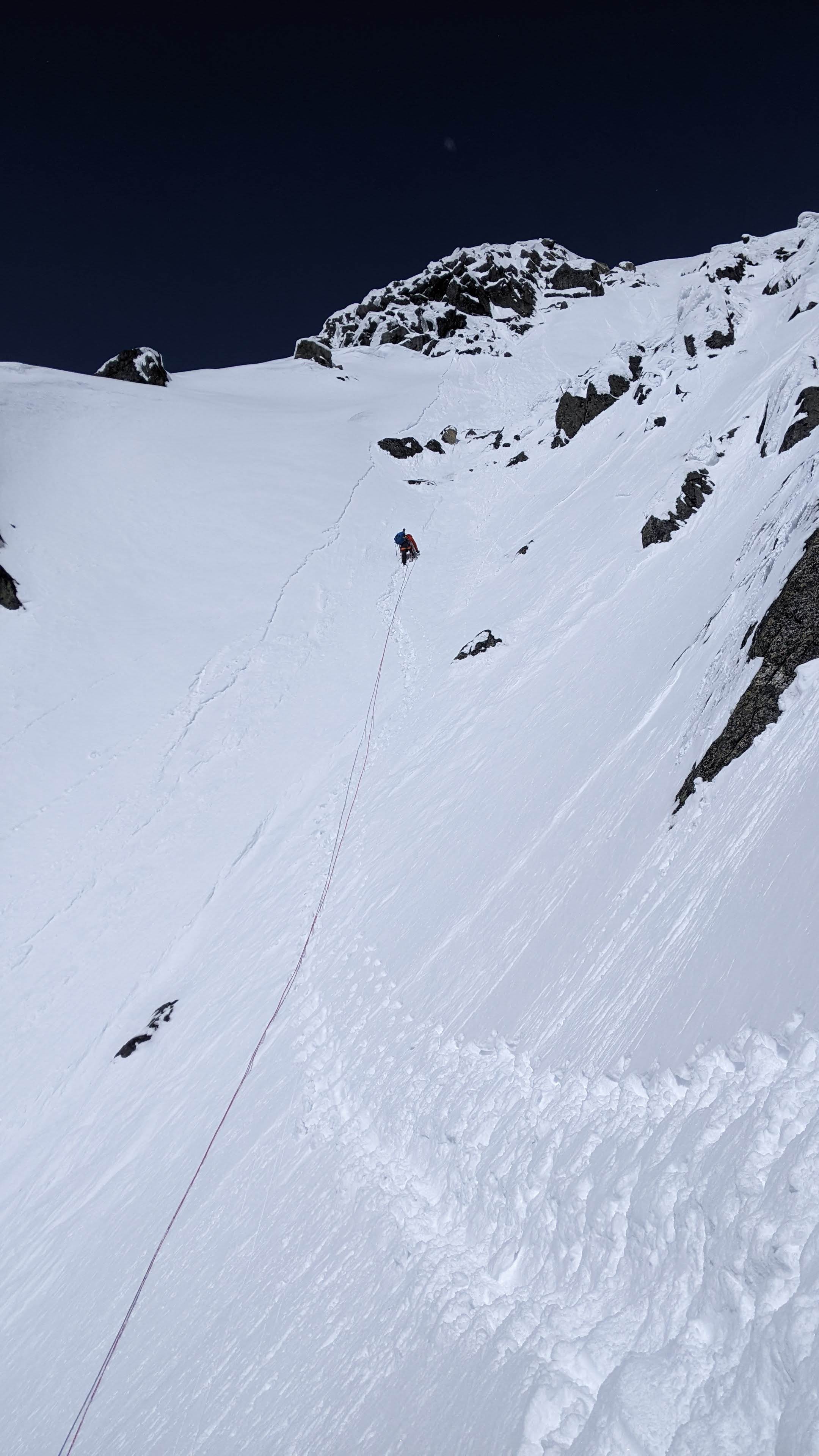
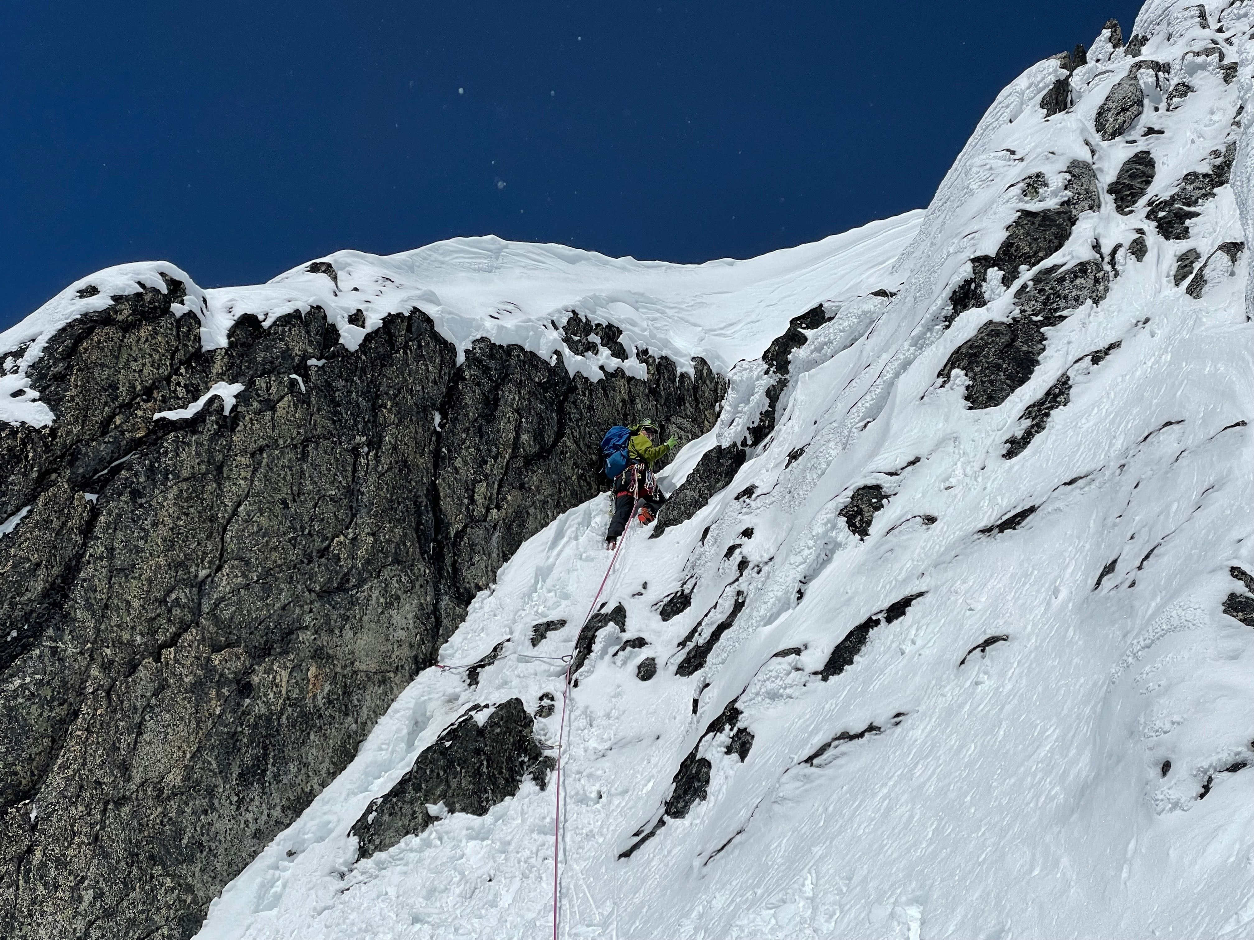
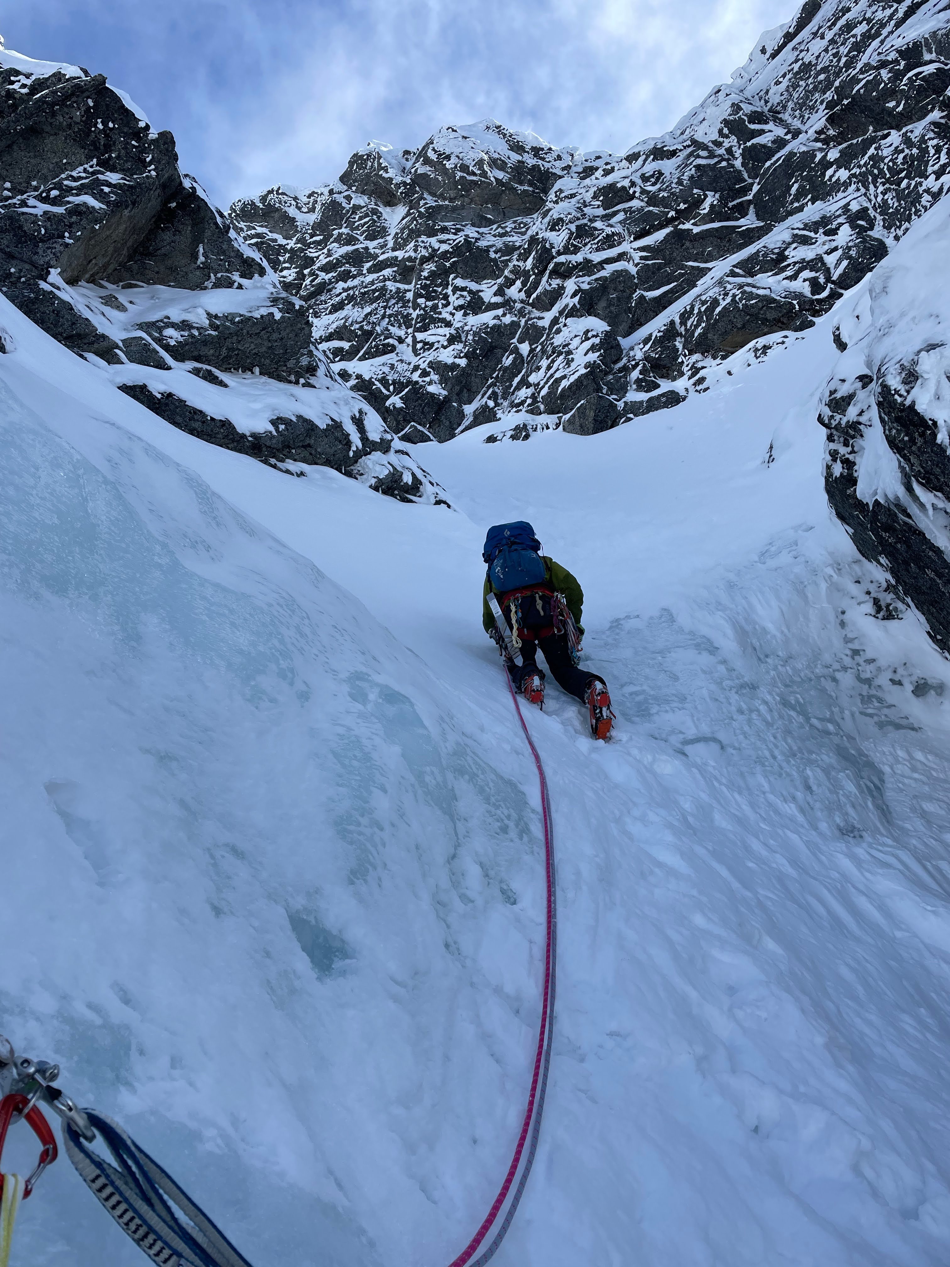
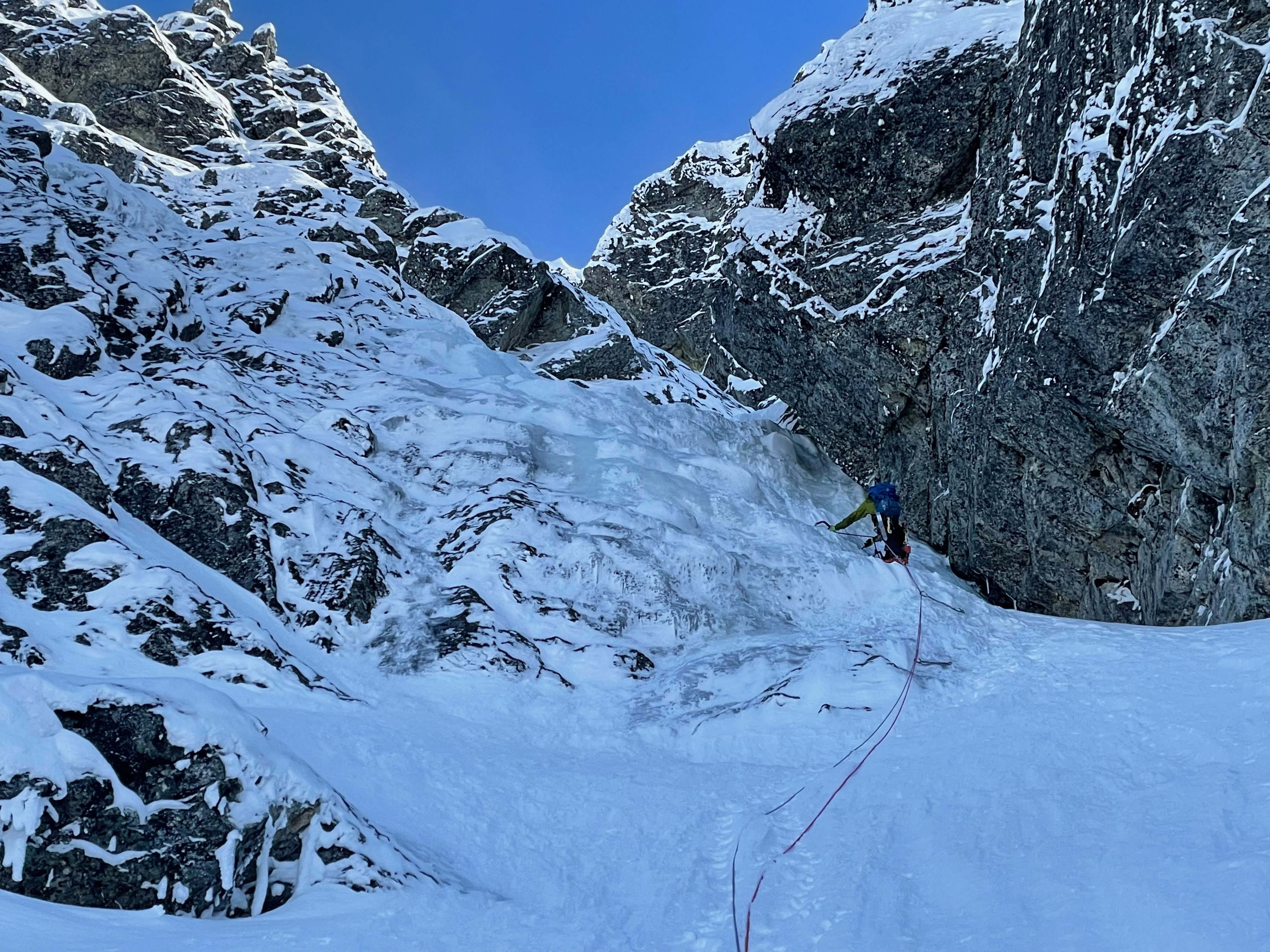
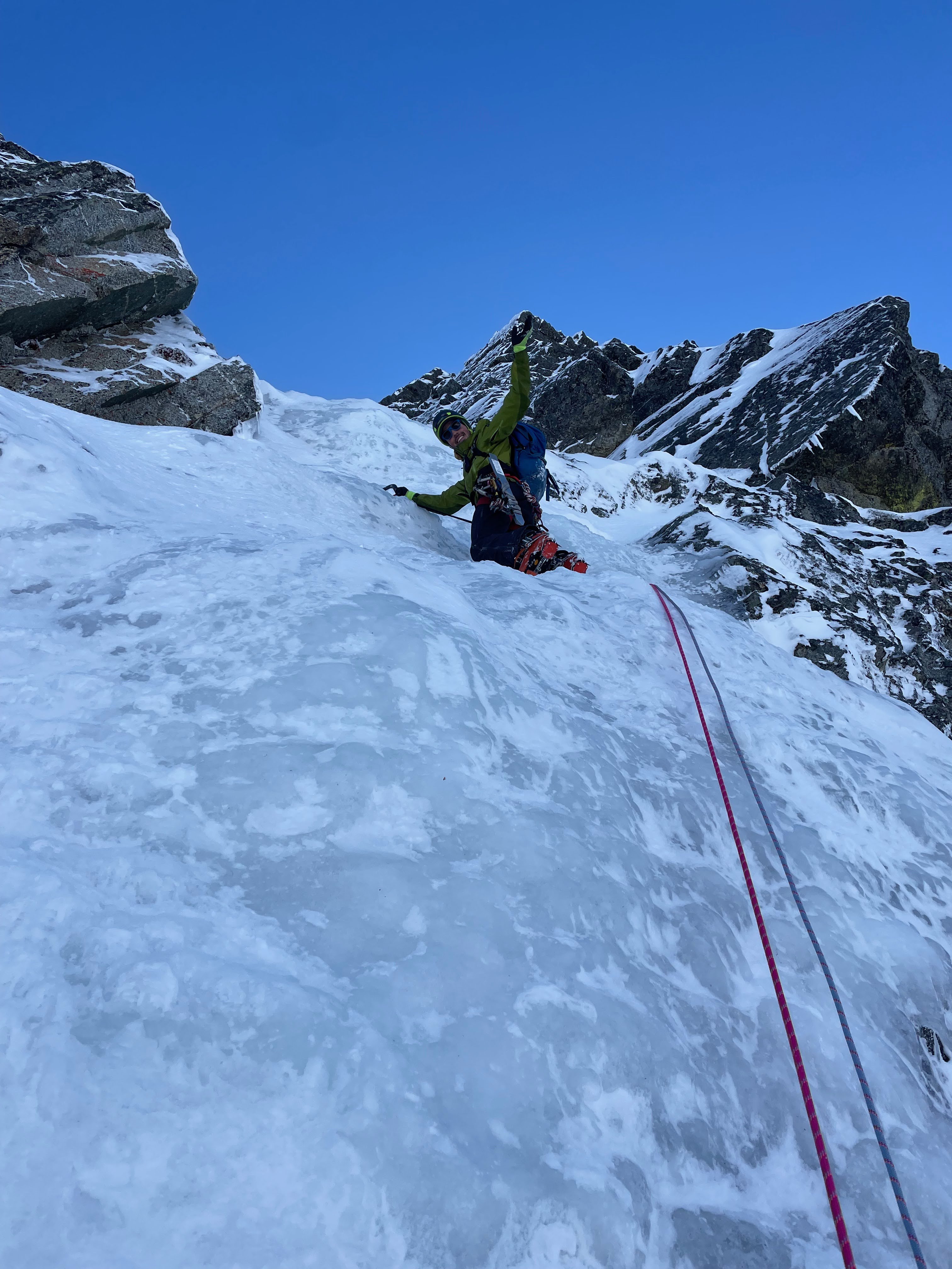
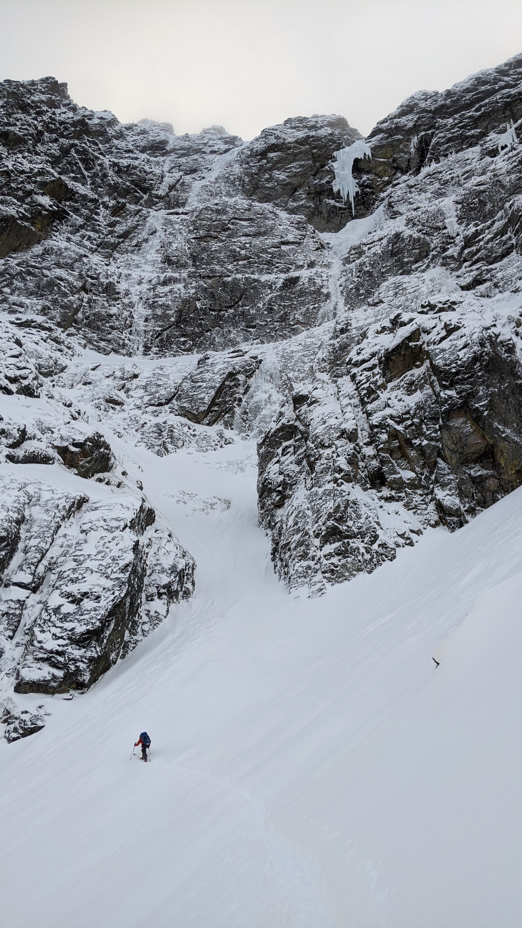
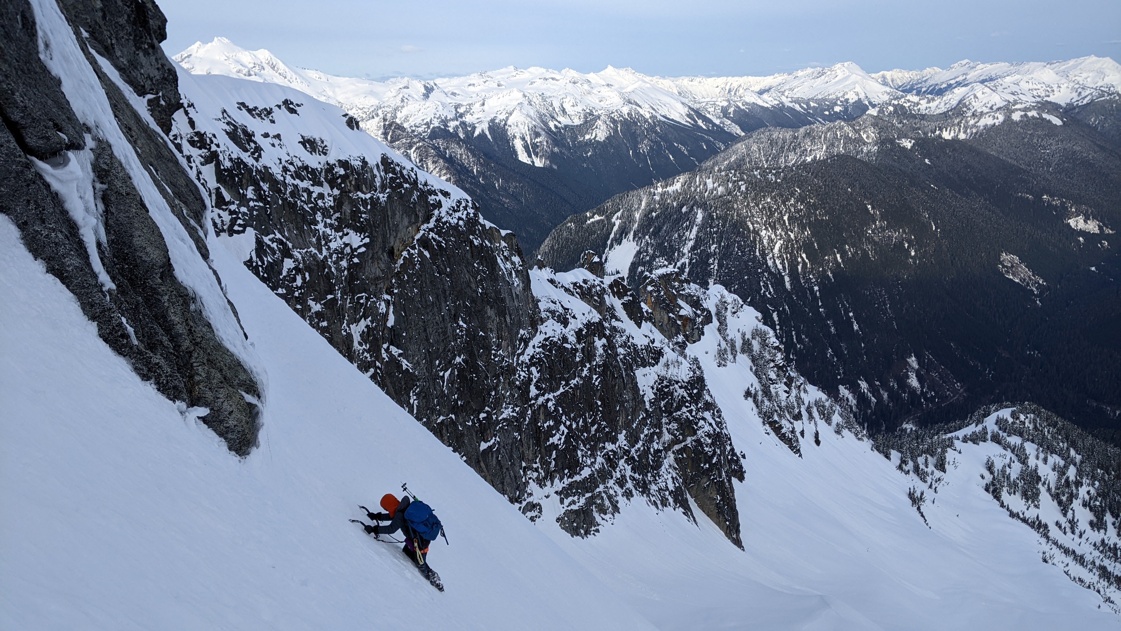
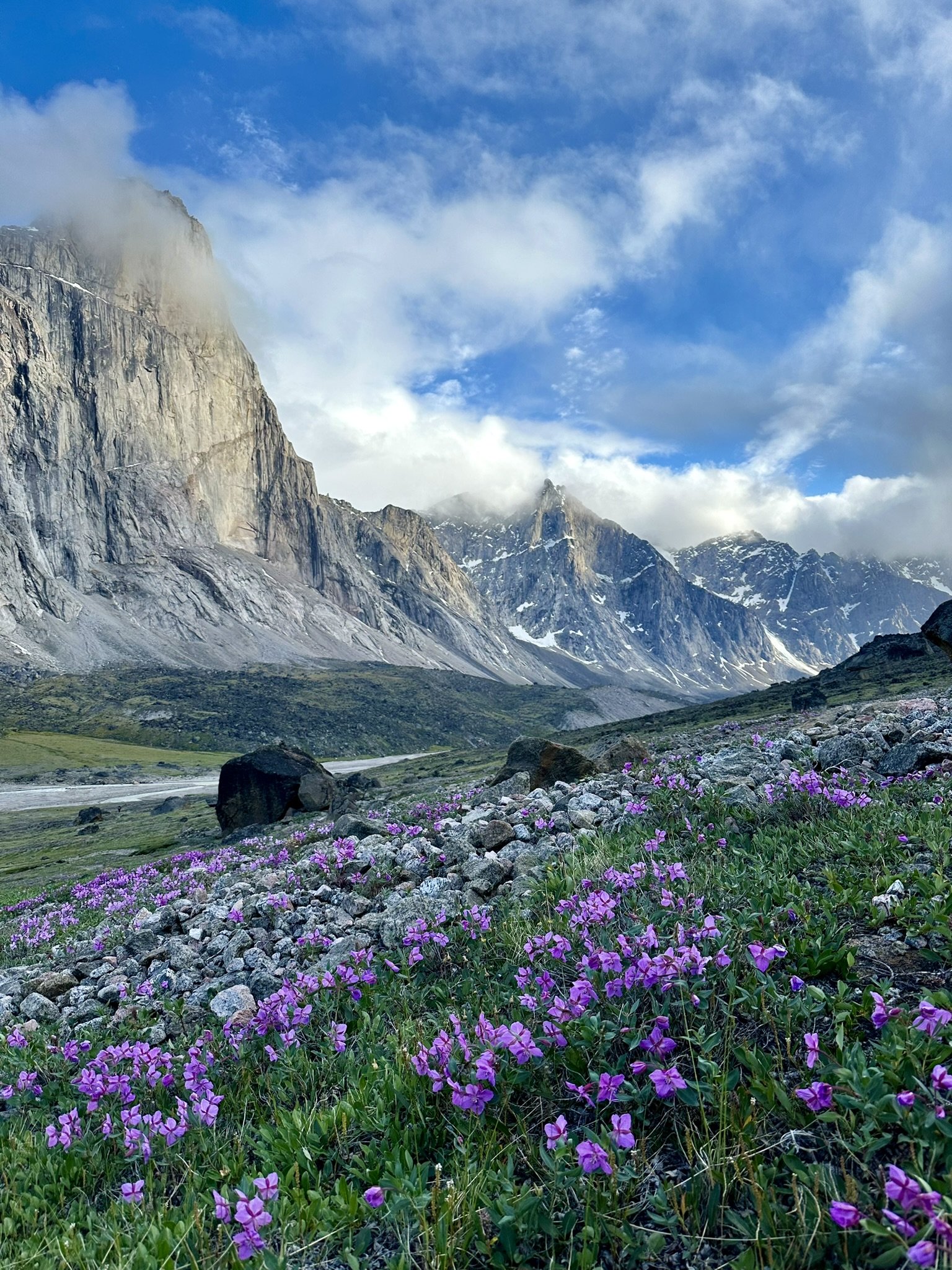
Trip: North Cascades - Sloan Peak - Superalpine (WI3-4, 1000') 04/17/2022 Trip Date: 04/17/2022 Trip Report: Fabien and I climbed Superalpine this past Sunday and topped out on Sloan peak. History: This route was attempted on 02/28/2020 by Kyle and Porter and on 03/15/2020 by Porter and Tavish We left Saturday afternoon, got the car to about 2000ft on FS 4096 just before the snow became continuous. We skinned in with overnight gear and setup camp near a small accessible stream feeding Bedal Creek at 3600ft. Sunday we woke up at 4:00 a.m. and we're breaking trail soon after. We found an easy crossing across the creek at 3950ft and stayed climber's right of the moraine to avoid being in an avy path until we were forced back in the forest. We started seeing the route peeking through the trees and reached the large snow field below the West face of Sloan peak. We approached up to the base of a left leading couloir and stashed the skis there (A). Route: We booted up the couloir, encountered a small step (B) and roped up at (C). (C-D) Short WI4 followed by easier climbing. Careful with rope drag on the rock if the belayer is in the sheltered area before the ice. (D-E) Short ice steps separated by snow. Setup an anchor on the right side at (E) (E-F) Left leaning ice staircase in what looks like a dihedral. (F-G) Snow up to a belay stance in a 5ft step. (G-H) Small ice step then snow up to belay in thin ice. (H-I) Mostly snow with some good ice screw placements. Belayed off a snow anchor. (I-J) 30ft of Easy mixed climbing. Placed cams 0.5 to 1 and made a snow anchor on a wind hardened snow fin: (J-K) Snow bowl. This can have a lot of sluffing and is dangerous if the snow is unstable. We were able to follow a path up that had already sluffed away. It was mostly the top 2in of snow that had fallen the previous night. (K-L) Snow bowl up to a notch on the ridge slightly climbers right (L-M) About 200ft of ridge traverse to the summit. Descent: (J-N) We decided to go down the snow ramp on the other side of the mountain that the corksrew follows for a bit. We aimed for a gendarme (Below the N). From there we did one 30M rappel off and traversed under the gendarme to the corkscrew route (O). By then the East side of Sloan Peak was in the shade and we found good snow to front-point sideways and down a ramp for almost 1000ft. (650ft elevation loss) There was a moat at the bottom which we negotiated skier's right. We had brought two poles up for the next section that involved wallowing across the bottom of the SE face to reach the South ridge of Sloan at 6750ft. (P) From there, we headed back to the W ridge near where the route starts (Q). It doesn't look like it can be traversed easily a first but there's a passage around 6100ft. At this point, we could see our skis and felt like it was in the bag. The chute skied amazingly well but once we reached the snow field, the snow had started to crust making it quite hard to turn. We arrived back at camp at dark pretty tired. Since we both had engagements on Monday, we slept until 4:00 a.m then skied most of the way back and made it home by 11:00 a.m. Overall, this is a fun route when the conditions are there. The snow bowl at the top is probably the most dangerous part of the route when the snow is unstable. It may be possible to bypass by staying on the ridge (Probably from J). Strava GPX Enjoy! Gear Notes: Gear: 11 ice screws (Used all) 8 draws 2 pre-rigged quads 0.3 - 2" cams 1 picket (2 would be better) Small Nuts (Unused) Approach Notes: Drive from Darrington while Bedal pass is closed. High clearance vehicle recommended for FS 4096
 20 points
 -
We are not dead! That was extremely trying. The server totally crashed in a terrible way right in the middle of a super intense week at work for me and I was taxed mentally to the max figuring this out. Luckily I have a couple really good friends, ex-coworkers...but they are friends to give me moral support and confidence to do everything I did which was rebuild everything on modern software. So the site is in a MUCH better place than it was pre-crash. I still have a bunch of maintainance to do, but the site is back up and going. Thank you for sticking around. We WILL keep this place alive dammit.18 points
-
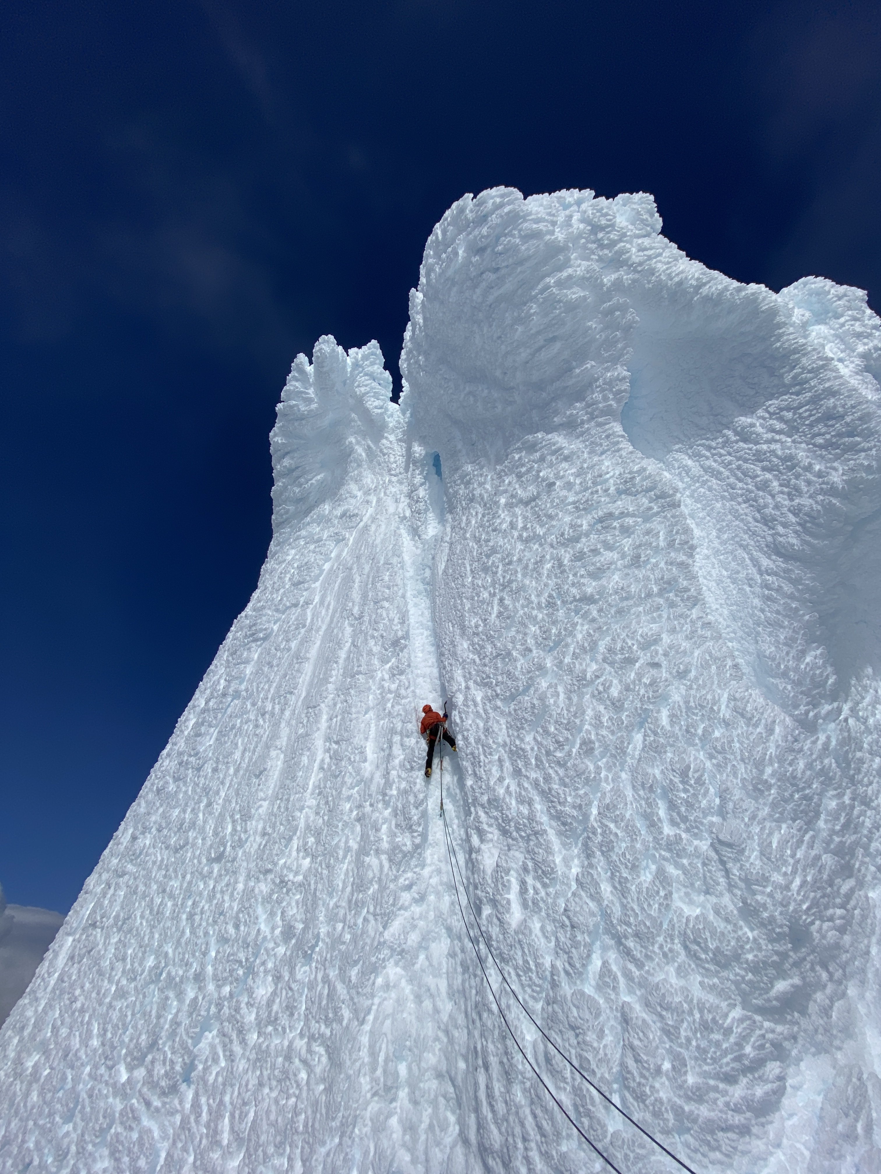
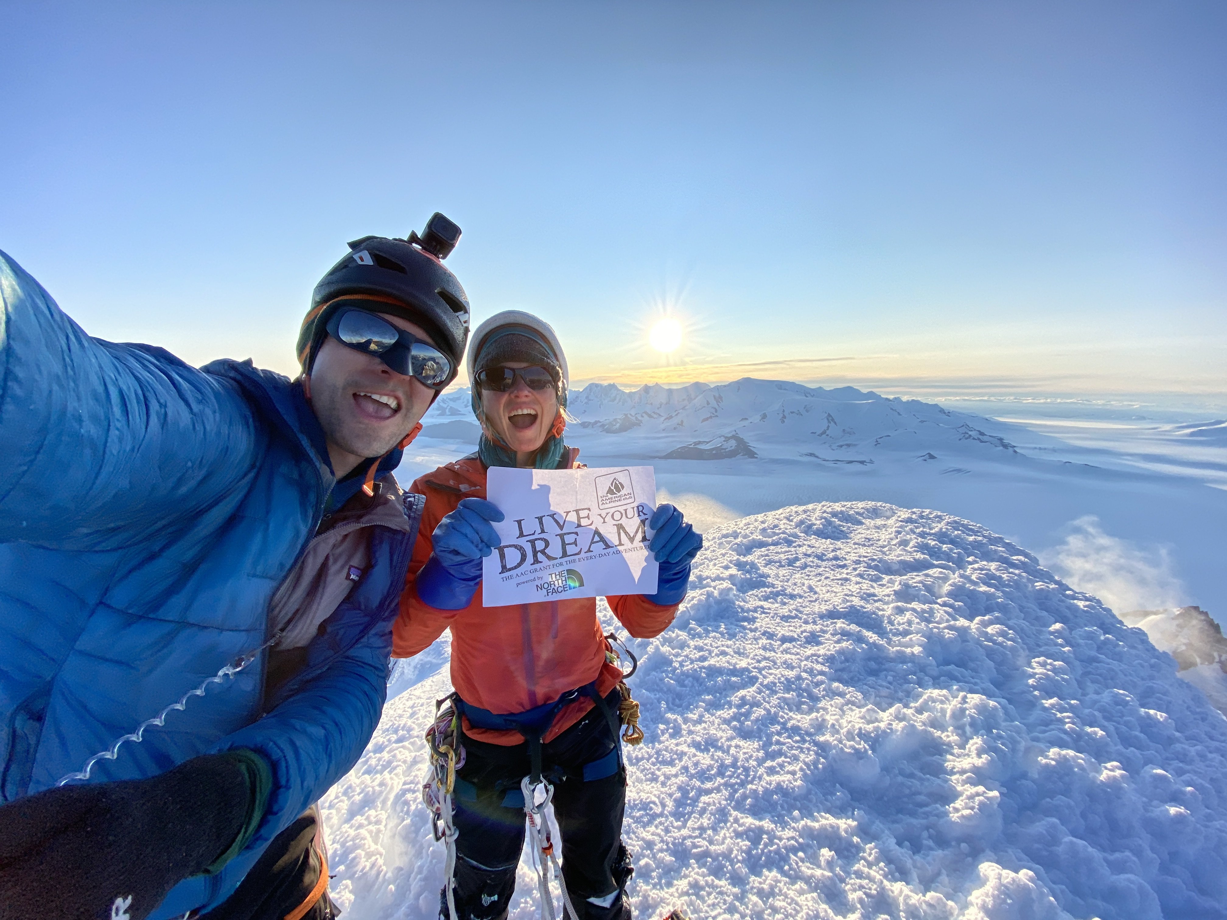
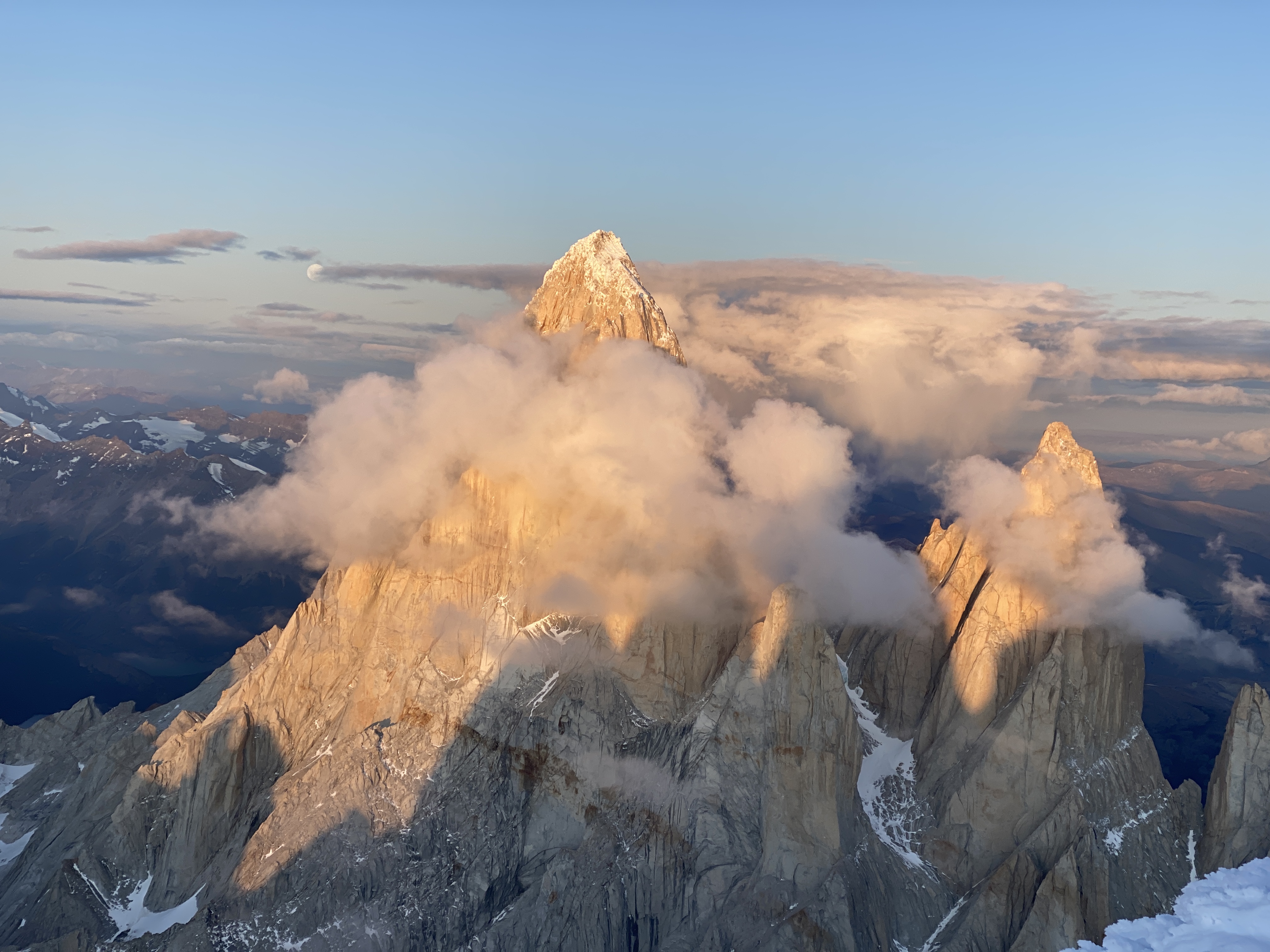
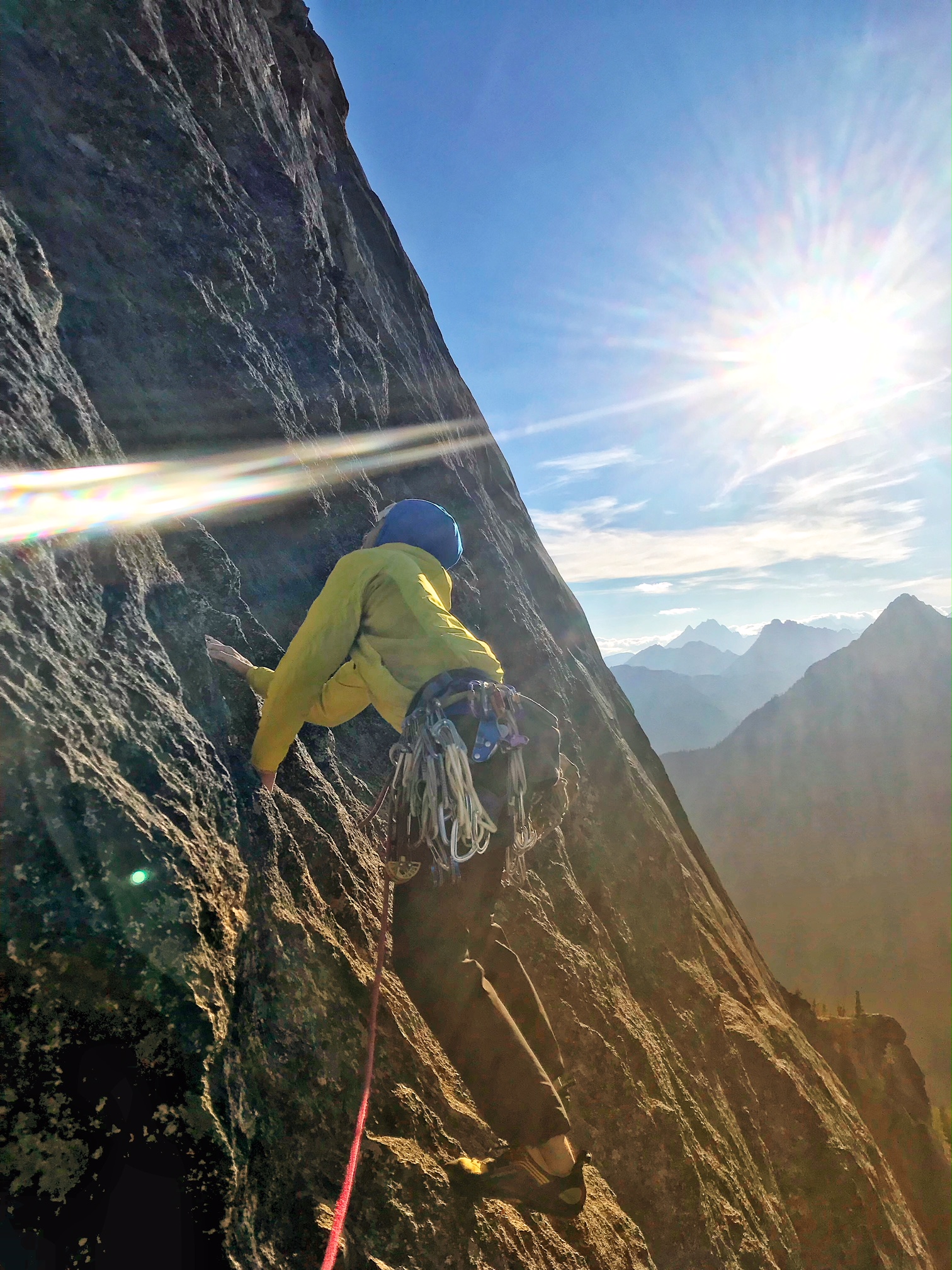
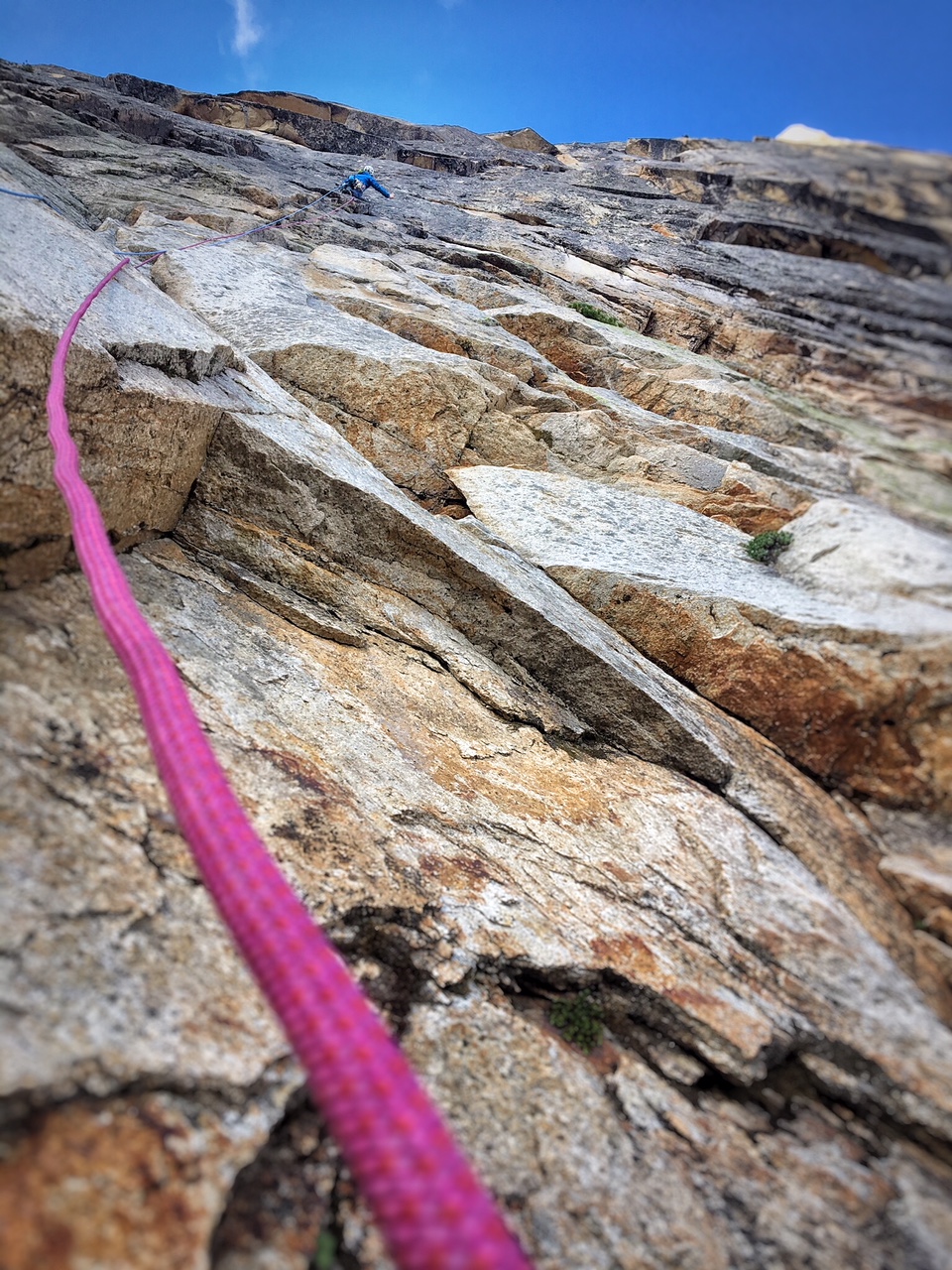
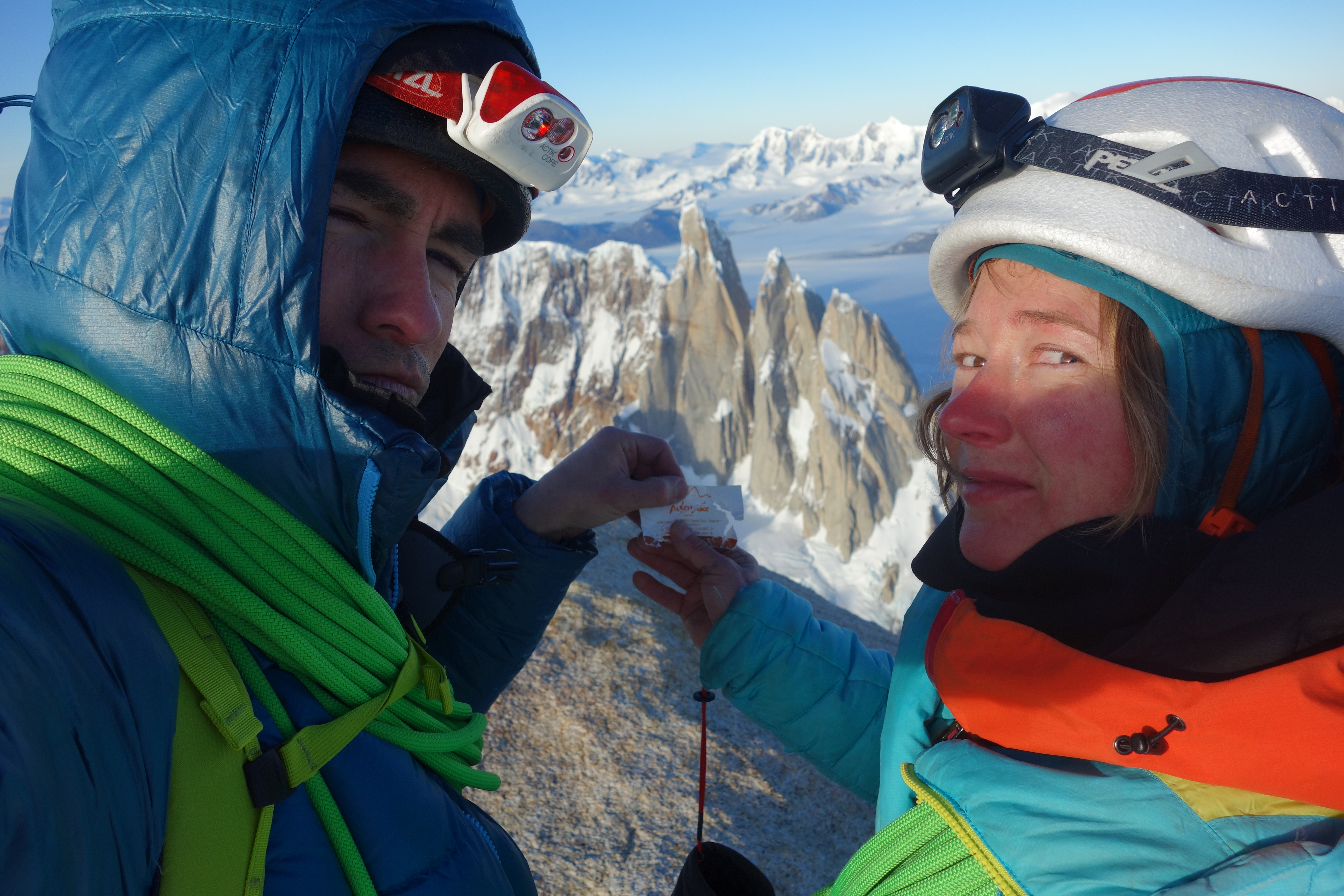
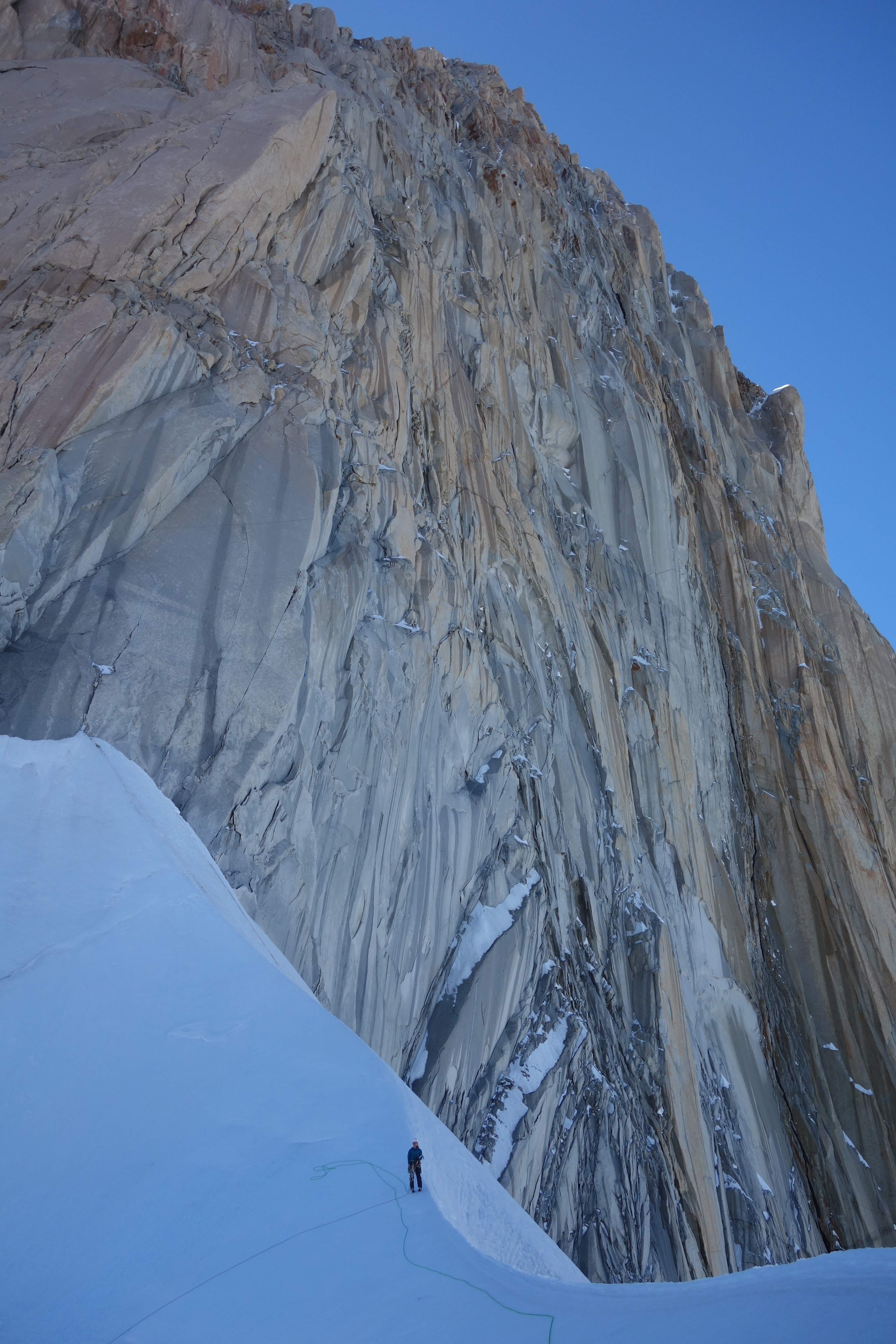
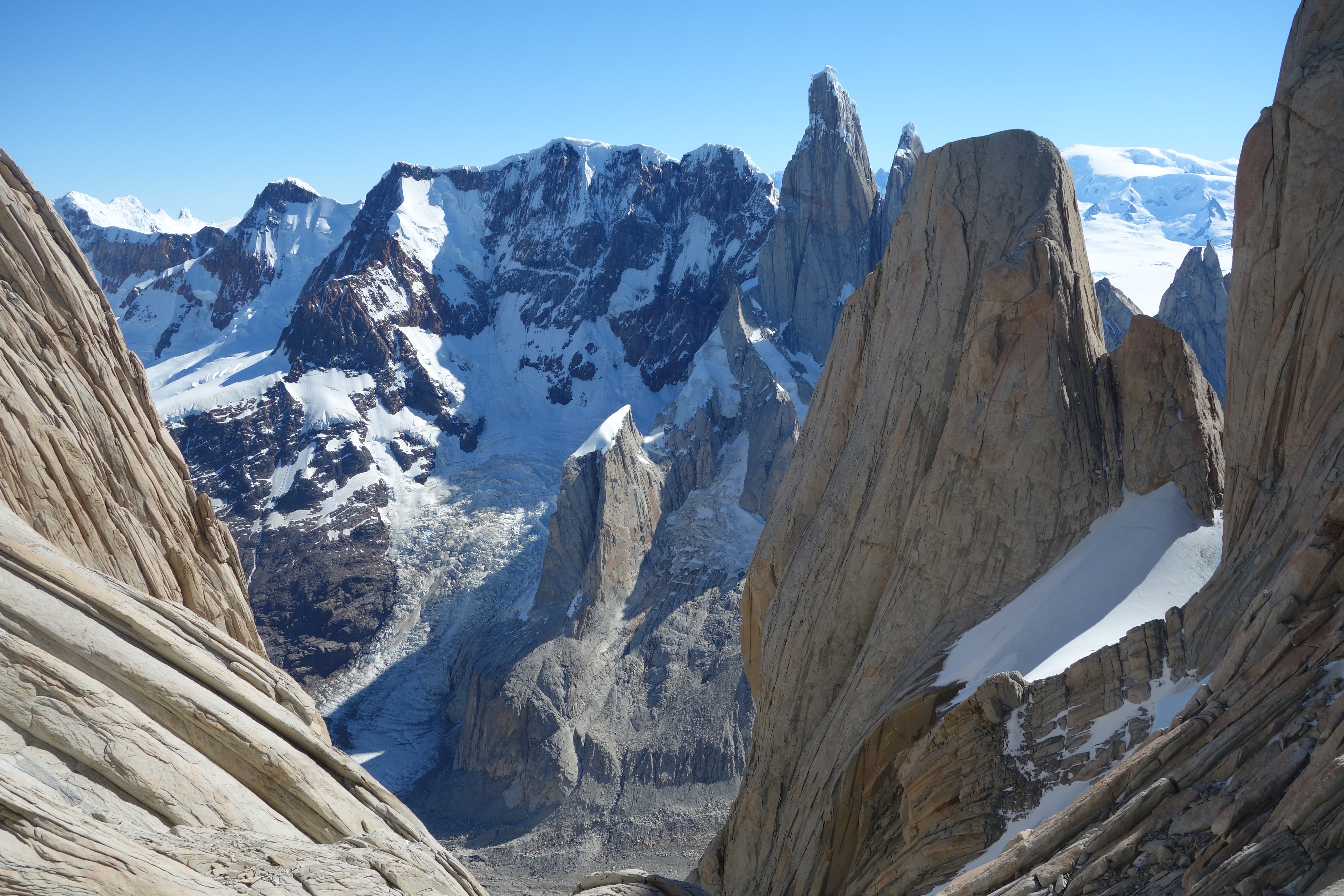
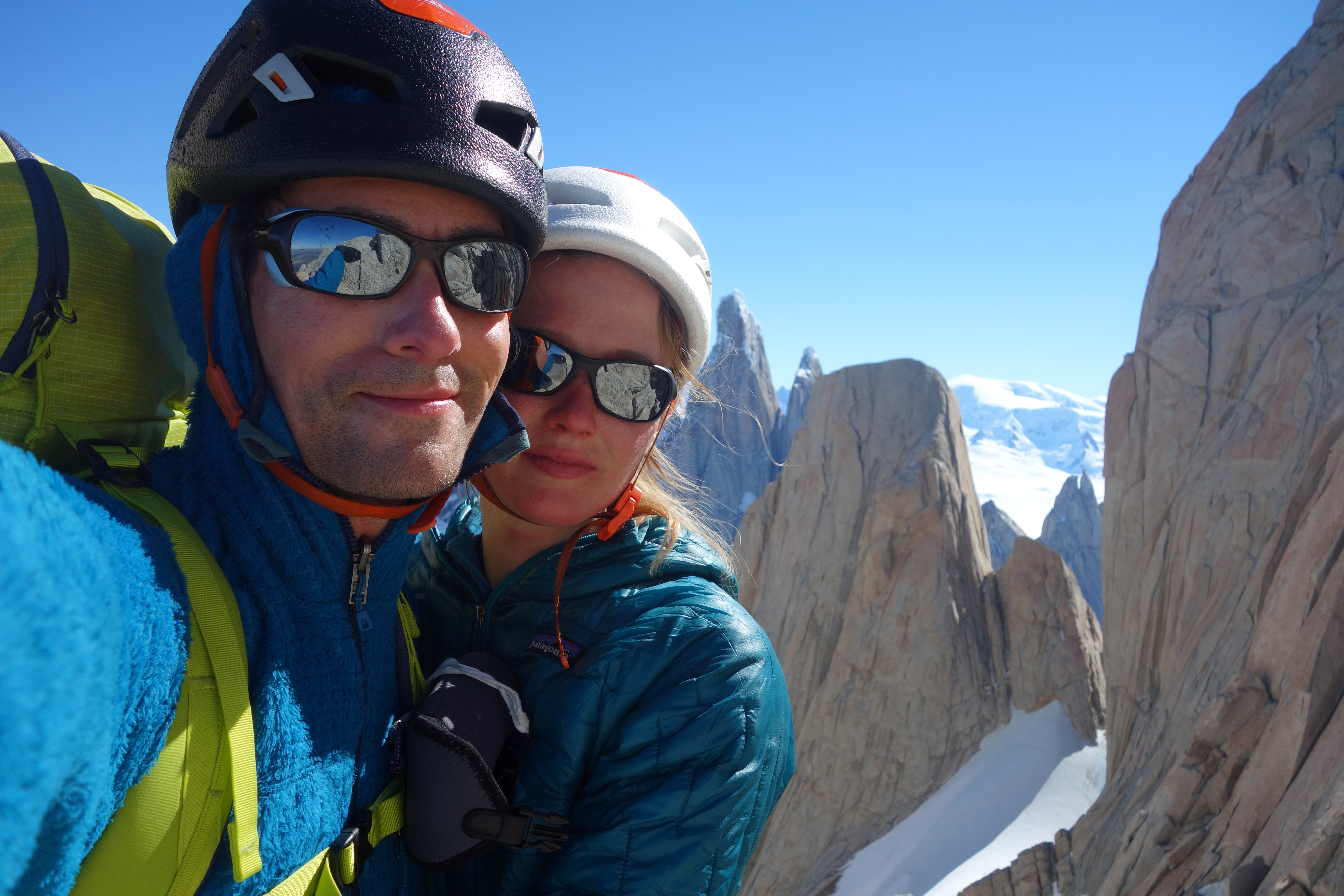
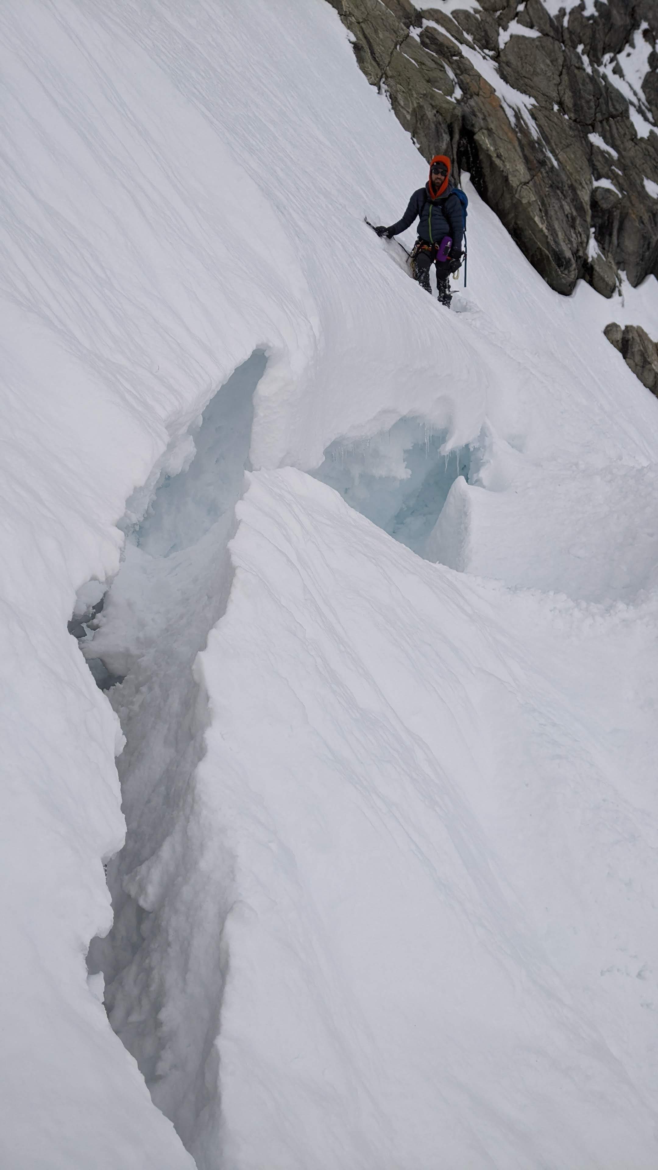
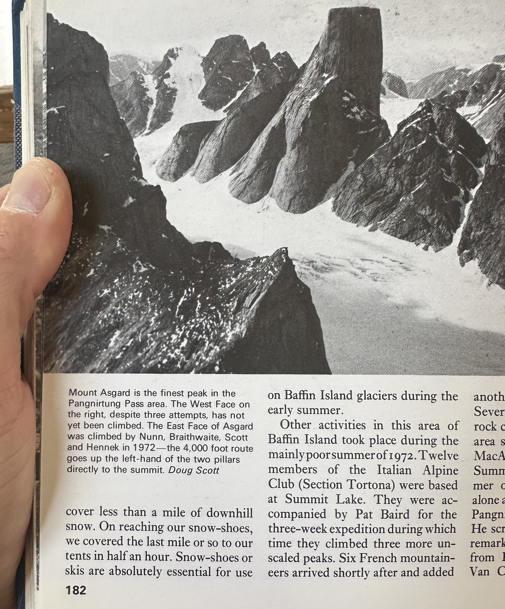
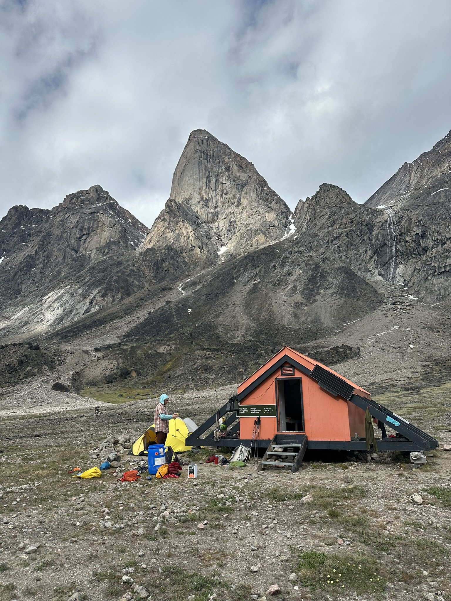
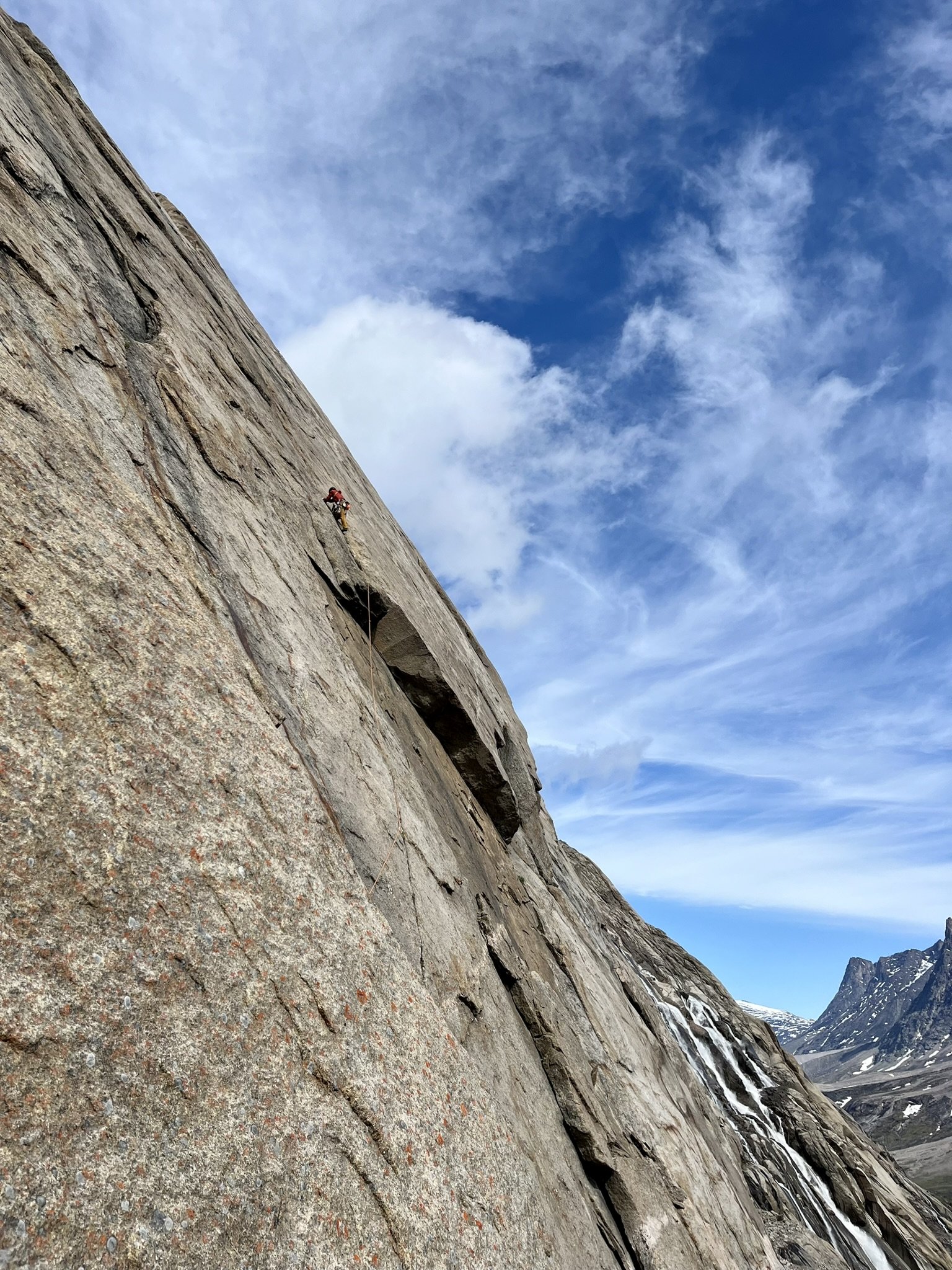
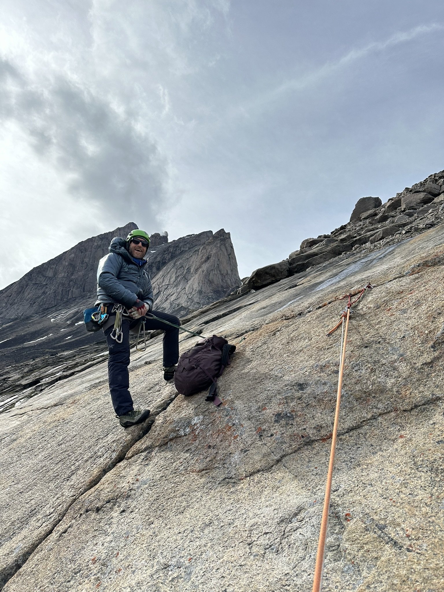
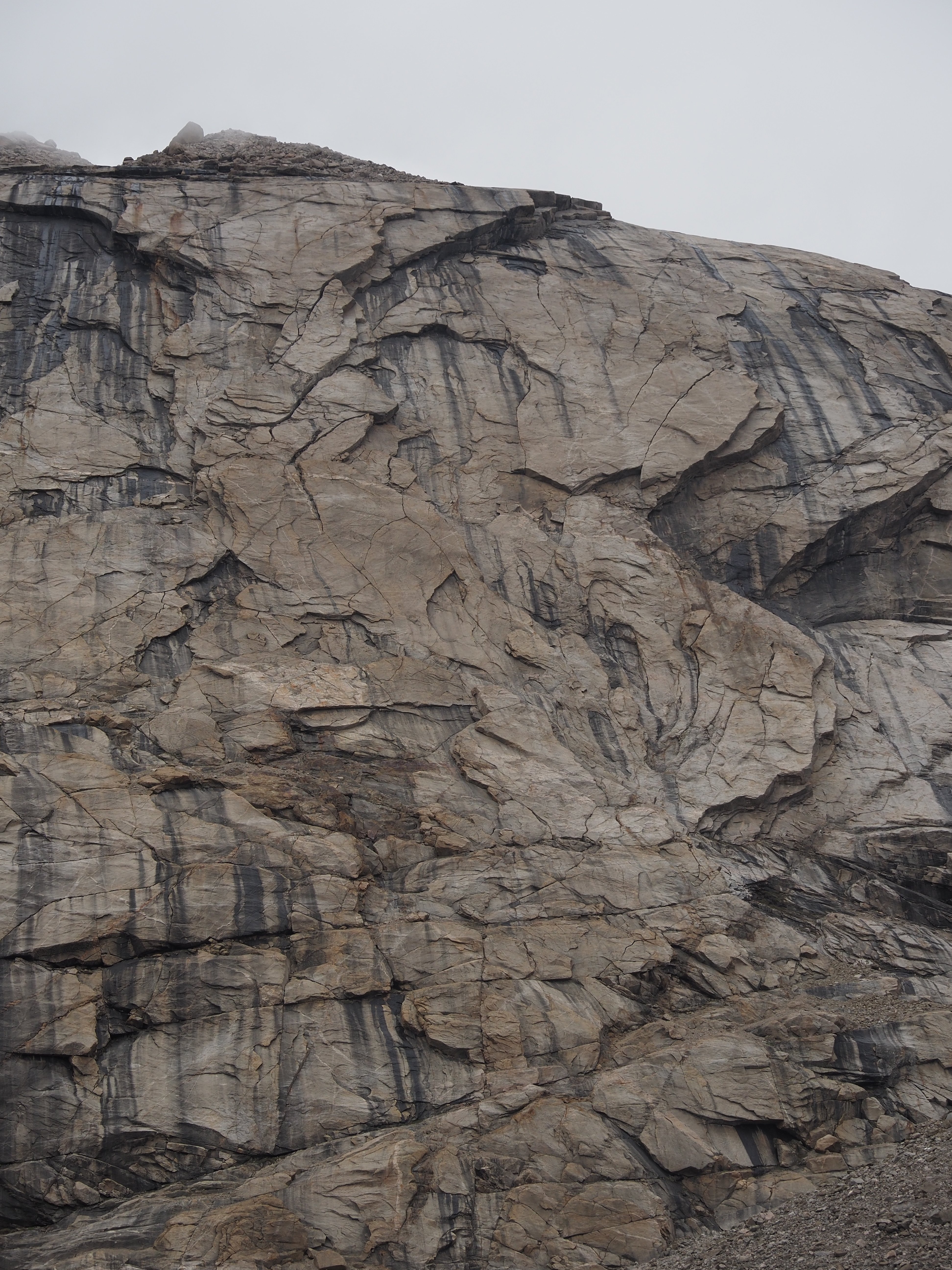
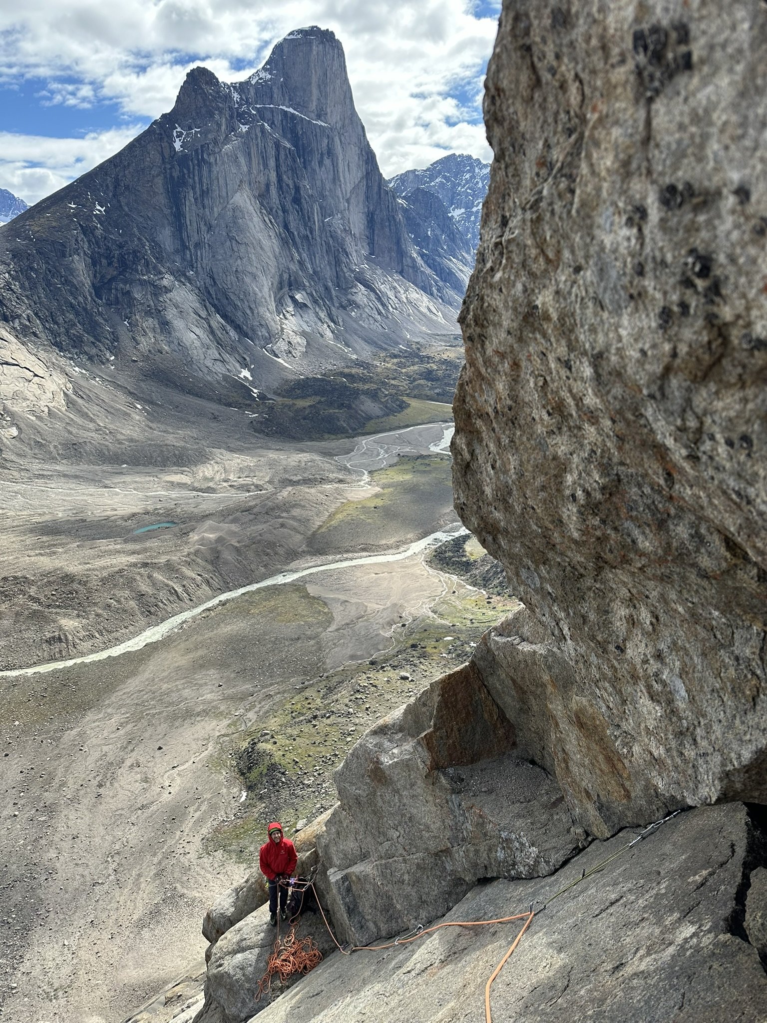
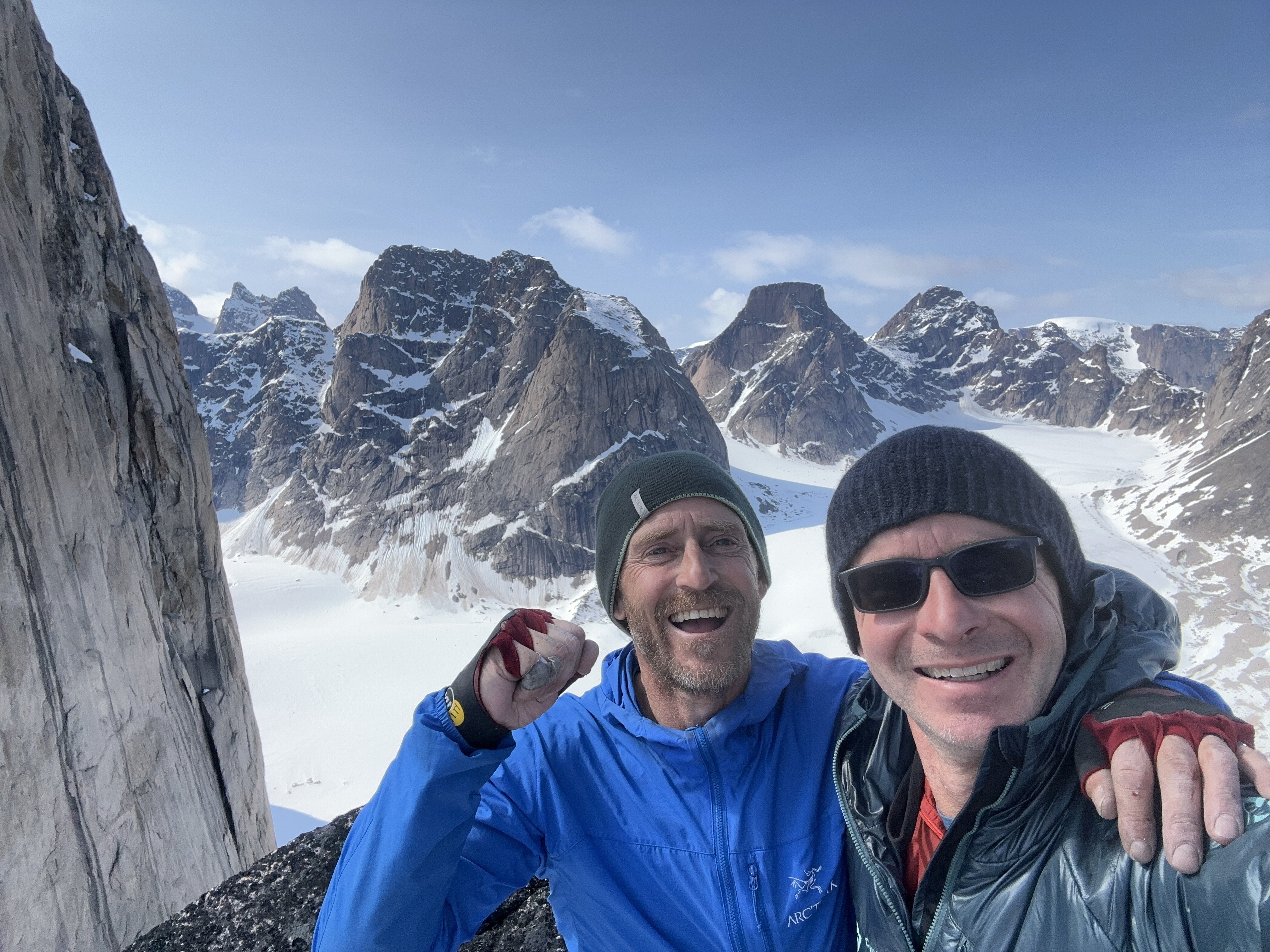
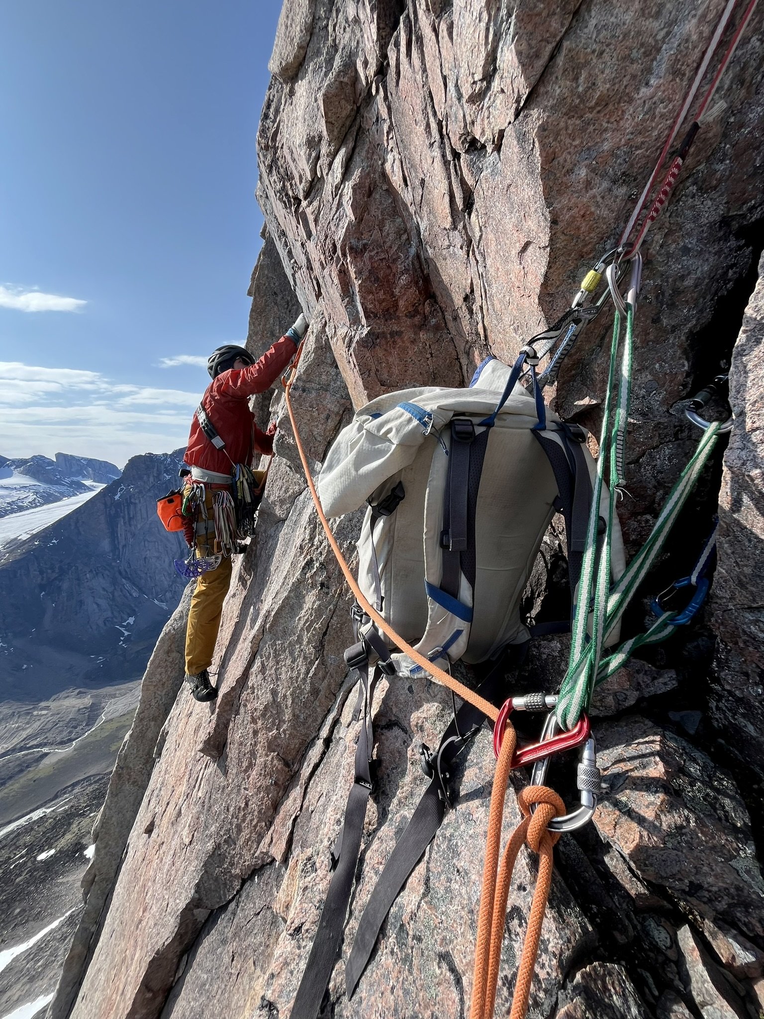
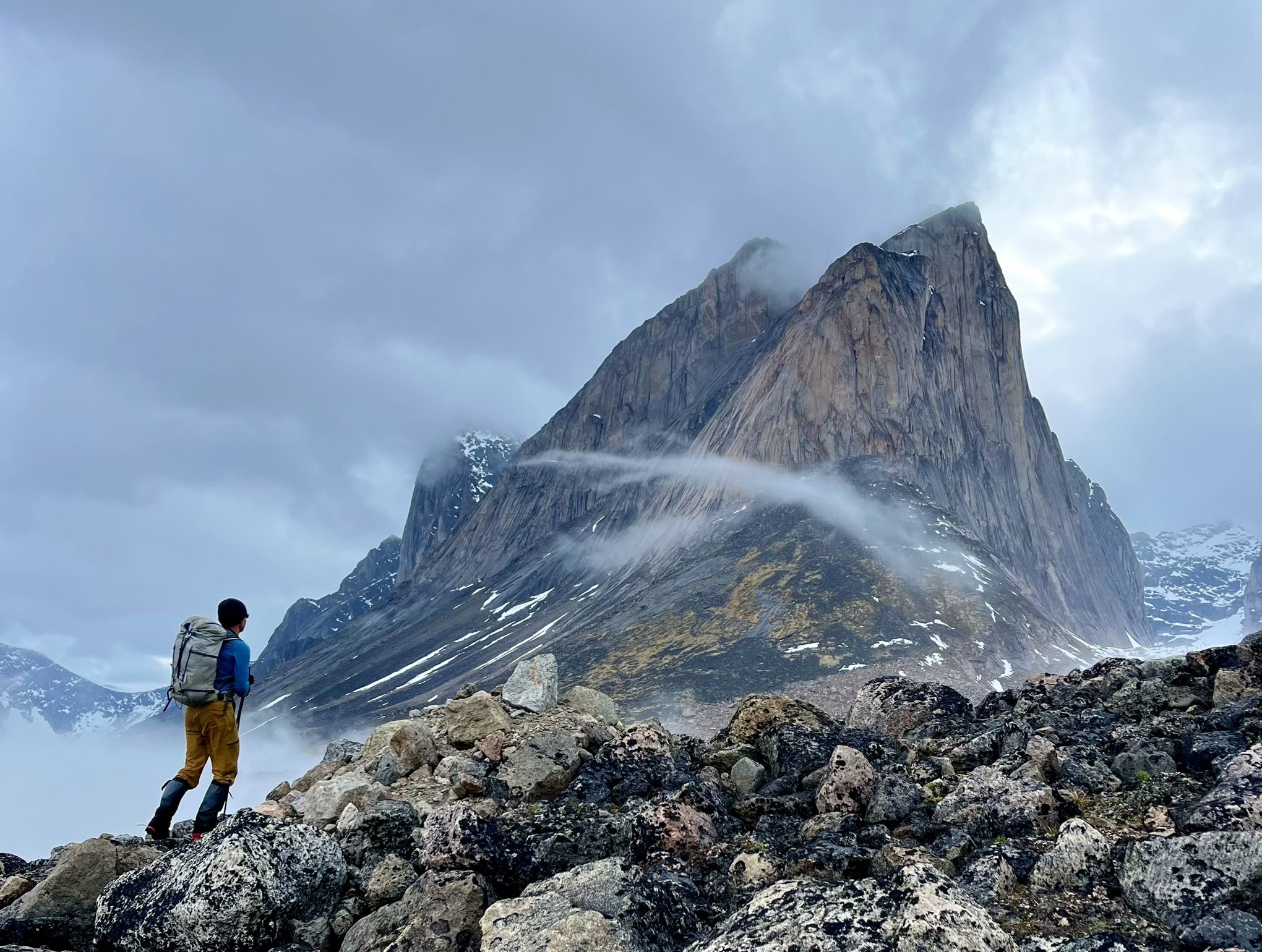
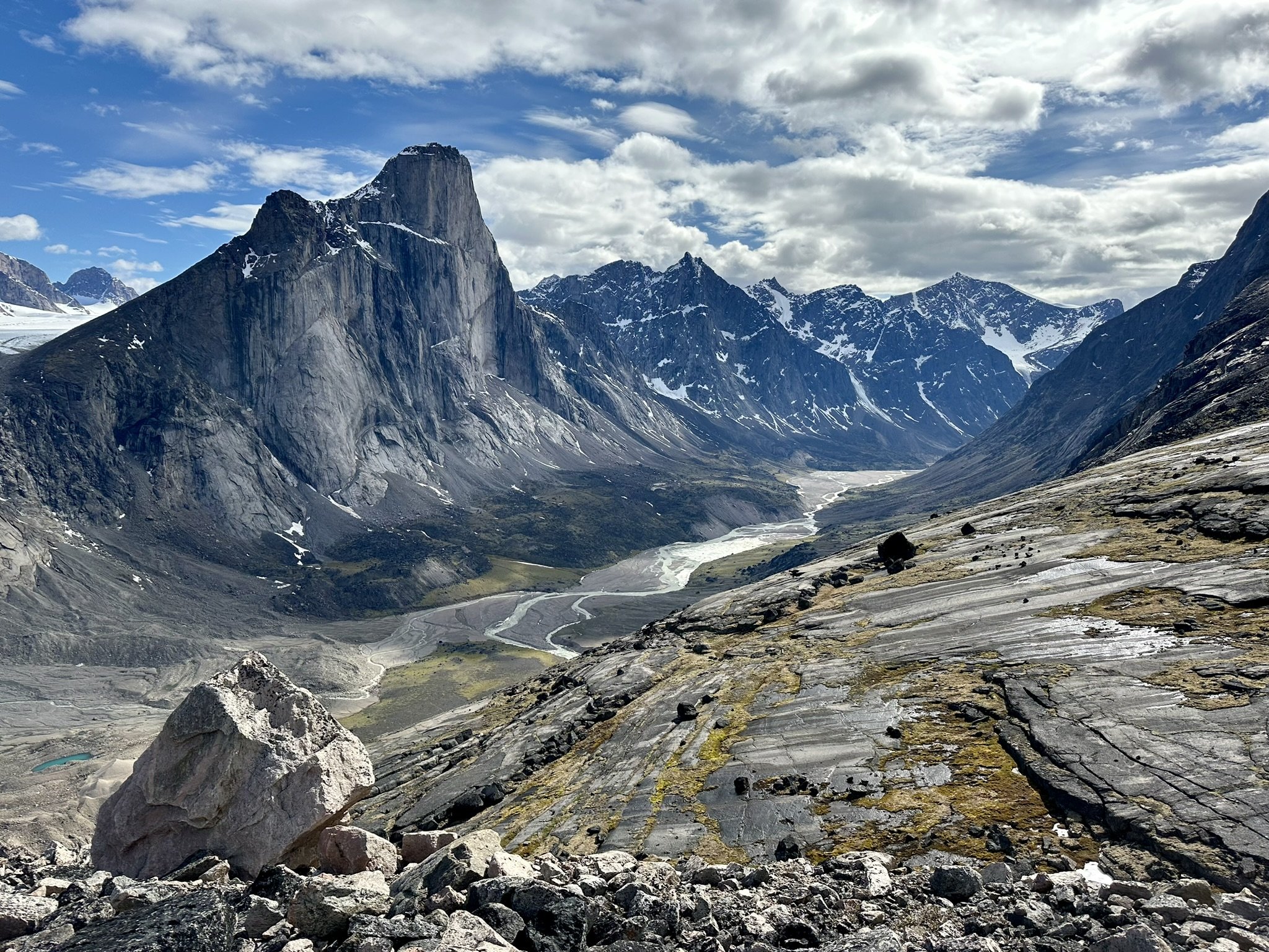
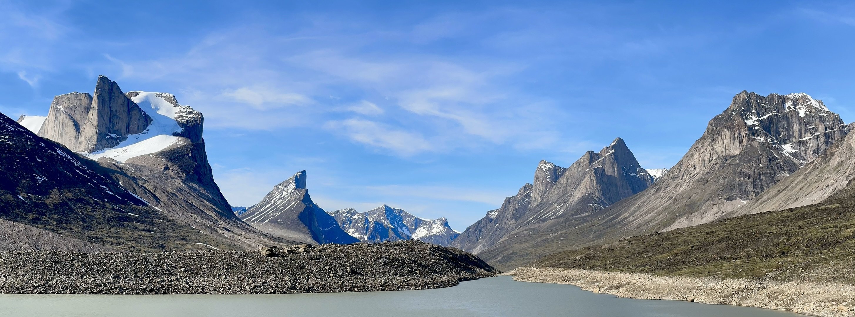
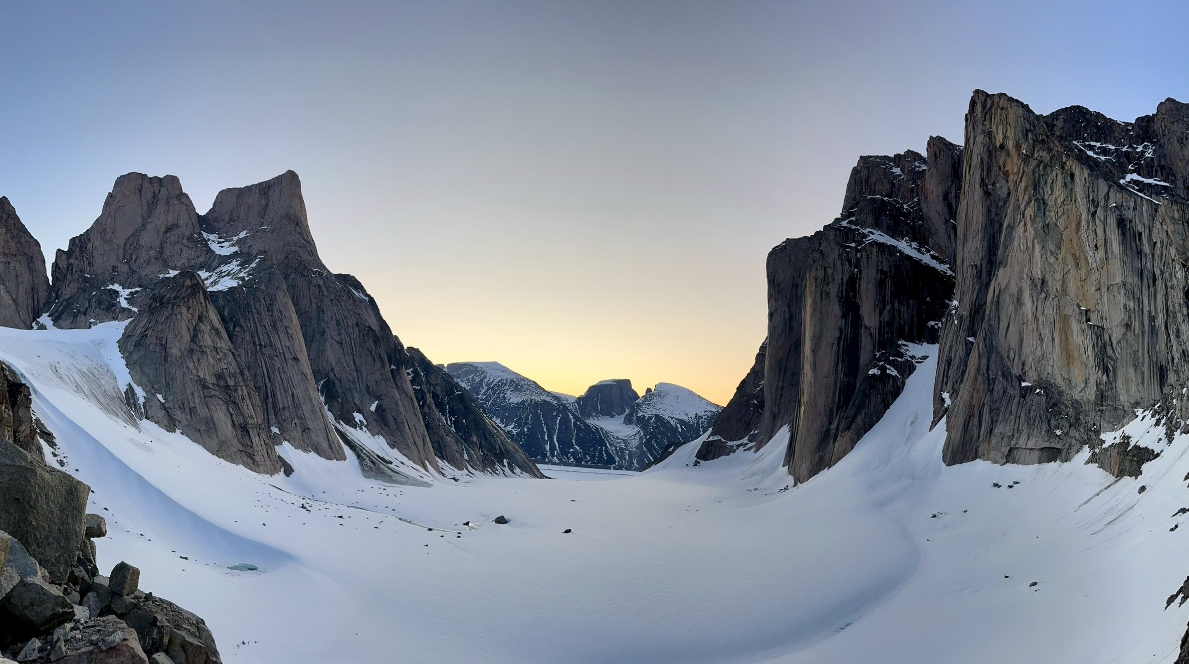
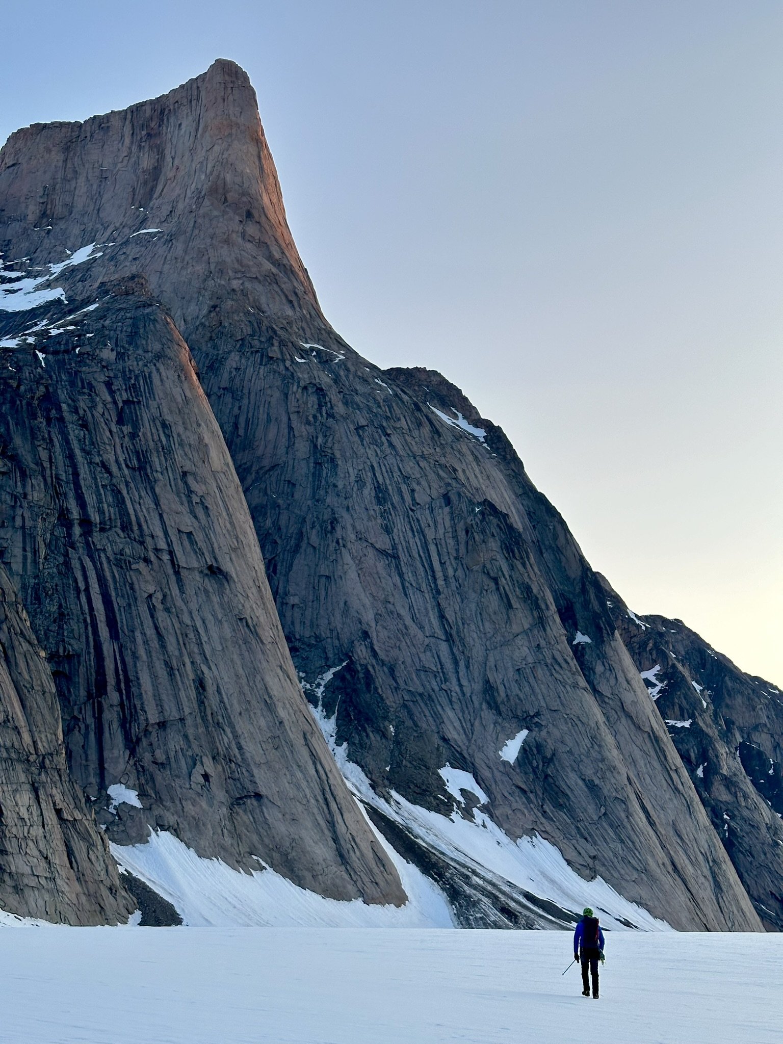
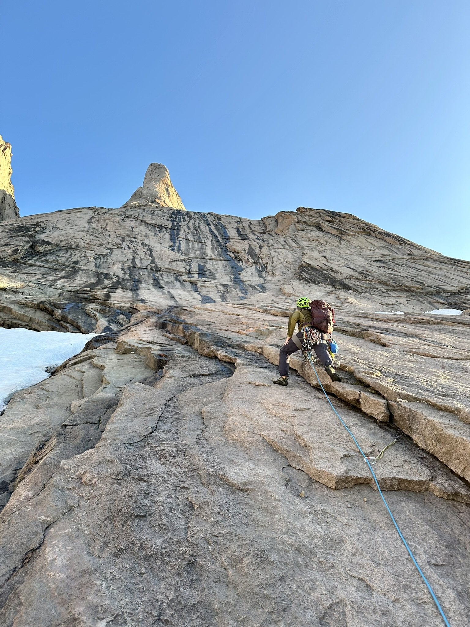
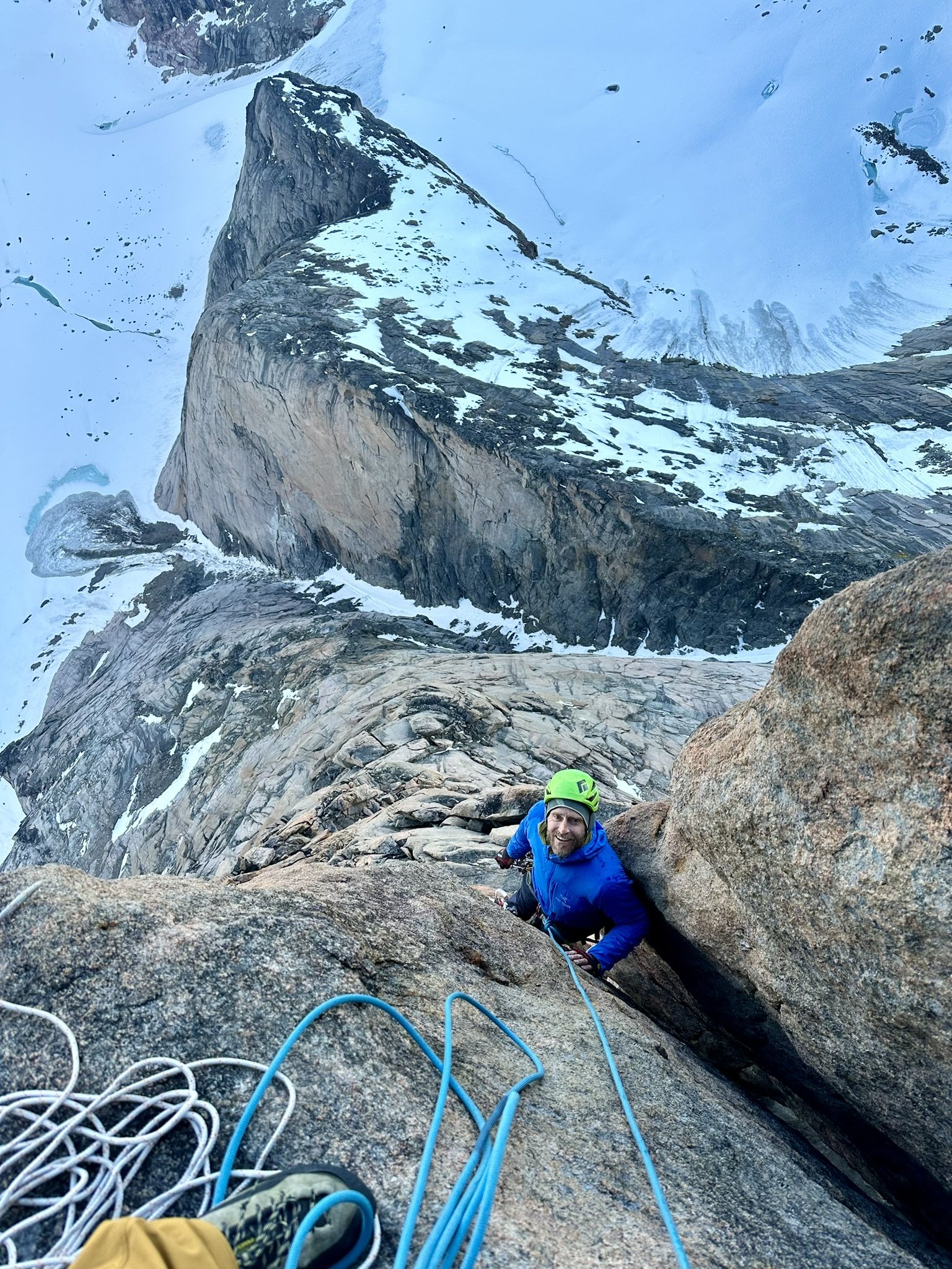
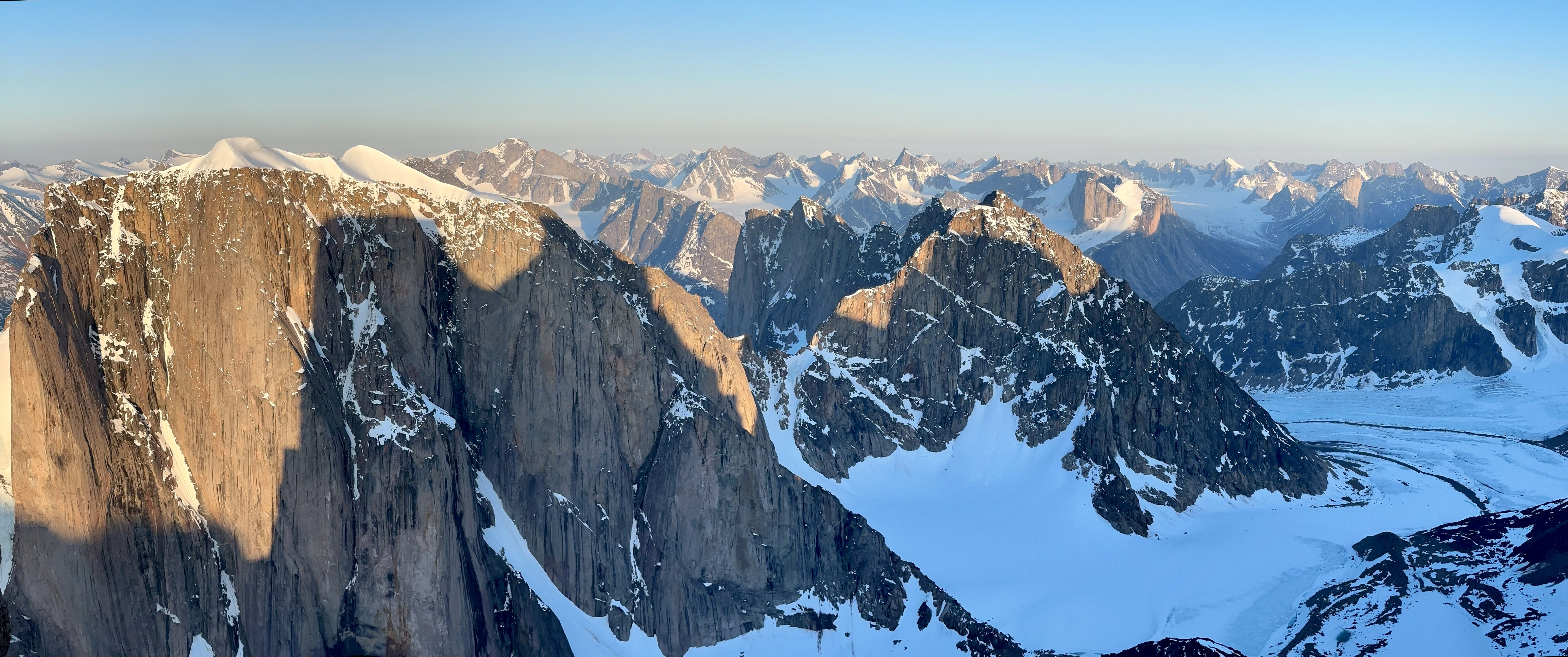
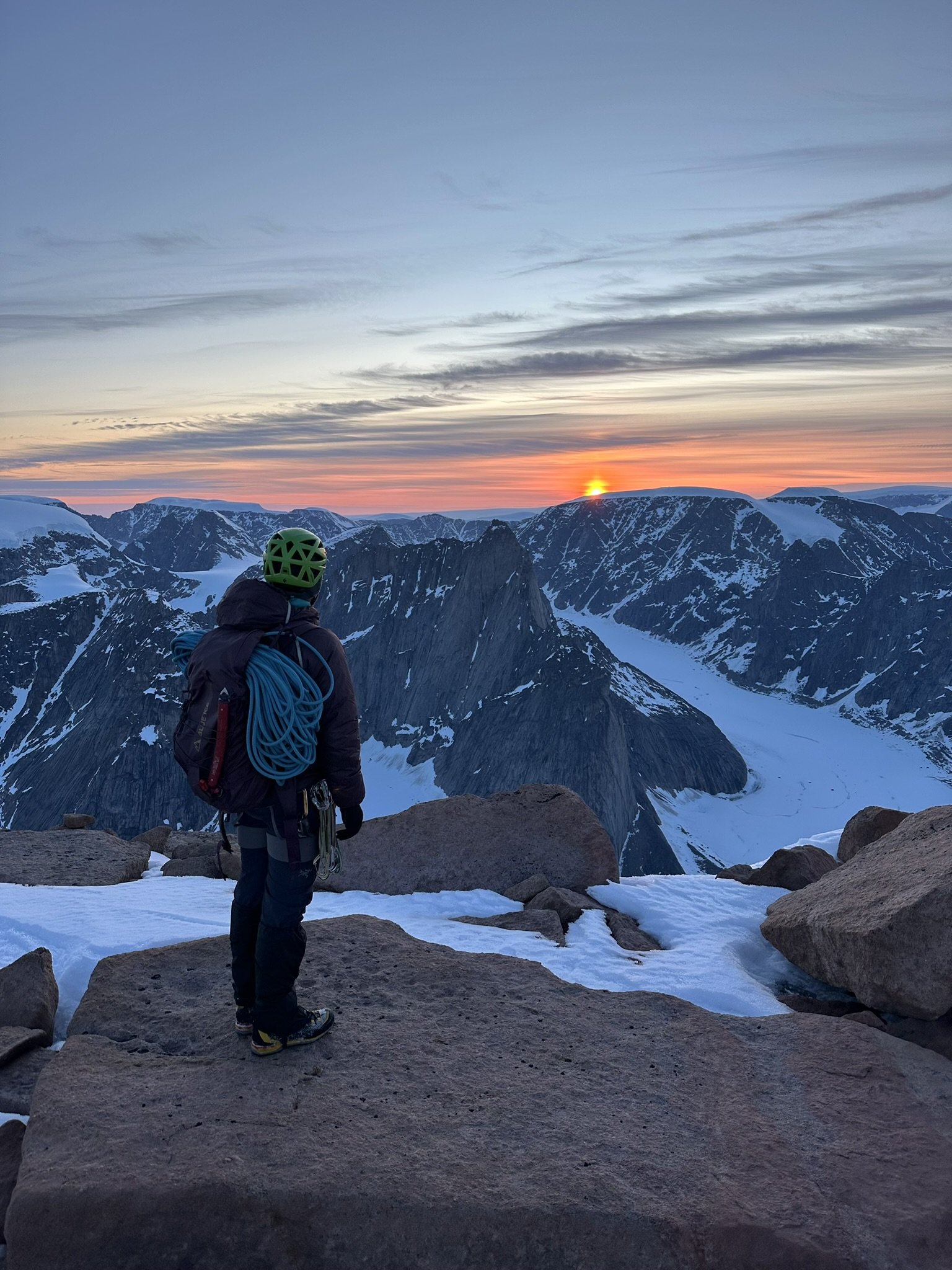
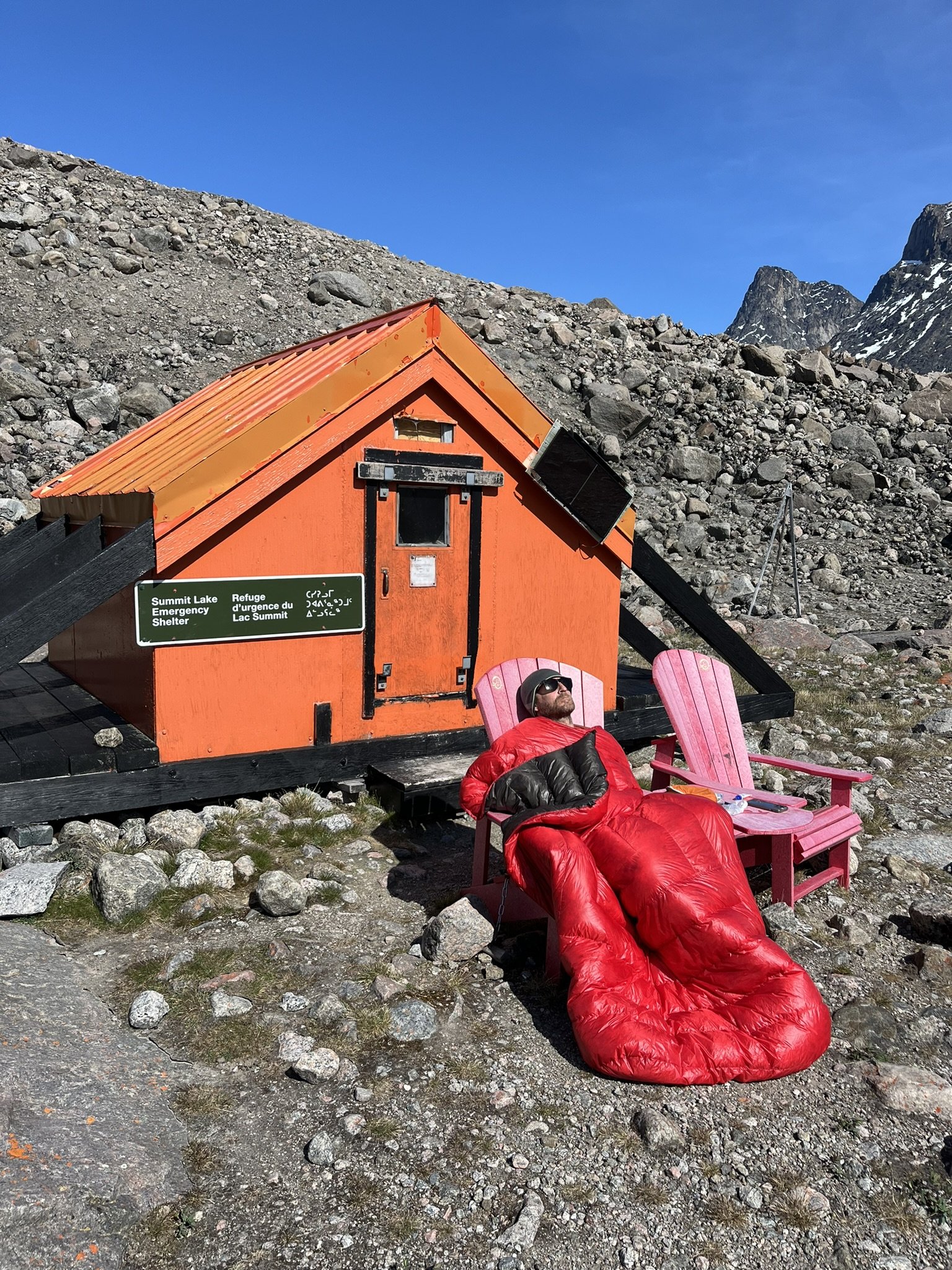
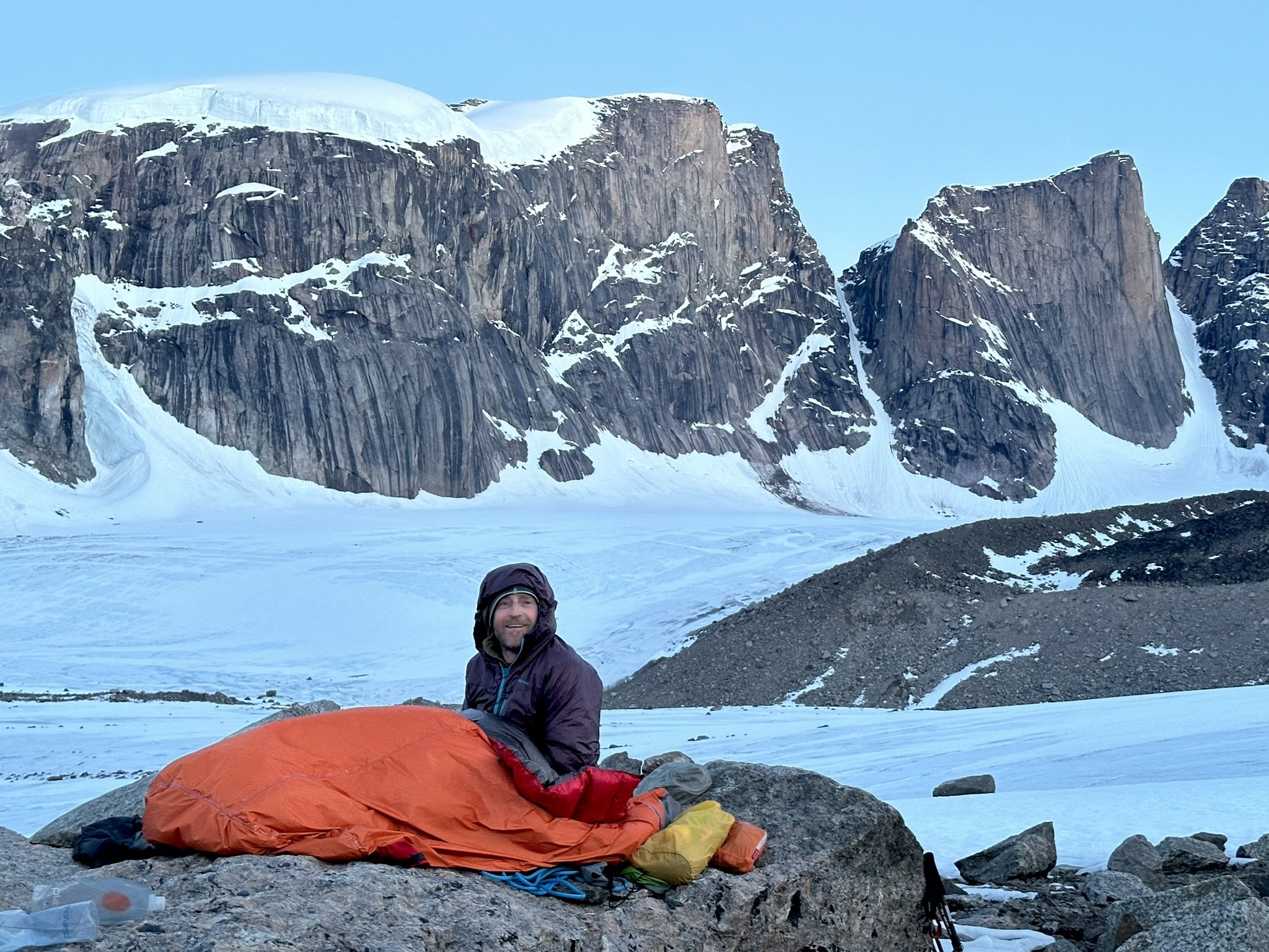
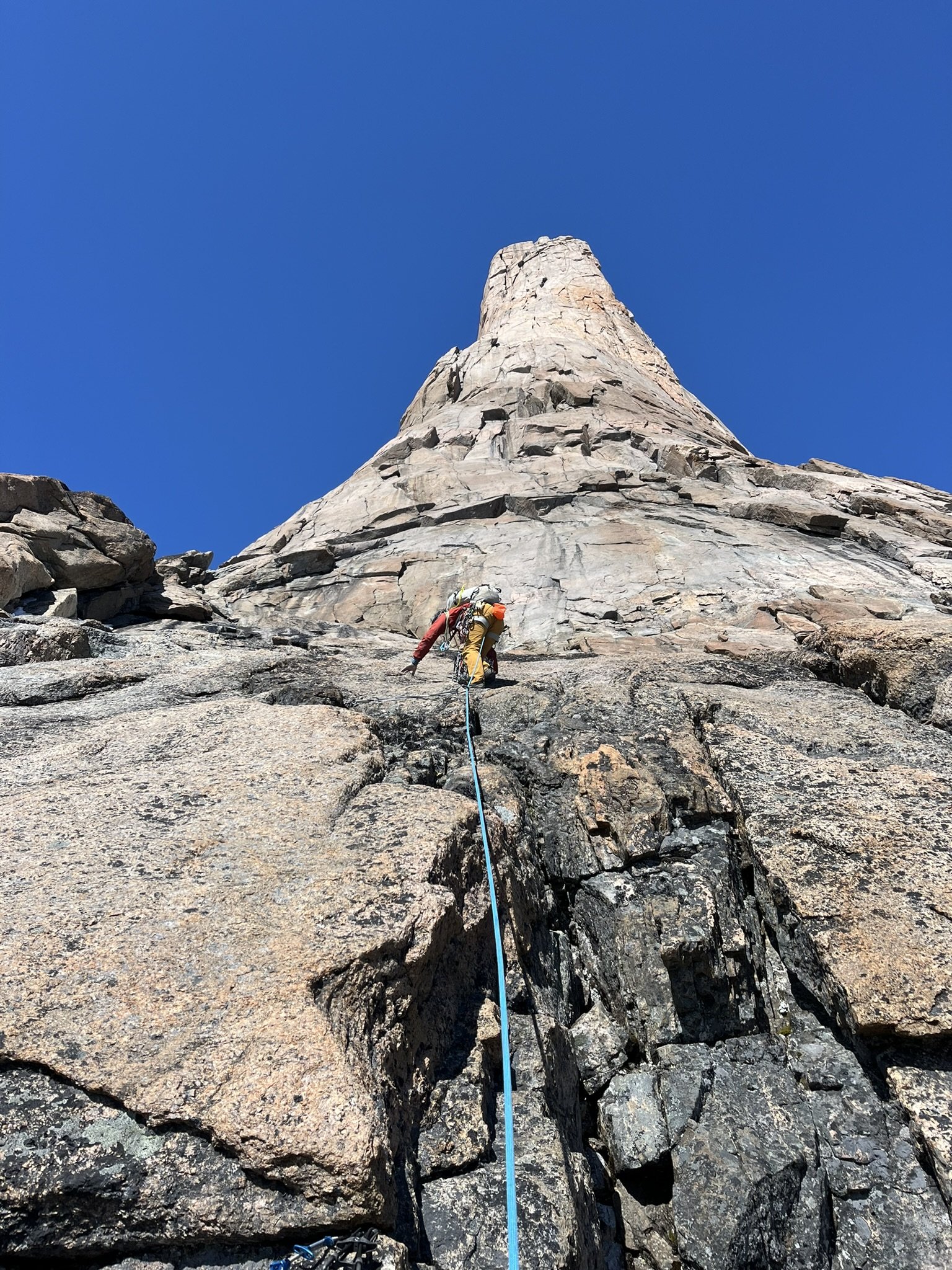
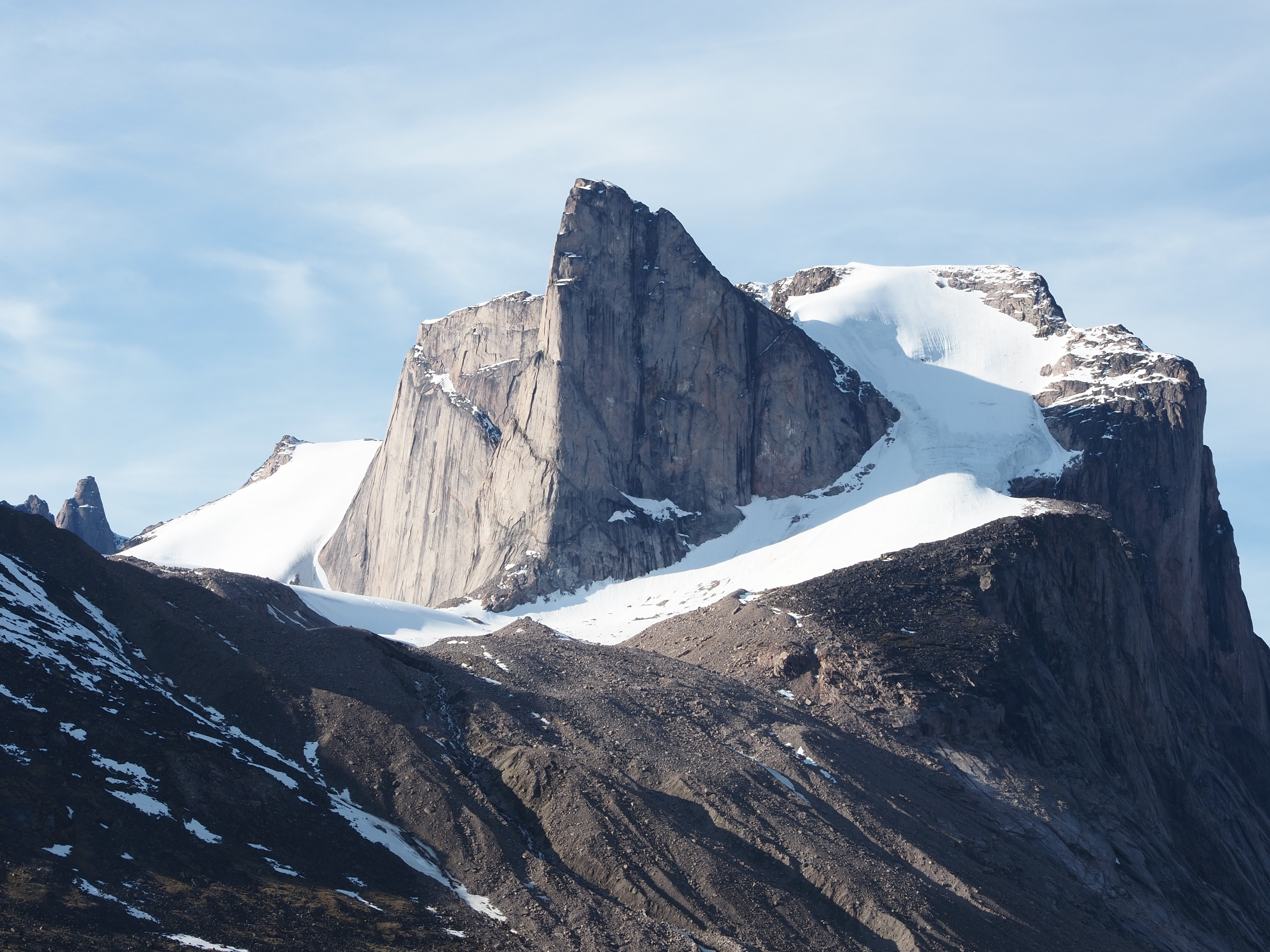
Trip: Baffin Island - Auyuittuq Trip Date: 08/02/2024 Trip Report: Prologue If a memory cannot be refuted by evidence than it must be the truth so I present this memory as such even if I have some misgivings whether it is in fact the case. I entered Western Washington University in 1991 and as a freshman living on campus I would frequently find myself in the Wilson Library thumbing through what already felt like an antiquated copy of Doug Scott’s “Big Wall Climbing”. Published in 1974 it was only seventeen years old but felt a world apart from the climbing culture and techniques of the early 1990’s. Within a chapter entitled “The Development of Big Wall Climbing in Remote Regions” the author had written a detailed description of his recent expeditions to Baffin Island. And I would claim it was here I first became aware of Mount Asgard. Asgard, a tremendous granite turret with an ice-covered summit plateau rearing 3,000 vertical feet out of an endless labyrinth of glacier ice. The “Scott Route”, a 4,000 foot-long free climb following a beautifully sculpted pillar of exquisite granite. This was clearly a route I wanted to climb. In fact it was The Route I wanted to climb and for over thirty years it always remained as such. A fantasy at the top of my bucket list exceeding the ability, vision or time I had available at different stages of my life. A transcription of our logbook entry at the Thor Emergency Shelter written on July 28th, 2024 We arrived in Pangnirtung on July 3rd. A healthy snowpack and a cool spring had left the mountains still draped in snow and the head of the fjord still covered in ice. A fortunate warm and windy day broke up the ice and on July 5th we entered the park, arriving here on the 6th under cold, leaden skies in a stiff wind Establishing basecamp, we were then unknowingly blessed with largely cool dry days that alternated between overcast and windy or quiet and partly cloudy. The ice slowly melted from the river, the snow on the peaks melting even slower. The first wildflowers bloomed and the days grew perceptibly warmer, Via both success and failure we developed our understanding of these mountains. Huge approaches, difficult climbing, long descents. On our second attempt we climbing the southwest ridge of Mount Menhir, the looming monolith just west of the hut. We were also fortunate to establish two first ascents on impeccable rock with relatively easy access and quick descents. On the large slab wall approximately 40 minutes up valley we linked beautiful splitters into a ten pitch 5.9 we called “Pang Ten”. Later we climbed it again and added sturdy rap anchors. With a twenty minute approach from the trail and no summit it’s a crag climb on Baffin! Above “Pang Ten” we eyed the beautiful flowing east buttress of the East Tower of Northumbria. From the hut here it’s the right skyline of the rightmost peak of the Northumbria group. With binoculars you can pick out the extensive splitters we climbed just this side of the skyline. Eight pitches of moderate 5.8-5.9 climbing on the most perfect rock. Just pure fun and now setup with solid rap stations. The link up of these two routes would make for an amazing Grade V climb without the extensive approaches or difficult descents of other long routes. Highly recommended! July 19th through the 22nd brought the stable, clear weather climbers dream of on Baffin. A long casual approach with a nice siesta at Summit Lake took us to a high bivi on a thankfully melted out Caribou Glacier. Starting at 1 am on the 20th we approached the fabled Scott Route on the North Summit of Asgard. 1200 meters of climbing over 23 pitches took us to the summit at 10 pm. Witness to a spectacular sunset, an endless sea of jagged peaks like diamonds in the periwinkle glow of the midnight sun. Being on that summit is as “out there” as we’ve ever been. The descent was long and tenuous with terrible snow conditions. We returned to our high camp 30 hours after leaving it. Since then the weather has deteriorated into more typical Baffin conditions, lots of rain, snow in the mountains and strong winds. Thoughts turn to home and family as our remaining days here melt into one another. Yesterday we hauled our first load out to Schartzenbach Falls, tomorrow on the 29th we leave for good. Our stay here has been perfect. So many memories. The intensity and beauty of the high peaks balanced by many wonderful rest days here around the hut, mending clothes, doing laundry, cooking, reading and soaking in the views. The world is vast and we may never return to this location again but our memories will always be of much contentment here, we wanted for nothing. Darin Berdinka (Bellingham, WA) & Owen Lunz (Lafayette, CO) 7/6/24-7/29/24 View up fjord upon arrival in Pang Starting the approach in inclement weather Basecamped next to and occasionally in the Thor Emergency Shelter. Mount Menhir in background. Left skyline is SW Ridge V 5.9. Starting up the southwest ridge of Menhir. Twelve pitches. Possibly 3rd ascent based on archeological assessment of rappel tat. Supernatural alpine beauty Pano from basecamp. Menhir on left, multiple summits of Northumbria on right. Looking up the Active Recovery Wall. Forty minutes up valley of the Thor Hut. Surprised to find no evidence of prior passage. Pitch 5 or so, climbing perfect splitters. Enjoyable corners high on the slab. Thor in background. Top of the slab. A few days later we'd climb the clean 1200' buttress just right of Owen. Approaching the East Tower of Northumbria. Pulling through a roof on perfect locks and crimps. Most of the climbing was in lovely splitters on the best imaginable rock. Summit views out over largely untrodden peaks. View out over Weasel River Valley with Thor across the way once again. View down valley from Summit Lake Emergency Nap in the Emergency Adirondack Chairs at the Summit Lake Emergency Shelter. Looking out over the Parade Glacier at 3 am. Asgard on left. Frigga on right. Another party was establishing a new A5 route on the left most pillar of Frigga that day. Asgard. Route started along right side of square snowpatch. 2nd pitch. Runout slabs. I look stupid in this photo but it does provide an excellent view of the upper pillar. Abandoned equipment high on the route. What epic unfolded here? 2nd to last pitch. Wet, wide and exhausting. Sunset view from just below summit. The artic gloaming. Loki in foreground. Epilogue So on a lovely day in the summer of 2024, several weeks after having climbed Asgard via the Scott Route I returned to the Wilson Library to see if I could track down the book. The library and its grounds felt little changed and somewhat surprisingly the book was still there, biding its time on a dusty shelf. Despite now being three times older than when I first perused it the book felt no more antiquated then it once had. And despite the passage of thirty-three years since those august days of youth I pleasantly realized that, on this day at least, I didn’t feel significantly different either. Other Images The incomparable Breidalblik Peak. Sun/shade line climbed in 1971 at V 5.9 A1. On the wrong side of the river for easy access. Bivi on the Caribou Glacier. Mount Tyr and Mount Walle in background. West Face of Mount Thor Signs of life below Mount Sif. Gear Notes: standard rack Approach Notes: Fly to Pangnirtung. Boat twenty miles up fjord. Hike 25 miles to Asgard. Supplies can be hauled in by sled in winter. Contact Peter Kilabuk.


 18 points
 -
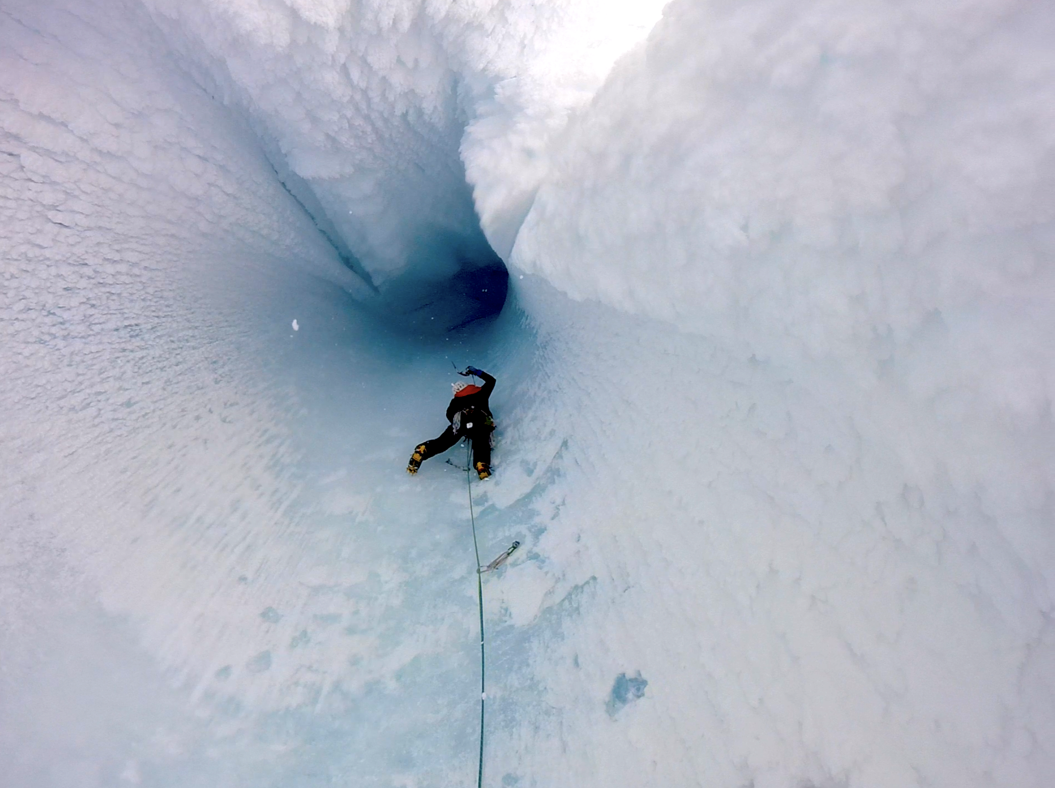
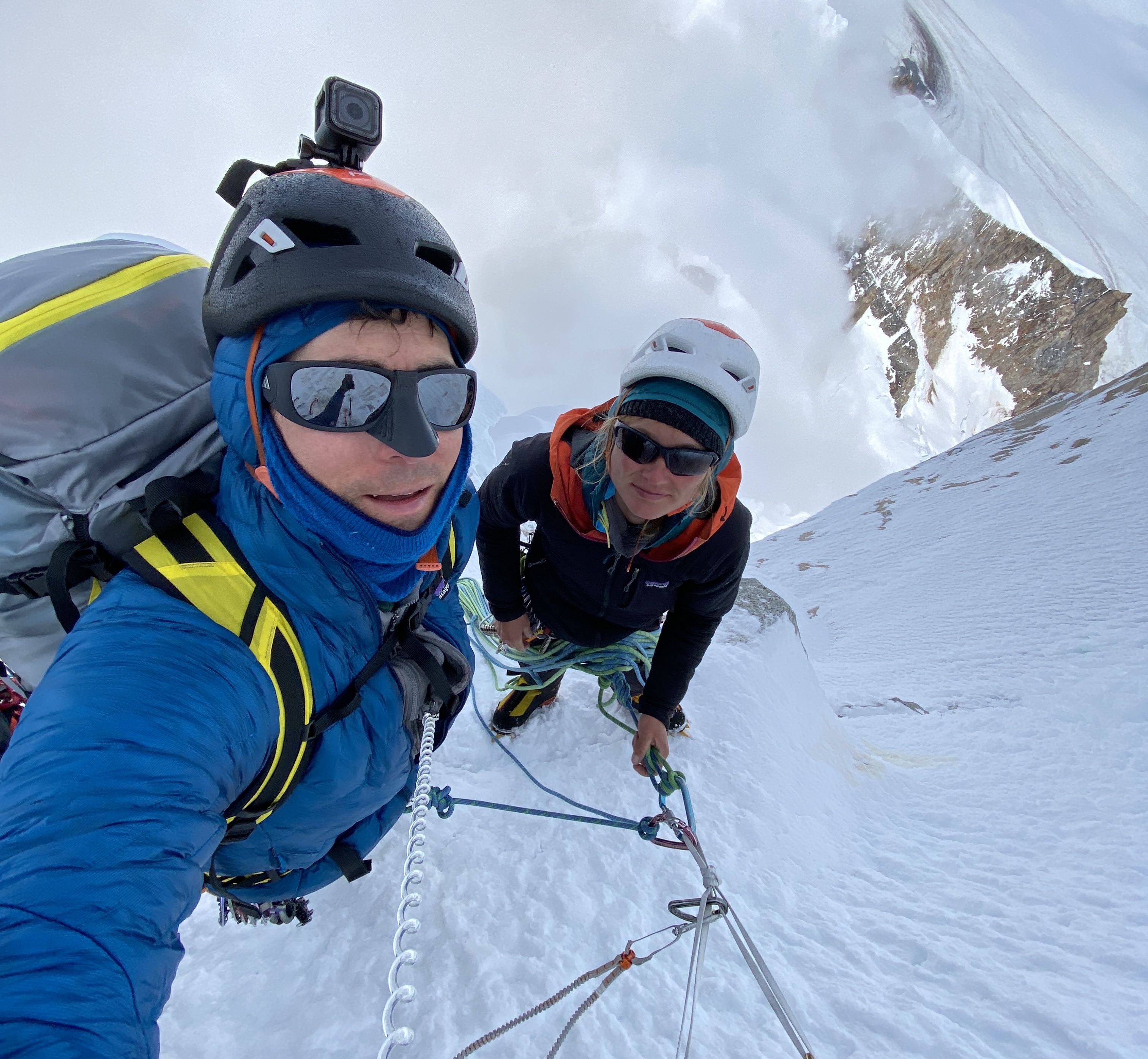
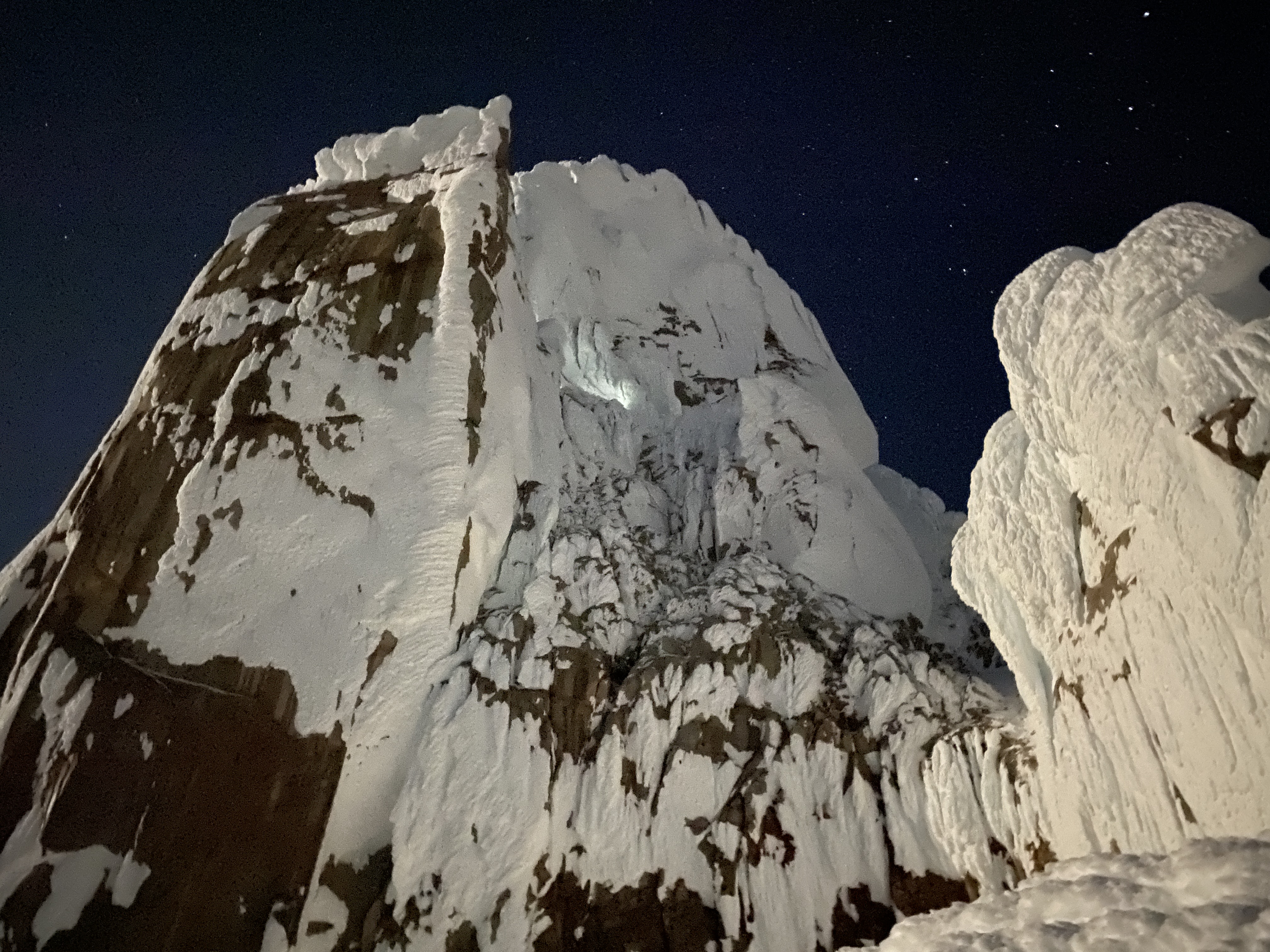
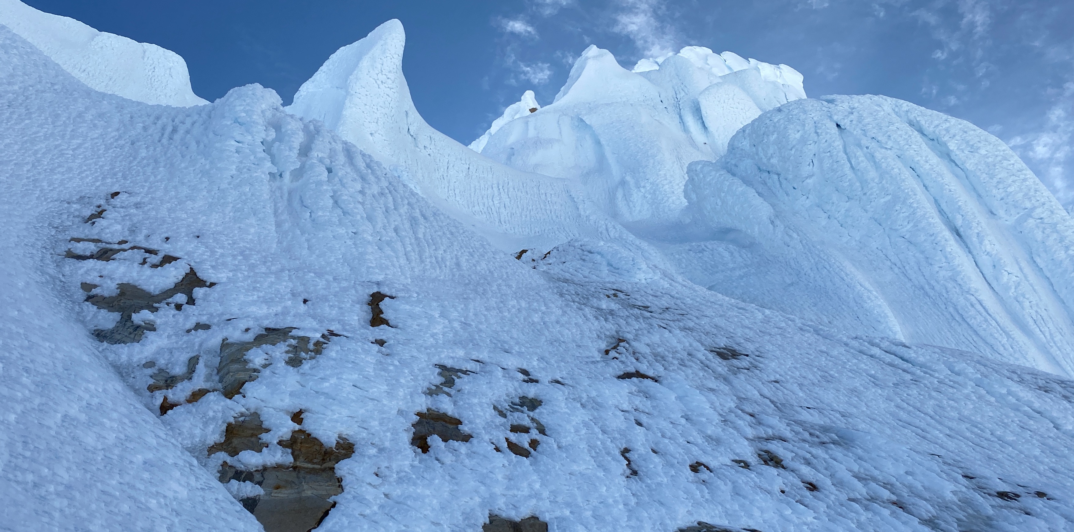
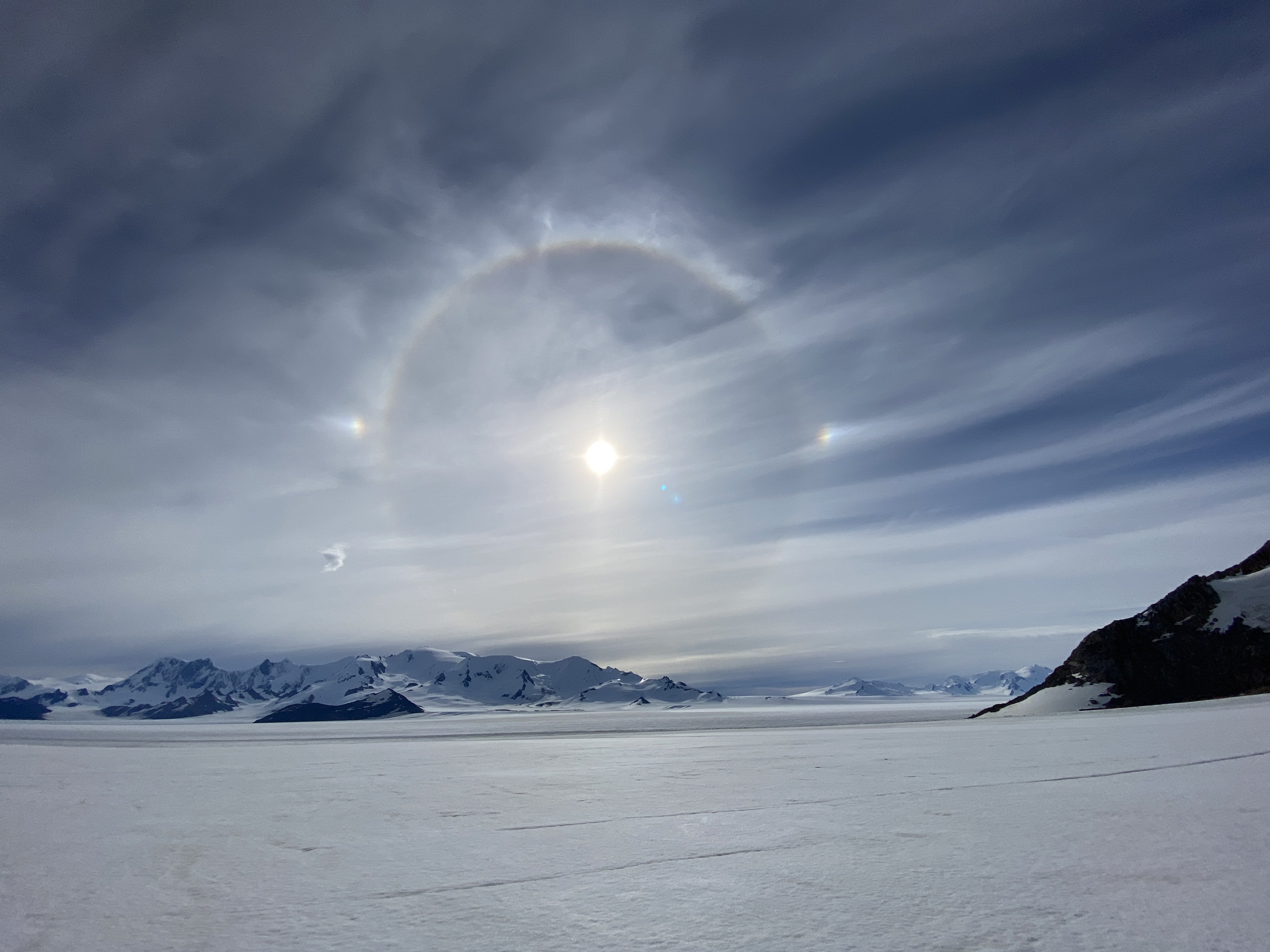
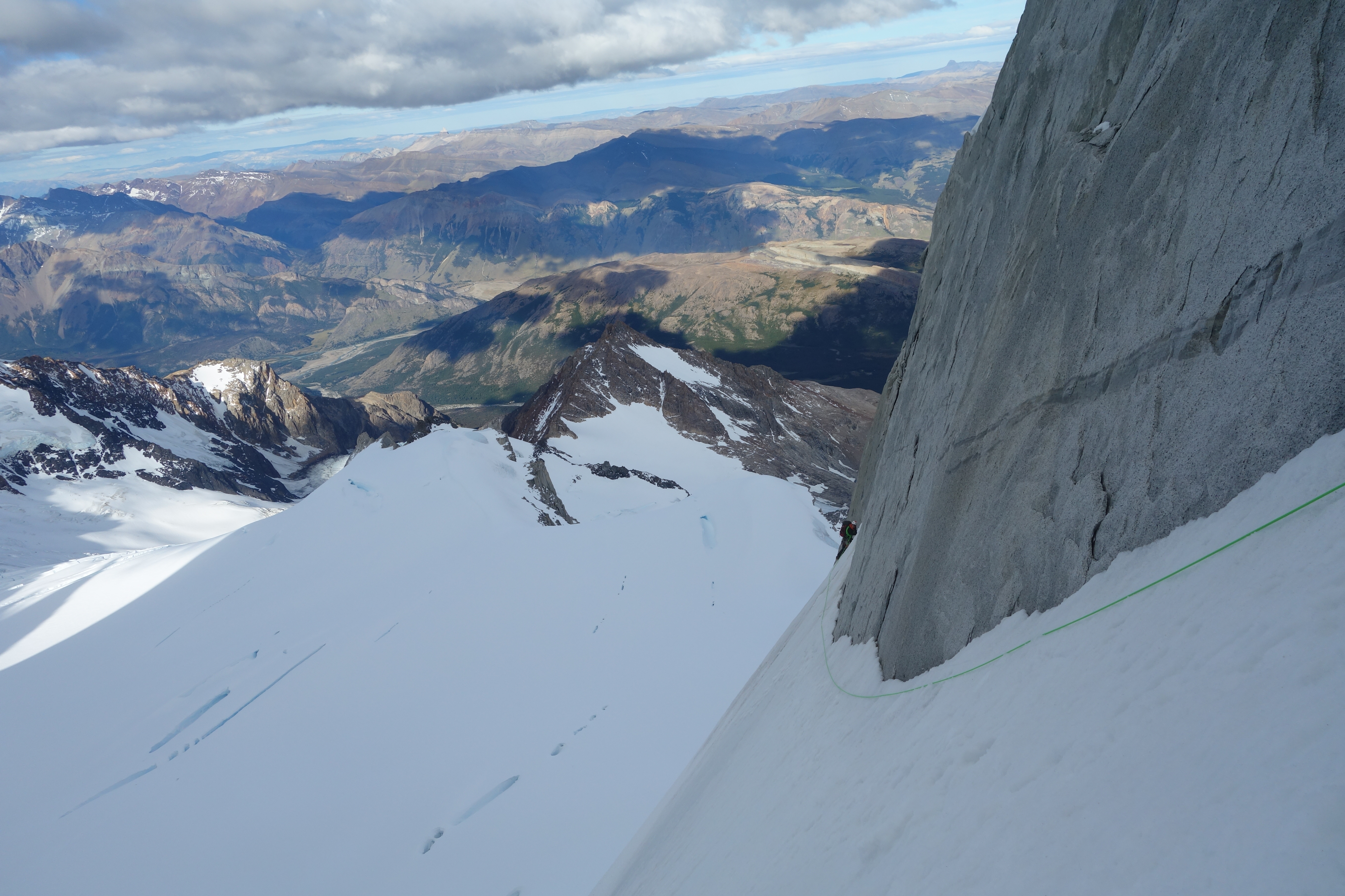
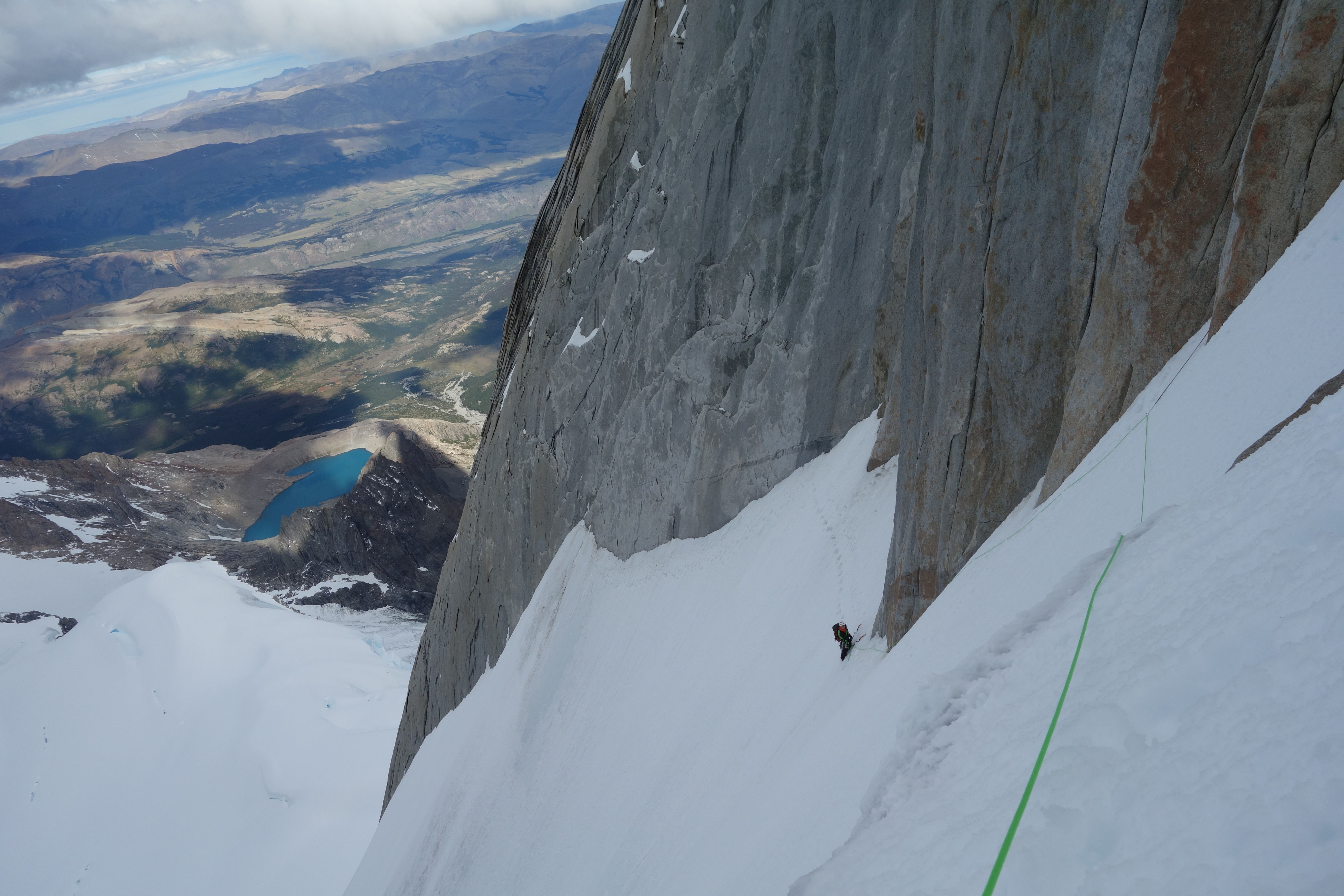
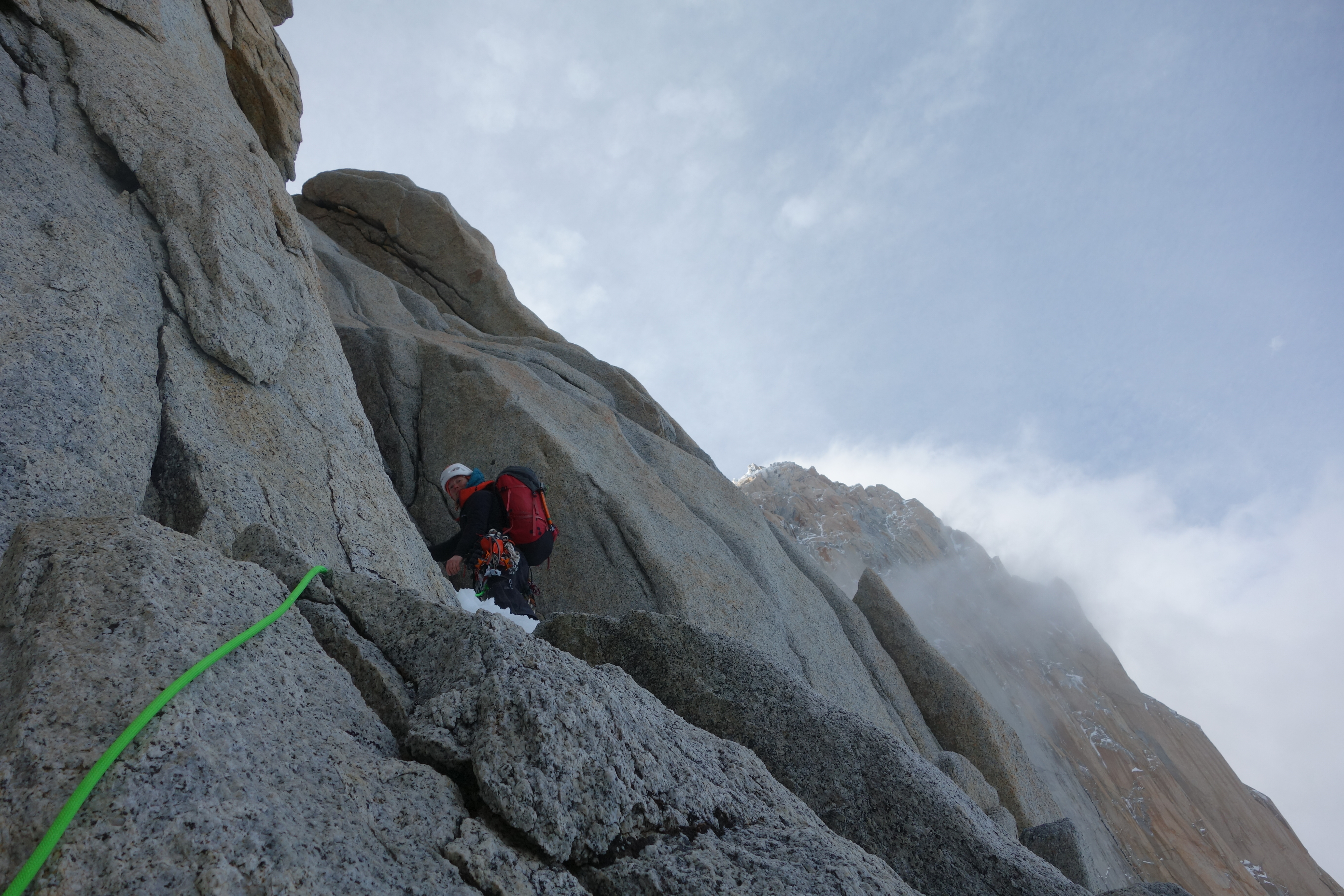
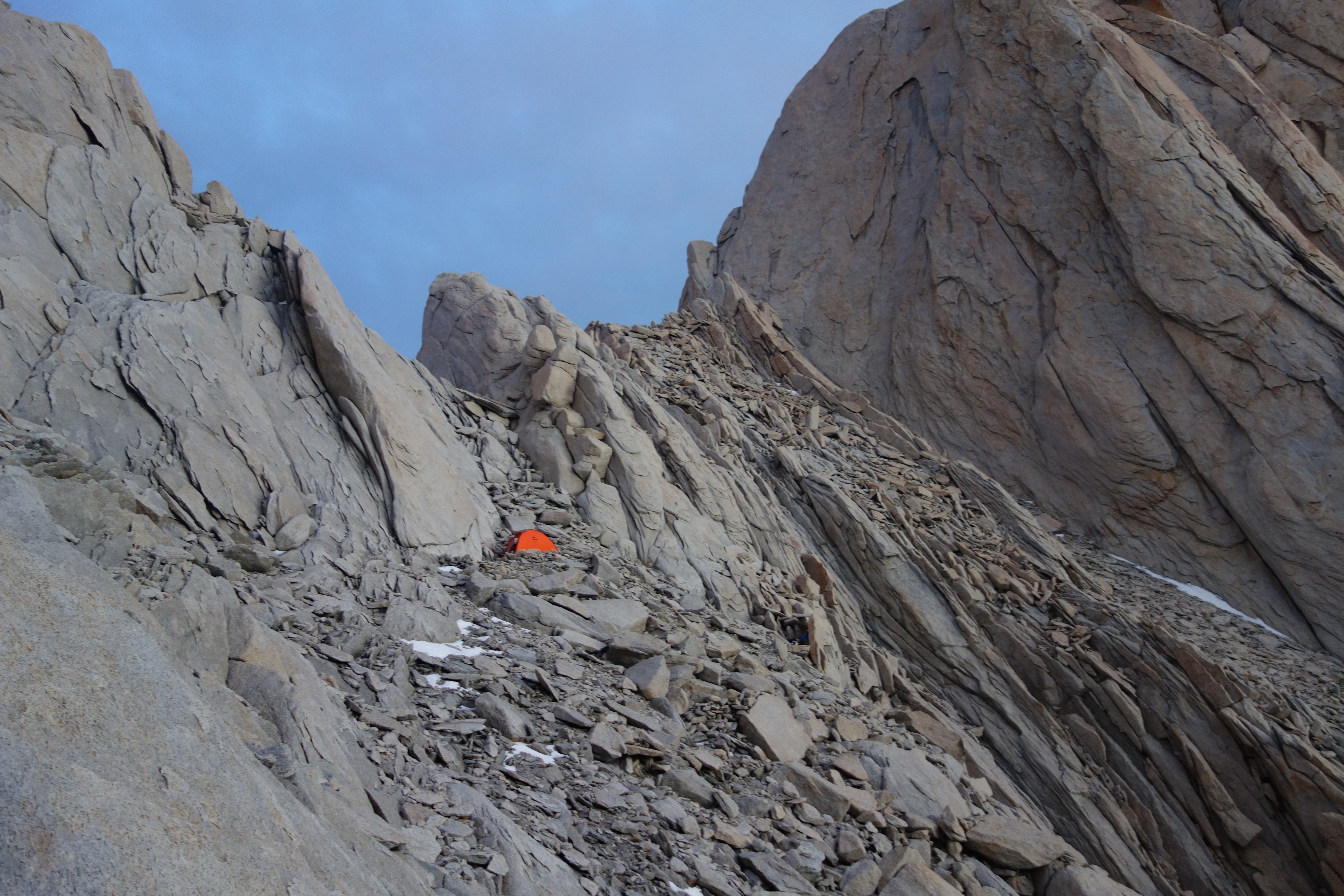
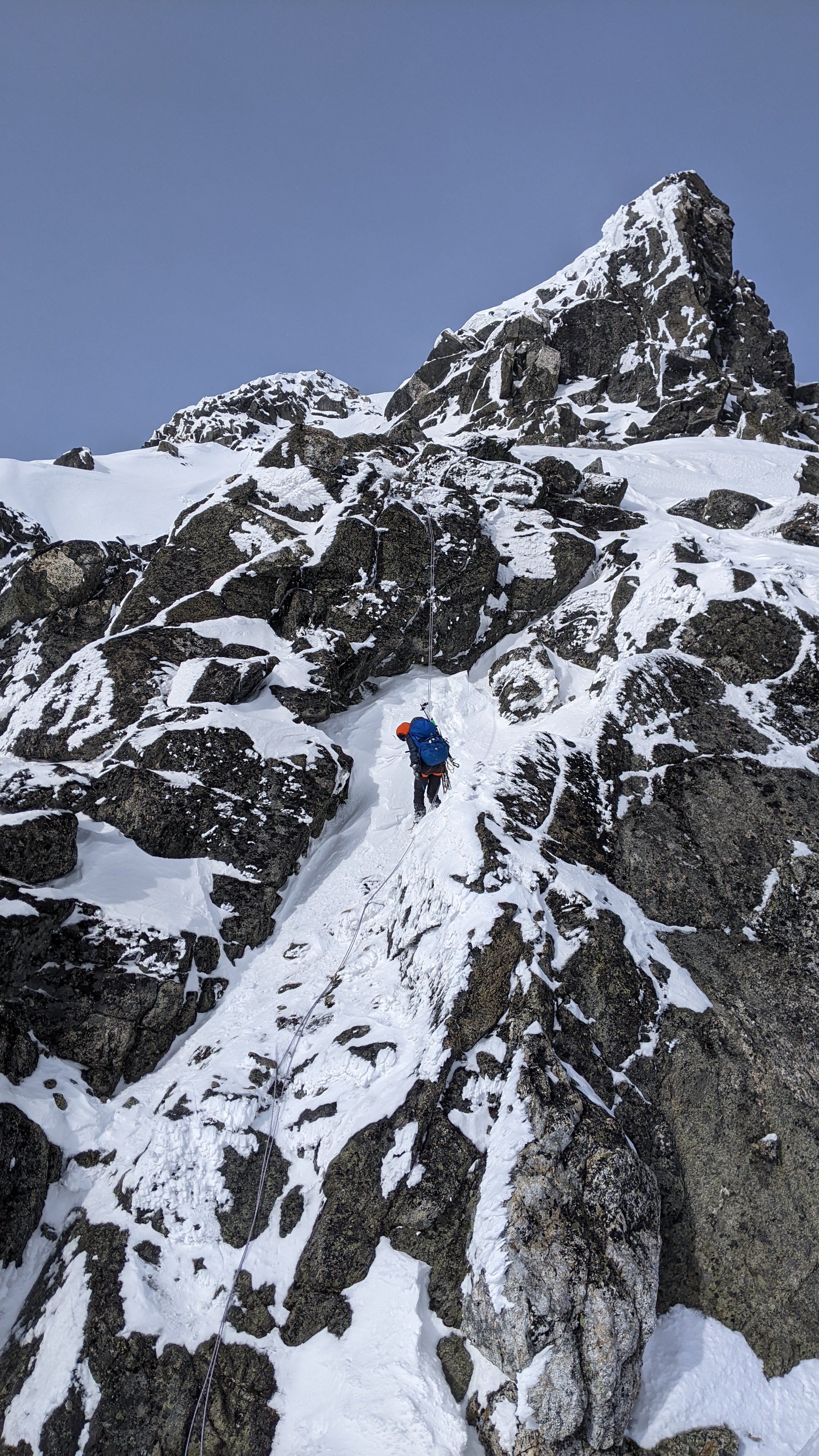
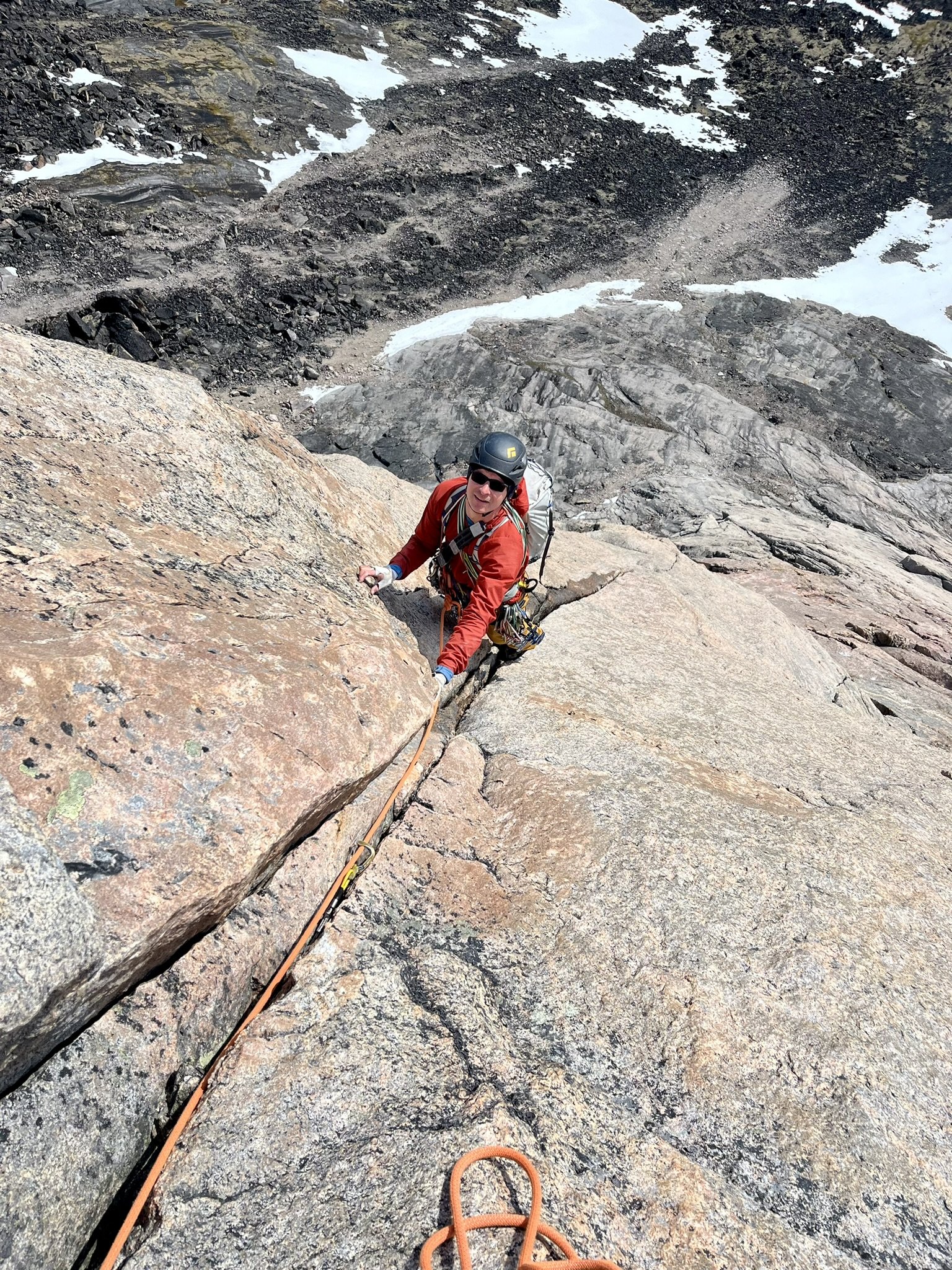
Trip: Winter Hard Mox and Spickard - West Ridge, South Face Trip Date: 12/29/2023 Trip Report: Hard Mox (8,504 ft) and Mt Spickard (8,979 ft) Winter Ascents Eric and Nick Dec 27 – Jan 2, 2023-2024 First Winter Ascent of Hard Mox, Second Winter Ascent of Spickard On the summit of Hard Mox Dec 27 – Double carry zodiac boat and gear from Ross Dam trailhead to Frontage road, drag boat to Ross Lake, motor to Little Beaver, hike to Perry Creek shelter Dec 28 – Bushwhack to upper Perry Creek basecamp Dec 29 – Climb Hard Mox via Perry Glacier to West Ridge route (M5 WI2 5-pitch), return to basecamp, 18 hours camp to camp Dec 30 – Bad weather day, rest in camp (rain all day) Dec 31 – Climb Spickard via south face Jan 1 – Bushwhack down Perry Creek, hike to Little Beaver, paddle 9 hours down Ross lake when motor doesn’t start, drag boat up Frontage road, triple carry up trail to truck by 3am Jan 2 – Drive home The route Hard Mox is considered the most difficult of the Washington Hundred Highest/Bulger peaks, and had previously never been climbed in winter. I’m working on climbing all the Bulgers in winter and this peak is the crux of that list. Hard Mox has numerous elements that make it uniquely challening in winter. 1. It is very remote. The nearest road on the US side of the border is 15 miles away line of sight (Hannegan Pass trailhead), and the second closest 18 miles away (Ross Dam Trailhead). Hiking mileage from these trailheads is close to 30 miles, and the trails are likely snowed-over and unbroken in winter. Note: I’m following a rule that ascents must be made legally, so I don’t count roads or trails on the Canadian side of the border. One way to shorten the approach is to take a water taxi run by the Ross Lake resort. These don’t operate in winter, though, so that isn’t an option. Detailed route view 2. The peak is technical. The easiest summer route is 4-pitch 5.6. It was unclear if this was the best winter route, though, since the peak hadn’t been climbed in winter. 3. The weather is unstable in winter. Hard Mox is in the West North zone of the cascades, which generally has more precipitation and less stable weather than other zones. This also means the avalanche conditions are more likely to be unstable in this zone in winter. 4. There are no trails to the peak (on the US side). Bushwhacking is required, and this can be very challenging in the North Cascades, especially in winter. Climbing Hard Mox in July 2018 (photo by Steven) I first climbed Hard Mox in July 2018 with Steven Song, and we entered and exited via Canada. We followed the standard Depot Creek approach, crossed the ridge of Gendarmes to the south face of Hard Mox, descended to the base of the south gully, then climbed up the gully and to the summit via the West Ridge. This is the route that nearly all climbers take to climb Hard Mox. In 2020 I started considering how to climb Hard Mox in winter. I’m following a rule that all winter ascents must be completely legaly (no sneaking in from Canada), so I needed to find an alternative approach. I considered three approach options, and made scouting trips to determine the feasibility of each in winter. Over the next three years I would make a half-dozen scouting trips and two unsuccessful winter attempts on Hard mox. Scouting the Ross Dam approach and paddling Ross Lake in November 2020 First, I considered the Ross Dam trailhead approach. This route is to start at the Ross Dam trailhead, hike up the lake to Big Beaver, then hike to Redoubt Creek and bushwhack up to meet the summer route. This route is 30 miles one way. It has the advantage that the first half is mostly low elevation and often snow-free in winter, though it requires crossing Beaver Pass, which would likely be snow covered. In mid November, 2020 I did a trip where I hiked this approach to Redoubt Creek, then continued to Little Beaver and packrafted back to Ross Dam in a big loop. That approach would probably take two days in good conditions in winter. Scouting the Hannegan Pass approach in December 2020 I next considered the Hannegan Pass approach. This would require hiking or skiing in from the Hannegan Pass trailhead to the Chilliwack River, bushwhacking up Bear Creek, then meeting up with the standard summer route at the Redoubt-Easy Mox col. It would be about 28 miles one way. In December 2020 I drove up the road towards the Hannegan Pass trailhead and found a sign that the road is groomed for skiing in winter and closed to snowmobiles. This meant there would be an additional 5-mile approach in winter, making the approach 33 miles. I skied up the trail to near Hannegan Pass, but progress was slow. That approach would probably take at least two days. Those approaches would be too long for me to squeeze Hard Mox in a regular weekend or even a 3-day weekend. Ideally I could find a one-day approach so Hard Mox could be possible in one of my two long holiday weekends of the winter (presidents day weekend and MLK day weekend). I’m a teacher so can’t take vacation days, meaning these holiday weekends are my options in winter. I next considered a boat approach on Ross Lake. I have a packraft, but I discovered it can take most of a day to paddle between Little Beaver and Ross Dam. I really needed that to take on the order of a few hours so the rest of the day can be used for hiking and bushwhacking in. For that to be feasible the boat really needed to be motorized. Ross Lake is in the unique situation that motorized boats are allowed on the lake, but there is no road access for the general public. It is possible for workers at the dam or at the Ross Lake resort to drive to the lake by taking a vehicle ferry from the town of Diablo to upper Diablo lake, then driving up Frontage road connecting the two lakes. This service is not available to the public, meaning Frontage road is not reachable by vehicle from other roads. There exists a road on the north end of Ross Lake – the Silver Skagit Road – and this theoretically allows the public to drive to the lake and launch private motor boats. However, that road was washed out in November 2021 and it is unclear when it will ever reopen. It is possible that the road might be passable to a snowmobile in the winter, and an intriguing option might be to drag a boat behind a snowmobile to access the north end of the lake. I haven’t been able to test this, though, and I’m not sure if it would technically be legal to come in from canada that way if the road is closed and there is no official checkpoint open at the border along the road. There are currently two options to get a personal motor boat to Ross Lake. The first is to carry it down the 0.6-mile trail from the Ross Dam trailhead to Frontage Road, and then take it 0.5 miles down the road to the lake. The other is to put the boat in at the boat launch at Diablo Lake, ride to Frontage Road, then somehow carry or drag the boat up Frontage Road (1.5 miles, 600ft gain). From talking to friends with experience boating I settled on two main options. The first was to use a canoe with an electric outboard motor. This could theoretically be carried down the trail in multiple loads. It could also theoretically be dragged up Frontage road on a dolly, though only if Frontage road were snow-free. However, the canoe has several disadvantages. First, it is not very stable. I have friends who’ve tipped over in canoes on Diablo lake. That would be dangerous in winter, and winter is when the weather is generally worse on Ross Lake. Also, the biggest motors I could find for canoes were electric trolling motors that would struggle to get 15 miles up to Little Beaver, even at a very slow speed. Plus, an electric motor is not as reliable in cold conditions as a gas motor. The zodiac boat’s maiden voyage on Stave Lake during a climb of Mt Judge Howay in BC The other option was a zodiac-style inflatable boat with gas or propane outboard motor. This vessel is much more stable than a canoe and very difficult to tip over. It is made of durable thick material with multiple chambers. It has a much higher capacity than a canoe, and can go much faster and farther with the gas or propane engine. It deflates, so is portable. They even come with retractable wheels that can be deployed to drag the boat along frontage road. This appeared to be the optimal solution. My friend Matt had such a boat and we went on a test trip together in September 2022 in British Columbia to climb Mt Judge Howay (which requires a boat approach up Stave Lake). The boat had a 4-stroke propane motor, which is very clean and reliable and meets the strict environmental requirements for personal motor boats on Ross lake. That trip went well, and I ended up buying the boat from Matt. The boat as a 5 horsepower motor that is about 60 pounds, the boat itself is 70 pounds, and a full 5-gallon propane tank is about 50 pounds. A duffle bag of accessories (wheels, oars, life jackets) weighs about 40 pounds. Each one of these items is manageable to carry, which makes this a good solution. The motor allows the boat to go a max speed of 5.7mph fully loaded, but this is actually a perfect speed for Ross Lake. Taking the boat for a test run on Lake Chelan with my dog Lily, October 2022 Through multiple tests I’ve found that a fully loaded boat and full tank of propane has a range of 40-50 miles. Little Beaver is a 30-mile round-trip journey, so the propane tank is just the right size with a little bit of safety factor. One problem with Ross Lake is that in the winter the lake level drops and submerged tree stumps stick out in seemingly random and unexpected locations. In winter it is likely that boating on Ross Lake to approach Hard Mox will need to be at night, and it is thus dangerous to go too fast in the dark for risk of hitting the stumps. That’s particularly risky in an inflatable vessel. A speed of 5.7mph is slow enough that stumps can most likely be avoided. To make a trip safer, though, I called the Ross Lake resort and had them mail me a map with general stump locations marked. I also found a fishing depth map of the lake and charted a GPS course to follow the deepest section and avoid known stump areas. I would load this track on my GPS watch before boating up Ross Lake in the dark. First test run of the boat in Ross Lake boating to Little Beaver, October 2022 In October 2022 I did the first test run of the boat in Ross Lake. The goal would be a thorough simulation of the entire Winter Hard Mox approach and climb. My friend Ryan Stoddard recommended the Perry Creek approach to Hard Mox based on his approach to the Chilliwacks the previous year. He said the bushwhacking was difficult, but it would give direct access to the south face – west ridge route without requiring a traverse from the ridge of gendarms that might be sketchy in winter. I first wanted to test the Diablo lake + Frontage Road method. Talon joined, and we decided to climb Hard Mox in a weekend. Saturday morning we put in at Diablo Lake, motored through zero-visibility forest fire smoke in the dark, then reached Frontage road. The takeout was tricky to get the boat up the dock, and dragging the boat and gear up Frontage road was very difficult and time consuming, even with the nice deployable wheels. On the summit of Hard Mox in October 2022 with Talon We made good time up Ross Lake moving at 5.7mph, and got to Little Beaver after 2.5 hours on Ross Lake. We then hiked to Perry Creek shelter. To get up Perry Creek I’d seen on an old quad that there used to be a trail up the north and east side of the creek in the 1940s, but it was long-abandoned. Other groups, including Ryans, had followed that side of the creek and it sounded tough. We decided on a different approach. We went straight up the creek, scrambling on boulders on the side. It was actually fun and basically no bushwhacking. Then we hit old growth forest and followed that on the south side of the creek all the way to the edge of treeline. This showed the Perry Creek bushwhack was actually not bad at all! That was valuable information for winter. In the basin below Hard Mox in October 2022 We camped at the basin below Hard Mox, then the next morning climbed up the Perry Glacier. We were unsure if there would be easy passage from the glacier up to meet the standard summer route, but were surprised to find an easy 3rd-class gully connecting to the route. From there we climbed the standard west ridge route, and it was useful to refresh my memory of which of the lower gullies is the correct one (many teams lose time route-finding in that area). We ended up topping out by 9am, then descended all the way back to the boat, rode out, and I got home Monday morning 4:45 am, barely in time to make it to catch a nap before my morning lecture. This scouting trip successfully showed that basecamp could be reached in a single day with the zodiac boat, as hoped for. I also was able to test my new custom offroading headlights with motorcycle battery that I’d velcroed to the front of the boat. This allowed for boating in the dark, which would likely be necessary in winter. Ross Lake was foggy, though, so visibility wasn’t perfect. However, the approach had the one disadvantage that if Frontage road were covered in snow, then dragging the boat up would likely be very difficult. So that approach might not be ideal. Carrying the boat and motor down the trail in late October 2022 Talon had a friend that worked at Ross Dam, but unfortunately they didn’t have anywhere I could store the boat securely for winter access. We contacted the Ross Lake resort, but they didn’t want to store the boat. So, I would have to get it to the lake on my own and store it at home. I next wanted to test the second option to get the boat to Ross Lake, via carrying it down from Ross Dam trailhead. In late October Nick and Talon joined for another mission. My main goal was to test that boat approach, but a secondary bonus goal was to go survey East Fury. I suspected it might be high enough to be a Washington Top 100 peak. To get the boat down the trail I researched different methods hunters use to transport animals on trails. One way is a single-wheeled device with handlebars and a brake, with racks on the side. I bought materials and hatched a design to modify my mountain unicycle into a boat-transporting device. Nick had another idea to strap the boat to his e-bike and wheel it down the trail then use power-assist to wheel it back up. The boat loaded up with survey gear and the new offroading headlights Saturday night we loaded up the bike and strapped the motor to a pack (upside down, since that seemed most stable). Unfortunately the trail was so rocky and uneven that the bike didn’t really work well. We decided that just carrying the gear in multiple trips made the most sense. With a double carry we got all the gear down to Frontage road and inflated the boat. We then slept a few hours back at the truck, then Sunday at midnight dragged the boat and survey equipment down to ross lake. We put in and boated to Big Beaver. We then hiked up to Luna peak with my theodolite and surveyed East Fury (which I discovered is tall enough to be a new WA top 100 peak). We returned to the boat, motored back, dragged it up the road, and double carried back to the truck. Carrying the boat back up the trail From this trip I determined that it is actually a bit faster and easier to get the boat to Ross Lake via the trail than via Diablo Lake. It also works even if Frontage Road is snow covered. So this would be my preferred method to get the boat to Ross Lake. I now had all the pieces in place to mount a winter attempt on Hard Mox. I had figured out an approach that could get me to basecamp in one day in winter, I had verified that the climbing route worked from my planned basecamp, and I had figured out the optimal method to get the boat to and from Ross Lake. Next, it would be a waiting game. I needed many stars to align for a winter Hard Mox trip to be successful, even with all the logistics already worked out. 1. I had to have a partner available on a holiday weekend (my only holiday weekends were MLK day and Presidents day three-day weekends) 2. Weather had to be stable on the Sunday of the weekend, with minimal precipitation 3. Snow had to be stable on the Sunday 4. Wind had to be low for boating on Ross Lake and for keeping snow stable 5. Ross Lake had to be ice-free 6. Snow conditions have to be manageable on skis if skiing 7. The lake level has to be high enough to cover submerged tree stumps if boating at night. Boating up Ross Lake in January 2023 In January 2023 it looked like all stars would align on MLK day weekend. Satellite images had shown ice a half mile south of Little Beaver on the upper end of Ross Lake, but it was forecast to be warm and rainy for the week leading up to the weekend. We expected the ice would melt then, but as a backup we decided we could walk a half-mile along the shore if needed to Little Beaver River, then cross the river one at a time in my packraft, towing it back with paracord or rope. We planned to ski to increase speed. To ensure we knew about up-to-date snow conditions on the route I wrote custom python software to scrape the NWAC avalanche forecast website every evening and send a message with the forecast to my inreach. This would ensure we had the most up-to-date forecast before deciding to go for the summit. Stopped short by ice, January 2023 Saturday morning we successfully got the boat to Ross Lake and boated up, but we discovered that the ice had not melted. We parked the boat on shore a half-mile line-of-sight from Little Beaver, but unfortunately the shore had many impassable cliffs. This was not obvious from the satellite images. We had to bushwhack around the cliffs, then packraft across Little Beaver, and it took us 6 hours to cover just 0.5 miles line-of-sight distance. The next morning we skinned up to Perry Creek shelter, but above that the snow was too icy and crusty for skiing to be safe. Postholing up Perry Creek would be too slow and difficult. Plus, the additional 6-hour deproach to the boat would leave us too short on time. We bailed back to Little Beaver. Crossing Little Beaver with packraft and skis, January 2023 To get back we were able to do what I call belayed packrafting to get around the cliffs in melted-out sections and avoid bushwhacking. The first person would packraft around trailing our climbing rope. Then once around the cliff they would yell and the second person would pull the packraft back, then paddle around the cliff. This way we could inch worm around the cliffs and avoid bushwhacking. We managed to make it safely back to the zodiac and get back to Ross Dam that night. From that trip we learned that the lake absolutely has to be ice-free the whole way in order to attempt the trip. We also decided that snowshoes are a better choice than skis. With snowshoes we wouldn’t really have to care about snow conditions in the Perry Creek basin. Speed might be slower in snowshoes, but it was more likely we could reach the basecamp than with skis. Packrafting back between the cliffs and ice, January 2023 In February it looked like all the stars would align over Presidents Day long weekend. Nick and I decided to try again. This time the satellite images showed no ice on the upper lake. We decided to go with snowshoes. The only marginal star was the weather. It looked like snow and conditions were stable Friday through Saturday late afternoon, but then a storm was supposed to come in. If we could summit and get back below treeline before the storm, we would be ok hiking out in the rain and boating back in stormy conditions. This time we first carried the boat down to Frontage Road Friday night, then slept back at the trailhead. Early Saturday we carried the gear down, inflated the boat, and dragged the boat down the road. We started boating just at sunrise. In February the lake level is lower and more stumps stick out, so it’s more important to boat in the daylight. Days are a bit longer than in January, though, so this is not as big of a problem to wait until sunrise to boat. Successfully reaching Little Beaver, February 2023 We made it all the way to Little Beaver in 2.5 hours, then hiked up to Perry Creek. We were able to bushwhack up Perry Creek in snowshoes. Snow coverage was good, and we could mostly stay in the creek on the lower sections. Once we reached the old growth we made quick progress, reaching basecamp just at sunset. The next morning we left camp at 2:30am following my GPS track from October on my GPS watch. Pit tests showed the snow was stable, though deep, and we made slow progress. By a bit after sunrise we reached the bottom pitch of the route. The wind started increasing then, almost knocking us off balance. Nick led partway up the first pitch, but my route from October was not the best winter route. It had required crossing one sloping slab down low, which was easy in rock shoes but tough in crampons. Bailing on the first pitch when the weather deteriorated, February 2023 Also, it was difficult to find any cracks to stick gear in. Nick tried a few variations, then lowered down. I gave it a go, but couldn’t find gear placements. By then the storm was intensifying and we decided to bail rather than keep trying. We were concerned the increasing wind might start forming dangerous wind slabs down low. Indeed, as we descended the Perry Glacier we triggered a few small slabs. They were no problem, but given a few more hours they would likely get dangerously deeper. We descended all the way down to the trees as it got windier and started raining. We bailed all the way out to Little Beaver that night. The next morning the storm was raging and we started boating out into whitecaps and heavy wind. The boat took on lots of water and I had to navigate through a stump forest in the waves to get to shore and bail it out with my helmet. We then hugged the shore and made it safely back to Ross Lake. Bailing out water with my helmet on the ride back after navigating through a stump forest and heavy wind and waves, February 2023 From that trip we learned that the stars of weather and snow conditions absolutely have to align with the weekend. High wind is not good on Ross Lake, even with a stable zodiac boat. In October 2023 I did one additional test trip on Ross Lake. I bought yellow fog lights to replace the off roading headlights to make it safer to boat at night, when it is usually foggy on Ross Lake. For that trip Matt Lemke and Mike Black joined me to bring survey equipment up Castle peak. We boated up and back in the dark 10-miles up lake, and the new lights worked much better in the fog. This increased my confidence about boating on Ross Lake in the dark on a future Hard Mox attempt. We ended up surveying that Castle peak is over 30ft taller than the quad-surveyed height, so is solidly on the WA top 100 list. In October I started strategizing about how to try for Winter Hard Mox again. With so many stars that needed to align it seemed like relying on only two long weekends the whole winter was not a high chance of success. That only gave two possible summit days all winter. My only longer break was the Christmas-New Years break. I usually leave the country to work on climbing country highpoints during that window, but decided to stick around this year and prioritize a winter hard mox trip. Testing the new yellow fog lights on Ross Lake, October 2023 I would be available for a full week between Dec 26 – Jan 2. In October Nick and I coordinated that we would both be available, and if all stars aligned we’d give Hard Mox another shot. It helped that enough time had passed since our last attempted that we had sort of forgotten all the hardships we’d encountered. That’s always important before attempting a difficult peak again after an unsuccessful attempt. For this third attempt we would try to make further improvements but stick with some methods and gear that had worked before. We would again go by snowshoes, and would carry the boat down from the Ross Dam trailhead. For the boat I would use an aluminum propane tank instead of a steel tank. I had previously gotten myself stranded on Blake Island in Puget sound when the motor wouldn’t start and I had to row back through 5 miles of ocean. I later took the motor to the shop and the issue was that the steel propane tank had rusted on the inside and debris had clogged the fuel system. Hopefully that wouldn’t happen with an aluminum tank. Dragging the boat up Frontage Road, October 2023 For the Perry Glacier we would bring ascent plates. These are small mini-snowshoes that sandwhich between the crampon and boot and are ideal for ascending steep snow slopes where postholing and snowshoeing are inefficient. This would have saved us time on our February ascent. We each machined custom carbon-fiber plates for the trip. For climbing gear, in addition to a single rack of cams and a few pitons and nuts we’d brought before, I’d also bring a set of hexes. I’ve found these can be hammered into icy cracks where cams and pitons won’t stick. Duncan and I had used hexes to protect Forbidden Peak during our winter ascent in January 2021 and they worked very well. We’d also bring a second set of cams up to 2 inches. For technical tools this time I would bring two BD vipers instead of a viper and a venom. The venom is a hybrid with a straight shaft that is good for plunging, but it’s a bit harder to use dry tooling than the curved shaft. The viper is a curved shaft and better for mixed climbing. I decided it was unlikely I’d need to plunge the tool for an anchor. Nick would bring a Beal Escaper device which would allow for full 60m single-strand rope rappels. This would increase efficiency descending. For crampons Nick converted his petzl Lynx to monopoint to make the mixed climbing easier. I intended to convert my Petzl Lynx to monopoint also, but forgot to do that. For boots I would again bring my Olympus Mons 8000m double boots. It’s important on a weeklong winter trip to have a double boot so the liner can be dried out overnight in the sleeping bag. It’s also important to have a built-in supergaiter, since a separate gaiter easily gets frozen with ice and snow and is difficult to deal with. My 8000m boots were a bit overkill with warmth, but those are the only double boot with built in gaiter that I have. Nick had a similar but lighter boot that was a bit more appropriate. For the tent we would bring a modified mega-mid. Nick sewed on special skirts along the edges to anchor down with snow and increase space on the inside. This would be lighter and more spacious than the ultralight 2-man mountaineering tent we’d brought previously. We would each bring vapor barrier liners for our sleeping bags. This would ensure the bags would stay drier than before over multiple nights in potentially wet weather. Nick would bring a dry suit for the boat ride. I already use one every boat ride and it is much warmer and safer than a rain jacket and snow pants in choppy conditions. I would bring a new SUP hand pump for the boat that would make inflation faster. Plus, this would give us a backup pump in case anything went wrong with the primary pump. In the fall we also got a bit more serious about training for mixed climbing. We did a practice trip together dry tool climbing at Wayne’s World crag off I-90, and Nick did a bunch of additional dry tooling sessions. By mid December it looked like the stars might finally align for the trip. December had been unusually warm and satellite images showed Ross Lake ice free. The weather forecast looked favorable and there was a good chance there would be a window of stable snow. Ross Lake was 15ft higher than it had been in January (based on publicly-available USGS height data), so stumps were unlikely to be problematic. The first potential summit window looked like Friday Dec 29. We decided to give ourselves two full days to get in, to give buffer time for having heavier packs with more days of food. Then we’d establish basecamp at upper Perry Creek as before. We’d have three or four potential summit days, then a day to get out. Hard Mox was the top priority, but if we somehow managed to climb it we’d use our other days to climb other Bulgers in the area. To make our plan completely legal we emailed North Cascades National Park and got a permit for the trip. I flew back from visiting family on Dec 25, then Dec 26 spent the day packing and preparing. I took the zodiac boat out for a short test run in Lake Washington and everything worked fine. Finally we were ready to give it another go. Dec 27 Carrying the boat down to Frontage Road, December 2023 (photo by Nick) I picked up Nick in the morning and we drove up to Ross Dam trailhead by 9am. In our first load I carried the boat motor and propane while Nick carried climbing gear. I think it’s important to bring the motor down in the first load since that is the item most likely to get stolen if left unattended at the trailhead. Next I carried the boat while Nick carried remaining boat accessories and climbing gear. We got the full load down efficiently in two hours. Once all the gear was at Frontage road we pumped up the boat, which went twice as fast with the new hand pump as with the old foot pump. I mounted the wheels, mounted the motor, then we loaded all the gear as far back as possible to be as directly over the wheels as possible. Nick rigged up the rope on the front, then we each put the rope over our shoulders and started dragging the boat. We made sure to keep our steps in synch to minimize bouncing of the boat. Dragging the boat down to the lake We soon got the boat towed down to the lake edge. As usual, a truck from one of the resort workers was parked at the edge of the water. Luckily there was just enough space to squeeze the boat around to get to the water edge. There we each changed into dry suits, water shoes, and put on our life jackets. We loaded the sharp objects wrapped up inside packs or duffles. We placed a tarp on the bottom of the boat, loaded two climbing packs and one accessory duffle on top, then wrapped the tarp over everything and bungied it to the boat. This would protect the gear from waves splashing over and filling the boat with water. Starting the motor (photo by Nick) I pushed off in the boat, wading slightly into the water, while Nick went to the nearby dock. I then retracted the wheels and rowed over to pick up Nick. This allowed him to keep his feet dry. He then pushed off, and I rowed a bit deeper into open water. I connected the propane tank, turned the motor to neutral, plugged in my key, pulled out the choke, turned the handle to start, and gave the pull cord a pull. On the fourth pull the motor started, which is really good for starting cold. Usually it starts on the tenth pull. I then depressed the choke and we started off by 11:45am. Boating up lake I went at half speed to the water gate, a small gap in the floating log fence that protects the resort buildings from waves. We found the gate at the far end of the lake, marked by green cones, Once through I cranked the motor to max speed and we cruised along at 5.7mph. I’d gotten pretty familiar with Ross Lake after all the scouting trips and attempts and knew all the landmarks. We cruised around Cougar Island to the east, avoiding the temptation to cut the corner in the gap with the coast, since I’ve found this can be deceptively shallow. We passed close to Roland Point, but not too close since I recalled a few stumps in that area. Taking out at Little Beaver After passing Pumpkin mountain we rounded rainbow point and on to Devils Creek. That’s the site of a big stump forest which was luckily submerged today. From there I crossed to the west side following my memory of the lane of deepest water. We passed tenmile island, which was still an island at this water level, and then passed Lightning Creek, which surprisingly had deeper water coverage than in October. Loaded up and hiking up the trail (photo by Nick) Cat Island was barely an island, and I hugged the west coast. I was careful, though, since I recalled a few rogue stumps across from Cat Island on the west side. This time they were submerged. The only issue we encountered was a big floating log just past Cat Island. That would have been hard to spot at night, but I easily steered around it in the daylight. By 2:15pm we cruised up to Little Beaver Camp. The upper lake was ice-free as expected. The water level was not ideal for docking, though. The regular dock was high and dry, and the lower bench of shore was submerged, so the whole shoreline was kind of steep. We found one boulder that was kind of flat and were able to deploy the boat wheels and drag it up there. We tied it off on a stump, raised the motor, raised one wheel so the boat could rest level, and removed the gear. At the Perry Creek shelter We double carried the gear all up to the Little Beaver Shelter and took a short food break. We then ditched the boat gear in a bear box, packed up our climbing gear, and started up by 3pm. The trail was snow-free so we started hiking in light hiking boots with extra gear strapped on the packs. After three miles we hit deep snow, and switched to double boots and snowshoes as it started to rain lightly. I was happy to have my waterproof hyperlite pack to keep the gear dry. We continued to the shelter shortly after sunset around 5pm. It was very nice to get out of the rain in the shelter and not have to set up the tent. We each threw out bivy sacks and sleeping bags, cooked up some dinner, and were soon asleep. Starting up Perry Creek (photo by Nick) Dec 28 We got up at sunrise the next morning and were moving by 9am. It seemed unwise to be bushwhacking in the dark, so we wanted to be sure to start the bushwhack in the daylight. We ditched our hiking boots in the cabin and proceeded in mountaineering boots and snowshoes. I had loaded my October GPS track on my garmin Fenix 6 watch to help with navigation, but I pretty much remembered the whole route since I’d already done it a few times. From the shelter we stayed on the left side of the creek, and the snow soon got thin enough that we ditched the snowshoes. In general we tried to stay as close to the creek as possible, only bushwhacking around cliffs and waterfalls. Often there are good open lines next to the creek that allow for fast progress. Scrambling up the creek (photo by Nick) This time the creek was flowing much higher than it had been in October, while the snow coverage on the side was much less than it had been in February. This seemed to be a sweet spot that made the creek as difficult to follow as possible. If the flow was lower and the sides drier, it would have been easy to walk on sloping slabs on the side. If the slabs had been covered in a foot of snow, it would also have been easier to walk on them. But this time they were usually covered in a thin sheet of ice. That meant we had to bushwhack around more often than my previous two times. Navigating a slide alder thicket One time the bushwhack around verglassed slabs required crawling up through steep slide alder with slippery mud underneath. I pulled up with my right hand at an awkward angle and slipped in the mud. Immediately I felt a painful pop and realized my shoulder became dislocated. Ever since I dislocated it in the Khumbu Icefall on Mt Everest last spring it’s been more vulnerable, and the heavy pack with awkward fall was enough to pull it out. I howled in pain, but luckily I knew a trick to get it back in on my own. I immediately clasped my hands, relaxed my right arm, and pushed my knee through my clasped hands and pushed. The shoulder popped right back in and the pain soon subsided. It had only been out for about 5 seconds. I vowed to be extra careful going forward with pulling with my right arm. Finally into the old growth forest (photo by Nick) This and a few other detours slowed us down a bit. Higher up we had to pass through one slide alder thicket I hadn’t remembered. I think in October I’d stayed in the creek, and in February it had been covered in snow. That was the only memorably tough section, though. By 3400ft after rounding the corner we hit the old growth forest, which was a welcome relief. I knew it would be smooth sailing from there all the way to basecamp. It had been drizzling all morning and we were both soaked, but at least there would be fewer bushes to brush against in the old growth and our body heat might start drying things out. We ascended steeply up into the forest, and soon the snow got deep enough to warrant snowshoes. From there the woods were nice and open and progress was fast. It was fast until we started having snowshoe issues, though. One by one each of the four snowshoes failed in some way. The metal supports under each of my feet cracked, making the rotating part of the snowshoe detach. I ended up using ski straps to strap the part back on, and the stretchiness in the straps allowed my foot to rotate. First view of Hard Mox (photo by Nick) For Nick almost every individual strap ripped off. He ended up using a long ski strap to strap one foot to the shoe, and some spare cord to tie the other shoe in. I guess this is normal for an expedition to improvise when gear inevitebly fails. Finally we resumed our fast pace through the old growth. I recalled in February we had strayed a bit too high to the south, which forced us into side hilling to maintain elevation. This time I made sure to stay closer to the creek, and the terrain was nice and flat. As we got closer we started looking for a good stick for the middle of the mega mid. Usually on single-night trips I strap to ski poles together for the middle pole. But if we were using the tent as a dedicated basecamp I would want those poles on day climbs. I had a separate carbon fiber pole for the middle support, but wanted to save weight so left it in the truck. Nick managed to find a perfect stick on the way, and we took turns carrying that up through the woods. Basecamp at 4500ft By 6pm we reached the edge of treeline at 4500ft on the edge of the talus field. The snow coverage was much lower than in February, and many more trees and slide alder patches were sticking out. This time the bushwhack took 9 hours instead of the 6 hours it had taken us in February. This slower time was likely because of the unfavorable creek level and snow conditions, necessitating more side bushwhacks. Also the heavy packs, shoulder injury, and broken snowshoes slowed us down. But we successfully reached camp approximately on schedule. We had considered the possibility of pitching camp at 6700ft on the Perry Glacier that night to make summit day shorter. But the snow conditions were not stable that day, and getting up to 6700ft required crossing avy terrain. So we decided to pitch camp at the same place as before at 4500ft. This had the advantage that we knew there would be running water there, which was indeed true. Moving up the next morning We leveled out a spot, mounted the stick, and pitched the mega mid tent. Nick’s skirts on the tent worked great for piling snow on the outside while maintaining space on the inside. We dug out a ditch for our feet and cooked up dinner. At 7pm I got my inreach messages with the updated avy forecast. Friday looked like stable snow conditions and dry weather, as expected. So we decided to go for it. We ideally wanted to get to the base of the rock climbing at sunrise to be able to climb in the light. We expected our speed to be a bit faster than in February with the more consolidate snow and the ascent plates. Also, sunrise was later (8am), so we decided to start up at 4am this time. Dec 29 Looking down to Perry Creek basin It drizzled into the evening but eventually ended. I was unfortunately still wet from the approach hike, and made the unwise decision of putting my wet socks and wet liners in my sleeping bag to dry them out for summit push. This indeed dried them out, but left me damp all night and I ended up getting very little sleep. The 3am alarm came way too early, and we reluctantly started nibbling on bars and getting out of our sleeping bags. The drizzle had stopped, the skies had partially cleared, and a nearly-full moon illuminated the sky almost enough to not need headlamps. This was much better than in February when it had been blowing snow and low visibility as we had ascended. This time was much warmer also, which would be nicer for climbing. On the upper Perry Glacier We were suited up and moving by 4am. I had my October track loaded on my watch, but navigation was easy even without that in the moonlight. The east face of Lemolo loomed above us, with the true summit of Hard Mox just hidden behind. We alternated leads breaking trail in 15-minute shifts up to the cliff below the Perry Glacier, then right into the lower-angle gully. We hiked up some old avy debris that had more consolidated snow underneath. After reaching the first shoulder we hooked left, then found a weakness in the upper steeper slopes. We eventually reached a flat area at the toe of the Perry Glacier. Switching to ascent plates At this point in October I had continued directly up slabs to avoid the glacier, and in February we had continued left onto the glacier with lower angle terrain. This time we decided to avoid glacier travel and ascended right of the slabs. The snow was well-consolidated and travel efficient with the heel risers lifted on the snow shoes. We crested the flat area above the slabs, then ascended higher onto the Perry Glacier. We soon reached a cliff at the top of the glacier and decided to ditch the snowshoes there. It was getting too steep for them to be efficient, so we switched into ascent plates. Looking up at the climb Nick led the way and travel was again very efficient. Each step required only one kick, unlike in February with snowshoes when we had to clear snow with hands, then knees, then double kick to make progress. We made it up the snow gully to the point where the summer route descends and traverses climbers right to the final gully. The terrain got briefly icy, but the ascent plates allow the crampon frontpoints to stick out, so this was not a problem. Nick leading up the first pitch We continued up with our whippets for protection until we reached the based of the first pitch. Here Nick put a cam in a crack, then we clipped in and kicked out a nice platform below the shelter of a rock wall by 10am. Nick is the stronger climber so he took all the gear while I took the pack with a little bit of food, water, and warm clothes. We ditched our remaining gear at the platform and pulled out the technical tools and clipped them to our umbilical cords. The summit was socked in the clouds, but it wasn’t very windy and this time the weather was predicted to improve throughout the day. I always like climbing into improving weather rather than racing to beat a storm that might come in early. Nick at the first crux Nick optimistically started up into the chockstone gully to try to climb directly up. This appeared to be full of ice, which might make it easier than the rock slab. However, he found the ice was hollow and not safe to climb, so backed off. He then climbed directy up the rock wall to the right, where I had climbed in October. He got a piece in down low, then got above the lip, reaching the same highpoint as before. This time he was able to excavate out a crack on the left that took a hex pounded in. That seemed to be the key to getting past this lower crux. He continued up to the bench above the chockstone, and made an anchor slinging horns. Me leading the gully pitch I soon followed, and manged to get decent sticks in thin neve above the lip, and a few good hooks. Of course, I had the advantage of a top rope, so felt much safer. At the anchor Nick handed over the remaining gear and belayed me up the gully. In October I had soloed the gully since it wasn’t too steep or exposed, but in winter it’s fully of ice and you wouldn’t want to fall. It’s kind of long, but not hard, so we decided to simul climb it. I got a few pieces in on each sided, including a good hex hammered in a crack that wouldn’t take a cam. I soon reached the col above and clipped on to the rap anchor at the horn. Nick leading out of the col I belayed Nick up, then handed the gear back over. I recalled the next pitch had been the crux in October, and I was happy Nick was OK leading it. Getting out of the col was a little tricky, and I pushed Nick’s back as he pulled on the lower moves. He got good pieces in going up and right on the face. The next move was to cross over to the right into a gully and ascend. That ended up being the crux. I suppose in summer I’d frictioned up slabby bits in my rock shoes with no problem, but that’s hard in crampons. Nick somehow managed to bang a hex in a crack and excavate out a key micro ledge for the front points. This allowed passage, and he climbed all the way up to the pedestal anchor above. I was yelling out directions from below since I was familiar with the route, having climbed it twice before. Me following the first pitch I followed, and was starting to get a bit nervous about our speed. We really wanted to top out by sunset, but the days were short and sunset was around 4:15pm, which wasn’t too many hours away. So I tried to climb up as fast as possible. Since Nick had already excavated out the good footholds and tool hooks I was able to make fast progress up to the pedestal. The pedestal anchor is kind of awkward since it requires a semi-hanging belay. To increase efficiency we decided to swing leads again. This was kind of nice that I didn’t have to stay at the awkward anchor, but the pitch above looked kind of tricky. I took all the gear and started up. Me leading up the next pitch above the col The rock was interesting since it was all plastered in tiny white rime ice feathers. This made it very slippery, but that wasn’t a problem with crampons and ice tools. I delicately hooked ledges and got a few cams in until I reached a vertical section. There I traversed up and left to a good ledge climbed on top. Above me I could see a nice bench on the ridge, but it looked like an unprotectable slab for 20ft to get to it. I optimistically started digging and clawing around with my tool and luckily found a few cracks under the snow. With cams in I continued up getting good sticks in the neve and hoooking ledges until I reached the bench. I recalled the next rap anchor was just above this bench, but it was a 15ft tall vertical wall that looked tricky. I was running low on gear and Nick was far enough below to not be able to see me there. It seemed like the kind of section where you want good pro and an attentive belayer, so I decided to make an anchor there and bely Nick up. Nick at the pedestal anchor Nick soon climbed up and said he was OK leading the next bit. I told him the anchor was just above, and this should be the last pitch up to the summit. Nick got in three solid pieces on the upper step, then pulled himself over. He made steady progress above that, topping out almost exactly at sunset. Meanwhile, I was admiring the amazing view opening up below me. The clouds were gradually clearing revealing the pickets to the southwest, Easy Mox and Redoubt to the west, and Custer and Rahm to the north. Climbing the last gully to the summit Nick put me on belay and I carefully surmounted the vertical bit. Luckily there were very solid hooks at the top I trusted to pull myself over. I walked past the rap anchor, brushing some snow off, then walked through the low-angle bowl section to the final gully. I was impressed to see nearly every piece of pro was a hex! I had brought six hexes and they all got used on that pitch! And to think, those hexes almost never get used on any other occasion. They really are the right tool for the job in icy cracks, though. Summit panorama I made the final pull over the upper chockstone and reached the summit ridge at 4:35pm. From the anchor it was On the summit a short walk over to the highest little pedstal, which we both did unroped. Our timing was perfect just around sunset with the last rays of sun lighting up the surround peaks, which were passing in and out of thin clouds. That was probably the most scenic time of the whole day. We took turns posing for summit pictures and taking videos and panoramas. It felt amazing to finally reach this point after so many scout trips and failed attempts. I spent a few minutes trying to dig around for the summit register, but couldn’t find it. That’s usually the case in the winter on peaks like this. Nick on the summit After 10 minutes on top we decided to head down. I recalled the main anchor is a small slung boulder on the edge of the cliff that doesn’t inspire much confidence. In October I’d backed it up to a bigger boulder, and saw that was still in place. We backed it up another time and I rapped down first to the next anchor. Nick soon followed by the time it was dark enough to need headlamps. Rapping off the summit At the next anchor I knew a 60m rap would reach the col. We rigged up Nick’s Beal Escaper and planned to do a single-rope 60m rappel. The device is kind of like a chinese finger trap wrapped around the rope. The way it works is once you’re at the bottom you do about 20 pulls and releases, and it gradually releaseas the rope from the trap. I was a little skeptical since I’d never used it before, so I went first and had it backed up. By now the wind really picked up and it was hard to lower the rope down without it blowing away to the side. The rappel is a little awkward to begin with too, since it kind of goes down a ridge. I somehow managed to keep the rope untangled and safely reached the col. I then tugged twice on the rope to make sure it would start passing through the escaper device. Rapping down Nick assessed that conditions were not good for the Beal Escaper to work properly, so he pulled the rope up and made a standard 30m rappel to the pedestal, then another 30m rappel to the col. The wind had really picked up and it was started to get pretty cold, so I was happy when he arrived down safely. At the col we attached the beal escaper and I made a full 60m rap down the gully. I had recalled seeing an intermediate rap anchor on a slung horn, but by the end of the rope I was still 15ft above that anchor. Maybe someone with a 70m rope made that anchor. Luckily I found some cracks in the wall and was able to make an anchor with a few nuts and a girth-hitched constriction. At the col Nick came down and we did 20 pulls and the beal escaper magically released. That was pretty nice to get the full 60m rappel in with the 60m rope and save some time. I next rapped off my anchor and easily reached our platform and gear. It felt great to finally be done with the technical section. Nick followed and did the same trick with the 20 pulls until the beal escaper released. This time, though, the rope got stuck on something just above the chokstone. We tried flicking the rope all directions, and finally pulling down as hard as we could. It was no use, though. The rope was officially stuck. Downclimbing to the snowshoes At that point we had two options. First, one of us could lead back up the lower crux on the other strand of rope and get the top end unstuck, then build another rap anchor and rappel down. That sounded dangerous. It would be tempting to just prussik up the stuck end, but that was also dangerous since we didn’t know how much weight it could bear. Second, we could cut the bottom of the rope off as high as possible and leave the remaining piece. Both of us were planning to return to Hard Mox the coming summer anyway (I wanted to take my differential GPS up to get an accurate elevation reading), so we decided to cut the rope and retrieve the other end in the summer. Descending the Perry Glacier That was the safe decision and felt like the correct decision. So we cut the rope at the middle marker and packed it up. We were soon all packed up and downclimbed back to our snowshoes. We then packed up the snowshoes and continued down our tracks in our crampons. The tracks were nice and visible and not drifted over, which was a good sign that no new wind slabs had formed. We made good progress all the way off the glacier and back down to camp by 10pm for an 18 hour day. Descending the Perry Glacier We checked the latest avy and weather forecast on my inreach and the next day was supposed to be stable snow also, but rain and snow and socked in all day. Sunday was supposed to be better weather, though. So we decided to take a rest day the next day. I definitely needed one anyways. Dec 30 I slept in to 10am, which felt great. It had started drizzling around 3am and would continue on and off throughout the day. Indeed, it looked like a bad day to be above treeline. I stayed drier that night by not putting any wet items in my sleeping bag and diligently staying inside the vapor barrier liner. Rainy rest day in camp We soon discussed objectives for the rest of the trip. Hard Mox had been the primary objective, but we wanted to Resting in the tent tag any other Bulgers nearby that made sense. From the summit of Hard Mox we realized that Redoubt and Easy Mox would be very difficult to access from our camp. We had optimistically hoped to be able to cross over col of the wild to access these peaks. But the glacier north of Hard Mox was heavily crevassed. It looked like steep slabs to gain the col, which had a huge cornice overhanging to the east. That option would not work. The only remaining Bulger accessible from our camp was Spickard. We decided to go for Spickard Sunday, then hike and boat out Monday and Tuesday as originally planned. Rain was supposed to end around 5am, so we would start up at 6am to give a bit of buffer time. Starting up Spickard We spent the rest of the day eating and drying out clothes and socks using body heat. Dec 31 The rain ended as schedule and we were up and moving by 6am. We had planned a route using shaded relief maps to minimize exposure to steep slopes. We took turns breaking trail, and now the once-slushy snow had firmed up with an icy crust on top. This was good news for stability. Good views of Hard Mox We followed the left-most and largest of four snow gullies to our north, soon reaching a low-angle shoulder at 6000ft. From there we traversed right to a big drainage, then hiked up to the toe of the Solitude-Spickard glacier. By then the sun came out and we were treated to great undercast views below. We met up with the standard Spickard route I recalled from my previous ascent, and traversed right on a ledge between two cliff bands to gain the south face of Spickard. Spickard started out socked in the clouds but they gradually cleared and we could see a route up. We ascneded low-angle slopes almost to the ridge, then traversed right below a steeper band. The snow was stable with only a thin unreactive wind slab in a few isolated places. Climbing Spickard Below a small saddle we ditched the snowshoes and switched to ascent plates. From there we easily marched straight up to the saddle, then continued along the ridge until we were blocked by gendarmes. There we noticed a nice snow traverse on the north face. We ditched the ascent plates and got out our ice tools. One by one we traversed the icy face, reaching the summit by noon. The undercast views were amazing, and with no wind and sunshine it was actually kind of pleasant. This was a rare treat to be able to spend more than a few minutes on a winter summit. We took tons of picture and admired the views. On the summit I recalled last year Stu Johnson and Max Bond had climbed Spickard via the NE ridge in what was likely the first winter ascent. I peered over the ridge and it looked way more difficult than what we had done. I think the south face is the easiest way to go in winter if the snow is stable. We soon dropped back down, traversed the north face, and took a food break in the sun on the south side. We downclimbed back to our snowshoes, packed them up, then cramponed back down of the face. We made excellent time retracing our route back down, reaching camp a bit before sunset. It felt great to get both Bulgers bagged from the Perry Creek drainage. I still have four left in the Chiliwacks in winter, but I’ll have to figure out a different way to access those. Summit panorama Leaving camp in the moonlight Jan 1 Our goal was to get all the way back to the trailhead the next day if possible, so we were up and moving by 6am. We made good time following our snowshoe tracks through the old growth, and switched to boots back at the creek at 3400ft. The bushwhack and scramble down went smoothly, and we reached the Perry Creek shelter by 11:30am for a 5.5 hr descent. There we switched into our stashed hiking boots and made fast time back to Little Beaver shelter. Nearing Ross Lake It felt really cold down there, and that may have been associated with the clear weather that day. By 3pm we were bundled up in dry suits and down jackets and soon had the zodiac boat loaded up and pushed off into the lake. For some reason, though, the motor wouldn’t start. I fought with it for 30 minutes before finally giving up. I suspect it was related to the cold. I’ve never taken it out in this cold of temperature, so some possible problems are that the propane was too cold or the motor oil wasn’t rated to the cold temperature. I’m working on debugging that issue still. Trying to get the motor running The boat has a set of oars as a backup, and we started rowing. It would be a 15-mile trip back to Ross Dam and we would try to be efficient. I’d previously packrafted from Little Beaver to Ross Dam and that had taken all day, even with a tail wind. This time luckily the wind was calm, though generally it comes from the south in the evening on Ross Lake. The zodiac oars seemed more efficient than packraft paddles, luckily. We measured that pulling hard and fast we could get up to 3.5 mph, but pulling at a comfortable pace was closer to 2mph. Broken oar lock fixed with bungee cord We took 10-15 minute shifts, rotating out when the person in the bow got too cold. Every shift I would play around with the motor trying to get it to start. We even dunked the propane tank in the water to try to warm it up, but that didn’t work. It soon got dark and we were paddling by starlight. Our strategy was the person in front would give directions until the heading was appropriate, while the roarer would pick a point in the distance to the north and keep the back of the boat pointed at that to maintain heading. Back at Ross Dam When we were near Rainbow Point, a bit over halfway, one of the oarlocks broke so that the paddle was no longer connected to the boat. This looked like bad news. It would be very tough and slow to row out with just one paddle, or even to detach both paddles and row out like a canoe. The oar orientation was way more efficient. Luckily I was able to jerry rig a solution with bungy cords to reconnect the oar to the boat, and we continued on at our normal speed. By 11:45pm we finally reached the takeout at Ross Dam. We pulled the boat out of the water, deployed the wheels, and dragged it up Frontage road. From there Nick immediately took a load of climbing gear up while I packed up the boat and motor. I then hiked up with the boat. Nick came down and got my climbing pack and the propane tank while I returned to get the motor. Finally, Nick made one more trip to get the boat accessories. So it was a 2.5-carry up while it had been a double carry down. I think if the propane tank had been empty as it would have been if the motor had worked, we could have gotten it up more easily in a double carry. By 3am we were loaded up back at the truck. We slept a few hours until sunrise, then drove back to Seattle. 62/100 Winter Bulgers Movie of the trip: Gear Notes: Technical tools, double rack to 2in, hexes (very useful), pitons (unused), 1 stubby screw (unused), ascent plates, zodiac boat, dry suit, double boots, NWAC-scraping-to-inreach python script, beal escaper, single 60m rope, avy gear Approach Notes: Carry boat to Ross Lake, boat to Little Beaver, hike to Perry Creek shelter, bushwhack up Perry creek17 points
-
The often-discussed west face of Sloan has been in the forefront of my mind for about as long as I've been winter climbing. When I first came across the stunning Scurlock photos of the face, I was blown away to learn that there had been no successful ascents of any of the major ice lines. Rumors of poor-quality ice came with every attempt up until Kyle and Porter's climb in 2020. I'm not going to lie, I was somewhat disappointed when I heard someone got to it first, but it was only a matter of time. A few weekends later I skied in with @sfuji to try and take their route to the summit. Weather changed rapidly and we spent the night in the basin listening to avalanches rip down the face as it continued to snow. We skied out the next day after some consolation pow turns. My attention then turned to the prouder lines on the main face. Still not yet entirely sure I was ready for the direct line, I set my eyes on what would become the Slither (Merrill-Minton). When that high pressure system hit in late Jan 2023, I knew it was the perfect window for the face but had committed to some other obligations. When I got a text from Tucker asking if I thought their line was previously unclimbed, I felt that same pang of disappointment mixed with the psyche for my friends. It had taken a while, but the plums were slowly getting picked. At this point I knew I had to make this a priority, If the window showed up, I had to at least try. In the summer of 2023, I went out and climbed the SW face rock route Fire on the Mountain. It was my first time actually touching the peak, and I was impressed by the rock quality. This gave me hope that the pitch up to the dagger would be possible but might need a few bolts. It also gave me the opportunity to experience the upper mountain and SE shelf descent. Fast forward to about two weeks ago when this massive high pressure system rolled into the forecast. A brief but deep warmup followed by a long stretch of cold high pressure. THIS was the system I'd been waiting for. Bozeman and Patagonia had stolen the majority of my go-to alpine partners for the winter, so I quickly exhausted my list of regulars. I began reaching out to friends of friends who I'd never climbed with before but seemed up to the task. Finally, I convinced Justin Sackett, a guide based in Portland to make the drive up for the weekend. On Wednesday the 15th I woke up in my car along the Mountain Loop and began pushing my bike up the Bedal creek road. At the time, there was a large tree fallen over the road that was impassible in a car, not that my Prius would have made it much further. I hiked in with a tag line, some pins and a small hand drill bolt kit to stash below the face. Along the way I cleared some branches and did my best to establish an easy to follow boot pack. It also confirmed that skis would not be worthwhile to bring. I snapped some photos through my binoculars and booked it back down trying to get a few hours of work in that afternoon. Scoping the dagger. The Slither is also fat for anyone keen on taking this one to the summit. That day I posted trying to get someone to go chop down that tree, and to my surprise @Manheartmountain was already on his way out there to do the work. This saved us about an hour on either side of the day, and a good bit of suffering. Our alarms blared at 2:40 am on Sunday, early enough that my body hadn't quite realized I was sleeping. We crawled out of the car and set off a little after 3am. The Redbull, gas station muffin and last night's Chipotle fought for dominance in my stomach. The approach went smoothly with the refrozen snow surface, and we found ourselves in the basin around 5. Here we ran into Rob who was planning to make a solo attempt on Superalpine. We shared trail breaking duty up into the lower gulley of the face. Below the first ice step we stomped out a platform and pulled the rope out, after taking a short break Rob continued out right across the ledge towards the Superalpine gulley. Described as WI3 in Tuckers Slither report, our first pitch involved a heinous aerated delaminating pitch of WI5. This was by far the hardest pitch of ice we climbed. It can be bypassed by walking around to the left, or possibly the ramp to the right climbed by @Marcus Russi on his 2017 attempt. It also looks like a good pitch of M5-6 climbs just parallel to our ice smear connecting at the top where the ice is better. Lots of options here, we don't really recommend climbing the same pitch as us in the conditions we found. Photo courtesy of soloist Rob. Justin on the first pitch. Deceivingly steep. The rock on the left looks very climbable, or you can just walk around. I took over for the second pitch and found the start of this pitch to also be aerated shampoo ice at the very bottom. I placed a beak and made a few rock moves to establish on the good ice a few feet up. From there a WI4 groove took me to the top of this step where I made a good screw anchor. The aforementioned beak was unable to be cleaned so it's still in place. I'd like it back if anyone else goes up there soon. Another pitch of harder than reported ice, either we had more different conditions or Tucker is a sandbagger. Likely the latter. Looking up at P2. Once again, we swapped and Justin Lead a pitch of WI3 up through a groove and out onto the onion skin cone below the dagger. Not a whole lot in terms of pro here, but incredible one swing hero ice for the follower. Now below the dagger, we took a short break and got prepared for battle. When racking up in the basin I chose to leave the bolt kit behind. This route deserved an honest attempt on natural gear before being sieged. After traversing back and forth a few times I finally chose my line and started climbing. The rock on this portion of the wall is highly featured, but extremely compact. Due to it being wet so much of the year, every crack and seam was full of frozen moss. This made climbing easier in some ways, but finding decent protection a real challenge. I slowly picked my way up, getting gear wherever I could. The terrain was pulling me right, but I eventually needed to cut back left to access the ice. Once a decent option showed itself, I made a hard traverse towards a hanging face under a roof. Finally getting a piece I was really happy with, I plugged in an additional garbage cam for good measure and committed to the steep footless traverse under the roof where I got myself a bit overcommitted. With my last pieces below my feet, and an arm wrapped around a small spike, I made a last ditch effort to press onto and sit on the thing the best I could. Barely getting enough of my mass onto this perch to go hands free, I pounded a KB into a seam right in front of my face. Finally able to relax a little bit, I knew that if I could keep it together just a little longer, I'd be on the ice and home free with the onsight and both my ankles intact. The final traverse went smoothly and I made it into the belay cave just before the sun peeked around the corner. In the warmth of the sun, I was able to revel in what I had just accomplished while Justin followed the pitch clean, securing our team onsight. The Beartooth Alpine picks still climbing ice well after a long game of "turf or rock" The gloves had to come off for this one. Unbelievably psyched. Also the point I realized I forgot sunscreen. The actual dagger ice pitch ended up being quite moderate. A steep traverse on fantastic quality ice took me to a WI3 ramp. If your biceps aren't cramping by that point, a stunning direct pitch of WI5 can be taken instead. It looks like in some years, a tunnel forms behind the pillar allowing for you to cut through, instead of around to access the easier climbing. From there we unroped and slogged up the snow slope up into the major corner at the top of the face. The occasional step of easy ice, and some snow offwidth climbing in a runnel took us most of the way up this feature. Near the top, the corner chokes down to a squeeze chimney directly up to the ridge, or you can cut right up easy snow and scrambling to gain the summit from the south ridge. I started up the chimney dreaming of the super direct but was turned back by BS sugar snow caking one side of the chimney. A fun challenge any other time than now, I backtracked and opted for the path of least resistance. We arrived on the summit at 3:45. Mooses Tooth or Sloan? We started down the corkscrew a few minutes later, and finally had the sun set on us near the bottom of the SE shelf. The diagonal steep snow downclimbing seemed to drag on forever, but we eventually made it down to walking terrain and slogged our way back around the mountain. We got back to the trailhead at around 8:20. Back at the car. Rack: 8-10 screws, handful of KB's, beaks and at least one small angle. Nuts, Single rack .1-2 (doubles would have relieved some stress). 60m rope & tagline was great for hauling the packs on the crux pitch. All the winter routes and variations I know about Photo credit: John Scurlock Orange: Full Moon Fever (AI4R, 5.8, 50deg) Crux pitches out of view Light Blue: NW face ski line Red: Borrowed Time (WI5 M7) Green: 2017 attempt Blue: Merrell-Minton AKA Sloan Slither (WI4) (AAJ) (CCTR) reportedly a sandbag by Aaron. Yellow: Superalpine FA w/out summit Purple: Superalpine with summit and better access ramp Not Drawn: Corkscrew route & Ryan Hoover's attempt to just below dagger.
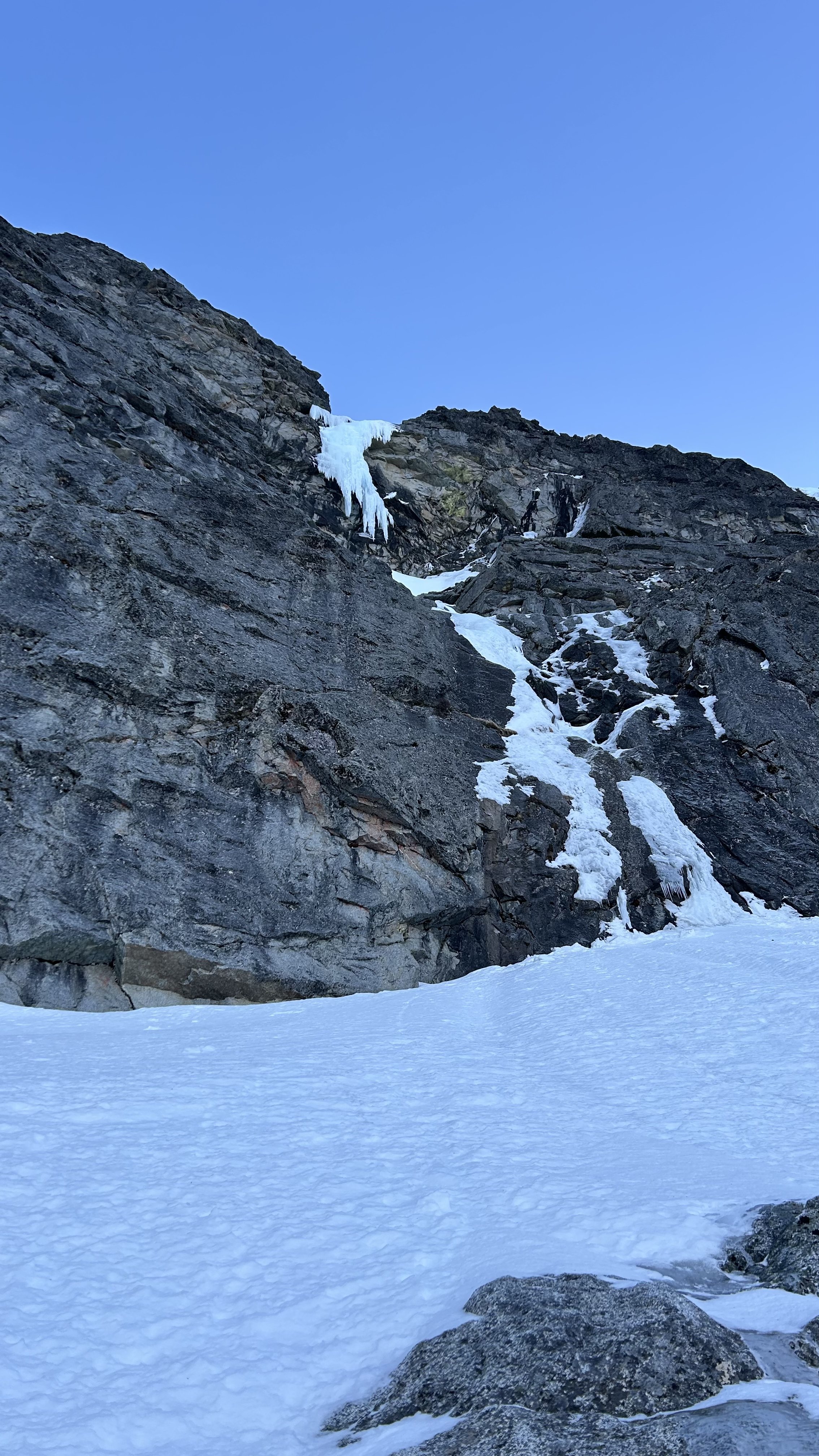
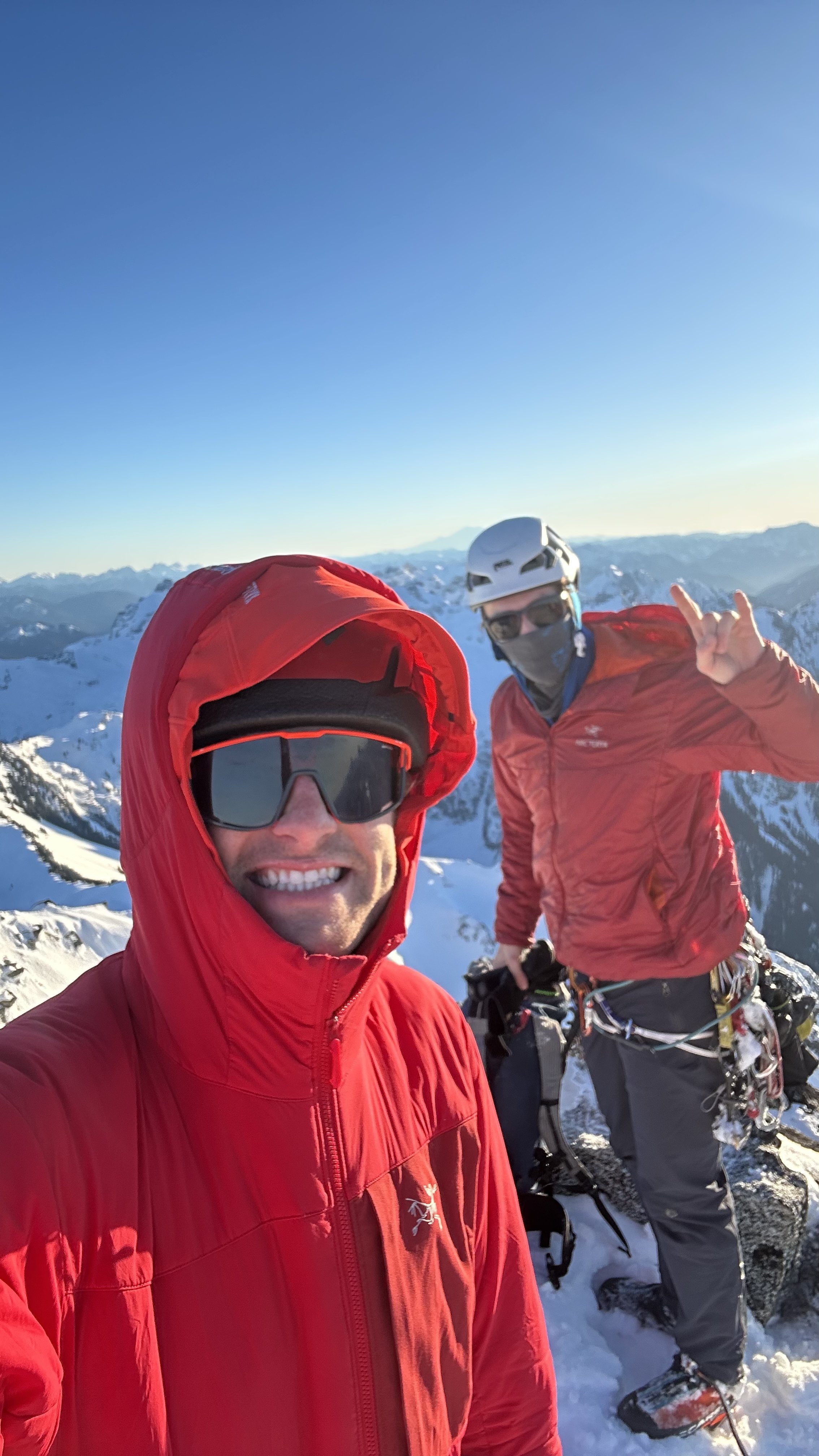
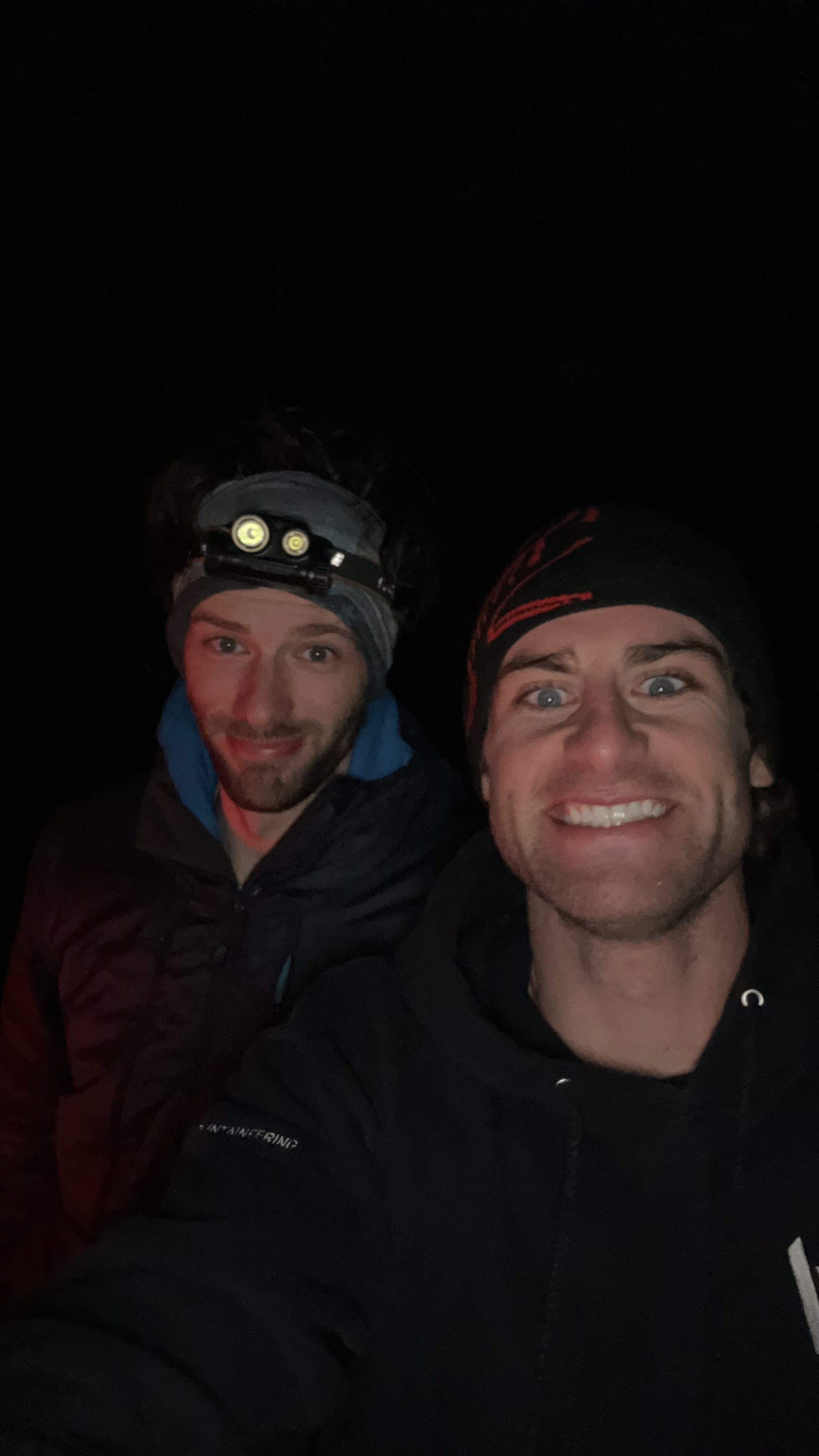
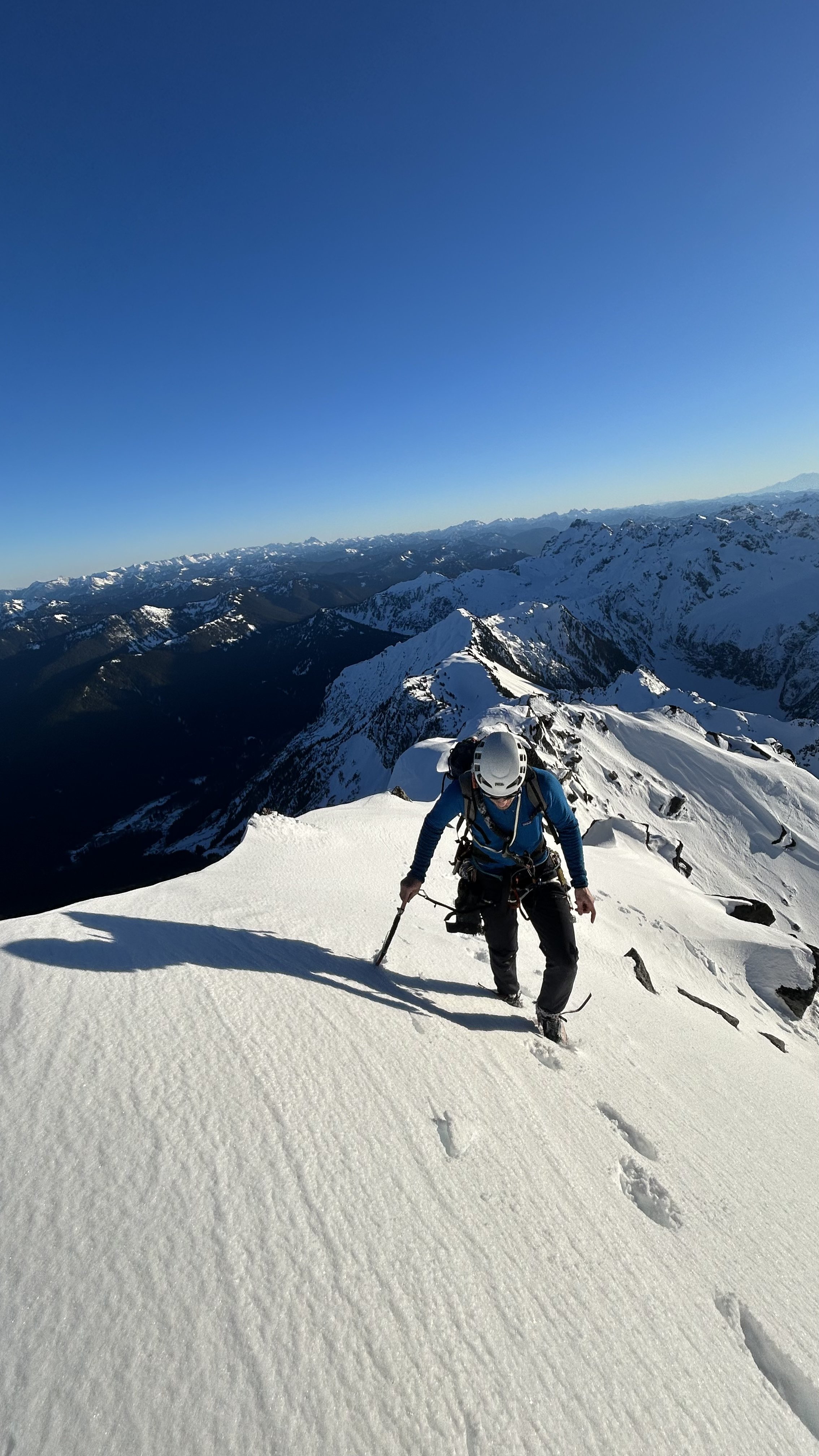
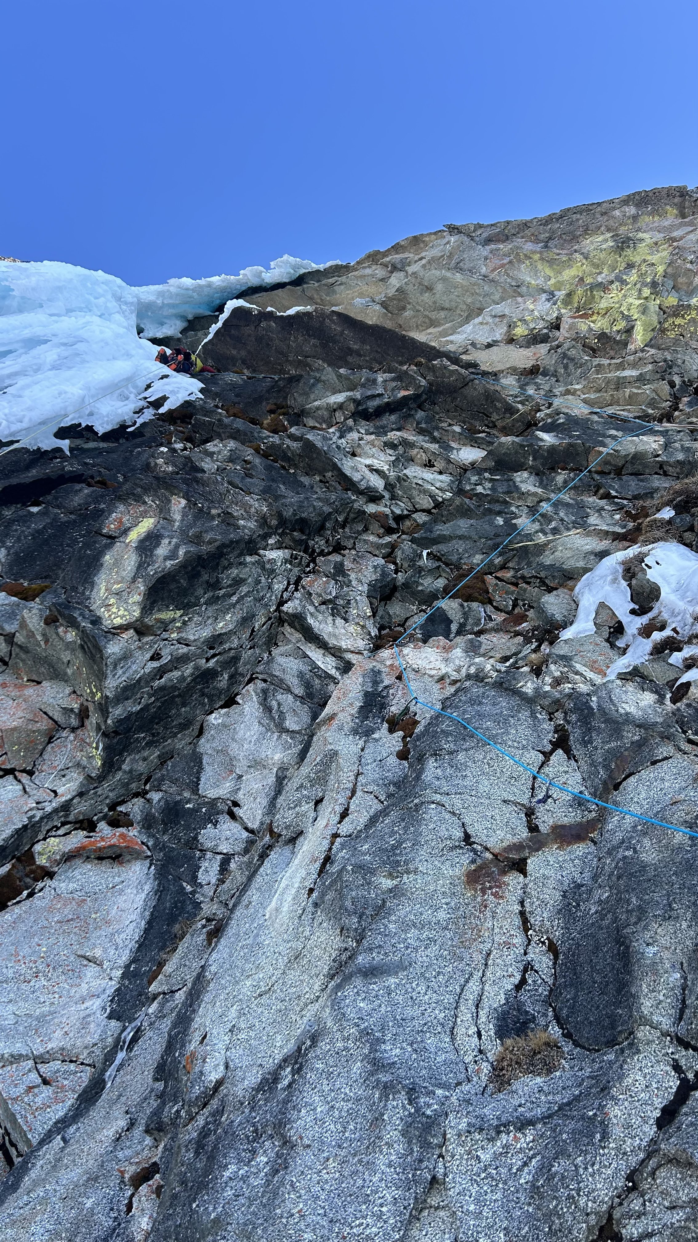
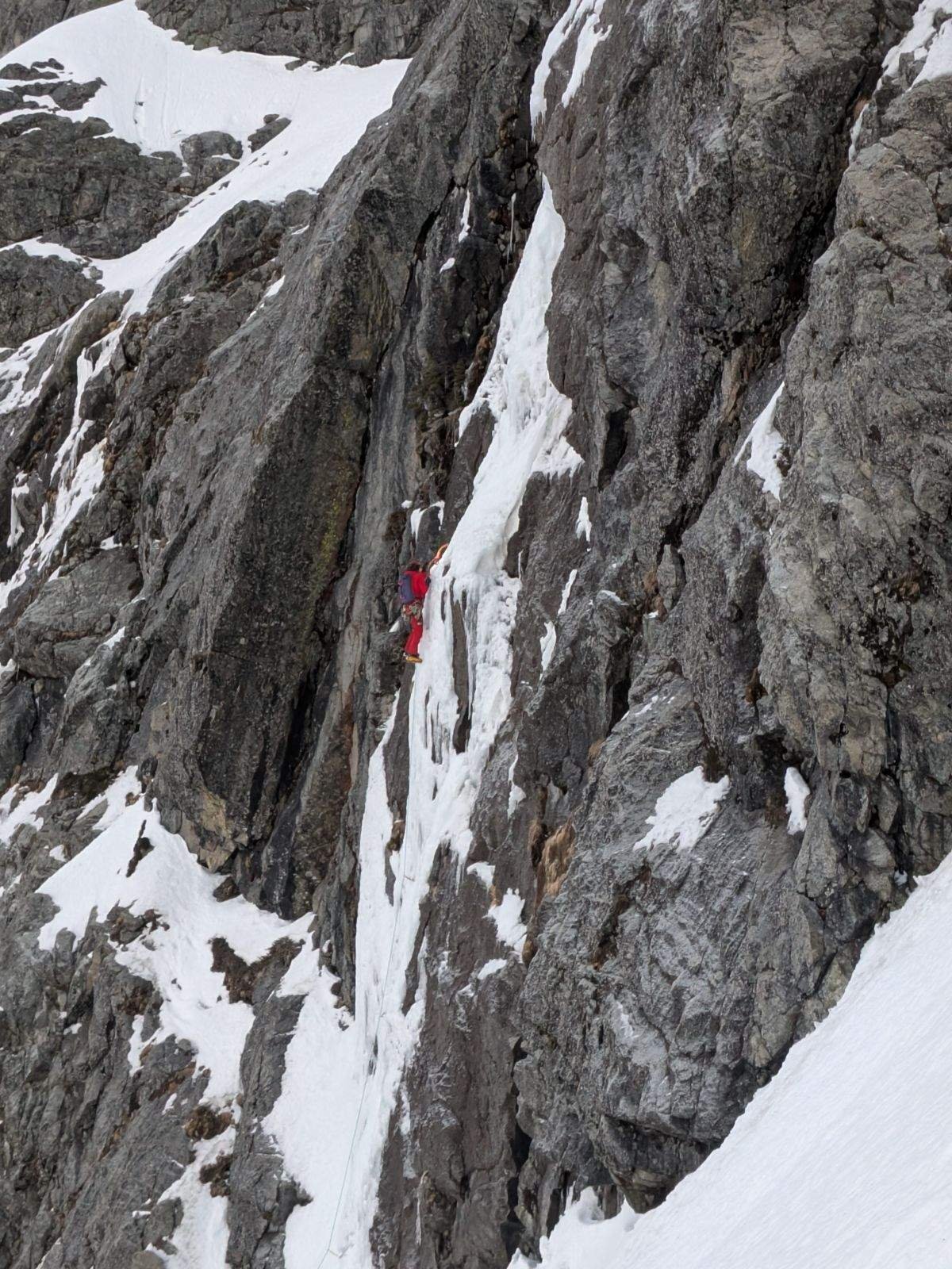
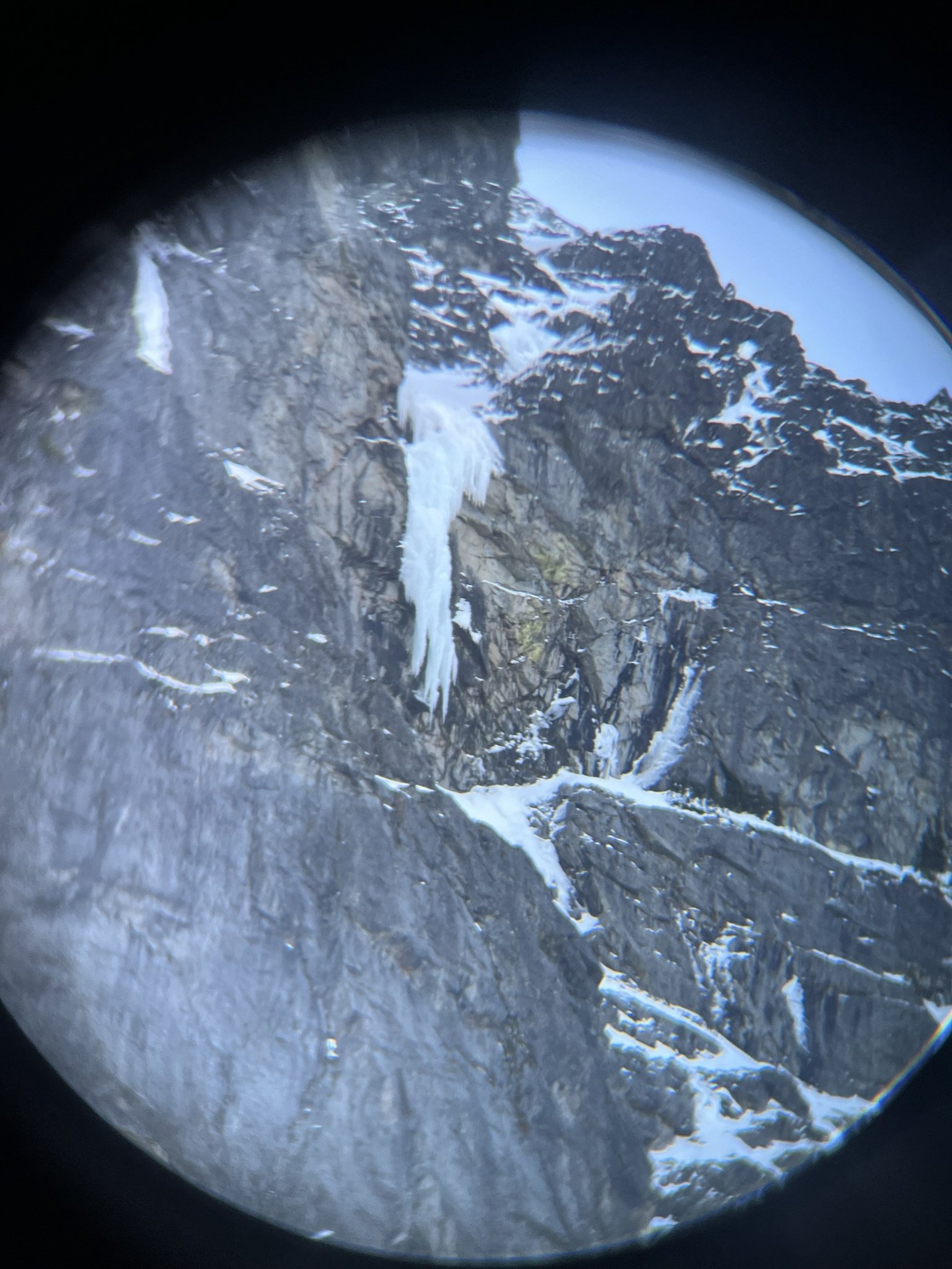
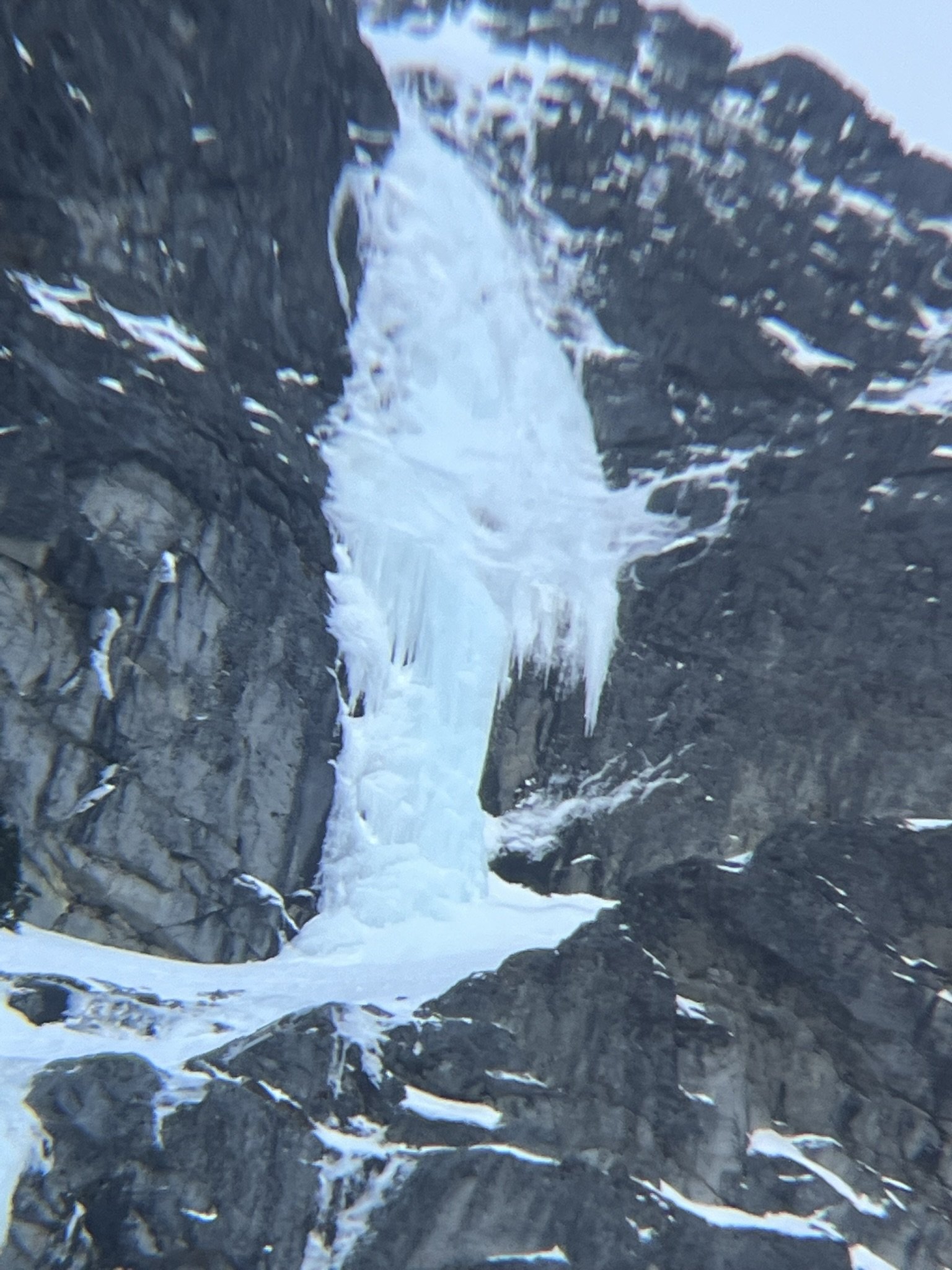
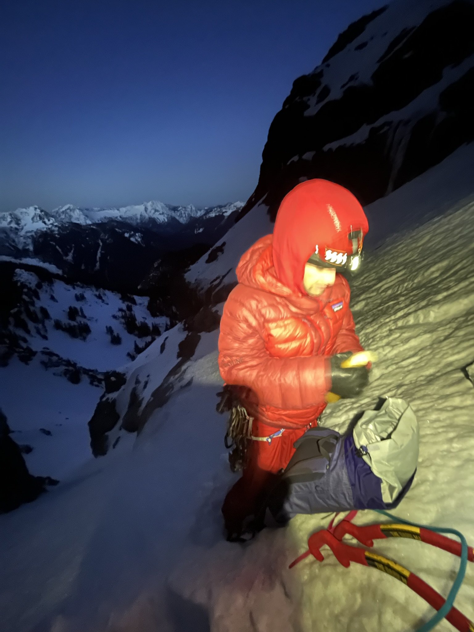
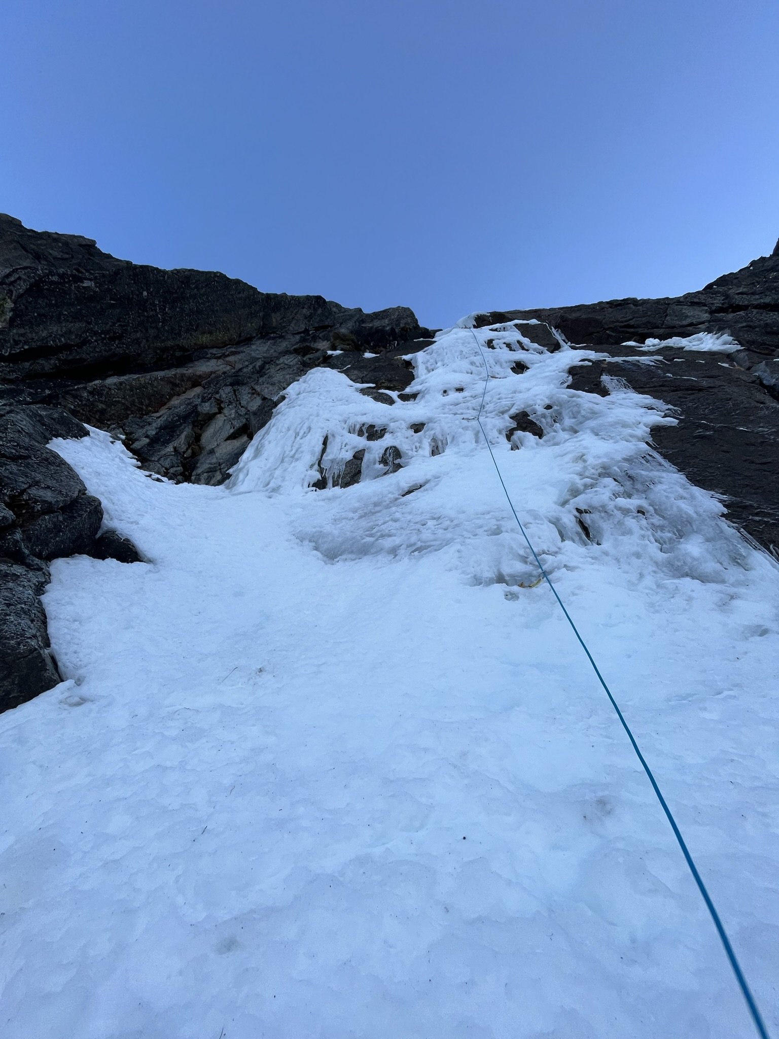
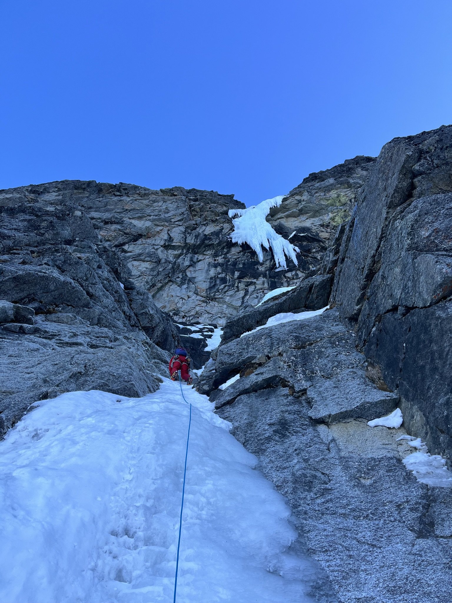
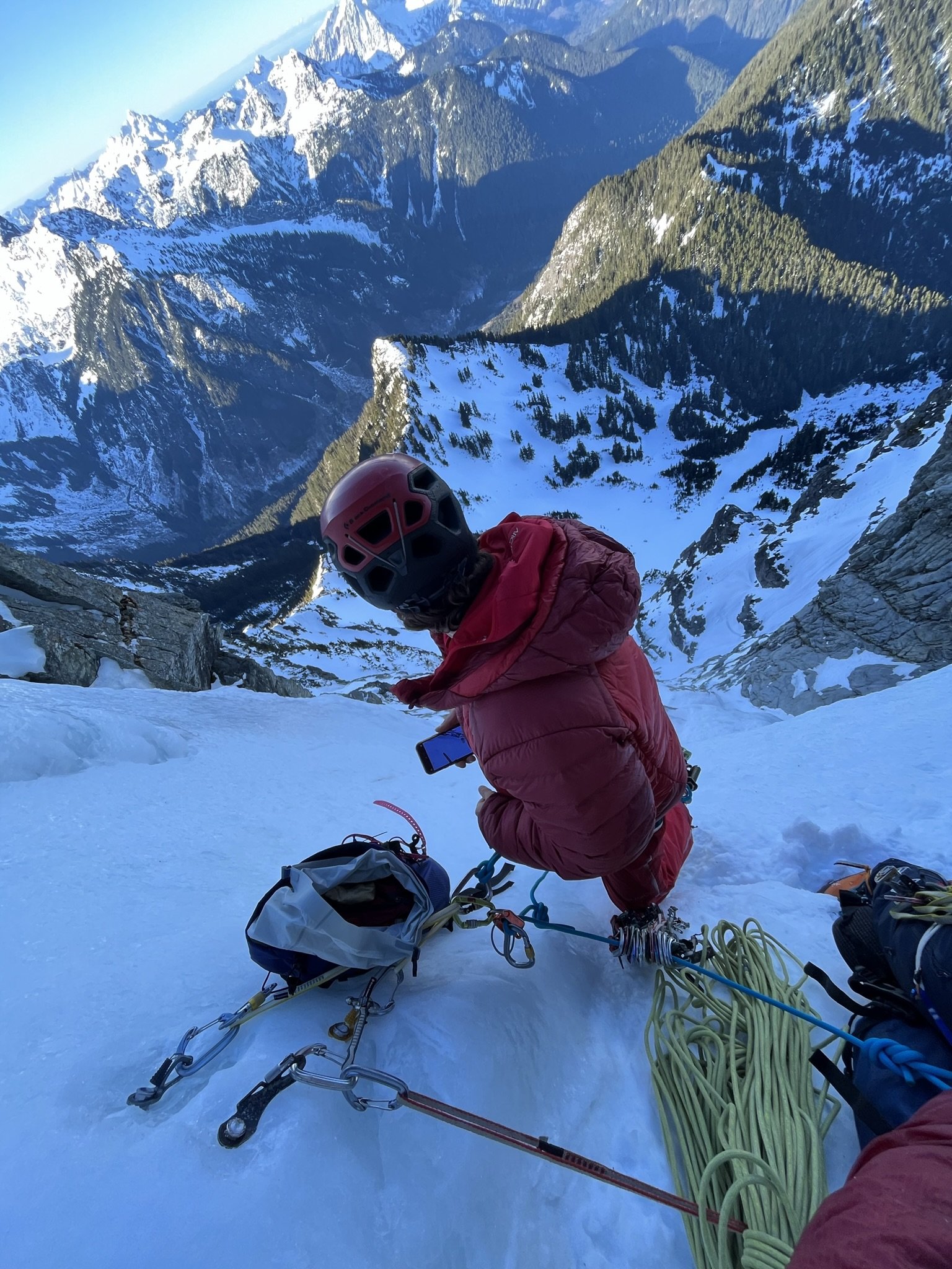
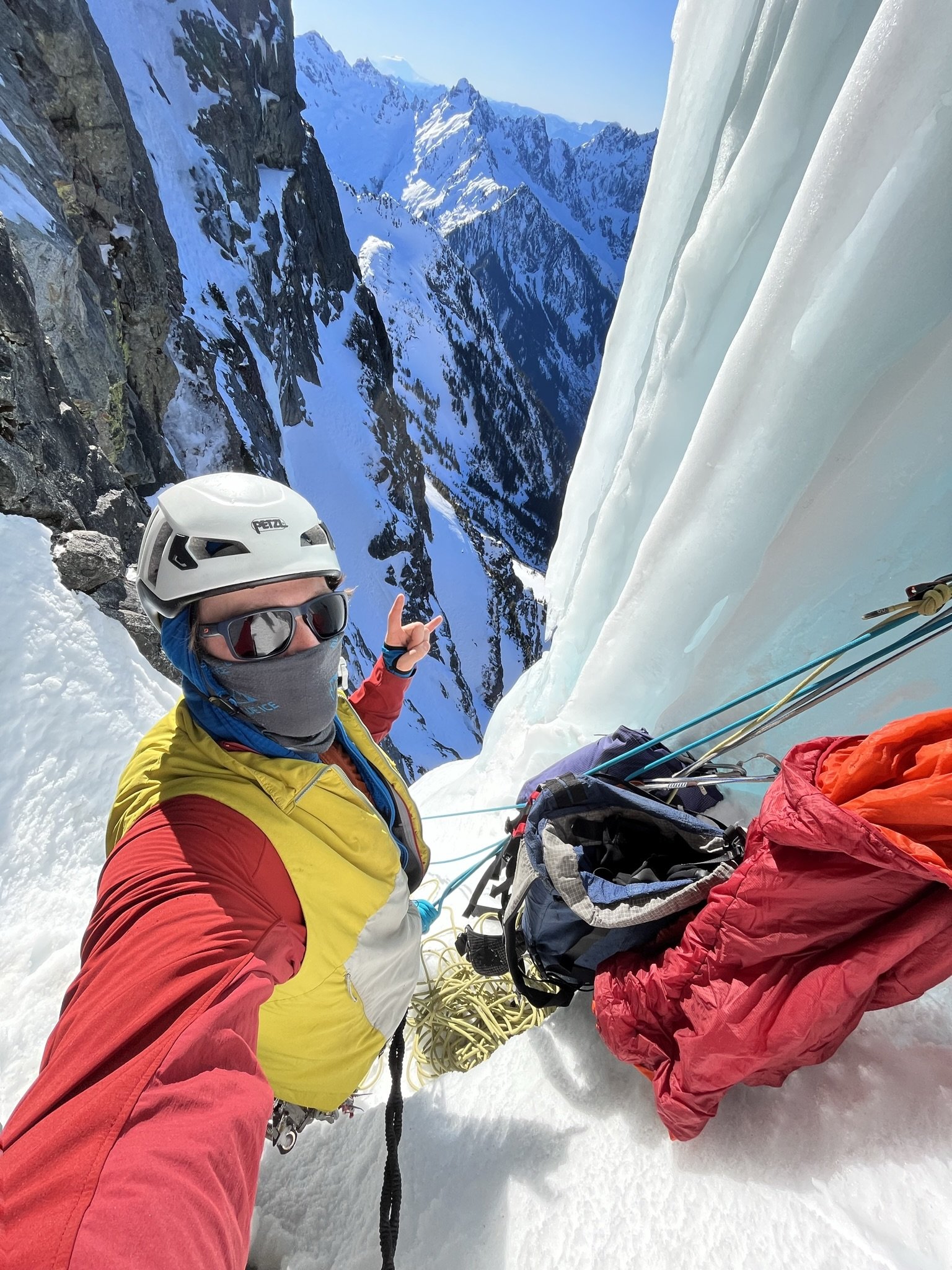
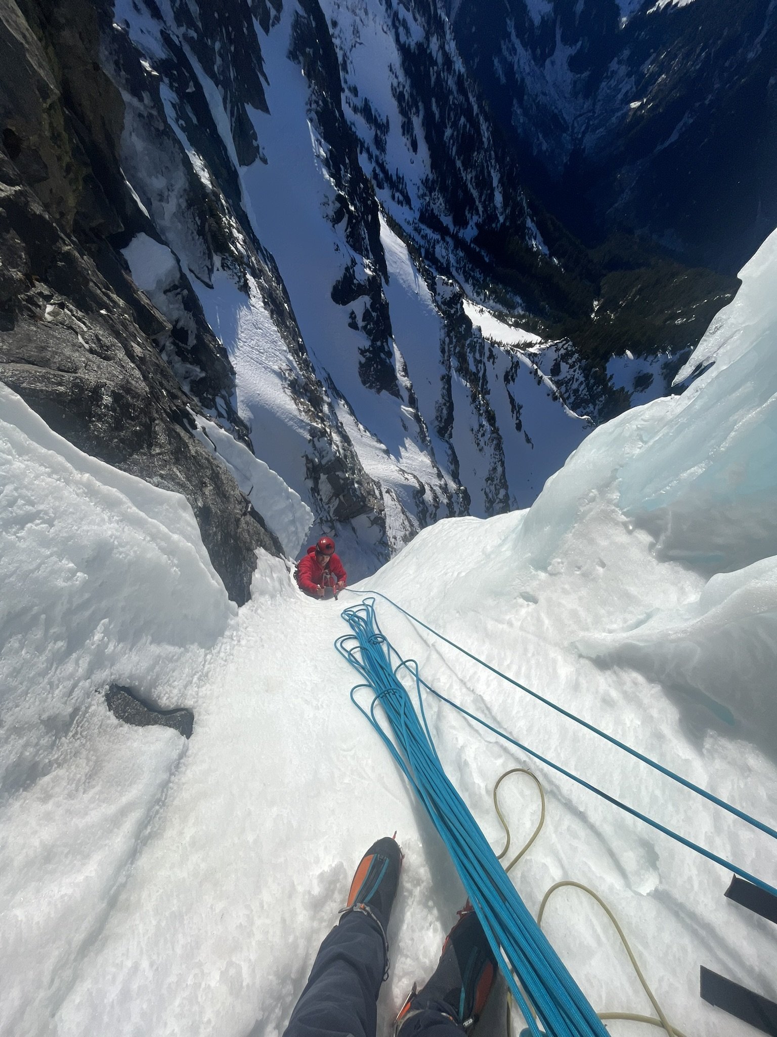
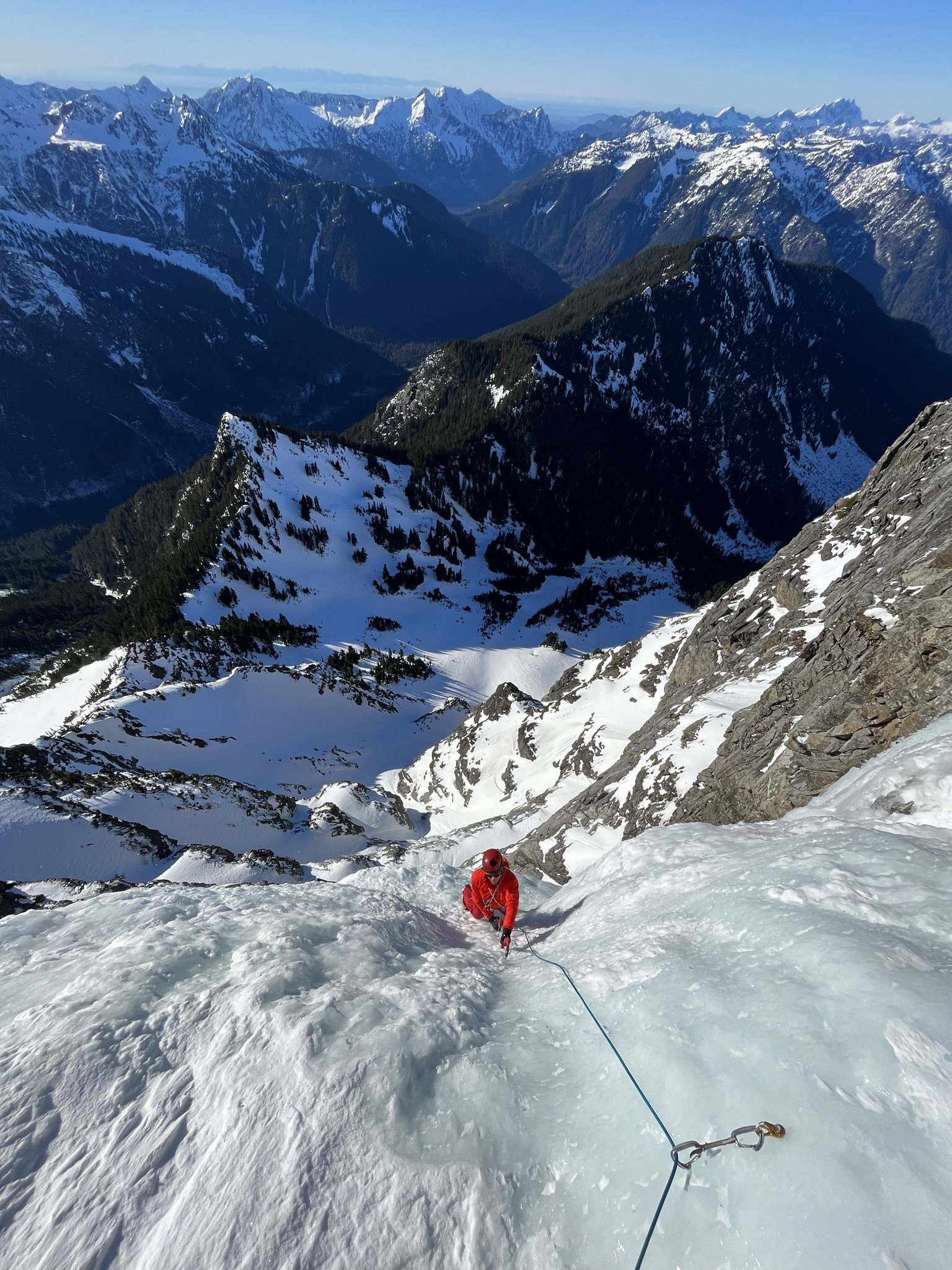
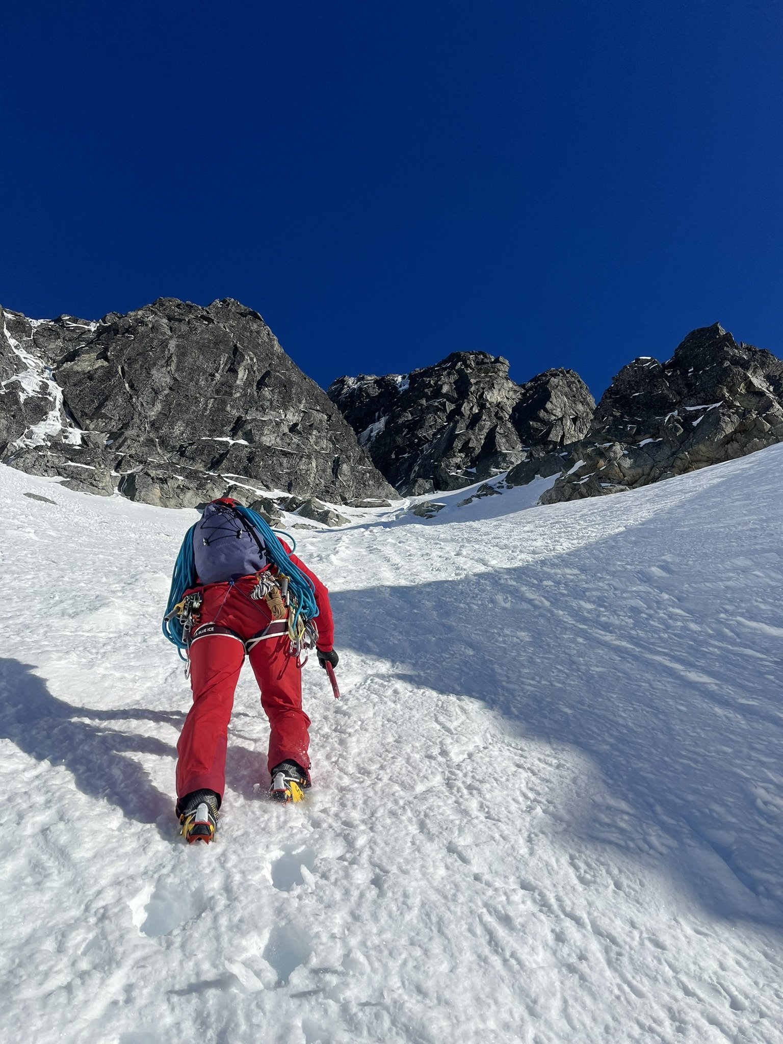
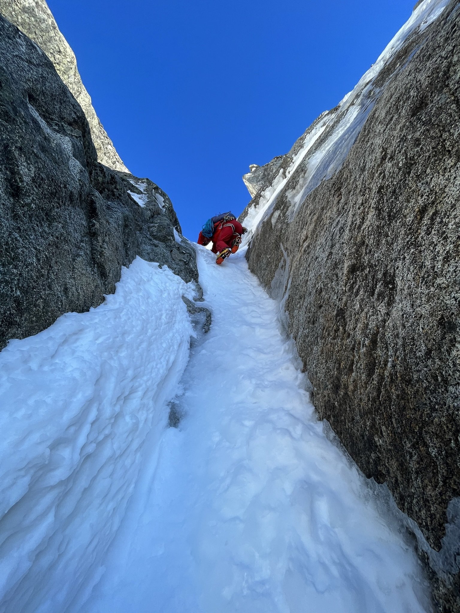
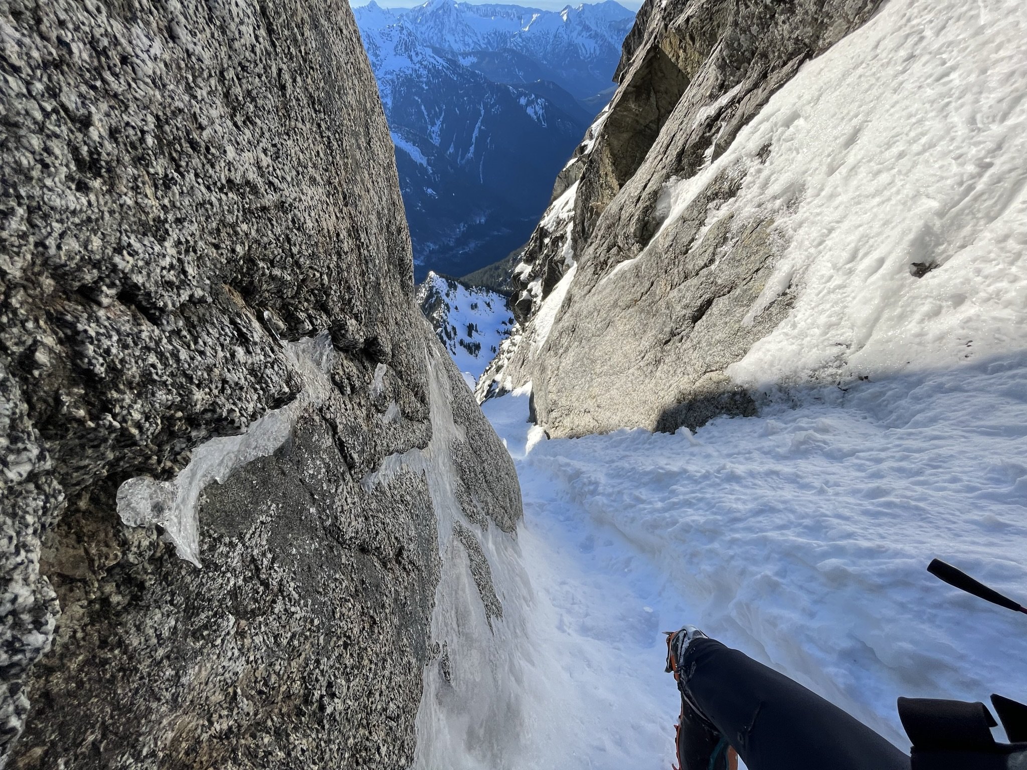
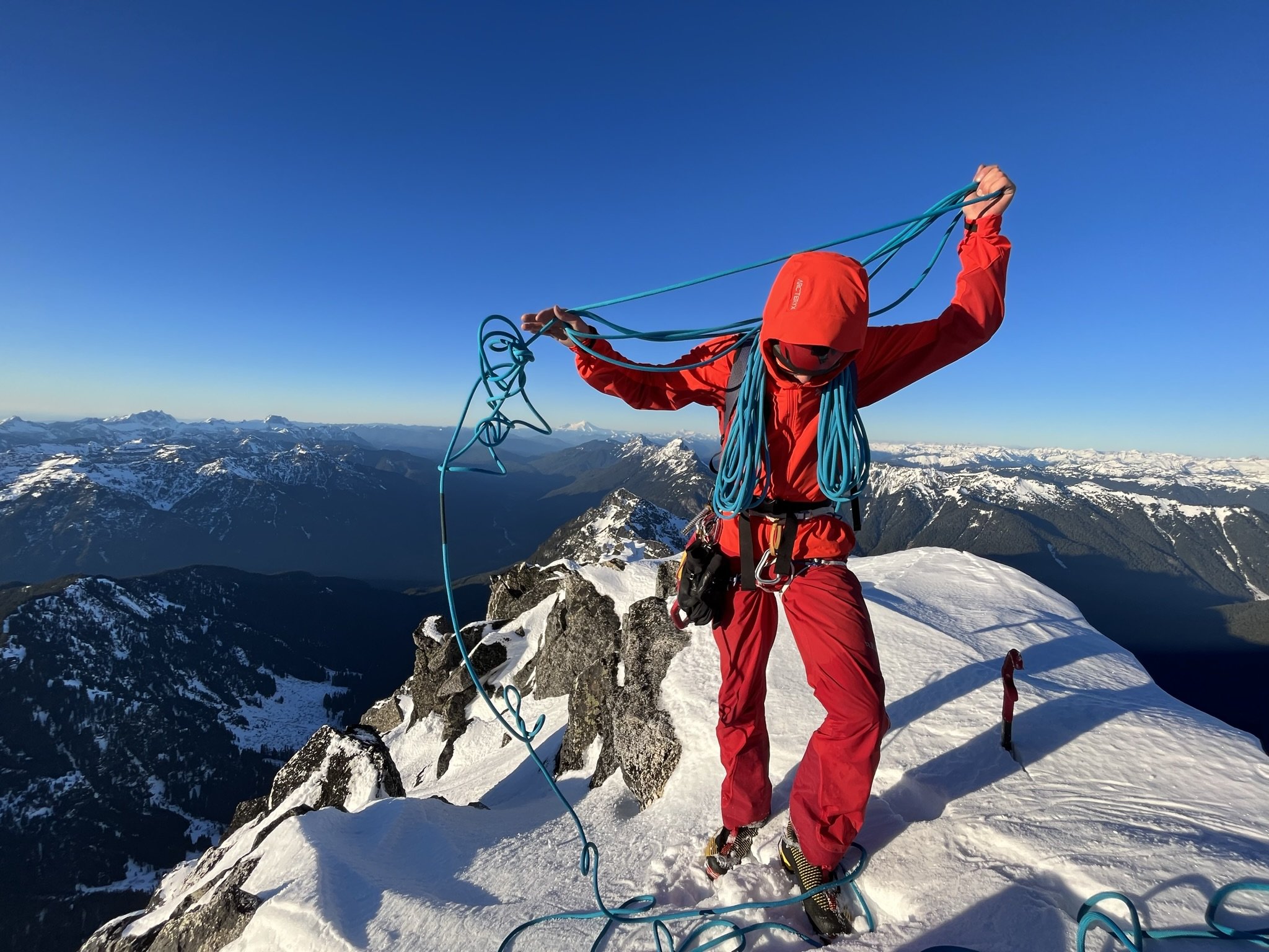
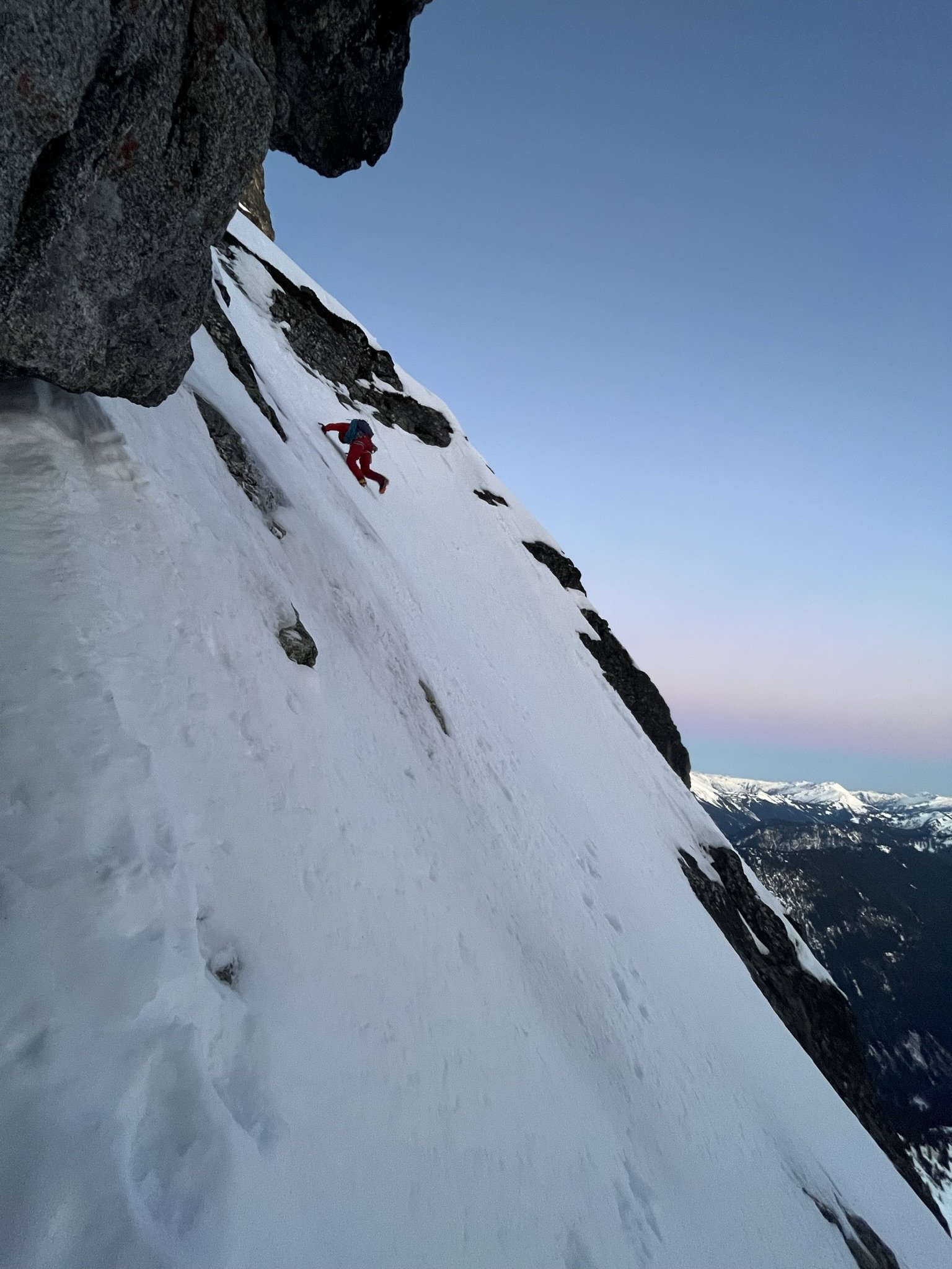
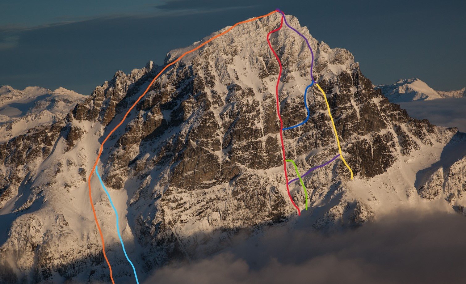 16 points
 -
Trip: East McMillan Spire - North Buttress Trip Date: 09/24/2025 Trip Report: As Blake seems to speculate in the back of Cascades Rock, this is a legitimately high quality route. While the rock is of course worse than Index or Supercave, it is better than the E ridge of Inspiration or Stoddard Buttress on Terror (and much better than Megalodon). It's also less vegetated than the E face of Triumph or Sloan SW face. There was only one pitch we wouldn't recommend (up high in the schist band), but it can and should be avoided. The steep middle section is characterized by thin parallel cracks, highly textured ripples, and shady climbing with a shocking lack of lichen. When you emerge onto the slightly more West facing schist band for the last few hundred meters, lichen becomes tiresome as the angle eases and rock deteriorates. There are absolutely a couple of serious runouts, but they occur on clean, solid rock. From camp on a small heather patch a few minutes below Little Mac, we approached via a ledge just below Little Mac that accesses the NW trending ridge toward Elephant Butte. We made four rappels beginning at at an old station I had found during a recon trip in October 2020. This seems likely to be the rappel used by the 1986 party, maybe also the 1976 party, and I think @rat has also mentioned climbing the buttress, so perhaps used it as well. The 2008 party (AAJ, NWMJ) approached via Stetattle ridge. After four 45-55m rappels, we walked and scrambled easily to the base of the buttress. We simulclimbed 200-300m on the lower buttress, then belayed eight ~45-50m pitches (5.8 to 5.10-), then simulclimbed (interrupted by one belayed pitch, which we would recommend avoiding) to the summit. For the central, steep section we wanted to climb near but right of the buttress crest, which except for pitch 2 (a horizontal leftward traverse) yielded a logical path almost directly upward. Looking upwards from low on the buttress, two corners right of the crest (separated by a chossy roof) seem to provide the obvious options into the steeper middle section. We aimed for the left corner (which we presumed was the 2008 route), and thought the right corner was probably the 1986 route. We encountered many pieces of fixed gear throughout the route (mostly knifeblades, with a few nuts, a hex, and a rigid stem friend). Since the 2008 party rappelled the face (!!!), presumably close to their line of ascent, we think we followed large portions of their route (Come Over to the Dark Side). That said, I haven't really managed to match the route lines in either the NWMJ or AAJ to our experience (at least at the resolution I can manage to download). From the summit, we downclimbed SW to the col with West McMillan, then continued downclimbing S in the gully for a few minutes. When the gully's left wall flattened, we slung a boulder and made four 45-55m rappels to reach low angle slopes and walked back to camp, arriving about 15 hours after leaving that morning. West McMillan, Inspiration, The Pyramid, Degenhardt, and Terror from high on the route: From left to right: E McMillan, W McMillan, Inspiration, The Pyramid, and Degenhardt. The route goes just right of the sun/shade line on the leftmost peak. The approach rappels start down a relatively solid corner just right of the low point on the left). Photo by Steph Abegg: First rappel into McMillan Creek cirque: Racking up before the first simul block: Marlin starting up the first simul block: Marlin at the top of pitch 1: Partway across the pitch 2 traverse (photo by Marlin). There was a fixed two-pin anchor at the end of this traverse that may be that in the 2008 NWMJ "Erik starts the crux" photo: Looking down partway up pitch 3. This section had some blocks and flakes that looked ominous from below, but sounded and felt solid on closer inspection: The upper part of pitch 3. This was probably the most runout section of the route: Looking down the start of pitch 4: Marlin at the top of pitch 4: Marlin starting up pitch 5: Marlin starting up pitch 6: And navigating the roof on pitch 6: Starting pitch 7: And pitch 8, which should have been the last belayed pitch: Simuling in the schist band: Marlin leading the very-not-recommended lichen covered, loose pitch in the schist band. Go right before here, toward the E Mac col, to keep it scrambly. There was a fixed pin near his feet here, so we weren't the first to get suckered into it: Belaying on the summit. The buttress crest in this section is stacked, lichenous blocks that seem to overhang the impressively steep East face. You want nothing to do with the crest here: Setting up the first rappel out of the E Mac-W Mac gully: Impressive ambience the next morning, looking toward Azure lake from camp: Hiking out, looking toward Triumph: And a friend from the start of the schist band. It was still solidly placed and easily removed after, probably, 17 years (although could use some lube): Gear Notes: Modern gear made a huge difference on this route, especially microcams (compare the 2008 party's rack in the NWMJ pictures), microtrax simuling, and fix-and-following. We took a 50m lead and 65m tag line (we didn't haul), ~5 kbs/lost arrows, at least triples to fingers with offset aluminum and brass nuts, doubles to #1, single #2 and #3, and four microtraxions. Our smallest cams (purple C3 and green/#0 Z4) were used in several critical placements. Approach Notes: Goodell Creek to Terror Basin, then up slabs toward Little Mac.
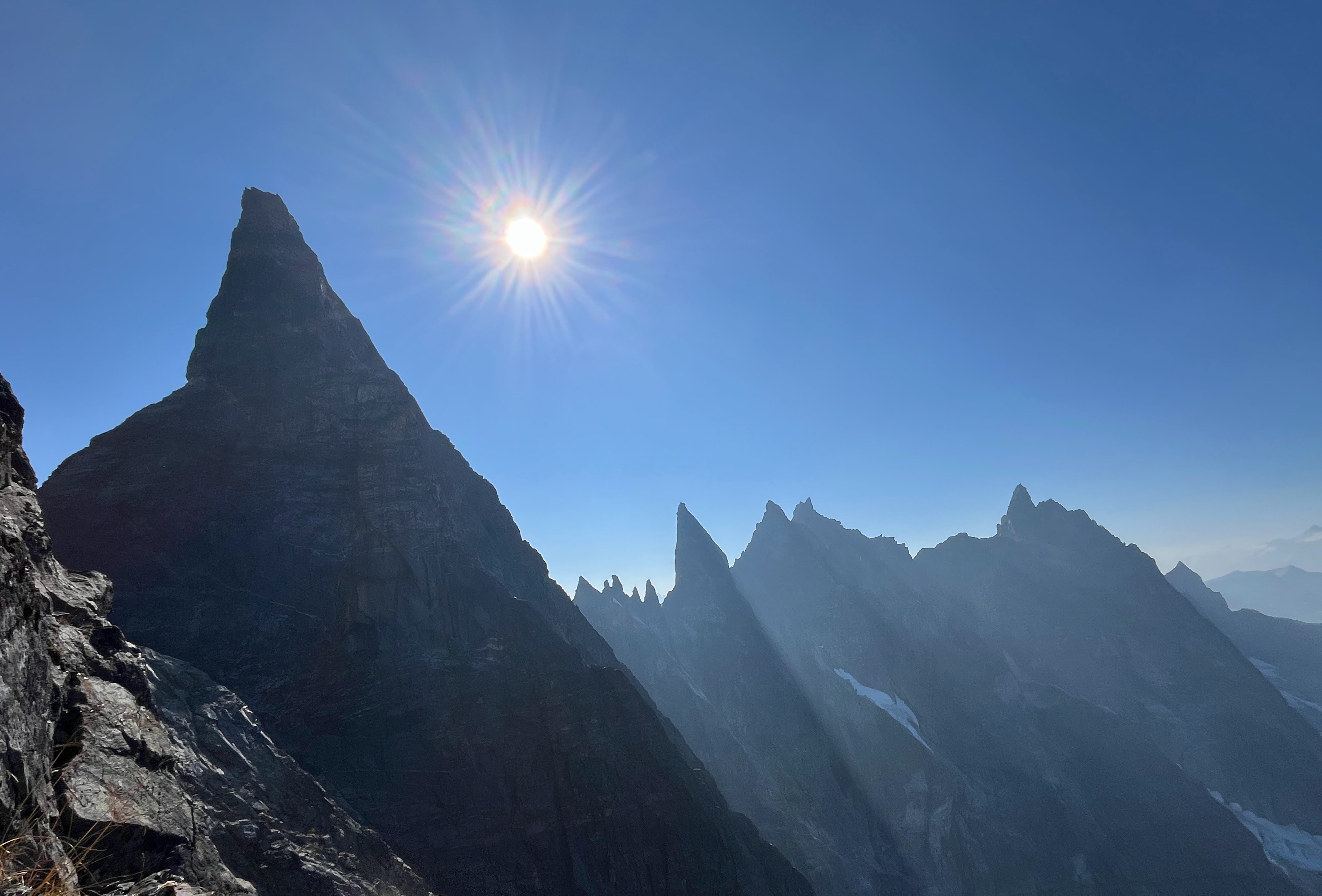
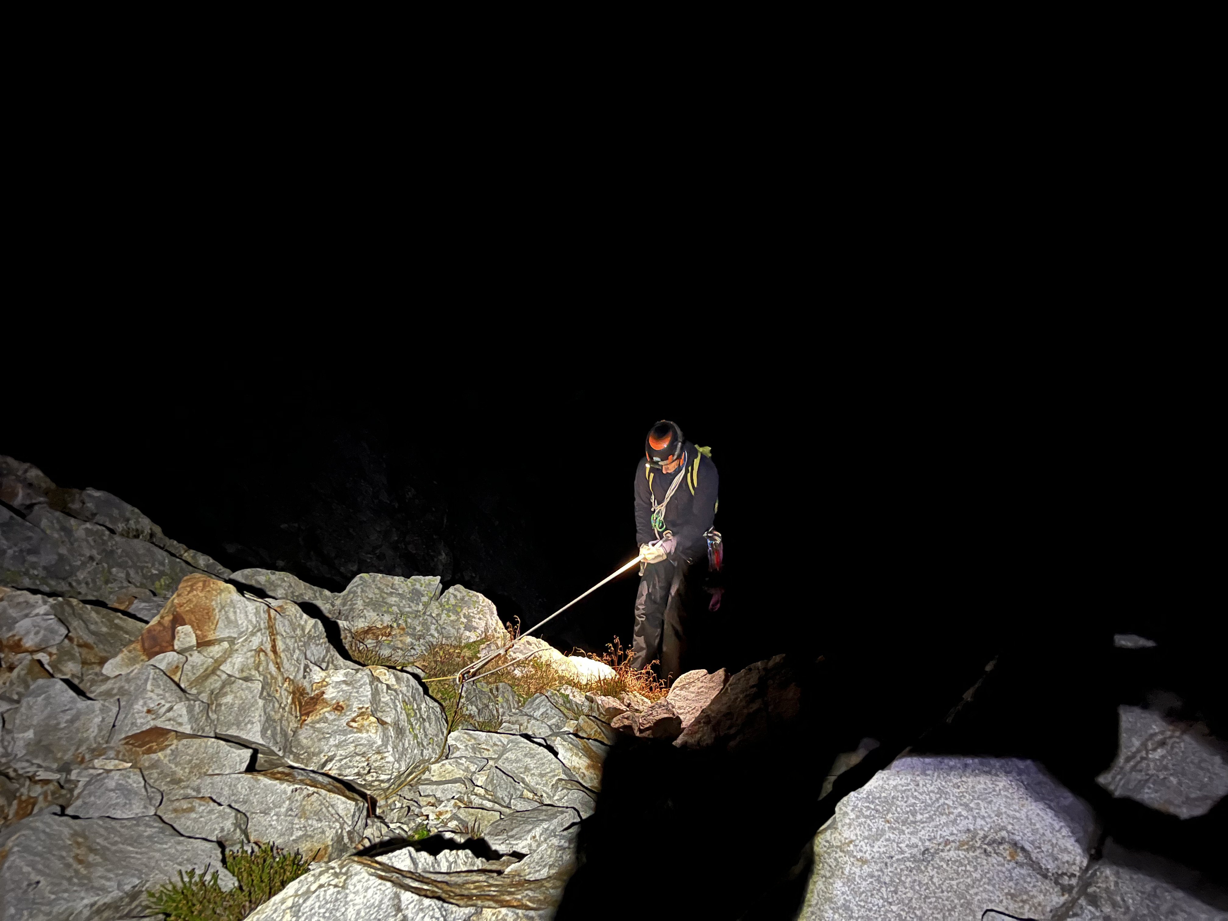
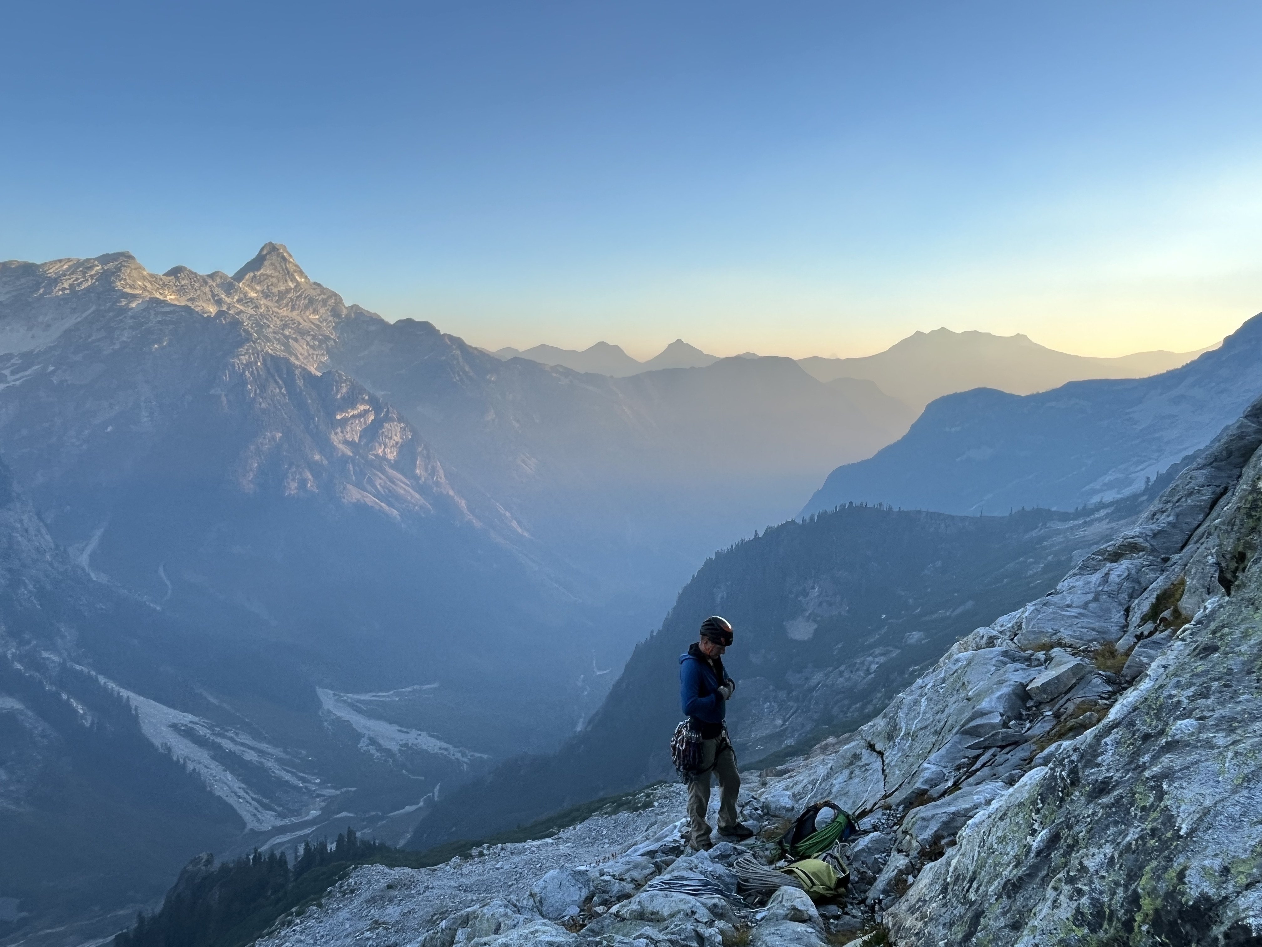
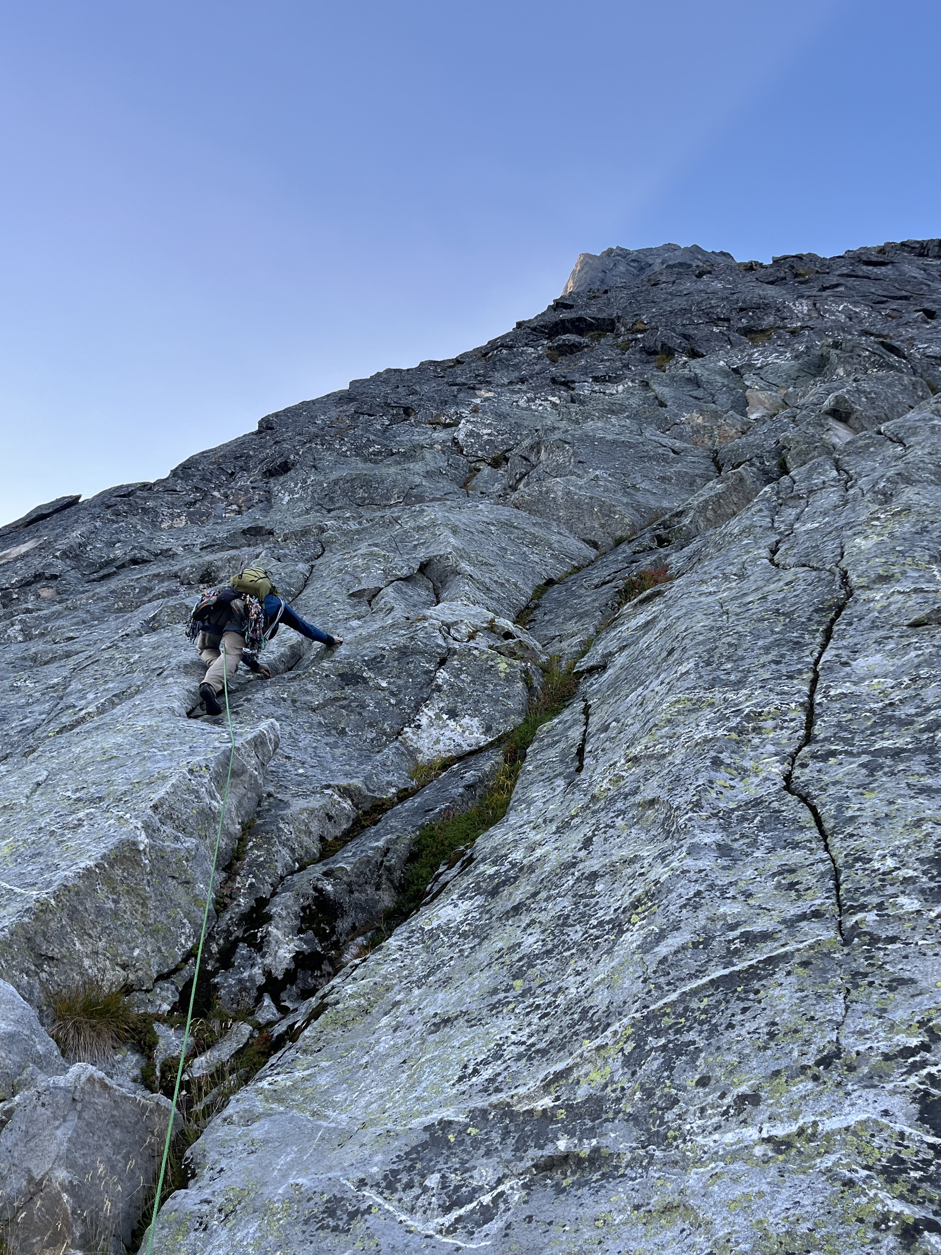
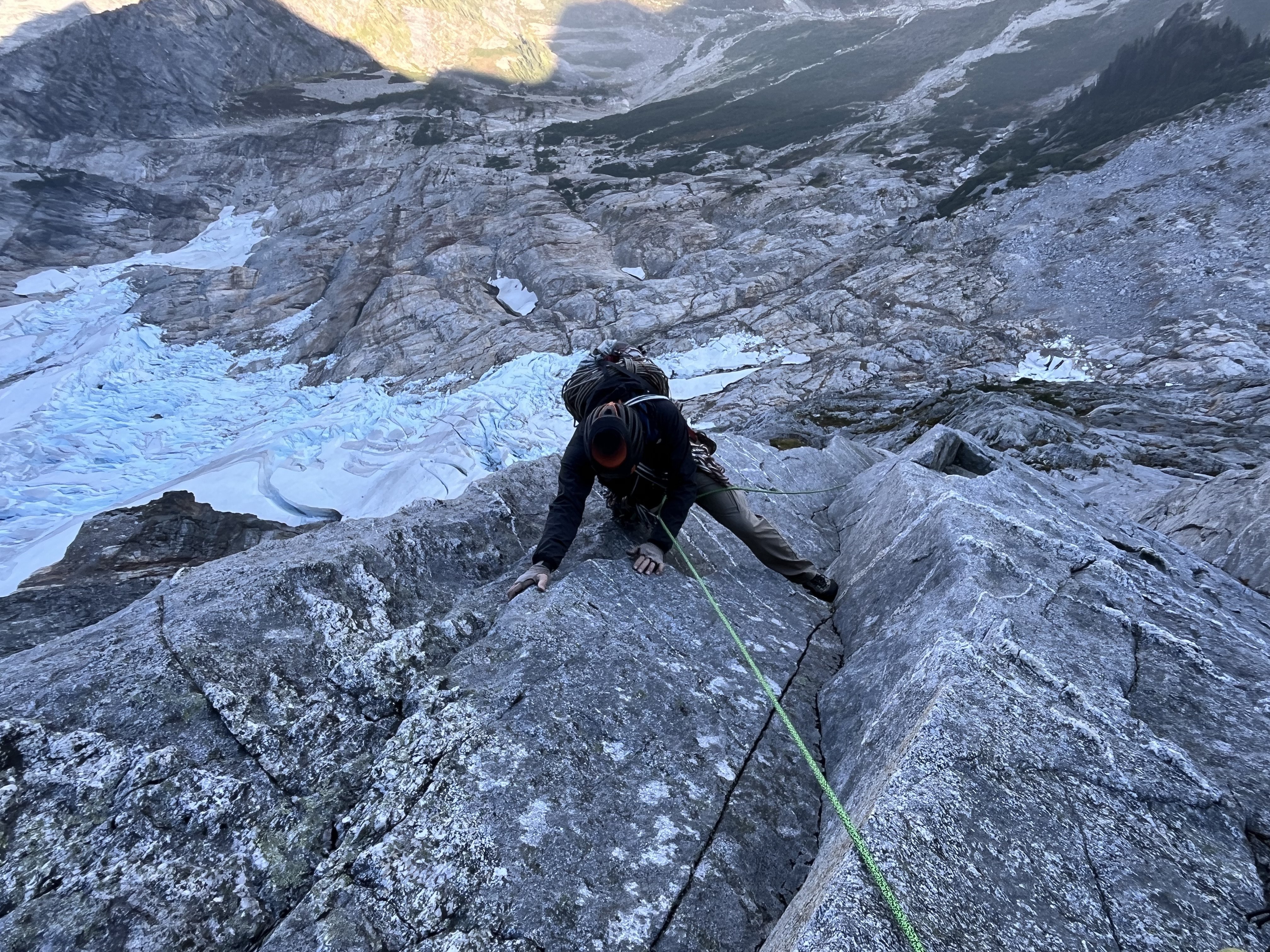
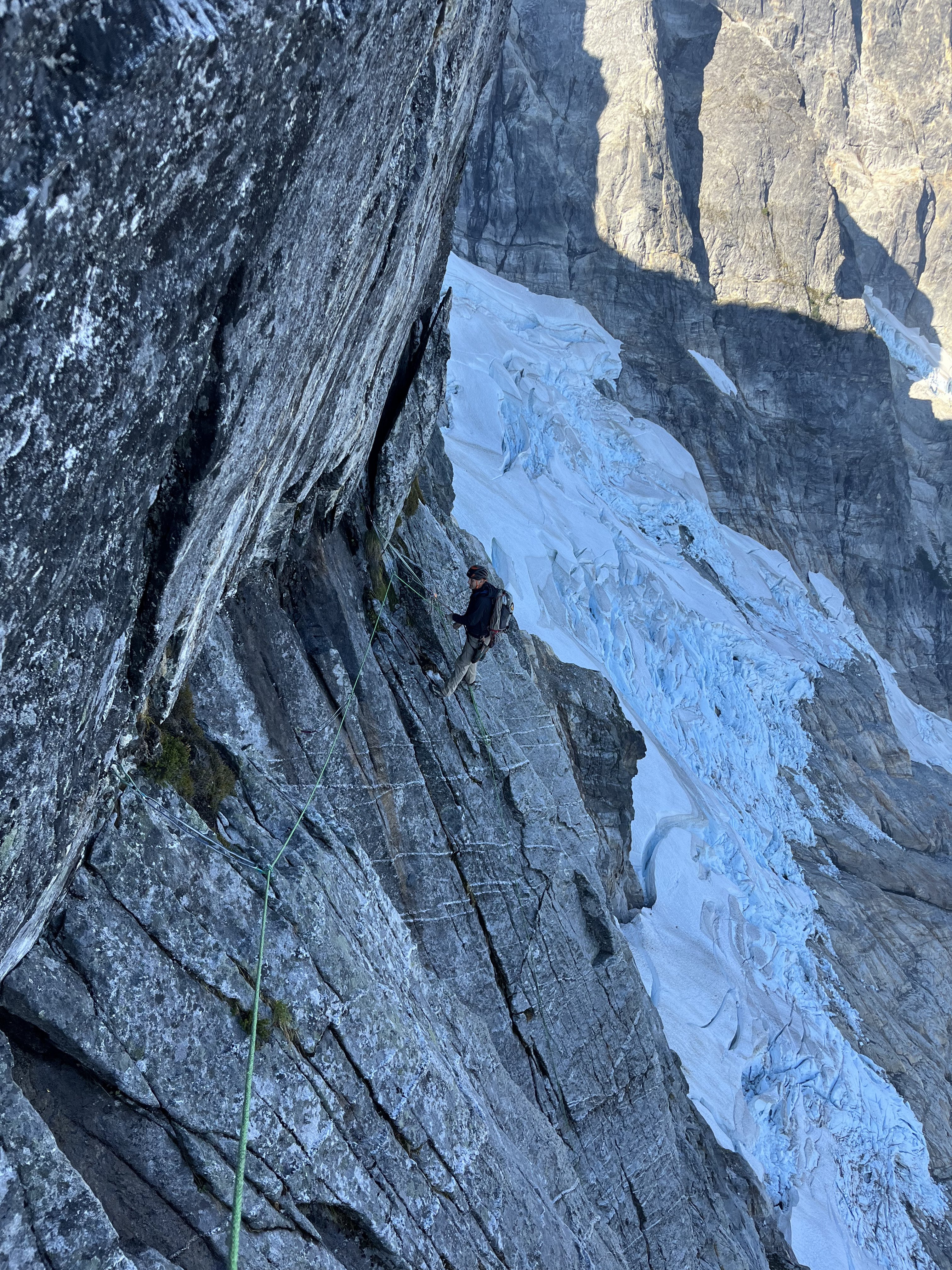
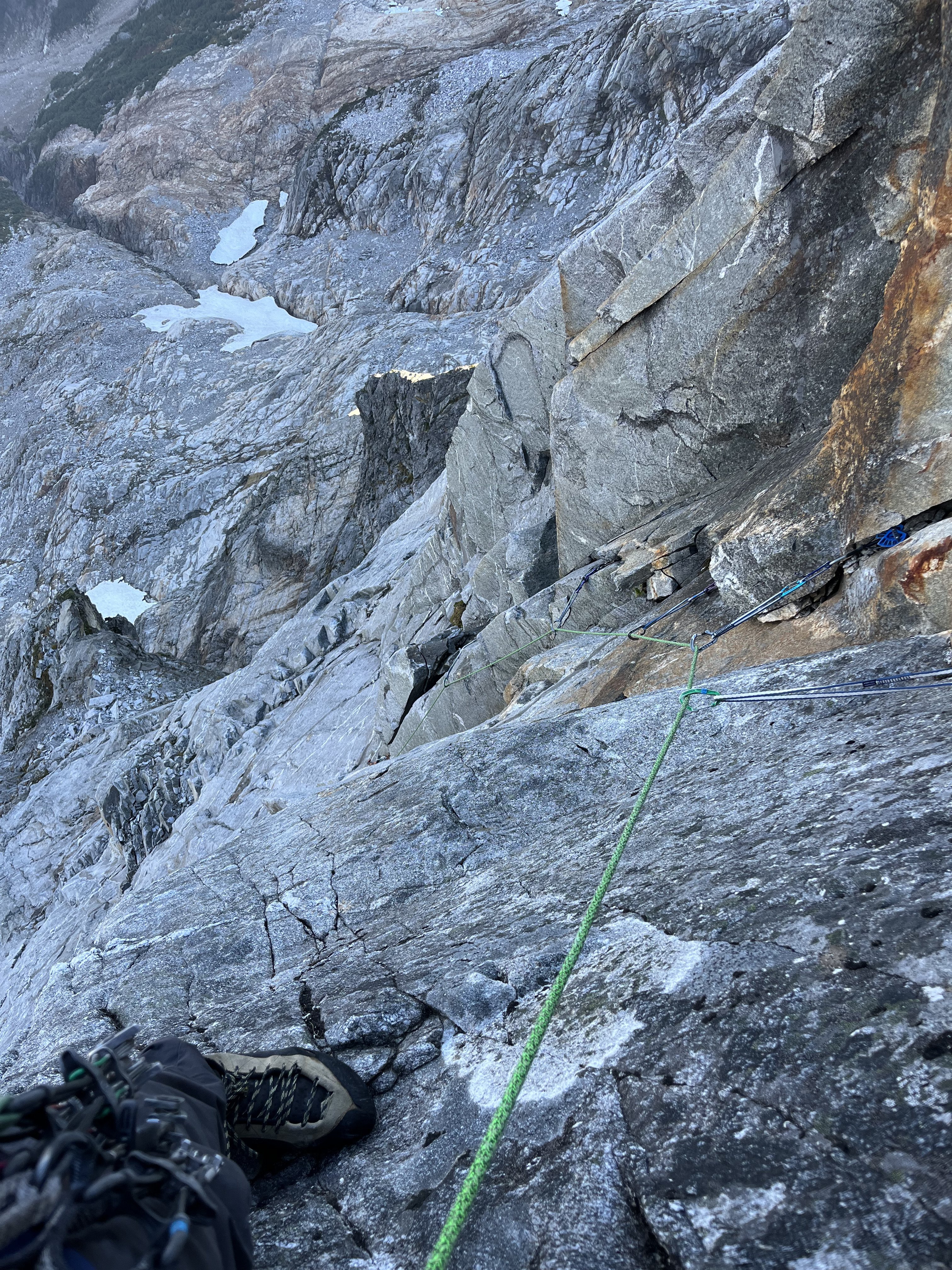
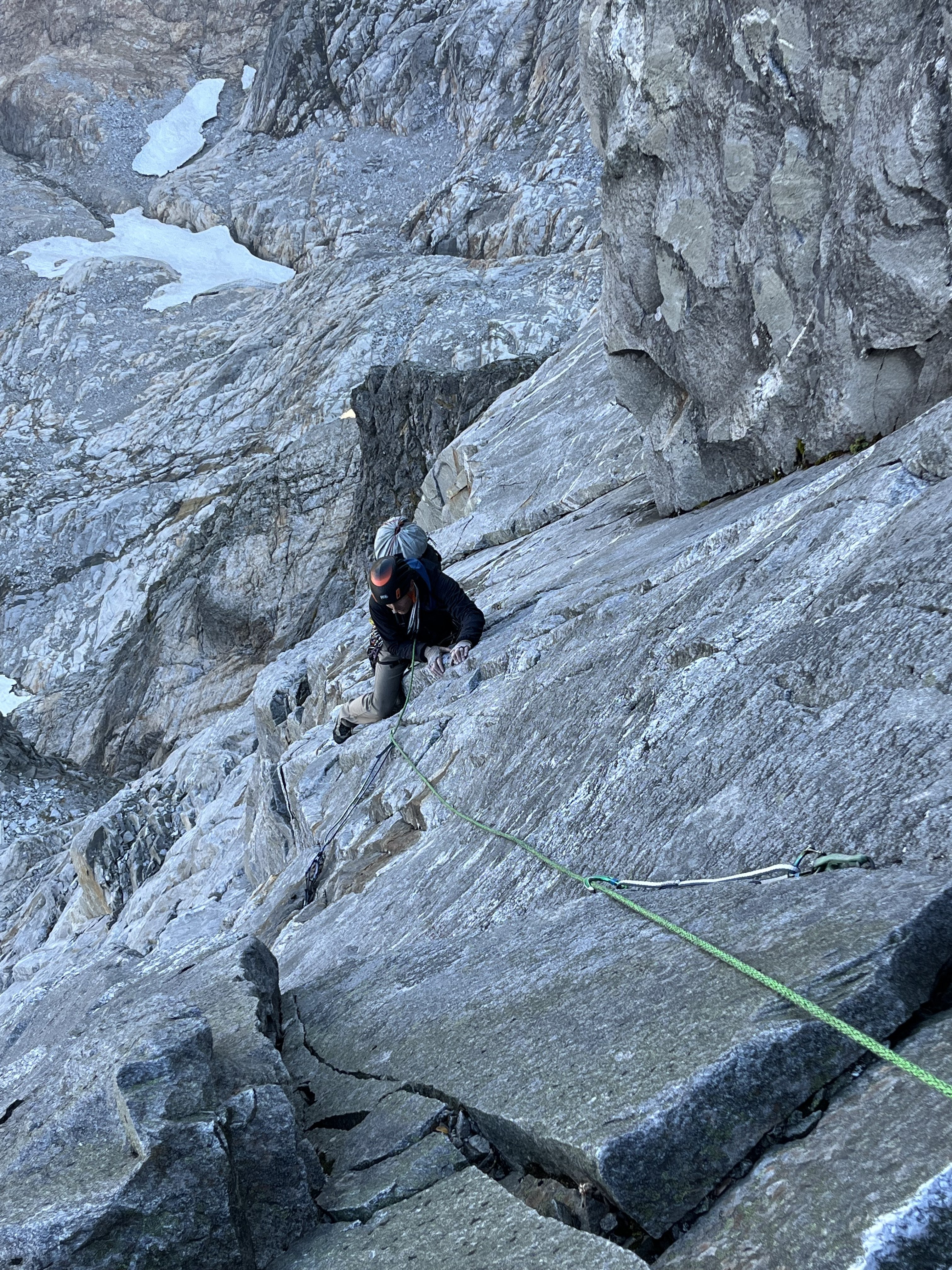
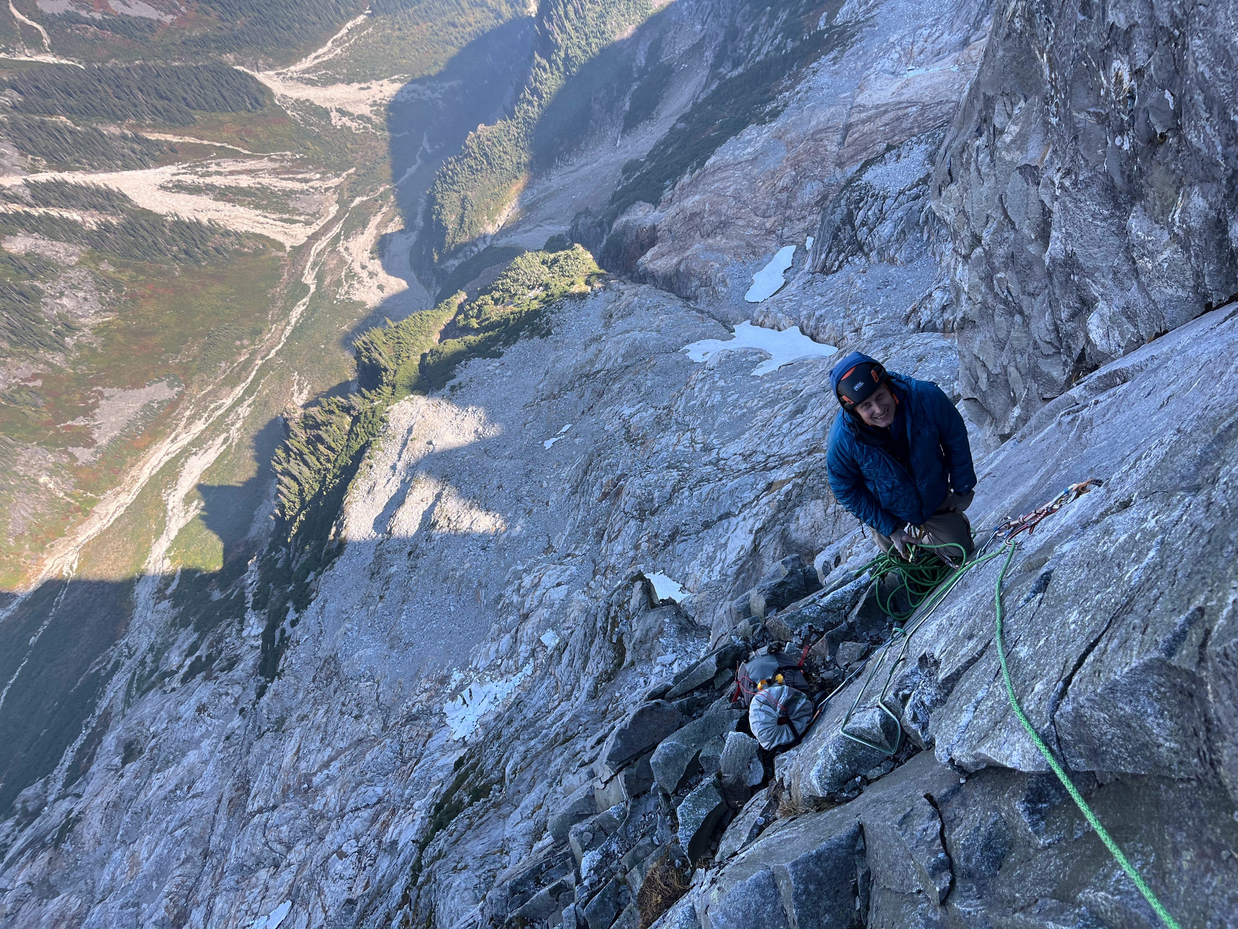
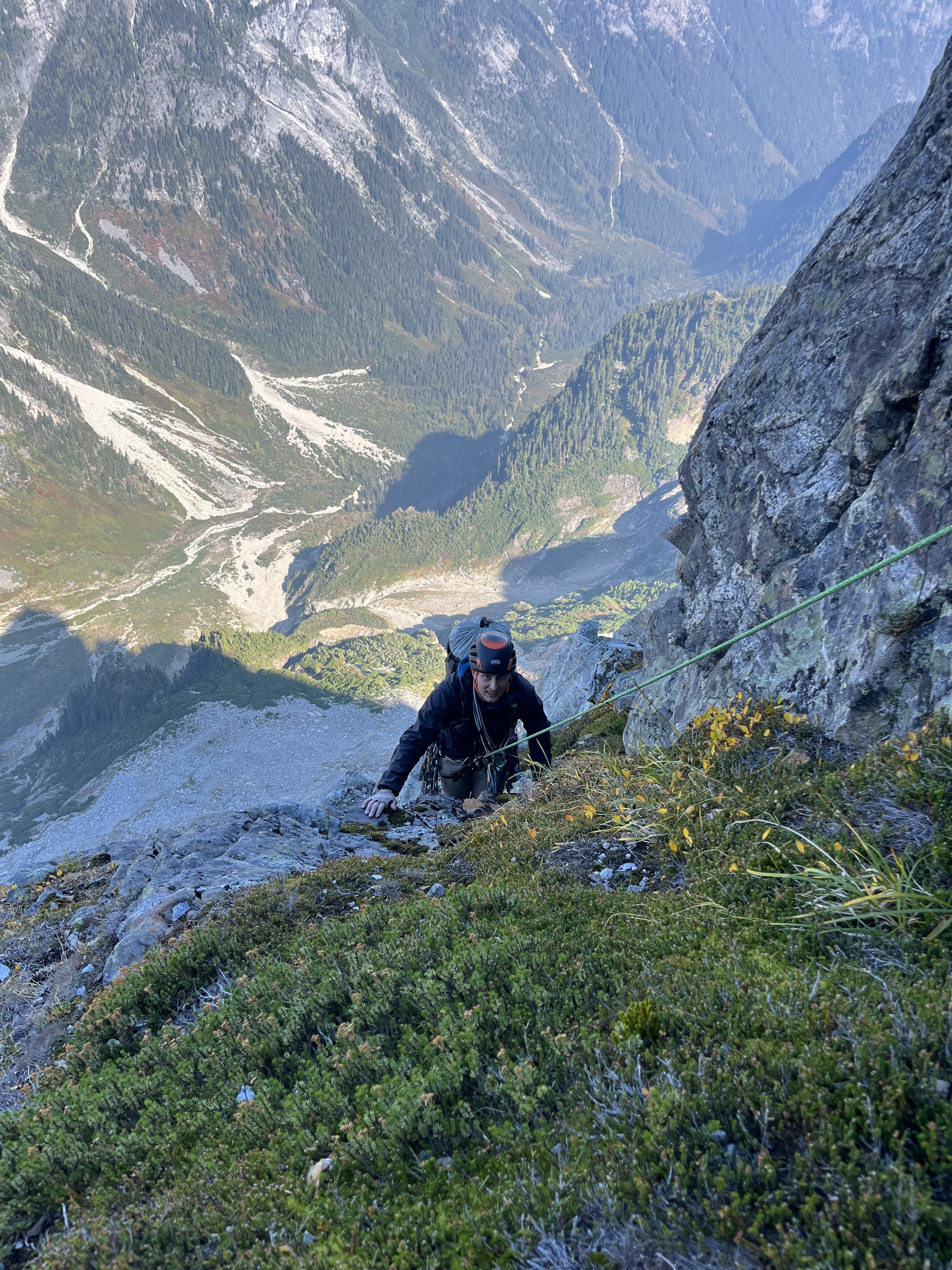
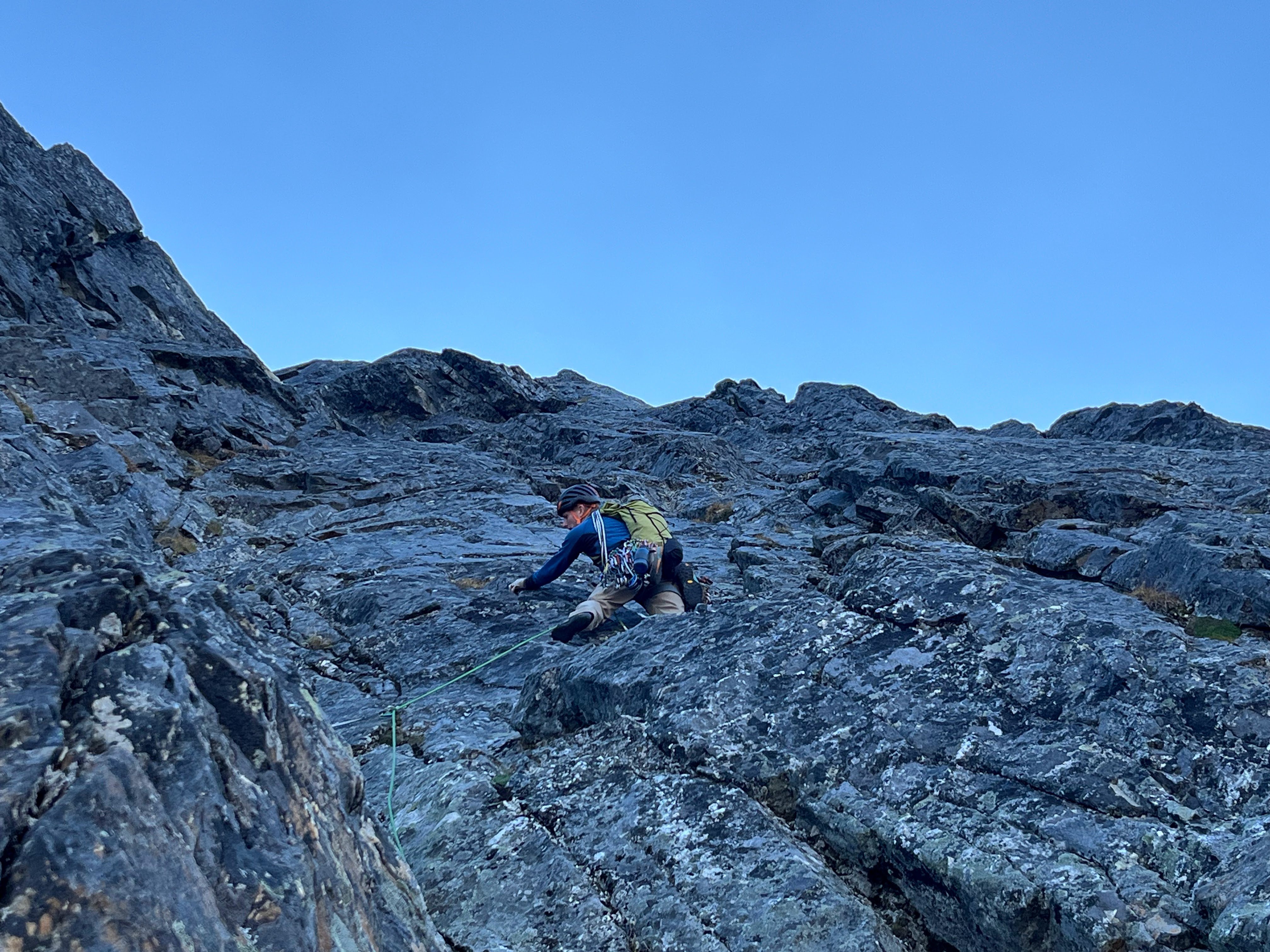
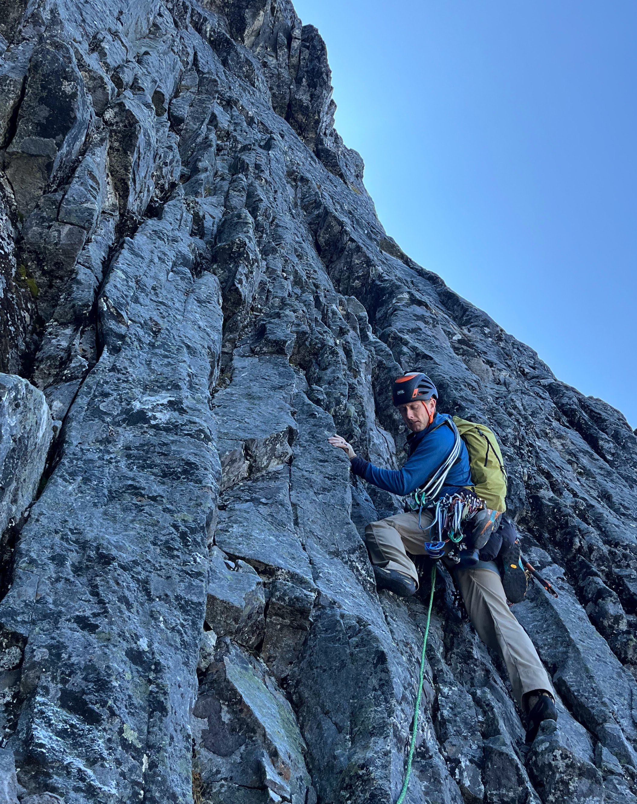
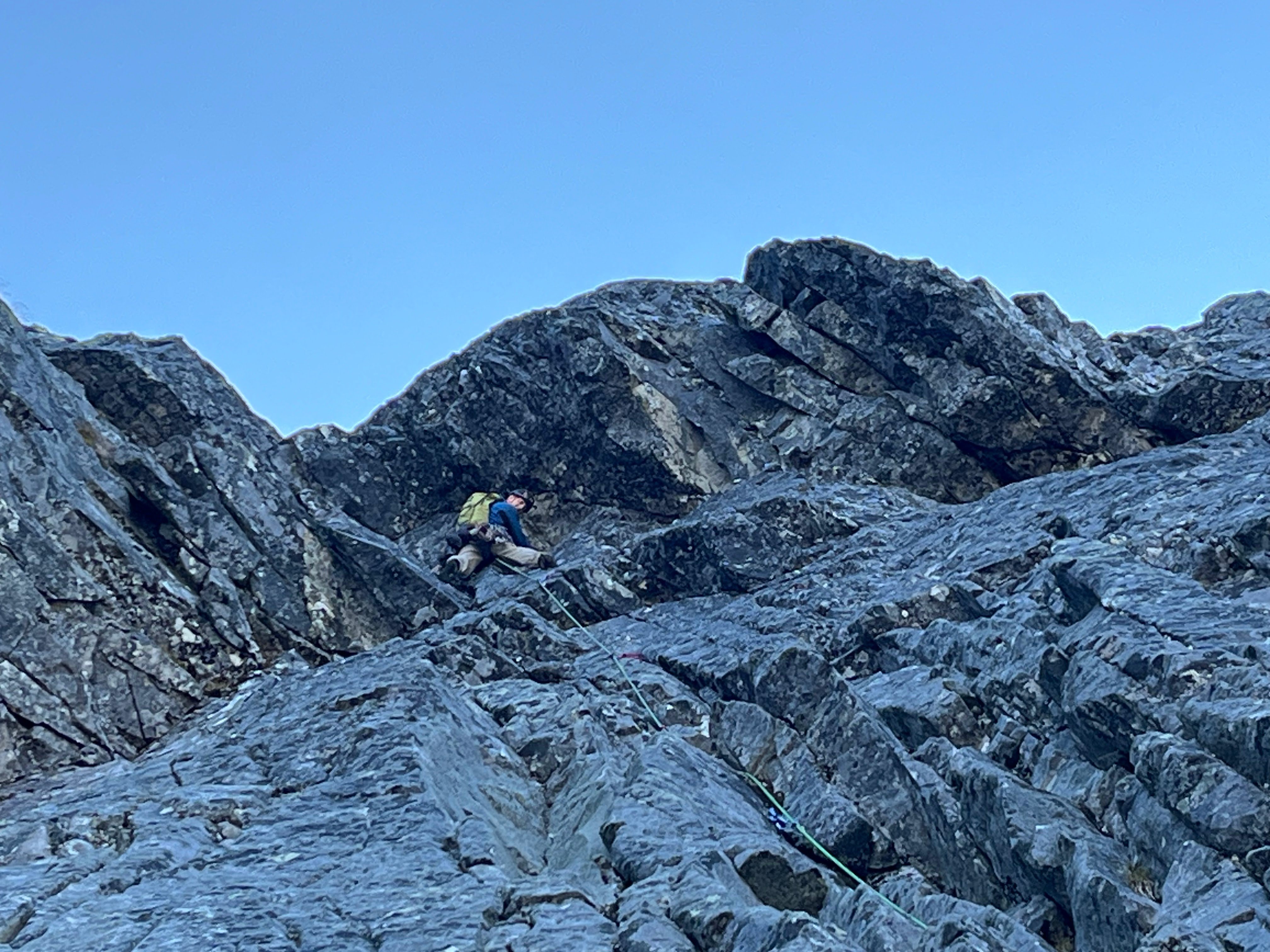
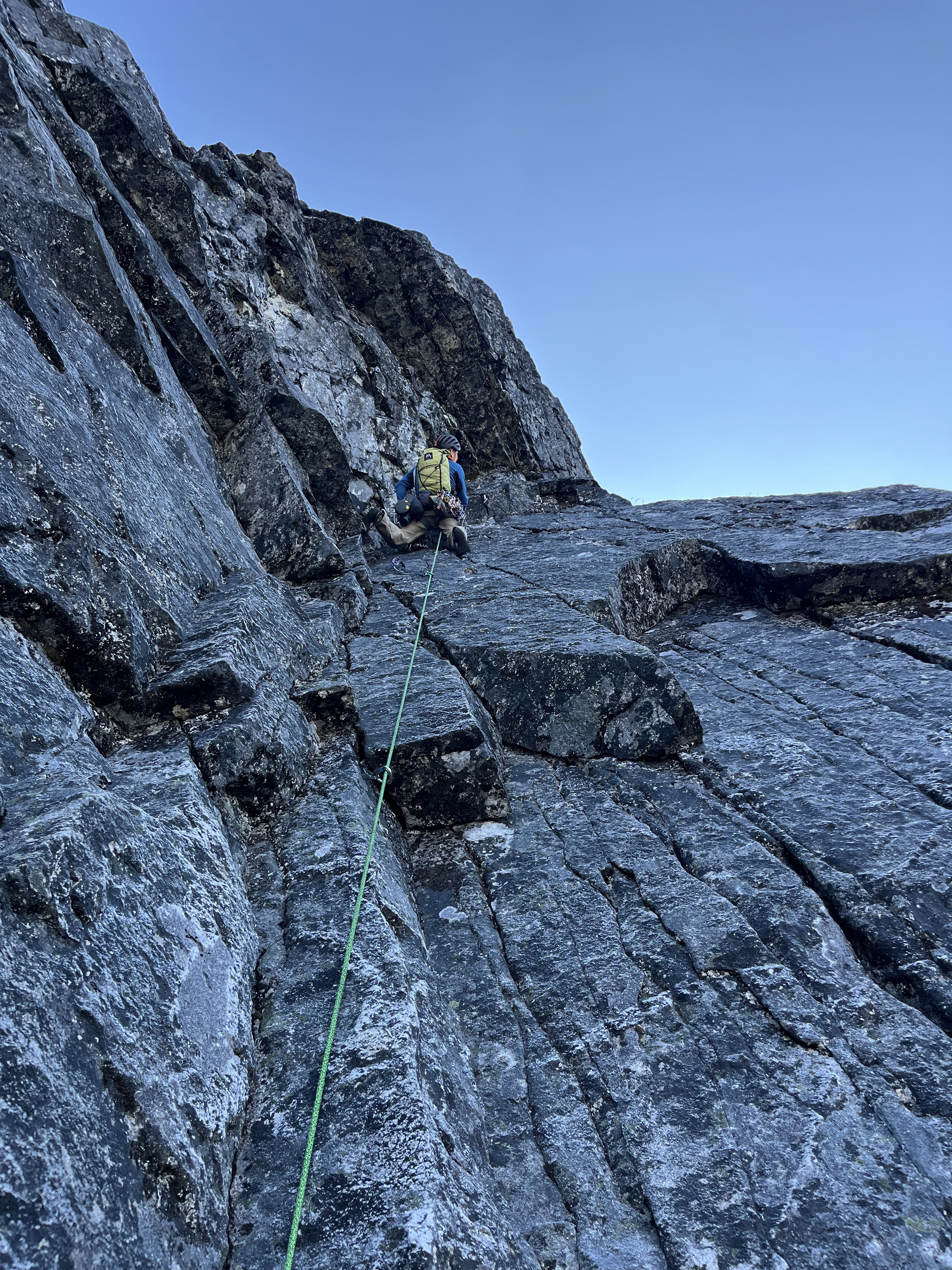
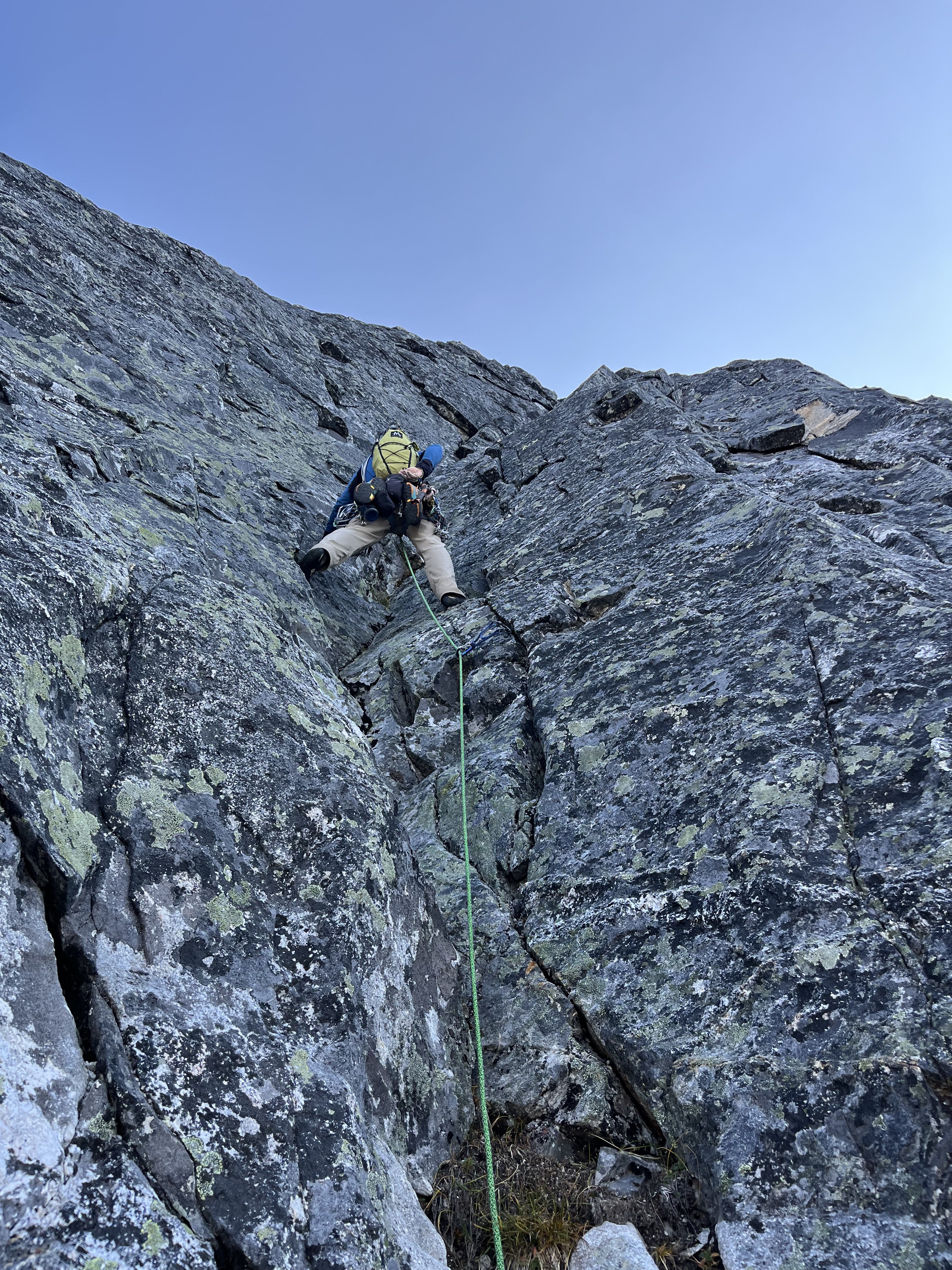
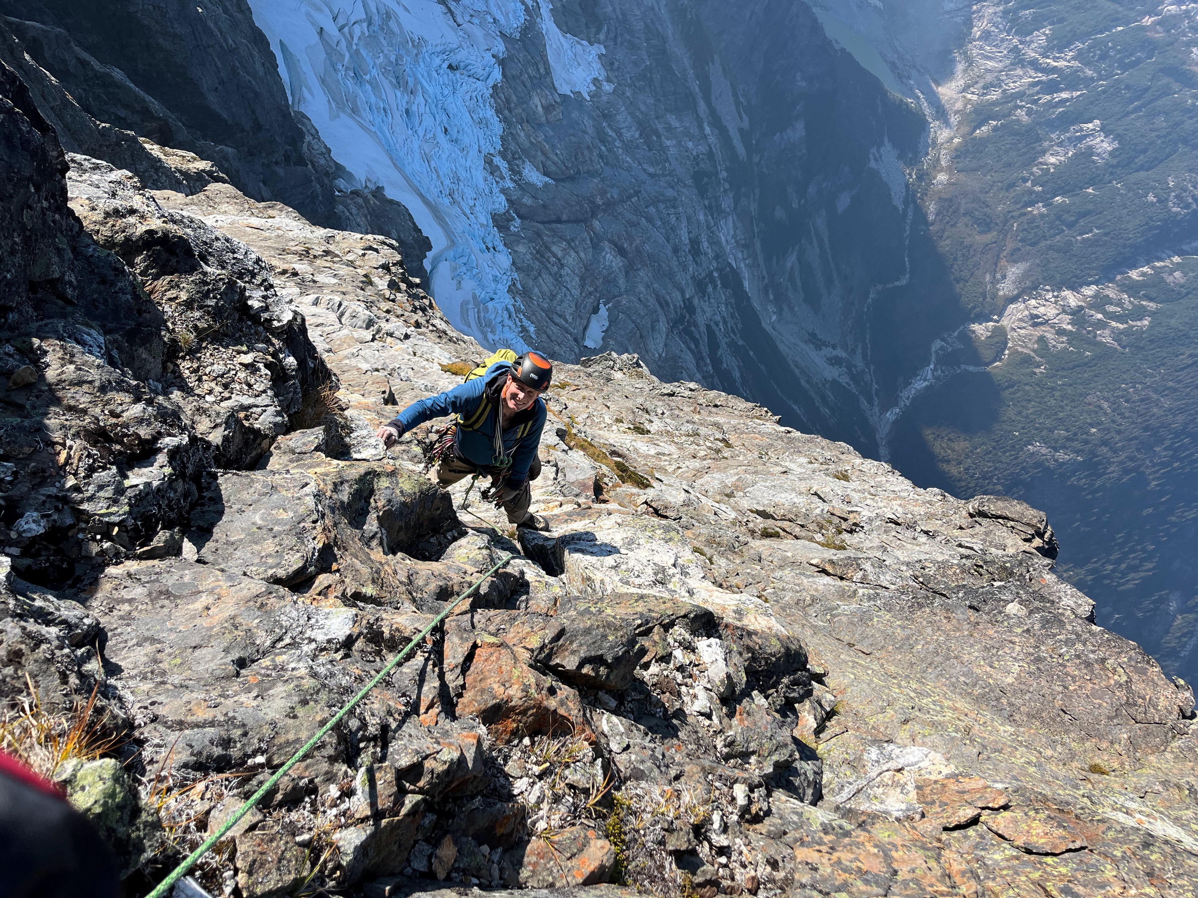
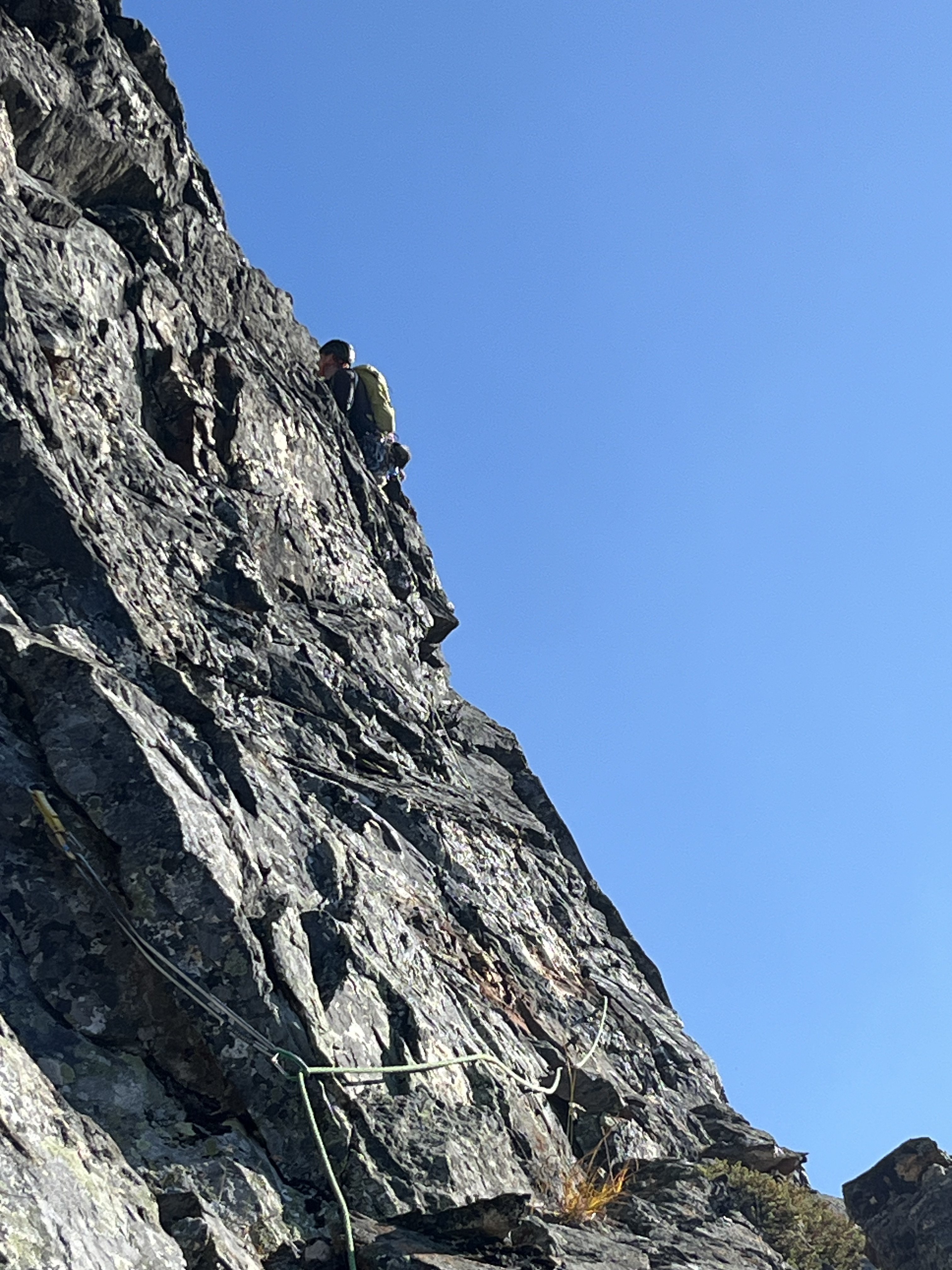
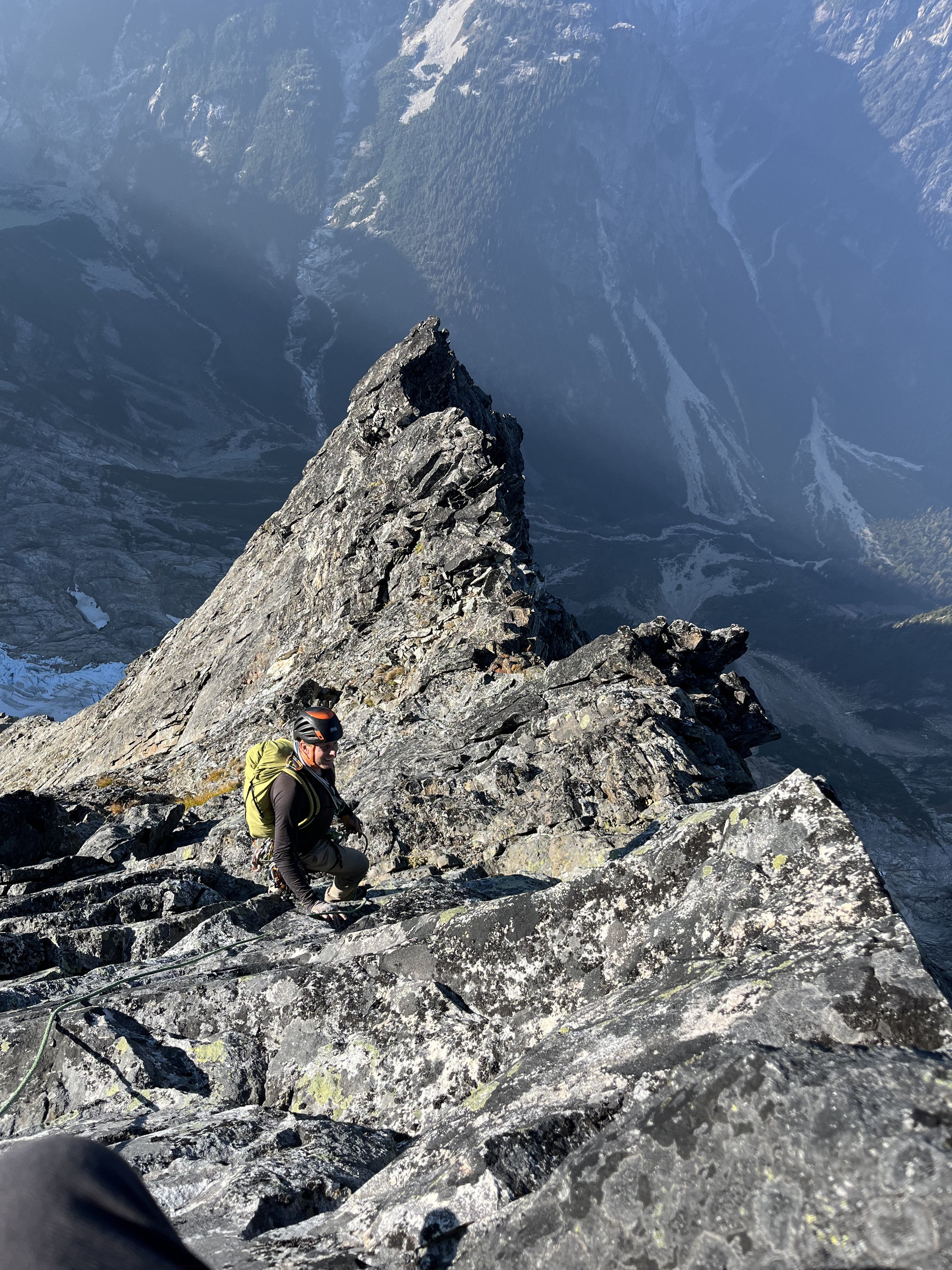
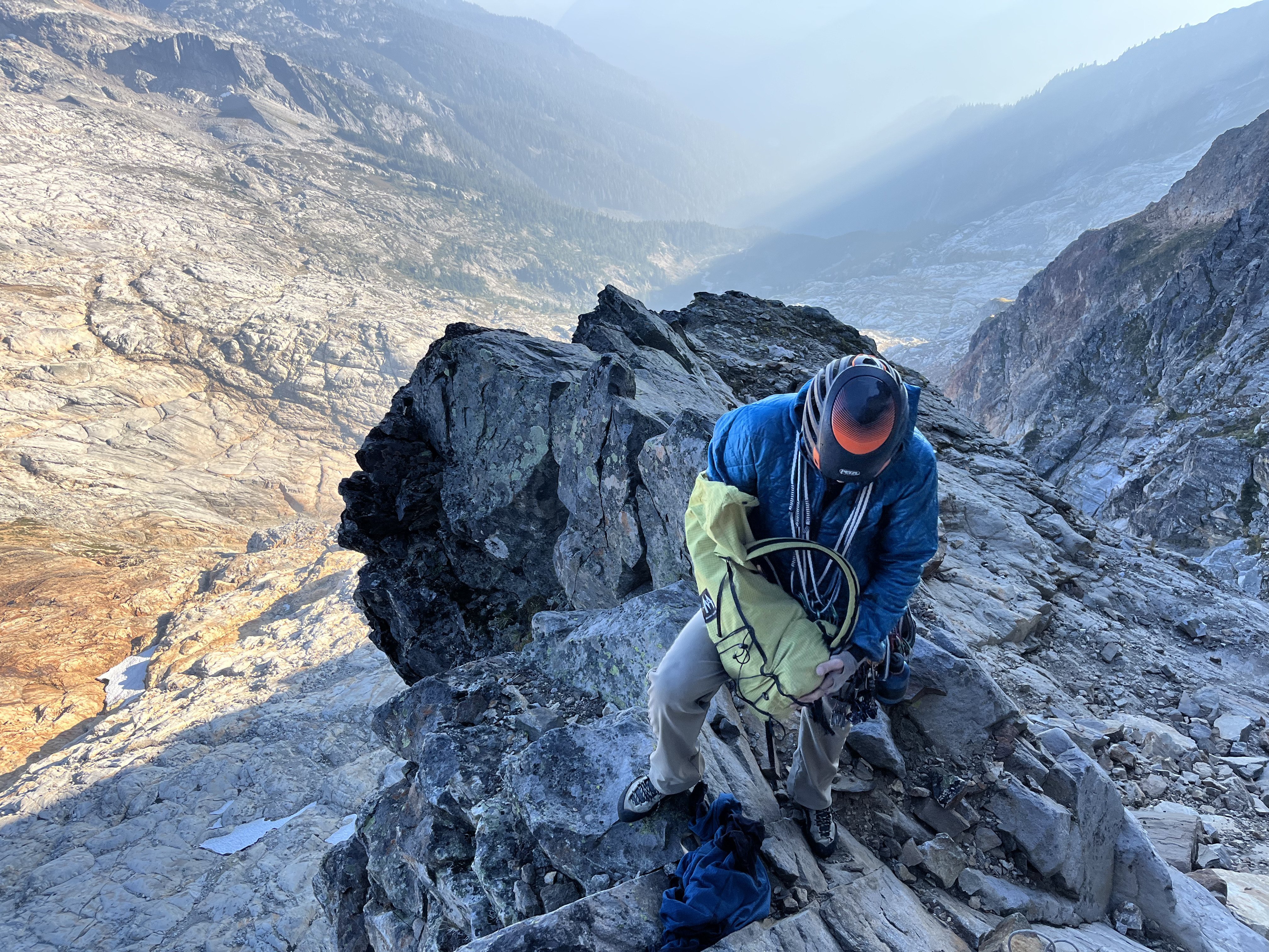
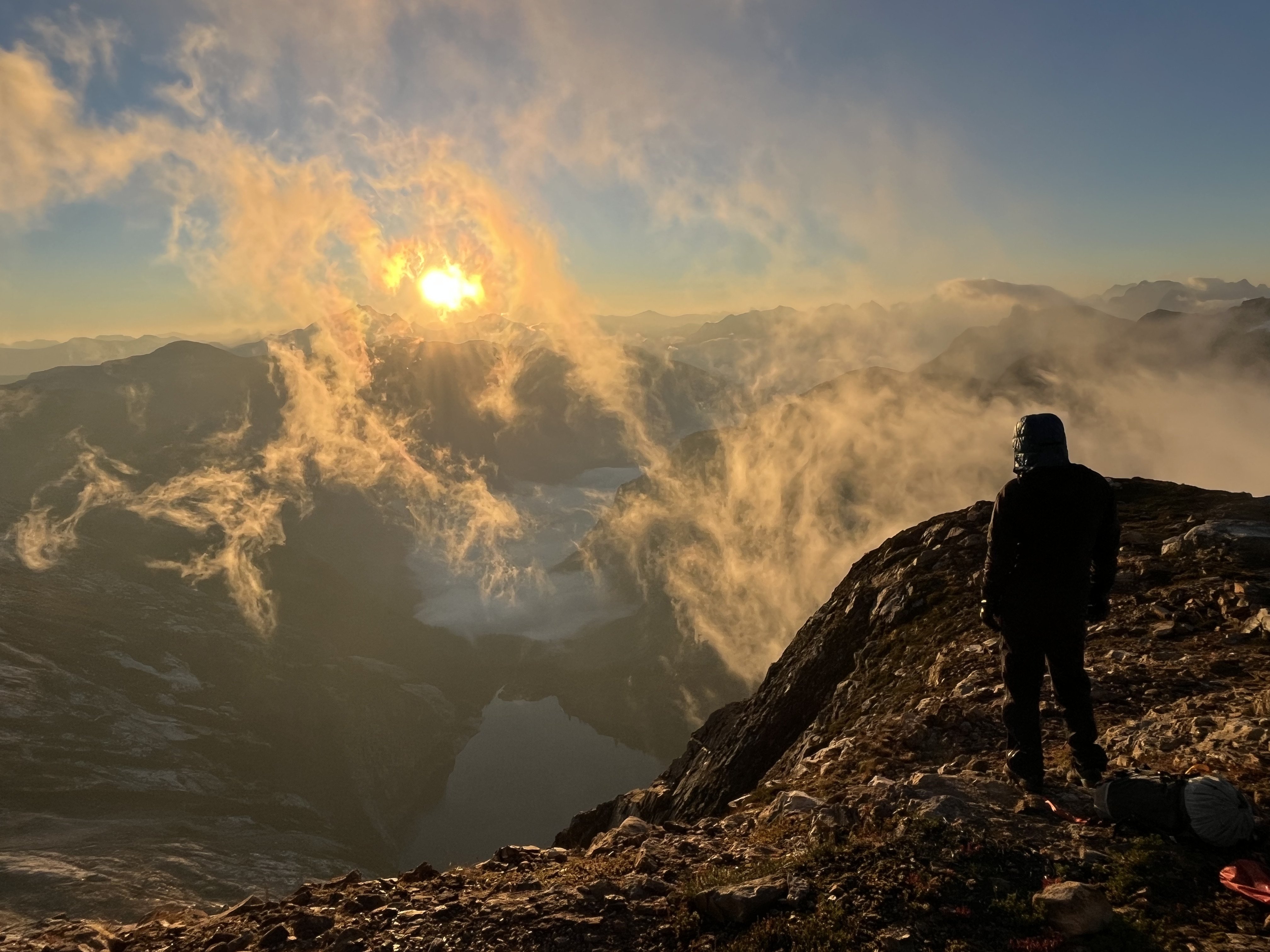
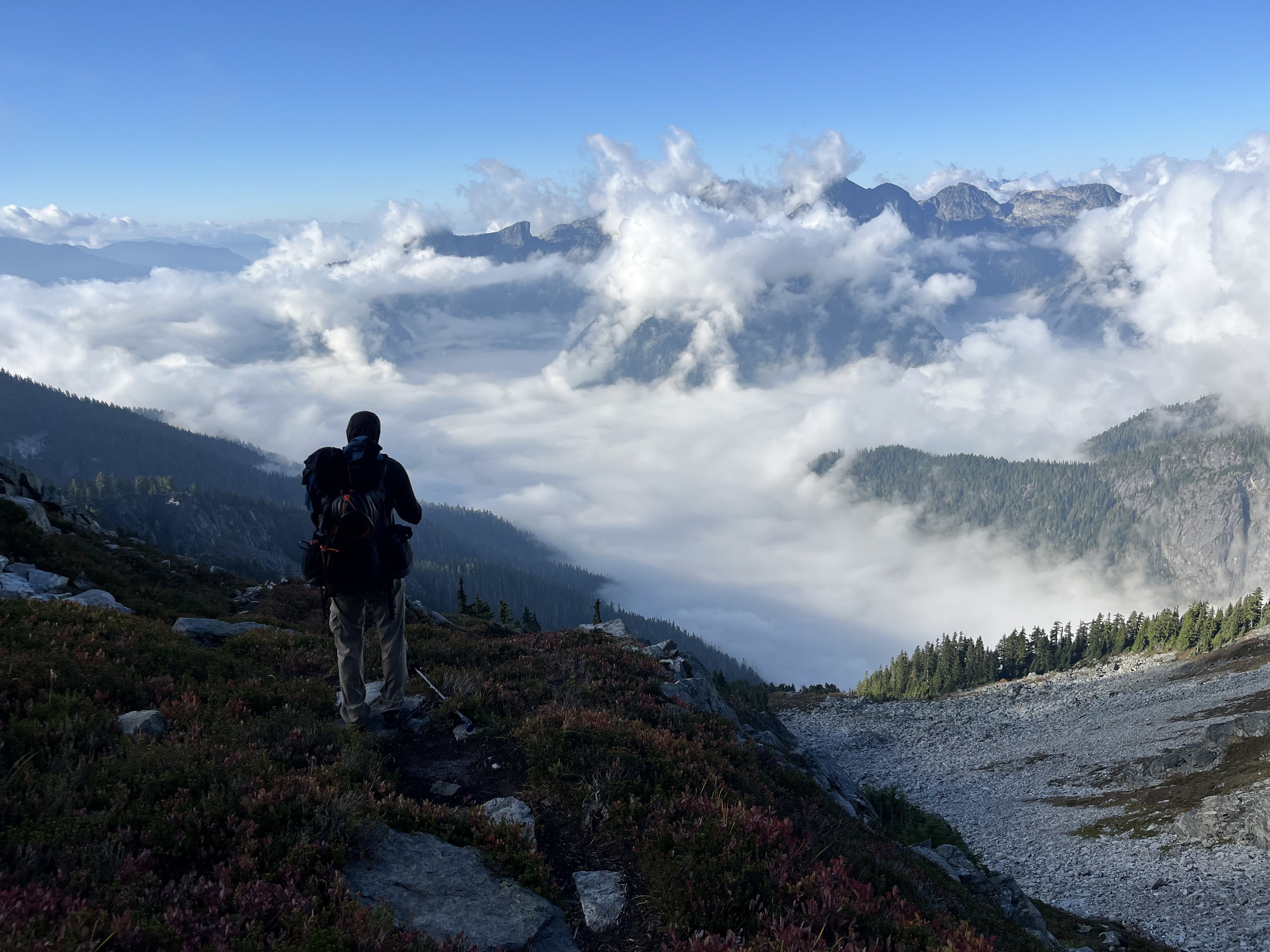
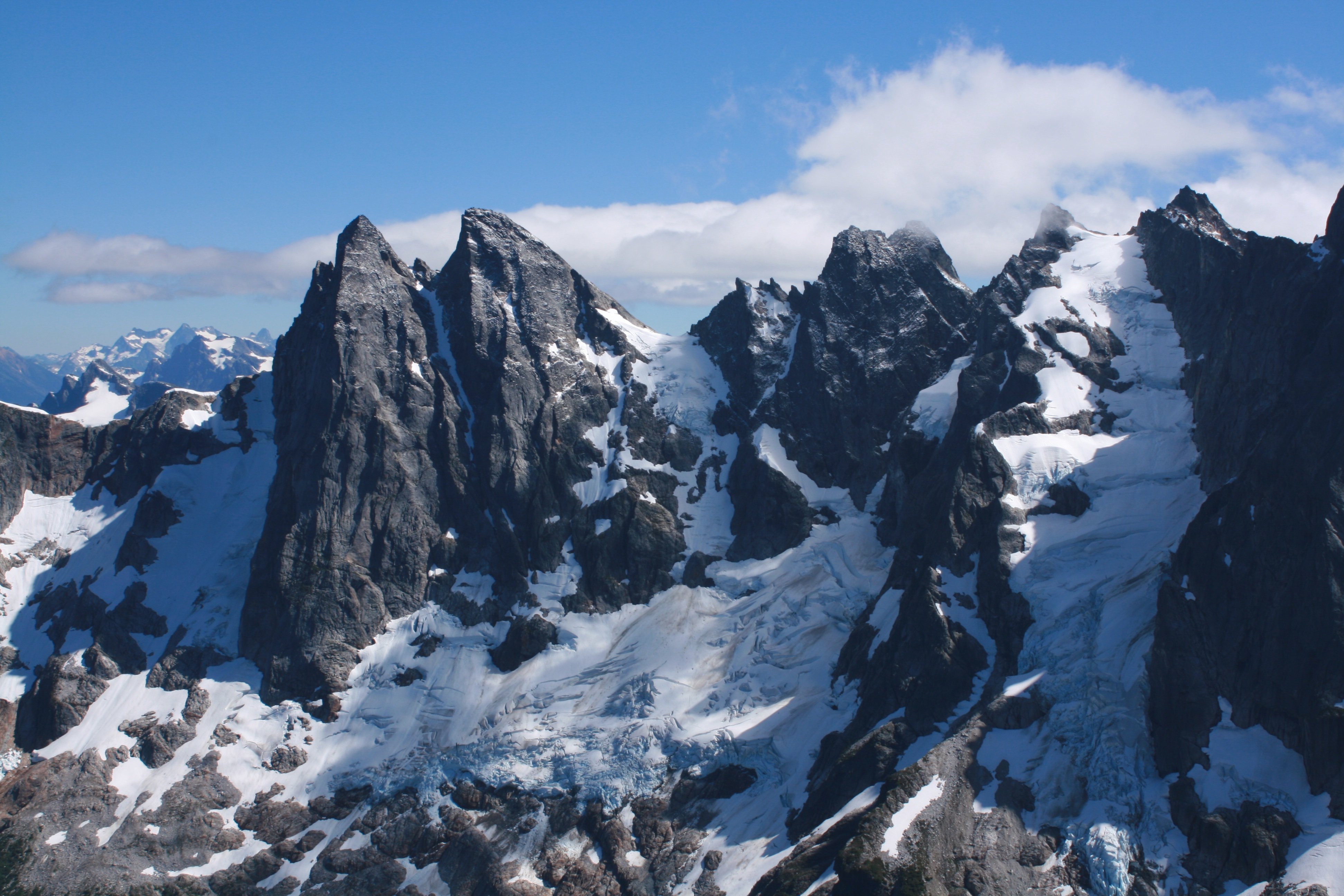
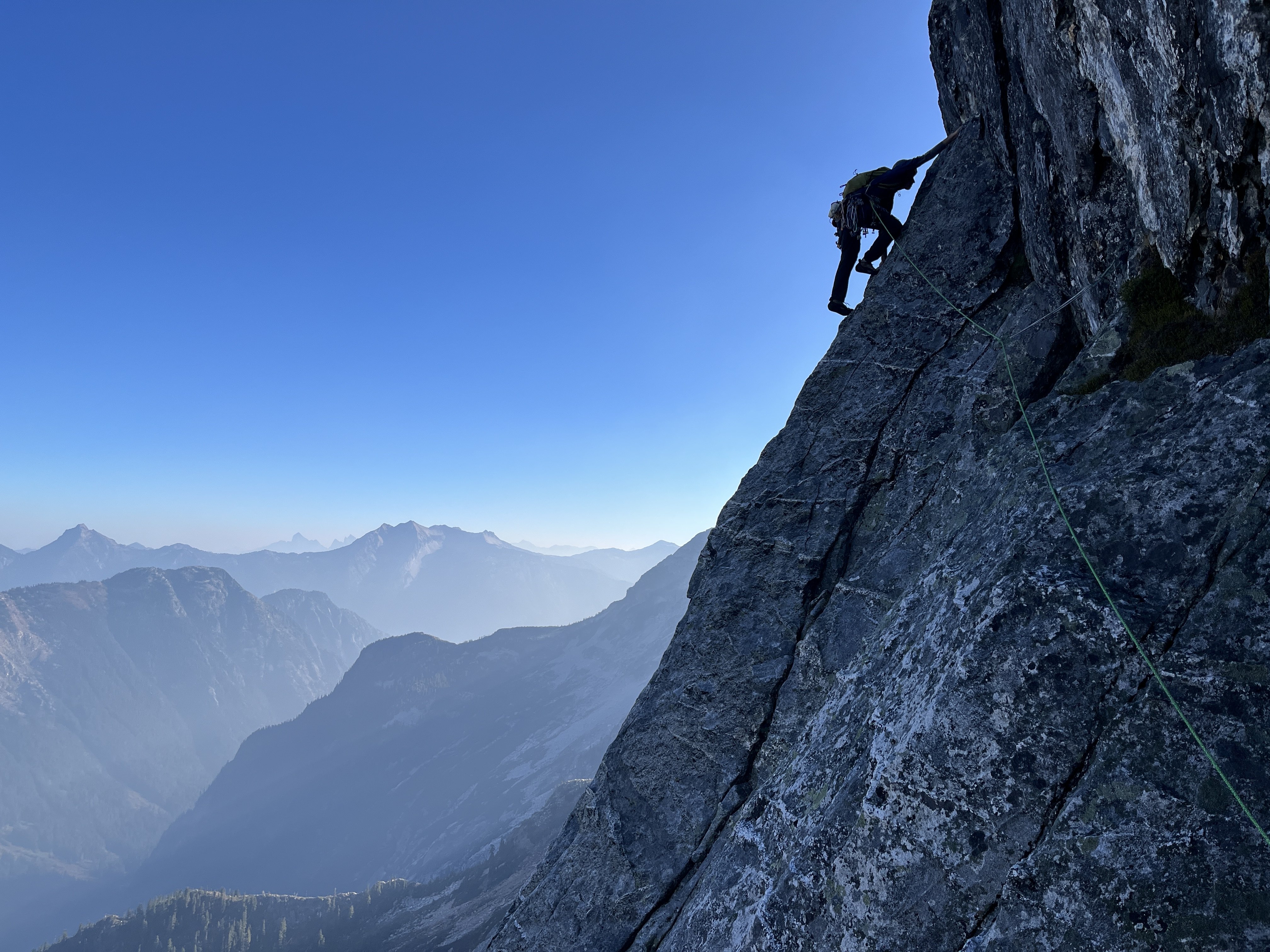 15 points
 -
Trip: Redoubt, Easy Mox - South Face (Redoubt), NE Ridge (Easy Mox) Trip Date: 01/19/2025 Trip Report: Mount Redoubt and Easy Mox First Winter Ascent of Easy Mox, Second Winter Ascent of Redoubt. Jan 17-21, 2025 42 miles hiking, 37 miles boating Eric and Nick 79/100 Winter Bulgers Jan 17 – double carry boat, motor, gear from Ross Dam trailhead to Frontage Road, sleep at trailhead Jan 18 – Carry remaining gear to boat, drag on wheels down Frontage Road, boat up lake 18 miles to Silver Creek, bushwhack to Silver Lake, hike to basecamp below west face of Solitude Peak Jan 19 – Climb Redoubt via south face (M1, steep snow, two roped pitches), return to camp Jan 20 – Climb Easy Mox via NE Ridge (M3, simulclimbed most of route), rap down south face to Col of the Wild, return to camp Jan 21 – Hike out, boat back, double carry boat up to trailhead On the northeast ridge of Easy Mox Some of the most difficult peaks in Washington to climb in winter are located in the Chilliwack range of the North Cascades, near the Canada border. I think these are likely some of the most difficult peaks to climb in winter in the entire contiguous US. Access is extremely difficult, weather is notoriously bad, snow conditions are rarely stable with unavoidable avalanche terrain, the peaks are technical, requiring ice and mixed climbing, and beta is scarce. Most peaks in this area have not previously been climbed in winter. The route I’m working on a project to climb all the Washington Bulgers (hundred highest peaks) in winter, and six of these peaks are in the Chilliwacks. This is the crux subset of project. I’ve spent several years in preparation for winter ascents in this area. I’ve previously climbed all the Bulger peaks in the summer, and that is critical but still not sufficient for success in winter. The first challenge is simply accessing the Chilliwacks area in winter. I’m following a rule that all ascents must be made legally, so I won’t sneak into the area from Canada. Starting in Fall 2020 I began scouting out the optimal winter approach to the area. Detailed route The closest trailheads are Hannegan Pass and Ross Dam, but these require 20-30 mile hikes on trails that are likely snowed over and unbroken. I skied up the Hannegan Pass trail in December 2020, and learned that the last 5 miles of road to that trailhead is closed to snowmobiles in winter, so the approach is even longer. I hiked the approach from Ross Dam in November 2020, and assessed each of those approaches would likely take multiple days in winter. Packrafting Ross Lake, Nov 2020. One option to save time and reduce the approach to a single day is to take a water taxi up Ross Lake to Little Beaver or Silver Creek and bushwhack up from there. However, the Ross Lake Resort water taxi does not run in winter. Ross Lake has no public road access in winter (or summer it seems, until the road in from canada gets completely fixed), so getting a motor boat to the lake is challenging. In November 2020 I packrafted the length of Ross Lake, and that took a full day and is highly dependent on wind conditions. That would be unreliable in winter. I considered a canoe, but that is also highly dependent on wind conditions and is too risky for capsizing in winter. Finally I settled on taking a zodiac boat with outboard motor up Ross Lake. The boat is wide enough to be stable in heavy wind and waves, with enough capacity to haul hundreds of pounds of gear. It can be deflated into manageable loads of a 70lb boat and 60lb motor. Each can be strapped to a backpack if needed. Ross Lake is in the unique situation where it is connected to a lower lake, Diablo, by road (Frontage Road), but the road is not connected to any other roads. Diablo Lake has road access, though. First test voyage on Ross Lake, Oct 2022 I first did a practice trip in October 2022 where I launched the zodiac at Diablo Lake, boated to Frontage Road, then dragged the boat up Frontage Road on deployable wheels, then launched in Ross Lake. I boated up 15 miles to the Little Beaver takeout, then hiked and bushwhacked in to the Chilliwacks. That option depended on Frontage Road being snow free, though, which wasn’t guaranteed in winter. I later did another practice trip where I double carried the deflated boat and motor down the 0.6 mile trail from the Ross Dam trailhead to Frontage Road, then dragged it down on wheels to Ross Lake. I settled on that as the optimal winter solution since the trail could be hiked in snow, and the boat could also be carried down the 0.5 mile road section in snow. The boat has a 5hp outboard motor, which goes 5-6mph when fully loaded. This is as fast as you want to go on Ross Lake in winter, since the lake level is lowered enough that tree stumps stick out of the water (and sometimes are submerged just a few inches under water). The motor is 4-stroke propane, which is clean enough to meet the strict environmental regulations for Ross Lake. The 5-gallon propane tank gives a 50-mile range for the fully-loaded zodiac boat. This is perfect for the ~40-mile round trip to Silver Creek with a little bit of safety factor. And I’ve been told be expert polar mechanics that propane is more reliable that gas for winter boating in sub freezing temperatures. This boat access method meant the hiking access component could be shaved down to 10-15 miles, which made the peaks much more accessible. From Ross Lake there are three main drainages to access the Chilliwacks – Redoubt Creek, Perry Creek, and Silver Creek. I scouted out Perry Creek in October 2023 and made a practice climb of Hard Mox from that approach. Perry Creek provided good access for Hard Mox and Spickard and was accessed from the Little Beaver takeout 15 miles up Ross Lake. First winter Chilliwacks attempt – thwarted by ice, Jan 2023. Redoubt Creek is also accessed from the Little Beaver takout and provides access to Redoubt and Easy Mox. I was not able to scout this approach, though I heard from Cascades expert John Roper it has the most difficult bushwhacking of all the drainages. Silver Creek provides access to Rahm and Custer and is on the north end of Ross Lake, and 18 mile boat ride up. I was not able to scout that approach, but have friends who had made the approach in summer. With the approach logistics sorted out, the next step is waiting for six stars to align. There must be stable snow conditions, stable weather on the peaks, low wind on the lake, no ice on the lake, long weekend, and partner available. Second Winter Chilliwacks trip – bail on first pitch of Hard Mox, Feb 2023 In January 2023 Nick and I made an attempt on Hard Mox Peak with five out of six star apparently aligning. Unfortunately Ross Lake was iced over 0.5 miles before the takeout. We attempted to bushwhack the remaining distance to Little Beaver around the lake, but that took 6 hours and we eventually bailed. That’s when we learned the ice-free star absolutely had to align. In February 2023 we returned when it appeared all six stars aligned. We made it up the first pitch of Hard Mox, but then bad weather unexpectedly came in early and we bailed. Winds were high on Ross Lake and we nearly capsized navigating through whitecap waves in the middle of a stump forest. The low wind and stable weather stars were not in alignment. Third winter Chilliwacks trip – success on Hard Mox, Dec 2023. In December 2023 all stars finally aligned, and we successfully climbed Hard Mox and Spickard via the Perry Creek approach. This was the first winter ascent of Hard Mox and the second winter ascent of Spickard. (The first winter ascent team for Spickard was Bond and Johnson in March 2023, approaching from Canada). On the return trip the outboard motor wouldn’t start, so Nick and I paddled back for nine hours. I couldn’t figure out the problem, so I bought a used gas outboard motor for the next attempt. In February 2024 all six stars aligned and Josh and and I went for Rahm and Custer. But the gas motor failed to start (I later learned residue from ethanol fuel in the used tank I’d purchased had made its way into the carburator and clogged it). One oar lock also broke because it got brittle in the cold. We ended up paddling 10 hours up lake to Silver Creek anyways, using a ski strap to fix the oar lock, then bushwhacked up and still climbed both peaks. We then paddled out 10 hours back. I subsequently started carrying spare oar locks on trips. Fourth Winter Chilliwacks trip – paddling up and down lake with broken oar lock to climb Rahm/Custer, Feb 2024 By January 2025 I had just two winter Chilliwack Bulger peaks remaining – Easy Mox and Redoubt. I had made eight trips up Ross Lake with the zodiac by then either climbing Bulgers in winter or doing practice trips. That month I was fortunate enough to meet Stephen, an expert polar mechanic. He got the propane and gas outboard motors back in working order, so I was good to go back on Ross Lake whenever the stars aligned. After all of these winter trips on Ross I learned a few lessons about the motors. For the propane motor it cannot be carried upside down, it is necessary to use an aluminum tank instead of steel so no rust gets in the fuel line, and the fuel line must be disonnected and excess pressure released before leaving the boat for days on shore in freezing conditions. This prevents liquid fuel from entering the system, freezing, and messing up components. The gas motor absolutely cannot touch ethanol fuel. Different valley options to approach Redoubt and Easy Mox With the boat motor fixed I started doing research on Easy Mox and Redoubt. The shortest approach would be Redoubt Creek, but that also was supposedly the most difficult bushwhack so might actually take the longest. In theory the peaks could be accessed from Perry Creek if we could cross Col of the Wild. However, in December 2023 we noticed the Perry Glacier was melted down significantly from historical levels. This meant accessing the col required climbing a pitch of downsloping snow-covered slab and surpassing tricky cornices. So that approach was likely out. The Silver Creek approach was the longest distance-wise. However, from February 2023 I learned that there is an old trail the first few miles to an abandoned cabin. Beyond that the bushwhack is easy through mostly open forest. That would likely be the optimal approach, with predictable timing to Silver Lake. We would then cross to the Lake Ouzel cirque and access the peaks from there. For the routes I researched that Mt Redoubt had previously seen one winter ascent in February 1977 by Barely and Rowatt via the NE Face. They approached from Canada. I had previously climbed the standard south face route in summer, and I suspected that would in fact be the easiest winter route. But it crossed long stretches of steep snow and required very stable conditions. Easy Mox had never been climbed in winter, and I wasn’t sure what the optimal route was. I’d previously climbed the standard NE Ridge route in July, and that is the least technical route. However, it requires climbing one slab pitch to gain the ridge, and that might be sketchy if only thinly covered in snow. Also, the ridge looked corniced in February 2024 when I saw it from Custer and Rahm. However, in December 2023 it was not corniced when I saw it from Hard Mox. So it was possible it would be climbable in late December or January. Another option was the southeast face route directly from Col of the Wild. This was more direct and not corniced. However, the upper section is slabs that might be sketchy if thinly snow covered. Finally, the west ridge route was a possibility. The only known ascent was the first ascent in 1964, but it appeared to be only a few pitches, though likely the most technical of all the routes. By mid January it appeared all six stars would align over the long MLK day weekend. The snow was very stable with high pressure parked over Washington for the forseeable future and low wind over the weekend. Washington had experienced above-normal temperatures over the previous few weeks, and satellite images confirmed upper Ross Lake was completely ice-free. Nick and I decided to go for Easy Mox and Redoubt. Easy Mox was my crux remaining winter Bulger, and would be great to check off the list. The Monday before the weekend I picked up the propane motor from Stephen up near Bellingham, and he did an amazing job getting it up and running. I did a test ride for a few miles in Lake Sammamish on Tuesday and everything worked fine with the boat. Our plan was to boat up to Silver Creek, then bushwhack in to a basecamp. We would climb Redoubt first since it was easier and would give us views of Easy Mox to plan out the route. We would then climb Easy Mox and hike and boat out. We would use snowshoes to avoid relying on a seventh star to align – skiable snow. On our first Hard Mox attempt we’d brought skis and bailed at Perry Creek when the snow conditions weren’t good for skiing. By using snowshoes we could plod up even if the snow was icy. The only possible question mark was whether it would be getting too cold. The peaks were forecast to be between 5F – 15F, which was cold for technical climbing but doable since the wind was forecast to be low. However, at upper Ross Lake the lows were forecast to be around 15F-20F for multiple nights with low wind. That is the shallowest part of the lake, and with calm nights there was a risk it would freeze over. We could likely boat up on Saturday since that would be the first cold morning and the water would likely still be warm from the previous weeks. But there was a risk we’d return to the boat at the end of the trip and be blocked in by ice. But, daytime temperatures were supposed to be slightly above freezing and we expected the sun would help melt any thin ice. So we decided to go for it. Worst case, if we got blocked by ice getting out we could hike around the north edge of the lake to Hozomeen and hike back out the 30 miles to Ross Dam down the east bank trail, which was likely snow-free. That would not be ideal, of course. Packing up at Ross Dam trailhead Friday Friday I set my NWAC-scraping Python code running to send me daily avalanche forecasts to my inreach. Then we loaded up in my truck and drove to the Ross Dam trailhead by 4pm. That evening we made two carries of loads down to Frontage Road – the first load was the boat and boat accessories bag, the second was the motor and propane. We then inflated the boat and got it set up for a quick getaway. I considered storing the propane tank in the truck overnight to keep it warm, but we decided it would be smarter to leave it out in the cold. This would be the coldest temperatures I’d ever run the motor (~15F). If it started up in the morning from being that cold, we’d have confidence that it would also start up for our return trip. But if I kept the propane in the truck over night we wouldn’t get that data point. We did, however, put the propane tank in a duffle bag next to the boat overnight to protect it from frost, and wrapped a tarp around the motor to keep it a little warmer. Dragging the boat down Frontage Road We slept in the truck that night at the Ross Dam trailhead, and were the only ones there all night. Saturday Our plan was to hopefully make it all the way to basecamp on Redoubt Glacier by Saturday evening, so we needed to start early. However, boating in the dark was risky because of the submerged stumps on Ross Lake. From all my trips on Ross I know the problem areas at different water levels. The water height is controlled by dam operators based on the energy needs of the greater Seattle area, and this varies throughout the year and is hard to predict. But it is published online by USGS (https://waterdata.usgs.gov/monitoring-location/12175000/#dataTypeId=continuous-00065-1922206742&period=P7D&showMedian=false). My usual strategy is to compare current lake level to past levels when I’ve boated on Ross. This weekend was 1564ft, which was 5ft higher than in February 2024 when I’d boated up to Silver Creek. On that trip the only problem areas for stumps had been Devil’s Creek and Silver Creek. (For reference, when it is below 1550ft there are many more problem areas throughout the lake, both near the shore and in the middle, down lake and up lake, and this is very scary at night). With this water height it was ok to boat in the dark until Devil’s Creek, but we wanted daylight beyond that. I’ve previously tried boating with super bright off-roading headlights connected to a motorcycle battery on the front of the boat. But it seems like Ross Lake is always so foggy at night in winter that visibility still isn’t great, even with the special yellow fog lights. That battery is really heavy, so we’d bring two smaller bike lights instead. They could last a few hours on the highest setting, which would be sufficient. And we’d be boating through safe areas at night anyways, so it should be ok. Loading up on Ross Lake This meant we got packed up to go at 4:00am. Just before leaving I remembered to set up four mouse traps in the truck. Ross Dam is one of the top ten mousiest trailheads in the state, and I usually come back to find mouse poop in the truck if I don’t set up traps. We ferried the last load of climbing gear down to Frontage Road, then loaded up the boat. We put the gear as far back as possible over the wheels, then rigged up a climbing rope on front so we could both drag it down the road. It’s important for our steps to be synchronized when walking for maximum efficiency. Down at the lake edge we wheeled the boat around the resort truck parked there, and we were grateful that it was far enough to the side to allow us to squeeze by (this is not always the case). We layed the big tarp in the boat, then put the two packs in. Then we put a bag of sharp objects (snowshoes, ice tools, poles, crampons) double duffled on top, not touching the boat at all. We then folded the tarp over top and strapped it down with bungees. This would protect the gear from water spray in case we encountered heavy waves. We each layered up, put on our dry suits, put on life vests, then put down jackets over everything. Nick wore his 6000m Scarpa double boots and I wore my 8000m Olympus Mons double boots. We knew the boat ride would be about 3.5 hours sitting in the cold, so needed to dress as warm as possible. I got in first, then Nick got in and pushed us off. I retracted the wheels, then rowed out into the middle of the lake and tried to start the motor. It was very reluctant to start, likely because of the cold. I would do 15 pulls, then rest, then repeat, then rest. This went on for about 10 minutes. I started talking about backup options, but then it finally started! One trick is that it needs to be a very sudden jerk for the pull, not just a slow continuous pull. By 5:30am we were finally cruising up the lake. I started out slow so we could make it through the water bar. The resort strings up a bunch of floating logs as a wave break, and there’s one narrow gap for boats to squeeze through. If you were cruising up at night it would be very easy to not see the logs and crash into them. The gap gets moved to different locations every time I go there, so I had no idea where it was. Luckily they place reflective cones on each end, though. This day it was on the far north side. Boating up lake, looking back at Jack mountain We carefully made our way through, then on the other side I turned the motor up to max and we reached cruising speed of 5.7mph. I’ve gotten pretty familiar with all the features of the lake over the years. We soon rounded Cougar Island, and I resisted the urge to cut through the gap with the shore since the submerged stumps were risky there. We went past Roland point, and Big Beaver on the left, with Pumpkin Mountain sticking up in the dark. We then rounded rainbow point and then reached the bridge over Devils Creek just as the sun was coming up. Taking out at Silver Creek Luckily there were no stump problems, but we had enough daylight by then to see at least. We beelined to Tenmile Island, then past Lightning Creek and on to Cat Island. Beyond that we started encountering wind and waves that were apparently coming out of the Little Beaver valley. This was unexpected, and we got sprayed with water as the boat cut through the waves. It was so cold the water instantly froze into verglass on our jackets and on the boat. Luckily the wind was localized and by Jack point it had died down again. Walking to the campground Finally, we could see the fan-shaped outlet of Silver Creek. I wanted to land as close as possible to the campground, but it was located on the north side of the fan. We could see the lake ended just north of that, with many stumps sticking out. That meant shallow water with a higher risk of freezing over, and also more danger from stumps. So at 9am we landed on the south end of the fan where the water was deeper and less risky. We quickly unloaded and left all the boat supplies in a duffle in the boat. We wrapped the motor in a tarp to protect it, then I disconnected the fuel line and used a screw driver to depress a valve to release excess gas. We then put the propane tank in a black duffle so the sun could help warm it. At Silver Creek After a 10 minute walk through beach covered in 5ft tall stumps we reached the official Silver Creek campground. It had a dock that I don’t think has seen water in years (judging by all the grass growing around it). We had a quick snack at the picnic table and left a little bit of food in the bear box, then headed out at 10am. Our packs were very heavily loaded with snowshoes, double boots, and ice tools strapped on the outside. Based on my previous trip I knew the optimal route up Silver Creek was to cross near the outlet to the north side, then pick up the old miners trail. We carefully tiptoed over icy rocks and frosty logs, and made it into the woods on the north side. I had my previous GPS track loaded on my watch and soon picked up the old trail. The woods are generally very open, and the trail long ago abandoned, but the trail still allows for quicker progress than bushwhacking. Bushwhacking to the cabin We cruised up the trail for a few hours and hit snow starting around 2500ft. Shortly after that the trail disappeared at the old cabin site. Unfortunately the cabin got smashed in by a tree and is now just a few wall sections providing no shelter. Beyond the cabin the woods are generally open and travel easy. The ground soon got icy enough that we ditched our hiking boots in a bag tied to a tree and switched to double boots and crampons. The snow eventually got deep enough to switch to snowshoes around 3000ft, but the snow was consolidated enough to not be difficult trail breaking. We took turns and by 3:30pm we reached the head of the valley at the base of the cliffs below Silver Lake. Here we roughly followed my February route, which was to climb up the right side of the drainage following the lowest-angle treed slopes. We got halfway up in snowshoes, then continued in crampons as the terrain steepened and the snow got more firm. Nice open forest above 3000ft. Darkness set in half way up, and we continued breaking trail through mostly consolidated snow on the south-facing slopes. By 7:30pm we crested the outlet of Silver Lake and stopped to top off our water bottles in the surprisingly unfrozen outflow. That would have been a nice place to camp, but would not be close enough to our objectives. We switched to snowshoes and continued across the frozen lake and up through the Spickard-Custer col. On the other side we dropped down to 7000ft and traversed on low-angle slopes to the base of the west face of Solitude, just before the Redoubt Glacier started. We decided that was close enough to be our base camp, and it would be nice to have a camp not on a glacier so we wouldn’t have to worry about crevasses. So we dropped our gear at 9:30pm and set up the mega mid tent. So far everything was going very smoothly and mostly according to plan. Starting up Sunday morning Sunday We left camp the next morning at 7am and roped up for the Redoubt Glacier. We generally stayed on the shoulder at 7000ft traversing underneath Solitude and past Easy Mox. Interestingly, we noticed the slab pitches up to the Easy Mox – Solitude col were covered in snow, which meant that might be a viable route option. Also, the northeast ridge appeared to be uncorniced. We kept that in mind for selecting our Easy Mox route. Approacing Redoubt We transitioned between crampons and snowshoes, but never sunk in the snow too much. Within a few hours we reached Redoubt Col and our first sunshine of the day. Beyond the col we unroped and scrambled through the rocky gap between Redoubt and Redoubt southeast peaks. On the other side we traversed steep snow slopes and decided to ditch the snowshoes and poles. As expected, the steep south facing slopes were well consolidated making for very secure cramponing. At the cannonhole We continued to the middle of the base of the south face, then I led the way kicking steps up with both technical tools out. Around 7900ft when the slope angle eased I traversed left over a ridge then continued up on lower angle slopes. By then clouds rolled in and it started lightly snowing. So much for the sunny weather forecast. I think in the Chilliwacks you always have to round the weather forecast a bit worse than expected. I had last climbed Redoubt in 2018, so my memory of the route was a bit rusty. But Nick had just climbed it in summer 2024 and rememberd the route. He led the way up the appropriate gully on the right. (I’m not sure if this is the normal route, but it certainly worked). By 8500ft we encountered a cliff band, and we did a few mixed moves hooking rocks to climb up and traverse left through it. We then encountered a complex set of snow/ice gullies leading up. Nick leading out of the cannonhole In general we climbed up and left, linking gullies together, and the climbing was fun and secure. With umbilicals on the two tools I was always connected to the mountain. Finally we traversed left to a broad gully I remembered with a big cannon-hole rock at the top. We slung a hurn and Nick belayed me across and up into the cannon hole. This section was 5th class in summer but was covered in snow now and no problem. I found a rap anchor under a chockstone and belayed Nick up. I then passed him the gear and he got the honors for the last pitch. Nick climbed over the chockstone and pass through the canonhole to the north face, then led a short pitch up to the summit. I followed, and was blasted with wind. We both topped out at 1:30pm, and wrapped a cord around the snowed-over summit cairn for an anchor. On the summit Our timing was just as planned, to be doing the technical pitches during the warmest time of day. The views were amazing of British Columbia to the north, Bear Mountain to the south, and the Moxes to the east. The wind surprisingly eased up enough that we hung out for 5 minutes admiring the view. Then we started planning our retreat. Nick remembered a rap anchor on the south edge of the summit ridge, but I dug around and couldn’t find it. That’s a common problem in winter. So instead we slung the summit cairn and rapped off that. I think someone climbing in the summer will be surprised to find that anchor there, but in the winter it’s just as good or better than a snow bollard. Downclimbing the south face The rope barely reached the gully below. From there we slung another horn and did one more rappel down our ascent gully. We then downclimbed unroped, following our up tracks. The temperature felt surprisingly pleasant on the sunny south face with no wind, even though it was probably in the teens. We traversed back over the rock col, and then entered the shade. The wind picked up and it got significantly colder. We roped back up at Redoubt col and returned back to camp through heavy wind that at times jostled us around. That was unfortunately not in the forecast. We got back by 7pm for a 12 hour day. We had removed the poles from the mega mid tent and dropped it down to the ground so it wasn’t affected by the wind, but we knew it might struggle once we put it back up. So we spent an hour building solid 5ft tall snow walls around the tent. Fortunately the snow was compact enough to make excellent bricks. After melting a few liters of water we stuck in our earplugs to help with the flapping tent noise and soon got to bed. Hiking back to camp Monday Easy Mox was the crux of the trip and we knew it would require more techincal climbing. The temperature was still supposed to be cold, so we planned to hit the technical climbing during the middle of the day for maximum warmth. Based on the conditions we’d seen Saturday with the uncorniced NE ridge and snow leading to the col, we planned to climb the standard NE ridge route. I think the West Ridge might have been faster and more direct, but having never climbed it before it seemed like a lower chance of success with too many unknown variables. Approaching the first pitch to the NE ridge We left camp at 7am again and broke trail over our windblown tracks back to the Redoubt Glacier. We kicked steps up to the edge of a bergschrund below the Solitude-Easy Mox col and ditched our poles and shovels there. I don’t recall this bergschrund existing in 2018, so it appears the glacier has been receeding significantly. Luckily there was a good snow bridge on the right side, but I bet late season that is difficult to cross. I took the first pitch, crossing the bergschrund ont the right then traversing way left to a rock outcrop to get a piece in. The snow got very thin at times on the slab, and I was careful to work around those sections. We shortened the rope to 15m for efficiency and simul climbed up, always making sure to have a piece between us. I eventually topped out at the col and belayed Nick up. Starting up the northeast ridge looking back towards Solitude Amazingly, there were fresh mountain goat tracks leading up the ridge in the snow! They came from farther towards Solitude, but I’m not sure how the goat accessed the ridge. The lower ridge was covered in deep snow but was not corniced. I know that will likely change later in the winter, as I observed last February. In summer the ridge is class 3/4 and easy to scramble solo, but there was enough snow and ice that we decided to simul climb it. We lengthened the rope a bit and Nick took over, trying to always keep a piece of pro between us. The ridge was very fun, with great views of Hard Mox and Lemolo to the left and Lake Ouzel down to the right. The wind occasionally blew the rope over the ridge, and I had to be careful it didn’t get snagged. There were a few sections we stopped to belay, and I think the winter route differed from the summer route here. Nick leading the crux pitch Near the summit we dropped down to the south face to avoid a few gendarmes, and the slabs were well-covered in consolidated snow. This was an area we had been concerned about, but it turned out to be no problem. We finally reached the base of the crux pitch to get back on the NE ridge. Nick offered to lead, so I belayed him off a slung horn. The pitch was melted down to rock, so we climbed in crampons with the tools holstered. Nick ended up leading the whole way to the summit, and I followed. The pitch felt like M3 and was the crux of the route. By 1:30pm, right on schedule, we topped out. It was amazing to finish my last winter Chilliwacks peak, and conditions had been perfect. We paused in the pleasant conditions to admire the view over to Hard Mox. Interestingly, this time the whole upper route on Hard Mox was melted down to rock. When Nick and I had climbed it in December 2023 it was plastered in rime ice and completely white. We soon started planning our descent. We had originally planned to descend the NE ridge route, but that sounded sketchy now, requiring simul downclimbing long sections of ridge. It reminded me of descending the west ridge of Forbidden Peak in winter. That took just as long down as up and demanded a lot of care. On the summit of easy mox Another option, though, was to rap down the southeast face to the col of the wild and hike back from there. That sounded like a much faster and safer way down, and gave us a better chance of getting off the mountain in the daylight. Nick had just climbed the southeast face in summer 2024 and remembered it well. That was the fastest and safest option, so we went for it. Downclimbing the southeast face From the summit we soloed down to an existing rap anchor, then rapped down to our slung horn that we’d left our packs at. From there we did a somewhat complicated and non-obvious route of traversing, downclimbing, and traversing back between different snow gullys. If Nick hadn’t recently done that decent I wouldn’t have tried it, but he remembered it well. We soon reached an anchor and rapped down over an ice bulge. We had to leave one new anchor to rap a short distance to a ledge, then were able to traverse across back above the col. We did one more rap off an existing anchor to a lower ledge, then Nick tunneled a path through the snow on a very exposed ledge. Finally we downclimbed a short 5th class step and got back to the col. Hiking into the sunset It took about 2.5 hours down, and we still had daylight. We traversed around back to Redoubt Col as the sun set, then followed our tracks back to camp a few hours after sunset. The wind had shifted to the north, so I spent some time fortifying another snow wall, before we went to bed. Tuesday We wanted to be back to the boat Tuesday early enough so we would have time to paddle out if absolutely necessary. So we were were up and moving by 4am. We made good time back to Silver Lake, which by now was scoured down to ice in the heavy wind. At the outlet we picked up our tracks and cramponed back down, reaching the 3400ft basin by sunrise. The bushwhack out went smoothly following our tracks, and we managed to exactly find our stashed hiking boots without issue. Back to the boat. Just a little bit of ice nearby After the cabin it felt great to switch back into the hiking boots, and we were back to Ross Lake by 11:30am. We ate a quick snack at the picnic table, then headed back to the boat. Boating out There were a few patches of shoreline north of the boat covered in ice, but luckily the area near the boat was ice free. Our strategy of landing in the deeper water had paid off. By 12:30pm we had the boat loaded back up and we pushed off into the lake. Interestingly, the lake level appeared to have dropped by a foot or so in a few days we’d been out. I rowed out until we were well-away from stump danger, then tried to start the motor. This time it started after only ten pulls! I think it helped that it was the warmest time of day, close to freezing, and the propane and motor had been heating up in the sun a while before we got there. Carrying the motor back up the trail The lake was completely calm, and we cruised down making excellent time. After a few hours, though, the wind started picking up between Ten Mile Island and Rainbow point. I guess it’s not possible for every single star to align on a winter Chilliwacks trip, but they almost all did. The waves got big enough to spray us as they hit the boat, and I steered us closer to the east bank just in case we needed to escape to shore. But the waves stayed manageable, and we made steady progress. I definitely appreciated the dry suit. Finally by 4pm we cruised through the water fence and landed on shore. We each did a bunch of jumping jacks to warm up, and stripped off our soaked dry suits. We made fast progress pulling the boat back up Frontage Road, then double carried the gear back up to the truck by 6:30pm. All my mouse traps were empty, so I think the mice have different winter foraging grounds. We were soon driving back home at a surprisingly reasonable hour. The trip had gone amazingly according to plan. Gear Notes: Zodiac boat, 60m rope, rock pro to 2" included hexes (very important for icy cracks), two tools, snowshoes Approach Notes: Boat up Ross Lake to Silver Creek, bushwhack to Silver Lake, hike to base of peaks15 points
-
Trip: Illumination Rock - Skylight (though now it's skylight-less) Trip Date: 11/20/2023 Trip Report: Artem and I took advantage of some high pressure to climb Skylight on the N face of I-rock Monday 11/20. We found the route to be longer than anticipated (perhaps due to glacial recession or lower snow pack in November?) and climbed to the ridge in 4 pitches. The first pitch was lower angle but involved thin verglass at the start and facet snow with a thin rime crust perched on the rock slabs above, the unstable snow layer on any low angle rock continued for the rest of the route (50m M3). Second pitch was fun and had a fair bit of rock exposed as the angle increased (50m M4). Third pitch climbed lower angle terrain to a physical corner and finished with insecure snow on rock meandering to below the final crux where I stopped as I was already low on gear (30-40m M5, doubles from .5-3 would be nice here). The fourth pitch was a short but strenuous up a corner and then stemming through steep stacked blocks to the top (10m M5). We declined the traverse to the summit as it was south facing sun baked rime mushrooms on slab that were collapsing. We rappelled from a horn on the ridge that had a lot of tat. One double rope rappel and a little down climbing got us off via the South Chamber. Overall, this is a fun route that I would recommend, a little shorter than NY Gully but higher quality and more sustained climbing. Also of note... the rock arch that formed the "skylight" that is the routes namesake is gone, the East Skylight which has a slightly harder route to it is still there. Based on observations we think this fell down in the past year. Here are some pictures... Nice shots of the S face from the approach: Reid Glacier: The route from the start of the roped climbing: Perspective from the first two belays: Looking up at our P3: View of Castle Crags and Reid HW: Reid Glacier / Yocum Ridge / St. Helens / Adams: Belay below the last bit of climbing: Artem approaching the penultimate belay: Summit of I-rock on the right and Reid HW behind: Artem on the final moves: Rap horn on the ridge: Pulling ropes in the South Chamber (luckily the rime was slush at this point and we weren't too worried): Walking away, one last view of the S side of I-rock: Gear Notes: Double from fingers to fists (hexes could be nice for the second set in the often Scottish conditions), lots of nuts, slings and a few pins. Approach Notes: Hike to the saddle and drop down to the North. Look for the obvious weakness in the face.
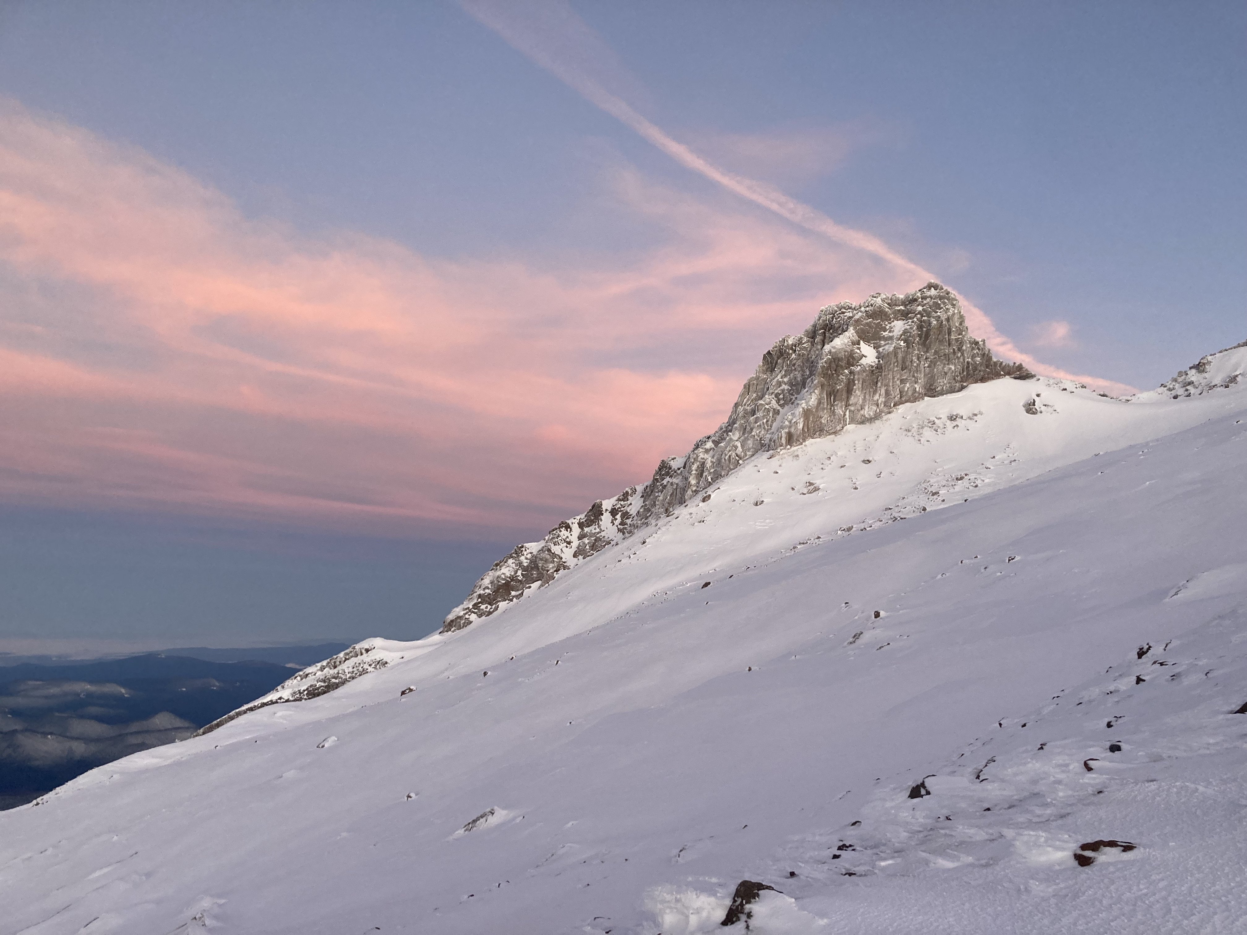
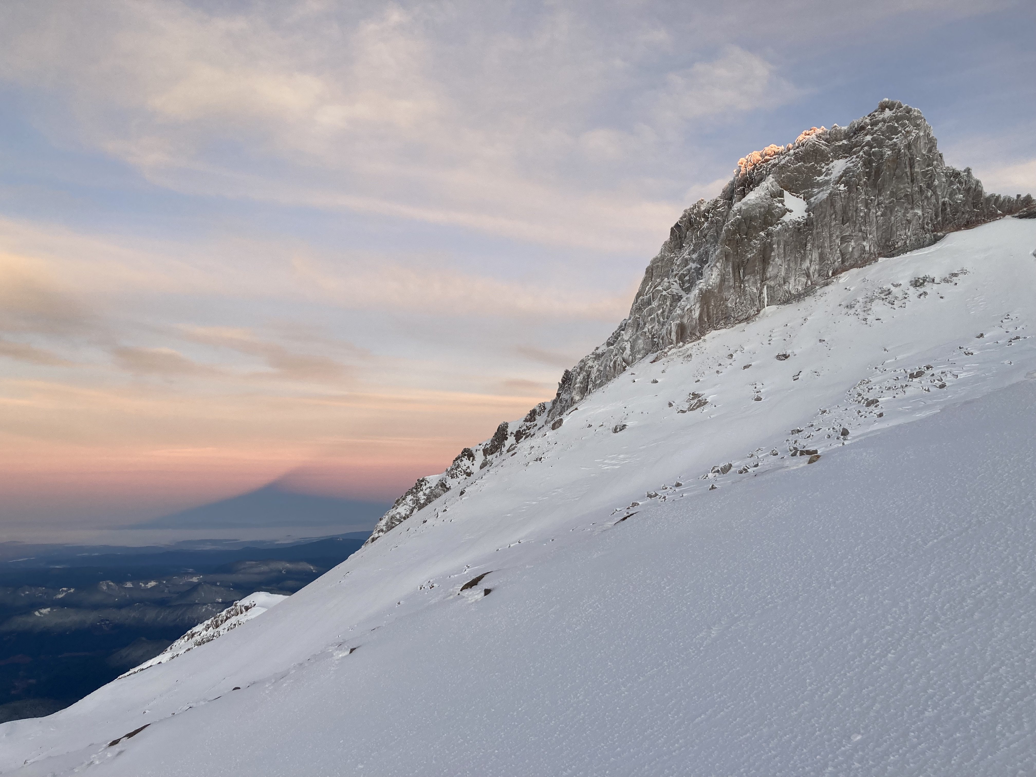
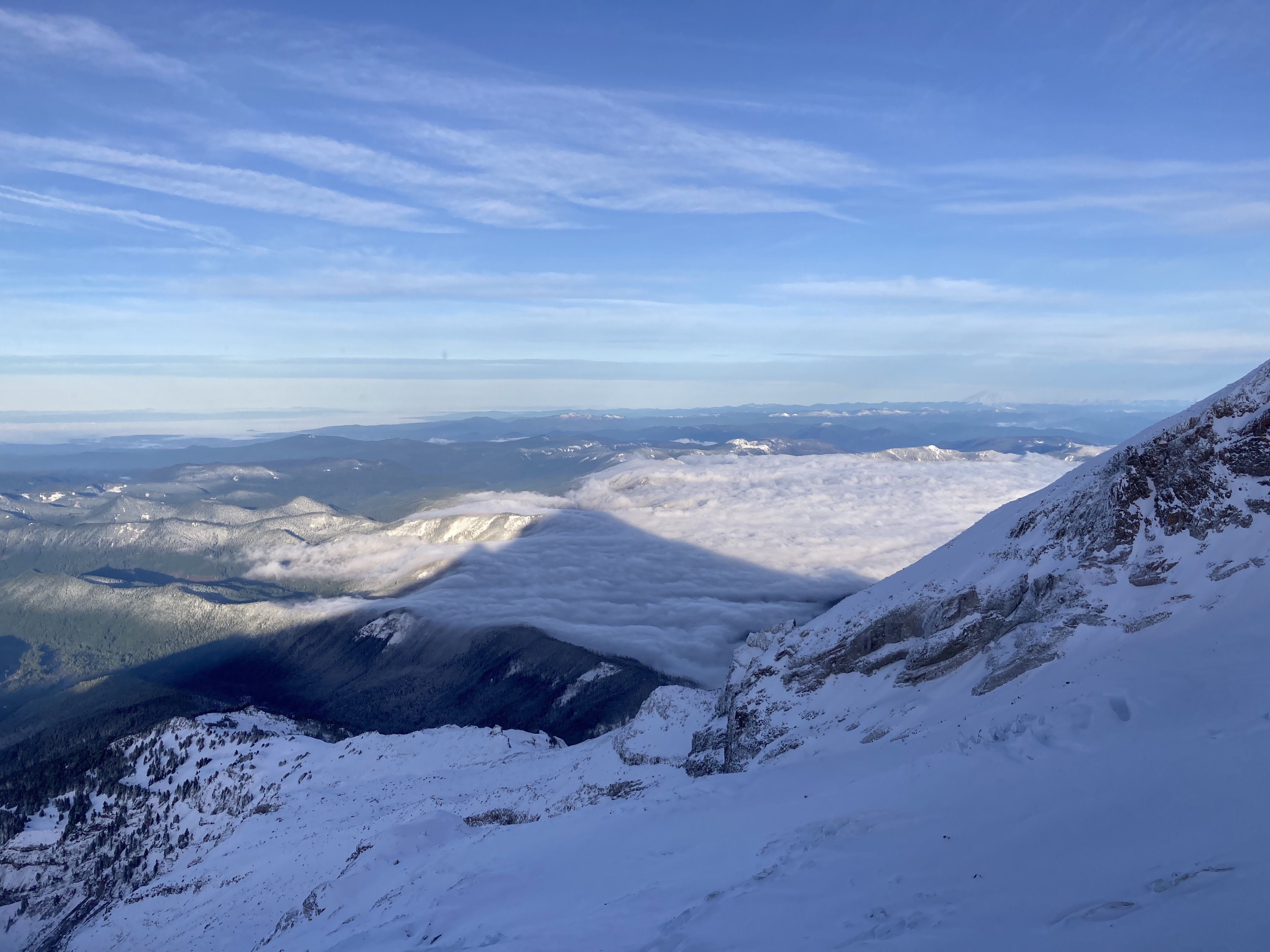
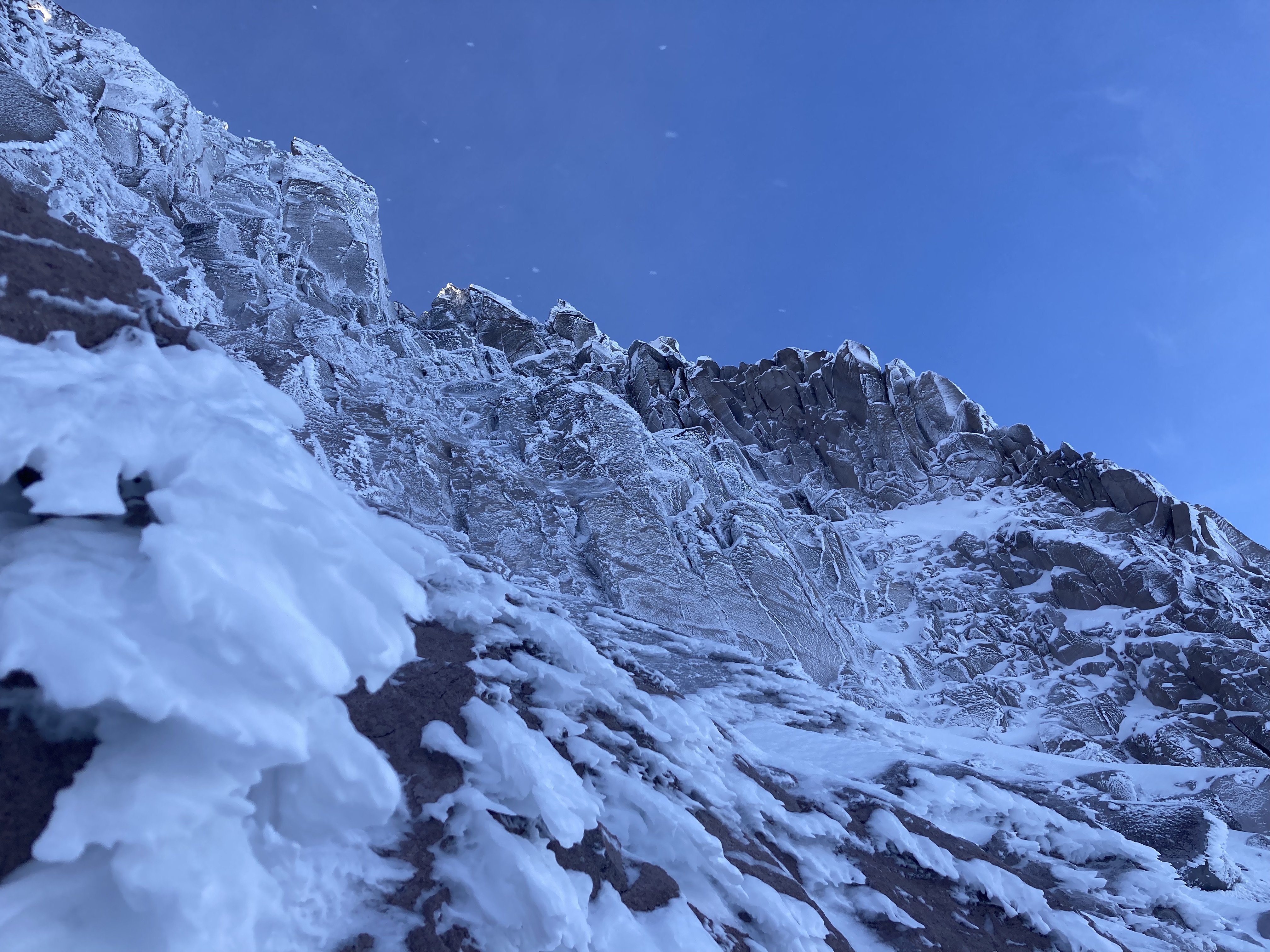
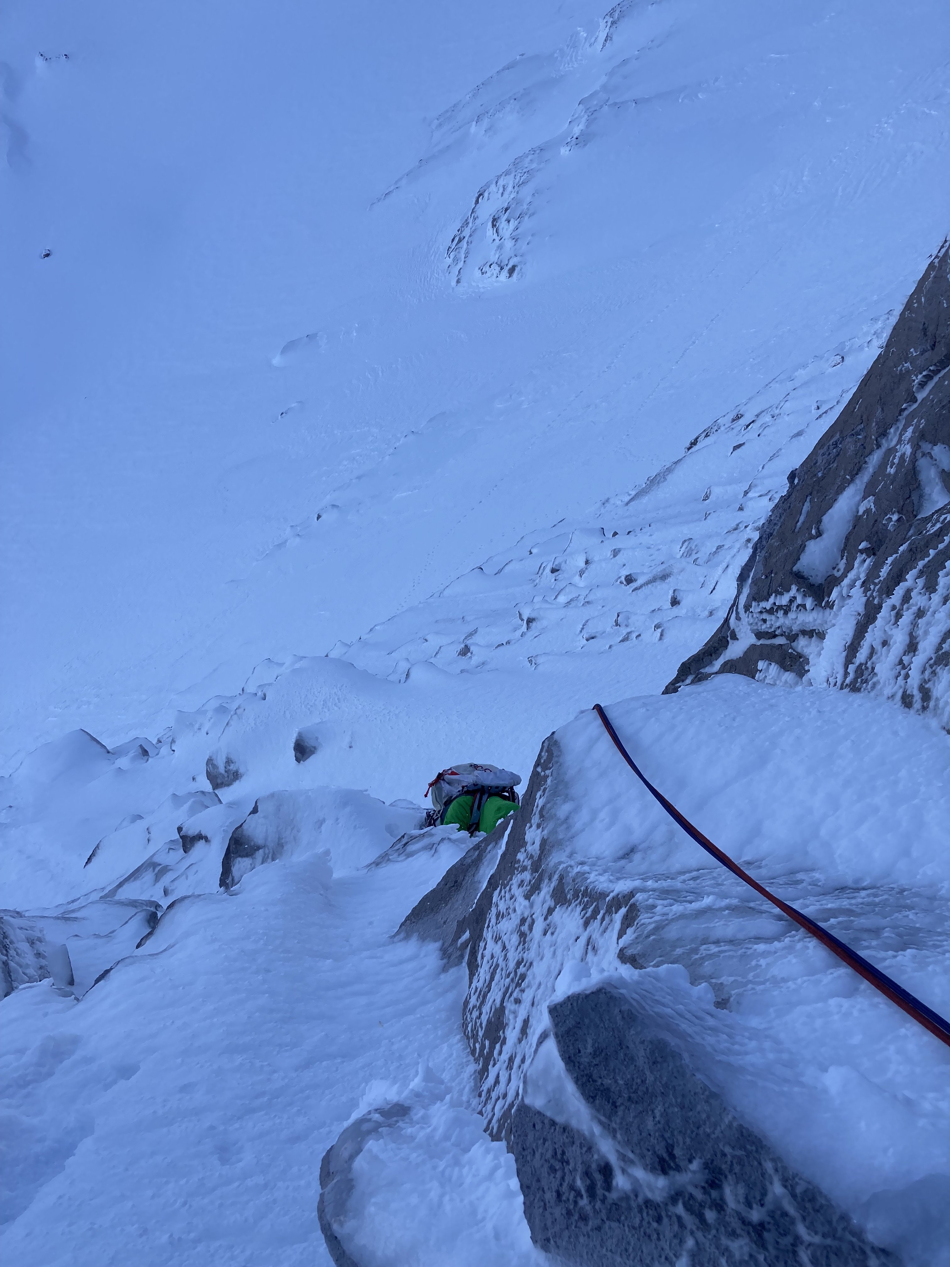
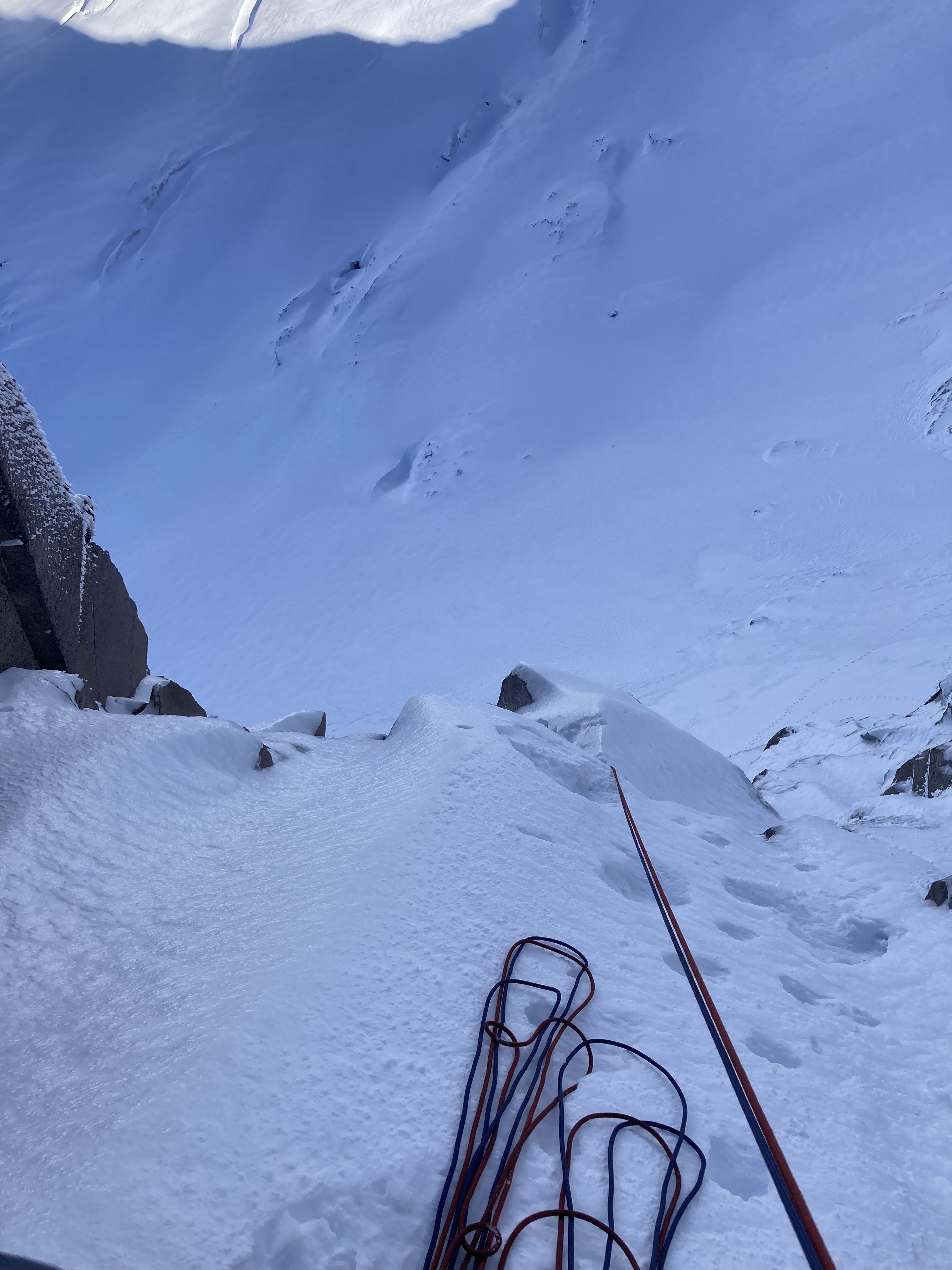
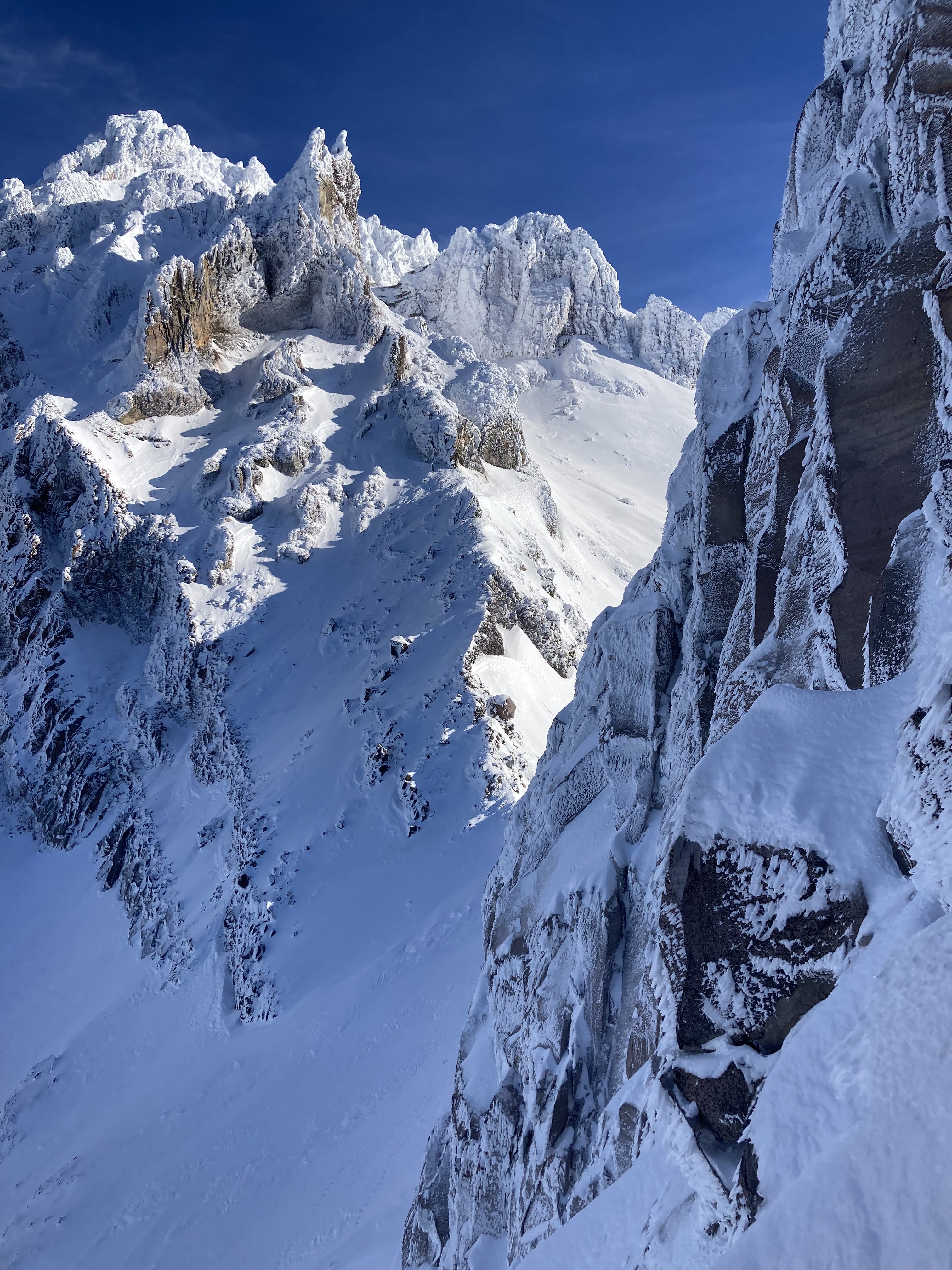
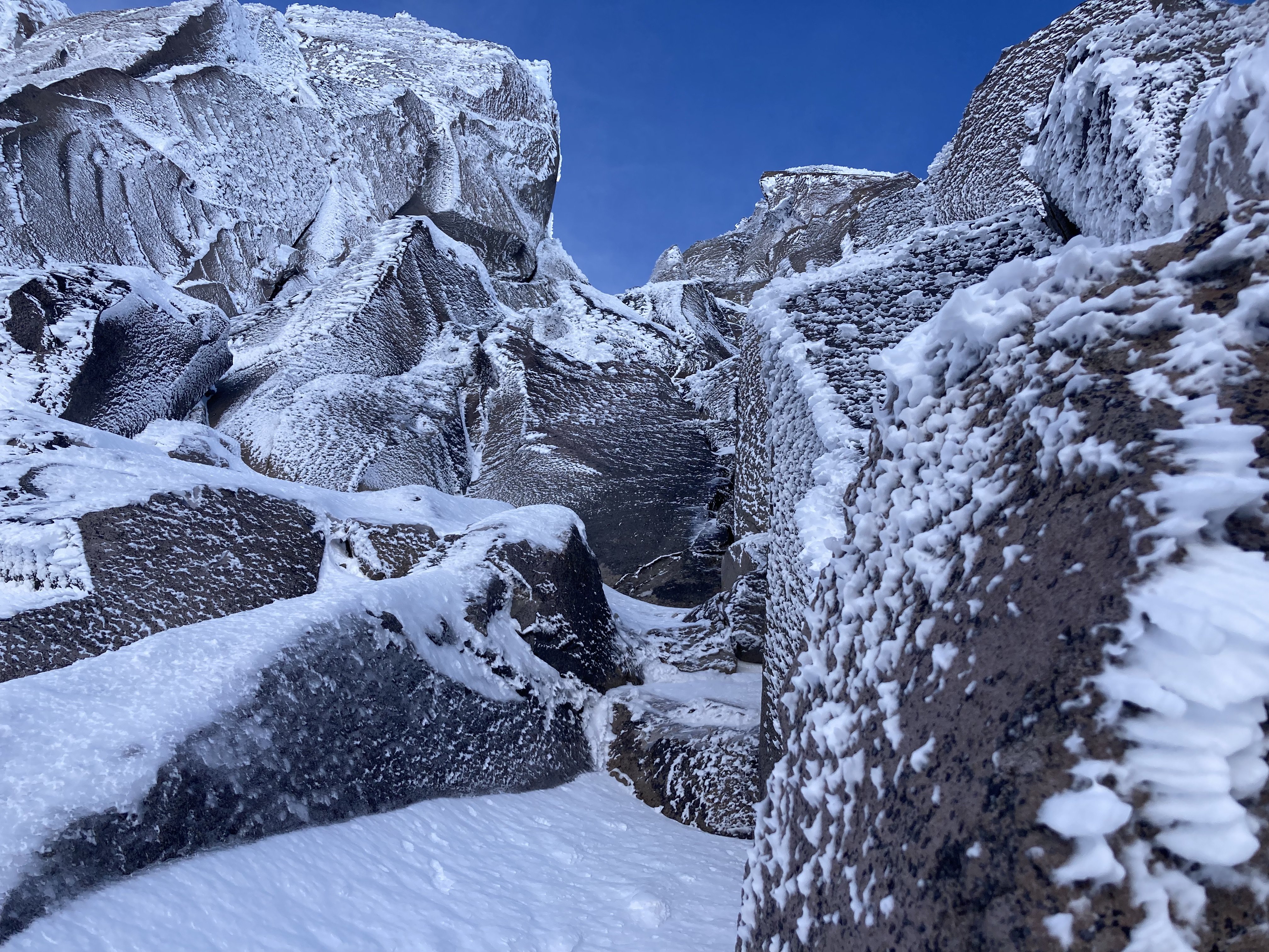
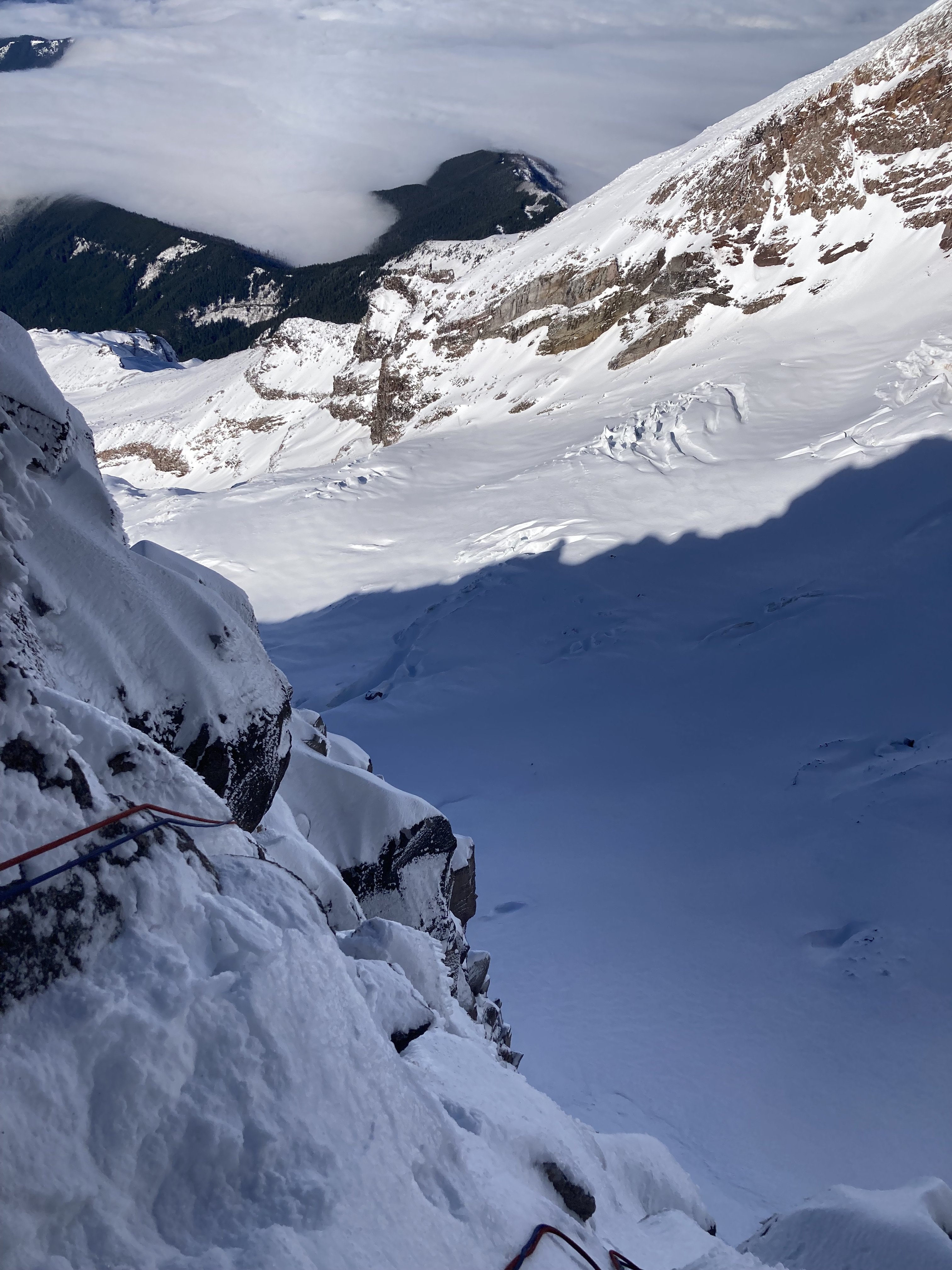
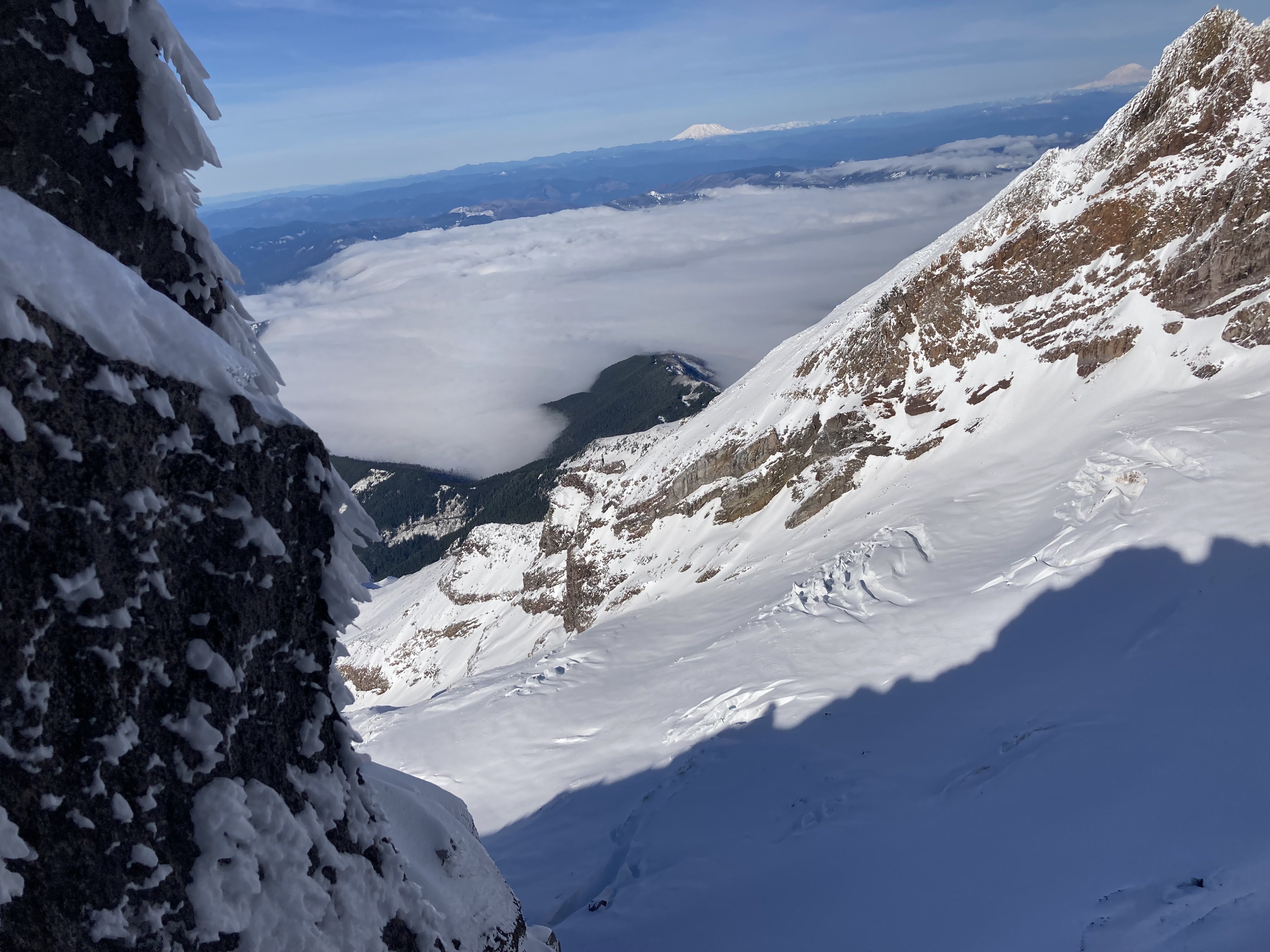
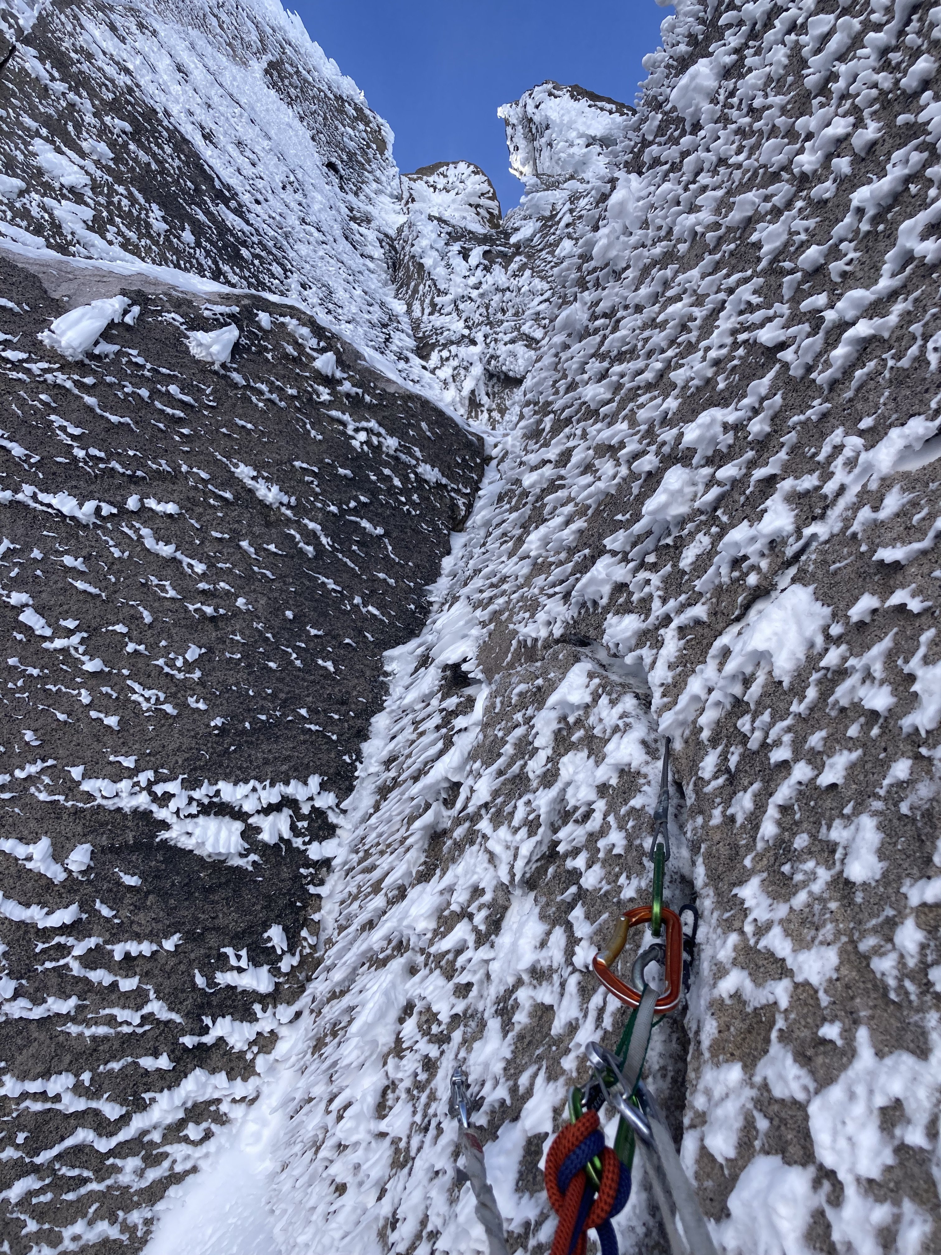
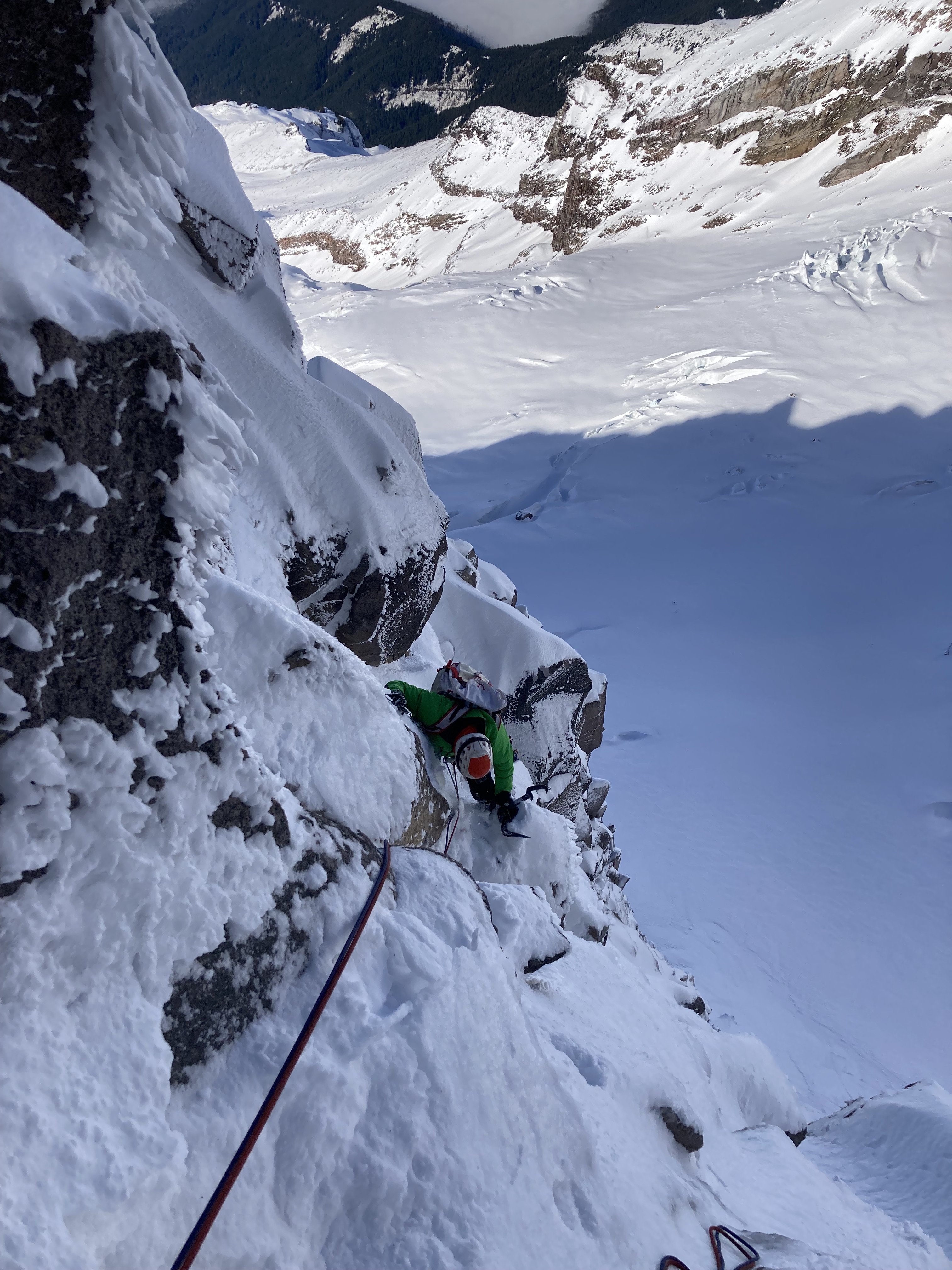
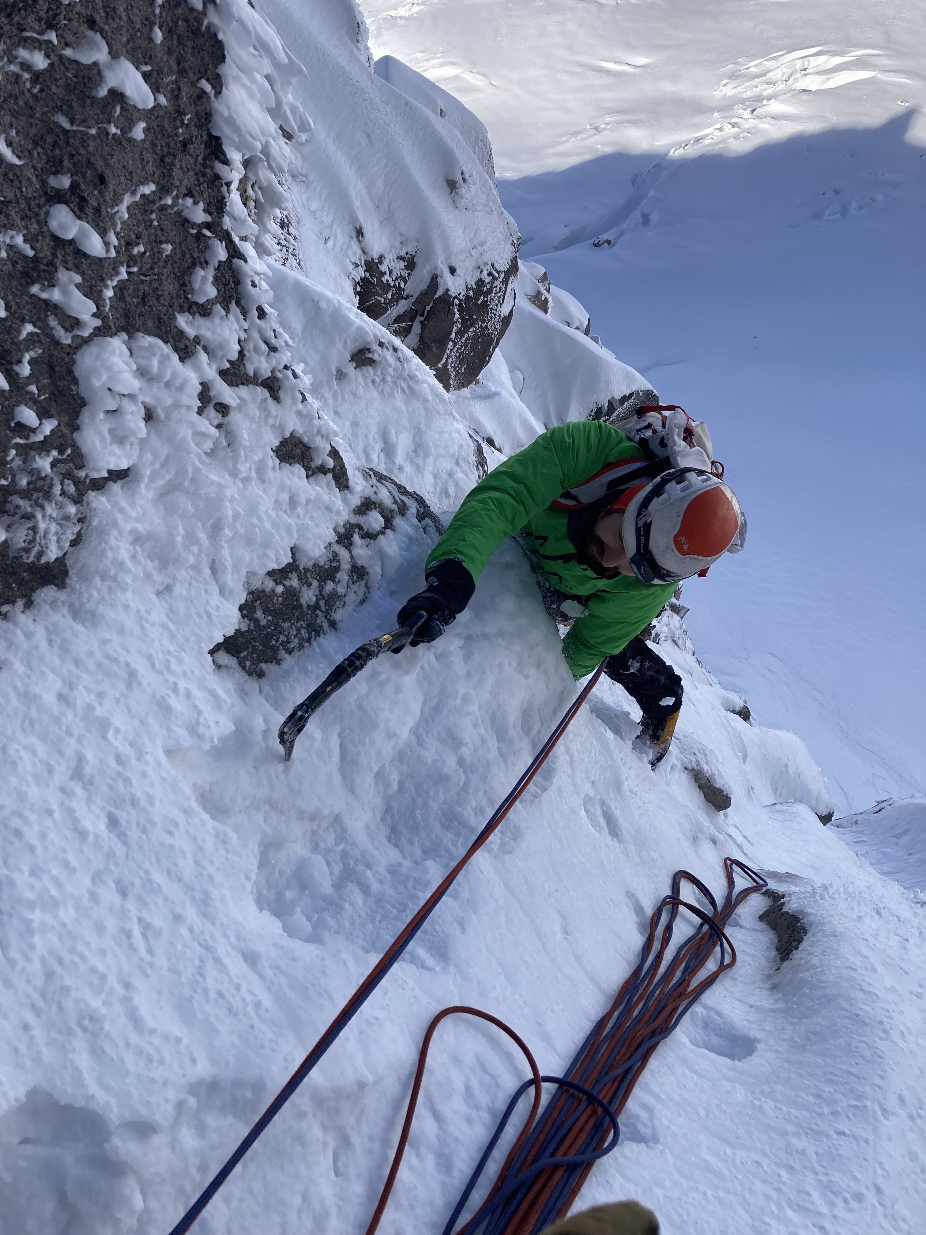
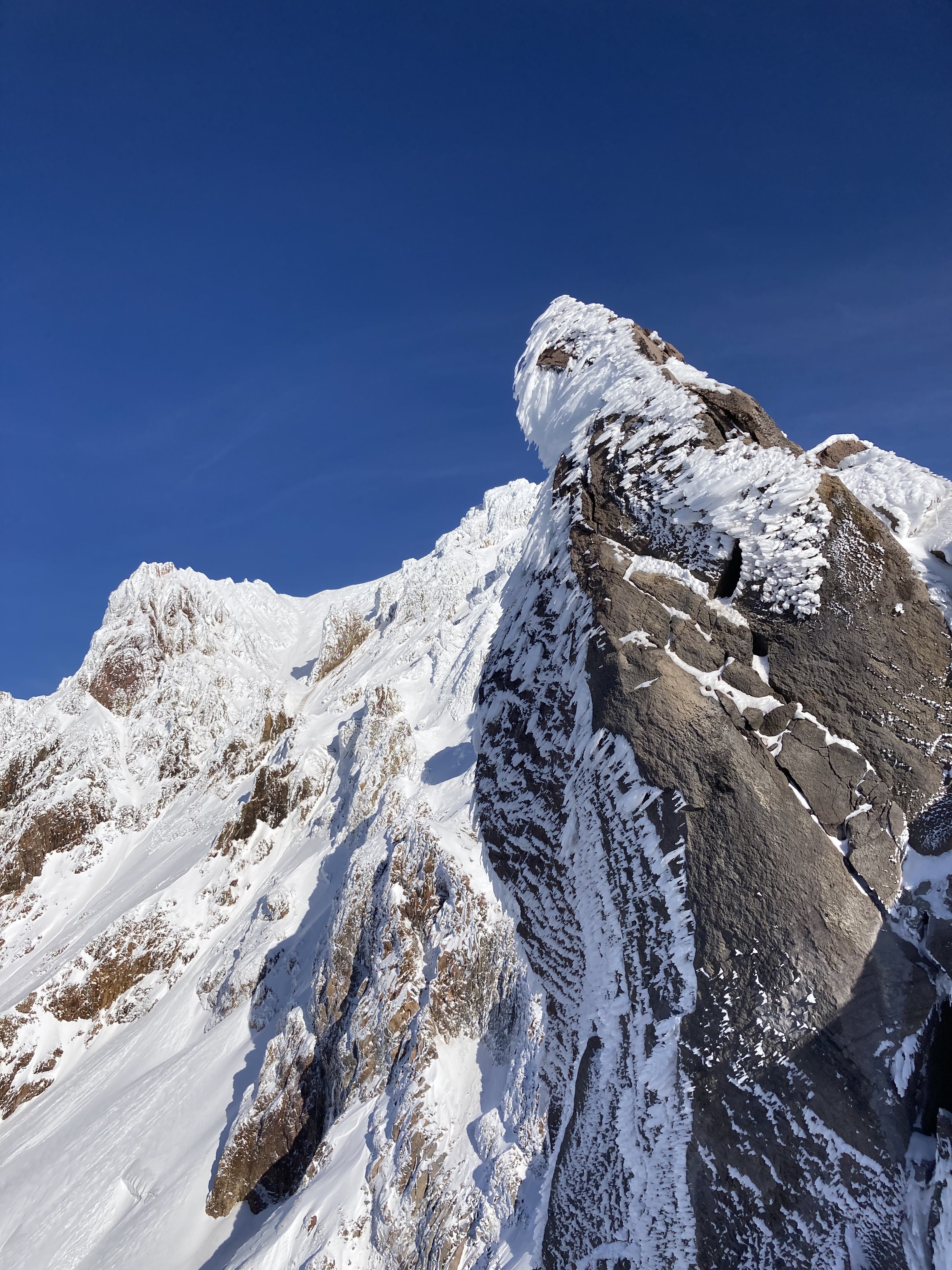
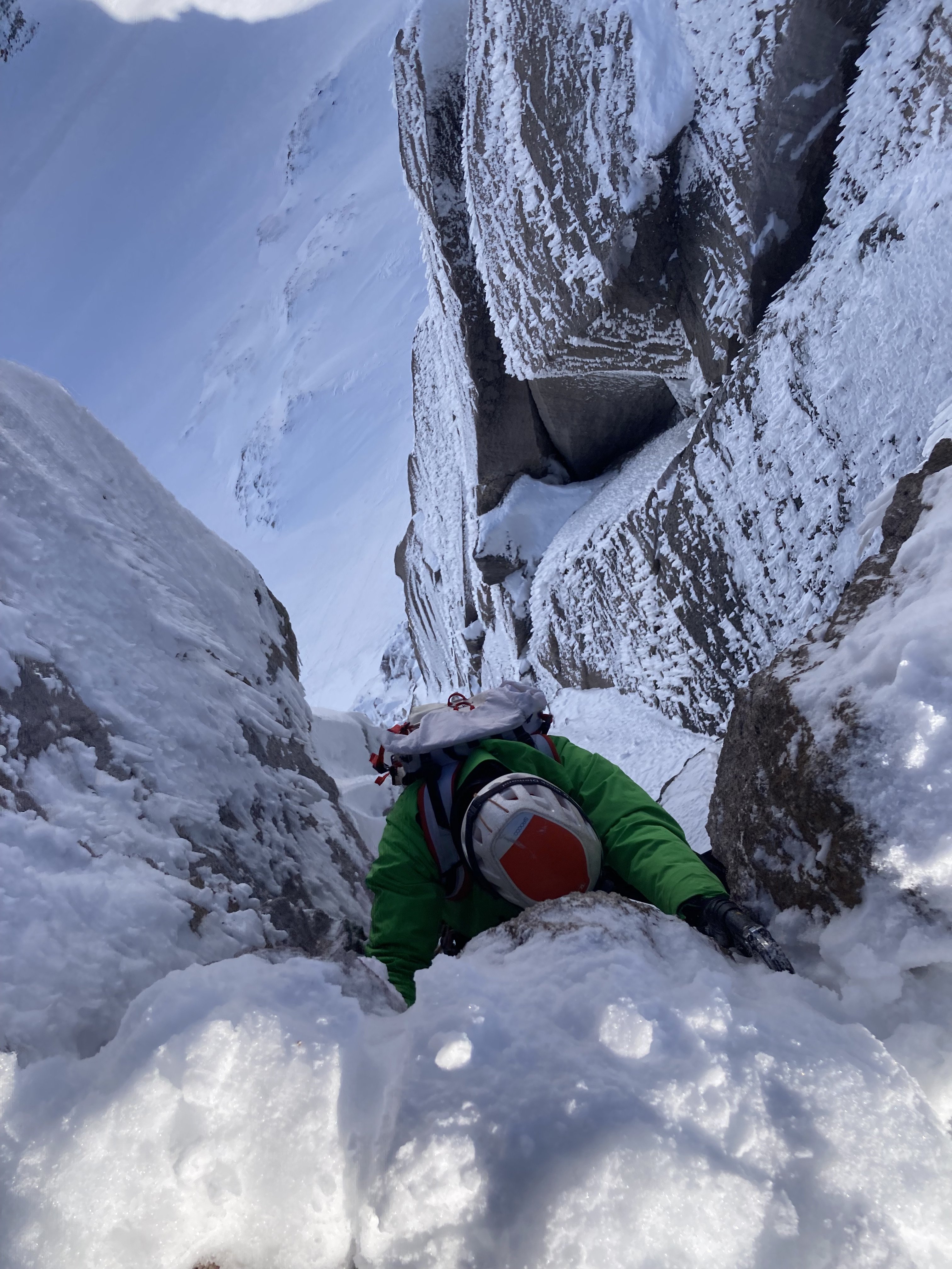
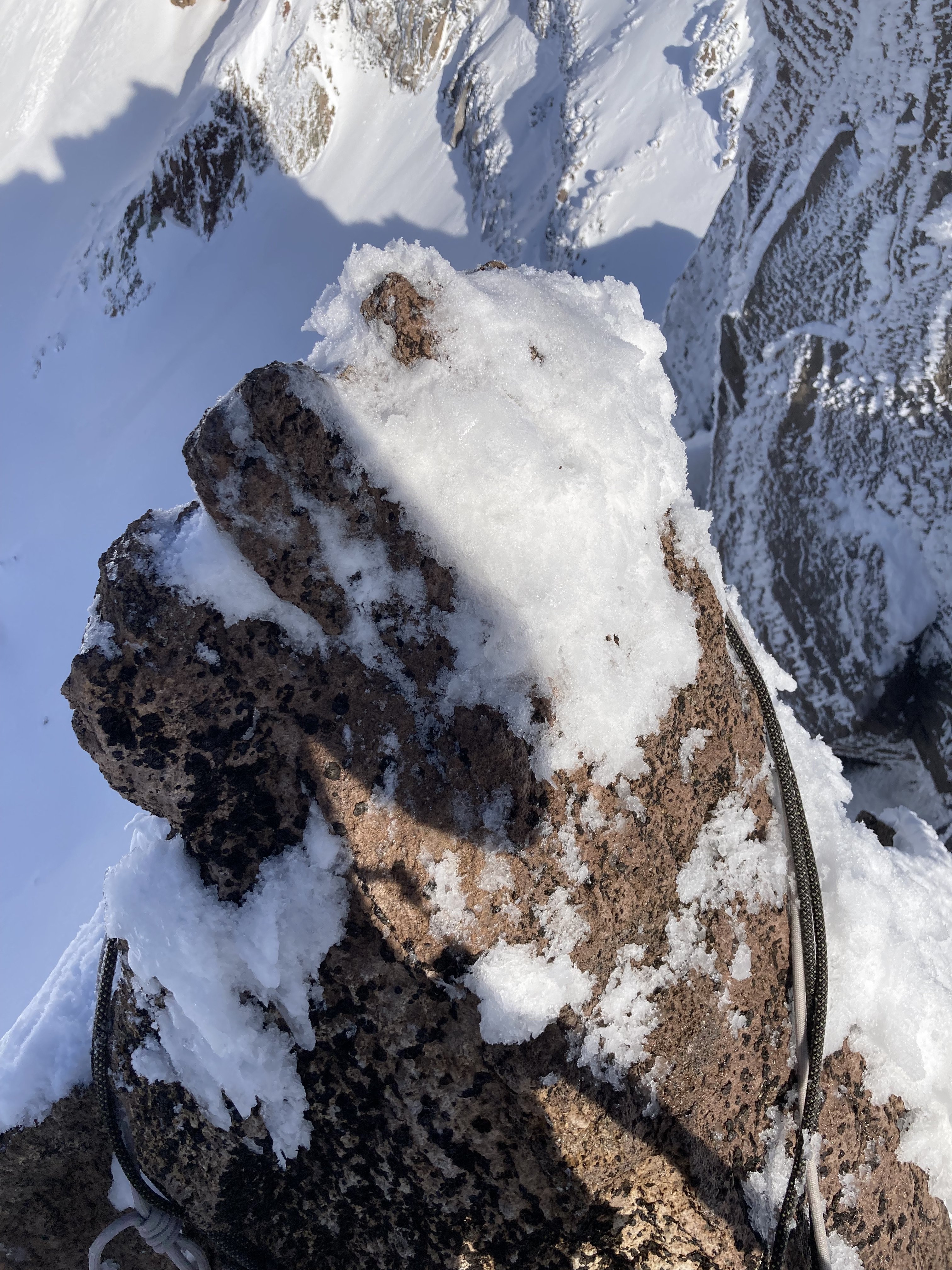
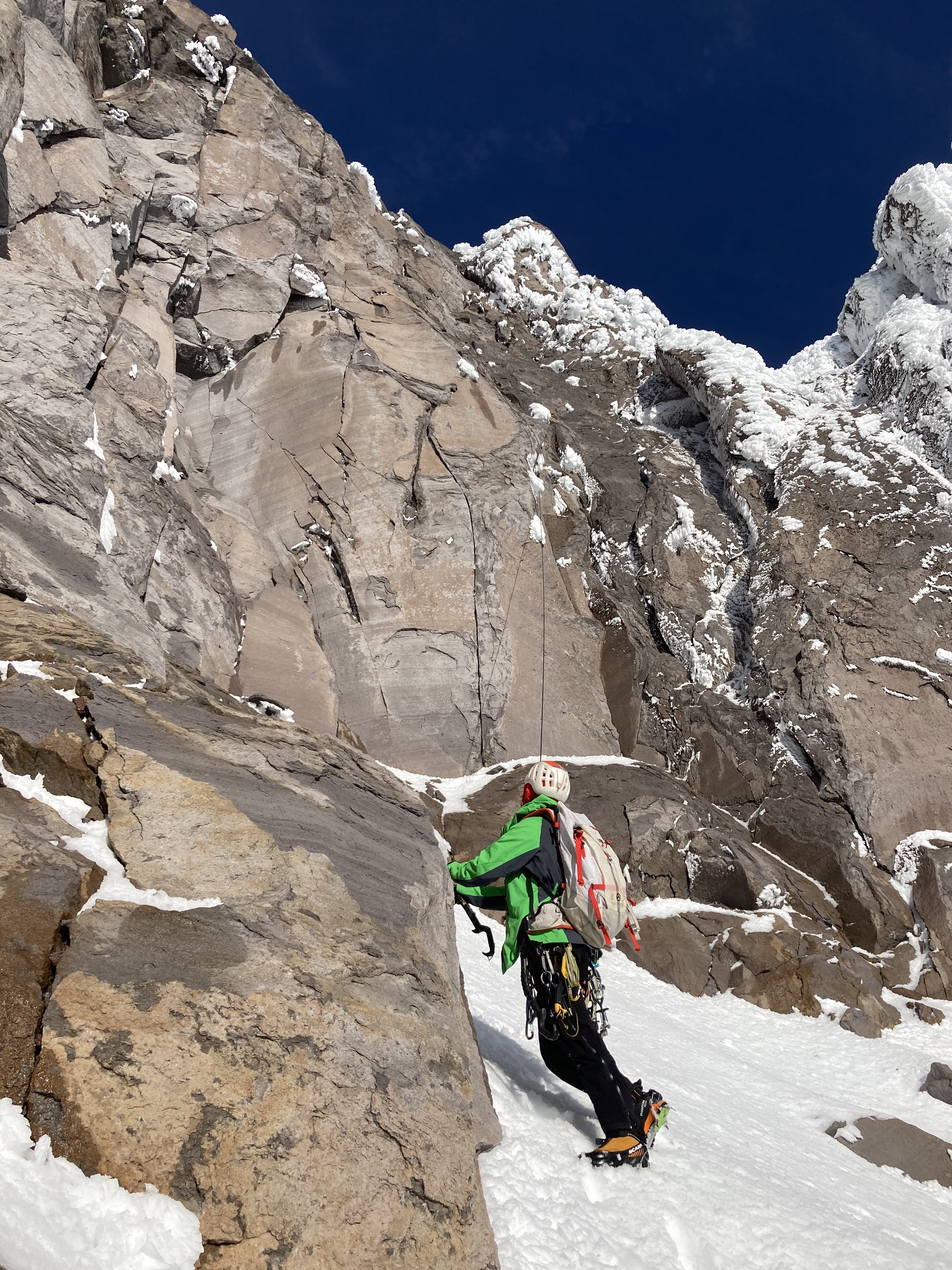
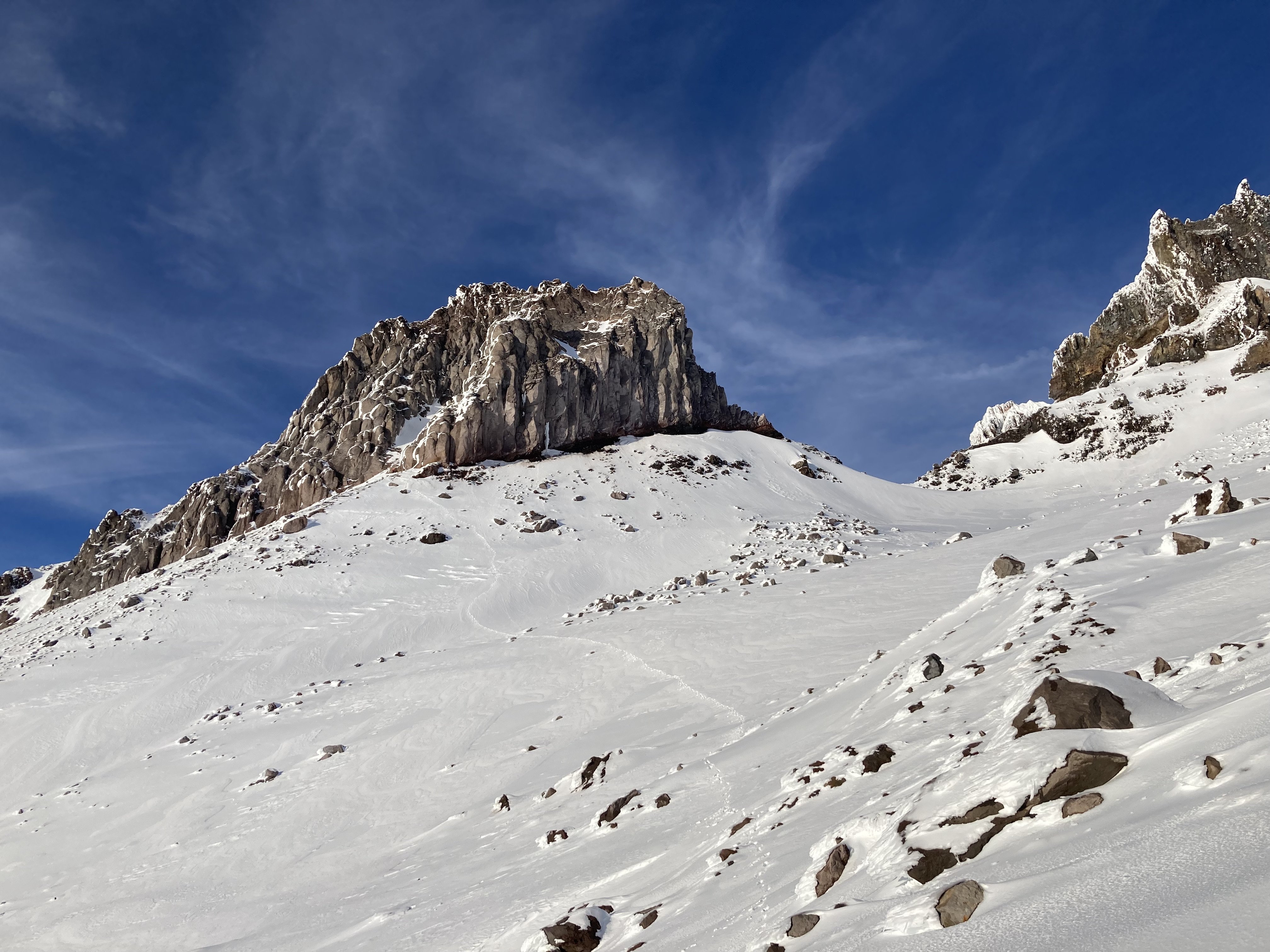 15 points
 -
Trip: Sloan Peak - West Face "The Sloan Slither" Trip Date: 01/29/2023 Team @Tucker_Merrill Trip Report: Sunday January 29th Aaron Minton and I attempted an ice route on the West face of Sloan peak. The climbing involved difficulties up to WI4+ and we eventually linked up with the upper portion of the Superalpine route to attempt the summit. We reach 200 vertical feet below the summit before turning around. From photos and a scouting trip earlier that week I thought that a line would go following ice flows and traversing snowy ledges up the west face. I was able to convince Aaron to come try this line with me. We met in Darrington the night before organized our rack then headed to the TH. We found the road to be fairly clear. Someone had come and cut down the trees blocking the road up Bedel creek. As we drove our cars up NF road 4096 the minivan struggled but Aaron was behind me with his Rav 4 and gave me a push with his car up the steep sections. It worked surprisingly well. We drove our cars up to about 2400ft before we couldn't continue due to snow. We parked, finalized some packing, and went to bed. We woke up at 2:30 and left the cars at 3:15. I knew the conditions were primed for booting and skies would just slow us down on the way up so we left them at the car. We followed the approach beta from the Superalpine TR from Porter McMichael and Kyle McCrohen (Thanks guys!) and the boot pack I had put in previously that week with Jeff McGowen. PHOTO CREDIT: JOHN SCURLOCK a photo of our line to our turn around about 200ft below the summit We arrived at the base of the route around 7:20. It was quite cold as we unpacked and racked up. We took off around 8. Aaron heading up the snow gully The first section involved a snow gully with some low angle ice. Aaron dragged the ropes up easy terrain to the first steep pitch at the base of the amphitheater. There is a selection of ice flows at the start but the best option we decided was the one that took us directly to the next steep ice pitch. Aaron took off leading the first pitch finding hollow aerated ice. A great way to wake up the nerves in the morning! First pitch went at WI3 with less than ideal ice screws. After topping out the ice Aaron had to cross a snow slope to reach a rock belay. probably ended up being a 60m pitch maybe 62m (unsure if we simuled or not). Once at the belay it was my turn he handed over the rest of the rack and I traversed 15m over to the second steep ice pitch and took off finding another WI3 pitch with aerated ice and dispersed ice screws for protection. The top out puts you right at the next ice flow but I didn't want to belay right underneath it so I chose a rock belay to the right. The rock was a little less than ideal but you could manage to find better gear if you dug around. Starting up the 2nd pitch of steep ice Belaying Aaron up the 2nd pitch Next Aaron took over and ran the ropes up another short ice step and across some snow to belay staring up at the beautiful hanging dagger. With the dagger in full sun we were a little skeptical about climbing directly underneath it so we looked around at our options. There was another ice flow looking around WI5ish about 150ft to our right which we debated over. We finally decided to take the WI3 ramp for the sake of time and honestly neither of us were super psyched to lead a WI5 with questionable pro being weighed down by a heavy rack and packs. (definitely a sweet option for a stronger party!) We romped up the easy ramp as quickly as we could to get out of the overhead hazard and got to the big snowy ledge traverse. Aaron being the fearless monster that he is on snow traversed through a tunnel of trees and rocks, which turned out to be good fun! This ledge took us to the bottom of the money pitch. Aaron romping up the easy ice past the overhanging dagger Belaying up the easy ice with the hanging dagger just out of frame above the photo This is the best shot I have of the rock leading to the dagger Aaron heading into the rock and tree tunnel Looking across the snow traverse to the money pitch $$$ Looking back across the snow traverse I will mention the higher we got on the route the ice quality improved a lot. The money pitch is a sweet 30m WI4 flow with good ice and an engaging bulge at the top which leads me to give it a WI4+ rating. As I climbed I found myself enjoying the exposure and good protection. After pulling the bulge there was another 50ft of WI3. As I was putting in protection to climb up the last ice step I bumped a half placed ice screw with my tool and knocked it down to its final resting place somewhere up on the west face. Finders Keepers! After climbing up the final step I got 2 good screws and belayed up Aaron. He wanted to call the ice bulge WI7(satirically) because I had knocked the dagger I used as a foot off when climbing it and he had to pull the bulge at a much steeper angle than I did. We topped out the final ice flow and joined up with the Superalpine route. Working my way up the crux pitch! Really high quality climbing with good pro. Belaying Aaron up the crux Looking at the upper slopes of Sloan. Superalpine goes up the obvious snow slope on the right. To our advantage we found really good snow conditions up top. The wind had blown off any new snow and the freeze thaw had produced really nice snow climbing conditions. We took off simul climbing up to 200ft of the summit. We pondered taking it to the top but ultimately decided with the setting sun and the fact that we hadn't done the descent turned us around to go search for the rappels of the Superalpine route with the last of the daylight. Quick selfie before turning around Starting our down-climb. Someone solod up the corkscrew route and those are their tracks above. we did not make it that far. This was immediately after we decided to turn around. As the sun set the winds began to pick up sending spindrift down on us as we began rappelling Superalpine. This spindrift followed us all the way down the rappels. BRRRR! We made about 7-8 rappels using V-thready, a piton anchor we had to make because lack of ice at the end of a rappel, and a small shrub. This brought us back down to our trekking poles. Tired cold and wet we repacked and began the slog back to the cars. We eventually reached the cars at 1:15am for a total of 22hrs on the go. I subsequently drove the dirt road until I hit pavement parked at a random pullout slept for 3 hours then finished the drive to arrive at school just before class started. Overall this climb was my first of this kind where I wandered up unknown terrain with just a photo and psych. It was a really enjoyable experience and I hope this TR can inspire others to check out this awesome zone! Idk if it can be called an FA because we did not reach the summit, and we joined up with a pre-existing route. maybe a variation? All the more it was an awesome day out with good company and lots of stoke! Gear Notes: We brought a hefty rack singles .1-#2 rack of nuts and micronuts 5KBs 10 screws 3 (10cm) 4 (13cm) 2 (17cm) and 1 (21cm), 2 60m half ropes Approach Notes: See Kyle and Porters TR they have all the beta! Also plenty of running water in the drainage up to 4500ft
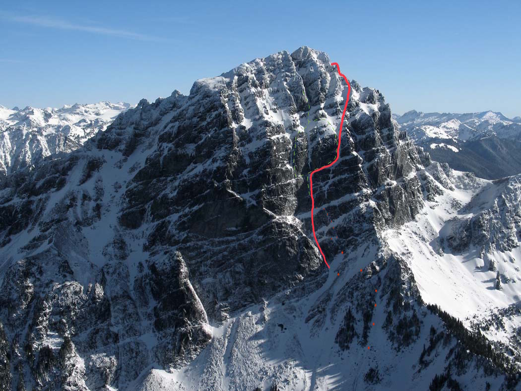
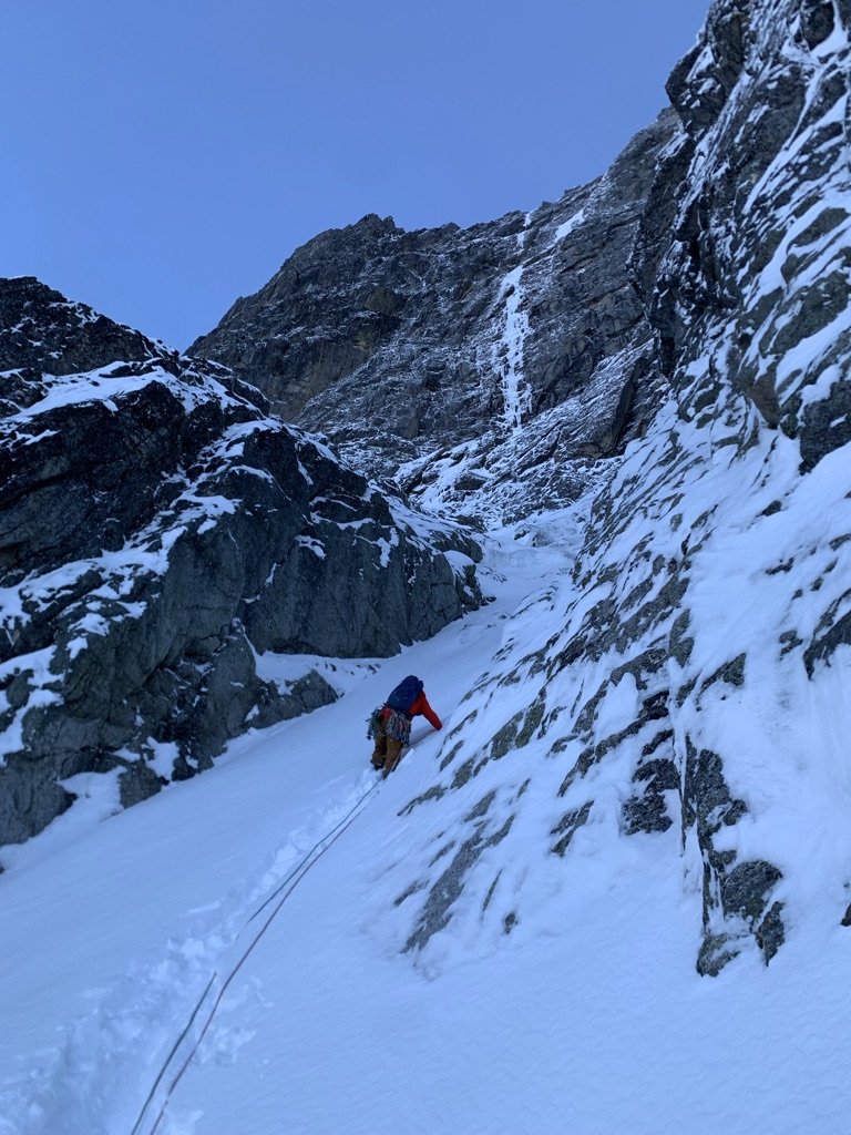
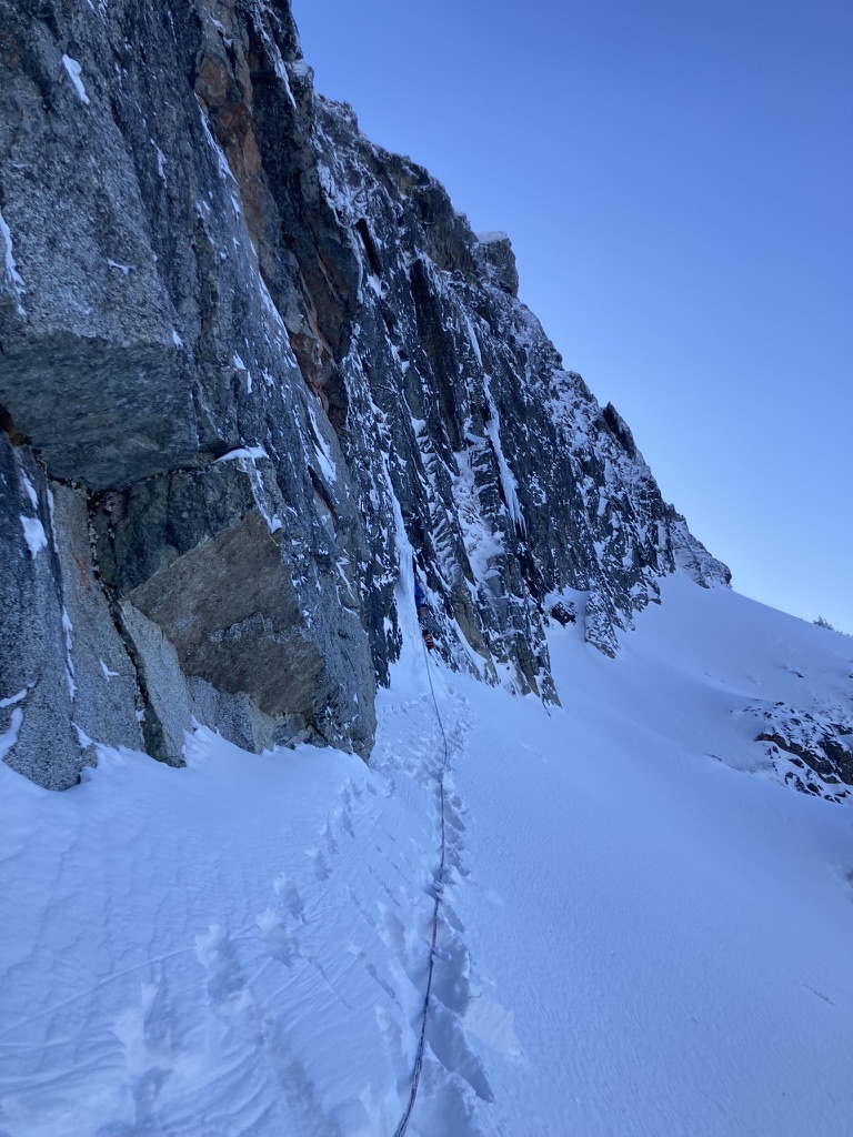
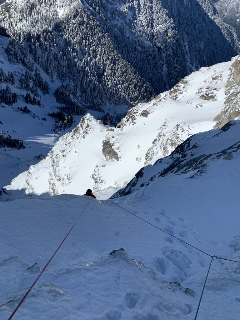
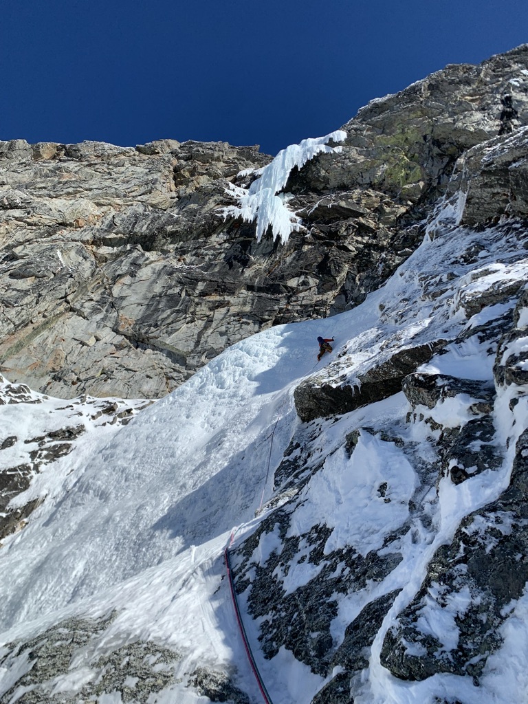
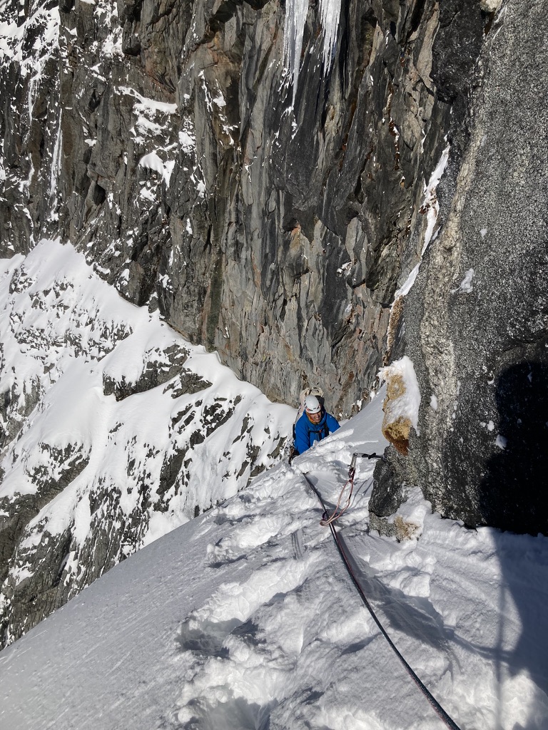
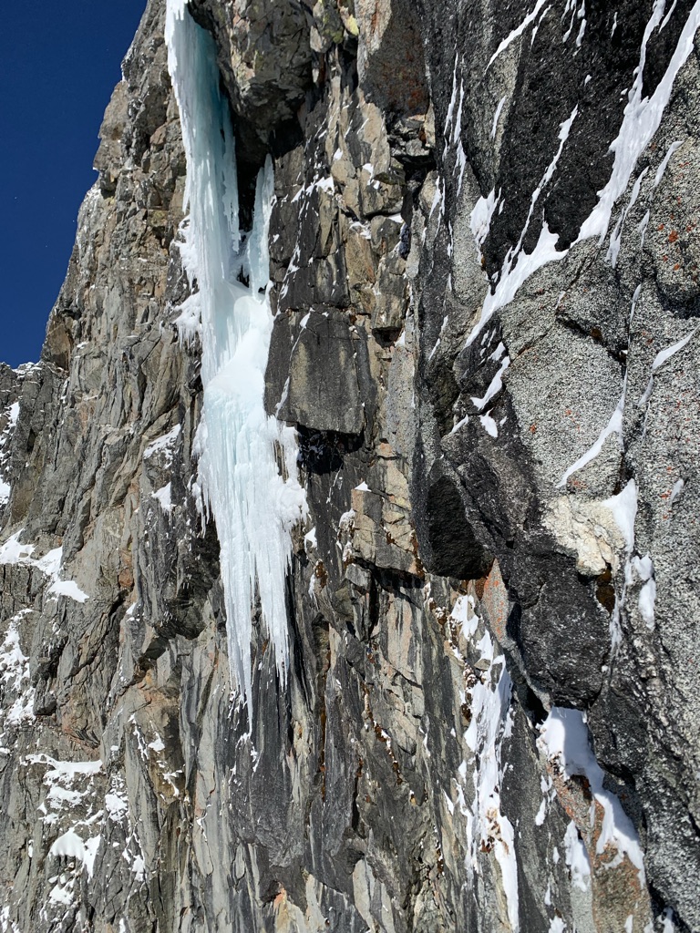
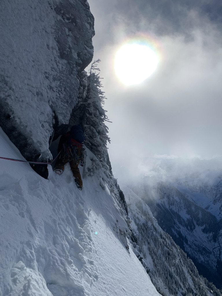
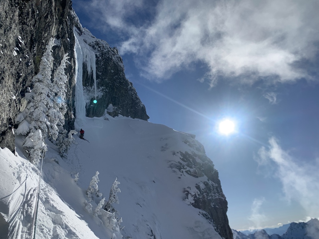
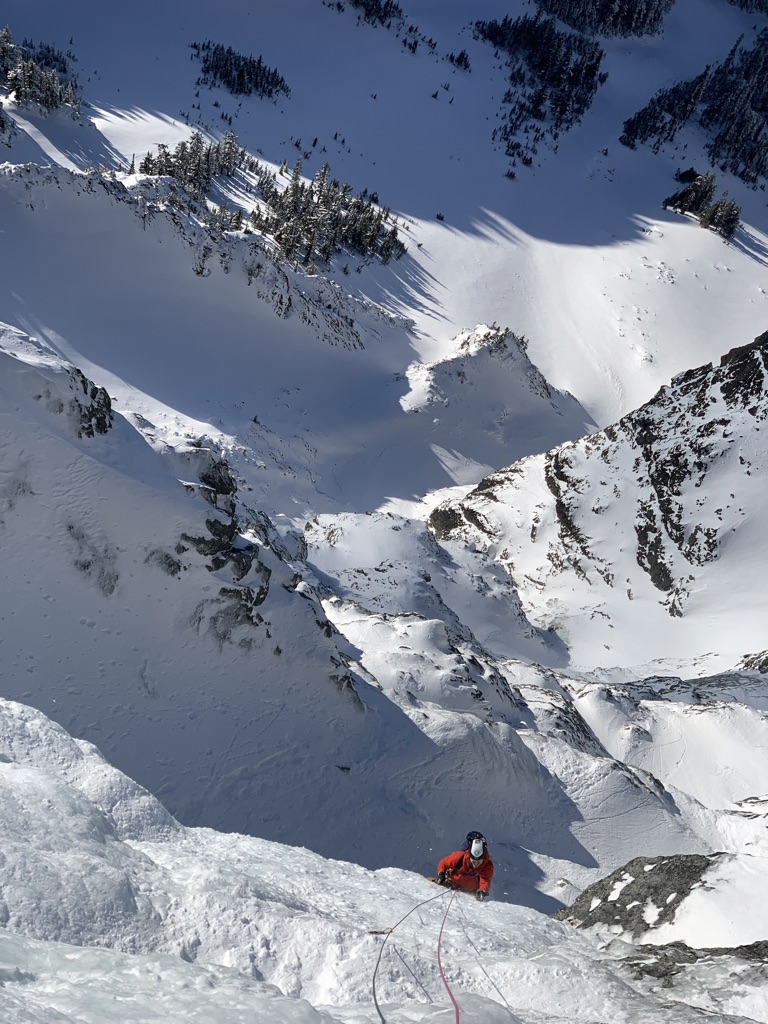
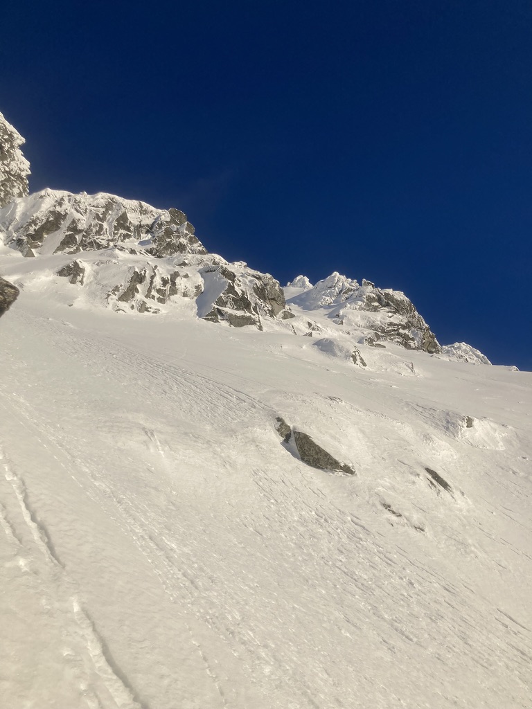
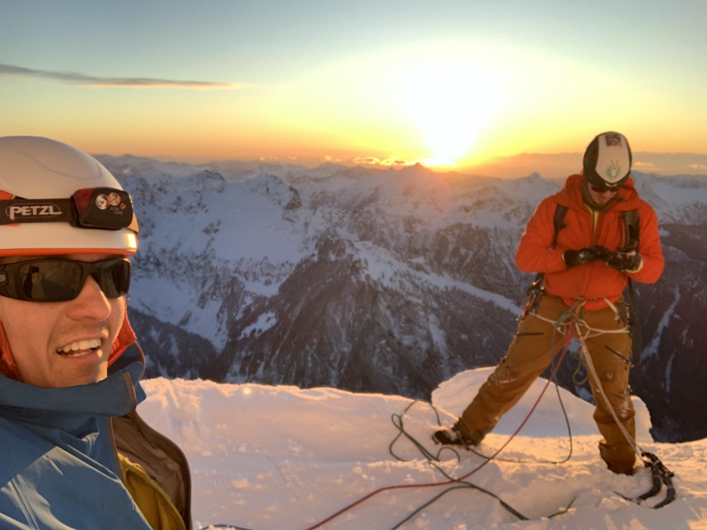
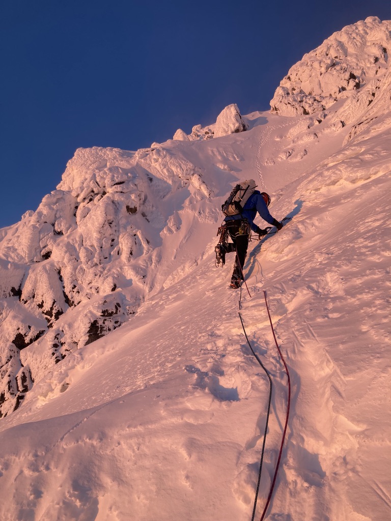
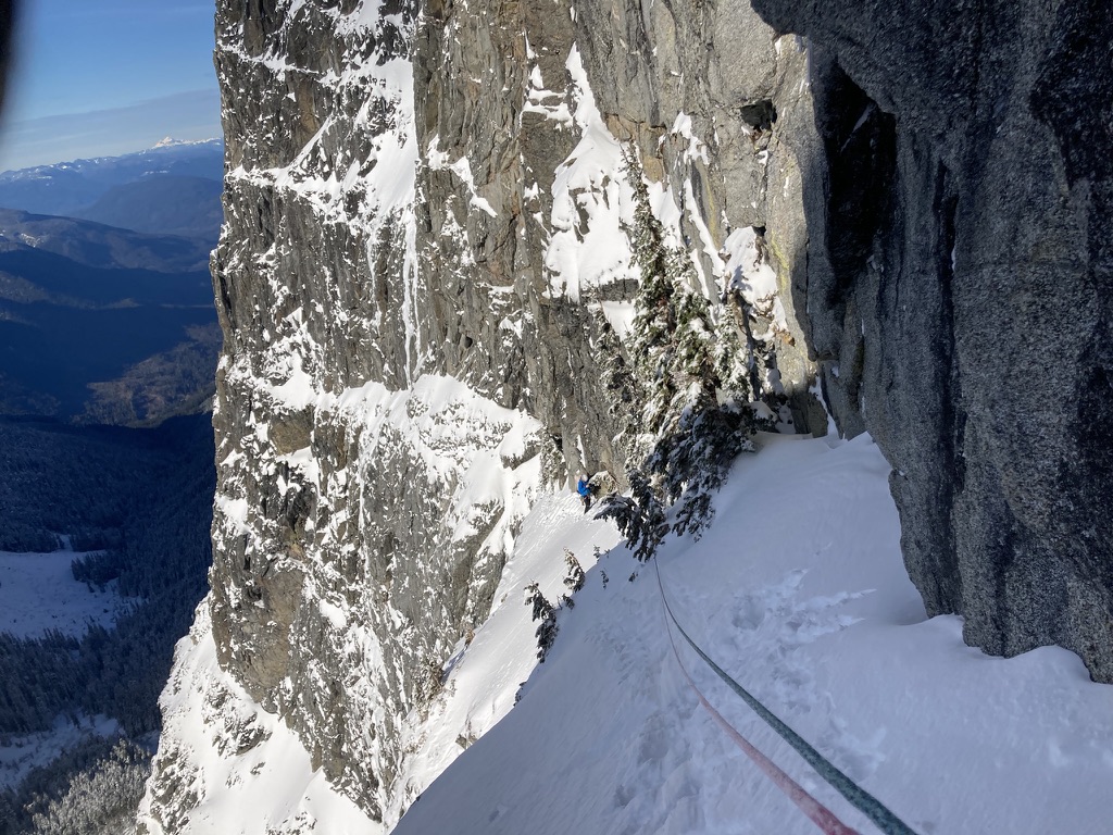
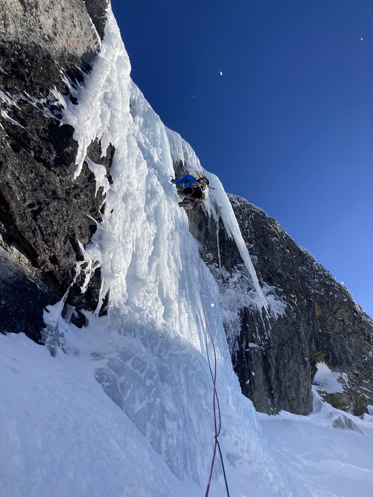 15 points
 -
Over Sept 12-13 Eric Wehrly, Lani Chapko and I Climbed a new route on the NE face of Johannesburg. Like many features on J-berg, the scope of the NE face is overshadowed by the shear mass of the mountain. The face proper gains over 2000', with the entirety of the north face stretching nearly 5000'. We approached via the start of the NE buttress lines, then up glacial slabs directly under the hanging glacier, eventually climbing over the hanging glacier to access the face. We roped up for 23 pitches, totalling 3900' of belayed travel with 17 hours of climbing time split between two days. Our line of travel up the face Rough overview of the '65 route (left), Route 66 (middle), and the '67 route (right) Closer view of the 3 routes. Pink is where the Becky book shows the 65 route going (sharing a pitch with our line) but the green line is where we believe is more likely they went. The white circle is where we bivied. The forecast on the morning of the 12th showed fog, eventually clearing to blue skies. We opted for a somewhat late start and arrived at the TH to dense white out conditions. Our forecast all seemed to believe it would clear up, so we started hiking down towards the lower buttress hoping it would clear up. Lani going full euro The conditions did pretty quickly start clearing as we arrived at the base, but the rock and, more importantly, plant life was still wet. We decided to access the NE face via the first portion of the NE rib routes, as the CJ was an impassable death gully spitting rocks. The access climbing went generally pretty well, though we ended up unexpectedly roping up for a few pitches. None of us felt like dieing slipping off of wet moss... An early pitch on the approach Eventually we hit the hanging basin where the buttress lines turn right up into the thick cedar forest. We continued up slabs below the hanging glacier and found easy travel. The glacier presented with almost no hangfire this time of year, but early season, this would have the potential for overhead hazard. Lani and Eric on the nice approach slabs Broken ice on the hanging glacier The hanging glacier itself was mellow, though season and conditions will greatly impact this. We ended up chopping a bollard and doing a short rap into the moat at its top to gain access to the rock. Looking back at the bollard belay/rappel Climbing on the second pitch We likely shared some terrain with the 65 route here as we used the gully to access our intended crack system. The Becky topo makes it a little unclear where they went here, though you could probably assume they went up the gully. After a bit of gully travel we were able to escape to our objective face. The angle slowly steepened as we approached our "hand crack". The proposed crack turned out to be filled with gnarly munge, so we aimed for a thinner looking crack to its right. Eric leading the crux 5.10 crack The crack proved to provide the crux of the route, luckily it was relatively well protected... For the crux section. While perched here, a huge natural rockfall ripped down the 65 route gully, validating our concerns of gully trqvel and questioning the sanity of our ancestors. As Eric led the pitch, it became clear that we were about to loose the last bit of light, so we got our our headlamps and prepped for some night climbing to go in search of a ledge to sleep on. Two more 200' pitches gave access to a workable ledge. Lani and I somehow fit in this footprint, while Eric was on some downsloping round ledges below Morning at the bivy Racking up in the morning We all woke up a little creaky and waiting for the sun to warm us. Above presented with 3 options. Our original intent was to traverse right and climb a series of catscratch cracks. These however looked steep, and filled with munge. So we opted to work up and left to climb the top of a ridge feature (not even considering option 3, the unclimbed gully above). Its possible we share a pitch here with the 65 line, though the written description of their climb makes much more sense to have climbed an obvious ramp a couple hundred feet below (avoiding what would have been a gnarly mandatory impasse to gain their upper headwall cracks). Lani topping out the worst pitch on the route... A fun corner brought us near the ridge crest, where we climbed 2 awful choss pitches up to a gendarme, above here, the rock luckily turned back to decent quality shist. Eric starting up his choss ridge pitch Climbing on the pitch above the red gendarme Here we worked up and right on moderate terrain and eventually gained access to another big gully system that we believed to be the 67 line. We climbed this gully for 2 shared pitches to gain a notch on the NE buttress by the glacier. The final moves on the NE face Different view, same spot One mellow ice pitch brought us into some more easy scrambling to the summit. We all had approach shoes and aluminum crampons so ended up roping up for 3 total pitches of easy ice. Had we had boots or had early season snow coverage over the ice we likely wouldn't have needed to rope up for these pitches. Then we were in for the long descent down the East ridge and back over Doug's direct. Steep moraine dirt below the CJ We ended up getting back to the cars pretty late and made the rough late night drive home. Overall, the route only really had a couple pitches of bad rock. There were some tricky belays to build and some pitches were runout. Though very rarely was it hard and runout. It seems like the objectively safest route on the central part of the NE face as it climbs the least amount of gully of any existing route. We collectively give it a solid recommendation for the Cascades connesouir, or anyone keen on climbing the upper NE face. As always, here are my pitch notes.. Route 66 V 5.10 AI 2 Rack: Triples .3/.4; Doubles .1-.75; singles 1-3; full set of nuts; 3 KBs (used extensively for belays) P1-4 700' Alpine boulder problem pitches getting to the base of the NE face (up to 5.8 and AI2) P5 130' 5.7 A transition pitch up into the gully. P6 200' 5.6 Climb the gully, belay in the gully. P7 200' 5.9 Climb the rib left of the gully, stepping back right to belay in the gully again. P8 150' 5.6 Exit the gully to the right. Belay on a good, medium sized ledge below where the wall steepens. P9 100' 5.10- start with a steep, juggy roof to the right, then trend up ramps to a small ledge to the right of a large tombstone flake. P10 200' 5.10 Start up the flake (crux), then trend left on low angle terrain to meet the main weakness. Follow this up to a large ledge system. P11 200' 5.6 Traverse slabs rightward into a gully, follow it to a good ledge below a big roof P12 200' 5.8 "money pitch" Follow the gully, pulling the roof to its left, and continuing to another good ledge P13 250' 5.4 Scramble up the gully, exit left and belay at a ledge positioned below a big open book corner. P14 160' 5.9 Work your way into the corner, belay at its top. P15 170' 5.6 Ramble up loose terrain on the ridge crest P16 100' 5.8 Climb the super chossy ridge to a notch by a red finger P17 200' 5.5 Climb past the finger then scramble up to your end of rope P18 200' 5.8 Climb the grassy cracks above to gain the big chimney on the right, follow this to a stance in the chimney P19 200' 5.6 Trend up and right past two gullys towards the larger drainage feature P20 150' 5.9 Climb a face to gain a corner, follow this to a ledge at its top P21 200' 5.7 Continue up the gully P22 200' 5.7 Continue up the gully, belay at a notch on the NE butt by the glacier P23 200' AI2 one pitch up the glacier.
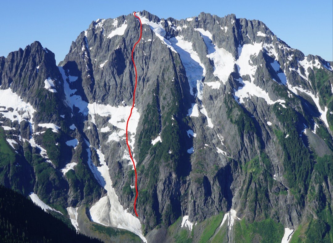
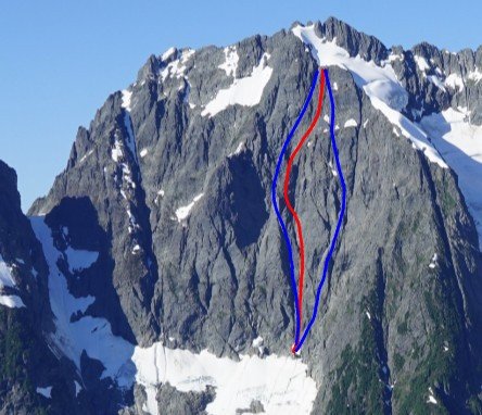
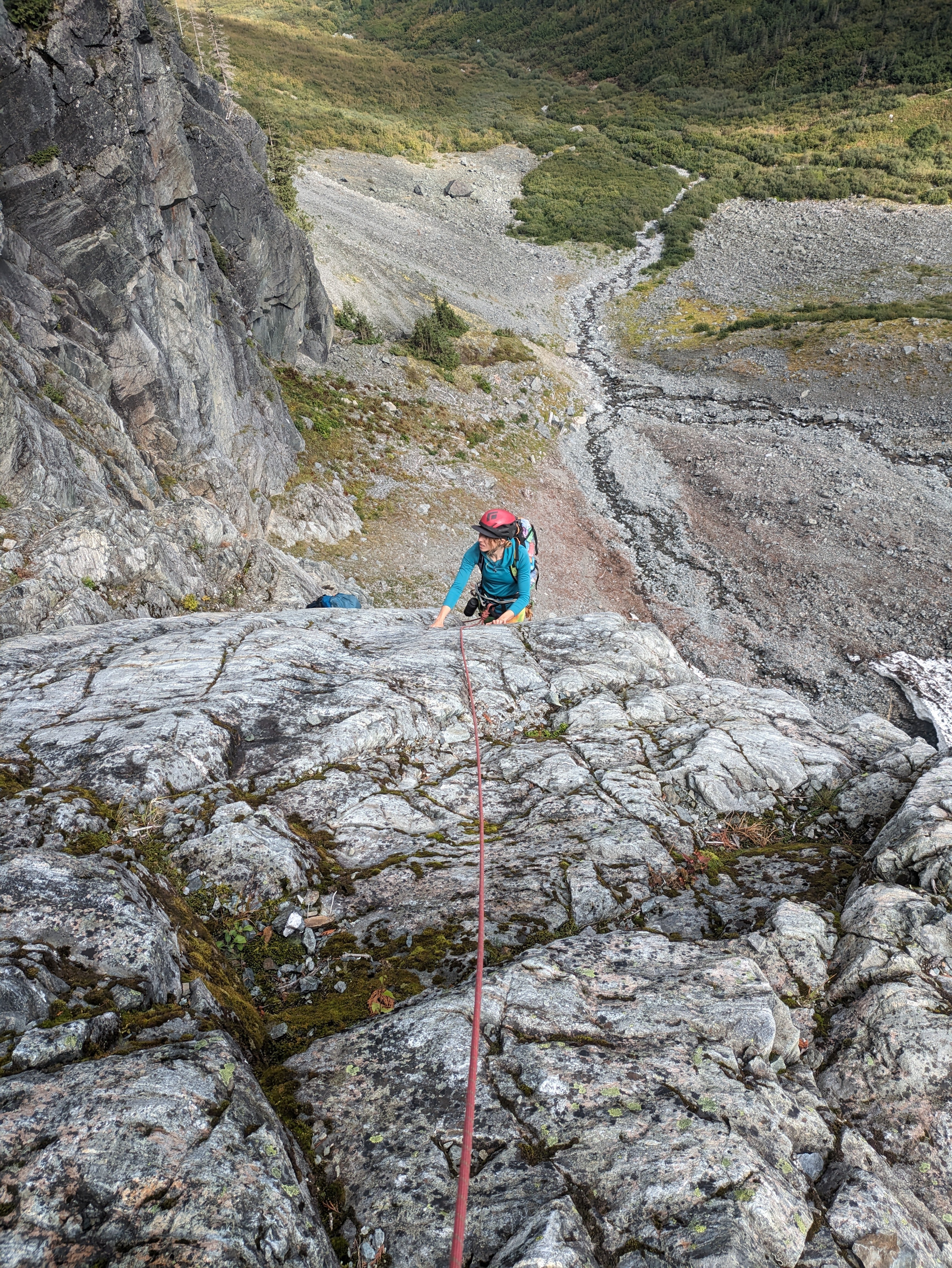
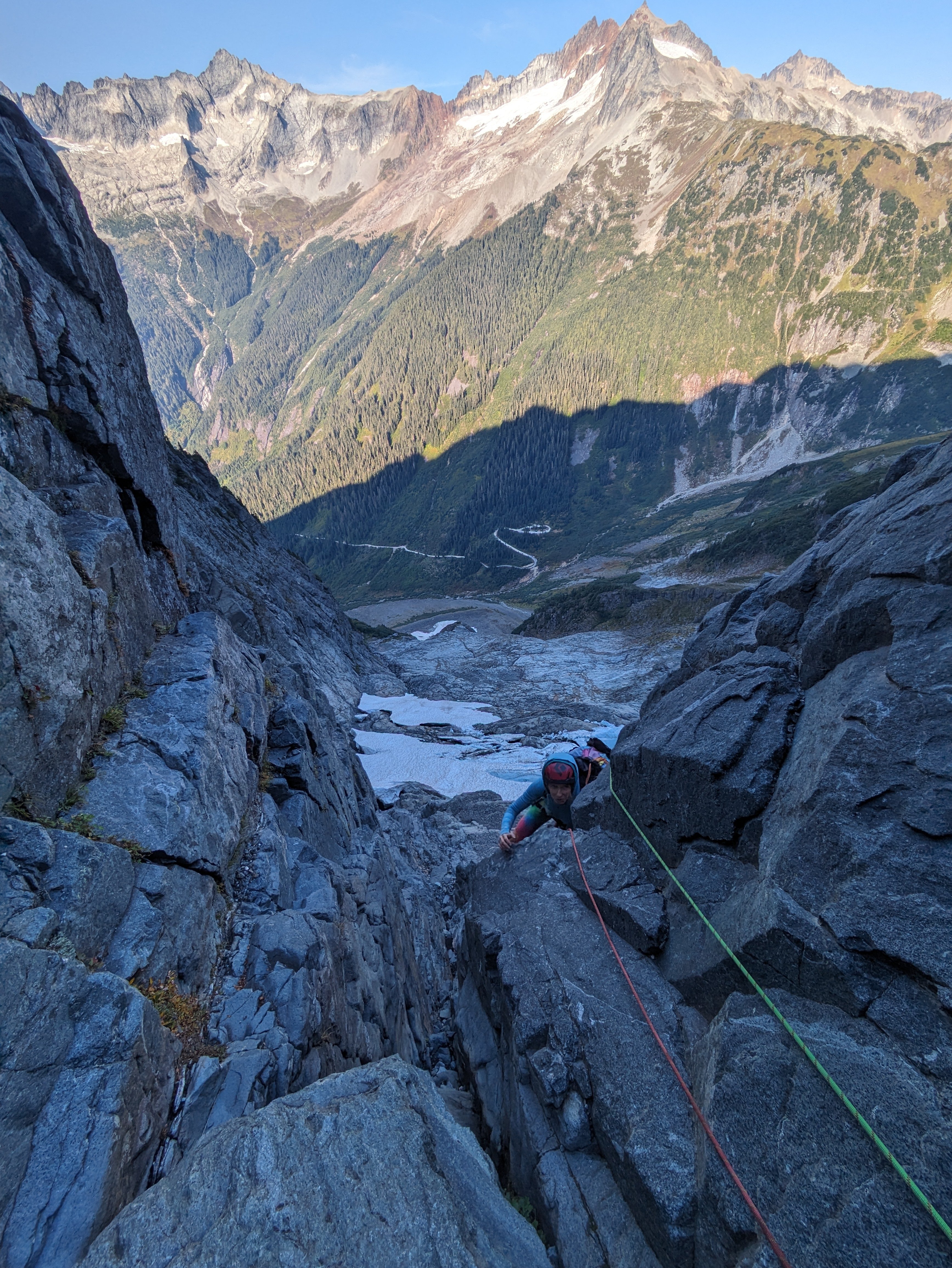
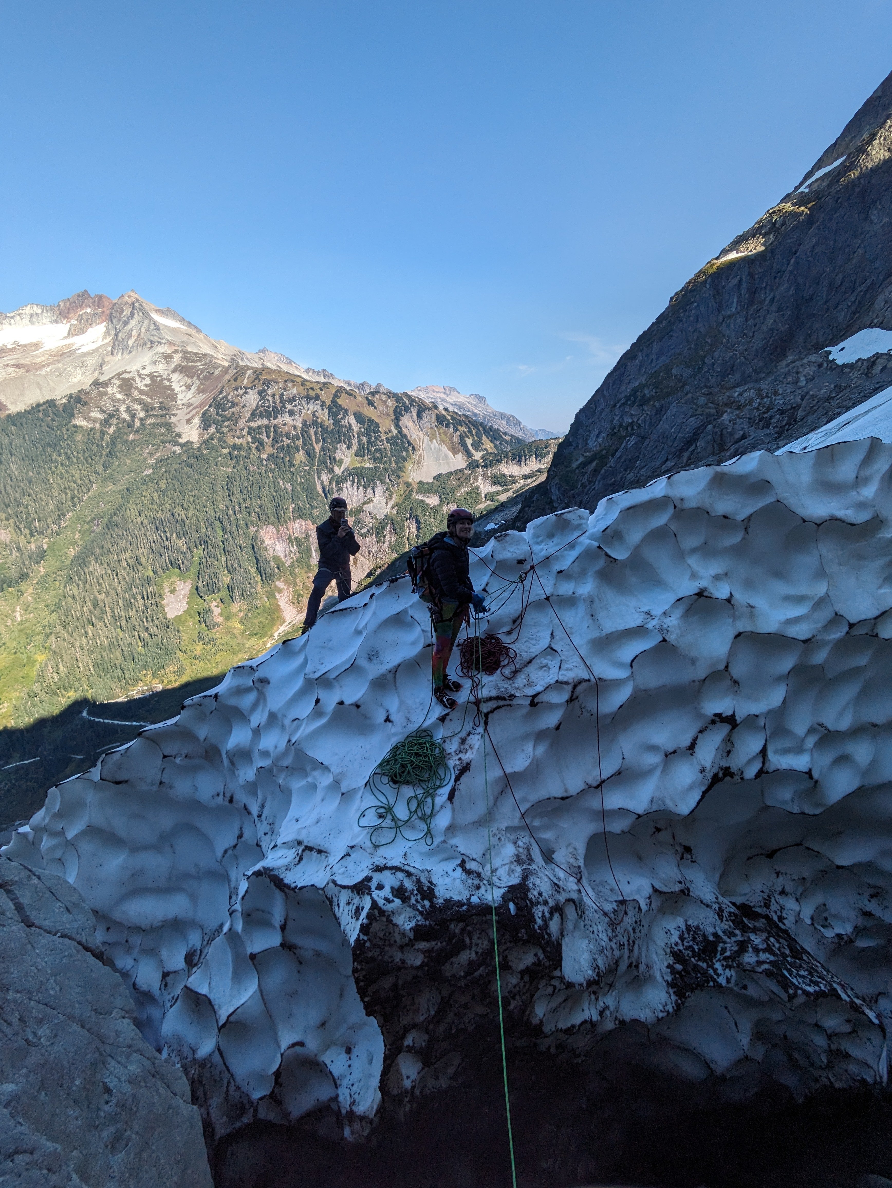
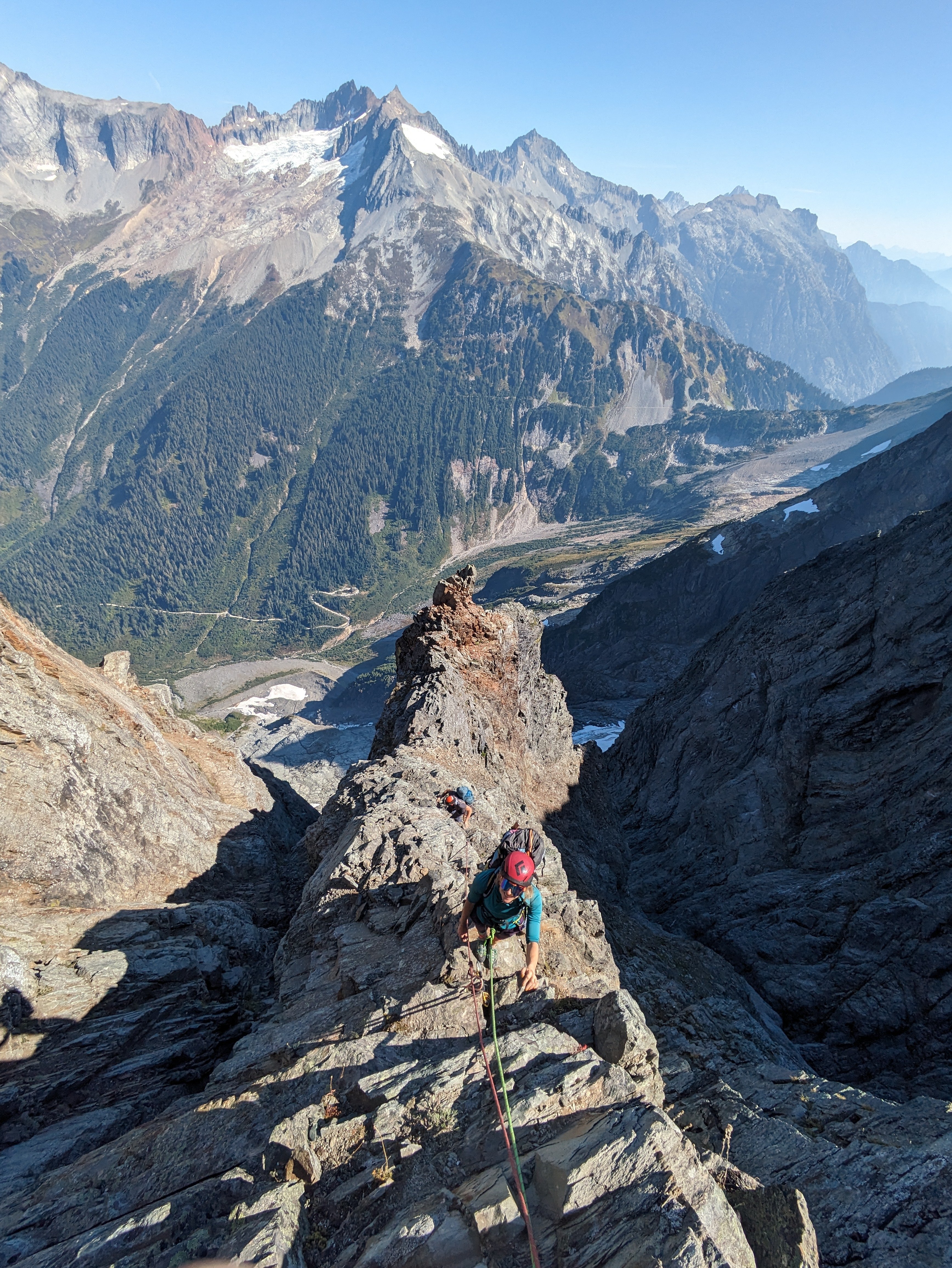
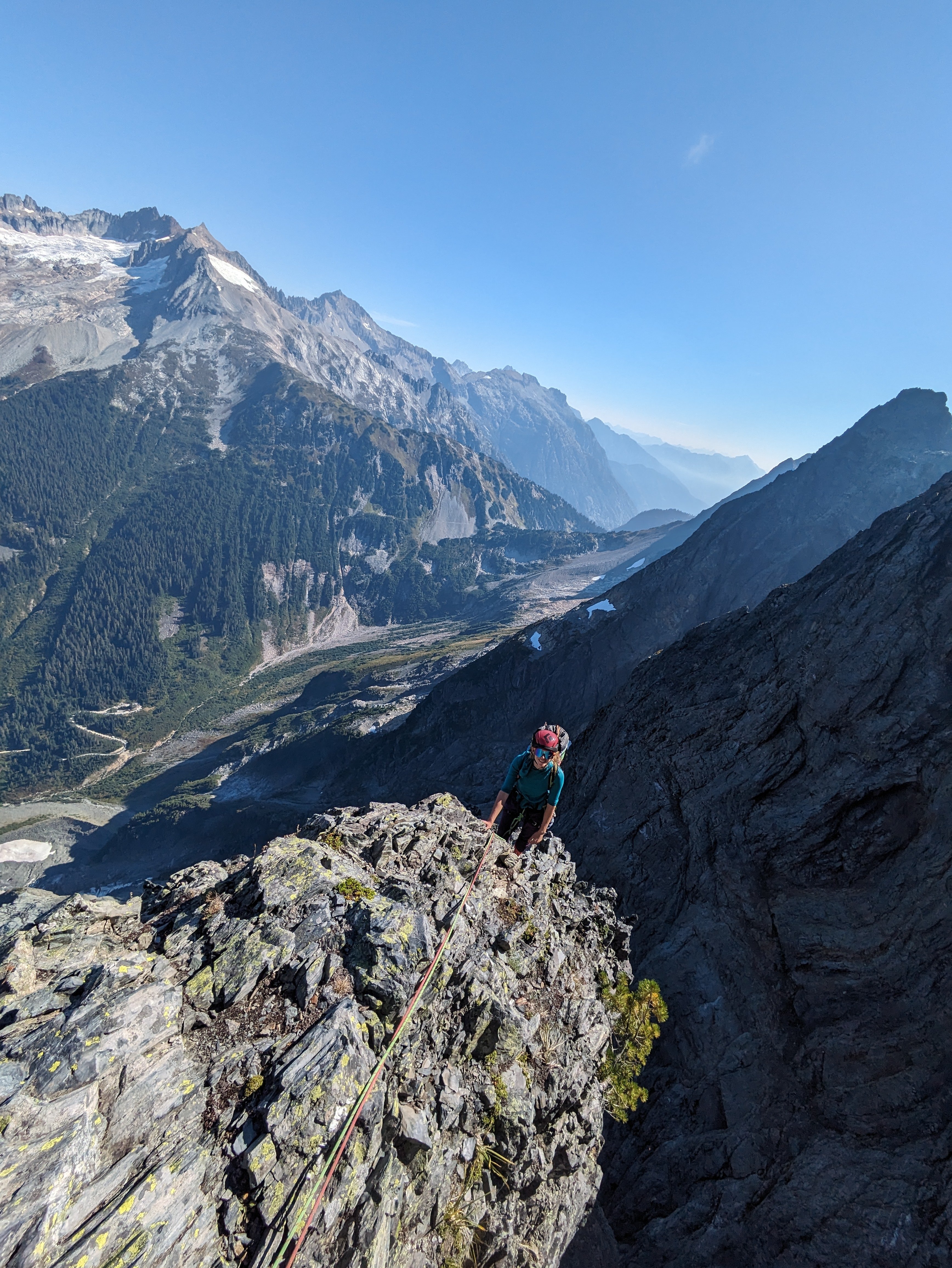
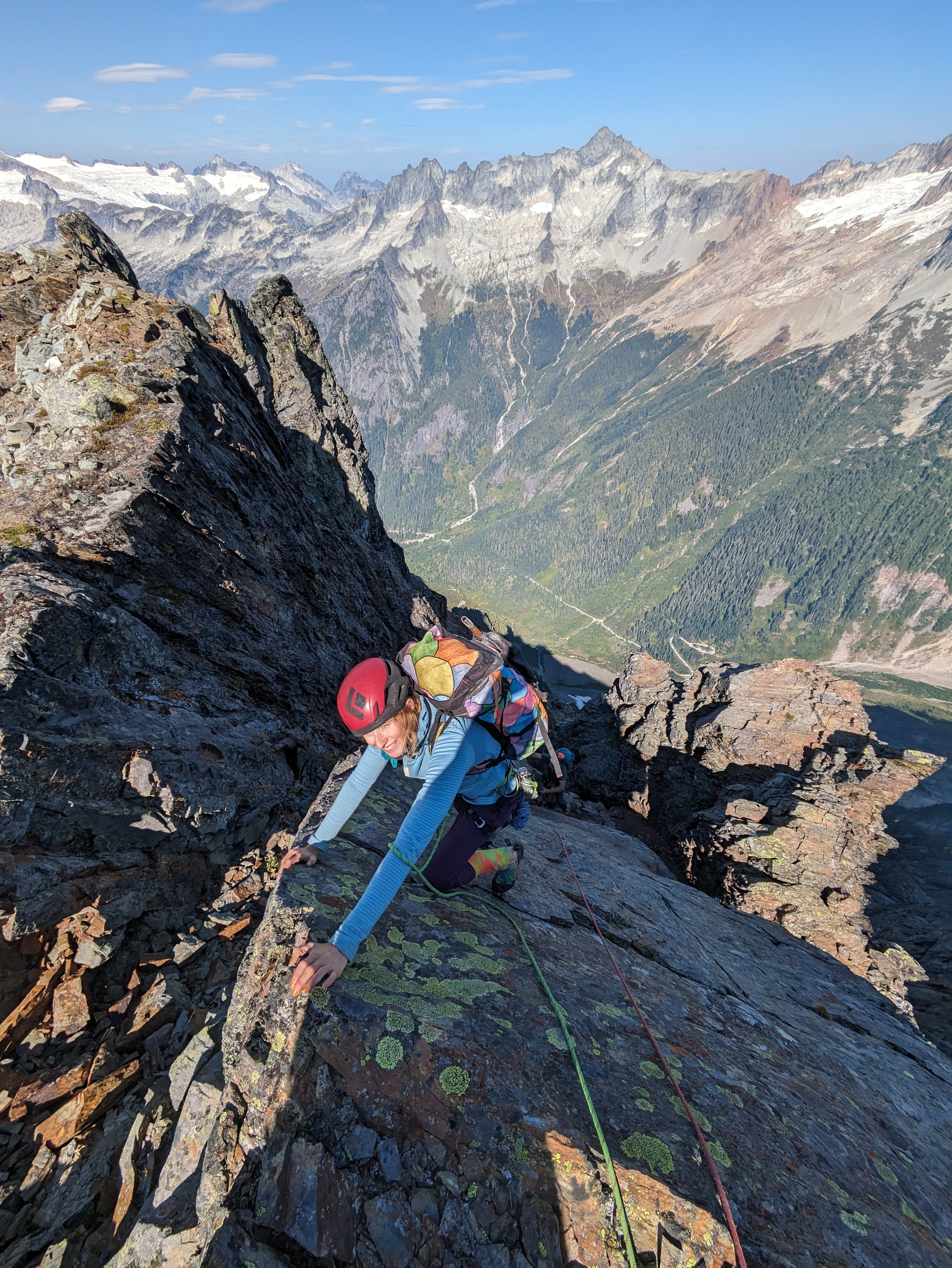
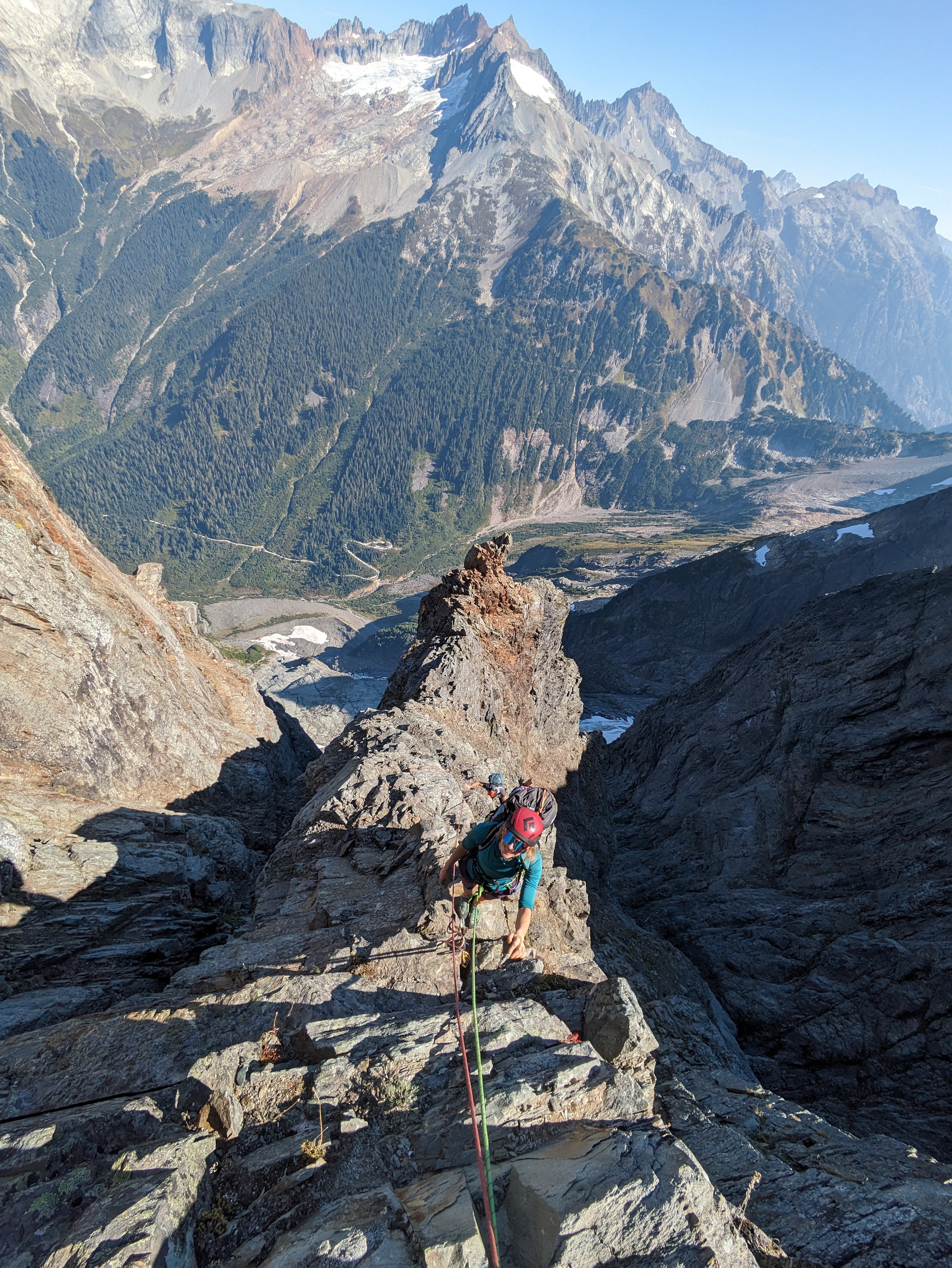
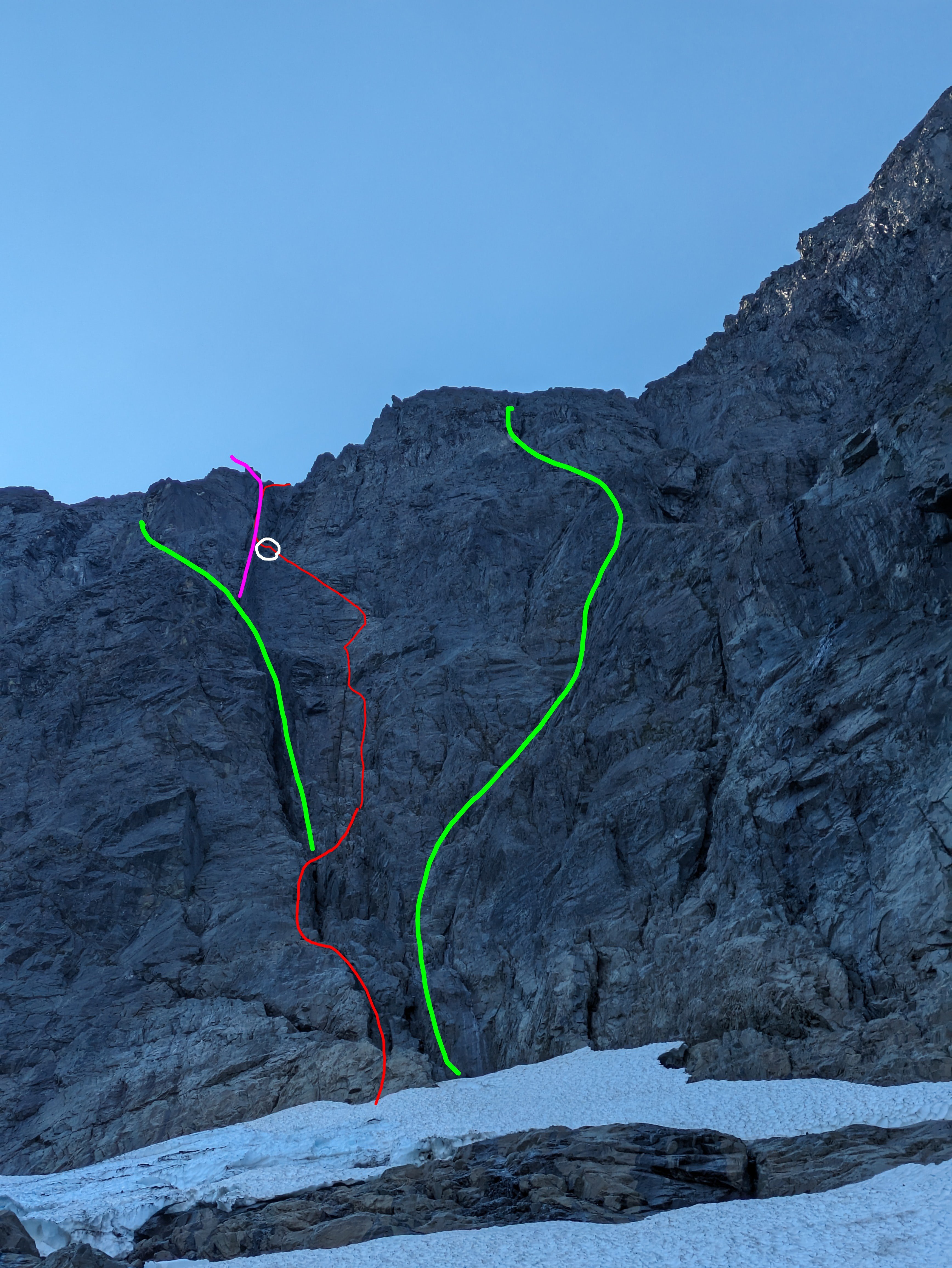
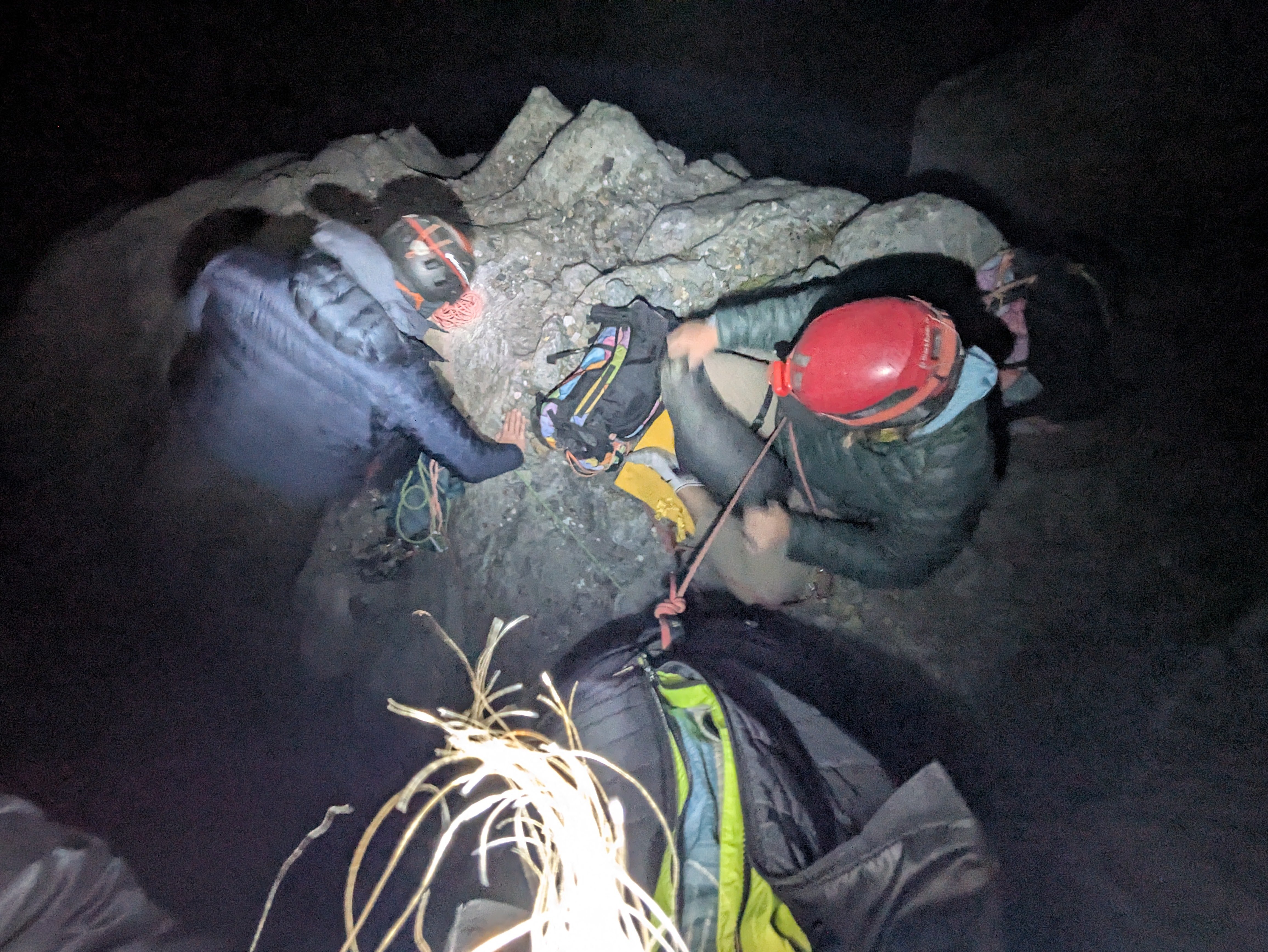
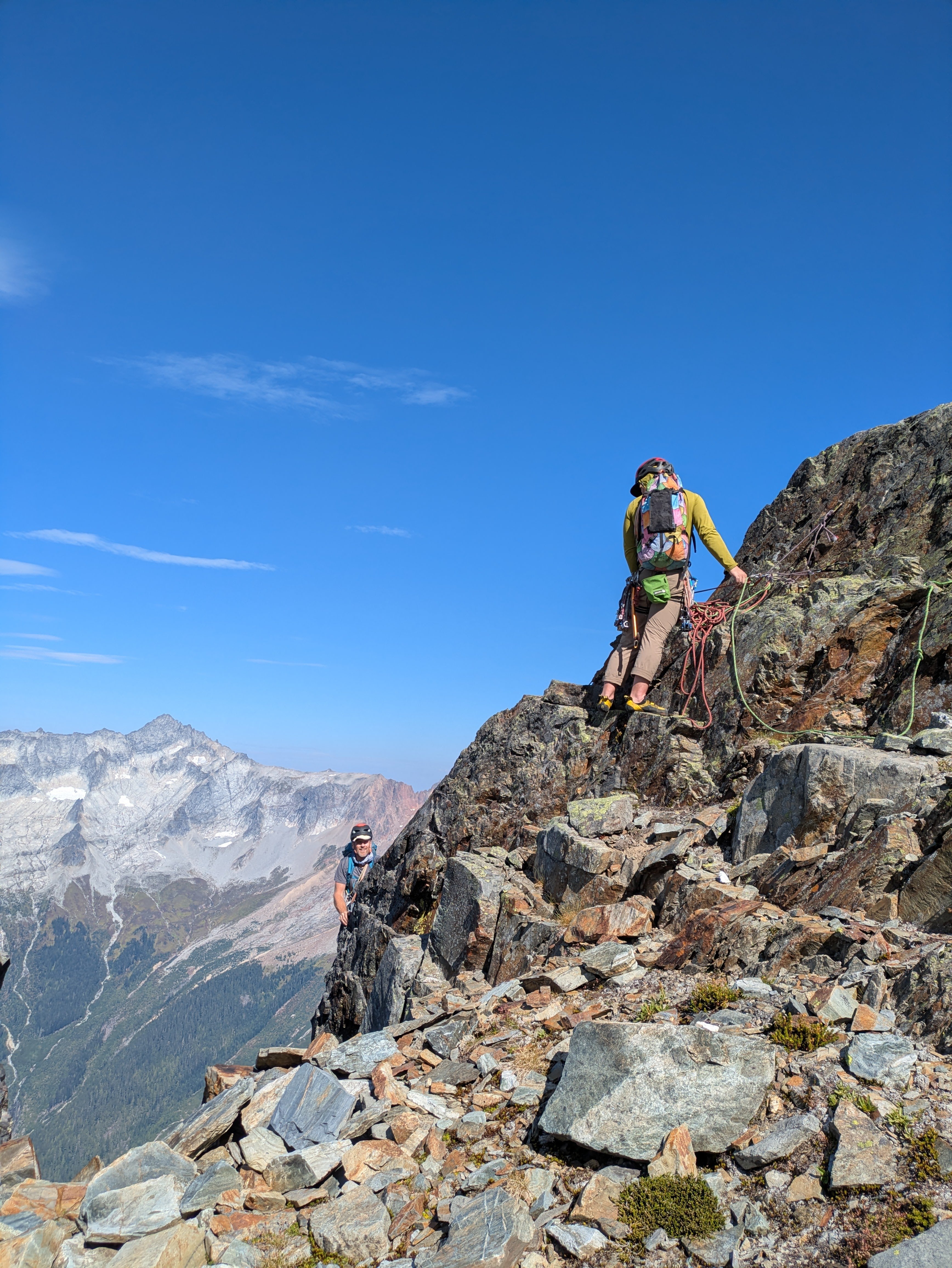
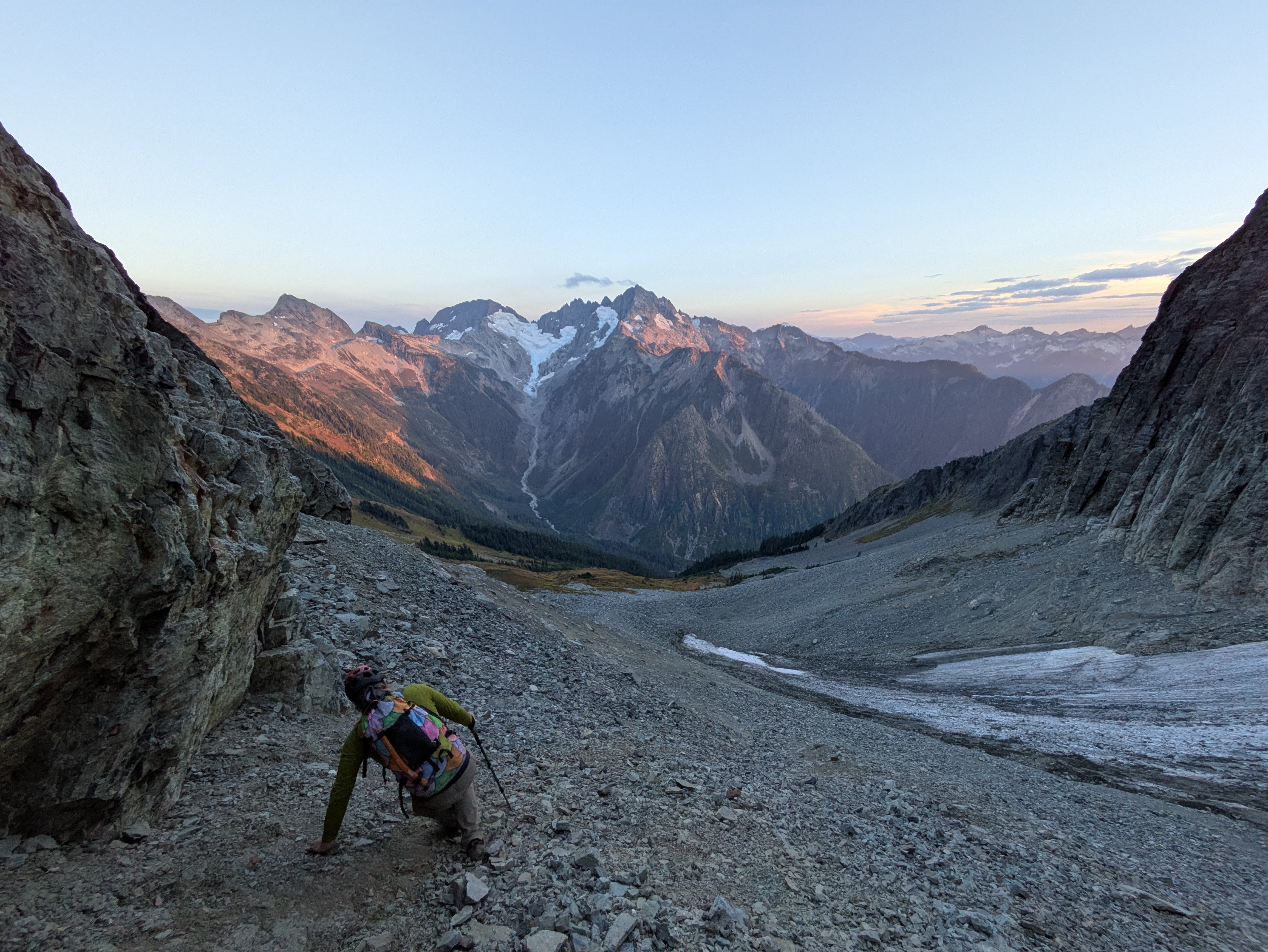
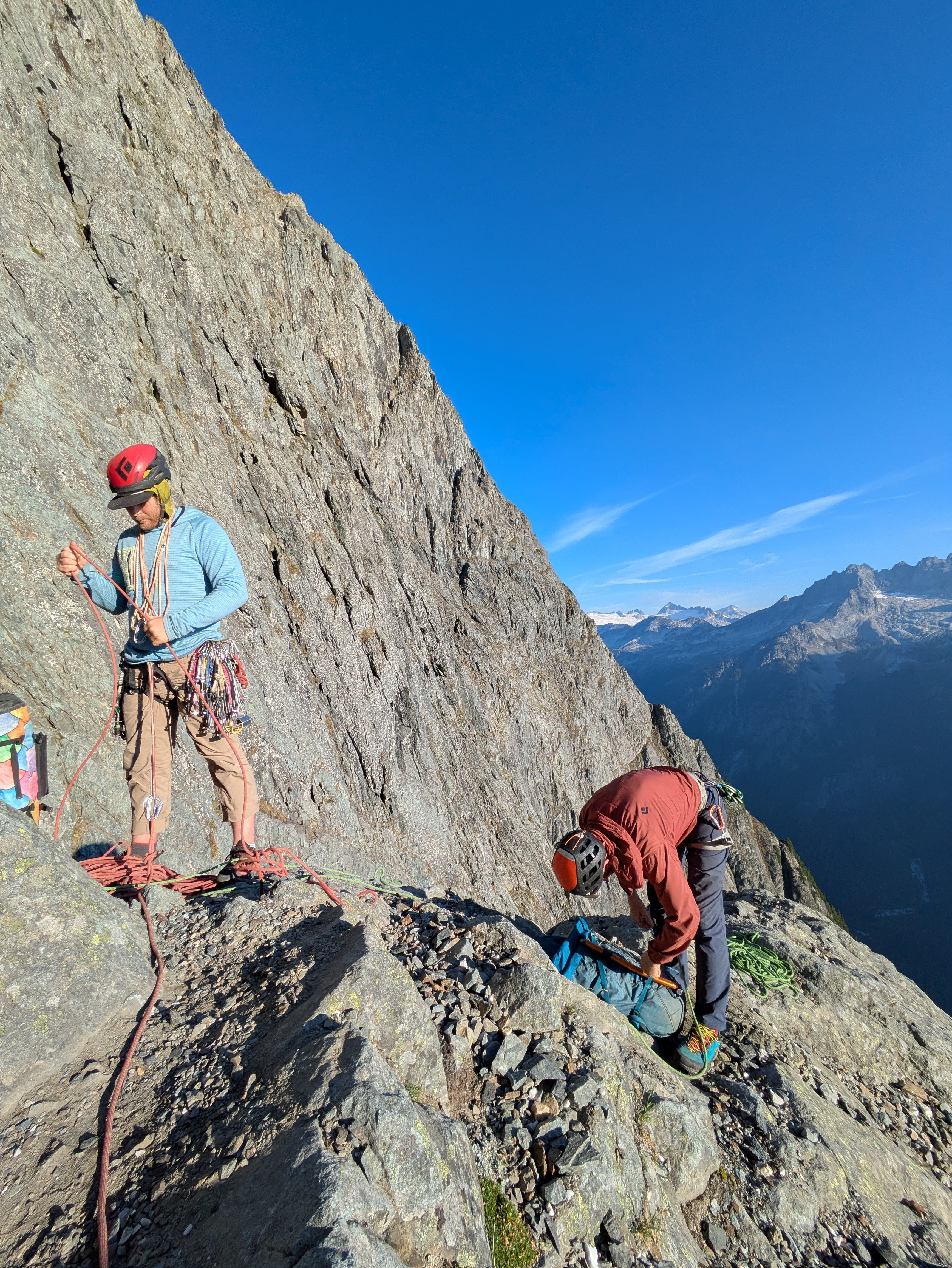
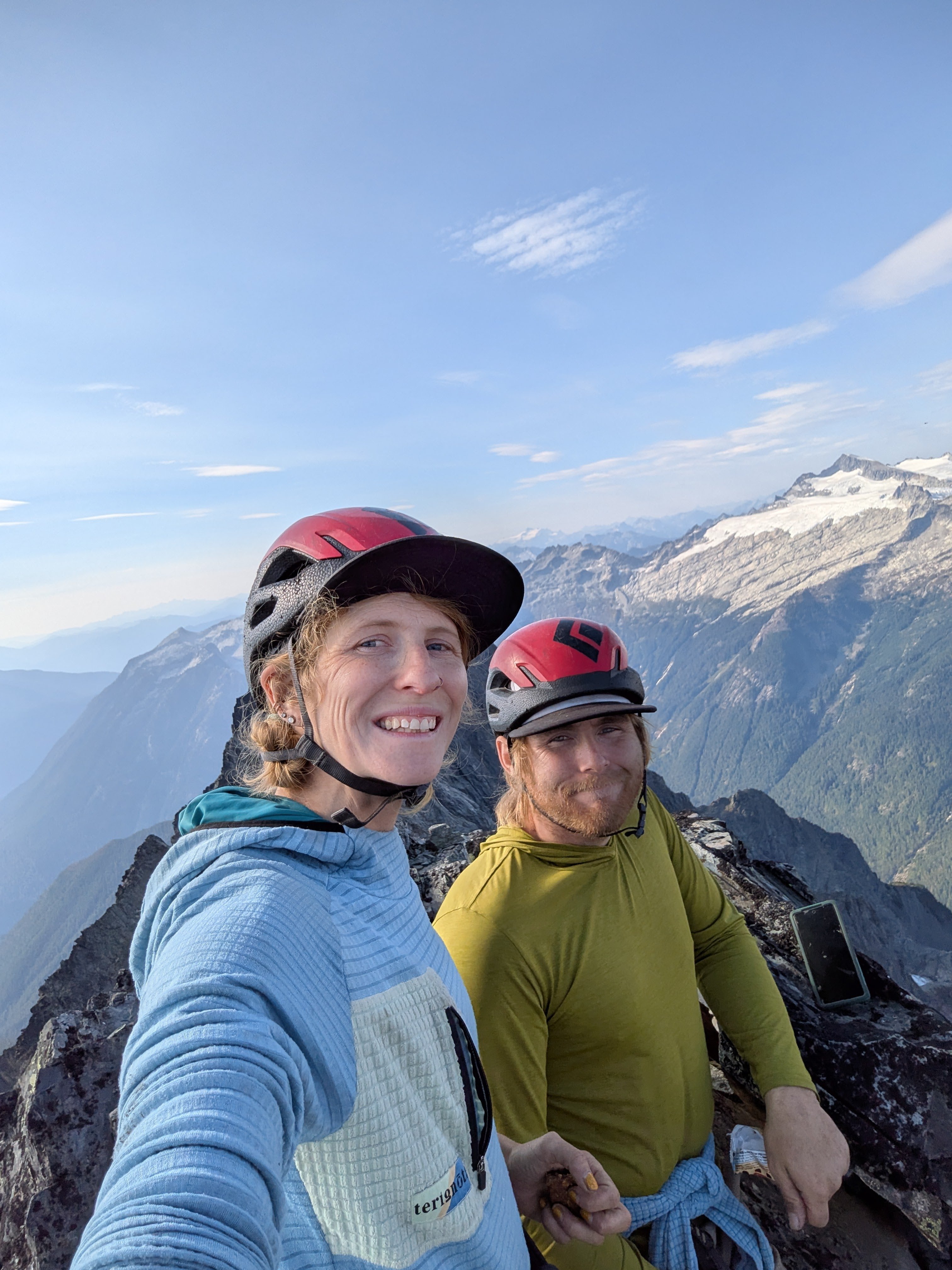
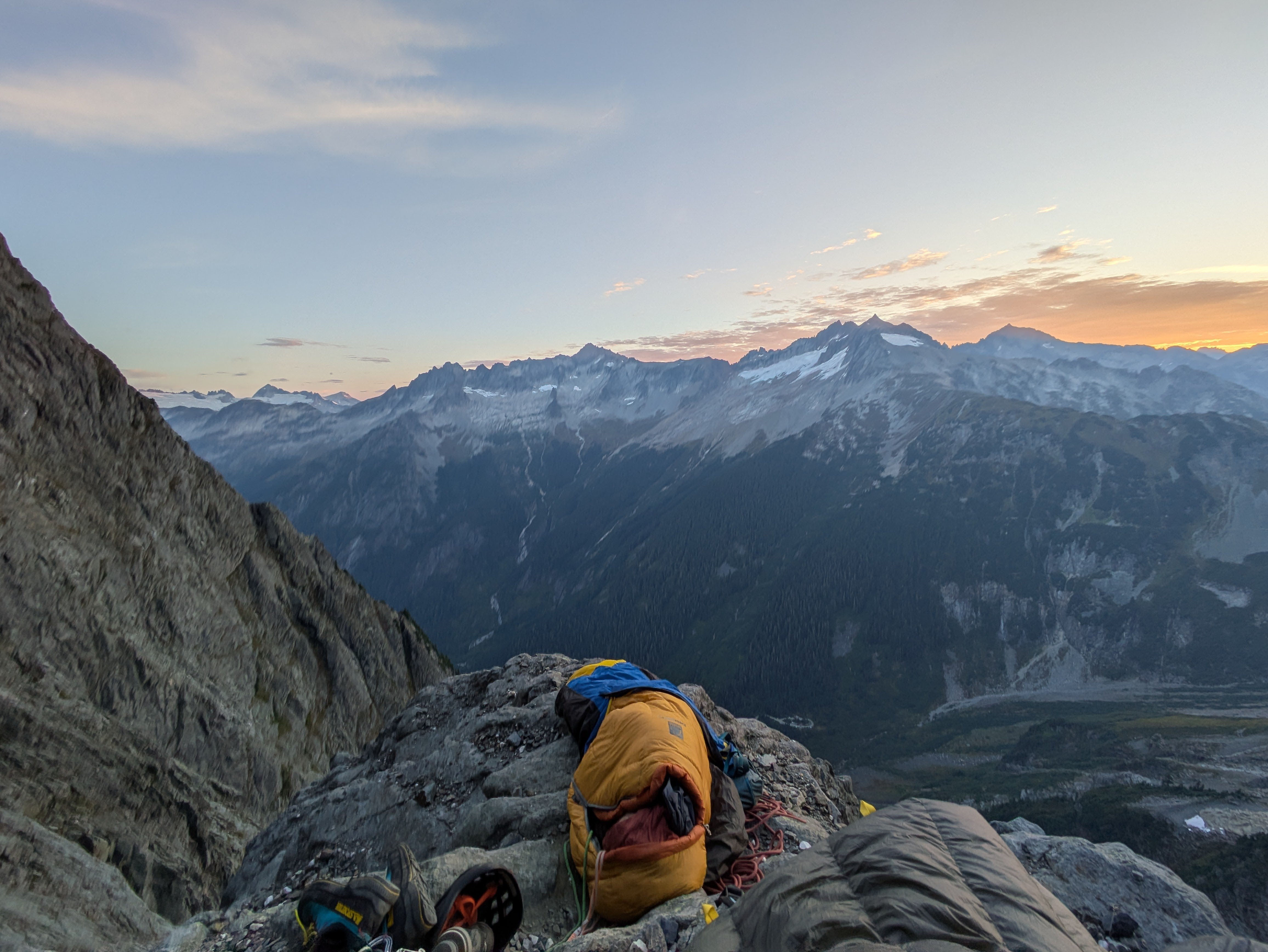
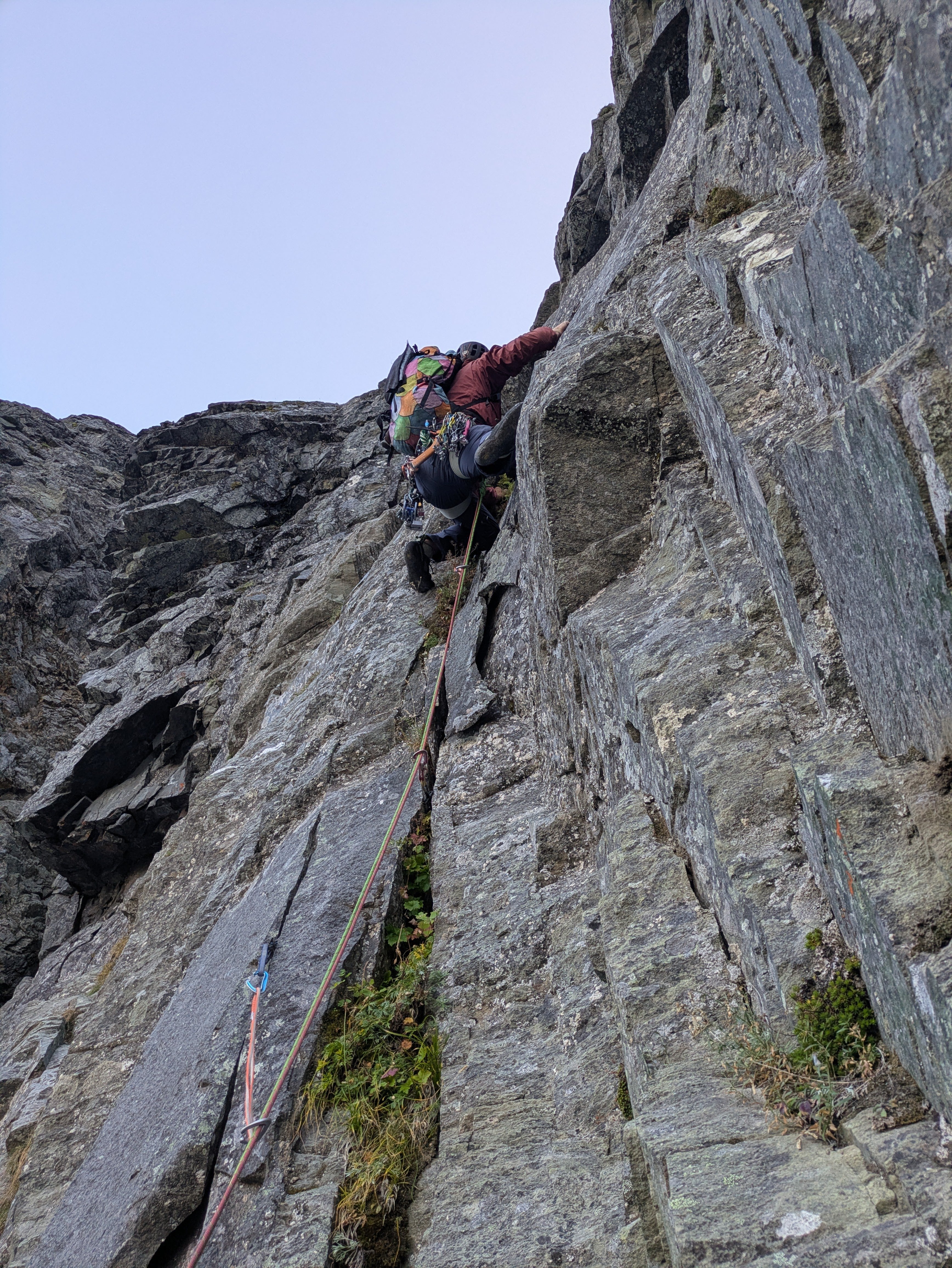
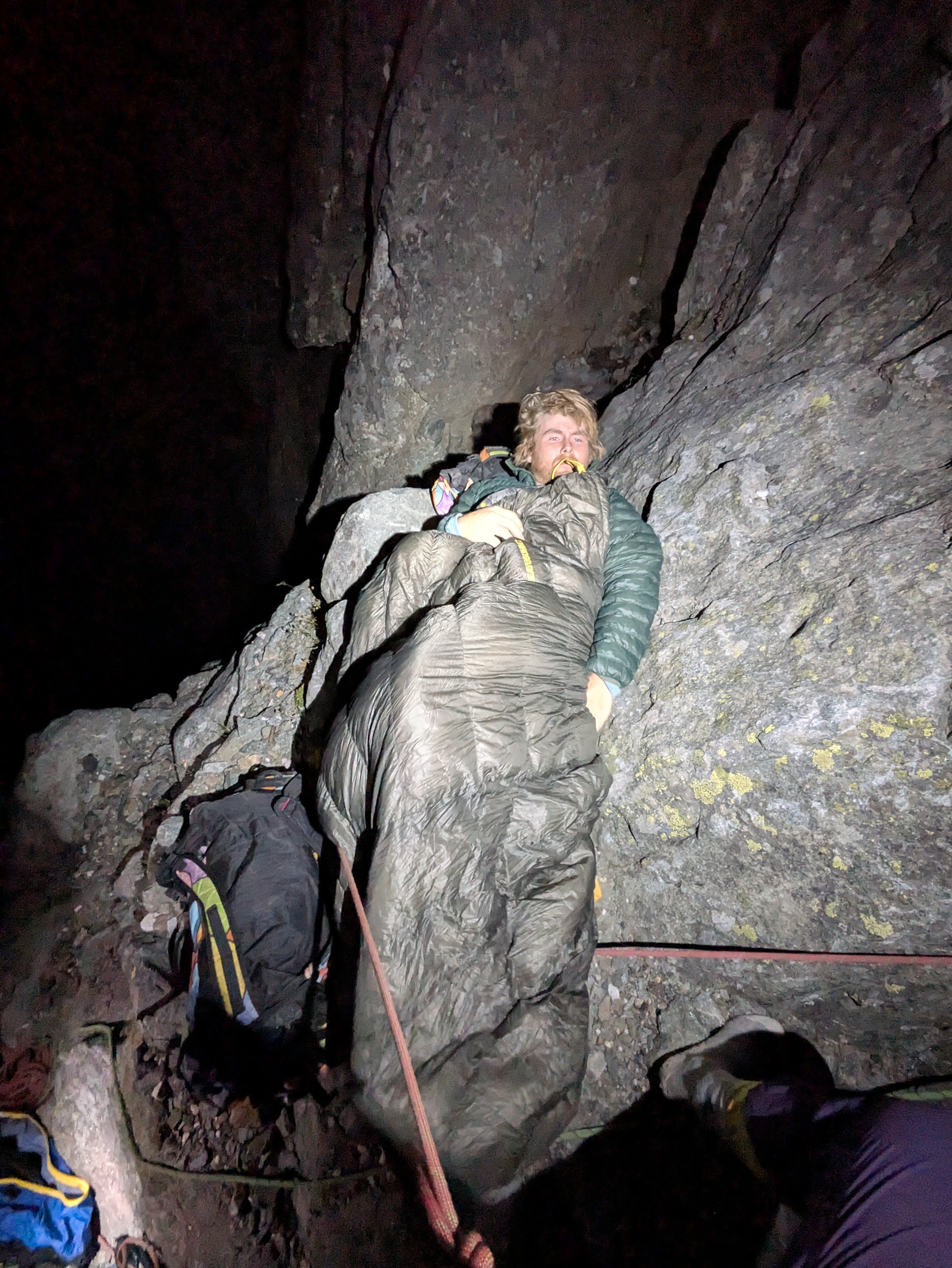
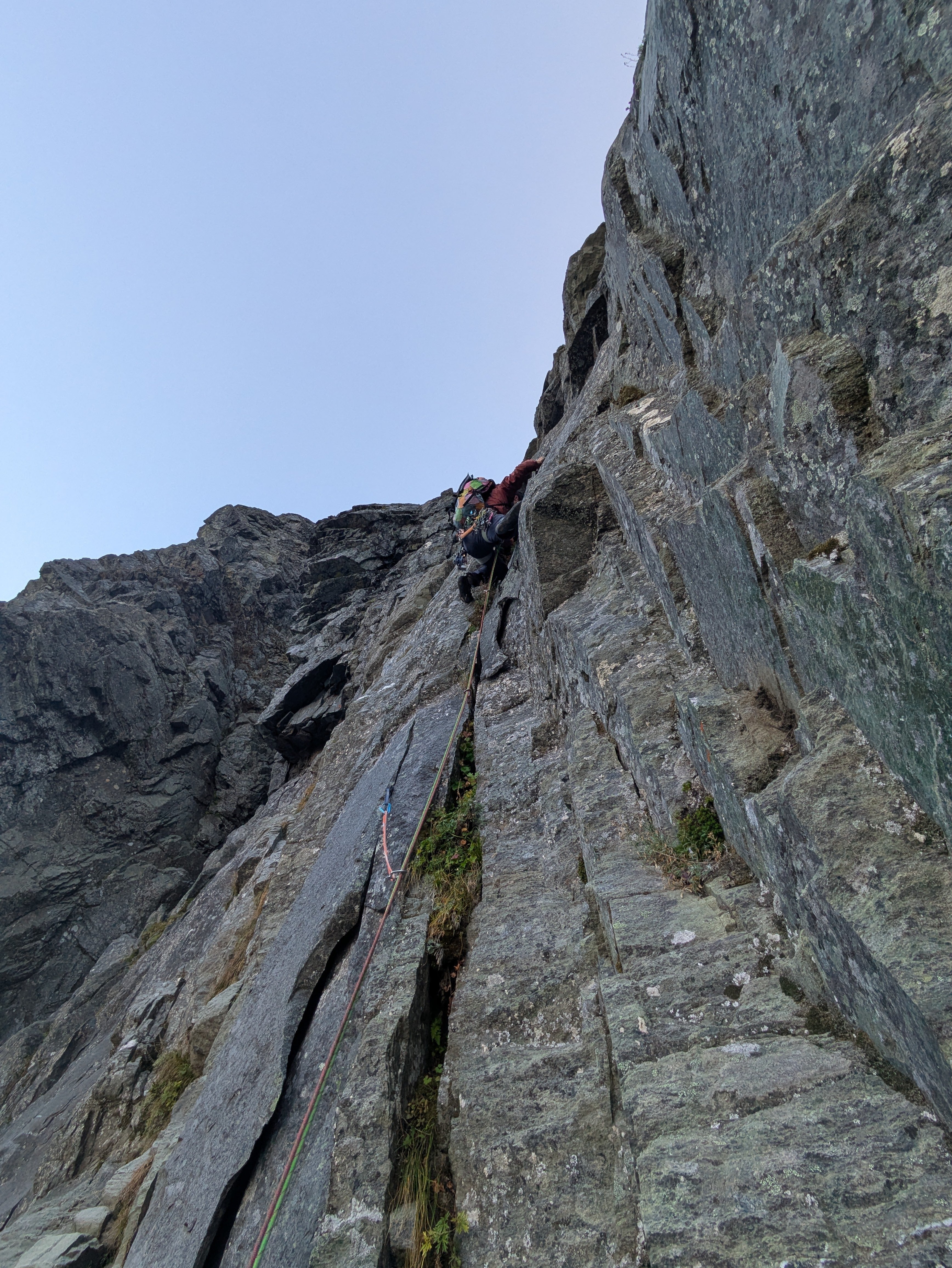
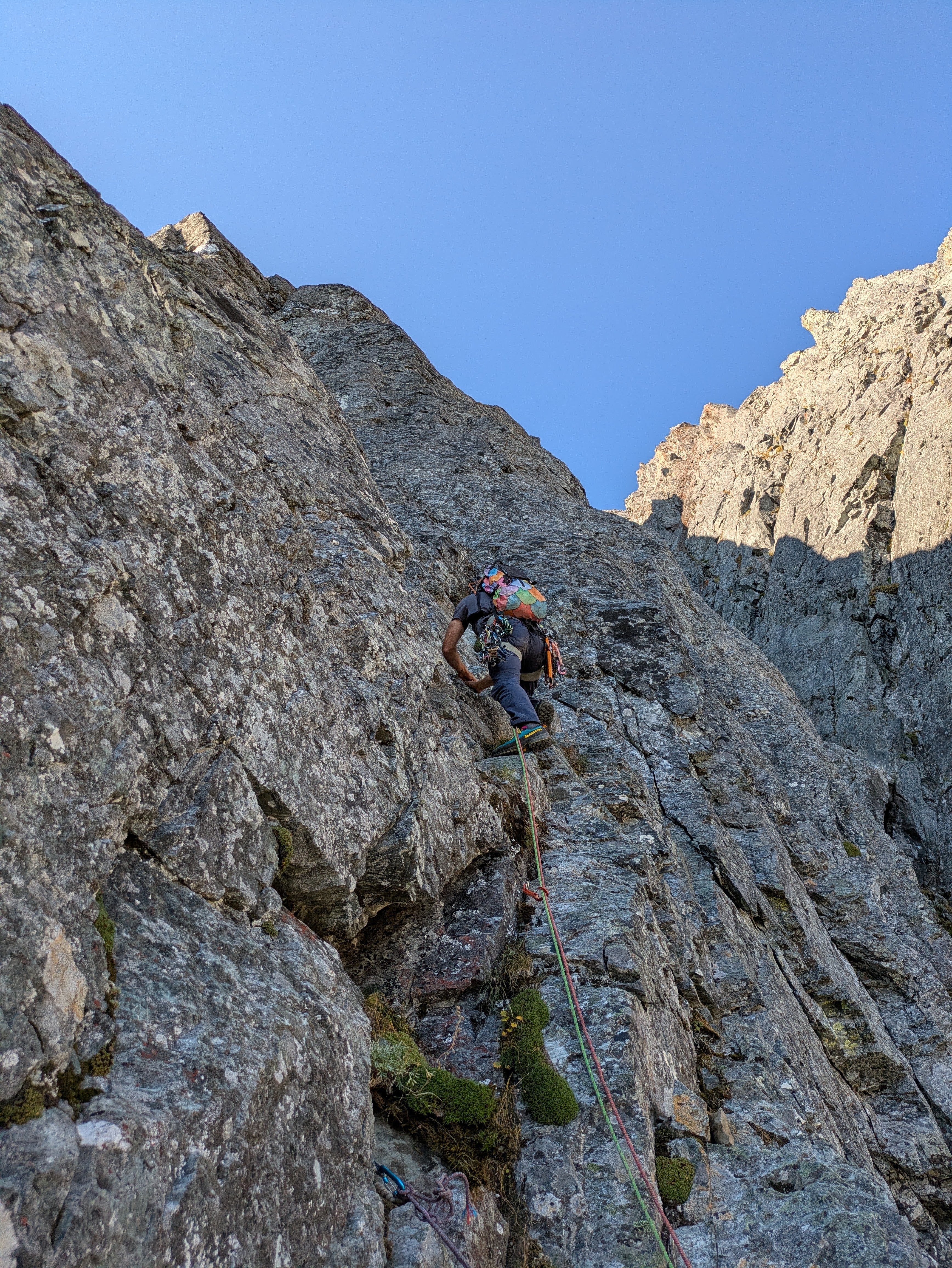 14 points
 -
I'll keep the beta spray brief since there is sufficient info out there on both routes involved in this climb. On Sunday the 4th, Eli Spitulnik and I hiked then skied out to Colfax with an idea I had schemed up the week before. We planned to climb the first ~80meters of the Polish route (Link, Link), then traverse a snow band left to the pitch 4 chimney of Colin's route Kimchi Suicide Volcano which we would then take to the summit. The combo worked out better than we could have imagined, and we both think this is one of the most quality alpine mixed routes we've climbed in the cascades. The nature of this route allows it to go in normal conditions, where the Polish or KSV would not be in. We hope that it'll become a popular way to climb this face as it has much more actual climbing than the Cosley-Houston, for a slightly harder grade. Here's some pretty pictures. Blurry, but you get the gist Eli about to cross the bergschrund Following P1 Myself taking the spindrift straight to the face starting pitch 2 Eli traversing over to the KSV chimney. Entering the squeeze Eli carried the pack like a champ through the rime tunnel Wild rime daggers threatening to collapse on our heads while we tunneled Eli after exiting the tunnel into the sunlight Pleased to be on the summit and in the sun. Tagged the East summit on our descent Rack: 9-12 screws, single rack .2-2, nuts, selection of kb's and beaks (very helpful for anchors). If you don't like long sections of unprotected snow climbing, a picket or two may come in handy for the upper slopes. In less rimed up conditions more rock gear should be available. In our conditions cams from .4-1 would have been sufficient. You may be able to climb all the way up to the ledge traverse in one pitch with a 70M rope, otherwise we had a single 60.
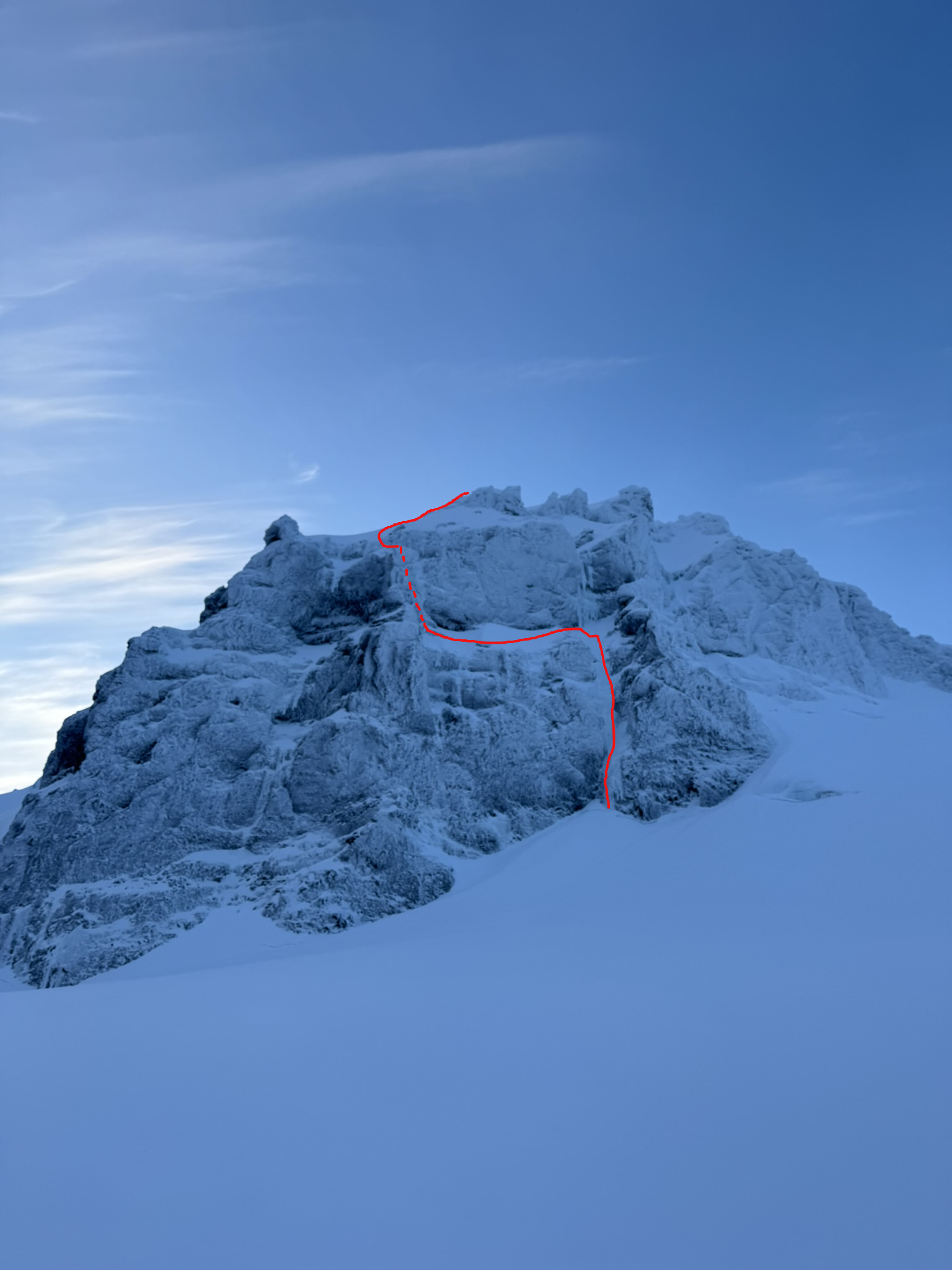
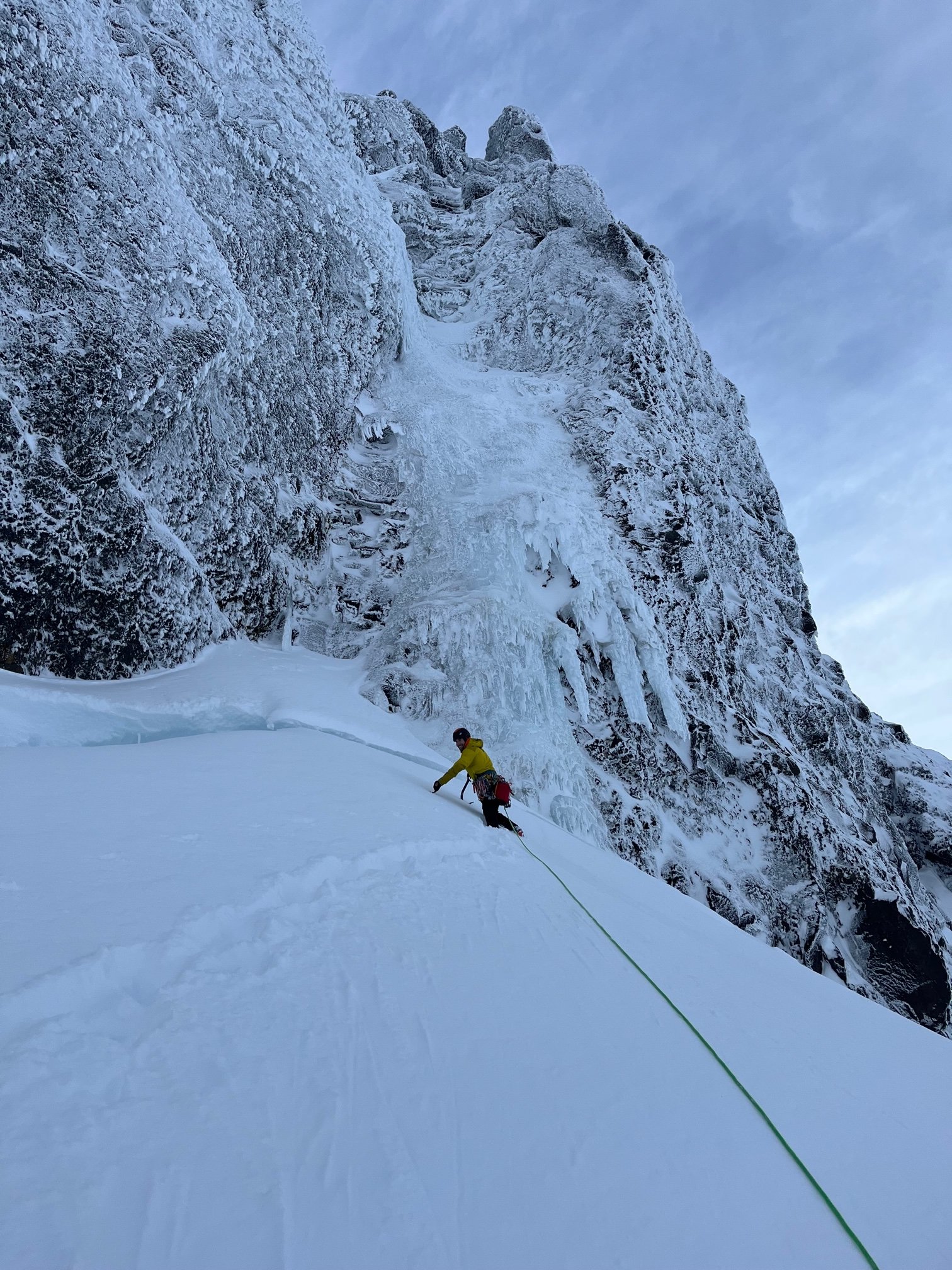
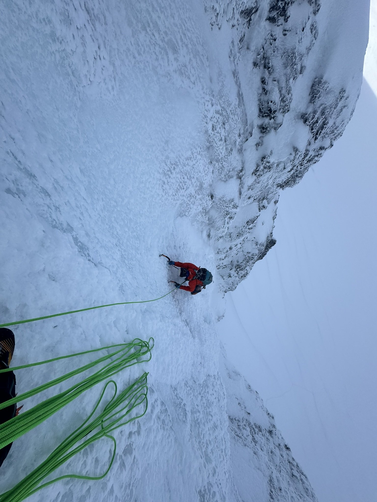
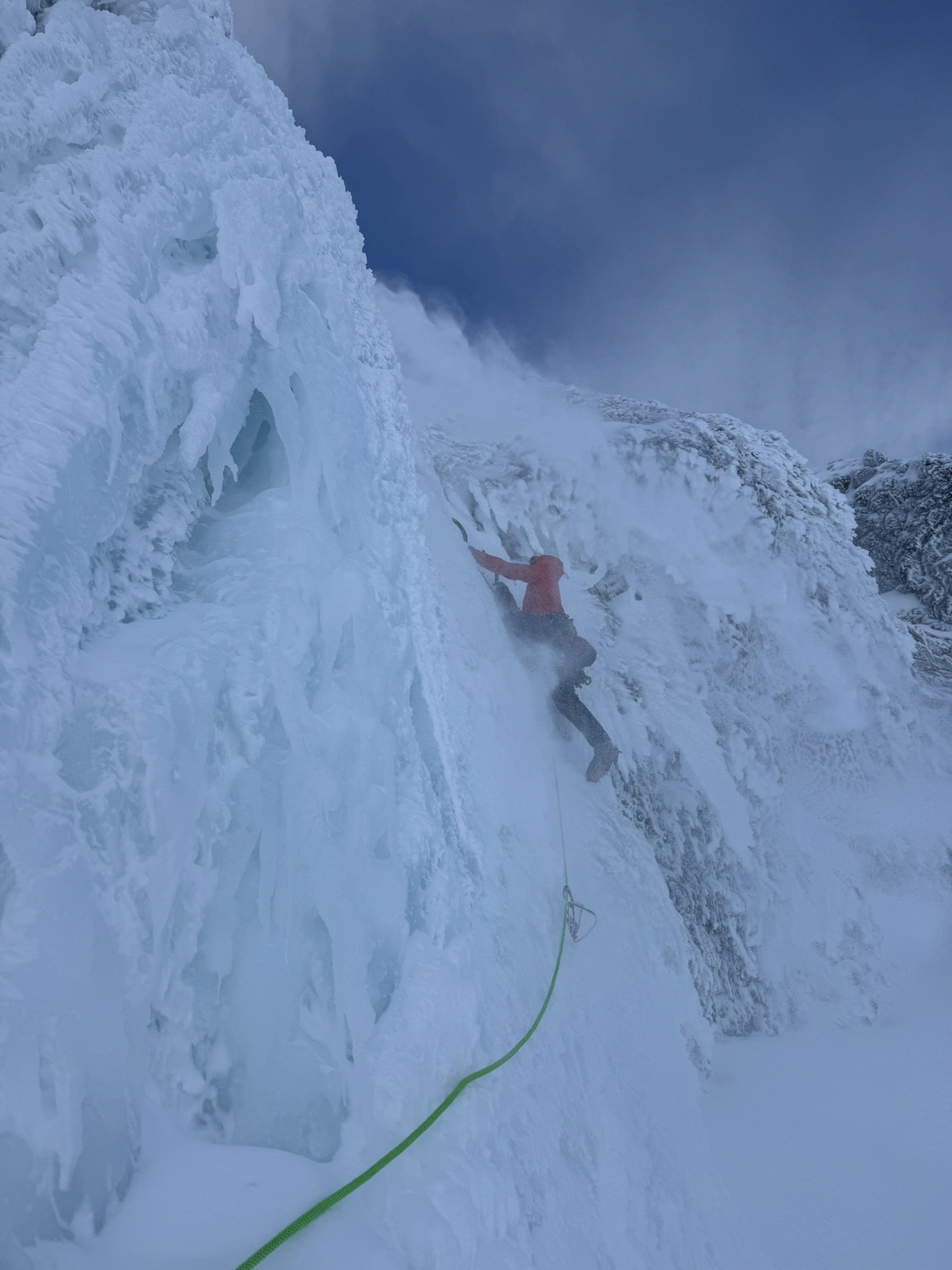
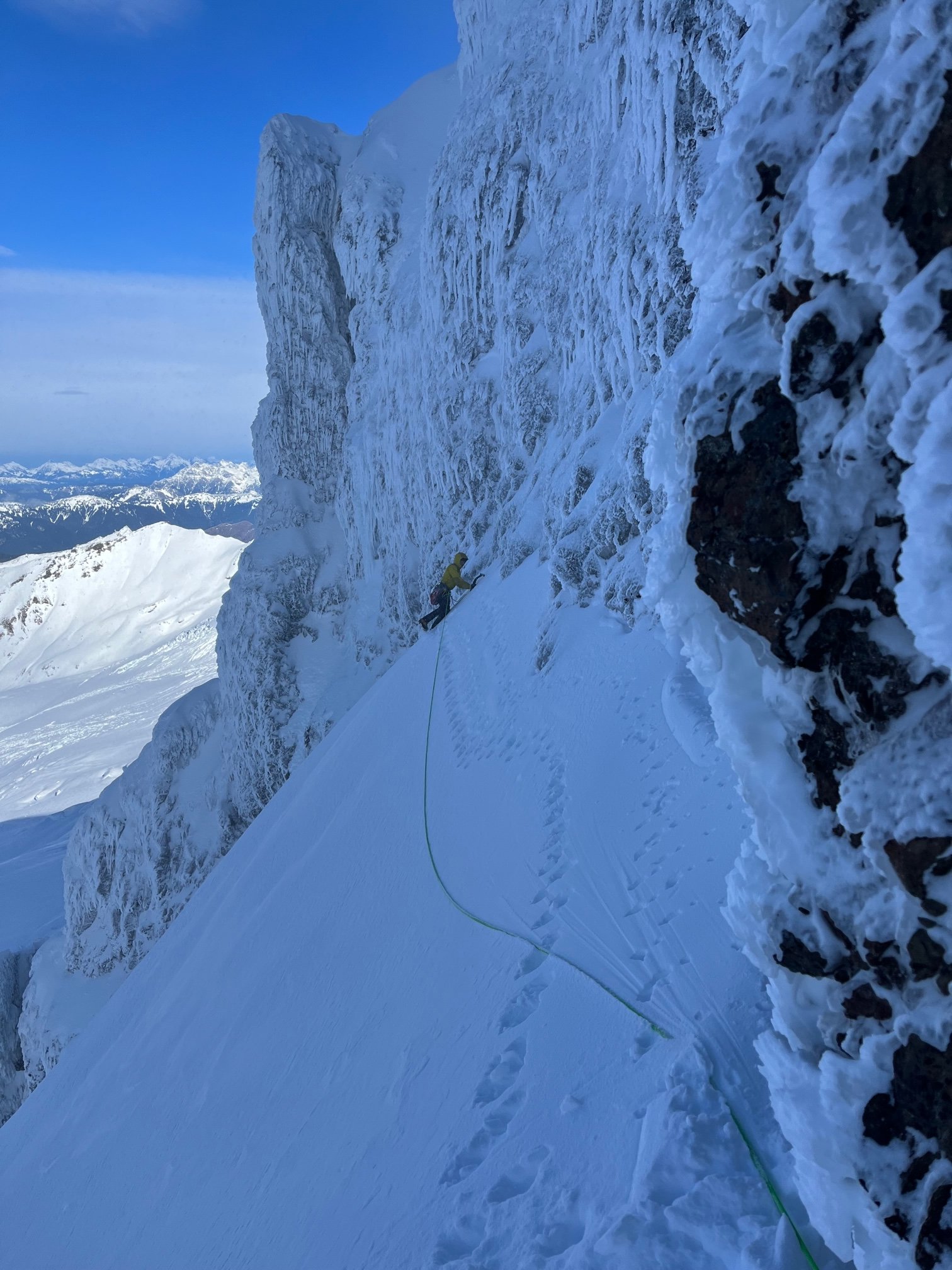
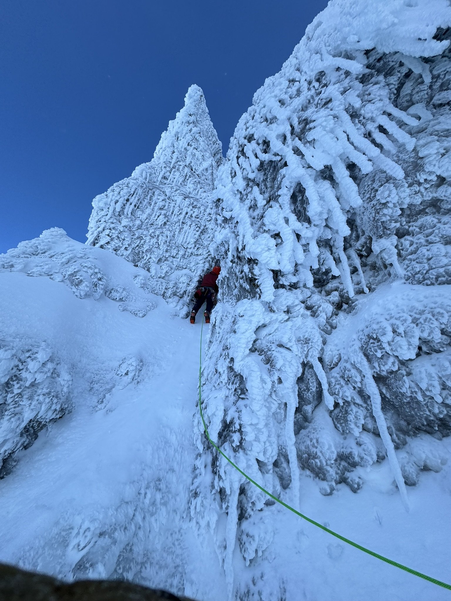
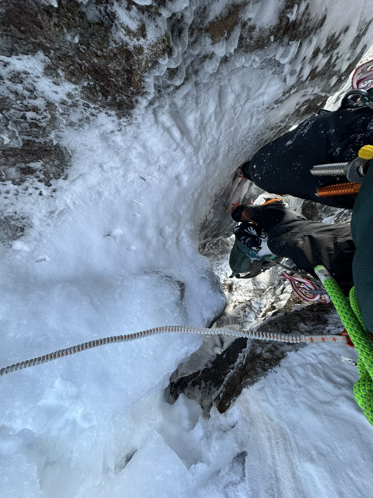
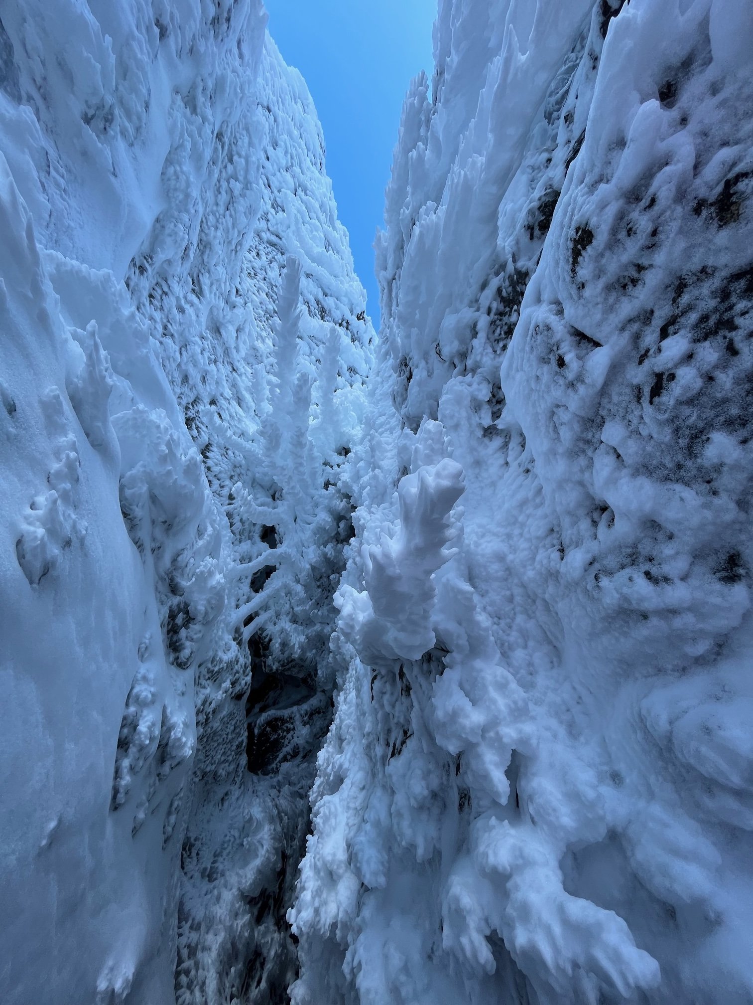
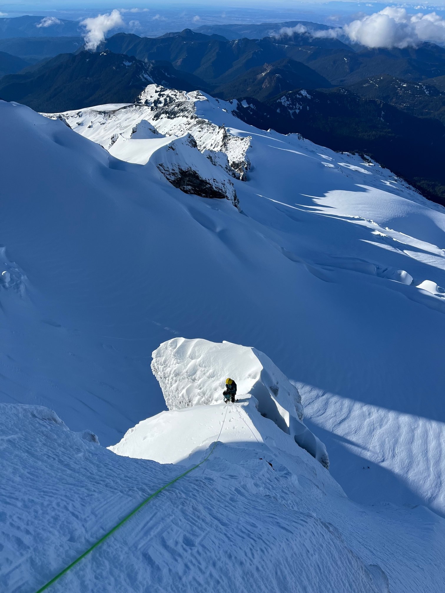
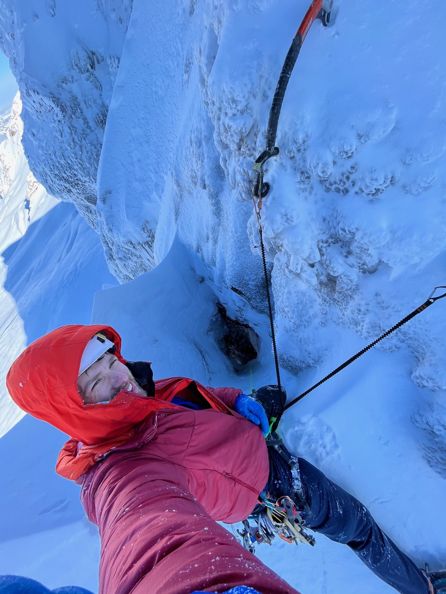
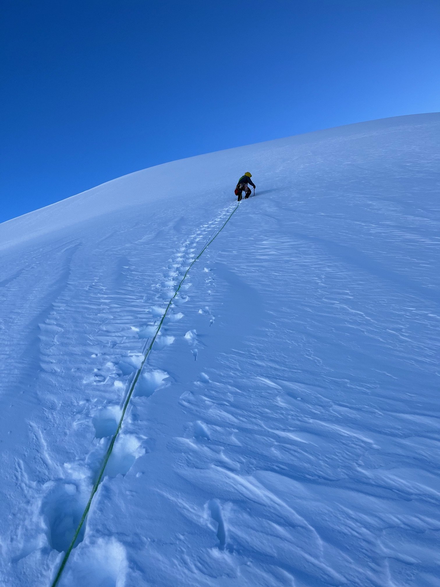
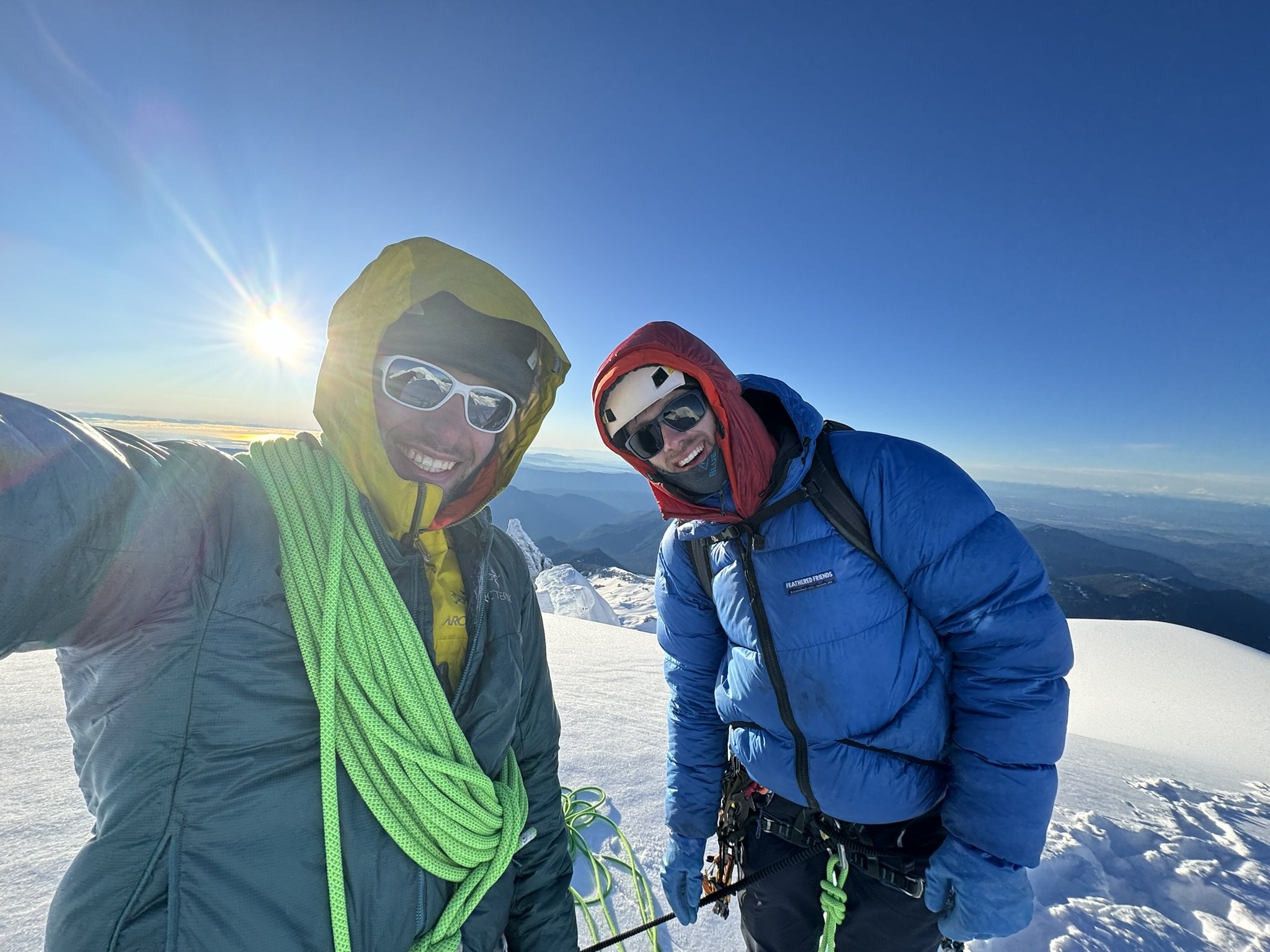
 14 points
 -
Trip: Forbidden Peak Winter Ascent - West Ridge Trip Date: 01/23/2022 Trip Report: Forbidden Peak (8,815ft) via West Ridge Jan 22-23, 2022 Duncan and Eric On the summit (photo by Duncan) Forbidden Peak is a classic peak in the North Cascades and a very popular summer climb. All routes to the summit are technical, and glaciers flank the cliffs at its base. The West Ridge route is listed in the 50 classic climbs of North America and can be quite crowded in the summer. But winter is a different story. In the winter the approach road, Cascade River Road, is generally snowed over and unplowed, adding many miles to the approach just to get to the trailhead. Snow and rime covers the route, with potential cornices on ridges, cracks filled with ice, and more challenging weather. Forbidden Peak was first climbed in winter by Catellani and Corriveau in February 1981 via the west ridge. There was also an ascent to the false west summit via the west ridge in March 1968 by Sumner, Bertulis, and Williamson. I haven’t been able to find accounts of winter ascents since the 1981 FWA, though. (I would be very interested to hear about other winter ascents). The route I’m working on climbing the Bulgers in winter and Forbidden is one of the toughest peaks on the list this time of year. I’d previously climbed it via the west ridge in August 2018 with Katie, and remembered it being fun but crowded, even mid week. Duncan was also interested in climbing Forbidden in the winter, and we started planning for the ascent in December 2020. The first question was which route to take. We looked over aerial photos from John Scurlock on various winter dates and it looked like the west ridge was generally less corniced than the north or east ridges. This made sense, since the winds generally come from the west which means the west ridge would be windward and the north and east ridges leeward. The south face was another option, though the routes there are more technical. Given that the only winter ascent we knew about was via the west ridge, and we had each already climbed that route in summer, we decided that was the route to try in the winter. The approach involved climbing some steep snow slopes, so we needed to wait for stable snow conditions and stable weather. Those stars seldom align west of the crest in winter, but in late December the window arrived. Our highpoint on the ridge in December 2020 On December 27, 2020 we were able to drive to milepost 16 on cascade river road. From there we mountain biked to just past the Eldorado lot, then skied up to Boston Basin. The next morning we climbed the snow couloir variation to the notch on the west ridge. Duncan then led a ropelength along the ridge, but couldn’t get any gear in. The cracks were too full of ice and rime for cams or pitons to stick. We reluctantly bailed and skied and biked out. We hadn’t given up on Forbidden in winter, though. With time and reflection we decided we could return with different gear and hope for better conditions. In late January, 2022 conditions again aligned for an attempt. The snowpack had been reset with warm temperatures followed by stable weather, and we were optimistic about fast and safe travel conditions. However, getting to the trailhead might be difficult. The approach on Cascade River Road can be tricky in the winter. We’d gotten lucky in December 2020 that we could drive so far in. But in my experience in winter, snow generally starts around the hidden lakes lookout turnoff. It is not always continuous, though. The road goes up to 1800ft beyond this turnoff, then drops to 1400ft afterwards before climbing again. The snow can be deep on the hill and then the road can be completely melted out after the hill. This was the case when I skied in with Matthew in early March 2020 up to the Cascade Pass area. The problem with these conditions is the snow can be too deep to drive through, but the melted out portion can be tough to get through with a snowmobile. So it’s not clear what the best way through is. NOHRSC snow coverage prediction map for the weekend This time there had been a lowland snow event from early January that apparently hadn’t yet melted out, meaning we could maybe snowmobile to the trailhead to make for a quick road approach. Recent satellite images and NOHRSC snow coverage maps showed nearly continuous snow all the way from Marblemount. A friend had told me in mid January deep snow started at milepost 5 on the road. In theory that sounded like it would be possible to snowmobile in on continuous snow all the way to the trailhead. But I still wanted to be cautious. Unlike east of the crest, on the west side roads often see less snowmobile traffic and aren’t necessarily groomed or cleared in winter. I remembered in March 2020 Cascade River Road had tons of blowdowns on it. That could derail the approach if the road was covered in blowdowns. Just the previous weekend I’d snowmobiled up a road near Winthrop (to climb Cathedral and Amphitheater) and been blocked by blowdowns that would take too long to axe out. Just to be safe, this time I bought a chainsaw I’d plan to bring for cascade river road to supplement my ax. I’ve actually spent a summer on trail crew cutting out trees in the Sierras in 2006, so hoped I could put those skills to use if needed. Most recent available clear satellite image from sentinal hub Melted out road sections could still be problematic, since they would cause the snowmobile to overheat and could break the skis. NOHRSC was showing trace amounts of snow in some low-elevation sections. I had previously installed retractable wheels on the skis on my snowmobile so I could get through long pavement sections without damaging the carbides (I had one of those break off last November). I also installed two sets of ice scratchers (tunnel and rail) to help with overheating if it was patchy ice on melted out sections. It looked like the weekend of Jan 22-23 was finally time to pull the trigger on the trip again. This time we planned to do gear a little differently than our previous winter attempt. We decided to bring snowshoes instead of skis since it appeared conditions would be very icy and firm below treeline. I’ve broken a ski in half in conditions like this in the past, and wanted to avoid that. For the route we would bring pickets, screws, cams, nuts, hexes, and pitons. Hopefully this would allow us to protect the route somehow. Instead of one mountaineering ax I would bring a technical ax with hammer and a hybrid ax with adz, then use umbilicals instead of leashes. I’d used the hybrid ax on Pik Pobeda last summer and it had an adjustable pinky rest and straight shaft. This meant I could ice climb up to WI3 and hook ledges for mixed climbing, but I could also slide the pinky rest up and plunge the straight shaft in the snow if needed. I would use water proof insulated Showa gloves for climbing, but also brought a backup pair of BD guide trigger finger mittens. Last summer I’d gotten frostbite on my fingers climbing Pik Pobeda, and a K2 guide I’d met in basecamp recommended these gloves for cold technical routes. It had been 5 months since my frostbite and my fingers had done fine on a short technical bit on Cathedral Peak the previous weekend, so I figured they’d be ok on this trip. Friday evening we left town after rush hour and met up at the Marblemount NCNP office. I filled out a permit, which was amazingly easy to do compared to summer time. There’s no competition in the winter. Then we loaded up in Duncan’s Tacoma to scout the road. Camping out with the sled at the edge of snowline on Cascade River Road I pulled my snowmobile on a trailer with my Forester and was nervous about turning it around. Usually I park at sno parks where turning around isn’t an issue, but this time we’d just be starting wherever the snow started, which could be on a narrow section of road. I was worried about driving up to snow, then having to back up a long distance to find a pullout. Backing up the trailer at night on a narrow rough road can be tough. We drove past the last house on the road, then it started getting full of blowdowns that were luckily sawed out. At about MP 4 we encountered patchy snow and by MP 5 it was bottoming out the Tacoma. There was a wide patch of melted-out pavement there wide enough for our purposes, so we turned around and I marked the coordinates on my phone. We then drove back to Marblemount to my forester. I drove in front this time to the scouted place and pulled over. This was my first time turning the trailer around on a narrow road in practice, though I’d planned it out in theory. I first rode the snowmobile off and parked it in the snow. Then I unhooked the trailer, then Duncan and I both picked up the front and turned the trailer around. I then turned the forester around and hooked the trailer up to it. It all worked very smoothly and I’m now less worried about turning around on a narrow road. As we were going through these shenanigans another truck pulled up. Two guys got out and said they were also planning to climb Forbidden. I was very surprised. What are the odds that a peak that hasn’t been climbed in winter in the past 40 years now has two teams going for it at the same time? It was actually great news for chances of success. They had a snowmobile and a chainsaw also, so there was increased chance of getting to the trailhead and more climbers to help break trail. All of that was very good news. Chainsawing out trees Their truck was much more capable than my forester so they said they’d continue driving a bit farther before unloading the sled. We said we’d meet them sometime in the morning. Probably whoever started second would eventually catch up to the first team sawing out trees or breaking trail anyways. By 10pm we were asleep. Saturday We optimistically assumed it would be a relatively easy day, so got a non-alpine start at 5am. We loaded up the sled, strapped the chainsaw on top for easy access, then got started. It was tough getting through the deep wheel ruts in the snow with two people on the sled, and I drove cautiously. We soon passed the other guys, who were still sleeping. After two miles we hit our first big tree across the road and I whipped out the chainsaw. I made quick work of the tree, and we pushed through. Now I realize why people don’t cut the full tree out when they are clearing a road. There’s uncertainty how many trees will be down farther along the road, and it makes sense to make the minimum cuts to get through to save time. This often means one cut and ride over the fallen tree, or two cuts where the tree is narrowest. Lots of minor blowdowns to saw out We encountered a dozen or so more places where I needed to pull out the chainsaw. I got pretty good at riding over logs, and appreciated the tips of the snowmobile skis being angled up so high to get over the logs. For a few I hopped off and squeezed the snowmobile under, flexing the windshield a bit, and for some Duncan helped lift so I could squeeze under. Progress was slow, and we were only averaging about 5mph with all the blowdown clearing. We eventually passed the hidden lakes turnoff and realized we still had a ways to go. Interestingly, the ascent up to the crest of the road at 1800ft was completely melted out down to gravel. I knew the sled was working hard taking two people and gear up the steep bare slope, and I was very worried about overheating. I swerved to hit any small patch of mud or ice, and amazingly we reached the snowy crest without overheating. The tree we couldn’t ride past In flat snowy patches I tried to gun the engine to prevent spark plug fouling and clogging, though this was probably uncomfortable for Duncan in the back. Snow was mostly continuous from there, but at milepost 15, after two hours and 10 miles riding, we hit a major obstacle. There was a massive 5ft diameter old-growth tree across the road. My 10in chainsaw had no chance. We stopped to consider our options. There was a steep mud bank on the right and a melted out steep dense forest on the left. Riding around was not an option with such little snow cover (and my limited snowmobile skills). The only way to get the snowmobile past was to build a ramp. Unfortunately, snow cover was very thin, so it would have to be mostly with debris. That sounded like it could potentially take an hour or two. We could do it, and it would be kind of fun, but there was a risk that there would be more massive trees like that farther along the road. We still had eight miles left to the trailhead, and it appeared the January storm had been capable of bringing down lots of trees. If there were more large trees like that, it could take all day to get the sled to the trailhead. Snowshoeing to the national park boundary We really needed to get to the bivy site below the climb that night, though. Back in December 2020 it had taken us seven hours to skin up from the trailhead to the bivy site below the climb. We reasoned if we snowshoed the road from there, it would be four hours to the trailhead, plust seven to the bivy. That would put us there a bit after dark, which would still work. If we spent two hours building a ramp and got the snowmobile across, but then encountered more trees like that, it was likely we wouldn’t make it to the bivy that night and would have to abandon the climb. Views near the Eldo lot We decided to park the snowmobile there and continue on foot. That sounded like it gave us the highest chance of success on summitting. I unloaded gear, turned the sled around, and packed back up. We climbed over the tree and continued down the road on snowshoes. There was another tree just behind the big one that would have taken a lot of work to saw through. And then another big tree had fallen on the bridge near the Mineral Park campground. That would have been another project to get the sled past. I think we made the right call with ditching the sled. We hiked up the road after the campground, going across melted-out south-facing sections and more blowdowns, and soon reaching the park boundary. They had installed a new gate since last time I was there (May 2021) and it was left open, though half buried in snow. There were a dozen or so more blowdowns between there and the Eldo lot, though they all would have been manageable. Hiking up with views of Johannesburg We took a break at the Eldo lot and decided to ditch a few items of gear at the outhouse to pick up on the return. It seemed important to conserve energy if at all possible given so much extra distance we had to cover. The gate was closed at the Eldo lot and a semi-permant looking sign installed that said “Gate Closed Ahead”. I wonder if it was closed all last summer. Interestingly, past the Eldo Lot there were zero blowdowns and we made quick time on the firm snow. Though there was one avy slide that would be tricky to sled past. We had great views of Johannesburg above as we climbed higher. Looking up at Boston Basin Morning Star Creek we saw the huge washout that closed the road last spring. It looks like it’ll take more work still to clear all the debris from that. In December 2020 we had skied directly down from Boston Basin down that drainage, but it involved a lot of dense bushwhacking and cliff avoidance and we decided to avoid that route. Finally by 12:30pm we reached the Boston Basin trailhead and stopped for a break. In the summer that tiny lot is always overflowing, but not in the winter. It appeared we had the whole zone to ourselves. We started up the Boston Basin trail, and snow conditions were nice and firm. We zigzagged up the old mining road, then directly up an open slope and traversed to cross Midas Creek. That appeared to be the last flowing water of the trip so we each topped off our water bottles. We then traversed across Morning Star Creek and went directly up the open slopes from there. Johannesburg at sunset By 3:30pm we popped out above treeline and were treated to amazing views of Boston Basin, the Quien-Sabe Glacier, and Johannesburg across the valley. Above treeline around 6,000ft the snow got more powdery and we actually started sinking in a bit. But we had made excellent time up to there and it looked like we would beat our 7 hour time from before. We alternated breaking trail and soon made it to the typical summer campsite in Boston Basin. This is where we’d camped in December 2020, but there was still daylight left and we recalled a flat bench higher up. Somehow we had cut our time prediction in half, likely because the snow was much more consolidated this time. We decided we wanted to minimize our ascent on summit day, so we would continue and bivy as high as possible. We wrapped around some hills and then snowshoed up the south face. The sun was setting by then and we had amazing views of Johannesburg across the valley. By 6pm we crested a small bench at 7,600ft and stopped there for the night. Sunset near the bivy site I set up my mega-mid ultralight pyramid tent and we threw out our bivy sacks inside. I like this tent since I can use hiking poles as the middle pole, and the bottom is open so I can dig it out to make lots of room. We melted a bit of snow, cooked some dinner, and were sleeping by 8pm. Sunday We wanted to get as early a start as possible with the constraint that we needed daylight for climbing on the west ridge. The snow couloir could be done in the dark, though. So we planned to climb to the col on the west ridge by sunrise and start the ridge climb then. Sunrise from the couloir We got up at 4am and left camp soon after. We snowshoed up for the first 15 minutes but then it got too steep and icy so we transitioned to crampons. I led the way kicking steps up to the rocks on the left edge of the base of the couloir. In summer I had climbed the cat scratch rock rib variation to gain the west ridge, but now that was covered in rime and snow and looked tricky to climb and protect. The snow couloir was well filled-in and worked for us last time, so we decided to go for it this time. Sunrise from the couloir In December 2020 we had wallowed up deep snow in the gully and progress was slow, but now the snow was much more consolidated and travel was quick. We decided to rope up in the gully for a few reasons. First, there were occasional bits of rime chunk falling off the rocks into the gully, and we wanted to be roped up in case a bigger chunk happened to fall. Second, it could get icy up higher as it got steeper, and a rope seemed wise. At the notch (photo by Duncan) I put in a cam and sling on the wall and we roped up. I led up kicking steps. I hugged the left wall as much as possible to stay away from the rime chunks falling down. I got a cam and nut in, but when the gully curved left it seemed like no more gear options. I pounded a picket in at the end of the rope length and we simul climbed from there. I traversed to the right edge of the couloir and was able to get gear in on the rock wall. Then at the top I traversed left under a cliff band and climbed a very steep snice section up to the crest of the cat scratch route. I was happy to have already done this part of the climb before, since I was able to avoid a dead-end variation I had taken in 2020 that had cost a bit of time. From there the slope angle eased and I marched up to the notch. I cleared out a crack in the notch, got a red cam in, and belayed Duncan up. Duncan starting up the west ridge The sun was just rising and we were still on schedule. The view was amazing of colorful snowy mountains in all directions. I peered over at Primus, Austera, and Jack to the north and over at Johannesburg, Sahale, Gunsight, and Rainier in the distance to the south. Duncan soon arrived and we stopped to take a break. I put on my big orange puffy jacket and scarfed down some food while Duncan warmed up his feet. On one of the au cheval sections (photo by Duncan) We looked up at the route and it looked almost identical to the conditions in December 2020. Luckily there were no cornices, and the false summit looked tantalizingly close. Duncan is a very strong mixed climber and we agreed he’d lead the ridge to the summit. Our plan was to simulclimb as much as possible for speed, but perhaps pitch out a few steep steps. In the summer time I recalled staying generally close to the ridge crest but often venturing onto the north face to wrap around obstacles. The north face is steep but still lower-angle than the south face. That strategy wouldn’t necessarily work in the winter, though. It looked like there were more rocks poking out on the direct ridge crest, and we would need exposed rocks to find gear options. So we would try to stay on the crest as much as possible. I belayed Duncan up and the first ropelength started on gentle snow slopes, which soon gave way to a more narrow snowy ridge crest. Near the end of the rope Duncan found an exposed rock and hammered a hex in a crack. Hexes or pitons that can be hammered in generally hold better in icy cracks than cams, and I was happy we had gear in. This was already an improvement from the last attempt. Starting up the crux tower The rope ran out, I took down the anchor, and started up. The crest stayed mostly low-angle and we slowly simul-climbed up. Duncan was generally able to get at least two pieces in per rope length, and the terrain was easy enough that this was sufficient. As we got higher the crest got narrower until it was less than a foot wide. I actually scooted au cheval in several sections, with one leg hanging off to the very exposed south face, the other on the snowy and steep north face. Sometimes if a bit of rock was exposed I’d step down onto the north face, hold onto the rock, and traverse. Me approaching the crux tower (photo by Duncan) After the au cheval stretch Duncan built an anchor and belayed me over. We were below the big step that I recalled was the crux in the summer. In the summer I recalled stepping across a gap and walking over some friction slabs below this crux, but this was all covered in snow and rime now and the friction slab was no problem. Duncan leading the crux tower I handed over the gear, flaked the rope, and put Duncan on belay. I was happy to not be leading this section in mixed conditions. Duncan got two solid pieces in and quickly made it up over the step. Then the rope ran out and it was my turn. I followed his steps in the rime, but the vertical part was tricky. I had to hook my right tool on a narrow slanting ledge while leaning left, then delicatly step left around a rock bulge onto a sloping ledge. This got me to the base of a small corner. I banged out a piton there and clipped it on my harness. Above me I was able to hook a small ledge with both tools then pull up and get my foot on an ice bulge. Above that I reached my left tool up as high as possible and could just barely hook an invisible edge of rock. I then hooked my right crampon up onto the rime and pulled myself up. The final bulge was loose snow but I jammed both picks in and pulled my way up. The crux was over. The terrain leveled out briefly and then steepened again. Duncan belayed me over to a small rock overhang and we exchanged gear again. Now I could see the false west summit and we were close. Duncan led up, kicking steps briefly on the north face to get around the bulge and continuing out of site. I started up when the rope reached me. The north face snow was pretty insecure and I was happy to have gear in above. I eventually climbed back up to the crest and noticed the south side snow was much more secure. It had likely gone through melt-freeze cycles that the north face had not. Summit panorama There were a few more au cheval sections, and then the terrain eased at the base of the false summit. In the summer I had climbed up to the false summit and downclimbed a 10ft step on the other side. But in the winter that downclimb was too sketchy. So we traversed around the false summit on the north face. This was our longest foray onto the north face and made me appreciate the ridge crest. The snow was very insecure. Some footholds held, but on others I’d break through to powder and sink down a foot. Luckily there were rocks exposed and Duncan got a piton in to protect the traverse. Me on the summit (photo by Duncan) On the other side we regained the ridge, then climbed a short narrow snow ridge to the summit. We topped out at 11am, three hours after leaving the notch, and approximately on schedule. It looked a lot different than in the summer. The summit was a steep snow pyramid and we tapped the top of it. Duncan was belaying me on the other side off two tools in the snow. The wind had picked up from the north and it was blowing spin drift all around. Luckily the air temperature wasn’t too cold (maybe upper teens), but it wasn’t a good place to hang out for too long. Duncan on the summit The views were amazing of snowy cascade peaks in all directions. To the southeast Boston and Sahale were plastered in rime ice, and the ragged ridge spread out to the north. Interestingly, there was a fairly large cornice just past the summit on the East Ridge. The north ridge looked heavily corniced also, and I think our route up the west ridge is the best way in winter. We hadn’t encountered any cornices en route (though that could change in other years). Starting the descent Looking back at me on the summit (Photo by Duncan) We stayed about 5 minutes, but wanted to get out of the spindrift and soon started heading out. I pounded in a picket and my ice ax as an anchor and belayed Duncan down. Our plan was to simul downclimb as much as possible, with a few raps on the steep steps. Duncan climbed around to the false summit and got a picture of me on the summit before heading down. I took my time on the sketchy north face traverse, then on the ridge crest on the other side I faced in and downclimbed. Downclimbing the low-angle but sharp ridge was kind of tricky. I had to face up so couldn’t easily see below me, and there wasn’t a whole lot of gear in between us so I had to be extra careful not to slip. But I had our up tracks to follow which helped. Looking for anchors We found an old rap anchor exposed at the top of the highest step, so we backed it up and clipped in. Duncan rapped first and made it to above the crux and I followed. I’m sure there is a good anchor somewhere there to rap the crux, but we couldn’t find it under all the rime and snow. So we slung a small horn sticking out toward the north face and were careful to just weight it towards the step. Duncan rapped down and I followed and we met at another gear anchor. From there I recalled in the summer rapping again down the north face and traverseing back to the ridge, but we wanted to avoid traversing the north face in the insecure snow conditions. So Duncan climbed back down the ridge to the au cheval section and started digging around for anchors. The spin drift was pretty bad with the north wind but he found a small horn that we could use to diagonally rappel back to the crest below. Duncan excavating the last rap anchor horn I climbed over and we were very careful to weight that anchor only straight down. It was fine straight down, but I suspect the wind would probably blow it away if unweighted. We rappelled diagonally down, which was tricky in the north face snow. Then Duncan got a piton in back on the ridge crest and we clipped in. It looked the ridge was lower angle from there and we decided to simul downclimb. I belayed Duncan down, but when the rope got to me I struggled to get the piton out. The snow was sliding out from under my feet and I had to swing my hammer at full arm extension to reach the piton. I banged on it for 10 minutes, but then gave up. I recalled we hadn’t used pitons below that point, so wouldn’ be necessary for the remaining climb, and was too risky to get out since once it popped out I would be far above the next piece. Final look up at the ridge from the notch I carefully unclipped the beaner and started downclimbing. There were some tricky steep snice sections and I took my time, making very careful and deliberate pick and crampon placements. I extracted the next piton no problem, and soon reached the easy snow slopes that were a short march away from the notch. We reached the notch at 2pm, so it had taken the same time up as down. The west ridge is tricky that way, since you can’t just rap the whole route and be off quickly. You have to do some climbing on the descent also. Looking up at the couloir from the bivy site We decided the fastest way down the couloir would be to simul downclimb again. I led the way, placing gear in the exact places as on the way up. This time, though, the afternoon sun was hitting the rime above the gully and even more ice chunks were falling down. The right side of the gully was like a shooting gallery, so I stayed on the left out of the danger zone. This meant fewer gear options, but I got a few intermediate pickets in. We soon reached the bottom, found our stashed snowshoes, and quickly hiked out of the danger zone and back to camp by 3pm. I breathed a big sigh of relief that the roped portion of the climb was over. But we were still a long ways from the cars. Hiking out into the sunset We spent some time melting snow, breaking down camp, and packing up. By 4pm we were hiking back down, and got to enjoy another amazing sunset over Johannesburg mountain. Our tracks had drifted over on the upper mountain, but down lower we regained them. The sun set as we descended below treeline, and conditions got steeper. I was happy not to have skis, though, since the icey breakable crust would have been challenging. In the trees the slope steepened and we took off the snowshoes to posthole down. But back at Morning Star Creek we changed back to snowshoes and followed our up tracks. By 6pm we reached the road and stopped for another break. It was much colder down in the valley, and it may have been an inversion. Hiking out looking back at Forbidden (photo by Duncan) We made good time walking down the road in snowshoes, and even remembered to pick up our stashed gear at the Eldo outhouse. I sort of expected to see tracks from someone else in there, maybe someone going into the Eldo zone, but it appeared we had been the only ones in there all weekend. Conditions hiking out were much firmer now in the dark, and we made good time. The south facing aspect of the road was more melted out around MP 16.5, but down in the valley the snow was still deep. By 9:30pm we finally reached the snowmobile and stopped for another break. We saw one other set of snowmobile tracks that got to the old growth tree and turned around. Those must have been from the other two climbers that were planning on climbing Forbidden with us. It’s understandable that they’d turn around there since it was still such a long ways from the climb. Back at the sled We strapped everything down and the sled started no problem. This time I expected a much quicker ride since we’d already chainsawed out a bunch of trees, but I was a bit concerned about the road melting out more. That could cause delays if the sled overheated. Progress was smooth in general, and I weaved around, under, and over all the familiar trees from the way in. The melted out sections had gotten a bit bigger on the west side of the 1800ft crest, but now we were going downhill and the motor didn’t overheat. Finally we got to within a few miles of the starting point and encountered deep fresh ruts in the road. That made it very difficult to balance, and at one point the sled tipped enough that Duncan jumped off. I vowed to be more careful. We soon found the culprit of the ruts – a jeep that was stuck in the snow with boot tracks heading back down. I was happy to be on a snowmobile, which seemed like the right tool for the job in those conditions. Heading home at midnight Below the jeep the melted out sections got even larger, with long sections of bare pavement. I deployed my retractable wheels and was able to steer no problem while saving the carbides. I would swerve to hit any snow patch possible, and the wheels automatically retracted on deeper snow. Somehow we made it the whole way back to the Forester without overheating at all. We were soon unloaded and had the sled back on the trailer by midnight. Unfortunately the patchy pavement/gravel conditions had worn down my ice scratchers, but I know if I didn’t have the scratchers deployed the whole time I would have overheated. They were critical when I would swerve to hit the occasional ice patch on the pavement to cool the engine. Duncan pitched a tent to camp out but I needed to get back home to give a lecture the next morning. So I headed out at midnight, and made it home by 3am. Link to more pictures Gear Notes: Pickets, pitons, hexes, nuts, cams, one screw, snowshoes Approach Notes: Snowmobile from MP 5 on Cascade River Road14 points
-
Trip: Chair Peak West Face - [FA] The Upper West Side (WI4+ M4) Trip Date: 01/18/2021 Trip Report: Grade Update: Doug and I agreed to upgrade the route from WI4+ M4, to WI5- M5 when submitting to the AAJ. This decision was made to align more with the grades of the Canadian rockies. Keep in mind that this route is immensely condition dependent. Yesterday @Doug_Hutchinson and I skied out to the west face of Chair with low expectations and too much weight on our backs. As far as I can tell, this face has seen little to no winter climbing activity and was completely off my radar until @Kyle M showed me some photos. Our route started by slogging up ~700ft of steep firm snow with a couple easy ice chokes along the way. Nothing worth roping up for. The sun starts hitting the lower snow slopes around 10am, so I would recommend timing things so you start climbing no later than 10:30. After the slog we arrived at the head of a small alcove where we kicked out a platform and roped up. Gear for a belay is hard to come by, take what you can get. I took the first pitch which ended up being a tricky 20m M4 left facing corner system. Nothing was ever really that hard, but protection was difficult, and the rock quality left something to be desired. A really cool looking super direct mixed pitch can be found just to the right and would probably go at M7. Doug then took the lead on the money pitch. While only about WI4+, this pitch proved to be a pretty serious lead. The crux required climbing into an alcove behind a detached curtain, grabbing a rock hold with your right hand and swinging over a bulge above your head. Not your usual WI4. This pitch took good 10 and 13cm screws, but not always where you want them. One could probably bail back to the snow from here with 2 ropes. Moving forward we climbed a full 65 meters of scrambly snow/rock/ice up to a scottish looking headwall, and up a ramp to the left. Belay off a small tree that may be buried in different conditions. I have a hunch you can go either right or left, not sure which is easier. A short sketchy mixed pitch took us up to the false summit. Not hard, just tenuous and poor pro. ^Placing the only piece on the pitch ^The piece The route finished with a classic Au Cheval alpine ridge traverse with snow and ice on the north side, and warm dry rock on the south. This traverse is VERY poorly protected, and definitely not straight forward. Descent: There are two good options for the descent. The best option by far, is to do this route as a carryover, foregoing the skis and descending the normal route to the east. This requires very firm conditions, but would be much shorter. Since we left our skis in the Melakwa valley, we were forced to descend that direction via a long snow gulley opposite of the standard rappel anchor. The first rappel shares the piton anchor with the standard descent, just in the opposite direction. We left a piton and nut anchor 60M down to the left for future parties. This rappel only got us half way to the next worthy tree, luckily the snow was good for down climbing, but we were well aware of the exposed cliffs below. Two more raps off trees took us to the schrund. Ski back over Bryant col, or for bonus points, continue out via the second half of the Chair peak circumnav in the dark. Link to my Strava track can be found HERE for approach and descent help. Get on this climb! We thought it was pretty classic, and likely not in good condition very frequently. Reach out to me with any beta needs! Thanks to Kyle M for this photo! Green is the route, Red is the descent, and the Yellow dots are rap anchors. The last rap is in a bushy tunnel that may be difficult to find for future parties. Gear Notes: Single rack .2-2, stoppers, KB's and Bugaboos. 6-10 Screws 10-16cm most useful. 2 Pickets brought but never used (per usual). 60m twin ropes. Approach Notes: Ski or boot up and over Bryant/Chair col via pineapple basin. Descend over to Melakwa lake, and up to the base of the wall.
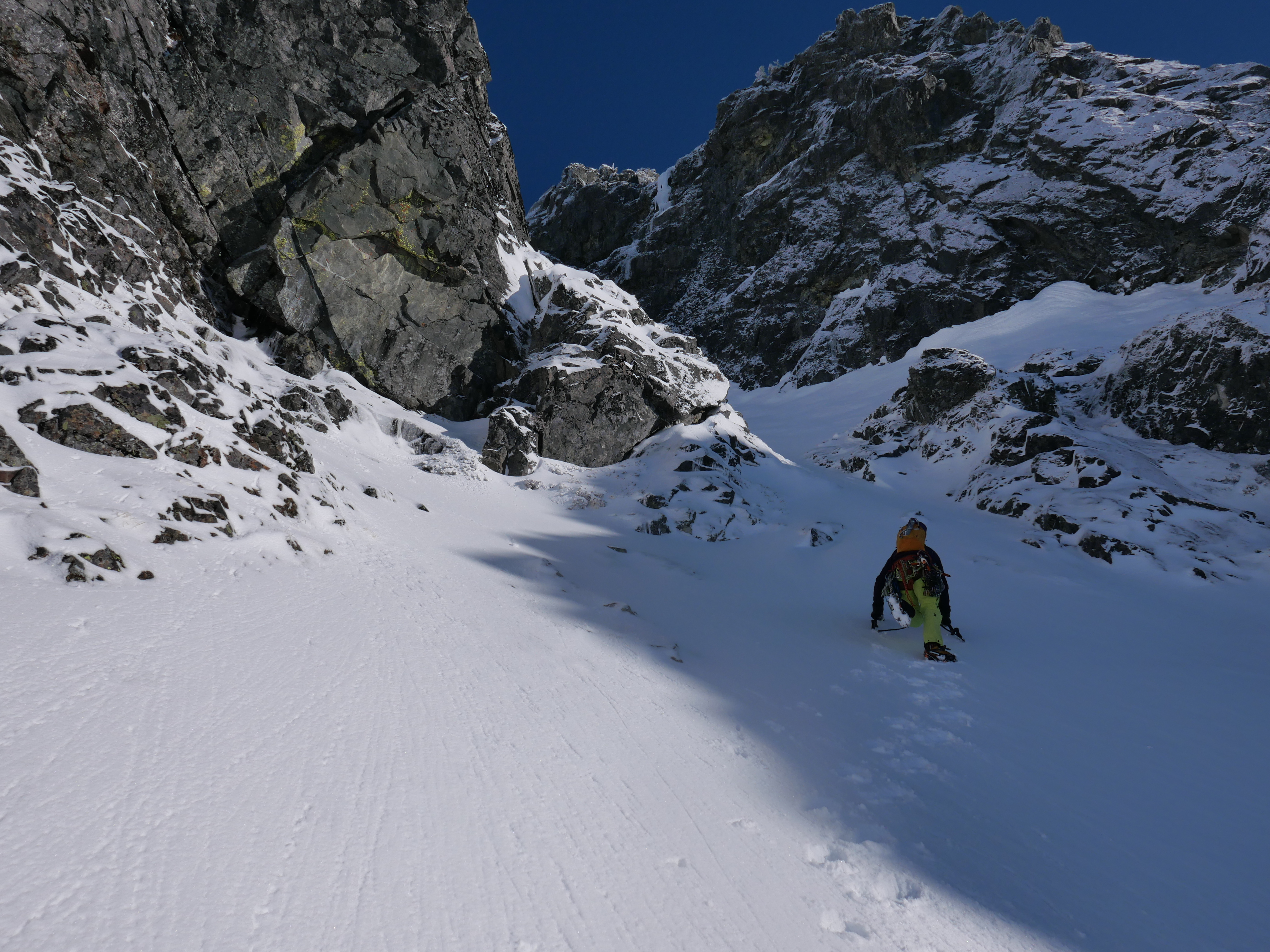
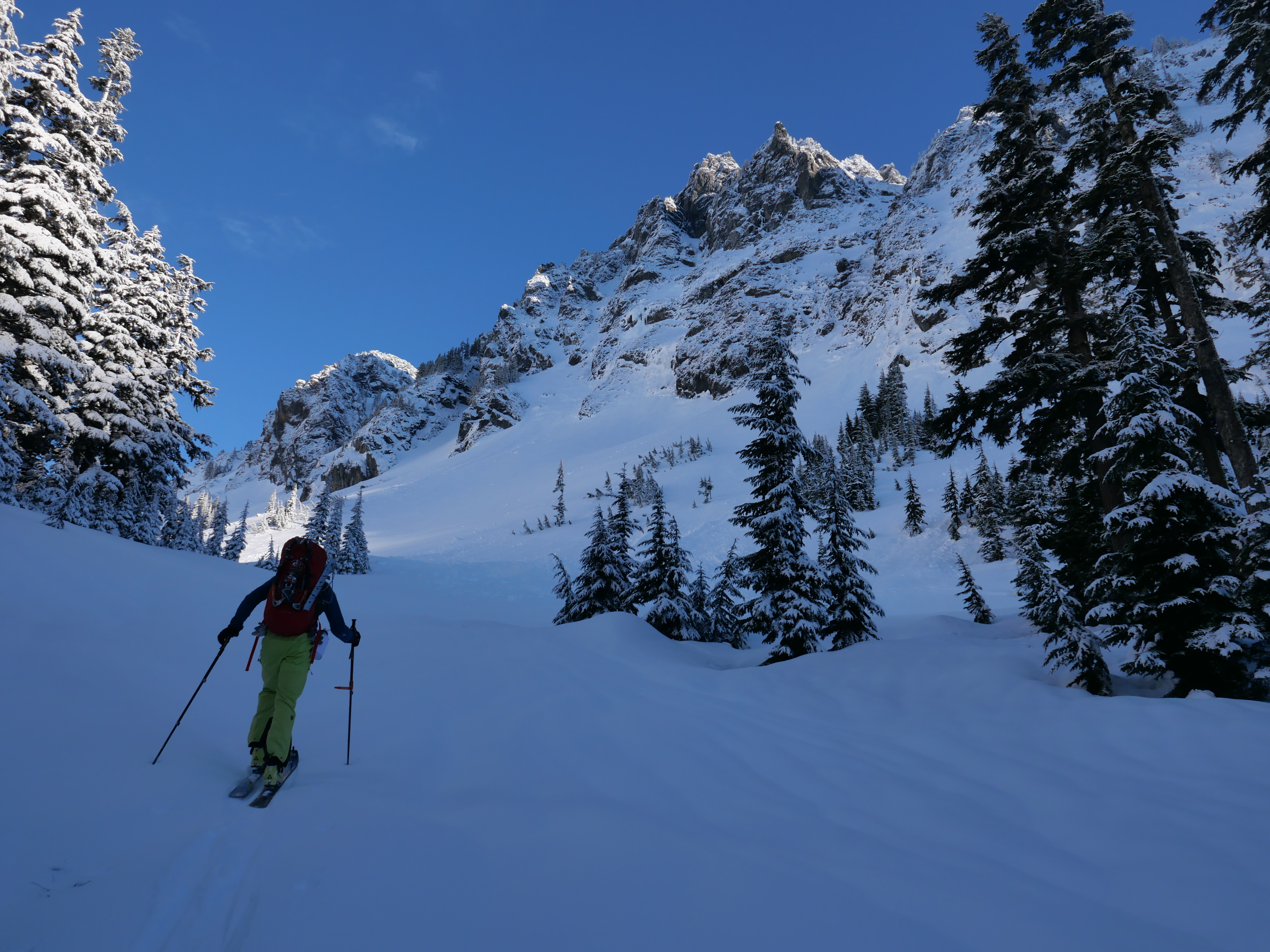
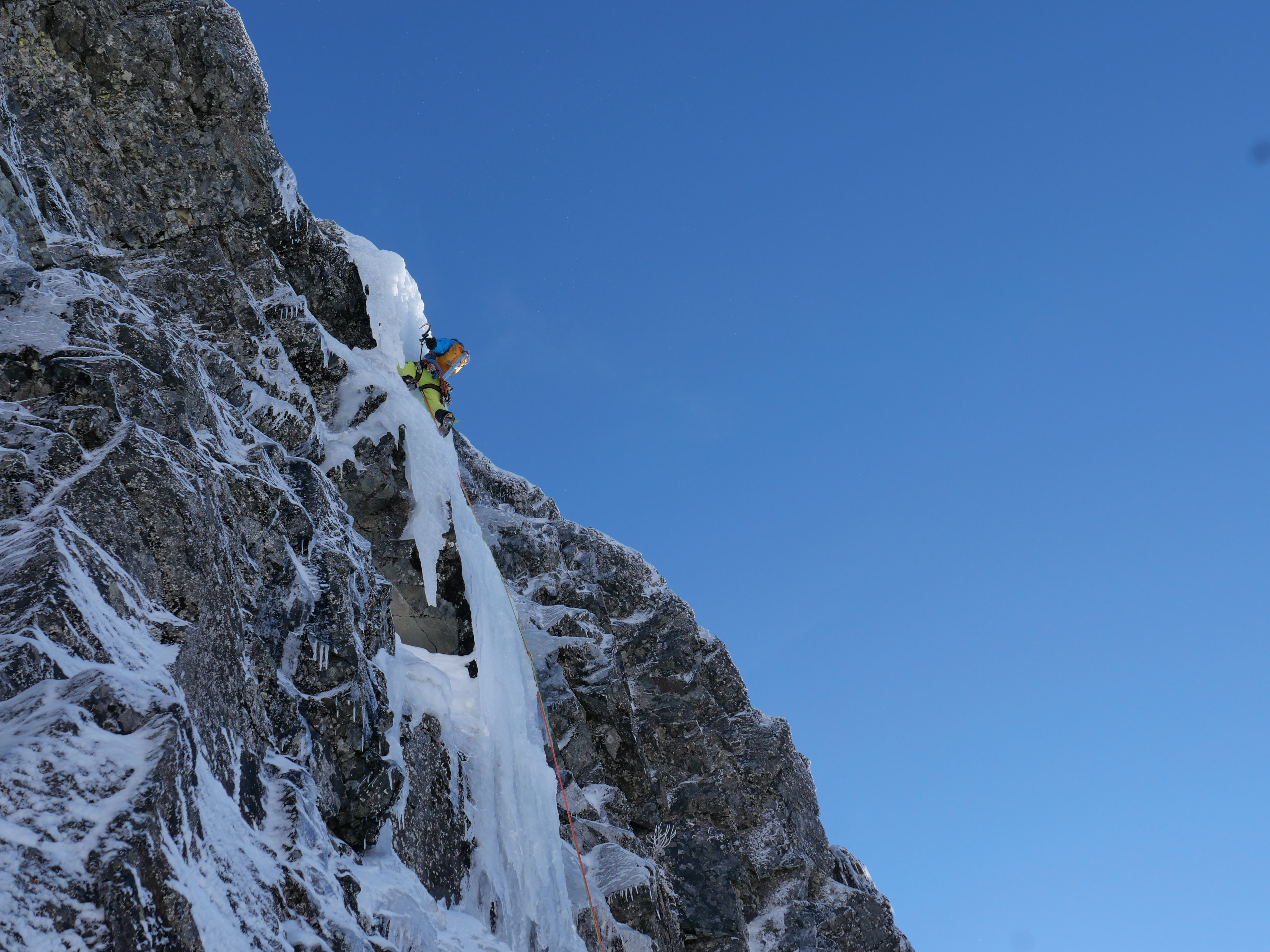
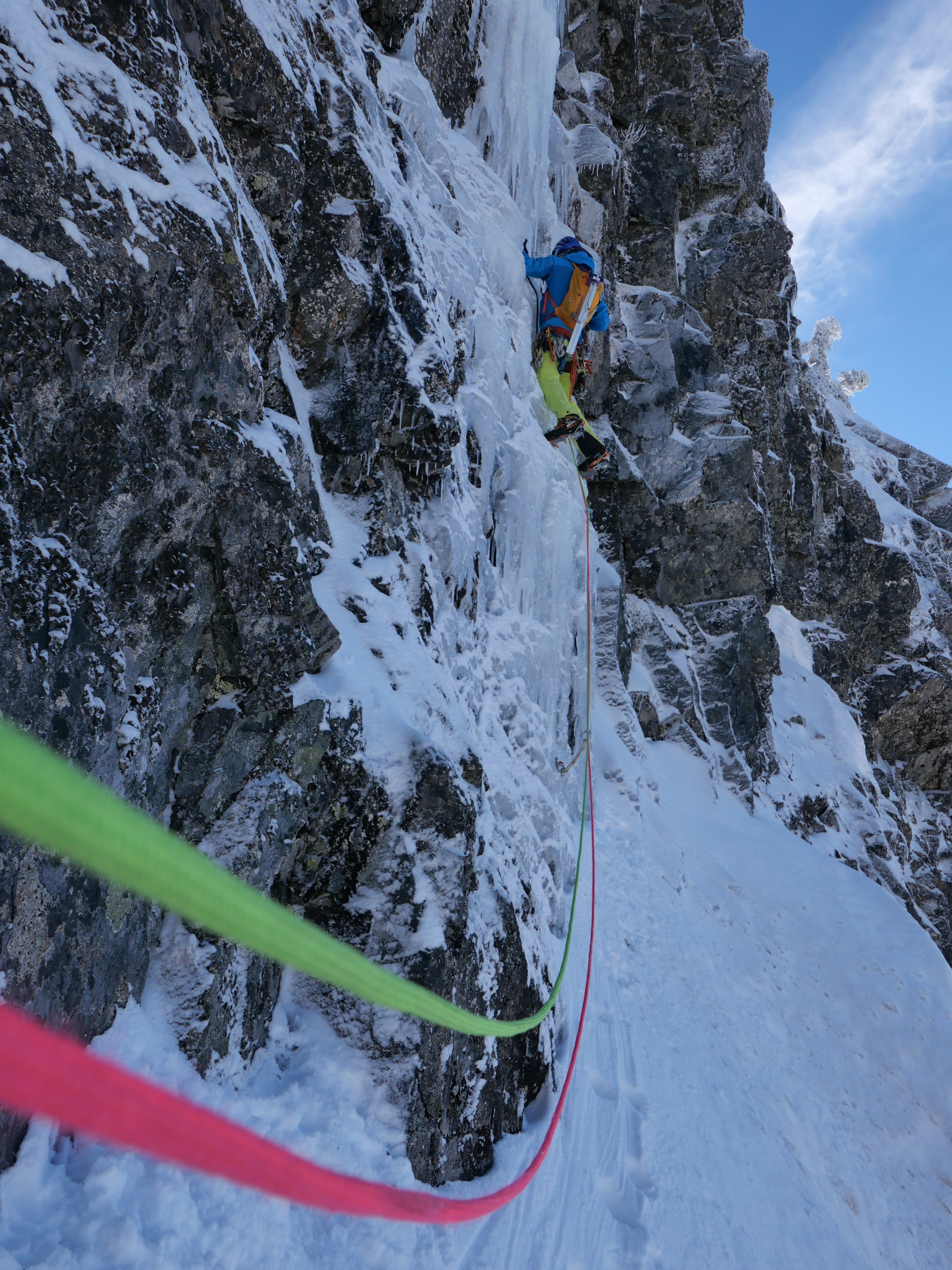
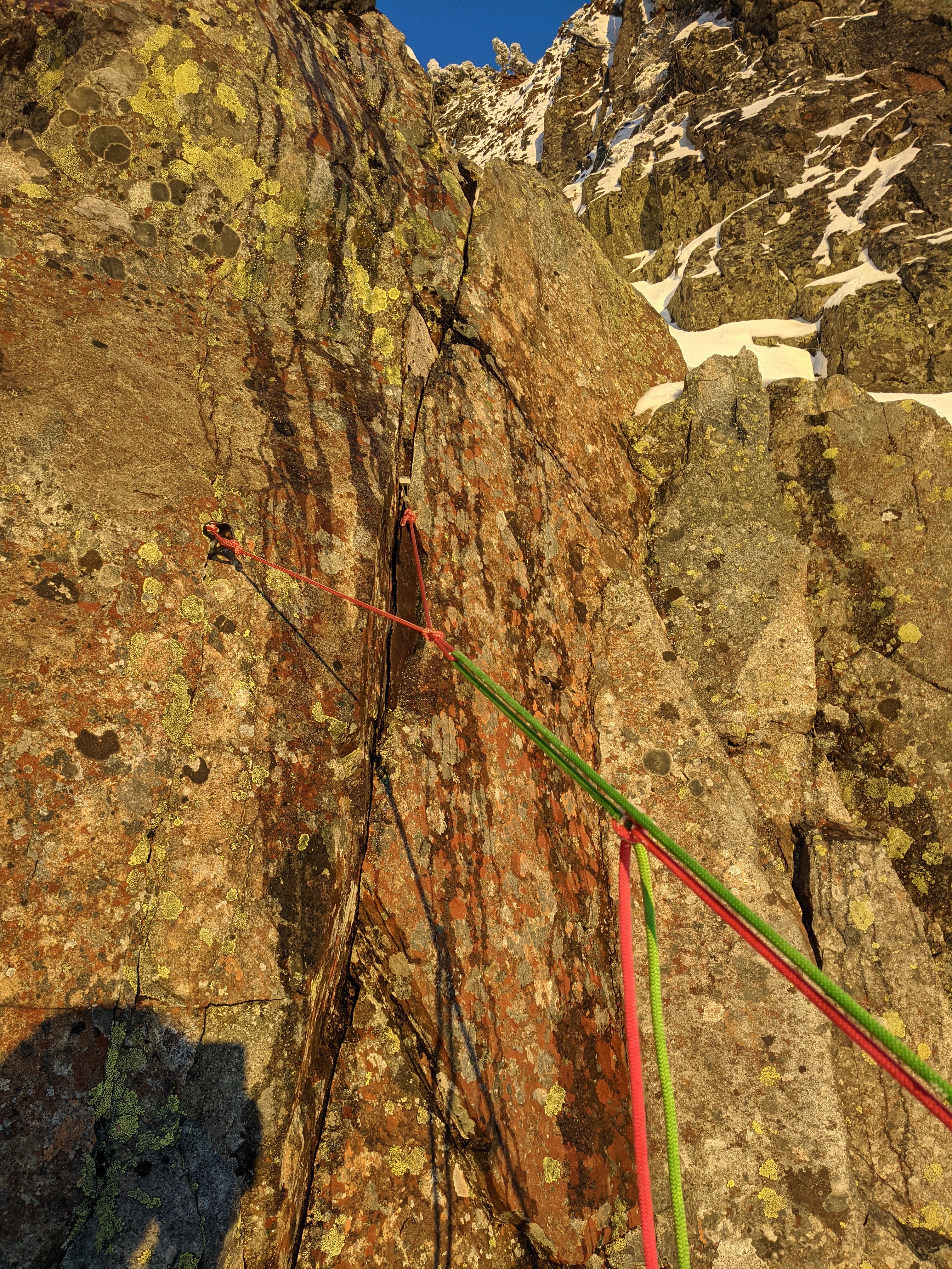
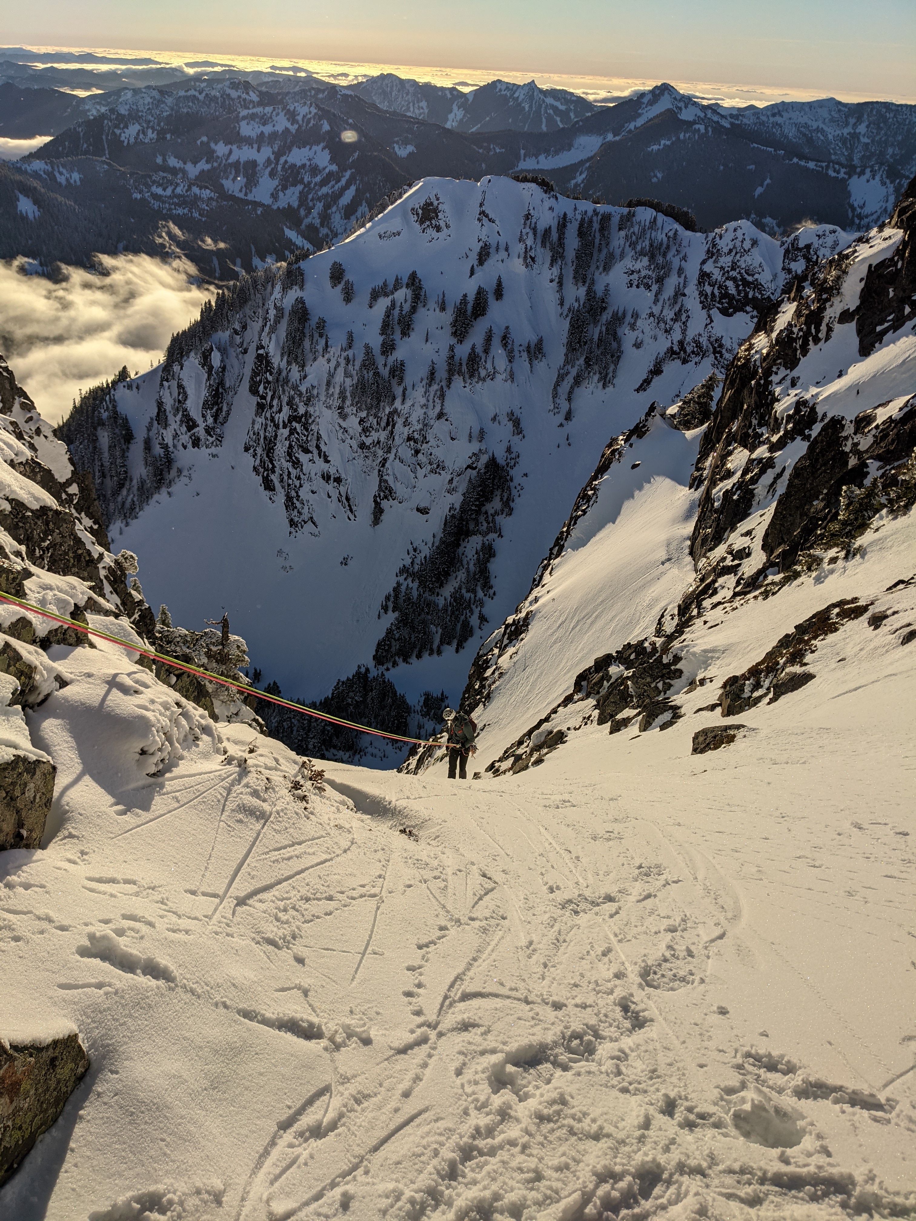

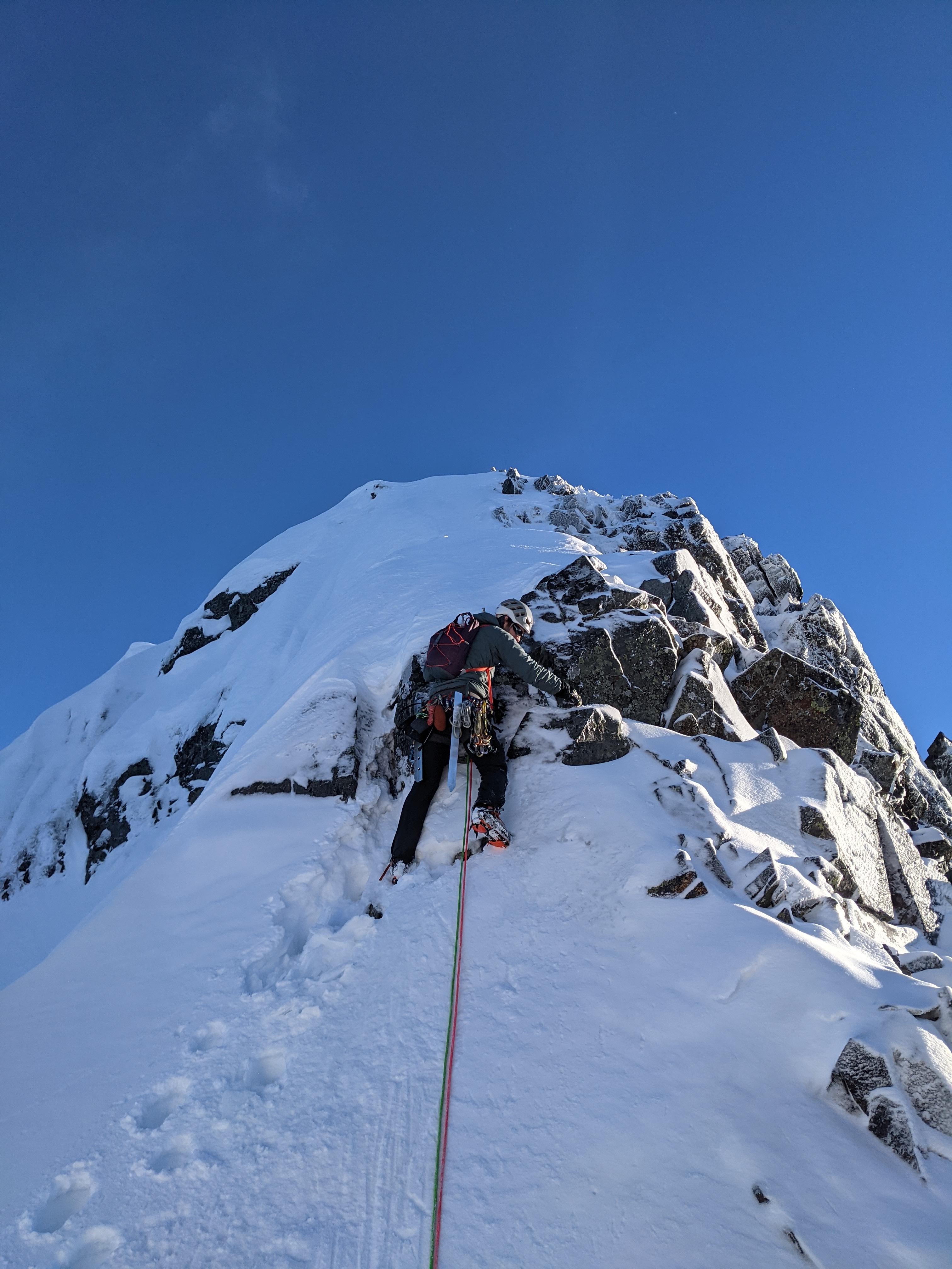
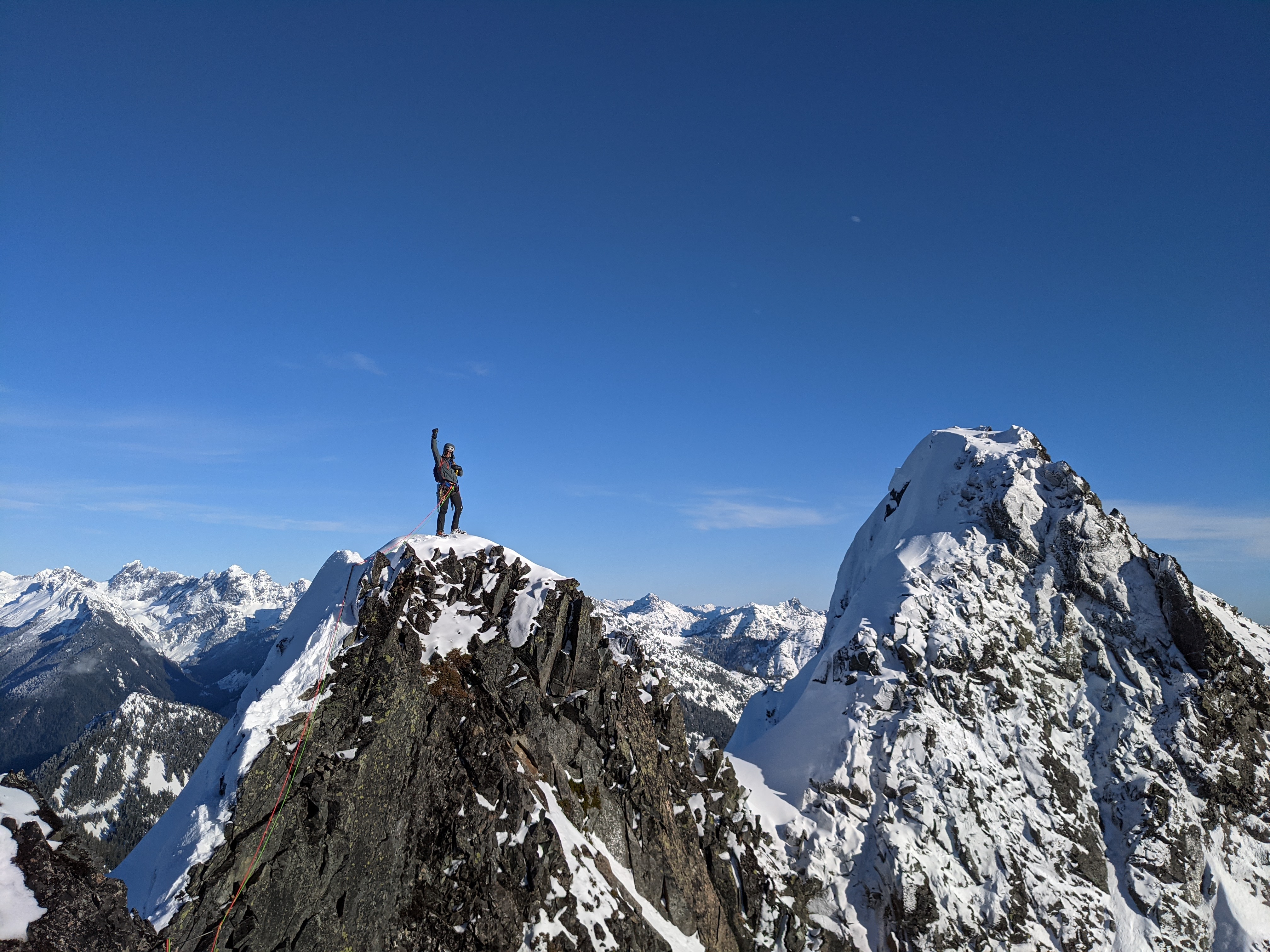

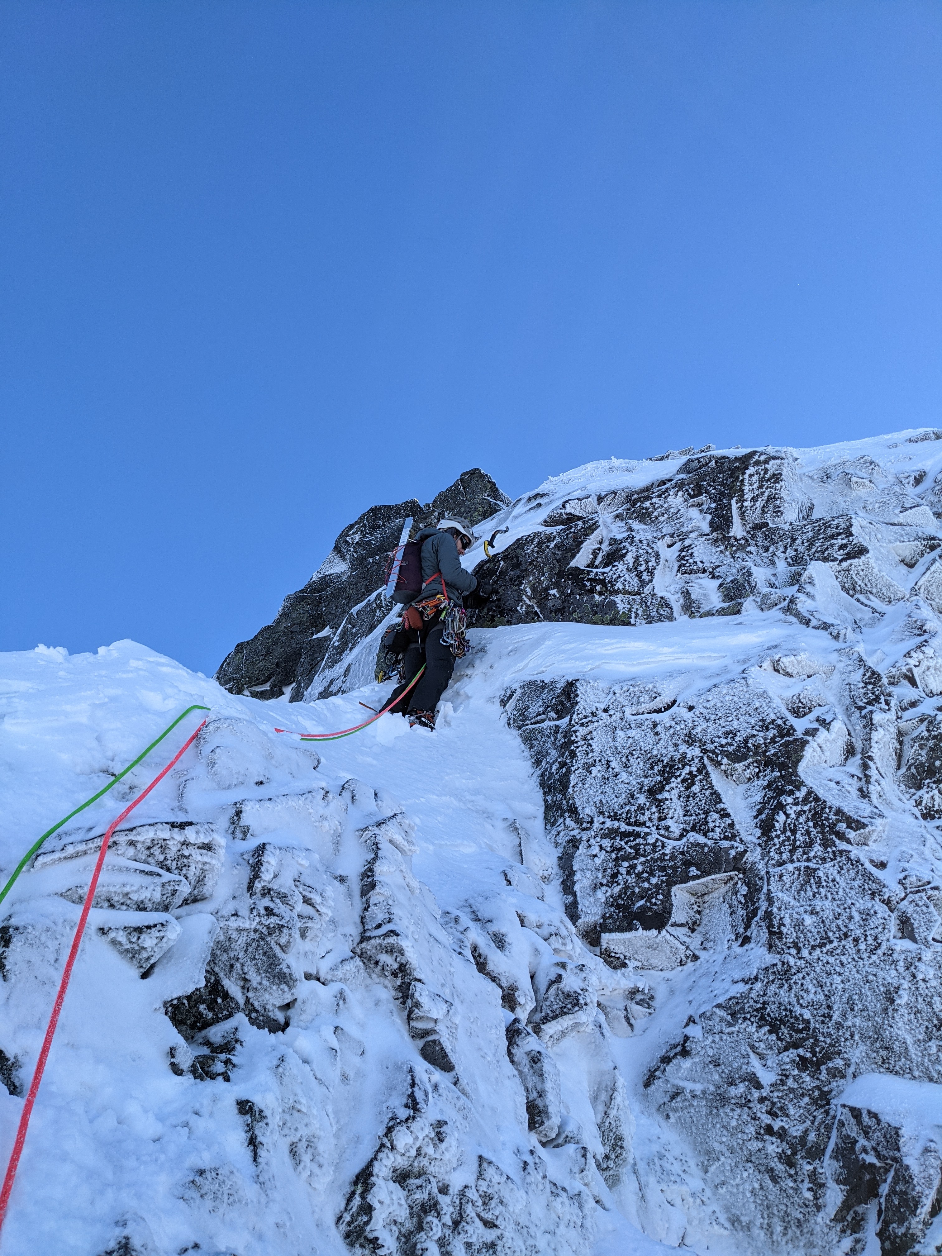
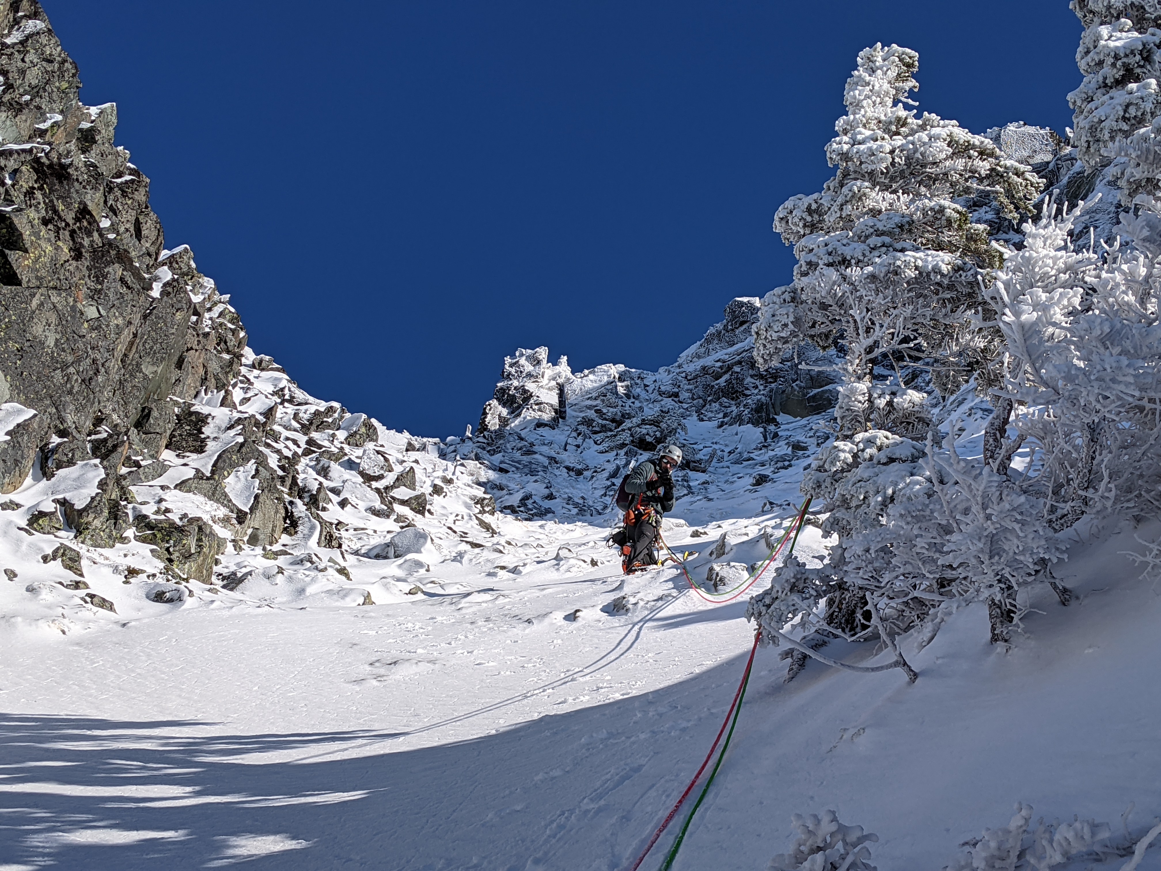
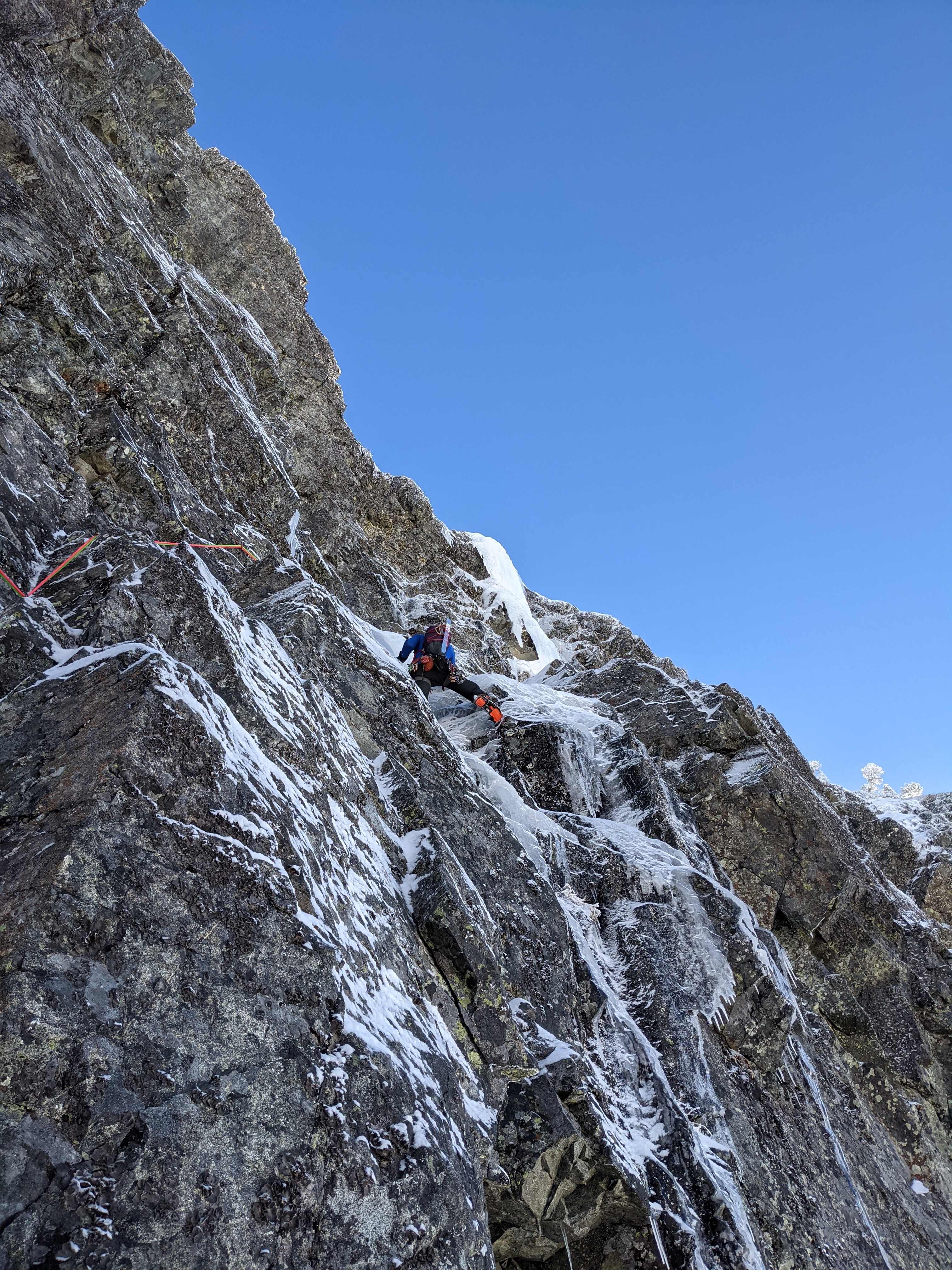
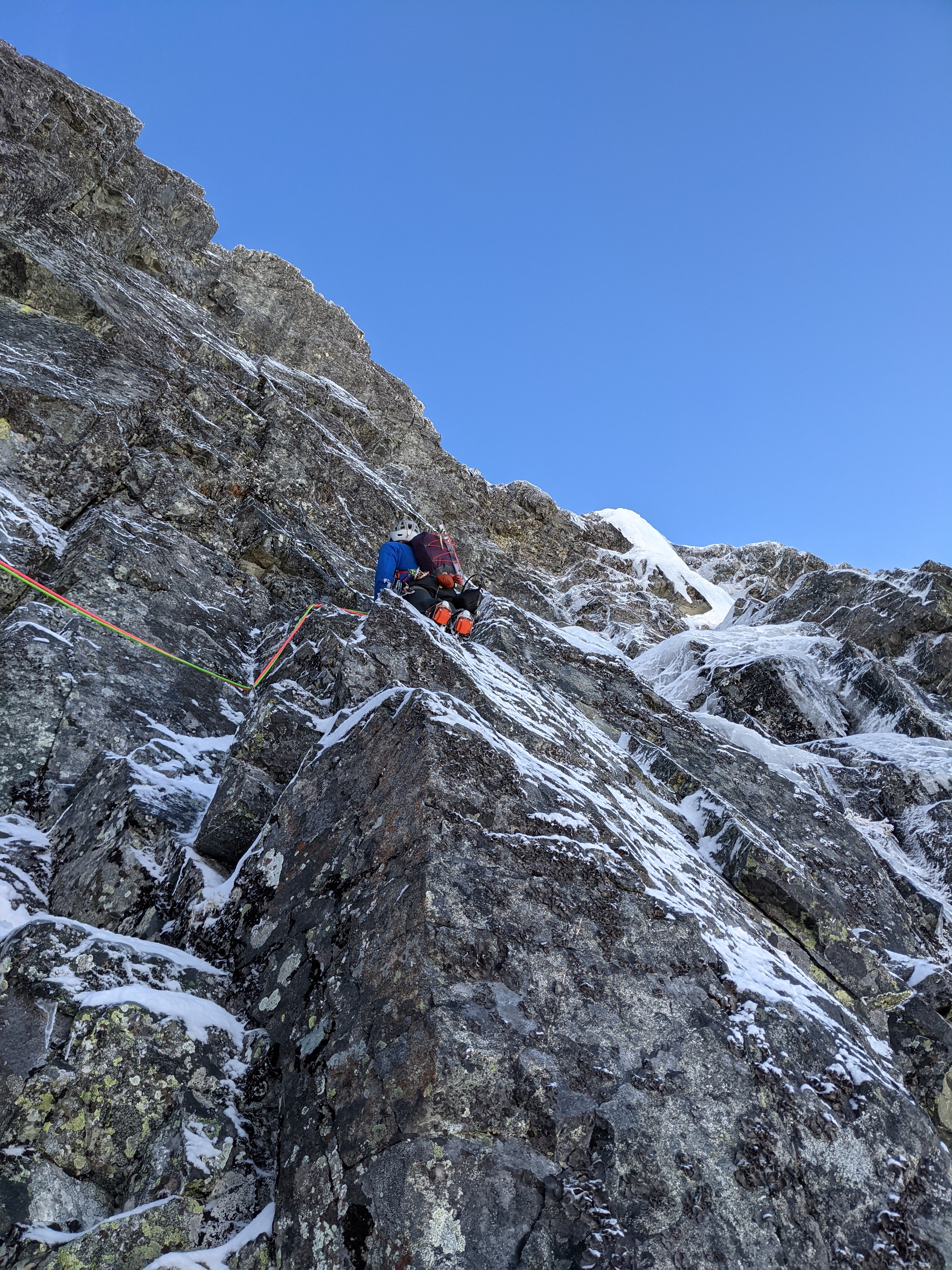
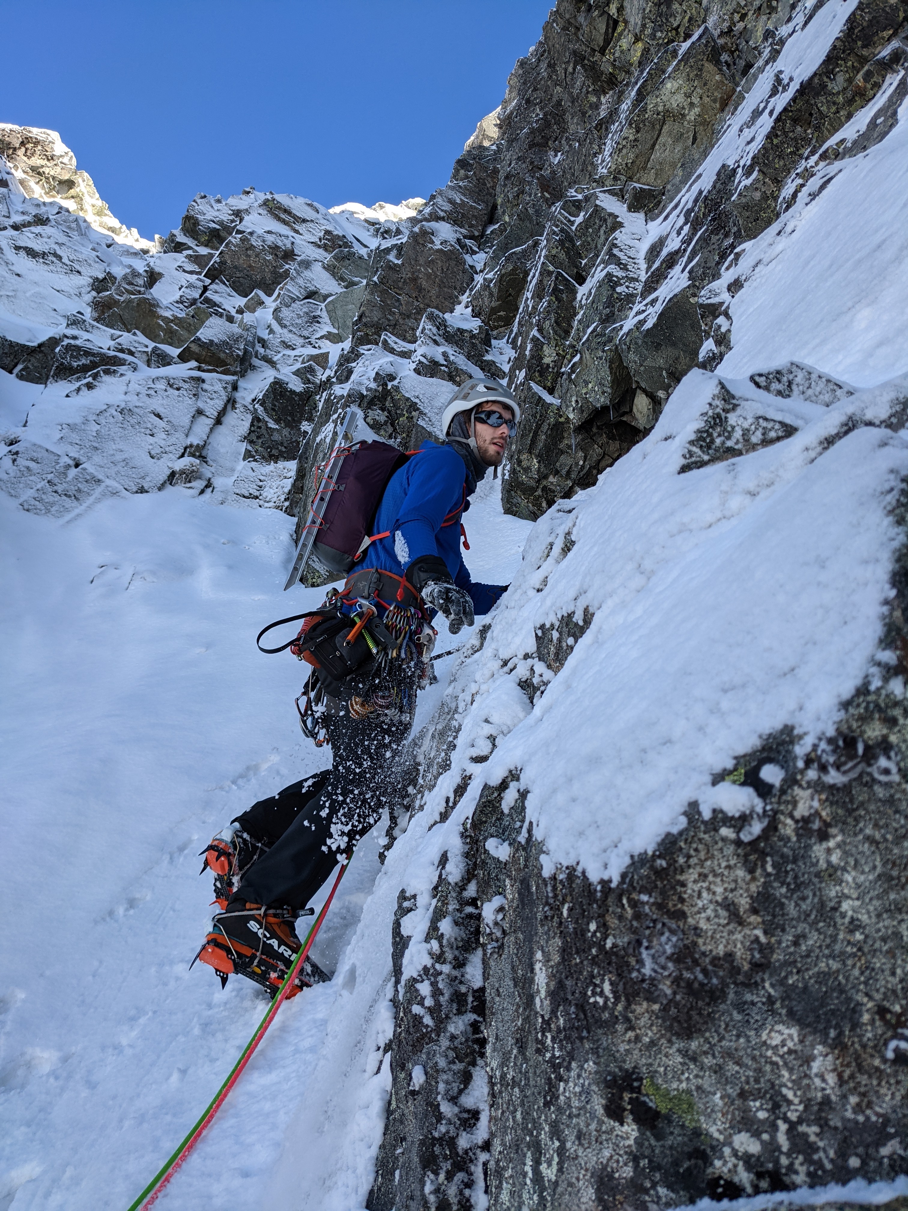
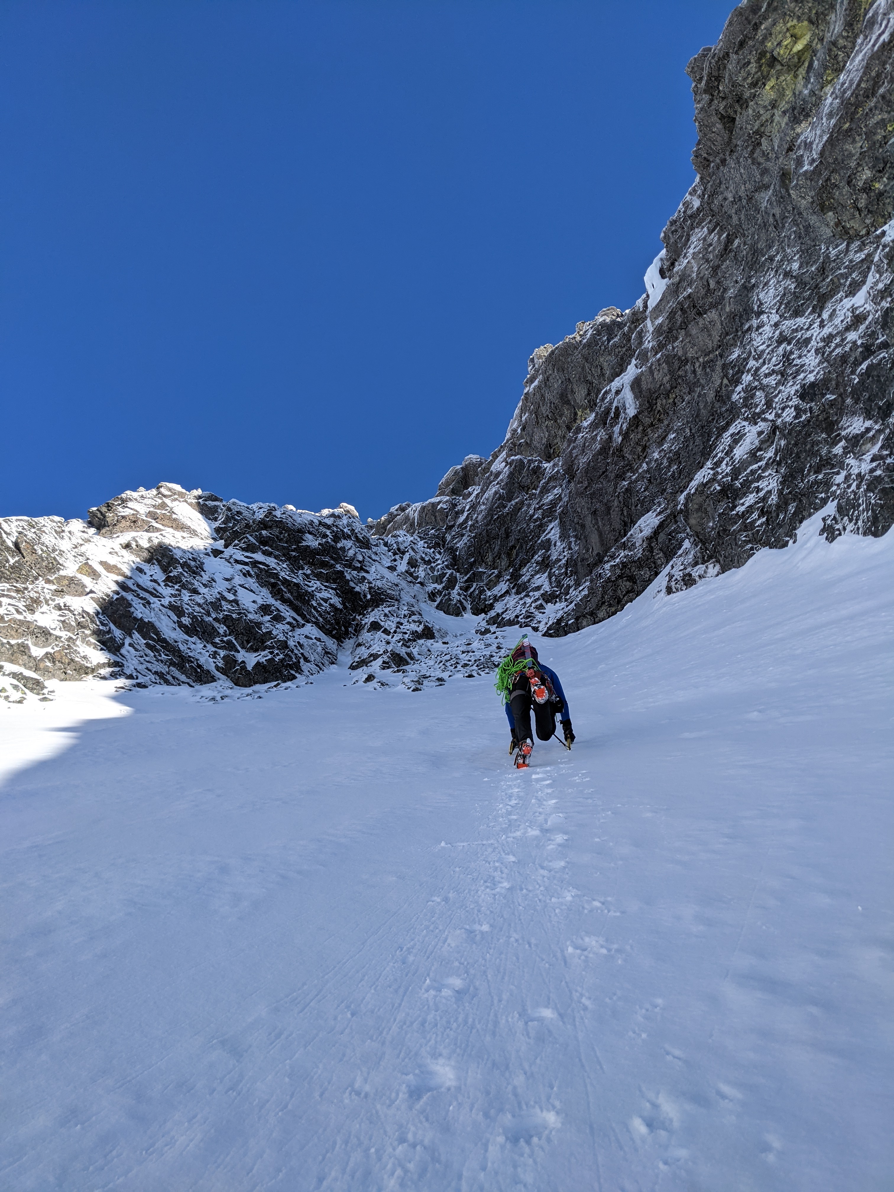
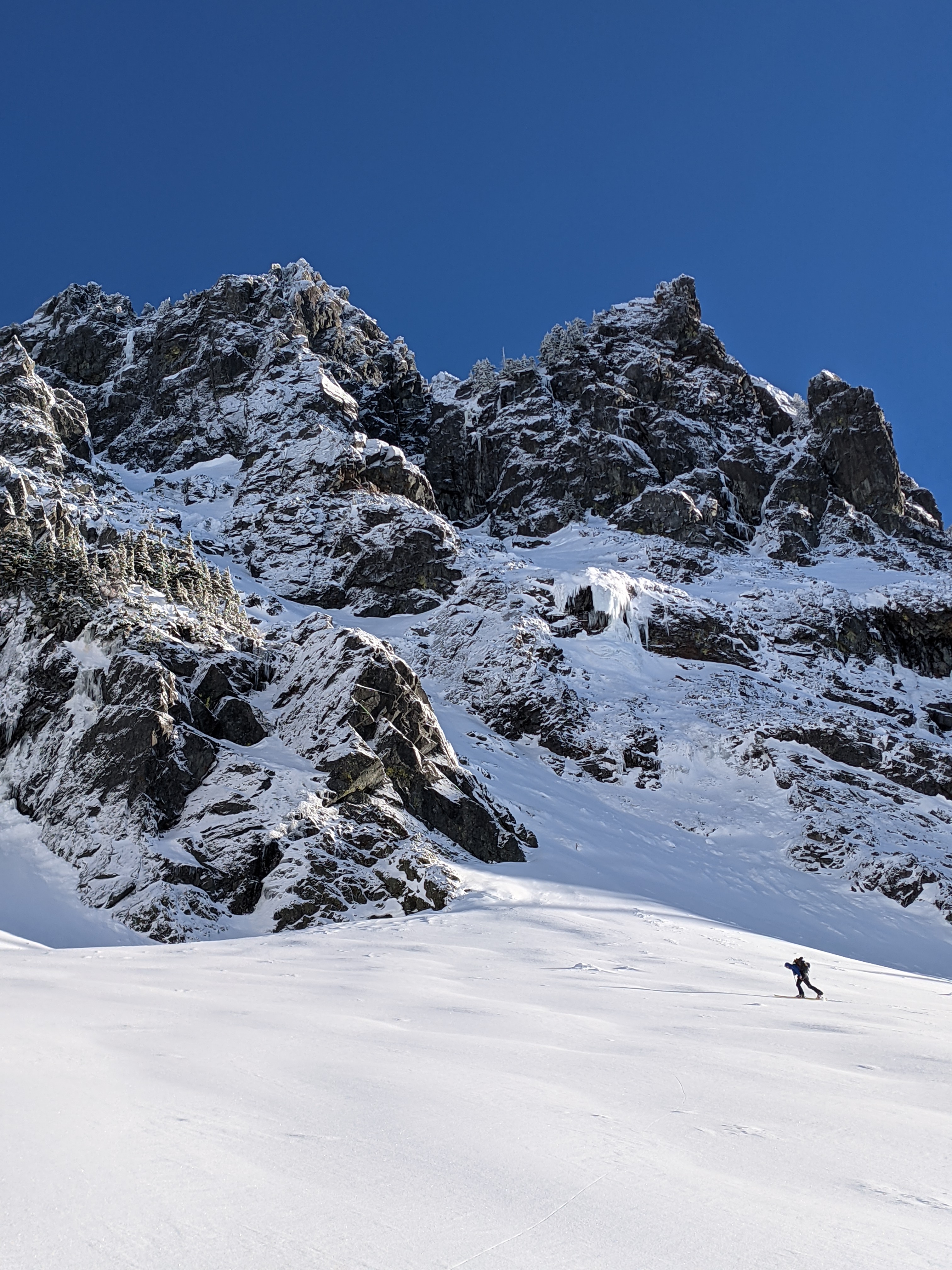
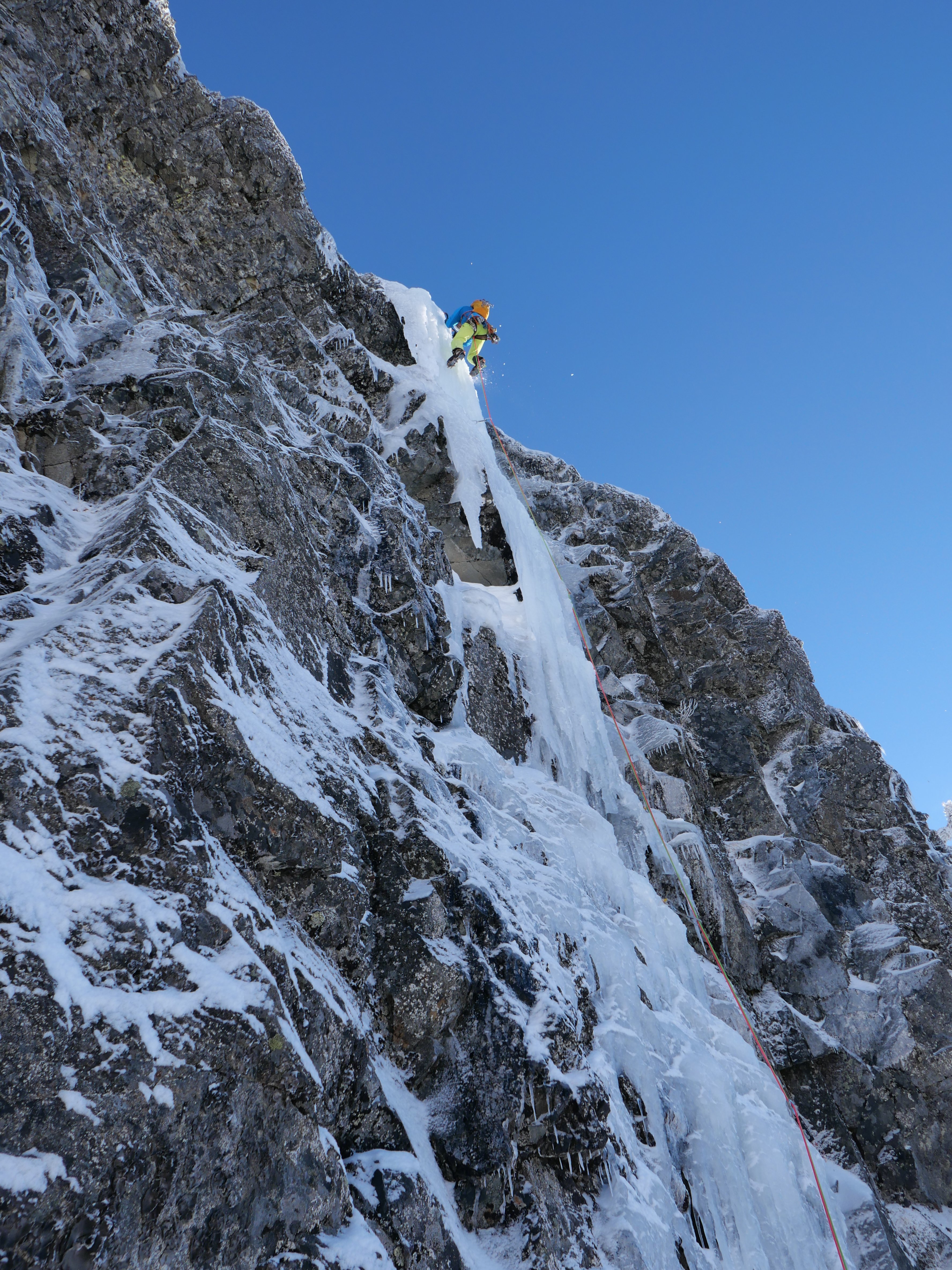
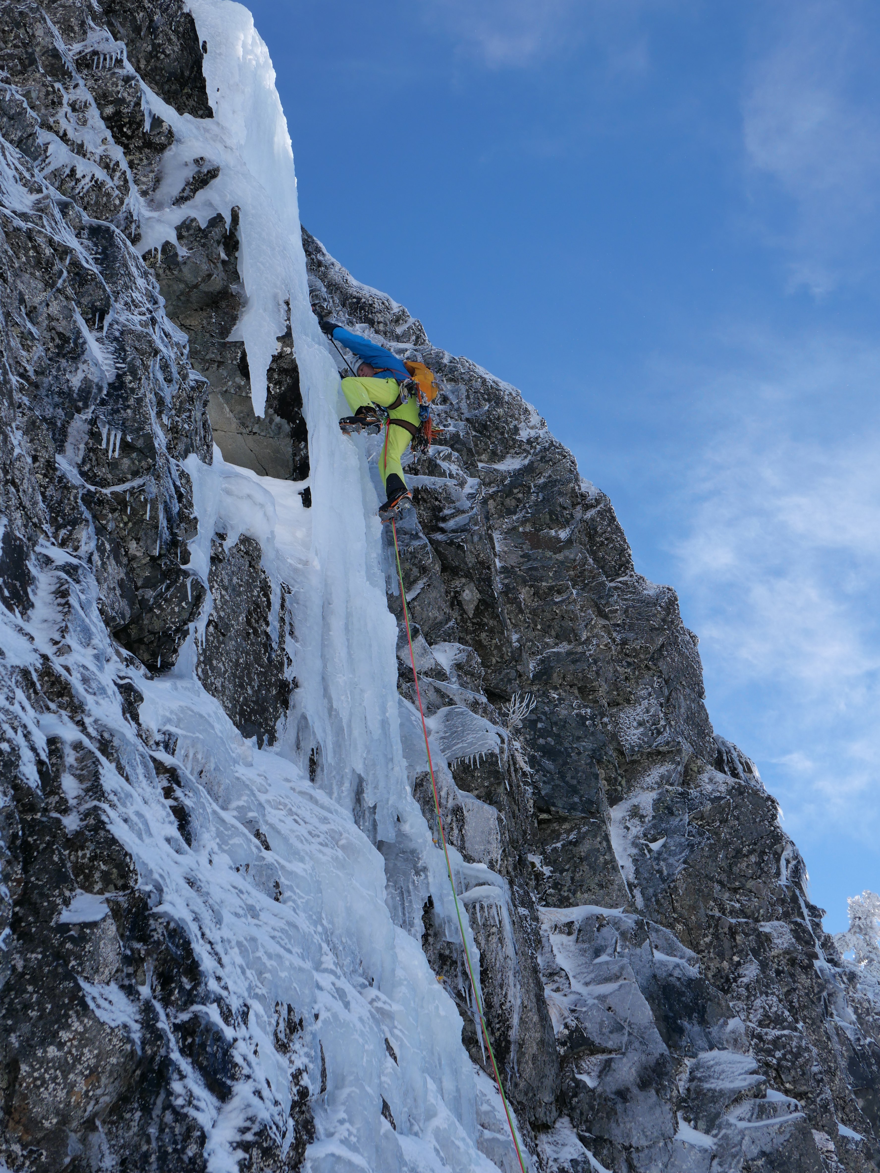
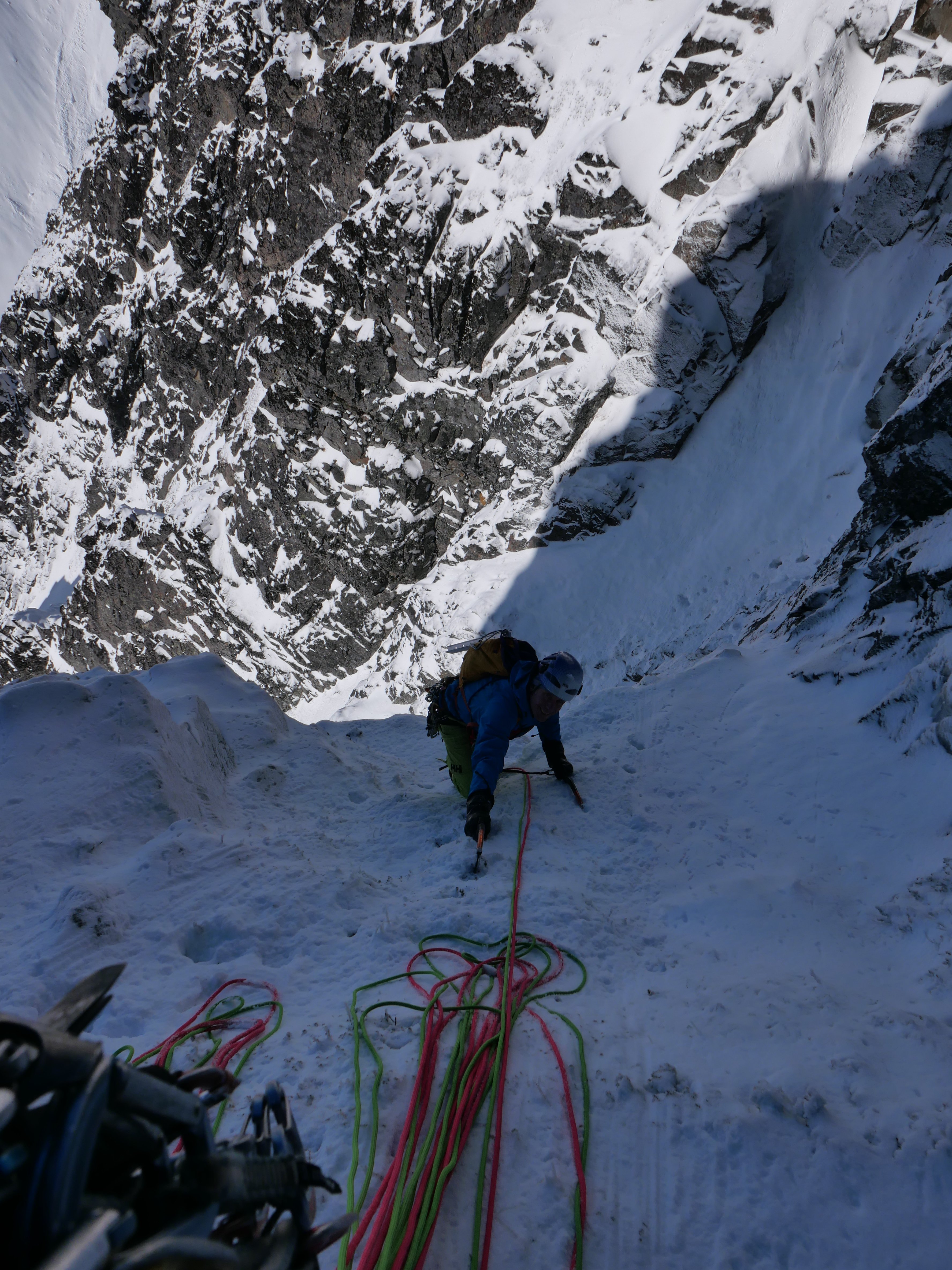
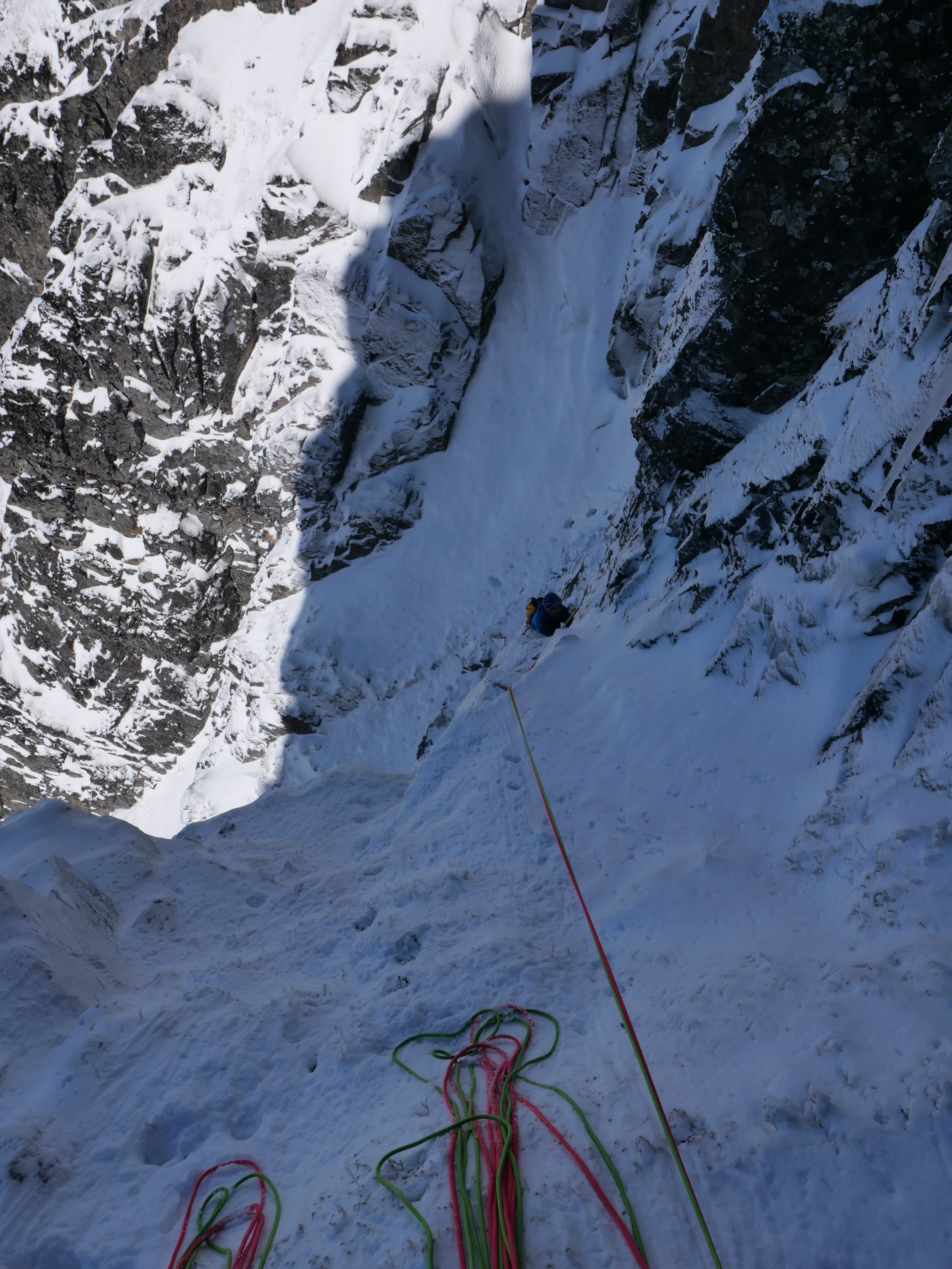
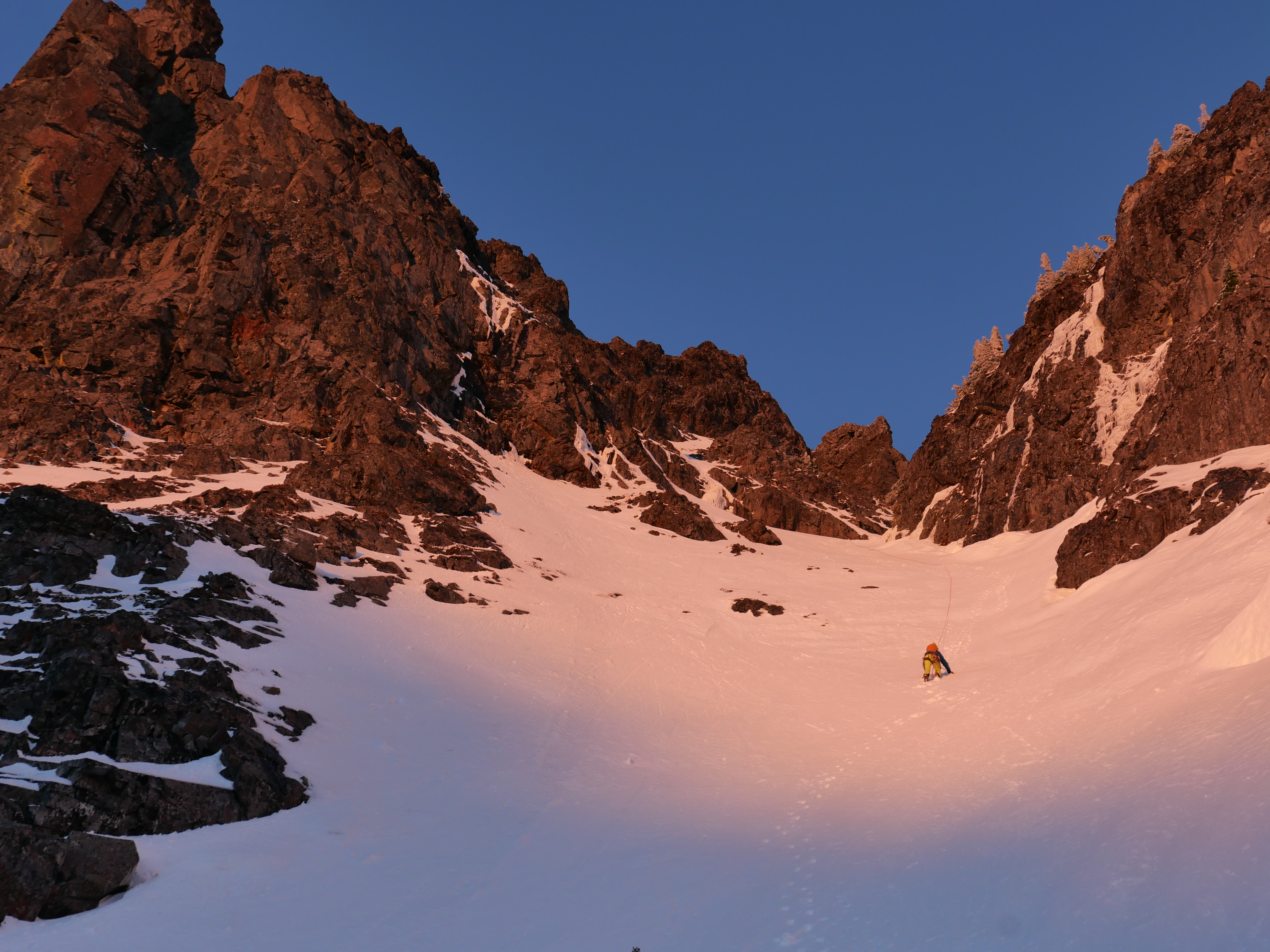
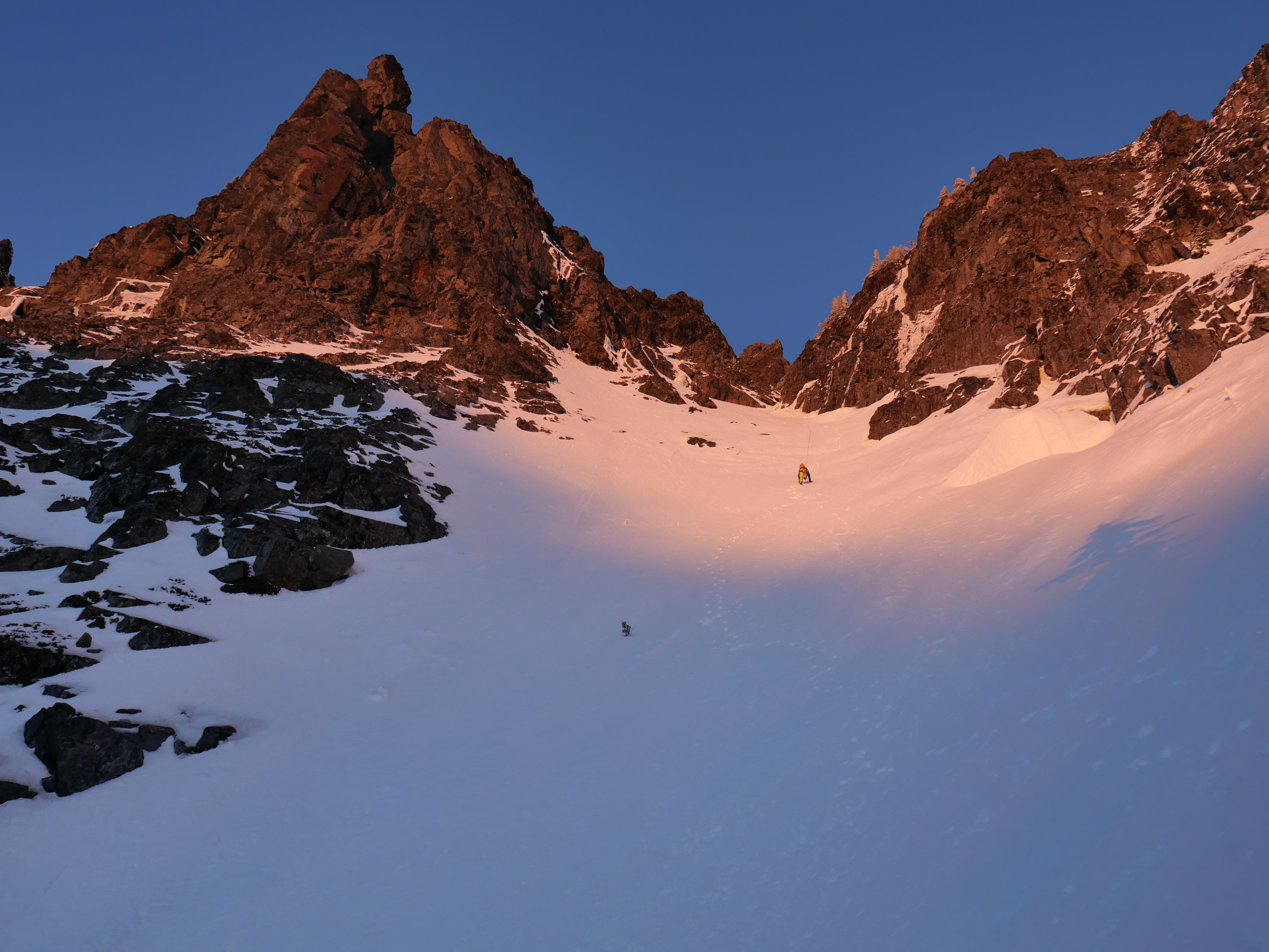
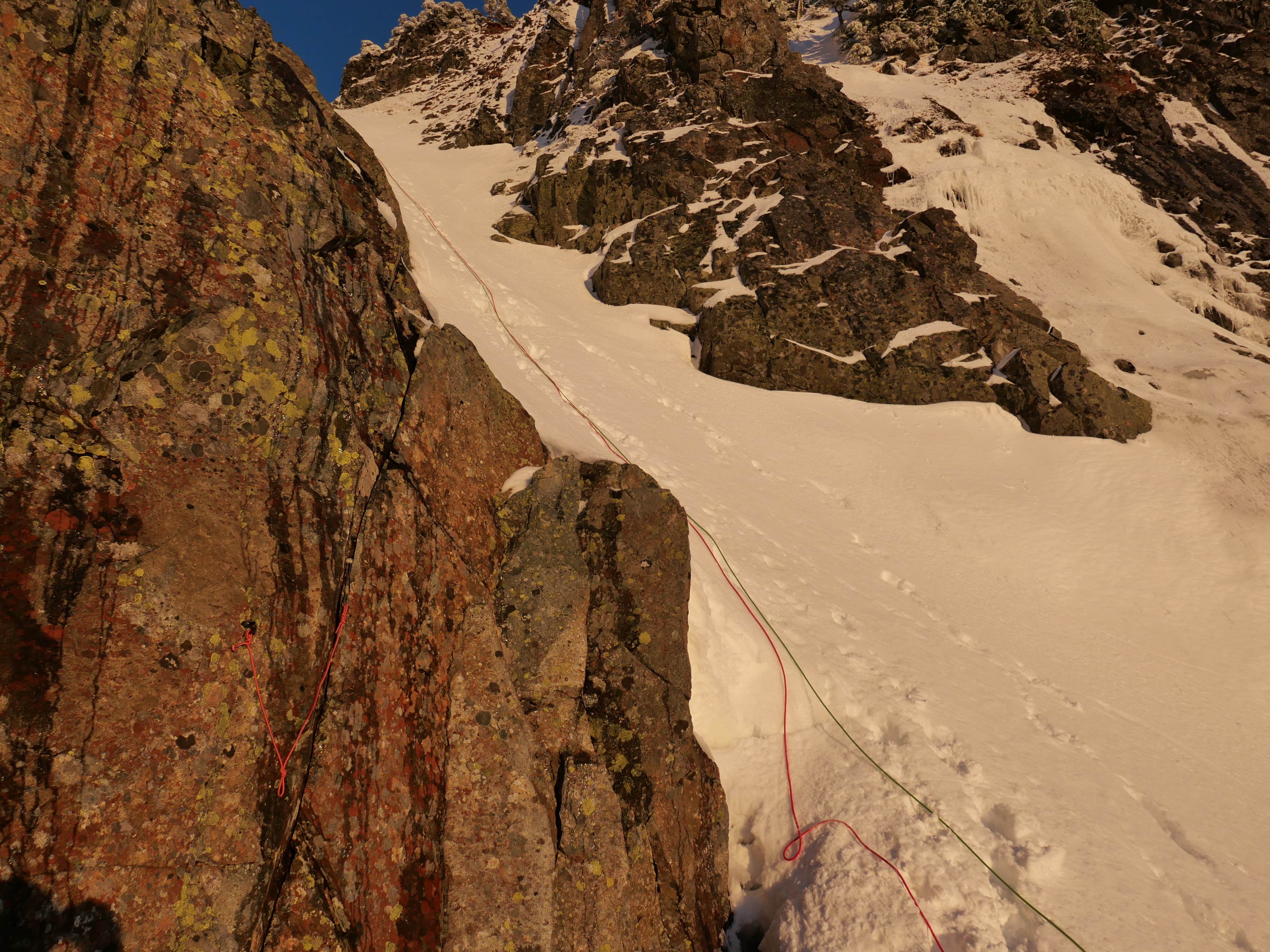
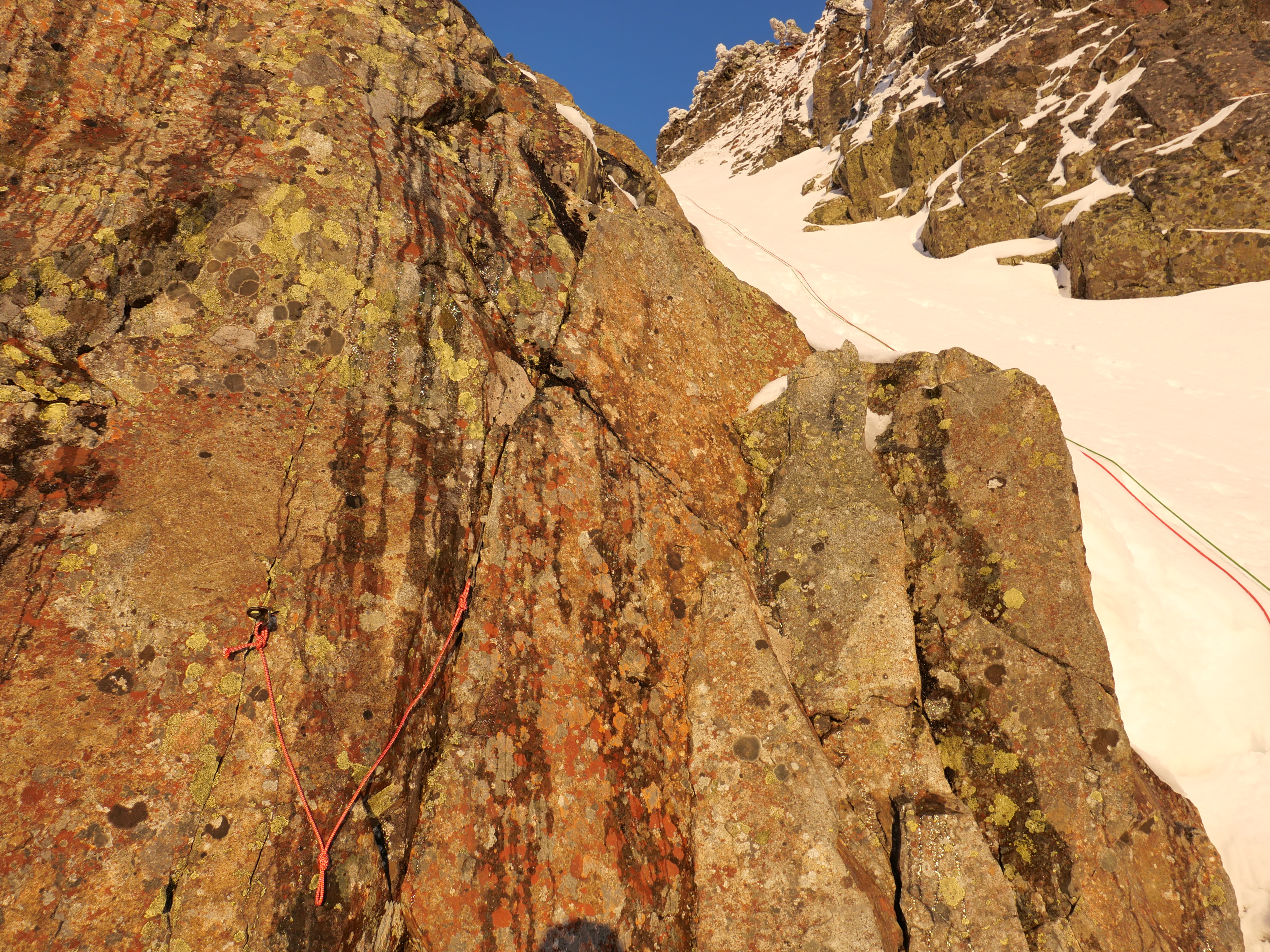
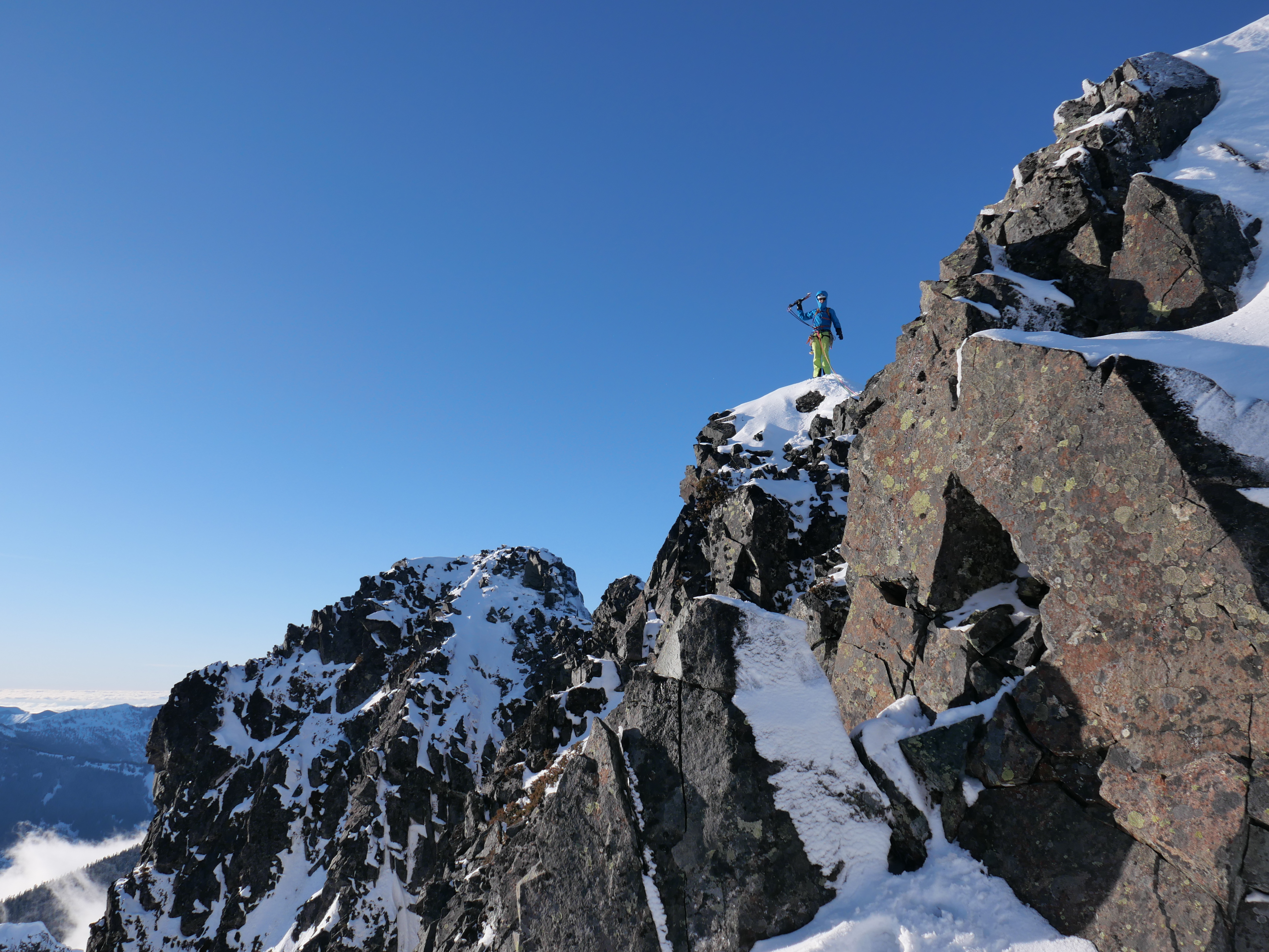
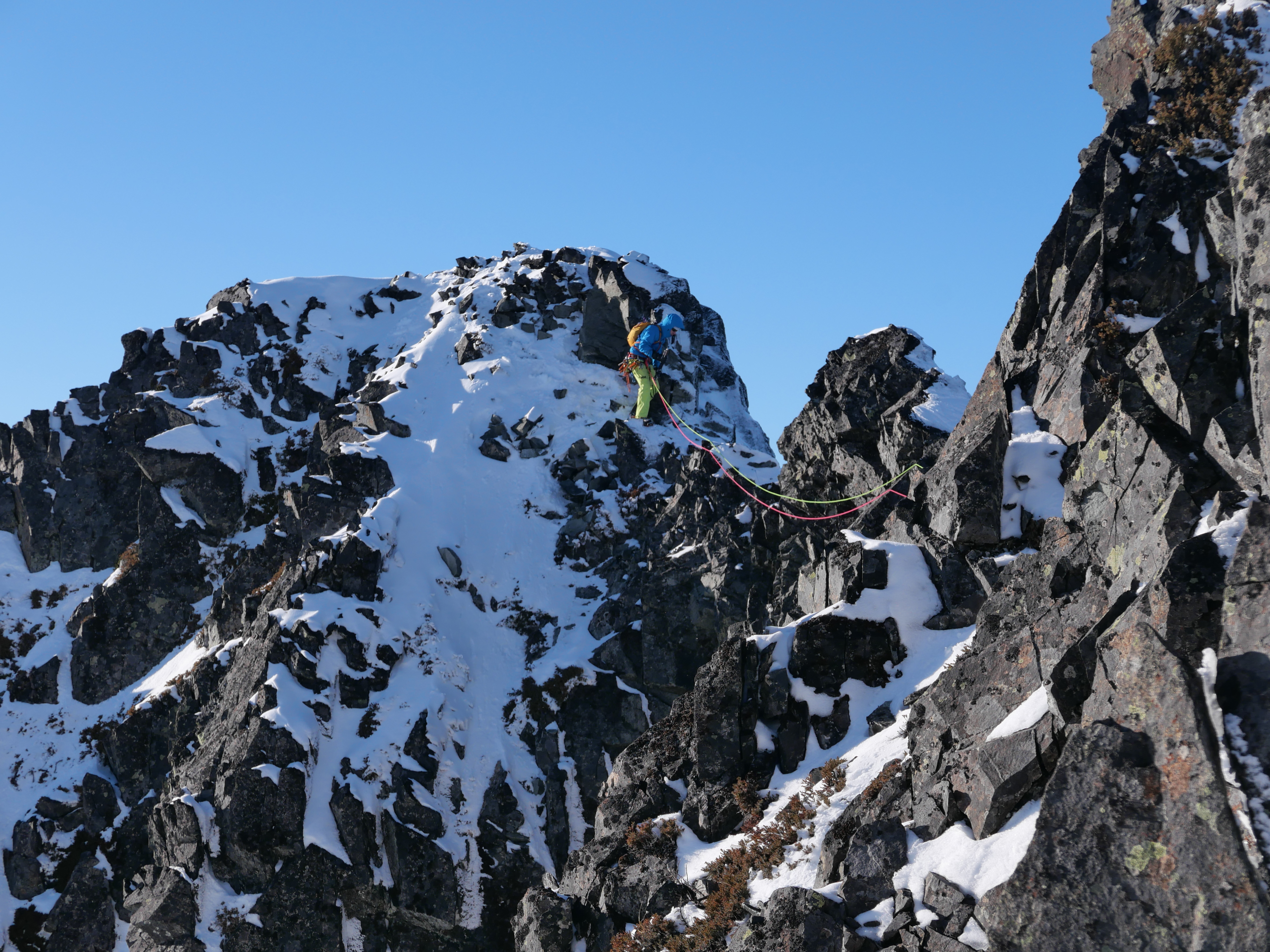
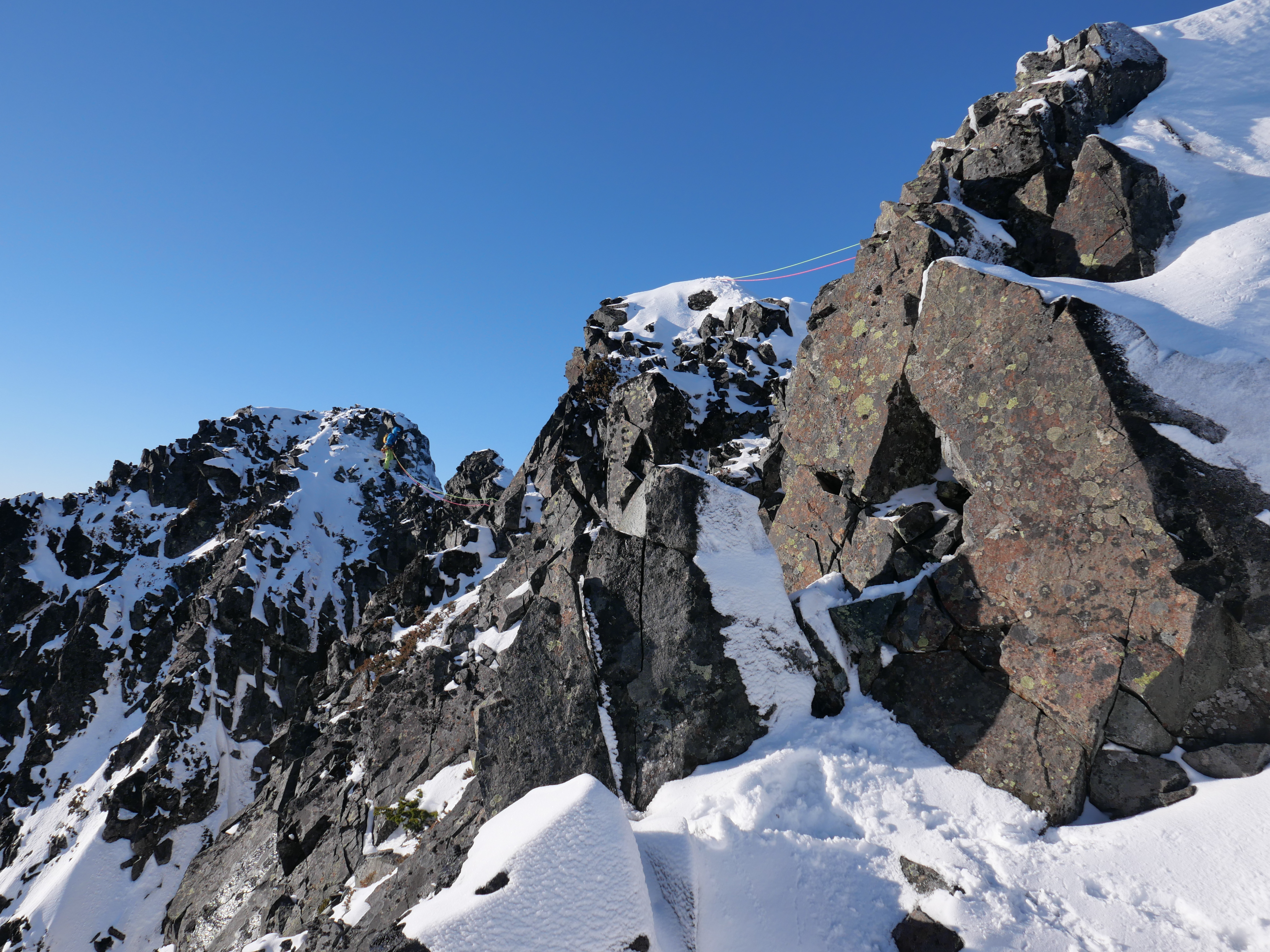
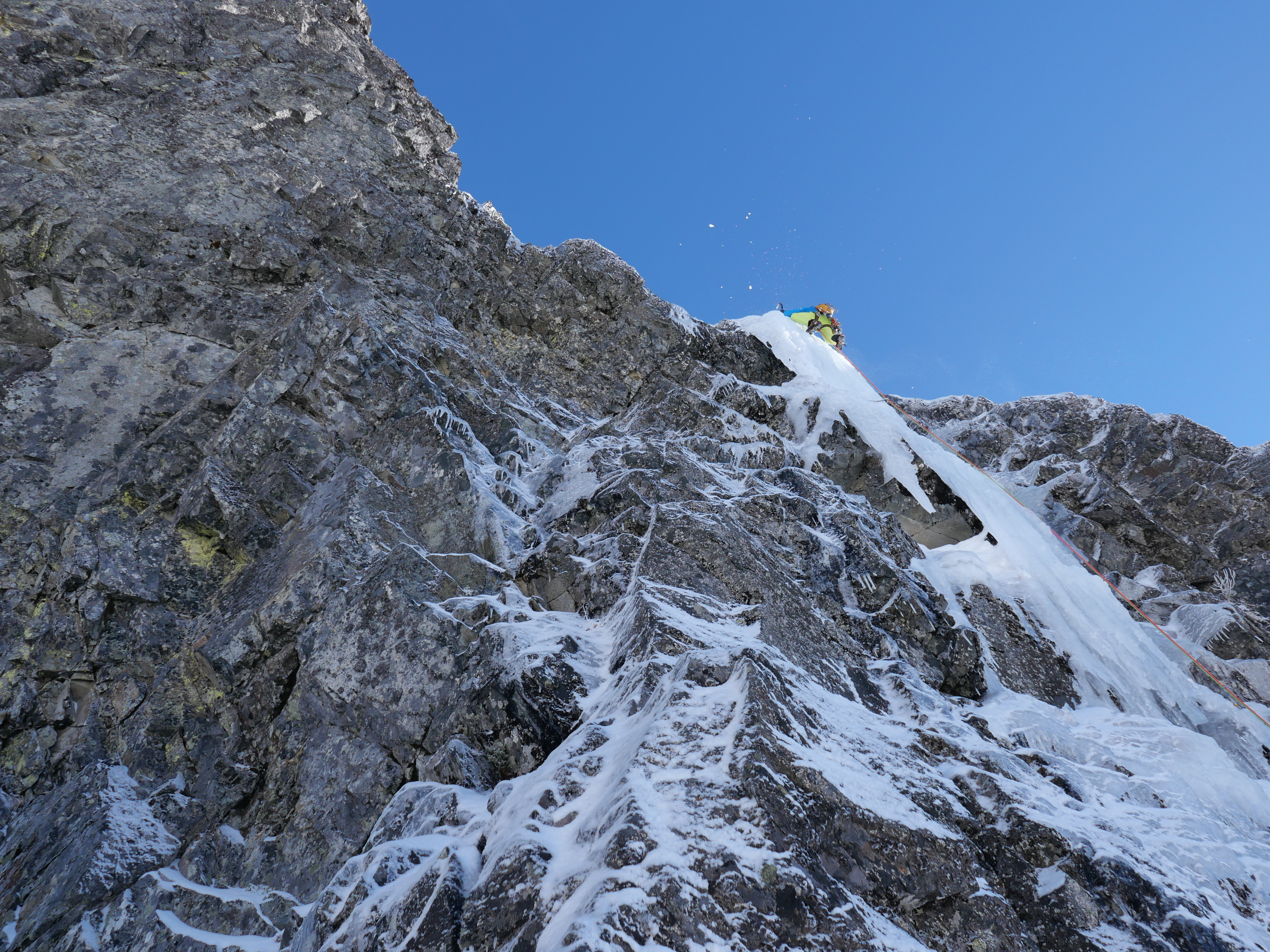
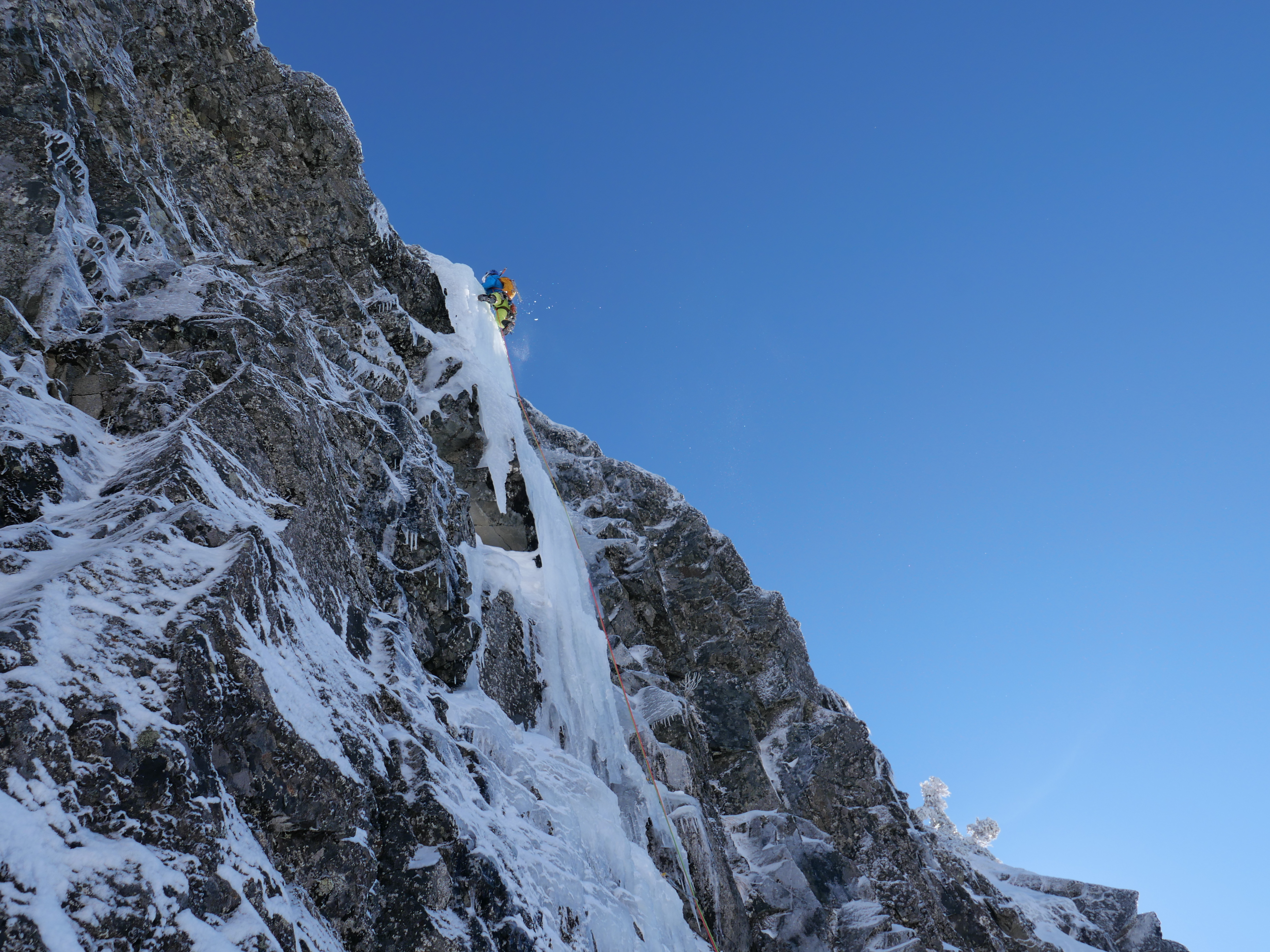
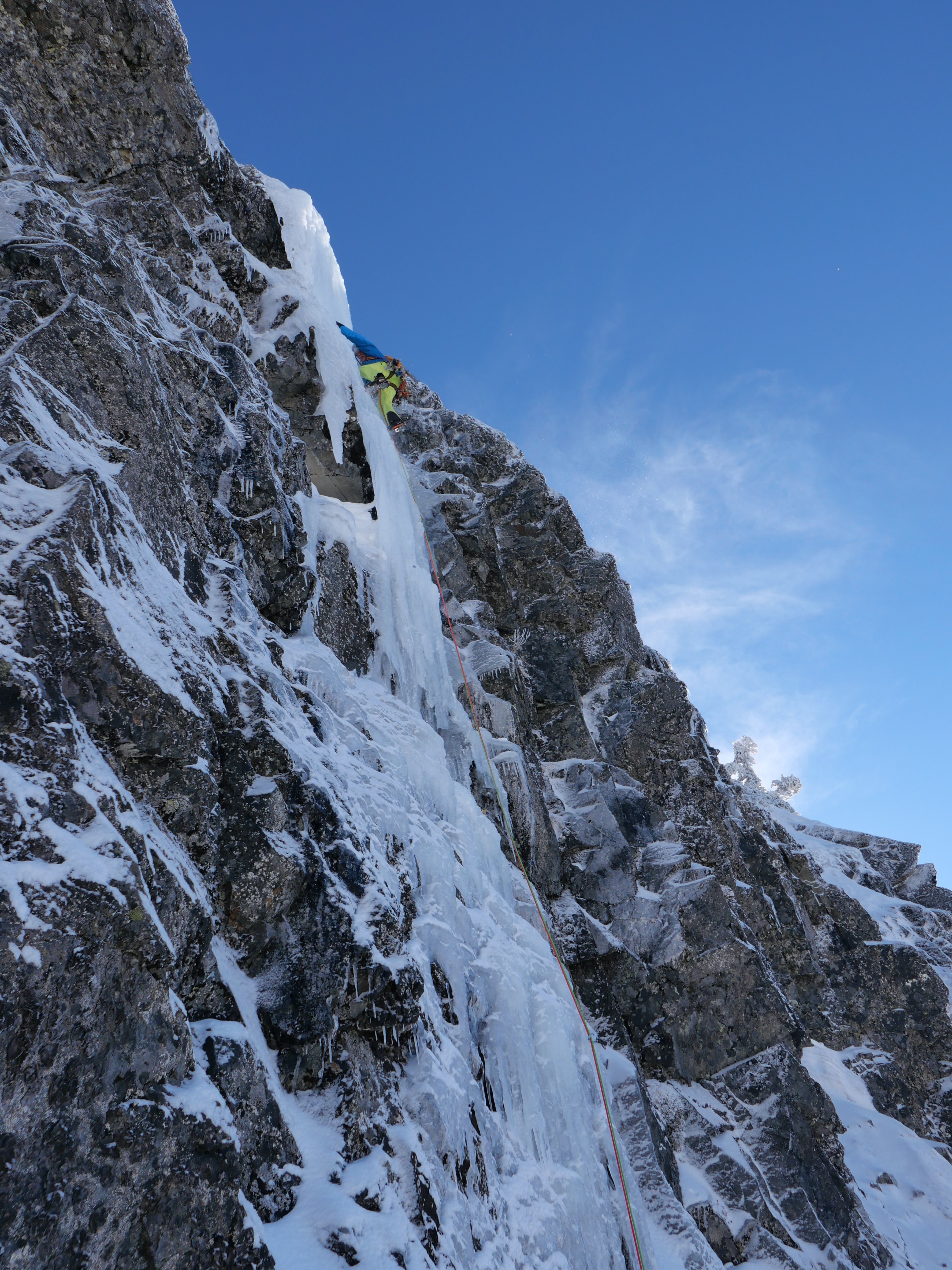
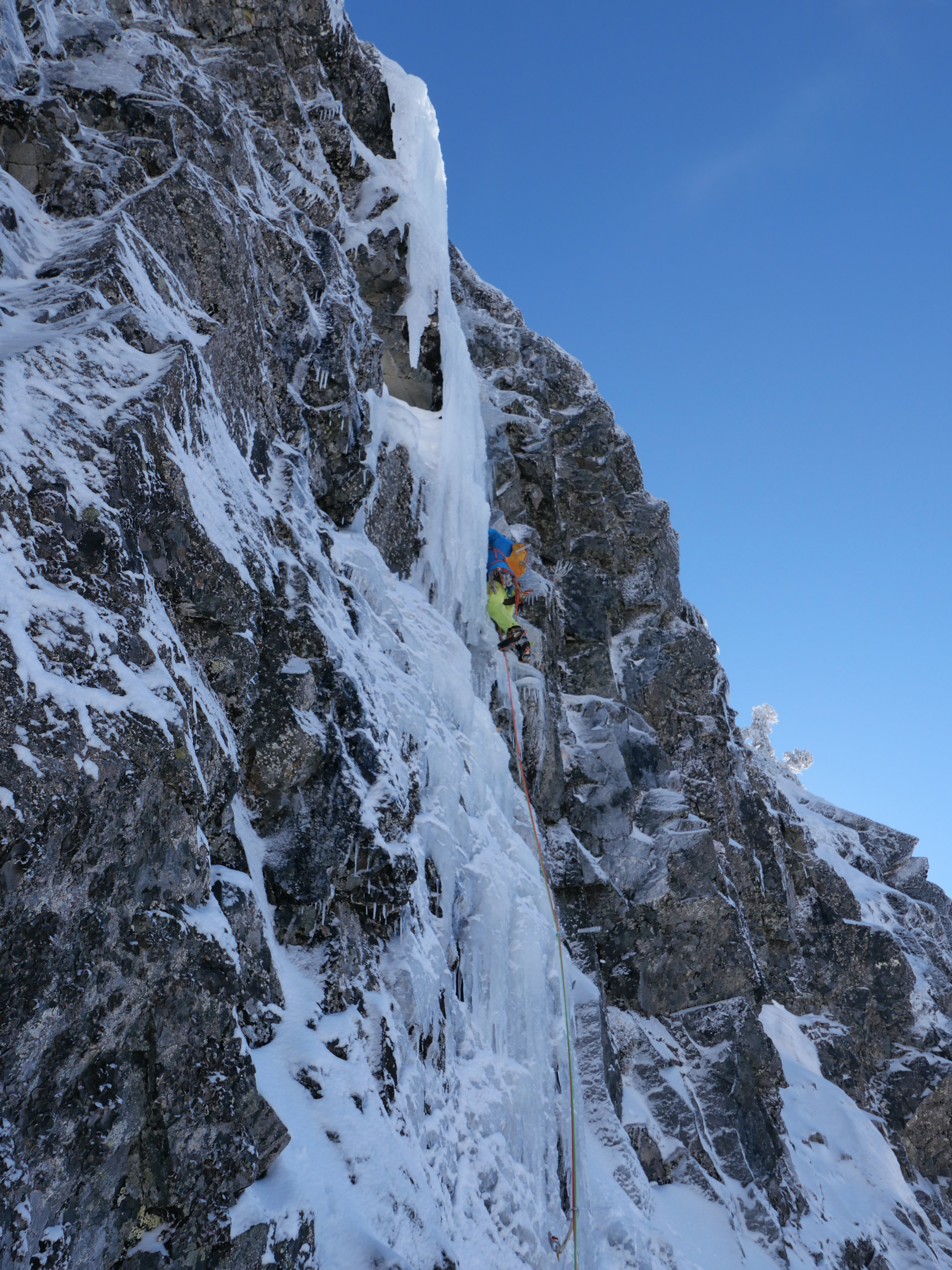
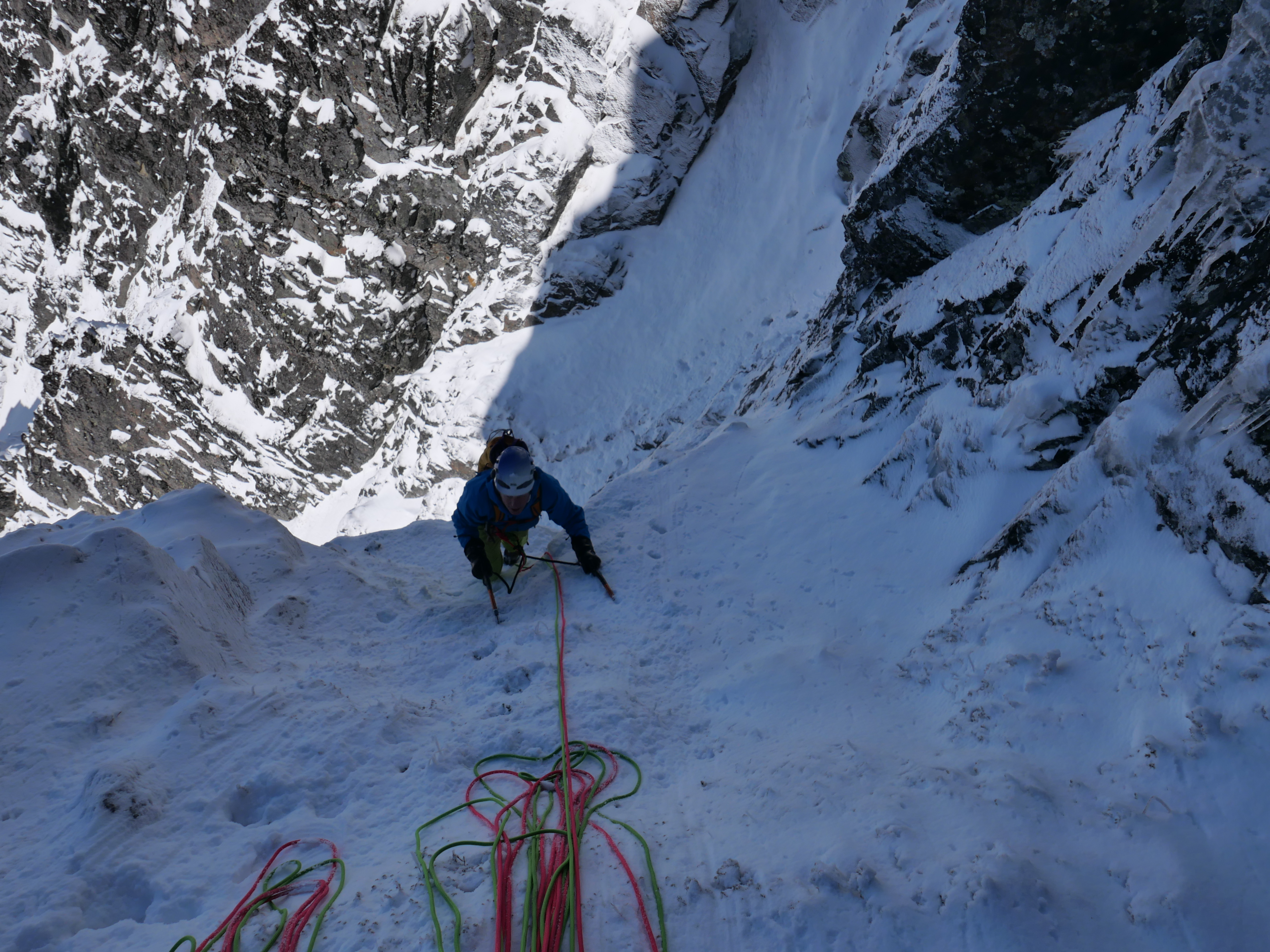
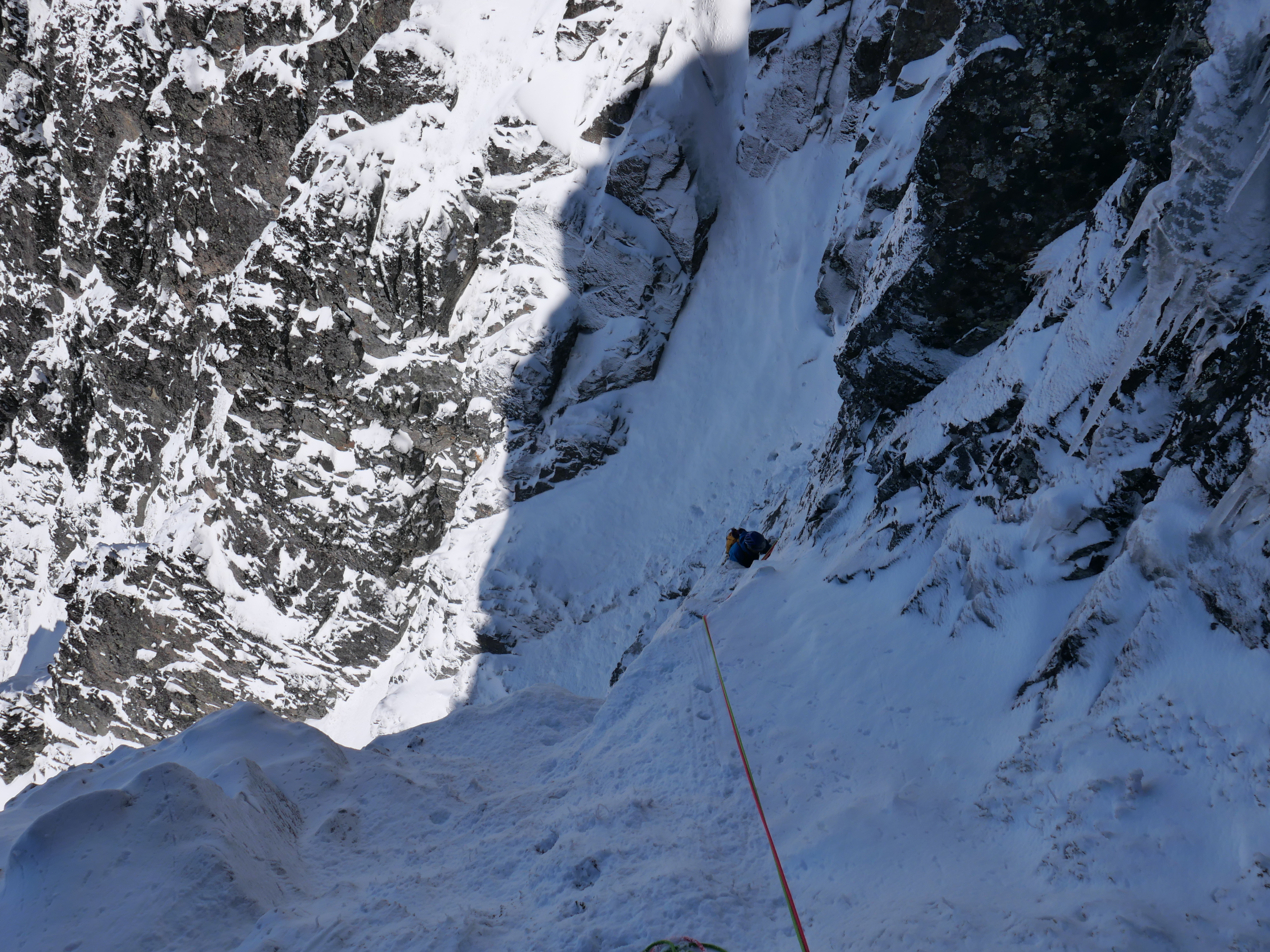

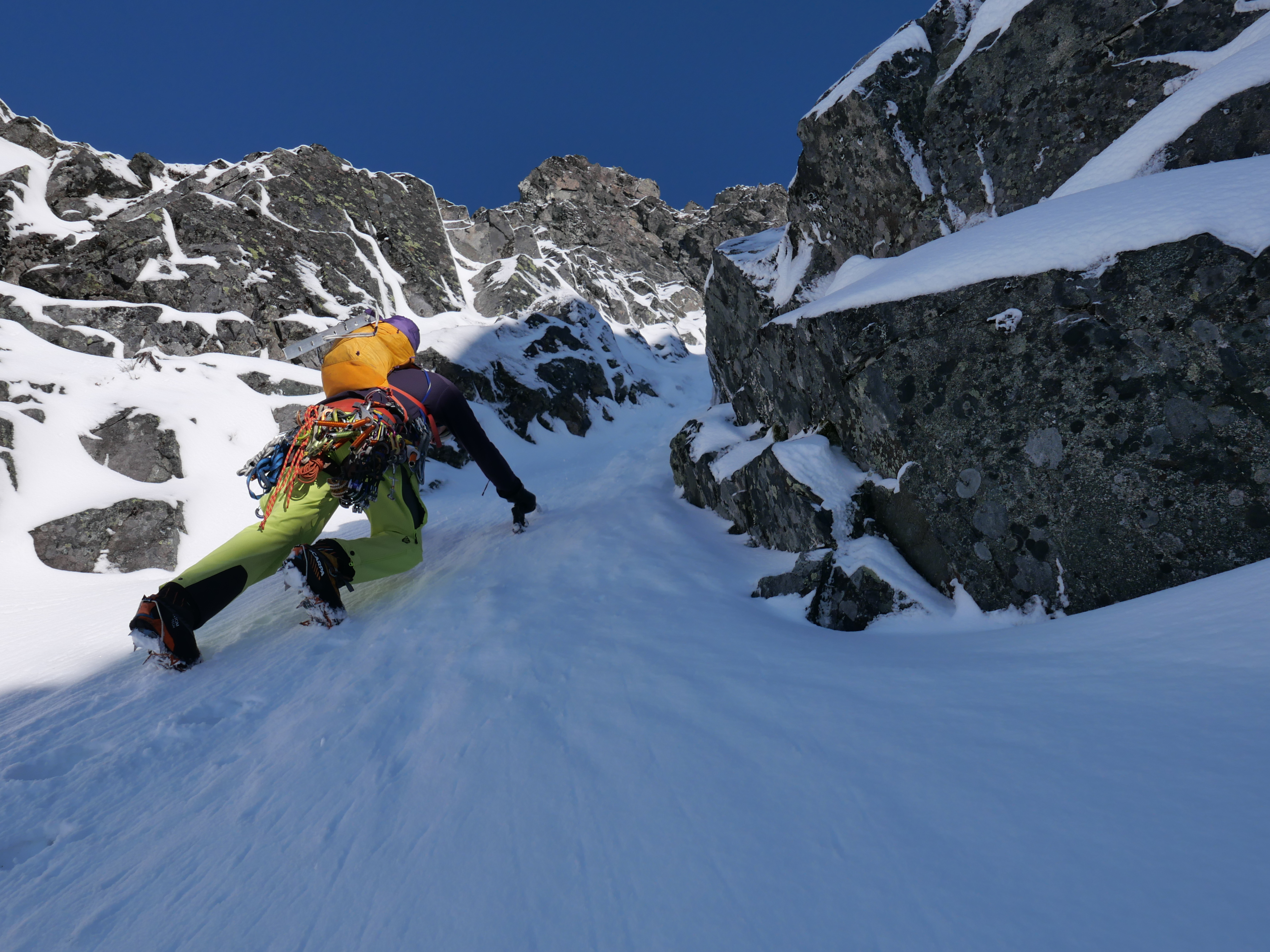
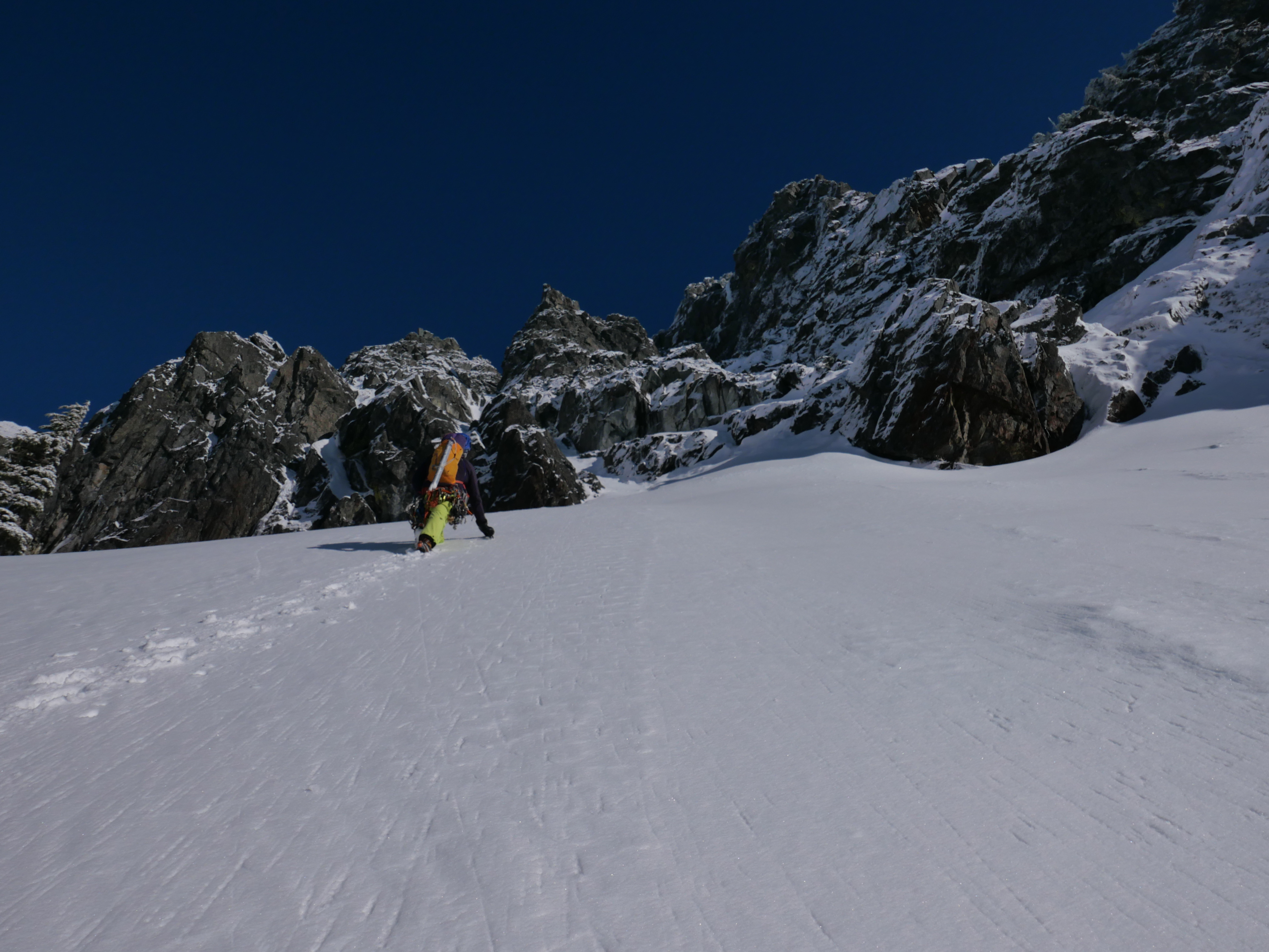
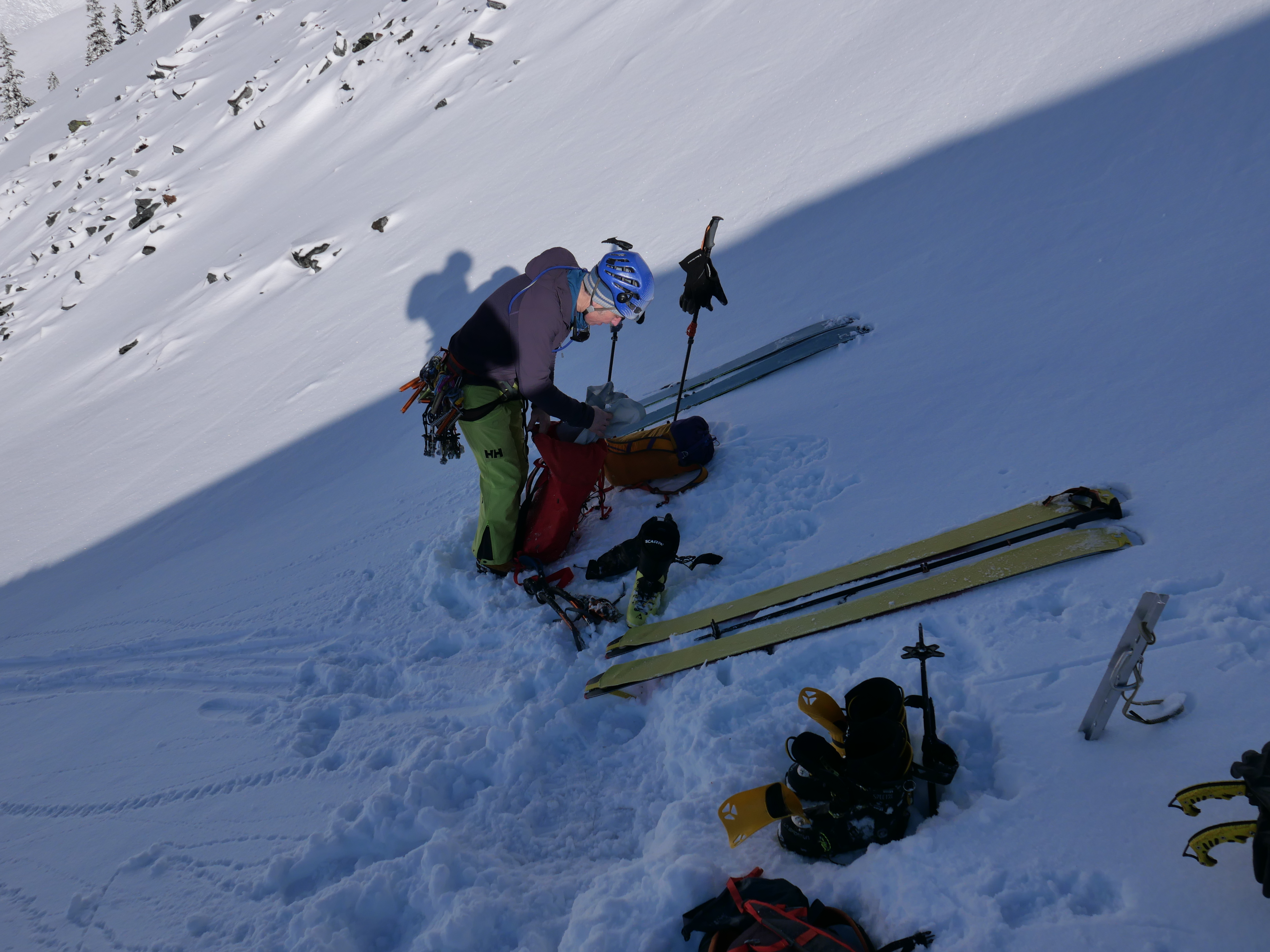
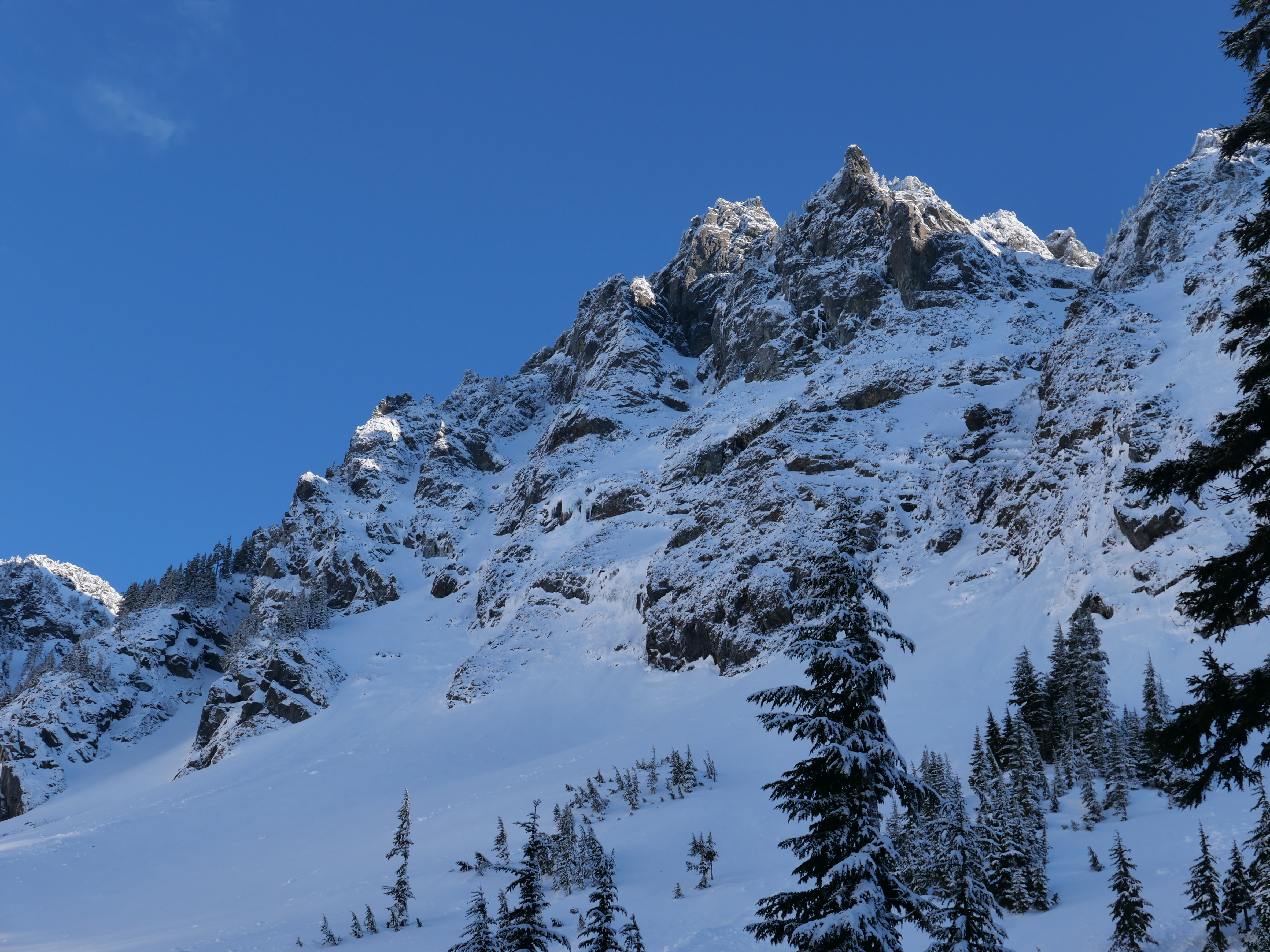
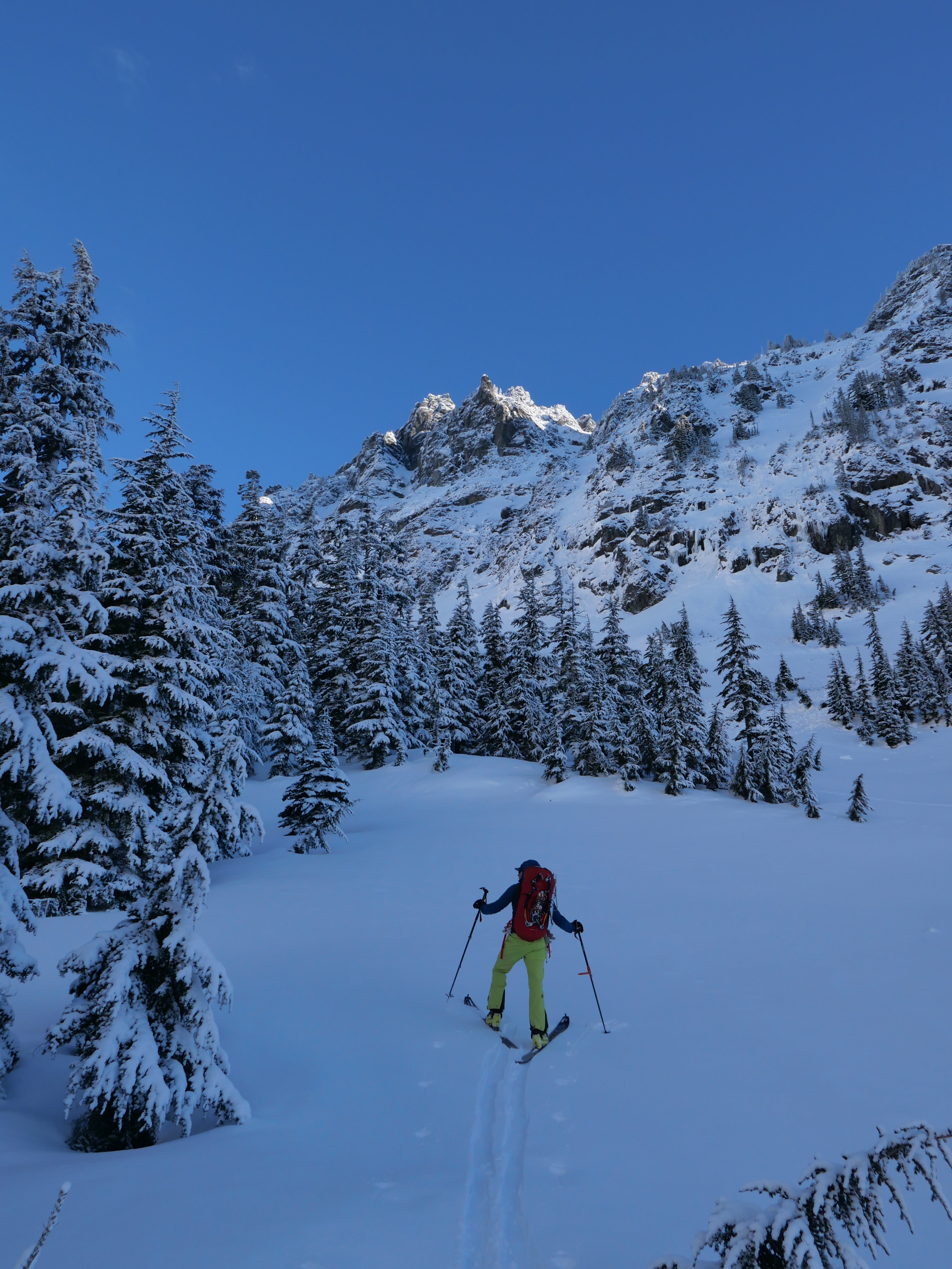
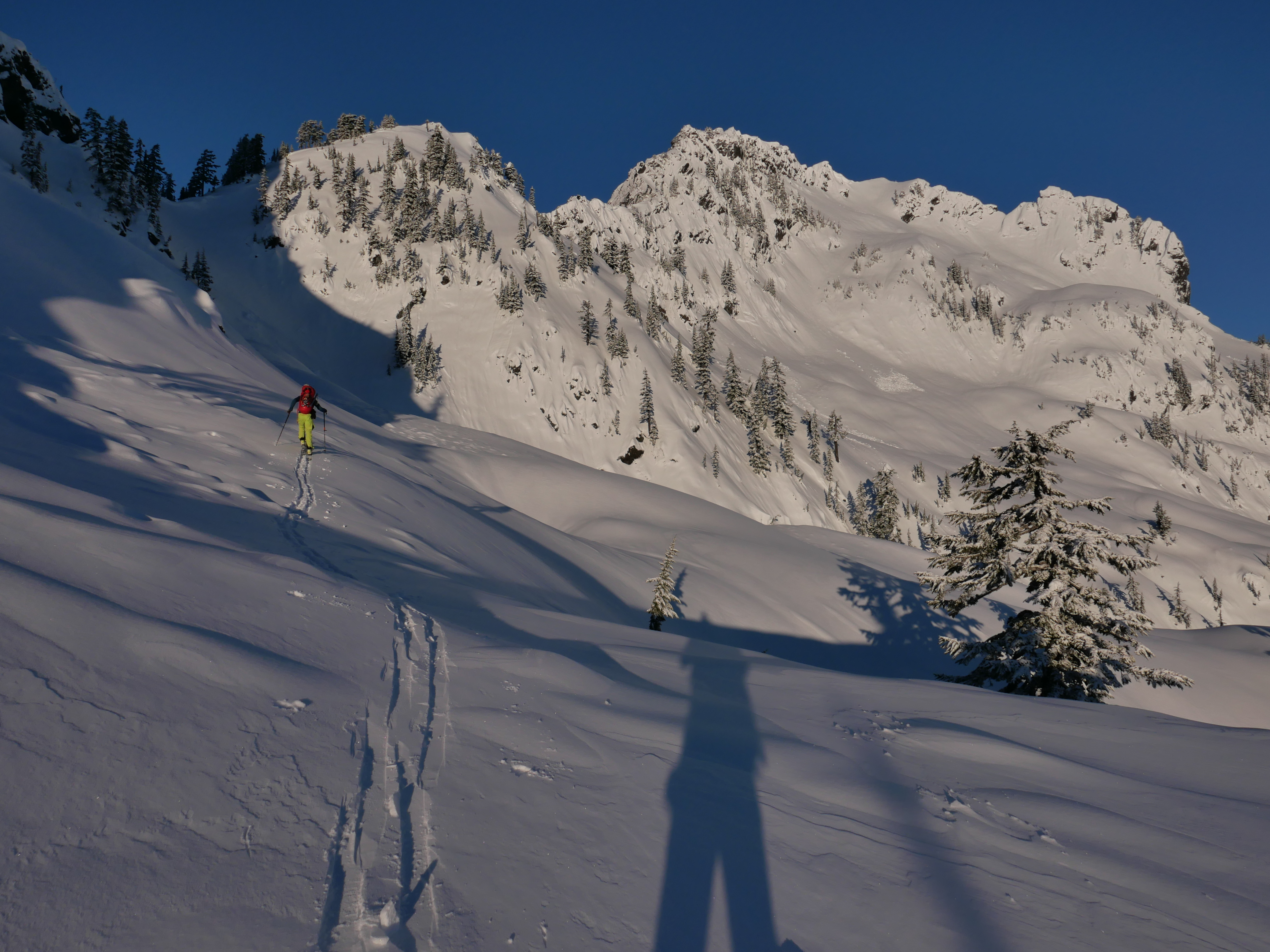 14 points
 -
Trip: Mount Index, North Peak - North Face Trip Date: 01/29/2021 Trip Report: @Michael Telstad and I have a wonderful climbing partnership. He sniffs out all the beta and nails down logistics, while I tell bad jokes and ensure the ropes get hopelessly tangled at least once on-route. When I heard about his FA on Chair and adventures in Mazama with @Doug_Hutchinson, in the throes of FOMO and inspired by Doug and Mik's report of 'cruiser alpine conditions', I sent him a text on Tuesday asking if he wanted to climb the North Face of North Index. Between the Scylla of the work-week and the Charybdis of storms for the next month, we decided on Friday as our best and only shot at the beast. Fortunately Doug was stuck with Michael on the long winter drive from Mazama to Seattle, so there was plenty of time to shake him down for beta. There is not too much information about the route out there, so Doug’s info was invaluable. (Another useful source is Jim Nelson’s Selected Climbs in the Cascades, Vol. 1) We decided to meet in the parking lot at 2:45am on Friday. After a few hours of fitful rest I rolled into the Lake Serene parking lot my traditional 15 minutes late at 3:00am (Michael was 10 minutes early). We exchanged groggy greetings and set off by moon and head light. Easy trail hiking in approach shoes to the north end of the lake led to the base of a slide path and some tedious steep snow climbing to the saddle of the northeast rib. (We changed into boots at the end of the trail before stepping onto the lake, and put on crampons partway up the snowfield) Some unexpected light snow gave us pause but we decided to climb until it became problematic. I set off on the first lead, simul-climbing ~3 pitches mainly steep snow with sparse slung trees, with a few short mixed steps protected by cams and nuts. I tried placing ice screws in aerated flows while extremely runout on steep snow, but they were just too marginal to bother. Runout snowfields for the first ~2 pitches took me to a left-leaning gully. At the top of the gully I looked down and gulped at the sheer exposure below me to the east. Wild. A moderate and short but annoyingly snow-covered mixed step took me to the slung blocks marking the ‘hidden ledge’ traverse. (It’s not very well-hidden if you’re looking for it.) I belayed Michael up from here since I would’ve liked a belay on the mixed step below and I believe in the golden rule. At this point I made the inconceivably foolish decision to try scooping up the stacked double ropes and walking them across the hidden ledge. I made it about 15 feet before realizing the error of my ways and setting up an intermediate anchor. Fortunately it only took 15 minutes of cursing and thrashing to untangle the ropes. Michael then belayed me on a short, fun, and confusing simul block through a slide alder grove. I followed my nose through a steep groove of alders to a lower-angle mixed ramp. I wandered around trying to find an easy way up, but eventually gave up and belayed Michael to the top of the alder grove. He decided to down-climb to search for a lower continuation of the traverse, but found only improbable cliffs. He climbed back up and cruised the mixed ramp around whose bushes I’d beaten earlier. We simuled over the ramp and up the awesome snowbowl pitch to an obvious large tree. From here we simuled up ~2 pitches of very fun AI3- (mediocre screws, great sticks) to yet another grove of trees at the base of yet another snowfield. I led a short snowfield to the base of the crux mixed pitches. Michael led us up two cruxy snow-covered mixed pitches, first a narrow ridge-traverse and then a funky slab to a short steep corner protected by a fixed piton. The climbing wasn’t so hard, but it felt tres insecure and poorly protected. I took over the lead and we simuled across a wild knife-edge ridge, up a snowfield, over and around several false summits (with some tricky mixed steps and brutal rope-drag), and finally to the base of the true summit. (From a distance I thought it was the Middle Peak of Index. ) Michael took us to the top, and we mustered the happiest faces we could for some summit pics. As we prepared to descend, a raven floated next to us cawing a blessing. I felt glad then, that the spirit of the mountain was with us. We thanked the raven and began the slog down. Michael led us back to the base of the summit ridge snowfield, and we followed Doug and Mik’s rappel stations for a seemingly interminable, mind-numbing descent. We finally reached a snowfield at the base of the north face. We unroped and contoured around to the base of the route. Unfortunately they added about 3 miles to the Lake Serene trail while we were on the mountain, so the hike out was a bit more tedious than expected. We finally arrived back to our cars alone in the parking lot at 11pm, just as we’d left them 20 hours and many lifetimes before. I grilled up a couple celebratory beyond burgers and we drove off into the night, grateful and dead exhausted. Many, many thanks to Doug and Mik for all the beta, and for setting up so many rap stations! This route is highly condition dependent. This winter and weather window has yielded easy snow climbing, thin and poorly protected but easily climbed gully ice, and snowy but manageable mixed climbing. I think significant time would be saved on the mixed pitches if there were no snow. Suitors should be prepared for sporting runouts on steep snow, tenuous mixed climbing, and a tricky descent after a long physically and mentally tiring day. Descent: Reverse climb along summit ridge to trees at base of the snowfield which leads up to summit ridge, i.e. just after the knife-edge ‘last pitch’ of the climb. Make 4-5 plumb-line rappels (60m double-rope) to large trees atop snow-bowl pitch. Rappel trending east (climber’s left) to small trees near base of snow-bowl. Continue for 5-6 raps along this slightly east trajectory, following shrub and block rap stations to base of the north face. Some of these are rope-stretchers with 60m ropes, 70m would help a lot. Once down contour easy but exposed snowfields to the east until reaching the saddle where the route begins. We mostly used Doug's webbing and carabiner stations, but added green tech cord to the station at the top of the snowbowl. Cut all the other tat there but unfortunately couldn't extract it from the ice. (it was late and we wanted to move fast) Lecture time: Knot both your ropes (and untie one end before you pull the other). Double-check your tether and rap setup every time before you commit your life to them. Pics: Setting sail, snowflakes like shooting stars Michael just after the first cruxy mixed step, taken from the hidden ledge blocks moments before the sun rose The sun also rises Michael heading up the gully at the top of the snowbowl Michael starting the first mixed ridge pitch with the false summit ahead Looking down at me from above first mixed ridge pitch Michael at the mixed crux Selfie from snowfield before summit ridge with Michael on the knife-edge False summit after false summit Moody Sky from summit Happy to be halfway home Classic pose on summit block (might not be there next year, the summit ridge seems to be mainly loose blocks glued together by ice) Index Traverse looking intimidating and appetizing Reversing the summit ridge traverse Possibly the worst rap anchor, but not by much Arriving at the large tree atop the snowbowl as headlights trace out Highway 2 below The result of bounce-testing the rap anchor at the large tree Rope stretcher with 60m ropes Dave Summers got a photo of our headlamps on the descent Gear Notes: Ropes: 2x 60m 7.5mm half/twins (70M recommended) Slings: 15 singles, 4 doubles, 1 quad. (good amount, but bringing more would allow for longer simul blocks. Had 2 carabiners per single sling and 1 per double and quad) Ice screws: 2x 10cm, 2x 13cm, 1x 16cm, (1x 22 for v-threads) (good selection, even though some placements were marginal due to conditions) Cams: single rack .1-2 (perfect, every cam was useful but didn't want any bigger) Nuts: About a dozen from small to large (didn't use too often but glad to have) Tricams: Pink and red (clutch) Pitons: selection of 3 small knifeblades, 1 short Lost Arrow, 1 beak (didn't place any, clipped one fixed pin) Cord/webbing: 20 foot 5mm tech cord useful for slinging large blocks. 40+ft of rap tat highly recommended Microtraxions: 2x for simul-climbing insurance Tools: Less aggressive quark style tools (Thanks to Michael's partner Tess for letting me borrow her quarks so I didn't have to haul the nomics up) Crampons: Dual point preferable, lots of snow Emergency gear: Inreach (+cell service most of the way up), lightweight emergency bivy sacks, small isobutane stove, hardwarmers and dry warm socks in case of epic. Climbing tape for in-situ surgery. We didn't bring any pickets and never wanted to place any, but if you desire protection on <60 degree snow you should bring one. Approach Notes: Took the Lake Serene Trail all the way up, skirted around on the NE shore of the frozen lake to the obvious slide path, ascended to saddle, stashed approach packs in small tree grove and racked up. ~1.5 hours car to base

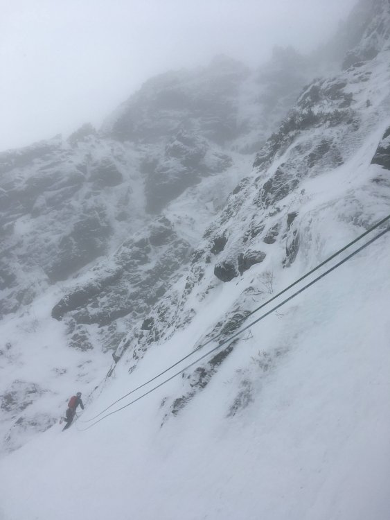
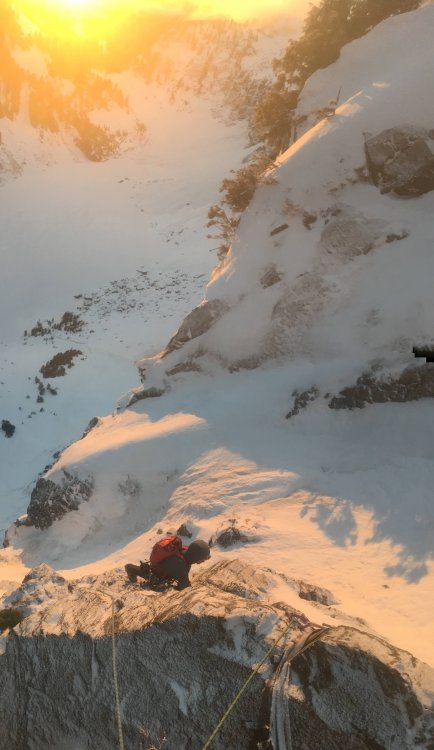


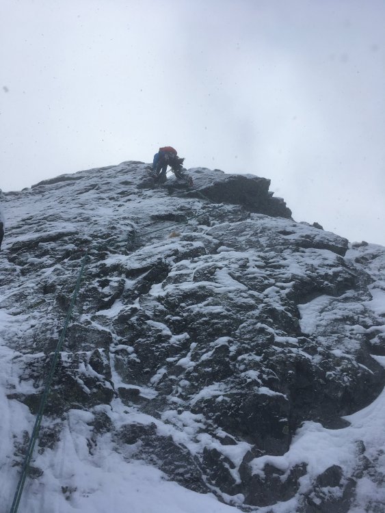

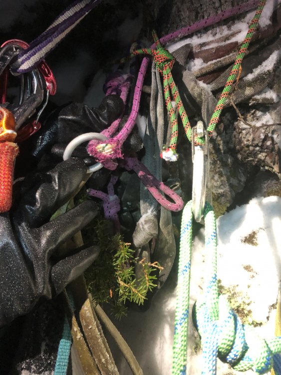
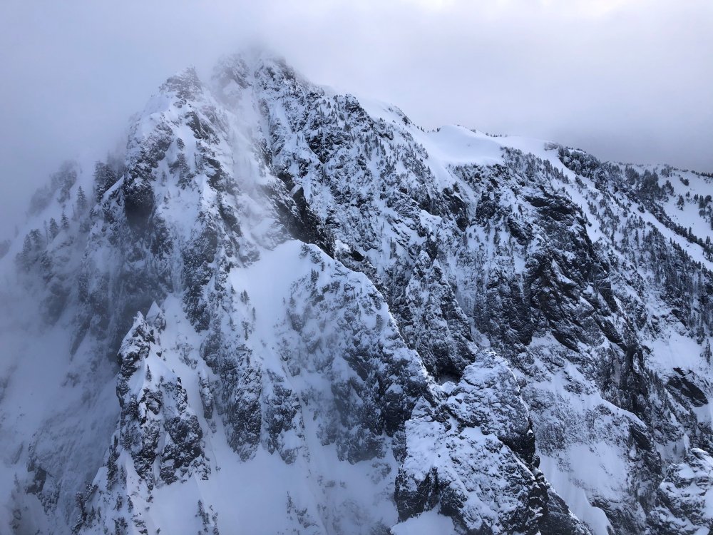


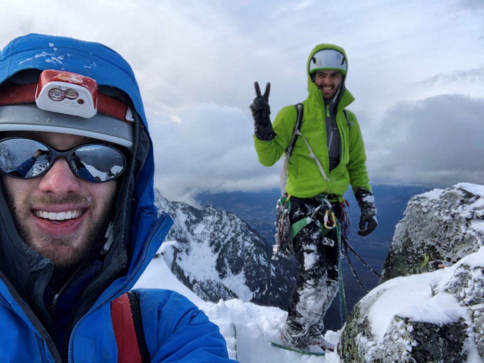
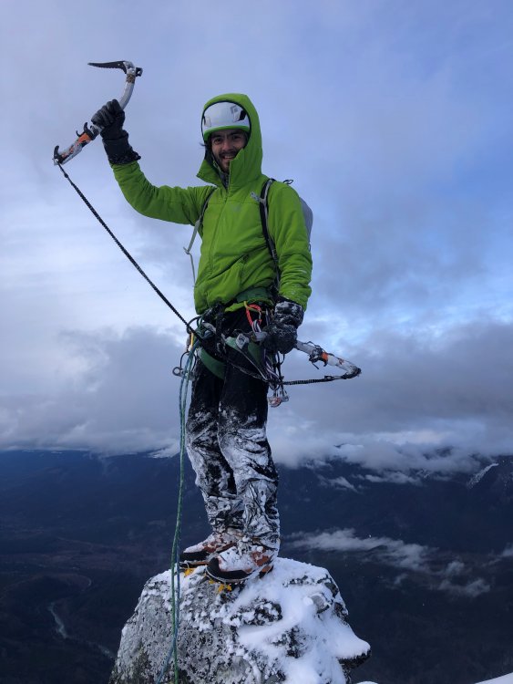
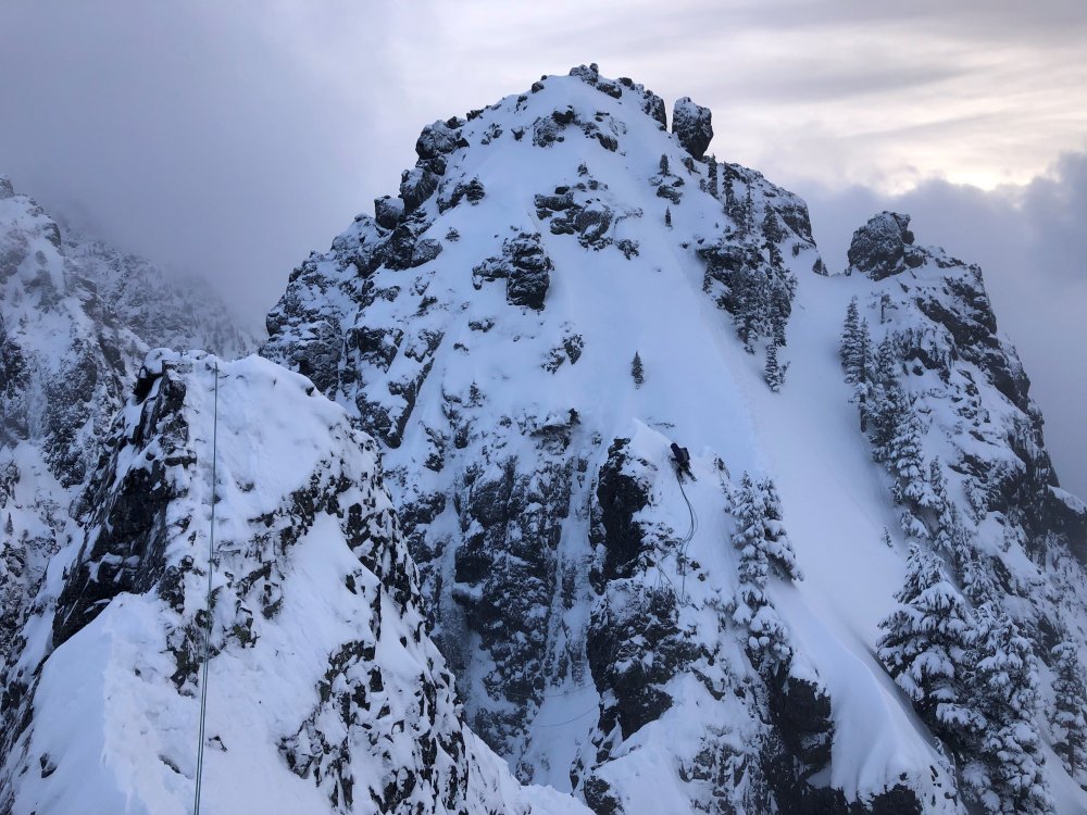
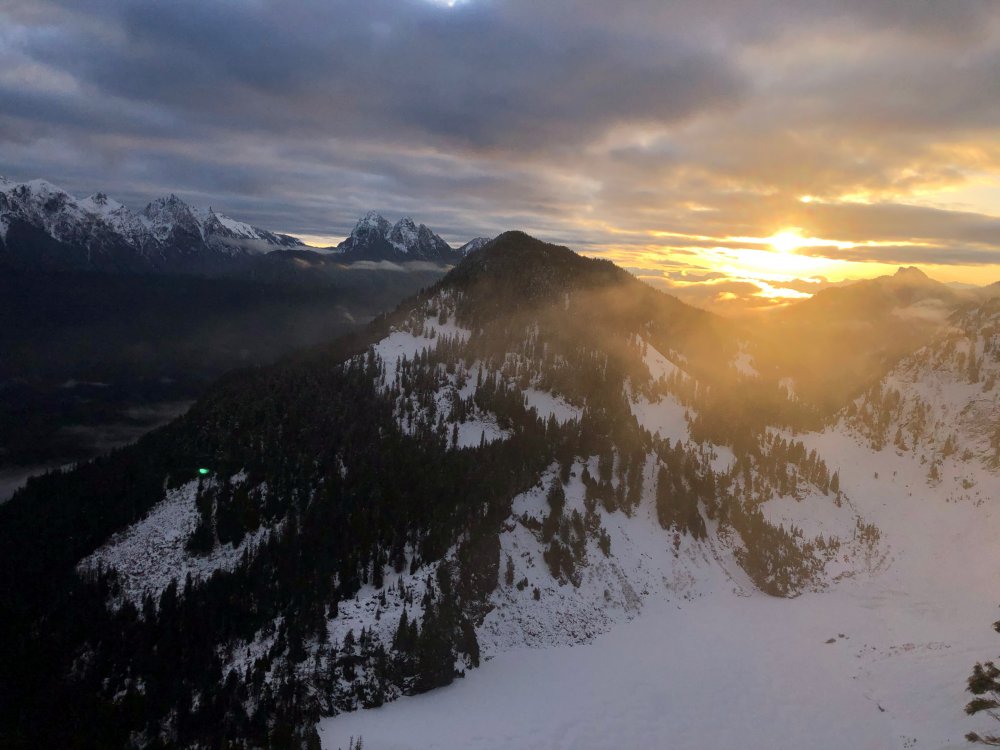
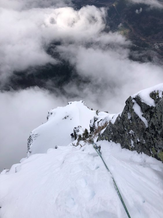
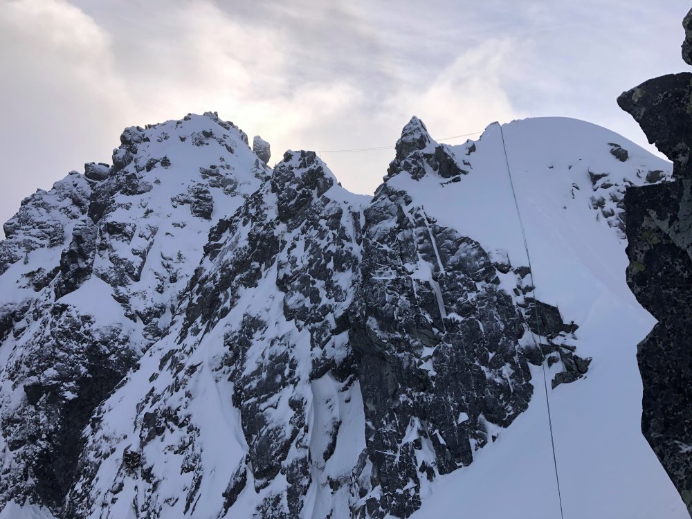
 14 points
 -
Trip: Bear Mountain - North Buttress: Beckey Route Trip Date: 07/15/2018 Trip Report: Bear Mountain: Two new dads trying to keep a 10 year dream alive For me, mountains can become obsessions, sometimes to the point of irrationality. In my life, no mountain, or route has been more indicative of this than the North Buttress of Bear. I stumbled upon Bear in 2007 in my early days of climbing WA by devouring each page of the Beckey guides like they were some gripping novel. Trip reports from this site only further set the dream of someday ascending this monster objective. Being nothing but a budding sport climber at the time, this peak seemed out of my grasp. As the years went on, I honed my mountain skills. I learned to trad lead, sent my first few alpine rock routes, got on my first glaciers, and began developing the mind for the rigors of schwacking in the cascades. By 2011, I began thinking this dream could possibly become a reality for me. I even found a climbing partner, Andrew, who shared my dream. Each year we'd talk about making our dream a reality but each Summer would come and go without an attempt. For 5 years in a row we'd try to make plans only to see them fall through. Timing, schedules, obligations, weather, forest fires, and work all conspired against us. Fast forward to 2016, and each of us became fathers of our first children. Yet another reason to push Bear farther from our grasps. During the first year of fatherhood I discovered, although not surprised, that being a father does not easily co-exist with committing alpine objectives. My fit physique, lead head, and drive for summits began to recede like the glaciers surrounding the peaks I had grown to love so much. Over trail runs, occasional crag days, and family outings, Andrew and I still spoke of our mutual dream contrasted with our diminished abilities. One thing was clear from these conversations: the dream, and our stoke was still alive for our beloved Bear. Spring of 2018 came around. It had been a dismal Winter of training. Trips to the crags confirmed, family obligations and our lack of training over the Fall and Winter had left both of us less than prepared to crush in the coming Summer, but we began to discuss plans for Bear as we did every year. We settled on the dates of July 13-15 and began attempting to play catch up with our training. As the dates drew closer, one thing became certain, neither of us felt strong. But the week of July 4th came and still nothing looked to foil our set plans. So early July 13th we made the early morning drive to the end of the Chilliwack road along Chilliwack Lake in British Columbia. The bushwhack across the border and out to bear camp lived up to its dreaded hype. Six hours of magical, rarely touched old-growth forest contrasted with the torturous efforts required to navigate and move through said forest left us bewildered and uncertain. This uncertainty as well as the contrast of beauty and torture would be a reoccurring theme over these 3 days. From bear camp to the bivy on the western shoulder of bear is 4000 vertical feet up. A quarter of the way up, late afternoon, and we were beat. I am on liter 5 of water, schwacking in my underwear due to the heat and effort. Both of us are bonking and cursing ourselves for thinking we could pull this objective off. We were not fit. We had not trained enough. Doubt began to dominate our thoughts. It has already been 8 hours of this shit and we still had 3,000 feet of trail-less hell ahead of us. Who were we kidding? There was no way we were going to make it to camp before dark. We sat, uncomfortably, on a steep slope, in the middle of nowhere and began talking of retreat. "Squamish isn't too far away, is it?" "I guess we could always just crag at Mt. Erie on our way back to Seattle." Inside, a voice screams at my exhausted brain, "MT. ERIE!!!!???? Are you fucking serious!!?? I am never coming back into this valley again. It is now or never for Bear. The dream either lives or dies on this shitty, viewless, insignificant slope." My senses kicked back in. Remember, anything too big to fathom all at once needs to be broken into digestible chunks. The decision to push on grew from this and we decided to at least try to make it to the lake for the night and we would make the next decision from there. Two hours later, after 1,000 feet of extremely steep blueberry bush pulling, we broke out into the alpine and our spirits began to soar like a vulture in a thermal updraft. It’s amazing how something as simple as alpine views can change the mindset and determination of a climber. I began to feel rejuvenated. Maybe we could make the bivy site before dark. A heather-strewn meadow on a gentle shoulder gave us the first real physical break of the day. Panoramic views of remote North Cascade summits rose all around us. A mother Ptarmigan and her brood of chicks sprinted out of the bushes, snapping me from my alpine daze. Discussions of a potential closer bivy site gave us a closer goal. Running on fumes, past the lower bivy spot, and we still have light. Must, keep, moving. At last, 12 hours after leaving our car, we collapsed at the col. We had made it. I promptly gave the double middle finger to the valley below, clearly showing the shit-show we just wallowed through. We promised ourselves we would not make a decision about what to do about the next day until after we ate. Dinner went quick. As we crawled into our bags, we listened to the cacophony of a thousand tiny flying vampires trying desperately to find a way through our netting and into our skin. Twilight lit the sky with a rainbow of color. We both agreed that since we had overcome the uncertainty and brutality of what many, including us, consider the hardest approach in the Cascades, we felt obligated to throw ourselves at the North face the next morning even as our bodies screamed in opposition. We awoke with the sunrise. I shook the heaviness of last nights sleep from my head and felt somewhat shocked that yesterday wasn't some dream/nightmare. I was here. We were about to start our summit day. A day we have both been dreaming of for at least 10 years. With each sip of coffee, my stoke began to rise. We strapped on our crampons and make a quick and pleasant descent onto the north side of the mountain. We turned a corner to catch our first glimpse of Bear's north buttress. Ominous, glorious, stunning, perfection on ice. Words cannot really describe the feelings I had, but these are close. Upon seeing both the direct north buttress and the north buttress couloir, we checked in. The direct looked safer as the couloir looked broken up near the top, but our energy levels and dismal cumulative rock pitches for the year had us thinking that the extra rock pitches might not be reasonable. We settled on following the couloir and Beckey's footsteps. In hindsight, this might this might have been a bad idea, but I am pretty sure I would have said the same thing if we had taken the other option. Either way we felt the collective weight of our dreams, the debilitating approach that we vowed never to do again, and the sheer power of what we were trying to accomplish. I felt as if every step upwards tightened the grip of the vice we were in. Committed, for better or worse, to move upwards. We switched back and forth from approach shoes to crampons a few times and quickly found ourselves in irreversible territory. There is terror and clarity in realizing the only way out of a predicament is forward. We broke out the rope to lead our first pitch out of the couloir. A shit show of snow, poor pro behind detached blocks, and slopey ledges littered with rocks of all shapes and sizes. My rope skirted across a ledge and sent a microwave down towards Andrew. Our years of work together in the mountains gave us the foresight to expect such events and was glad Andrew had set himself out of harm’s way before I led. We had reached the 4th class ledge system that would get us up to the North buttress proper. Kitty litter, slopey ledges, and the exposure below made for careful, calculated movements while simuling, often without adequate gear between us. Trust in each other became paramount and again I found myself thinking that I was thankful to be climbing with such a trusted partner. At last, we reached the first real quality pitch of the route. Beckey's glorious left facing 5.8 corner. Andrew led and we both laughed at the idea of "5.8" at the top. It felt like index 5.9+ but would be an instant classic if situated at the lower town wall. We were finally finding some type 1 fun. I linked the next two pitches of fun and deposited us at the base of the infamous 10a offwidth. DE8DD876-06ED-4585-BEE2-4CF80B5ED29B.MOV It was at this point that we began to feel the efforts of the pat 36 hours. Dehydrated, low on energy, and stoke, Andrew reluctantly agreed to lead the next pitch and quickly made the decision to take the 5.8 bypass pitch. We ended up breaking this pitch into two because the lower portion of the offwidth took most of our small cams and the upper 5.8 portion looked to take nothing bigger than a .75 BD. Crap. We swapped leads under the only stance Andrew could find conveniently under a car sized detached block. I was tasked with leading over it and him without touching it. Yikes. I led to a nice ledge and brought up my partner. Both of us feeling both physically, mentally, and emotionally drained, we began to flounder. Neither felt the desire to lead the next pitch. Bonking hard, I finally took the sharp end. Staying on the crest I mantled to the base of a steep featured, but unprotect-able face. I began to lose my cool. 15 feet above a ledge and my last piece and seeing committing climbing and no cracks above me, I retreated. Reversing the mantle had me nearly hyperventilating but I, somehow, safely made my way back to the anchor. We discussed our predicament, spied a horn with rap slings 30 feet down to our right and consulted our beta. We both thought that this was the Beckey rappel that would take us to a 4th class gully exit but our position would not allow us to confirm it. Below us, the gullies looked vertical, smooth, and crack-free. Committing to the rappel felt serious. Andrew rappelled at a diagonal across ribs, at times placing gear as directionals to reach the farthest gully. Upon reaching the first gully, Andrew looked up. There is no way that is 4th class. Second gully. Sweet baby jesus! It goes! Relief washed over us like a warm caribbean breeze. I rappelled down and we quickly began to lead. We both just wanted to be done with this endeavor. How quickly a dream becomes dread. My mind screamed, "Get me the fuck off this mountain!" After two rope stretching pitches and some mid fifth climbing (another sandbag) the Sun hit our darkened spirits and the tomb I'd climbed myself out of was no more. A few hundred feet of 3rd class was all that separated us from the summit. Elated, exhausted, and emotional, we hugged. I looked over the edge, down the north face and wept. Tears of joy, relief, and sadness fell hundreds of feet down the alpine face of my dreams. I always pictured myself feeling triumphant at this moment, but instead all I felt was relief and the intense desire to hug my wife and two year old son. We had done it. We had fought through constant moments of fear and uncertainty to obtain our dreams, but I felt far from dreamy. As we began the descent, I turned around and gave one last look at the summit of my dreams and gave it the double middle finger. I was done. I could close this chapter of my climbing pursuits. Fatherhood has changed my drive, my dreams, and my abilities. I am unsure if I will ever climb anything like this again, but much like any overwhelming obstacle, I will take it one decision at a time. Who knows how I will feel about such commitment and risk taking in the future. We hit a mellow snow slope and just like any decision we made that day, we assessed the terrain and made the best choice for moving forward. The joy in the glissade took me by surprise and I burst out into a giggle fit. Type 1 fun!!!! What a wild ride of emotions. We reached our bivy a half an hour before sunset. We smiled and laughed as we recapped the day. Feeling thankful and shocked to have pulled the ascent off, we crawled into our bags, passed a joint back and forth and fell into philosophical ramblings about life and reality. What a life we live. The next morning we made the long march back down to bear camp and through what felt like endless old growth shenanigans pushed by the thought of a dip in Chilliwack lake and the beer stashed there. Upon reaching the lake we found the beer gone, hoards of people on what I thought would be a secluded beach, and leash-less dogs aggressively charging us while the owner continued to flirt with some bikini-clad girl. WTF. I thought that was the shit-cream on top of a long and miserable day, but oh no. Upon reaching the trailhead I saw my car in the distance but somehow it did not look like my car. The back window was missing! Someone had broken into my car! Son-of-a-bitch! As we got closer, the horrific reality set in. My car had not only been broken into, it had been set on fire. The tires, the windows, the interior. Everything that could have burned did. My car was a hunk of metal and nothing more! I was in disbelief. How was this possible!?? How are we going to get out of here? Is this a nightmare? Am I still in the mountain sleeping in my bag and this is some horrid hallucination fueled by the joint and exhaustion? Nope. This was reality. Whoever did this also nearly set the entire forest on fire based on the completely burnt cedar behind my car. Jesus Fucking Christ! We could have been trapped in that valley if they had succeeded in doing so! As my mind swirled with the gravity of our situation, the last car in the parking lot approached us and gave us a ride into town dropping us off at the Chilliwack police. After reporting what had happened, expecting surprise, they just smiled and said, "Yep, this has been happened a lot this Summer and there was little they could do about it. They gave us our police report number and directed us to a local bar and motel. I called the border to confirm they would let me back into the states without my passport (burnt in the car) and made arrangements for a friend to come pick us up. ”the urban mountaineer” This trip will live in my mind till the day I die and will hopefully entertain many. Journeys like this are great reminders for what is important in your life and just how lucky I am to be apart of this amazing planet. Get after what fuels your soul people! Gear Notes: 60 m rope Double rack tops to fist. Single 4 and a set of stoppers. Lots of alpine slings Approach Notes: Follow the tape till you can’t then turn on your zen and be one with the forest.14 points
-
Trip: Inspiration Peak - South Face Trip Date: 09/02/2018 Trip Report: Before last weekend I hadn't been to Terror Basin in almost 10 years. Back then we had spent a week in the Southern Pickets, only seeing one other party in Terror Basin. How times have changed! This past weekend there were three other parties for a total of a dozen people in Terror Basin. Thankfully all the others were headed for West McMillan Spire so we had the decidedly unpopular South Face of Inspiration all to ourselves. However, like Alan Kearney, I really think it should be more popular. It is quite a route! But it is also not for the faint of heart. Steep, intimidating, with a bit of scruffy rock and so-so pro - it would have been a challenge back when I was in good rock climbing shape. And I am most certainly not in good rock shape these days! Luckily I had @therunningdog to gun my sorry ass up it. And gun he did, leading all the gash pitches. But there was plenty to keep my mind humming below- a chaotic glacier with some delicate bridges, slabby rock right off the glacier (should have put on rock shoes earlier), and an increasingly exposed 4th/low 5th class ramp that terminated in the intimidatingly steep "Great Gash". And thenn once you are on the summit, the involved descent awaits. 4-5 raps down the West Ridge, some ridiculously exposed scrambling, and then more steep rappels down the south face. It was about 12 hours camp to camp. But what a place. Even more beautiful than I remembered, perhaps due to the changing weather and swirling mists? The best pictures are never during the best weather, perhaps the same is true of our memories? I'll be back, but I won't wait another 10 years this time. Looking down into Terror Basin from the "trail" in: Looking out to Triumph, Despair, and the Chopping Block (L-R): Despair and the Chopping Block: Thornton Peak and Triumph at sunrise: The Southern Pickets!! Morning light on the South Face of Inspiration: Ptarmigan and grown chick: I should draw the line on this but basically you climb up the buttress to the left of the face to the prominent ramp that is followed right a long ways to the start of the "Great Gash", which shoots steeply up and left to the upper West Ridge. A pitch on the ridge finishes the climb. The Descent follows the left skyline to the col then down the steep face/buttress to the glacier: The glacier approach proved challenging, but we found a way that will go into the fall this year: No super dad friendly. Scrambling a lot of 4th and low 5th to the belayed pitches up the gash. I should have taken more photos but I was pretty focused on not screwing up! @therunningdog in his element! Did I mention that the South Face of Inspiration is steep? @therunningdog coming up the final bit to the summit: It is an exposed descent as well. Rapping the West ridge: On the first set of raps, before you drop off the South Face: Whew. Down on the ice! Or should I say gneiss? TEEBOOOOOOOOOOOOOOOOOOOOONE! Despair in the mists: Triumph: Despair: This felt good after the punishing descent: Gear Notes: 60m half rope, medium rack to 2", ice axe, crampons, helmet Approach Notes: Terror Basin trail from Goodell Creek. 6 hours to camp. From camp follow the climber's path toward Inspiration and West Mac, picking the best line up the glacier to the toe of the buttress just west of the South Face. We roped up here for a bit until we gained the prominent ramp where we packed the roped and scrambled. It seemed about 5.6-5.7 for one ptich to gain the ramp, with low fifth below that. The "Great Gash" is about 3, 30m pitches, to ~5.8. I think we did about 12 rappels down the west ridge and west edge of south face right back to our boots. Stations are established for a single 60m rope. Bring tat since the route isn't climbed regularly.

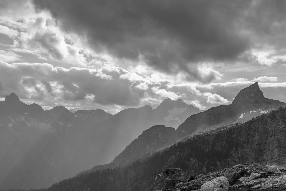
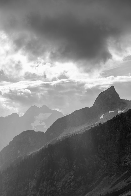
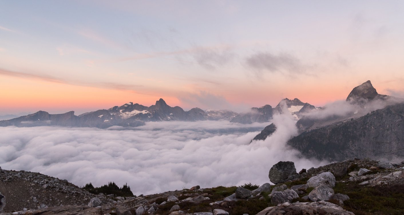
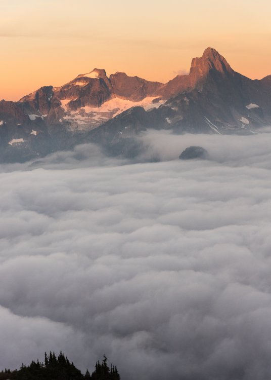
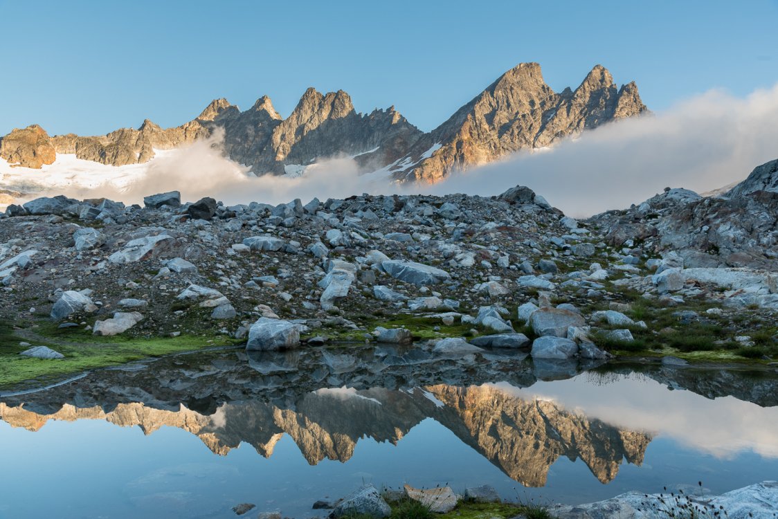
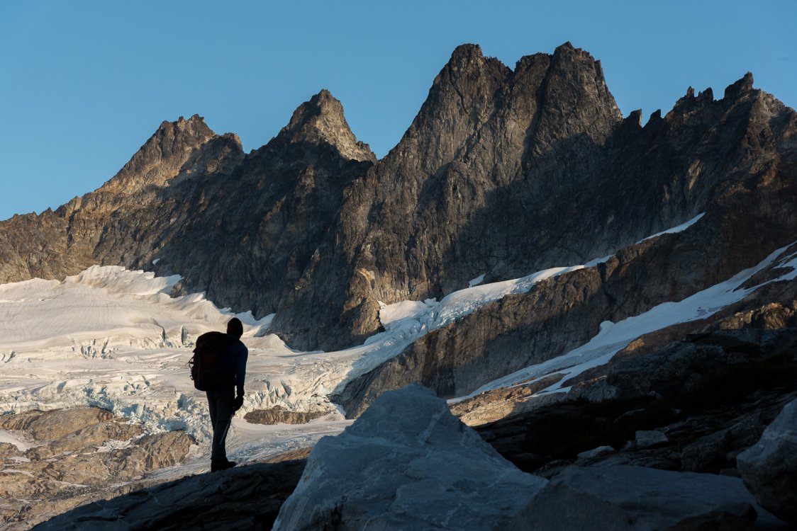
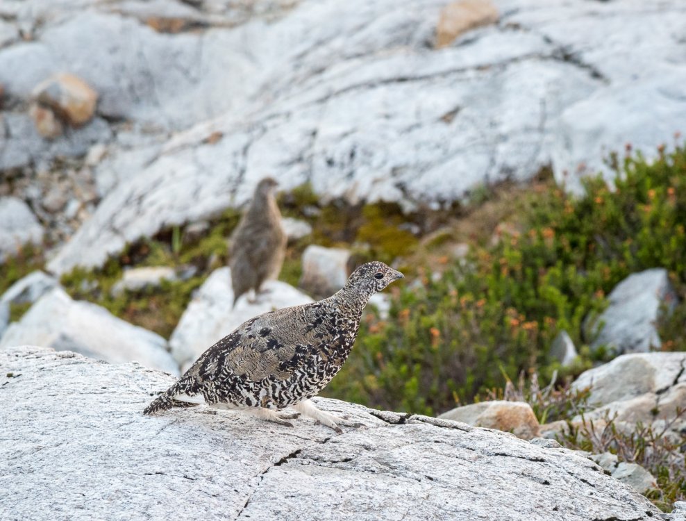
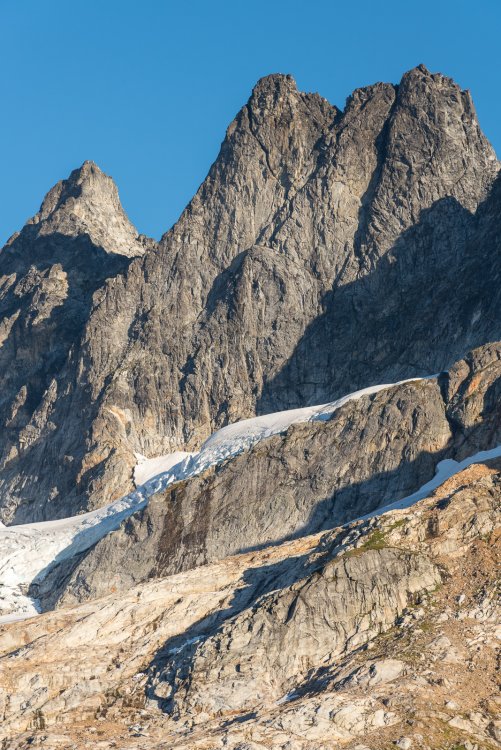
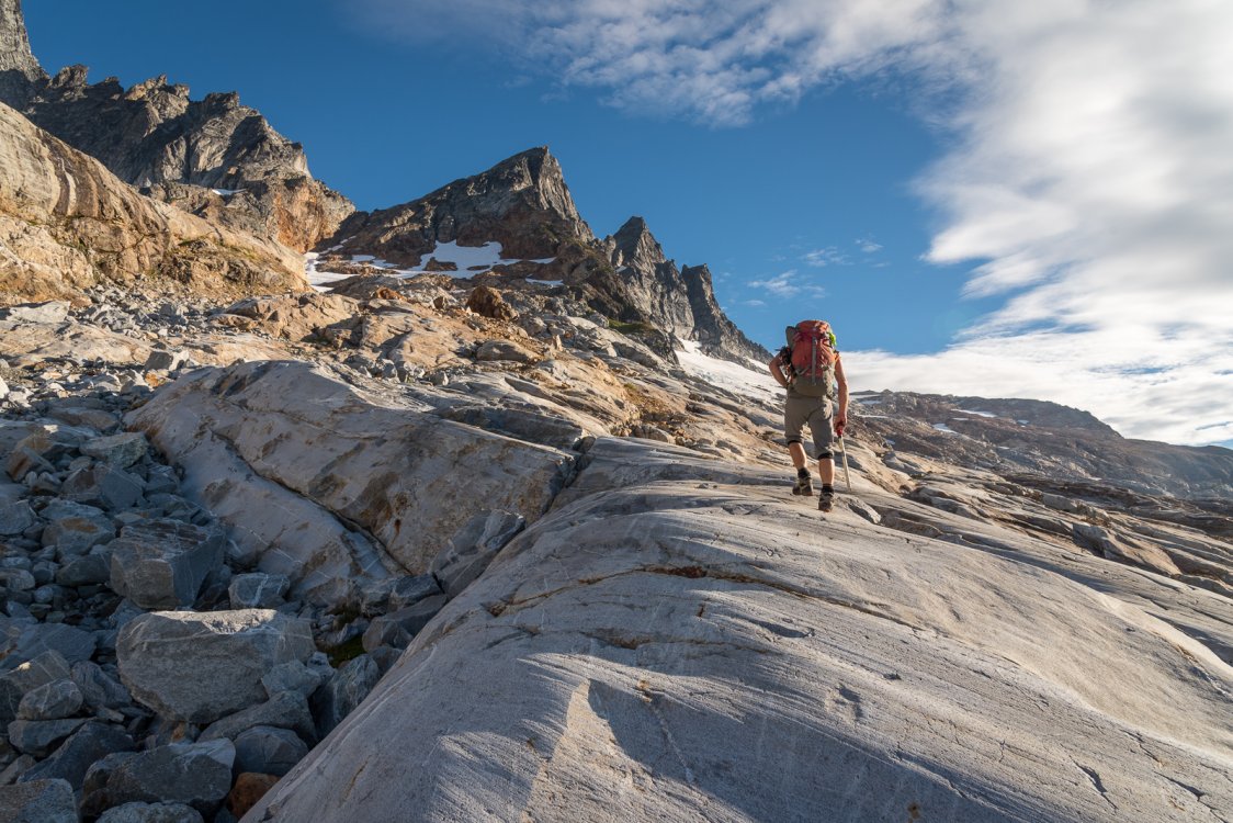

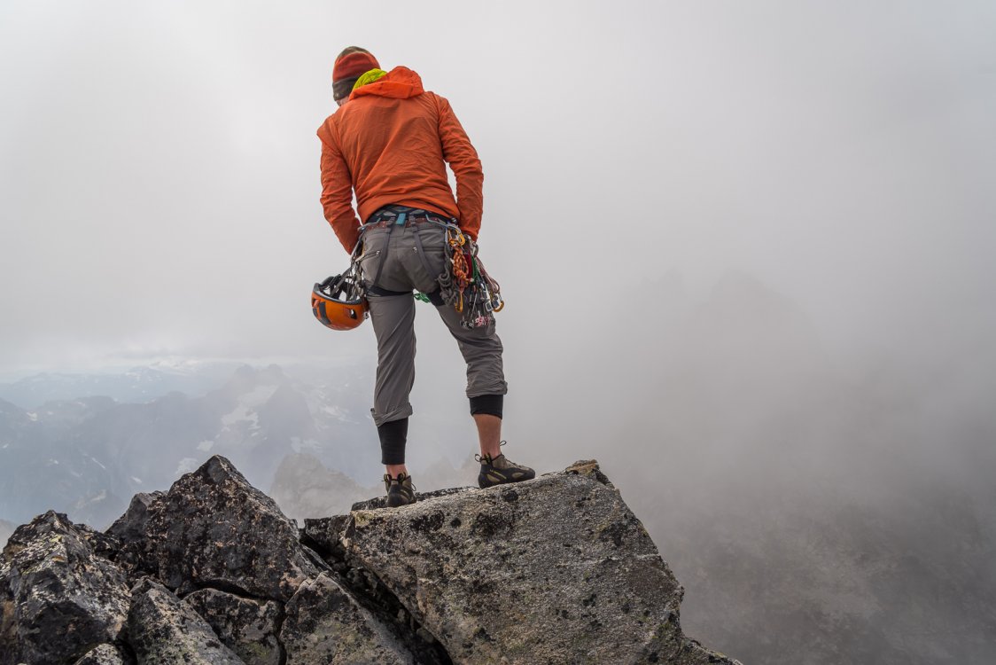


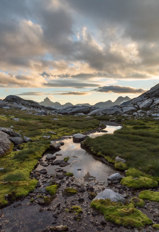
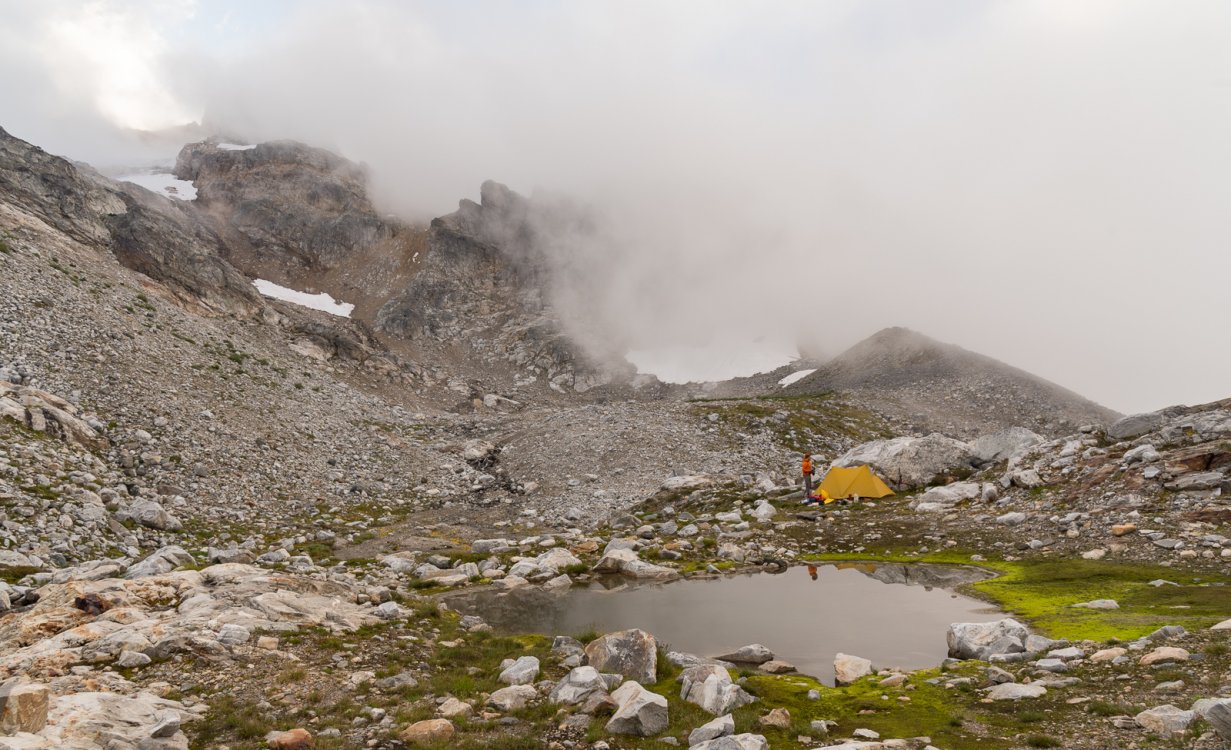

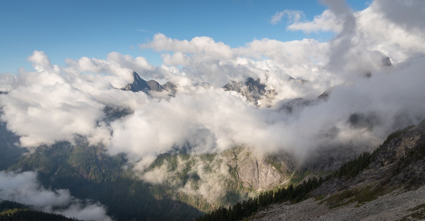
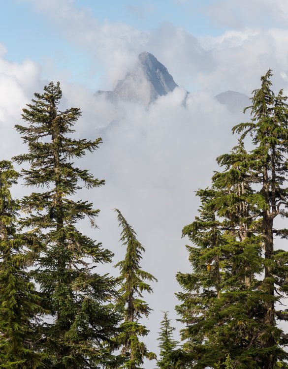
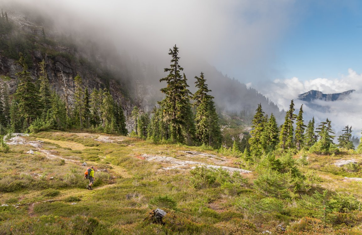

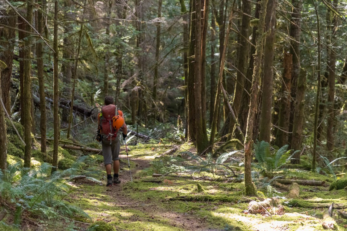
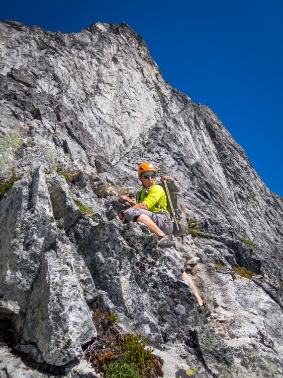
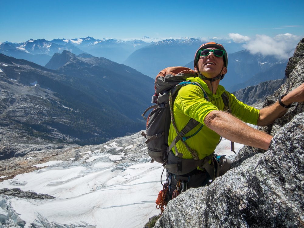
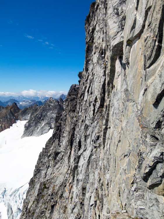
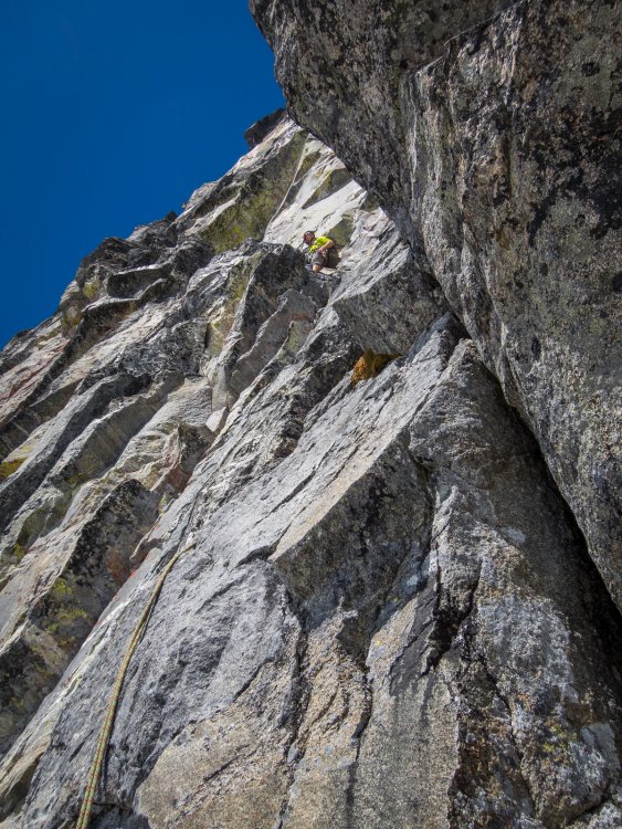
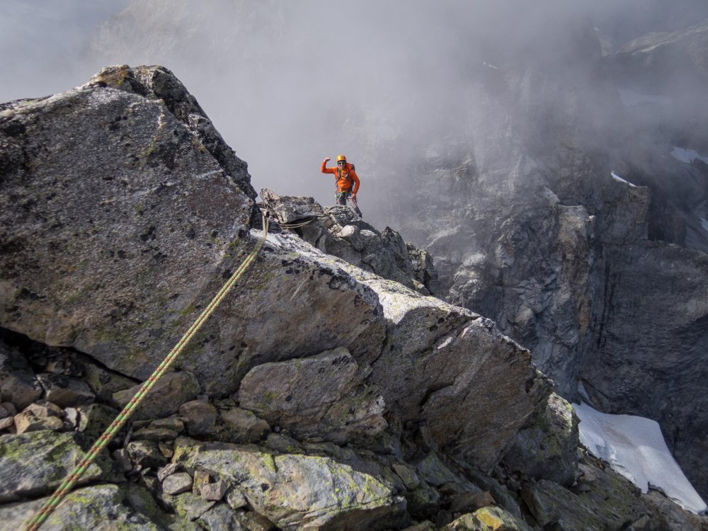
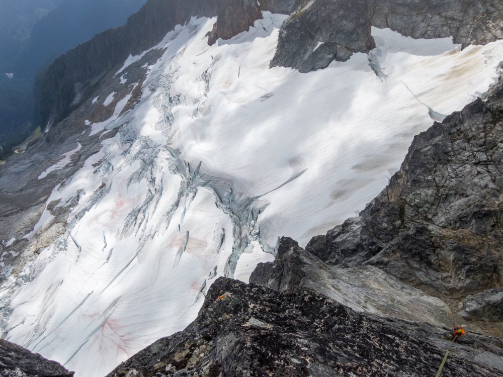
 14 points
 -
Trip: K2 - Abruzzi Spur Trip Date: 07/28/2022 Trip Report: K2 (28,261ft) Highpoint of Pakistan Second highest Mountain in the world July 28, 2022 Eric Gilbertson and Andreas Frydensberg No supplemental oxygen, independent unguided climb K2 as seen from basecamp June 13 – July 19 – Acclimate by climbing Broad Peak (26,414ft) July 20 – 22 – rest in broad BC after climbing Broad Peak July 23 – move to K2 BC in afternoon July 24 – climb to C2 6700m (I got hit by a big rock on the way up dislodged by descending climbers and was limping for next few days) July 25 – move to c3 7200m, evening summit plans thwarted by 20cm new snow so slept there in friends tent with only one sleeping bag July 26 – more unexpected snowfall, spend another night in c3 with no sleeping bags. We found an abandoned tent to shiver in all night. Food basically zero since we were delayed and ran out. July 27 – move to C4 7800m after weather cleared, then start up bottleneck 11pm in snow squall. July 28 – reach summit 8611m around 8am. We kept up with oxygen climbers most of the way. On descent I helped rescue two climbers near the bottleneck. Descend to c1 6000m in dark before a snow storm hit so stayed there for the night. July 29 – descend to K2 Basecamp 5000m July 30 – Aug 7 – hike out, drive back to Islamabad. Location of K2 K2 has a reputation as being the hardest mountain in the world. It is nicknamed the “savage mountain” and the “killer mountain”, and before this year it reportedly had a death rate of around 25%. K2 was first climbed in 1954, and by 2021 had only seen around 500 ascents. Many factors make K2 difficult. It is nestled deep in the Karakorum and takes nearly a week of trekking just to reach its base. In fact, it is so remote that there did not exist a local name for it. Surveyors gave it the name K2 for Karakorum 2, and the name stuck. It is the second tallest mountain in the world and the oxygen content is low enough at that height that most climbers will need to breath supplemental oxygen. Our route from Skardu The easiest route, the Abruzzi Spur, is very technical. The weather is notoriously bad with cold temperatures and extreme wind. I’m working on climbing the highest peak in every country on earth and K2 is the highpoint of Pakistan, so I needed to climb it. I’ve been working my way up increasingly higher and more difficult peaks over the years in preparation for a climb like this. Closer view of the route My first big peak was Denali in 2010. I gained more experience at high altitude and cold peaks with Mt Logan in Canada and a bunch of 6000m peaks in South America like Aconcagua, Ojos del Salado, and Sajama. I’ve gained technical experience over the years putting up a new 30 pitch rock route on Mt Nirvana in NWT, climbing a mixed route on Noshaq (7492m) in afghanistan, and a long ice route at altitude on Shkhara in Russia. Last summer, 2021, I started climbing 7000m peaks in Kyrgyzstan. I climbed Lenin, Khan Tengri, and Pik Pobeda via the Abalokov route. All this experience of technical climbing at altitude gave me confidence I could give K2 a try, though success would be uncertain. The Abruzzi Spur route on K2 The biggest unknown for me would be how my body would perform at altitude. The highest I’d been was 7492m on Noshaq in Afghanistan. I did fine then, and I’ve never really gotten altitude sickness before, but K2 was significantly higher and I’ve heard things get much more difficult above 8000m. Of course, I could always use supplemental oxygen on the summit, but that is very unappealing to me. The major difficulty of a mountain that tall is the height and lack of oxygen on the summit. By breathing supplemental oxygen you basically get around that difficulty, reducing the apparent altitude. I definitely wanted to climb K2 without supplemental oxygen. Some climbers higher a high altitude porter to accompany them to the summit carrying an oxygen canister to use just in case they need it. But this is unappealing to me compared to climbing without that porter and canister. I would consider the gold standard climb as not having any porters or sherpas supporting you with oxygen canisters. It also seems expensive and risky to use supplemental oxygen. I’ve had multiple friends climb Everest recently and have their oxygen system malfunction above 8000m. I’ve also read many reports of other climbs where oxygen systems froze up or just stopped working for different reasons. It sounds very dangerous to be stuck unacclimated at a high altitude with the supplemental oxygen system not working. Perhaps technology has improved now, but I am not necessarily convinced. To deal with the risk of a possible oxygen system malfunction it is a good idea to have someone along who is very familiar with debugging and fixing the technology. This means highering a sherpa or high altitude porter, which of course increases expense. The team in Skardu I also wanted to climb it unsupported above basecamp. People have recently started climbing K2 with sherpas carrying all their gear and setting up their tents and guides leading the way and making all decisions. I definitely did not want to get guided up and didn’t want anyone else carrying my gear up. Acclimation hike to Mazur Rock overlooking Skardu Of course, I still wanted a reasonable chance of success, and that meant climbing the standard route, the Abruzzi Spur. This meant climbing with a bunch of other climbers. Inevitably they would help break trail, and I was ok with that. Also, because there would be guided groups they would of course fix ropes on crux sections for the clients. I was ok with paying to use fixed ropes on the mountain, as this is very standard practice on peaks like this. It would be silly to climb next to a fixed rope and not use it. I had previously used fixed ropes twice before – on Denali near 14 camp and on the upper slopes of Khan Tengri. Rough jeep track past Askole For acclimation we decided to climb Broad Peak first. Broad is one of the easier and lower 8000m peaks and made sense as my first 8000er. We would climb the standard west ridge route without supplemental oxygen and with no support above basecamp. We could see how our bodies reacted above 8000m and hopefully learn lessons to apply later on K2. We planned to acclimate very slowly and thoroughly on Broad to give us the best chance of success on K2. I know I often get impatient and want to tag a summit quickly, but the goal on Broad was complete acclimation, not a quick summit. Hiking in to Paiju I found a conservative Broad peak itinerary listed on the summitclimb guided group website, and we planned to use this as our baseline itinerary. We would do three rotations progressively higher to 7000m before a final summit push. If everything went well on Broad then we would request a K2 permit and go for K2. If for some reason we had a lot of trouble with breathing above 8000m on Broad then we could always skip K2. Passing trango towers near urdukas camp Acclimating on Broad would also be much safer than acclimating on K2. For some reason this year many more climbers planned to climb K2 than in any previous year. Around 400 permits were issued for K2 and in the past at most around 60 climbers ever climbed K2 in one season. I’m not sure what caused the increased popularity this year. This many climbers makes K2 dangerous. Rockfall below c2 is notoriously bad, and more climbers means more rocks. Also, c1 and c2 are very small and there’s no way this many climbers can fit at once. By acclimating on Broad we would only have to go up K2 once instead of doing multiple acclimation rotations. This would minimize rockfall exposure and time fighting for campsite space. Concordia Finally, it was likely that whenever we summitted Broad would coincide with the first summits on K2 (they are right next to each other and would likely have the same weather windows). We hoped that a majority of climbers would summit K2 in this first weather window and soon leave the mountain. Our strategy would be to wait for the next weather window ( if it occurred) and push for the summit then. Hopefully then the mountain would be free of climbers, rockfall danger would be minimal, campsites would be available, and there would be no waiting in line behind inexperienced guided climbers. Me at broad basecamp, looking back at k2 For logistics we wanted to go as cheap as possible to get our permits and get ourselves and our gear to basecamp. We went with Alpine Adventure Guides with Ali Saltoro and I could not have been more pleased. He is the cheapest operator for 8000ers in the Karakorum as far as I can tell and takes care of everything from the time you land in Islamabad to basecamp. He organizes all the permits and porters and transportation and you get a basecamp staff to cook meals down in basecamp. But you are completely on your own above basecamp. Ali is very well-connected with people in government and the military and if you need anything done he is the best man to talk to. He also knows tons of information on climbing history in the area and which peaks and routes are unclimbed. Some climbers pay up to $95,000 (Madison Mountaineering) for a guided climb up K2, but we paid just $4,800 for permits and service for Broad peak plus $2,000 for a K2 permit. One final piece of logistics is we needed reliable weather forecasts. In the past I’ve had friends inreach message me forecasts from online sites like mountain-forecast.com, but this is not super reliable. If our weather forecast is wrong it can cost a lot of time in failed summit attempts. This year and the past few years we’ve paid a professional meteorologist, Chris Tomer, to give us daily forecasts. Chris gave us forecasts last year on Pik Pobeda and Khan Tengri and was extremely accurate. He also previously forecast for the successful first winter ascent of K2 (by Nims and team in 2019) so we knew he knew the area well. He would send daily forecasts to my inreach as with last summer. Looking over camp towards Concordia With all the logistics sorted out I made one final decision, and that was to not tell anyone I was planning to climb K2. I know many climbers spread news about their plans far in advance to try to get sponsors and increase publicity, but I’m a fan of the climber mantra “send before you spray”. It seems weird to me to get publicity for something you haven’t yet done but are only planning to do. But more importantly, I didn’t want any external pressure to affect my decision making on K2. If I told a bunch of people in advance I was planning to climb K2, then I might feel pressure to push for the summit in dangerous conditions to not disappoint them. If nobody knew I was trying for K2, then I would have no reservations turning around if conditions weren’t right. Broad peak from camp So I said my plan was just Broad peak. If I didn’t do well at altitude on Broad I could always skip K2 with no shame and nobody knowing. The only people that knew about the possible K2 plans were my climbing partners Andreas and Marie and Ali Soltoro so he could get the permit if we needed it. I departed for Pakistan June 13 a few hours after submitting my final grades for Seattle University. Between June 14 – July 8 we flew to Skardu, took jeeps to past Askoli, trekked in to Broad basecamp, and did several rotations. Cramped camp 1 on Broad On July 8 we tried to summit Broad peak, and Andreas and I broke trail by ourselves all the way from c3 at 7000m to the col at 7900m. But then a storm rolled in and we had to retreat. We had felt ok at 7900m, even breaking trail, and thought that was enough data to convince us we could attempt K2 without oxygen. So back at basecamp we contacted Ali to complete the paperwork and payment for K2 permits for us. I hadn’t realized previously, but it is not normal to request a last minute K2 permit like this and is not easy. Most climbers get this permit months or a year in advance. The government wanted to send in a new liason officer from Islamabad for this, but that would take much too long. Ali made lots of calls and pulled strings, and our liason officer Zishan was also instrumental in helping us out. In the end we got the permit in just 5 days, as Ali had told us would be the case. Looking down from C2 on broad peak One day while waiting for good weather we walked up to K2 basecamp and talked to a few climbing teams. We talked to Marie’s Estonian friend Krisli at Madison Mountaineering and she said they were looking to go for the summit July 22. Interestingly, Madison had a ratio of two guides and 11 sherpas per client! I think they were on one end of the support spectrum and we were on the other. We heard Elite Expeditions led by Nims was guiding up the princess of Qatar, but she was kind of reclusive and we never saw her. I bet she had the absolute highest level of support. First summit attempt on broad looking down from c3 We also talked to Dawa at Seven Summit Treks and he was super friendly. I knew they had fixed a lot of rope on the route but he said we could use it without paying. He gave us a bottle of coke and we talked for a while until he needed to get back to work coordinating clients. On July 18 in the next weather window we summitted Broad peak, the fourth and fifth climbers of the season (since there were no fixed ropes at the top the guided groups had all turned around without summitting.) We made it back to basecamp July 19 and started our rest. We had essentially done five rotations up Broad peak, twice tagging near or above 8000m, and it seemed like our acclimation was very thorough. It was perhaps even more helpful for our K2 attempt that we had required two summit attempts on Broad, since this gave us another rotation. Second attempt on broad, approaching the false summit I was coughing a lot, but I knew from recovering from our first Broad attempt that it was not serious and would gradually go away. Climbers call this the Karakorum cough, and both Andreas and I had it. I think it was a result mostly of the dry air at altitude and me being dehydrated from the climb. Unfortunately for us there had not yet been any K2 summits, and we really needed to wait for the main wave of climbers to go up and down so the peak could clear out and be safer. We definitely did not want to get tangled up in a 400 person stampede for the summit. On Broad it had just been me, Andreas and our friend Bartek on the summit with three friends later reaching the top. Six people total summitting all day was a safe and reasonable number. Andreas on the summit of broad with k2 in the background We rested for a few days reading, sleeping, and eating a lot. Fidali and the cook team prepared tons of excellent food for us every day. The weather was great those first few days and I felt a bit bad sitting in basecamp, but I knew rest was important. After dinner july 21 just as it was getting dark I noticed headlamps high up on K2 above c4 on the shoulder. This was the highest I’d seen headlamps all summer. Later after 10pm we saw them progress above the bottleneck and we figured it must be a rope fixing team. This was great news since that meant the first wave would be going up soon. Me, Andreas and Bartek on the summit of broad Indeed, we later learned a team of five strong sherpas from Madison Mountaineering and Seven Summit Treks fixed lines from c4 that night, reaching the summit around 10:30pm. I was surprised they would go completely at night, but I suppose this was so clients would have time to follow and summit by sunrise. As the sherpas neared the summit the rush was on. Clients from Madison Mountaineering started up just before the sherpas finished, trying to be at the head of the pack. They ended up summitting at 230am, well before sunrise. Behind them was a huge lineup of between 150-200 climbers (I heard different estimates based on who I talked to). Apparently everyone was using supplemental oxygen except three climbers – Nims, a pakistani porter, and one more person. Everyone I heard of was part of a guided trip. Descending to basecamp The guided climbers with oxygen could get by doing just one acclimation rotation in advance up to 6800m before doing a summit push while climbers without oxygen would have to do at least three rotations to properly acclimate like we did. Thus climbers using oxygen could more easily summit in the first wave since they didn’t really need to acclimate as much while climbers not using oxygen generally had to go in a later weather window like us. I heard many climbers started using oxygen at c2 at 6700m, which means they had to have many oxygen containers hauled up for them by sherpas and porters to cover the rest of the climb. I later saw a video (by Mingma G) of a traffic jam just above the bottleneck and it looked agonizing. I’m very happy we weren’t tangled up in that. It sounded dangerous to be stuck in the lower section of that traffic jam in the bottleneck below a hanging glacier. The safest thing to do in that zone is to move as fast as possible. But, it was excellent news that most climbers would soon clear out from the route. We soon started making plans for our summit bid. We figured if everyone summitted on the 22nd, then they should be able to make it down to basecamp by the 23rd. So by the 24th the mountain should have cleared out. Chris said there was a little bit of snowfall expected on the 25th but there would be a second weather window the 26-28. Then by the 29th the jet stream would hit the summit with heavy snow and the climbing season would likely be over. From talking to guided clients it sounded like the standard summit push itinerary is to climb to c1 and sleep, then c2, then c3, then c4, then summit. This sounded way too slow, though. On our Broad peak summit push we had climbed directly BC to c3 (4800m to 7000m) then left for the summit directly that night. So almost a single push. A helicopter evacuation from BC. These were surprisingly common. I heard rumors some climbers faked injuries to get a free flight out. Otherwise the flight is $30k usd. Some rich climbers just paid to fly out. I’ve found that I generally don’t get a good sleep above 7000m, so we thought maybe we could skip camps and also avoid sleeping up high on K2. We were used to skipping camps on high peaks (for instance on Pobeda last summer on the Abalokov route we skipped every other camp). So our plan was to climb BC to c2 (5000m to 6700m) the first day, then leave the overnight gear at c2 and climb to c3 at 7300m the next morning, rest a few hours in a friends tent, then push on for the summit at 8pm. This would allow us to go fast and light above c2 and not try to sleep above 7000m where its difficult to sleep anyways. It would put us at c4 at 7600m around 11pm, which is the time our friends recommended starting up for the summit anyways. Then after the summit we would descend back to c2 to sleep. This meant in total we would just need to pack three days of food. The weather was supposed to be clear the morning of the 26th, so it seemed like a reasonable schedule. From my experience on Broad I knew I would have trouble eating anything above 8000m. So summit day we would likely not need to bring much food. But I still needed calories to function. To solve this problem I would put gatorade in both my nalgenes. Then I could ingest calories without throwing them back up like I had when I tried to eat hard food on Broad peak. From talking to Dawa we knew a guided team from SST (Seven Summit Treks) was also planning to summit the 26th, so there would be other climbers on the mountain to help with trail breaking if needed. But they were the only remaining guided team still planning to summit, and they were only five sherpas and five clients, so it would not be crowded. With 200 climbers already summitting and only a small amount of new snow forecast for the 25th, it seemed like we wouldn’t need to break any trail and could just march up in the existing track. So even if it were just us two we could make it up. Our plan seemed like it could work, assuming the forecast held, and we had the added benefit that the 27th and 28th could be backup summit days since they were also forecast to be dry. Moving to k2 basecamp With logistics hashed out and our permit in order we started packing up on the 23rd. Our basecamp at Broad peak was an hour hike from K2 basecamp, and we had three friends also with Alpine Adventure Guides who had a basecamp set up at K2 basecamp. So we planned to sleep with them that night to let us start our climb the 24th a little closer to the mountain. After lunch Andreas, I, and Marie set out in nice clear weather and hiked up to K2 basecamp. We had dinner with Serge, Mauritz and Corinne, who were resting after their last rotation on K2 and getting ready for their own summit bid. K2 basecamp. Much bigger than broad BC. Our cook, Honey, cooked up some excellent rice and dahl. Honey actually works as a cook for former prime minister Imran Kahn when he’s not on expeditions, and I can see why Imran Kahn hired him! That night I tried to get to sleep early in preparation for a big day the next day, but it was difficult. At 8pm our neighbors at the Madison Mountaineering camp started playing loud music and setting off firecrackers to celebrate the successful ascent and return of their two clients Krisli and Nelly. This lasted until 10pm, when our other neighbors in the Elite Expeditions camp started their own celebrations with even louder music and, of course, more firecrackers. I thought I had packed my earplugs but I had unfortunately left them in broad BC. That was a huge mistake. Also, unfortunately, Marie hadn’t fully recovered yet from Broad peak and was coughing all night. We were all sleeping on the floor of the cook tent, so it was impossible for me to sleep. At 11:30pm after three hours of unsuccessfully trying to sleep I picked up my sleeping bag and walked outside far away from our tent. I laid the bag directly on the ground and tried to fall asleep there. By this time Nims team at Elite Expeditions had finally run out of firecrackers and were merely blasting loud music. I was far enough away from our mess tent that this was the only noise I now had to contend with. Finally by 2am I managed to doze off, but was awoken by my alarm at 3am that it was time to move. Elite Expeditions was still partying hard with music blasting. They would continue until nearly sunrise. Marie was still coughing and we convinced her to take another rest day. It didn’t seem wise to start up K2 when still feeling sick. So it would be Andreas and I going up as a team and Marie following up independently. We had heard ropes were fixed up the whole route, so going up solo would be doable and reasonably safe. The weather window was supposed to be long enough that Marie should be able to summit a day or two after us. After eating some porridge and chapati we headed up around 4am. Mauritz, Corinne, and Serge had said they usually started up around 4am on their rotations and this seemed reasonable. We started out in our light hiking boots carrying our mountaineering boots on our packs, since the first stretch of the route was on rocky morrain. This made our packs heavy, but not as bad as on Pobeda last year (we made many comparisons between K2 and Pobeda, ultimately concluding K2 was easier). That time we needed to carry a 60m rope, a week of food, rock and ice racks and two tools each. But since K2 had fixed lines we could get by with just one ice ax each (to use just in case ropes got cut), with no rope or rack, and half as much food. We had considered taking a light rope for the bottleneck in case the ropes got cut by icefall while we were at the summit and we needed to rappel. This had happened in the 2008 accident on K2, when some climbers had to downclimb. But we figured there would be plenty of fixed line above the bottleneck and worst case we could cut that and use it to rappel if needed. We brought a few ice screws and v thread tool in case we needed to simul climb across the traverse section and make some anchors going down. If the ropes got cut before we ascended we could borrow some lower fixed rope and re fix the cut section while taking turns climbing with our two tools. This allowed us to save a bit of weight and move faster. Hiking up to advanced basecamp The trail out of BC was poorly defined but we roughly stayed on the rocks between the icy sections. By sunrise we reached the end of the rocks and started following occasional flags in the ice. We gradually gained elevation, and as we neared advanced basecamp we encountered more and more slippery icy sections. Finally we stopped and put on our olympus mons boots and crampons, and that made progress much easier. We eventually followed flags off the glacier on the left side and took the crampons off. Amazingly, I saw one patch of grass on the side in the dirt! That was the highest vegetation I saw on the whole route, at nearly 5300m. Looking back from ABC towards basecamp We reached ABC around 6am just as a sherpa and client were hiking down. There were two tents set up but nobody was in the camp. We carefully hid our light hiking boots under some rocks and put our crampons back on. Above us was a huge wide icy snow slope on the right bordered by a rock slope on the left. There were no obvious fixed lines but we could vaguely see old tracks on the snow on the rock snow border. Our friends had told us the route hugged this border, with the rope fixed on rock while the route followed the snow. Starting up the snow slope We started kicking steps up the snow and soon reached the start of the fixed lines sheltered behind a big cliff. A handful of hiking poles and other gear items were stashed in the rocks and we added our poles to the pile. It was unlikely they would be useful any higher. I was a bit disappointed that the fixed lines were the white Korean rope we had come to know from Broad peak. This is cheap static line that is sold in 200m sections in every mountaineering shop in Skardu. It is thin, frays easily, and does not inspire confidence. But as long as it just takes body weight statically it somehow works. I wasn’t complaining, though. Some other climbers had spent a lot of time and effort putting it up and it had apparently held for 200 climbers going up and down during the first summit wave. Looking back down the route Fortunately there were two independent lines, so I could put my ascender on the strongest-looking one and clip my backup to the other line. In general there would usually be at least two lines up the whole route. I clearly wasn’t the only climber mildly sketched out by the Korean line. To increase my confidence I would generally try to not weight the rope and only use it as backup. We slowly started up the route with Andreas in the lead, but it would soon get very dangerous. After 30 minutes we rounded a corner and heard a loud noise up above. Soon a big green oxygen canister came blasting down the slope like a missile! Then a second one blasted down just behind it! We frantically swung as far to the left as possible, with the missiles passing 15 ft to our right. We hung out sheltered behind a rock band watching amazed as a backpack, then sleeping bag, then pad rocketed down. Fortunately no person fell down, but it appeared a sherpa had somehow managed to lose the entire load of him or his client! Heading up After the slope settled we cautiously started up, very rattled. We would sprint from safe zone to safe zone, nervously glancing above us every few seconds. Frequently we would here mini helicopter noises and then rocks would zip by at lightning speed. Clearly a group of climbers above was being extremely careless. I think this is one dangerous consequence of guiding inexperienced clients up a major peak like this. They don’t necessarily have the mountaineering background to know the importance of being extremely careful with rockfall. As we got higher we had to cross one particularly long and risky section. At some point I heard yet another helicopter noise as a grapefruit size rock came hurdling down. I jumped to the side but at the last minute the rock took a wild turn and hit me directly in the calf! It went between my legs from the right, hitting me in the left leg. I bent over in pain and swore at the top of my lungs at the climbers above. I hoped they understood english, but I doubt it caused them to change their behavior. My calf was throbbing but miraculously the rock had missed my shin. It might have broken my leg if it had hit bone, it was going so fast. I had a huge black and blue mark but luckily no bleeding. I had to limp to keep going, but it seemed like the kind of injury that would gradually improve. We seriously considered turning around, but it looked like we were almost at the end of the snow slope and the rocky terrain above looked like it provided more protection. Up was safer than down at that point, so we continued up. Soon some sherpas and clients descended down, and I warned them to be more careful about rockfall. They said we shouldn’t be ascending so late in the morning, but that’s no excuse for sending rocks down! If we had ascended in the dark it might be more dangerous since we couldn’t see oncoming rocks to avoid them! Descending climbers really need to be more careful. It’s not difficult on that route to avoid dislodging rocks I now know. Camp 1. Not my favorite place to hang out We passed about 15 sherpas and clients coming down and they had all summitted in the July 22 wave. We had expected them to all descend on the 23, but I guess many were slower than we expected and were taking two days to descend. By 10am we finally reached camp 1 and stopped for a break. That was the first flat spot since ABC. The camp was deserted, with just a few tents still standing, likely abandoned. The camp stunk of excrement and had trash and flattened tents everywhere. There were perhaps 20 platforms created in the rocks and, precariously, in the snow at the edge of camp, but nearly all were empty. I was very happy to not have to camp there, especially when it was full. Looking up from c1 I was surprised how much trash was in this camp given that the camps on Broad were generally clean. Both peaks had a similar number of climbers registered for permits and c1 and c2 on Broad were also small. The only difference I can think of is K2 has almost exclusively guided groups while Broad had a high percentage independent groups. Perhaps independent groups clean up after themselves better and don’t leave old tents on the mountain? I’m not sure. It was actually a bit sketchy walking around in crampons through all the trash and discarded tents, but we found a place to sit and eat a snack. Heading up to c2 Soon two sherpas from Seven Summit Treks descended to camp and stopped to talk. They said there were only a few other climbers left above us on the route and they were coming down. That was great to hear the route would soon be empty and the rockfall danger would be much less. They confirmed the group of ten from SST was on their way up from ABC and were planning to summit on the 26th just like us. They also said the fixed rope up the bottleneck was high quality thick dynamic rope just put up July 21, and this boosted our spirits. Climbing to c2 They soon headed down and we continued up. I decided to power through the pain in my calf since it would likely improve with time. Just as we were leaving camp another rock whizzed down past us! It appeared camp 1 was not a totally safe zone, surprisingly. There must be a climber above us still, and we stayed vigilant watching above for projectiles. Many ropes to choose from! We followed more korean line up the rocks, and this was soon replaced by higher quality black rope. We were ultra vigilant not to dislodge rocks, and I’m pretty confident we were successful. It wasn’t very difficult. Heading up At one point we traversed through a small waterfall, then climbed a short snow slope and returned to rock scrambling. One solo Pakistani climber descended by us, and I think he was a porter ferrying a load down. At some points the fixed rope situation was almost comical. One anchor had literally 15 different unique strands of rope coming off! The trick was always to find the two strands that looked the newest and clip one with the ascender and the other with the backup line. Interestingly, in some places it looked like a Climbing the house chimney brand new 10mm orange dynamic line had been placed next to older Korean static line. But often the orange line was core shot while the Korean line was still holding together. Perhaps the Korean line was stronger than I gave it credit for. Though there were still plenty of places where it had been cut and tied back together. We eventually reached a small flat area with a single yellow Kailas tent pitched. Just above this we encountered the infamous house chimney. Looking down the chimney This is the first technical section of the abruzzi spur route, and is a 30m tall vertical chimney that goes at around 5.7. Long ago climbers left a metal cable ladder strung in the chimney, and there were two new fixed ropes in the middle (one was placed by our friends Mauritz, Corinne and Serge.) I’ve heard horror stories of climbers waiting hours in line for a chance to go up or down this section, but luckily we had it all to ourselves. I started up first and it was tricky squeezing through and up with a big pack but still pretty fun. I generally used the ladder rungs as handholds and stepped on ledges on the side. Looking down from c2 I didn’t notice it at the time but my friends later showed me pictures of a big loose boulder balanced above the chimney. Climbers have wrapped ropes around it to hold it up but they don’t look very effective if it actually got dislodged. It kind of reminds me of chain rock in Kentucky. Maybe it’s for the best we didn’t notice the boulder as we were climbing. Once I topped out Andreas started up while I waited. Above the chimney we passed a solo climber going down. He looked very tired and said he had summitted on the 23rd and was trying to make it to basecamp. We congratulated him, then made the last short climb up to c2 by 3pm. Tent platforms made from old tents Like c1, c2 was completely deserted. Four tents remained and they were all in tough shape and very likely abandoned. The trash situation in c2 was much worse than in c1. Most of the tent platforms were literally piles of old tents. There would be 10 flattened old tents, then a platform with a pile of trash on top. Empty fuel cans were everywhere, as well as food wrappers and all kinds of random junk. It’s as if climbers come down from the summit exhausted and decide they’d rather leave their gear and trash there and go down light and buy new gear later instead of carrying their gear down. This is terrible! All future climbers have to then deal with the trash! My LNT instructors from boy scouts would be appalled at this situation. Nice views down from camp Luckily I later learned a cleaning team is scheduled to go up and remove the trash if there’s a weather window. Hopefully this is what our $200 environmental fee is helping to fund. We looked around for a spot sheltered from the wind and the calmest spot ended up being on a pile of old tents. I cleared off some trash from the top and then we pitched Andreas’ ultralight MSR tent. We tied it off to some pickets on the surrounding platforms and threw our sleeping bags inside. Looking up towards the black pyramid I was quite concerned about finding clean snow, but luckily there was a good patch above the highest platform where I was quite confident nobody had pooped. There was actually a shovel there which appeared to be used to harvest clean snow. We carefully filled up a stuff sack of snow and brought it down to our tent. By that time one sherpa from SST made it up and he started setting up a big tent he had stashed there. Then he went to two of the abandoned tents and threw gear inside. The ethics about tent usage on K2 is interesting. The camp locations are so small that they can’t possibly sleep all climbers at the same time. But climbers generally leave tents set up in camp to claim spots. So the ethics are generally that you are allowed to sleep in a tent if it is empty, since there may be no spots available to pitch your own tent. This was formally agreed upon by all the major expedition leaders at a meeting in K2 BC at the beginning of the season to cope with the unprecedented crowds on the mountain. If you sleep in another person’s tent you obviously should leave everything inside undisturbed and zip it back up when you leave. But, unsurprisingly, many climbers are not very considerate. On Broad peak some climber slept in my tent in c2 (even though there were empty sites available they could have pitched their own). Then they left the door and vestibule unzipped right before a storm. When I found it the vestibule was ripped off, sides were ripped, and snow had filled the inside! In the future I will will lock the entrance of my tent on 8000m peaks. In c2 the abandoned tents all had their doors unzipped. This appeared to again be from inconsiderate climbers, unfortunately. But the SST sherpa had claimed a few and I knew they would be well taken care of that night at least. We soon cooked up some backpackers pantry freeze dried lasagna and settled in to the tent. We had a great view that evening of the Goodwin-Austin glacier 2000m below extending from BC down to Concordia. We could see Broad peak across the valley and could see the black pyramid looming above us. The sherpa soon went back down and returned with a pink backpack from a client. Later a few other sherpas and then a few clients made it up to camp. We talked to one client, a friendly lady from Poland. She had already climbed Nanga Parbat, Broad, and some 8000ers in Nepal. She said she was trying to climb all 14 8000ers this year and was going with Seven Summit Treks for all of them. Interestingly, by my count this year at least four women are each trying to climb all 14 8000ers (all guided using oxygen and heavy sherpa support). There’s the Polish lady with SST, a Norwegian lady with 8k, a Taiwanese lady, and an American. I suspect they were inspired by Nims’ amazing push in 2019 to climb all 14 8000ers in around 6 months. I was thrilled to hear this, since the Polish lady would be very motivated to reach the top of K2, meaning the sherpa guiding her would very likely push for the summit and be able to help us break trail if needed. By sunset the last few SST members reached camp and we went to bed. July 25 Heading up in marginal weather The tent was quite small but we stayed very warm and had a good sleep. We intended to sleep in with no alarm to try to catch up on sleep from our sleepless previous night in basecamp. I think the SST crew was similarly in no hurry since they had gotten to camp late the previous day. I poked my head out the door around 8am and unfortunately the weather was socked in with snow showers. Chris had predicted an inch of snow, so this wasn’t too surprising. I hoped maybe the system had just come in early and would then clear out early for our evening summit push. Amazingly, the night of rest had done wonders for my calf and it was feeling much better (still sore but not enough to cause me to limp). This was excellent news for continuing up the mountain. The black pyramid We took our time eating breakfast and at 9am it was still snowing. We got a morning update from Chris and he said there was considerable uncertainty in the days forecast. I didn’t like how things were looking but the sherpas said they were still heading up, and the Polish lady soon left camp going up. We considered spending another day in camp to wait out the weather. But it seemed like a huge advantage if we could go up the same day as the sherpas. I figured a bigger group would increase safety and give a better chance of success on the route if there was any trail breaking. The weather was supposed to clear that evening, so it seemed like our original plan was still good as long as we were ok walking through some snow showers and low visibility. But there were ropes on the route to follow, so visibility wasn’t concerning. And the predicted snowfall, one inch with low wind, shouldn’t be enough to increase stability concerns. The vertical rock step So we quickly packed up. We left the tent set up with sleeping bags inside, since we would go directly for the summit and come back to c2 to sleep. We also left a bit of food to eat when we came back. Once packed we headed up, with the Polish lady ahead of us and the rest of the SST crew still getting ready. Looking up the rock step The ropes were mostly newer, thick dynamic rope instead of the white Korean rope. We soon started climbing the black pyramid and it was pretty fun. There were steep scramble sections interspersed with snow slopes. At times the wind picked up, blowing snowing and decreasing visibility, but it didn’t last long. The trickiest part was another vertical rock section with two metal cable ladders and fixed lines hanging down. The rock was loose and wet, and it was a bit tricky climbing. Like in the House chimney I generally used the rock for footholds and pulled on the ladder for handholds. Andreas coming up At the base two climbers descended, then at the top I met three climbers coming down. One happened to be Sara Strattan, and she was also getting forecasts from Chris Tomer! She had summitted on the 24th when the weather was great. She said she had hired a high altitude porter to help carry gear and oxygen and she had used oxygen on summit day. I half wondered if I should have done that to increase chance of success, but I was still happy giving it a try unsupported without supplemental oxygen, even if we ended up bailing before the summit. The snow picked up then and stayed hard for a while. We caught up to the Polish lady at camp 2.5, where there were platforms for about six tents. Two empty tents were set up and I suspect they were abandoned. We passed the Polish lady and continued up. There were a few steep sections with core shot rope but generally the scrambling was fun and easy as before. Climbing the snow slope below c3 Eventually we reached the last rock, which signaled the top of the black pyramid. I let Andreas take over then and he led up a gentle snow slope with some light trail breaking. We passed the body of an Afghan climber who had died there a few weeks early from complications related to altitude sickness. Before long the slope leveled out and we were at camp 3, 4.5 hours of climbing up to 7300m. There were five tents set up and we quickly spotted the tent of our friends Serge, Mauritz and Corinne. The tent situation had a bit of confusion. Serge didn’t want us planning to sleep in their tent in case they needed to sleep in it the same night. That was understandable and we agreed. But Mauritz said it was ok to rest in it a few hours on our way up for the summit bid. And that was our plan. Camp 3 They had locked their door but we had the combination and went inside. There were no pads but we found some laying around outside and brought those in. For some reason c3 was much cleaner than the other camps with no obvious piles of trash or flattened tents. But I suspect this is because c3 is on the glacier and is a lot snowier than the other camps. The trash is likely just buried under the snow and not visible. We soon started melting snow and cooking up dinner in preparation for our evening summit bid. Before long one of the sherpas came up and threw some gear in a big SST Kailas tent. Then he threw more gear in an Elite Expedition tent. I think most of the tents were abandoned and he just started claiming the biggest ones for his team. Elite Expeditions had already summitted July 22 and wasn’t sending any more teams up, so they had clearly just abandoned their tent. Looking up from c3 It was still snowing by mid afternoon and I went over to talk to the sherpa. He said they were still planning to head up at 6 or 7 pm but he shook his hand like there was some uncertainty. The rest if his team still hadn’t made it up. I was feeling uncertain about the weather. With all this new snow the old tracks and fixed lines would be covered up. Navigation would be difficult in the dark and I was starting to worry about stability. There was a steepish snow slope above c3 (the camp itself appeared safe though). The old snow had had a week to stabilize but the new snow was starting to be enough to maybe slide. If it were just me and Andreas I would delay by a day and maybe go up in the daylight if the snow stopped soon. If the team of ten SST climbers went up that night, though, I would be tempted to follow since the route would be found, trail broken, and stability tested ahead of us. Camp 3 I radioed Zishan at basecamp and interestingly he said BC was hot and sunny and he could see the summit of K2 in the clear most of the day, but there was a middle layer of clouds stuck on the mountain. It appeared it was only snowing on mid elevations of K2, and we were stuck in the snow. A few more hours passed and it continued snowing. The rest of the SST crew trickled in. By 7pm I got an evening update from Chris and he said it would dry out at 10pm. That sounded too late to wait. We wanted to hit the summit the next morning when the wind would be low. By afternoon it was forecast to increase. I told the sherpa our forecast and he agreed it was best to delay. So the plan was to go up the 26th in the afternoon and summit the 27th. This put us in a bit of a dilemma. We’d only brought enough food to summit the 26th, and hadn’t brought sleeping bags to spend the night at c3. For better or worse our appetites get suppressed a lot at altitude, so we figured we could stretch our food another day. We weren’t supposed to be sleeping in the tent that night, but since it wasn’t conflicting with our friends sleeping plans that night we decided to sleep there instead of descending all the way to c2. We would just wear all our down jackets and down pants. The temperature for the summit was supposed to be around -10f/-2f, which was much warmer than normal, and we figured it would be above 0f down at c3. So it could probably work. Luckily we even found one sleeping bag in our friends tent, which we could use as a blanket. I thought back to early July when our friend Nico was alone at c3 on Broad peak on a summit push and had accidentally dropped his sleeping bag down the mountain. We had let him sleep in our tent using my down jacket stashed there as a blanket. He made it through the night ok so we figured we’d be ok too. It kept snowing hard until 10pm, then stopped just as Chris had predicted. I saw stars outside and hoped things would stay cleared out and stabilize. In total it had snowed about 8 inches, much more than expected. The night was chilly but we managed to stay warm enough to get some good sleep. Clear views in the morning July 26 The next morning dawned sunny, but it didn’t last long. By late morning it started snowing again and I started getting nervous about our summit chances. The forecast was for high sun and low clouds, but it appeared we were stuck in the low clouds and they had unexpectedly high moisture content. We stayed resting in the tent and early afternoon started melting snow. Looking towards China from camp Soon more climbers started showing up. A handful were more SST clients and a few independent climbers showed up. Flor from Peru and Iman from Iran were independent climbers and had left the tent next to ours, which they crawled into. Soon Serge came up and he was not happy to see us in his tent. I quickly got out with all my gear so he wouldn’t get more angry. I gave him my fresh nalgene of boiling water to warm his cold fingers and I think this smoothed things over. We hopefully just needed to hang out a few more hours before moving up, and shouldn’t need to sleep another night. The plan was to move up at 7pm with SST again. But since it was snowing it would be nicer to rest in a tent. Views toward broad peak Our sherpa friend saw me getting out and motioned to an abandoned tent at the bottom of camp. He said it was nobody’s and I was free to use it. I went over but then a client started eying it. He clearly had his own tent brought up by the sherpas but just didn’t want to set it up. I told him we just needed to rest a few hours in a tent before heading up and were hoping to use that one. He looked annoyed but reluctantly acquiesced and let me go inside. The tent was nice and big, but the snow underneath had collapsed under half of it so the space was actually small. More views towards broad I threw my gear inside and Andreas soon joined. I went outside to melt snow and soon met Mauritz climbing up. He said Corinne had gotten hit by a rock below c1 and decided to turn around. It wasn’t serious, but she didn’t want to risk getting hit again. Their plan was to move to c4 the next day and summit the 28th. I told them we planned to move up that night if the weather cleared, but it wasn’t looking good yet. Inside the tent we made some interesting discoveries. The owner had left two freeze dried meals, a pair of small women’s down pants, and a fuel bottle with a little bit of fuel. This was perfect for us! The sherpa said the tent was abandoned so I felt ok using these items. We were short on food and fuel so they would potentially be useful. If we hadn’t found these we would still have managed with our food and fuel, but they were nice to have. We cooked the food for dinner with the extra fuel. Then Mauritz was kind enough to give us a little extra of their food they didn’t need since Corinne had turned around. So we had sufficient food for that day. The snow continued and by 6pm we talked to the SST sherpas and agreed it was wise to delay another day. But based on our forecast and food supplies that was as long as we could hold out. We had to either move up for the summit the next day or move down to our gear at c2 or lower. Plus, the jet stream was supposed to move over K2 on the 29th, so really the 28th appeared to be our last shot. The SST client appeared now to be annoyed at us that we weren’t moving up after all. I think his main annoyance was that he had to pitch his tent! I told him it was just snowing too much to be safe and we had to delay. I promised we’d help break trail for him if we were moving up together. That night would prove to be rougher than before. We really wanted to stay at c3 so we could move directly up for the summit push. But we didn’t have sleeping bags, not even one to use as a blanket. If we descended to c2 to retrieve our tent and bags and extra food it would likely take too much energy for us to be able to make a summit bid. So we reluctantly decided to spend the night without sleeping bags in that abandoned tent. It was supposed to be a similar temperature as the previous night, probably around 0F, and seemed marginally tolerable. For reference, last summer we had attempted a single push ascent on Khan Tengri but at midnight my partners got tired out and needed to sleep at 5500m. So I gave them all my spare clothes and backpack to sleep on in an open bivy while I did jumping jacks and melted snow all night without sleeping. I made it through that night no problem, and this night looked to be considerably more comfortable, so I was not concerned. We removed two of our scavenged pads from Mauritzs tent (and left them one to be nice) and placed these in our tent. We put on all our layers – down jacket and down pants- and wore our boot liners. We then each put one leg up to our shin in the small down pants we’d found and the other leg in our packs. We huddled onto the pads and got close. The floor space wasn’t big enough for us to lay on our backs so we laid on our sides. The night started out ok but later it got windy and cold. I had to force myself to shiver every once in a while to warm up and occasionally had to wiggle my toes so they didn’t freeze. We had to adjust the pads some so we each had two underneath. Eventually, amazingly, I fell asleep. Improving weather on the 27th July 27 Somehow we each managed to get several hours of sleep in and seemed sufficiently rested by morning. I think it helped that we had napped a bit the previous day when it was warmer out. By morning my remaining food was a bag of gatorade and four bars. I gave Andreas a bar, ate one for breakfast, and saved the last two for summit push. We had to make a summit attempt today with or without the sherpas and I went outside to rally some help. By now the weather seemed to finally be clearing. Preparing for the summit push I knew from trail breaking on Broad peak that if it were just me and Andreas it would be a lot of work and go very slowly. But Serge and Mauritz said they would join at 10am. Then Flor and Iman said they would also join. So we had six oxygenless independent climbers planning to join forces for trail breaking. If we rotated often that might just work. I talked to the three Italians going without oxygen and supported by SST. However, they would only go if the sherpas went. I’m not sure why. I then went to the the sherpas and told them the six of us were going up at 10am. I think this might have pushed them over the edge and convinced them to go. They said they would also go up at 10am. Leaving camp This was great news! A bigger group of climbers, including sherpas with oxygen who were familiar with the route, would definitely increase our chance of success. By then the sun disappeared and we were back stuck in the clouds. I radioed basecamp and Zishan said the summit was in the sun, though. So it appeared we were just stuck in a middle cloud layer that we might be able to pop out of. If we were lucky the upper mountain might have gotten significantly less snow than we had gotten. The sherpas got ready fast and some started up at 9am with clients, all wearing oxygen masks. We took our time more and headed up closer to 10am as planned. I felt a little bad not being at the head if the pack breaking trail, but they had a huge advantage breathing supplemental oxygen and trail breaking would be much easier for them. Starting up the snow slope By the time we started up visibility was again low. We followed the other climbers up slowly. The fixed line was back to the old Korean rope, but it didn’t really matter on the gentle snow slope. Higher up as the slope angle decreased we eventually popped out above the clouds as expected! Mauritz was having trouble with a cough and stopped for a break as we passed. The weather finally clearing At one point I found a lone crampon laying in the trail. Somehow it had fallen off a climbers boot. I picked it up and carried it up to give it back to its owner. I figured it was probably a careless client but it turned out to be from Andreas! I would now be nervous the rest of the climb. He had lost a crampon descending from Pobeda last summer and that was very dangerous. I did not want that to be repeated on K2. The route near camp 3.5 We soon passed a group of Polish climbers without oxygen stopping to take a break. Then we reached camp 3.5 on a small flat slope and we had caught up with the sherpas. A team of five sherpas was working hard to break trail and I commend them for their effort. It seemed futile for us without oxygen to try to help them so we took a break with the other climbers. Nice views towards china The views were great across the valley to broad peak and up the Goodwin-Austen glacier into China. Down glacier we could see Chogolisa and Concordia in the distance. Eventually the clients with oxygen joined back up with the sherpas and we followed behind. The route steepened up another snow slope to another small flat area below a serac. There were two tents here (abandoned) and I guess you could call this camp 3.7. Just above camp 3.7 Above this we climbed and traversed one final snow slope and at last popped out at c4 on a broad flat shoulder. The bottleneck and the famed hanging glacier loomed above, though far enough away not to be dangerous. I was amazed to have read so much about this area and seen so many pictures and now finally I was seeing it in person. It looked less intimidating than I expected, but of course I hadn’t yet climbed it. The bottleneck seen from camp 4 My watch read 7600m and I was feeling great. It was only early afternoon and we didn’t plan to head up until 11pm (to put us on top in the morning when the wind was supposed to be low). So we had a lot of hours to hang out. In retrospect we should have brought a tent. We had originally planned to start up from c3 in the evening and pass quickly through c4, but that hadn’t happened. There were three Kailas tents that SST clients were using and two 8k tents other climbers jumped in. Closeup view of the bottleneck I found a flattened Kailas tent and our sherpa friend said I could use it if I could repair it. I went over and started excavating it, but then one of the Italians rushed over and started trying to dig inside it while i was working on it! “What are you doing?!” I asked. He said he was taking a pad from it. But SST sherpas had already provided a tent and gear for the Italians! It seemed pretty mean for him to come steal gear from us. I didn’t want to start a fight so I just asked that he please leave us a pad if there were two (even though it wasn’t his gear in the first place). Luckily there were two pads and he quickly took the bigger one and left without saying anything more. I guess for some mountaineers it’s every man for himself on 8000ers. It took me a while to dig out the tent and put it up, and I spent some time trying to fix the poles. There was a partly full fuel tank, reactor stove, and a bag of nuts inside which I salvaged. Meanwhile Flor and Iman watched me working hard and offered that Andreas and I could just rest in their tent. They had gotten permission from 8k to use one of the big 8k four-person tents already up there and they had plenty of room for us inside. Plus it would be warmer with four people instead of two. That was extremely nice of them and we accepted their offer. We brought over our pad and hung out inside melting snow and telling stories. It turned out the reactor stove I found worked a lot better than Andreas’s stove for some reason so we ended up just using that. We munched on the nuts I found and my last handful of trail mix but saved our remaining few bars and gatorade for the summit push. We all planned to start up at 11pm, though the sherpas wanted to start earlier around 8pm or 9pm. They wanted to get the clients all the way back down to basecamp after summitting the next day. We were told it would take around ten hours to reach the summit without oxygen and I wanted to be passing through the bottleneck after sunrise when it wasn’t quite as cold. I’d had trouble keeping my fingers and toes warm on Broad peak, and had previously gotten frostbite on Pik Pobeda last summer, so I wanted to be extra careful on K2. I’d heard the lack of oxygen makes you more susceptible to frostbite if you go without supplemental oxygen. Luckily the forecast temperatures for K2 were actually slightly warmer than the temperature had been on Broad peak so I suspected I would be ok. Though less oxygen on K2 could complicate things. By sunset we decided to take a nap to rest up before pulling an all nighter summit push. By now we were getting used to sleeping without sleeping bags, though I really wish the Italian hadn’t stolen the other pad. We put our pad down but it wasn’t quite big enough for both Andreas and I to fit. So I had to lay down half on and half off the pad. We wore all our clothes but I was still cold. I put a boiling nalgene between my legs and one on my chest and that helped a bit. Forced shivering also helped. Somehow I managed to doze off and get at least an hour of sleep. But by 830pm there started to be a lot of commotion outside as the guided group headed up. I couldn’t get back to sleep after that, and by 10pm our alarms finally went off to get started. I ate my second to last bar for “breakfast” and waited while Flor and Iman heated up water and cooked food. There wasn’t a whole lot for me and Andreas to do to get ready since we didn’t really have food to eat, we’d already heated up water before bed and added gatorade to it, we were already wearing all our clothes, and we didn’t have sleeping bags to pack up. Finally 11pm rolled around and we thanked Flor and Iman for their hospitality and said we would start up. We slipped our boots on, strapped on our crampons, and started up. Just as we were leaving camp, though, we saw a light coming up from below. It was Serge! He and Mauritz had camped at camp 3.5 but Mauritz was coughing a lot and couldn’t continue. So Serge was going up solo. He asked if there was a tent he could rest in and we directed him to rest in our spot in Flor and Iman’s tent, which they graciously allowed. We then started up. It was unfortunately snowing then but we could faintly see lights from the guided group up ahead. Andreas led the way with me following. I took my time trying to maintain a constant heartrate while Andreas moved faster. After an hour we broke above the clouds and snow and I could at last see stars overhead. Maybe it would clear after all! I also saw flashes of lightning in the distance, and later learned our friends Jeff and Priti on K7 Central got caught in a thunderstorm that day. We were lucky it wasn’t over K2! I was surprised there was no fixed line on the route for navigation, but the slope was very low angle at the beginning. It soon steepened, though, and I took out my ice ax. As I got closer to the bottleneck and the slope steepened more I eventually encountered a good fixed line which I clipped to. Looking up the bottleneck towards the traverse I was comforted that I didn’t see any signs of debris even though we were under a massive hanging glacier. I’ve heard that there haven’t been any major accidents under the hanging glacier since the 2008 incident. This makes me think the bottleneck isn’t quite as risky as people make it sound. For sure it’s a high consequence area but I think there’s still a low probability of icefall. The bottleneck was mostly a snow climb with short sections of rock (though this changes from year to year). It never got very steep, probably less than 50 degrees, and wouldn’t be a big deal to climb unroped with an ice ax if needed in those conditions. Interestingly there were a handful of intermediate rock outcrops that would provide shelter from icefall, and I felt ok taking short breaks there to catch my breath. Halfway up I noticed a headlamp approaching rapidly and I stopped to let a sherpa with oxygen pass. I later learned he would summit in around 12 hours BC to summit, which is now the speed record with supplemental oxygen. At the top of the bottleneck I finally caught up to Andreas, who had caught up to the three Italians. They had started two hours before us but I think the lack of oxygen was affecting them more than it affected us since we were moving much faster. Sunrise starting I scrambled up a last rock step and was at the base of the hanging glacier. From there the route traverses a narrow snow and rock ledge to the left end of the hanging glacier before cutting steeply up. I waited to give the Italians a head start on the traverse so we could spread out a bit. It was still dark then and we hadn’t quite stuck to the plan of doing the bottleneck after sunrise. But I guess it was hard to predict we would move that fast above 8000m. After the Italians made it across I started over carefully. There were two fixed ropes and I clipped both. The snow track was only 10″ wide and very exposed, so I took my time to avoid slipping. One section was a rock slab covered in a dusting of snow, and that was a little sketchy, but I soon made it across. After the tesverse the route went up very steeply, but I felt relieved to no longer be under the hanging glacier. It must have been cold if my exhale was freezing to my face I recalled reading a report from famous professional mountaineer Adrian Ballinger who climbed K2 without oxygen (with three sherpas supporting with oxygen) and he said it took six hours to get through the danger zone. I had assumed this would be a lower bound for us amateur mountaineers of time in the danger zone. However, somehow we had gotten through in just three hours. I was very pleased to have beaten my expectations and reduced time in that risky area. Around the corner I noticed the sun was finally starting to rise. This meant it would soon warm up, but was currently the coldest part of the night. A steep section after the traverse It was about then I noticed my fingers and toes starting to go numb. I could easily warm my fingers by making a fist in my BD trigger finger mitts and doing the “penguin dance” trick to send a surge of blood to my finger tips. It was harder to warm my toes, though. I’ve never had a problem with cold toes before this summer. I’ve climbed big cold peaks like Denali and Logan where it was -20F on top but my toes were always warm. More snow slopes This summer on Broad peak near the summit ridge I started having trouble keeping my toes warm and now I had the same problem on K2, even though the temperature was probably closer to -10F. My only thought is it must be an affect of so little oxygen in the air and me going without supplemental oxygen. To warm up my toes I ended up kicking my feet out in various directions and curling my toes back and forth quickly for a few minutes. This would generally rewarm them, but after ten minutes I would need to do it again. Still, I caught back up to the Italians at a steeper section and continued up the rope. Surprisingly they got very angry at me and told me not to touch the fixed rope. They said I needed to use my ice axe. This was perplexing. The whole point of a fixed rope is that you use it to help your ascent. You don’t need your ice ax if a rope has been fixed. I touched the rope anyways and they yelled furiously to get off. They were really mean. My only thought is the lack of oxygen was affecting them psychologically. I felt the safest strategy was to stay far away from them. So I spent the next ten minutes standing at the anchor warming my toes and fingers. When it looked like they were safely away I yelled up to ask if they were off the rope and they said yes. Then I cautiously started ascending. This section got very icy, but so many people had climbed on the 22nd that many places had steps kicked into the ice. But the sections without steps were somewhat awkward. Higher up there were often several ropes to choose from and I made sure not to touch any ropes the Italians might be on. Around 8400m I passed a dead climber curled up and tied to a rope. I later learned he was an Icelandic climber that had died on a 2021 winter attempt. I think it was too risky to remove the body from that altitude. The final slope to the summit Above the body the slope gradually eased and got snowier. I briefly lost focus and touched a rope one of the Italians was on, and he yelled back at me, furious again. “Calm down, it’s a fixed rope. You’re touching it and I’m also allowed to touch it” I said back to him. He turned around and continued climbing up. At this point I could see the group of oxygen climbers ahead and I had nearly caught up to them. But it seemed like my pace started to slow a bit above 8500m and they started pulling away. I wanted to go faster to catch up to Andreas and I had the energy, but now I was stuck behind the Italians. I was worried I would really piss them off if I tried to pass or asked to pass, and I didn’t want to find out the consequence. So I maintained a safe distance behind going at a slow pace. Soon a sherpa started descending rapidly and it was the one that had passed me in the morning on the speed ascent. Then I noticed another climber coming up behind rapidly. Andreas coming down He closed the distance between us amazingly quickly and soon passed me. He had oxygen, of course, and was from Elite Expeditions (not Nims though). He had also started in basecamp last night and would get a time of 14 hours to the summit. Shortly later the guided SST crew started their descent down from the summit. I thanked the sherpas for their hard work breaking trail. Amazingly, going at the modest speed behind the Italians I didn’t really have any trouble breathing. I was always able to catch my breath by taking in a big gulp if needed and didn’t need to do pressure breathing. I didn’t have a headache and was feeling ok. Of course, I’m sure that would have changed if I was breaking trail or pushing to go faster, but it seemed like I was doing ok overall at that altitude. On the summit Soon I neared the summit and passed Andreas on his way down. He had managed to pass the Italians and make it up earlier but was now eager to descend. Around 8am I popped put on the summit ridge and met the fast sherpa taking a video. We exchanged fist bumps and then I marched the last few steps to the highest point, a cairn covered in prayer flags. I was amazed to make it the whole way with no supplemental oxygen and no adverse altitude effects. It had taken nine hours from c4, though if I could have gone my own speed I could have shaved off some more time and summitted with Andreas. The Italians and I were the only ones at the summit cairn, and I appreciated the lack of crowds. By now they were in good spirits and all my past infractions seemed to have been forgotten. Summit panorama One of them was nice enough to take a few summit pictures of me and I returned the favor taking pictures of them. I think they had a lot of sponsors since they had a lot of flags to get in different pictures. It seems like Andreas and I were some of the only unsponsored climbers I heard of to make the summit, but that’s fine with me. Unfortunately the summit was stuck in the clouds and I didn’t get any views. I imagined the views would be similar to those I got on the summit of Broad, and those had been spectacular. I radioed Zishan to tell him we made the summit and he congratulated us and told us to be careful on the descent. I spent a little time looking for a summit rock (no luck) then a bit more time taking pictures of the whiteout. Last look up at the summit I was soon getting antsy to head back down, though. In my experience it’s a bad idea to spend too much time on a high altitude summit. Eventually bad altitude effects start kicking in. So I soon started my descent. The angle was low enough that it was most effective to do an arm wrap descent instead of rappelling. I made quick progress down, and met a few climbers on their way up. Flor and Iman were looking strong and Iman gave me a fist bump and congratulations. I caught up to Erix and Dorje from SST and got slowed down a bit. Erix was rapping down each section while Dorje and I descended with arm wraps. We soon reached the steep icy bit and one Polish climber was still ascending. I worried he would be topping out pretty late. He told me a French climber wearing purple was in trouble down below and I should help if possible. Lower down just above the dead body I saw Erix and Dorje stopping and taking a while to descend. I waited until they unweighted the rope so I could rappel. I later learned that the French climber in trouble was Benjamin, from our group! He had told us he would try to climb from basecamp to the summit in one push without oxygen that day to try to break the speed record. He had already set an amazing new Broad peak speed record (7.5 hrs bc to summit) a few weeks earlier so I had assumed he would have no trouble on K2. But in fact he had passed out near the dead body due to effects from altitude. He would later tell us he lost his memory of that time. Dorje graciously gave Ben his own oxygen container and mask. This brought Ben back to life and he started down slowly. Meanwhile I started rappelling down once the rope got unweighted. I made it a few more rope lengths, always being careful to choose the newest-looking rope. But then there was a traffic jam below and I had to wait at a sketchy anchor with a small stance. It appeared Serge was coming up and we had to wait to let him pass. There wasn’t any room at the anchor for anyone else and I yelled up for the descending Italians to wait a minute until the jam cleared. They said ok bit still continued rappelling down! So I pulled one of the ropes taught like a fireman belay to force them to stop. “There’s no room at this anchor, just wait a minute until climbers clear below me and you can come down,” I said. Starting the traverse back They said ok, so I released the rope. But then they just continued rapping to the anchor anyways! I was very frustrated with them. They got to the anchor and it got very sketchy trying to balance with them there. Maybe their judgement was still being effected by lack of oxygen. Eventually Serge passed and I made a few more raps to the start of the traverse. There I saw Erix and Dorje waiting while another climber in purple was standing the middle of the traverse not moving. Eventually the climber made very slow progress across and I started across the traverse. On the other side the slow climber slipped and fell, sliding 10 ft down the snow slope before the rope caught him! At that point I recognized his helmet, pack, and jacket and realized it was Ben moving down slowly. The italians coming across I made it across the traverse and Ben had gotten back up and climbed up to the anchor. By then the Italians also made it across. The Italians then revealed that one member of their group, Pietro, had snow blindness and needed help getting down. So we had two climbers in need of assistance getting down the bottleneck. I suspected Dorje would need to help Erix get down since Erix was a client, so it was unlikely they could help. Francois, one of the Italians, volunteered to help Ben down while I would help Pietro. We were figuring this out standing in the danger zone below the hanging glacier and I was very eager to speed things up and get moving quickly. So I told Dorje and Erix to start down immediately. They soon cleared out and there were two ropes heading down. Ben started down one under Francois’ supervision and I went down the other. I made sure Pietro was attached to the correct rope first then I put him on a fireman belay when I got to the bottom. Rapping the bottleneck In general there were two ropes on every pitch, which was very helpful. I would generally go down first then yell up instructions for the other guys. (Some rope rigging was not standard and required us to do things differently). We generally moved quite efficiently, and soon reached the end of the fixed rope and the end of the steep section. By then Bem seemed to be doing much better and Pietro said he would be ok unassisted from there. We followed our tracks down and eventually were low enough that I considered us out of the danger zone from the hanging glacier. By then we were in a whiteout and the tracks below had mostly drifted over. Descending in the whiteout We soon caught up to Andreas and two other climbers sitting and resting. They had lost the tracks and were waiting for other climbers to help. I had recorded the ascent on my watch GPS and noted our up tracks were a bit to the right. I was about to start down when two sherpas came from behind. Without hesitation they continued breaking trail down. It was an easy choice to follow them since they seemed so confident. Back to c4 The trudge back took a while and balance was a bit difficult without hiking poles, but by noon we arrived at camp 4, 13 hours after leaving. I was amazed that I still had plenty of energy. The only things I’d eaten all day were a cereal bar at 10pm and 1.5 liters of gatorade during the climb. But that was enough to keep me going and I hadn’t thrown up the gatorade or the bar. My remaining food was just some more gatorade powder and one bar, though. There was plenty of daylight left and we decided to make it down as far as possible. But first we needed to melt some snow to rehydrate. Descending to c3 We stopped off at Flor and Iman’s tent and melted a few liters of water. I put in some aqua tabs and we waited the 30 minutes for it to kick in. We needed a rest anyways since we hadn’t really rested the whole climb except for a few minutes on the summit. Once the water was ready I chugged half a liter and ate my last bar while Andreas ate some leftover nuts. Then we were ready to head down, with our food officially reduced to zero. Descending to c3 We made quick progress rappelling and arm wrap descending down towards camp 3. Just above camp we passed a solo climber going up and it turned out to be Dennis Urubko ( though I didn’t know this at the time). I asked when he planned to summit but he didn’t want to tell me. I was confused why he was so secretive but I wished him good luck. Shortly below we passed Marie climbing up. We told her Chris had forecast good weather the next morning but bad in the afternoon so a summit was possible if she was quick. She sounded kind of sick and we were a bit concerned but she was determined to give it a shot so we wished her luck. Descending to c3 Back at camp 3 we met back up with Ben. He had just unfurled his paragliding wing and was getting ready to fly back to basecamp. That would surely cure any altitude sickness symptoms quickly! I wished I could fly down, but I think it seems a little too risky to me. I’m sure Ben is experienced enough to be safe, though. Once packed he pulled up the wing, ran downhill, and then was airborne. It looked very fun and I think he was back to BC within 20 minutes. Descending to c2 We took a short break and then continued our descent. We soon caught up to a sherpa and client moving slowly and they kindly let us pass. In general we rappelled the steep sections and arm wrapped the low angle sections with our safety backup clipped on. The weather occasionally cleared to give views of the glacier below but was usually in the clouds. By 5pm we reached camp 2, which was deserted. Unfortunately the front of Andreas’s tent was ripped open, possibly by the wind. Luckily our sleeping bags inside were undamaged, though. At c2 This made camping at c2 kind of unappealing, especially if the weather turned bad. We could always crawl in one of the abandoned tents or just repair ours with a lot of duct tape, but we started thinking it might be best to just descend all the way to basecamp. That way we wouldn’t have to sleep in the dirty c2 or c1 and we could maybe avoid rockfall since it was unlikely any other climbers would be descending at night. It was a tough call, though, since if any rocks fell at night we couldn’t see them to avoid them, but it was very unlikely rocks would be dislodged with no climbers to dislodge them. Looking down from c2 We quickly packed up and headed down around 6pm. We rapped the House chimney and worked our way down the scramble section. I led the way and the trickiest part was usually finding the most trustworthy looking rope to rap down. Once I found it then Andreas would follow the same one. At least going down I knew the rope wasn’t core shot since I could inspect it starting from the anchor. When ascending I would have no ide of the rope quality above me. Darkness soon set in and we descended by headlamp. But we could always follow the ropes so navigation was no problem. Darkness setting in We eventually neared c1 but by then the wind picked up and it started snowing. Conditions were actually pretty nasty. We took a short break at c1 and considered our options. If we continued we were basically committed to descending the whole way since there weren’t really any more flat campable spots. But the weather could get worse. While descending I had actually heard one or two rocks whiz by and in the dark I was kind of nervous I couldn’t see to jump out of the way (they were likely dislodged from a client and two sherpas I later learned were descending above us). Rapping the house chimney But if we camped we’d have to try to repair the broken tent. However, we did see one big abandoned tent in c1. I poked my head inside and it was in good condition and snow free. So we decided to ride out the storm there. We threw out our sleeping bags and crawled inside them around 1030pm. It felt kind of weird sleeping in a sleeping bag after the previous three nights of shivering without bags. But I soon got used to it. We had a small bit of food now that we’d stashed in c2 but for some reason I wasn’t really hungry, despite eating basically nothing the past 24 hours. I figured I’d make up for it back in basecamp. Camp 1 We soon went to bed amidst the loud howling wind and blowing snow. July 29 The next morning I was awoken by talking outside around 6:30am and it sounded like the client and sherpas had also spent the night at c1 and were now heading down. At first I was delighted that they would below us and couldn’t knock rocks down on us. Looking down towards basecamp We quickly packed up and started down. After 10 minutes we caught up to them and I recognized them as SST sherpas and client. I thanked the sherpas for their hard work breaking trail. Descending from c1 Unfortunately they were very slow though. The client did not look very confident rappelling and one sherpa would go next to her on a parallel strand each rappel while the other sherpa stayed up high. It was agonizing for Andreas and I to be going one third of our normal speed and wait so long at the anchors. Soon rockfall started coming down around us and we knew more climbers were descending. The safest action was to get down as soon as possible to leave the danger zone. We cursed ourselves for not waking up earlier. At the end of the fixed ropes. Fortunately the sherpa said it was ok if we passed, and I went around and arm wrap descended for speed. The lower ropes had all gotten cut (probably from rockfall) and retied so they were too tight to rappel, so I ended up arm wrap descending most of the rest of the way. Looking down at ABC I would look up every ten seconds for rockfall and had to jump out of the way a few times but we eventually made it safely to the end of the fixed line behind the rock buttress. I found my whippet where I’d stashed it but someone had stolen my other hiking pole! I cursed the unknown thief. Why would a climber do that? The same thing happened on Pobeda where we stashed our poles at the base of the climb and someone stole Andreas’ poles. At least they left the whippet, which is more valuable. Looking back up from ABC. Me with K2 in background (photo by Andreas) We hiked down the slushy snow, still looking up every few seconds to check for rockfall. Finally we made it to ABC and were out of the danger zone. Sadly, I later learned that a few days earlier two dead climbers were found right there at the base of the route. It appeared they fell down from c1 or c2 and were killed in the fall. A team went to recover the bodies, but while they were resting drinking tea an avalanche came down the snow face and covered the bodies. I think they are still buried. Hiking out We walked over the avy debris and found our stashed boots, luckily not stolen. We then purified some water in a stream and continued down. Miraculously, I found my missing pole leaning against a rock next to the stream! It appeared the person had just used it to descend the snow slope then left it. But it was still mean of them to take it. I would have certainly appreciated using my own pole on the snow slope also. Hiking out Below ABC the glacier was more melted out than before and most of the flags had fallen over. We soon put crampons on and had trouble following the route. At one point we made a tricky stream crossing and found fallen flags on the other side. But then a trekker on the other side waved over to us that the route was there. It appeared there were two flagged routes, but the trekkers were coming up from BC so we knew theirs worked. So we crossed back over. Back to k2 basecamp From there it was easy following the route. We met one guy coming up who congratulated us on our climb and handed us each a chocolate bar. At first I thought he was being nice but then he asked for money. So we gave him back the bars. We were only 30 min from BC and decided to hold out. By late morning we made it to K2 BC and stopped for a break. Mauritz, Corinne, Ben and Zishan were all there and we had a nice celebratory lunch. Looking back up towards broad peak That afternoon we learned on the radio that Serge had turned around before summitting the previous day and Marie had turned around that morning around 8200m. Only she and Dennis Urubko had pushed for the summit that morning. The snowstorm had apparently wiped out our tracks and Dennis broke trail up to the summit by 7:30am. Marie had started feeling the altitude so turned around. Then she texted that she likely had HACE (high altitude cerebral edema) and needed help down. Fresh snowfall in the morning Flor and Iman had spent the night in c4 and were luckily able to help give Marie a Dexamethasone injection and help her get down to c2 that evening. Andreas and I spent the night at K2 BC. July 30 The next morning it was snowing hard in BC and I felt bad for the descending climbers. But Serge and Marie made it down to ABC and Mauritz and Corinne met them there to help carry their gear. Meanwhile Andreas, I and Ben hiked down to Broad BC. On the way we stopped at Celebration cake back in broad BC. Lela camp and ate some cake with Dennis Urubko to celebrate his birthday. He said he was planning to climb Broad peak (again). He’s trying to break the record of the most ascents of 8000m peaks, which is currently somewhere around 27 (including repeats). I think dennis is close to that now since he climbed Broad, G2, and K2 this summer. We later returned to our own camp and had another cake, this time a K2 summit cake. Marie and Serge later made it to K2 BC that afternoon so our whole team was finally off the mountain. July 31 Final view of k2 on the hike out The porters came in the morning and we packed everything up to give them. Marie hiked down to Broad BC but was still feeling bad effects from the HACE. So we decided to try to get her a helicopter rescue. Zishan stayed to coordinate that while Andreas, Ben and I started trekking out. We hiked through Concordia then up to Ali Camp by evening. We would take a shorter route out directly to Hushe instead of the longer route to Askoli. Ali camp This Hushe route went over a sketchy 5500m pass, Gondokhoro Pass, and is generally not used for the approach to BC because this is difficult if unacclimated. Unfortunately the porters don’t take this route out since it is too steep and icy. In fact, there is a rescue crew stationed near the pass to help climbers across. Sunset at ali camp We reached Ali camp at sunset, ate some dinner, and went to bed. Aug 1 That night we got up at midnight and one member of the rescue crew started leading us up the pass. There was a lot of fresh snow and it was actively snowing so trail breaking was tough. Descending the south side of the pass There were fixed ropes near the top and we reached the pass around 3am. Our leader jumped in a waiting tent at the pass and then we were on our own. The south side was extremely steep with a few inches of snow on loose rocks and slabs. We arm wrap descended down fixed lines but still slipped a lot. The snow continued all morning, changing to rain down lower. By sunrise we reached a Chuspang camp and stopped to eat some chapati and eggs. Almost back to Hushe We then continued down, eventually reaching Hushe village by early afternoon. We were at last back to civilization after six weeks in the mountains. We stayed at the only hotel in town, eating a big meal and taking a nice shower. Over the next few days we would make our way back to Skardu, wait for porters to bring our gear our, then drive to Islamabad and fly out. Celebration cake in skardu, with pictures of broad and k2 Marie ended up taking a horse down to Askoli since the weather was too bad for helicopters to fly. After July 29 the whole K2 basecamp cleared out, and the season basically ended. It appeared the jet stream had returned with heavy wind and snow that covered the route. From what I’ve heard, approximately 200 climbers summitted K2 this season, mostly on July 22, of which approximately 15 were without oxygen including us. A vast majority of the climbers were with commercial guided groups using supplemental oxygen and heavy support from sherpas. This total at least triples the previous record for ascents of K2 in a season. Link to more pictures: http://www.countryhighpoints.com/k2/ Gear Notes: Standard 8000m gear Approach Notes: Jeep from Skardu to Jhula, hike to basecamp with donkeys carrying gear13 points
-
Trip: Mount Harvey - North Face Ramp Trip Date: 01/25/2025 Trip Report: What a nice spell of climbing weather we had to start off 2025! I'm glad that @geosean suggested the NF ramp of Harvey, a climb I had done a couple of times before, but not for a long while. Last time I was on it, it was quite thin and sporty, but the word on the street said it was in fine nick and so plans were hatched to make a trip north and see if Canada was still allowing Americans to enter. @BrettS and Mike rounded out our team and we all met early in Bellingham Saturday morning. I think it only took about an hour and a half, including border crossing to make it to the TH from Bellingham- it is easy to forget what great options exist just a little bit north. The Trailhead was already filling up when we arrived a bit before 8 and we quickly paid the parking fee and started up the dry logging road at something like a dispiriting 650' elevation. It is a bit of a grunt up to the start of the route, but you get good views early on the hike in: In the 13 years since I'd last climbed it, the route has gotten mildly popular and there were several teams in front of us and at least one behind. A steady stream of ice and snow chunks rained down the ramp as we geared up and started off simul-soloing. We had the gear and rope ready, just in case, as @Don_Serl recommends in the link above, but they stayed packed away as we climbed higher and higher with perfect conditions and ample steps to draft off of. I was reminded what a great and pleasant climb it was, in a fine position! But almost too soon, the angle mellowed and we were at the top of the ramp, looking across the steep traverse that guards access to the easy ridge that finishes on the summit. Some times this portion is a crux, but not this day. It was practically a sidewalk and we enjoyed posing for some photos with dramatic views of Howe Sound below: And then we hit the final ridge, sun and views. @geosean walking just below the top: We stopped just short of the summit to eat lunch, take off the technical gear, and admire the excellent views all around. The Standard route on Harvey (our descent) is quite the popular outing on a nice winter's day and we didn't want to be in the scrum on the actual summit. This was a good call on busy Saturday, and we could look south to Baker, Puget Sound, and the Lions in peace: To the west were the endless Coast Mountains, Howe Sound, and Anvil Island: But, a winter's day, even a perfect one, is over too quickly, and we had to begin the descent before we tired of the views and position. The good thing is that the first quarter of the descent is almost as spectacular as the climb: And then it was back to the road, the car, beers, and chips. I think it was less than 7 hours car to car and was entirely one of the more pleasant winter climbs that I have done in years. I hope that it isn't another 13 years until my next visit! Gear Notes: helmet, axe, second tool, steel crampons. If it is in thin shape you may want a rope and some snow/ice pro, but it is also a comfortable solo for a lot of fatter winter conditions. If you need snowshoes it is probably not in great shape. Beware avy danger! Approach Notes: The Lions Trail. Arrive early to get a spot and don't forget to pay!13 points
-
Trip: West Fury - Mongo Ridge 5.9 ED1 (second ascent of the Pole of Remotenesses) Trip Date: 07/14/2022 Trip Report: Hello all, Lani and I got out of the pickets a few days ago. We repeated Mongo Ridge and got the second ascent of the pole of remoteness. Lani wrote a solid trip report on our blog with tons of photos and more beta which is linked below. For now here are some important cliff notes on the route… https://www.theclimbingguides.com/post/mongo-ridge-and-the-pole-of-remoteness-7-09-2022-7-14-2022 1- we did not do the rooster comb. This feature is awesome looking and deserving of being climbed if you have the time. The bypass doesn’t seem to detract from the aesthetic of the line too much, you are about 100-150’ from the roosters comb the whole way as you traverse the south face. 2- we did not encounter any 5.10 terrain. After seeing photos from Wayne’s trip we climbed slightly different terrain than he did on tower 3. 3- everyone seems concerned with the commitment grades thrown at this thing. I would argue that an American commitment grade makes little sense on a climb like this. I would like to propose Mongo as the benchmark ED1 for the cascades. It is a considerable step up in length, commitment and general alpine involvement over NE butt of slesse, and I’ve always understood that climb as the benchmark TD. There was 3500’ of climbing done in 30 pitches without any simuling. we chose not to simul as there really wasn’t enough solid gear to make it feel like we weren’t just soloing. 4- this was my first technical climb in the pickets, so I don’t have much to compare it to but I felt the rock was pretty damn good and the route was fucking awesome. The route was similar in nature to the west arete, but longer and with better rock, and almost no overhead hazard. I would highly recommend the route. 5- the sit start to the ridge is a logical evolution of the route. For those interested, it looked improbable to gain the lower ridge anywhere other than toe. This would ultimately add about 1200’ to the climb. Once seasonal snow is gone, it may be easier to trudge up the depths of goddell creek… Gear Notes: Single rack .1-2, doubles .3-.75 Approach Notes: Long13 points
-
Trip: Cabinet Mountains - Multiple Trip Date: 03/21/2020 Trip Report: I just wanted to share some photos and descriptions from the last couple ice seasons in the Cabinet Mountains. Anyone who got the 2019 AAJ or Alpinist 64 might have already seen pictures of the area. There have been a handful of Spokane area climbers putting up routes over the last couple seasons. All the climbing has been done out of Granite Lake which is near Libby, MT in the Cabinet Mountains. The climbing is quite varied, from single pitch WI3 to 1000ft hard ice and mixed routes. The area has been divided up into 3 big areas….A Peak, The Thunderdome, and Three Tiers. A picture is worth a thousand words so I will just resort to numerous pictures instead of more text……let the stoke begin for next season!! Looking across Granite Lake with A Peak towering 4000 feet above. The Thunderdome is the large sub dome in the center of the picture. The Thunderdome!! Some of the best ice routes anywhere around. Scott Coldiron and Matt Cornell on the first ascent of Mad Max, WI5+ (8 pitches). Nate Kenney climbing a steep skinny pillar called War Boys, WI5+. Scott Coldiron climbing a crazy pitch called Underworld, WI3. This route is 20m long and entirely inside an ice cave 500 feet up the Thunderdome! Another view of the spectacular A Peak and the upper wall of the Thunderdome. The big ice in the center of the wall is Road Warrior, WI5, M5 (8 pitches). Looking up the huge gash on A Peak. Scott Coldiron and Jess Roskelley put up the route Canmore Wedding Party AI5, M7, 750m, which ascends this central gash. The climb got nominated for a Piolet d'Or in 2019. Note: the large sheet of ice on the bottom rock band is still unclimbed as of 2020. Looking up the wide start to the "Blaster Routes". Blaster, WI4 is five pitches of ice while Master Blaster WI4, M5, (10 pitches) continues to the top of the Thunderdome. Looking up from the lake at the "Three Tiers". These cliffs have about 20-25 ice and mixed routes that have been done. A closer view of the the ice (during a fat season) on the center of the 2nd Tier with the 3rd Tier above. Scott Coldiron on the first ascent of Toast, WI5 on the 2nd Tier. Zach Turner leading The Dag, WI3 on the 2nd Tier......a super fun mellow corner. A shot of some of the 3rd Tier routes. Gyro Captain, WI4, goes up the ice on the right while Pig Killer, WI3, takes a line up some of the ice on the left. Multiple possibilities exist for mixed routes connecting the lower ice flows in the center up through the rock to the hanging ice above. Zach Tuner rappelling off Max's Bloodline, WI4, with the impressive routes on Thunderdome in the background. Jonathan Klaucke climbing funky ice on Cheedo, WI3-4, on the 2nd Tier. Looking across at the right hand end of the Three Tiers from the Thunderdome. The wide flow in the center is the start of Tomorrow Land, WI3+, 3 pitches, while the ice up on the right is Devil's Brownies, WI4, 2 pitches, and then farther right is Scales of Justice, WI4/5. Zach Tuner on the skinny pillar start to Splendid Angharad, WI5. The flow farther left is called Capable, WI4. Looking up the 2nd pitch of Tomorrow Land, WI3+ on the first ascent. This fat climb called Nightrider, WI4, 3 pitches, is on the far left of the Thunderdome. It is a bit longer of a hike from the lake but the route is a stellar moderate! Scott Coldiron climbing the crux 2nd pitch of Nightrider, WI4. Brian White starting up the classic Toast, WI5 on the 2nd Tier. The ice beyond him is the route Cheedo, WI3-4. Zack Turner on the sharp end during the first ascent of Grease Rat, WI4....a really fun route on the 3rd Tier. Matt Cornell working through the crux of Sarcophagus of Lies, M6. The route continues up and left until you can stem between the rock and the ice dagger above. This is a stellar line on the 3rd Tier with "quality climbing as good as Come and Get It" according to Matt. Brian White putting up a short route called Mystery Gas, WI3 on the 3rd Tier. Syd Atencio and Nate Kenney climbing up Devil's Brownies, WI4, on the Three Tiers. Granite Lake and the surrounding basin in the background. I think one of my favorite things about the climbing here is the views....it just never gets old!! Every time I walk across Granite Lake I have to pause and just look up. Hopefully this will get some people stoked about climbing up there because it is a beautiful spot with fantastic climbing. Happy to answer any beta questions or run them through Scott. Gear Notes: Ice screws......rock gear for mixed routes. Approach Notes: All climbs are best accessed from the Granite Lake trailhead. In winter it is a 9 mile hike/skin into the lake with about 2000 ft of elevation gain. Count on 4-9 hours depending on conditions. From downtown Libby, take Highway 2 east one mile to Shaugnessy road. Take a right and follow this for .7 miles before turning left onto Snowshoe road. After 1/2 mile take a right turn onto Granite Lake road. In .8 miles stay left on Granite Lake road and continue for 4 miles. This is the end of the pavement and where the snowplows stop in the winter. The Granite Lake trailhead is still another 3 miles but you will have to walk/skin/snowmobile that distance in the winter. There is usually plenty of room to park several cars just be mindful not to block the road or any of the neighbor’s driveways. From here follow the snow covered road for 3 miles to the actual Granite Lake trailhead. The road is mostly level with a few gradual climbs (400 feet of elevation gain in 3 miles). From the trailhead hike/skin the trail 6 miles up to the lake.13 points
-
Trip: Snoqualmie Mountain - [FA] The Snostril and Post Nasal Drip Trip Date: 01/29/2021 Trip Report: Since it took three attempts to send this climb, this TR will take the insufferably long form, written in the “how-the-sausage-is-made” and “what-I ate-for-breakfast” style in homage to the golden days of cc.com. Had I more time, I would have written a more concise TR. The hipster TL/DR version goes: “Major Tom, Christian, and I ran a quick Snostril lap the other day, condis were all time.” 12/4/2020 – Background and first attempt. The seasonal stoke to bash metal into ice seemed much stronger than usual this fall, corresponding to the collective increase in strength of the local crew, many of whom I am only recently met. These guys had been spending months training in a dimly-lit, south Seattle pain cave, and outside at the new Exit 38 dry crags - Wayne’s World and the Road House, and they were burning to get on the real thing. When Tom Beirne and Christian Junkar called and asked me for ice climb ideas and if I wanted to join their early season Alpental Valley ice hunting exhibition; I knew it would be futile, way too early and way too warm still. But I had only taken the tools for a walk once this season, so I signed up for their second day. On their first day, they scratched their way up Chair’s NE Butt, so we decided to see how things were coming along on the NW face of Snoqualmie. I had never seen this face so early in the season and it was what I expected – some thin smears, towering walls of bone dry rock, and none of the usual mixed lines had enough ice to launch up. The best looking “ice” I spotted was a continuous smear between the Snot and Thunder Basin exit shoulder, just left of a cave, which we marched under heading to the bigger but unformed mixed lines on the middle of the face. I have skied below this western aspect of Snoqualmie’s backside too many times to count but no ice ever caught my eye in this area before, probably because it is usually covered by a heavy snow blanket. The ice that grabbed my attention, would not be called ice in most other places but we take what we can get around here. Much discussion and indecision ensued as the team pondered the best of a lot bad options to attack. Not being known for my patience, I dramatically kept looking at my watch and stomping my feet until Tom agreed to belay me on my route pick. The climbing wasn’t exactly cruiser, but was thin aerated ice, not much more than one inch thick, with front points searching for rock divots, not thick enough for stubbies but just enough pin and poor cam placements to bring it down to around PG13. After about 40M of tenuous climbing, I was ready to be done and pulled into an alcove on the left with a faded of piece of tat around a chockstone (buried now). Tom lead up another 20 M of thin ice with some rock gear to a four inch diameter tree (buried now) with old tat up and right of an icy couloir above. The next pitch looked even thinner with more rock and less ice, but we could see a huge chockstone roof with a steep smear barely visible on the right which set the hook for a return visit after the ice got a little chubbier. Christian’s video of our first attempt: 12/26/2020 Second attempt, one pitch higher. A desired high pressure system proved elusive but Christian and I went back for round two anyway based on my stupidly optimistic read of the forecast. I saw a potential 12-hr window between one low exiting and another, more vigorous low, arriving. We skinned up marveling at the magnificent ski conditions (deep and soft) and knowing a serious effort today may not be a good idea. When we left skis at the top of the exit chute's shoulder, it was obvious that even our descent into Thunder Basin would put us on a potentially loaded slope, so instead of booting down this slope I have skinned up so many before, I rapped off a tree for some insurance against the millennial snowpack (i.e., easily triggered). Pitch one got about 5M shorter compared to our first attempt due to growing snow fan at the route’s base. With a higher base and thicker, more mature ice, I was able to quickly combine our two previous pitches into one 55M lead to our highpoint on the small tree out right. Christian led the next pitch which went around WI4- and was a 60M rope stretcher into a huge cave formed by a gigantic roof chockstone. He had already endured a nearly continuous spindrift shower following P1 but that was just the warm up for his P2 lead as the snowfall intensified. The conditions turned pretty full on, and it was hood up, zip up, and don’t look up because there was no respite from the parade of sloughs from the chute above. After some more thin ice with marginal rock gear on the left wall, Christian topped a final bulge and cruised some steep snow into the huge cave - the Snostril’s nostril had been entered. I really wanted to lead us out right and up to what could only be an easier slope above, but the problem was a short, overhanging rock wall had to be breached to exit the cave. Up and down I went to try to find a way through or around this wall. Straight across on dry powder over rock, or on some ice smears up high just below the roof, or down and around perhaps? I kept getting stopped due to either the lack of gear, the lack of tool/’pon placements, the lack of ice to stick, or perhaps the lack of big enough balls. Way up at the top of the cave above the belay, there even was an invisible nasal cavity which was snorting out wind and snow that I considered trying to access and squeeze through, but the rock up there looked too overhanging to explore. The view of the crux from the belay: Meanwhile, if I could climb out from the cave, the reward would be swimming in the fire hose of snow pouring down now, so our yellow light was clearly turning red. Time to flee to fight again another day… I built an anchor by slinging a boulder with my cordelette (love love love the much maligned cordelette) and equalizing a knifeblade in the upper left side of the cave and we rapped. All the new snow made the ski back to the car as fun as skiing with a heavy pack gets. Just climbing these first two pitches, rapping, and skiing down would qualify as a pretty rewarding day. The Snostril cave may not be as high and wild as Supercave’s cave, but it is still a really cool piece of mountain architecture - a sheltered room with a great view, and even a Covid-friendly icicle shield if you end up sharing this belay cave with climbers from another pod. 1/29/2021 – Third attempt and send. If someone put a gun to my head and forced me to leave the PNW for one month every winter, I would pick January. The jet stream's snow machine typically shifts south or north, the ice is typically anemic, and I typically flee north to Canuckastan for one of my two favorite playgrounds: the Powder Highway and/or the Icefield’s Parkway. Due to the current northern border wall, I left WA in early January for American’s best substitutes – Cooke City and Cody. Upon my PNW return in mid January, temps were still on the warm side but the continued dirty ridge of weak high pressure with occasional rain events started to open alpine possibilities. @Michael Telstad and I enjoyed a splitter day climbing a new mixed climb on the Upper West Side and Mik Metzler and I climbed the NF of Index under cruiser conditions, which was quickly repeated by Michael and Sean @sfuji Not able to come up with another inspiring ice objective (this simply has not been a good ice season in the PNW), I signed on as wing nut/belayer to Michael’s idea of climbing Goat Wall’s next gen, multipitch, dry af route - Mazama Queen. We spent another half day on Mazama ice before beginning the long drive home. I was completely ice satiated and really looking forward to giving my tools a few weeks off and spending some quality time with my skis. As I was bludgeoning Michael with another loud listen to the new Avalanches' record, ring ring goes my phone as Tom calls in while driving back from competing in the Ouray Ice Comp with Christian. We trade stories from our recent adventures and I proudly proclaimed my ice retirement plans that I have repeated one too many times to Michael already. My ice rat was stuffed, fat, and happy. Well, after nine days straight of climbing, Tom and Christian’s rats were still surprisingly hungry, borderline ravenous even; so Tom starts grilling me for beta on the two new climbs next on my list; one being pushing our Snoqualmie line higher. I nonchalantly provided some vague details and didn't think much about it because they have a long drive and I am just settling into ice retirement, so I tried to steer Tom to the other FA that didn’t really speak to me by texting some photos. As the conversation was winding down, Tom causally mentions that they will probably drive through the night and try to finish the Snostril before the weather window slams shut the following evening. Well, I’m here to tell y'all that retirement is a myth, a fallacy, nothing to strive for. “Can you drive a little faster Michael? I’ve gotta get home and start drying gear.” The three of us left the Alpental lot at 6am, this time without skis. Arriving home the previous evening, Tom had just enough time to remove the camper from his truck but not enough time to sharpen his tired picks, so Christian graciously arrived late to afford Tom some parking lot maintenance time. The drier and warmer recent weather made it relatively easy to boot up what is usually the 5.11 Phantom skin track. Because of our prior knowledge of the route, the good conditions and weather, and our collective stoke and fitness levels; I felt zero anxiety, today was going to be straight up fun in the hills. Better yet, we divvied up the leads on the approach so that everyone would get a new pitch, and Tom would get the crux. The send was almost guaranteed. Christian led P1. The ice was fat and straight forward, great screws everywhere, fun WI3+. The stoke was high. The belay tree we used previously was buried, so Christian built a belay on horizonal dead branch and gear just right of the P2 couloir. I took P2, which was mostly good ice with a short crux of rotten egg shell which fooled me into swinging picks into rock way too many times until I got smart and used a few rock footholds on the left wall to gain some higher sticks into better ice out right. Pulling over the bulge put me high enough to see the crux cave exit wall I backed off a month ago and fuck yeah, yeah, oh yeah! Lots of new snow accumulation had made the rock step shorter and there was ice everywhere now. This was going to go down! Tom and Christian quickly followed up into the cave and Tom got busy doing what he does best. Tom is not only the strongest and best technical mixed climber of our crew (and our second best freestyle MC), he just placed third in the Ouray ice speed comp so this thing was probably going to go down fast. As I belayed, Christian scurried around the cave like a rabid snafflehound, shooting video. Tom placed a .75 cam up high and left, tried to force the direct rock traverse that previously stopped me, but then climbed down and right onto a snow step above a small moat. This enabled him to climb up a body length, scratch and sniff for some decent sticks, place a stubby and then a #3 cam, and turn the corner out of the cave and onto some thin ice up and right. Tom vs the crux: He exited on some more barely-stubby-thick ice to the bottom of the upper couloir, and built an anchor on the left rock wall to make this a 30M pitch. This was not straightforward climbing and not an easy crux to figure out, but Tom is one those climbers that you watch and can’t determine how hard or easy something really is because he climbs fast and makes everything look chill. I went next and tried to avoid committing to a thin icicle mono foot placement he used because it seemed unlikely it would hold body weight, but once I did, the crux went pretty quickly but was definitely not a gimme. There was just enough ice for decent feet but it was still balancely and insecure in places. I robotically removed all the gear without thinking so Christian got to follow with no directionals in place. We agreed on a grade WI4, M5 but pitches like this are difficult to grade because it was not the ice or the mixed that was the specific crux, it was moving from one to the other and back again, balancing on so-so feet, while taking any gear you could get. (To keep this under ten pages, I'll spare everyone my recent rant where I ponder out loud if we are beginning to sandbag the grades of our new mixed routes, and I would not recommend a leader that maxes out at WI4 or M5 try to lead this route.) We were now in the bottom of a 100M long, mostly snow couloir that is reminiscent of the Snot proper, below the steep entrance at the top. Christian was up next and the agreed plan was he would run out the rope and Tom and I would start simuling to the trees we could see at the top of the couloir. After 55M of snow up to about 50 degrees, Christian stopped and spent a decent amount of time playing around on the right vertical wall. We thought he was bootying an old anchor but then he yelled off belay. It seemed strange for him to decide not to simul to the top since the last part of the couloir looked so low angle. Looking past Tom to Christian at the P4 belay. Royal Robbins, in his masterpiece of snark and self-awareness, Tis-sa-ack, about his and Don Peterson’s ascent of the NW face of Half Dome described feeling his younger partner’s impatience “running up the rope like a continually goading electric current.” When I reached Christian, I could feel his overflowing stoke running down the rope to me like a positive electric current, he was almost jumping up and down for a reason I did not yet understand. (I encourage you to click that Tis-sa-ack link, for no other reason than to see the best Glen Denny best ever photo of Robbins and Peterson after they topped out. I'll never be able to write that good but I have a chance of maybe equaling Peterson's disdainful sideways glare). OK, OK already, back to the Snostril... Christian had stopped and built an anchor because he could not just walk by an aesthetic pitch of mixed ice steps leading left out of the couloir, which he knew was a better finish compared to the easy snow finish if he kept going straight. This should have been my lead but Christian wanted this lead so bad he was almost vibrating. I can be pretty selfish with taking the sharp end especially on a money ice pitch, but there was no way I was going to assert my lead rights and take this pitch from him. This season I have really enjoyed roping up with new partners who are so strong and stoked that sitting back and watching has been almost as rewarding as leading. Tom belayed and I shot video while Christian entered his happy place cleaning loose rock from behind a flake for gear placements and working out the opening mixed moves. Christian getting ready to plug gear: He fired a lower mixed crux and pulled over an ice budge leading to thicker and better ice – definitely the best water ice of the day. The pitch ended with a 10M vertical ice curtain leading to a big tree belay and an easy walk off. This was 30M of fun mixed awesomeness which makes for the preferred alternative finish to what would be the P5 final snow slog of the Snostril. Christian taking us to the top: It was such a cool pitch, we gave its own name, and Post Nasal Drip, and we graded it WI4/M5. (Note - copy and paste sand bag rant here.) An easy snow slope walk-off brought us down to our packs, and walking down Snoqualmie did not bother this skier one bit today. (My notes here say something about Tom going down the most on the descent and owing us many beers, but my hand writing is hard to read at this point). I have become used to getting back to the car hours after sunset lately (or, in the case of Index, a few hours before sunrise) and we still had over an hour of daylight to spare. The Snostril is a great introduction to the mixed playground that is Snoqualmie’s NW Face and is a nice addition to face's previously established routes, especially if you are not in the mood for a longer day. The day we climbed it, it probably had the most pure ice climbing of any route of the face. By leaving the anchor in the cave, one can retreat easily after the first two moderate ice pitches if not feeling the mixed crux above. As the snowpack deepens, this crux will become easier. If this route sat above Cham, it would have gotten a ski descent by now. I made you slog through this narrative so your reward is viewing Christian’s video of the Snostril’s second attempt and send: Excitement is building for the ClimbSkiRip Post Nasal Drip edit, soon to drop... Here is the route as seen from John Scurlock's plane, image used by permission (note - the original name of Post Nasal Drop was Temres and I aint gonna attempt editing this photo, I paid way too much to my 6 yo nephew to create the original): I am still waiting for some retired hardman to reset his cc.com password to let us know that he hiked this route back in the early 80s, but the wifi may not work that good in his assisted care facility. Gear Notes: Single rack to #4, knifeblades, short screws, Temres 282-02s Approach Notes: Up and over, walkoff
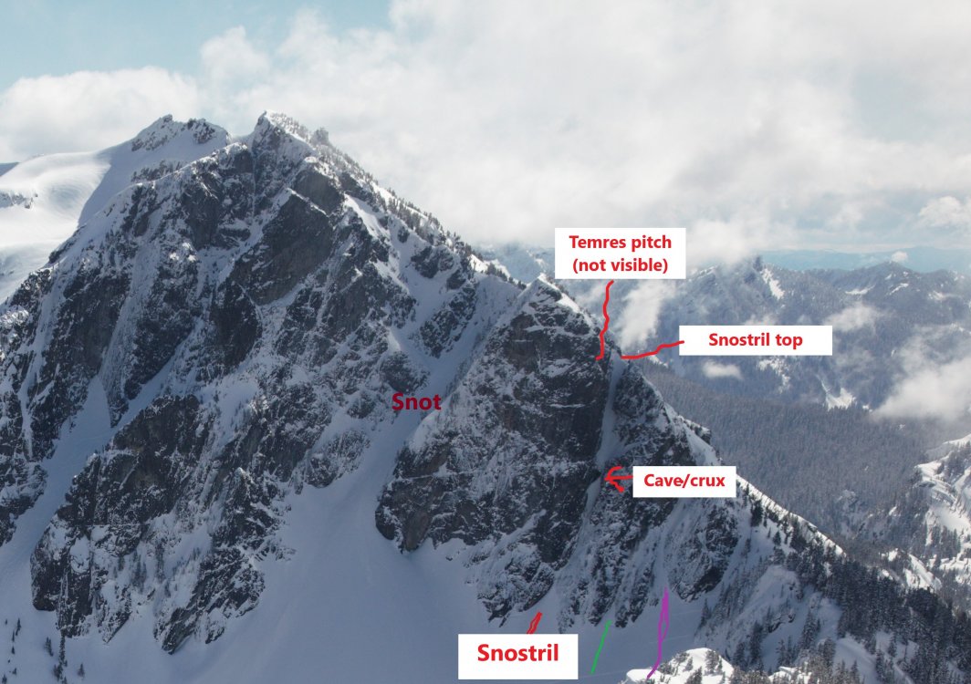
.thumb.jpg.202ae28d845e30d556650539735e1317.jpg)

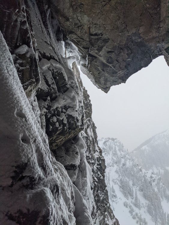
.thumb.jpg.10a64de5a509645c6f49ee25f7dfd192.jpg)

.thumb.jpg.2c08c9d9c1de4ccdd6a77a747d518c7c.jpg)
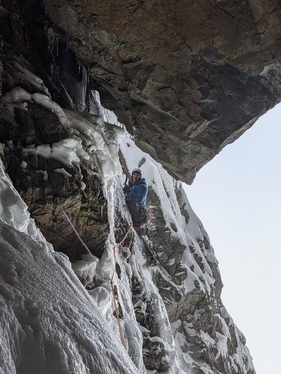

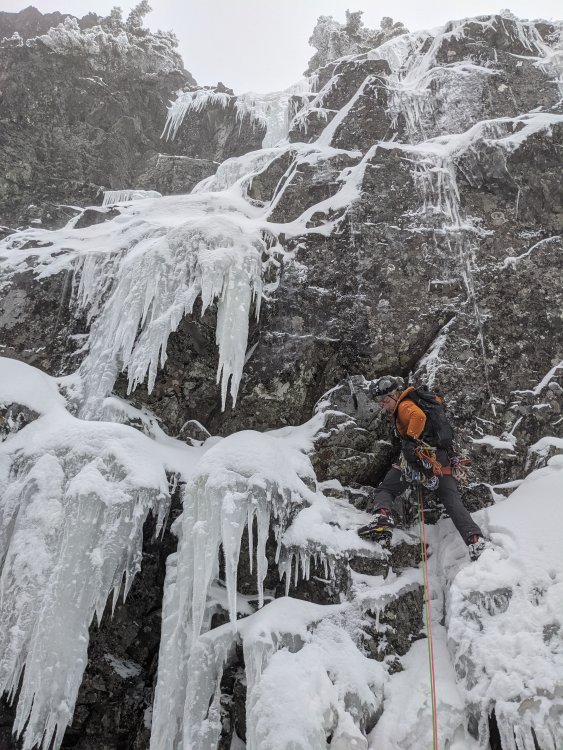
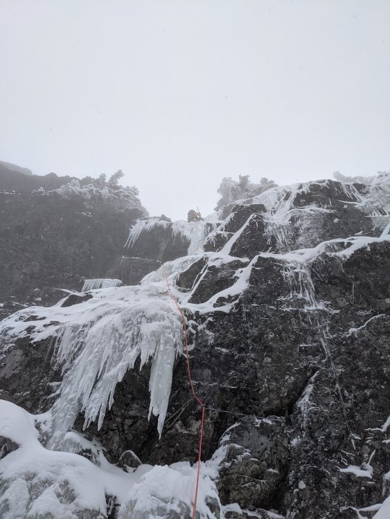 13 points
 -
Via dei Ragni: Grade VI, 95deg snow/rime/ice, M4, 1000m Scribe/Photos/Climbers: Jeff and Priti Wright Google Street View: Cerro Torre Summit 360 Panorama https://youtu.be/nZ4O199GfAo?si=Kr-etK2F4MSCGxVn https://youtu.be/RNNtXFuI_RQ?si=DDMqTiOcCEcDAJGP https://youtu.be/iRWR_DQoL3A?si=ebEbe75BW4pbSuKz We’ve had a picture of Cerro Torre on our desktops, phone wallpapers, and posters above our bed for the past 5 years. It was the reason we took up ice climbing in the first place. In February 2016, we made our first attempt on this route, hoping to at least get a glimpse of the scale of the mountain and understand what it took to climb it. The weather was too hot by then for the climb, and after three days, our high point was below the hard technical climbing. Previous trip report: The road to El Chaltén The Fitz Roy Massif These past two months were our fourth (and longest) climbing trip to the Chaltén Massif, and sixth year of watching the Patagonian weather patterns. We wanted to return to attempt Cerro Torre again, but the next two seasons were not possible because of bad weather. Last year, at the beginning of February, we saw a fantastic weather window, and the stars aligned. We flew down to Patagonia in a 9-day magical whirlwind of constant movement, and summited Fitz Roy via the Franco-Argentina route. While on the summit of Fitz Roy, looking down at the surreal summits of the Torre, we were determined more than ever to come back the following season. Day 1. We arrived in El Chaltén on New Years Eve, the last day of a 4-day weather window (brecha)…we missed it! Since then, January was filled with short stints (8-12hrs) of good weather in the mountains, and the arrival of a 6-day mega window in early February sent an electric buzz throughout town. We were a couple of bats out of hell with our 40lbs packs each as we set towards Laguna Torre. The plan was to pass through the Niponino base camp in the Torre Valley and bivouac at the higher Noruegos (Norwegian) bivouac, which would put us closer to Col Standhardt (the next day’s objective)…the passageway to the West Face of Cerro Torre where the Via dei Ragni route begins. Our bivy site at Noruegos Day 2. From the Noruegos bivy site high on the slopes of the Torre Valley, we traversed near the base of the Torres, under the celebrated SE Ridge (perhaps the greatest climb in the world) and also the 1959 Maestri line to the triangular snowfield where so much history and controversy took place. From the East, all of the Torres stand impossibly steep and impassable. To get to the Ragni route on the West side, we would climb up and over the Col Standhardt where an implausible car-sized chockstone sits interminably between the col’s steep walls. From the col, one gets the first glimpse of the Southern Patagonian Ice Cap (Hielo Continental), a massive expanse of ice 200mi long. On a rare, clear day such as this day, we could see green Chilean fjords across the Ice Cap between large, snowy volcanos. A Lighthouse Several rappels deposited us down to the Circo de los Altares (Cirque of the Alters), an impressive crescent of white-capped peaks and toothed spires. From there we headed up another glacial ramp on Cerro Torre’s West Face to a high camp, 150m below the Col de la Esperanza (Col of Hope), first reached by Walter Bonatti in 1958 who hoped that this col would one day blaze a path to the summit. It wasn’t until 1974 that a team of Italians from the Ragni di Lecco (thus the name “Via dei Ragni”) completed Bonatti’s vision. Circo de los Altares Steep snow climbing and easy mixed terrain led us towards the camp at Col de la Esperanza, the camp we hadn’t reached on our last attempt. As we hiked past our previous high point, our hearts soared. This time around, the climbing felt much easier with 4 more years of climbing experience under our belts. Day 3. This day was a rest day of sorts. To set ourselves up for success on summit day, we were moving to the highest camp a few hundred meters up: El Elmo (“Helmet”), a prominent plateau below the steep, technical climbing. Those who were faster and stronger than us had gone straight to the highest camp the day before and were now going to do the hard work of battle-axing the bullet-hard blue ice and cleaning the cotton candy mushrooms of the summit. As we came over the Col of Hope, we entered an otherworldly expanse of mangled rime towers and precarious exposure. These deformed blobs of ice towers with icicle branches and feathery leaves seem like something only God or Dr. Seuss could conjure. It’s something so beautiful and terrifying at the same time. We were face to face, looking up at thisbeastly Tower. A spectacular nightmare. Day 4. Summit Day! We were pretty antsy to get going on the summit push. Falling snow greeted us when our alarms went off at 2:00AM as the mountain was enveloped in a cloud. All over camp, alarms went off and were snoozed as the precipitation discouraged movement. When the stars finally came out again, we were the first to muster our strength and get to work. Walking up to the base of El Elmo in the darkness, the first overhanging rime ice mushroom of the route, we gave a sigh “ah, breakfast!” The last 10m didn’t actually have any good protection (besides maybe a horizontal picket), and it was a sequence of cutting the feet loose, campus’ing from questionable tools, and shoving knees into the soft rime to make upward progress. Once at the top of El Elmo, a crowd had formed at the base, chomping at the bit. All of camp was finally up. The snooze button had proved an epic failure of our collective, strategically staggered alarms. We all watched in awe and gave whooping shouts from this low perch as our friend, Fabi Buhl, paraglided from the summit in the wee hours of the morning, slowly swirling in front of the spectacular sunrise over Lago Viedma. He was the first ever to fly off the summit of Cerro Torre having climbed the mountain first (and not dropped off via helicopter). After El Elmo, the mixed pitches zig-zag through a maze of rock and ice up to the base of The Headwall. Two pitches of blue, overhanging, bullet-hard ice. The final pitches mount three tiers of giant rime mushrooms facing the Ice Cap. This high ridge gets pummeled by the wet, freezing storms that race around the Southern Ocean to create these crazy rime formations. The first and second rime mushrooms had formed spectacular, natural blue-ice tunnels created by vortices of wind spiraling up the ridge, clearing a path through the thick outer layer of soft rime ice. Climbing into this vertical subway tunnel for 60 meters felt like entering a portal into another world. It eventually funneled up to an elevator shaft and spat us out of a squeeze tube. For the second and third mushrooms, we attached Petzl prototype “wings” to our ice tools to make purchase in the soft, overhanging, cotton-candy rime. These wings are horizontal plates that bolt onto the picks of our ice tools like Dilophosaurus gills. The Final (Summit) Mushroom was a beast. The previous day, it had taken the other parties many hours to clear a natural half-pipe, then dig a tunnel through the steepest part for many hours. Their line then exited their manufactured tunnel out onto the overhanging summit lip. Walking up to the steepest point on Cerro Torre on a perfectly still, clear day was absolutely surreal, basking in the bright orange-red glow of the sunset. The 200 miles of the Continental Ice Cap stretched before us and the Pacific Ocean now clearly visible. Behind, on the other side of the Torre Valley, small, wispy clouds hovered over the summit of Fitz Roy. We were lucky to get perfect lighting to fly our drone around for 30 minutes alone before we headed back down to our tents at El Elmo for the night. Days 5 and 6. To get back to town, you can reverse your way up Col Standhardt (M7 shenanigans), or take one of two trekking passes along the Ice Cap. We had experience taking the Northern pass (Paso Marconi) which was now in really bad shape. We opted for the Southern pass (Paso del Viento) to try something new, and hopefully be able to turn our brains off for a few days (sadly, this was not the case). The Hielo Continental spans 50mi across and crawls 200mi north to south across Southern Patagonia. It looked so beautiful and serene from our climb. Now, face to face with this beastly crocodile, it was the stuff of horrors. Canyons after canyons of impassable crevasses, we zig-zagged our way in no logical direction under a bright, unhelpful, full moon. From the air, our tracks must have looked like the random scribbling of a toddler on a massive, blank white floor. A sun dog greeting us after our descent. Finally reaching the pass and seeing people again after such a mental test of sanity was nothing short of jubilant. A popular trek is to take the pass South to Lago Viedma: the Huemul Circuit. We were now on a delightful trekking path and could now…finally… turn our brains off and just put one foot in front of the other for a mere 14 miles back to ice cream and showers and safety. Thanks: We had good confidence in the forecast and the length of the window, but it’s still important to have daily weather updates to anticipate the inconsistencies between each day. We’re so grateful for our weathermen who sent us updates to the inReach and gave us both confidence and peace of mind each day that we spun ourselves further from civilization: Dan Berdel, Devin Monas, and Rolando Garibotti. We’d also like to thank Dave Burdick (Alpine Dave!) for his support, inspiration and beta on the route. Also thanks to the American Alpine Club Live Your Dream Grant for supporting this trip. Recommended Reading: The Tower, Kelly Cordes Patagonia Vertical, Rolando Garibotti Enduring Patagonia, Greg Crouch Gear Notes: 13 ice screws (including 3 stubbies) 1 Picket (to place horizontally in vertical rime!) small set of nuts (Wildcountry Superlight) small rack of cams (Black Diamond Ultralight cams .4-1, Metolius Mastercam 1-3) 2 Petzl Nomic Ice Tools + Petzl prototype wings (rented from Viento Oeste gear shop in town) Petzl V-link Umbilicals 2 stuff sacks (gear management in pack, and also to leave for snow anchors) The North Face Phantom 50 backpack 4 double-length Petzl Pur'anneau runners with 2 Camp 22 biners each 2 double-length Petzl Pur'anneau runners with 1 Camp 22 biner each 7 single-length Petzl Pur'anneau runners with 1 Camp 22 biner each (can’t have too many runners) Patagonia R2 Jacket Patagonia Micro Puff jacket Patagonia Macro Puff jacket Patagonia Kniferidge hardshell jacket (didn't use)...also, it's now the "Ascensionist Jacket". Mainly wore the Micro Puff for outer layer Patagonia Nano Air Pants Patagonia Softshell pants (bibs) Patagonia base layer (top+bottom) Platypus 2L soft bottle Garmin inReach Mini (love this little guy!) Petzl Dart Crampons 2x Mammut Twighlight Twin Rope (7.5mm) Petzl Sirocco helmets Petzl Sitta harness (for him) and Arc’teryx harness (for her) Metolius Feather Nut Tool (each) Mammut Smart belay device (not the Alpine Smart) 3 lockers for group: Grivel Tau K12L, Grivel Lambda HMS, Grivel Plume 2 medium fuel canisters Jetboil Sol stove Safety ‘biner (each) – Edelrid 19g caribeener, Petzl Micro Traxion, short Sterling Hollowblock, Trango Piranha knife Bivy setup – Full Length Thermarest NeoAir XTherm sleeping pad, Exped Air Pillow UL, Feathered Friends Spoonbill sleeping bag MSR Advance Pro 2 Tent (amazing!) La Sportiva TX4 Approach shoes La Sportiva G2SM boots Petzl Reactik headlamps (each) + 3 extra AAA batteries + Petzl e+LITE headlamp Other things: 1 long spoon to share, chapstick to share, small Joshua Tree sun stick to share, Frog's Tung phone leash, lighter, whistle, duct tape, Thermarest repair patches, Voke tabs, Nuun, pain killers, 1L Platypus soft water bottle (for her) and 750mL HydraPak Stash (for him), warm headband, glove liners, 1 pair thick long socks (each), sunglasses, ear plugs, WRFA emergency form, small pencil, cotton handkerchief, wad of toilet paper, ID, Credit Card 1 Swix alpine pole (with snow basket) Arcteryx ball cap Adidas Sunglasses (with nose sun guard), no longer available iPhone 11 Pro (with route beta downloaded) GoPro HERO 5 Session (with helmet mount) DJI Mavic Mini Drone (remote and drone stored in USPS Tyvek bag) Dinner: 2 AlpineAire meals, 3 Near East Couscous boxes repackaged with small olive oil packets in ziplock bags, salt Day food was mostly bulky, yummy snacks: vegan jerky, dried mango, nuts, Cheese-Its, sesame sticks, Gu, nut butter, etc Approach Notes: Approached via Col Standhardt. Also possible to approach via Paso Marconi (currently in difficult/sketchy conditions) or Paso del Viento (long). We came back via Paso del Viento, but it's also possible to climb back over Col Standhardt (M7 shenanigans with old fixed ropes here and there).
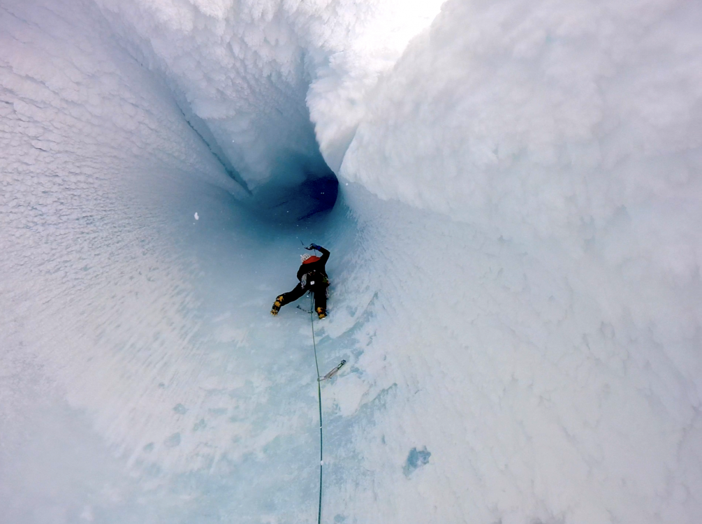
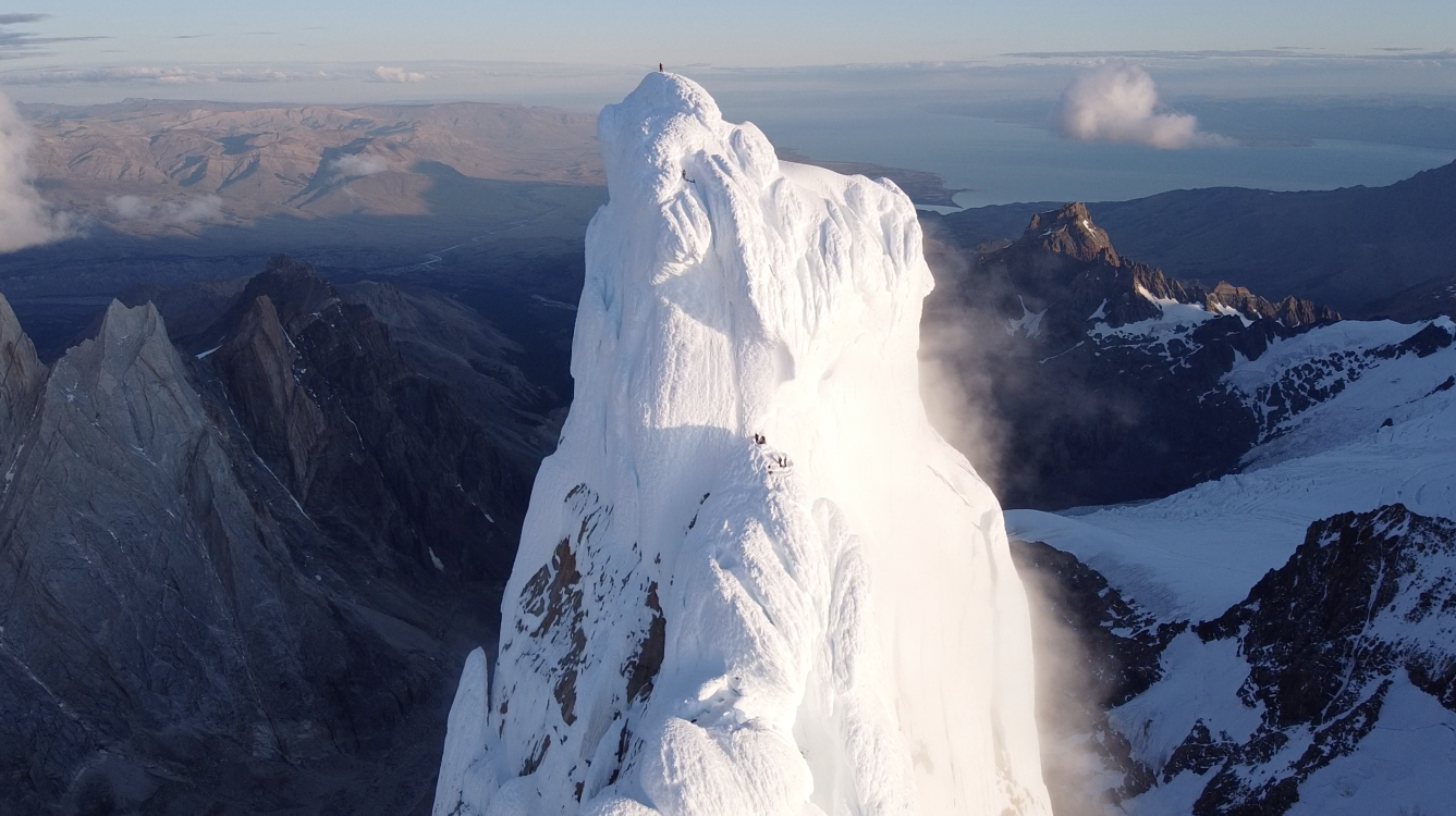
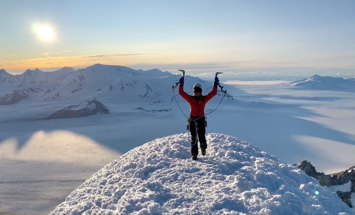
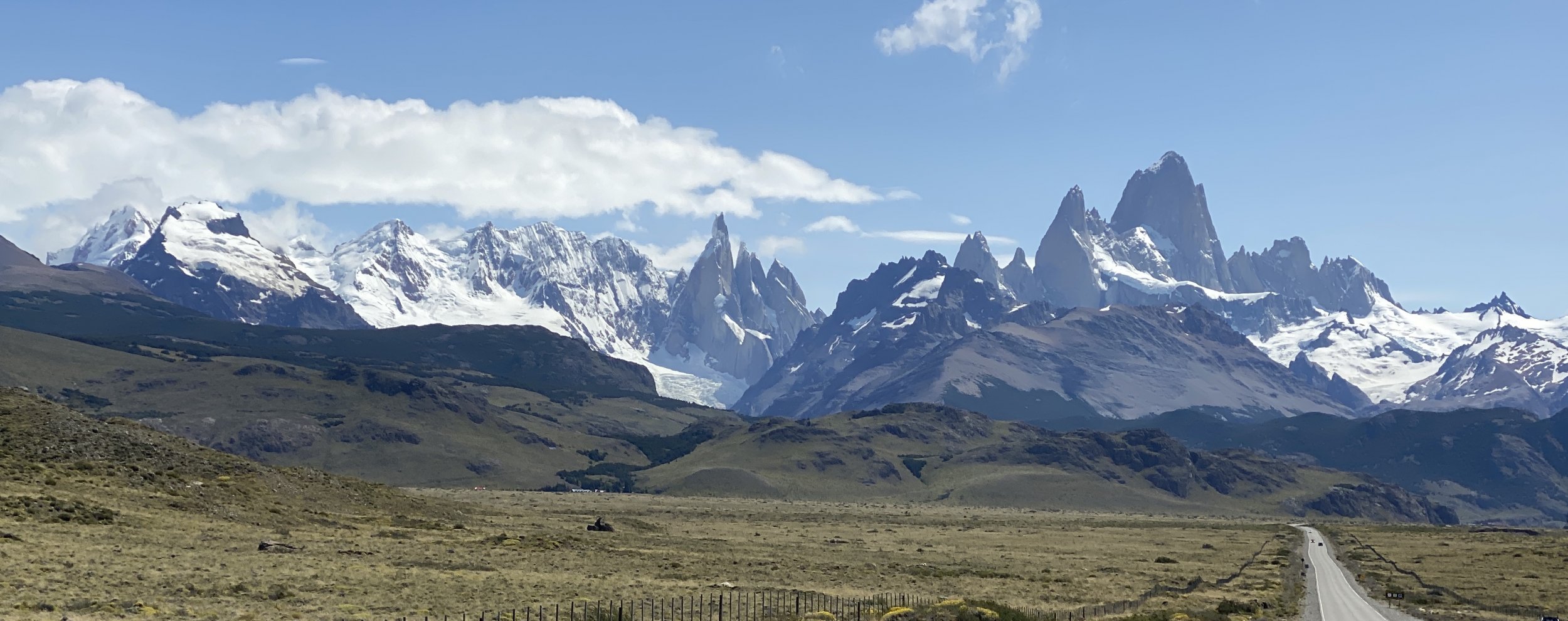
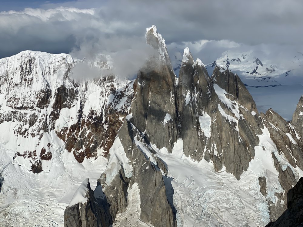

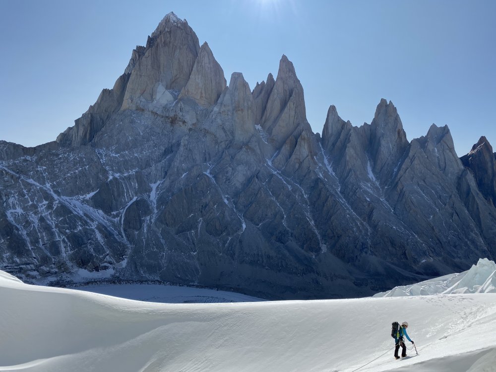

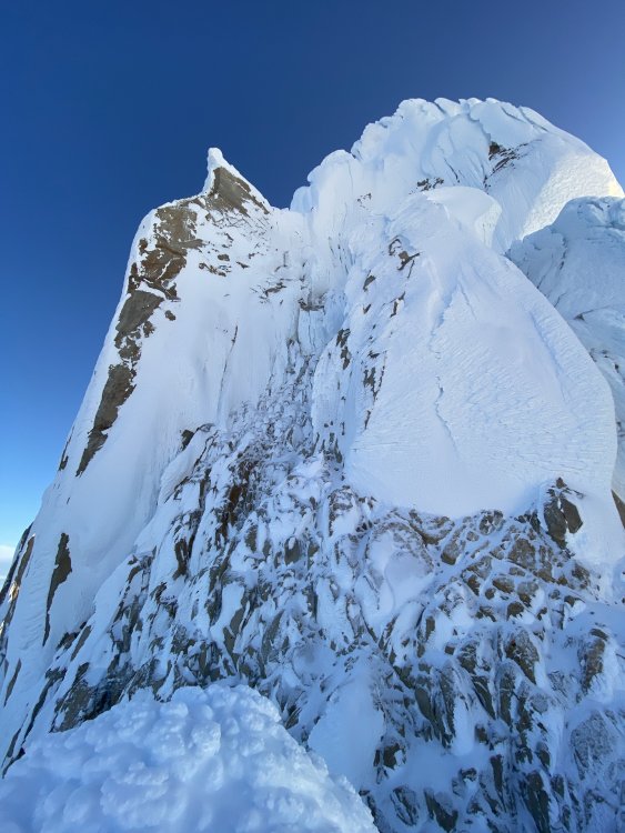
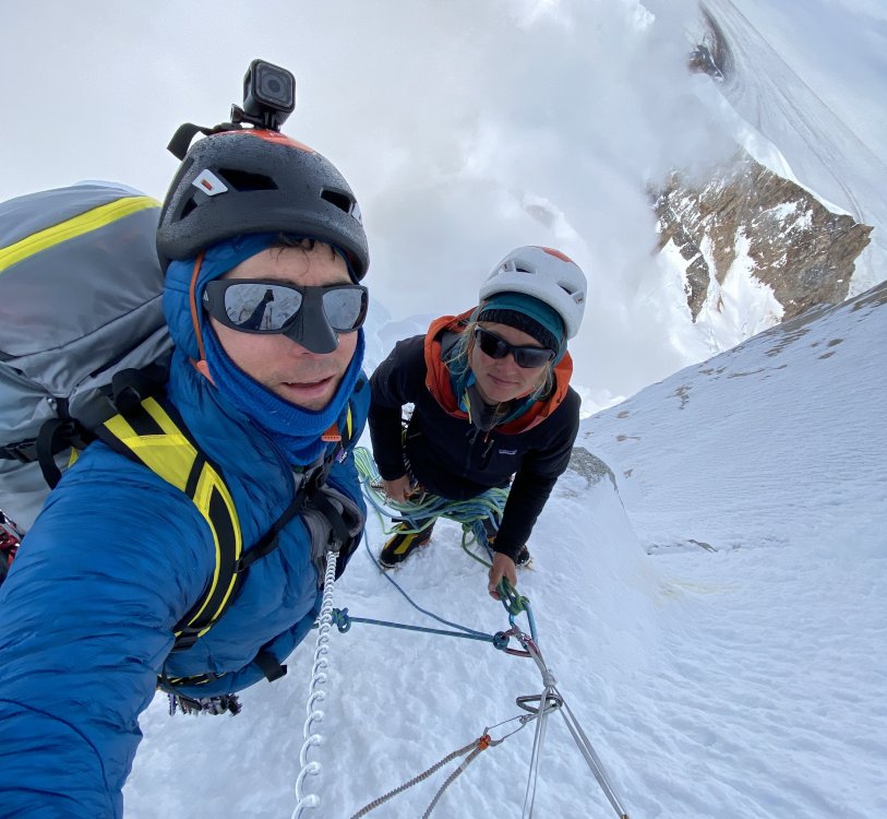
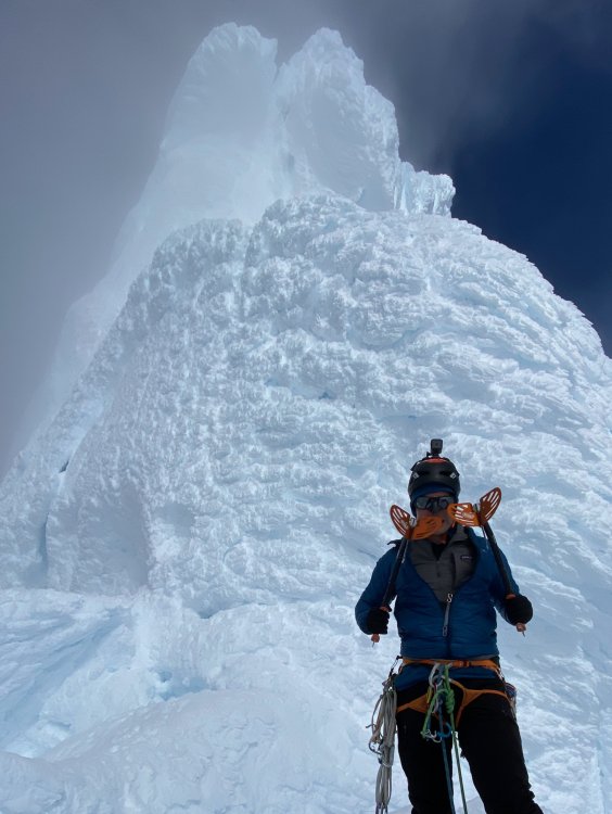
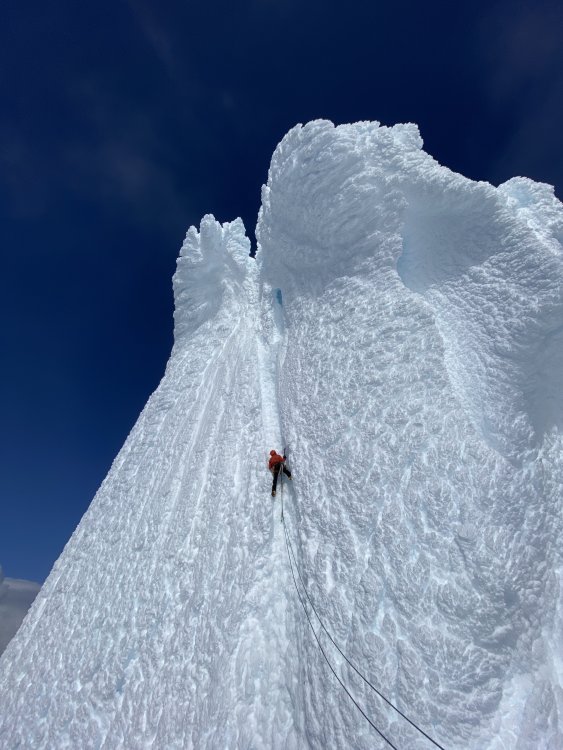


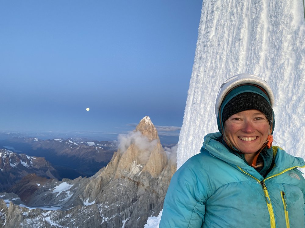
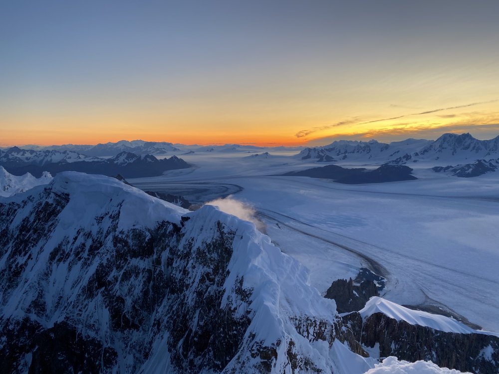


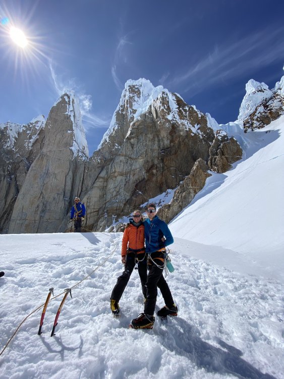

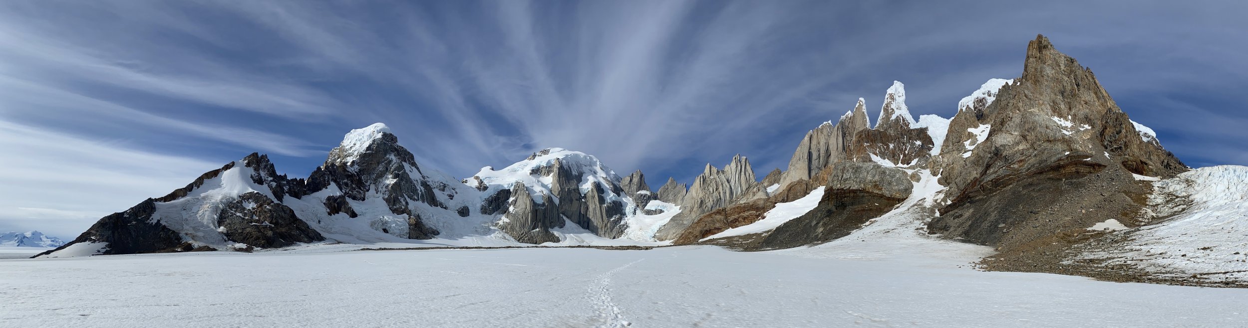
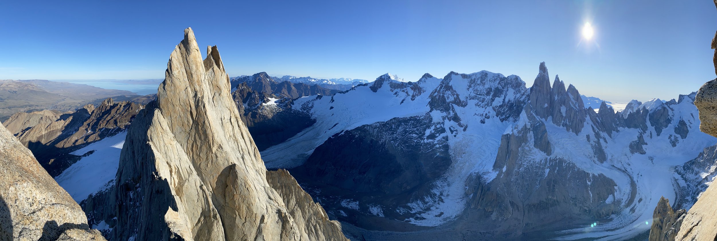
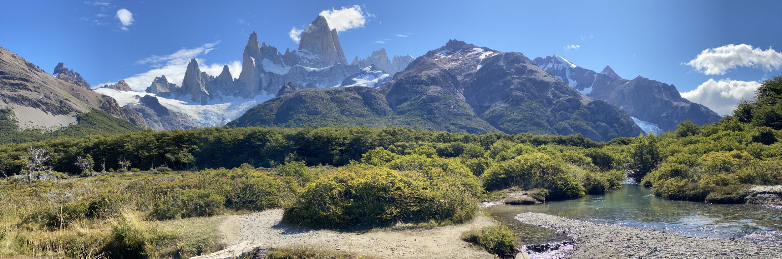

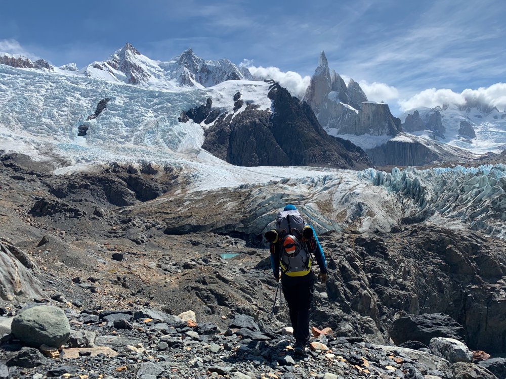
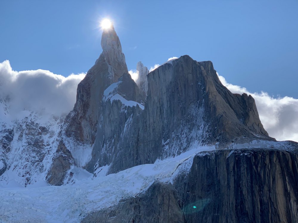

 13 points
 -
Trip: Sloan Peak - FA: Superalpine (WI3-4, 1000') Trip Date: 02/28/2020 Trip Report: On February 28th, 2020, @PorterM and I made what we believe to be the first winter ascent of the West Face of Sloan Peak. We climbed an incredible line approximately 1000 ft long of WI3-4 and steep snow climbing before our route joined the final 600 ft of snowfields to the summit. On the very final ice step, I suffered a short fall on rotten ice and a heinous top out and broke a few bones in the right side of my face. We bailed down the route and skied out. So technically, I guess we didn't finish the route, so say what you want about it. Our route started with a WI4ish pitch followed by hundreds of feet of stellar WI3 rambly flows in a gully just to the climber's right of the true west ridge spur on Sloan Peak. In our eyes, this was the only way up the true west face under WI4+/5. The whole face is loaded with huge free hanging daggers and wild lines. A competent WI6/M6 climber in the right conditions could send some absolute world class lines up there. I shared a lot more details, reflections on the accident, and route beta on my blog: https://climberkyle.com/2020/02/28/fa-sloan-peak-superalpine-wi3-4-1000/. Hopefully some others can get up there and finish this magnificent climb or poach some of the other unclimbed lines. Our route. up to where I fell. We were about to join the corckscrew route and head out. We climbed the gully on the right side of the photo. First pitch crux. Moving into the wonderful ice gully. Porter leading on that fat, fun, rambly WI3. The climbing in the gully was generally easy, sustained, and super fun! Incredible flows on the west face. Some helpful beta. Gear Notes: Screws, maybe a few small rock pieces and a picket. Approach Notes: Skin/hike forest service road 4096, then meander up Bedal Creek to the base of the west face.
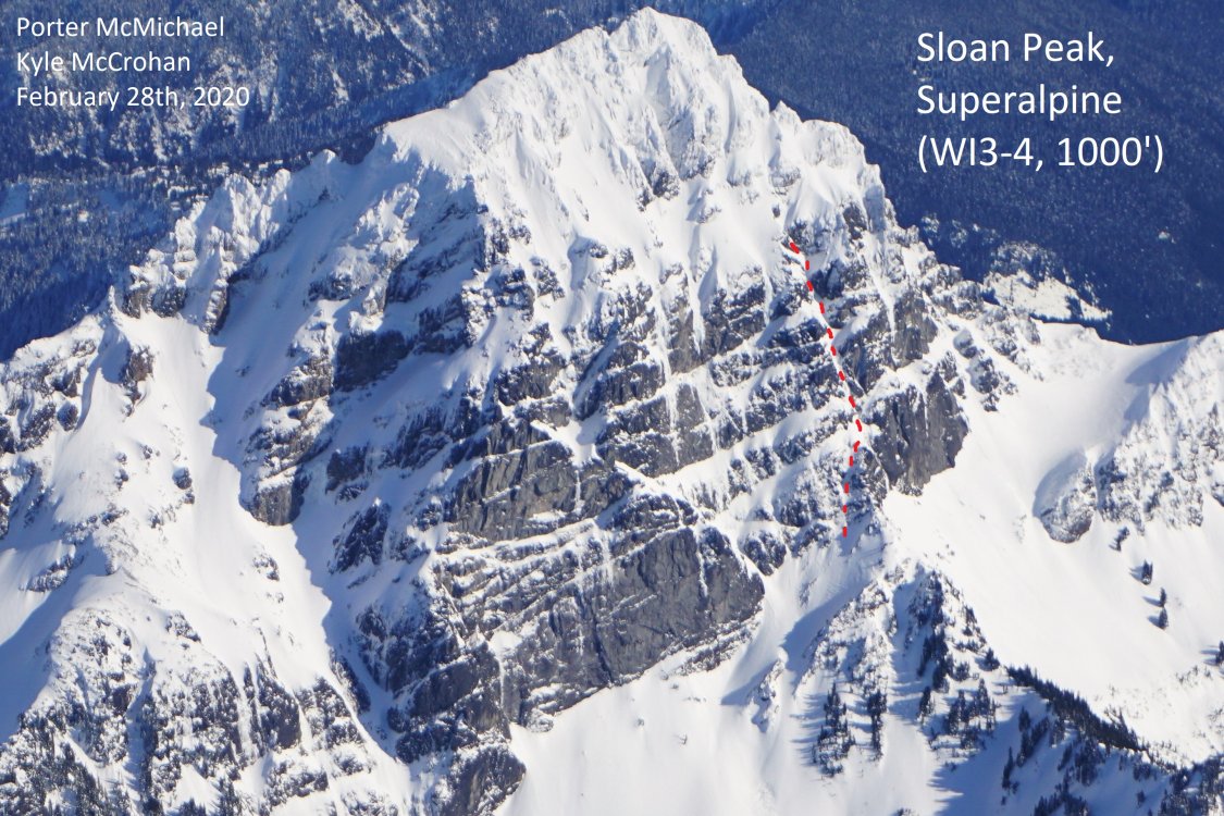
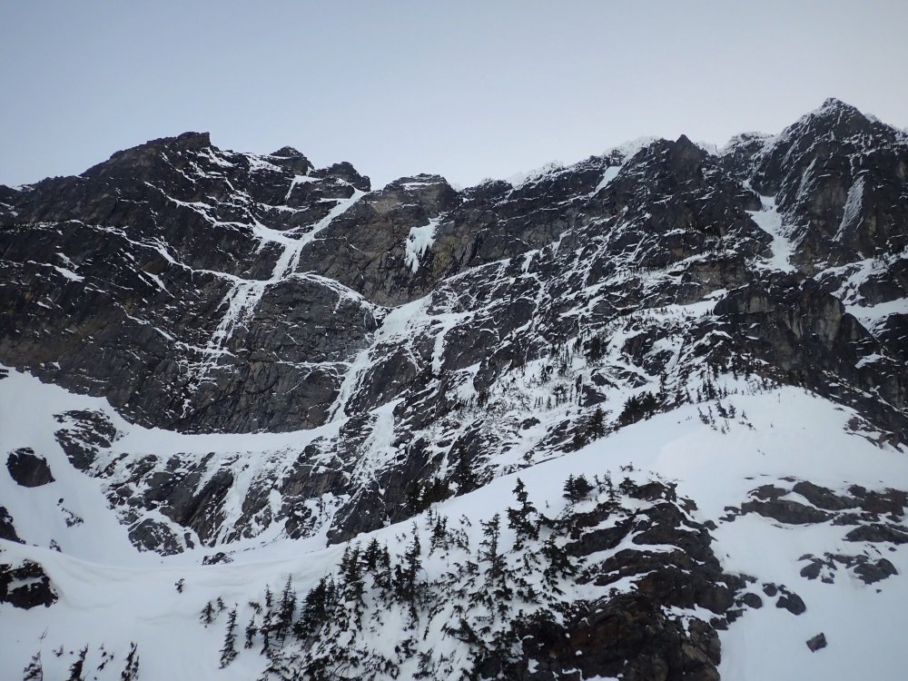
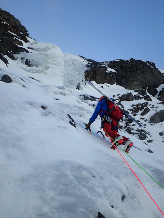
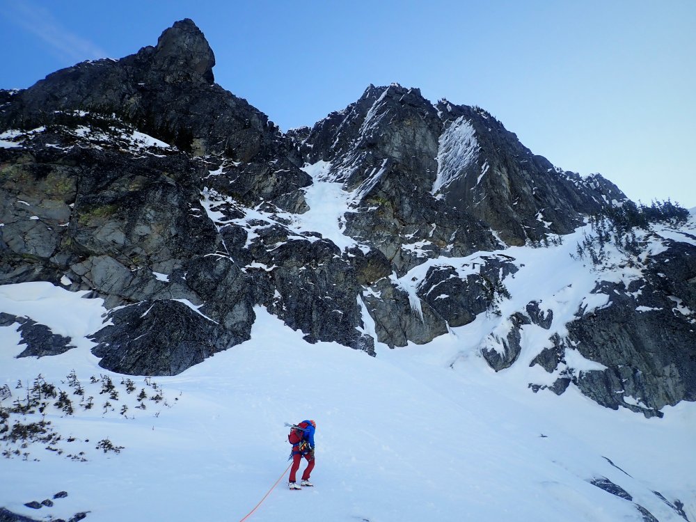
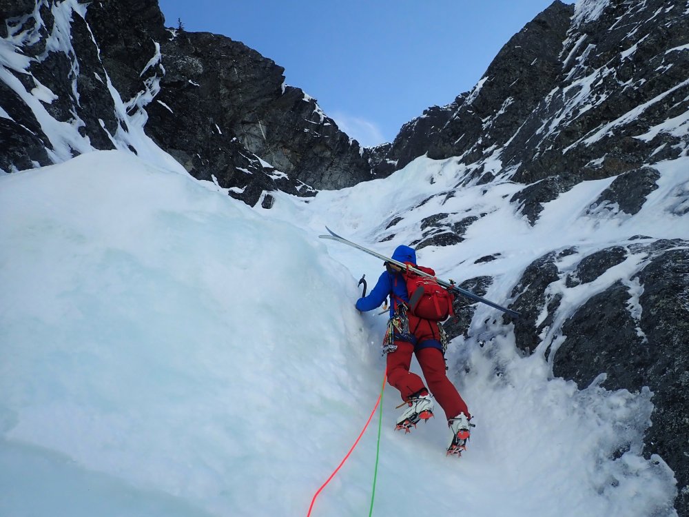

 13 points
 -
Trip: Dragontail Peak - North East Couloir Trip Date: 11/23/2019 Trip Report: I got out for a stellar day with Kyle and Daniel on Saturday (November 23, 2019). Following a few weeks of mostly high pressure and moderate temps, but with a storm front moving in, we were curious about conditions in the Stuart Range. Kyle brought this route to my attention, as I hadn't even heard of it. We found a TR on here from November 2008 and this inspired us to go give it a look. Be sure to check the trip from Kyles perspective at https://climberkyle.com/2019/11/23/dragontail-peak-ne-couloir-wi2-m5-r/ After leaving the trailhead around 5 am, we found more snow on the surrounding peaks than expected, which was promising considering the lack of recent precip, except for a day or two the week leading up to this. We knew the weather was supposed to deteriorate and winds were supposed to pick up throughout the day so we hurried to Aasgard Pass. We switched to boots and crampons where the creek down the pass was frozen and flooded over the boulders. At around 8 we started soloing up easy little water ice flows toward the base of the couloir. At the base of the couloir, we could see the first dry section that leads into the couloir and it didn't look too hard. We opted to rack up but solo up it. It was a tad techy so I fixed a cordelette as a hand line in a few spots for extra security. Above this, we were on variable steep snow. Throughout the couloir, we found everything from thigh-deep wallowing, to firm neve front pointing. About a third of the way up the couloir, there was a steep/overhung chockstone with a thin ice/snow flow on the right. I led up and over this with some mediocre gear (a tied off 10cm screw and a cam lower). Above this, we soloed a bunch more steep snow until our gully ran out of snow and we did a pitch traversing 30ft right over rock slabs to a different snowy gully. Now we were approaching the top of the couloir and it was starting to open up and become drier. Just 2 more pitches took us to the top but, wow, they were seriously full-on. The first pitch was a series of near-vertical granite steps with steep snow in between. This was perhaps the technical crux as there were quite a few delicate moves but also some dark brown ice that took good sticks, as well as generally good gear. I belayed off a horn, looking up at the last pitch, which appeared to be 100% dry. I was tempted to ditch the crampons but kept them on since the only bomber feet I had gotten on the entire last pitch were in the few small patches of ice and I was still hopeful that there would be ice above that I couldn't see. Once Kyle and Daniel got to me, I mentally prepared to take the sharp end for hopefully the last time of the day. There had been a lot hard and sketchy climbing already, and the hardest/scariest was still yet to come. I started up the pitch, immediately finding that the rock quality was deteriorating. I was mostly climbing with both my axes racked since the rock was so bad. It seemed like the majority of holds could be pulled off and gear was sparse. When I finally got good gear halfway up the pitch I yelled "take" and sat back for a sec to breath. I took a few photos, looking both up and down. From then on, I didn't get another piece of gear. Eventually, I could see the ridgeline 20ft above me and was eager to get there. All that stood in my way was a steep kitty litter chimney, devoid of any gear of course. At this point, I had my gloves off since I was just rock climbing with crampons and its nice to be able to feel all the holds that will inevitably crumble in your hands. I started up the chimney, with my pack pressed against the right wall, my crampons finding edges in the left wall, my arms finding chicken wings and armbars, and cursing like a sailor. Thankfully my gopro had already died. I wouldn't mind forgetting this pitch. Down below, Kyle and Daniel were experiencing a constant flow of gravel filling their hoods. I remember throwing one hand up over the ridge onto a jug and letting out a sigh of relief before mantling up and finding an extra bomber belay. The wind up here was absolutely ripping and I got cold quickly while belaying. I was wearing all my clothes and had sweated a bit on the previous lead. The forecasted winds (60mph) had arrived and there were now intermittent clouds, but the sky was still mostly clear. Our weather window was certainly closing. Kyle and Daniel enjoyed the pitch far more than I did and both arrived at the belay with big grins, especially since they could climb near each other and watch all the holds break off. Since I was cold and antsy to move I let them break down the belay and sort out the ropes while I looked for the "traverse to the notch." I found it, but accessing the notch looked just a bit spicy. I wanted to solo it but realized I was just cold and anxious to get down and out of the blasting wind and gravel so I lead it with one rope and gave each of them a terrain belay up to the rap station where a single 60m rap got us out of the wind and to a point which we could walk from. We were out of the wind and off the technical terrain. It was a big relief for me. However, the light was fading and Aasgard pass is never fun to head down. There was a set of tracks up to the summit proper of Dragontail which we followed downhill and down the pass. As the light faded I snagged a photo of the route from across the pass. It looked pretty impressive, I was briefly proud but mostly humbled. We talked briefly about the climb. Perhaps there were mistakes. It would have been possible to bail down the route once we saw how dry the upper pitch was. I was enticed to just climb it since the ridge was practically 80 or 100ft away and bailing down the route would have meant leaving gear and taken a lot of time. Hard choices. Of course, you will never know exactly how it will be until you're in the thick of it, but perhaps we/I made too bold of a choice and got lucky (on the other hand, down climbing the snow would have also been tricky). Food for thought for anyone who has made it this far through the trip report. I try to stay safe and climb hard, but its a tricky balance. Anyway, we got back to the car around 8 pm and headed to McDonald's. All in all, it was a very fun day with 3 competent 22-23yr old Washington born and raised climbers. And for anyone curious about this route right now, I would steer clear! In the coming days, I'll post some first-person climbing video on my insta @porter.mcmichael First, a photo of the route, taken on the descent. Looking up at Dtail Approach ice Still on Asgard Dry pitch to access the couloir Fun steep snow! Chockstone in the middle of the couloir Looking down on the last pitch (I think) Looking up in the middle of the last pitch From the ridge looking down the chimney Looking North from near the top Kyle on the last pitch Daniel on the last pitch Down the rap Gear Notes: 3 screws (placed 2), 4 pins and a bulldog (surprisingly didn't place any), nuts (placed a few), cams .2-2, some doubles in the smaller sizes (placed them all), 60m doubles. Approach Notes: On your right, halfway up Asgard, hard to miss it. The slabby approach pitch is the first obvious way to access the gully (farthest climbers right)

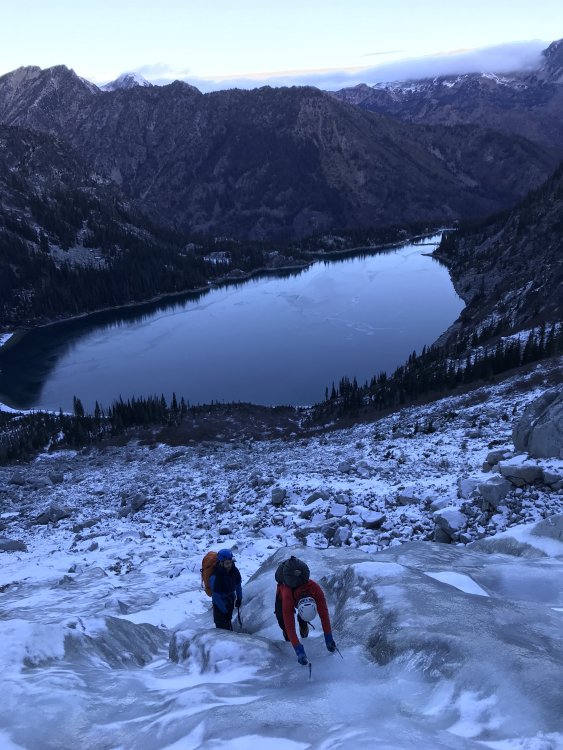
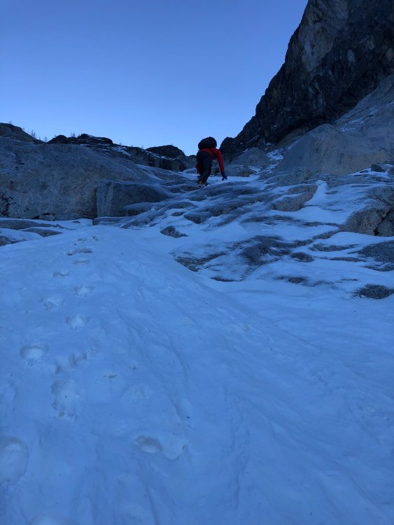

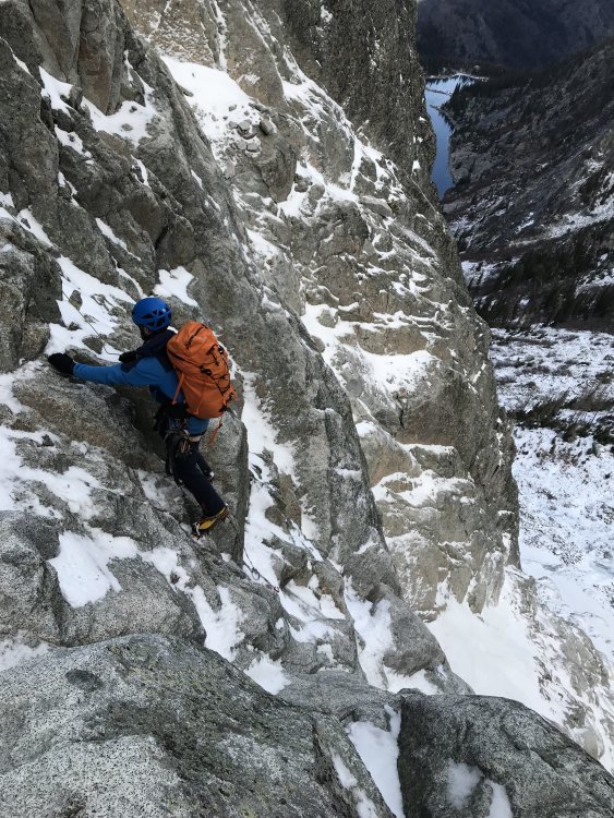
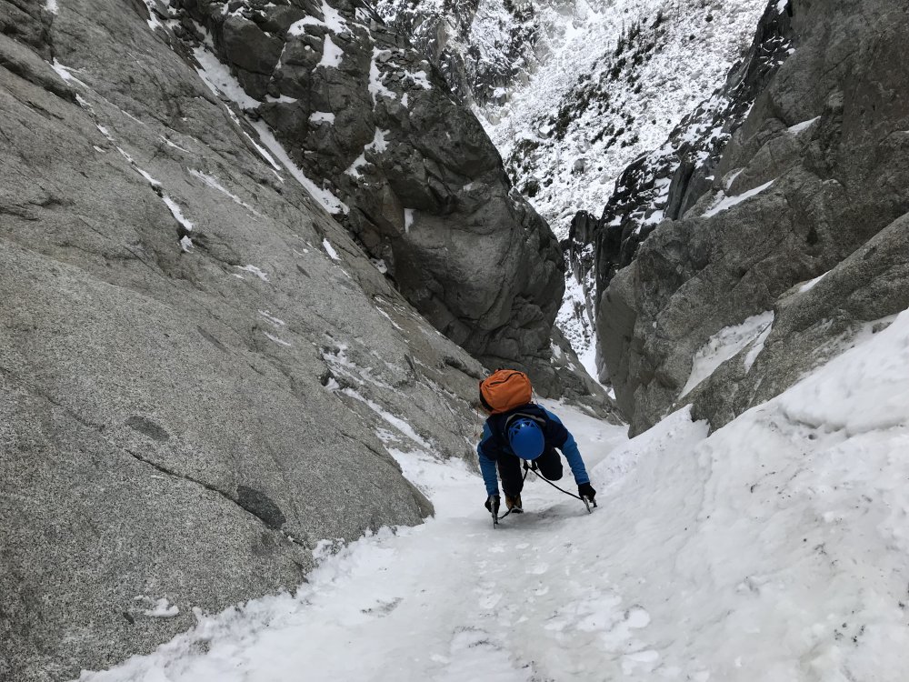
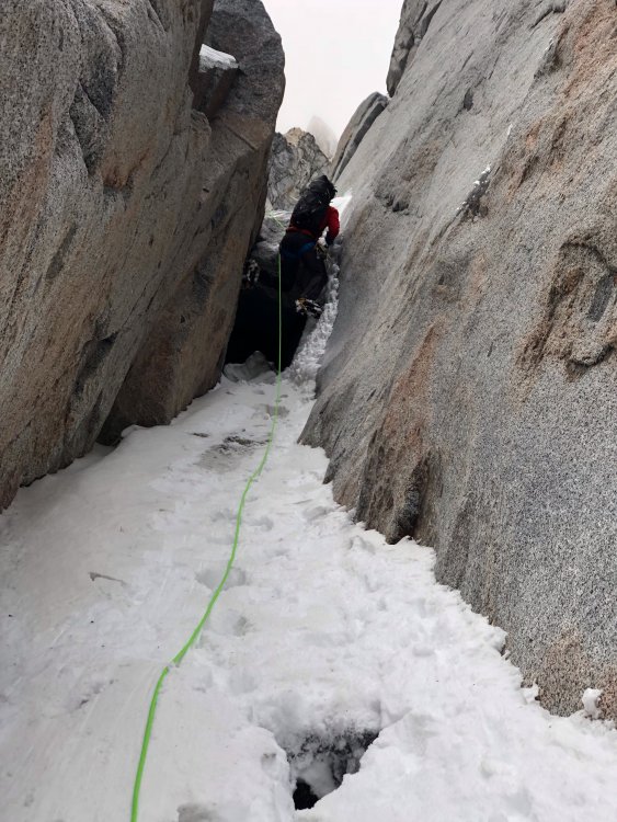


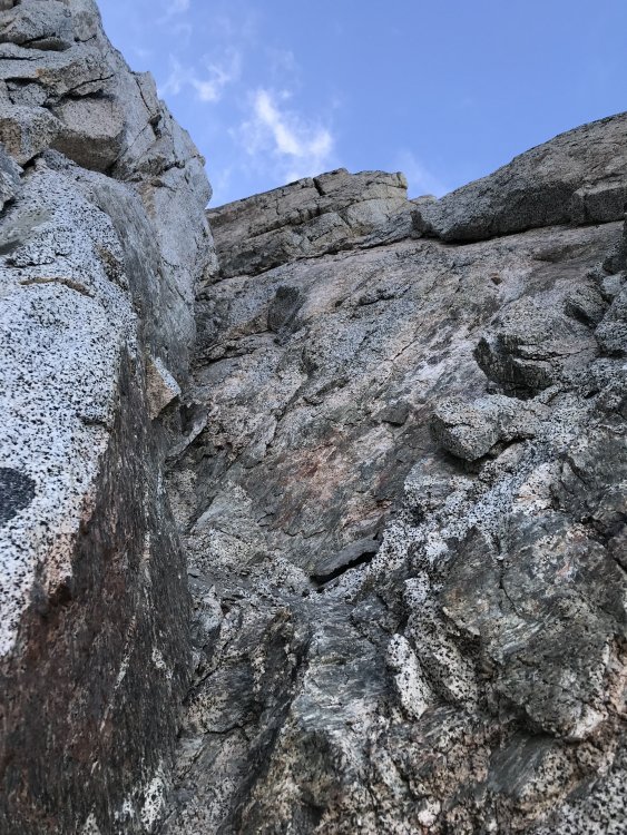
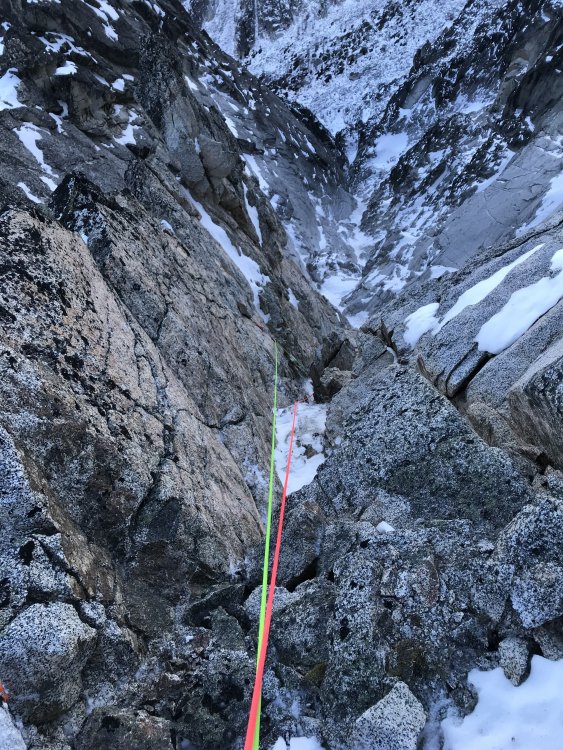
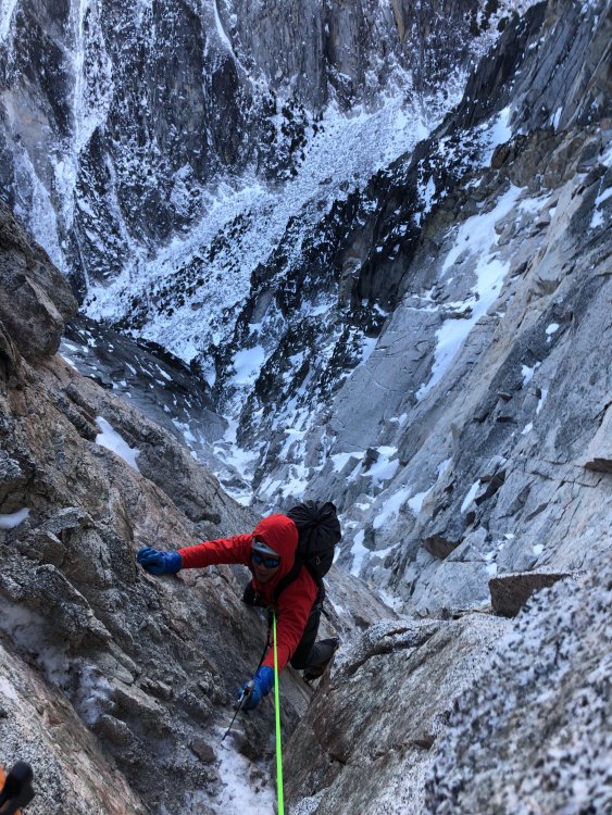
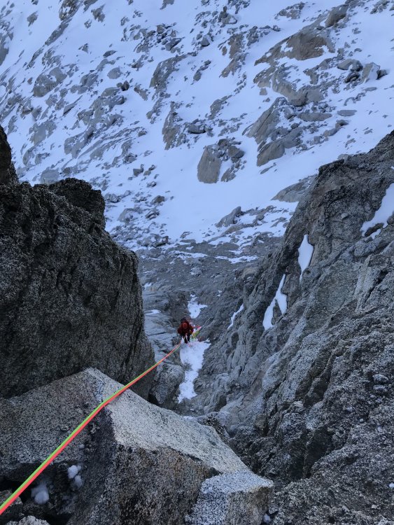
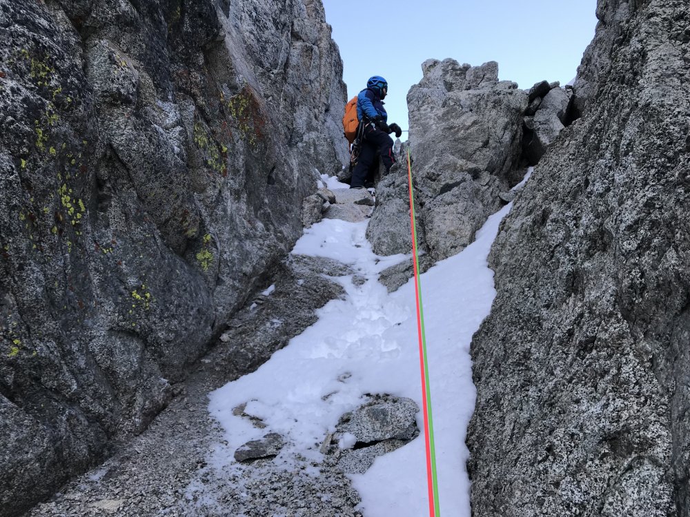
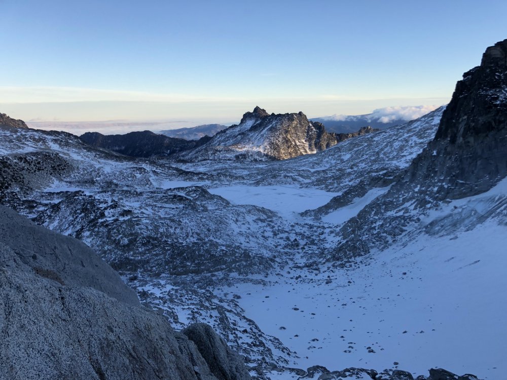
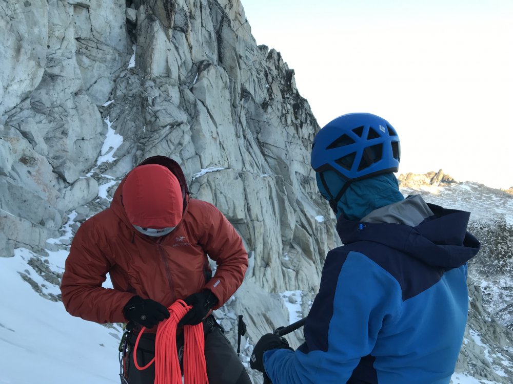
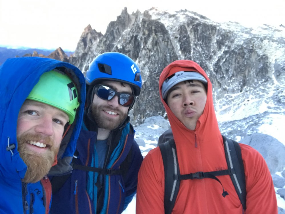
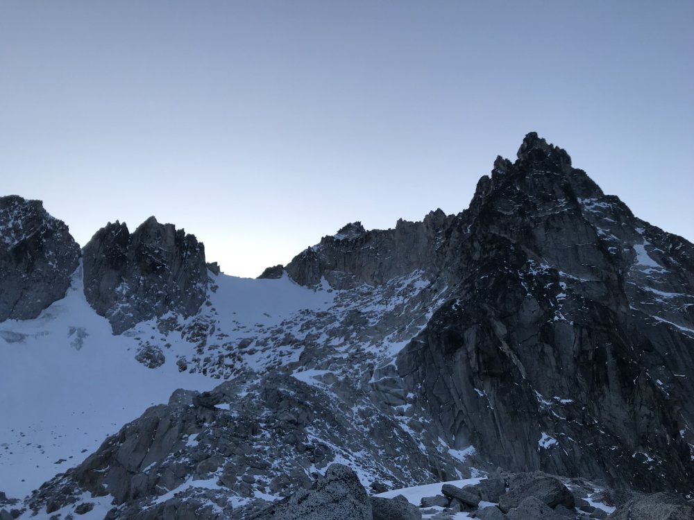
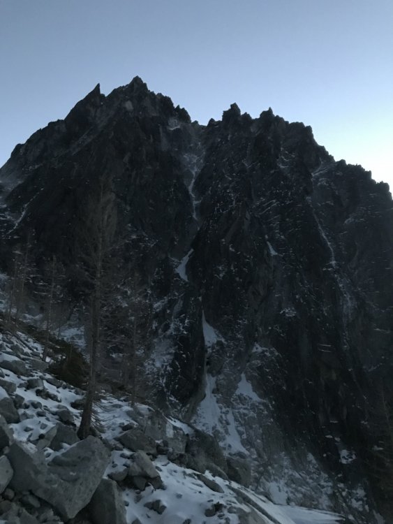
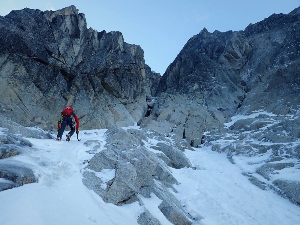
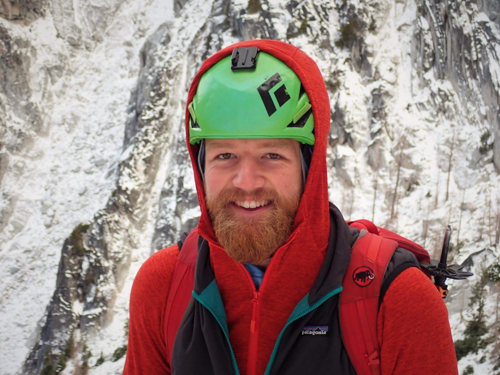
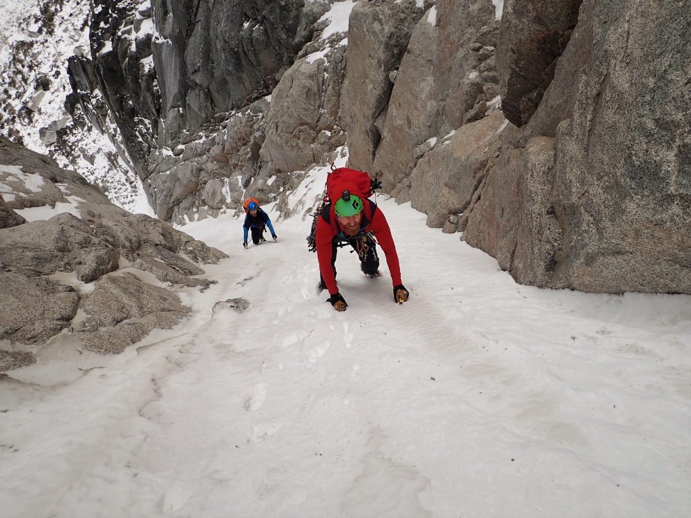

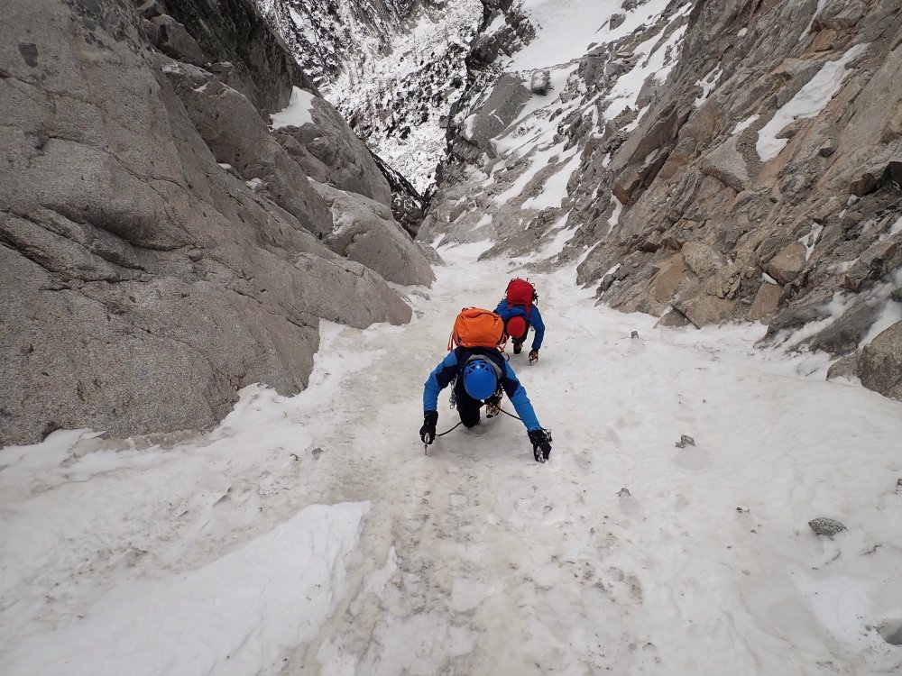
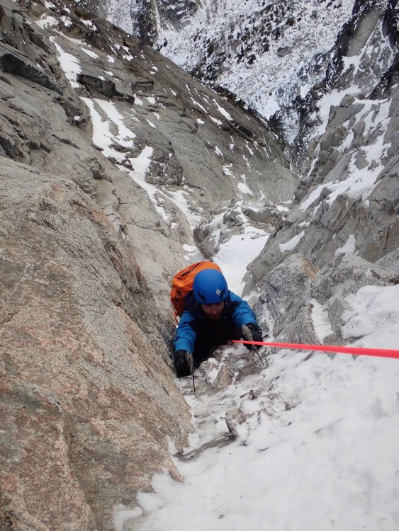

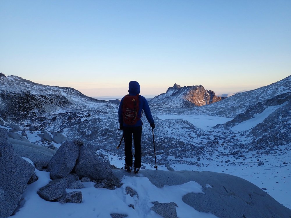 13 points
 -
Trip: Washington Pass, Liberty Bell - Thin Red Line Trip Date: 09/01/2018 Trip Report: My buddy Andy Traylor and I had set this as a goal route to free for the summer season. Neither of us had really approached a bigger route like this with a redpoint mentality before and weren't sure exactly how to do it. With many different ways to consider an ascent "free," we settled on what we believe is a pretty commonly followed set of rules. We wanted to swing leads, and either redpoint or follow cleanly on every pitch, lowering back to the belay if necessary. Our plan was to spend one day and check out the first six pitches to get a feel for the moves and the gear then try and send the next day. On day 1 we took our time climbing the first six pitches, with no real pressure or time crunch. We TR'd the cruxes a couple times and feeling pretty good about going for it the next day, rapped off and headed down for a big dinner. The next day we set out a little nervous, but also feeling good about our chances. Once we were on the route we were moving and climbing well. Thoughts on the pitches for anyone that cares (some gear beta here so purists need not read on): P1. Straightforward crimping and edging straight up to the anchor. I actually headed right after the last bolt, going more directly to the anchor on day 2 and thought that was slightly better. Andy getting all artsy with the iPhone on P1 P2. Short pitch. Boulder problem over the bulge through the mini changing corners. Good pro and the pin at the end of the crux seemed in good shape, not tested. Belay on gear. P3. Awesome and memorable pitch I thought, shorter than it looks in photos. Super thin edging and stemming in the dihedral leading to a roof with wet holds that allow you to exit the corner and gain a stance. I basically punched myself in the face popping out of the wet locks first go round. Pin in the corner seemed good, I tested it and it held. Mostly finger sized cams. Belay at full on hanger. Andy in the corner/roof that ends the crux on P3 P4. Fixed gear in the roof seemed only ok, hard to tell with the tat and I didn’t spend much time examining it, but you probably won’t come off under the roof anyway, clip and go. Andy exiting the roof on P4 The last bit traversing back toward the anchor we both found a little awkward and harder than it seemed it should be. On the traverse back to the belay on P4 P5. Business #1. Super fun 5.10 traversing and edging to the corner. Corner gets progressively harder with the real business starting at the bolts. I will say on my initial go I was not super happy to have left basically all the rack at the belay, expecting only a few pieces then bolts. I'd take mostly finger sizes, but I was happy to have a black Metolius and a #2 C4 (certainly not necessary but provided me with some mental fortitude to try hard). Bring lots of slings, I think I had like 14 and ran out somehow, placed too much gear I guess. The crux moves are technical, a little powerful, desperate and amazing. The last move, while not the hardest, has the potential to be a heart breaker and I can only imagine being very desperate if you’re under, say, 5’9. Belay on medium sized gear above the bolts, significantly better stance. Andy sticking the last move, he never fell once climbing this pitch over the 2 days. P6. Business #2. No picture. First roof is super casual. Leading up to the second roof the climbing gets less secure but good small finger gear is there between pins. The boulder problem is powerful, but pretty straightforward cranking (V4ish?) on pretty good holds. We were a little confused by all the talk about a necessary and specific red C3 placement. We couldn’t find anywhere by the beak, or below the roof for that matter, where this would go. Any clues? However that piece or a blue Metolius or equivalent went in bomber just above the lip. If that’s the placement everyone is talking about, then there is no need to scavenge around for a red C3 if you don’t have one. We left it out in favor of a blue Metolius on round 2. Climb past the bolts (if not rapping from here) and belay on the better sloping ledge with hand sized pieces. P7. Only dog pitch on the route. Thought the rock was poor quality, basically a connector pitch. Ends on the scary looking “how is it still hanging there” block creating the ledge. P8. Another techy and pretty thin 11+ pitch. Really really good. Looks super thin but there is gear to be had and both the head and pin are in good shape, Andy tested both and approved. Some small hand sized gear higher. P9. Excellent and fun 10+ climbing again builds as you get higher. Looks like the seam dies out at the top, but keep going up instead of traversing left. That’s probably super obvious but I was getting tired and moving more timidly by this point. P10-12. Progressively easier climbing. Nice to have Scott's topo for P10 to know where to get started. The last belay sits basically on the arête between the east and north face, we came back into the sun here. There are brand spanking new bolts here instead of the pin/fixed wire combo some guide mentions. Maybe it’s obvious, but the climbing heads left up the lighter colored dihedral. This looked too steep to us to be the 5.7 climbing, so Andy headed out right on the lower angle terrain and we had a bit of an epic on the easiest and last pitch of the route. The rock quality deteriorated into kitty litter, so Andy tried to sling a chockstone to lower back to me, only to get the rope got stuck forcing even more shenanigans (face palm). All in all we wasted some hours and all hopes of pizza. Once corrected we soloed to the top without further incident. Don't go this way. Why is this photo so big? All in all, neither of us fell following any of the pitches. On lead, some of the pitches took a try or two, but in the end we pulled it out and nabbed a free ascent. We learned a lot about climbing in this style and really enjoyed the process. Thanks to Mikey Schaefer for figuring this out, it provided one of my all time favorite experiences in the mountains so far. Psyched for the next one! Gear Notes: Doubles from purple Metolius to .75 BD, singles to #3 BD. Our second set of cams were Metolius offsets. They worked amazing (as always for granite) and I always carry them as doubles, but far from necessary. Nuts. Placed 1 RP but probably not necessary. Lots of slings, like ~16. We used a 40M tag line and hauled the bag on most pitches. Approach Notes: Most casual "alpine" approach ever. Like 25min from the car.
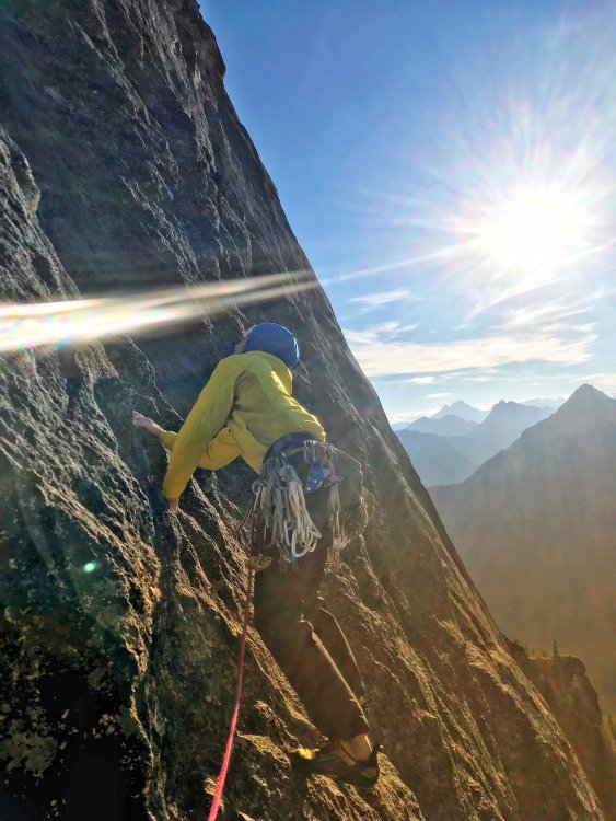

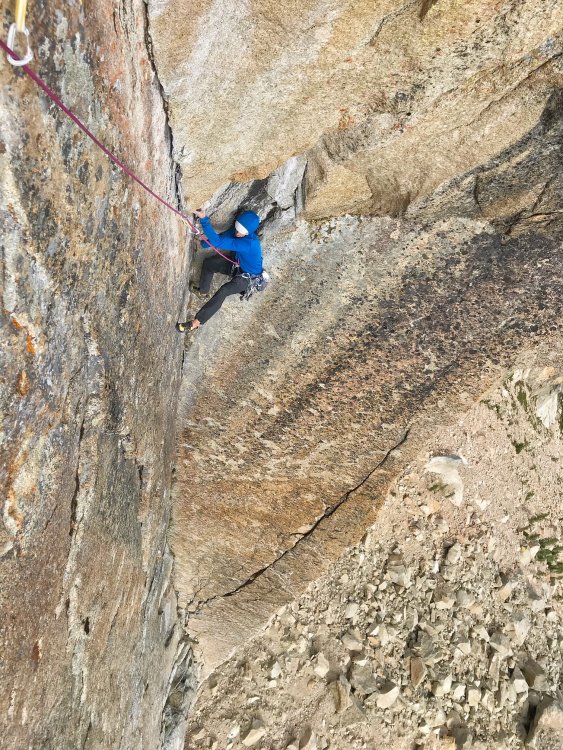
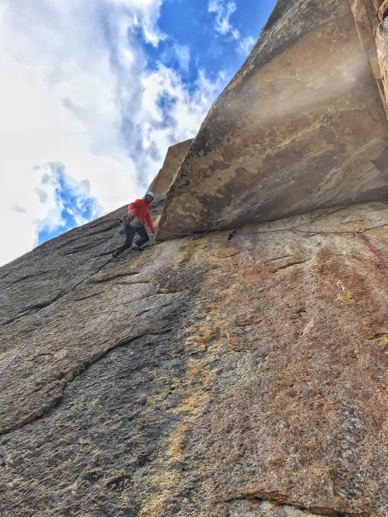
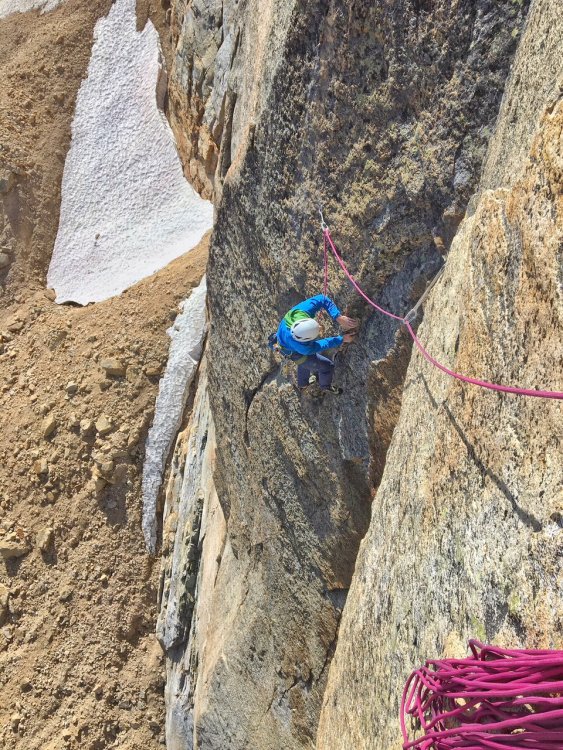
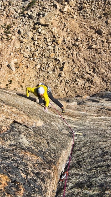

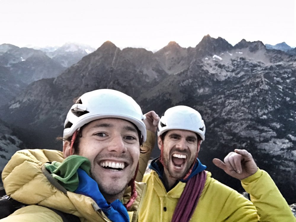 13 points
 -
Trip: North Cascades - Southern Pickets - Southern Pickets Enchainment (Traverse) – Second Ascent Trip Date: 08/17/2018 Trip Report: Climbers/Scribe/Photos: Jeff and Priti Wright Priti and I completed the Second Ascent of the full Southern Pickets Enchainment (Traverse) between 8/12/2018 and 8/17/2018 via the first ascensionists’ agenda (VI 5.10+, ca. 3 miles). Thirteen peaks in four days staying on technical terrain enchaining every peak in the Southern Picket Range from East to West. The Chopping Block was our 14thpeak on the last day à la Bunker-Haley-Wallace. We were lucky to have splitter weather the whole time except for our approach day which was non-stop drizzling and kept us from jumping on the rock right away. We had previously attempted this climb during the July 4thweek earlier this summer but were stormed off at the base of Mount Terror. View of the entire Southern Pickets from Mount Triumph. Photo Credit: James Blackmon (1) Little Mac Spire, (2) East McMillan Spire, (3) West McMillan Spire, (4) Tower 1 summit of the East Towers aka "Don Tower", (5) Tower 5 summit of East Towers, (6) Inspiration Peak, (7) Pyramid Peak, (8) Mount Degenhardt, (9) Mount Terror, (10) The Rake aka "The Blob", (11) The Blip, (12) East Twin Needle, (13) West Twin Needle, (14) Dusseldorfspitz, (15) Himmelhorn, (16) Ottohorn, (17) Frenzelspitz, and (18) The Chopping Block The Chopping Block is on the left. History: FA: In 2003, this visionary line of 13 summits (Little Mac Spire to Frenzelspitz) was first completed by Mark Bunker, Colin Haley, and Wayne Wallace in an incredibly speedy 4 days car-to-car. http://c498469.r69.cf2.rackcdn.com/2004/34_wallace_pickets_aaj2004.pdf https://cascadeclimbers.com/forum/topic/15094-walking-the-fence/ 2011: Dan Hilden, Jens Holsten, and Sol Wertkin completed 12 of the Southern Pickets summits (Little Mac Spire to Ottohorn), but were halted by an impassable moat under the South Face of the final bookend peak, Frenzelspitz (a lesson we borrowed to not take the snow approach). https://www.outdoorresearch.com/blog/article/chad-kellogg-jens-holsten-tackle-complete-picket-range-enchainment http://www.alpinist.com/doc/web15s/wfeature-never-ending-holsten-kellogg https://cascadeclimbers.com/forum/topic/82900-tr-picket-range-complete-enchainment-attempt-922011/?tab=comments#comment-1029444 2013: Jens Holsten and Chad Kellogg traversed 11 of the Southern Pickets summits (Little Mac Spire to Himmelhorn), and carried on to the Northern Pickets to do a mind-blowing Southern and Northern Pickets traverse. Even though Jens humbly calls their climb an “attempt” since they left out three minor summits, their ascent was easily one of the greatest alpine achievements in the lower 48. https://cascadeclimbers.com/forum/topic/92032-they-made-it/?tab=comments#comment-1101276 http://jensholsten.blogspot.com/2013/07/desperate-country-seven-day-enchainment.html https://www.outdoorresearch.com/blog/article/chad-kellogg-jens-holsten-tackle-complete-picket-range-enchainment Legend In the topos below, note the following color codes -Blue circle: belays that we chose to take (all are optional, obviously) -Yellow arrows: Bail options, or ways to enter/exit shorter segments of the Enchainment -Green tent: bivy sites (note the comments) -Red lines: Ascent -White circles: Rappels -White lines: Descent Day 1 With our packs each weighing in at 28lbs, we hiked in to Terror Creek Basin via Goodell Creek through wet bushes and a light drizzle and bivied at the Terror Creek Basin High Camp. Day 2 As we roped up at the base of the start (Little Mac Spire) on Day 2, Priti glumly pulled two left-footed red Moccasym rock shoes out of her pack, but decided to keep going like the hardcore badass that she is! We climbed from Little Mac Spire (5.8) through East McMillan Spire (5.6), West McMillan Spire (5.8), the East Towers (5.8) summiting Don Tower and Tower 5, and finishing the day with Inspiration Peak (5.9). We had to climb up 1/3 of Pyramid to find a small snow patch for water and dinner. On our last trip in early July there was a lot of snow at the cols, so it was easy to find water. There was a lot less snow in the cols in August, making finding water along the traverse very tricky, to say the least. We filled our dromedary up every time we found snow. The smoke made the views hazy, but we could tell how far away the later peaks were, and how far we had to go. The base of Little Mac Spire The start of the technical climbing (5.7) on the face of Little Mac Spire The upper ridge of East McMillan Spire View looking West in July View looking West in August Upper face of West McMillan Spire Starting up Tower 1 Priti is belaying below Pitch 2 (5.8 with a hand/fist overhang) Inspiration Peak Summit is the impressive overhang on the left Day 3 On Tuesday (day 2 of climbing, day 3 of the trip), we started out on Pyramid (5.8), and traversed over Degenhardt (3rd class). We chose a steep face crack for the first pitch on Terror to start. This may be the 5.8 start Jens and Chad did. Starting further out left might go at 5.6. After finding the piton rappel off Terror, we downclimbed about half of the Rake-Terror col before starting up a loose gulley on The Rake (skier’s right). The climbing didn’t feel too hard, and we must have avoided the 5.9 R climbing described by previous parties. However we didn’t make it to the nice bivy at the summit, instead hunkering down on a slopey grassy ledge for the night. Snafflehounds poked me in the face and jumped on my feet to start the night out. The meteor shower sparkled above us. In the morning, Jeff found his helmet strap had been gnawed through, his crack gloves stolen and the nut butter munched. Nothing a little duct tape won’t fix! Starting up the technical climbing on Pyramid Peak Inside the crux chimney Day 4 On Wednesday (day 3 of climbing, day 4 of the trip), we only climbed for a few hours doing lots of fun ridge climbing on the Rake (5.8) which took us to the best bivy spot of the trip: on top of the West Rake Summit. It was so nice, we decided to relax the rest of the day and camel up for the next day. The choosy 4th class gully which exits the Terror-Rake col (about halfway down) on climber's right The entire Rake ridgeline is pictured here. Priti is on the initial ridgeline, heading to the Rake's deep, major notch (right of center). Stay high on this initial ridge to get to a 5.6 traverse about even with the notch to get over to the notch. Starting the traverse too soon may result in 5.9R climbing. The vertical ridgeline just left of the major notch is the technical crux. The technical crux of The Rake. This is the second pitch after getting to the major notch which takes you to the The Rake's ridge proper. 5.8+ ledges with small gear. Starting out on the Rake's ridge proper. Looking back at the Rake (Eastward) from the summit Guns out! Amazing bivy site! Don't stop at the col (aka "Ice Station Dark Star"), but continue to this bivy after a short pitch. Day 5 Thursday morning we woke up stoked for the Twin Needles and Himmelgeisterhorn. The Blip between the Rake and the Needles was a quick jaunt (5.6). In the descent gulley, Priti kicked a small rock down, which tipped a precarious car-door sized boulder over and core-shot our rope. She literally had two left feet! We just climbed the rest of the way with 40m of rope out. East Twin Needle (5.10a) had some of the best climbing on the trip, following an aesthetic line up the knife edge ridge, that looks like a gothic tower. There was a TCU that the previous party stuck behind a flake, and was reminded of the giant footsteps we were following. The last couple moves were extremely dirty though. The left variation of the crux is much easier than sticking right. West Twin Needle was chill 3rd Class. Then came Himmelgeisterhorn (5.10), the “Horn of the Sky Spirit”. The climbing was fantastic: engaging, with great position, and unique au chevaling! We climbed over Düsseldorfspitz, on the way to the summit of Himmelhorn. We rappelled down the North Face of Himmelhorn with our 60m rope which worked out perfectly. Ottohorn took about an hour to summit and get back down to the Himmel-Otto col. The 3rdclass route that Bunker-Haley-Wallace took is gone due to some fresh rock fall. Instead of taking the 2 pitch 5.7 variation that Hilden-Holsten-Wertkin took, we attacked the fresh rock scar directly which was splitter 5.6 hand cracks for maybe 15 m to the ridge and summit. In the fading light, we then headed over to Frenzelspitz (the final peak of the Enchainment) from the Himmel-Otto col, traversing along rock on the north side of Ottohorn. The ledge/gulley traverse had the most heinous, scary, exposed choss. Luckily the climbing on Frenzel was pretty great 5.7ish. We made four fresh rappel anchors, starting with a runner on the summit block, two double-nut anchors, and another slung horn. 5.8 ridge (vertical blocks) The fantastic climbing on the technical crux of East Twin Needle. Priti leading out onto the technical crux (and I mean technical!) - face climbing on crimps with small gear Looking up and over Dusseldorfspitz. Priti is belaying between Dusseldorfspitz (foreground) and Himmelhorn (background). The crazy outcropping (Dusseldorfspitz) just East of the summit of Himmelhorn Looking back down from the Himmelhorn summit at the belay. Left to right: Dusseldorfspitz (the small spire along the ridgeline, just below the summit), Himmelgeisterhorn ("Horn of the Sky Spirit", also a small suberb of the German city of Dusseldorf), Ottohorn, and Frenzelspitz...three names taken from the label of a mustard bottle brought along by Joan and Joe Firey (kindred spirits and personal heroes of ours) during their first ascent of these peaks in 1961. Ed Cooper, also on the trip, was "aghast" at the names chosen! The magnificent Northern Pickets Frenzelspitz, a perfect pyramid Day 6 The last day we climbed the Chopping Block via the NW Route (4thClass) and hiked out via “Stump Hollow” to Terror Creek. Mega thanks to Wayne, @solwertkin, and @jensholsten for their great beta, inspiration, and support. Priti and I have been dreaming of this climb for years now since reading Alpinist 47 magazine’s expansive article on the Picket Range and being inspired by Jens Holsten and Chad Kellogg’s 2013 Pickets Traverse (of both the Southern and Northern Pickets, 10 miles) after we had just taken the @boealps Basic Climbing Class. The next level of alpinism in the Southern Pickets may be to complete the entire enchainment in a day! This seems like an entirely reasonable feat (especially for a soloist) given enough familiarity and speed. Bivy Beta: Primo bivies (East to West) base of West McMillan Spire descent (snow through the summer, nice bivy walls) base of Mount Terror, cross over ridge to North side - late season snow available on top of the Rake sub-peak (1 pitch past the “Ice Station Dark Star”) – lots of snow just a short scramble distance away along the Rake descent. Himmel-Otto col (if no snow on the col, make one rappel toward Crescent basin to find snow) Terrible bivies (East to West) base of East McMillan Spire descent (sloping ledges, snow early season) slabby ledge about 1/4 the way up the Inspiration West Ridge (exposed) Pyramid-Inspiration col (no snow late season) grassy ledges down and climbers left when you first gain the ridge proper at the start of the Rake “Ice Station Dark Star” (as coined by Hilden-Holsten-Wertkin) which is the col after just rappelling from The Rake summit (snow early season, but rappel north late season to find snow down a heinous choss gully)…if no snow just at the col, then recommend continuing on to the Rake descent to find tons of easily accessible snow in late season Himmelhorn summit (no snow) Gear Notes: small set of nuts and some brassies doubles BD UL Camalots .4-2 single BD UL Camalot 3 (for Inspiration East Face) singles BD C3 000-1 (extra green 0) single BD Camalot X4 Offset 0.1/0.2 single BD Camalot X4 0.3 singles Metolius Mastercam 0-3 4 double-length runners with 2 Camp 22 biners each 3 double-length runners with 1 Camp 22 biner each 9 single-length runners with 1 Camp 22 biner each (can’t have too many runners) 30L Patagonia Ascensionist pack (for him) and 30L Black Diamond Speed pack (for her) Patagonia Micro Puff jacket (each) Patagonia Alpine Houdini jacket (each) Patgaonia Nano-Air Light Hybrid Jacket (for him) 2L MSR DromLite (essential!) Garmin inReach Mini (love this little guy!) Beal Escaper (for emergency bails) Petzl Leopard FL crampons (each) Petzl Sirocco helmets Petzl Sitta harness (for him) and Arc’teryx harness (for her) Metolius Feather Nut Tool (each) Camp Corsa Nanotech 50cm (each) chalk bag, each (didn’t use) tape gloves (for her) and OR Splitter gloves (for him) x2: Mammut Smart belay device (not the Alpine Smart) + Grivel Sigma Wire D carabiner 3 lockers for group: Grivel Tau K12L, Grivel Lambda HMS, Grivel Plume 60m 8.5mm Beal Opera rope 15m 5mm cord (did not use ever) 1 medium fuel canister 1 small fuel canister (did not use) Jetboil Sol stove Safety ‘biner (each) – Edelrid 19g caribeener, Petzl Micro Traxion, short Sterling Hollowblock, Trango Piranha knife Bivy setup (each) – Short Thermarest NeoAir XLite sleeping pad, Exped Air Pillow UL, Feathered Friends Vireo UL sleeping bag 8.5ft^2 tarp by Hyperlite Mountain Gear TC Pros (for him) and Moccassyms (for her) La Sportiva TX2 (for her) and TX4 (for him) approach shoes Petzl Reactik headlamps (each) + 3 extra AAA batteries + Petzl e+LITE headlamp Other things: 1 long spoon to share, chapstick to share, small Joshua Tree sun stick to share, Kenu iPhone tether, lighter, whistle, duct tape, Thermarest repair patches, Voke tabs, Nuun, pain killers, 1L Platypus soft water bottle (for her) and 750mL HydraPak Stash (for him), warm headband, glove liners, 1 pair thick long socks (each), sunglasses, ear plugs, WRFA emergency form, small pencil Dinner: 2 AlpineAire meals, 3 Near East Couscous boxes repackaged with small olive oil packets in ziplock bags, salt Day food was mostly bulky, yummy snacks: vegan jerky, dried mango, nuts, Cheese-Its, sesame sticks, Gu, nut butter, etc Approach Notes: Excellent Approach trail Goodell Creek to Terror Basin. The descent from Crescent Basin is tricky The luxurious tree marker where one descends from the ridge below "Stump Hollow" towards Terror Creek Log crossing Terror Creek on descent
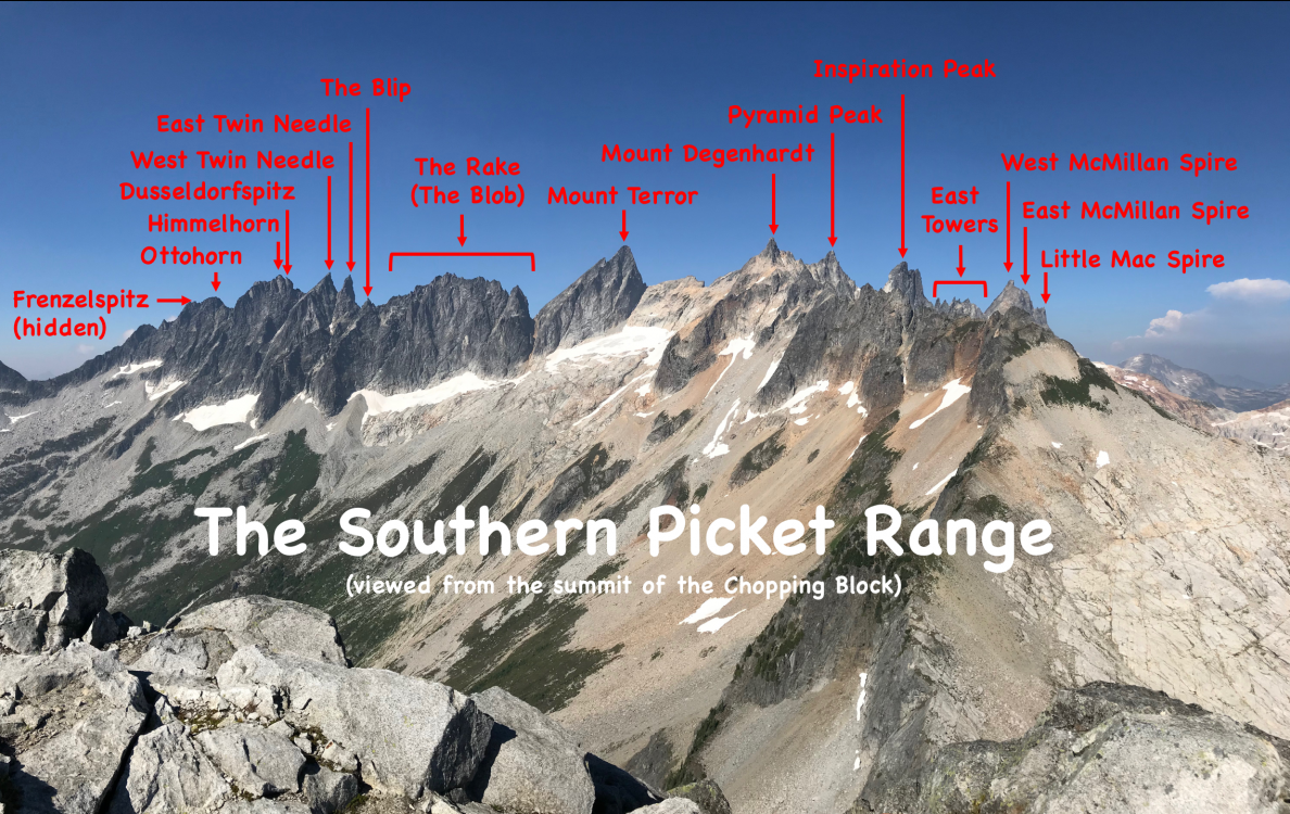


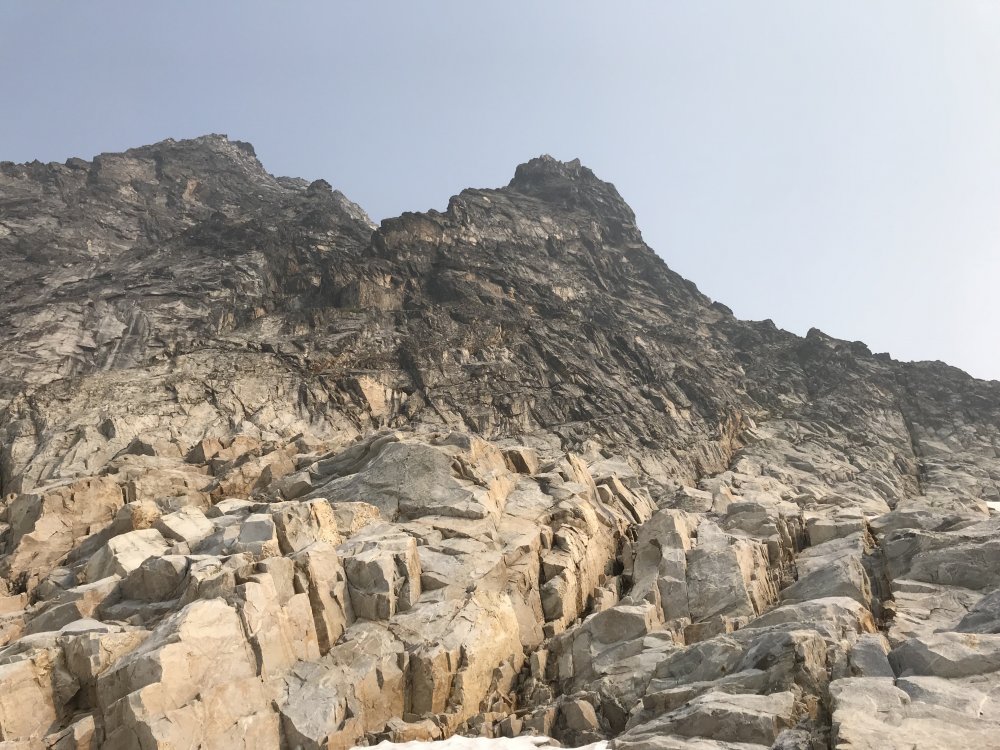
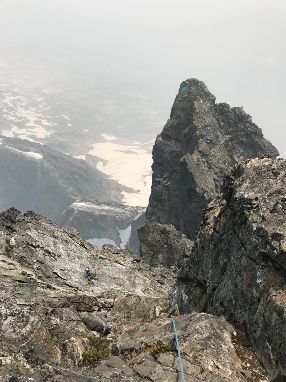
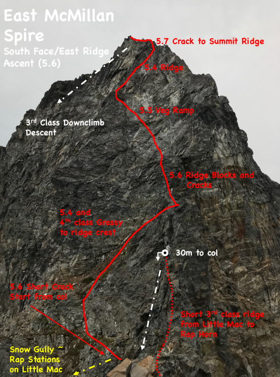
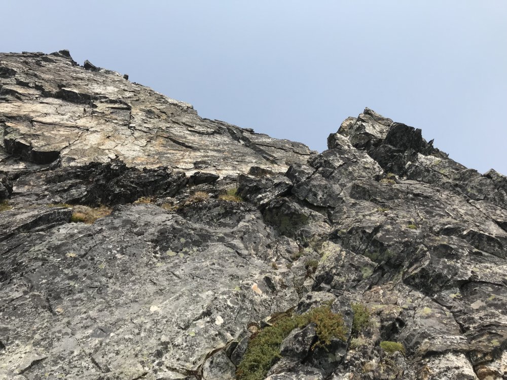

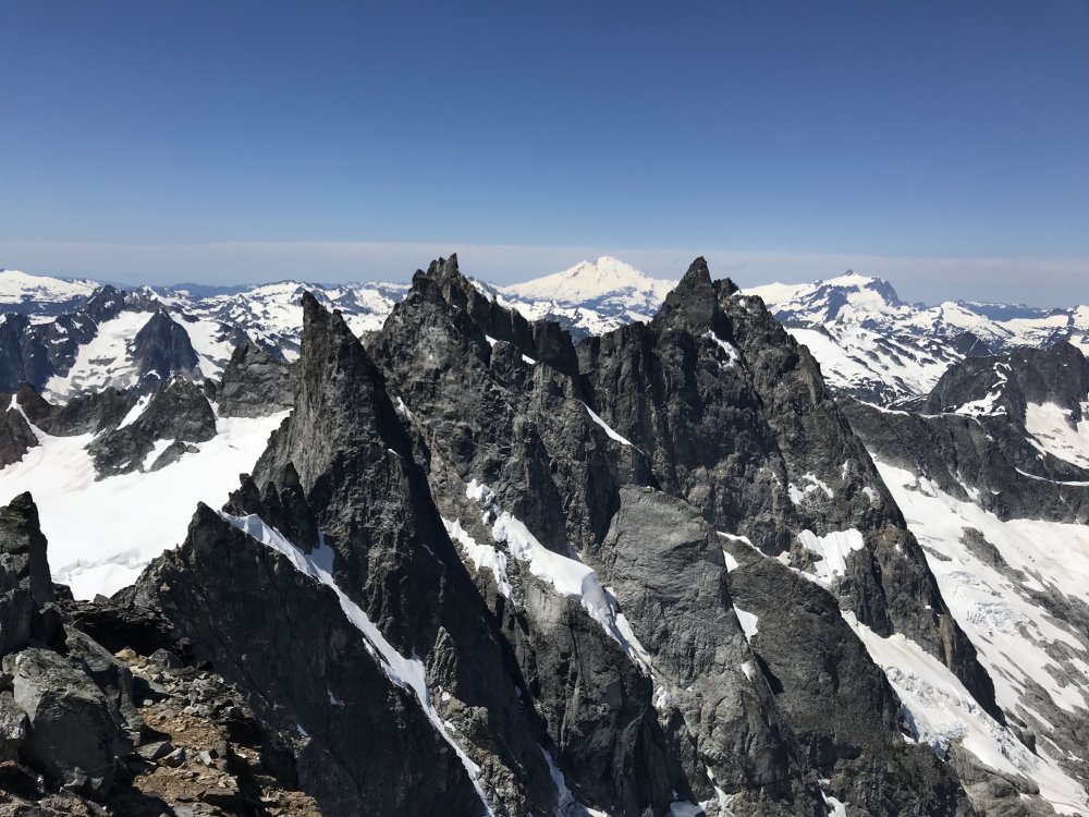
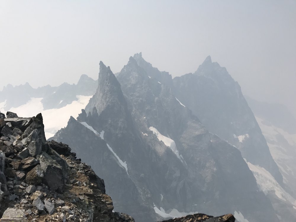

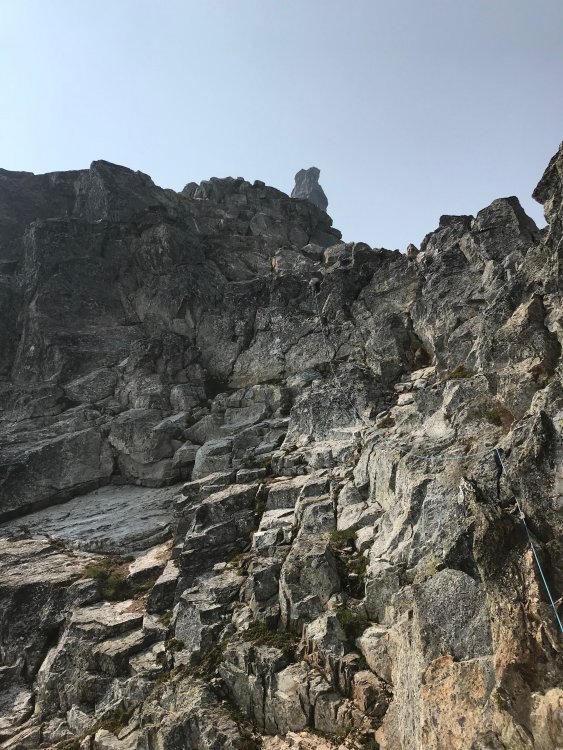

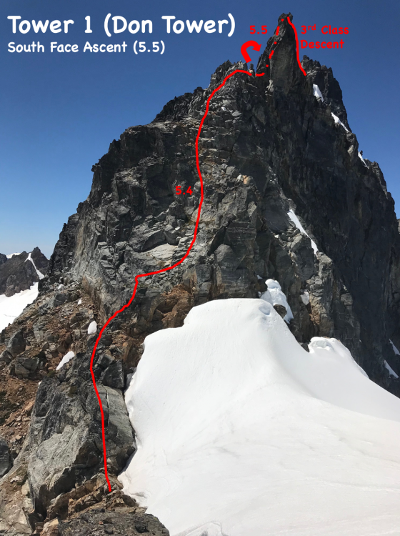
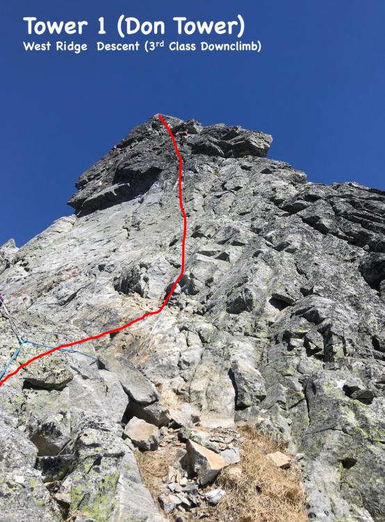
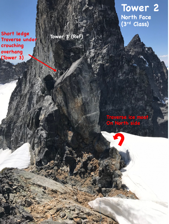
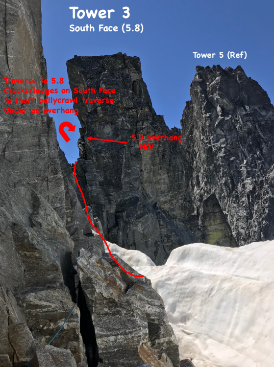
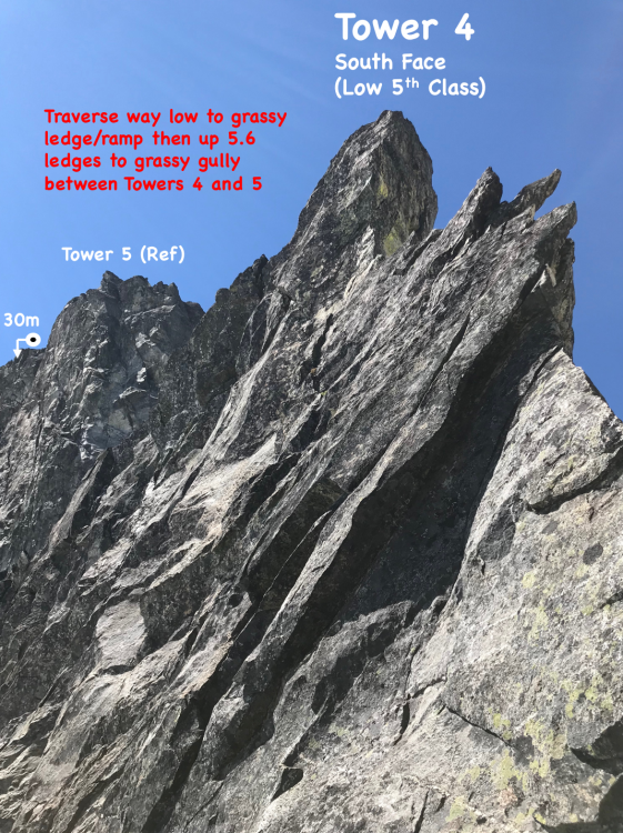


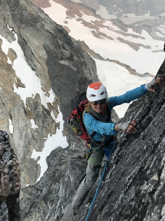
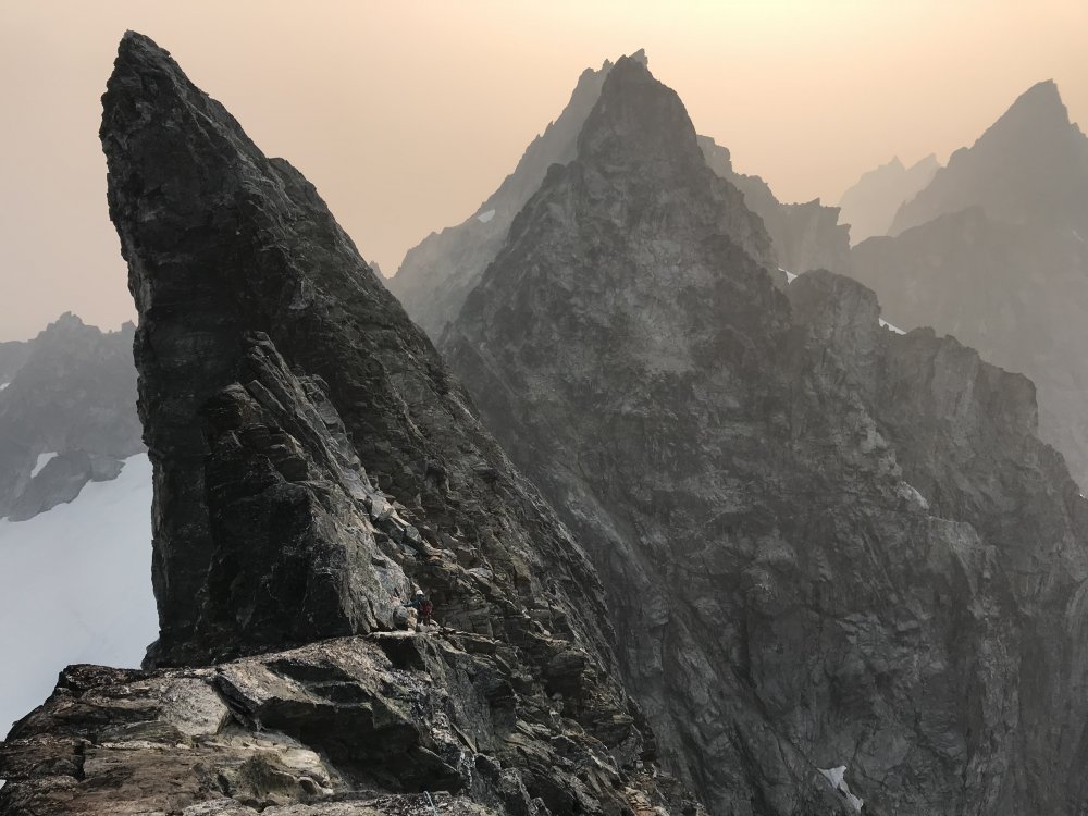
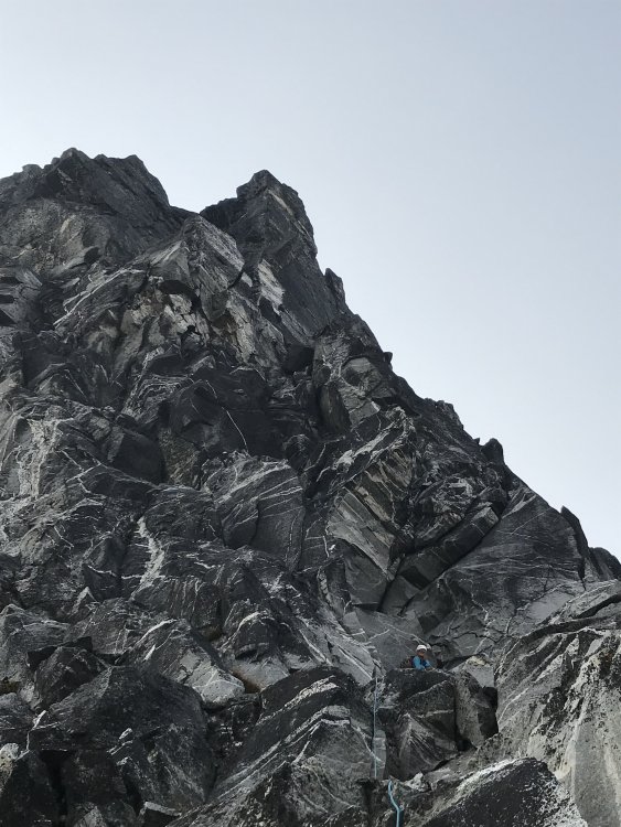
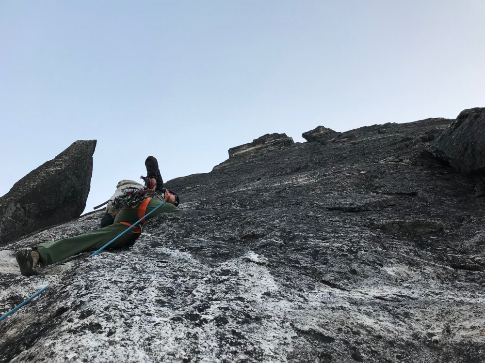
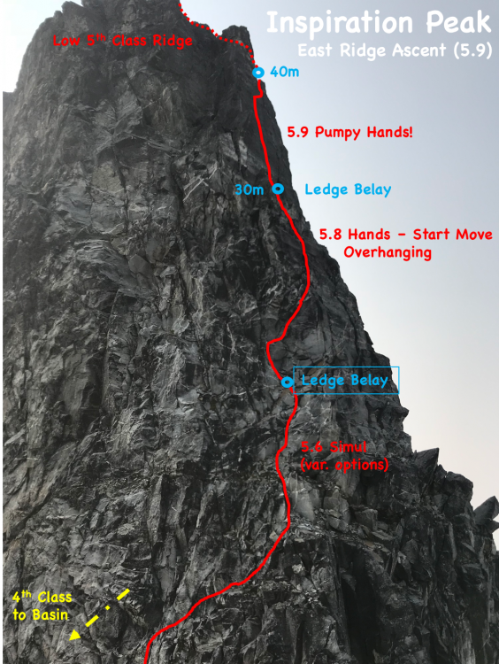

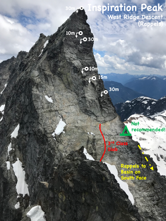
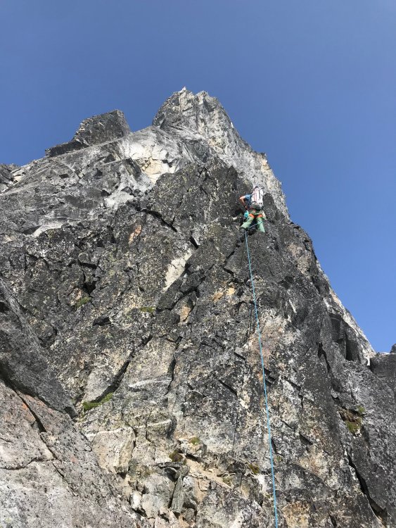
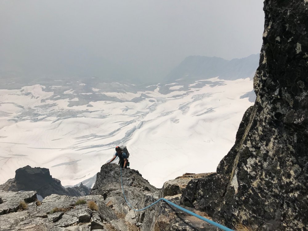
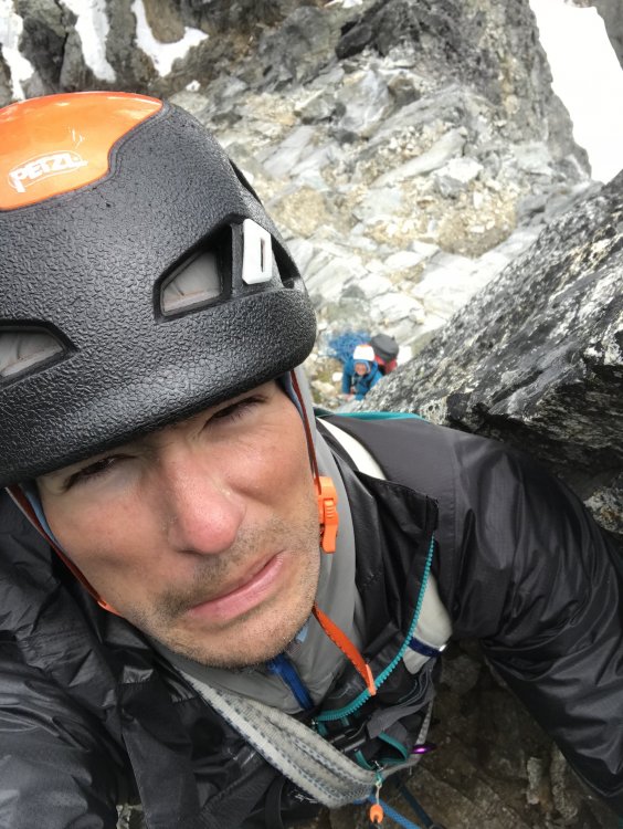
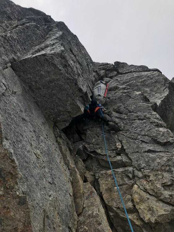
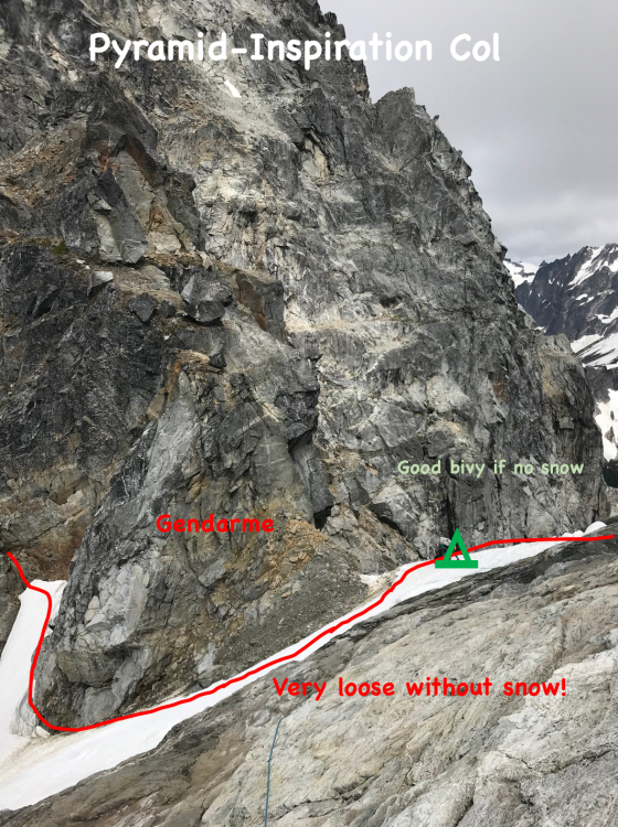
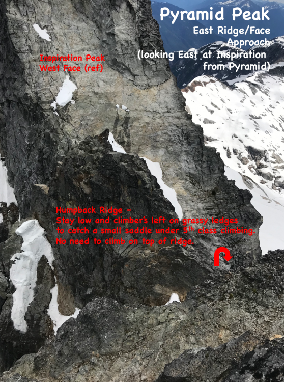
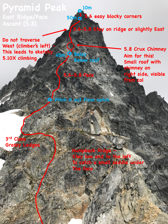


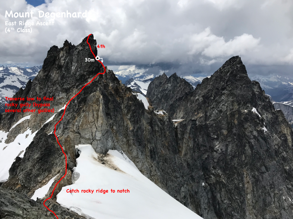
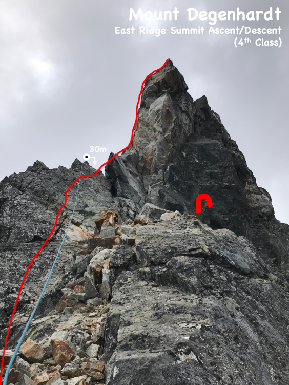
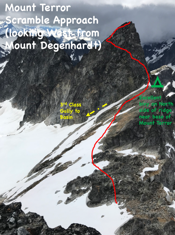
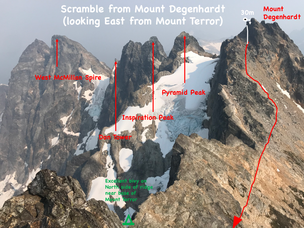
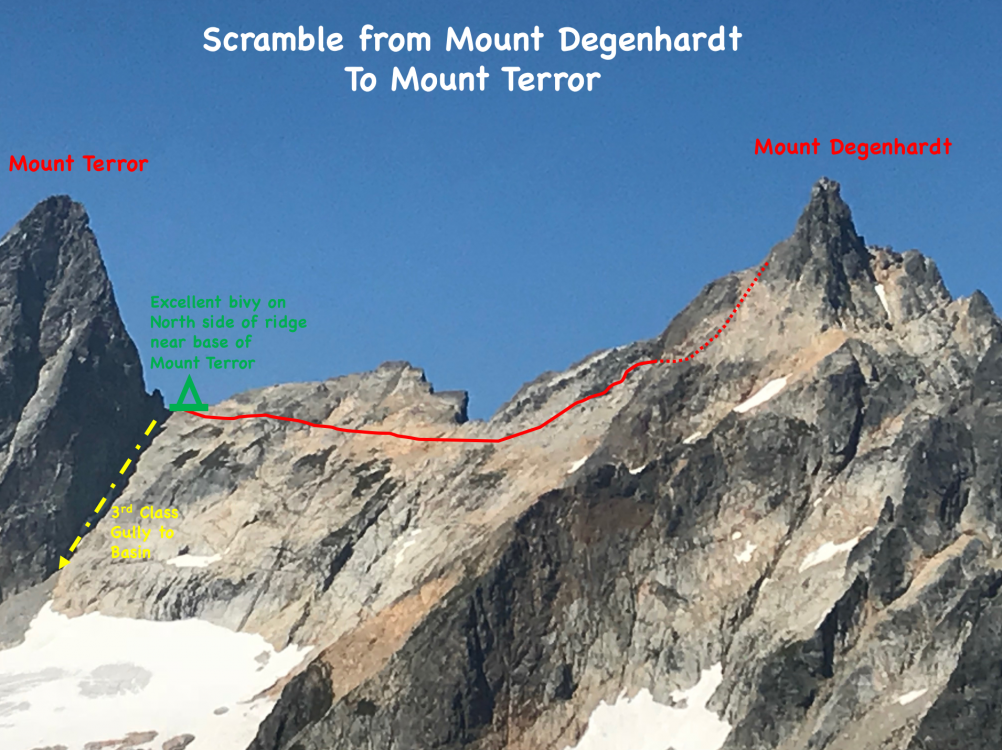
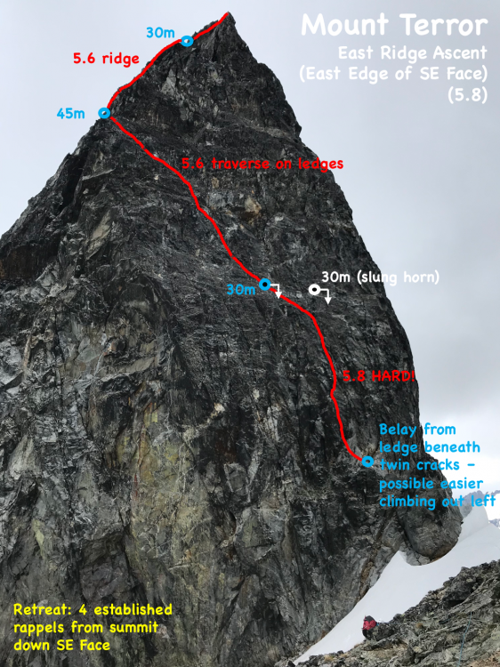
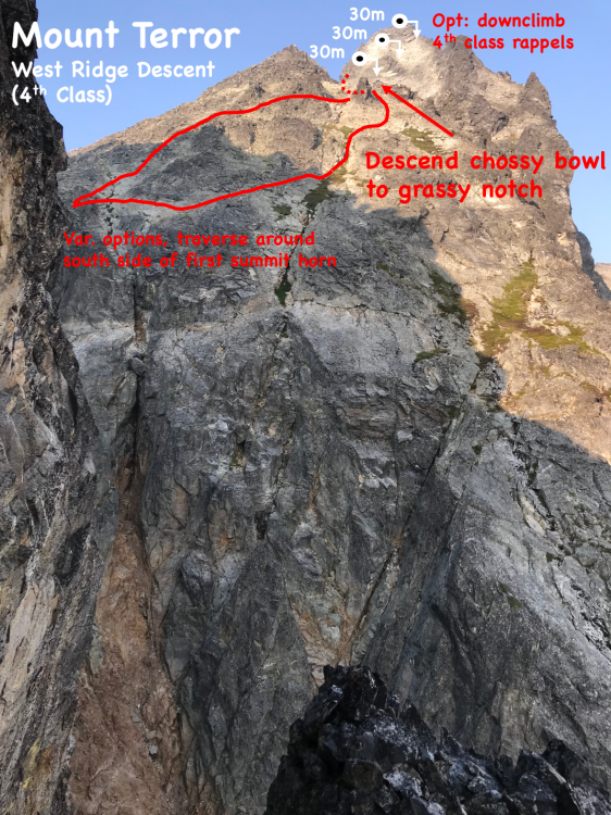
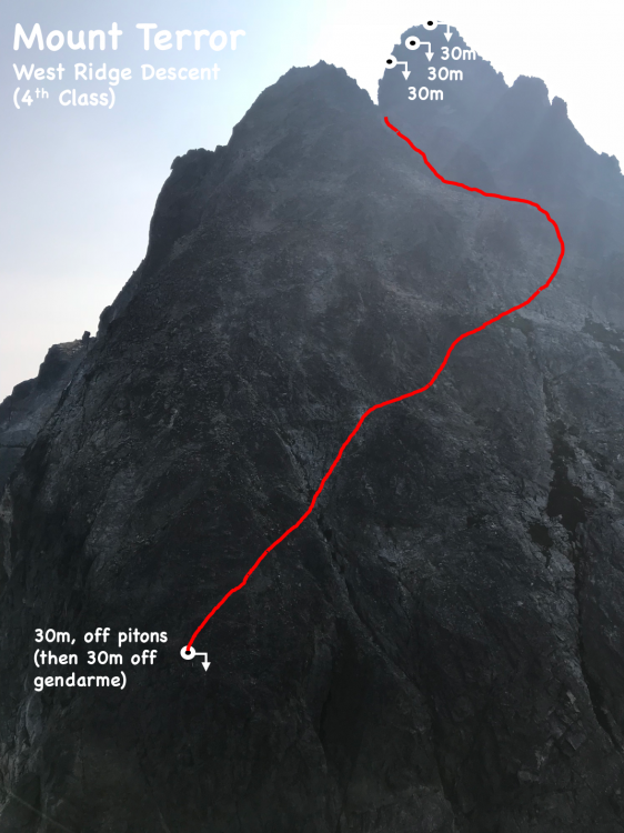


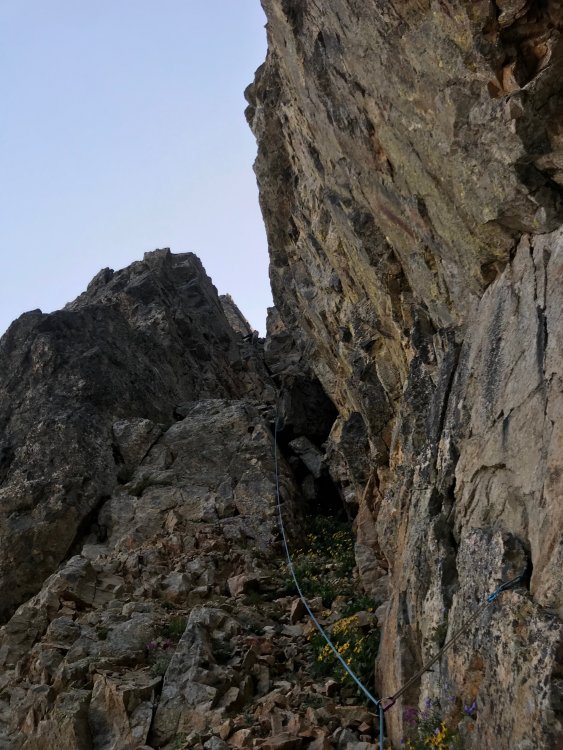
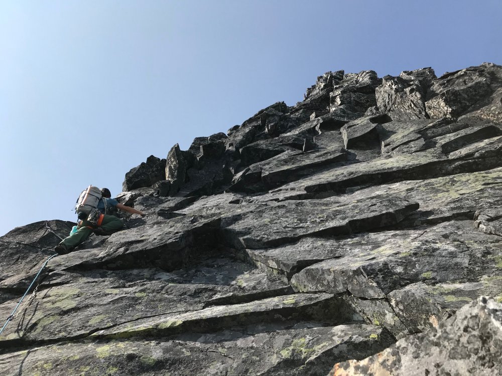
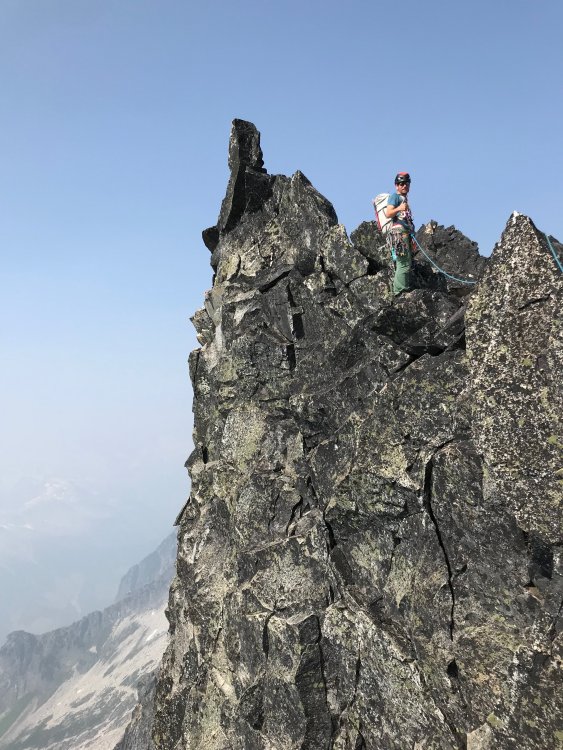
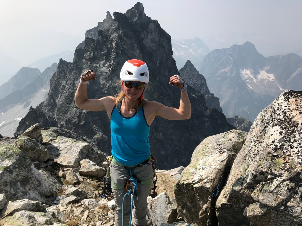


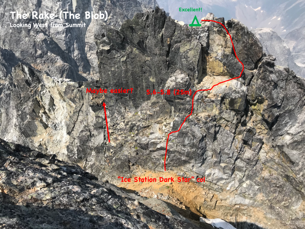


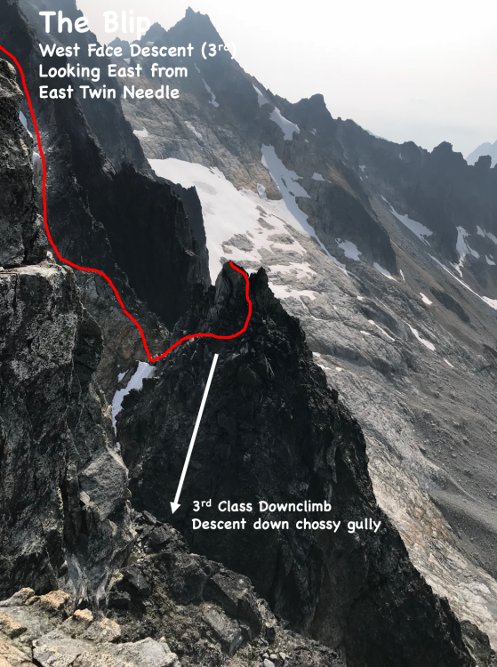


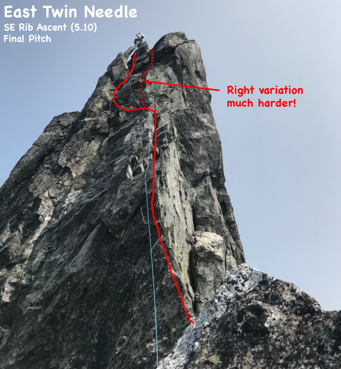
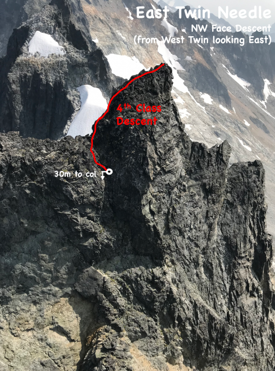
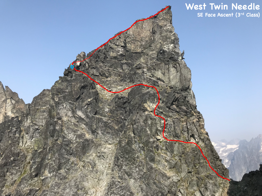
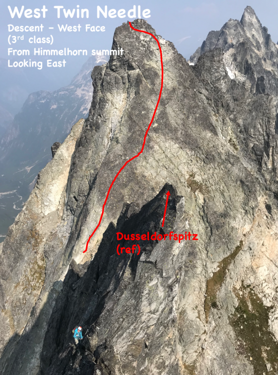
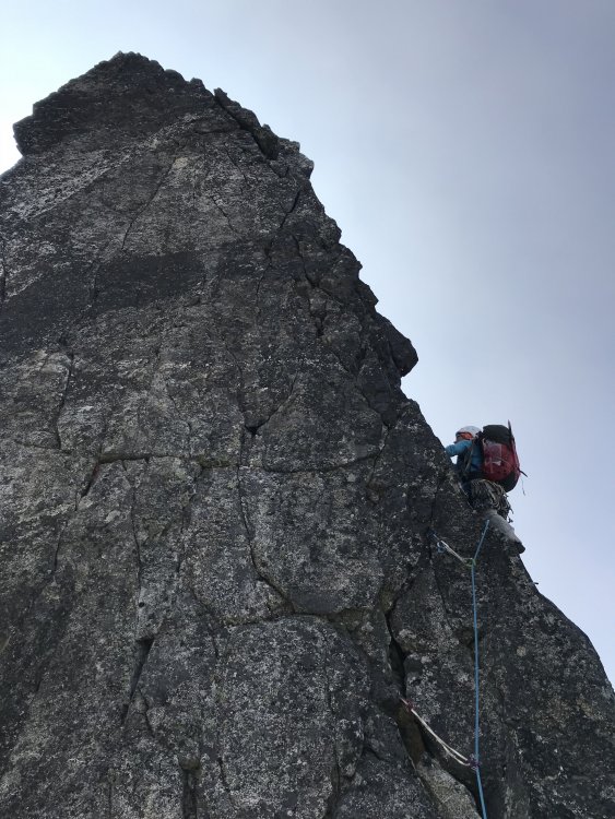
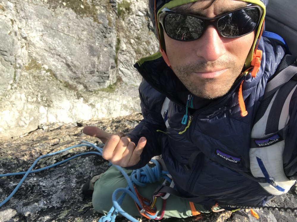
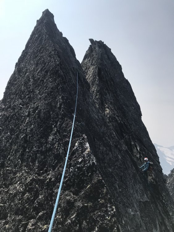
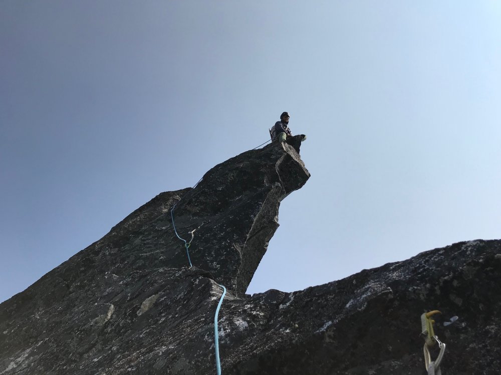
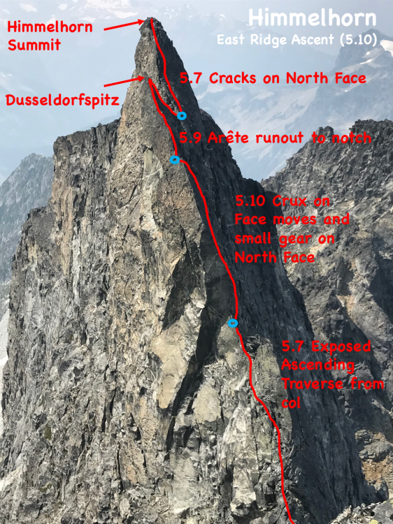
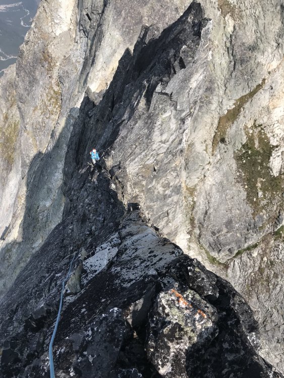

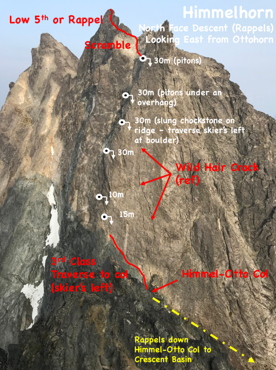
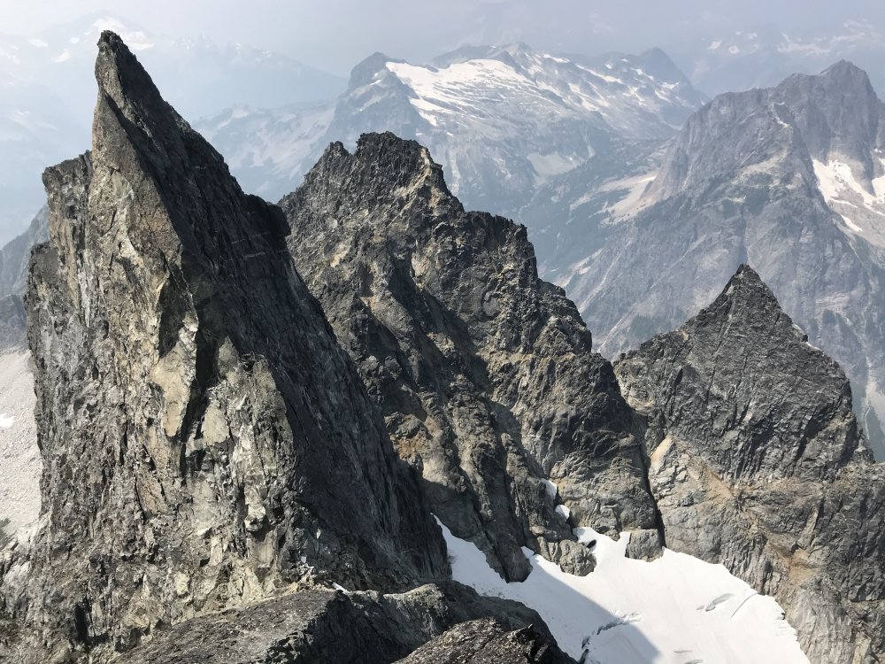


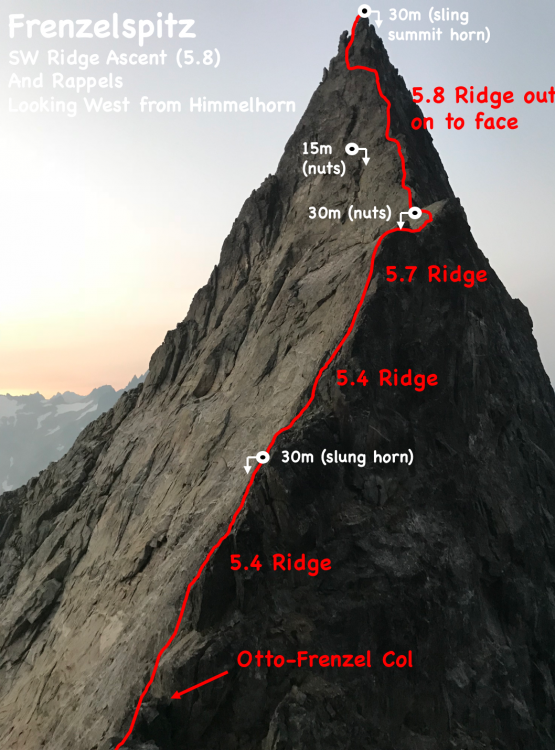


 13 points
 -
Trip: Baker to Glacier Peak: - 17 days across the North Cascades Trip Date: 07/20/2025 Trip Report: The result of years of imagination and separate efforts. Perhaps it started after exploring the Ptarmigan Traverse, but wanting more. We started gradually exploring the areas to the north and south. Many of us have noted, with some surprise, that there was not a defined “High Route” for this area, unlike some other spectacular ranges of the American West. A few years ago some mountain runners established a “North Cascades High Route”, starting from Silver Creek and ending along the flanks of Agnes mountain. This was an impressive and inspiring feat. Nevertheless we felt it incomplete and starkly contrasted with the style in which we experience these mountains. Although in the end, our route would include much of the same terrain traversing the heart of the National Park and Cascade Crest. But as we played with the possibilities of this terrain it was hard to ignore the striking aesthetics of the volcanos near each end of the range. With both Baker and Glacier Peak being slightly higher than the peaks of the crest, they act as natural waypoints to assess exactly where one is in the vast sea of Cascade summits. It would be impossible to include every spectacular basin, cirque and summit into a single high route but starting and ending with the volcanos gave us a framework to operate in. The route we eventually completed is actually composed of many different shorter routes, linked together by various less visited terrain. Within reason, our goal was to 1) stay above tree line, 2) avoid trails and 3) keep it only lightly technical. We suspect that climbers with the required stamina, skillsets and schedules will likely choose other exploits in the range, or beyond. Nevertheless we present here some basics of our North Cascades high route. Mount Baker Our route up and down the Park Glacier had some obvious benefits. Most significant was that we could change out proper mountaineering gear for more of a hybrid backpacking kit upon return to the TH (Artist Point). The route itself is pleasant, with a scenic approach and lovely high camp. The day we climbed it the snow was soft enough not to require any belay or rappel applications, though in more firm snow that would not be the case. The upper part of the glacier was fairly broken up considering it was early July. We managed an improbable line between a series of large cracks. This line may not have been viable even a week later in the season. We stood on the summit late morning of July 5th. Shuksan Navigating this terrain presented a few obvious and a few not-so-obvioius options. Perhaps at first glance one would think Fischer Chimneys…and then descending from the Crystal Glacier onto the Nooksack. Unfortunately the bergschrund separating the two was gaping by early July and would have required a substantial amount of extra gear that would become dead weight for the week to follow. Additionally the prospect of immediately starting this traverse by hiking on trail through the forest did not match the criteria we set forth. Looking instead to the North side we scouted various lines contouring high above the deep, alder filled basins. There were definitely viable lines through the majority of the terrain, but we determined them to be too complicated and conditions dependent. The biggest concern being that the time involved would be hard to predict. It could take a few hours, or a few days. Additionally there was a good deal of objective hazard traversing high in this terrain. Ultimately we chose a safer and surer, albeit less appealing line. Hiking the ridge above Chair 8 and eventually descending to meet with the White Salmon approach, we faced our first bushwhack in the hottest part of a very warm day. Once escaping the alder hell we climbed to a ridge above and contoured forest down towards Price Lake. We crossed the outflow and traveled along the approach for the Price Glacier route for a while. There would be some fuckery along the base of Nooksack tower getting down to the glacier. But once down there we continued on part of the Nooksack Traverse until Ruth Mountain. Mineral High Route On a map this looks like comparatively straightforward terrain. We did not have a pre-scouting trip for this zone. And we definitely underestimated it. The bushwhacking before and after Chiliwack pass was steep and complicated. Before we escaped tree line onto Mineral mountain there were a series of steep and improbable gullies that took us far longer to complete than what we imagined. In hindsight I think we started out in the wrong gully and paid the price. Eventually we reached “the route” but by then we really weren’t sure if the terrain would go. Finding some clearing among the multitute of brush-gulleys. Above the forest travel cleared again. Although we soon found an abandoned, and completely full backpack. A startling sight this far into remote territory, we searched around for signs of remains but found none. The pack was probably out there for at least one winter, possibly more. We noted its location and passed a message to the park service before continuing our quest. Mount Challenger via Easy Ridge This terrain was fairly straightforward, although the day we did it was very un-summerlike. With no chance of shortcutting the impasse in these conditions we continued the sog and slog down to the lower bypass. Climbing out above the crossing was fairly sketchy. It is very eroded, hard packed and water running along the surface definitely made it attention worthy. Some of the steeper scrambling between there and Perfect Pass was also potentially consequential in heavy rain. Nevertheless we made it to the pass, but soaking wet and in high winds plus white out conditions. Crossing the Challenger glacier in near hypothermic conditions was very….engaging, to say the least. We were all very relieved to step back to “dry” land an hour later. Northern Pickets Descending into the basin is fairly straightforward, albeit somewhat tedious and extended side hilling. The climb back out through Luna Lake and to the Fury shoulder is pleasant, scenic and fun. Especially given that this day the sun had returned. The lower part of the Fury glacier develops some pretty sketchy moats early in the summer and may require walking on exposed glacier ice around 30 degrees. Rather than spend time with that we found a bypass to the north, which lines up with one of the ways parties may choose to climb Fury. We skipped the summit and instead climbed Outrigger along the way. From the col we ascended a 50 foot 5.0 pitch, followed by some rightward traversing 3rd class terrain to the south ridge. Looking back, there was a way to avoid the initial low 5th entirely by starting a bit further west in the col. Descending Outrigger was one of the highlights of the trip. Easy hiking, with the Southern Picket skyline so close you can almost touch it. There was a 15m rappel, which could certainly be bypassed by down climbing 4th class terrain slightly east of the anchor. A short but exciting and exposed bit led to continued easy hiking. Southern Pickets Getting from Picket Pass to the bottom of the basin was pretty fucked. There is some 4th-ish slab downclimb that some parties have rappelled. Beyond that, some of the beta out there is pretty snow dependent. Our planned line was not viable and it took some time to find another way down. Two of us independently destroyed a trekking pole in this zone. Once at the bottom there is some unavoidable alder to contend with. You ever get through one of these, look back from a higher vantage point and realize oh wow, I could not have possibly taken a worse line. That’s what happened here. We should have stayed closer to the cliff along the SW side of the shwack. Oh well. Climbing out to the east of the McMillan spires was fairly straightforward. We managed to avoid brush entirely. Other than a few deep gullies it was a breeze, and an incredible position. From McMillans to Highway 20 Choose your own adventure, depending on legality. Once the Sourdough trail re opens you can traverse east towards elephant butte and then south along Stettattle ridge. Until then, a legal option would be to find Goodell Creek trail/approach and take that to the highway. I cant remember which of these we took… Highway 20 provides the only on route resupply. You could probably utilize Cascade Pass, or even a trip to Holden. But we did not. Isolation Traverse- much has been written on this. Its awesome Looking back to the Pickets, Redoubt from the Mccallister glacier Eldorado to Cascade Pass- decent travel along a nice ridge and basins. Nothing too complicated. Sahale arm trail for a mile or so is a nice reprieve. If you wanted to add some major style points throw in the Torment-Forbidden Traverse through here, although its likely to add some gear complications. Ptarmigan Traverse- MUCH has been written on this. Its awesome Classic White Rock Lakes shot Dome peak area- leaving the Ptarmigan and finding the Dana then Dome glaciers. We scouted a route along the south side of Dome. It probably would go but on the trip we ultimately took the Chikamin glacier around past the gunsights and onto Kaiwhat Pass Doin’ the bull dance. Feelin’ the flow. Workin’ it. Workin’ it To Canyon Lake- The terrain eases here and may involve some bushwhacking but nothing crazy. We abandoned our map, and rationality…instead navigating on vibes alone. Our line to Totem pass was awesome and on paper probably shouldn’t have worked. Between the pass and Canyon Lake there may be a way to avoid significant brush but we did not find it. Still it went quick (downhill) Canyon Lake trail- Seems decomissioned. It’s overgrown and washed out in different places, but still a comparatively decent 5 miles. Image Lake to Lyman Lakes- We looked hard how to avoid such an extended on trail section but there really weren’t any viable alpine options. When we came to this section we were exhausted and very calorie deficient. The easy miles were welcomed. The trail itself is well maintained and incredibly scenic (cloudy pass in particular). Just a hop, skip and a “fuck!” away... Lyman Lakes and beyond- We climbed over Chiwawa mountain without much difficulty. Although the last few hundred feet were steep, slimy, scree covered slab when approached from a direct north line. Pretty gross. It would be better to find the main ridge further east and continue to the summit from there. It started to rain when we were on the summit, so we schemed a bypass for the exposed scrambling awaiting on Fortress. We found a line of weakness that allowed us to bypass to the south. It didn’t take long from there to find the pass no pass trail and follow it towards High Pass (another really scenic on trail moment). Bypassing Fortress For Napeequa we took a path of least resistance well south of the summit, descended to another saddle and then back up and around Hoof. Eventually we had to traverse below the north side of Ten Peak. It took a while but overall it was straightforward. The Honeycomb and Suiattle glaciers brought us to Glacier Gap, along the standard walk up for GP. We were greeted by friends with treats. The next morning we jaunted up the last couple miles. It was a busy weekend on the peak. Spirits were high, despite the suicide gestures Standing on the summit felt surreal. It wasn’t necessarily a positive emotion. Spending the last few summers obsessed and the past few weeks starving made this moment feel like a weird dream. The hike out from there is long, but we crushed it in hopes of making it to Olive Garden in time. Which we did. All the pasta…dipping donuts in wine…it was finally over… By the numbers: 17 days 175.2 miles (73% off trail) 86k vertical gain (86% off trail), 88k lost Average vertical change per mile: 993 feet Average time from camp to camp each day: 14 hours Average calories/day ~3800 Body weight lost- 18lbs (9.6% total lost) Pizza consumed- nowhere near enough Gear Notes: a picket, 2 screws, 3 cams, 4 nuts Approach Notes: the whole thing was an approach...12 points
-
Trip: Lincoln Peak - Southwest Face Trip Date: 01/29/2025 Trip Report: Lincoln! A peak that had been haunting my subconscious for decades, always taunting me on clear days as I drove home from work across the Skagit flats. Try as I might, I could never completely ignore it. It didn't help that it was on "Dallas's Difficult Ten" list, or that by a few years ago, it was the LAST one on the list for me to climb. By 2023 I had tried and failed on it with @kmfoerster. By the end of 2024 I had turned 50 and figured I may as well get on with some long term climbing goals. It didn't hurt to learn that @geosean also had this one peak to go on his run at the Difficult Ten, nor that @Trent was within one peak of finishing as well (South Hozomeen- he's looking for partners!). That, coupled with seeing "Lincoln" on @therunningdog's whiteboard, planted the seeds in my brain to make it happen in 2025. As @Trent would say, "It must be climbed!". And then last week we got a window and hatched plans to give it a go on Wednesday as a day trip. This was going to be a bit ambitious, we knew, and I would be lying if @Lucas Ng's TR didn't make me think maybe too ambitious? There would only be one way to find out. We started, as all good mountain trips do, with a home cooked meal with my family and @therunningdog. My son admonished us to start early for the Middle Fork so we could "get a workout in before bed". Tim and I declined and delayed as long as possible. It was cold out there! But we did eventually find our way to the Middle Fork about 9pm, settling in to a bivy at the Elbow Lake Trailhead to meet @geosean at 3:45 the next day. Sean was right on time and we bounced our way up the rough spur to where continuous snow started about 3500'. By the time we got geared up and rolling, it was about 4:15. From here, the day was pretty much a blur. We got to treeline a bit before sunrise, which was spectacular on the Twin Sisters Range We snowshoed from treeline over to the glacier where we ditched them and the stove and switched to harnesses, helmets, axe, and crampons. I think I crossed the 'shrund first about 8:30. And then it was game-on for a couple hours up to the summit. Lucas and Cole's tracks were basically gone and we kicked new steps the entire way, running across a few of their rap stations up high. The going was pretty steep the whole way, but conditions were very secure and basically perfect. We kept the rope in the pack and carefully traded trailbreaking duties up the various sections of the climb. What a position! Seward: Approaching the summit: And then, like in a dream, all three of us were at the summit block! It was 10:22am- about 6 hours from the car- meaning things had gone waaaay better than expected. @geosean and @therunningdog on the summit: The views, of course, were staggering. What a small and wild summit, especially in winter! But also, what a descent lay ahead of us. That's why I was a little concerned to see Tim start to downclimb while Sean dug the summit picket out of the snow. Uhhhhh....we're not rapping guys?...... "No Jason, let's go!" And so, I took a deep breath, put on my big-boy pants, turned around, and started down. It was a stimulating descent. Especially in this particular spot: But, by moving slow and steady, we made it safely down about as fast as we had gone up. Tim and Sean had to wait a bit for this mature mountaineer on the descent. I'm not going to lie....it was quite a relief it was to finally get back past the 'schrund and start the slog out! We stopped at treeline for almost an hour to melt snow and admire our tracks on Lincoln. It felt good to be down safe in the sun with a couple of good friends, marveling at the grandeur of the North Cascades. What a day! But January days are not long, and we had a bit of scruffy ground to cover before dark. So the snowshoes went back on, the brains turned off, and down we went. We arrived at the car a bit before 4pm, in the light, to all of the windows intact, a change of clothes, and snacks. It doesn't get much better than that..... Edit- Well, we could have remembered beer. THAT would have been better. Oh well, can't always have it all! Gear Notes: snowshoes (in winter), crampons, axe, helmet, second tool. We brought a rope and pickets but didn't use. Approach Notes: 4x4 will get you to 3500' or so up the spur.
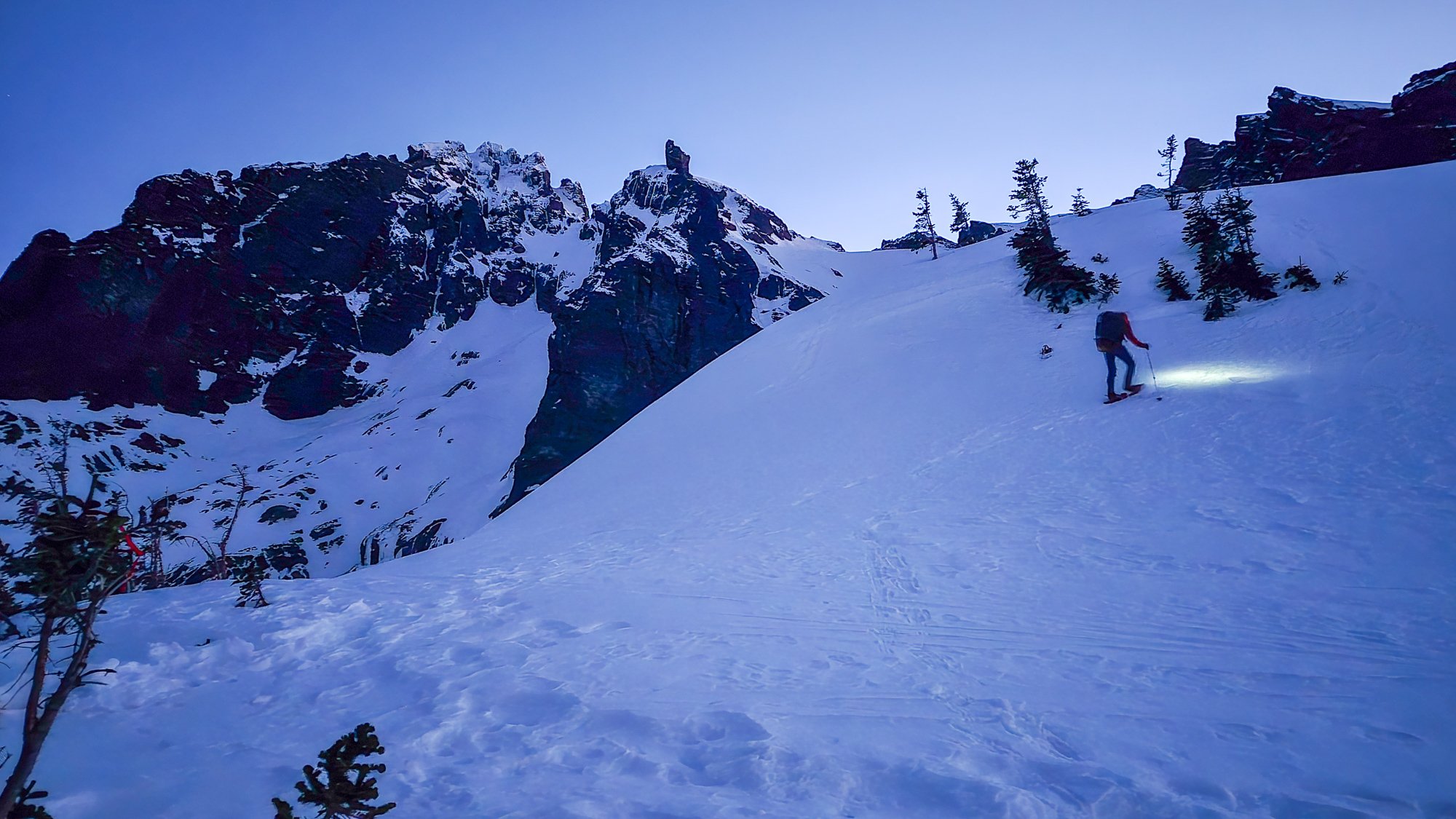
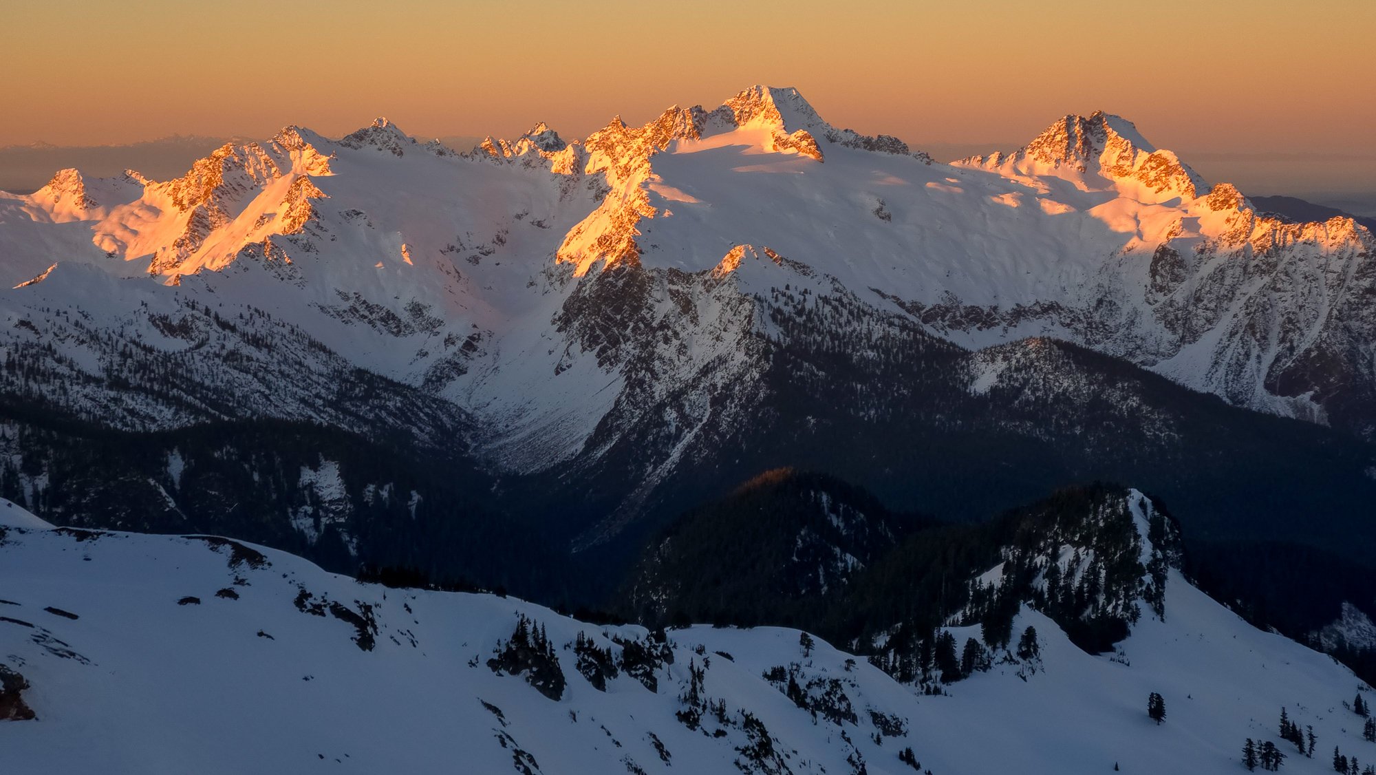
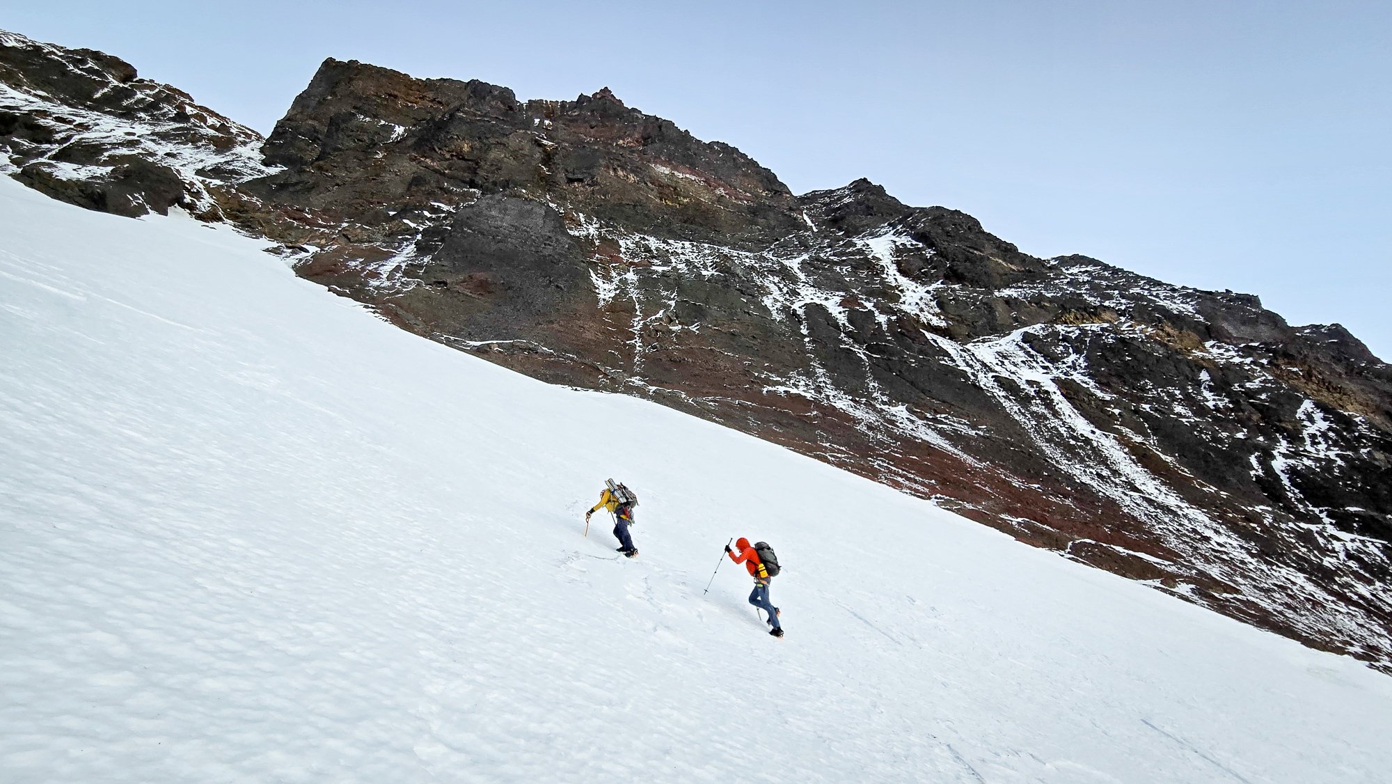
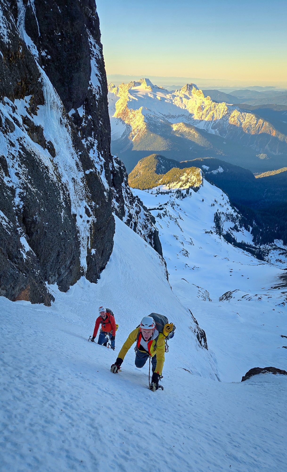
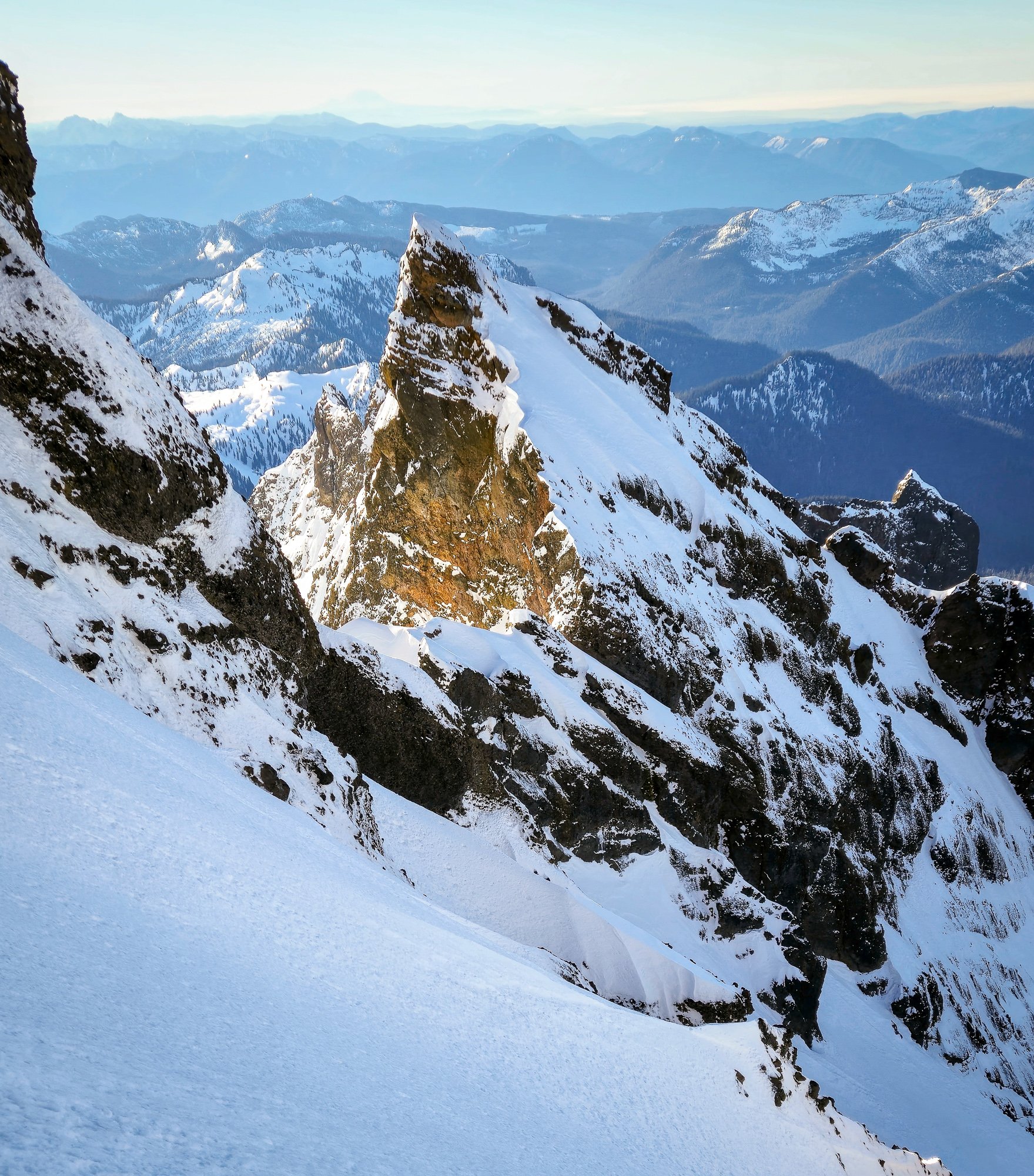
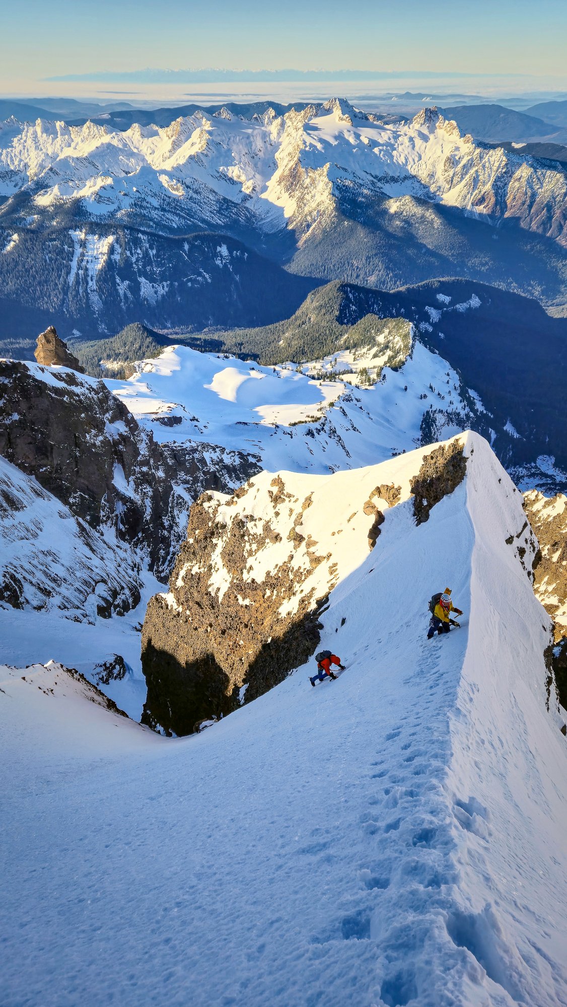
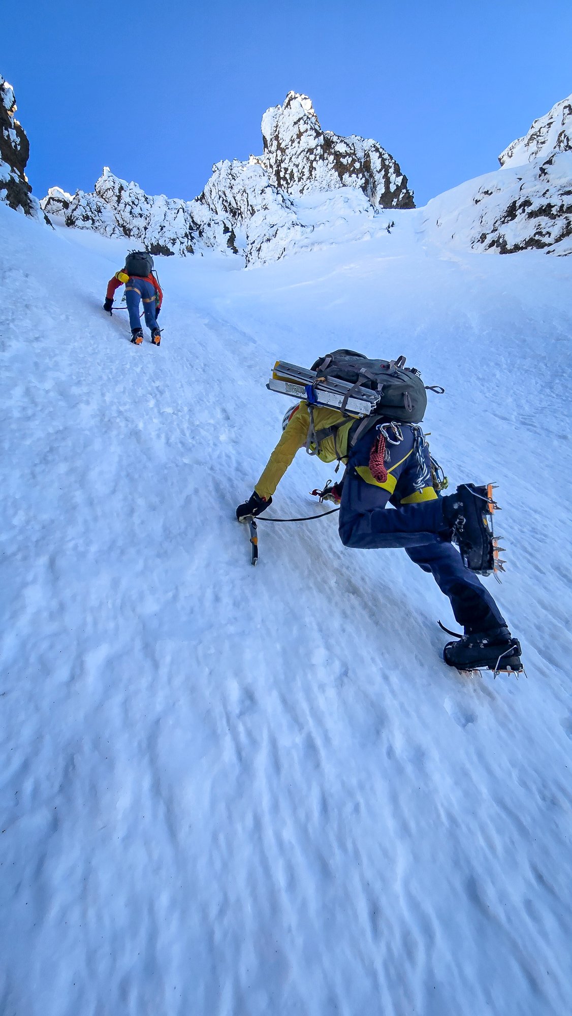
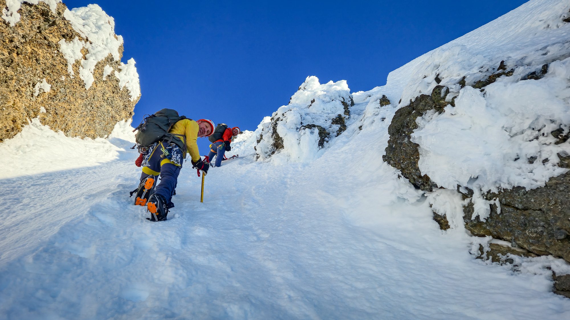

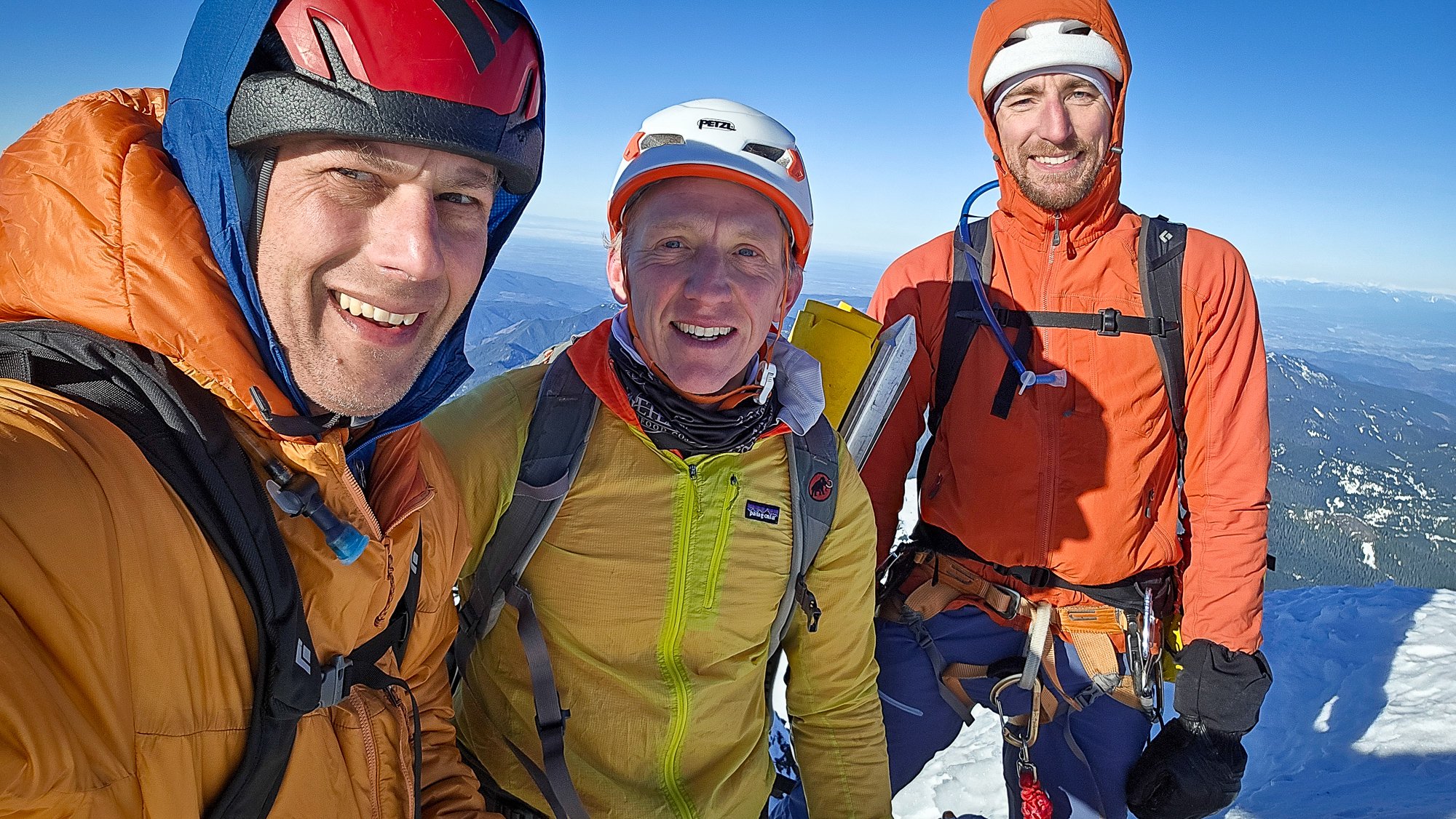
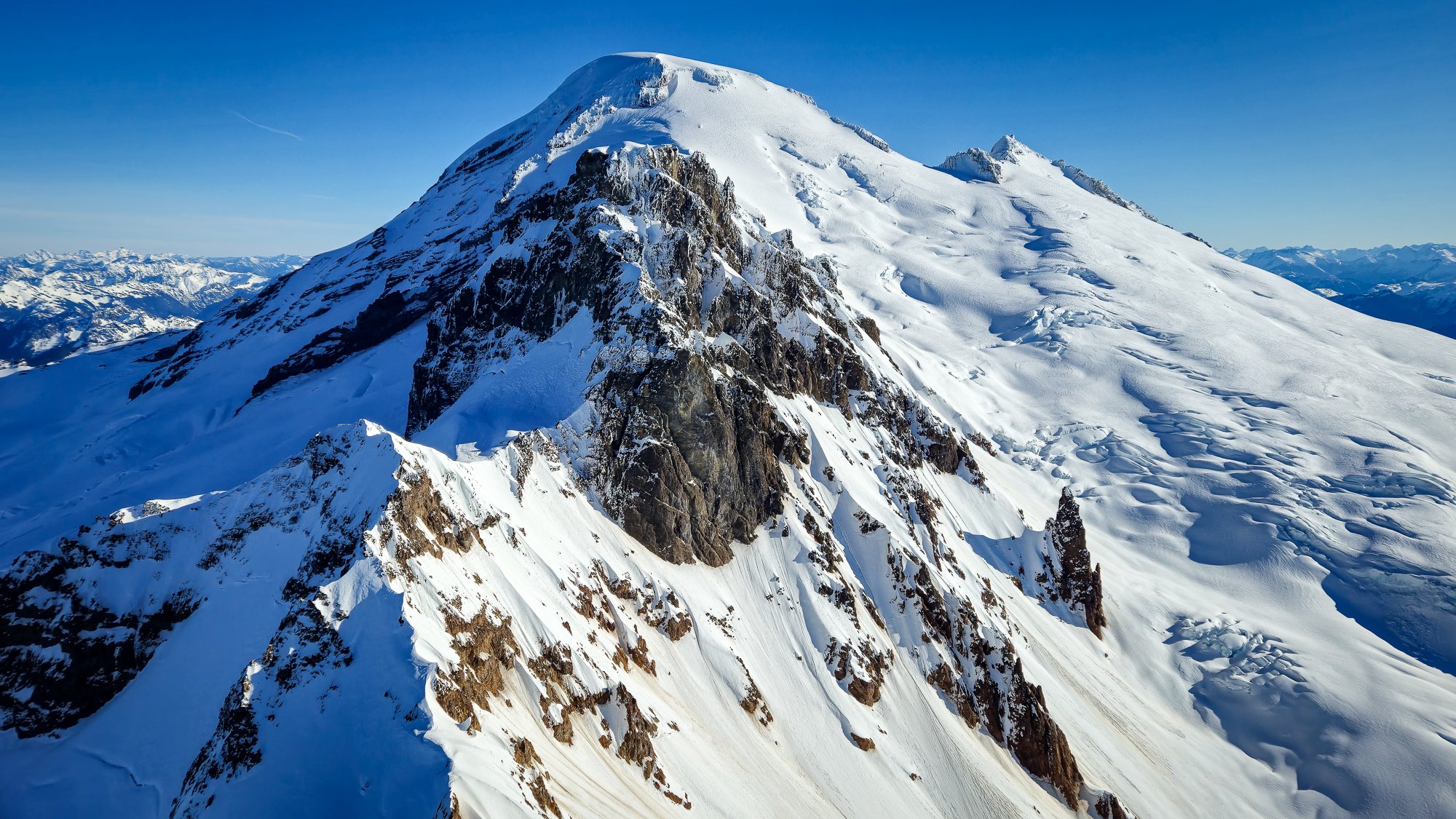
.jpg.665b3db19993070594beeb7877f8f0c9.jpg)
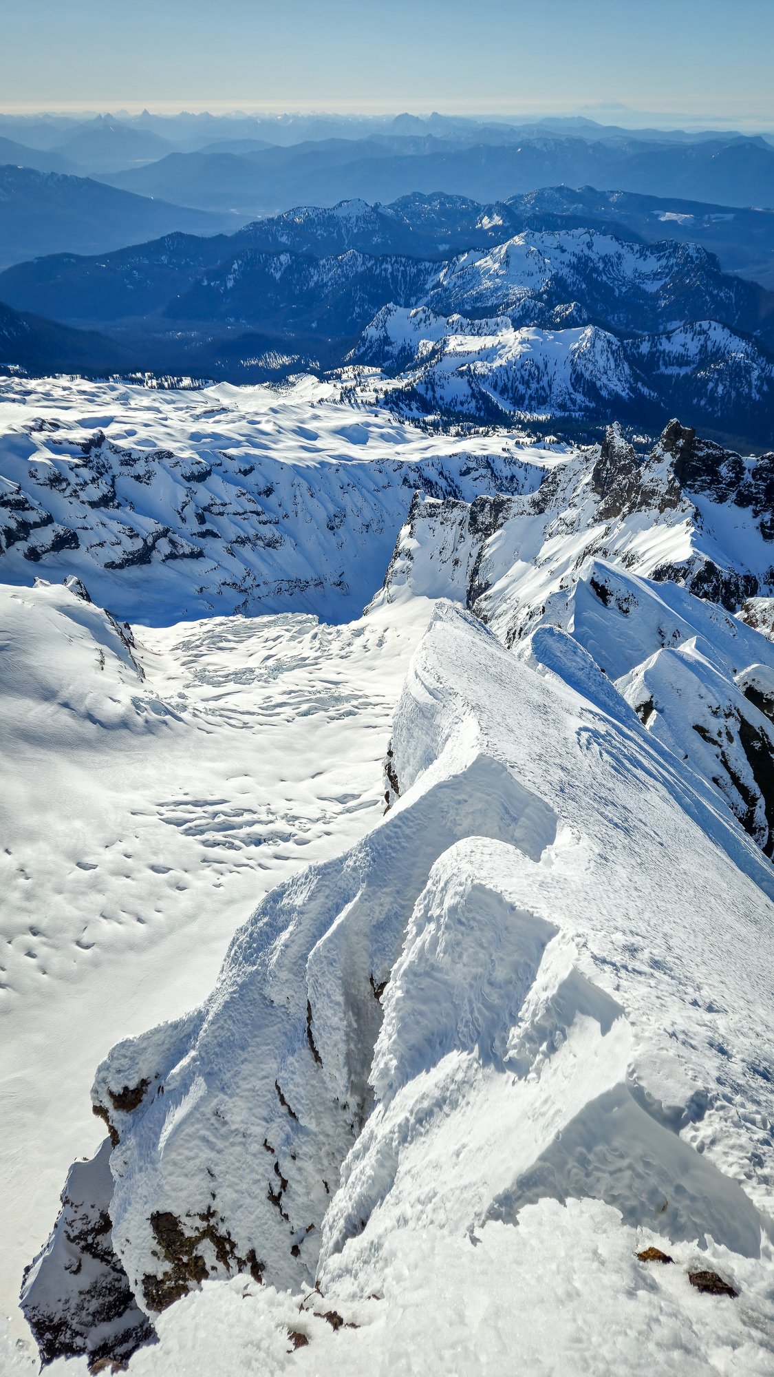
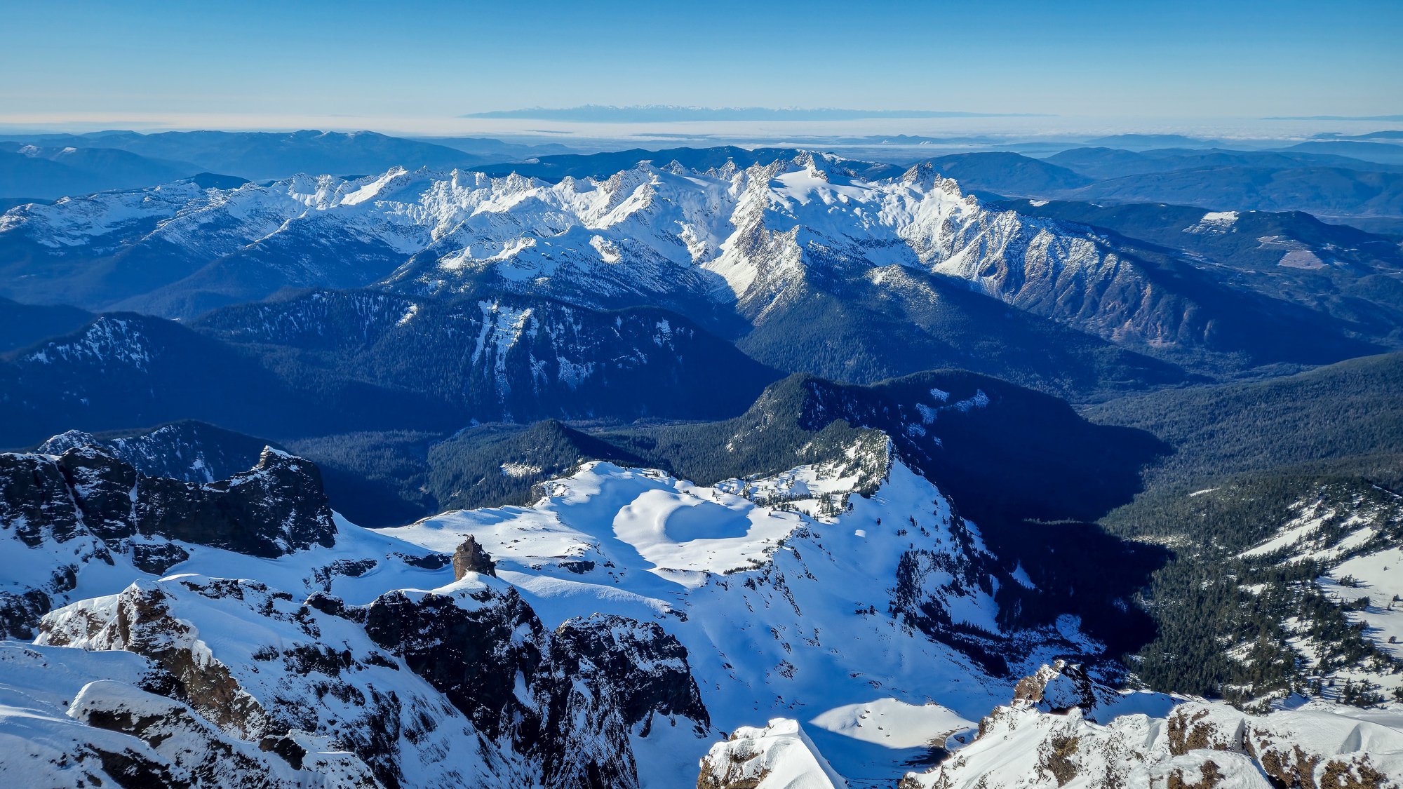
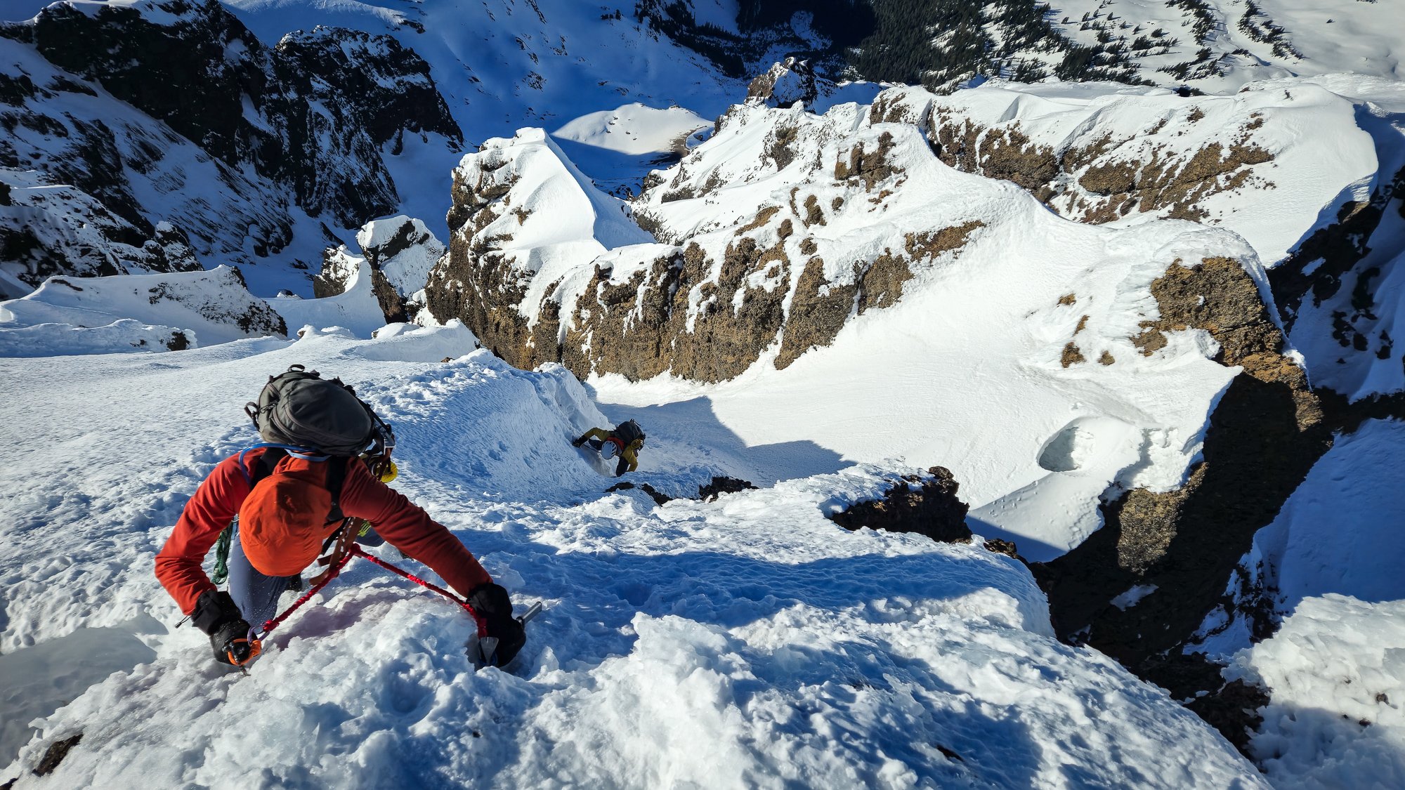
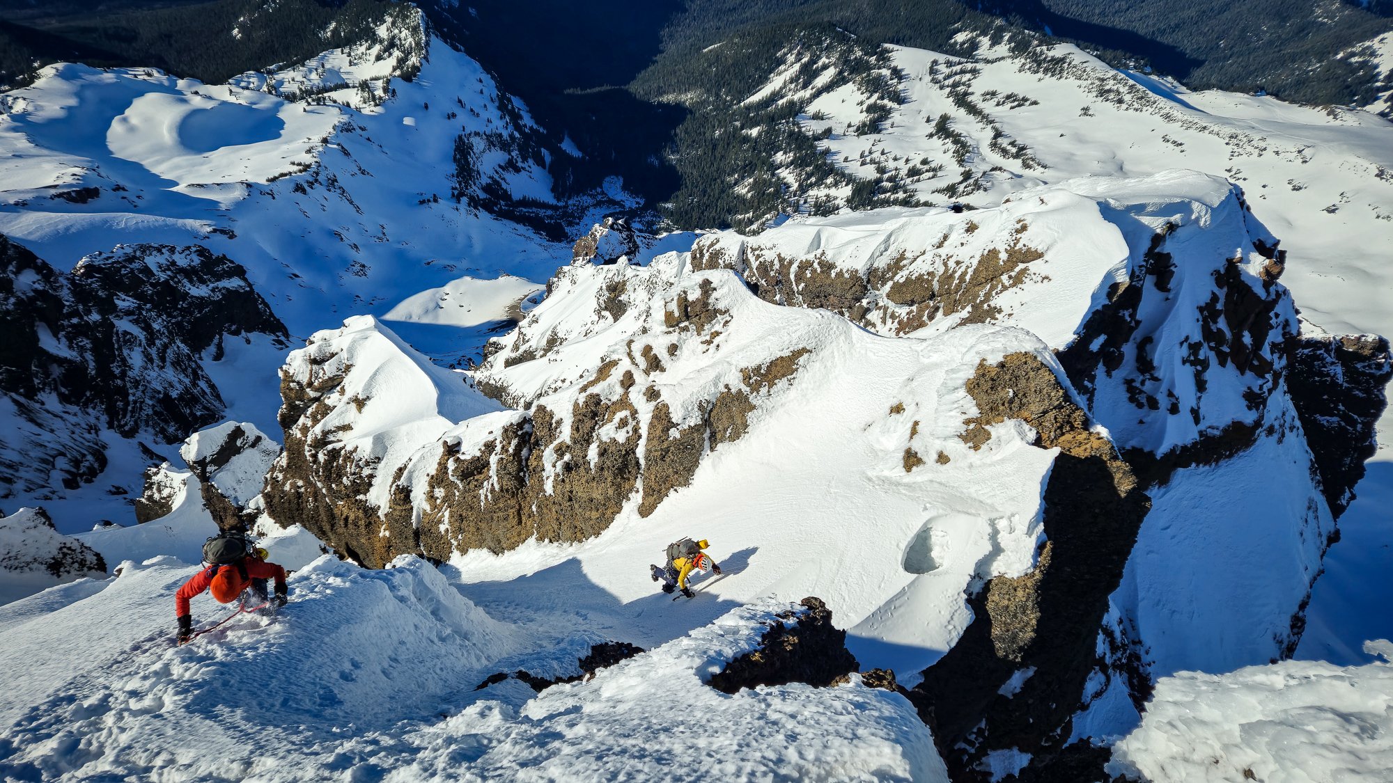
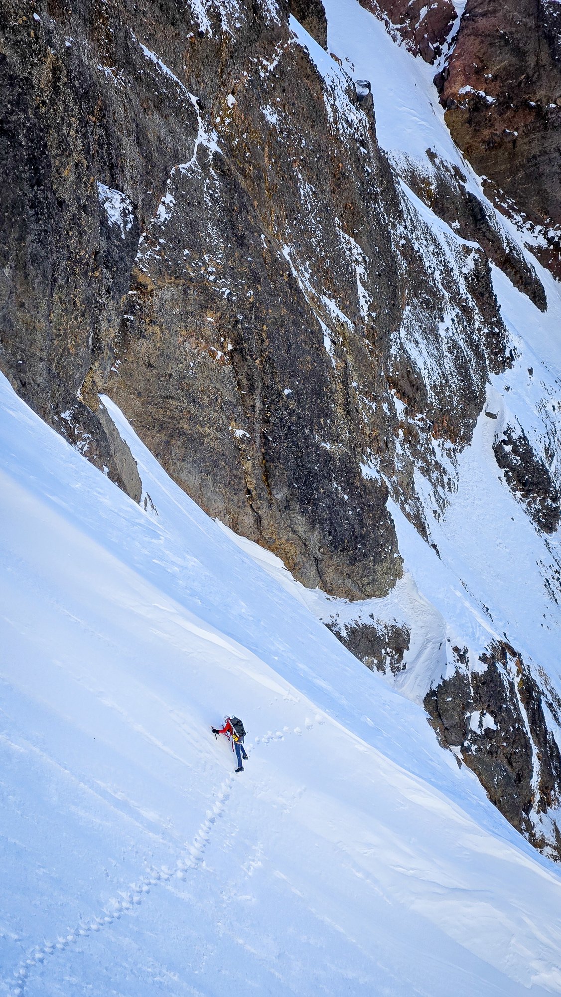
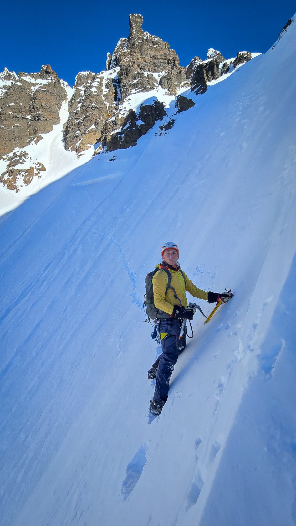
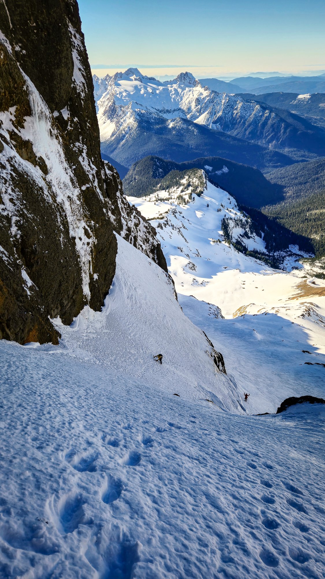
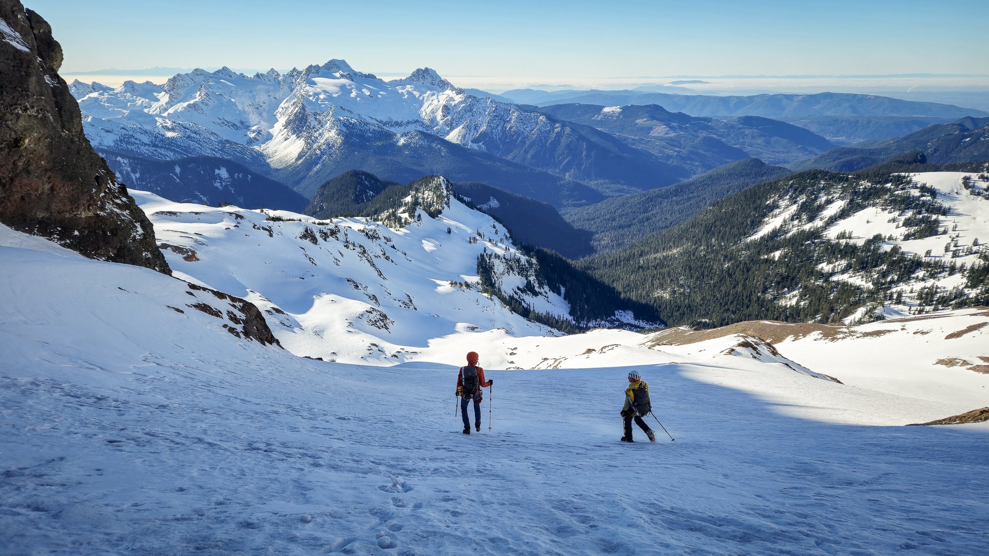
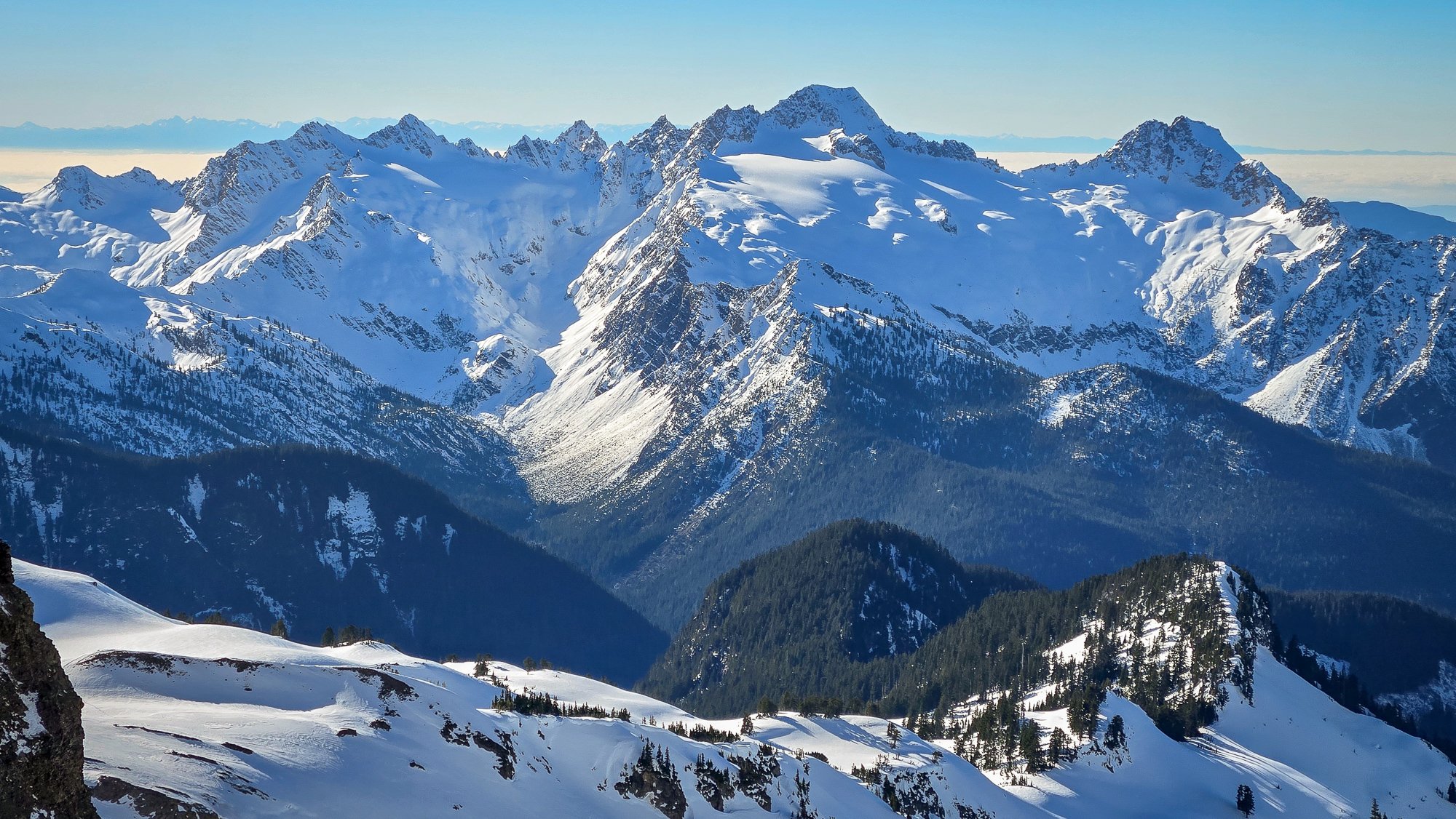
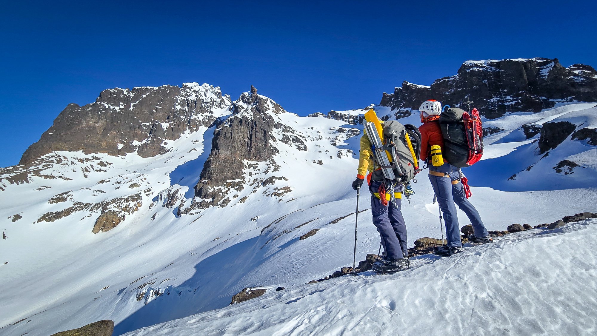
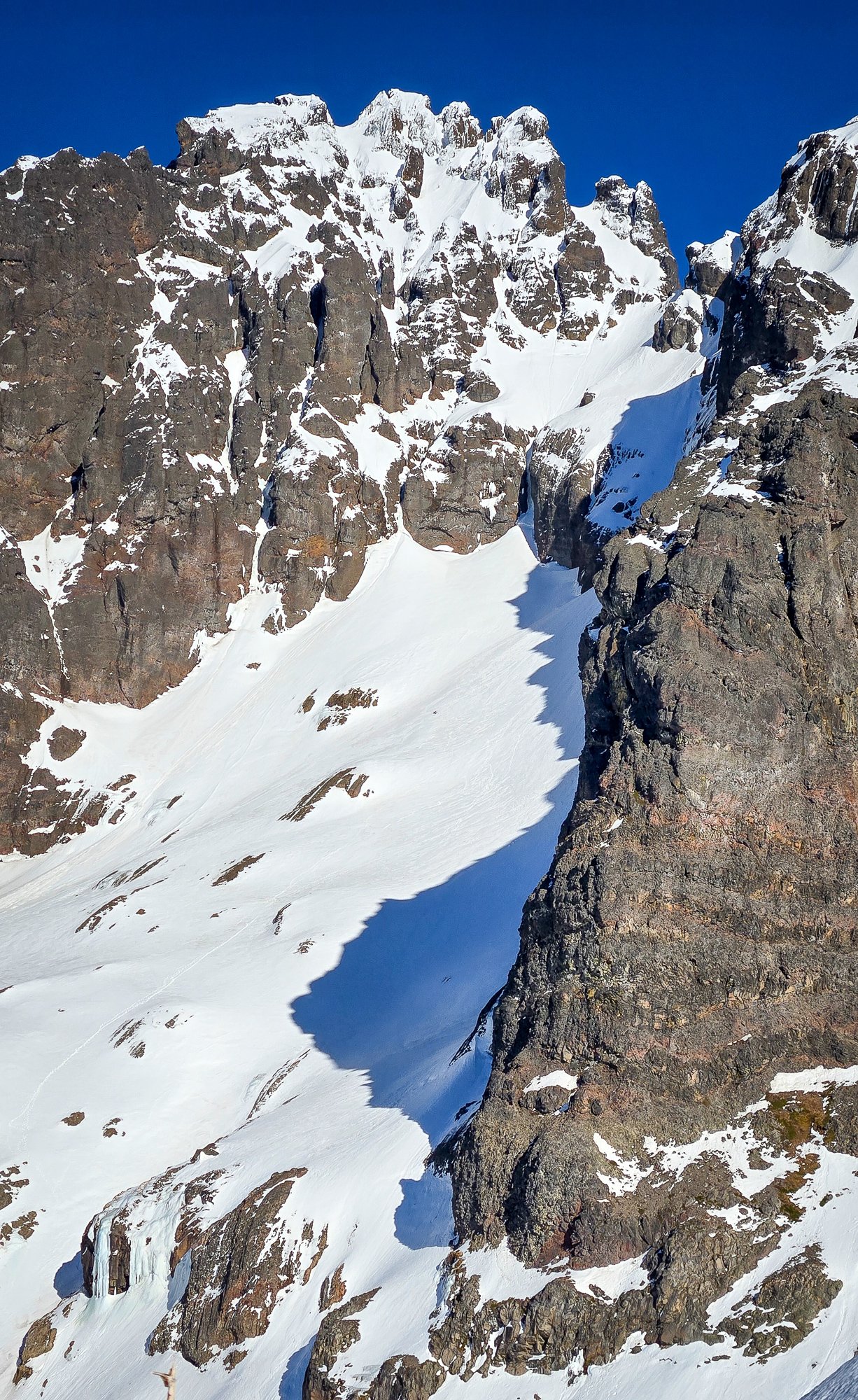
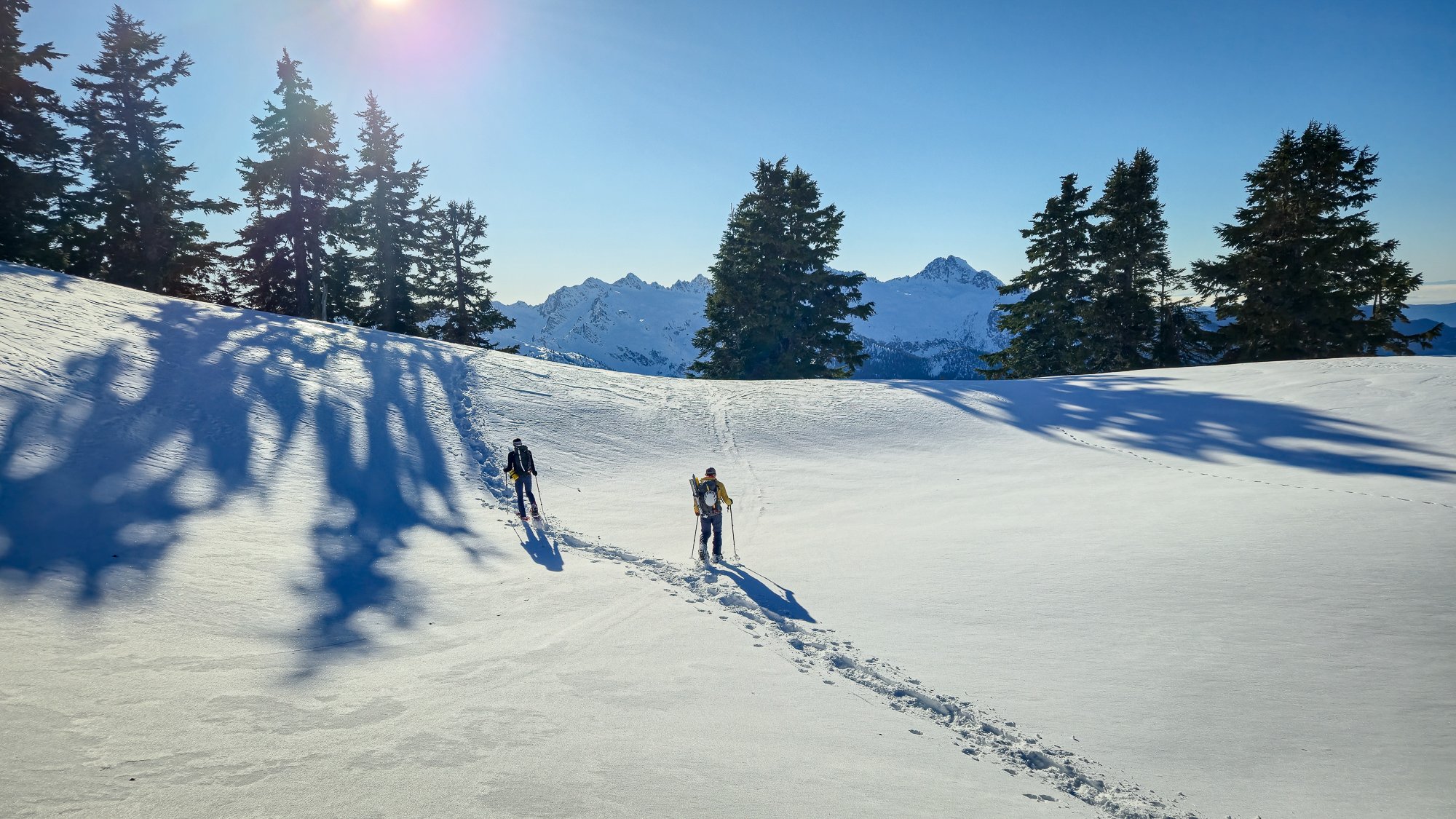
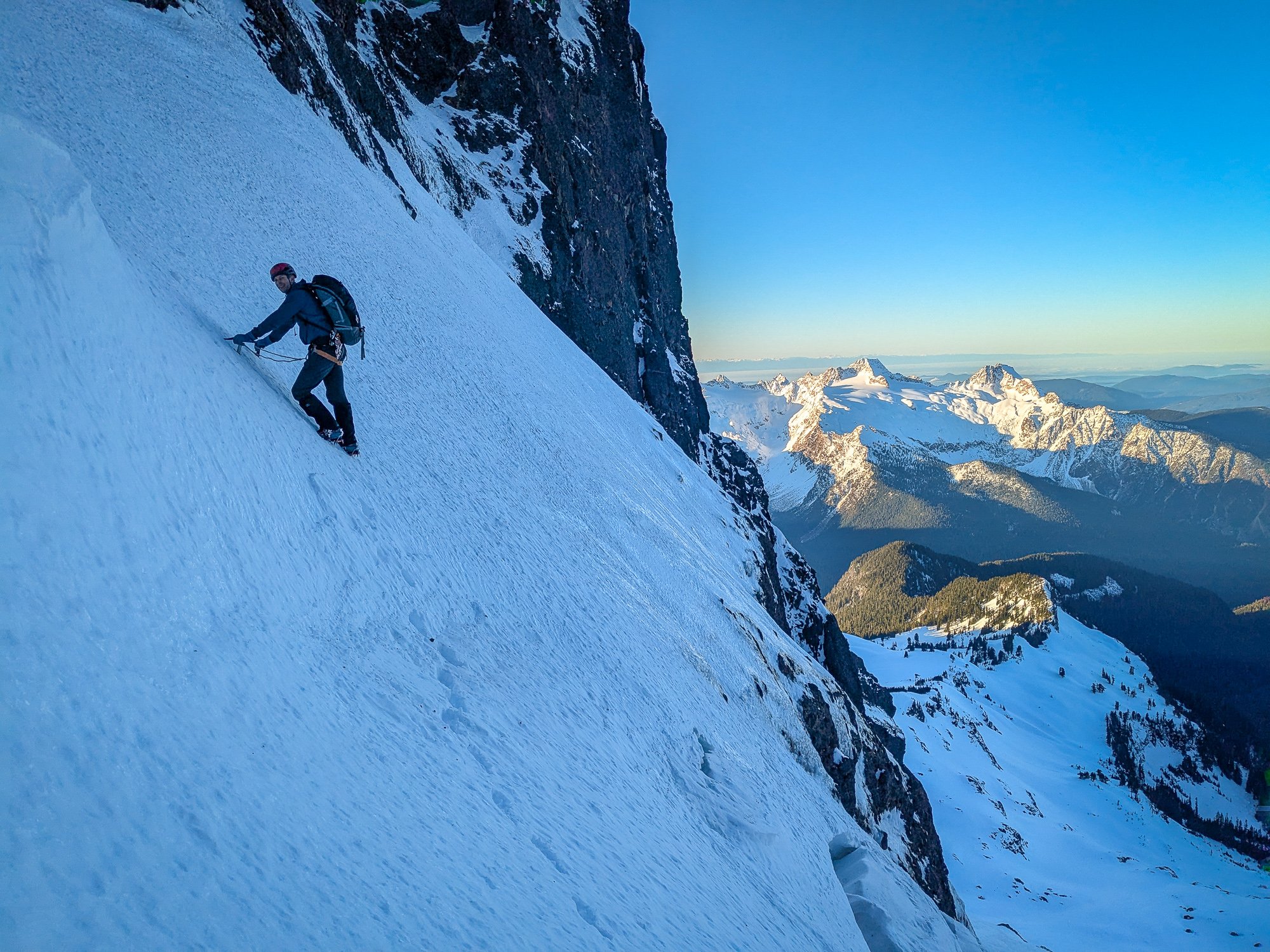
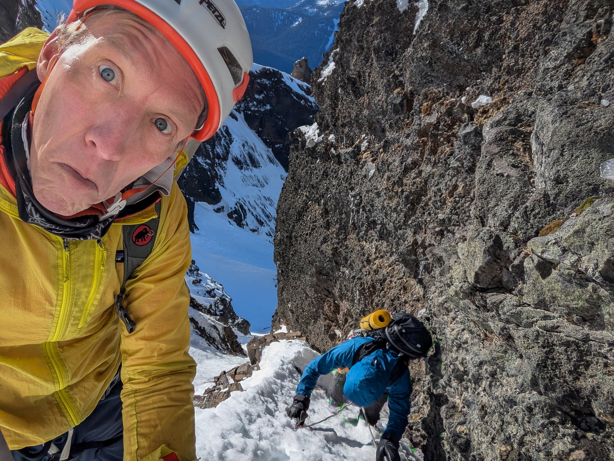 12 points
 -
Polish goes in “easier-than-usual” condition. Get it before it’s swiss cheese.
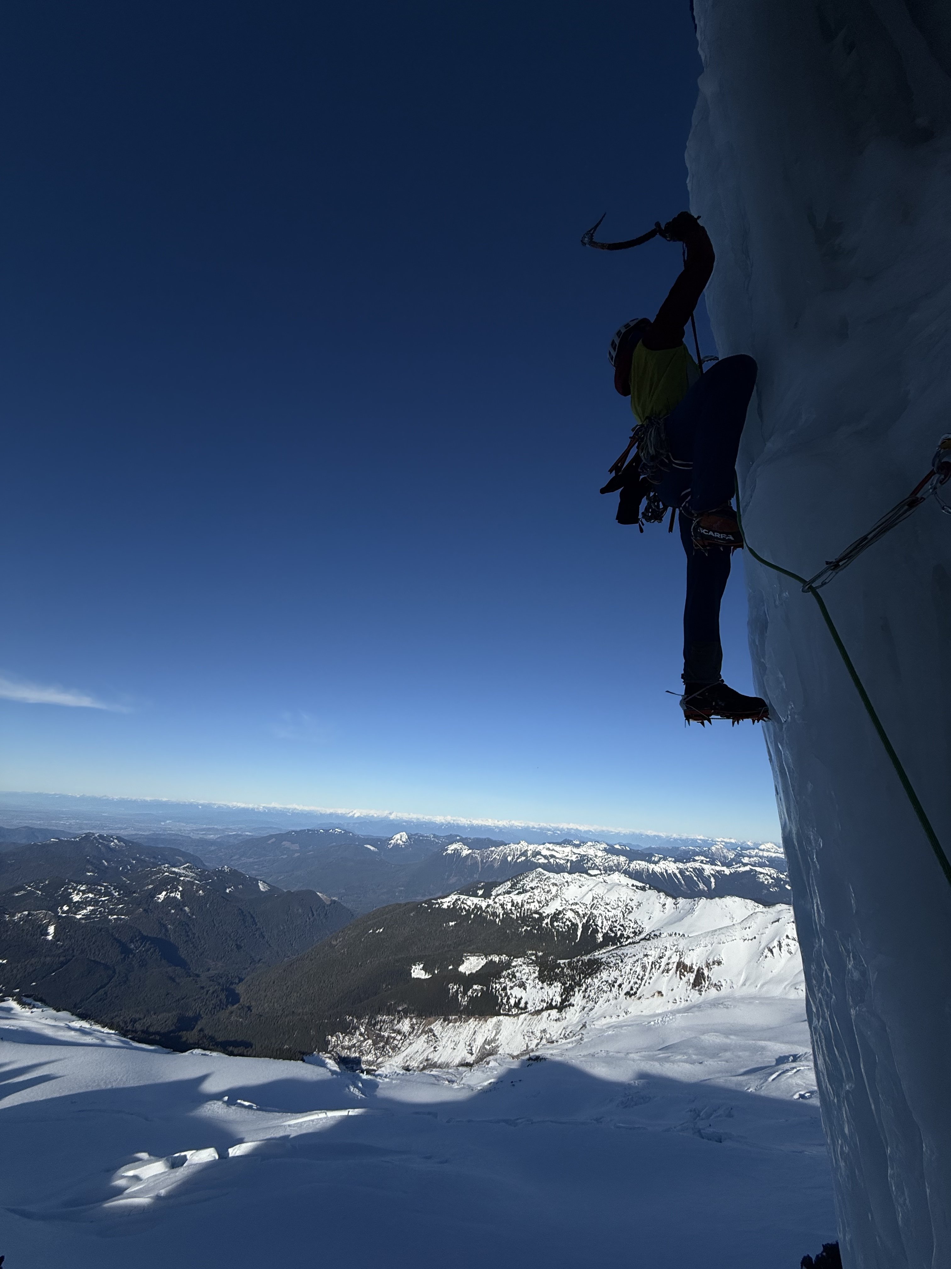
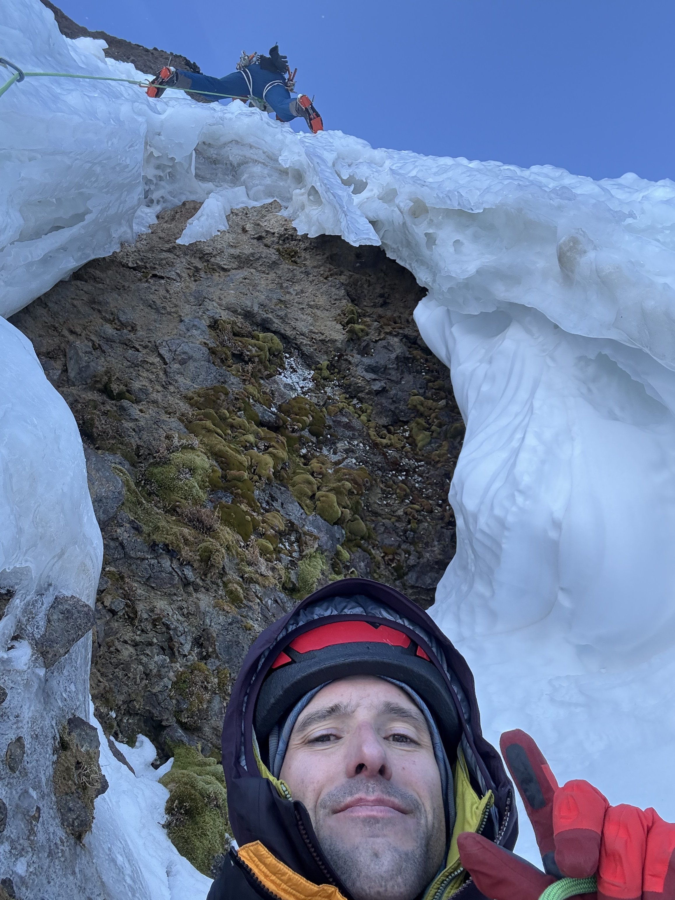
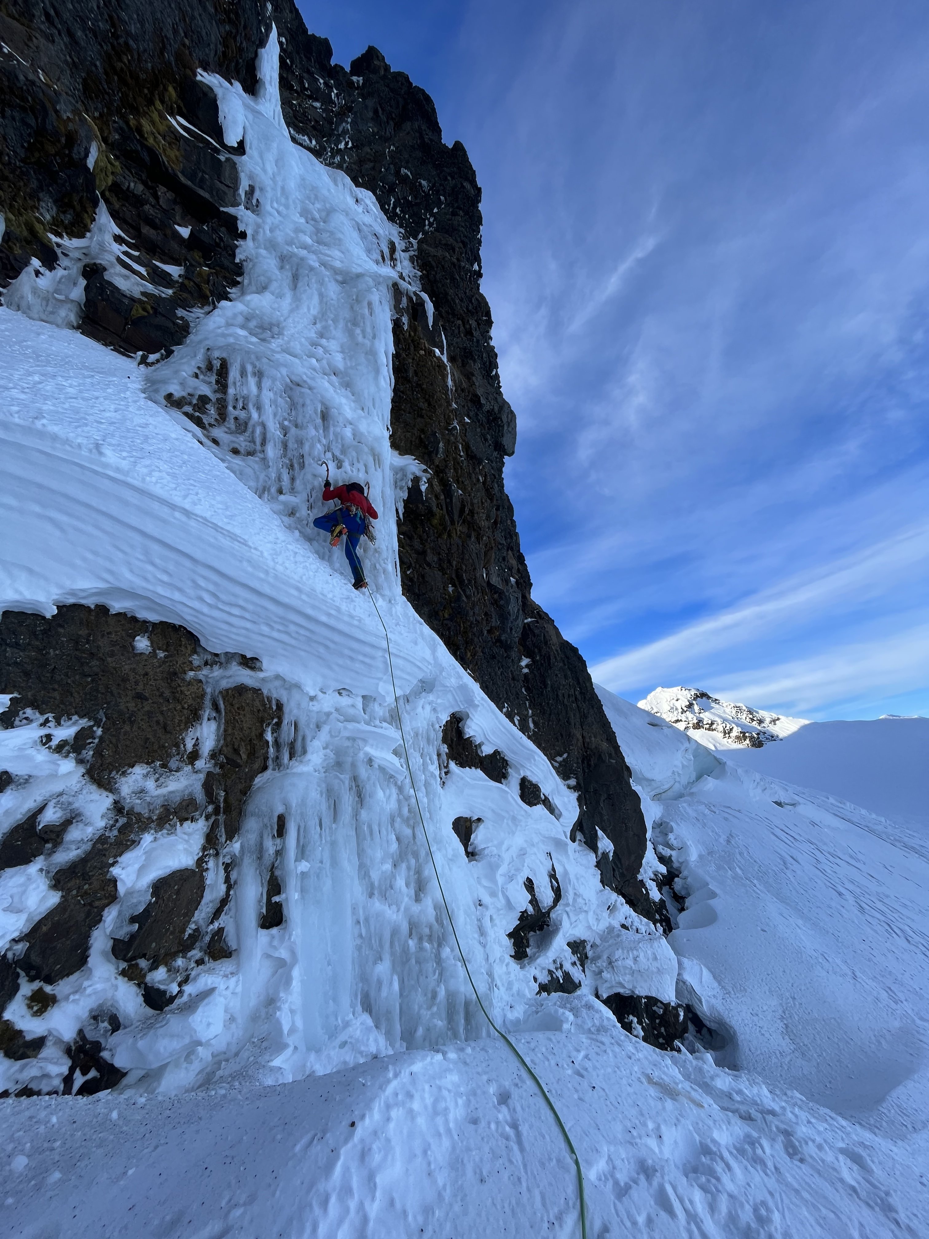
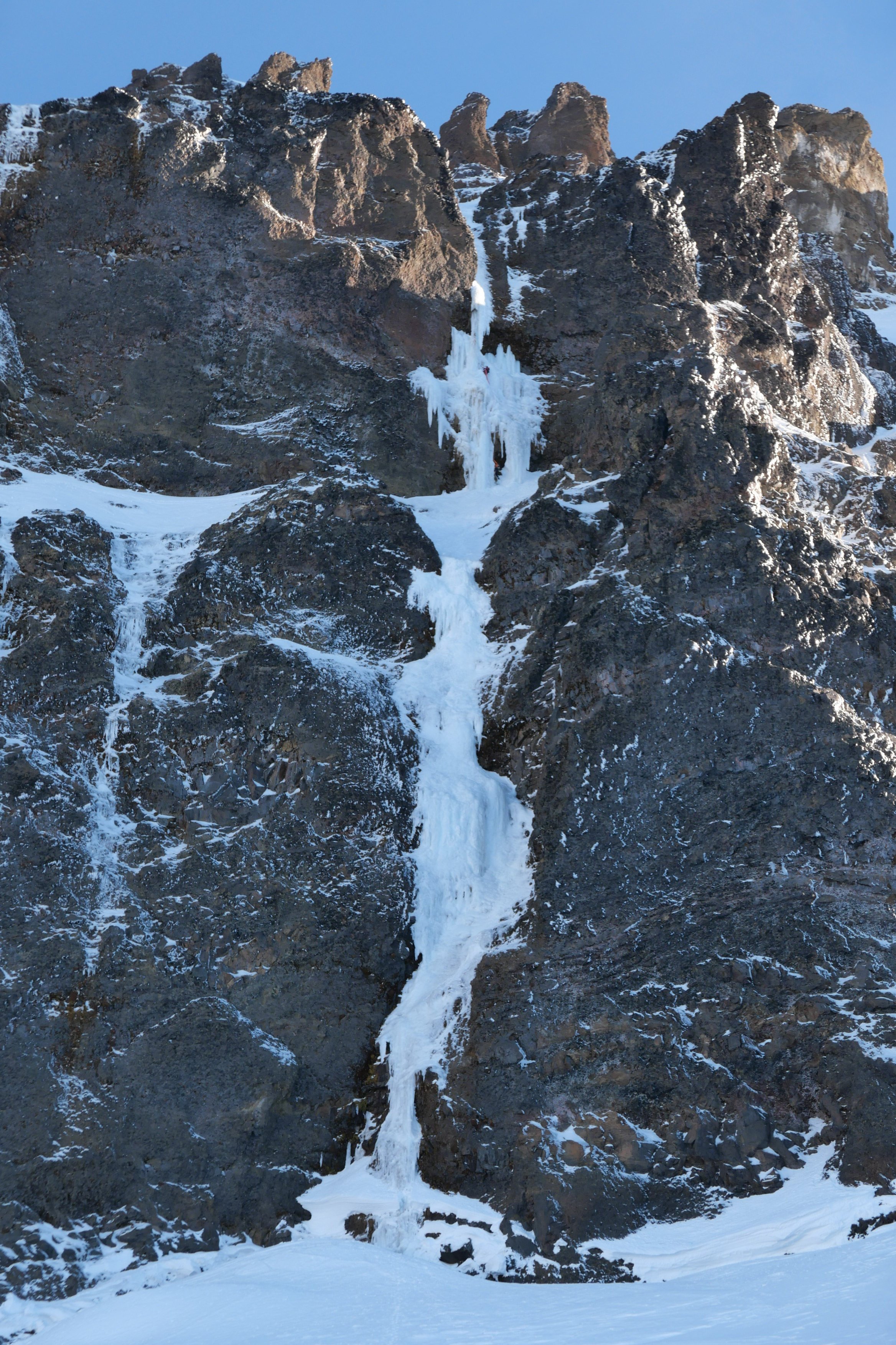 12 points
 -
Haven’t seen many TRs here for this route in the last few years, so I’ll chip in. Hitting the trail at 3am worked well for us (after heading down the spur to nowhere for a few minutes before correcting course). This time of year that meant arriving at the propeller cairn just in time for the darkness to begin lifting for the scramble down to the slabs. We filled up before that scramble (4L for my partner, 3.5L for me) but could have done so a little later. There was plenty flowing from ice blocks on the shelf at the end of the slabs right before you gain the ridge. We also ended up finishing the technical part of the day just before dark. Along with all the water and a little extra food we had enough stuff to ride out a bivy if needed, but intended on a c2c. We planned to simul most of the route but ended up pitching out almost all but the section of 4th above the largest bivy ledge. Including that simul block I think it was 14 pitches for us: 3 to the notch where we opted for the bypass, 3 along the bypass, 1 to gain the bivy ledge, 1 simul on the 4th class stretch, and 6 pitches up the final headwall to the summit. From where we began pitching it out it took 9.5 hours to the summit. It had rained a lot (maybe even snowed according to some forecasts) two day prior. Before the climb I had worried about this but it wasn’t terrible. It was slick enough in spots to discourage us from simuling, especially in the mossy bypass section. The climbing on this route is super fun. The rock quality is never great, but it’s usually plenty good. Finger locks and hand jams galore, interspersed with interesting face climbing too. In some of the dirtier sections there are little solid rock islands (often polished white) in the choss that lead the way, keeping the difficulty lower than you’d expect from a glance. We each had a couple minor slips on wet sections but no holds broke the entire climb. We roped up at around 5900’, expecting to simul. But my partner led into a tricky traverse so we pitched this one out to a ledge. From there, slabby moves to the left looked just a little too committing and devoid of pro, and I found a fun blocky way to the right, stopping at a slung tree. From here my partner led us to the junction with the bypass (there might have been a little simuling on that pitch). After one lead in the mossy damp bypass my partner declared his distaste for it and so I led two more pitches to join back to the crest (the second of which was 4th class, I didn’t bother with pro). At this point our beta mentioned a 5.8 layback, but I didn’t see any reason to climb it that way. It was more like 5.7 with fist on right and stemming and positive holds on left. The only real difficulty was some wet rock, but the feet were secure so it was good. Almost new moon shot, zoom in. Somewhere in the bypass section. The big bivy ledge was one of only two times we were in the sun during the ascent, aside from the first couple pitches gaining the ridge. I led up the fun scramble to the next sunny bivy ledge, below the final headwall. It seemed like our pace was reasonable enough to this point, but the summit looked quite a ways off from here. Just left of the crest a left facing corner fist crack on granite looked like an inviting start but the beta described starting right of the crest so that’s what we did instead. Starting up the final headwall. Rock was generally good going up the headwall, with lots of finger, hand, and face climbing as mentioned earlier. I took the second pitch. My partner led the third pitch (5.9) which was the crux and the best climbing on the route. As an extra bonus, the crux was the wettest spot on the route. Fun traverse right on steep rock that looks harder than it is. I led the fourth pitch, which might have been runner up funnest climbing. There was a delicate traverse through some of the more obviously loose choss on the route near the end of the pitch. The view from the top of this one down the ridge is pretty wild. Another party was finishing the 4th class section at this time but I didn’t see them again. Climbing on a Thursday worked great. No one else was at the trailhead when we arrived Wednesday night. My partner said there were two parties of 2 behind us. I imagine today (Saturday) it’s a lot more crowded. From here it was probably 5.6 maybe 5.7 to the summit. We could have simuled but were in the rhythm of swapping so kept that going for two more to the summit. Didn’t check out the final bypass to the left. Staying on the crest was fun and easy, I’d recommend it. The rock suddenly transitioned back to clean granite just before the summit, icing on the cake. Amid a big insect orgy on the summit we briefly savored the views of Jack’s Nohokomeen, Luna, Challenger and Shuksan. Baker, Larrabee, and the border peaks kept us company as we descended by a crazy prominent tower. Above a classic obvious gully I saw a trail heading down a slope and mindlessly charged toward it. Fortunately I lost only 200’ vertical before realizing this was the wrong way (carryover). Back up to the correct notch we did more traversing over variable terrain as the climb we just completed came in and out of view. The descent is really long and I wasn’t up to speed on the rockfall induced changes to the standard descent. Fortunately my partner had paid more attention in his research. After a couple of raps to Crossover pass he corrected me after I blew past the start of the crack of noon descent. There was yellow flagging marking the route, and bolted rap anchors all the way down. Trying to be efficient I down climbed in parallel with my partner rapping, occasionally joining onto the rap for damp and needly sections. Most of the route is less than 5th class. We touched down and packed up the climbing gear just in time for headlamp hour. I had a random gpx from a decade ago for reference. We headed down blocky talus which was fine enough. Gradually we reached a vegetated area. The track I had made a big diversion here. It was only about 300’ wide so I decided to just follow an approximately straight line here, thrashing as needed. My partner was unimpressed but it really wasn’t very long or so bad, plus there were berries With the groans, thrashing and berry munching we might have been mistaken in the dark for bears. Finally our reference track popped out on an obvious trail. We could have used a better reference. With all the flagging, blazes, and traffic, there’s got to be a much better way that we just couldn’t see. Once on the right trail we sailed down the increasingly dank trail. Saw some of the largest mushrooms I’ve ever encountered, plus some cool deep violet ones. We arrived back at the car a little over 20 hours after we left it. The trailhead still wasn’t crowded. Given the hour we opted to spend another night here. A couple years ago my partner and I climbed the north ridge of Stuart c2c, which took longer than this one, partly due to waiting out a squall on and after the 3rd pitch. That’s a useful baseline when contemplating long routes - seems long but hey, shorter than N ridge of Stuart, so let’s do it We agreed that Slesse NEB was a real good time and that we are probably satiated on epic days for the summer, though I might try to squeeze one more in.
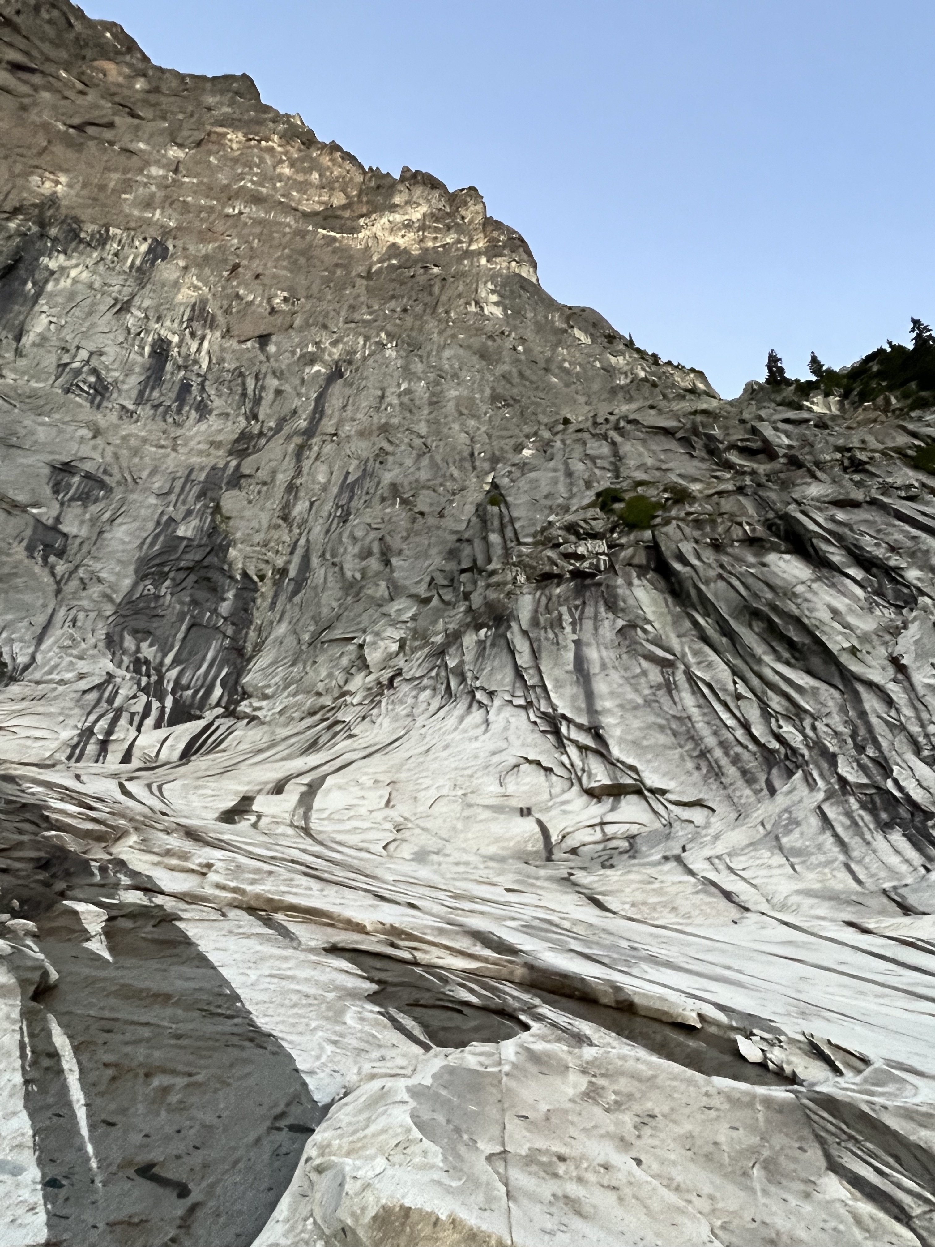
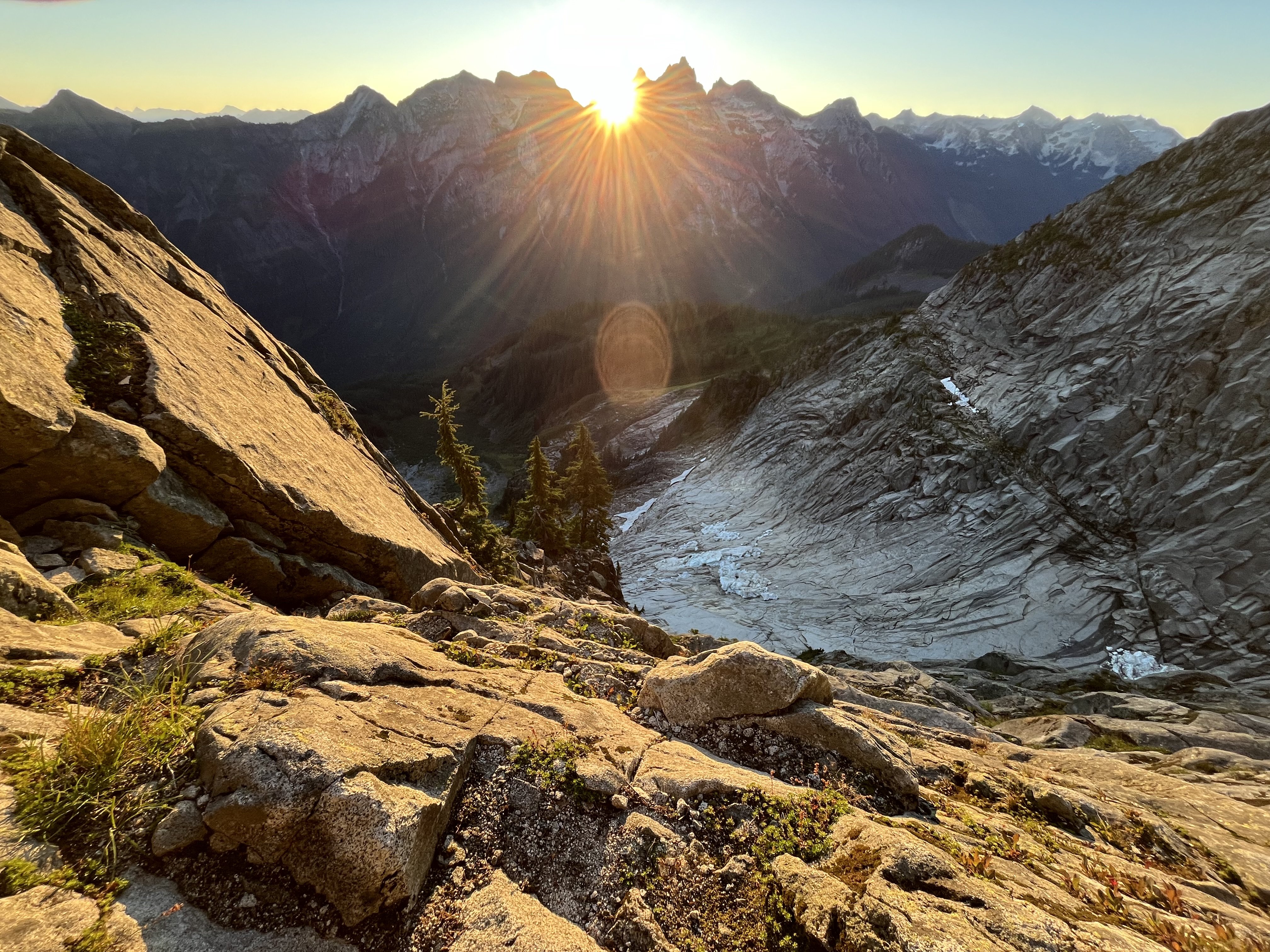
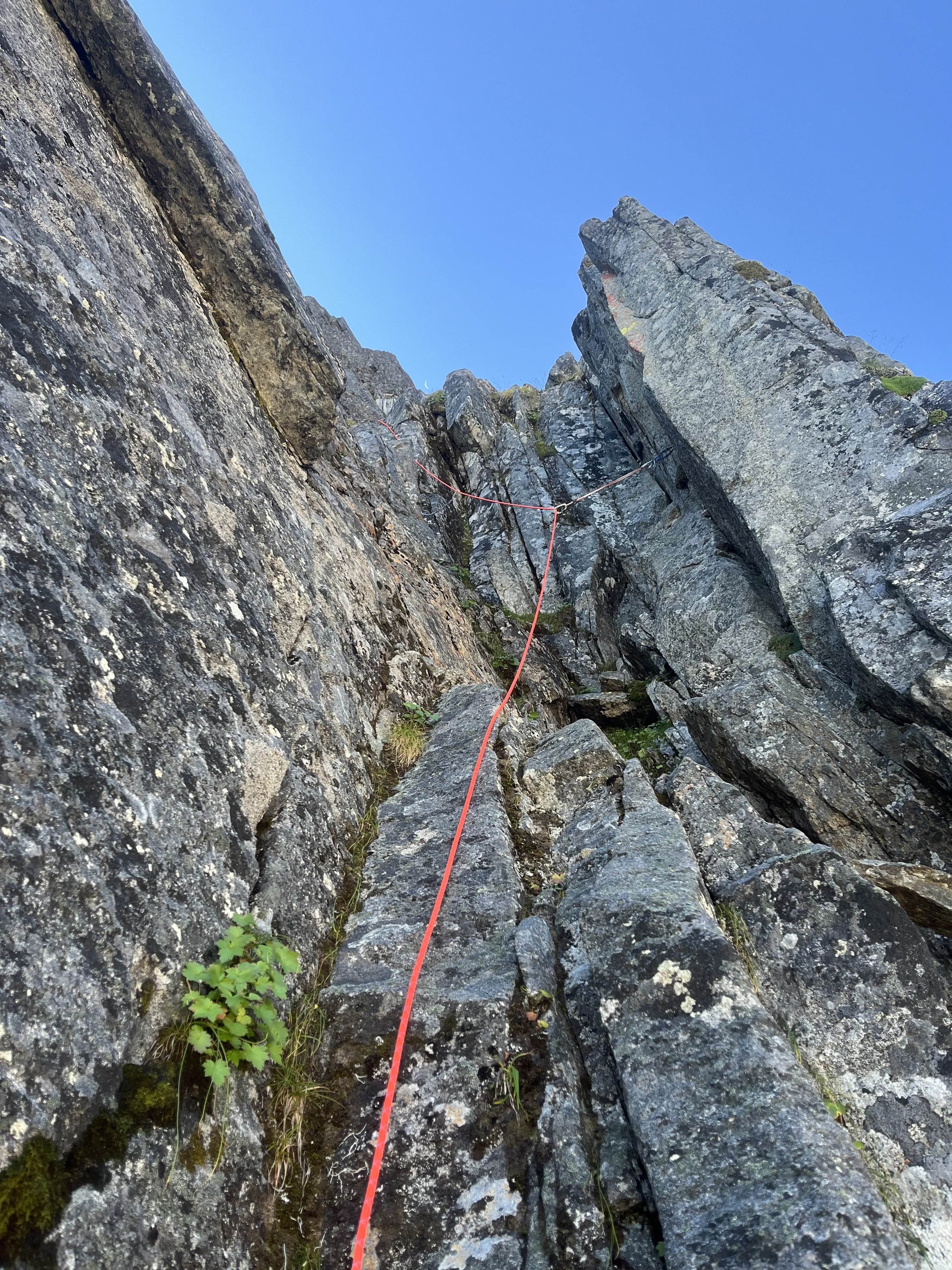
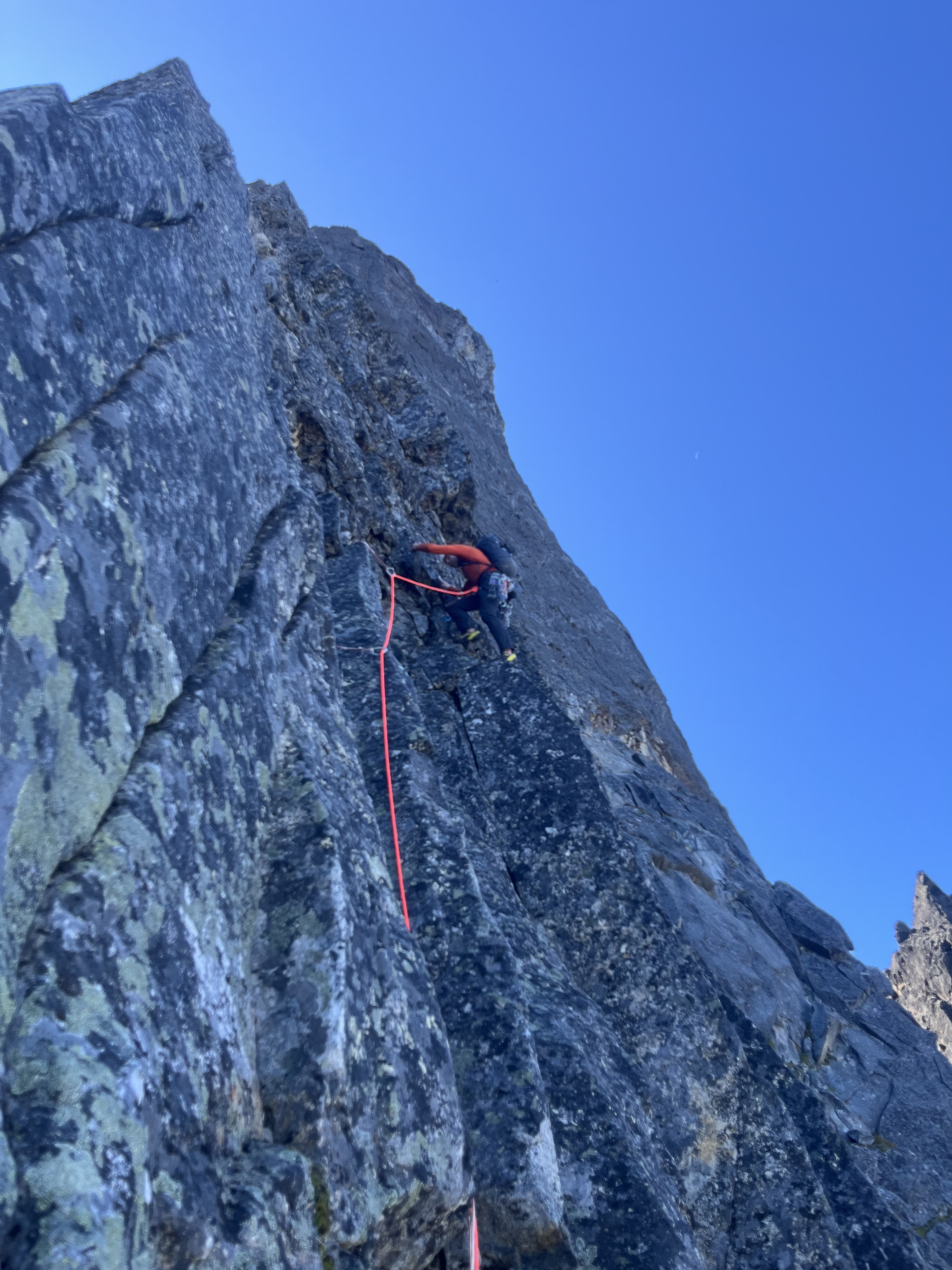
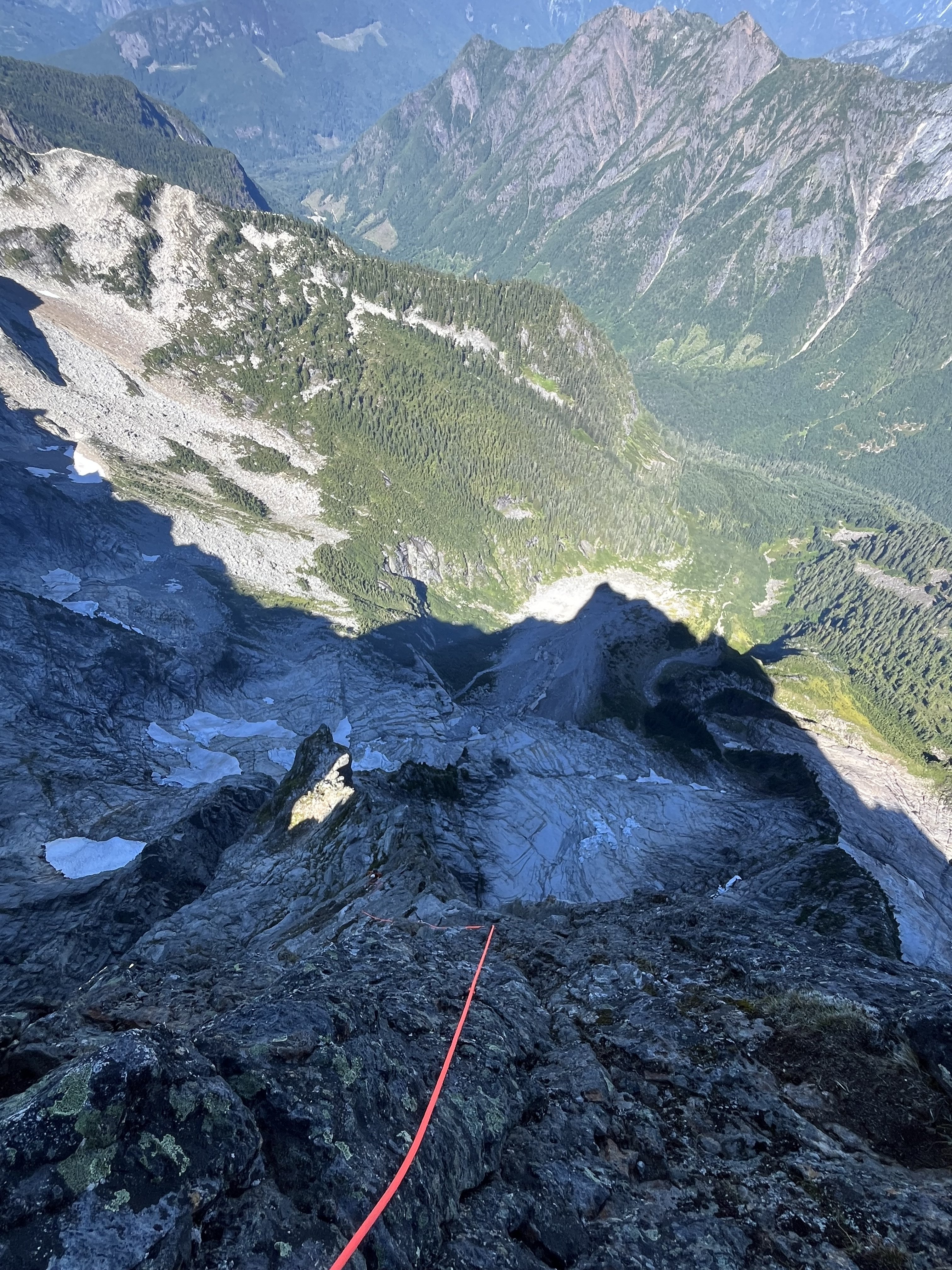
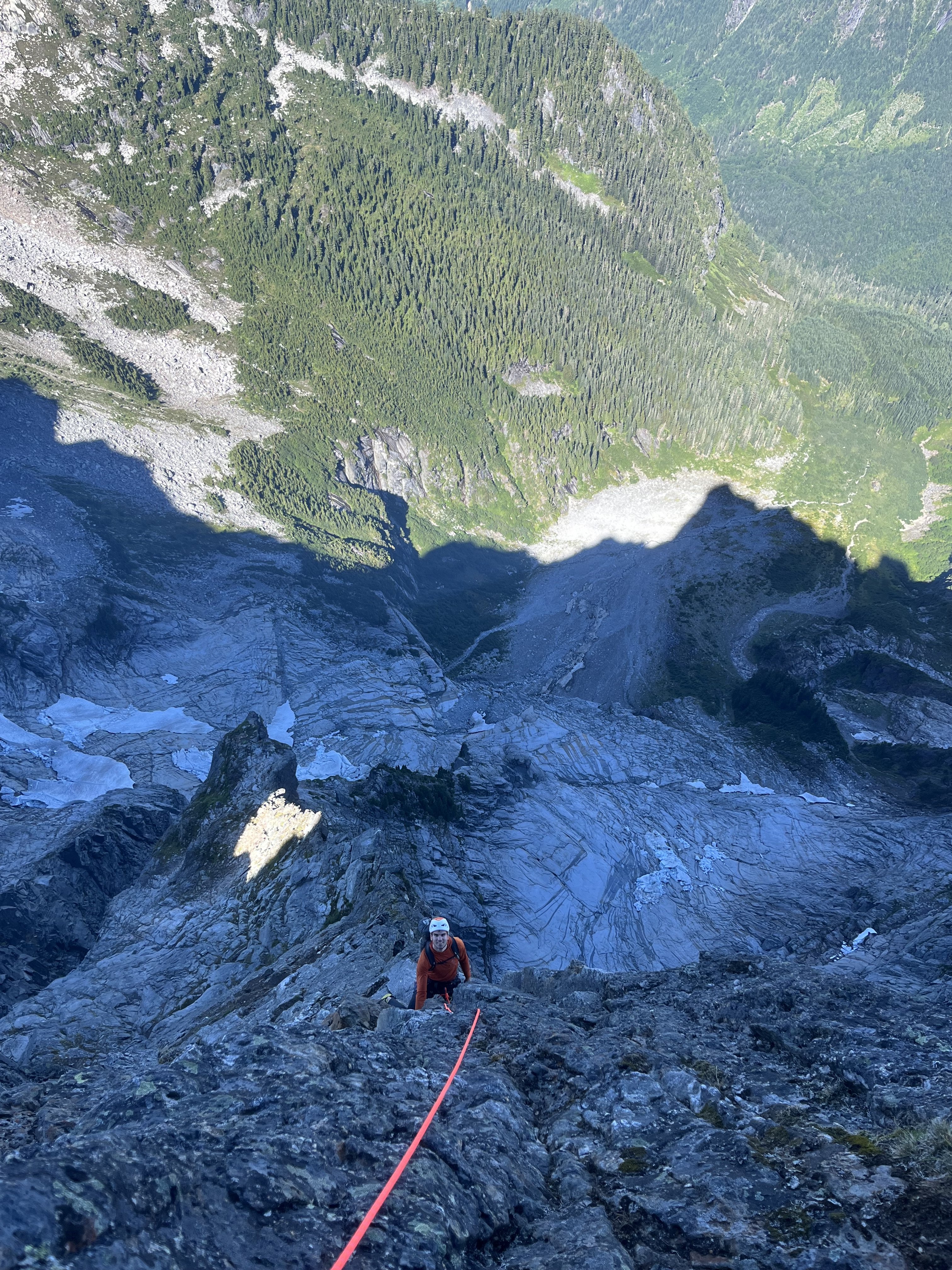
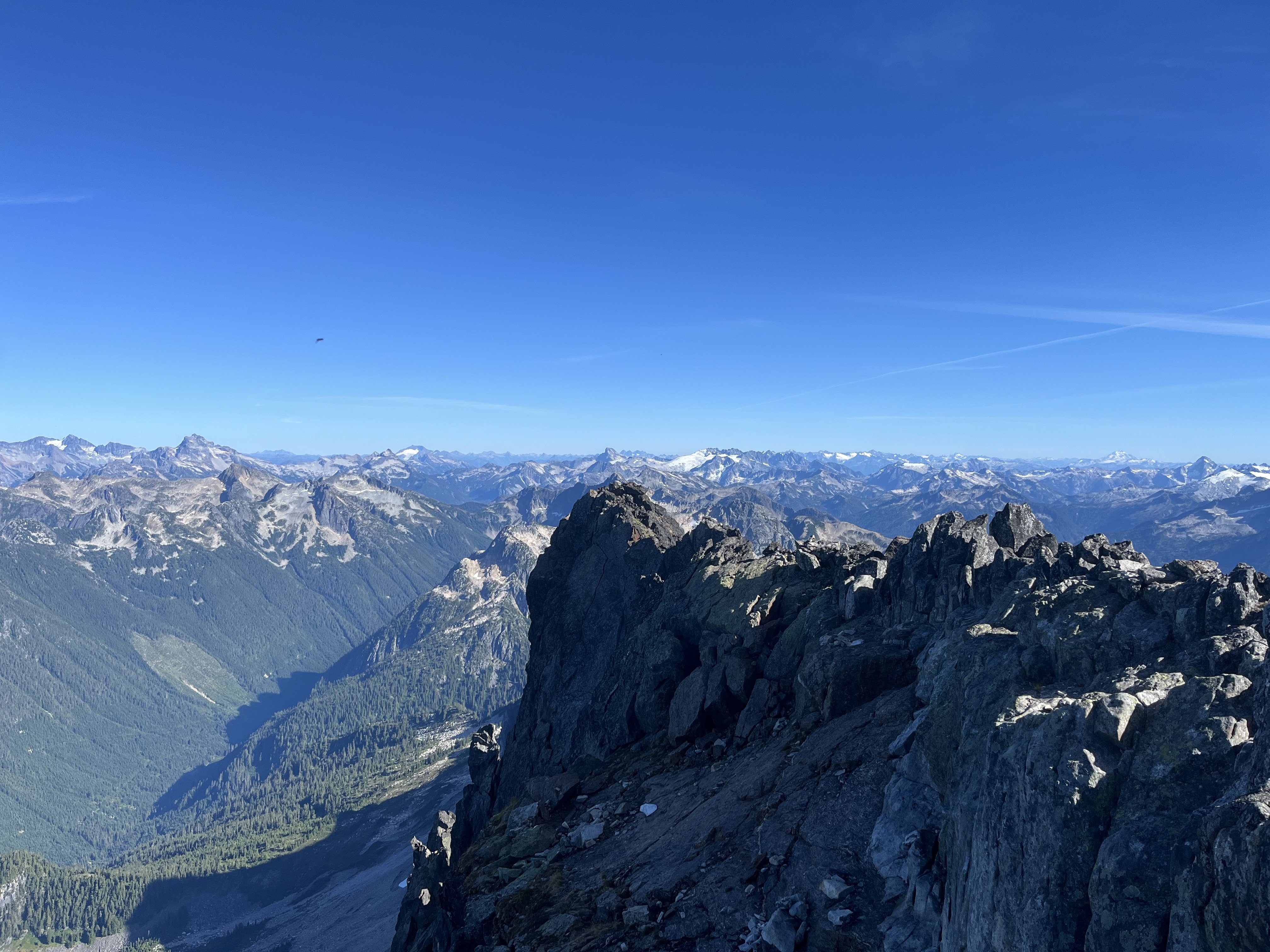
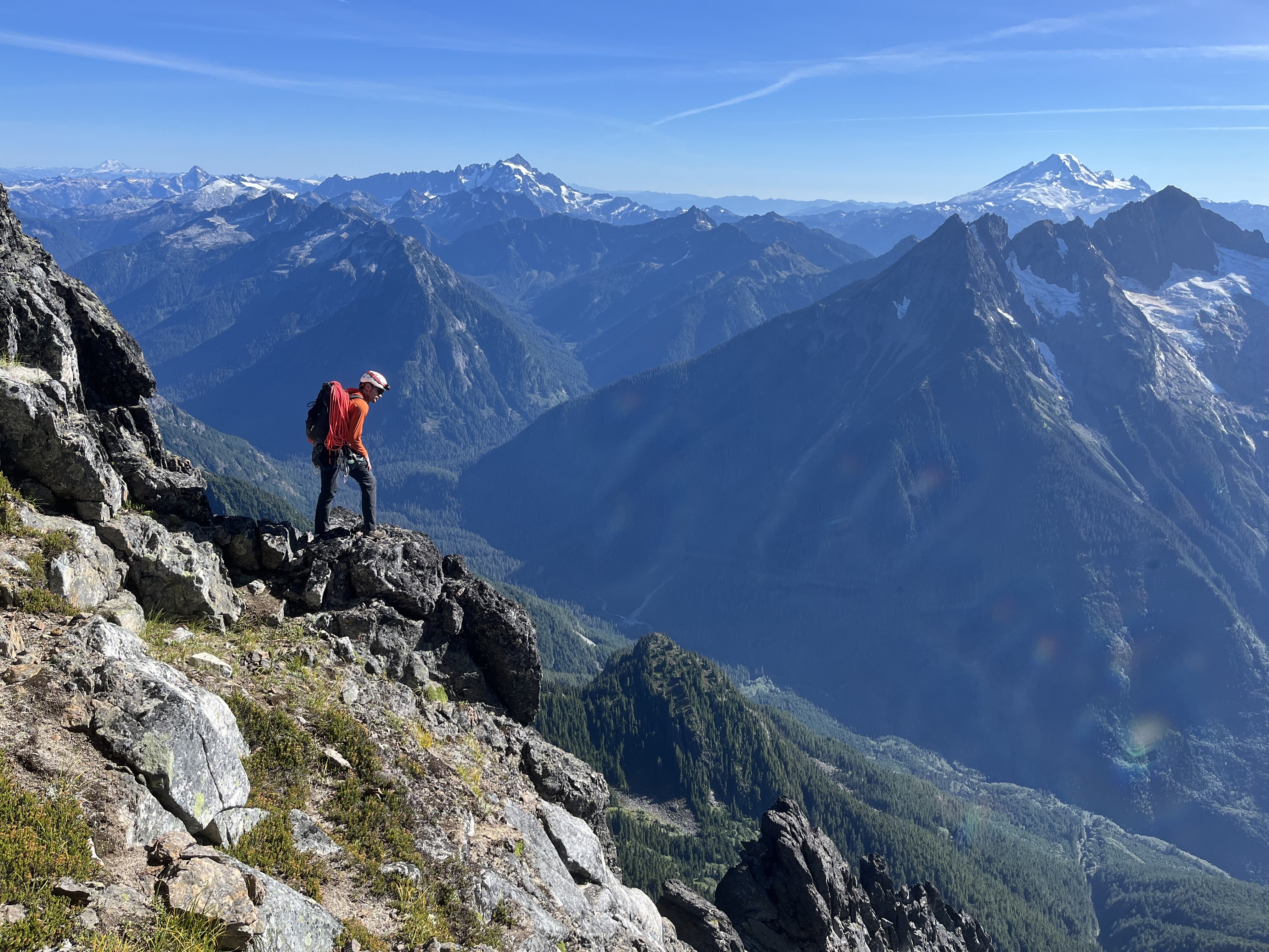
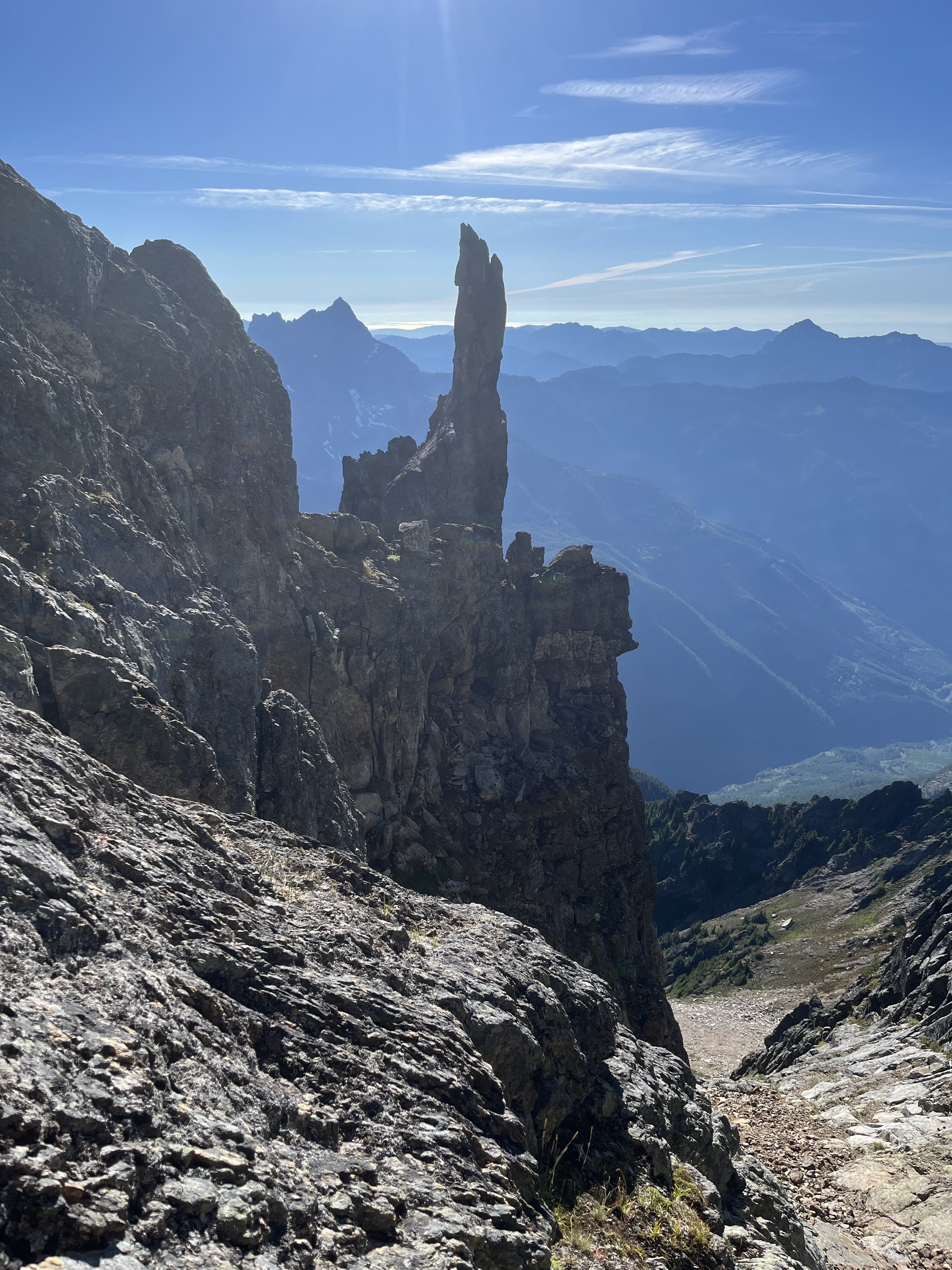
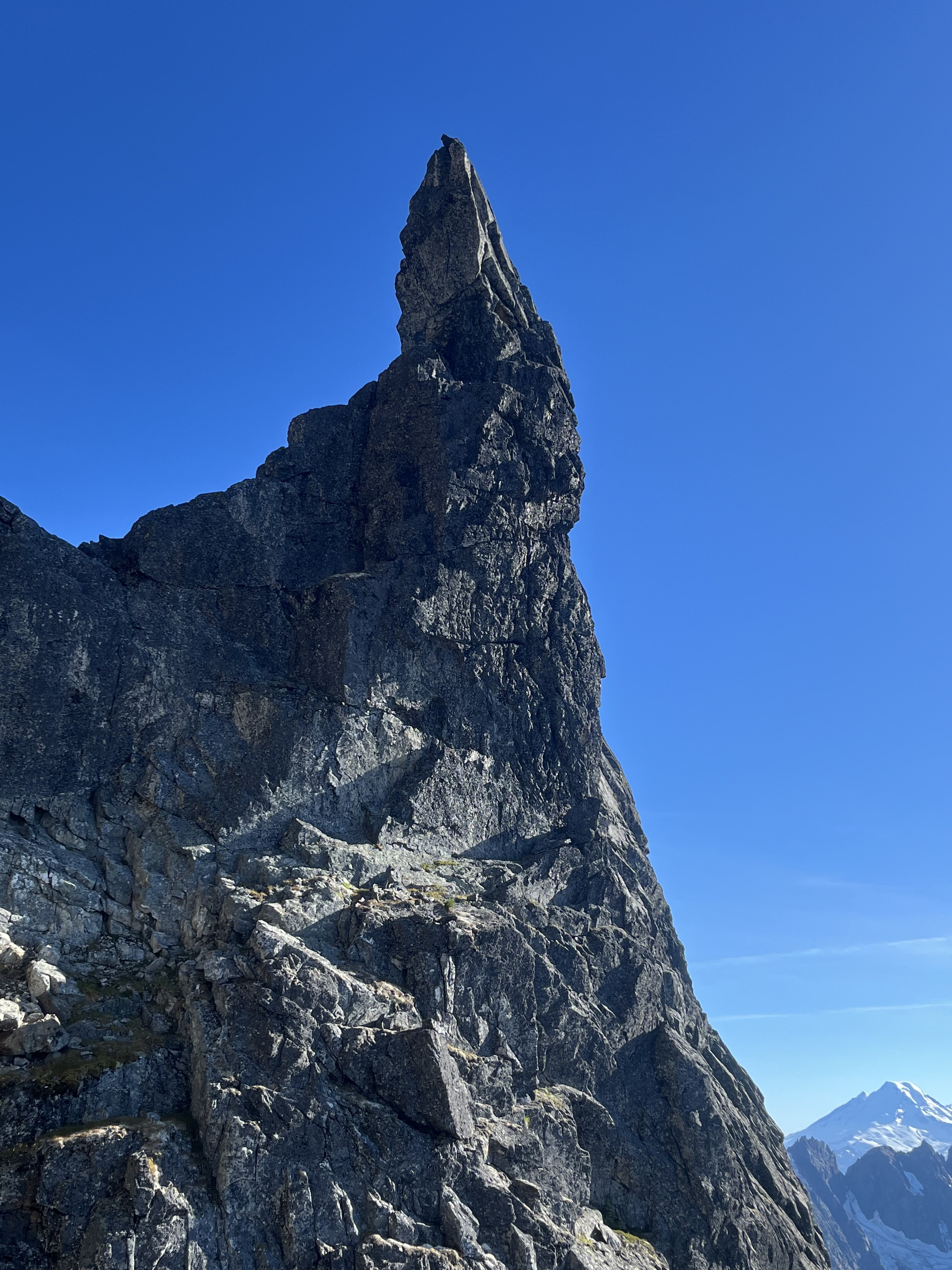
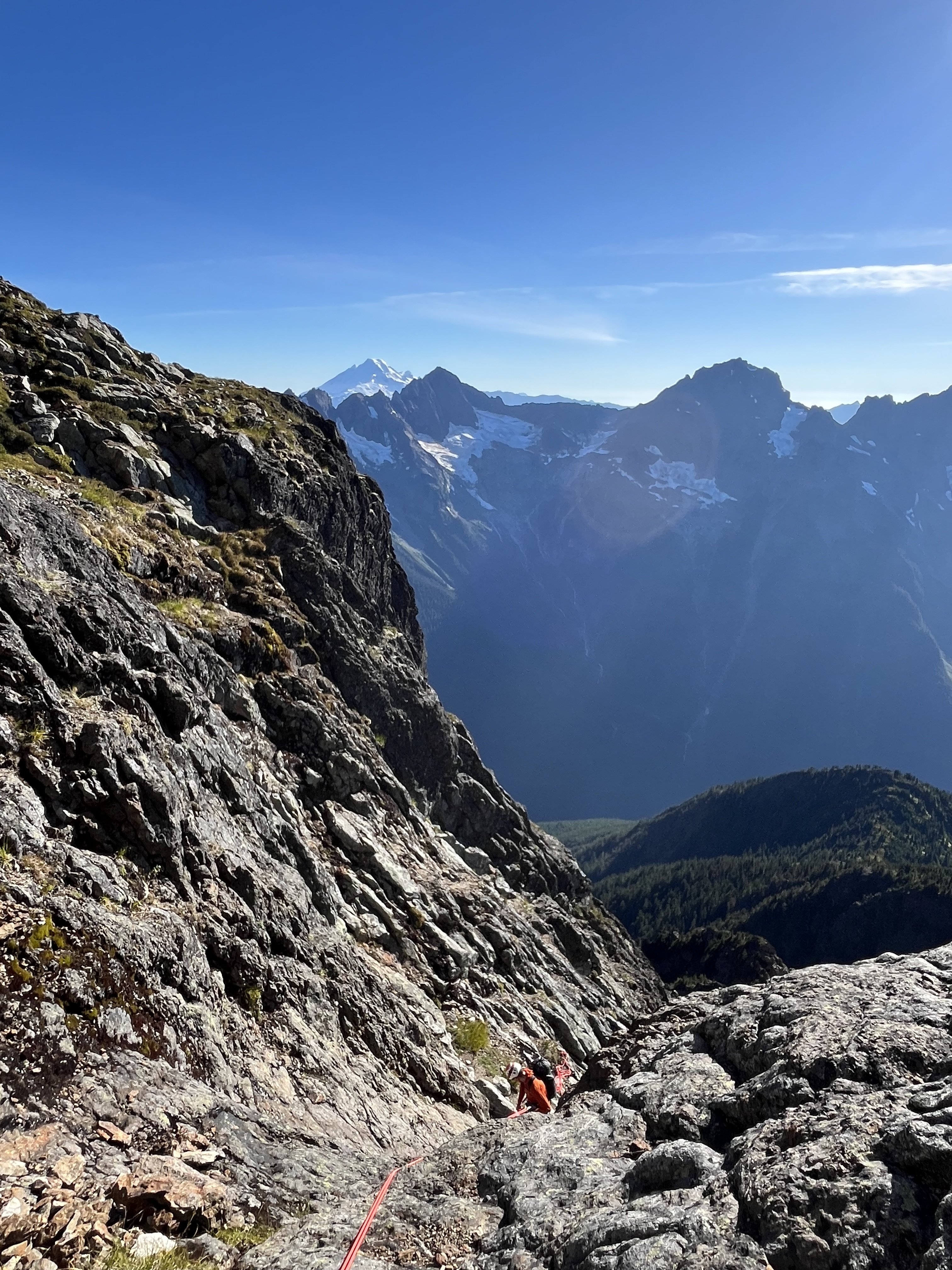
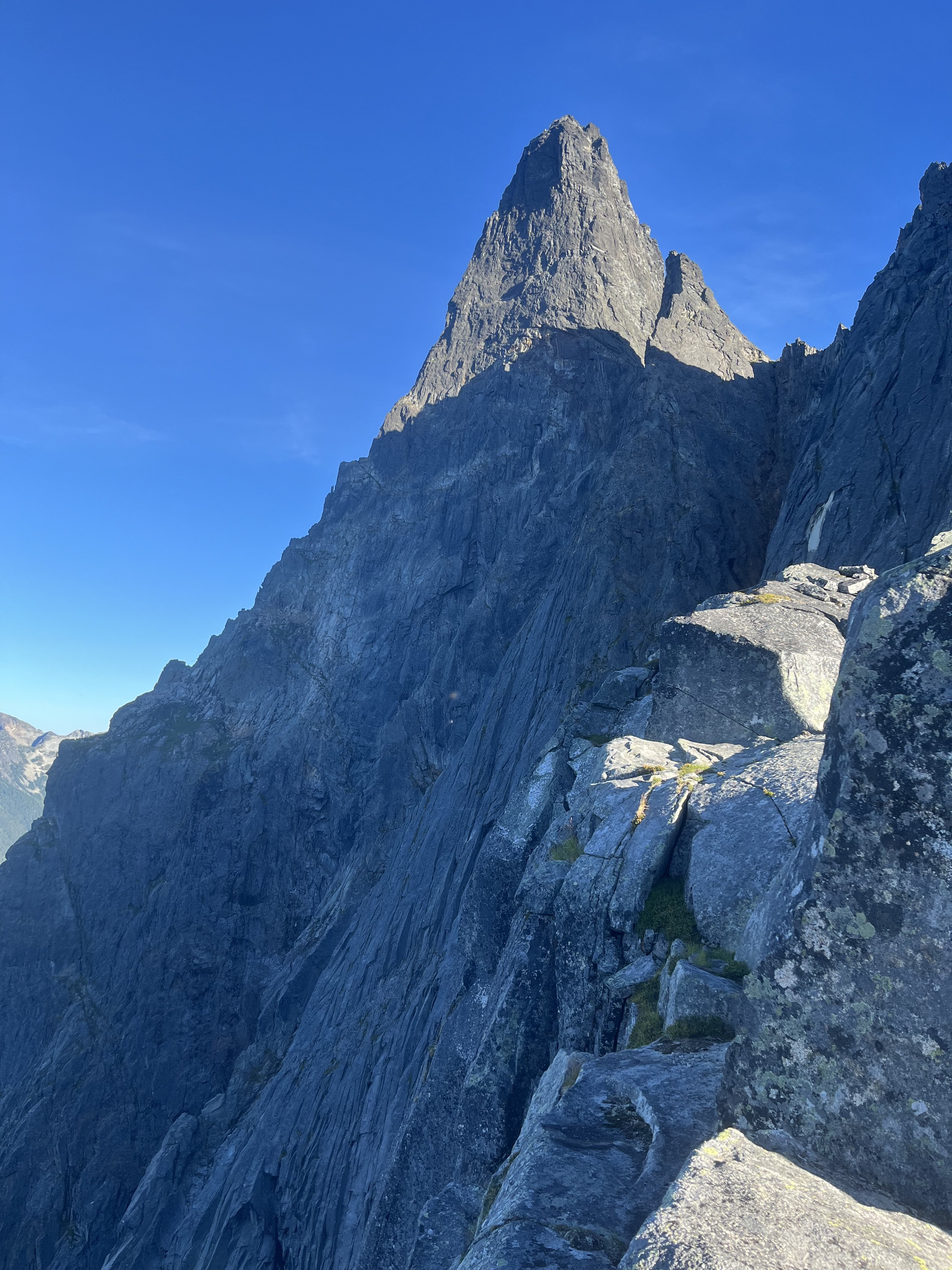
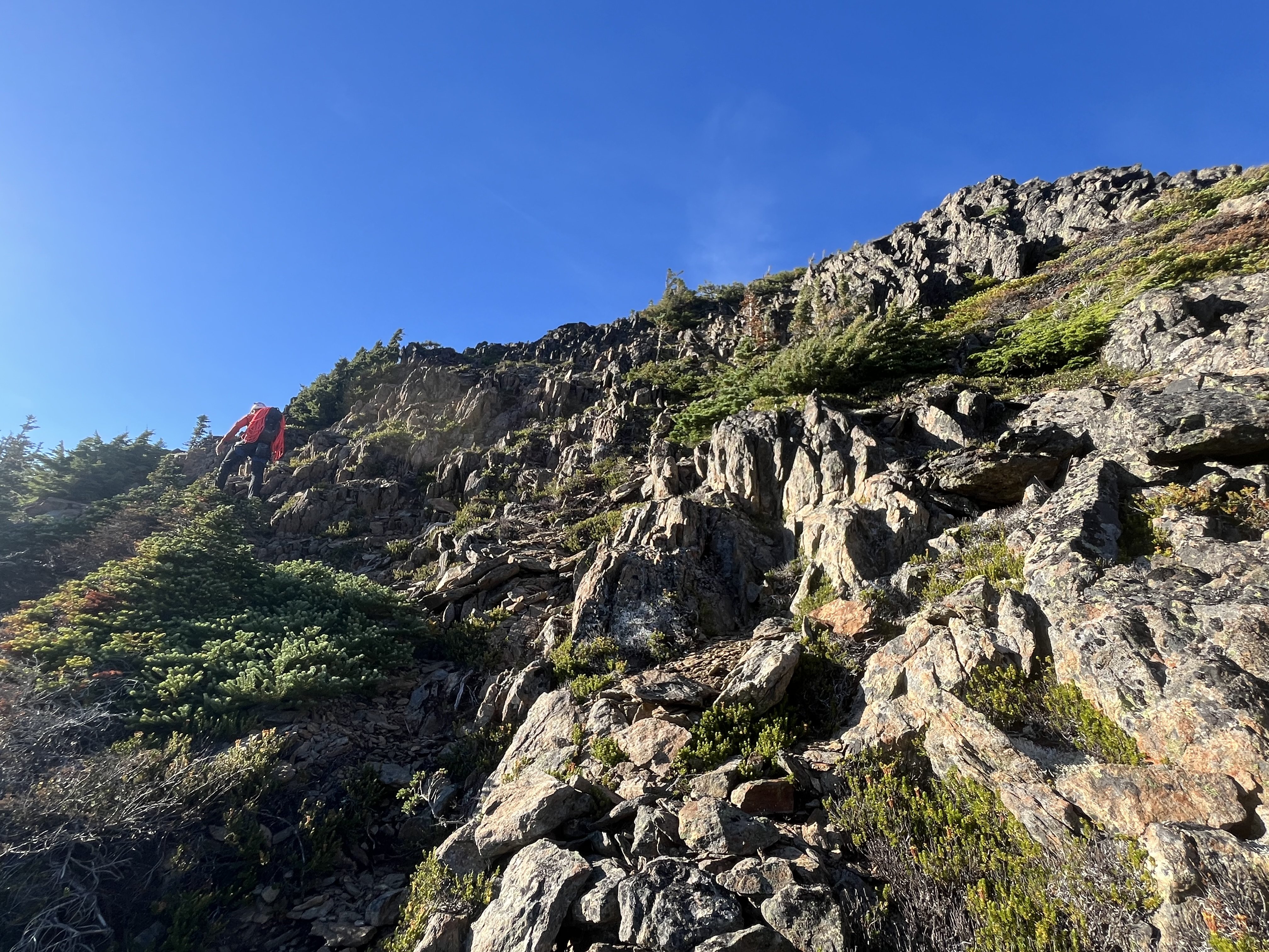
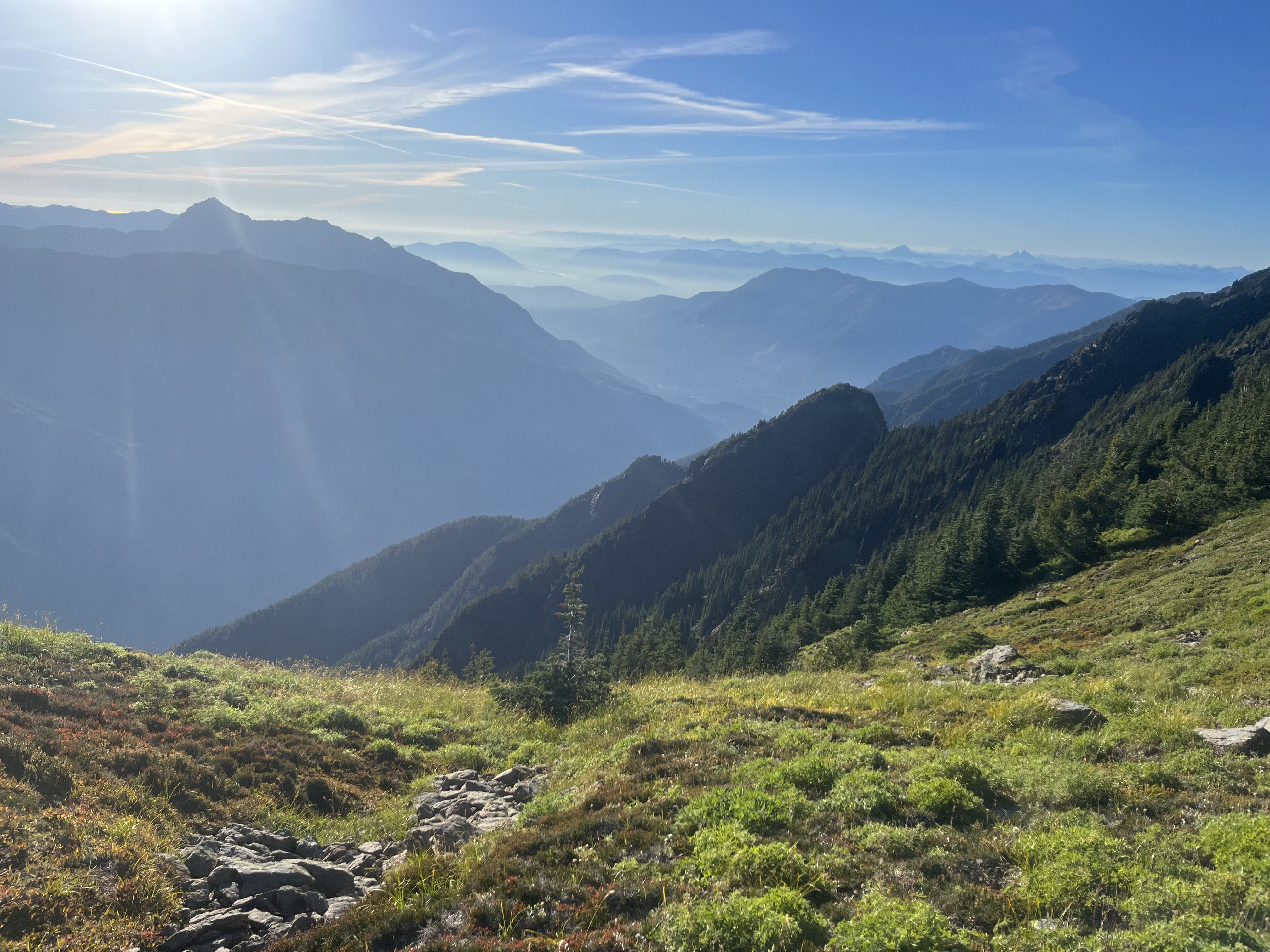
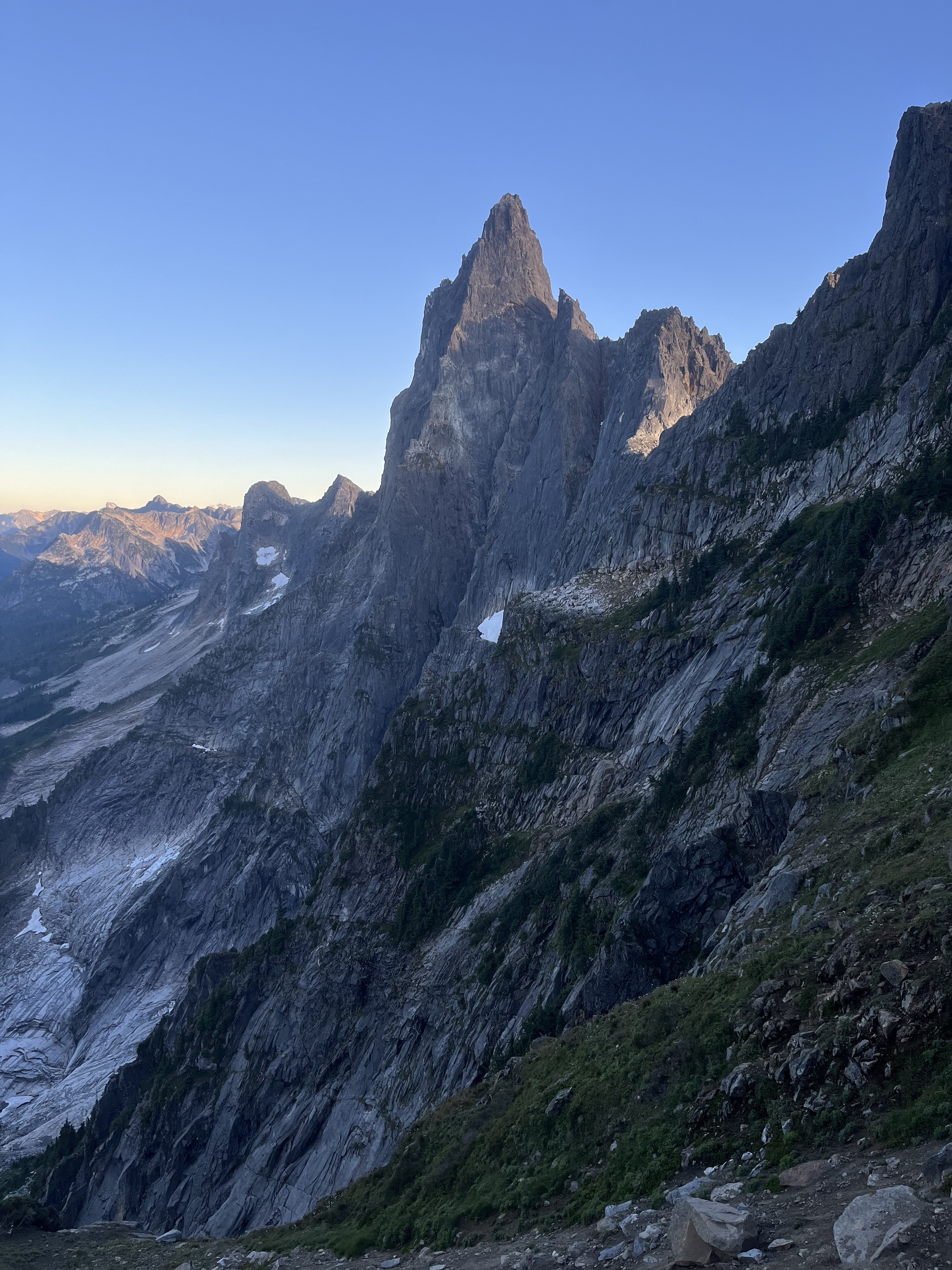
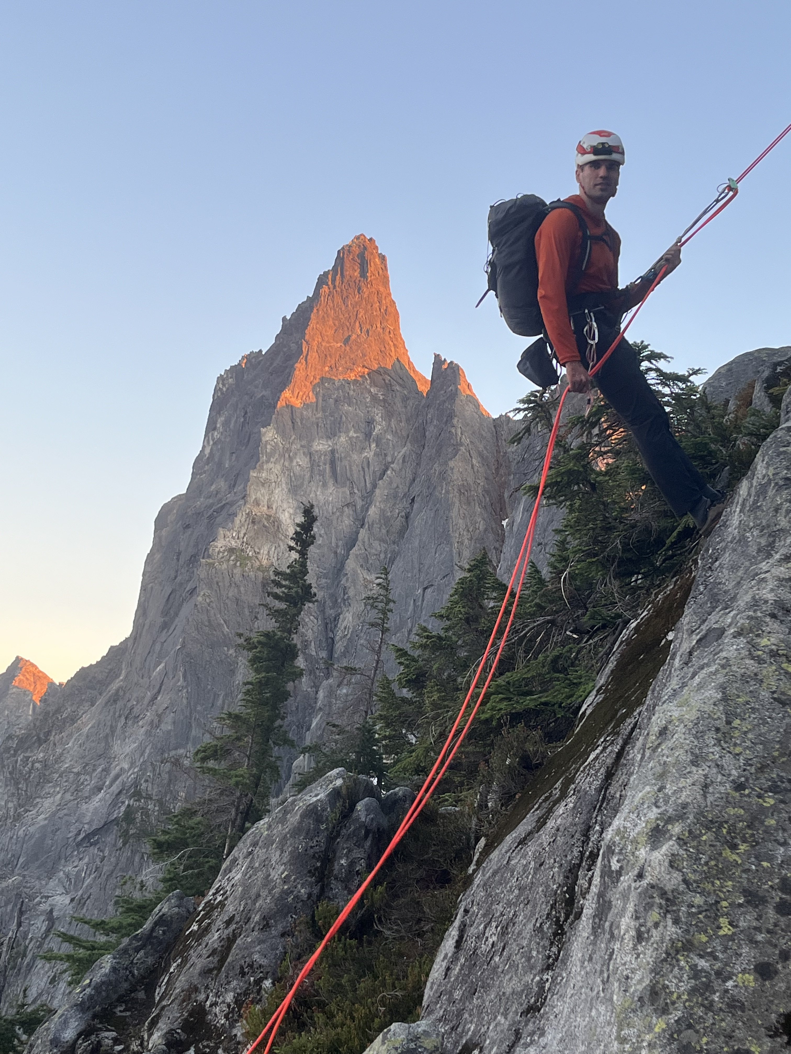
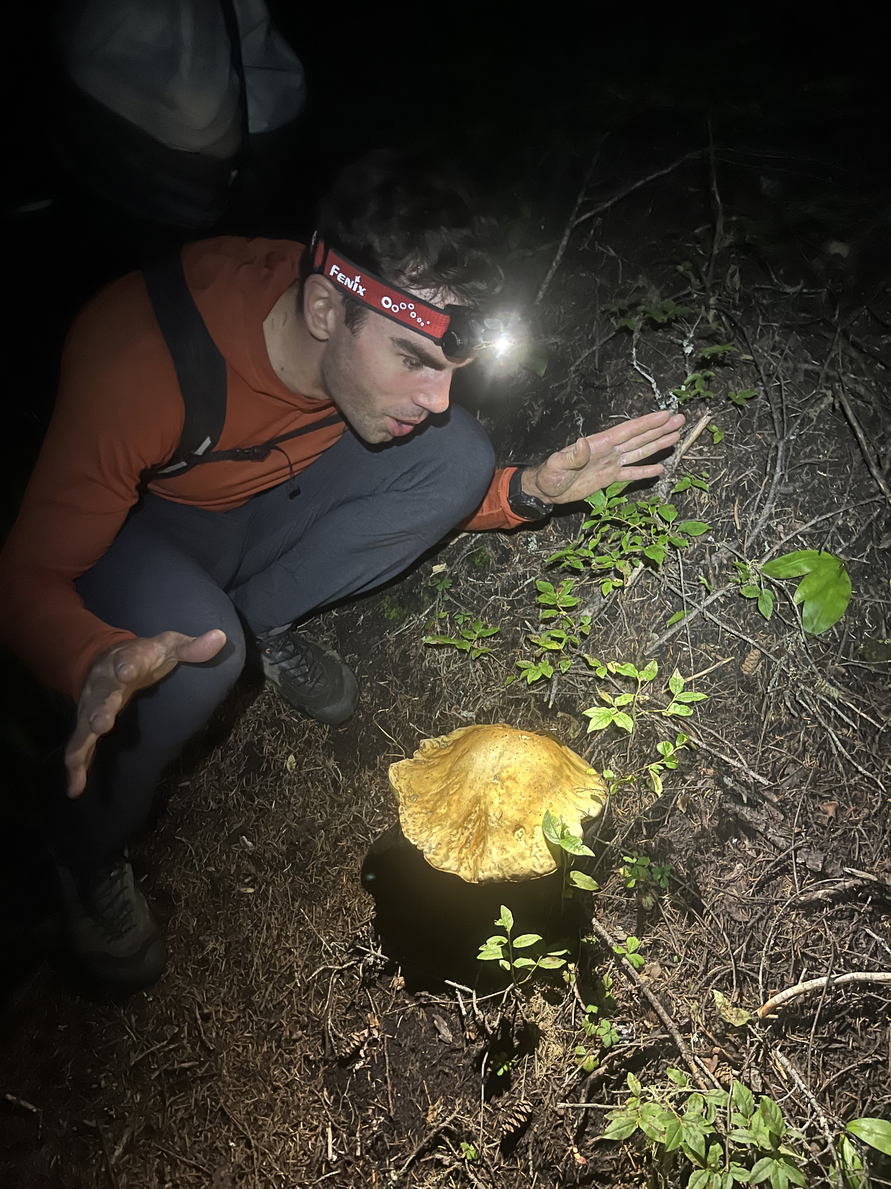
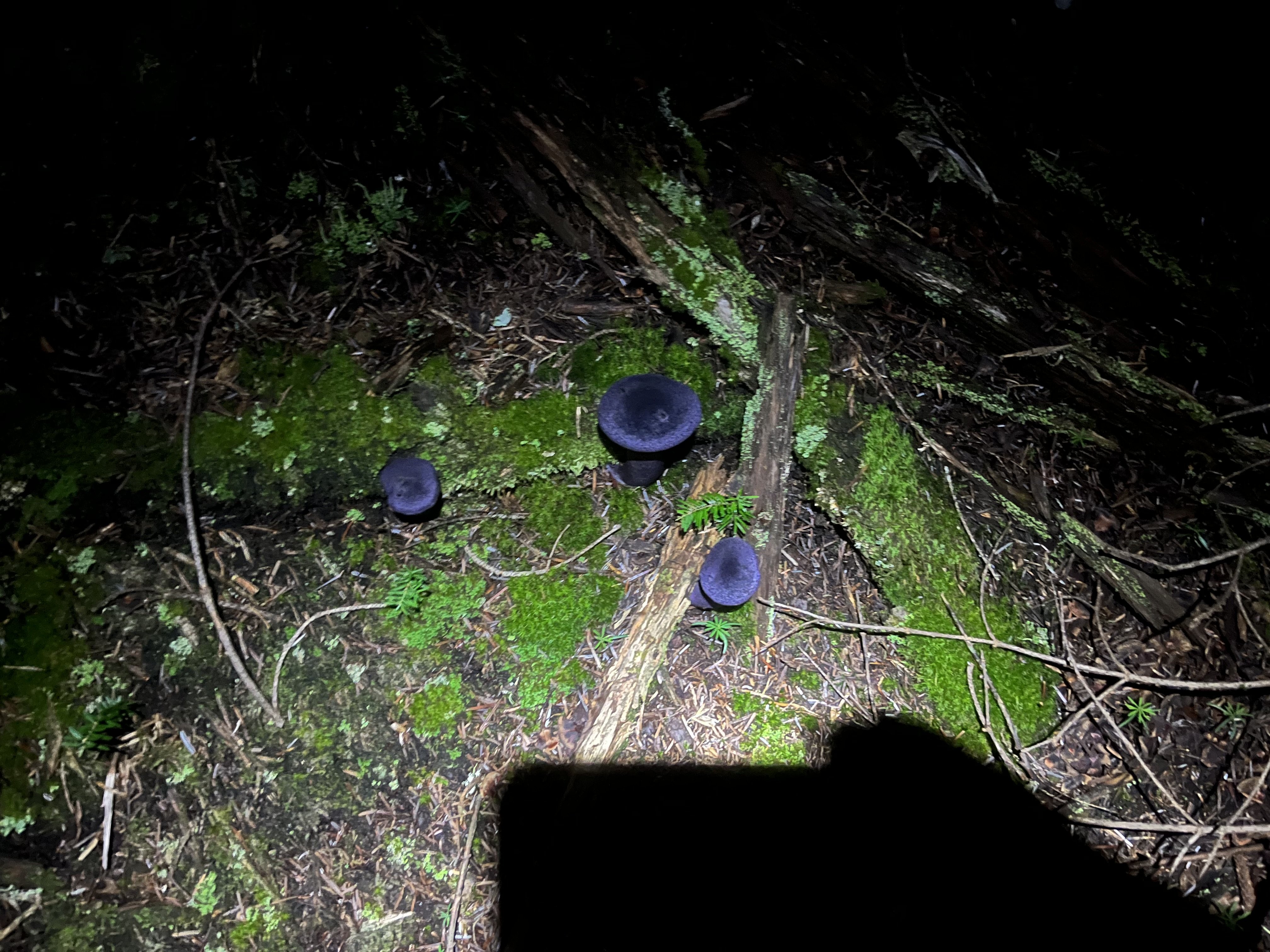
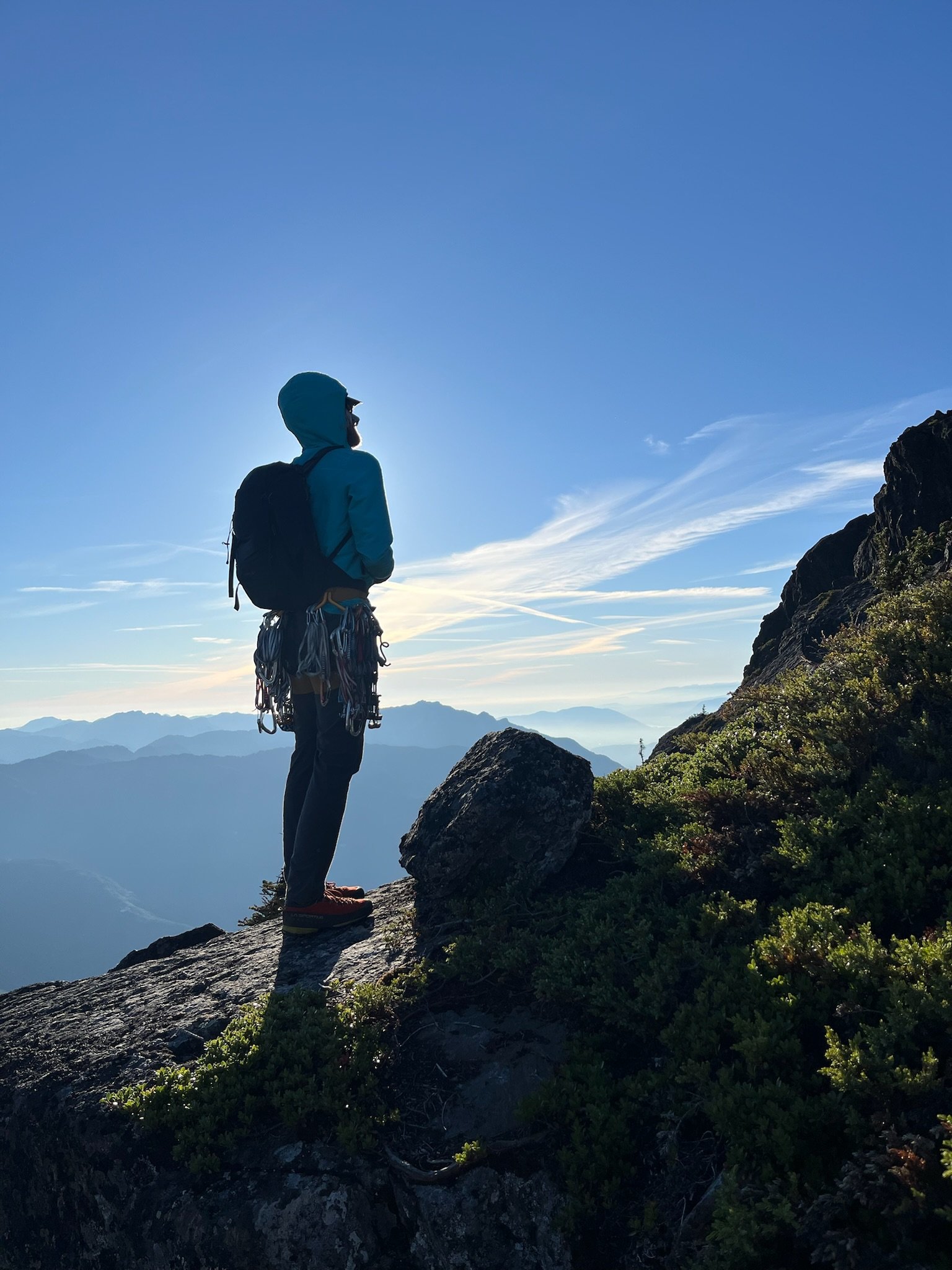
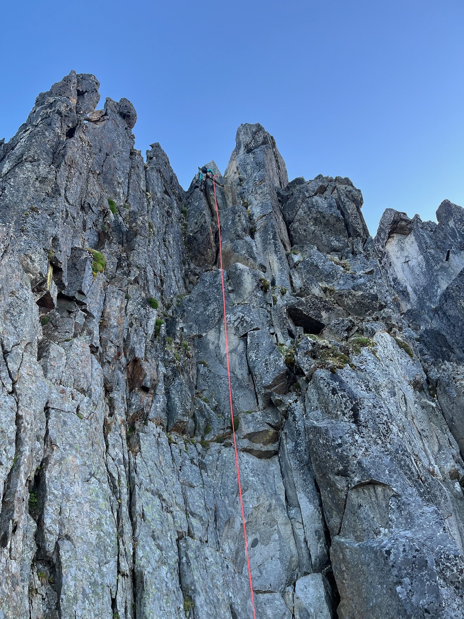
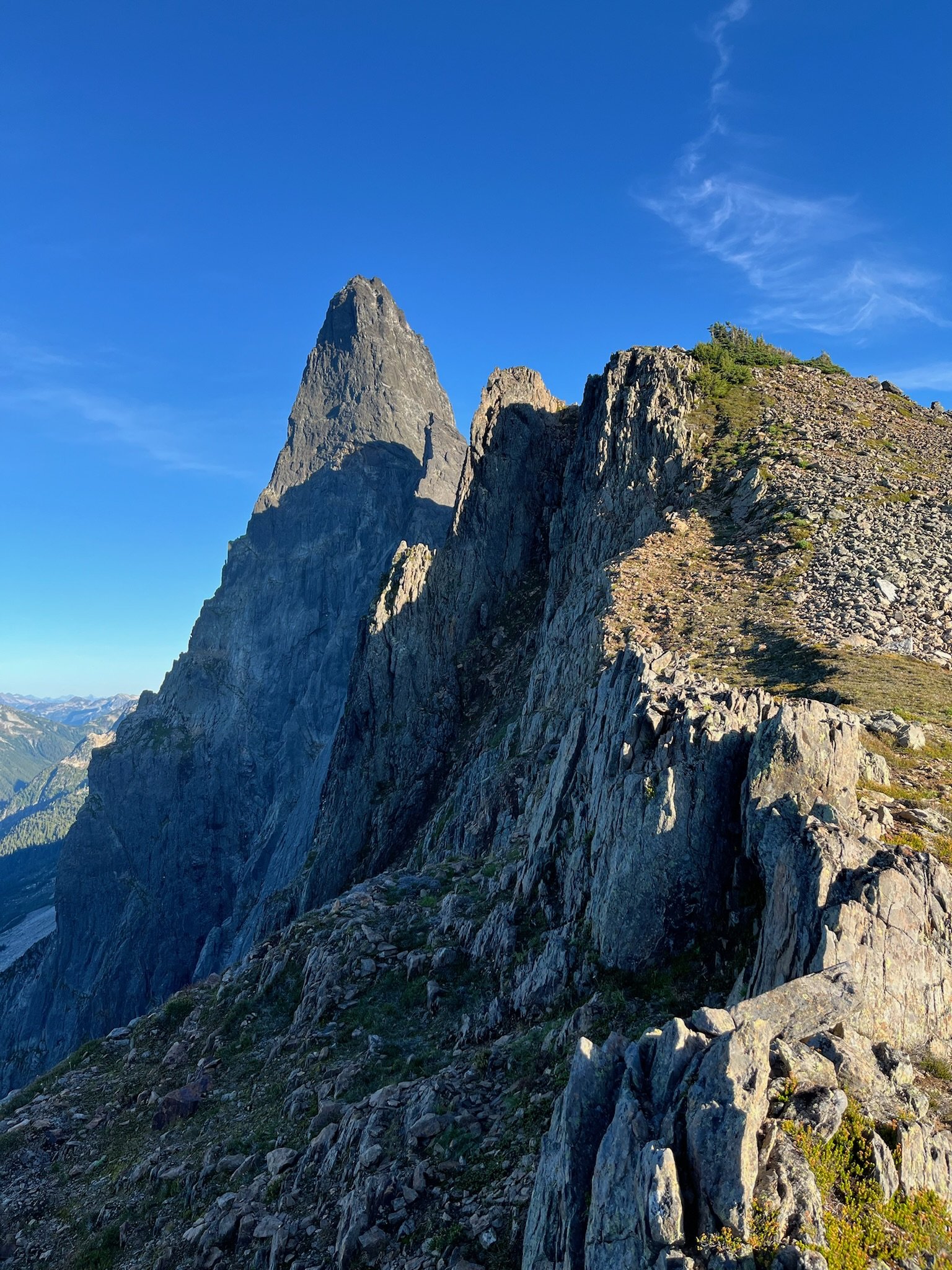 12 points
 -
Trip: Porcupine Creek Wall - Salad Days III 900' 5.10+ Trip Date: 08/20/2022 Trip Report: It did not go unnoted when Eric Wehrly moved to town. While our more noteworthy first ascents may be of a…umm…slightly different style, in my mind’s eye I generally enjoy any adventure far from the road particularly if it involves unclimbed terrain. Finding like-minded folks at a similar point in life, that is old, is not easy. So I assumed at some point we’d tie in together. It did not happen quickly. While phone numbers were exchanged and talk of getting out occurred, the years passed by. Maybe I came on too strong. During Covid there may have been a day at Mount Erie where I loudly berated Eric to be my “New Best Friend!” as he TR-soloed nearby. Clearly, I needed a better incentive than that. Halfway up the Pacific Crest Trail between Rainy and Cutthroat Passes a large wall of granite stands proudly above the trail. I first walked by it eighteen years ago with my then girlfriend. From a distance it had the obvious geometry and tone of good rock. A friend and I almost went to check it out but we made other plans and the idea was largely forgotten. This summer I strolled by it again, with my now wife and our two teenage children. Still there, still grey, still splitter. A week later I spent a solitary day circumnavigating Porcupine Peak. The summit was eventually attained, and, on the descent I found myself beneath this wall I had considered for decades. Carefully glassing it I became discouraged. As I walked away I thought “almost but not quite, the start may not go and the rest is just a bit too dirty and discontinuous.” However, it’s amazing what some grainy iPhone photos and a bit of selective memory can do. Furthermore I finally had the sort of incentive Eric might respond to. On Saturday August 20th we stood below “the start that may not go” and sure enough it didn’t. As this had been my idea, I felt obligated to get us rolling so I began a long circuitous pitch climbing easy terrain off to the side before a long downward traverse led to a committing mantle onto a vegetated slab above. Struggling with massive rope drag from the severely Z-shaped pitch, I encountered a recurring theme of frantically hacking away a clump of heather to find a small cam placement. Eric quickly downrated my estimated grade and then scrambled up more heather covered corners to the base of a steep, relatively clean layback flake. Perfect edges made the otherwise intimidating flake go quickly. Unfortunately, the intended route up a long “hand crack” above the flake turned out to be 100 feet of 4”-6” offwidth. The scale of the wall was turning out to be a bit larger than anticipated. Instead, Eric made a delicate leftward traverse before committing to a steep, broken crack formed in part by some precariously hollow fridge-sized blocks. Easy terrain led to the base of what had appeared to be a splitter from the base of the wall. Above I could only see a slammed shut seam covered in a thick crust of lichen, moss, and dirt. Eric proclaimed it to be a finger crack. I was highly skeptical. But on new ground there’s nothing worse than being the person who forfeits your partner's last proud lead by bailing off into indirect, unappealing terrain. I spent several minutes pawing at the start, muttering random negativities. After a few minutes I finally committed to the initial moves into the corner then rapidly hung on a nut. But it was started and despite my deep pessimism about there actually being a climbable crack under the filth I found myself inching upwards. Sand and pulverized lichen poured into my eyes, my nose, my ears, and my shirt. Aiding up in 8mm dyneema slings progress was dispiritingly slow as I cleaned out every single placement. Time oozed on and hours later I finally pulled the singular hand jam at the very top of the 150-foot crack and flopped onto a good ledge. Now relatively cleaned out, Eric rapidly followed the crack free proclaiming it 5.10+. Having climbed three pitches in five hours and 45 minutes, simple math suggested that our rate of ascent was significantly slower than the sun's rate of descent. While I did not yet suggest bailing, I did point out this obvious observation. Yet Eric confidently proclaimed that the “walk off” would in fact be a walk and that we would only need headlamps once we were within spitting distance of our packs. Regardless of attitude at this point, the wall kicked back a bit and the next pitch looked easier. No reason to bail yet so Eric headed out, moving quickly across a thankfully clean hand crack before moving out of sight into the corners above. Progress slowed, the rope stopped moving, I almost nodded off. The clouds continued to build as the rope made halting progress. A random inquiry on my part was met with a stern “Not Now”. Eventually Eric reappeared above having navigated some sketchy 5.10 face climbing to avoid an impossibly munge-filled corner. Moving left and right, up and down he eventually retreated to a blocky alcove from which we could reappraise the options above. With the rack refreshed the obvious direction was through an overhanging V-shaped corner. Chimney moves, flared jams, wide stemming and possibly some tension left me once again above my gear, hanging off a sloping rail, feet stemmed out on small dishes, surrounded by thick mats of grass and heather pasted in corners. With my ancient Chouinard north wall hammer wedged into a hummock, a brief struggle ensued between which would be pried off first, the hummock or myself. Thankfully the hummock released, revealing a perfect hand crack. The climbing relented and the rate of progress discernibly increased. As I neared the end of a lead the sky finally cracked open with a brief squall and a lovely rainbow filling the valley. Despite the weather I finally felt committed to the climb. Going over the top was now the path of least resistance. Almost every challenging climb you undertake has that beautiful inflection point, when hours, days or even years of uncertainty just melt away leaving you relaxed and in the moment. Eric climbed another beautiful corner with sustained finger cracks under the hummocks and dirt. The final pitch was a perfect finale. Shockingly clean granite with delightful climbing up to and around a large roof followed by easy, clean slabs to the top of the wall. The Cascades were bathed in a beautiful soft glow and views extended from Dome in the far distance to the sun setting off the shoulder of Mesachie Peak. The walk off was anything but, and had it been dark we would have been in for a genuine epic. Yet much as predicted headlamps only came out as we finally exited the talus onto delightful heather meadows not far from our packs. If you're familiar with Eric’s and Rolf’s first ascents on massive walls of less than stellar rock I’m sure you’ve wondered what makes them tick. My simple observation would be an extremely positive mental attitude with a surprisingly conservative aversion to potential loose rock. My successes have largely been built off an ability to separate the negativity of my dumb brain from the mechanical motions of moving upwards. It’s worked but doesn’t seem nearly as efficient as Eric's approach. I’d like to think I might adopt some of his positive mindset in the future. That said I’m pretty sure we influenced each other, as we headed out down wet talus with heavy packs Eric could be heard muttering “If you added a few bolts...”. Hour and twenty minutes from parking Lot Enter the Drag-On (forever) In my happy place (after the rain) Exiting the wall Views South and North Old Dirty Bastard and Mr. Clean Postscript After Eric graciously spent another day of his life reclimbing and fixing the first four pitches with me I went back for the Labor Day weekend and put in thirty hours of cleaning, creating fixed anchors and adding several variations to avoid indirect, loose or excessively dirty terrain. Rock is excellent and clean throughout. Rappelling is quick and efficient vs. the unsavory walk off. There is a pile of good climbing up there.
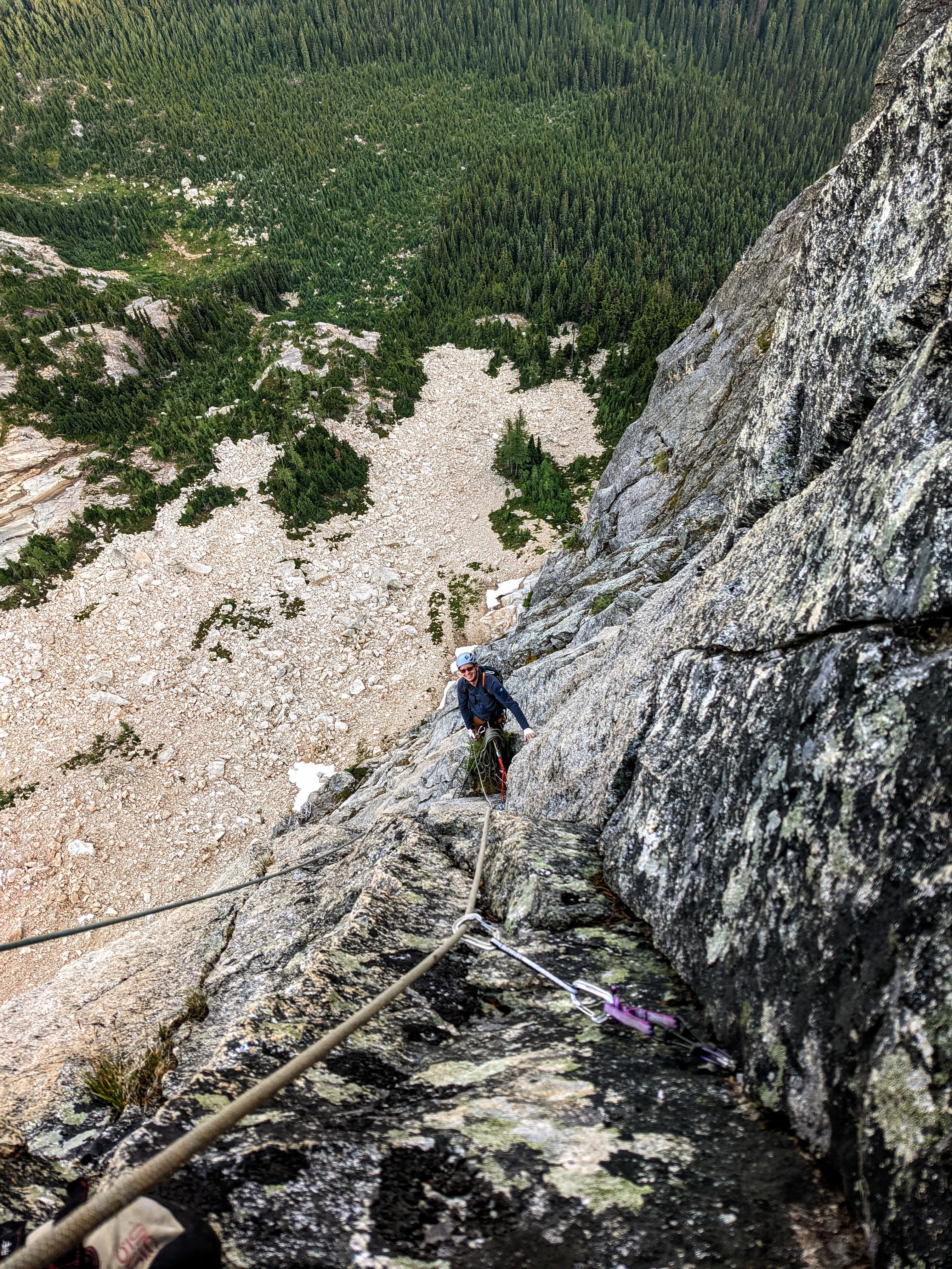
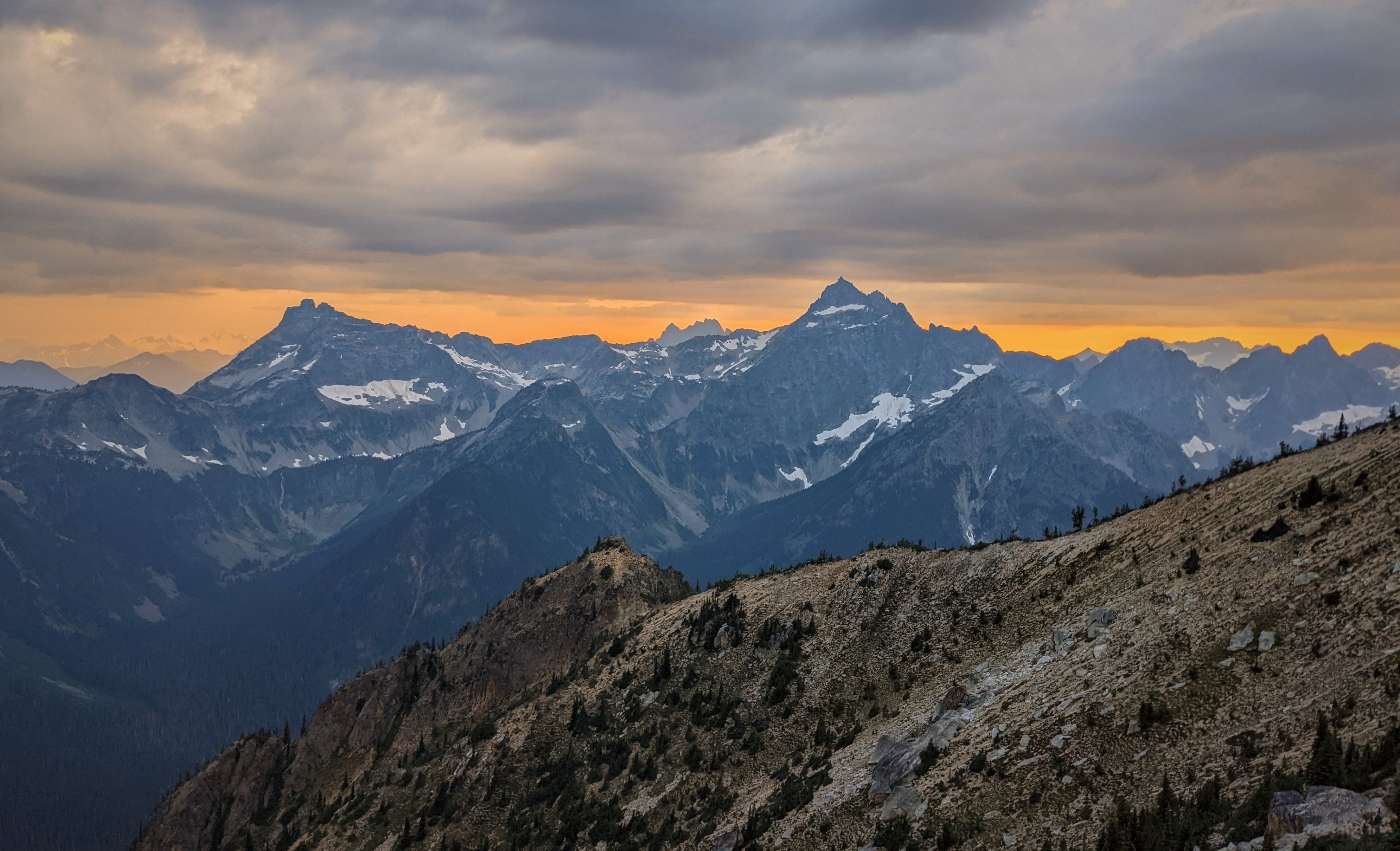
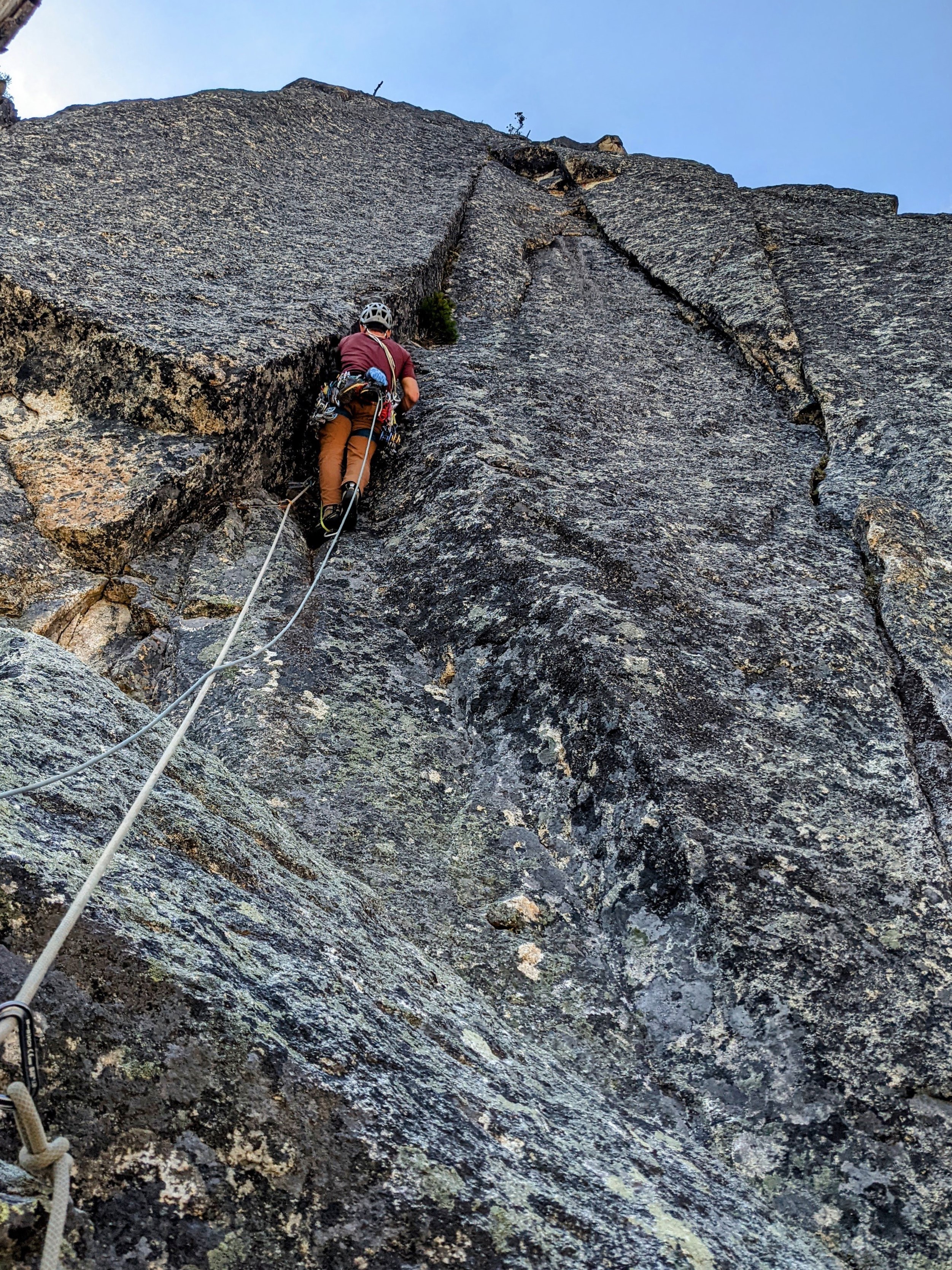
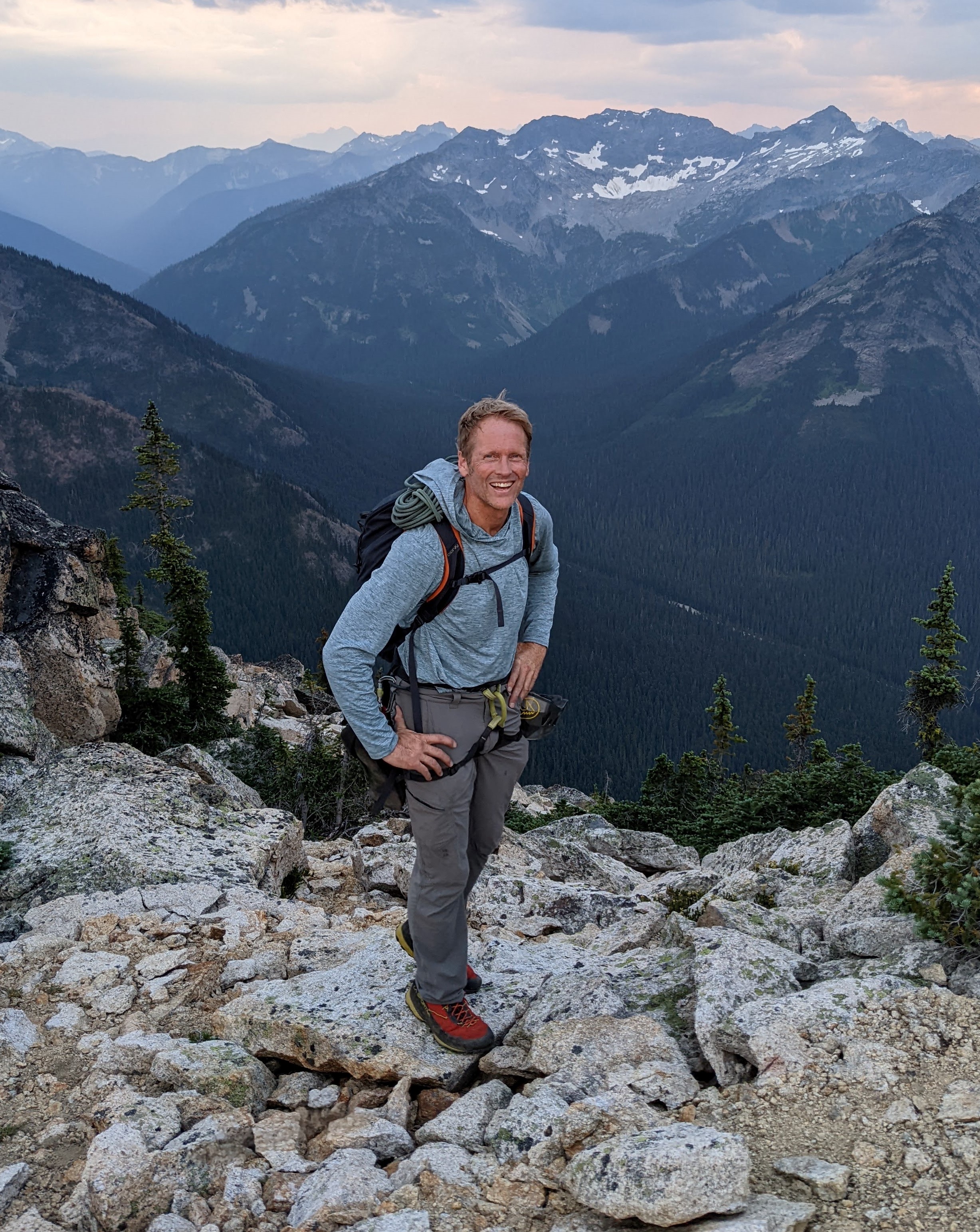
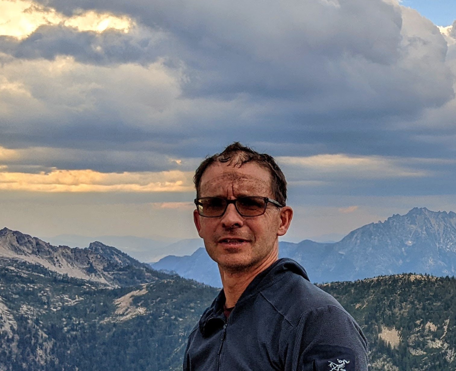
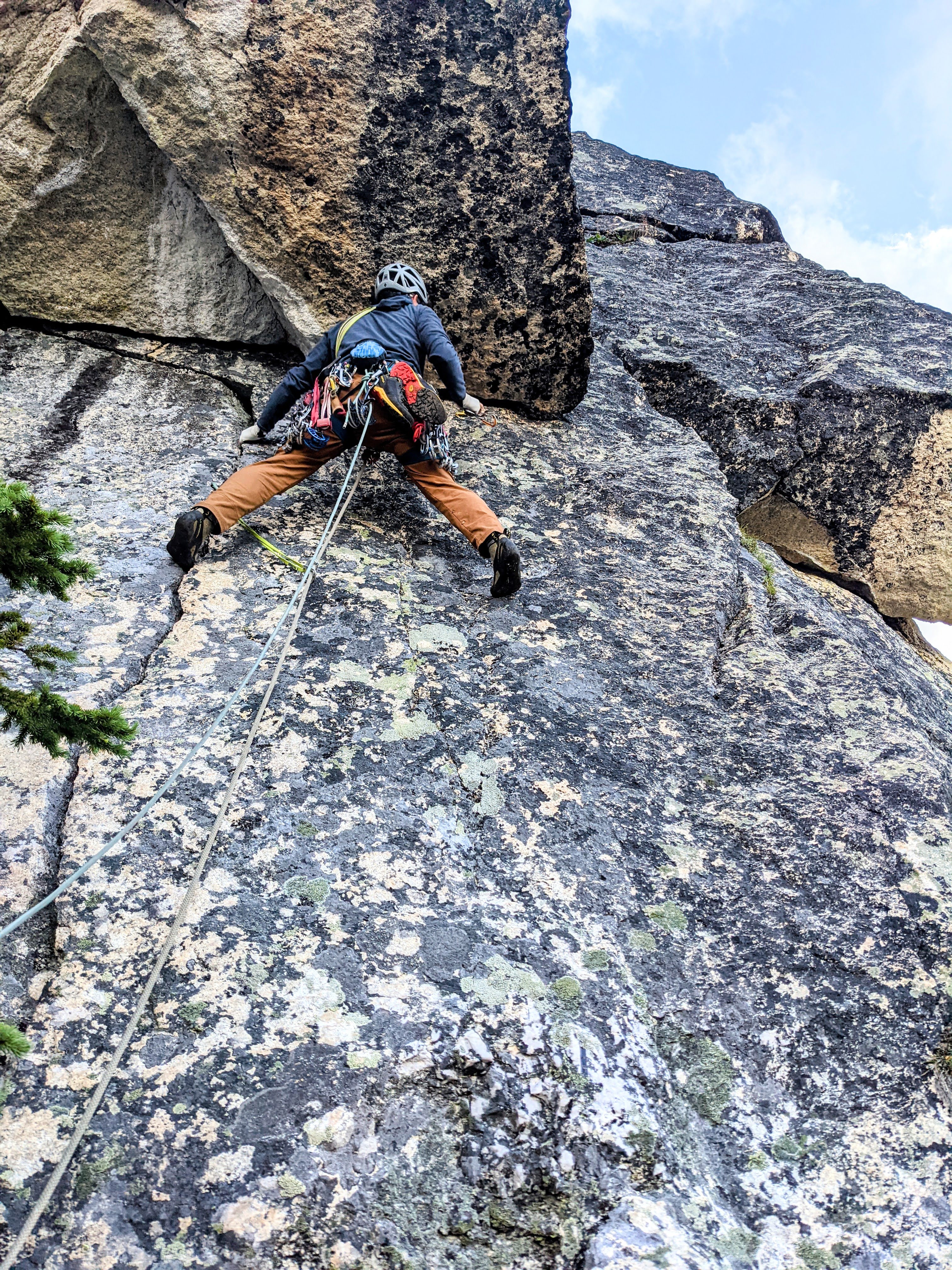
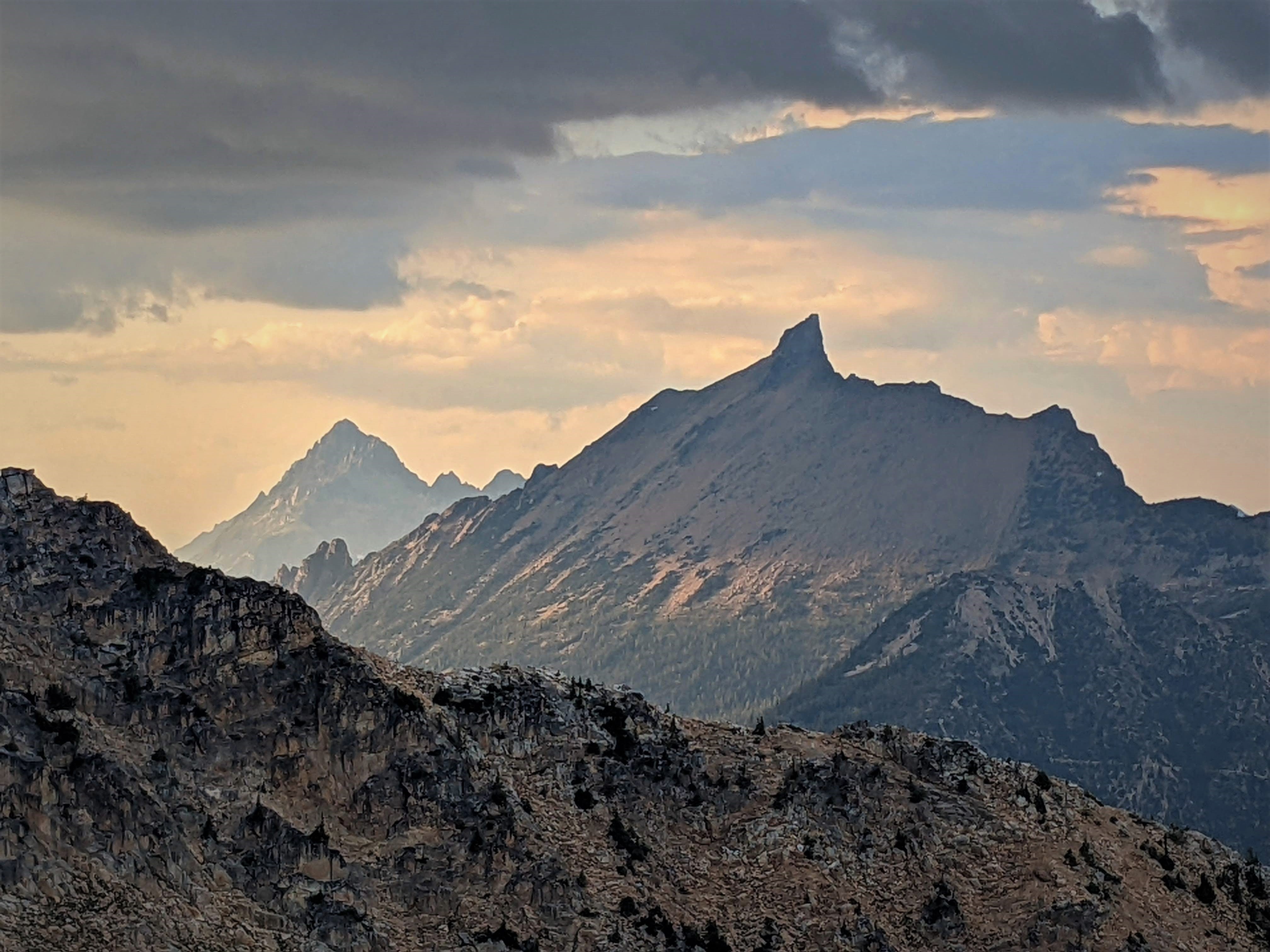
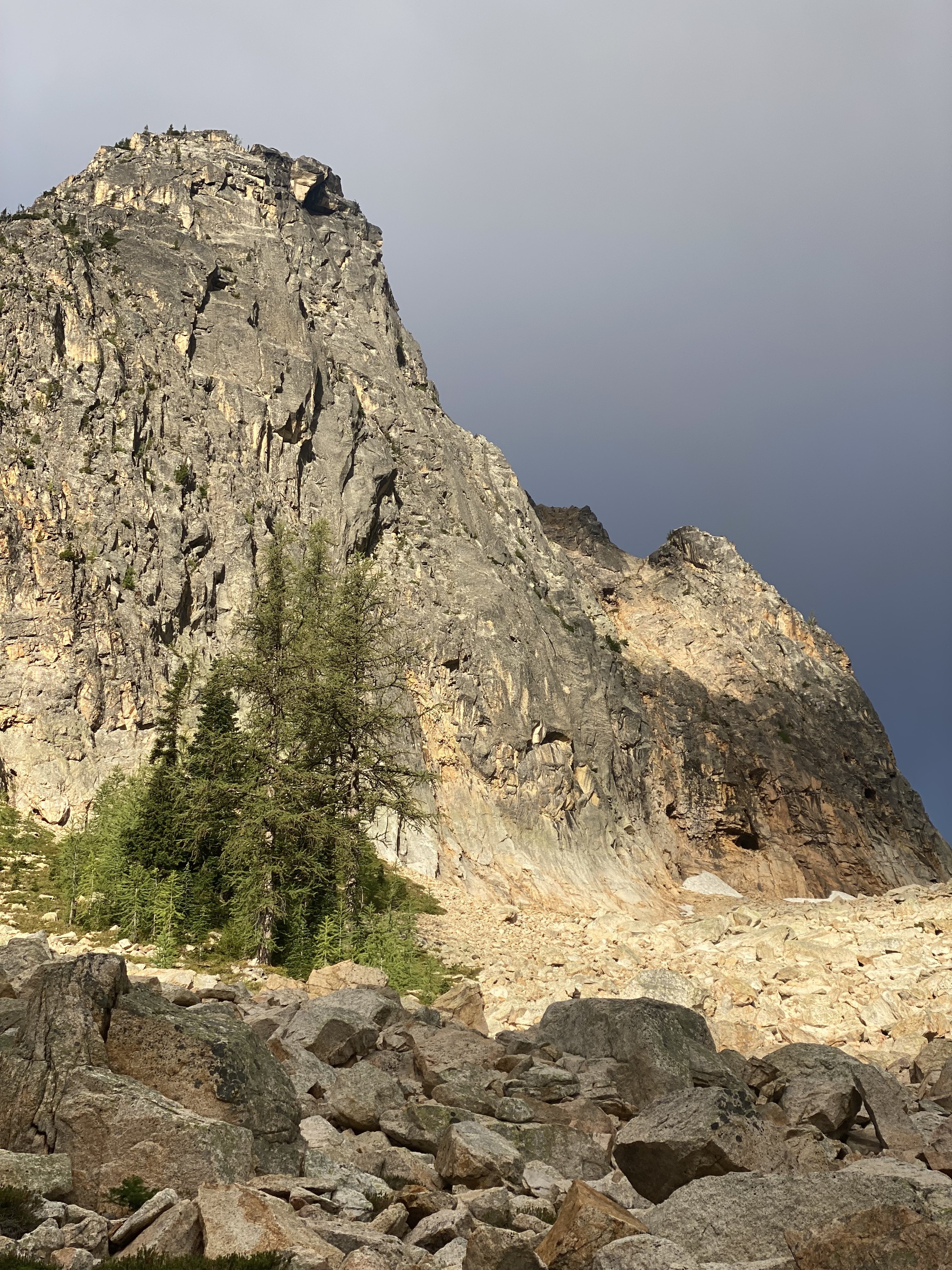 12 points
 -
Trip: West Fury - Mongo Ridge Trip Date: 07/05/2021 Trip Report: In our relentless pursuit to ride the coattails of THE Wayne Wallace, Priti and I made the second ascent* of Mongo Ridge (the SW Ridge of West Fury in the Northern Pickets of the North Cascades). It is a Stegasaurus ridge which rises 4,000ft over a mile from Goodell Creek punctuated by thick clusters of gendarmes that look like they’re straight out of the Karakoram. [*2024 Update: Since our ascent, two more parties have ascended the SW Ridge of West Fury (total of four ascents as of July 2024, detailed below)] August 26-27, 2006: Mongo Ridge First Ascent Wayne Wallace (solo) making one bivouac past the Rooster Comb and Pole of Remoteness (with all of the route's technical climbing completed). Legend! https://waynewallace.wordpress.com/2014/05/ July 5, 2021: Jeff and Priti Wright make the Second Ascent of SW Ridge of West Fury, following Wayne's line of ascent but bypassing both the Rooster Comb and the Pole of Remoteness. They did not bring bivouac gear on route (bad call), and they did not make any bivouacs on route. Camp-to-camp in 23hrs from the summit of East Fury (base camp). July 11-13, 2022: Sam Boyce and Lani Chapko make the Third Ascent of the SW Ridge of West Fury, following Wayne's line of ascent, taking Jeff and Priti's Rooster Comb bypass, making the second ascent of the Pole of Remoteness (following Wayne's approximate 5.7 line), and making two biouacs on route (base camp at Luna Col). https://www.theclimbingguides.com/post/mongo-ridge-and-the-pole-of-remoteness-7-09-2022-7-14-2022 Early July, 2024: Emilio Taiveaho and Adam Moline make the Fourth Ascent of the SW Ridge of West Fury, following Wayne's line of ascent including the Rooster Comb (second ascent) and the Pole of Remoteness (third ascent, and by a new line of two pitches of 5.9R) making them the Second Complete Ascent of Wayne Wallace's Mongo Ridge! https://cascadeclimbers.com/forum/topic/107832-tr-mt-fury-wayne-wallace’s-mongo-ridge-second-ascent-of-the-rooster-comb-and-new-line-on-the-pole-of-remoteness-07072024/?fbclid=PAZXh0bgNhZW0CMTEAAaZGeT7NzsHS7Pk4D4-BEz-9Fi4D7NGD8mzAiVTHkasQ-41sIDl0dhUtNzM_aem_PLTVnZmmLRYxsTBP00Ynuw#replyForm We first heard about Mongo when Wayne came to speak for a BOEALPS - Boeing Employees Alpine Society Banquet in 2015 and regaled a captive audience with his bold adventures. We warmed up Wayne's feature presentation with a talk on our trip to Patagonia climbing Aguja de l'S. Then Wayne came on stage talking about Mongo, making de l'S look like a mole-hill. Wayne climbed this route in 2006 SOLO, like a boss, questing into unknown terrain that easily could have landed him into mandatory hard free climbing. With vertiginous cliffs on both sides, he knew that bailing from the route was not an option and that he had to climb whatever the mountain presented. The difficulties on the route were up to 5.9, with an additional 5.10b pitch (a routefinding error), but the towers presented possibilities up to 5.11 if we weren’t lucky enough to have Wayne’s beta. The first ascent is one of the legendary, mythical ascents of the Cascades and even of the climbing world. After 15 years, only a handful of folks to my knowledge have even considered attempting it again. The bottom half of the ridge has four narrow towers which require you to summit and rappel in order to make vertical progress on the ridge. Long, double-rope rappels and hard technical climbing discouragingly makes it take hours just to ascent 100ft at times. Above these four towers are the “Rooster Comb” and the “Pole of Remoteness” (named by John Roper who figured it was the hardest place to get to in the lower 48). After Tower 4 and before the Rooster Comb, we scramble traversed low around each of these features and did not summit the Pole of Remoteness since it was getting dark and we did not bring bivy gear. At Wayne’s suggestion, we planned to climb camp-to-camp which was situated at the summit of East Fury. This means that while we did ascend the topographic feature of Mongo Ridge to the summit of West Fury, we did not truly climb “Wayne Wallace’s Mongo Ridge” in the manner that he climbed, including many more pitches of technical terrain. When we talked to Wayne in 2019, I told him that “Somebody needs to repeat this route, just so the world can understand what you accomplished.” It’s impossible to understand the scale of this route without being on it, competing as “one of the largest features on any mountain anywhere.” “You have to climb a major mountain [East Fury] just to start a most major climb.” Even with Wayne’s pictures and descriptions, we were still filled with dread as we attempted to route-find up each tower. While I am proud of what we did accomplish, I am still shaken at the boldness and audacity of the first ascent. Our tale should be considered a celebration of that event. Wayne called it Alpine Grade VI, but Beckey downgraded it to V deeming it (incorrectly imho) similar in commitment to Slesse NE Buttress (ref. Cascade Alpine Guide Book 3, pg. 118). We concur with Wayne's Grade VI rating, although I won't be even slightly offended if anyone wants to challenge the grade while ensconced in sofa cushions. Our itinerary: -7/3/21: 2PM boat ride from Ross Lake Resort to Big Beaver TH. Bivy in Access Creek basin. -7/4/21: Access Creek Basin to East Fury Summit. Left summit bivy in situ. -7/5/21: 23hr day camp-to-camp including Mongo Ridge and the traverse from West Fury to East Fury. -7/6/21: East Fury to Access Creek Basin -7/7/21: Access Creek Basin to Big Beaver TH. 2:30PM boat back to RLR. Here are collected links regarding Wayne's FA, for reference: https://waynewallace.wordpress.com/2014/05/ http://www.alpinist.com/doc/ALP19/climbing-note-fury https://www.nytimes.com/2006/10/21/sports/othersports/21outdoors.html http://www.alpenglow.org/nwmj/07/071_Mongo.html http://publications.americanalpineclub.org/articles/12200713002?fbclid=IwAR0iS9vNBvJ1XUQPOTPIXy8eymiTsuWFHI5TJtuAvLJUNb5LknfgeYgTriI Scurlock Picture: https://www.pbase.com/nolock/image/65948954 I won't go through too much detail on our approach to Luna Col and East Fury, since it is detailed well in many other places: https://onehikeaweek.com/2020/08/02/mount-fury/ http://www.nwhikers.net/forums/viewtopic.php?t=8021967 (specifically useful here is the traverse from East Fury to West Fury) Since we planned to do the route camp-to-camp (situated on the summit of East Fury), we studied the traverse from West Fury to East Fury in detail since we figured we'd be onsighting it in the dark to get back to camp. I will point out the "Red Ledge" (pictured above) just past Luna Col is reached by staying directly on the ridgeline from the col to begin the traverse over to East Fury. Past the Red Ledge, the next tower (called "Crux Tower" in some reports) is ascended directly via 4th class ledges and short 5.4 steps. A rope and gear would not be useful here. There is significant foreshortening here, as the route looks much more accessible as you get closer. Unless you're climbing in Winter or Spring, you will not be able to get across the bergshrund (as shown in the Beckey overlay), but instead will traverse left then right to reach the summit arête. Furthermore, the approach to the base of Mongo Ridge from East Fury's summit as discovered by Wayne is the easiest approach. While it is possible to reach Mongo's base via Picket Pass (either by navigating over Outrigger Peak "Southeast Peak" or Otto-Himmel Col), these approaches would be significantly more effort...or bushwhack for days up Goodell Creek. As you approach, notice the grey washboard streak with an overhanging gully. The route will start to the right of this feature. The 4,000ft descent from East Fury's summit may involve a lot of slab if the snow levels are low. We regret not bringing bivy gear on route. An alternative itinerary could be: -Day 1: Big Beaver TH to Luna Col -Day 2: Luna Col to Mongo Ridge Tower 1. Option to leave stove and tent on East Fury Summit as you pass by. There are no good bivouac sites on route. Just bring a sit pad and a sleeping bag and open bivy if splitter forecast. -Day 3: Tower 1 to either East Fury or Luna Col. A note on weather: The Pickets have notoriously unpredictable weather. Even with a splitter forecast, you can still have rain or even storms. Consider a tarp as backup shelter. Crossing the moat is the first crux. The moat is huge! Only found one place where it touched the rock slightly. On the approach, don't come down anything you can't go back up! Here I had to cross a giant moat (unprotectable compact snow), using both Gully tools (then passed the tools down to Priti). A picket here would have been very useful...but that's a big cost. Might have to bury a tool and rap/swing across the moat. Tower 1 was a TIME KILLER! Wayne reported a 5.8 overhang crux which we did not find. Instead we got suckered into a runout 5.10b overhang in the grey washboard gully. Recommend future parties to avoid this gully completely, and instead stay on the face to its right. Our second mistake was getting suckered into a difficult 5.8 grassy gully. Wayne later clarified that he immediately captured the ridge first, then went straight up the ridge (recommended). We started in an obvious chimney (5.6), gaining the face on the left then going right (many variations). After the chimney, we went left to the 5.10b overhanging grey gully instead of going up. It looked harder to gain the face above, but it is 5.8 if you can find Wayne's Way. The slopes to gain the ridge are all STEEP. We breathed a sigh of relief once we were on situated on the upper slopes of Tower 1, but route finding continued to be a challenge. A 30m rappel took us down to the notch between Tower 1 and 2. It seems possible to bail here back down the glacier and back up to East Fury. Perhaps the last legitimate bail option, so we considered the time and knew we would be climbing through the night. Tower 2 is only 2 pitches of 5.7 with no real route finding difficulty and went pretty quickly. The rock is REALLY loose however, so I was careful not to knock anything down on my belayer. Route lines are all approximate by the way! The first double rope rappel from Tower 2 led to the notch between Tower 2 and Tower 3. Tower 3 is the technical crux of the route and another TIME KILLER! It takes hours just to gain 100ft elevation. Once atop, it's demoralizing to look down and see the top of Tower 2 so close. Wayne reported a 5.10a bulge which I think we avoided by staying on and just right of the ridgeline. From the notch between Towers 2 and 3, a 5.4 traverse gains a grassy belay with 5 more pitches above ( 5.9 30m, 5.9 30m, 5.9 30m, 5.9 50m, 5.6 65m). Priti stopped whenever she found a good belay spot. We also hauled packs on 4 pitches expecting 5.10a climbing at any moment. It was real 5.9 climbing, consistently on decent rock for four pitches. Next time, instead of hauling just load everything into the follower pack and leave the leader with a mostly empty backpack instead. We took two backpacks on this climb to evenly distribute weight and bulk while simul-climbing. This was a good method. We consistently trended right above the belay. Higher Hiiiiiigher Hiiiiiiiiiigher Another 60m rappel deposited us to the notch between Towers 3 and 4. Finally, we got through the technical crux and we were losing sun fast! We knew we were in for an open bivy or a heartbreaking omission of the Pole of Remoteness. Tower 4 is another quick one. Two pitches, 5.9 then 5.7. It looks like really hard climbing going straight up! Instead we followed Wayne's advice and traversed out right for ~20m on 5.9 terrain with decent protection, then up following flakes and grass to a good belay. As you start climbing up, the climbing doesn't ease up, but instead is engaging, fun 5.9. Then 65m simul-climb to the summit. A final 50m rappel down to the base of the Rooster Comb. We were a bit confused here since the terrain opened up into a minefield of gendarmes. The Pole of Remoteness was indistinguishable among all of the towers. We knew we had to boogie so we took all the shortcuts that we could find. We noticed that the Rooster Comb could be bypassed on the right on low-5th terrain by taking another 30m rappel, then down climbing and traversing its Eastern flanks to a grassy gully. Wayne went up and over the Rooster Comb, not realizing there was a bypass. The Rooster Comb is very complex with several small flagpoles that required rappels. Wayne describes the final rappel off the rooster comb as a "diagonal rappel" that you can redirect off of horns, after which he flicked the rope to retrieve. There are at least two more intermediate gendarmes between the Rooster Comb and the Pole of Remoteness that we skirted around. Wayne found himself on their left side while we were on their right side. Wayne captured the upper 4th class slopes via a grassy gully (shown above). From here it's all 4th class to the "False Fury" summit. I coin the label "False Fury" because we stared at this point almost along the entire route thinking it was the West Fury Summit, but instead is fairly far from the true West Fury summit. Above is pictured our Rooster Comb bypass route which required an additional 30m rappel (or easy down climb). This was the first time we encountered snow on route, but don't count on it being there! Bring 4L water each. Southern Pickets in all their glory. Wayne traversed around the right side of the Pole of Remoteness to reach the col and summit it from the backside. To climb it directly would probably be 5 pitches of hard, loose climbing. From the notch between "False Fury" and the Pole of Remoteness, Wayne reported 1 pitch of 5.7 to reach the summit of the PoR. There is no anchor on top, so he threw a rope around a loose block and solo downclimbed, using the rope as a backup. If you are a team, consider downclimb-belaying. We sadly felt the need to skip the pole since it was total darkness by the time we got to the notch with a lot of traversing left to go. Once atop "False Fury", we couldn't find the summit register and realized that the real West Fury was maybe .25miles away separated by 4 more gendarmes, first downclimbing (or rappelling) down and right and traversing around the first gendarme, then weaving up, over, and around the others to finally reach the real West Fury summit. Glad to have put in the time to memorize the traverse beta between West and East Fury, it went off slowly but smoothly. One piece of key beta was at the end of Tower 1 (the last tower between the Fury's), you can find a secret 4th class ramp around to the North (climber's left) to find the rappel station that leads to the final push up the slopes back to East Fury. This is a 30m rope stretcher rappel, by the way! Thanks to Wayne for all of your support and encouragement! I think this route is more of a classic in the way that Hummingbird Ridge is a classic. We should really just sit back and marvel at the first ascent. It's a true Picketeering adventure, but loose rock, lack of bail options, and lack of bivy sites is pretty discouraging. The Pole of Remoteness still needs a second ascent, however! But it would a pretty doable day to get to PoR in-a-day from your East Fury bivouac by traversing high along the ridge and scrambling down from "False Fury", then reversing the route. Gear Notes: Single Rack .1 to 2, doubles .3-.75, small cams (TCU 00, TCU0). We like small cams in the Pickets! Small rack of nuts. 1 screw and 1 V-threader for glacier (didn't use). 60m single rope, 60m pull cord (three long rappels + optional pack hauling), 1 Petzl Gully (technical light ice axe) each, 10 single alpine draws, 3 double alpine draws, 1 quad, 50ft 5mm cord for rap anchors (used it all), left three caribeeners on rappel stations, steel horizontal front-point crampons. Approach Notes: Boat from Ross Lake Resort to Big Beaver Creek - Access Creek - Luna Col - East Fury - 4000ft descent on South side - Mongo Ridge - West Fury - Easy Fury

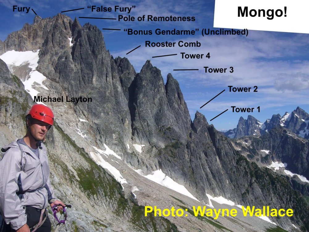
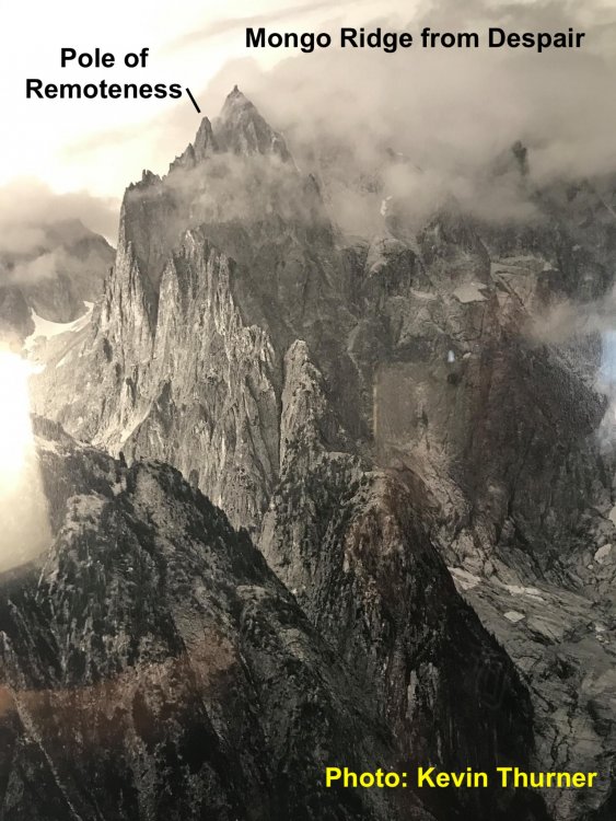
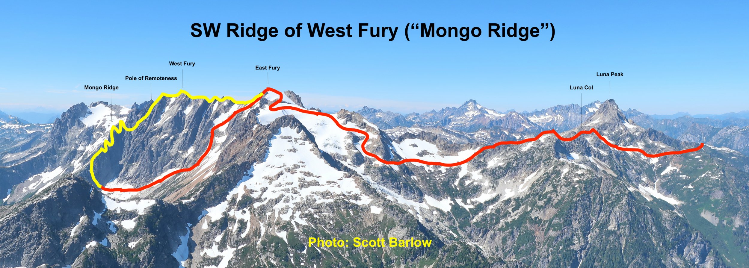

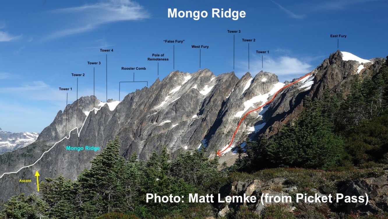
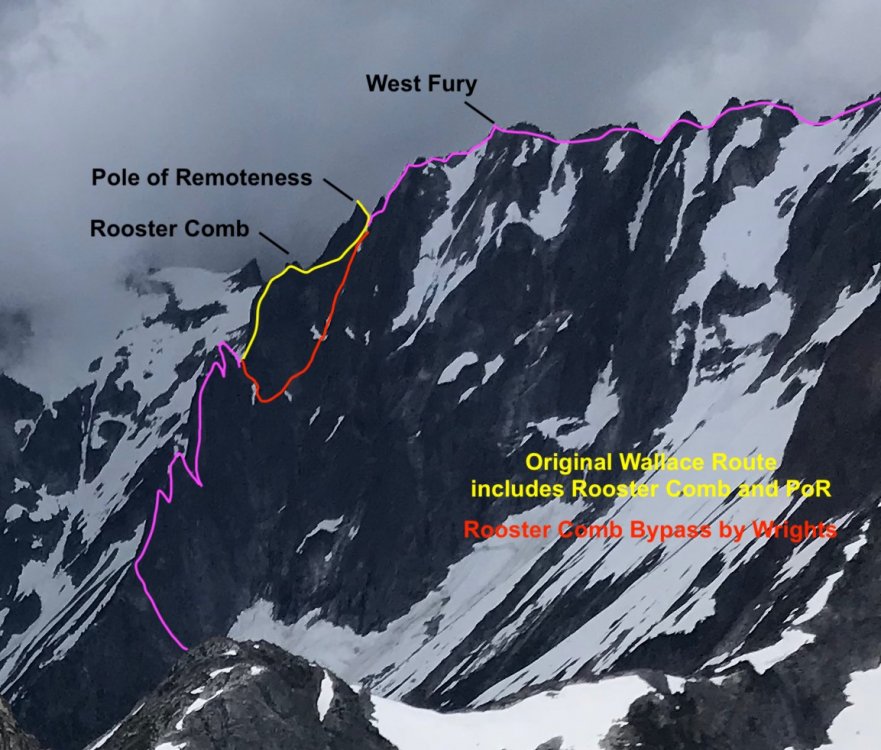
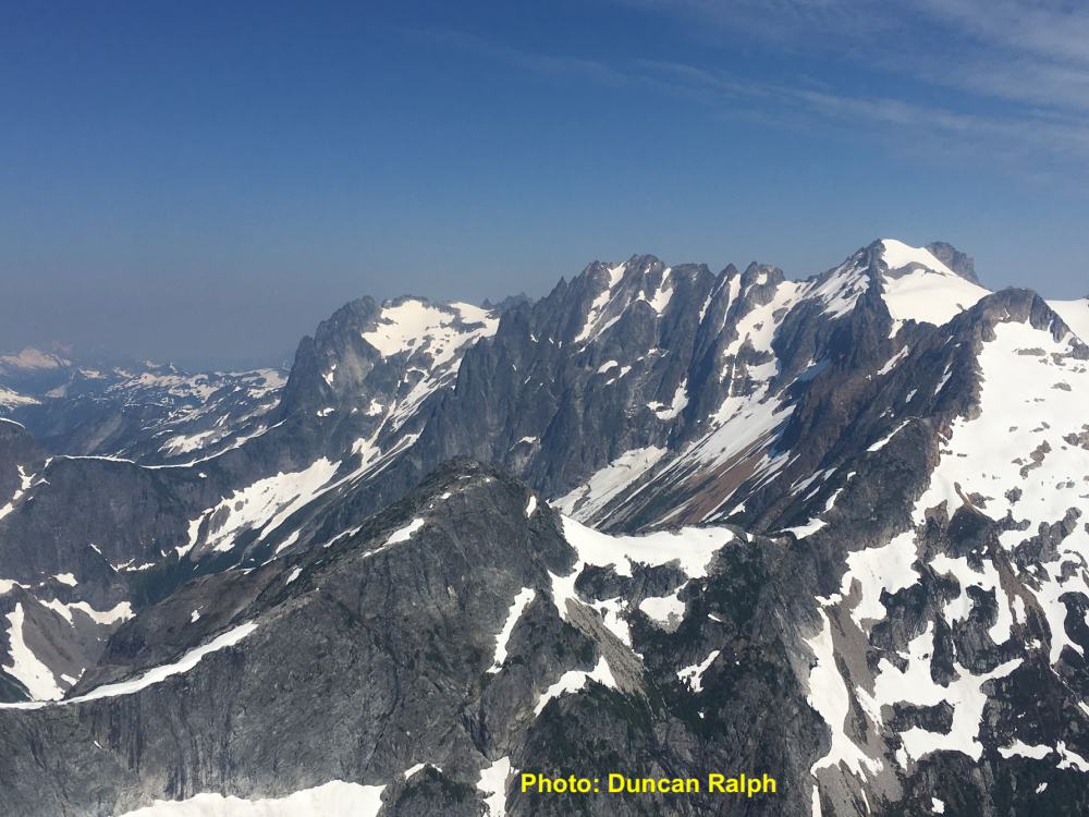
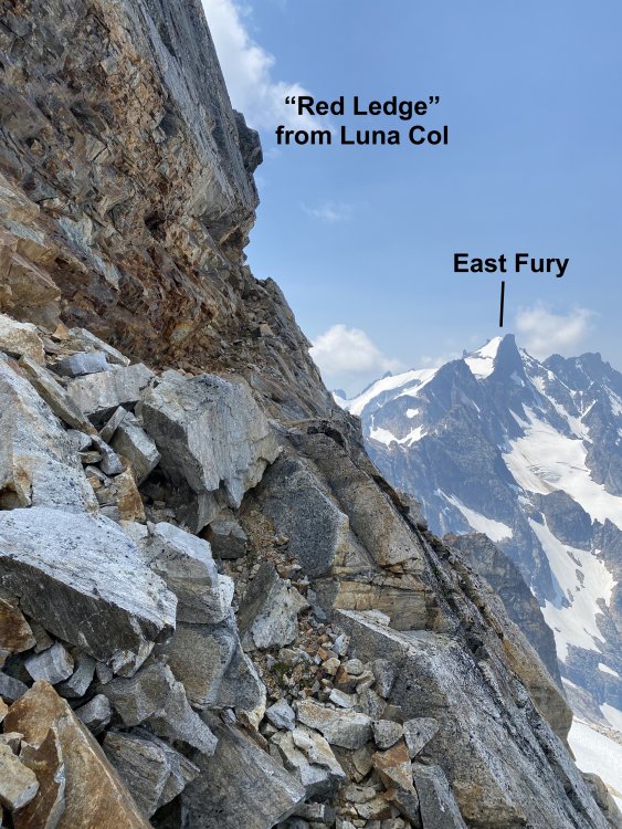

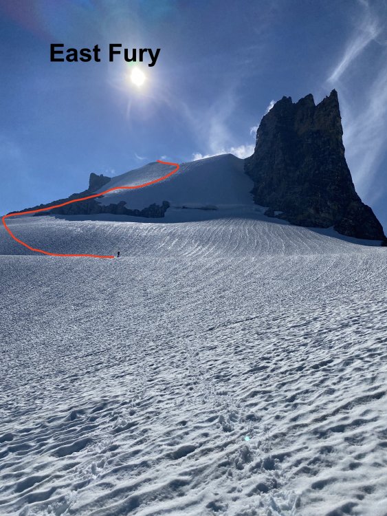

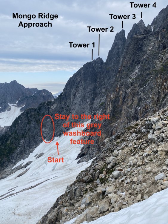

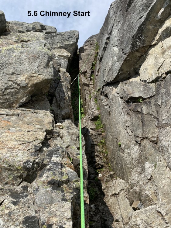
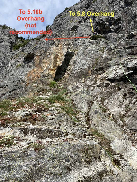

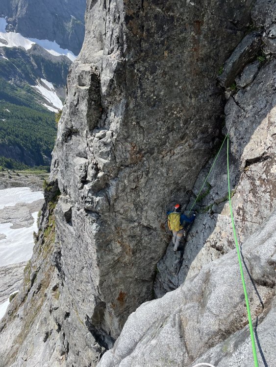
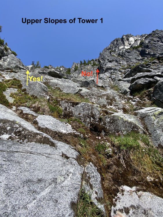
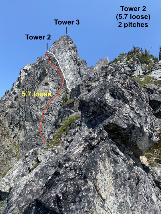
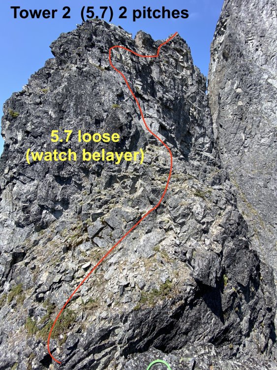
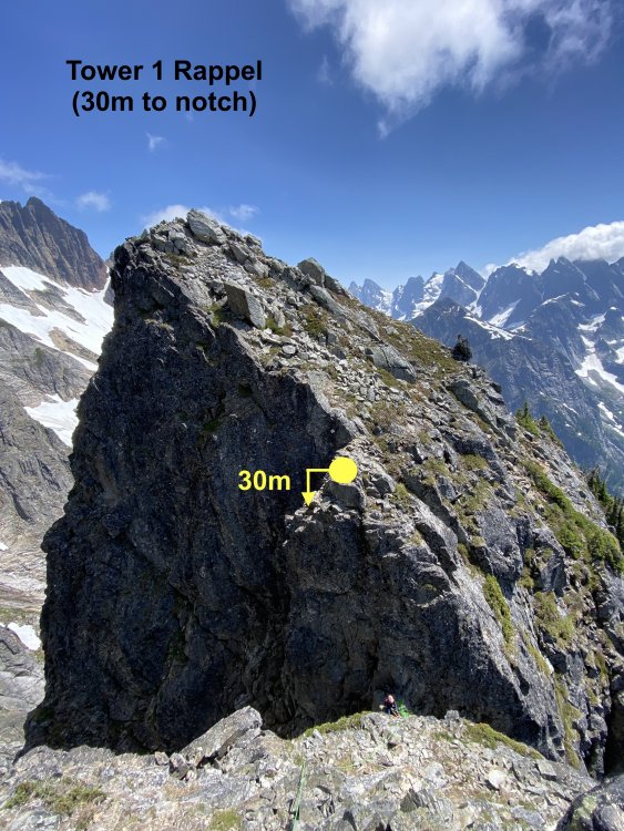
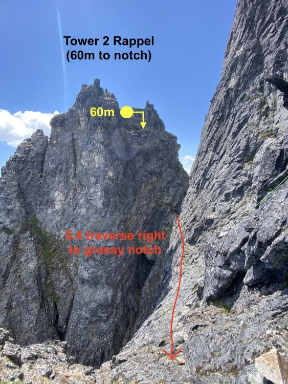
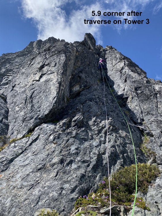
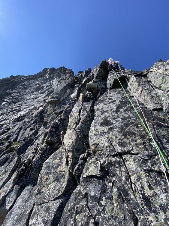
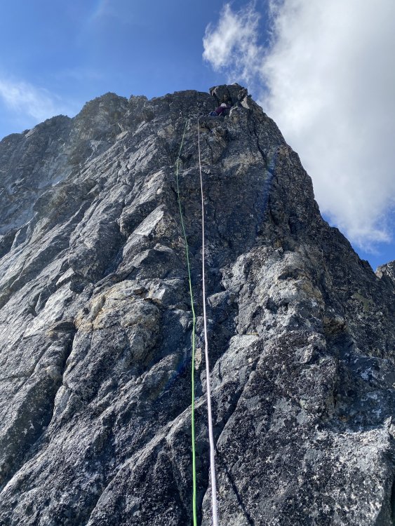
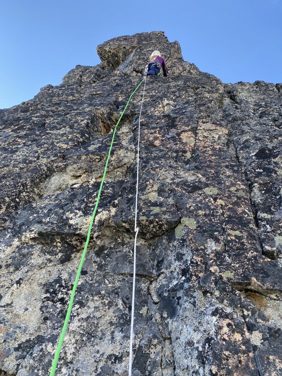


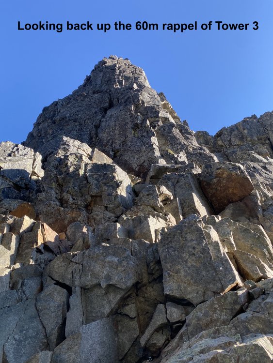
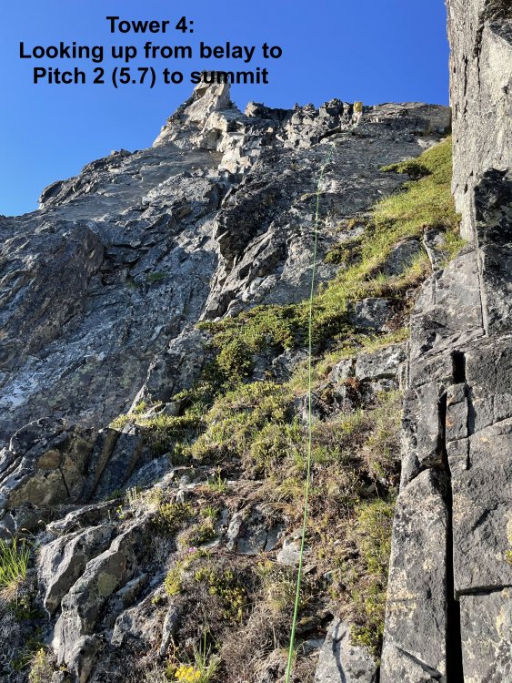
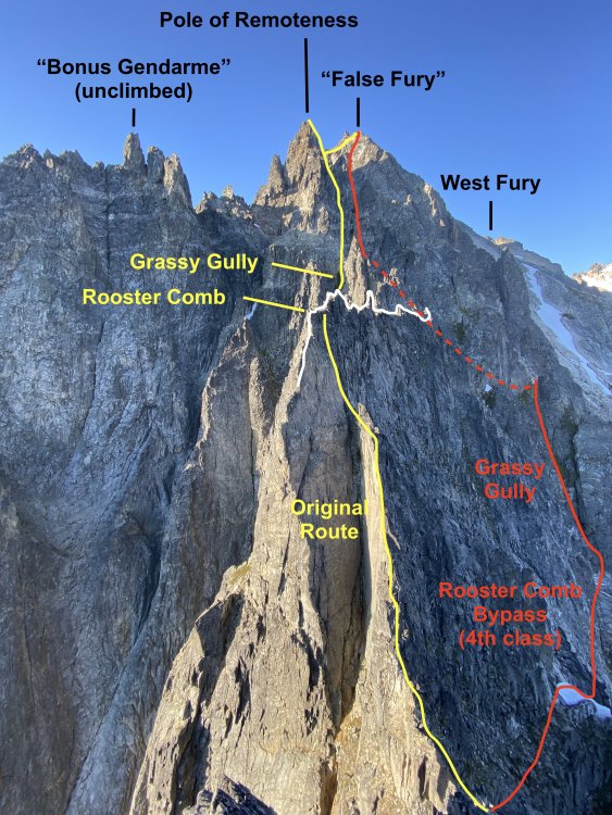
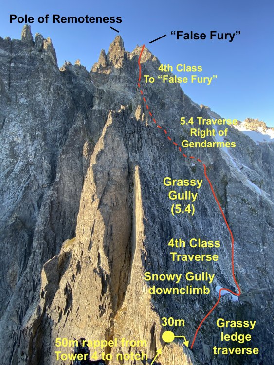
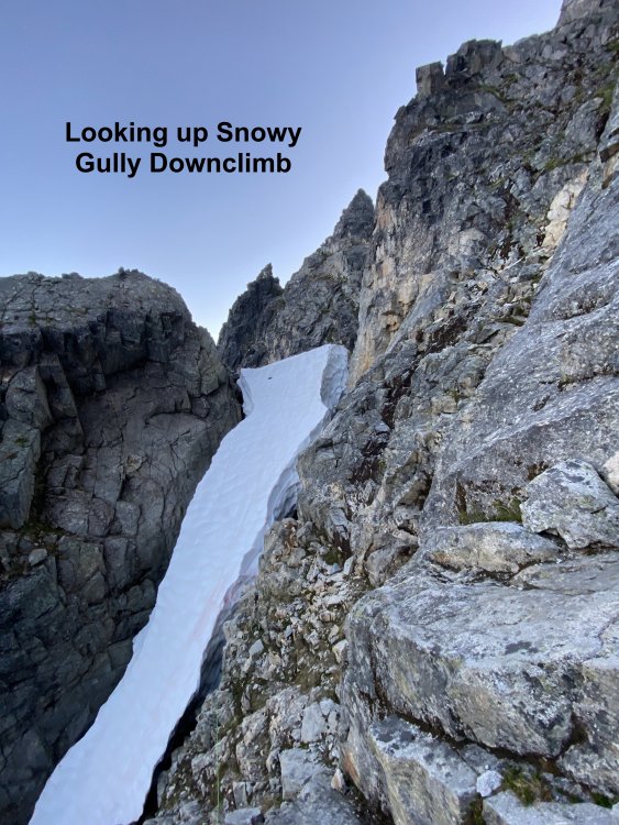
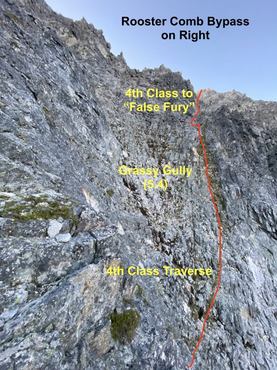

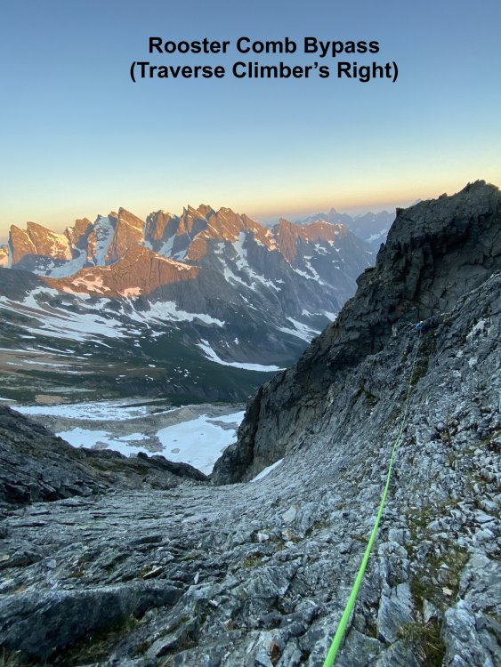

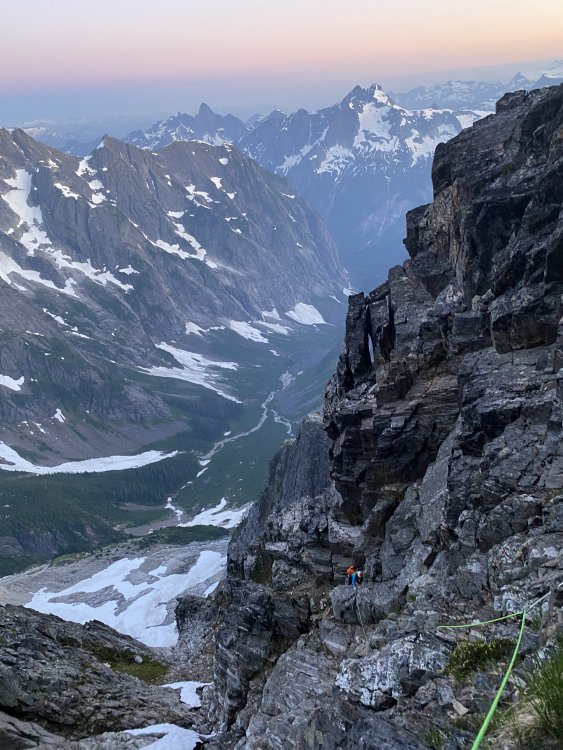
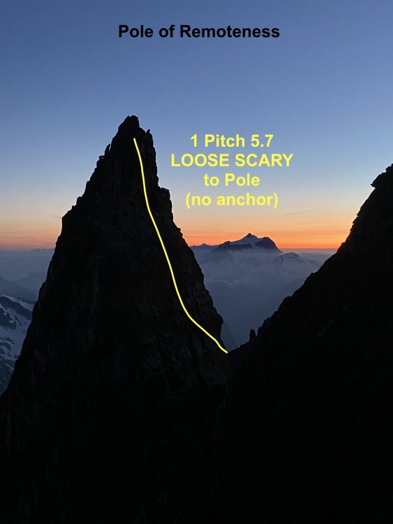
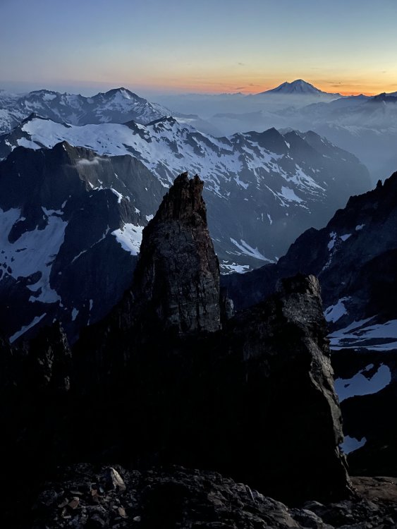


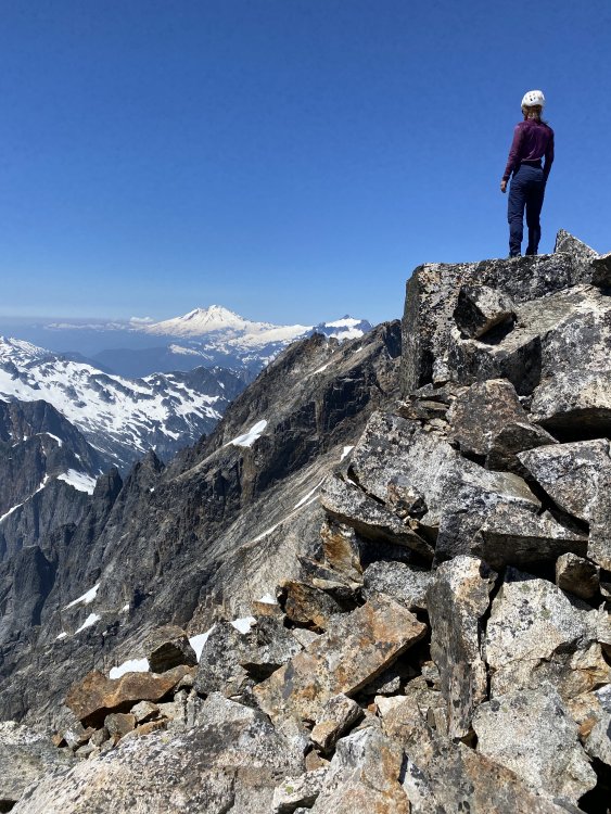
 12 points
 -
Trip: Darrington - Squire Creek Wall -> Buckeye -> Whitehorse Trip Date: 06/19/2021 Trip Report: @jenny.abegg and I did a linkup of Skeena26 on Squire Creek Wall, Buckeye Peak, and Whitehorse. It was a full value 16 hour day, even with nearly everything going "right". Super fun, if you don't mind some jungling and adventure climbing. The MP approach beta for Skeena26 is spot on. We did not find the bolts until the top of P3, and from there on it was still hard to follow the route as the bolts hide in the shade. The upper section of the buttress above the route is pretty blue collar, as is the top of Squire Creek Wall. We were happy to be on snow climbing up to Buckeye Peak. The ridge heading north from Buckeye was very aesthetic, featuring mid fifth class climbing over steep gendarmes with wild exposure. We did a few pitches and a few rappels and then ended up at the SE Ridge of Whitehorse. The SE Ridge definitely felt a bit fifth class to us for a few hundred feet, but we were definitely pretty tired. It is "Beckey 4th class" after all. The rock is ok. Rappel over the bergschrund, then long hike out. https://climberkyle.com/2021/06/19/the-darrington-rodeo/ D-Town is cool! Skeena26 is definitely worth checking out! Gear Notes: Single 60 m rope was enough. A few moderate sized cams, lots of long runners. Approach Notes: About 6-8 minutes after the official Squire Creek Trail sign, there is a white rock cairn. This marks the trail, which leads down to Squire Creek. Found a log crossing just downstream. Then hike up the trail on the other side.12 points
-
Trip: North Howser Tower - All Along the Watchtower Trip Date: 08/06/2019 Trip Report: Climb Date: August 4-6, 2019. Summit August 6, 2019 Climbers: Jeff and Priti Wright Climb: All Along the Watchtower (Grade VI, 3000ft, 32 pitches, 5.10/C2- or 5.12) Style: Follower jugged every pitch in the Dihedral with micro traxions and runners. Heavy French/Aid utilized by the leader in the Dihedral. Two packs brought. Leader climbed with light pack, except in the Dihedral (where follower jugged with one pack on, trailing the other). Two bivouacs (one at base of Dihedral and one on the Summit ridge). With so little beta out there on the route, we found the route finding tricky. This post is intended to be a beta sheet to help with route finding. All Pitch numbers are per Jenny Abegg's topo which was very useful (https://jennyabegg.com/climbing/trip-reportsbeta/all-along-the-watchtower-north-howser-tower/). Pitches 2 and 3 were confusing and we split each of these into two pitches. If you stay on route and watch rope drag, you can avoid splitting these up. They are both full-length pitches. Pitch 3 is so wander-y that rope-drag might be unavoidable - recommend splitting this into two pitches. Pitch 16 (5.12 crux roof) in the Dihedral was only pitch where we thought it was mandatory to disobey Jenny and split into two pitches. Topos Jenny's topo was pretty spot on. Pitches 8-11 on Jenny's topo are the dyke variation that Westman/Haley did (on accident) which ascends directly up from the bivy ledge. Jenny's topo does not show the original route option, which splits off 30m below the bivy ledge. If you wanted to get snow at the bivy ledge and continue on to the original route, you have to rappel or down climb 30m 5.7 to meet back up with the original route. The party behind us did the dyke route and we did the original route. After talking to the party who did the dyke route, it's very safe to say that the dyke is better way to go. The Mountaineer's guidebook (the green book) topo shows both the original route and also the dyke route options, but the High Col topo shows only the original route. The High Col topo is not accurate at all, so be careful. Keep a copy of Jenny's and the Mountaineer's topo on you. Bivy sites: -We didn't see any good bivy sites until atop Pitch 7 (flat, walled, snow in early season). Some descriptions said there was one atop Pitch 3, but it's more of a sitting bivy. -Another good bivy site is out-of-the-way, about 20m left of the base of the Dihedral (flat, walled, no snow). Some descriptions said this was 4-person, but it fit the two of us pretty snug. To get from here back to the base of the dihedral, you have to down-climb 10m (5.7) then ascend 10m (5.7) to the base of the Dihedral. -Some bivy options along the ridge (four of us stayed at one, very snugly, about halfway on the summit ridge above the seventh rifle gully). -A flat, walled bivy spot on the summit (lots of snow throughout the season). When we saw it, it had thick snow/ice on it, so you'd be sleeping on top of snow. Photo Credit above: Tim Banfield Descending down to East Creek from the Pigeon-Howser Col. Left to Right: North, Central, South Howser Towers, Minaret. Priti is just below the Beckey-Chouinard Route From East Creek descend until you can scramble up to the ridge. Stay low on ledges if you want to cross over into the gully ("B" in picture, not recommended, loose scree and hard ice). Recommend staying on the ridge (climber's right side, "A" in picture) as if approaching for Beckey-Chouinard on South Howser Tower. From the base of Beckey-Chouinard, it is easy to scramble down to the snow to traverse high over to the North Howser Bivy Rock. This is a big, obvious boulder just at the next ridgeline. There is a luxurious, sheltered, covered bivy cave here (recommended instead of East Creek if you only have bivy gear and you want to get an early start for the route in a push). Four rappels (two hangers, chains, rap rings) take you to the snow below. The first rappel is heavily cairned and easy to find (even in the dark), requiring a bit of down-scrambling to get to the lip of the ridge. The rappel line is straight down. Each rappel is easy to find and on obvious ledges. You'll want crampons and ice axe for the snow below, on the way to the base of Watchtower. We used a Beal Escaper for the rappels which worked like a charm... we did not bring a pull cord on this trip. Note: rappels shown in picture above are approximate (just use cairns to find the first one, then take the plumb line). The picture is not intended to help you find the rappels. The first rappel. Crossing the moat. Another party of rappelers above. The approach snow after the approach rappels. You're committed now! Looking up North Howser Tower. Approach at the base all the way left to big ledges just before the large, obvious gully. Take ledges all the way left to dihedrals. Pitch 4 (above), 5.10, full 60m: a striking dihedral (protect on the face on the right) which starts as an easy stem/chimney and ends in an overhanging, difficult off width. Photo credit: Dane Steadman Bivy site along ridge. Looking down the ridge from the summit. Photo credit: Dane Steadman "Hand crack on the right side of crest". Party on the summit. Photo credit: Dane Steadman Simul Rappelling over the bergshrund. Photo credit: Dane Steadman Joining up with the Beckey-Chouinard steps. Photo credit: Dane Steadman Gear Notes: Double Rack to #3. Single #4. Triples in finger sizes for dihedral. Offset nuts, brassies. Did not bring offset cams (did not think they were necessary). No aid gear. 1 sleeping bag to share. 1 bivy sac to share. 1 Jetboil. Beal Escaper for rappels. We did not bring a pull cord. Recommend a pull cord to 1:1 haul packs in the Dihedral. Approach Notes: Started from Kain Hut, ended at car.


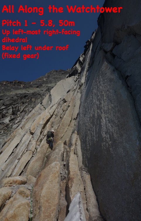


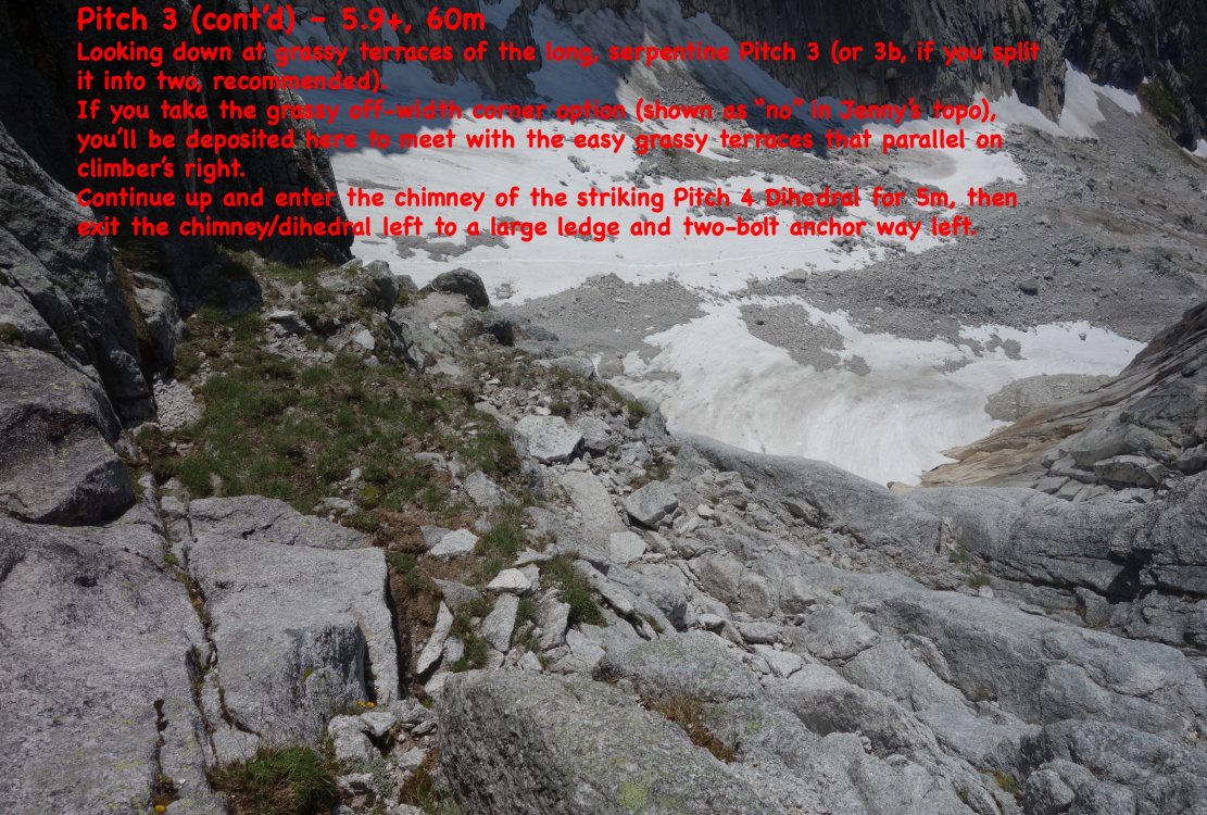
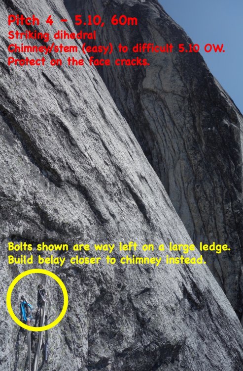
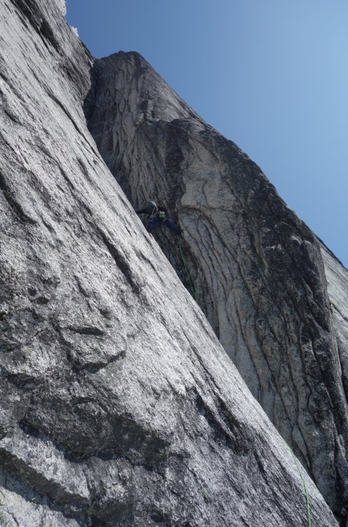
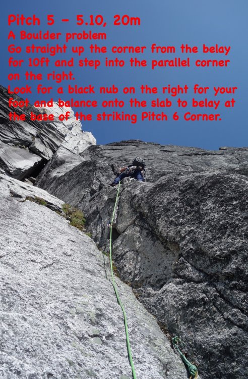
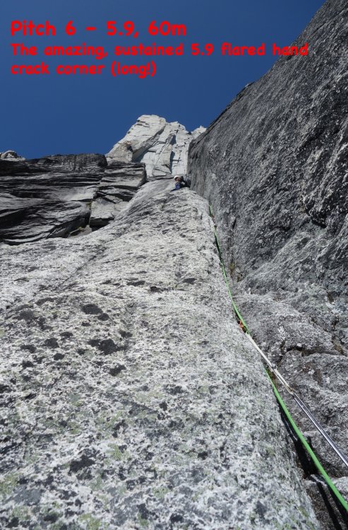
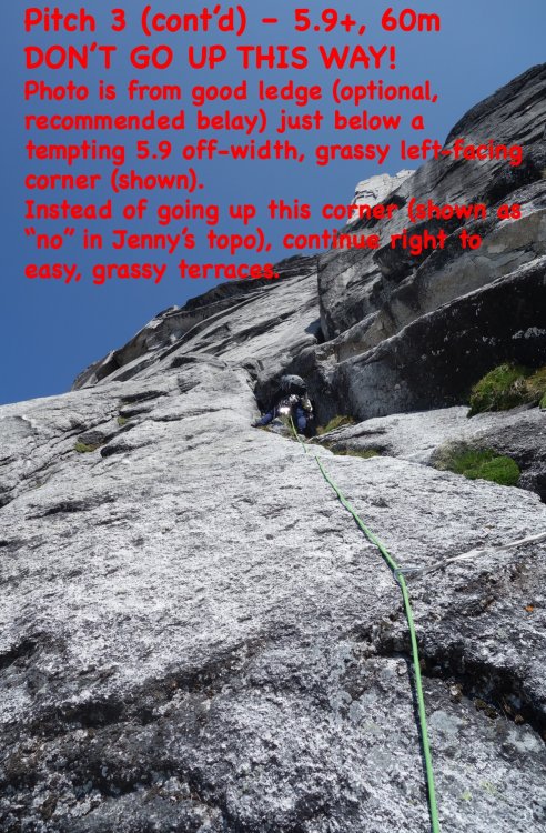
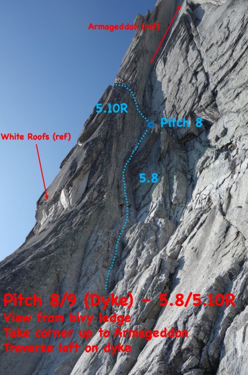
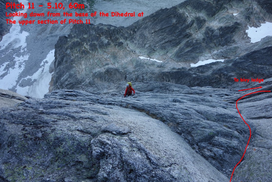
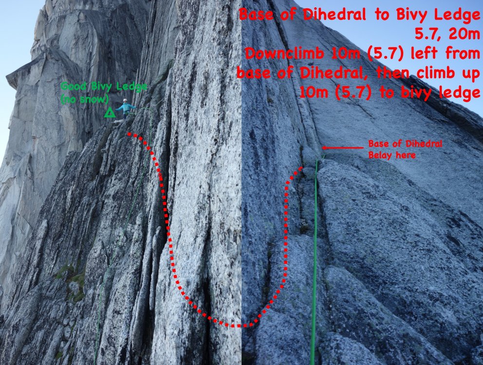


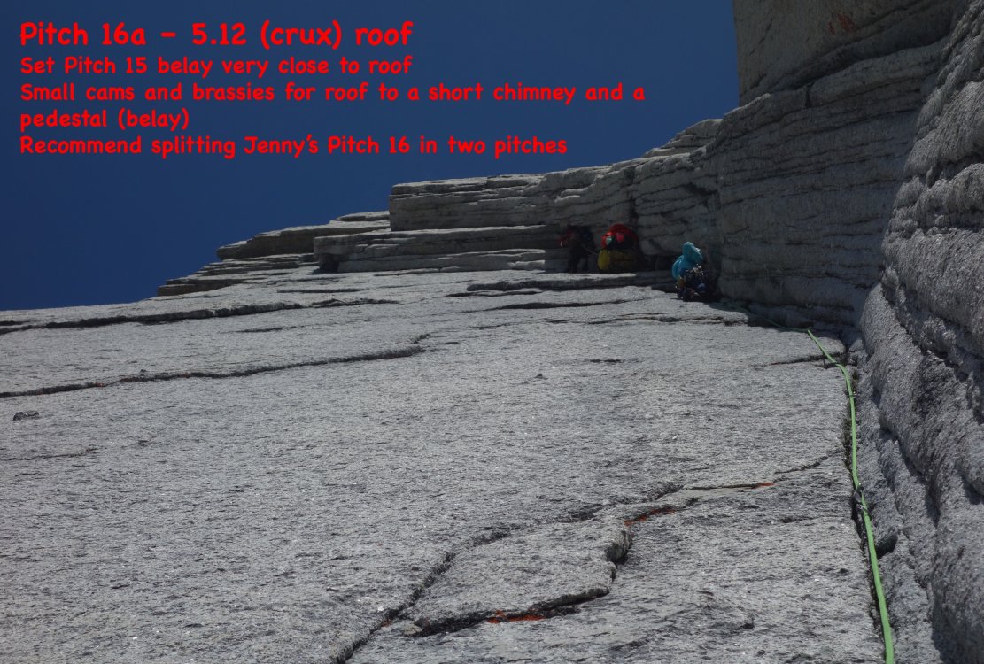
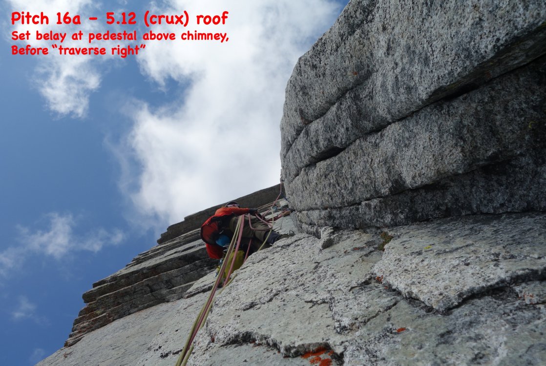
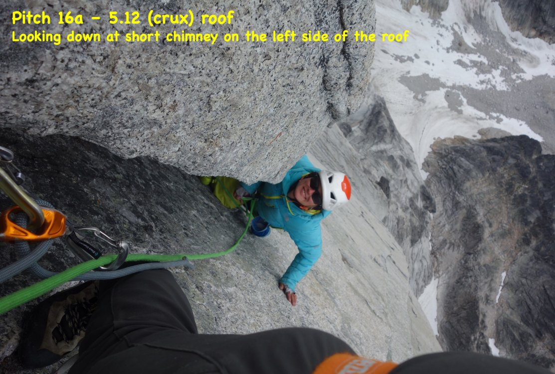
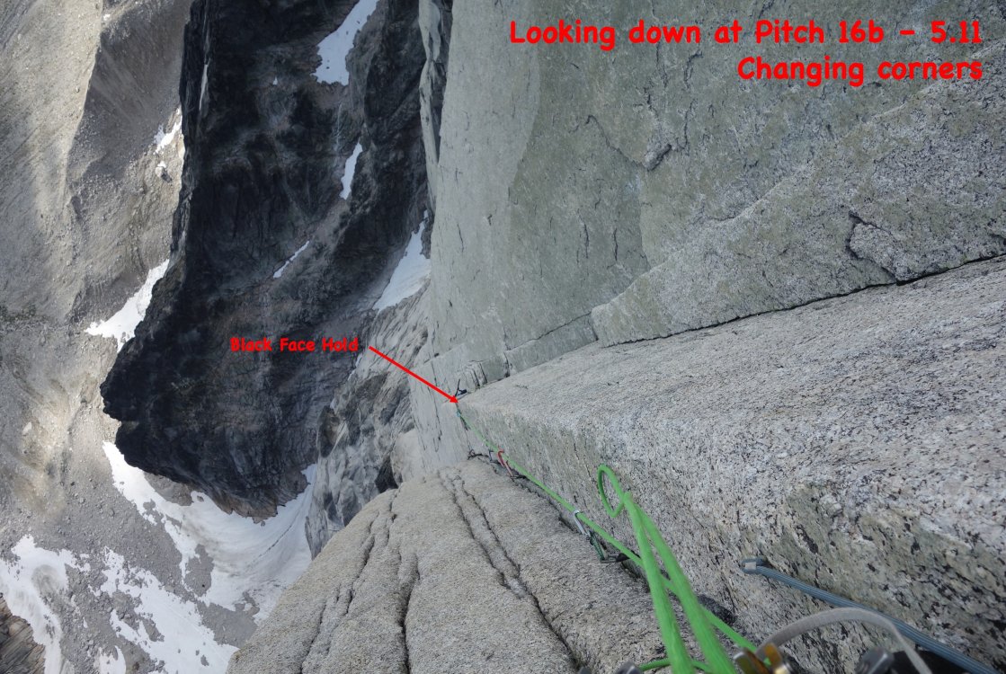
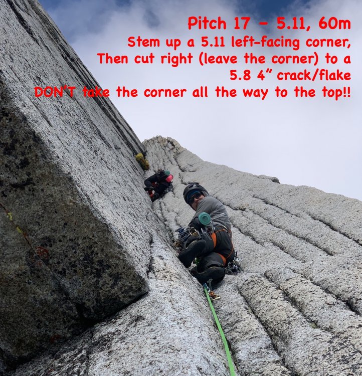
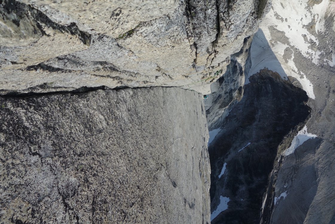

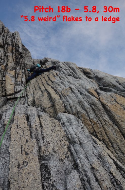

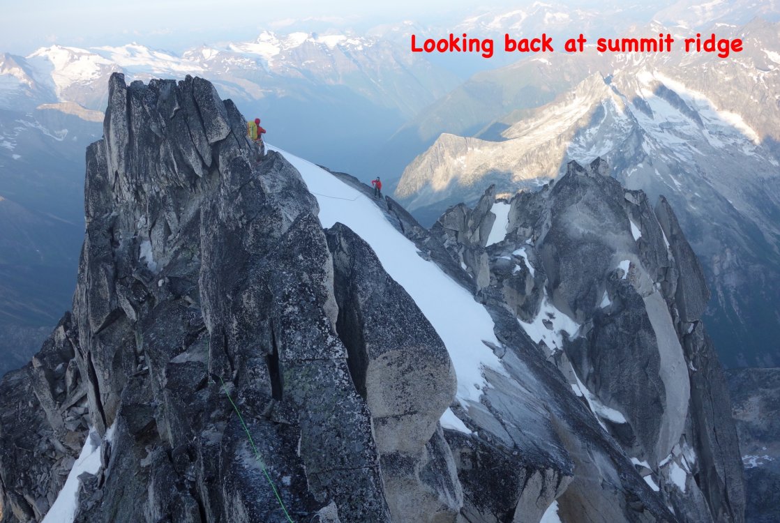


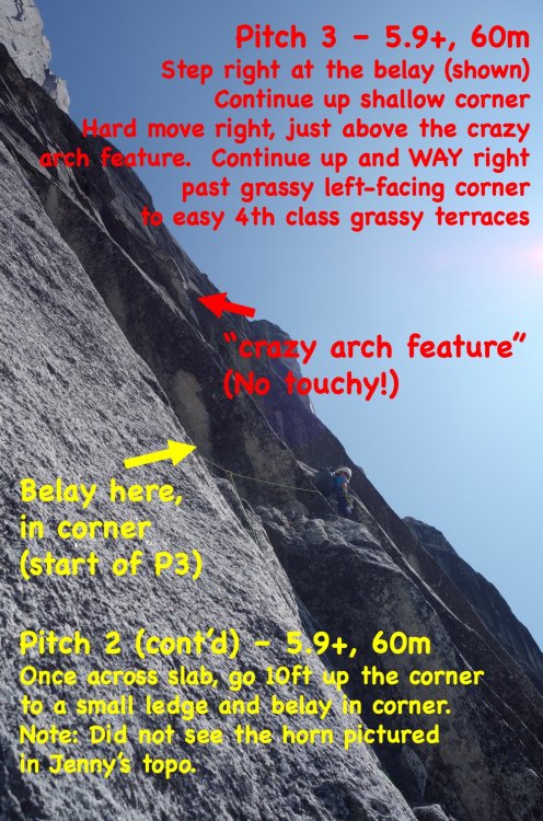

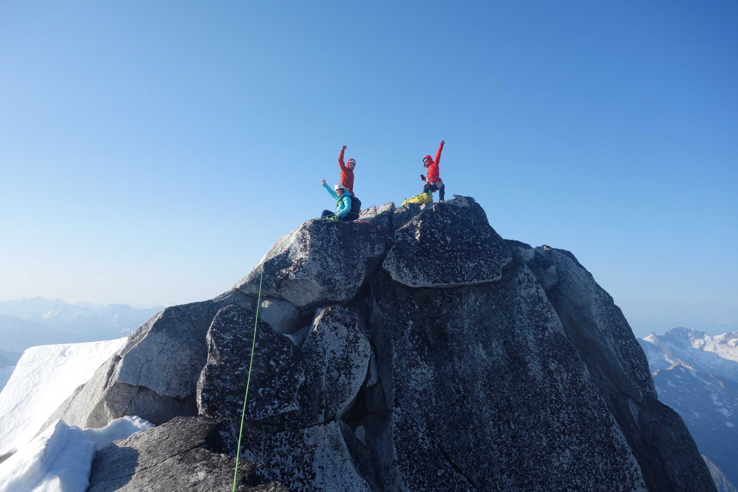
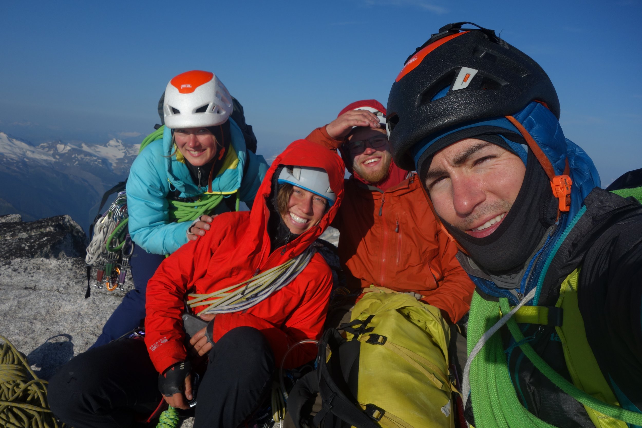
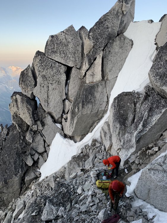
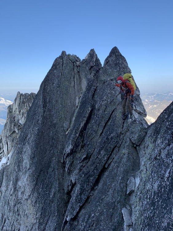
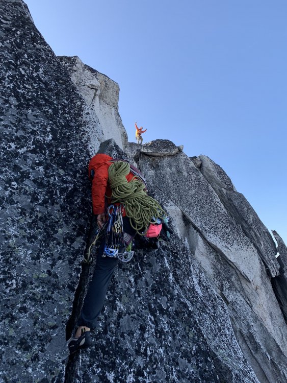
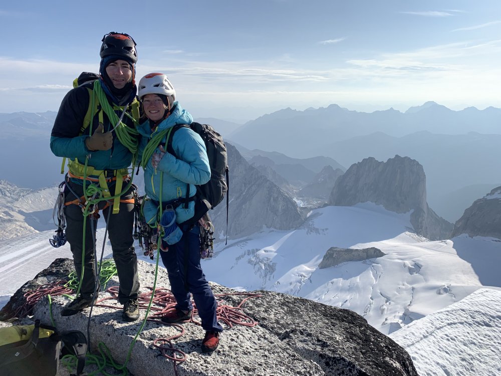


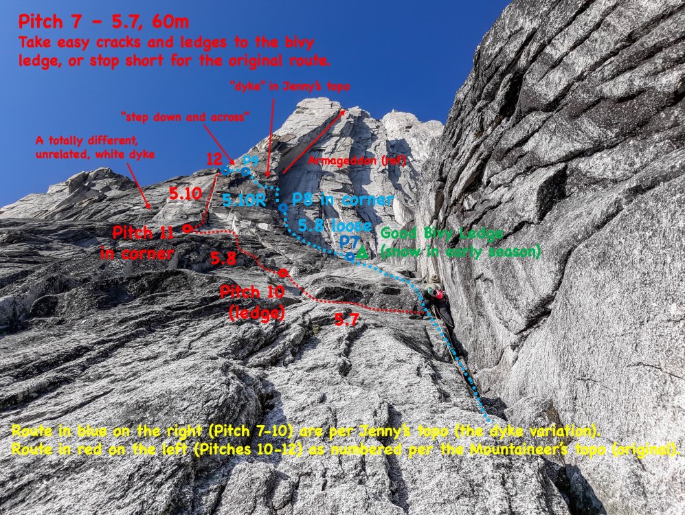
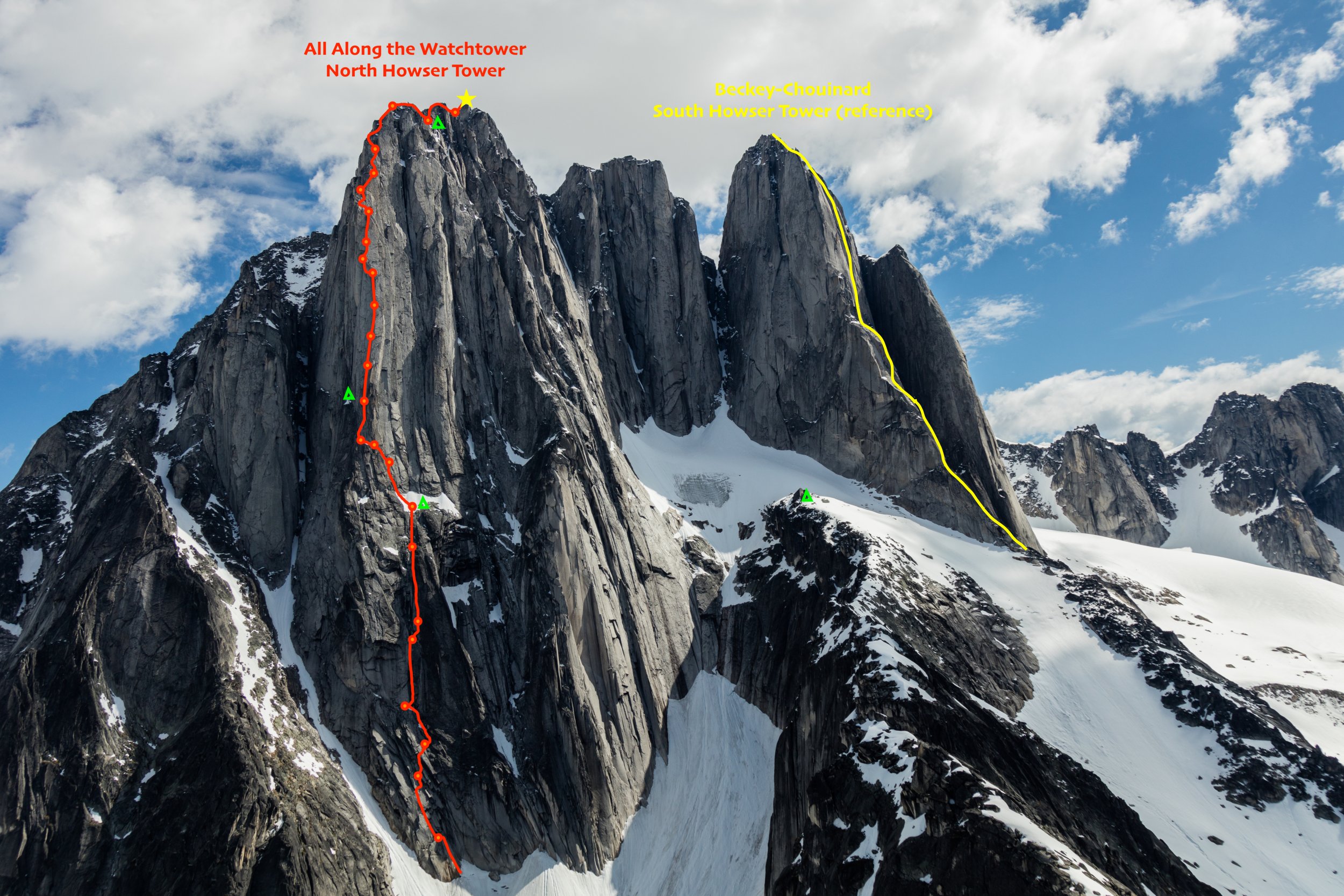
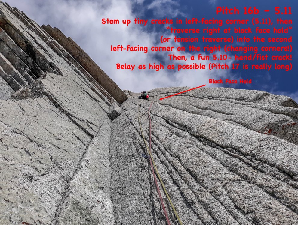
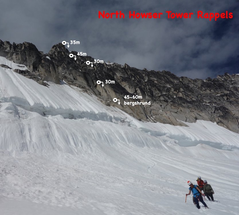 12 points
 -
Trip: Skookum Falls - Far Right Side Trip Date: 02/15/2021 Trip Report: On President’s Day I finally got to climb my first pitches of ice in Washington and I got the full PNW experience. After skiing the Cascade concrete for the last three of months I found that the Cascade ice is quite the opposite. We left Seattle at 6:15 that morning, raining. Heading south through Auburn, raining. As we joined the line up in Enumclaw to Crystal Mountain (9 inches, who could blame them), raining. We started making backup plans to head up to Snoqualmie but kept our fingers crossed. Even heading into Greenwater, raining. By some stroke of luck, as the GPS struck 5 minutes ETA, the rain turned to snow. When we pulled into the Skookum Falls Viewpoint (47.0529, -121.5721) we found the ice to be in pretty good shape. Dark blue - our pitch 3 Orange - our rap route - rap 1 through v-thread down to a large tree, rap 2 down to a second set of trees, rap 3 to ground Light Blue - Skookum Falls (courtesy of Justin Sermeno) Green - Skookum Falls Right (courtesy of Justin Sermeno) We made our way to the river working with vague beta of a crossing made of fallen trees. We basically flipped a coin and decided to head north along the river hoping to find this fabled bridge. Less than ten minutes in we stumbled onto it. (47.0539, -121.5754) Excited to have found the crossing, we jumped onto the trunk and gingerly walked across not knowing if the fresh snow had covered a solid step or a slip into the river. In our excitement, we failed to notice that the other side of the tree was a boulder problem of roots and frozen dirt. Luckily for us someone had placed a precarious crash pad (log) on the other side. Having successfully down climbed the root system, we made our way in a general south-west heading completely ignoring the beautifully tracked in Skookum Flats Trail opting instead for the ankle breaking snow-covered scree field. Red - not recommended Yellow - recommended As we geared up at the base of the climb (47.0523, -121.5763), we noticed the occasion slough. There was minimal overhead hazard and that the ice was decently fat we didn’t make a big deal of it. James offered to take the first lead and I happily conceded as I hadn’t swung a tool since my mid-December Hyalite trip. As James started off, he bottomed out his first 16cm screw. Oops. Finding a better place for it he continued on his way and made quick work of the first 45m pitch. As I belayed, I noticed the falling snow getting fatter and wetter. It wasn’t long before the falling snow melted as soon as it hit me. I followed up, happy to get back into the groove on top rope. As I took over for the second pitch the reality of WA ice set in. Every swing planted my hands in the wet snow. By mid-pitch, my gloves were completely saturated. I was pretty stoked with my new tape job but I may as well have taped cold, wet sponges to my handles. As I swung my tool back I could hear the *squish* of my soaked gloves as the tool passed my ear. The ice softened as the day went along and I was happy to have the horizontal front points of my Snaggletooths. At a certain point though horizontal or vertical didn’t matter, I was really just smashing through the slush and stomping down a foot hold. This was my first multi lead and my first realization that bringing 13 screws actually means you have 7 screws for the climb. 3 screws at each anchor. I had to call it quits at 35m. I set up my station, put my climbing gloves in my jacket and put my belay gloves to bring James up. Throughout the belay I watched as my fancy Goretex jacket slowly wetted through from the inside. This picture was taken with a very wet and slippery iPhone. James made it to the belay and we make the call to go or no go. Despite the moderate temperatures we are both shivering from the wetness, but enticed by the gorgeous sheet of ice above us we decide to keep at ‘er. It was only noon anyway. James throws down and takes the line of best protection. 35m. As James set up to belay me, I was shivering and my layers were saturated. I start climbing with reckless abandon, moving without testing my sticks and kicks until I reach a short section of dripping icicles. It was at this point that I learned that my layers weren’t saturated and could actually take in more water. Kicking it up a gear, I ran through this short section and met James at the belay. Now we were done. James built the V-thread and rapped a short section to a tree we had been eying all day. We pulled the rope and...fuck… it’s frozen in the V-thread. It took some hard negotiating but the rope eventually came through. I made sure to keep the rope moving back and forth as James cleared some tangles in the rope. At the tree we clear the old tat get ready to head down. Stepping over a branch, James heads toward the obvious gully (beta from not this section of Skookum Falls) climber’s left. Passing through the gully it’s clear that our 60m doubles aren’t going to hit the ground and James cuts back right to build an anchor at another tree. Cold and wet, I quickly followed over the branch not knowing that he had zigged and then zagged. As I got to the anchor and started the pull, the rope was stuck again. It was the orange rope wasn’t it? Or was it blue? No amount of forceful pulling would even budge the rope. This was the rock rescue moment we all say that we’d practice but never actually do. It was time to jug the rope. PNW lesson number I don’t know anymore, wet Prussiks are extremely catchy. Jugging up 35m on Prussiks was not happening. For the second time in my life and was supremely glad that I brought a Ti-Bloc with me. James fixed one end of the rope and I was able to jug up the other strand. Left quad cramping, right shoulder burning, I got up to the station to find this mess that I am almost too embarrassed to post. I cleared the tangles, rerouted the rope around the branch and un-zigged the zag. The remainder of the rappels went without a hitch and I thought to myself that I’m glad to be done. Mistake. We reverse the yellow arrows (see above) and find the trail. As we returned to the river crossing I am extremely unmotivated to climb what must now be a partially melted mud boulder problem. Recalling that there were other fallen trees that crossed the river I decided to pick the wrong one. We shimmied across another trunk trying not to fall in the river and we landed on an island that did not connect to the other side. Me yelling expletives at the river At this point we were less than 10 minutes from the car and the only thing that wasn’t wet were my socks so why not make it a royal flush. Gear Notes: A load of 13cm screws. Probably should've brought up more 16cms. 60m doubles. Approach Notes: Parking (47.0529, -121.5721) Crossing (47.0539, -121.5754) Base of climb (47.0523, -121.5763)12 points
-
Trip: North Norwegian Buttress - Jötnar VI 5.9 A3 Trip Date: 08/01/2020 Trip Report: Whaddup maggots. The crew of vagrants and miscreants just got down yesterday from north Norwegian round 2. We completed our line to the top of the buttress. We spent 1 day fixing back to the high point then 6 days on the wall climbing in capsule style to complete the route. We are naming the line “Jötnar”, the race of god-like giants in Norse mythology. We unofficially started calling the Norwegian cirque Jötunheim, “the realm of the giants”. While only having one line up there might not give us “authority” to name something, I’m enamored with the zone and like the name, and no one else has to call it that... anywho, here’s a brief report of our experience, hopefully this inspires someone to follow in our footsteps, as it’s an incredible route. In June, we made our first foray onto the wall and found soggy conditions as our route runs through a water streak for a good portion of the lower buttress. Poor weather lead to poor conditions, if you read my previous trip report, you’ll remember we did not get far. In 4 days of climbing we completed about 700’ of the line. We left gear stashed with the intent on returning. Our window of time off about 3 weeks away. Prep for the route started a few days before our departure date. I headed over to kyle’s studio (For his gear business “high mountain gear and repair”) in Ballard to make some various things. One of those being an inflatable big wall hammock that we had been discussing in recent weeks. Kyle would test it out on this wall, likely the secret weapon for big wall alpine routes in the cascades. Kyle came up with the name “Taco” as a mockery of conventional portaledges. After making various things for the wall we set out on our own errands the next day then reconvened to shuttle a load up to lake serene. Fetching water was considerably easier than last time, the moat had opened enough to walk inside, being a whiteout day we decided it was safe enough to brave for 15 min to get water (better than hiking back to the lake!!) After unwrapping our gear stash we discovered a snafflehound gnawed on a rope! The backup lead line nonetheless. Another rope was needed, the volume of rope was becoming absurd. We told Lani to pick one up on her way down from Bellingham. Logistics here got weird. Kyle had commitments in the form of a bike packing trip during the start of the window we had to climb. So when Lani and I started climbing we would have to leave lines fixed to the ground for Kyle to use to join us two days into the climb! On the first day we got a ride to the trailhead early morning and moved with motivation all Day to fix lines the the high point on our route. The line climbed substantially better because of the cleaning we were able to do previously. Fixing high on the wall we descended to the base that evening to sleep on the ground and prep the load to haul. We woke up early again and started the manual labor. Moving faster that expected we were able to haul to the high point and get camp set up around mid afternoon. Plenty of time to start up new terrain. Lani started up the next pitch which would prove the steepest on route. She got about halfway up the pitch before deciding it was time for dinner. On day 3 she headed up the pitch and pulled through the massive steep band that blocked our view of the upper buttress. This would prove to be the only pitch that requires a fixed line for descent. I took over the lead on the next pitch and found cool expanding beak cracks that lead up to a surprise! We pulled into a band of bulletproof skagit gneiss that would run the whole middle part of the route, immaculate stone. I climbed up into a massive right facing corner and up an amazing #2 crack through the second massive roof on the route “the fang” as we had pre named it. Continuing up an easy flare I found a good stance at the base of a large slab. Lani was still feeling mega tired from the steep lead and told me to keep going, I quested upwards on the slab utilizing a mixture of hooks and rivets to reach a dike that proved discouragingly shitty. The dike however led to a good flake that rapidly turned not so good, the whole corner was a Jenga stack. Being on lead I reluctantly bat hooked the face around the choss. These bat hooks could maybe be avoided post cleaning, still chossy and expando in there though. I eventually put a bolt in to reach far and tension to the next small corner, which proved to be cruiser C1 to a good stance for a belay, post dirt removal this would likely be sweet 5.9-10. Here I called off belay while placing the anchor bolts and Lani zipped down to camp to start dinner. Meanwhile Kyle had started up the wall hauling the second half of the load solo, having to haul twice he only got to the bivy at pitch 3 and would camp here. Day 4 started with shenanigans to situate the ropes where they needed to be in order to fix higher. After we were able to snag an independent rope Lani and I again began the commute up the fixed lines to push the line higher while Kyle hailed up to camp. From the high point, Lani led up Inobvious but moderate aid to the crest of “the dude”. The biggest roof on north Norwegian, and an intimidating mega overhang. Incipient and creative low angle A3 led up and left under the roof and around the bushy corner to a small ledge. Reaching this ledge we figured we were far enough up to move camp, and thus Lani went down to assist Kyle in starting to haul while I started soloing the next pitch to the intended next camp. About halfway up my pitch I got a call saying there were technical difficulties at camp, we decided to reestablish camp and fix to the top my pitch. Day 5 would start super early with the big move. Myself and Lani would double counterbalance sky haul the pigs while Kyle cleaned the line below and brought up fixed lines. A few hours of hot manual labor brought us to the high point ledge. A grassy inset which seemed suboptimal for two portaledges, we spotted a good spot left of the buttress crest and concocted a creative plan to swing the bags over. I free climbed up to the top of a flake and put a good bolt in and lowered down (clipping the haul line to the bolt) to the intended spot. I drilled while Kyle and Lani prepped the bags. Once ready I took tight on the haul line with my gri gri and they kicked the bags over top rope style to me where I lowered them in place and docked them at the anchor. Shenanigans. After setting camp up I hugged up to my high point on the pitch and continued my lead. “The head wall” proved to be wicked exposed but I had to fight the features pulling us left into the chossy chasm and drill my way to a stunning corner on the buttress crest. Kyle and Lani came up to join me and Kyle started up the next pitch. Moderate free and aid led up through a tree to a roof. An inobvious ramp cut out left through some chossy bush. Kyle bulldozed his way up eventually running out of patience and drilling around some dangerous choss. Running low on daylight Kyle threw in a belay and called it a day. Day 6 started with a poor decision, only one gallon of water came up the wall... after jugging we were already dehydrated but didn’t think too much of it. We started on the e face and got good afternoon shade but the upper part of the route climbs the crest of the se ridge, and gets blazing sun all day. I got the the high point first and in the spirit of decluttering the tight stance I started free climbing. 50 ft up I hit an awesome ledge too good to pass up, so I added an anchor and moved the team up. Kyle in the mean time cleaned the previous bit to a state of being semi pleasant climbing!! At this belay our peril became evident, we were already spiraling into gnarly dehydration. Kyle was getting loopy, Lani unstoked, and myself crankerous. I would continue up with inobvious route finding. A long circuitous pitch of steep 5.9 led to another good albeit sun exposed ledge. We were closing on the summit, Lani encouraged me to keep leading while Kyle cleaned the route. A blueberry filled corner provided passage to the next tier, a pitch likened to the tree climbing on j berg!! One more mega ledge and we could smell it! A casual pitch of 5.7 led up to a short bit of heather clawing onto the summit of the buttress. We had read that it was easy climbing to the summit of middle index from here and it looked so. It also looked like a bunch of cascadian bush mank that seemed like it would taint our experience in our state of dehydrated madness. We descended to camp to smoke the joint we found in the parking lot and contemplate our descent. One or two puffs in I had this idea to lower Kyle with the bags down the whole face. We all became (mostly) convinced it would work and put wheels in the motion the next day. After wranglin the bags back to fall line we descended two pitches to the intended “drop zone”. We delicately stacked 1000’ of rope joined with edk’s, we would would bump em all through a munter. Kyle and the bags were probably closing on 400 lbs, we needed a gri and munter to control the load. The lower went smooth, and we were amazed! Bags were down!!!! So myself and Lani dropped all but two ropes down the face and Kyle started managing the clusterfuck. Our new friend River had responded to a Facebook call for porter help and met Kyle at the lake to take down 50-60 lbs of our load while me and Lani rapped the face and cleaned our gear. We touched down not too long after and started the soul crushing hike down, we had about 70-80 lbs a piece. I had called my parents again as it seems like all our friends are busy this time of year, they met us at the parking lot with a cooler of cold bubbly, fucking great climb. Shoutout to Lani for stoke, Kyle for his undying willingness to suffer and commitment to the manual labor and route creation, and River! For being willing to come up and help total strangers hump our stinky clusterfuck around. This route was certainly the effort of a village, and a wonderful big wall line that I hope people enjoy. Gear Notes: Double Rack micro to #4, Single 5, Single set of offset nuts (didn’t use rp’s), 4-5 each beaks, 2 small lost arrows, 10 rivet hangers. All bolts and rivets are stainless, one or two bolts didn’t take well in the wet mud, but could potentially be reset with a funk and tightented (all anchors have at least 2 good bolts). Some may need to be tightened up again after initial loading. No ledges big enough even for 1 to sleep, good portaledges camps at the top of pitch 3,6,9, and 12. Do not haul above 12. Bivies at 3,6, and side of 11 take 2 ledges well. Rap the route, some directionals need to be placed on a handful of pitches to get down, pitch 7 needs to remain fixed with an extra 35-40M rope (it could be possible to down aid the roof on rappel to get back to the previous anchor) Approach Notes: Scamper to Lake Serene while the tourons ask about your “paraglide” or “boats”. Easy talus walking to near the waterfall between the buttresses. Enjoy your stay in Jötunheim!
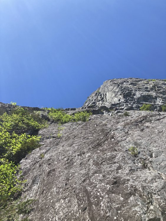
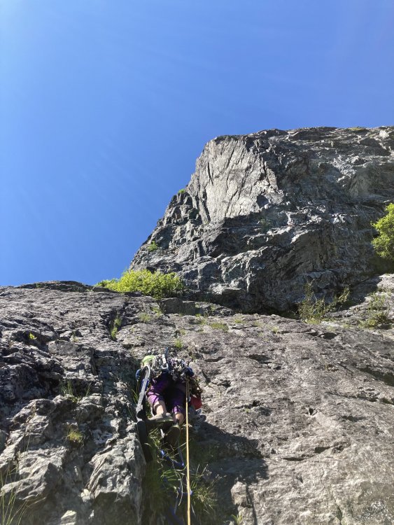

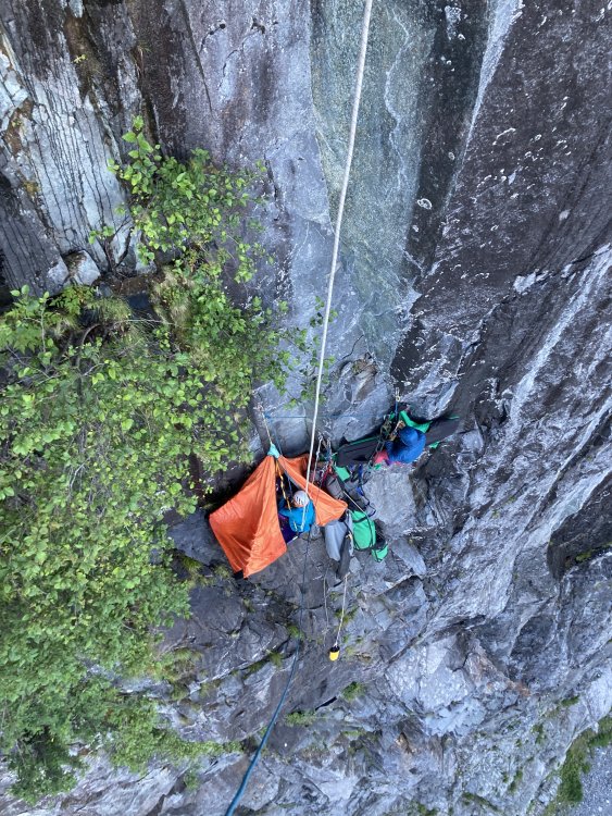
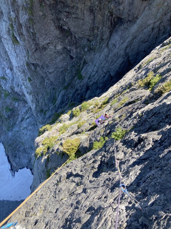
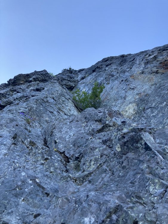


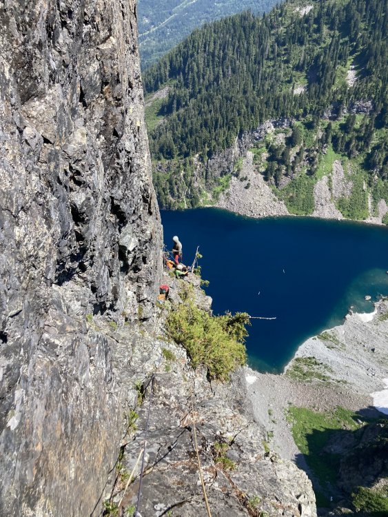
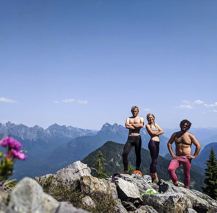 12 points
 -
Trip: Cascade Volcanoes - Bike-athon Trip Date: 06/06/2025 Trip Report: Summary: I set out to stand all 5 WA volcanoes in the same 7 day (168 hour) period, bike powered between them. As usual, antics ensued. An unplanned road closure added ~100 miles on the bike and the goal was adjusted to 8 days/192 hours. In the end, I stood atop Mount Baker on hour 189 since departing the Mount Adams summit. The journey in between had deep suffering, even deeper discovery and an adventure I’ll always remember. The trip had to be solo. But the story was too good not to share… Classic DC shot, peak 3 of 5 In recent years I’ve become increasingly obsessed with long bike-hikes. But it's hard to remember exactly where, when or why this dream came to be. A while back some lunatic bike/climbed all the Cascade volcanos and that certainly added some fuel to the fire. There is something about doing it all on human power makes the adventure feel a little more....real…for lack of a better term. Earning every inch helps put me more in touch with the broader landscapes which connect our High Places Planning an effort like this was sort of an impossible task. Timing the trip would require some favor from the weather gods. But knowing the patterns of the PNW and its’ volcanoes, June would be the time. Without better criteria I figured lets pencil it in around the longest days of the year in order to limit the odds of after-dark cycling. The snow coverage on Rainier in particular would also help mitigate the risks of solo travel on big glaciers. So I wrote it in for June 14-22…but a forecast presented in the first days of June that was too good to pass up. I was not fully recovered from training, nor was my equipment or logistics in order. But that was all figureoutable. With a week of solid high pressure I eeked my way out of whatever responsibilities I had, and set off. Originally the plan had been to start the trek from the Adams TH and climb with a friend. The new plan instead had me start the ride from White Salmon, at the Oregon border. That green-blue-white color scheme ? Its finally summer in the hills Call it a warm up! The 37 miles to the Adams TH went pretty quick until the last few. Reports warned of a “rough” “dirt” road leading up to the south side climb. Rough was fine, dirt was fine. The sandy parts were nearly impossible on a bike loaded up with camping and climbing gear. Despite that, I eventually reached the TH, unpacked and slept as soon as I could. By 2am it was too cold to stay asleep. The forecast for the week was going to be very warm. So I chose the lightest quilt I had in order to save weight. But that first night I paid the price. Preferring to rest longer but knowing when to bend I got up, packed, ate and started trudging upwards. Because my concept of this challenge was starting the clock when I departed the first summit, I kept my pace slow to conserve energy for what would inevitably be a very long first full day. By 830am I reached the top. Perfectly clear, sunny…but bitter cold wind. By 845am I started the clock and raced down the mountain. A few thousand feet down the surface was soft enough for efficient plunge stepping. By 1130am I was back with the bike, repacked and ready to coast a bit. The road would not make this as carefree as I hoped. Tedious, bumpy miles eventually lead to a delightful (paved!) forested downhill. Once in Trout Lake I found the restaurants closed. So I had my first gas station meal of the trip. A secondary goal of the trip was to eat ice cream at every country side store I could. Feasting junk food on the front porch, the staff asked “isn’t it early for through hikers?” I must have smelled like one already. The first of 22 ice creams... As we chatted I learned that forest road 25 was still closed due to a combination of landslide, construction, lingering snow and owl conservation. I spent most of the day having my at home contact help brainstorm how I would re route after climbing Mount Saint Helens. In the mean time I continued, but the uncertainty weighed me down. Riding to MSH took the rest of the day. There were a few miles of pushing the bike through snow. Definitely among the low points of the trip. That night I slept at the climbers bivouac TH after 19 hours and 12k of combined vertical gain. I was exhausted and the stoke was low. That night I had some thoughts of giving up. Ultimately a series of bad dreams in the early morning were disturbing enough to force me awake. Sometimes nightmares can serve that benefit. Within seconds of waking my mind refocused. Trying to close the distance before dark on day 1 Hiking MSH under good weather was a treat. The ascent went fast and easy, but not as easy as the descent. I was totally out of water but snagged a liter that had fallen out of someone’s pack on the glissade track. Back at the road, some kind soul had packed a can of coconut water in a snow patch they built near my bike. A little trail magic- bike touring edition. It really made me happy. Not just the fluid intake but that some strangers had the consideration of doing that for me. Solid folks can still be found… At first I thought it was a beer...probably for the better that I was wrong... Another huge boost came that morning when I was high enough to catch cell signal. I was able to devise a re route to get me to Rainier. It would add a day of cycling, and push the 7 day goal to 8, but the mission would continue! Riding back to the I5 corridor was definitely not my preference but flexibility is a trait we learn on quests like this. I spent the night at a trashy motel near the freeway. The next day was type 1 touring. Flat farmlands with many, many ice creams to be had. I reached Ashford in the late afternoon and settled in for a 13 hour sleep. The next “day” (actually two days, no sleep in between) would be huge. Arguably the crux “day”. It was some of the best sleep I’ve ever had. The schedule for the next segment required I wait til around noon to start. Timing travel on the upper slopes of Rainier was the priority. The 20 miles from Ashford to Paradise was actually pretty nice for being continuously uphill. I took my time through there, keeping my heart rate and mental stimulation as low as possible. Reaching Paradise at 4pm on a perfect Saturday, I remembered why I avoid this place on summer weekends. Luckily, on a bike parking is not an issue… A nice melty treat...and also an ice cream The permit stop was pretty seamless. Months prior I had received approval for a solo climb. Checking in was a simple formality. I killed a couple hours (and ice creams), letting the sun begin setting and the snow firming up. By 630pm I could wait no longer. Setting out from Paradise I continued to be intentional about managing my pace. Once on the snowfield I started to open it up a bit. At Muir I was surprised to find absolutely zero wind. I took this opportunity to rest for an hour. After that break, something came over me. My energy was maniacal. It felt like nothing could stop me. By the time I reached the top of disappointment cleaver I had passed 52 people. 3h 53m after leaving Muir, I was standing alone on Columbia Crest, well ahead of sunrise and ahead of schedule. I had stood there many times before, sometimes alone, but this was a very powerful moment. Its hard to describe the feelings that came over me as the first bits of dawn stumbled over the horizon. Its amazing how full life can be…I hope some day I can better explain what came over me. The descent was uneventful… fast, efficient. By now I was getting better at repacking the bike, even though one of my cheap panniers had exploded. Riding down from Paradise was probably my favorite segment of cycling in my life. Almost no pedaling, fantastic views. Hardly any traffic, surprisingly. The bliss would not last. The rest of the day would be 80 relatively flat miles but with a strong headwind and temperatures reaching the low 90s. To boot, it was the first hot Sunday of summer and the roads were bustling. The miles were stressful and seemed to never end. Eventually I reached home in South Seattle. I had started the effort 32 hours earlier. In the end I would gain over 16k feet of vert and drink 15L of water. It was nice to be home for a second. But I had many tasks to complete in order to be ready to ride out the next morning. New panniers arrived. I did laundry. Tuned up the bike…and even had a few minutes to tend to garden tasks. The next morning I had pizza and cake for breakfast and then hit the road. The day would be 12 hours and 117 miles but it actually went pretty well. The first ⅓ of that were on routes that I ride often. I encountered some nice bike paths from Snohomish to Arlington, and beyond to Darrington. The gas station there was closed due to “extreme heat”. But I still managed to find some ice cream and groceries before continuing to the Glacier Peak TH. It was at this point that I started to feel like this could actually happen… It was a poor night of sleep there. But by 550am I was on the move, even if it was a little sluggish. If you’ve hiked GP before you know what a slog it is. It seems never ending, like you’re making no progress. My morale and energy improved as the day went on. I made the summit around 430pm. What a view. Glacier Peak is a highly underrated IMO One of the few photos that day. Rainier seems real far away ! It would be a long ways back to my sleeping pad and fart sack. But I made pretty good time. When I left White Pass at sunset the beauty was astounding. I had enough energy to run a few miles. The slog along the river valley did seem to take forever but at the stroke of midnight I strolled back into the parking lot. It did not take long to eat and fall asleep. The next morning I woke up and ate the 100 calories of crumbs left in my bag and started the (easy) 25 miles back to Darrington. Once at Moe’s I ate an unspeakable amount of food. Probably it was “too much” because my pace slowed to a crawl on the miles from there to Concrete. Once in town I decided I had better over-eat again… holy cow! just one left... It would be just a few more hours of uphill pedaling until I’d park the bike for the final time on this trip. There is something odd that happens at this stage in a grand-journey. Two strong but opposing feelings. On the one hand there is incredible relief that the work was nearly over. But the part that might be unexpected to some is the feeling of sadness that the mission would soon be over. So many years of planning and preparation, and now this week of total focus…it would be done soon. I had found comfort and identity in my striving. And with the finish line in sight I would lose them both At Schreibers Meadow I had a few hours to rest before starting up. A friend was at Sandy Camp and would be joining me for the final hours. Before the trip I wondered how my energy would be at this point. Would I be exhausted and barely hanging on? Or would I have tapped into some deeper energy and be racing to the top… A night to remember...headlamps stayed in the pack It was the latter...stoke was through the roof...through the clouds even... At 550am we stood on top So much of what makes a journey like this worthwhile are the elements that can't be transmitted in words or photograph...but I've enjoyed trying Gear Notes: no gear. just ice cream Approach Notes: no11 points
-
On July 8th at 1:20am, Felipe Guarderas and I began walking up the Goodell Creek drainage with the intention of traversing across the Picket Fence skyline. We ended up climbing just a few peaks shy of the “proper” traverse but had a wonderful time moving through a ton of incredible terrain and we are very content with our execution and style of the traverse. By the time we began to walk out, we had already begun to scheme when our next trip into the range will be. We had about 56 hours of high pressure and we knew that the traverse would be an uphill battle to complete before the rain arrived. We opted to climb in a stripped down, lightweight style carrying a small bivy kit and tarp to maximize our ability to move in the terrain. We carried two dinners and two breakfasts just in case we would need to bivy a second night and we both carried about 3000 calories/person per day. Approaching the Southern Pickets in the early morning of Day 1. We had a rack and a half of cams, aluminum semi auto crampons, 70m 8.5mm rope and shared a single Petzl gully. We both had 40L packs and carried a small puffy, vest, wind jacket and hardshell rain jacket. We hoped that we wouldn’t have to deal with any rain but wanted to be prepared if the weather arrived a bit early. The approach went smooth with lots of snow above 6000’ and we arrived at the base of Little Mac at 7:30am. We enjoyed a long break on the warm rock and attempted to dry out our approach shoes and socks from the long snowy walk above the tree line. Soloing over to the base of Little Mac. We scrambled the exposed heather ledges to the base of the 5th class climbing on Little Mac and then launched up into the 5.7 terrain above. After a bit of terrain confusion, my pace started to increase and I began to find the flow through the exposed face climbing on the upper panel of Little Mac. We continued climbing up to the summit and continued up and over the three Macmillan spires. East Face of East MacMillan. Summit of East MacMillan. I had attempted the traverse last August with Dan May, and we had made it to the backside of Terror before pulling the plug and retracing our steps back over the East Face and down into Crescent Creek Basin. This go around I felt more familiar with the terrain and moved a bit quicker through some of the confusing 5th class terrain that Dan and I struggled to read last year. We continued simuling and soloing across the skyline until we reached the base of East Tower #5, where we broke the rope out and Felipe fired the stiff 5.8 pitch to the summit. We rapped into the familiar gully of Inspiration Peak and soon after found ourselves at the base of the East Face of Inspiration. Felipe led up the impeccable pitches on the East Face of Inspiration before we rappelled down to the Inspiration-Pyramid Col and continued racing towards our hopeful bivy at the base of Mount Terror. P1 on the East Face of Inspiration Peak. P2 on the East Face of Inspiration Peak. Pyramid and Degenhardt went quickly and we reached the base of Terror at around 7pm. Tired but very psyched on all the terrain we had travelled. There were minimal bivy options and the wind had increased throughout the day out of the south. Pyramid's 5.8 Chimney Pitch. Instead of enduring a lumpy dirt bivouac in the wind, we opted to utilize a large snow moat beside a large boulder that marks the start of the East Face of Mount Terror. We spent an hour kicking in a suitable flat spot large enough for the both of us and settled into a heavy night of sleep before an early wake up the next day. Our snow moat bivy at the base of Mount Terror. We awoke at 3:30am and were well into our first simul block when the sun began to paint the east face at around 5am. We continued up and over Terror, onto the Rake’s extensive ridgeline and over the Blob and the Blip. Felipe on top of Mount Terror. One of the highlight pitches of the traverse was the knife edge ridge climbing of the East Twin Needle. It was a superb pitch of climbing in a very wild position. We hit the summit of East Twin Needle right around noon and the increase in winds made it obvious that a low pressure system was on its way. Felipe cruising the wild climbing on the East Twin Needle. On top of West Twin Needle. We reached the base of the Himmelhorn at 1:45pm and Felipe hiked the crux pitch of the traverse in good time. One more pitch brought us to the top of the Himmelhorn and we high fived and kept moving over to the rappels. Six total rappels brought us to the Himmel-Otto Col and by then it was about 3:30pm and fairly windy. With the Ottohorn and Frenzelspitz still ahead of us, we discussd the pros and cons of traversing the ominous choss gully over to Frenzelspitz, climbing the last peak and then retracing our steps. It seemed as though the loose terrain would eat up a ton of time and with inclement weather on the horizon it seemed like a death march out of Stump Hollow would be inevitable if we choose to complete the traverse by the book. Base of the Himmelhorn. P2 of the Himmelhorn. Looking back at P2 of the Himmelhorn. Instead, we left our gear at the Himmel-Otto Col, soloed the Ottohorn and then descended back to the col. We felt okay with our decision to leave out Frenzelspitz and began our long descent back down to the car. On top of the Ottohorn, looking back at the West Face of the Himmelhorn. One overhanging rappel brought us to snow in the gully and we moved quickly down to the heather benches of the Crescent Creek Drainage. We hit the Barrier Col at 7pm and were able to quickly find the trail down into Stump Hollow. The Himmel-Otto Couloir. I stupidly got us lost as we began our last descent to Terror Creek and we spent the next few hours making slow progress bushwhacking down to Terror Creek, across the river and back up to the Goodell Creek Trail we had approached on. Goats on top of the Barrier Col. By the time we both reached the cars it was 1am on July 9th. Just under 48 hours since we began walking uphill. Although we didn’t complete the full traverse, we are content with our style and timing. At around 7am, it began to rain down in Newhalem and we were psyched to be sleeping in our cars rather than high up in the mountains. We also figure this likely won’t be the last time we’ll be in the Pickets and it’s nice to have a few peaks to come back to… A huge thanks is in order for Wayne Wallace, Mark Bunker and Colin Haley for their initial vision for the traverse and to Jeff and Priti Wright who’s beta was invaluable throughout the trip. Additionally, Jens Holsten, Sol Werkin, Chad Kellogg and Dan Hilden’s vision for a full enchainment of the Picket Range inspired us immensely and we are pretty mind blown at what those guys were able to do over 8 days! https://sam-marjerison.blogspot.com/2025/07/picket-fence-traverse-attempt.html Gear Notes: 70m 8.5mm rope Singles .2-3, Doubles .4-2, Small Rack of Stoppers 6x Single Length Slings, 4x Double Length Slings, 2x UL Quickdraws Aluminum Crampons & Shared Petzl Gully Windburner Stove + 2x 4oz fuel cans (only used one) Rab SilTarp 2 Small Repair Kit: Repair Tape, Ductape, 30’ 3mm cord, 3x AAA batteries, bundle of bailing wire 2x 2L Soft Flasks Feathered Friends Tanager 20 Thermarest NeoAir Small Portable Battery, Inreach, Headlamp and chargers Approach Notes: Up Goodell Creek, down Stump Hollow (don’t get lost like us!)
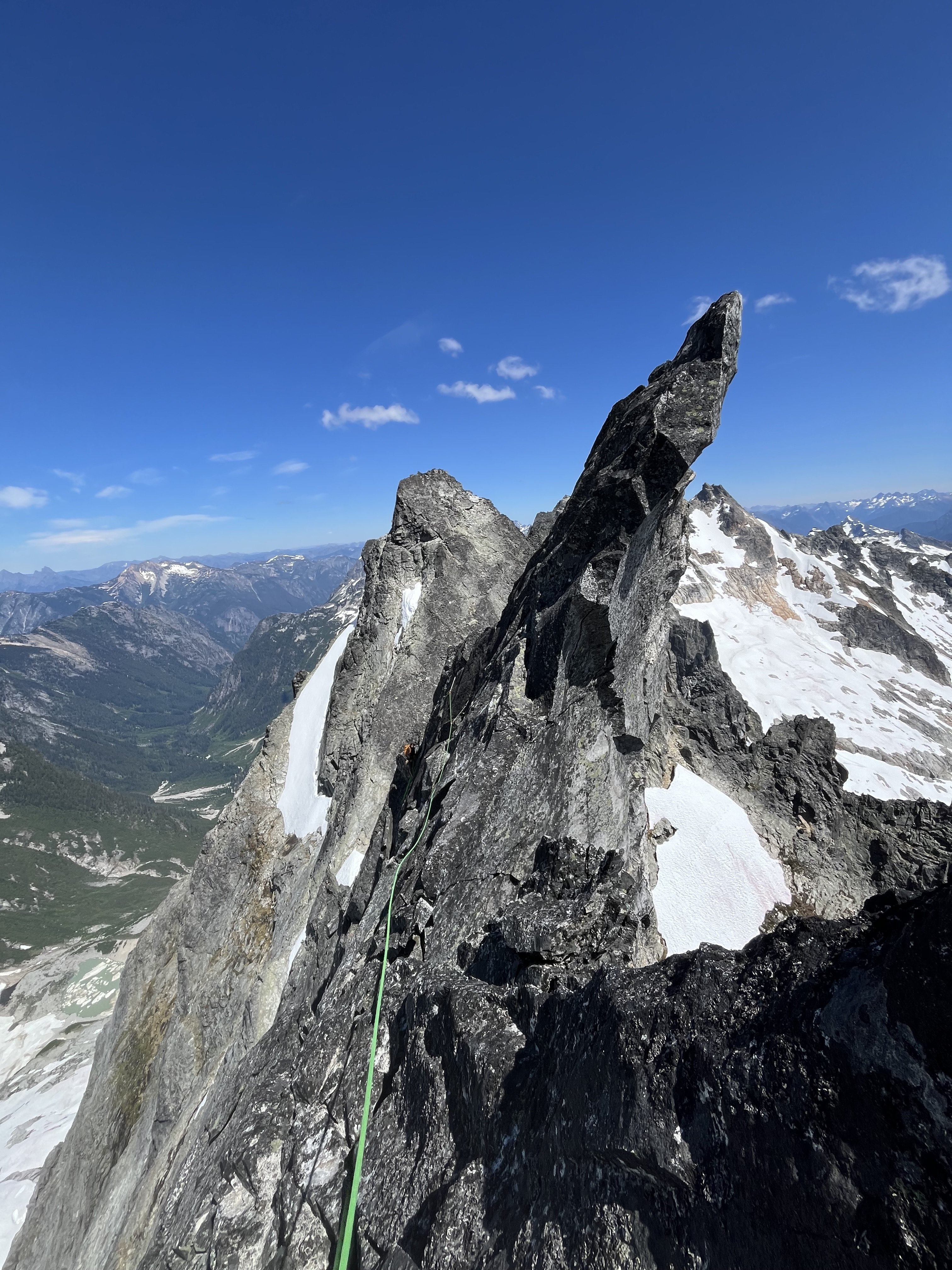
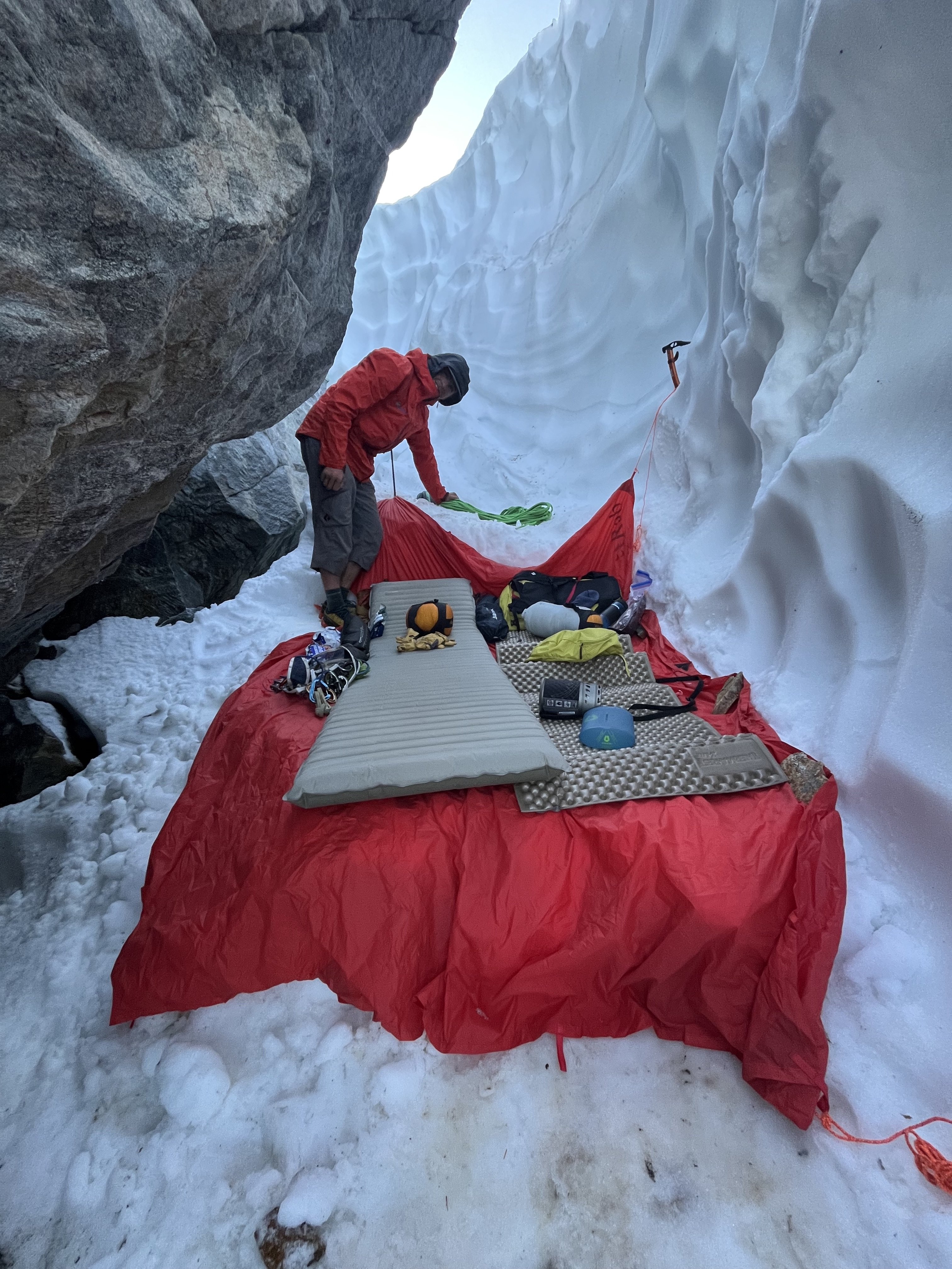
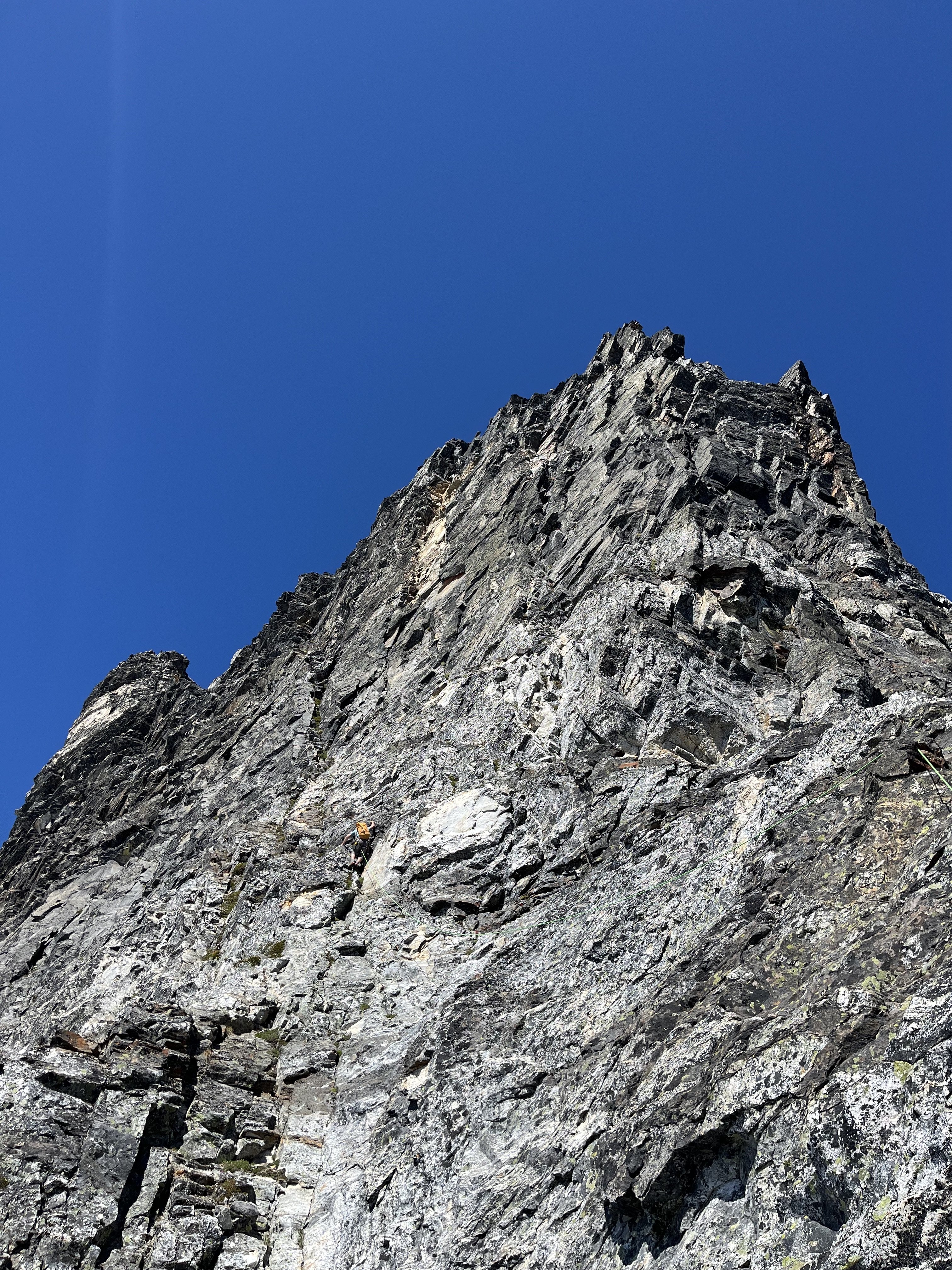
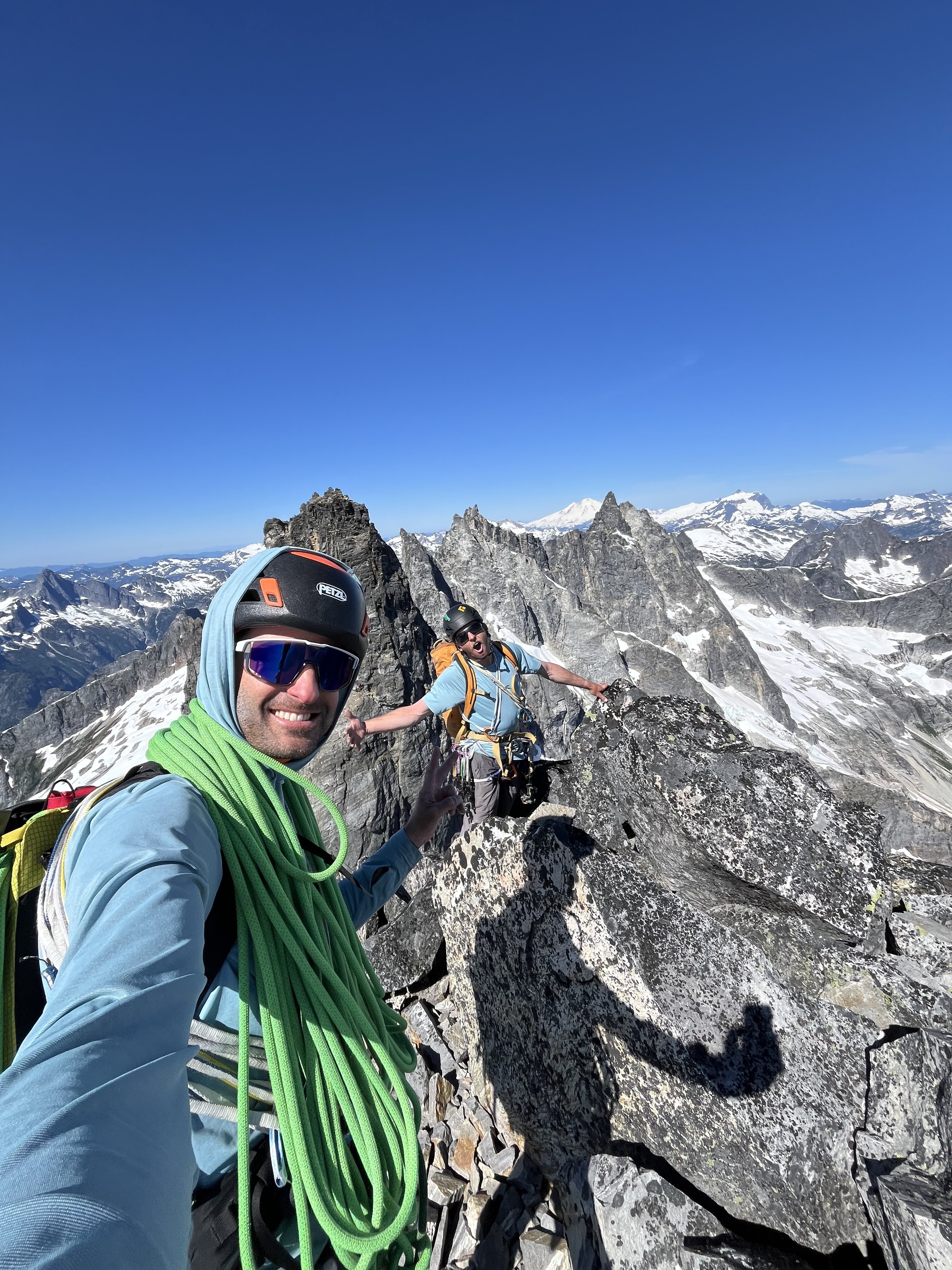
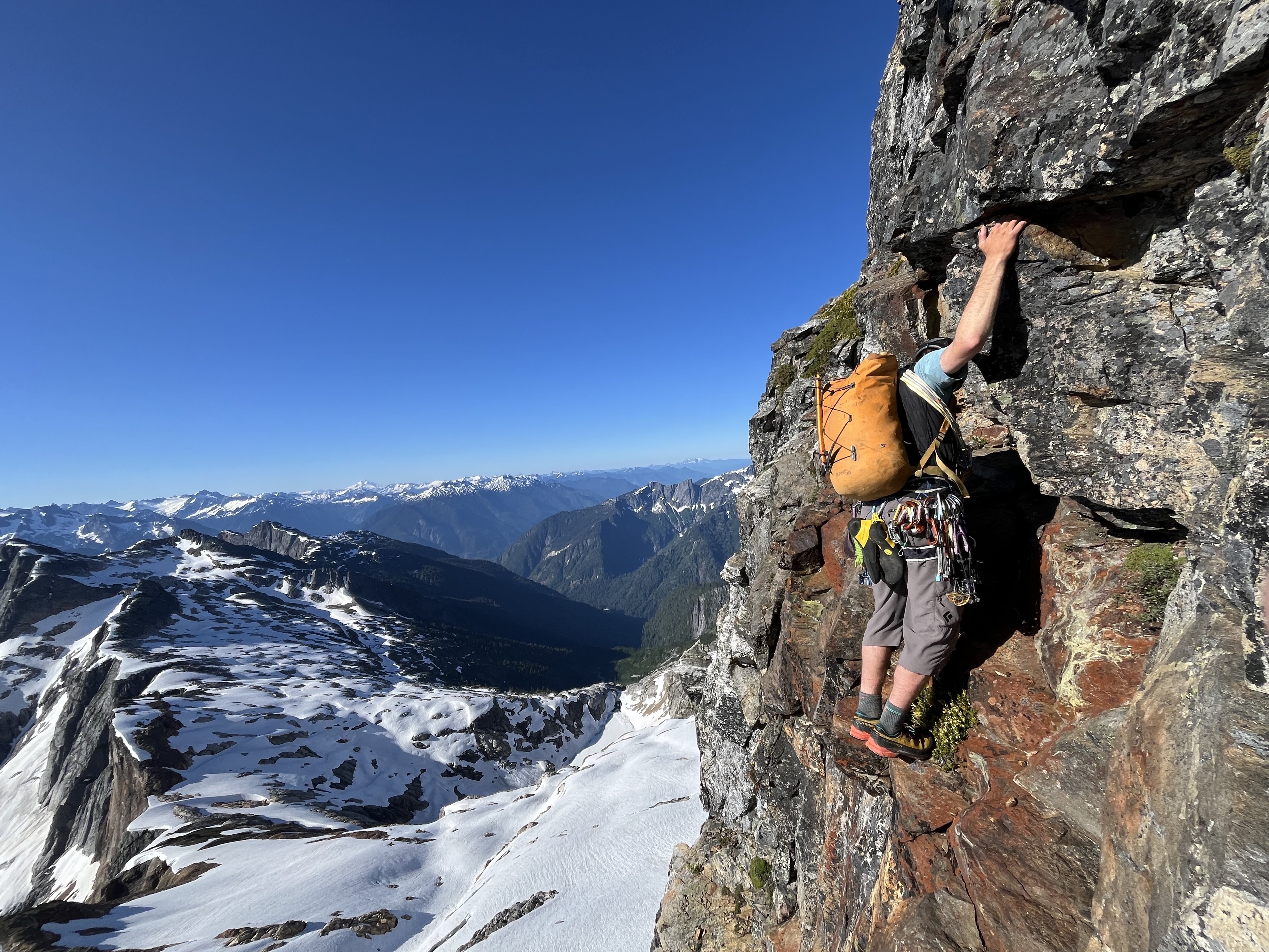
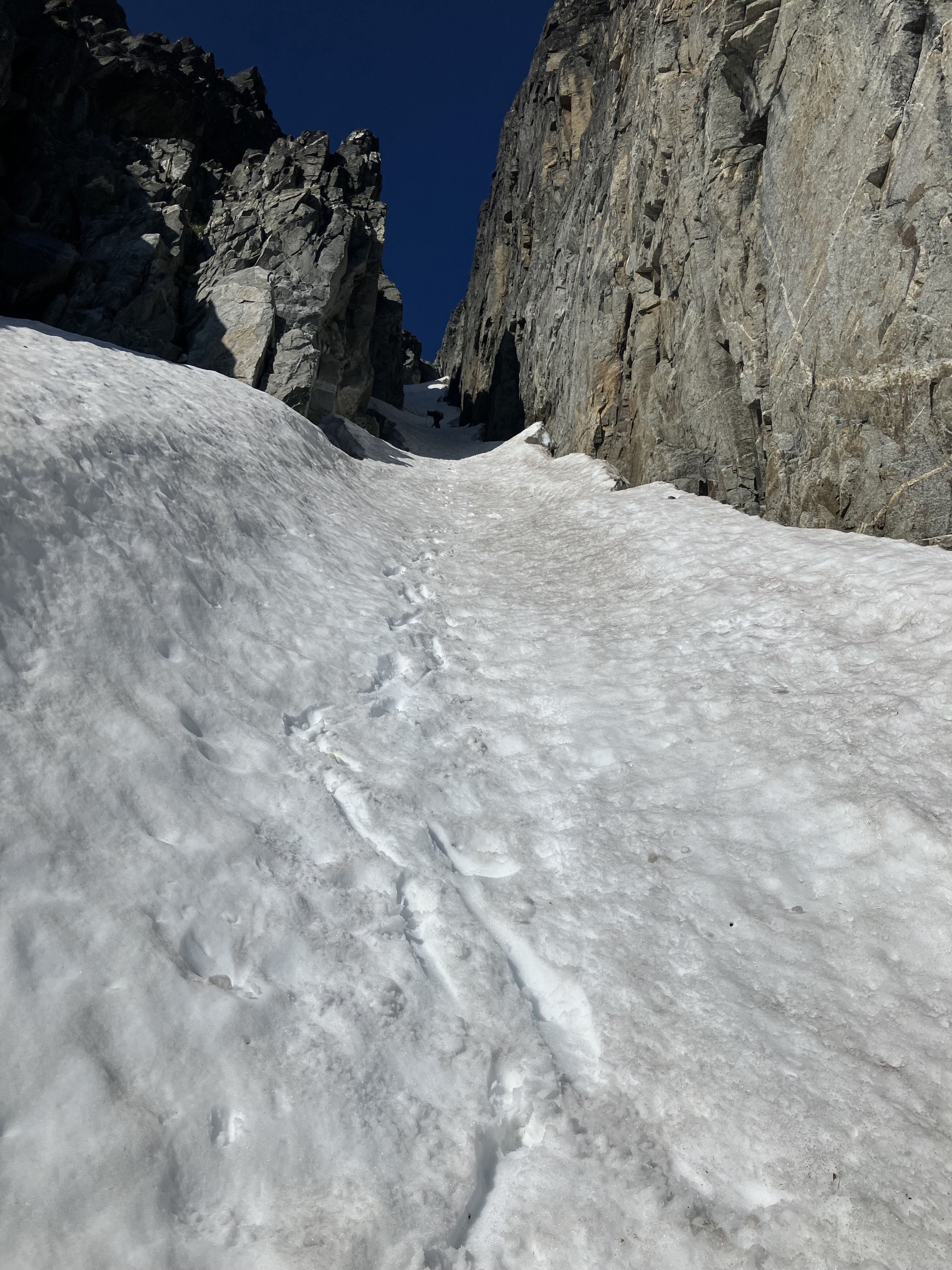

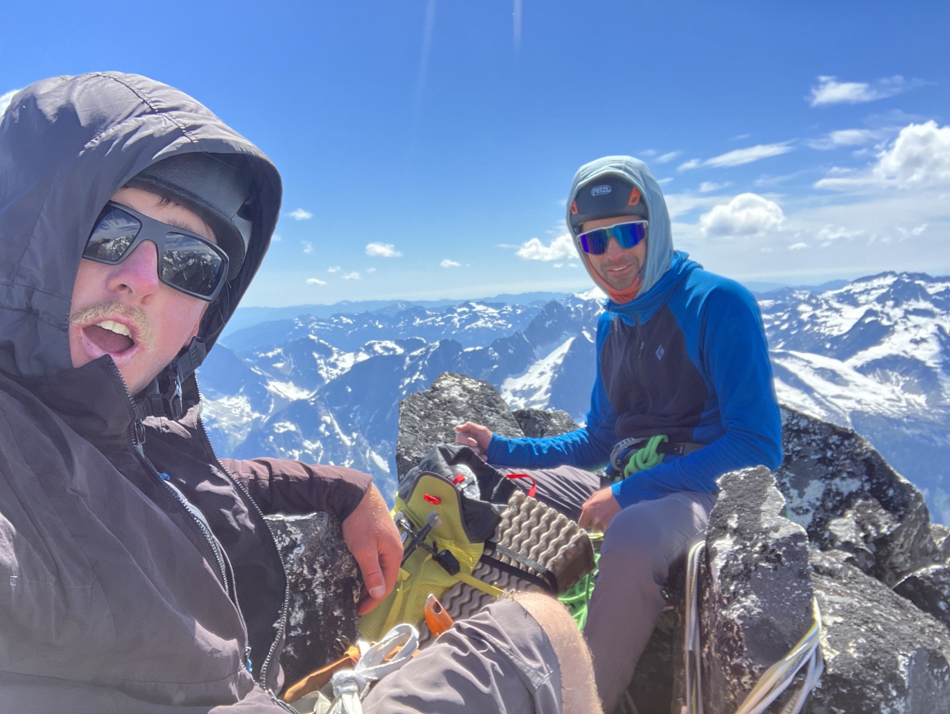
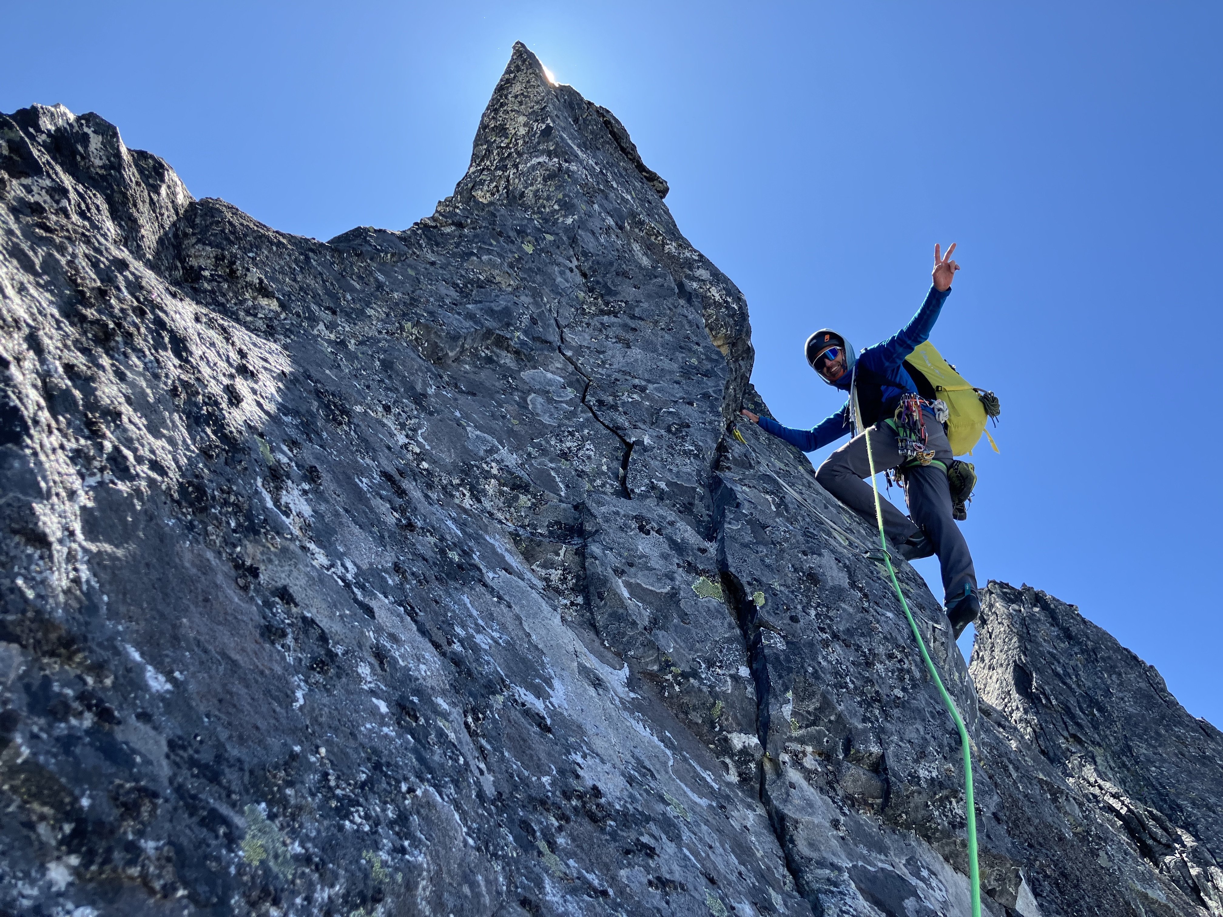
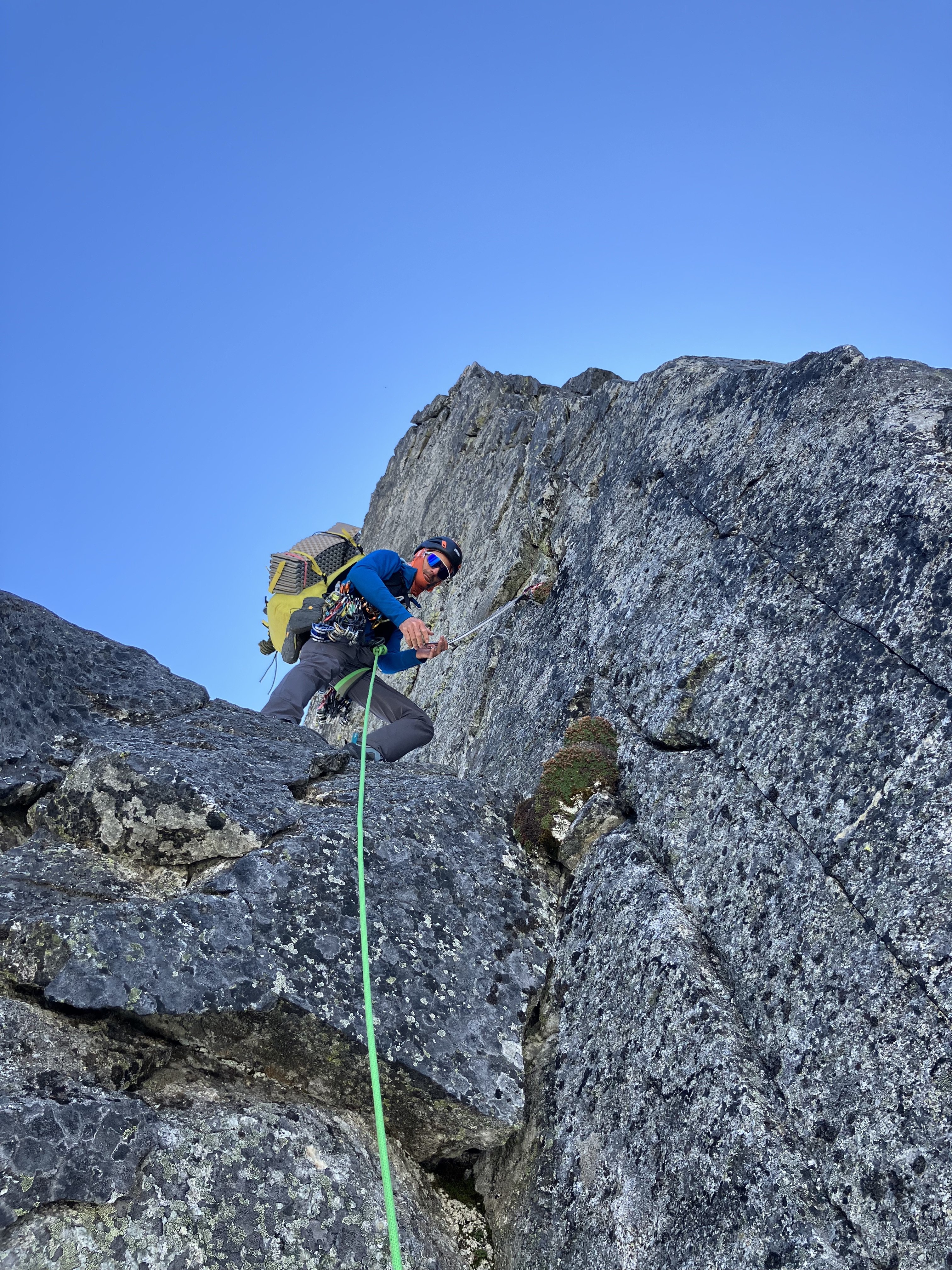
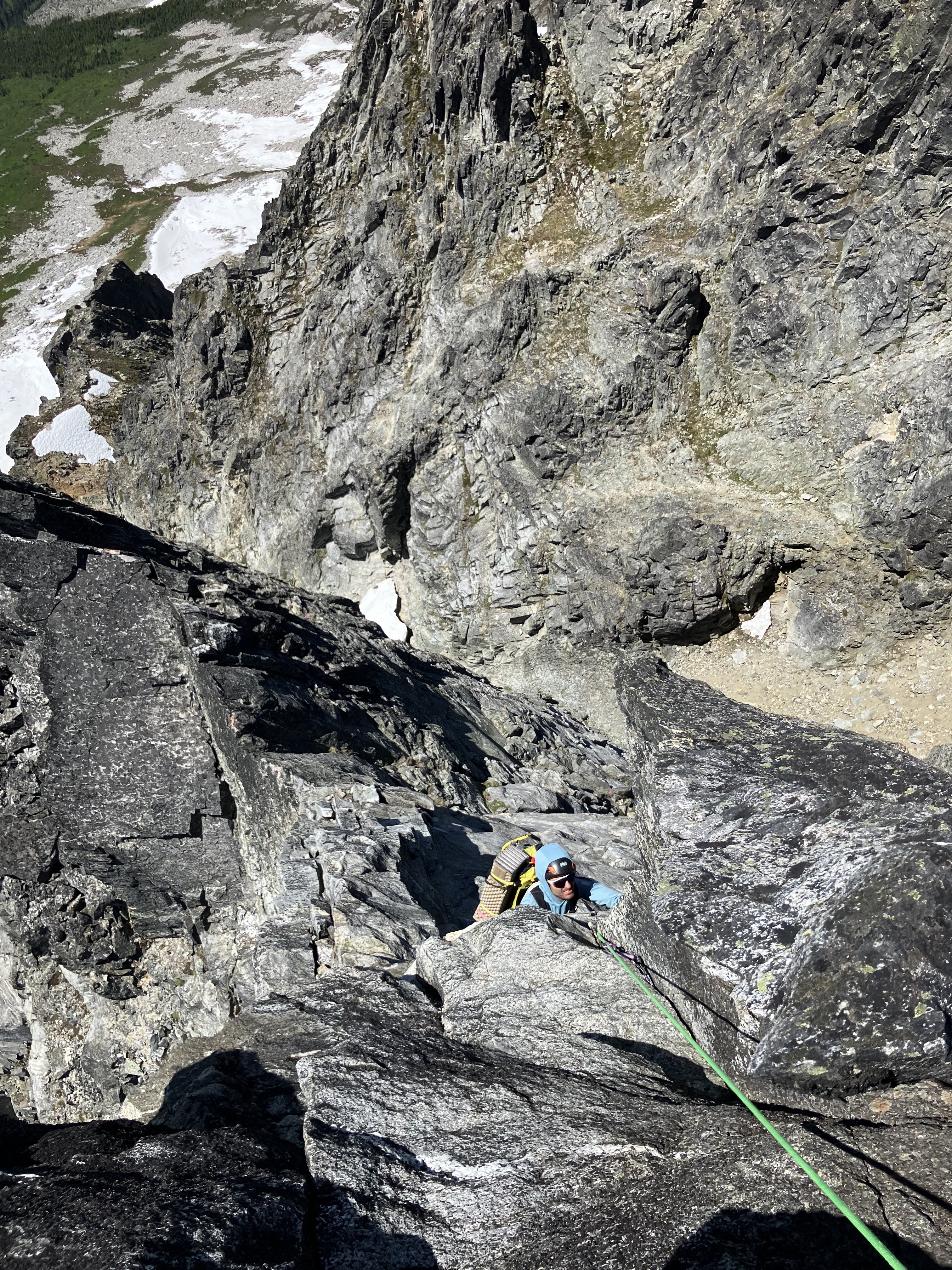
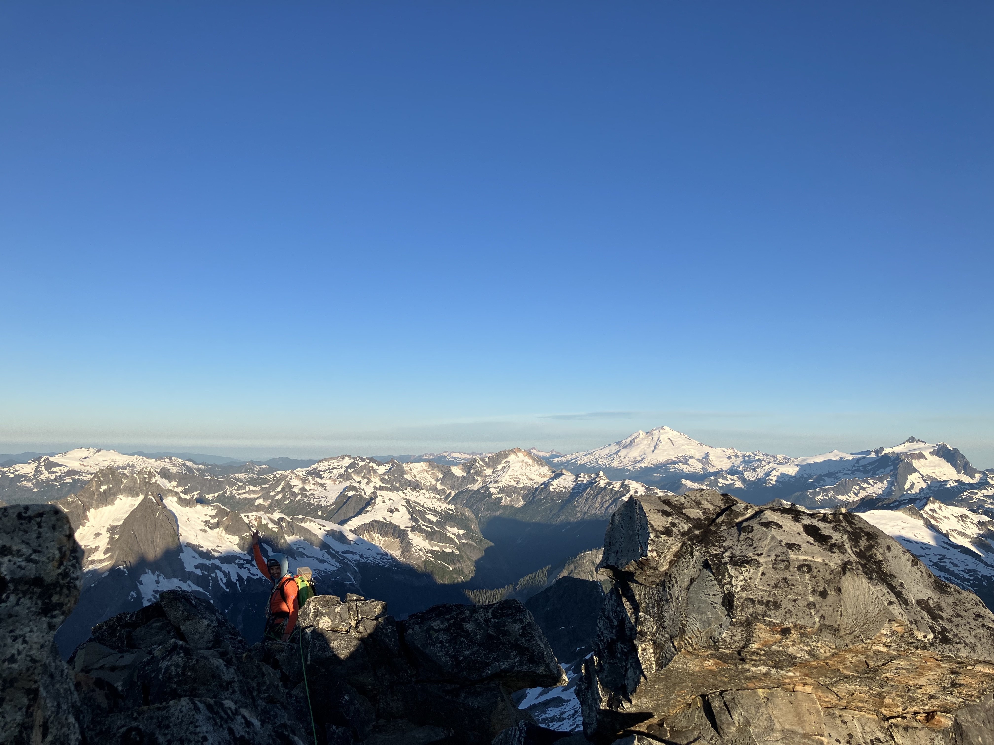
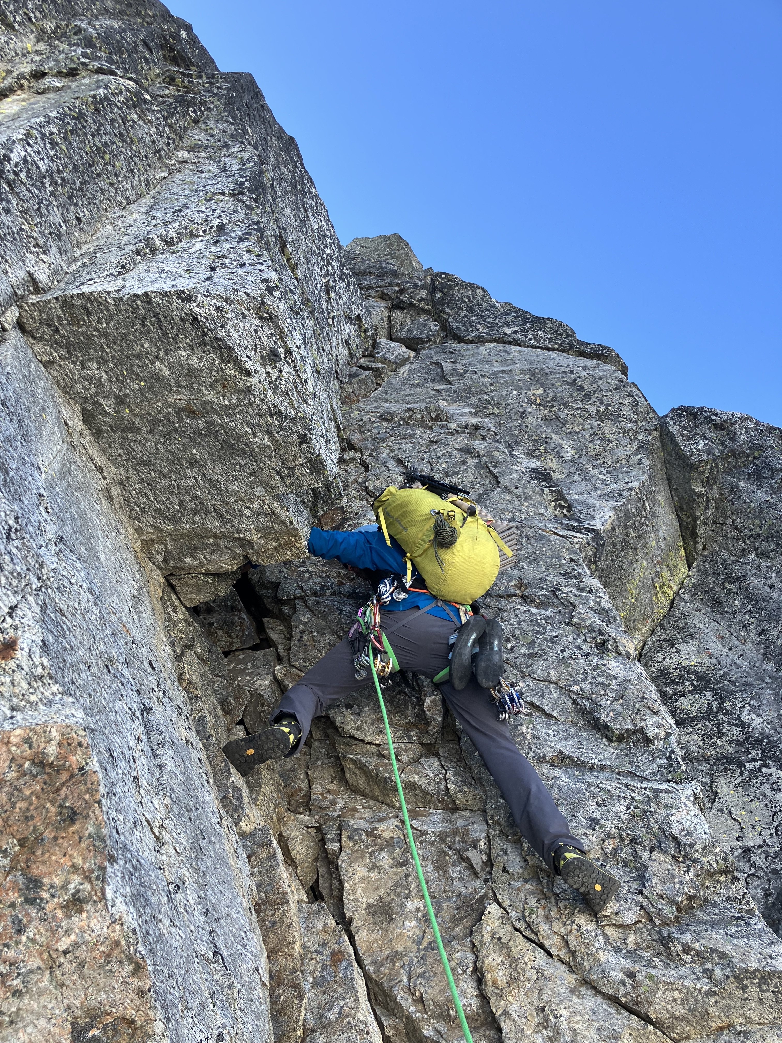
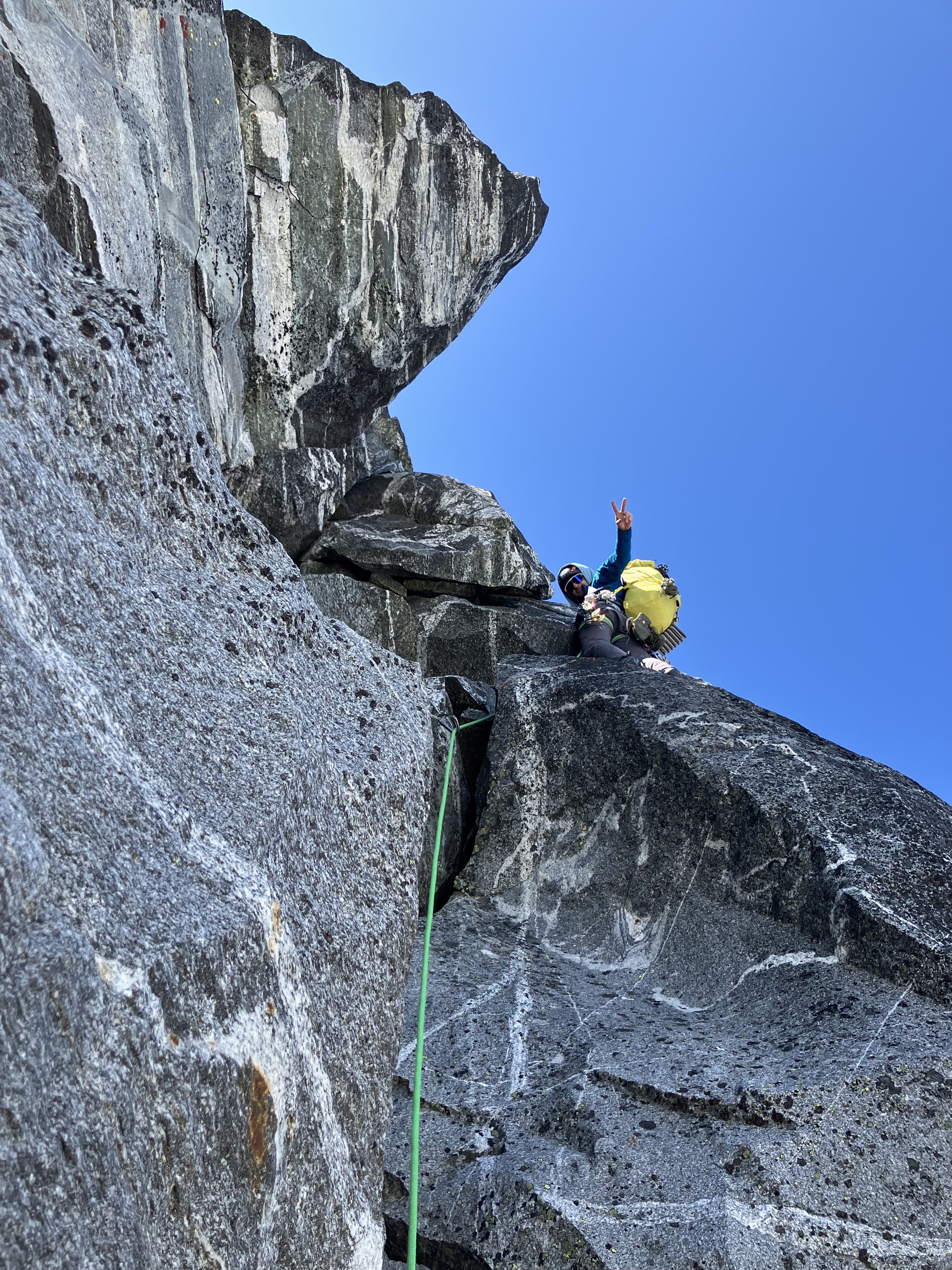
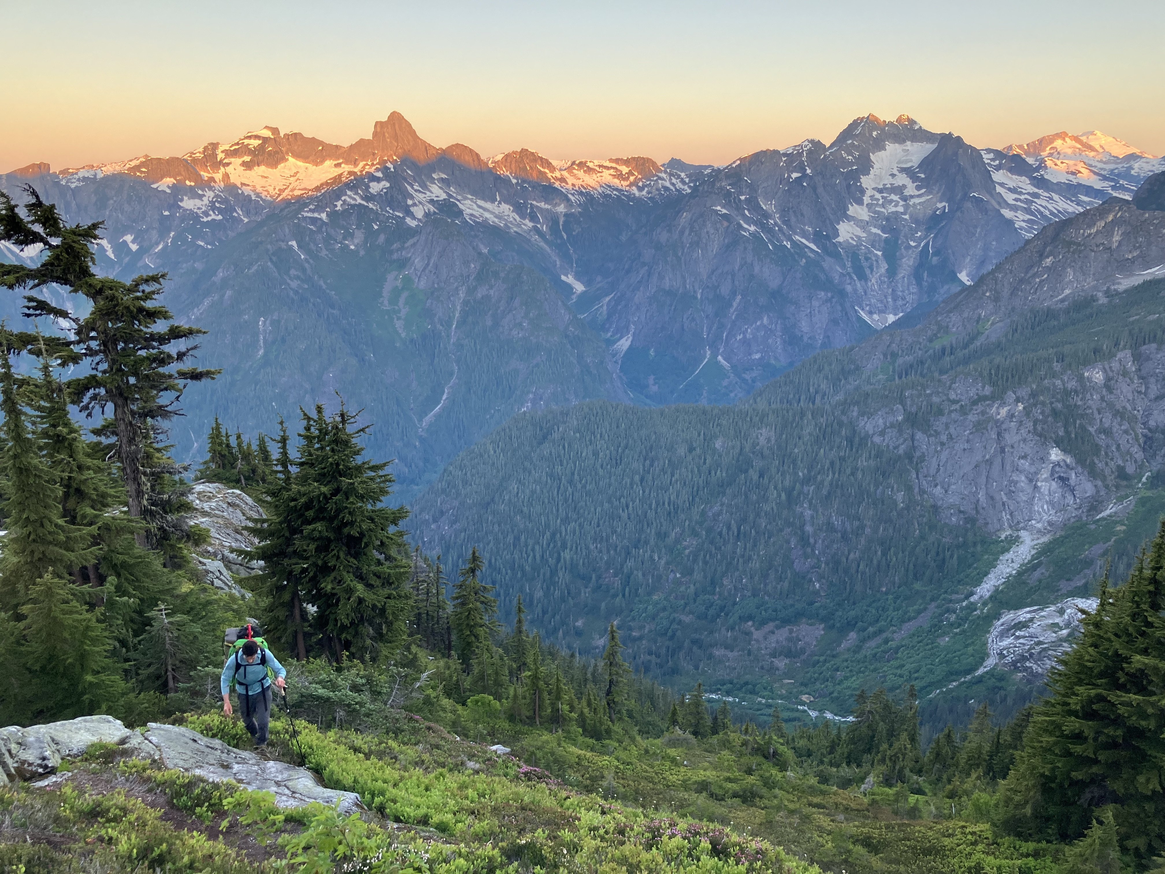
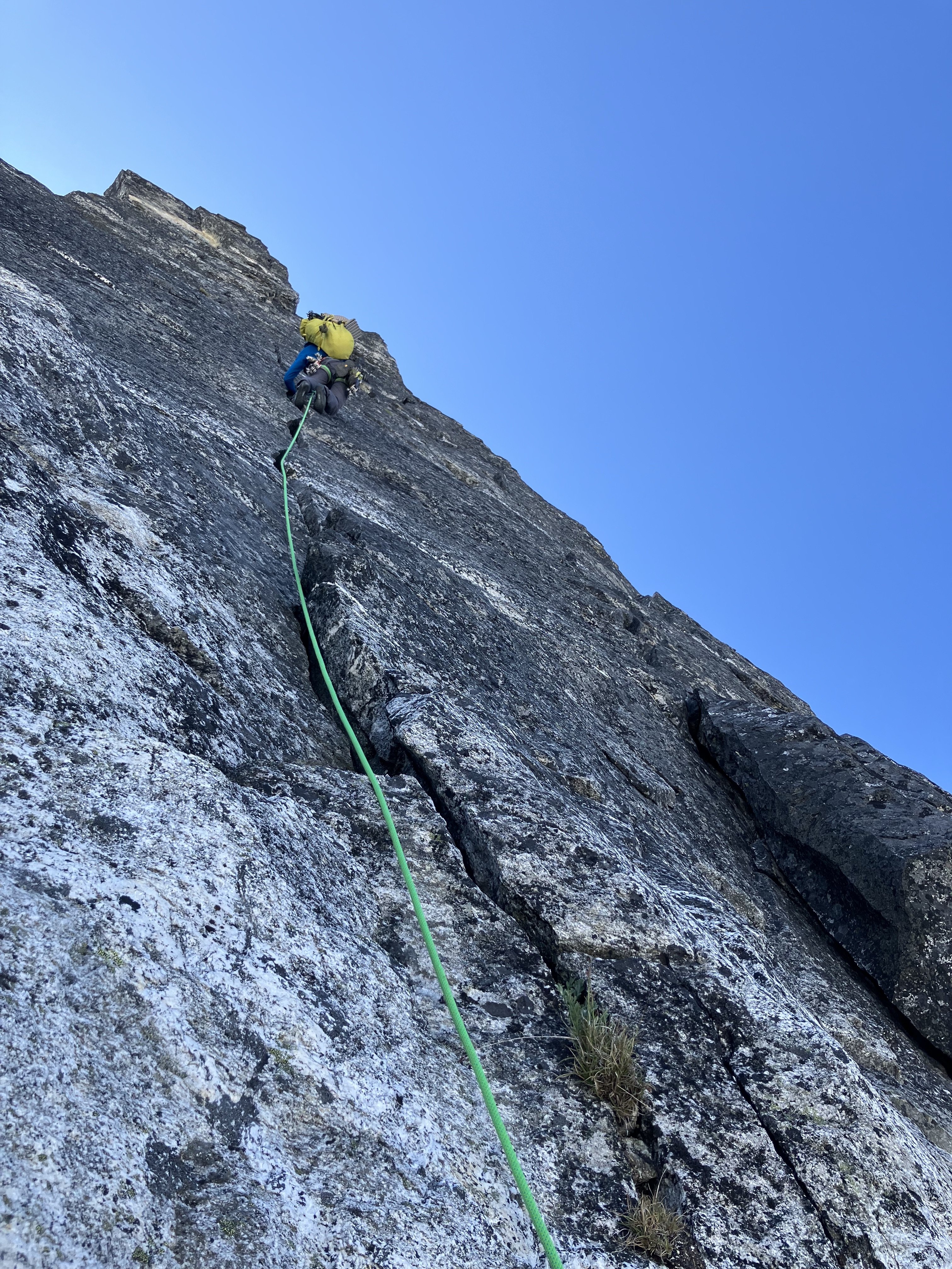
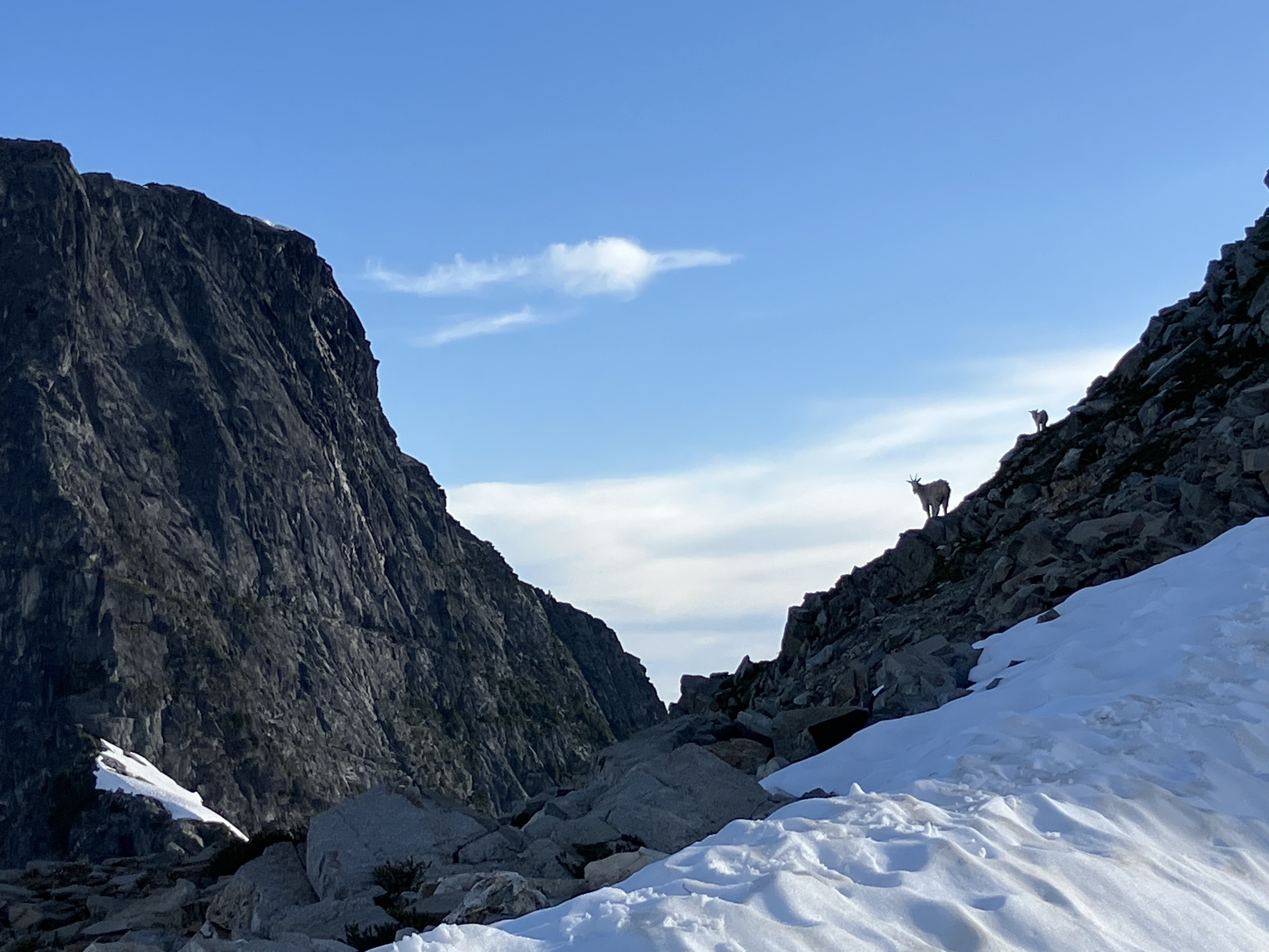 11 points
 -
Trip: North Cascades, Arches Peak aka Little J-berg - North Face Central Buttress, 10 pitches plus soloing, ~1,600 vertical feet, 5.6/7ish Trip Date: 08/03/2025 Trip Report: A couple of weeks ago, Rolf Larson and I climbed a probable* new route on this peak. Anyone cresting Easy Pass has been greeted by the big north face of this peak. There is one reported route on the face from the late 1970s; the party climbed the left-hand "Plumb Line Buttress" 2,700' from the valley floor to the summit, which clocks in at 7,945'. They reported loose rock. (See photo of register page in the album linked below, the AAJ, or Beckey guide.) Of three relatively prominent buttresses, our route climbs to the western false summit (circa 200' west of true summit) via the central buttress -- the most prominent one lit up (furthest left) in the photo below. We believe the 1977 line appears in this photo as a nondescript buttress in the shade further off to the left. Our route wends up the gneissly-featured buttress on pretty good, pretty clean Skagit rock--we began climbing behind the third snow-patch from the right on that prominent shelf, directly below the toe of the sunlit buttress. (Also available here: https://photos.app.goo.gl/BV3itCHmqcoo7qL38) We had fun on this route, which thankfully was in shade while we climbed. Didn't take many climbing photos, but snippets of conversation went like this: "How'd you like that section of hand crack?" "I preferred my section of laser-cut finger crack." "Yeah, I went Squamish style and laid it back." Here's Rolf putting in a piece at perhaps mid-height on the face (the rope is out of view, off to the right): The first pitch was probably the steepest and most sustained, fwiw, and had a 5.6 or maybe .7 move. A couple of steep mini-headwalls were also climbed in that range of difficulty, but a person could avoid these if willing to take looser rock. We unroped for a few hundred feet of mellow scrambling after the first pitch or two, but some steeper terrain compelled us to again rope up and resort to pitching and simul-climbing on fourth and low-fifth terrain. The climbing is moderate, but generally solid and fun, with adequate protection. *As you will see in the summit register pics, Roger Jung soloed a route on the north face, but it's hard to say if he took our route -- there is certainly latitude to wander on that big north face. The photo album, which includes some pages from the register: https://photos.app.goo.gl/4JU83LgK6XKFdbSA7 We descended via a walk off to the south and east--no crampons required. The short-ish approach, moderate and generally solid climbing, and straightforward descent (not to mention the blueberries!!) might make this climb more appealing than some of Rolf's and my other routes. I'll wait for Rolf to correct me on any details (which are already fuzzy), downgrade the level of difficulty (as is his crusty wont), etc. etc. Here's an early musing about Arches from the cc.com archives: Gear Notes: Standard rack with emphasis in finger-sized pieces; tri-cams were useful Approach Notes: Via Easy Pass, drop to and cross Fisher Creek, find your way up through the lower cliff bands, wiggle-chimney between moat and rock to the start11 points
-
Trip: Spectre Peak - Spirited Away (IV, 5.9, ~2000 ft, 10 pitches) Trip Date: 07/07/2025 Trip Report: "Spirited Away" Second Ascent Spectre Peak & Exploring the North-Western Pickets Adam "Mo" Moline & emilio Taiveaho Peláez Itinerary: Day 1: Camp on Easy Ridge Day 2: Perfect Pass & Whatcom Day 3: Perfect Pass to Phantom Ridge Day 4: Climb “Spirited Away” (2000’, IV, 5.9) on Spectre Peak Day 5: Push Camp to Copper Creek Day 6: Hike out from Copper Creek First is a pitch-by-pitch description of the climb, written by Mo, followed a trip report written by both of us in collaboration. We climbed ten pitches, including a long (~600 ft.) simul of 3rd-low 5th to the summit block. Several of our pitches (p.4-6) diverged from the first ascent route. The Climb: “Spirited Away” (FA: Sam Boyce, Joe Manning) is an excellent remote alpine climb with stunning features in a hauntingly beautiful landscape. Pitch 1. From the notch, Emilio leads right and up 4th class ramps to a chimney, then opts for going right to the 5.7 face with good high feet moving up to the tree ledge. ~35-40 meters. Pitch 2. Emilio finishes tower 1 by first scoping the 5.9 chossy overhang, then opting to shoot left for the clean Gully. We both wanted to add to Sam and Joe’s incredible line by exploring places they mentioned, and we’re happy to report the gully was a very enjoyable and clean 5.6 romp up Tower 1. Pitch 3. (Mo) I, who haven’t yet realized we’ve bypassed SJ’s crux, eagerly take the lead after moving the rope further along the large ledge. The long pitch starts with moving the rope along the large ledge and travels up the 3rd-4th class ridge with nothing close to a 5.9 chossy overhang, odd. Very enjoyable climbing though! At this point, I stay along the ridge crest completely enchanted by the tower and therefore diverge from Sam and Joe’s (SJ) line for the first time. I anchor in at the base of the obvious and impressive Tower 2. Pitch 4. Emilio leads up the tricky face with bad pro. They shoot for the corner to find good gear for the steep headwall. The options from below appeared to be a steep and potentially overhanging crack up the middle, or heading to a notch on climber’s left between the 2 spires into overhanging face climbing. Emilio picks an inspiring line up to the notch through the corner followed by 20-30 feet on the steep but surprisingly juggy face, 5.8. Pitch 4.5. After the tower and an awkward belay, Emilio lowers down 15 feet climber’s left off a slung horn to a ledge below to set up an anchor for the “sky bouldering” pitch. Mo down-leads easy but chossy terrain. Pitch 5. (Mo) Along with the tower, this divergence (??) is also a complete treat. Comparable to the Rooster Comb on Mongo, or climbing in the Fisher Towers, the sky bouldering pitch involved some of our favorite climbing. Along with a series of easy V0- boulders, the ridge presents a perfect hand crack splitting an impressive boulder. Climb up and over this 4 star boulder, gymnastically flow through more boulders digging your hands into serious lichen, and finish with a reachy smear onto extremely licheny rock suspended over air. Belay on one of the golden slabs below the next gendarme. Like the RC, it’s hard to put a grade on this type of gymnastic climbing, top shelf fun though. Pitch 6. Emilio climbs the corner block with good pro, up and left of the gendarme until they meet SJ’s line once again. After lowering off nut/horn pro left by the FA team, Emilio sets up an anchor out of the shooting gallery and I lower down to the very redundant anchor deep in the gully. The only pink tricam placement of the trip. The kind gear left behind by the FA party for this pitch. Pitch 7. (Mo) Lead up 4th class to a left trending ramp where 5-moderate begins. Future climbers take the larger, earlier ramp rather than be entranced by the huge bulgy crack splitting the face (like I did). After returning to the ramp, it meets the beautiful hands/fist crack. With many alpine draws, continue up to meet the slightly overhanging crux of the pitch with a mix of choss and bomber jugs. Physical wandering with cautious choss dancing leads right, up, then left through stellar holds to a clean finish. Steep and committing but surprisingly good holds made this feel like 5.8+. Good pro. Let the choss sleep here for the sake of your follower! Looking down from above the hand/fist crack. Pitch 8. Emilio climbs up the heather ramp with choss for roughly 30m but not great pro until the blocks. Follow 5-moderate blocks up and left. After running low on rope and scoping options, Emilio belays on choss 20ft below the ridge crest. Looking up at the heather ramp. Pitch 8 Notes: Continuing on the ridge crest could be an alternative to the heather ramp. To avoid rope drag on the Hoodoo pitch, belay from the ridge crest if possible. Pitch 9. (Mo) Hoodoos. 3 options presented themselves to reach the ridge crest. Follow Emilio’s wisdom and take the chimney to the right or the easy ramp to the left, or my idea to shoot straight up the white 5.9 face. With my hopeless delusion being prevention of rope drag, I shot up a few cruxy moves and pulled it without showering Emilio with choss. All of a sudden, the spirits are all around you. We traversed low around many of the hoodoos both out of a fearful respect of their haunting beauty and temporary nature. We didn’t stop for any pictures and quietly danced around their north sides when possible, or climbed over when it wasn’t. After this steep, exposed, licheny, and hauntingly beautiful traverse, rappel off the furthest Hoodoo for 25-30m to a nice grassy ledge, then move to avoid rockfall. Pitch 10. (Simul, Emilio then Mo). 600ft of 2nd, then 4th, then 3rd class stellar scrambling following heather ramps and solid rock. Emilio leads what was some of our favorite climbing of the ridge moving efficiently up to the headwall. Emilio hands me the kindest gift of finishing up the 5.0 pitch. We finish this climb in memory of Teemo (Chad) the Cat who was spirited away weeks before this climb. An inspiration of our climbing, style, and backcountry meals (Chad’s Backcountry Catfood), and who lived with Emilio and me over a decade ago. With Love, for Teemo. Climb Descent: We now realize Emilio has accidentally stached their ice axe at the base of the climb. However, before we tackle this challenge, we must figure out how to down climb the east side which appears ledgy at first, but then becomes 5.moderate and steep. We navigate and beta share our way down after some interesting 5th-class moves on good holds. This side of the rock was significantly harder climbing than the side we summited. Now, the fun begins. We read SJ’s report of steep snow and early conditions and see this to be true. However, we have luckily navigated somewhat similar situations where on Mongo Emilio traverses steep snow with sharp and flat rocks for aid. I (Mo) kick some deep steps down a short steep section in similar style. After a few minutes of thoughtful snow travel, it eases up to walking a beautiful snow ramp down to a heather and slab rib. From here, a gorgeous dyke ‘Thank God Ledge’ becomes obvious and points you directly home to the base of the climb. Walk the 2nd class dyke admiring the unique rock and granite eggs. This section feels like walking towards Minas Tirith. Follow until the dyke turns into heather ledges/ramps at the base of the climb. 10/10 descent, would maybe rap in the future, or find the actual route down. Ascent ~11hrs Descent ~1 hr Trip Report Introduction (written by emilio): “When you get to the top of the mountain, keep climbing.” Nothing embodies this mantra more than a trip to the Northern Pickets, with its endless folds, valleys, and ridges. Summertime in the northern hemisphere means it’s high time for licheny choss and remote alpine meadows. For me, the solstice brings a yearning for good snowpack and godly glaciers, and despite my attempts to think or dream of other mountains, climbs, and ranges, the Pickets keep calling me. Throughout the year, I often wake up in the middle of the night longing for their surreal gendarmes, gnarly towers, towering spires, and self-willed wildness. Last summer, Mo and I climbed the climb we’ll never come back from, Mongo Ridge on West Fury. The three nights we spent on route mark some of the most significant moments of my time here on Planet Earth, so it was difficult to tell what would unfold after that experience. But, as it often does with these things, the idea of returning to the Northern Pickets for a seventh time as a team came organically. This is a blessing, because nothing is better than going into the mountains with Mo, the strongest free-climber I know and one of the very best all-around humans I’ve ever met. Although for the last few years we’ve been entering the park through Ross Lake, the first time Mo and I went into the mountains together we went in through Hannegan Pass, embarking on the long trek up Easy Ridge with a group of six. That year, we ate hearty servings of humble pie as we crossed the Challenger Glacier, climbed Challenger, dropped down to Luna Cirque, hiked up the other side, and tumbled down Access Creek. Photo I took on a disposable camera on our first trip to Challenger (2018). This was the first any of us had roped up together, the day after Mo's first rap ever. Jake Johnson, secret hero of all our trip reports, leads the way. Returning to Hannegan Pass in order to visit those places of intensity where our love for the Pickets began—the Imperfect Impasse, Perfect Pass, Whatcom Peak (where I was first benighted), and the Challenger Glacier—with all these years of hard-earned experience felt right. Also, filling in the lore of Mongo, we knew that Wayne had first seen that mythic ridge while climbing the mind-boggling “Haunted Wall” of Spectre Peak. We had to at least see the Haunted Wall in person, to trace Mongo backwards, and get to know this obscure and remote peak we had seen from the neighboring ridge. The call from Spectre was coming from several directions. Beyond the opportunity to climb exquisite choss, the pleasure of going to such a remote country and live, even if momentarily, in the freedom of the hills, is hard to pass up. As a team, Mo and I have been on a little tour of second ascents across Washington (summiting Lemolo, “Sharpen the Saw,” and going up the Rooster Comb), often setting SKT’s in the process (slowest known time), so even if we didn’t yet have the gumption or cojones to repeat Mike Layton and Wayne Wallace’s insane line, we figured we could celebrate Sam Boyce’s remarkable achievement, “Spirited Away,” the South Ridge of Spectre, and enjoy our time in the process. The hoodoos, gymnastic traverses, and time spent on the ridge, made this line appealing. At the same time, Sam’s recent climbs in the Pickets have been inspiring to follow, and the beta he and Lani provided from their climb of Mongo made our experience on that ridge much more pleasurable, so our ascent of Spectre is a celebration of this current Picket Renaissance. As opposed to the ultra-light mentality we brought to Mongo, for Spectre we shouldered heavy packs, bringing extra food, creature comforts, and redundancy (including an additional pack stuffed inside my pack, which strangely came in handy) for the ~50 mile round trip and ~20,000 ft of elevation gain. We started our trip on the Fourth of July and budgeted the entire week ahead in order to adapt to the weather and be able to luxuriate like sybaritic alpine lizards. Trip Report (written in collaboration by both of us): Approach (days 1-3): We left the Moline Compound in Olympia early in the morning, driving steady to the Hannegan Pass trailhead to get there and get walking by 8:30 a.m. Surefoot miles brought us past hikers and trail crews hard at work. Crossing the Chilliwack was a treat in the heat and we zig-zagged the long diagonals up to Easy Ridge, encountering Chaga, old COTW, and copious Calf’s brain while admiring a solitary hand-crack along the way. For the return, we knew we’d have fresh berries Bilberries and Huckleberries. Like everything in the Cascades it seems like Easy Ridge is sandbagged because it’s a serious hike, but it also lives up to its name in the views it affords–though on our way up it was mostly clouds. We camped at a nice bivy before Easy Peak proper and drink some fresh Chaga tea. We stop after 15 miles and 7 hours of moving. The following morning we slept in and made coffee in the morning, taking our time before getting moving. Right as we pack up to take off, Mo’s side backpack zipper breaks exposing all the innards. After several seconds of perseverative thought, the universe reminded us that we have, in fact, 3 total backpacks between us! Not being able to decide which pack to climb in, Emilio serendipitously packed double bag includes both a 35L pack with a 30L pack stuffed inside. Mo’s pack is strapped shut with some climbing equipment (reminiscent of the broken crampons on Mongo attempt 1) and we ramble scramble onward without any anxiety of gear for the climb ahead. The scree-step up to the summit of Easy Peak brought us to more walking and descending, before reaching the threshold that the Imperfect Impasse provides. What a chasm! It’s hard to believe Mo’s first rappel ever was into the snow down below, though there was no need to rap today. Fourth class ramps and early season conditions were in our favor and we were able to quickly move across and head up the slab and heather to Perfect Pass. It’s nice to imagine what evaporating dew must feel as it ascends, but gravity in a human form is more easily navigated in diagonals. On the way up we ran into a group who had just summited Challenger, having camped at the bottom of the Impasse, but they were the only group we saw and from there we had Perfect Pass to ourselves. Given our odd timing at PP, to warm up for Spectre, and because it seemed ridiculously fun, we decided to drop our stuff and romp up Whatcom. The snow conditions were great and the sun was shining. Whatcom is a stunning mass and a wonderful teacher, and as specks on her summit we lingered admiring the landscape. The way back down to Perfect Pass brought joyful plunging leaping running down the mountain and we made twelve minutes of it, even after stopping to take pictures and laugh. Deciding Perfect Pass lives up to its name we made camp and stopped here for the night sleeping once again under chossy stars. emilio bouldering at perfect camp trying to strengthen the toes after descending from Whatcom. There are some quality blocs to be found out here! I’m wondering if FKT.com will allow for the Pass-to-Pass FKT to be submitted up to Whatcom, here we humbly submit 1 hour for our time. The next morning brought us to search for the somewhat mysterious Challenger Col. It’s mysterious because there are several possibilities for which one it may be and we had been overconfident on the beta for this section of the climb. After weighing our options we decided to go up high to the (later identified) West/Middle Challenger col and found some vintage tat. A slung horn of rope fibers suggested the way down a dihedral next to a stunning arete, and the glacier below seemed to provide ample access to the Western slopes of the Northern Pickets. We slung the same horn with fresh webbing and went down for a 35 meter rap. On the way down we found an offset nut with some red tat. The full rap was a little longer than 35 meters, but luckily it ended in a hungry offwidth so we were able to untie and downclimb a few extra feet to the snow, which provided a welcome ramp into the glacier. Here, again, we benefited from early season conditions. We navigated the glacier down to the south ridge of Phantom where we made a gorgeous rockside camp on clean slab near drippy snow. Sleeping early brought thought-dreams of the climb ahead and brief periods of waking up (at 8 pm) to gape at the Haunted Wall. Seeing the Great Gendarme that adorns the South Face and thinking about the bold, committing, and cerebral nature required to climb such an audacious route left us floored. For what it’s worth it’s worth remarking that Wayne Wallace and Mike Layton’s climb of the Haunted Wall of Spectre is perhaps one of the most impressive feats not just in Cascade climbing, but in USAmerican climbing more broadly. Mo enjoying an ice bath on Phantom Ridge preparing for the climb ahead. Harvesting Water on Phantom ridge. In lieu of prayer flags we adorned our camp with the tat we had found along the way. Mo with Mongo. Day 4 (climb): An alpine start at 3:40 has us moving to arrive at the climb with the sunrise. [See Previous pitch by pitch section] Descent (days 5-6): An alpine start at 4:00 a.m. has us moving well before daylight, as we hope to cross the Chilliwack by the end of the day in order to avoid the incoming weather. Cold coffee gets us moving and we go back up and down the rhyming patterns of scree, talus, and heather, scree, talus, and heather, until we hit the snow. We had debated whether we would try to find the actual “Challenger Col” that ostensibly did not require a rap to go down, or retrace our steps and retravel our known road up the glacier, and lead the pitch back up to the Col. The thought of leading the pitch back to the col had Mo full of energy so the decision to retrace our steps up to Solar Glacier was an easy one to make. Snow brought us back to the rock where Mo put on the rock shoes and racked up (only to place minimal gear). The arete provided excellent, though not well protected, 5.4 / 5.5 climbing. What an incredible way to get back on the Challenger Glacier! Back on the glacier we stayed high to scope out additional low points on the glacier. A stacked cairn gave indication that we had perhaps found Challenger Col. After reading several other trip reports, it’s hard to say which col is indeed the standard col to access the western side of the Pickets, but perhaps someone can help us piece this together. Looking up at the arete from the solar glacier & Mo leading the way. The rest of the day brought long miles up and down, through scree and talus and snow and heather, next to waterfalls and tarns, zig zagging under the sun. The snow on the imperfect impasse had melted so the way back was far spicier than the entrance. Thoughtful moving on steep terrain brought us back to the other side, having once again crossed that threshold into the Pickets. The moving kept going all day, as going down is often more of a climb than going up. Thankfully, the trail on Easy Ridge fed us bountiful berries, bringing out the bear in us. Blistering feet peeled and the miles eventually brought us to a solitary and welcome camp on Copper Creek. The Imperfect Impasse! Or is it the Perfect Impasse? Either way, it's awesome and steep. Easy walking along Easy Ridge. The next morning we woke without an alarm, made coffee and leisurely made our way out in a welcome wetness. Rain brought out the technicolor of the plants and clouds clad the peaks in true Cascadian fashion, dramatic and graceful is this ruggedly delicate corner of the world. We walk out in a delightful drizzle with clear pee. Some strange snake staring at us on the way out... We stuffed our pockets full of rocks for games and drove back to Olympia in the early afternoon. An additional note is that we were able to cook most of our meals with Chaga, which seems like a huge aid to pulling this off. Our climb was supported not only by all the manufactured goods we used and the infrastructure required to access this wilderness, but by the countless unseen helpers who made the trails, mapped the land, have lived with the land, and enabled the great privilege that it is to go into the backcountry. There is no such thing as an unsupported climb. Looking back on Mongo Ridge. Gear Notes: Singles from Micro - Large Supercam (no #3), doubles from .1-1, one Offset 10 Alpine Draws Rack o’ Nuts & Tricams 70m Beal Opera & 80m 6mm tagline 60 feet of Tat (used 30). 3 Backpacks 7 meals of Chad’s Backcountry Catfood, 6 freeze-dried meals, 2 ramen, 5 containers of fish Too many bars Copious sports beans and electrolytes to avoid the coca-cola piss Bivys, Pads, light bags Many other creature comforts Gear breaks down when you push it to the limit. Bringing cord, duct tape, and climber’s tape has been enough so far to fix any mishaps between the pack, crampons, or other gear failures in the past. However, the importance of proper gear planning is proving to be more and more crucial. The backpack luck was the universe smiling on us, but being creative and over preparing is often a psychological luxury deep in the alpine. We may have brought too much food and some silly luxuries (not crocs, those are essential), but we also frequently find immense health, physical, and psychological benefits from being properly fueled, rested, and prepared for huge days covering rugged terrain. Luckily, I have a sherpa, Emilio, who seems un-impacted by carrying weight, and I’ll continue to train my pistol squats to validate that extra tin of lemon-caper mackerel. A note on Time. Time continues to be one of the most influential variables that moves the needle on risk in the mountains. With recent epics of friends and horror stories of accidents in our home range, it’s ever important to weigh the gravity of certain decisions. For example, that extra push to get to the base of the climb rather than bivy and the subsequent exhaustion can lead climbers, from amateurs to experts, to make tragic decisions. We both frequently weigh our luck as we’ve gone on 7 and 8 trips to these rugged and gorgeous North Cascades. One considers the roll of these dice weighing the sheer audacity of accessing these ranges with the intense spiritual home that this place has become. There is certainly a time for absurd ultra-marathon style pushes and we frequently love those, but to commune in the mountains with a pace to properly appreciate the weight of these spaces is key. We added on a day on the approach to feel rested on the climb and walked out in the rain to avoid destroying our feet. I feel deeply lucky to have teachers like Emilio, Monica, and Jake who have prioritized a sense of truly enjoying Quality time in the mountains. As we work towards being adequate mountaineers, what matters most is returning home to tell the tale and give back. Approach Notes: Long11 points
-
Trip: Southern Twin Sisters Traverse - Kloke Peak (register placed), Twin Crest, Saddle Slab, Shirley, Trisolace, Barbara, Nancy, Last Sister Trip Date: 08/03/2024 Trip Report: Ever since our climbing mentor Dallas Kloke died on the Pleiades in 2010, @Trent, @sepultura, @Kit, @John_Roper and others in the local climbing community have been thinking of ways to honor a man who had given much during his 50 years of pioneering ascents in the Cascades and beyond. These dreams became a reality in 2022 with the naming of Kloke Peak (formerly Hayden) in the Twin Sisters Range. The Twin Sisters were near and dear to Dallas's heart and he completed many first ascents in this area over the years (including his FA of "Hayden" in 1972 with Dave Dixon) . The peaks are also visible from his house in Anacortes, adding a bittersweet element to the commemoration. Like all worthwhile climbs, the naming process was difficult, involved and several times seemed to almost come to a complete stop. Imagine my surprise then when I got a call from the Everett Herald on an October morning, deep in the mountains, letting me know that the WA State Board of Geographic Names had approved our proposal. Or, months later when a friend texted me a photo of the Gaia map (below) with "Kloke Peak" prominently displayed on the summit, meaning that the US Board of Geographic Names in Washington DC had also approved our proposal. Surreal. We just needed to get a register up there to really make it official! Fast forward to this summer.... when @Trent and I managed to find three days to get away to the range and place the register. We toyed with the idea of a full traverse of the range (Dallas style!) but the time and effort for that was a bit more than we were willing to undertake in the heat and humidity. So we settled to starting from Green Creek (thanks @dberdinka!), climbing from the cars up through the Cinderella/Little Sister col. We dropped a bit on the backside and cached our gear, heading over to Kloke Peak in the early evening to place the register and marvel at the rugged appropriateness of Dallas's namesake. KLOKE PEAK!: (below) Steve had done an admirable job of prepping the register, complete with laminated photo, newpaper article, Rite in the Rain logbook, and Pelican case. All secured with cord and pitons. Please leave it up there! When the book gets full, bring it down and let me know. I'll be the keeper of it and hike up a new book as needed. After savoring the view for a time, Steve and I headed down to camp at an unnamed lake south of Cinderella. It felt as if we were the first people to camp there, almost no sign of anyone, except for a random rock hammer we stumbled across the next morning as we left camp! Soon after finding the hammer, we began the quest to bag the rest of the peaks south of Cinderella. We knew it would would be a big day, but the heat and humidity made it even more taxing than we estimated. It was a 14 hour+ whirlwind day for us to climb Twin Crest, Saddle Slab, Shirley, Trisolace, Barbara, Nancy, and Last Sister. There was a lot of 3rd and 4th class along the way, some loose rock, a lot of solid rock, and a bit of head scratching so as to not carry all our gear up and over all the peaks. Sometimes this meant linking improbable ledges on the west side of the peaks. Sometimes it meant backtracking after scrambling a peak by the "easiest" path. We had left the rope behind in a effort to save weight, but I would have been happy for it on the "easy" route up Trisolace (photos of it way below). This was probably very exposed 4th or low fifth terrain, but we couldn't see an easier way, even on the way down. Careful there! Also careful on the summit ridge of Trisolace. I dislodged a large rock right at the summit and it nearly took me with it. As it was, it pinned my leg and @Trent had to come over quickly, and carefully roll it off and down the mountain. Whew! I sat for a time getting my heart rate and breathing down, cursing myself for letting my guard down, even for a moment. It was not lost on me that this was the same type of accident that took the life of Dallas. Steve on Trisolace. I eventually got up the gumption to follow him: Me, a few minutes after my mishap with the large rock: And somewhere along the traverse: The day wore on and we got further and further south and farther from Kloke Peak: As the sun dipped towards the west at last we were on the Last Sister, looking down at the Step Sister. Steve had already climbed it, but I hadn't. Camp looked so close at Heart Lake (it wasn't, as we would soon find out). There was a brief period, as we neared the col between the two peaks, that I considered heading up and descending to camp in the dark. But then I slipped, fell, and went into full leg cramps on both legs! My day was done, I was totally spent. And so we went down surprisingly far to the surprisingly rugged Heart Lake, barely finding about the only decent campsite on the west side of the lake as the light failed. Step Sister as we hike down to Heart Lake: Our camp at Heart Lake the next morning: The next day was going to be a long one (14+ miles) and hot, so we didn't have much time to rest after the marathon peak bagging tear the day before. As the sun came up we were soon moving down through the brush below Heart Lake to an old logging spur that took us down and across the South Fork Nooksack. Here, we grabbed the PNT and followed the elk up valley, surprising a trail crew along the way that hadn't seen many people in awhile. Sort of as we expected, it got really hot as we hit the Elbow Lake trail up and over the ridge back to our car. But we had beer stashed in the river and chips in the car. It could have been worse! I would really like to hear of others' stories of climbing Kloke Peak. Even if you don't post up a TR, feel free to post your experiences in comments below! Gear Notes: Ice axe, helmet, leather gloves. Many will want a rope on Trisolace. Footwear and clothing you don't care about. Approach Notes: In Green Creek (thanks Darin!), out Heart Lake and PNT to Elbow Lake and back to Middle Fork Nooksack.
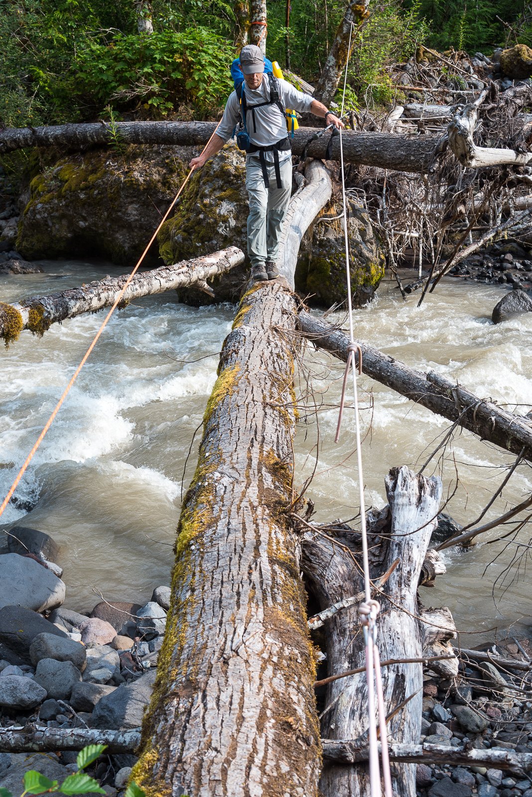
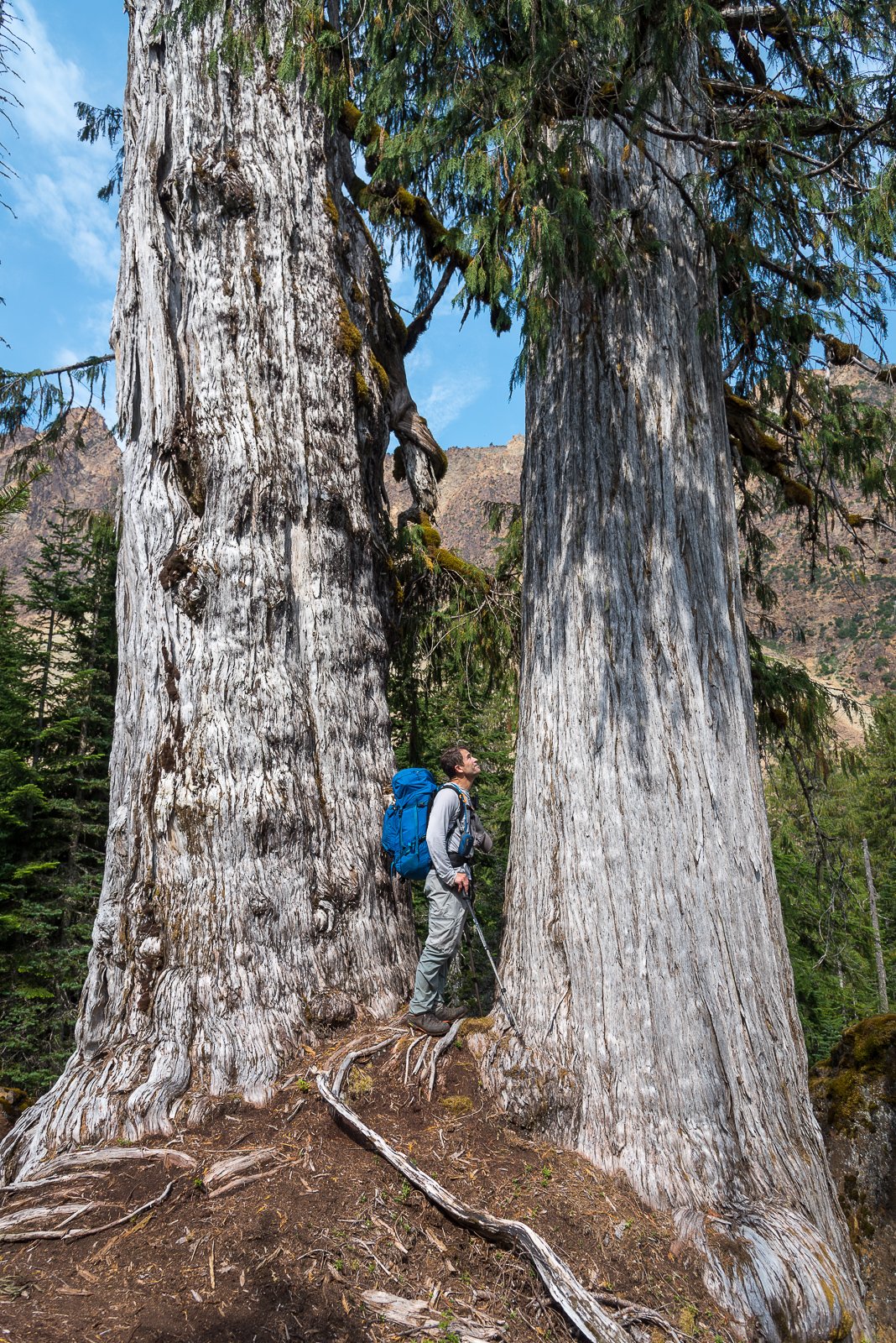
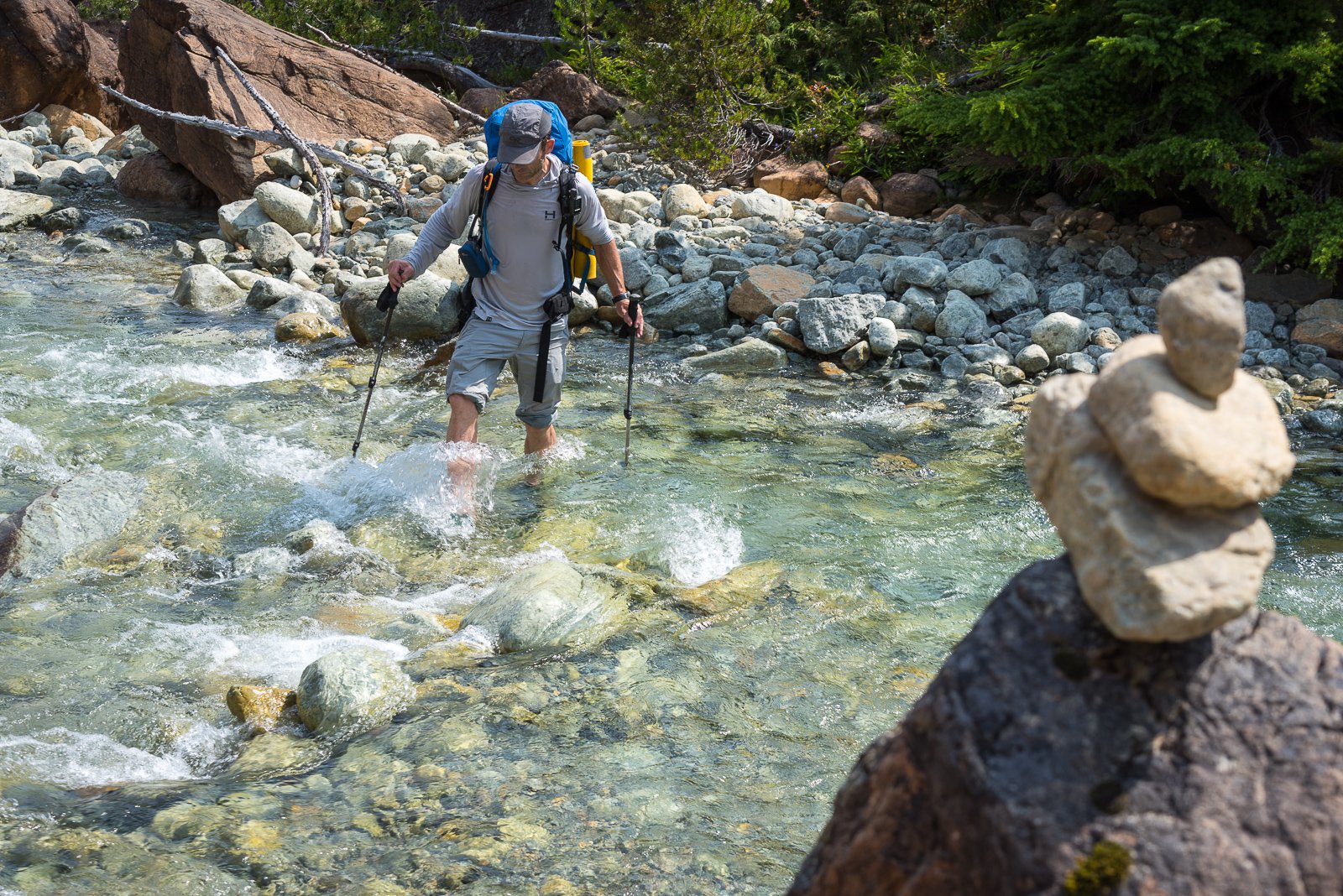
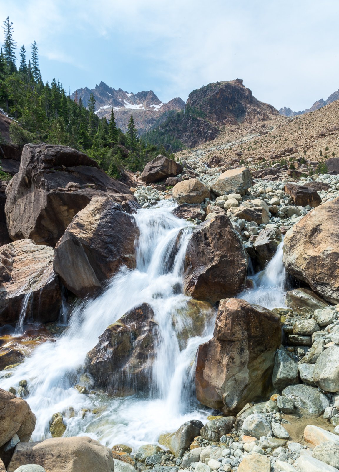

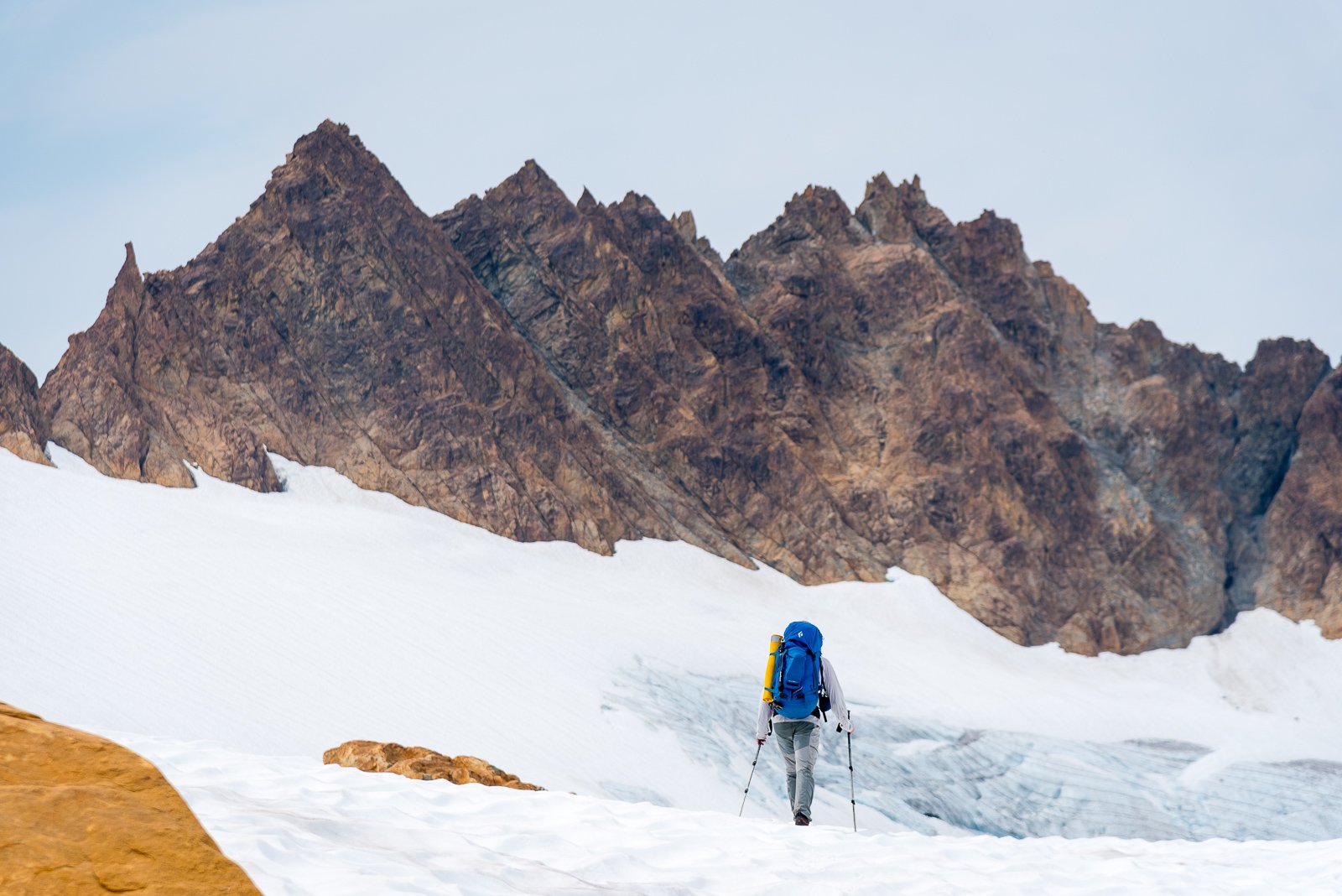
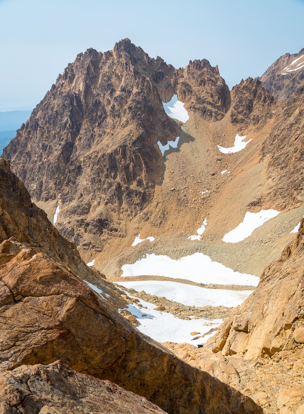

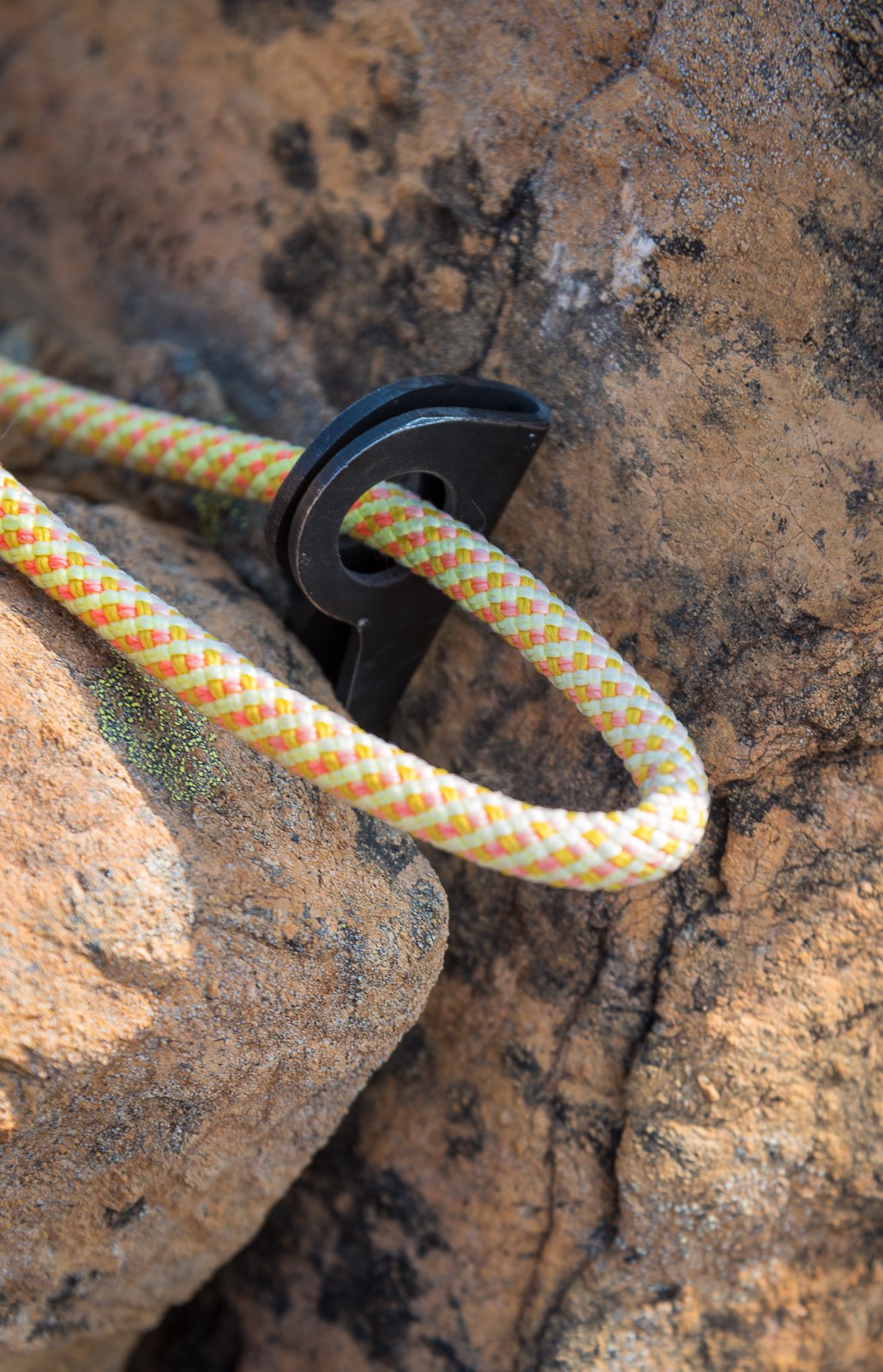
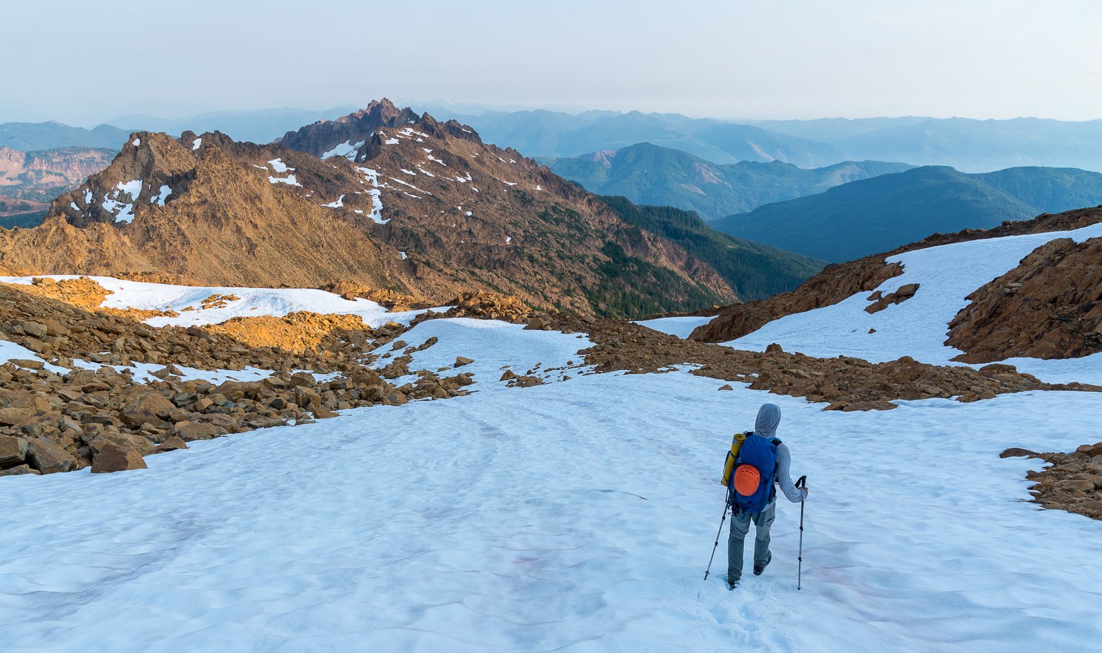

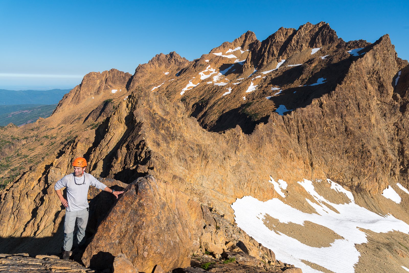
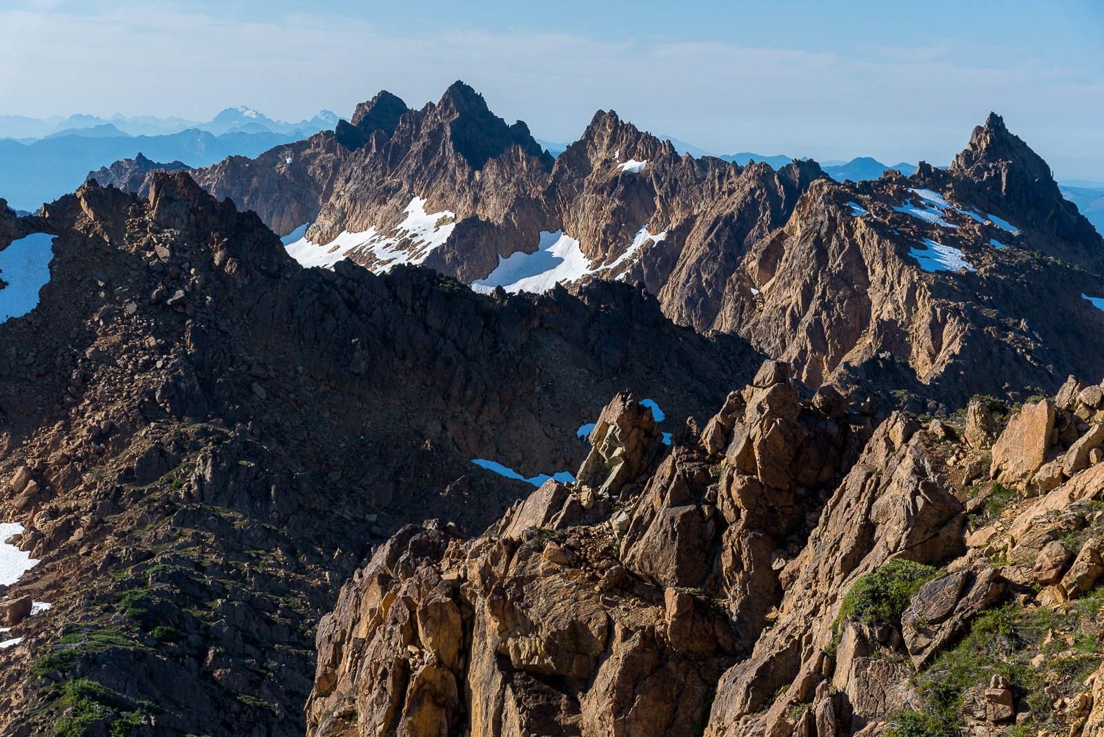


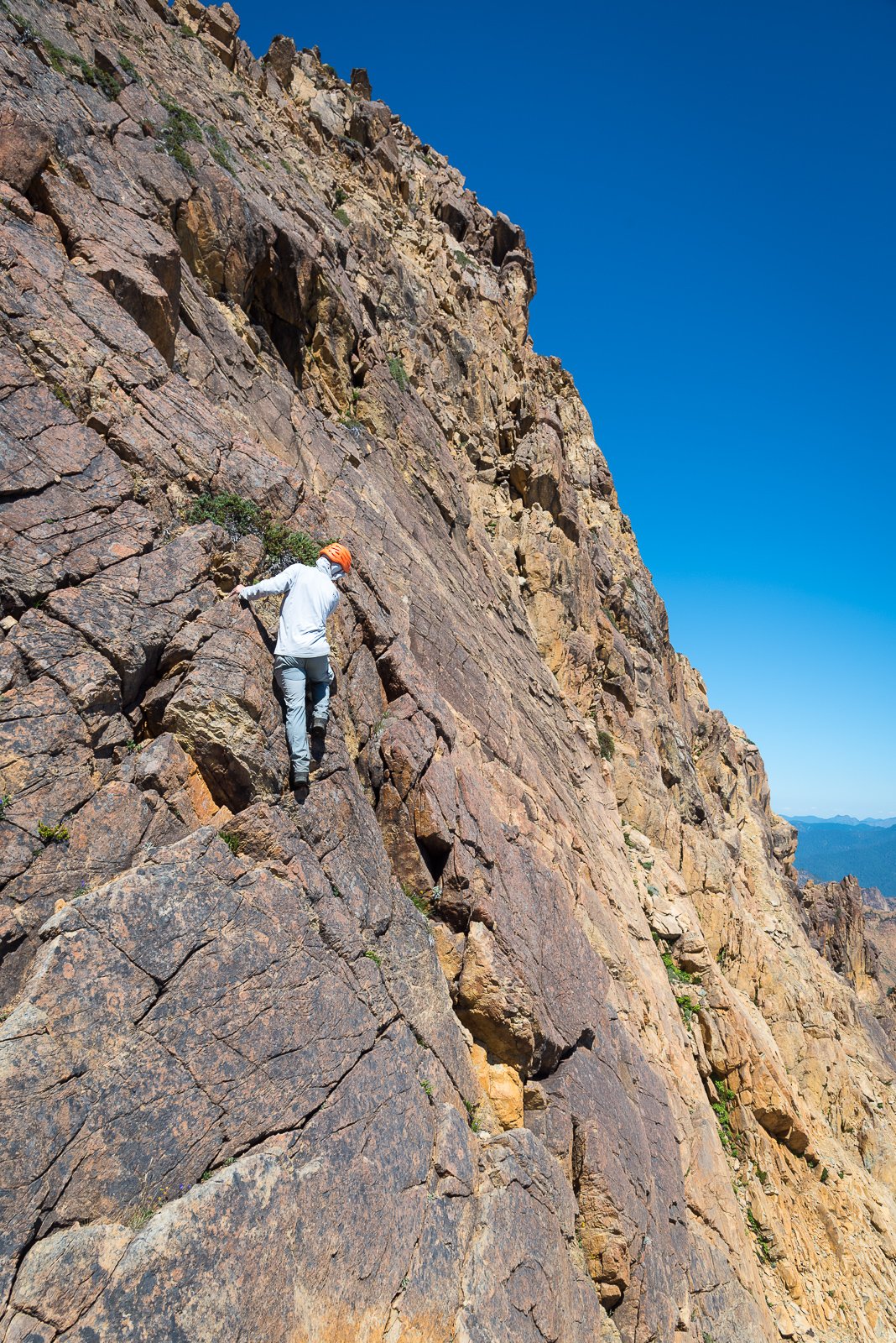

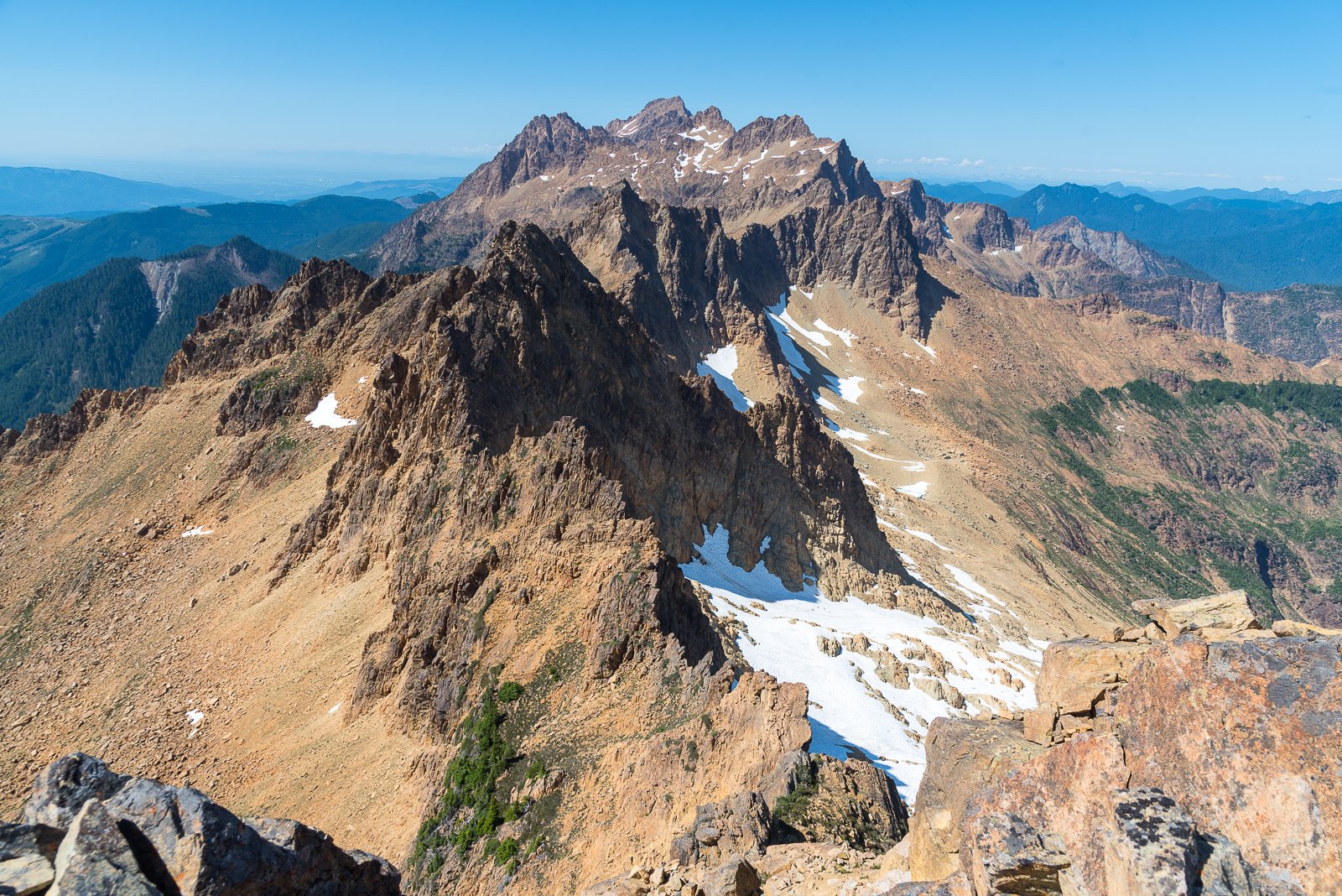
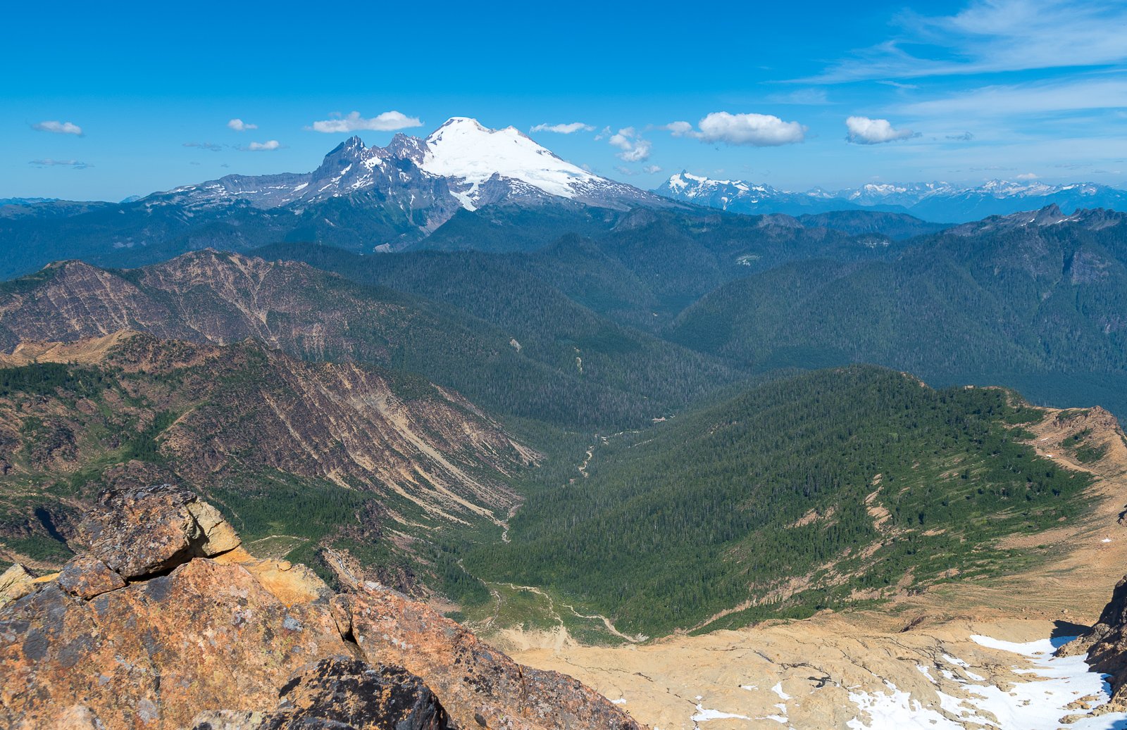
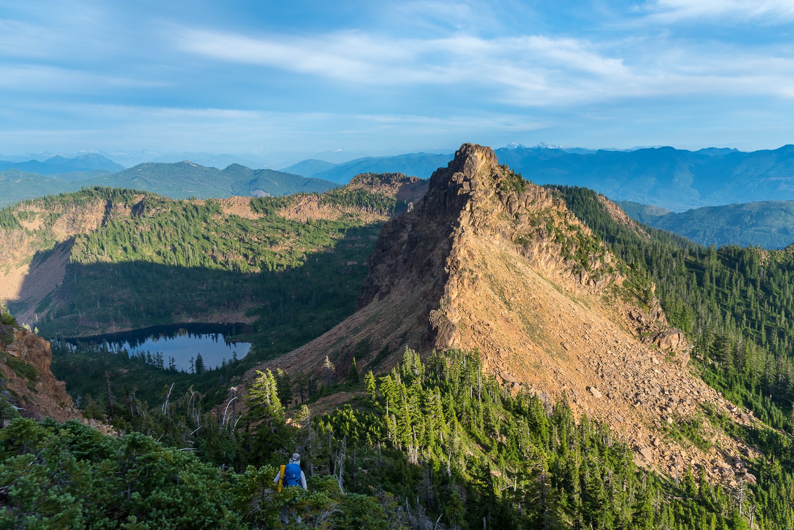
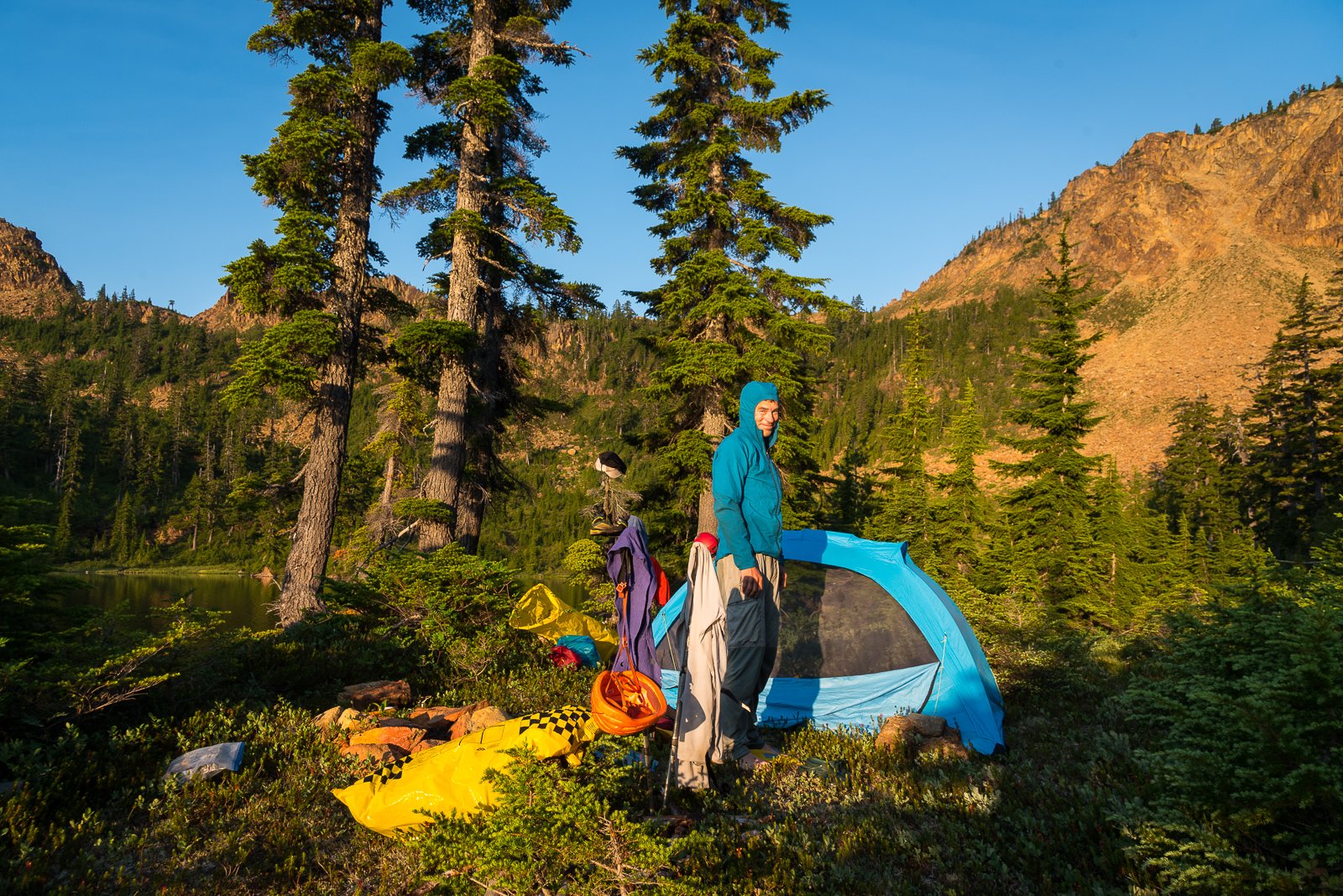
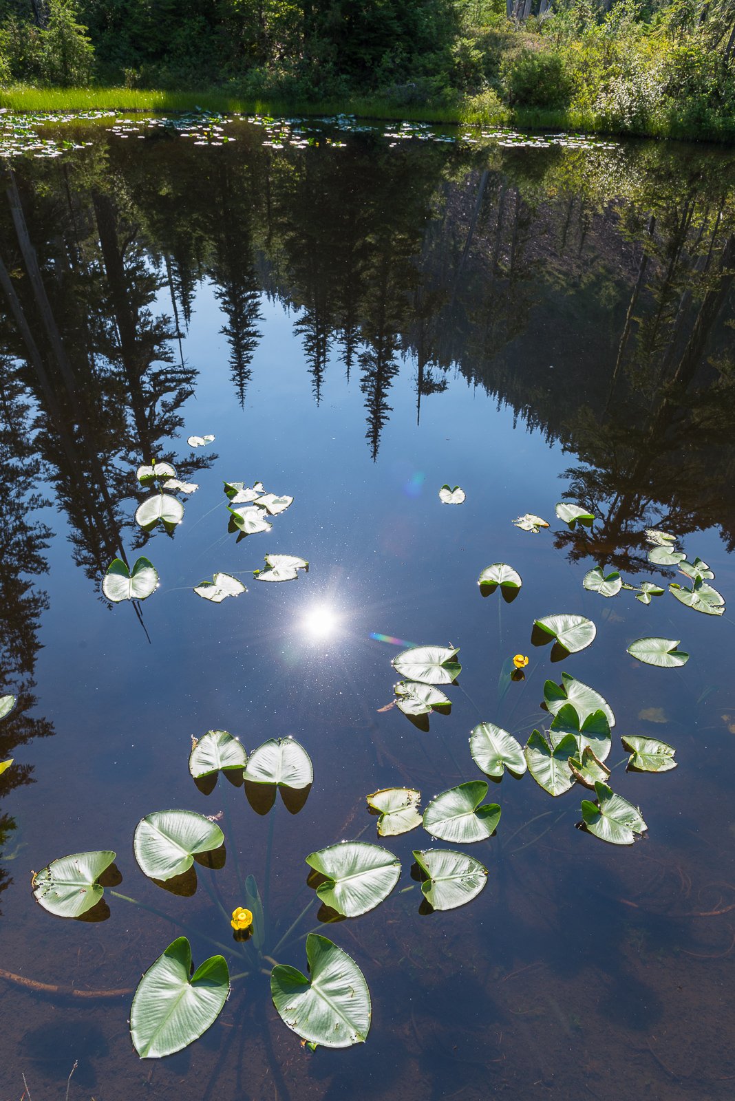
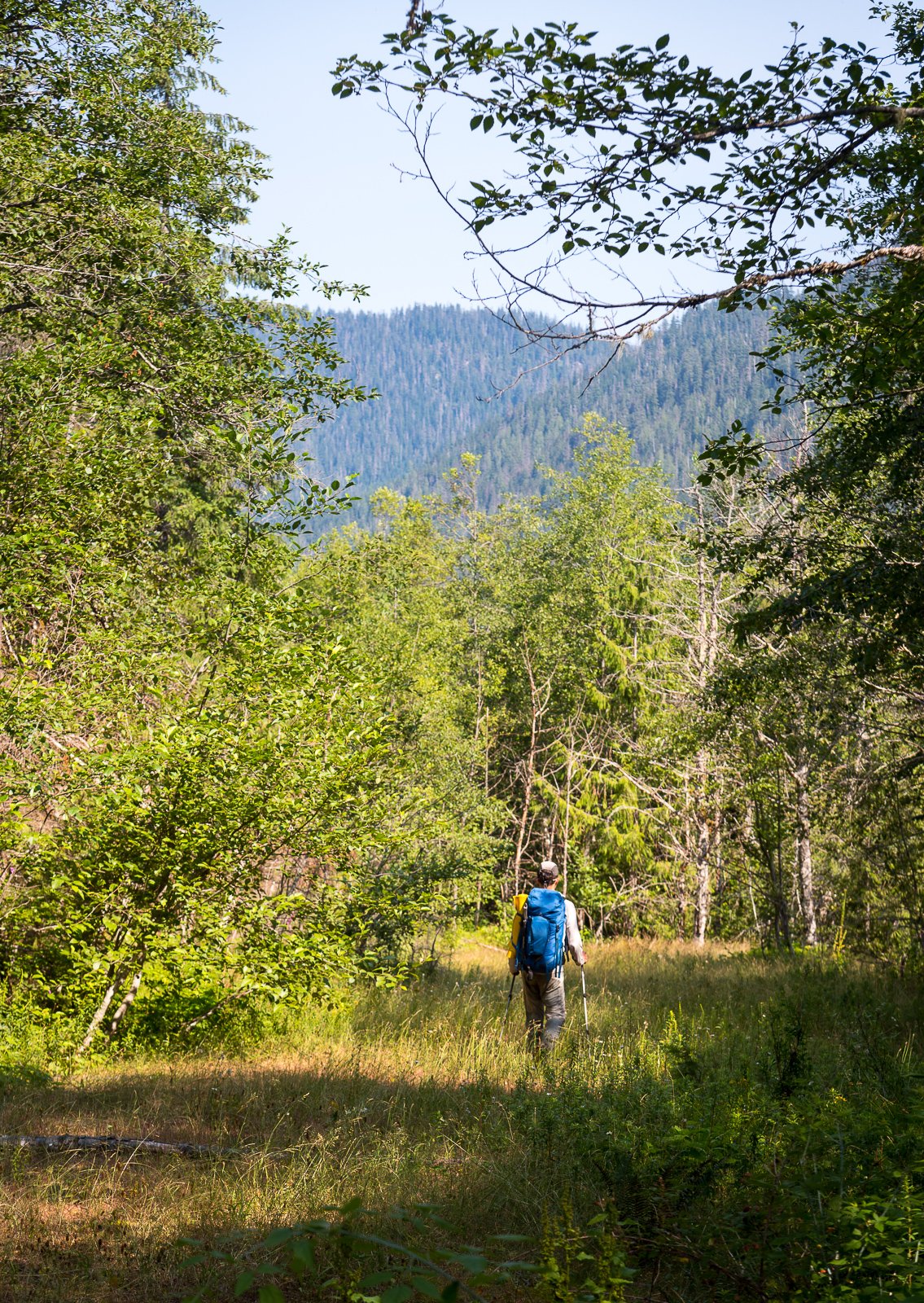


 11 points
 -
I’ve had little to no motivation for TR writing this last year, but figured I should try and get this story out into the world before I forget some of the fun details. Last April Eli Spitulnik and I flew onto the Ruth Glacier with about five weeks of food. We hoped to stay there until it warmed up, then bump to the Tokositna to do some climbing on Huntington. We got deposited right next to a very cold and dejected Brit and Slovene. The winter cold was still holding on strong, with nightly winds burying our camps regardless of how recently it snowed. Tom and Gasper had been there for about a week already and spun tales of vertical sugar snow and towering snow mushrooms. Their attempts on Blood from the Stone, and the direct start to RGG were valiant, but fruitless. Huge thanks to basecamp gear sponsor Kurt Ross. Chamonix style storm day skiing with Tom and Gasper. Who needs a pack anyways? Scouting. After almost two weeks and various attempts on other routes, we began skiing towards the SE face of Bradley at about 3 in the afternoon. Along for the ride was 3 days of food and a rack suitable for El Cap. Our intended line would start on Vitalogy (Zimmerman/Allen 2010) to gain the hanging snowfield in the middle of the face. Once there, we would climb more or less straight up the center of the face intending to finish in a couloir that would take us to the summit ridge. Day 1.) Following the same night climbing method as Graham and Mark, we hung out below the face as it went into the shade. Watching and listening as it calmed down for the night. Once things fell quiet, we began up the approach ramp. At the end of the ramp was a cave guarded by a 25ft tall overhanging mushroom. Still in simul mode, I fiddled in a small nest of gear and began pulling some steep mixed moves to surpass the overhanging portion of the shroom. From off to the side and around a corner 60m away, Eli heard a faint “watch me!” as I hung my pack off a beak and committed out onto the face of the shroom. Kicking myself for leaving the picket at camp, I beat the mushroom into submission until I was able to flop over and into the cave. Downclimbing from a gear cache on an early "false start". The weather changed and we decided to retrieve our rack the next morning and pivot to a different objective. The start ramp continues out left. Eli mantles onto my pack before stepping out right onto the mushroom. The next few pitches were some of the most brilliant mixed climbing I’ve done outside of a crag setting. A perfectly splitter slightly overhanging #4 crack, and short pendulum took us out towards the lip of the cave, where ice blobs allowed for an easy exit. A pitch of junky slush and a short traverse (dubbed M5R in the Vitalogy topo) took us to the M6 turf flakes pitch. A wonderfully long series of dirt filled grooves and flakes just frozen enough to get good sticks. By the time Eli made it up to the belay it was officially dark. Eli pulled on his rock shoes and took the lead. He took us out right up a well protected corner that gained a pillar, then up and right out into the slabs below the snowfield. Following in my crampons, I scratched my way up to the most heinous hanging belay. Balancing on crystals in my mono points I belayed as Eli swapped back into boots and began a long extremely runout traverse crossing fingers of barely refrozen snow over slab to gain the snowfield. Desperately sliding out of glassy fists. Delicious blobs Glorious turf At one point while readjusting to keep my legs from falling asleep I turned around to see the sky erupting in green and purple stripes. I shouted into the darkness to look at the sky. A distant hoot followed a moment later and I began lowering out the bags. The rest of the night was a blur of unprotected wallowing up crusty sun-baked facets in an attempt to reach the prow bivy before sunrise. Staring at the rope snake off into the darkness I weighed my options of preparing to unclip in the event of a fall, or try and catch a 120m whip. We arrived at the bivy just before sunrise. My perception of time is beginning to slip. Day 2 After a restless few hours festering in the tent listening to wet slides, we began prepping for another night of climbing. This time we would be leaving behind the comfort of previously traveled terrain and entering an unknown world. Bailing from above the snowfield while likely not impossible, would have been a bad time. More sparsely protected snow climbing took us up to a flared and wet crack feature that Eli dispatched fairly easily in his rock shoes. From there a few pitches of engaging mixed climbing took us to what I expected to be the crux of the route. From photos, a large snow plastered double corner system seemed to be the most obvious way, but it would likely involve some gross aid climbing tactics. We arrived below the feature in fading light as night two began. It looked so much worse up close than from afar. In a last-ditch effort to find an alternative, I traversed left looking for anything else. As I swam my way around the corner, a pillar revealed itself with a perfect wide crack and thin seam alongside it. It didn’t entirely look like it went all the way, but it was a good next step. With high hopes I began trying to free climb my way to the top of the pillar. The climbing was wonderful, but as soon as my feet began to skate off the sloping edges, all style went out the window. I took my crampons off and went full aid mode. From the top of the pillar, the seam kept going as the angle lessened. A mixture of direct aiding off of my tools and free moves on massive granite jugs took me to a generous belay stance. We were likely through the hardest pitch, but still had a lot of mountain above us. Some slab climbing in double boots took me to a delaminated slabby smear of ice. I equalized two garbage beaks and put my crampons back on. Despite my best efforts at being gentle, my beyond dull picks threatened to send me, and this detached smear down the mountain as every kick and swing bounced off. The next several pitches were a lesson in route finding as Eli took us up down and around to the main gut of the face above. I still don’t know where the best way to go was, but a diagonal rappel and some faff took us where we wanted to go. The sun began to rise as we entered a massive funnel that was invisible in the pictures we had. Afraid we’d be swept away if we lingered too long, we shifted into gear and made it to a semi protected bivy before anything had a chance to warm up and start falling. The massive snow choked chimney is visible in the background. When in doubt, traverse. Another restless day of napping came and went without any surprises. At this height, the mountain was much quieter and felt less affected by the sun. At some point in the day, Eli was awoken by a loud rumbling from over in the direction of Mt Wake. He mumbled 6/10 and rolled over back to sleep. A shovel would have been nice. Day (night?) 3 We started climbing at about 5:30 with several pitches of quality mixed and neve climbing. At some point I was pounding a pin when the hammer of my tool snapped off and flew into the abyss. Mildly perturbed I shrugged and continued bashing the hopelessly bottomed out beak with the back of my tool. All around the same time, the sun set, the snow began to fall, and the trenching began. Juuuust enough ice. After a long cold belay, I took over the lead and made one of the biggest rookie mistakes. I had just followed the previous pitch in my down parka but was still chilled, so I chose to start leading the next pitch with it still on. It was some of the most awful steep snow climbing I hope to ever experience. As the snowfall picked up, so did the spindrift. It smacked me in the face and dumped down the back of my parka, melting against my back and freezing the down solid. I was in no position to stop and take my pack off, so just suffered until I could get a belay out of the firing line. One block later we made it to a sheltered flat spot and decided to call it a day. We knew the storm was going to be short lived, so opted to wait it out and continue when we had a better idea of where we were on the mountain. Beginning another pitch of trenching Spindrift avalanches lulled us to sleep as they scraped over the top of our tent. After about ten hours, the storm seemed to be subsiding. Slightly worried about our skis getting buried at the base, I texted Tom asking if he could go check on them for us. WET Day 4 Two long simul blocks took us to the summit, where swirling clouds gave us brief glimpses over towards Hunter, Huntington and Denali. In an attempt to investigate how overhung the summit cornice was, I tiptoed my way around on relatively flat ground until I could see the other side. I must have taken one step too far, because the next thing I knew I was in freefall. I came to rest about 25 feet down in soft powder with snow filling my glasses. Unharmed, I frantically clawed my way out of the maw. Once free, I damn near fell back into the thing crossing back over to uphill side. Once in earshot of Eli I shouted over to him that I was okay. He just looked at me with a confused gaze that told me he had no idea I'd just fallen. There was so much slack in the system at that point that he didn’t feel a thing. Now I know that summit crevasses exist. Big D showing off. The "let's get the fuck out of here" thumbs up. After a few celebratory summit photos and facetimes with Eli’s family and my partner, we began down. The descent was supposed to be easy, but we knew of a few parties who had epics getting down. It proved to be mostly walking and easy downclimbing. A few easy rappels got us to, and down from the Bradley-Wake col, where we slogged back to our skis at the base. Where's Waldo? How not to back up a V-thread. Upon arrival at our skis, we were greeted with an unexpected sight. ONLY my skis, poles and one skin were stuck in the snow surrounded by evidence of extensive digging and stomping. A ziplock bag with a few jelly bellies and a twix bar were stuck in between the skis. Mildly strung out despite our long sleep the night before, we theorized what could have possibly happened and messaged Tom. 6/10 While repacking, I stumbled across one additional ski buried under the snow, followed shortly by both of Eli’s poles. It wasn’t going to be easy getting back, but at least it wasn’t going to be awful. We limped back into camp at 11:50pm. Happy and ready to lay down for a while. We named our route "sports" due to the ridiculous grade that the route got. Rock climbing, mixed climbing, ice climbing, aid climbing... snow climbing. All the sports. Not to mention the equally ridiculous song "Sports" by the Viagra Boys that kept making an appearance throughout the trip. 3 days later after plenty of rest, we bid Tom and Gasper a farewell and skied over to search for the missing ski and skin. We found the skin nearly 100m down glacier, the ski itself had been blown almost 30 meters from where we left it. Gear drying Style Eli scavenging for leftover food. The lower face had already melted out considerably in the days since we were on it. I'm guessing our traverse to the snowfield on the first day was likely gone the next. That same evening there was an accident on Mount Johnson. The next morning, we woke to the sound of a helicopter and messages from Kevin explaining the situation. We packed up for a rescue, not knowing what would be needed and began skiing down glacier. Clouds were threatening to thwart the helicopter rescue. By the time we got there, Kevin and Louie were already on their way down. We helped coil ropes, feed them and carry back the other party's gear. During our time before Bradley, we attempted “On the Frozen roads of our incertitude” on London tower. Mildly gripped Bailing We successfully climbed “Freezy nuts” to the summit of London Tower First tunnel of the trip Summit of London tower Attempted “Shaken not Stirred” on the Mooses Tooth in a push from our basecamp below Bradley. We made it one pitch from the col but turned around because of continually horrendous snow conditions. 24hrs camp to camp. Crux pitch. Felt like M7 conditions. Ropes going everywhere you don't want them to. Getting psyched to ski back down into the Ruth. After Bradley we flew to the Kahiltna and made a half assed attempt on the Bibler-Klewin on Hunter. Great conditions if you don't mind having no pro. Climbed “It’s Included” on Radio Control Tower 1.5 times. Digging the tunnel through the P2 cornice that was used for most of the ascents throughout the season. A solid 2 hour lead. Weather became continuously poor at the beginning of May, so we escaped while we still had a chance and became the bunk house locals until we could get a ride back to Anchorage.


 11 points
 -
Trip: Mt. Temple North Face, Banff NP, Alberta - Greenwood/Locke Trip Date: 08/06/2022 Trip Report: I have really only written up one TR before and there doesn't seem to be whole lot of TR's on this route so I figured it would be fun/useful to write up some info on Evan's and my ascent of the Greenwood/Locke on the north face of Mt. Temple. Plus it is currently smokey in the mountains in Washington so there isn't a whole lot else to do. On July 16th, Evan and I embarked from Bellingham on a 3+ week climbing trip aiming to climb mountains in Canada. And that we did. After warming up on wet rock in Squamish, we moved to the Bugaboos and spent a week in the East Creek Basin, getting to climb the Beckey/Chouinard and All Along the Watchtower. We then drove to Banff in search of progressively more chossy rock. After spending some time in the Banff area getting used to the Canadian Rockies limestone and glacier ice, and climbing Mt. Fay, Yamnuska, limestone routes in Banff, and getting turned around on Mt. Athabasca from rock fall, we felt ready to try the Greenwood/Locke with impending colder conditions in the forecast. The day before we climbed the route, Evan and I hiked half of the approach to the north face of Mt. Temple from the Lake Annette TH to get a look at the face. We brought binoculars, and scoping the route was incredibly useful for our ascent the next day. A view of the face from our scouting mission. The approximate route we took from Lake Annette. On August 6, we left the trail head early in the morning to make sure we got through the "Dolphin" snow/ice gully's before the sun hit any aspect of the upper wall since there is significant rockfall hazard throughout these gully's low on the route. We climbed much of the Dolphin and several hundred feet of loose 4th and low 5th class rock steps before it got light out. Evan low on the Dolphin Lots of chossy low 4th-5th class steps. Evan climbing the final bit of AI2 up to the base of the "wet chimney pitch". The upper headwall looming above receiving the only bit of sun all day. There was a decent amount of rock fall as soon as the sun hit the upper headwall. Get here early! The "wet chimney" pitch directly above the snow/ice field in the center went at about M5. At the base of the chimney at the top of the final snow/ice field, we broke out the rope and began the "real" climbing. It was necessary to climb this pitch with crampons and tools. We then simuled a long pitch still in our mountain boots up to the big traverse left. The traverse was incredibly loose, and there were a couple fixed pins. We traversed the ledge for just under 200ft until the ledge went around a sharp corner and the wall above undercut right above the ledge. From here, we switched to rock shoes and climbed around 8 more long pitches to the top of the headwall. Evan on one of the early pitches off the long leftward ledge traverse. Many of these pitches were severely runout around 5.8, with several 5.10 pitches. Gear was tricky but usually there were ok cams, pins, and stoppers where it mattered. Nearing the "trickey slab" pitch One of the pitches that is supposedly the crux says to step right into a 10c crack. We found this pitch to be significantly easier and better protected than many of the other pitches on the route. The "ice hose" pitch was thankfully dry, and involved engaging climbing. Enjoying the exposure. A final long pitch of steep rock brought us up to the last ledge traverse and the top of the upper headwall. A chossy but easy traverse right brought us to the top of the wall. Great position! Psyched to be done with the scary climbing. Classic summit selfie. Some sort of fossil I found on the final ledge traverse. The route from the base of the first gully to the top of the upper headwall took us 14 hours. The route is very serious and engaging with significant loose rock. The harder pitches in general had better rock and enjoyable climbing. Gear Notes: We brought a single rack from #000 to #3 with doubles in .4 and .5, a small set of nuts, 1 LA, 2 KB's, 1 Bugaboo, an angle, and two screws. We didn't use the angle and only used 1 screw. We also could have ditched the doubles in .4 and .5 as there are only so many placements per pitch. We each took two technical tools, boots and crampons, rock shoes, and a piton hammer for the leader. Approach Notes: The approach is straightforward and mostly on a trail. Scoping the face the day before made finding our way up the scree and into the correct gully easy in the dark. The descent is also very straightforward. Once topped out, traverse a long scree field maintaining elevation, and then descend a trail on the SW ridge. We hiked to Moraine Lake and then hitchhiked back to our car at the Lake Annette TH.
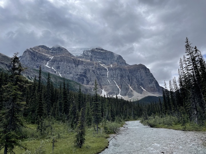
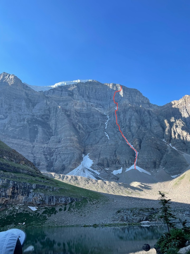
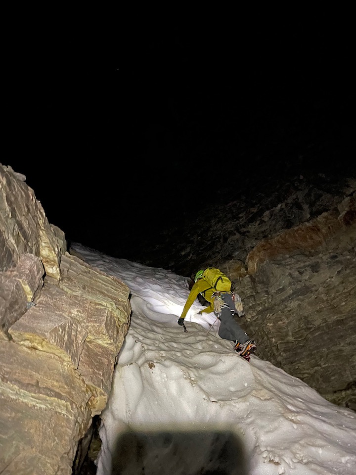
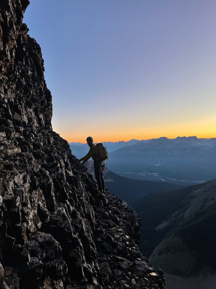
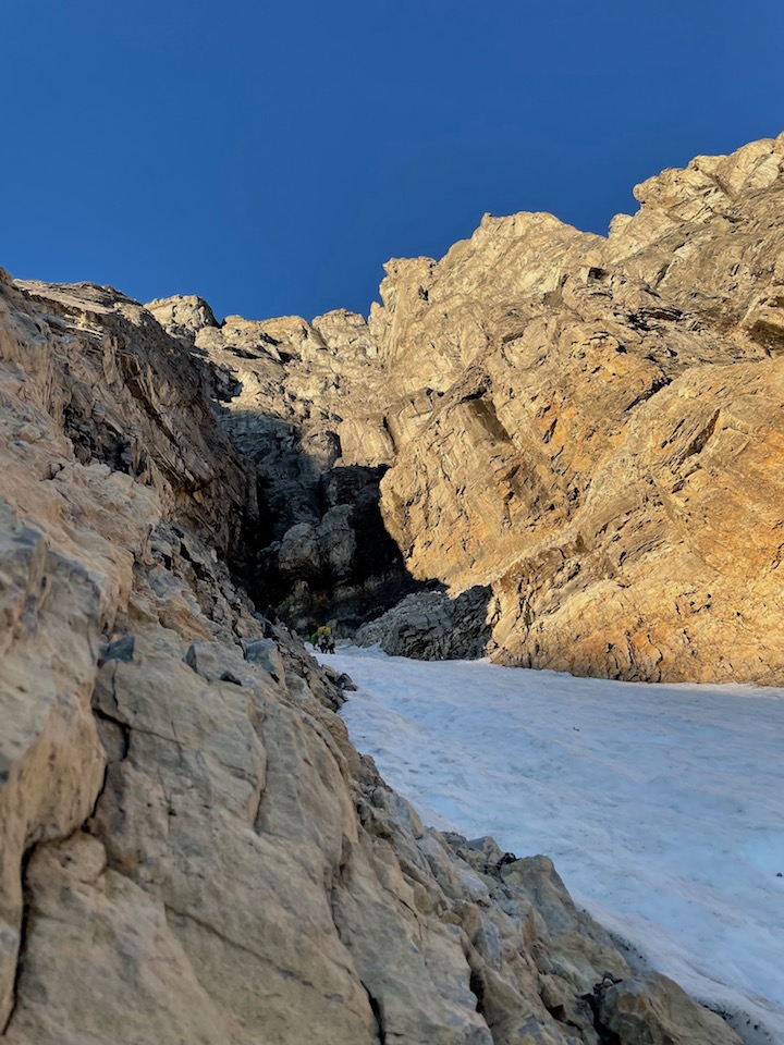
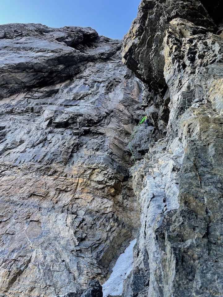
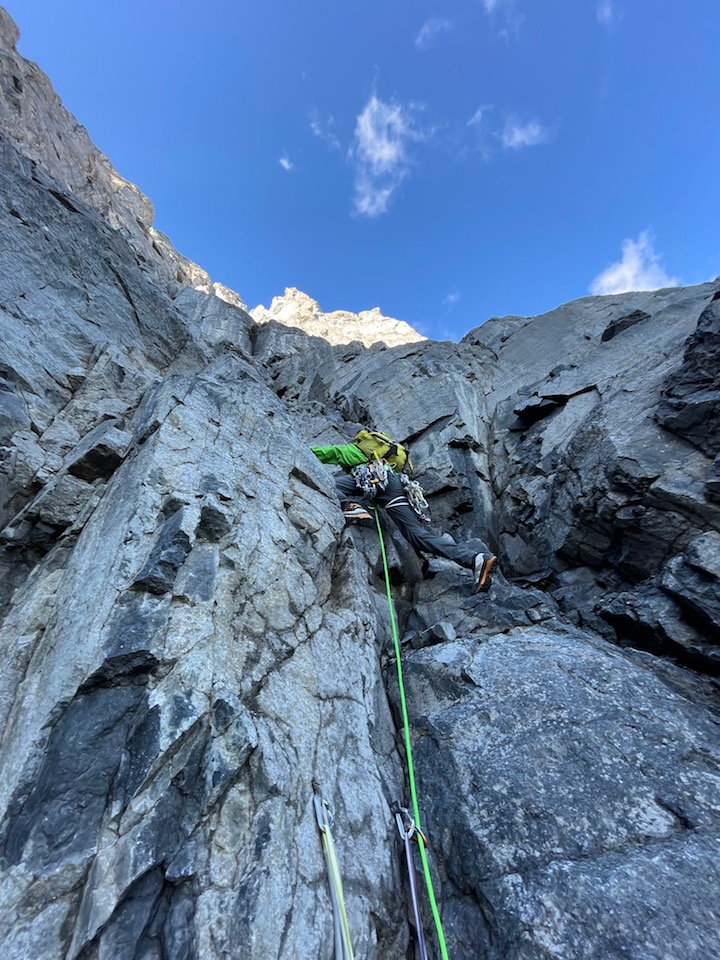
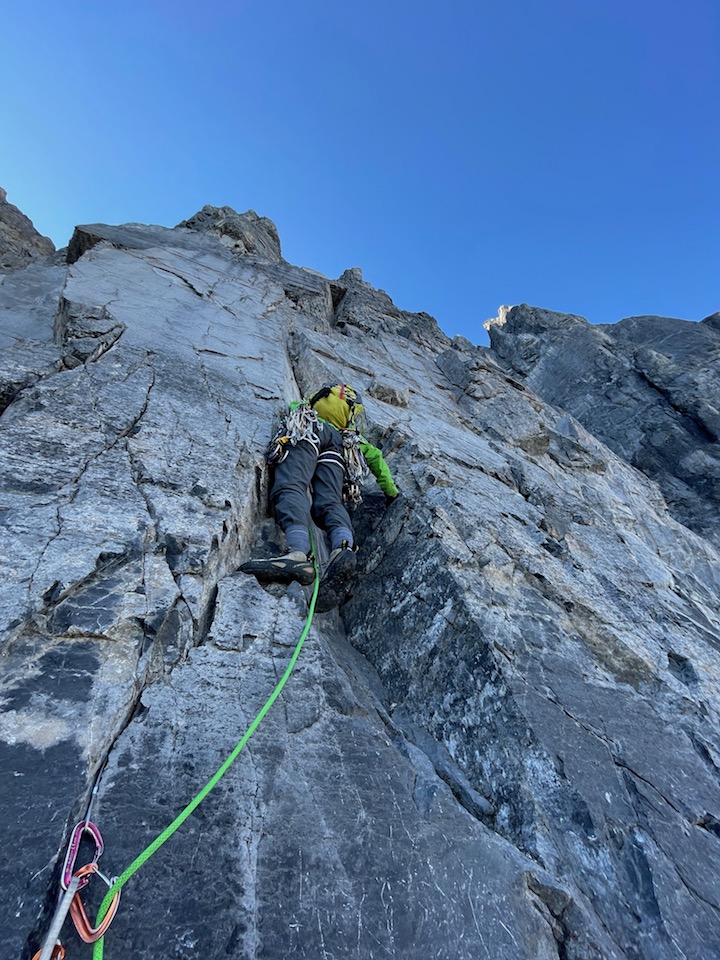
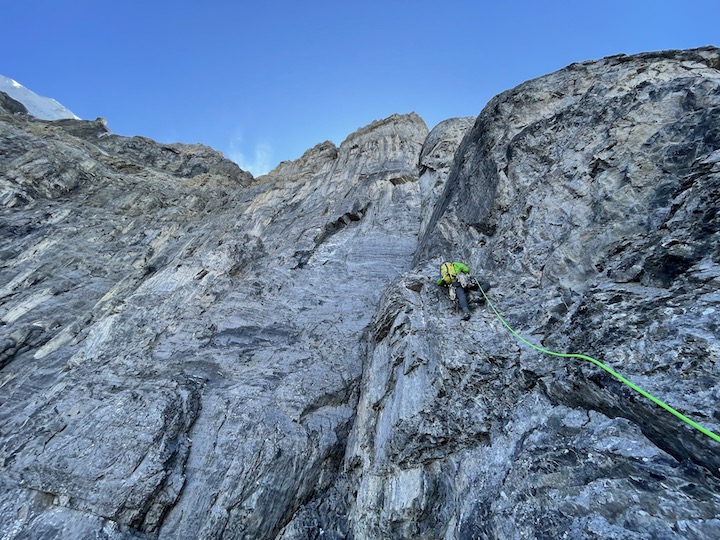
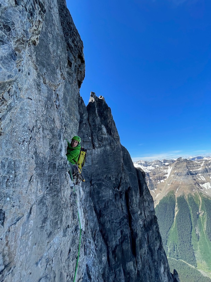
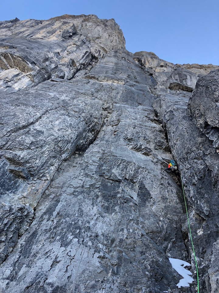
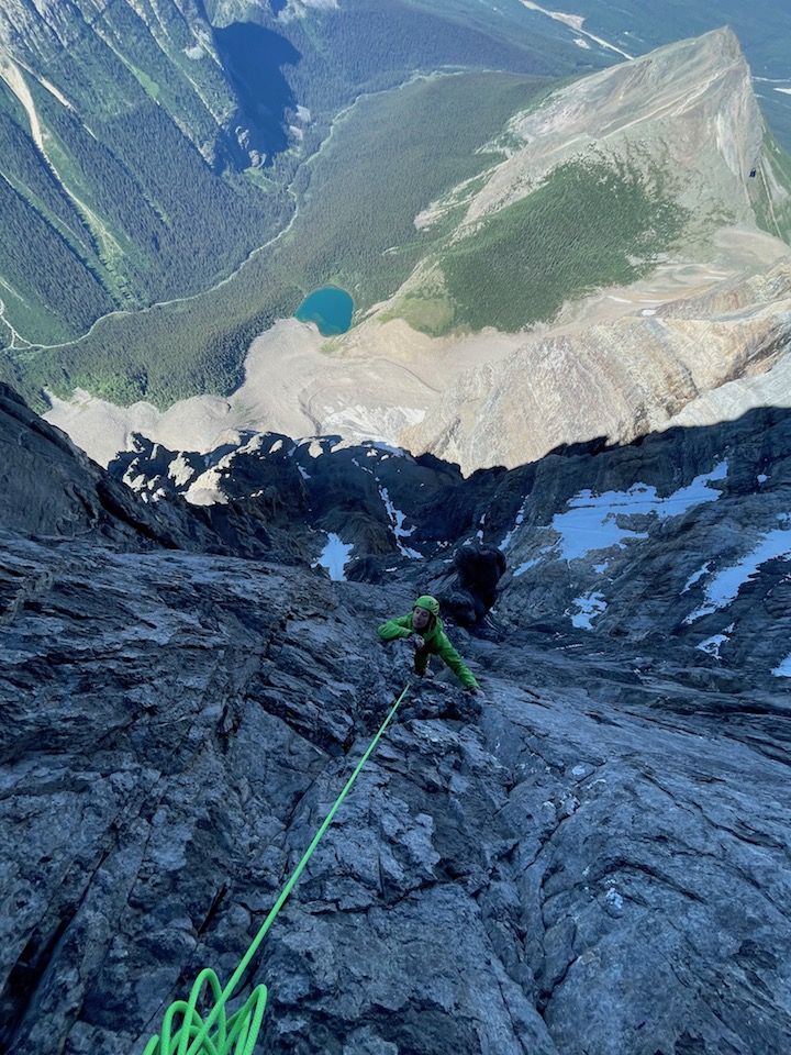
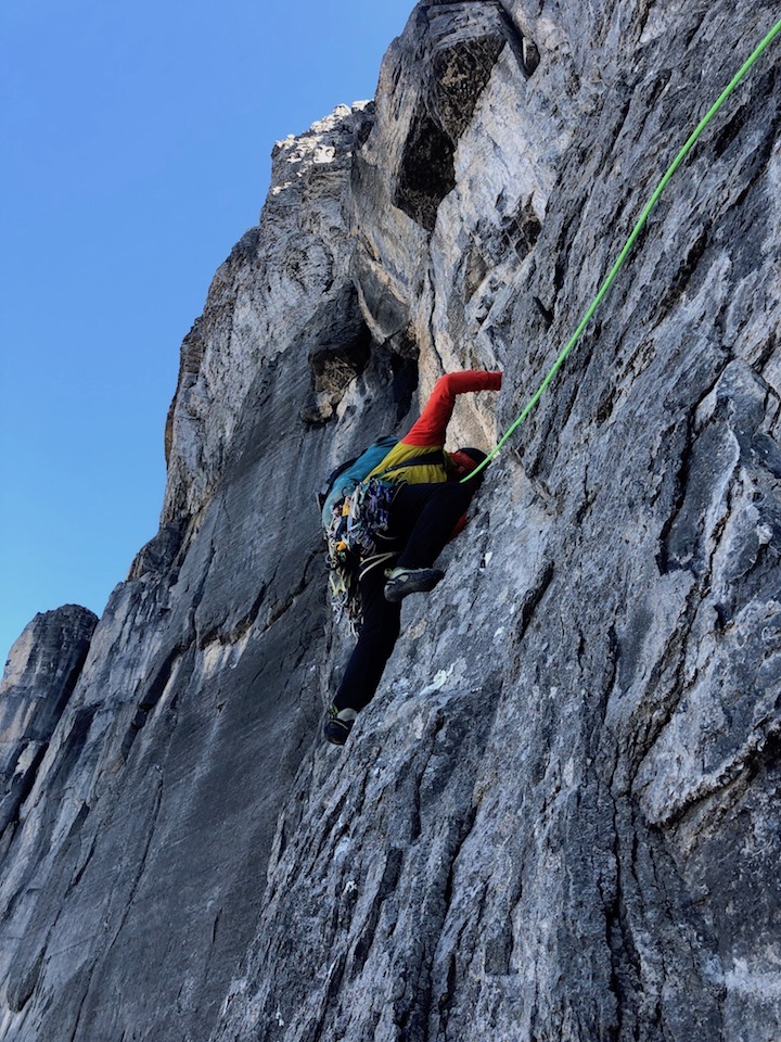
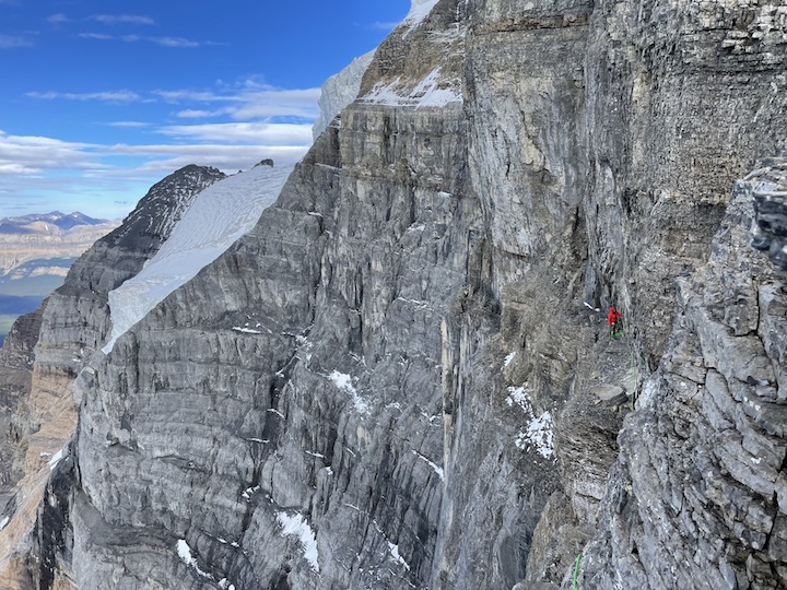
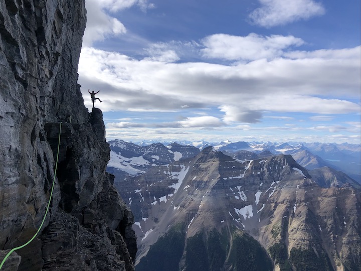
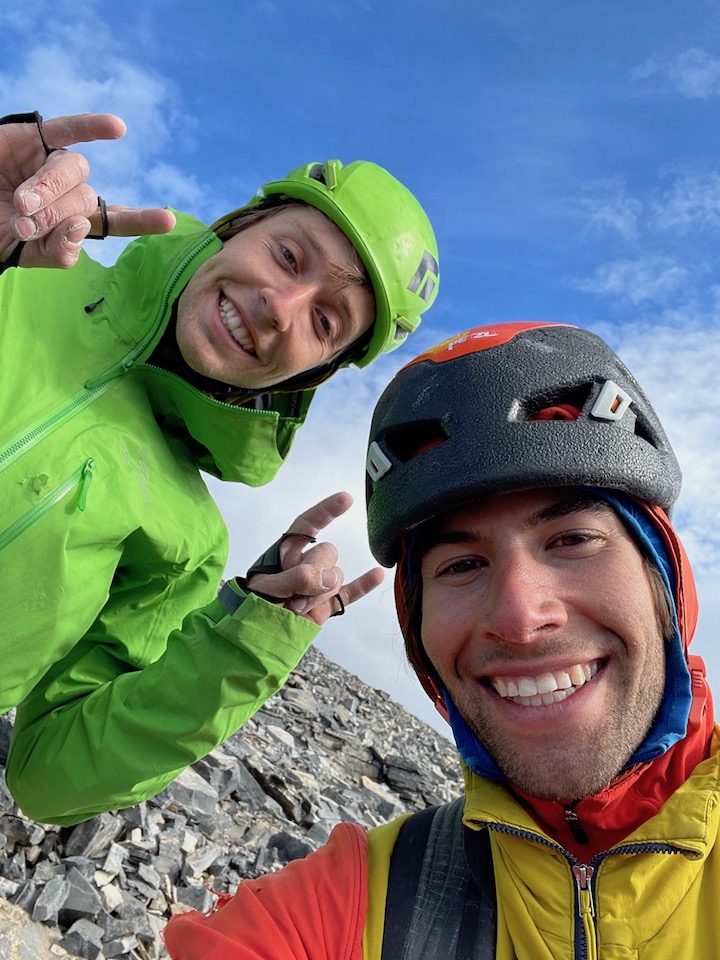
 11 points
 -
Trip: Crescent Creek Spires, Southern Picket Range - East Twin Needle - North Buttress 5.9 D+ 2,000’ Trip Date: 07/31/2022 Trip Report: Sam Boyce and I climbed the North Buttress (aka the Thread of Gneiss, as coined by John Roper), on July 31, 2022. The buttress rises 1,800 vertical feet and our route took 9 pitches, the majority of which were ~250’ due to simul-climbing–we estimate around 2,000’ feet of roped climbing. Some of you might be curious about this (probable FA) given there are no reported ascents, although a couple parties have reportedly tried. I had tried and failed on this line before, and it had really got under my skin. This time Sam and I started the line in a more sensible place, and it went smoothly. Here's some art by John Scurlock showing the E and W Twin Needles from the north. Our line begins lower right and works its way up the north buttress trending left, eventually squeaking by the sub-summit spire on its left to hit that highest left skyline: The lingering snowpack made the approach relatively easy, for the Pickets. From our camp near the Chopping Block, after traversing the snow, slabs, and talus of Crescent Cr basin, we cramponed up to Otto-Himmelhorn col. From there, the descent of the Mustard Glacier required only one single-rope rap from an established station ~150’ below the col. Gawking up at the very steep and intimidating looking summit spires, we figured that we would need a lot of time to reckon a way to summit. As a result, our route-finding choices generally favored efficiency, as we wanted to be as expedient as possible to save time for expected difficulties up high. As it turns out, our concerns were largely needless. We started climbing a little below the outlet of the gully splitting the E and W Twin Needles (aka, the Thread of Ice), gaining E Twin Needle on its right-hand side, not far up from the buttress toe. A pitch-plus of glacial-flour-covered mid-fifth was followed by a pitch-plus of nasty gully travel with some mid-fifth work-arounds, and that landed us at a notch above the first pillar/tower on the buttress. Future parties should take the rib to the left of the gully on pitch 2 for better climbing, and top out on the pillar—an approx. 20’ rap to the notch might be required, but this would be much better than the loose gully. Our start, from near the buttress’s toe: In the above pic, we gained the rock left of the gaping 'schrund, up to the brownish left-slanting gully, up that thing to the notch between the indistinct pillar and the next tower at the sun-shade line. (Again, likely better to stay on the rib to the left of the gully.) From there, Sam led through some blocky 5.7 terrain that backed off to more low-fifth scrambling. For pitch-plus 4, I continued on pleasant rock at low-fifth class, nearly to the top of another gendarme. For pitch-plus 5, Sam then easily gained the next notch and continued on some solid and fun 5.8 that relented to mid-fifth. For pitch 6, I led an airy 5.7 traverse left of another tower. This was one of the few pitches that did not stretch beyond a rope length. Going up and over this tower would probably be just as fun. Sam’s lead of pitch 7 was a long simul affair involving grassy ramps for about 400’ with difficulties up to 5.7. He finally pulled up to belay at a spot that gave us options for tackling the summit block. My lead of pitch 8 involved a chimney, a leftward-rising traverse of a face, and then working around and up an exposed and somewhat insecure arête to near the summit. This long pitch was the proverbial sting in the tail, requiring some careful and sometimes licheny 5.9 moves. Fun and spicy. (There were certainly more spicy options to gain the striking sub-summit, but we leave that for future parties and variations.) From my belay Sam scrambled to the summit, at perhaps 5.6. Descent: We descended the south face. From the summit, there is a short down climb to an established rap station with a fresh sling from the Wrights’ traverse a few years back. This was a full 30M rap that took us to Eye Col (the notch between E and W Twin Needles). From Eye Col we scrambled down the main south gully, exiting rightward when it got steep and traversing skier's right over 2 or 3 minor ridges to find easier terrain to down climb. After a bit of sandy 4th class, we identified a convenient point to rappel from (cord now in situ) that landed us back into the main gully with its (currently) hanging snowfield. This was a full 60M rap. After downclimbing and traversing right off the snow, we found ourselves at a notch that splits the two main gullies described in the Beckey guide. We decided the gullies looked unpleasant and scrambled the ridge between the two, trending rightward as we went down–our route traversed above the skier’s right gully. This was straightforward 4th class. When the ridge got steeper near another notch we made another rap. This was another ~60M rap down lower angle terrain, which could probably be downclimbed somewhat reasonably with a couple steep steps. From here we continued downclimbing to the moat below the ridge. There was not a comfortable-looking transition to the snow so we rigged one more single-rope rap to clear the moat and get back onto the snowfields in Crescent Creek basin. Once in the basin, it was a quick romp back up to our camp at the Chopping Block col. A handful of pics: Sam on pitch 3, E Twin Needle's sub-summit spire lurking behind immediately left: Me on pitch 4, with the Eye of Sauron menacing behind: Here I'm following pitch 5, Fury and Luna background: For pitch 6, at this point I decided to head left for an airy traverse versus the up-and-over (that's W Twin on the right): Sam shot this pic of me on pitch 8, about to swing around to the exposed arete: A couple of Sam following, first the chimney, then on the arete, obviously having fun: Sam and I really enjoyed this climb. While Sam had impressively climbed three Pickets routes in under two weeks, for me it had been too long since I'd climbed alpine rock, and this was a much-needed alpine shot in the arm. Except for the uncharacteristically somewhat-heady last pitch, we'd recommend this as a "Pickets moderate". Parties comfortable with alpine 5.9 should take a ride on this climb. The Crescent Creek Spires from our camp; the Twin Needles are the pointy ones next to last on the left, and the upper gully snowfield that we rappelled and downclimbed as part of the descent (before veering looker's left on a ridge) is visible dropping down below Eye Col: Gear Notes: Double cams fingers to 1", single 2 and 3, supplemented by tri-cams and nuts. Double/twin 60M ropes. Approach Notes: Crescent Creek basin approach to Chopping Block col.
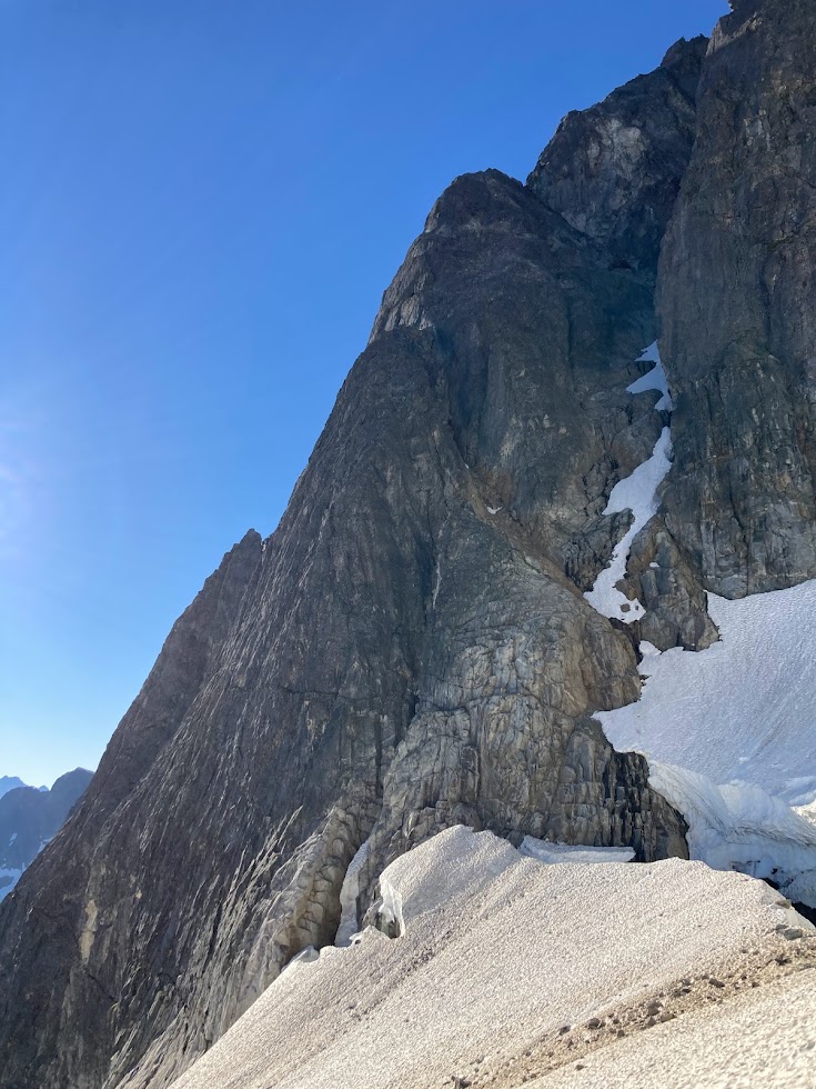
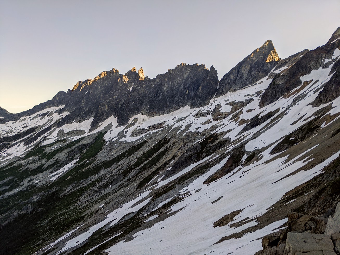
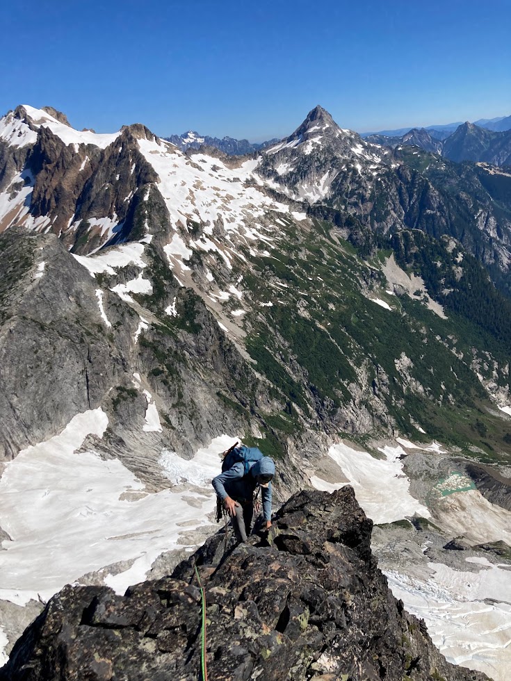
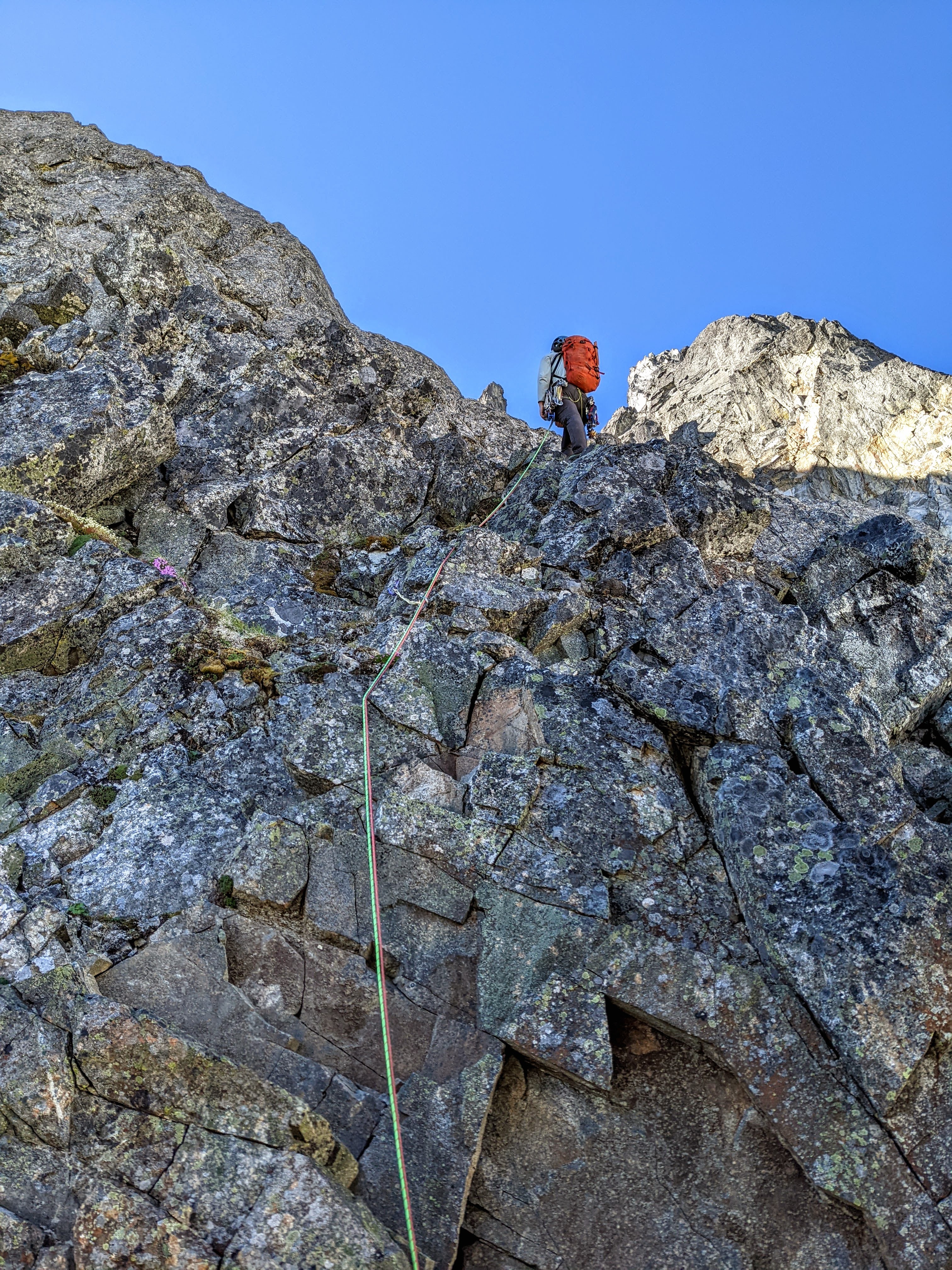
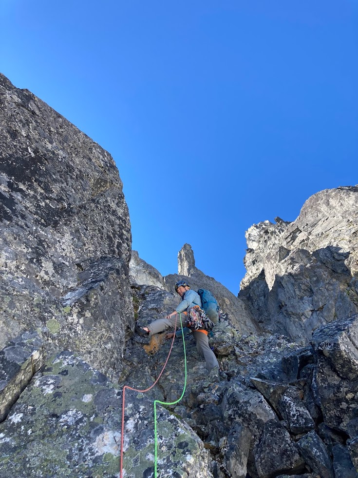
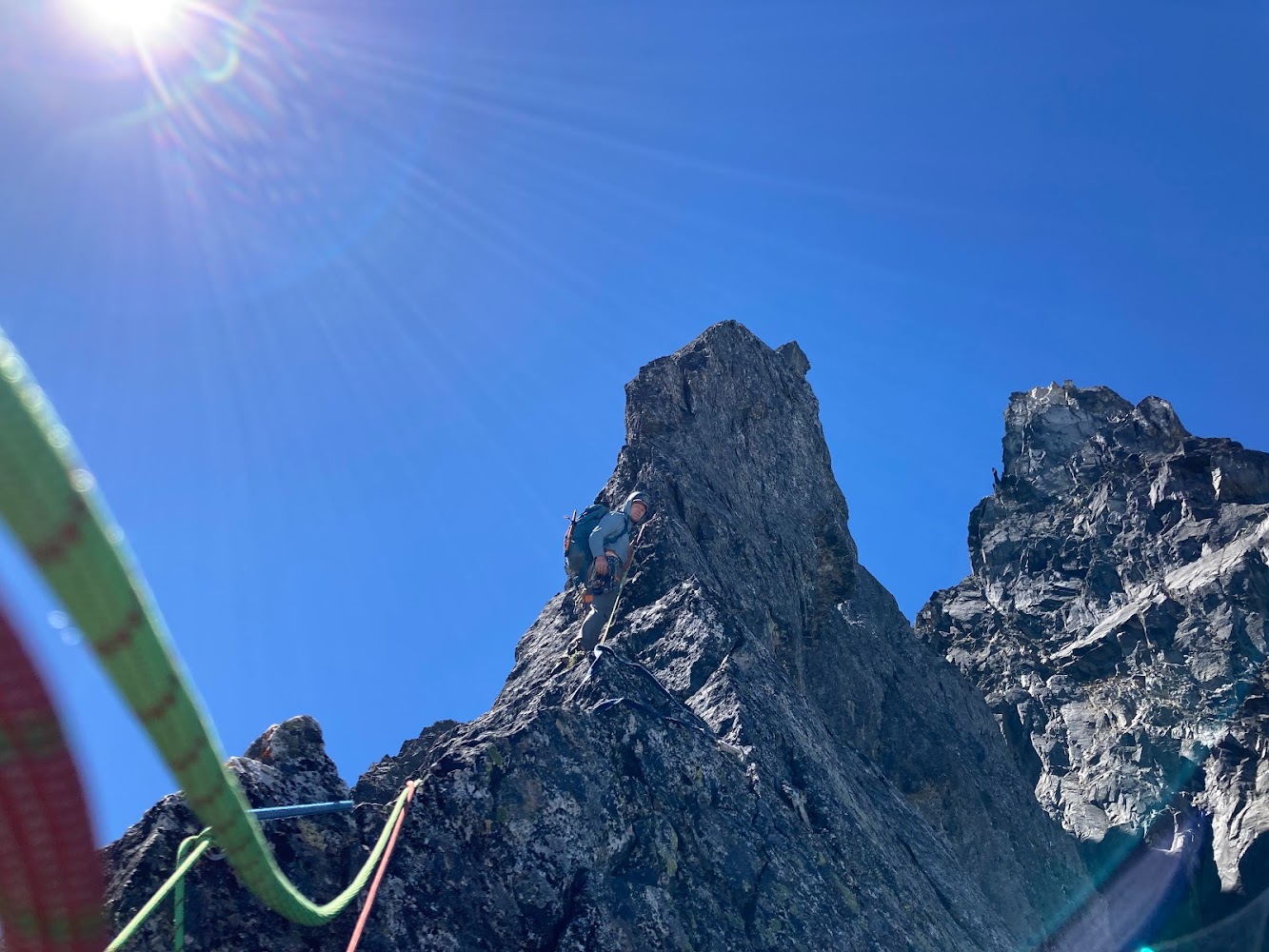
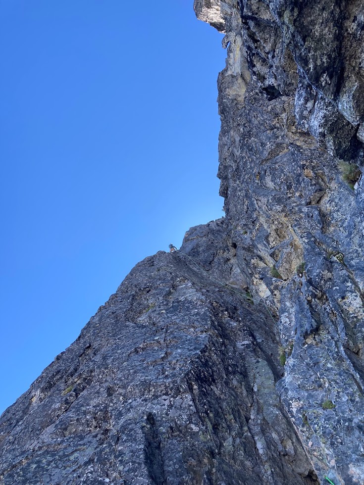
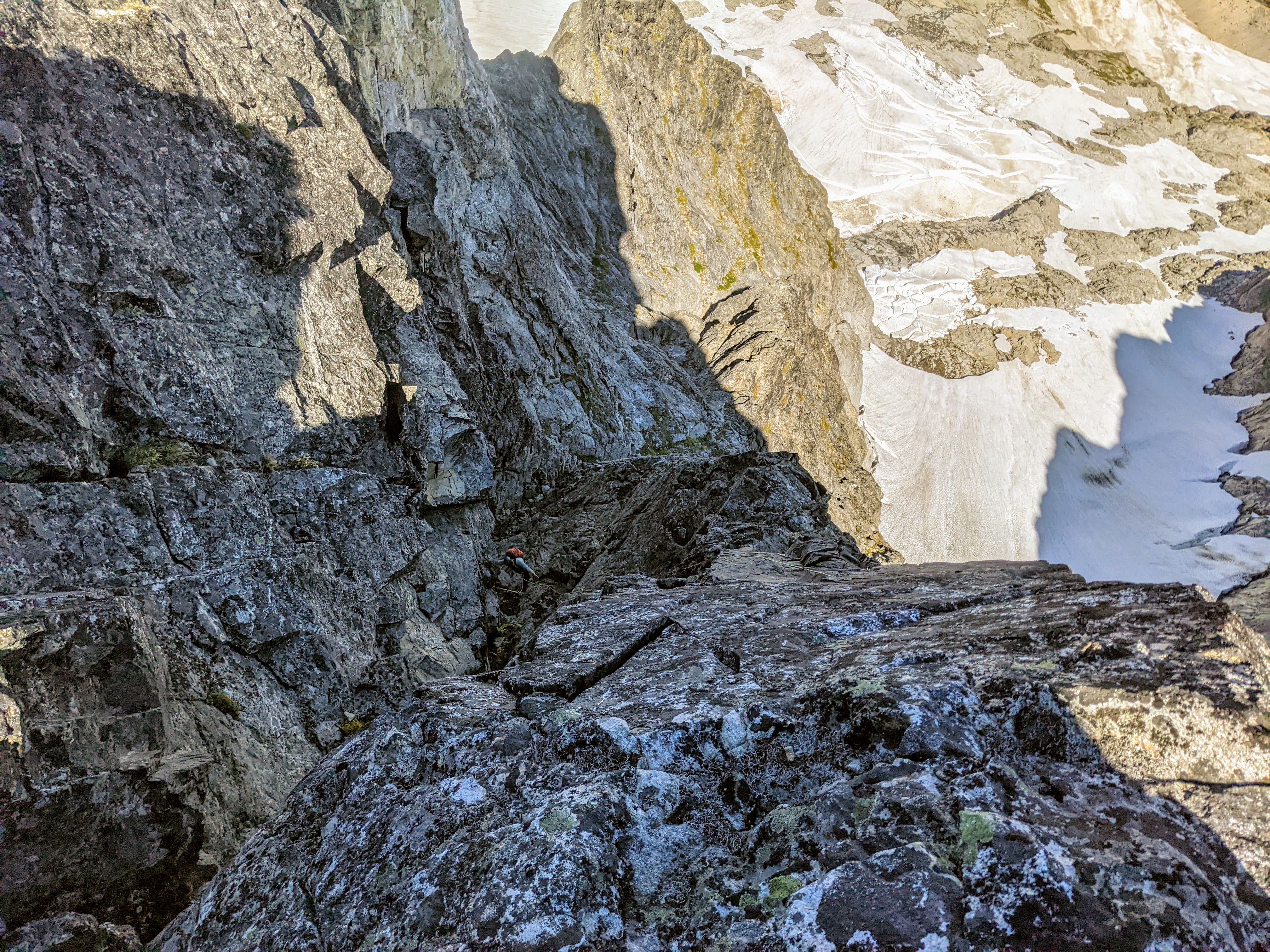
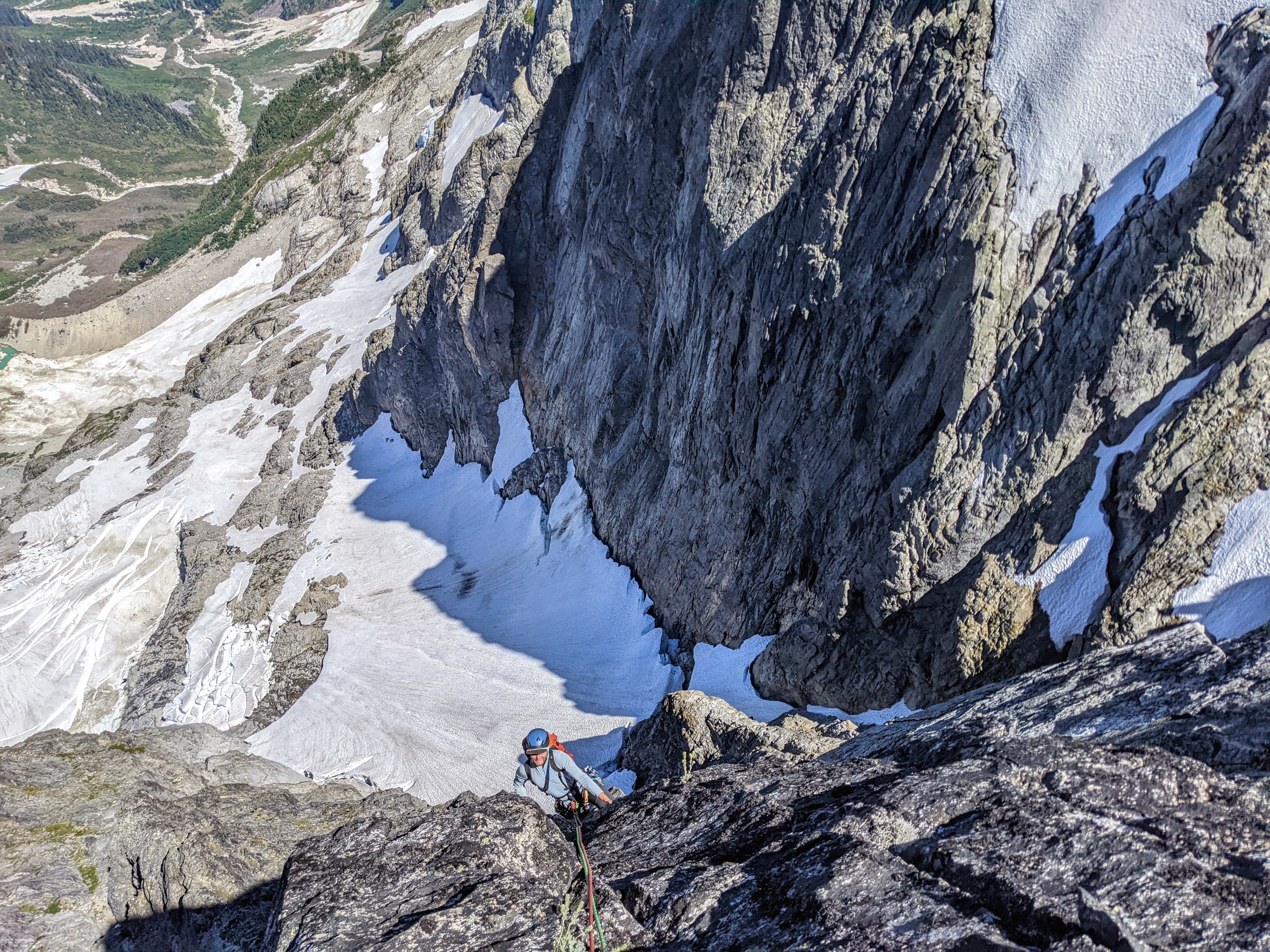
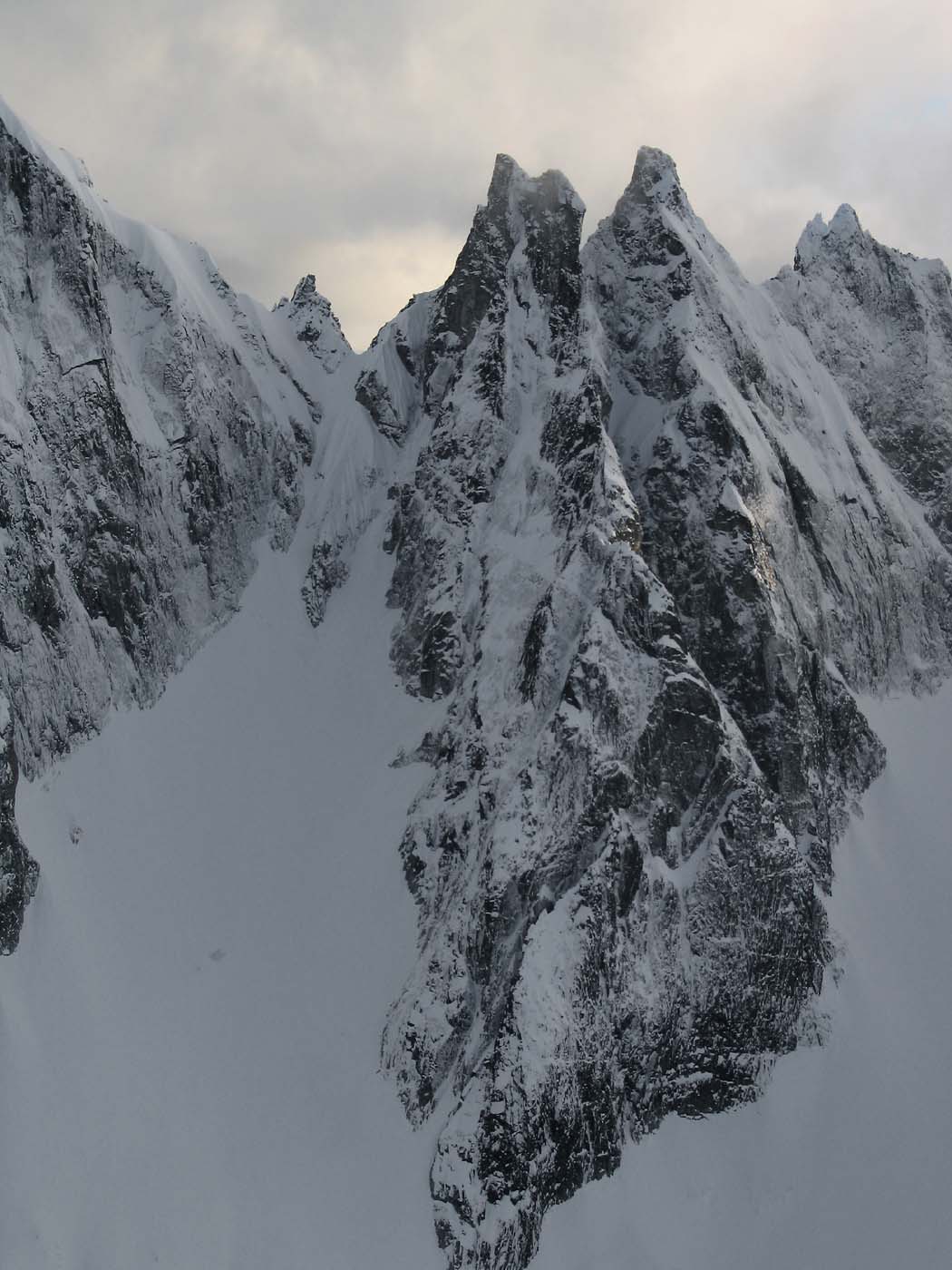 11 points
 -
Trip: Mount Torment - North Ridge Trip Date: 08/09/2020 Trip Report: If anyone's noticed, I am not so regular at posting TRs any longer. New job, older kids, a lack of anything new to say.....the list of excuses is long. But, to be honest, this is still my favorite place in cyber-land to post vignettes of my life in the hills. So here I am, slowly plugging away at catching you all up on the riveting adventures of an aging alpine "lifer". In this installment, we pick back up in August of 2020 and on an adventure close to home for both @dberdinka and myself. Jokingly, we said that we would go on a trip wherever arcs drawn in a 60 mile radius from our homes converged. This was not absolutely true for Torment, but pretty darn close. We have an embarrassment of riches right in our own backyards! We typically only ski a few times a year together and had been talking of an alpine climb for far too long. This may have been our first time summer climbing together? But first we had to get a permit! We weren't worried about the Torment Basin zone being full, but we WERE worried about the line at the ranger station. As you all surely must know by now, a August Saturday morning at the ranger station is only slightly less crowded than Mecca during the Hajj. Since it was misting, and we only had to hike to camp, we didn't get there early, probably about 0830. We pulled number 114(??!!) and settled in for the wait. There really must be a better system than what is currently being used. I'll let you tell me exactly what in the comments below. Permit in hand we struck out in the increasingly heavy "mist" for the TH. This is the first hurdle. It isn't marked, and there isn't a lot of traffic up it to make where the trail leaves from the Cascade River Road obvious. Look for it on the left, just after the 2nd bridge over the Cascade River, past the Eldo TH. Space for one car on the right and the trail takes off steeply just across the road. It starts out vague and gets better as you get higher. Decades ago this sounds like it was a major thoroughfare, but it has fallen into obscurity. Yes, you heard me. This is a route in the Cascade River corridor where solitude on an August weekend is possible! I'll let you figure out where the trail is and where it goes, however. Good things come to those who investigate. So I'll skip ahead to arriving a few hours later in the basin. It had stopped raining but was still damp, cool, and cloudy. We wandered for a decent amount of time, looking for established camps. Finding none (obscurity!), we found a flatish slab of rock and cleared the loose stones for an OK night. It didn't help I forgot my pad at the car. D'oh! Nevermind that, I certainly couldn't complain. I was with the one and only @dberdinka on an honest to goodness climb! I was also nervous. You all know how fast, competent, and technically savvy Mr. Berdinka is- I had to buck up and look tough. The alarm went off quite early (did I expect anything else?) and @dberdinka was immediately ready, or so it seemed. I fumbled around the tent for a bit but eventually got it together and we set off in the dim mists for the col that would take us around to the North side of Torment. Be warned that you will need to do one 30m rap to get past an imposing gully of doom along the way. There is a horn for an anchor, but I'll let you find it. Obscurity! And then, you'll need to expeditiously move under and away from a non-daddy friendly ice cliff. Channel your inner Ueli: But don't worry, alpine glory aspirants, at this point you've reached the promised land! Firm rock (4th and easy 5th), outrageous position, and no other parties to ruin your wilderness experience. It really is worth the price of admission. It is an Ed Cooper climb, after all. The only downside to climbs like this, of course, is that they are over too soon. But, we have wives and kids that want us to come home at a reasonable hour, so all good things in moderation. @dberdinka looking fashionable on the summit: As with most North Cascadian summits, there was then the question of which way down? We hemmed and hawed, ultimately eschewing the standard SE face descent (how would the moat be? Would we end up like Craig Luebben?) for the wandering South Ridge (standard approach to TFT). While this isn't a terrible way up, it isn't a great way down. Lots of insecure scrambling between raps where a fall would most likely be fatal. Again, not exactly daddy friendly. But, we survived to reach our camp and the delightful meadows of Torment Basin a couple hours later. And you probably will too. So, next August, don't complain that there are crowds on "all" the classic climbs in NCNP. Go do some exploring! Gear Notes: 60m half rope, light rack, helmet, axe, crampons, etc. We used rock shoes, but you probably don't need them (we didn't know what to expect). The full alpine kit! Approach Notes: The "excellent" Torment Basin route. Green Fred details it nicely. It needs some traffic, however!
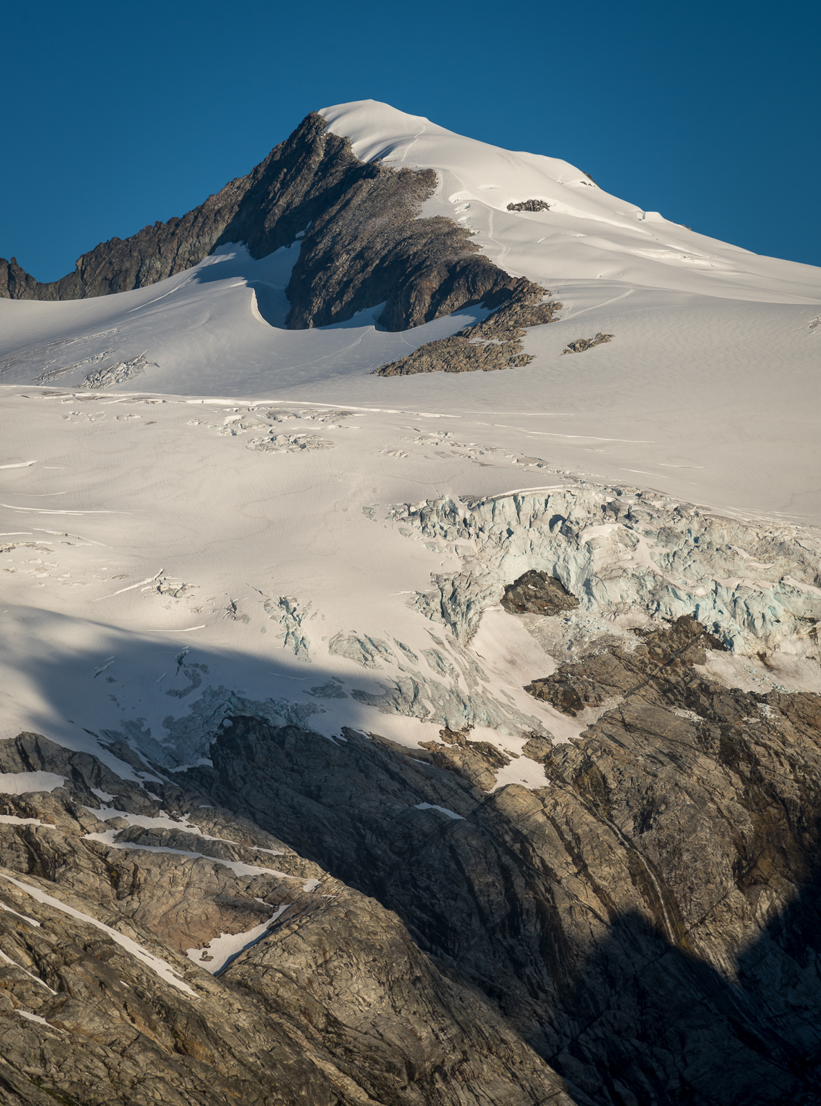
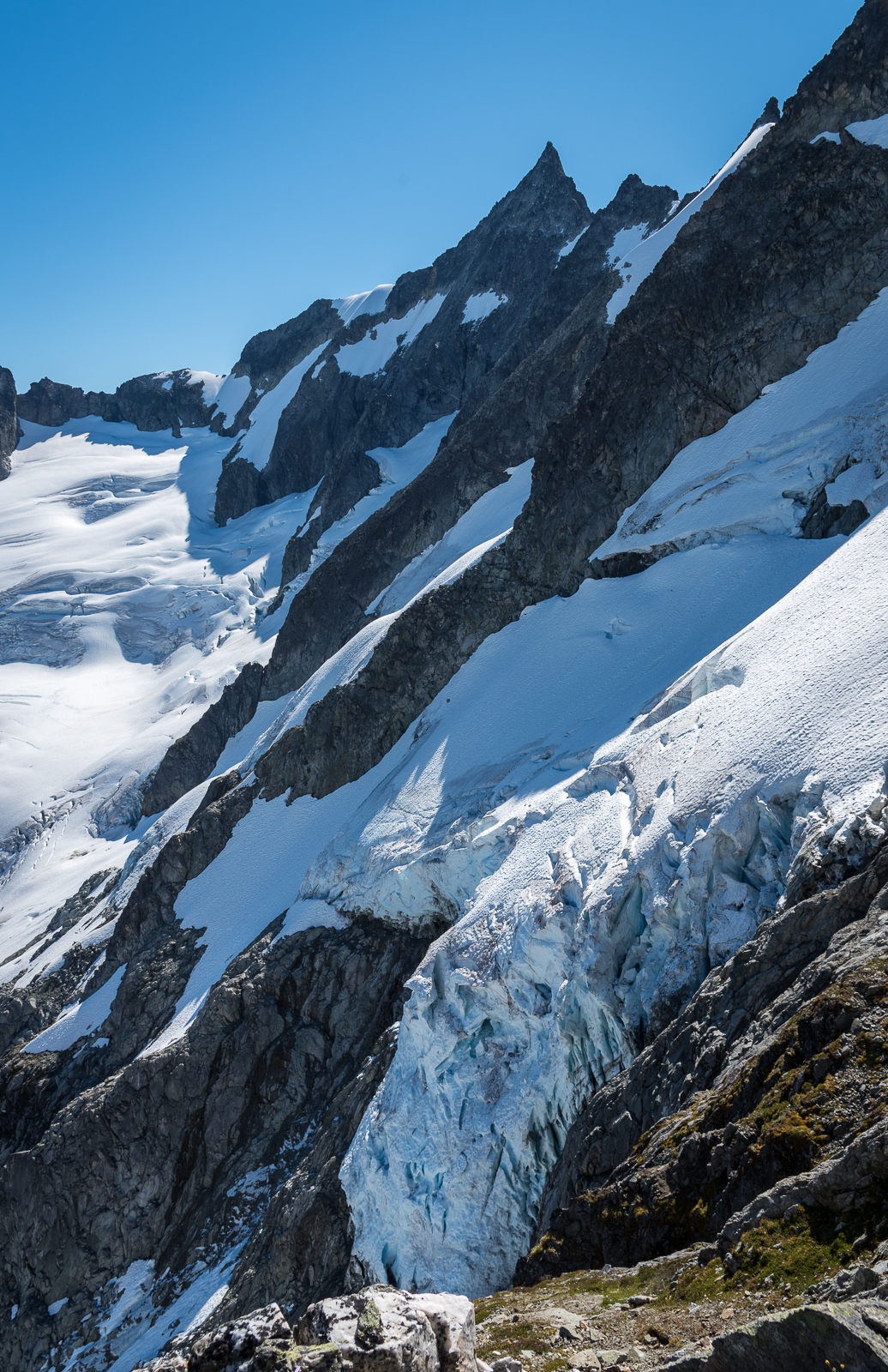
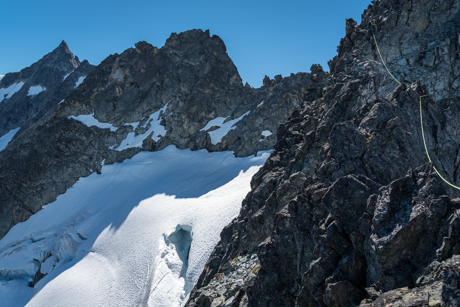
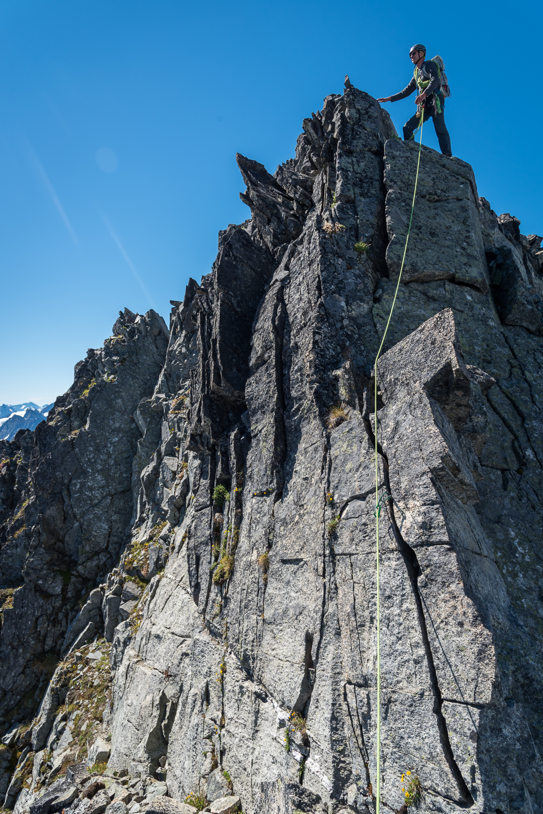
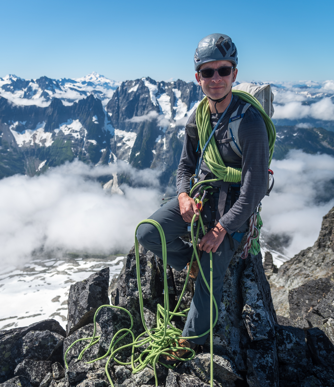
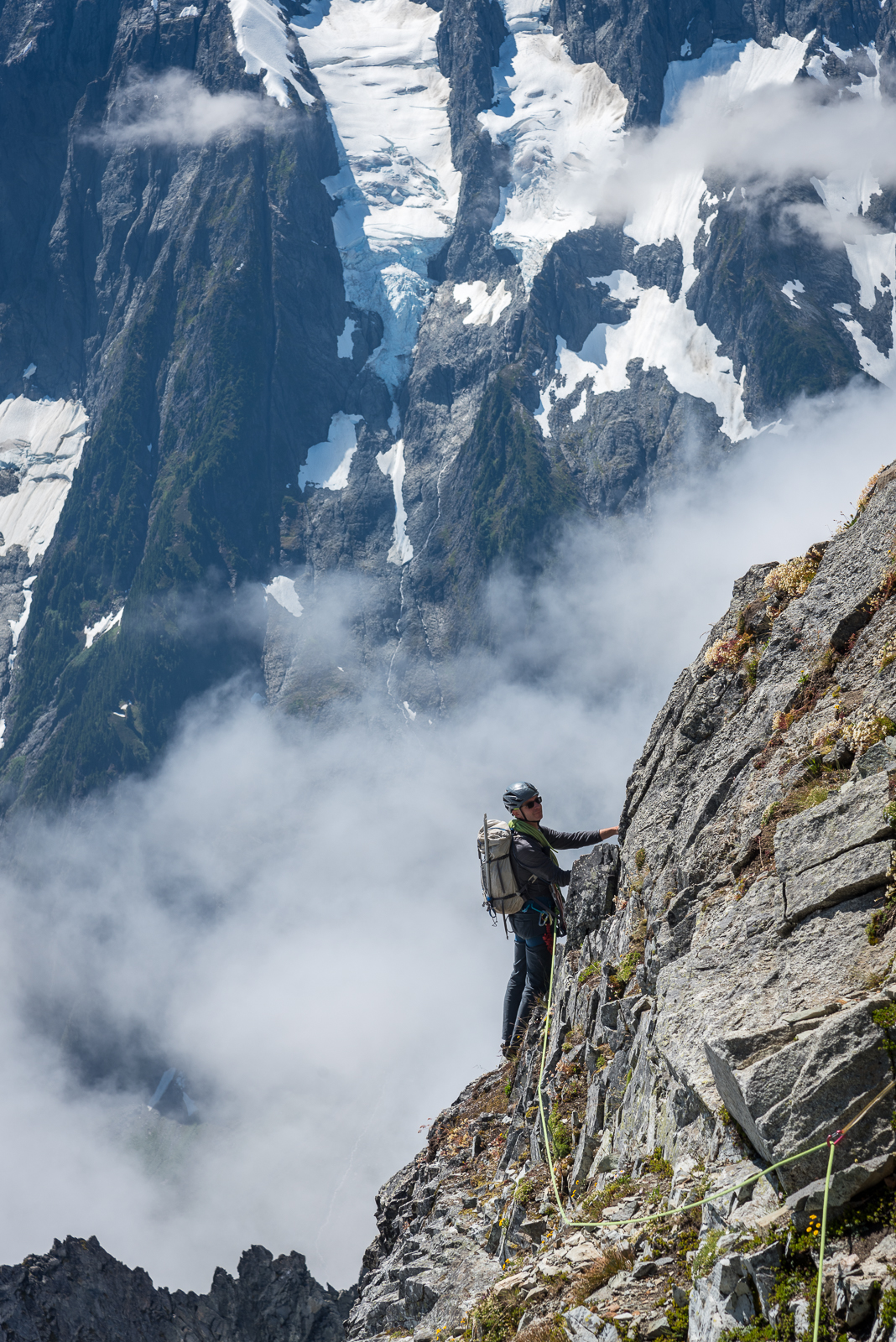
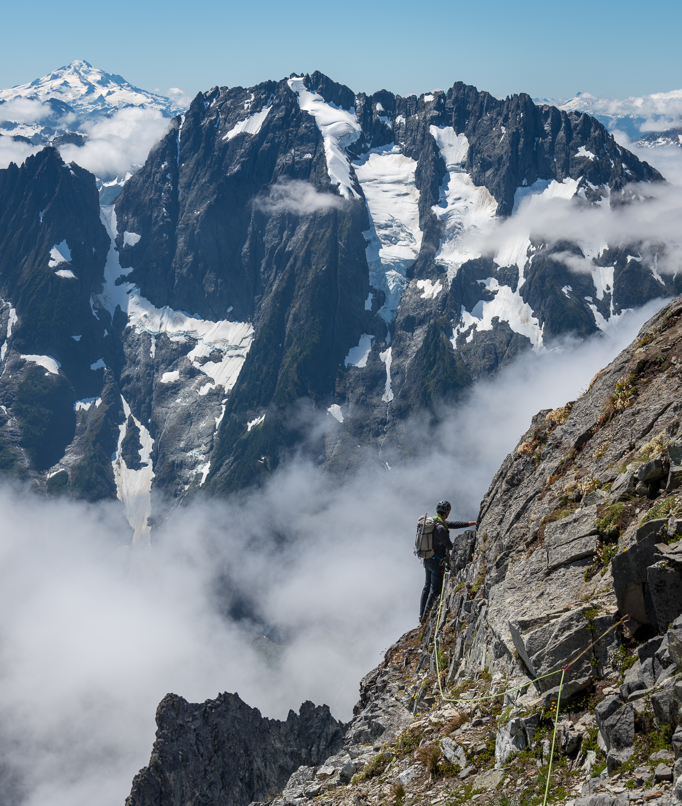
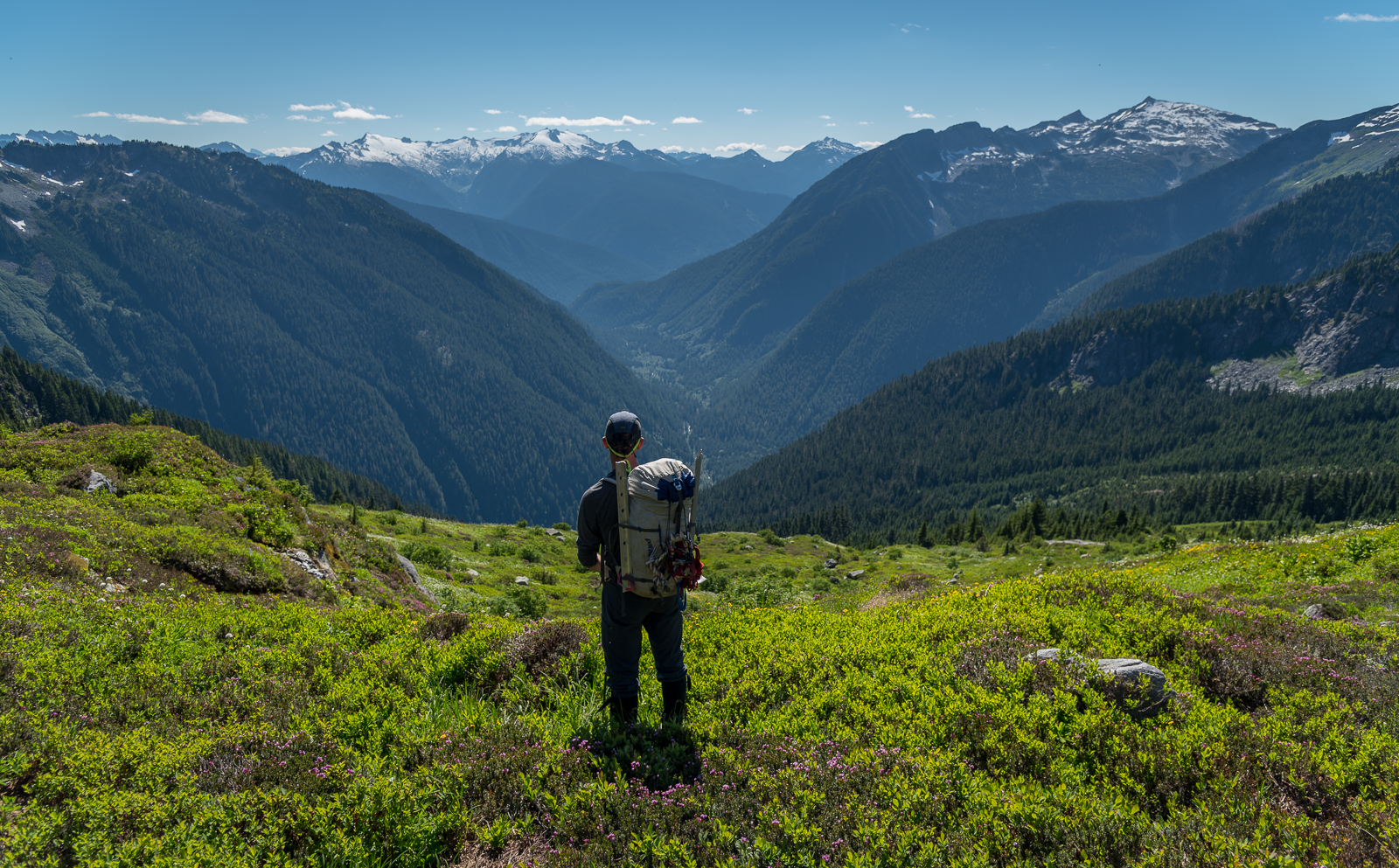
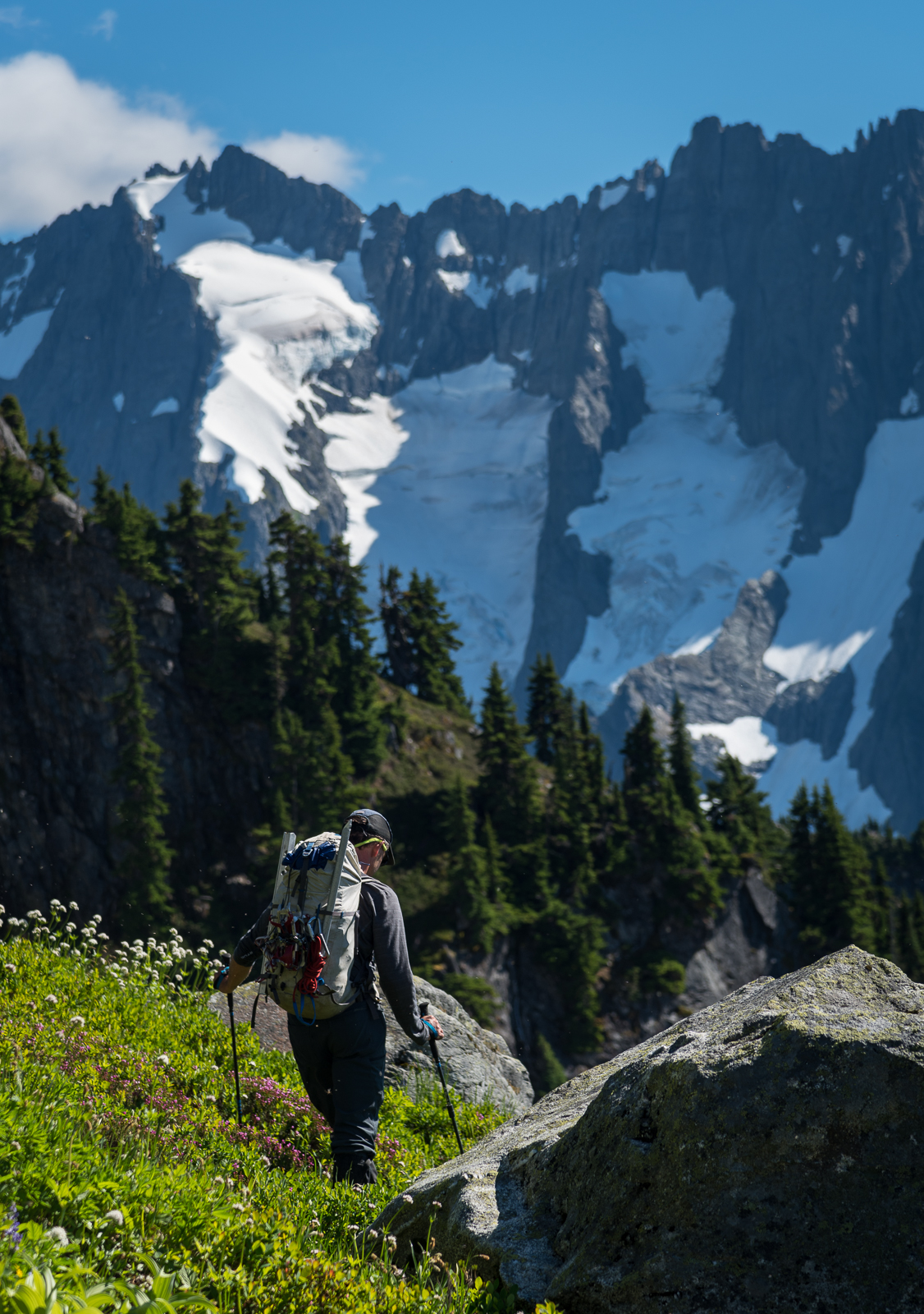
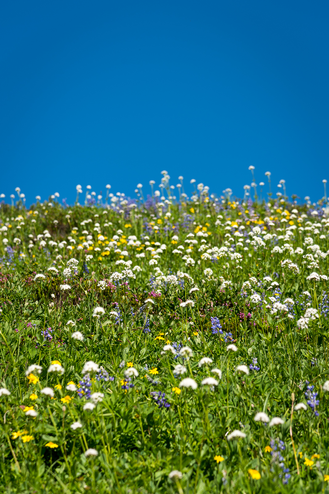
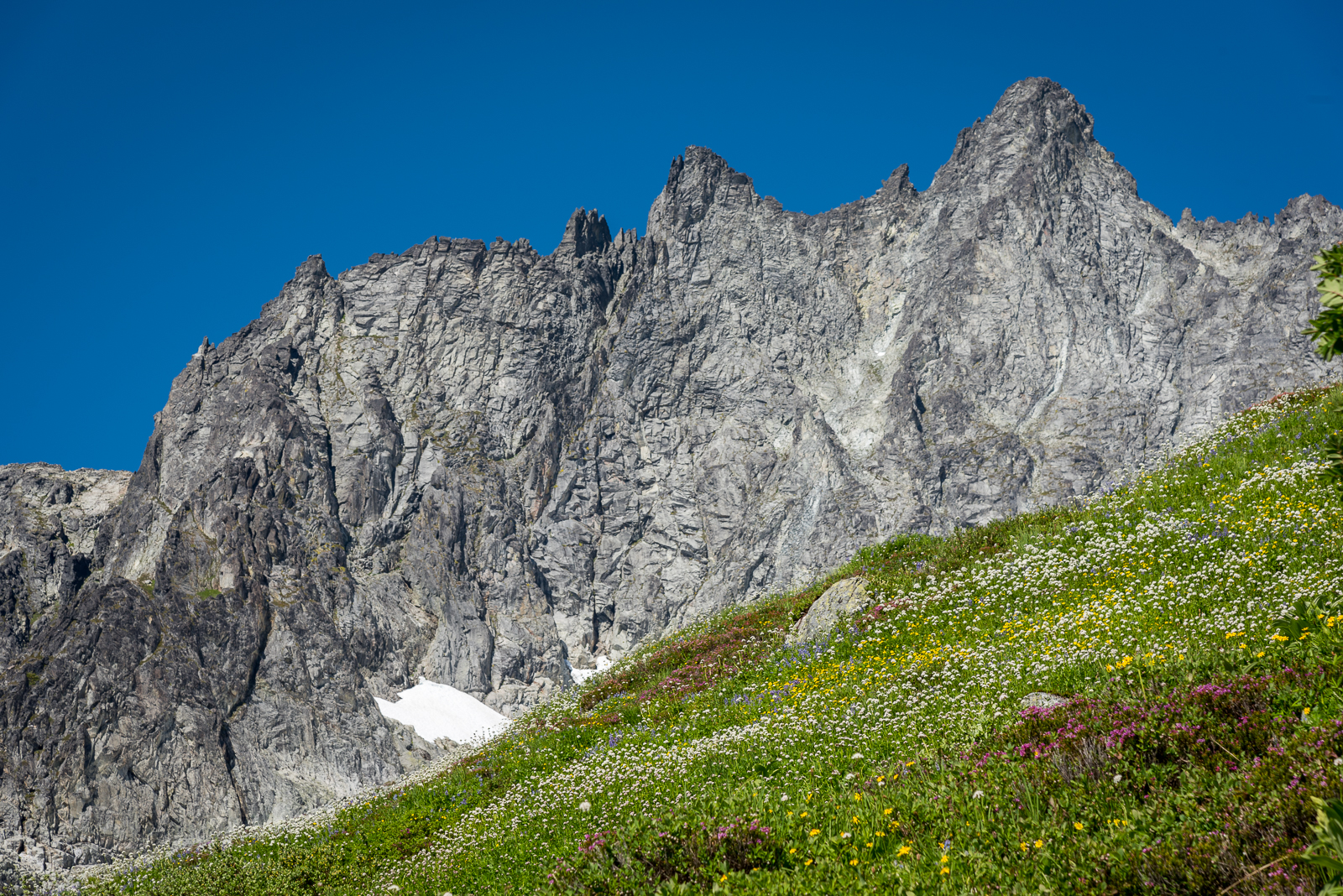
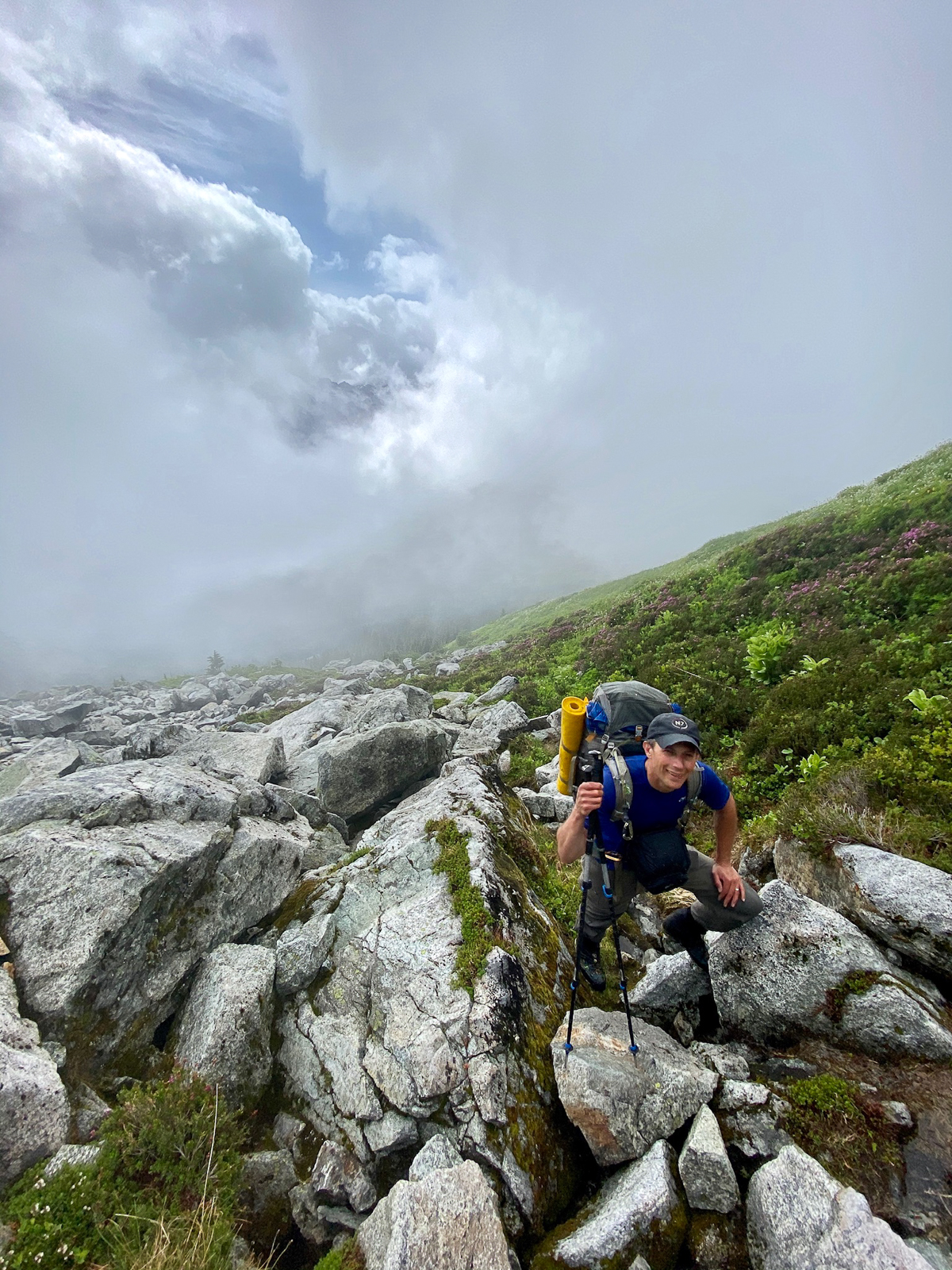
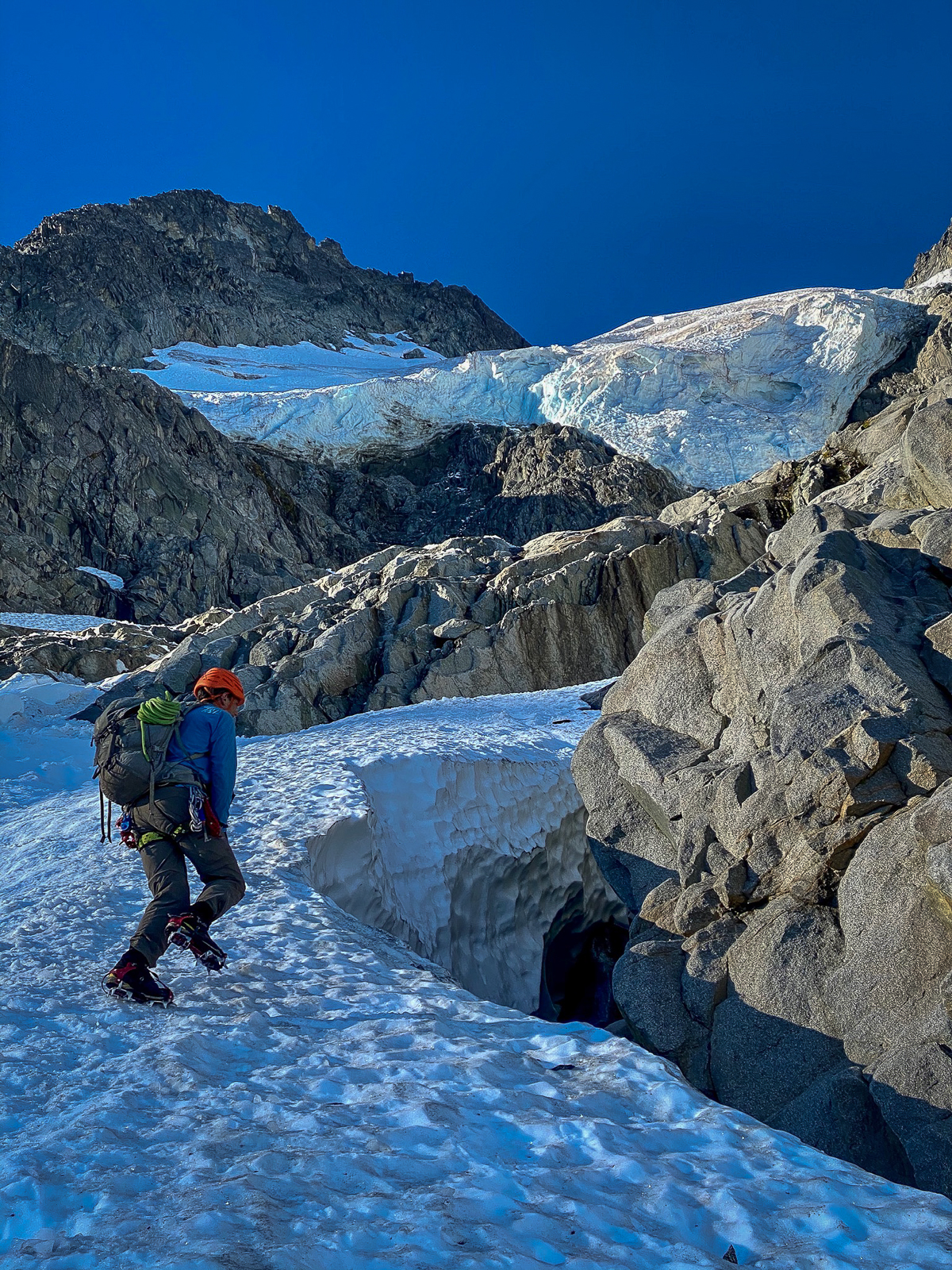
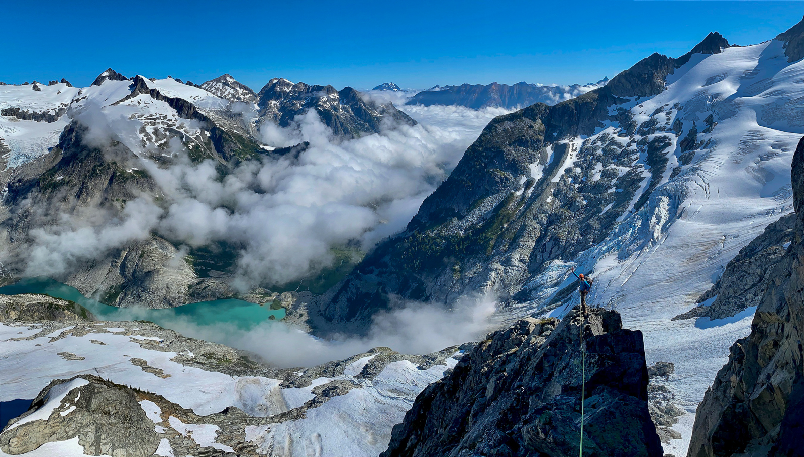
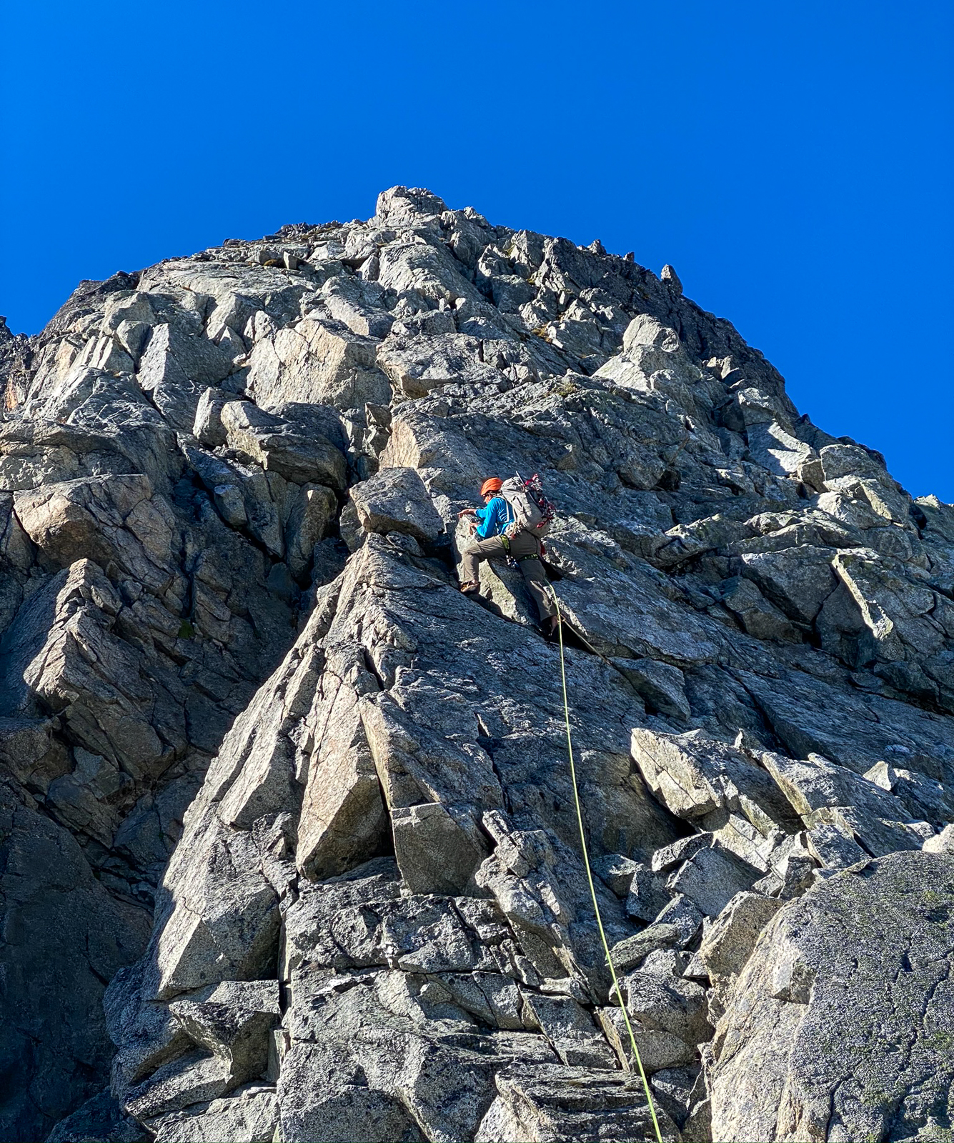
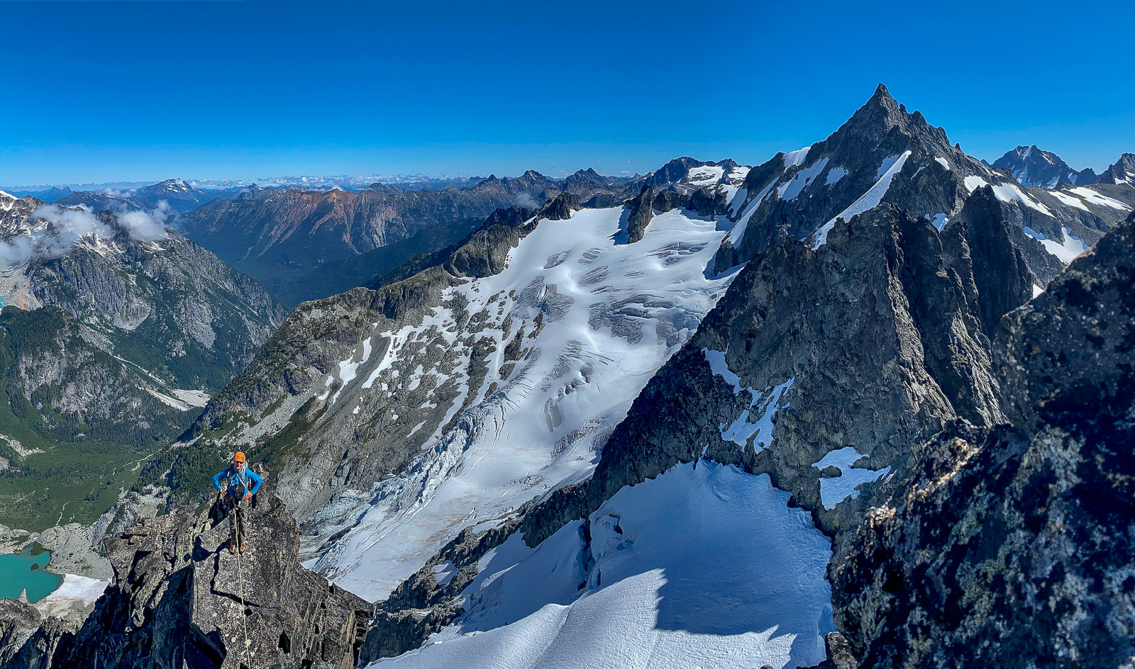
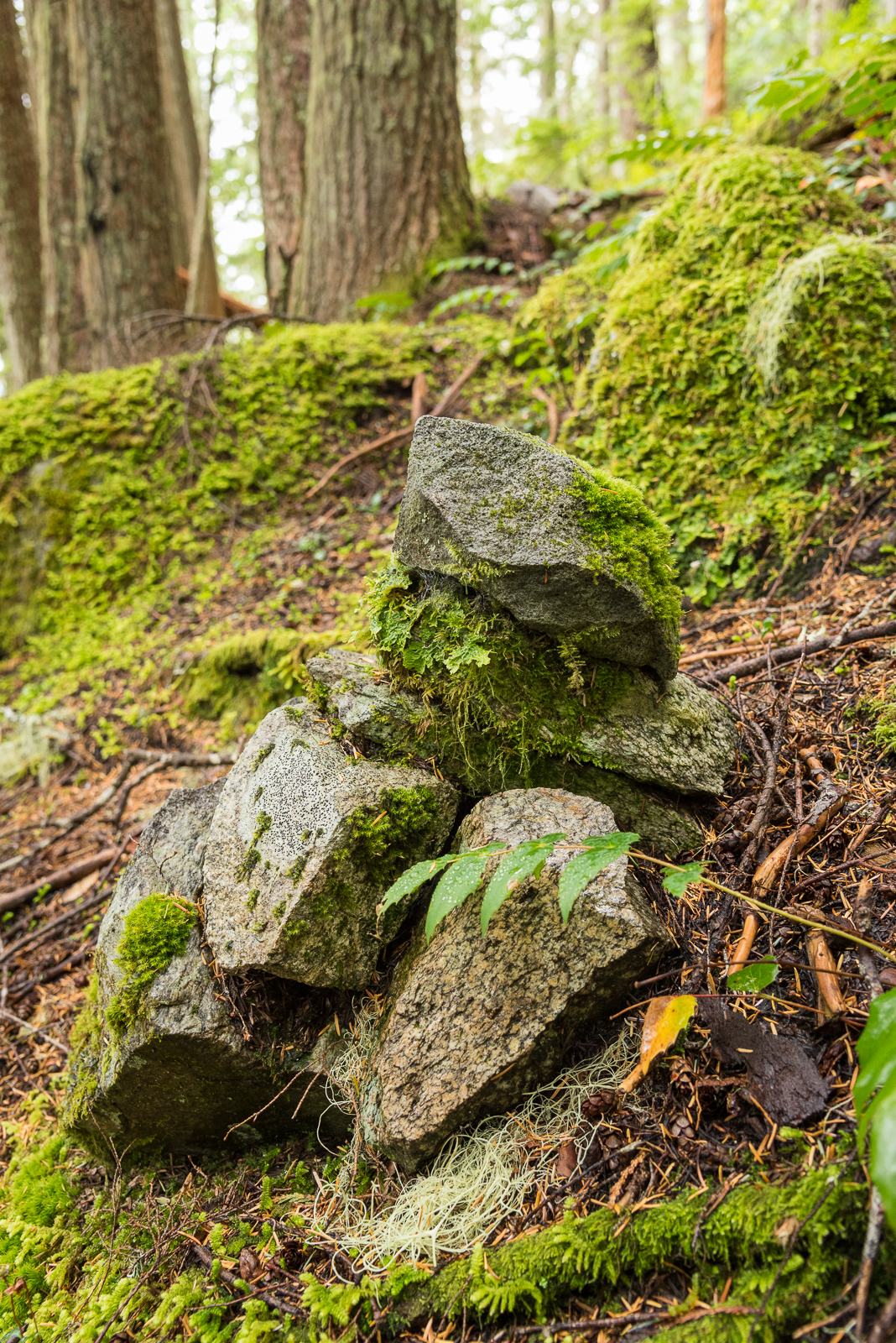
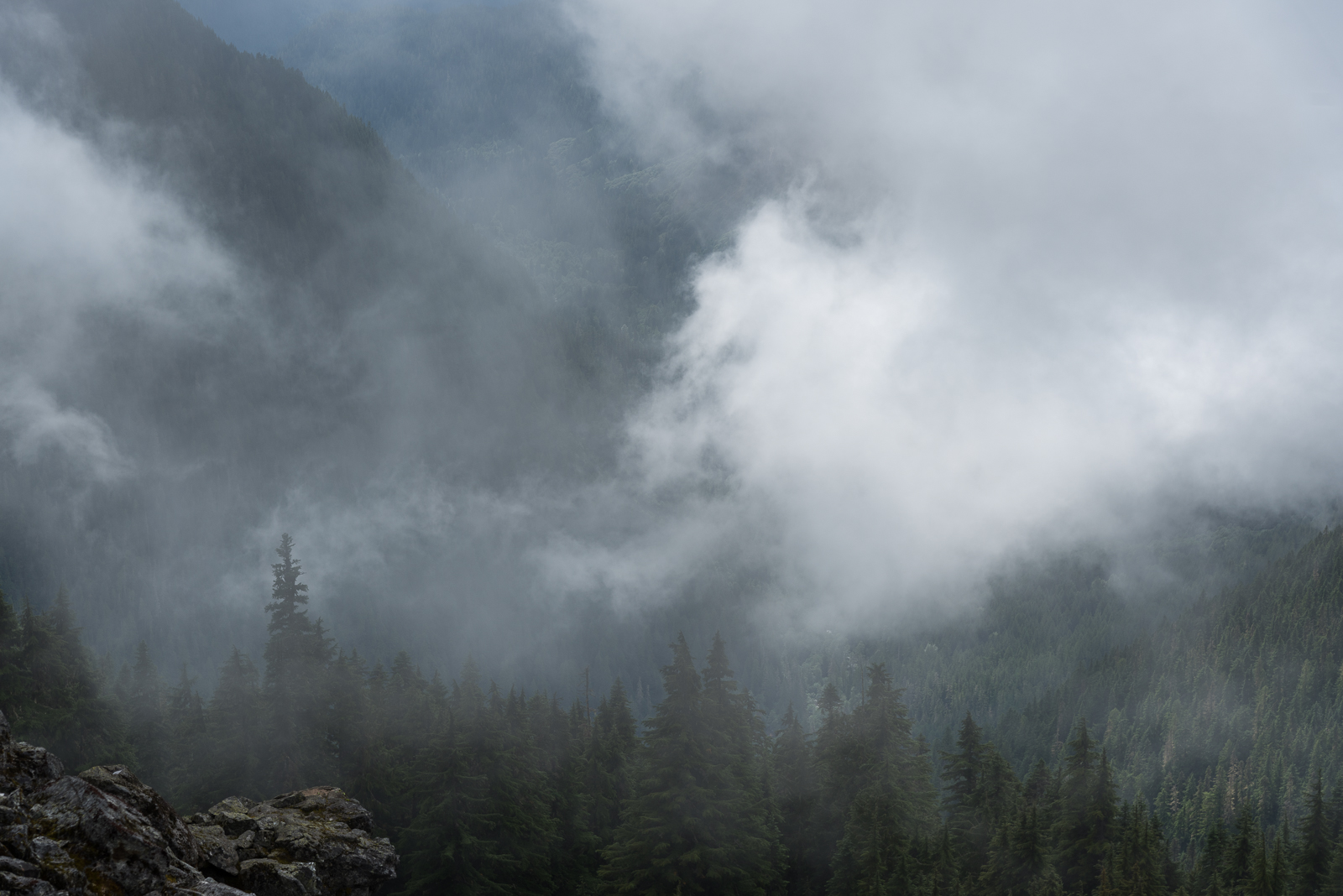
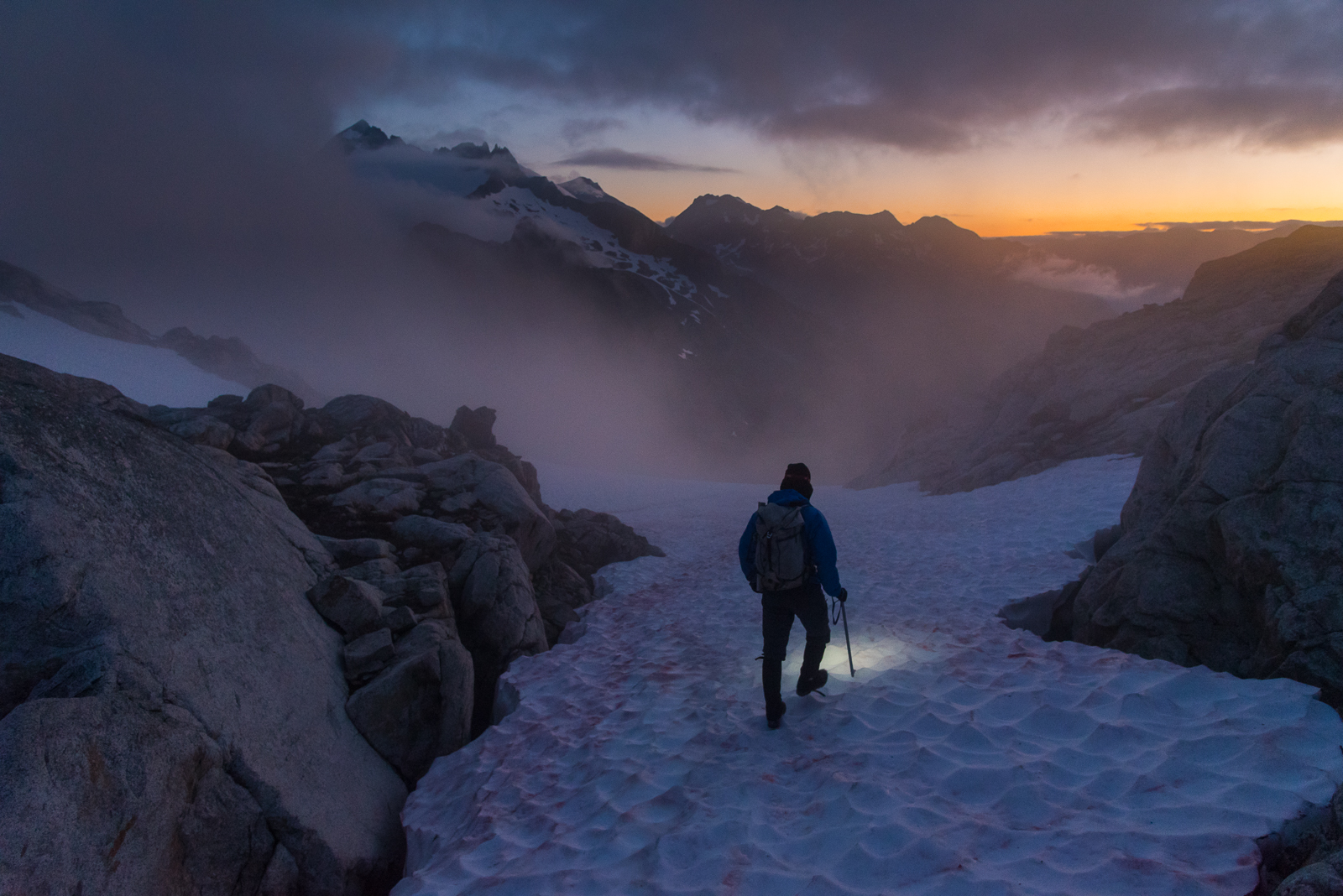
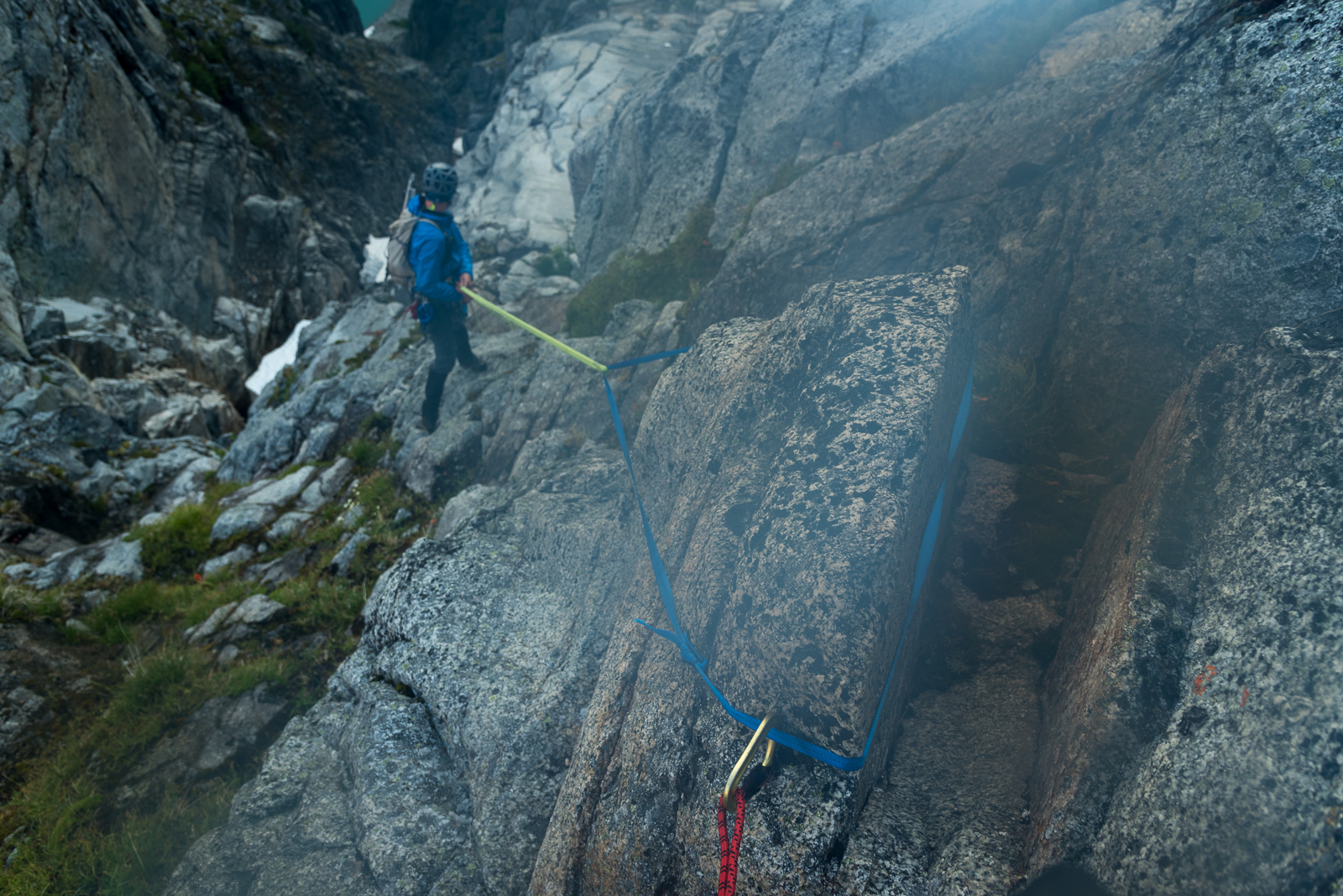 11 points
 -
Trip: Ruth Gorge - Kuriositeten and Mount Bradley plus others Trip Date: 04/26/2021 Trip Report: I am a little late in posting this because I had a 3 week Denali expedition right after this trip. So I am just now getting back into the swing of regular life and unpacking. Anyway I figured I would post up a trip report from the Ruth Gorge. We flew in on April 26 to the Ruth Glacier just below the East Face of Dickey. Man that is a face to dream about!! We were a team of 4 that functioned as 2 teams of 2. We just changed up partners a few times based on people’s route choice. The Ruth Gorge was Plan B and we didn’t know we were going to the Ruth until about 4 days prior to flying in. So we were pretty ill prepared with route research and overall beta (with the exception of the classic lines). Grosvenor, Johnson, and Wake (left to right), from the flight in. Talkeetna Air Taxi on the Ruth Glacier with Peak 7400 and London Towers in the background. April 27 - Our first full day on the glacier. It was warm and sunny and I teamed up with Robbie to head for Cobra Pillar and just see how the climbing was. We got up to the top of pitch 5 when the sun disappeared behind the mountain and it started to get cold. We were also less than impressed by the first 5 pitches. When the guidebook says “C1+ rotten or 5.11” you should probably just avoid that pitch! I led it and was literally kicking new footholds into the large granite crystals and hoping they wouldn’t crumble under my bodyweight. Needless to say we had no desire to go back with so much other good looking rock. Robbie on the 2nd pitch of Cobra Pillar. Robbie just after the traverse on Cobra Pillar April 28 - We scoped several lines and tried to generally figure out what lines had been done. Thankfully we had used our phone to screen shot several AAJ articles so we were able to figure out some of it. Our efforts were mostly focused on Dickey and Peak 7400 since they were the closest to camp. Scoping a potential ice line. April 29-30 - weather days. Snowed about 18 inches. May 1 - We scoped lines going south on the Ruth Glacier. Looked at stuff on Bradley, Wake, Johnson, and London Towers. We were starting to get a good sense of snow conditions based on aspect and finally figuring out where everything is. We did climb the opening 2 pitches of The Escalator on Mt Johnson. It was really fun alpine ice and it gave us a good excuse to use the ice tools and screws. There were a couple of steeper smears to the left that we hoped to climb but the ice was only about 2-3 inches thick and there wasn’t any rock pro available. Scoping "The Escalator" on Mount Johnson. Climbing up the first couple ice pitches on The Escalator on Mount Johnson. Great alpine ice! May 2 - Based on the conditions we found yesterday we deemed it prudent to give the mountains one more day to shed snow and get some freeze/thaw going so it wouldn’t be a postholing nightmare. We had brought a telescope so we looked very closely at a couple of lines that interested us and talked about what line to do tomorrow. A couple people of our group went over to check out the first couple pitches of “The Wine Bottle” on Mt. Dickey. Man that is an inspiring looking line! We watched them through the telescope. May 3 - I teamed up with Duncan to climb Kuriositeten (AI5, M3+, 800m). It is a “smaller route” that was first put up in 2008 on peak just left of 747 Pass. At 2500ft it isn’t really a small route but when you see how it looks sitting between the giants of Dickey and Bradley it appears small. The route follows a couloir splitting the east face of the peak. It is a lot of snow climbing but also contains some mixed steps and 3 distinct ice steps ranging from 15m to 70m tall. Honestly it reminded me of some of the climbing in Cody, WY, where you follow a twisting canyon/couloir always excited about what might be around the next corner. The crux is the final step. It is about 70m+ and the first half is pretty dead vertical. Thankfully the ice quality was great and we throughly enjoyed the position deap inside the slot. We had very little beta about this route so had only brought 7 screws. We were able to find rock gear for the beginning belay and then I just ran it out as far as I dared between screws. We still had to break it into 2 pitches as I found myself with only 2 anchor screws left after 35m. Duncan took the upper half and soon we found ourselves on the snow slopes above. This is a fantastic route in the Ruth and should see more traffic! One of the reasons we wanted to climb this route was to recon the decent from Bradley. One of the reports we had regarding Bradley, was to descend the “standard west ridge” but that party bailed down a face after not being able to descend the west ridge. Another report talked about descending to the Backside Glacier and walking way back around through 747 pass. Another report talked about descending the Bradley/Wake Col. To complicate matters CalTopo and Gaia both showed some weird topography anomalies on their topo maps. In fact both showed a 800-1000ft cliff coming off the back side of Bradley that looked very complicated to navigate around. The problem was the topo lines didn’t seem to match what we had heard in reports. Needless to say we were very interested in looking at the descent from the top of Kuriositeten. In the end we discovered that both Gaia and CalTopo were very wrong in their topography. In places it was off by 1000ft. What appeared to be a huge cliff was just a small snow slope that was easily walkable. We couldn’t see the whole decent but we felt much better about things after this day. Skiing over to Kuriositeten. It climbs the big gash on the peak in the middle back. Even though the line is 2500ft tall it looks small in comparison to Bradley (left) and Dickey (right). Duncan starting up Kuriositeten. Looking up from the belay at the top of the first ice step. Approaching the 3rd ice step crux. It is the narrow looking ribbon of ice way up in the slot. Duncan climbing up through the crux pitch on Kuriositeten. A fantastic route in the Ruth. From the summit of Kuriositeten looking over towards Mount Bradley. Descending the back side of Kuriositeten in the late evening light. May 4 - Rest day. May 5 and 6 - For the big goal of the trip we picked Mount Bradley. A couple of our party had started up the East Ridge of Bradley the day I had climbed on Cobra Pillar. They found deep unconsolidated snow on all northern aspects. Even though it is called the East Ridge the first 1/3 of the route is mostly on the north side of the ridge. So with no desire to go up that unconsolidated snow we searched for a new route. While looking through all of our screenshots from the AAJ we found John Frieh’s report about a linkup on Mt. Bradley. He and Dylan Johnson had also found bad snow on the start of the regular East Buttress. So with high hopes we set our eyes on their Link of “Season of the Sun" and the “East Buttress”. They rated it M5/6 and the route is 4500 feet tall. It was warm so our plan was to leave camp in the late afternoon and start the route in the evening. We were hoping that by this time the snow might start freezing back up from the day and we could avoid some nasty postholing by climbing through the night. We left camp at 4pm and but 5:15pm we were in crampons working our way up the initial snow slopes. The Season of the Sun route climbs on the right side of the SE face of the mountain and was originally put up by the Giri-Giri Boys. We were a little concerned about the reported M6 offwidth crux but figured we would take it one step at a time. After about 1000 ft of snow with short steps of rock and ice we arrived at the “crux”. We were pleasantly to find it full of ice (AI3). So after a quick romp up great ice and another pitch of low angle rock we arrived at the 2nd couloir. From here route goes up right then back left across snow slopes and around the end of a big buttress. This leads you into the big central gully about mid height on the face. The original Seasons of the Sun route cuts up and back left to stay on the face while we followed Frieh/Johnson’s variation back towards the East Buttress proper. It was somewhere in here that it got dark. Not pitch black but dark enough to warrant a headlamp when technical climbing. Several mixed pitches in the dark brought us to the East Buttress proper. From here another 2 long fun mixed pitches deposited us underneath a huge boulder. By this time it was getting light again and we were out of water. So we spent an hour brewing up and resting. The rest of the east buttress went by in a blur of simul-climbing including one section where I ran out of carabiners and slings and literally clipped the carabiner with all my nuts to a piton just so I could clip the rope in. We topped out on the summit about 10am. The decent was pretty straight forward although with more uphill than we liked. We just followed the main ridge to the west and then cut down and south to follow a different ridge line back towards the Bradley/Wake Col. Unfortunately this led us to wallow up several northern aspects of unconsolidated powder snow. Nothing like trenching in the afternoon sun when you have been up all night! We finally reached the col and took a short break to drink the last of our water and finish up our food. Then it was 2000ft of easy walking down to the last obstacle…the icefall between Wake and Bradley. From the top of the col it appeared to be less broken up on skiers left. But when we arrived skiers left there was only sagging “snow bridges” and open crevasses. We were able to end run everything far left and then rappel over the last bergshrund by leaving a bomber fixed nut in the rock. Finally home free we trudged wearily back towards the base of the route. The snow was like a trap door. Most steps you were fine but every few steps the door would open and suddenly you would be postholing to your thigh. We were excited to be back to our skis were the going suddenly got easy! Rolled back into camp at 7:30pm for a 27.5hr RT time. Starting up Seasons of the Sun. The M6 offwidth crux....we got lucky with fat ice conditions and easy climbing. Typically route conditions...soloing steep snow. About 1/4 of the way up the route now. Nearing the top of the East Buttress proper......during one of the long simul-blocks. The route up Bradley's 4500ft face. This is a linkup of Seasons of the Sun and the East Buttress first done by John Frieh and Dylan Johnson. Descending back down from the Bradley/Wake Col after climbing Mt. Bradley. May 7 - Weather day. Snowed off and on all day. May 8 - Snowed a bit then cleared up in the afternoon but wasn’t enough time for much more than a casual ski. It was warm again. We watched several ice lines we had been looking at fall off the walls. Our camp below the east face of Mount Dickey. Mount Bradley is just to the left of center in behind. May 9 - With the warm weather we opted for rock climbing. But the sun didn’t burn the clouds off until noon so we got a late start. We decided on Goldfinger which is on the Stump. We started climbing and were happy to find good quality rock. The rock quality was WAY better than the first few pitches of Cobra Pillar. Unfortunately due to our late start we lost the sun and our warmth about the top of pitch 6. We contemplated going a few more pitches but opted to just call it since it was unlikely we would top out anyway with such a late start. The climbing was very good though and it would be a classic anywhere in the lower 48. Coming up to the belay at the top of Pitch 2 of Goldfinger. Climbing pitch 6 of Goldfinger. It is fantastic climbing on very good quality rock! May 10 - With bad weather in the forecast for the next several days we opted to fly out. Several of the team members had flights out of Anchorage on the 13th so we didn’t want to be stuck on the glacier and miss flights. TAT here to pick us up. The ever changing clouds giving Mt. Bradley a moody look as we departed. Gear Notes: Alpine rack, heavy on screws for ice routes, heavy on cams for rock routes. Approach Notes: Fly in with Talkeetna Air Taxi, then ski/hike to climbs.
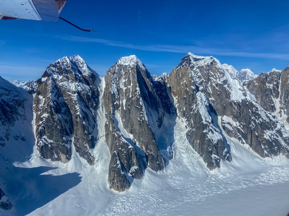
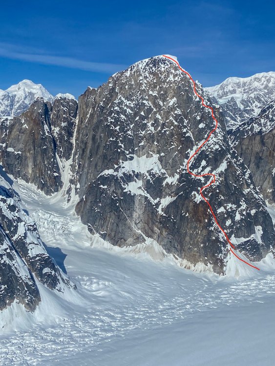

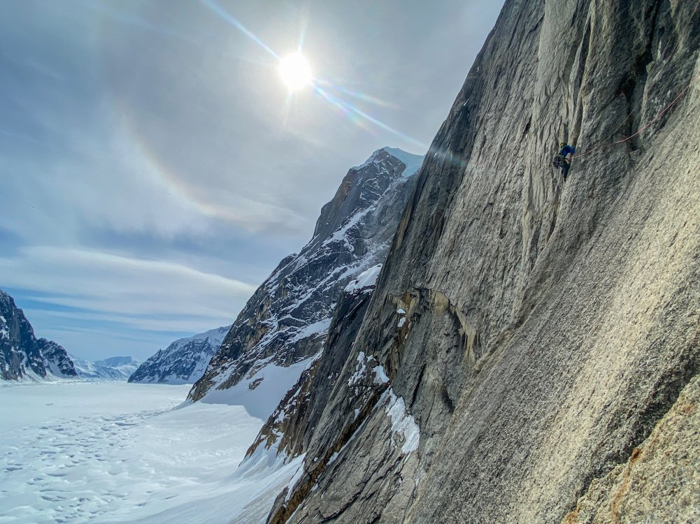
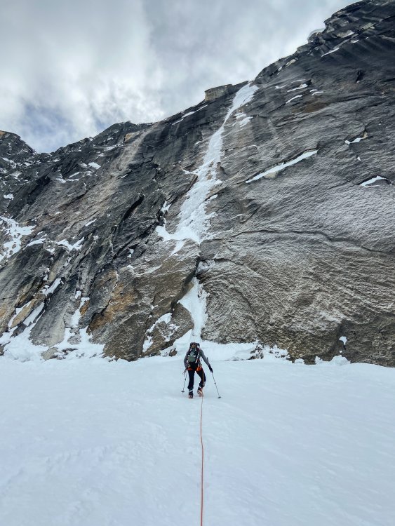
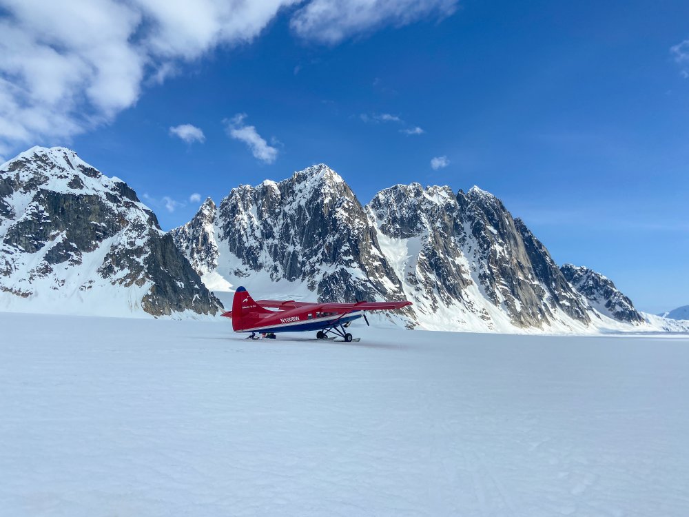
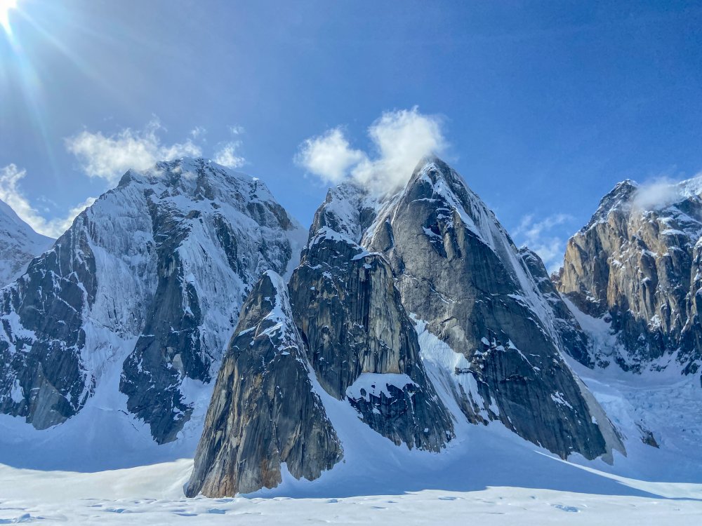
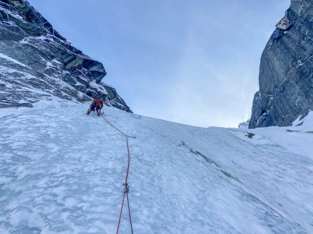
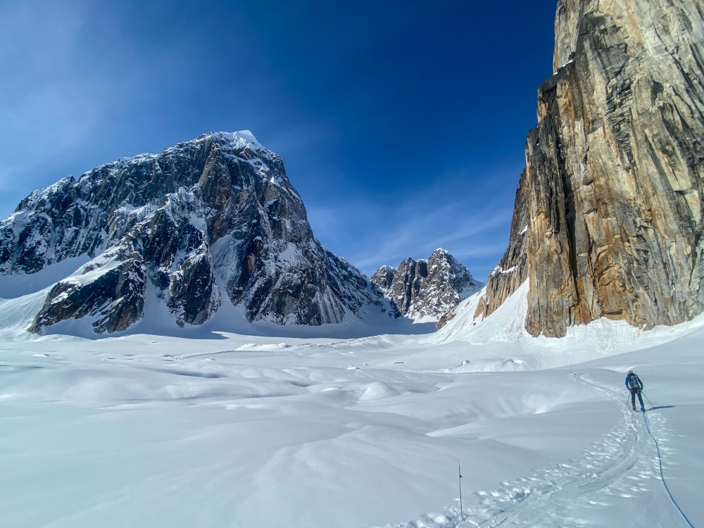
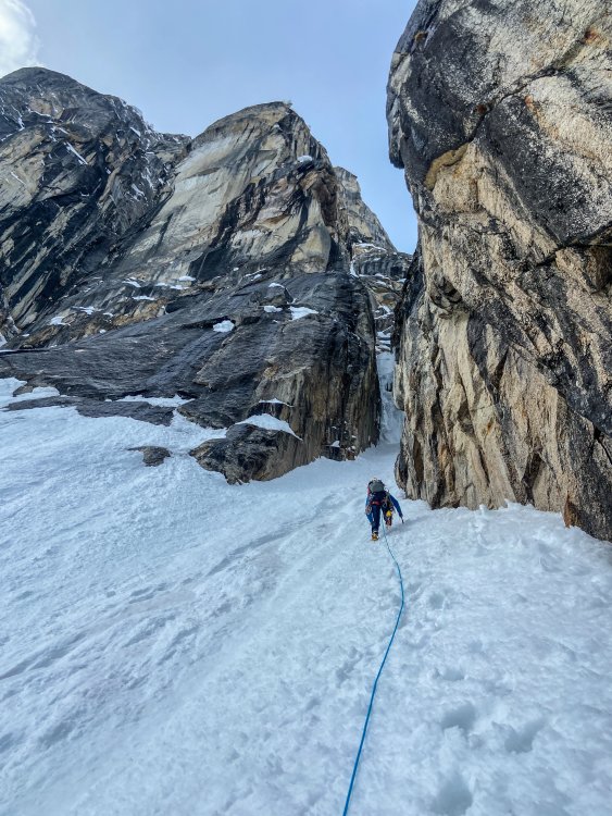
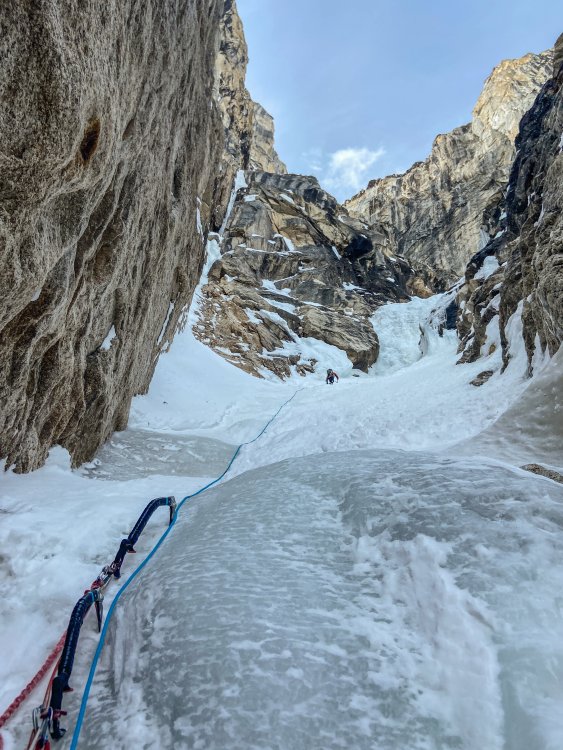
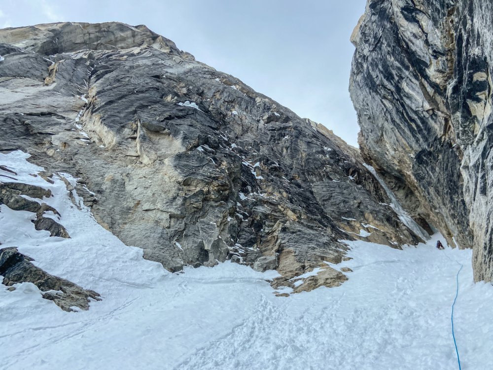
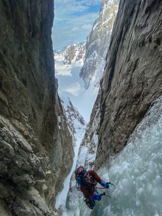

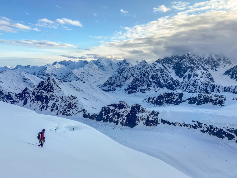
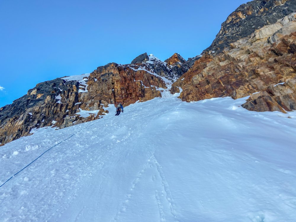
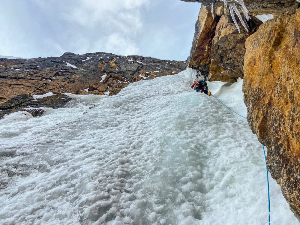
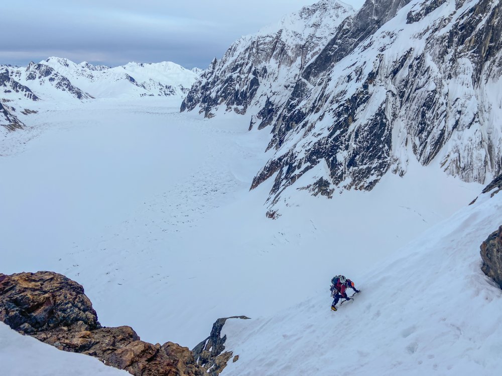
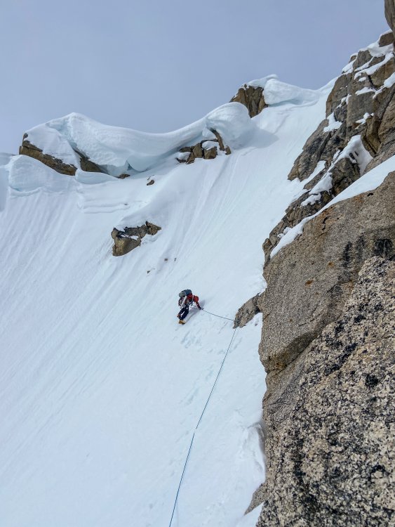

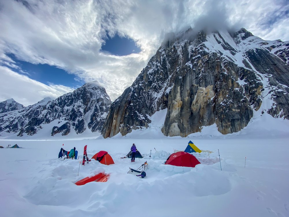
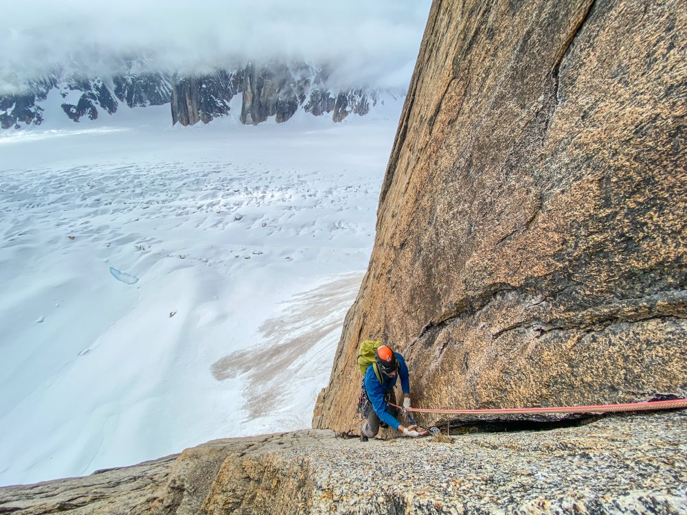
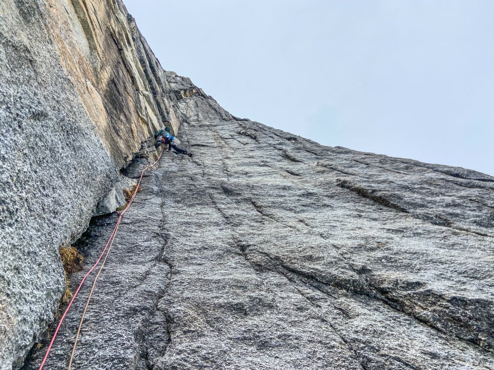
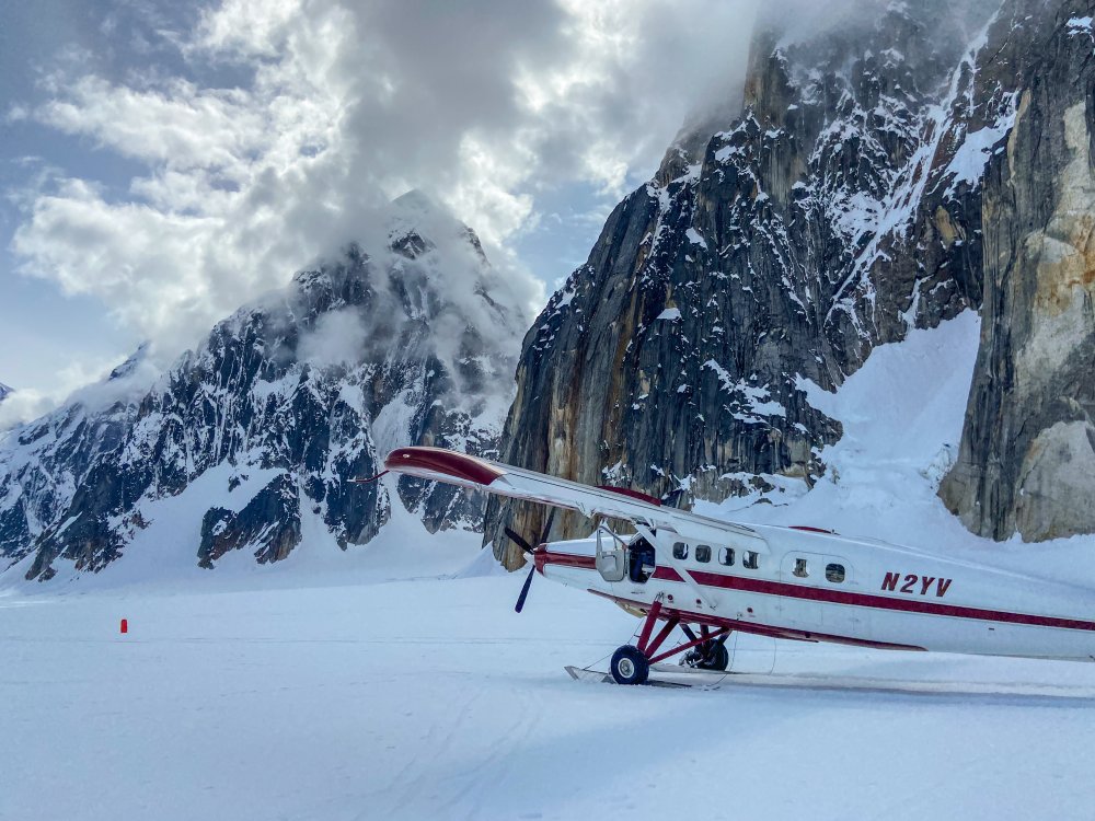 11 points
 -
Trip: Northern Pickets - Mt. Challenger Middle Peak & FA of SW Ridge of Challenger 5 (Peak 7,696) Trip Date: 08/18/2021 Trip Report: Northern Pickets, image pulled from publicly accessible Google Book Preview of Cascade Alpine Guide, Vol. 3. The SW Ridge of Peak 7,696 is the righthand skyline. Fair use intended. TL;DR: Climbing partners Joe Manning (manninjo) and Joseph Montange ventured up the wild and rugged Baker River valley in mid-August 2021, seeking a shortcut into the Northern Pickets. After several days of travel, we climbed a very fun, new, five pitch, 750', 5.7 route on the Mount Challenger massif, the Southwest Ridge of Peak 7,696 (aka Challenger 5). Baker River Mandatory wading on day 1 starts several miles upriver Time to go to the beach! It’ll be fun: miles of sandbars and loads of deep blue swimming holes. Wading up the river in tennies. Getting to curl our toes in the sand. Sounds promising as a way to approach the remote and reasonably inaccessible Picket Range. Relaxing, beachy-type vacations are not my norm, so the Baker River seemed like the best of both worlds. Get the summertime water fix AND have an adventure scoping out the “direct” route into the Northern Pickets. The approach, documented in the 1968 Tabor and Crowder guide, has no record of folks actually going all the way in that way in the last 50 years. I’m sure some folks have, only to be swallowed by brush and never seen again. Mike Layton wrote in 2006 that John Roper “thoroughly sandbagged” him and Wayne Wallace on their approach to Spectre Peak by suggesting the Baker River. Following “six hours to travel a mile and a half along the Baker River we bailed. Ahead were three more miles of rain, brush, and swift water followed by a 5000-ft climb to the ridge… after our eight-hour false start, we dragged our soggy asses and 25-lb packs to the Hannegan Pass parking lot to restart the trip.” Pioneer Ridge (center-right) and the confluence of Bald Eagle Creek and Baker River For our part, we wanted to push beyond the Pioneer Ridge version of the Baker River approach and continue up the river, to the confluence of Picket and Mineral Creeks. From here, a spur ascending all the way to the Mt. Challenger massif would provide an escalator into the alpine. In fact, after all the beach time, we’d probably need to burn off some of those beach-induced calories. In all seriousness, there’s really no easy way into the western side of Northern Pickets. For a fit and competent party, stocked with full climbing kit and several days of food, Easy Ridge, Whatcom Pass and Peak, Eiley Wiley, even carrying over Fury all take at least two days. Sometimes fast and light parties get to Perfect Pass in a day for a two-night blitz of Mt. Challenger. But if you want to do something on the west side of Spectre, Phantom, Ghost, Crooked Thumb, anything on the south side of Challenger, it's two days just to get there (and two more to hike out). It was with this knowledge that we set off up the Baker River, hoping to find the equivalent of the Northwest Passage into the Northern Pickets. While we may not have found quite that, we did get to spend several days in one of the most rugged, wild, untrammeled and primeval wilderness areas this side of Alaska. The fact that access started less than a 90-minute drive from home was remarkable. The sheer quantity and apparent quality of the granite cliffs spilling off the sides of Pioneer and Mineral Ridges is mind boggling. It’s a beautiful looking mix of Index town walls, Squamish, Darrington, Yosemite, name any notable granite bigwall area. Were it not for a lack of trails and fixed anchor ban in the park, this zone would be a serious destination. As it exists today, it's worth admiring the incredible views every step of the way in. Just don’t forget to watch your step along the way. For folks who find off-trail travel “not so bad,” the stats are compelling. It's less than half the distance of any other way into the range, and less than half the elevation gain. There is no penalizing elevation loss. The approach lacks the objective hazards (e.g. icefall traversing around Whatcom Peak) and subjective hazards (e.g. exposed, loose scrambling over Whatcom or across the Imperfect Impasse) one would find coming in from other directions. The Baker River is a late season approach - the river needs to be low enough to regularly ford and wade. Most of the river walking we did was shin to knee deep. A pair of low top mesh approach shoes worked perfectly to hike in and out of the river. We got waist deep in the river once or twice, though that may have been avoidable. Make sure you line your pack with a garbage bag or other waterproofing. Sections of mandatory bushwhacking punctuate the river walking There is unavoidable brush, including some that registers as “BW5” on the Cascade Brush and Bushwhack scale. As with most off-trail approaches, the bushwhacking was far worse going in than coming out. Only a handful of times did patience grow thin and tempers flare due to frustrating travel conditions. Another dead end in the brush led Joseph to remark that “it wouldn’t be an adventure if there were no doubts.” At this point, with the hour growing late on the first day, we were having some serious doubts about the viability of the approach. After a breather and channeling the power of positive thinking, we made it through the worst of the brush and found ourselves a mossy camp in open forest next to a brook and several large boulders. With full packs loaded for climbing out of a base camp, it took about the same amount of time to go in this way compared to past experience with the more-frequently documented approaches. The crux of the approach, encountered on day two for us, was the wooded spur above the confluence of Mineral Creek/Baker River and Picket Creek. The wooded spur with approximate line and color showing slope angle It starts out innocuously enough. Low angle, brush-free walking past ancient cedars the size of skyscrapers, some well over 15 feet in diameter, soon gives way to steeper and steeper hillside. In what could be the toughest 2,000 feet of elevation gain anywhere, you’ll fight insanely thick brush, mostly saplings and huckleberries, all at a gradient of over 30 degrees, while dodging cliffs including a significant band at about 4,000 feet elevation. Helmets and dirt-ponning may feel necessary to descend safely. Steep huckleberry Typical brush thickness on the wooded spur Several cliff bands are hidden in the brush of the wooded spur Perhaps the effort overall is greater going off trail, though that is going to vary individual to individual. Climbers with their brushmaster degrees, good route finding skills and smaller, lighter packs could conceivably make it to the Challenger 4/5 col or Phantom alp slope camp (or pretty close) in a single big day via Baker River. We broke out of treeline on the afternoon of our second day, hiking into a thickening misty fog. Wonderful camping exists there on grass patches among the heather fields next to perfect 250 gallon tarns. Bring a water filter for the tarn water. Camping on a natural grass tent pad next to water around 4,900 ft Our third day, we woke up to driving rain - not the forecast we hiked in with. It broke into a light drizzle by midmorning and up the alp slope ridge we went, reconning for a higher camp. By midday, an updated forecast gave us a limited window to climb the next day only, August 18th. Chance of showers returned the afternoon of the following day, August 19th. Being well provisioned for several days of rock climbing, the change in weather was disappointing but we’d have to make due. Resigned to the revised forecast; Mineral Mt. in background As I’ve learned in the Pickets, 20 or 30% chance of showers is pretty much 100% chance of rain and low-to-no visibility. We ended up moving camp on day three just a half mile further up the ridge, to a larger patch of grass with an even deeper little tarn and mystifying views of Whatcom Peak, Mineral, Shuksan, Baker/Kulshan and numerous other mountains. We elected to leave base camp there on the ridge around 5,200 ft and go light above. Camp 2 on the ridge, Whatcom Peak in the mist and Perfect Pass at center right We had big (for us) ambitions for our week, yet somehow even the best-laid plans seemed to get waylaid by weather and slowed down by river crossings, vine maple, cliffs, huckleberry, and route finding. Southwest Ridge of Challenger 5 (Peak 7,696), 5.7, 5 Pitches, 750’, Grade II Rock climbing can be just plain Type I fun. You’re outside, with good company, in good weather, using your brain and body to briefly overcome gravity, dancing with the minerals, having a jolly ‘ol time. For whatever reason, granite especially lends itself to this kind of climbing. Joseph contemplating existence on the summit of Mt. Challenger's Middle Peak After scrambling Mt. Challenger’s Middle Peak on day four, Wednesday morning, August 18th, and considering different options for more climbing, we circled back to the south face of Challenger 5 to scope out some pretty neat looking rock. The granite was white to dark with a golden burnt orange in places, peppered with blocks, flakes, and large chicken heads. Fun scrambling to contour back west under Challenger 5's south face Anywhere else these cliffs would be stacked with moderate trad lines. We contoured all the way around the south face until there was nowhere left to go. The southwest ridge dropped off down the imposing west face. Above, a distinct ridgeline ambled up towards the summit. Belay at start of route The route started from a broad, jumbled, and blocky ledge system roughly where the seasonal snow line of the SW ridge ends and the more black, lichen-stained rock begins. If you were hiking directly up the ridge from below, it might be possible to add another pitch for fun, but we cast off from the highest “scramble accessible” point. Climbing on pitch 1 The first pitch went up slabs, followed by a left-facing corner with a laughably fun 5.6 hand crack. Above the corner, a good stance on a ledge set up a short finger crack to another ledge. The rock was exceptionally solid and remarkably splitter, with bomber gear exactly where you might want it. Topping out pitch 1 Starting pitch 2; camp, approach ridge, and Baker River all lower left The climbing went for four more pitches like this, ledgy yet exposed ridge climbing punctuated by fun crack segments. Every roughly 40 - 45m pitch ended at a spacious belay ledge with a slingable horn or solid crack for gear. Views and position on the peak were something to behold. Climbing on pitch 2 Pitch four was the standout, with an improbable and slightly intimidating step right onto the exposed face after a short offwidth pillar. A horizontal traverse with a few hundred feet of exposure led to a straight up crack system culminating in another perfect hand crack, which started at red camalot and ended with a good little stretch of near-vertical number 3 jamming. A final mantel ended on a flat ledge big enough to park a bus on. Awesome exposure and jamming on pitch 4 Huge belay ledge at top of pitch 4 The final 60m pitch cut hard left, off the ridge and onto the west face via an unmissable ledge system. A blocky and slightly loose gully led directly to the summit, with the headwaters of the Baker River 4,000 feet below nipping at our heels and Shuksan and Kulshan swirling in the clouds to the west. Final climbing to the summit As soon as it came in, our weather window was on the way out. Within 15 minutes of arriving on top we were getting engulfed in the mist. We’d left our axes and crampons at the base of the route, and not knowing there was a scramble route off the peak, we elected to rap the south face from the summit and contour back to our gear. In hindsight, had we carried glacier travel gear, we could have descended to the north and potentially gotten back on the glacier, climbed back up to the col, and returned that way. In any case, two raps with two ropes got us off the steep terrain. We retrieved our gear from the base and headed back down the ridge to our 5,200 ft camp, arriving just in time for an incredible sunset as the clouds broke once again. A view of our route from the approach ridge Descending on the approach ridge Back at camp Deproach With the chance of showers in the forecast, we felt good about two summits, a new route, and three nights camped out on an incredible ridge. Now all that was left to do was to reverse miles of steep, trailless wilderness back to civilization. 40 degree huckleberries on the descent Finding the "secret passage" through a major cliff band; we were prepared to rappel, yet managed to avoid it on the way down We camped at the beach for our final evening, near the confluence of Bald Eagle Creek and the Baker River. There was enough sand to walk around barefoot and relax, taking in views of Scramble Creek falls and the North Ridge of Mt. Blum. Surprisingly, someone had camped there in the days we were up high and had left a fire pit, complete with charred logs. One might think the novelty of wading down a river would wear off by the last day of the trip, but surprisingly it didn’t. Out the way out, we knocked over a handful of cairns we made for ourselves on the way in. The only other sign of people we saw was the fire scar and some fishing line at the final campsite, which we packed out. It'd be great to keep it that way for the future. My opinion is this approach is destined to remain in obscurity when “easier” approaches exist, but it is a truly direct and viable way in to the Pickets. Having the right attitude about brush would help immensely. Walking in the river beat the heck out of the alternative Take only pictures, leave only footprints In the days since, I’ve been dreaming about the walls back there, packrafting part of the deproach, scheming about another trip back into the wilderness of the great nearby. It’s adventures like these that, for me, climbing in the Cascades are all about. Many thanks to Joseph for the great company, partnership, use of photos, and willingness to try something different. Gear Notes: Extra shoes for wading, rock climbing gear to #3 camalot, crampons/ice axe for glacier travel Approach Notes: Starts from the Baker River Trailhead. See Tabor and Crowder's "Routes and Rocks in the Mt. Challenger Quadrangle" and Beckey's "Cascade Alpine Guide, Vol. 3" for more approach details.
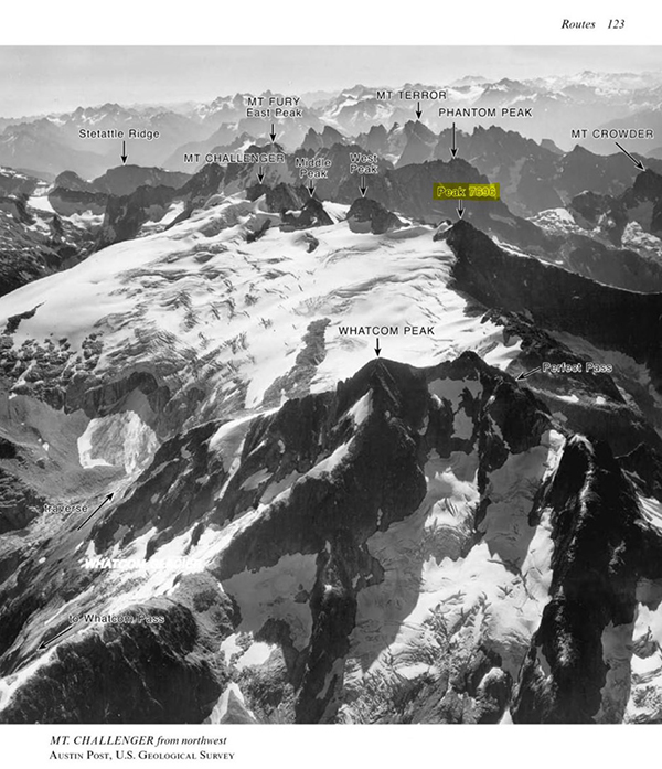
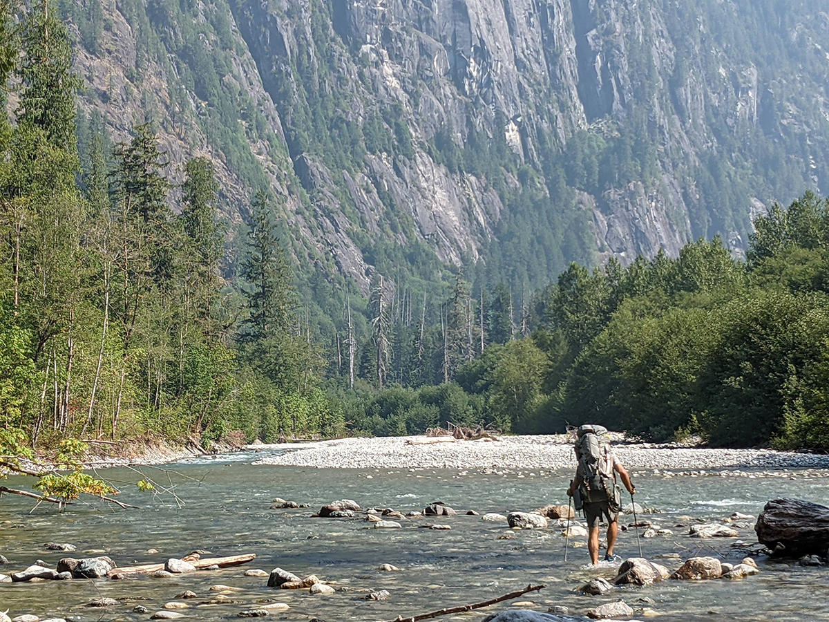
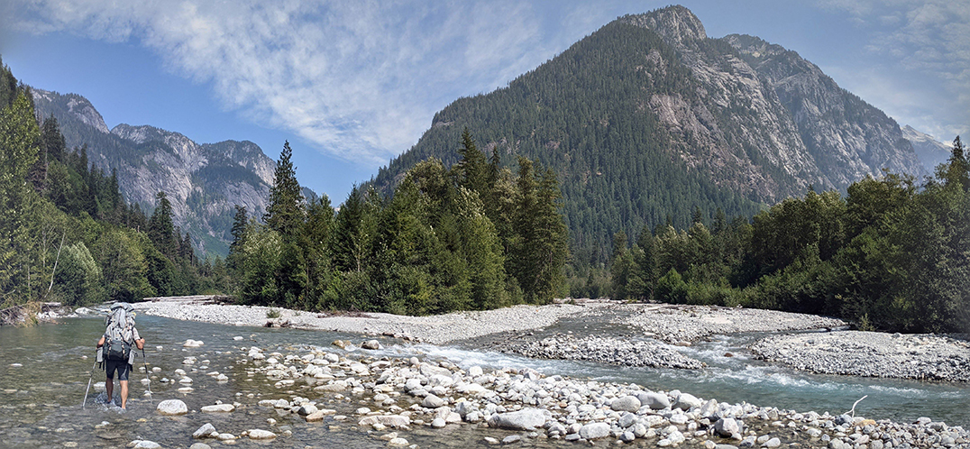
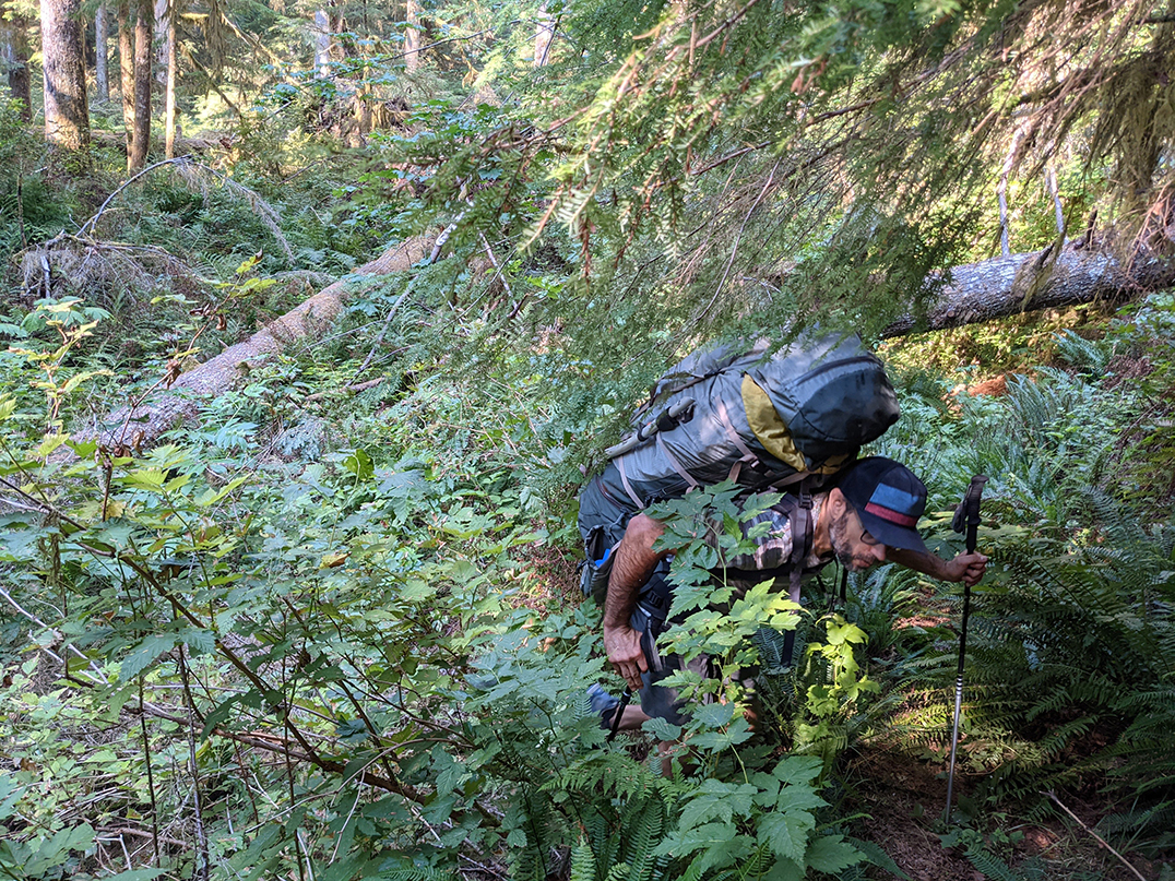
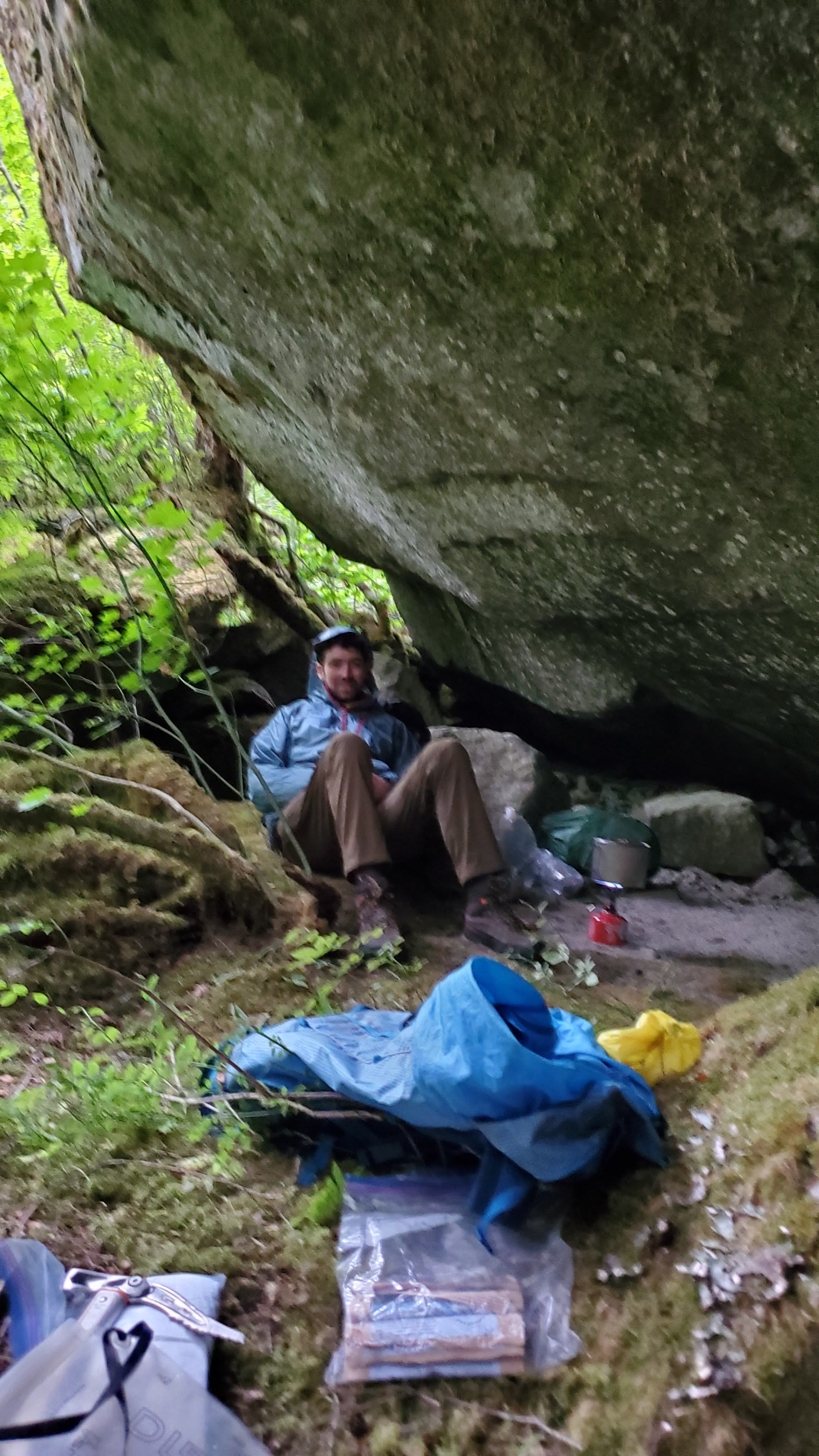
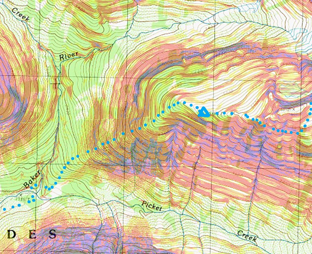
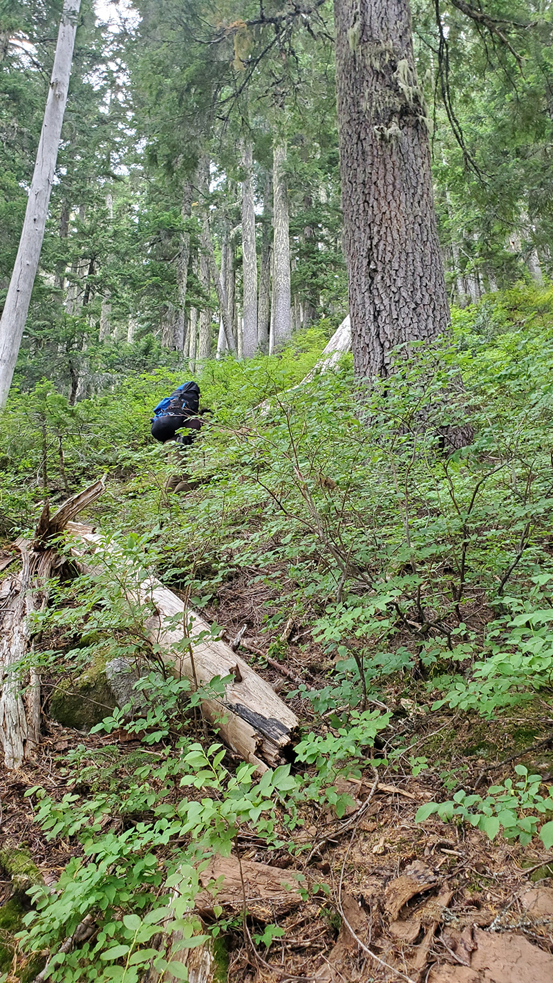
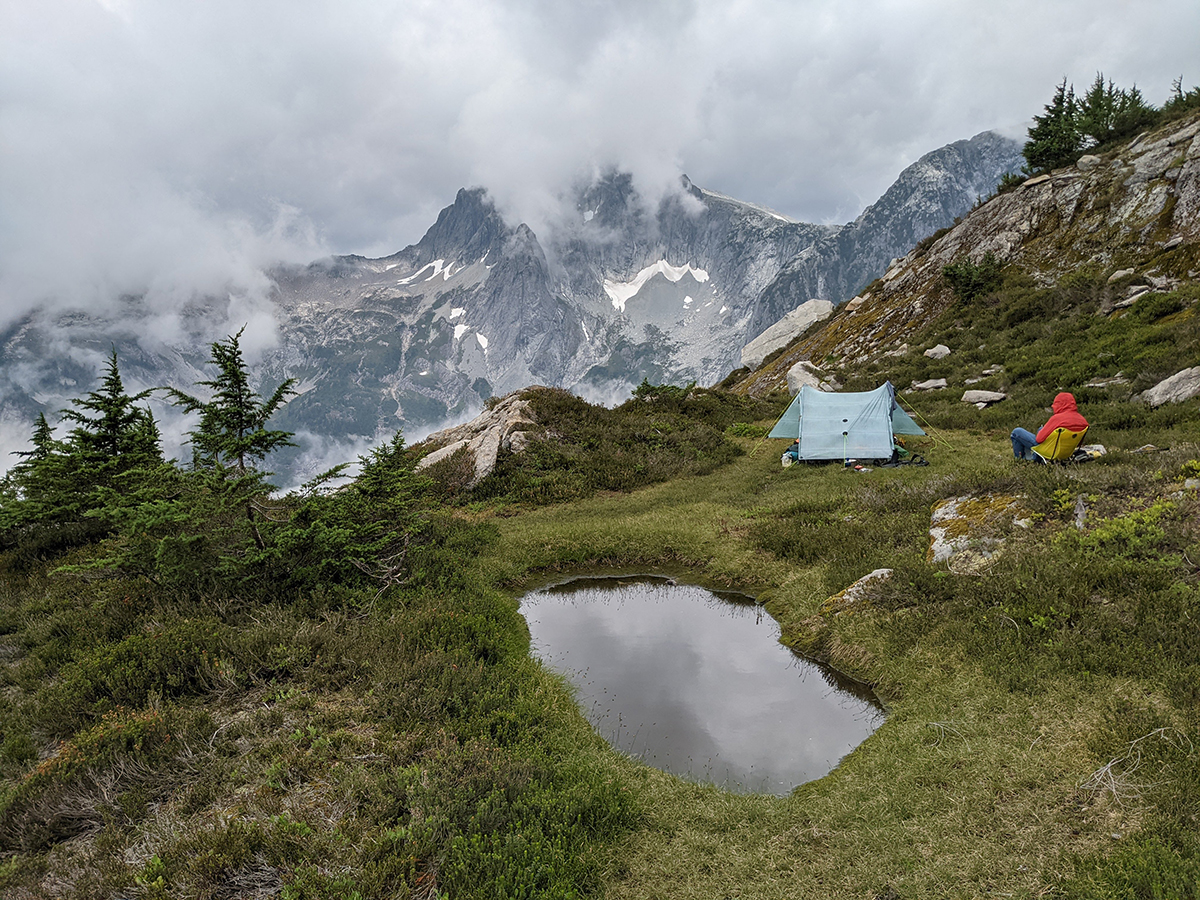
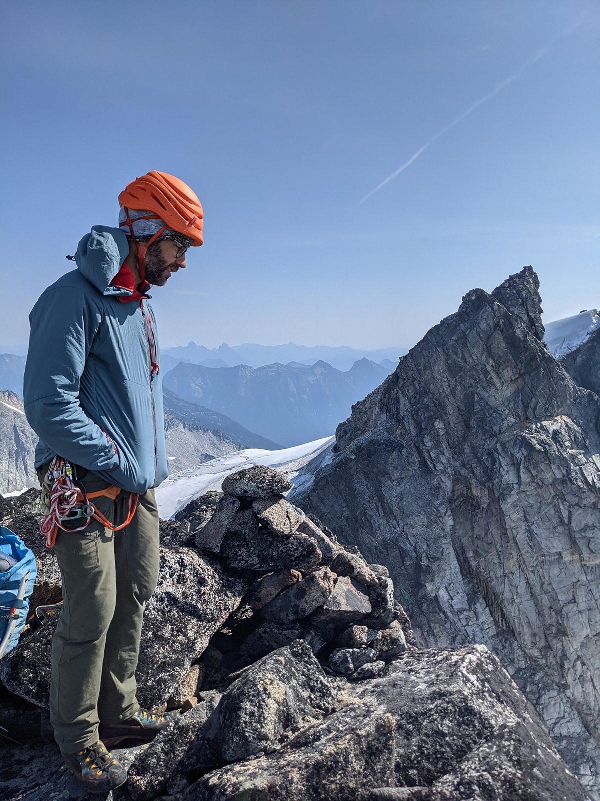
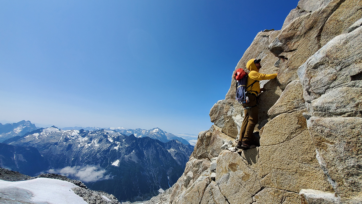
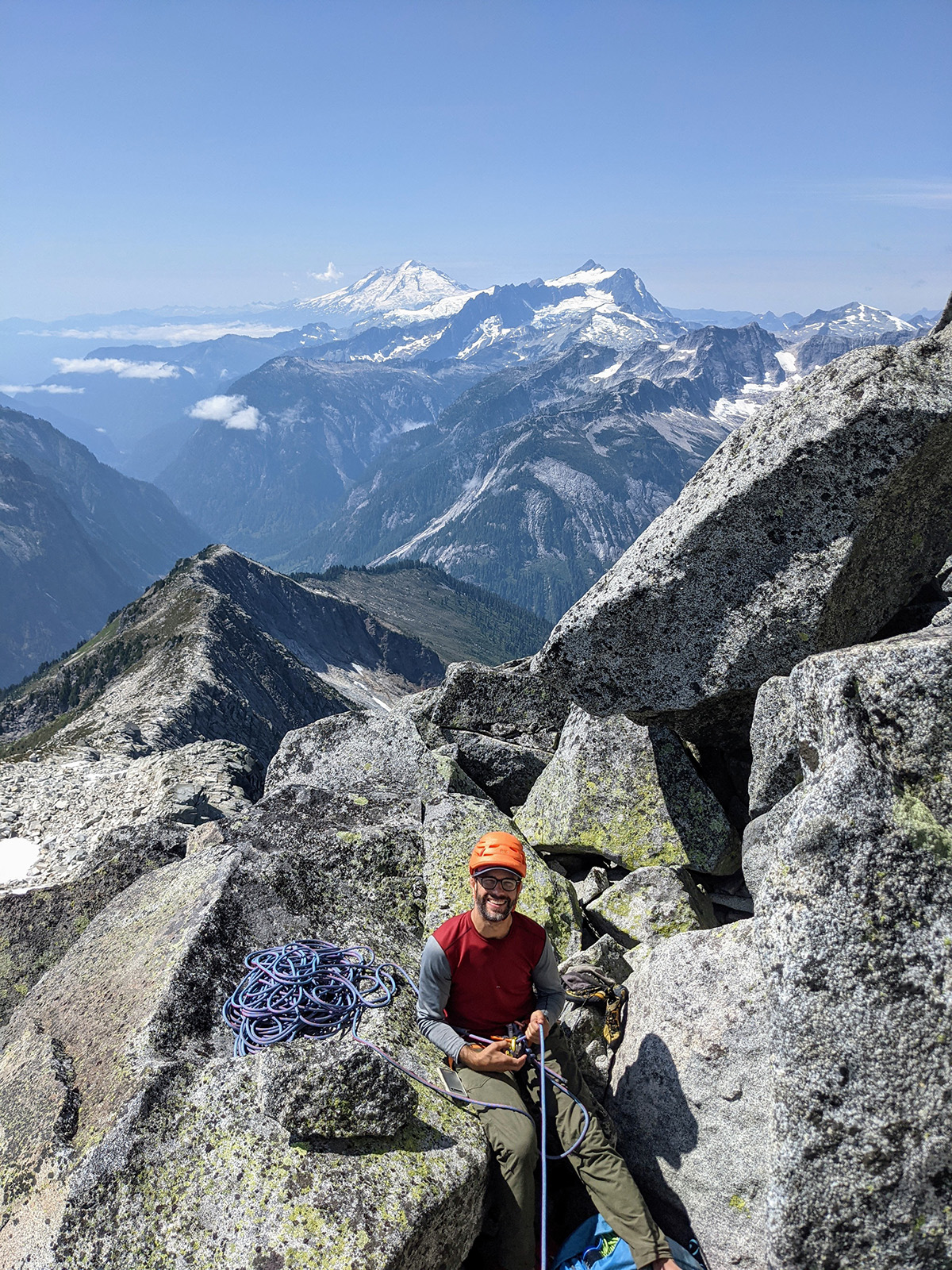
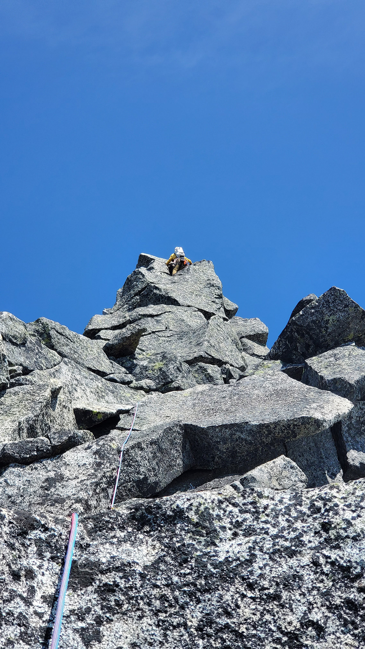

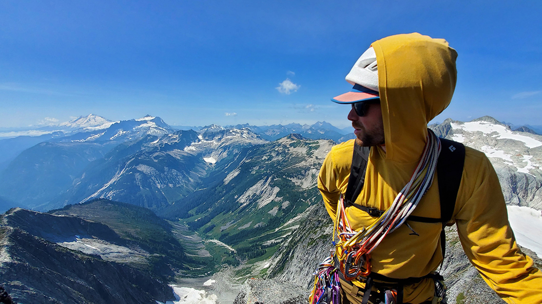
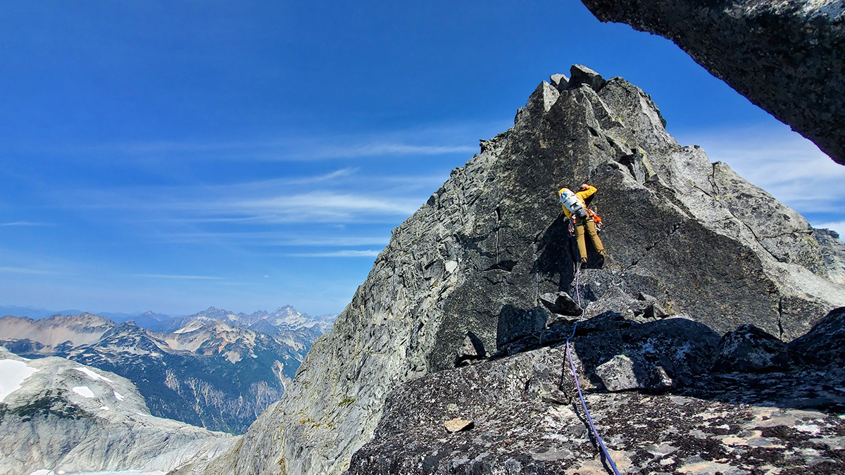
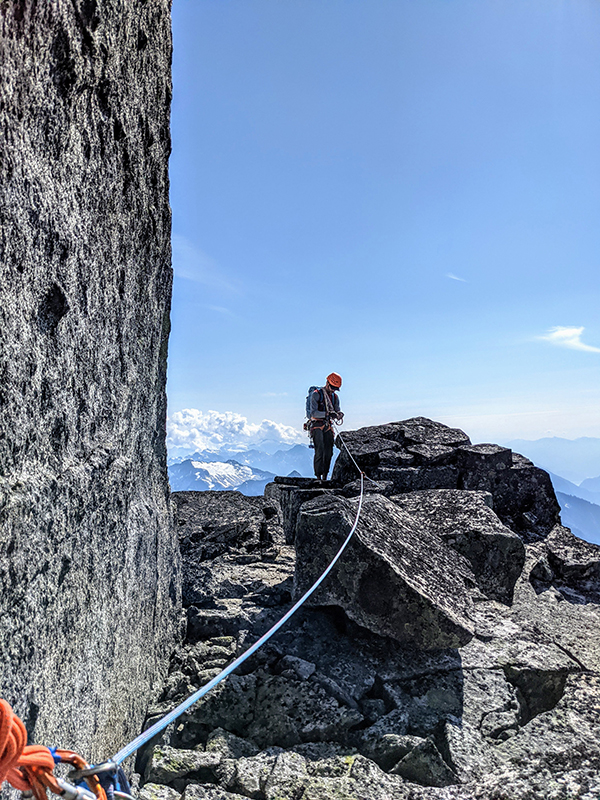
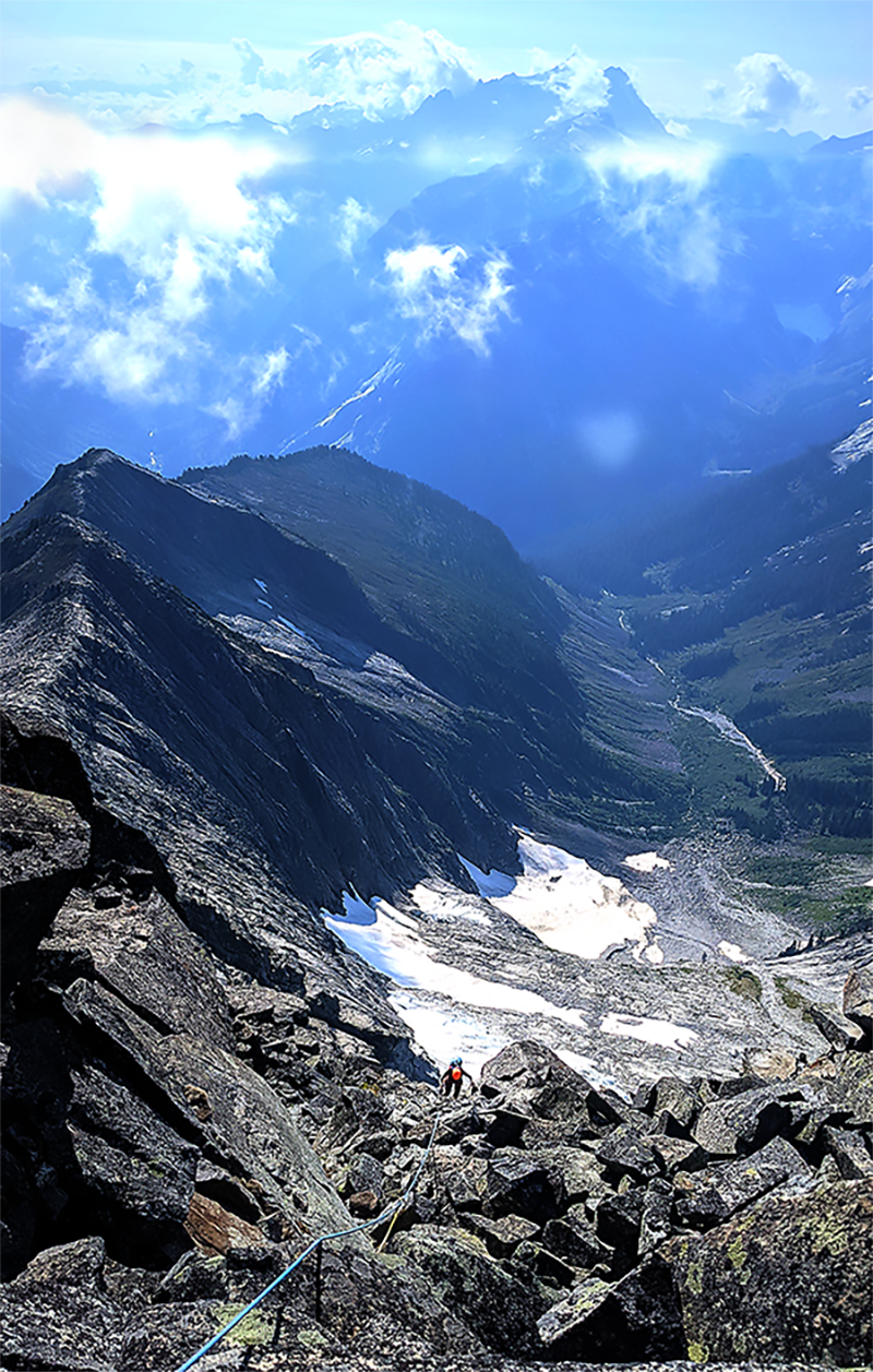
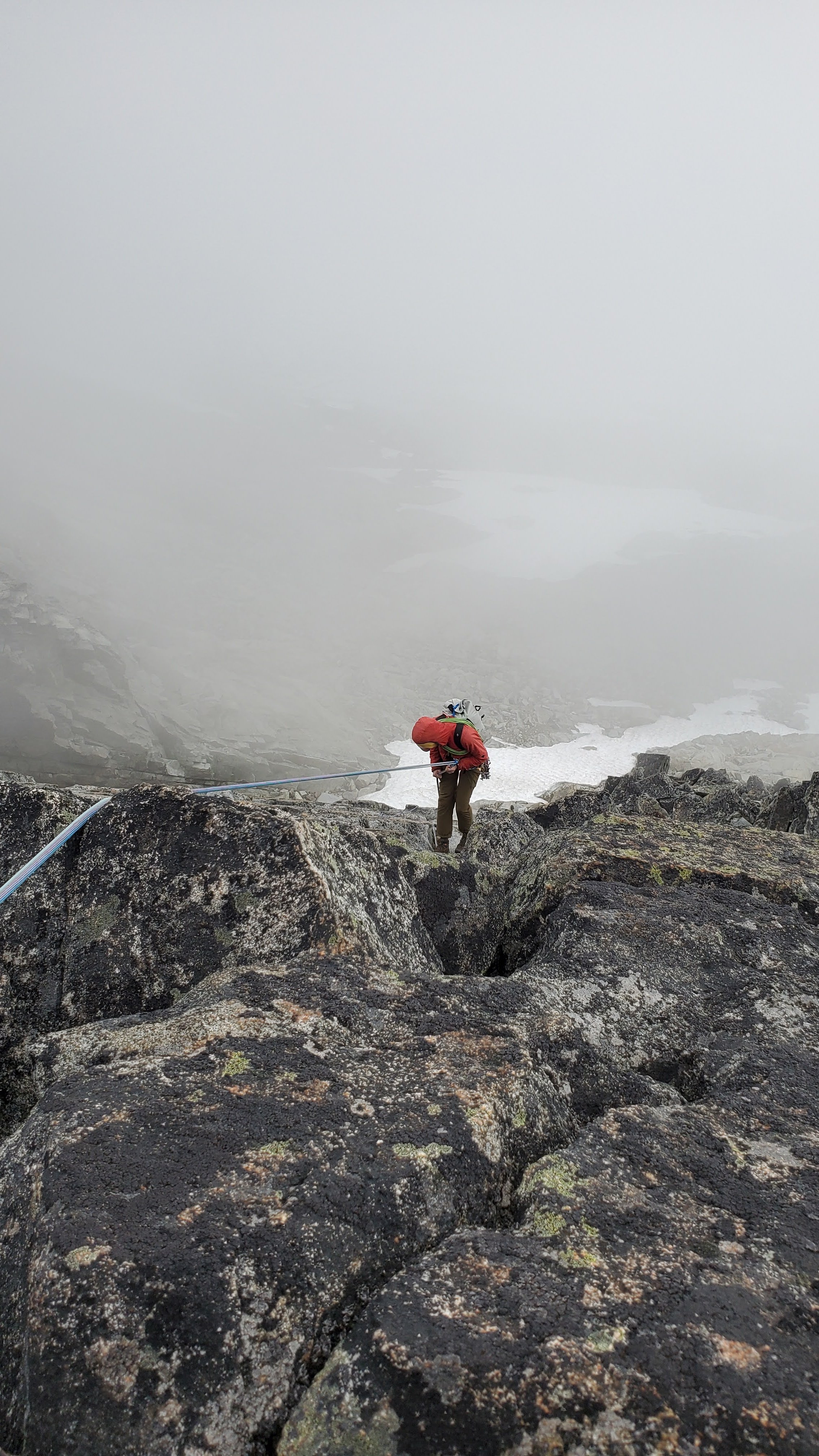
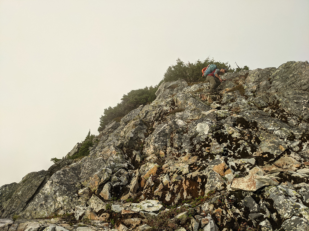

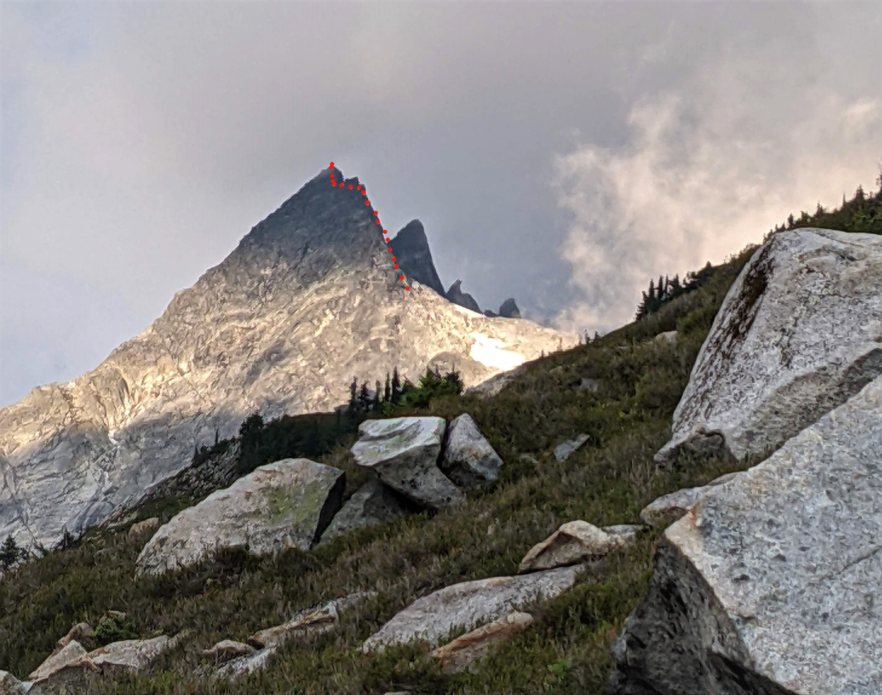
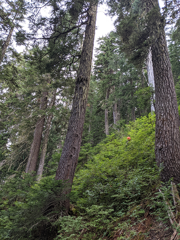
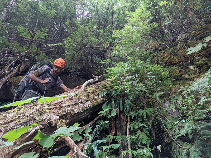
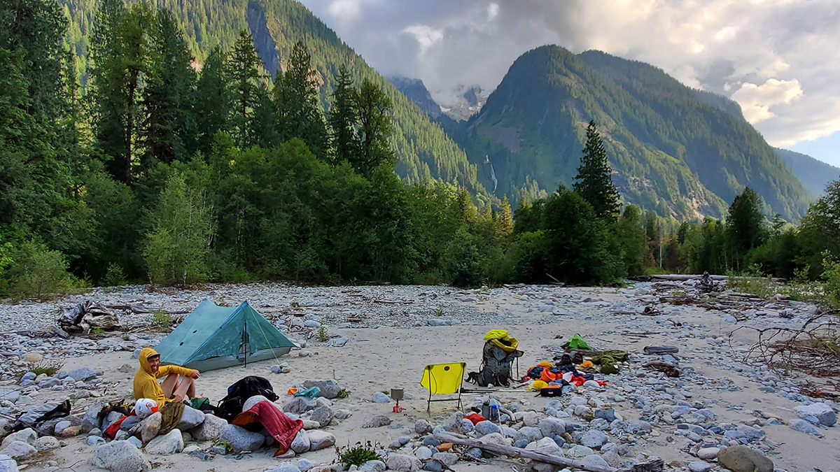
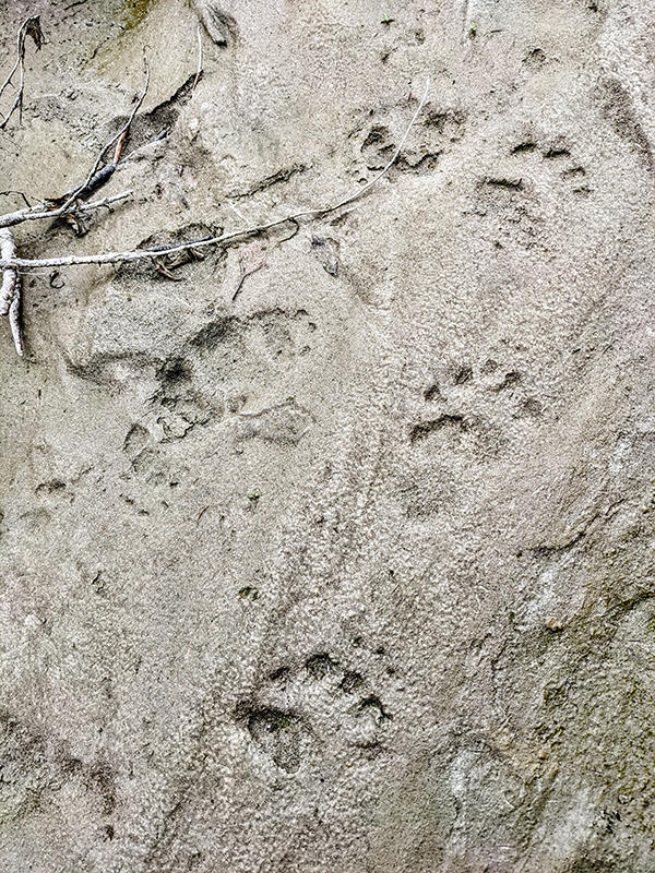
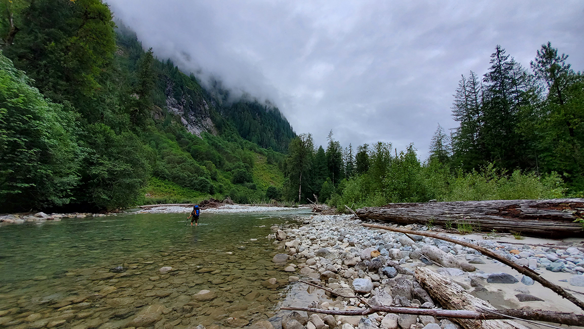 11 points
 -
Trip: Mount Goode - Megalodon Ridge Trip Date: 07/19/2021 Trip Report: “Hey bear!” I shout, followed by a convincing monkey call from Sean. We are only a couple hundred yards away from the trail, but swallowed deep in the eight foot tall slide alder of the North Fork of Bridge Creek. Maybe we’re off route, maybe there is no route. A couple days prior Sean and I had been throwing around ideas for the weekend. Sean was interested in something hard on CBR, while I was craving some choss and adventure. Being the great friend and partner that he is, Sean agreed to my idea of Goode, and adjusted his schedule to fit mine. Meeting at the parking lot on Sunday, I ask Sean how comfortable he is soloing most of the ridge. He’s psyched on the idea, and I’m psyched to slim down the rack. I ditch the 4 and a few other pieces. With that I grab a couple bubbly waters to stash in a creek along the way and we’re off. In classic fashion, Sean takes off jogging almost immediately, it feels so good to be moving. The hiking flies by and we soon find ourselves stumbling down an alder infested hillside down to Bridge Creek. With no obvious entry point on the other side, we start hiking upstream along the river bank until the alder overtakes us, and we’re forced to wade up stream in the biting glacier melt water. Just in time for my feet to go fully numb, I find a narrow tunnel through the brush and out of the river. After a brief bout of screaming barfies we’re off and moving again. From this point, things got a little weird. All previous reports of this route seemed intentionally vague about how to gain the ridge. The alpine basin that looked like steep meadows on the map proved to be alder choked waterfalls. After re-reading Dan’s TR, I’m pretty sure we cut up the hill too early and endured some hellish bushwacking. Following the waterfall a little further seems like a better idea. Once re-birthed from the thicket, we followed a loose low 5th class gully up to the ridge crest. Freedom at last! The trudge up the treed ridge felt like it went on for eternity. Every roll, followed by another buttress and so on. It was at this point in the day that the true enormity of Jens and Dan’s single push effort set in. We were tired, and the idea of continuing up the ridge did not appeal. Maybe with tiny packs and perfect approach beta, but even then... As we tucked in for the night, a small plane flew circles around the summit. I assumed it could only be John Scurlock. After a nice night nestled into a bed of heather, we woke with the sun and enjoyed a warm pot of coffee to start the day. The initial part of the ridge proper was phenomenal. Highly textured white stone flowed up the mountain in a stunning spine feature. This section up to the first point would be a classic route on it’s own. I can not overstate how good the rock was through this section. Just perfect scrambling. Now atop point 8200, a cold wind ripped from the shady south side, adding to the intimidation of the ominous drop off ahead. Rather than onsight down-solo into the abyss, we opted to rope up here and simul down to the notch. This section did not boast the same quality rock, but made for comfortable down climbing with adequate protection. Once down, we again unroped and began back up to SE peak. Scrambling across this ridge was an incredible experience. I found myself falling into a flow state unlike much other. The climbing isn’t too hard, nor very sustained, so you are really able to enjoy the movement. Finally below the headwall, we roped up again. I lead a long somewhat loose and scary pitch of 5.9 slightly to the right of the FA party’s route. It went, but I can’t say I recommend it. Sean then took the lead, and after bailing on a N-side option, led an incredible 55m pitch up and left through splitter corners and up a striking arete feature. This pitch onward is definitely the same route that the FA party took. The last ~70m pitch took me up a very poorly protected arete composed of brick sized loose blocks up onto the ridge. As Blake says, “no lifeguard on duty here”. Sean questing the wrong way. Now with the biggest obstacle behind us, we basked in the sun before unroping and scrambling down to the snow patch, and top of the ski line. Things had gone very smoothly up to this point, so we took our time hanging out and brewing up. Sitting there looking at the steep grey ice, and rotten gendarmes was making me nervous. We only had one chintzy light axe between the two of us and no crampons. If there wasn’t a way around, we would be in a pretty bad spot. As we scampered further up the ridge, I theorized how we could dead-man some rocks to rap down the snow and swing over to the other side. Once over the ridge, I was relieved to find a casual (albeit shitty) scree slope taking us around the back side. More scrambling took us through looser and more convoluted gendarmes up towards the Black Tooth notch. Roping up one last time, I lead down and around the final gendarme into black tooth notch. I found this pitch to be easier than the proposed 5.10 grade, probably 5.8 or 5.9 and truly well protected. Maybe after 11 hours of FA questing with big packs this could feel like 10-. A short simul block took us to the summit and nap time! Having mentally prepared for an epic 12+ hour day, I was pleasantly surprised to arrive on the summit in the early afternoon with plenty of day to spare. We had full water bottles and a full seven hours to nap and enjoy the views. Life is Goode! The descent sucked, and the hike out only sucked for the last hour. Too many good photos to share in this TR. Our full photo album can be found HERE Gear Notes: If Simuling/pitching out most of the ridge Double rack .1-2 Single 3&4. If scrambling all but the cruxes, a single rack .1-3 should be fine. Small cams in the .1-.2 range are most useful. Fish themed snacks. Approach Notes: IDK, try and gain the ridge as soon as possible? Follow the waterfall? Maybe someone who has done it right will chime in.11 points
-
Trip: Mt. Hood - North Face Right Gully, Reid Headwall, Wy'East, Pearly Gates Enchainment Trip Date: 12/29/2019 Trip Report: I'm back in Oregon after my first semester of college in Canada! Over the last few months I have spent too much time ice and mixed climbing, not enough time in the mountains. Since I'm back home I figured it would be fun to do a bigger objective on Hood. The coolest thing I could think of was doing a link up of all four faces of the mountain in a push. For the routes, I decided to do the North Face Right Gully, Reid, Wy'East, and the Pearly Gates. I chose the North Face gully because it was the most striking line on the face, Reid because Leuthold looked lame, Wy'East because I didn't want to solo the Black Spider, and Pearly Gates because it was the route that got me into climbing. Link ups are new too me so I thought the whole trip would take around 30 something hours. After watching the weather carefully, a window appeared and I knew it was go time. At 4:00 am I started the hike up to the north face. Cool temps and no wind made the approach go by quickly and comfortably. There's a good trail all the way to the shelter and the snow on the glacier was pretty firm. Cooper 30 is in fat and some of the other drips on the glacier look good too. At around 7:30 I geared up and started up the bergshrund. To my surprise, the shrund was almost completely filled in. I just walked across some stable snow and the bergshrund was over. Climbing the first ice pitch was some of the best ice I've encountered on Hood. The sticks were solid and there wasn't much dinnerplating. First ice pitch Slogging up some more snow brought me to one of my favorite parts of the whole trip. The second ice pitch was in interesting shape which made for such fun climbing! I'll let the picture of the pitch speak for itself. . More neve took me to the cloudy summit by 10:30. I was pretty surprised in how quickly the route took. In my head I had planned for it to take somewhere around 10 hours. Although it was exciting to finish the north face, I still had a long day ahead of me. I had the choice of doing either the Reid or Wy'East next. Initally, I thought I would do Wy'East because I have never been on the route and it had more vert. I have been up the Reid a couple of times now, each one uneventful. As I was descending I asked a few people if they knew the condition of a few routes. The group said the Reid wasn't in which immediately piqued my interest. Now it was settled, Reid first, Wy'East second. I walked down to illumination saddle and got my first look at the west face in the winter. It was so beautiful. Yocum demanded a solemn respect and a thin veil of clouds gave the face a sense of wonder. Looking up at the West Face I charged up the Reid with some mixture of apprehension and excitement. The first 1000 feet or so was simple snow climbing. As I got higher, I developed a rhythm where I would take 50 steps and then rest. Sometimes I would get gassed after 20, sometimes I would push and lose count. When the clouds broke, the Reid got interesting. Simple snow climbing turned into an exhausting swim as the snow turned warm. Quickly, my 50 step rhythm diminished into 5 or 6 steps of making little to no progress. It was no big deal though, I missed the simple joys of effort in the hills. Things got really fun when I reached some ice steps. Firstly, my feet were uncomfortable and my socks were approaching soggy from all the sweat I was making. Secondly, the "ice" was basically rock with some rime over it. I pulled some cool stemming moves and swung for the fences into the choss. My Grivel picks took it like a champ. After pulling a short but steep ice step, I climbed a mixture of alpine ice and snow to the ridge and then summit. By 3:00 I was on the summit for the second time. With the clouds now gone, I was rewarded with the typical Mt. Hood panorama. Now time for round 3. Snow early on the Reid Suns out guns out On top for the second time that day I was pretty stoked at this point. I felt like the hardest climbing was behind me and I knew I was well ahead of schedule. As a reward, I took another sip of my water supply and ate another GU. On the way down I ran into Walter Burkhardt who gave me some more stoke and energy to get the project done. Instead of walking to Palmer to get up to Wy'East, I traversed across the White River glacier. Traversing the glacier allowed me to save a some vert see a little more of the route in the last hour of sunlight. Walking up to the ridge on Wy'East was good snow climbing. When I gained the ridge, I encountered thin layers of snow and ice over rocks. Sometimes I would step on a seemingly normal spot of snow only to have the snow collapse and hit some rocks. Annoying but non-lethal. Climbing on the steel cliffs brought a whole new perspective to me. The sheer size and steepness of the cliffs is especially noticeable when you're on top. The traverse was easy and by around 7:45 I was back on top for the third time. Cool rime formation on the White River On the ridge Last steps before the summit I was feeling so great by now. All I had to do was run up the southside and the four faces of the mountain would be complete. Going up the Pearly Gates brought back the memories of climbing for the first time. So much had changed in the past few years except for the feeling I have in the mountains. Finishing the trip on the route that started it all just felt right. Ice step on Pearly Gates. I reached the summit for the fourth and final time at 8:40. What a trip it had been. I called my mom and she came to pick me up at Timberline an hour and some change later. (I have the best mom ever). Car to car, the trip took 18 hours 10 minutes and 5 seconds. I still had a bunch of food left and about half a liter of water. Reflecting on the trip brought me mixed feelings. I wanted it to be longer. I had envisioned some feat of endurance that would bring me to the depths of my inner self. Instead, I got home in time for (late) dinner. I'm happy that I got it done and thankful the mountain was kind to me that day. All in all I would highly recommend this trip to anyone interested. I would love to see someone beat my time or do different routes. Happy new year everyone. Gear Notes: 2 liters of water, 1200 calories, hardshell, synthetic jacket, and that's pretty much it Approach Notes: Approach to the North side is good and crevasses are easily manageable
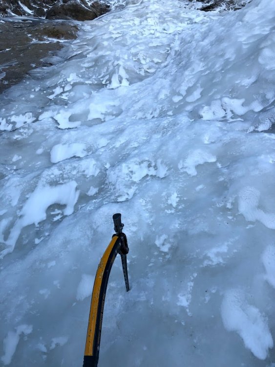
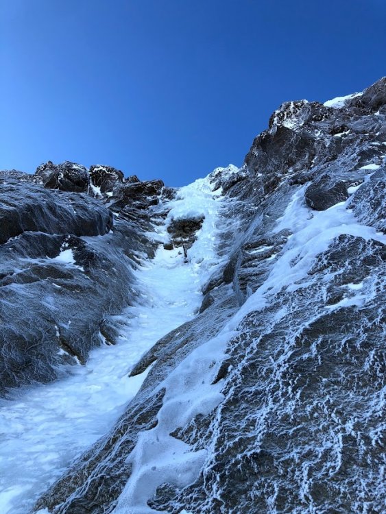
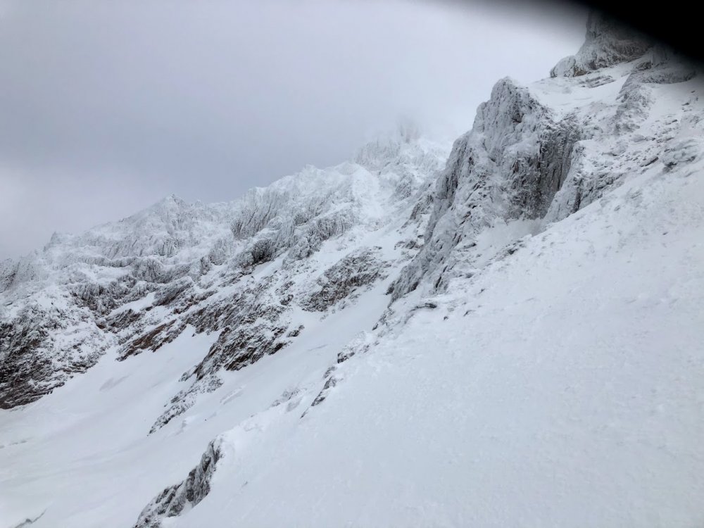
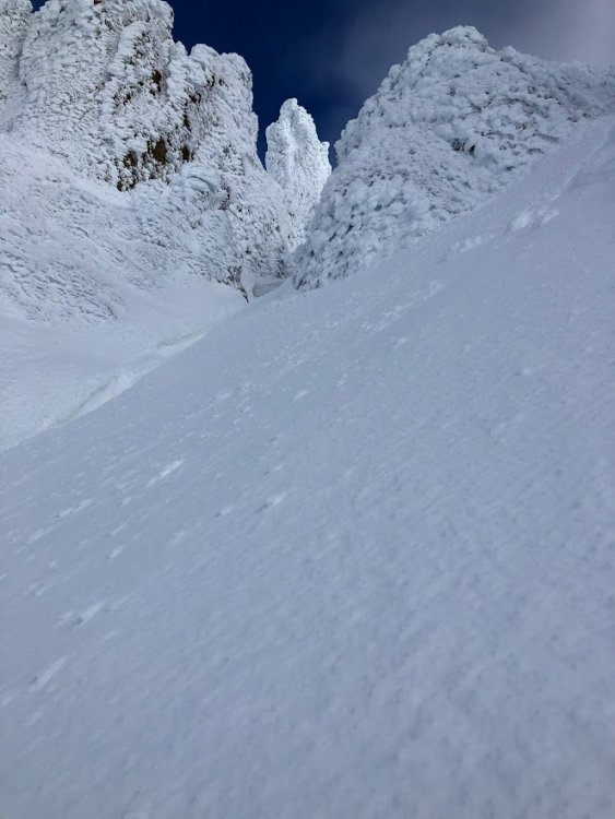
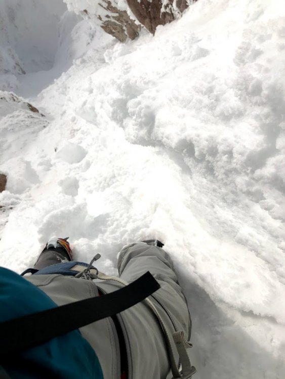
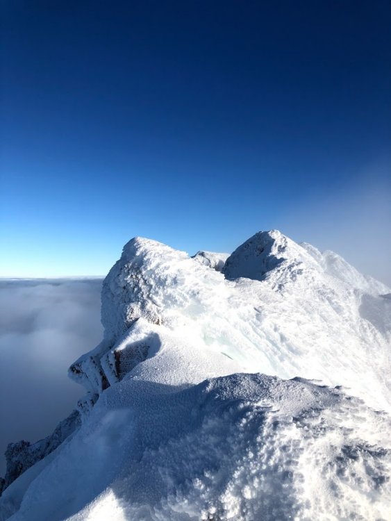
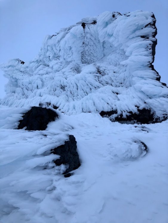
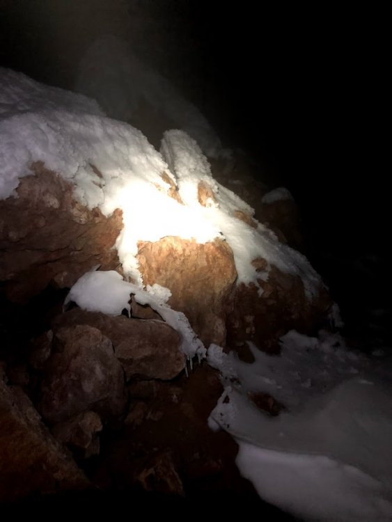
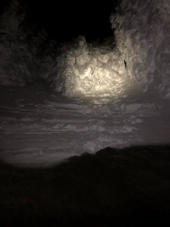 11 points
 -
Trip: Patagonia - Fitz Roy Smash 'n' Grab 9 Days Seattle-to-Seattle Trip Date: 02/03/2019 Climbers: Jeff and Priti Wright Location: Patagonia - Chaltén Massif - El Chaltén, Argentina Peak: Monte Fitz Roy (Cerro Chaltén) Route: Franco-Argentina 650m, 55deg 6c (6a C1) High-Res Video (turn up the volume!): Google Street View Photo Sphere: https://goo.gl/maps/nLvcGHAQTqu Trip Report: Feb 3, 2019 Priti and I summited Monte Fitz Roy in Patagonia near El Chaltén, Argentina via the Franco-Argentina Route. We had been watching the weather every day each season for the past three years and finally saw a good enough window to buy last-minute flights and make use of the beta sheets we made four years ago. The trip was 9 days Seattle-to-Seattle. We climbed the Franco-Argentina link-up which is a variation on the first ascent route and is the "normal" route up and the standard rappel line for all routes on the mountain. Franco-Argentina is a highly aesthetic line combining glacier travel, steep snow, mixed terrain, and hard/pure rock climbing. The technical portion of the route is 650m long containing 14 (or so) rock/mixed pitches up to 5.11b (or 5.10b/C1...heavy emphasis on the C1) and many hundreds of meters of 45-55deg hard snow/ice. Starting from the town of El Chaltén which sits at roughly 1,300 feet, you ascend 9,710 vertical feet over 10.5mi to reach the summit of Cerro Fitz Roy (Cerro Chaltén) which towers over all the surrounding granite spires of the Chaltén Massif. The upper summit slopes require crampons, boots, and ice tools which were carried in a single pack by the follower. We were four days and four nights away from town which included bivouacs at Paso Superior, La Brecha de los Italianos, the summit (for a 1hr sit-rest waiting for sunrise pictures), then hiking all night back to town on the fourth/final night. From La Brecha, we woke on the third day and moved sleeplessly for 48 hours to get back to town so we could make our bus for our flight back (and we had 20min to spare!). We were lucky to experience rare, cloudless, windless, perfect weather in this harshest and otherwise unforgiving land. We've suffered so much in these mountains on our previous two trips; this was a welcome change. For those of you who don't know, the Patagonia (r) logo (tm) is an actual range, called the Fitz Roy range which is located in the Chaltén Massif. The big peak in the center of the logo is Fitz Roy. The founder, Yvon Chouinard, was a member of the Fun Hog Expedition in 1968 who road trip'd from California to Argentina, surfing and skiing along the way. They completed the third ascent of the mountain and established a new route, Californiana (or the "Fun Hog Route"). Note: whenever I mention "the topo", I'm referring to the topo as found in the 2nd edition of Patagonia Vertical, by Rolando Garibotti and Dörte Pietron, published by Sidarta Guides, which can be purchased online or in the States at most Patagonia retail stores. Rolo has a companion website to the book, PATAclimb.com, which is an equally invaluable resource. All pictures below are high resolution. Click on the pictures to open them in a new tab and zoom in. The adventure begins from the town of El Chaltén where you hike the popular trail approximately 10km to Lago de los Tres. Then scramble up the left (Southern) slopes of the lake to find a fixed line. The fixed line is hidden away from tourists and is very difficult to find. Stay low as you scramble up the slopes, maybe 30m until you find an obvious, lone, random bolt along a ledge. If you were to continue from here, you would see a smattering of 4 more random bolts which (I assume) make a rappel anchor for guided parties. Instead, go straight downhill from the first bolt to a large cairn and another bolt with the fixed line. 3rd class down climbing will take you back to the shores of the lake where you will soon see the second fixed line which ascends the 4th class hillside to a scree field. Cross the moraine (bivy options here) between the larger and smaller lakes to the glacier (Gl. de los Tres). Ascend the glacier to find yet another short (15m) fixed line on a low-angle rock or mixed corner (shown below). Ascend the ridge on the North side (climber's right) and make your way back to the South side (climber's left) to gain the upper snow field. Follow easy snow to Paso Superior (high camp). A very snow Mermoz and Guillaumet Paso Superior is a popular advanced base camp from which most objectives in the Massif may be accomplished in a push. It is relatively sheltered in a snow bowl, but may be exposed in high winds. On the back (North) side, there is a fixed rope down 20m of 4th class terrain to get down to the glacier (Gl. Piedras Blancas). Ascend the glacier to get to the bergshrund (1-2hrs). According to the guidebook, there are three ways to gain the ridge: the rappel couloir (just below the Brecha de los Italianos), the rock spur just left of the couloir, and the steep snow further left. Approximately 100% of all parties (give or take) approach via the steep snow (the third option), as we did. From the bergshrund just below the toe of the rock (usually just a step-across, but may go "out" in late season), we harnessed up with rock and ice gear, ascending steep snow and ice (up to 60deg) for 250m. We stayed close to the rock and protected with rock gear since the angle was steep enough and the consequences fatal enough, but many parties solo the snow/ice, roping up for the last rock portion. Since the steep snow was endless, calf-burning front-pointing, we were glad to have steel, hybrid, horizontal crampons here and also on the summit slopes, although many climbers just wear strap-ons (of the aluminum variety). Once near the ridgeline, there are likely a few ways to ascend the rock from 3rd class to low 5th but rock shoes are not necessary. Choose your adventure. The entire technical portion of Franco-Argentina is shown in red, above, which starts at the end of the snow bench ("la Silla"). Once over the ridgeline and on the West side, you are rewarded with views of Desmochada, Cerro Torre, and Aguja de la Silla. There are a couple bivy spots where a tent can be set up just under Brecha de los Italianos (shown above). From here, in order to gain the ridgeline from la Brecha to la Silla, there are many possible low-5th class routes. However, the best way is to find a 45m fixed line on the right, just past la Brecha and climb 4th class terrain to a 3rd class walkway just under the ridgeline (still on the West side) until you get to the snow. You can also climb various 4th/low-5th class gullies (seen below). La Silla is usually always icy but is low angle (and exposed!) to the base of the route and may be protected with ice screws if you like. Crossing la Silla to the base of the route. Looking back down at Glaciar Piedras Blancas. Our tracks from Paso Superior can be seen, faintly. Pitch 1, finally!! 5.10c diagonal hand crack. There is a rappel anchor just at the end of the pitch, over the edge, but there is a comfortable belay if you go up on top of the ledge. Approximate pitch layout shown side-by-side with original photo (open picture in new tab to zoom in). The lines in yellow are the two options for the actual Franco-Argentina route as shown in the topo. We diverged (on purpose) where the actual route is in yellow. Priti high on Pitch 1. Above: Looking back down Pitch 2 which takes a corner then goes out on an easy crack system on the face (5.10b). Priti leading Pitch 3. Looking up at the 5.11a corner system (Pitches 6-7) while on Pitch 5. Another view of the corner system (Pitches 6-7) while on rappel. Above: Priti starting up Pitch 6 corner system (5.11a). We swapped leads after Pitch 7, and I started up the 5.10a corner/chimney system on blocky terrain. Pitch 9 was harder corners and chimneys (5.10b) and the cracks started to get icy up here! Looking down the blocky Pitch 9. This view is just nuts! Crazy granite monoliths that look like a cluster of orange crystal formations. Looking down, you can see the swirly line of snow on La Silla which separates Aguja Poincenot from Fitz Roy. Pitch 10 (5.9) and looking up at the remaining 4-5 pitches on the upper headwall. It was during this pitch that the cracks became prohibitively icy on the standard route which would have required two tools and crampons for the leader, so I chose to explore off-route. Just above where you see me in the picture above is a long roof. There is a rappel anchor (off-route) out left of the corner system. This anchor is shown in the topo with three pitons on a ledge and is normally only used as a rappel anchor. I bailed to this anchor, then continued left (left of the prominent arête as shown on the topo) and found icy, mid-5th class ledges. The final 5 pitches were off-route from the topo but made for a fine alternative if the cracks are too icy on route. The final pitch! In yellow on the right, the 6c (5.11b) variation as shown in the guidebook topo. This overhanging crack was chock full of weak ice when we rappelled it and would have been nearly impossible to climb free or even get any pieces in to French Free it. We took the variation in red (left), not shown on the topo, which has many fixed pieces and pitons from previous parties and probably also goes free at 5.11a, although we climbed it French Free due to the icy cracks, darkness, and weak climbing abilities! Priti followed in the dark, jugging with two Petzl Micro Traxions. I would recommend following the zig zag in red (as we did) and not going straight up as that would be much harder. This is a good alternative if the rest of the route is icy, although you have to get off route during Pitch 11 (much earlier) to get to the base of this variation. Note: two more pitches of low-to-mid 5th class were required above this pitch before getting to the snow field. Rappel ropes shown going down the 6c variation. For reference, the line we took (red) is also shown again. Once past the technical climbing, you reach 250m of hard snow/ice up to 50deg (more endless front-pointing). This leads to the summit mound, which looks intimidating, but we went hard left to the left-most rocky ridge which was easy 3rd class scrambling to the final summit ridge. There is a small bump along the summit ridge which is not the actual summit although appears to be the high point! Continue to the end of the horizontal-ish summit ridge to reach the actual summit. There is an AMAZING bivy site for 1-2 with a roof and walls just under the summit block. Advertising for our awesome hostel, Aylen-Aike, from the summit. Cerro Torre behind. The first rappel down the upper snowfield. After 3-4 rappels down the upper snow field, we couldn't find the rappel anchor that's shown in the topo which is just (climber's) left of the prominent prow/arête at the top of the route. Instead, we rappelled straight down the 6c (5.11b) variation from the topo with no difficulty. If in doubt, just rap down this 6c corner. The next rappel (shown above) is from a ledge just to the left of the prominent prow/arête. You can see a giant block jutting out in the photo above. To the right of this block is the 6c (5.11b) variation. This is generally the most popular way to finish the technical portion of the ascent. The 5+ variation is further right (out of view) from the prow. In general, the rappel lengths and locations of anchors were spot-on on the topo. There are so many anchors everywhere, so be sure to follow the topo guidance for rappel lengths if you want to skip some anchors and have longer rappels. The rappel block above "La Araña" snow patch, which looks like a spider halfway up the route. A particularly harrowing rappel just below La Araña which goes down the shear, overhanging wall which is above the dihedral (Pitches 6-7). The leader has to make sure not to miss the belay ledge and do some free-space swinging to catch the ledge. The first rappel down the East side of la Brecha de los Italianos. The second to last rappel. Stick to the (skier's) right in this photo and hug the wall. There was an anchor just above the bergshrund where you make the final rappel. The Chaltén Massif from the air. Tracks: https://caltopo.com/m/CVF0 More info: https://pataclimb.com/climbingareas/chalten/fitzgroup/fitz/french.html#franco https://pataclimb.com/climbingareas/chalten/fitzgroup/fitz.html https://www.summitpost.org/fitzroy/153622 Gear Notes: Double Rack to 3 with triples .4-1, single #4, 4 ice screws (1 shorty), 1 picket each (approach only), 60m single rope, 60m Esprit pull cord, steel hybrid crampons, 2 tools each on approach (we brought two tools total on route, although many parties bring three tools total on route). On route, the follower carried a single 40L (Patagonia Ascensionist) pack with both of our boots, crampons, pull cord, 1 sleeping bag, one therm-a-rest pad, water/food for both, summit jackets, summit mittens, and two tools (total). For the upper slopes, each person had a single tool, but two each would have been luxurious. Approach Notes: Approach on steep snow left of serac ('S2c' from the guidebook)

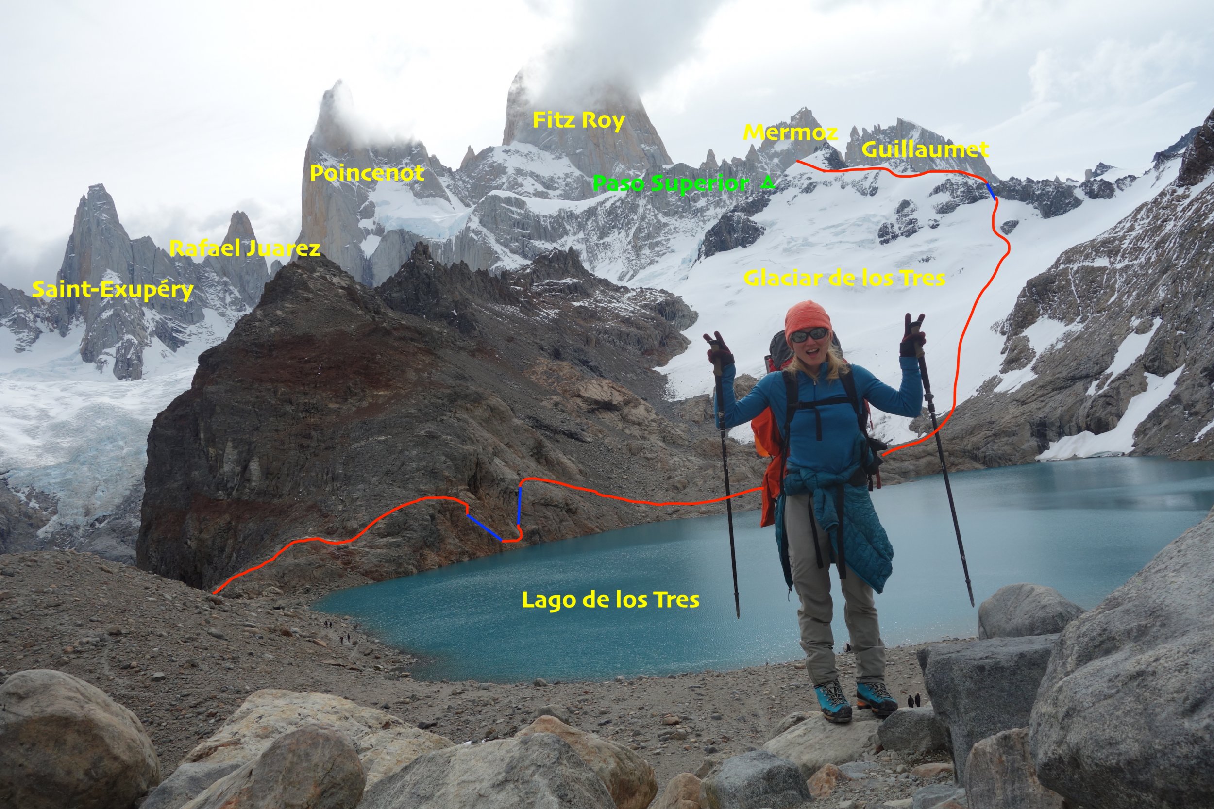
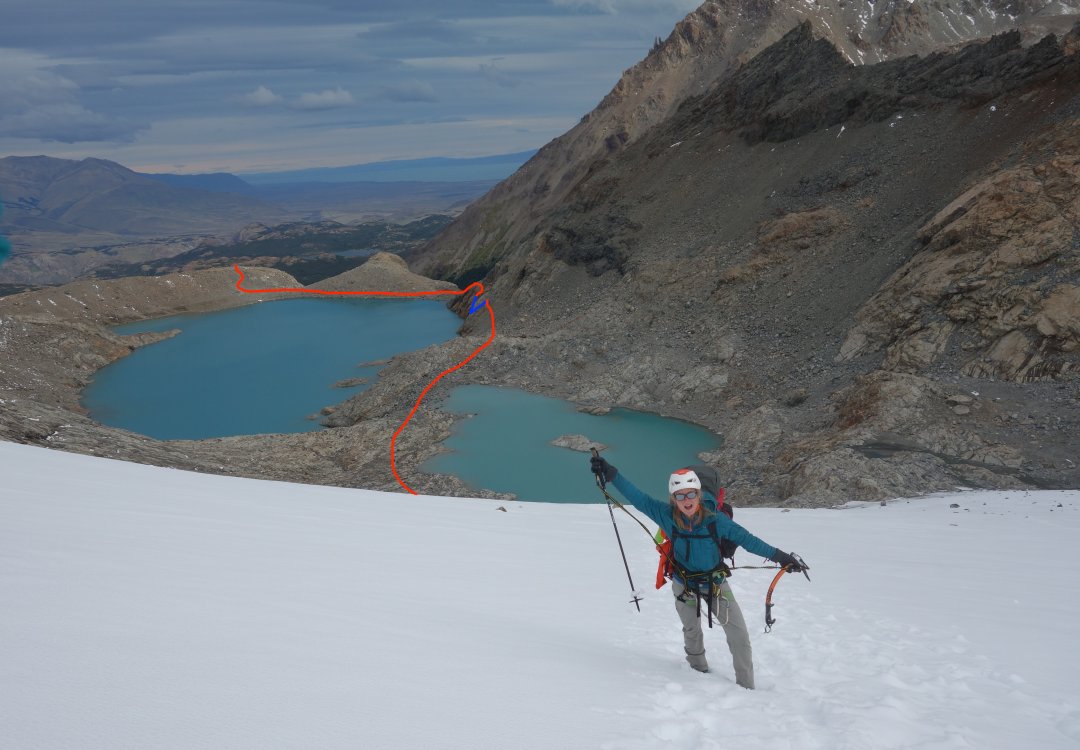
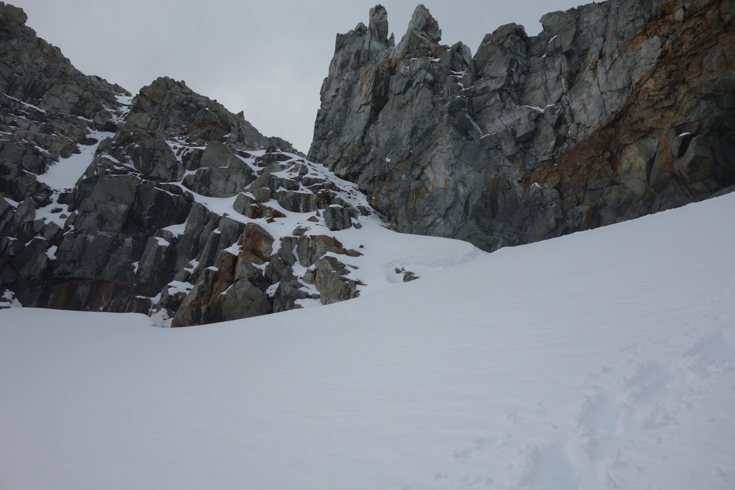
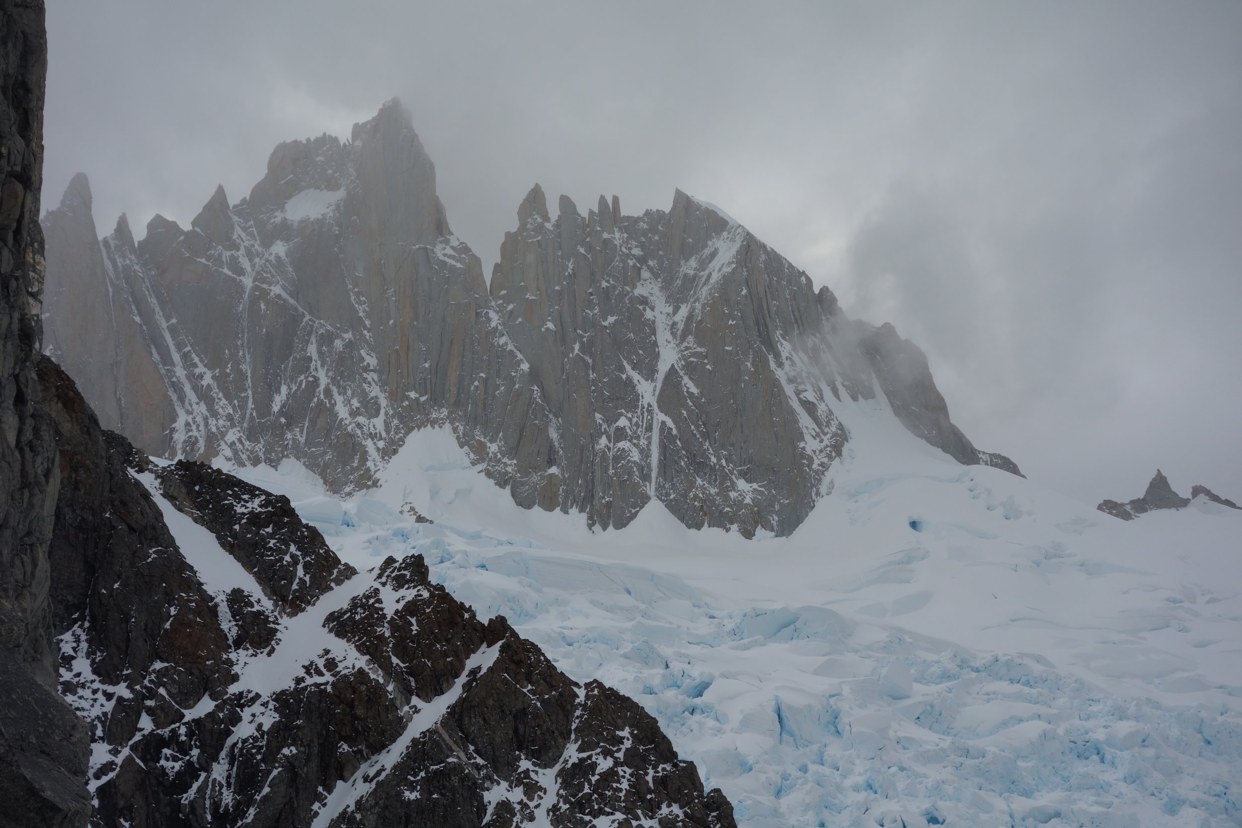

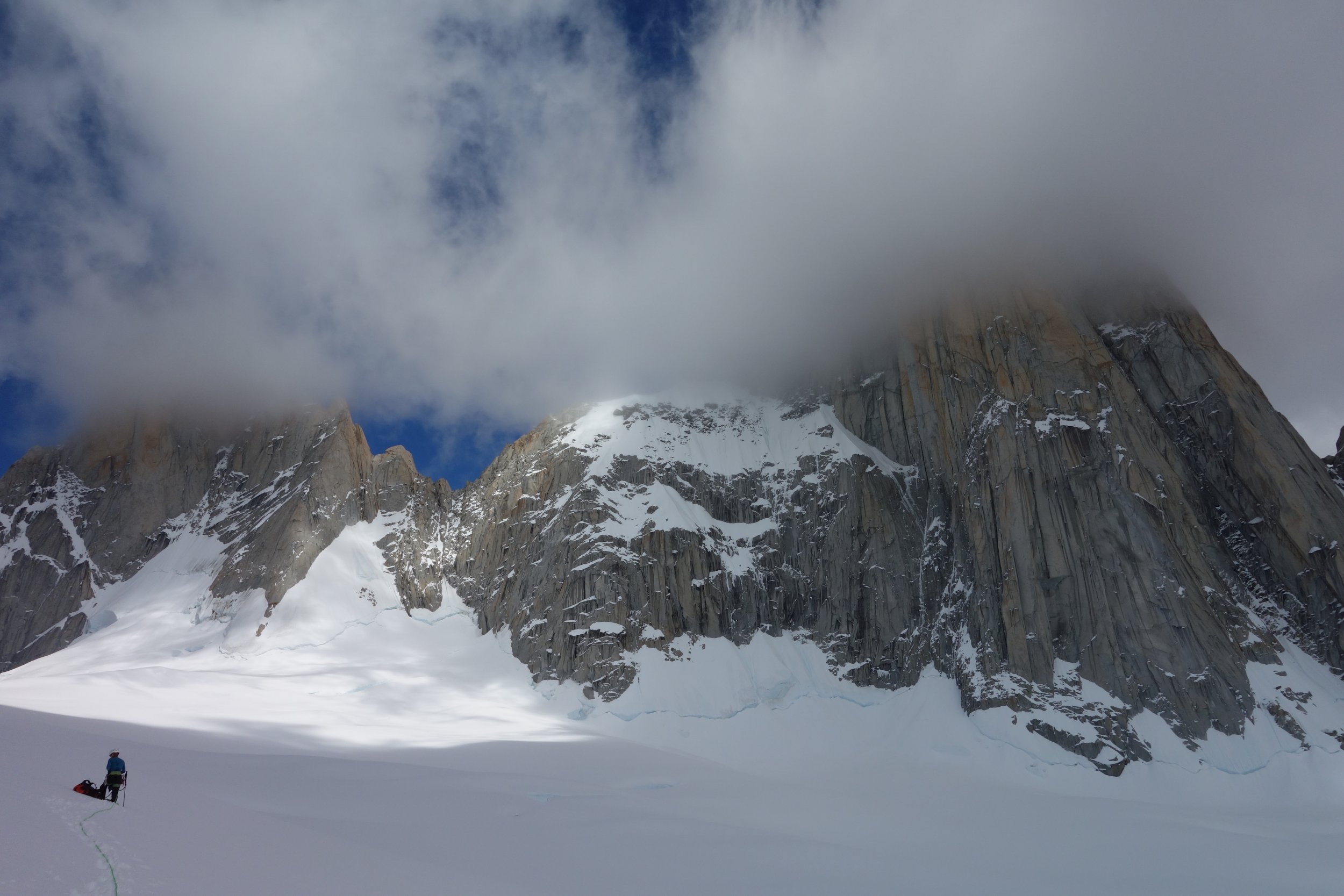


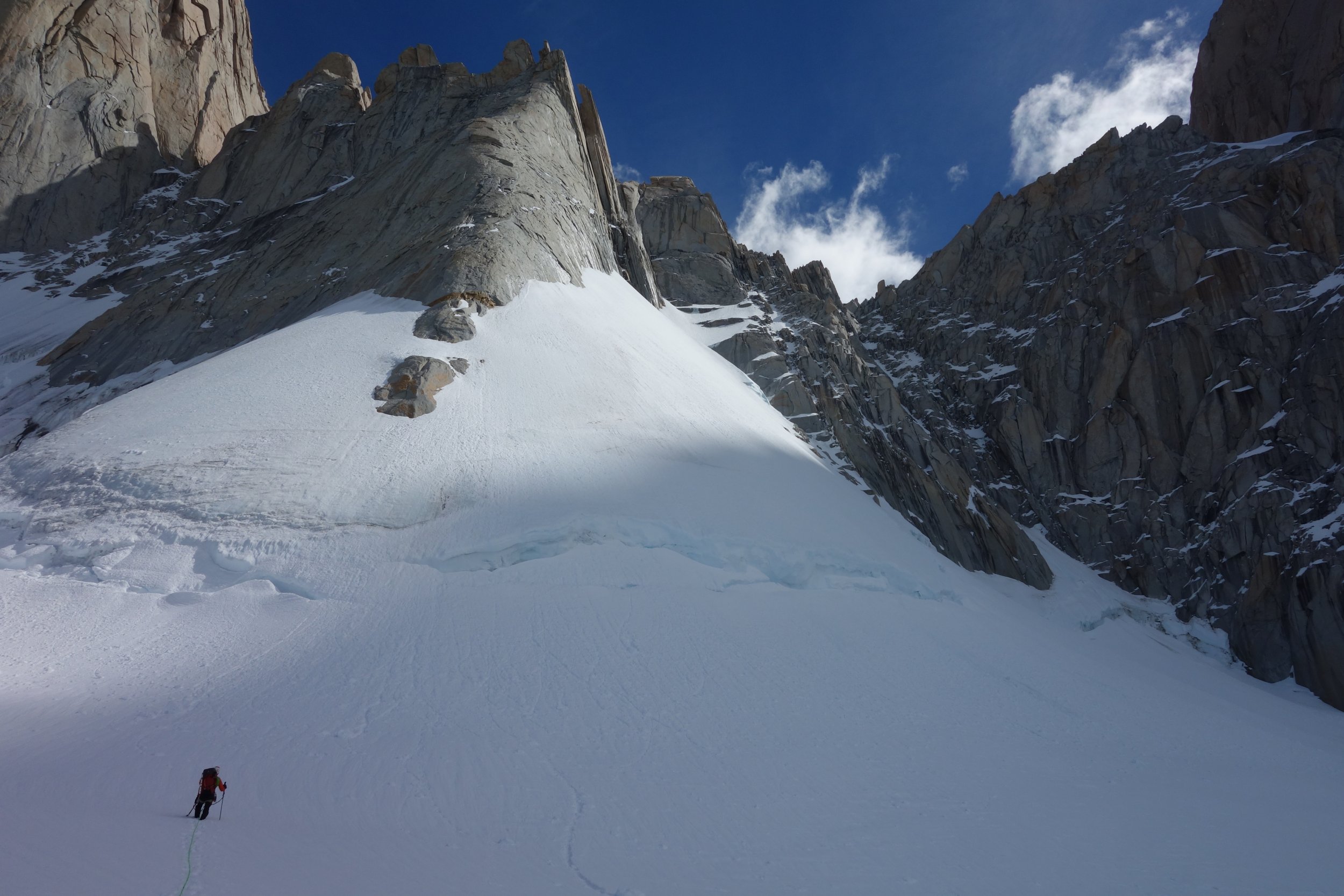
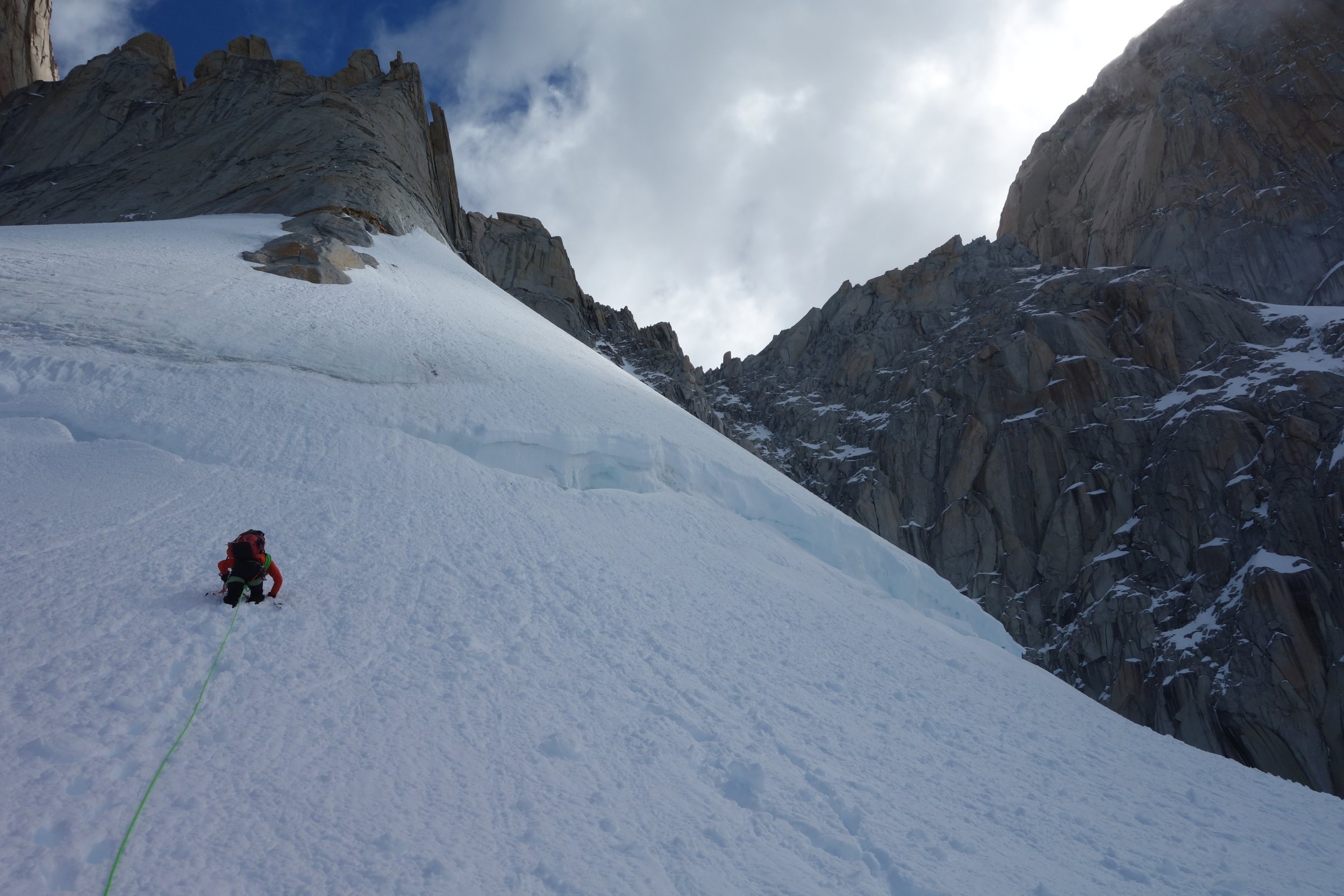

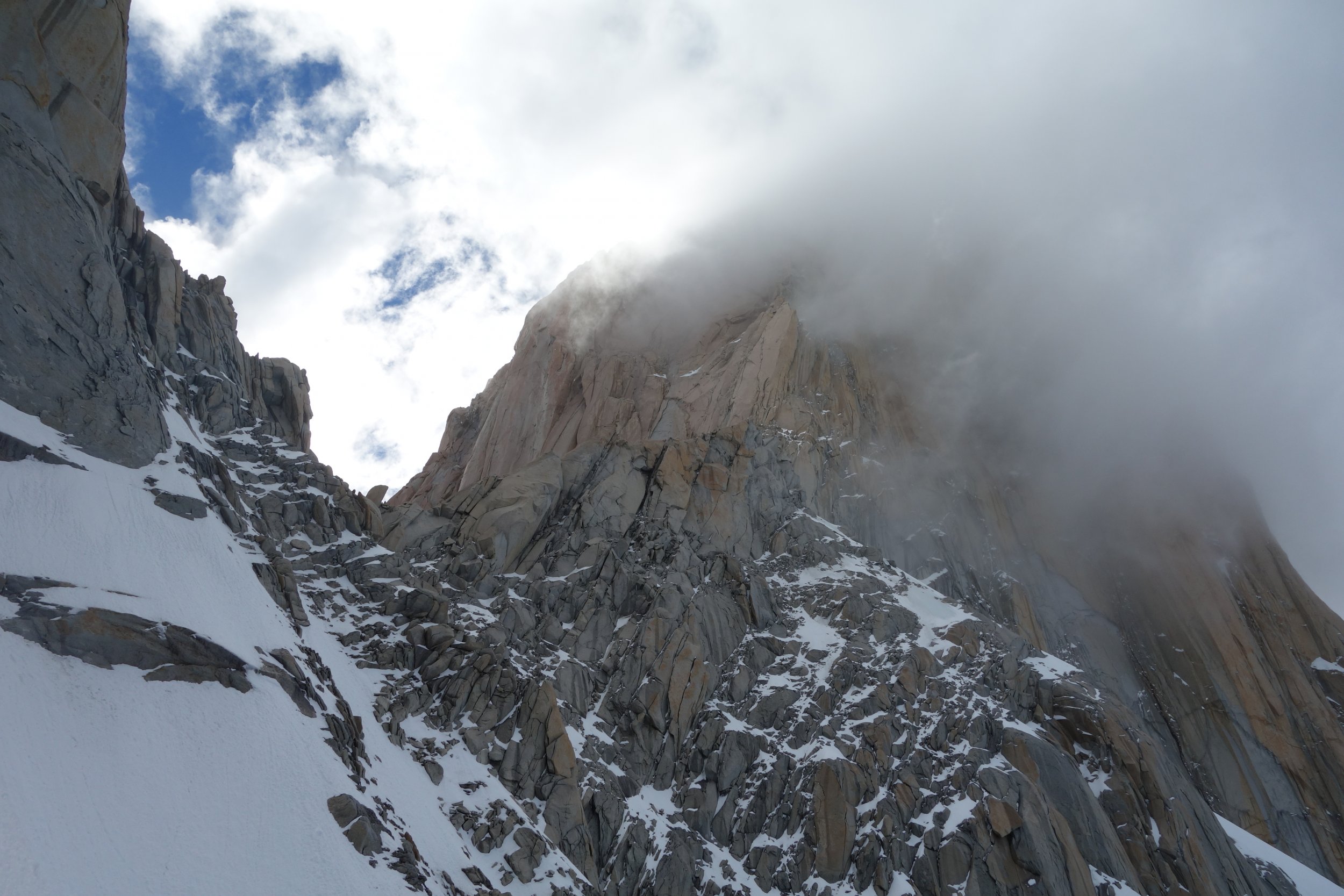


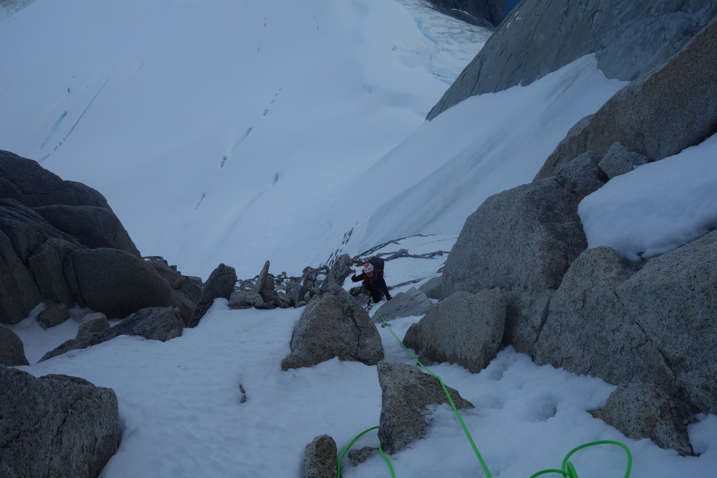
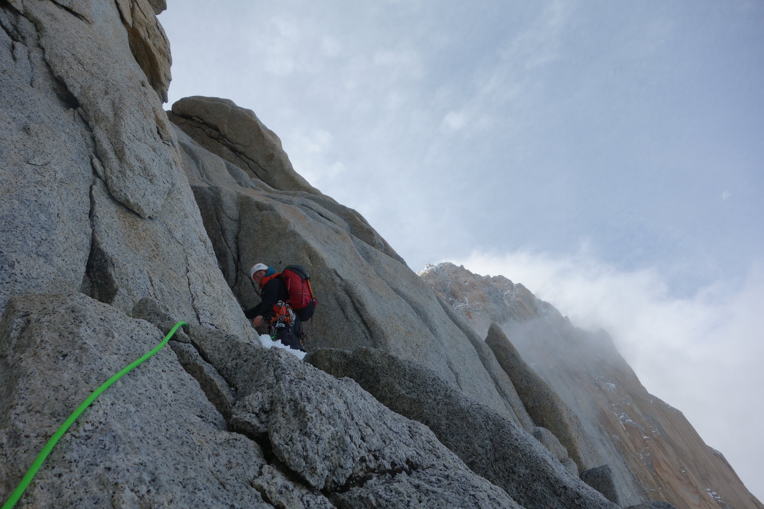
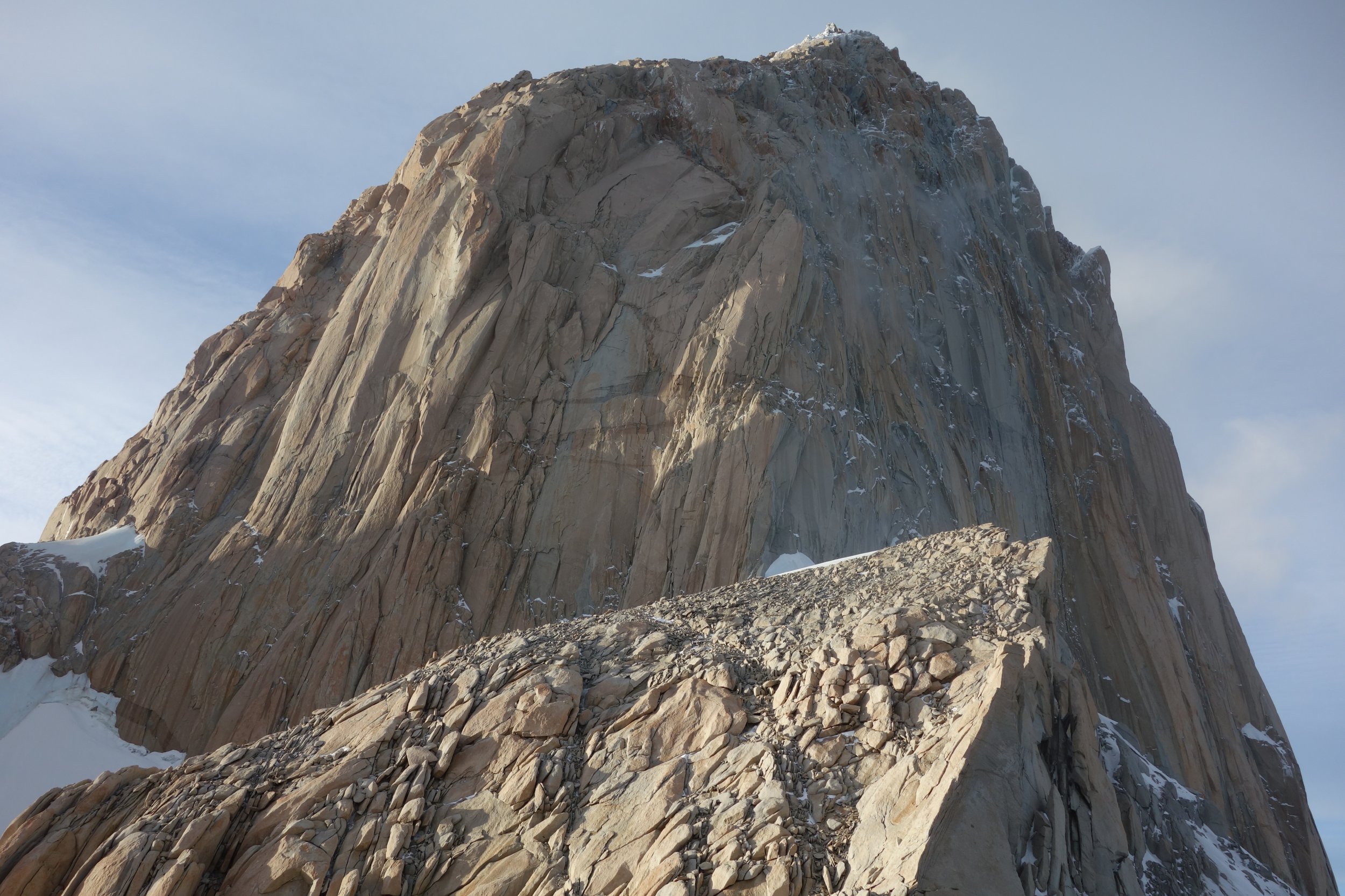
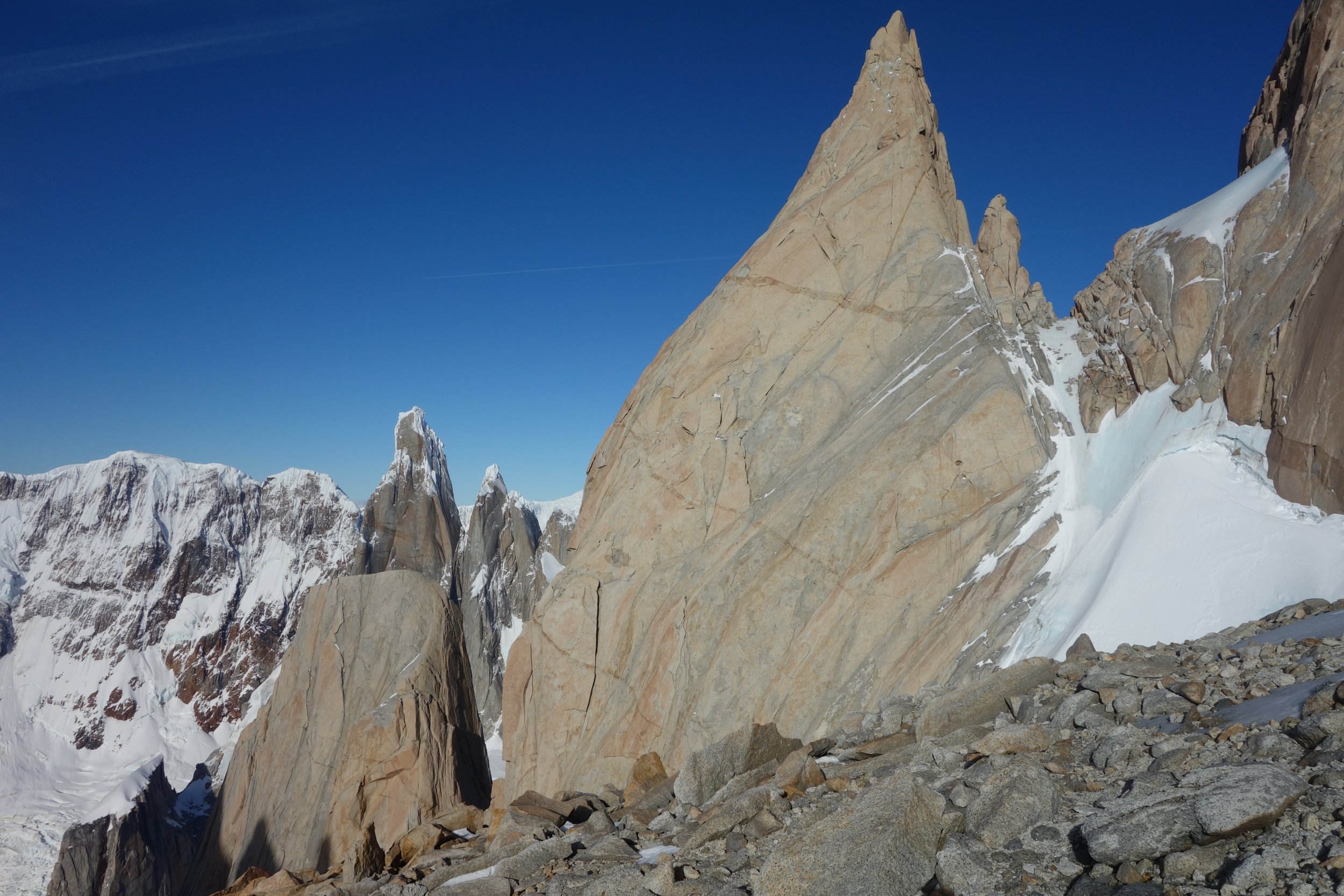
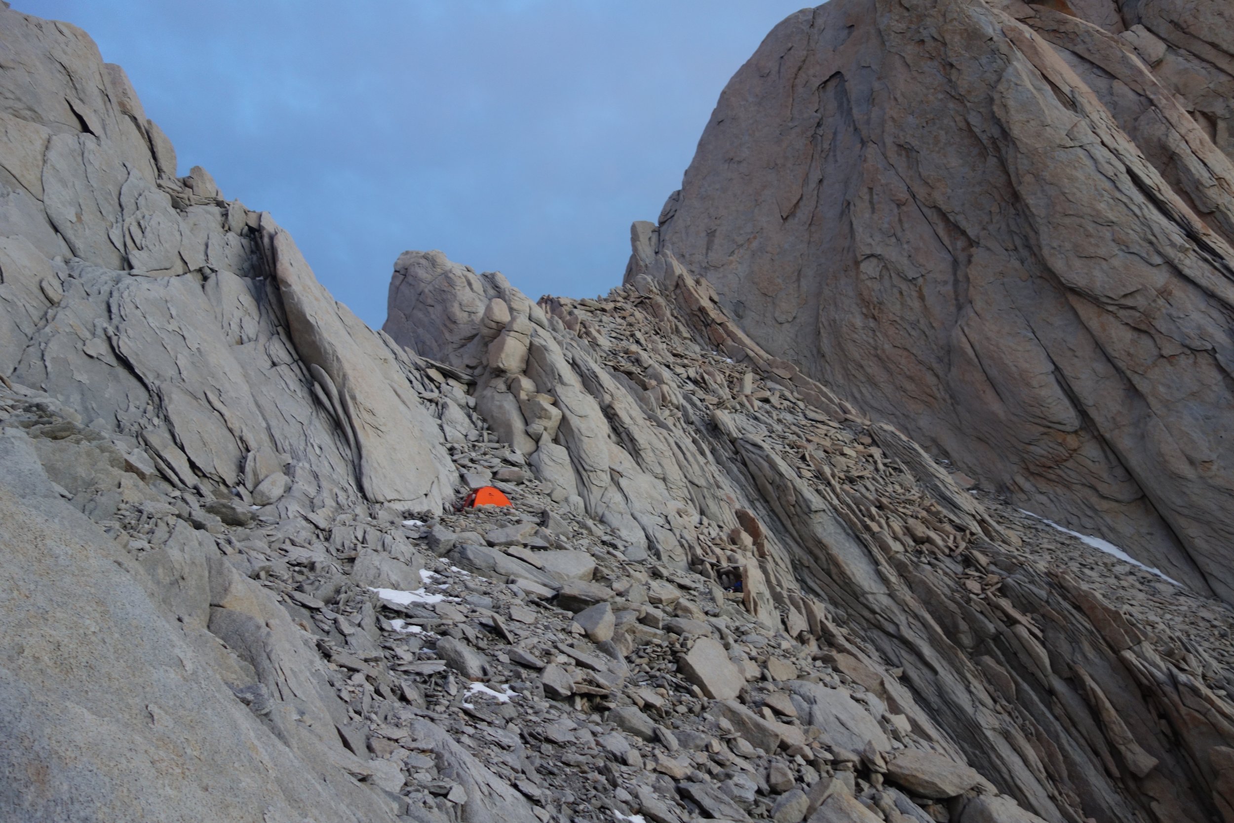

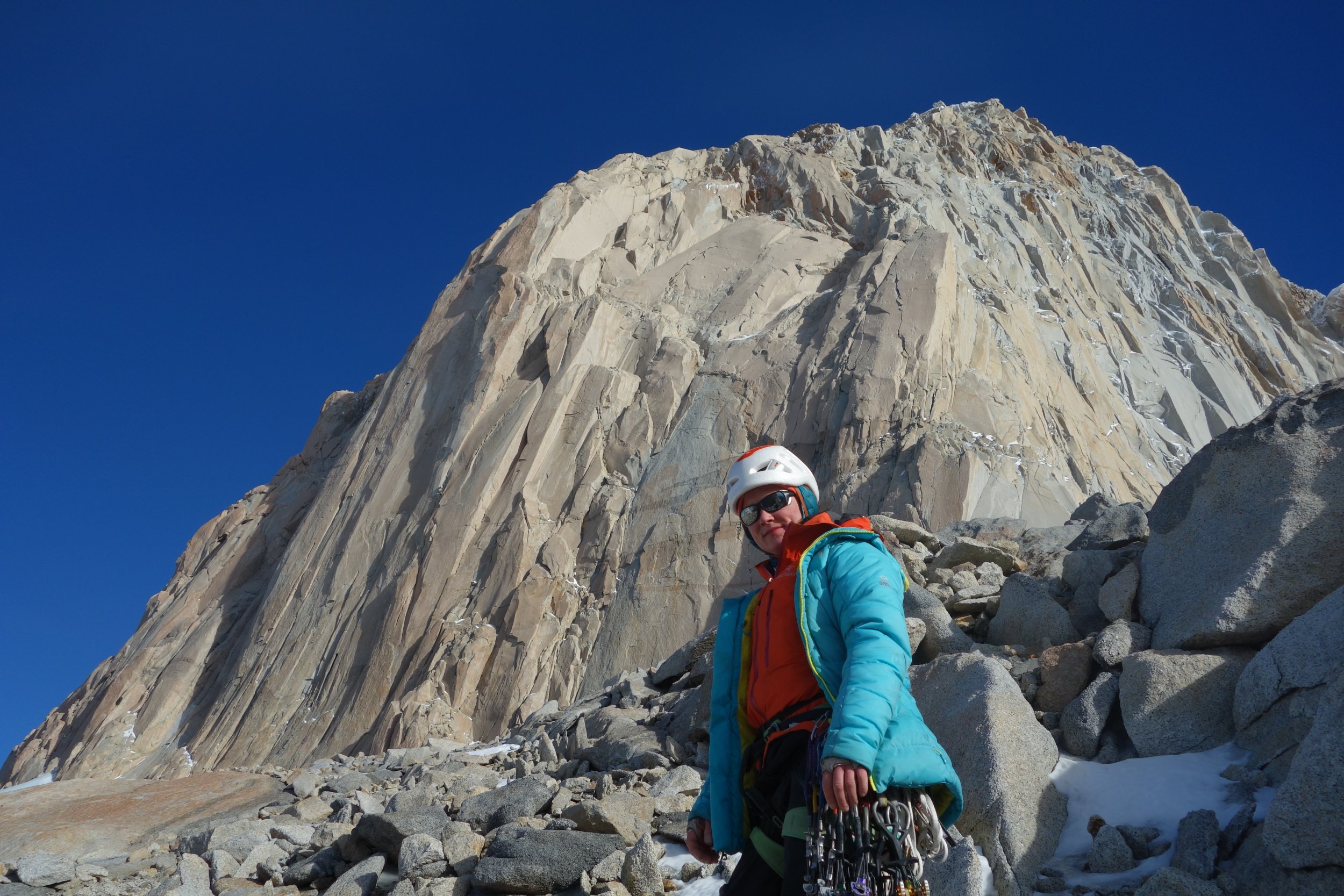
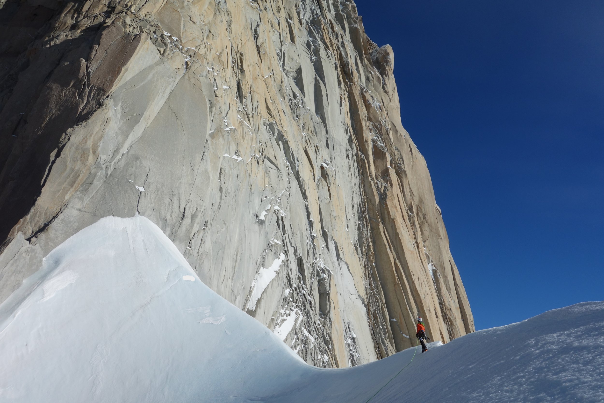
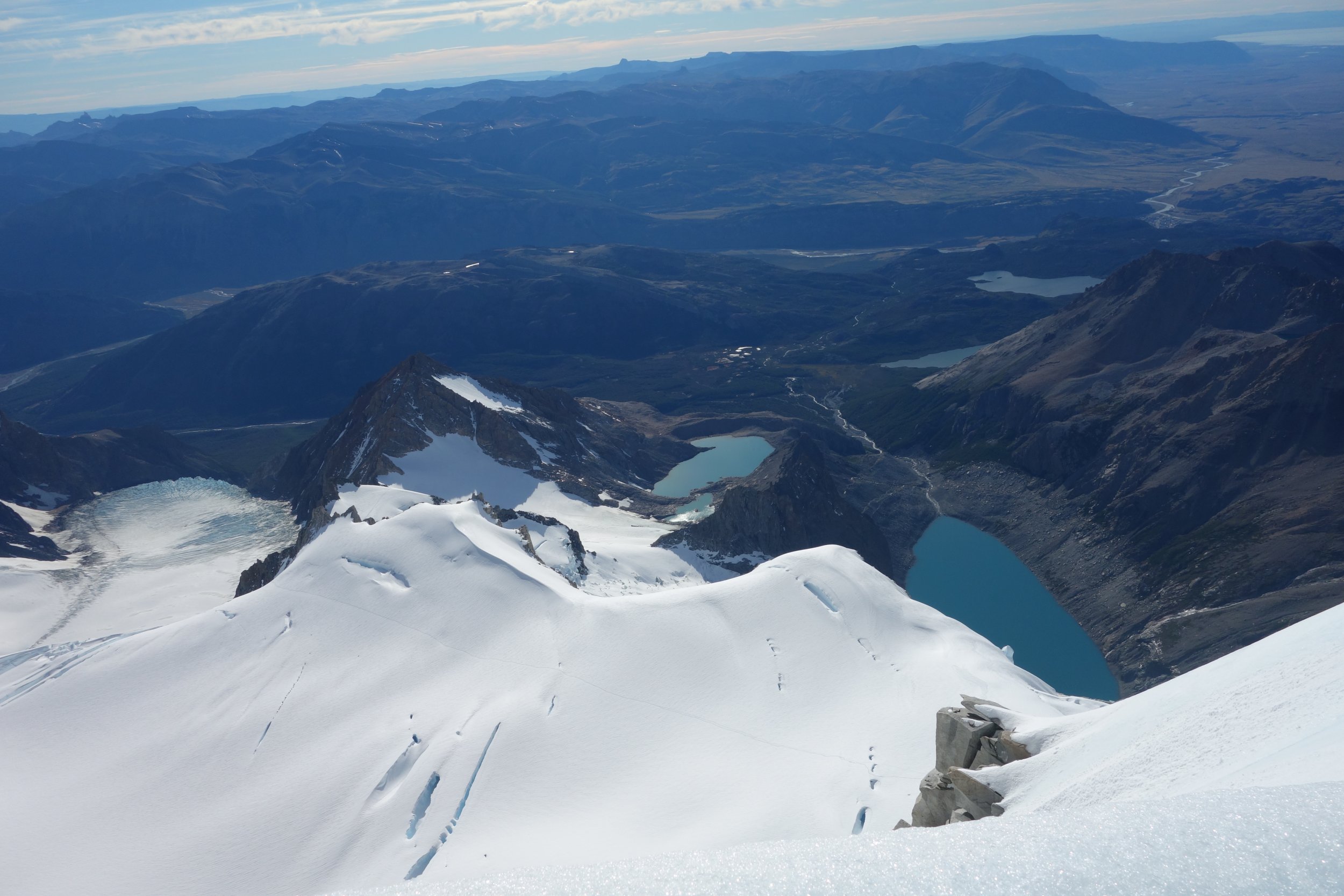


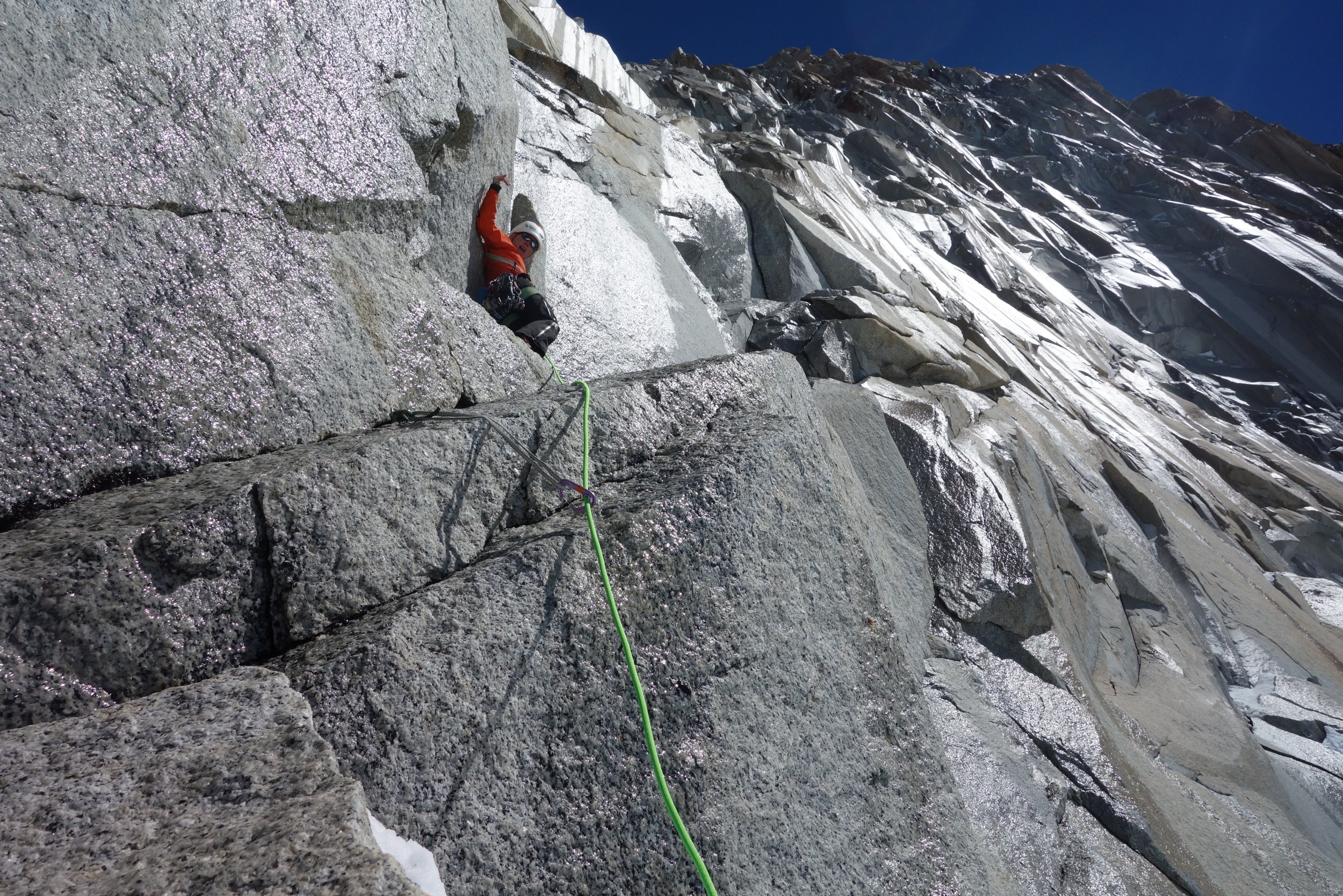

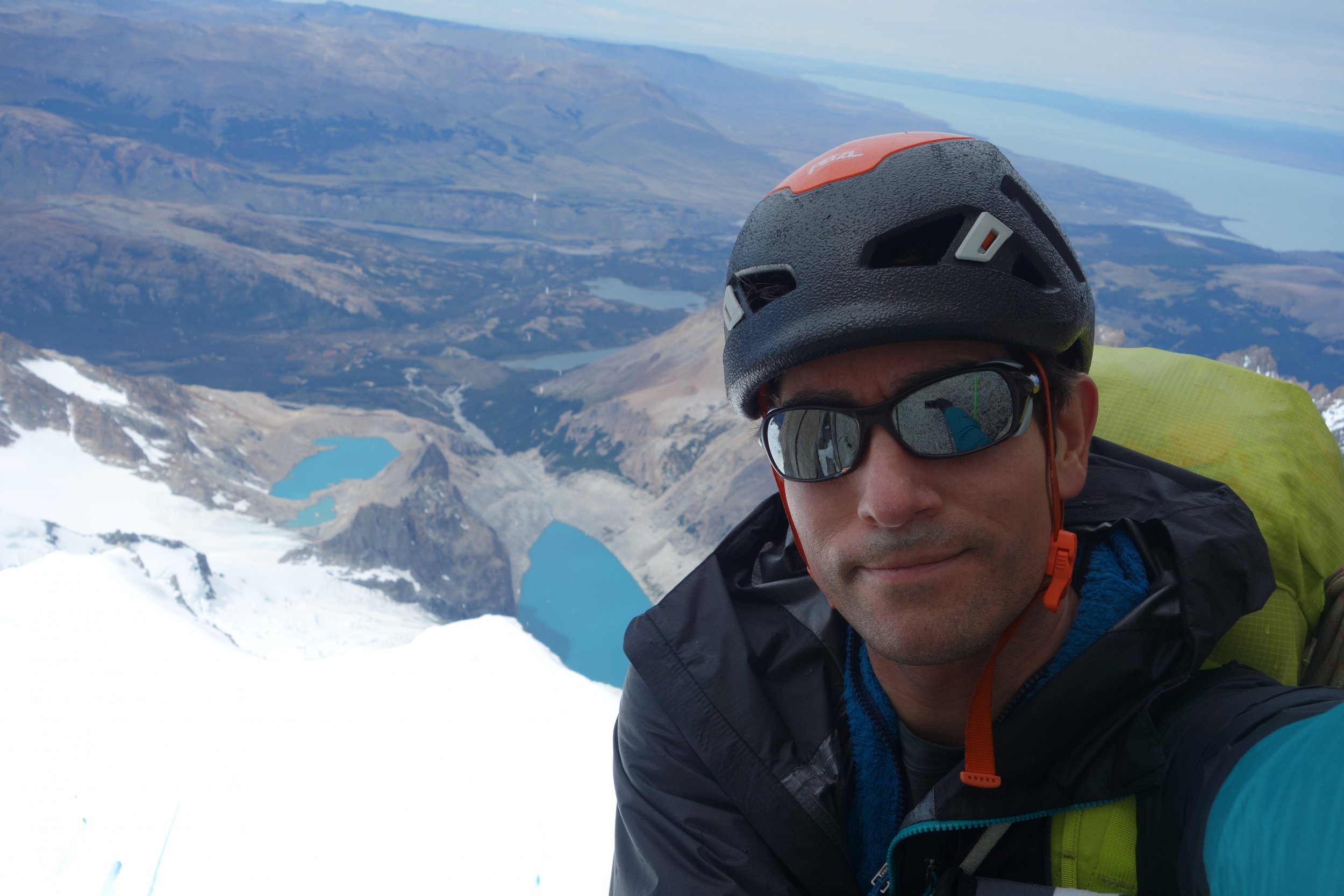
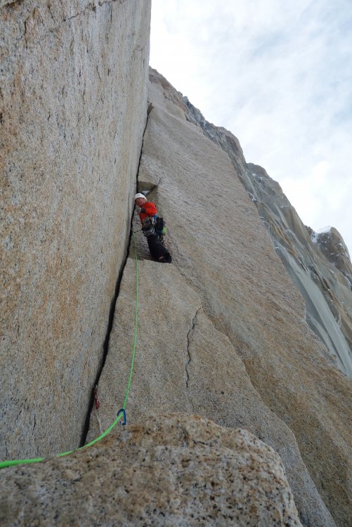
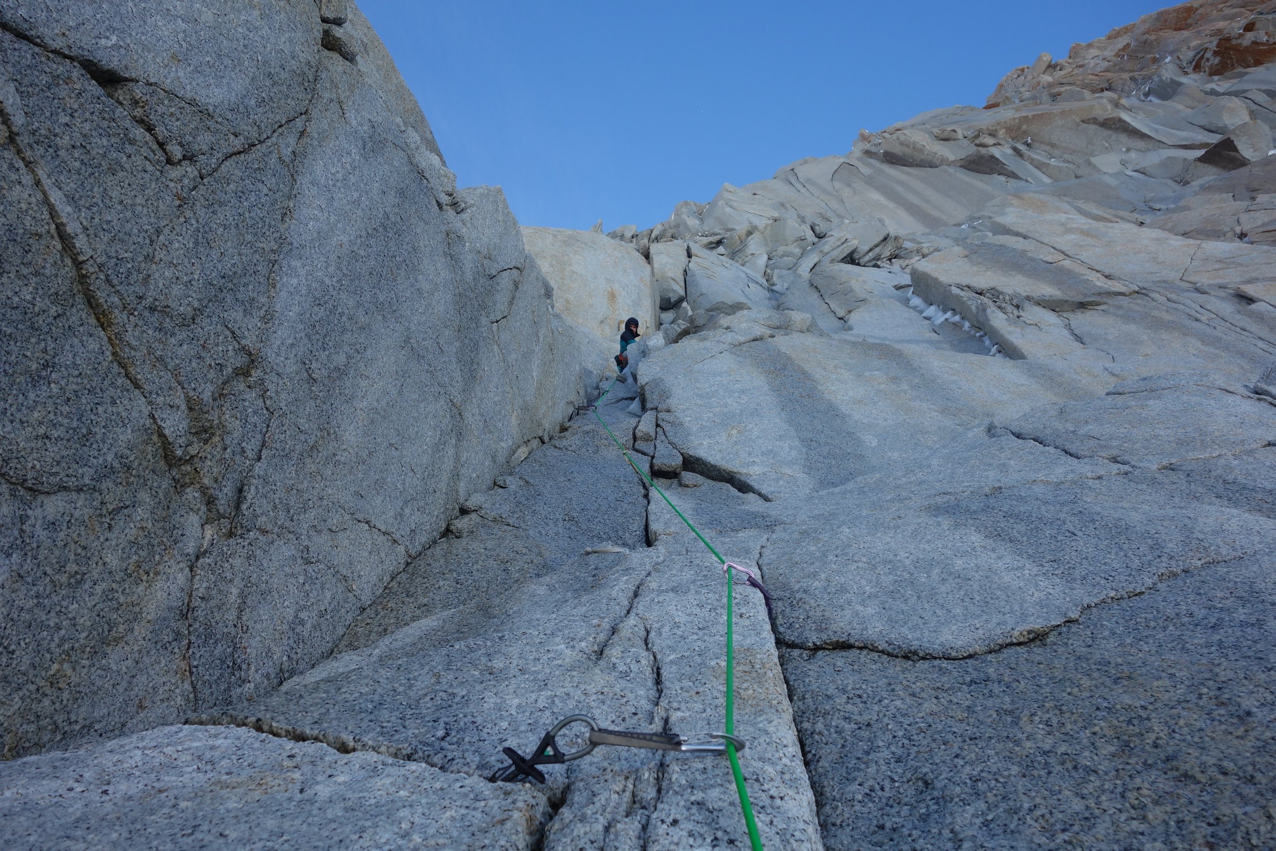

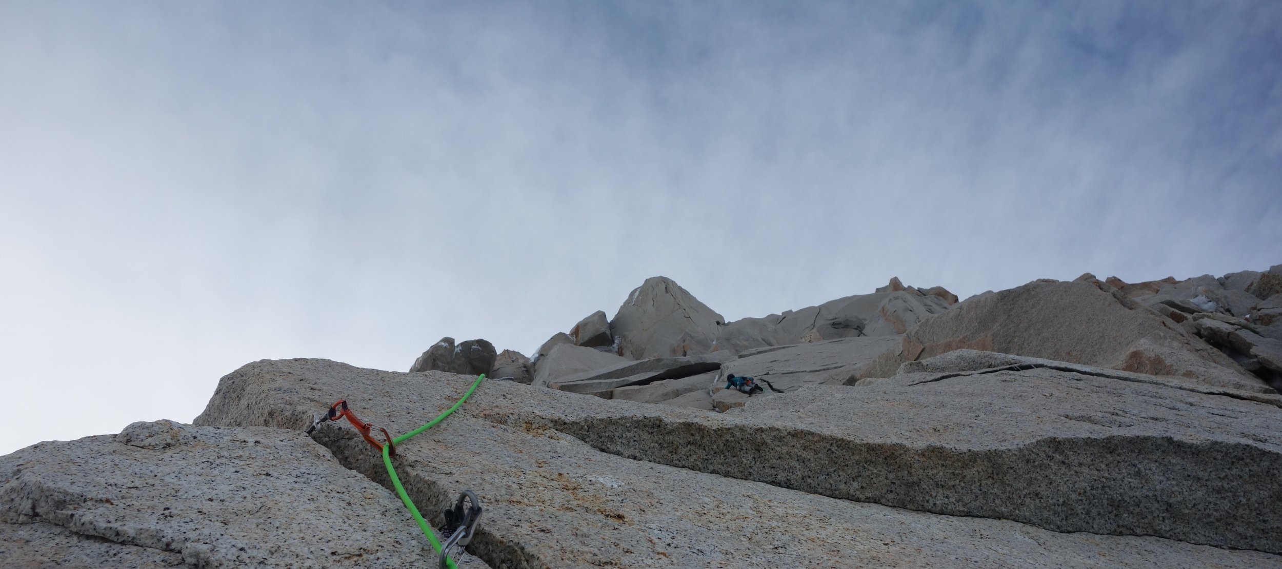
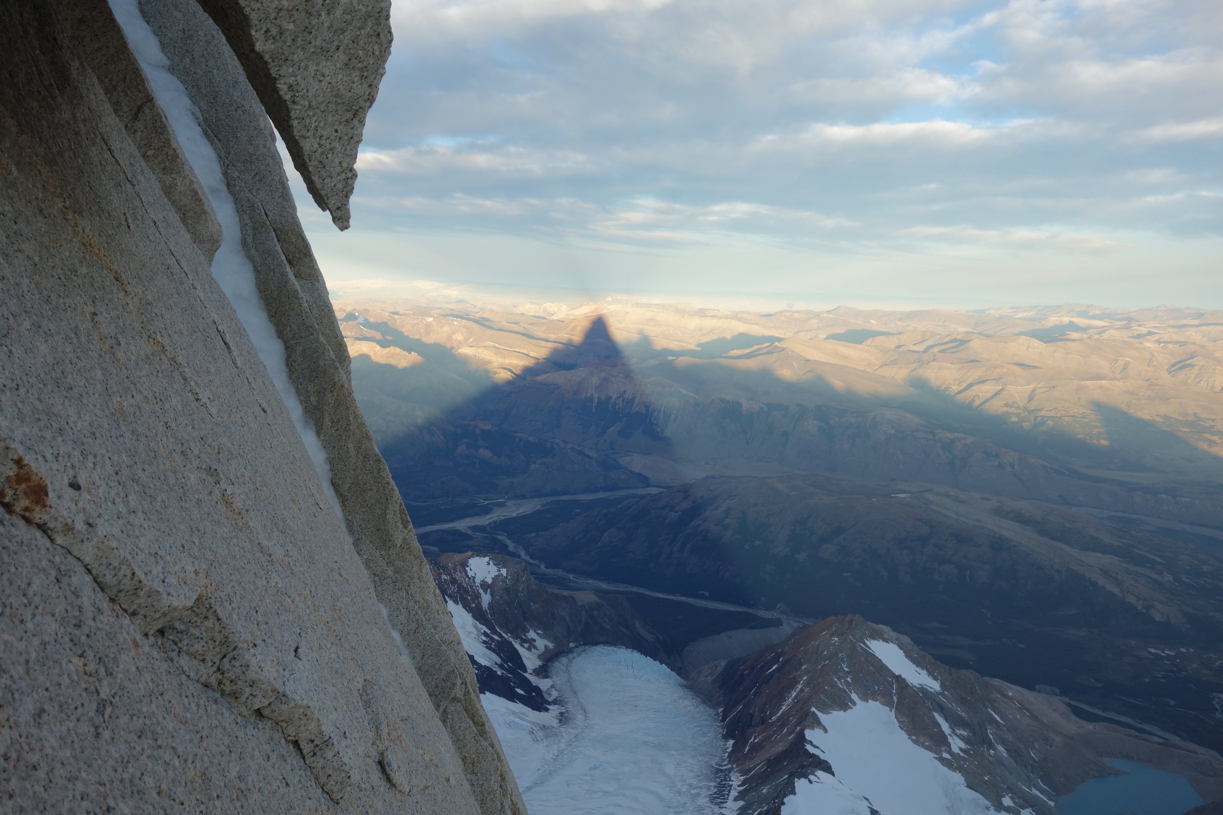
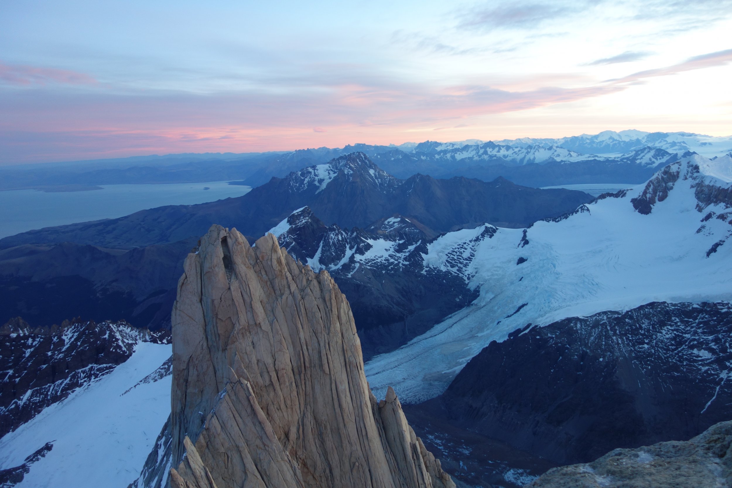
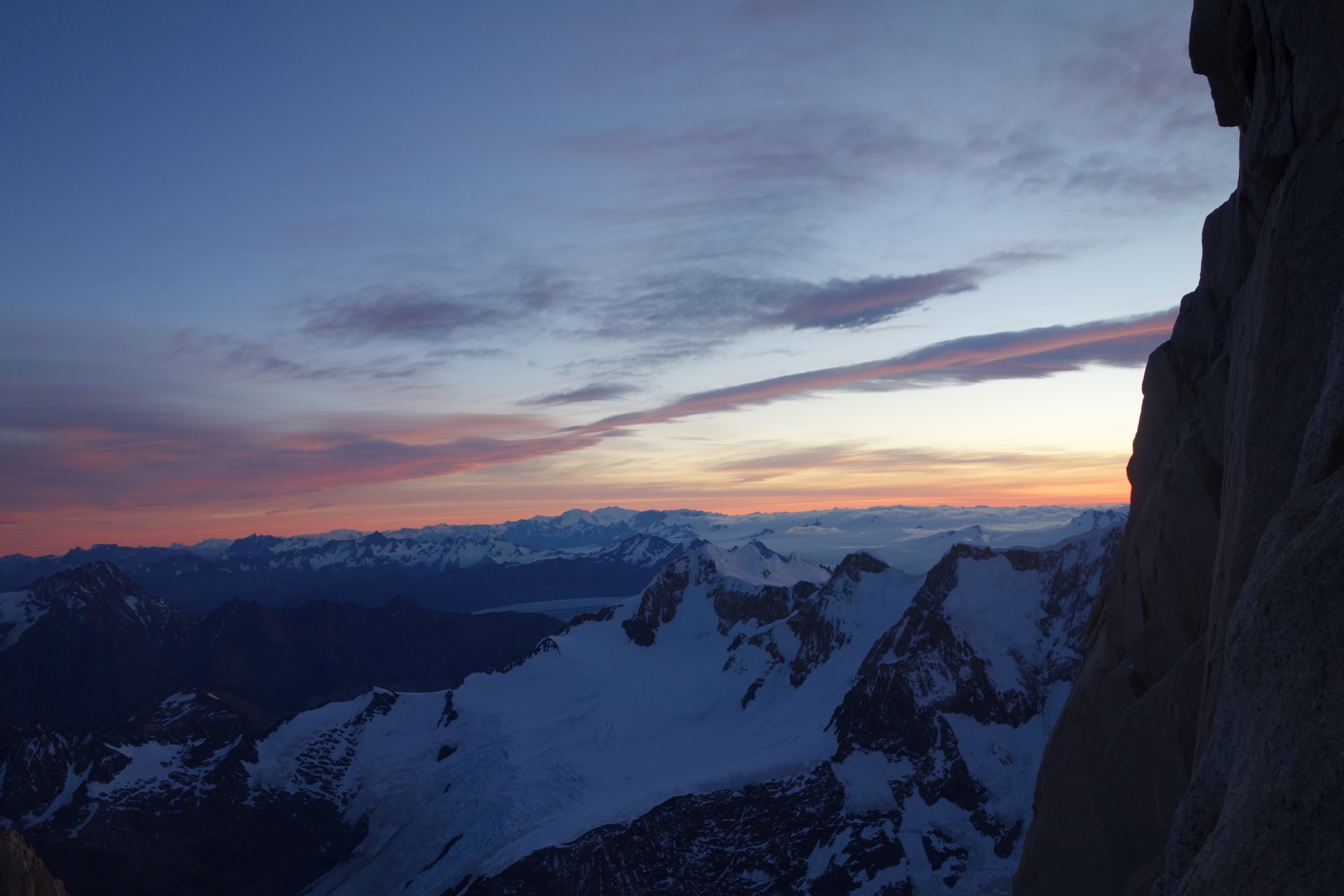
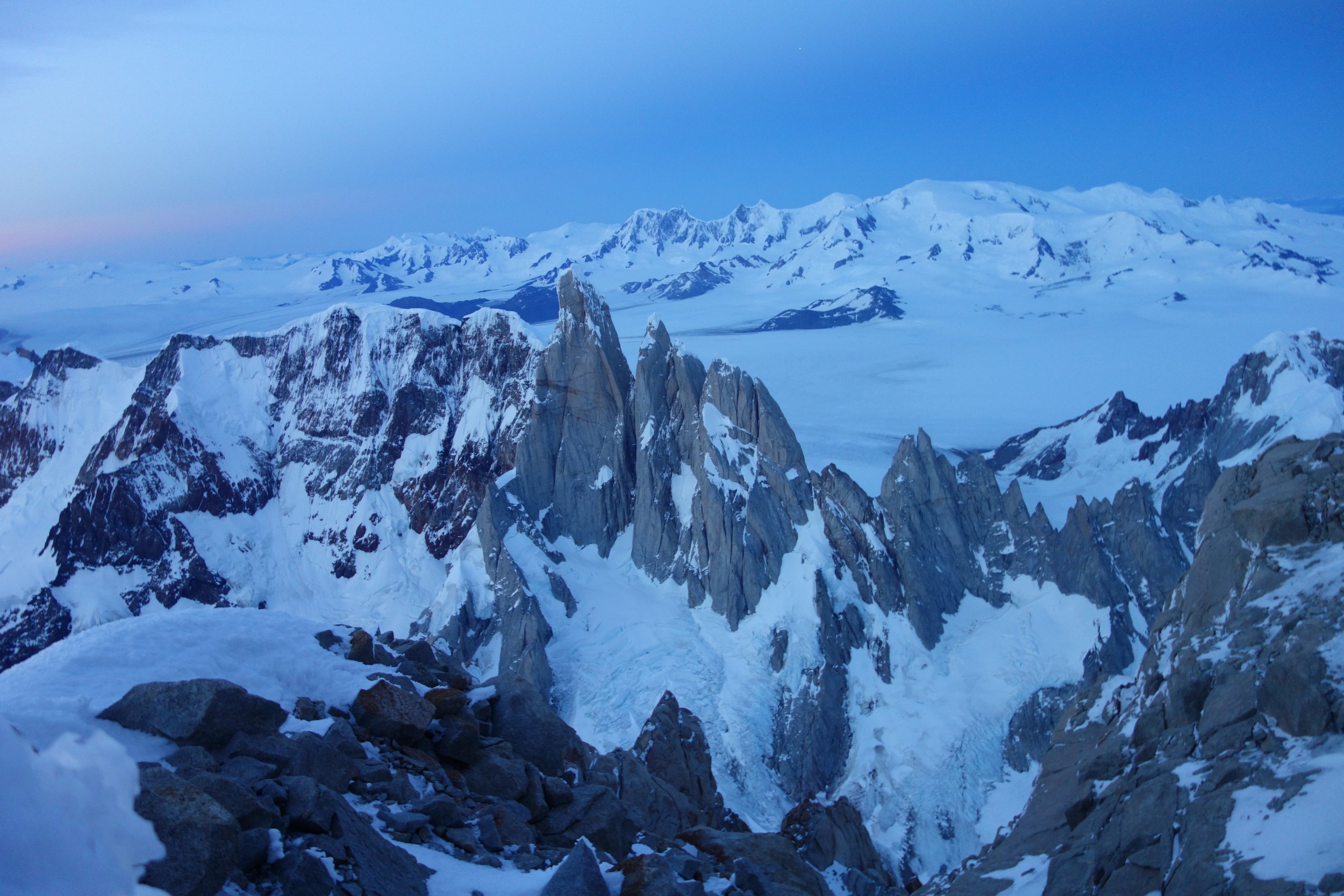
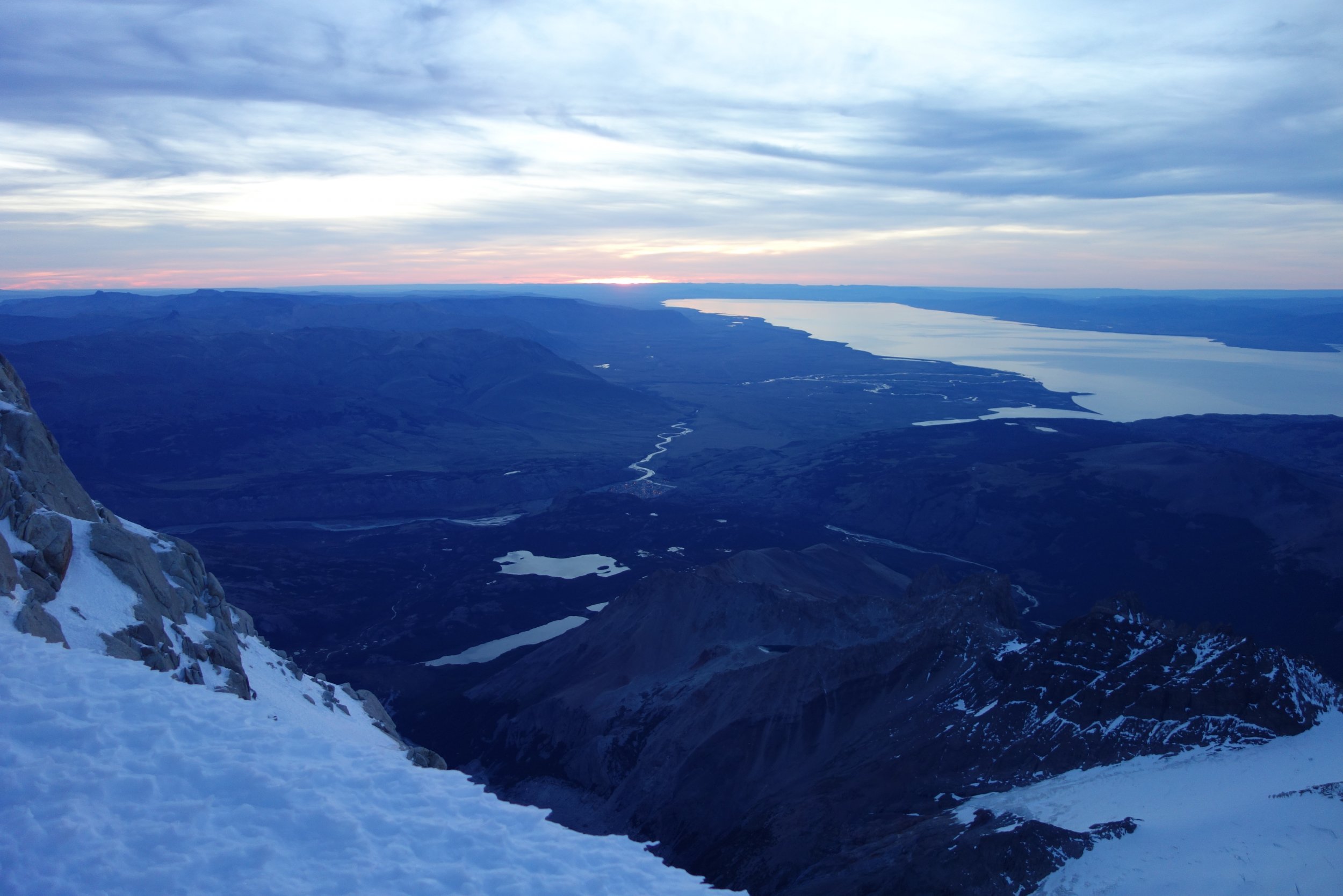


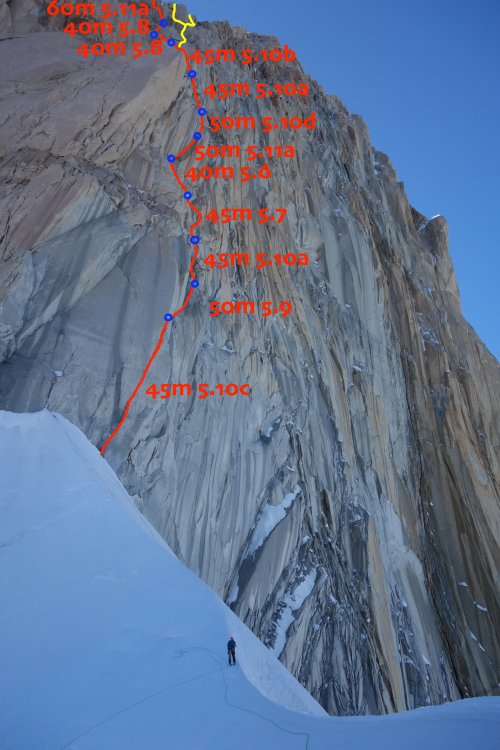


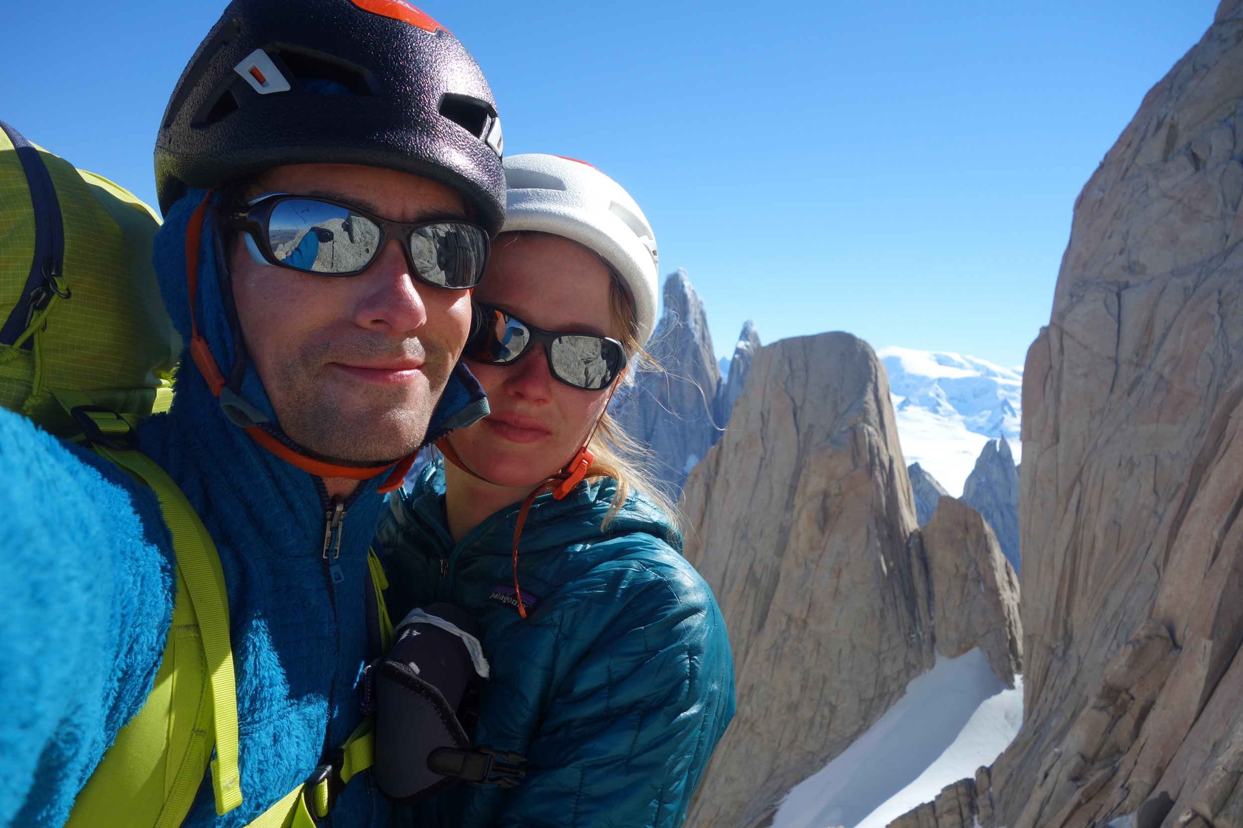


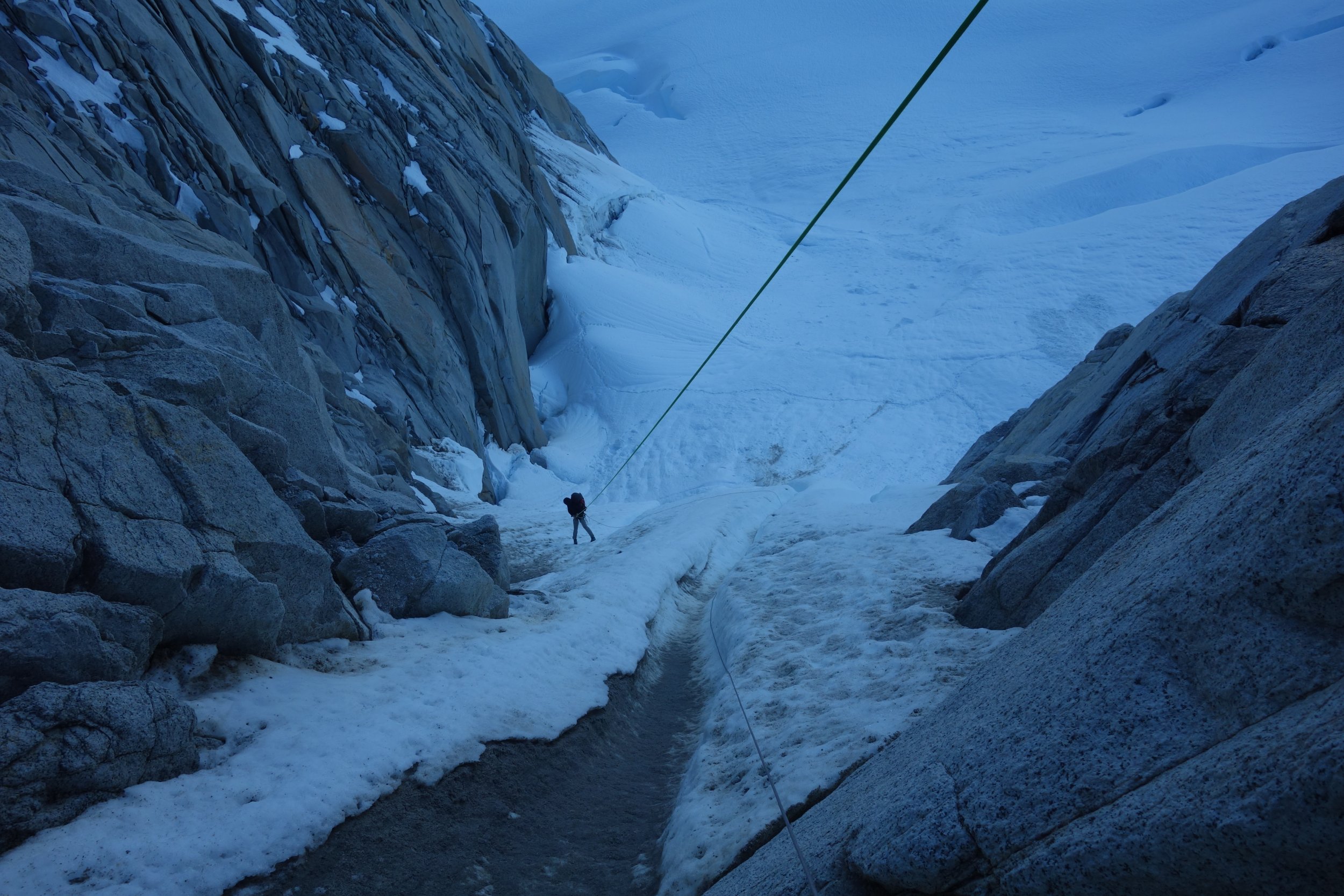
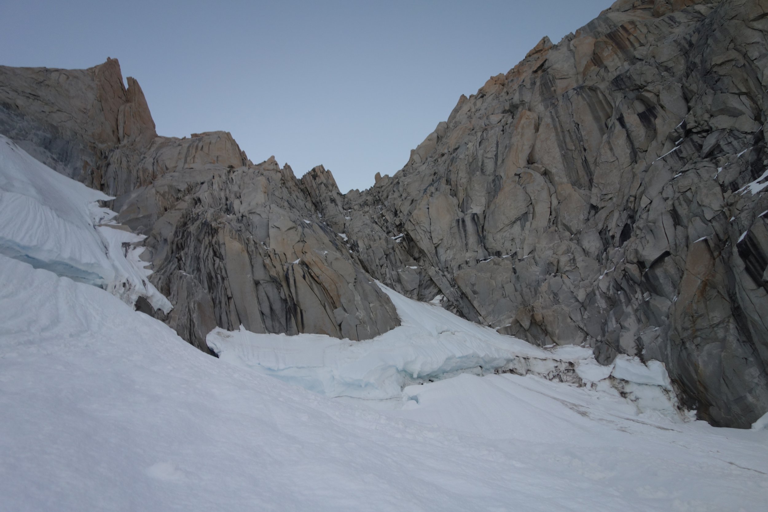
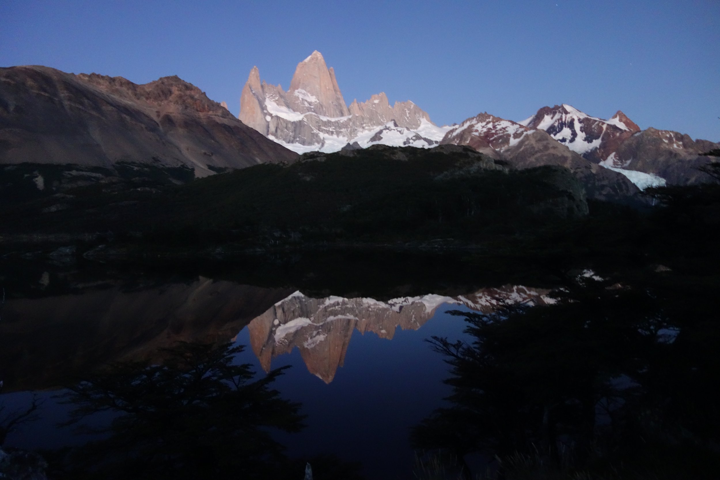
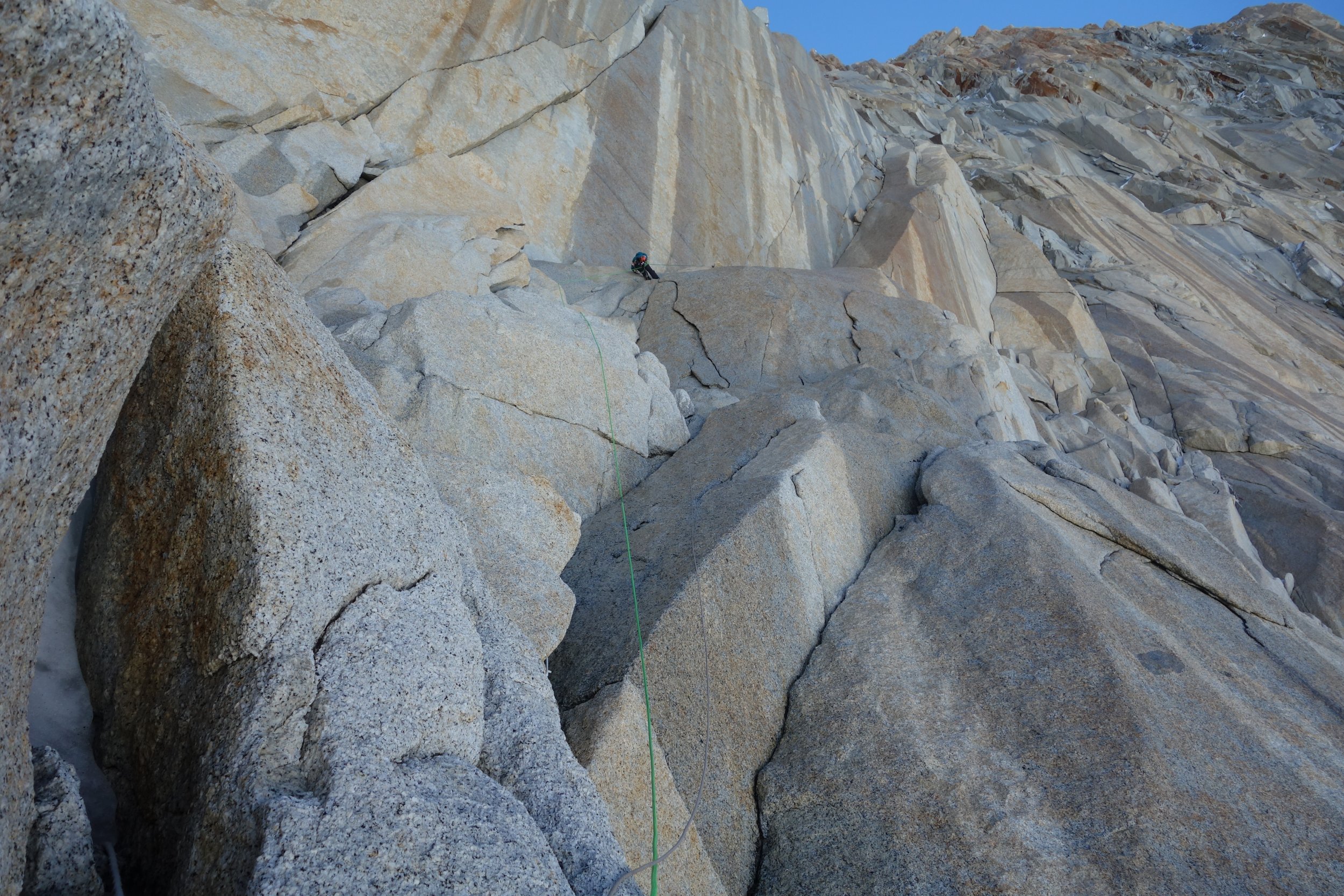
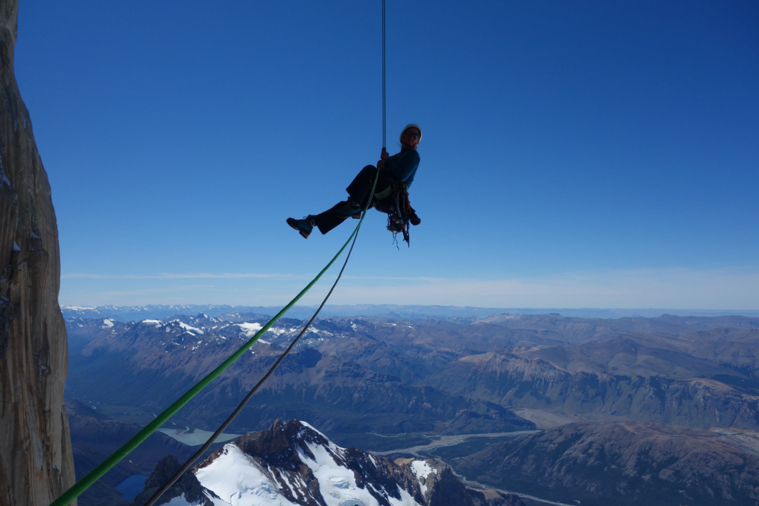

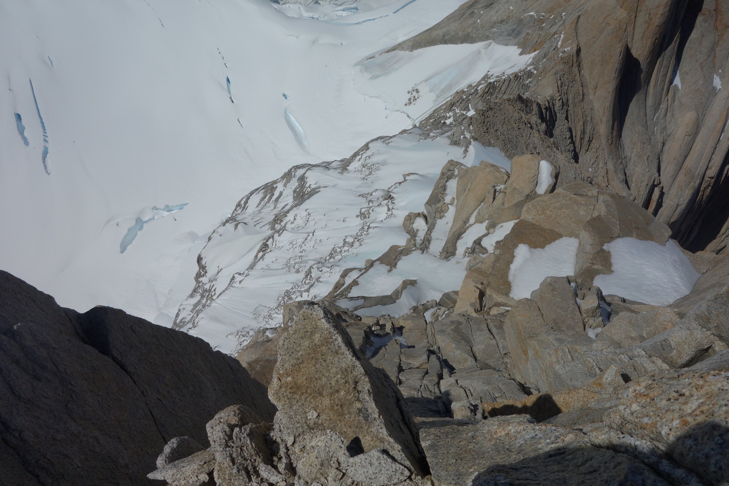
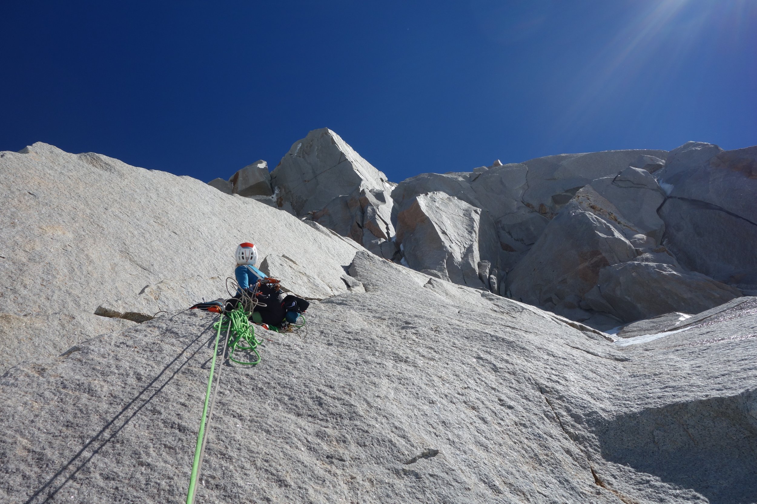

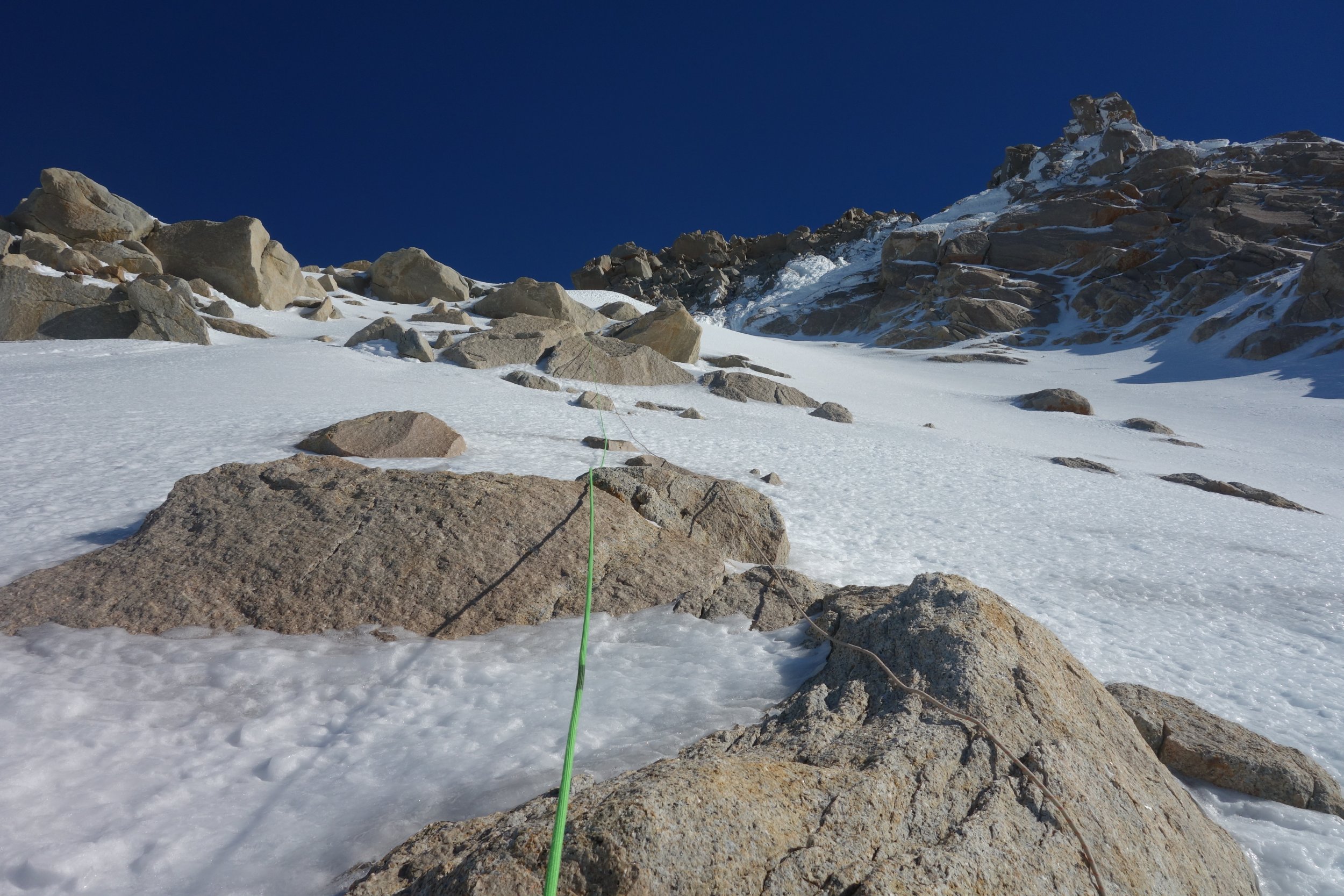
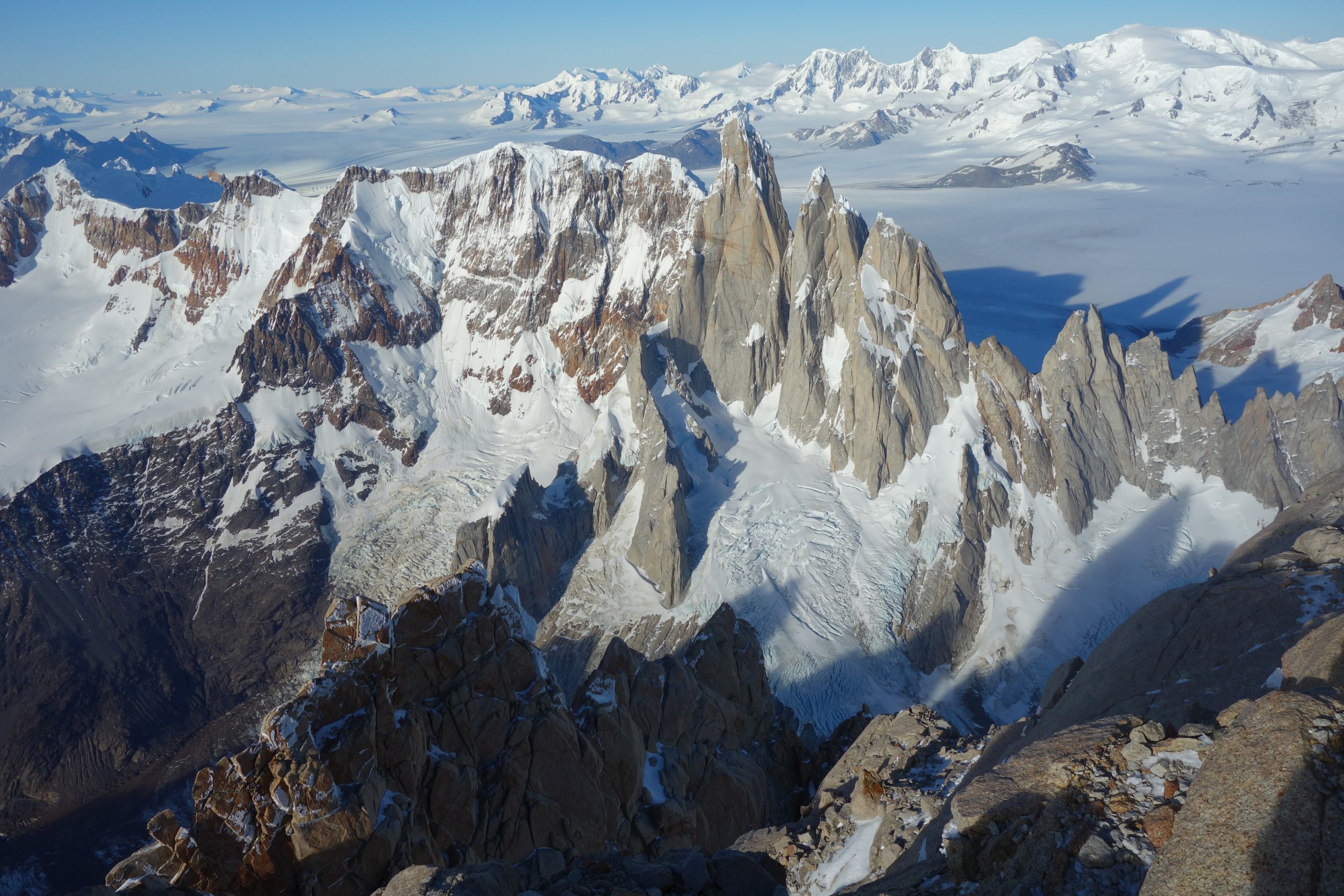
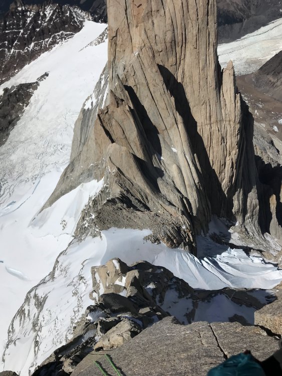
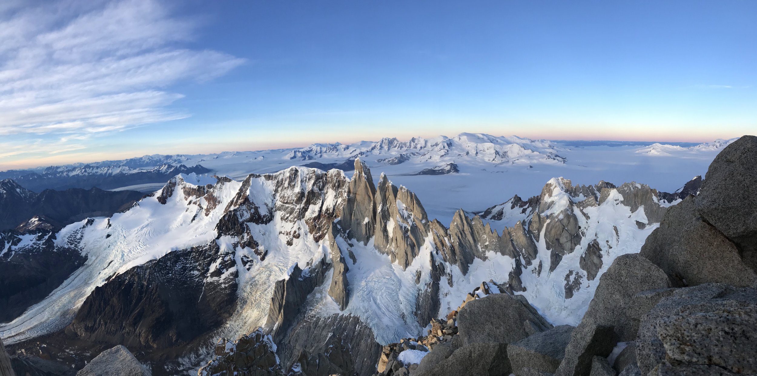
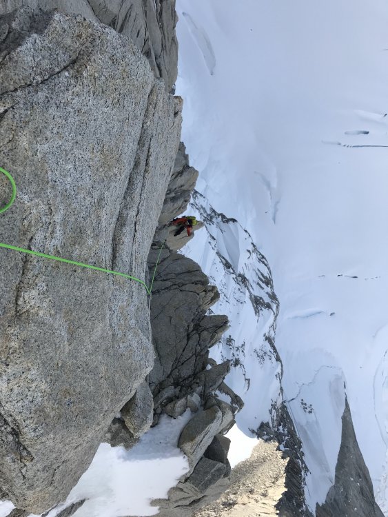

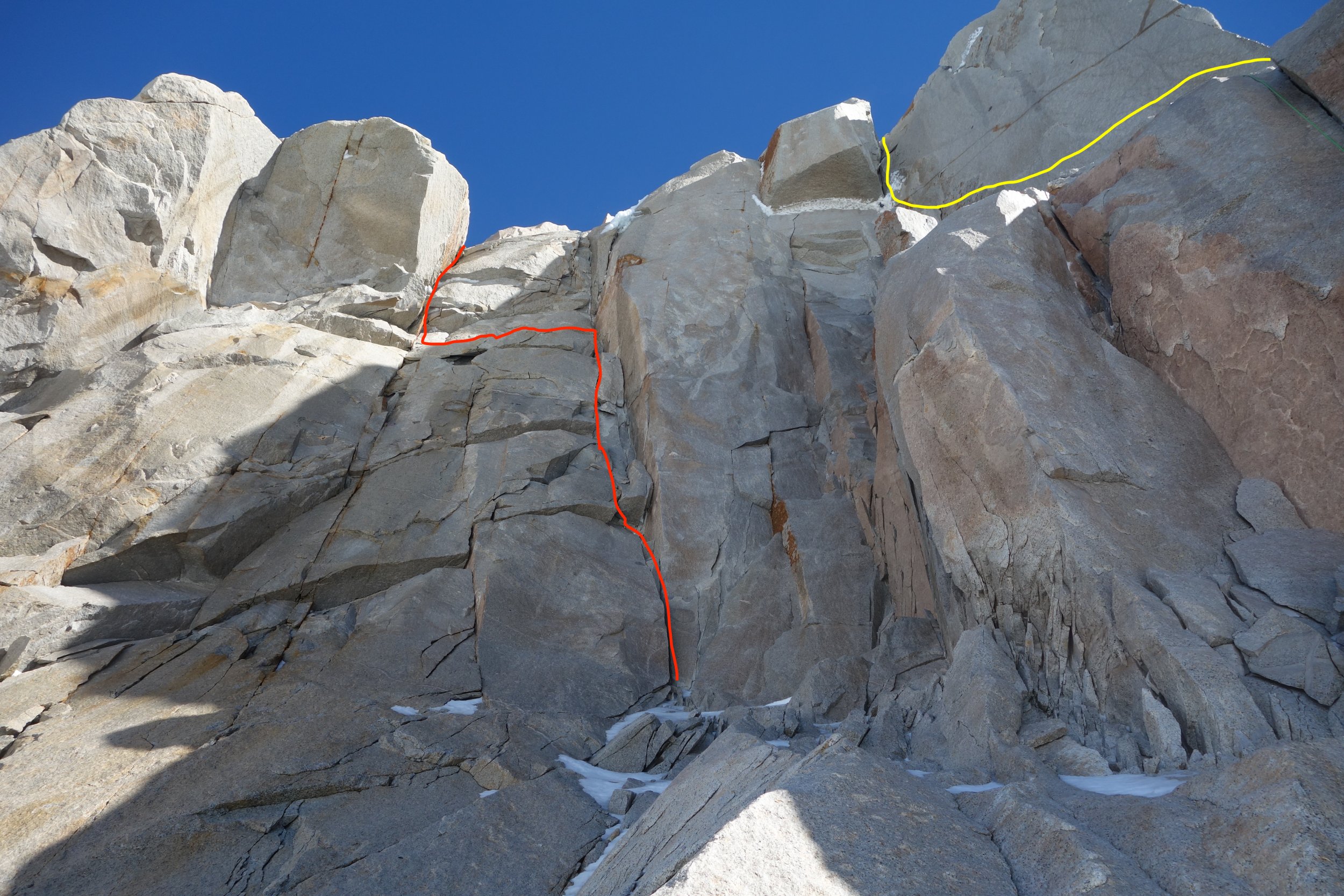
 11 points


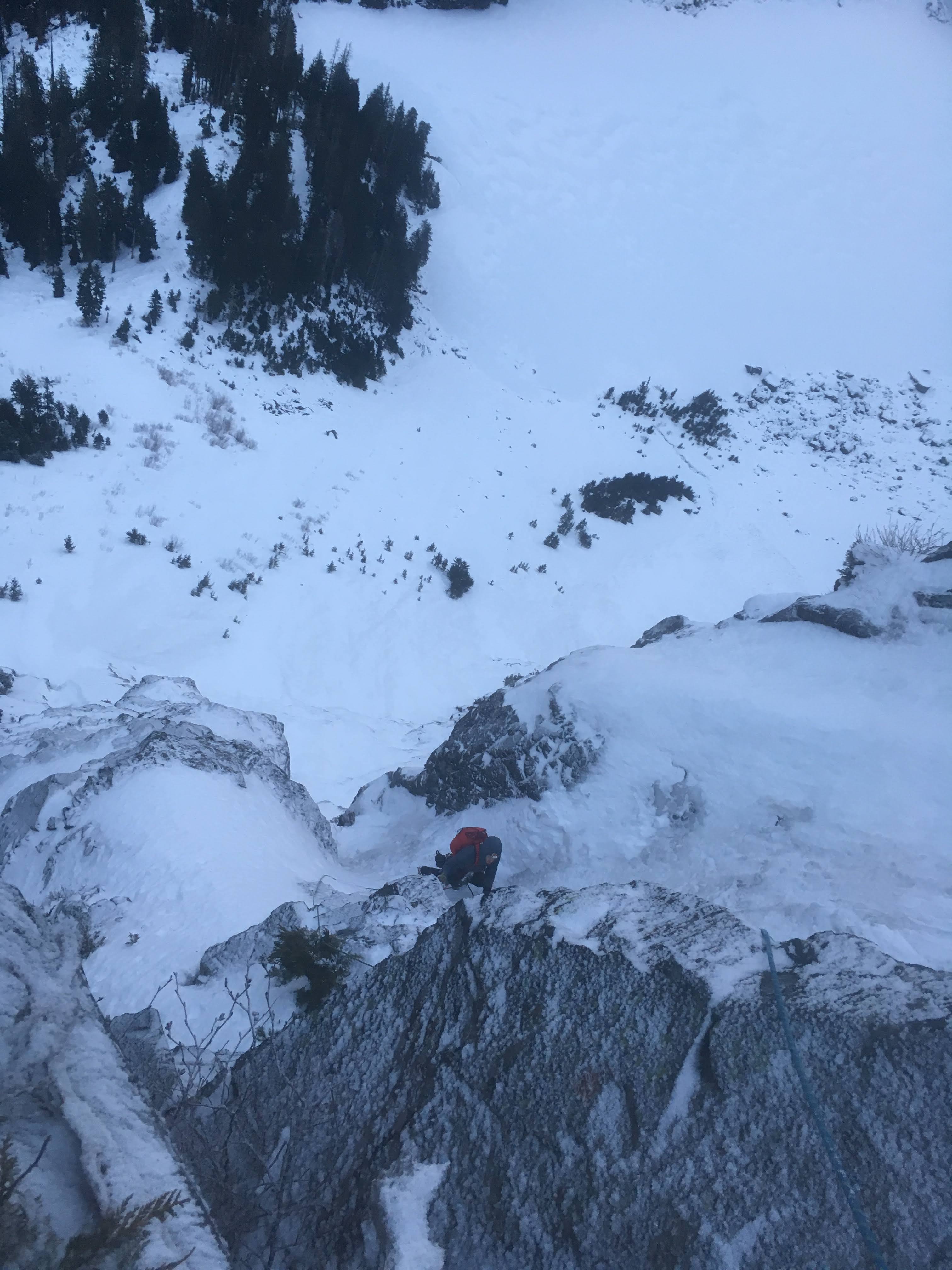
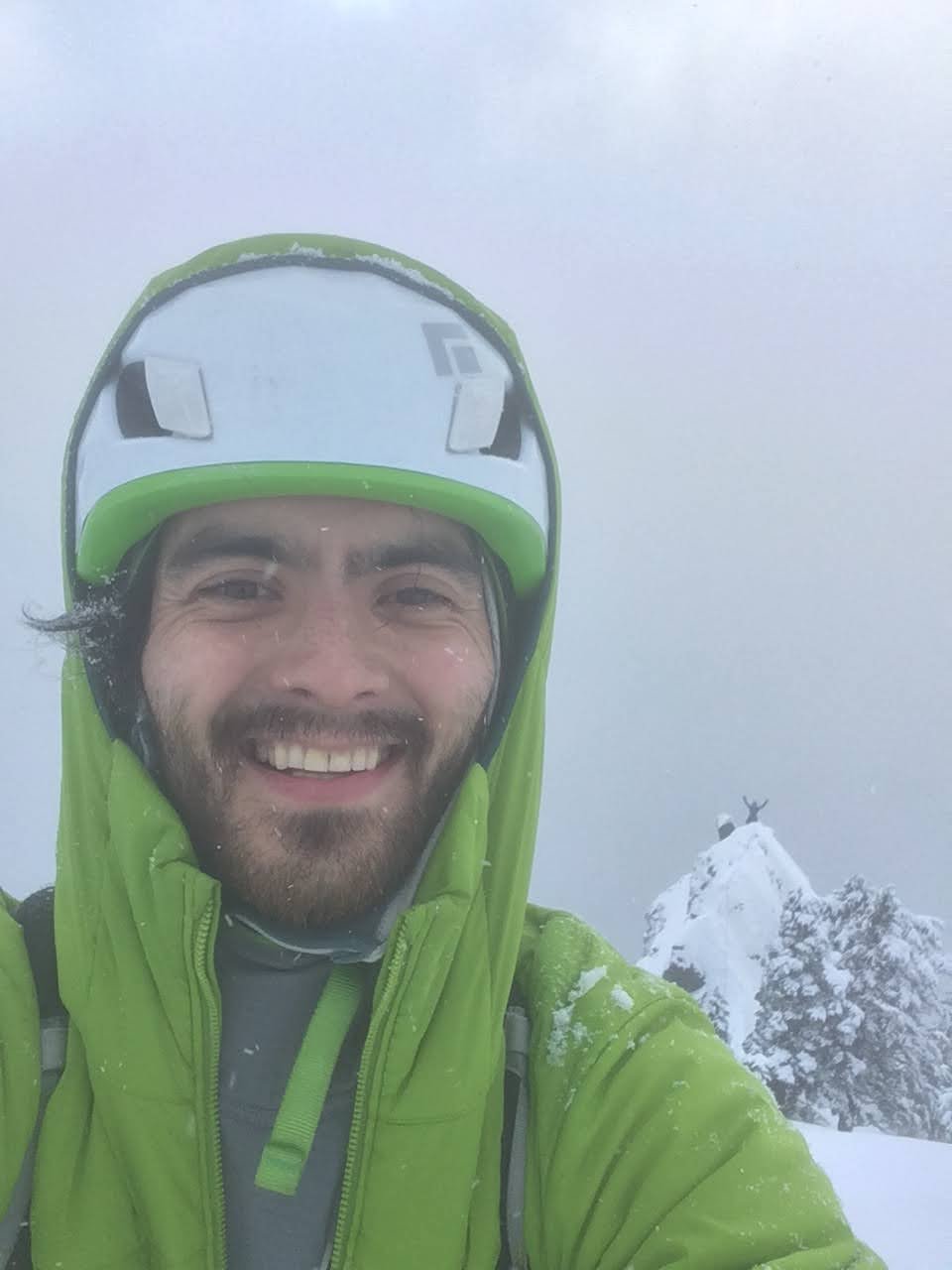

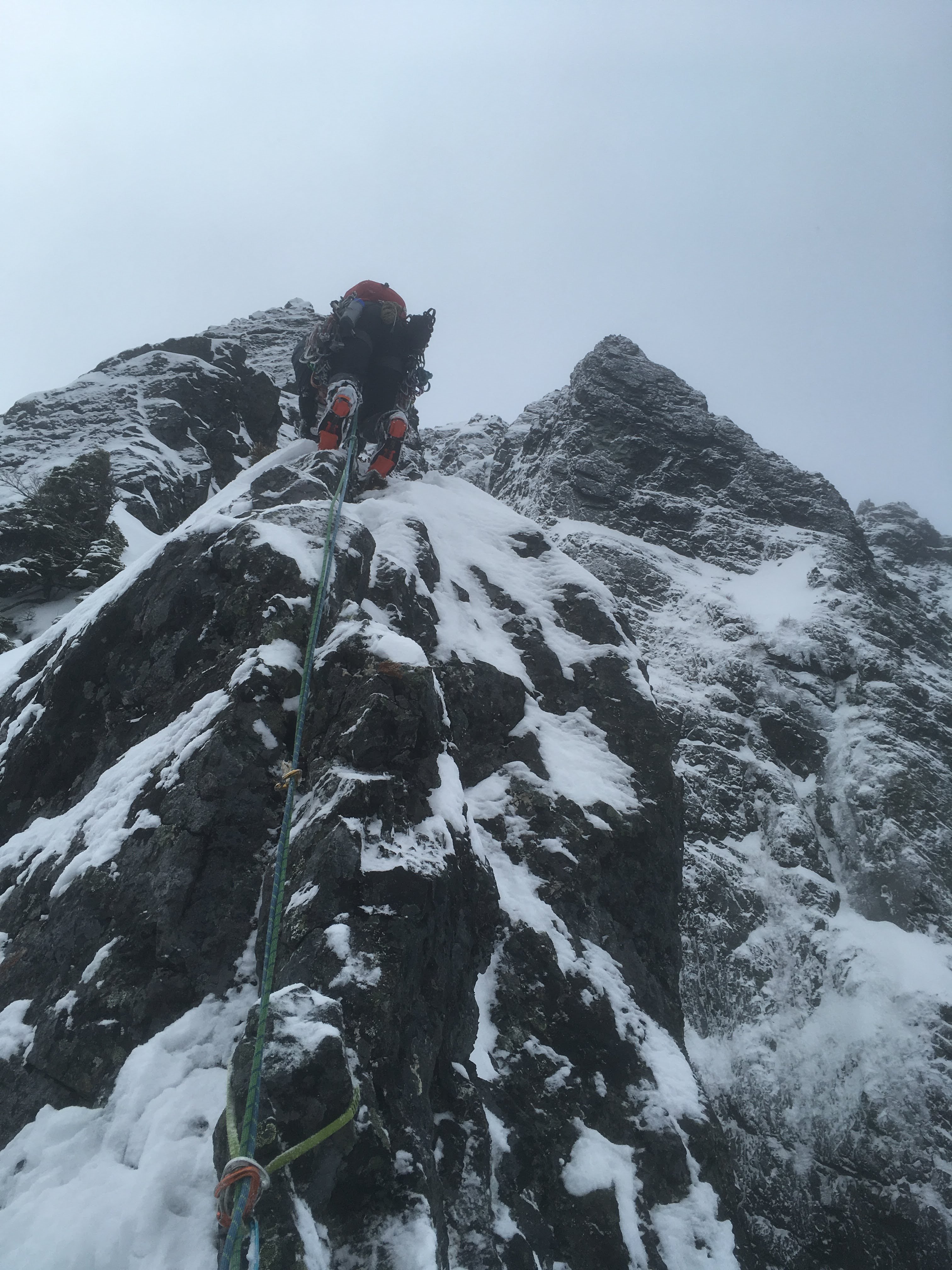


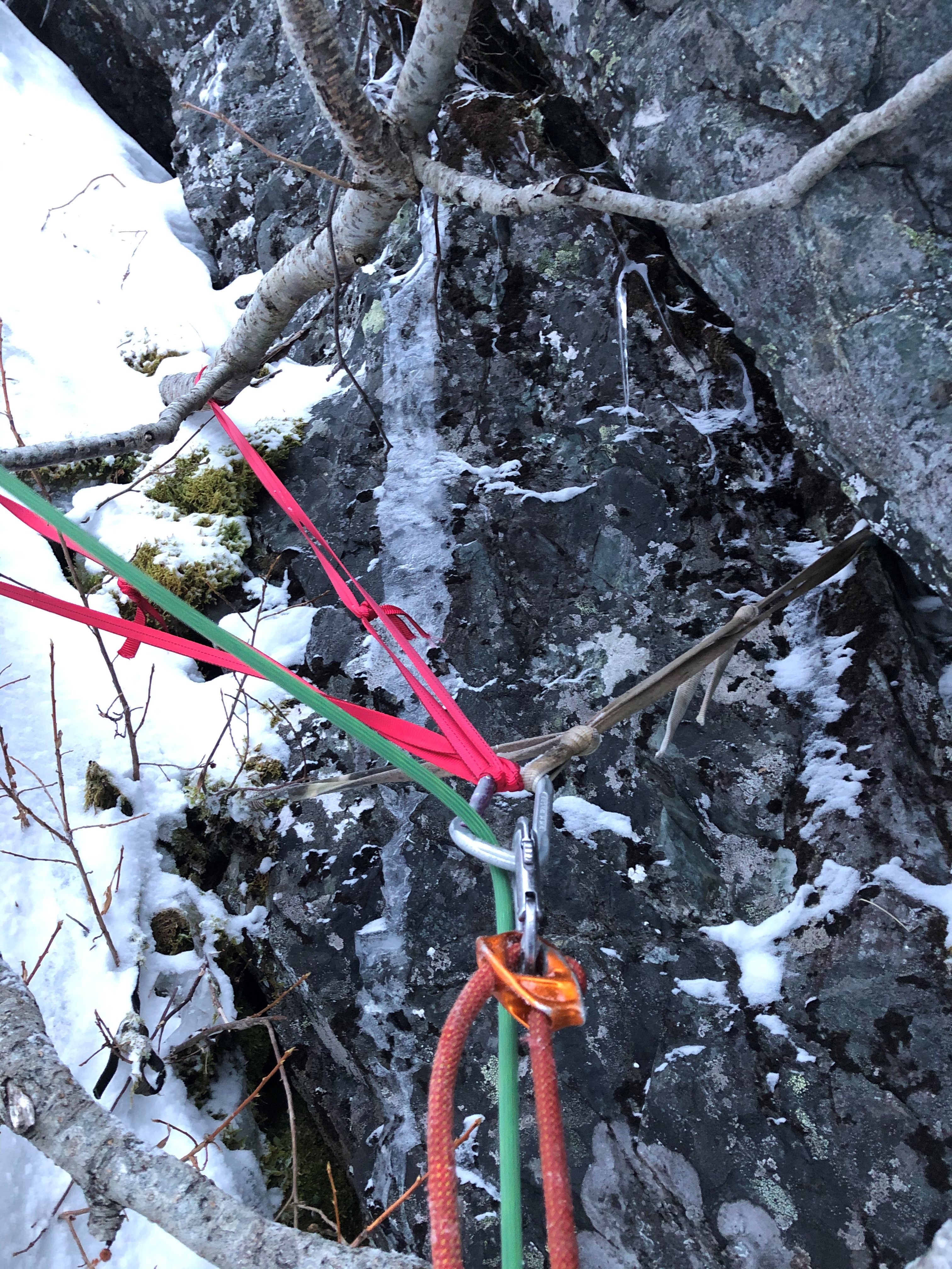

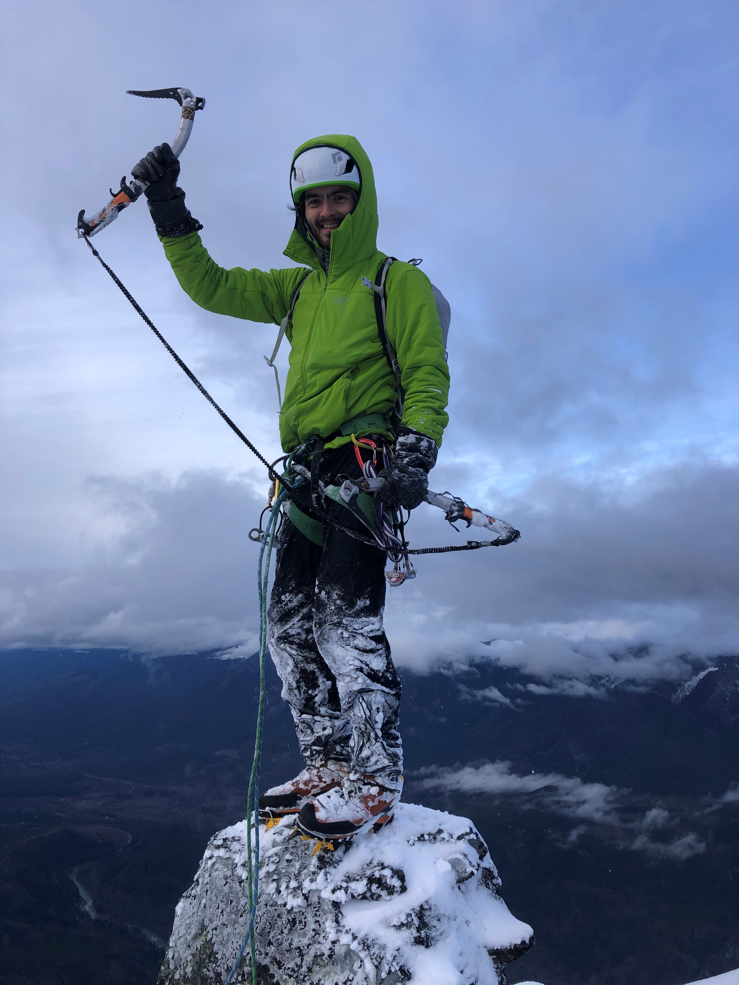
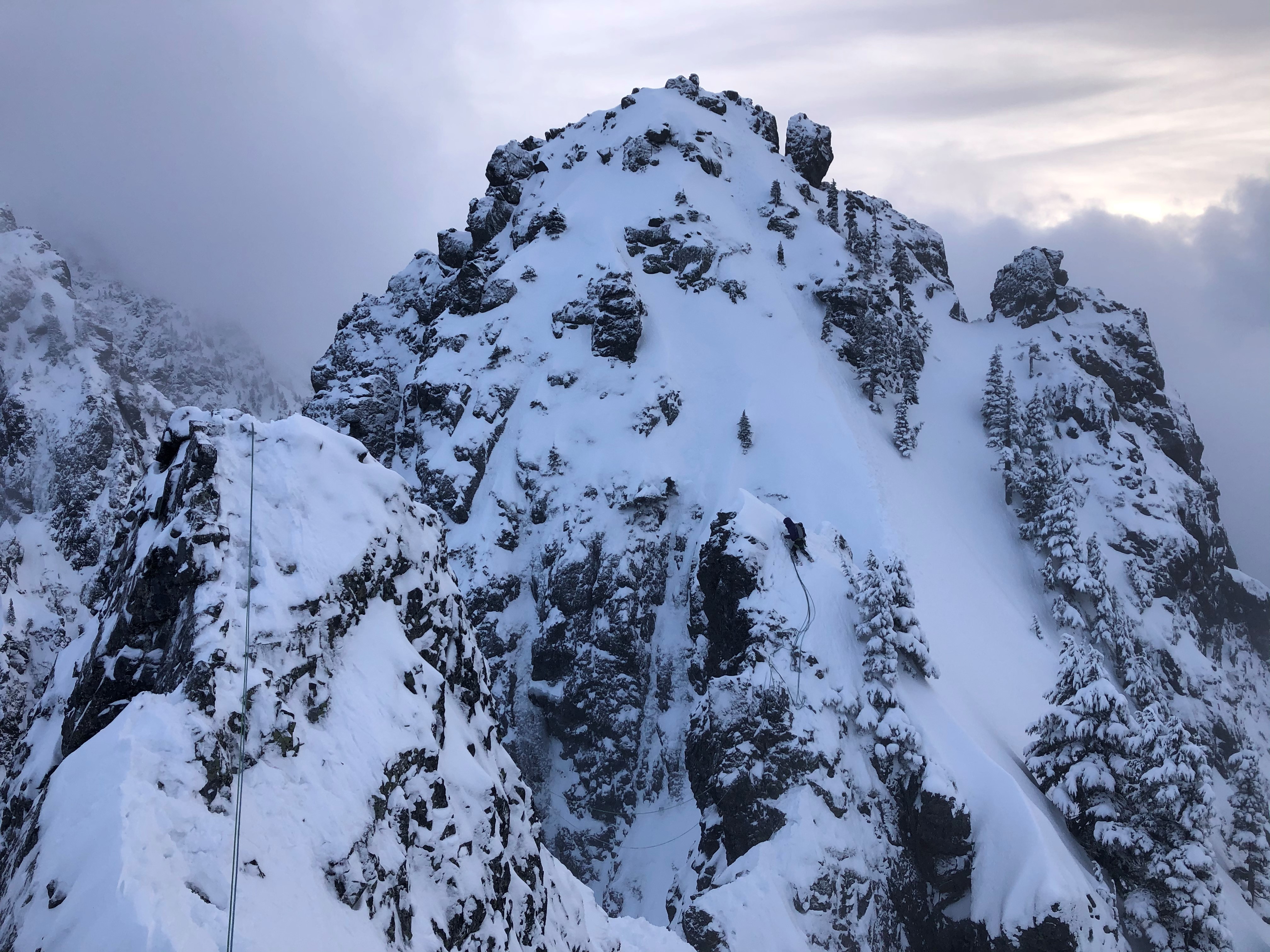


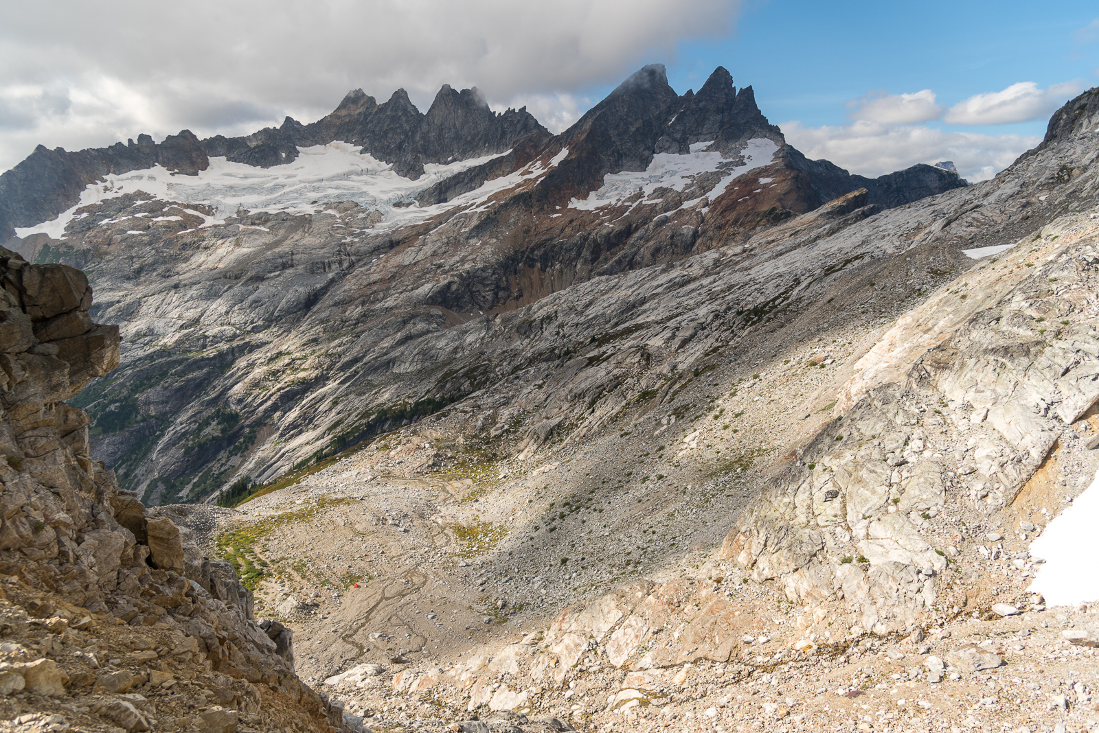


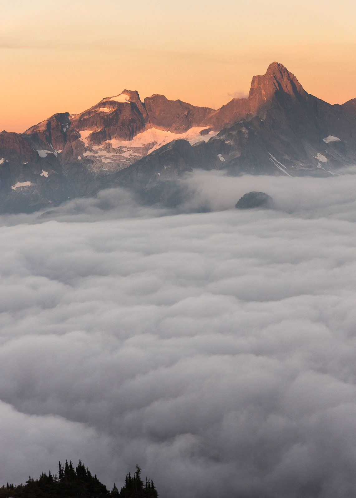
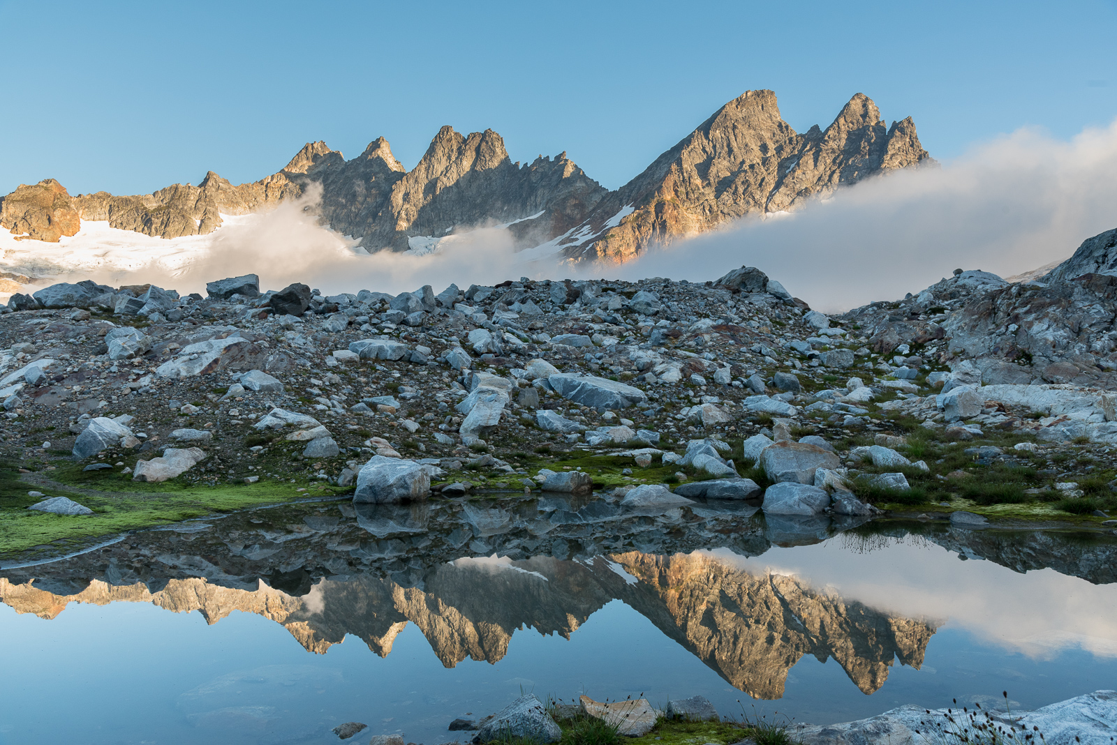


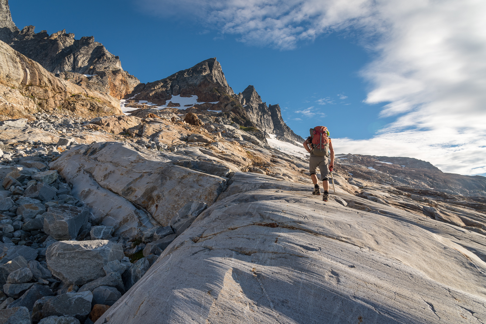
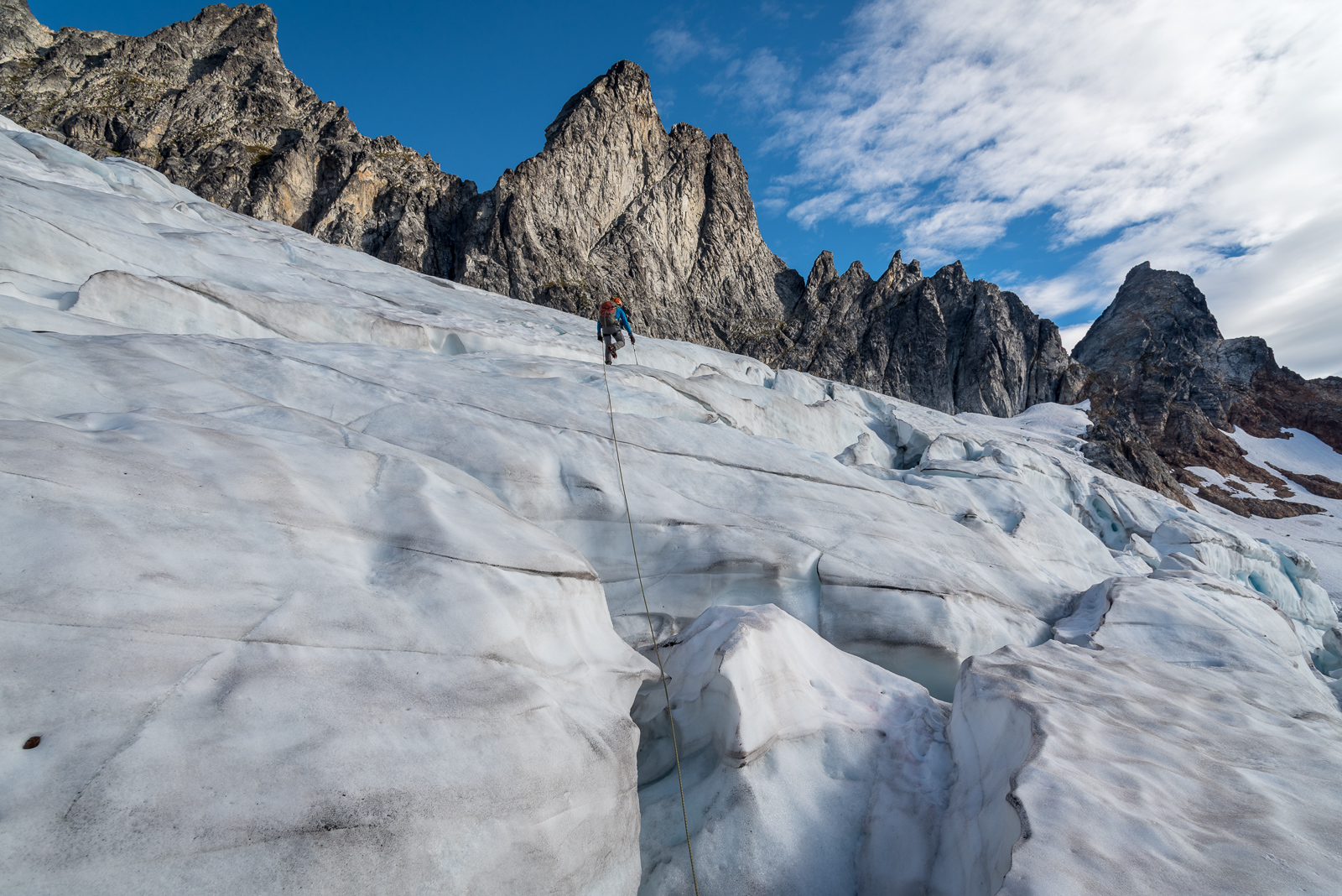
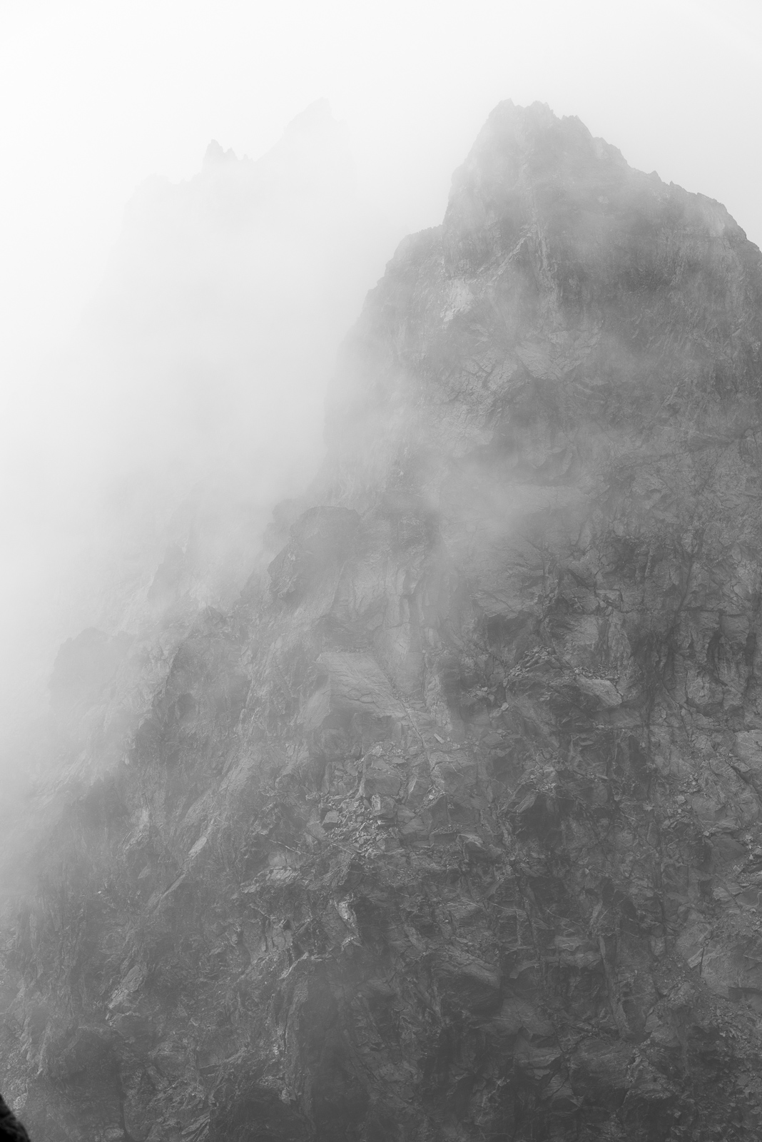

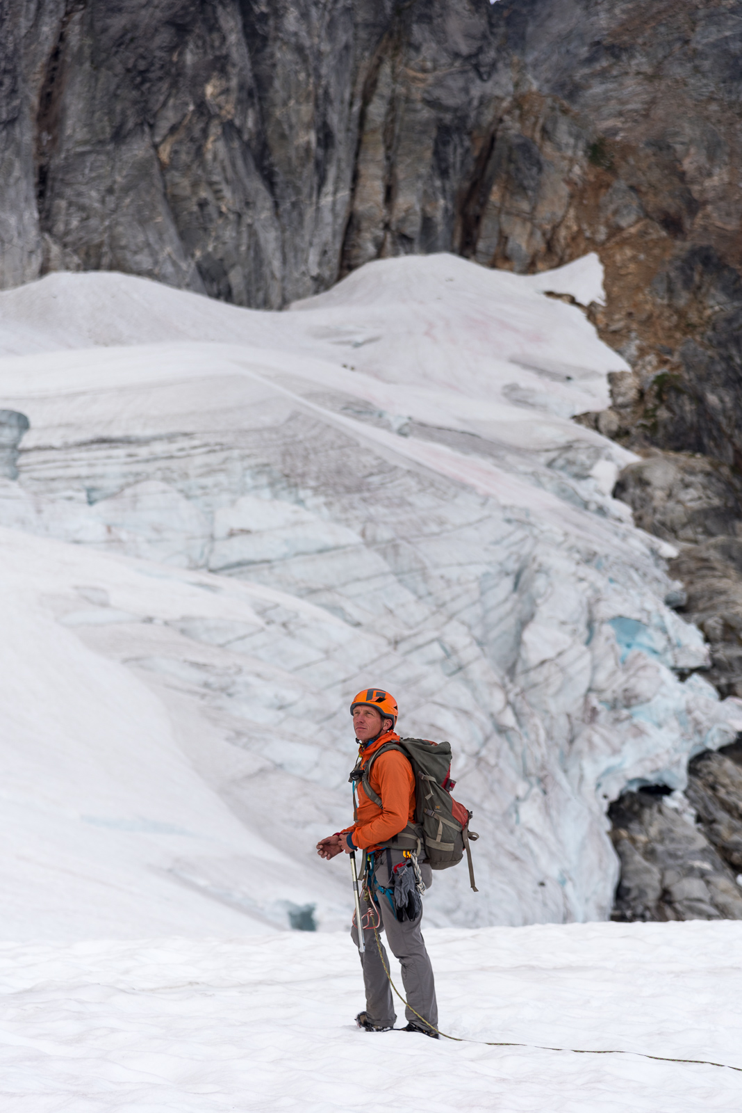

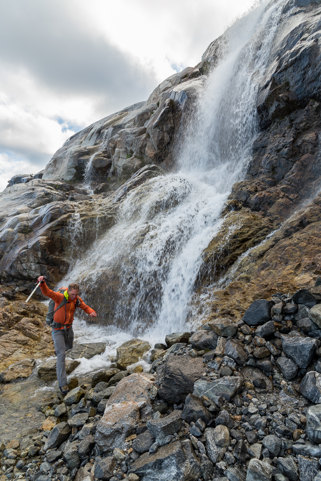

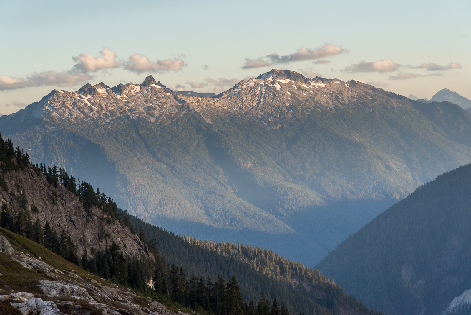
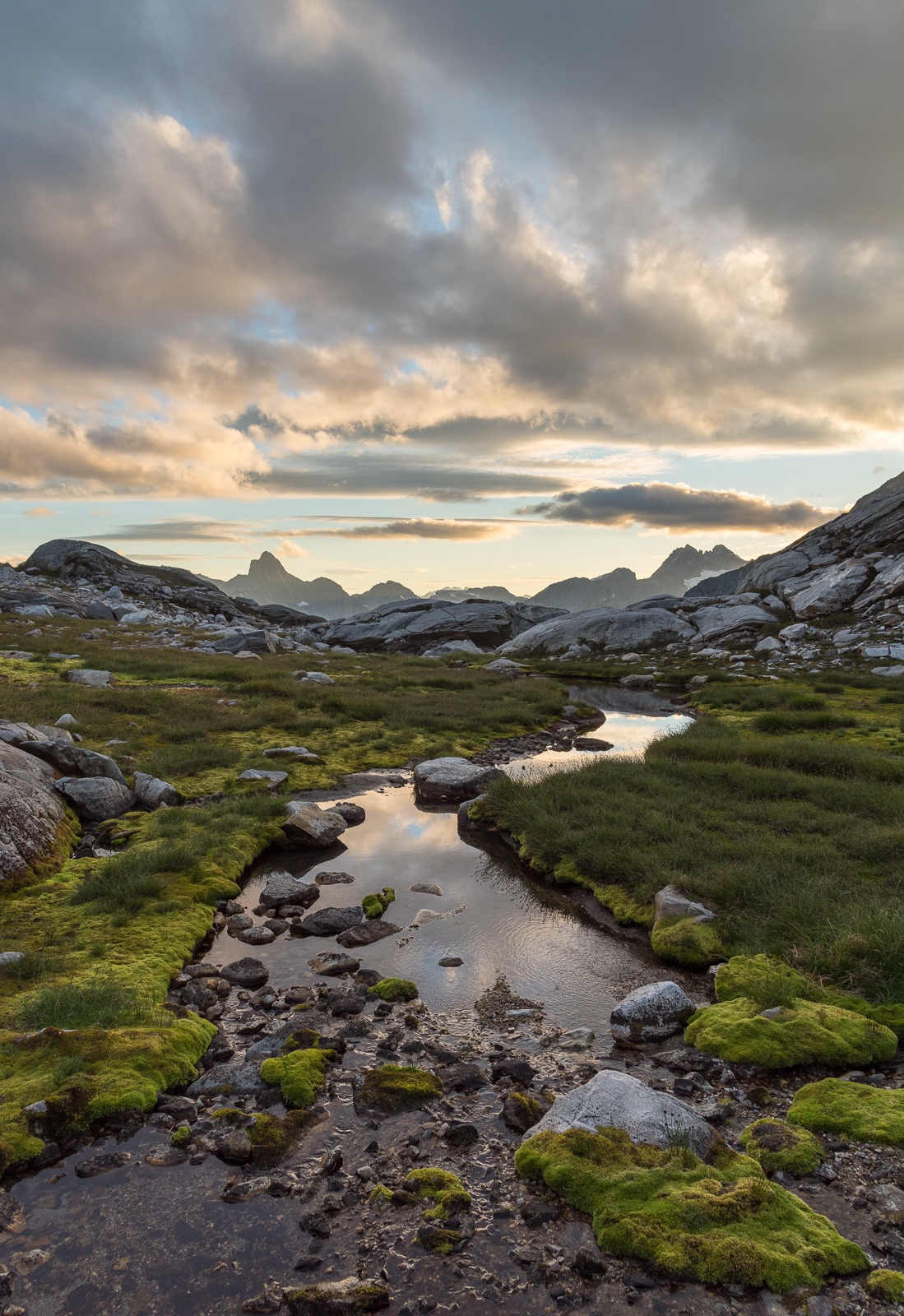

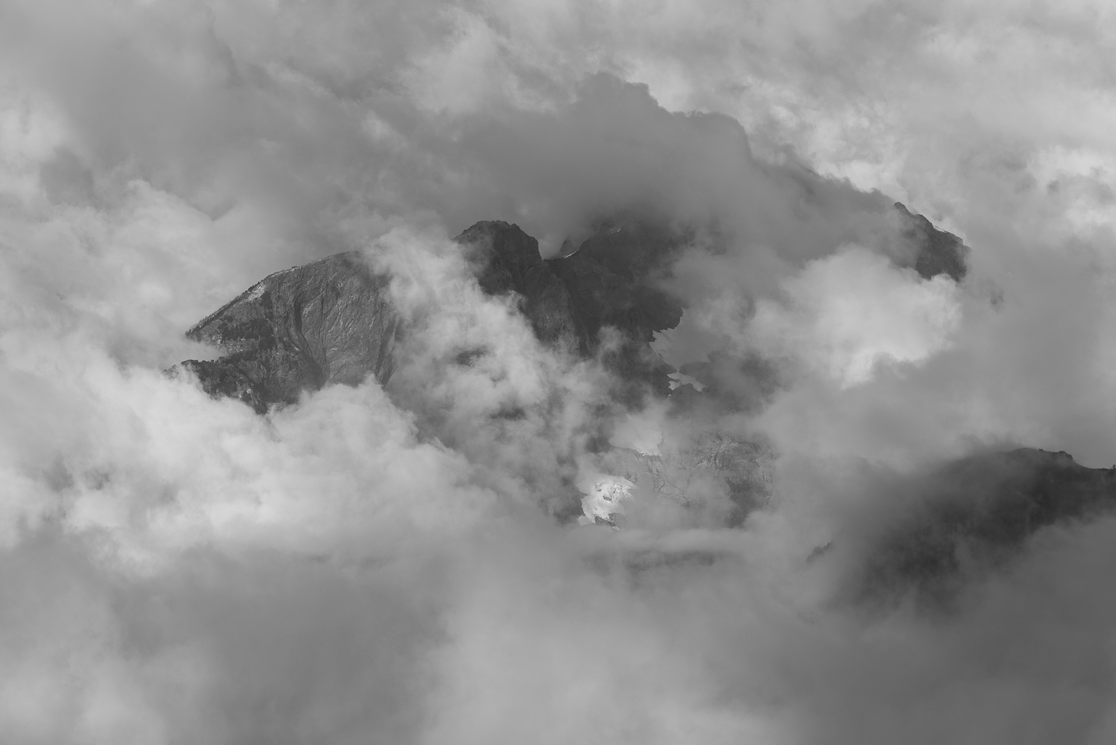
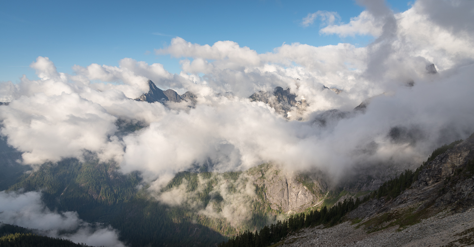
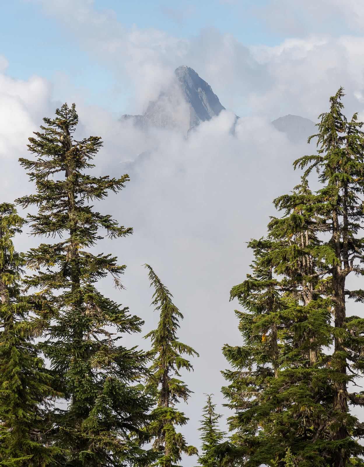

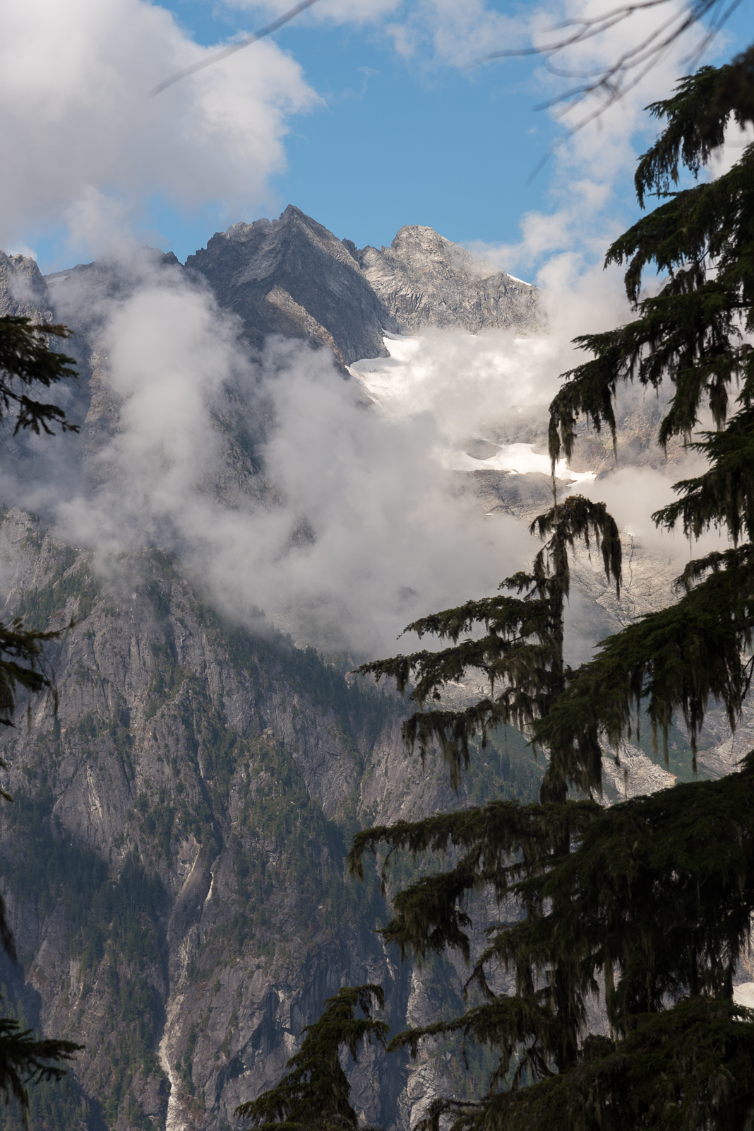

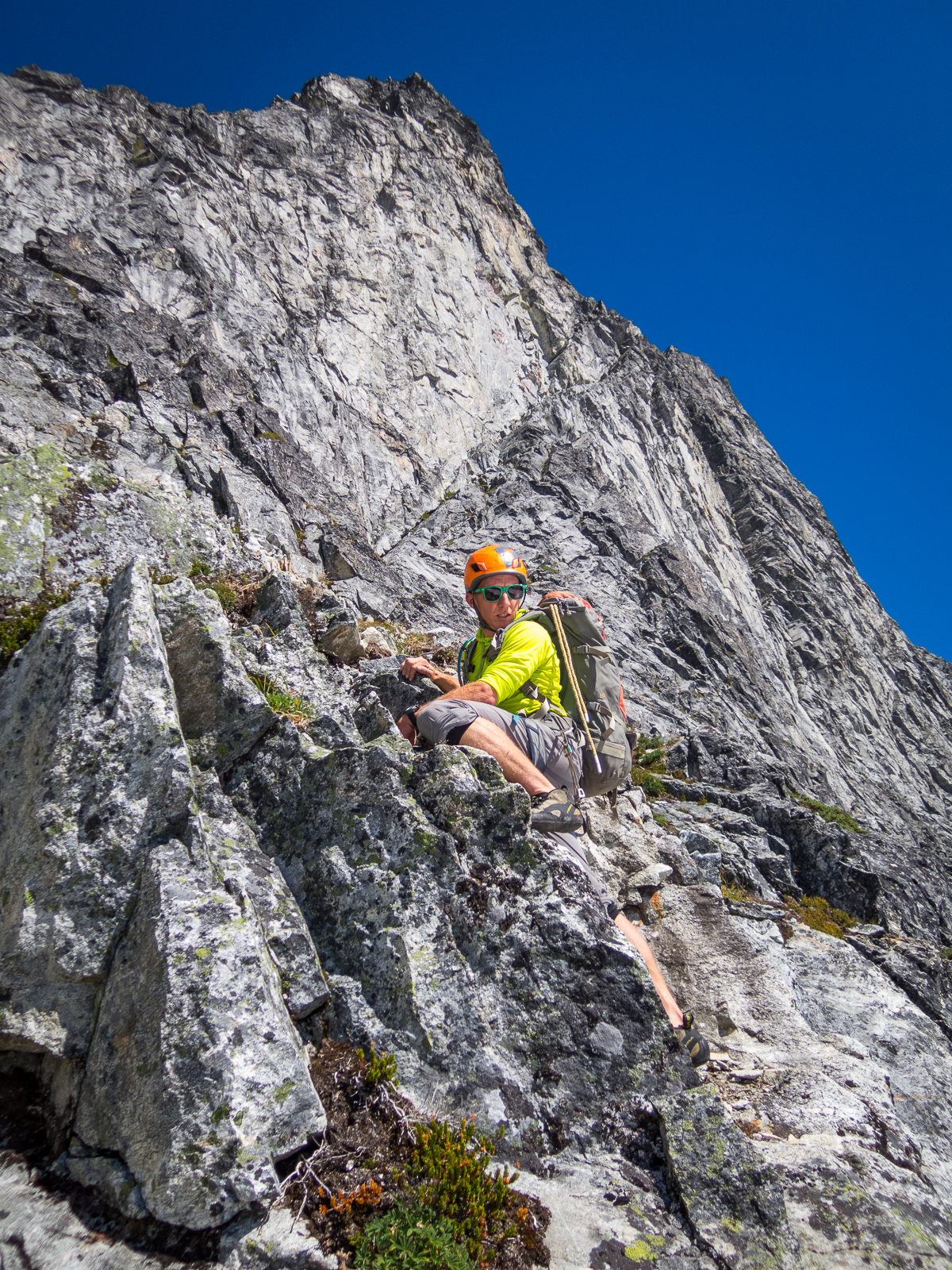

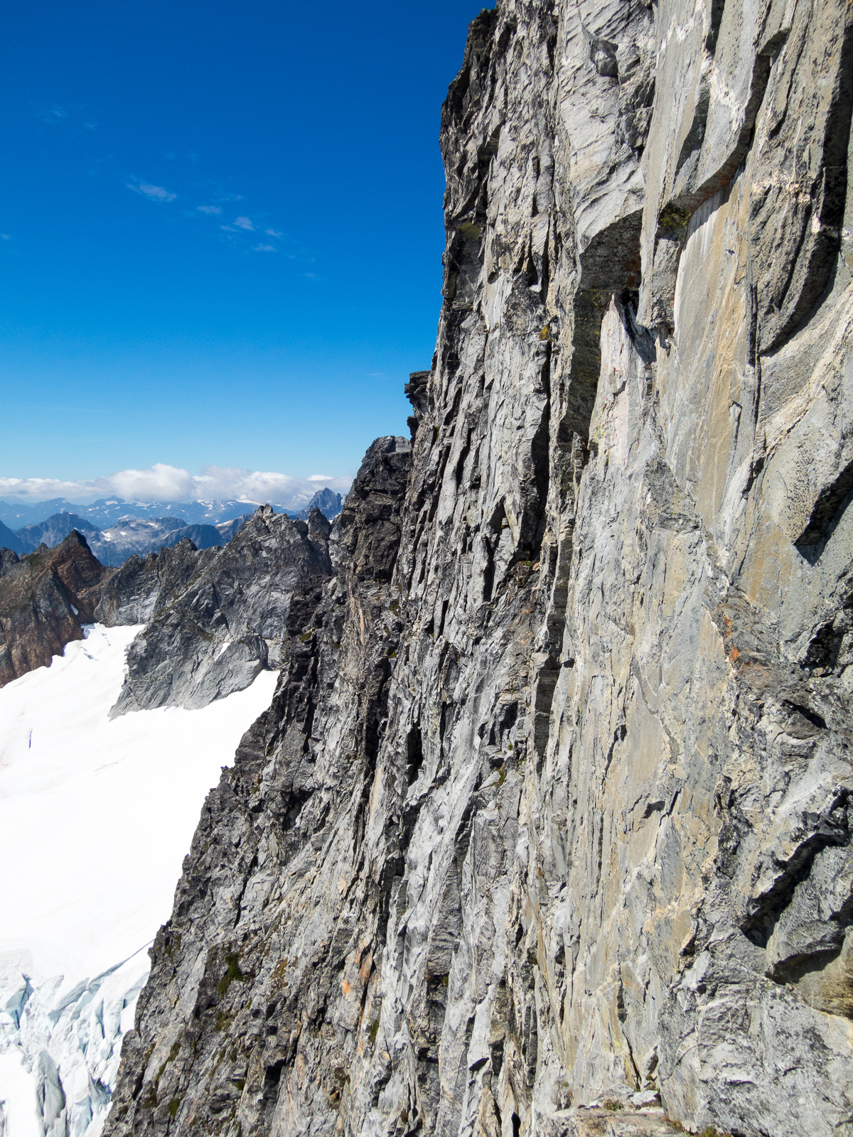

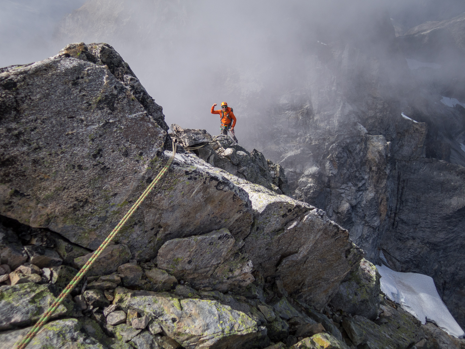
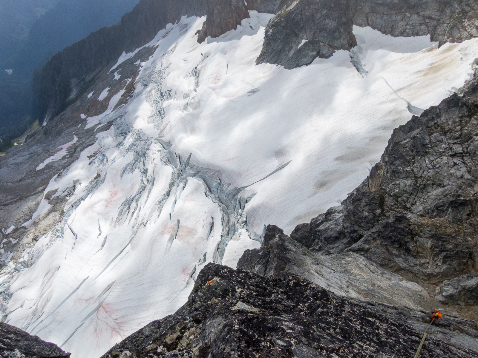
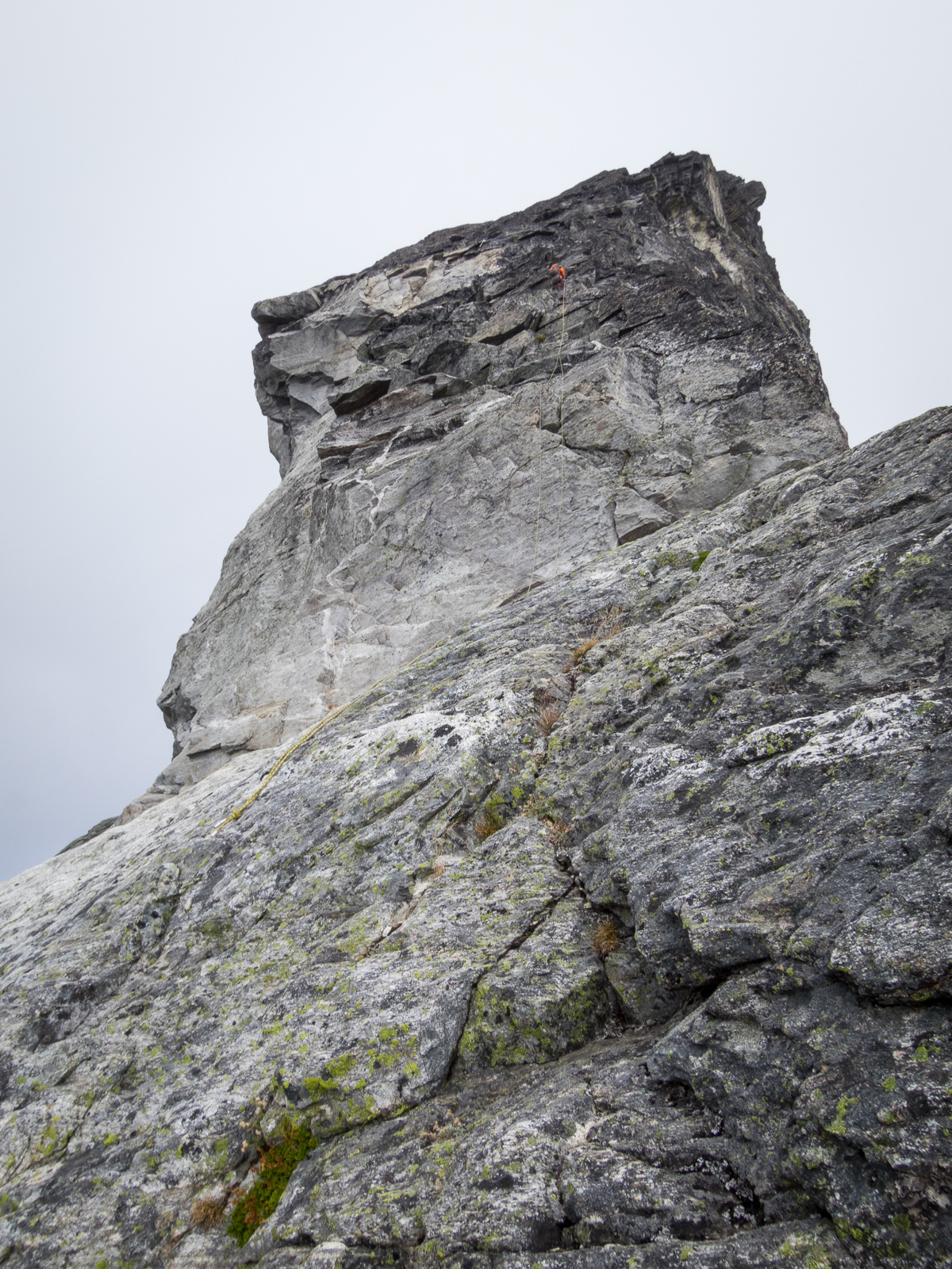


.jpg.74a83e32c23ede1e3e1945d3180392fb.jpg)
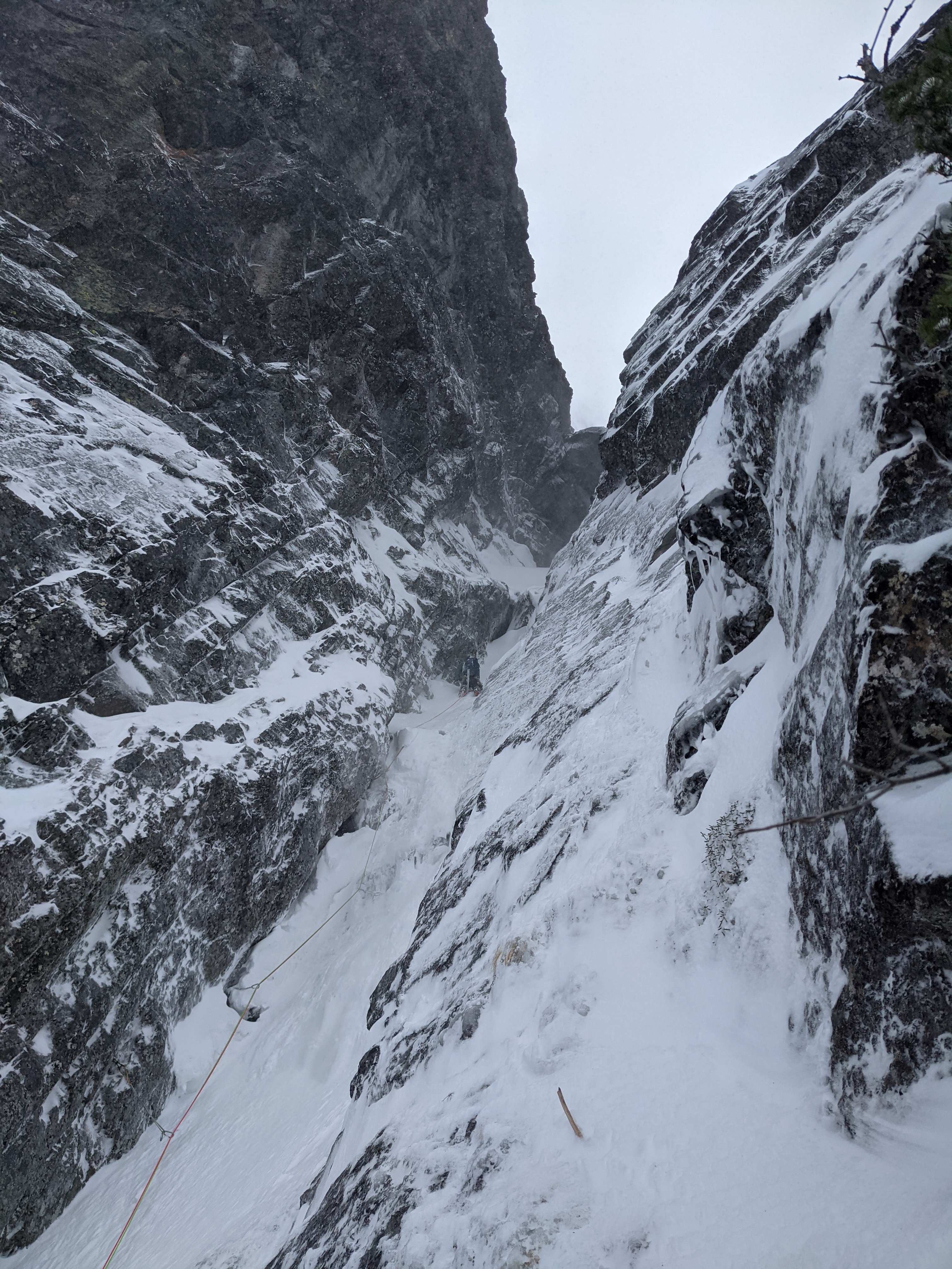

.jpg.84468862a10371d548dd223cb4792971.jpg)
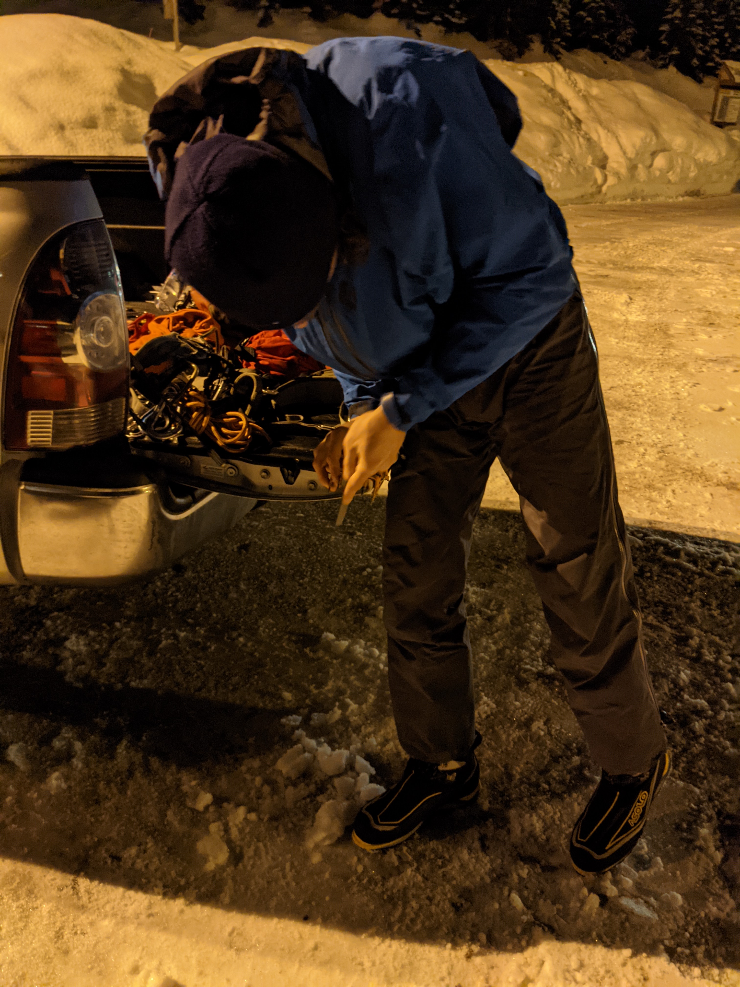
.jpg.ff631c467872d4b316c759bed0ddf9d0.jpg)