


mthorman
-
Posts
314 -
Joined
-
Last visited
-
Days Won
25
2 Followers

Recent Profile Visitors
4253 profile views


mthorman's Achievements
")


-
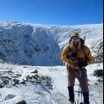
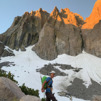
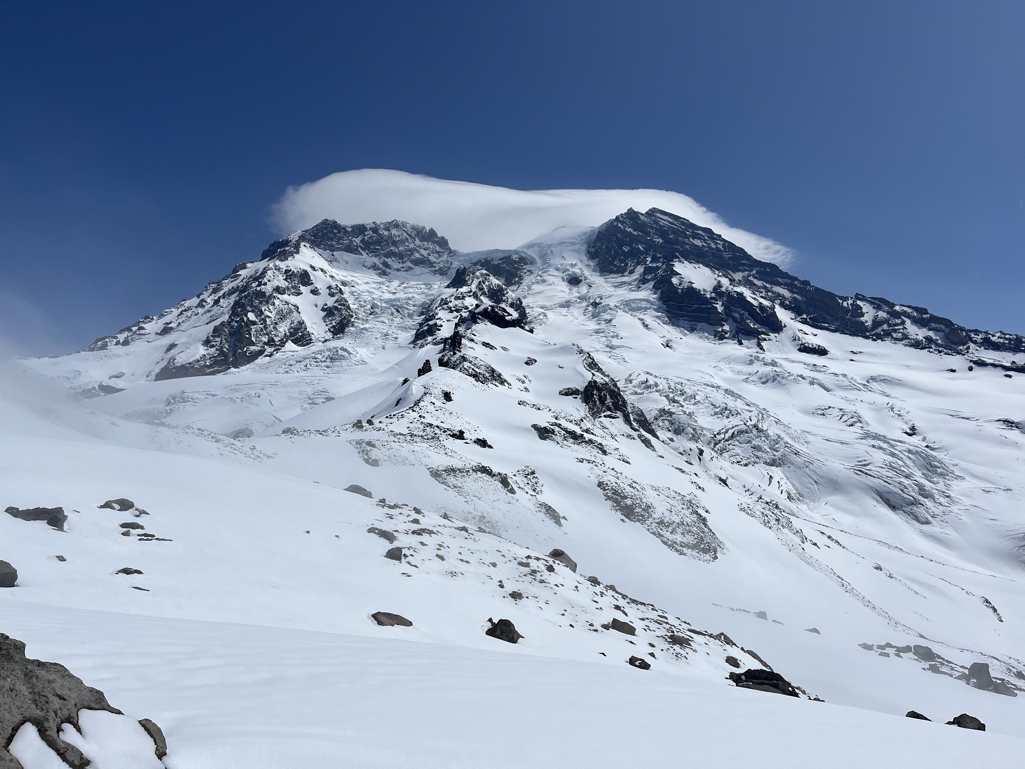
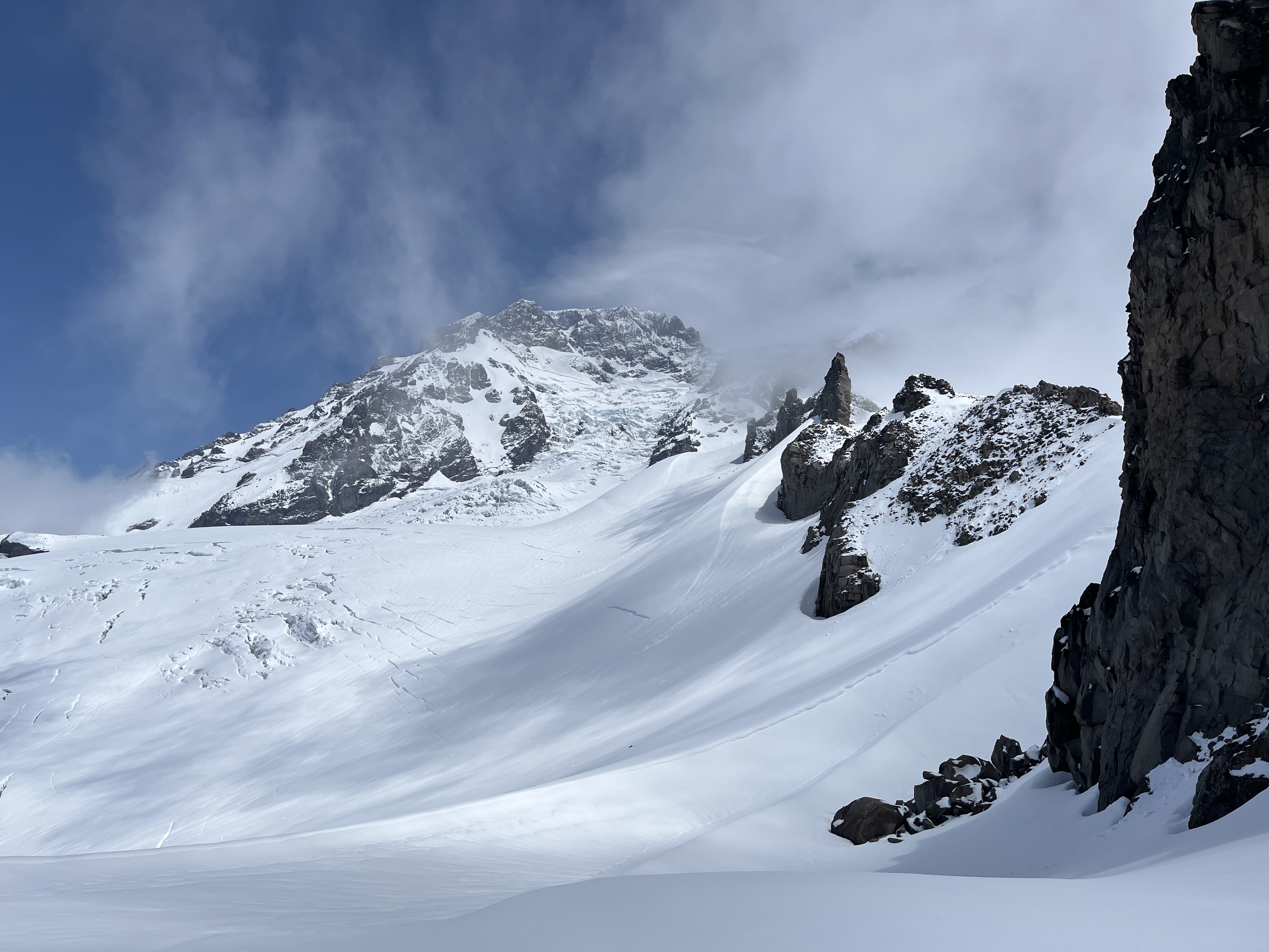
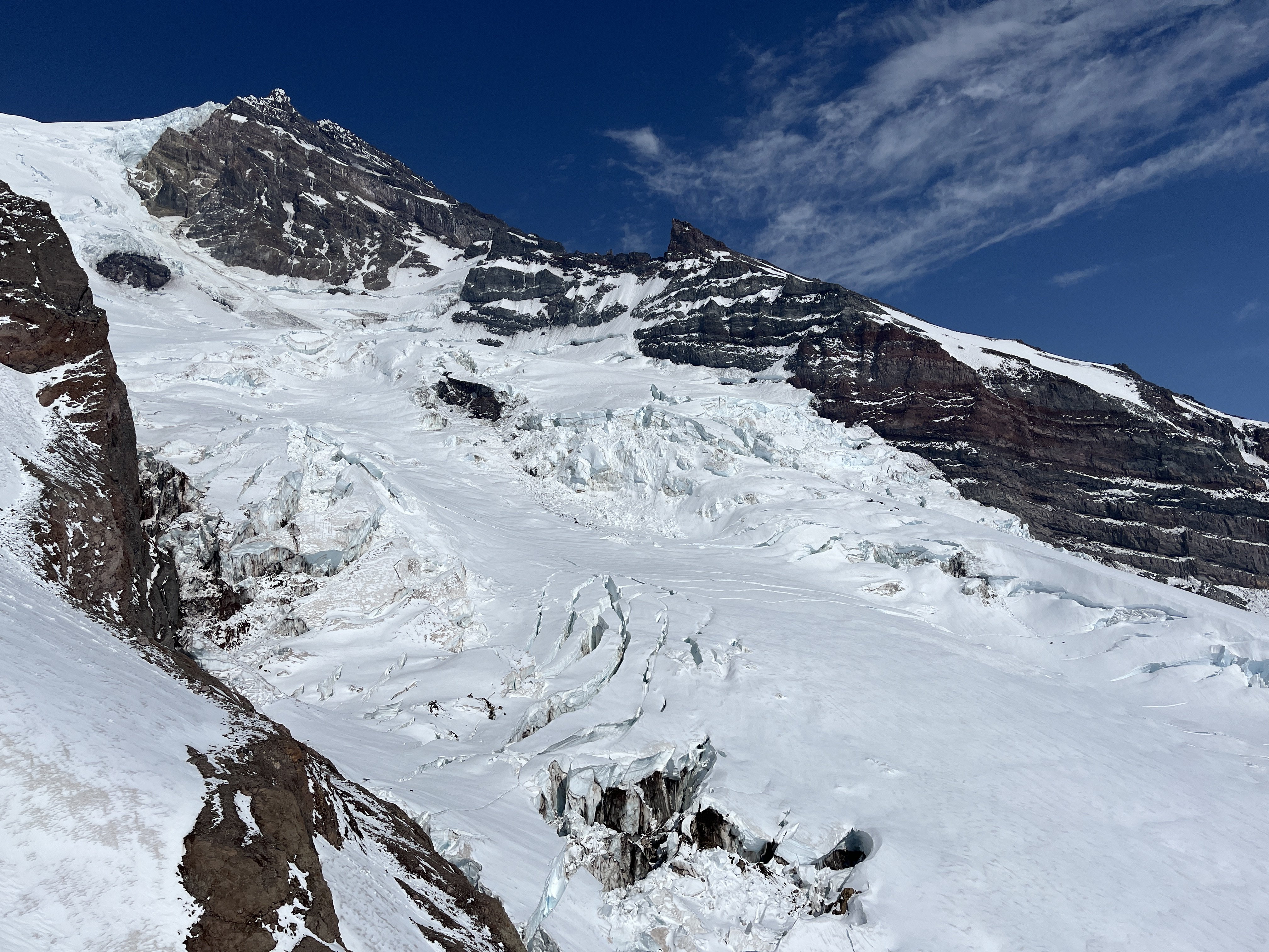
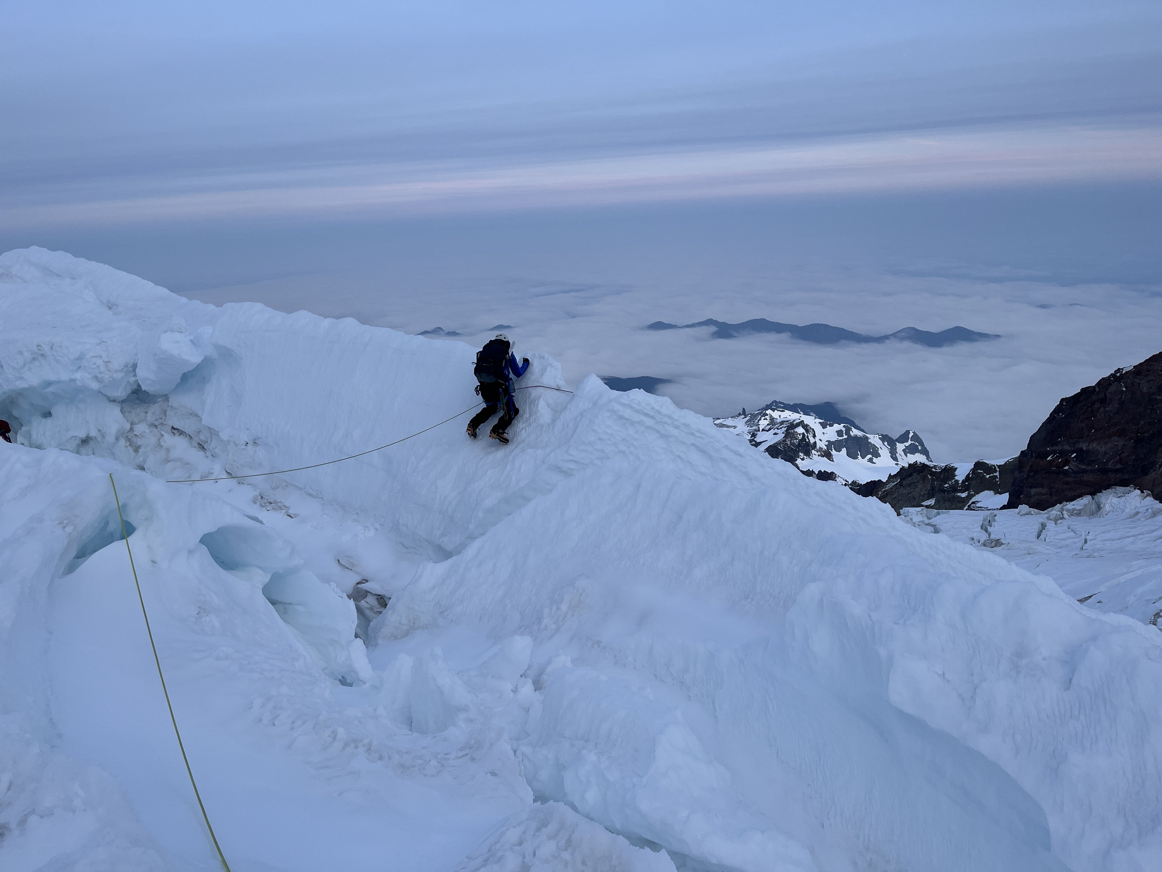
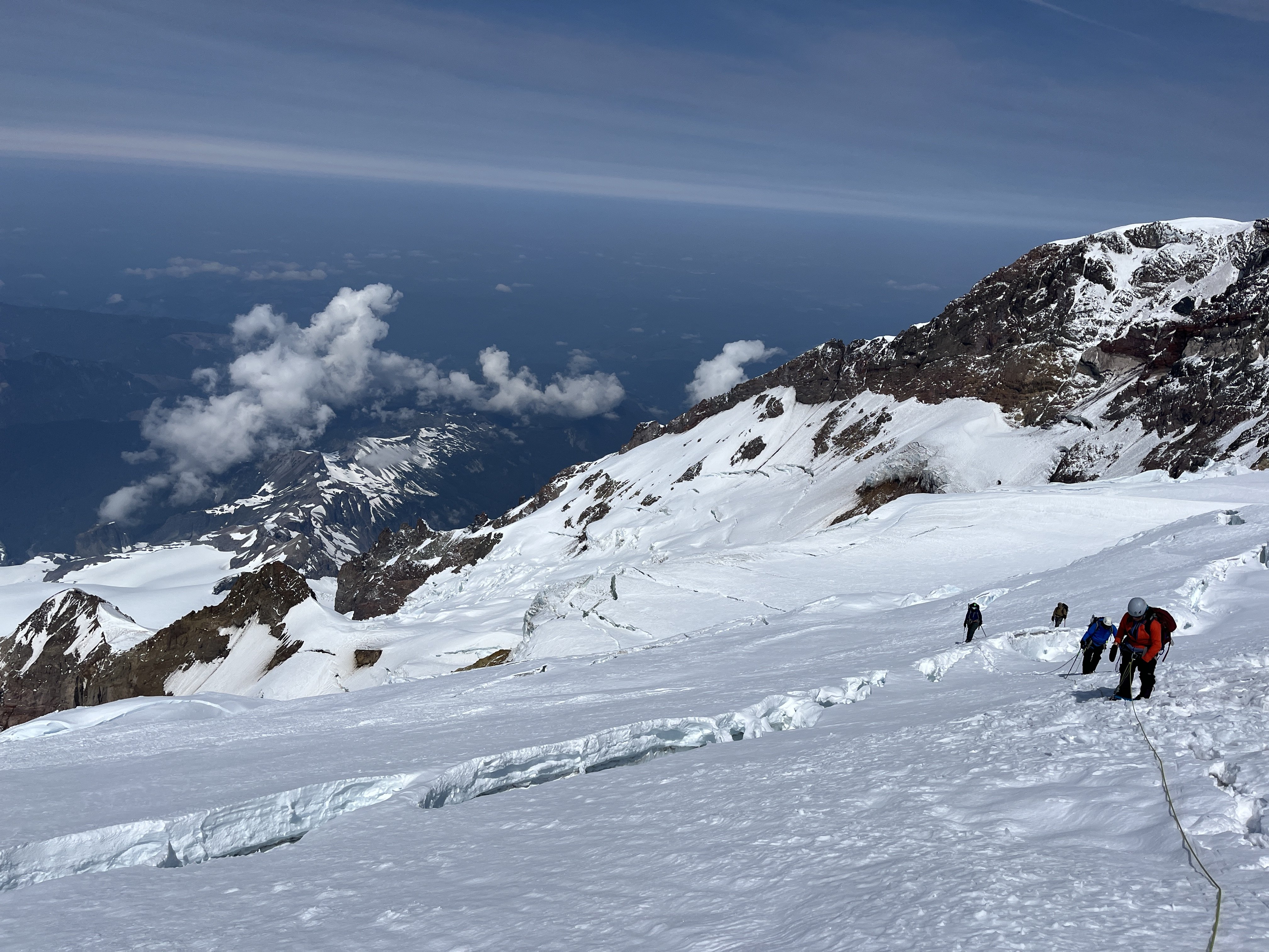
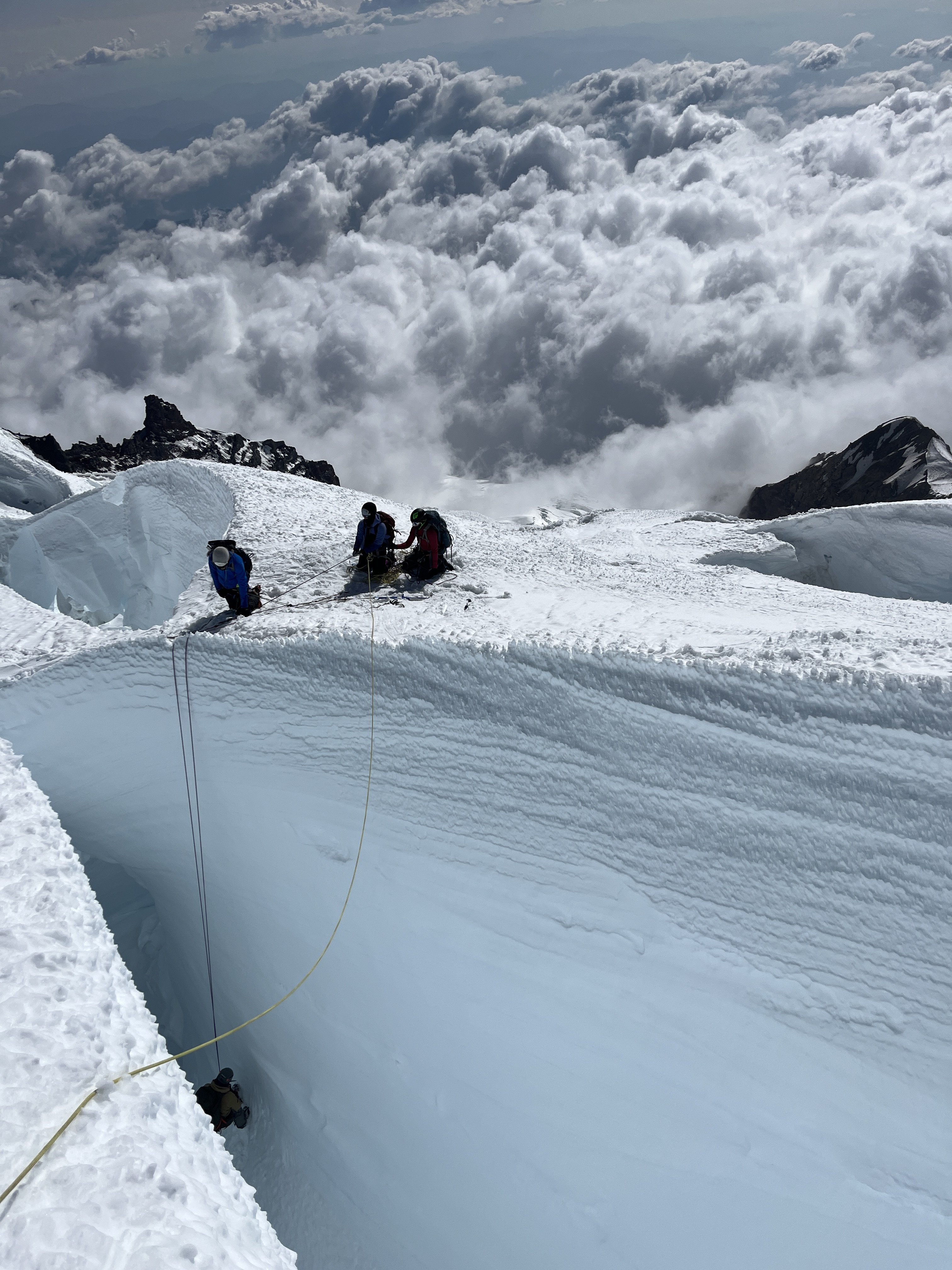
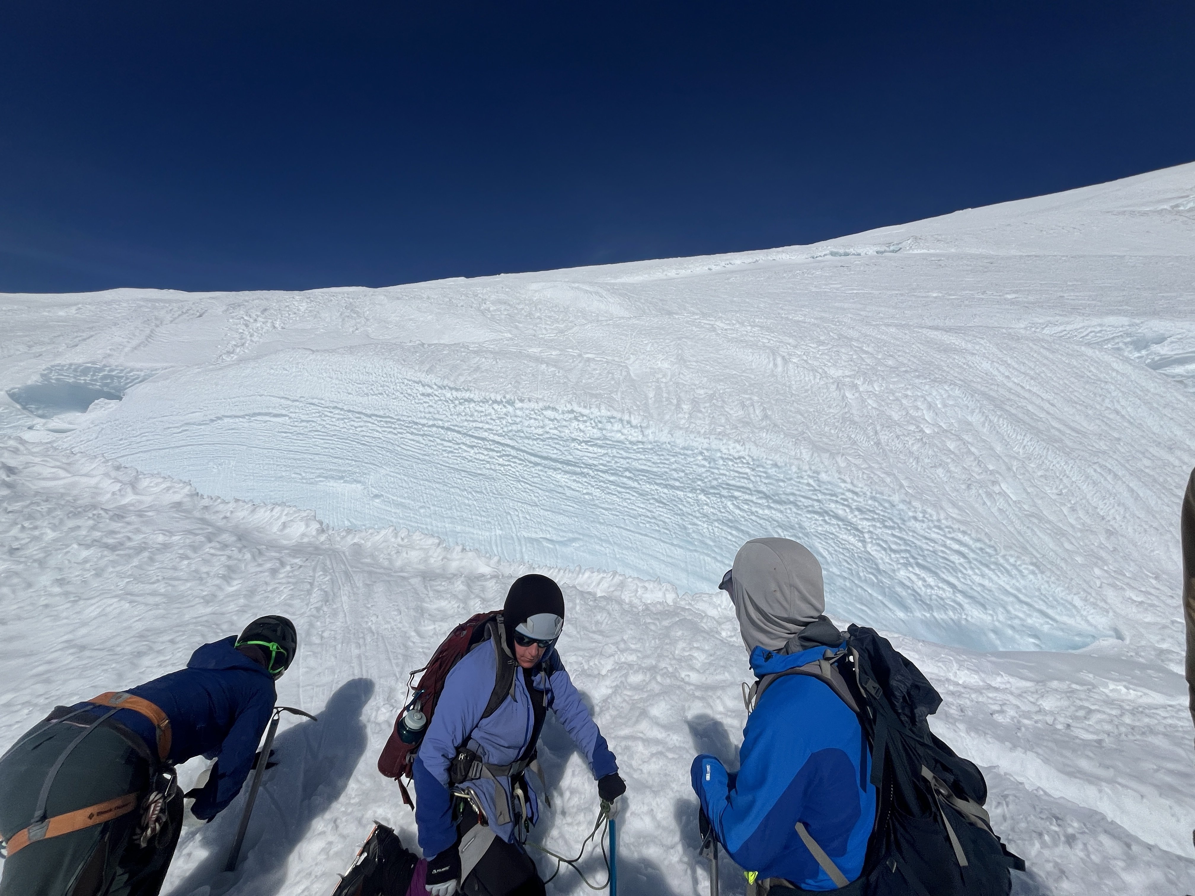
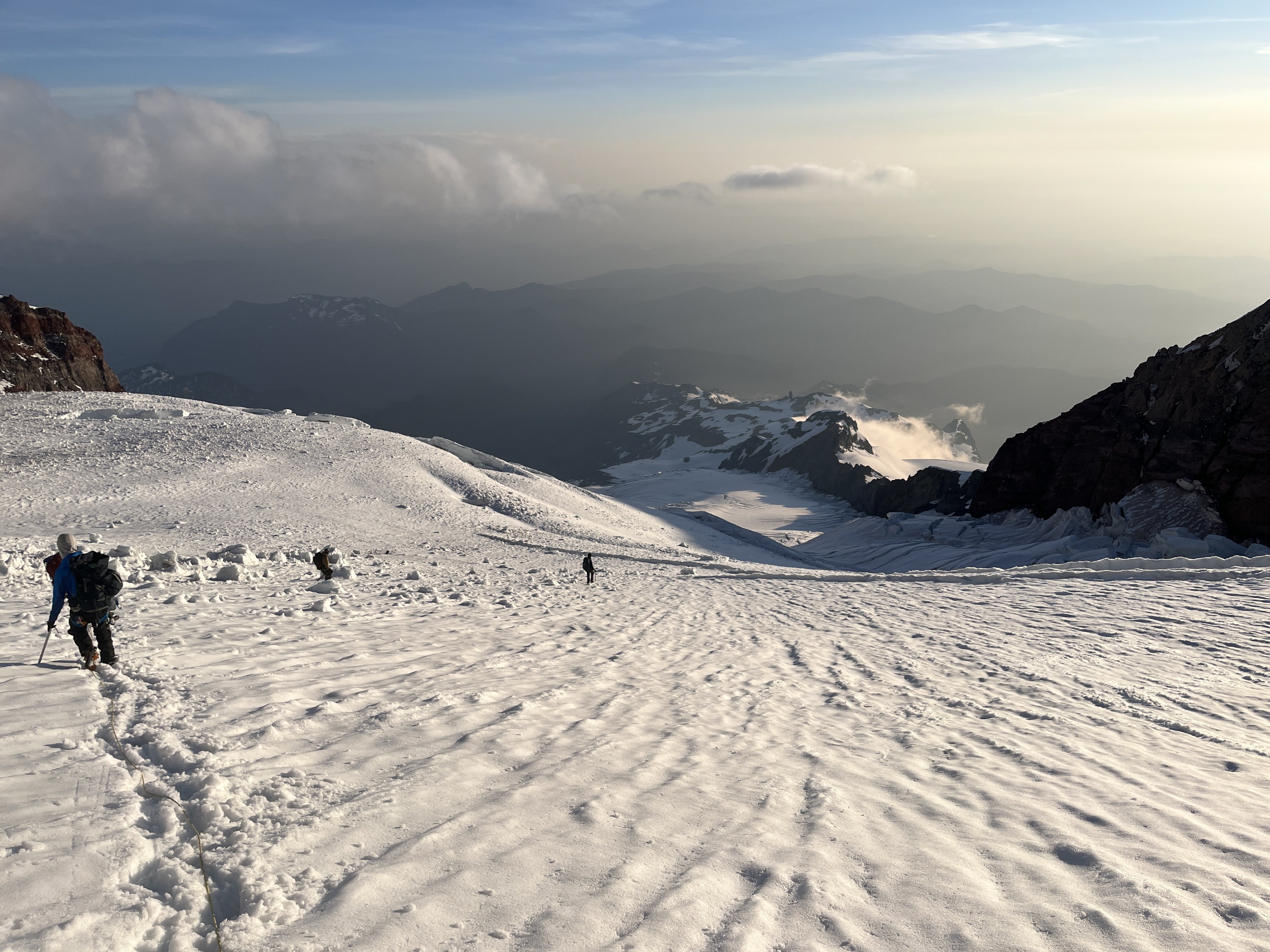
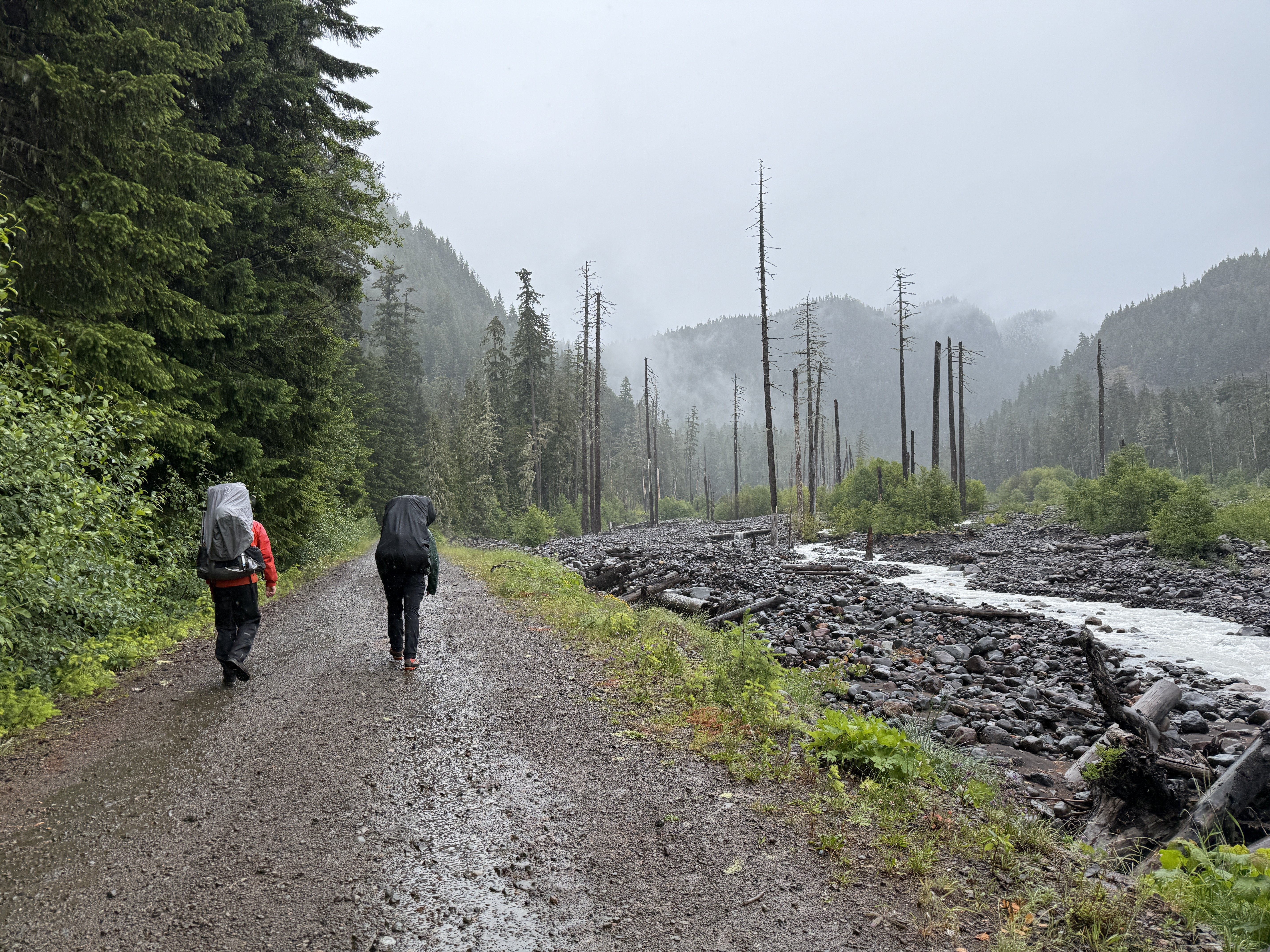
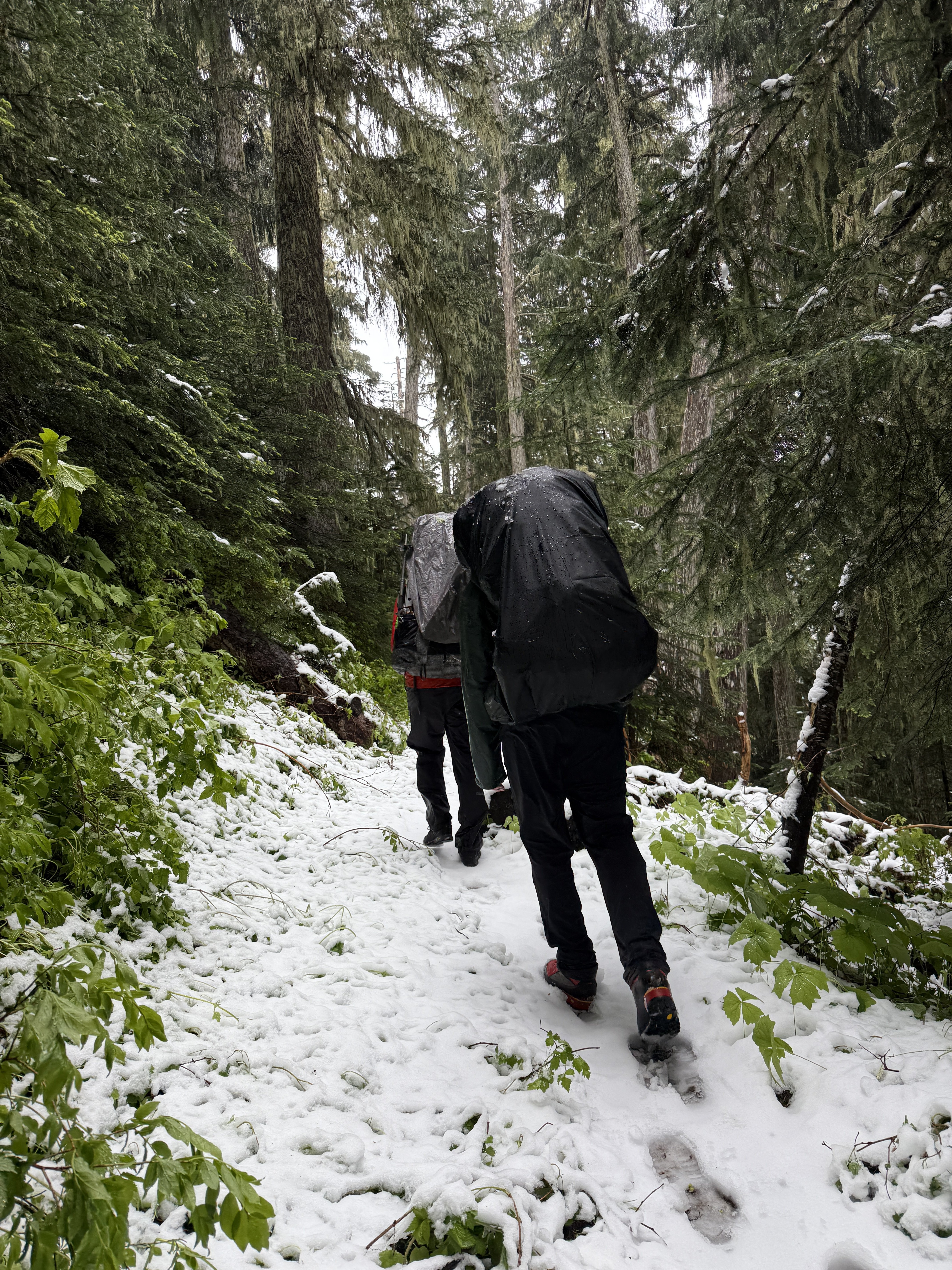
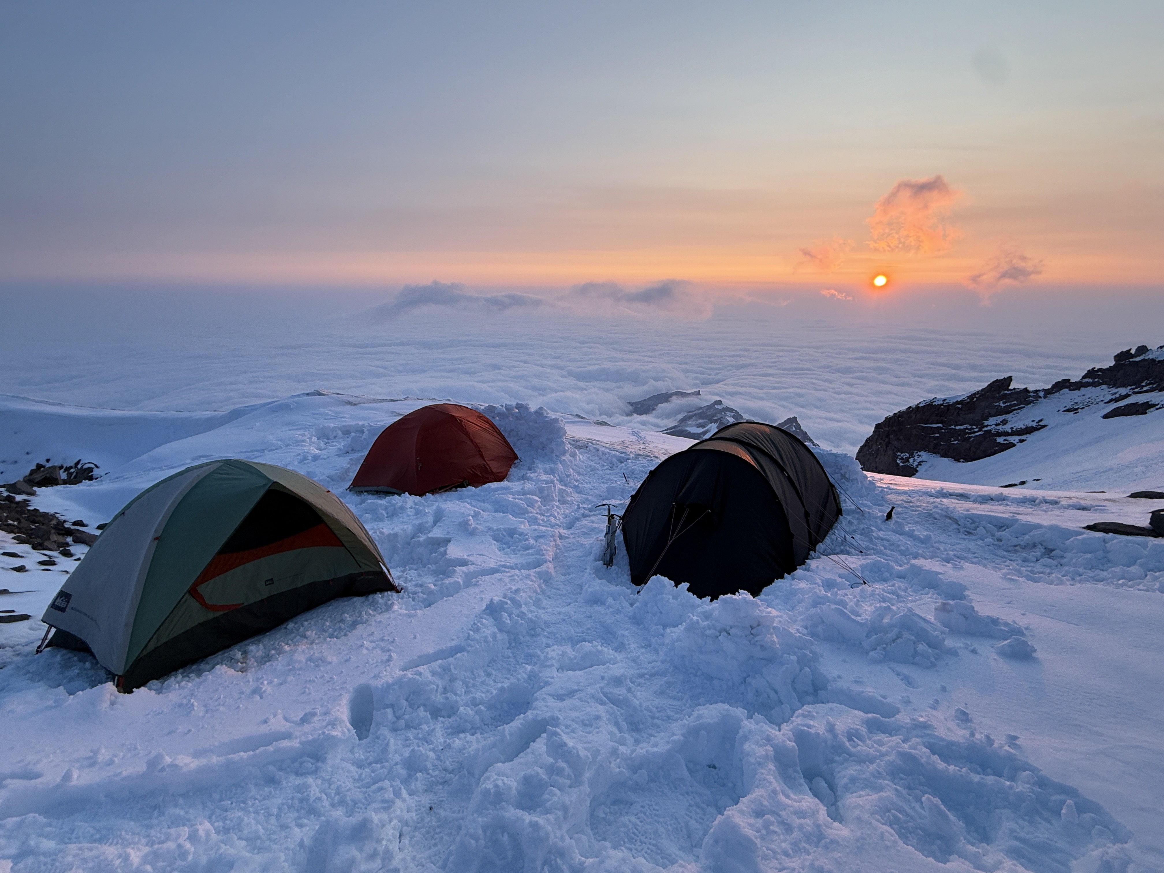
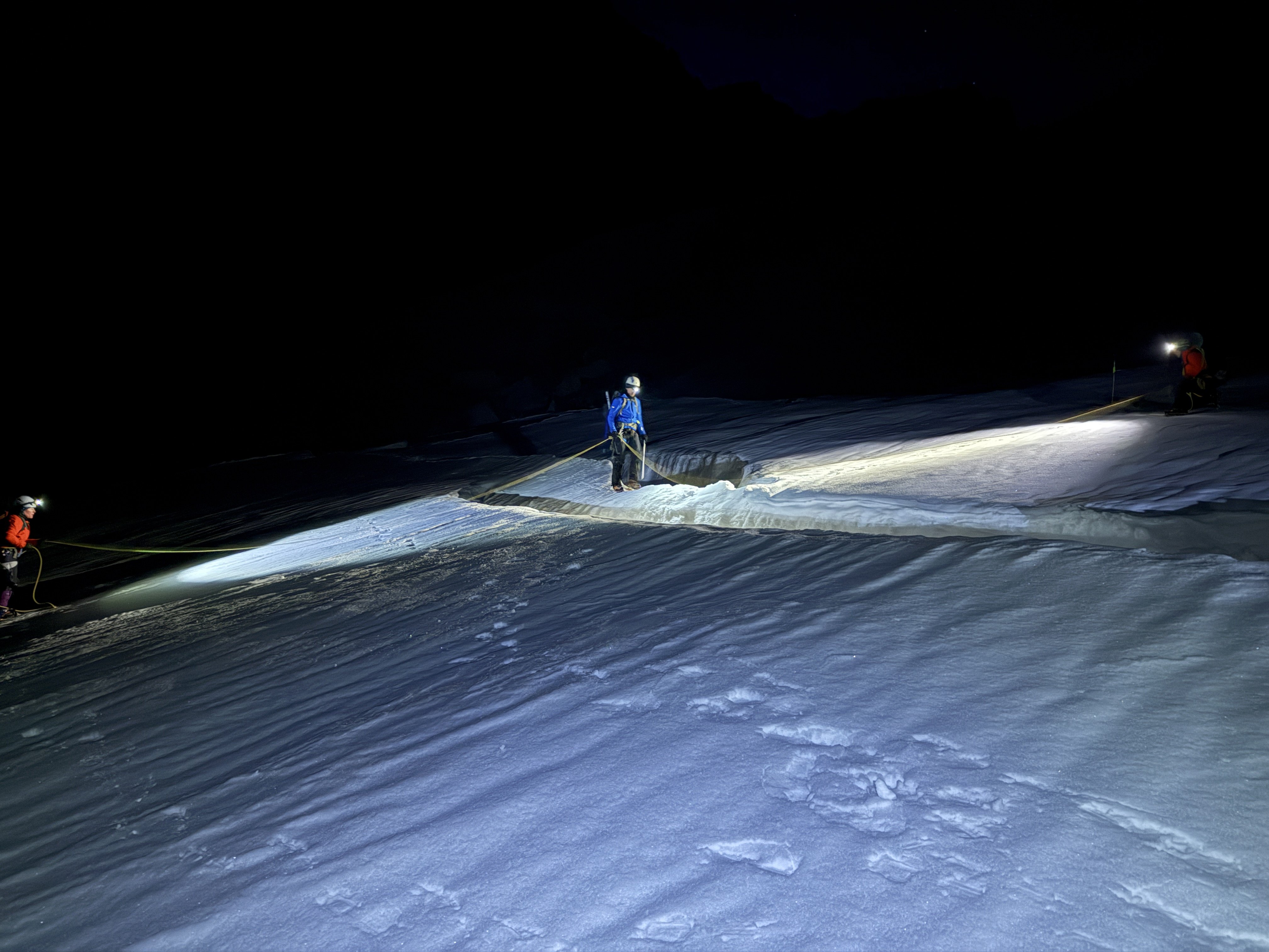
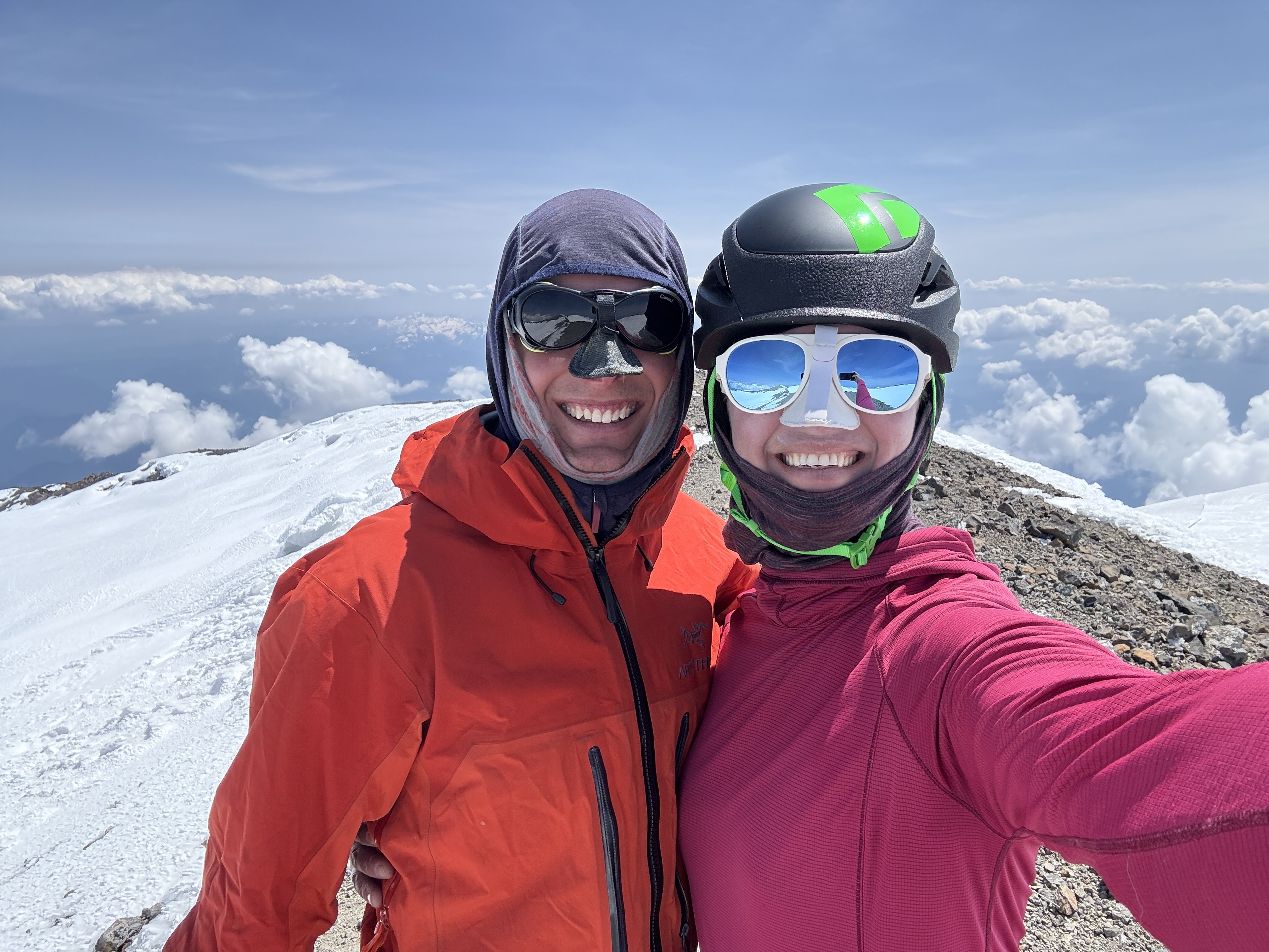
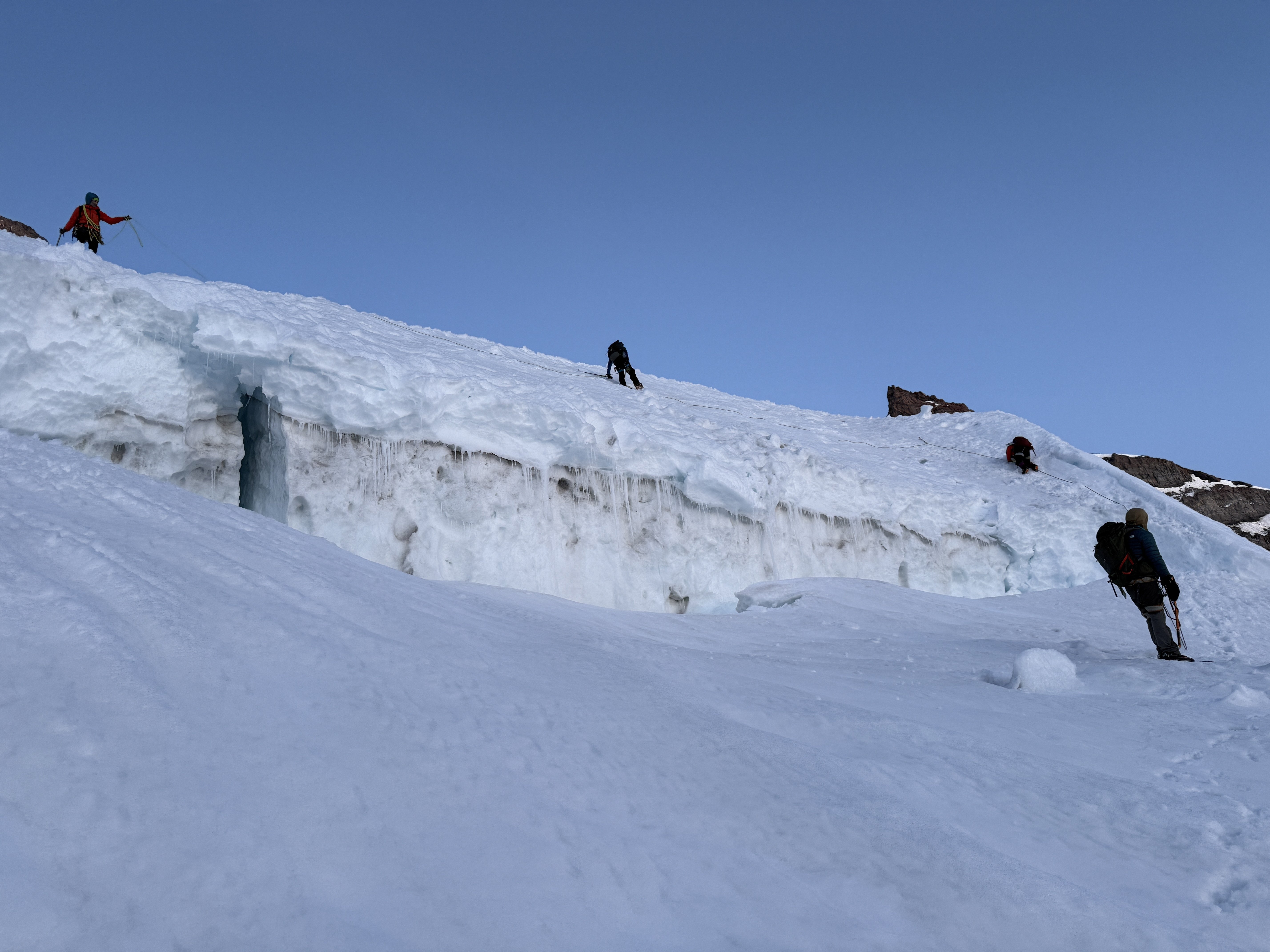
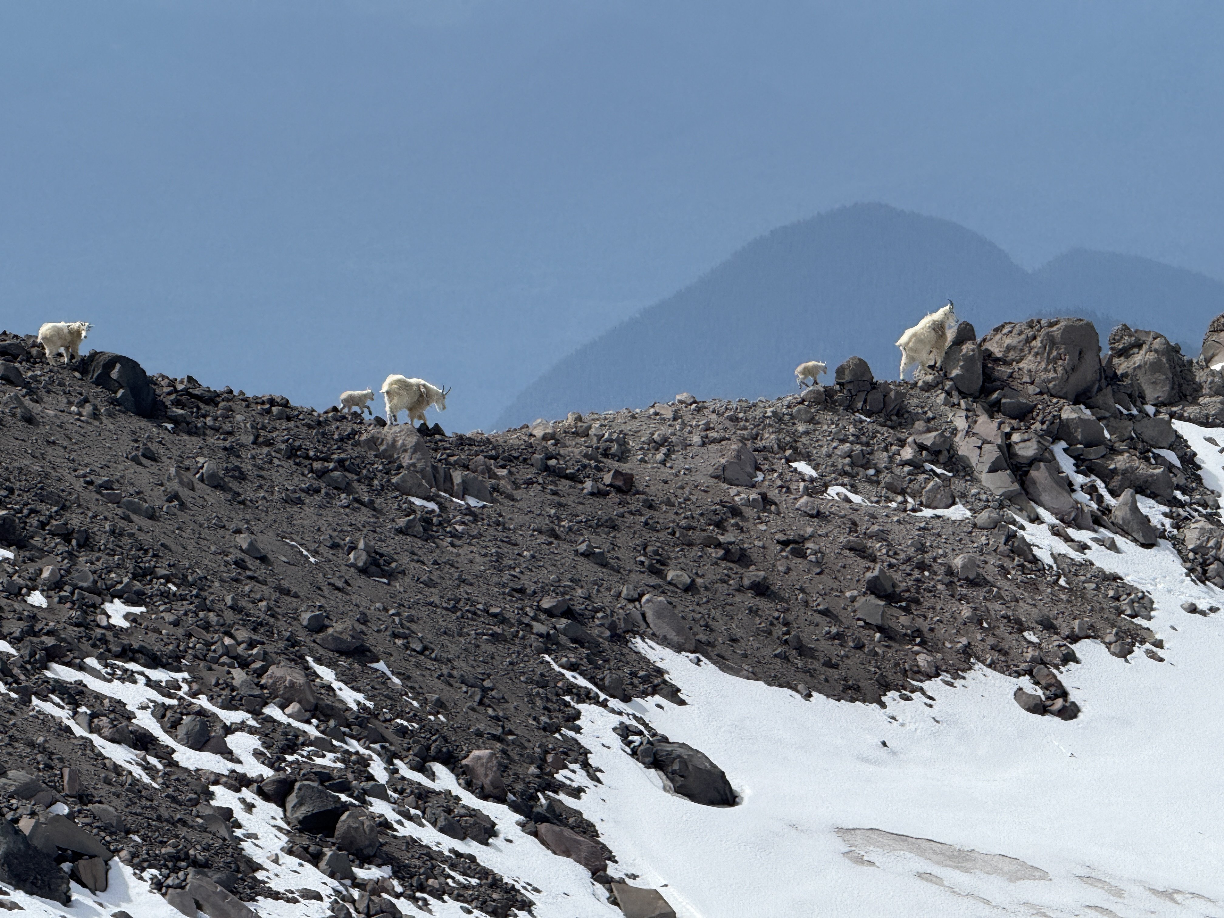
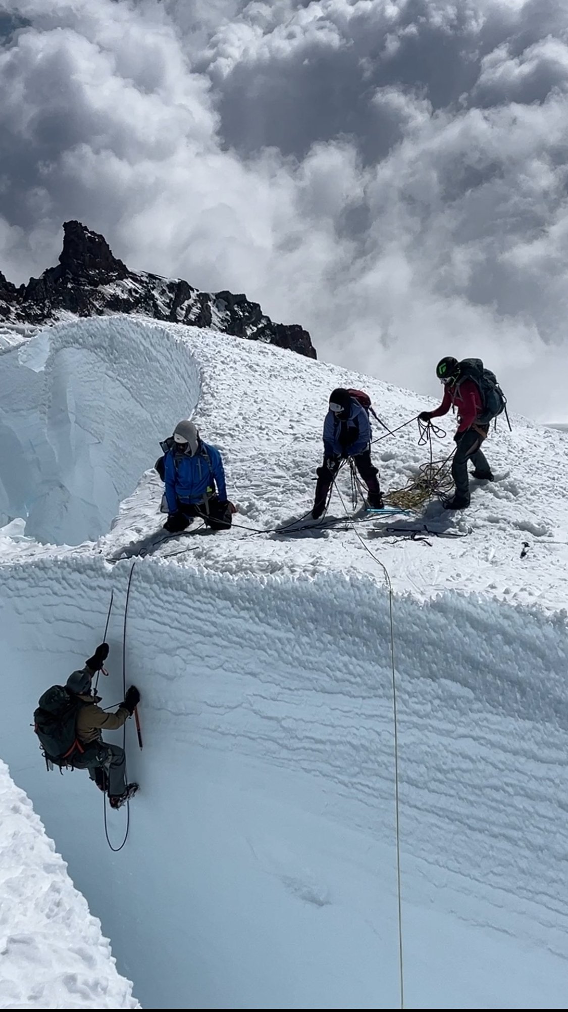
There are plenty of trip reports out there about the Tahoma Glacier, so I won't elaborate too much on the route. Last year we had planned to climb this route but with a very terrible forecast during our dates we postponed it a year. This year we braved the rain on day 1 in hopes of the promised good weather for summit day. Thankfully it paid off. Leaving the trailhead Saturday morning in the rain. (Photo by my wife) Found fresh snow from the previous night that was now a sloppy mess.....still raining. (Photo by my wife) Rewarded with this view on Day 2. We moved from Camp 1 at 6,200 ft up the Puyallup Cleaver to high camp at 9,800ft at the base of Saint Andrews Rocks. Looking at the Puyallup Glacier. It was well filled in and easy walking up to high camp at 9,800ft. Looking down at the Tahoma Glacier from high camp. You have to drop down the ramp to reach the glacier proper. Sunset at Saint Andrews Rocks at 9,800ft. (Photo by my wife) Early morning crevasse navigation. (photo by my wife) Some more crevasse shenanigans in the broken up sections. More crevasse zigzagging. (photo by my wife) The team nearing the top of the route approaching 14,000ft. The summit with my wife and I. At 13,100 feet on the way down our 2nd person (out of 5) had a sliding fall into a crevasse. I have always said that if you keep your intervals tight you shouldn’t have to worry too much about crevasse falls. And over the last 15 years this has proved true in both the PNW and AK. With multiple small punch throughs over the years nobody has ever gone farther than their armpits. But this time was different. This is because if you punch through a snow bridge you will likely go up to your waist or backpack but then be tight and climb out on your own. I think this is true for typical crevasse falls….bad snow bridge, or winded over crevasse. These are times were you are surprised and fall right in. There is an entirely different type of crevasse fall. This is when you take a fall in steeper terrain and are unable to arrest that fall prior to the crevasse. I never really thought much about this because I feel really confident on crampons and look at those short locations as “do not fall” sections. But clearly with a less experienced group I need to take those sections a little more seriously. Our #2 guy on the rope was very tired on the way down which I am sure contributed to the fall. He fell in just such a place on a traverse above a crevasse on terrain I would call “no fall zones”. He fell off the upper lip and into a big open crevasse. The rope wasn’t super tight but there wasn’t an excessive amount of slack in the system. It was in difficult terrain where there were multiple obstacles stacked right after each other so team members were navigating different technical obstacles all at the same time (not ideal). Looking back I think I could have potentially avoided the incident by the use of running protection. I just felt so secure in those sections that I didn’t really think it necessary. But when taking newer people out it is better to take a couple minutes to add running protection than a hour to pull someone out of a crevasse. Lesson learned for sure, and I am just really glad he was ok. When the fall occurred, my wife who was leading the rope team had just finished all the technical obstacles and was on the lower lip of the crevasse. #2 was working across a traverse 8 feet above the lip of the crevasse and then had a 10 ft down climb to a narrow snow bridge. #3 had just finished a down climb and was just making a step across a thin snow bridge and onto the traverse. #4 was at the beginning of a down climb. #5 (myself) was anchoring the back on the slope above. When #2 fell he was unable to arrest in those 8 feet and so fell off the upper lip. He stopped about 30 feet below the lower lip and just above a sloping snow ledge. The rope never came tight to my wife (#1) because #2 fell towards her creating slack. #3 was pulled off her feet across the snowbridge onto the traverse. She was able to arrest. #4 was pulled off his feet and into the down climb. Myself in the back was able to arrest and hold the fall helped by #3 on the traverse. Thankfully #2 who fell in was uninjured. We were able to give him a little slack so he could get his weight on his feet onto the sloping ledge and then we started working on a plan. It took a bit of time to get things setup since the terrain was complicated where most of the team had arrested the fall. But in the end we were able to get everyone except for myself to my wife's position on the lower lip where there was a great spot for rescue. They were able to equalize 2 pickets (1 deadman and 1 end SLAM) and then used a 3:1 system with an ice ax at the lip to keep the rope up. Once the system was set 2 people were able to haul out the climber in less than 5 minutes. Having various different levels of experience on the team we spent a few minutes afterwards discussing and debriefing the incident. Here were a few lessons people found helpful. Place anchors further from the edge so there is more room to haul. When moving downhill keep walking down past the obstacle (body belay) vs. a hip or ice ax belay. This allows you to quickly run downhill should someone slide towards you creating slack. You need room to walk around at the anchors when performing a rescue. If in a safe spot think about just being out of the system. If not then use cord or the back end of a rope. Both the first 2 rescuers got pretty pinned into short tethers that prevented much movement initially. Have 1 person take lead on patient care and tell the person in the hole to put on warm clothes…even in best case scenarios it is going to be 15-20 minutes in the cold crevasse. If there is a ledge in the crevasse consider giving slack to get the person off the rope and onto their feet. Use the rope for backup should the snow give way again. Think through all the steps that need to get accomplished and try to figure out what can be done concurrently to speed up the process and gain efficiency. Here is the rescue in progress from the top lip of the crevasse at the beginning of the traverse. I ended up be "stuck" on the high side and only helped through directions. I felt the team plenty competent and taking the time to get me to them would just delay pulling out the fallen climber. One more shot as the fallen climber nears the lip. A shot looking up at the top lip of the crevasse and the traverse above. You can see the top of the upper down climb above the traverse on the left. The thin snowbridge is hidden behind the traverse on the left. The final down climb and narrow snow bridge are on the far right after the traverse. The whole incident took about an hour from the time of fall to having everyone out and gathered up at the lower lip. From there we continued down the glacier without further incident. Although people's nerves were a bit shot and any steep terrain encountered further down was negotiated with slow care. This resulted in a very long but safe day. Farther down the glacier at about 11,000ft. We hiked out the next day in beautiful sunshine and tired bodies. But got to see some goats in the process. (photo by my wife)
-
How much are you wanting for it?
-
Nice man, love the enthusiasm!! I always enjoy seeing the goats.
-
The Cassin was planned for a different year. We climbed both Ham & Eggs and Shaken Not Stirred on the same 2 week trip. So we got a bump from TAT mid trip between the Root Canal and the West Fork. But we did have the Southwest Ridge of Dan Beard in our options. I also remember a team climbing good terrain up the valley behind and west of Peak 11300. I am not sure of the exact route though.
-
Good write up Troy! Glad you came away from the fall with just a bruised ego.
-
I can't speak to the other routes but SW Ridge on Peak 11300 is very good. The climbing was never hard but it was in a great position. I seem to remember most of it was simul climbing terrain. We did it as a preparation for climbing the Cassin (which we never ended up doing). I would personally recommend it as just a great route up there. I have notes somewhere if you wanted more details but I think there is a fair bit online too. Two weeks in early/mid May is a great trip in there!!
-
Here are a couple of thoughts. Conditions dictate a lot about the difficulty of a route as is the case with alpine climbing. Also with a mountain like Rainier you get a LOT of people climbing it because it is big, tallest in WA, and can easily be seen from major metropolitan areas. With that comes a lot of inexperience and people who have never done something hard. If you have never done something hard even the easy DC will feel crazy hard. A route like the DC when done in high season with good weather is literally like walking on a trail. There are wands every 100 feet, a trail the whole way with couple of crevasses to step across or ladders to walk (depending on the season). From a technical climbing perspective for a technical climber it is easy. But as you have identified glacier travel is about more than technical skills. There are several places on the DC where you do NOT want to stop for a break due to serac fall. There are really good spots to rest so that you can move efficiently and quickly through certain areas. There are weather factors and temperature to keep in mind especially with regards to current time on the mountain and decent. There are good time marks that let you know how the pace is. All of these things are the skills/knowledge I think you are referencing. A ton of people go up every year and don't consider half of the other things beyond technical ability...and they do it no problem. But as you noted, sometimes as a novice it is hard to know whether you made the right decisions or you got lucky. Honestly I think a lot of climbers in many different types of climbing land on both sides of that line. I know when I was a new trad climber, new ice climber, new mountaineer, I definitely did things that with experience I would have done differently. I think that is why everyone wants a mentor. A good mentor will allow a person to build their experience and make those decisions but are a back stop to ensure there isn't anything unsafe happening. The advantage of a guide is that they bring all those extra skills to ensure that there isn't something unsafe happening. And they are there if anything unexpected happens or something goes wrong. Many people can get through a climb as long as everything goes right, but any accident and they are lost or slow to sort things out. The downside to a guide is that most of the time you aren't in a learning environment. They are there to get you up the mountain not necessarily teach you all the non technical knowledge skills. As a client if you make a good connection with a guide you can ask questions to foster that discussion but that isn't always possible. Every guide is different but I have seen my fair share that are doing a good job getting the job done but want nothing to do with teaching or instructing. So back to the question at hand. I would recommend that you get some glacier travel or even mock glacier travel experience prior to attempting Rainier. Go with someone who will teach the skills and is willing to share knowledge. Be very comfortable with roped glacier travel, moving as a team, snow anchors, and crevasse rescue systems. After that most climbers are already used to making risk assessment decisions. Find someone who has done the intended route before and ask him/her all the specifics about logistics, breaks, and the technical knowledge. Then find a group of similar minded people at your level or above and go have fun. If you are unsure exactly where to stop, follow a guided team. They know all the exact spots and just mimic what they do. Personally I don't know that I buy into the advice to do Baker first. Sure you will be more prepared on Rainier, but if you climbed Rainier once you would also be more prepared the 2nd time. The 1st time you do something is usually the most dangerous as there is a learning curve and the unknown. Now instead of sorting it out on Rainier you are sorting it out on Baker. Is that safer? I don't know, I think it is just different. Many people view Mt. Baker as safer because there aren't nearly as many open crevasses. In fact many parties on a busy May or June weekend will be unroped on the Easton Glacier or even Coleman Deming Glacier. The thought is that it is well filled in and there aren't crevasses. While there are definitely fewer crevasses on Baker as compared to Rainier I would argue that it only takes 1 crevasse to make a very bad day. And I think it is safer to be roped together using proper glacier team travel than just soloing up a glacier particularly for novice mountaineers who haven't developed a good eye for reading glaciers and where crevasses are likely to be. Baker might be shorter than Rainier overall elevation but the summit day for either mountain is similar elevation gain (~4000ft) give or take a couple hundred feet. Anyway sorry for the long ramble. Hopefully it is helpful. For what it is worth I am more than happy to discuss more specifics questions or whatever if you have any.....just PM me. I do think you are on the right track and asking good questions/weighing different options. Enjoy the journey.....it is a fun process!
-
Moccasyms size 9, $40. Two Ropeman ascenders $15 each. OBO
mthorman replied to Marko's topic in The Yard Sale
What is the EU size on the shoes? -
Nice job man! Looks like a great trip.
-
I am not a local to the Hood scene to I can't comment too much on your progression. But I can help compare to some other routes in the Cascades that you listed. First off I want to say that many of these routes can be in a wide variety of conditions based on the year so take that into consideration. I have climbed S Side Old Chute/Pearly Gates as well as the Reid Headwall on Hood. I have also done NE Couloir on Colchuck, Triple Couloirs on Dragontail, Kautz on Rainier, N Ridge of Baker and NW Ice Couloir on Eldorado. Obviously you are familiar with the Old Chute on Hood so I will base things off that and go through them in order of difficulty. The Reid Headwall I solod in good condition and felt very comfortable. We roped up for the glacier down low then solod the actual route and skied off the summit (down the south chute). I felt like the actual route was similar to the steep section of Pearly Gates route just for a lot longer. It felt very secure soloing with 2 tools. NE Couloir on Colchuck was similar to the Reid Headwall in terms of difficulty. I did it in May when it was in good fat condition. I took my wife who wasn't comfortable soloing and we did a simul with a couple points of running pro in places. Just good steep snow climbing. NW Ice Couloir on Eldorado I did in April of a fat snow year. As such it was all snow and zero ice. I would not recommend. We simul-climbed the couloir in 1 block and found the crux to be at the top where it was vertical snow the consistency of cotton candy. Not hard enough to climb well but not really easy to clear either. Very challenging conditions for 20ft with marginal gear. Most of it was similar to the 2 above routes but with a much steeper/scary exit. Kautz Glacier was done in June. We had great condition and a fair bit of steep snow and less ice. I think it would actually be a fun ice climb later in July but by then the other parts of the mountain are typically so baked. We simul-climbed as two parties of 3. The leader on the first rope put in screws and the last person on the 2nd rope pulled them out. It was only a couple rope lengths and it felt pretty casual. That said I am very comfortable on vertical ice so this was chill in comparison. It might approach a WI2 pitch in thin years in July/August but in June it wasn't even close to that. Triple Couloirs on Dragontail I climbed in March of a fat year. We solod all the steep snow couloirs. They are steep but the snow was great and felt very comfortable with 2 tools. As I remember, the 1st couloir had the steepest snow sections particularly getting into the entrance and 1 point halfway up where it narrows had a steep section. We pitched out the ice between the 1st and 2nd couloir. This ice felt very much like WI3 climbing. Plenty of good ice for gear or nearby rock. Lots of places to rest but terrain I would not want to solo. We did solo the mixed step between the 2nd and 3rd couloirs. We probably shouldn't have but we weren't really paying too much attention (just going up) and didn't realize that we should have pulled out the rope until we were in the middle of it. At that point it felt easier to just keep going then try and reverse course and pull out the rope. North Ridge on Baker I climbed in July. I feel like this route changes from year to year as the ice cliff changes. We found lots of steep snow climbing below the cliff (similar to above mentioned climbs) that we solod. Then we had the actual proper cliff and terrain above and below. We did 4 pitches of pitched out climbing. We could have done it in fewer pitches but we didn't have enough screws. We had assumed it would be a short steep step but it was much longer. Here are a few notes from my journal I wrote 10 years ago. "Made it up to the crux ice step and had to take a 2nd look. The easier left hand variation is supposed to be a 60-70 degree ice ramp. What we found resembled rock. There were cracks and corners, ledges and ribs and all of it on 100 feet of 80° ice! He [my partner] led a short pitch of 60-70 degree ice up to the steep part. We only had a 30 meter rope and 6 ice screws because we thought it would be easier. This meant we could only place 2 or 3 screws in between belays. I tried to run things out and led two pitches of ice. Then he led a little more to the crest and onto the steep slopes above." Anyway hopefully that helps compare them a little. Good luck with your climbing progression!! Just remember that a lot of people (myself included) solo a lot of steep snow on these types of routes. But everyone needs to evaluate the pros and cons of such a move. There are lots of places were a fall would be very painful if not deadly. However if you have to move through 2000 vertical ft of terrain pitching out that much will take a LONG time. There are pros and cons to everything and just because somebody does it one way doesn't mean that everybody else should follow suit.
-
Cool! I see a checked box on the left for elevation bands....did you make all this? I have often wanted a way to highlight only certain elevation bands but haven't figured out a good way to do it without a huge amount of manual work.
-
Great job, looks like you had great weather! This brings back many memories from years past.
-
Looks like a great trip minus the bugs!! Thanks for the stoke. Someday I would love to get in there.
-
[TR] Torment-Forbidden-Sharkfin-Boston-Sahale Traverse - 9/12/2014
mthorman replied to JDT's topic in North Cascades
Just FYI, the Cascade River road is closed due to a fire and doubtful it will be open in a week. -
Just did a quick check and I would agree with your concerns. Freezing levels are forecasted well above the summit, with it getting warming each day this week (looks like a real heat wave for the weekend). This could definitely lead to some soft snow which makes travel slower. The biggest risk is rockfall.....with the red bands you have to pass on your route there is definitely rock fall potential. Usually climbers accept that risk on the way down because they can pass through an area quickly but being exposed to that risk on the way up because it didn't freeze at night definitely adds to the danger. The other thought is winds. Winds make the potential for rockfall much worse. Windy.com point forecast allows you to compare the different models. 3 out of 5 models are forecasting winds of 35-40mph. The other 2 are more in the 10-15mph range. NOAA point forecast for Shasta is gusts to 50mph for Tues and it dimishes to gusts for 40mph for Wed. So while they aren't in perfect agreement I think it is safe to say it will be pretty windy on the mountain. Those 2 things together (wind and high freezing temps) would make me rethink my plans. Of course that is my decision and everyone is going to have their own. I am just trying to lay out the things that would factor into my decision making. For me if I can adjust my dates and minimize a bunch of risk I often will.


