Search the Community
Showing results for tags 'north cascades'.
-

first ascent [TR] Vesper Peak - The Ragged Edge 8/18/2013
dberdinka posted a topic in North Cascades
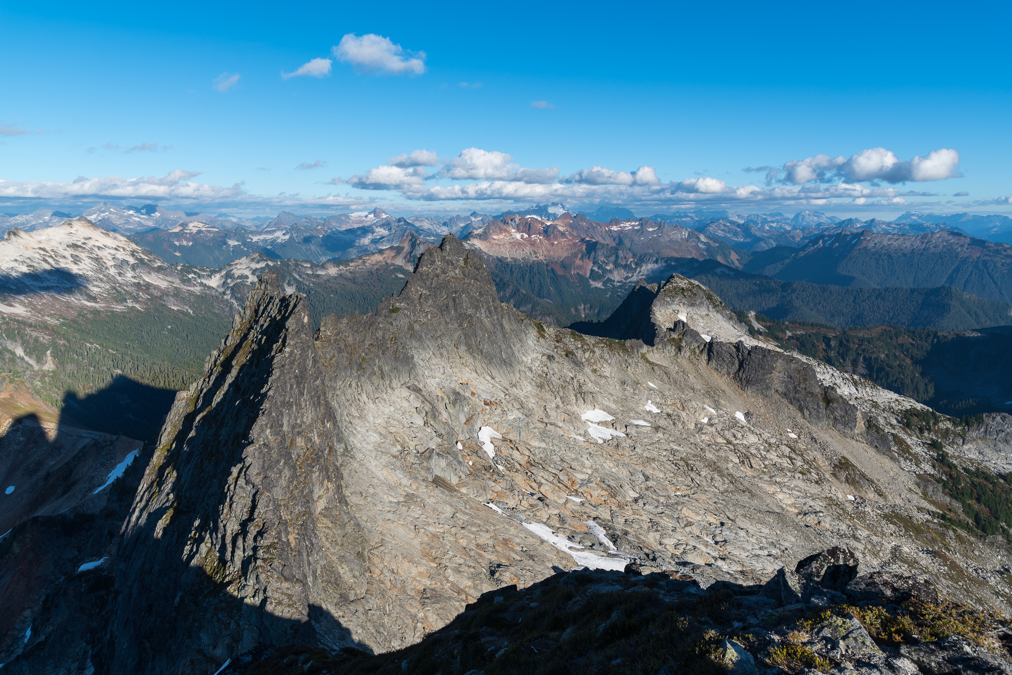
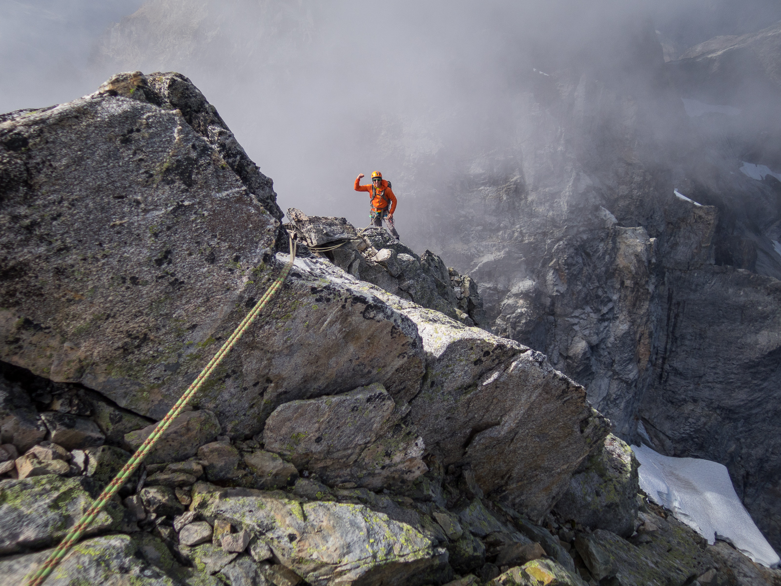
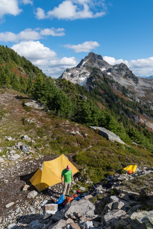
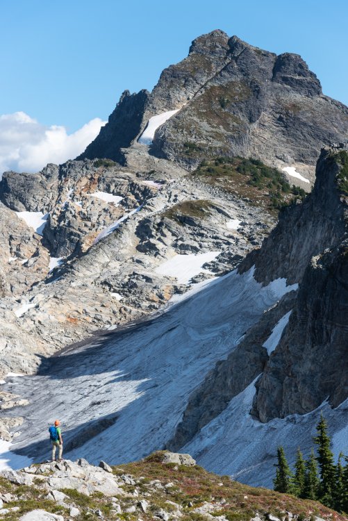
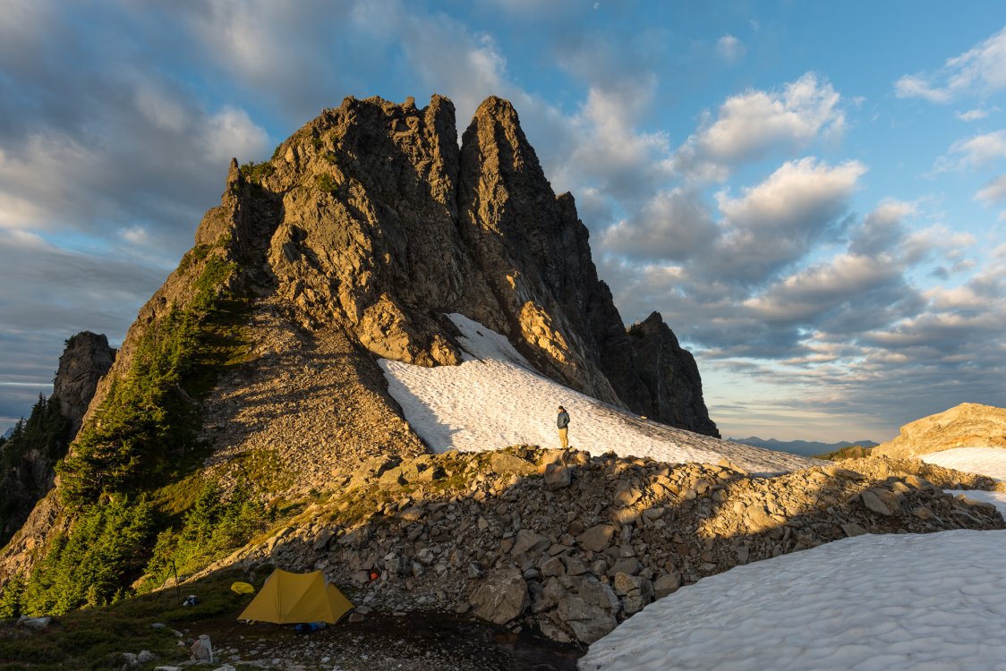
Trip: Vesper Peak - The Ragged Edge Date: 8/18/2013 Trip Report: Back in August Gene Pires and I wandered up to the north face of Vesper Peak to check out the steeper and much neglected eastern half of the face. We managed to climb the obvious exposed edge along its right-hand side. The position and the underlying rock quality were generally fantastic but the climbing itself was horrible due to a thick layer of lichen, heather and dirt that covered the face. Rock cruxes were protected by beaks, belays tended to be marginal and the actual crux involved mantling across a series of quivering hummocks. A good time was had by all (I think) but it sure as hell wasn’t anything you’d recommend to a friend. So when I finally finagled two days to myself rather than hang out with friends, or go somewhere new or actually get in some pitches I carried a 70 pound pack of bolting, cleaning and bivi gear back to the summit of Vesper Peak. A dozen retro-bolts and fifteen hours of scrubbing later the end result is a potentially enjoyable six-pitch 5.6 or 5.7 rock climb in a stellar setting. The rock is excellent, the climbing is sustained at a very moderate grade, the position is spectacular and the protection and belays are solid and well situated. It’s pretty easy to overestimate the quality of your own routes but this has to be one of the better moderate and accessible alpine rock climbs on the west side of the Cascades. I should point out that what we did was essentially a series of major variations to the “Center Route” established in 1969. The fourth pitch was shared in common and probably the first pitch of the original start otherwise we had stayed further right near the edge. Pretty bold climbing they did back in the day. Until nature gives it a solid pressure washing the grit left behind from cleaning will inevitably collect in some of the cracks and edges I scrubbed. If someone heads up there this year consider bringing a small stiff bristled brush or at least a nut tool to clean off some holds. Would be psyched to hear feedback if anyone climbs it. Click image for larger version Approach Description The trail fades out as you enter the basin between Vesper and Sperry Peaks. Cross the outlet of the lake and follow an obvious talus ridgeline up to a col between the peaks. The climb is accessed by a ledge system that cuts across the north face of Vesper at about 5800’ elevation and begins at a small notch overlooking the Vesper Glacier. Allow 3+ hours for the approach. Walk out the ledge on steep exposed heather (snow until mid-late summer?). When you can’t walk any further either (A) scramble up over an obvious chockstone formed by a large, thin flake to a belay ledge or (B) as a variation backtrack a bit and figure out an exposed 3rd class traverse down and around the toe of a buttress before scrambling back up to an obvious and clean 5.6 layback crack (better start). The 3rd class slabs at mid-height on the first pitch could easily be accessed after climbing the lower half of the north face as well. Route Description: The ratings below are potentially soft. Bring a full set of nuts small to large and a single set of cams from #0 TCU to #3 Camalot with extra #0.75 and #1. Original Start - Red Line P1) Climb approximately 60’ of low-5th terrain to 3rd class slabs. Continue up the obvious flaky gully and arrange a gear belay just below a short overhanging wall (low-5th 170’). P2) Traverse right on a long, thin ledge then a short gully to a fixed belay on the skyline (4th 60’). Slightly contrived variation start with better climbing - Blue Line P1) Climb a nice layback flake then a low-angle groove to 3rd class slabs. Traverse hard right then follow the highest grassy ledge system approximately 40’ to a gear belay below a faint white dyke splitting a slab (5.6 160’). Note that you can also reach this belay from the original start as well. P2) Climb the dyke past three bolts to a thin ledge. Traverse right and up a short gully to a fixed anchor on the skyline (5.7 90’). P3) Step right then traverse back left on positive edges towards the skyline. Find a bolt then continue up a nice arête protected by fixed pins. Arrange a gear belay atop a heather ledge (5.7 95’). P4) Step right and climb steep, stacked blocks. Easy zig-zag cracks above lead to a fixed anchor. I aggressively trundled loose and semi-loose blocks off this pitch but some caution is still advised (5.7 95’). P5) Step right again and climb straight up in an exposed position. At the second bolt traverse right 50’ to a fixed anchor on the skyline (5.7 80’). P6) Follow the nice arête to a final touch of heather and the summit. (5.5 130’). Walk off to the southeast. A lot of the greenery in the following three photos is now gone. Never heard good things about the lower wall. Maybe a direct starts needs a scrub-down next year. -
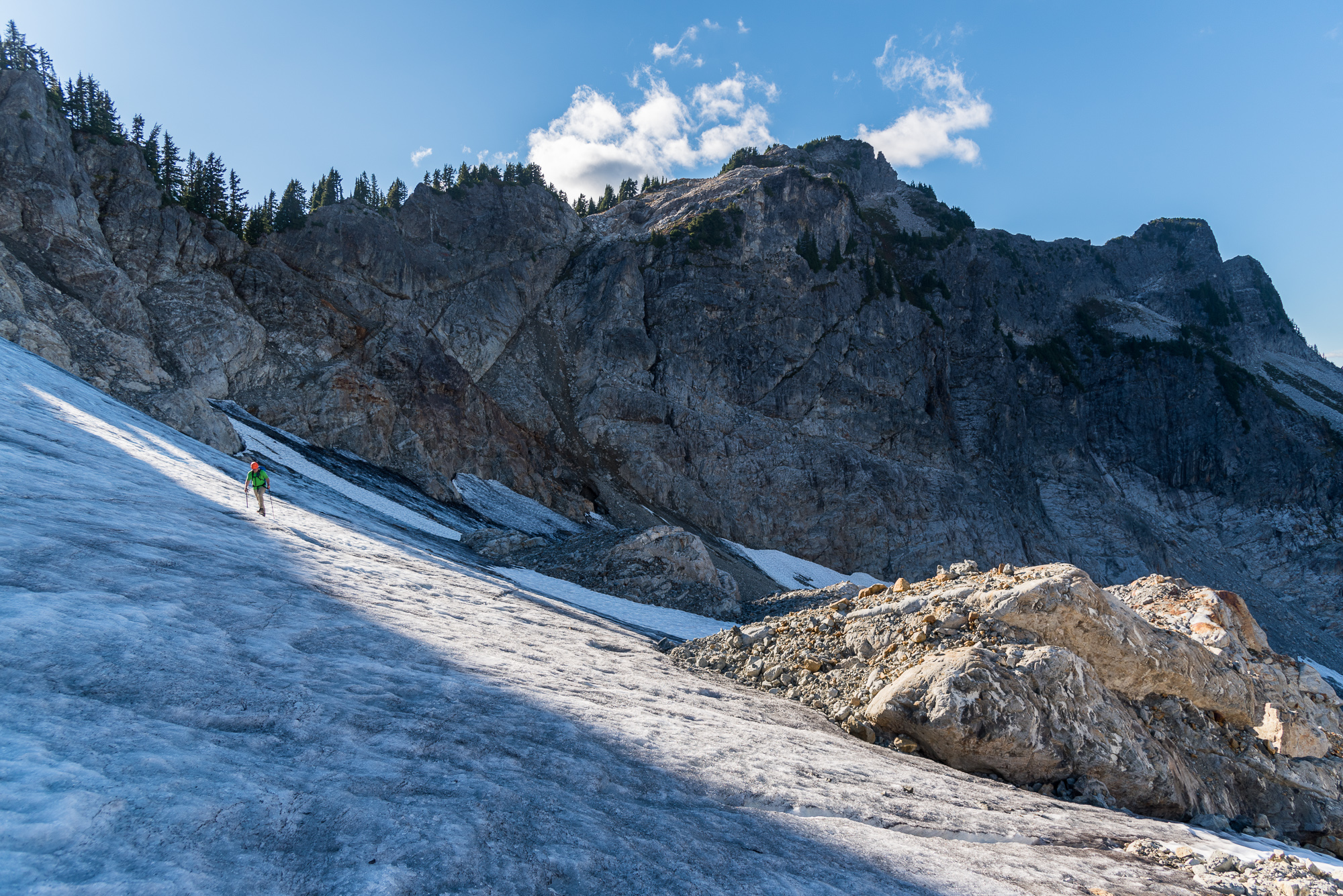
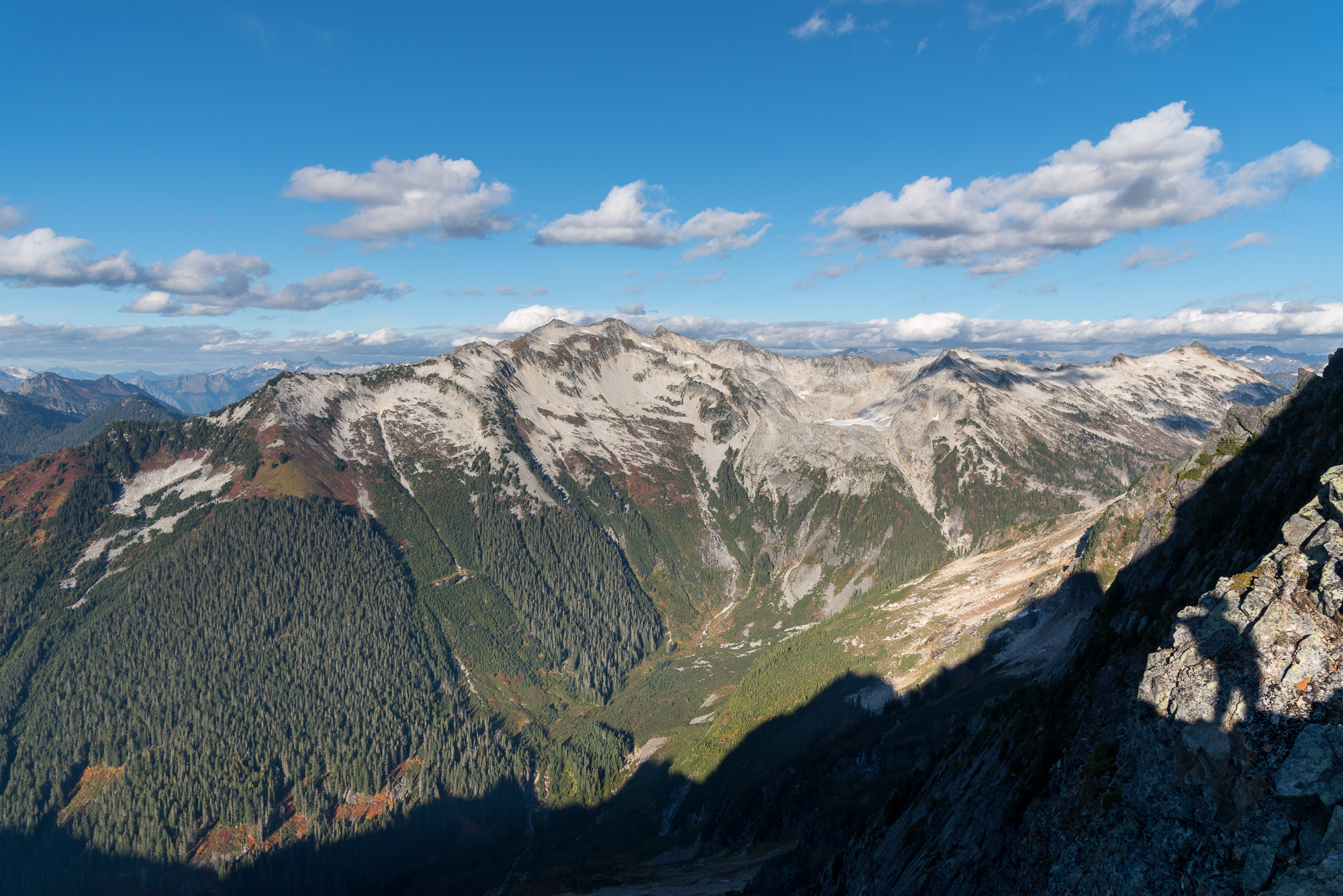
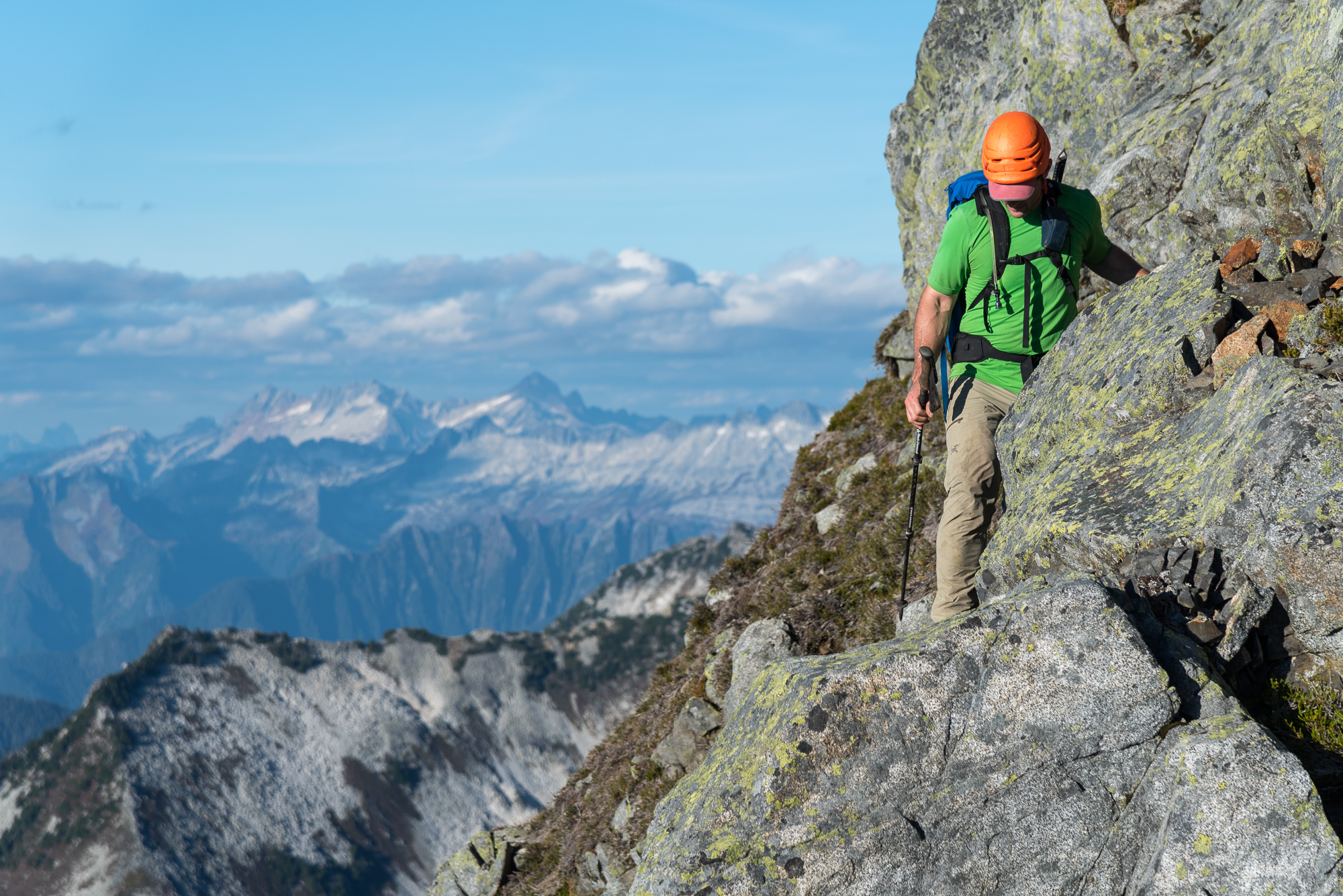
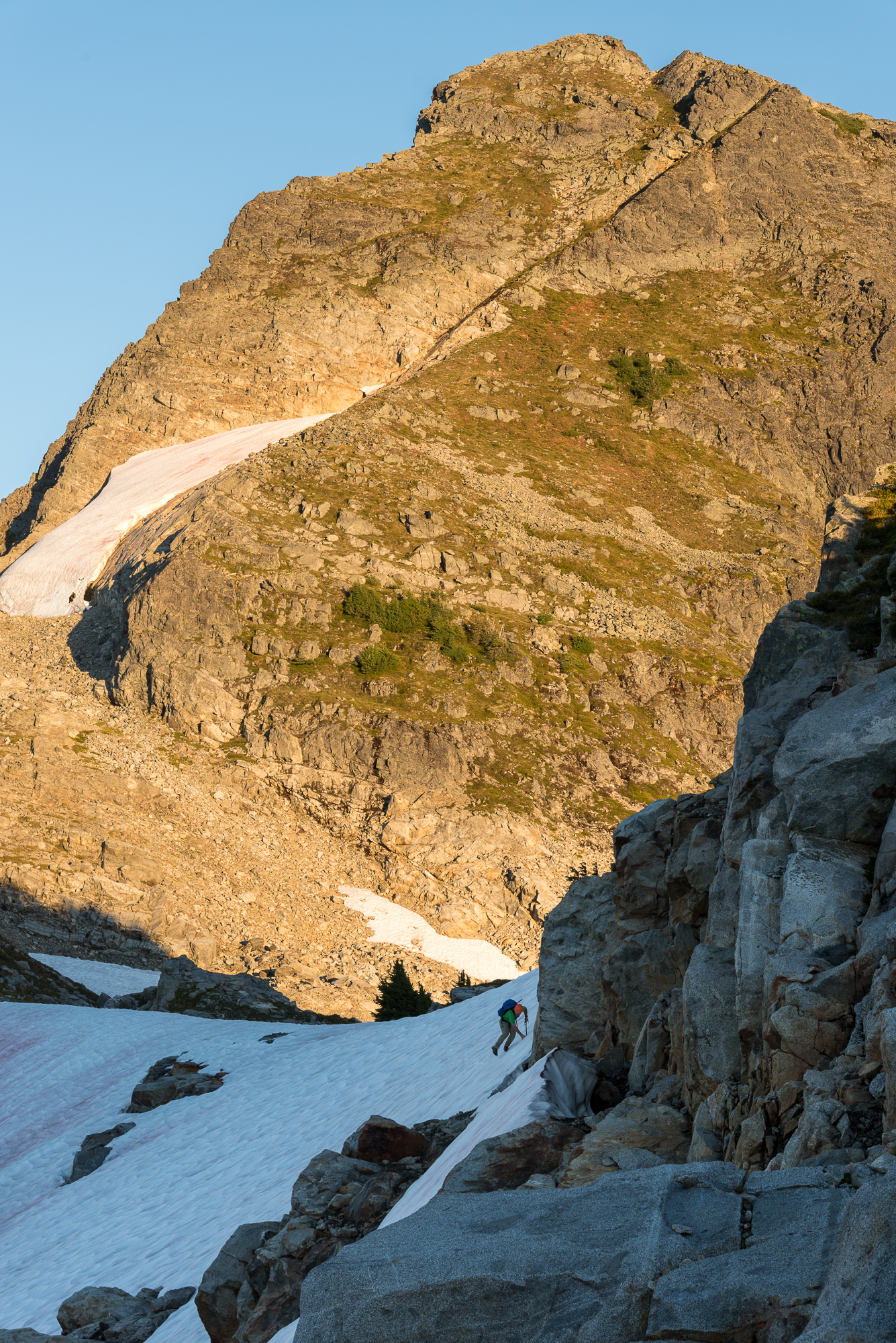
Trip: Mount Chaval - Standard Western Ramp Trip Date: 09/28/2018 Trip Report: Ahhhhhhhhhhh.....fall in the high country. Perhaps my favorite time of year. Crisp air, vibrant colors, no bugs, and long enough nights to actually get some sleep. Sure the glaciers are wrecked and the rock often damp, but it give you an excuse to head off the beaten path and do a bit of chossing! And chossing Kit and I did this past weekend on Chaval. We had the pleasure of zero trail between the car on the Illabot road and the peak, flavored by terrain that was always just a bit more rugged than the map would suggest. Given the modest altitude and barriers to admission, I was a little surprised that 2-3 parties a year climb Chaval. I guess its prominence from Darrington draws many potential suitors. At least one likely got more than they bargained for. We found a pair of Merrell boots neatly tied to each other and hung over a tree branch on the ridge leading to camp. Huh? We couldn't come up with a good reason to leave a pair of boots like that in the middle of such rugged terrain, or at least one that didn't involve a rescue. Just another Cascadian mystery that I probably will never find the answer to. And isn't mystery a big part of what draws us back to the hills time and time again? CHAVAAAAAAAAAAAAALLLLLLLLLLLLLLLL!!!!!!! Mount Chaval, "It's like rehab for fat people" . Kit pauses at infinity fat camp. It doesn't get much better for fall colors on the west side: There she be, from camp. Kit had steel, I had aluminum. One was better than the other. Snowking: This wasn't mandatory, but it sort of was, just because it was there. Kit just below the summit: The view east from the top of Chaval: Dome: Snowking: Trying to beat the sunset: Time to get out the headlamps: The gloaming has begun: Yes, it looked like we attacked North Korea: My favorite: Dakobed: Sloan, Monte Cristo Peaks, and Pugh from camp: As we hiked out, the rain began to fall: Gear Notes: Helmet, ice axe, crampons Approach Notes: Park on Illabot road, on the western end of the old clear cut near the bridge over Illabot creek. Diagonal across lower part of unit, cross small stream to gain rib which is followed steeply upward to the top of the old unit. Angle up and left to ridge, topping out near small tarn on USGS quad. Follow ridge, generally, to 6100' col where good camps lie with year round water. You'll need to deviate here and there from ridge as it is craggy in sections. Past 6100' col you'll drop off north side to glacier via crappy gully (late season) or steep snow. Follow glacier up to ridge again and the prominent ramp which splits west face of Chaval. Take that ramp all the way to summit ridge and summit via some exposed class 3.


-
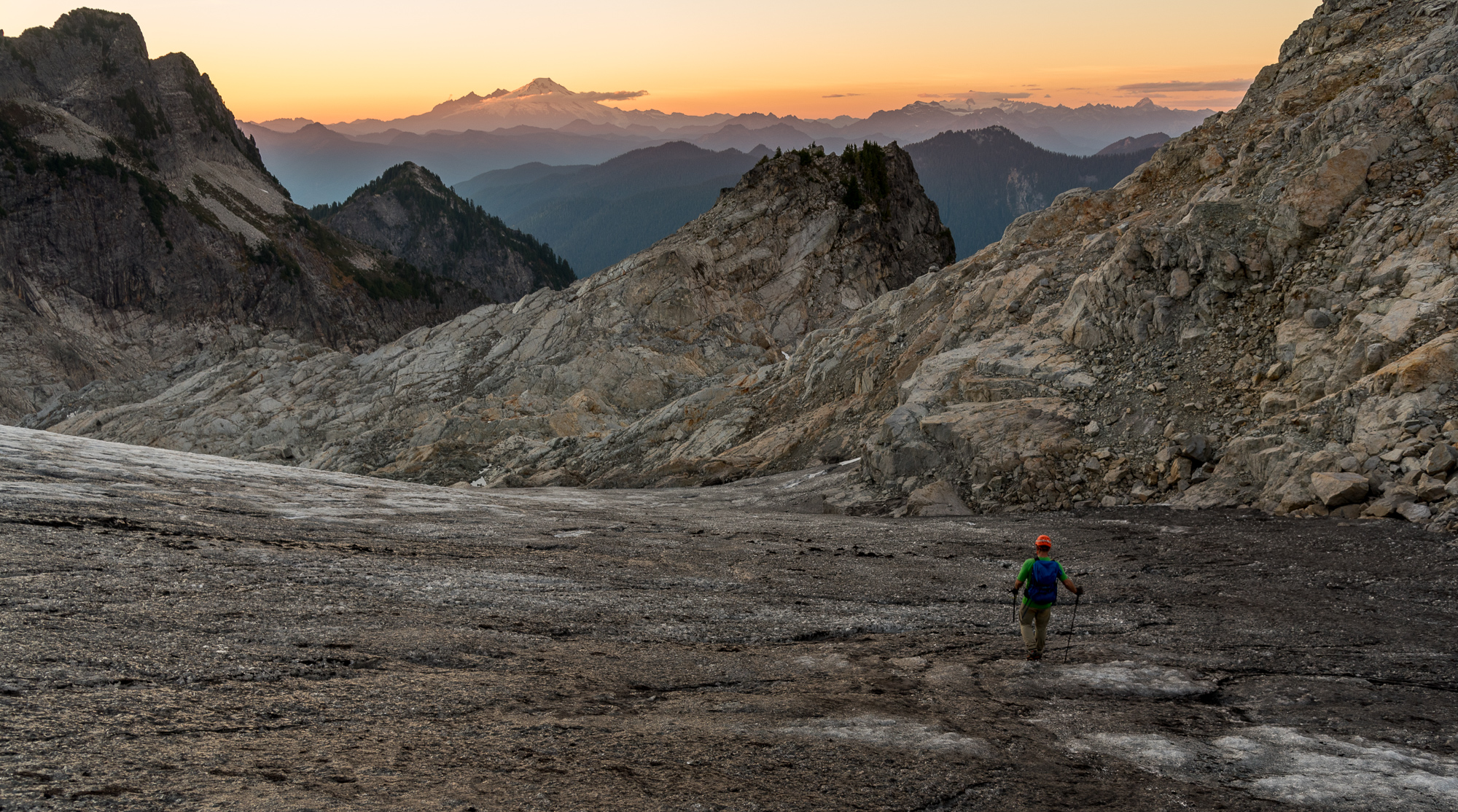
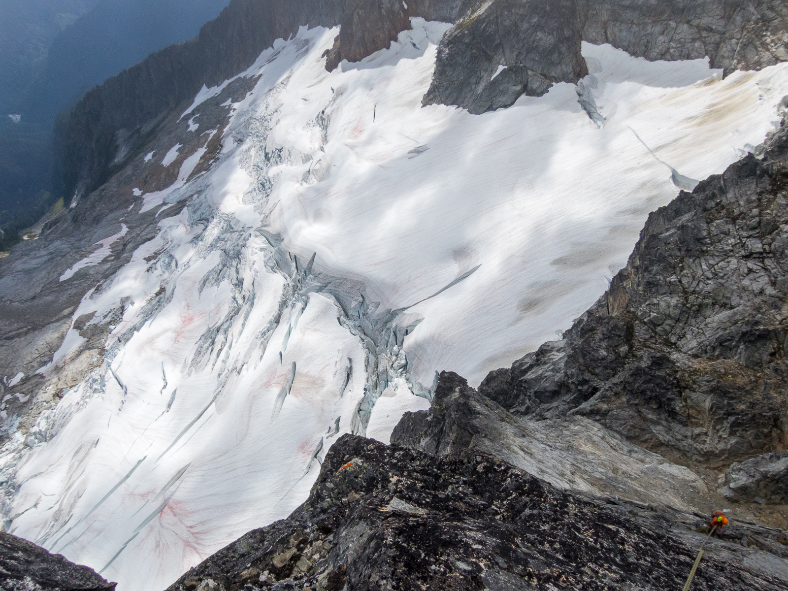
 Trip: Northern Pickets - Phantom Peak, Challenger 1/2/5, and "The Bat Wing" Date: 7/30/2015 Trip Report: Over the past year plus, Mario (a prolific Pickets schemer) had sold me on the idea of completing a North-South Pickets traverse this summer. We had attempted this traverse in 2008 but, after several days in a whiteout near Pickell Pass, with dwindling food, time, and spirits, we abandoned the route Southward and ended up going out to the East. I had taken the last four years off from Picketeering as a new father, but the idea of seeing Picket Pass firsthand was a big draw for me, a sideways summit of sorts. However, as this year's trip came closer, several facts became apparent. First, snow conditions were historically low, making the traverse route more dicey. Second, Mario was, as he puts it, "getting old" and was going to need to tap out of the trip due to a number of nagging injuries. This left Sandy, Matt, and me wondering about objectives. In 2009, when doing new routes in the Challenger group, i recall looking into the heart of the Northern Pickets and seeing the profile of Phantom, with its West Ridge dropping towards Picket Creek. In 2011 Keith, Mario and I made an attempt, but in classic Pickets fashion, the weather closed in and shut us down. This year seemed like a good opportunity to go take a closer look. There is no simple way into the Northern Pickets. As Select Climbs says, "the pilgrim pays a price." Perpetually hopeful for a break, we tried hiking from Hannegan to Whatcom Pass, and around Whatcom. While this approach is long, it is also scenic, relatively gentle, and has almost zero bushwhacking, and so less sucky for big packs on the way in. The initial hiking went smoothly. Sandy was Mr. Water, whipping out the Steripen (scary-pen?) at every stream to keep up sloshing happily along. The only setback was that Matt's shoulder strap attachment blew apart under the load, but Sandy came up with a nifty field repair that saved the day. Leaving the trail and the people behind, we moved towards the Whatcom glacier. The icefall this year is scary. With so little snow, the ice that is there seems more active than normal. We hustled across, and began scheming alternate return routes. I felt more anxious than i recall from previous Pickets forays. The ever-increasing remoteness and commitment as you head deeper in are always factors here, but with increasing age i also have a greater appreciation for my own mortality, and most importantly an extremely strong desire to be there for my little girl growing up. As we made camp on the rock benches on the Southeast side of Whatcom, i wondered what the heck i was doing there. Morning brought improved spirits. Briefly... until we watched a snowfield on Whatcom's South side spontaneously crumble into ice blocks ahead of us. Hmm, yeah, lets definitely hike up higher and get above all this crud. Studying the Challenger glacier brought more concerns. The standard low route from Perfect Pass was out, broken into a thousand shards. We'd need to figure something else out. Heading straight up the ridge above Perfect Pass towards Point 7696 until we could gain the glacier higher seemed like our best chance. We hadn't been that way before, but it turned out to go just fine. We passed debris and then the plaque from the 1980 Firewood One helicopter crash. After some fine alpine rambling, we reached a saddle with good glacier access. Although the upper glacier was more open than i have seen it before, Matt was able to pick a fine route and soon we were at Middle Challenger Col. Shenanigans ensued. The spot at the East edge of the col where we have rapped twice before was unreachable due to larger than normal moats. An alternate rap station on the West edge looked promising, but with the low snow year it didn't look like our single 60m rope would reach the glacier below. We threw it down to measure, it didn't reach, and so we decided to pull it up and instead try the route between Challenger 4 and 5. However, the rope got wedged trying to pull it up. I threw on rock shoes, rapped down, and cleared the rope. However, once down there it was clear we could easily set a second station and make the route go, and so we reverted back to plan A. The second rap involved some moat wrangling, but eventually, after much wasted time, we made it through. Feeling a bit short on daylight and energy to make it to the Phantom alp-slope camp, we decided to camp at a beautiful site below Crooked Thumb. In the morning we set out for Phantom. Interminable scree fields, and lots of going down in order to go up, made us happy to have day packs instead of our full kit. (photo by Sandy) As we approached, i kept looking up at Phantom's West Ridge and wondering/doubting if i had the mojo for an FA. I kept my mouth shut, in that chess game of climbing partners wondering which way the moods would align. Arriving at the saddle in the ridge, I got my answer. Matt said no way to the unclimbed ridge, which brought me 95% relief and 5% disappointment. Sandy then pulled out his crocs (which he had stealthfully brought from camp) and declared that he was going to spend the day soaking in the view from right there at the saddle. (photo by Matt) And so, Matt and I, with excitement, set off on the Southwest route on Phantom. The cleft between Phantom and Spectre is an awe-inspiring place. Spires jut up all around you. The Haunted Wall looms overhead. The sense of remoteness is massive. The first 1000' went rapidly up what little glacier remnant remains. (Throughout the range, many of the glaciers look withered. A few more dry/warm years and some will be gone. Geologic time is now!) Then we cached our boots and snow gear, and switched to rock shoes. Scrambling the next 1000' over surprisingly clean rock brought a great sense of flow. As i moved the last few feet to the crest, i realized we were at a false summit. The traverse to the true summit looked sketchy, so we took out the rope and rack and i led over lichen-crusted plates to the top. (photo by Matt) The position was amazing. I though of Wayne and Josh on their Northern Pickets traverse in 2005, and Jens and Chad in 2013 on their complete Pickets traverse, and wondered what they must have felt on this summit, with more spidering narrow crests yet to run. Matt came over, and we opened the summit register. The feeling was what i picture an archeologist feels opening a tomb in Egypt's Valley of the Kings. There was Fred and Helmy's first ascent entry from 1940, followed by a list of fellow Picketeers, only about two dozen recorded parties in all. In ten trips to the Pickets, this felt like my most wild summit yet. The descent demanded full concentration, and so when we reunited with Sandy at the saddle, we were happy but drained. Splashing in the meltwater streams at the Phantom alp-slope campsite was pure joy, but the hike back up and across the boulders was pure scree-vil. Exhaustion ensued. Followed by celebration. Followed by turning off the alarm for the next morning. While Spectre and Swiss had been on the maybe list heading in, at this point they were taken out of consideration. Our new plan was to go get some various Challenger summits. Matt hadn't been up main Challenger yet, and i wanted to tag some of the sub-summits. We packed up and headed up the new to us route around the back of West Challenger on ledges, which went smoothly. Then we continued over the Solar Glacier, to the Challenger 4-5 Col. There we made camp complete with lovely paved patios for both tents. Let me tell you, these boys can dig and landscape! That afternoon consisted of a favorite type mountain climbing: finding objectives within spitting distance of camp, that can be tackled with minimal packs and late starts. Target one was Challenger 5 (aka Point 7696). The three of us moseyed West, and then did one steep snow pitch. After that, a short enjoyable rock scramble took us to the summit. I love sharing sunny afternoons in the mountains with great friends like these. After returning to home base, we then set out on objective two for the afternoon: the rather insignificant but attractive ridge just West of the 4-5 Col. I suppose you could call it Challenger 4.33, but we called it The Bat Wing. Matt and i ran the wing-like ridge line, and then a pitch beyond that isn't visible in this photo, to the highpoint. A probable first ascent of something no one cares about. But damn was it fun. That night i expected to sleep soundly but neither Sandy nor I got much rest. At alarm-o'clock Matt and I hopped up, but Sandy pulled the sleeping bag over his head and said something to the effect of "madgamgmmmmamdfgamgdagdmm". Matt and I headed towards main Challenger, bearing high on the glacier all the way to its East edge. From there, the standard path between crevasses led towards the steep final slope and the summit ridge. Matt grabbed the rack and led the money pitch. I love that summit! We soaked in the views, including an impressive mushroom cloud of smoke coming from the Wolverine fire. After backing down the upper snow slopes, we headed for Challenger 2. (photo by Matt) Some easy snow and moat climbing, followed by a rock scramble, brought us to that summit, for me the last one of the five that i hadn't been up. All Five Challengers achievement unlocked! We cruised back to camp, broke it down, and headed down to Perfect Pass. As usual, it was, well, pretty perfect. We choose to descent via Easy Ridge (a cruel name if you ask me). I've been up that way a few times, but going "down" (which has a lot of up) seemed like nearly as much work. The abundant blueberries sweetened the work considerably. After a final night beside the Chilliwack, we hiked back to the trailhead. While we had waited out a couple of days of bad weather in Seattle before starting the trip, we had enjoyed eight days of near perfect weather in the mountains. I'm not sure how many big Pickets trips i have left in me. But, maybe some day i'll get to take my daughter to see Challenger ... now that would be a thrill. Sandy and Matt, thanks for being such great partners!
 -
Does anyone have anyone suggestions for good climbs in North Cascades National Park off highway 20 that are safe to solo??
-
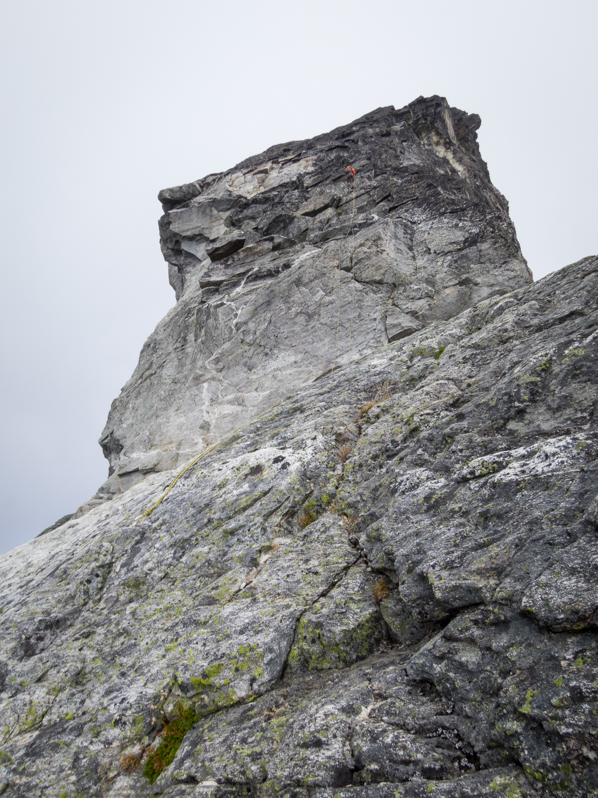
 Trip: tower mt. - northeast face: fra "tower of babble" (III, 5.10-) Date: 9/5/2011 Trip Report: a little bird told me that blake recently posted something on his blahg regarding tower mountain so i thought that i add to the babble. asslunger and i hiked up to snowy lakes via swamp creek on sunday afternoon and stashed some gear at the col northwest of tower mt. an early start with some cramponing and downclimbing brought us to the base of the lower northeast face. fra route description as follows: 1. start at buttress toe as kellie mcbee and i did in 2009 (5.7ish) or get on the rock from the right approximately 1 pitch up as asslunger and i did. 2. 5.7/5.8 face and cracks up the middle face/buttress for 60+m. 3. 4th class rubble for 60+m to just below the mid-face ledge. 4. 3rd/4th class up and right to the base of the rightmost buttress on the upper face distinguishable by some spectacular left facing corners. 5. climb left facing corner (use face to avoid the loosest blocks under a roof) to a squeeze chimney. climb chimney to good belay. 50m, 5.10-. 6. step left onto a ledge and start up double cracks. switch to right crack which becomes an offwidth/squeeze. ascend ow and surmount blocks above to spectacular belay with view through the pillar to golden horn. 50m, 5.9. 7. step left again then up some gravel to a series of nice flakes leading to a belay on the buttress crest. 50m, 5.9. 8. short bit of 5.6 face to crest of northwest ridge. 9. scramble nw ridge to single rope rap to the notch immediately above the rotten white wall of the west face gully. continue along ridge to summit. we belayed 6-7 pitches of those described above. the route lies right of what we thought was the doorish route. a series of extremely steep corners and roofs lies left of the doorish route and might provide some very bold on-site free climbing. lunger might post some photos when he gets time. fra of lower face: kellie mcbee and rolf larson, around 7/4/09. fra of full route: eric wehrly and rolf larson, 9/5/11. Gear Notes: pro to 4" and 1kb Approach Notes: kellie and i approached via pine creek. the swamp creek/northwest col approach is preferable if you plan to climb the whole route.
 -
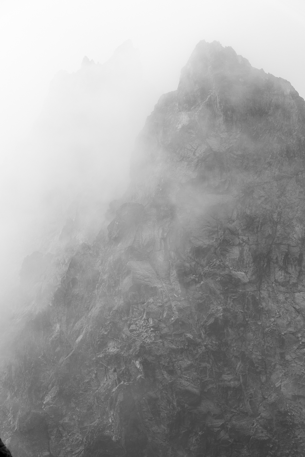
 Trip: North Hozomeen Mtn - Zorro Face, IV 5.9 Date: 8/31/2013 Trip Report: “squamish?” Written at the end of a planning email for Hozomeen which addressed some nagging details, this would become our refrain throughout the trip. Labor Day offered a nice climbing window, and our list of objectives included just plain ol’ good times at Squamish, which typically promises immediate rock, clean rock, solid rock, protectable rock—all conspicuously (or suspected) absent at our objective. Most likely, many of you are aware of the opening passage in Jack Kerouac’s Desolation Angels: “Hozomeen, Hozomeen, most beautiful mountain I ever seen, like a tiger sometimes with stripes, sunwashed rills and shadow crags wriggling lines in the Bright Daylight, vertical furrows and bumps and Boo! crevasses, boom, sheer magnificent Prudential mountain, nobody’s even heard of it, and it’s only 8,000 feet high, but what a horror when I first saw that void the first night of my staying on Desolation Peak waking up from deep fogs of 20 hours to a starlit night suddenly loomed by Hozomeen with his two sharp points, right in my window black – the Void, every time I’d think of the Void I’d see Hozomeen and understand – Over 70 days I had to stare at it.” Later in the novel: “The void is not disturbed by any kind of ups or downs, my God look at Hozomeen, is he worried or tearful?... Why should I choose to be bitter or sweet, he does neither? – Why cant I be like Hozomeen and O Platitude O hoary old platitude of the bourgeois mind ‘take life as it comes’…” “take life as it comes” indeed. This is a useful mantra when approaching the west face. We had suspected an approach from the N down a gully would grant us access—Colin Haley’s blog post seemed to confirm this suspicion. However, this approach is nontrivial; the initial gully third-class down-climb, while loose, and dangerous, pales next to the shenanigans required to cross several precipitous ribs to our targeted launch point. A slip at any point spells an unpleasant end in the valley a couple thousand below. The approach took us a tedious and painstaking 4.5 hours (this after a first day of humping heavy loads 11+ miles to a camp just N of the peak.) Camp in that basin; S and N Hozomeen left to right, with the west (Zorro) face mostly out of view; some of its northern margin on the right skyline. Our approach continues down (out of view) from the furthest notch on right. Views during approach included the Picket range. Approach soloing; downclimbing skills or funeral bills. squamish? “take life as it comes”, also a useful mantra when trying to piece together leads up loose, sometimes friable and/or vegetated and/or wet, mostly welded shut (read: sparsely protected) metamorphosed basalt. The stuff is also called Hozomeen chert and was valued by the Salish for making knives and arrowheads. Hozomeen apparently is native Salish for "sharp, like a sharp knife." Looking up at much of our (foreshortened) route, which tends left to the central summit in this pic. Finally at the base, we decided to take it one pitch at a time, figuring we would try to retain the option to bail. squamish? Rock, paper, scissors, Rolf wins first lead this time. End of rope. I follow and gain an appreciation for the climbing challenges this Hozomeen chert will proffer; sparse pro and selective handholds will be the order of the day. I lead up a second long pitch to the only evidence of human visitation: a ¼ inch bolt and a bail ‘biner. Someone came, saw, and turned around; foreboding. (We did not see any other indication of passage higher than this.) After a couple pitches of metamorphosed basalt, we were talking about turning around too. But we could see trees on ledges above, and figured we could still bail in a relatively safe and reasonable manner. squamish? The land of milk and honey beckoned us. The third pitch required an exposed step-around with muddied feet; expletives drifted down to my belay. No pics. My pitch 4 went steeply up to a ledge, and traversed left; we were somehow making our way, and could still bail. Rolf’s face at the pitch 4 transition betrays some of our uncertainty. During his pitch 5 lead, some curses and words in the wind, “I wanna go home”. It was probably just the wind; he would’ve said simply, “squamish?” I’d like to forget pitch 6. I was forced up a steep 5.9 corner/arête with a paucity of gear. And what few pieces there were went into mungy and rotten fissures. Loose rock abounded, and without gear, there was no way to constrain the ropes from sending it down. Rolf didn’t get hit, but reported that he dutifully tied knots below his brake hand in case he was knocked out—so sensitive to my needs. I grunted up to a fat ledge, and Rolf managed to follow without getting shelled. Then Rolf drew one of the plum pitches, the seventh. 5.9+, climbs a nice corner (but with a section of unavoidable decking potential), then a tricky traverse to another corner, up and then traverse again to the only belay opportunity. Again, only so much gear and rope management was possible; missiles flew by my safe belay spot, but a few also threatened while climbing—somehow, no carnage. This wouldn’t happen in … Rolf up the p7 corner. Hand jams!?! Pitch 8 had a couple steep sections. Here Rolf discerns which holds to clean and/or trust. Pitches 9 and 10 stretched the ropes, continuing up the “corner” system we had identified as a weakness. More 5.9 (mostly easier) runouts. At the belay at top of pitch 10 I placed the only iron we used, a crappy pin to back up a solid piece and a marginal piece. For pitch 11, Rolf raced the sunset to a ledge. Uncharacteristically, this pitch didn’t stretch the rope; he thought we should take the bivouac bird in hand. I thought we were close to the summit and could possibly manage to climb to the top in the twilight-soon-to-be-night. He pointed out that idea was risky, and his logic prevailed. In retrospect it was definitely the right move. “take life as it comes”, also useful for shivering through the beautiful folly of an exposed bivy on a sloping ledge one nasty pitch from the summit. We’d brought some warm clothes but could have been warmer. All in all, the bivy wasn’t so bad, and definitely not as miserable as our unplanned bivy on Lemolo Mox across the way. Hozomeen wasn’t done with us. In the morning, I put together a long and winding pitch on some of the worst rock and pro conditions on the face—one strong cup of coffee, scary to the last drop. But it got us to the summit ridge! Unfortunately, the only spot to belay again made rope-disturbing rubble unavoidable. On the finishing moves, Rolf got clocked right in the helmet with a softball-sized rock, but was ok. Shudder. Top of our climb, just North of the summit, shortly after getting rocked. Glad to have done it. Another Scurlock masterpiece. Our route makes its way up to the left-facing corners directly below the summit. Our bivy occurred on the relatively large snow patch right below the summit. In the background is the Southwest Buttress, climbed many years ago by some hardcores. Kerouac again: “And I will die, and you will die, and we all will die, and even the stars will fade out one after another in time.” But we won’t die on Hozomeen. Hopefully not in Squamish either. But I will climb again at the latter. Both Rolf and I have mildly obsessed over this face for years, and were gratified (gruntled, even) to execute our vision. I expected technical demands exceeding 5.9, but given the challenges of Hozomeen chert, was glad for the limit. Probably half the pitches had some 5.9 moves, depending on what you trust for holds. We stretched the rope for most of the 12 pitches of pure adventure. I am fortunate to have a teammate like the curmudgeon: rich in experience (old), strong (for his weight), solid (old), and somehow able to check my relentlessly positive delusions. Thanks hardcore. A couple summit shots: And more pics. BTW, we descended the North Face route, rested, ate and drank, packed up and marched to car. The mosquitoes for the last couple miles were some other $#!+. Gear Notes: Single set of nuts. Tricams up to hand size v useful. We took lots of small cams, but the doubles would actually be better in the mid-range. Approach Notes: Nontrivial. Day 1, due to tons of rain the day before, we elected to take the scenic Skyline trail instead of the steep bushwhack. Day 2, follow your nose and low sense of self-worth.
 -
Trip: Mount Shuksan - Northwest Arayete III 5.9 Date: 8/6/2007 Trip Report: On August 6th Matt Alford and I climbed an enjoyable rock route on the northwest side of Mount Shuksan. The route follows the crest of a fine arete on good rock for nine pitches to the summit of a prominent horn above the White Salmon Glacier. Though dirty at times, the position is incredible, the rock is solid and every pitch is sustained for it's grade. I had first seen this arete at least twelve years ago while descending the glacier and thought it both beautiful and improbable due to a lack of features. Ever since the idea of climbing it has been knocking about in my head. I'm not sure what took so long but it was great to turn that idea into a reality! As it worked out the rock here (Green Schist) is horizontally banded and the rock is just littered with positive jugs and pockets that allow moderate climbing up imposing walls. We left the car at first light and reached the base of Winnies Slide four hours later. From here a short descent led to the base of the arete. There was significant shrund that made accessing the rock a bit problematic. We end up rappelling off a bollard to reach a ramp on the left side of the arete. A good ledge system on the right side could probably have been used as well. Matt takes the first pitch. Fun, juggy face climbing was followed by a 100' of 5.8 friction right up the crest of the low angle arete. The gear grew increasingly sparse until he had to run it out maybe 40' to the belay. A second short easy pitch led to a much steeper wall. P1 Frictioning up the crest of the Arete The third pitch exemplified what makes establishing new routes such an amazing experience. We're at the base of a steep blank wall. On the left is a filthy corner system full of grass. Out right a few weaknesses lead towards a steep arete and the possibility of good climbing around it's edge. The grassy corner will go, but the climbing will suck. The traverse out right is a total mystery. Will it go? Is there any gear? Whats on the other side? What if I can't make it? P3 Working things out on the crux traverse Intending to head up the corner I find myself heading out right instead. Focusing on protection I find that the apparently blank wall has a few narrow seams obscured by lichen that allow me to place several solid pins. Soon I'm at an obvious crux move. Cleaning some loose blocks off a small ledge I watch them freefall to the glacier. Hesitating I close my eyes, focus on my breathing, feel the chill in the cool shade, listen to the ice creaking and groaning below. Eventually I just run out of reasons to stand still so I commit, stemming wide, finding a small uncling, shifting over and reaching for the crest of the arete. Grabbing solid jugs I pull over the corner and find myself on a beautiful wall of clean, orange rock. IT GOES! P3 Matt pulling around onto the beautiful orange wall So many intense experiences tend to just slide away. Things no longer "stick" like they once did. But this one is different, this one set deep. I'm going to remember exactly how wonderful it felt to pull around that corner for a long time. The fourth pitch was the best of the climb, awesome juggy 5.7 climbing on near vertical rock with great gear. Soon we're at the base of the imposing upper arete. The climbing looks improbable but once again the rock turned out to be covered in positive holds. Staying about 40 feet left of the arete Matt is able to climb more or less straight up the wall on 5.7 rock to a belay in an alcove. P4 More Arete P6 Starting up the steep upper wall Climbing through a grungy 5.8 roof I find super featured 5.6 rock on the crest of the steep arete for a full ropelength. Matt quickly leads another long pitch of fun corners to a fixed pin belay at a small roof. A final short pitch up clean slabs ending with an easy arete brings us directly to the summit. Unreal, the route unfolded far better than we could have imagined! P7 Stellar climbing on the crest of the Arete P9 It Ends like it Begins…. It's late in the day so we snap a quick summit shot and get moving. An easy scramble down the backside gets us to the Upper Curtis Glacier. After following some mountain goat tracks we picked up the boot track leading back down the mountain. In my exhausted state the entire descent seemed somehow timeless as if it took no more than half-an-hour. Yet many hours and a beautiful sunset later we reached the car with the last of the dieing light. Well there's already a Northwest Arete and a Northwest Rib on the mountain so Matt (grudgingly) agreed to name our route the Northwest Arayete after someone I know. Gear Notes: Rack to 3.5" with a double set of very small to medium nuts and small to 1” cams. A few short knifeblades and bugaboos recommended. Approach Notes: Follow Fisher Chimneys Rt to edge of White Salmon Glacier (bivi sites) then descend a few minutes on steep snow or ice to the base of the arete. Potential Shrund problems getting on the rock.
-
 My buddy and I are hoping to ski the Isolation Traverse Friday-Sunday, south to north and are looking for help with a ride or shuttle. Is anyone headed up the Cascade River Road Friday morning or willing to do a shuttle for us for $$$? We're hoping to leave a car at Pyramid Lake TH and get a ride to the Eldorado TH or have someone shuttle our vehicle from Eldo to Pyramid Lake TH. There are other ways to get creative to make this happen as well.
 -
Trip: Lemolo Peak (erstwhile Hardest Mox) - NE Buttress ("After Hours") V 5.10- R Date: 9/12/2008 Trip Report: Summary: On 9/12 and 9/13/2008, Rolf Larson and Eric Wehrly climbed the NE Buttress of the 8501' summit to the E of SE Mox Peak. The NE buttress on right division of dark and light, John Scurlock photo: A shot from the other side on our descent: From what we can tell, our route shares several pitches with Layton and Wolfe's E Face line "The Devil's Club", somewhere in the middle third of the ascent. "After Hours" (appropriate for several reasons) takes a direct start on the NE Buttress toe, and ends at the summit of what some have referred to as "Hardest Mox", the apparently heretofore unclimbed peak to the E of SE Mox. We continued to SE Mox Peak from there, adding a bit more engaging climbing. I believe that we are the first ascentionists of this peak, and hence can derive a little fun naming it. If this is the case, in keeping with the naming convention of Mox ("twin") Peaks, we propose Lemolo Peak; "Lemolo" is Chinook jargon for wild, or untamed. Klone (Chinook for "three") Peak would also be appropriate, but is already taken in Washington. If this summit is not worthy of a separate name, then no sweat--I already had my fun. I think that Rolf (aka the Bard of Leavenworth) is crafting a TR in iambic pentameter; until then, the following must do... Overview: Day 1, approach from Little Beaver to c. 5000' bivy in Perry Creek basin; 9 hours. Day 2, finish approach to 6000' rock start, and climb to 8200' bivy; 13.5 hours. Day 3, proceed to 8501' summit, then ridge traverse to SE Mox 8504', and descend to camp via gullies and unnamed glacier SE of Mox; 9 hours (ish?). Day 4, thrash homeward; 7 hours even, every minute fun. More detailed notes and pictures (I took all pictures; when the Bard isn't writing, his other job is male supermodel): On morning approach day 1, Jack Mtn and Nohokomeen Gl: Early part of roped climbing on day 2, somewhere around 7000': I was pretty worked from the day 1 approach, and started to get some hand cramps about 1000' into the climb; so Rolf took up the yoke and led the majority of the steep headwall in the middle third of the climb. He drew the crux pitch, which among its cruxes, included pulling a roof over suspect gear. Rolf reached into his puny reservoir of Solid and cruised the pitch—-one of the most impressive leads I'll witness. It was here that I believe he threw an alpine berserker gang-sign. No time for pics, but after following the pitch, I took a shot back at its traverse element: You might be able to make out some tat from MnE's rap 3 years ago. Additionally, looking at this pic from Mike's report, I surmise that while those guys went up and left from that point, we went up and right, cutting back left eventually. Here's Rolf making his way through more roofs: Some exposure from this belay, looking down at the buttress: At about 7500', I led what we jokingly referred to as a "comeback pitch" left and then up one of the few clean splitters we encountered, very exposed, then Rolf zagged back right across the buttress crest: The climbing was exposed and a lot of fun; I like the Bard's term for it, "cerebral", ha. Another shot a bit higher, ~8000': We had enough daylight to search around for bivy sites between 8000 and 8300, and settled on a then-windless site at 8200'. Temps were dropping a bit more steeply than we expected; we'd left our sleeping bags in favor of a lighter jacket-and-backpack bivy, and paid for our insouciance. We were so giddy about our situation, that we giggled convulsively through the night. Here's the alpine rat burrowing in for Led Zeppelin's "you shook me" all night long: Took some solace from the views; underexposed Picket Range: After the sun came up and I drank from my partially frozen water, we scrambled up and roped up for teetering stacked blocks to the summit (Mt. Spickard background): Last pitch to the yet-unclimbed 8501' summit: Shot of Pickets from tippy-top: Now we have to go over there--SE Mox: The traverse involved a 60m rap, a scoot around a gendarme, then a few more pitches of climbing on a ridge--actually very cool climbing. Even more pics, first is looking back at Rolf and the gendarme, I think: Then Rolf leading toward SE Mox, Mt Redoubt background and NW Mox foreground: Finally, views of 1) Lemolo from the summit SE Mox; 2) Challenger et al; 3) Bear's NF etc.: Then the ultra-brutal chossy galore descent of several gullies to the glacier: This tried our dessicated patience. Staggered into a deserved camp celebration of the finest 2-course meal (I guess everything does taste better with tuna), brews, bourbon, chocolate. Last day parting shot: And then beers and plunges at Ross Lake while waiting for our boat; deeeeluxe. I can now fully appreciate and salute Mike and Erik's journey into the unknown 3 years ago. Pretty certain I'd not take 4 days off to go after this big endeavor without their information posted here--thanks fellas. I remember reading about the brotherhood you guys shared, and held hope for similar with Rolf--nope. Our partnership is built on mutual disrespect and loathing; we share a vile and putrid love, and feed most from each other's misery. I'm not happy until you're not happy. Nevertheless, the Bard is a solid partner and I look forward to future adventures--this was an exceptionally stellar one. Gear Notes: -medium rack, with pins that did not get used. tri-cams employed often. -while no metal used, much extracted; our route intersected rap stations enough such that we bootied bountifully. -no plants were harmed in the development of our product. Approach Notes: Jungle fever Nihilism (or Zen Buddhism, according to one’s preference)
-
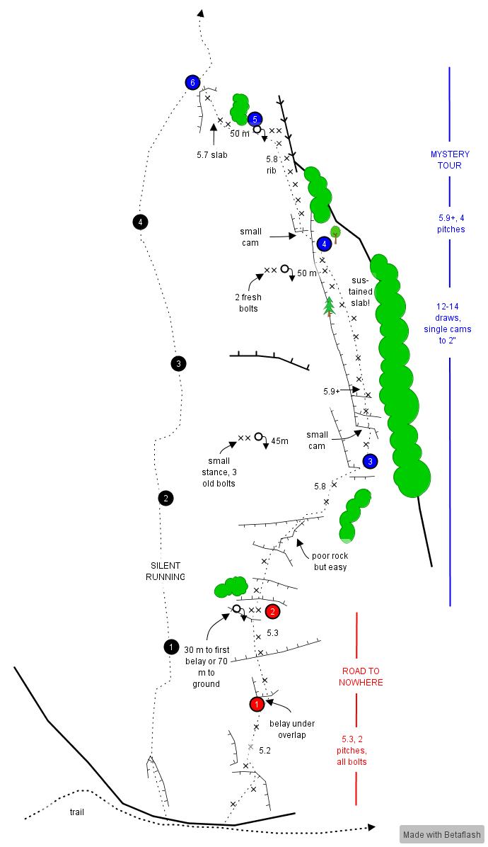
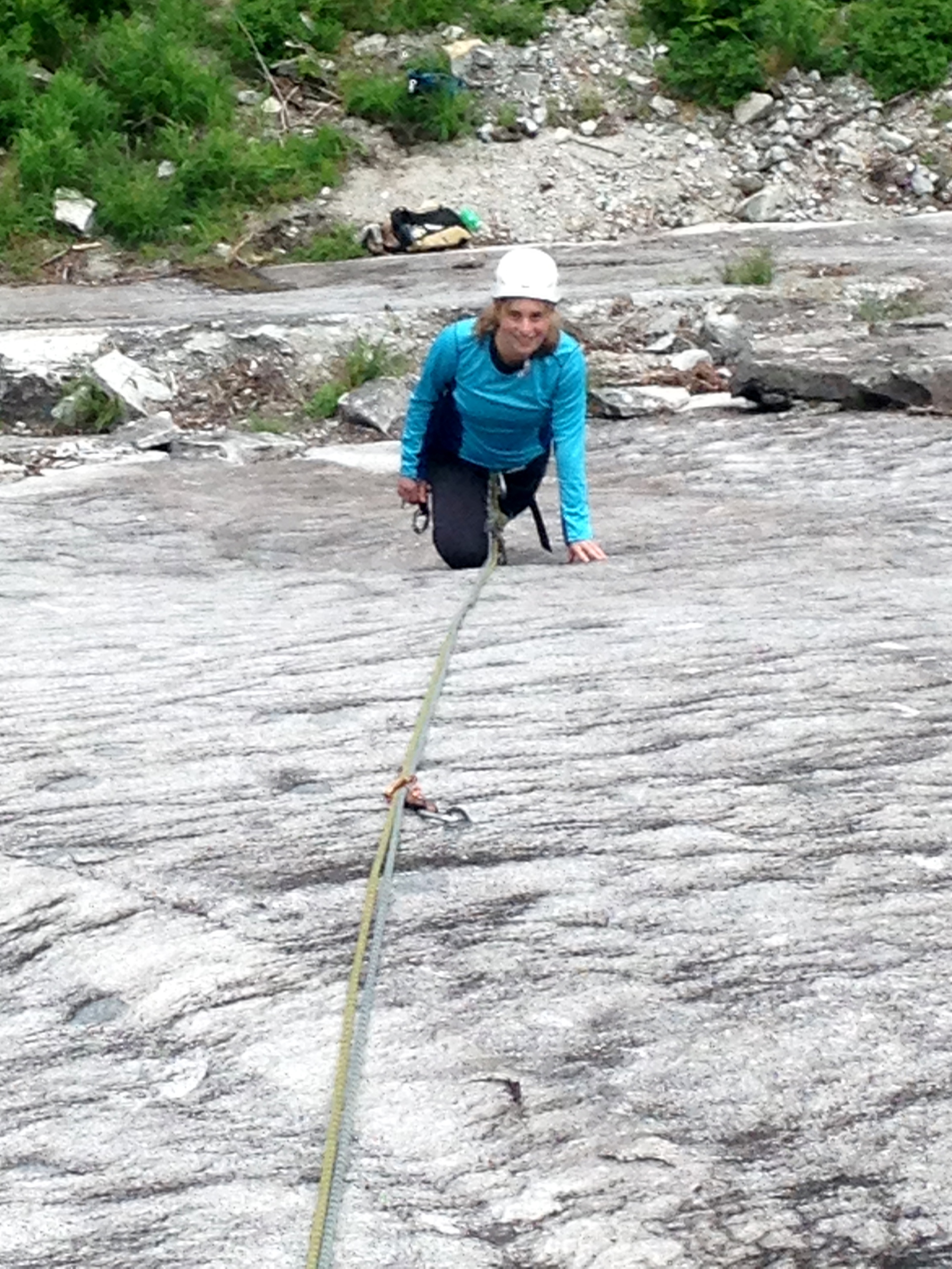
 Trip: Three O Clock Rock - Road to Nowhere, Mystery Tour Trip Date: 07/20/2018 Trip Report: Hey, a quick update about some new options up at 3 O’Clock Rock...for those that care. Year after year, it seems that over 95% of Washington climbers find zero appeal in hiking to easy slab climbs. But that just keeps the quiet experience for the dedicated regulars and newcomers. Andy and I added an easy (~5.3) slab climb a bit right of Silent Running that features two short pitches. Road to Nowhere has proven a fun outing for novice slab climbers. If you want more challenge, try it hands free (though the FHFA has already been done). You will need 5 draws and one 70 m rope to get up and down. If you’re up for a more difficult experience and/or other parties are lined up for Silent Running, continue another 4 pitches up Mystery Tour, which wanders to the right-hand edge of the North Buttress (topo below). The second pitch of Mystery Tour (5.9+) is the standout, featuring 58 m of very sustained slab climbing. From there, continue up the rounded buttress at 5.8 and then a shorter pitch that ties into Silent Running. More beta and gear details are below. Currently, the easiest descent is down Silent Running, though we hope to have a separate rappel route tuned up in the near future. Leah on Road to Nowhere, pitch 1 Matt approaching the rounded buttress on pitch 3 of Mystery Tour. Climbers below and left are one pitch up Road to Nowhere Route topo Gear Notes: For Mystery Tour, you'll want double 60s, a single set of cams to 2" and ~14 draws. About 80% of pro is bolts. Approach Notes: FS road #2060 to Eight-mile trailhead, then 45 minutes of easy uphill (standard 3 O Clock Rock approach)
-
Rolf Larson and I climbed a line on the north face of Mt. Buckner on Sunday the 20th. Friday, after bivying at the trailhead, we skinned up the road and started up the trail to Boston Basin. Coincidentally a group of 3 skiers were off to ski the north colior on Buckner that same morning. Thrashed through the brush and above tree level by early afternoon up to within about 800 feet of the Sahale Boston col that day. Skiers continued on to make the traverse to Boston Glacier. Next day some weather moved in and vis was shitty at the col. We began the traverse. Good neve, exposure, heavy packs. Traverse, Down the Boston Glacier in light north face pow and across to the north face of Buckner that day. Scoped lines. Line we originally intended to climb looked too filled in with snow. Another line caught our eye that started with an ice flow then went into some snow and ice runnels. There was a direct start to this line that just looked too much like powder snow on rock. After another cold night in the Bibler, Rolf roused early with his usual sunny disposition and made a brew while I kept my head stuck in my sleeping bag. We trudged up to the ice fall. After some fucking around I finally started up the ice - a fun pitch with a decent steep section. From there we continued up steep snow and fun aesthetic mixed climbing. Here's a bad photo but gives an impression of the climbing. The neve was superb. Everything that looked like powder snow from the glacier was thick thunker neve. We realized we should have taken a steeper line or the direct start. About half way up the face we were able to look down at the direct start and it looked rad - with a classic ice and neve filled chimney with decent rock pro. What little girls we were for taking the conservative approach. More fun climbing led to the of the ridge and a classic ridge traverse with exposure and amazing views of the North Cascades in winter led to the summit. We paused in the sun and descended the north coliour back to the Bibler. It was only 1:30 by the time we got back to camp, so we made a brew and I told Rolf I was over spooning with him in the Bibler let's go home. We packed our shit and bolted. The skiers who had skiied the north coliour the day before had been farming the north facing slope from the Boston Sahale traverse notch down the glacier that day and had kicked a bitchin skin highway back up. Thanks skiers!! Got down to truck by 8:00 after a long exhausting day and had a beer. Named the route "Copa Cabana" after a friend who spent his President's Day weekend kiteboarding and drinking margaritas in Mexico with bikini babes instead of the Rolf Larson lovefest of freezing ass and killing ice. Shot of the route from bro's arial photo page: The Copa Direct remains. If this high pressure holds someone should go crush!!!
-

first ascent [TR] Mongo Ridge-W.Fury F.A.- VI-5.10- 8/28/2006
wayne posted a topic in North Cascades
Climb: Mongo Ridge-W.Fury F.A.- VI-5.10- Date of Climb: 8/28/2006 Trip Report: Quicky tr to tell about an amazing new route done on West Fury . The SW buttress of Fury proved to be very challenging, but was done in a 5 day solo effeort . The Trip Report is developing as I have time to write it, It is now located half - way down this page, Enjoy and Thanks, Wayne Gear Notes: lots(no porters) -
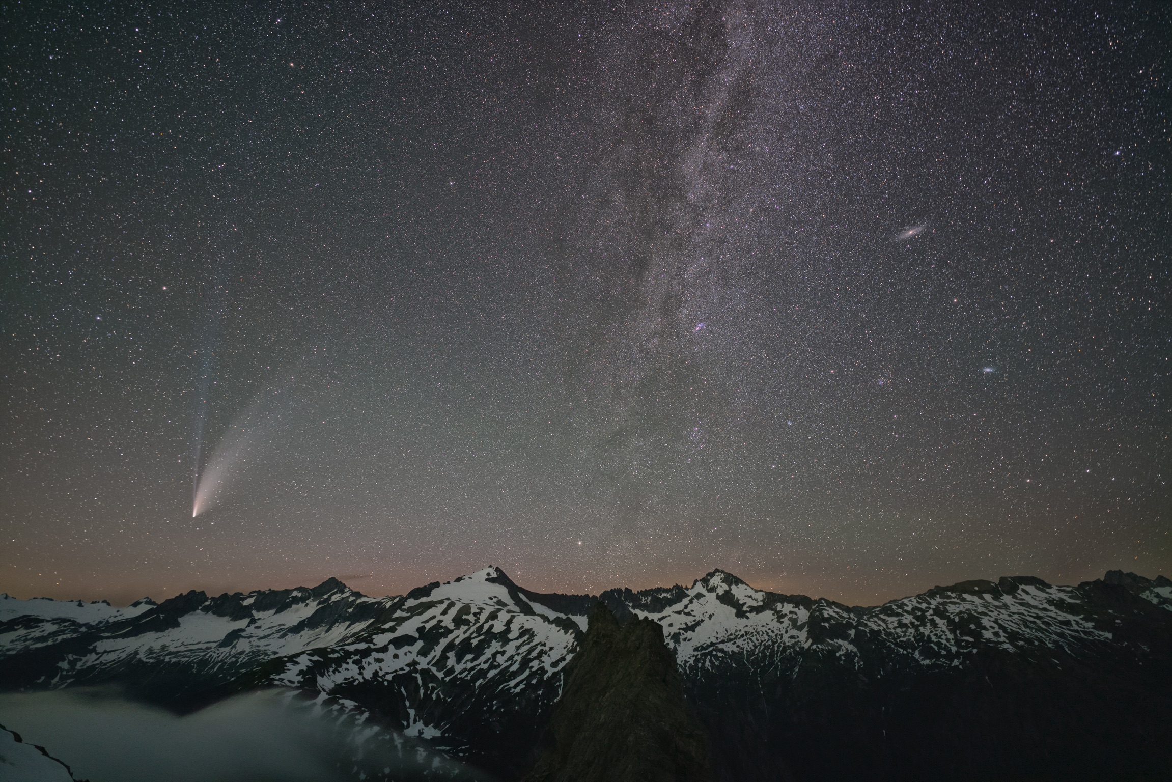
I have permits for the XC zones for challenger and Luna June 15-21. Was planning to head up to challenger arm via Wiley/Eiley ridge specifically for photography, in particular astrophotography of the Milky Way over Luna if the weather cooperates; hopefully make my way across Luna cirque to do the same for the southern pickets from Luna Col. I might scramble Luna if I’m feeling strong after hauling all my camera gear around. I haven’t been up there, any knowledge if the log jam bridge survived the winter or other changes/obstacles I should look out for? here’s a random picture of a past outing just to make this more exciting than a bunch of text
-
Hey Y'all! Does anyone know of any recent trip reports for the North Cascades, particularly the Eldorado/Hidden Lakes area? Many thanks!
-
 Trip: Squire Creek Wall - Skeena26 III, 5.9, FA Date: 9/17/2012 Trip Report: SKEENA 26 III, 5.9 (12 pitches) Bill Enger, David Whitelaw, Yale Lewis A couple of months back, my buddy Bill and I completed our third line on Squire Creek Wall. It's located way around to the south, past the Illusion Wall, Chickenshit Gulley and all that. We picked the last big chunk on the left and turned up a real jewel at a fairly relaxed standard. Its not like these things are a mystery. The features are more or less in plain sight from the trail. A short, fairly flat three miles and its all obvious. A pair of binoculars and its almost indecent. Its been right there all along, soaking up the famous northwest sunshine. Every once in awhile, basking on our bivy ledges we'd get to talking, passing the bourbon eh? " Well ya know," somebody would begin. "There's that stuff around to the south. We talked about it for years but with no real sense of urgency. Finally one autumn the Rodeo had been completed and we had to stare at each other and blink. Two buttonheads without a cause. At odds with the rest of the world since day-one D-Town has rambled on with the barest minimum of love for just over forty years. Too far, too weird, too low angle, too obscure, too wet. Two-thousand feet tall?? Two ropes?? Two hours from Seattle? Fuck that! Sometime last century, in a sort of cedar-smeared socialist epiphany we peasants smashed our machines and marched into the forest naked save for the hand-drill, and a crown of devil's club. Now the hammer has taken us full circle and despite the cold sweat of watching the tool so arthritically pound out the dust it is indeed the wilderness we have come for. Like Heidi's grumpy grampa, sequestered. By degrees we have been forgetting our old ways; road trips, guidebooks, beta?, campgrounds, this climb or that. No trails, no rangers, no fees, no pools, no pets. You just pay up front and place your bets. The not knowing isnt mearly a part of it, it's the heart of it. So we went around the corner to the south. We had no idea how to even get there. It was after all, the remote side of Squire Creek Wall; fabled for being unreachable. One November we walked up the trail and took pics of the southern ramparts with a dusting of new snow on them. Later,in spring we skiied up the road and attempted to snowshoe up the big hillside beneath the Illusion Wall. We didnt get very far but we learned a few things. The hillside is steep, but the forest provides sufficient cover so that there is little underbrush. It's only as you approach higher elevations that the lowland giants give way to the famous hundred-acre tangles of matted, down-sloping cedars and broken logs. While the sane played at Vantage this last spring, Bill and I thrashed around in the forest and the flies and the melting snowbridges until we found a workable path. It was getting to be a bit over the top! We were many many weekends into it before we even got an unobstructed look at our mail-order bride. In June we cramponed up snow gullies and tiptoed around huge psuedo-seracs and tilted snowblocks until we found a camp fairly near the base of the wall. There was snow everywhere. Cornices along the summit periodically cut loose and sent thousand foot cascades of shaved ice down the rock. The sun came out, the snow blocks fell over, waterfalls spewed out of big corners hundreds of feet above us, and the whole place sparkled. In all fairness we didn't know what to think. At least I didn't. It was different. It wasn't what I had imagined. We gaped for hours and wondered if it would play. The cirque arched around us in the sun like a collosal necklace with waterfalls for jewels and we agreed that the prize was worth the walk. Now with a light load and some solid prior knowledge the approach can be sent in around three hours. There would be no high-ledge bivys this time. Just a shady base-camp with prayer flags and our ubiquitous water cubes. From camp, a ten-minute hike across boulders, grass and wildflowers brings one to the start of the route with only minimal aggravations. What a summer we had! While the rest of the nation struggled with heat waves and forest fires Darrington became our always-sunny summer camp in the Sierras. We baked in the sun and it never rained. As usual, occasional guests and girlfriends joined us in the dirt and the heat and in particular Yale Lewis' hard work packing gear, jugging lines and shooting video helped us immeasurably. The route steadily advanced by a pitch or two per weekend. To our good fortune, the gully below camp held snow until late August, which in turn provided water for cooking and slush for our margaritas. Nobody said this pioneering shit had to hurt ALL the time! Bill on Pitch 1 Pitch 1 Drilling on Pitch 5 Dave on Pitch 5 Bill on Pitch 7 Photos by David Whitelaw, Bill Enger Squire Creek Wall, South Face Skeena26 in blue photo by John Scurlock The south side of Squire Creek Wall isn't as steep as the Illusion Wall or even Slab Daddy it's just that the rock is so exceptional and the setting so perfect. The stone is brilliant white and peppered with textures, bumps and knobs. When it gets a little steeper, the knobs get a little bigger and there are good places for gear on many of the pitches. This is a friendly route of high quality and though the first pitch touches 5.9 at a couple of polished spots most of the rest of the route is 5.4- 5.6 with sporadic freak-outs of up to 5.8. We tried to make a route that a 5.8 leader would find reasonable. We just went with the flow, and followed the knobs for a dozen pitches. Gear Notes: Standard rack to 3 1/2"
 -
Trip: Mile High Club - a new alpine rock route near Vesper, Sperry and Morningstar Peaks. 7 pitches, 5.10a. Date: 9/12/2015 Trip Report: Mile High Club is a new alpine rock route that Darin and I put up this year. We hope you will climb it and enjoy it. The purpose of this TR is to provide information on how to find and climb the route. First ascent stories can come later. We believe this route has all the ingredients of a modern classic: excellent climbing, solid rock, a striking feature and summit, grand alpine views, and a quick and easy approach and descent. The route ascends the southwest-facing buttress of a striking 5280 foot sub-summit of Morning Star Peak. The buttress is a very prominent feature on the east side of Headlee Basin, and it dominates the view from Headlee Pass. The rock, part of the Swauk formation, is metamorphosed sandstone, littered with positive holds, and devoid of continuous cracks. Mile High Club offers seven pitches of excellent face climbing and exposure on the crest of the buttress. Its low elevation and southwest exposure should give it a long season compared with other alpine rock routes. Although this route is fully bolted, climbers must be prepared to handle steep snow in spring, multiple rappels on the descent, and some loose rock on ledges. Care should be taken to avoid knocking rocks off the right side of the route as these will shoot down the approach gully. For this reason, climbers are advised to wear helmets for the short scramble in the approach gully and avoid lingering there. Hikers on the Sunrise Mine trail can hear and see climbers on the route. They could misinterpret shouts among climbers as calls for help and might even activate an un-necessary rescue. This is exactly what happened to the first ascensionists, who were greeted at the base of the route by a hovering helicopter with a spotlight and at the trailhead by a full search and rescue operation. Season: May through October. Approach: ~2 hours, 2100 feet elevation gain. Drive about 28 miles east on the Mountain Loop Highway, turn right on FR 4065 (1 mile past the Dickerman trailhead), and follow it about two miles to the Sunrise Mine trailhead. NW Forest Service pass required. Follow the Sunrise Mine trail approximately two and a half miles to the last major switchback (~4300 foot elevation) before the trail begins zig zagging up to Headlee Pass. Leave the trail and begin a surprisingly easy traverse northeast across talus toward the Mile High buttress. Pass just above a large flat-topped boulder near the first set of trees. Follow a natural passage through the small stand of trees to a second open talus field. Continue across open heather and talus, cross a strip of trees near a rocky bluff, and ascend to the obvious red gully right of the Mile High Buttress. A convenient seep just before the Mile High gully provides water through mid-season and for a few days after rain. Scramble up and left on rubble-strewn ledges to a lone fir tree. Pass the tree on a ledge to a single belay bolt at the beginning of the route. Route: Pitch 1: Hero climbing up and left on steep jugs leads to a beautiful face and arête. 115 feet, 5.10a. Pitch 2: Continue up the featured face to a belay on the crest. 70 feet, 5.9. Pitch 3: Cross a large ledge and ascend a 30 foot headwall with some cracks and good holds. Easier climbing leads to the base of the next headwall. Note that an intermediate anchor about 15 feet right of the climbing line and 10 feet above the lip of the lower headwall is used on the descent. 150 feet, 5.9. Pitch 4: Step right and climb a clean face to the base of a dihedral. 70 feet, 5.10a. Pitch 5: Climb the stunning dihedral and exit up and right to an airy belay. 80 feet, 5.10a. Pitch 6: Head up the lower arête, balance on top of a large flake, and climb a beautiful face to a spectacular arête. 115 feet, 5.10a. Pitch 7: Make a tricky move or two on a vertical face, cross ledges to the final headwall, and follow a clean ramp to the summit. 100 feet, 5.8 Summit: According to USGS maps, the peak is 5280 feet above sea level. This inspired the route’s name. There is a summit register with a secret. Please do not post photographs online or otherwise spill the beans. The idea is that only those who have visited the summit and become members of the Mile High Club will know its secret. Descent: Rappel the route using the pitch 3 intermediate anchor. Avoid a pendulum on the Pitch 7 rap by lowering down to the large flake before walking left to the belay. The starting ledge is several hundred feet above the ground and rather exposed. Climbers might want to traverse back to the starting bolt before unroping. It's possible to pull the rope on the final rappel from that position. Gear: One 70 meter rope, 12 quick draws, and a few shoulder length slings. First Ascent: Darin Berdinka and Rad Roberts, September, 2015. View from the point where you depart the Sunrise Mine Trail. The 5280 peak is on the left. View of the approach from the route. The trail is in the sun in the upper right. The MHC gully is in the lower left of the frame. Route overlay Another route overlay The start of Pitch 1 The top of Pitch 1 Pitch 2 Pitch 3 About to head onto moderate terrain on Pitch 3. Pitch 4 Start of Pitch 5 Nearing the top of Pitch 5 Approaching the arete on Pitch 6 Arete on Pitch 6 Arete on Pitch 6 Pitch 7 just below the Mile High summit On the summit at sunset with Sperry and Big Four in the background. A taste of the alpine ambience: Mile High Club is the right profile in this photo taken from the road. “Climb the mountains and get their good tidings. Nature's peace will flow into you as sunshine flows into trees. The winds will blow their own freshness into you, and the storms their energy, while cares will drop away from you like the leaves of Autumn.” - John Muir.
-
first ascent [TR] Hozomeen Mtn, South Pk - North Face, IV+ 5.9
lunger posted a topic in North Cascades
On August 13 and 14, Rolf Larson and I -- henceforth little and big jackass respectively -- pioneered a line on the North Face of South Hozomeen (properly: Hozomeen Mountain, South Peak). If you've seen it, you know this thing is intimidating and steep. (By some objective measures, this peak is one of the steepest in the lower 48, and "... the South Peak ... has the steepest North Face of any peak in the Northwest.") We'd gawked at it from N Hozomeen three years ago, speculating that a massive, slanting dihedral feature might be the only feasible route for mortal climbers. Turns out it was feasible, just. Our line begins directly beneath the overhanging summit, travels more or less straight up to gain what we've dubbed (in respectful honor of Fred) the feature, and then primarily grinds up the right-hand facet of the giant corner to reach the summit ridge a couple/few pitches from the summit. ( BTW, big props to Beckey bros and crew, who summitted this beast in 1947 via the SW route. Inspiring. A movie honoring Fred worth sponsoring, if you somehow missed it: ) North Face, IV+, 5.9. 13 pitches to the W ridge, plus a short pitch to join the top of the SW route and then take in its crux pitch. We shiver-bivvied on a sloping ledge 11 pitches up, perched on the exposed right margin of the dihedral, a couple thousand feet above the basin--pretty cool. As far as we know, no other route has been established on this face. The pitches went 5.8, 5.8, 5.8, 4th, 4th, 4th (80+m, some simul-climbing), 5.7, 5.7, 5.8, 5.8, 5.8, 5.9, and 5.7. The last half+ (7 pitches) followed the Pissburger Dihedral. Then an easy pitch on the crest, and the "5.6" final pitch of the standard SW route. [Apologies for so many words and so few photos--album link below. Google recently shut down Picasa, with which it was easy to re-size and embed photos--the new product lacks functionality, and I lack time for extensive photo shenanigans.] This photo courtesy of Jason Griffith; belays marked w/ circles: For context, here's a shot of both Hozos taken from SE Mox Peak a few weeks ago. S Hozomeen is on the right, its north face is in shadow: https://goo.gl/photos/LpzJ1EdPNKHfLpDr5 And a shot of little jackass climbing high on the route (p. 11): https://goo.gl/photos/3ooZbpTG3An1Faah6 Should note that the moderate technical difficulty ratings belie the comprehensive difficulty of the route; this is not straightforward climbing, and careful route-finding and hold selection is mandatory. Some of our 60m 'moderate' leads took well over 1.5 hours! As mentioned above, the first three pitches go straight up to an easy ledge system that then yields the long dihedral. These first three pitches were quite solid and a lot of fun; a recommended crag with easy access . But the corner ... In an effort to give you a flavor for climbing the Pissburger Dihedral, here's a too-common scenario: launch from the belay, hope to protect it soon, find a crack behind a meager flake maybe 15-20' up. Maybe you put in an appropriate-looking nut, but a yank pulls right through as the flake expands. You slot in a crappy cam with a 1 in 50 chance of catching a leader fall, though if you whip it might slow you down, so you leave that mostly ornamental gear hanging there and hope for more soon. You wend, hem and haw to and fro and yonder, tapping and kicking holds to test. Up and right, back down; up and left, decide right is better; then up and right again. A number of deliberate, committing moves and 30-40 more perspiring feet above the ornament, you spy a small patch of vegetation in a faint corner. Out comes the compact ice tool. Scrape, scrape, scrape at this scratch card hoping to reveal a prize, only to find a shallow, flaring "crack"; try a nut, a sideways nut even - nope - maybe the tricam trick that 'worked' earlier will go here - nuh-uh. Poop your pants a little. Search the horizon for anything. Resolve to continue, ensuring you can reverse the moves. Higher still another ornamental piece gives you the false confidence to continue ... ok, so it's pretty much soloing. The 5.9 crux pitch (p. 12) above where we spent the night was stimulating in this manner too, and magnified thanks to the way it traverses above some large overlaps/roofs (and well above a tiny tri-cam). Overall, we can't really recommend the route. Had hoped the giant dihedral would hold a nice crack system. It had a crack, but for the most part it was comprised of very rotten and decomposing rock, or filled with copious humus. Not appealing; on one of my leads I ventured to the corner only to be rebuffed in horrific fashion by the rock peeling away at the slightest touch. So we were forced to find our way up the right-hand facet of the corner via sparsely-protected face climbing. Only near the top did some splitter briefly reveal itself. Squamish. The album for our trip, in not-so-great Google Photos (click on "i" to see captions): https://goo.gl/photos/SmEcZZ2r9BhFy3ZTA And the photo linked below courtesy of - who else - John Scurlock; shows an oblique view from the east, and our line rises to the first bench/notch to the right of the summit. https://goo.gl/photos/Z25Bs4QdRM7z2Tnq9 Thanks to little jackass, we onsighted the descent of the standard SW route, which felt long, exposed, and tedious, especially after a sleepless night and many hours of hyper-vigilance. My impish spouse tried (with some success) to implant this earworm as we departed in the evening: ... so every once in a while the cheeky, existential lyrics would humorously rebound in the Pissburger. A rewarding trip, with many fun/funny moments, and a fair bit of suffering; the whole package arouses that fight or flight instinct. Feel fortunate to have solved (and survived) this problem. Gear notes: We brought a large rack to 4", doubles to 2", large set of nuts, and definitely bring tri-cams through hand-size; used the small black tri-cam more this trip than I have in all previous combined. We had pins and used two to augment our shiver-bivy anchor. Did not bring a bolt kit but wished we had. Double ropes. Compact tool, but no crampons required. -
I just finished AAI's Alpinism 1 & 2 and I have about a week left in Washington before I need to leave. I would love to get back into the hills and gain more experience while I'm here. I'm mostly interested in moderate glacier climbs like the Easton on Baker, Sulphide on Shuksan, Eldorado, Sahale, Glacier Peak, etc. Please reach out if you're interested!
-
Trip: North Cascades - NW Face of Forbidden Peak Trip Date: 08/04/2019 Trip Report: Climbed the Northwest Face of Forbidden Peak on Sunday, Aug. 4. I believe now that we badly botched getting on the start of the route, exiting the glacier too close to the toe of the arete, rather than attempting to climb further around and up to the right of it. This resulted in some time consuming and stressful problem solving in unpleasant terrain. After crossing the Forbidden Glacier, we found a place where we could make a short down climb/rappel off the glacier and onto rock, near what we thought was the start of the climbing route. Off to our right was a gaping hole filled with ice and rock debris that's part of the moat. Once on the rock, we scrambled up 10 or 15 feet to where we were beneath a roughly seven-foot-thick snow patch, looking up at a corner system that we reasoned (convinced ourselves) could be the start of the rock climbing. (View from across the Forbidden Glacier of the rib on Forbidden where the climb is located.) (Rappelling off of the Forbidden Glacier. The snow was soft and we reluctantly opted to bury and leave a picket to do this.) My climbing partner Pat led the corner, and some terrain above it. There was some dirty rock and some of the climbing felt 5.8/5.9. He stopped after about 80 feet at a semi-hanging belay. I followed up to the belay and we decided after some discussion we were definitely not on the route. Some abandoned gear we passed on the way up indicated we may not have been the first party to have made this mistake. Looking down and climber's right we could see what appeared to possibly be the access ramp feature described in the Cascades Rock guidebook. We then watched as the top of a massive ice tower--a chunk of ice that was maybe about the size of a 55-gallon drum--collapsed into another debris filled hole in the glacier, next to the ramp. Short on good options, we lowered/rappelled down into a more sheltered part of the moat, and then climbed a short section of polished 5.8ish rock up out of it, over to the right, to reach the start of the ramp. In the place where we finally established a belay we were just above the debris hole where we'd seen the ice fall, and close to other threatening towers of ice that were by now baking in direct sunlight. But it appeared that we were far enough away that we were not in immediate danger if anything else fell. From here we followed the ramp system up and further right to the climb proper. Parts of the ramp felt mid-fifth class, with maybe some 5.6/5.7 moves, and sparse gear. As this ramp trended higher, the snow got closer to it, although I can't confirm whether there's a spot right now where you could get off of the glacier in this area and onto the rock. At this point, the climbing thankfully became more straightforward and matched with descriptions we'd read. Although the lower part of the route was looser and dirtier than I expected it would be. The 5.6 knife edge and 5.8 pitch were both stellar, with fun climbing, good gear, and an amazing position on the mountain. I stayed near the ridge crest approaching the 5.8 section and then climbed cracks and other features on the steeper rock straight ahead before cutting left. This seemed to work well. On the upper section of the climb, the rock quality improves somewhat compared to the lower portion. But don't expect to be romping up Leavenworth or Index grade granite, there's still plenty of loose rock. We simul-climbed after the 5.8 pitch, stopping twice to re-rack and belay before the summit. (Upper section of the climb, with the 5.6 knife edge in the foreground, the 5.8 section above it, and the rest of the route beyond.) All of the messing around at the base of the route meant that we reached the summit much later than expected. We descended the West Ridge, reaching the notch just after dark and decided to bivy there, rather than continuing with the rappels back down into Boston Basin. This meant we both missed a day of work without giving notice and caused a great deal of worry for our significant others who expected us back on Sunday night. But having not done the rappels before, I think we made the right decision. We woke up around 5 a.m. and descended back to the car without incident. One perk of staying out an extra night is that we got to see an impressive northern lights display from the notch on the West Ridge that lasted until around dawn. (Feeble attempt at capturing a dramatic northern lights display with an iPhone camera.) On the approach, the Boston Glacier wasn't too difficult to get across. We were able to pick out a line across most of it from the rappel notch near Sharkfin Col. We also watched another party headed to do the North Ridge hit a dead end that we were able to then avoid. (Boston Glacier, as seen from the rappel notch right of Sharkfin Col.) (Looking back at the Boston Glacier from near the gully that leads up to the low point on the North Ridge, that provides access to the Forbidden Glacier.) The Forbidden Glacier becomes more heavily crevassed nearer to the base of the route, but it seems like based on past trip reports that this is pretty standard. As for the rappels on the approach, two raps with a 60m rope from the notch right of Sharkfin Col will currently get you to the edge of the moat on the Boston Glacier. It's also possible to scramble down climber's right after one rappel onto the glacier. We went too high in the gully that leads to this notch and had to go back down to reach it. It's off climbers left in the same general area (can't remember if it's before or just after) as a slung rappel station in the gully. If you're getting too far above that rap station in the gully, you've gone too far. This gully is mostly snow free right now and very loose. We crossed over to the Forbidden Glacier via the low point on the North Ridge (there's another place to cross over just north of here, not sure if there's any advantage to using it instead). From the low point on the ridge, exposed scrambling (we roped up for it) down and skiers left of a bivy site will lead you to a rappel anchor that we backed up with a new piece of webbing and a second rap ring. One rap with a 60m gets you down onto the glacier. On Saturday night, we bivyed below this cross over point on the North Ridge, on the Boston Glacier side, near the glacier, where we had access to snow to melt for water. My overall impressions of the route are that it climbs a beautiful feature in an iconic part of the North Cascades--a great mountaineering adventure in a wild setting. (Eldorado Peak and Moraine Lake as seen from the climbing route.) That said, I thought it was short on good rock climbing. The crux for us was definitely getting on the route, but I also don't think we did it the easy way if there is such a thing. Don't underestimate the time it could take getting on this climb and the hazards that are present near the base of the route, particularly this late in the summer. And don't forget there aren't many easy alternatives to get back to Boston Basin once you're on the Forbidden Glacier. This was my first significant outing in the North Cascades after moving back to Washington state following a four year stint in Washington, D.C. It was a full on one. Definitely memorable. Gear Notes: Single 60m rope, double rack of cams from finger sizes to #2, one #3 (small gear seems to be more useful than big pieces on this route), set of nuts, two pickets. Approach shoes, aluminum crampons, ice axe. Approach Notes: See trip report.

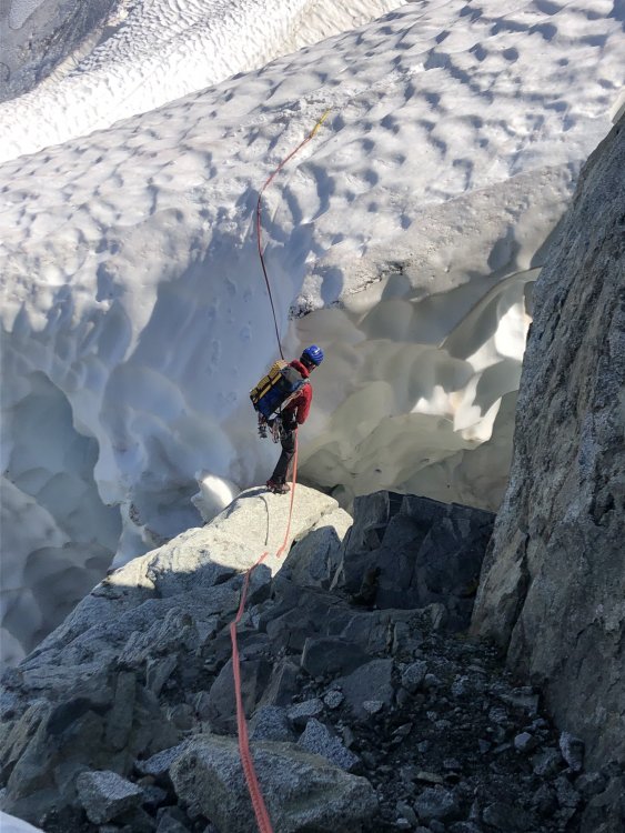
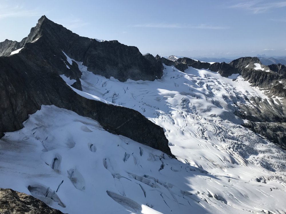
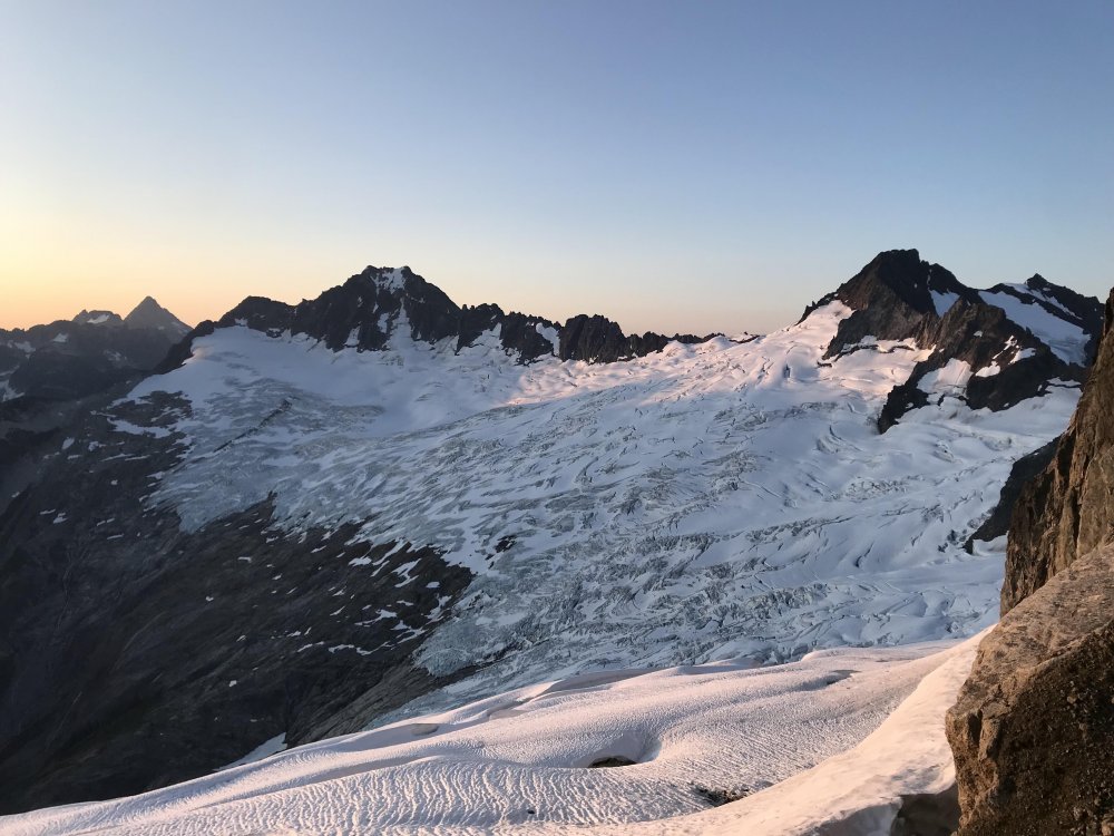
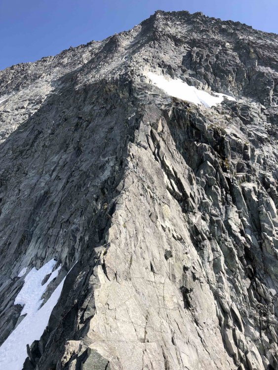

- 7 replies
-
- 3
-

-

-
- north cascades
- forbidden peak
- (and 2 more)
-
 Climb: WA Pass: South Early Winter Spire-F.A. Mojo Rising III 5.11 A1 Date of Climb: 10/14/2006 Trip Report: NORTH CASCADES: WASHINGTON PASS South Early Winter Spire (S.E.W.S) F.A. Northwest Face Direct “Mojo Rising” III 5.11 A1 Mark Allen, Joel Kauffman, Tom Smith Oct 13-14th 2006 Trip Report By Mark Allen I am reminded that the warm Indian summer is slipping. “Line is fixed!” My hands are nipped by the cold as I turn up the ibox. Not accustomed to classic wall style I impatiently wait at the belay but the Doors bootleg is helping me pass the time. The wall being technical it’s faster for both seconds to jug the line. We have been in this style for three pitches on a new line that the group had been cleaning from fixed lines days prier. I look down mouthing the words to Break on Through to Tom Smith as he jugs past the first three pitches covered on Friday Oct 13th. He gives me the thumbs up. Joel and I are re-racking getting him ready to cast off into the unknown pitches. Our excitement is highlighted by the strange tunes of Jim Morrison. Joel Kauffman Jugs fixed line on pitch 2 during the First Ascent of Mojo Rising. Photo By Mark Allen The Northwest Face of SEWS dominates the Western side of the Liberty Bell group in Liberty bowl. For years I have admired the aesthetics of this face. Its solid golden granite holds the afternoon light bringing out the contrasting black water streaks. The moonlight on this face is even more impressive. I never thought of climbing it until this year. During many trips to other spires I kept drawing lines on the face and then referencing the Red Fred. It seamed that several proud crack lines had been explored in the 70’s and 80’s. C. Northwest Face: FA Boving and Pollack 76’ FFA Boving & Kerns 77’ route III 5.11a begins low on the NW face and traverses to the West face into the famous Boving Roofs pitch finishing on the SW Rib. E. Northwest Face Var: Riders on the Storm FA Jim Yoder & Lee Cunningham August 15, 1989 A route that Becky recorded little about (but strangely knows exactly when it was climbed). From what I can piece together from studying the face, Becky’s description, and several topos of the Boving & Pollack 76’ route I can only see one available option. It appears that the party deviated from the Boving route during the third pitch into a vertical flake forming a flaring chimney or OW (This feature looks like a hand crack from the ground). At mid-pitch the crack doglegs left up an undercling ramp to a large ledge located directly plum under Dolphin Chimney. Then the most obvious thing to do was to get on the direct splitter 5.9ish corner hand crack to the Dolphin Chimney. I stood under this hand crack pitch several times and every time was disappointed it was not a part of our line. A. North Face: FA Doug Ingersoll & Andy Selters August 88’ III 5.10 A2 (5.12?) A steep face starting just below the chock stone raps takes a nearly straight line in cracks then traverses left on an arching crack. This leads directly to the false summit and avoids the SW ridge climb. Others seem to have attempted this line by the looks of the bail-tat that I always spy on the first pitch when coming of the N.E.W.S. After comparing the references to the rock it seemed the main breadth of the Northwest face appeared to remain undescribed and more importantly unclimbed, and for good reason. The most fantastic feature was a massive golden right facing dihedral that magically continues arcing across the top of the face intersecting high on the SW ridge just above the infamous Dolphin Chimney. Below the golden dihedral ramps and cracks incipiently completed a line except one area, the first pitch. This blank section guarded the upper pitches. During a climb of the NW corner of NEWS with Paul Butler earlier this summer I got a closer look at this crackless first pitch. Our imaginations were intrigued by the fun sporty face as our eyes moved from feature to jug to seam to finally crack. My hopes were now rekindled that this could and just might go. “Wow, that looks sweet!” I exclaimed then and the next three times I stood under the face this summer. But it would have to protect with bolts. The thought of bolting from the ground looked sketchy due to the nature of the face. I spoke with several route setters and first ascentionists that are historically prolific in the Methow valley to get their thoughts from a separate generation on the best approach. All thought that the classic nature of the pitch deserved to be properly (perfectly) bolted. So the approach was top-down for the first pitch. The rest of the climb would be discovered on the first attempt. Joel Kauffman on the first ascent of Mojo Rising Pitch 1 going at 5.11 sport. Photo by Mark Allen The second week of Oct I rap-reconed the face to confirm the lines continuity before one hole was drilled. It looked good. The belay stances rocked but not the gear. I established bolt anchors at three belays and we all cleaned/gardened the cracks that needed it the most, Pitch 3 and down (the steepest section). The first pitch required seven pre-placed bolts over 90ft and a short A0 bolt ladder to the belay. We pulled the lines and took a rest day. Mark Allen on pitch 2’s A1 seam. It is thought that this will one day go free. Photo by Tom Smith We left the car at 8:45am. Alpine starts were not an option during the fall cold temps and the dark morning of October 13th. The face does not get sun until afternoon. This made the first pitch a little sand bagged until the morning air warmed the rock. Pitch 1: Joel started climbing Pitch 1 at 10:30am. Joel just coming off his RMI guiding season was feeling floored by the sustained pitch but climbed excellent. We jugged the fixed line and congratulated Joel. Everyone raved about this classic pitch and can’t wait to get on it separately. Pitch 2: I left the anchor in full aid-mode and scrambled up the first ten feet plugged in my second cam and weighted it. It has been a while since my trip with Tom to the Valley but my aid skills were resurrected and then somehow peaked during this pitch. While top stepping fully extended off my fi fi I somehow slotted a stopper with the tip of my middle finger. The gear was good but small and sometimes tricky. We originally hoped that this pitch would go free. After the gardening recon it was not the 5.10 hand crack we had hoped but a steep aid seam. It appears to look freeable for some unearthly climber. With this futuristic vision in mind, I wanted to cater to a free ascent but thought it should go as clean as possible. We did not use pins. At mid-pitch the crack fades to a closed seam where a pin or gear could not be placed for two moves. I fixed a 3/4 inch bolt here for the aid and free ascent to come… Pitch 3: Tom Smith is off up a wide crack and moves over to a small ledge were he stares up at a short overhanging dihedral with a limited fingertip layback crack. His gear is just as cruxy as the climbing he reckoned at 5.11PG. Not able to trust his stances for placements he submitted to aid for three moves then pulled the roof of the dihedral on stellar finger locks at 5.10. He continued up for 30ft on ring locks and traversed left on a rail to the third stance. It was getting late in the afternoon, and we knew darkness fell at 6:30pm. At 4:15pm we fixed the lines to the ground. We knew we didn’t have enough time to explore and clean the last three pitches. Joel Kaufman on the “skywalker pitch” headed for he Golden Dihedral. Photo by Tom Smith On Oct 14th at 11:45pm Joel left the belay to the sound of the Doors on the ibox. Pitch 4: This is the traverse pitch to the Golden Dihedral. This is a fun exposed 5.7 ramp we called the “Sidewalk in the sky” shortened to the “Skywalker pitch”. Joel lowered 15ft from the anchor and pendulumed over to the ramp. Along the way he gardened for placements and established a belay. Tom and I separately rapped of the bolt anchor and pendulumed over. Mark Allen working Pitch 5 just below the 1 Ton belayer slayer. Photo by Tom Smith Pitch 5: I’m up. Originally I had planned to work the line up the laser corner crack formed by the dihedral. This did not directly connect with our summit cracks. On the other hand, just to the left was a much simpler 5.9 crack that did connect. The choice was simple. I got into an insecure layback with dirty flaring ring locks. This led to a dihedral with a cool stem box on edges while lay backing the wide crack. I climbed to the top of the dihedral and examined the status of a wedge shaped 1-ton block precariously perched in the corner. Touching on two points it seemed to levitate. There was no way not to climb on it. Planning my moves I committed to the hand jams with the same deliberate way I used to sneak back into my house in high school. Uneventfully I did not kill everybody. Good. I now entered the money section. A 100ft 5.8 finger crack dihedral. “This is the End my only Friend the End” Jim sang confidently with each brain-off finger lock. After 160ft, I clipped my old recon anchor. I brought Tom and Joel up hooting and hollering the whole way. Tom Smith enjoying 100ft of finger crack bliss on upper pitch 5. Photo by Joel Kaufman Pitch 6: The last new pitch took us to the simul-climbing ridge of the SW Rib. I was most familiar with the terrain so I cast off to seal the deal. We stashed one rope on Tom’s back and tied in like glacier climbers to the other. I pitched out the last 100ft on classic dirty alpine 5.6 and brought every one up to the ridge. Pitch 7: I re-racked with Tom. We were now staged for Simul. The three of us finished to the summit at 4:00pm. This was a fantastically fun line. Tom likes to refer to it as our Mini-big wall commenting on the classic wall style, the technicality, and the steepness. The rock is some of the best in the area. This was a worthy project that we are glad to have completed on the last day of Indian summer. Mark Allen on the summit after completing Mojo Rising. Photo by Tom Smith Storm front over Cutthroat Peak marking the end of Indian summer. The last clear day in our two-week streak. Photo by Tom Smith My approach to the Mojo Rising project was with the vision that in the future the route will go entirely free. So I made the effort to create a user-friendly line. I left cracks that were just protectable bolt free and bolted the faces to preserve an honest free ascent. The first three belays are bolted and rigged to rap with one 60M so it can be easily worked. I am guessing the 20M A1 pitch 2 will free at hard 5.12 or in the 13’s yet classic. ROUTE INFO Mojo Rising III 5.11 A1 Pitches: 7 (6 new) Pitch style: 1-4 climbed classic wall style. Pitches 5-7 the seconds freed Date/Time: 1-3 climbed on Oct 13th in 5 1/2 hrs. Pitches 4-7 Oct 14th in 4 hrs: 9 _ total (Due to party size and the fact that we are Gumby wallers, plus dirty cracks, and cold temps this is a recommended max time) Belays: Bolted at 1-3. Rigged for rap with one 60M. Trad anchors 4-7 (It is easy to bail during pitches 1-3. I suppose a party could bail into the NEWS gully from the 4th belay with one 60M rap or two 30M raps requiring a hanging stance and left gear) Gear Notes: Rack: Cams: 00”-4” Doubles sizes: 0.0, 0.4-3” TCUs helpful. Nuts: Single set with doubles in smaller sizes to 4 (Pitch 2) RPs a good range of smaller size 11 draws a few with slings 1X 60M Rope
 -
 Climb: TR- Johannesburg Mt. -CK route F.A. Grade V, 5.10b, AI 3+ Date of Climb: 8/27/2005 Trip Report: I figured I'd take my first stab at a trip report with this format: Several summers ago Loren Campbell and I attempted a direct line on the North Face of Johannesburg but had to retreat due to steep blank sections of rock. After some planning, we went back for round two with the same line. Johannesburg has always been a favorite mountain of mine to climb because on each trip J-burg seems to pull out something new from up its sleeve. In addition, the approach is perfect for someone as lazy as myself. The trend in the last couple of years has been to traverse lots of peaks or run routes together to get one big "climb". For those looking for a good adventure, Johannesburg delivers plus I was told that the North aspect has the greatest vertical rise in one horizontal mile anywhere in the U.S. outside of Alaska? --- Last Saturday I picked Loren up at 1:00am in Issaquah, and after packing gear we left the cascade pass parking lot at approx. 4:30a.m. We traversed below the fan and the beautiful steep red wall that I always thought would make a great sport wall and passed several more sections of rock until we got to our start. We climbed through various pitches up to 5.8 until we were cliffed out by an World Wall 1-"esque" overhanging wall that ran all the way right to a waterfall. (The 1985 Kloke route takes slabby ramps to the right of the falls and goes up and onto the other side of a huge prow). After tryiing three different options we were ready to throw in the towell. I felt stupid because I'd promised Loren we'd make it through this section even if meant aiding through with pins, hooks, mashies, or whatever other monkey business was required- At the lot, I just packed a free rack. I decided to give on last overhanging chimney that was just left of a 15 foot horitzontal ceiling a try. I started up a face and then cut into the mossy chimney. Luckily it was late August and the moss was dry. Any earlier in the summer it would have been wet and unclimbable. I pulled through and let out a whoop of joy. The packs hauled easily out in space for the pitch. The belay would allow a base jumper a clean jump all the way to the talus. It wasn't like penguins in bondage at squamish or anything but the pitch was solid "index" 5.10. We scrambled up the slabs with the huge snout of the glacier looming above us. We were going to climb the left of the two beautiful hanging glaciers. The 1985 route was on the other side of a huge butress and pulls on to the right of the two hanging glaciers. We scrambled up 1,000 feet of low to mid fifth class rock.until we came to a prow of rock to the right of the start of the left hanging glacier. Just then, a huge section the size of 3 houses of the glacier calved off and scoured excatly over the rock we'd just climbed. Then as we were uncoling the rope, another mini willis wall size section cut loose. We were scared shitless. Had we stopped for 5 extra minutes lower on the route we'd have been toast. The snout of the glacier was overhung and onion peeling away. We agreed we'd have to get up a little ways on the rock and then climb onto the glacier. The snout of the thing looks small from the road, but when you are by it it makes the ice cliff glacier on Stuart look like snqoqualmie's bunny hill. We climbed about 200 feet of 5.7 rock untill we were able to downclimb onto the glacier. As soon as I saw the upper glacier, I was afraid that we were stuck and would have to traverse onto the slabby wooded ridge route that is in the Nelson Volume 2 guide. We figuered we'd give the glacier a go. Loren masterfull led off and we were using two tools right from the get go. We spent hours climbing in and out of crevasses trying to pick a line through. It was the most monkey business I'd ever done on a glacier in my whole life. Near the top, our hearts sank as we found oursleves dead ended. One crevasse that overhung a whole pitch blocked our path. We found a moat wall to the right that we were able to climb. Loren masterfully led a beautiful vertical AI3+ pitch to pull us through. We were thankfull for spending the last five winters doing a lot of waterfalls. We reached the top and traversed onto ramp where an ice wall brought us to the end of the snow arete of the before mentioned select climbs route. We trudged on to the summit. The glacier was like climbing up the ice cliff glacier on Mt. Stuart in mid summer two or three times. I was beat. We topped out and decided to descend beacuse the weather forcast for Sunday was poor. We descended and reached the CJ col at 2:30am and bivied. We'd been climbing for 22 hours except for the 1 hour of hiking across the talus. Next morning we hiked out Doug's Direct. The route was by far more committing than any of the numerous grade V's I've done in the Cascades. Pictures to come. Go do it! I'll give you a topo. Gear Notes: full rock rack, rock shoes, 2 ice tools each, ice screws packs were hand hauled on vertical and overhanging pitches. Approach Notes: easy 1 hour approach
 -
Trip: Inspiration Peak - South Face Trip Date: 09/02/2018 Trip Report: Before last weekend I hadn't been to Terror Basin in almost 10 years. Back then we had spent a week in the Southern Pickets, only seeing one other party in Terror Basin. How times have changed! This past weekend there were three other parties for a total of a dozen people in Terror Basin. Thankfully all the others were headed for West McMillan Spire so we had the decidedly unpopular South Face of Inspiration all to ourselves. However, like Alan Kearney, I really think it should be more popular. It is quite a route! But it is also not for the faint of heart. Steep, intimidating, with a bit of scruffy rock and so-so pro - it would have been a challenge back when I was in good rock climbing shape. And I am most certainly not in good rock shape these days! Luckily I had @therunningdog to gun my sorry ass up it. And gun he did, leading all the gash pitches. But there was plenty to keep my mind humming below- a chaotic glacier with some delicate bridges, slabby rock right off the glacier (should have put on rock shoes earlier), and an increasingly exposed 4th/low 5th class ramp that terminated in the intimidatingly steep "Great Gash". And thenn once you are on the summit, the involved descent awaits. 4-5 raps down the West Ridge, some ridiculously exposed scrambling, and then more steep rappels down the south face. It was about 12 hours camp to camp. But what a place. Even more beautiful than I remembered, perhaps due to the changing weather and swirling mists? The best pictures are never during the best weather, perhaps the same is true of our memories? I'll be back, but I won't wait another 10 years this time. Looking down into Terror Basin from the "trail" in: Looking out to Triumph, Despair, and the Chopping Block (L-R): Despair and the Chopping Block: Thornton Peak and Triumph at sunrise: The Southern Pickets!! Morning light on the South Face of Inspiration: Ptarmigan and grown chick: I should draw the line on this but basically you climb up the buttress to the left of the face to the prominent ramp that is followed right a long ways to the start of the "Great Gash", which shoots steeply up and left to the upper West Ridge. A pitch on the ridge finishes the climb. The Descent follows the left skyline to the col then down the steep face/buttress to the glacier: The glacier approach proved challenging, but we found a way that will go into the fall this year: No super dad friendly. Scrambling a lot of 4th and low 5th to the belayed pitches up the gash. I should have taken more photos but I was pretty focused on not screwing up! @therunningdog in his element! Did I mention that the South Face of Inspiration is steep? @therunningdog coming up the final bit to the summit: It is an exposed descent as well. Rapping the West ridge: On the first set of raps, before you drop off the South Face: Whew. Down on the ice! Or should I say gneiss? TEEBOOOOOOOOOOOOOOOOOOOOONE! Despair in the mists: Triumph: Despair: This felt good after the punishing descent: Gear Notes: 60m half rope, medium rack to 2", ice axe, crampons, helmet Approach Notes: Terror Basin trail from Goodell Creek. 6 hours to camp. From camp follow the climber's path toward Inspiration and West Mac, picking the best line up the glacier to the toe of the buttress just west of the South Face. We roped up here for a bit until we gained the prominent ramp where we packed the roped and scrambled. It seemed about 5.6-5.7 for one ptich to gain the ramp, with low fifth below that. The "Great Gash" is about 3, 30m pitches, to ~5.8. I think we did about 12 rappels down the west ridge and west edge of south face right back to our boots. Stations are established for a single 60m rope. Bring tat since the route isn't climbed regularly.

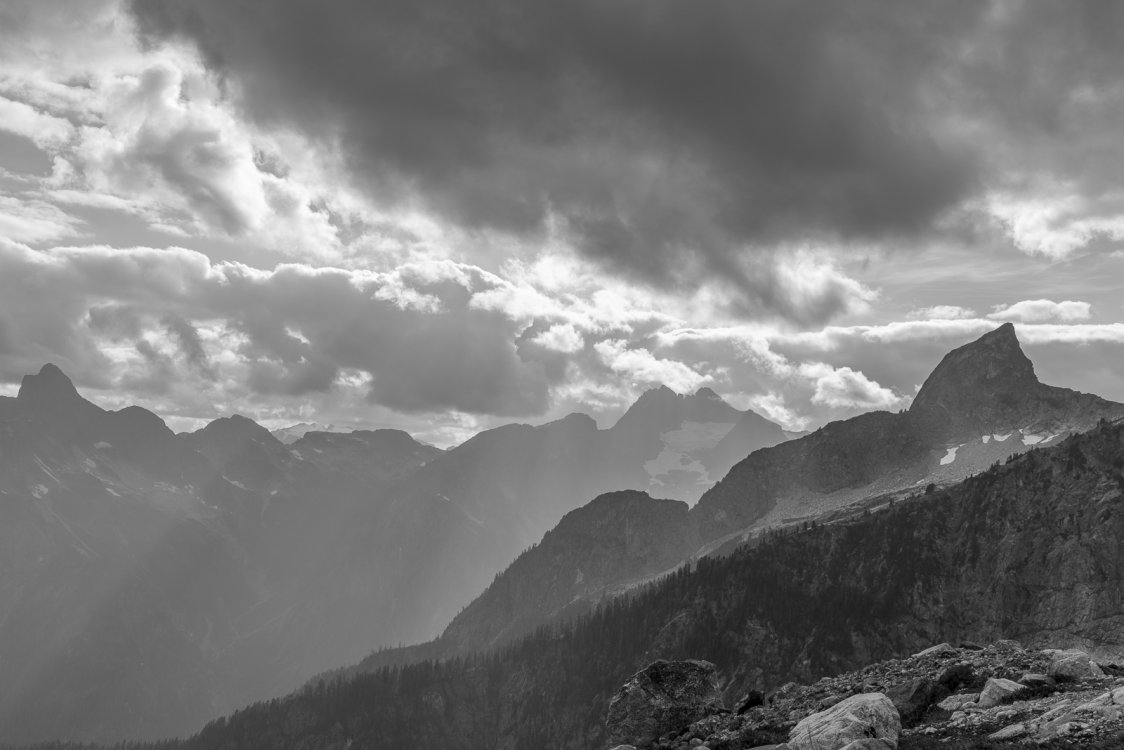
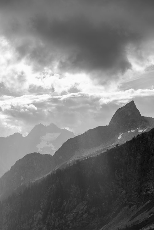
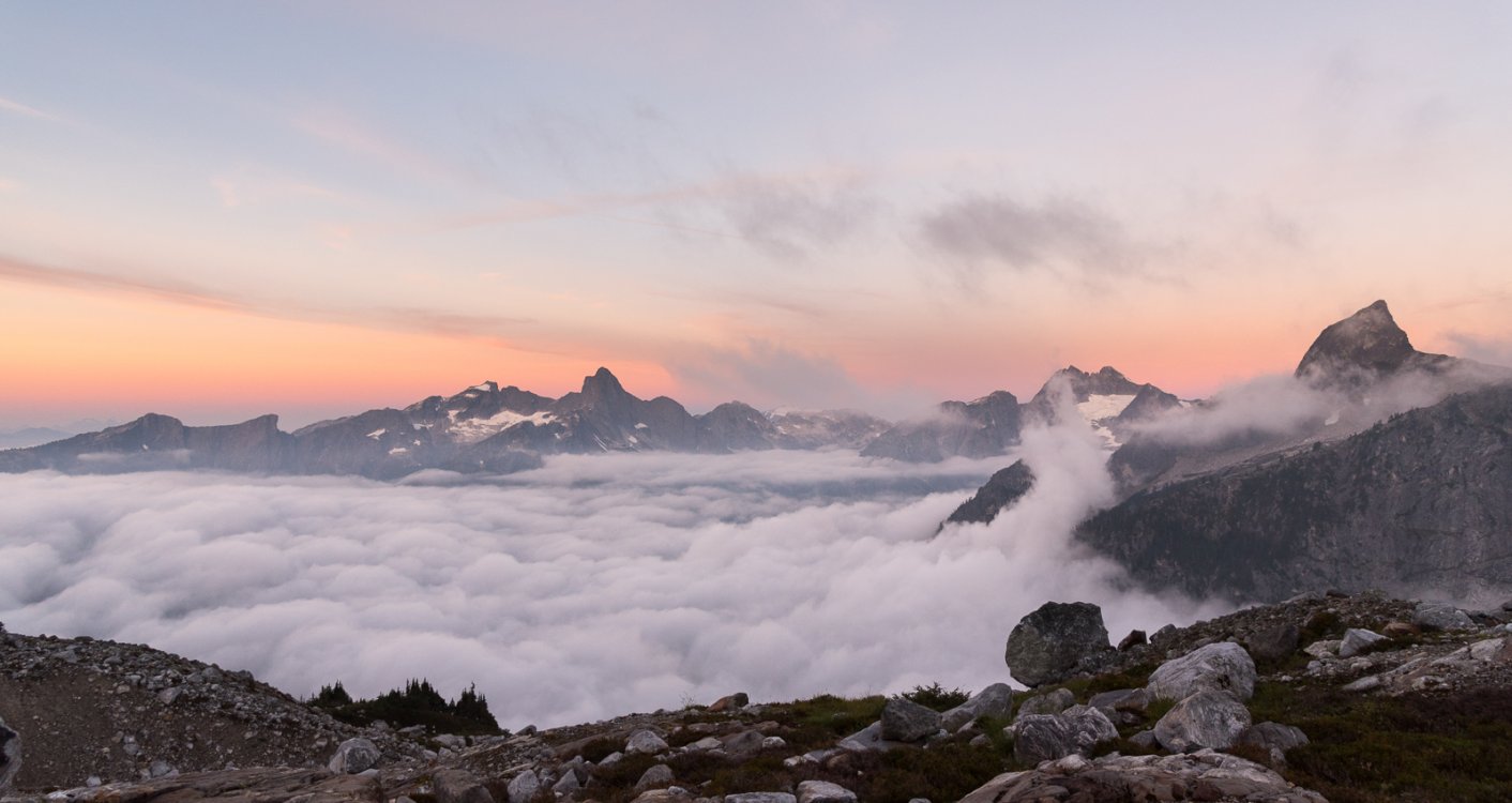
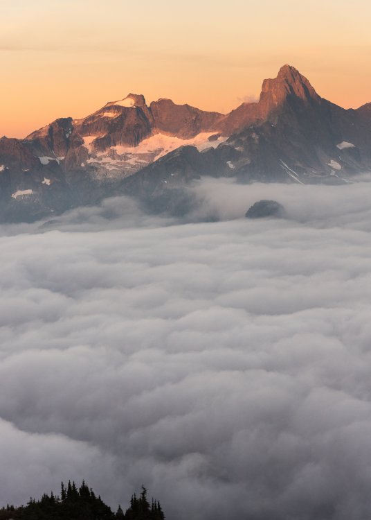
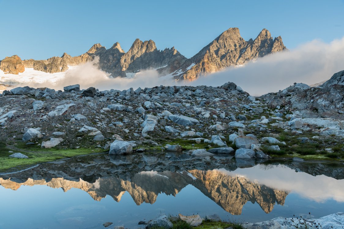
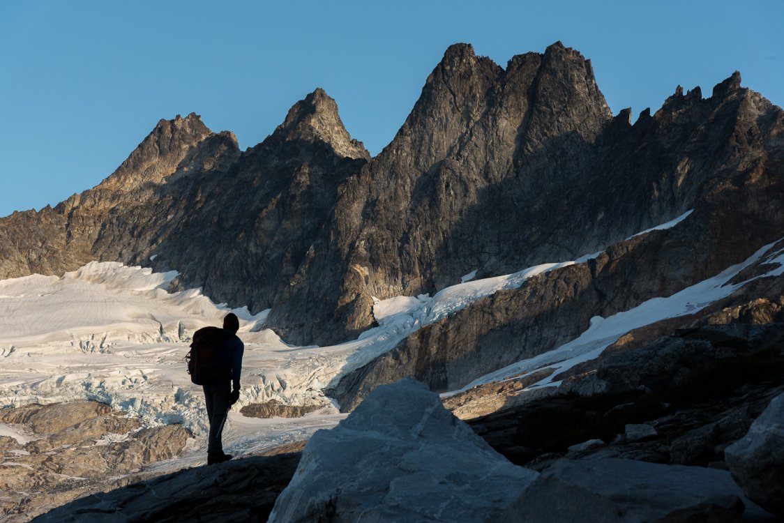
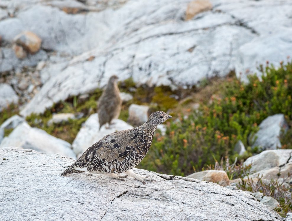
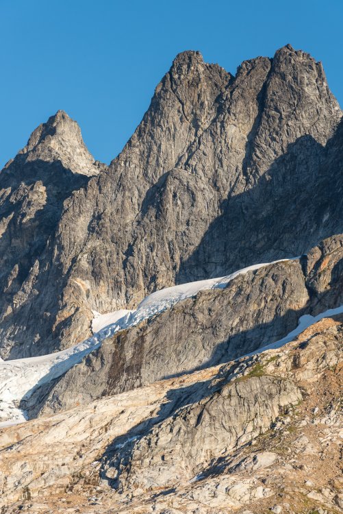
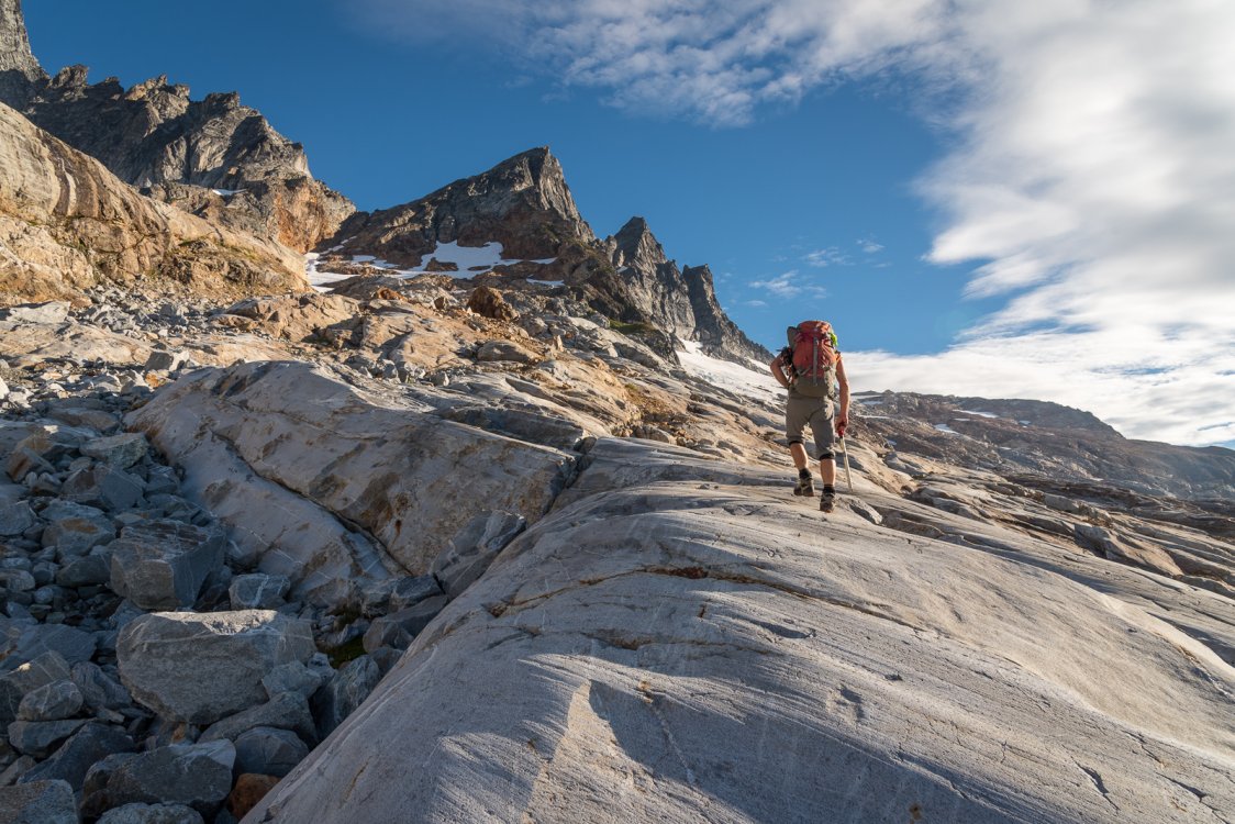

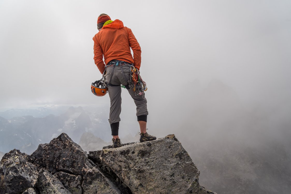


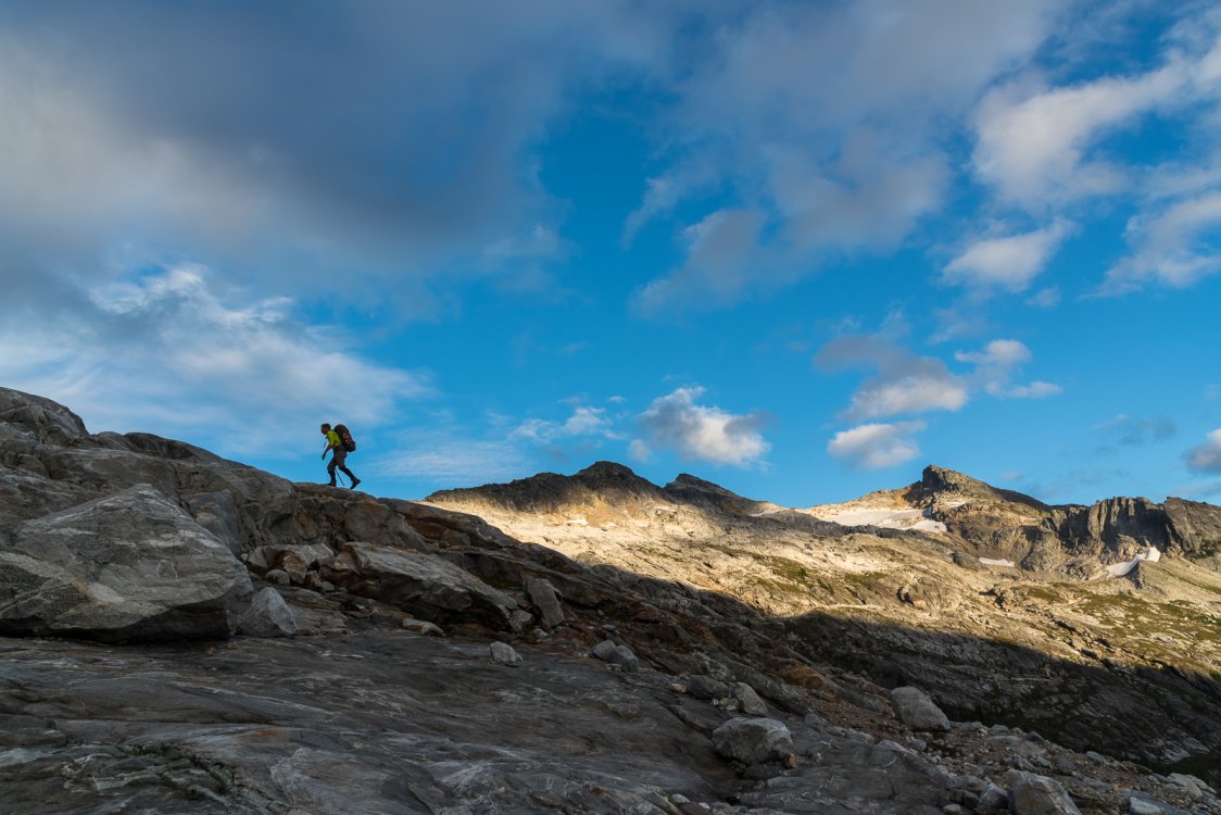
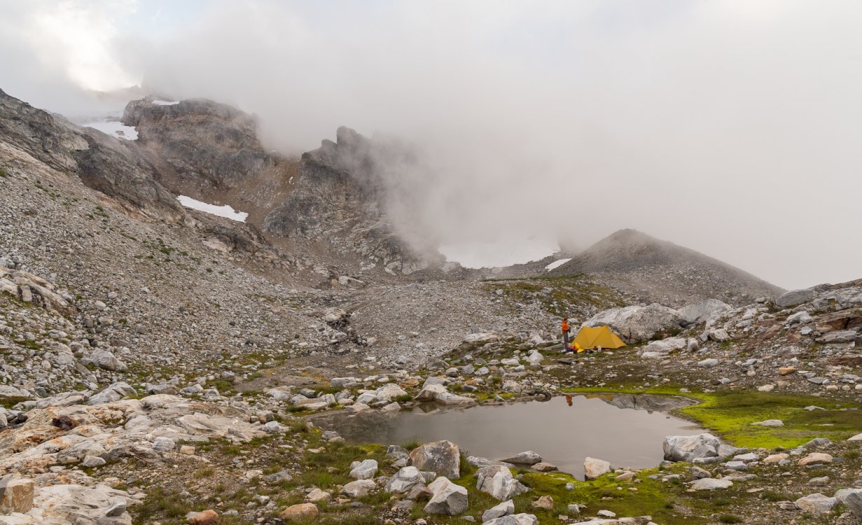

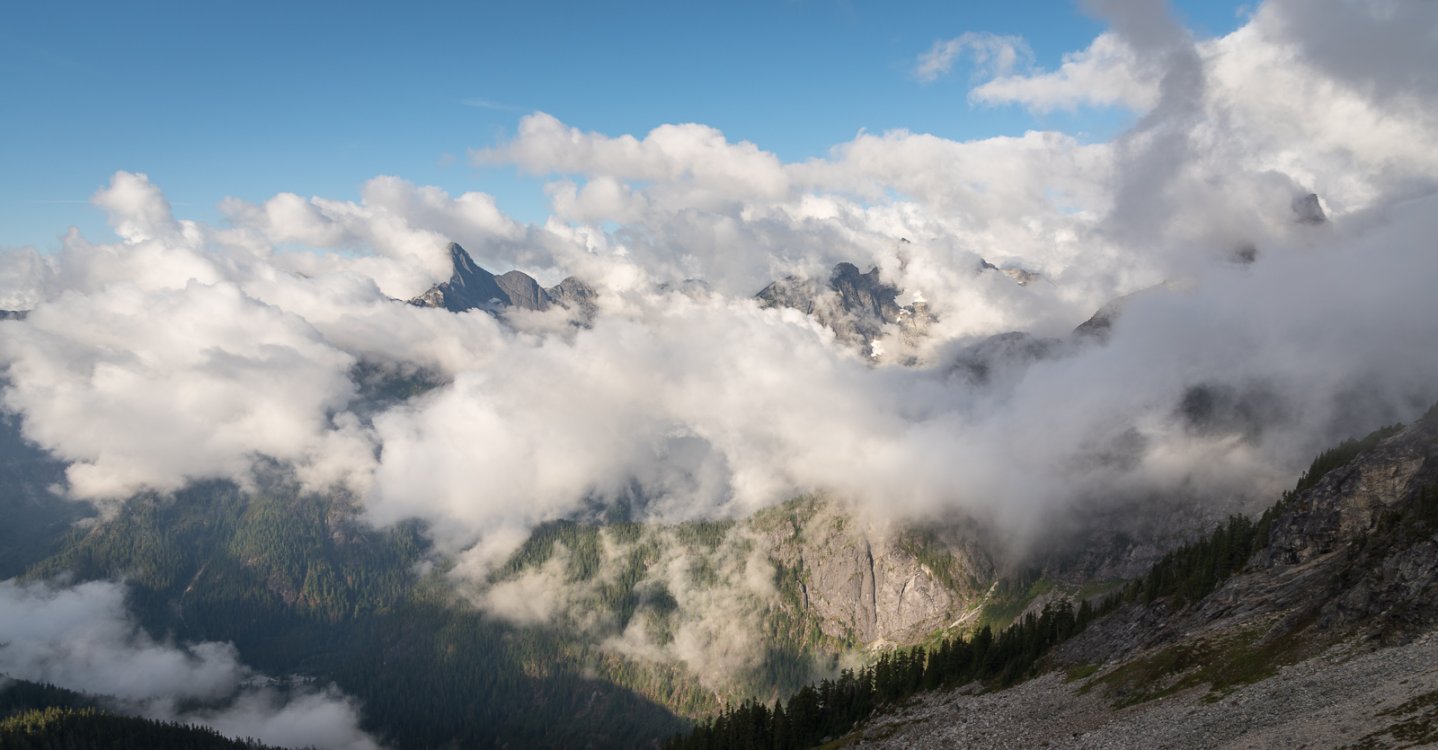
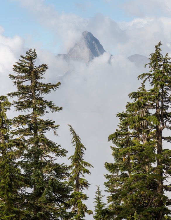
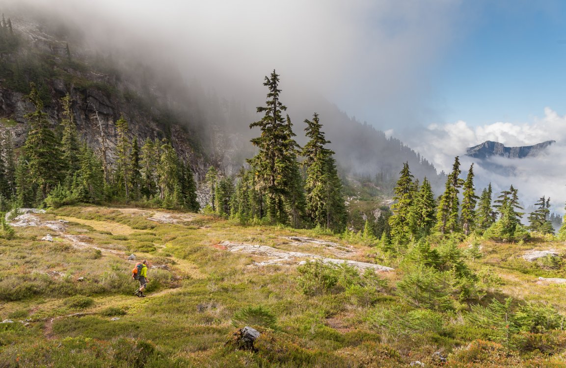

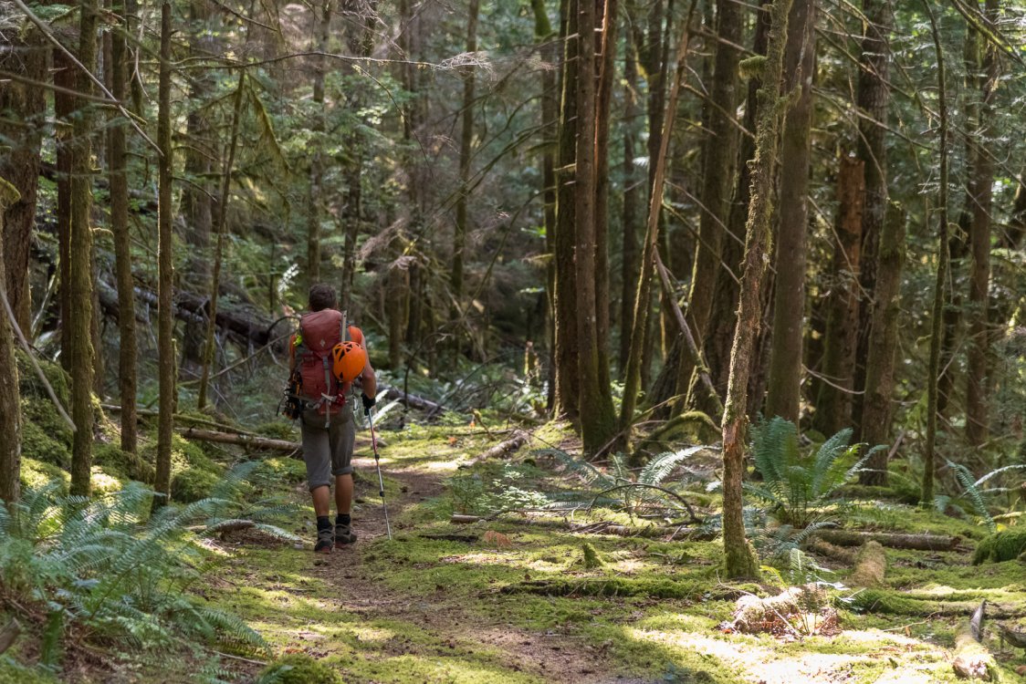
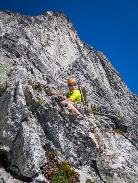
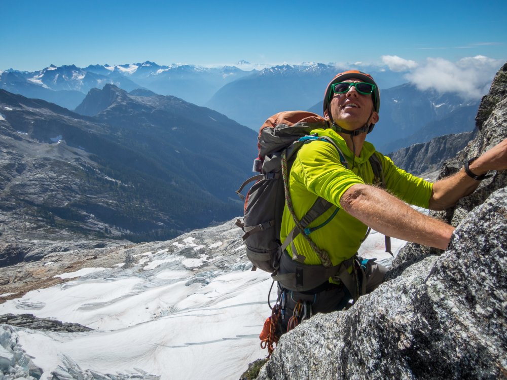
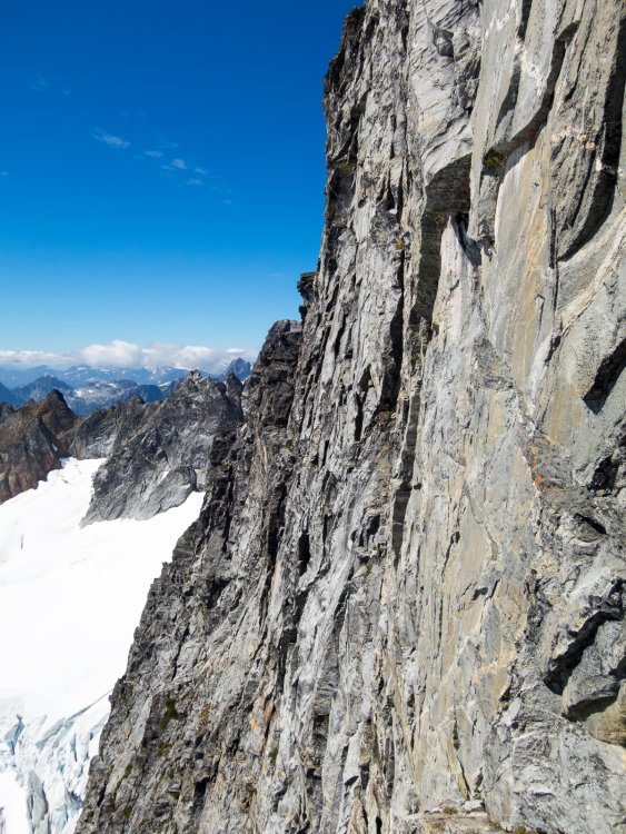
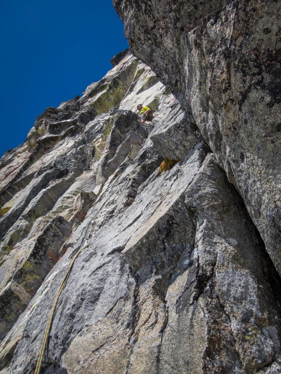
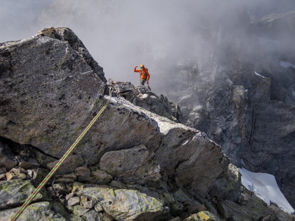
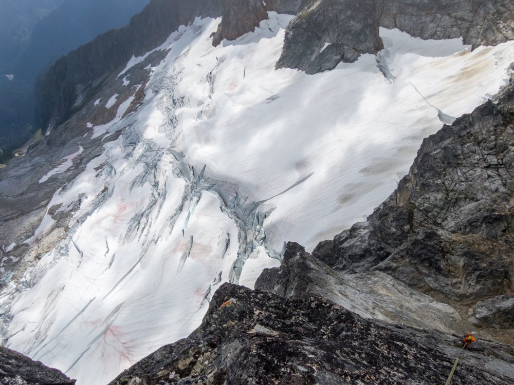

-
Anyone been up the NE buttress recently who can comment on the condition of the glacier? Mostly interested in the moat situation to get onto the ridge.
-
On Sept. 14, Chris Mutzel and I climbed a ~1,000' new route on the NNE-facing arete of Fallen Angel: Act like you're having fun III 5.10+. (John Roper, who climbed the peak from the S side decades ago, has an area-appropriate name for this striking feature: the "Grim Reaper Arete".) After a 100' or so of soloing, we climbed a total of 8 roped pitches to the summit. The pitches went 5.6, 4th, mid-5th, 5.8+, 5.10+, 5.10, mid-5th, and 5.9 (although there might be a mid-5th alternative for the last traversing pitch). Big-picture photos from John Scurlock and John Roper, respectively, below. In Scurlock's, the line drops towards the viewer (along the clean arete), and then winds a bit through the ledges to the left; in Roper's, the line initially drops down the right skyline, and ultimately foots to the left of the tree in the foreground. Approach notes: I took a gamble and lost on this one. Looking at satellite imagery, I had hoped we'd be able to approach from the north by tying into some suspected old-ish growth timber (there was some) on the climb up from the W fork of Newhalem Cr to the basin below our objective. If it worked, it would cut off a lot of distance and 1000s of v.f. vs the S-side approach from the Monogram Lk / Lookout Mtn trailhead. While we did quite well from the car at Newhalem Cr to the final climb from its W fork to the basin, above that we encountered just about every terrain obstacle the subalpine Cascades have to offer--somewhere high up on the BW scale, perhaps even establishing "New Wave" Bushwhack Ratings. A physical, but not mental, respite was offered by a sustained stretch of moss-coated 4th class frog-chimney that got us through the lower cliff bands: (I'm advancing my "little buddy" walking/bashing stick ahead of me.) Bottom line: approach from the south and enjoy a longer but scenic alpine tramp, unless you want to embrace the aforementioned travel and route-finding challenges. (I’ll buy good six-packs for anyone that repeats our approach and reports back with an optimal way up to that basin.) The climb itself was great. The rock, even the junky-looking first pitch, was quite solid and clean, requiring only sporadic, expected alpine gardening. The harder technical climbing, all ~3 pitches of it, was high quality, fun climbing on bright gneiss. Some was downright Index-like. We swapped leads, with Chris drawing the crux 5.10+ pitch 5--spectacular--which traveled near and then on the edge of the arete. On this pitch he expertly avoided a belayer-slayer that I inadvertently trundled while following, which marred our otherwise pure ascent as I weighted the rope to avoid a crushed foot. A reminder that you can't afford to lose focus for a second out here. Chris climbing the crux: Me following the crux: My 5.10 pitch 6 was more like a 15' boulder problem followed by scrambling on the arete's crest. Then we had two more pitches of rambling peppered with boulder moves over a sub-summit and the summit. We didn't find a reported register, but probably just overlooked it. Summit views from this western outpost of the N-Central Cascades were unique. Descent: from just W of the summit, we used a single 70m rope to make 4 rappels (all slung horns) down the South face; first directly down a rib, then angling skier's left to alight on an exposed ramp that you can down-climb E, which is where you need to go anyway to gain a notch that gets you back to the basin. (Unless you approach from / camp on the S of the peak, which I recommended above.) We were back at the bivy by 4pm, drinking big cans of beer. Given the complexity of the return route to the car, we decided to spend another night at comfortable bivy rather than risking the descent in fading light or night. Despite the extra workload imposed by my approach mistake, we had a blast (particularly on the rock) and recommend this route. Origin of the route name: C is relentlessly ebullient, so high on the climb it felt appropriate to yell the eventual route name before snapping a photo--this provided both a good belly laugh, and a mantra for the long 'shwhack back to the car. There are a few more photos in the gallery. And over here are even more photos, and a phone video Chris took of me trundling and muttering "explosion". Gear notes: Medium rack; tri-cams were money, brought pins but didn't use them. Compact ice tool useful for the occasional gardening. We didn't bring crampons, but you would want them earlier in the season, or when sensibly approaching from the south.
-
 Trip: Sloan SW Face - Fire on the Mountain (FA/FFA) Date: 8/30/2009 Trip Report: Short version: Fire on the Mountain: FA/FFA on the SW face of Sloan. 8 pitches, 5.10+, III+ (1100ft of technical climbing on steep, clean rock plus 500ft of scrambling to the summit). Blake Herrington and Rad Roberts. Long version (photos and video by Blake Herrington): Descending Sloan after a moderate jaunt up its West Face, AlexK and I gaped in awe at the sheer Southwest face of the mountain. Alex later commented, “Walking along the base of the SW face was like walking along the base of the Upper Town Wall at Index...line after line of really awesome steep granite rising directly from the steep slope vertically for many pitches!” Alex looking up at the SW Face of Sloan, 2006 (new route starts just off the frame to the right.) With a bit of hype and a few Scurlock photos, I was able to convince Blake to take a shot at this worthy objective. Morning mists enveloped us as we coaxed my old car up FS4690 to the Bedal Creek trailhead. We walked through old growth forest and followed the cascading creek to the base of the immense West face of Sloan. Although this impressive face surely holds more good lines, we continued on to the SW face. The mists burned off as we left the forest for heathery meadows and ripe blueberries, wasting precious minutes on the jaws of a giant. Upon cresting the final ridge, I was pleased to see that the SW face looked just as steep and clean as I’d remembered. Several lines looked good, though they would need some gardening on the first pitch. We chose a prominent left facing corner leading to a chimney (upper right in the photo below) and some thin cracks up a face. Blake getting dressed for work. We should all be so lucky I asked for and was granted the opportunity to lead the first pitch. I did a little gardening at the start, but the rock was quite solid and protectable. My calves started to burn as holds ran out and the corner turned into a chimney, but an exit onto a small stance provided a rest and revealed a series of spectacular, clean finger cracks soaring straight up the wall. Working up these, I felt the fire spread to my forearms. I rested when possible and carefully contemplated each tricky section, hoping to honor this fine line in good style. Blake was very patient. Fortunately, the rock and gear were solid so it was easy to go for it. I cranked through the crux and savored juggy moves over a final bulge to a belay atop a pillar, whooping with delight on completing the onsight. Blake joined me, casually shooting video just after the crux. [video:vimeo]6387846 This would prove to be the hardest pitch of the day, perhaps 5.10+ or 5.9++ or 5.11-. Ratings reflect only one aspect of the experience, and often they distract from the essence of a climb. For me, this pitch alone was worth the price of admission, with 45m of sustained, outstanding, well-protected (I placed about 13 pieces!) climbing on solid rock, with multiple 5.10 sections and a really fun crux. Blake then headed up the next pitch, linking clean vertical and horizontal cracks and a few face moves to a belay at a ledge. [video:vimeo]6387982 This section was reminiscent of the upper pitches of Loving Arms on the Upper Town Wall at Index and various routes on Lover’s Leap. I let Blake take the third pitch as the second pitch was rather short and I’d poached the best pitch from him on Tower a year ago. P3 started in a finger crack and then headed up a series of golden flakes, dikes, and buckets. I did a hand traverse left under a large roof to move the belay and then shot up a steep right-facing corner, brushing lichen off key footholds along the way. The angle eased a bit and I cruised up to the giant heather ledge that splits the face. Lots more steep, clean, featured rock loomed above us, and we were shocked to see it was already 4pm. Go time. Blake floated up a left-leaning crack system and a perfectly clean OW corner to a belay on a pillar. There we found two old pins. Someone had come this way before (see comments below). I danced up a steep face peppered with protruding dikes, managing to sling a giant knob and slot a cam in a small crack. The end of this pitch featured a steep finger crack in a corner with an old pin. I clipped this piece of history, but images of it failing motivated me to crank through without weighting it. Entering the crux of p6 (note slung knob in foreground) Sunshine, silence, and sweeping views of the Mountain Loop and Monte Cristo peaks enveloped us. We savored the pristine wilderness setting. Blake then lead a 60m rope-stretcher to a stance just below another large ledge. Dehydrated and fried from hours of exertion in the sun, I offered Blake what we hoped would be the final lead of the day. It didn’t disappoint, with a hand crack around a roof bulge and a rising traverse on positive flakes to a final corner. We unroped. It was 7pm. Our water was long gone, and my moxie had long since moseyed. Although I had descended Sloan before, I didn’t relish the idea of rappelling and down climbing in the dark with one headlamp between us. But Blake had never been to the summit, and we needed to complete the route, so we stashed our gear and scrambled to the airy summit. We signed the register, snapped a pic, and turned to head for the stable. Note moon in background. I staggered heavily (Blake scampered lightly) back down to our packs and we admired a stunning sunset as we started the rest of the descent. We rapped to the sloping ledge as twilight turned to night, but the moon cast its gentle glow on the descent slabs and the air was perfectly still, as if Sloan were gently ushering us back down to safety. Our ropes just barely reached the snow, but it was quite hard and our tennis shoes, one ax, and lack of crampons didn’t inspire confidence. Blake chopped a bollard and we rapped down to lower angle snow. The sound of running water drew us to a small waterfall of snowmelt where we drank deeply and split a Theo chocolate bar, smiling in the moonlight. We retrieved our packs, including my headlamp, and headed toward the trailhead. But there was still one more obstacle: BLUEBERRIES! Evening dew had started to collect on the blueberry bushes at the top of the open slopes of the Bedal creek basin, and our feet skidded out each time we tried to take a step. Glissading seemed possible, but test runs showed the acceleration rates would be more like hard ice than soft snow. The ground was very hard and there was no way to hang onto the wet plants. Self arrest would be impossible. Death would be swift and sure. I could see the headline already, “Climbers die on blueberry slope.” I pictured the deadly rabbit in Monty Python’s Holy Grail. We’d climbed a striking new route but been bested by some damp blueberry bushes. Actually, I’m OK with that. We decided to stick to the dense, prickly evergreen shrubbery on an adjacent ridge. We thrashed down that and rapped off a 4ft pine when we got cliffed-out above more evil blueberries. The remainder of the descent went smoothly. The Darrington payphone ate my quarters while trucks of teenagers cruised the minimart in the wee hours. We drove to Arlington through misty fields, wolfed down tasty food at Haggen, and headed back to Seattle, arriving after 3am. My body attended morning work meetings, but my spirit was still in the mountains. When the rains settle upon us and sun-kissed alpine rock is removed to daydreams, this is the trip I will replay again and again. Thanks for a great outing Blake, and for giving me the first pitch, the last swallow of water, the only ice ax on the hard snow, and good conversation to pass the hours on the trail. ……………… Fire on the Mountain, 5.10+, III+, 8 pitches, 1100ft of technical climbing and another 500ft or so of scrambling to the summit. All free, ground-up, onsight. The route starts in a prominent left-facing corner that turns into a chimney. This is about a hundred feet right of a prominent right-facing corner, and 200ft right of a vegetated crack leading up the diamond feature in the photo with Alex. Pitch 1: Tinderbox. Start in the obvious left-facing corner below a chimney. Stay right to avoid vegetated cracks at the top of the chimney, and step right to a small stance. Climb straight up finger and hand cracks to a belay at a decent ledge. 45m, 5.10+. Pitch 2: Lightning strike. Move right to a pair of hand cracks in a corner, ascend the right one and hand traverse right to a small stance. Link face features and small cracks to a good ledge and a belay. 33m, 5.10-. Pitch 3: Bucket brigade. Start up a thin crack and then move onto a face with golden buckets, flakes, and edges. Ascend a prominent corner under an OW roof crack and then hand traverse left under a giant roof to a belay stance out left. Future parties may choose to link p2 and p3. 34m 5.10-. Pitch 4: Controlled burn. Delicate moves up a right facing corner lead to friendly flakes and dikes and a giant heather ledge that bisects the SW face. 40m, 5.8. Pitch 5: Firebreak. Ascend a left-trending crack system near the top of p4. This leads to a clean ramp and a stellar golden dihedral with an OW crack (one #4 useful here). Finish on a pedestal near old pins and some cracks. 45m, 5.9. Pitch 6: Alpine ladder. Scale a steep face on amazing dikes, follow the ladder leftward up hero climbing, and finish up a steep corner with a pin. 40m, 5.10. Pitch 7: Smoldering embers. Shoot straight up the featured face to a giant heather ledge. 63m, 5.7. Pitch 8: Final flare-up. Ascend a hand crack that jogs left around a small roof. Continue up cracks, trend left on positive flakes, and finish up a corner to a ledge. 45m, 5.10. Scamper up to the obvious corkscrew route trail. Change into comfortable shoes, stash gear, and scramble unroped to the summit. Beckey lists a route on the SW face, but what he calls the SW face is more like a route that starts on the South face, crosses a ridge mid-height onto the SW face, and follows easy ground to a shoulder. This is very different from what we experienced. Based on the position of the few pitons we encountered, we believe someone climbed p5, p6, and p7 at some point, aiding through the steep finger crack crux on p6. We’d be interested to hear if anyone knows more about the nature of that route. The condition of p1, p2, p3, p4, and p8 suggests they had not been climbed prior to our ascent. I've attempted to draw our line on a classic Scurlock shot. Red is roped climbing on p1 to p8 and green is unroped scrambling to the summit. Gear Notes: Stoppers work particularly well, including a few micronuts. We brought double cams to #3 camalot and one #4 camalot and used it all. We took a few pins but never needed them. The OW on p5 might take a #5 or #6 but Blake did fine without them. A single 60m rope is sufficient. An ice ax might handy for the snow. Go get some! Approach Notes: Approach: Bedal Creek trail to the basin below the West Face. Ascend Blueberry Hill to a treed shoulder, traverse shoulder briefly, enter the basin below the SW face. The route starts in a prominent left-facing corner that turns into a chimney. This is about a hundred feet right of a prominent right-facing corner, and 200ft right of a vegetated crack leading up the diamond feature in the photo with Alex above. Perhaps 2 hrs from the car to the base of route. Descent: Follow the corkscrew trail around to the South face, and down climb or rappel an obvious gully to a giant ramp. Descend eastward down the ramp until able to do a single rope rappel to the snow. Traverse toward the South shoulder, cross over this, and descend back to the base of the route. Retrace the approach back to the Bedal Creek trailhead.