Search the Community
Showing results for tags 'shuksan'.
Found 6 results
-
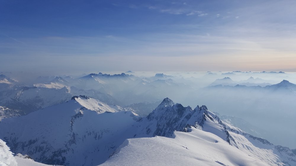
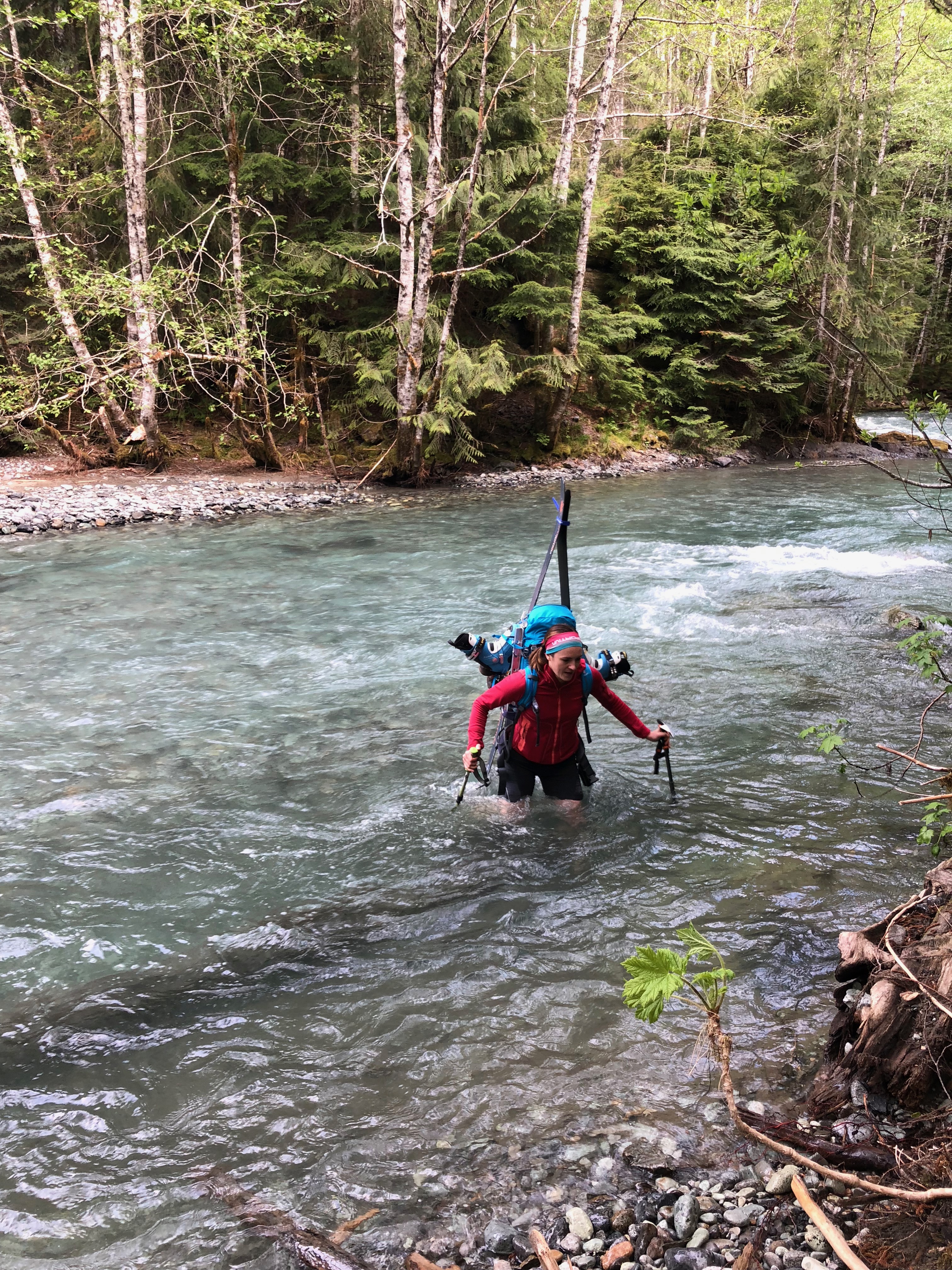
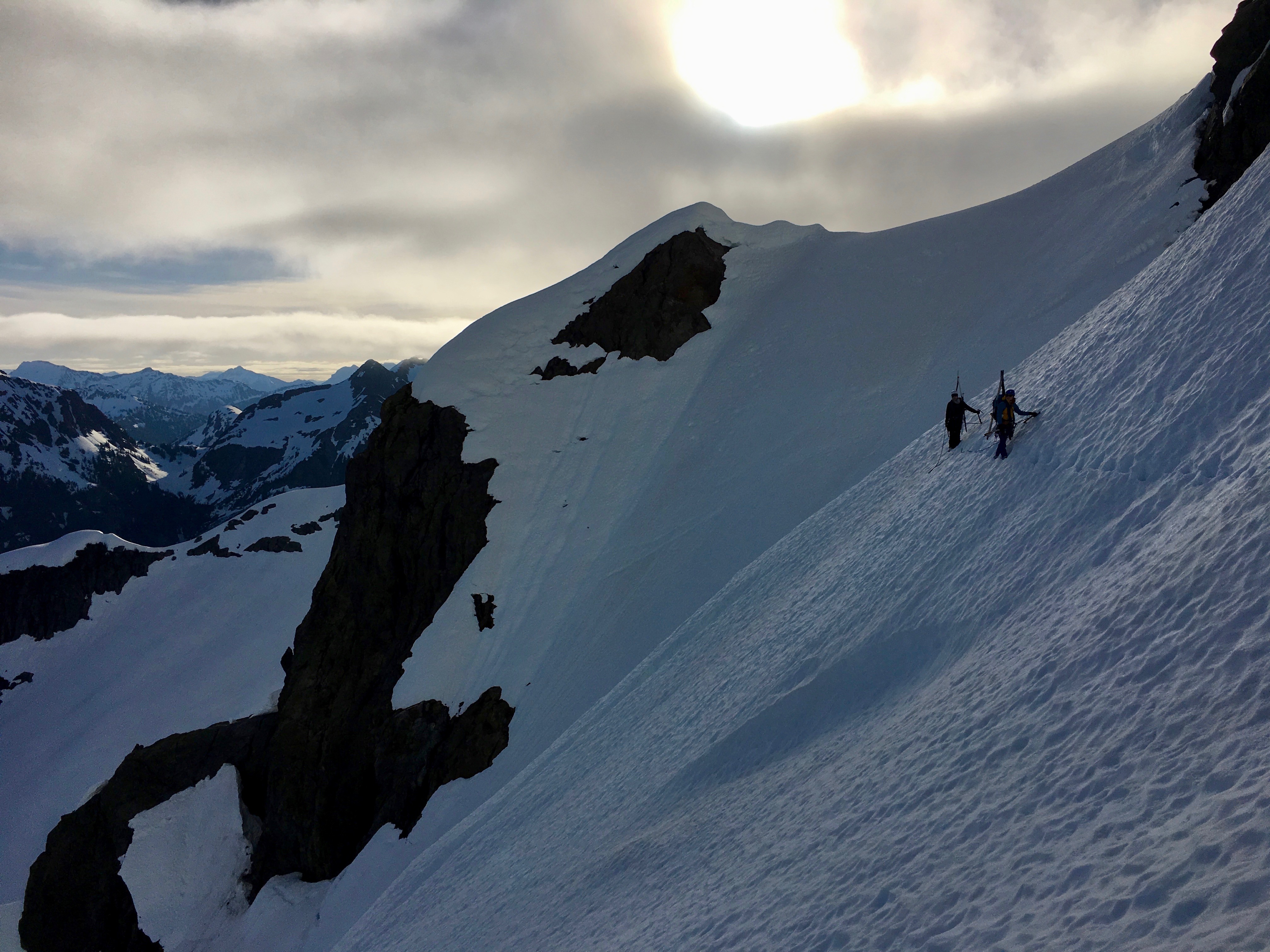
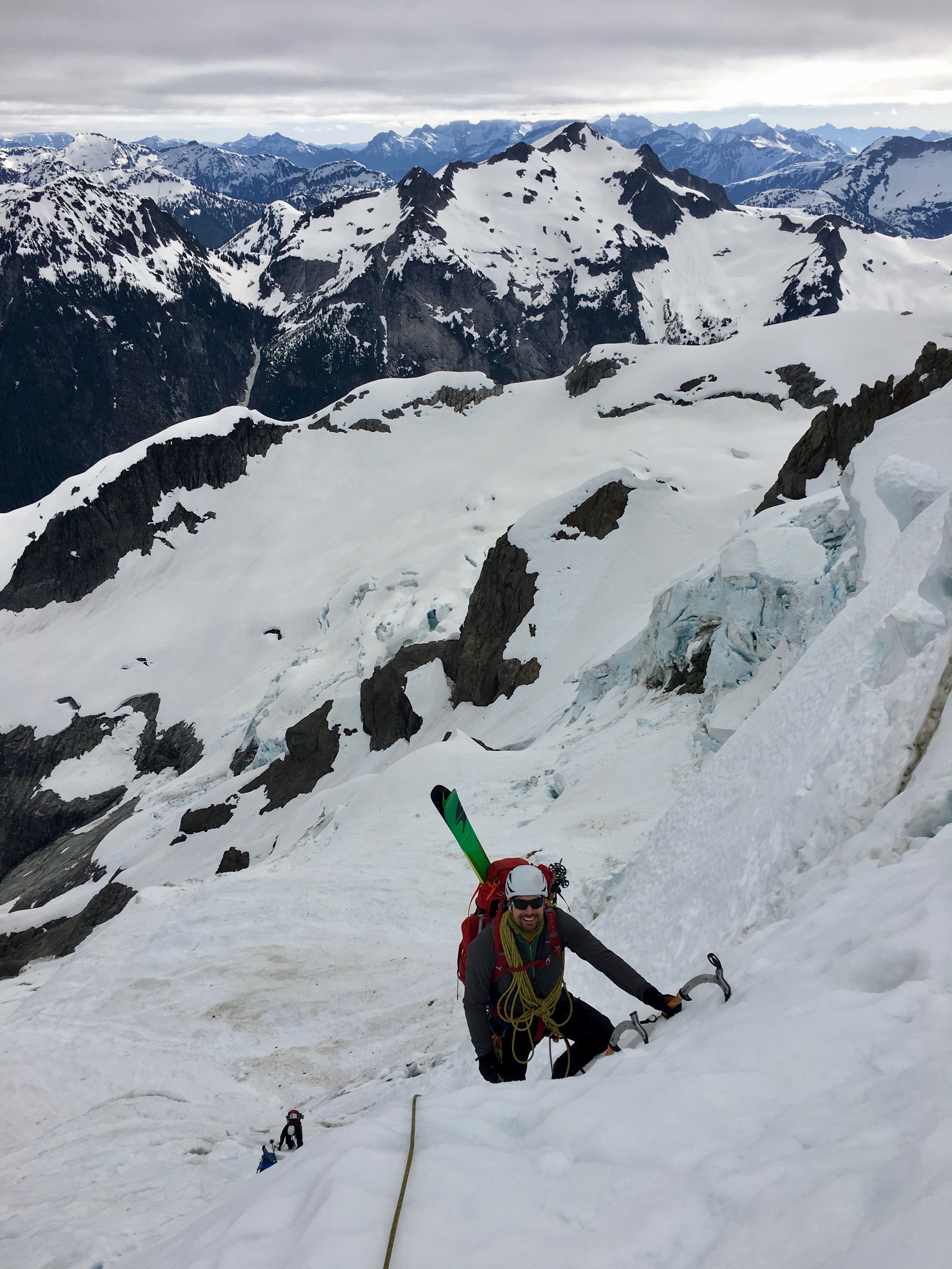
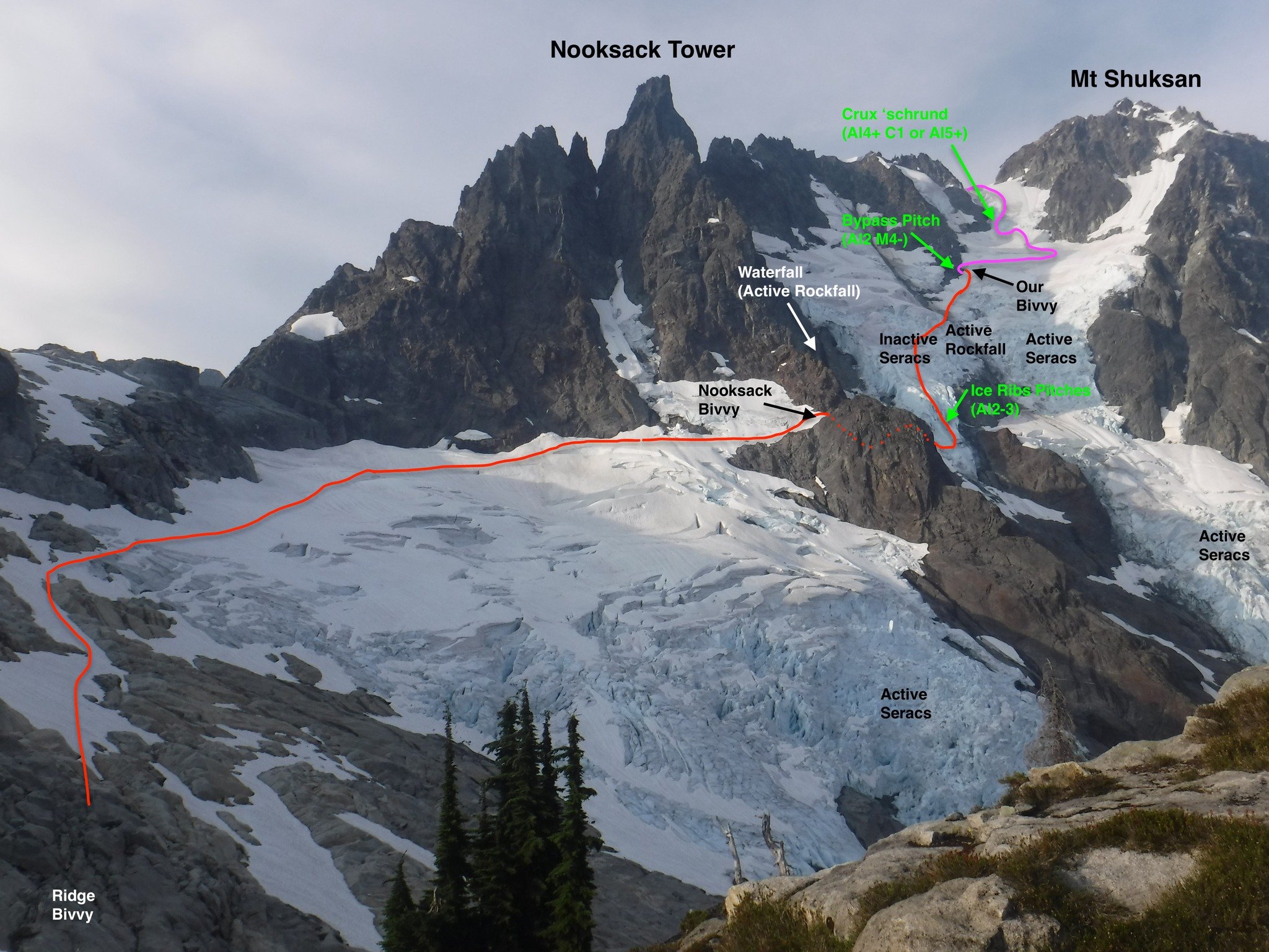
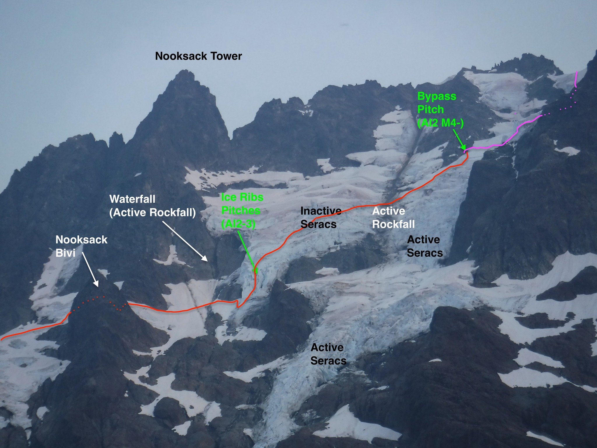
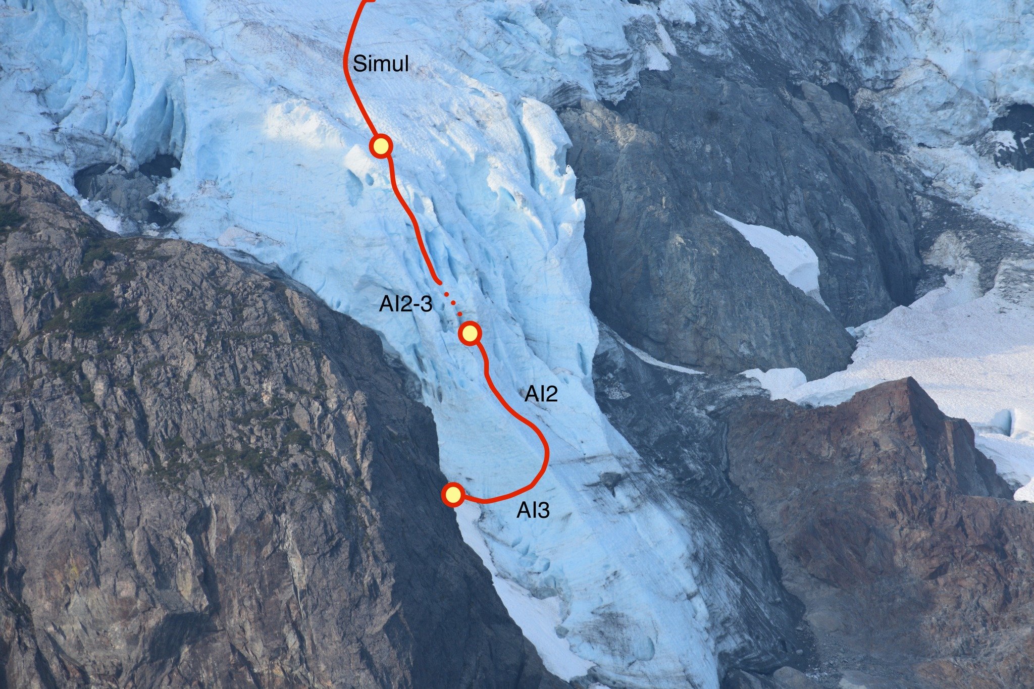
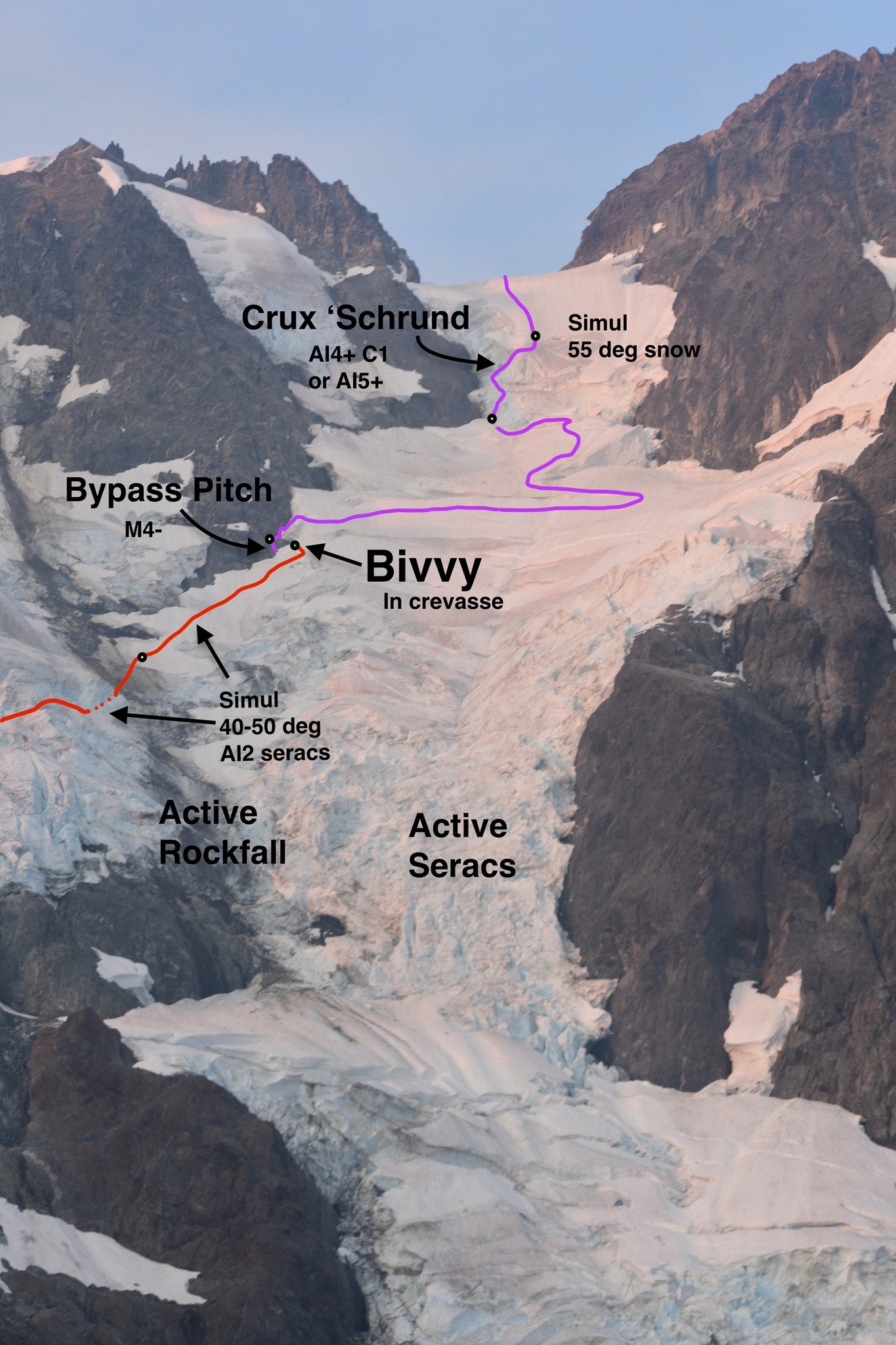
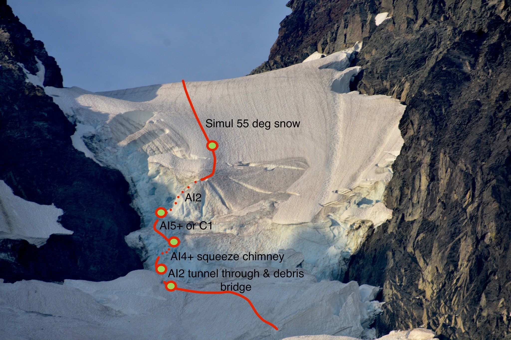
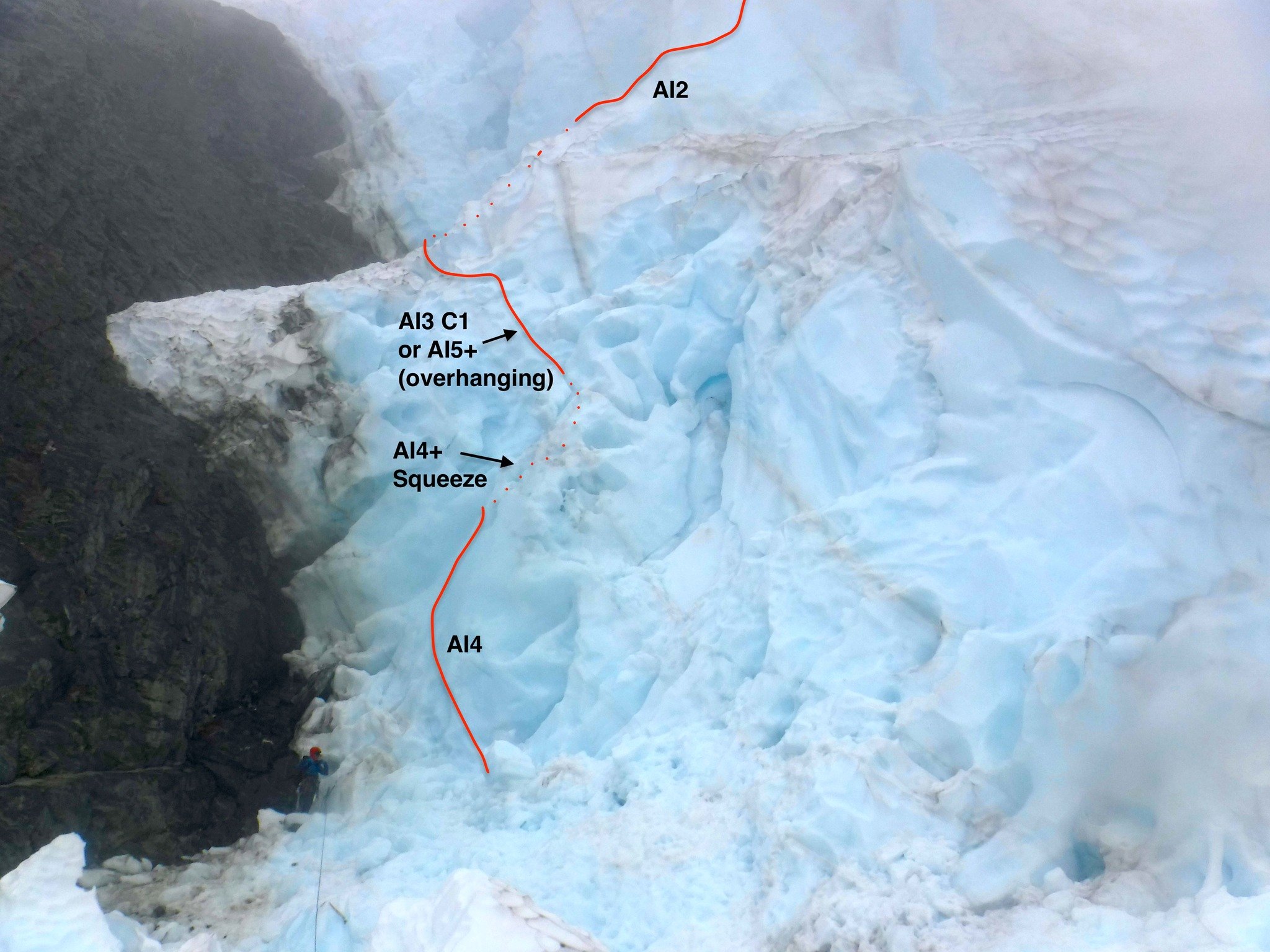
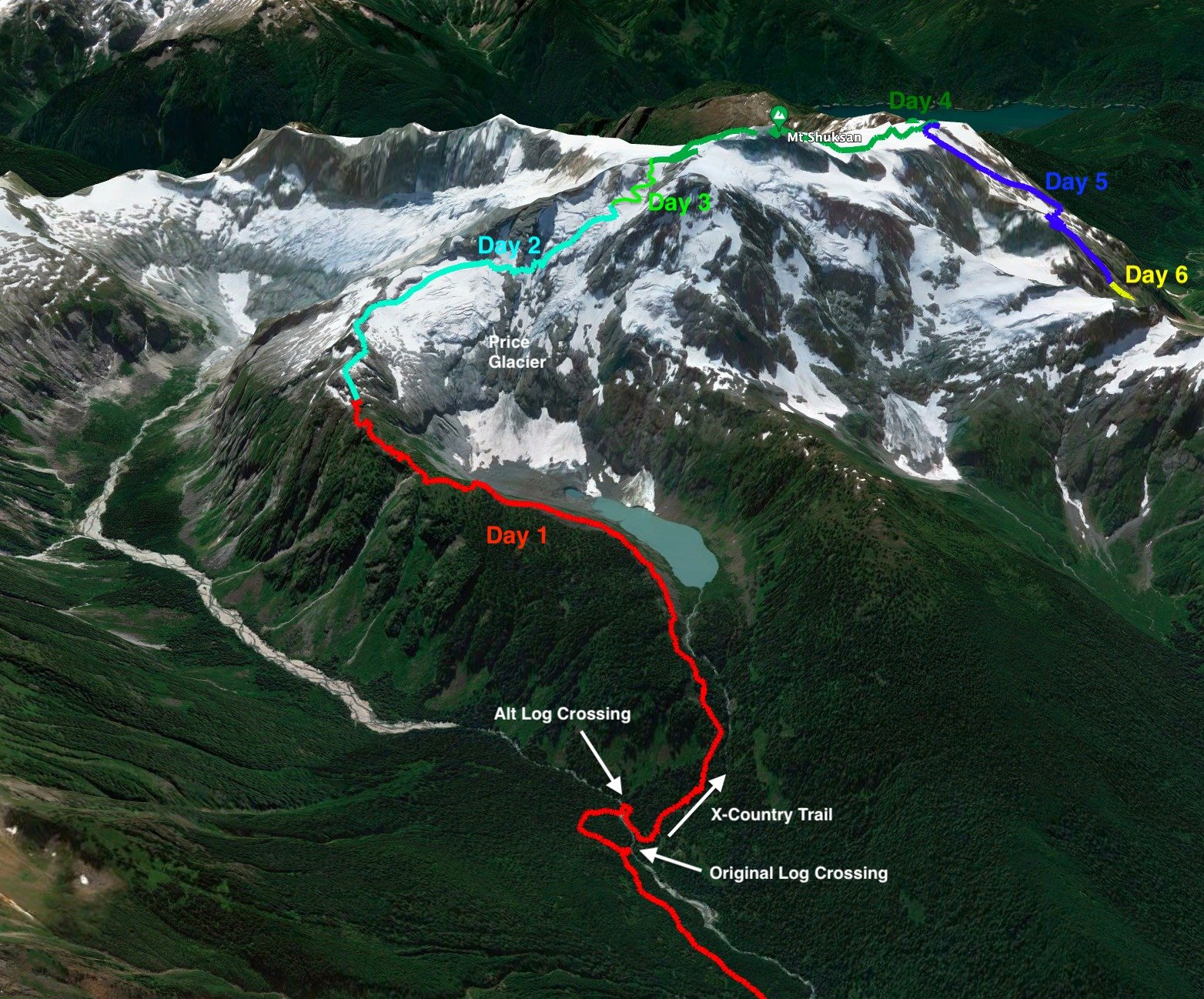
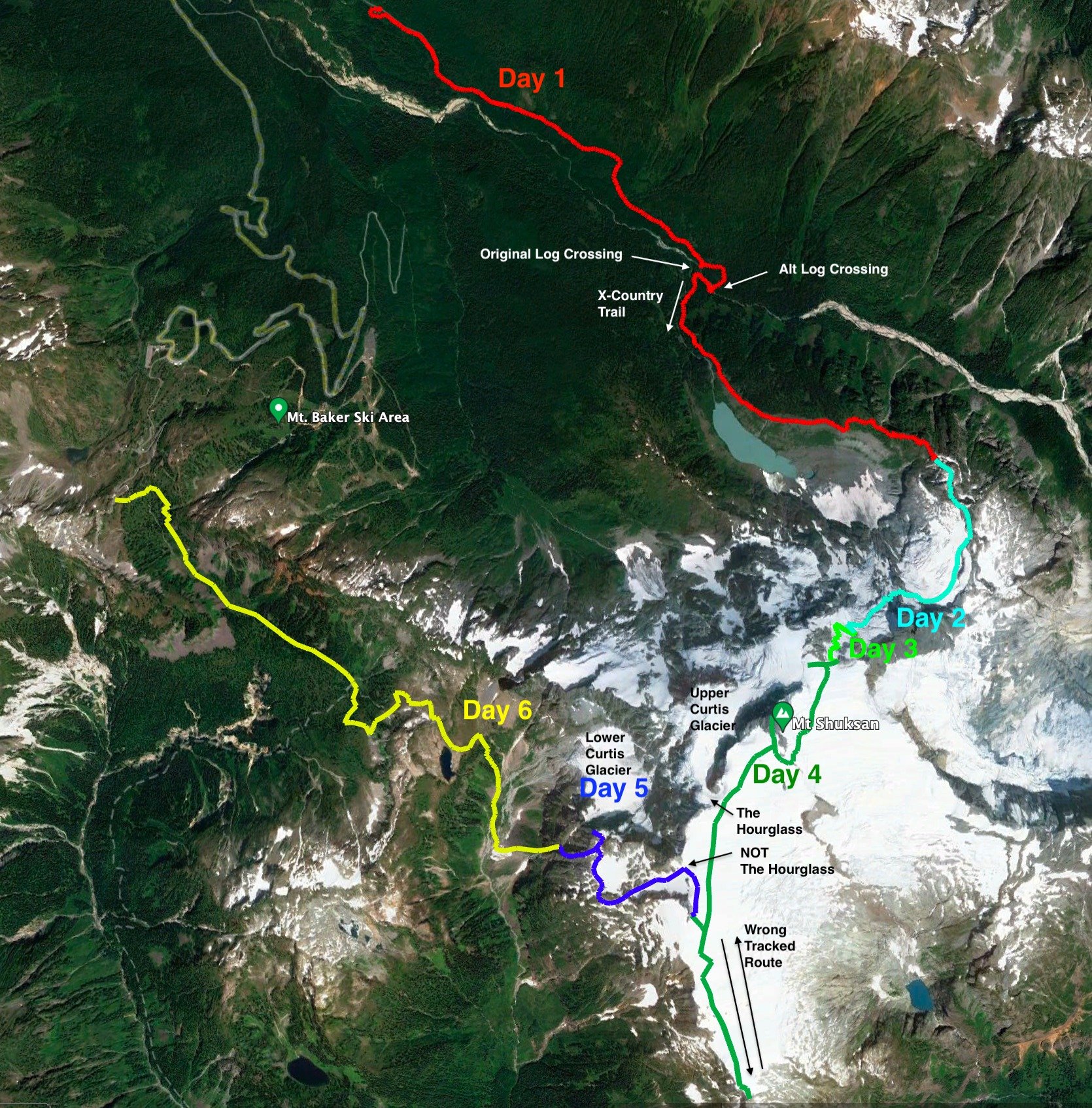
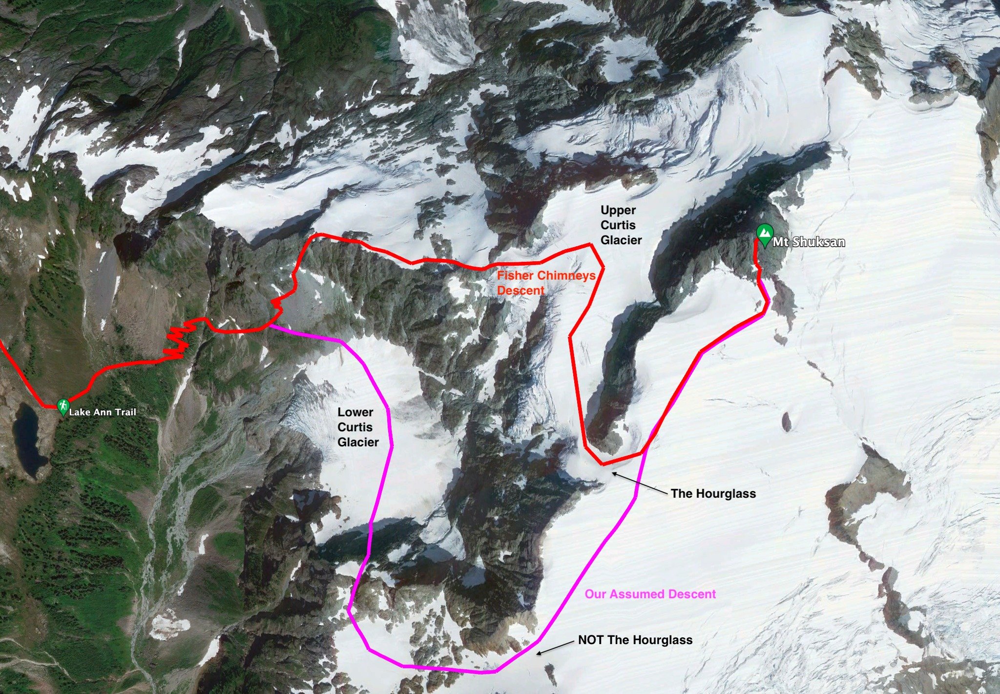
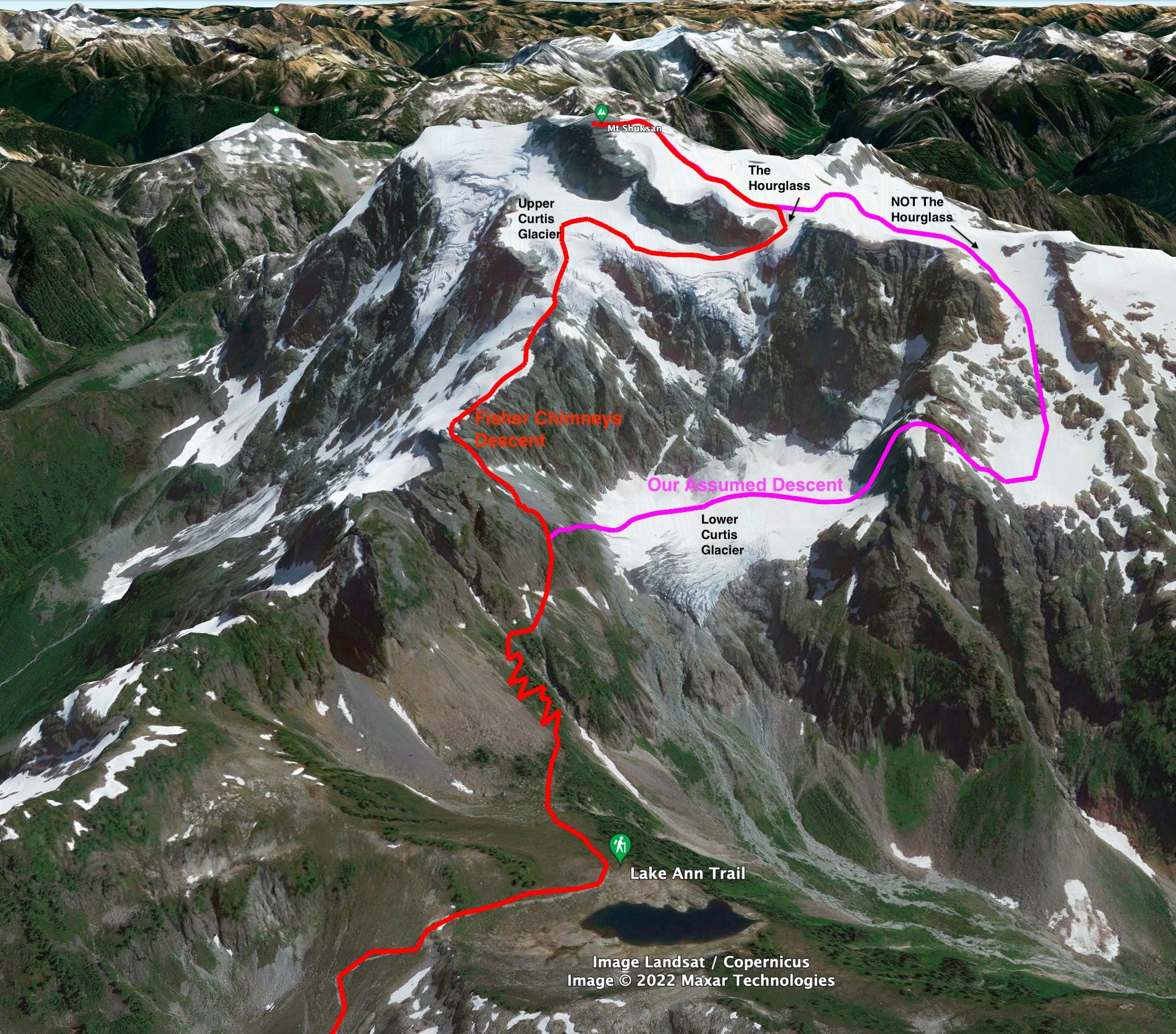
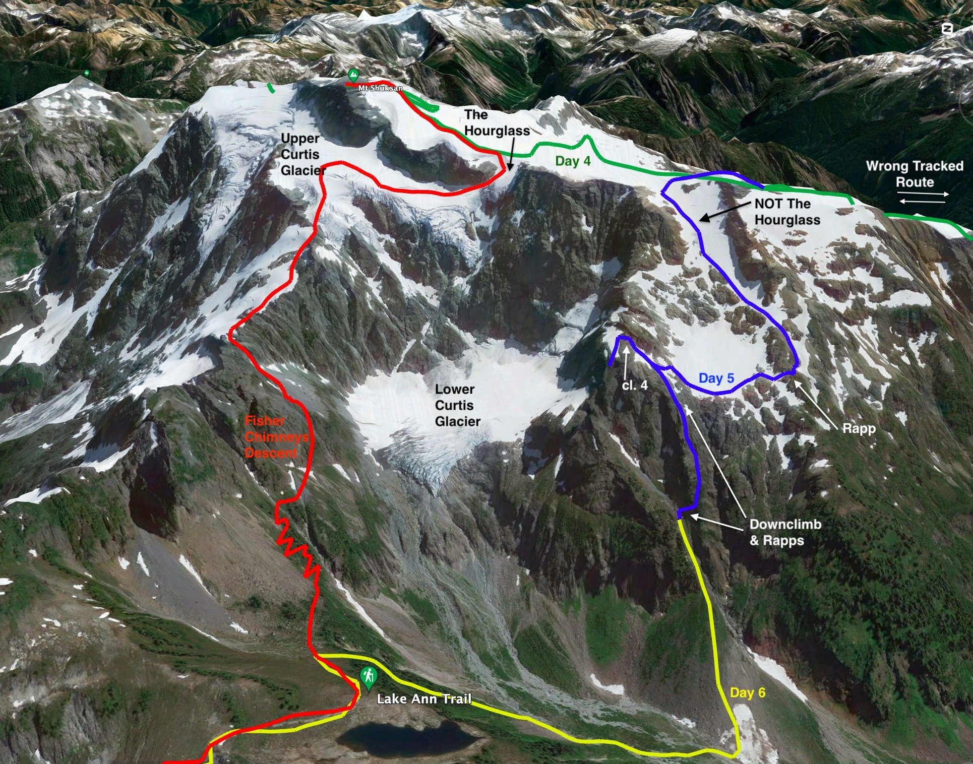
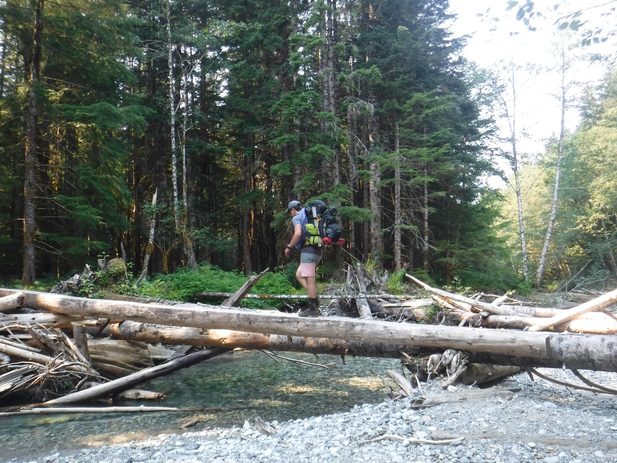
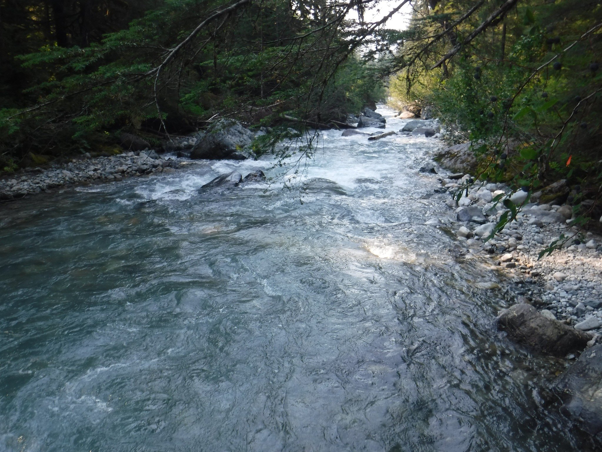
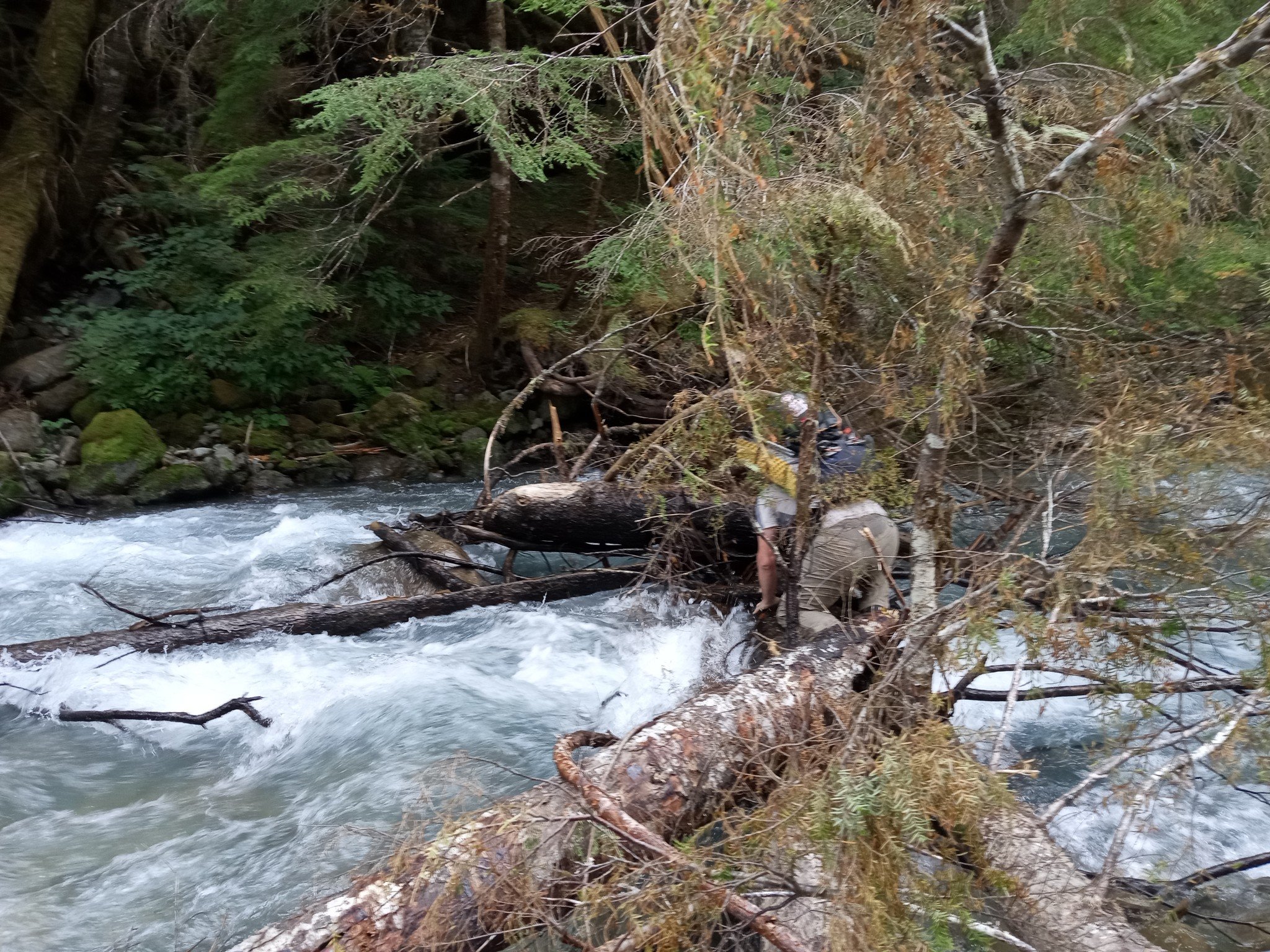
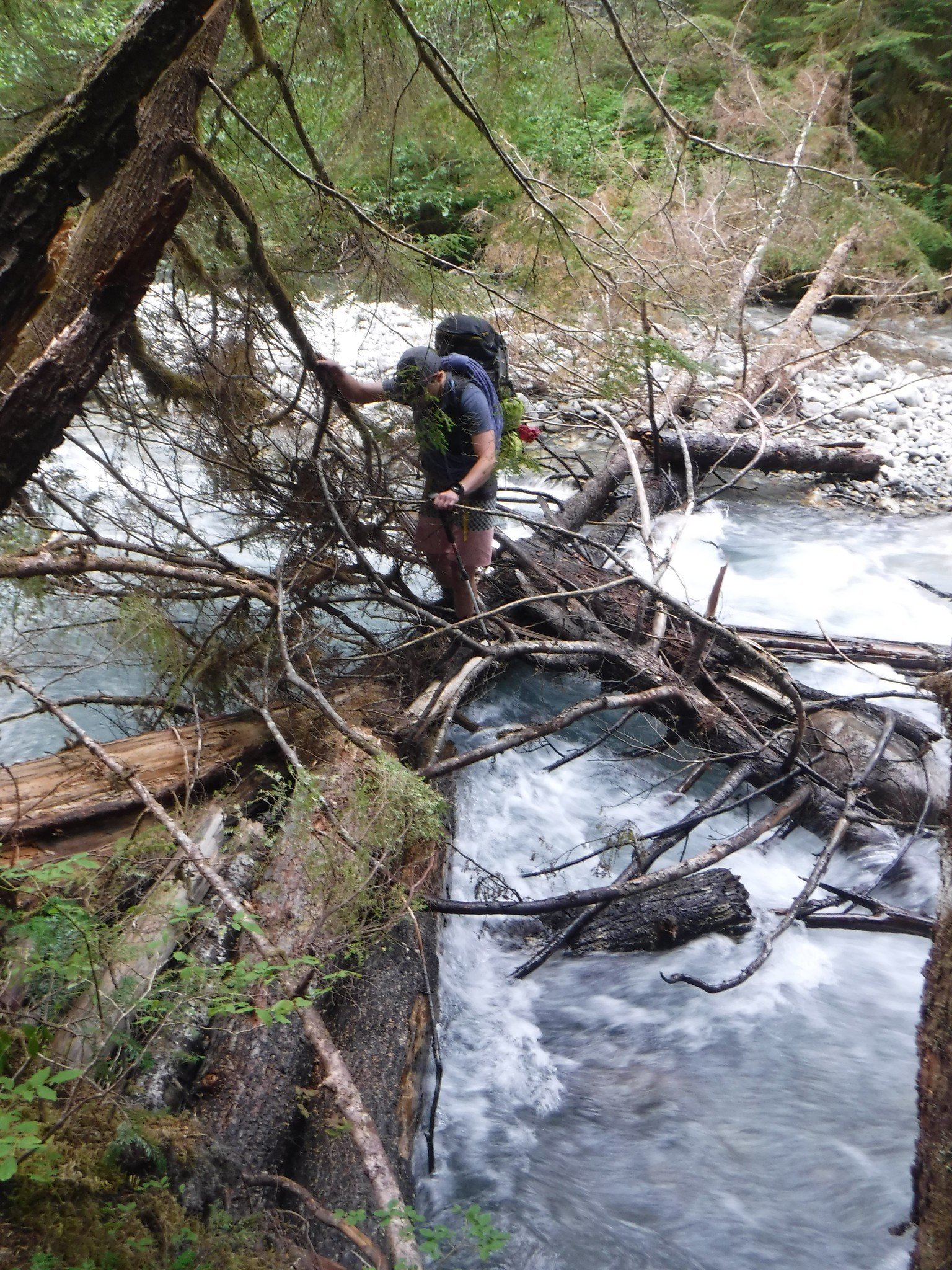
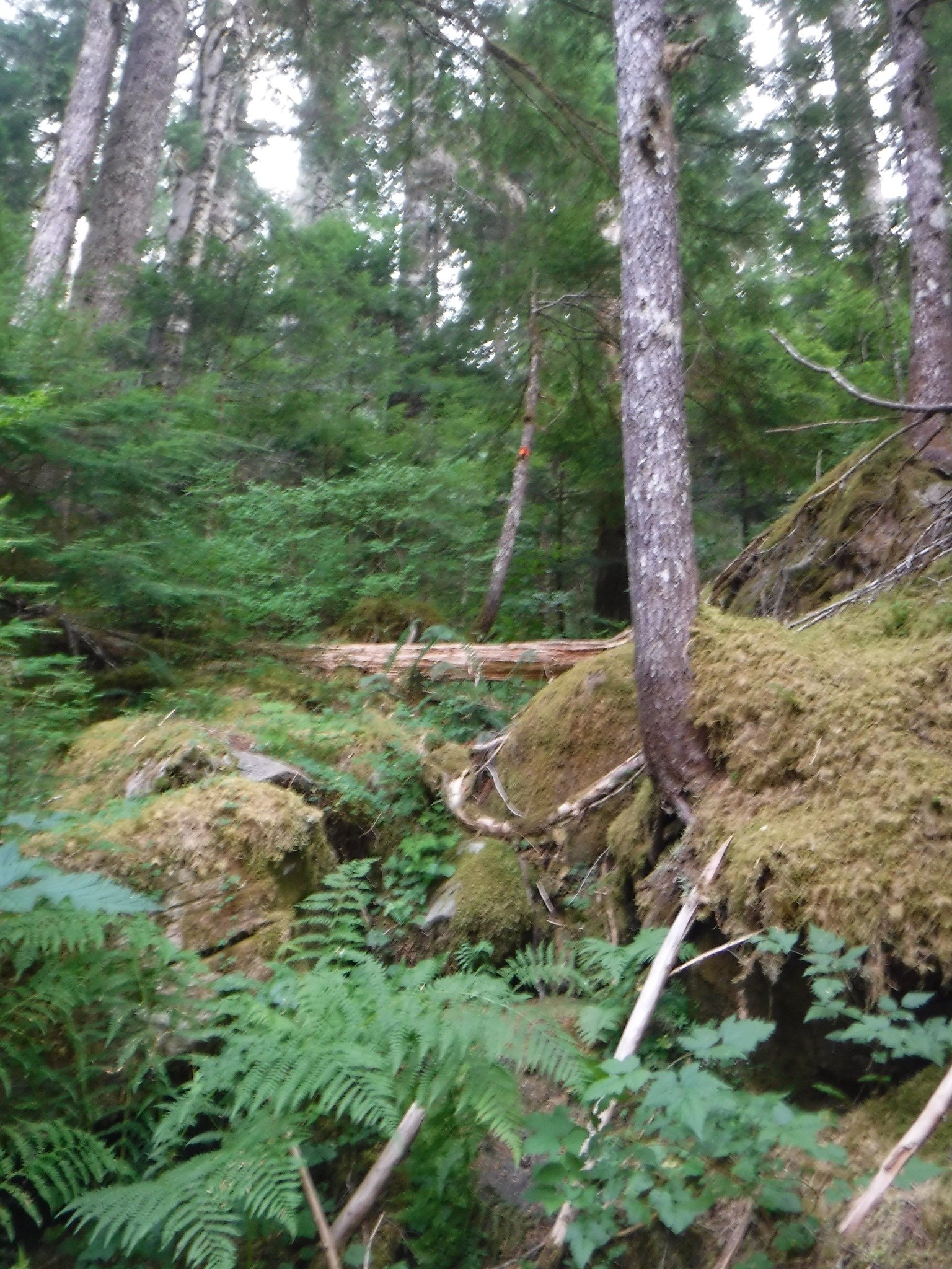
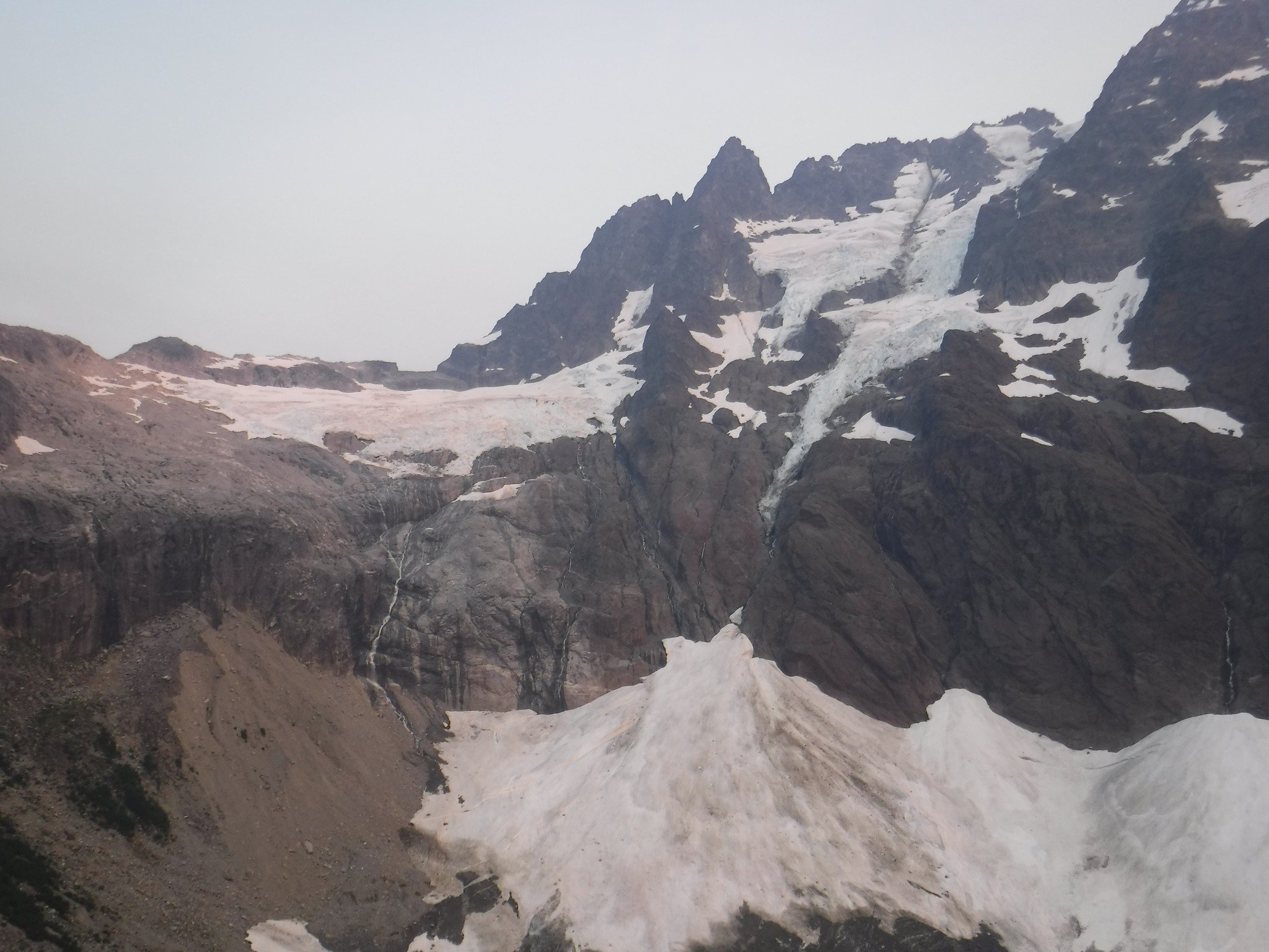
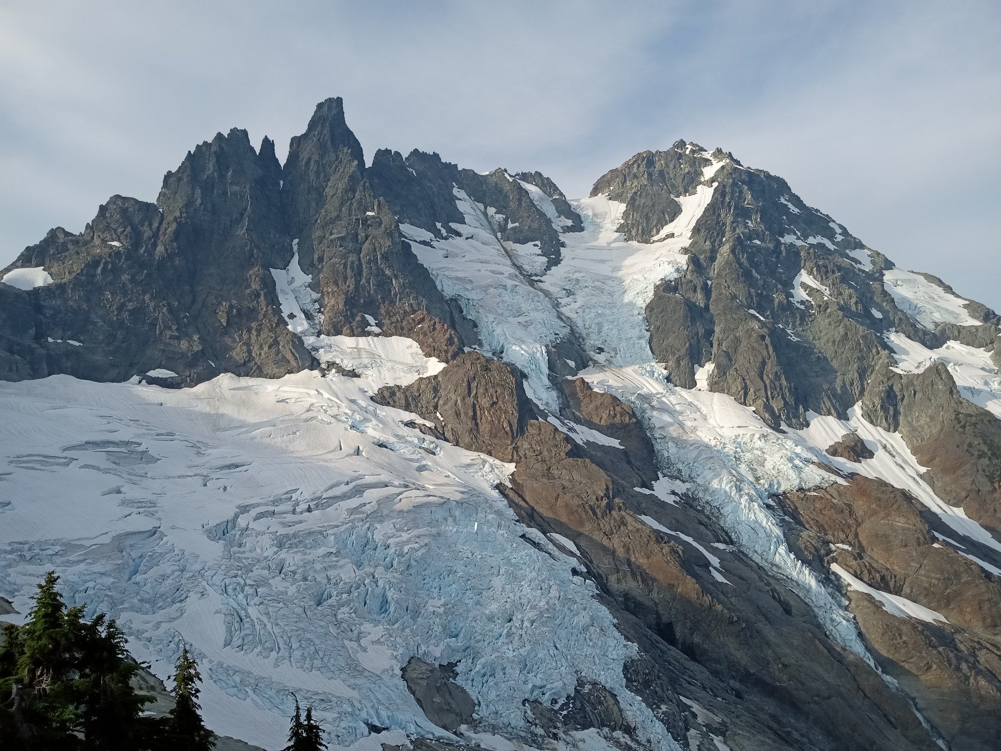
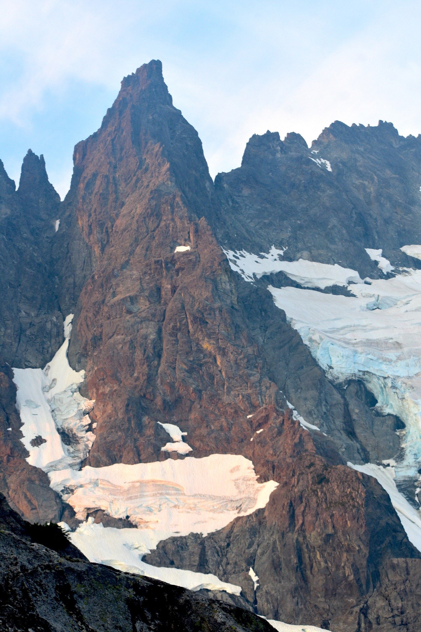
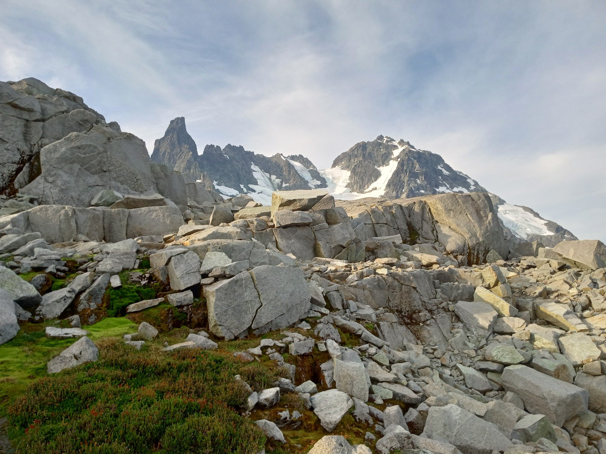
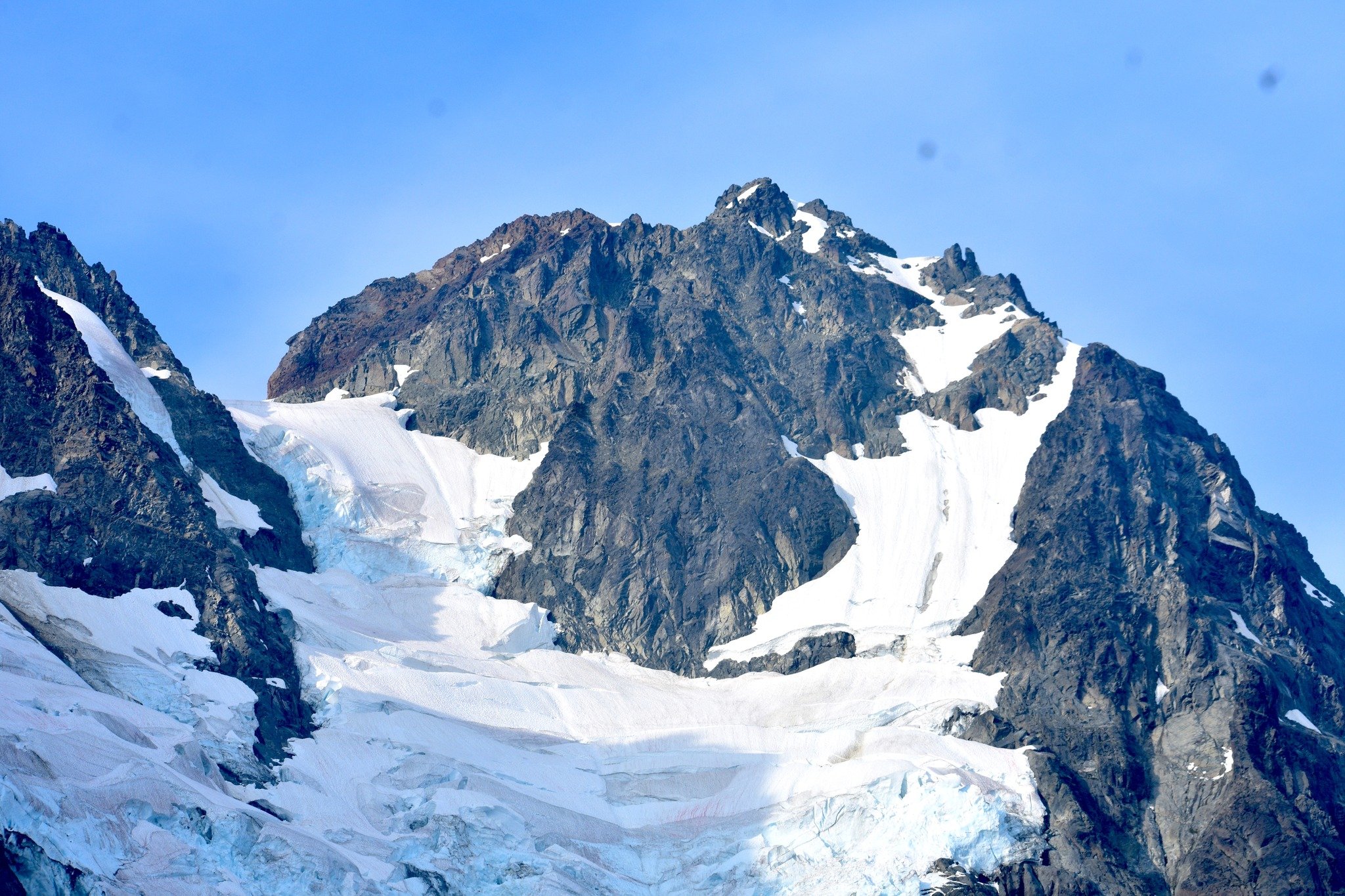
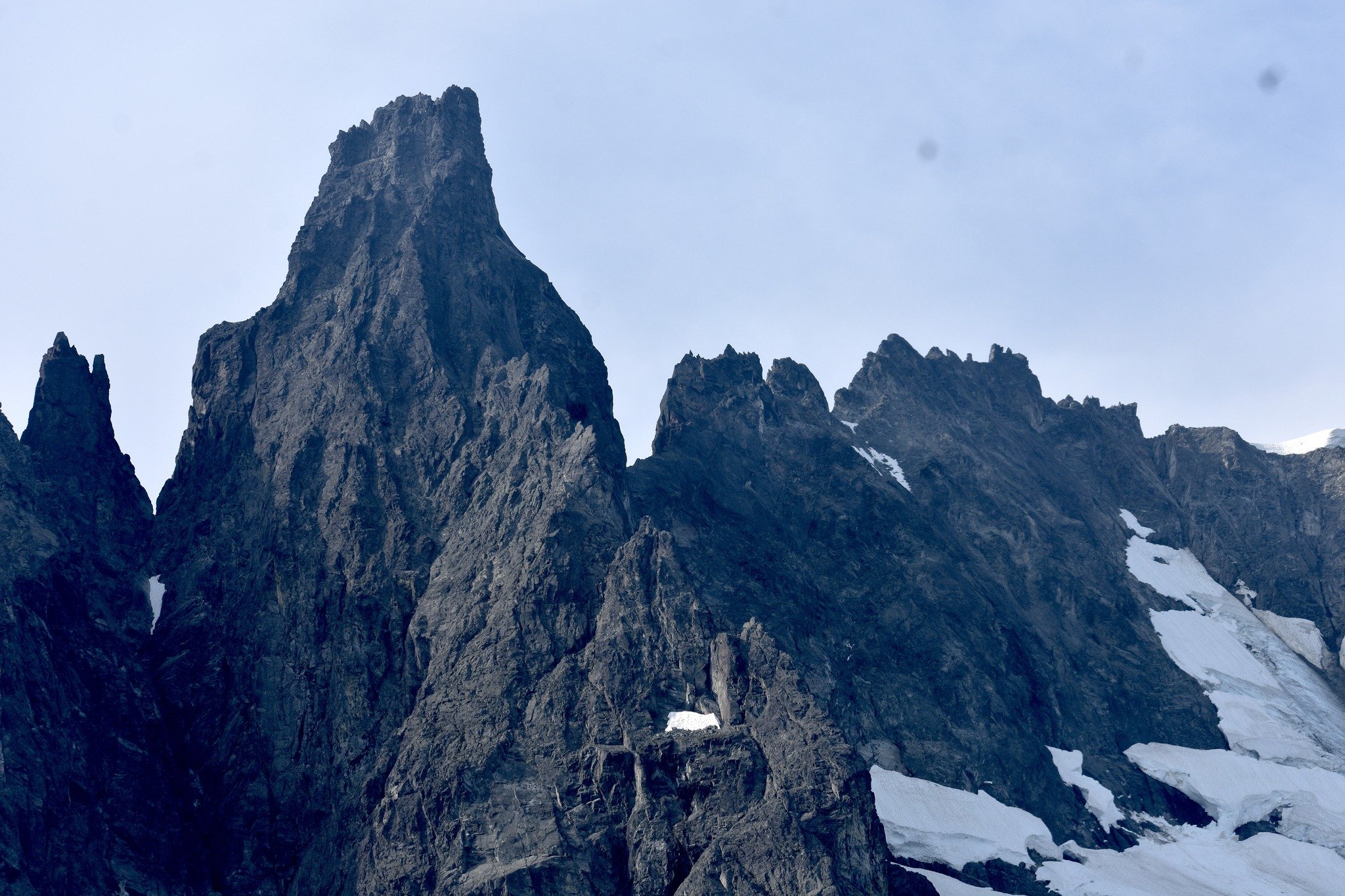
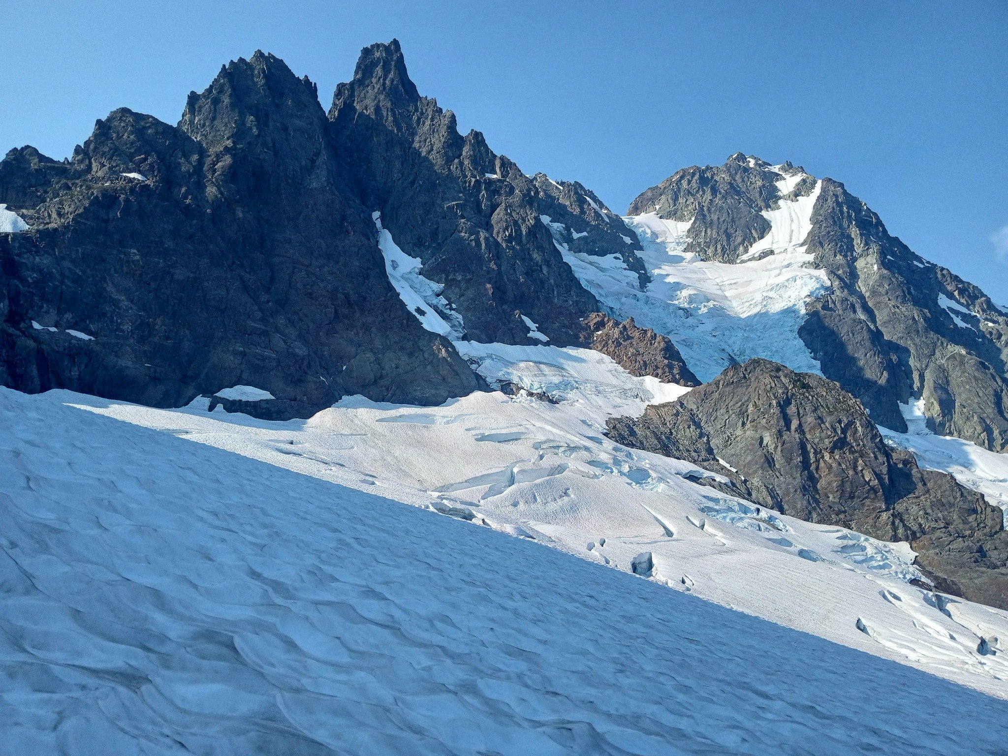
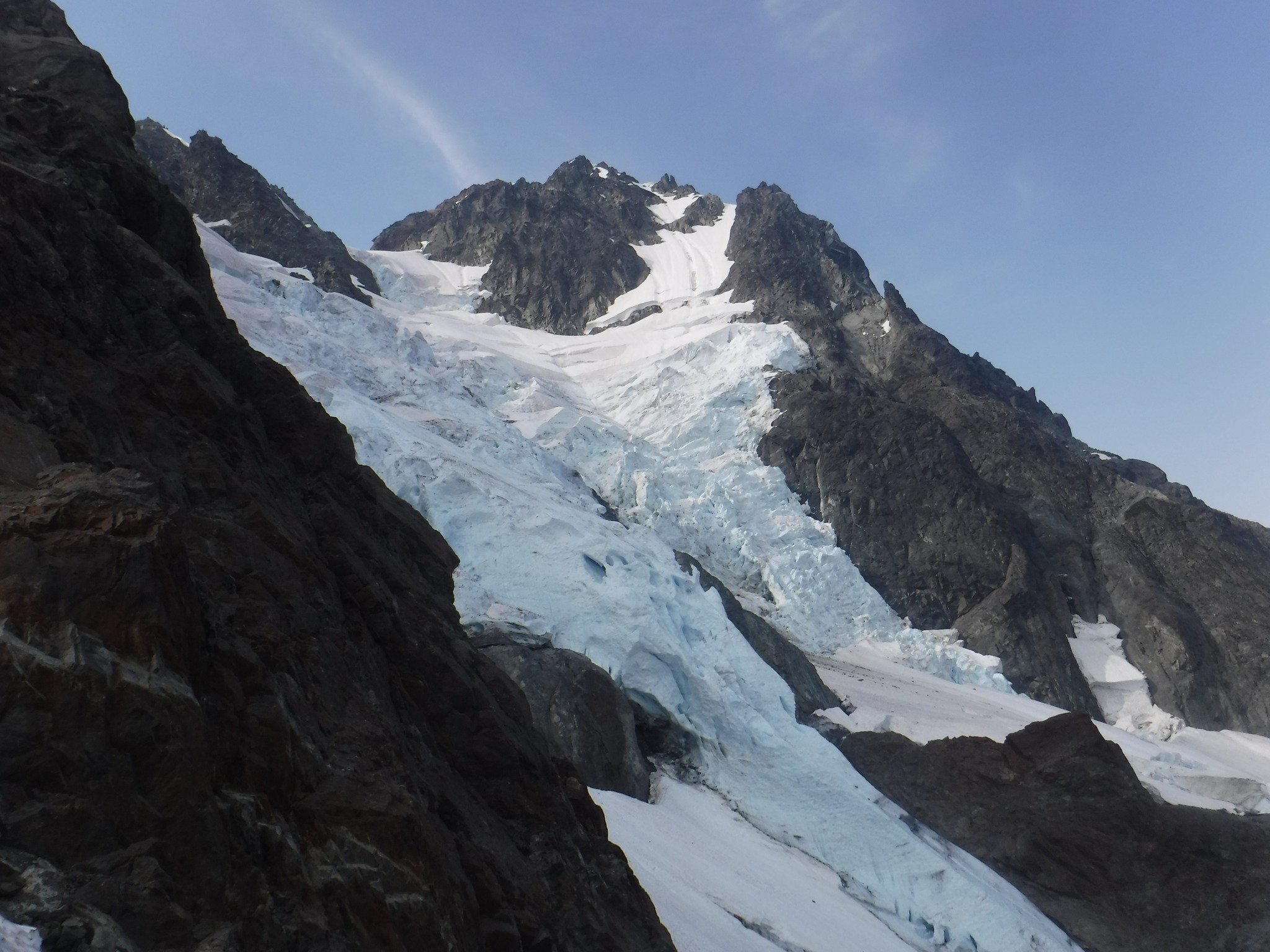
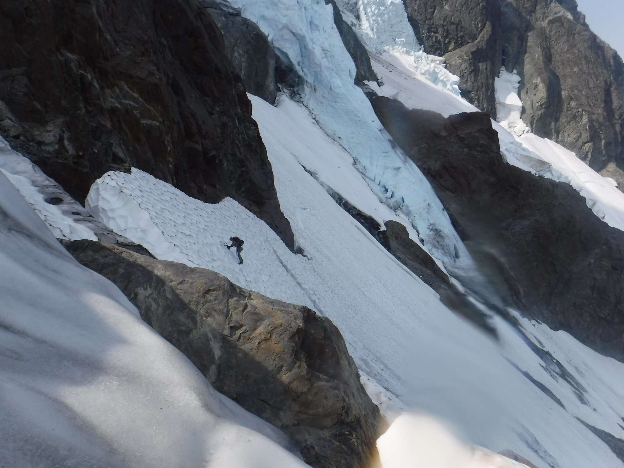
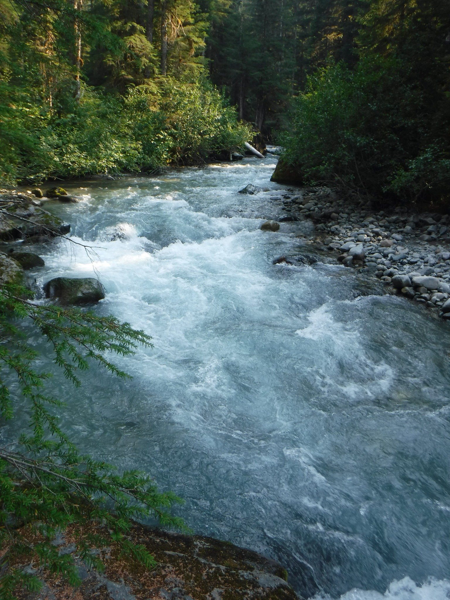
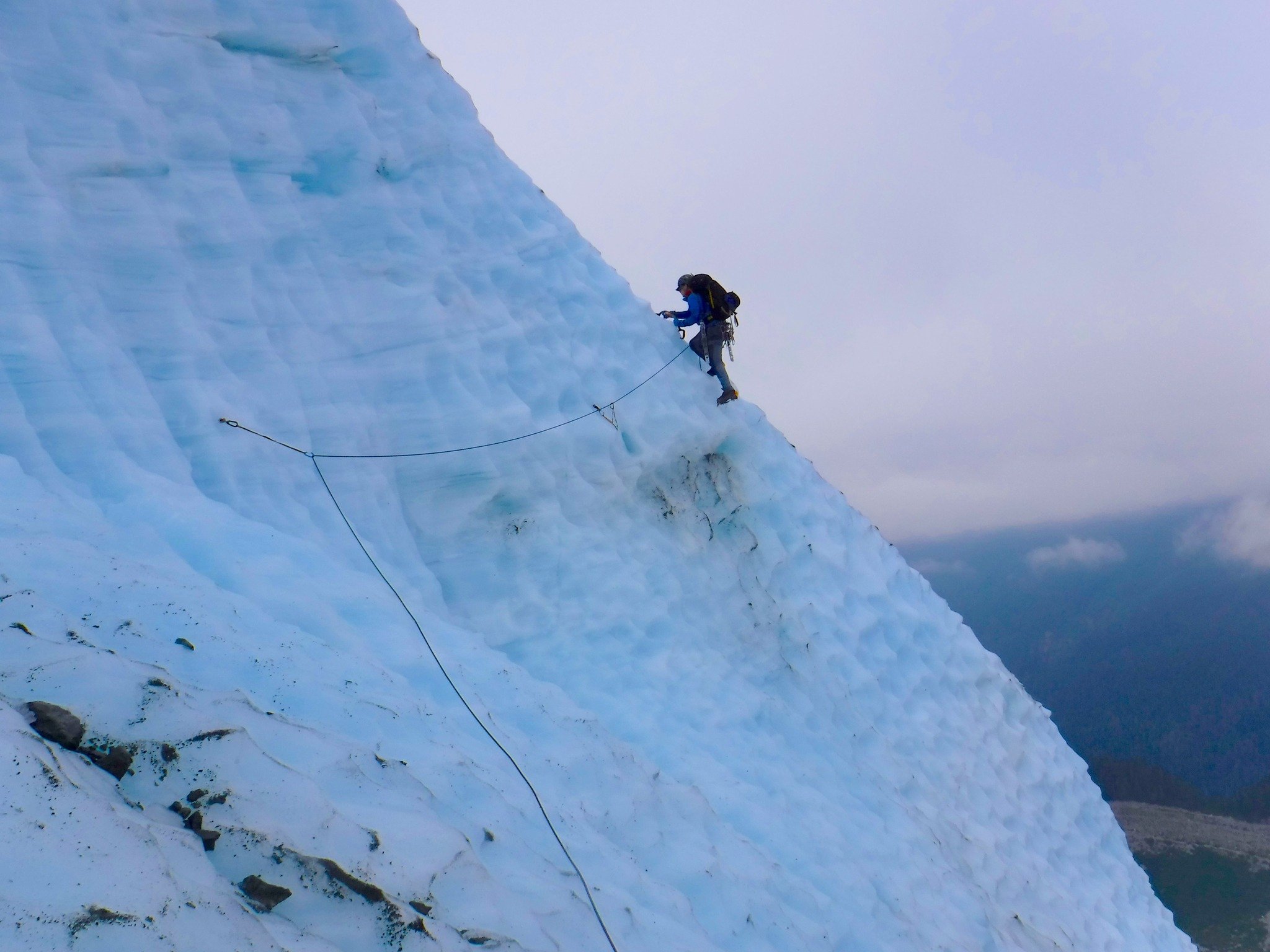
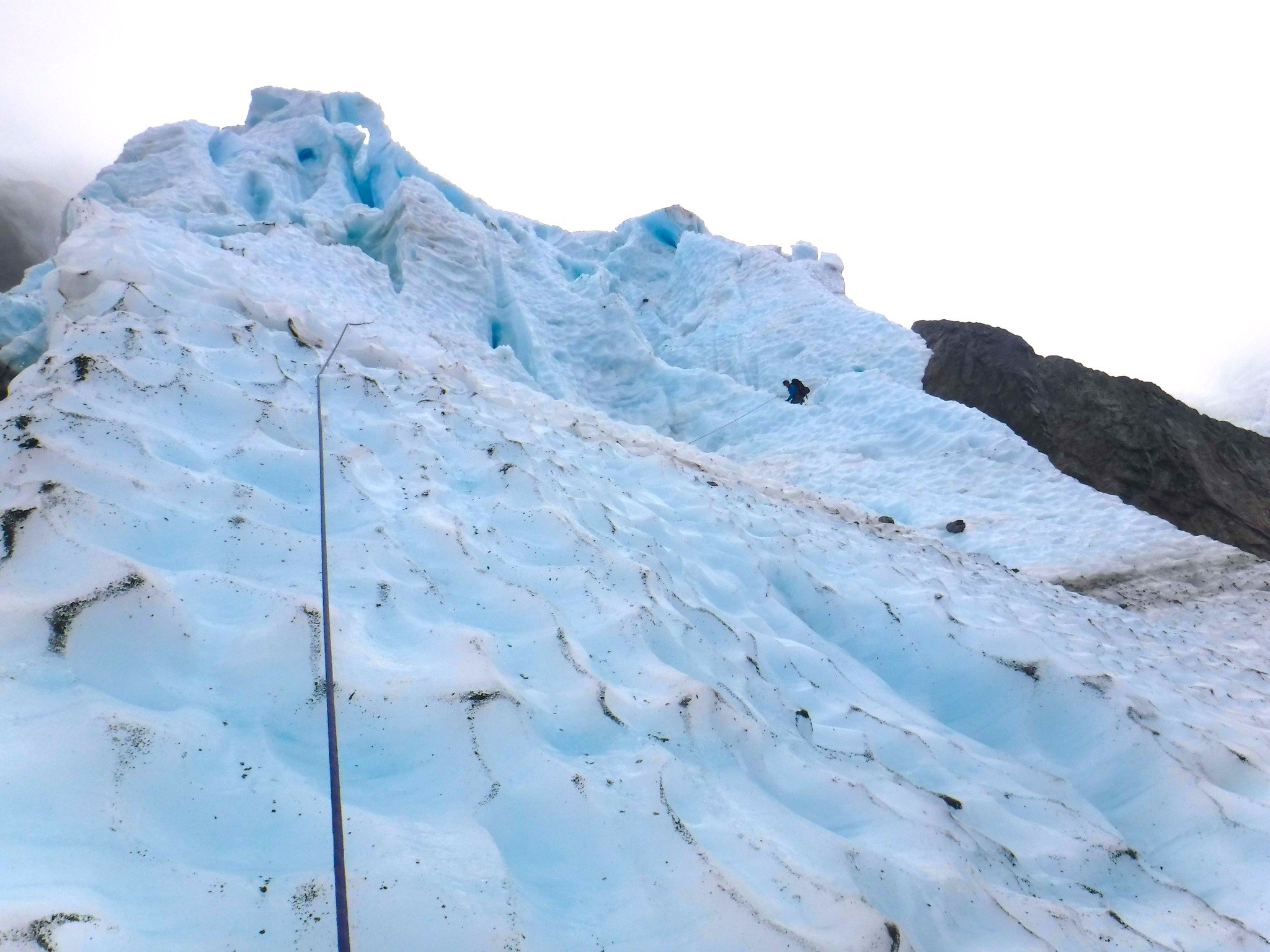
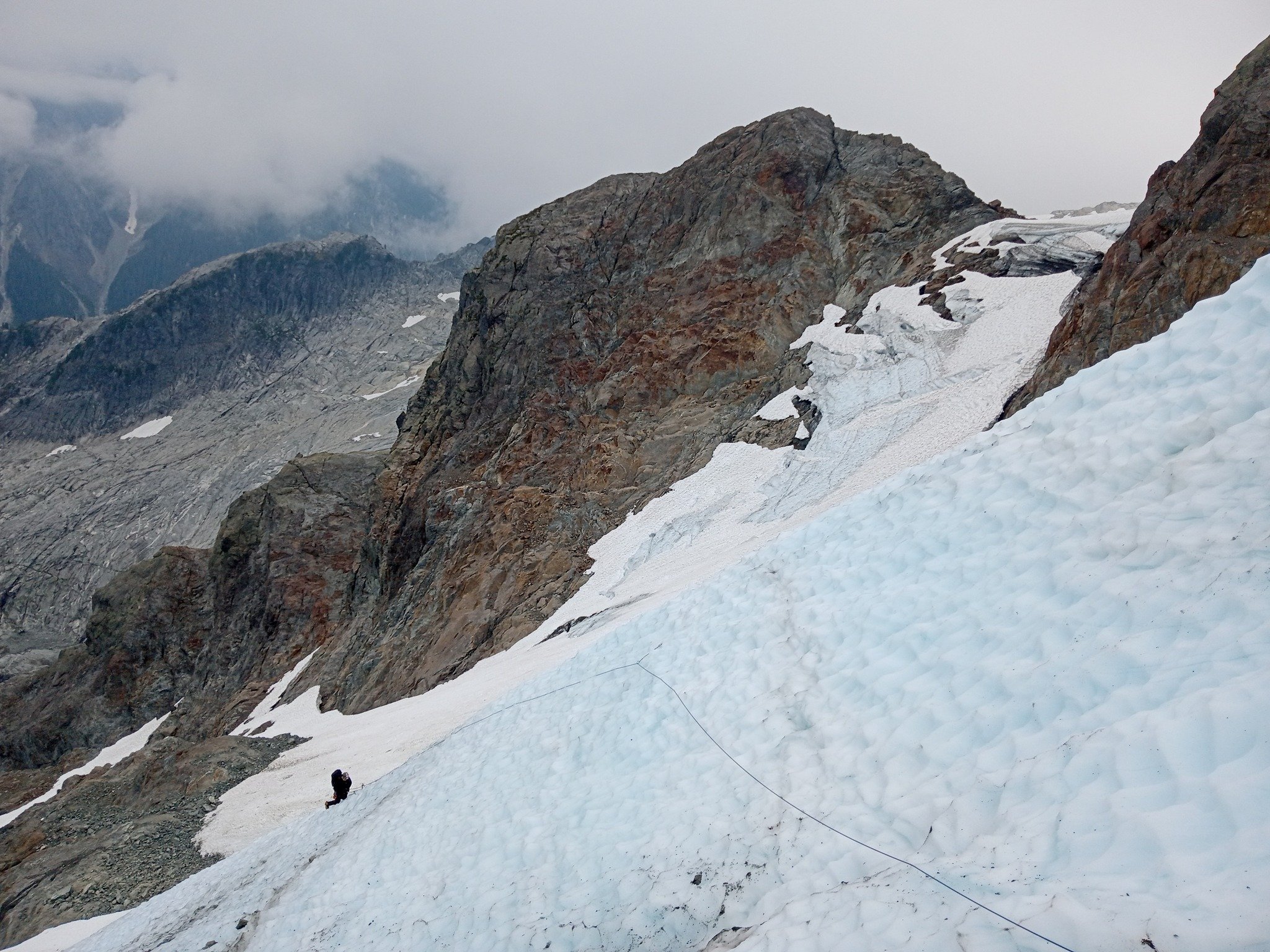
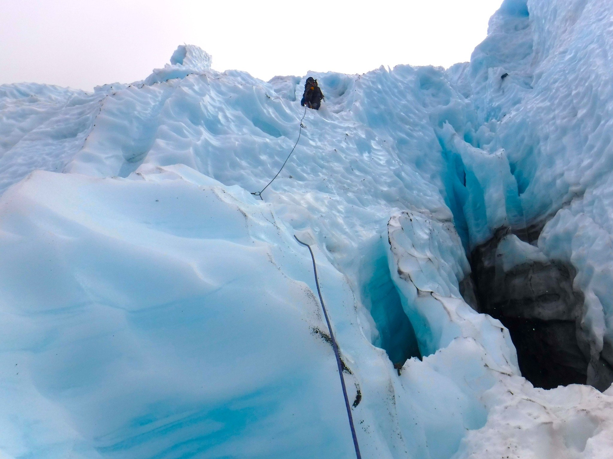
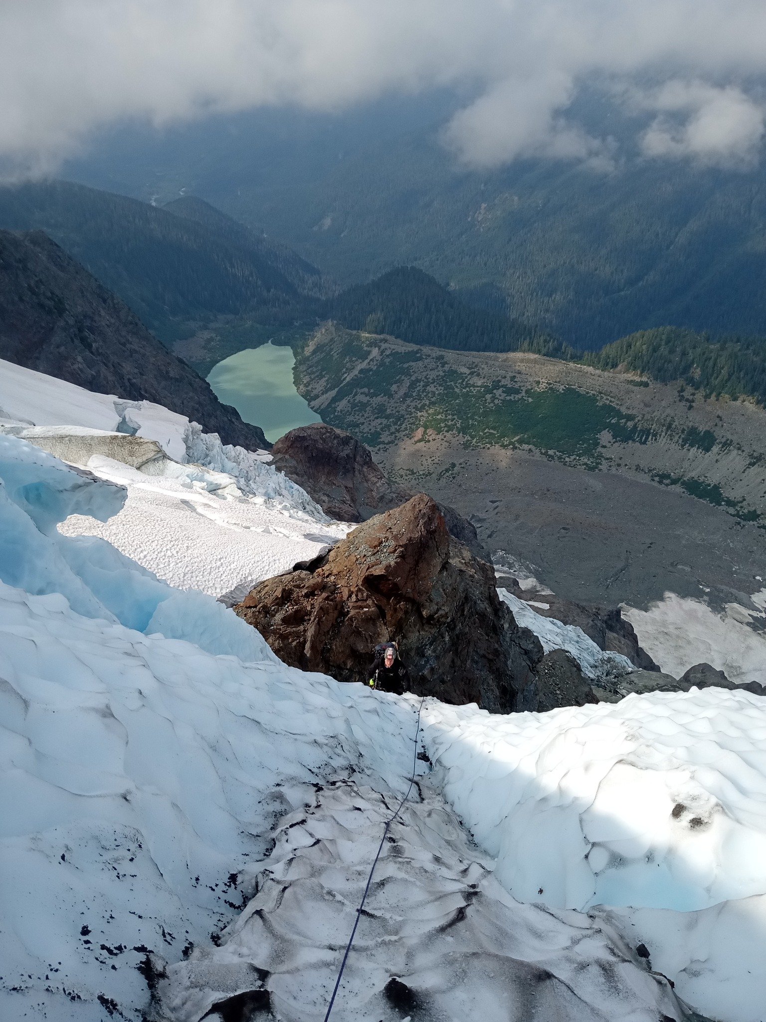
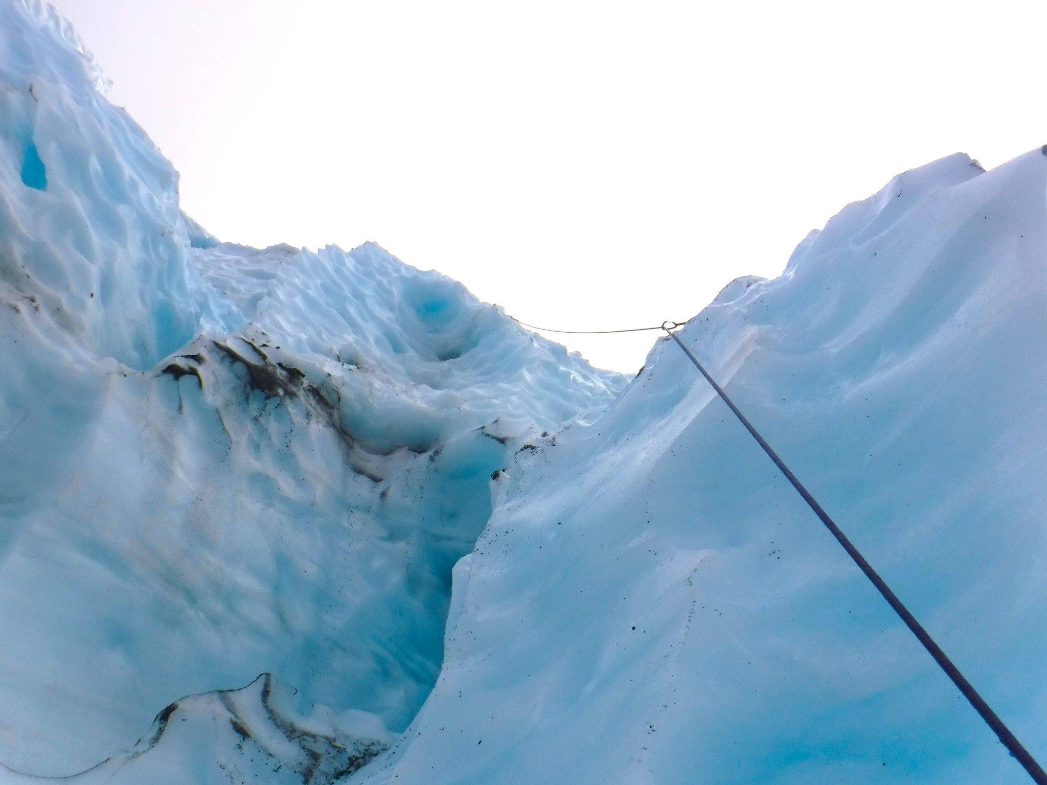
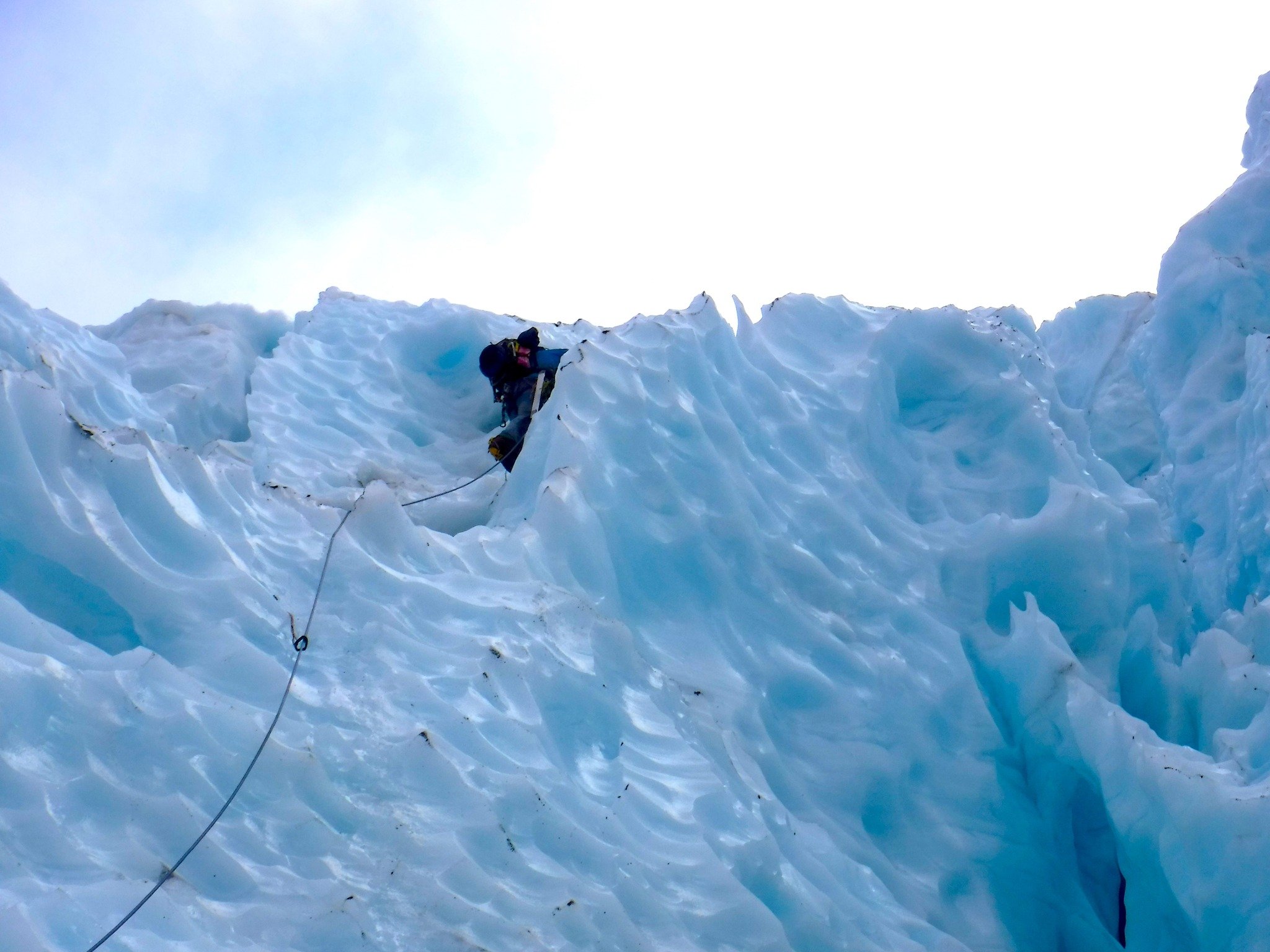
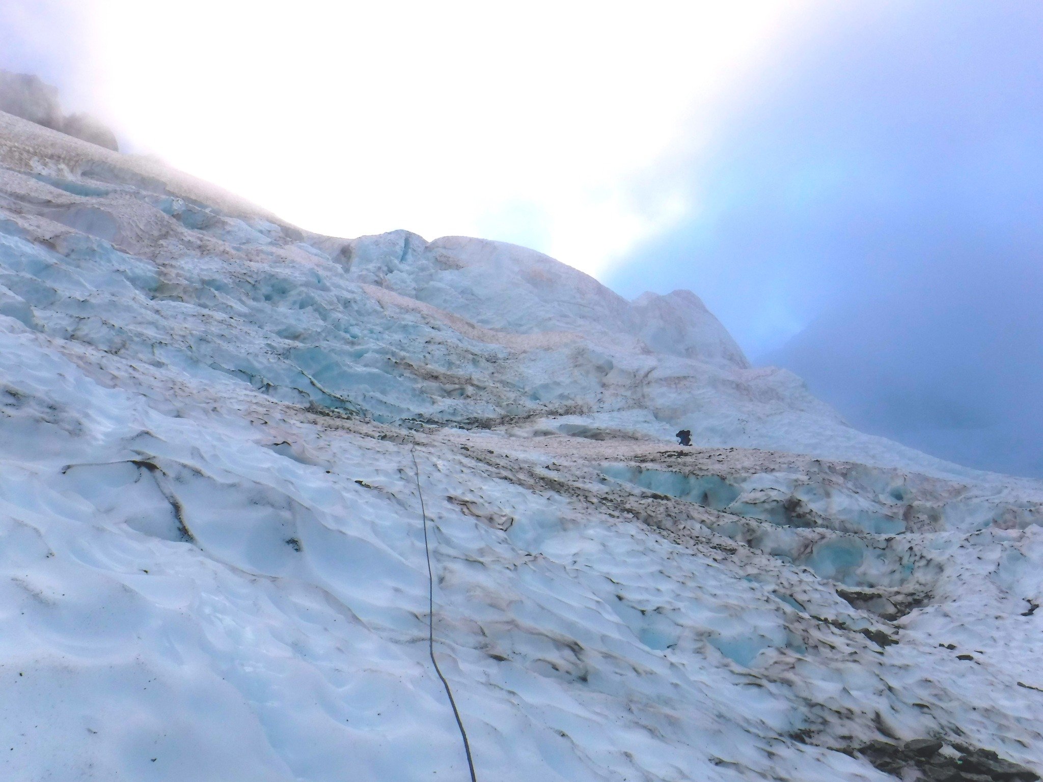
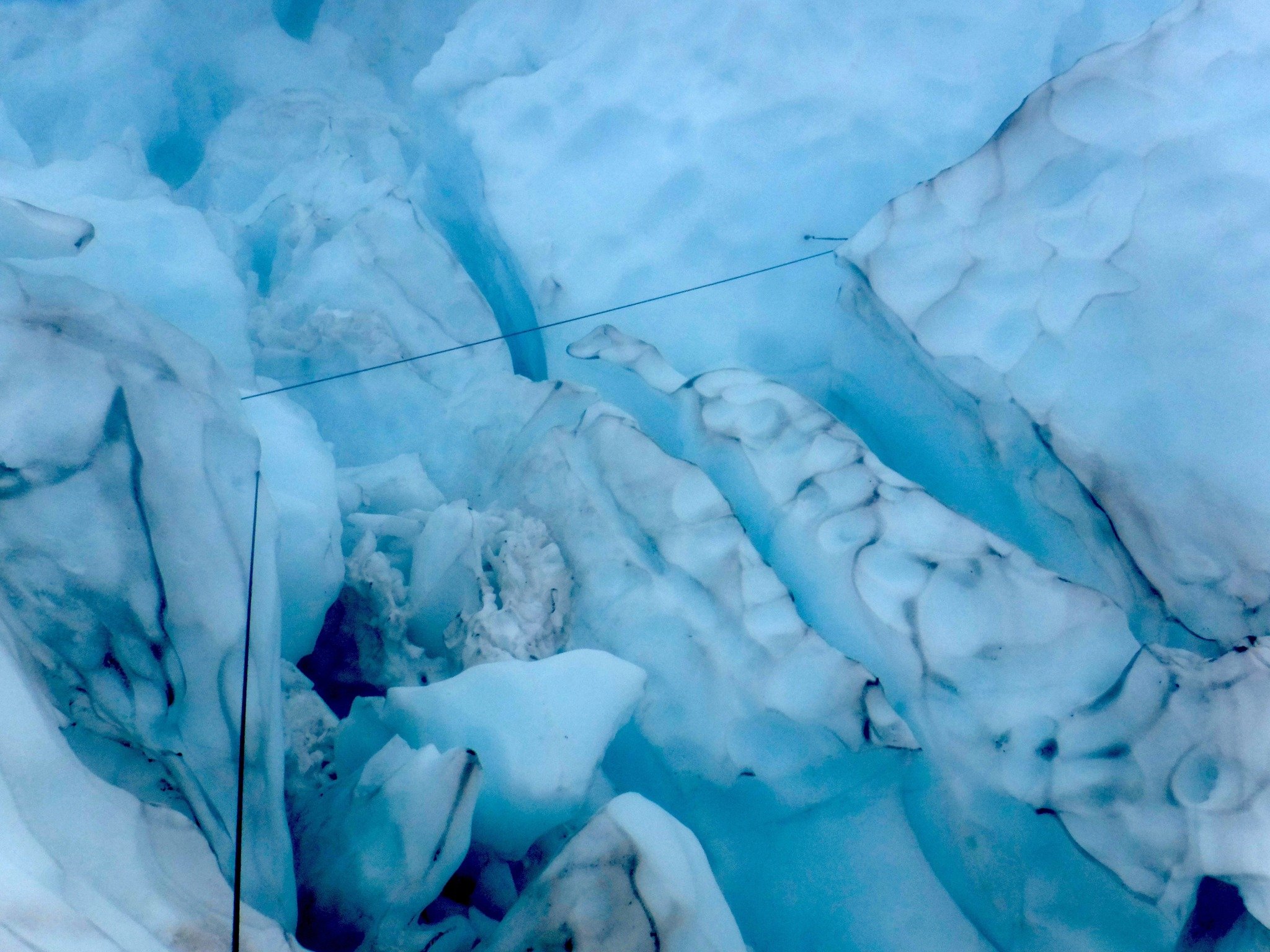
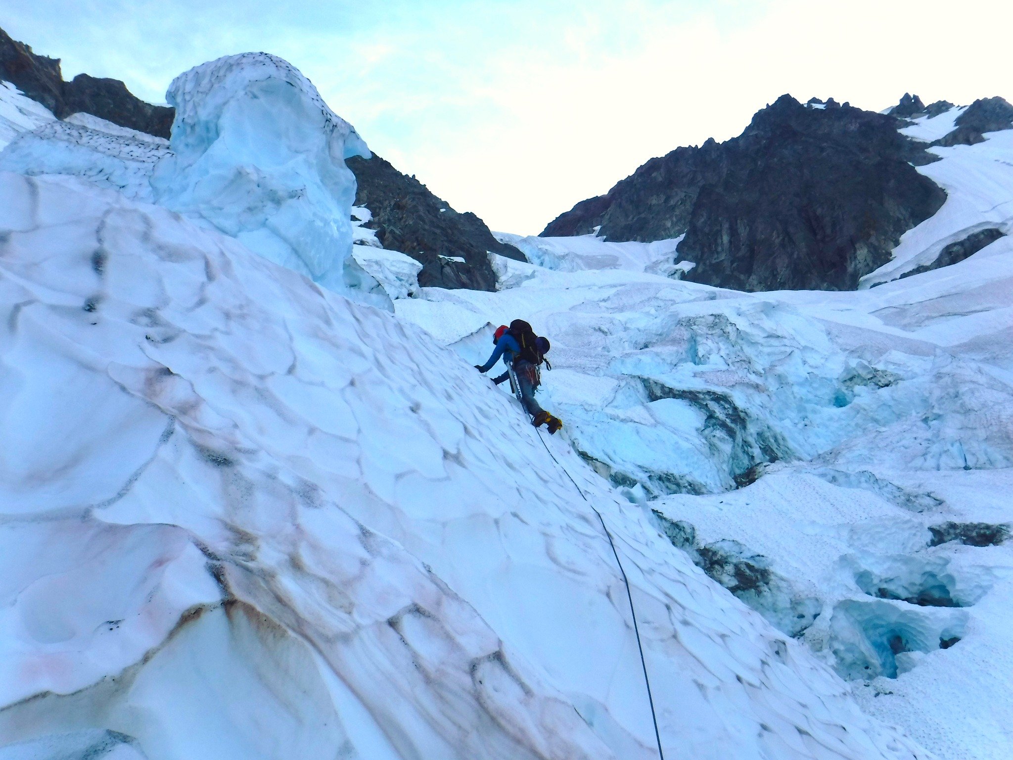
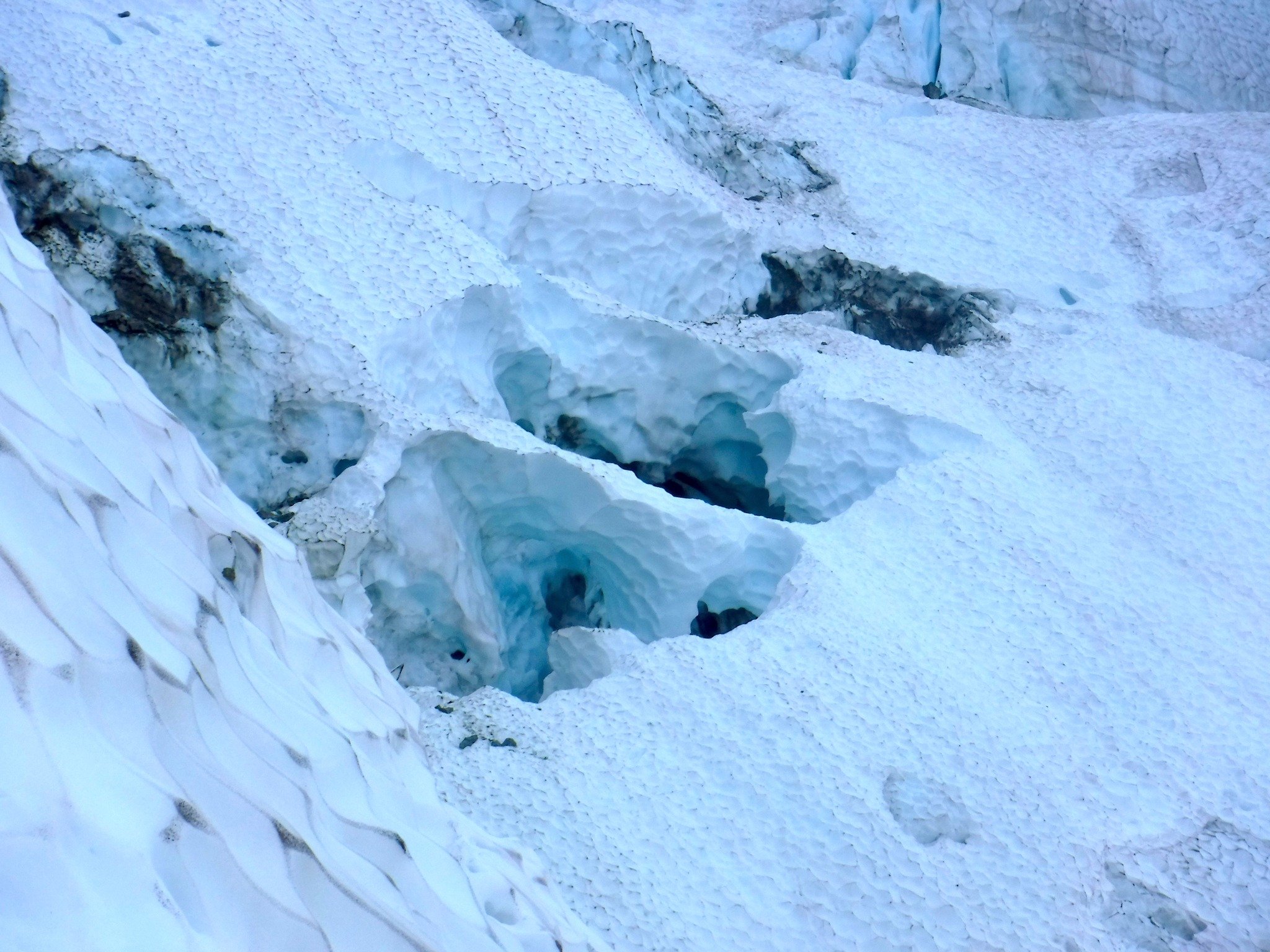
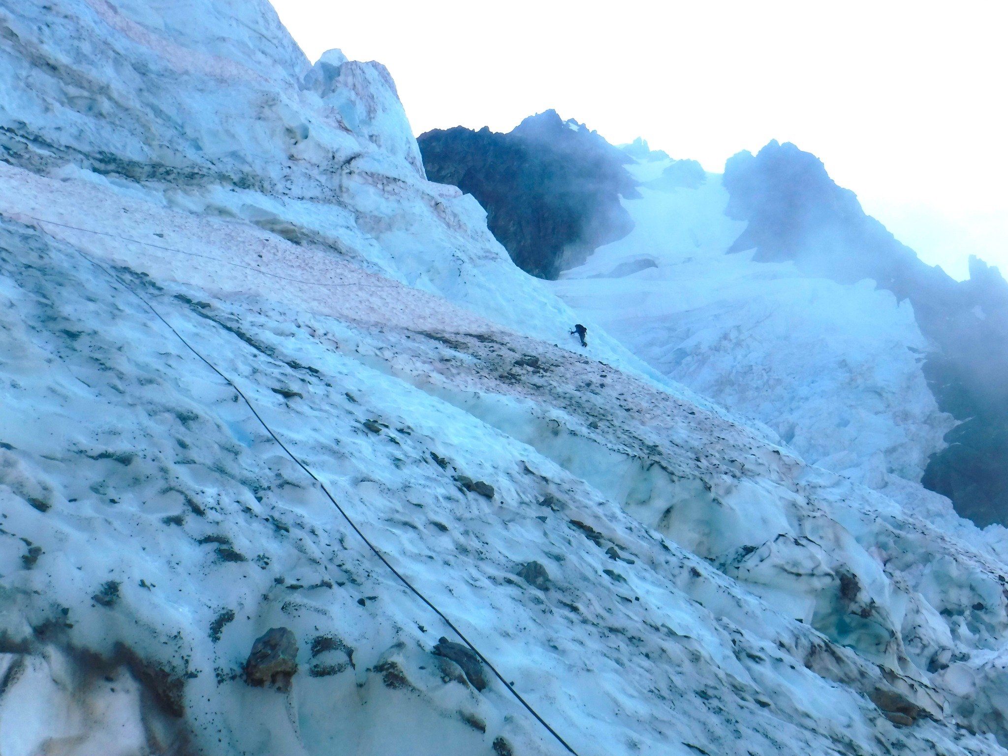
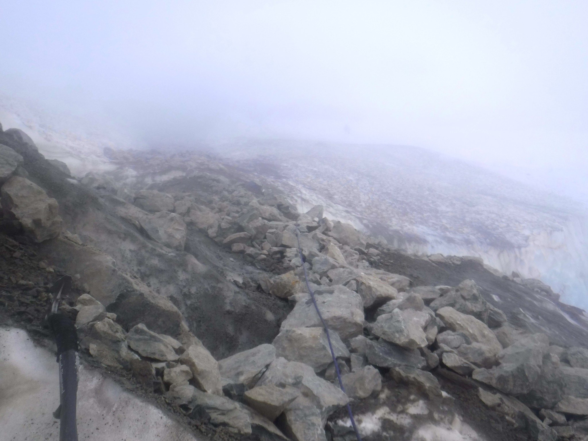
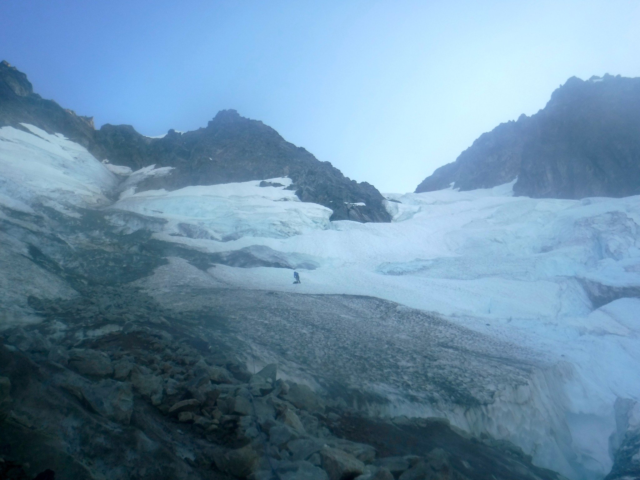
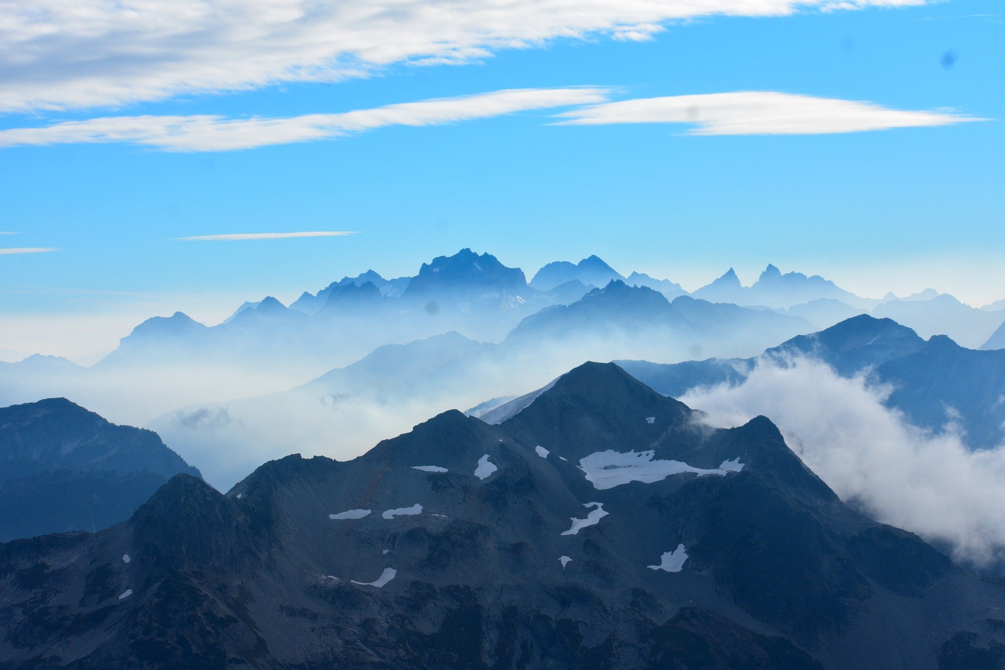
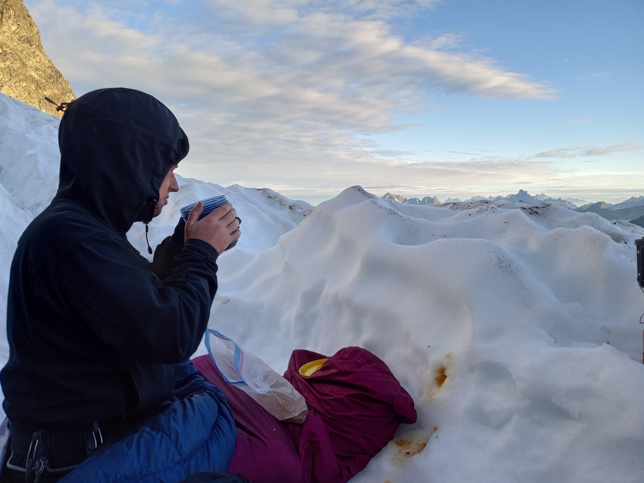
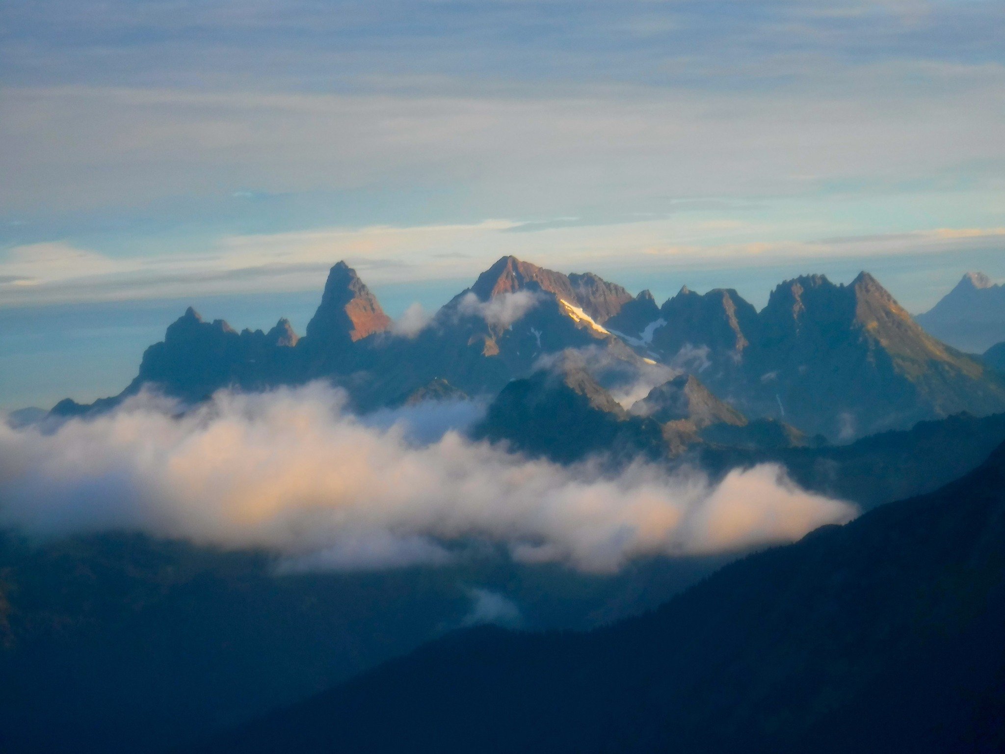
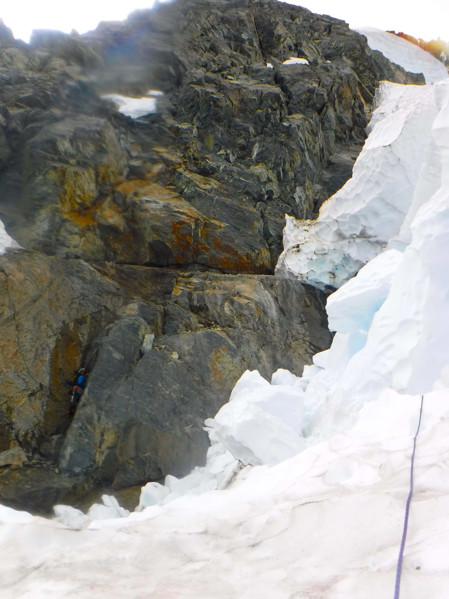
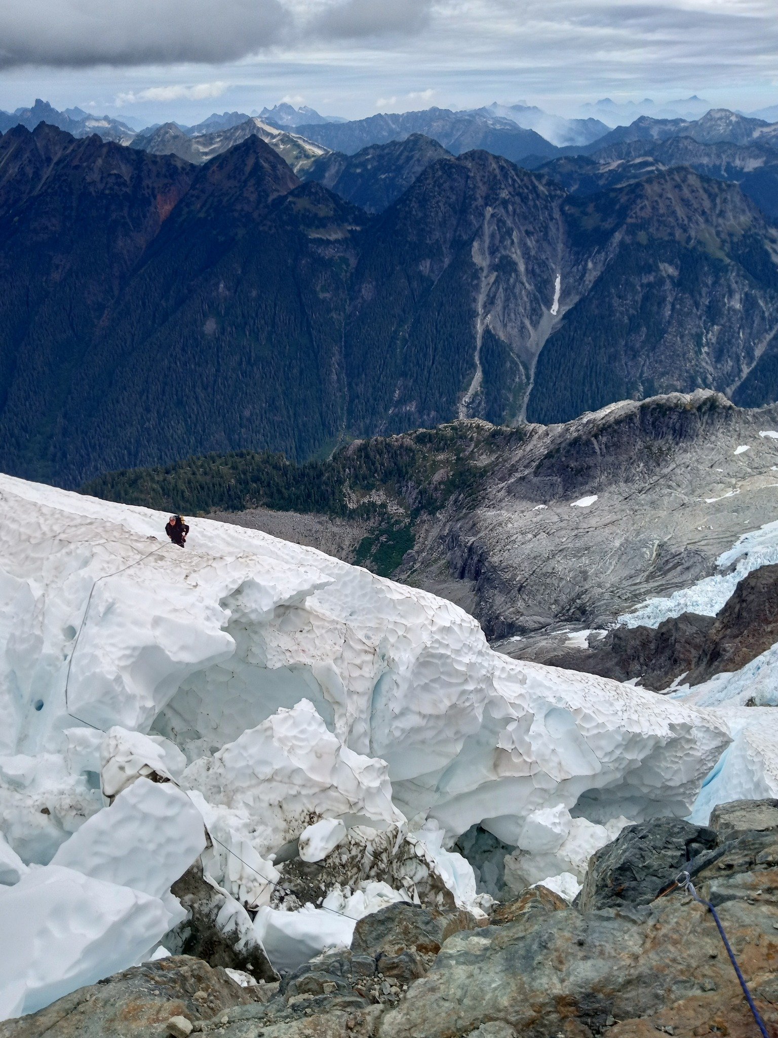
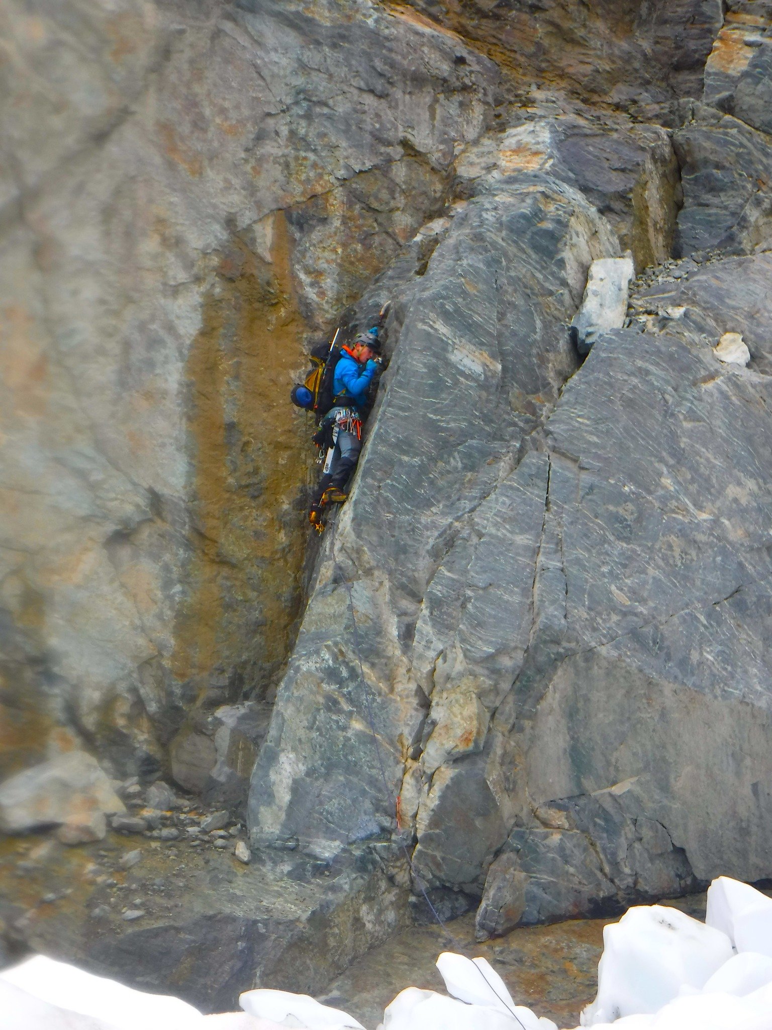
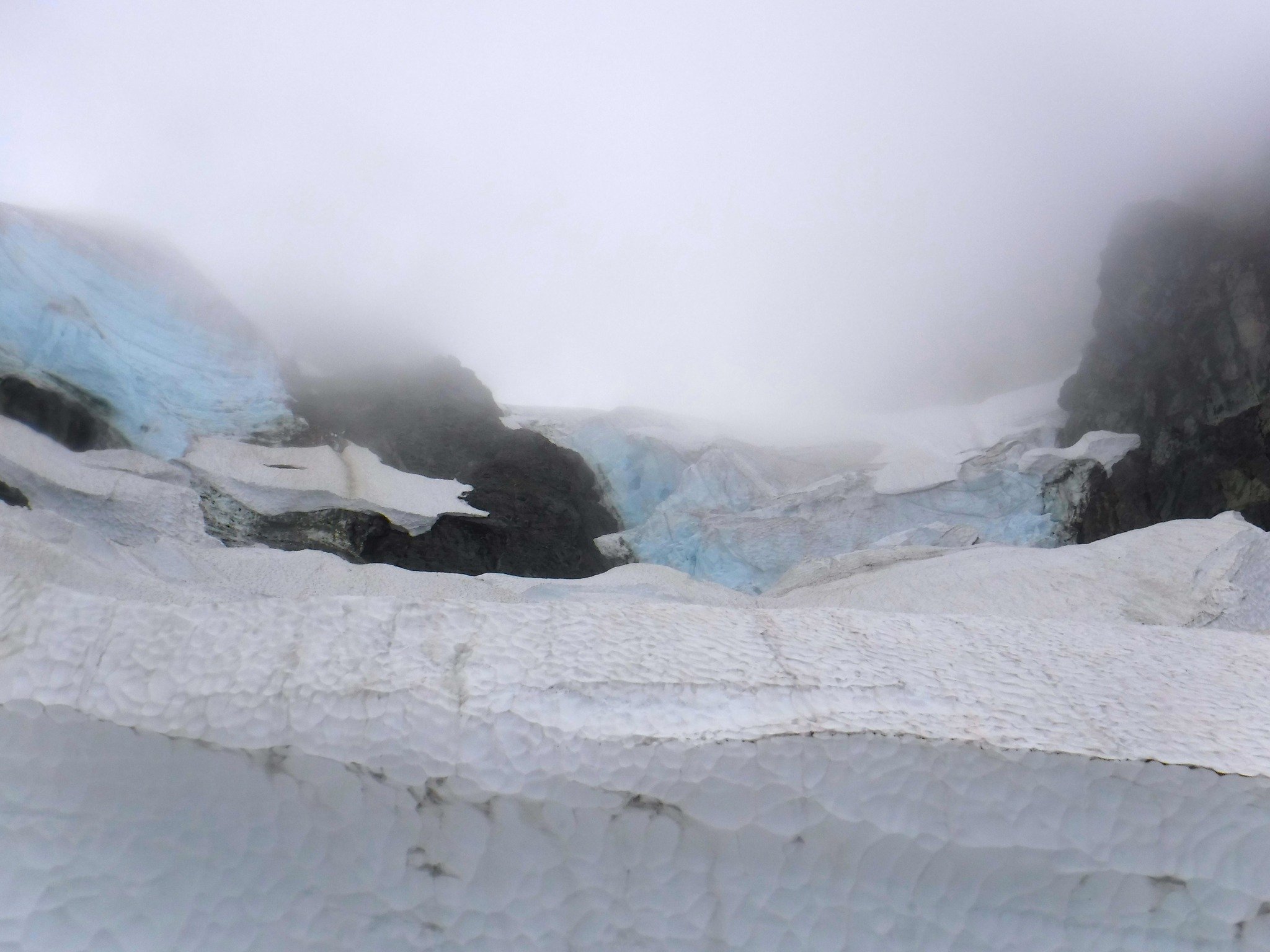
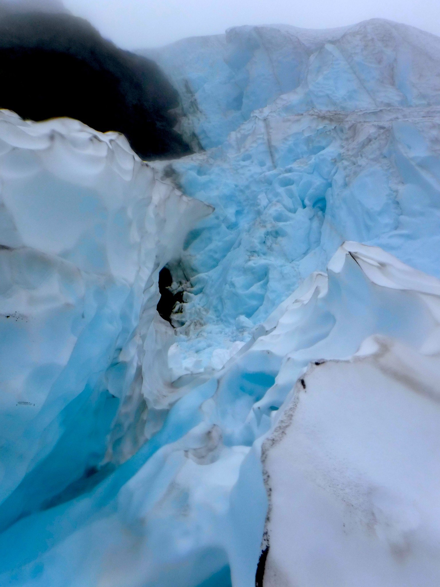
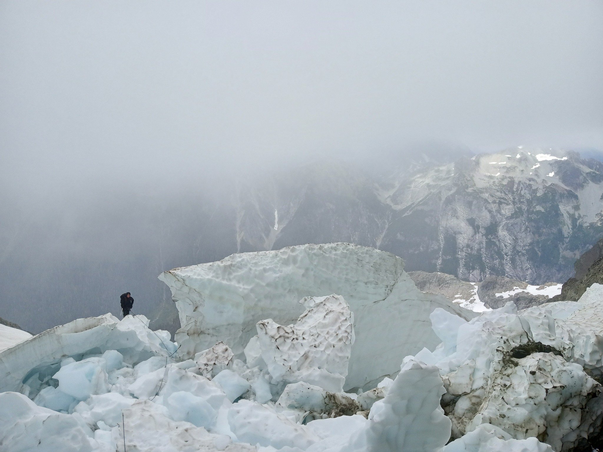
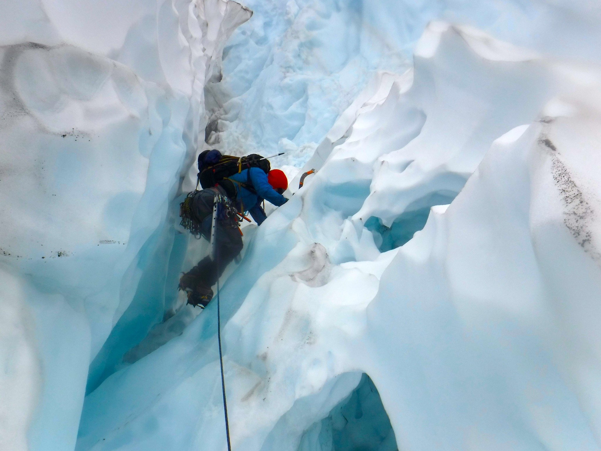
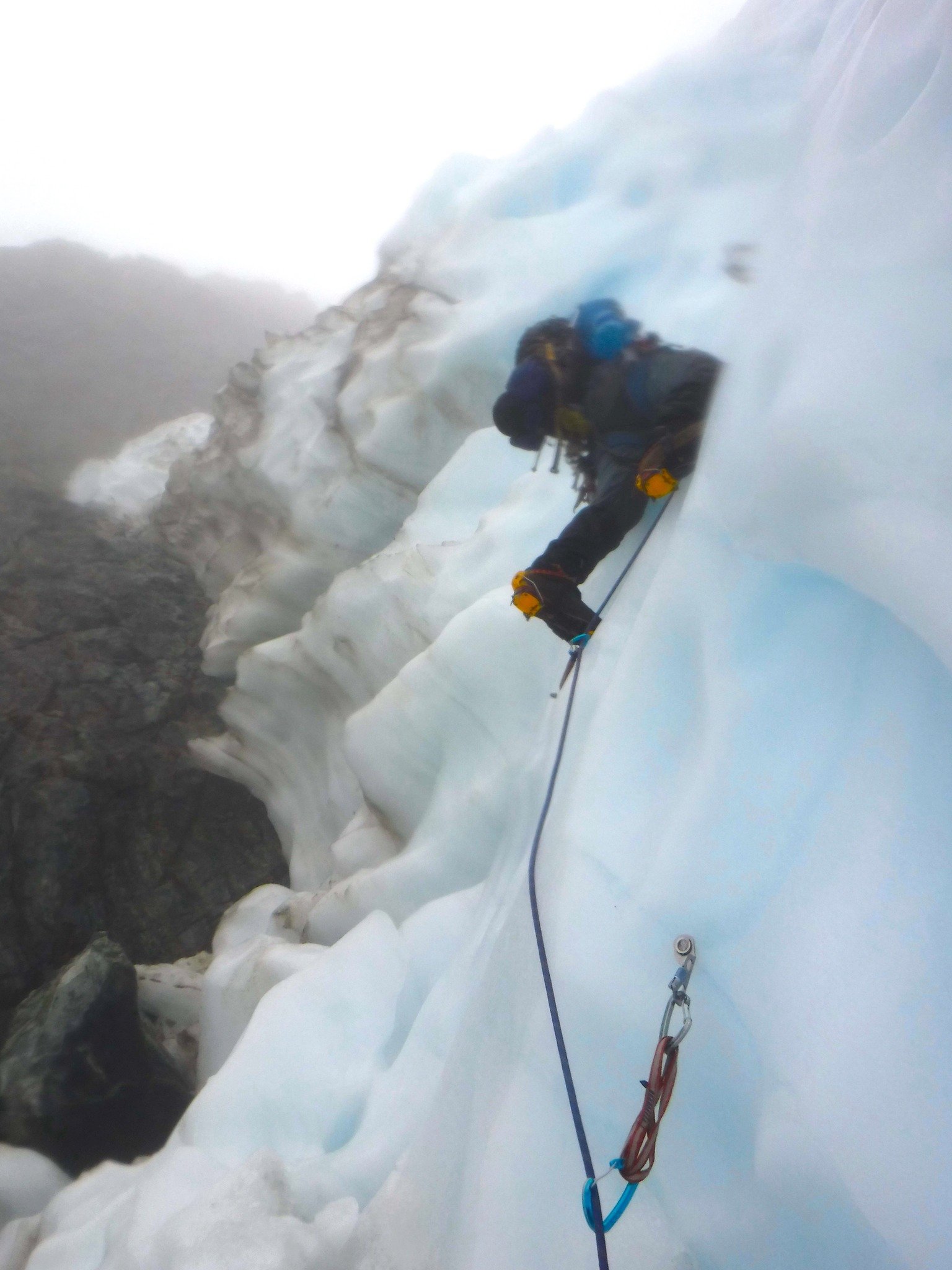
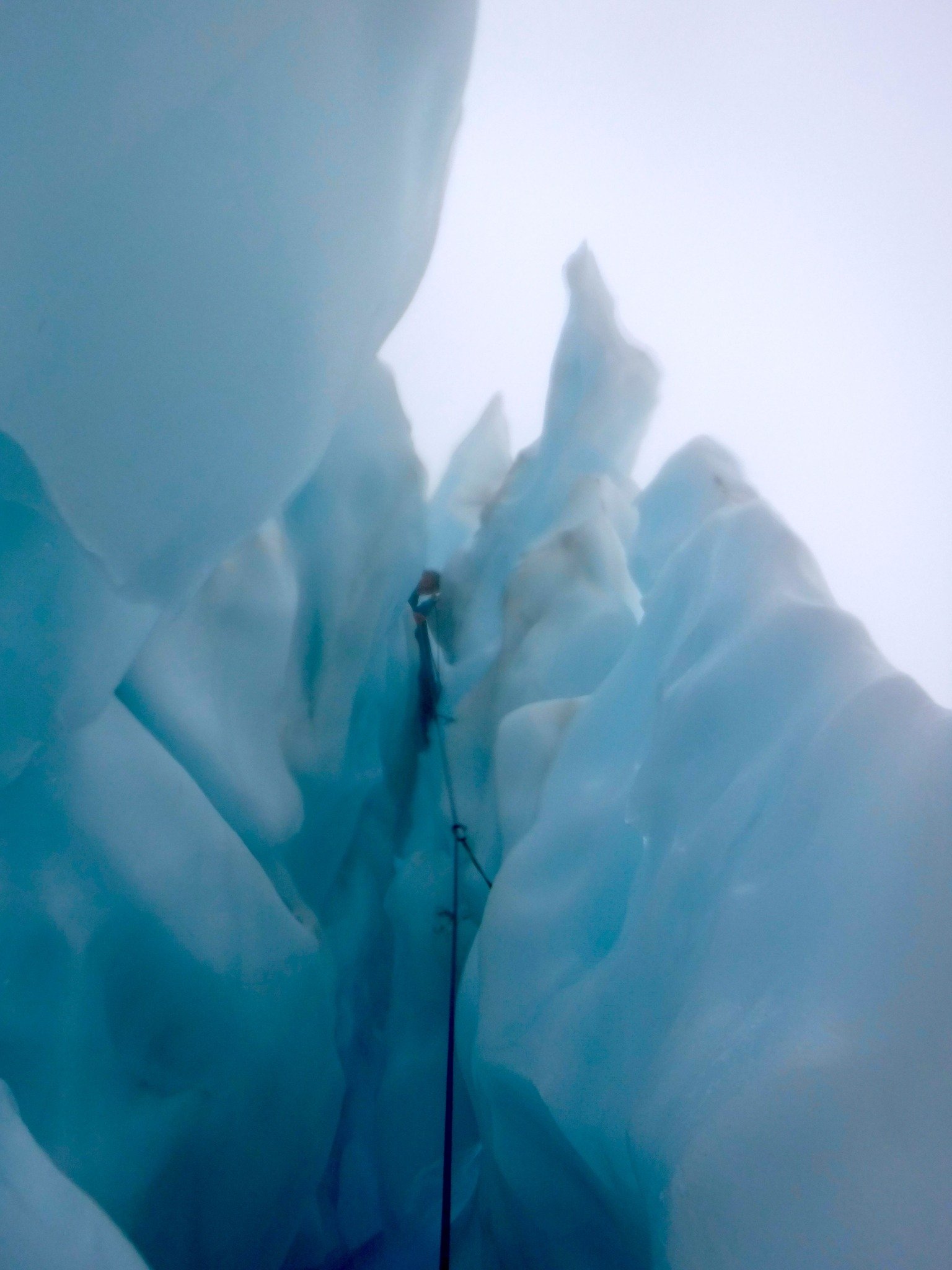
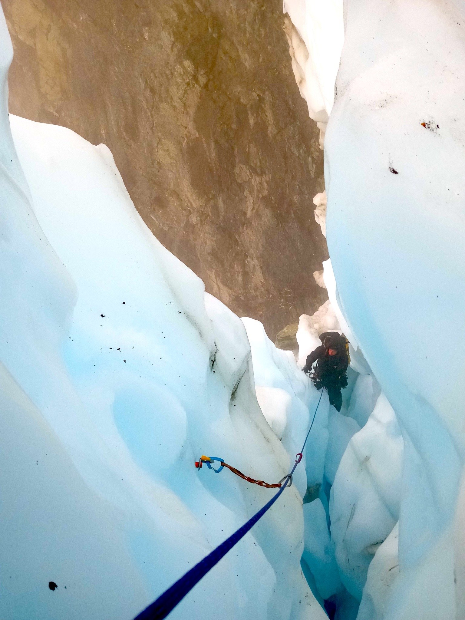
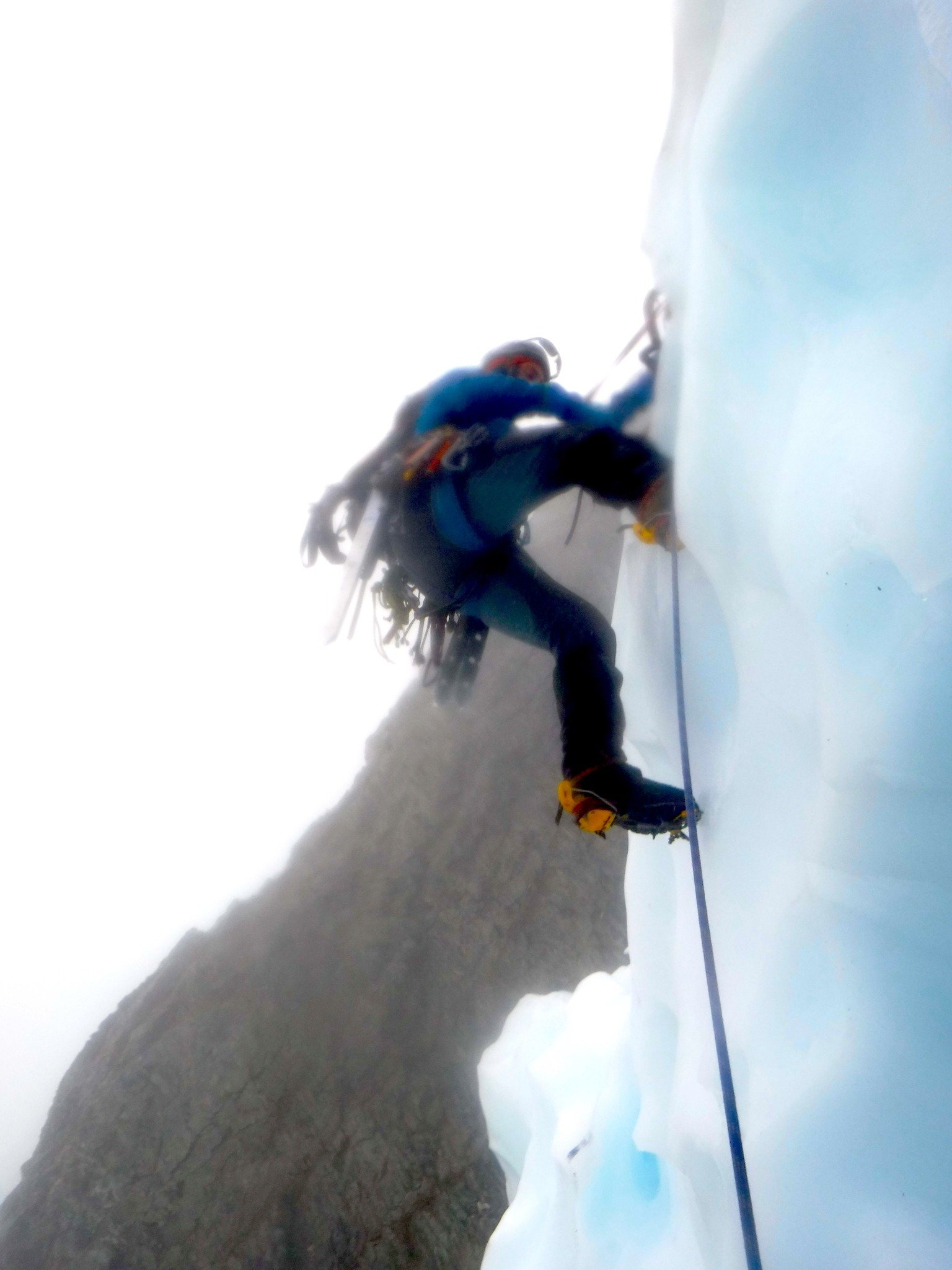
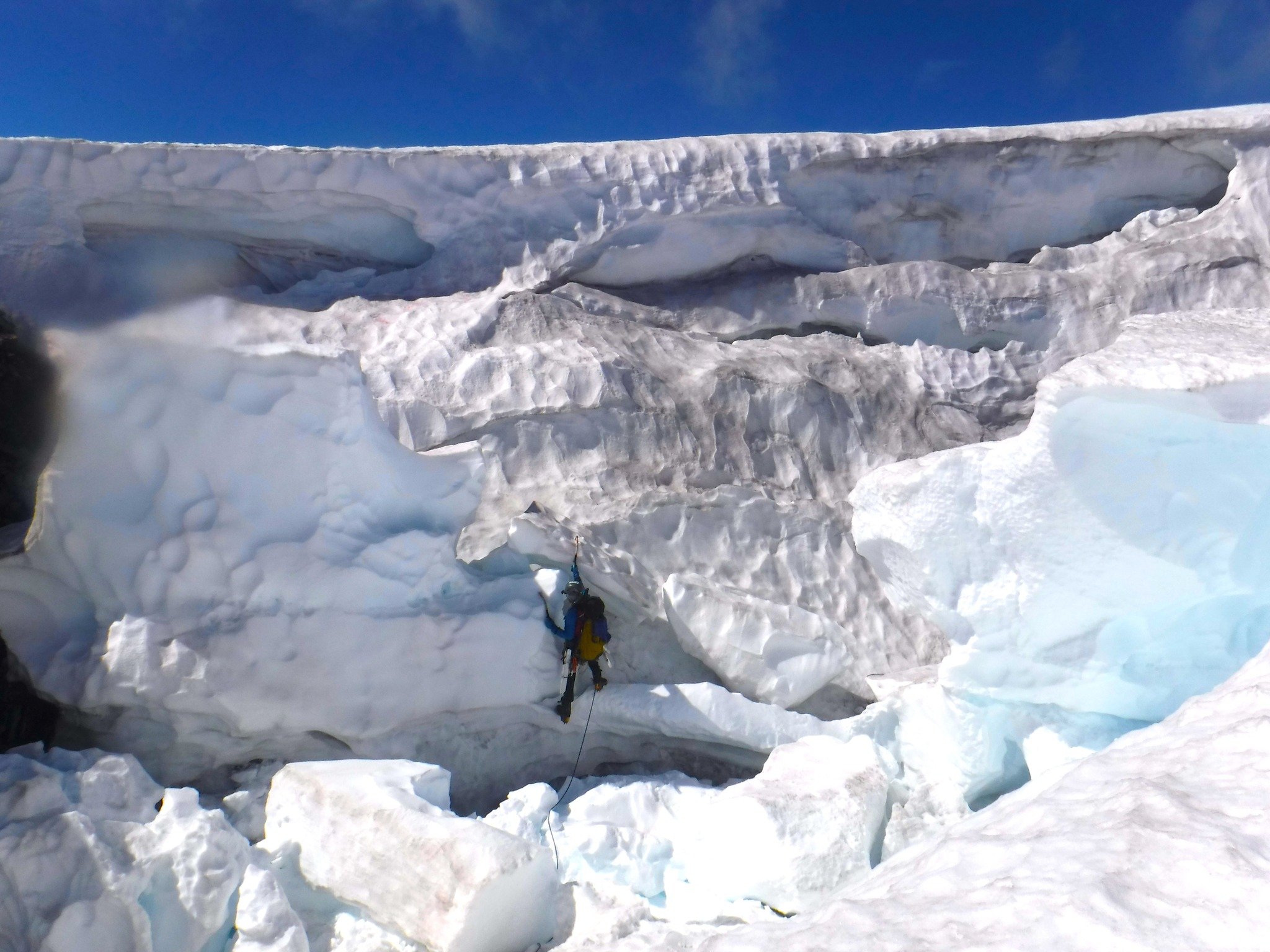
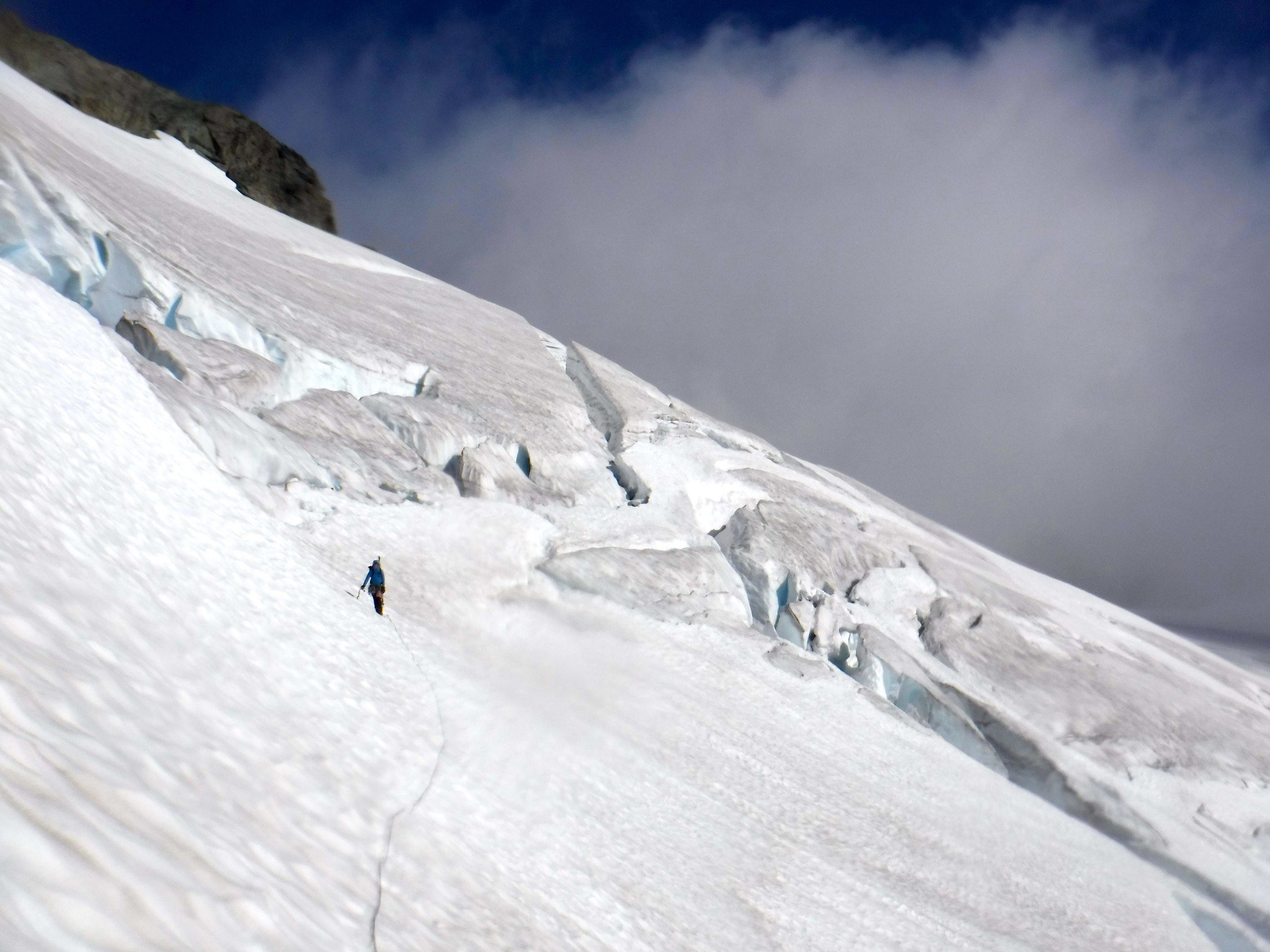
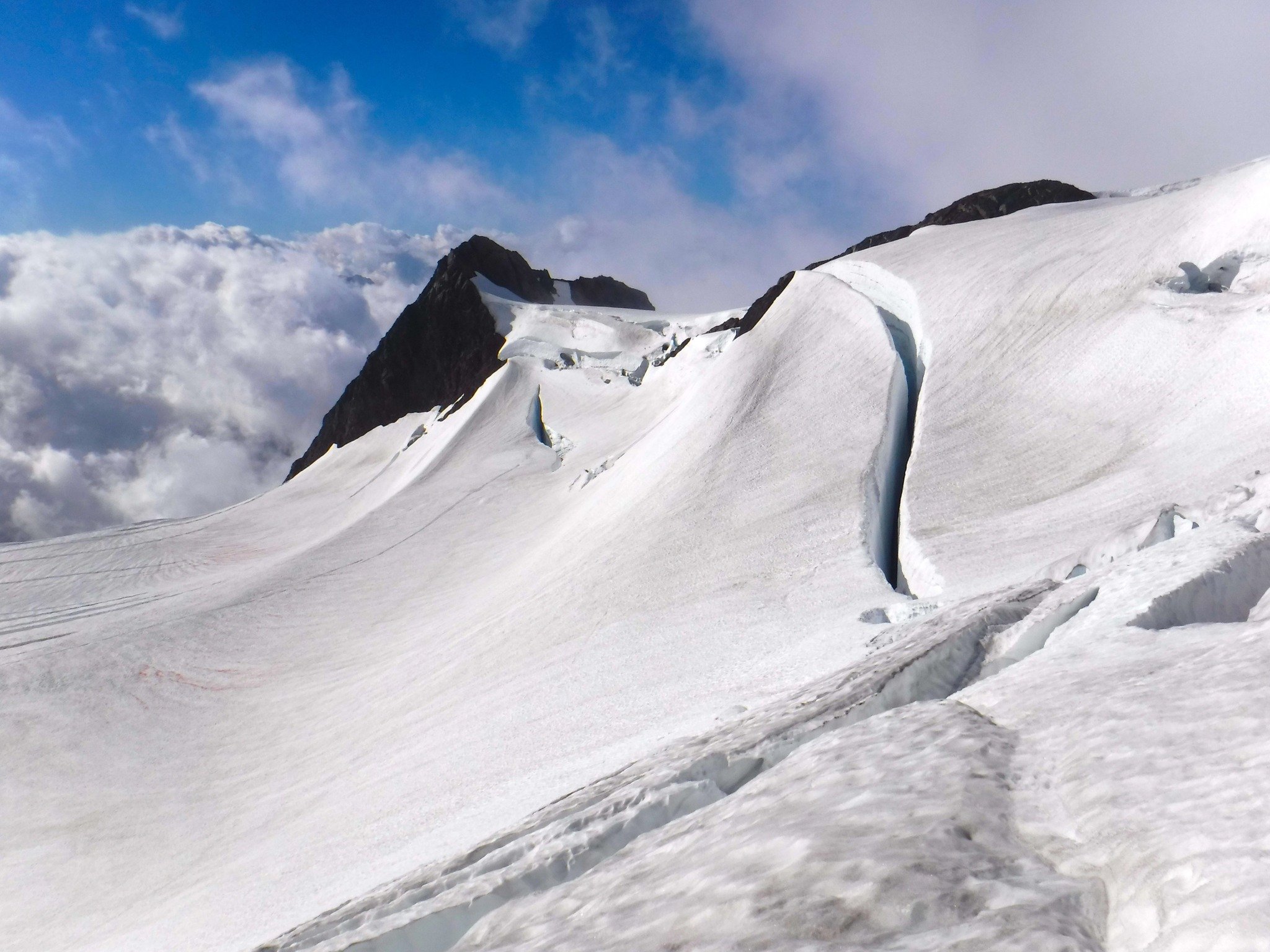
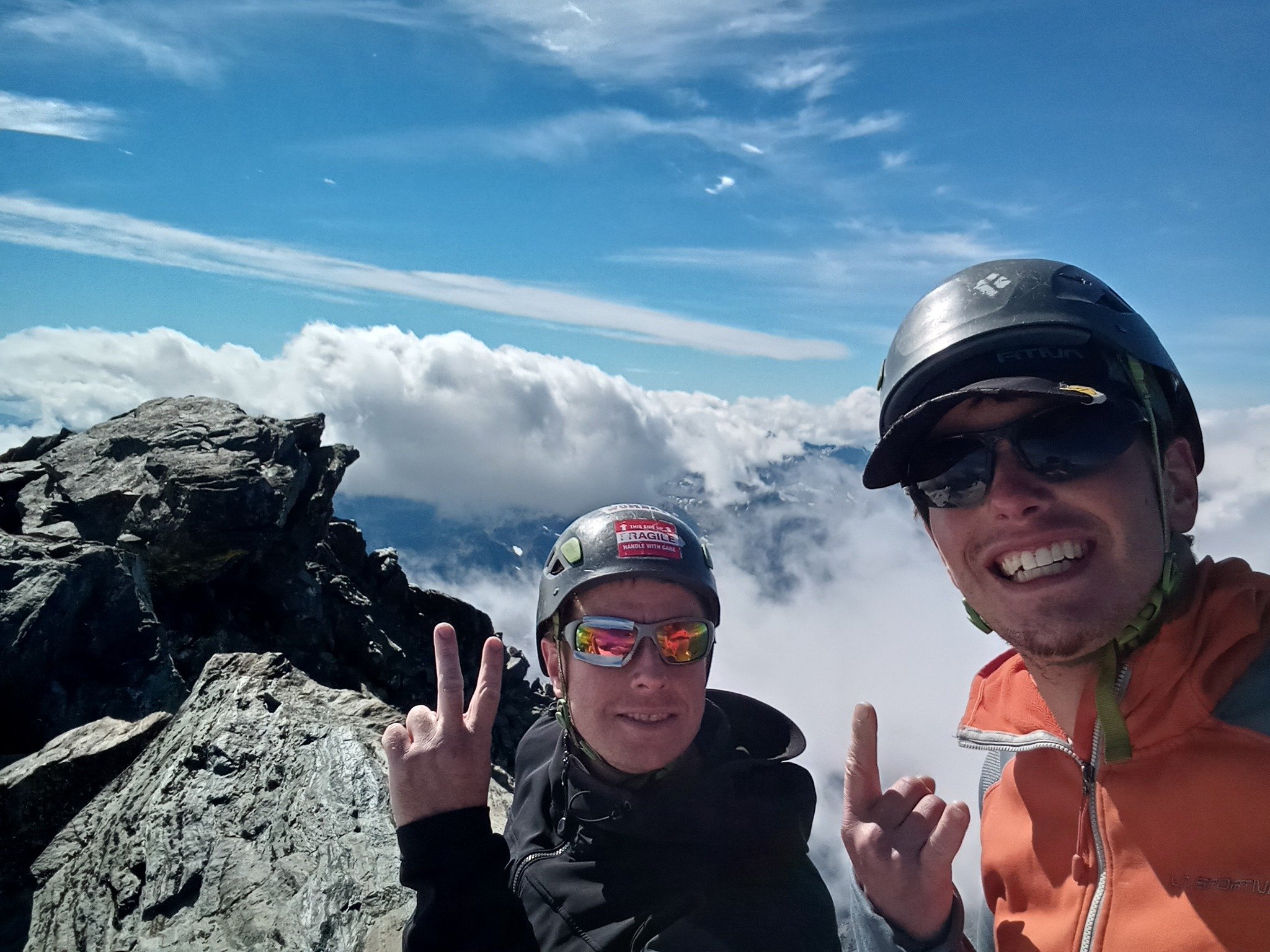
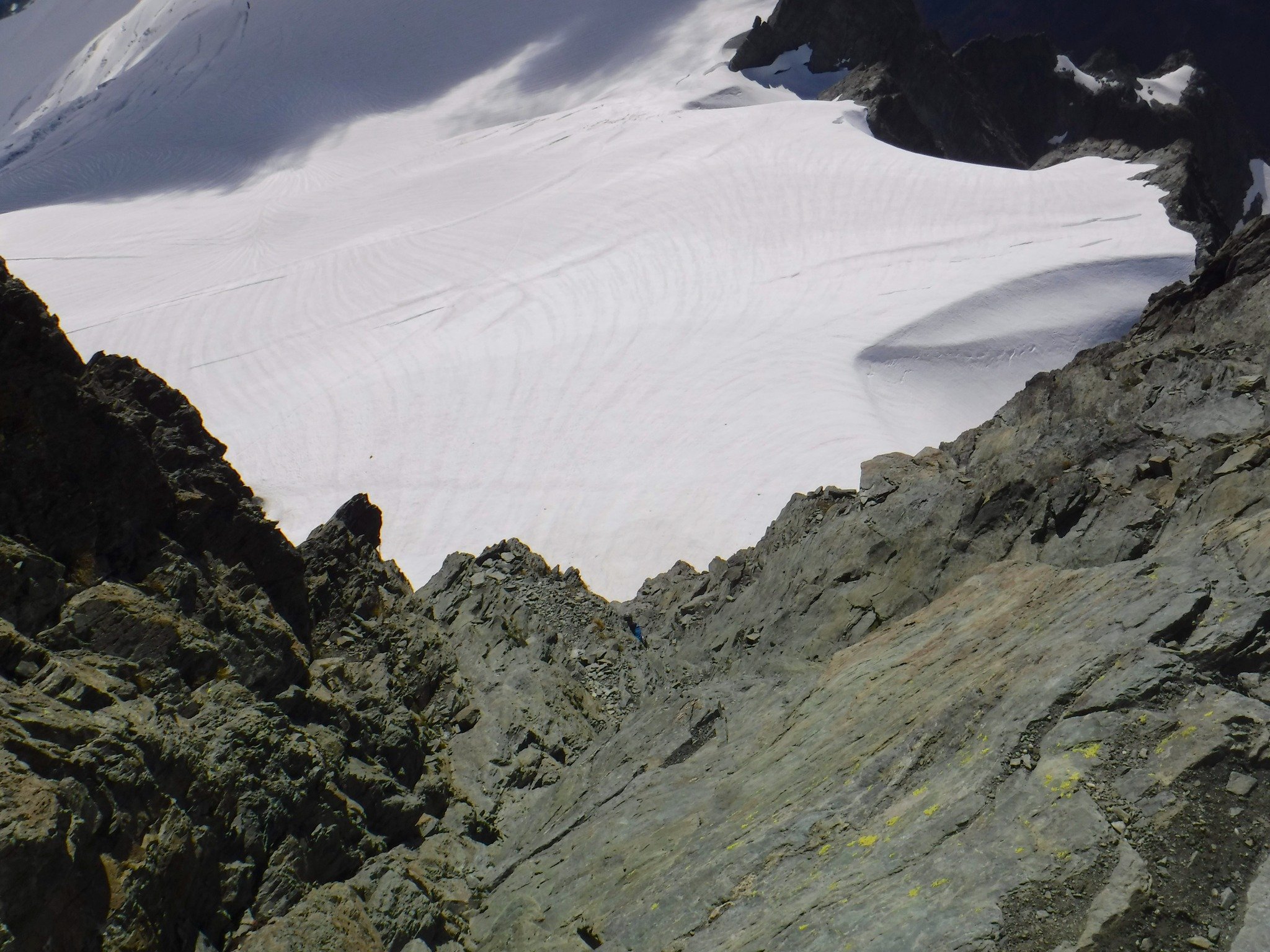
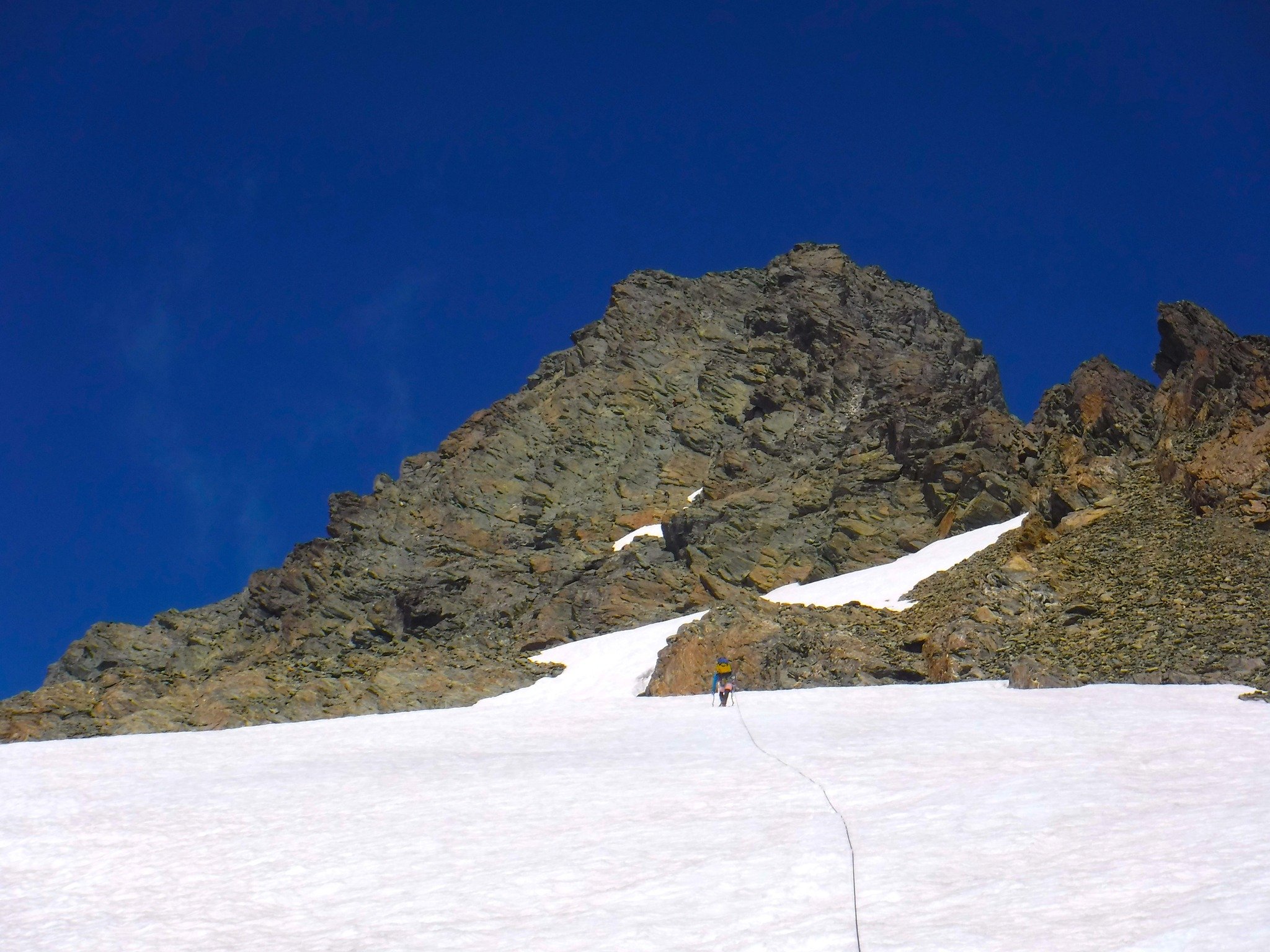
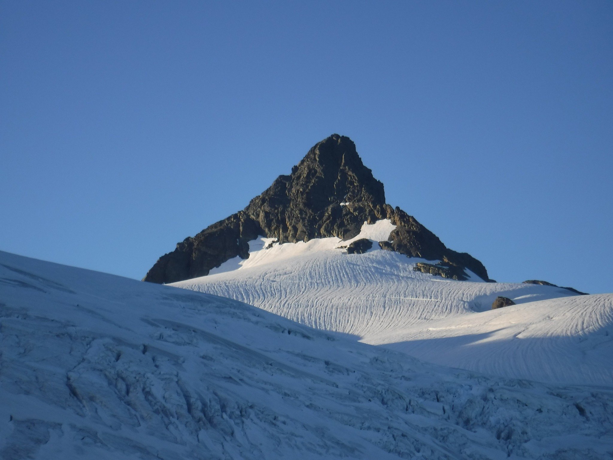
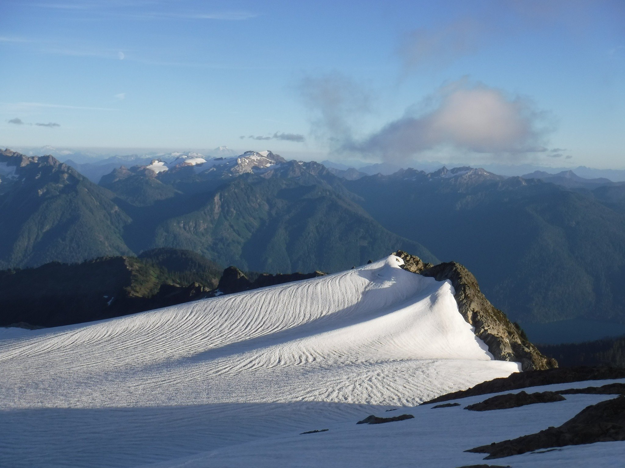
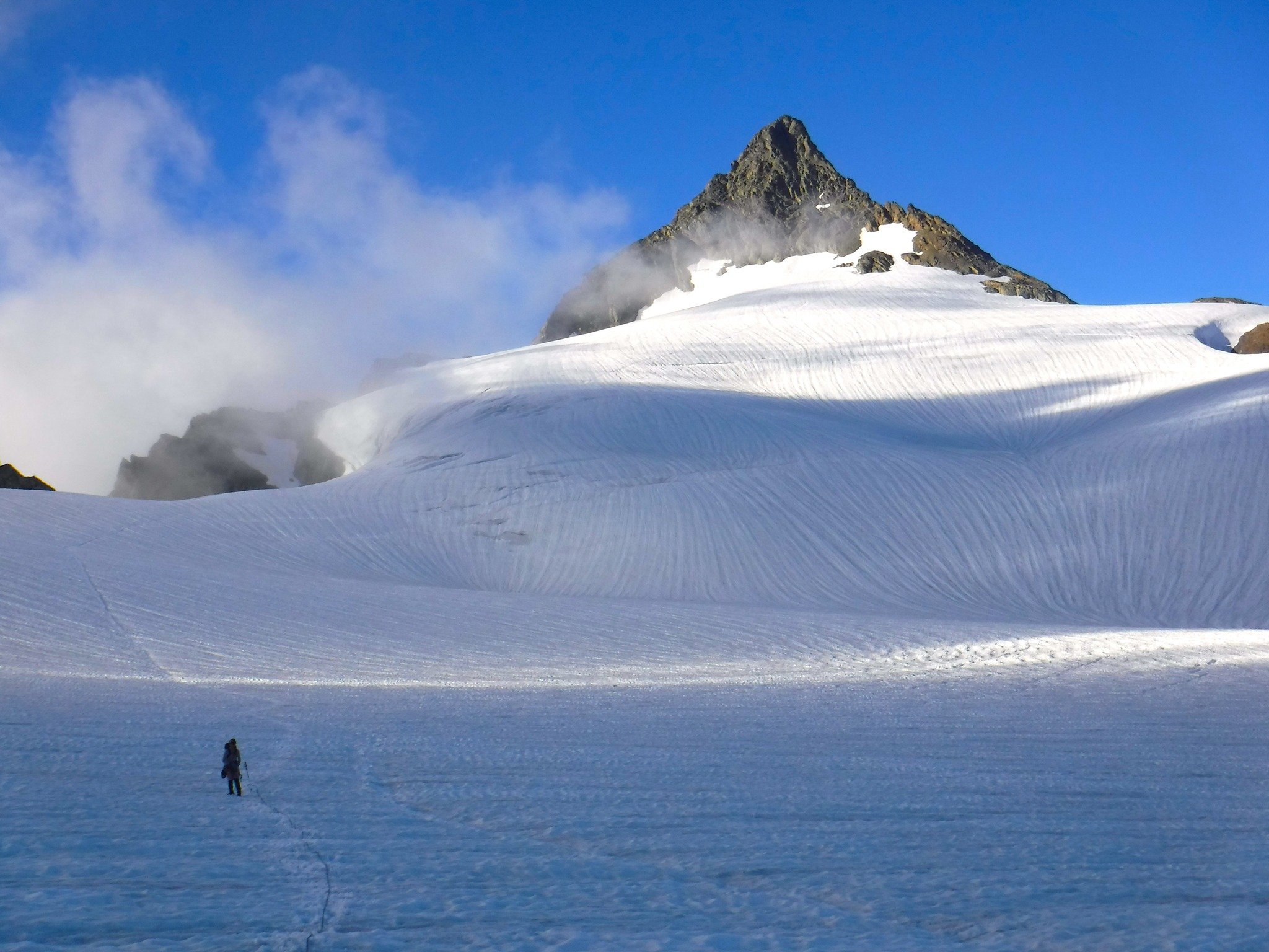
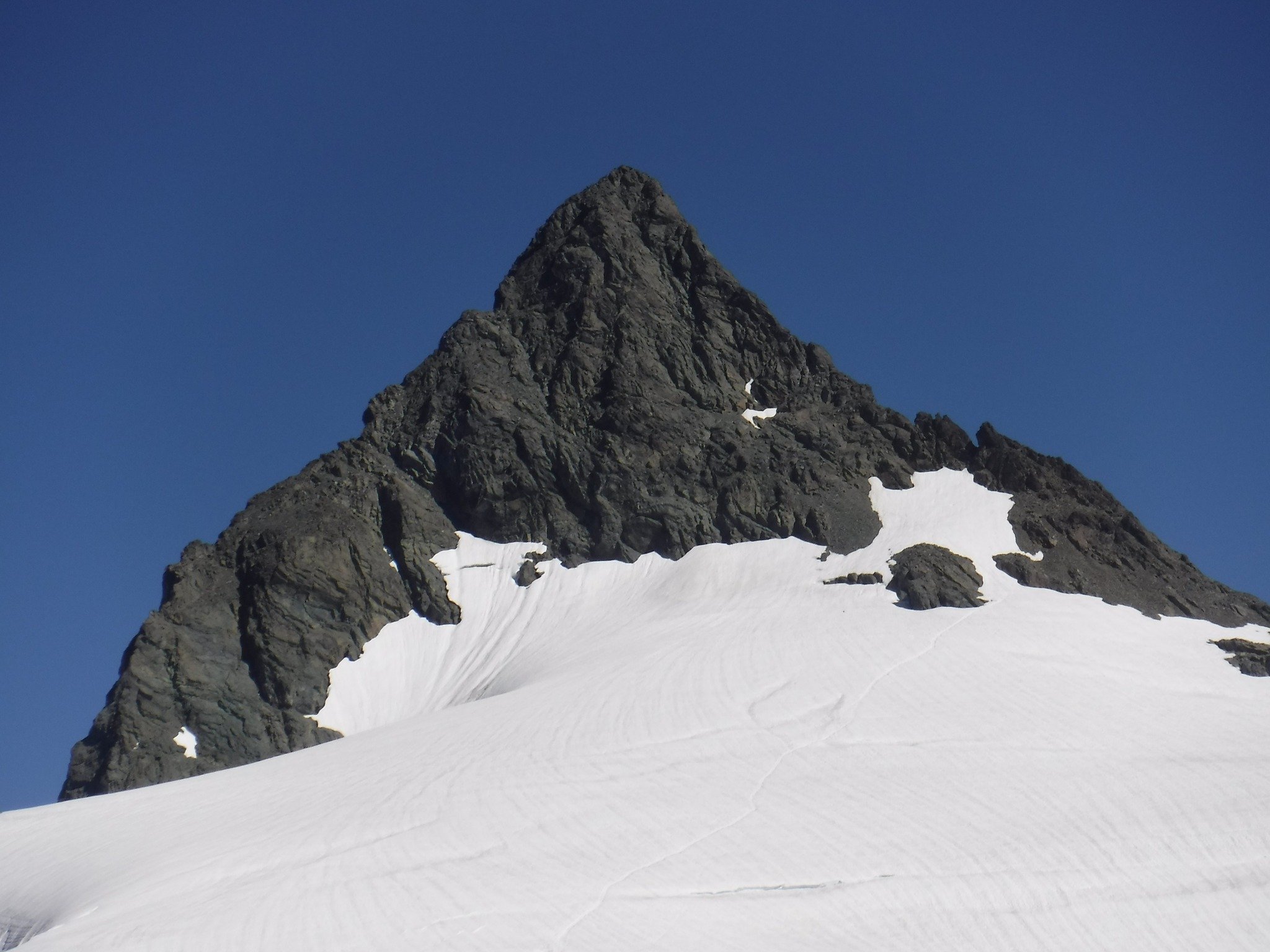
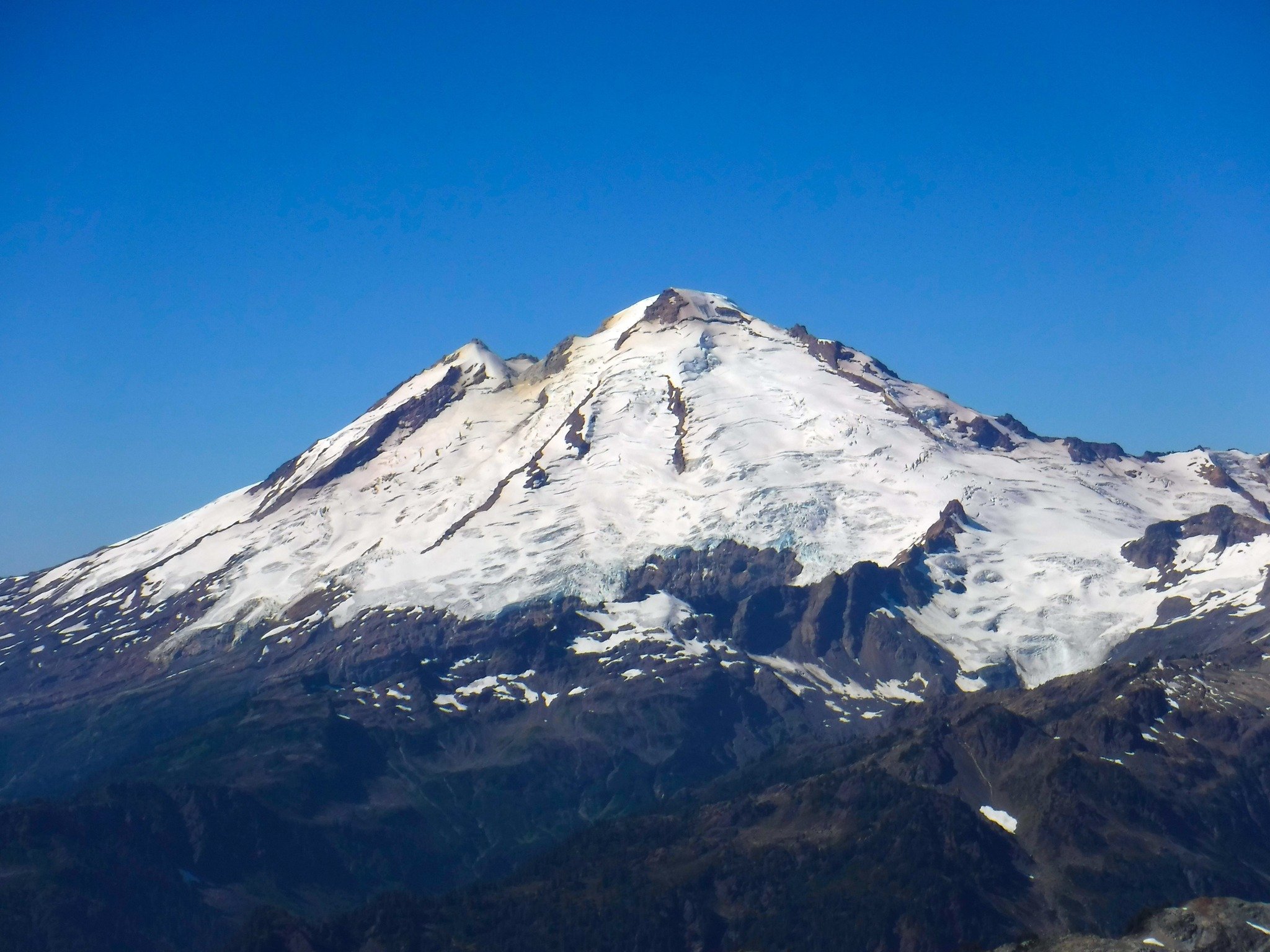
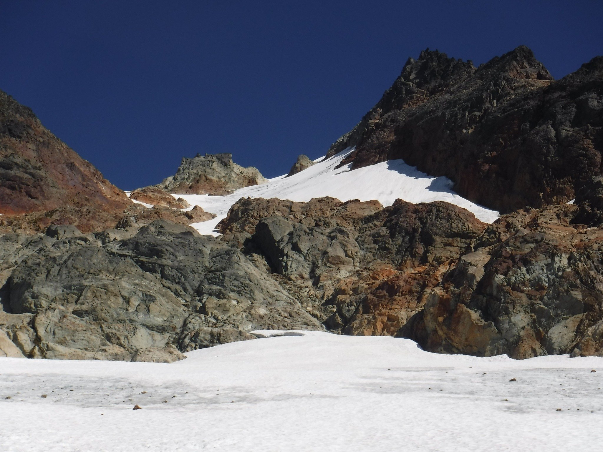
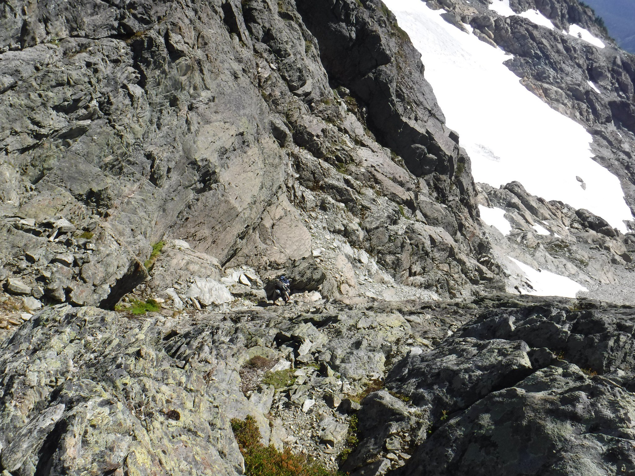
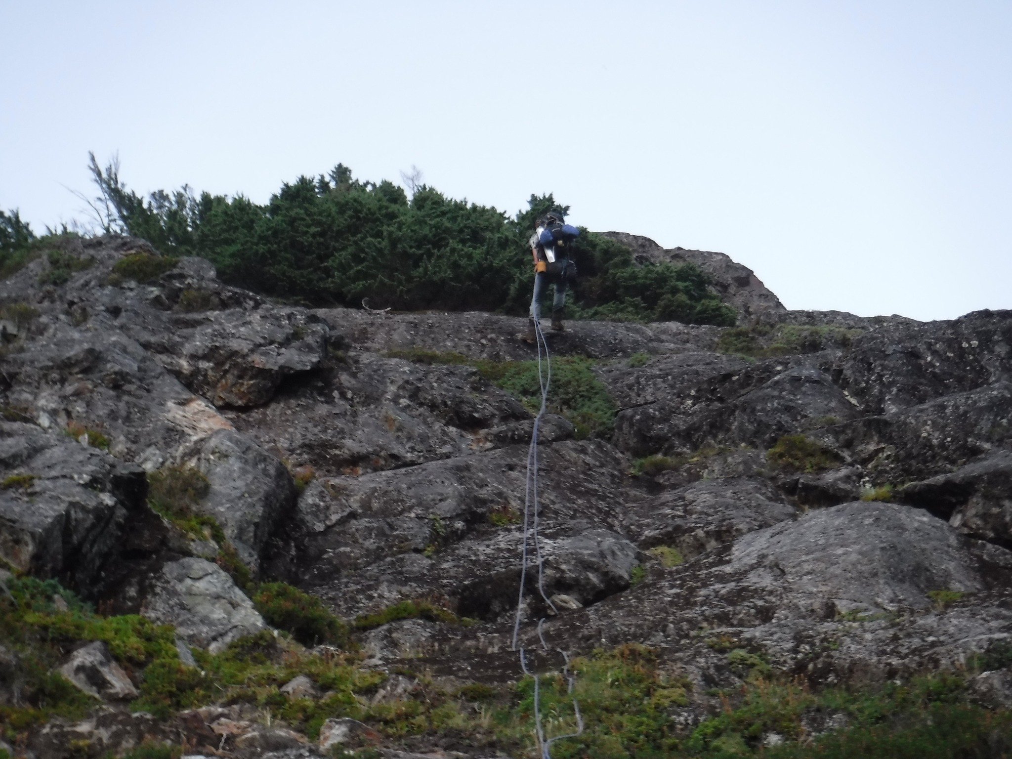
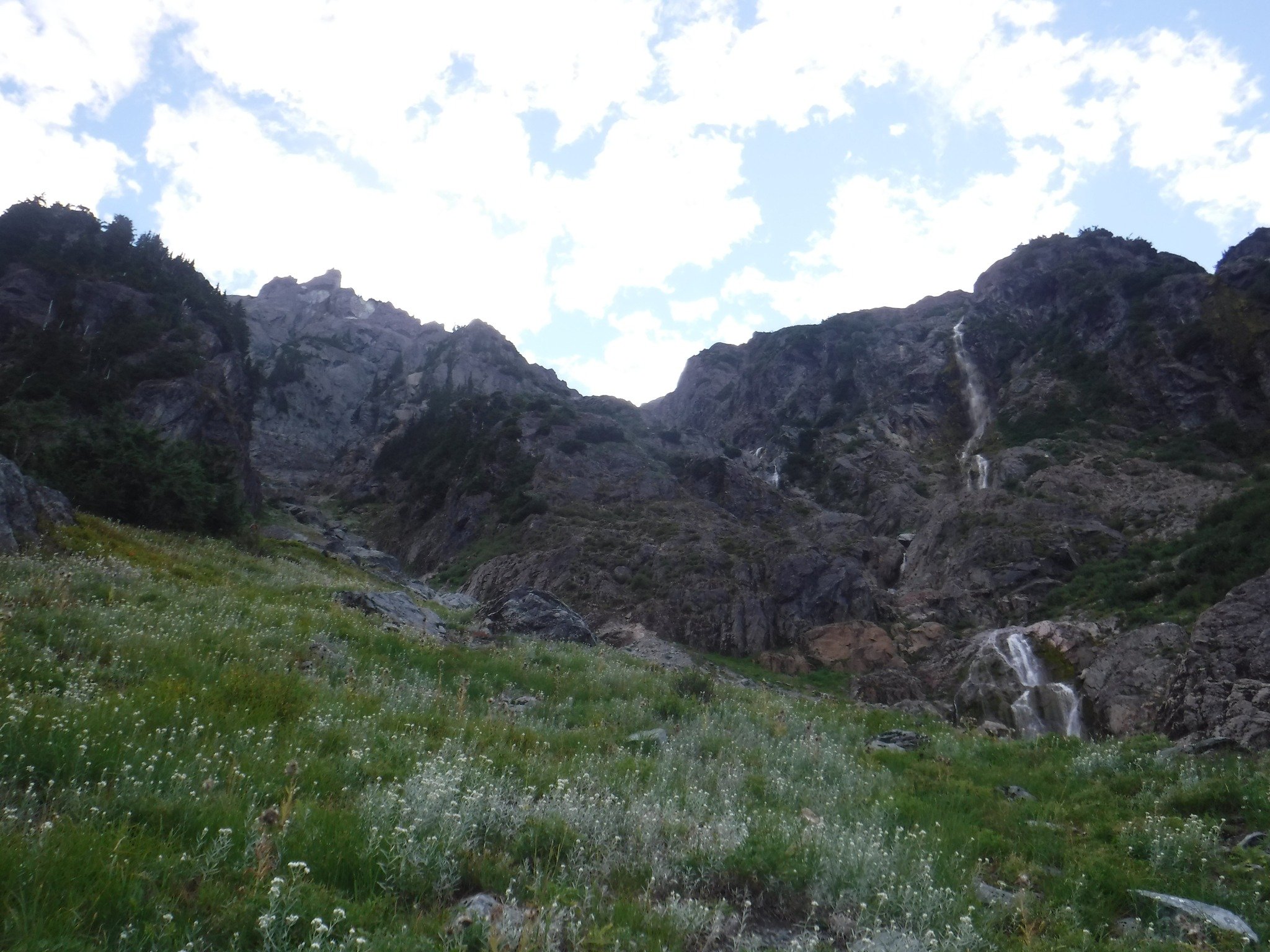
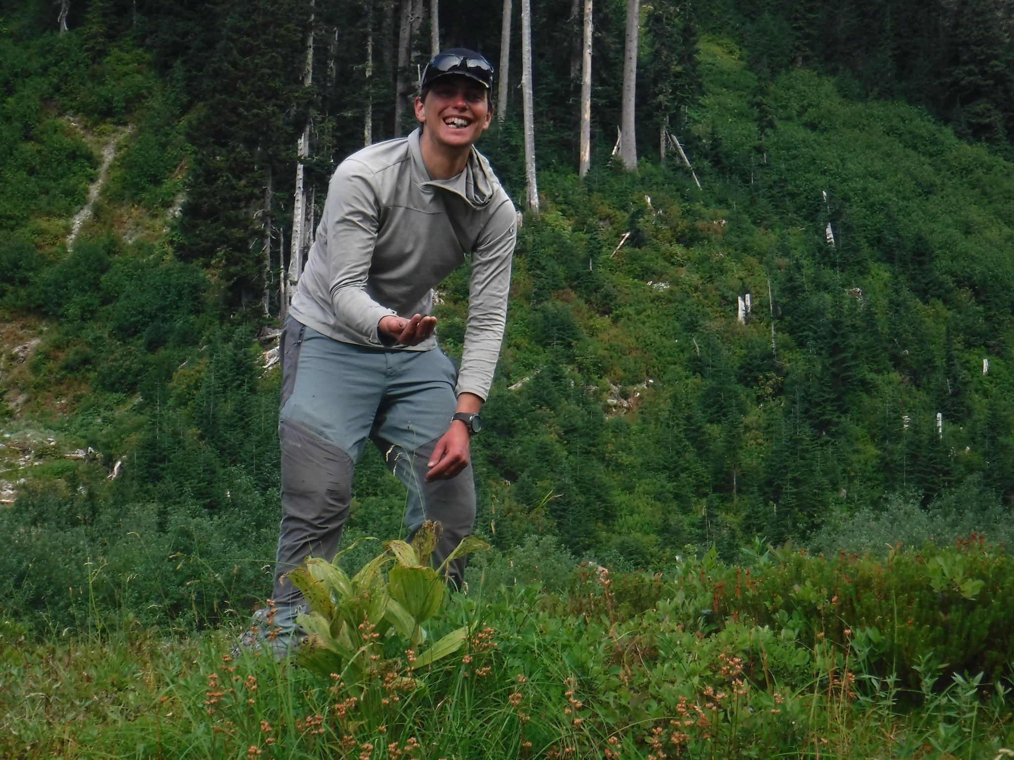
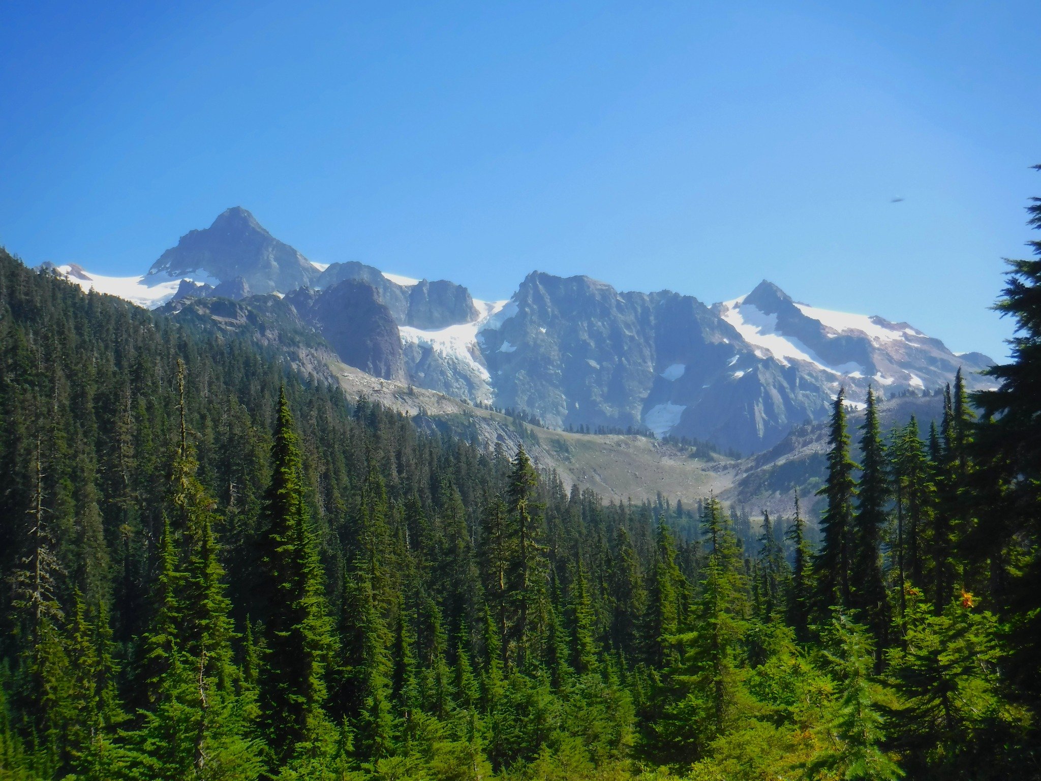
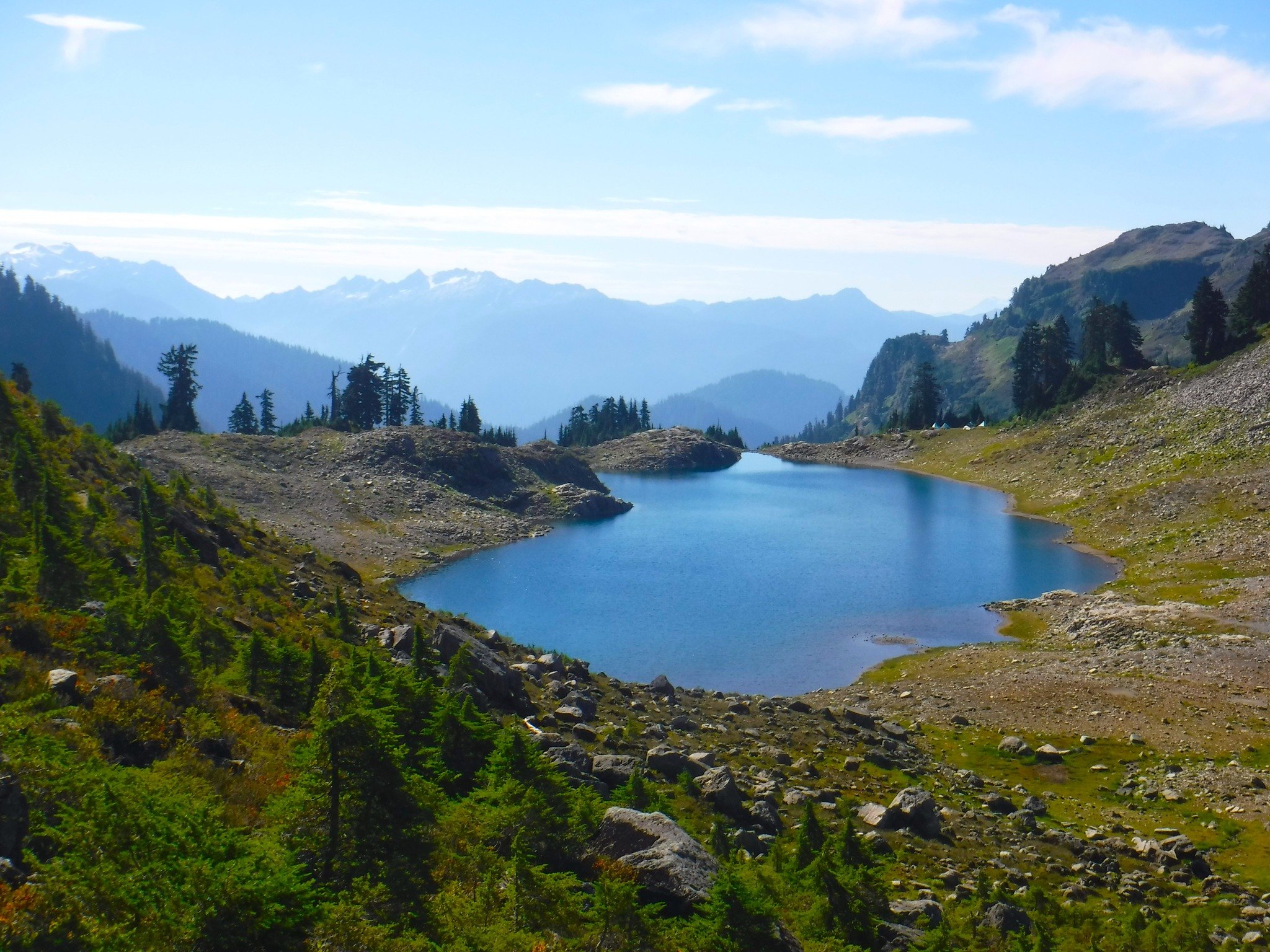
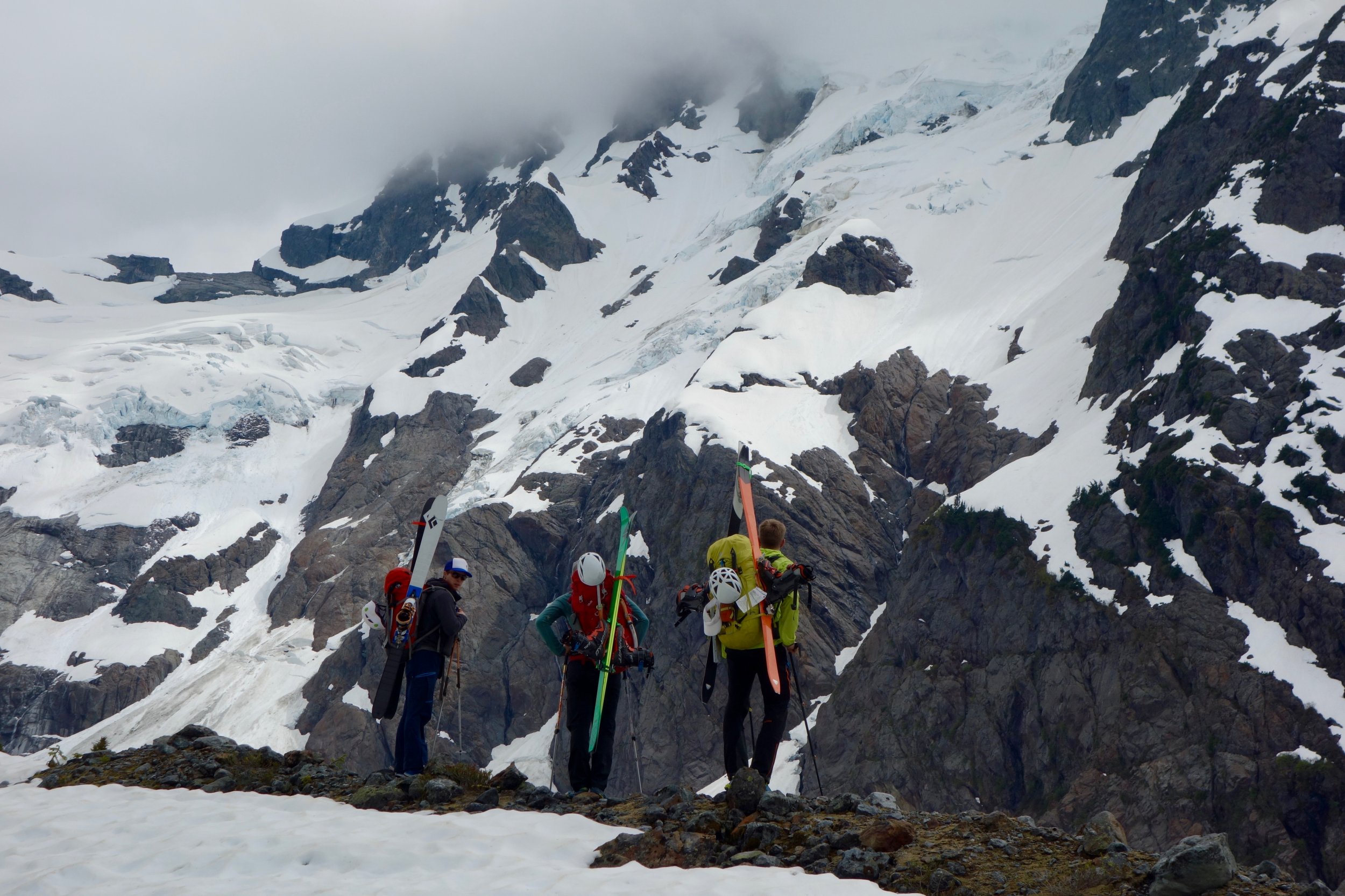
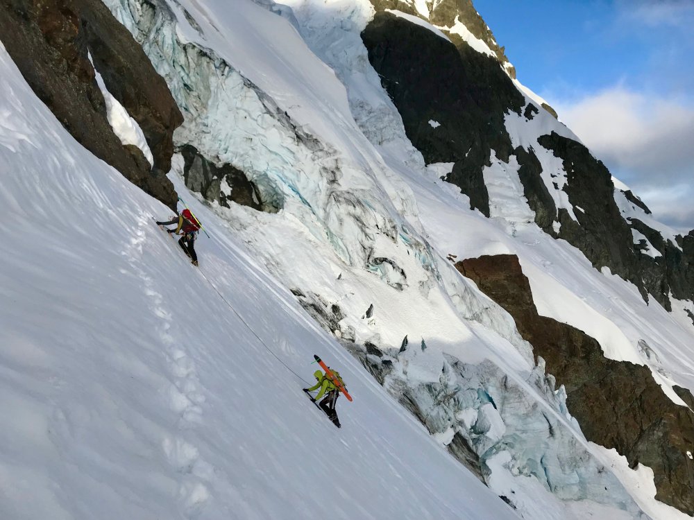
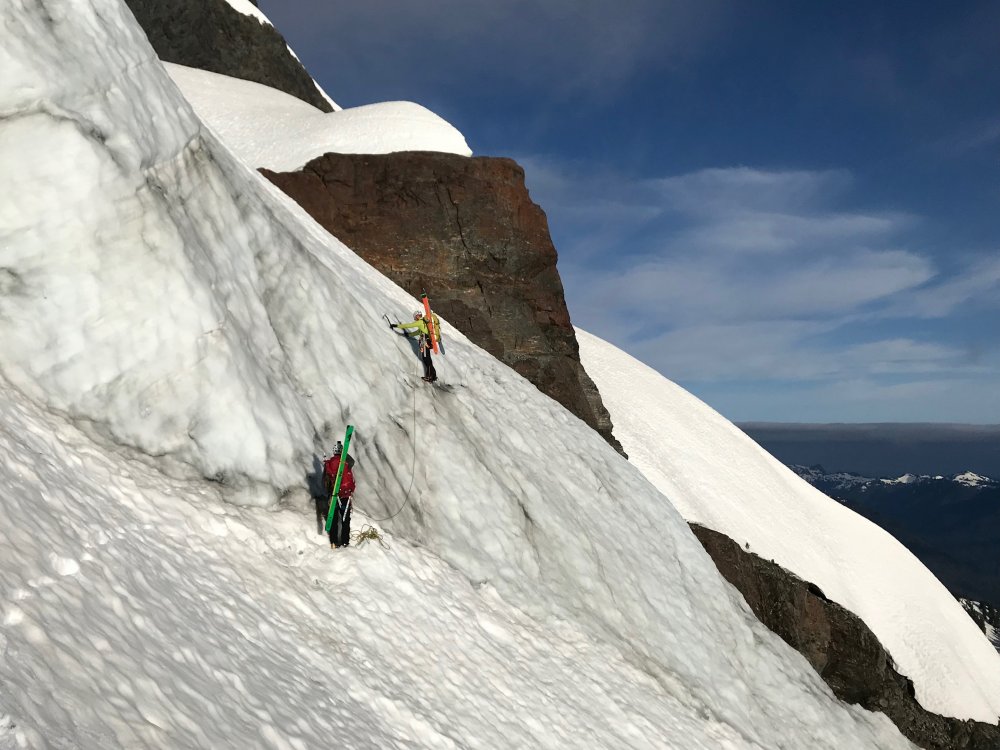
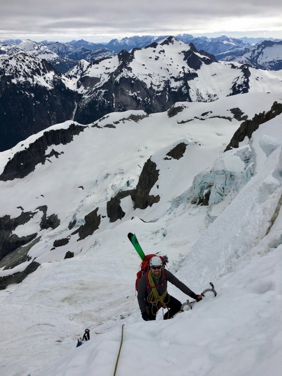
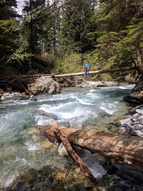
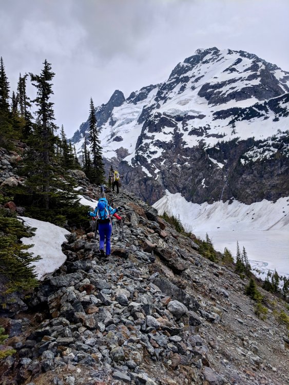
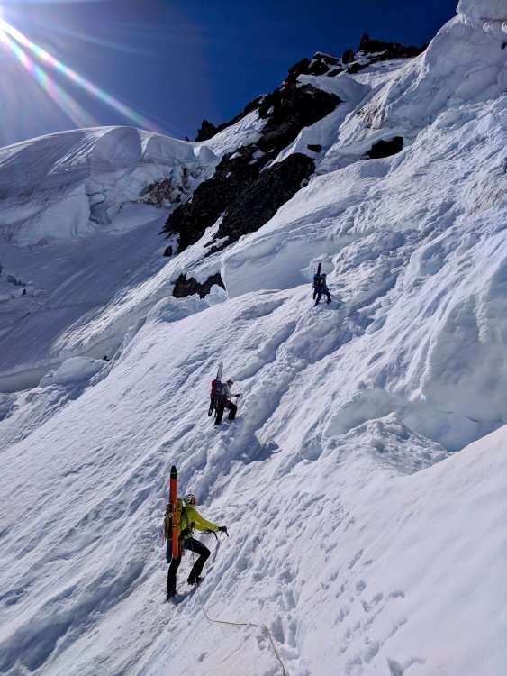
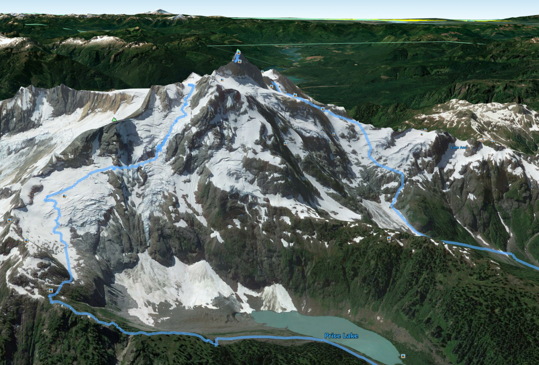
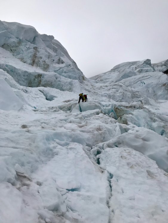
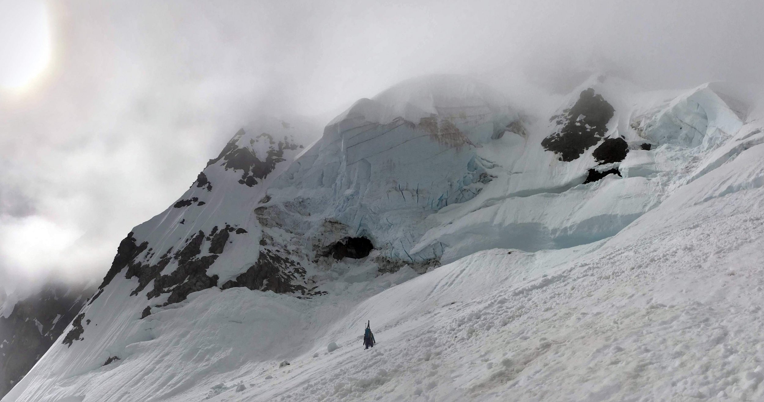
Trip: Mt Shuksan - Price Glacier Trip Date: 09/02/2022 Trip Report: = Mt Shuksan via the Price Glacier w/ Jeff McGowan = Dates: Sept 2-8 Rating: cl. 4, M4-, AI4+ C1 (or AI5+), R? Rack: 4 pickets, 10 ??? ice screws, 1 set of offset nuts, 1x#0.1-2 C4, knifeblades (unused) === Synopsis === This Labor Day Weekend I had a spur of the moment trip come together to fly out to Seattle to bag the Price Glacier on Mt Shuksan with a friend-of-a-friend, Jeff. This would be our first climb together, and the route serious, but he was a strong climber with a solid attitude, and my theme for PNW seems to be to do BIG routes with new partners and have some sort of crazy fuckup along the way 😜 Held true for Liberty Ridge, Ptarmigan Ridge, Curtis Ridge (DNF), N Ridge of Baker, N Face of Adams, & Complete N Ridge of Mt Stuart. The Price Glacier is a '50 Classic Climb' that is not done too often these days, as the glacier has receded and broken up significantly over the decades. Many years it is only viable as mostly a snow climb, or an alternate exit is needed as the glacier's bergschrund becomes impassable. Even then, it is a remote climb requiring carrying camp over to descend the Fisher Chimneys, and at it's easiest goes at AI 3-4, (and typically some cl.4-5 rock variation). It has objective hazards, so is not one to take lightly. I had relegated this climb as one that 'would be nice to do someday', but having the alignment of abilities, time off+timing with it in condition, and appropriate partner seemed unlikely. So this opportunity was a pleasant surprise, especially as a follow up to my being hospitalized from a cat bite blew up my last big trip plans less than a month prior. After significant research & planning, I had optimistically thought we could do the route in 2 long days. Jeff was more certain it would take 3 days as it did for more parties. However, doing this a month later or more than most recent parties, it took us 3 full days just to top out, and due to a perfect storm of minor mistakes coalescing by then, another 3 days to get out. By the end, Jeff & I joked that the trip was 'the gift that kept on giving', as each time we thought things would get easier, we'd get another curve ball. The route had fantastic and unusual ice climbing, mixed climbing, and tricky route navigation. The approach was arguably as tough as (if not tougher than) the north approach to Mt Stuart. It was the hardest glacier, ice, and mixed climb I have ever done all on one alpine route (under the conditions we found, it was M4, AI4+ C1 (or AI5+). It was also the most dangerous and most committing climb I have ever done. === Post-Mortem === I think it worth putting the post-mortem before the in depth report, as it highlights some small oversights that compounded during the trip. Overall, we had 2 major problems in the trip: getting wet, and getting off route on descent. On the getting wet front, we had a bomber clear forecast going into the trip. Still, I knew better than to trust the PNW forecasts more than 24 hrs (or especially 48 hrs) out, and although I had hoped we could knock the climb off in as few as 2 days, it turned out we needed 4. In the hurry to pack, save weight/bulk, confidence in the forecast, and expecting only ice & consolidated snow, I only brought a soft shell jacket (no hard shell), no rain cover for my pack, and I was casual about keeping my paper maps in ziplock bags (I am very diligent on winter trips or when bad weather seemed possible). This is usually fine 99% of the time in any other western mountains except in the PNW. Not being on soft snow, and having a tent, I figured things were OK enough. Then we lost the tent. I had also not considered meltwater on the glacier getting us soaked, much less the later rain/snow. Lessons learned. I also bring a set of socks for each day of climbing (or at least 2 sets, drying them out in alternating fashion) to keep my feet warm and dry, especially at night, and especially on my frostbite-damaged foot. What I should have done (as per Jeff's insight) was to have a dedicated set of sleeping socks in a waterproof bag. That way, if a trip goes long, and if you are unable to dry out day 1 socks for day 3, you at least are always able to dry and rewarm your feet for 8ish hrs each night rather than being stuck wet. On the getting off route on descent, we had a lot of robustness in our navigation systems, but again, with complacency and the rushed timeline of the trip, we had some common failure points that we were vulnerable to, where, again, I knew better but had gotten more complacent & was rushed (as with wetness, this only would have been a problem in the PNW, not the Sierra, Tetons, CO Rockies, etc. as they are far more forgiving ranges). First, I let the extra maps get wet by not being diligent about keeping them all in ziplock bags, whether I had them out for active navigation, or packed away for later days. Second, I didn't follow up with Jeff to see if he had printed redundant sets from the digital files I had shared (he had not, as partners rarely do). Third, my digital tracks and underlays were only on my phone. I normally consider the phone nicer to use, but unreliable (especially in the wet & cold), and put pains into bringing my old & beat up Garmin GPS along with awkwardly built underlays to use for navigation as it is robust in the wet, cold, impact, and can easily be recharged by bringing more AA batteries (which my headlamp uses.) Bringing a charge block to recharge phones is not as trivial to do in terms of bulk & weight, and does nothing if moisture is your problem. Smart phones are extremely fragile as far as moisture is concerned. On this trip I didn't have this separate GPS up & fully functional. I have been meaning to get a new GPS that was easier to read, update & use for such trips over my phone, but hadn't yet gotten around to it. I WILL before I return! (Update: I have done this for my Cordillera Blanca trip this July) Fourth, related to the second point, was that I had shared all of my researched GPS tracks with Jeff before the trip, but he didn't make use of them on his phone. All he had were a few landmarks called out with waypoints, which really didn't help us with knowing the path to take. Again, I could/should have followed up, as partners almost never use the vast planning data I compile, depriving us of redundancy that I intend to have. So I'd consider this trip a wakeup call to be more diligent with my systems (and communication+follow up w/ my partner pre-trip) again. Also to update my GPS (separate from my phone!) & sock strategy. The rushed planning & execution while I have been rusty in the area but familiar led to complacency that really bit us. == Day 1 - Approach (+4,280 ft, -1,150 ft, 6.52 mi, cl. 3, II-III BW3+/BW4- WA1 or WA5+ ) == The first day's objective was to hike in from the Nooksack Cirque TH and establish camp high on a ridge where one first gained the Price Glacier. If we made good time, we hoped to even make it to the optional higher bivvy in a notch after a smaller glacier crossing. Although the approach looked short by the stats (~5 miles, ~3,400' gain), I didn't dare make a time estimate as it involved a river crossing and bushwacking a significant distance and up steep terrain, so we just assumed a full day. The forecast for the trip was good. A bit hot with highs in the 70s to start, but dropping to the 50s for our first day on the glacier on out, with lows consistently in the mid- to low-40s as far out as I could see. Also, 0% chance of precip day 1 and slight chance of any weather the rest of the other days (I read this part too optimistically, which got me in trouble later.) Already the trip was off to a start with 2 hitches. #1, we had planned to cache a bike to serve as shuttle from the Nooksack TH from the Fisher Chimney descent, but Jeff's bike was stolen a few days earlier, meaning that we would have to thumb a ride, or if we got out at night, were faced with a LONG walk back. Second, my last-minute flight was early enough and my packing last-minute enough that I had pulled an all-nighter, and Jeff's transition from his last 24 hr EMT shift took longer than expected, so we got to the Nooksack TH late and tired. So we got a late start Friday. Still, we expected to at least reach low camp. So we headed out from the car through lush coastal rainforest. The river had damaged the first river crossing on the main trail, so we followed a newly 'constructed' one that began on the opposite side of the parking lot from the sign, followed a fainter path downstream in the forest before crossing on a planed log and continuing back up the valley where it ultimately intersected the original trail again on an old road with a cool wooden trail register box. From here the trail was well established and easy walking, and we made good time the first few miles to where we'd turn off to the use trail and ad hoc log river crossing. Apparently this used to be where a Wilderness Area sign was, but for some reason it has been removed. Fortunately I kept an eye out when we were close and found a decent use path that descended from the trail to the river where there were raging rapids, some ties on trees on both banks of the river and... no log! We noticed in our notes that someone noted this in 2018 but then skipped over what they did about that part 😜 It seemed like maybe the water was lower and they were able to use a rock crossing about 50' downstream. We had no such conditions. I debated if I dare leap from a rock and sprint across the narrow part of the river with current to the calmer water 15-20' away with a rescue line to tow me back into shore if I failed to make it (rather than get swept down river), and to set up a Tyrolean with for Jeff & our packs, but ultimately we decided to look upstream for another crossing. Back up on the trail, we hiked to the next side canyon drainage that cut across the trail, hoping maybe it would add more debris or tighter pinching where it intersected the river. Bushwacking brought us down to the river and by chance I saw a short & shallow crossing to an island that pinched the river narrowly enough that several small logs had bridged the gap. This will work! An awkward crawl and 15 min or so of bushwhacking downstream along the opposite side of the river later and we were back on track on the climber trail. We were happy to notice that it was well tracked, but even then, in this thick forest it was hard to follow. Fortunately, it was fairly well tagged on tree branches, so if one were careful to follow tags, occasional cairns, and signs of prior passage, the hike up to Price Lake goes fairly straightforward from here. If you get off route, though, it would be nightmarish. Even with the tags, the trail was VERY overgrown and rough, with LOTS of climbing on roots and trees as the slopes steepened. A BW3 sort of trail. At last we breached treeline near the lake and got our first views of Mt Shuksan's north side. Imposing! We could also see how bad the wildfire smoke was in the air and therefore why we both felt a bit sick & wheezy. Hopefully it will dissipate over the next day so that we can climb better and have good views! It was nice to FINALLY be clear of brush and able to 'walk' and sit down, so we took a quick break, at which point I noticed that the tent that I had strapped to my pack had somehow come off in the brush sometime over the past couple of hours. SHIT! Well, at least we had considered it an optional piece of gear, as with a bomber forecast and only camping on dry ground (or at worst, the flat snow beneath the Shuksan summit pyramid), bivvying out was fine with our sleeping bags and liners. Losing the tent actually ended up really hurting us later. Surprisingly, we hadn't been by any water since the second river crossing, and the lake was far enough away from the trail in rugged enough terrain that it would take too much time to visit in order to refill water. Unfortunately, this decision, combined with the heat, led us to run out of water well before stopping for the night. From here we had easy walking on the bouldery crest of an old moraine until it merged with a larger ridge, where on our maps the terrain looked to flatten a lot and be 'clear', but to our surprise the ridge was still very rugged. Now with no worn trail or tags, it was pure bushwhacking, and with a sharp crest (smoothed in the maps) and many rocky tiers hidden in the forest, we had it very slow going as the sun set. Many detours to the West led to jungle climbing back up to the crest over and over again in the dark. Real cl.4-5 route and branch pulling at BW4. Ultimately we realized that we would not even reach low camp tonight, especially as the ridge turned rockier and routefinding in the dark harder. Being dehydrated and sleepy didn't help either. We decided it was better to stop and bivvy on some good flat dirt just at the start of the continuous cl. 3 section of the ridge and hopefully make up time the next day - or just accept making it to a safe spot to bivvy on the glacier. Jeff was able to find a water seep, though, so at least we could rehydrate, have a good night sleep in warm conditions, and hit the next day hard. During the last few hours before daylight I looked carefully at the route, though, and it was MUCH more broken up and dirty than I had expected. I was worried that it might be impassable at all of the exits, if not lower down. Jeff was more optimistic. From this distance, though, there was no way to really know except to check it out. == Day 2 - Price Glacier (+2,760 ft, -560 ft, 1.88 mi, cl. 3, AI3, 55 deg snow, glacier) == We awoke the next morning to a beautiful sunrise over the Price Glacier. Although based on how the upper ridge would be, with it being rockier and the topo showing it to be steeper and narrower than the lower ridge (that turned out to be quite narrow with steep sides), we had expected tougher going, this section actually went quite well. Mostly cl. 2-3 on clean and solid granite with straightforward route finding, and just a few mossy moves of cl. 4. Before we knew it, we were on the crest where you have an easy traverse and slabby scramble down to the glacier. Unexpectedly, this high point is flat, has grass to sleep on, and even this late in the year had ample snow patches for melting water. We found the later bivvy on the notch across Nooksack Tower to be horrible (just a steep snow crest with steep dropoffs on both sides), so I'd say this is the best camp to use after the approach as the high bivvy doesn't save you much time. Or if you're like us and late or making bad time, aim to at least bivvy just at the start of the continuous scrambling for reliable water and good sleeping. The entry to the glacier is easy but with tedious and steep traversing a short distance over rocks, but was easy climbing. We roped up here and simul-soloed out onto the glacier, where the best path was to go straight up to the top of this glacier spur and traverse just below the rock wall straight towards the bivvy. Big crevasses a short distance always beneath you made this part a bit unnerving, but again, the climbing was secure and with a few strategically placed pickets is secure enough (just don't fall in most parts or you WILL pendulum into a crevasse - which is more or less the norm for most of this route). So as I said, the Nooksack Notch bivvy was awful, but good enough to eat a sandwich as I belayed Jeff down into the moat and back onto the glacier as he began traversing out onto the main Price Glacier. In prior reports, people took all sorts of variations, which seemed to be dictated by conditions, and even now, we weren't quite sure where to go. All we could tell was none of the prior variations seemed currently viable. The lower half of the Price is bisected by a Nunatak (rocky protruding ridge/dome) and parties tended to take either branch of the glacier, but staying close to the rocky rib. From there, most variations merged in the middle and then diverged at the bergschrund depending on the conditions of the 'schrund and bypass exit options, which usually involved some easy mixed/rock climbing. This year there was a major turd streak of a massive rockfall cleaving the entire glacier from top to bottom and running just right of the rock rib. Crossing it lower down looked easier, and the glacier lower angle. But the glacier also looked more broken up, and there was an intimidatingly steep buttress blocking what in other teams' conditions was a walk across. The left side of the rock rib looked to either be massive, and vertical to overhanging, or require directly ascending this ice buttress. Jeff ultimately decided to cross over to a protected stance beneath a rock buttress to gain the ice buttress and climb the prow of this into grooves and up to the left side of the mid-glacier, where we would then work right and cross the major rock runnel onto what we expected to be a mellow middle section of the glacier before dealing with the 'schrund. This first part ended up being one of the areas of the route with the greatest objective hazards. There is a waterfall pouring out from the glacier above here, cutting a runnel in the snow and regularly dumping rocks down it. Jeff led the simul across it, but once I saw it and him stop to place a picket beneath the rock and seemingly continue simuling into a down climbing to gain the ice buttress, I asked him to belay me from there so that I could run across the runnel and not risk starting & stopping and moving slowly, or tripping over the rope as he down climbed. I REALLY didn't like the look of this runnel, and during the time I could watch it approaching, it already had had 2 rockfalls, but at least the danger zone seemed to only be about 20' wide. I listened for any sound of rockfall, and once it seemed clear, I ran as fast as I could in my crampons into the groove and slowed down to climb up the 5' wall on the other side. As I did, I heard rocks falling from above, and as I started to clamber up the wall heard two large rocks bounce down close behind me. I paused for a brief second as my legs burned, snapped out of it and lunged a couple more steps higher to finish climbing out. Just after I started my lurch I felt a large rock clip the bottoms of the crampon points of my left leg as I was lifting it up. Naturally I found this unnerving, but at least now I was protected beneath the rock buttress and overhanging ice. Still, it gave me a sense of how dangerous the route is beyond falling, and how committed we were becoming as returning through these zones would not be trivial. Fortunately the mental strain eased up and things got fun! I down climbed from the protected position to one still protected enough to give Jeff a better belay over a spot where the wall gaining the buttress had more slope to it. Jeff ran through a short section of fun AI3 and up onto an AI2 calf burner for the rest of the pitch as he went up the slope and into a cool belay in an ice crevice that bottomed out into a nice pod to stand in. Now we were talking! The only downside here was the ample meltwater running down the glacier got my really wet (should'a brought my hard shell & not soft shell). Jeff launched off on the next pitch of AI3-, traversing back and forth and between ice fins until he topped out on the steep part of the buttress. From here the angle eased back and we switched to a LONG simul-climbing pitch that alternated between steep snow walking, steeper neve daggering, and occasional short steps of AI2-3 as we worked up and right. On our next simul-block, we reached our first bit of chunky monkey ice, where multiple crevasses had intersected each other but also filled in with debris (so not quite seracs?). I belayed Jeff through this as he tested blocks and bridges, wove around ice boulders, and slotted into and up our first ice chimney of the climb. Just as I began to follow, clouds raced in from below, dropping visibility to about 50', adding an eerie feel to the climb (and foreboding as to what this could do to our route finding). It also began to rain off & on, which further made me regret my clothing choices. I clambered along through the ice blocks and chimney, and just as I exited the chimney I encountered a LOT of dirt and rock. I looked over a 5' lip and saw Jeff belaying in the clouds. As I cleaned a screw here, he asked me to hold up a sec while he added a second picket to put me on belay. It was then that I realized that we had reached the big rock streak, with us on opposite sides. Yikes! I ducked down to wait, and over that time a couple of small rockfalls bounced down. By the time Jeff was ready, the clouds had lifted and I had a better view of where we were. This time the crossing was broader, with more uphill climbing. So I had another longer calf-burning sprint, but fortunately no rocks fell while I was in the danger zone. More did after as I belayed Jeff out to begin our next long simul-climb, though. FINALLY we were getting somewhere! We were above the steep lower half of the glacier, across the rockfall streak, and reaching the flatter zone before the 'schrund. Maybe we could make our way out today? Or at least to the flats just before that crux to shorten the next day? NO. Jeff ultimately came to a section where we were completely blocked off from above by massively wide and deep crevasses that spanned the width of nearly the entire glacier, and intersected such that no clear path appeared to available to zig zag up. By chance, there WAS a way to down climb into the glacier moat on the left side and do a drytooling pitch or two up to a ledge that connected back to the glacier where it looked like maybe we could get back onto the main glacier, and not dead-ended on a serac tower. The sun was setting, and at this spot there was a small filled in crevasse that made for a promising bivvy after a bit of chopping & stomping, so we stopped here for the night. Although the floor seemed solid, I hammered in some pickets, hung gear from them, and stayed tied in to them as I slept just in case. == Day 3 - More Price Glacier (+990 ft, -300 ft, 0.54 mi, M4, AI4+, C1, 55 deg snow, glacier) == Despite getting pretty wet the day before, we had nice conditions at the bivvy, a comfortable enough night sleeping, and just slightly wet sleeping bags. We enjoyed a fantastic sunrise as we had breakfast and headed out. I belayed from a stance in our crevasse bivvy cubby as Jeff worked down about 20' into debris filling in the moat, and clambered across to the rock. After an easy entry to the lower ledge, the climbing got harder. It stayed positive, but definitely needed small nuts, cams, and good tool technique for a 20' crux stretch. Jeff was so confident, he decided to show off and let one crampon dangle off his boot to climb this stretch with one of each 😜 This was fun to follow, the hardest drytooling I have done with a heavy pack on, and the hardest drytooling I have followed on an alpine climb! Some technique was needed, such as precise crampon work and pick torquing in cracks, and learning position 2 at the Boulder Ice Coop was helpful on a couple of parts as well (thanks Mickey Silger!). We both felt like this was about M4 and I was happy to get it clean. From here I belayed Jeff from a nice rock ledge as he chimneyed between rock and ice around some glacier chunks and up onto the nearest block. This piece looked detached but... had a snow bridge on the other side! Huzzah! We were free! From here we could see that the right exit variation some people took was totally out of action whether by ice or rock. The main 'schrund didn't look good either, so we were crossing our fingers about the rock variation on the left, although it didn't look promising. As we made short work simuling up the rest of the glacier to the 'schrund, I began looking at the wall to my left for options where we could do a longer rock variation lower, farther left, and longer up to the top if needed. The next question though would be how big of a moat would be between us and any ice on the 'schrund above or the rock bypass. By now visibility was on and off again with clouds fully moving in and drizzle beginning. We took care to routefind when/where we could since we had no idea when we might be unable to see far enough ahead to navigate. As expected, the moat atop the glacier was GIGANTIC. About 50' wide and seemingly bottomless. Jeff worked along the edge, and amazingly, at what was almost like a tunnel to another realm, he found a debris-filled split through the lip of the glacier to a debris bridge across the moat to the rock wall and 'schrund wall at that level. It would just be another chimney traverse and horizontal ice scramble from here! It was clear though that reports of a 5.4 rock variation to bypass on the left side would not apply to us, as the rock was VERY steep for the first 100' before the angle eased back. It also didn't have many features for climbing or gear and was getting wet in the rain. So I guess this variation is only viable earlier in the year... BUT, fortuitously again, at this distance we could now see some ice buttress coming down and left from the slopes above that LOOKED to be climbable - or at least when pieced together, climbable enough to bypass the overhanging terrain through zig-zagging. This was the way. Since this was near another debris line, we set an anchor beneath an ice overhang a bit to the right of the starting line, and I belayed Jeff on up as he started out on immediately vertical terrain on hard, smooth, blue ice. He turned the corner and was gone for some time. I heard lots of chopping, but with no movement, and wondered what was going on. About 75' out, Jeff called 'off belay!'. He couldn't be at the top yet. What was going on? I climbed up the first 30' of WI4 and turned the corner only to see an ice version of what looked like a desert canyon in Southern Utah, or a chimney in the Fisher Towers, rising steeply, with Jeff peering through a pinch in the ice about 30' above. Wacky! Clearly all of his hacking was because he was trying to figure out how to climb this thing securely and squeeze through it. It was hard to decide whether to back-foot, back-step, stem, or just pick a wall for your front points. Also where to swing as you corkscrewed around bulges and tried to avoid getting stuck with our overnight packs on. Here I saw that he had dropped his puffy and a spare glove, but it was still within reach to rescue. I hoped that maybe Jeff had stopped short because we could traverse out to the snow slopes from there, but once I arrived at the belay I was greatly disappointed. We were only about halfway to the top near a high point between a large ice flake and the main wall, and everywhere around us the main wall was overhanging! While I felt deflated, Jeff didn't miss a beat and was ready to try... something. I was wary as he climbed up and out over a drop to reach an overhanging part of the wall, but fortunately rather than attempt to climb such a hard pitch with a multiday pack on in this context, he switched over to aiding on ice screws. He hasn't aided much before (or at all?) but really picked up a knack for using my belay, french freeing and clipping in direct on short & long draws, to leap frog screws up the wall. Since I'd have to follow on prussiks, he tried to stay vertical, but ultimately had to work out left, hoping to zag back right. After an interminable amount of time belaying in the rain and under dripping water from the ice above, Jeff called off 'belay!' Crap. He left one screw in at the very end of the traverse - probably unable to traverse back. I'd have to self belay as I re-aided this portion to back clean all of the screws. So I spent a long time doing so, ending with a VERY strange transition from prussiking to freeing on the last screw by pulling over an ice fin into another slot behind. In accordance with my luck on the trip, as I awkwardly mantled over the ice fin, I managed to tear my intercostals (which fortunately didn't flare up for nearly a week). Straightforward AI2 traversing finished the pitch to an ice cave. From here there was one more AI1-2 section leading up and around an airy corner with a crevasse just over the lip, to - at last - open snow slopes! VERY slushy and about 45-55 degrees just above the large wall. A bit intimidating of a place to be climbing with pickets in what was becoming a whiteout. We carefully simuled the rest of the way to the top of the Price Glacier with our 4 pickets, but the fun wasn't over yet. The rain drizzle was replaced with a mixture of rain & snow and there was a sustained 30-40 mph wind blowing over the pass, and no shelter in sight. It was near sunset again, we were both exhausted, and I had been shivering hard for the last hour or so. We needed shelter. I downclimbed a steep roll to a bridge that broke up a milder crevasse/schrund at pass crest and found a small moat along a rock wall. Here I showed Jeff how even just with boots, crampons, and tools, we could flatted & deepen the bottom, and undercut the snow away from the wall enough to create a snow trench of sorts where we could both lie. Not ENTIRELY inside, but enough to mostly stay out of the rain. After some work, we finished our lengthy snow project we bedded down as best we could for the night in wet clothes & wet bags, shivering. I had no more dinner to prepare, but wasn't hungry, and we were out of water, but melting could wait for tomorrow. I had been feeling ever more sick throughout this day from nervousness & shivering, and at some point in the night, despite having no food left in my stomach, I ended up vomiting up to the point of major dry heaving, expelling basically just lots of fluid that drained back into my pack. Fun stuff. I'd end up burping constantly, feeling nauseated, and not having much of an appetite for the next few days. == Day 4 - Summit and Botched Descent #1 (+3,730 ft, -4,400 ft, 5.27 mi, AI 1, 50 deg snow, glacier) == We took our time getting out of bed the next day, with Jeff being the more adventuresome one in that front, chasing some patches of sunlight that were finally percolating through to the snow slopes. The storm from yesterday was finally winding down, with low wind and no precip, just clouds. By the time we started out, it was clear and warm, and after a half hour of glacier walking in the sun I had nearly stopped shivering. Still, all of our socks were wet, my down bag was fully saturated with water. My old frostbite injury was not taking the cold and continuous wetness well, and my scarred middle toe was a bad color of purple - but deep inside, the outside skin seemed OK (this later turned into deep internal hemorrhaging that was painful for the rest of the month). I had also forgotten to store my maps consistently in a ziplock bag for this trip, so all of my maps & annotated diagrams were ruined. It was a good thing that I noticed my phone was at 40% battery the day before so that I could turn it off to save battery. Using the tracks I had on a cached GaiaGPS map might be handy for making sure we take the correct way down - esp. tired as we were. Buzzing across the top of the Crystal Glacier heading south, we had one final interesting crevasse threading on some bridges and along the crest of a sloping narrow spine to reach another bergschrund guarding passage to the south-facing Sulphide Glacier as we wrapped around the prominent Shuksan summit pyramid. Just before crossing over, we finally felt warm enough to stop & eat, dry some clothes out, and melt snow for water since we ran out the day before. Unfortunately we ran out of fuel about 2 liters in. Oh well, we were on our way out today anyways. Climbing through the final 'schrund', a block Jeff was pulling on split in 2 and the larger chunk fell towards him, snapping the pick on one of his tools but missing him as it fell down and he pushed himself to fall away from it. Well, it's good that the hard technical climbing is over! From here, at last, we had straightforward snow walking up towards the summit pyramid and our descent. And PEOPLE! The first ones we have seen since the start of the trip. A guided party of 4 & a pair, who all descended a prominent boot track just as we began to head up the final cl. 3 scramble a few hundred feet to the summit of Mt Shuksan. I was still pretty beat, nauseated, and short of breath as I had exhausted my diaphragm panting and shivering yesterday, but I managed to enjoy the sun and scrambling to enjoy a summit with Jeff and then do some straightforward rappels back to our packs and the hike out. During this time we used Jeff's phone to follow up with emergency contacts to announce us reaching the summit and heading down with a follow up to come once we were out. By now we only had around 3 hrs of daylight, so perhaps the summit was a trivial waste of time vs. getting out today, but we expected to make good progress on the descent, pushing into darkness if we had to, to at least camp on the trail on our way out and finish the hike early morning. I loaded up my phone, and despite being left off, it was out of batteries, perhaps from the cold, or more likely, the wetness. Oh well, with a prominent boot track & daylight, we might not miss the GPS track. Onwards down the boot pack! After passing many spots where I thought the hourglass couloir was, and the boot track continued on, after descending much more elevation gain than I had thought we were supposed to (1,000-1,500', topped off water found on rock here), and with an hour of daylight left, we suddenly reached the edge of the glacier and a dry ridge. This boot pack wasn't descending the Fisher Chimneys route. It was descending some other route and there was never a path splitting off to our descent! Jeff's waterproof map was still viable, but at a much larger scale and with no route tracks. We could still confirm what had happened, and that we could easily descend this way, but on the completely wrong side of the mountain. It might take a day or two to hitchhike back to the car. We decided it was better to huff it back to the actual descent. Soon after, Jeff's phone ran out of batteries, but at least we still had the InReach. Not helpful, but worst case and unlikely scenario since now we had corrected our blunder (or so we thought). It got dark before we could reascend to the top, and I was beat, slowing down, and falling asleep walking. It was becoming clear that we couldn't force our way out tonight and needed rest. We also needed to sleep on dry ground. So we veered towards what we thought was the The Hourglass nunatak (turns out that was the next summit north) where it appeared there might be flat enough rocky ledges. We managed to find a good spot to level out a bivvy platform and bedded down. My bag was still so wet that I just slept in my bag liner, and all of my socks were so wet that I took them off to dry my feet overnight as they had been continuously wet since day 2. == Day 5 - Botched Descent #2 (+1,020 ft, -3,740 ft, 2.1 mi) == From what I could recall from the descent, one descended the Hourglass Couloir from the north side of The Hourglass nunutak to the west and then headed north across some glacier (Curtis, on the maps, Lower Curtis was the only one labeled) where you gained a ridge that was traversed and descended, with the Fisher Chimneys as the crux of this (with rappels). After that it would be all trail out. I thought I had identified The Hourglass nunutak & couloir on the larger scale map, so we headed to the couloir and down. (The remaining 300' slope ahead of us turned out to block our view of the actual couloir and I had misidentified the Hourglass summit on the map by 1 summit away). So down we went, as the snow got steeper and icier than expected from route descriptions, but still passable, so what else was new? We began to encounter cliffs that deflected us south until we had to exit the couloir entirely and downclimb a rocky ridge. Ultimately we needed to do a single rappel in order to reach a flat bottom to the couloir that appeared to connect to another chute that, according to our map, appeared to link up with the Curtis Glacier. During the descent of 'The Hourglass' we saw two climbers on the glacier far above (Upper Curtis Glacier?). They had camped at the base of the summit pyramid yesterday coming up from the SE, so we figured they were doing some circumnavigation of the summit pyramid. In retrospect, we were watching them doing the correct descent as we continued down the wrong way 2,000' below. We slogged several hundred feet up the far side scree chute, which ended with some straightforward cl. 4 scrambling to the notch and... a steep dropoff that appeared to cliff out with the Curtis Glacier far below. I could see a line where we could traverse along the flat upper part of the glacier to a shelf and pass through cliffs that I thought were the Fisher Chimneys, and the trail beyond. But it looked VERY unlikely we could get down there easily. Jeff ventured a bit down the ridge from the notch and decided that we could/should have traversed around this buttress on some ledges he saw at the level of the lowpoint of our descent - or if that was a no go, it looked like we could get into a chute that looked straightforward to descend to the valley floor. From there, we could pick out a cross country line crossing the braided river, ascend a dry river bed, and bushwhack through cliffs to intersect the trail just before Lake Anne. So back down we went, downclimbing the cl. 4 and scree chute back to our low point. It was quickly apparent that the ledges idea was a no go, but the remaining 2,000' descent to the valley below looked like maybe we could downclimb it with a few rappels and not get totally cliffed out. For the rest of the day we bushwhacked and scrambled down loose & mossy slopes and cliffs, interrupted by intermittent rappels off of small pines. We were committed to going down, now. Just as the sun was setting, we had one last rappel that turned into our worst one. It was a full rope length, dead vertical with many overhangs, but extremely choked with thick trees and brush. This turned out to be a VERY dangerous rappel on account of dynamics of controlling the braking and untangling ropes from the trees. Although I went down second, I tossed the ropes fresh again after adjusting the threading around the trees (pull test failed on the original anchoring, so I got it pullable). However, this set me up on a different rapp line than Jeff as he had tensioned FAR to rappel left and barely reached a thin sloping ledge just before the ends of the ropes. As I went down, it was tough controlling my footing, as I'd slip, feet would get caught in trees and flip me upside down. If I rapped below where the rope was tangled in branches, it stopped my rappel and I had to attempt to free the ropes under tension while 90% free hanging and 10% boosted by branches of unknown stability, so I had to stop more to attempt to untangle the ropes single-handed on free-hanging rappels. I lost control twice and burned my hands regaining control of the rope. A klemheist wouldn't have helped either as it would have made it more difficult to resume rappelling and would have gotten caught a lot. It was dark as I neared Jeff, and I called out to see how close I was as the ground did not seem very close. It turned out he was nearly level with me, about 20' to my left, but FAR too far away to traverse with the trees holding me back. I could see that I had about 15' of rope left and a dropoff below. So yay, locking off and trying to stand on a branch, I tied an overhand in the ropes just beneath my device as a backup, pulled up the ends, and added backup knots as whatever shenanigans I'd be doing would be near/at/beyond those ends. The backup knots ended up wedging into my device before I could barely traverse towards Jeff through the brush on the narrow ledge. Eager to get off, get my pack off, and work out the rope later, I disconnected from the rappel as I pulled over on branches. We had about 40' of mossy cl. 3 slabs & thin ledges to traverse into the gully. Jeff's headlamp was beginning to malfunction so we only had one headlamp between the two of us now. No getting out tonight. We traversed into the gully and found a level-ish spot atop some large boulders to carve out another bivvy ledge by running water (yay!). Jeff was not eager to retrieve the rope the next day & was confident that we could walk out from here. I was also not eager to retrieve the rope unless we REALLY needed it. We had one of our warmest & driest nights sleeping at this perch and were excited to FINALLY (maybe) be free and able to get out the next day. == Day 6 - Getting Out (+2,540 ft, -2,580 ft, 5.02 mi; 1,220' descent, 1,120' ascent to trail) == We awoke to sunny skies and a fantastic view down to the river. Apart from one roll over that had me concerned what lay beyond, it looked walkable all the way down! We flipped off the stuck rappel rope and hurried on down. To our joy, at the river we discovered delicious Huckleberries. Jeff's instincts were to immediately forage. I soon joined him and enjoyed the sugary juiciness of the berries. FAR BETTER than the half bags of skittles, peanuts and 'starvation granola' that we had been splitting the last 3 days. After a well-deserved feast, we started up the valley, almost feeling ready to relax and be hopeful, but still wary of letting our guard down. At last, our luck had improved. The walk up the dry riverbed was easy, leading to a steepening but still easy grassy ledge & slope. This turned up into a rocky wash with cl. 3-4 tiers (perhaps a spot or two of 5.0) on mostly good rock and not too much moss or branches in the way. After that we had about 100' of bushwacking and then - smack! The trail! Cutting clean across the slope like a highway. We were free! After about 4 miles, -/+ 500' of gain, and many intersting encounters with people on the trail (including some who saw our headlamps from Lake Anne last night & were worried - they gave us LOTS of food!) we made it to the Lake Anne TH. During this time we crossed paths with maybe 3-4 teams planning on ascending the Fisher Chimneys. Jeff and I did our community service of warning each group of the conditions we encountered, and were confused with what the hikers were saying. Something about not going on the Lower Curtis? Hmm... We lucked out with finding a chatty local & mountain veteran Jim who was just coming out from his own solo backpacking trip. He was willing to give us a ride back to our car! Not only that, but he gave us chips while he got his truck ready, and proceeded to tell us about his experience on the N Side of Shuksan in the 80s and the history of the Mt Baker highway and old Mt Baker Lodge. Before we knew it, we were back at the car. Most importantly, we were back at the recovery beer, chips & sausage. During the ride down, I got a glimps of Shuksan that confirmed a sneaking suspicion that I had, which was immediately confirmed as soon as I got my phone charged enough to turn on and review my planning tracks. We had descended the WRONG route. The couloir we had descended was not part of ANY route! That explains the troubles we had the past 2 days... I had missed my plane flight out this day to SLC for work, my friend Jessica was going to be picking me up that night (oops) and we were now 2 days overdue from beyond our 1 day overdue check in (3 days total overdue), so as we drove out and got reception, we still had plenty of work to do to clean up the mess that our climb had become. Gear Notes: 4 pickets, 10 ??? ice screws, 1 set of offset nuts, 1x#0.1-2 C4 Approach Notes: Log bridge is washed out. There are crossings farther upstream. I can provide GPX tracks.


- 7 replies
-
- 6
-

-

-

-
- mt shuksan
- shuksan
- (and 5 more)
-
I just finished AAI's Alpinism 1 & 2 and I have about a week left in Washington before I need to leave. I would love to get back into the hills and gain more experience while I'm here. I'm mostly interested in moderate glacier climbs like the Easton on Baker, Sulphide on Shuksan, Eldorado, Sahale, Glacier Peak, etc. Please reach out if you're interested!
-
 Weather and conditions permitting, me and another hope to climb the Price Glacier over these dates, or shortly after, as a 2 day climb. We are both very fit and experienced for alpine climbing. I'm fairly solid on leading WI3 and could probably get through WI4 if necessary, but another strong partner would be a good idea! Also my main partner for my trip to the PNW might also be more inclined to back off as his risk tolerance/experience for higher objective hazard routes is lower than mine (he was fine doing that with me going with another if I chose to). I have climbed Liberty Ridge (w/ soft snow & whiteout bivvy on Liberty Cap), Ptarmigan Ridge, aborted 3/4 up Curtis Ridge after the rappels (sh*t!!), and last summer led climbs up the Matterhorn & 3 Mounts Traverse of Mont Blanc (walking all the way down the Goutier route to the valley floor). My partner has done Mont Blanc as a 'car-to-car' on the standard Goutier route. We will be doing the Adams N Glacier Route and Baker N Ridge Route right before hopping on this (and I might also sneak in Jefferson Park Glacier on Jefferson to start).If you're interested, we'd either want to hear some of what you've been climbing lately that is relevant on the right metrics, or that you join us on a car-to-car of the N Ridge of Baker the day before (I have dibs leading the crux pitch, though. Might do the ice cliff variation as well). To see what I have been doing lately, check out my MountainProject profile: https://www.mountainproject.com/user/106560803/mark-p-thomas While I haven't done much alpine in 2019, I did complete the WURL solo last September over ~50 hrs (+20,000' gain, +40 miles, cl. 4) in the Wasatch.
 -
Looking for climbing partner for June 24-26 for Rainier, Baker, Shuksan, or Mt. Olympus. Previous glacier experience required. I have x2 snow pickets, 3P tent, 40m dry rope, ice screw. I do NOT have a car. Send me a text if you're interested. 305-608-4006.
-
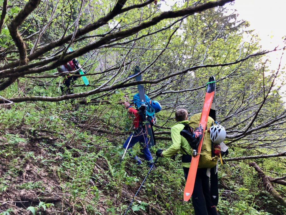
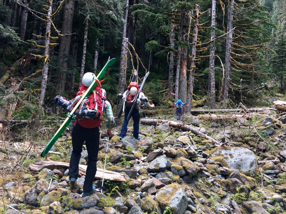
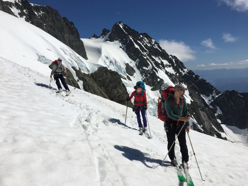
Trip: Mount Shuksan - Price Glacier Trip Date: 05/27/2018 Trip Report: A little more content is up on my site here: https://www.jeffreyjhebert.com/adventures/price-glacier-on-mount-shuksan The 50-classic Price Glacier on Shuksan had been high on my early summer alpine climb list for a number of years, but conditions, weather, and logistics hadn't yet aligned for an attempt. With Owen flying up to Seattle for a long weekend of climbing over Memorial Day weekend, it seemed like a worthy objective. During our research and planning, we were concerned that most trip reports had been from later in the season (typically July or even August), but it had been such an unseasonably warm spring that I figured the timetable was accelerated by roughly a month. I'd also been on Shuksan a few weeks earlier via the Sulphide and gotten a feel for the conditions. Our other concern was the recent wet slab activity on the persistent weak layer in the area (and even on the White Salmon—a similar aspect and at a lower angle) and the potential for warm temperatures and sunshine making the snow wet at best. About a week before, Eric decided to come up as well and we made it two parties of two on the adventure with Kelsey joining as well. We had a good group debate about the route selection as well as whether or not to bring skis—there was a good possibility of walking the skis in, carrying them while climbing technical ice in ski boots, and then 'schwacking them back out. In the end, we decided to do the Price and bring skis. Game on. We left Seattle on Saturday morning at 6:30am and stopped at the Ranger station in Glacier for our permit where we learned that the first log across Ruth Creek was out. Not the best way to start things off... We drove one car up to the gate just outside the White Salmon Ski Lodge parking lot and then headed down to the Nooksack Cirque Trailhead where we geared up and started off just shy of 11am. We immediately forded the river barefoot in shorts. It was invigorating, but not terrible. Just over an hour on the trail got us to a faint climber's trail heading down to the North Fork of the Nooksack. We followed flagging tape to the river and saw the famous log crossing upstream. After a nice lunch, we each shimmied across the log, which is nicely angled downhill and relatively smooth. Really well-set flagging tape marked the whole way up to Price Lake. We were expecting this portion of the approach to be pretty painful, so when we made it from the log crossing to the opening at Price Lake in only an hour and a half of pretty open, steep trail, we were pretty surprised and happy. We stuck to the moraine and started getting intimidating views of the mountain and Price itself, though a ceiling of clouds shrouded the top of the mountain and route. Kelsey fording Ruth Creek, the famous log crossing, and entering the trees on our way up to Price Lake After a ways up the moraine, we got onto consistent snow and decided to start skinning. At the first major rise on the ridge, we were worried that the snow wasn't continuous staying low as was suggested in some reports, so we headed up to the crest with skis on our backs again. This worked, but proved to be a bit of extra energy as we gained and lost some vert following the crest. At about 5,400 feet, we ran into a party of three also approaching for the Price, but without skis (we weren't expecting company on this route), and ended up following them across and down to gain the glacier at about 5,200 feet on what were likely rock slabs in the summer, but was continuous snow for us. After booting a ways, we switched back to skinning and went up to a nice flat area on the glacier at about 6,150 feet where we set up shop for the night after being on the move for about 7.5 hours. Ascending the moraine on the approach, catching our only views of the route before it got socked in for the rest of the day The cloud cover which had been covering the top of the route during the approach had slowly lowered during the afternoon and eventually socked in our campsite as well. Over dinner, we discussed our options and decision points in the morning. We also celebrated my birthday, including a pan of brownies with candles that Kelsey had hiked in. They were awesome! It was decided that we'd wake up at 3:30am and have a look. If we were still socked in, we'd snooze for an hour and then at least pack up and go to the saddle to see if it'd clear before bailing if we had to—none of us thought it wise to attempt the route in a whiteout after not being able to fully scope it out on the approach. At 3:30am, the sky was much clearer and, while there was a decent amount of cloud cover, it seemed like it'd go. We took our time packing up, hoping things would improve a little and knowing that the clouds would help keep the snow in better condition. We started moving at 5:30am and gained the saddle in 30 minutes from camp. We descended and traversed from the saddle, getting across some steep snow and broken ice to reach a patch of low-angled blue glacial ice that we'd scoped out during the approach as what seemed to be the path of least resistance. I took the ice pitch and had a lot of fun swinging the tools and plugging in screws. Traversing from the saddle to the ice step and going up the fun ice step From there, we traversed underneath some menacing ice cliffs and then decided an ice and snow gully going up and right looked like our best bet. It got us out of the direct objective hazard pretty quickly and was quite fun with mostly neve and some ice, protecting with an occasional screw when things got steeper. The gully continued up, across lots of broken terrain and through a series of steeper and gentler steps before depositing us on the upper glacier. We all breathed a momentary sigh of relief knowing that most of the danger and difficulty was behind us, with the key exception being the bergschrund. The steep snow and ice gully and getting close to the bergschrund Eric and Kelsey swung into the lead at this point, returning the favor of the boot pack and taking on the warming upper slopes. The clouds cleared and it got downright hot. We were really excited to see that the very left edge of the bergschund was sufficiently filled in to enable passage and let out some whoops as our line came into view and we knew we could get through the last bits before things got much warmer. A few switchbacks and steep snow got us onto the final slope to the saddle and then the saddle itself about 5 hours and 45 minutes from when we'd left camp at about 11:15am. Woo hoo! We regrouped briefly and then skinned around to the South side of the summit to get our last bit of steep snow done before things warmed further. The summit had baked out a lot since my trip up a few weeks earlier, but the gully was still mostly snow except for a few rock moves in the middle and then again at the top. We got to the summit at 1:30pm and took in the (thankfully) clear views of the range. The down-climb went smoothly and we clicked into our skis to begin our descent 9 hours after we'd started at 2:30pm. The turns were fun and pretty buttery down to and through Hell's Highway. We skinned up the Lower Curtis and then skied down to the camp above Whinnie's Slide, getting there at about 4:15pm. Summit! Skiing down the Upper Curtis Glacier on our way to the White Salmon We'd brought provisions to spend the night there, but were all pretty happy with the snow conditions to that point and knew we had lots of daylight left, so we decided to rest a bit there in the sun and then continue our descent. We left the camp area at 4:45pm and were down the whole White Salmon Glacier in less than 30 minutes, enjoying buttery snow the whole way, even on the wet slide debris lower down. The snow ended up being continuous and skiable all the way down to 3,150 feet, but we knew that there was some 'schwacking to be done from there on out. The 'schwack After refreshing ourselves with glacial melt and switching back to trail runners, we started battling the shrubbery. It wasn't too bad in the valley at first, but we never found the faint trail in the old timber and proceeded to battle slide alder, tight trees, and steep mossy slopes for about 1 hour and 45 minutes until we finally reached the road, exasperated but happy to be through the business. The cat track walk was quick and we reached the car shuttle with much-needed beers and snacks at 8:45pm, a little over 15 hours after we'd started. In my opinion, in the conditions we experienced, I can see why this route got the 50-classic nod. The Nooksack Cirque is gorgeous. The route is a very aesthetic and obvious line through steep, broken, glaciated terrain. Going point to point means traversing much of the mountain, regardless whether descending Fischer Chimneys or the White Salmon Glacier. There is some objective hazard on the route and it's clear that conditions can vary widely, making this a tough one to get just right. Thankfully, it seems that we did! Our track up and down the mountain Gear Notes: Brought 6 screws, 2 pickets, 4 cams, 3 pins, and a small set of nuts. Used 4 screws and 1 picket. Carried skis and lucked out with the amount we were able to skin and ski. Approach Notes: First log across Ruth Creek is out, requiring a ford. Pink and orange flagging tape mark the way off the trail, across the North Fork of the Nooksack, and up to Price Lake


-
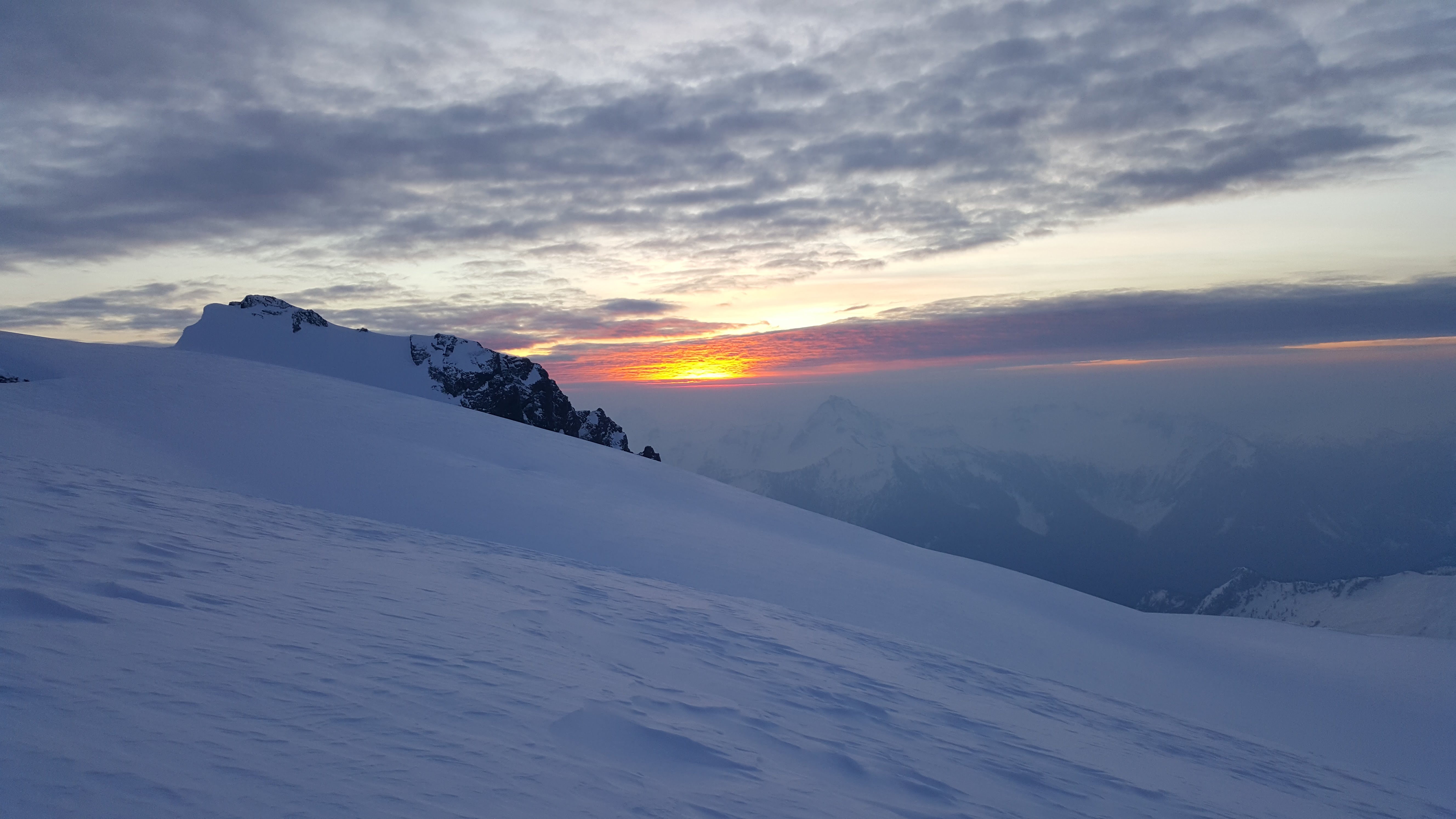
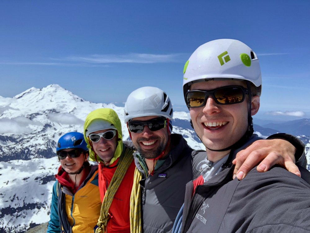
Me, Andy, Joel and Fred climbed Shuksan via the Sulphide Glacier route the weekend of the 9th-10th. We took skis (and a split board) to within a few hundred feet of the summit, carrying them for only the first 2 miles of trail walking. It was strange to travel up into such warmer weather with the inversion going on. It was winter at Baker Lake, the lower parts of the mountain were spring like, and the summit was wintry again. We camped at the normal glacier camp on Saturday after getting an alpine start of 10:45 am from the TH. With the winter darkness setting in I think we went to bed about 6 or 7 pm, it was sweet to sleep for so long. Up at 5, moving at 6 we skinned up wind crust and crud to maybe a third of the way up the summit pyramid before switching to crampons and axes. Fred led the booting all the way to the top through wind crust on top of pow on top of verglas. The summit was amazing, quiet, lonely, and calm! After a somewhat mediocre upper portion the bottom half of the Sulphide was pretty good skiing due to the sun having warmed the wind crud. My light mountaineering skis were sub par in the crud, but everyone had fun. Back at camp at 11:30 for lunch and water in t-shirts. We did a combination of strategies on the descent, but two of us skied all the way to the dirt on the trail traverse below 3000' before booting it to the car. I think it is safe to say a good time was had by all! It was amazing to have the mountain to ourselves for like 28 hours. Views were fantastic and weather/conditions darn good. I was particularly glad to make it since I was 0-2 on ski attempts on this route. Hiking in wearing long underwear: Skinning up the ridge: Sunrise: Summit gully: Summit views: