Leaderboard


Popular Content
Showing content with the highest reputation on 12/15/22 in all areas
-
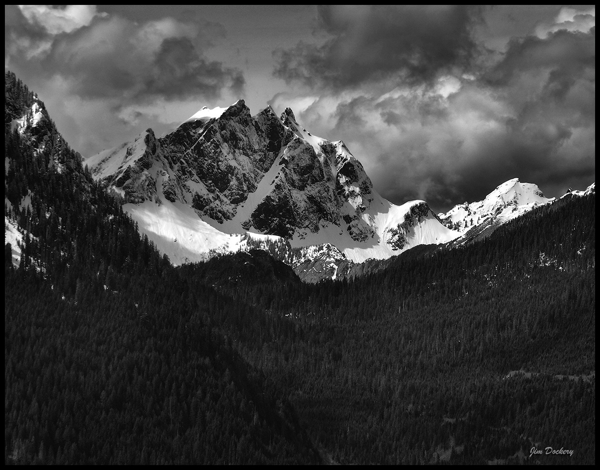
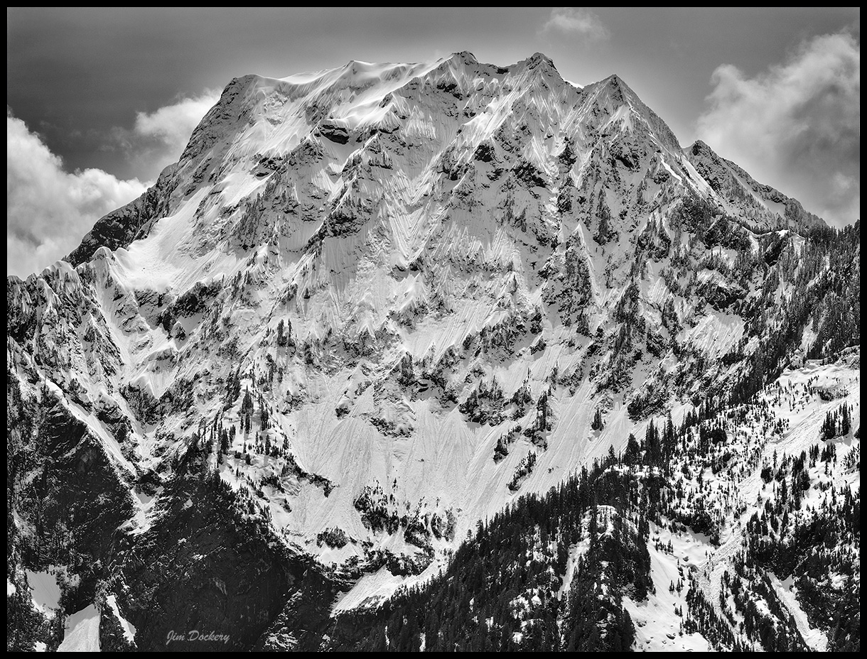
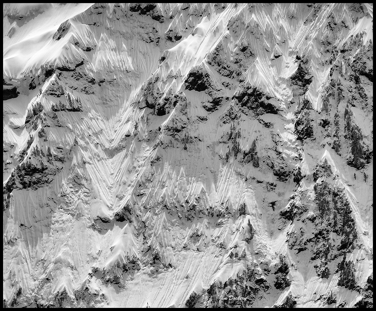
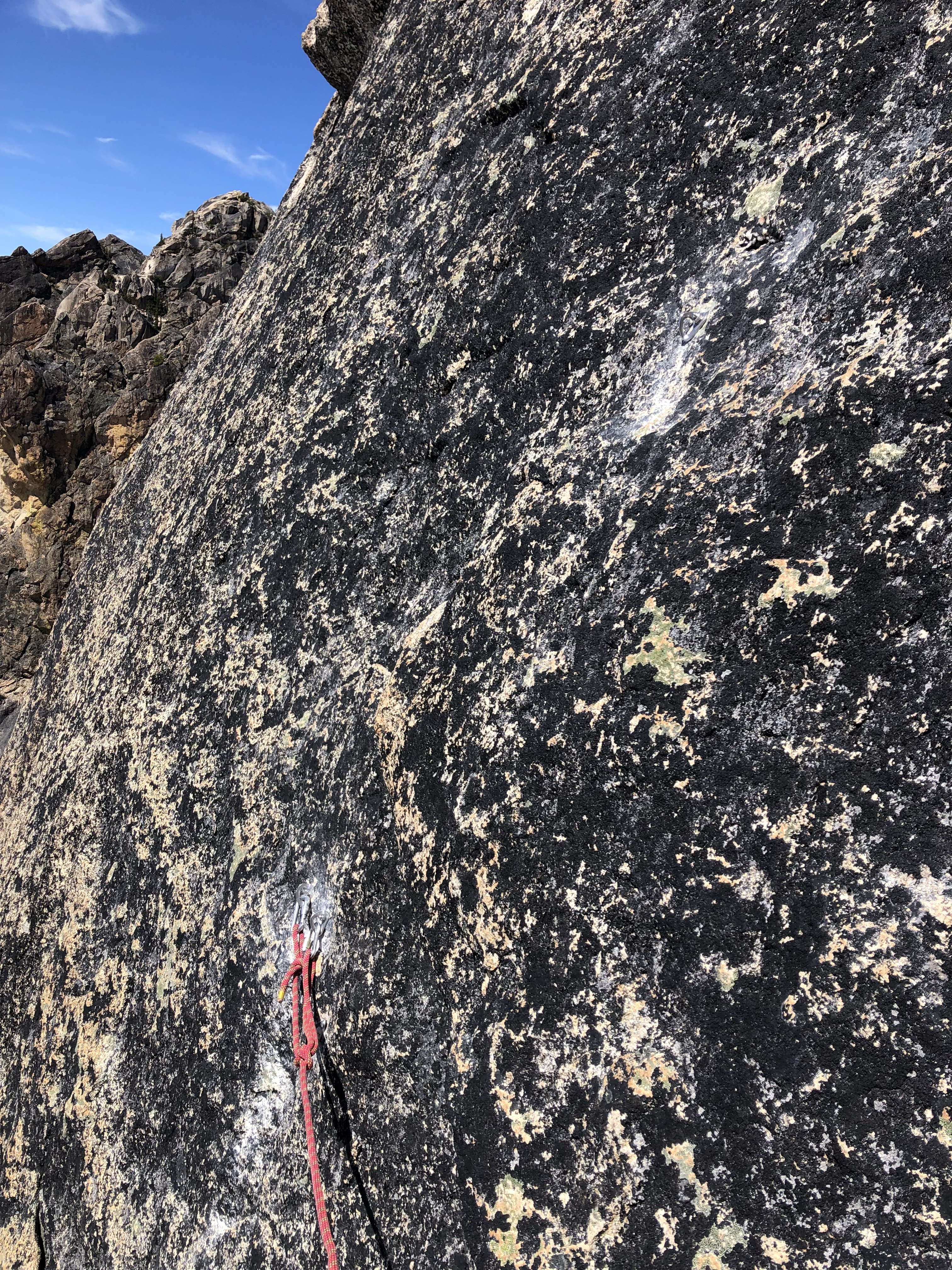
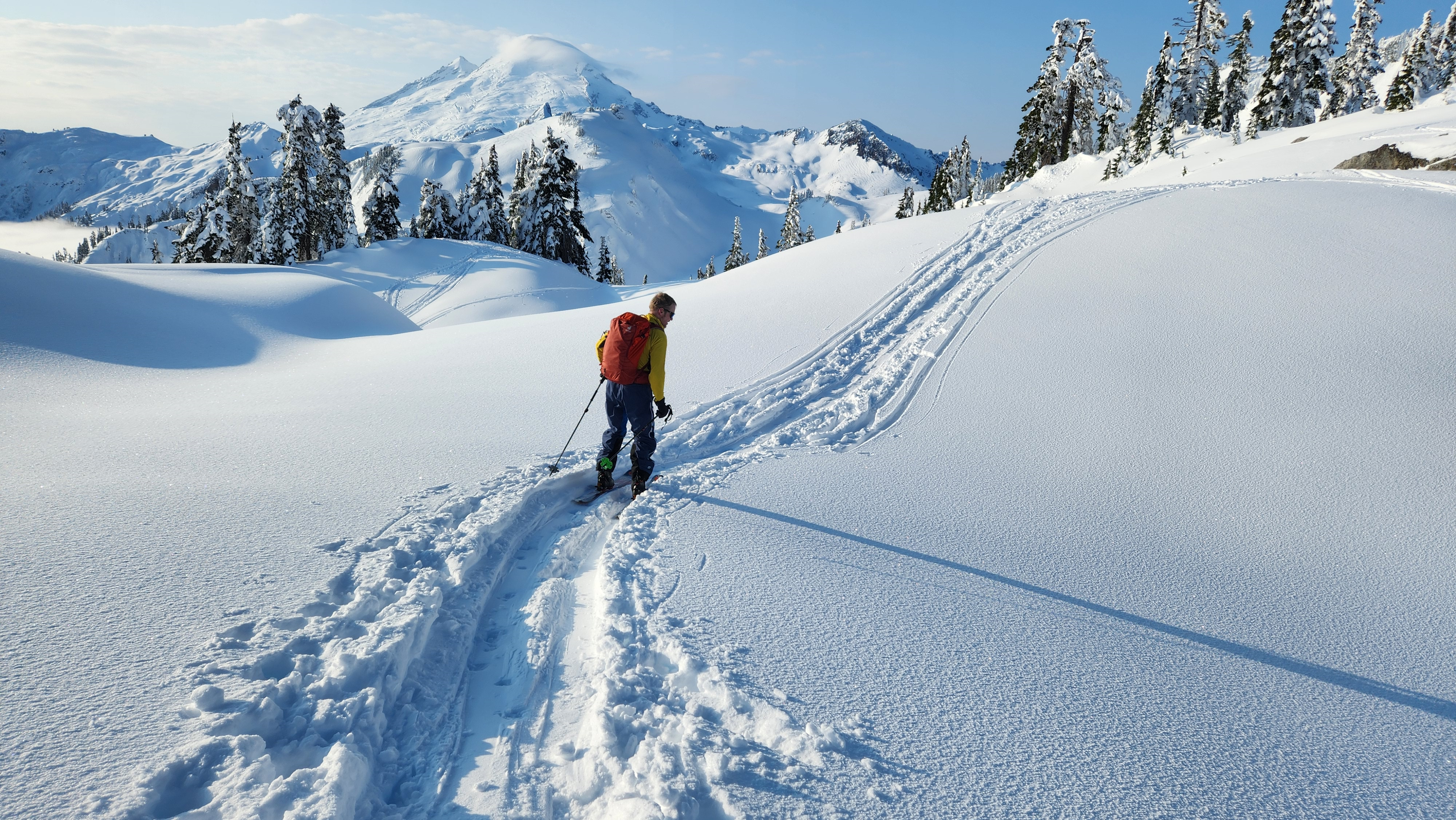
I was at Banks lake earlier this week (we climbed Peewees 3, 4, and 5). I didn't get out to Moses Coulee or south towards Park/Blue/Lenore Lakes so unknown out there. The weather is looking good for continued ice formation. There was snow on the ground and plenty of running water everywhere so just need time at freezing temperatures. Oh and the lake hasn't even started to freeze over really. Absent Professor - Trying but not much ice The Cable - top half is forming up nicely but needs a lot more to be "in". H2O2 - looked climbable although probably full value in its current shape Salt and Pepper - nothing More Banks Ice Climbs (MP 9) - several of these climbs are formed but with horrible or nonexistent top outs. The one exception is the longer WI4 "corner route" which is the right hand climb of the bunch. It looked good to go. Brush Climbs - Getting close Razorblades - no ice The Emerald - no ice MP 14 climbs - several climbs are trying but still need time, nothing really close Zenith - fully formed but the bottom connection point looks very thin and could be quick spicy. Another couple weeks and it should be great! Peewees - Most of them aren't really that good yet. The exception was #3 which we climbed and found really good quality and plenty of ice. We also climbed #4 and #5, both of which had quite a bit of thin shell and then ended in very desperate rock or grass pulling above where the ice ended but before any kind of tree/bush anchor. Trotsky's - Folly is in but looks sun affected. Revenge is in with some overhead hazard. Punchbowl - in but very nasty overhead hazard currently. Last Lap of the day on Peewees #3! Zenith current as of 12/12/2022.
 2 points
 -
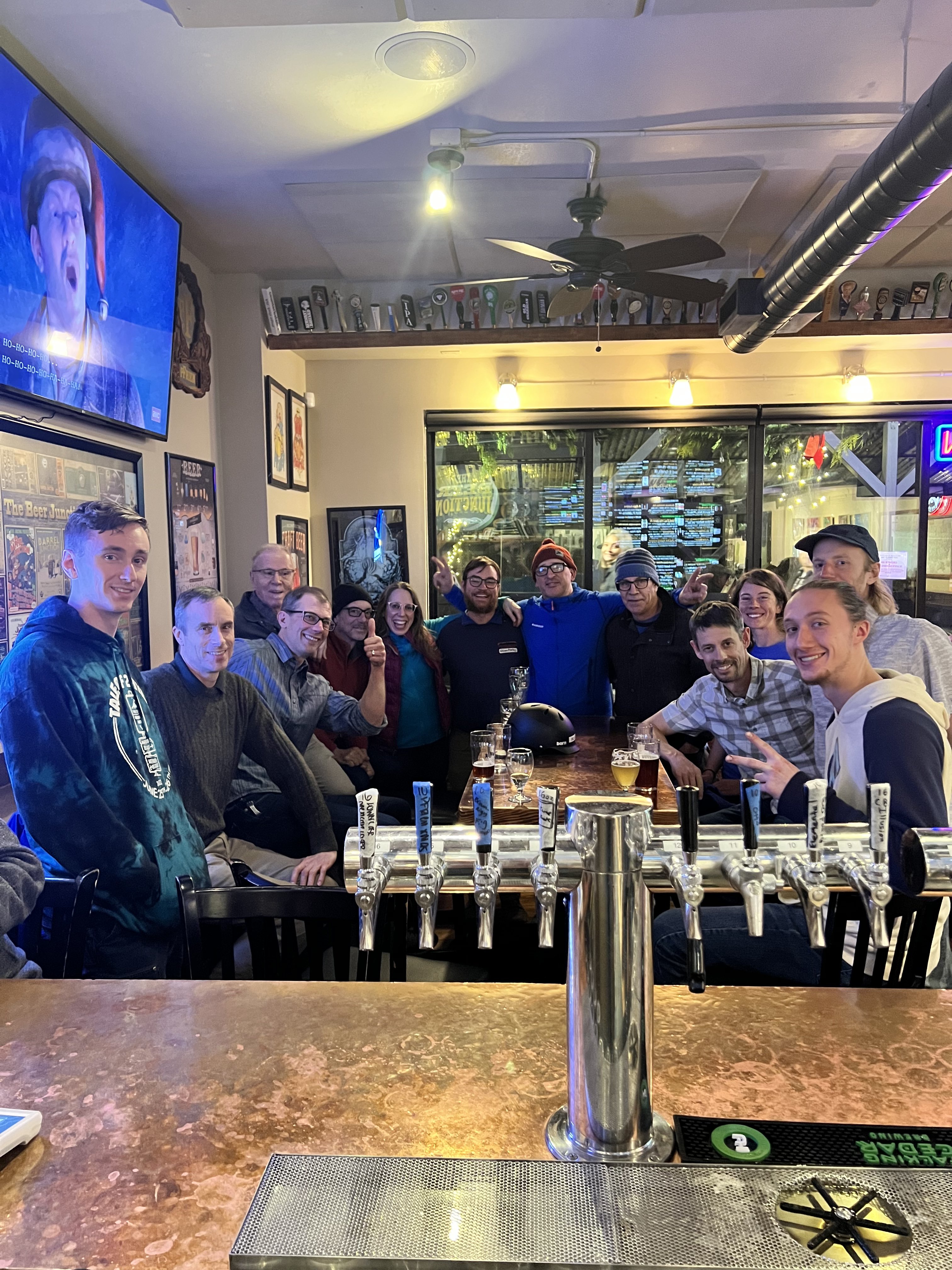
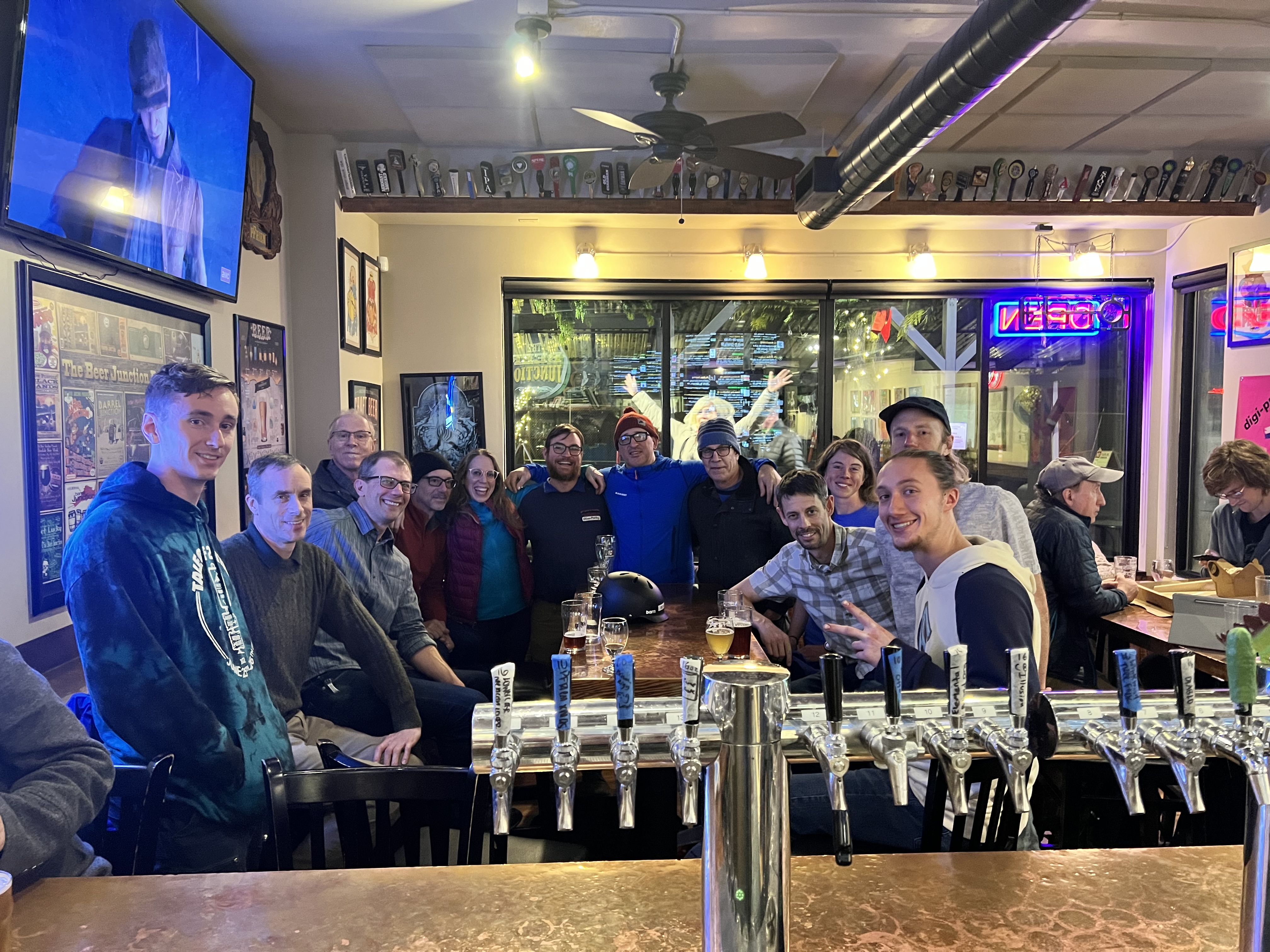
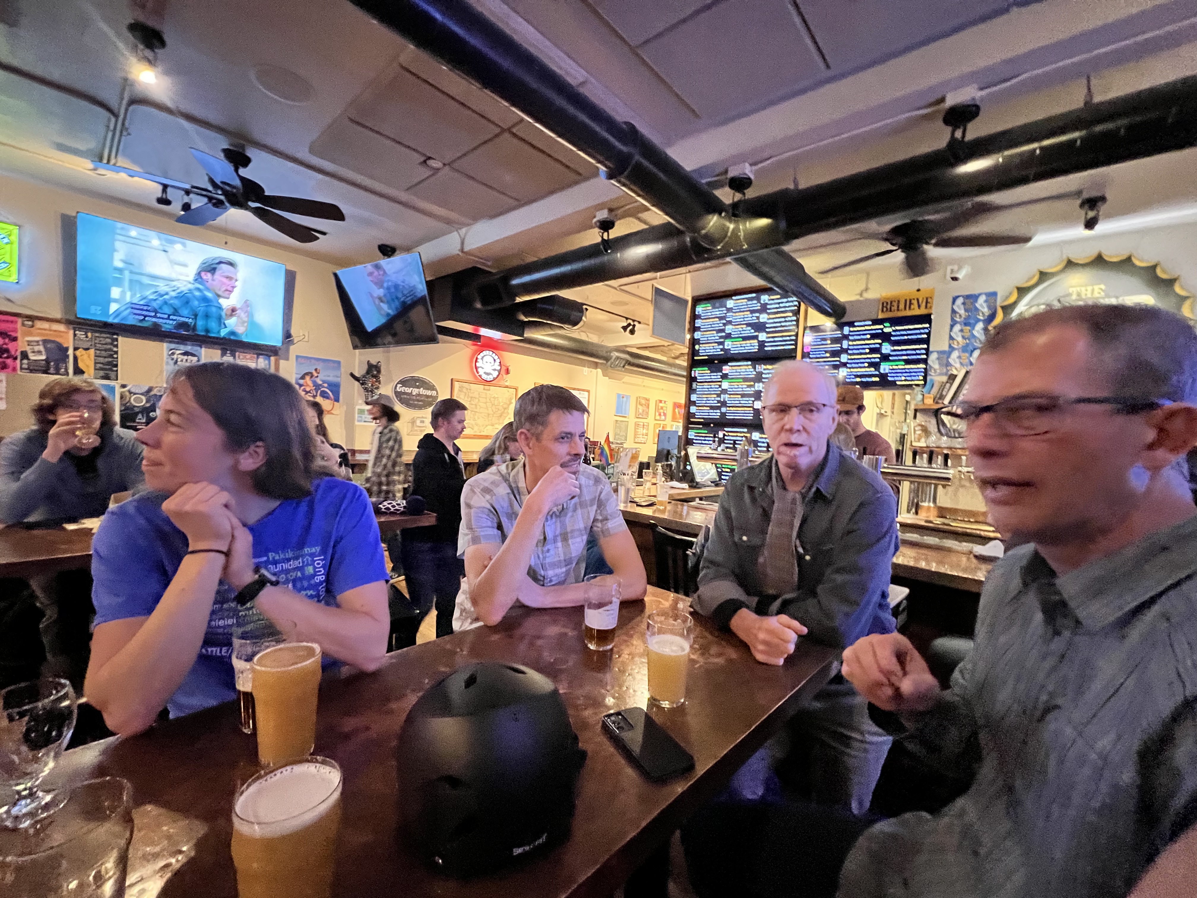
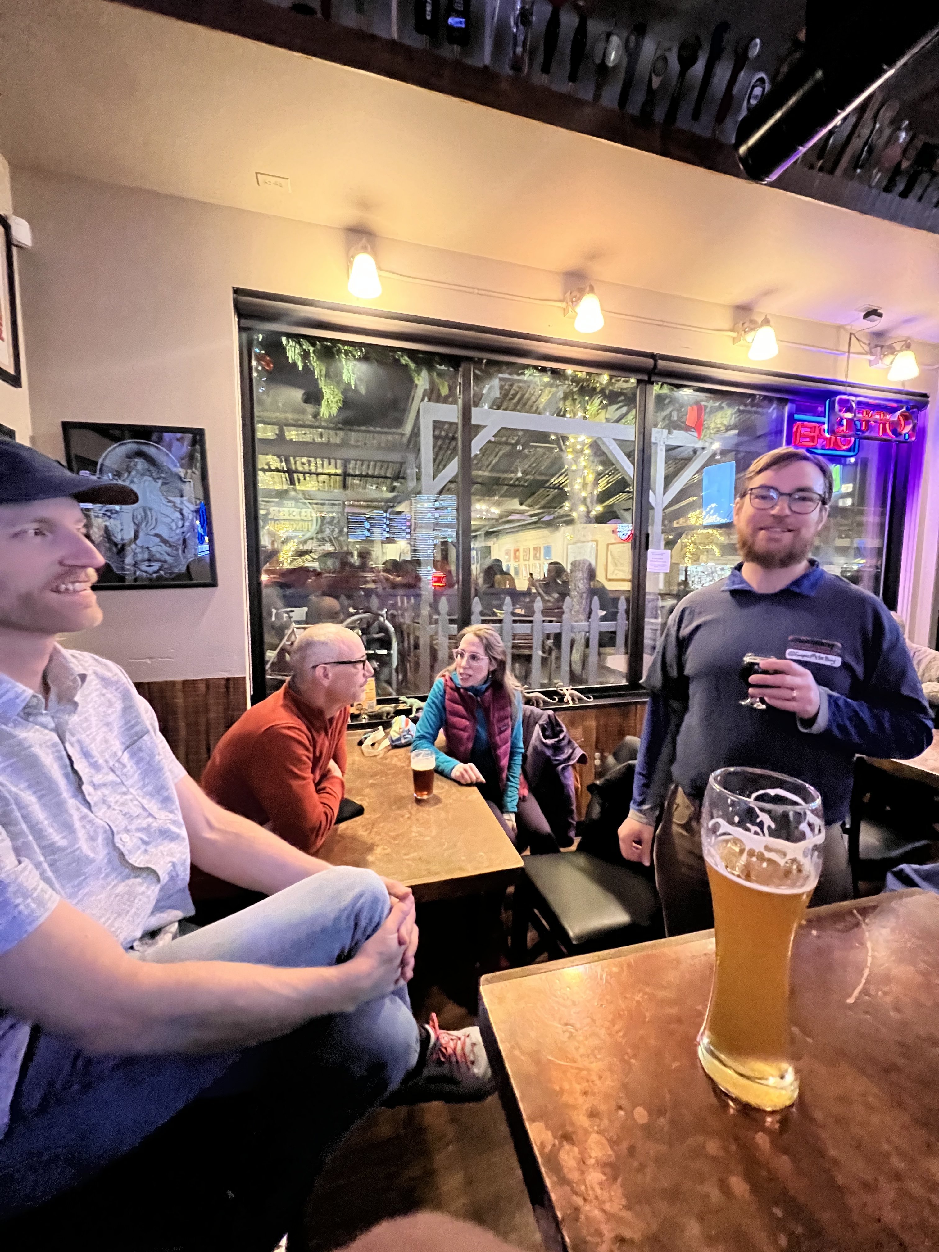
Sorry to miss it! Lots of familiar faces in the crowd.2 points
-
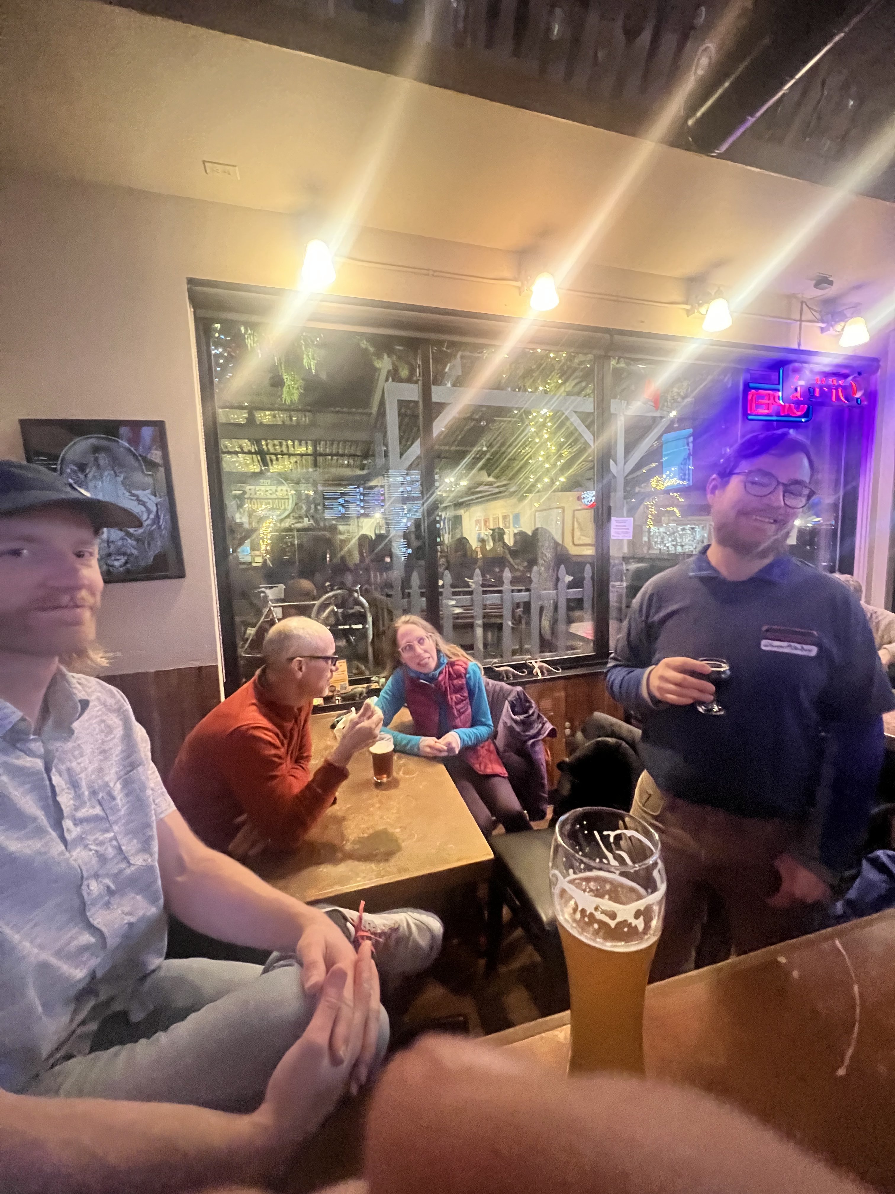
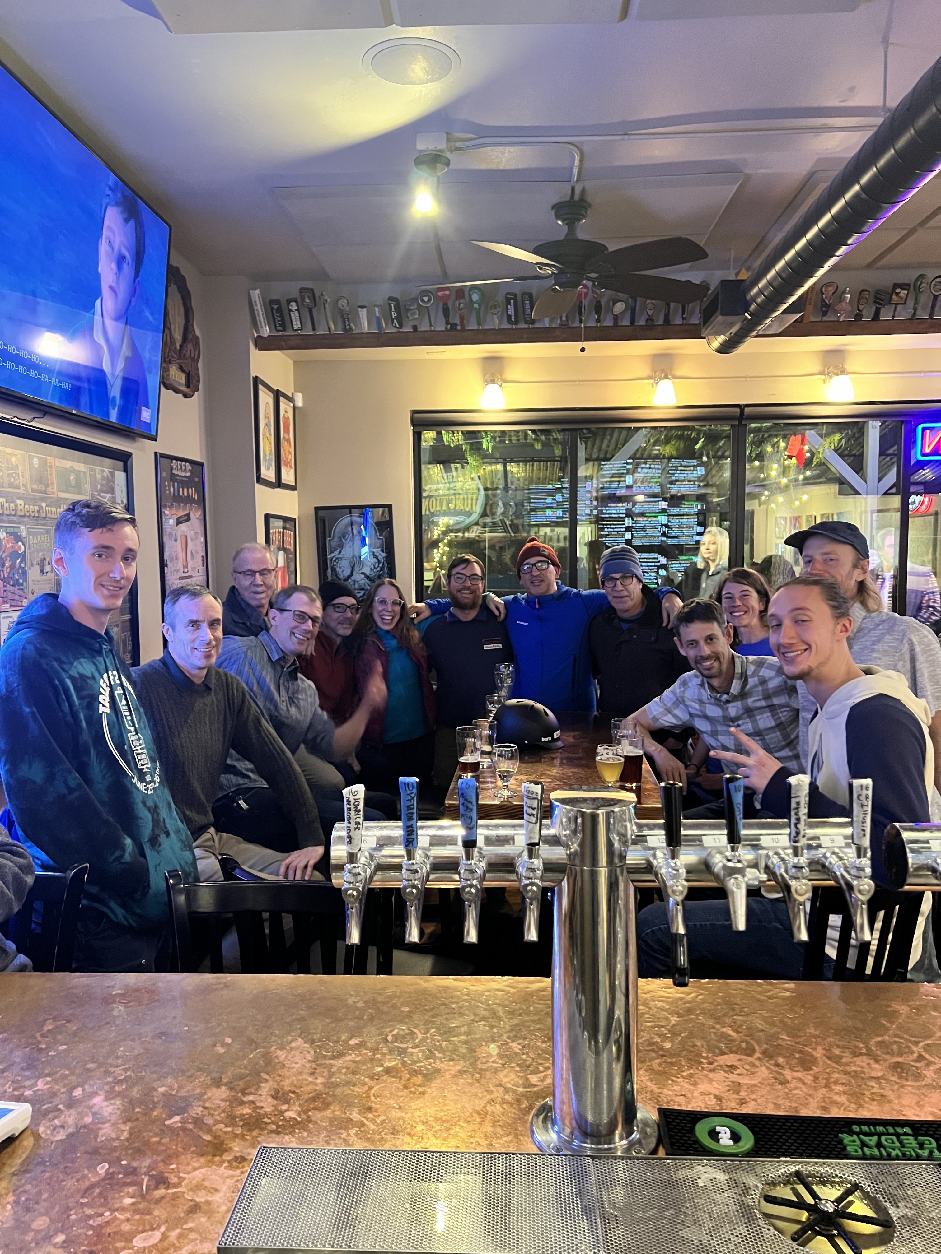
Great to see you all and if you didn’t make it you were missed! Thank you to @Alissefor buying me beer. Thank you to all who shared your ideas about this site, keep it coming. Thank you for coming out. I’m looking forward to the next one, time to get off the couch, share a brew, plan and adventure, and trade lies.1 point
-
1 point
-
Have fun guys. Southern Utah is sunny. Perchance I'll join you when Washington is again.1 point
-
Hah, I should probably go to the right bar! There in 10.1 point
-
I’m here! Where is the helmet! I got the couches.1 point
-
Omw1 point
-
Can't make this one! Next time!1 point
-
Got out with the none other than @lunger today. So fun to hear about some of the legendary TRs on this site first hand!
 1 point
 -
Looks like weather will be good enough to ride! @kmfoerster ride bikes with me? 😁1 point
-
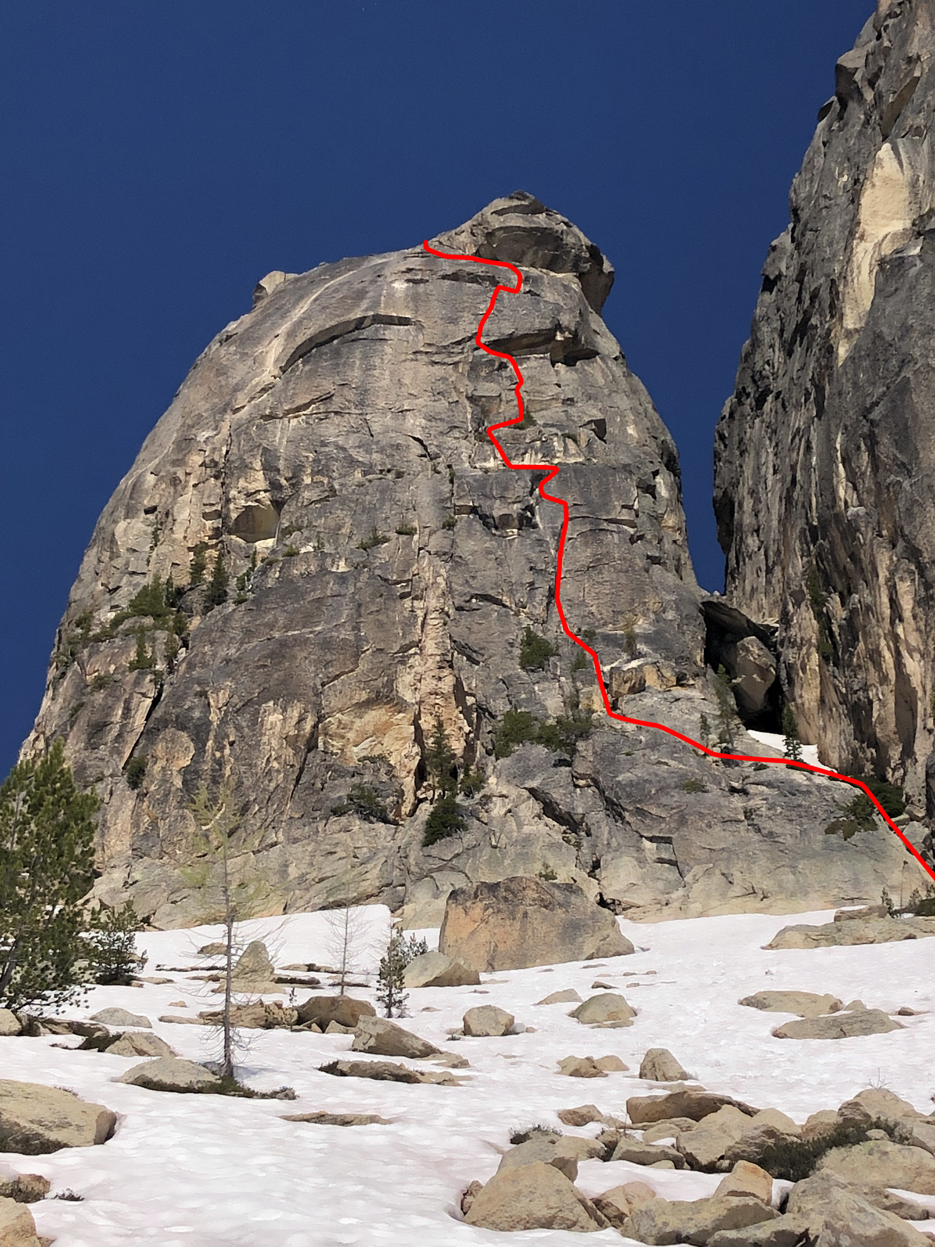
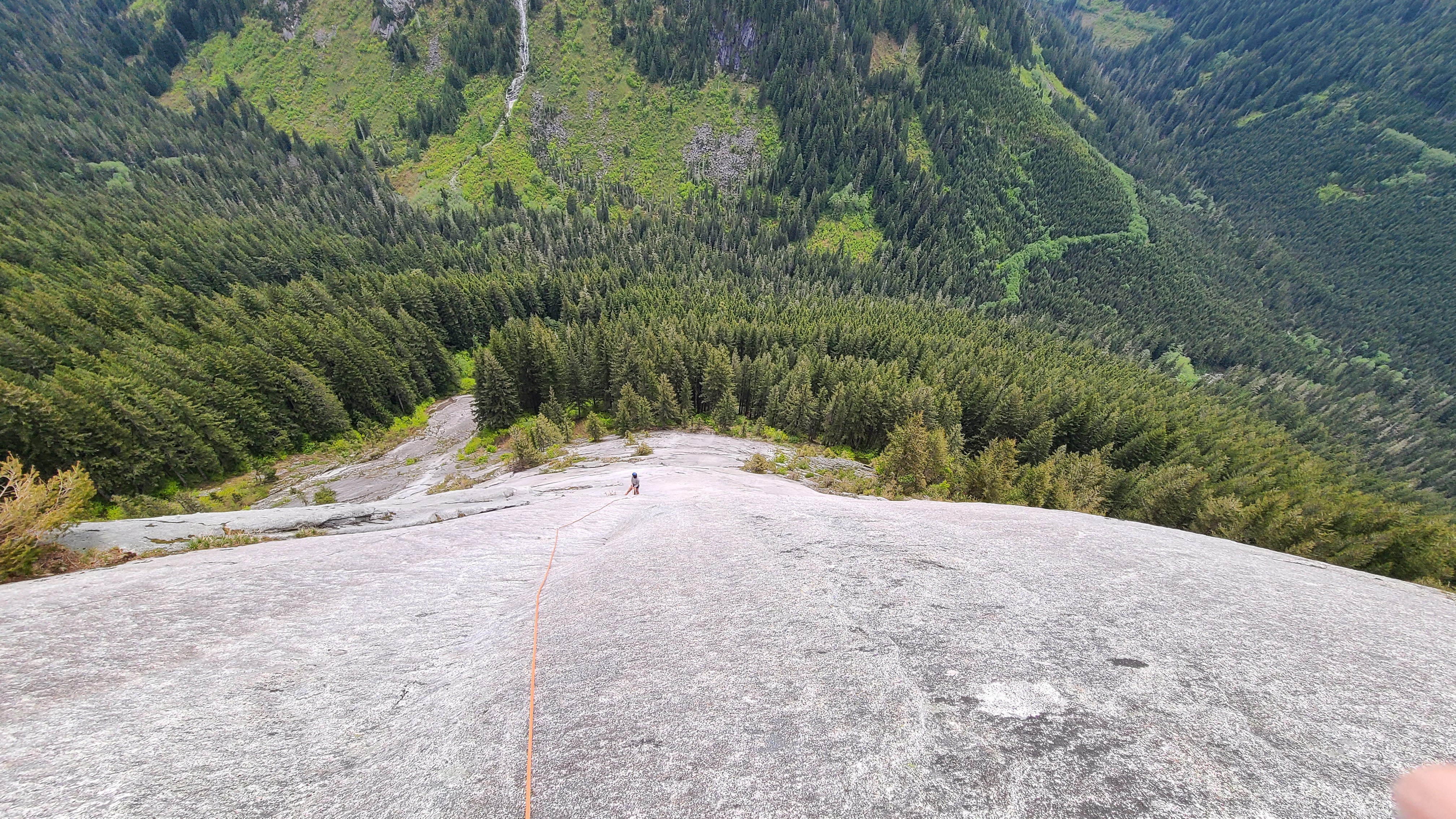
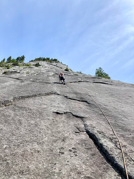
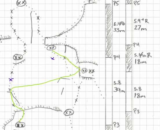
Can confirm this rock is very very clean! Photos from a trip out there to climb Online in May of 2021. Thanks for the hard work!! Approach trail was very easy to follow. We ended up getting a little off route and climbing the top pitches of Rightline. I believe where we got confused was there are actually 4 bolts on the 4th pitch of online (not the 3 pictured in the topo). Also the belay for the 5th pitch of rightline is almost straight above the belay for the 4th pitch of online. Long story short, we ended up climbing P4 and 5 of rightline (my fault for not looking ahead for where the line should have been headed-- to the left of the small roof at the base of the 5th pitch of rightline). There's also another bolt on rightline not pictured in the topo which i drew in-- straight down from the anchor, but the same height as the other bolt. Anyways, we certainly had some memorable climbing on rightline, those runouts are on the spicy side!! The line I climbed from online to rightline looks so improbable on the topo but it was actually fine as the routes are fairly close in that zone. Topo below shows route we climbed (lol) and extra bolts that threw us off.
 1 point
 -
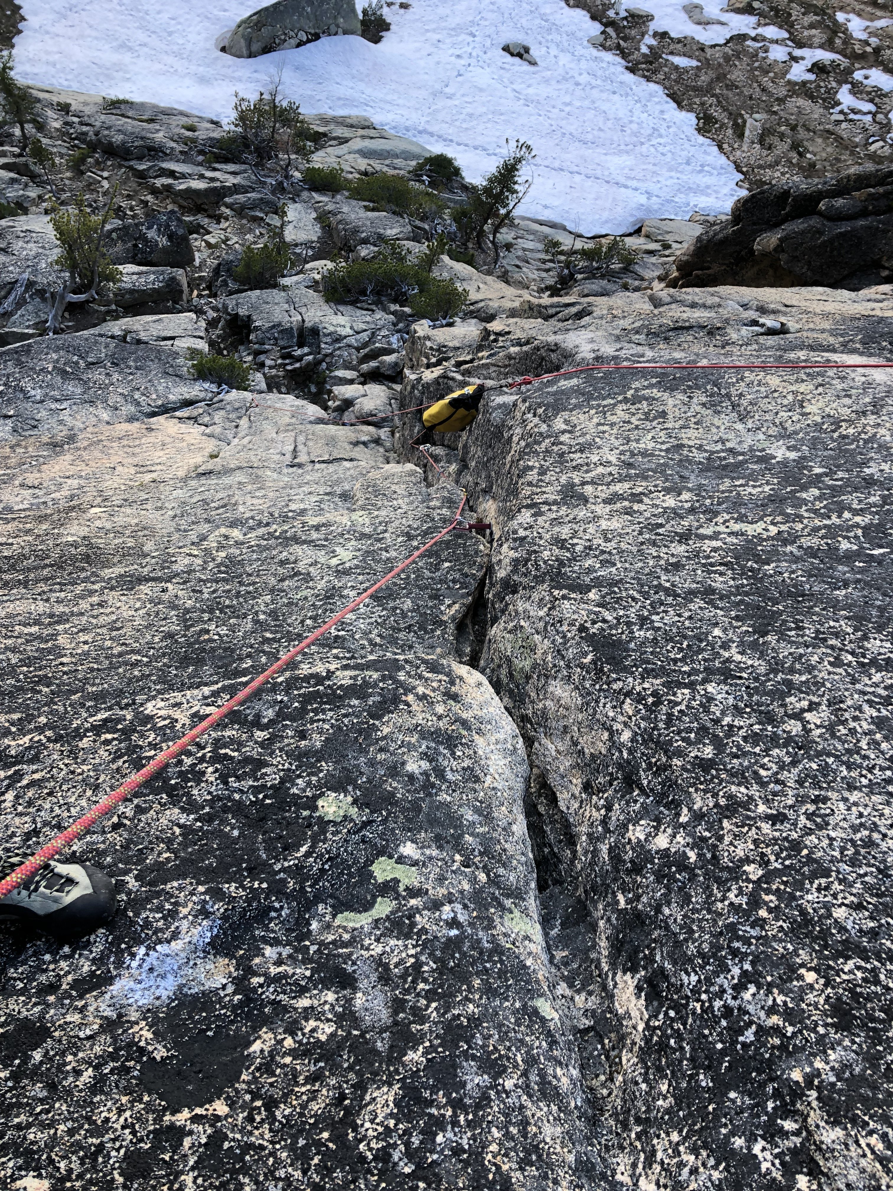
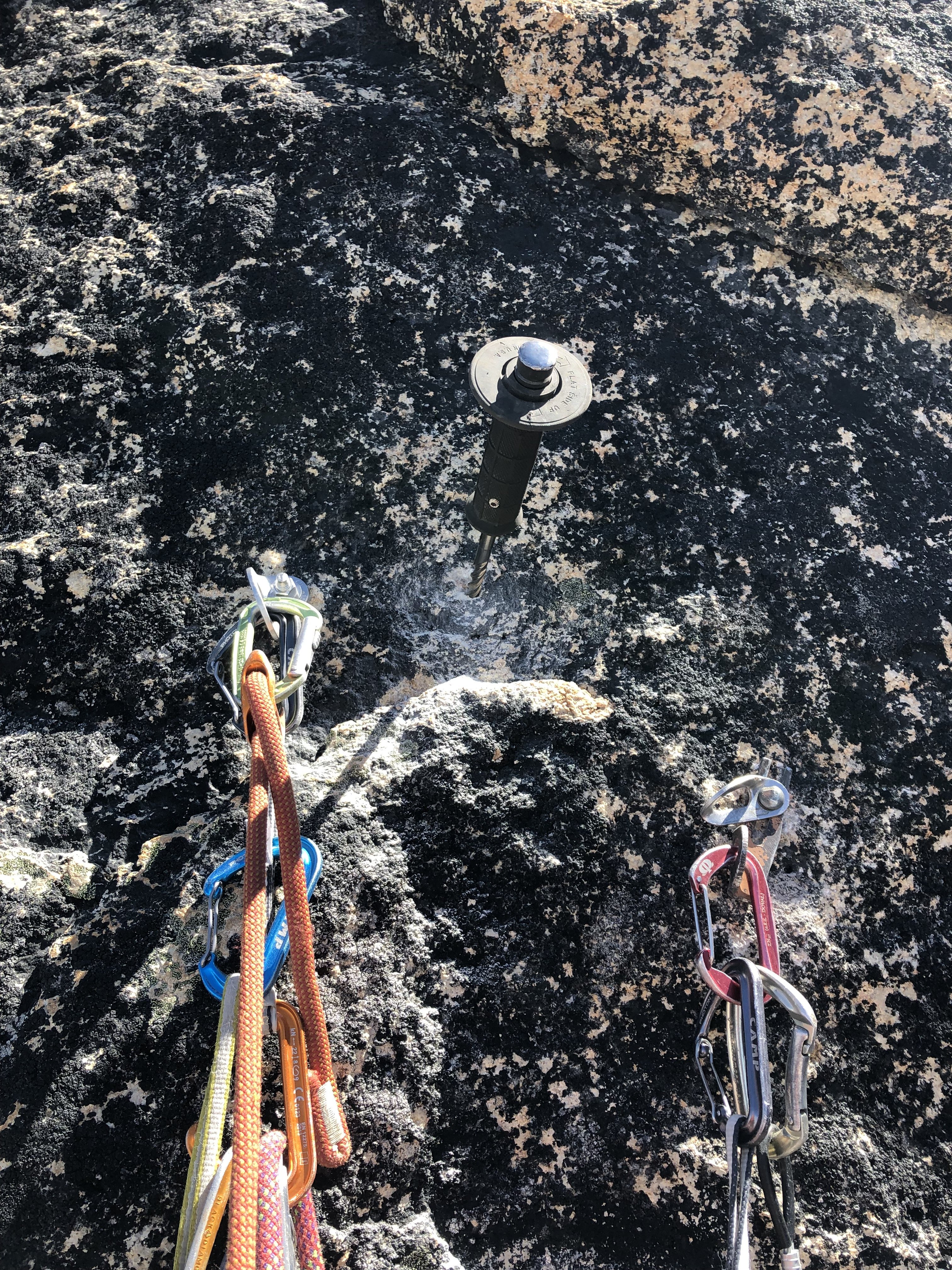
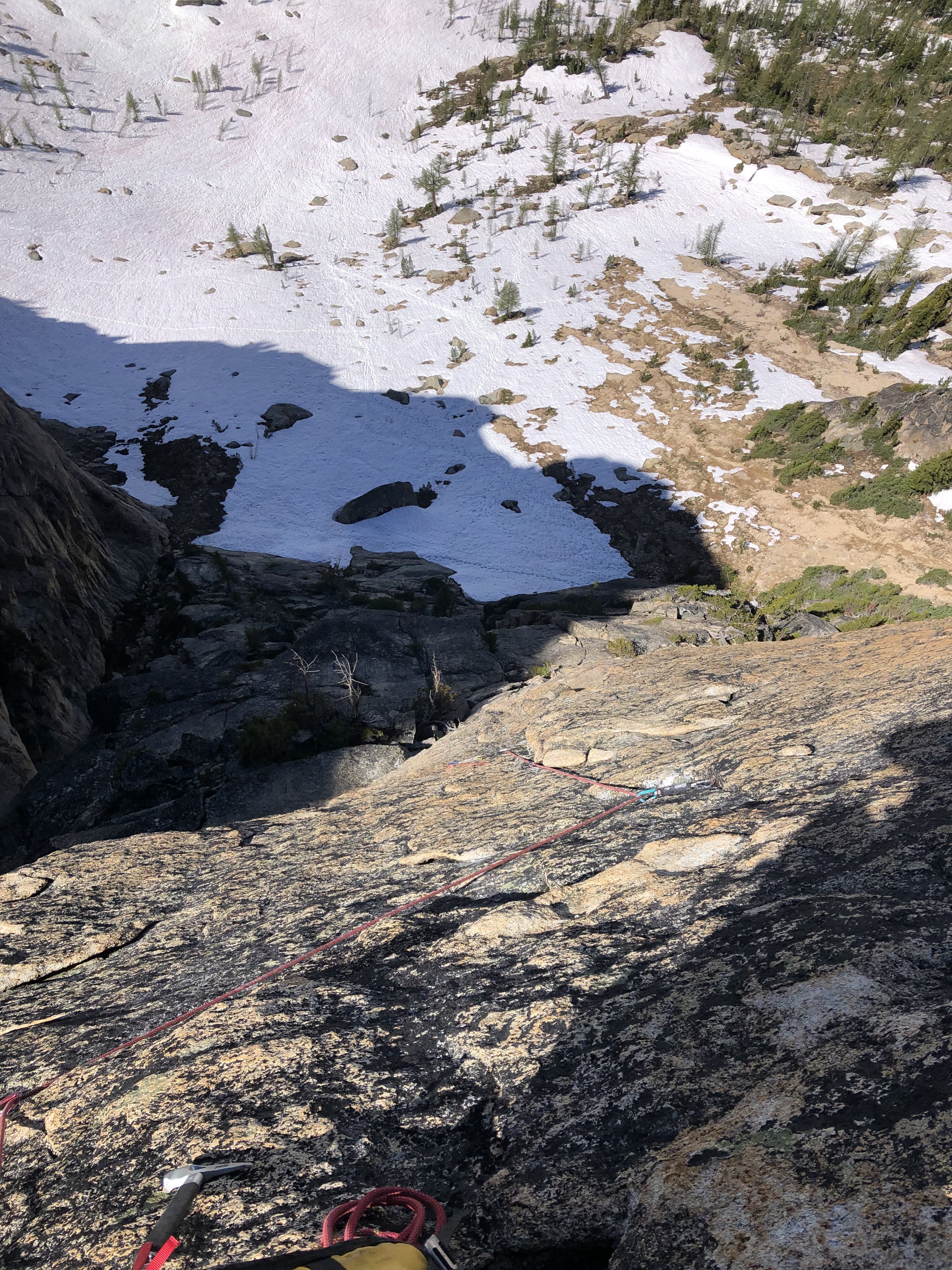
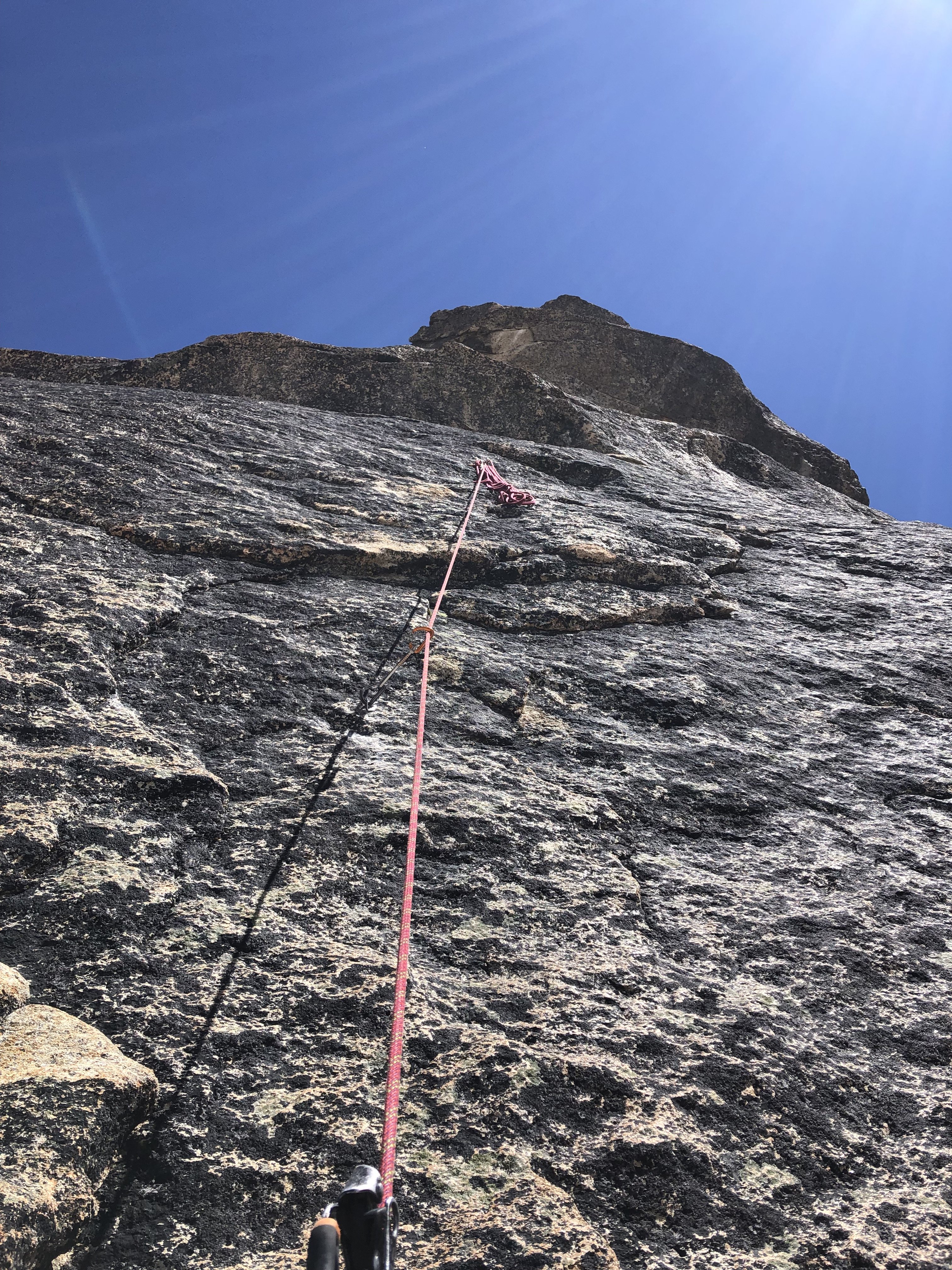
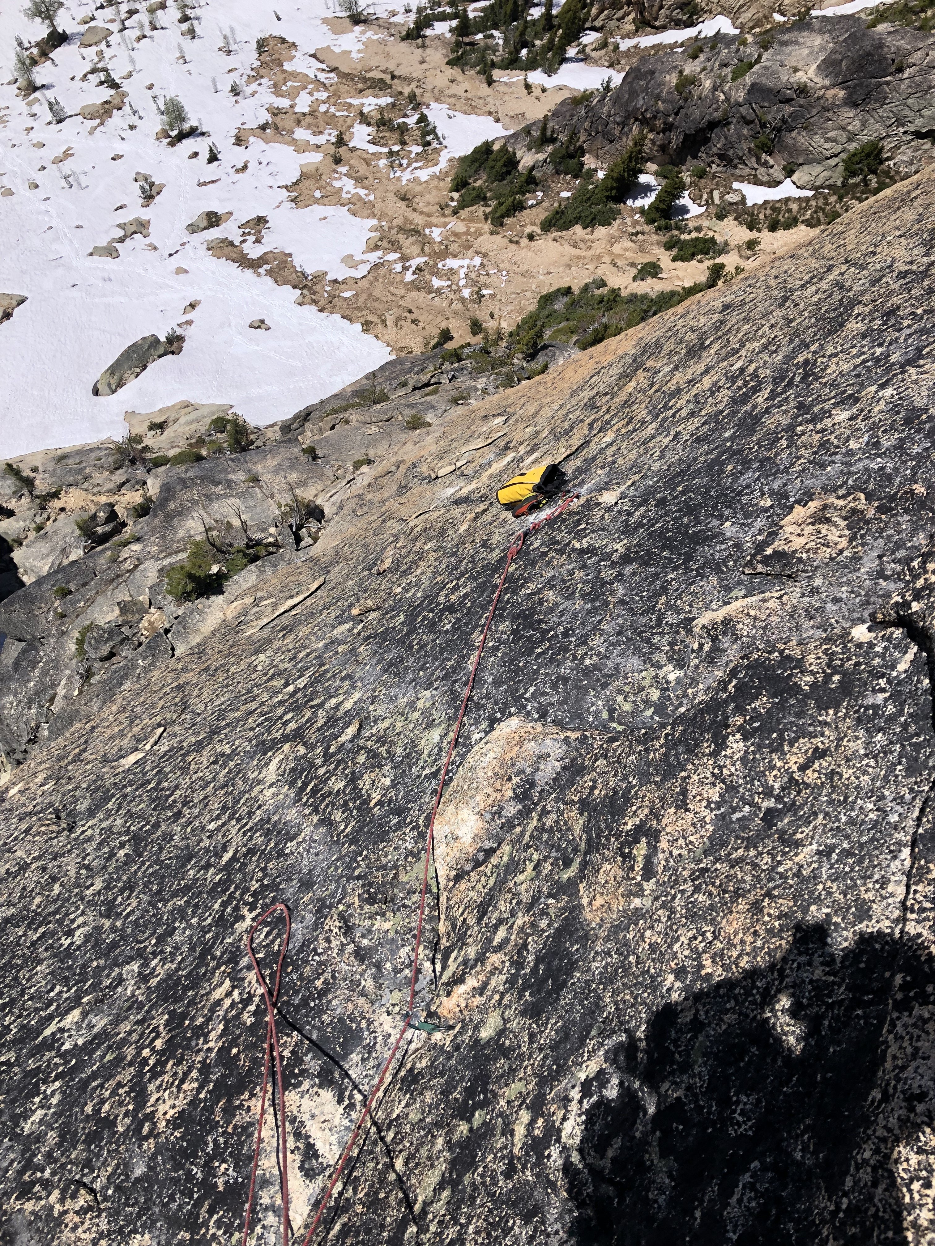
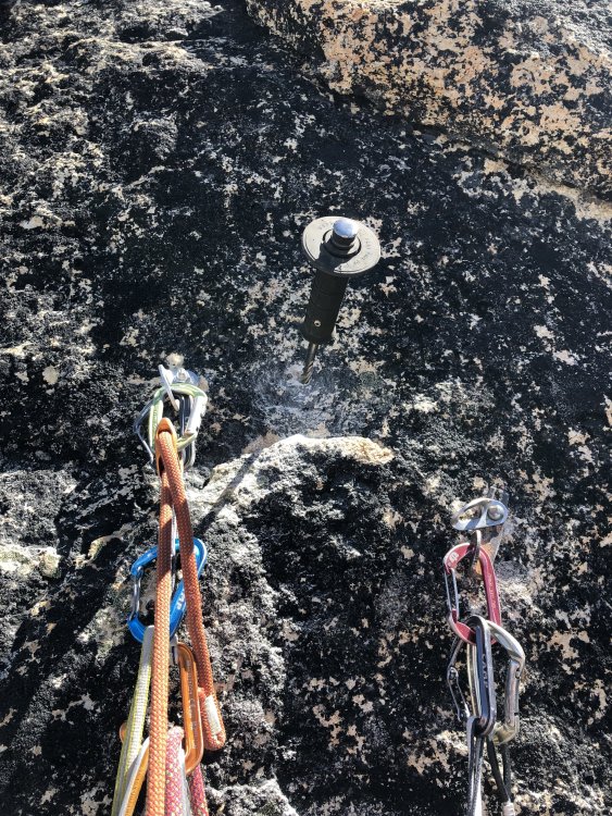
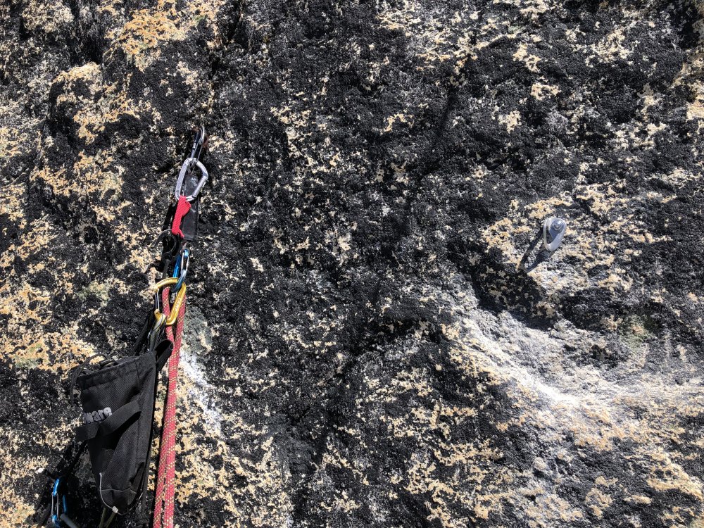
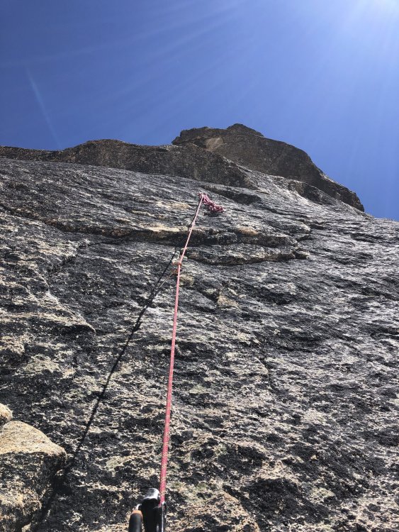
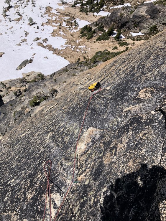
Trip: North Early Winters Spire - Labor Pains (Retro Bolt) Trip Date: 06/21/2021 Trip Report: I know, I know, I'm sure someone will be upset that retroed this hardman test piece but hear me out. Labor Pains has been on my to-do list for years, but I was just too intimidated by its reputation. I knew that when I did eventually climb it, I wanted to replace some of the hardware to make it less of a death route, all while retaining it's character. Since I wasn't able to get permission from the FA party, I committed to doing it in the best possible style I could manage. I self belayed every pitch in it's original state, then replaced the hardware I felt was warranted on the way back down to clean the pitch. I placed 3 bolts total, all hand drilled. As far as the climbing goes, I thought the grades listed on the topo were largely quite soft. The one exception being the 11a mantel on P4. If climbing this with a partner, rope drag would be a serious concern. I might actually consider climbing this with half ropes to mitigate the drag, but proper slingage should help considerably. P1 5.0: Start up Chockstone route, then traverse up and left, through a loose chimney system to the ledge just below P2. Confident parties should just solo this, however the looseness should be taken into account. P2 5.10: Climb the somewhat crumbly right facing corner system. This pitch protects well enough, and is the only pitch you really want the #3 and #4 on. The bulge is much easier than 5.11. Once above the bulge, slab left to a thin corner system and up onto the sloping ledge above. Looking down P2 from just above the bulge. P2+ 5.9?: I recommend moving the belay up to the ledge above. A horizontal overlap and sloping ledge will provide a good stance for the next pitch. You could even move all the way up to the base of the thin cracks if you wanted to. P3: 5.10+: Aim for the obvious thin crack above. This "mini west face" is actually a double crack, with the easier of the two being the right crack. Once through the seam, traverse left below the roof, and look for the bolt around the corner. I determined this bolt to be in good shape, and not yet in need of being replaced. I re-drove the piton above it, and it can be adequately backed up by a .1 cam just to the left of the pin. Replacing the pin with a bolt would be nice, but I determined the pin, supplementary cam, and proximity to the bolt to be safe enough. Continue over the bulge on cool flakes to where you will now find a new shiny bolt. This used to be a rusty pin behind a flake. The pin turned out the be pretty damn good, but certainly not sustainable. More somewhat runout climbing takes you to the right, then back left to the newly updated bolt anchor. Broke my tuning fork before I was able to remove the old button head. It now suits as a good spot to hang your shoes. The old pin, and the new protection bolt. P4 5.11a: From the bolted anchor, step up on good edges until you can reach the new bolt up and right. Slab your way hard right under the loose flakes to the sloping ledge. A thin crack which takes good pro will take you up and over a steep bulge. The topo calls out a "not so great fixed pin" which was gone before I got there. If you are already feeling some rope drag, I recommend belaying on the slab just above the mantel. The remainder of the route climbs flakes and cracks up and left on licheny but easy terrain. The previous runout straight off the P4 belay. The new bolt that protects you from falling straight onto the belay. Overall I thought this routes reputation was a bit overblown. In it's previous state, all the hardest climbing was well protected, but some falls could have been catastrophic. As it stands now, I truly believe I was able to retain the adventurous excitement of the route, while mitigating the danger. It is still PG13, as bolting all the runouts would be unreasonable. Get on this route, It's really fun! Gear Notes: Double rack from micro to #2. Single #3 & #4. Standard rack of nuts plus some brassies might come in handy. Many shoulder length slings. 70m rope to take advantage of the W-face raps. Approach Notes: Standard Blue Lake approach


 1 point
 -
Trip: Assassin Spire - NW Face - The Shooting Gallery (IV, WI4+) - FA Date: 3/7/2010 Trip Report: Assassin Spire - The Shooting Gallery (IV, WI4+) Photo courtesy of John Scurlock. Assassin Spire is a subsidiary summit of Lincoln Peak, one of the intimidating Black Buttes on Mt. Baker. Until this weekend it had never seen an ascent via any route. Daniel Jeffrey and I headed up to Marmot Ridge via Warm Creek off the Middle Fork of the Nooksack River on Thursday evening after work. We had planned to approach that evening, but it was raining when we arrived, so we decided to postpone the approach until the following morning. Friday morning we awoke at 3:30AM, and got ready to head up. We were crossing a very icy Warm Creek by 3:50 in complete darkness. We then headed up new-growth timber through a clearcut for 700' to gain Marmot Ridge. From here, it was a long, undulating journey to camp at ~6200' in the basin below Assassin Peak and Heliotrope Ridge. The next morning we awoke at 3:30 again to crystal clear, starry skies. We brewed some water and coffee, and proceeded to cross the basin to the base of the NW Face. We had spied a vertical line of ice (~3 pitches of WI6) below the hanging glacier, but it looked a bit intimidating for us, so we opted to try a less sporty line on climber's right. 2 25m pitches of WI4+ (90-100 degree ice - short stretches of overhanging on the first pitch) separated by a ledge led us up to a 55 degree buttress. The ice on the curtain was very brittle and it took multiple swings to get good placements. This was very tiring, and we pumped out fast. I led 25m on the first step before running out of screws. I then lowered off and belayed Daniel up to finish the last 5m (one more screw placement). From here, he belayed me up and I led the next 30m pitch. The ice was better here, but still brittle in spots. A swing of the tool would shatter the ice as it broke off huge chunks. From the top of the first curtain, we climbed 55 degree snow (firm and punchy here) to gain the hanging glacier. Above the hanging glacier lies an amazing amphitheater of ice and rock that rivals anything else I have seen in the entire N Cascade Range. How impressive!! Many lines are waiting to be climbed here consisting of very aesthetic, sustained, and solid ice. We traversed the hanging glacier to another gully (45 degrees), which we simul-soloed. This gully led into some 70 degree ice which we also soloed. We went right at John Wilkes' Tooth before arriving at the final ice curtain (20m WI4+). Daniel led this and we topped out in another steep snow/ice gully to 55 degrees. 3 more pitches led us to the summit. What a place! From the summit, Lincoln Peak looks impressive, as does Colfax and Baker. We spied about 15 snowmobiles parked under Sherman Peak, and saw 4 climbers at the col below the upper slopes of the Coleman Glacier. We were buzzed on the summit by an EA6B Prowler who did a double-take and circled us 2 or 3 times. The pilot tipped his wing. Very cool. This was a fantastic trip of epic proportions with a great partner in Daniel Jeffrey. Thanks to John Scurlock for flying over before the ascent to take recon photos, and thanks also for flying over on approach day thinking we were on route (we had told him we would be climbing Assassin on Friday). We saw him circle about 10 times looking for us. If only we had a flare gun... Scurlock's photo from March 5. THANKS John! Tracks in front of the Sister's Range on the approach. On the approach looking up at Heliotrope Ridge. View of Assassin Spire from the approach. Daniel at camp. Assassin Spire from camp. Fading light over the Sister's Range from camp. Alpenglow on Assassin Spire. Sunset. Me leading the upper portion of the first ice curtain on Assassin Spire. Looking down from the arete. Looking up from just above the first ice curtain. Daniel topping out on the first curtain. Daniel climbing up to the hanging glacier. The amphitheater. Views to the Sister's Range from mid-route. Looking down from high on the route. The Assassin Spire conglomerate. Tracks on route. Weeping curtains of ice from mid-route. Daniel climbing up to the belay below the third curtain. Daniel leading the third ice curtain. The steep gully above the last ice curtain. The upper slopes of Assassin Spire. Daniel a few pitches below the summit. Daniel on route below the summit. Daniel approaching the final steps to the summit of Assassin Spire. Lincoln Peak from the summit. Mt. Baker and Colfax Peak from the summit of Assassin Spire. Daniel on the summit. View to the west from the summit. Looking down from the summit. Me on the summit of Assassin Spire. Unclimbed ice on Lincoln Peak's NW Face. A close-up of unclimbed ice. A huge curtain of ice (WI6) below the hanging glacier on Assassin Spire. Sister's Range in fading light. One parting shot.1 point
-
Trip: Three Fingers - Northeast Face (FA); FWA North Peak Date: 2/3/2007 Summary: First Ascent of the Northeast Face Three Fingers WI4+, M3 Grade IV. Feb 3rd 2007 Dave Burdick and John Frieh We believe this was the FWA of the North Peak of Three Fingers by any route. Also... we both wanted to make sure and tag the high point which prior to today we both thought was the south summit. By the time we reached the top of the ice the weather was already crapping out so we hit the North peak instead (which I think most would agree is the more aesthetic finish to the route). Dave checked today and according to Beckey's book the North peak has been the true summit since 1931 as in 31 they blasted 15 feet off the south peak, thus making it lower so we did the highest summit by accident I guess!?!? Hopefully someone can provide some further insight on either one of these... Northeast Face of Three Fingers courtesy of the great John Scurlock: topo (dots mark approximate belays): Conditions the week prior (taken jan 28th): Quick note for the newbs: Comparing John Scurlock's photo (top pic) with the conditions last week photo is a great illustration of how foreshortening works. blah blah blah: Ummm... where to start? Dave, Micah and Keith attempted this line some time last year (2006) but a combination of factors (deep snow, later start, etc) resulted in them coming up short... Jump forward a year. Dave, Pax, Keith and myself hiked in last Sat Jan 27th. With a little work we managed to get to the trailhead. WA state representatives: We hiked in and camped in the valley below the face at the last available running water. Dave and myself headed up the following morning... we had just gained the glacier when a healthy avy came down near the entrance to the couloir... we took a vote and bailed. On the hike down Dave and I joked about the bad luck the two of us have had with avyies (we've bagged a few attempts in the years due to avy) and this came out of it (Alpinedave's excellent artwork): Stay tuned for Volume 2! Never the less as bad as it sucks to get skunked we agreed we needed to come back before this weather window expired (which according to NOAA was roughly noon on Saturday) as the route looked to be in great shape. So Saturday it was! We left the car at 2 on Saturday and made good time to the face thanks in part to the boot pack we had installed the weekend prior and a full moon to light our way: We managed to find the access couloir that gains the glacier with relative ease and traversed over to the start of the route. We started the NE face couloir about first light. Dave fired through the initial step (a wee bit of 3/3+) and when the rope ran we began simuling. We covered approximately 1000' of mostly neve mixed with patches of ice and snow before arriving at the ice step. Dave on the initial step that starts the couloir: Lower couloir: So the ice... 600' of fat ice as blue as your balls are going to be after you look at the pics Pitch 1: Pitch 2: Looking down from the top of 2: Pitch 3: Pitch 1 was solid 4+... I could see it easily being a 5 in thinner conditions. Pitch 2 was 3+ and Pitch 3 was a 4. All 3 pitches were 60 m in length minimum (we climbed on a 70 m). From the top of the ice step we simul slogged for the north summit. To The Top! We encountered a short mixed step followed by a ramp that put us on top The mixed step: The ramp: Dave on top So we had topped the ice around noon and it started lightly snowing at 12:05 (why is it that NOAA is always right when ever you hope they are wrong ). We summited the north peak at 1:30 and by this time it was a healthy snowfall... we took a quick snack break and headed for home. Marco Polo on the descent: We wasted some time finding the access couloir that connects the glacier to the valley floor but we managed to find it before dark and followed our boot pack out and headed to Darrington for burritos at the Shell Station Gear Notes: 11 screws 1 picket (used a few times) Rock gear we brought: 4 cams to #2 camalot 7 nuts Rock gear we used: .75 and #1 camalot few nuts (larger size) Dave would likely recommend 1 set of ear plugs for this route or for that matter any route you climb with me ... 2 sets if I have dehydrated food for dinner Approach Notes: Darrington Music Notes Pete Murray, Bloc Party1 point
-
Climb: Big Four-Spindrift Coulior Date of Climb: 2/18/2006 Trip Report: The climb We left Portland late Friday evening and started the climb as soon as we arrived at the gated road early Saturday morning. The gate is ~1 1/2 miles from the trailhead. Starlit skies, no wind and frigid temps. Perfect weather. Happy Bill Getting through the lower cliff band is not technical. Stay to the far right. Just some steep treed terrain. Once you gain the lower basin it's a long rising left traverse on rock hard snow. Easy going. The lower third of the route was excellent hard snow bisected by short patches of deep sugar. There is one pitch of WI3 followed by 400' of perfect 50-60 degree neve'. This puts you at what the book claims to be the crux. Lower Third of the route The crux pitch in the middle of the route is a ~100' of 70-90 degree semi-rotten ice. WI4 Xish. Bill place two screws within a foot of each other 40' feet from the belay, the only pro on the pitch. He banged in an iffy pin and a worthless picket 180' from the belay for the anchor. This turned out to be the typical anchor on the route. Following the crux is a long section of deep 40-50 degree sugar. We had enough of the deep sugar crap so ~800 from the top we decided to leave the normal Spindrift route and try a line to the right. After a couple of sketchy leads, one WI5X we knew that daylight was soon to pass. Lucky we found a sheltered bivvy, a small cave created by an over hanging rock with a bush draping over it. The night was 12 hours of sleepless shivering. The cave was cramped, but there was enough room for one person to stand erect, the other hunched and the bottom was big enough for both of us to lay down with our legs sharing the middle. Laying down only made us colder, so we spent most of the night standing, stamping our feet and exercising our ankles to ward off frozen digits. Bill had a pound of horsecock, a block of sharp cheddar and 5 smokes. They made the night bearable. The night in the cave was our second night of no sleep. The Cave The next morning we rapped back down to the Spindrift couloir and finished the proper route. The upper 1/4 of the route offered 400' of 50-60 degree perfect stick neve' which gave way to 400' of shit sugar. The final pitch to get over the corniced ridge was a sphincter clenching xperience. We brought a shovel head to dig our way through it, but we picked out a weakness that had the least amount of over-hanging snow. Eric's pic of the top pitch A team (John and Eric) was on our tails near the top. They caught up to us half way down the NW ridge. They used our raps catching us; they set the raps lower down. The four of us finished the descent together. Thanks much for sharing the raps and the navigation help. The Big Fuss on Big Four I underestimated route. I left instructions with my grandparents that we would call them by noon on Sunday letting them know that we were off the mountain. They called the Snohomish County sheriff's office right at noon. The Sheriff called the Rangers. The Sheriff copper flew over us around 3pm as we were descending the NW ridge. At the time we were rapping in a treed area. The chopper came back 30 minutes later when we were in an open area. They lowered a radio to us. We let them know that all was OK and I asked them to call my family back with word. Waiting for us near the ice caves with a pit fire were the Search and Rescue team. We walked out the trail together. To top off our adventure just a 1/4 mile from the trailhead I slipped on the icy trail. I twisted my ankle. I could not put weight on it. The S&R team hauled my sorry ass to the car. Many thanks. Agian, many thanks to the Search and Rescue folks who waited for us and the Snohomish Sheriff for the chopper check in. The Final Chapter It was now 10pm Sunday, Bill and I had been awake for 64 continuous hours. While driving to Granite Falls I noticed that Bill was driving 20 mph. I said to him, 'hey what's up man?' He was zombied out behind the wheel. I convinced him that it would be safer for me to drive into Everett with a sprained right ankle than him sleeping. At the motel room I was the first to pull off the boots. I had 6 black toes. Bill's toes were black as well. Two days later my toes turned red. This is good. I'll save mine. Bill's are another story. His big toes are still black four days later. Gear Notes: Pickets, screws, and tools Approach Notes: The road is gated 1-1.5 miles from the trailhead.1 point
-
Trip: Hall Peak - NW Face - N Ridge Date: 1/30/2007 Trip Report: On Tuesday, January 30th, Dave Brannon and I climbed a fun snow and ice line up the NW side of Hall Peak. This is a relatively low (5484') but extremely rugged peak located just west of Big Four. Access is incredibly easy from the collection of cabins called Silverton. We left the car at 5:15 AM, an hour later we hit treeline. Another hour and we were standing at the base of the very impressive, 1900' tall northwest face. View of Route from Descent The route we climbed was first attempted in May 1962 by Dan Davis and a 15-year-old named Steve Skubi. Steve died in what was apparently a large avalanche. I have no clue if the route has been climbed since, but I really doubt we were the first people to ever carry ice gear in here. Conditions were absolutely incredible. The snowpack was setup as solid neve and loads of good water-ice coated everything. Near the top there was some rotted out snow but it was the exception rather than the rule. Starting up the NW Face on bomber neve Starting from the bottom left side of the face we climbed up and right on steep neve to reach the base of an obvious steep couloir that ends at a deep notch in the north ridge maybe 500 vertical feet below the summit. The couloir was more bomber neve with ice coated walls that took good screws for protection. Dave finishing the traverse out of the notch From the notch continuing up the ridge crest appeared unfeasible. Instead we did a tenuous and challenging mixed traverse for about 80' across the NE face. This started on very steep rock and very thin ice and ended with rotted neve for the feet and loose, sloping sidepulls for the hands. Fortunately there was lots of generally suspect rock pro. A little more traversing led to a steep runnel that was followed for two full pitches back to the ridge crest. The runnel was a wonderful mix of water ice to 80 degrees and steep 50-60 degree neve. A final pitch on the ridge crest up more great ice and a final moderate snowslope led to the summit at 3:15 PM. I really can't overstate how good conditions were, I think we placed ice screws at least 12 times to give a sense of how much ice there was. Final snowslope below summit On the Summit with Big 4 in background The descent is a real piece of work and has serious EPIC potential. Basically you following the west ridge for about a half-mile to a notch and then descend down the 2000' north face. This a steep convoluted face littered with some enormous cliff bands. It would be too easy to get all commited on a rappel and suddenly pop through the brush above a steep nasty 600' drop. After downclimbing a bunch of snow we did 7 full rope rappels with a fair bit of traversing inbetween to reach the valley floor around 7:30 PM. Dave set most of the rappels leaving me to enjoy the brilliant full moon that thankfully illuminated the face. If you go climb this peak make sure to have a plan on how your going to get down. See John Ropers report to get a good sense of what the descent route is all about. An hour-and-a-half later we were back at the car, just under 16 hours roundtrip. Thanks Dave for an excellent day in the hills. There is a ton of potential for more alpine routes on the NW Face as well as loads of ice climbing near the base in the right conditions. Anyone else ever been in here? Gear Notes Screws, pickets, nuts and a few knifeblades1 point


.thumb.jpg.bff40c18c93d75136730763b35a21758.jpg)