JasonG
-
Posts
5261 -
Joined
-
Days Won
348
Everything posted by JasonG
-
Subscribe to Alpinist!
-
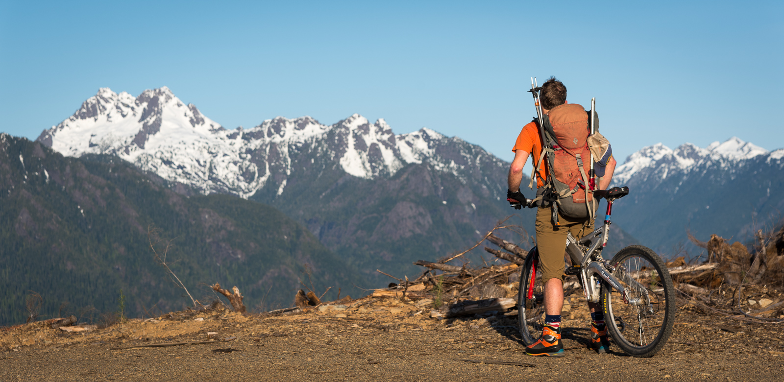
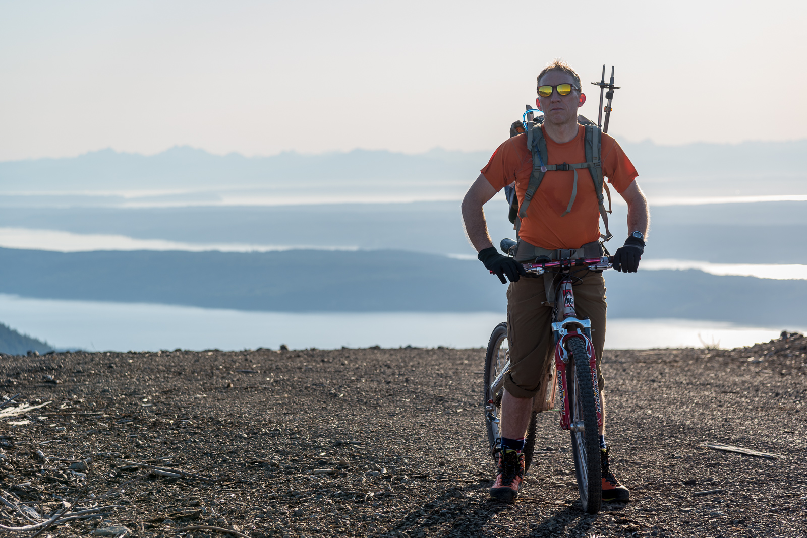
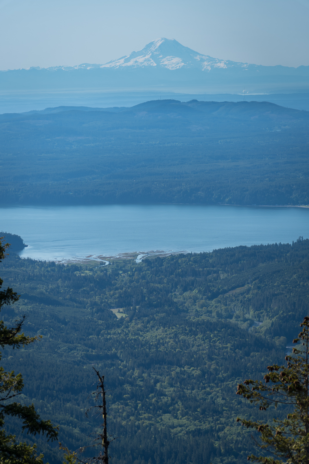
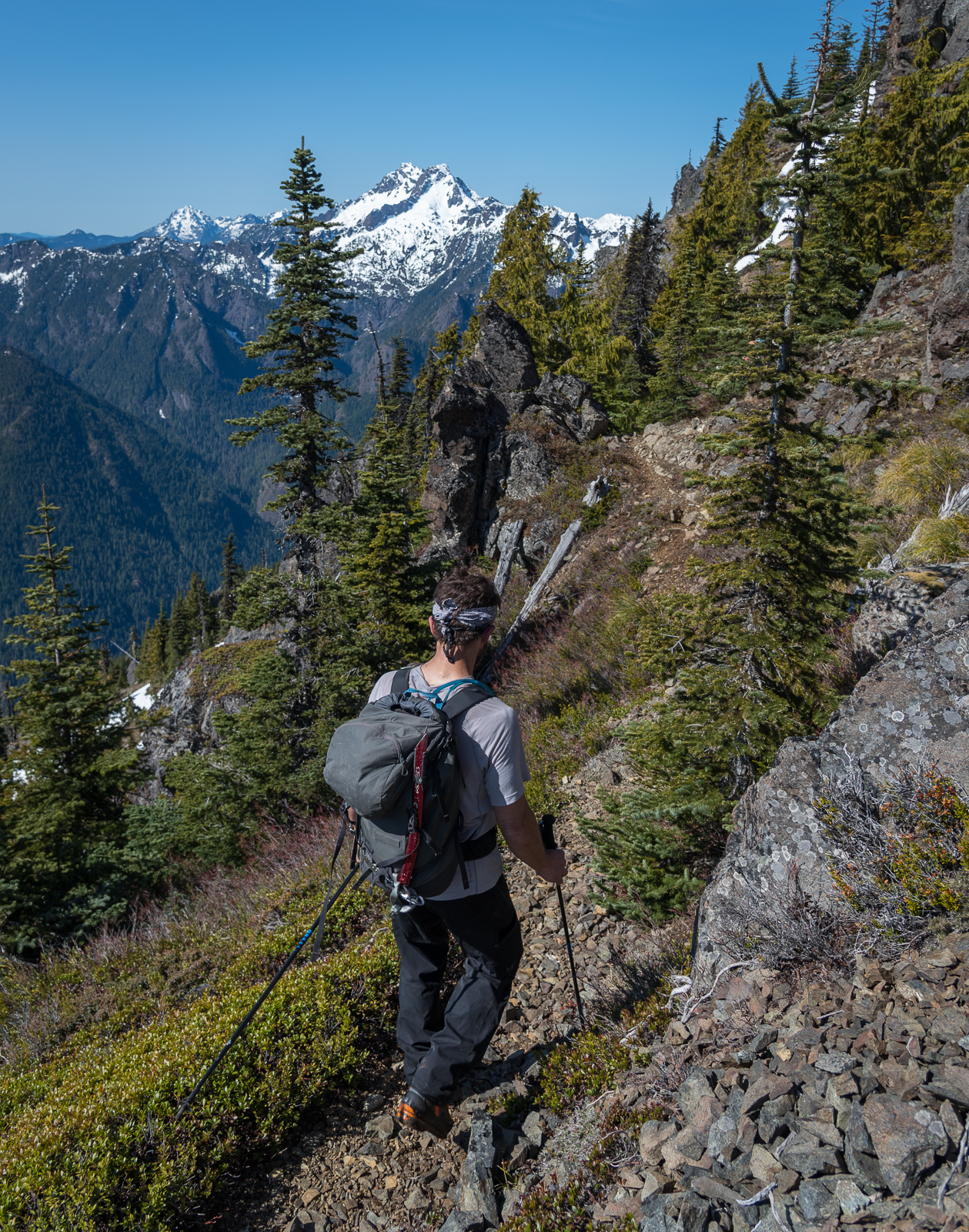
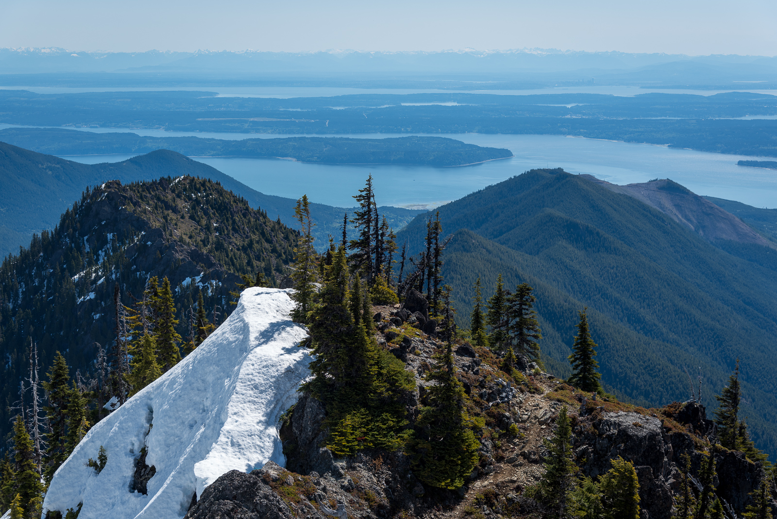
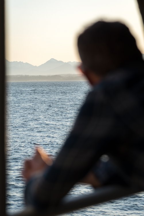
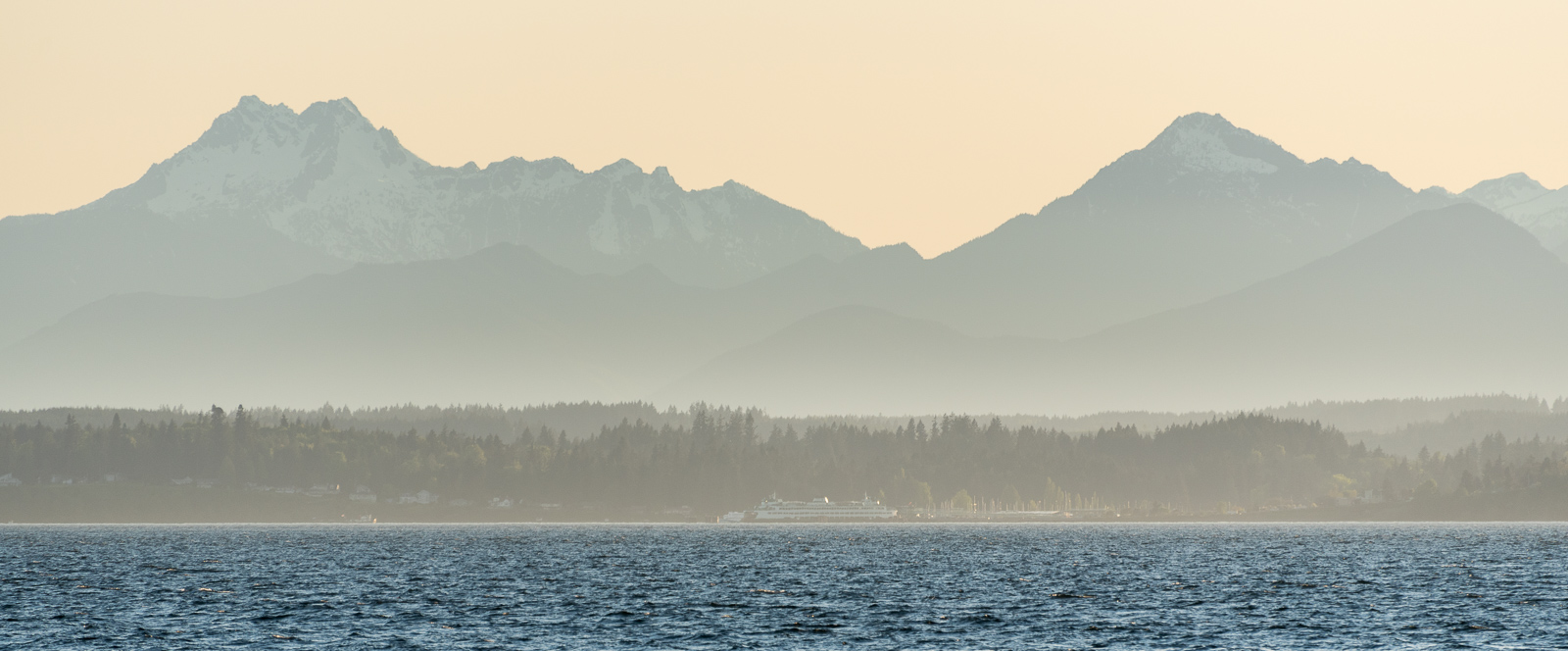
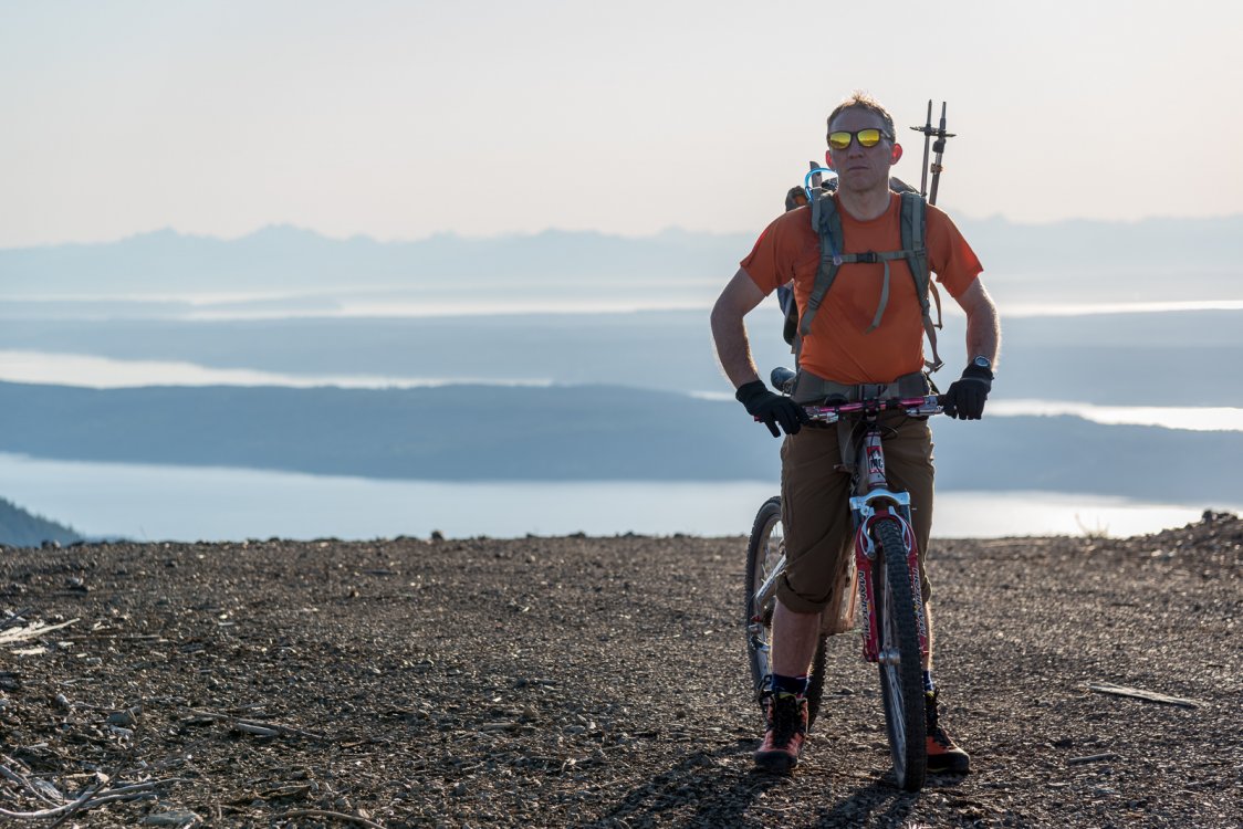
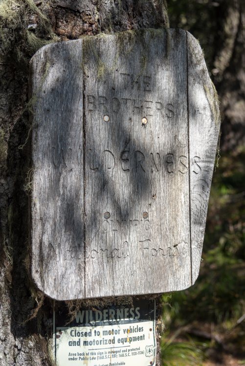
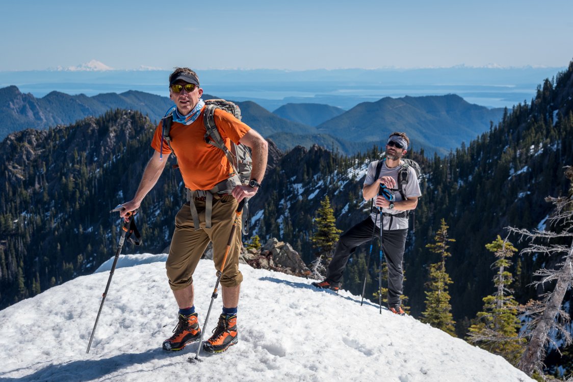
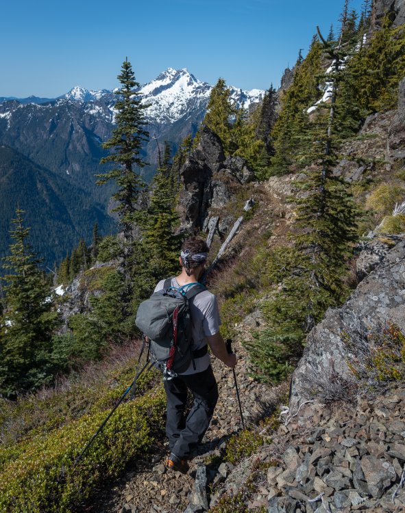
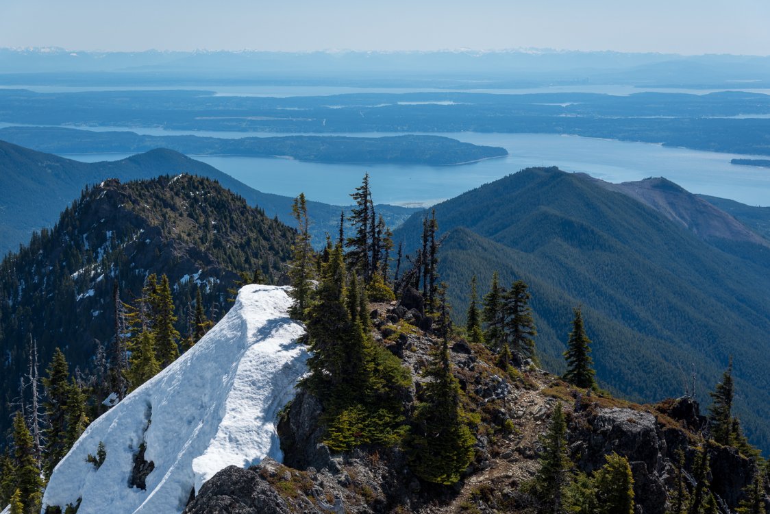
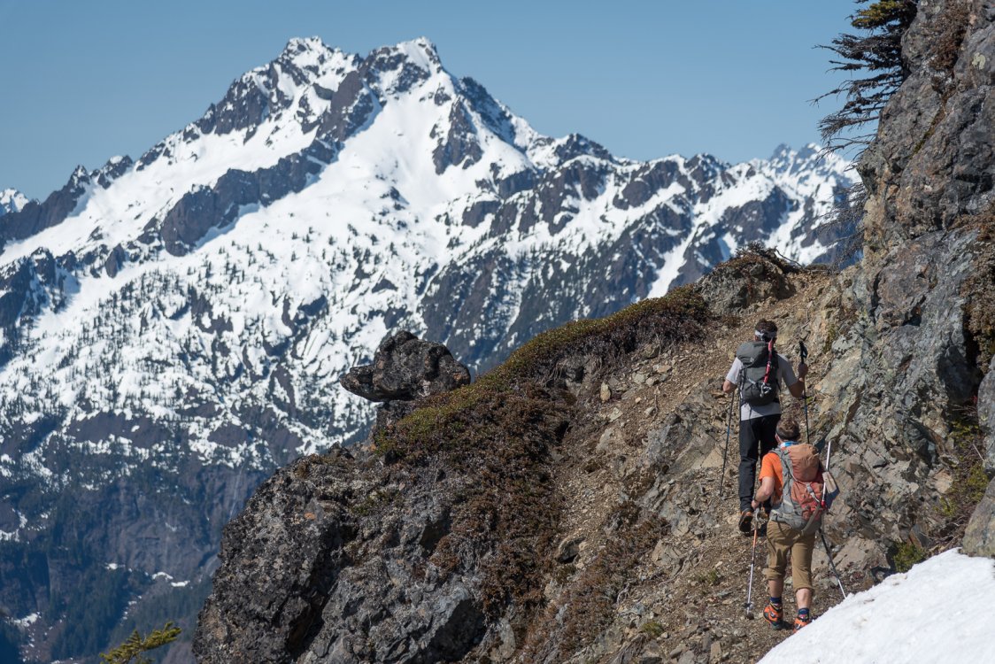
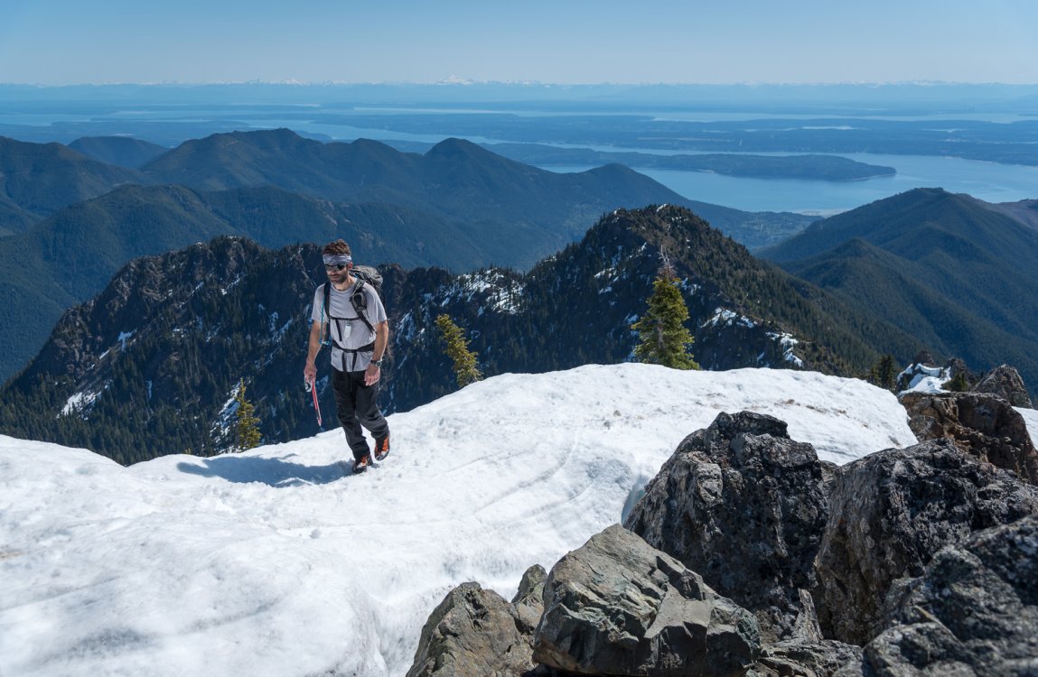
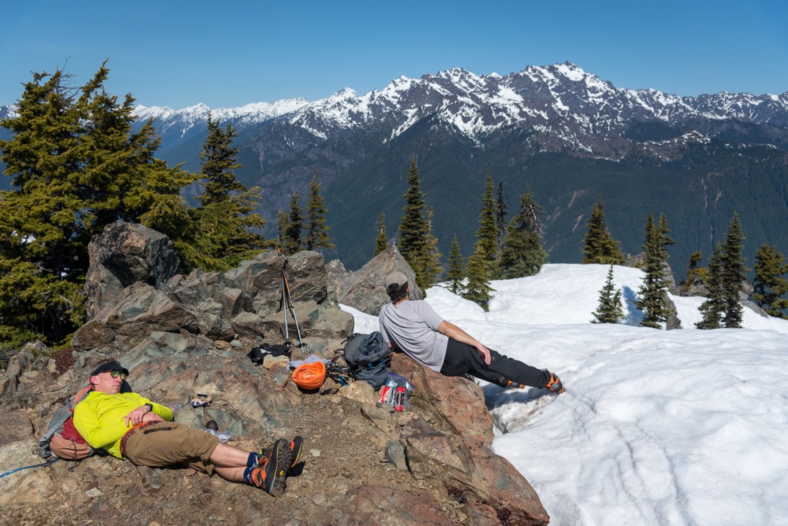
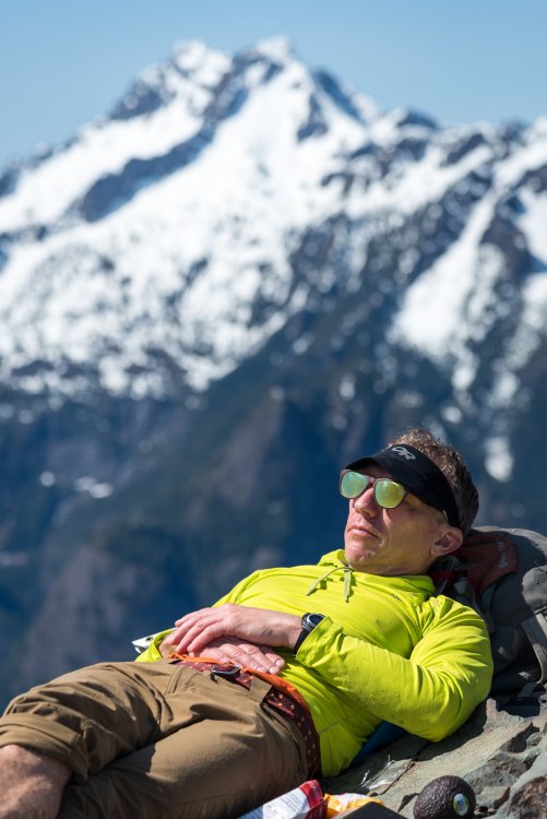
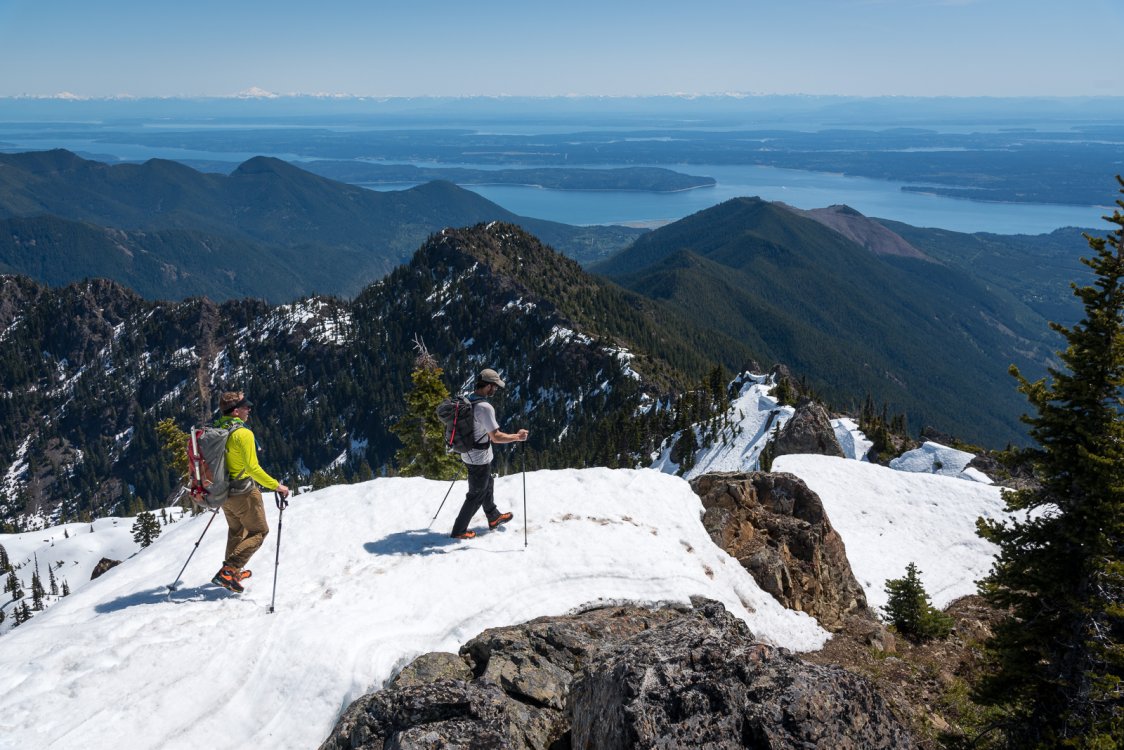
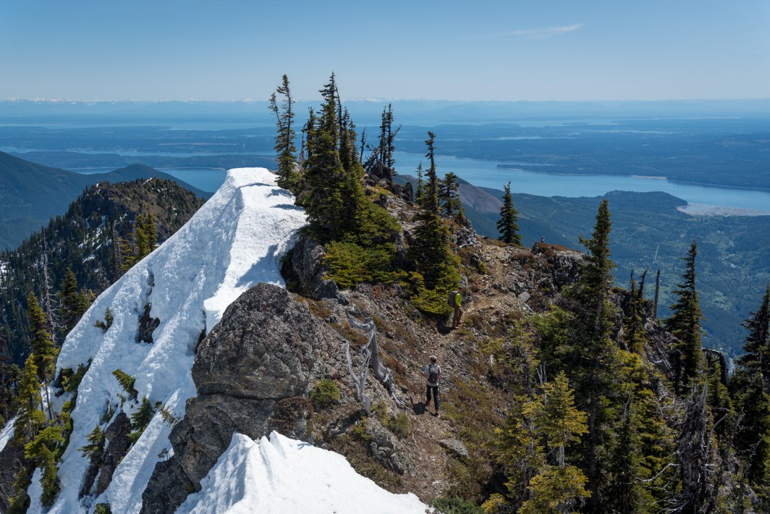
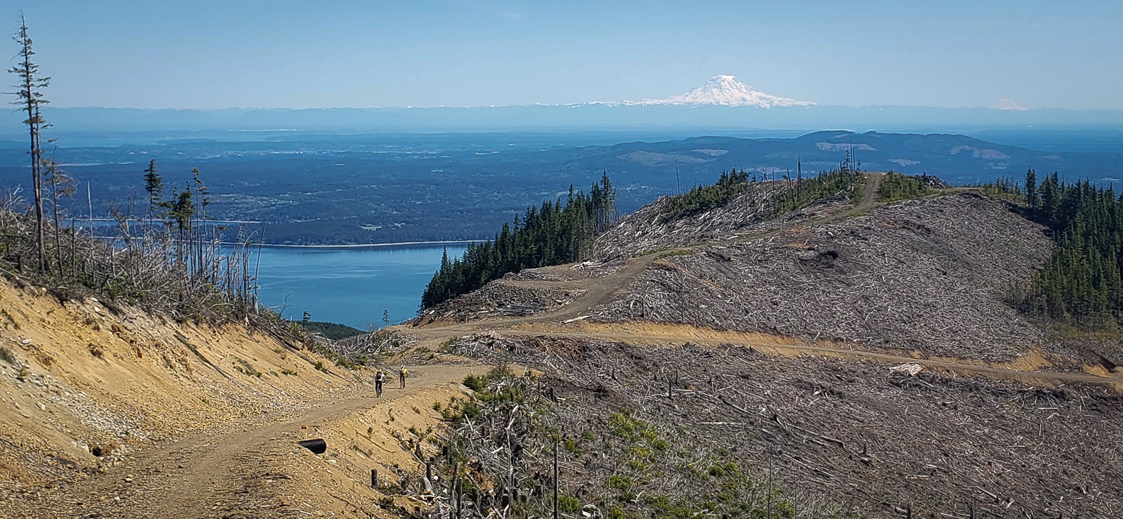
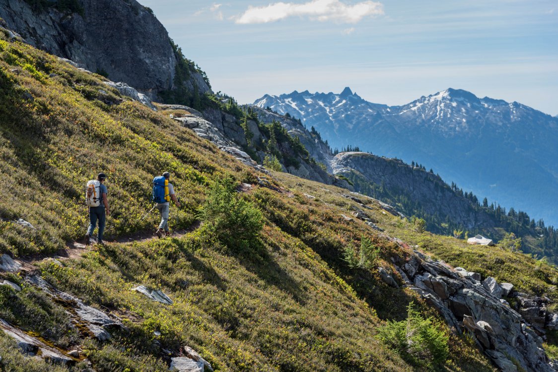
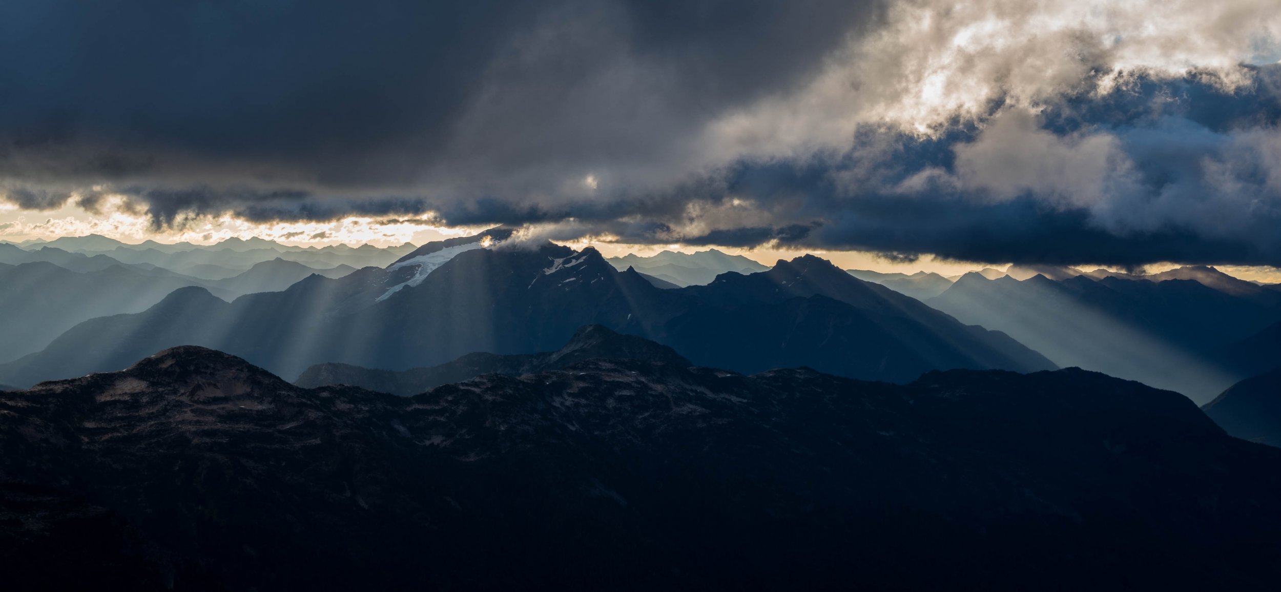
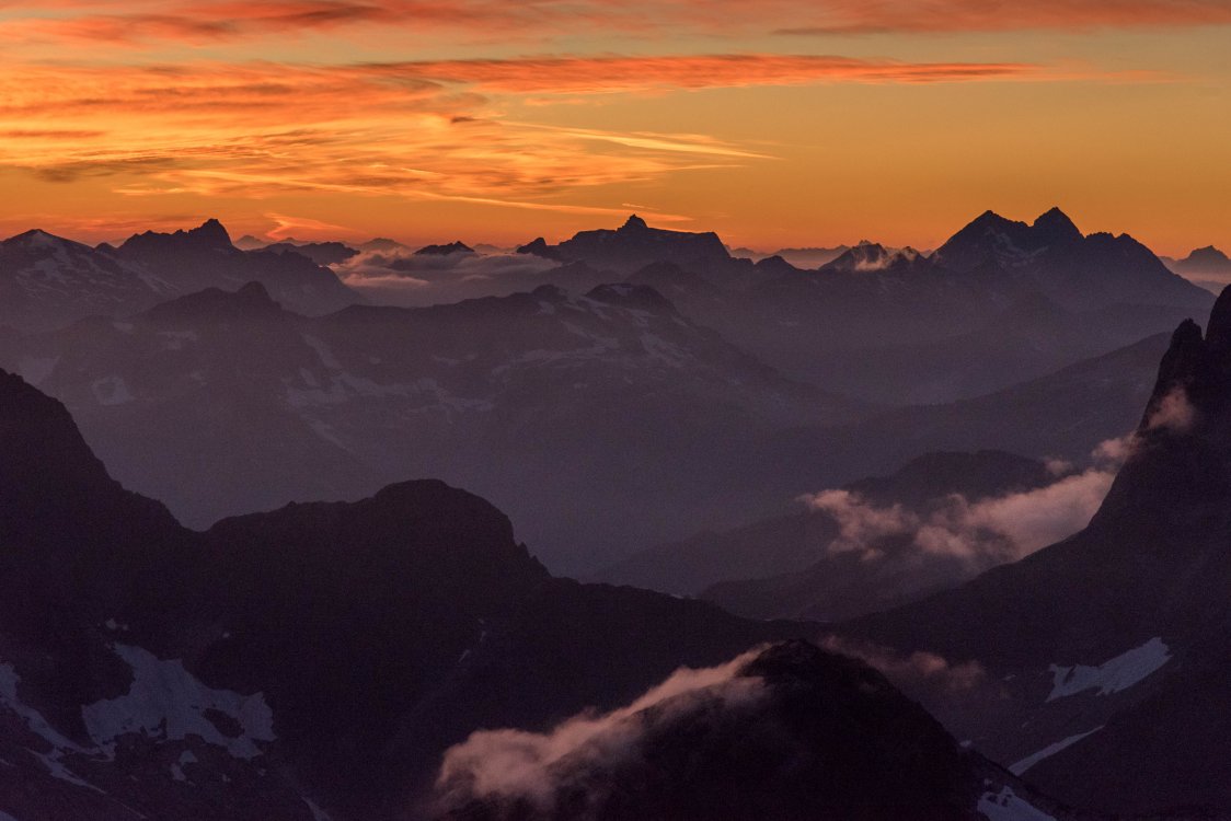
Trip: Mount Jupiter - East Ridge (standard) Trip Date: 05/08/2020 Trip Report: My trip down 2020 memory lane continues! We've moved up to May now. The pandemic is still slowing unfolding but people are going back to work and the lockdowns are easing. Public land is open in some instances (Olympic National Forest) but closed in other (MBSNF, national parks, etc.). Your friends were likely in two camps- those still locked down and those that were straining for the freedom of the hills. Quietly, I rallied @therunningdog and @Trent, two of the chossdawgs who were straining at their tethers. It didn't take much cajoling to convince them to launch across the sound for a quick strike to the east side of the Peninsula. Growing up around Seattle you can't ignore ol' Jupe, it is right there on the Olympic skyline, standing proud at sunset like an Olympic version of Mt. Pilchuck. Jupiter is small, beautifully shaped, and larger looking than it really is, sitting at the edge of the range like it does. We were all smitten, or at least mildly interested. Beggers can't be choosers! The Brothers (L) and Jupiter (R) from the Edmonds Kingston ferry We drove up to the trailhead from the ferry the night before, finding an excellent spot to throw down our gear in the dirt for the night The next morning dawned clear and crisp and we climbed on the bikes for the punishing grind up to the normal TH. Recent logging has made this section view rich, but also has meant that the public is no longer allowed to drive the few thousand vert to the proper trailhead (which has been logged over anyways). We opted to take the road a bit further to the ridge crest then go cross country to the trail. It might not have saved much on the way up but meant for a longer descent on the bikes. And so we began the long hike to the summit. A former lookout site, Jupiter has a well graded trail all 7 miles to the summit. It was just what we needed after many weeks of limited mountain access. Steve hiking the scenic trail with the Brothers beyond Another great look at the Brothers It was a glorious day with 360 views of the Olympics, Puget lowlands and Cascades. You could easily see from Canada to well south of Rainier! A long break was called and observed with some well earned R&R. Way sooner than we would have liked (we had a ferry to catch) we began the descent back to the bikes. We hadn't seen anyone all day and that theme continued on the exit. I think many are scared off by the long distances involved in doing this in a day, but bikes make is quite reasonable with a trailhead bivy. Just make sure you have disc brakes and suspension! It was an adventure on my bike.... This view is just leaving the summit, looking down the ridge that is ascended. The trail roughly follows the ridge east, all the way to the clear cut in the distance. From there bikes will take you steeply down to your car deep down in the trees. Now, when I watch the sunset from the park by my parents house, I can look Jupiter in the eye and tip my hat to a fine peak. And to the memories of a perfect day in the alpine with good friends. May is coming soon, best be ready! Gear Notes: bikes are key since the road is gated low these days. Approach Notes: Follow the descriptions and drive as far up the road as you can


-
Yeah, we debated the standard upriver treatment for that gate, but settled for semi-legal guile. No gates/locks were harmed in the vehicle extraction!
-
I bet brushy and annoying. Seems like a spring type destination given that it is under 6k with no trail?
-

best of cc.com [TR] Pakistan - K6 Central 10/09/2020
JasonG replied to JeffreyW's topic in The rest of the US and International.
DAMN!!!! I was hoping you'd post something here on your remarkable ascent. An instant cc.com classic! Well done you two. I have huge respect for how you represent the 9-5 crowd in the greater ranges, carrying the Swenson torch. I'm less excited about you demolishing my many excuses. -
They have great drugs these days.
-
I hope someday I can start learning things by drinking beer. Right now I just get more stupid, but I'm sure big tech is working on that.
-
Trip: Diobsud Buttes - Standard Trip Date: 04/16/2020 Trip Report: How has it been 8 months since I posed a TR??!! Can I blame COVID? You may think that I am now 300lbs, into gaming, and sitting on my basement couch. Oh no! I'm just the same old punter, a bit older and a bit slower, but definitely still in love with the alpine..... So, since the weather has turned and I've caught up on my image editing, I'll turn the clock back and start putting out some TRs over the next couple months. I know you all can't just live on powder and face shots...... April 2020. Public lands were shut for the most part, but dispersed recreation on USFS lands allowed as long as you don't use trails or trailheads. Not a problem in the Skagit! But, in order to be good citizens, @Trent and I agreed to meet at the trailhead rather than carpool. This will come back to haunt us later that day. We drove in tandem up the excellent Diobsud Creek Road to about 2200' were we were stopped by snow. Not a soul around. Perfect. We walked up the road for a bit until it was time to leave for the off-trail fun at about 2600'. Less perfect. Soon (in hindsight) the brush was left behind and we emerged into the glorious alpine to great views and a chance to use our snowshoes. You know you're in for a good time when you put those on. Steve didn't have a chance to use his sunglasses, however, as they were at home. D'oh! After a bit of clumping up the ridge we reached a false summit (previous highpoint for us a few years ago) and a view towards the Buttes. It looked steep, but at least the snow was quite soft at this point in the day: We couldn't bear the thought of failing a second time at the same spot, so we continued clumping. Down, down, down, then up, up, up. Did I mention that Steve didn't have sunglasses? It was bright for him, I'm sure. We got to the summit of the the SE Butte (5850') and it looked like an easy stroll over to the higher, NW Butte (5893') and so we headed that way without delay: But, uhhhhhhhh, this is as far as we got. Just in front of Steve is a really steep gash in the ridge with a huge cornice off to the right and a death gully to cliff on the left. It probably would have gone without a rope if we were desperate, but we weren't. And so we settled for some whiskey, chocolate, and a nap in the sun on the lower summit. Soon enough it was time to descend into the slush and shenanigans. But the Buttes weren't done with us! We got back to our vehicles in good time and sat there drinking beers, eating chips and generally enjoying being outside in good company after weeks of being locked down. We were in no rush. But the sun sank lower and we reluctantly got into our rigs for the drive down. Only to find the gate at the bottom of the road LOCKED! What??!! Were we in trouble??? We thought we had followed all the rules, but it was a pandemic so we couldn't be sure. @Trent and I moved the rigs back up from the gate (not the greatest neighborhood up there) and walked down to where I could barely get a call out to my wife. Needless to say, social distancing was the first casualty, since our kids are small and the whole family came up to rescue us (waaaaay past their bedtime). I was pretty sure I was going to be the next casualty. But, I survived, and so did @Trent. We got our vehicles out the next day, somewhat legally (story best told around the fire with whiskey). And, most importantly, nobody got COVID. The end. Maybe we'll be back for the higher Butte. Maybe. Gear Notes: Sigh....Snowshoes Approach Notes: Diobsud Creek Road to ~2600'. Leave road and head straight up ridge towards peak. Depending on snow depth, expect shenanigans. Spring is best after snow settles and a hard freeze.
-
So rad! Did you try and put photos in? I'm not seeing them....
-
Listen up Tech bros! Sprinters are lame. This will score you tough guy points, way more than your mustache.
-
Wow, you make it all seem so casual!! I suppose it is for the young and skilled. So great that you nabbed both those classics in a short trip.
-
What did you find @CascadEagan? I have a Nikon but don't think I dropped anything?? So crazy that two parties were on the traverse the same weekend! First time ever, most likely. And yes, the wind was INSANE. I'm glad we weren't on the ridge like you were. That would have been quite scary.
-
Anyone Coached by Uphill Athlete or Other?
JasonG replied to Colin1984's topic in Fitness and Nutrition Forum
I'll let you carry my camera gear on your cardio days @Colin1984! -
I didn't. Headed to UT Saturday! I heard there are a lot of rocks down there.
-
@keenwesh is spot on. The Downey fire will mess up the last bit of the exit, but not enough to scare anyone off, I don't think. It will be well beat in by July next year.
-
That looks OK, I guess, if you're into that sort of thing.
-
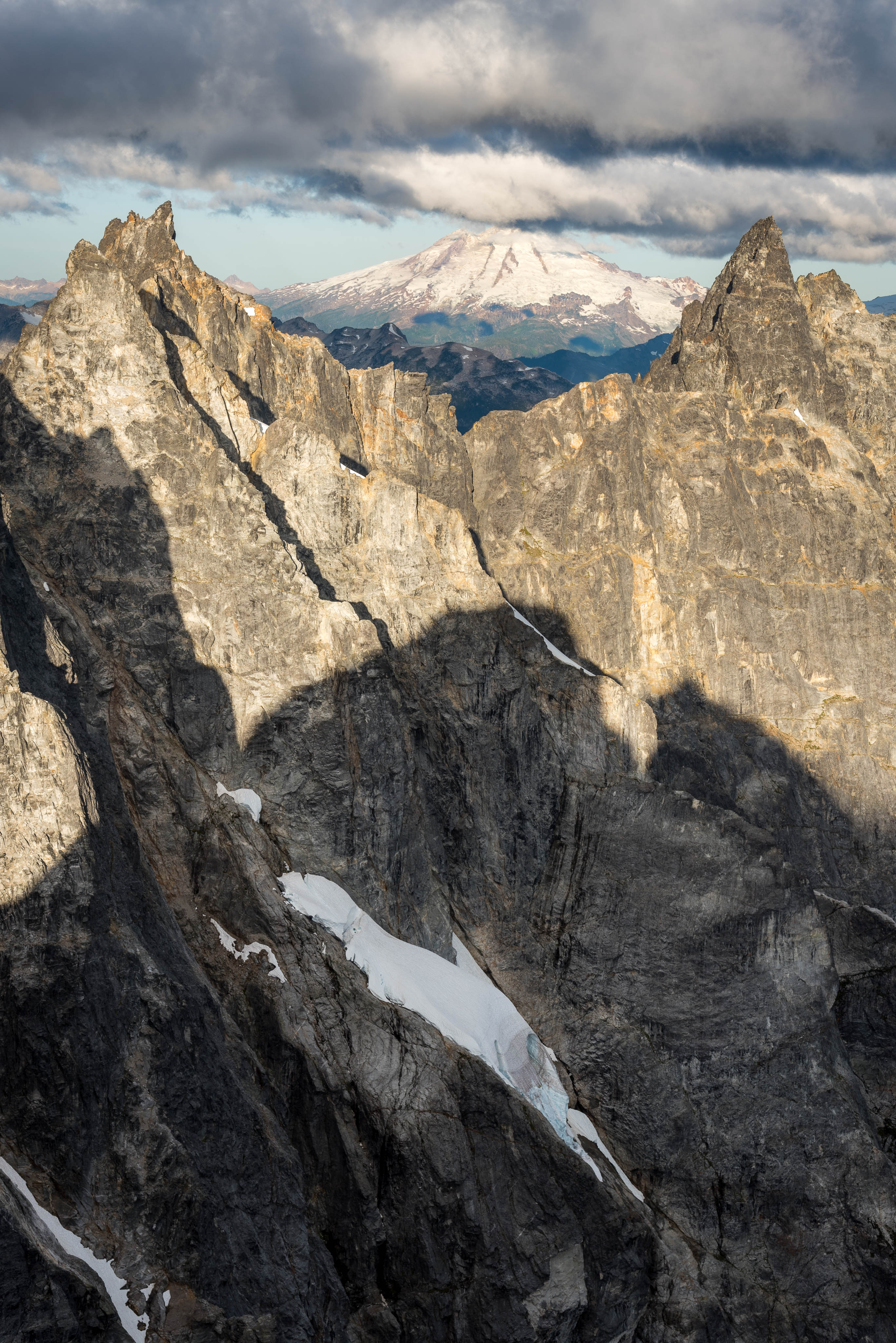
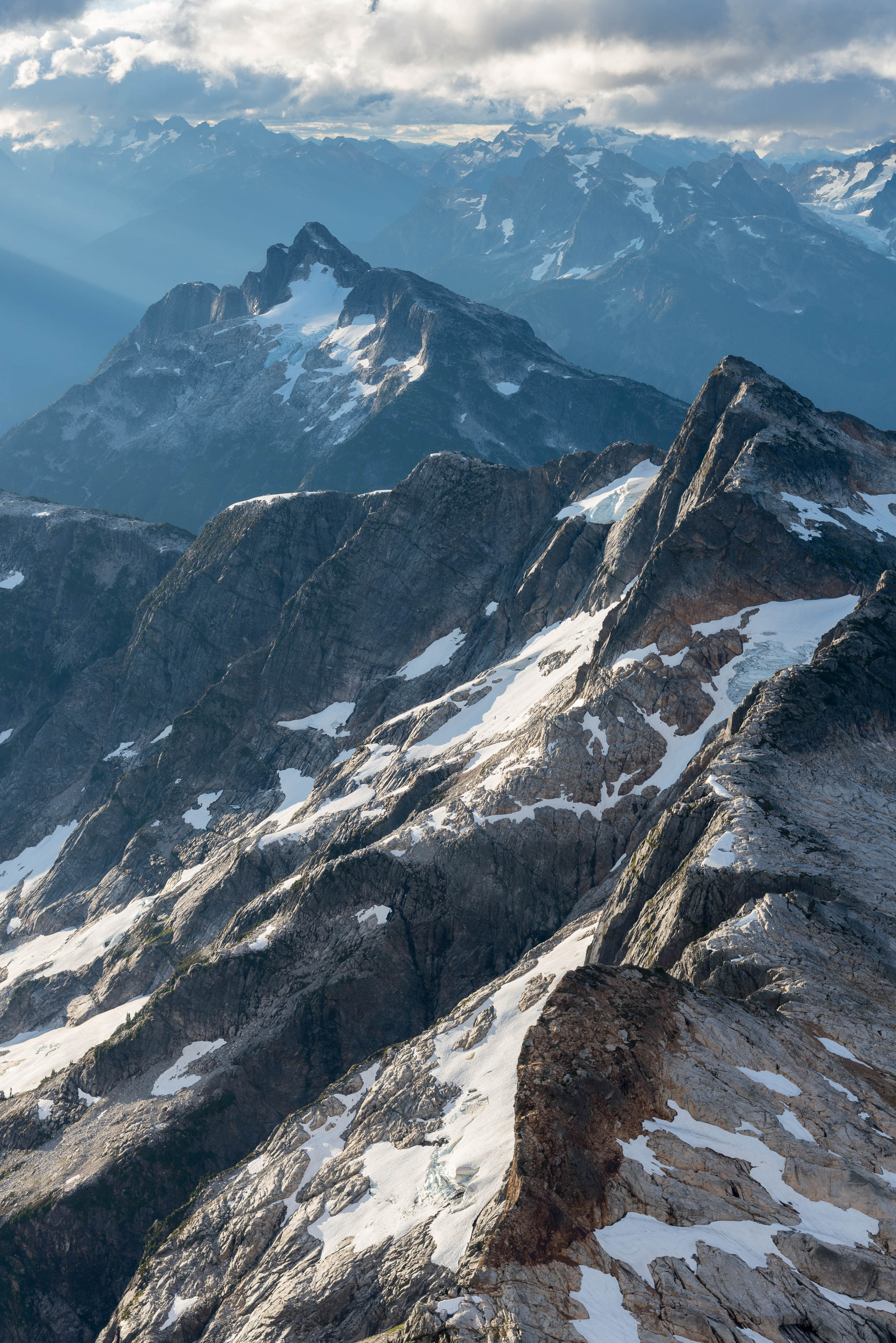
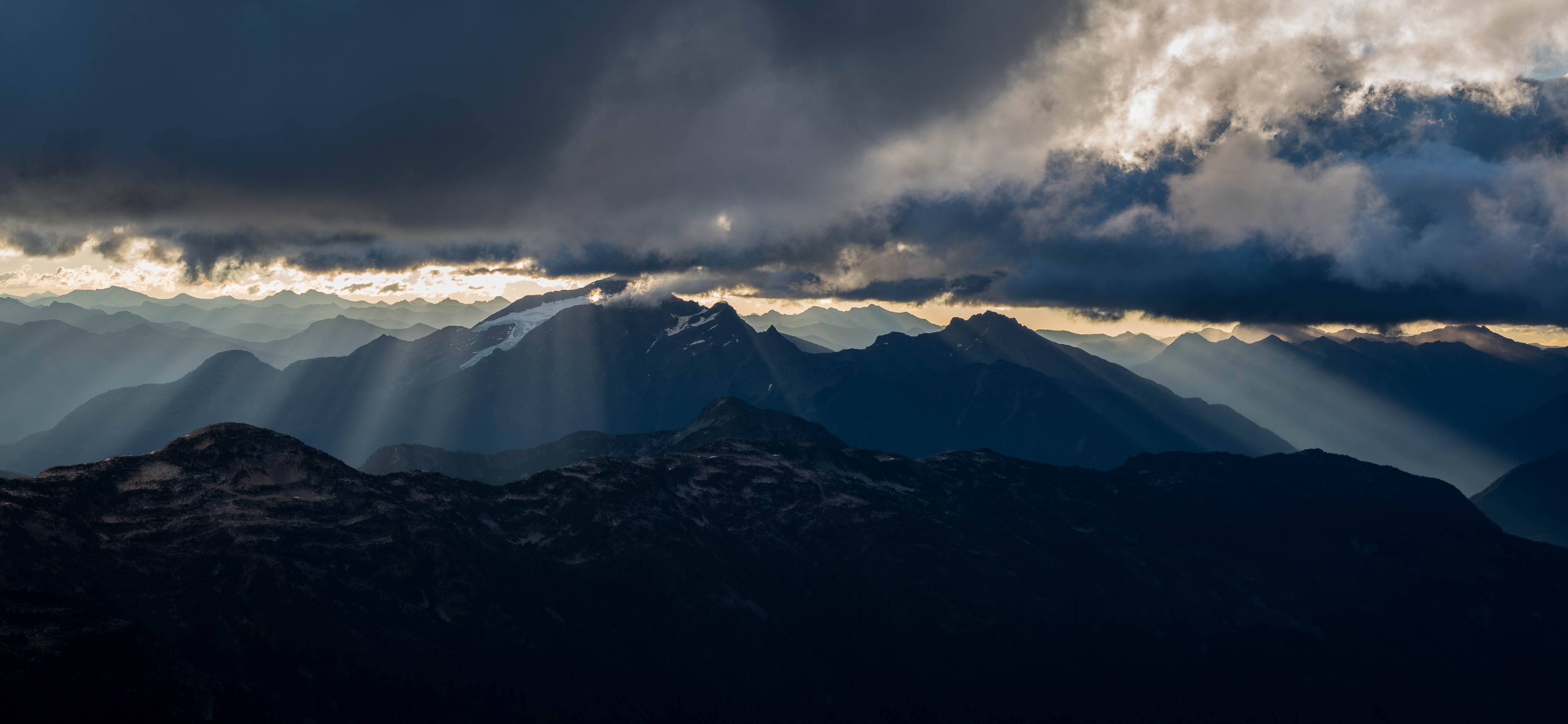
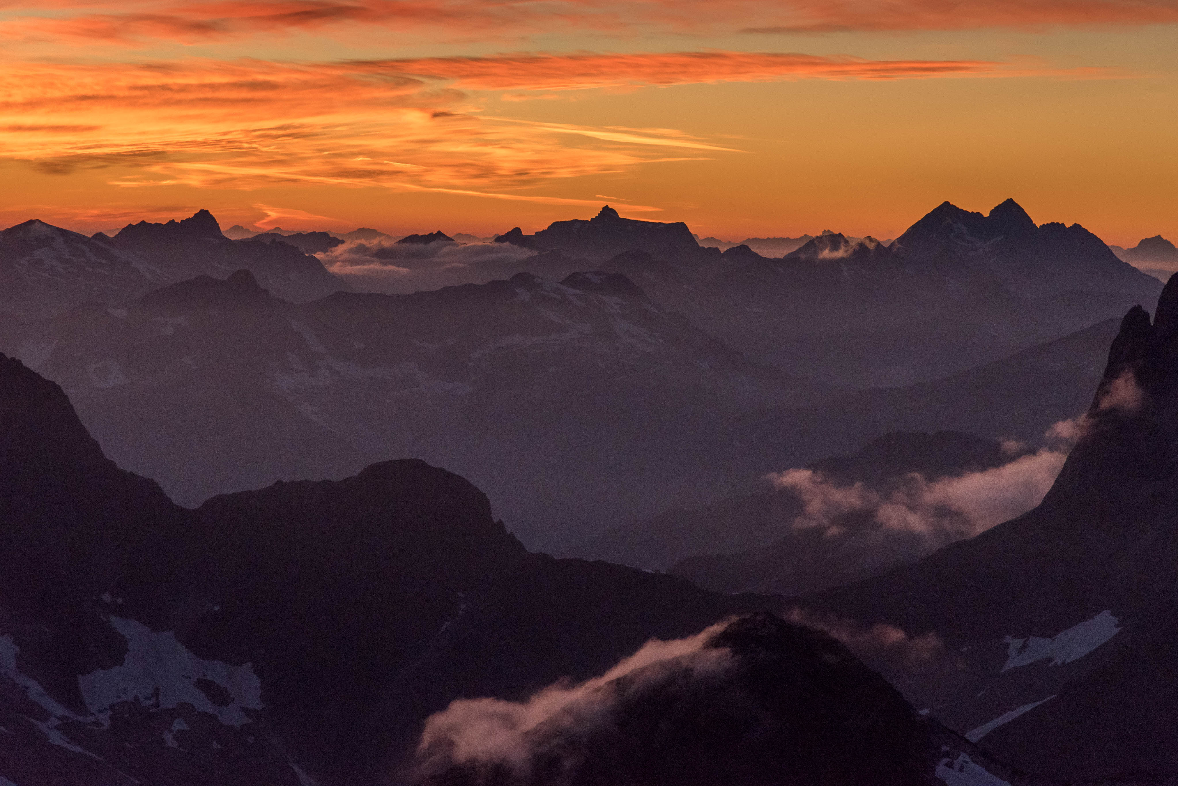
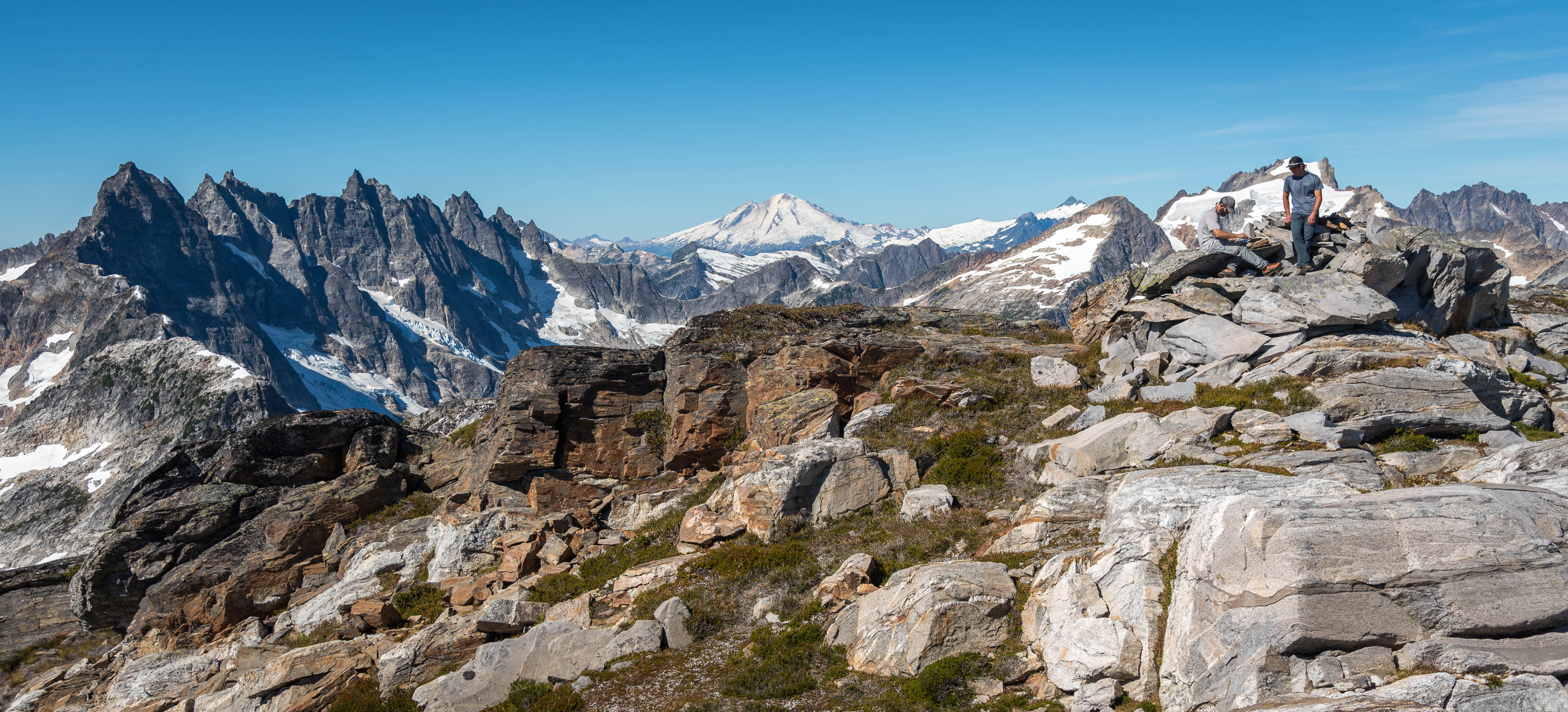
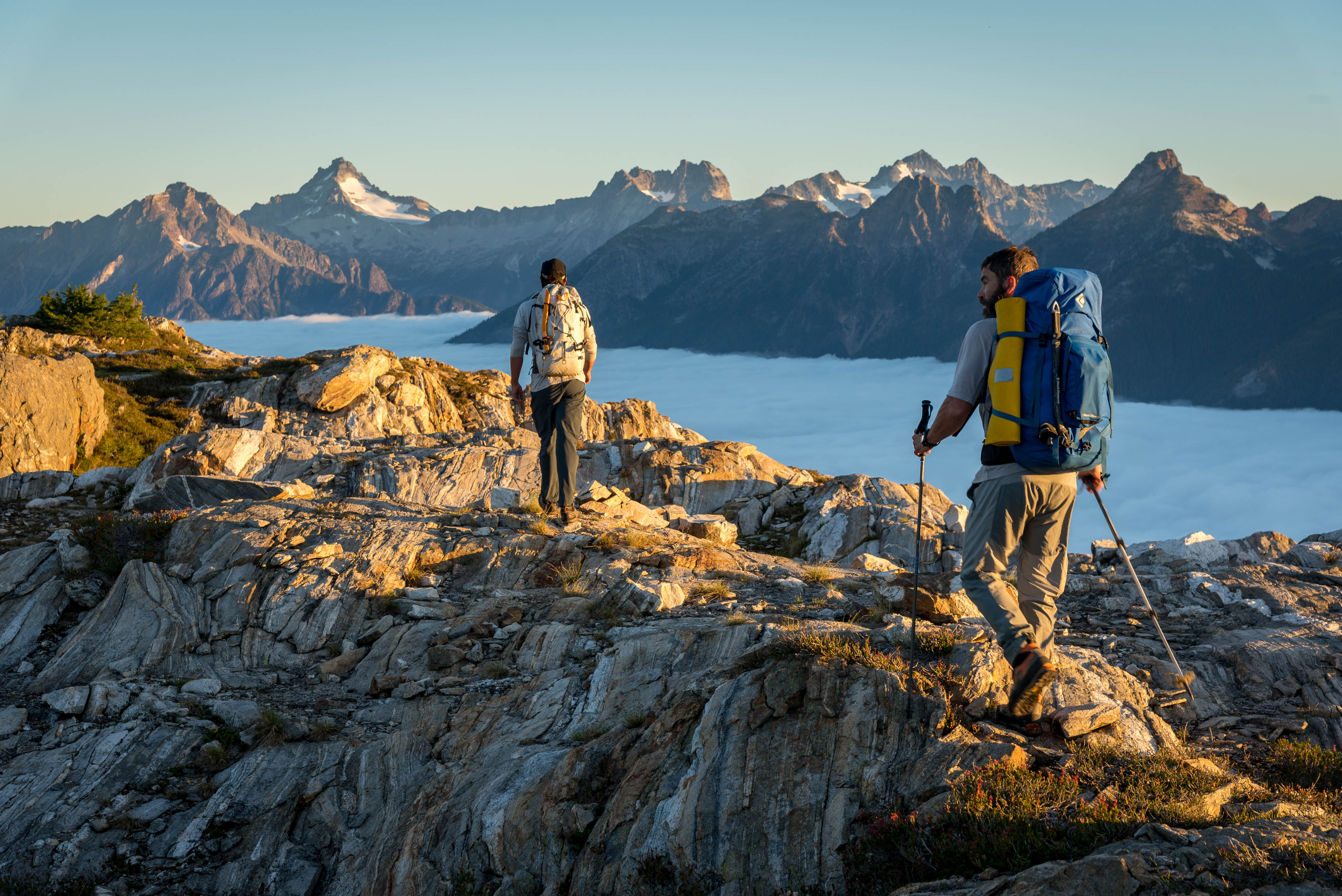
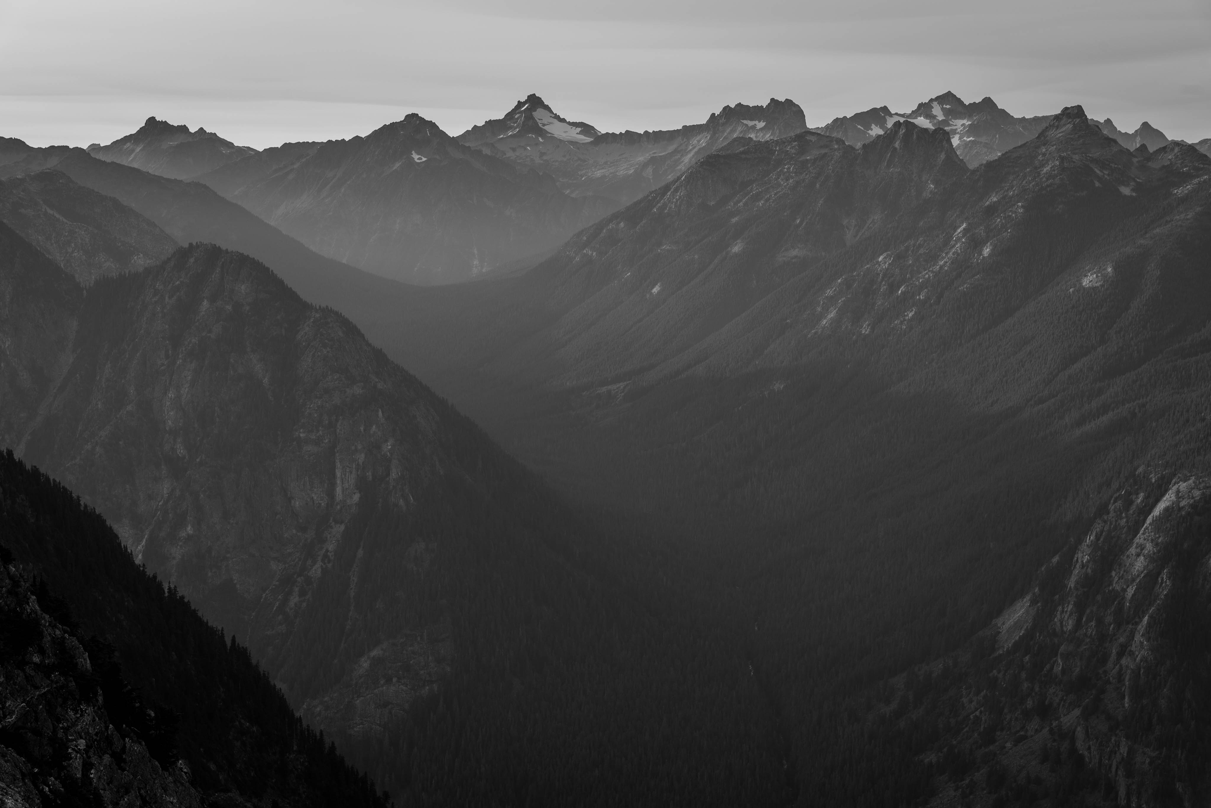
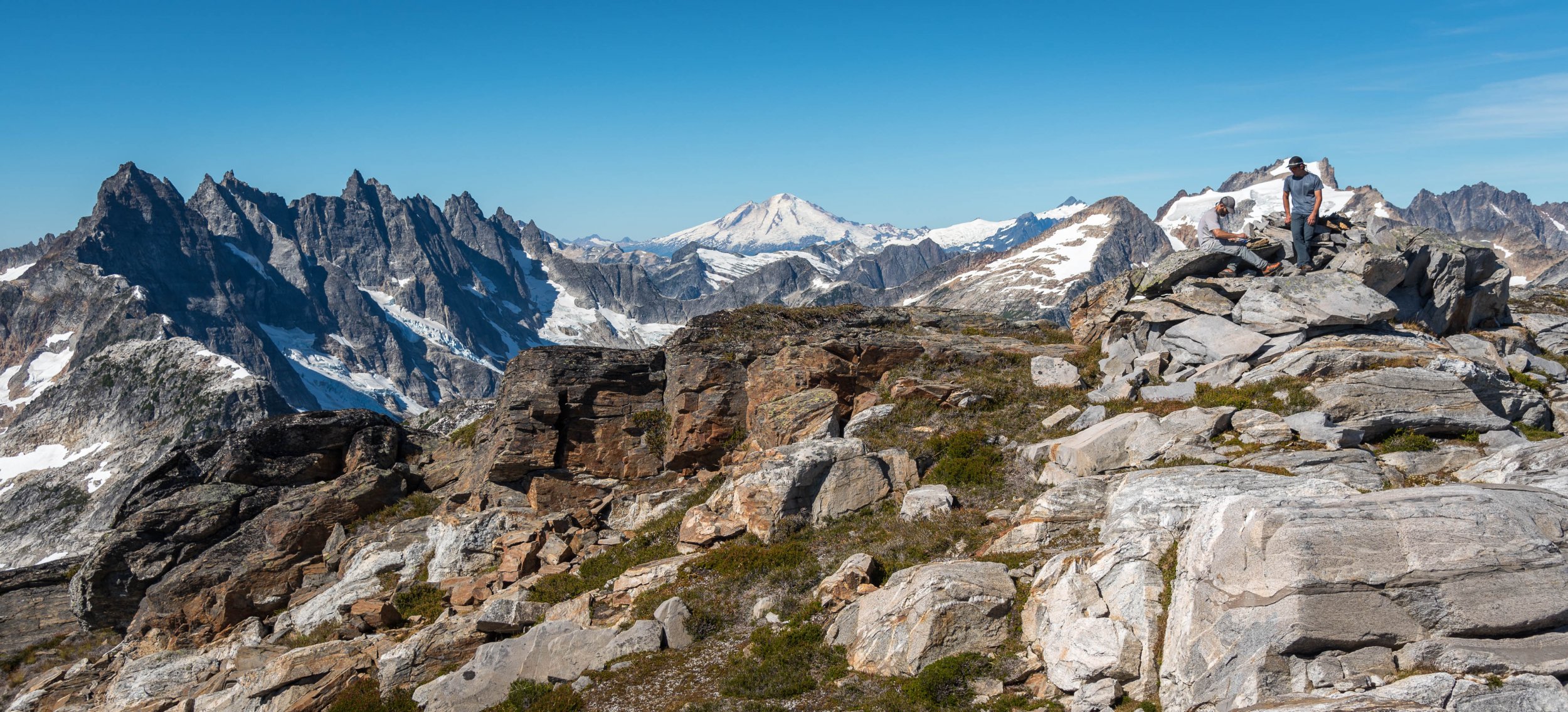
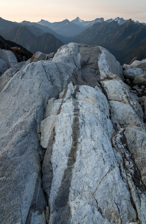
As promised, more photos! Looking up the Big Beaver over Beaver Pass at the Redoubt group. Heading to Elephant Butte Summit of Elephant Butte The ridge narrows and Mac Spires loom above @kmfoerster Unknown people posing for me below West Mac Dinner with a view on West Mac Sunrise was windy but spectacular North to Davis Peak (L), and West to Degenhardt, Kulshan, and Terror (R) Teebone ridge on the walk out from Terror Basin


-
MEC declares bankrupcy and sells itself to a private equity firm
JasonG replied to RichardKorry's topic in Climber's Board
This looks like it is a good replacement: https://www.gossamergear.com/products/thinlight-hammock-pad#specs -
So crazy! And that isn't even a big bear, by brown bear standards.
-
[TR] Cutthroat Wall - One Piece at a Time (5.10d) 09/20/2020
JasonG replied to Ben Johnson's topic in North Cascades
Right on @Ben Johnson! Glad to hear that it all worked out. -
Best thing I've seen this week since this. The iceberg's motion reminded me of the end of the video. Don't look away!
-
MEC declares bankrupcy and sells itself to a private equity firm
JasonG replied to RichardKorry's topic in Climber's Board
I saw that @DPS, but couldn't find an Evazote dealer online? -
Apocalypse Now?
-
MEC declares bankrupcy and sells itself to a private equity firm
JasonG replied to RichardKorry's topic in Climber's Board
They have been my source for "hardman" pads for a long time. It is an integral part of my kit, not because I'm hard, but because they really work to give you comfort around camp without danger of deflating anything. And they're a great backup pad and hardly weigh anything. But, it doesn't look like they carry them anymore anyways? Perhaps this is similar enough? https://foammart.com/product/l200-14-colors/ -
Atacama 2010: Licancabur & Socaire
JasonG replied to Kameron's topic in The rest of the US and International.
wow. For a second, I thought you were talking about your bowels.