JasonG
-
Posts
5260 -
Joined
-
Days Won
343
Everything posted by JasonG
-

Ascent Outdoors and Ascent Cycles closed suddenly
JasonG replied to NikiY's topic in Local Gear Shops
I think it's a generational cheap bastard thing. It's funny, I have all sorts of gear that only lives in the mountains and my basement. I feel funny wearing it in the lowlands, mainly because I'm so cheap I want to prolong the life as long as possible. When it gets totally patched and ratty like my '98 Marmot puffy, I stop taking it to the mountains and go get beer money at the nearest off-ramp. -
Ascent Outdoors and Ascent Cycles closed suddenly
JasonG replied to NikiY's topic in Local Gear Shops
I bought my first pack there in the mid 90's, a bulletproof Osprey that has been all over the world with me (it was a major expenditure for me in those days). I still have it, but mostly it gets lent out these days since it weighs about 8 lbs. Most recently it went on a month long NOLS trip to AK with a friend's son. -
Ascent Outdoors and Ascent Cycles closed suddenly
JasonG replied to NikiY's topic in Local Gear Shops
Hey, it was the 90's, man. -
Ascent Outdoors and Ascent Cycles closed suddenly
JasonG replied to NikiY's topic in Local Gear Shops
Oh? I guess when I moved north years ago I lost touch. When did that sale happen? Great name dropping... more memories. Ian fitted my first pair of Intuition liners at the shop back around 2005. I spent a memorable evening chatting with Keith at the base of Prusik in 2000.... -
Ascent Outdoors and Ascent Cycles closed suddenly
JasonG replied to NikiY's topic in Local Gear Shops
I bought a lightly used pair of Birkenstocks at Second Bounce when it was in Fremont, sometime in the late 90's. They were $25, and I'm still using them (with new soles). I also bought a pair of barely used Scarpa SLs for $40 before I went on our first Nepal trip, and used them for many hundreds of miles (thousands?) over the past 15 years (again with a new sole courtesy of Dave Page). I guess this mostly means I should have spent more money there over the years! So many good memories in that store ( @wbk @runningdogWaddington presentation, etc.!), and agree that the Seattle area is much worse off for their closure. -
It's on the list, thanks for the reminder!
-
Ascent Outdoors and Ascent Cycles closed suddenly
JasonG replied to NikiY's topic in Local Gear Shops
I guess I waited too long to use my store credit. -
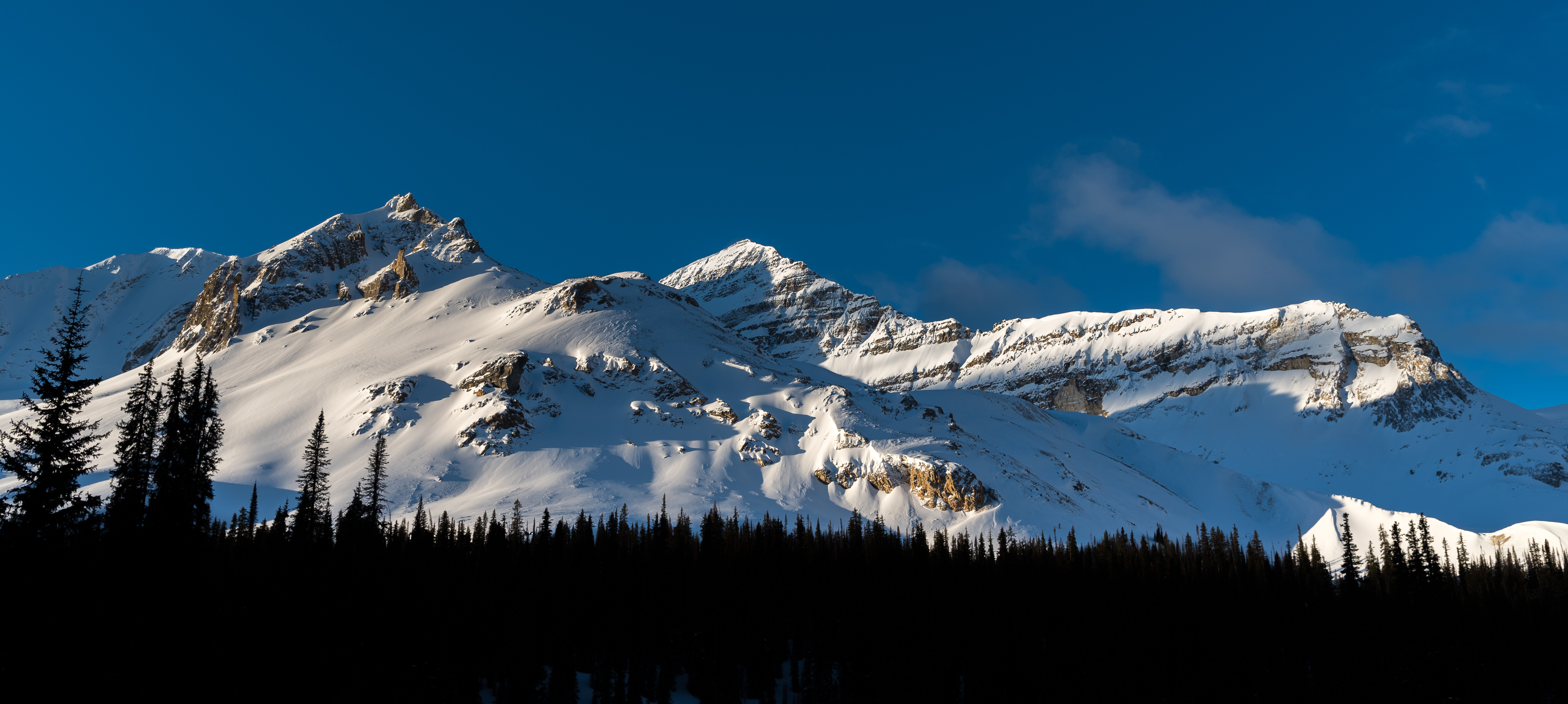
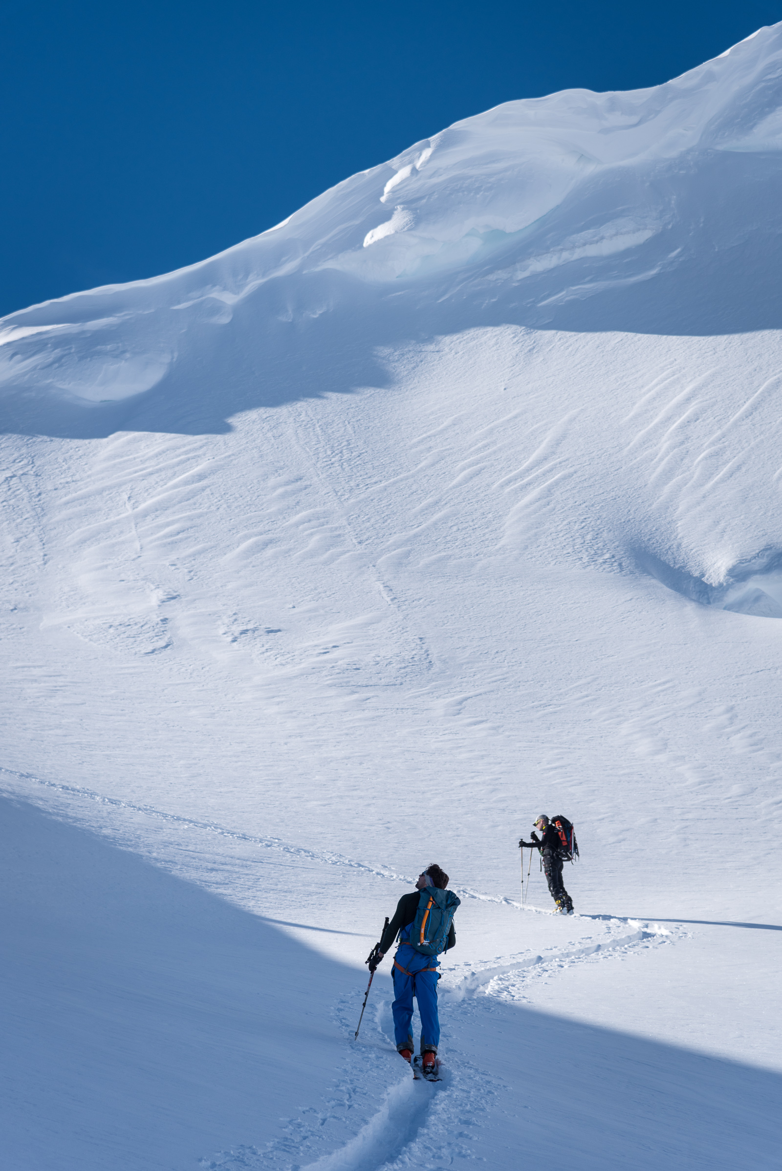
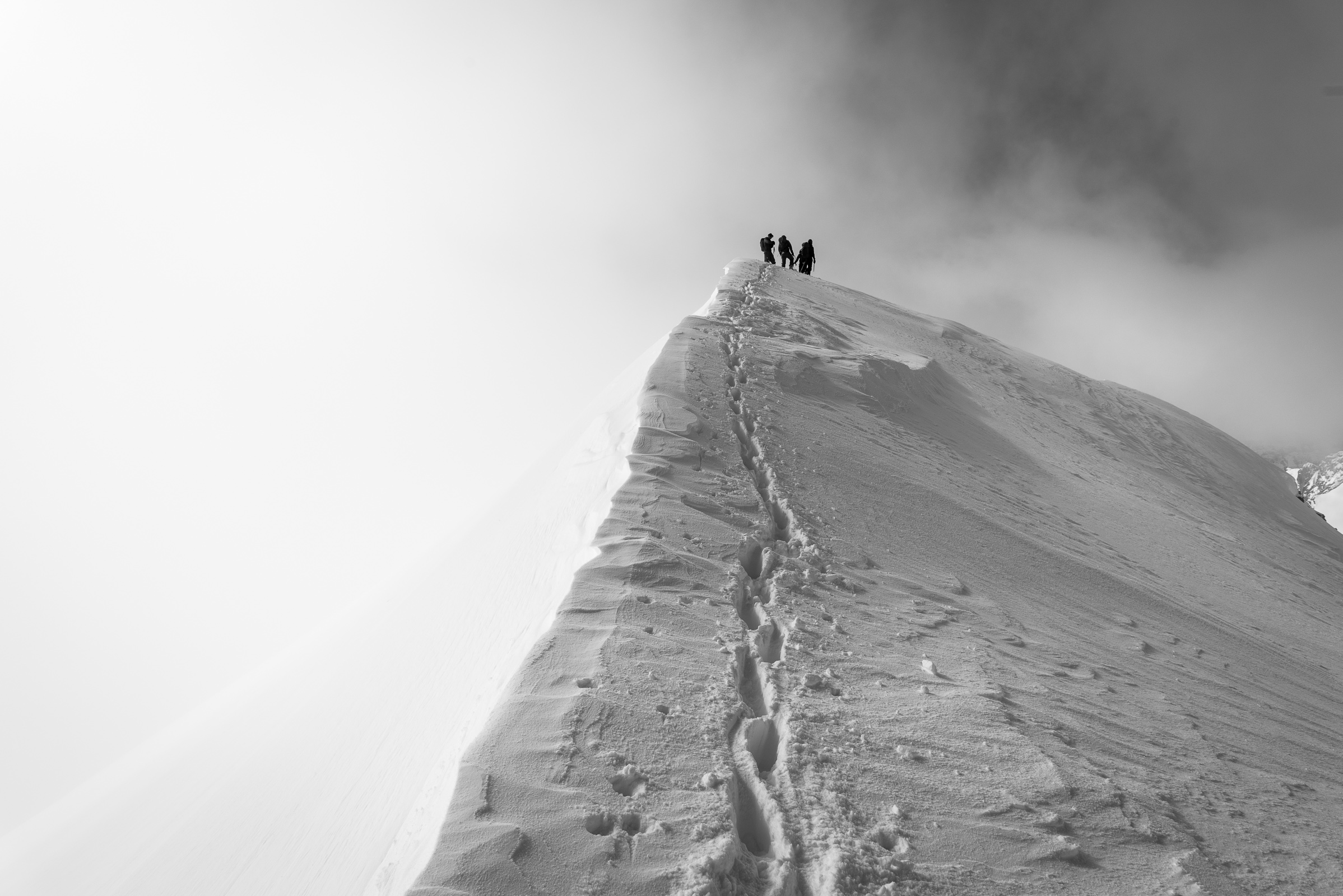
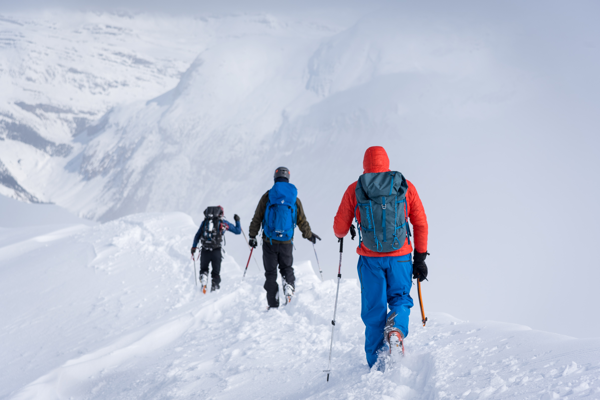
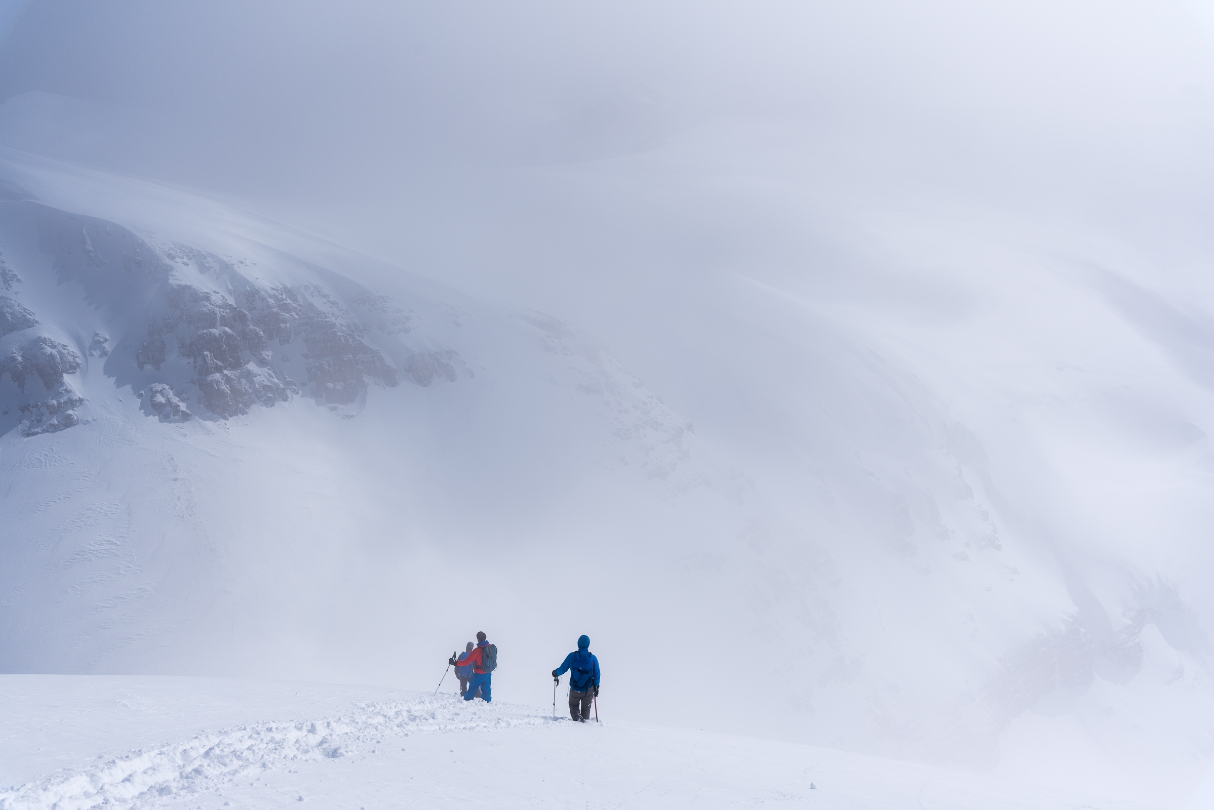
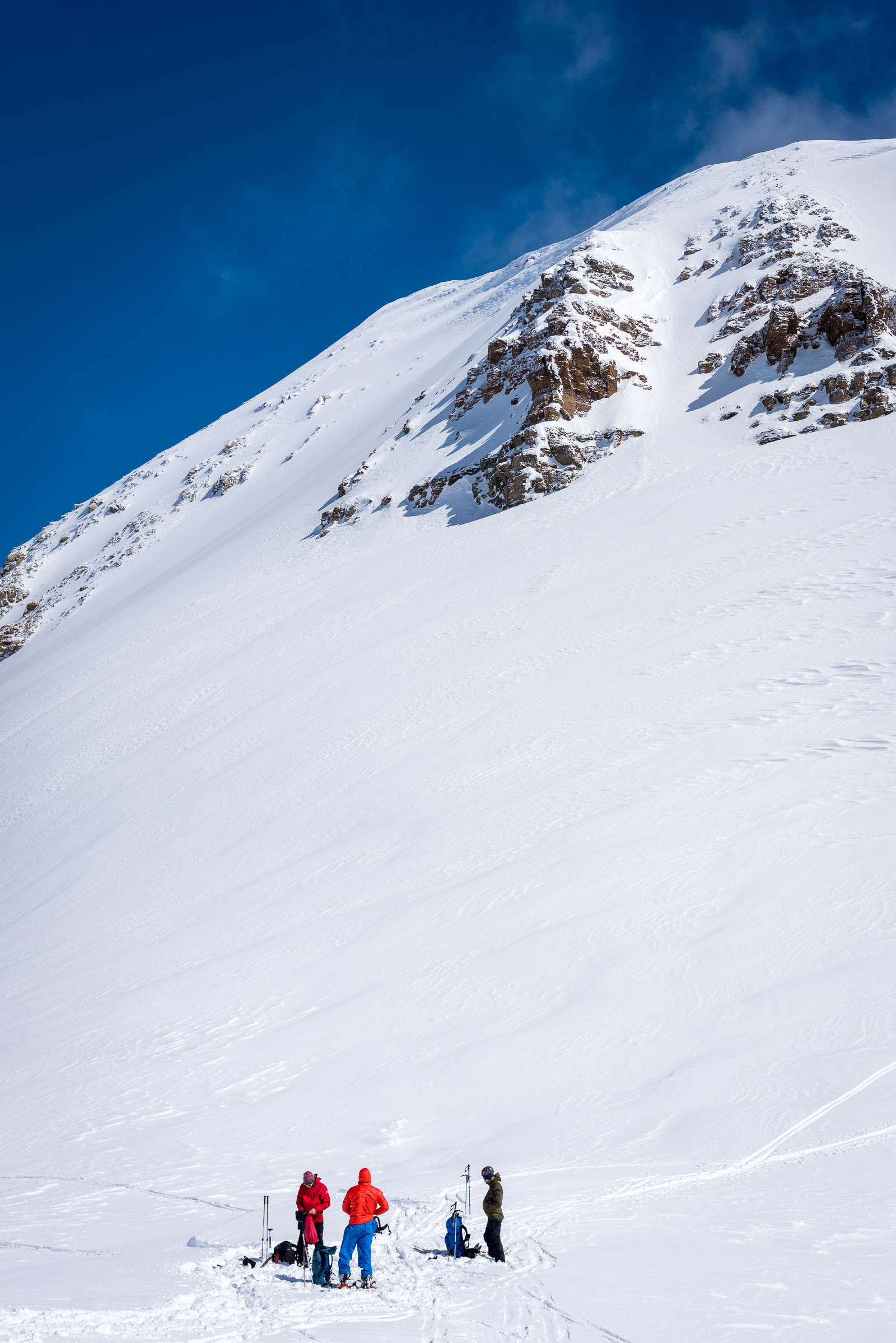
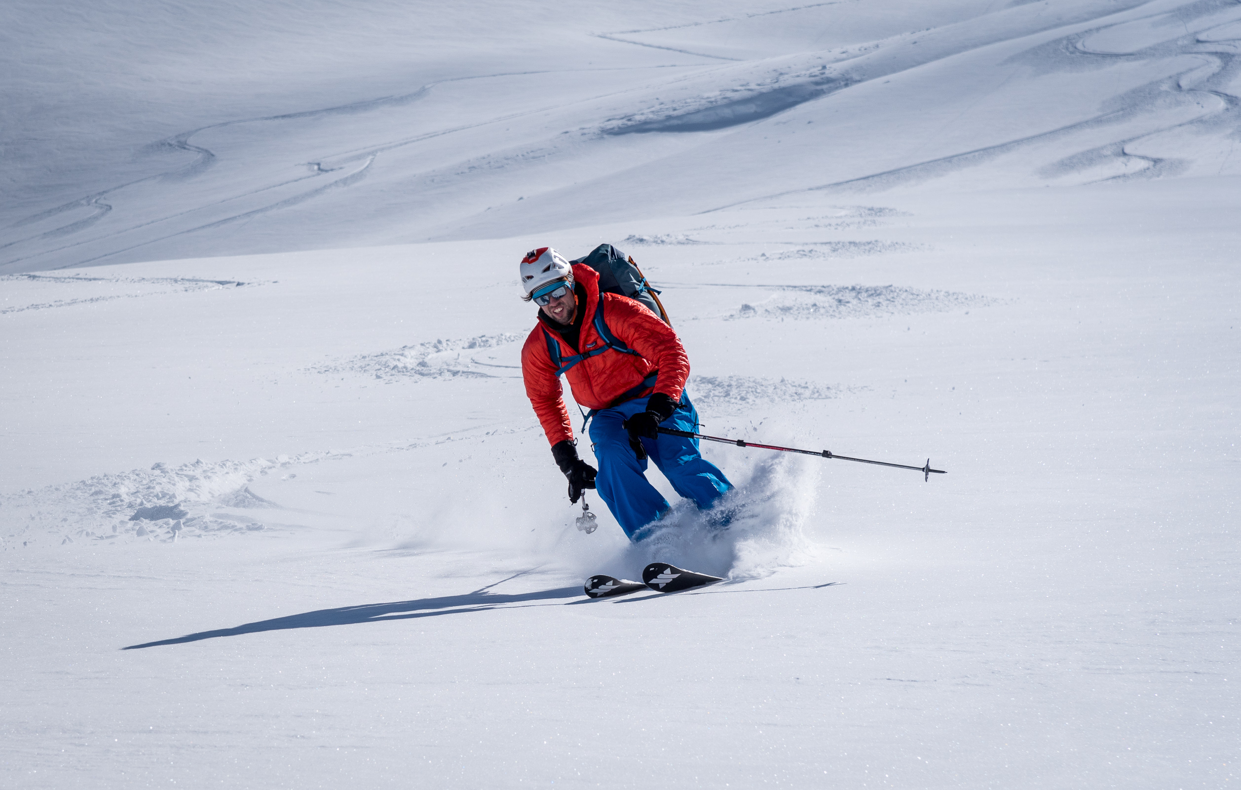
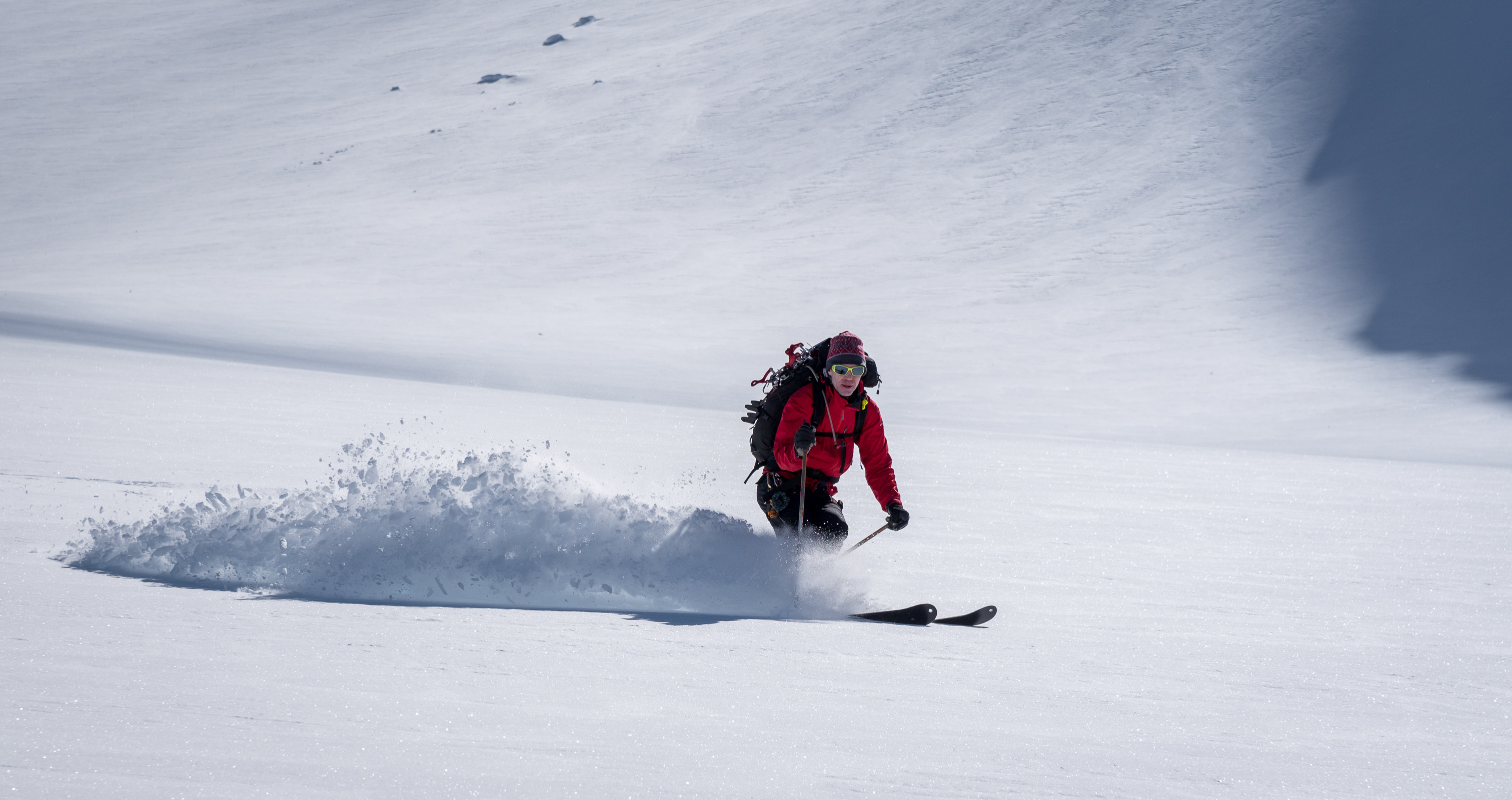
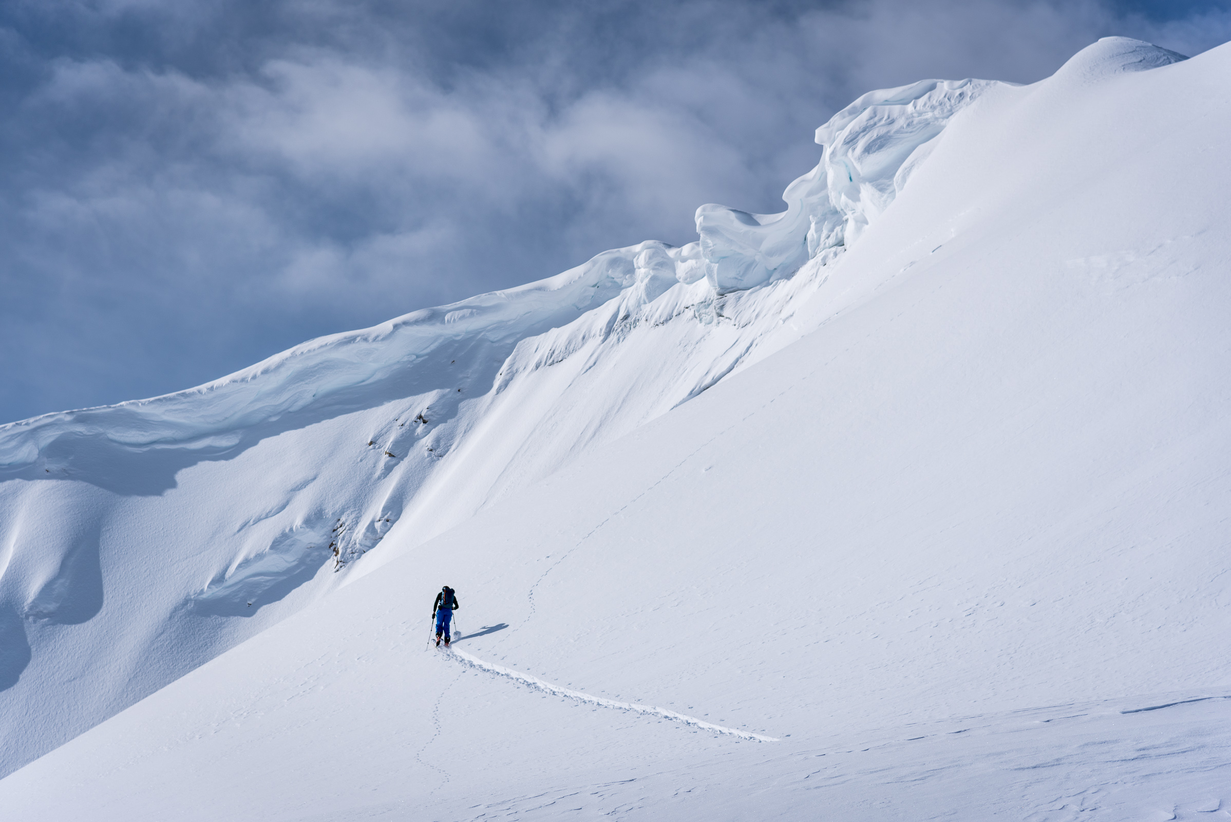
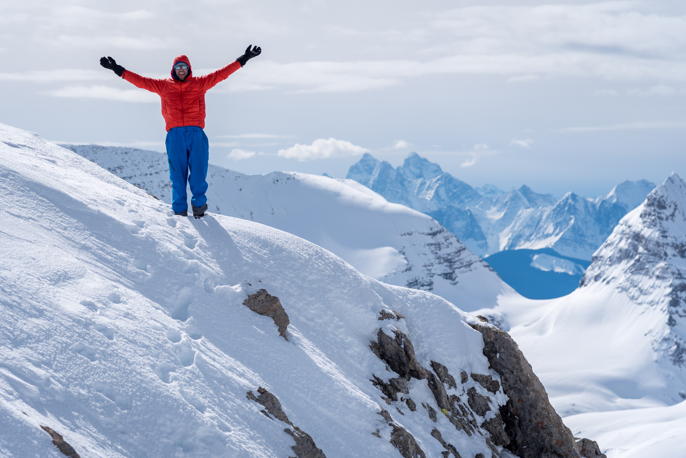
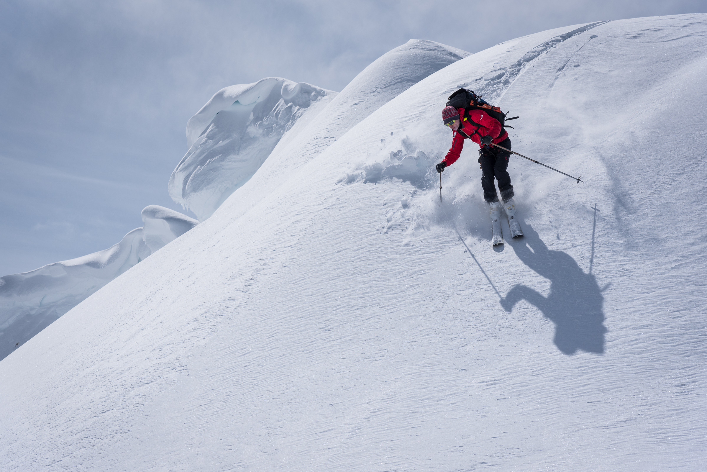
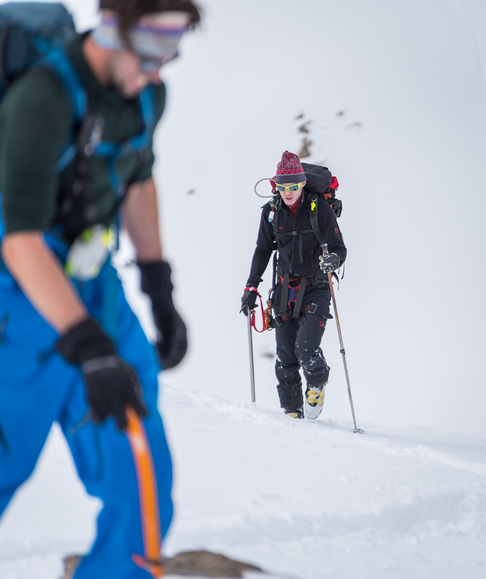
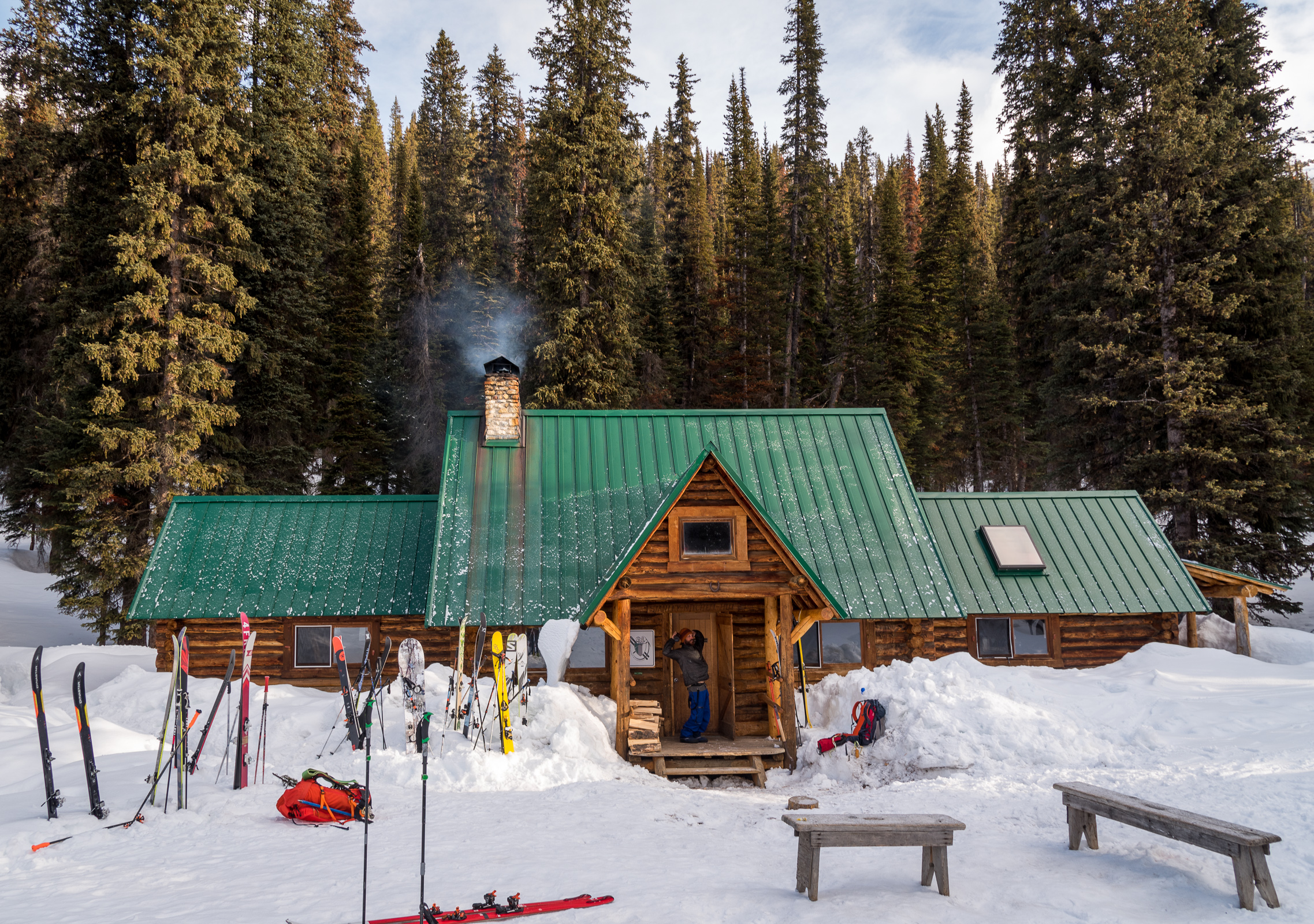
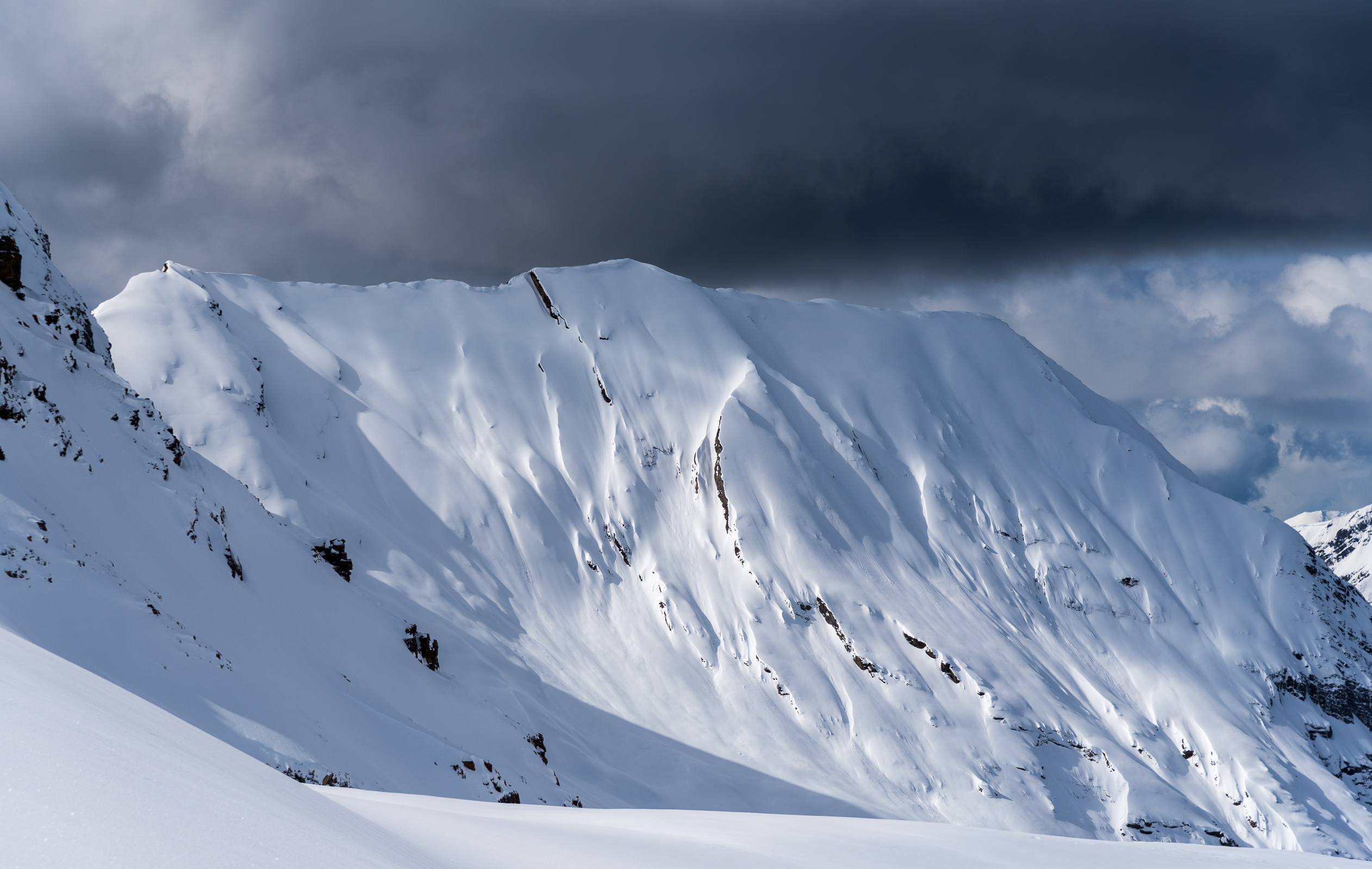
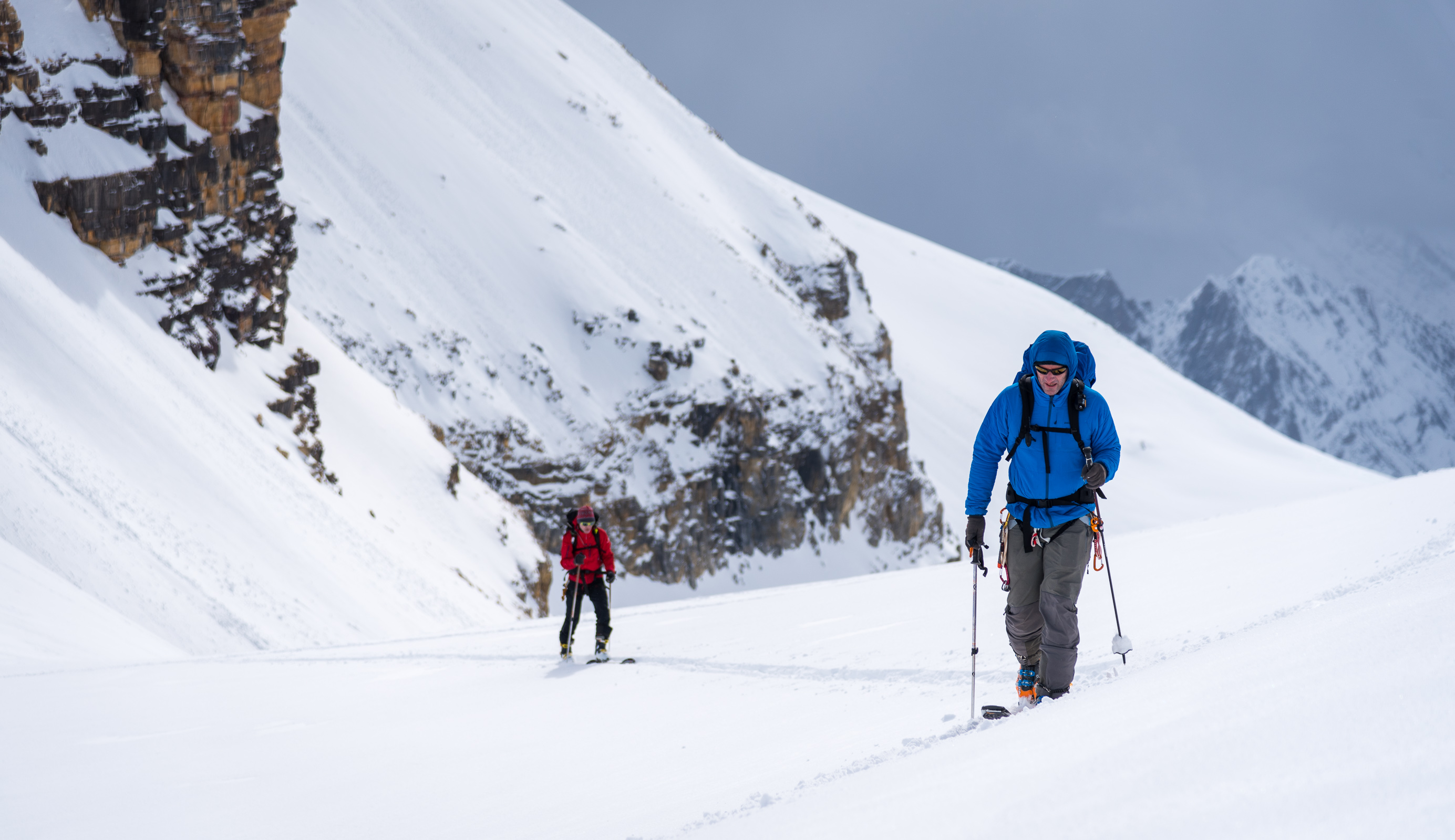
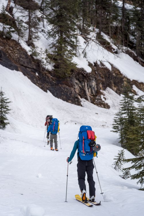
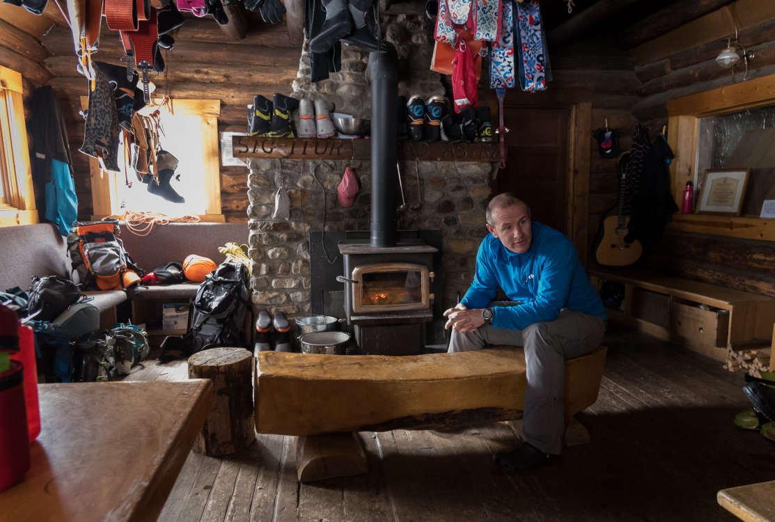
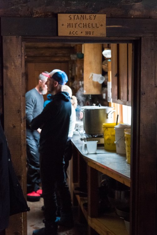
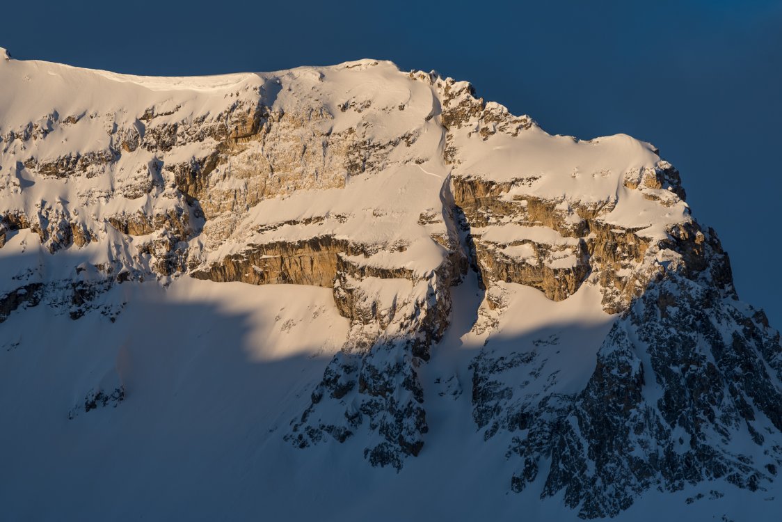
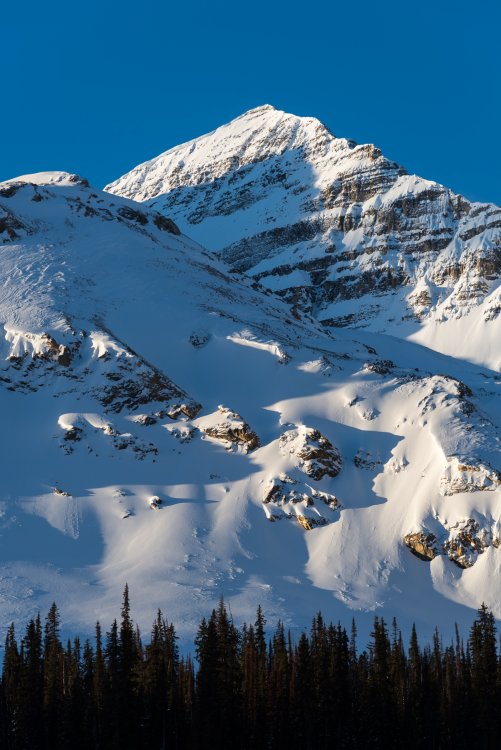
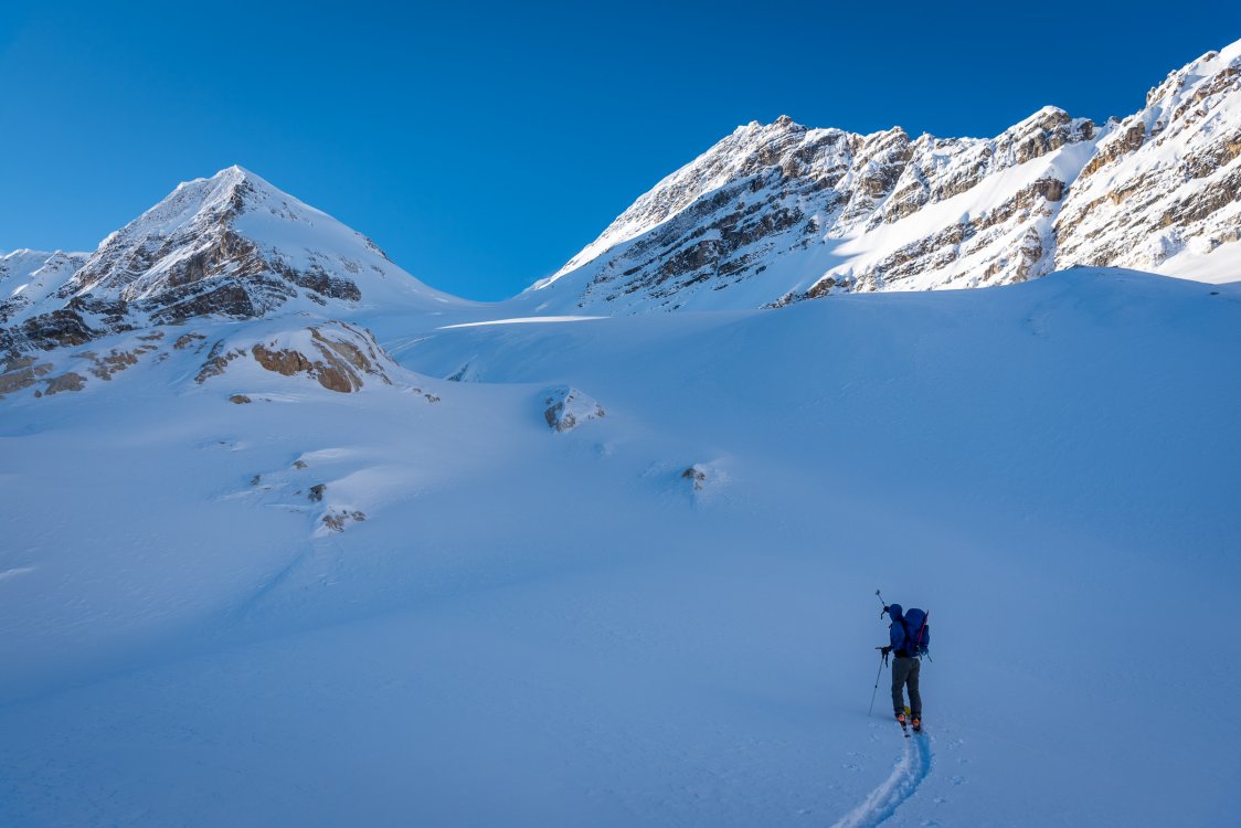
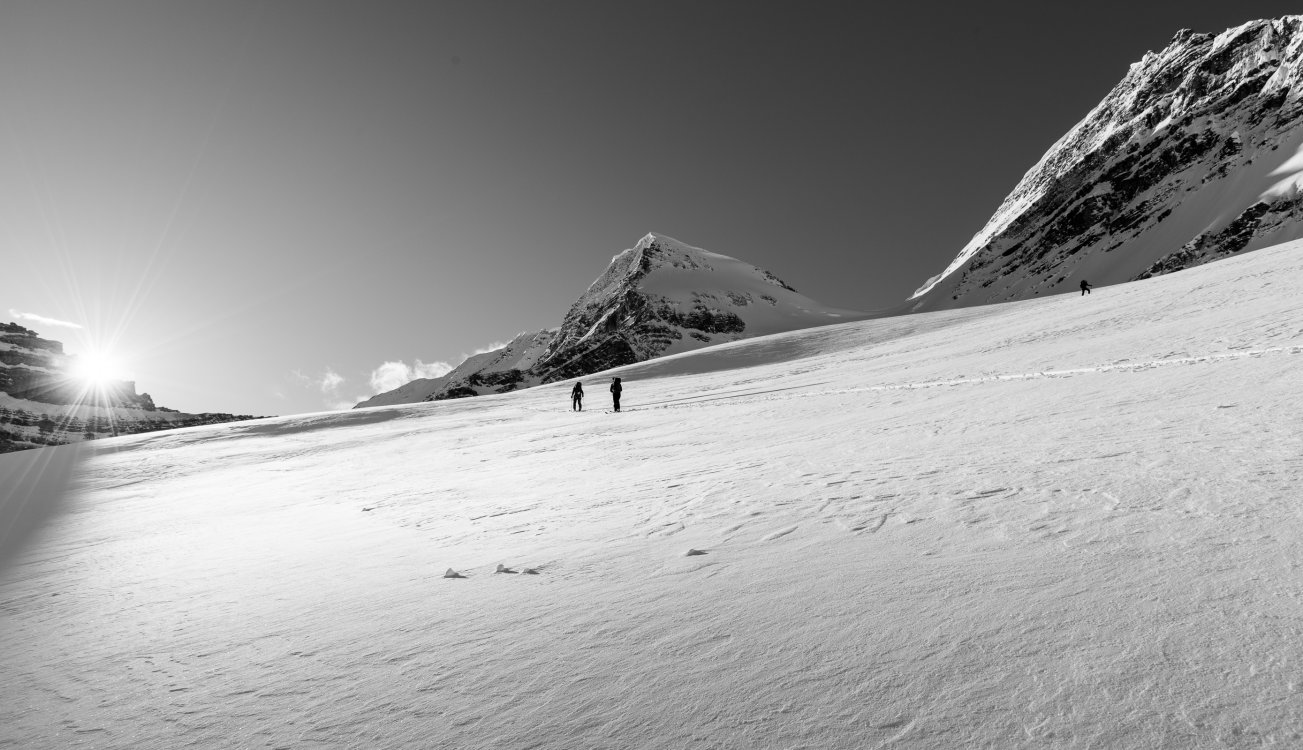
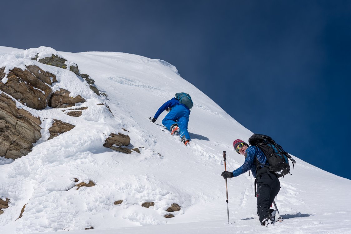
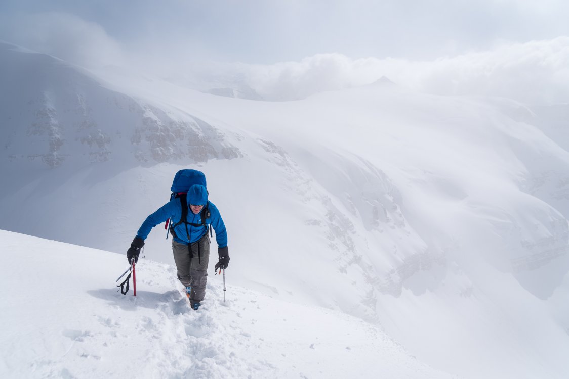
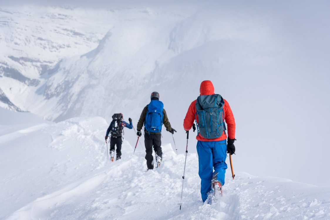
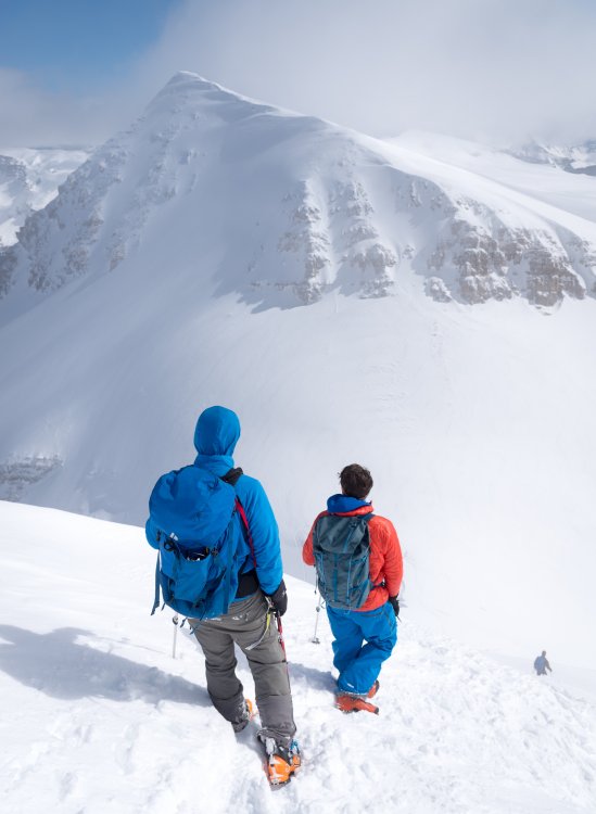
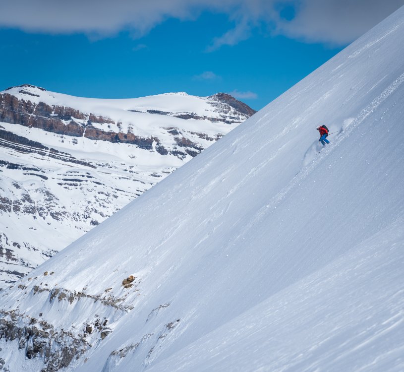
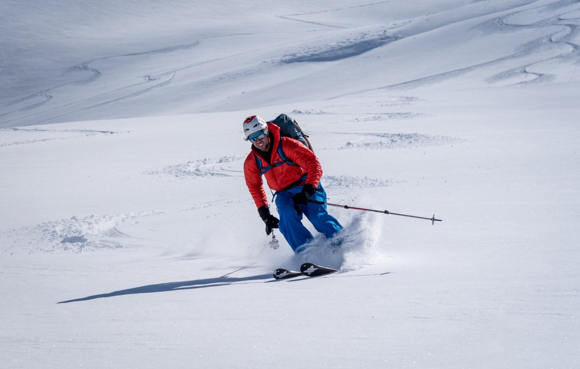
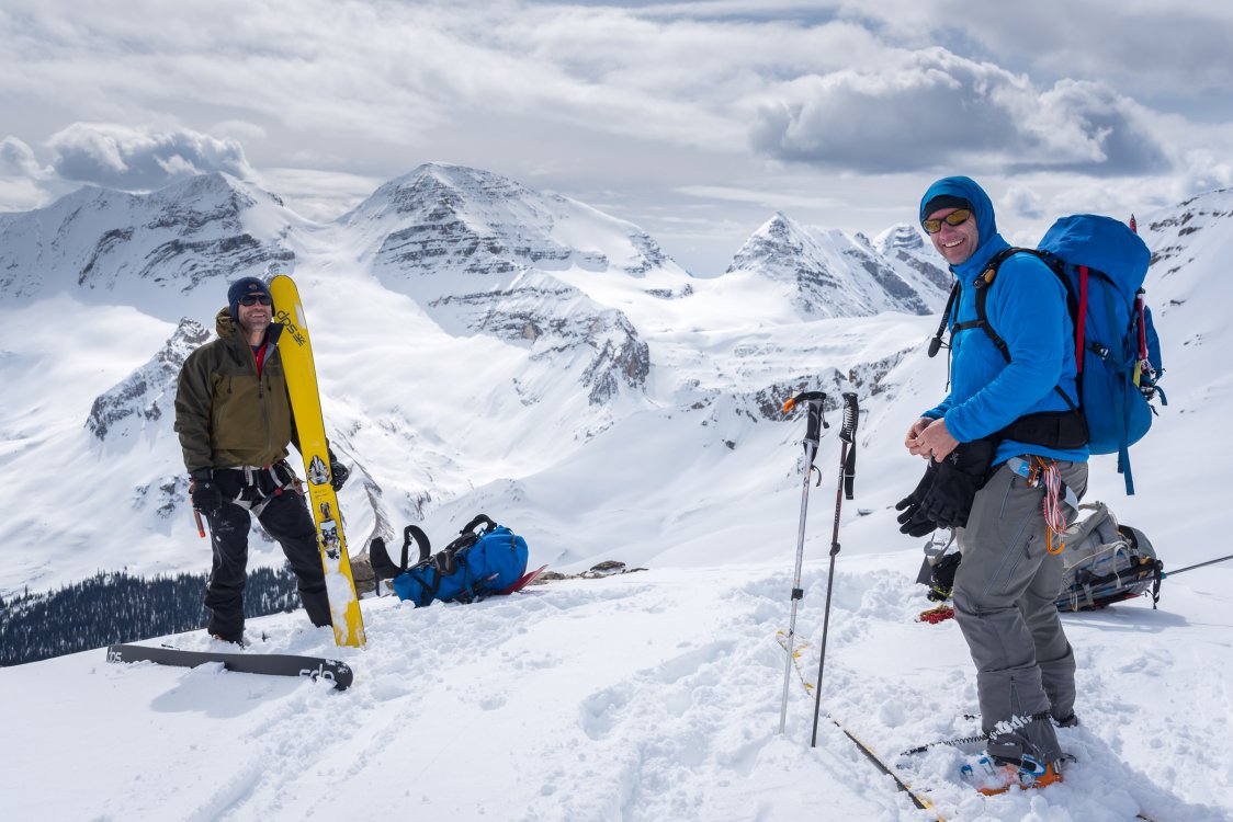
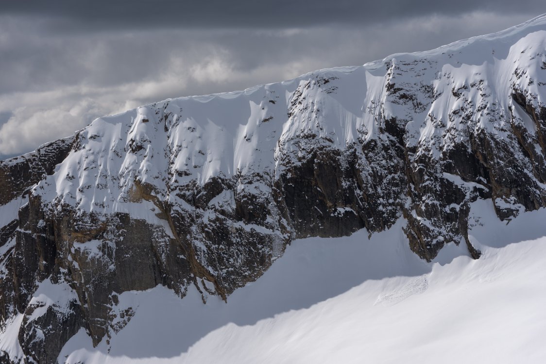
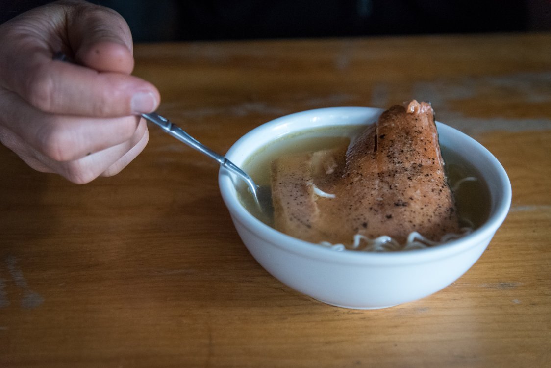
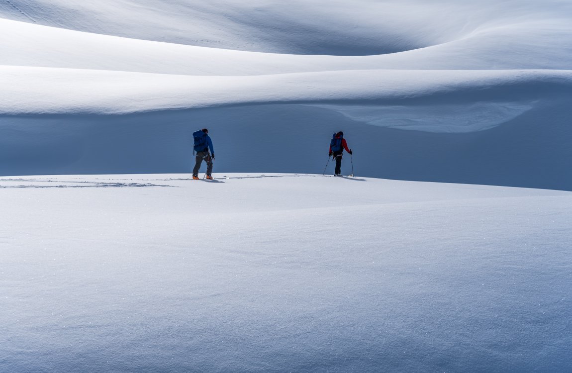
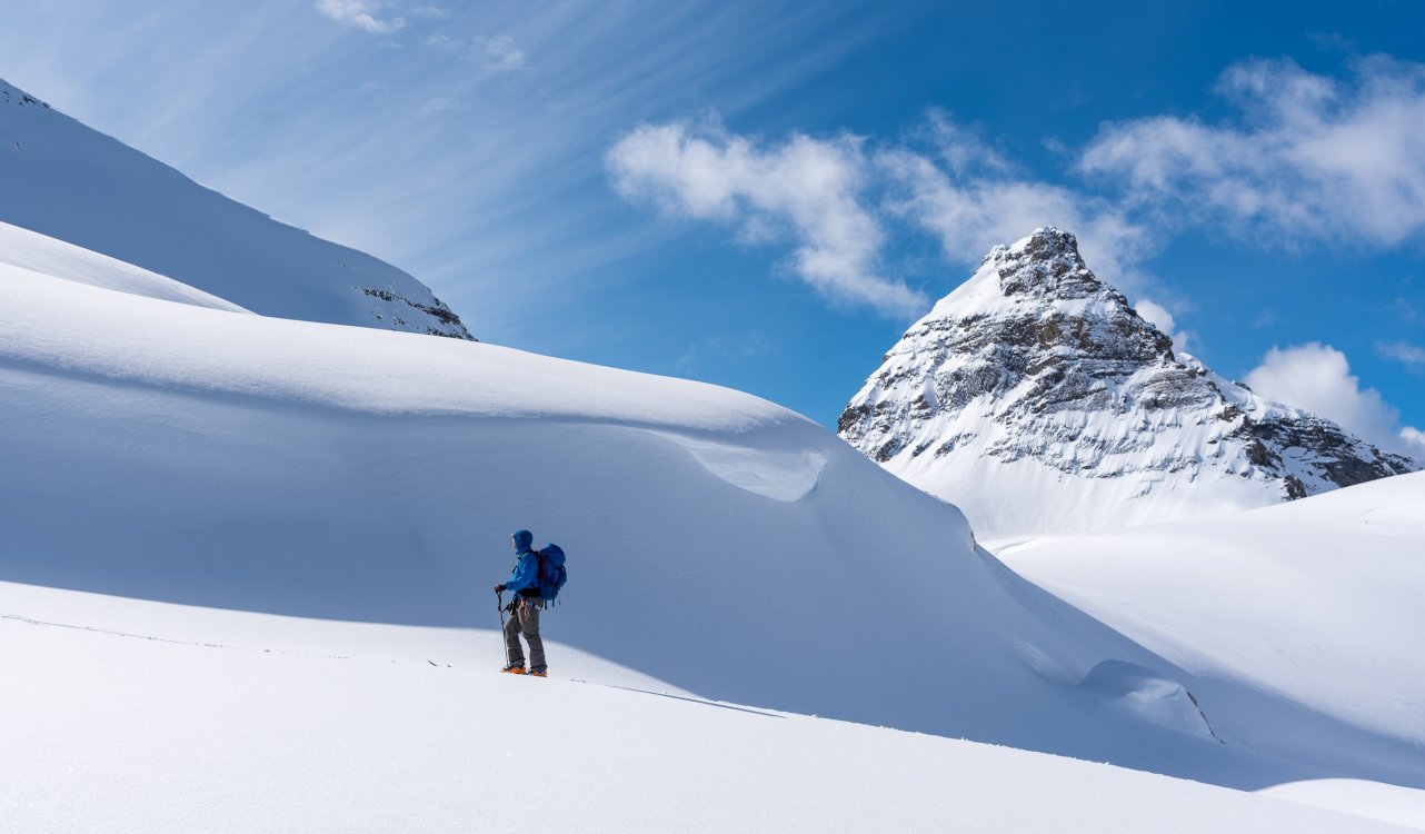
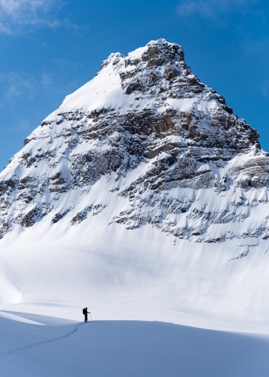
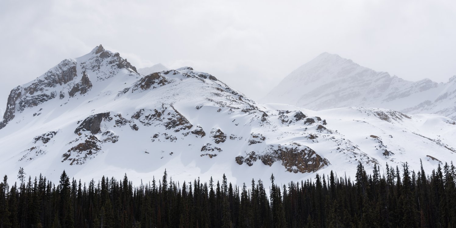
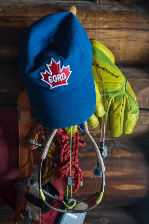
Trip: Little Yoho Valley- Stanley Mitchell Hut - President, Vice President, McArthur, Isolated, etc. Trip Date: 04/09/2019 Trip Report: I'm not the guy to adequately describe a trip like this in words. When it all gels- weather, snow, partners, location- my descriptions fall flat. Suffice it to say that this was a good one. We spent six days in the backcountry, including four full days of skiing and peak bagging around the historic Stanley Mitchell hut. AKA as the "gem" of the Canadian Rockies, a special thanks goes out to the ACC for maintaining such an atmospheric spot to rest, relax, and slay powder. It is so great that you almost forget about the long slog in. Almost. While the core of our group was the usual suspects ( @Kit, @Trent, myself, and Gordo), it is notable that we had someone along that had never met any of us. Austin should be commended on his ability to deal with our aged pace, low risk tolerance, and poor hygiene. He is a fine young man and should not be hanging out with the likes of us. And, after this trip, he probably won't! But for a few days at least we all clicked, and there was only the present. We were able to stand on summits in the sun, looking out on mountains beyond mountains, with nobody else around. It is hard to get any better. The 13km road slog to start: The inside of the historic Stanley Mitchell hut President and VP: Austin and Gordo booting up the Prez: @Kit: Summit of President: Big Country, but not the band: Looking over at the V.P.: Avalanche Roulette on the V.P.: Austin picks correctly: We can all learn a thing or two about skiing from Gordo: And @Kit can teach us to pin it: When we were traversing behind this cornice, some of it fell off in a cloud of powder: Austin on the summit of McArthur: @Trent and @Kit getting ready to head up Isolated: Patagonia Provisions provides! The one and only Stanley Mitchell: @Kit heading to Emerald Pass with Mount Marpole behind: Proper head coverings are essential in the Great White North: Gear Notes: Whiskey, meat, cheese Approach Notes: Long


-
[TR] Dragontail Peak - Triple couloirs 03/31/2019
JasonG replied to kmfoerster's topic in Alpine Lakes
That is surprisingly bare for this time of year @specialforest. Must have been cooking! -
If you want rock climbing objectives in good shape in the Cascades, this is a tough time of year. July, however, is primo.
-
You can always get a cheap pair of bindings and cut the highback down to the right height for your boots. I did that to make my board "cool" back in the 90's.
-
I went with all easy routes and started with Liberty Bell, Beckey Route and finished with South Arete on SEWS. It was pleasant and not overly committing. Still, it took us all day and I was tired. Hey @jon....looks like the photo links are busted in the TR linked above? They should be on the cc.com server.....
-
NBC or 3Cs could easily be climbed in AT boots, though typically ski conditions are very poor when these are in good shape (as Gene points out). I climbed both in plastic boots after walking in during good spring conditions. I wouldn't want to climb a long rock arete in AT boots and haven't. I save those routes for after the ski season. I guess I'm a firm believer in climbing routes when they are in the "best" shape, i.e. the most enjoyable. This can mean other parties, but I'm OK with that. If you want solitude during the busier season, you can always go during the week.
-
Gene brings up a very good point. I typically try and tailor my objectives to conditions, including approach conditions. When things are snowy and soft, I stick to lower angled objectives easily done on skis. When conditions firm up you can usually ditch flotation and just walk, greatly simplifying everything.
-
Sahale is a great example of a good ski mountaineering peak in the spring. Just a short bit of snowed up 4th class that is easy to climb in AT boots. No need to haul your boots all the way in! There is a recent TR using this exact approach
-
There is no secret miracle gear for the shoulder seasons. Most (including me) use skis until it isn't fun, and then at some point in the year transition to doing trips with just boots (I typically leave the skis at home after early/mid June or so). Modern AT boots climb just fine, at least if you aren't talking a lot of fifth class. It seems, at least to me, that the rock routes are typically in poor condition that time of year anyways. You can find a lot of good options in used AT gear, esp if you aren't super picky.
-
That has happened to just about everybody who's tried that route in good weather, myself included!
-
[TR] Dragontail Peak - Triple couloirs 03/31/2019
JasonG replied to kmfoerster's topic in Alpine Lakes
If it cools down as forecast this upcoming weekend....it's possible. Often late April brings pretty good conditions. -
That's a proud ascent, well done!
-
But that wouldn't that mean I need a FB account? For those that want to know, there was continuous snow from the Trans Canada about a week ago, probably a few bare patches now. I'll post a TR eventually....so much to ski out of Stanley Mitchell!
-
They've extended the comment period to May 13th 2019. There is still a lot of time! I am already a party of record and will try and update this thread as I know more. The Skagit Tribes and Seattle City Light are on the record already opposing the current application and calling for an EIS. Not sure about the NPS. There is a mining resource area in the Skagit County comp. plan for this location (outright denial isn't on great legal ground) so I think comments are best expressed in the vein of trying adequately understand the likely effects (noise, traffic, etc.) of expanded quarry operations. I think most feel that the current SEPA application doesn't do a good job of this. Most have been stressing that an EIS is warranted to fully flesh out the possible effects and what effective mitigation measures might be. At some point Kiewit will be seeking a comp. plan amendment to expand the mining resource area. That will be another opportunity to make your voice heard.
-
If you value peace and quiet on your way to North Cascades National Park, please take a few moments to review and comment on the proposal to expand quarry operations along the Rockport Cascade Road, across from town: https://www.skagitcounty.net/Departments/PlanningAndPermit/MarblemountQuarry.htm Short story- Kiewit is proposing to mine 6 days a week, 12 hours a day, for up to 100 years. They will be drilling 5-6" holes in rock, and shooting the quarry daily. Up to 150 trucks a day with one rock loads, the rock primarily bound for the mouth of Columbia and SE AK (good saltwater breakwater material). In particular, I worry about the intersection of Hwy 20 and 530 in summer months with heavily loaded trucks turning west up the hill from 530. Among other things..... Like noise. I mean, you can hear a chainsaw miles away up there, let alone quarry operations! I think a full EIS is certainly warranted and have let Skagit County officials know. Thanks for taking a look!
-
[TR] Mt Stuart - Stuart Glacier Couloir 04/05/2019
JasonG replied to Woodcutter's topic in Alpine Lakes
Finally someone explained Brexit! -
[TR] Mt Stuart - Stuart Glacier Couloir 04/05/2019
JasonG replied to Woodcutter's topic in Alpine Lakes
Totally wicked. Glad you dodged the avy dragon! That topo is fantastic.... Brings back good memories of a trip long ago with @Juan Sharp and @DPS and Kurt Hicks.....