


JasonG
-
Posts
5271 -
Joined
-
Days Won
352
Everything posted by JasonG
-
It is shocking to see just how much so.....I was last on Frostbite Ridge in high summer of 2003 (August?) and it was completely snow covered, top to bottom. We only had a tiny bit of ice climbing out of the crater.
-
 I feel like yes? But I know Steve Swenson would disagree.
 -
Now that is what I call adult entertainment!
-
Glad I could give you hope for when you reach your mature mountaineer phase @Alisse!
-
[TR] Jack Mountain - Nohokomeen Headwall 01/26/2025
JasonG replied to Eric Gilbertson's topic in North Cascades
The East ridge is classic! Though more in a scrambley than hard climbing way. Still, I thought it was highly recommended....but the South Face wasn't super fun to descend (still the best way down probably in summer though). -
There aren't enough USFS LEOs to deal with keeping the crush of humanity out of our public lands for the next 4 years. I suspect that they won't like how DC comes down on this.
-
Here you go @korengalois: JasonG portfolio images I probably need to update these galleries....been a couple years since I added some images to them. But....you get the idea - I like hauling a boat anchor around the mountains.
-
Awesome @3rdclassmaster, post up your adventures when you do make it back this way!
-
Happy to sell images to whomever for a small amount above my cost. I have never even really sold one so I can't get greedy! And let me know when it is time to do another auction to keep the lights on around here.... And how much $$ do you need to run some of these off @olyclimber? I'd kick in a few dollars.
-
Happy to provide whatever image for a sticker!
-
A good example of how each year is it's own animal @bigeo, thanks. June used to be the time for a lot of snow stuff in the Cascades but it tends to be earlier these days....unless it's not!
-
That is a pretty sweet ride .... for Kiba!
-
From the Mountaineers (I haven't camped on the Wilson nor skied the Finger): Follow Wilson glacier along the left edge to about 9,000 ft, then cut across to the right towards the cleaver between Wilson and Nisqually glaciers. There is a good campsite at 9,500 ft. Some parties have made camp at 10,000 ft but had to dig platforms. And yes, snow depth in the south cascades is about average but we are in a dry spell so who knows by spring.
-
Agreed with @bedellympian and @olyclimber....by the time we have stable weather each year it is time to ditch the skis. And trust me, don't climb up into a lenticular! Best to have some alternative descents planned out. The volcanoes stretch all the way down into CA and you can often find good conditions south, if Rainier and Adam are socked in. Some years, May is the ticket, other times it is April, but rarely is is mid June or later.
-
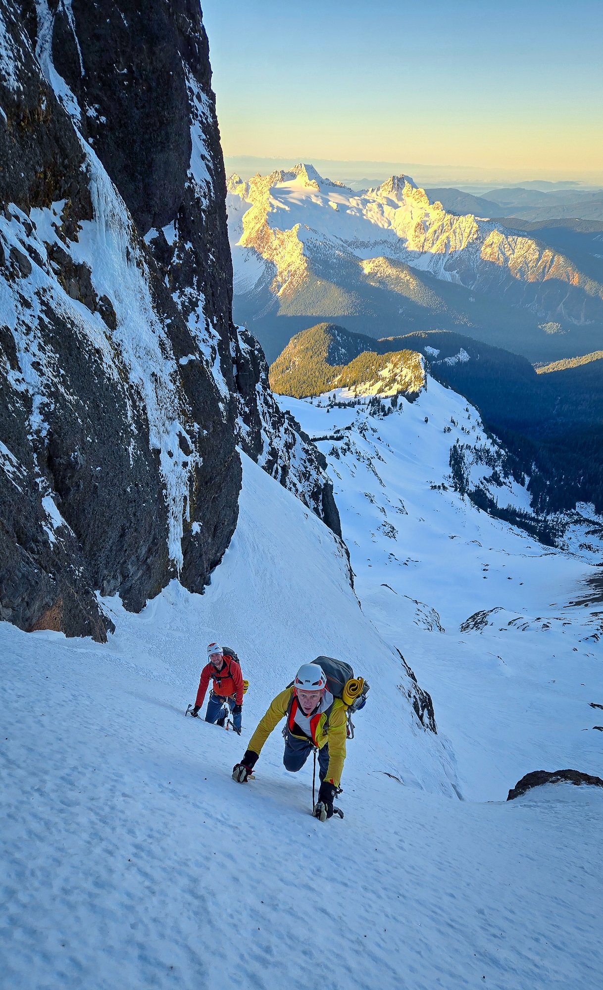
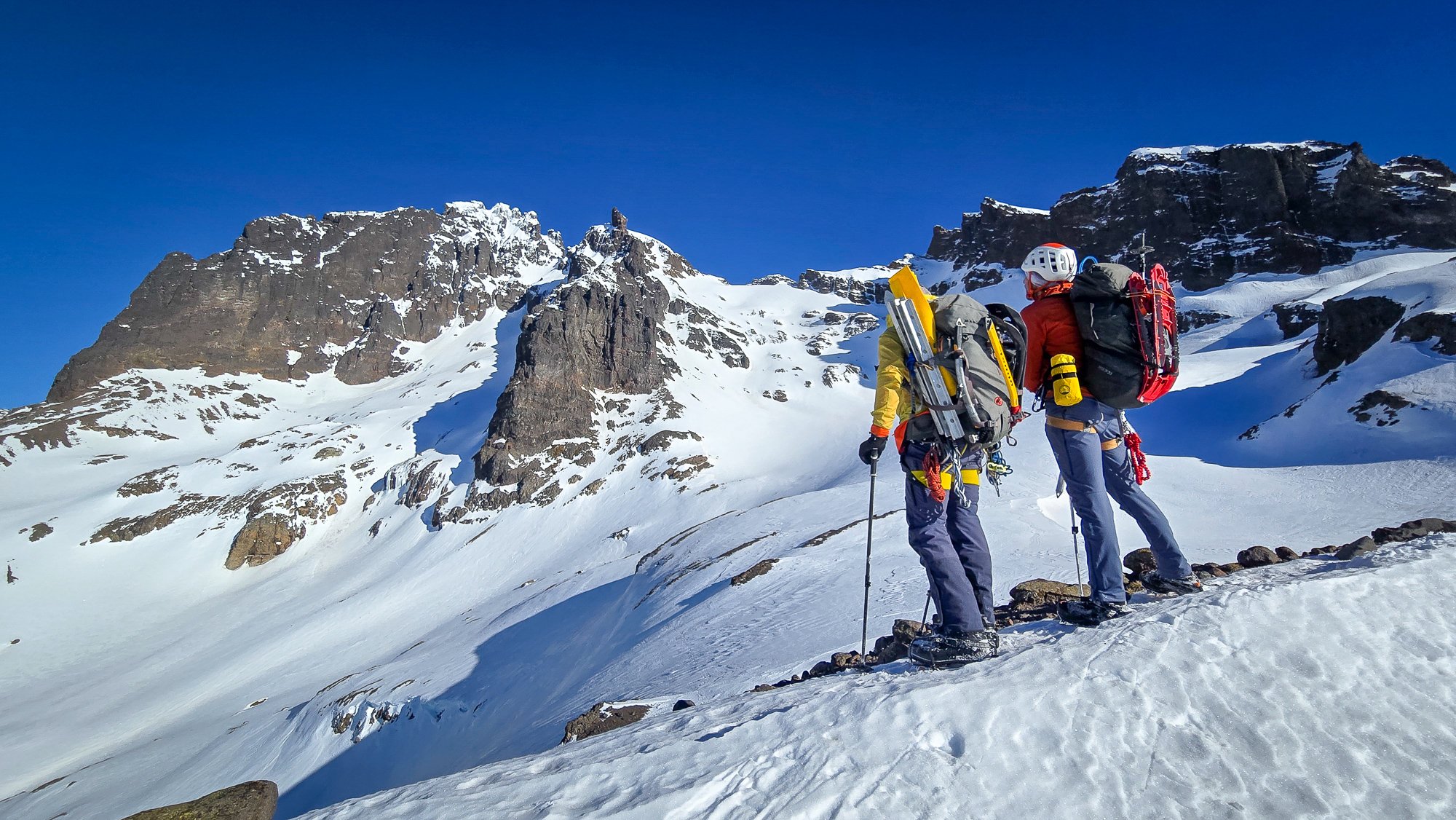
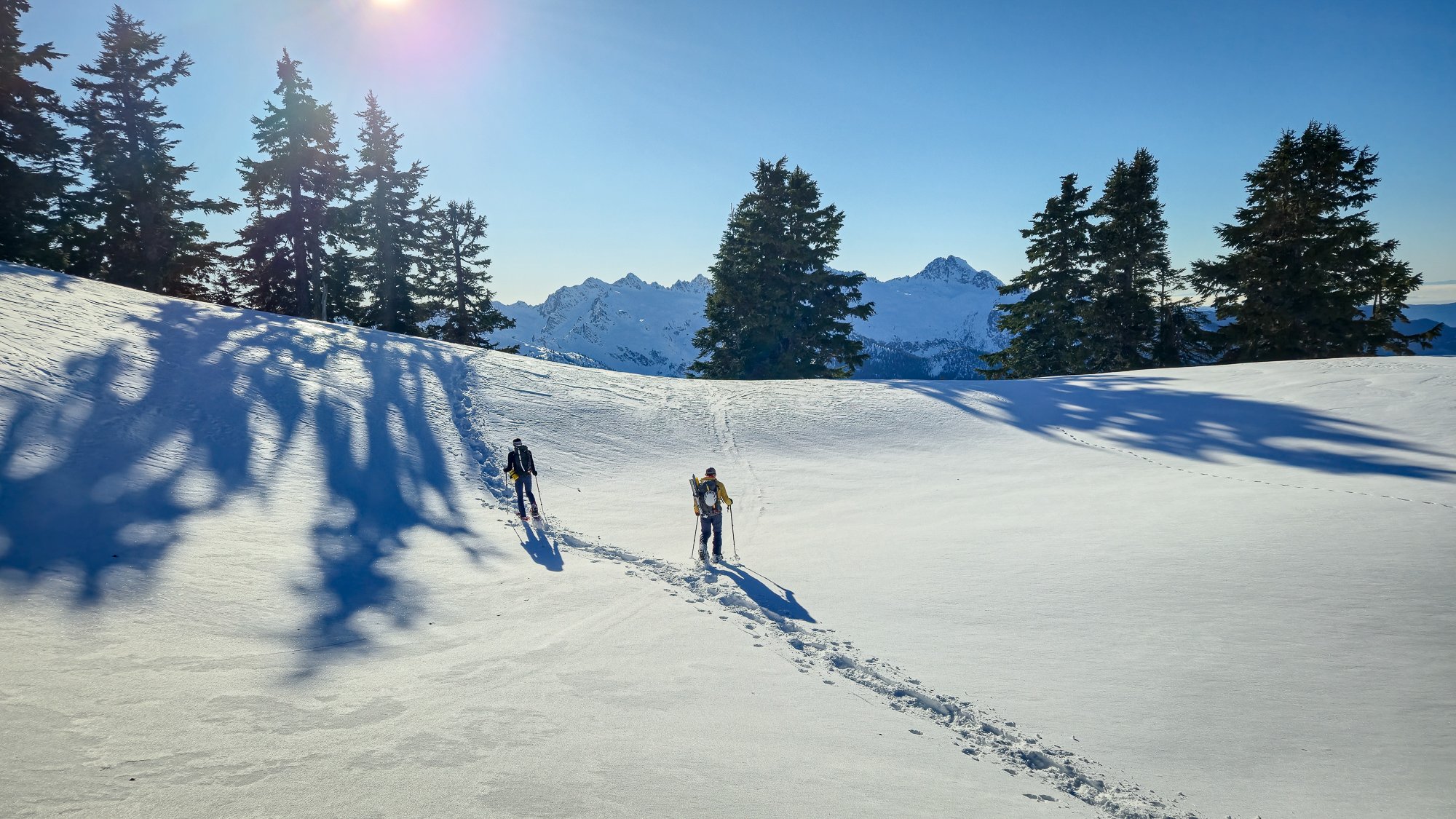
Trip: Mount Harvey - North Face Ramp Trip Date: 01/25/2025 Trip Report: What a nice spell of climbing weather we had to start off 2025! I'm glad that @geosean suggested the NF ramp of Harvey, a climb I had done a couple of times before, but not for a long while. Last time I was on it, it was quite thin and sporty, but the word on the street said it was in fine nick and so plans were hatched to make a trip north and see if Canada was still allowing Americans to enter. @BrettS and Mike rounded out our team and we all met early in Bellingham Saturday morning. I think it only took about an hour and a half, including border crossing to make it to the TH from Bellingham- it is easy to forget what great options exist just a little bit north. The Trailhead was already filling up when we arrived a bit before 8 and we quickly paid the parking fee and started up the dry logging road at something like a dispiriting 650' elevation. It is a bit of a grunt up to the start of the route, but you get good views early on the hike in: In the 13 years since I'd last climbed it, the route has gotten mildly popular and there were several teams in front of us and at least one behind. A steady stream of ice and snow chunks rained down the ramp as we geared up and started off simul-soloing. We had the gear and rope ready, just in case, as @Don_Serl recommends in the link above, but they stayed packed away as we climbed higher and higher with perfect conditions and ample steps to draft off of. I was reminded what a great and pleasant climb it was, in a fine position! But almost too soon, the angle mellowed and we were at the top of the ramp, looking across the steep traverse that guards access to the easy ridge that finishes on the summit. Some times this portion is a crux, but not this day. It was practically a sidewalk and we enjoyed posing for some photos with dramatic views of Howe Sound below: And then we hit the final ridge, sun and views. @geosean walking just below the top: We stopped just short of the summit to eat lunch, take off the technical gear, and admire the excellent views all around. The Standard route on Harvey (our descent) is quite the popular outing on a nice winter's day and we didn't want to be in the scrum on the actual summit. This was a good call on busy Saturday, and we could look south to Baker, Puget Sound, and the Lions in peace: To the west were the endless Coast Mountains, Howe Sound, and Anvil Island: But, a winter's day, even a perfect one, is over too quickly, and we had to begin the descent before we tired of the views and position. The good thing is that the first quarter of the descent is almost as spectacular as the climb: And then it was back to the road, the car, beers, and chips. I think it was less than 7 hours car to car and was entirely one of the more pleasant winter climbs that I have done in years. I hope that it isn't another 13 years until my next visit! Gear Notes: helmet, axe, second tool, steel crampons. If it is in thin shape you may want a rope and some snow/ice pro, but it is also a comfortable solo for a lot of fatter winter conditions. If you need snowshoes it is probably not in great shape. Beware avy danger! Approach Notes: The Lions Trail. Arrive early to get a spot and don't forget to pay!
- 1 reply
-
- 13
-

-

-

-
Absolutely! That was key, and I appreciate Jon and Sean taking their Sunday morning to head up while I built capital with the family for the Lincoln trip later in the week.
-
oh that's right!!! No, we weren't hiding it from you. No beer, that was a bit of a miss to the day. Will edit. I was mixing up the Harvey trip a few days before Lincoln, where we def. had beer....need to get that TR up tonight!
-
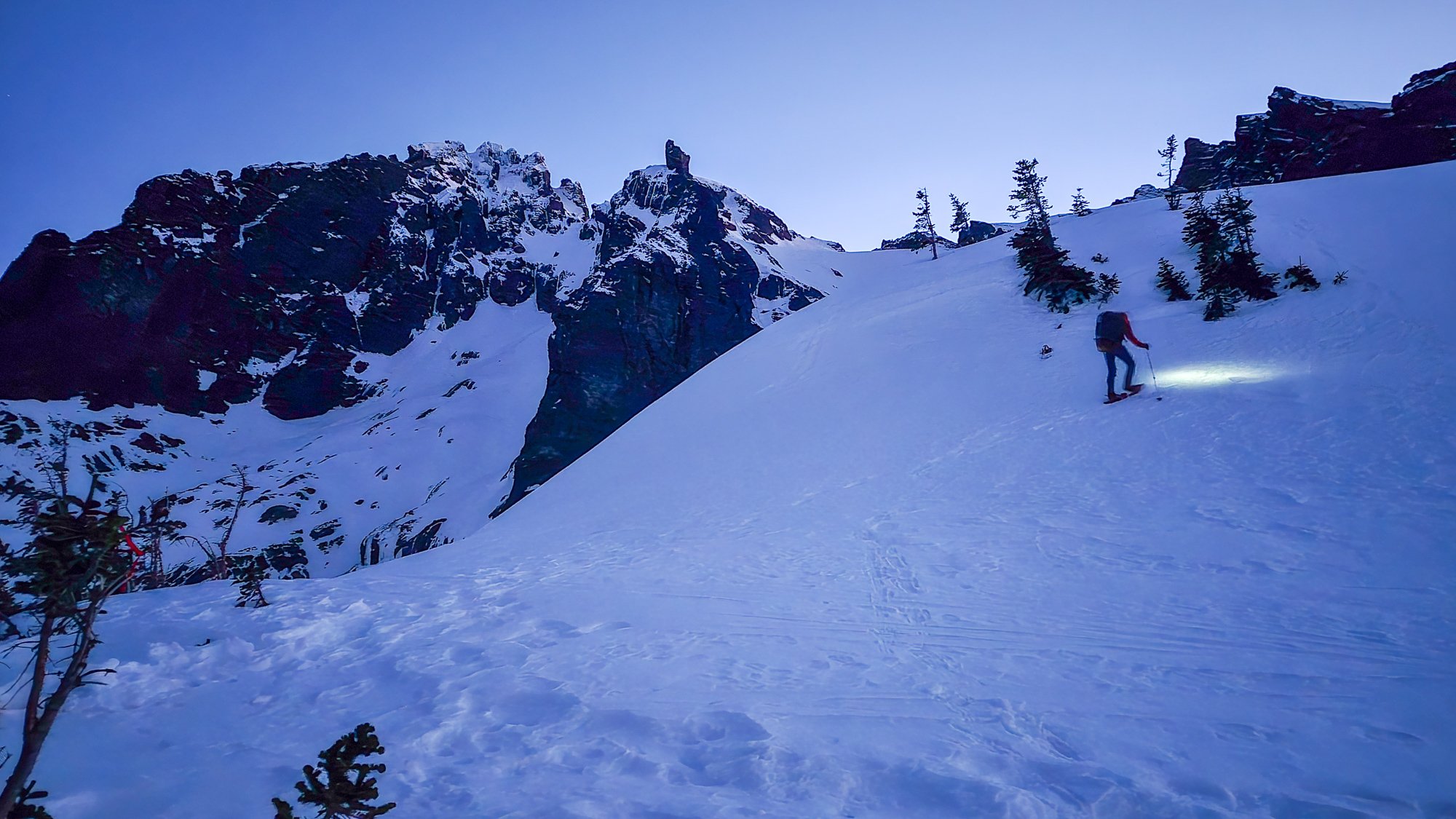
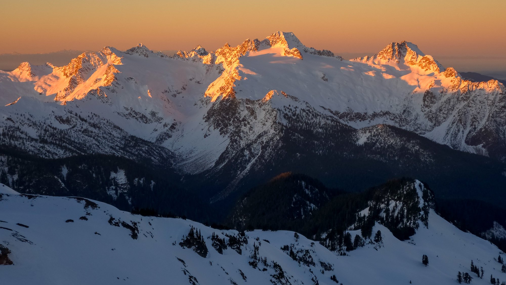
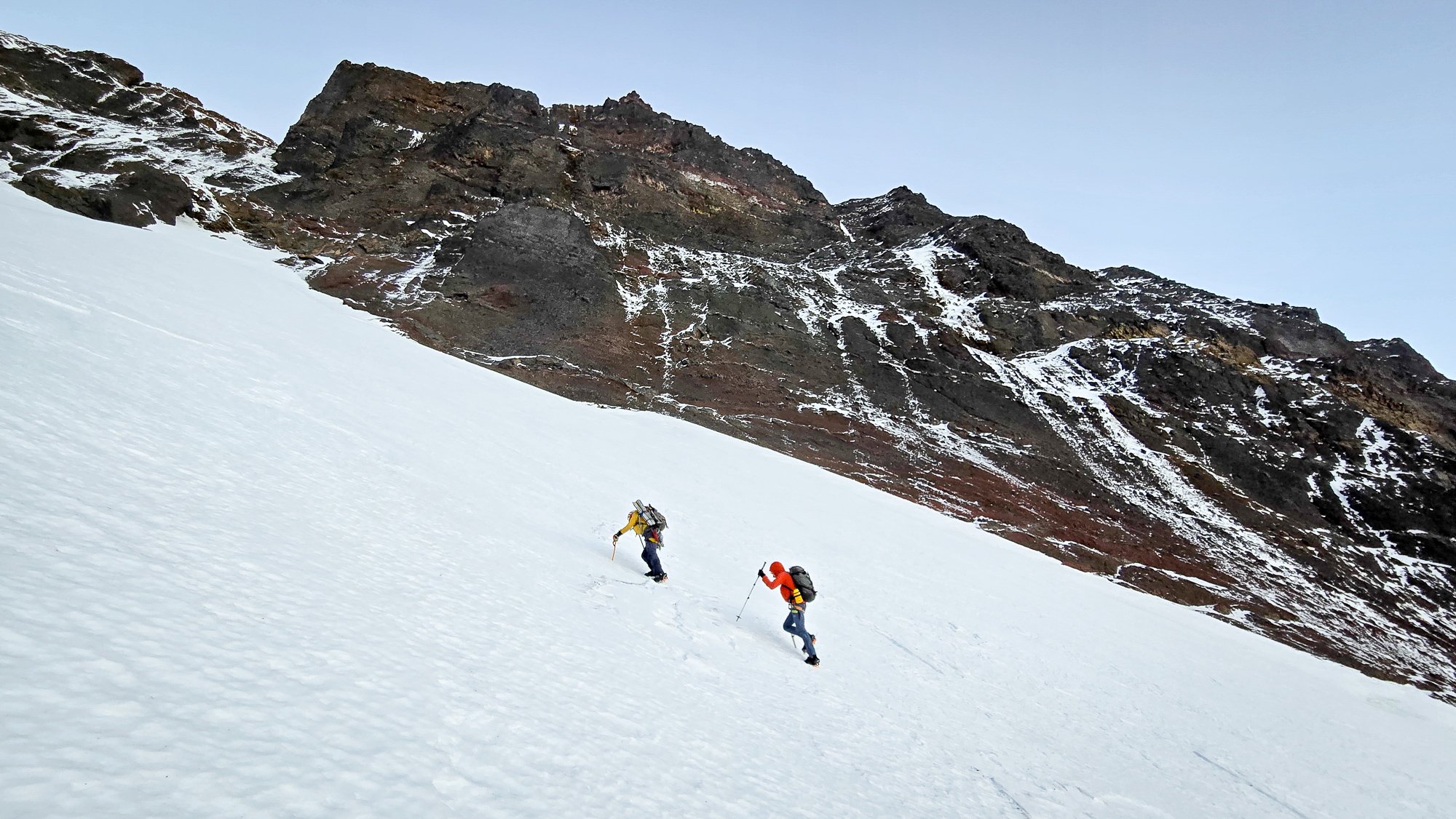
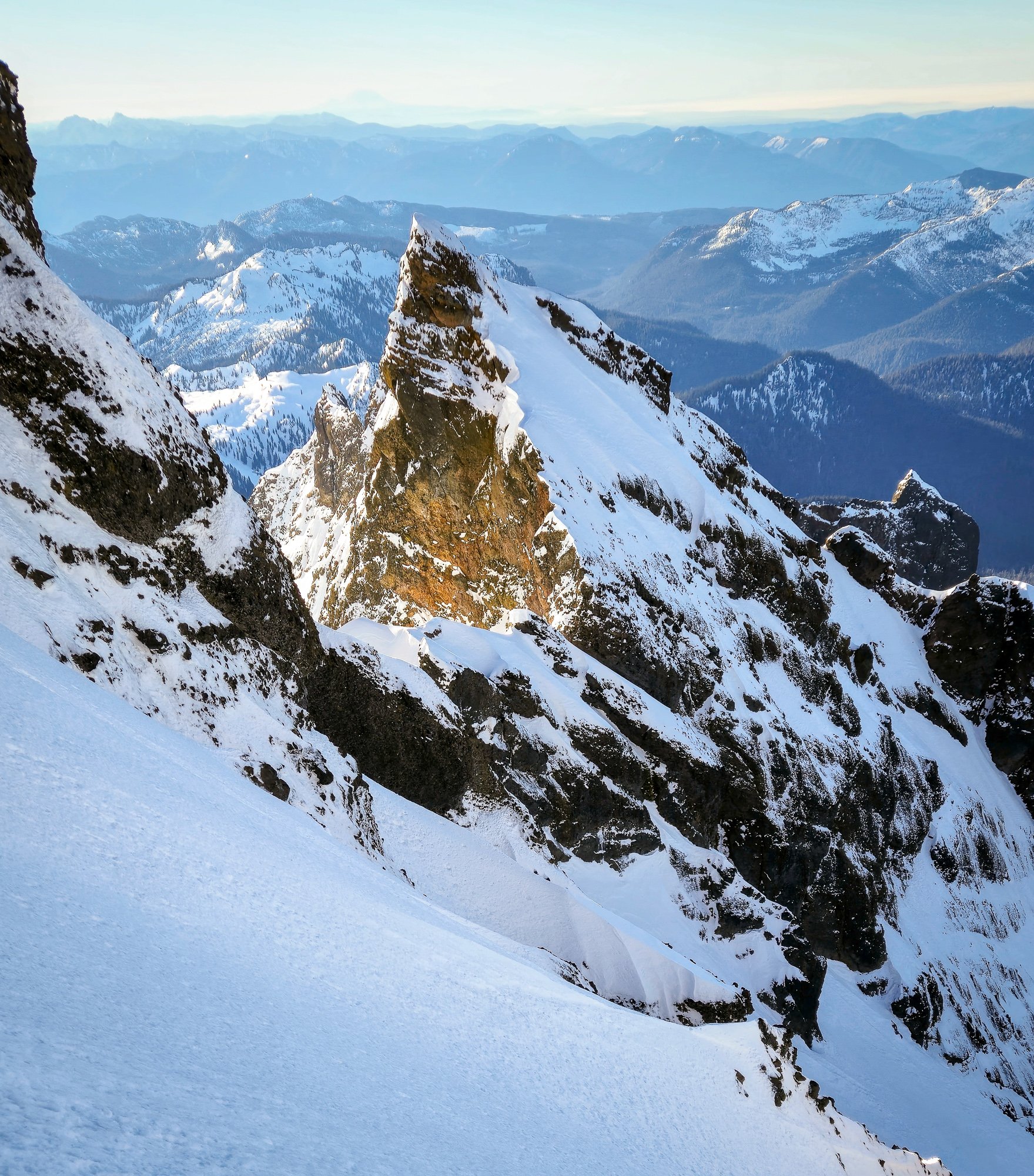
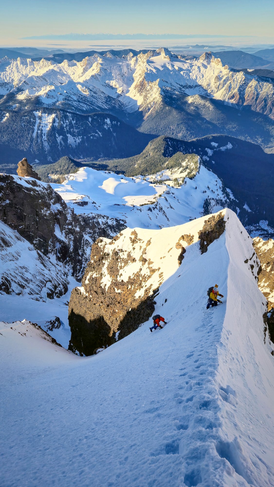
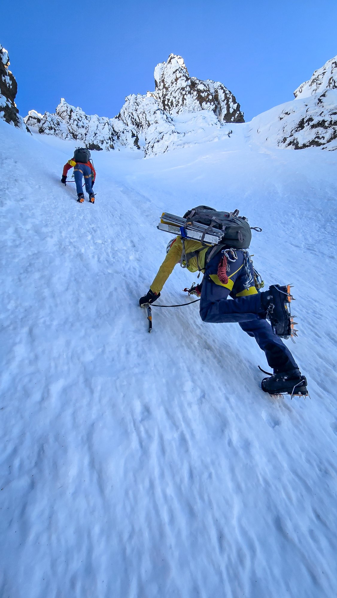
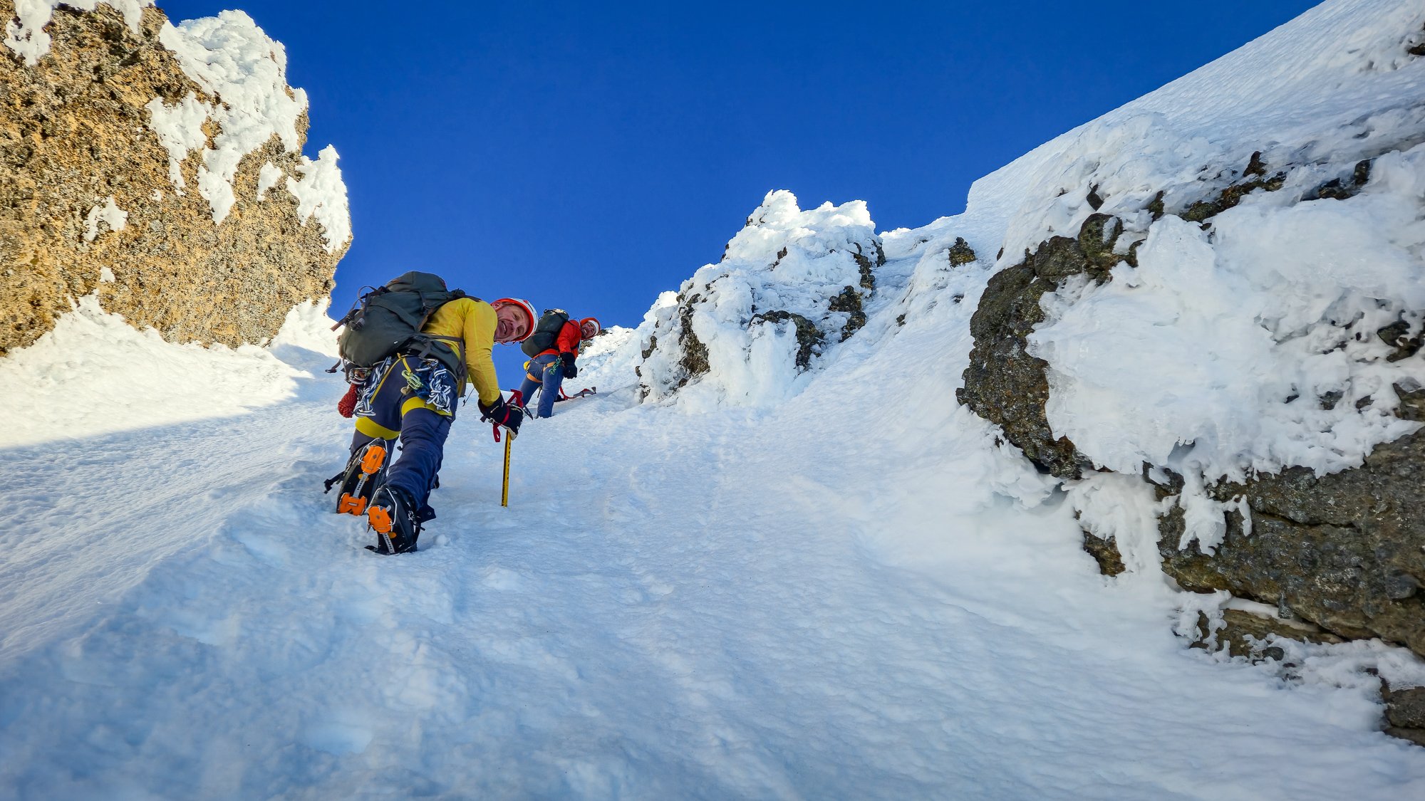
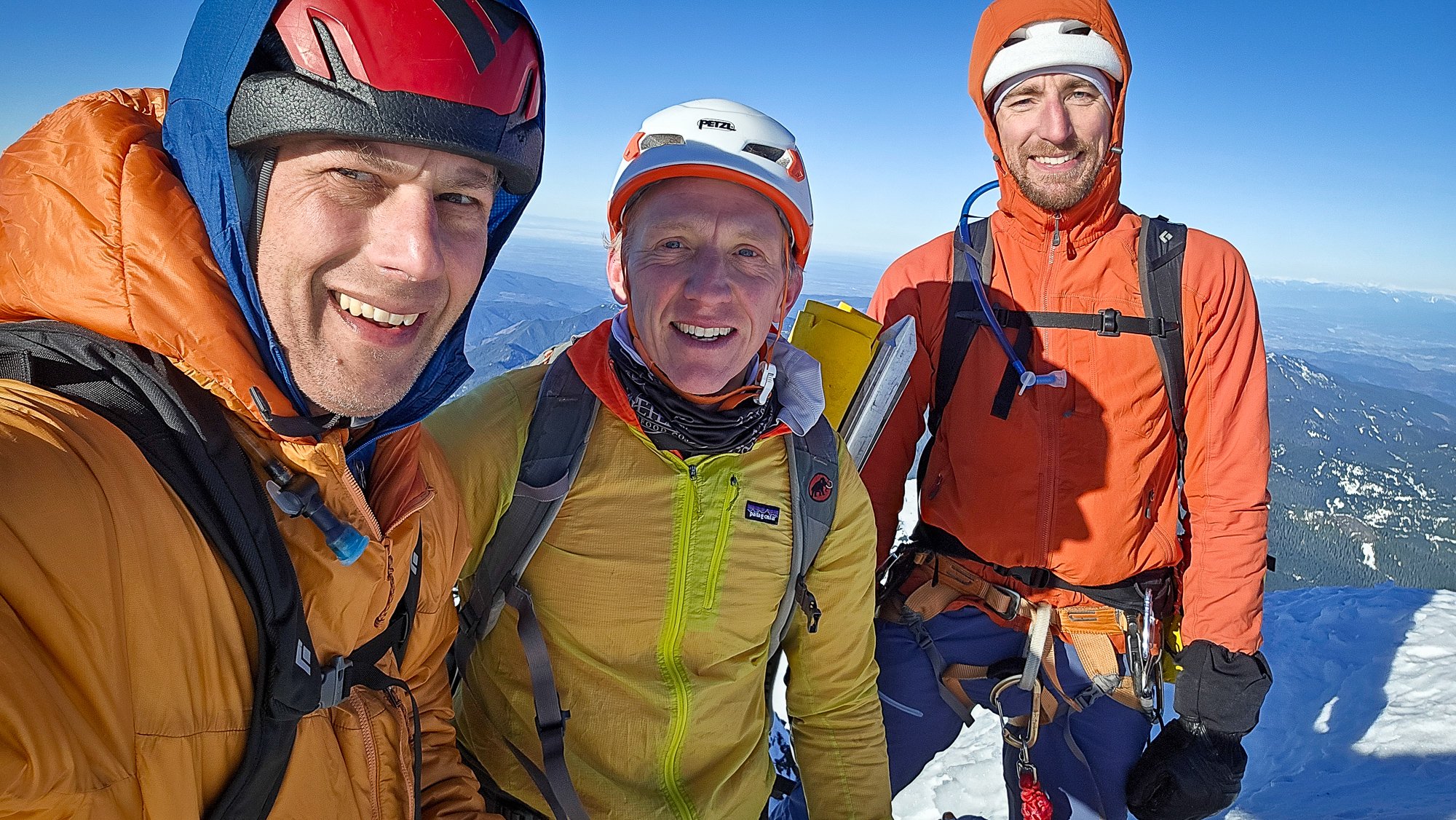
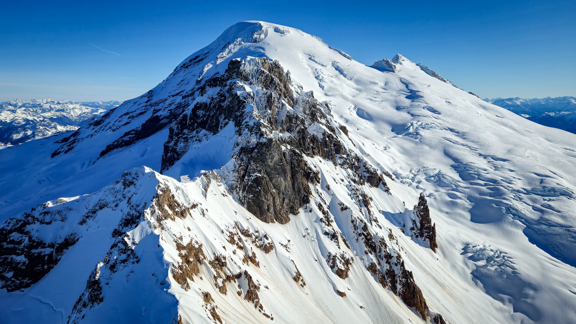
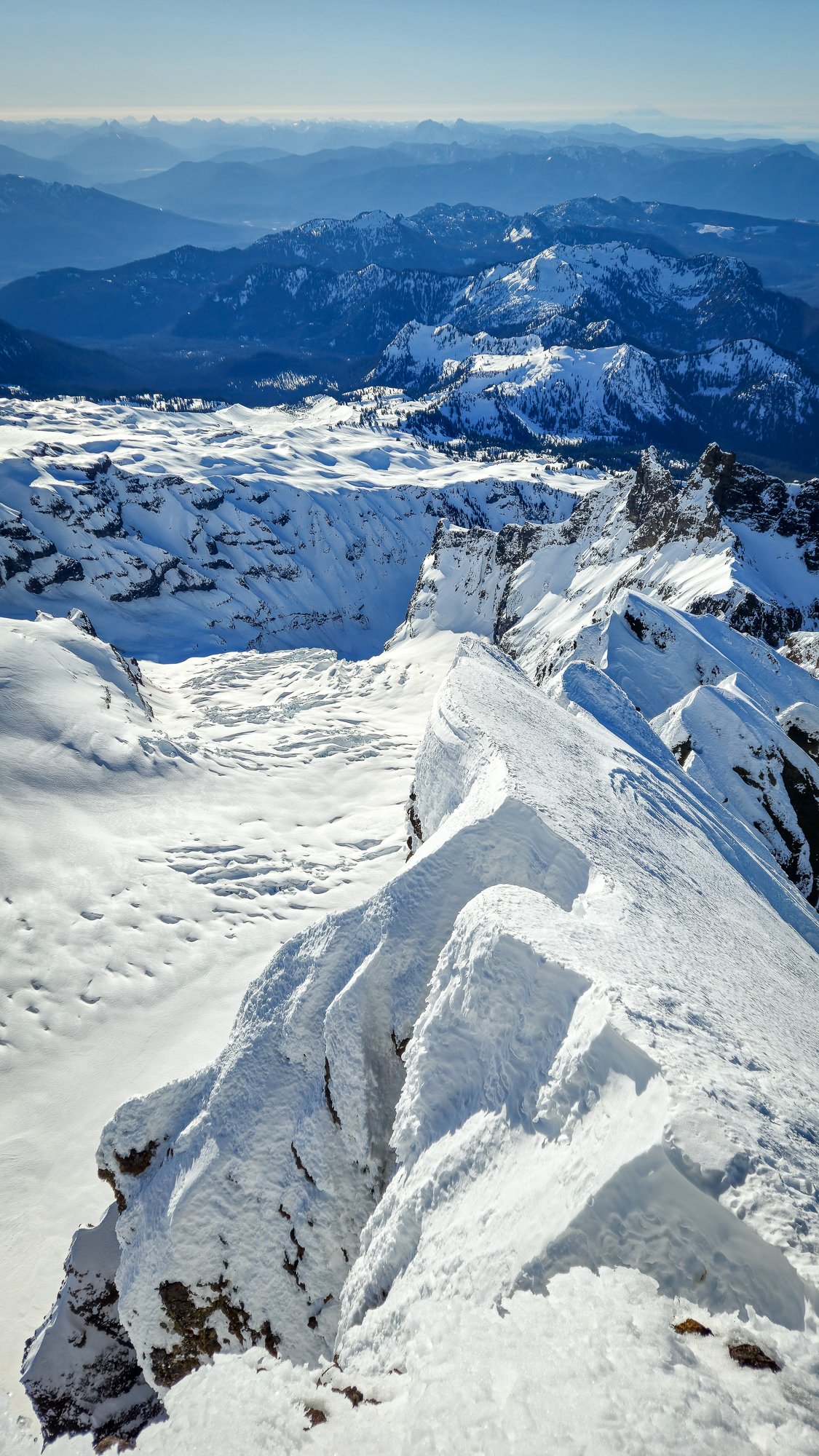
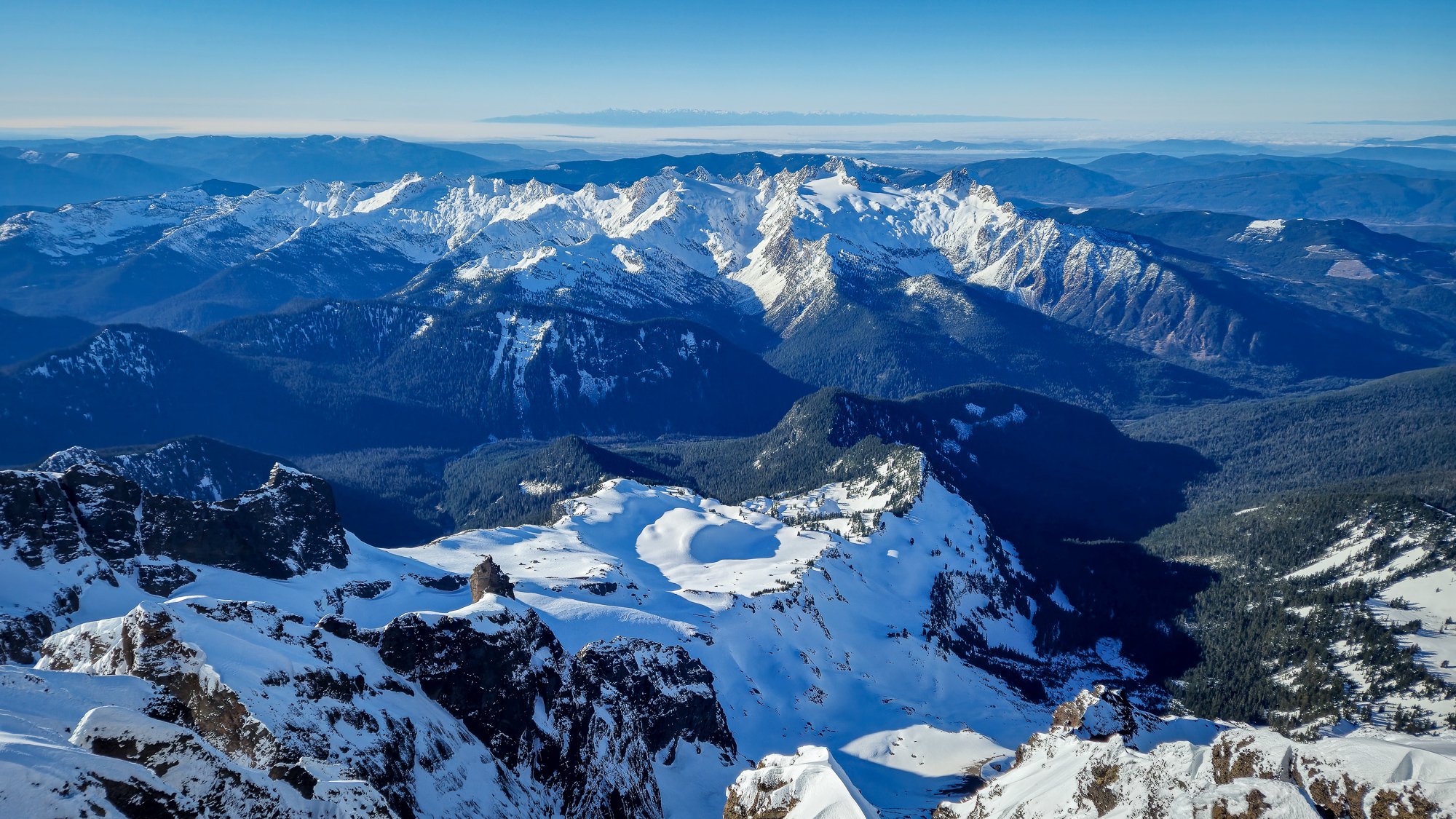
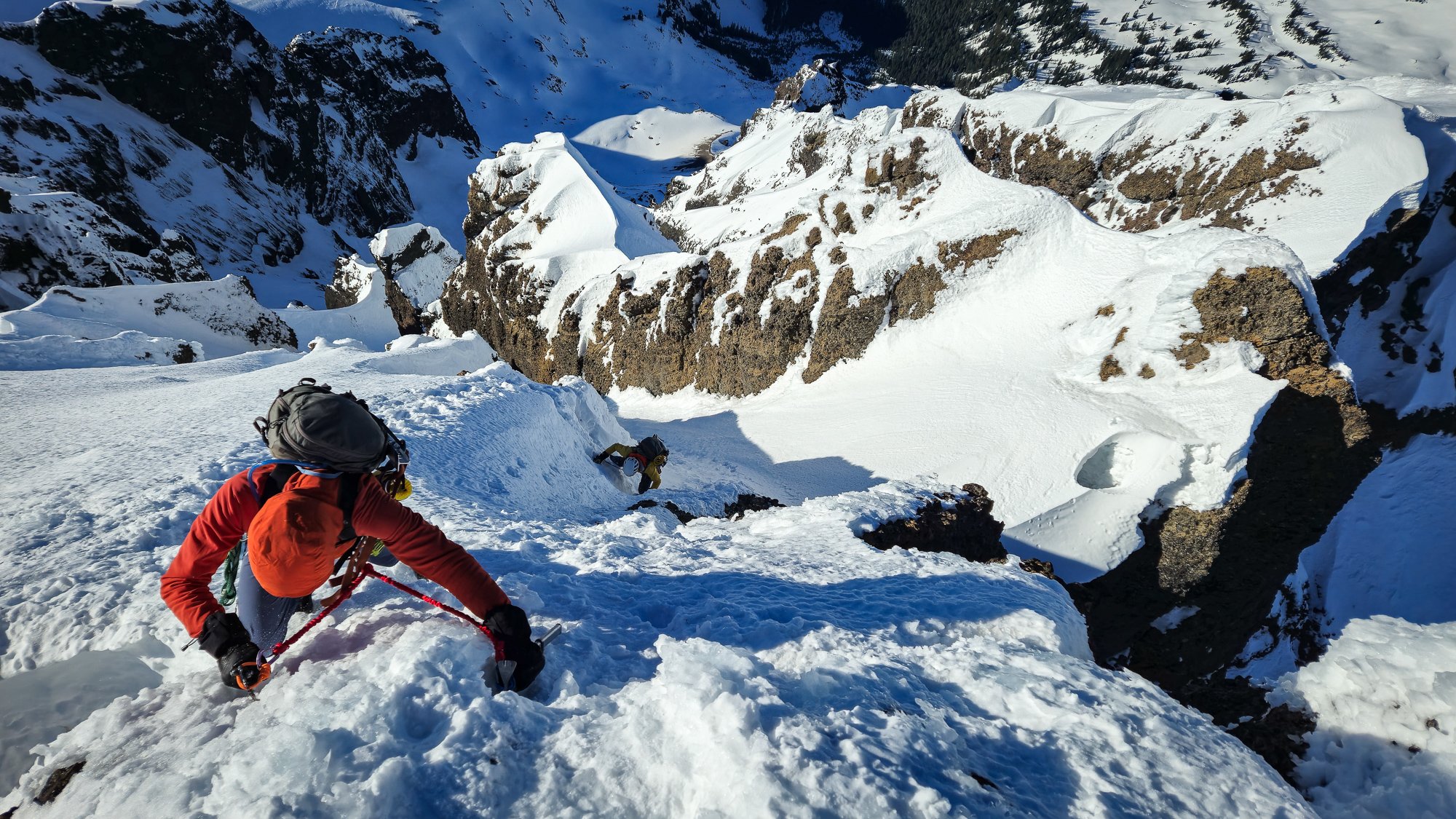
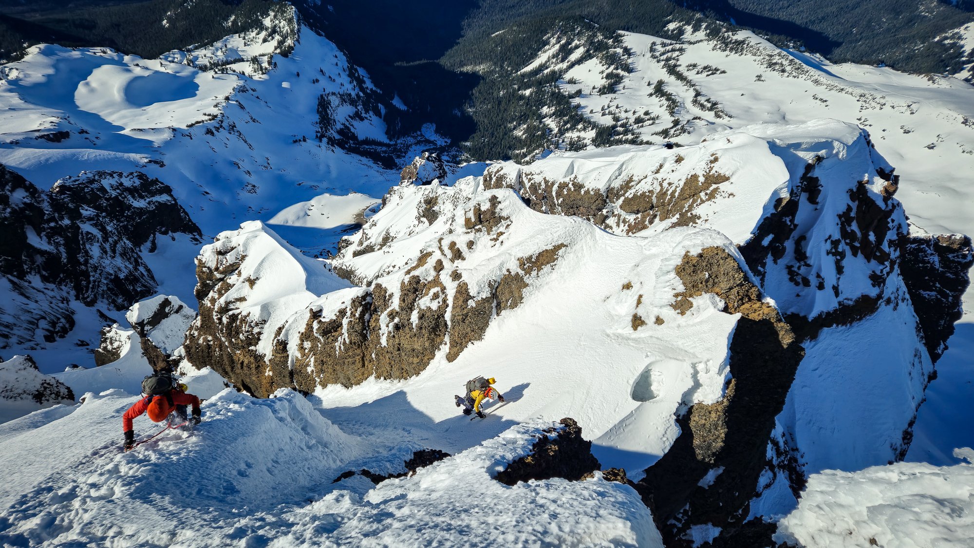
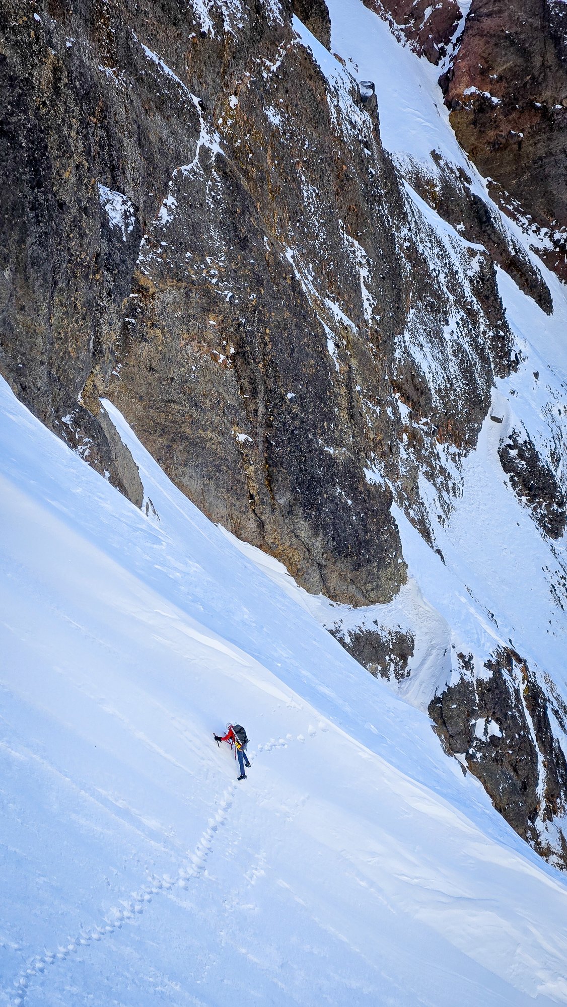
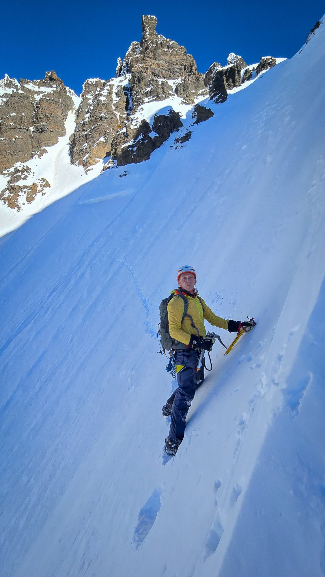
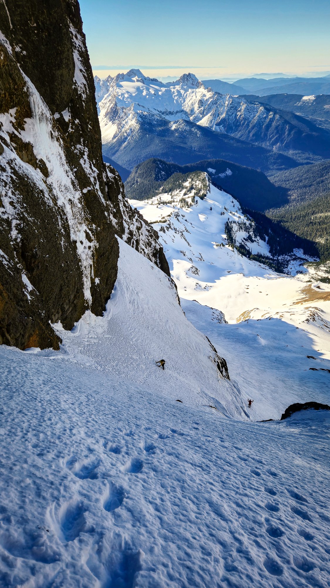
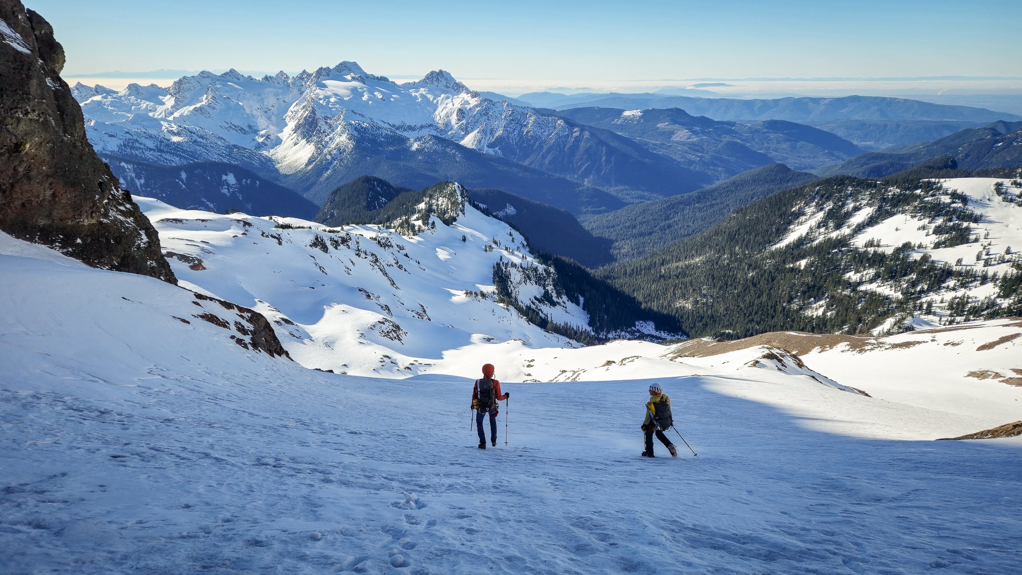
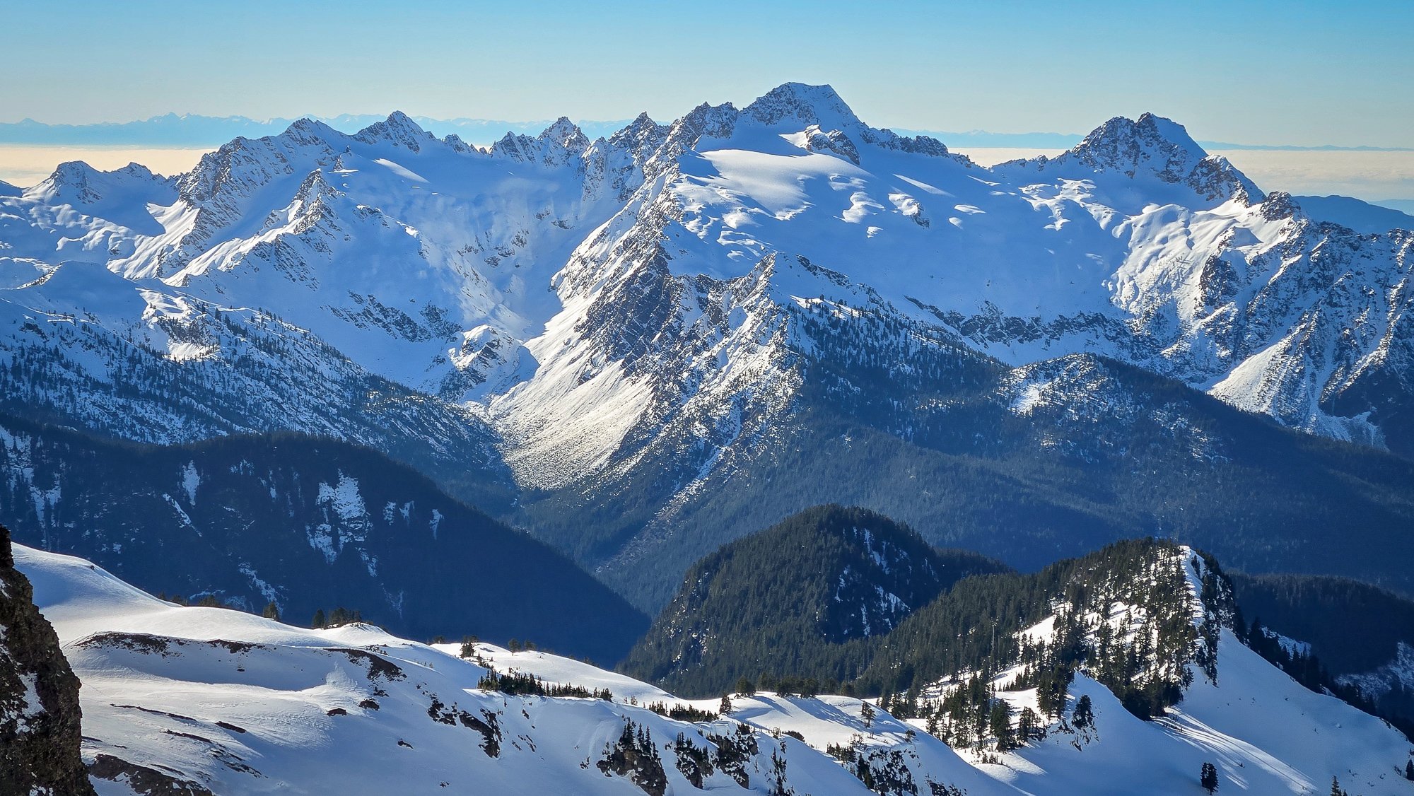
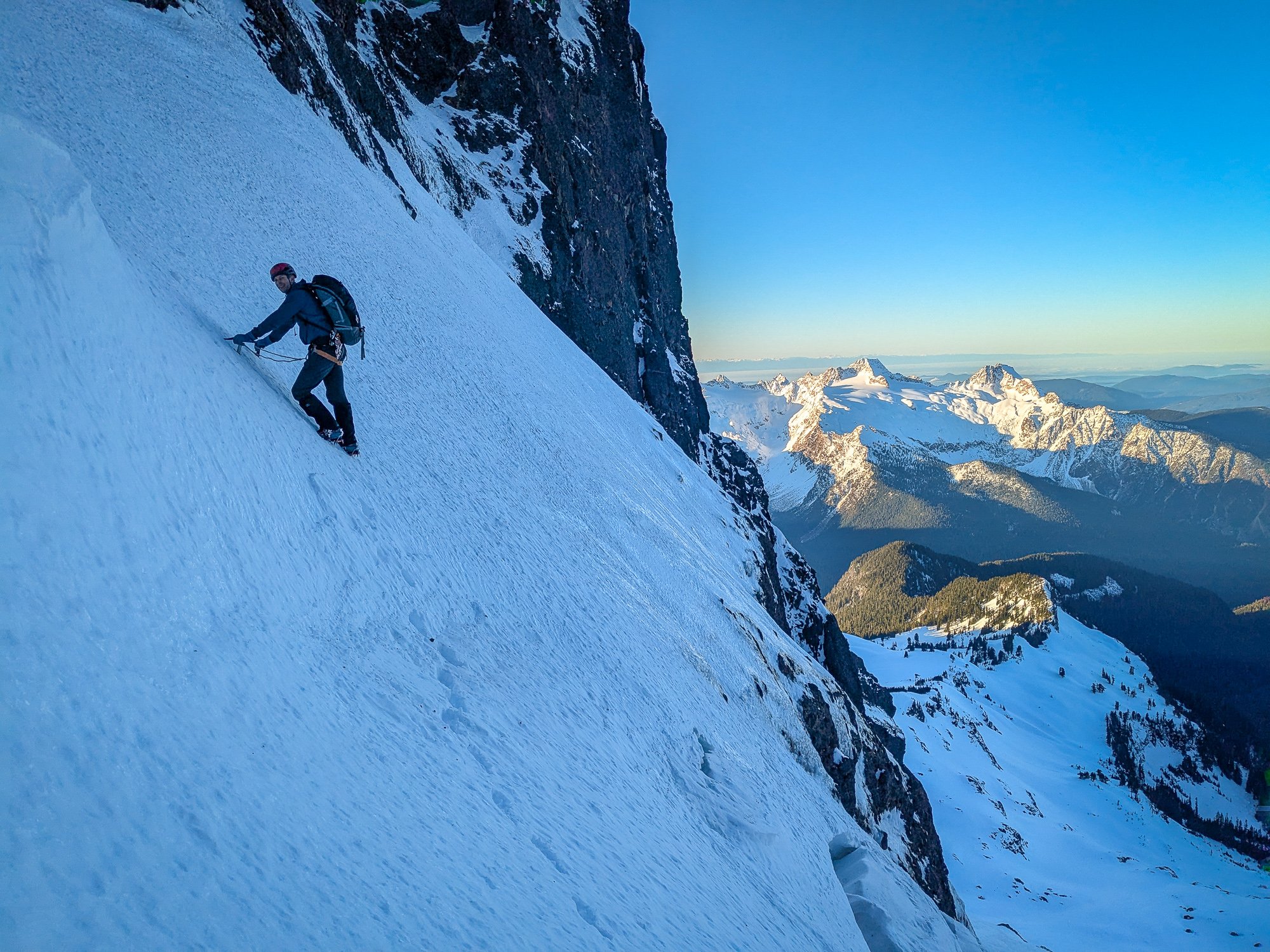
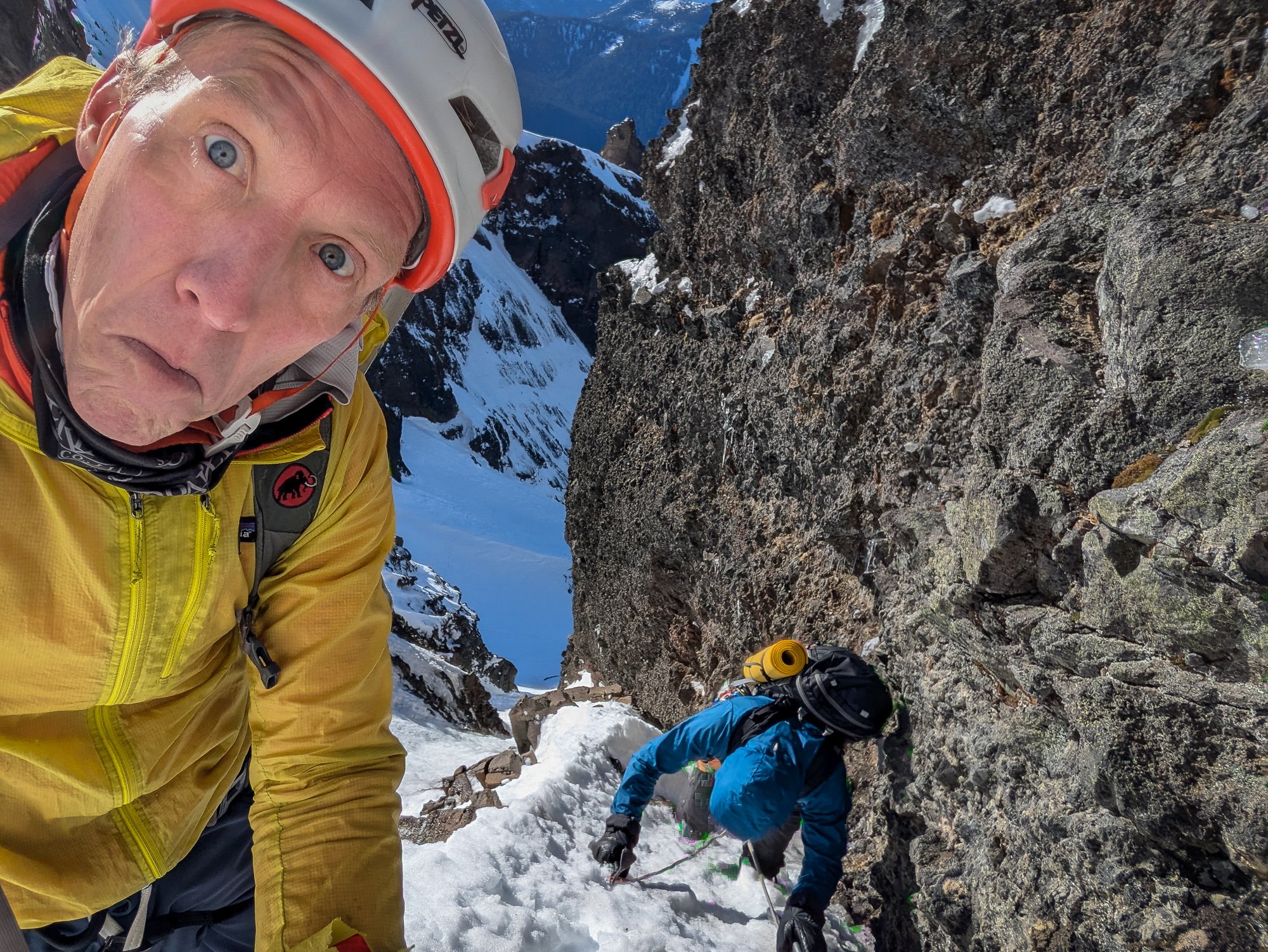
Trip: Lincoln Peak - Southwest Face Trip Date: 01/29/2025 Trip Report: Lincoln! A peak that had been haunting my subconscious for decades, always taunting me on clear days as I drove home from work across the Skagit flats. Try as I might, I could never completely ignore it. It didn't help that it was on "Dallas's Difficult Ten" list, or that by a few years ago, it was the LAST one on the list for me to climb. By 2023 I had tried and failed on it with @kmfoerster. By the end of 2024 I had turned 50 and figured I may as well get on with some long term climbing goals. It didn't hurt to learn that @geosean also had this one peak to go on his run at the Difficult Ten, nor that @Trent was within one peak of finishing as well (South Hozomeen- he's looking for partners!). That, coupled with seeing "Lincoln" on @therunningdog's whiteboard, planted the seeds in my brain to make it happen in 2025. As @Trent would say, "It must be climbed!". And then last week we got a window and hatched plans to give it a go on Wednesday as a day trip. This was going to be a bit ambitious, we knew, and I would be lying if @Lucas Ng's TR didn't make me think maybe too ambitious? There would only be one way to find out. We started, as all good mountain trips do, with a home cooked meal with my family and @therunningdog. My son admonished us to start early for the Middle Fork so we could "get a workout in before bed". Tim and I declined and delayed as long as possible. It was cold out there! But we did eventually find our way to the Middle Fork about 9pm, settling in to a bivy at the Elbow Lake Trailhead to meet @geosean at 3:45 the next day. Sean was right on time and we bounced our way up the rough spur to where continuous snow started about 3500'. By the time we got geared up and rolling, it was about 4:15. From here, the day was pretty much a blur. We got to treeline a bit before sunrise, which was spectacular on the Twin Sisters Range We snowshoed from treeline over to the glacier where we ditched them and the stove and switched to harnesses, helmets, axe, and crampons. I think I crossed the 'shrund first about 8:30. And then it was game-on for a couple hours up to the summit. Lucas and Cole's tracks were basically gone and we kicked new steps the entire way, running across a few of their rap stations up high. The going was pretty steep the whole way, but conditions were very secure and basically perfect. We kept the rope in the pack and carefully traded trailbreaking duties up the various sections of the climb. What a position! Seward: Approaching the summit: And then, like in a dream, all three of us were at the summit block! It was 10:22am- about 6 hours from the car- meaning things had gone waaaay better than expected. @geosean and @therunningdog on the summit: The views, of course, were staggering. What a small and wild summit, especially in winter! But also, what a descent lay ahead of us. That's why I was a little concerned to see Tim start to downclimb while Sean dug the summit picket out of the snow. Uhhhhh....we're not rapping guys?...... "No Jason, let's go!" And so, I took a deep breath, put on my big-boy pants, turned around, and started down. It was a stimulating descent. Especially in this particular spot: But, by moving slow and steady, we made it safely down about as fast as we had gone up. Tim and Sean had to wait a bit for this mature mountaineer on the descent. I'm not going to lie....it was quite a relief it was to finally get back past the 'schrund and start the slog out! We stopped at treeline for almost an hour to melt snow and admire our tracks on Lincoln. It felt good to be down safe in the sun with a couple of good friends, marveling at the grandeur of the North Cascades. What a day! But January days are not long, and we had a bit of scruffy ground to cover before dark. So the snowshoes went back on, the brains turned off, and down we went. We arrived at the car a bit before 4pm, in the light, to all of the windows intact, a change of clothes, and snacks. It doesn't get much better than that..... Edit- Well, we could have remembered beer. THAT would have been better. Oh well, can't always have it all! Gear Notes: snowshoes (in winter), crampons, axe, helmet, second tool. We brought a rope and pickets but didn't use. Approach Notes: 4x4 will get you to 3500' or so up the spur.

.jpg.665b3db19993070594beeb7877f8f0c9.jpg)
- 9 replies
-
- 12
-
-
-
-
[TR] Jack Mountain - Nohokomeen Headwall 01/26/2025
JasonG replied to Eric Gilbertson's topic in North Cascades
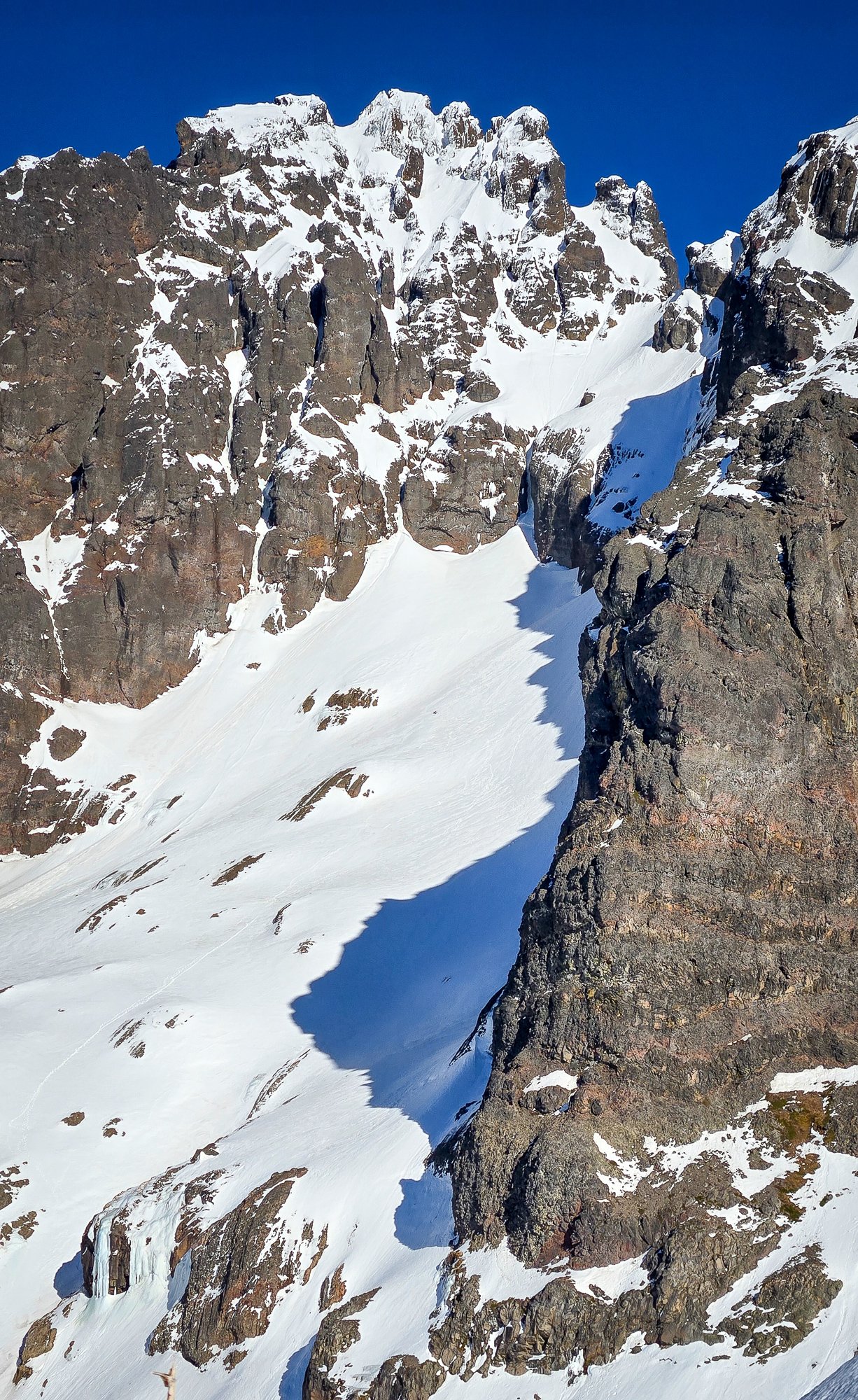
I would recommend the East Ridge of Jack instead. I thought the South face route to be a garbage pile in comparision (we went down that way). But also, I think a spring ascent of the Nohokomeen is great! I guess I am saying that Jack is worth climbing, but the South Face is maybe not the best line. -
[TR] Jack Mountain - Nohokomeen Headwall 01/26/2025
JasonG replied to Eric Gilbertson's topic in North Cascades
BOOM! We were just discussing what you got up to this past weekend....now we know. Lucky for you the weather has closed down and you can have a relaxing weekend! -
Hey @Lucas Ng! @geosean@therunningdogand I climbed Lincoln today and were able to bring down 3 rap stations including a couple pickets. I'll shoot you a PM with how to get the stuff... thanks for the added inspiration to get it done.... it's been on the list too long!
-
LOVE it! Way to get after it youth! Enjoyed skimming the blog...will have to go back to it. There is at least one route there that I haven't done and would like to.
-
Cool! Well done soloing that link-up all in a day....and that highline is bonkers!
-
Thanks @ken4ord! I know what you mean, and you definitely can handle it. Let us know how it goes!
-
This winter has been a gift to this effort, but wow, that still sounds tough @Eric Gilbertson! Well done!!
