


JasonG
-
Posts
5281 -
Joined
-
Days Won
352
Everything posted by JasonG
-

[TR] Tokaloo Rock (Sunset Ridge bailure) - Standard 06/29/2025
JasonG replied to JasonG's topic in Mount Rainier NP
Was that up the NW side? That thing is pretty impressive! My first time up close... -
[TR] Tokaloo Rock (Sunset Ridge bailure) - Standard 06/29/2025
JasonG replied to JasonG's topic in Mount Rainier NP
Ha! Well, @Trent and I may be old but at least we still can armchair mountaineer with the best of them. Sorry to hear about your trip @Nick Sweeney (and happy you survived!), but glad to know we made the correct call. Thanks for the write-up! I'll finish this, this week. -
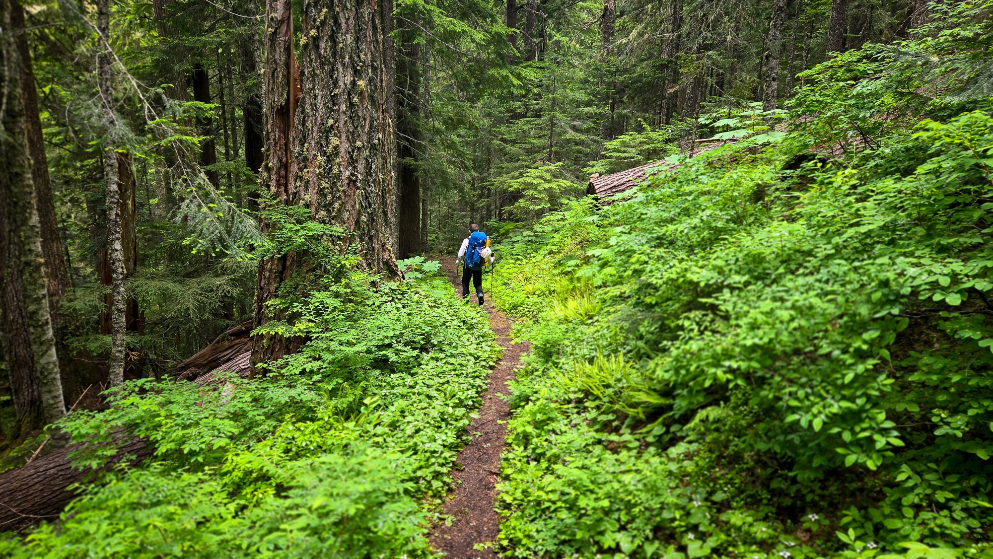
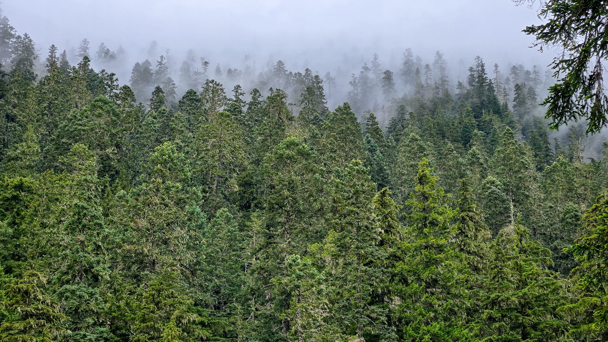
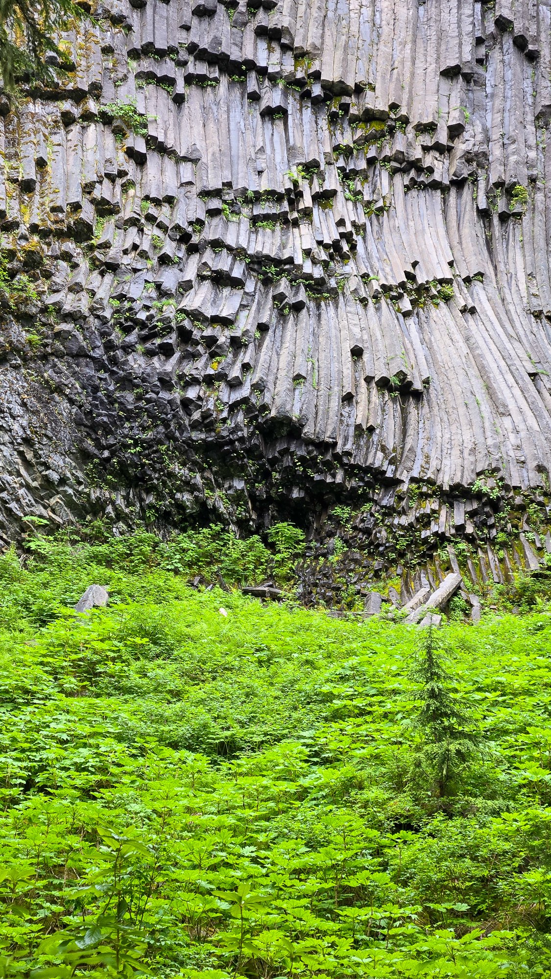
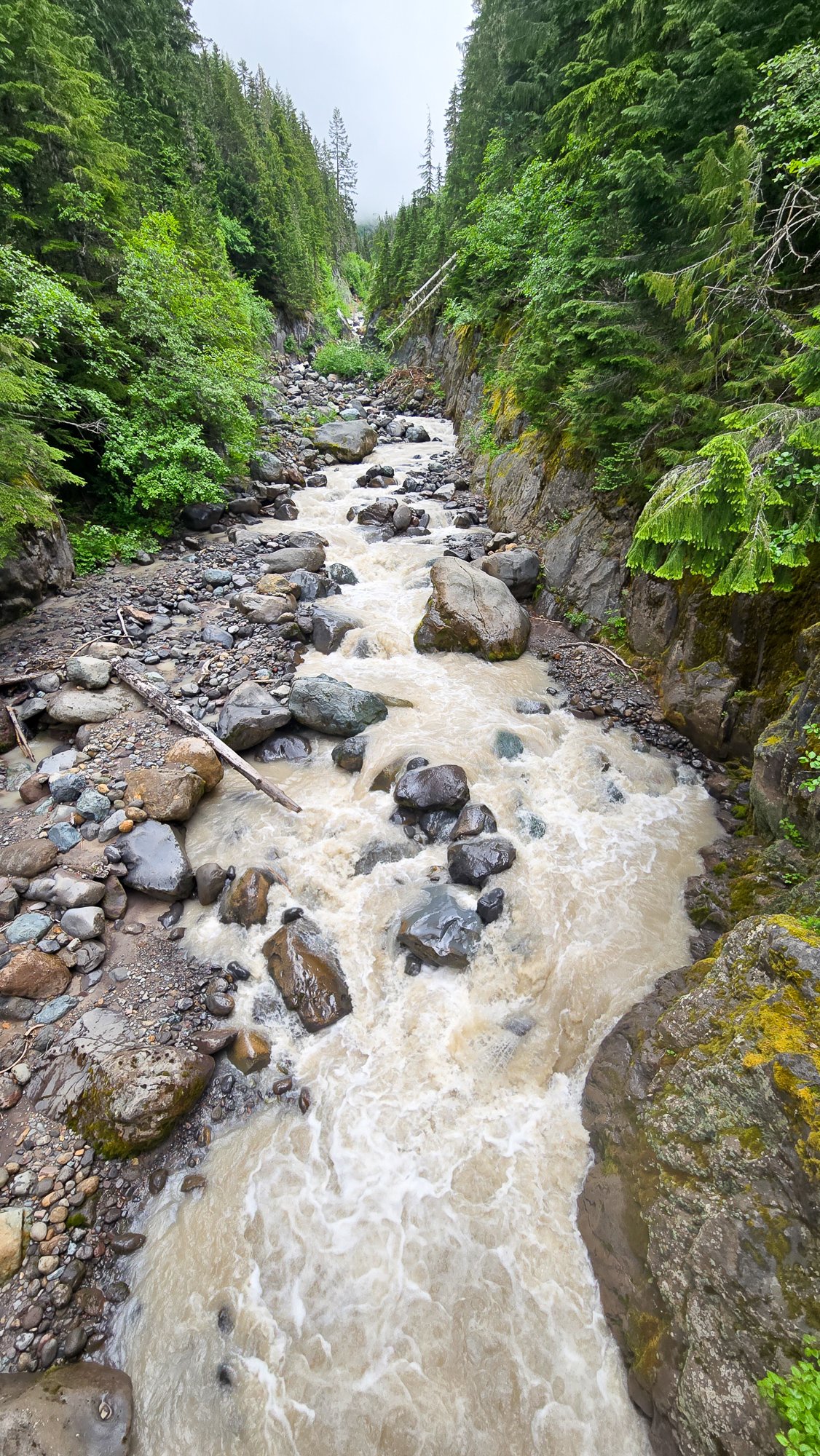
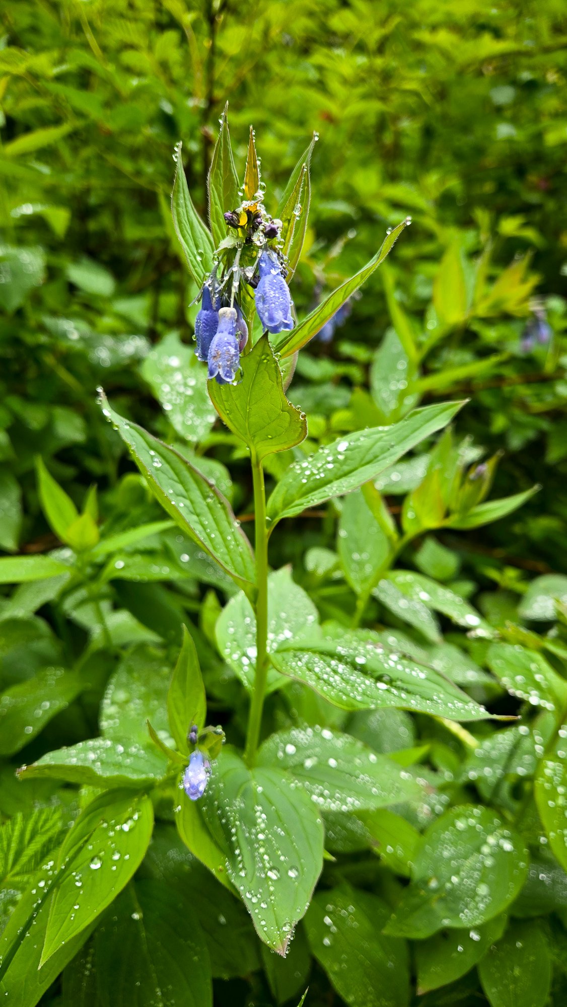
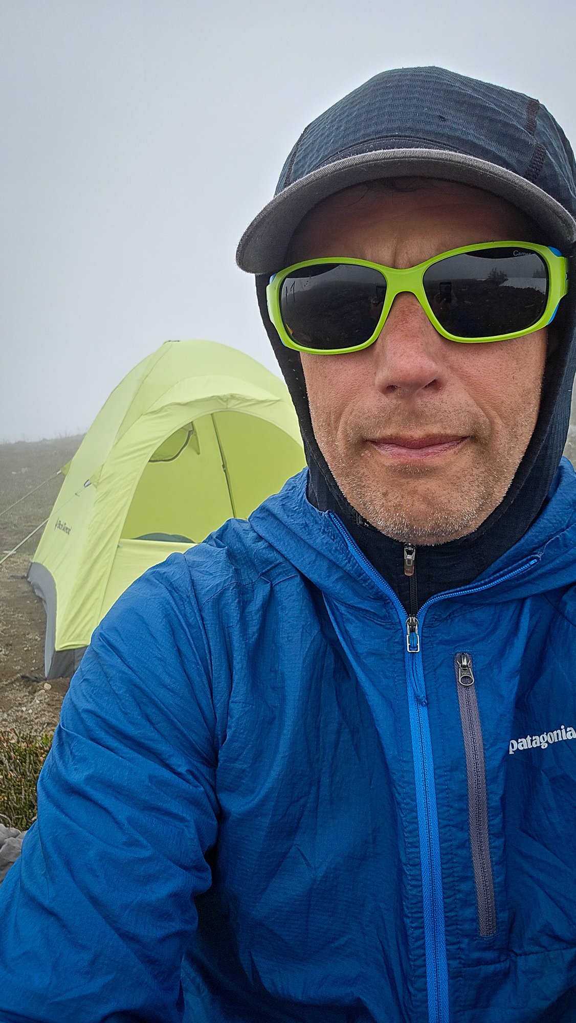
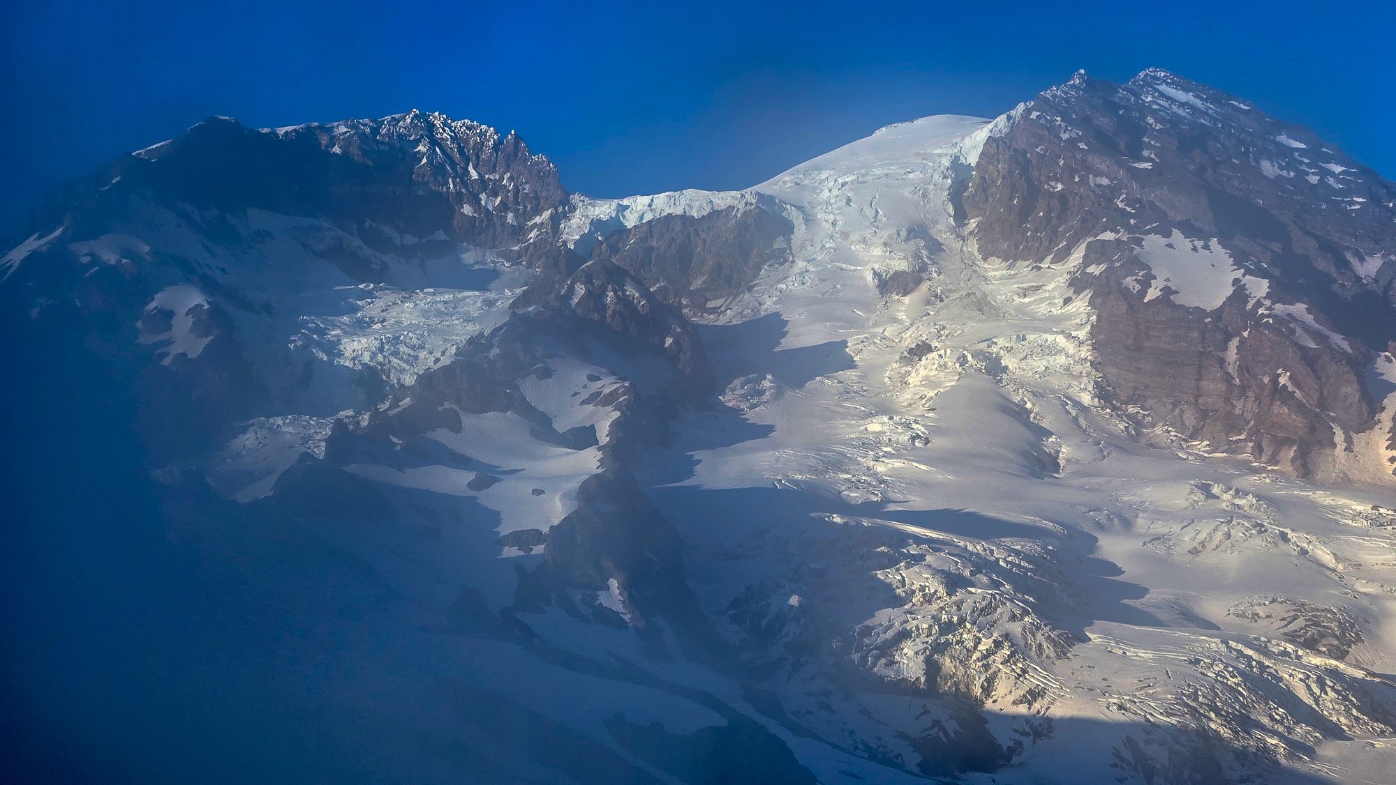
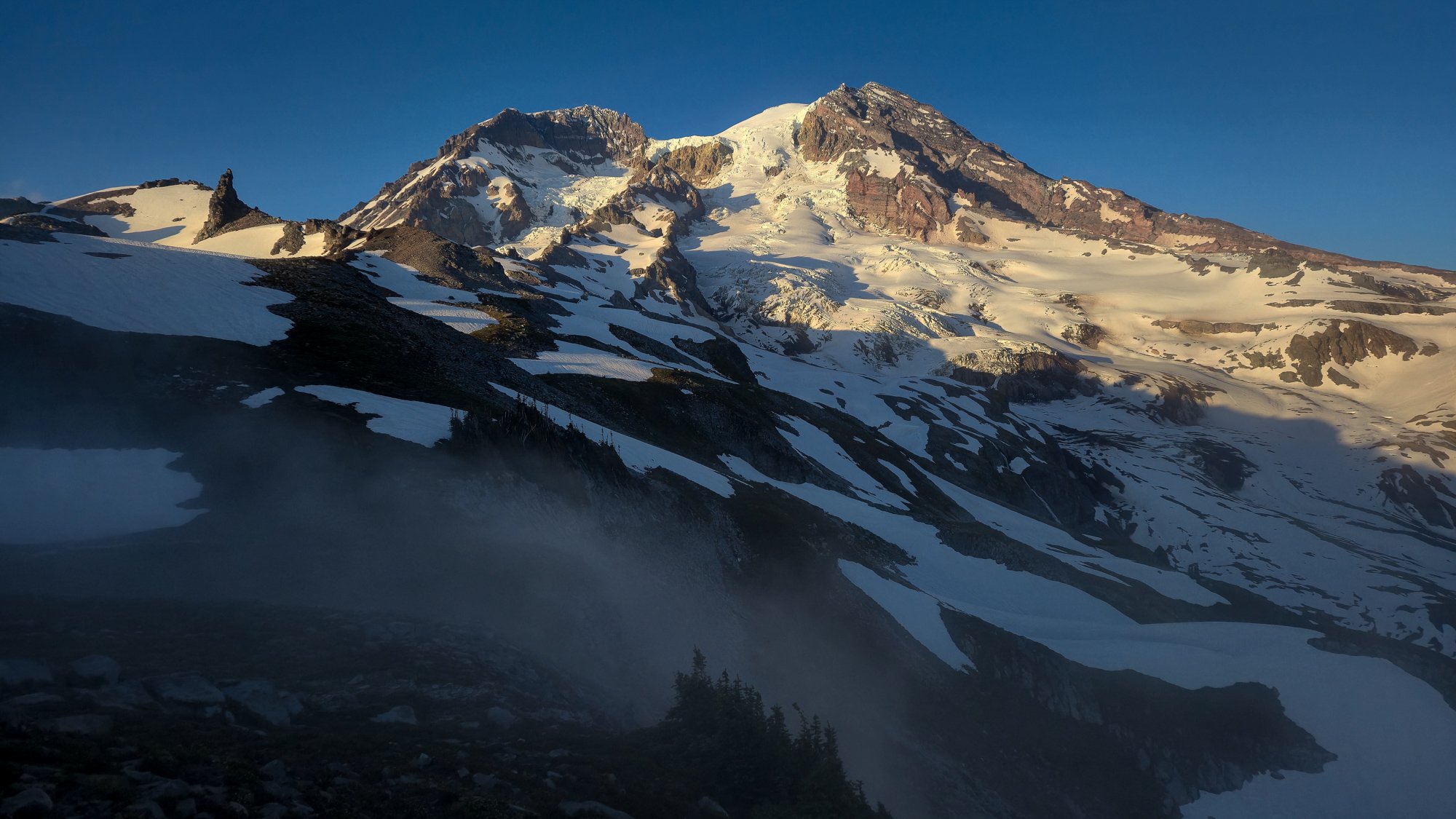
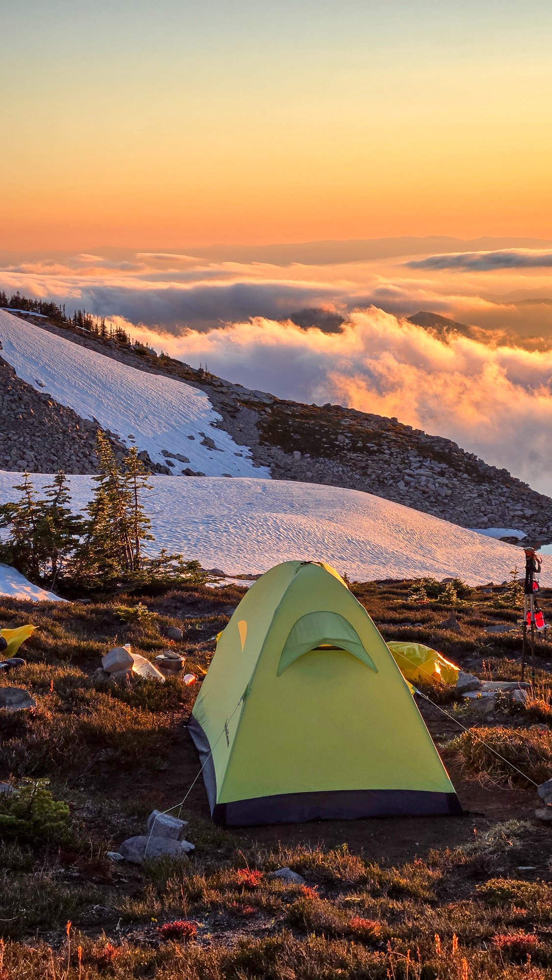
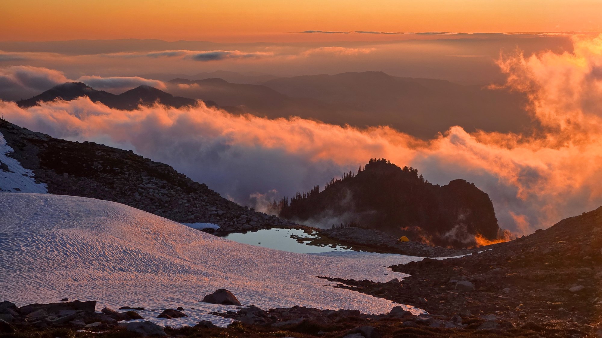
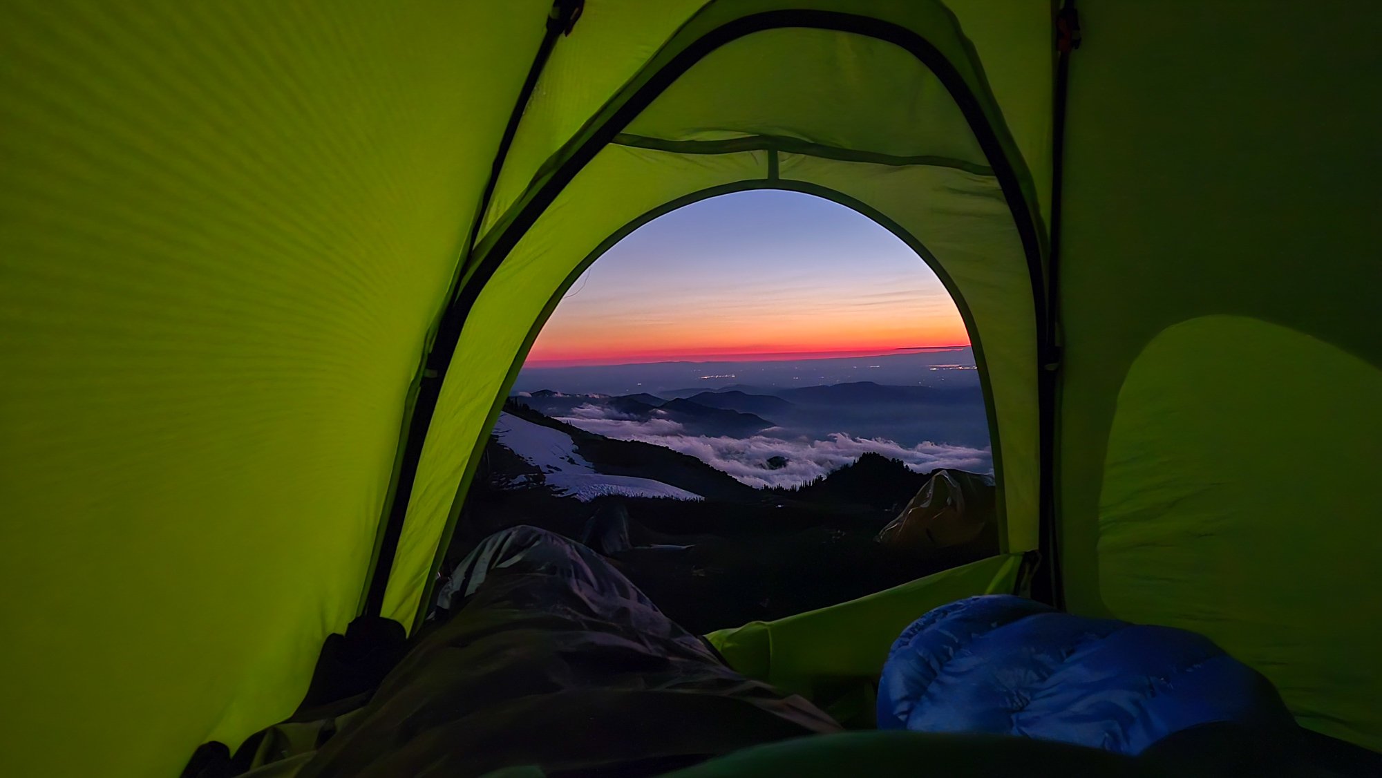
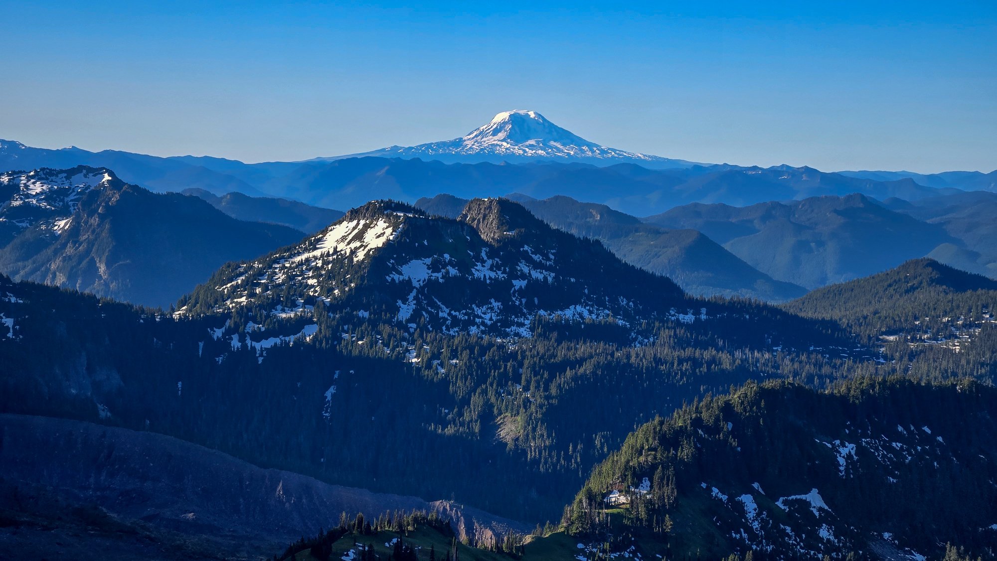
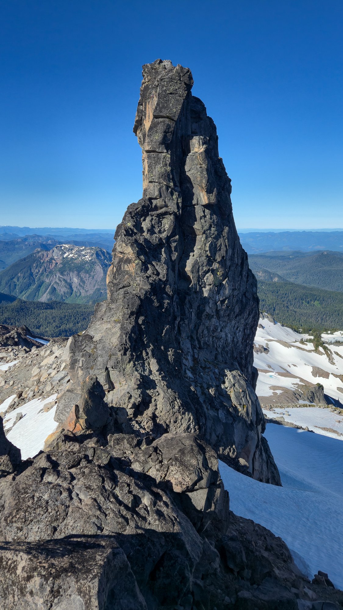
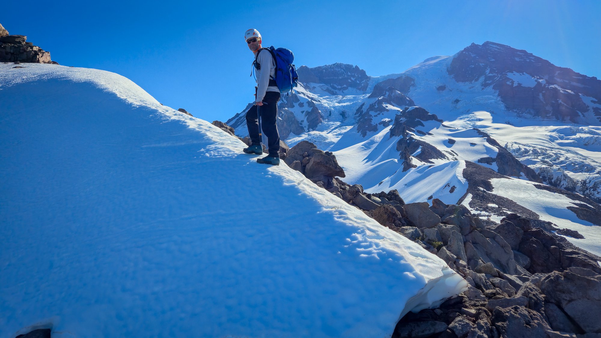
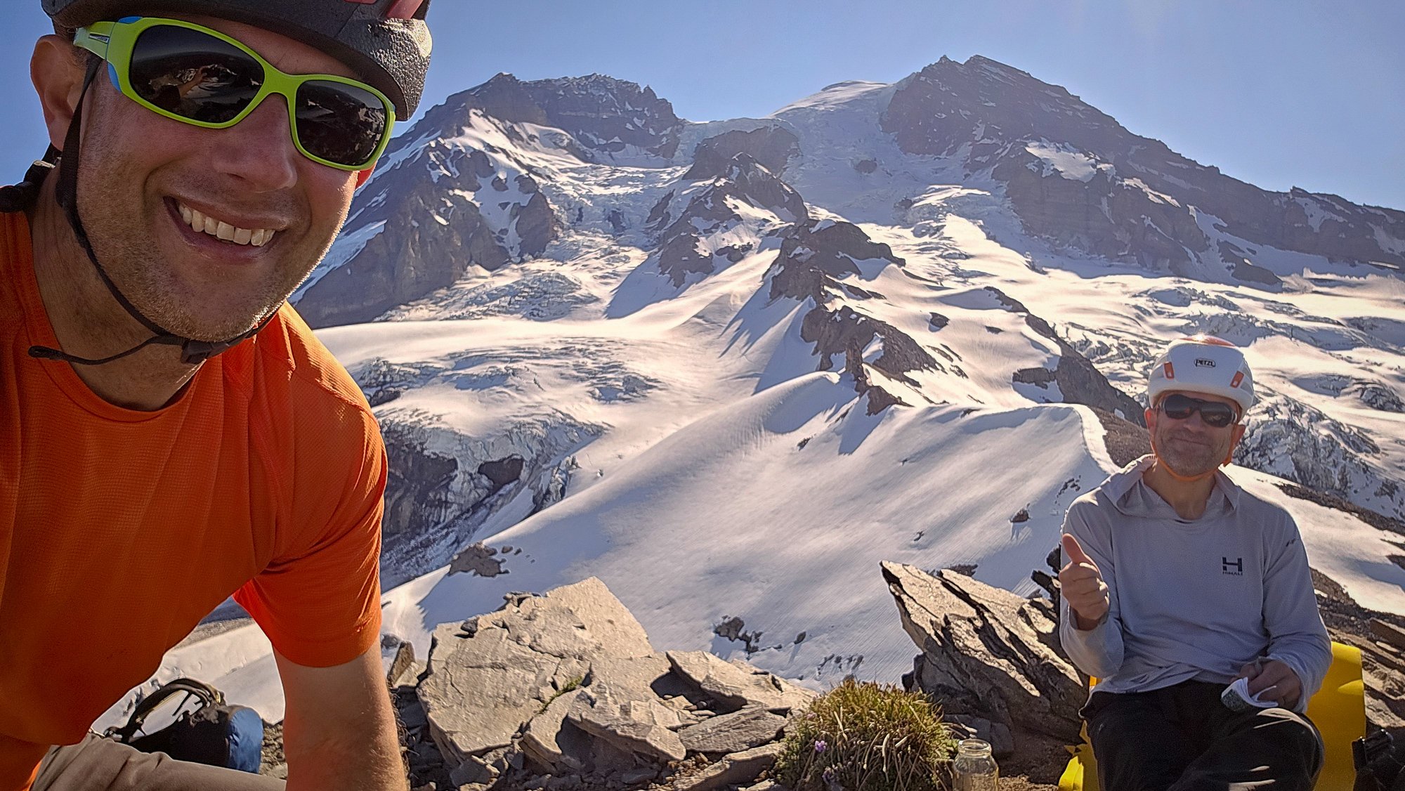
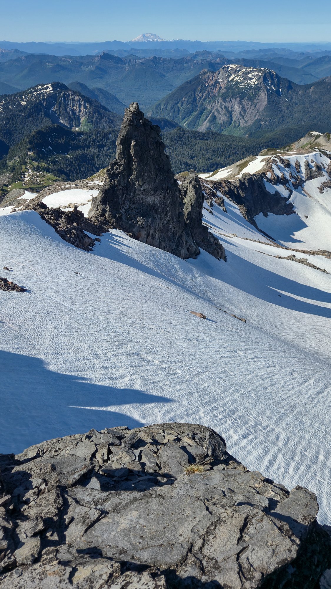
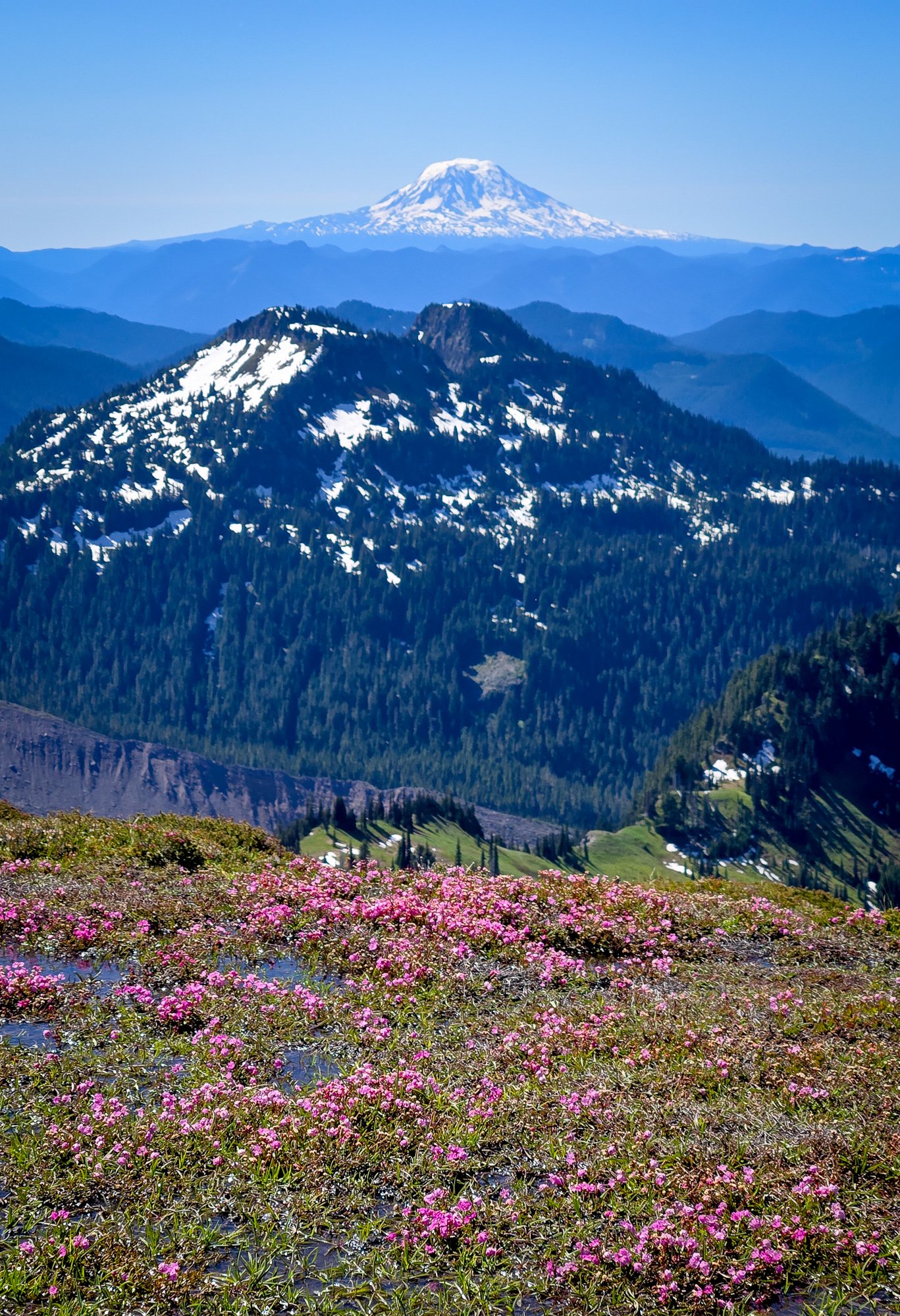
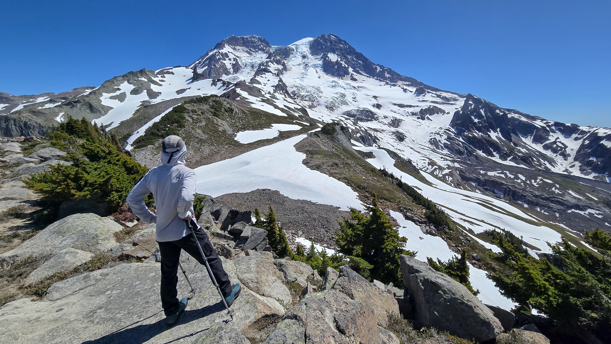
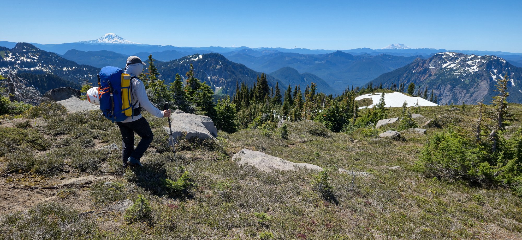
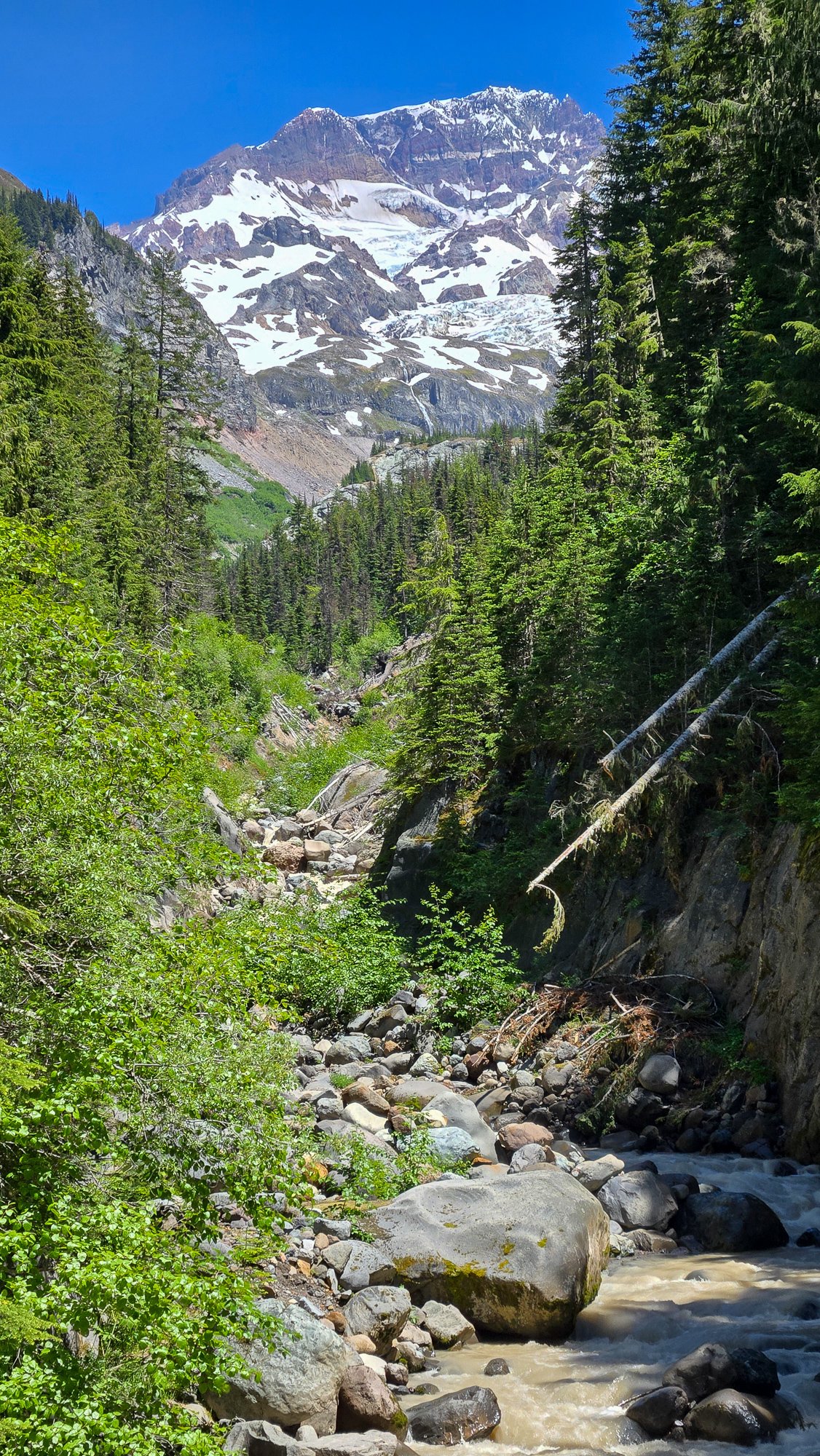
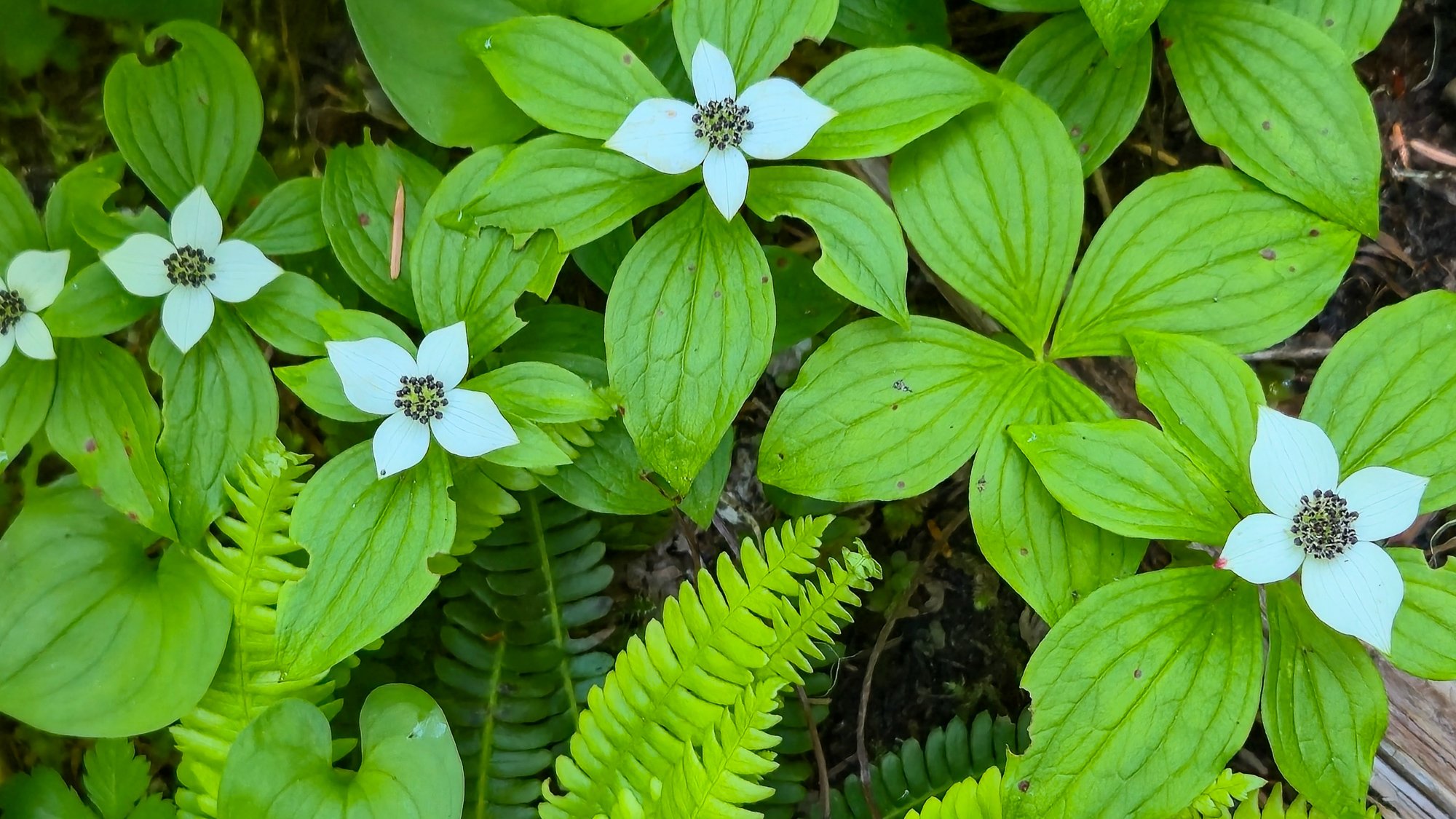
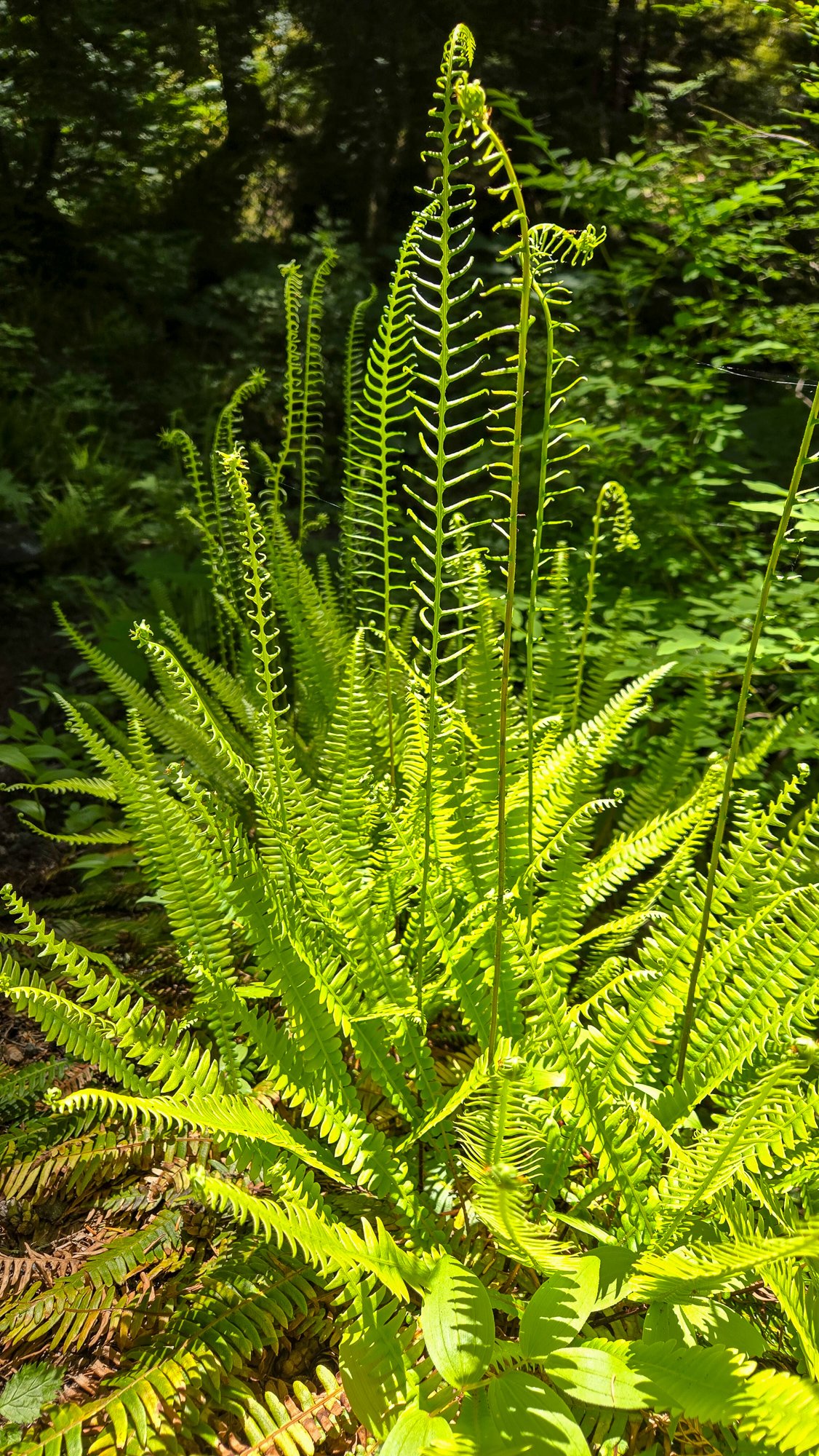
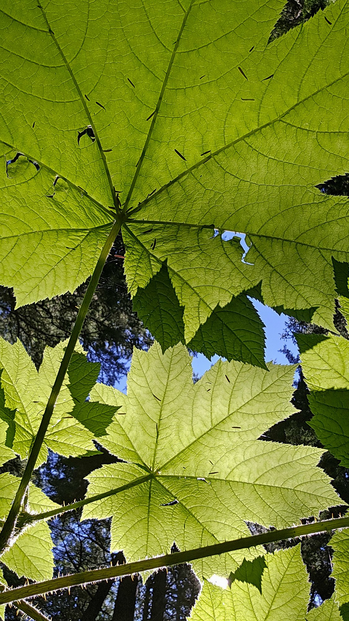
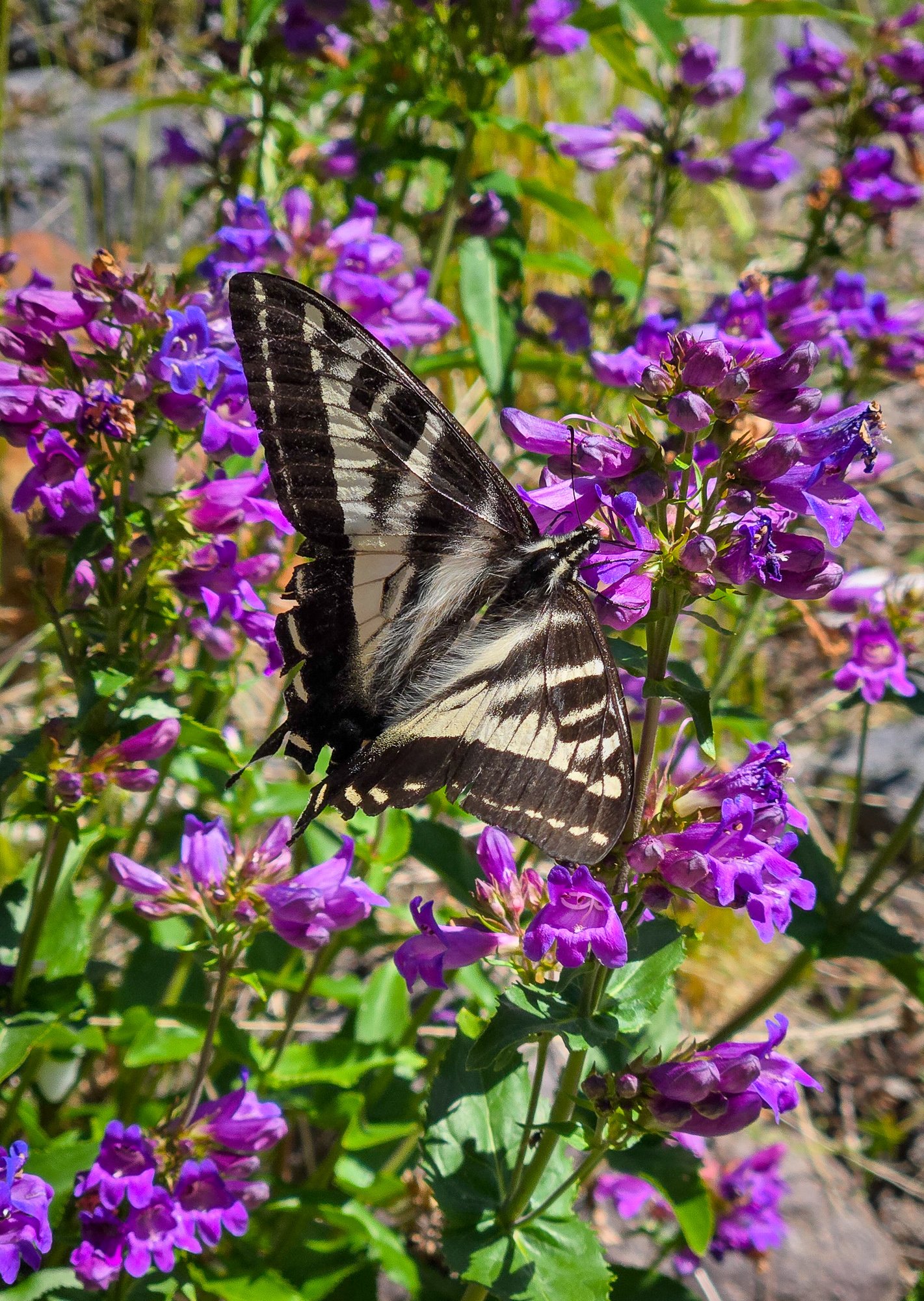
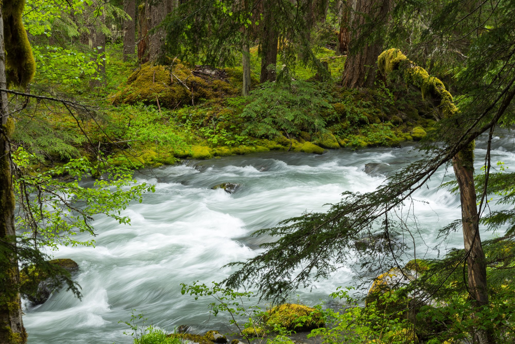
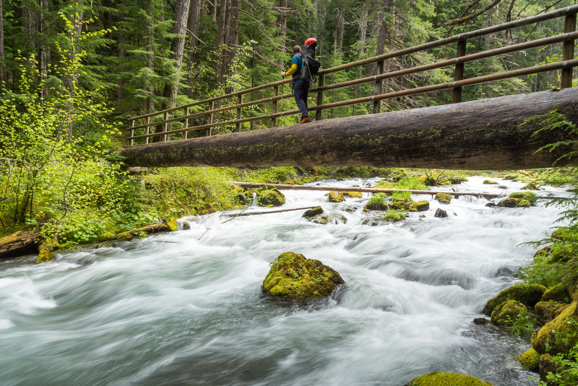
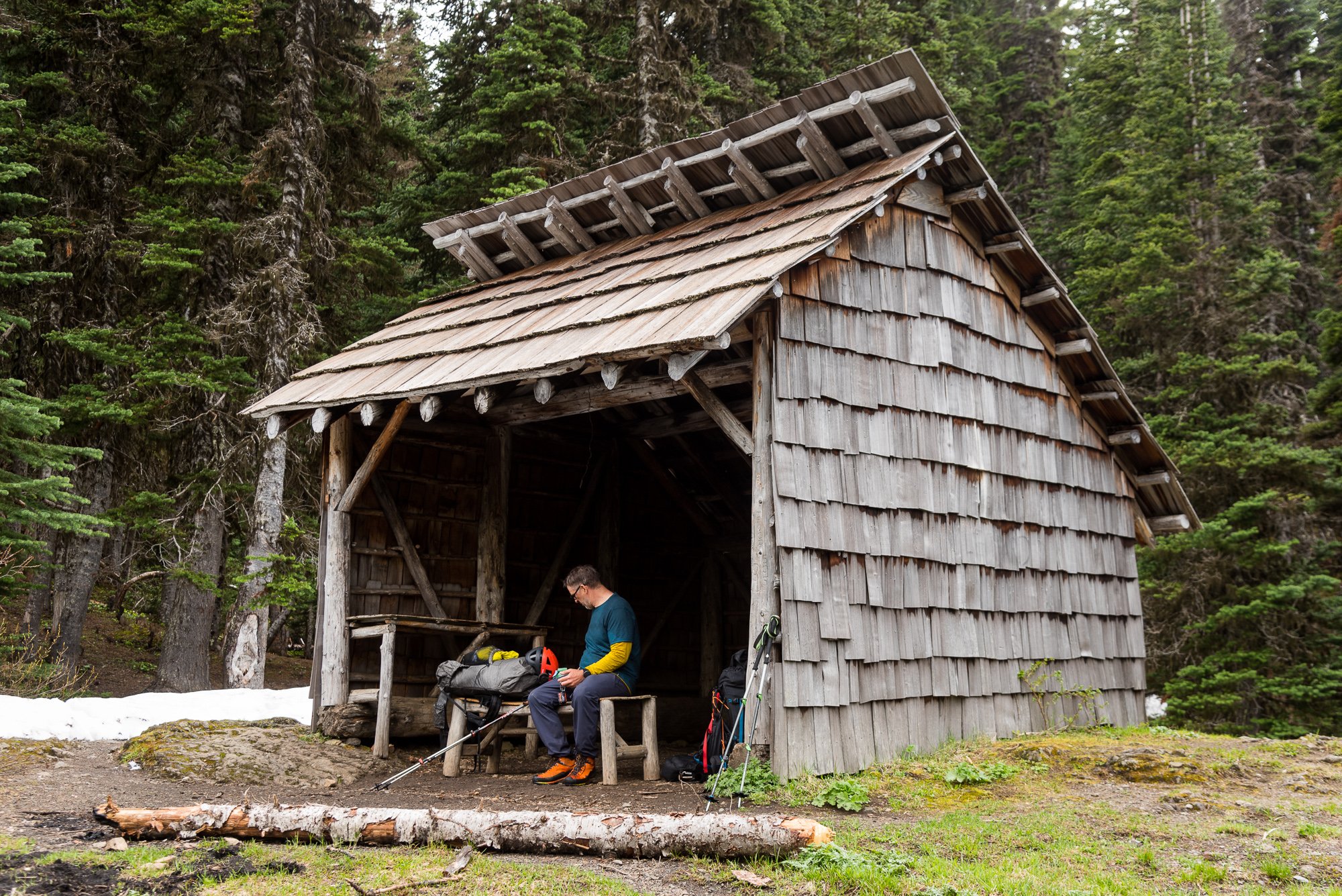
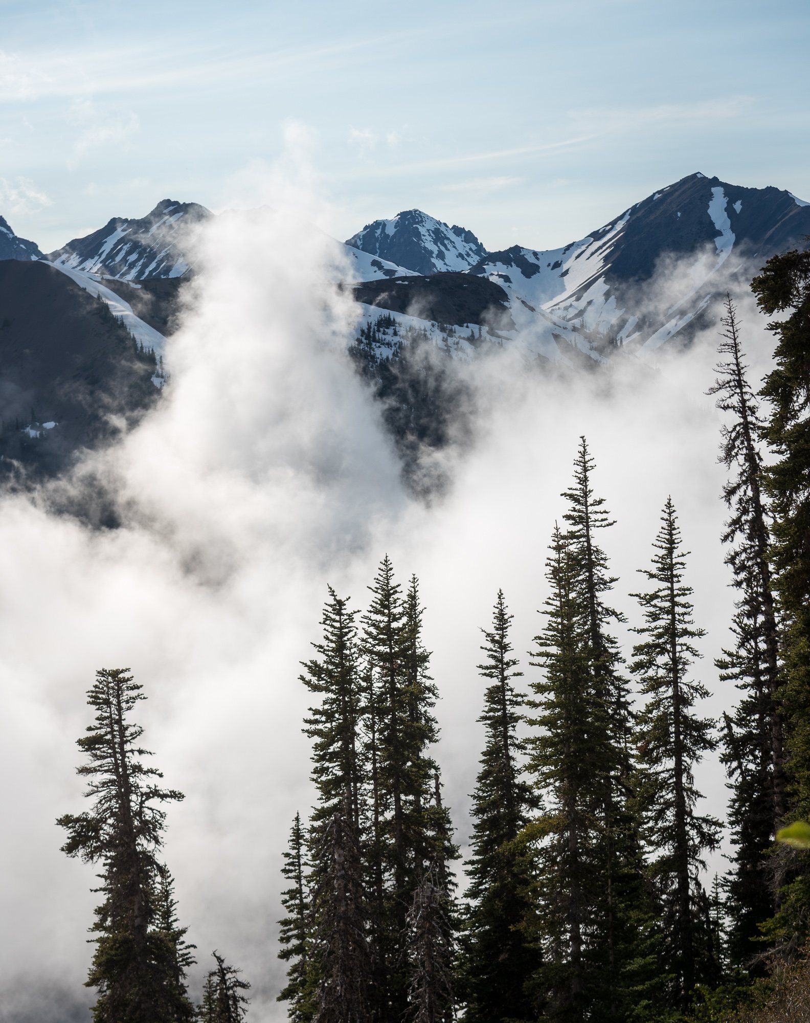
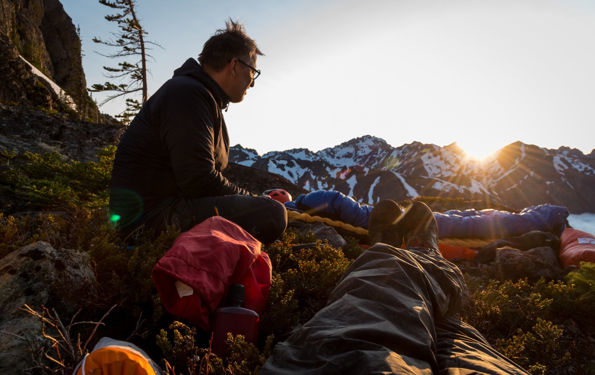
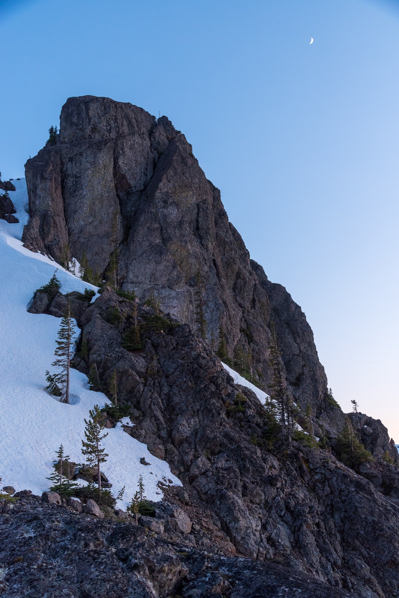
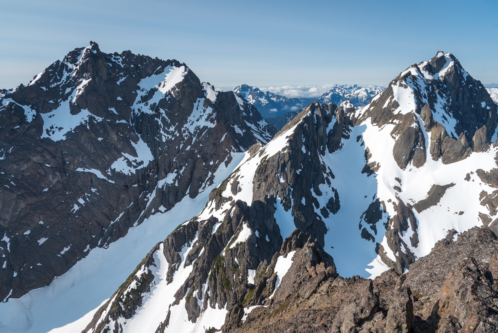
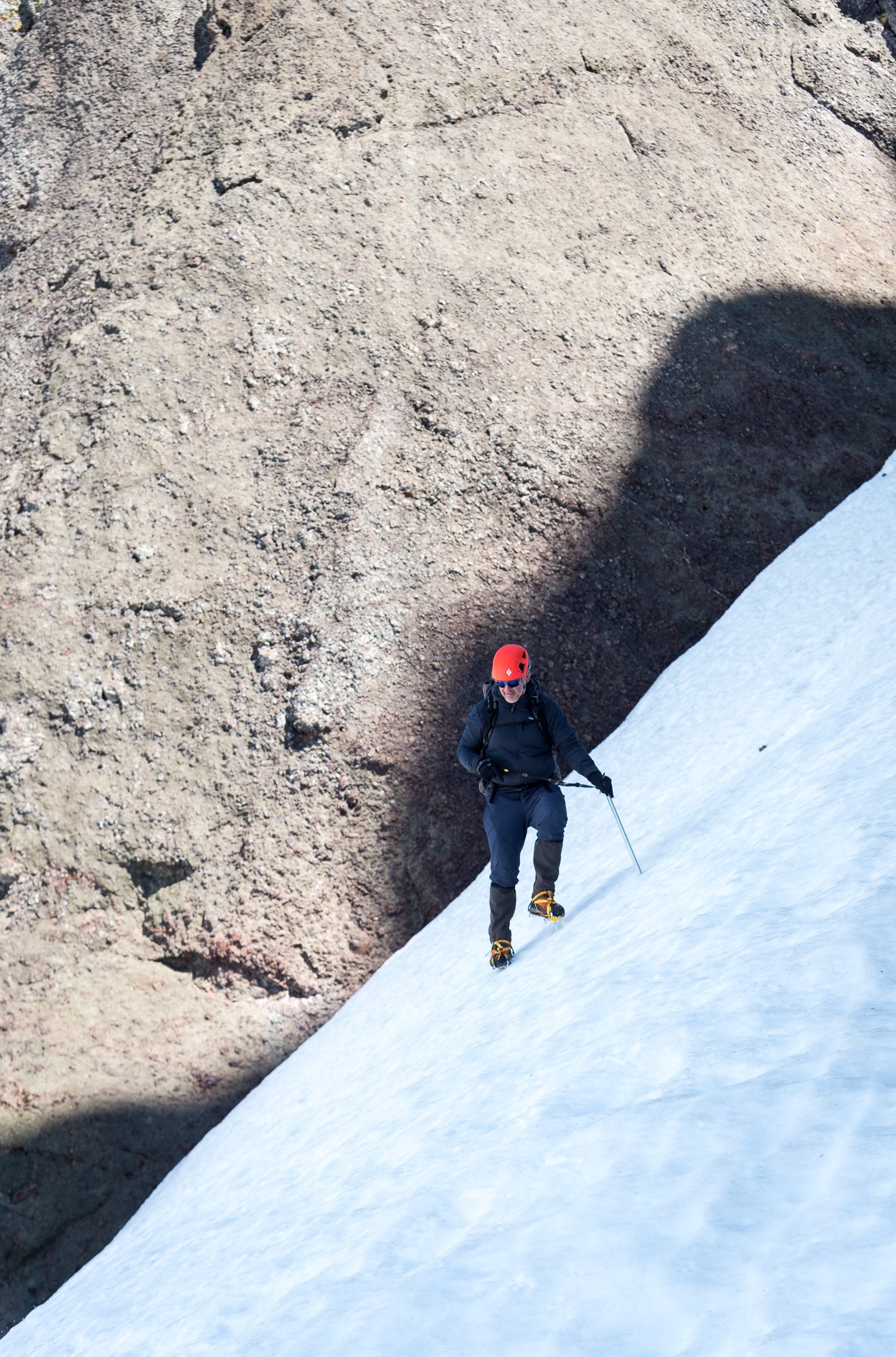
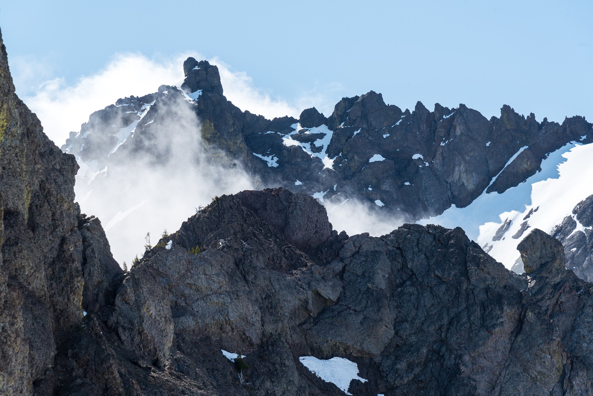
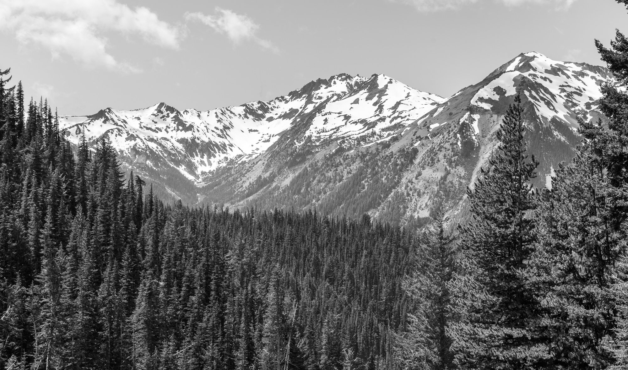
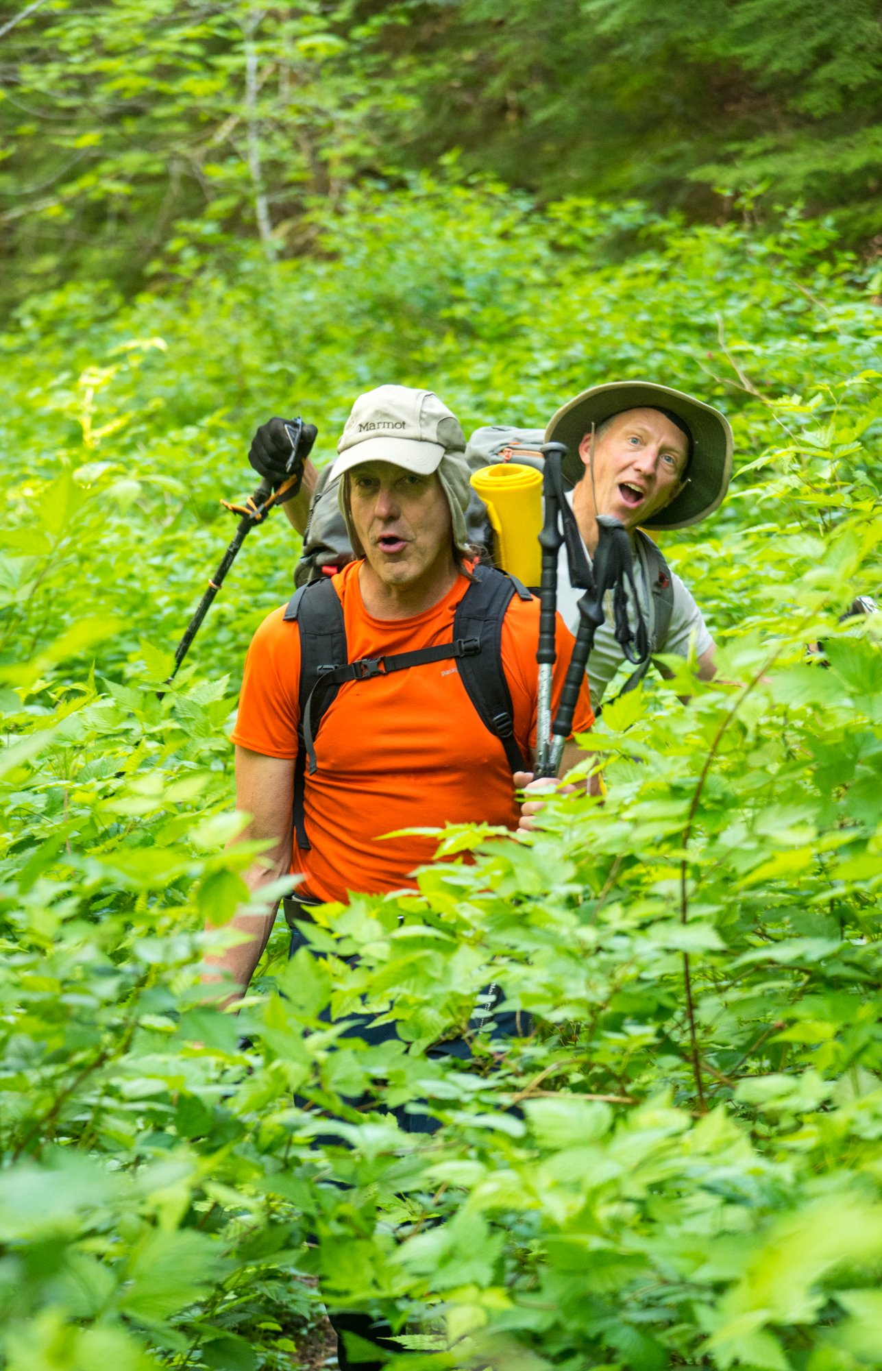
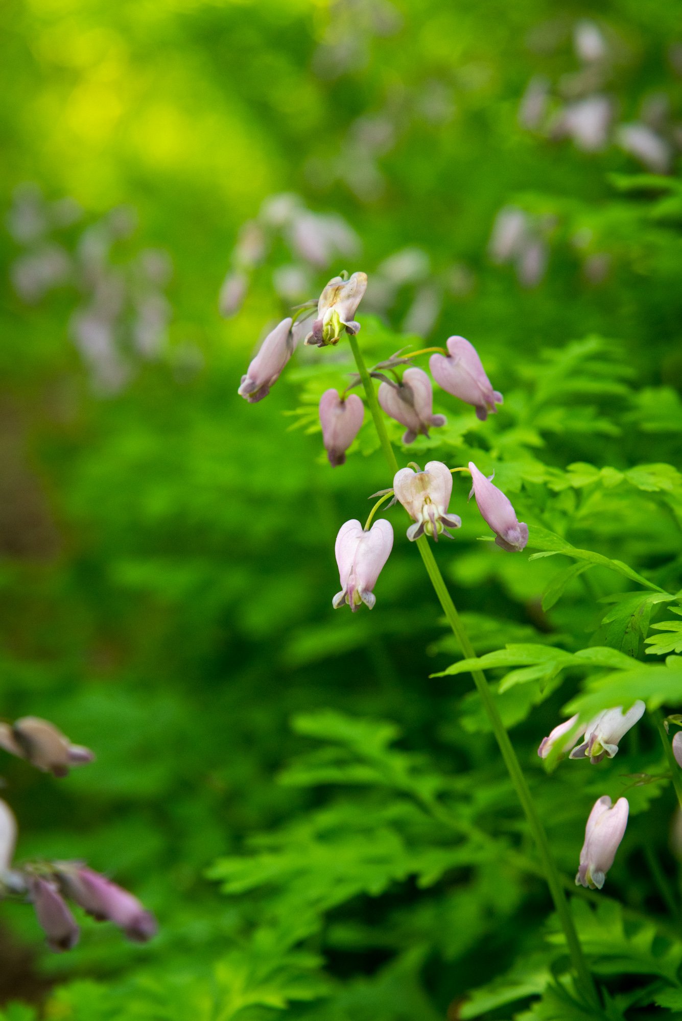
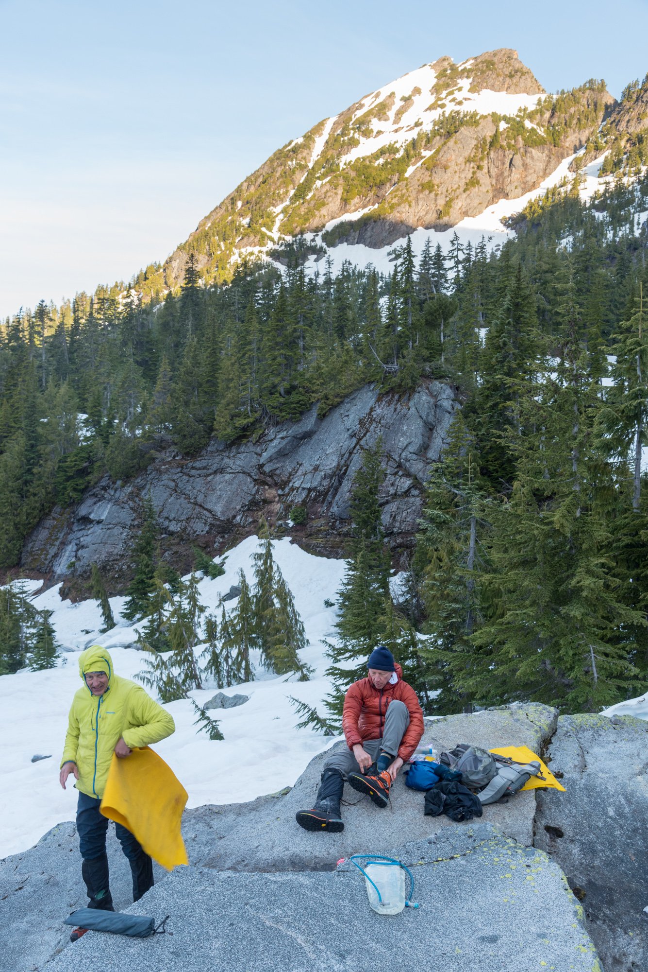
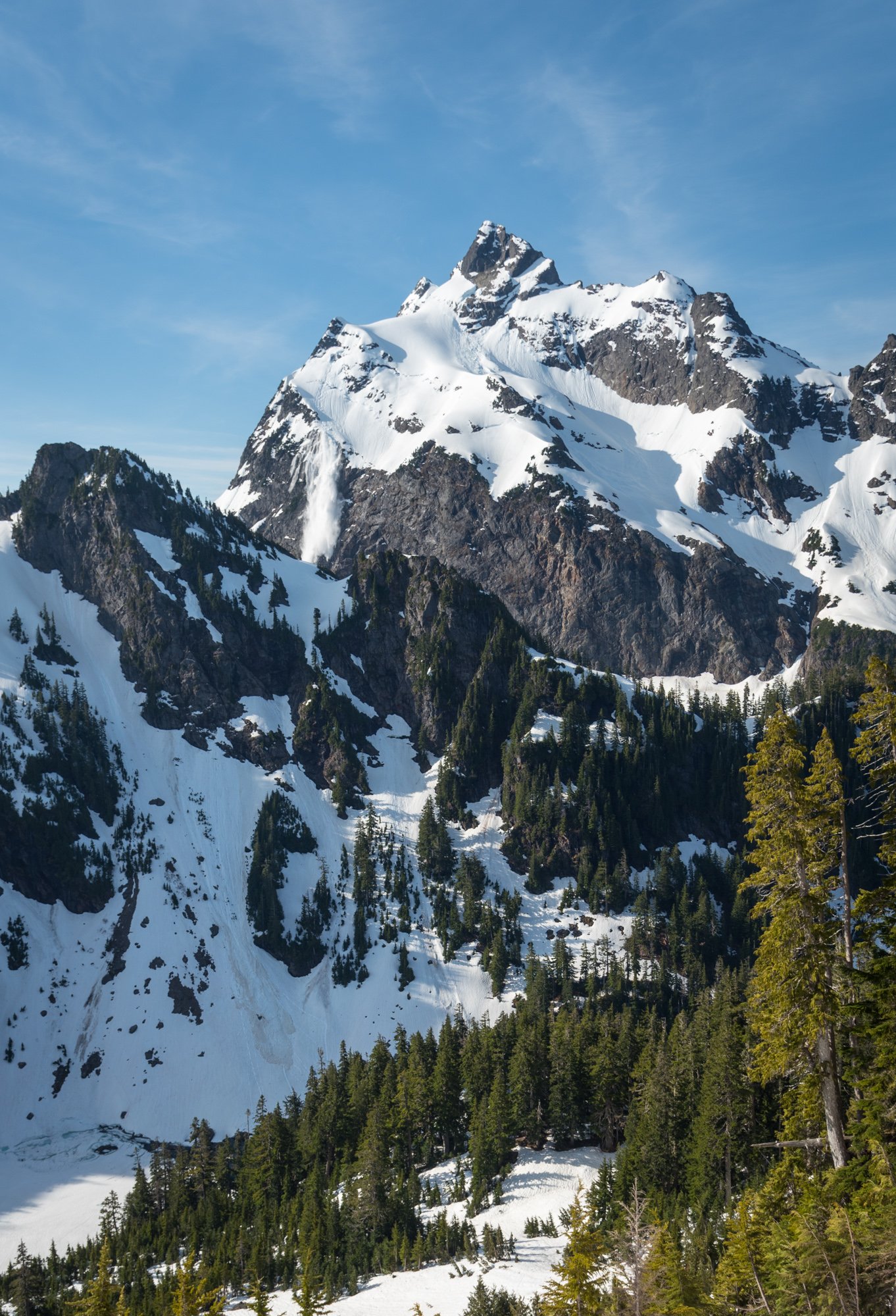
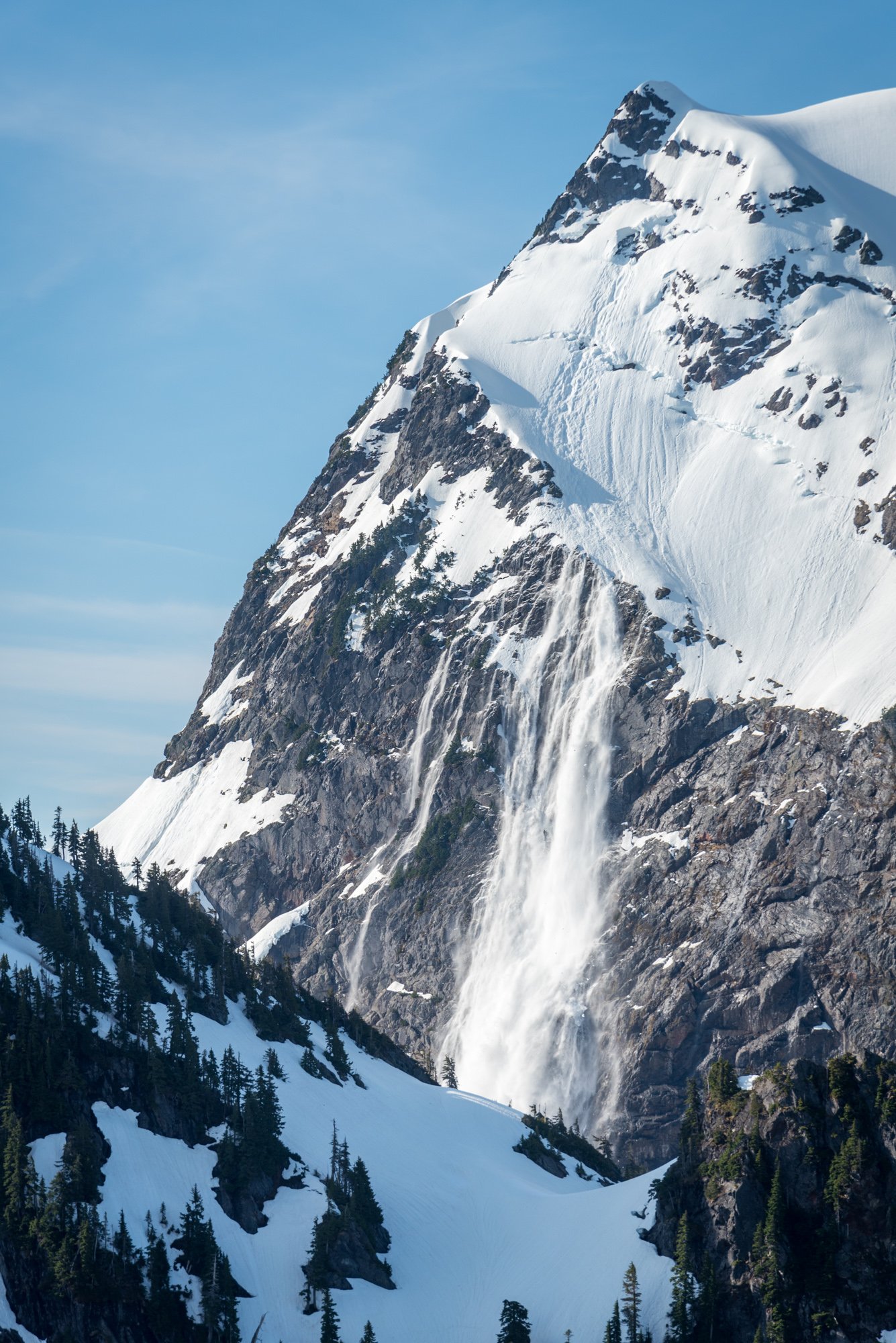
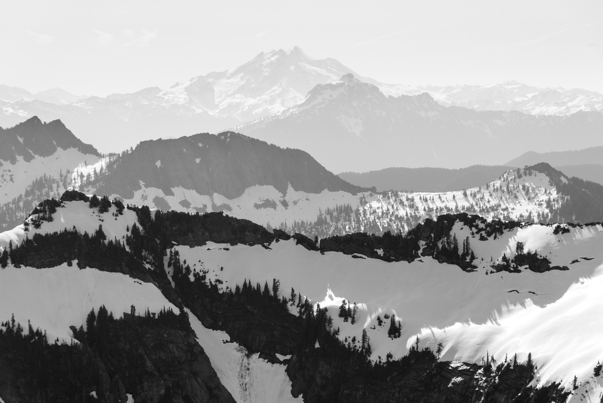
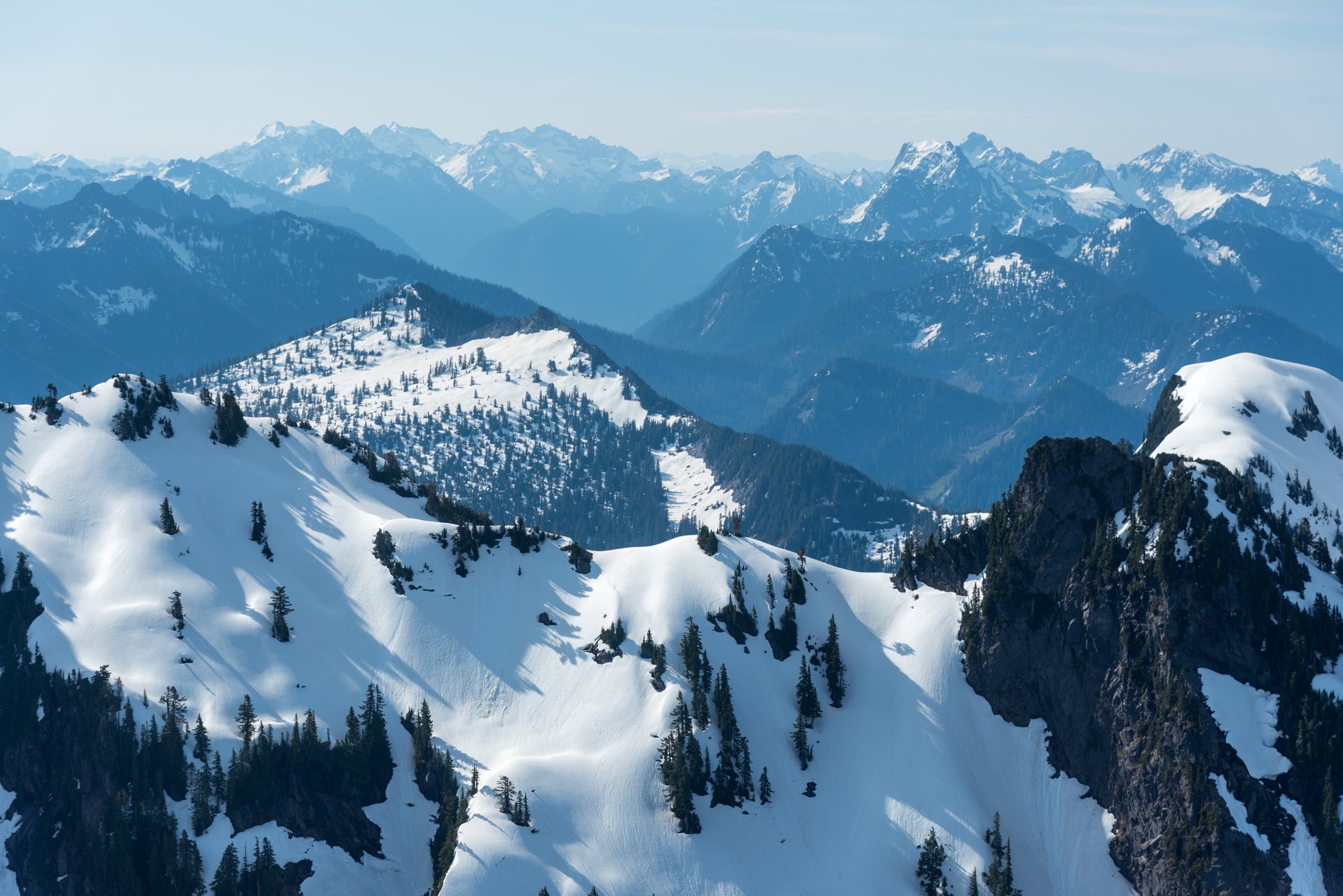
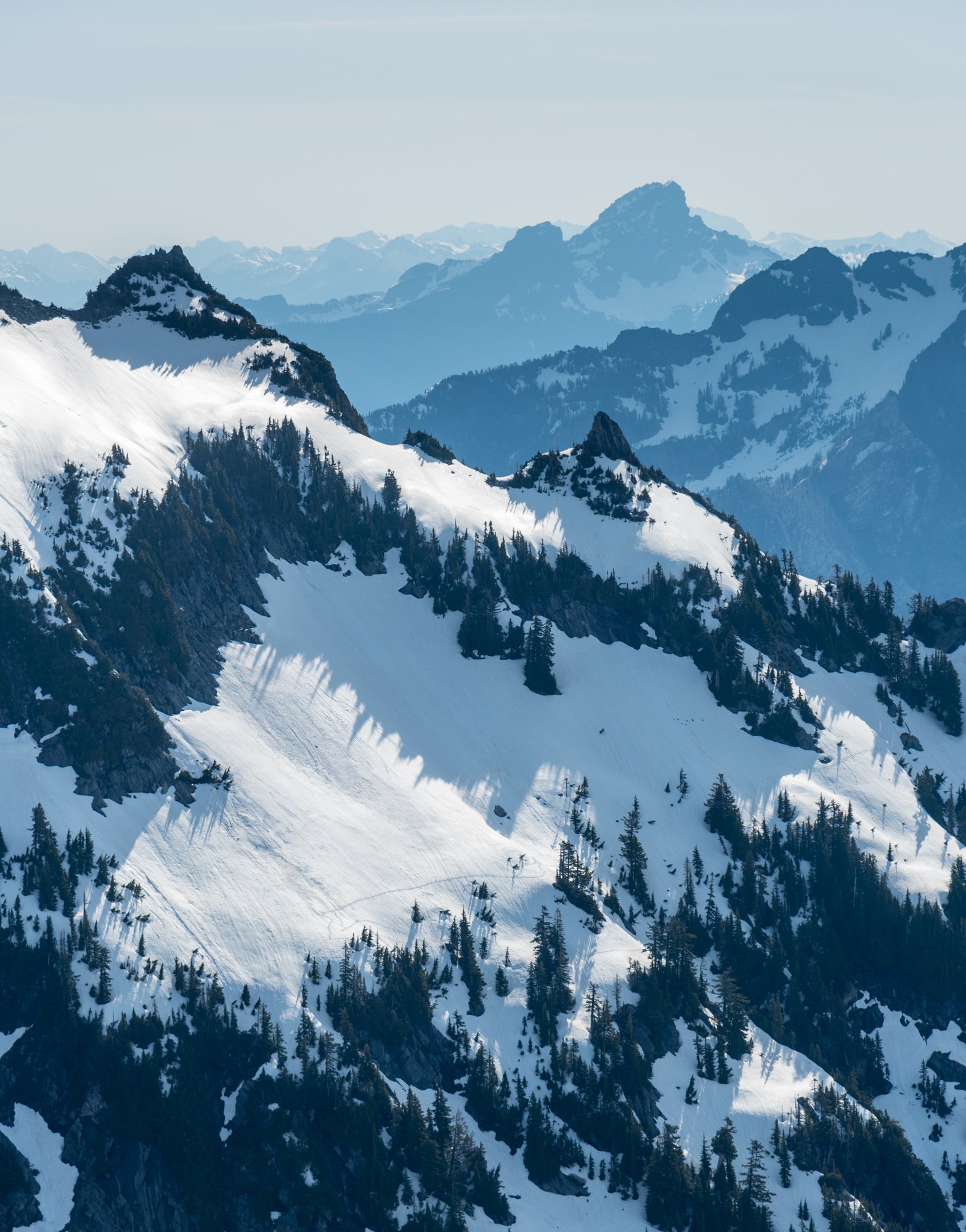
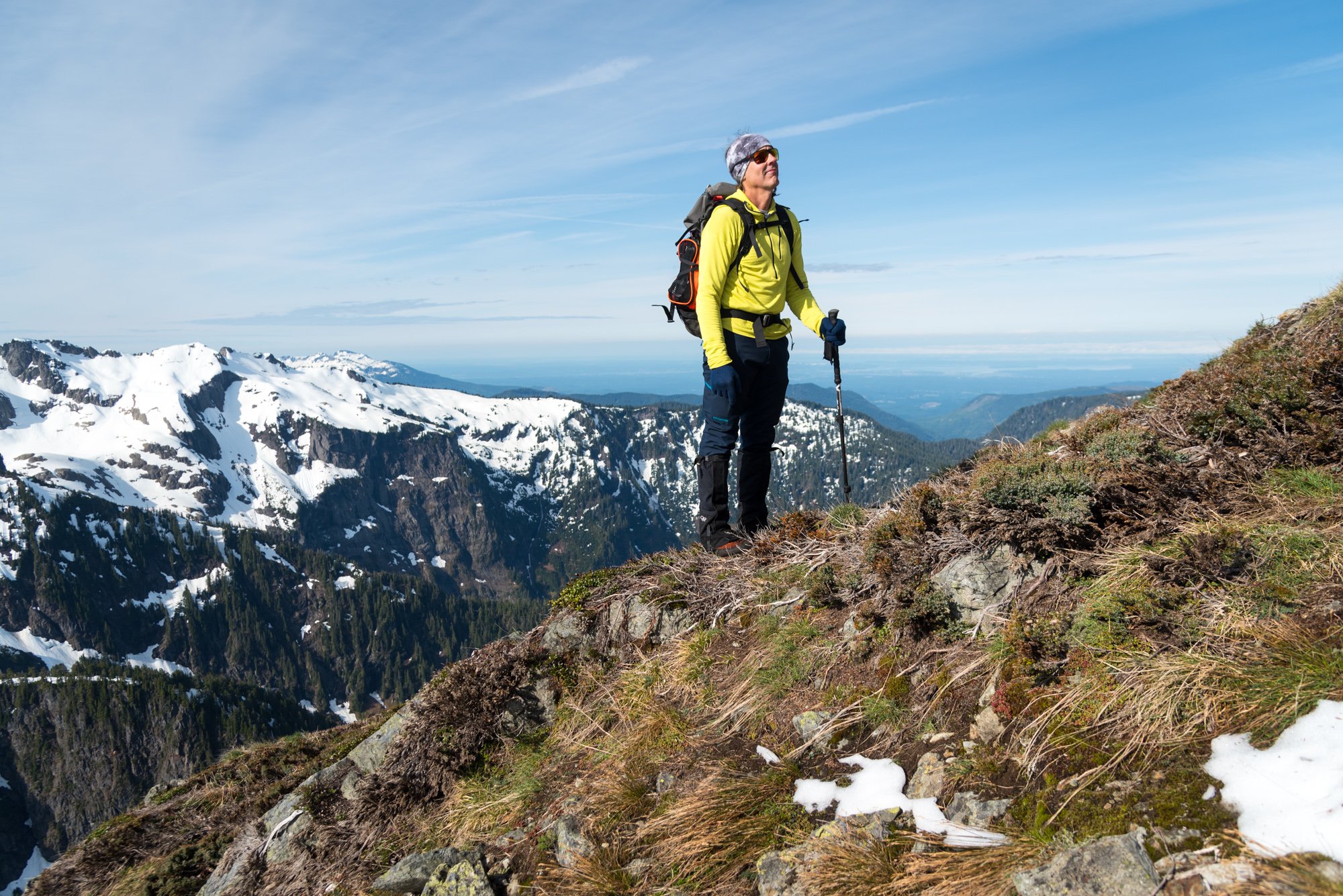
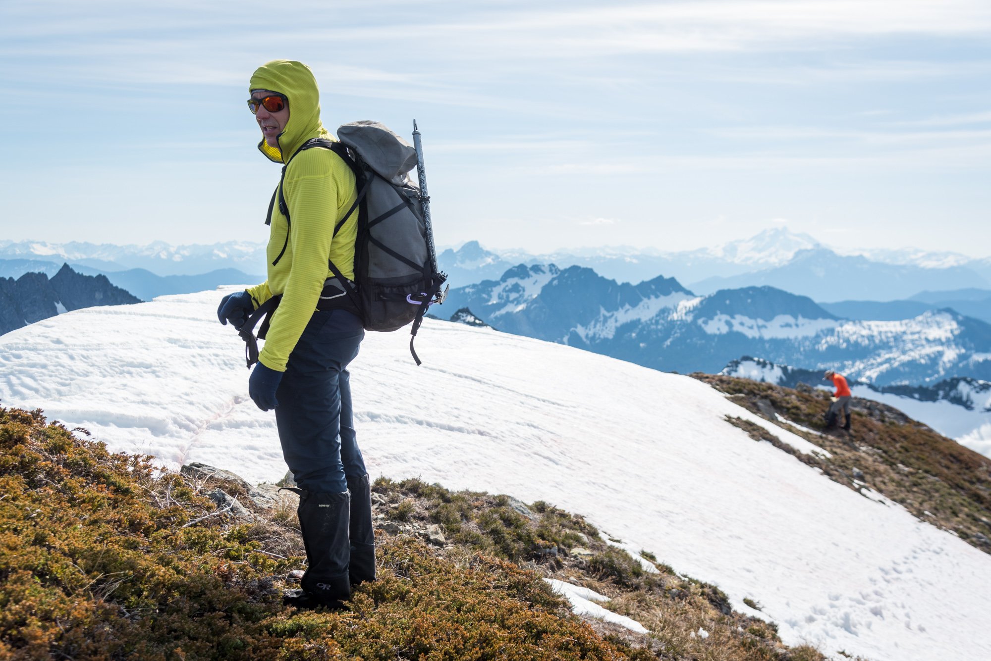
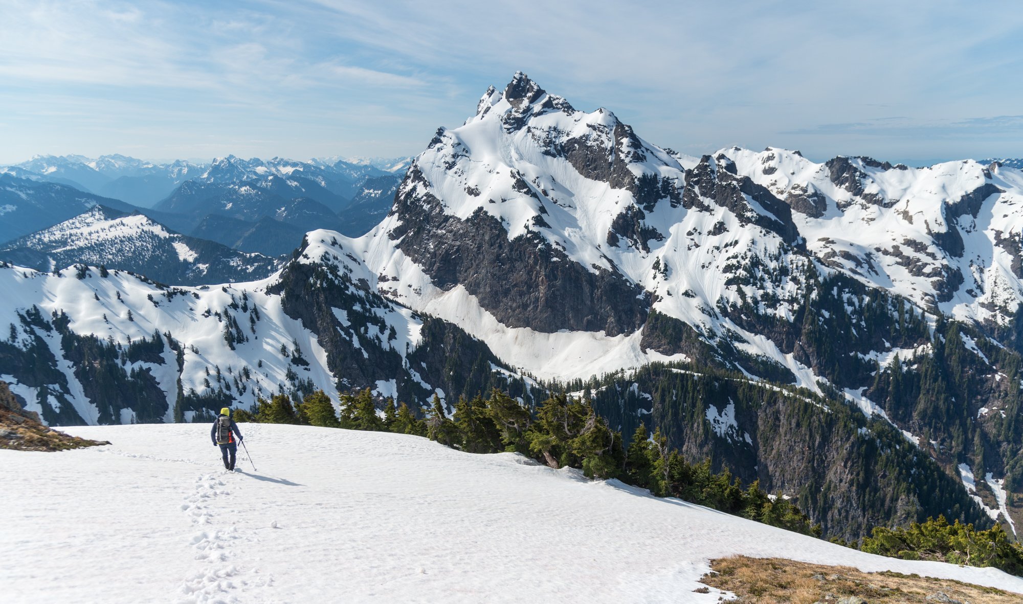
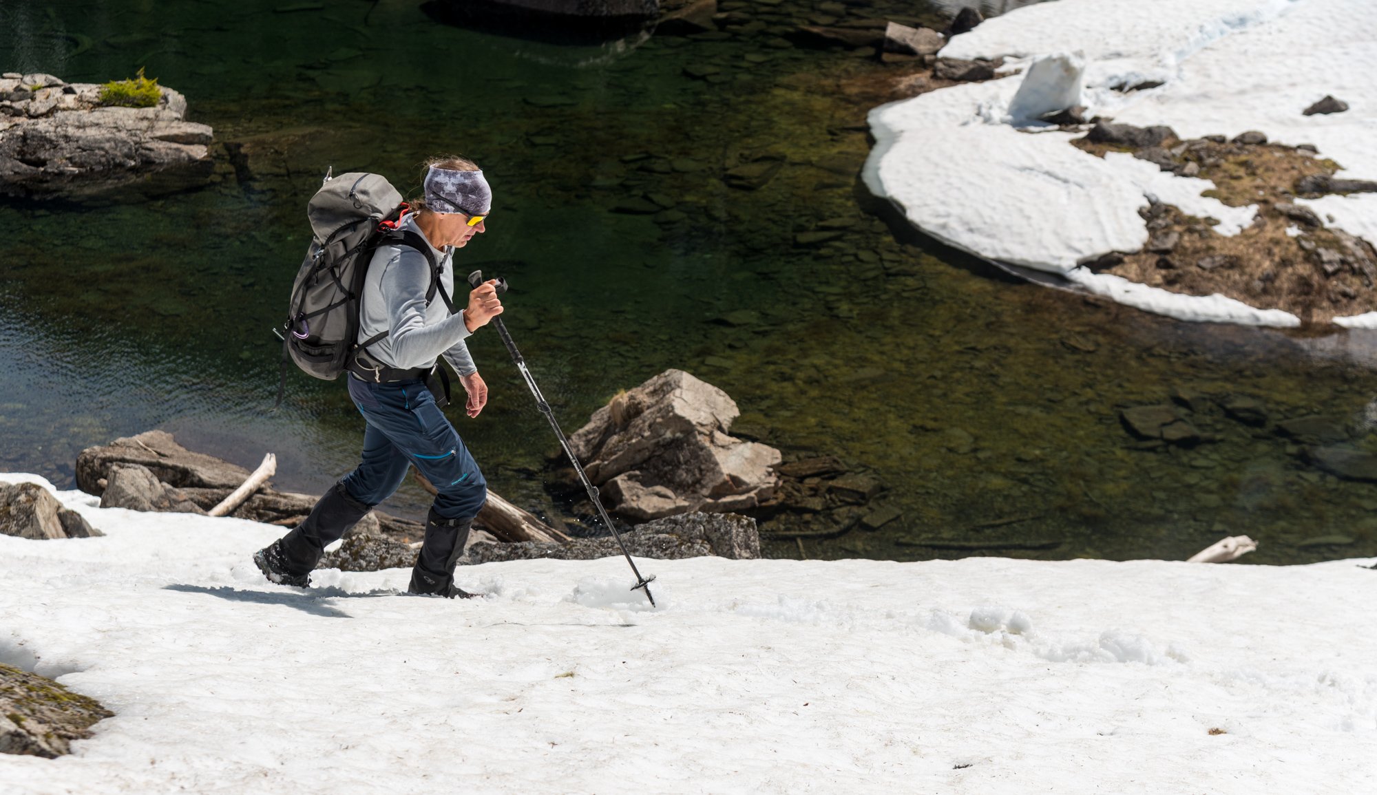
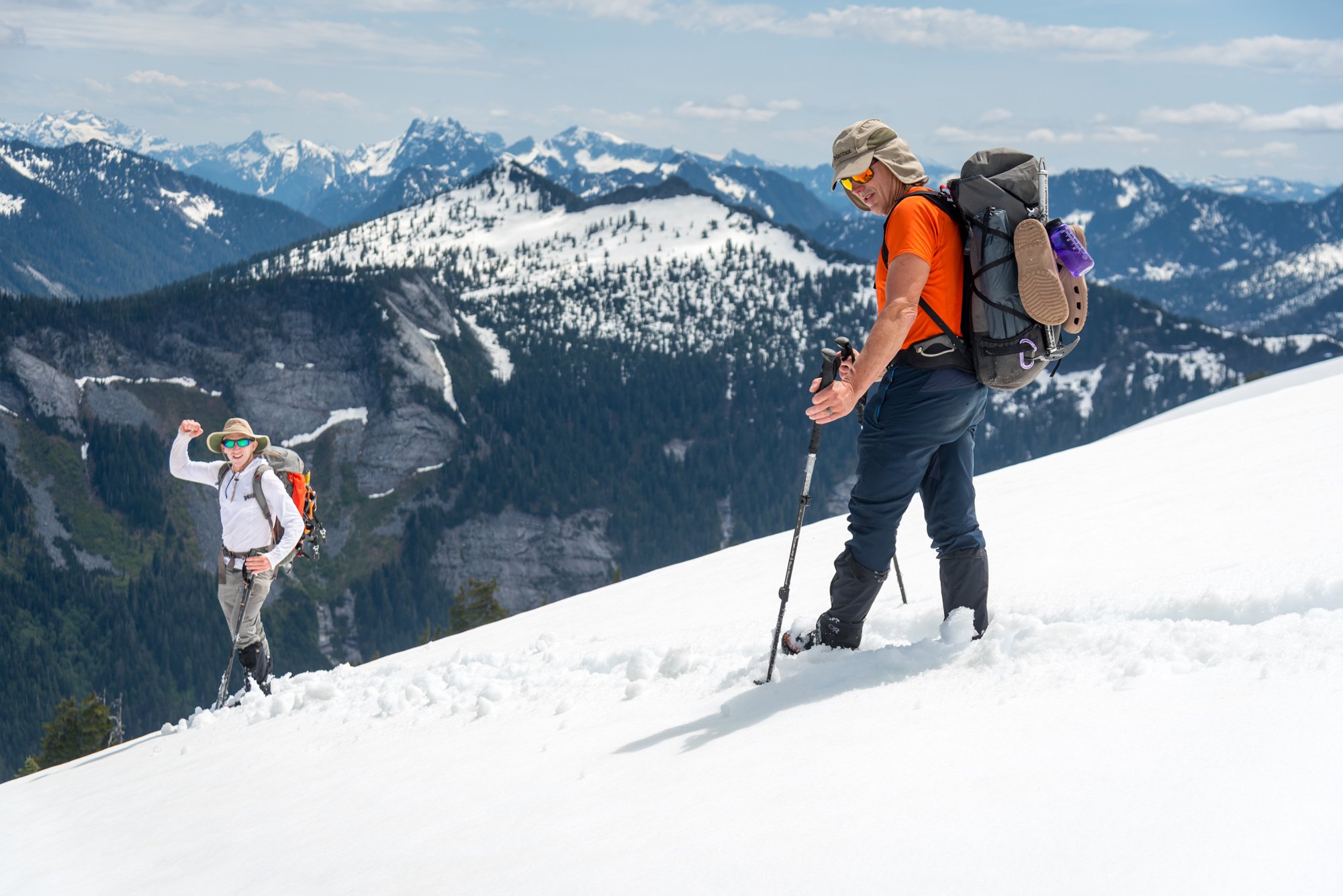
Trip: Tokaloo Rock (Sunset Ridge bailure) - Standard Trip Date: 06/29/2025 Trip Report: Sometimes prudence is the better part of valor....or at least that is what @Trent and I told ourselves as the murk cleared and we had our first good look at Sunset ridge after walking in for 10 miles in our venerable Lowa Civettas. We were camped at what we thought was going to be our "low" camp, next to some partially melted tarns to the NE of Andrew Benchmark, above St. Andrews park. Our high camp was planned for about 11.1k on Sunset ridge the next day. However, the entire upper mountain was very boney in the fading light and it looked like a several hundred vertical foot section of the ridge where the route went was completely bare of snow (~11.5-12k). Hmmmm. We had enjoyed the scenic ramble in from the NPS gate at their chosen spot on the still very drivable West Side Road earlier that day. Lush forest, interesting geology, wildflowers, and swirling mists, it was unlike most approaches to the highest point in WA. But then we got to camp and the predicted clearing didn't materialize and so we sat, napped, and stewed. But then, like magic, the veil was lifted and Tahoma was revealed! As was the camp of a neighbor, who had snuck up on us in the mists. We would find out the next day that it was none other than our very own @DPS, who I had last climbed with back in 2005! But as we turned in for the night, @Trent and I both agreed that we didn't want to climb Sunset the next day. We wanted to climb it in good conditions, not just climb it, and it was plain that it was not in good nick. And so we turned in for the night. I admit I wrestled with the decision throughout the night and didn't sleep that well. Were we just being old and scared? Would the route have gone fine? I felt like we never would know (actually, that was wrong- see below). But the next day dawned clear and bright and the least we could do was take a ramble up to Tokaloo Rock with light packs. It truly is a glorious side of the mountain and it was hard to complain about "missing out" on Sunset Ridge. Adams: Tokaloo Spire! From this side it looks very stout, which @Fairweather confirms below. Maybe easier from the other side? Looked blockier but neither really matches the Beckey description. Maybe another time! @Trent rambling up towards the top of Tokaloo Rock: Cumbre! What a view of the West side of Tahoma: Tokaloo Spire and St. Helens from the summit: Lovely parklands and Adams: We couldn't ignore how far we were from the car, however and in time retraced our steps back to camp and packed up. There was cell service up there so I checked if the nearby "Andrew" benchmark was on any peak lists. Turns out it on the "Mountaineers 100 Peaks in Mount Rainier National Park". As @Trent says, It must be climbed! And, so it was. @Trent admiring the view from summit #2 of the day: And then began the ramble out in our plastics.... which was long, but at least it was hot! My feet took a beating. Tahoma from the Puyallup River crossing on the Wonderland trail. Sunset ridge is the left skyline. That bare section is I think where @Nick Sweeney got to before they bailed (description and link below): The hike out through the lush forest was just as beautiful as the hike in, even if a bit longer (it always seems that way doesn't it?). Even though we didn't even get very high on the mountain, this route has set the hook in me. There is just something about climbing the entire mountain that appeals to me, and is a feeling that is easy to escape on the more common Rainier routes. Sunset is long enough, we a low enough start to be very sporting. We will be back! RESPECT: Western Tiger Swallowtail: Gear Notes: snow gear if there is snow.... easy class 3 scrambling to the top of the rock. The Spire is considerably harder Approach Notes: West side road to South Puyallup Trail to Wonderland Trail to off trail near St. Andrews Park. Good camps at tarns just NE of Andrew Benchmark
-
Super cool to have solitude on that side! Thanks for the report....
-
[TR] East Fury - North Buttress attempt 06/29/2025
JasonG replied to JonParker's topic in North Cascades
Hmmmm....important distinction....let's see....I think the west side? -
[TR] East Fury - North Buttress attempt 06/29/2025
JasonG replied to JonParker's topic in North Cascades
Well done surviving an attempt on that one! It was on the list until it I saw it firsthand in 2007 and realized I wasn't nearly tough enough.... but maybe it was the massive/serac rockfall that strafed the approach while we watched, or at least that was the mental excuse I used all these years. -
[TR] Argonaut Peak - NW Arete 06/14/2025
JasonG replied to Christopher Fisher's topic in Alpine Lakes
So GREAT! -
That is an impressive week for anyone, dads or not! I guess SUP vs. canoe rental is one way to force yourself to go light.
-
Tahoma Glacier - 6/21-24/2025 - with crevasse fall
JasonG replied to mthorman's topic in Mount Rainier NP
Strong work! I just walked out from the Tokaloo area today after not liking the looks of a very boney Sunset Ridge. I saw your tracks and wondered what the team was up to. It looks like a pretty serious route, crevasse-wise, and even worse now than in your photos. Good work getting a group up and down that safely, especially with a deep crevasse fall! Thanks for the detailed write-up as well, all good things to think about! -
Well, I was hoping to get others yelling at that cloud but I can see that I've failed. I'll go back to over analyzing some maps tonight.
-
The good thing is that we are all old men here.
-
It is crazy to me the difference in attitude towards rescue today vs. even a few decades ago. Then (90's, when I was a young climber) and now.....I would be so embarrassed/ashamed to be rescued for something like that that I would try and keep it secret, not spread it willingly all over the world! I wonder if she realizes the risks being undertaken by everyone to hoist her for some entirely avoidable error?
-
I bet Bryan could hook you up with a copy for the right quantity of raw beef.
-
Index. Go easy on FA froth until you've been around a particular crag for a bit and gotten to know it and its crew.
-
Oh, and post up a TR when you get back (unlike me)!
-
Climbed S. Twin last weekend and snow starts about 4900' in the basin between N and S Twin, but the west ridges of both peaks are dry. One approach for a 2-3 day trip would be to camp in basin between peaks at about 4900. Good flat camps there along the climber's trail. When you packed up after climbing the WR of the S Twin, you could leave the S Twin climber's trail ~4200' and 'schwack NW to intersect the N Twin climber's trail ~4500' on the WR. Drop overnight stuff there and go up and down the WR of N Twin, picking up the stuff before heading out (or camping another night at the end of the logging spur where the N Twin climber's trail begins. Note- I have not done the connection described above so I have no idea how 'schwacky it is, but it would save a lot of distance and elevation gain from going back to the road before heading up for N Twin.
-
Don't be trying to access your public lands @Fairweather!
-
[TR] Argonaut Peak - NW Arete 06/14/2025
JasonG replied to Christopher Fisher's topic in Alpine Lakes
Wow, that is a big effort! I have had this on my list for a long time and still do....thanks for the report! -
Careful there @Lucas Ng, lots of steep looseness for a soloist! I know, my dad voice coming out, but I want to be reading your TRs for many years. Well done coming back safely, looks like a beautiful day in the hills!
-
What a crazy day of skiing....huge!
-
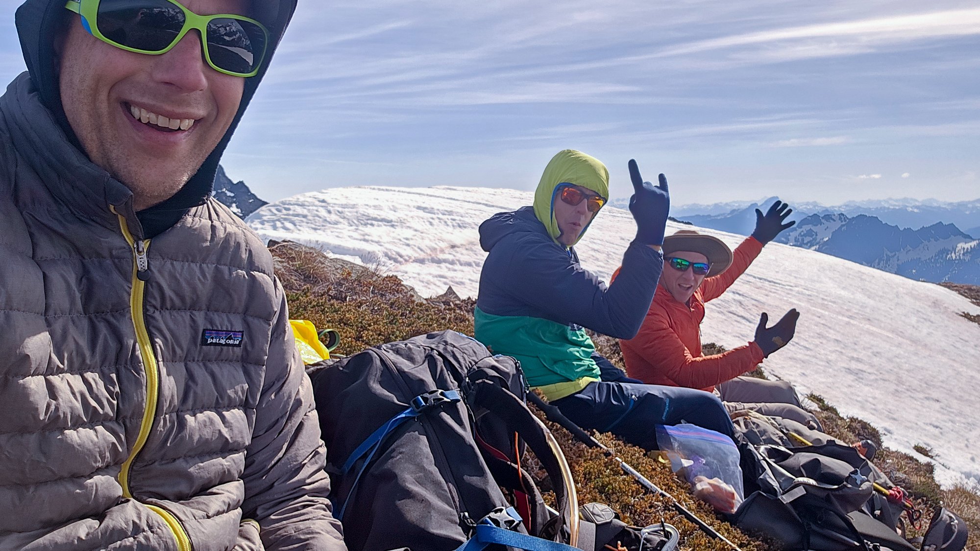
Trip: Warrior - NE ridge Trip Date: 06/01/2025 Trip Report: After talking about it for several years, @olyclimber and I finally got out in the hills together to climb Warrior. It started, like all good Olympics trips, in the rain, wondering if the forecast for fair weather was ever going to materialize. Thankfully it did and @olyclimber and I headed out into the dripping forest along the Dungeness, marveling at how green everything was and how beautiful the waters were. It was going to be a good trip! Boulder shelter: Within a few hours we were at Boulder Shelter, one of the CCC era structures still in use today in the Olympics. @olyclimber , as his name suggests, has a long history with the range and regaled me with stories of his youth, scouting trips, and other entertaining adventures and misadventures in the Olympics. Before I knew it, we were under the cirque on the west side of Warrior, ready to leave the trail and head upwards to a scenic camp perched next to a tarn still buried under winter's snows. It was clearing off nicely and we decided to sleep out in the chilly breeze to admire our surroundings. It got cold during the night and dawn brought a hard freeze to everything, but thankfully our water was only slightly iced. It would be a very firm ascent to the col separating the two summits of Warrior, but thankfully the day was clear without much wind. @olyclimber ascending to the col: Inner Constance and the Rotten Rockenspiel: At the col we started the traverse NE on steepening snow, barely getting the frontpoints of our aluminum crampons into the hard neve. I offered to head on up and "have a look" while @olyclimber hung back. It never got really very dad friendly and I contemplated turning around at nearly every weird snow/rock transition. The abundant snow/ice on the summit rocks made it much more challenging than expected, but for better or worse I continued upward. @olyclimber wisely stayed back and enjoyed the sun at the col while I hemmed and hawed my way to the top. Constance and Inner Constance from the summit: The view west to Mystery and Deception from the top: The summit rocks. The easiest route starts left of the photo and works up and right. The direct route is supposed to be low fifth? We had some miles to cover and driving to do and so I didn't linger on the summit long, and we carefully descended the still rock hard couloir back to camp: Admiring Constance along the way back to camp: along with Mount Mystery as we descended from the high country and out the Dungeness trail: Thanks to @olyclimber for keeping the dream of Warrior alive for me these past few years and making the trip happen! We are quite fortunate to have so many adventures waiting for us just a few hours away. Gear Notes: ice axe, crampons, helmet Approach Notes: Dungeness trail past Boulder Shelter then up into cirque by small tarn, west of the summit. Climb prominent couloir NE to saddle between Warrior summits and then traverse steep snow to the NE until you can ascend up and right to gain the NE ridge. Follow up and right via exposed and steep scrambling. Best if snow free, which is likely by late June.


-
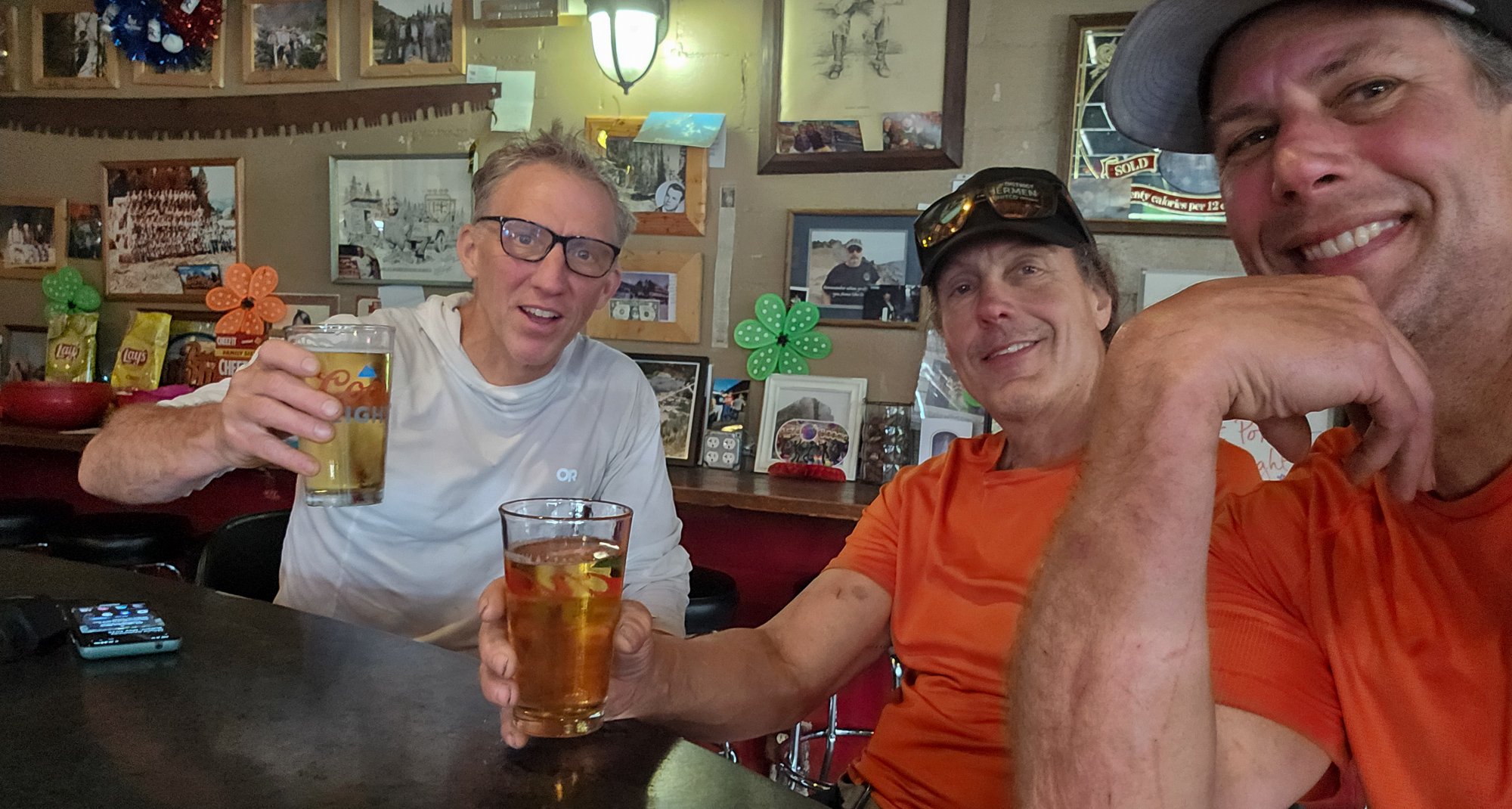
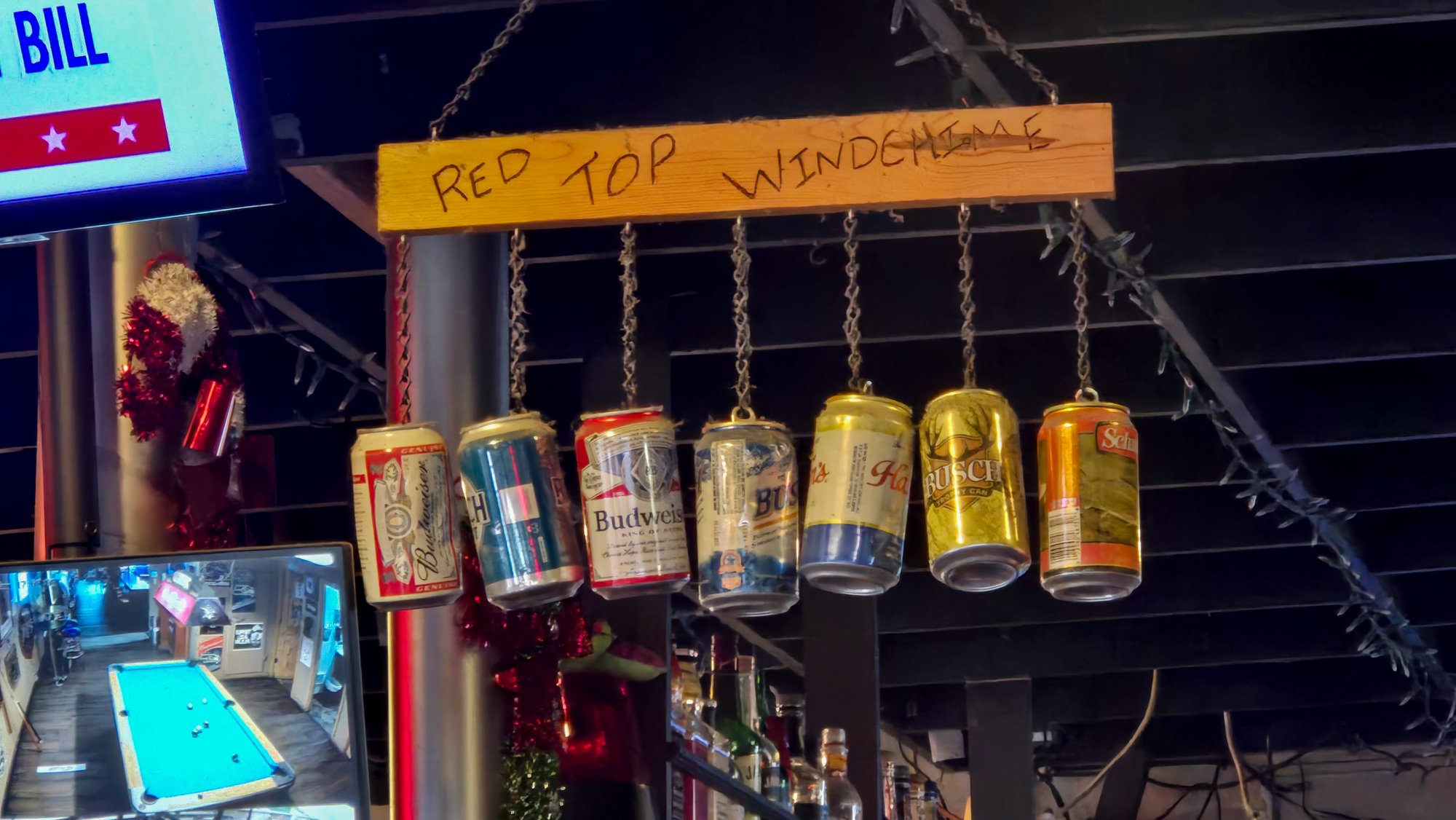
Trip: BULLEN! - via Squire Creek/Bullen Lakes Trip Date: 06/01/2025 Trip Report: "I felt as if we had joined Sisyphus and his rock in Hell." - HERMANN F. ULRICHS on first ascent of Mount Bullen I mean, who hasn't read the passage above in the Green CAG and decided that they just had to climb Mount BULLEN? Or, maybe I should ask, "Who has?" No matter, @sepultura and @therunningdog were not asking many questions, and that was a good thing for me, since otherwise I am pretty sure we would have diverted to a more "normal" destination on Memorial Day weekend. And by "normal" I mean a mountain with more than one TR on the internet. Which means, after this TR, BULLEN will be officially "normal". Glad we got that all squared away for the masses sure to descend this summer As it was, we didn't see another soul the entire way in or out of the mountains, not on the Squire Creek trail and certainly not in the brush. But we did find several routefinding challenges on the timbered rib above Squire Creek to keep us entertained. And some head scratching to get from the ridge down to Bullen lakes. And some wandering and wondering to find a suitable campsite. But this is what we came for, right? Right guys? I won't spoil the adventure for you, and smooth out the rough edges of your trip to Mount BULLEN!, don't worry. But just know that you can do it without a rope! Which is good, since we didn't have one. Sometimes the crux of these North Cascades blue collar adventures isn't above treeline. But what BULLEN! lacks in technical climbing it makes up for in ...uhhhh... fun? Just make sure you go with partners as entertaining as I had. If you play your cards right, you'll laugh, you'll drink some whiskey, you'll banter like old times, you'll marvel at your luck finding such solitude on a busy holiday weekend, and you'll come out to toast your success at the Red Top. Because, is there any more to the Chossdawg life? @sepultura and @therunningdog on the Squire Creek Trail. Let the good times roll!: It is important to get in touch with your feminine side before caressing the choss: We were pretty excited when the snow covered the brush: Then less excited when our feet began to squish: The prominent couloir on the left is the ticket in early season, or so it seemed to us. We camped on these large boulders near Bullen Lakes: @therunningdog on an interesting section rounding the south shore of Bullen lakes. @sepultura does his best to stare down BULLEN!: We paused to watched this avalanche roar down the North side of the North Finger of Three Fingers: Dakobed and Pugh: SE to the headwaters of the South Fork Stillaguamish and the Monte Cristo Range: Whitechuck, and our tracks coming up and over from Squire Creek: @sepultura eyeing the last bit to the summit. No brush, no problem!: Cumbre!: Three of the OG Choss Dog Millionaires on the summit of BULLEN!: Heading down: @therunningdog is always ready for his glamour shotz: @sepultura prefers his to be action shotz: Suffer together!: If you climb BULLEN! you really must celebrate at the Red Top in Darrington. To do otherwise is just poor form: I'll get some captions in later this week.... Gear Notes: ice axe, crampons, leather garden gloves, helmet (though we opted not to) Approach Notes: Squire Creek for awhile and then follow your choss urges upwards and then downwards to Bullen Lakes, then around the lakes to the south, and then up. Retrace your steps back to the car, since you won't figure a better way most likely than they way your choss urges guided you in originally. It seemed better in snow, but I'm sure without snow would feel more blue collar.


-
What a waste of resources to go after a guy like that criminally.
-
[TR] Mount Wow - Via Lake Allen 06/02/2025
JasonG replied to Fairweather's topic in Mount Rainier NP
I've always wanted to go up there....but haven't. Thanks for the reminder that it is still on the list! I like how you didn't include a photo of the Mountain. -
Great TR @Grant789! Please keep them coming this summer. And, everyone, this is a good example that sometimes the attempts are just as compelling for the eyes as the successful. Even if there was no summit (and no party), we still want to cry in our beers with you!


