


JasonG
-
Posts
5283 -
Joined
-
Days Won
354
Everything posted by JasonG
-

Ideas for quick hits near Vancouver in late March
JasonG replied to bedellympian's topic in Climber's Board
Flora Mountain is another option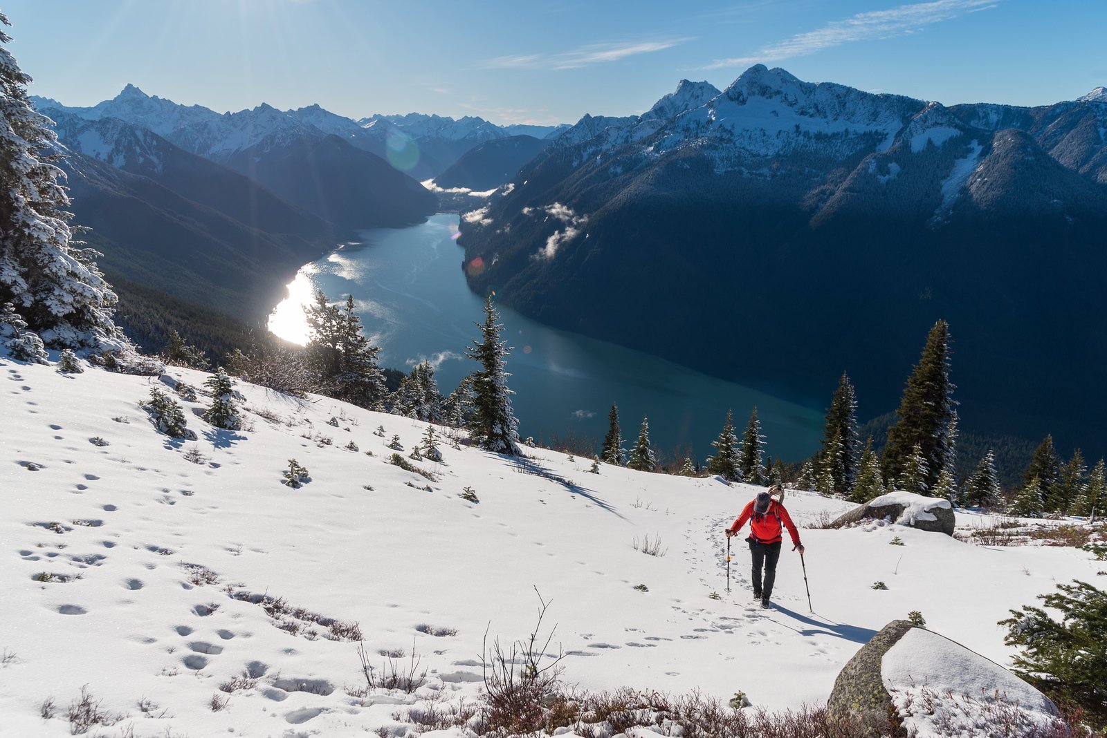
-
Ideas for quick hits near Vancouver in late March
JasonG replied to bedellympian's topic in Climber's Board
-
Ideas for quick hits near Vancouver in late March
JasonG replied to bedellympian's topic in Climber's Board
-
Ah..... looks like the Choss Dog Millionaires have left another calling card.
-
-
Ah, I knew I had a photo of one of the really old ones:
-
-
Summit of Bears Breast:
-
Interesting....I somehow thought most of these were much older!
-
I sadly think you are right. There was at least one other version of the old brass ones (than the one already posted)....I will see if I can find it.
-
"Route 66" V 5.10 AI2 FA on the NE face of Johannesburg
JasonG replied to Sam Boyce's topic in North Cascades
And yes, like others, I have often looked up at that wall and wondered. Thanks for surviving to bring back the first report to the internet era! -
"Route 66" V 5.10 AI2 FA on the NE face of Johannesburg
JasonG replied to Sam Boyce's topic in North Cascades
Don't worry @lunger some hippy pow with JGAP is just a few months away. Just what the doctor ordered. -


-

-
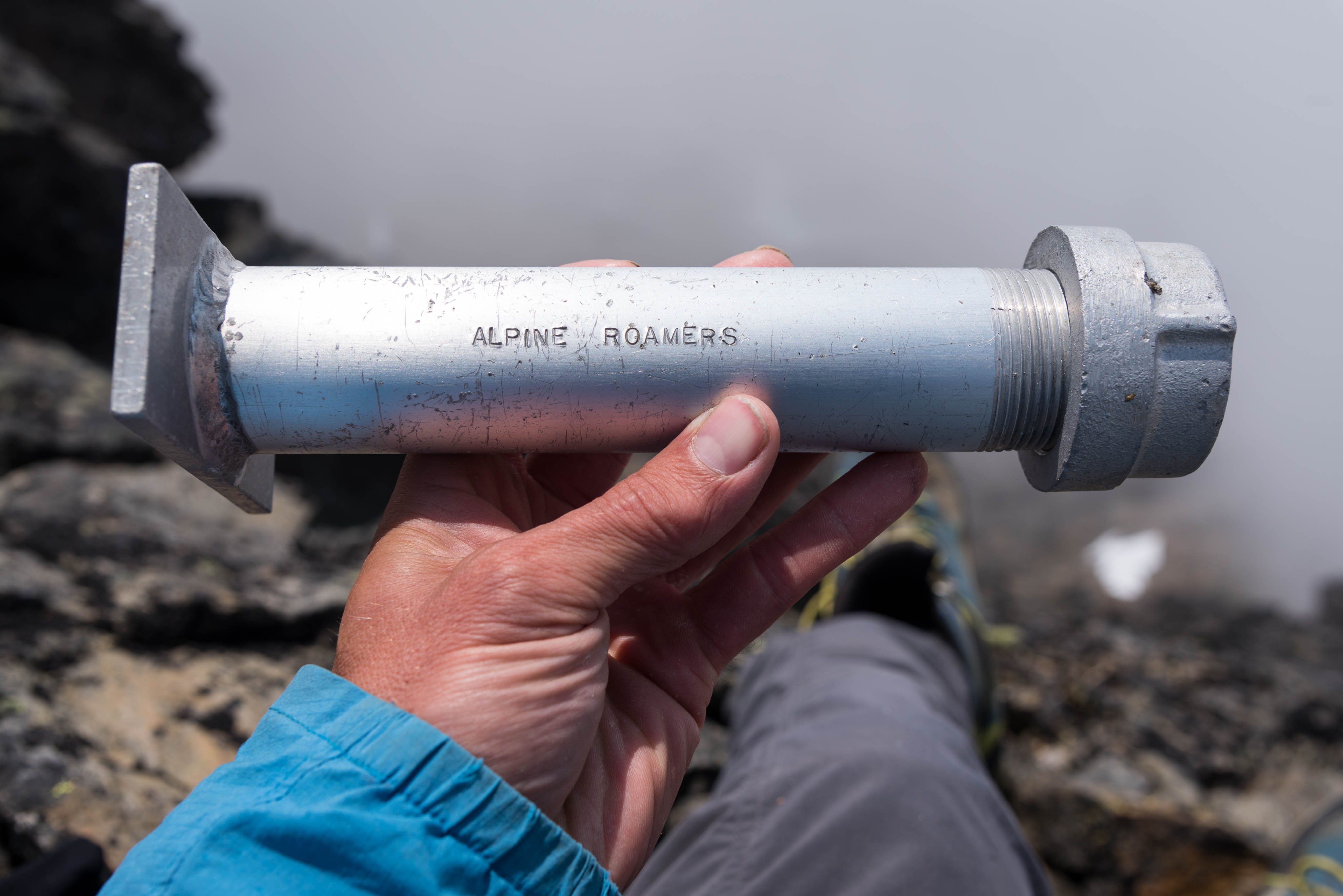
Anyone else noticing this the past few years? It seems like you used to see some very old registers even on relatively popular peaks. Nowadays, most of the old brass Mountaineers registers are long gone and even the crappy plastic newer ones don't seem to last more than a year or two. I suspect someone with a beef is removing/stealing/tossing them, but does anyone know for sure what is going on? I have to think someone has heard/seen something, but I haven't personally. Maybe I am one of the few that care, but I miss reading the entries from friends who are no longer with us.... Can't wait to see if this gets moved to Spray like the old dayz!
-
[TR] Despair (south peak) - East / SE side 09/12/2025
JasonG replied to JonParker's topic in North Cascades
I've always wondered about going in that area but it seemed tedious....thanks for the report! Some beautiful images with that evening light....we have an impressive backyard. For some reason, I have really noticed the lack of seasonal snow in the North Cascades this summer. It is a bit sad compared to what late season looked like in the 90s. But, still a very beautiful neck of the woods. -
best of cc.com [TR] Cascade Volcanoes - Bike-athon 06/06/2025
JasonG replied to traildirt's topic in Mount Rainier NP
Immediate "Best of cc.com"!!!! I don't even know how something like this is possible, but I think I can appreciate the drive and fitness that it must take. Well done, and thanks for sharing with us! Ice cream's on me if we ever cross paths! -
This might help @emilio taiveaho pelaez: Dana col light show, 2022.
-
Wow, that is strange. I have to think some sort of AI scrubbing going on?
-
Another 2 weeks and there would be zero bugs. Bugs die fast in the far north as summer ends in late August. I think that might not have been so aytpical for mid August.
-
[TR] Porcupine Peak - Salad Days 5.11a 08/23/2025
JasonG replied to Grant789's topic in North Cascades
It is a little known fact that Darin develops routes so that he doesn't have to see other people when climbing high quality rock -
Wow, quite the adventure!! Did you just plunge in and cross with your footwear or did you make changes for each crossing?
-
Home to Dome - 7 day bike to climb on the southern end of the Ptarmy
JasonG replied to Lucas Ng's topic in North Cascades
Yeah @Lucas Ng, glad I could inspire the trip! That is one of my favorite places in all of the cascades, so great that you got there! And thanks for the heads up that the trail has been improved....just might need to make another trip in there for Old Guard and the German Helmet. -
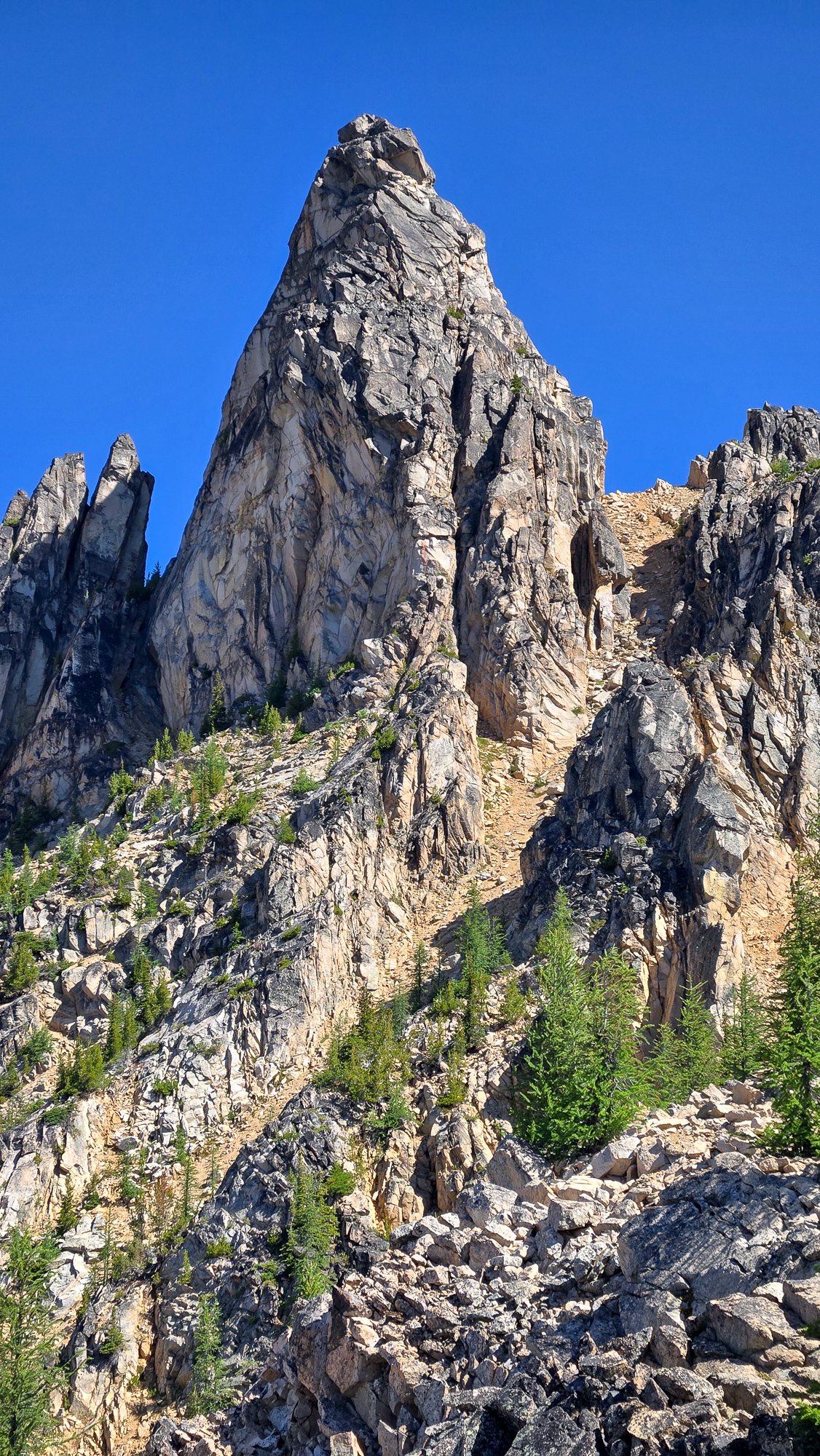
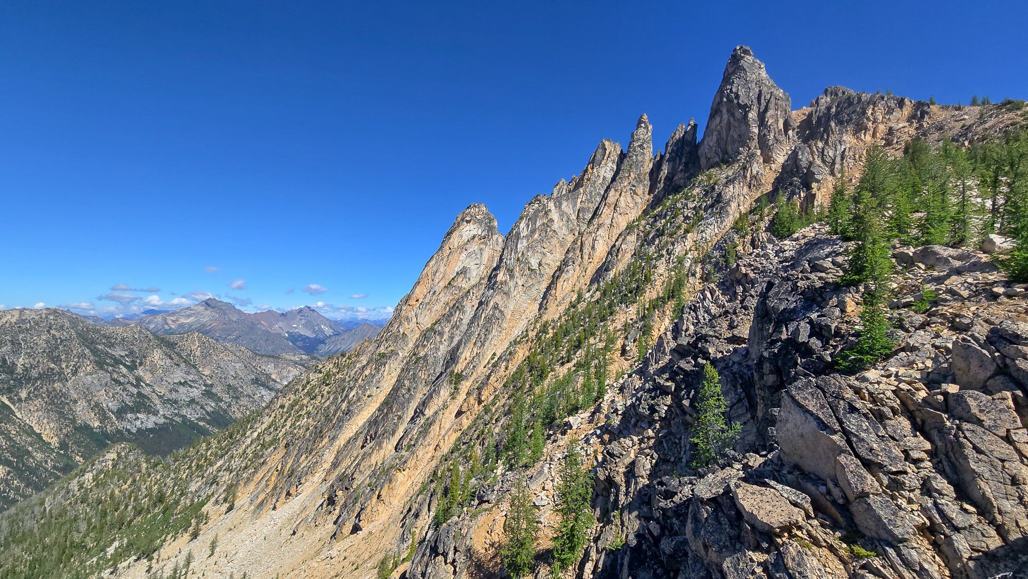
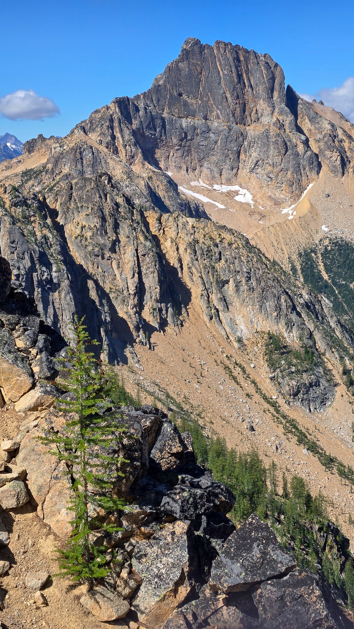
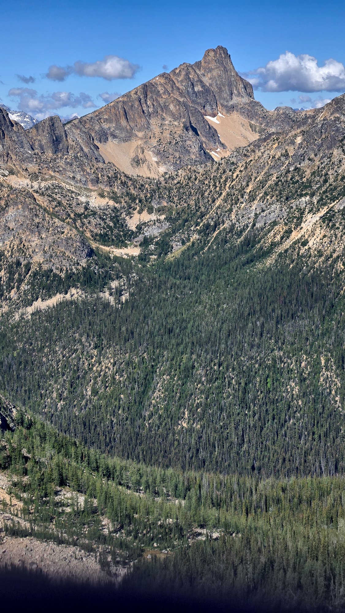
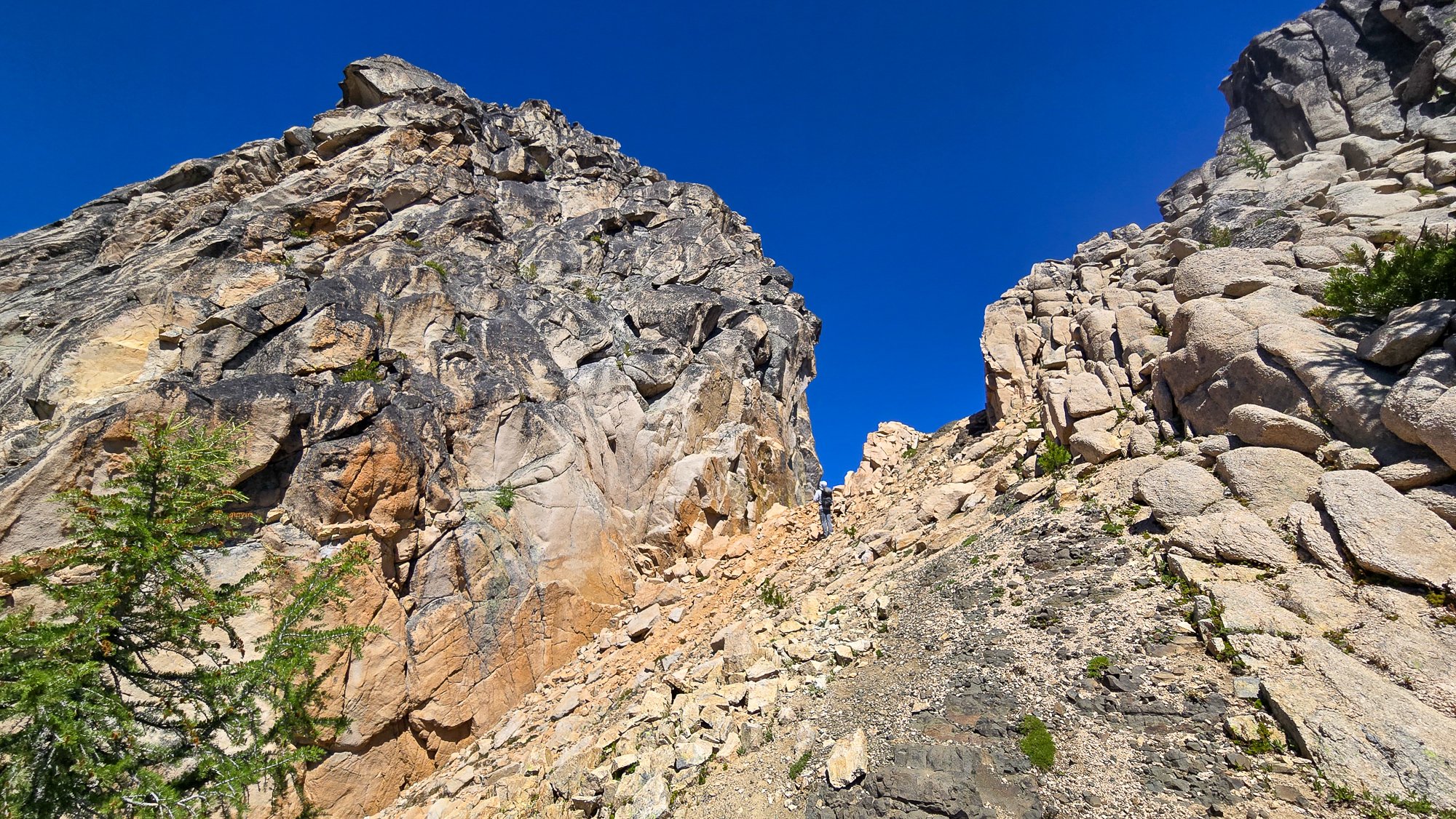
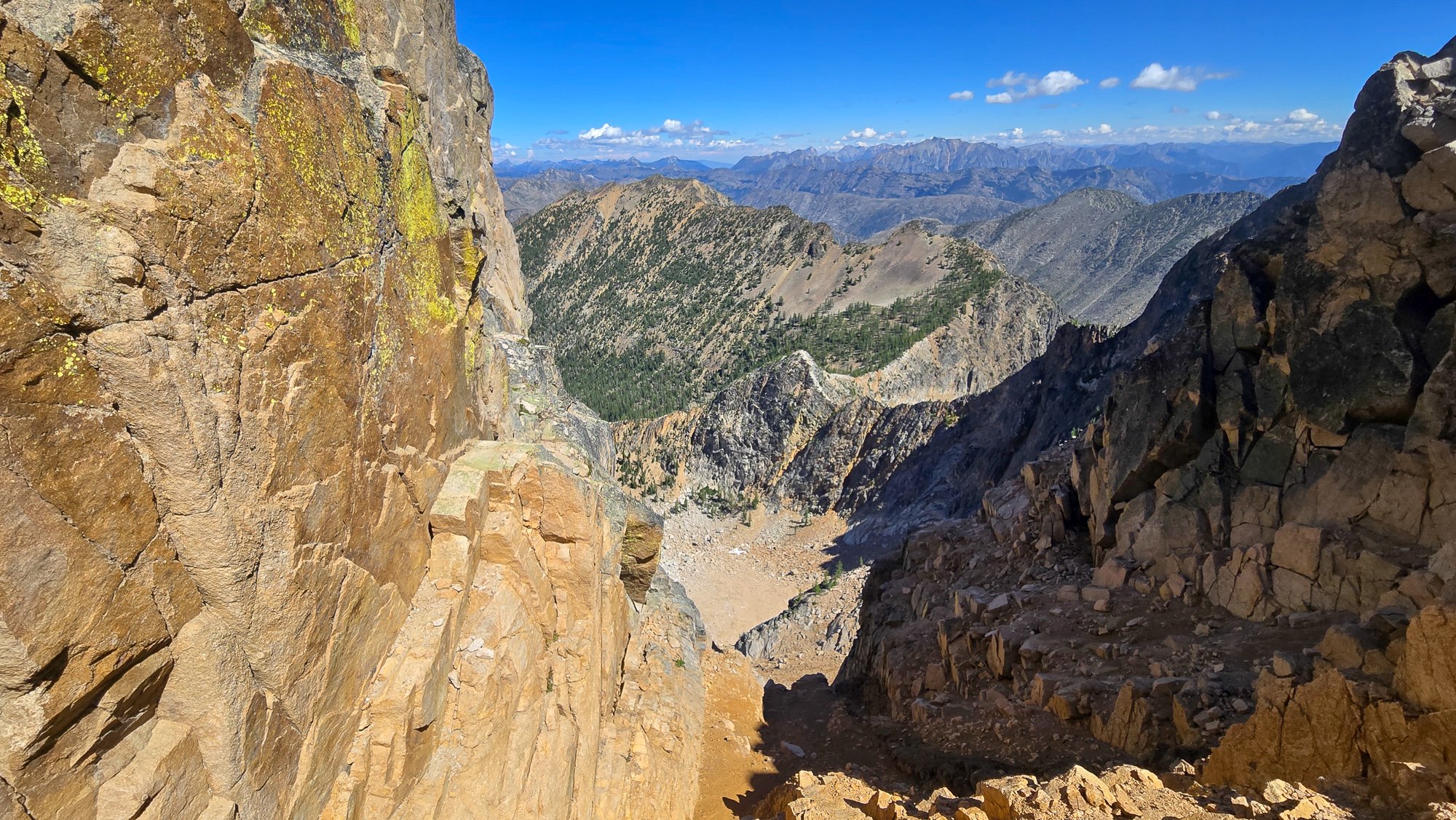
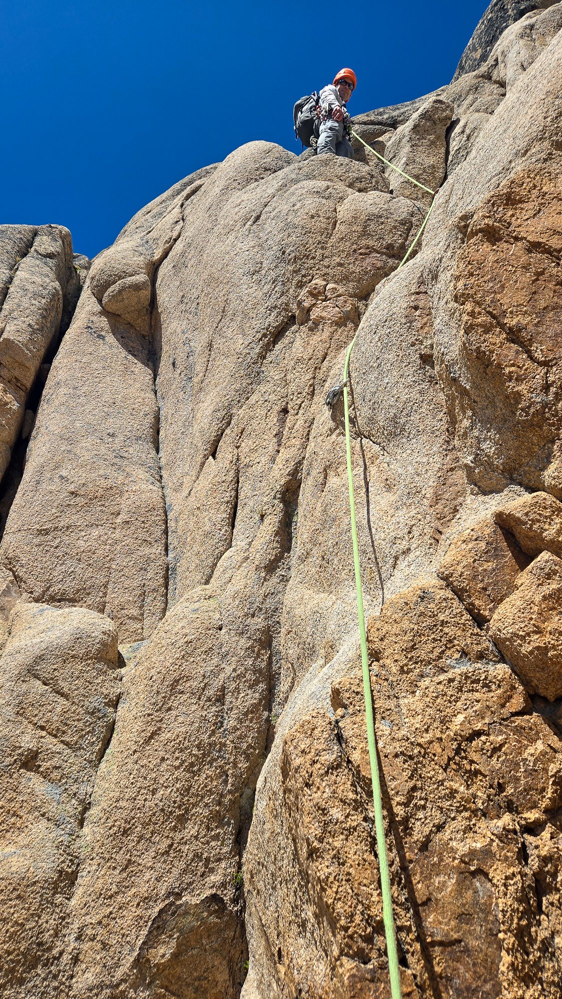
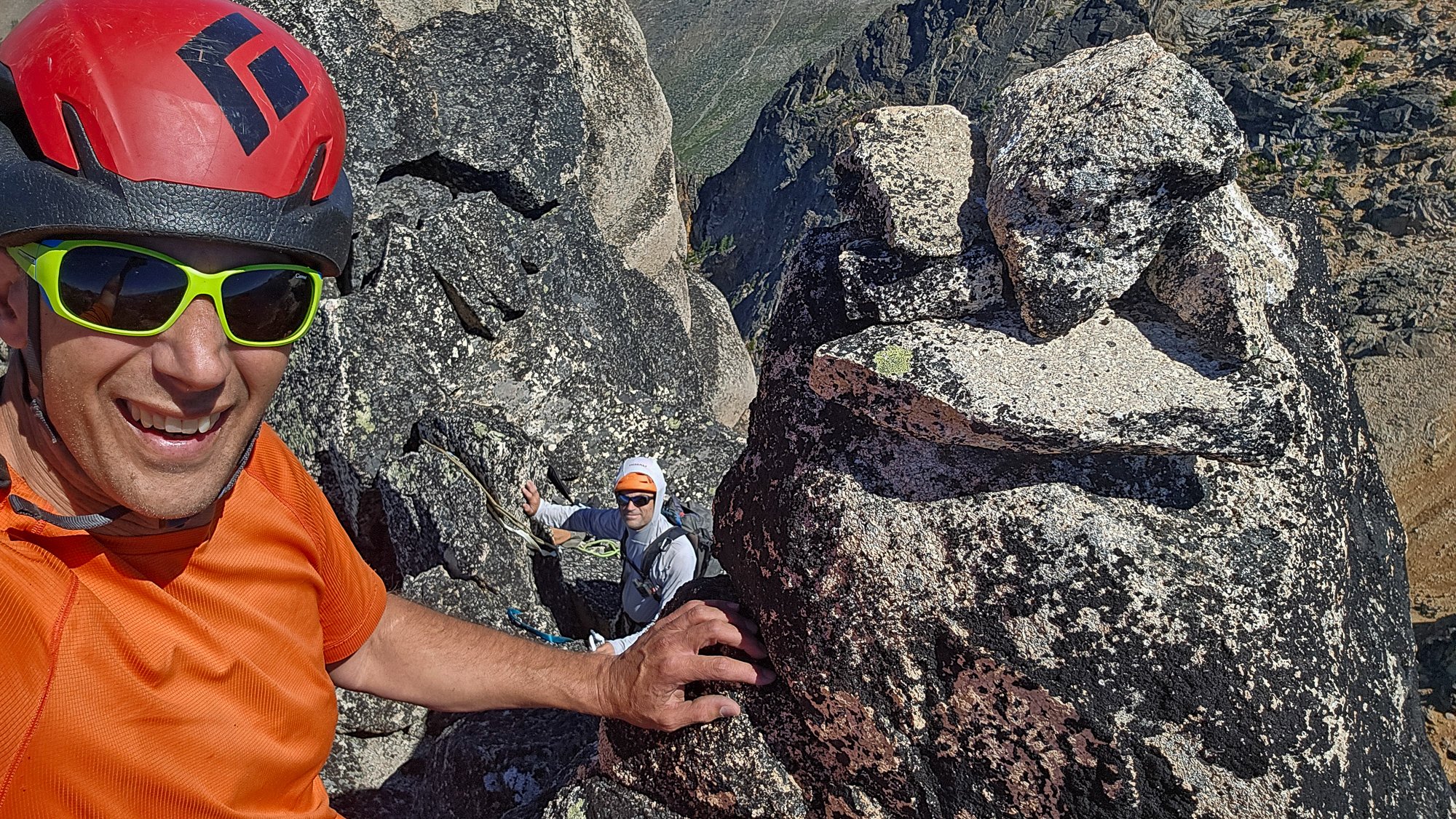
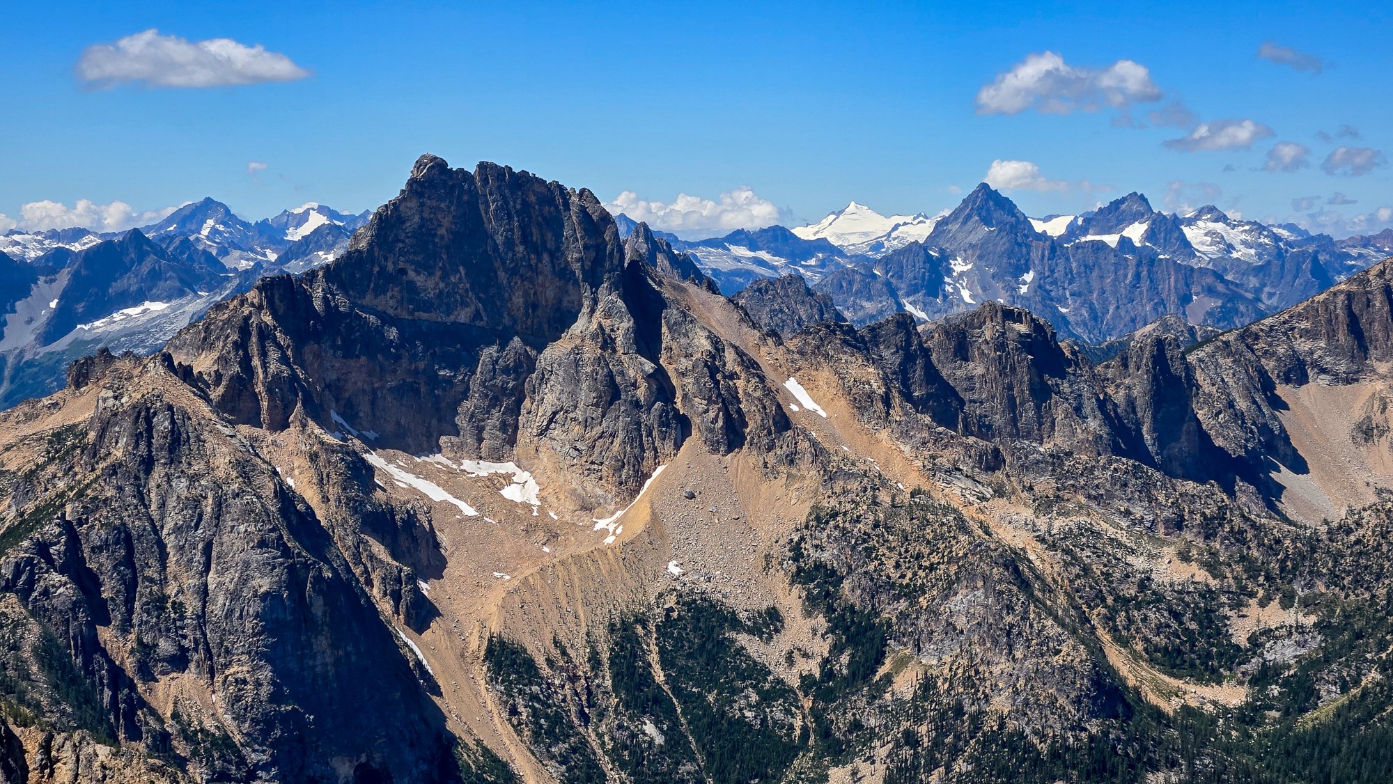
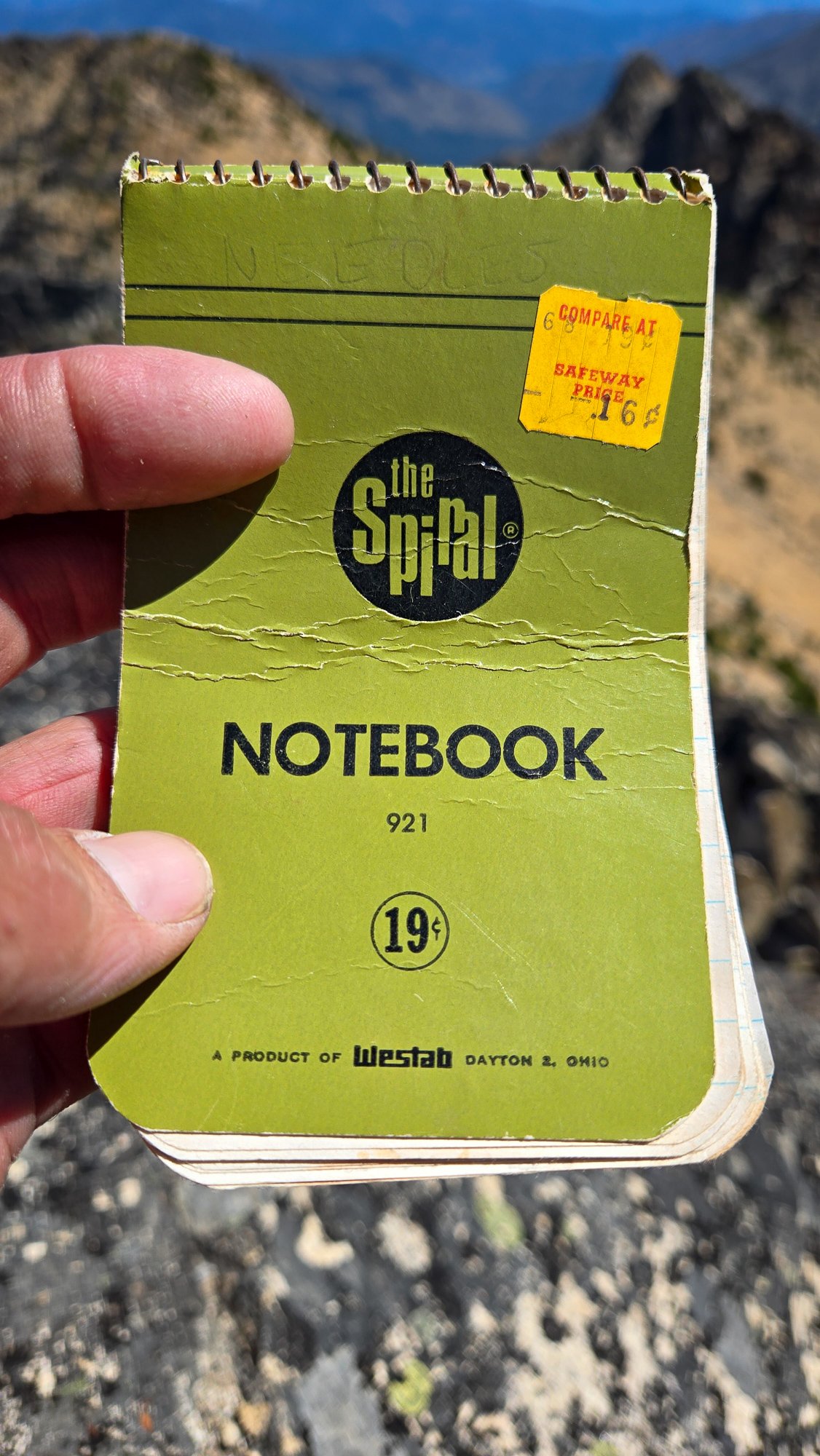
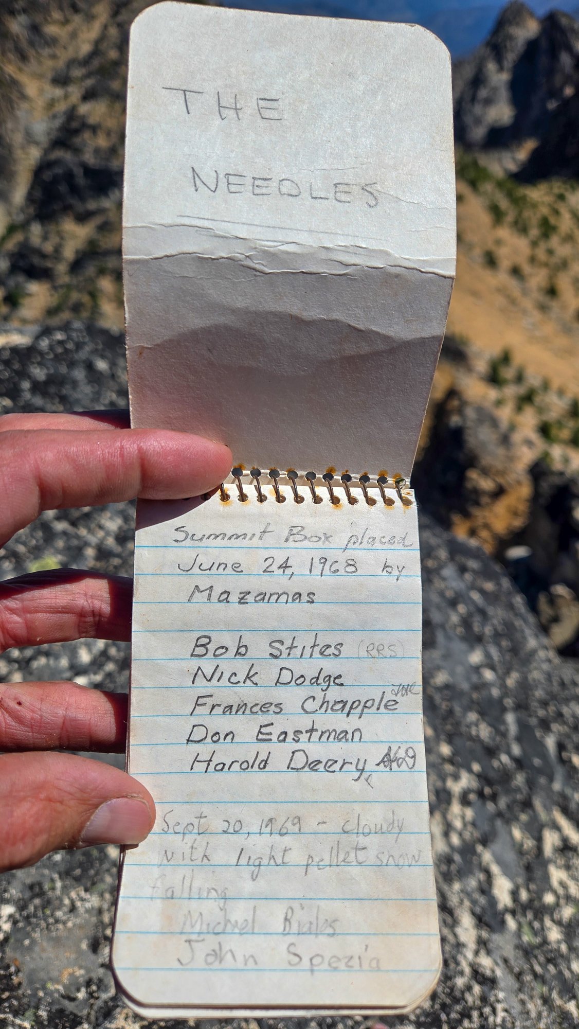
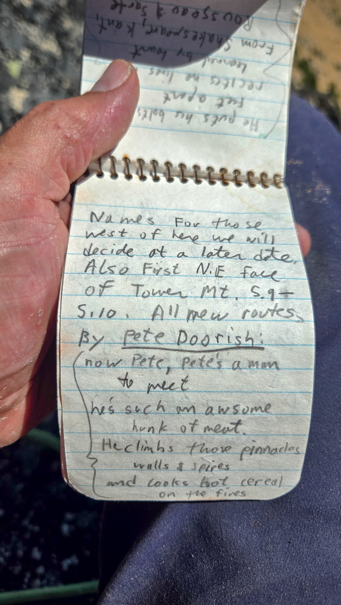
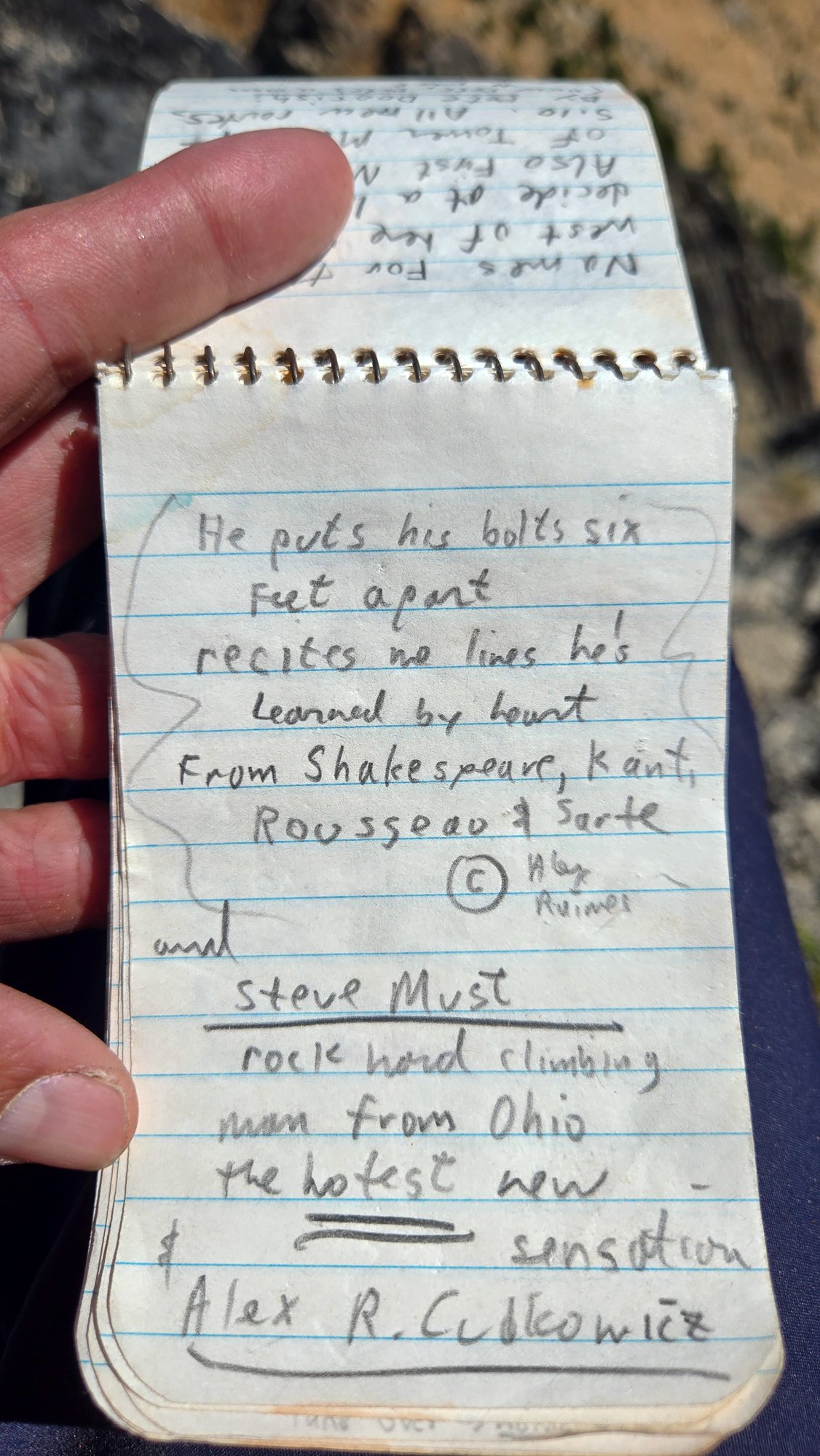
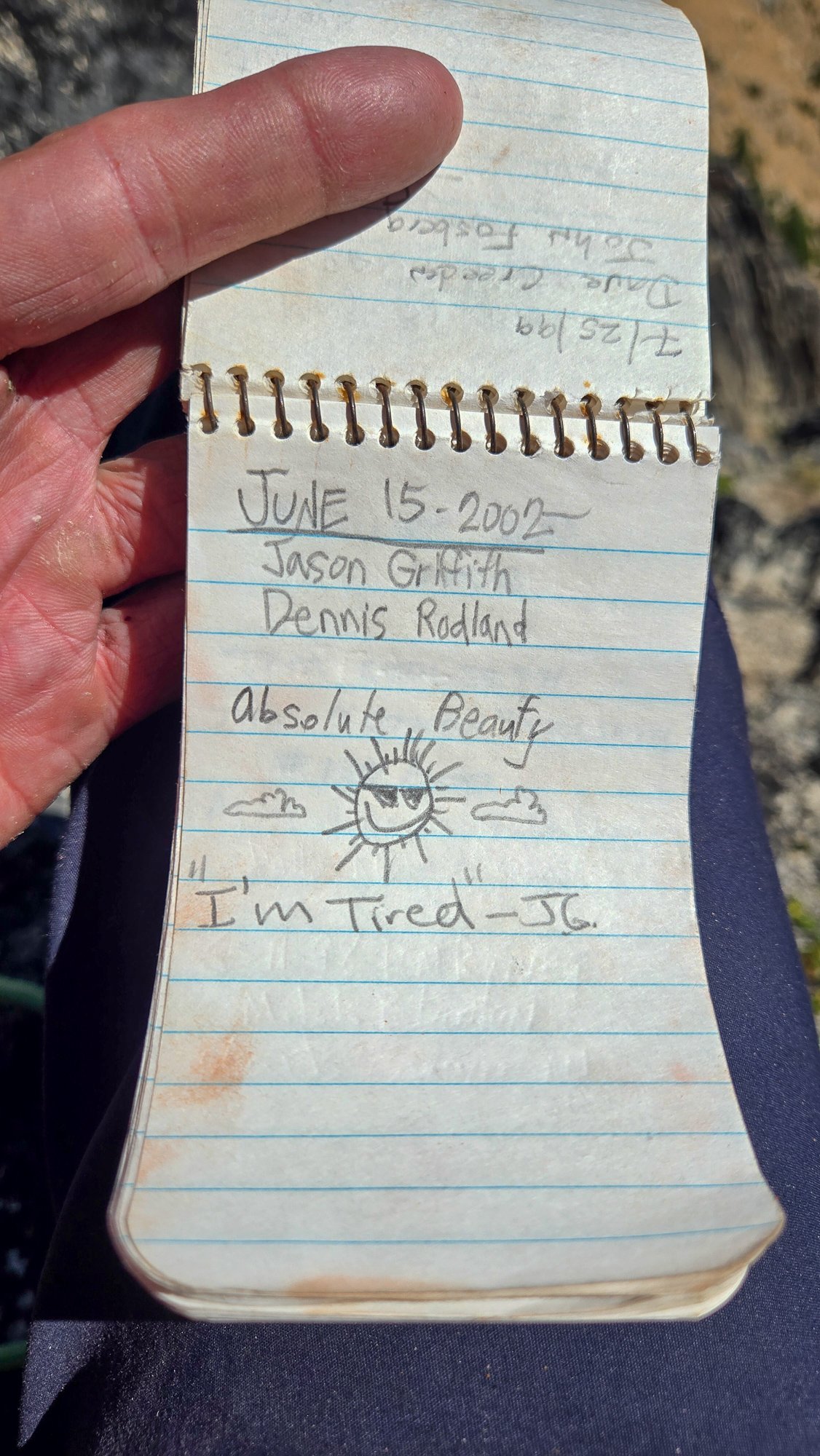
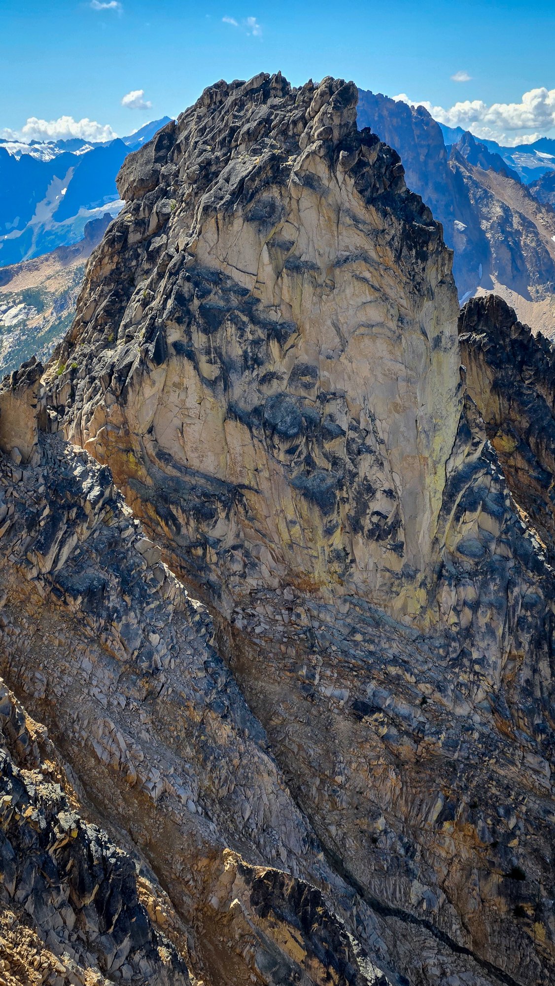
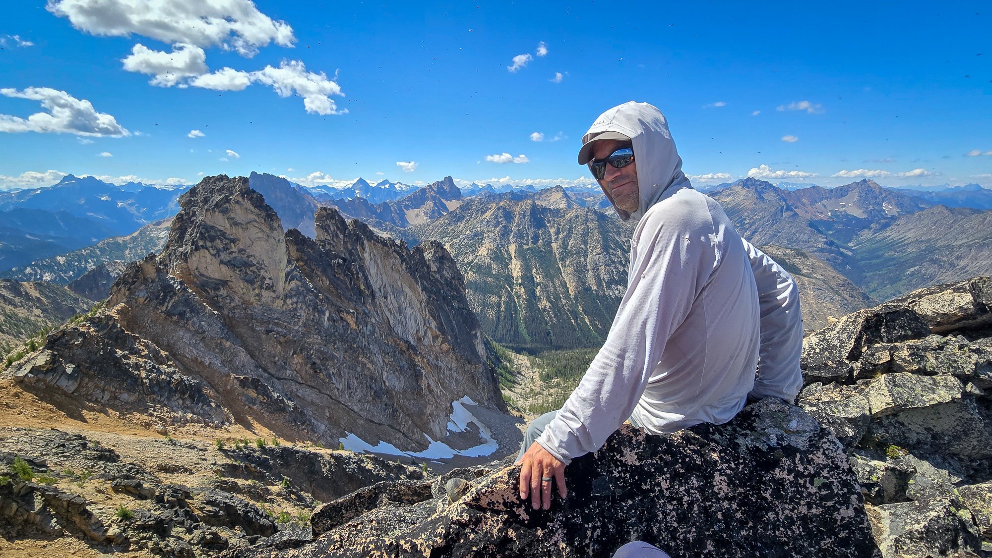
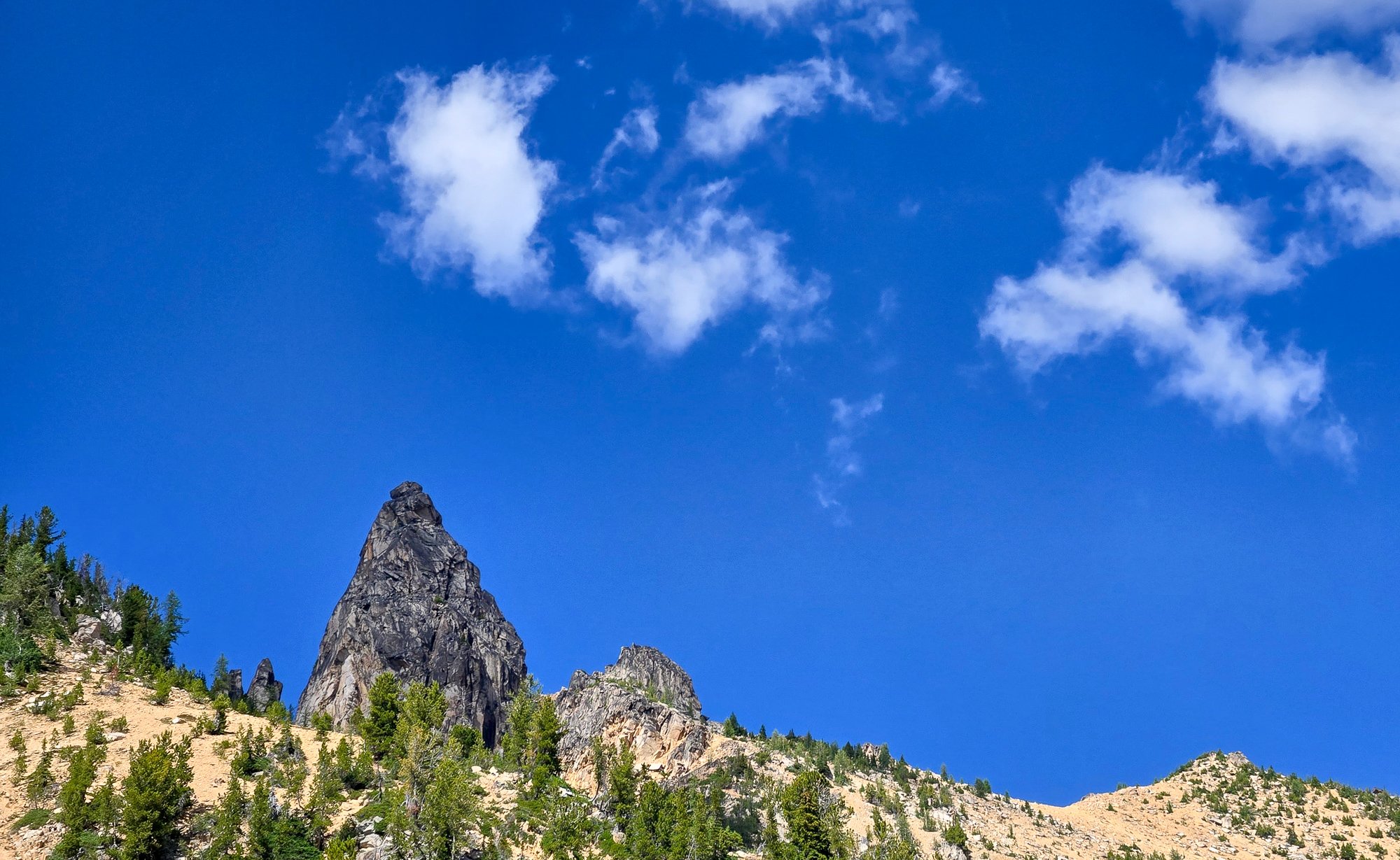
Trip: High point of The Needles (AKA Big Methow Needle) plus the East Peak - Standard Trip Date: 08/02/2025 Trip Report: It seems to be that after 20 years you can repeat a peak and it is almost like you've never climbed it before. Almost. The memory of the character building approach in soft snow wasn't entirely forgotten when @Trent suggested the high point of the Needles (Top 200!) on a Saturday a few weeks back. I had last been up that way 23 years before with my friend Dennis and we had gone straight up from the highway/campground, traversing endless ribs and isothermic mush for a few short 5th class pitches. BUT, Steve had found a better way! Or, so I sincerely hoped, and so I found myself gearing up on the shoulder of 20 again, peering into the brush and looking for the faint hint of a trail @Eric Gilbertson had mentioned was in there. After some minimal thrashing indeed a halfway decent trail emerged, though downed logs were beginning to reclaim it slowly but surely. Things were looking better than I remembered and we continued up. Thankfully the valley thrashing is relatively short lived and the ascent up an open forest rib soon lifts one to views and cooling breezes. A couple hours slogging brought our first views of the Methow Needle, which was more impressive than I remembered. The views to Tower and Golden Horn were also much better than I remembered: Soon we were at the base of the climbing, racking up for 3 pitches of 4th/mid fifth class: @Trent took the sharp end first and launched up on the surprisingly steep first pitch, which was solid, if somewhat kitty litterish: A couple more rambly pitches brought to the lonesome summit, which really hasn't gotten much more popular since the register was placed in 1968. It was a much more entertaining read than most, and I especially enjoyed the firsthand accounts of FAs by Pete Doorish and his partners many moons ago: We were definitely not worthy, but we were there, on the summit nonetheless: And the views, of course, were better than I remembered. Buckner, Boston, Sahale, Tower, Eldorado, Mesahchie, Katsuk, Kimtah (L-R): When I had last climbed it via the not recommended approach in less than ideal snow conditions, I was a young man and was still thoroughly whupped by the end of the day after climbing only Big Methow Needle. This time, we were older and wiser and had some extra energy to head over to the East Peak of the Needles which afforded a grand view of the North side of The Needles, along with many ladybugs (visble at black specs in the photo of @Trent below): But, pleasant as it was up there, we couldn't stay forever and reluctantly had to descend back to the brush and blowdown to battle the masses back west across the pass. Still, a parting view of Big Methow Needle as we dropped to treeline was a good reminder that we have an exceptional backyard here in the North Cascades: Gear Notes: Light Rock rack to 2", 60m rope, helmet Approach Notes: Stay in the valley and find an old trail up Pine Creek on south side. Where it crosses to north side of creek follow for a bit longer into timber until it peters out and you head up via open forest to treeline and the peak.

- 7 replies
-
- 10
-

-

-


