


klenke
-
Posts
3661 -
Joined
-
Last visited
-
Days Won
1
Everything posted by klenke
-
David, I have sometimes had problems saving jpeg images if I don't actually type in ".jpg" after the name I give the file (even if the software I'm using says it will be saving it as a jpeg). When I don't do this, the file comes out as one of those ones whose icon is a white piece of paper with the Microsoft logo on it. You might try saving it by typing in "filename.jpg" instead of just "filename" with the assumption the jpg will be appended by the software. Might be your problem and it might not.
-
Beware of car prowls in the parking lot of exit 38. There was a thread about this a while ago. Seems the bandits jimmy into cars, steal credit cards (etc.), and then exit the car without disturbing anything. In advice, then, take your bank stuff with you.
-
The picture is of Buck Mountain, taken from the east someplace. Tom, you and I were up there last August, so you'll probably recognize the huge North Face wall on the right side.
-
There's an aluminum ladder up there too. The kind most homeowners have. Makes for a good ascent for the last few 'steps' to the summit rocks (even if the ladder is practically horizontal).
-
Thanks, Timmy. You are definitely not a Gaper when it comes to site improvements.
-
Hey, that's a great website, Erik. It's great for defining the microscopic mechanisms of ice climb formation, but it does not address the geographical influences of ice-climb formation. In particular, it doesn't address Cracked's initial question.
-
Yeah, and if we search hard enough, we may find Merlin himself entombed in a block of Washington ice. I'm sure before hacking him out, we climbers would climb the block at least six different ways first. No sense wasting good ice.
-
Josh added a good point: terrain. As a whole, the Washington Cascades (particularly the North Cascades) are a lot more rugged than the Oregon Cascades (excluding the volcanoes down there). The type of ice we all like to climb on forms on highly inclined surfaces, which are more prevalent in the North Cascades of Washington. Add to this Josh's point about basins containing a proportionately greater amount of snow with which to run off through a constriction at the outflow of said basin, more ice can form (like over a waterfall). There also probably more alpine waterfalls in Washington due to the more rugged terrain. Lastly, if the weather in Washington creates more moisture than Oregon, then there is more water with which to form ice. All these things conspire to make more ice in Washington than Oregon. All this is conjecture in need of verification. Hmmm? This sounds like a Ph.D. dissertation for an atmospheric scientist.
-
Oh, you're asking simply for opinions? Well...I think it's because Washington is way cooler than Oregon can ever hope to be. As for a theory from this weatherman's son, I have none. Are you sure it's really probable there is no ice in Oregon? Seems like your statement is too general. I cannot see any reason why Washington would have better conditions for ice formation other than it might have a greater snowpack with which to make ice from. But that doesn't really seem to be an adequate reason for the supposed dearth of ice in Oregon. It seems like the optimum elevation for ice formation in Oregon would just be a little higher up in the mountains than that of Washington.
-
As with many others, I have been up the Haystack several times in all sorts of conditions. I've been up the standard gully (accessed at trails-end on the southeast end of the stack) when it was all snow, bare but wet, bare and dry, and in between. When it's all snow it can be dangerous for the slide factor. The trees below would not be very soft on you but they would eventually stop you. Take an ice-axe. In a normal winter, this is what should be expected for the gully section. Once at the notch in the ridge, you turn left and go up a pretty exposed section that is maybe 15 feet high. I have seen this very icy with hardly any holds. If you slip here, you're apt to plunge off the north side down a 50-100 foot slab to talus/heather/snow. You may not die but you'd be seriously injured. Above the exposed section is the summit (right where you top out). It is an interesting overlook to the west if you go farther down the haystack. In non-snowy but wet conditions, the gully can be dangerous because a lot of it is funky in the holds and steps department. There are multiple routes to attacking this gully. Just hold on and make sure you look where you're stepping--especially on the way down. The exposed bit from notch to summit should be easier than if it's snowy/icy, but it can still be sketchy for a novice when it's just wet. When it's completely dry like in summer, it is all the same steepness but the danger factor is reduced. In winter conditions, it maybe takes 30 minutes round trip from the landing (where most people stop where the trail finally breaks out of the trees) to the summit and back. ---Paul
-
Mt. Redoubt the other day as seen from Hannegan Peak to the west...(see attachment)

-
I have no sympathy for this guy just because he's a climber. His occupation or hobby has nothing to do with it.
-
"...who knows: we might see a local legend." Who me? Ahh, I'm blushing!
-
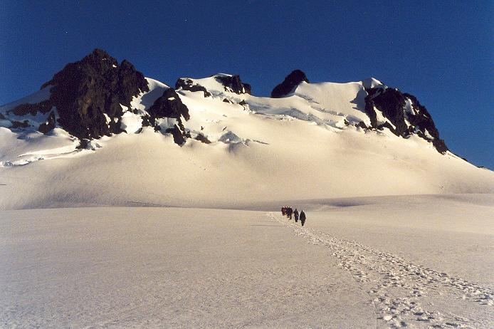
Not a winter photo but what the hell. HERE is your bloody summit (the true summit is the point directly above the climbers' heads). Picture taken from Snow Dome to the northeast on July 4, 1999.
-
Try Map Link, Inc. [i assume they're still in business.] Number: 1 800 962 1394 I think they're located out of Texas. Maps are 1:50,000 scale. Can order color or B&W depending on availability. Availability might be low--especially for volcano related ones--as they are sent from the Mexican government. If you request it, they probably can fax you an index of all their topographic maps of Mexico (including the Mazatlan area). I have this index but I don't know where it has got to. It's about 11 pages with about 100 map references per page. So, as you can see, there are a lot of maps. But then, Mexico is a big country. For example, these maps are needed for certain peaks ORIZABA Coscomatepec MEX50 E14 B46 (SW corner) Salvador El Seco MEX50 E14 B45 (Tlachichuca locale) Cuidad Serdan MEX50 E14 B55 (south approaches) Orizaba MEX50 E14 B56 (south approaches) LA MALINCHE Tlaxcala MEX50 E14 B33 (NW of mtn) Puebla MEX50 E14 B43 (SW of mtn; mtn is on this map) IXTACCIHUATL Huejotzingo MEX50 E14 B42 (mtn is on this map) In 1999, the cost was $10 each plus shipping and handling ($7.50?). Maps arrived in less than a week, but you'll want to leave yourself some extra time in case of mistakes (as in them sending the wrong map(s)).
-
Don't you love it when you're reading someone else's bad ass trip report and your heart starts to pound? Guess I shouldn't have drunk that liquid candy a few minutes ago. Nice job (the climb and the TR).
-
"One of us will post some pictures soon, but Forrest might have easier access to a slide scanner than I." If these great adventures from Colin and his friends keep taking place, we're going to have to create a "Buy a scanner for Colin" fund. Because once he's got a scanner, our "downtime" waiting for the photographic record will be reduced. And we can live better, more efficient lives as a result.
-
Sergio and I climbed The Castle in the Tatoosh yesterday. Though there were only four cars in the Narada Falls parking lot when we set out at 9:00AM, there were maybe 60 there when we returned at 4:00PM. It was a zoo! At any rate, the road-only travelers and skiers and snowshoers have beaten a path all the way up to the the saddle east of The Castle. Sergio used his splitboard but I went on foot (forgoing my snowshoes at the time). Off of the beaten path, the snowcover was about a foot of soft powder except for where it had become crusty or windswept. After we finished off The Castle (easy), we hiked (this time me with my snowshoes on) down to the saddle about a half-mile east of The Castle. From there, Sergio boarded down into the basin bearing toward Louise Lake. Excellent powder skiing/boarding of about a foot depth (even for the downhill snowshoer) on top of a crusty/icy surface. Lots of people have gone down this slope. If you're a cross-country skier, the Tatoosh offers wonderful playing terrain. I would expect that for as long as the weather stays dry and cold the north basins of the Tatoosh will remain powder heavens.
-
Try www.nwog.org. Scotty is always headin' up that hill.
-
Not really kidding. He does post here (user name "Beckey"), but he's still at Lurker level. However, my last comment about him being all about the me-me-me was sarcastic.
-
Too bad I didn't know you were up there again, mattp. Had I known, I would have requested that you snap a few shots of the entire Northwest Ridge of Lewis Peak while there. I know you can see the NW Ridge of Lewis because I could see the north side of Sperry from the ridge. And does anybody know what's supposed to be going on with this graemlin: ? (Oh wait, I just figured it out: the graemlin's whacked out on shrooms!)
-
What I want to know is why Beckey himself hasn't made his scheduled appearance known by pinning a thread to the top of the Climber's Board? I thought he was all about the "Hey, look at me!"
-
Now that is kind of funny Dwayner. The picture says it all.
-
Has pub club become instutionalized yet? If not, who cares about all this bruhaha? Keep it light. If people show or don't show, who cares. All I'd need is one more person than me to show up and two's a gathering for good conversation. If more come, so be it. I intend to make more appearances in 2003. I'm not going to poopoo someone for not showing up. I ultimately might consider it their loss. I may be jocular about their non-appearance, ridicule them in jest, never otherwise. "Can't we all just get along." Besides, there's no rule that says two pub clubs at two different sites at the same time can't occur else you're banned from CC.com. If people want to do an Eastside pub club, let them do it. For those that would rather do a westside (Seattle) pub club or a northside (Bellingham) pub club, more power to them. All it takes is a little communication and coordination.
-
In actuality, I've climbed Mt. Townsend on the NE end of the range a couple of times though never in winter. Awesome for views. It could be a good winter climb. You could check that out. It's been 10 years at least since I've been up there, so I don't remember much. Best to consult maps. Unless they've made a new trail, the trailhead used to be someplace along a well-used (by logging industry) logging road where they decided not to let vehicles go any farther (gate?). The "trail" followed the closed road for a few miles then left it for the last push to the gentle north-south summit ridge. I seem to remember something called Bon Jon Pass Road. That would be a starting place for the map consultation.
