


klenke
-
Posts
3661 -
Joined
-
Last visited
-
Days Won
1
Everything posted by klenke
-
Or take matches and set that shit on fire... Summit registers are pollution. Friggin' mountaineers... In the grand comparative scale of what counts as pollution in the mountains, summit registers are about as inconsequential as you can get. The real pollution (man-made eyesores, et al.) comes from the construction of logging roads, the construction of trails, the clearcutting of hillsides, the exhausts of vehicles driving up said logging roads, the flatulence of climbers hiking up said trails, the creation of soot from the burning of papers that were otherwise not doing any harm inside a metal register, the construction of cairns at a summit or on a trail (these are more visible than any register), the sound of the freeway below peaks of the I-90 corridor, the sound of motorcycles in the Lake Chelan-Sawtooth Wilderness, the sound of snowmobiles whining their way up Ingalls Creek--illegally, the sound of airlines flying overhead.... Anything more? Registers are not pollution. They are not litter. They are less intrusive than a boot path up to a summit--a boot path that tramples native vegetation. So I call bullshit, Alpinfox.
-
Yeah, I kind of found that ironic too.
-
Hey, if you think of the plastic as being that of a credit card, then the TR reads more like something erotic and not at all related to climbing.
-
I know that Mountaineer Basic Gumbies have been going up there already this year, so it has been climbed this spring (main/North Peak, that is). My friend just led a Mounty climb up there. He didn't go up via the Red Slab Route (can't remember which one he went up) and didn't report to me any snow, which is not to say it wasn't there, just that he didn't find any of it to be an albatross toward their success. I doubt it's snowfree. Ah, the snow cornices just make it that much more invigorating. Both peaks are over 7,600 ft, so snow should be expected--especially in shaded areas and north slopes.
-
A little extra information: with three of us searching and one waiting in the car for a speedy getaway, we could not find the supposed fisherman's trail (as per Beckey and his alternate West Route approach) that starts at 50 yards past the bridge across Illabot Creek and goes up to the small lake at 4,760+ ft. I found one little piece of blue flagging on a tree in the middle of nowhere, but no semblance of trail. Also, the metal pipe register at the summit has no logbook in it, just an ad hoc assortment of loose papers. If anyone should decide to go up there, it would be nice if you took along a new register book. It needs one.
-
Na, you could just jump over them when they roar down on you. You know, like that dude on That's Incredible who tried to jump over the speeding Ferrari.
-
I've been in possession of Stephen Fry's list of supposedly the steepest mountain faces in Washington. I actually have those top faces in terms of vertical drop for 1 horizontal mile of distance and for 1/10 of a mile horizontal distance. Since you would most likely only be interested in the latter, I will include only that list: #1 Mt. Index, W Face (2,150 ft = 5,150 ft - 3000 ft) #2 Baring Mtn., NNE Face (2,000 ft = 6,000 ft - 4,000 ft) #3 Mt. Index, ENE Face (2,000 ft = 4,760 ft - 2,760 ft) #4 Hozomeen Mtn. [s. Peak], N Face (1,950 ft = 8,000 ft - 6,050 ft) #5 Davis Peak, NE Face (1,830 ft = 6,780 ft - 4,950 ft) #6 Twin Spires [E. Peak], E Face (1,800 ft = 8,200 ft - 6,400 ft) #7 Bear Mtn., NE Face (1,755 ft = 7,920 ft - 6,165 ft) #8 Copper Lake Wall, NE Face (1,700 ft = 5,400 ft - 3,700 ft) #9 Three Fingers, E Face (1,700 ft = 6,600 ft - 4,900 ft) #10 Garfield Mtn. [N. Peak], NE Face (1,670 ft = 4,560 ft - 2,990 ft) #11 Booker Mtn., NE Face (1,660 ft = 8,120 ft - 6,460 ft) #12 Hozomeen Mtn. [sW Peak], N Face (1,660 ft = 7,440 ft - 5,780 ft) #13 Hozomeen Mtn. [sW Peak], W Face (1,640 ft = 7,200 ft - 5,560 ft) #14 Mt. Blum, NE Face (1,620 ft = 4,220 ft - 2,600 ft) #15 Mt. Bullen, NE Face (1,610 ft = 5,410 ft - 3,800 ft) #16 Mt. Shuksan, N Face (1,610 ft = 7,400 ft - 5,790 ft) #17 Peak 7895 nr. Mt. Spickard, NW Face (1,600 ft = 7,600 ft - 6,000 ft) #18 Bonanza Peak [sW Peak], W Face (1,540 ft = 9,140 ft - 7,600 ft) #19 Hozomeen Mtn. [s. Peak], E Face (1,540 ft = 7,740 ft - 6,200 ft) #20 Hozomeen Mtn., W Face (1,510 ft = 7,910 ft - 6,400 ft) I don't know how much Mr. Fry actually did his homework, so don't take this list as gospel or definitive of the highest cliffs in the state.
-
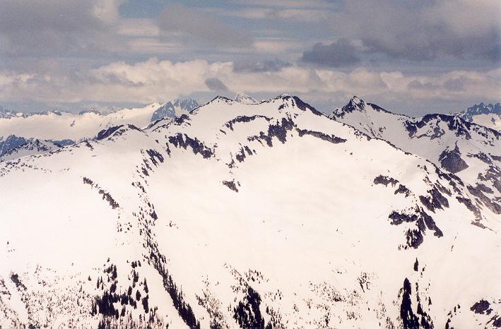
The distance from Garibaldi to Queen Bess would be about the same as the distance from Mt. Rainier to Mt. Baker and I know you can see one of these from the other on a clear day. There is a mass of mountains to the left of the mystery peak. Waddington could be hiding behind this. It is also conceivable that the mass on the left edge of the photograph is itself Mt. Waddington, which would put it and QB in the right places relative to each other. I suppose it is possible your mystery peak is Waddington, but it doesn't look high enough relative to the adjacent peaks. It's also not rugged enough. Plus, it's too solitary to be Waddington. Waddington is closely surrounded by some pretty big peaks (like Combatant, Tiedman, and Munday). Munday would be on the front left of your mystery peak if it were Waddington. There's just nothing there.
-
I think your mystery peak is most probably Mt. Queen Bess (10,869 ft). See here Phil's Coast Range Trip for a good comparative picture (it is the 29th picture in the set labeled "Looking south to the Homathko icefield, and Mt Queen Bess." Other pictures can be found on Bivouac.com (but they're not that good). Queen Bess is about 200km NW of Garibaldi.
-
Hmmm, except for the above, it still isn't working for me or some others. Is my old process flawed? Am I just a gaperklenke?
-
I was looking at doing Mt. Constance by something other than the punter South Chute, North Chute, or Finger Traverse Routes. Guidebook talks about the West Arete Route (Route 2) and it goes at Grade III, 5.4. That doesn't sound bad at all. But then the book says this route is difficult and very exposed. Exposure can be found on any class rating, but why would 5.4 be considered difficult when there are other routes listed as harder? What I want to know is what made it difficult? Chossy rock? If you don't recommend the West Arete Route, what other rock routes would you suggest?
-
Ok, I just can't resist this: Jarred, if you go to Zugspitze right now, it looks like you'd have a whale of a time.
-
When I was in college, one of my friends in the dorm had a blind roommate for a while. The roommate subscribed to Playboy--the braille version. Pages and page and pages of raised dots on white paper, that's all. I found it quite unstimulating.
-
Hmmm, I wonder why? Didn't Ralph recently move over that way? I agree, though, Grady's is a good place to hold a public cublic.
-
This is from Colchuck Lake in mid-April. You can see how the gullies would be in winter/early spring. Don't know about what they would be like snow-free, but it does seem like you could get down one of them if you really wanted to--especially if you already had gear with you with which to rappel. Here is the image: Colchuck BR from Lake
-
Winter photo of Lane Peak from this year: Lane Peak from north
-
Test to see if ya really fixed it...
-
Hey Bug, I went that way too in late summer a few years back. Best way to sum it up: Brutal, brutal, brutal! BW5 in a lot of spots. I was actually trying to traverse over to Mt. Index from that valley but bailed and went for Persis instead. On the way up from the overgrown spur road (at the large open [parking] area just before the washed out road) I climbed up the dryish watercourse (for you, this was probably not possible in early season) then took a dry junction rightward practically all the way up to the alpine upper basin. Very nice up there once I got there. Most of the bushwhacking was to be had on the descent--because I tried to bear directly for the car. I just couldn't get out of it, despite the fact that the forested slope was so near. It would have been much easier and quicker to take the trail back and then walk the couple miles of roads back to the car, but noooooo.
-
Alrighty then. I have the right to be "officially" jealous now. Congrats guys...except for Chris & Jeremy I guess.
-
CBS: Schurman Rock is scheduled to reopen very soon. There's a chimney on one side. I would suggest you go there and practice, practice, practice. I agree with Mattp. There are easy rappels and hard rappels. For me, the difficulty is usually either the step-off at the top or when one has to rap one way but the slant of the rock goes another. In this latter case, the sideways force (pendulum factor) gets annoying but is obviously easier to deal with once you get most of the way down. My other problem is usually not being able to go fast enough at the top (my Trango Jaws belay [rappel] device is to blame here). I can't say if my rappelling technique is good or bad but I do know I like doing it and I've never flipped over, so I must be doing something right. I have however had a foot slip out , rammed a shoulder, and rotated into the rock on occassion. Par for the course.
-

Six most appealing North Faces in the Casacades
klenke replied to MysticNacho's topic in Climber's Board
You two are simply geekologoists. -
Jarred: the best way to ignore Cpl. Caveman is to just ignore him. Don't respond to him AT ALL unless he gives you something meaningful, which is not often.
-
Six most appealing North Faces in the Casacades
klenke replied to MysticNacho's topic in Climber's Board
How 'bout this: The North Face of the Middle Peak of Chaval in plastered conditions like this... Picture located here: Mt. Chaval, Middle Peak -
Six most appealing North Faces in the Casacades
klenke replied to MysticNacho's topic in Climber's Board
The North Face of Queen Anne Hill in Seattle. I'm talking about the North Face Direct straight up from the Fremont Bridge...by bicycle. What a grunt! And oh so aesthetic! -
But you won't be spending any time in the pool, will ya? I feel kind of sorry for you right about now. But, then again, I see you said you'll be drinking hooch, and now I feel sorry for myself.