


mattp
-
Posts
12061 -
Joined
-
Last visited
Content Type
Profiles
Forums
Events
Everything posted by mattp
-
Darin, I think I also told you to approach via Dan Creek from Darrington rather than the (maybe) more direct road up the hill from the White Chuck. In my recent TR I wrote: That's really all I think you need to know, but if you really need the blow-by-blow try this: 1. Head out of Darrington toward the Ranger Station. Turn right on the Sauk Prairie Road, about a quarter mile from Darrington's civic center convenience mart. 2. After a mile and a half or so, turn right onto the Dan Creek Road, # 2400 I think it is. Stay on the main stem. 3. After maybe eight or ten miles, the road bends left and crosses Dan Creek (its not much of a creek at this point, and kinda swampy). Turn left. (I think there is a warning sign on the road to the right, saying it is closed ahead.) 4. After maybe a half mile, turn right, uphill. I think it is the 2430. Stay on the main road, passing a couple of spurs to the right. 5. After maybe 4 miles, turn right (again, uphill). This is the 2435 if I am not mistaken. 6. 4 miles up this road, you will "top out" on a crest above Conn Creek. Proceed along the crest and take a right fork, ending up high on a satellite ridge NW of the NW Peak of White Chuck. 7. Follow a trail that is mostly on the south sisde of the crest of the ridge headed toward White Chuck. Round below the NW Peak, and drop into the basin below the SW face. Climb on. 8. Bring a map that shows the logging roads and follow your nose.
-
Its been a while since I sat in a science class, Dru, but I recall something about how water is unique among liquids in that the frozen stuff floats on top rather than sinking to the bottom -- it is a question of density, I think, rather than the direction of heat loss. Ice is lighter than water, so it floats on top.
-
Fairweather does raise a couple of valid points over there, however. I don't know whether we have a unusually high proportionate involvement in accidents or rescues among frequent poster to this site, but it could be. And, either way, the questions about how we address these matters on cc.com are also valid.
-
Good point, Pandora. People publish books to sell them, and this means everybody has to have some kind of "hook" or "angle." Mark Twight writes about the new Fast and Light type of climbing and calls it "extreme." Many around here seem to think that is pretty cool, and it is, but I don't see many people critical of his self-indulgent writing about the inner angst he experienced as an alienated post modernist or whatever, and how this propelled him on his quest to probe the margins off our great sport. We read John Krakauer, with his self-analysis in the wake of an accident on Mount Everest, and many are impressed with how insightful or riveting it was, but relatively few feel the need to blast him because he is somehow attacking US (Anatoli Boukreev excepted). Even writers who avoid the overtly self indulgent like, say, Andy Selter's in his recent book on Mountaineering history, write books with a "hook." In that book, Selters presents a fascinating collection of vignettes and photos from mountaineering history, and he offers a series of "classic climbs" in the successful format first presented by Roper and Steck twenty years ago. I would guess that somebody decided the historical presentation needed some window dressing in order to sell. Is that bad? I don't think so. And it DOES add to the spirit or value of the book to think about not only historical events, but how those great deeds of a hundred years ago can in some way be re-lived by climbing the old classic climbs. So what if Jennifer Jordan writes about "the turmoil of entering a traditionally male sport." Is it a self-centered presentation of her experience? Sure. But, even if we don't want to hear about HER experience, is there anything really all that wrong with her wanting to tell that story? All of us have our "schtick" which some people find appealing, others do not, and at least some people think is over-the-top, ill-advised, or somehow wrong-headed.
-
Alex is right -- it does not get cold enough around here that you'll be wearing your down jacket all day long or even for substantial parts of the day. You'll use it when you jump out of the heated car and start messing with the gear, or when you stop on the trail, at a belay, or while you take in the view at a summit. Assuming that you are trying to climb something substantial or otherwise trying to generally keep moving toward your goal, all of these times you put on the puffy, it will be coming off relatively quickly and, assuming that your partner(s) also want to get something done, you'll want to do so efficiently. Find a place in your pack that you reserve for stuffing the jacket in and out quickly - just inside the opening end of that zipper near the bottom if you have one, or right on top. If you are standing around camp or something, or maybe if you are at the base of a climb where several climbers are taking turns and you're going to be there for a long time, you may take the time to put the down inside your shell coat. Even wearing the down jacket as an outer layer, I think you want as breathable as possible of a shell fabric (not "waterproof-breathable"). You will get your down wet by putting the jacket on over a sweated out long underwear top or a crusty damp shell coat and the more breathable coats will dry faster. Also, if you are trying to save weight you'll wear it to bed to make a lighter (summer weight) sleeping bag warm enough for your winter overnight, and the fully breathable will not collect moisture as you sleep but the goretex shelled down jacket will. You want a fairly sturdy fabric shell on your jacket if you use it this way and wear it mostly as an outer garment. I have a superlight Feathered Friends down sweater that I am afraid to wear for a belay jacket because I'd rip it if I leaned against an icicle or brushed against a tree branch. Lastly, I'm not convinced that "high quality" (expensive) down is much better for a jacket that you are using in this fashion. I have two midweight down jackets. The cheaper one, probably made from Korean duck feathers or something, seems to hold it's loft when damp better than my more expensive Feathered Friends jacket and I don't worry about wearing it while standing next to a campfire, or for a brief encounter with some nasty brush. They both have their advantages and, in particular, the FF jacket is a much nicer garment and just plain FEELS better -- but used as a "belay jacket" for day trips and for kicking around the campsite, it is not altogether a better jacket than the one that cost half as much.
-
Good point, Dave, that the cost of maintaining some of the roads we assume that we should be able to drive on may be way too high to justify their maintenance. Also, of course, there are those who argue that reduced access to the upper valley will enhance the wilderness experience there, and still others who probably argue that the area is over-visited. I'm not psyched about either the major development they are imposing on the lower half of the valley or the reduced access to the upper half, but there are a lot of considerations involved here beyone keeping this area accessible for climbers and hikers or other non-motorized recreational users.
-
I'm not sure what "our cause" is here, ChucK. If you want access to the mountains to go climb peaks back toward the top of the drainage like Big Snow Mountain or Summit Chief or whatever, it is obviously going to be a loss of access if they choose one of the options that provides for closing the road to public motorized use. Assuming that preserving automobile access to the upper valley is your goal, will writing letters saying you are unhappy with this part of the plan help? I don't know, but I don't see how it could hurt. I haven't had time to look at how they've divided up the verious phases of the plan, and I haven't read the current document but I think it pertains to only the proposed road closure and the trail on the other side of the river, and maybe to some of the closure of spur roads as well. I don't think they area asking for comments on the whole thing - the current document does not address the road paving or the campground - so maybe a comment such as "the whole thing sucks" would fall on deaf ears, but I suppose that in a sense I see nothing wrong with even that kind of comment because somebody WILL read it before they ignore it. I know some around here may be skeptical, but most of the Forest Service folks I talk to do actually care about trying to do the right thing and even if they are going to do what they are going to do, these comments matter at some level. In order to significantly influence the planning process, you'll have to be willing to do more than fire off a snotty letter, though. It'd be cool if somebody wanted to take on the Middle Fork as their project and really get involved because even if we don't like what they are doing at this stage or what they've already decided, there will be more planning and management decisions in the future. To be fair, too, we should consider one of the "plus" points for the development in the lower part of the valley: they hope it will reduce the incidence of crime like meth labs, vandalism at trailheads, and trash dumping and such. Also, I suppose it probably IS true that they need more campgrounds if you consider the fact that many campgrounds along the I-90 corridor are full in the Summer and if you assume that we should provide campgrounds to fill that "need."
-
There is nothing in the current plan that would affect the climb on Mount Garfield either way. However, there is quitoe a bit that is of interest (or should be) to climbers. The current document does not address everything, but the big picture is that they are going to pave 13 miles of gravel road to serve a new campground they are building virtually at the foot of Mount Garfield and it will be operated by a private concessionaire; and during the Summer they are planning to gate the road six or eight miles beyond there, but during the winter it will be gated (I think) just past the campground. "Inholders" such as those with mining claims or the hot springs folks will be able to have keys to the gate, so this is not a net gain in wilderness or even wilderness experience, but a loss of access. The result is that access to other peaks in the area is going to be reduced and things like Summit Chief Mountain are going to be out of reach for most weekenders. They are going to decommission or block a number of other side roads in the area. Mountain bikers and horseback riders and kayakers participated in the planning process. The hiking trail on the other side of the river is going to be open every other day to mountain bikers and horseback riders, and they are going to plan the roadway project such that it does not take away any traditional kayak put-in spots.
-
An equivalent sized piece of the thinnest plywood you can find is vastly superior because it doesn't conduct heat.
-
I sure wouldn't put it past Bush and Co. to want to keep the public out of any planning process for "public" lands, but I'm not sure that an exemption from NEPA completey defeats any requirement for any public input. However, as a practical matter, we climbers have been pretty poor about participating in forest planning processes anyway, such as the Middle Fork planning process were mountain bikers, horseback riders, kayakers and hiking groups participated but climbers almost not at all.
-
The Bedal townsite isn't all that far from the trailhead, but it sure would be nice if they'd fix the roads up there. I have no idea if the ice shown here is unusuall for that face or not - anybody have pictures from other years?
-
He should have used this:
-
I think it is much easier to get your skin glue off with a torch than an iron. Hang your skins up so they lie flat against a post in your basement or better yet outdoors, and use a propane torch to heat the glue while scraping it off with a broad knife. Work, from the top down, and scrape off the old junk into a single grocery bag. You have to be slightly careful not to burn your skins, but it is not at all difficult to do a clean job of cleaning your skins in no more than fifteen minutes.
-
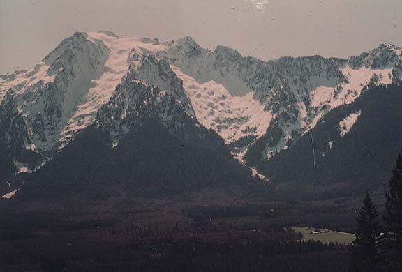
That'd be the "other" side of Edith Cavelle. Here's the view from the parking lot, with the East Ridge on the left skyline and the famous north face routes straight up the middle:
-
I'm with you there, Darin. It sounds like they want to fillet him because he is doing his job. Democrat or Republican, we need more like him (and I'm afraid Ms. Gregoire, Gary Locke in a skirt, is not -- but can you imagine Rossi as governor?).
-
To me, a "classic ski descent" is one from a major peak, one that involves larger vertical, and preferably with some adventurous skiing or an appealing summit or maybe an icefall or something. Glacier Peak used to be a good one, but the access is now difficult. For a peak near the road, I'd look at Eldorado Peak, from the Cascade River Road (though the boulder field at about 4,000 feet may be absolutely atrocious at that time of year depending on snow cover). Nearby, Sahale Peak is a good one. Also, check out Mount Shuksan, from either the Baker Lake side or from the ski area side (the White Salmon Glacier route is little more adventurous than the more commonly skied Sulphide Glacier). Mount Baker is very scenic and one of the highest and most glacier-clad peaks in the state (either the Coleman Glacier or the Easton Glacier are good, though the snowmobiles will be on the Easton in May). I would skip the ski descent from Camp Muir on Mount Rainier in favor of other trips on the mountain (Camp Hazard or Steamboat Prow or Whitman Crest make better day-tripping destinations in my opinion). Mount Stuart's Cascadian Couloir is good but involves a longer approach. Toward the east side of the North Cascades, Silver Star Mountain via the Silver Star Glacier is good (I think it is easier to climb via Burgundy Col and descend via the Silver Star drainage). These are all classic peaks in their own right -- among the higher peaks in the area with glaciers on their flanks, and being popular climbs as well as ski descents. They are all relatively easy ski descents if you have significant ski-mountaineering experience.
-
I spent two months in Thailand and Indonesia several years back, and we passed through Singapore but did not think there was much of interest there. It is a big city on a small island, with a lot of high rises and stuff. There is a nice botanical garden, but we didn't find near the interest there in the way of things like street vendors, temples, etc. that we found in, say Bangkok. We didn't visit the parks on the Malay Penninsula, not all that far from Singapore, but I bet these are pretty cool. Singapore has a diverse population, and a very strict set of social laws about such things as smoking or even spitting on the sidewalk. Don't get caught smuggling. There were backpacker-type guest-houses where you could stay pretty cheap.
-
It's not deep in the wilderness, but the north side ski runs on Whitehorse are awesome.
-
Quick question: has anybody who is participating in this conversation tried to ask Mr. Bertulis about this? Or anybody connected with the Film Festival?
-
Was anybody able to attend this meeting? How 'bout a trip report?
-

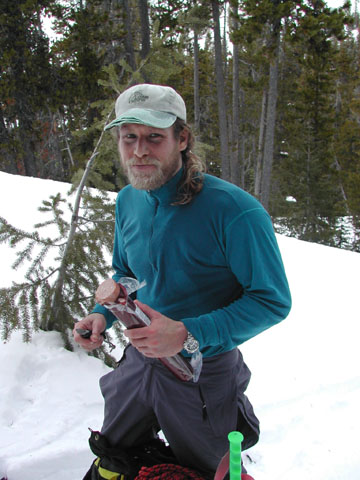
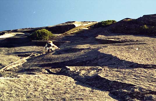
[TR] White Chuck Mountain- Northwest Ridge 11/28/2004
mattp replied to mattp's topic in North Cascades
The Man:
-
The crux:
-
Overall, I'd see little reason you'd want to adopt Telemark technique for ski mountaineering because the AT gear skis better and the release mechanisms are better - offering greater safety in falls and in avalanches. However, Telemark bindings are better for crawling through the woods because you can pick up the tail of your ski without having to reach down and grab it with a ski pole. This is often a significant advantage when climbing over logs and crossing creeks on stepping stones and stuff like that.
-
[TR] "A" peak, by Ellinor- Millimeters of Verglass 11/28/2004
mattp replied to wayne's topic in Olympic Peninsula
The two peaks can easily be connected via a shelf high in that back-side basin, too. You get more of a sense of being in the wilderness back there than if you traverse along the "front" side. Washington is an excellent winter climb. Both the SE Face (ramp) and the "standard" route make easy day climbs. -
[TR] "A" peak, by Ellinor- Millimeters of Verglass 11/28/2004
mattp replied to wayne's topic in Olympic Peninsula
Wayne- I think the easiest way to get into the cirque behind Ellinor and Washington might be to climb Ellinor and descend a gully down the backside, near the summit. The gully is prominent in this photo, from Eric Hoffman's TR. The road up the front side to the Mount Ellinor trailhead is well-maintained, and even in the winter you will often find a trail to the top. When the road is blocked by snow low down, you may find a reasonable shortcut up a wooded ridge (old timber) between the forks of Big Creek, avoiding about two miles of switchbacks. It may take a recon to figure this out. You seem to do well with the exposed-crappy-rock-poorly-protected kind of thing, so you might well like the traverse. I've tried it and never managed to stay actually on the crest for the entire way - and I have never heard of anybody else doing so. It occasionally rimes up in the Winter.