Leaderboard


Popular Content
Showing content with the highest reputation since 02/04/25 in Posts
-
We are not dead! That was extremely trying. The server totally crashed in a terrible way right in the middle of a super intense week at work for me and I was taxed mentally to the max figuring this out. Luckily I have a couple really good friends, ex-coworkers...but they are friends to give me moral support and confidence to do everything I did which was rebuild everything on modern software. So the site is in a MUCH better place than it was pre-crash. I still have a bunch of maintainance to do, but the site is back up and going. Thank you for sticking around. We WILL keep this place alive dammit.18 points
-
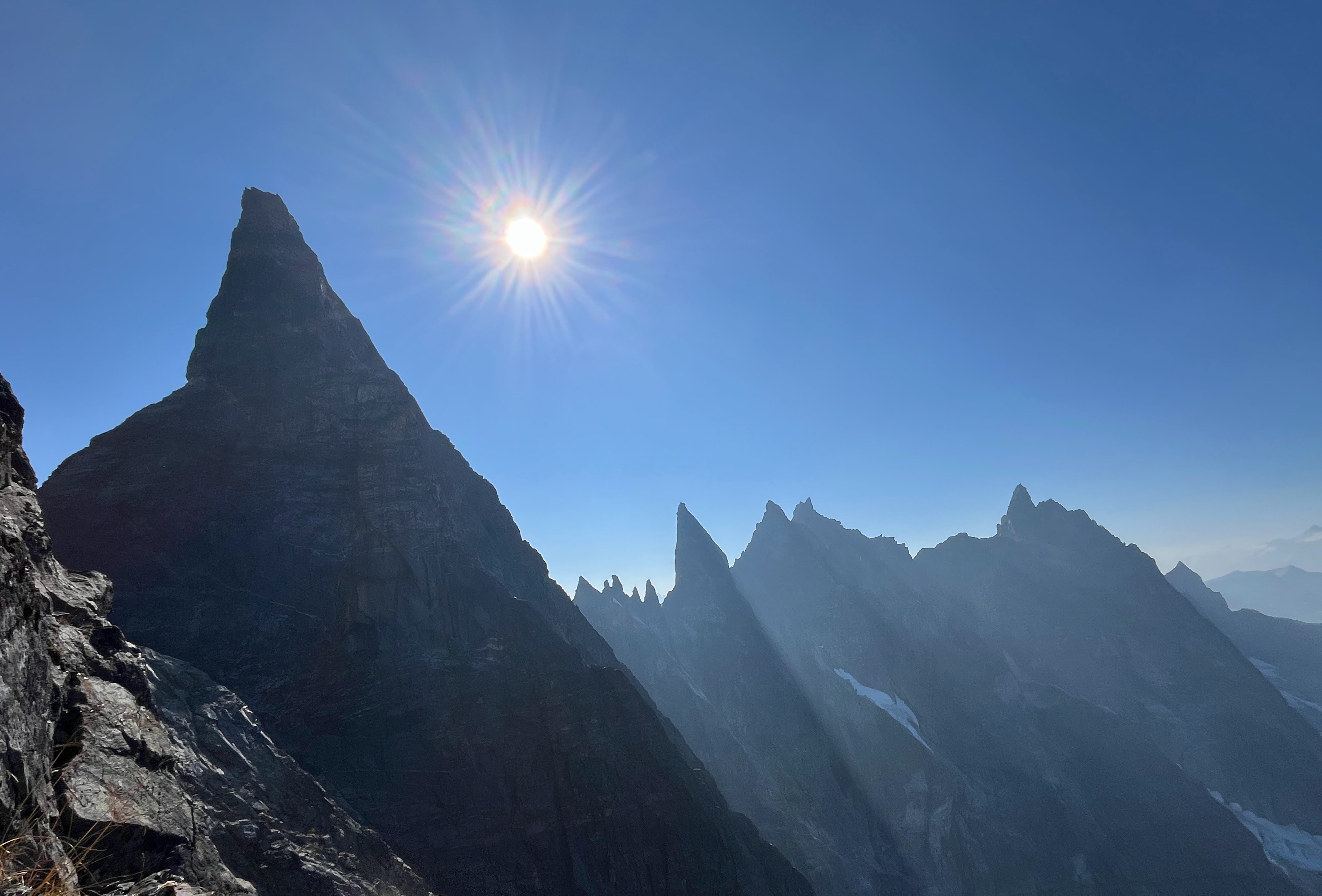
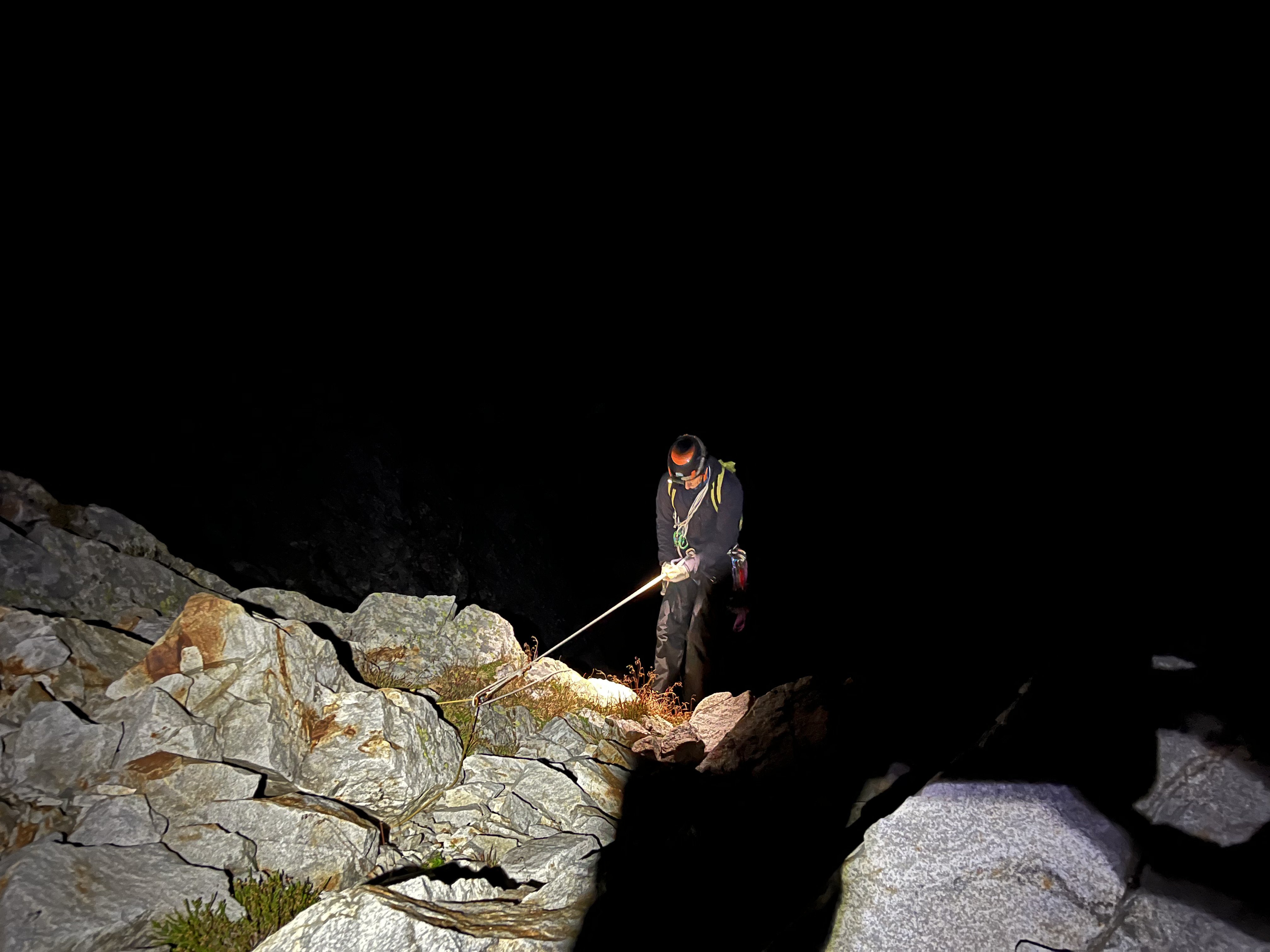
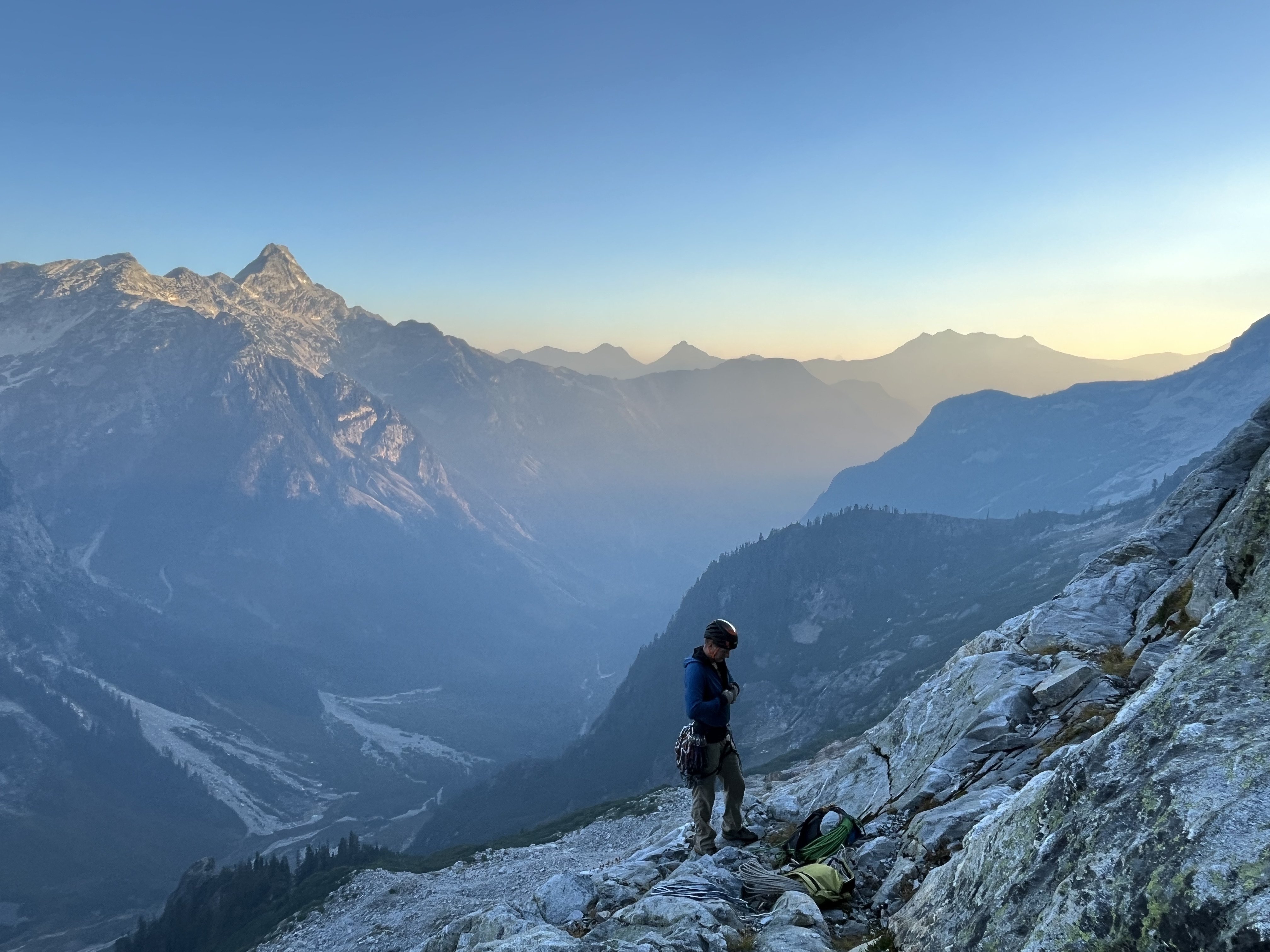
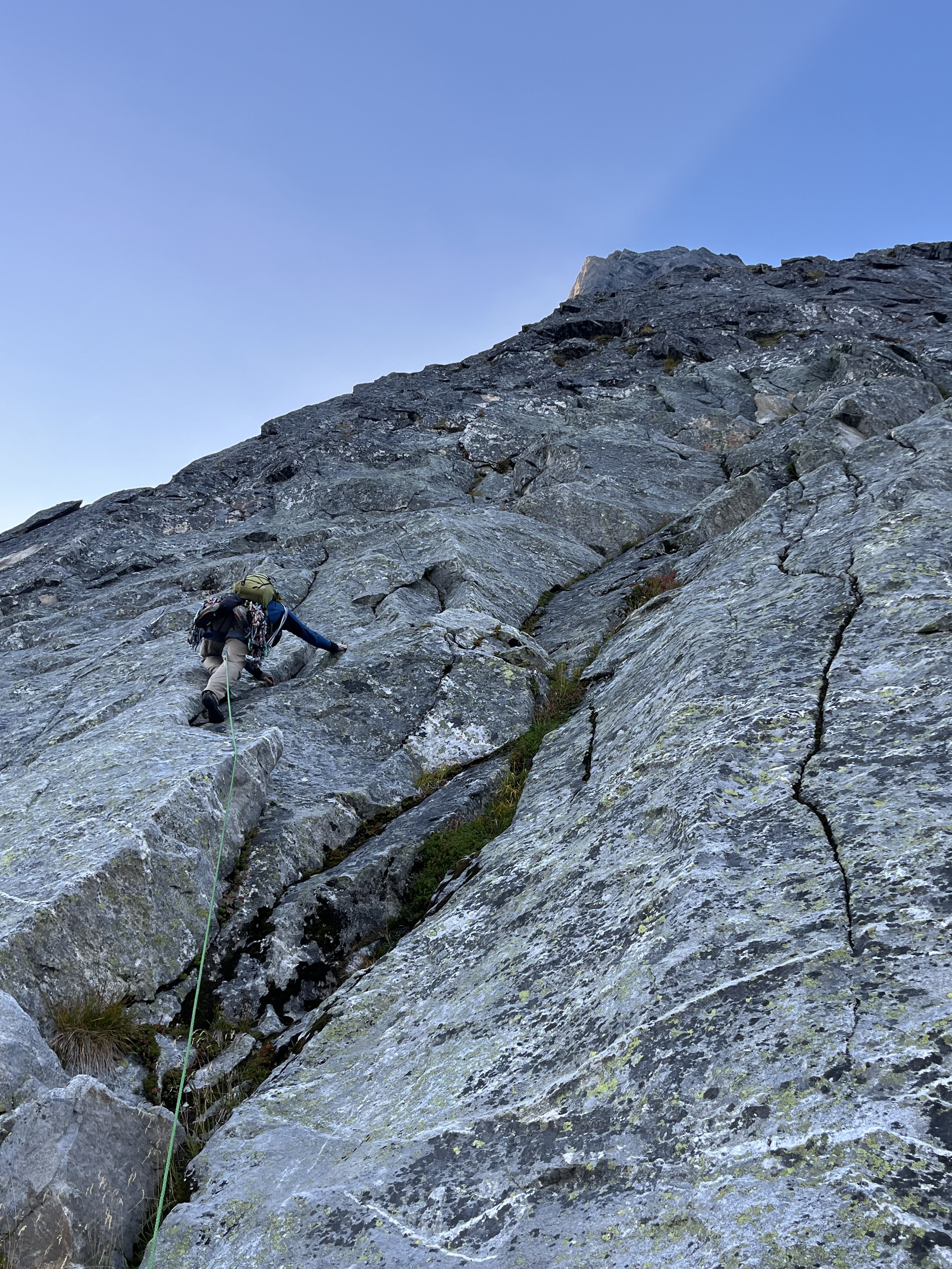
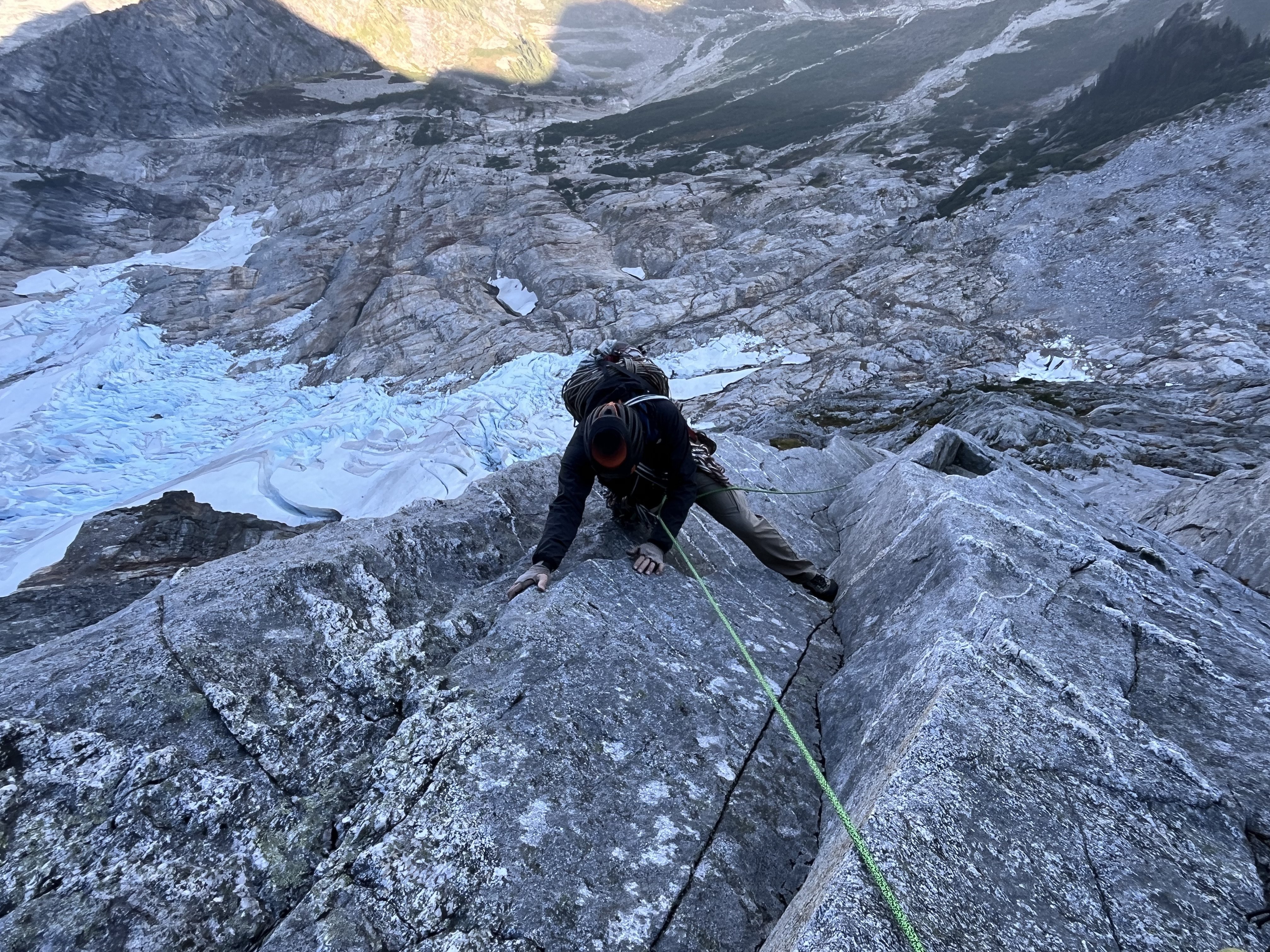
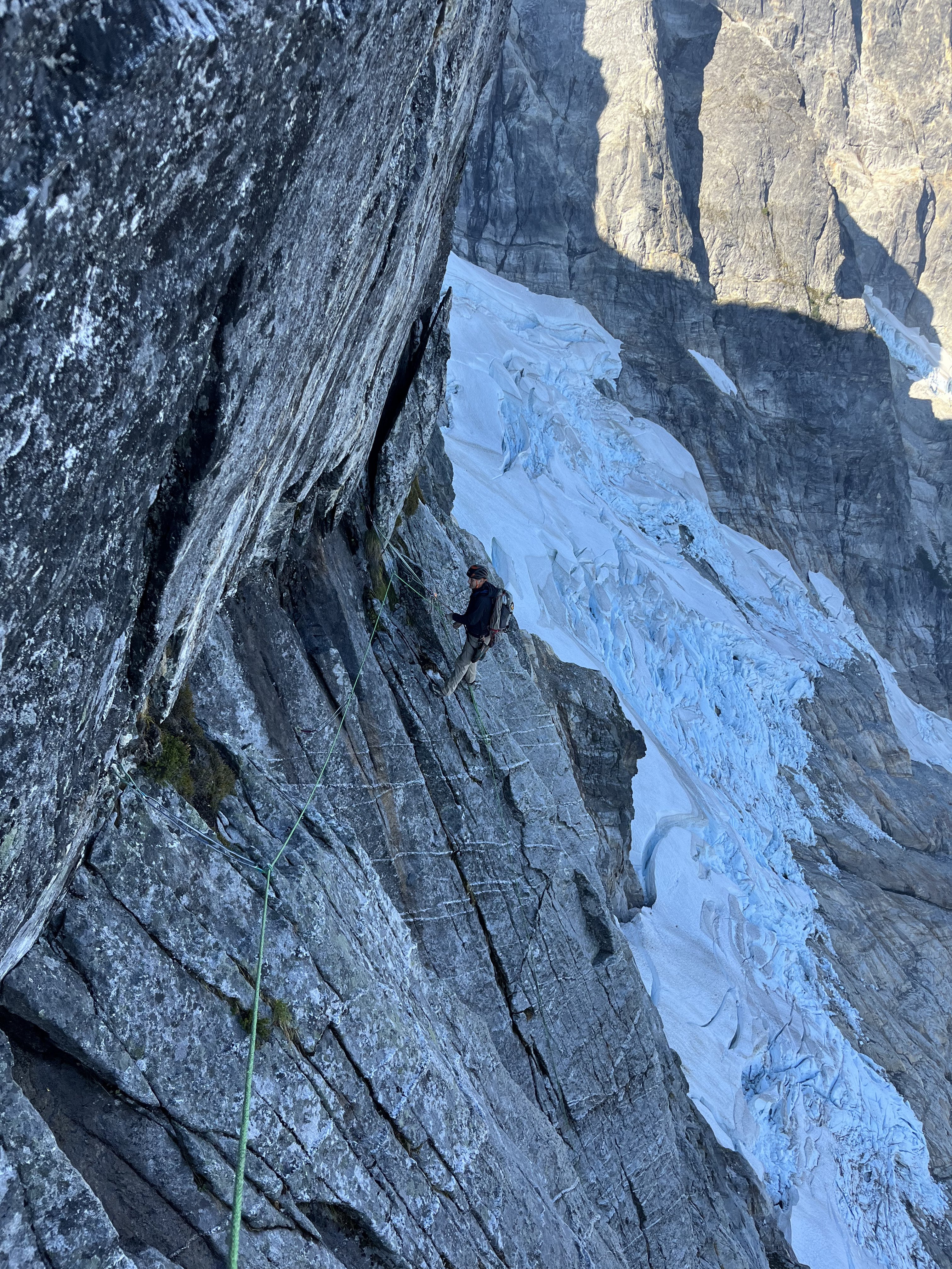
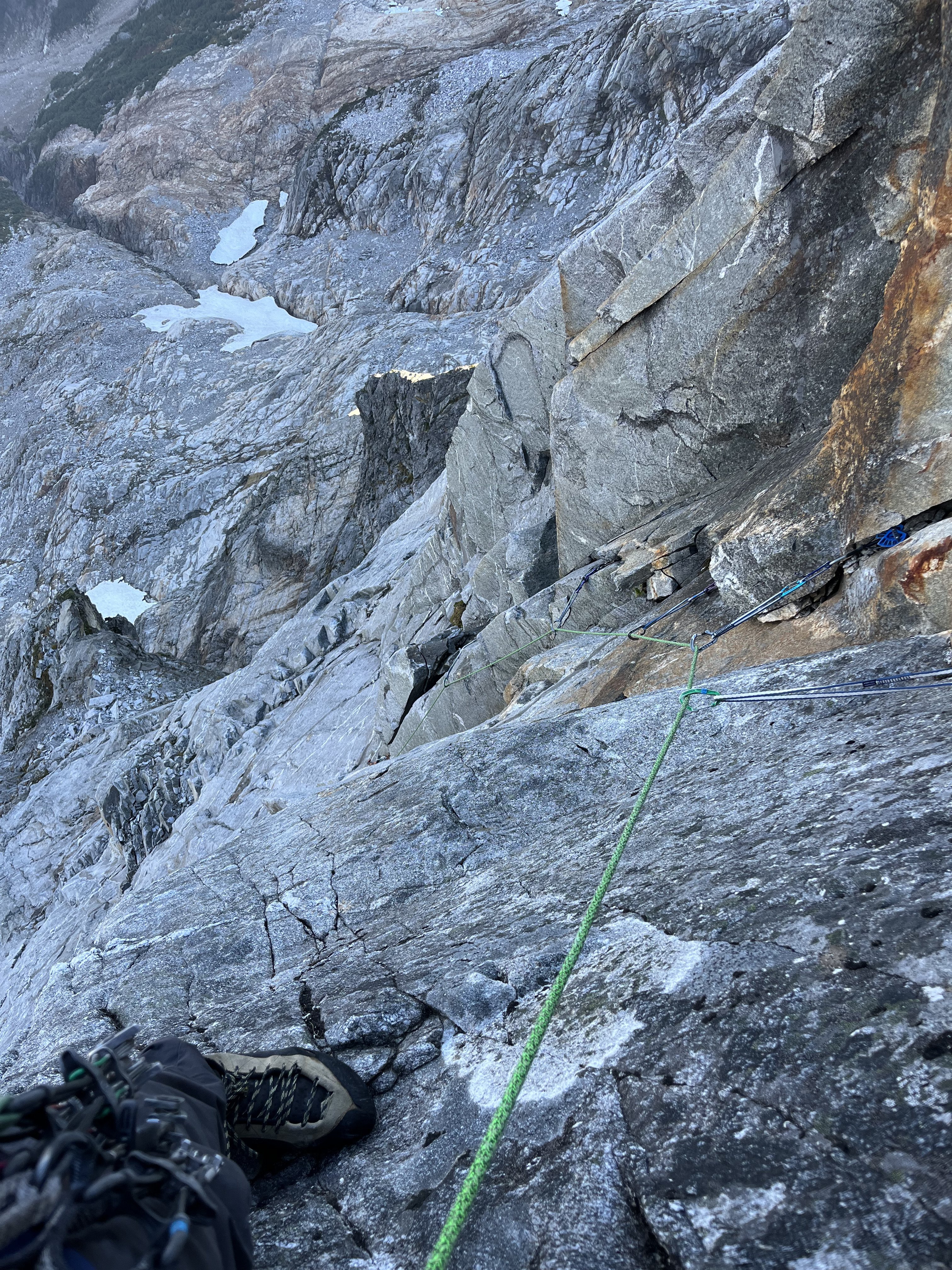
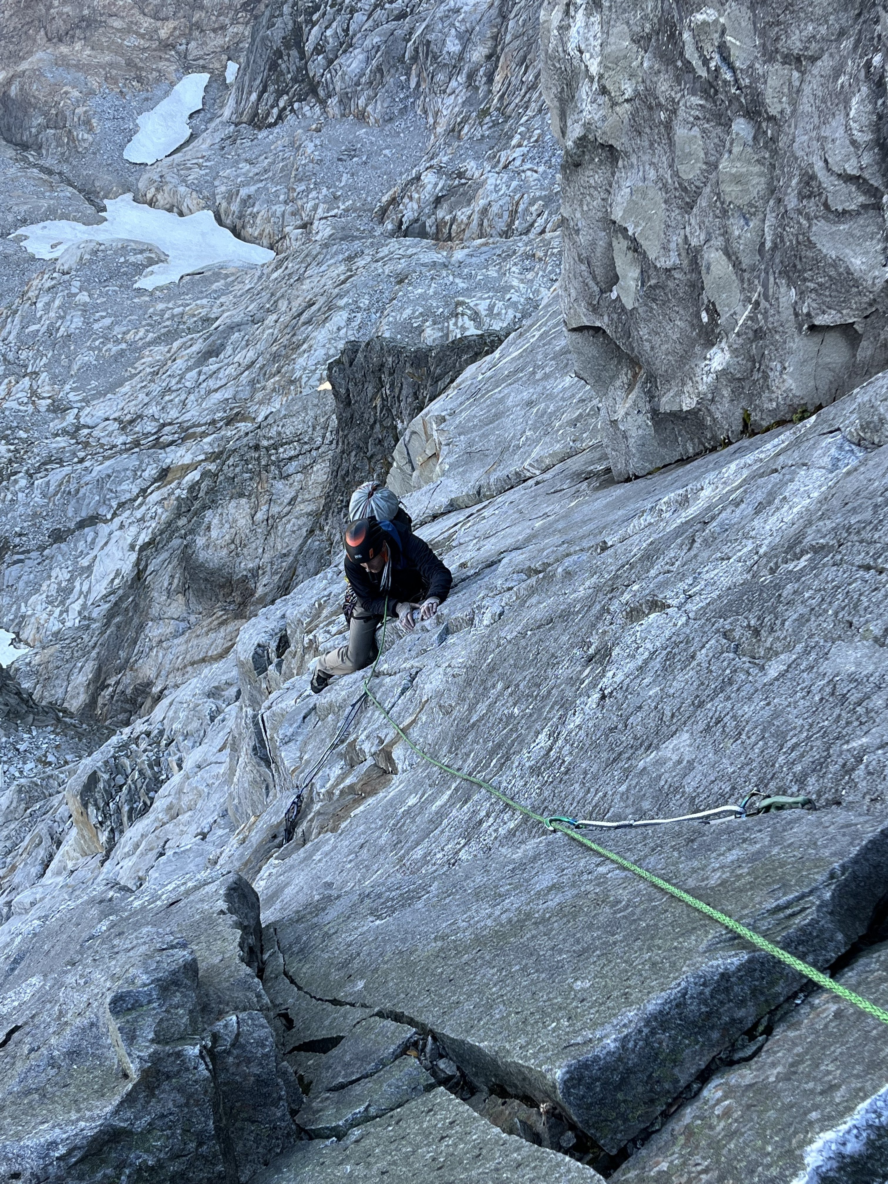
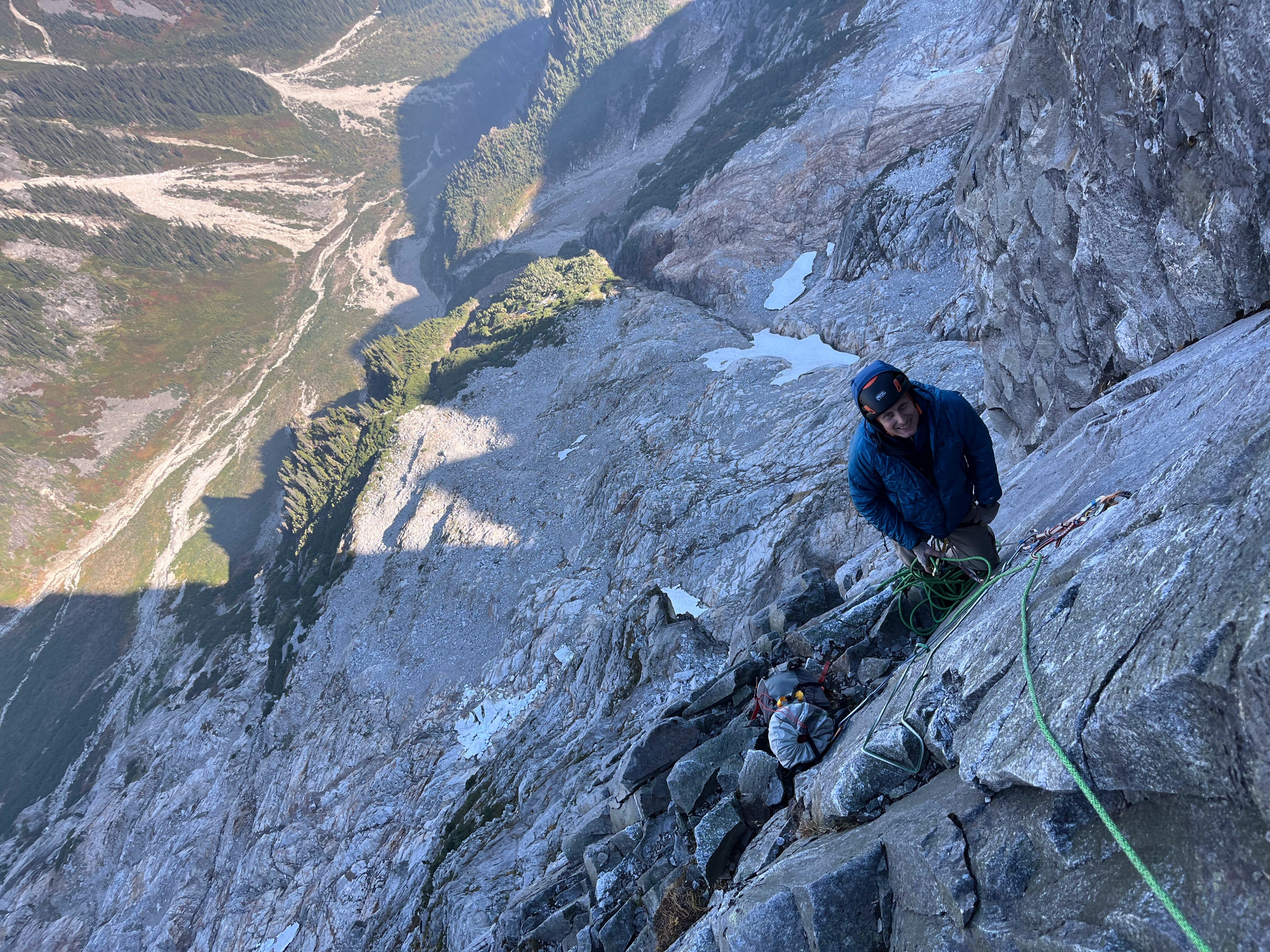
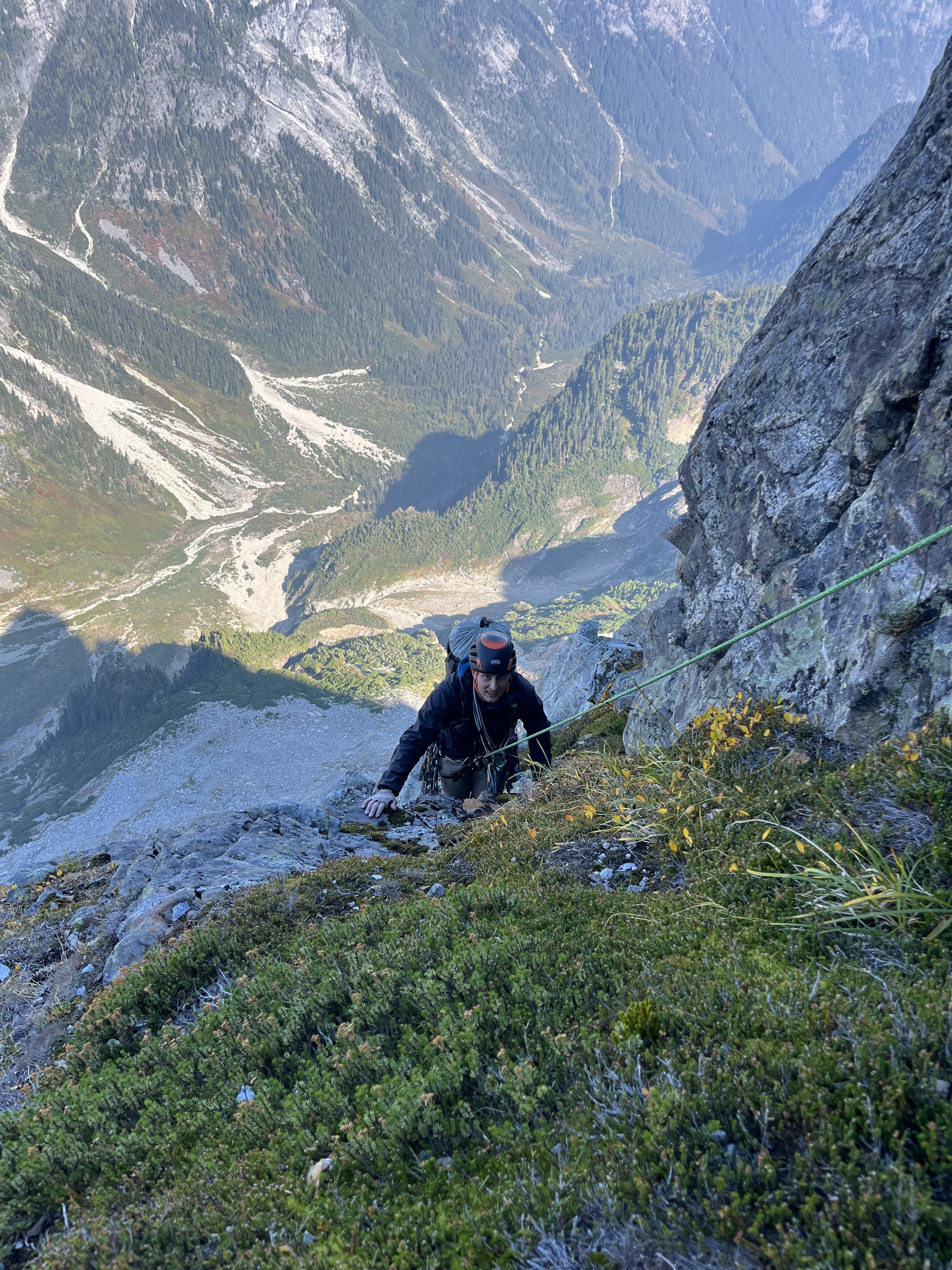
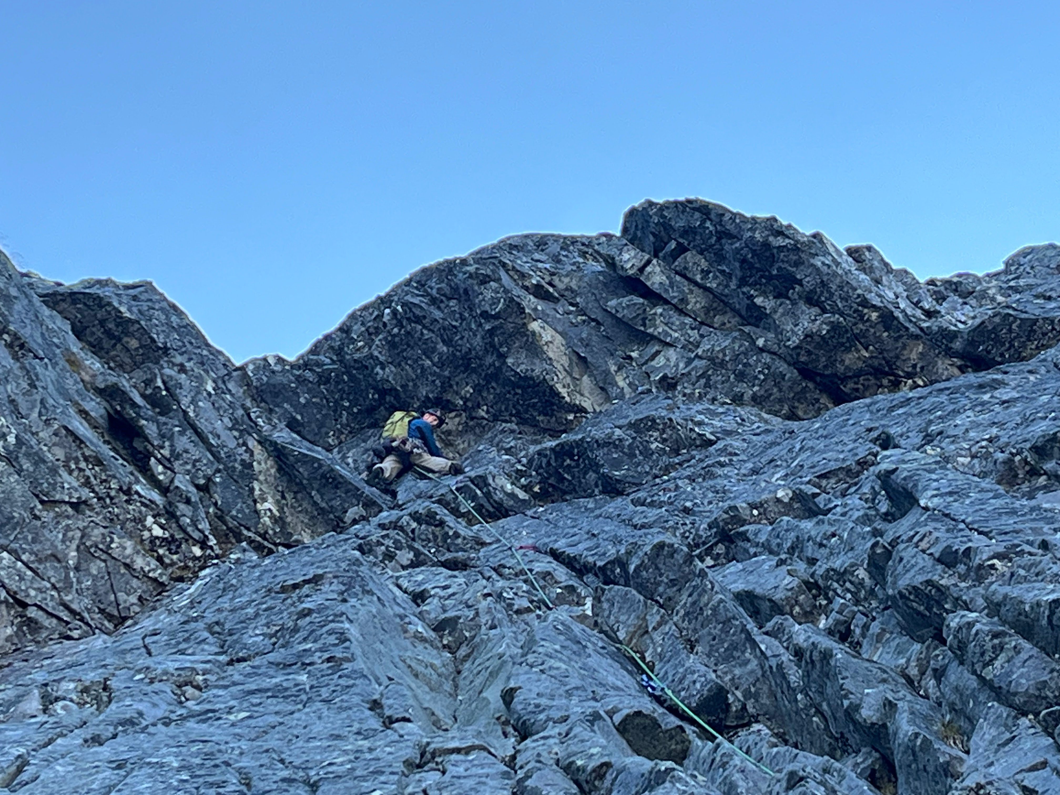
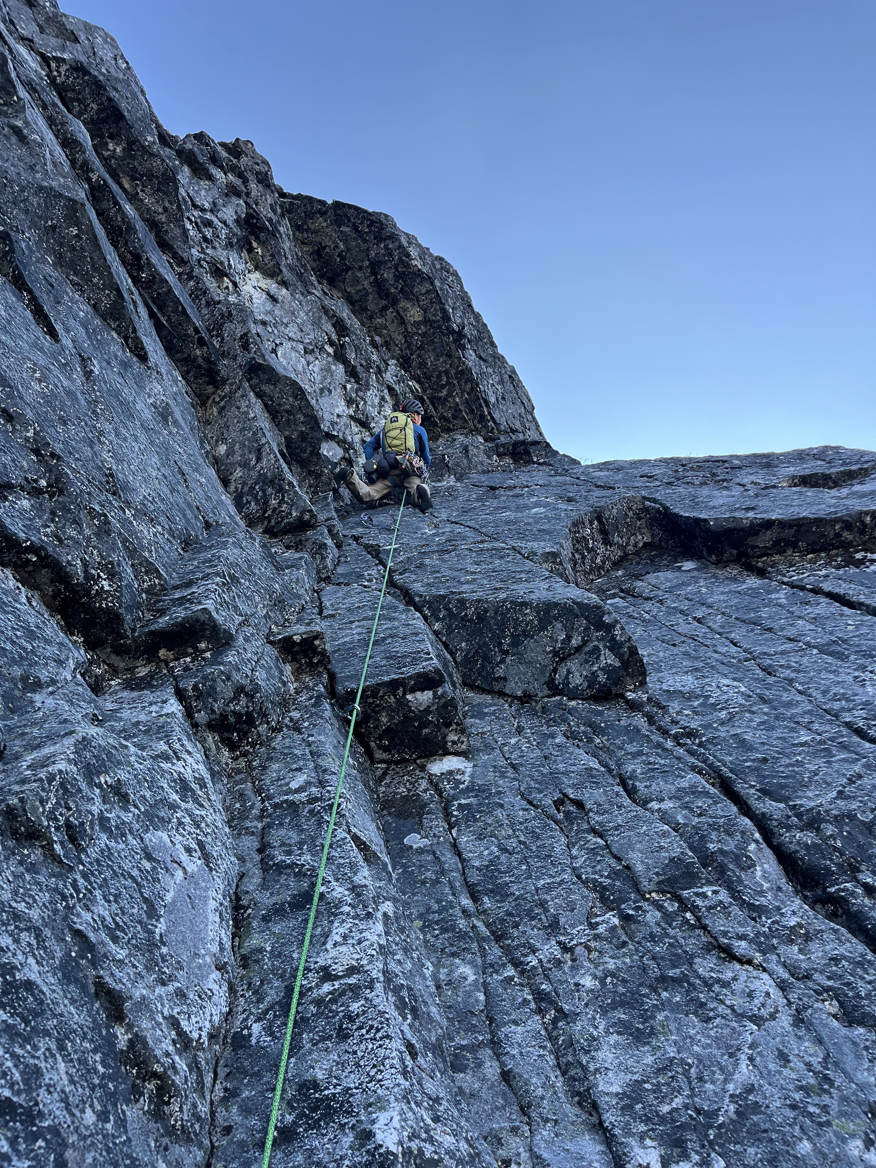
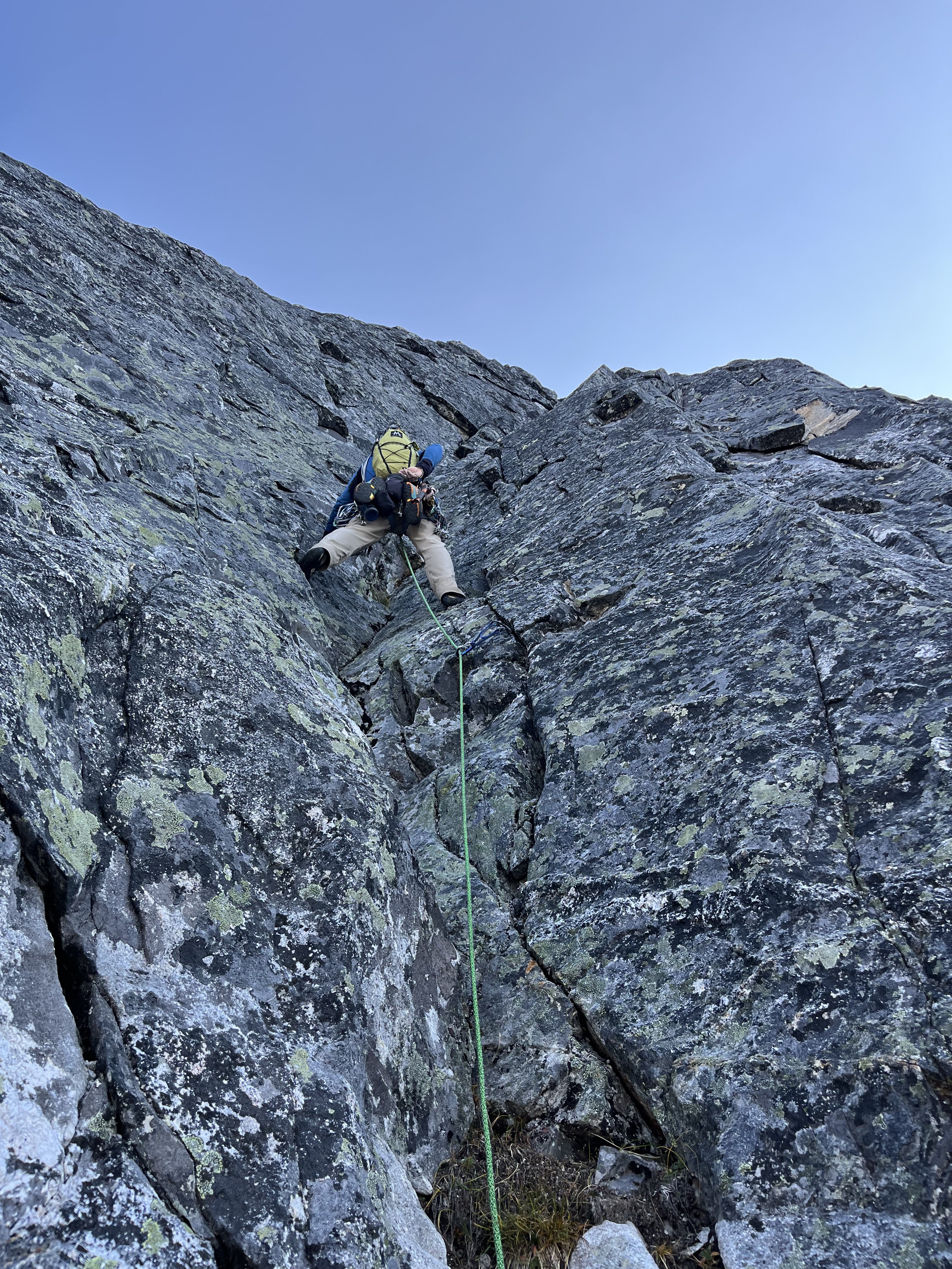
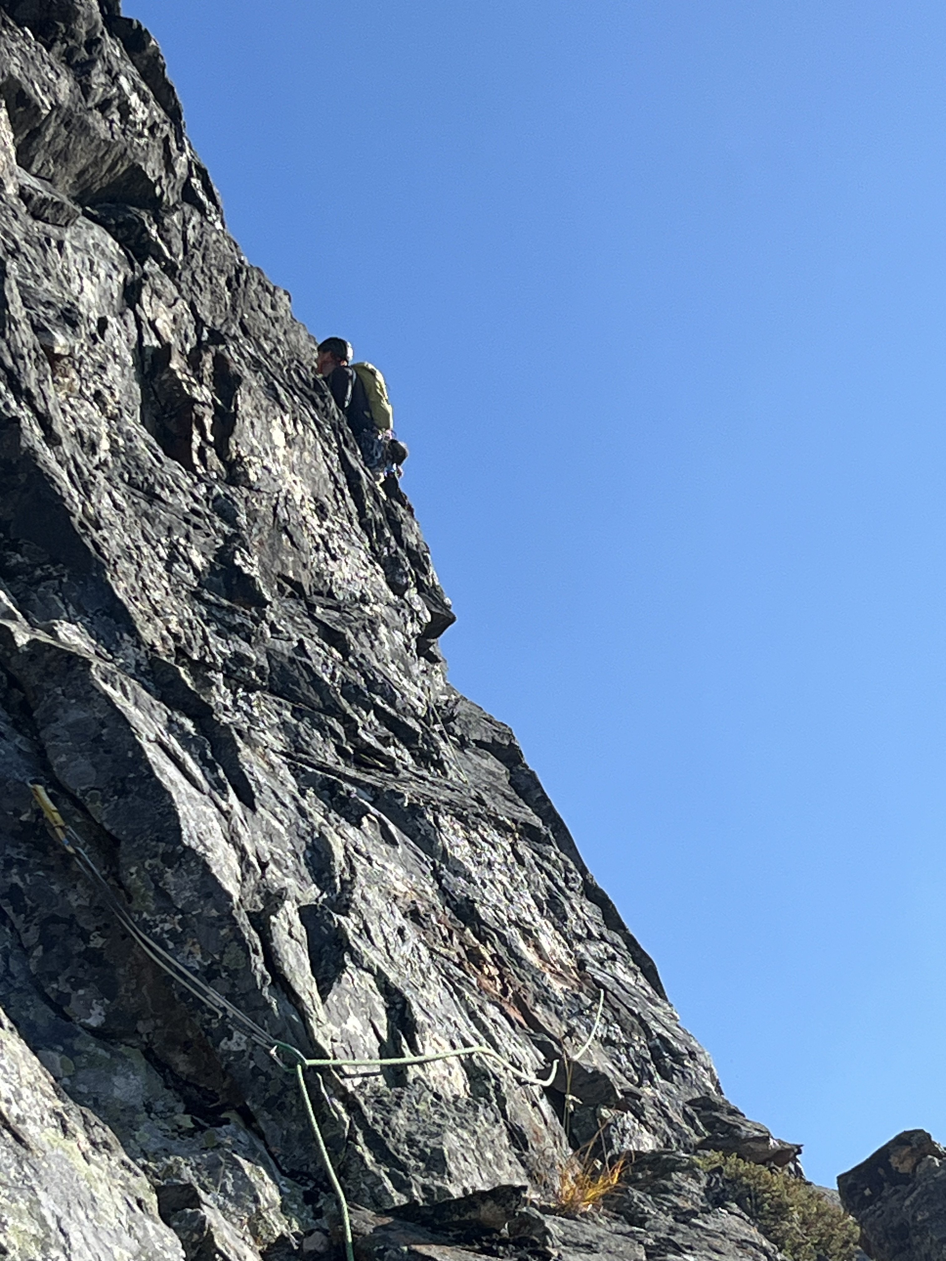
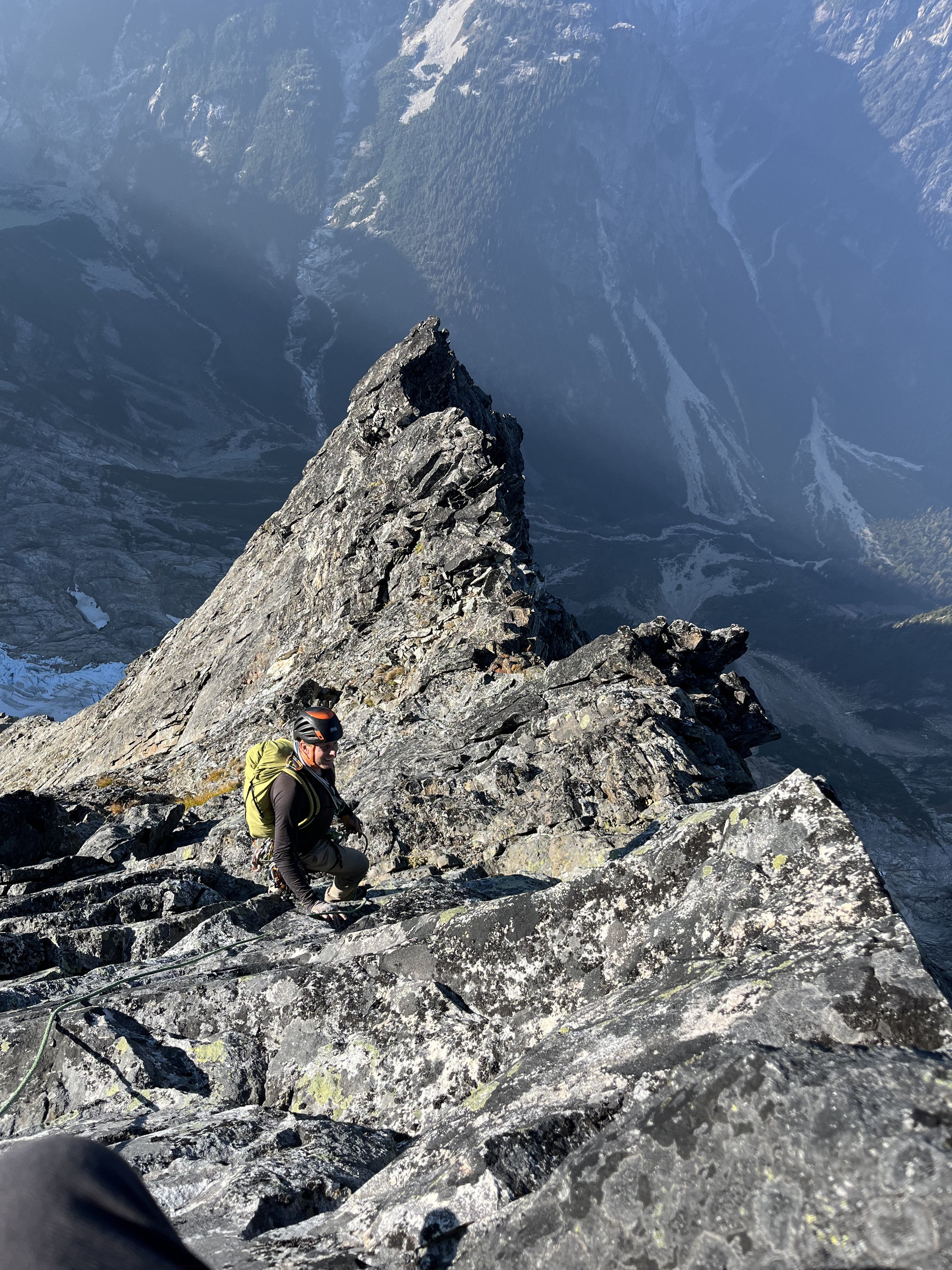
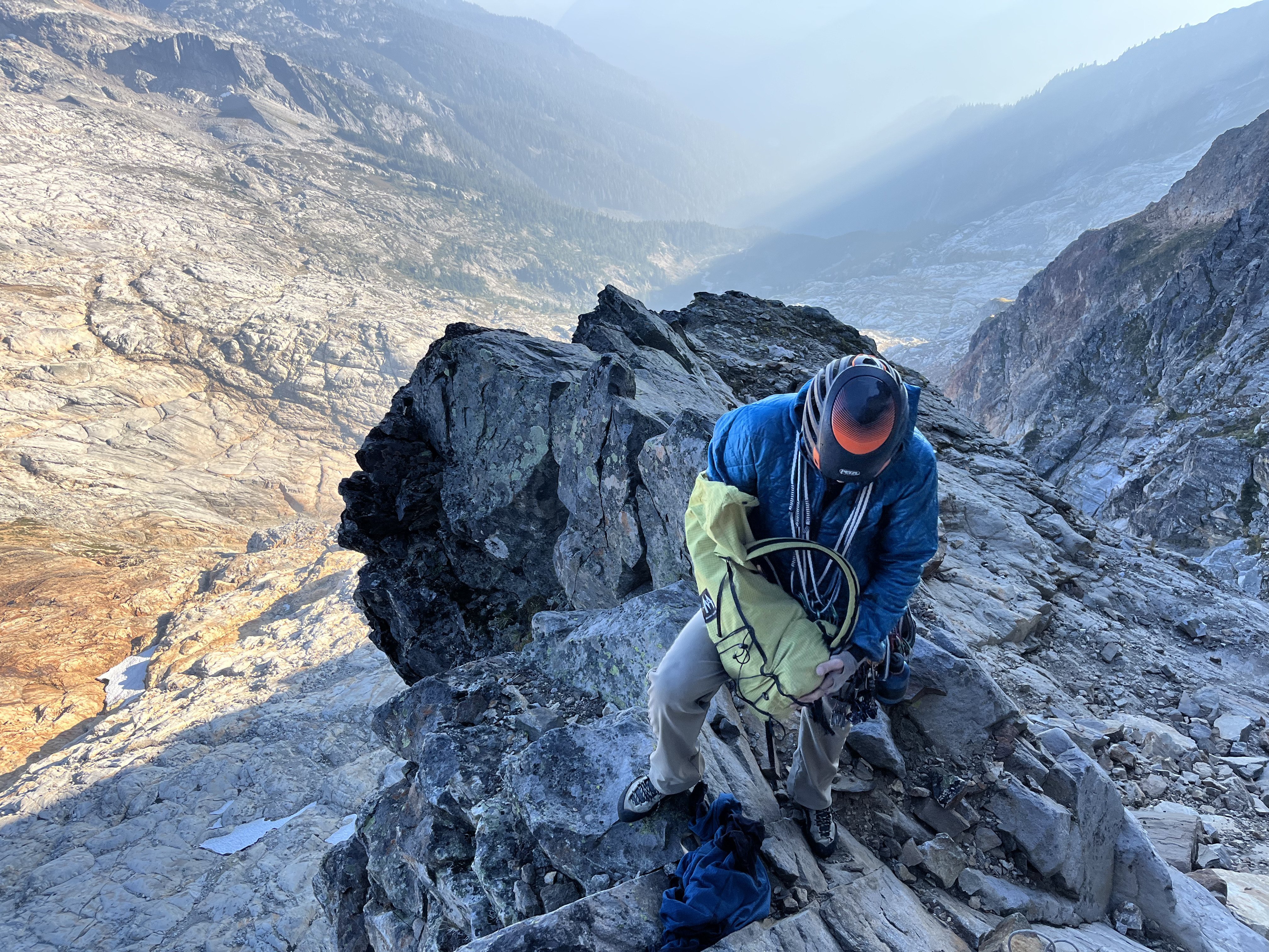
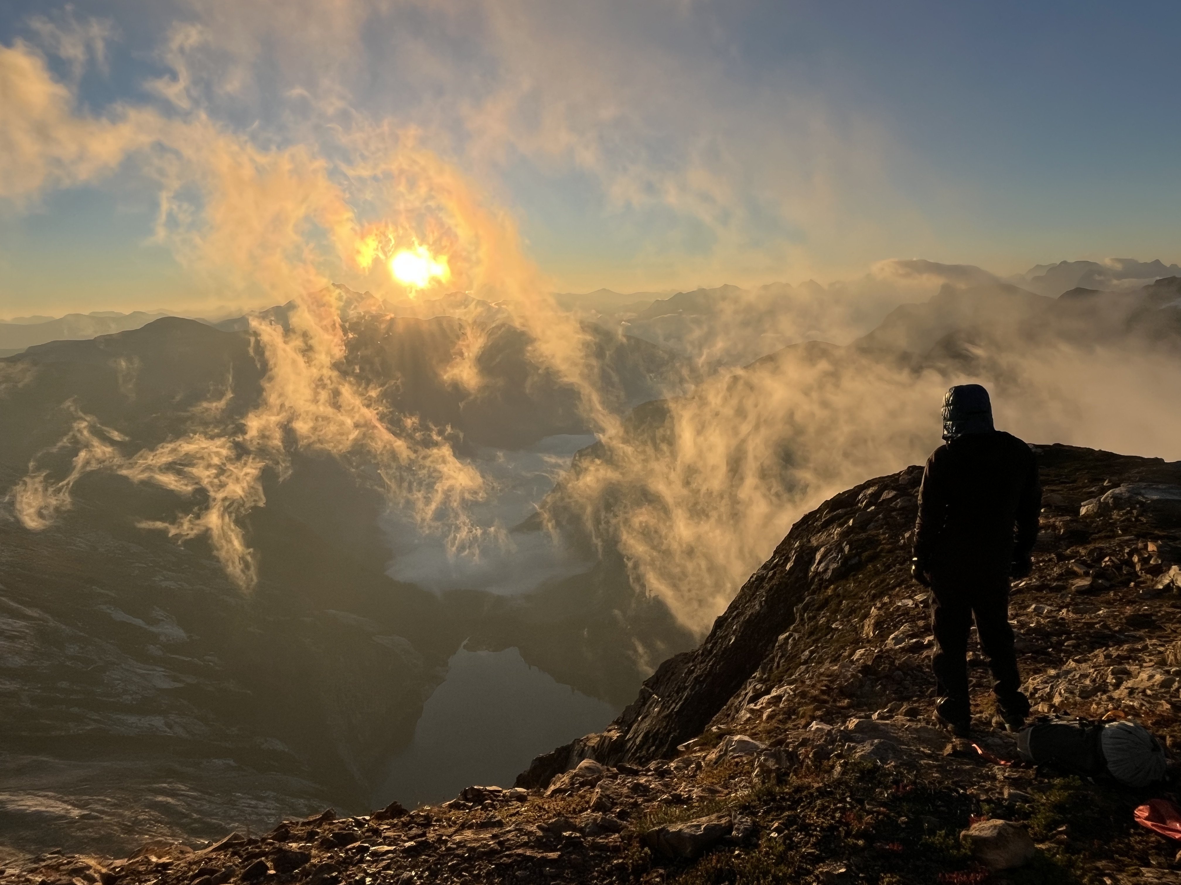
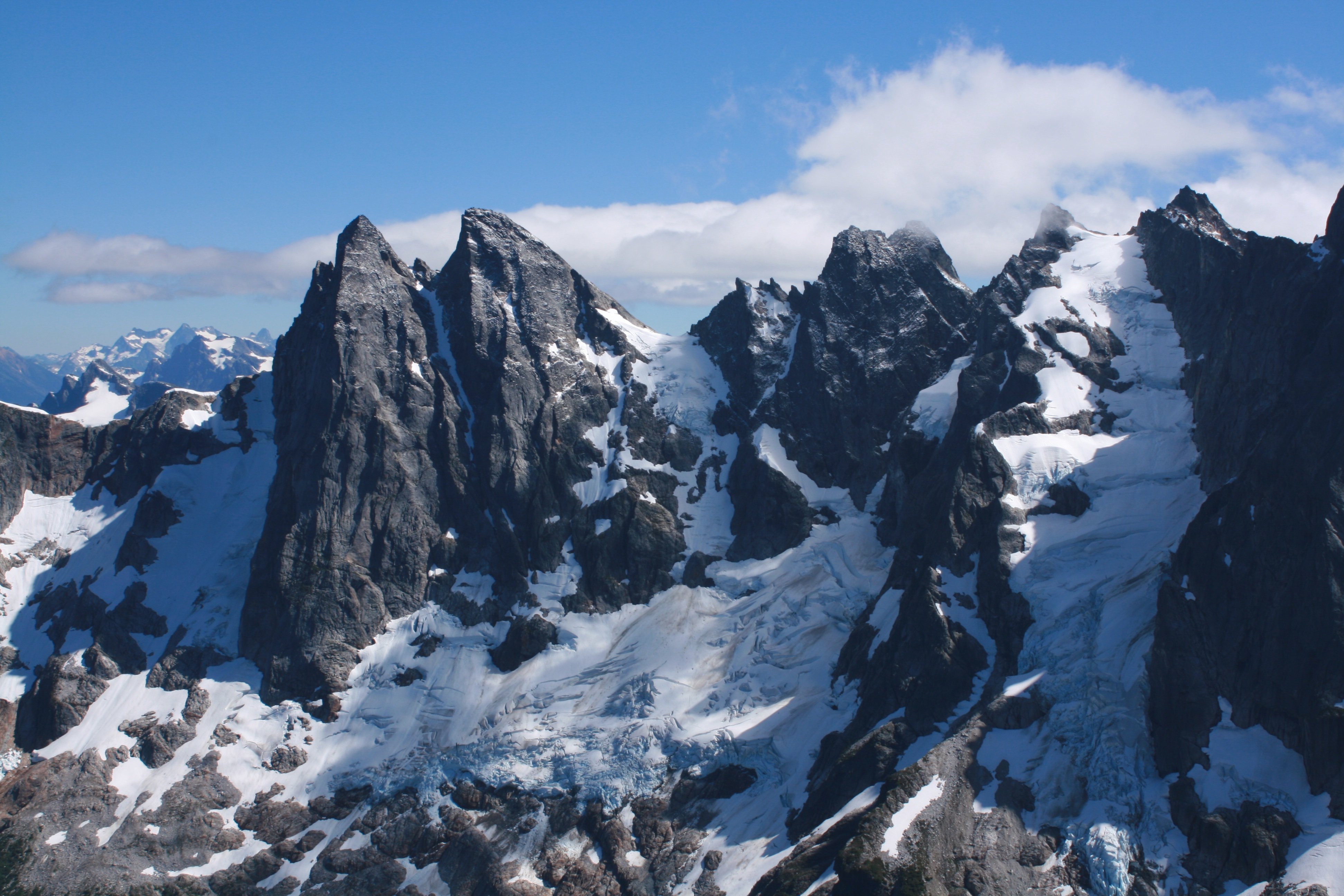
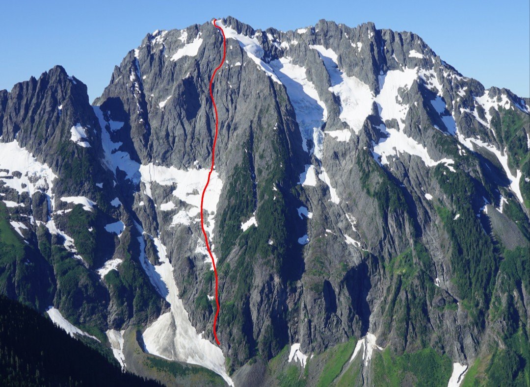
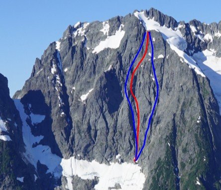
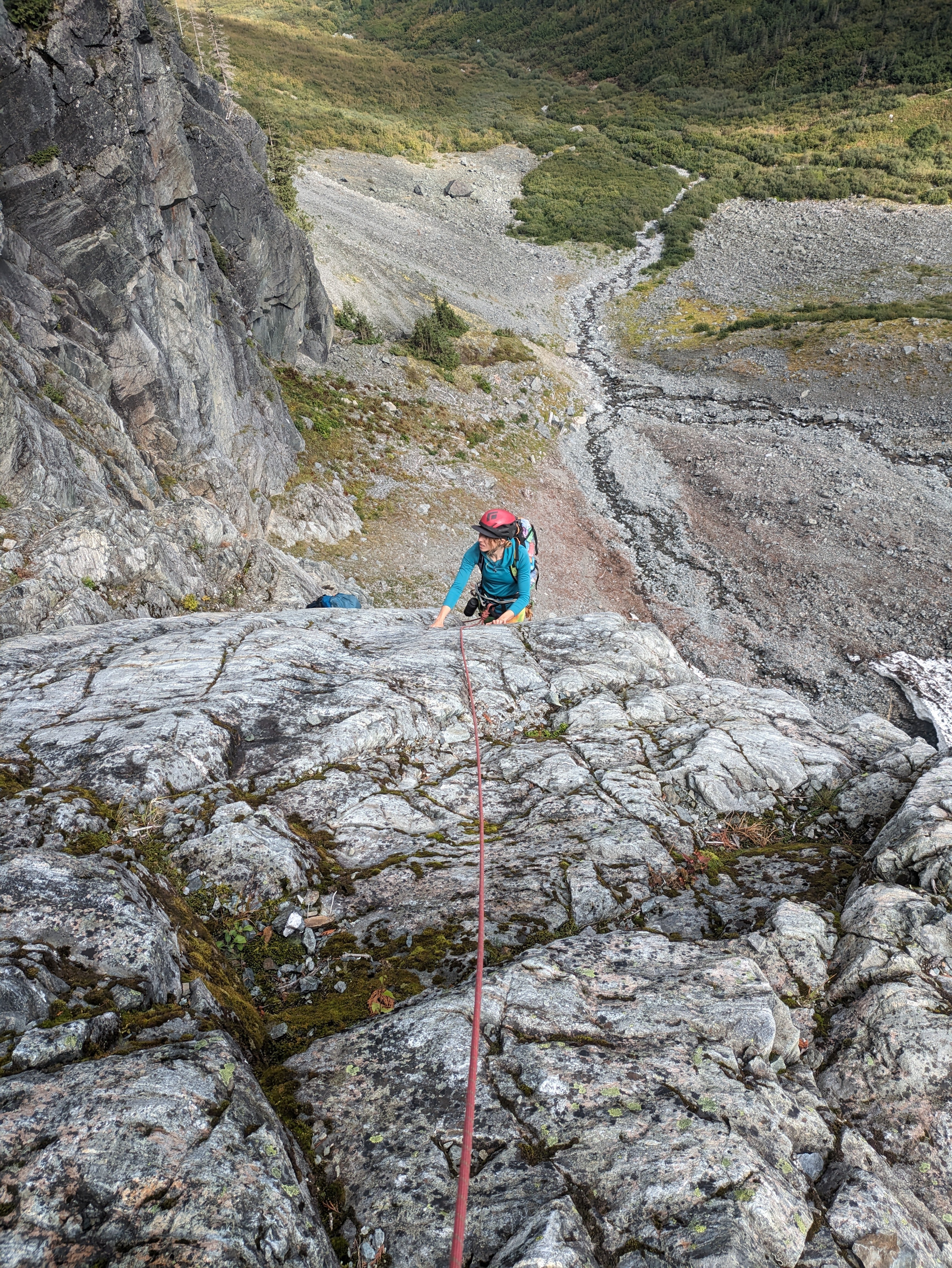
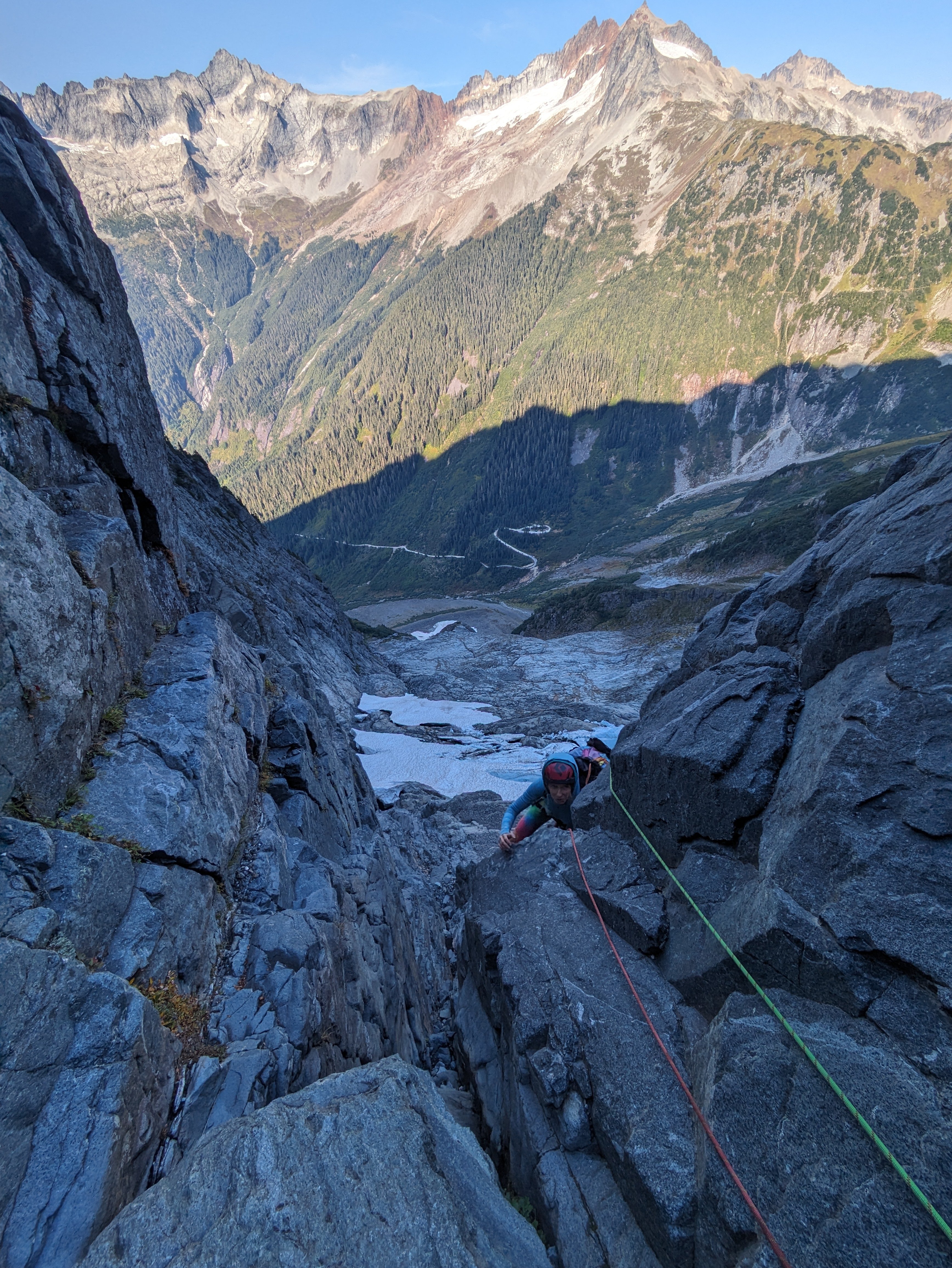
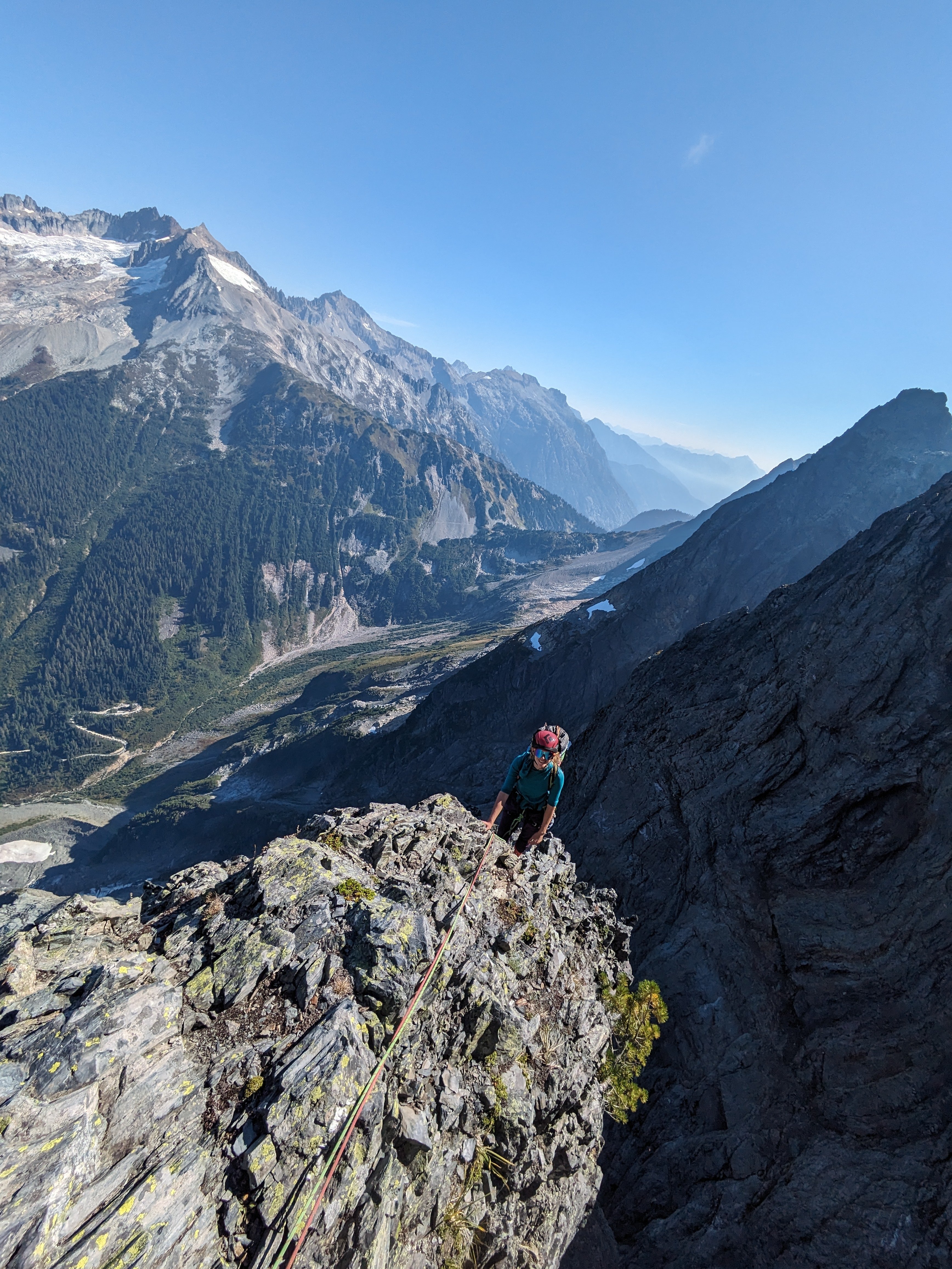
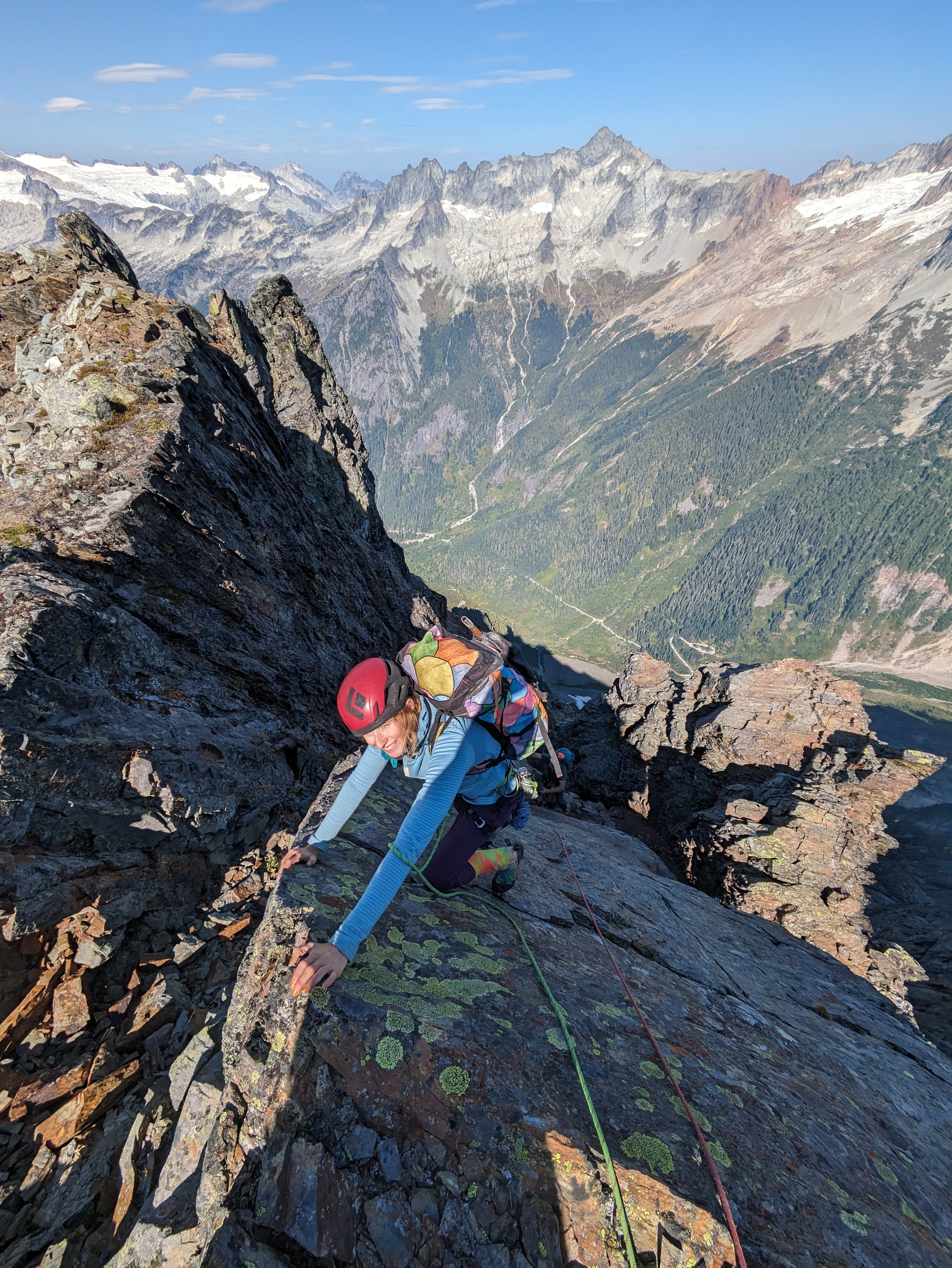
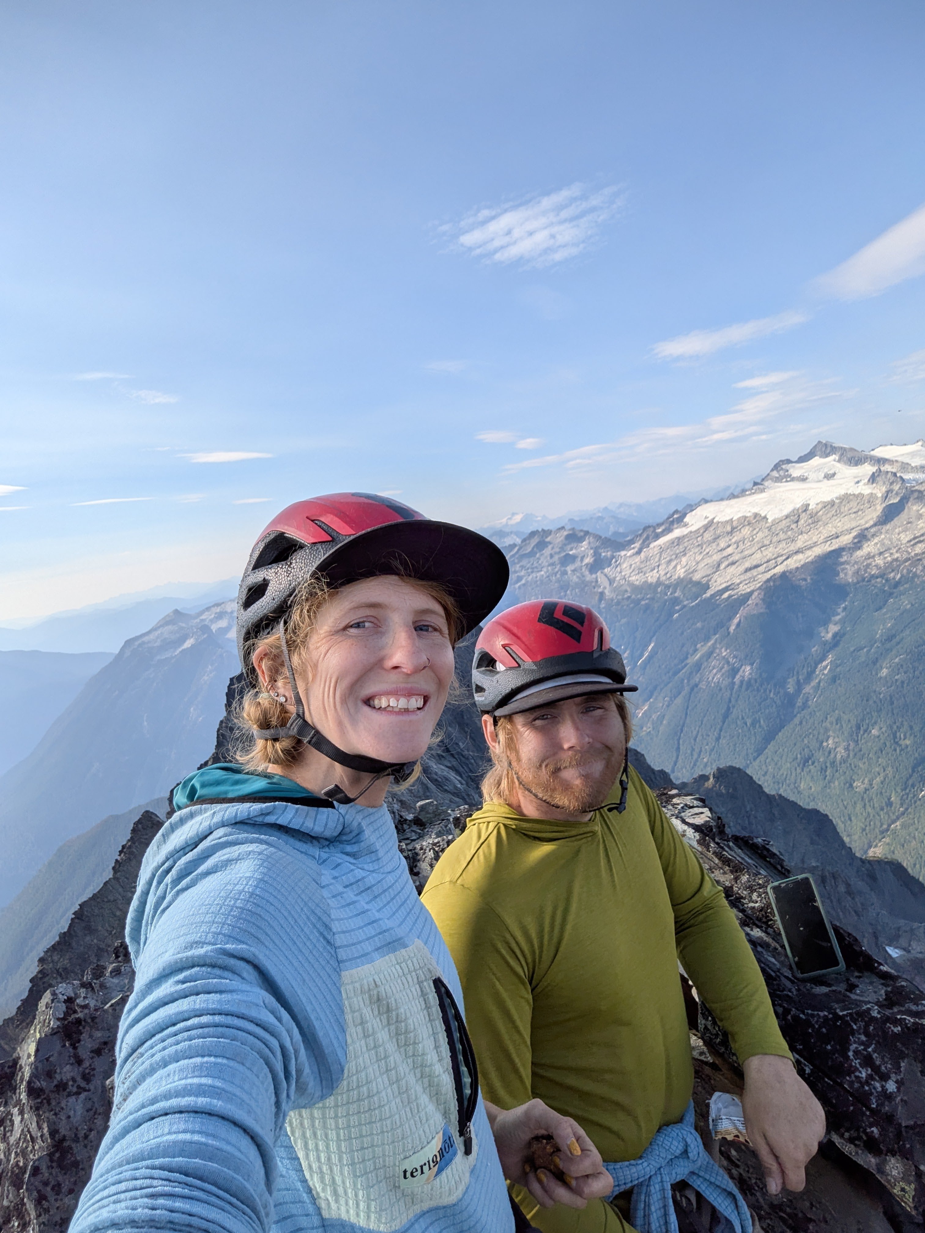
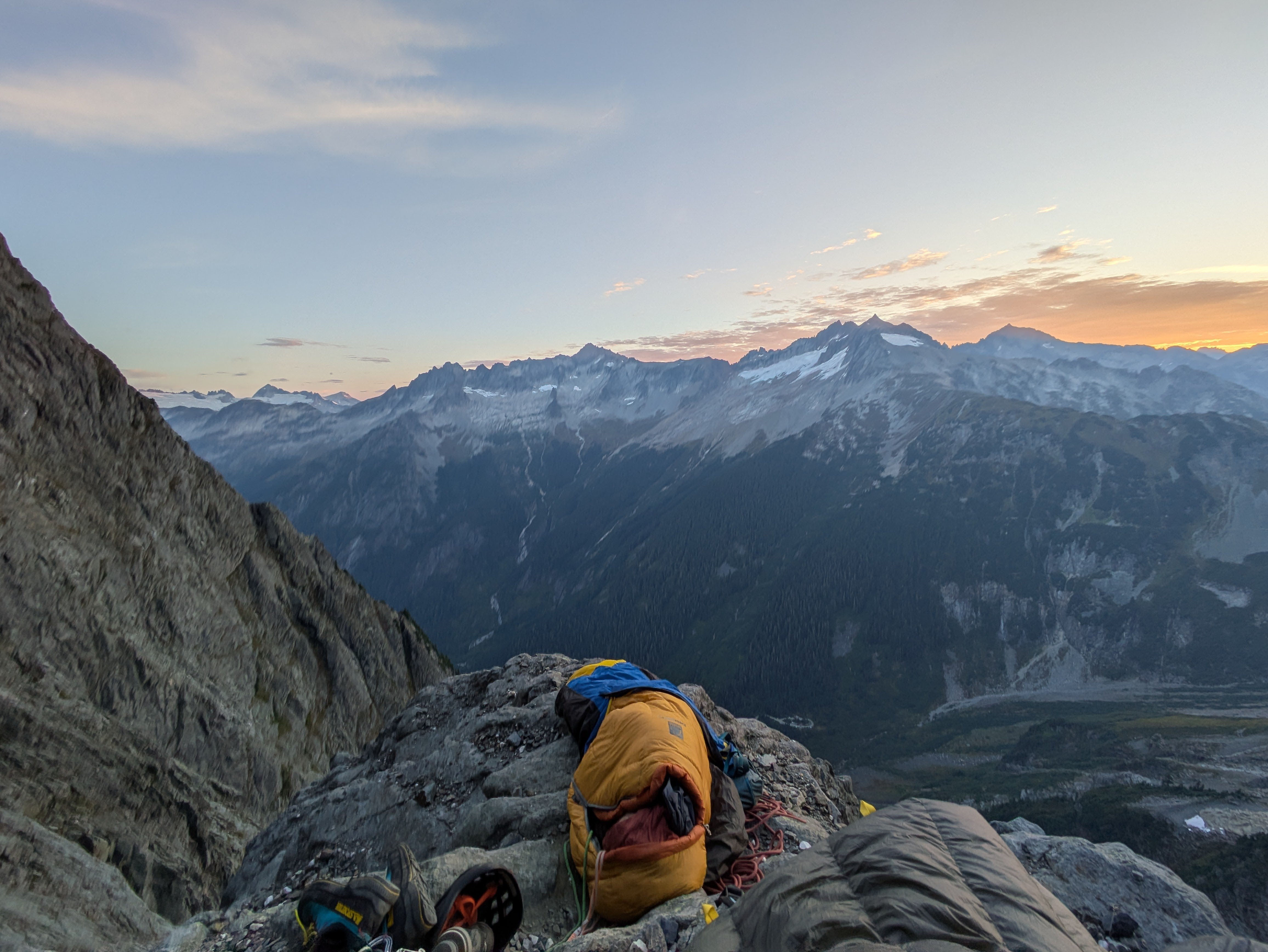
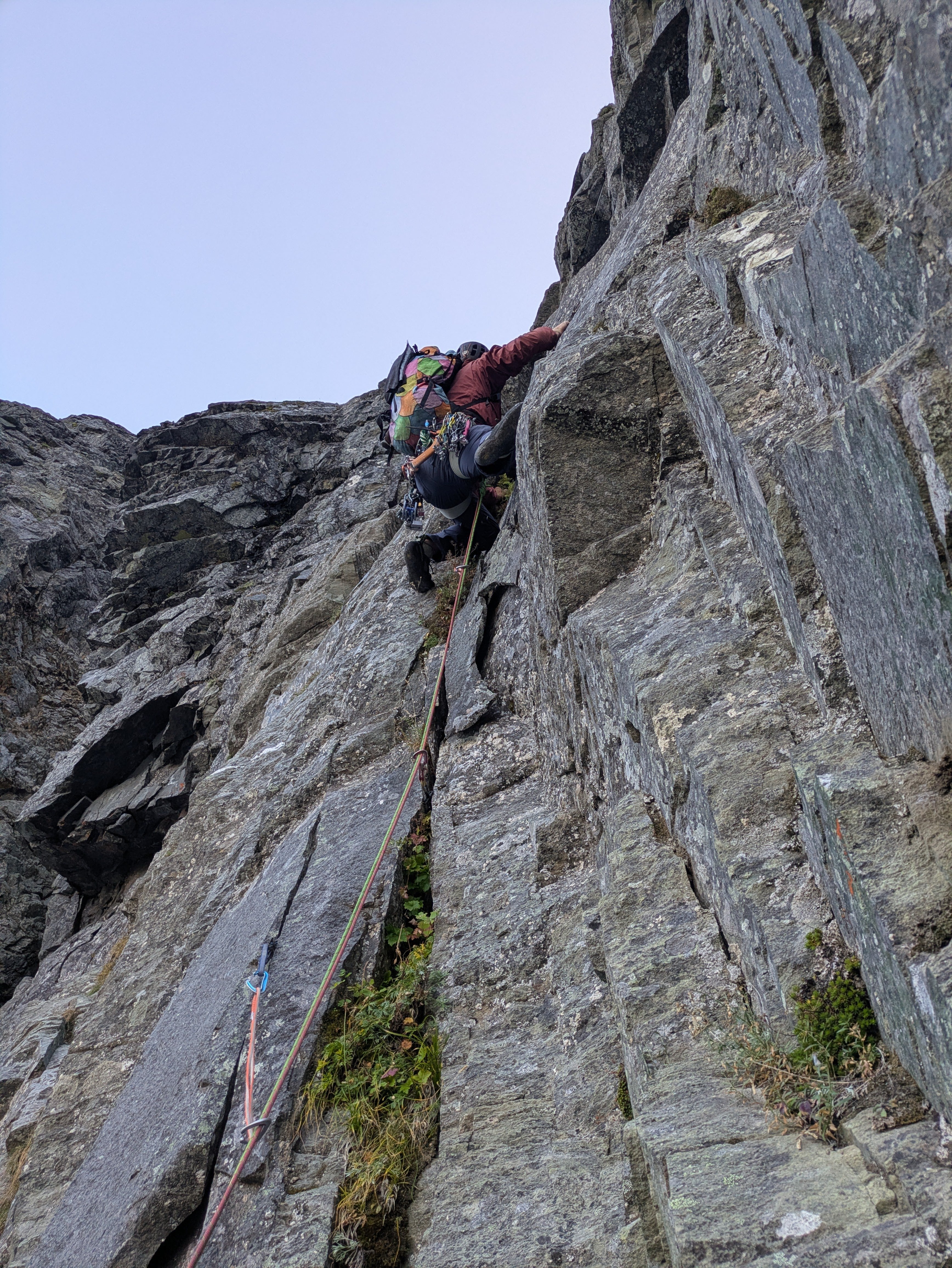
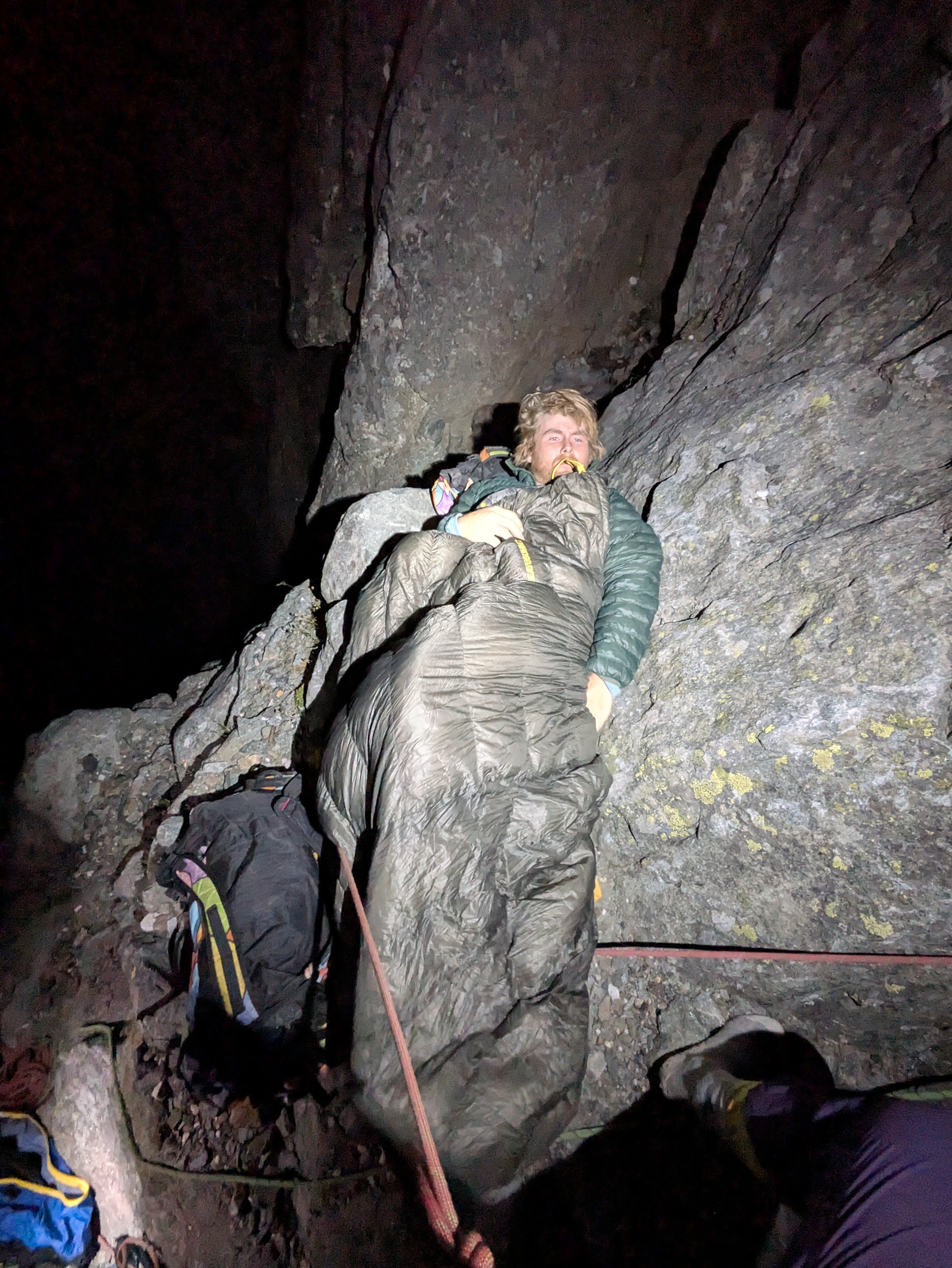
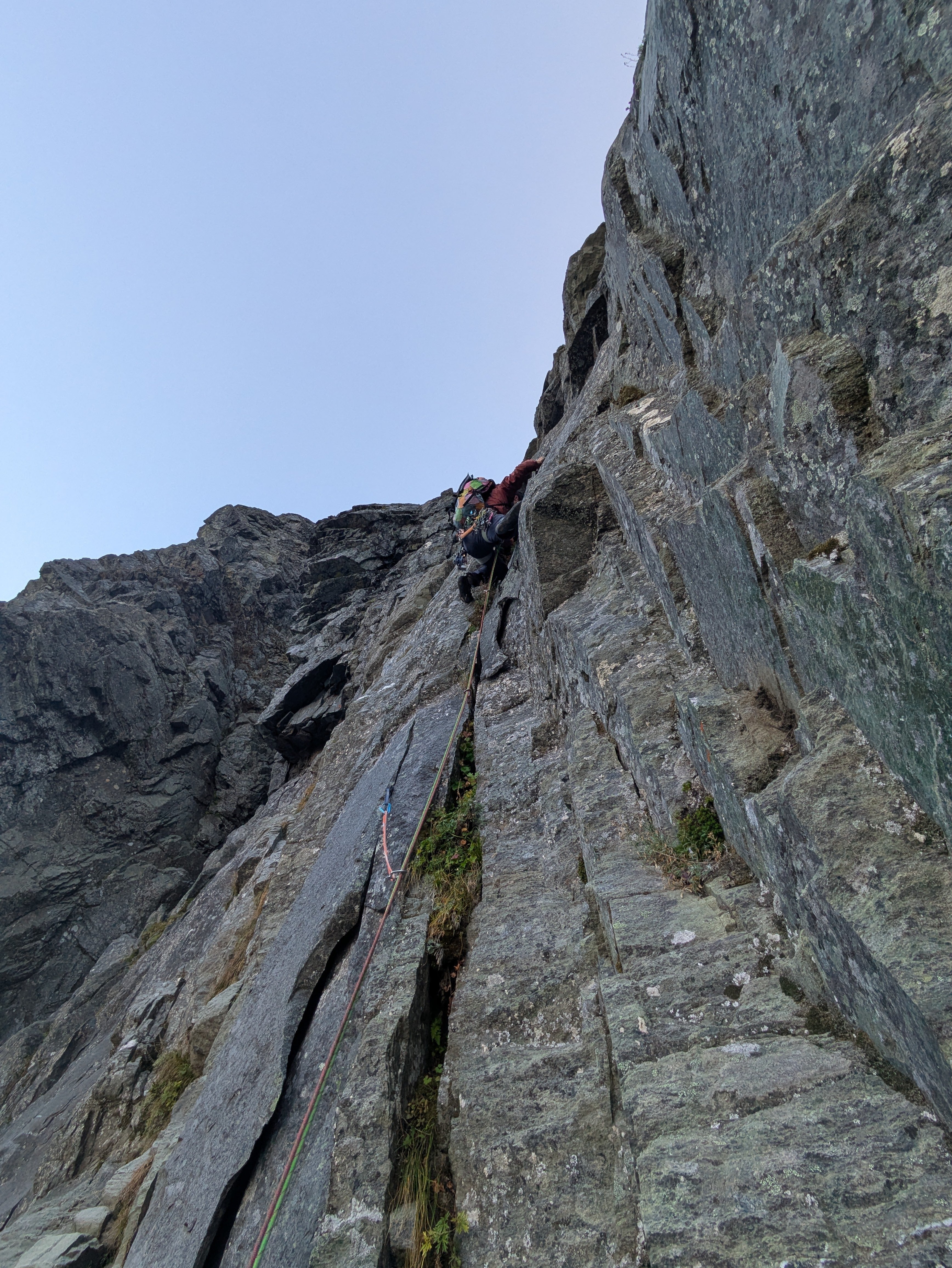
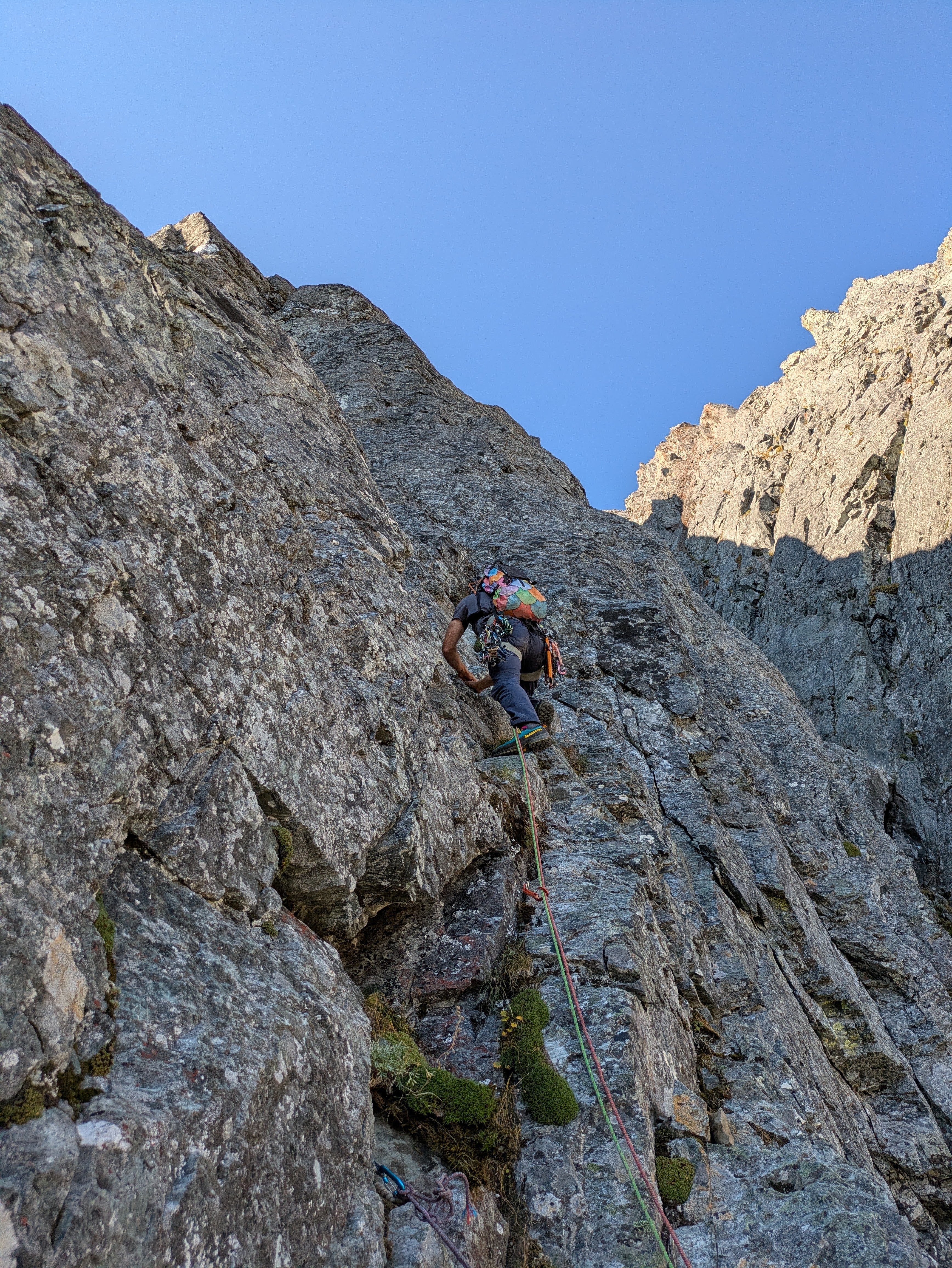
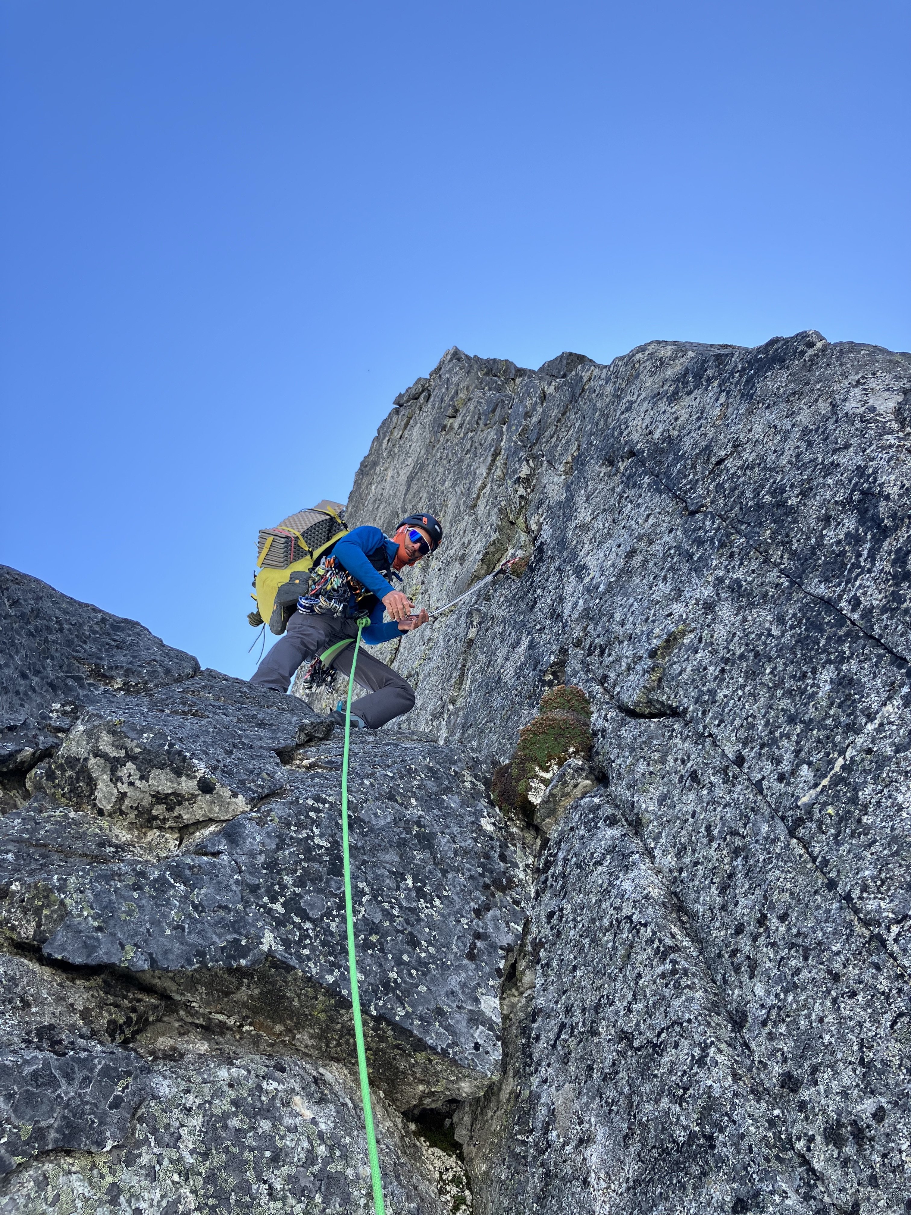
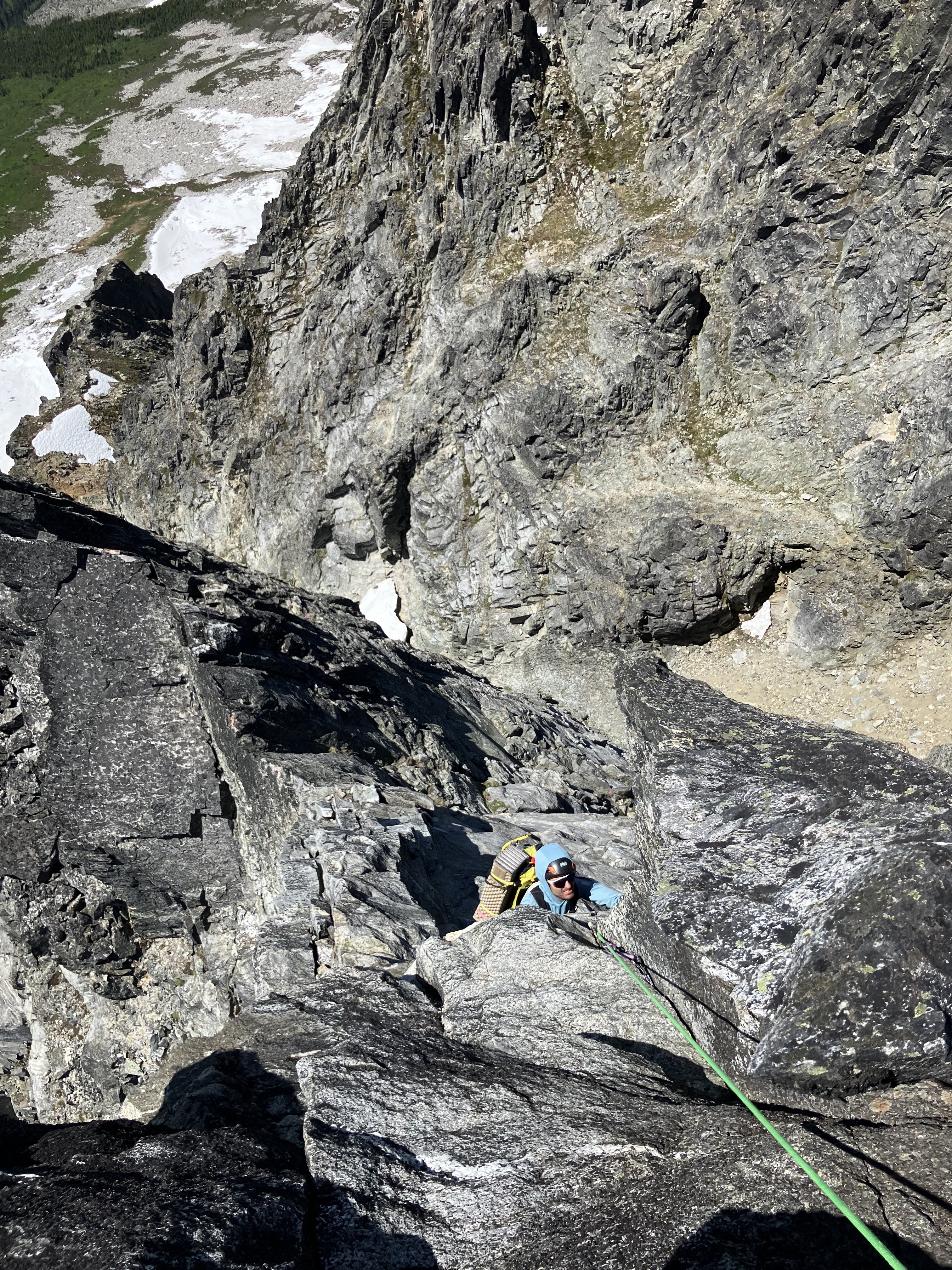
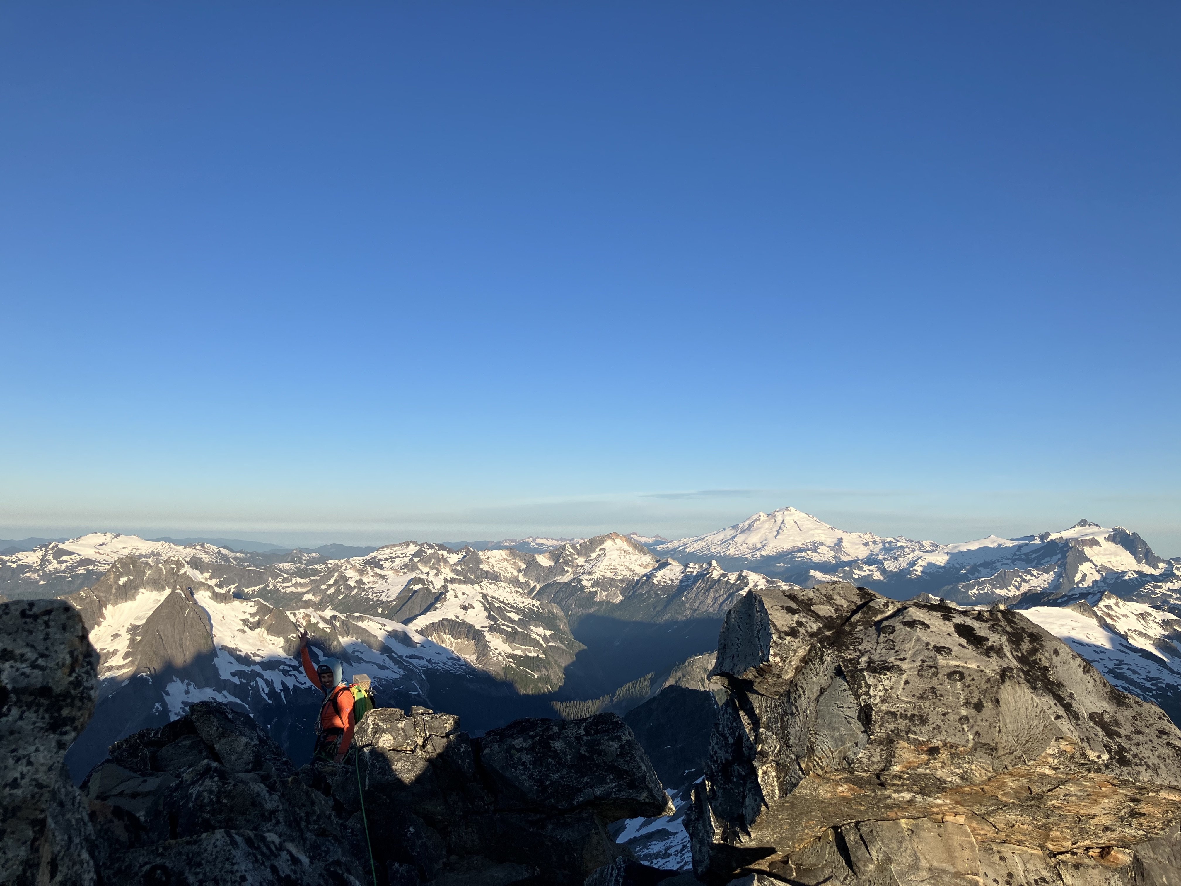
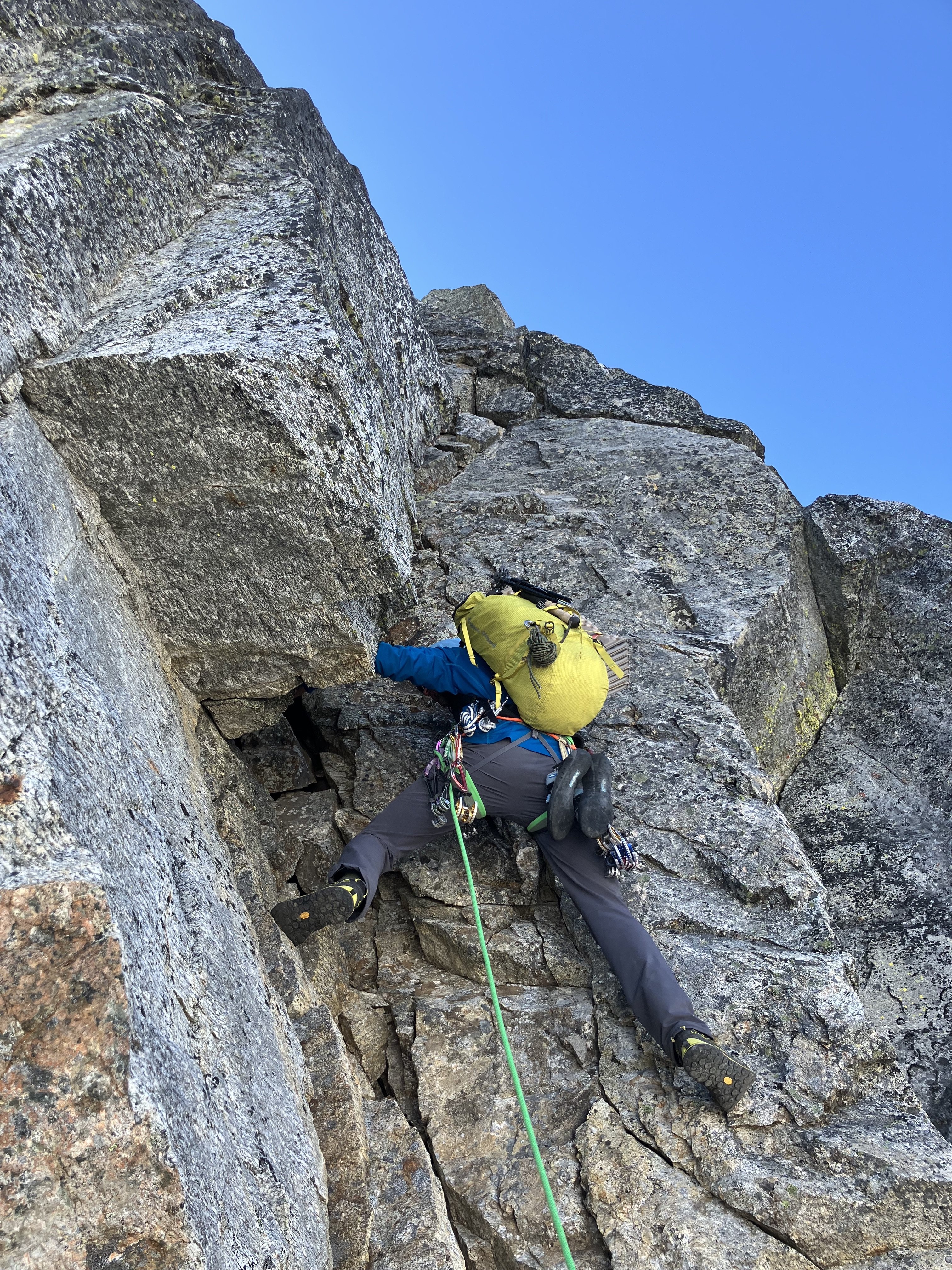
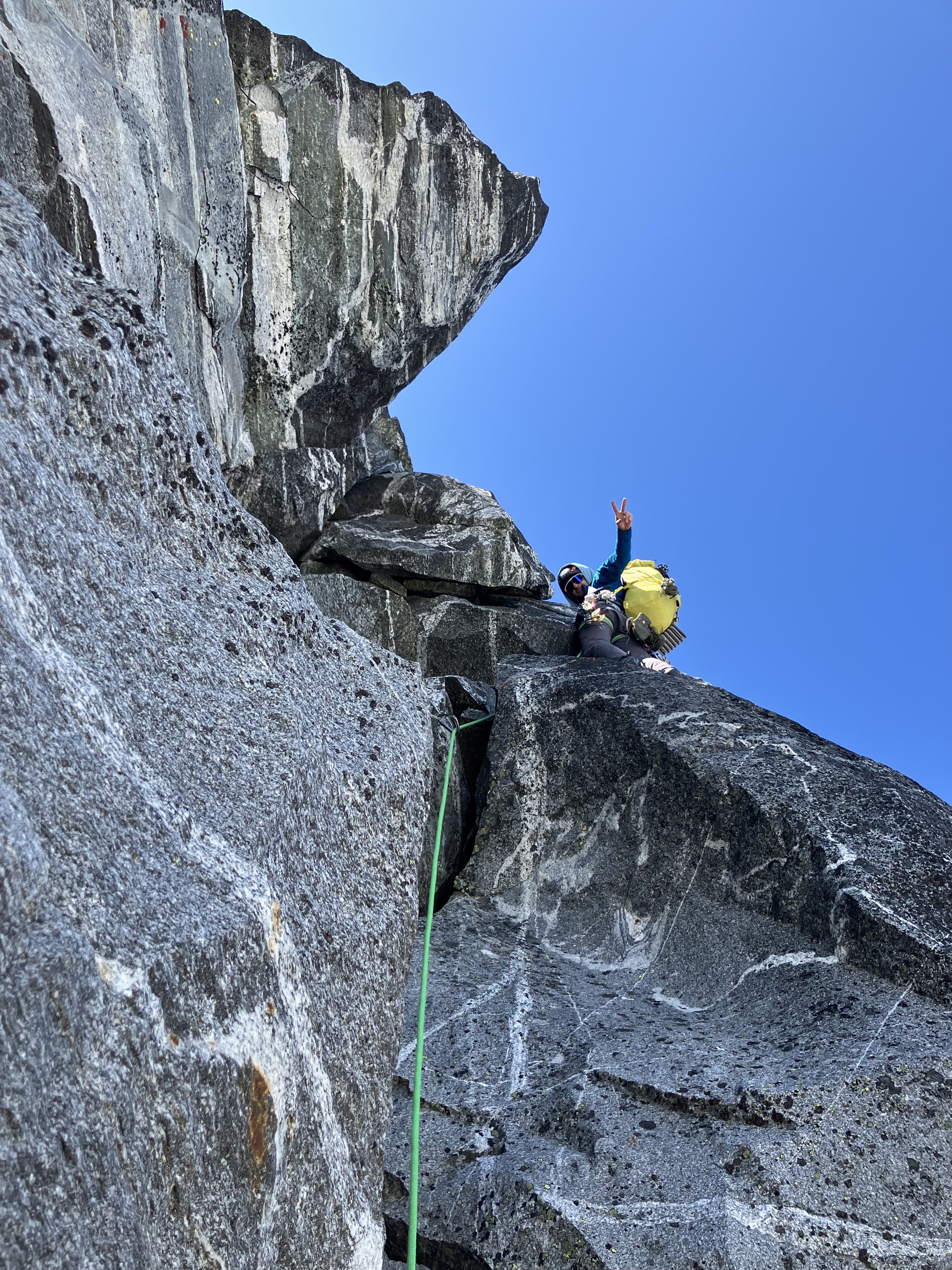
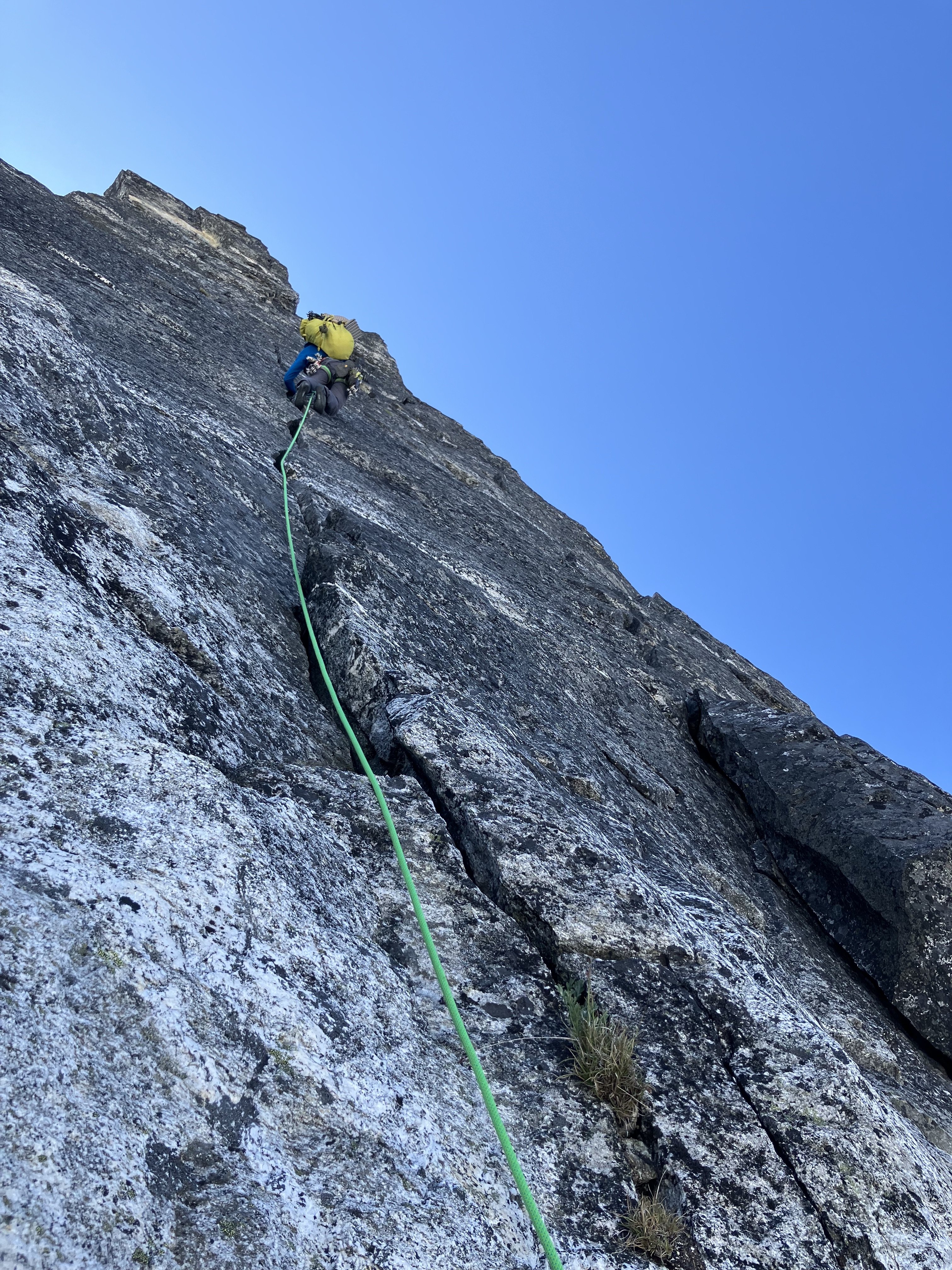
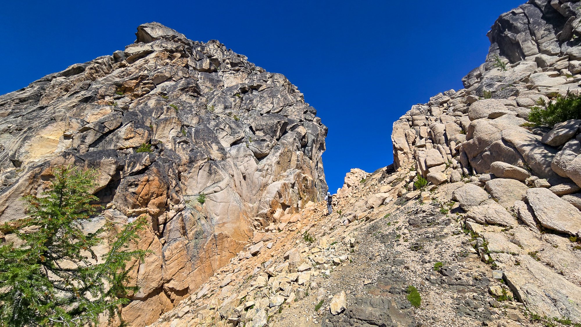
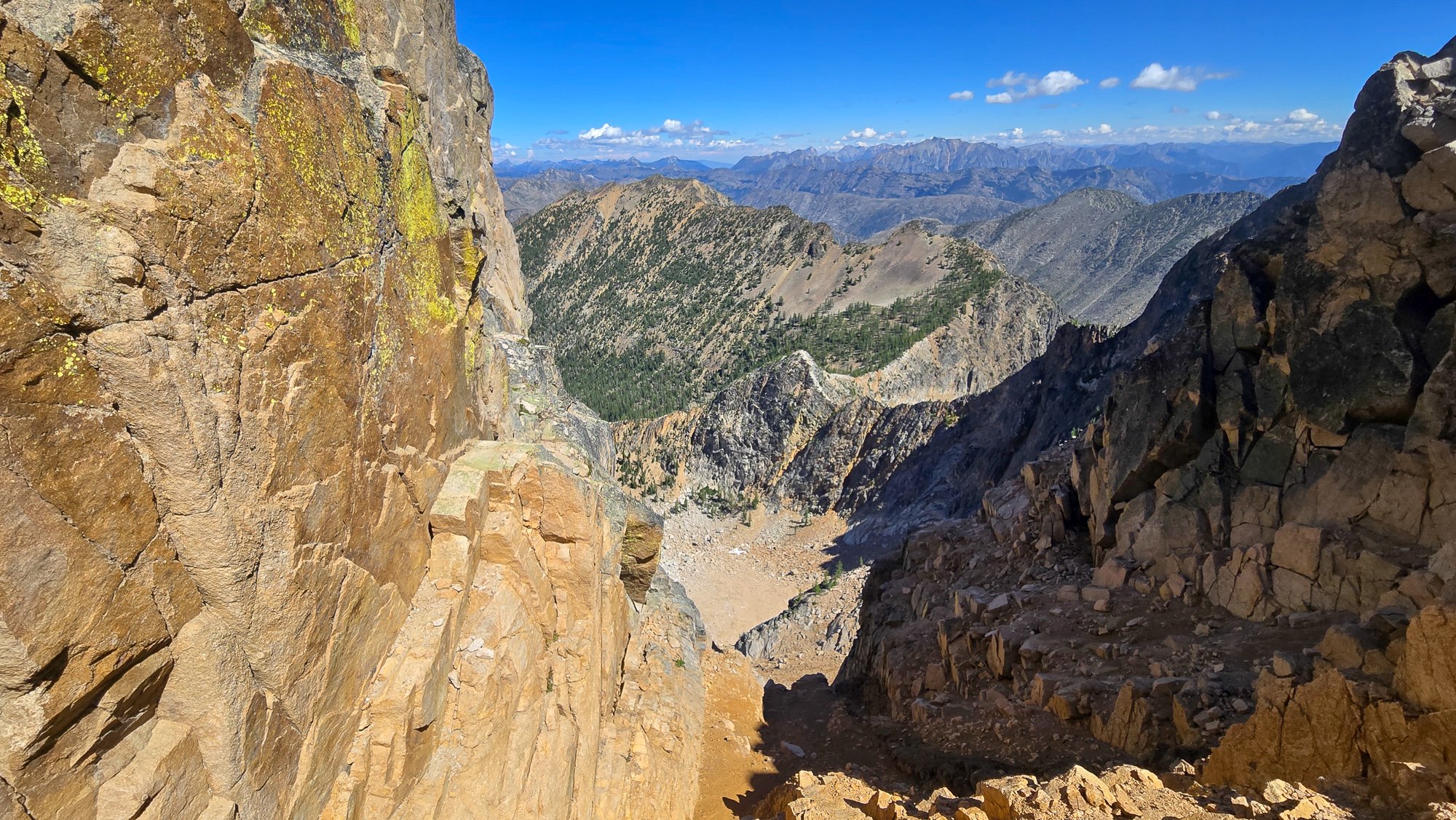
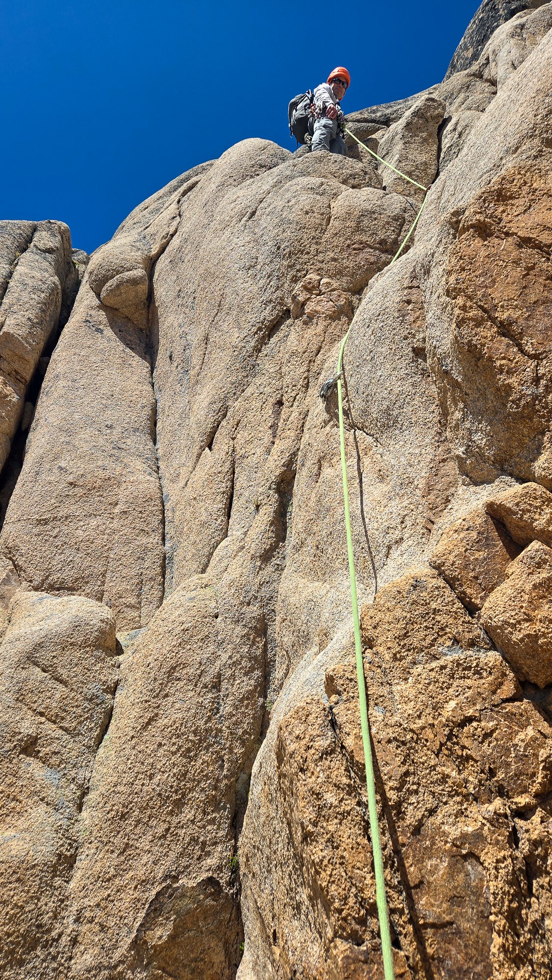
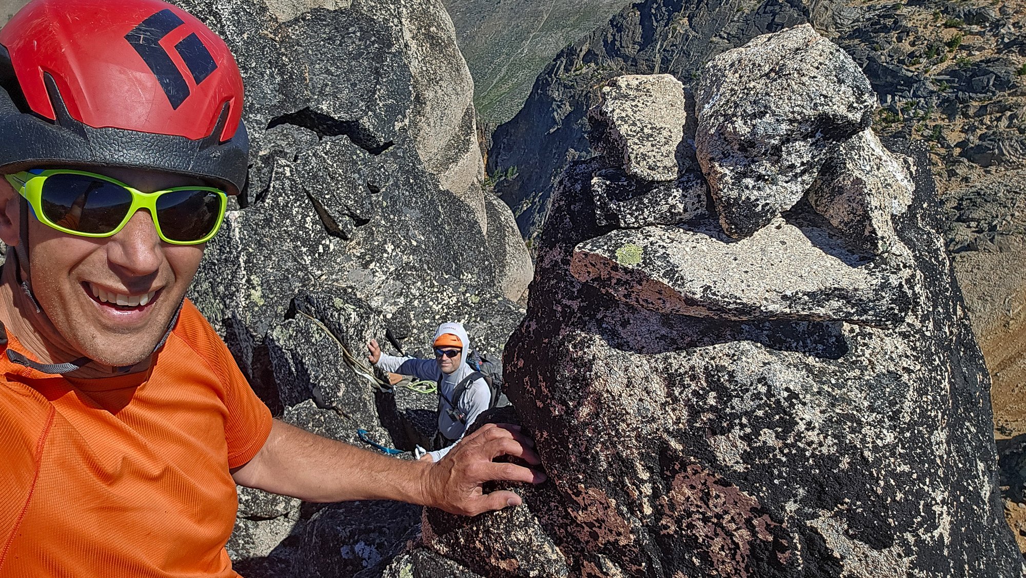
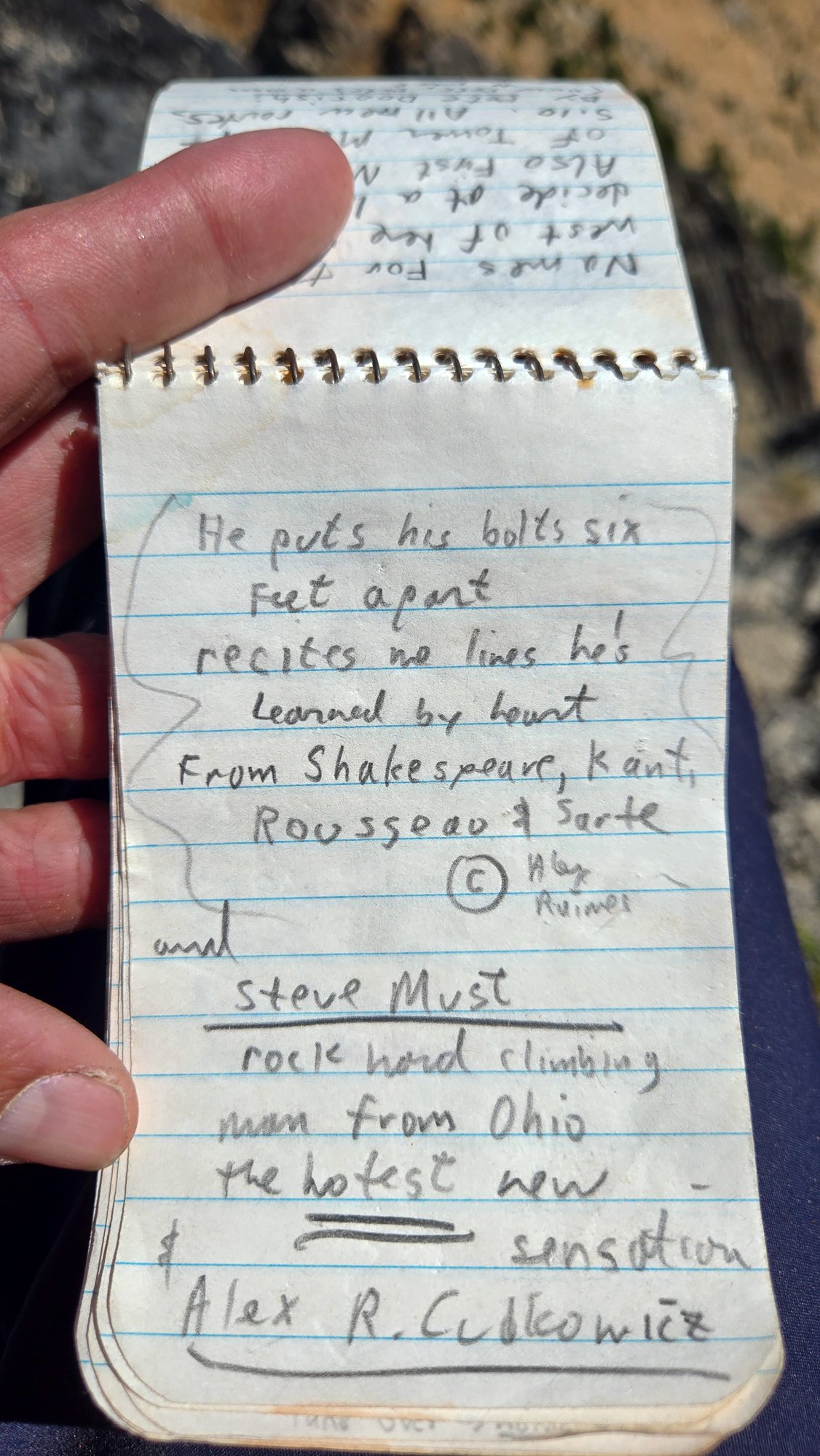
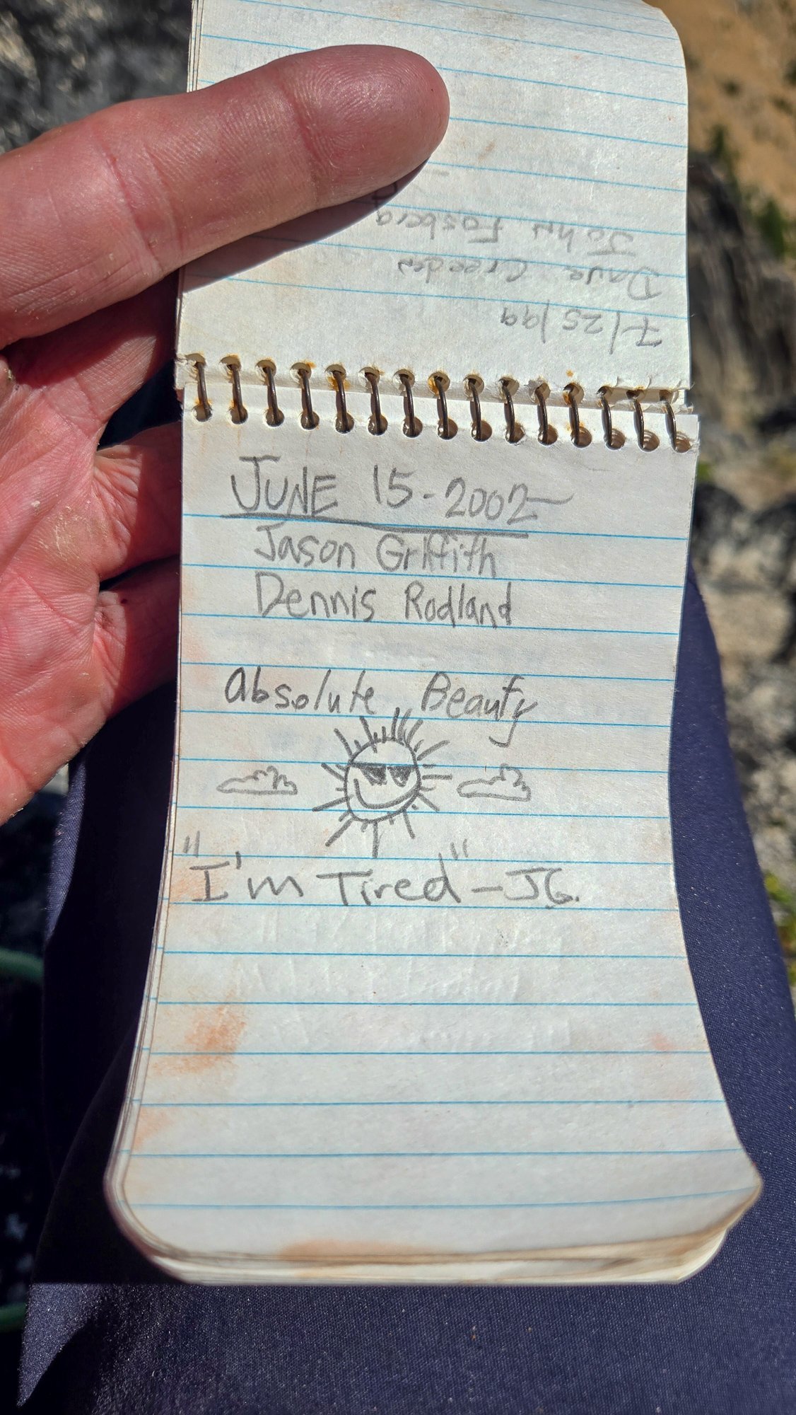
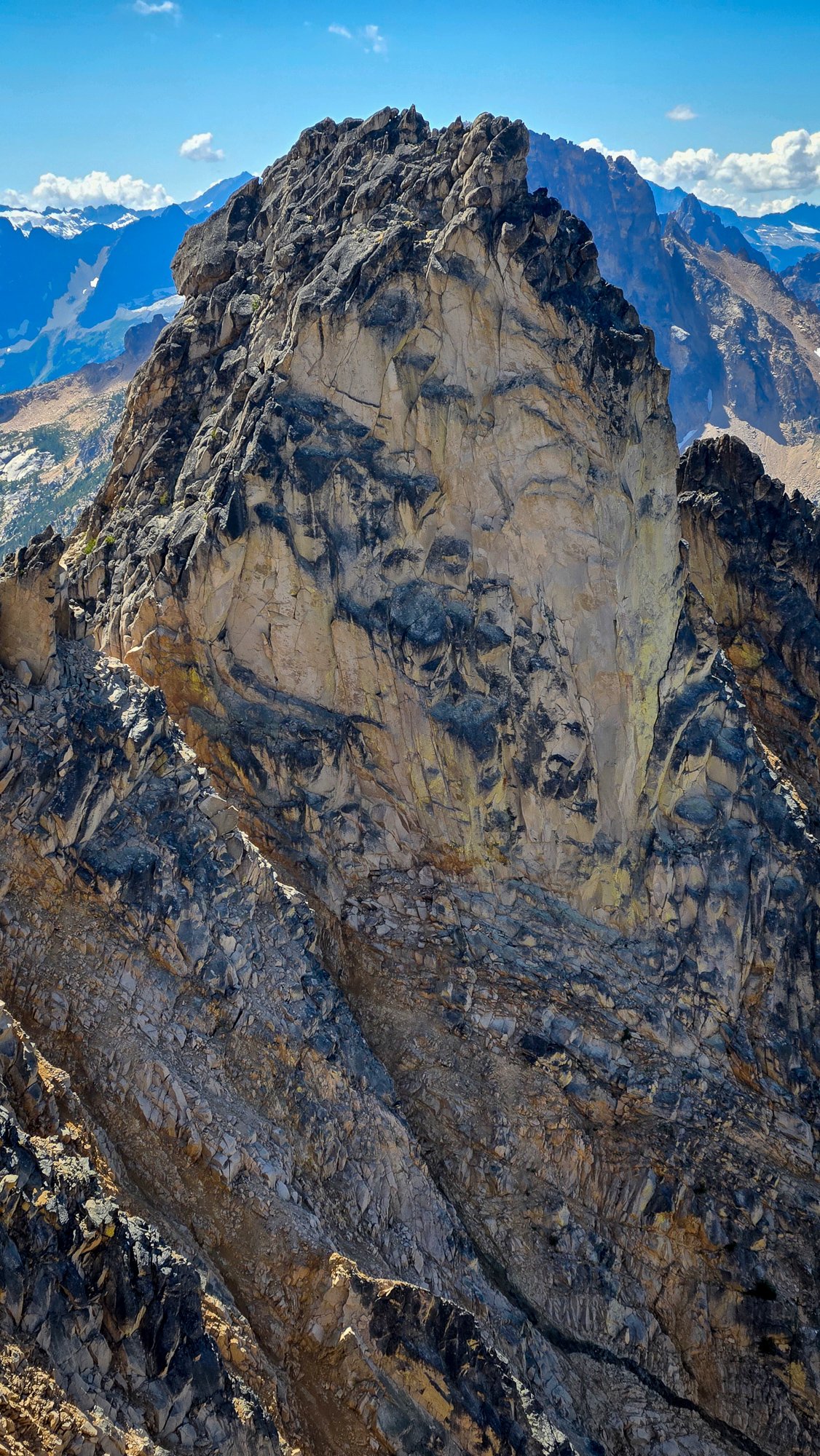
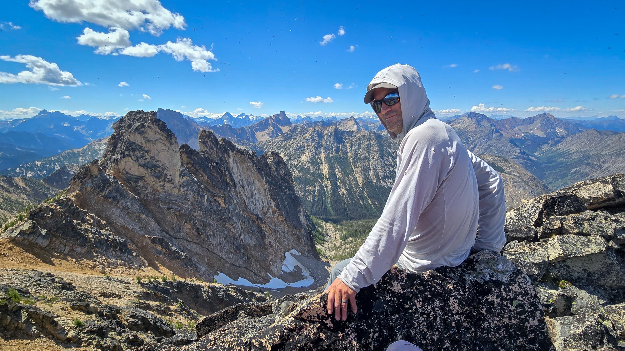
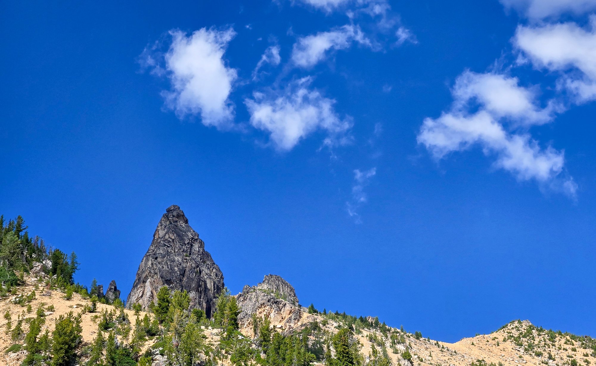
Trip: East McMillan Spire - North Buttress Trip Date: 09/24/2025 Trip Report: As Blake seems to speculate in the back of Cascades Rock, this is a legitimately high quality route. While the rock is of course worse than Index or Supercave, it is better than the E ridge of Inspiration or Stoddard Buttress on Terror (and much better than Megalodon). It's also less vegetated than the E face of Triumph or Sloan SW face. There was only one pitch we wouldn't recommend (up high in the schist band), but it can and should be avoided. The steep middle section is characterized by thin parallel cracks, highly textured ripples, and shady climbing with a shocking lack of lichen. When you emerge onto the slightly more West facing schist band for the last few hundred meters, lichen becomes tiresome as the angle eases and rock deteriorates. There are absolutely a couple of serious runouts, but they occur on clean, solid rock. From camp on a small heather patch a few minutes below Little Mac, we approached via a ledge just below Little Mac that accesses the NW trending ridge toward Elephant Butte. We made four rappels beginning at at an old station I had found during a recon trip in October 2020. This seems likely to be the rappel used by the 1986 party, maybe also the 1976 party, and I think @rat has also mentioned climbing the buttress, so perhaps used it as well. The 2008 party (AAJ, NWMJ) approached via Stetattle ridge. After four 45-55m rappels, we walked and scrambled easily to the base of the buttress. We simulclimbed 200-300m on the lower buttress, then belayed eight ~45-50m pitches (5.8 to 5.10-), then simulclimbed (interrupted by one belayed pitch, which we would recommend avoiding) to the summit. For the central, steep section we wanted to climb near but right of the buttress crest, which except for pitch 2 (a horizontal leftward traverse) yielded a logical path almost directly upward. Looking upwards from low on the buttress, two corners right of the crest (separated by a chossy roof) seem to provide the obvious options into the steeper middle section. We aimed for the left corner (which we presumed was the 2008 route), and thought the right corner was probably the 1986 route. We encountered many pieces of fixed gear throughout the route (mostly knifeblades, with a few nuts, a hex, and a rigid stem friend). Since the 2008 party rappelled the face (!!!), presumably close to their line of ascent, we think we followed large portions of their route (Come Over to the Dark Side). That said, I haven't really managed to match the route lines in either the NWMJ or AAJ to our experience (at least at the resolution I can manage to download). From the summit, we downclimbed SW to the col with West McMillan, then continued downclimbing S in the gully for a few minutes. When the gully's left wall flattened, we slung a boulder and made four 45-55m rappels to reach low angle slopes and walked back to camp, arriving about 15 hours after leaving that morning. West McMillan, Inspiration, The Pyramid, Degenhardt, and Terror from high on the route: From left to right: E McMillan, W McMillan, Inspiration, The Pyramid, and Degenhardt. The route goes just right of the sun/shade line on the leftmost peak. The approach rappels start down a relatively solid corner just right of the low point on the left). Photo by Steph Abegg: First rappel into McMillan Creek cirque: Racking up before the first simul block: Marlin starting up the first simul block: Marlin at the top of pitch 1: Partway across the pitch 2 traverse (photo by Marlin). There was a fixed two-pin anchor at the end of this traverse that may be that in the 2008 NWMJ "Erik starts the crux" photo: Looking down partway up pitch 3. This section had some blocks and flakes that looked ominous from below, but sounded and felt solid on closer inspection: The upper part of pitch 3. This was probably the most runout section of the route: Looking down the start of pitch 4: Marlin at the top of pitch 4: Marlin starting up pitch 5: Marlin starting up pitch 6: And navigating the roof on pitch 6: Starting pitch 7: And pitch 8, which should have been the last belayed pitch: Simuling in the schist band: Marlin leading the very-not-recommended lichen covered, loose pitch in the schist band. Go right before here, toward the E Mac col, to keep it scrambly. There was a fixed pin near his feet here, so we weren't the first to get suckered into it: Belaying on the summit. The buttress crest in this section is stacked, lichenous blocks that seem to overhang the impressively steep East face. You want nothing to do with the crest here: Setting up the first rappel out of the E Mac-W Mac gully: Impressive ambience the next morning, looking toward Azure lake from camp: Hiking out, looking toward Triumph: And a friend from the start of the schist band. It was still solidly placed and easily removed after, probably, 17 years (although could use some lube): Gear Notes: Modern gear made a huge difference on this route, especially microcams (compare the 2008 party's rack in the NWMJ pictures), microtrax simuling, and fix-and-following. We took a 50m lead and 65m tag line (we didn't haul), ~5 kbs/lost arrows, at least triples to fingers with offset aluminum and brass nuts, doubles to #1, single #2 and #3, and four microtraxions. Our smallest cams (purple C3 and green/#0 Z4) were used in several critical placements. Approach Notes: Goodell Creek to Terror Basin, then up slabs toward Little Mac.
 15 points
 -
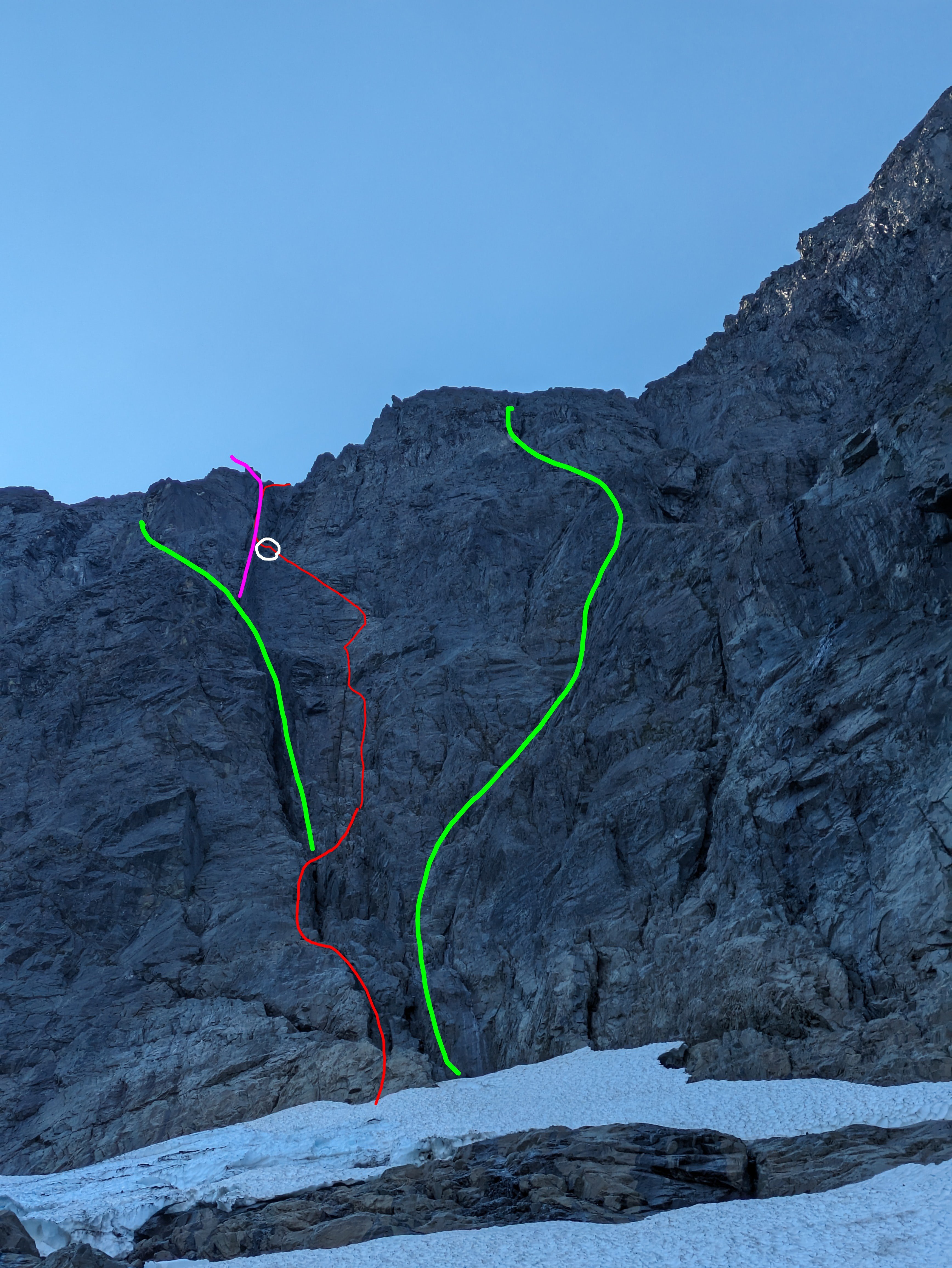
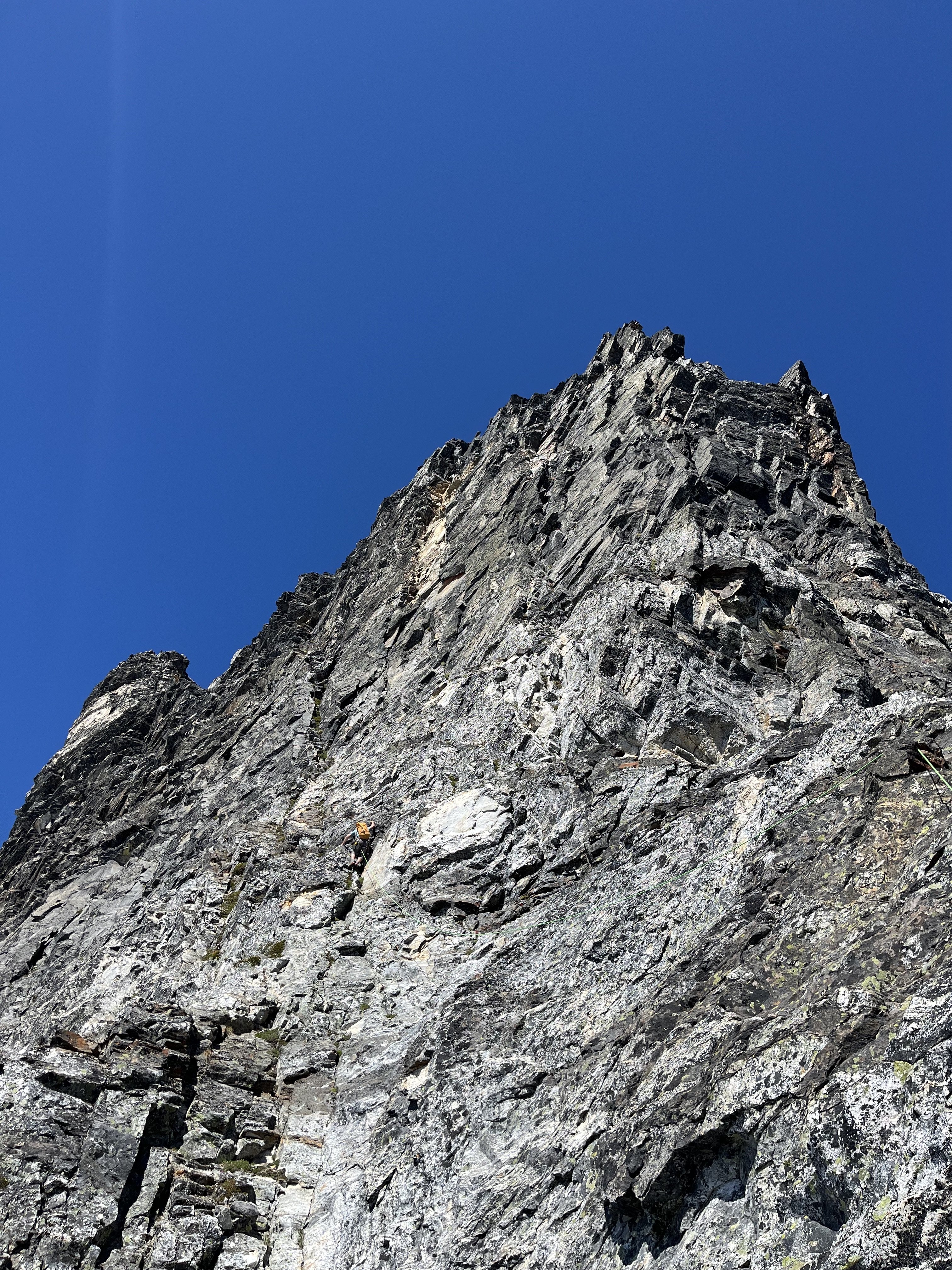
Over Sept 12-13 Eric Wehrly, Lani Chapko and I Climbed a new route on the NE face of Johannesburg. Like many features on J-berg, the scope of the NE face is overshadowed by the shear mass of the mountain. The face proper gains over 2000', with the entirety of the north face stretching nearly 5000'. We approached via the start of the NE buttress lines, then up glacial slabs directly under the hanging glacier, eventually climbing over the hanging glacier to access the face. We roped up for 23 pitches, totalling 3900' of belayed travel with 17 hours of climbing time split between two days. Our line of travel up the face Rough overview of the '65 route (left), Route 66 (middle), and the '67 route (right) Closer view of the 3 routes. Pink is where the Becky book shows the 65 route going (sharing a pitch with our line) but the green line is where we believe is more likely they went. The white circle is where we bivied. The forecast on the morning of the 12th showed fog, eventually clearing to blue skies. We opted for a somewhat late start and arrived at the TH to dense white out conditions. Our forecast all seemed to believe it would clear up, so we started hiking down towards the lower buttress hoping it would clear up. Lani going full euro The conditions did pretty quickly start clearing as we arrived at the base, but the rock and, more importantly, plant life was still wet. We decided to access the NE face via the first portion of the NE rib routes, as the CJ was an impassable death gully spitting rocks. The access climbing went generally pretty well, though we ended up unexpectedly roping up for a few pitches. None of us felt like dieing slipping off of wet moss... An early pitch on the approach Eventually we hit the hanging basin where the buttress lines turn right up into the thick cedar forest. We continued up slabs below the hanging glacier and found easy travel. The glacier presented with almost no hangfire this time of year, but early season, this would have the potential for overhead hazard. Lani and Eric on the nice approach slabs Broken ice on the hanging glacier The hanging glacier itself was mellow, though season and conditions will greatly impact this. We ended up chopping a bollard and doing a short rap into the moat at its top to gain access to the rock. Looking back at the bollard belay/rappel Climbing on the second pitch We likely shared some terrain with the 65 route here as we used the gully to access our intended crack system. The Becky topo makes it a little unclear where they went here, though you could probably assume they went up the gully. After a bit of gully travel we were able to escape to our objective face. The angle slowly steepened as we approached our "hand crack". The proposed crack turned out to be filled with gnarly munge, so we aimed for a thinner looking crack to its right. Eric leading the crux 5.10 crack The crack proved to provide the crux of the route, luckily it was relatively well protected... For the crux section. While perched here, a huge natural rockfall ripped down the 65 route gully, validating our concerns of gully trqvel and questioning the sanity of our ancestors. As Eric led the pitch, it became clear that we were about to loose the last bit of light, so we got our our headlamps and prepped for some night climbing to go in search of a ledge to sleep on. Two more 200' pitches gave access to a workable ledge. Lani and I somehow fit in this footprint, while Eric was on some downsloping round ledges below Morning at the bivy Racking up in the morning We all woke up a little creaky and waiting for the sun to warm us. Above presented with 3 options. Our original intent was to traverse right and climb a series of catscratch cracks. These however looked steep, and filled with munge. So we opted to work up and left to climb the top of a ridge feature (not even considering option 3, the unclimbed gully above). Its possible we share a pitch here with the 65 line, though the written description of their climb makes much more sense to have climbed an obvious ramp a couple hundred feet below (avoiding what would have been a gnarly mandatory impasse to gain their upper headwall cracks). Lani topping out the worst pitch on the route... A fun corner brought us near the ridge crest, where we climbed 2 awful choss pitches up to a gendarme, above here, the rock luckily turned back to decent quality shist. Eric starting up his choss ridge pitch Climbing on the pitch above the red gendarme Here we worked up and right on moderate terrain and eventually gained access to another big gully system that we believed to be the 67 line. We climbed this gully for 2 shared pitches to gain a notch on the NE buttress by the glacier. The final moves on the NE face Different view, same spot One mellow ice pitch brought us into some more easy scrambling to the summit. We all had approach shoes and aluminum crampons so ended up roping up for 3 total pitches of easy ice. Had we had boots or had early season snow coverage over the ice we likely wouldn't have needed to rope up for these pitches. Then we were in for the long descent down the East ridge and back over Doug's direct. Steep moraine dirt below the CJ We ended up getting back to the cars pretty late and made the rough late night drive home. Overall, the route only really had a couple pitches of bad rock. There were some tricky belays to build and some pitches were runout. Though very rarely was it hard and runout. It seems like the objectively safest route on the central part of the NE face as it climbs the least amount of gully of any existing route. We collectively give it a solid recommendation for the Cascades connesouir, or anyone keen on climbing the upper NE face. As always, here are my pitch notes.. Route 66 V 5.10 AI 2 Rack: Triples .3/.4; Doubles .1-.75; singles 1-3; full set of nuts; 3 KBs (used extensively for belays) P1-4 700' Alpine boulder problem pitches getting to the base of the NE face (up to 5.8 and AI2) P5 130' 5.7 A transition pitch up into the gully. P6 200' 5.6 Climb the gully, belay in the gully. P7 200' 5.9 Climb the rib left of the gully, stepping back right to belay in the gully again. P8 150' 5.6 Exit the gully to the right. Belay on a good, medium sized ledge below where the wall steepens. P9 100' 5.10- start with a steep, juggy roof to the right, then trend up ramps to a small ledge to the right of a large tombstone flake. P10 200' 5.10 Start up the flake (crux), then trend left on low angle terrain to meet the main weakness. Follow this up to a large ledge system. P11 200' 5.6 Traverse slabs rightward into a gully, follow it to a good ledge below a big roof P12 200' 5.8 "money pitch" Follow the gully, pulling the roof to its left, and continuing to another good ledge P13 250' 5.4 Scramble up the gully, exit left and belay at a ledge positioned below a big open book corner. P14 160' 5.9 Work your way into the corner, belay at its top. P15 170' 5.6 Ramble up loose terrain on the ridge crest P16 100' 5.8 Climb the super chossy ridge to a notch by a red finger P17 200' 5.5 Climb past the finger then scramble up to your end of rope P18 200' 5.8 Climb the grassy cracks above to gain the big chimney on the right, follow this to a stance in the chimney P19 200' 5.6 Trend up and right past two gullys towards the larger drainage feature P20 150' 5.9 Climb a face to gain a corner, follow this to a ledge at its top P21 200' 5.7 Continue up the gully P22 200' 5.7 Continue up the gully, belay at a notch on the NE butt by the glacier P23 200' AI2 one pitch up the glacier.
 14 points
 -
Trip: Mount Harvey - North Face Ramp Trip Date: 01/25/2025 Trip Report: What a nice spell of climbing weather we had to start off 2025! I'm glad that @geosean suggested the NF ramp of Harvey, a climb I had done a couple of times before, but not for a long while. Last time I was on it, it was quite thin and sporty, but the word on the street said it was in fine nick and so plans were hatched to make a trip north and see if Canada was still allowing Americans to enter. @BrettS and Mike rounded out our team and we all met early in Bellingham Saturday morning. I think it only took about an hour and a half, including border crossing to make it to the TH from Bellingham- it is easy to forget what great options exist just a little bit north. The Trailhead was already filling up when we arrived a bit before 8 and we quickly paid the parking fee and started up the dry logging road at something like a dispiriting 650' elevation. It is a bit of a grunt up to the start of the route, but you get good views early on the hike in: In the 13 years since I'd last climbed it, the route has gotten mildly popular and there were several teams in front of us and at least one behind. A steady stream of ice and snow chunks rained down the ramp as we geared up and started off simul-soloing. We had the gear and rope ready, just in case, as @Don_Serl recommends in the link above, but they stayed packed away as we climbed higher and higher with perfect conditions and ample steps to draft off of. I was reminded what a great and pleasant climb it was, in a fine position! But almost too soon, the angle mellowed and we were at the top of the ramp, looking across the steep traverse that guards access to the easy ridge that finishes on the summit. Some times this portion is a crux, but not this day. It was practically a sidewalk and we enjoyed posing for some photos with dramatic views of Howe Sound below: And then we hit the final ridge, sun and views. @geosean walking just below the top: We stopped just short of the summit to eat lunch, take off the technical gear, and admire the excellent views all around. The Standard route on Harvey (our descent) is quite the popular outing on a nice winter's day and we didn't want to be in the scrum on the actual summit. This was a good call on busy Saturday, and we could look south to Baker, Puget Sound, and the Lions in peace: To the west were the endless Coast Mountains, Howe Sound, and Anvil Island: But, a winter's day, even a perfect one, is over too quickly, and we had to begin the descent before we tired of the views and position. The good thing is that the first quarter of the descent is almost as spectacular as the climb: And then it was back to the road, the car, beers, and chips. I think it was less than 7 hours car to car and was entirely one of the more pleasant winter climbs that I have done in years. I hope that it isn't another 13 years until my next visit! Gear Notes: helmet, axe, second tool, steel crampons. If it is in thin shape you may want a rope and some snow/ice pro, but it is also a comfortable solo for a lot of fatter winter conditions. If you need snowshoes it is probably not in great shape. Beware avy danger! Approach Notes: The Lions Trail. Arrive early to get a spot and don't forget to pay!13 points
-
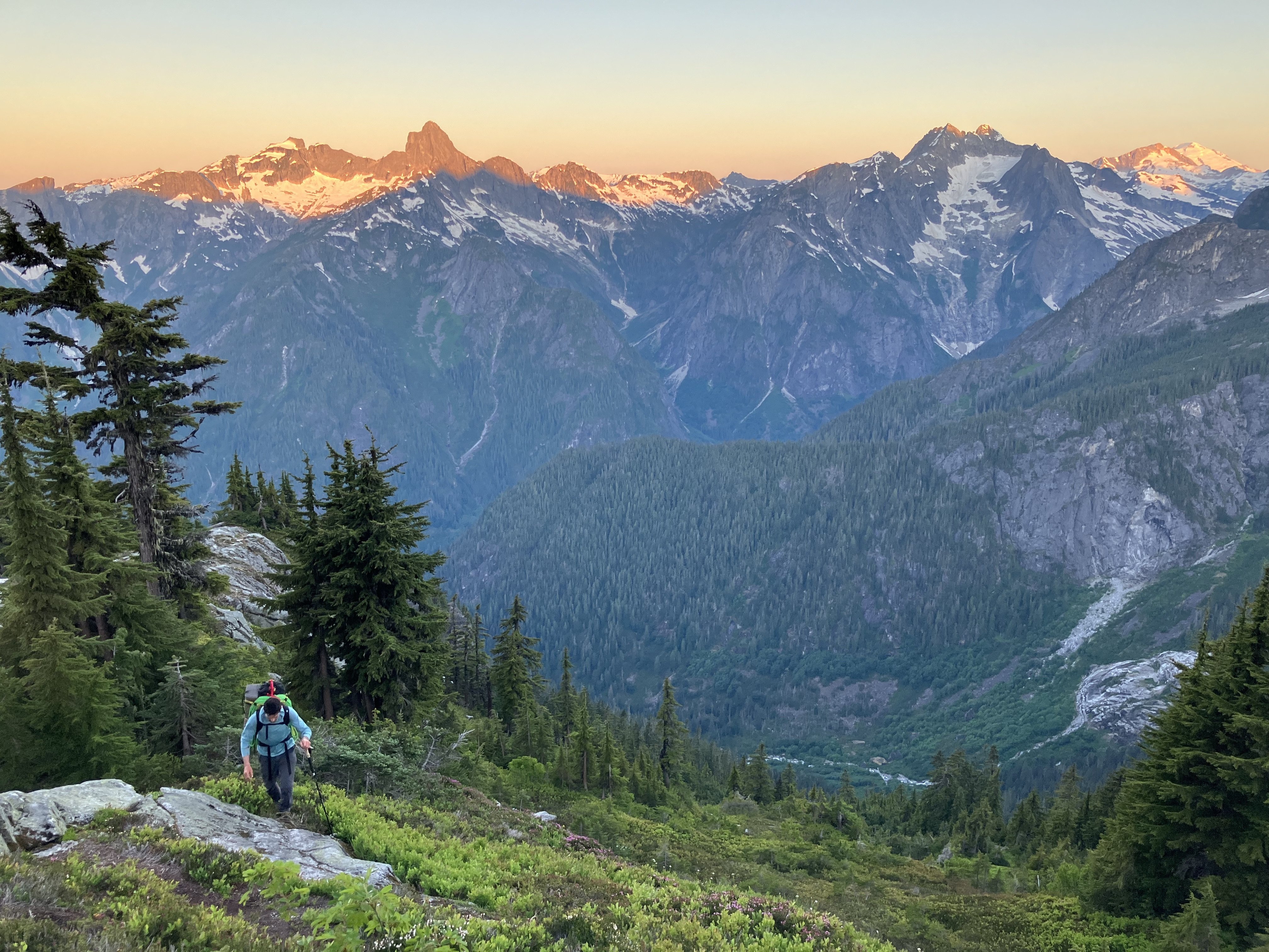
Trip: Baker to Glacier Peak: - 17 days across the North Cascades Trip Date: 07/20/2025 Trip Report: The result of years of imagination and separate efforts. Perhaps it started after exploring the Ptarmigan Traverse, but wanting more. We started gradually exploring the areas to the north and south. Many of us have noted, with some surprise, that there was not a defined “High Route” for this area, unlike some other spectacular ranges of the American West. A few years ago some mountain runners established a “North Cascades High Route”, starting from Silver Creek and ending along the flanks of Agnes mountain. This was an impressive and inspiring feat. Nevertheless we felt it incomplete and starkly contrasted with the style in which we experience these mountains. Although in the end, our route would include much of the same terrain traversing the heart of the National Park and Cascade Crest. But as we played with the possibilities of this terrain it was hard to ignore the striking aesthetics of the volcanos near each end of the range. With both Baker and Glacier Peak being slightly higher than the peaks of the crest, they act as natural waypoints to assess exactly where one is in the vast sea of Cascade summits. It would be impossible to include every spectacular basin, cirque and summit into a single high route but starting and ending with the volcanos gave us a framework to operate in. The route we eventually completed is actually composed of many different shorter routes, linked together by various less visited terrain. Within reason, our goal was to 1) stay above tree line, 2) avoid trails and 3) keep it only lightly technical. We suspect that climbers with the required stamina, skillsets and schedules will likely choose other exploits in the range, or beyond. Nevertheless we present here some basics of our North Cascades high route. Mount Baker Our route up and down the Park Glacier had some obvious benefits. Most significant was that we could change out proper mountaineering gear for more of a hybrid backpacking kit upon return to the TH (Artist Point). The route itself is pleasant, with a scenic approach and lovely high camp. The day we climbed it the snow was soft enough not to require any belay or rappel applications, though in more firm snow that would not be the case. The upper part of the glacier was fairly broken up considering it was early July. We managed an improbable line between a series of large cracks. This line may not have been viable even a week later in the season. We stood on the summit late morning of July 5th. Shuksan Navigating this terrain presented a few obvious and a few not-so-obvioius options. Perhaps at first glance one would think Fischer Chimneys…and then descending from the Crystal Glacier onto the Nooksack. Unfortunately the bergschrund separating the two was gaping by early July and would have required a substantial amount of extra gear that would become dead weight for the week to follow. Additionally the prospect of immediately starting this traverse by hiking on trail through the forest did not match the criteria we set forth. Looking instead to the North side we scouted various lines contouring high above the deep, alder filled basins. There were definitely viable lines through the majority of the terrain, but we determined them to be too complicated and conditions dependent. The biggest concern being that the time involved would be hard to predict. It could take a few hours, or a few days. Additionally there was a good deal of objective hazard traversing high in this terrain. Ultimately we chose a safer and surer, albeit less appealing line. Hiking the ridge above Chair 8 and eventually descending to meet with the White Salmon approach, we faced our first bushwhack in the hottest part of a very warm day. Once escaping the alder hell we climbed to a ridge above and contoured forest down towards Price Lake. We crossed the outflow and traveled along the approach for the Price Glacier route for a while. There would be some fuckery along the base of Nooksack tower getting down to the glacier. But once down there we continued on part of the Nooksack Traverse until Ruth Mountain. Mineral High Route On a map this looks like comparatively straightforward terrain. We did not have a pre-scouting trip for this zone. And we definitely underestimated it. The bushwhacking before and after Chiliwack pass was steep and complicated. Before we escaped tree line onto Mineral mountain there were a series of steep and improbable gullies that took us far longer to complete than what we imagined. In hindsight I think we started out in the wrong gully and paid the price. Eventually we reached “the route” but by then we really weren’t sure if the terrain would go. Finding some clearing among the multitute of brush-gulleys. Above the forest travel cleared again. Although we soon found an abandoned, and completely full backpack. A startling sight this far into remote territory, we searched around for signs of remains but found none. The pack was probably out there for at least one winter, possibly more. We noted its location and passed a message to the park service before continuing our quest. Mount Challenger via Easy Ridge This terrain was fairly straightforward, although the day we did it was very un-summerlike. With no chance of shortcutting the impasse in these conditions we continued the sog and slog down to the lower bypass. Climbing out above the crossing was fairly sketchy. It is very eroded, hard packed and water running along the surface definitely made it attention worthy. Some of the steeper scrambling between there and Perfect Pass was also potentially consequential in heavy rain. Nevertheless we made it to the pass, but soaking wet and in high winds plus white out conditions. Crossing the Challenger glacier in near hypothermic conditions was very….engaging, to say the least. We were all very relieved to step back to “dry” land an hour later. Northern Pickets Descending into the basin is fairly straightforward, albeit somewhat tedious and extended side hilling. The climb back out through Luna Lake and to the Fury shoulder is pleasant, scenic and fun. Especially given that this day the sun had returned. The lower part of the Fury glacier develops some pretty sketchy moats early in the summer and may require walking on exposed glacier ice around 30 degrees. Rather than spend time with that we found a bypass to the north, which lines up with one of the ways parties may choose to climb Fury. We skipped the summit and instead climbed Outrigger along the way. From the col we ascended a 50 foot 5.0 pitch, followed by some rightward traversing 3rd class terrain to the south ridge. Looking back, there was a way to avoid the initial low 5th entirely by starting a bit further west in the col. Descending Outrigger was one of the highlights of the trip. Easy hiking, with the Southern Picket skyline so close you can almost touch it. There was a 15m rappel, which could certainly be bypassed by down climbing 4th class terrain slightly east of the anchor. A short but exciting and exposed bit led to continued easy hiking. Southern Pickets Getting from Picket Pass to the bottom of the basin was pretty fucked. There is some 4th-ish slab downclimb that some parties have rappelled. Beyond that, some of the beta out there is pretty snow dependent. Our planned line was not viable and it took some time to find another way down. Two of us independently destroyed a trekking pole in this zone. Once at the bottom there is some unavoidable alder to contend with. You ever get through one of these, look back from a higher vantage point and realize oh wow, I could not have possibly taken a worse line. That’s what happened here. We should have stayed closer to the cliff along the SW side of the shwack. Oh well. Climbing out to the east of the McMillan spires was fairly straightforward. We managed to avoid brush entirely. Other than a few deep gullies it was a breeze, and an incredible position. From McMillans to Highway 20 Choose your own adventure, depending on legality. Once the Sourdough trail re opens you can traverse east towards elephant butte and then south along Stettattle ridge. Until then, a legal option would be to find Goodell Creek trail/approach and take that to the highway. I cant remember which of these we took… Highway 20 provides the only on route resupply. You could probably utilize Cascade Pass, or even a trip to Holden. But we did not. Isolation Traverse- much has been written on this. Its awesome Looking back to the Pickets, Redoubt from the Mccallister glacier Eldorado to Cascade Pass- decent travel along a nice ridge and basins. Nothing too complicated. Sahale arm trail for a mile or so is a nice reprieve. If you wanted to add some major style points throw in the Torment-Forbidden Traverse through here, although its likely to add some gear complications. Ptarmigan Traverse- MUCH has been written on this. Its awesome Classic White Rock Lakes shot Dome peak area- leaving the Ptarmigan and finding the Dana then Dome glaciers. We scouted a route along the south side of Dome. It probably would go but on the trip we ultimately took the Chikamin glacier around past the gunsights and onto Kaiwhat Pass Doin’ the bull dance. Feelin’ the flow. Workin’ it. Workin’ it To Canyon Lake- The terrain eases here and may involve some bushwhacking but nothing crazy. We abandoned our map, and rationality…instead navigating on vibes alone. Our line to Totem pass was awesome and on paper probably shouldn’t have worked. Between the pass and Canyon Lake there may be a way to avoid significant brush but we did not find it. Still it went quick (downhill) Canyon Lake trail- Seems decomissioned. It’s overgrown and washed out in different places, but still a comparatively decent 5 miles. Image Lake to Lyman Lakes- We looked hard how to avoid such an extended on trail section but there really weren’t any viable alpine options. When we came to this section we were exhausted and very calorie deficient. The easy miles were welcomed. The trail itself is well maintained and incredibly scenic (cloudy pass in particular). Just a hop, skip and a “fuck!” away... Lyman Lakes and beyond- We climbed over Chiwawa mountain without much difficulty. Although the last few hundred feet were steep, slimy, scree covered slab when approached from a direct north line. Pretty gross. It would be better to find the main ridge further east and continue to the summit from there. It started to rain when we were on the summit, so we schemed a bypass for the exposed scrambling awaiting on Fortress. We found a line of weakness that allowed us to bypass to the south. It didn’t take long from there to find the pass no pass trail and follow it towards High Pass (another really scenic on trail moment). Bypassing Fortress For Napeequa we took a path of least resistance well south of the summit, descended to another saddle and then back up and around Hoof. Eventually we had to traverse below the north side of Ten Peak. It took a while but overall it was straightforward. The Honeycomb and Suiattle glaciers brought us to Glacier Gap, along the standard walk up for GP. We were greeted by friends with treats. The next morning we jaunted up the last couple miles. It was a busy weekend on the peak. Spirits were high, despite the suicide gestures Standing on the summit felt surreal. It wasn’t necessarily a positive emotion. Spending the last few summers obsessed and the past few weeks starving made this moment feel like a weird dream. The hike out from there is long, but we crushed it in hopes of making it to Olive Garden in time. Which we did. All the pasta…dipping donuts in wine…it was finally over… By the numbers: 17 days 175.2 miles (73% off trail) 86k vertical gain (86% off trail), 88k lost Average vertical change per mile: 993 feet Average time from camp to camp each day: 14 hours Average calories/day ~3800 Body weight lost- 18lbs (9.6% total lost) Pizza consumed- nowhere near enough Gear Notes: a picket, 2 screws, 3 cams, 4 nuts Approach Notes: the whole thing was an approach...12 points
-
Trip: Cascade Volcanoes - Bike-athon Trip Date: 06/06/2025 Trip Report: Summary: I set out to stand all 5 WA volcanoes in the same 7 day (168 hour) period, bike powered between them. As usual, antics ensued. An unplanned road closure added ~100 miles on the bike and the goal was adjusted to 8 days/192 hours. In the end, I stood atop Mount Baker on hour 189 since departing the Mount Adams summit. The journey in between had deep suffering, even deeper discovery and an adventure I’ll always remember. The trip had to be solo. But the story was too good not to share… Classic DC shot, peak 3 of 5 In recent years I’ve become increasingly obsessed with long bike-hikes. But it's hard to remember exactly where, when or why this dream came to be. A while back some lunatic bike/climbed all the Cascade volcanos and that certainly added some fuel to the fire. There is something about doing it all on human power makes the adventure feel a little more....real…for lack of a better term. Earning every inch helps put me more in touch with the broader landscapes which connect our High Places Planning an effort like this was sort of an impossible task. Timing the trip would require some favor from the weather gods. But knowing the patterns of the PNW and its’ volcanoes, June would be the time. Without better criteria I figured lets pencil it in around the longest days of the year in order to limit the odds of after-dark cycling. The snow coverage on Rainier in particular would also help mitigate the risks of solo travel on big glaciers. So I wrote it in for June 14-22…but a forecast presented in the first days of June that was too good to pass up. I was not fully recovered from training, nor was my equipment or logistics in order. But that was all figureoutable. With a week of solid high pressure I eeked my way out of whatever responsibilities I had, and set off. Originally the plan had been to start the trek from the Adams TH and climb with a friend. The new plan instead had me start the ride from White Salmon, at the Oregon border. That green-blue-white color scheme ? Its finally summer in the hills Call it a warm up! The 37 miles to the Adams TH went pretty quick until the last few. Reports warned of a “rough” “dirt” road leading up to the south side climb. Rough was fine, dirt was fine. The sandy parts were nearly impossible on a bike loaded up with camping and climbing gear. Despite that, I eventually reached the TH, unpacked and slept as soon as I could. By 2am it was too cold to stay asleep. The forecast for the week was going to be very warm. So I chose the lightest quilt I had in order to save weight. But that first night I paid the price. Preferring to rest longer but knowing when to bend I got up, packed, ate and started trudging upwards. Because my concept of this challenge was starting the clock when I departed the first summit, I kept my pace slow to conserve energy for what would inevitably be a very long first full day. By 830am I reached the top. Perfectly clear, sunny…but bitter cold wind. By 845am I started the clock and raced down the mountain. A few thousand feet down the surface was soft enough for efficient plunge stepping. By 1130am I was back with the bike, repacked and ready to coast a bit. The road would not make this as carefree as I hoped. Tedious, bumpy miles eventually lead to a delightful (paved!) forested downhill. Once in Trout Lake I found the restaurants closed. So I had my first gas station meal of the trip. A secondary goal of the trip was to eat ice cream at every country side store I could. Feasting junk food on the front porch, the staff asked “isn’t it early for through hikers?” I must have smelled like one already. The first of 22 ice creams... As we chatted I learned that forest road 25 was still closed due to a combination of landslide, construction, lingering snow and owl conservation. I spent most of the day having my at home contact help brainstorm how I would re route after climbing Mount Saint Helens. In the mean time I continued, but the uncertainty weighed me down. Riding to MSH took the rest of the day. There were a few miles of pushing the bike through snow. Definitely among the low points of the trip. That night I slept at the climbers bivouac TH after 19 hours and 12k of combined vertical gain. I was exhausted and the stoke was low. That night I had some thoughts of giving up. Ultimately a series of bad dreams in the early morning were disturbing enough to force me awake. Sometimes nightmares can serve that benefit. Within seconds of waking my mind refocused. Trying to close the distance before dark on day 1 Hiking MSH under good weather was a treat. The ascent went fast and easy, but not as easy as the descent. I was totally out of water but snagged a liter that had fallen out of someone’s pack on the glissade track. Back at the road, some kind soul had packed a can of coconut water in a snow patch they built near my bike. A little trail magic- bike touring edition. It really made me happy. Not just the fluid intake but that some strangers had the consideration of doing that for me. Solid folks can still be found… At first I thought it was a beer...probably for the better that I was wrong... Another huge boost came that morning when I was high enough to catch cell signal. I was able to devise a re route to get me to Rainier. It would add a day of cycling, and push the 7 day goal to 8, but the mission would continue! Riding back to the I5 corridor was definitely not my preference but flexibility is a trait we learn on quests like this. I spent the night at a trashy motel near the freeway. The next day was type 1 touring. Flat farmlands with many, many ice creams to be had. I reached Ashford in the late afternoon and settled in for a 13 hour sleep. The next “day” (actually two days, no sleep in between) would be huge. Arguably the crux “day”. It was some of the best sleep I’ve ever had. The schedule for the next segment required I wait til around noon to start. Timing travel on the upper slopes of Rainier was the priority. The 20 miles from Ashford to Paradise was actually pretty nice for being continuously uphill. I took my time through there, keeping my heart rate and mental stimulation as low as possible. Reaching Paradise at 4pm on a perfect Saturday, I remembered why I avoid this place on summer weekends. Luckily, on a bike parking is not an issue… A nice melty treat...and also an ice cream The permit stop was pretty seamless. Months prior I had received approval for a solo climb. Checking in was a simple formality. I killed a couple hours (and ice creams), letting the sun begin setting and the snow firming up. By 630pm I could wait no longer. Setting out from Paradise I continued to be intentional about managing my pace. Once on the snowfield I started to open it up a bit. At Muir I was surprised to find absolutely zero wind. I took this opportunity to rest for an hour. After that break, something came over me. My energy was maniacal. It felt like nothing could stop me. By the time I reached the top of disappointment cleaver I had passed 52 people. 3h 53m after leaving Muir, I was standing alone on Columbia Crest, well ahead of sunrise and ahead of schedule. I had stood there many times before, sometimes alone, but this was a very powerful moment. Its hard to describe the feelings that came over me as the first bits of dawn stumbled over the horizon. Its amazing how full life can be…I hope some day I can better explain what came over me. The descent was uneventful… fast, efficient. By now I was getting better at repacking the bike, even though one of my cheap panniers had exploded. Riding down from Paradise was probably my favorite segment of cycling in my life. Almost no pedaling, fantastic views. Hardly any traffic, surprisingly. The bliss would not last. The rest of the day would be 80 relatively flat miles but with a strong headwind and temperatures reaching the low 90s. To boot, it was the first hot Sunday of summer and the roads were bustling. The miles were stressful and seemed to never end. Eventually I reached home in South Seattle. I had started the effort 32 hours earlier. In the end I would gain over 16k feet of vert and drink 15L of water. It was nice to be home for a second. But I had many tasks to complete in order to be ready to ride out the next morning. New panniers arrived. I did laundry. Tuned up the bike…and even had a few minutes to tend to garden tasks. The next morning I had pizza and cake for breakfast and then hit the road. The day would be 12 hours and 117 miles but it actually went pretty well. The first ⅓ of that were on routes that I ride often. I encountered some nice bike paths from Snohomish to Arlington, and beyond to Darrington. The gas station there was closed due to “extreme heat”. But I still managed to find some ice cream and groceries before continuing to the Glacier Peak TH. It was at this point that I started to feel like this could actually happen… It was a poor night of sleep there. But by 550am I was on the move, even if it was a little sluggish. If you’ve hiked GP before you know what a slog it is. It seems never ending, like you’re making no progress. My morale and energy improved as the day went on. I made the summit around 430pm. What a view. Glacier Peak is a highly underrated IMO One of the few photos that day. Rainier seems real far away ! It would be a long ways back to my sleeping pad and fart sack. But I made pretty good time. When I left White Pass at sunset the beauty was astounding. I had enough energy to run a few miles. The slog along the river valley did seem to take forever but at the stroke of midnight I strolled back into the parking lot. It did not take long to eat and fall asleep. The next morning I woke up and ate the 100 calories of crumbs left in my bag and started the (easy) 25 miles back to Darrington. Once at Moe’s I ate an unspeakable amount of food. Probably it was “too much” because my pace slowed to a crawl on the miles from there to Concrete. Once in town I decided I had better over-eat again… holy cow! just one left... It would be just a few more hours of uphill pedaling until I’d park the bike for the final time on this trip. There is something odd that happens at this stage in a grand-journey. Two strong but opposing feelings. On the one hand there is incredible relief that the work was nearly over. But the part that might be unexpected to some is the feeling of sadness that the mission would soon be over. So many years of planning and preparation, and now this week of total focus…it would be done soon. I had found comfort and identity in my striving. And with the finish line in sight I would lose them both At Schreibers Meadow I had a few hours to rest before starting up. A friend was at Sandy Camp and would be joining me for the final hours. Before the trip I wondered how my energy would be at this point. Would I be exhausted and barely hanging on? Or would I have tapped into some deeper energy and be racing to the top… A night to remember...headlamps stayed in the pack It was the latter...stoke was through the roof...through the clouds even... At 550am we stood on top So much of what makes a journey like this worthwhile are the elements that can't be transmitted in words or photograph...but I've enjoyed trying Gear Notes: no gear. just ice cream Approach Notes: no11 points
-
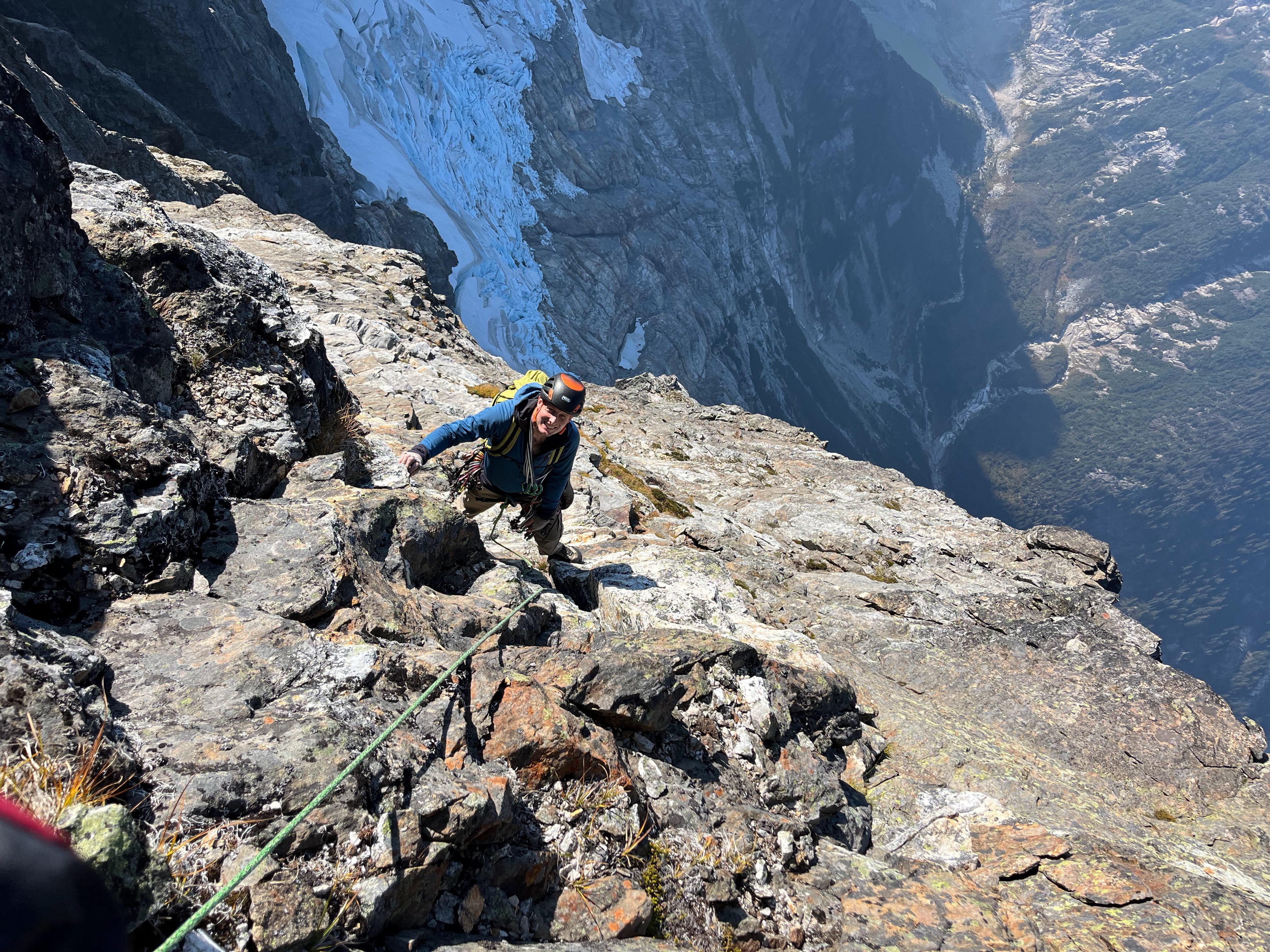
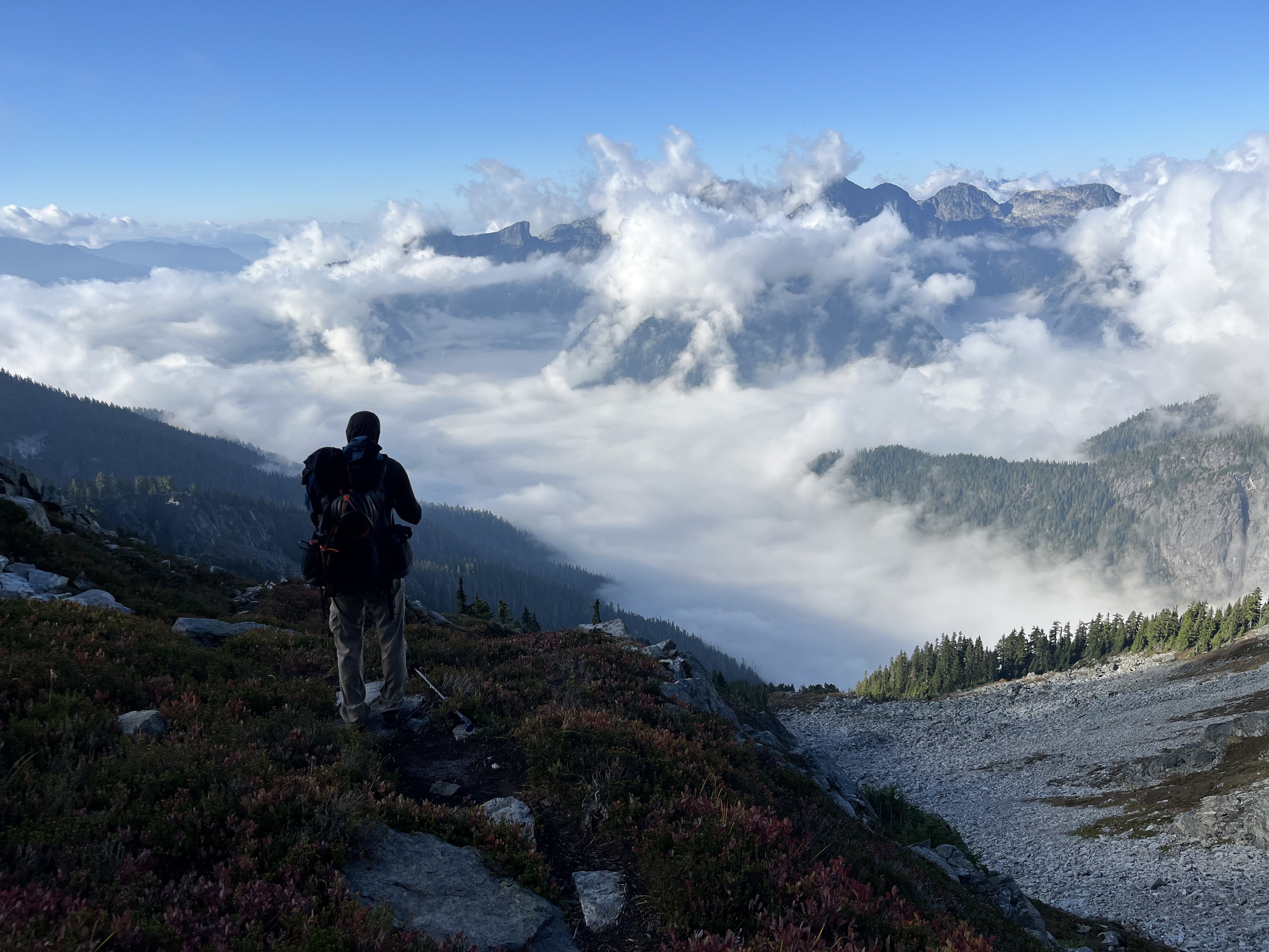
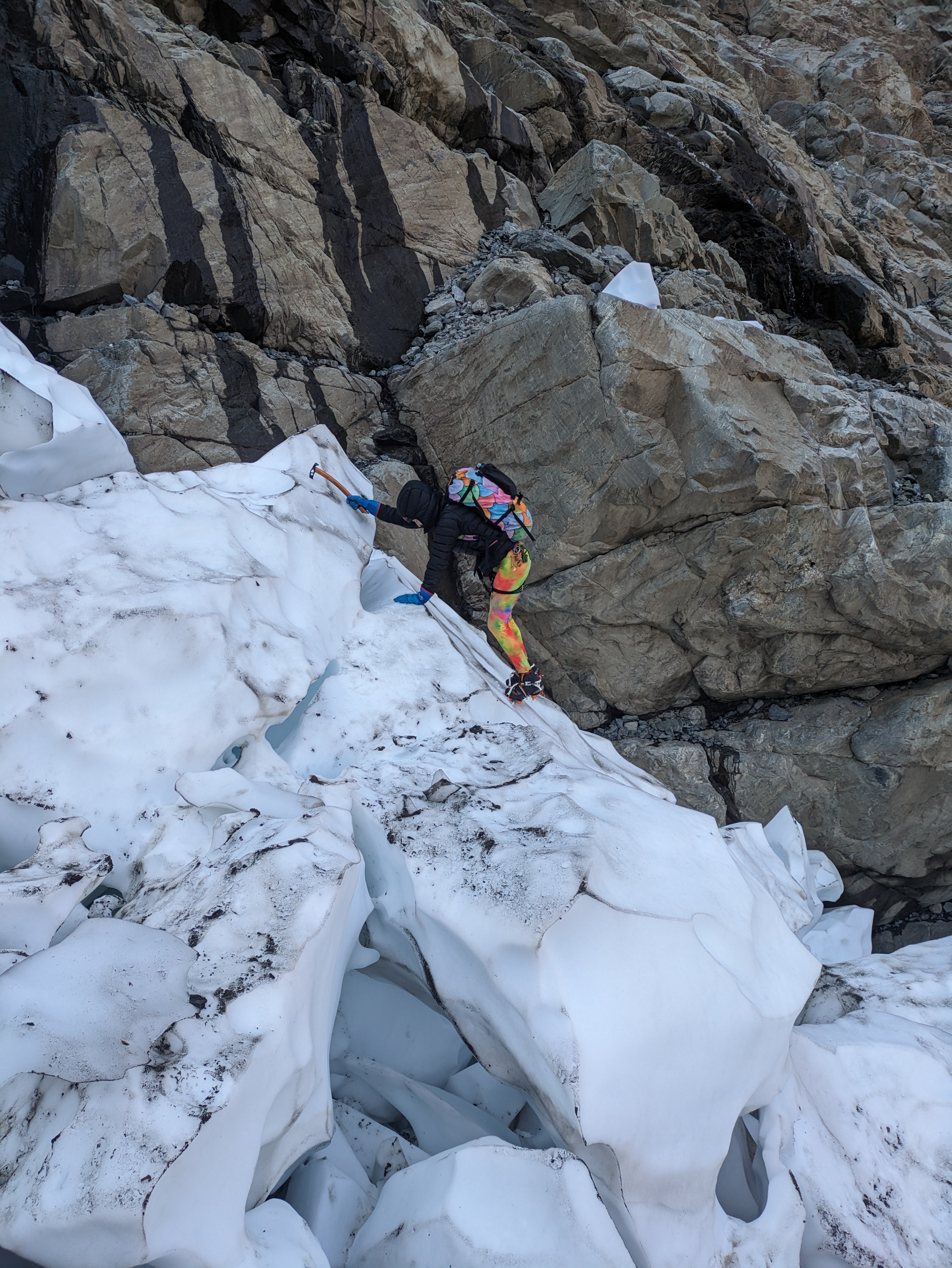
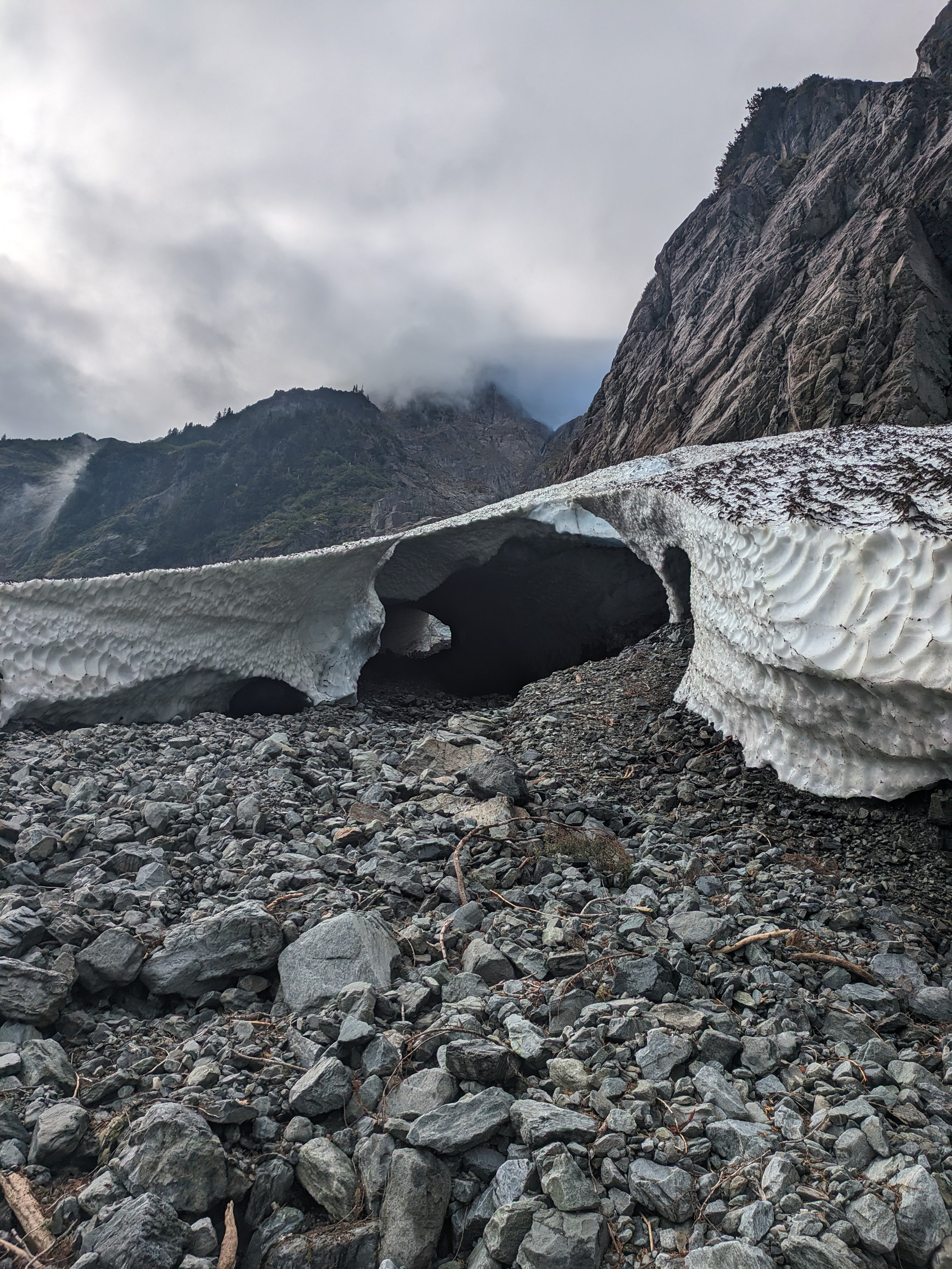
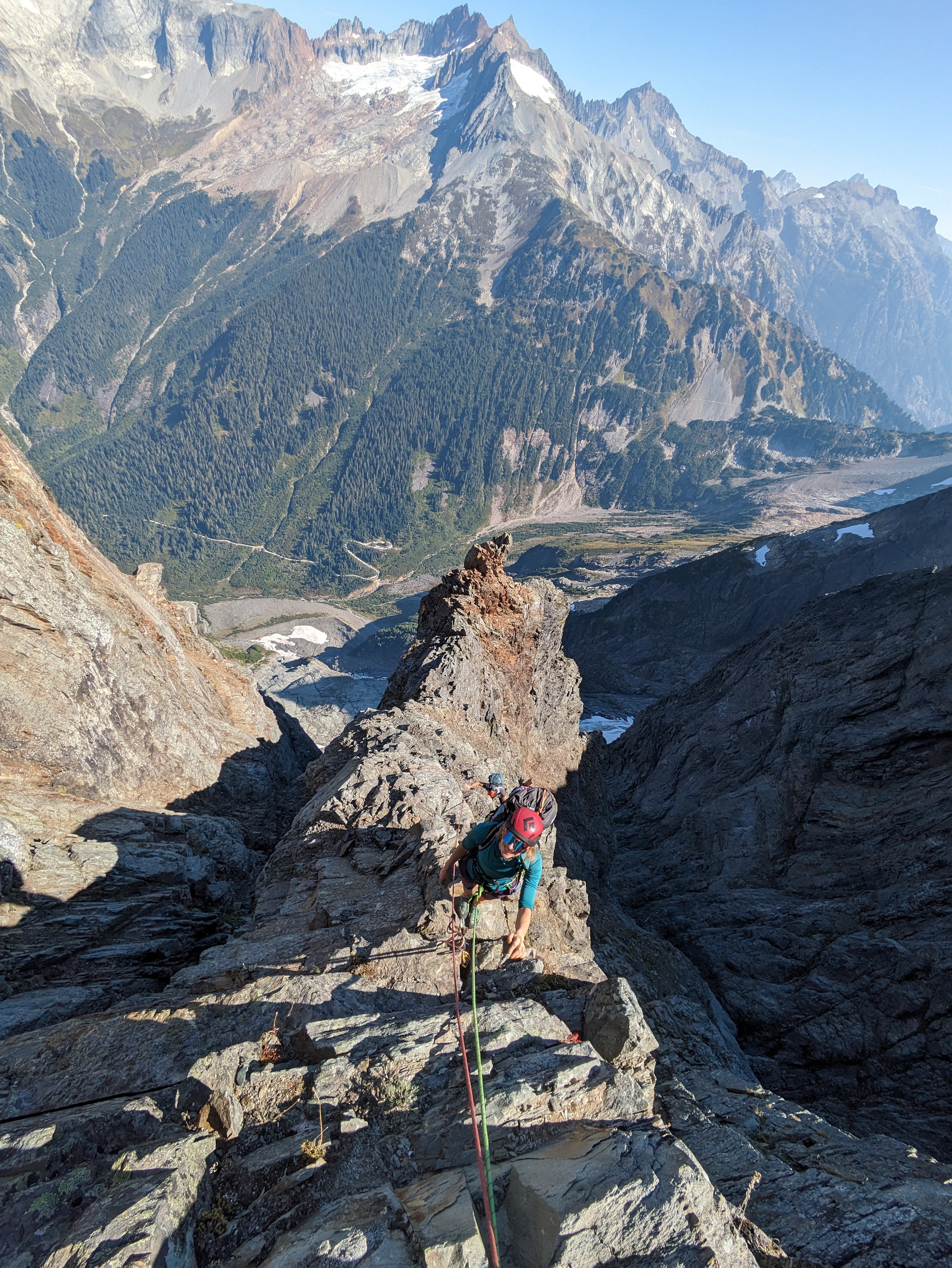
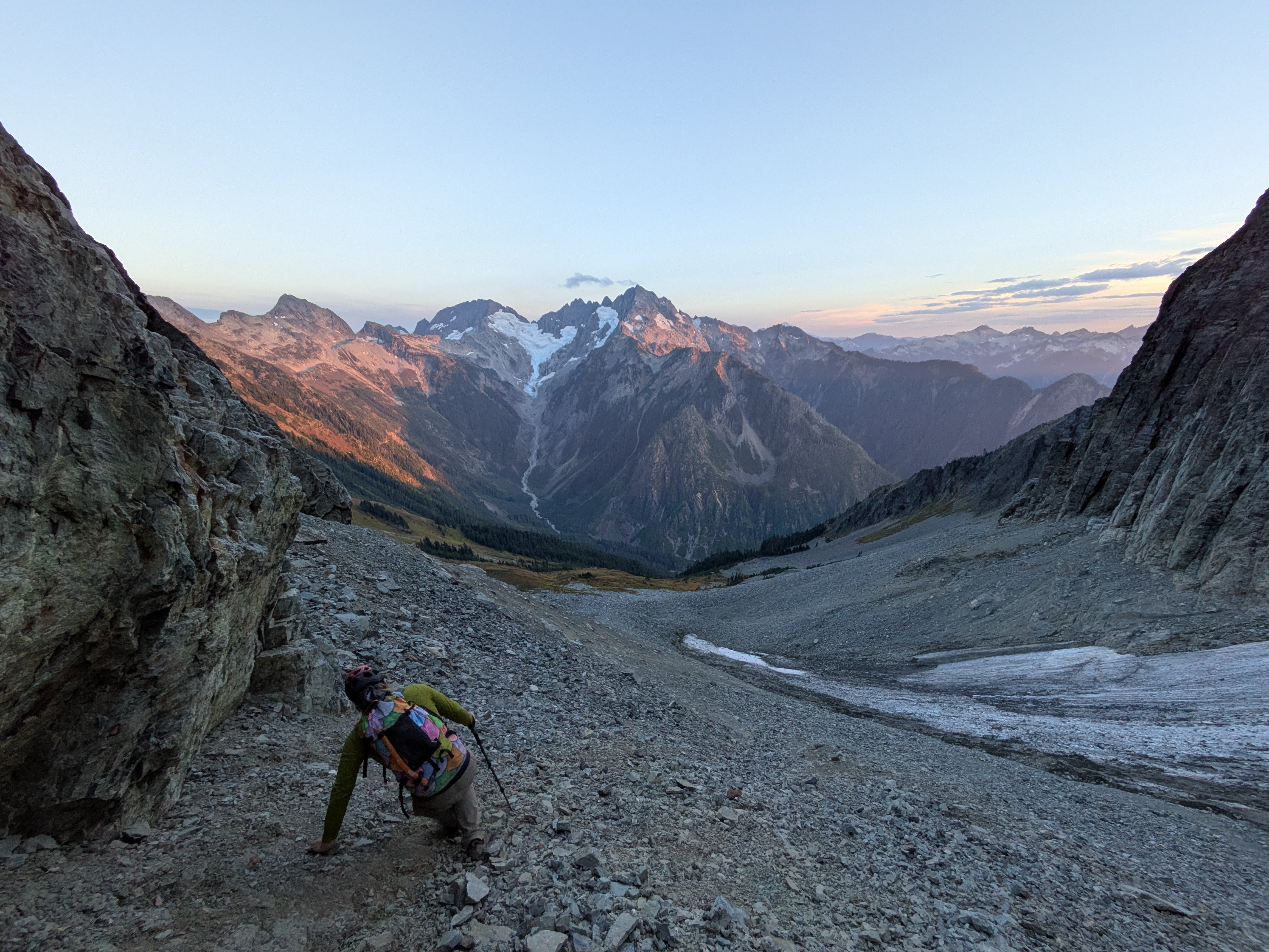
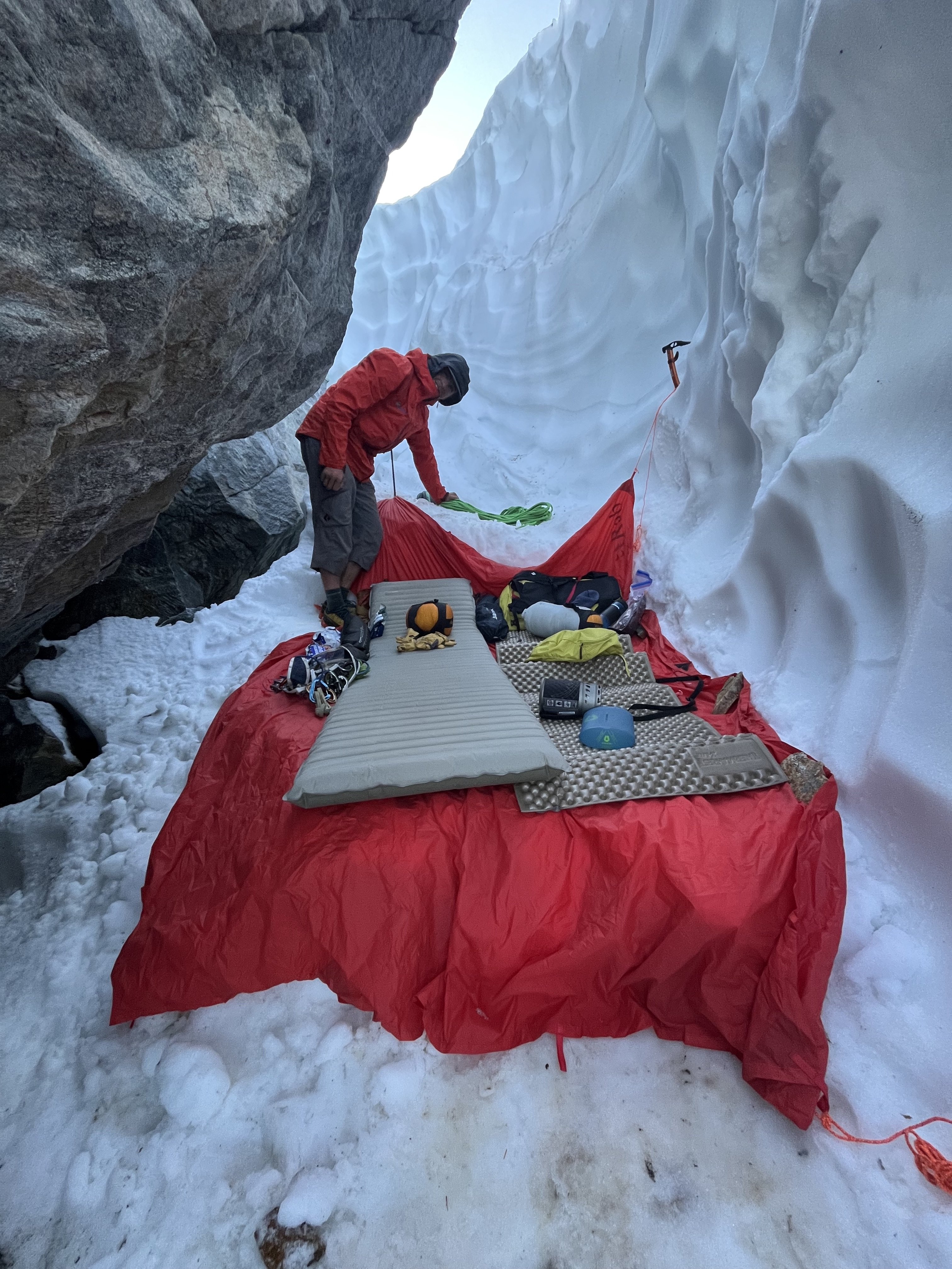
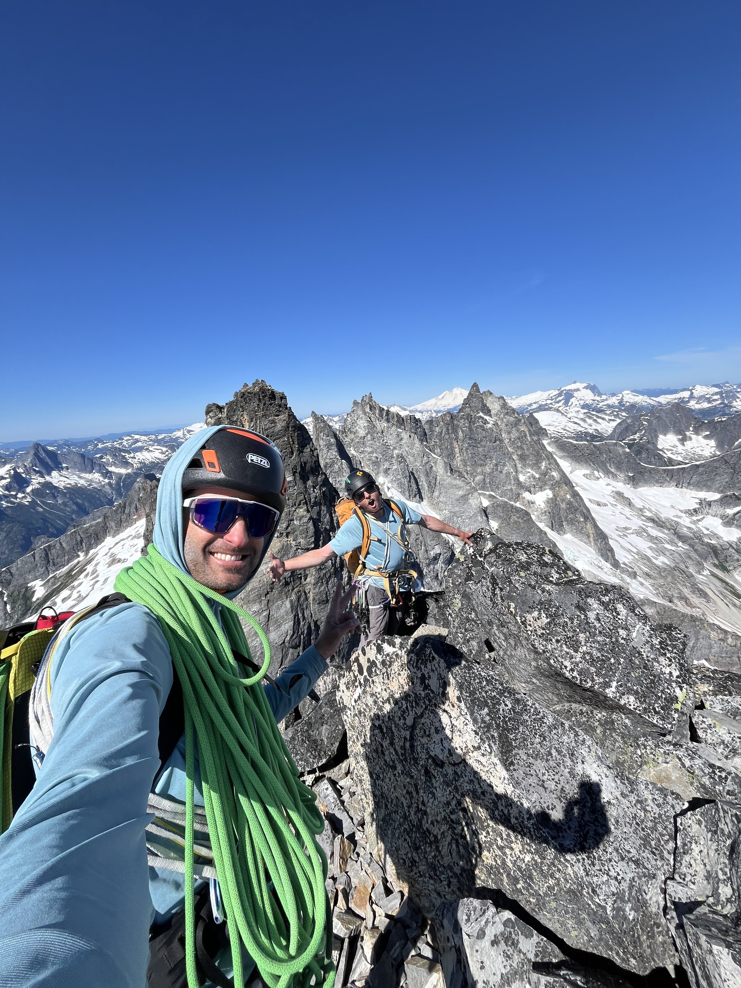
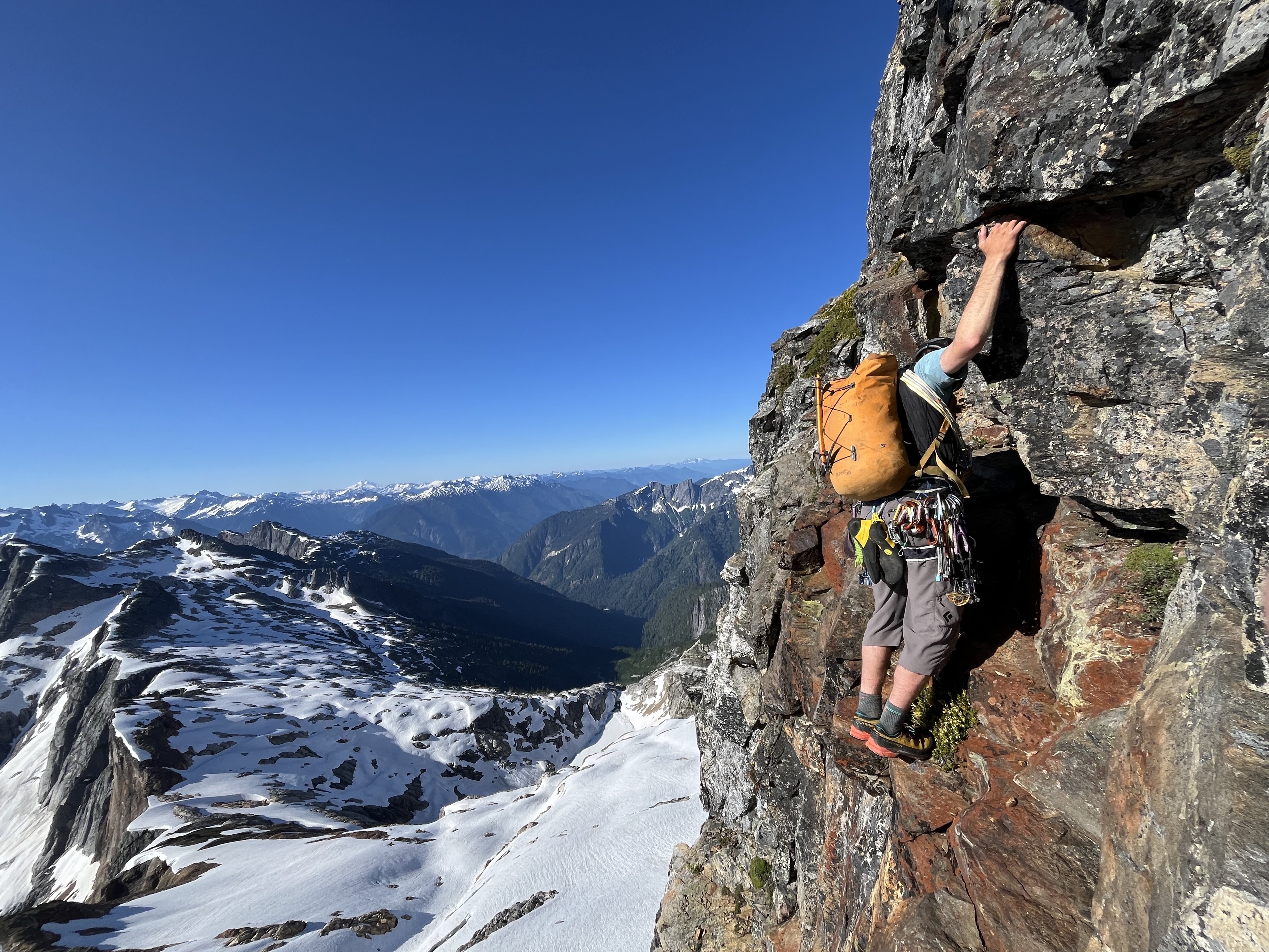
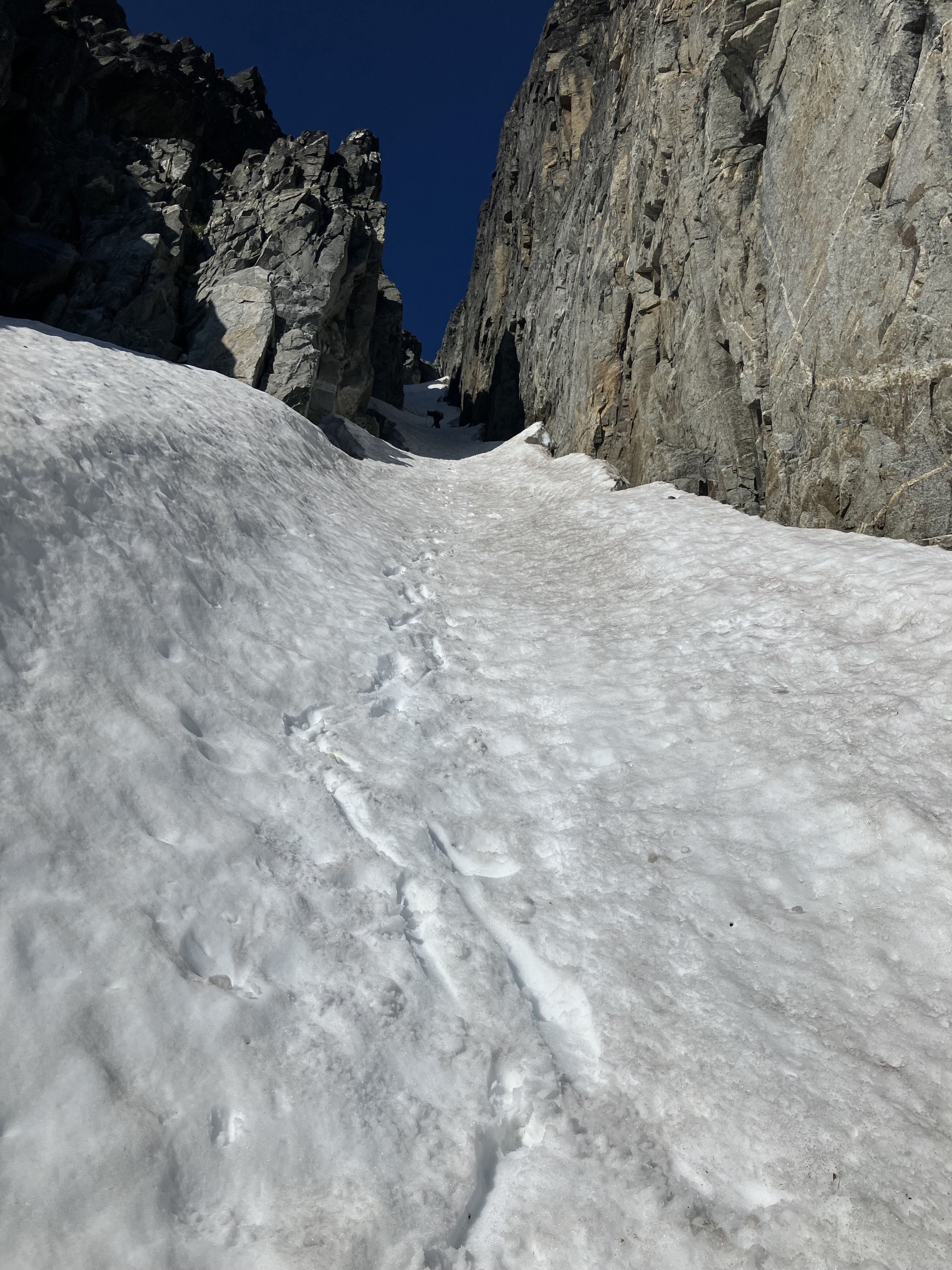
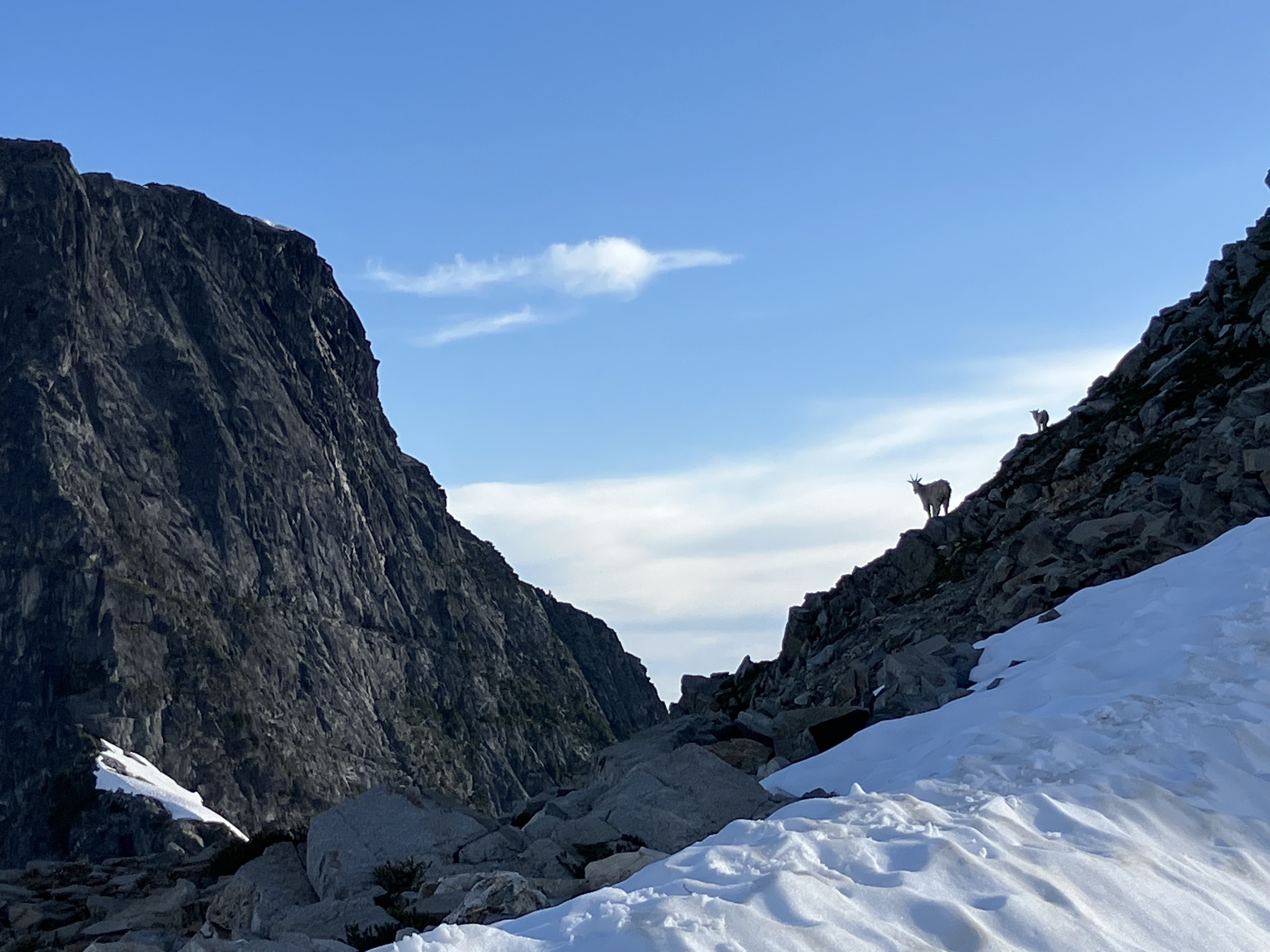
On July 8th at 1:20am, Felipe Guarderas and I began walking up the Goodell Creek drainage with the intention of traversing across the Picket Fence skyline. We ended up climbing just a few peaks shy of the “proper” traverse but had a wonderful time moving through a ton of incredible terrain and we are very content with our execution and style of the traverse. By the time we began to walk out, we had already begun to scheme when our next trip into the range will be. We had about 56 hours of high pressure and we knew that the traverse would be an uphill battle to complete before the rain arrived. We opted to climb in a stripped down, lightweight style carrying a small bivy kit and tarp to maximize our ability to move in the terrain. We carried two dinners and two breakfasts just in case we would need to bivy a second night and we both carried about 3000 calories/person per day. Approaching the Southern Pickets in the early morning of Day 1. We had a rack and a half of cams, aluminum semi auto crampons, 70m 8.5mm rope and shared a single Petzl gully. We both had 40L packs and carried a small puffy, vest, wind jacket and hardshell rain jacket. We hoped that we wouldn’t have to deal with any rain but wanted to be prepared if the weather arrived a bit early. The approach went smooth with lots of snow above 6000’ and we arrived at the base of Little Mac at 7:30am. We enjoyed a long break on the warm rock and attempted to dry out our approach shoes and socks from the long snowy walk above the tree line. Soloing over to the base of Little Mac. We scrambled the exposed heather ledges to the base of the 5th class climbing on Little Mac and then launched up into the 5.7 terrain above. After a bit of terrain confusion, my pace started to increase and I began to find the flow through the exposed face climbing on the upper panel of Little Mac. We continued climbing up to the summit and continued up and over the three Macmillan spires. East Face of East MacMillan. Summit of East MacMillan. I had attempted the traverse last August with Dan May, and we had made it to the backside of Terror before pulling the plug and retracing our steps back over the East Face and down into Crescent Creek Basin. This go around I felt more familiar with the terrain and moved a bit quicker through some of the confusing 5th class terrain that Dan and I struggled to read last year. We continued simuling and soloing across the skyline until we reached the base of East Tower #5, where we broke the rope out and Felipe fired the stiff 5.8 pitch to the summit. We rapped into the familiar gully of Inspiration Peak and soon after found ourselves at the base of the East Face of Inspiration. Felipe led up the impeccable pitches on the East Face of Inspiration before we rappelled down to the Inspiration-Pyramid Col and continued racing towards our hopeful bivy at the base of Mount Terror. P1 on the East Face of Inspiration Peak. P2 on the East Face of Inspiration Peak. Pyramid and Degenhardt went quickly and we reached the base of Terror at around 7pm. Tired but very psyched on all the terrain we had travelled. There were minimal bivy options and the wind had increased throughout the day out of the south. Pyramid's 5.8 Chimney Pitch. Instead of enduring a lumpy dirt bivouac in the wind, we opted to utilize a large snow moat beside a large boulder that marks the start of the East Face of Mount Terror. We spent an hour kicking in a suitable flat spot large enough for the both of us and settled into a heavy night of sleep before an early wake up the next day. Our snow moat bivy at the base of Mount Terror. We awoke at 3:30am and were well into our first simul block when the sun began to paint the east face at around 5am. We continued up and over Terror, onto the Rake’s extensive ridgeline and over the Blob and the Blip. Felipe on top of Mount Terror. One of the highlight pitches of the traverse was the knife edge ridge climbing of the East Twin Needle. It was a superb pitch of climbing in a very wild position. We hit the summit of East Twin Needle right around noon and the increase in winds made it obvious that a low pressure system was on its way. Felipe cruising the wild climbing on the East Twin Needle. On top of West Twin Needle. We reached the base of the Himmelhorn at 1:45pm and Felipe hiked the crux pitch of the traverse in good time. One more pitch brought us to the top of the Himmelhorn and we high fived and kept moving over to the rappels. Six total rappels brought us to the Himmel-Otto Col and by then it was about 3:30pm and fairly windy. With the Ottohorn and Frenzelspitz still ahead of us, we discussd the pros and cons of traversing the ominous choss gully over to Frenzelspitz, climbing the last peak and then retracing our steps. It seemed as though the loose terrain would eat up a ton of time and with inclement weather on the horizon it seemed like a death march out of Stump Hollow would be inevitable if we choose to complete the traverse by the book. Base of the Himmelhorn. P2 of the Himmelhorn. Looking back at P2 of the Himmelhorn. Instead, we left our gear at the Himmel-Otto Col, soloed the Ottohorn and then descended back to the col. We felt okay with our decision to leave out Frenzelspitz and began our long descent back down to the car. On top of the Ottohorn, looking back at the West Face of the Himmelhorn. One overhanging rappel brought us to snow in the gully and we moved quickly down to the heather benches of the Crescent Creek Drainage. We hit the Barrier Col at 7pm and were able to quickly find the trail down into Stump Hollow. The Himmel-Otto Couloir. I stupidly got us lost as we began our last descent to Terror Creek and we spent the next few hours making slow progress bushwhacking down to Terror Creek, across the river and back up to the Goodell Creek Trail we had approached on. Goats on top of the Barrier Col. By the time we both reached the cars it was 1am on July 9th. Just under 48 hours since we began walking uphill. Although we didn’t complete the full traverse, we are content with our style and timing. At around 7am, it began to rain down in Newhalem and we were psyched to be sleeping in our cars rather than high up in the mountains. We also figure this likely won’t be the last time we’ll be in the Pickets and it’s nice to have a few peaks to come back to… A huge thanks is in order for Wayne Wallace, Mark Bunker and Colin Haley for their initial vision for the traverse and to Jeff and Priti Wright who’s beta was invaluable throughout the trip. Additionally, Jens Holsten, Sol Werkin, Chad Kellogg and Dan Hilden’s vision for a full enchainment of the Picket Range inspired us immensely and we are pretty mind blown at what those guys were able to do over 8 days! https://sam-marjerison.blogspot.com/2025/07/picket-fence-traverse-attempt.html Gear Notes: 70m 8.5mm rope Singles .2-3, Doubles .4-2, Small Rack of Stoppers 6x Single Length Slings, 4x Double Length Slings, 2x UL Quickdraws Aluminum Crampons & Shared Petzl Gully Windburner Stove + 2x 4oz fuel cans (only used one) Rab SilTarp 2 Small Repair Kit: Repair Tape, Ductape, 30’ 3mm cord, 3x AAA batteries, bundle of bailing wire 2x 2L Soft Flasks Feathered Friends Tanager 20 Thermarest NeoAir Small Portable Battery, Inreach, Headlamp and chargers Approach Notes: Up Goodell Creek, down Stump Hollow (don’t get lost like us!)

 11 points
 -
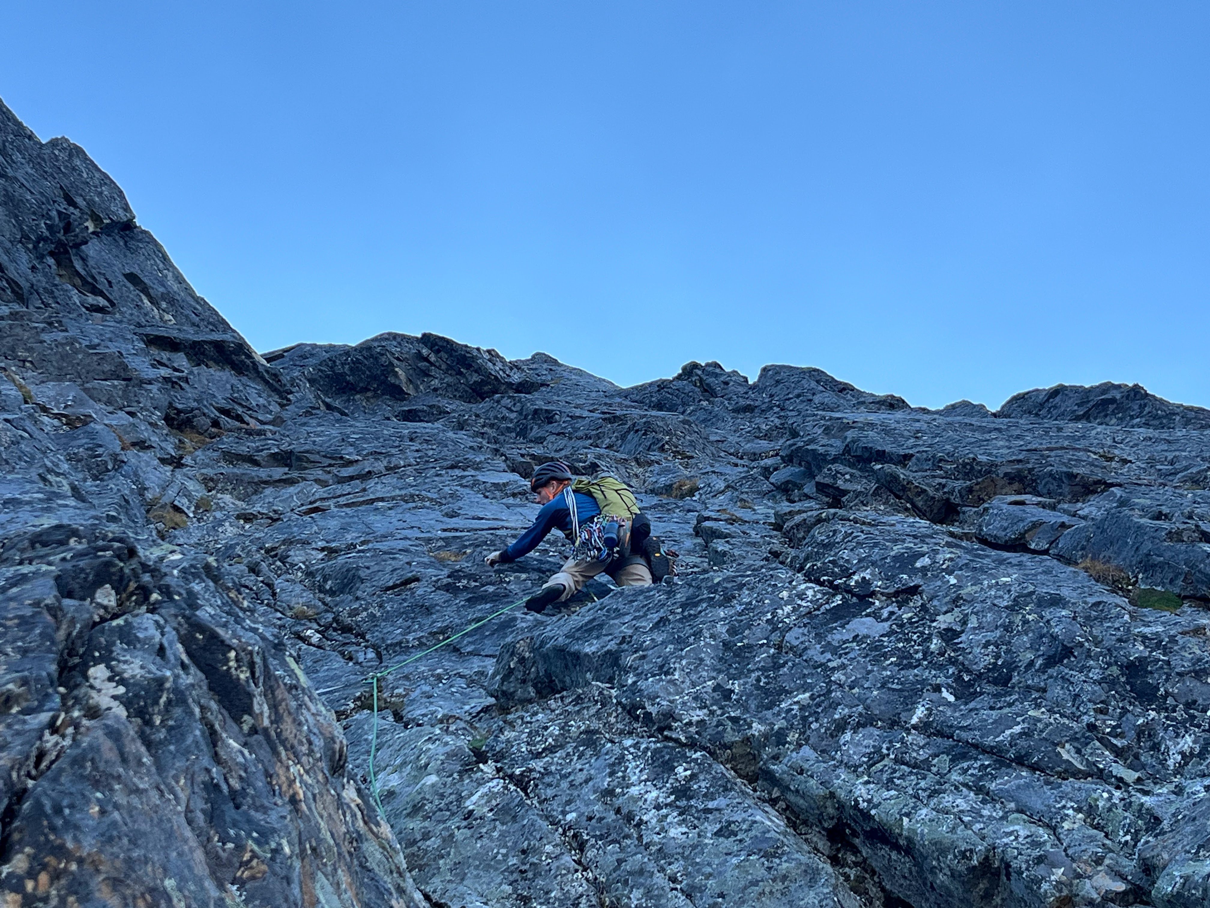
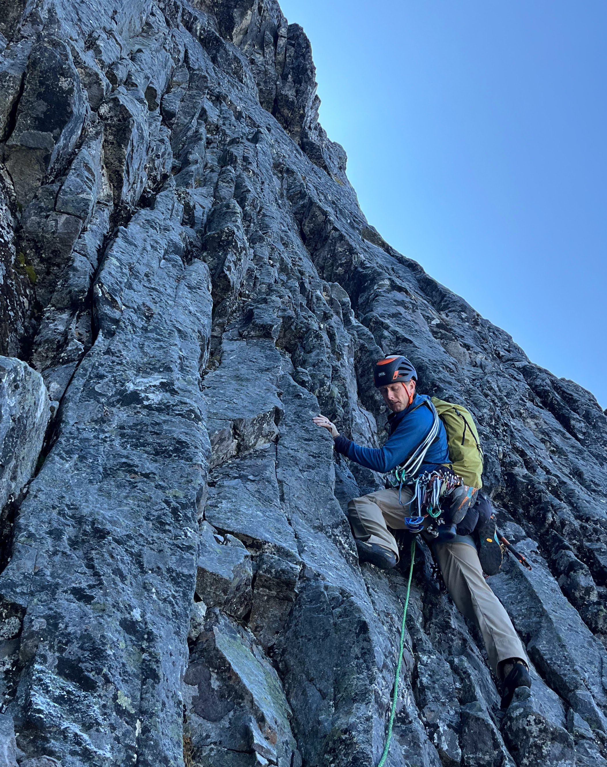
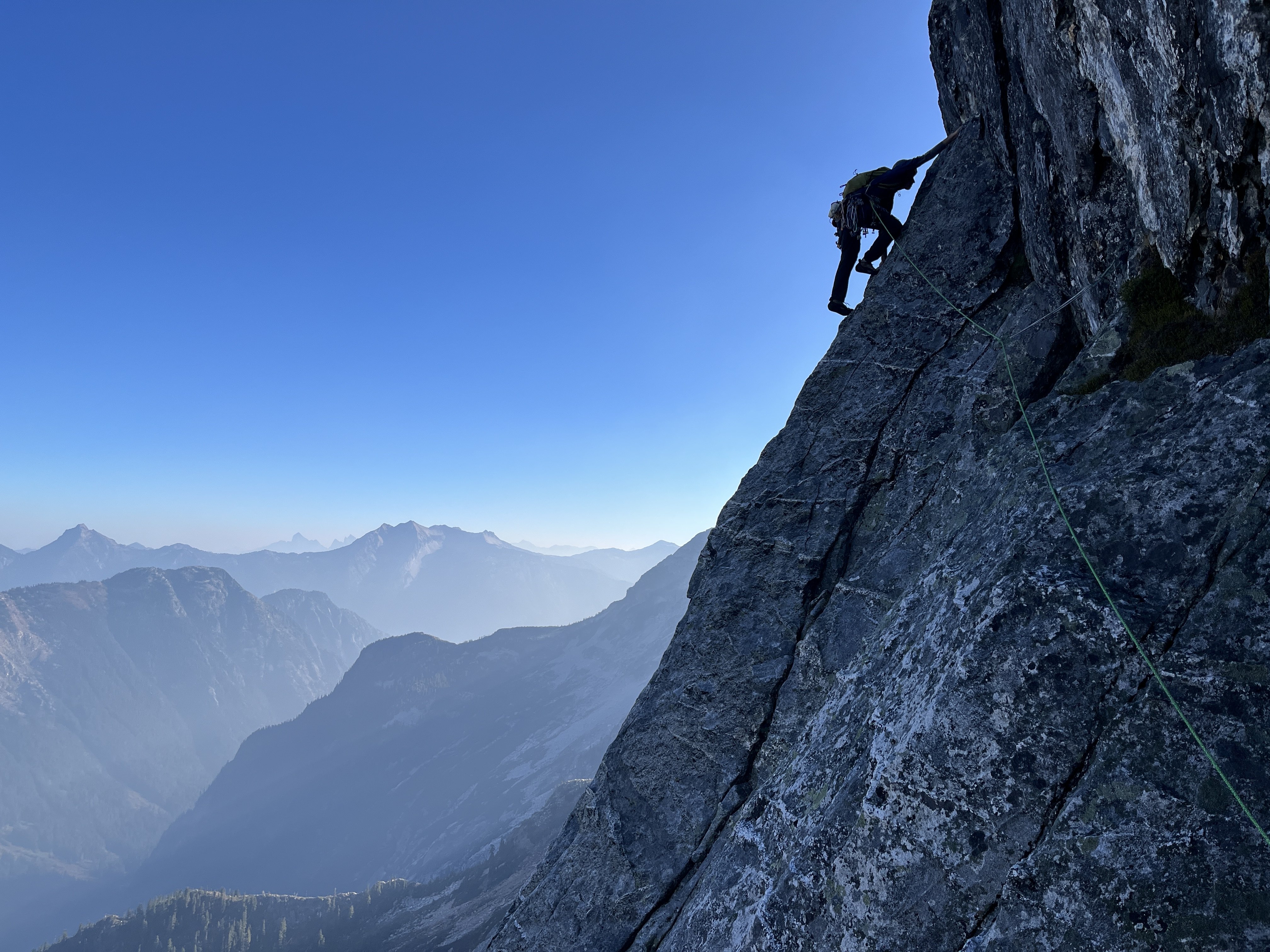
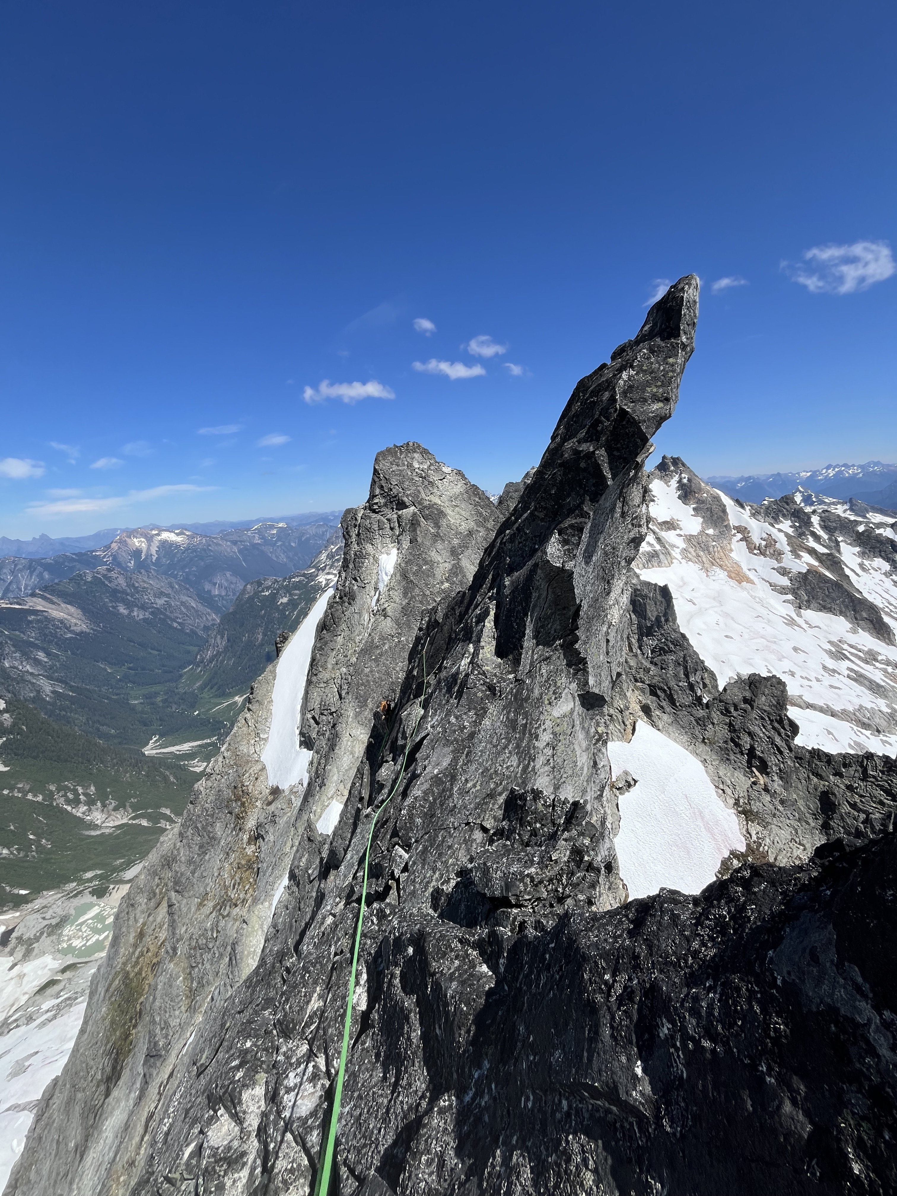
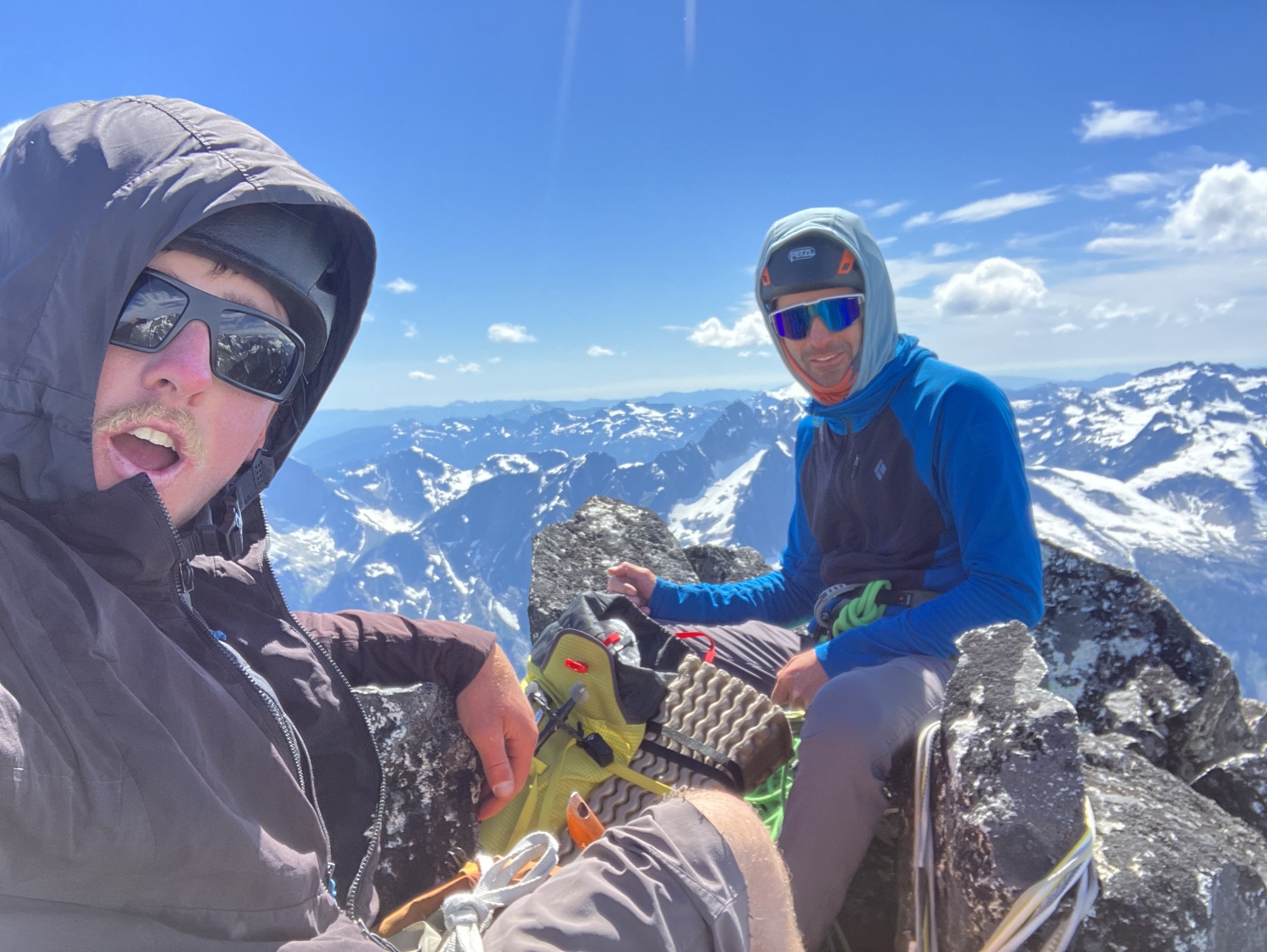
Trip: North Cascades, Arches Peak aka Little J-berg - North Face Central Buttress, 10 pitches plus soloing, ~1,600 vertical feet, 5.6/7ish Trip Date: 08/03/2025 Trip Report: A couple of weeks ago, Rolf Larson and I climbed a probable* new route on this peak. Anyone cresting Easy Pass has been greeted by the big north face of this peak. There is one reported route on the face from the late 1970s; the party climbed the left-hand "Plumb Line Buttress" 2,700' from the valley floor to the summit, which clocks in at 7,945'. They reported loose rock. (See photo of register page in the album linked below, the AAJ, or Beckey guide.) Of three relatively prominent buttresses, our route climbs to the western false summit (circa 200' west of true summit) via the central buttress -- the most prominent one lit up (furthest left) in the photo below. We believe the 1977 line appears in this photo as a nondescript buttress in the shade further off to the left. Our route wends up the gneissly-featured buttress on pretty good, pretty clean Skagit rock--we began climbing behind the third snow-patch from the right on that prominent shelf, directly below the toe of the sunlit buttress. (Also available here: https://photos.app.goo.gl/BV3itCHmqcoo7qL38) We had fun on this route, which thankfully was in shade while we climbed. Didn't take many climbing photos, but snippets of conversation went like this: "How'd you like that section of hand crack?" "I preferred my section of laser-cut finger crack." "Yeah, I went Squamish style and laid it back." Here's Rolf putting in a piece at perhaps mid-height on the face (the rope is out of view, off to the right): The first pitch was probably the steepest and most sustained, fwiw, and had a 5.6 or maybe .7 move. A couple of steep mini-headwalls were also climbed in that range of difficulty, but a person could avoid these if willing to take looser rock. We unroped for a few hundred feet of mellow scrambling after the first pitch or two, but some steeper terrain compelled us to again rope up and resort to pitching and simul-climbing on fourth and low-fifth terrain. The climbing is moderate, but generally solid and fun, with adequate protection. *As you will see in the summit register pics, Roger Jung soloed a route on the north face, but it's hard to say if he took our route -- there is certainly latitude to wander on that big north face. The photo album, which includes some pages from the register: https://photos.app.goo.gl/4JU83LgK6XKFdbSA7 We descended via a walk off to the south and east--no crampons required. The short-ish approach, moderate and generally solid climbing, and straightforward descent (not to mention the blueberries!!) might make this climb more appealing than some of Rolf's and my other routes. I'll wait for Rolf to correct me on any details (which are already fuzzy), downgrade the level of difficulty (as is his crusty wont), etc. etc. Here's an early musing about Arches from the cc.com archives: Gear Notes: Standard rack with emphasis in finger-sized pieces; tri-cams were useful Approach Notes: Via Easy Pass, drop to and cross Fisher Creek, find your way up through the lower cliff bands, wiggle-chimney between moat and rock to the start11 points
-
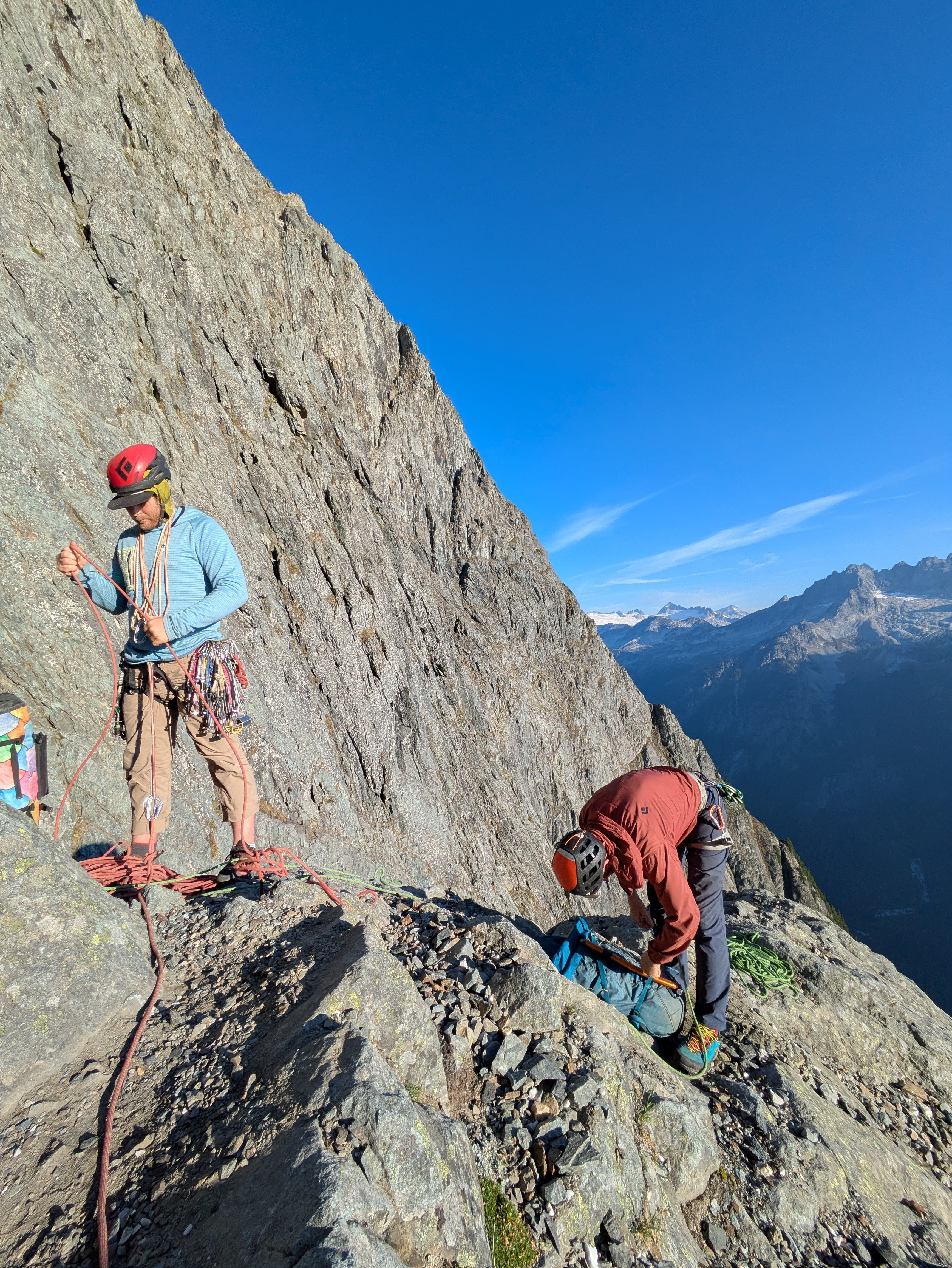
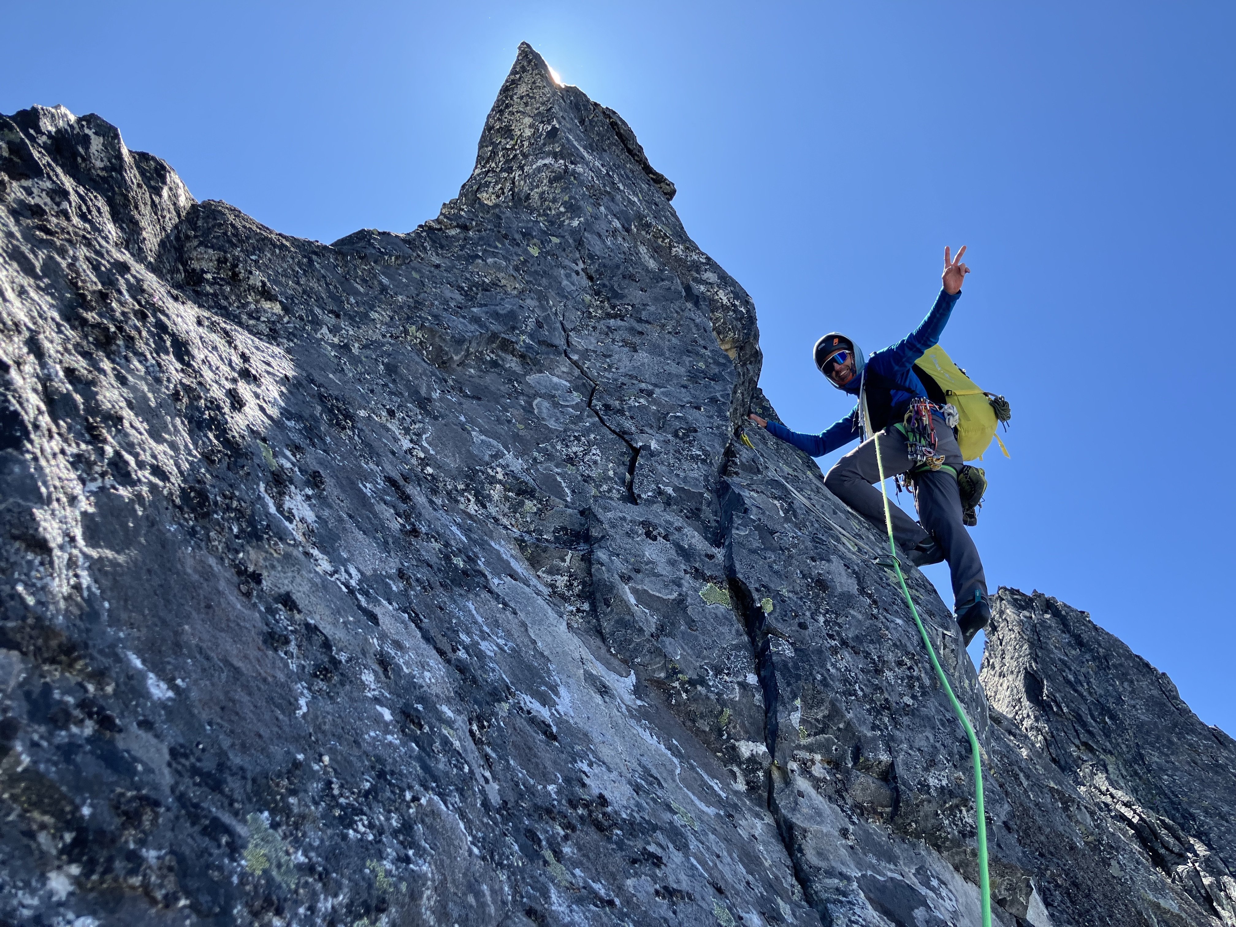
Trip: Spectre Peak - Spirited Away (IV, 5.9, ~2000 ft, 10 pitches) Trip Date: 07/07/2025 Trip Report: "Spirited Away" Second Ascent Spectre Peak & Exploring the North-Western Pickets Adam "Mo" Moline & emilio Taiveaho Peláez Itinerary: Day 1: Camp on Easy Ridge Day 2: Perfect Pass & Whatcom Day 3: Perfect Pass to Phantom Ridge Day 4: Climb “Spirited Away” (2000’, IV, 5.9) on Spectre Peak Day 5: Push Camp to Copper Creek Day 6: Hike out from Copper Creek First is a pitch-by-pitch description of the climb, written by Mo, followed a trip report written by both of us in collaboration. We climbed ten pitches, including a long (~600 ft.) simul of 3rd-low 5th to the summit block. Several of our pitches (p.4-6) diverged from the first ascent route. The Climb: “Spirited Away” (FA: Sam Boyce, Joe Manning) is an excellent remote alpine climb with stunning features in a hauntingly beautiful landscape. Pitch 1. From the notch, Emilio leads right and up 4th class ramps to a chimney, then opts for going right to the 5.7 face with good high feet moving up to the tree ledge. ~35-40 meters. Pitch 2. Emilio finishes tower 1 by first scoping the 5.9 chossy overhang, then opting to shoot left for the clean Gully. We both wanted to add to Sam and Joe’s incredible line by exploring places they mentioned, and we’re happy to report the gully was a very enjoyable and clean 5.6 romp up Tower 1. Pitch 3. (Mo) I, who haven’t yet realized we’ve bypassed SJ’s crux, eagerly take the lead after moving the rope further along the large ledge. The long pitch starts with moving the rope along the large ledge and travels up the 3rd-4th class ridge with nothing close to a 5.9 chossy overhang, odd. Very enjoyable climbing though! At this point, I stay along the ridge crest completely enchanted by the tower and therefore diverge from Sam and Joe’s (SJ) line for the first time. I anchor in at the base of the obvious and impressive Tower 2. Pitch 4. Emilio leads up the tricky face with bad pro. They shoot for the corner to find good gear for the steep headwall. The options from below appeared to be a steep and potentially overhanging crack up the middle, or heading to a notch on climber’s left between the 2 spires into overhanging face climbing. Emilio picks an inspiring line up to the notch through the corner followed by 20-30 feet on the steep but surprisingly juggy face, 5.8. Pitch 4.5. After the tower and an awkward belay, Emilio lowers down 15 feet climber’s left off a slung horn to a ledge below to set up an anchor for the “sky bouldering” pitch. Mo down-leads easy but chossy terrain. Pitch 5. (Mo) Along with the tower, this divergence (??) is also a complete treat. Comparable to the Rooster Comb on Mongo, or climbing in the Fisher Towers, the sky bouldering pitch involved some of our favorite climbing. Along with a series of easy V0- boulders, the ridge presents a perfect hand crack splitting an impressive boulder. Climb up and over this 4 star boulder, gymnastically flow through more boulders digging your hands into serious lichen, and finish with a reachy smear onto extremely licheny rock suspended over air. Belay on one of the golden slabs below the next gendarme. Like the RC, it’s hard to put a grade on this type of gymnastic climbing, top shelf fun though. Pitch 6. Emilio climbs the corner block with good pro, up and left of the gendarme until they meet SJ’s line once again. After lowering off nut/horn pro left by the FA team, Emilio sets up an anchor out of the shooting gallery and I lower down to the very redundant anchor deep in the gully. The only pink tricam placement of the trip. The kind gear left behind by the FA party for this pitch. Pitch 7. (Mo) Lead up 4th class to a left trending ramp where 5-moderate begins. Future climbers take the larger, earlier ramp rather than be entranced by the huge bulgy crack splitting the face (like I did). After returning to the ramp, it meets the beautiful hands/fist crack. With many alpine draws, continue up to meet the slightly overhanging crux of the pitch with a mix of choss and bomber jugs. Physical wandering with cautious choss dancing leads right, up, then left through stellar holds to a clean finish. Steep and committing but surprisingly good holds made this feel like 5.8+. Good pro. Let the choss sleep here for the sake of your follower! Looking down from above the hand/fist crack. Pitch 8. Emilio climbs up the heather ramp with choss for roughly 30m but not great pro until the blocks. Follow 5-moderate blocks up and left. After running low on rope and scoping options, Emilio belays on choss 20ft below the ridge crest. Looking up at the heather ramp. Pitch 8 Notes: Continuing on the ridge crest could be an alternative to the heather ramp. To avoid rope drag on the Hoodoo pitch, belay from the ridge crest if possible. Pitch 9. (Mo) Hoodoos. 3 options presented themselves to reach the ridge crest. Follow Emilio’s wisdom and take the chimney to the right or the easy ramp to the left, or my idea to shoot straight up the white 5.9 face. With my hopeless delusion being prevention of rope drag, I shot up a few cruxy moves and pulled it without showering Emilio with choss. All of a sudden, the spirits are all around you. We traversed low around many of the hoodoos both out of a fearful respect of their haunting beauty and temporary nature. We didn’t stop for any pictures and quietly danced around their north sides when possible, or climbed over when it wasn’t. After this steep, exposed, licheny, and hauntingly beautiful traverse, rappel off the furthest Hoodoo for 25-30m to a nice grassy ledge, then move to avoid rockfall. Pitch 10. (Simul, Emilio then Mo). 600ft of 2nd, then 4th, then 3rd class stellar scrambling following heather ramps and solid rock. Emilio leads what was some of our favorite climbing of the ridge moving efficiently up to the headwall. Emilio hands me the kindest gift of finishing up the 5.0 pitch. We finish this climb in memory of Teemo (Chad) the Cat who was spirited away weeks before this climb. An inspiration of our climbing, style, and backcountry meals (Chad’s Backcountry Catfood), and who lived with Emilio and me over a decade ago. With Love, for Teemo. Climb Descent: We now realize Emilio has accidentally stached their ice axe at the base of the climb. However, before we tackle this challenge, we must figure out how to down climb the east side which appears ledgy at first, but then becomes 5.moderate and steep. We navigate and beta share our way down after some interesting 5th-class moves on good holds. This side of the rock was significantly harder climbing than the side we summited. Now, the fun begins. We read SJ’s report of steep snow and early conditions and see this to be true. However, we have luckily navigated somewhat similar situations where on Mongo Emilio traverses steep snow with sharp and flat rocks for aid. I (Mo) kick some deep steps down a short steep section in similar style. After a few minutes of thoughtful snow travel, it eases up to walking a beautiful snow ramp down to a heather and slab rib. From here, a gorgeous dyke ‘Thank God Ledge’ becomes obvious and points you directly home to the base of the climb. Walk the 2nd class dyke admiring the unique rock and granite eggs. This section feels like walking towards Minas Tirith. Follow until the dyke turns into heather ledges/ramps at the base of the climb. 10/10 descent, would maybe rap in the future, or find the actual route down. Ascent ~11hrs Descent ~1 hr Trip Report Introduction (written by emilio): “When you get to the top of the mountain, keep climbing.” Nothing embodies this mantra more than a trip to the Northern Pickets, with its endless folds, valleys, and ridges. Summertime in the northern hemisphere means it’s high time for licheny choss and remote alpine meadows. For me, the solstice brings a yearning for good snowpack and godly glaciers, and despite my attempts to think or dream of other mountains, climbs, and ranges, the Pickets keep calling me. Throughout the year, I often wake up in the middle of the night longing for their surreal gendarmes, gnarly towers, towering spires, and self-willed wildness. Last summer, Mo and I climbed the climb we’ll never come back from, Mongo Ridge on West Fury. The three nights we spent on route mark some of the most significant moments of my time here on Planet Earth, so it was difficult to tell what would unfold after that experience. But, as it often does with these things, the idea of returning to the Northern Pickets for a seventh time as a team came organically. This is a blessing, because nothing is better than going into the mountains with Mo, the strongest free-climber I know and one of the very best all-around humans I’ve ever met. Although for the last few years we’ve been entering the park through Ross Lake, the first time Mo and I went into the mountains together we went in through Hannegan Pass, embarking on the long trek up Easy Ridge with a group of six. That year, we ate hearty servings of humble pie as we crossed the Challenger Glacier, climbed Challenger, dropped down to Luna Cirque, hiked up the other side, and tumbled down Access Creek. Photo I took on a disposable camera on our first trip to Challenger (2018). This was the first any of us had roped up together, the day after Mo's first rap ever. Jake Johnson, secret hero of all our trip reports, leads the way. Returning to Hannegan Pass in order to visit those places of intensity where our love for the Pickets began—the Imperfect Impasse, Perfect Pass, Whatcom Peak (where I was first benighted), and the Challenger Glacier—with all these years of hard-earned experience felt right. Also, filling in the lore of Mongo, we knew that Wayne had first seen that mythic ridge while climbing the mind-boggling “Haunted Wall” of Spectre Peak. We had to at least see the Haunted Wall in person, to trace Mongo backwards, and get to know this obscure and remote peak we had seen from the neighboring ridge. The call from Spectre was coming from several directions. Beyond the opportunity to climb exquisite choss, the pleasure of going to such a remote country and live, even if momentarily, in the freedom of the hills, is hard to pass up. As a team, Mo and I have been on a little tour of second ascents across Washington (summiting Lemolo, “Sharpen the Saw,” and going up the Rooster Comb), often setting SKT’s in the process (slowest known time), so even if we didn’t yet have the gumption or cojones to repeat Mike Layton and Wayne Wallace’s insane line, we figured we could celebrate Sam Boyce’s remarkable achievement, “Spirited Away,” the South Ridge of Spectre, and enjoy our time in the process. The hoodoos, gymnastic traverses, and time spent on the ridge, made this line appealing. At the same time, Sam’s recent climbs in the Pickets have been inspiring to follow, and the beta he and Lani provided from their climb of Mongo made our experience on that ridge much more pleasurable, so our ascent of Spectre is a celebration of this current Picket Renaissance. As opposed to the ultra-light mentality we brought to Mongo, for Spectre we shouldered heavy packs, bringing extra food, creature comforts, and redundancy (including an additional pack stuffed inside my pack, which strangely came in handy) for the ~50 mile round trip and ~20,000 ft of elevation gain. We started our trip on the Fourth of July and budgeted the entire week ahead in order to adapt to the weather and be able to luxuriate like sybaritic alpine lizards. Trip Report (written in collaboration by both of us): Approach (days 1-3): We left the Moline Compound in Olympia early in the morning, driving steady to the Hannegan Pass trailhead to get there and get walking by 8:30 a.m. Surefoot miles brought us past hikers and trail crews hard at work. Crossing the Chilliwack was a treat in the heat and we zig-zagged the long diagonals up to Easy Ridge, encountering Chaga, old COTW, and copious Calf’s brain while admiring a solitary hand-crack along the way. For the return, we knew we’d have fresh berries Bilberries and Huckleberries. Like everything in the Cascades it seems like Easy Ridge is sandbagged because it’s a serious hike, but it also lives up to its name in the views it affords–though on our way up it was mostly clouds. We camped at a nice bivy before Easy Peak proper and drink some fresh Chaga tea. We stop after 15 miles and 7 hours of moving. The following morning we slept in and made coffee in the morning, taking our time before getting moving. Right as we pack up to take off, Mo’s side backpack zipper breaks exposing all the innards. After several seconds of perseverative thought, the universe reminded us that we have, in fact, 3 total backpacks between us! Not being able to decide which pack to climb in, Emilio serendipitously packed double bag includes both a 35L pack with a 30L pack stuffed inside. Mo’s pack is strapped shut with some climbing equipment (reminiscent of the broken crampons on Mongo attempt 1) and we ramble scramble onward without any anxiety of gear for the climb ahead. The scree-step up to the summit of Easy Peak brought us to more walking and descending, before reaching the threshold that the Imperfect Impasse provides. What a chasm! It’s hard to believe Mo’s first rappel ever was into the snow down below, though there was no need to rap today. Fourth class ramps and early season conditions were in our favor and we were able to quickly move across and head up the slab and heather to Perfect Pass. It’s nice to imagine what evaporating dew must feel as it ascends, but gravity in a human form is more easily navigated in diagonals. On the way up we ran into a group who had just summited Challenger, having camped at the bottom of the Impasse, but they were the only group we saw and from there we had Perfect Pass to ourselves. Given our odd timing at PP, to warm up for Spectre, and because it seemed ridiculously fun, we decided to drop our stuff and romp up Whatcom. The snow conditions were great and the sun was shining. Whatcom is a stunning mass and a wonderful teacher, and as specks on her summit we lingered admiring the landscape. The way back down to Perfect Pass brought joyful plunging leaping running down the mountain and we made twelve minutes of it, even after stopping to take pictures and laugh. Deciding Perfect Pass lives up to its name we made camp and stopped here for the night sleeping once again under chossy stars. emilio bouldering at perfect camp trying to strengthen the toes after descending from Whatcom. There are some quality blocs to be found out here! I’m wondering if FKT.com will allow for the Pass-to-Pass FKT to be submitted up to Whatcom, here we humbly submit 1 hour for our time. The next morning brought us to search for the somewhat mysterious Challenger Col. It’s mysterious because there are several possibilities for which one it may be and we had been overconfident on the beta for this section of the climb. After weighing our options we decided to go up high to the (later identified) West/Middle Challenger col and found some vintage tat. A slung horn of rope fibers suggested the way down a dihedral next to a stunning arete, and the glacier below seemed to provide ample access to the Western slopes of the Northern Pickets. We slung the same horn with fresh webbing and went down for a 35 meter rap. On the way down we found an offset nut with some red tat. The full rap was a little longer than 35 meters, but luckily it ended in a hungry offwidth so we were able to untie and downclimb a few extra feet to the snow, which provided a welcome ramp into the glacier. Here, again, we benefited from early season conditions. We navigated the glacier down to the south ridge of Phantom where we made a gorgeous rockside camp on clean slab near drippy snow. Sleeping early brought thought-dreams of the climb ahead and brief periods of waking up (at 8 pm) to gape at the Haunted Wall. Seeing the Great Gendarme that adorns the South Face and thinking about the bold, committing, and cerebral nature required to climb such an audacious route left us floored. For what it’s worth it’s worth remarking that Wayne Wallace and Mike Layton’s climb of the Haunted Wall of Spectre is perhaps one of the most impressive feats not just in Cascade climbing, but in USAmerican climbing more broadly. Mo enjoying an ice bath on Phantom Ridge preparing for the climb ahead. Harvesting Water on Phantom ridge. In lieu of prayer flags we adorned our camp with the tat we had found along the way. Mo with Mongo. Day 4 (climb): An alpine start at 3:40 has us moving to arrive at the climb with the sunrise. [See Previous pitch by pitch section] Descent (days 5-6): An alpine start at 4:00 a.m. has us moving well before daylight, as we hope to cross the Chilliwack by the end of the day in order to avoid the incoming weather. Cold coffee gets us moving and we go back up and down the rhyming patterns of scree, talus, and heather, scree, talus, and heather, until we hit the snow. We had debated whether we would try to find the actual “Challenger Col” that ostensibly did not require a rap to go down, or retrace our steps and retravel our known road up the glacier, and lead the pitch back up to the Col. The thought of leading the pitch back to the col had Mo full of energy so the decision to retrace our steps up to Solar Glacier was an easy one to make. Snow brought us back to the rock where Mo put on the rock shoes and racked up (only to place minimal gear). The arete provided excellent, though not well protected, 5.4 / 5.5 climbing. What an incredible way to get back on the Challenger Glacier! Back on the glacier we stayed high to scope out additional low points on the glacier. A stacked cairn gave indication that we had perhaps found Challenger Col. After reading several other trip reports, it’s hard to say which col is indeed the standard col to access the western side of the Pickets, but perhaps someone can help us piece this together. Looking up at the arete from the solar glacier & Mo leading the way. The rest of the day brought long miles up and down, through scree and talus and snow and heather, next to waterfalls and tarns, zig zagging under the sun. The snow on the imperfect impasse had melted so the way back was far spicier than the entrance. Thoughtful moving on steep terrain brought us back to the other side, having once again crossed that threshold into the Pickets. The moving kept going all day, as going down is often more of a climb than going up. Thankfully, the trail on Easy Ridge fed us bountiful berries, bringing out the bear in us. Blistering feet peeled and the miles eventually brought us to a solitary and welcome camp on Copper Creek. The Imperfect Impasse! Or is it the Perfect Impasse? Either way, it's awesome and steep. Easy walking along Easy Ridge. The next morning we woke without an alarm, made coffee and leisurely made our way out in a welcome wetness. Rain brought out the technicolor of the plants and clouds clad the peaks in true Cascadian fashion, dramatic and graceful is this ruggedly delicate corner of the world. We walk out in a delightful drizzle with clear pee. Some strange snake staring at us on the way out... We stuffed our pockets full of rocks for games and drove back to Olympia in the early afternoon. An additional note is that we were able to cook most of our meals with Chaga, which seems like a huge aid to pulling this off. Our climb was supported not only by all the manufactured goods we used and the infrastructure required to access this wilderness, but by the countless unseen helpers who made the trails, mapped the land, have lived with the land, and enabled the great privilege that it is to go into the backcountry. There is no such thing as an unsupported climb. Looking back on Mongo Ridge. Gear Notes: Singles from Micro - Large Supercam (no #3), doubles from .1-1, one Offset 10 Alpine Draws Rack o’ Nuts & Tricams 70m Beal Opera & 80m 6mm tagline 60 feet of Tat (used 30). 3 Backpacks 7 meals of Chad’s Backcountry Catfood, 6 freeze-dried meals, 2 ramen, 5 containers of fish Too many bars Copious sports beans and electrolytes to avoid the coca-cola piss Bivys, Pads, light bags Many other creature comforts Gear breaks down when you push it to the limit. Bringing cord, duct tape, and climber’s tape has been enough so far to fix any mishaps between the pack, crampons, or other gear failures in the past. However, the importance of proper gear planning is proving to be more and more crucial. The backpack luck was the universe smiling on us, but being creative and over preparing is often a psychological luxury deep in the alpine. We may have brought too much food and some silly luxuries (not crocs, those are essential), but we also frequently find immense health, physical, and psychological benefits from being properly fueled, rested, and prepared for huge days covering rugged terrain. Luckily, I have a sherpa, Emilio, who seems un-impacted by carrying weight, and I’ll continue to train my pistol squats to validate that extra tin of lemon-caper mackerel. A note on Time. Time continues to be one of the most influential variables that moves the needle on risk in the mountains. With recent epics of friends and horror stories of accidents in our home range, it’s ever important to weigh the gravity of certain decisions. For example, that extra push to get to the base of the climb rather than bivy and the subsequent exhaustion can lead climbers, from amateurs to experts, to make tragic decisions. We both frequently weigh our luck as we’ve gone on 7 and 8 trips to these rugged and gorgeous North Cascades. One considers the roll of these dice weighing the sheer audacity of accessing these ranges with the intense spiritual home that this place has become. There is certainly a time for absurd ultra-marathon style pushes and we frequently love those, but to commune in the mountains with a pace to properly appreciate the weight of these spaces is key. We added on a day on the approach to feel rested on the climb and walked out in the rain to avoid destroying our feet. I feel deeply lucky to have teachers like Emilio, Monica, and Jake who have prioritized a sense of truly enjoying Quality time in the mountains. As we work towards being adequate mountaineers, what matters most is returning home to tell the tale and give back. Approach Notes: Long11 points
-
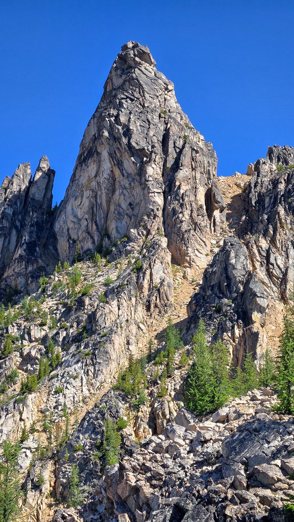
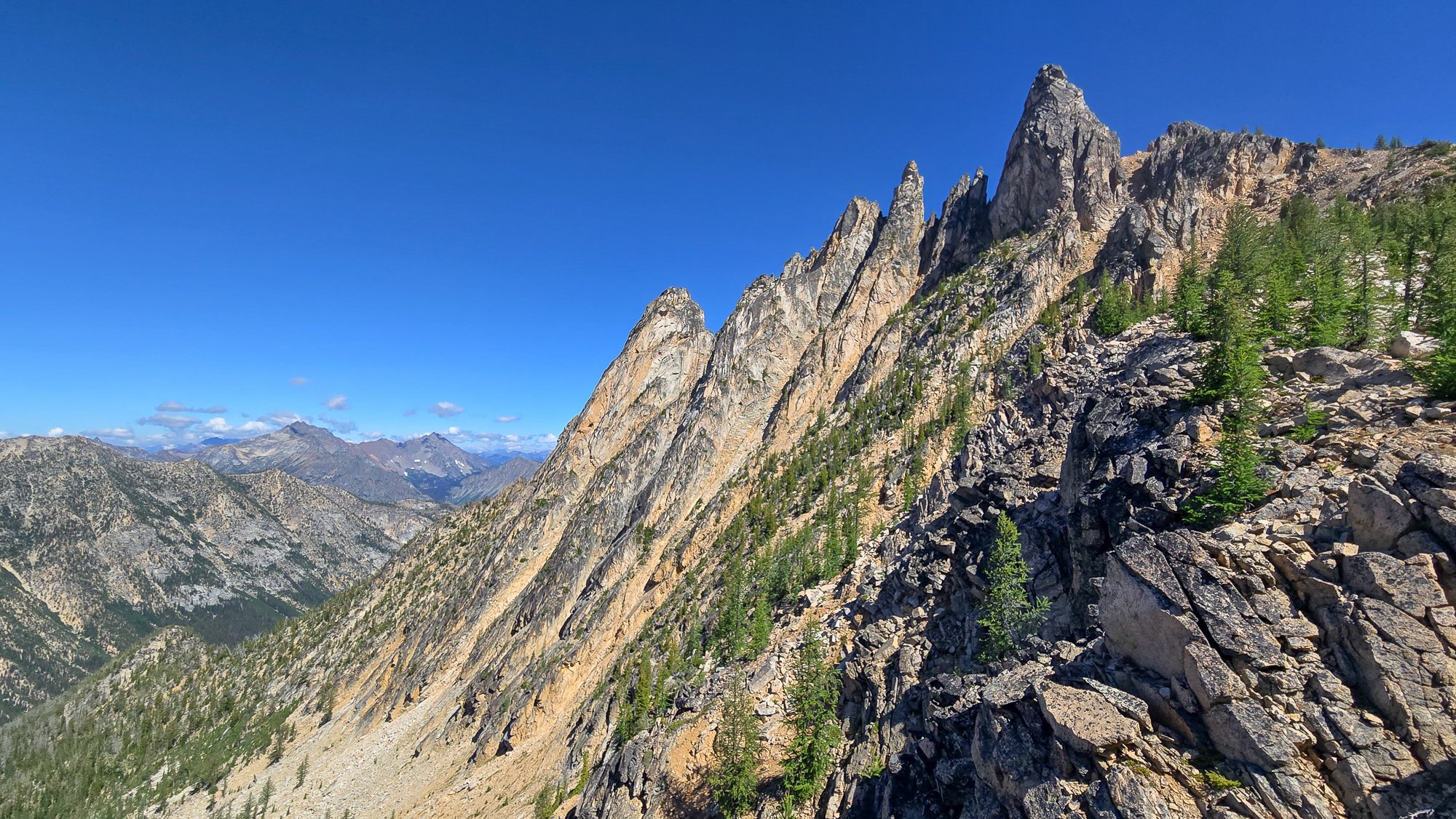
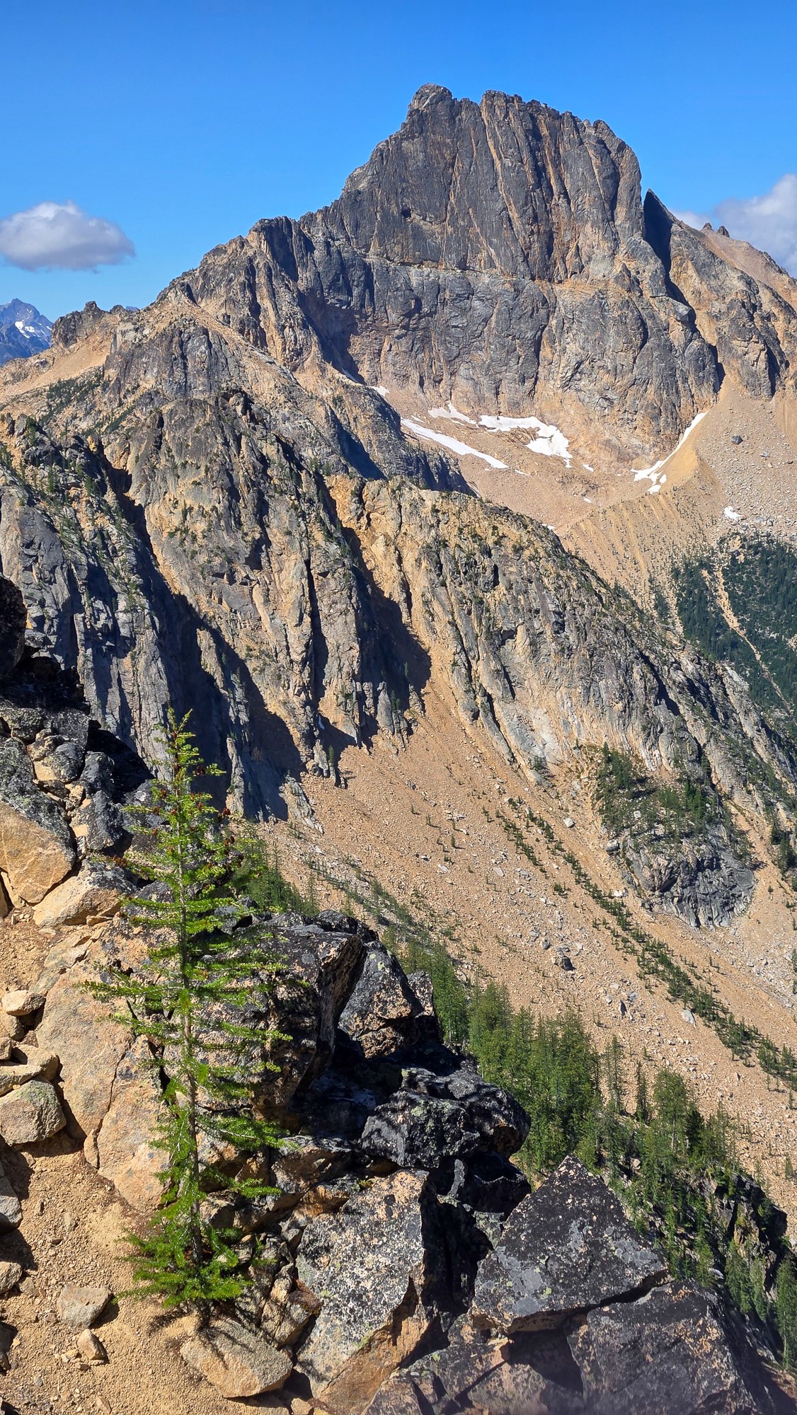
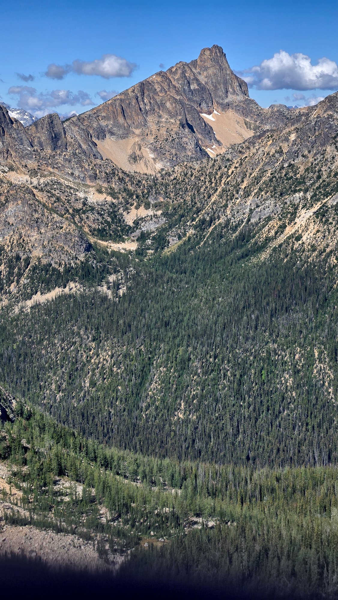
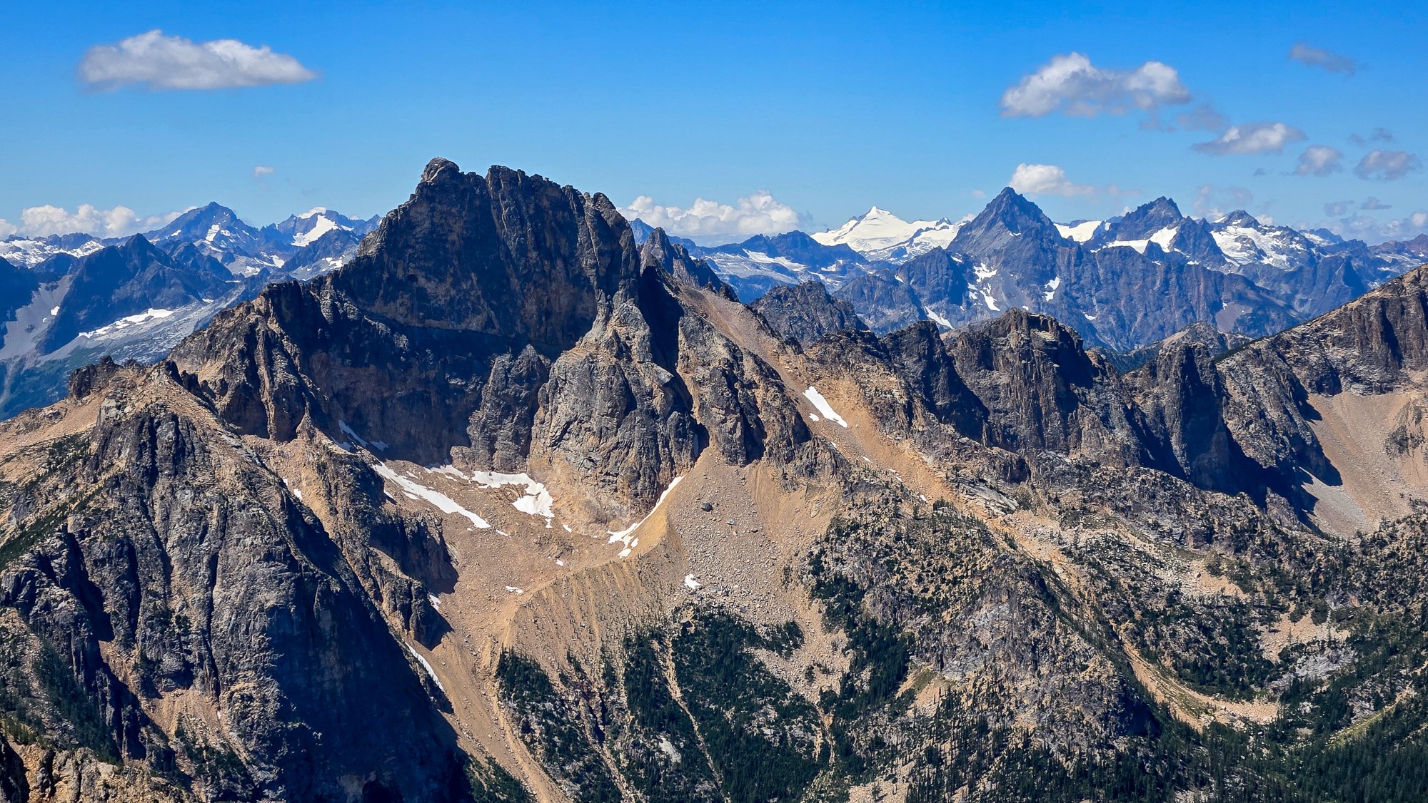
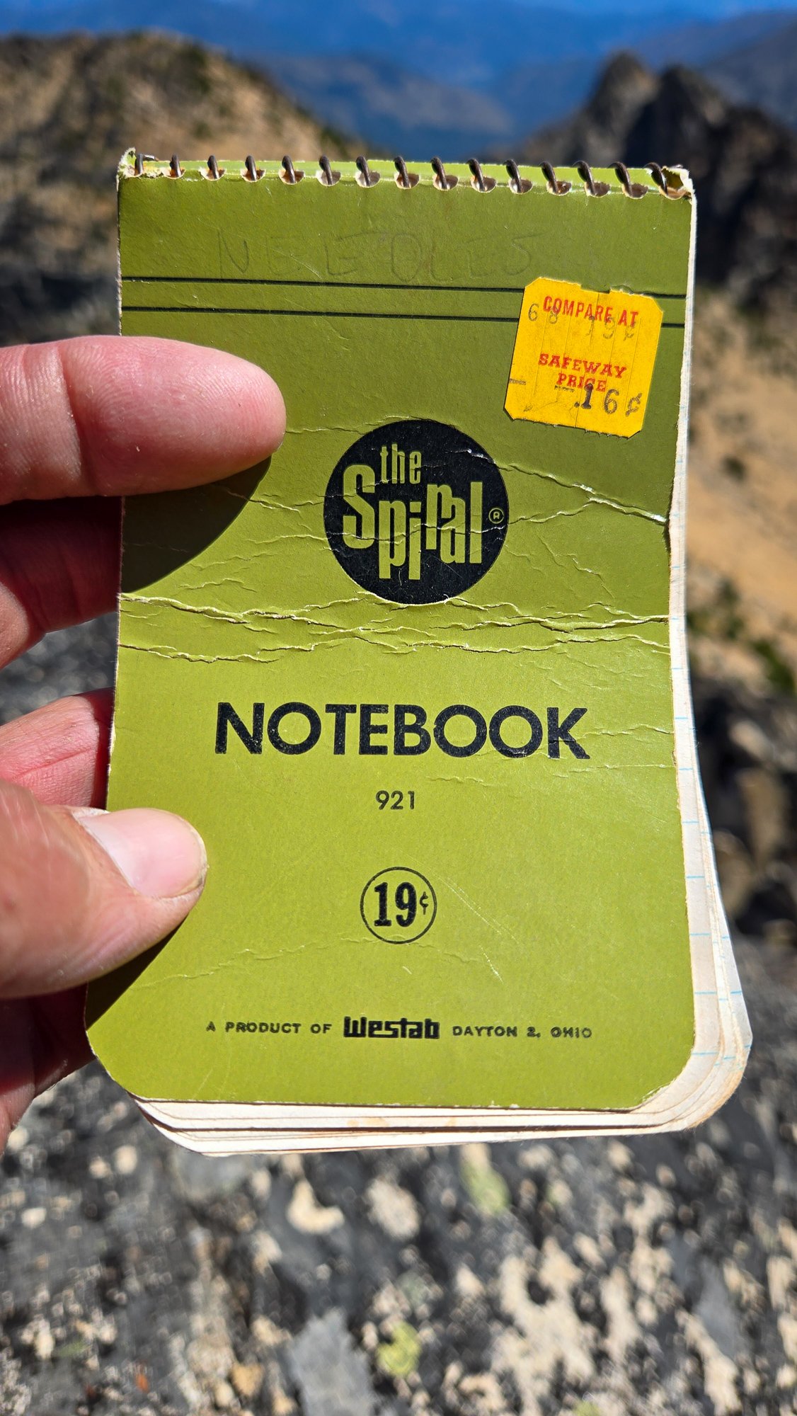
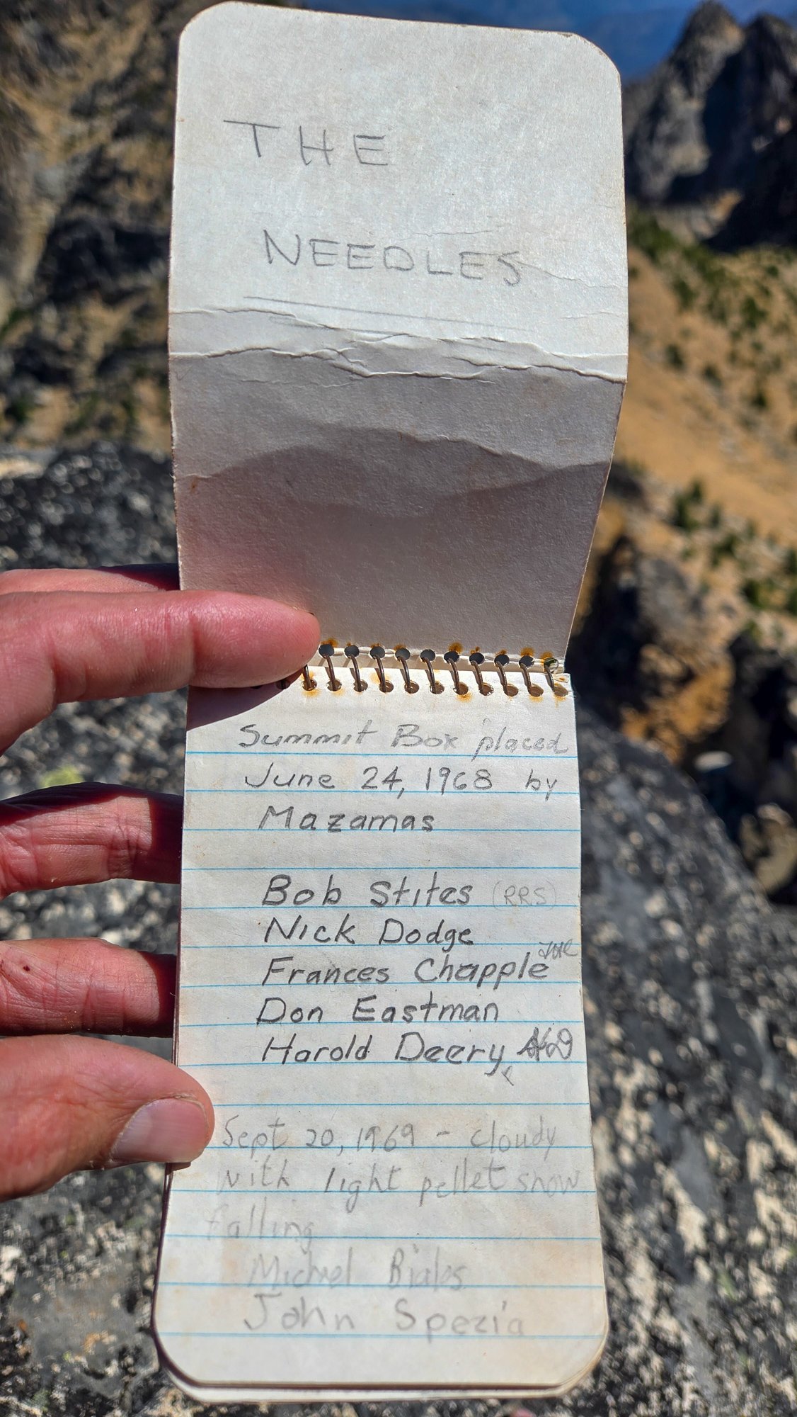
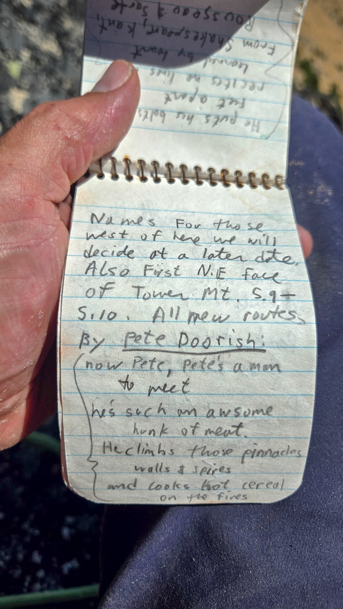
Trip: High point of The Needles (AKA Big Methow Needle) plus the East Peak - Standard Trip Date: 08/02/2025 Trip Report: It seems to be that after 20 years you can repeat a peak and it is almost like you've never climbed it before. Almost. The memory of the character building approach in soft snow wasn't entirely forgotten when @Trent suggested the high point of the Needles (Top 200!) on a Saturday a few weeks back. I had last been up that way 23 years before with my friend Dennis and we had gone straight up from the highway/campground, traversing endless ribs and isothermic mush for a few short 5th class pitches. BUT, Steve had found a better way! Or, so I sincerely hoped, and so I found myself gearing up on the shoulder of 20 again, peering into the brush and looking for the faint hint of a trail @Eric Gilbertson had mentioned was in there. After some minimal thrashing indeed a halfway decent trail emerged, though downed logs were beginning to reclaim it slowly but surely. Things were looking better than I remembered and we continued up. Thankfully the valley thrashing is relatively short lived and the ascent up an open forest rib soon lifts one to views and cooling breezes. A couple hours slogging brought our first views of the Methow Needle, which was more impressive than I remembered. The views to Tower and Golden Horn were also much better than I remembered: Soon we were at the base of the climbing, racking up for 3 pitches of 4th/mid fifth class: @Trent took the sharp end first and launched up on the surprisingly steep first pitch, which was solid, if somewhat kitty litterish: A couple more rambly pitches brought to the lonesome summit, which really hasn't gotten much more popular since the register was placed in 1968. It was a much more entertaining read than most, and I especially enjoyed the firsthand accounts of FAs by Pete Doorish and his partners many moons ago: We were definitely not worthy, but we were there, on the summit nonetheless: And the views, of course, were better than I remembered. Buckner, Boston, Sahale, Tower, Eldorado, Mesahchie, Katsuk, Kimtah (L-R): When I had last climbed it via the not recommended approach in less than ideal snow conditions, I was a young man and was still thoroughly whupped by the end of the day after climbing only Big Methow Needle. This time, we were older and wiser and had some extra energy to head over to the East Peak of the Needles which afforded a grand view of the North side of The Needles, along with many ladybugs (visble at black specs in the photo of @Trent below): But, pleasant as it was up there, we couldn't stay forever and reluctantly had to descend back to the brush and blowdown to battle the masses back west across the pass. Still, a parting view of Big Methow Needle as we dropped to treeline was a good reminder that we have an exceptional backyard here in the North Cascades: Gear Notes: Light Rock rack to 2", 60m rope, helmet Approach Notes: Stay in the valley and find an old trail up Pine Creek on south side. Where it crosses to north side of creek follow for a bit longer into timber until it peters out and you head up via open forest to treeline and the peak.

 10 points
 -
During the past school year, I’d made the plan of doing a bike to climb trip this summer. Mainly due to the fact that it’s difficult to borrow a car from my parents for a while, but it also just seemed like a neat concept, and I was down for an adventure. After getting back from the North end of the ptarmigan traverse, I was inspired by the peaks further south. My partners were either out of commission or had came up with the lame excuse of “work” and “paying bills” so I figured I’d make it a solo trip. The peaks on the ptarmigan traverse made good sense for this since they’re usually 4th or low 5th making it a pain to bring rock gear. The only challenge was glaciers, but I hoped with my later-season climb they would be mostly dry. I was pretty lazy about prep so a late Saturday night found me and my brother binging a show. I woke up at the too-early time of 7am on Sunday and packed my bike before setting off at 10. Sunday 8/17 The first day was quite chill until I got to the centennial. At my first break on the centennial, I went for my phone when I realized my pannier pocket had been completely open and in a position to spill out the contents for the last hour while I’d been biking down a windy hill and over railroad tracks. I looked around but couldn’t find it so I asked a kind stranger to see if I could call my parents to find out the location. The man, Tom, ended up driving me back an hour of biking to the last known location but after a 1.5 hour ordeal, I came out empty handed. I figured I’d continue on with a garmin and stop by somewhere to get a map. Hour or so later, When I reached down in my frame bag for some snacks, I found it tucked behind some bike tools. The rest of the day went smoothly and I got into Darrington around 6 or 7 in time to get some food, buy groceries, and set up camp. Monday 8/18 As was the trend for the trip, monday was also a moderate day. I biked 30 miles to the trailhead and hiked up to itswoot ridge. The Downey/Bachelor creek trails are now well cut out. Always able to see your feet. At the Bachelor turn-off I ran into two climbers who were coming down from dome. Once I got to cub lake, I met a backpacker who had twisted his ankle a few days ago. An hour later I watched a helicopter come pick him up. I worked it up to Itswoot ridge where I went over to back the peak before setting camp at the established bivy sights to a nice view of dome and glacier. Tuesday 8/18 Trying to save phone battery and figuring the ptarmigan was obvious, I navigated the old fashion way. I knew that I had to climb through snowfields to the spire col so went to what I thought would be the obvious one. Once I was climbing the gully to the col, I found that it was much much looser than I had expected. Topping out, I realized I was definitely in the wrong place, I’d gone to the spire/west spire col. A shitty descent and some more vert later, I got to the right col. I scrambled up spire peak and enjoyed a mix of sun and clouds. TR’s had reported a licheny slab that wouldn’t be fun in approach shoes but it wasn’t too licheny anymore. From here I made the awful descent down to the basin where I traversed around to cub lakes. The only snow of the entire day was between the col and the base of the spire point. I got into cub lakes early and bagged 7340 and Lizard before heading to bed. Wednesday 8/20 The goal for the day was simple, Sentinel and Old Guard. The south cascade glacier was entirely dry and it was cool to see all the glacier monitoring equipment. I found a nice left leaning ramp up the West face of sentinel and scrambled to the top. With the sun and clouds there was a cool glory effect. I descended down, traversed over to the Leconte Glacier, and followed the dry glacier to the col. With some endrunning I was able to stay entirely on ice except for a large snow patch right before the col past the schrund. The scramble up was fun and I enjoyed good views of the more northern peaks. I descended back down and got back to camp by 4. Made some oatmeal and figured I’d scramble up old guard at 4:30. Made it from camp to the base of the North ridge in 45minutes before realizing that there may be some 5th class. It ended up being about 5.6 but it was a secure chimney so I felt comfortable. Made my way down by 6:30 where I found a deer at camp. Picked lots of berries alongside the deer before settling in for the night. Also lots of unfazed marmots. Thursday 8/21 Woke up to find my helmet 20 yards away from my tent. The marmots had stolen the foam padding from it. Spent the morning walking over to the dome-dana col. I went up and over to the itswoot ridge side since I didn’t want to solo the Dana glacier. Set up a nice camp before scoping out conditions. Figured it would probably be do-able but I wanted to do it in the early morning before sun hit everything and while snow conditions were firm. I was doing everything in approach shoes and hybrid crampons so steep stuff was not my forte. Listened to podcasts and sat around for the easy afternoon. That night was horrible, some mice disturbed me for two hours, eventually getting into my tent by making holes in the mosquito netting. My food was hanging but they still walked around by my feet. Didn’t get a ton of sleep. Friday 8/22 Started at 5am, picked my way up the glacier trying to stay on ice. Summited dome at 6:30, down by 7:30 before the sun had even hit camp. Figured I might as well make it down to the trailhead where I found myself at 2pm. Quickly packed the bike and headed towards darrington where I stopped to gorge myself at the burger place. Afterwards I hopped back on the bike in the 93 degree heat to bike to arlington where I camped in a park. This night also sucked too. Loud music + heat + my grimy body only gave me like 2 hours of sleep Saturday 8/23 I knew it’d get hot so I was moving as soon as it was light out, made it home in 5.5 hours where I showered and gorged myself. I’d been doing some moderate rationing for most of the trip so was, and still am, quite hungry. Overall it was a great trip to end the summer. I’ve got a oral surgery tomorrow that will put me out for 2 weeks and by then, I’ll be a week into the school-year. Been busy getting out recently but with this off-time, I’ll probably put together some mini-TR’s on my site(https://lucasfng.blogspot.com/). I’d been wanting to do a long trip over the summer so this satiated my hunger, though it would’ve been nice if I could've got more than one in.
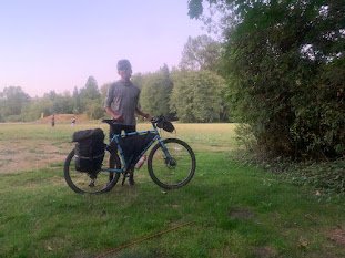
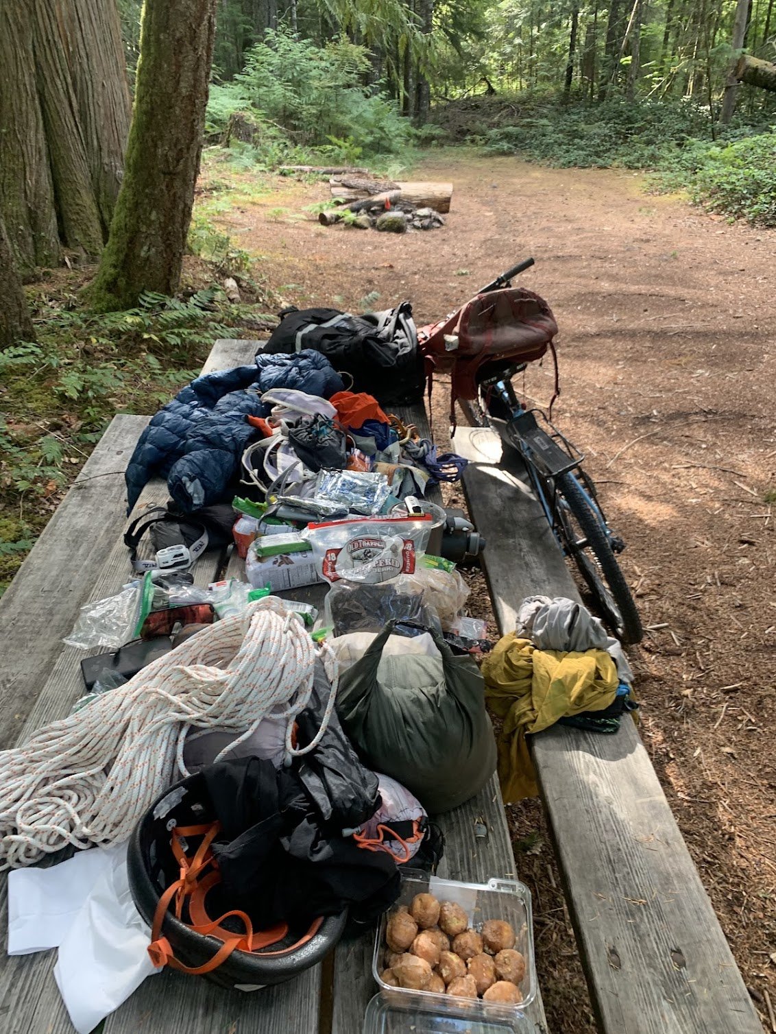
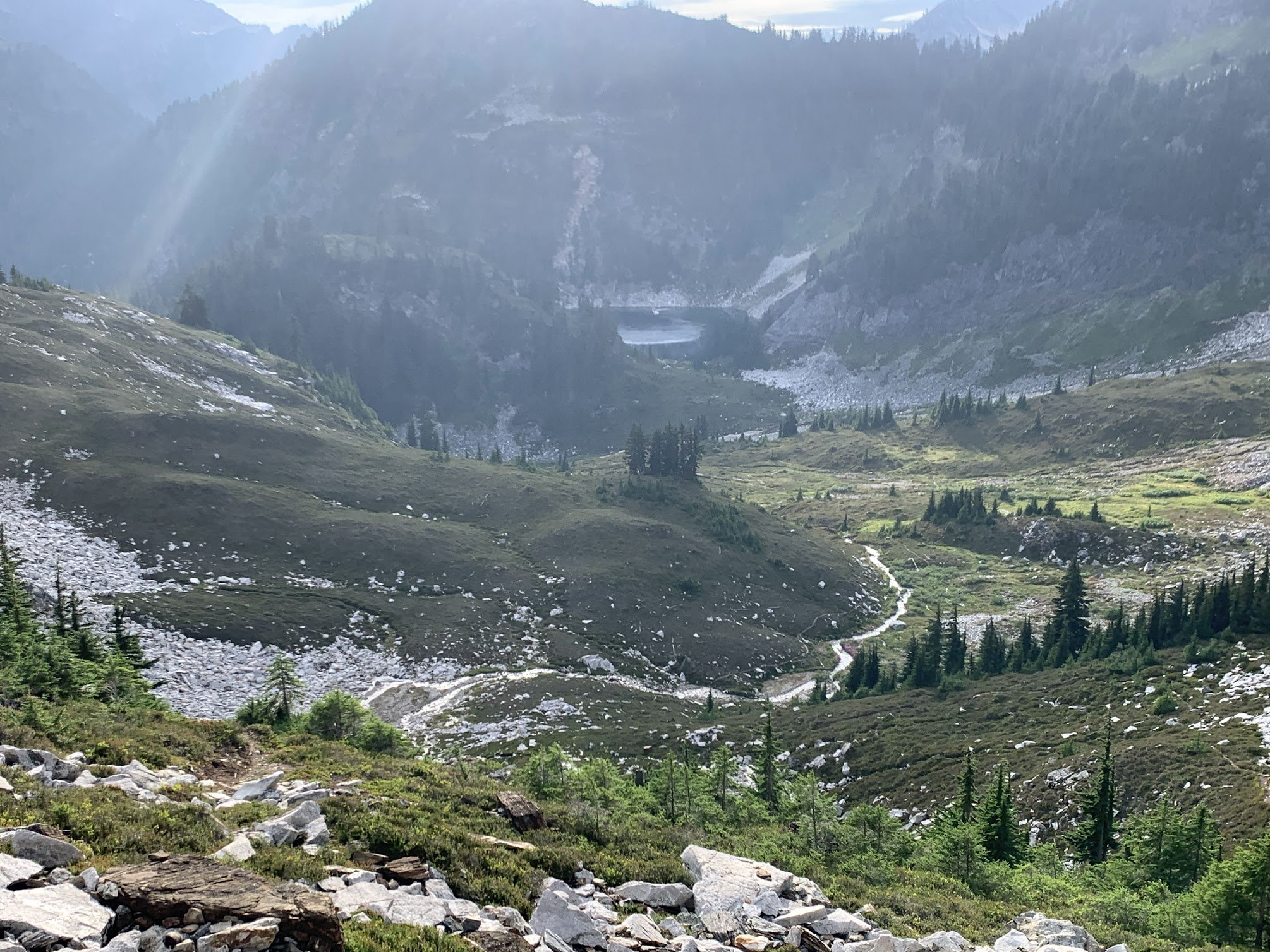
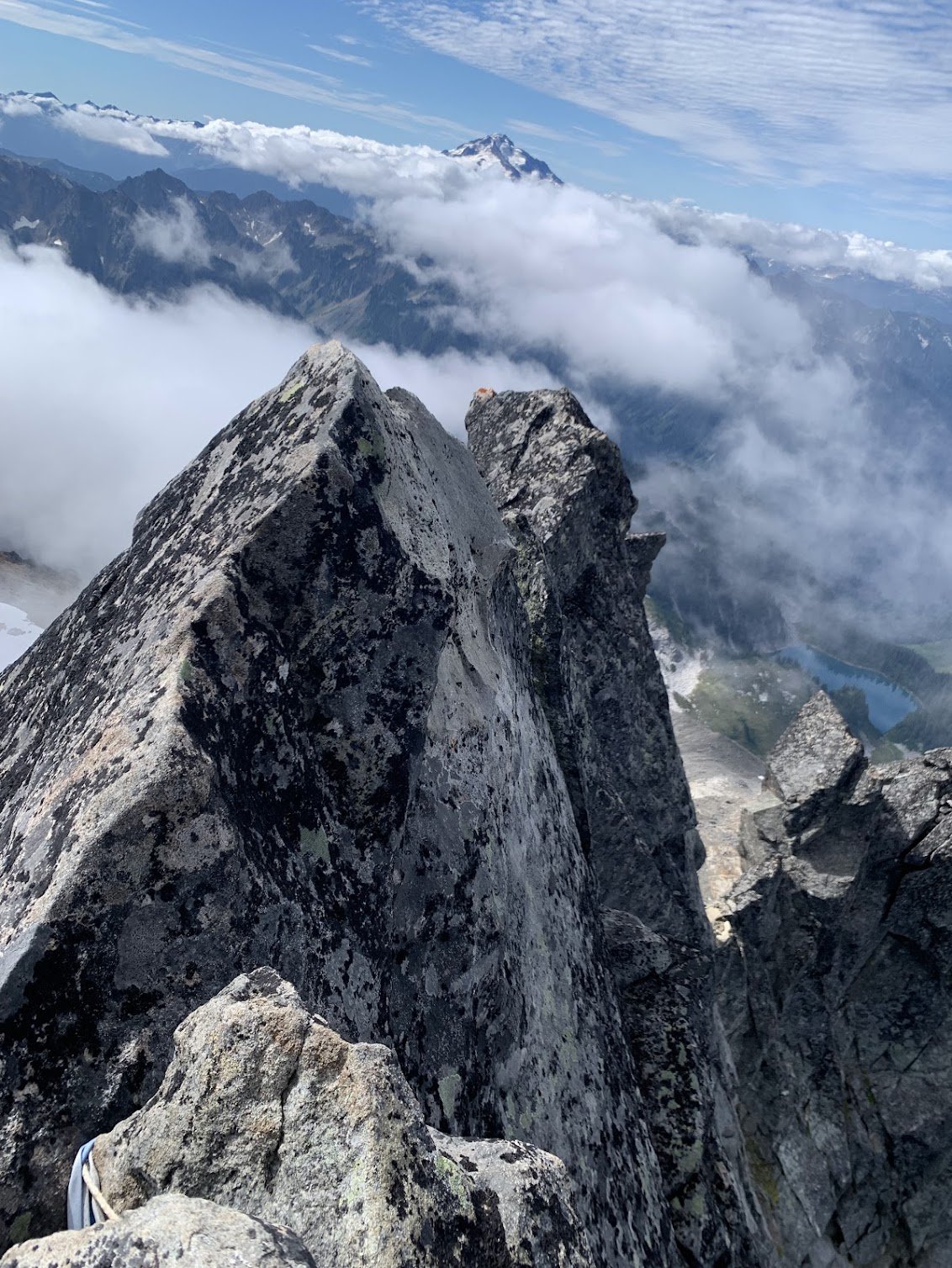
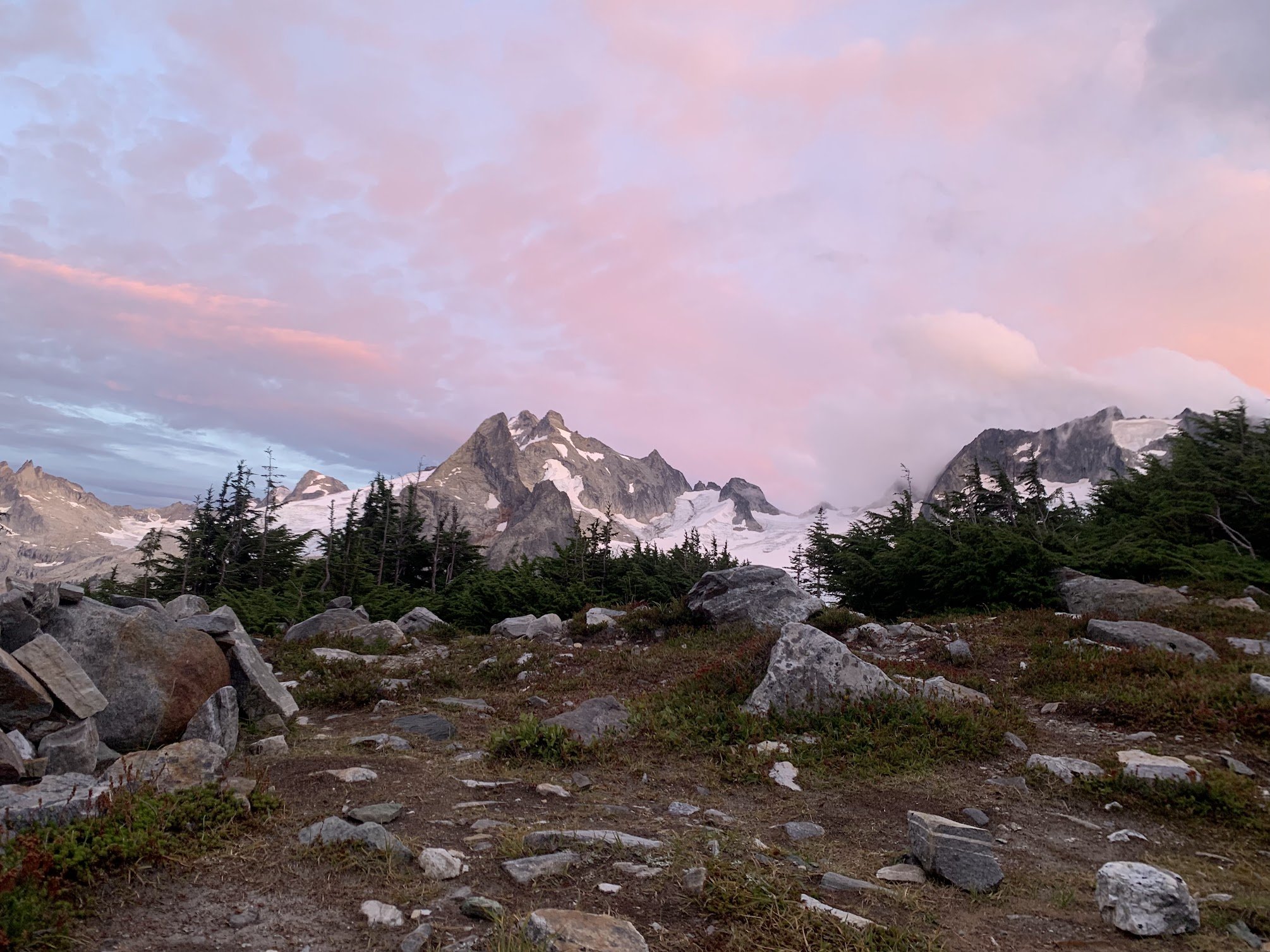
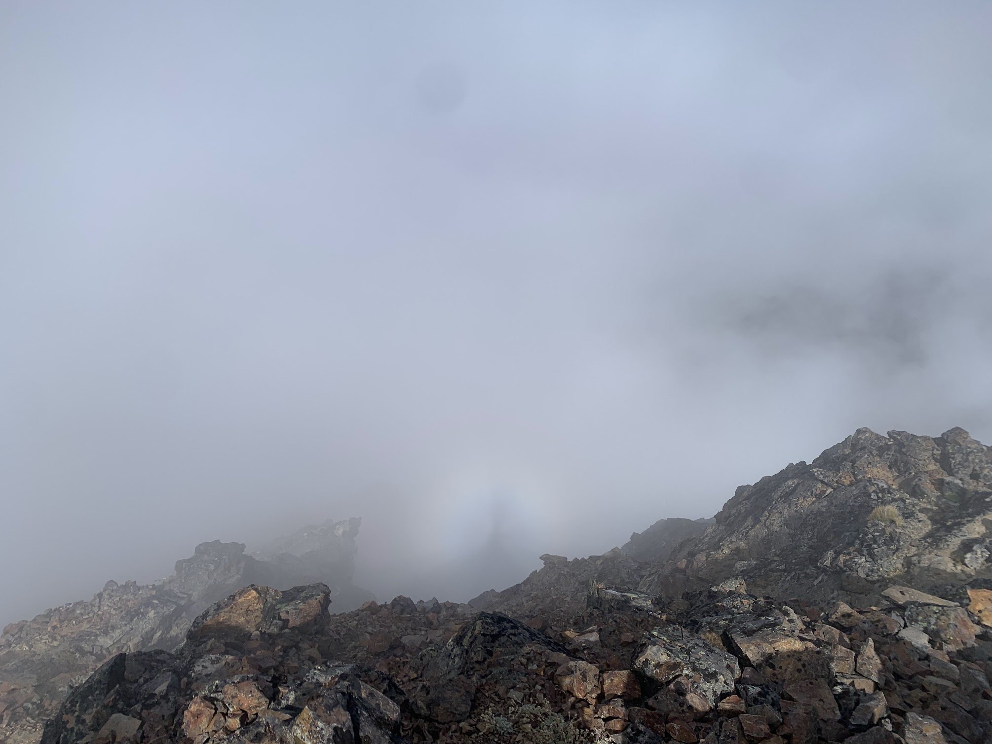
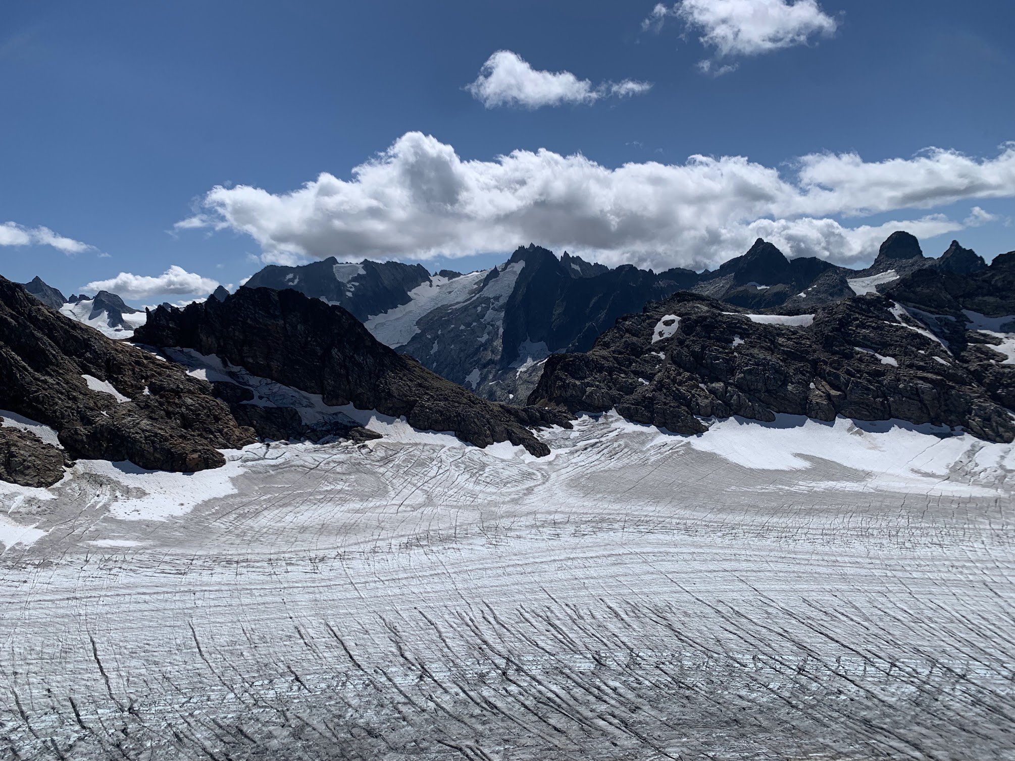
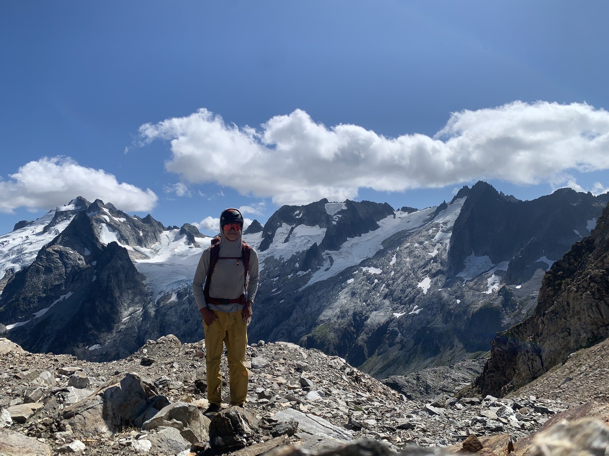
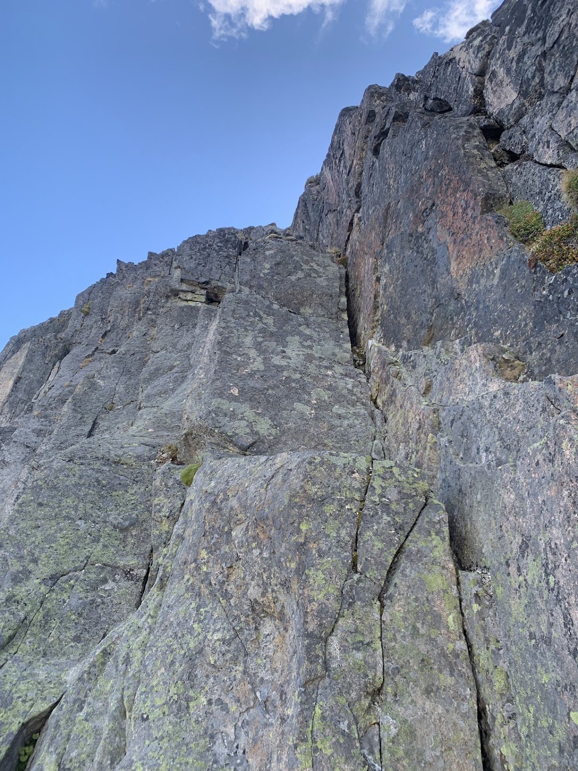
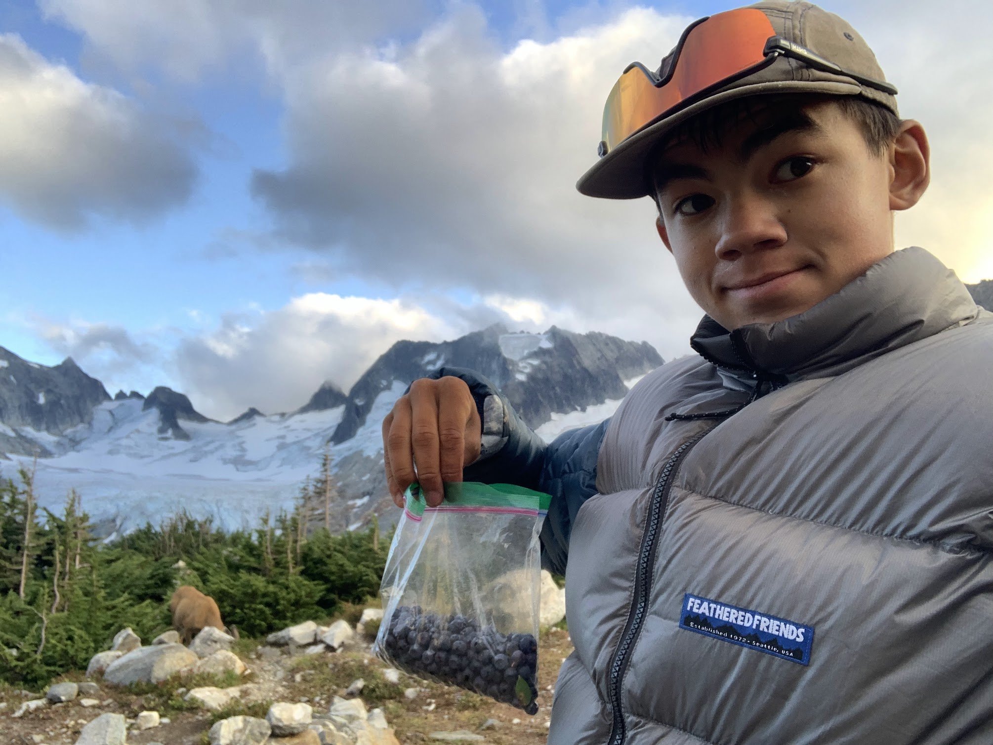
 10 points
 -
Over the last 3 days, Lani and I climbed what we believe to be the FA of the North Ridge of Redoubt. This is the long, NW trending ridge that looms over the North Face glacier route. The route was actually quite classic and comes with a high recommendation. It is by far more enjoyable than the standard route scree encountered on the descent. The route was primarily low fifth class and fourth class scrambling and we roped up for roughly 1100', though snow coverage and comfort sloping may drastically impact this number. The ridge gains a bit over 2000' over around .5 miles of horizontal. The name is inspired by the little ball of fire, Calcifer, from howls moving castle, as we watched the Perry Creek fire grow in the distance. Day 1 We approached and bivied at Ouzel lake. A bird tells me the Depot Creek "trail" is in particularly excellent condition, requiring NO bushwhacking, and they said handlines are even avoidable. The same bird mentioned that current logging roads take you all the way to the border, making the approach to Ouzel Lake 4.5 miles. We bivied all the way up at Ouzel lake as we were initially planning on climbing Spickard the next day, but growing smoke from the Perry Creek fire changed our minds on that plan. There is also an excellent potential camp at the top of Depot Creek falls, potentially allowing for a direct approach, though this would require bushwhacking of unknown taste... There are also potential bivy options on route to help facilitate a 2 day itinerary. Day 2 From the lake, we made a long contour on talus, loosing only around 400', once near and below the objective, we made our way up talus and slabs to the toe of the ridge. Excellent running water out of the toe of the glacier. We initially attempted the cracks smack on the toe of the ridge, I bailed around halfway up after encountering some 5.11 tips and entering unpleasant looseness. There is an obvious corner left of the toe that potentially holds a very classic potentially moderate direct start. The unsent directismo After bailing off the toe, we looked to the right and zig-zagged up ramps to gain the buttress crest. Snow coverage will drastically impact your experience here. Once on the ridge crest we found thousands of feet of enjoyable scrambling on mostly sound rock. Lani compared it to the NE buttress of triumph but with mostly better rock. We roped up for the occasional pitch, but mostly soloed. There is a broad saddle at 7600' where things begin to steepen subtly. This would also make an excellent bivy with a permanent snowfield for water access. Above the notch, the climbing steepened and we climbed a few back to back pitches until we were below a prominent gendarme. Unsure what the top of the gendarme would be like we traversed into the chossy gully to climbers left and climbed a short, overhanging pitch of surprisingly solid shist. After topping out the gully, we found the descent off the gendarme would have been chill, so Future parties should consider a direct line up the cracks on the gendarme for a more classic finish. Once at the notch in the ridge we met up with the large talus fields that define the slopes on the south summit. The traverse over the sub summits to the true summit was generally easy but involved a few sections of fifth class. Once on the summit, we began the "joys" of doing the standard route late season. Lani in the canonball hole Once at the base of the gullies we encountered awful scree, one could only imagine how much more awful it would be to go up, so there is that... The entire day we had been watching a fire grow in the East. Seeing it expand so quickly and already beginning to envelope spickard in smoke we decided early on our descent to forgo spickard and plan on hiking out the next day. Mordor to the East Day 3 Hike out, blueberries... Suggested Rack Single Rack .3-1, optional 2; full set of nuts; we had a single 60M rope, but it could be done with a 30M line to save weight.
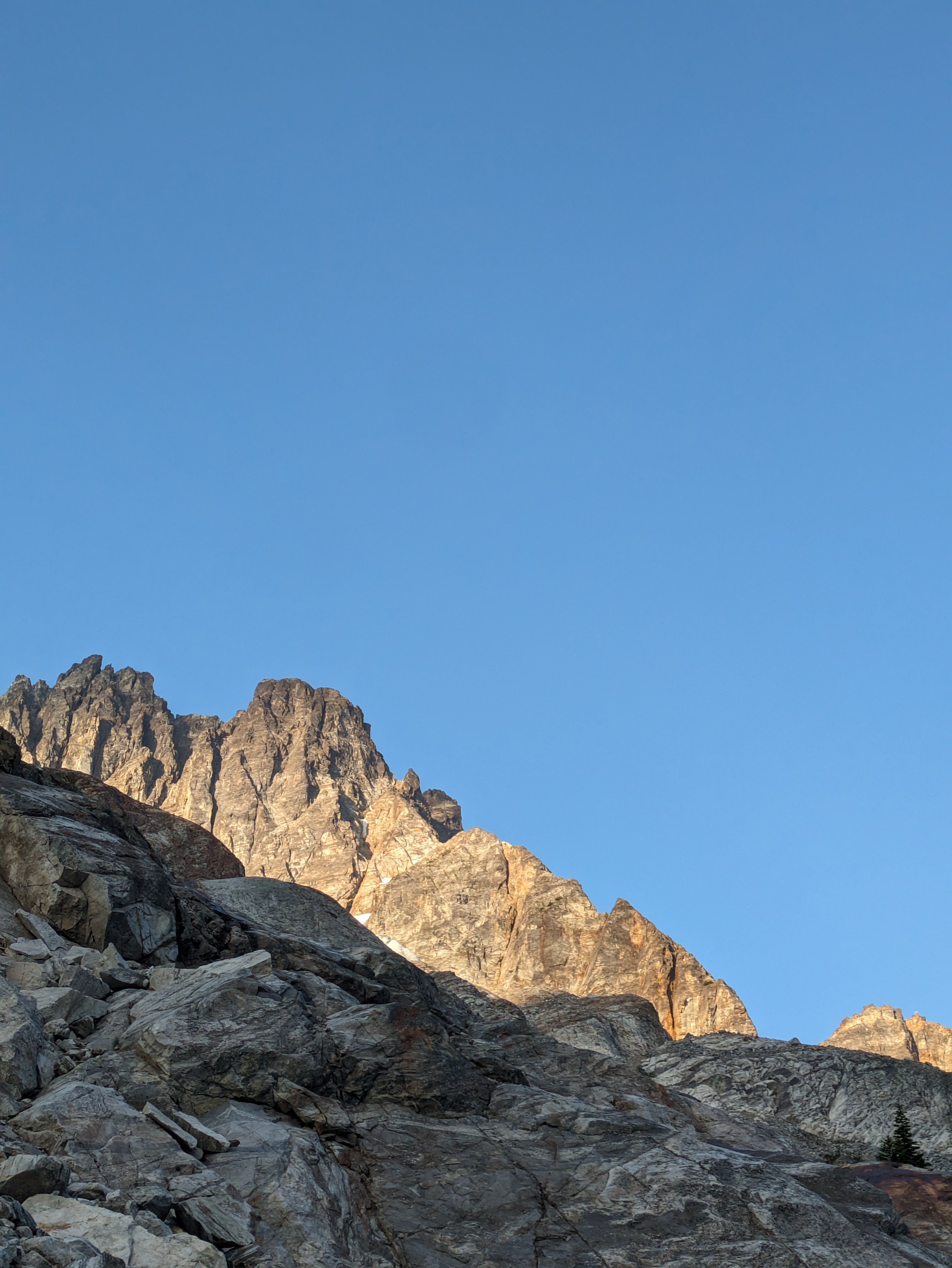
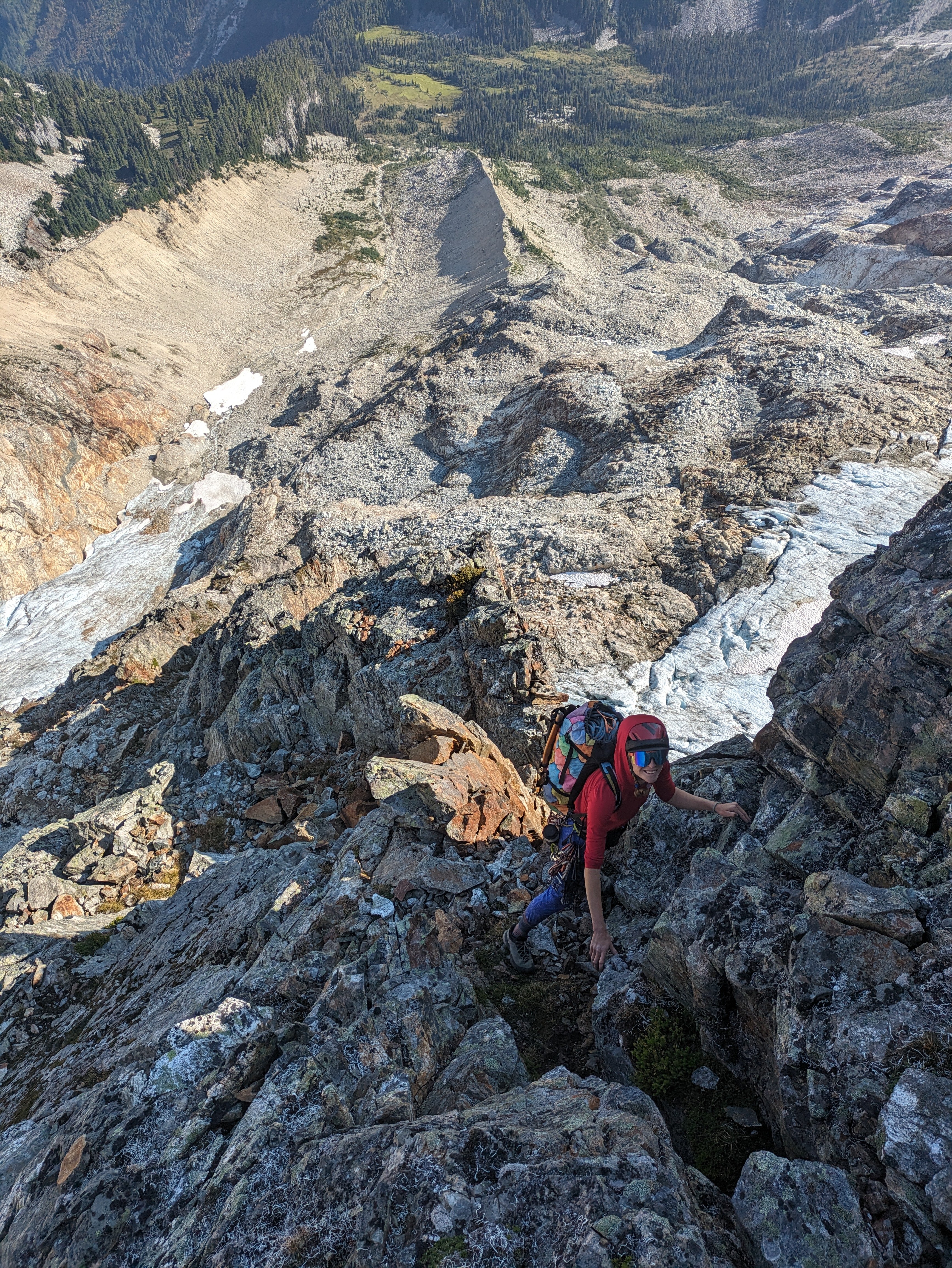
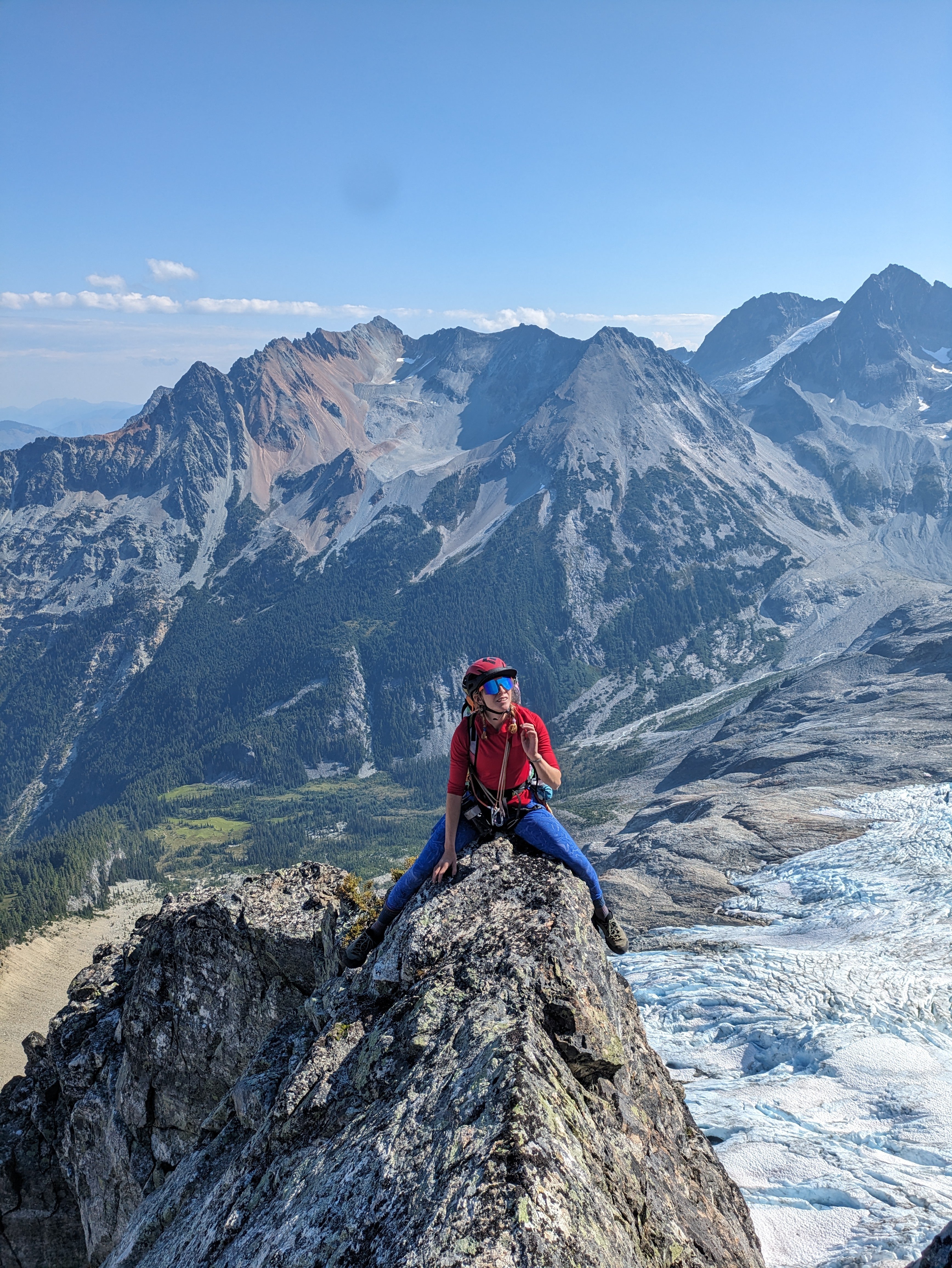
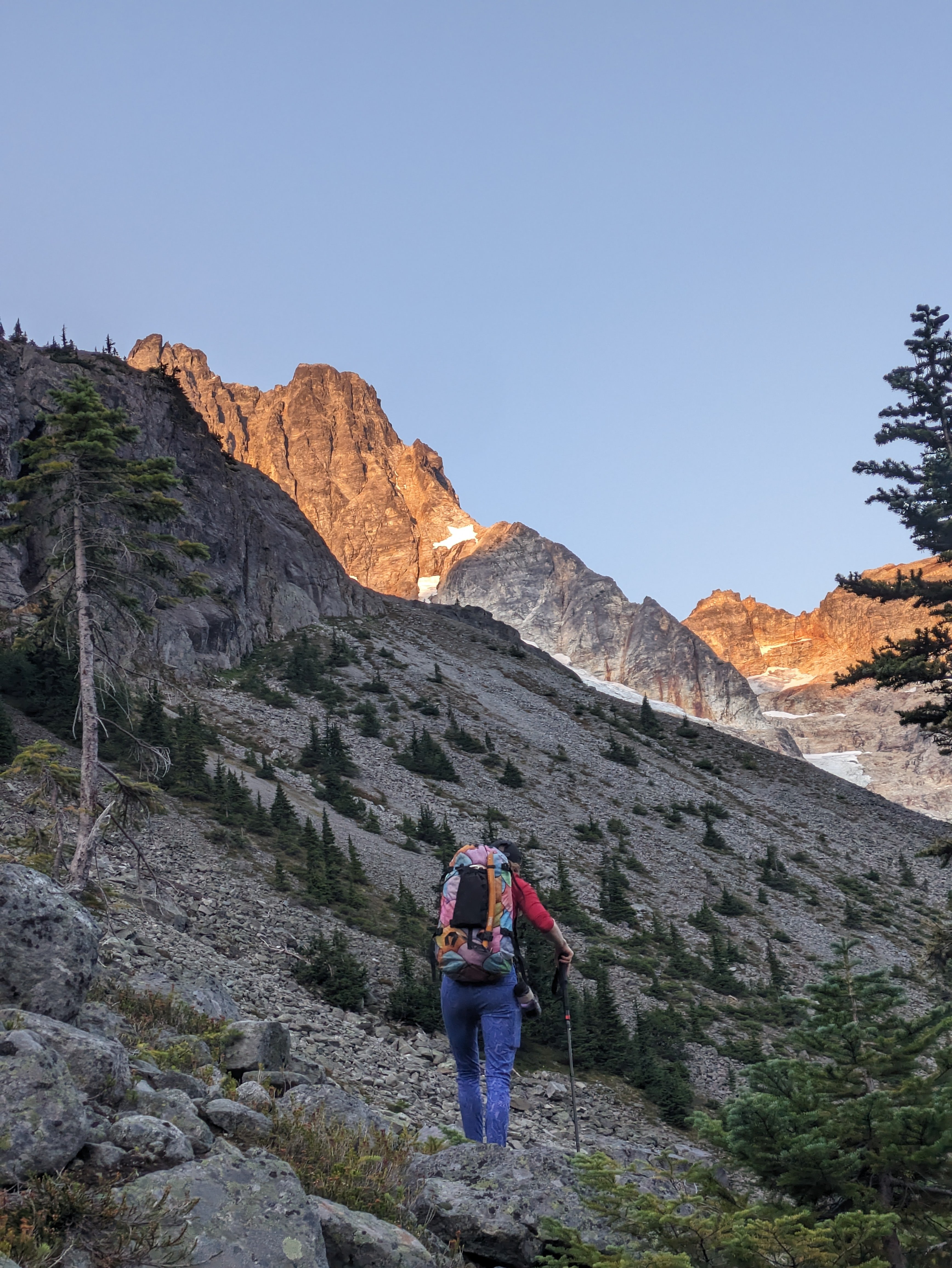
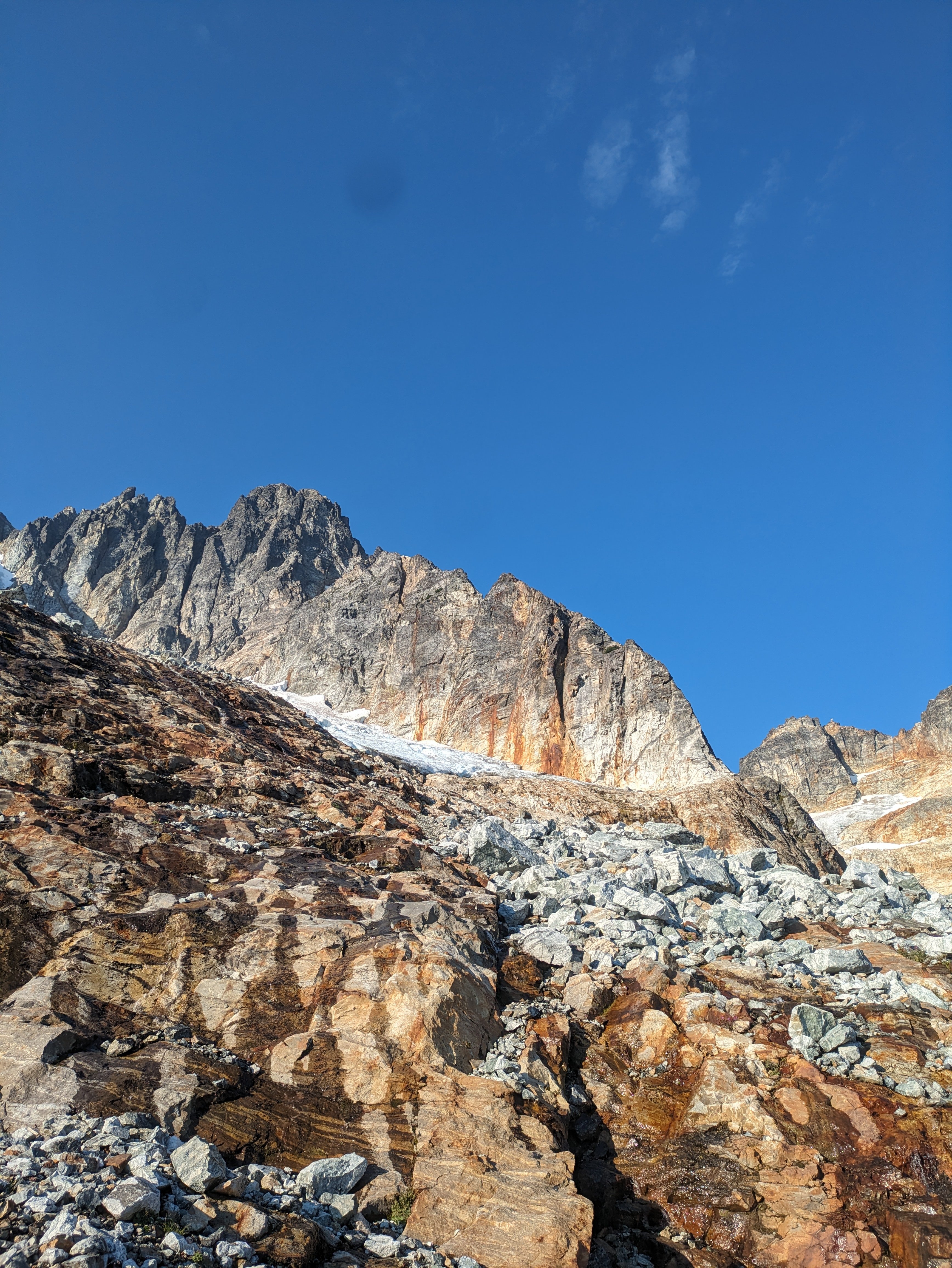
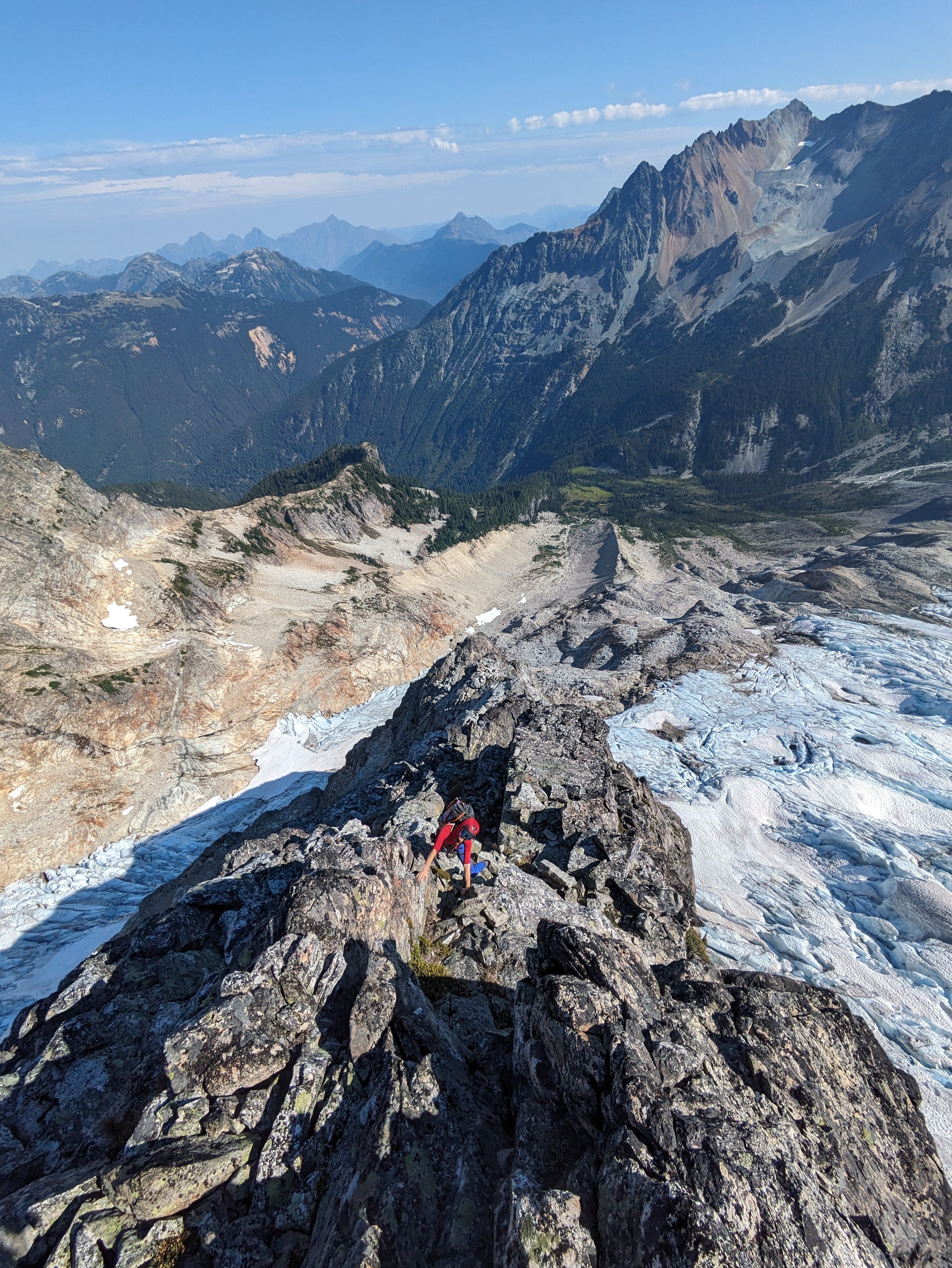
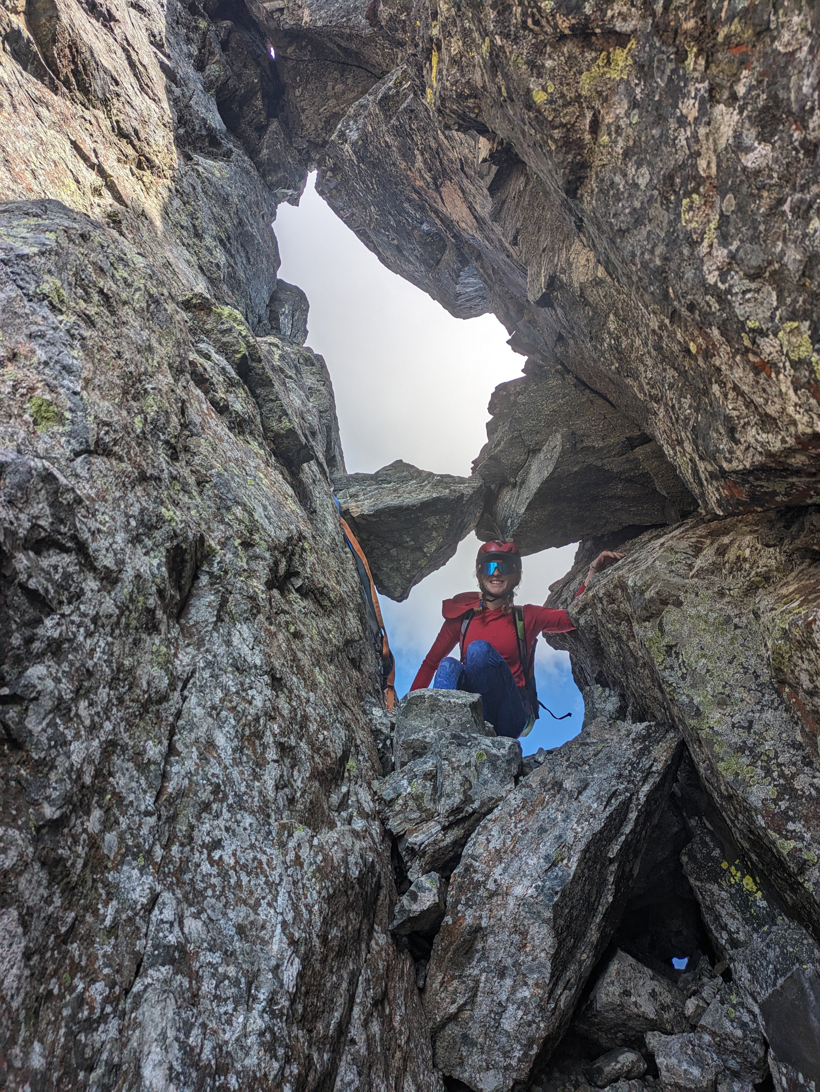
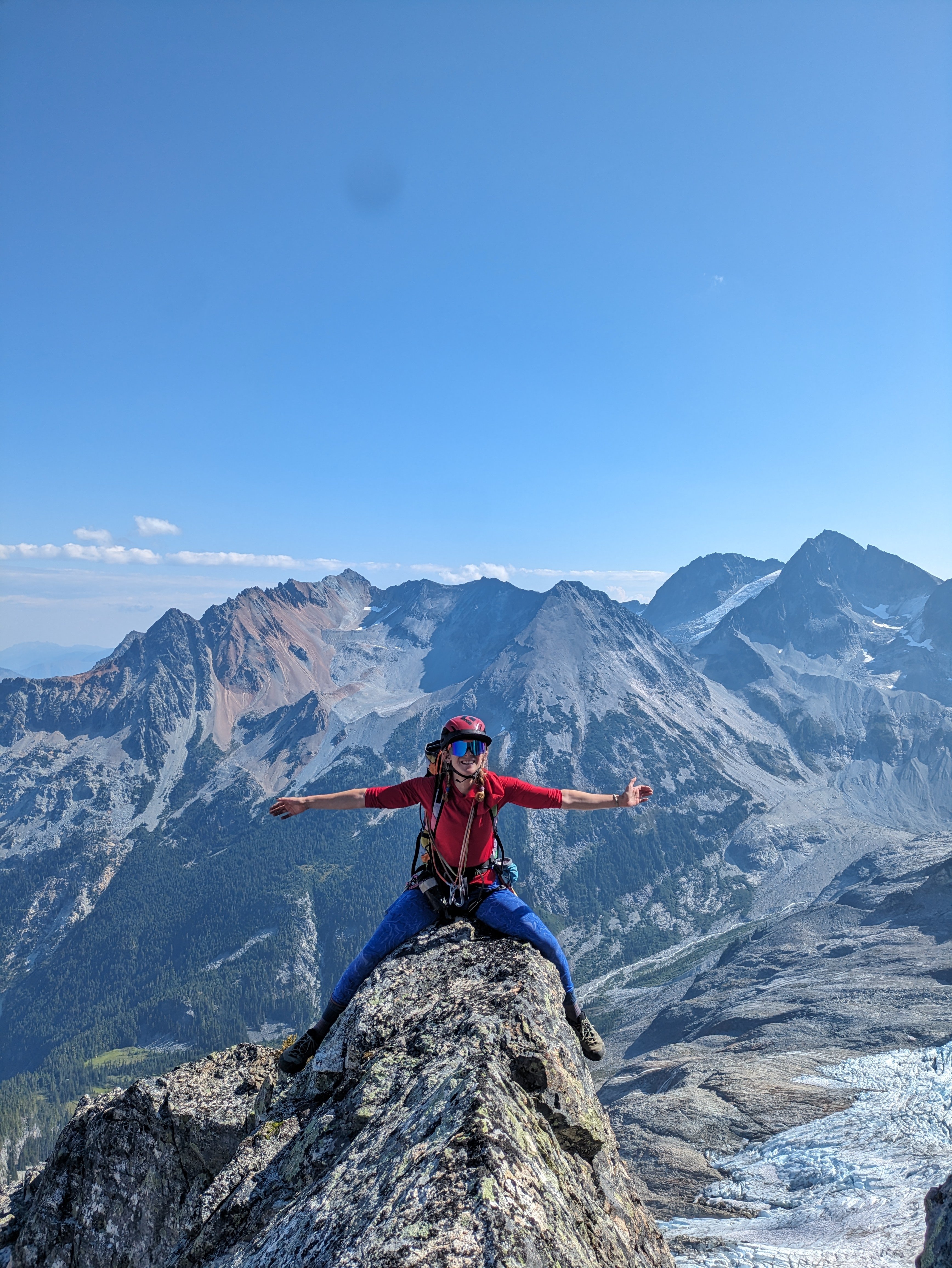
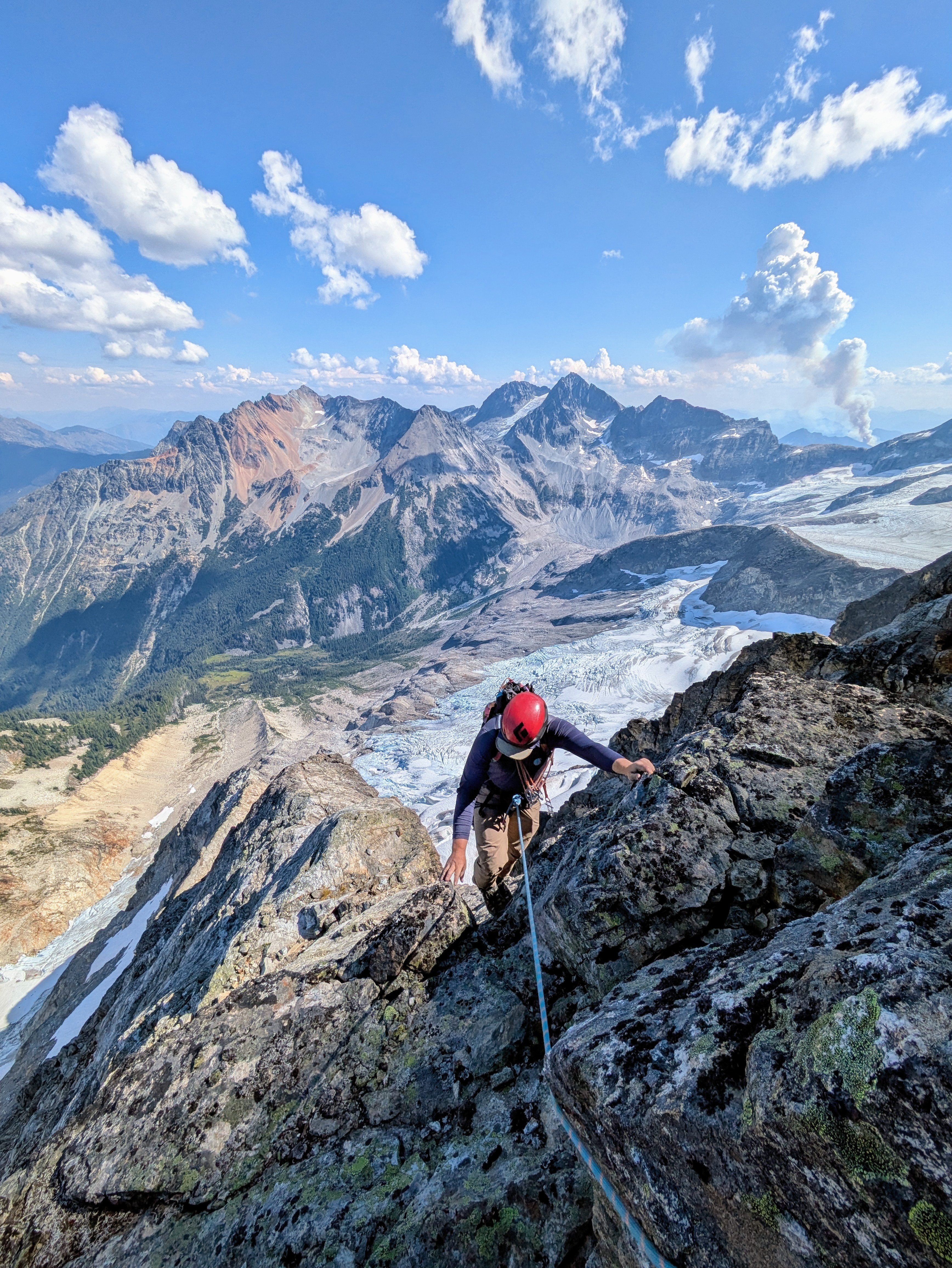 10 points
 -
Trip: Seefar Peak, Brooks Range, The Long Way - East Gullies From Marsh Fork To Dalton Highway Trip Date: 07/28/2025 Trip Report: TLDR Version/Intro: Me and 4 buddies went to the Brooks Range in Alaska for 12 days of hiking through one of the largest wilderness areas in North America. July 28 to Aug 10. We had a blast and it went great. We got flown in by a bush flight, walked along many river valleys, hiked up a talus pile peak and then through the wilderness, across rivers and over hills to the Dalton Highway where we got picked up by a commercial shuttle service that drove us back to Fairbanks and the World. Long version: Day 0: Drive from Bellingham to Seattle, Fly from Seattle to Fairbanks on Alaska Air (duh), van ride, Uber ride. Walk around town, hit a bar, Thai food. Beers in the hotel room. Day 1: Fly to Coldfoot on Wright Air, slight delay due to missed flight (don’t believe the hotel that you don’t need to be early to Wright Air, they take their business very seriously). Immediately upon landing in Coldfoot we jumped into prop plane the same age as my parents and fly with Dirk of Coyote Air into Upper Marsh Fork landing strip on the Marsh Fork of the Canning River. The flight was incredible, frequently with wheels just clearing ridgetops and flying the terrain up and down valleys. Extremely scenic, caribou and sheep. Upon landing there was much exclaiming and pointing and backslapping. Once we got settled down and the final packing completed we hiked up valley. Warm, patchy sun, overnight hard rain. Glorious, glorious, glorious! I got a good chuckle out of everyone later admitting that they were forcing down the nausea the whole bush flight and hiding it from the others. 5.5 miles, 2.5 hours. “Rainy Camp” Day 2: Hike up Marsh Fork, cross into unnamed very upper East Fork tributary of the Ivishak River drainage. Camp at headwaters. Hard day, with technical talus and side-hilling above cliffs and raging water. The river was running pretty high from the previous night's rain so walking in the canyon bottom was not an option for us, otherwise this would have been easier. Cool and misty with rain. Amazing, just like home but nothing like it at all at the same time, so great all around; we expected weather, didn’t rain enough to get wet. Much exclaiming about the scenery. 12 miles, 9 hours “Frosty camp” Day 3: Awoke to frost on the tents and plants. Hiked down canyon to junction with upper east fork of the Ivishak, down river past multiple small confluences, easy walking. Over interminable ridge with tussocks (our first!) to Ivishak River main stem. Camp in a “hay field”. Bluebird sun and warm, 2 long great breaks for lunch. Much exclaiming about the scenery. We pushed hard on this day to set ourselves up for a potential summit tomorrow assuming the weather held out. We didn't want to get stranded up high looking for a campsite with no water. 16 miles, 11 hours “Hayfield camp” Day 4: Ascended Ivishak valley toward Continental Divide, turn south to climb Seefar Peak via dogleg east gully, awesome snow in first gully, then major talus slog to the summit. Amazing time spent on the summit, warm but breezy. Lots of cool fossils in the limestone. Descent to the south and west terrible talus, so we bailed off the ridge early to Wind River valley. Made camp. Amazing dry tundra camp next to river. Shoes and socks dry at camp! First time since 5 minutes into the trip. Bathed in river and washed clothes. Bluebird, sun, warm. Much exclaiming about the scenery. A good time was had by all. 10 miles 4000', 10 hours “Swimming Hole Camp” Day 5: Hiked down Wind River, saw wolves with puppies, then later moose which led us into a lousy tussock field, camped in side creek. Very mediocre spot, but extremely close to water and some dry wood, so we had a fire and drank margaritas to enliven the spirits a little. It worked. Much exclaiming about the scenery. 14.3 miles, 7.5 hours “Margaritaville Camp” Day 6: Up wind River tributary, saw a grizzly with two cubs, a heard of sheep way up high, and a lone wolf across the valley making quick work of the talus. Up a unique talus-ey canyon, over two passes, one being the Continental Divide, down a tributary of a southern fork of the Ribbon River. Great walking most of the time. We got showered on twice, but mostly sunny. The area where we looked to camp was somewhat brushy with knee-high vegetation and it took a bit of looking to find a good campsite, eventually made a spot work quite well with great moss and blueberries. 13 miles, 8 hours “Barefoot camp” Day 7: Nice enough weather early, quickly turned to rain, then hard rain, despite the Inreach weather saying it would improve throughout the day. Misery. Trudged up to beautiful lake, too windy and cold to enjoy it. Saw wolf puppies briefly. Over pass separating the Ribbon and Accomplishment Creek and down to tundra on other side, just past dangerously slick boulder field. Dove into tents soaked through. Very cold and wet. Lunch in tent, nap. Whiskey helped spirits a lot... at least in my tent. Less exclaiming about the scenery today, though everyone admitted it would have been great if we could have enjoyed it. 8 miles, 4 hours, no breaks. “Sunny dry happy fun camp” Day 8: Woke to fog but no rain, weather improved dramatically throughout the morning. This was clutch since our base layers were completely soaked. First thing in the morning everybody got ready to hike then leapt into our wet clothes and immediately started walking quickly to warm up in an attempt to dry out some clothes. Down Accomplishment Creek, up side creek over a pass with lots of caribou antlers, half way down canyon on other side to camp. Beautiful country, lots of exclaiming over the scenery, sunny and warm, dried out everything. Decent walking. Saw moose, wolverine. Drizzle just before camp. “Sewing camp” due to a near catastrophic pack blowout. 9.5 hours. 16 miles Day 9: Drizzle, fog, cool. Down interesting puzzle canyon, that was tons of fun to figure out, left side, right side, in the creek, does it go? It goes! Saw a griz at a distance, then across a big river, nameless east tributary of the Sagavanirktok, (tough, fast crossing), hardest of the trip. Slogged up a tussock hill, to canyon, over pass and down to Sag valley, mediocre camp, not many options. We were told that the Sag was a tough crossing that kills people from time to time, so we were excited to get a look at it from up high. I had done a lot of satellite and map reconnaissance of the entire route and had picked out an area of the Sag that is quite braided, hopefully making for the easiest crossing. I had read a few scattered reports of people who crossed just a couple miles further north and had to use rafts. “Lumpy camp” 12 miles, 7.5 hours Day 10: Foggy AM, then sunny and warm. Across the Sag! It ended up being not that big a deal, but it helped that we were on day 10 and river crossing 1 million +/- a couple hundred thousand. Up the valley wall to an amazing broad sunny saddle with rolling fog, for a tea break. We were on a plateau above the confluence of the Atigun and Sagavanirktok Rivers. The fog started to break up after break, we walked slowly; some bad weather was predicted today and the next couple so over the previous few days we had hustled to make sure we could get across the Sag before the rain set in. Unlike the previous days, the weather report ended up being pessimistic and we had great afternoon sunshine. We strolled through tussocks to camp on a sunny alpine tundra slope. Amazing day. Surprise sun! Everyone tard sailed all their gear out on the tundra to dry out everything. Dry socks even!! The low tundra around camp made for great lounging and camping, and beautiful. The sun and sense of accomplishment really made the light on the hills glow that long afternoon. “Kick Ass Camp” 5 miles, 5 hours Day 11: Hiked off the plateau to the Atigun River, up the river valley to the road, road!? Long road walk to Galbraith Lake camp. My knees hurt after the 8 miles of road for the first time in the entire trip. Mostly cloudy with sun patches and a short drizzle. Surprising amount of traffic on the road, saw a civic! Fire and celebratory attitude at camp. “Galbraith Lake Campground” 6 hours 15 miles Day 12: Woke up leisurely, lounged around, day hike to West Galbraith Peak, tea and coffee on the summit. Camp time, eating everything that was left. Mostly cloudy, mild. “Galbraith Lake Campground” 5 mi, 4.5 hours Day 13: Lounged in the tent, rain and drizzle, picked up by van at 11. Wes from Dalton Highway Express picked us up in a beater 15 passenger van. Two entrees and a beer at the truck stop in Coldfoot. Food at the farthest north truck stop and bar in America was cheaper than in Bellingham. “Hotel Camp” 10 hours in the van, zero walking. Photo credits to Mike Graw. Gear Notes: backpacking gear, bear spray, rain gear Approach Notes: Airplane, deproach by van.10 points
-
From July 25-27, Lani Chapko and I climbed the SW ridge of Whatcom peak. This is the large, two-tiered ridge that, at its toe forms the imperfect impass. The ridge gains 2400' with 3000' of roped travel. The ridge is generally not very sustained with the upper half being mostly low fifth class. We did it in 14 pitches or simul blocks. The route climbed on generally very low quality shist and required care and deliberate, slow movement the whole time. Protection was surprisingly good through the lower, challenging climbing, but non-existent at times higher up, forcing very long simul blocks to locate anchors. The route follows the skyline Day 1 We left the Hannegan Pass TH around 2pm and hiked to a camp on the summit of easy peak. Day 2 Finish the easy ridge traverse and drop down to the toe of the ridge. We started just left and uphill of the toe on an obvious ledge. Climb then return via easy pass/imperfect impass back to a camp on the summit of easy peak. NOTE: I bolstered the rap anchor above the second pitch of the impasse and added new tat. There is now a small nut and good KB in addition to the sketchy horn that people had been using. Please do not clean this anchor, this section is about 5.5 and often seeps for long after rains. So it can be nice to have the option to rap. Day 3 Wake up late, and hike out, eating copious berries and taking longer than the approach ?. Here's some photos of the climb Lani starting up the first real pitch Climbing on one of the lower 5.9 pitches Short overhanging crack crux The broad notch halfway up Easy scrambling above the notch Some cool ridge climbing up high A near gendarme towards the top Another view One more view of the ridge, following the skyline. Gear; Single Rack .1 to 3, doubles .3 to .5; small set of nuts and 3 KB's (used extensively). As always, here are my pitch notes, though id hardly recommend this route. In all seriousness, Castle in the Sky is a bonefide modern classic Cascades alpine route, so if you want to do something technical on Whatcom, you should really just do that! P1 100' 5.3 Climb water polished slabs and grooves to a massive ledge (easy solo). Move (or establish) belay to far right end of the ledge P2 200' 5.8 climb a runout mossy dike to a poor belay stance. P3 200' 5.6 Continue up the moss dike to a big ledge system. Traverse the ledge to the right anc belay just before the massive cleft. P4 100' 5.9 Traverse into the gully, climb the sometimes chossy gully and belay below an overhanging OW in a forming cave. P5 100' 5.10a Steep moves to the right exit the gully. Then steep chossy, but well protected climbing gains a ramp then a ledge to belay. P6 100' 5.10+ Trend up cracks to a tree. Awk moves through the tree gain a small ledge. The crux crack lies above. Steep pumpy climbing with barely ok gear leads to a sloping ledge to belay. P7 200' 5.9 Surprisingly techy climbing above the belay relents to chossy low fifth class on the ridge. Stretch your rope and find a belay. P8 200' low fifth Scramble the ridge to some trees. Scramble a few hundred feet to the base of a gendarme P9 250' 5.5 Scramble up a grassy ramp on the right of the gendarme. Belay at a small saddle. A few hundred feet of 4th class through a massive notch in the ridge. This is a possible bivy site or bail point. Several hundred more feet of scrambling up to low fifth leads to a small notch. P10 300' low fifth Scramble a loose gully to where you can find gear to belay. P11 200' 5.5 Continue up the gully to where the ridge knife edges out. P12 200' 5.4 Climb the knife edge ridge to the next notch. P13 600' 5.5 Continue along the ridge to the base of the summit headwall. P14 200' 5.7 Climb the left side of the headwall to a spot just below the summit, then scramble to the summit.
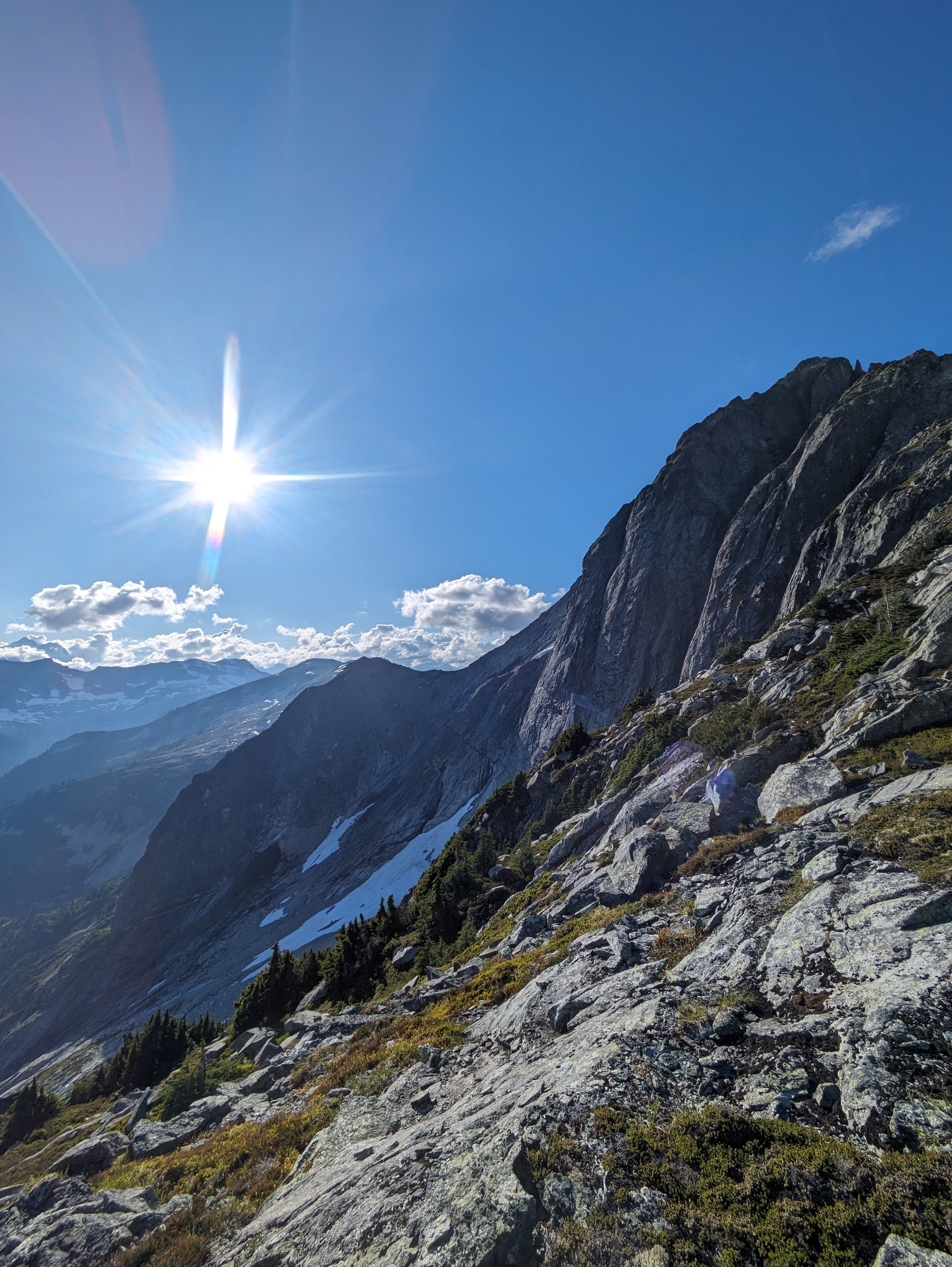
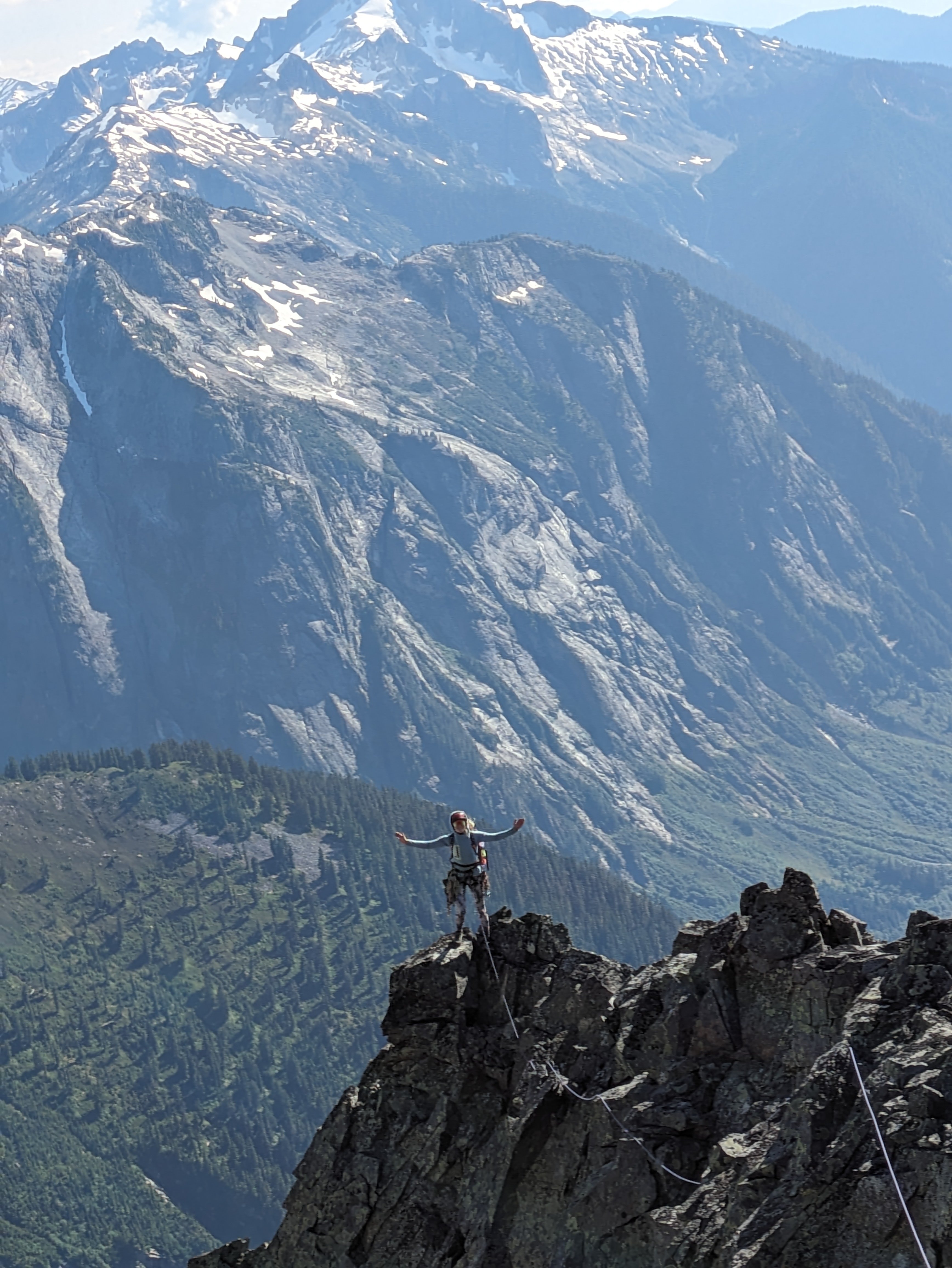
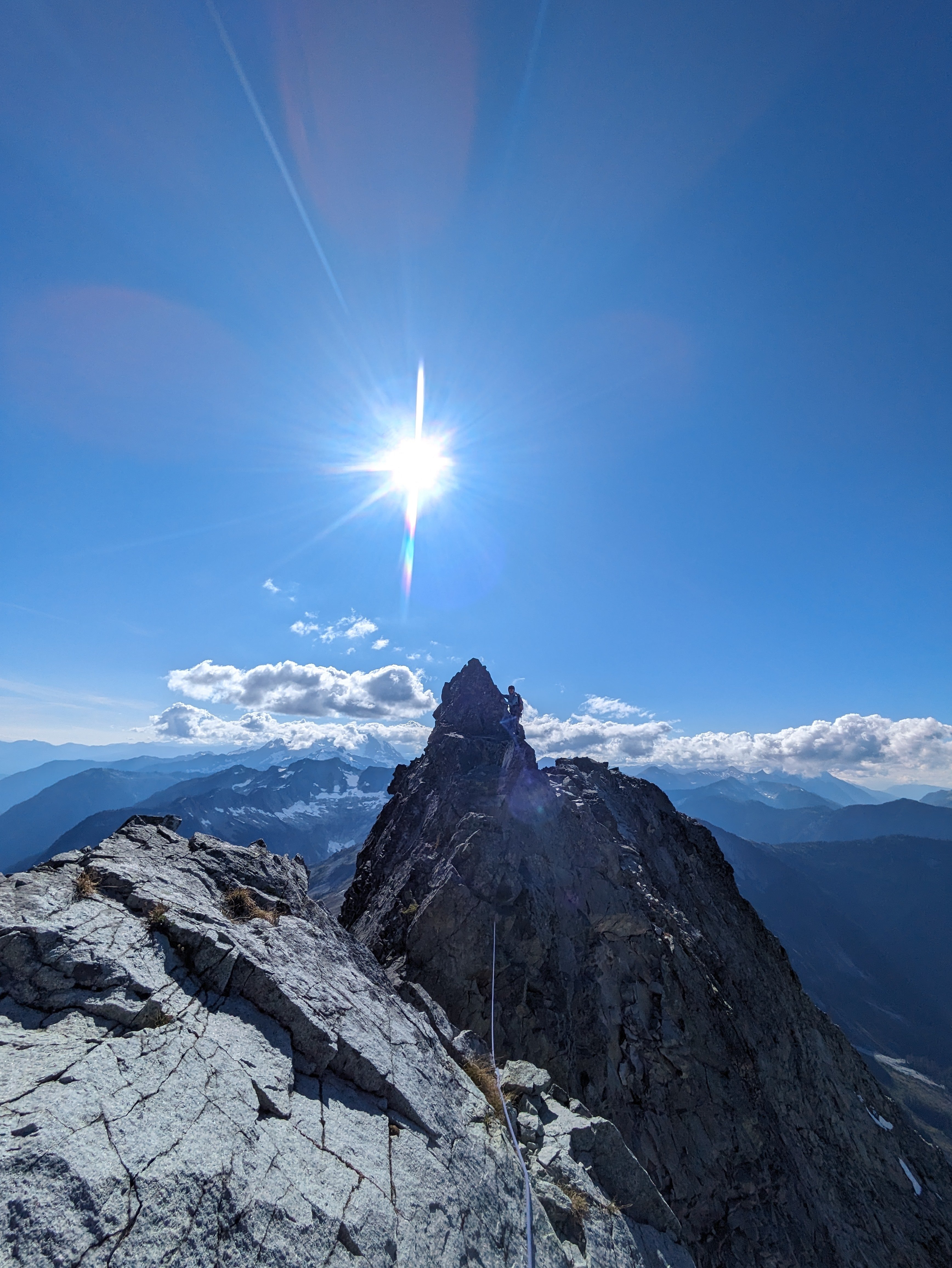
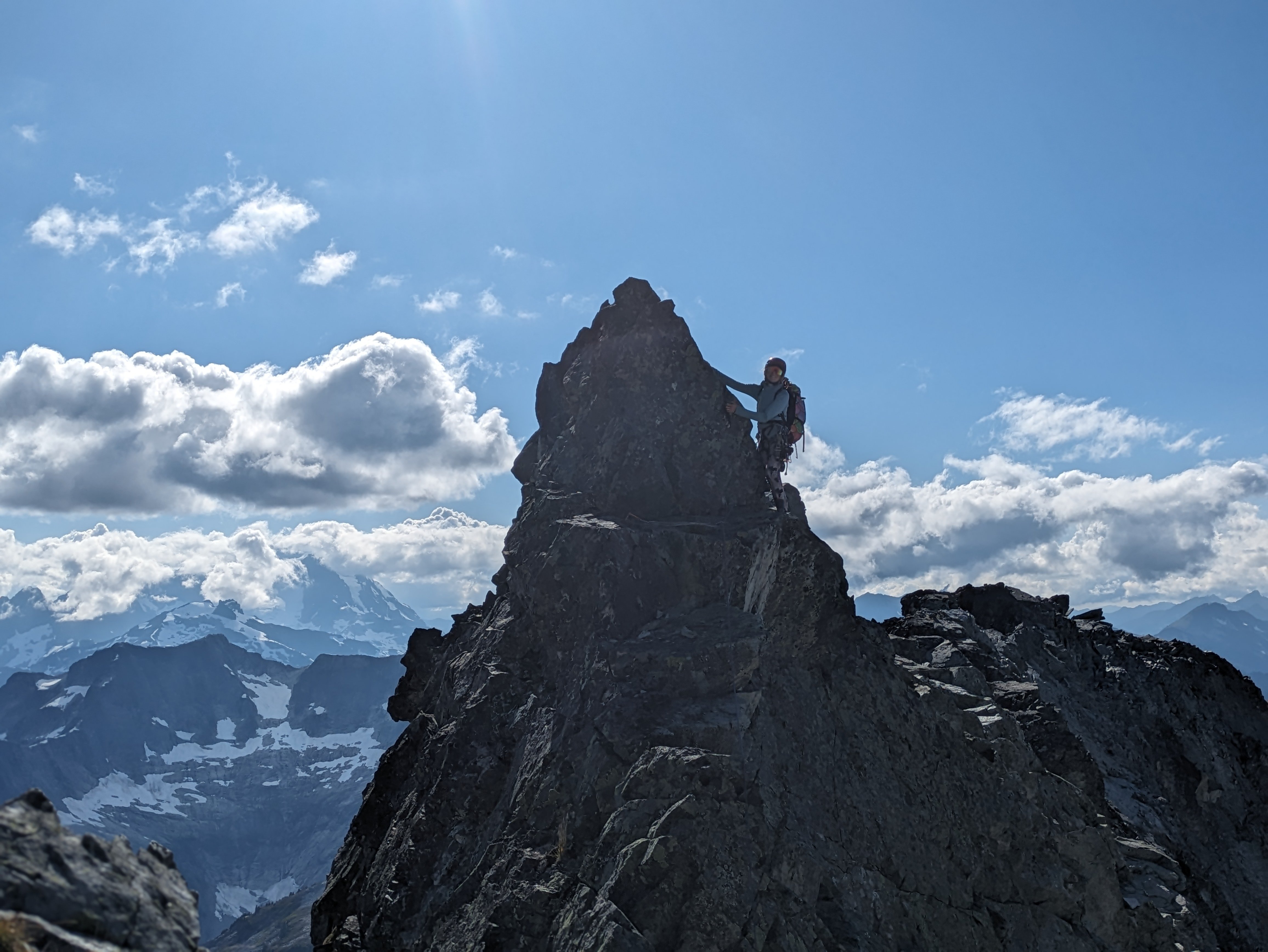
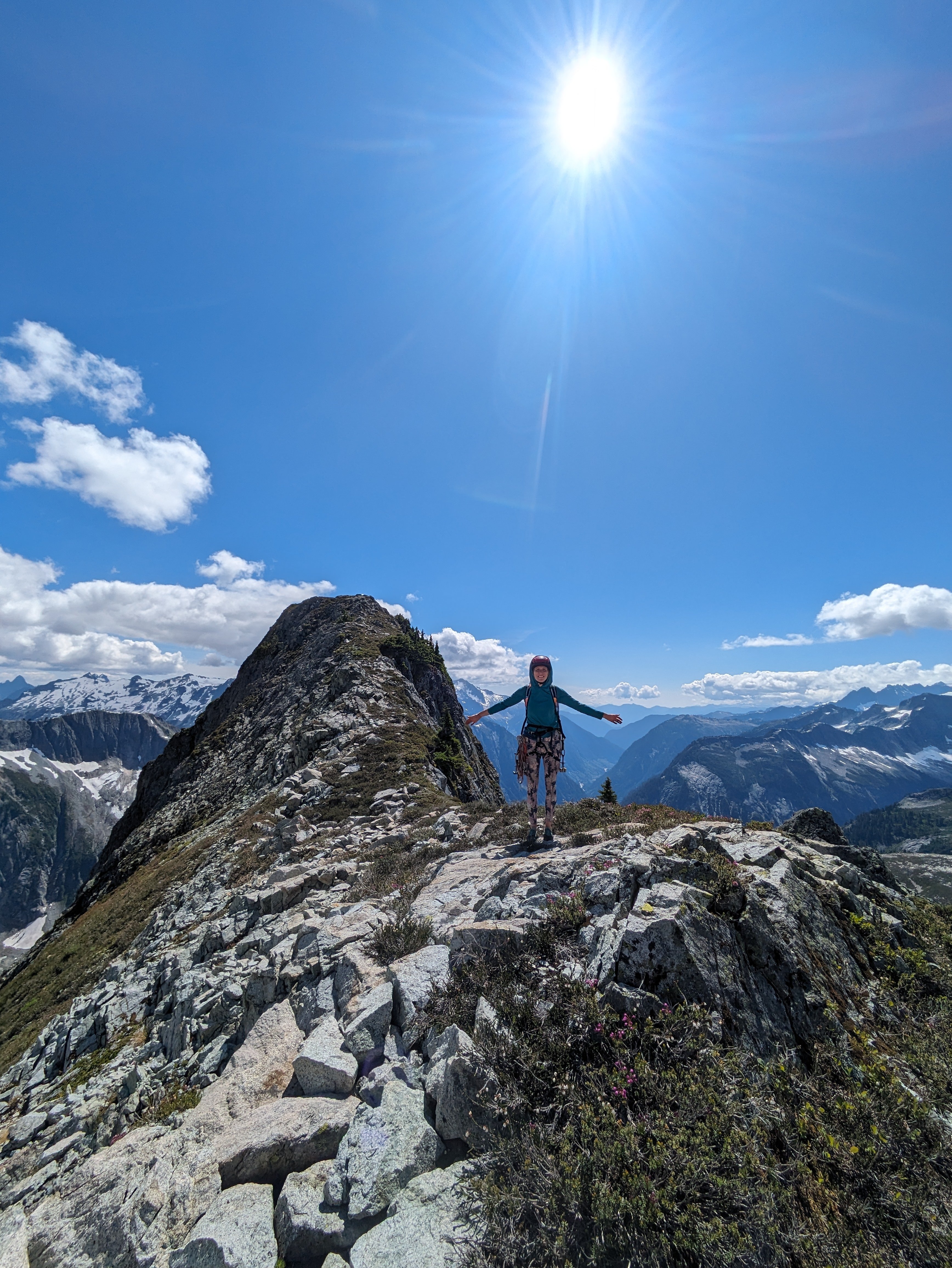
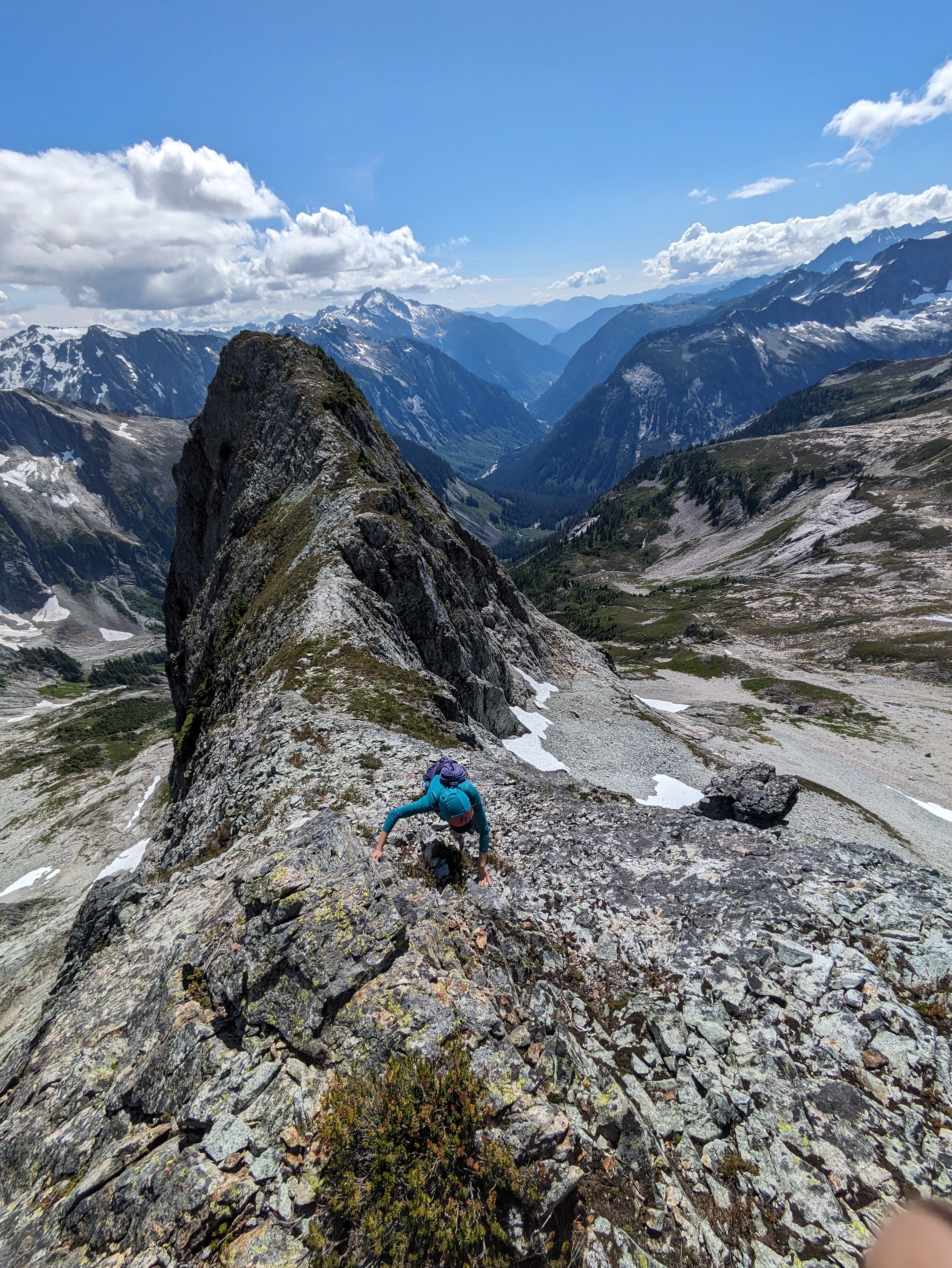
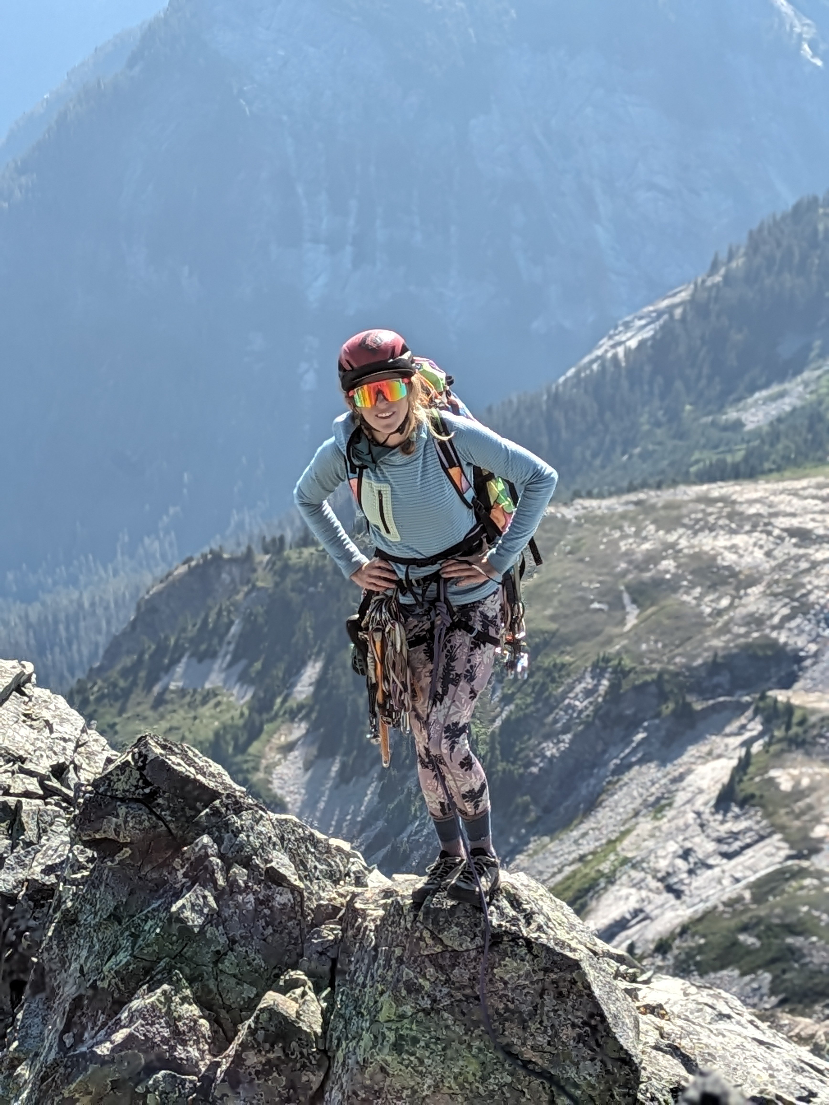
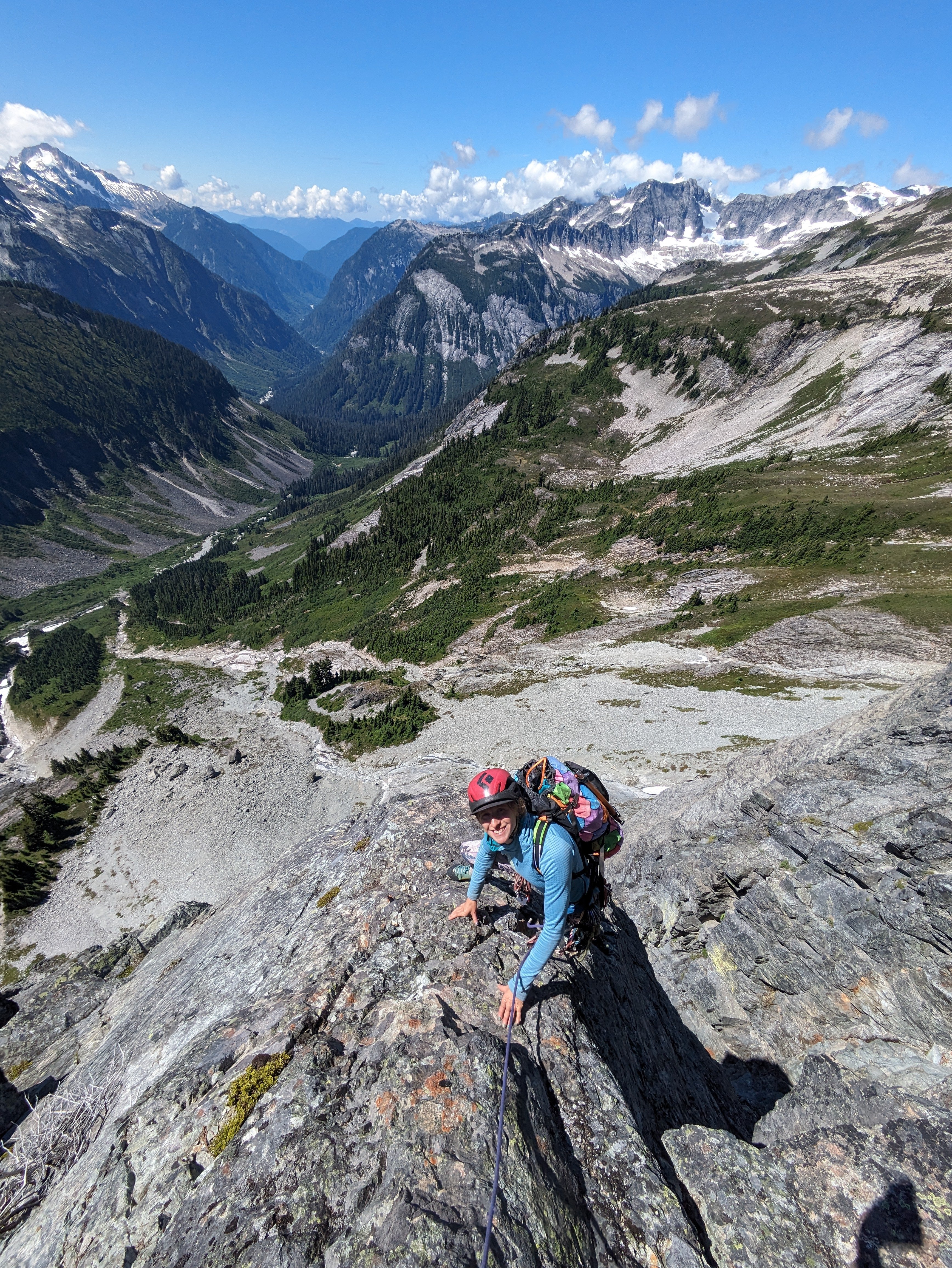
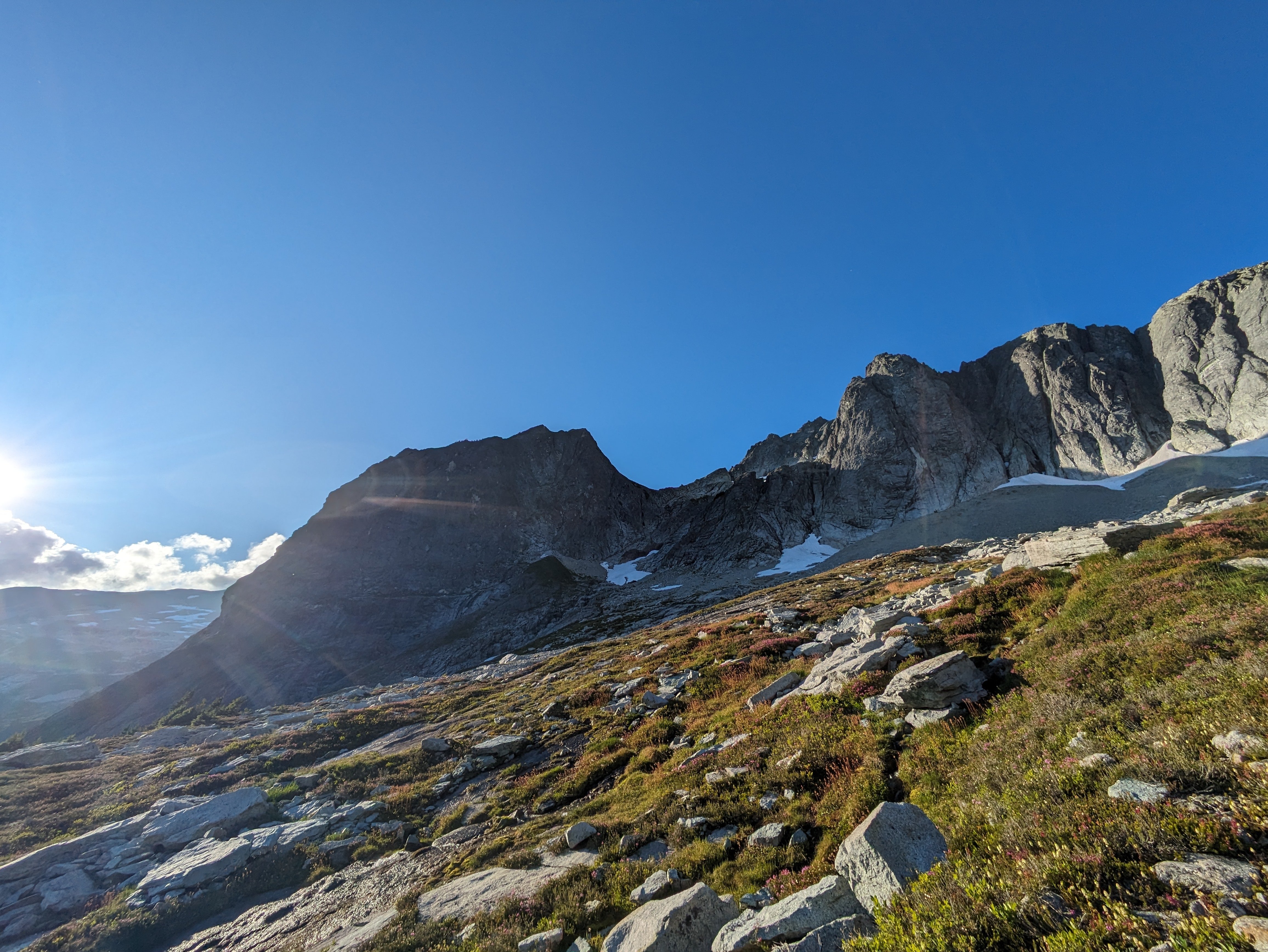
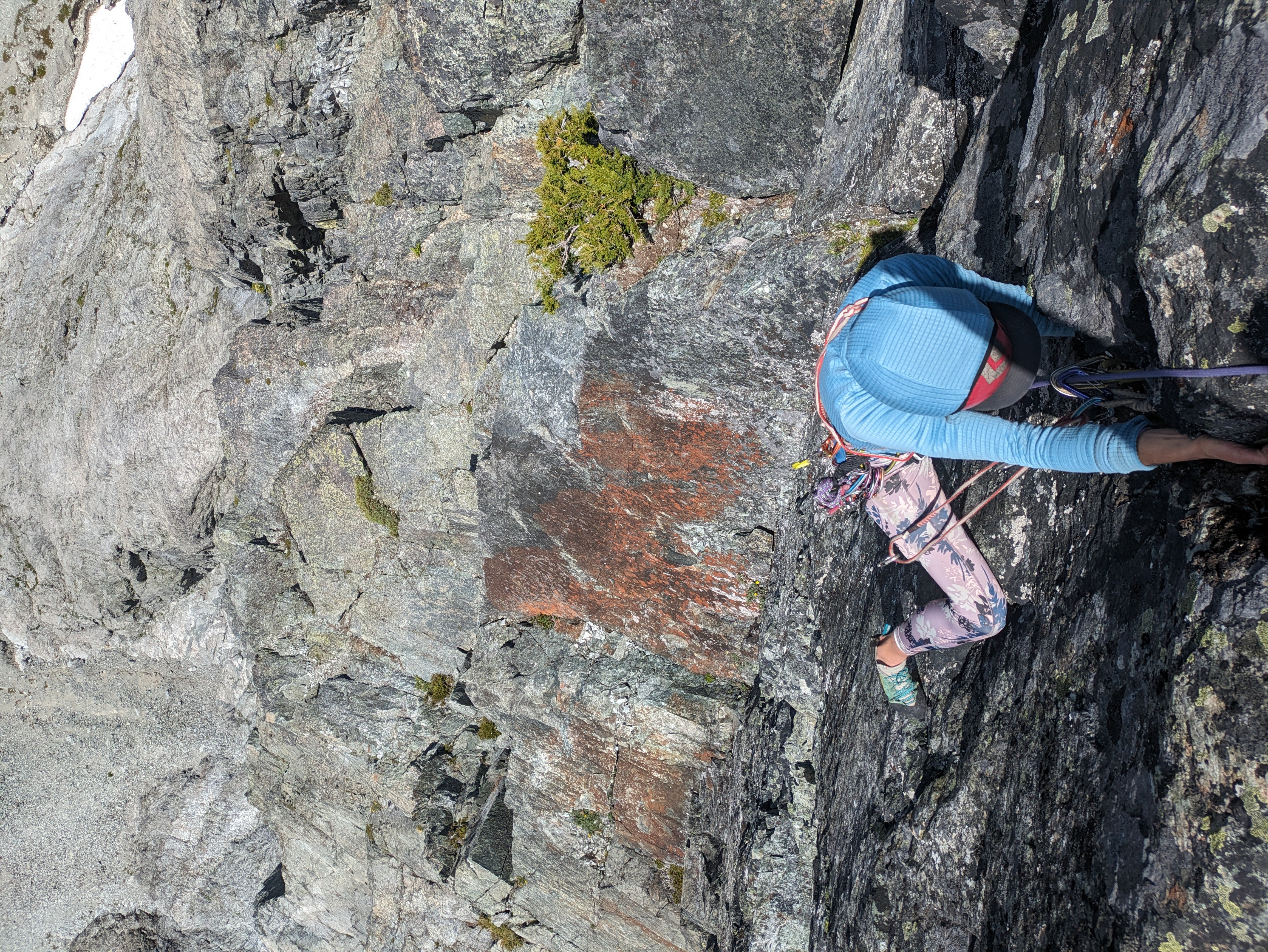
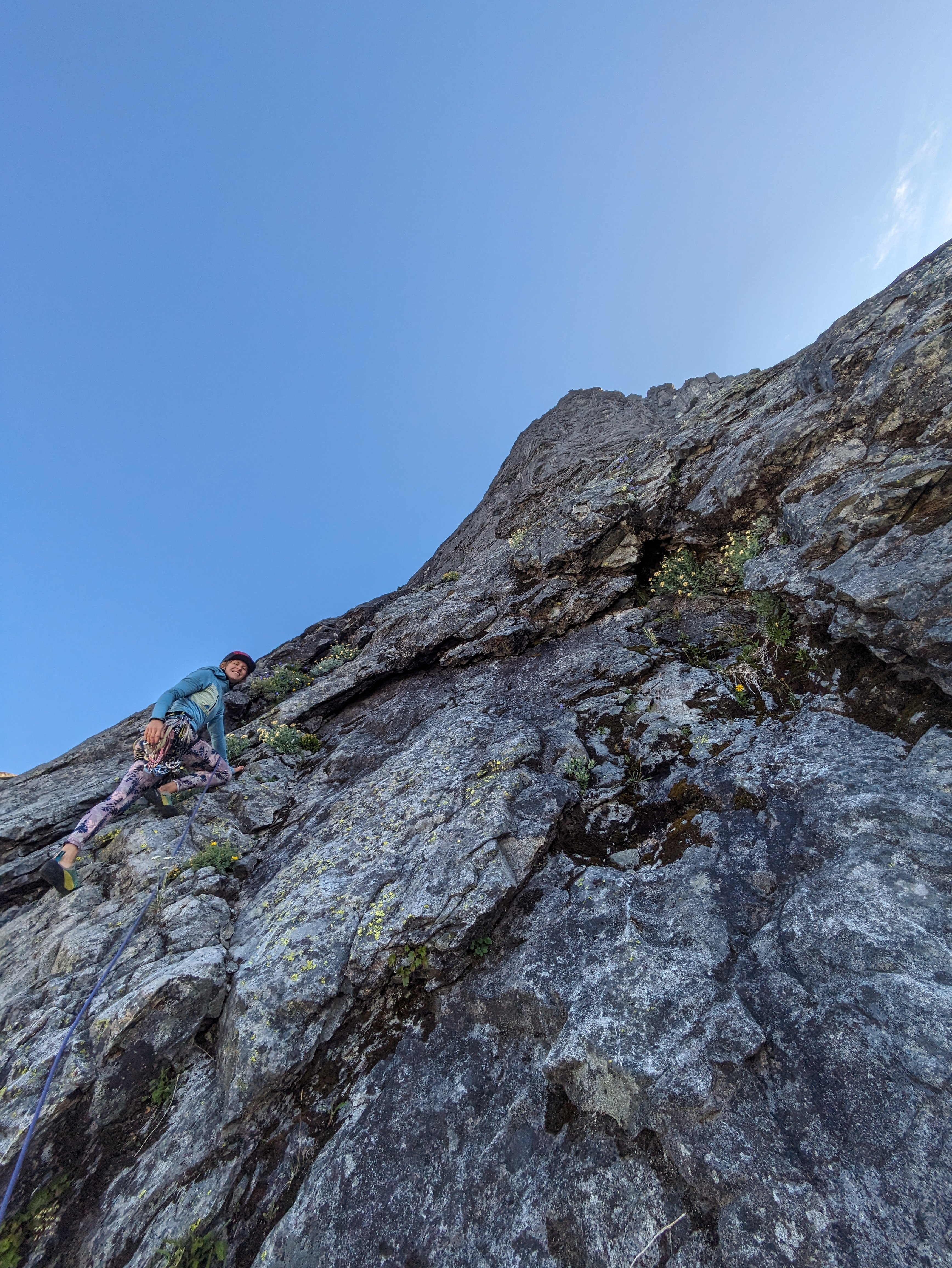 10 points
 -
Trip: Terror - N buttress (attempt), Himmelhorn - Wild hair crack, Degenhardt NW+E route, Pyramid - W route Trip Date: 07/04/2025 Trip Report: Drawbridged again in the pickets for the second time in a week. After the standard rap into the couloir north of Otto-Himmel col my partner @aikidjoe encountered a moat that appeared impassable. He ascended back to the station and I took a look down the next gully skiers left. From lower down I could see it would have been no good to try the moat (which would have required an absurd running leap) because another moat was not far below that one. I kept descending adjacent to the couloir, finding mostly solid, even fun, exposed class 4. There was a short low fifth corner with a lemon cake sized block that kept it secure. I passed a slung block with old webbing. Where things cliffed out I found some good .1-.2 cam sized cracks that could be used for a rap anchor. My 60m rope easily reached continuous snow from there (maybe 20m rap). Last year at exactly the same time of year I downclimbed continuous snow down this couloir without even needing the first rap. And last year was a low snow year too. So I was pretty surprised at the state of the couloir. This workaround skiers left seems viable to me. Posting it here in case it helps anyone. The false start and exploration ate up enough time that we decided to bail on our plans for the Stoddard route and head back up to climb WHC instead. My partner was bemused because he expected a crack climb The day had started clear. On our way back down from O-H dark gray clouds moved in to block the ridge. I was glad we weren’t somewhere high on the north buttress of Terror. Next day was quite socked in. We headed off for Degenhardt, accidentally heading up from the south before correcting course for our intended NW route from near Terror’s east col. To gain the couloir there was short choke that steepened at the end to maybe 80 degree snow. We underestimated the angle from below. Odd, usually it’s the opposite. We were able to bypass this on slabs on our return. The foreboding weather and lack of visibility gave the climb a serious feeling. As it gradually cleared on the way back the route started to feel easier. There is plenty of choss on Degenhardt but I recall the scramble being pretty fun. While extracting the summit register I dropped its pencil down some hole. Sorry. From there we groped our way slowly toward Pyramid. The route finding in the clouds was trickiest near Degenhardt. Was glad to carry ax/whippet all the way due to about ten steps through a narrow and steep snow couloir to get to Pyramid’s rock pyramid. We had peek a boo views into McMillan cirque but could see nothing at all to the east. By the time we passed back west of Degenhardt the clouds were lifting and it was a relief to see where we were going. The weather kept improving and the sunset was a real mind melter. UFOs came out in force. Next morning greeted us with more clear weather but having had our fill we bid adieu to the goats and our impeccable camp. After the bruising descent we enjoyed copious berries south of terror creek. Gear Notes: 60m rope and light rack, crampons, ax or whippet Approach Notes: Goodell
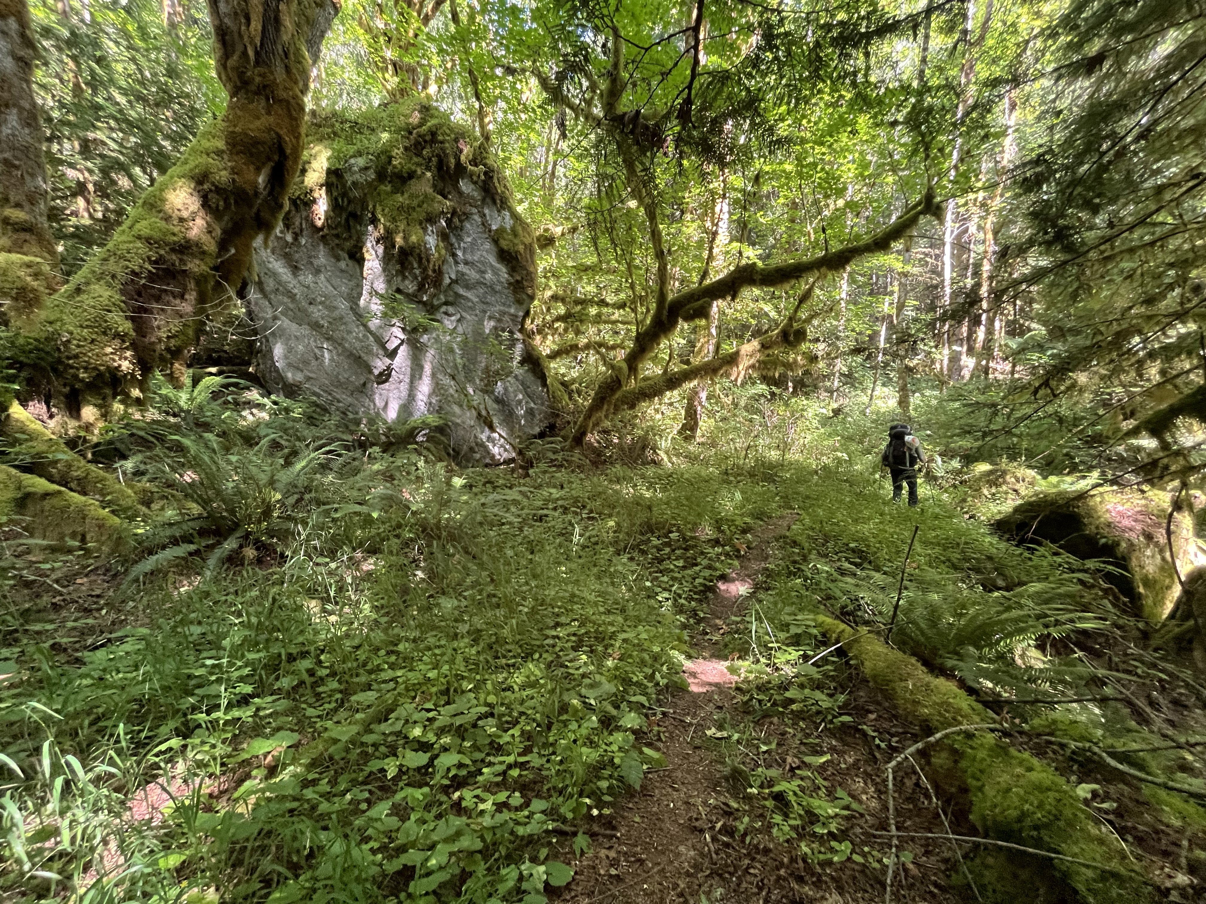
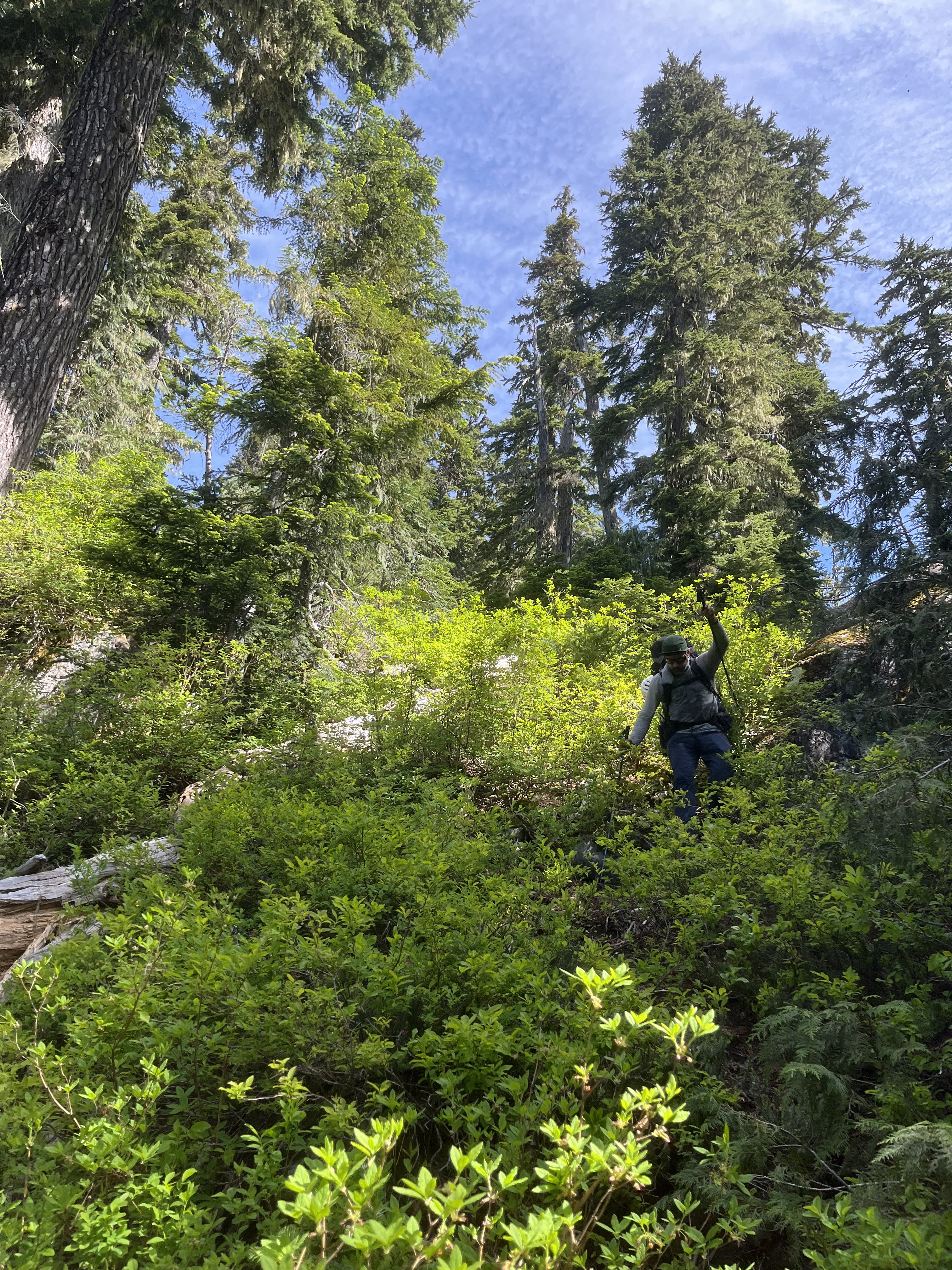
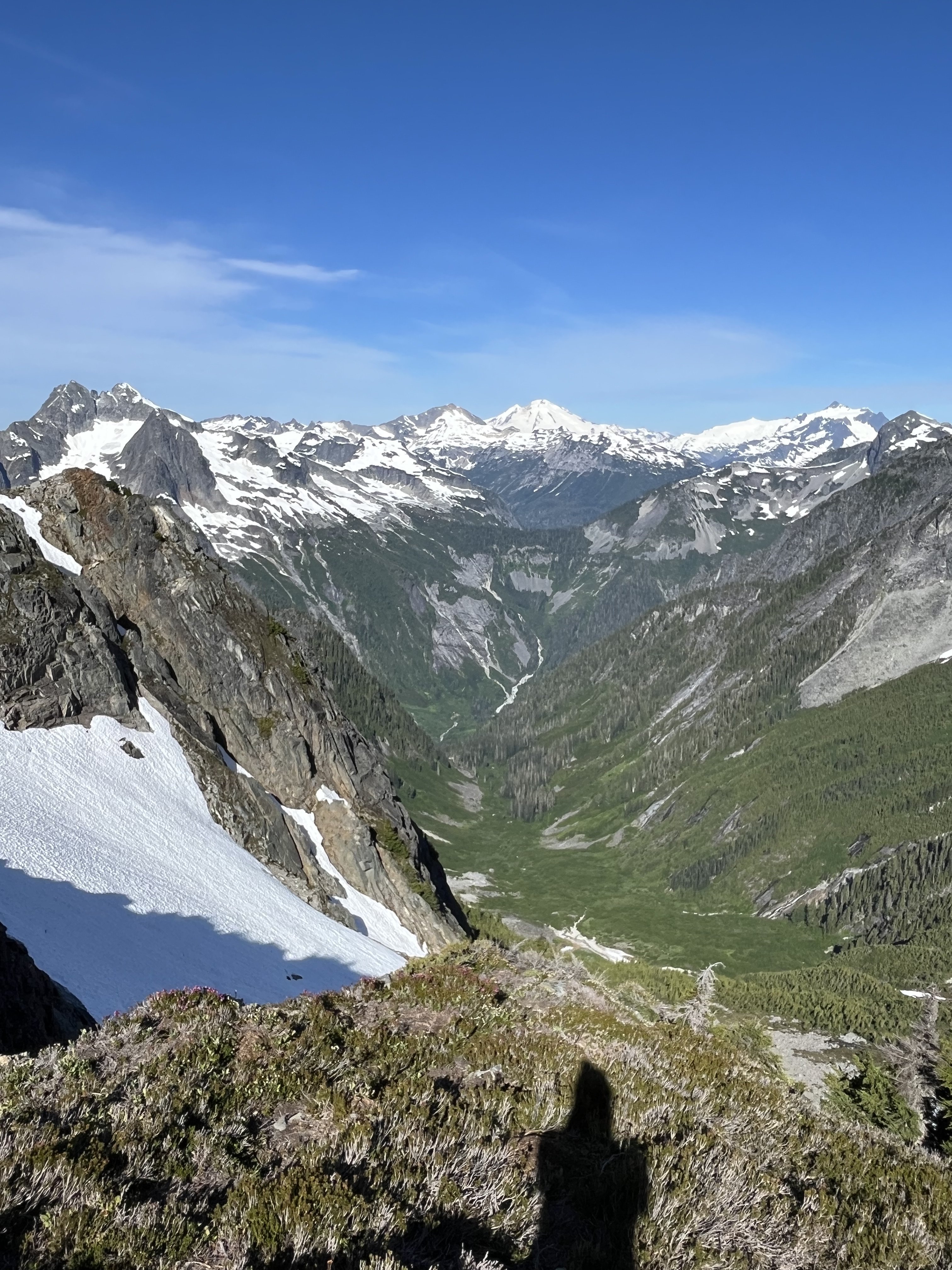
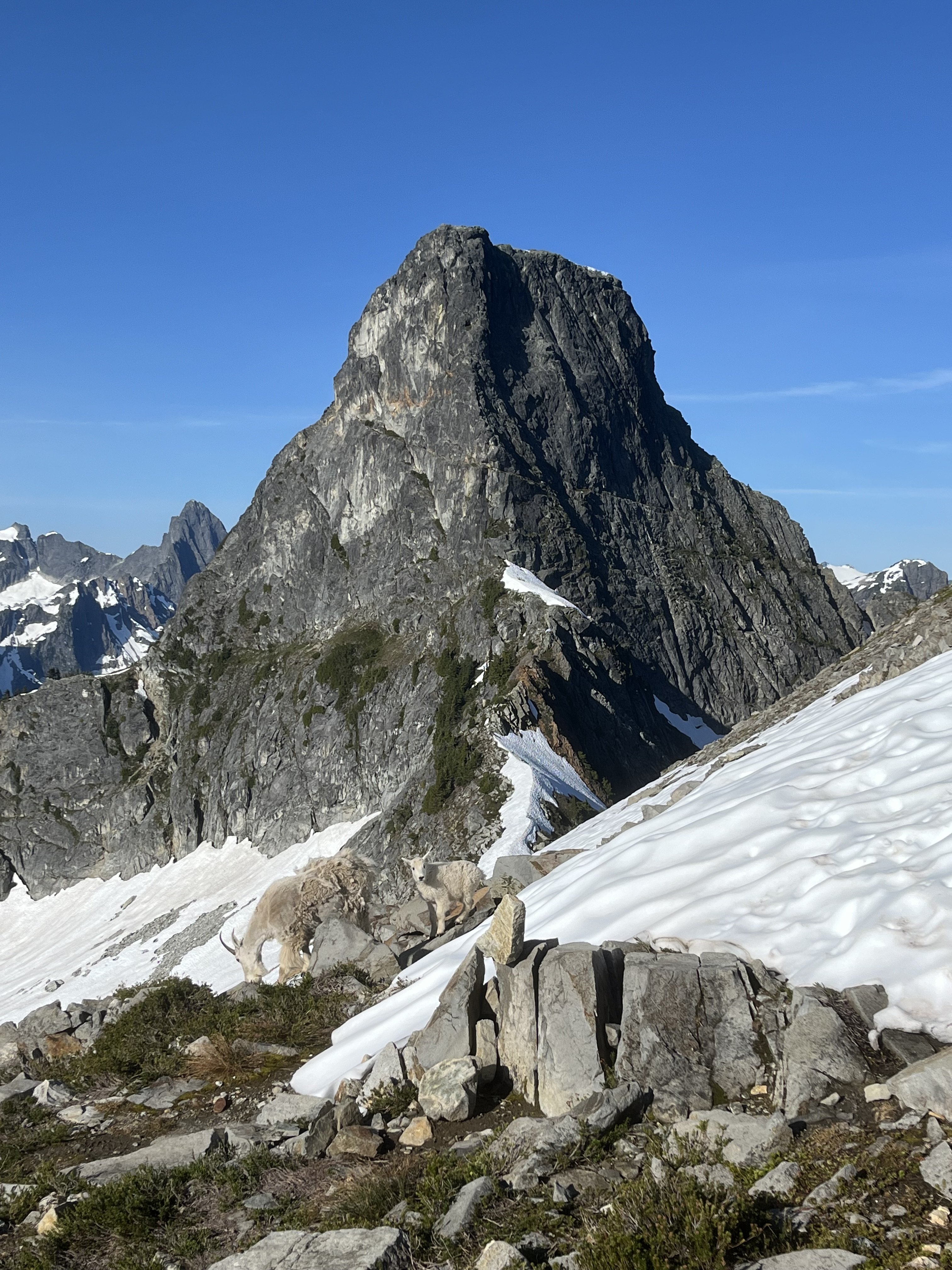
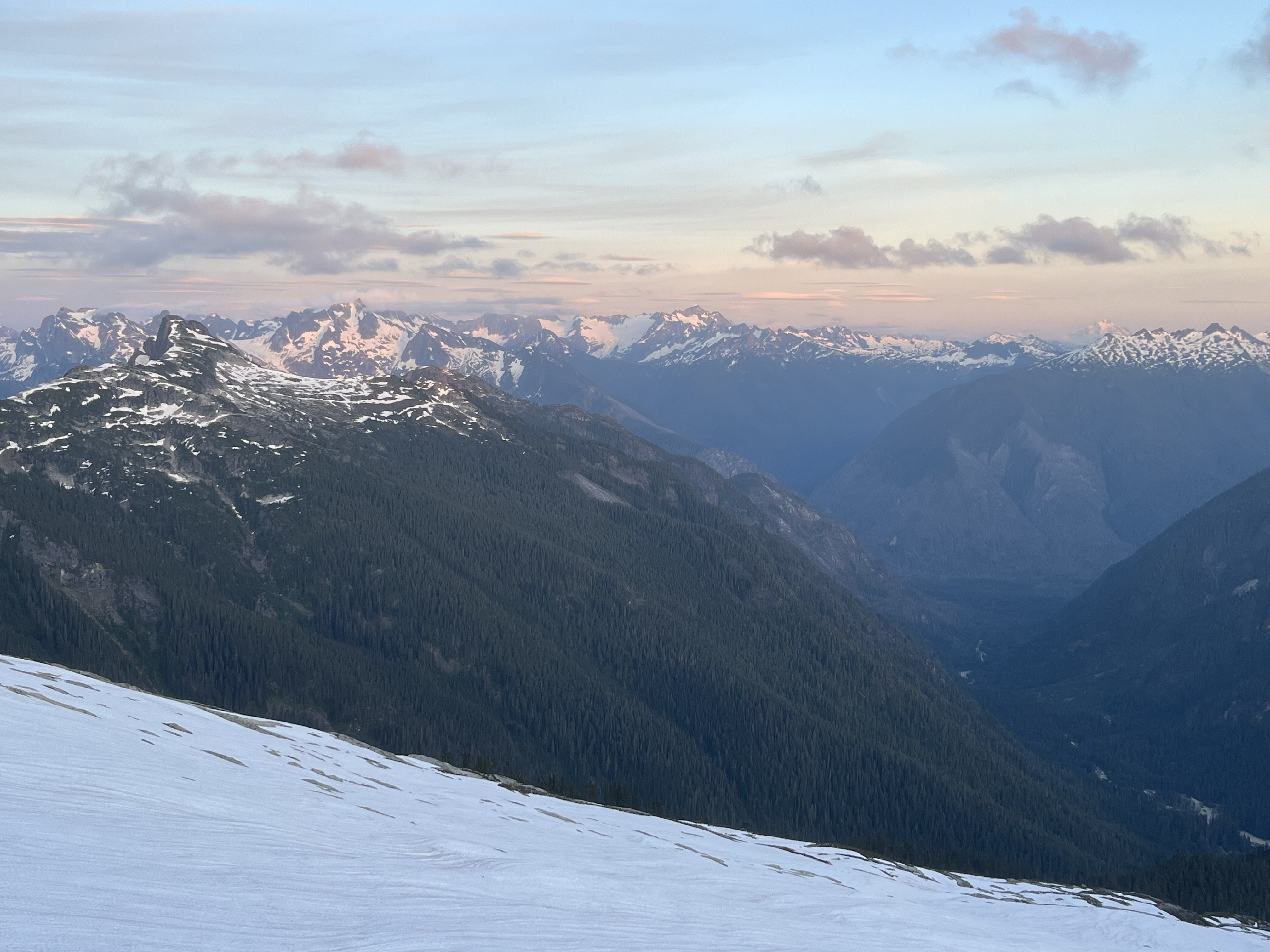
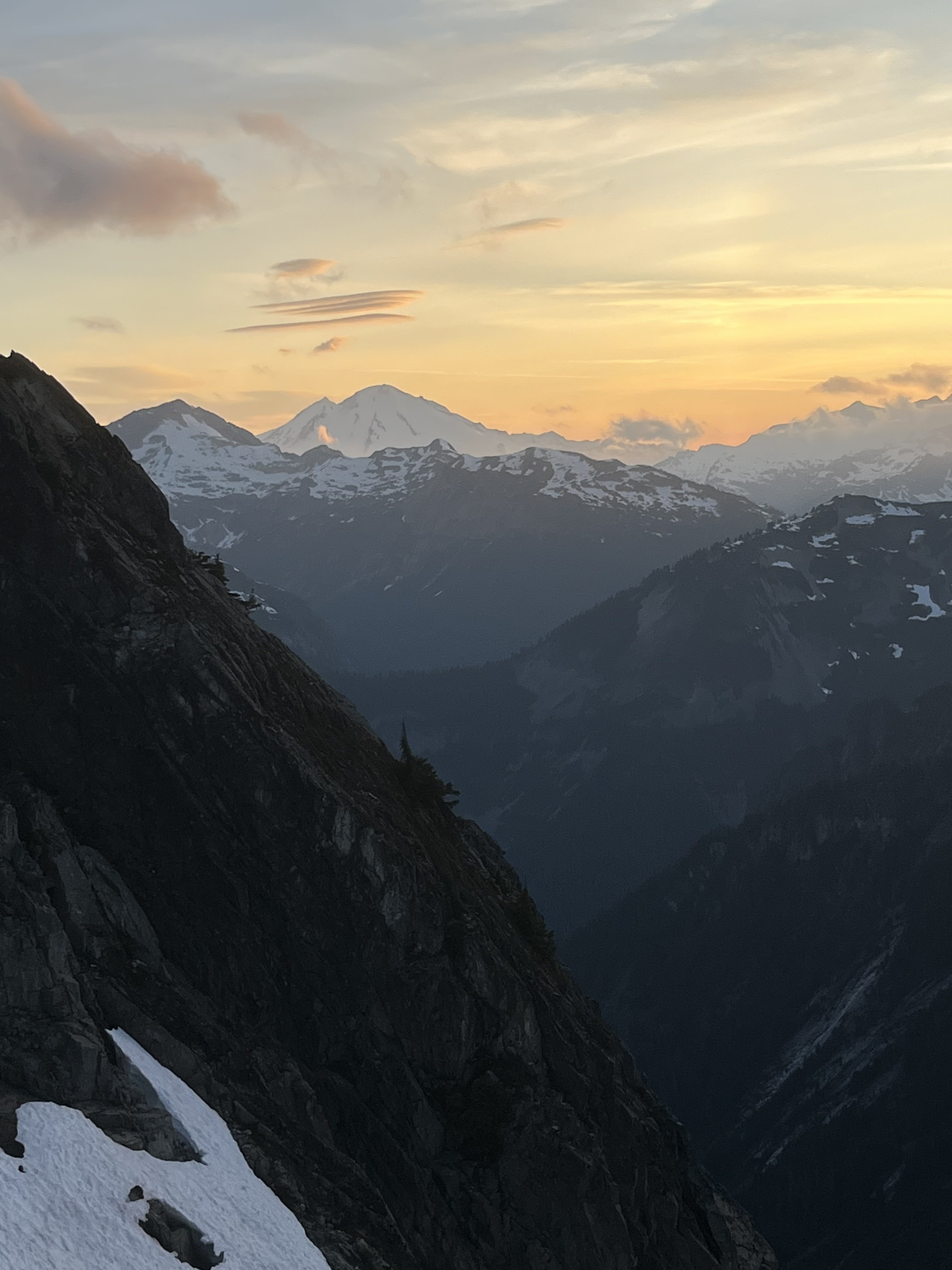
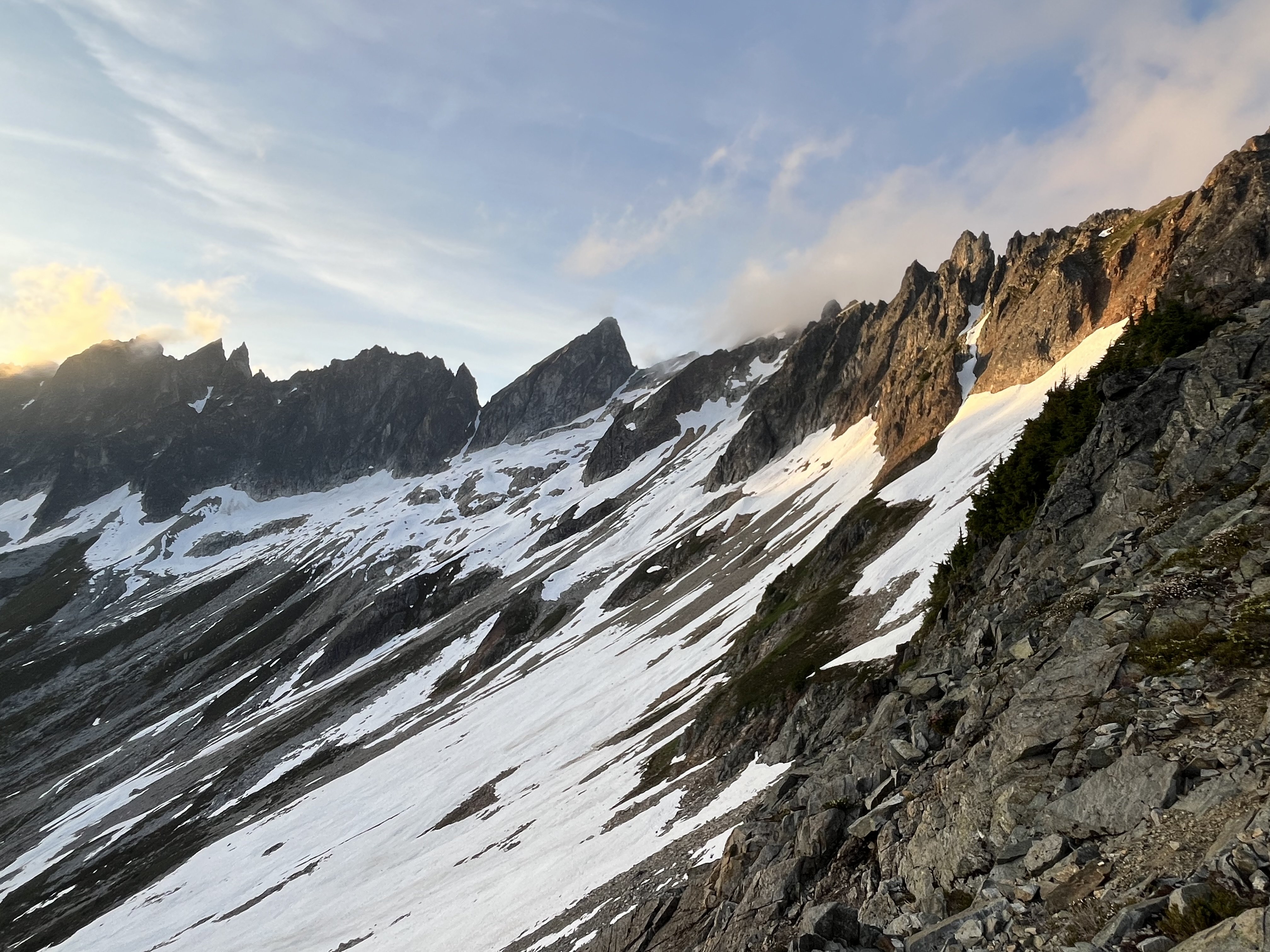
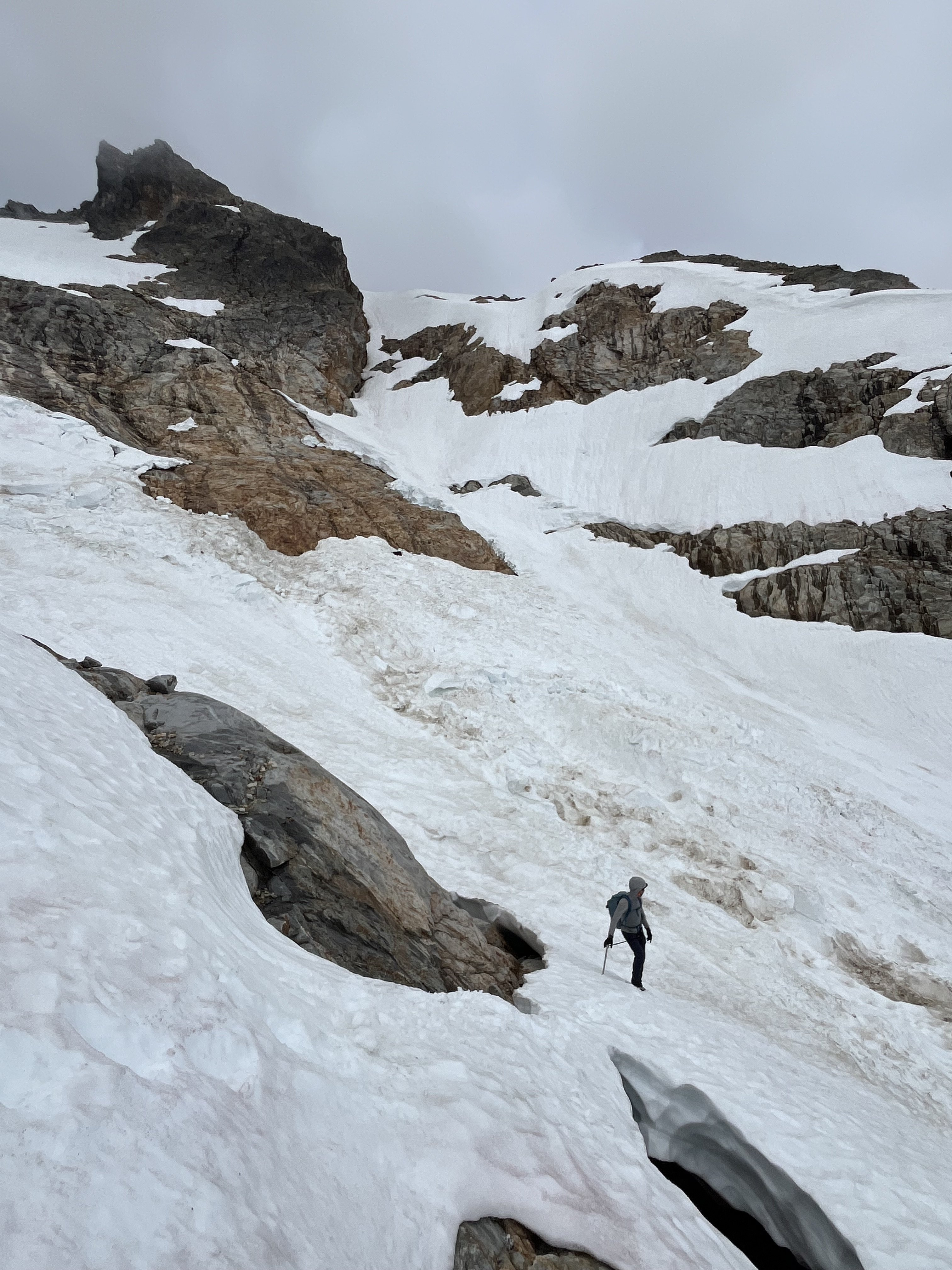
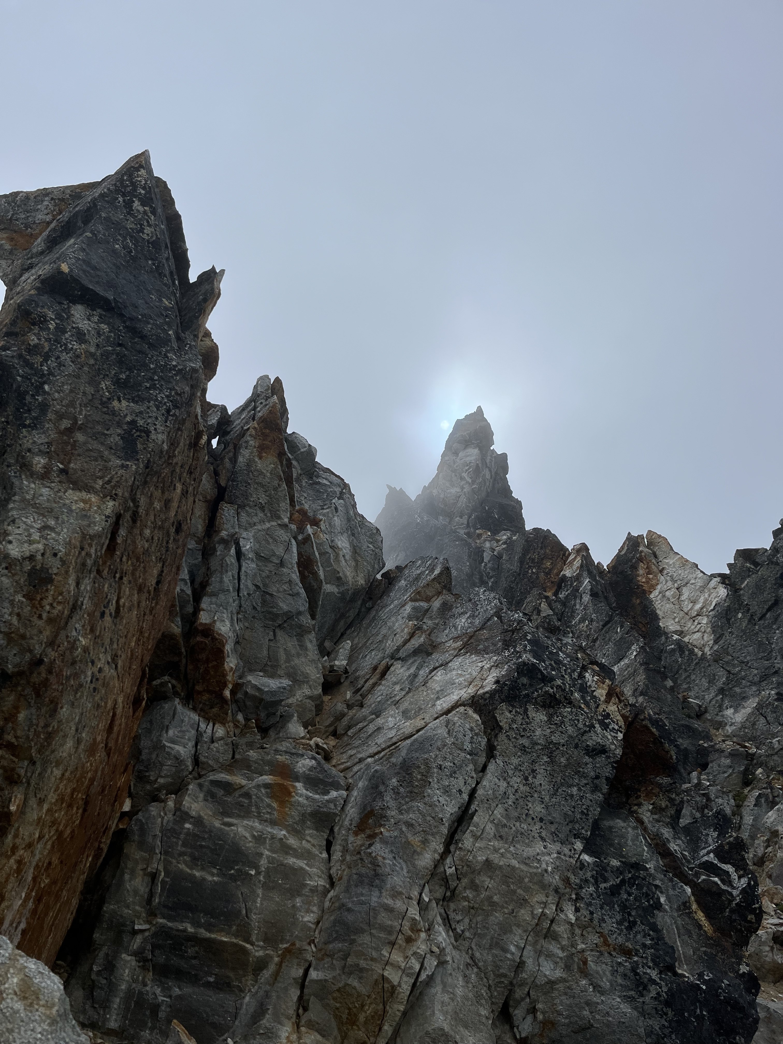
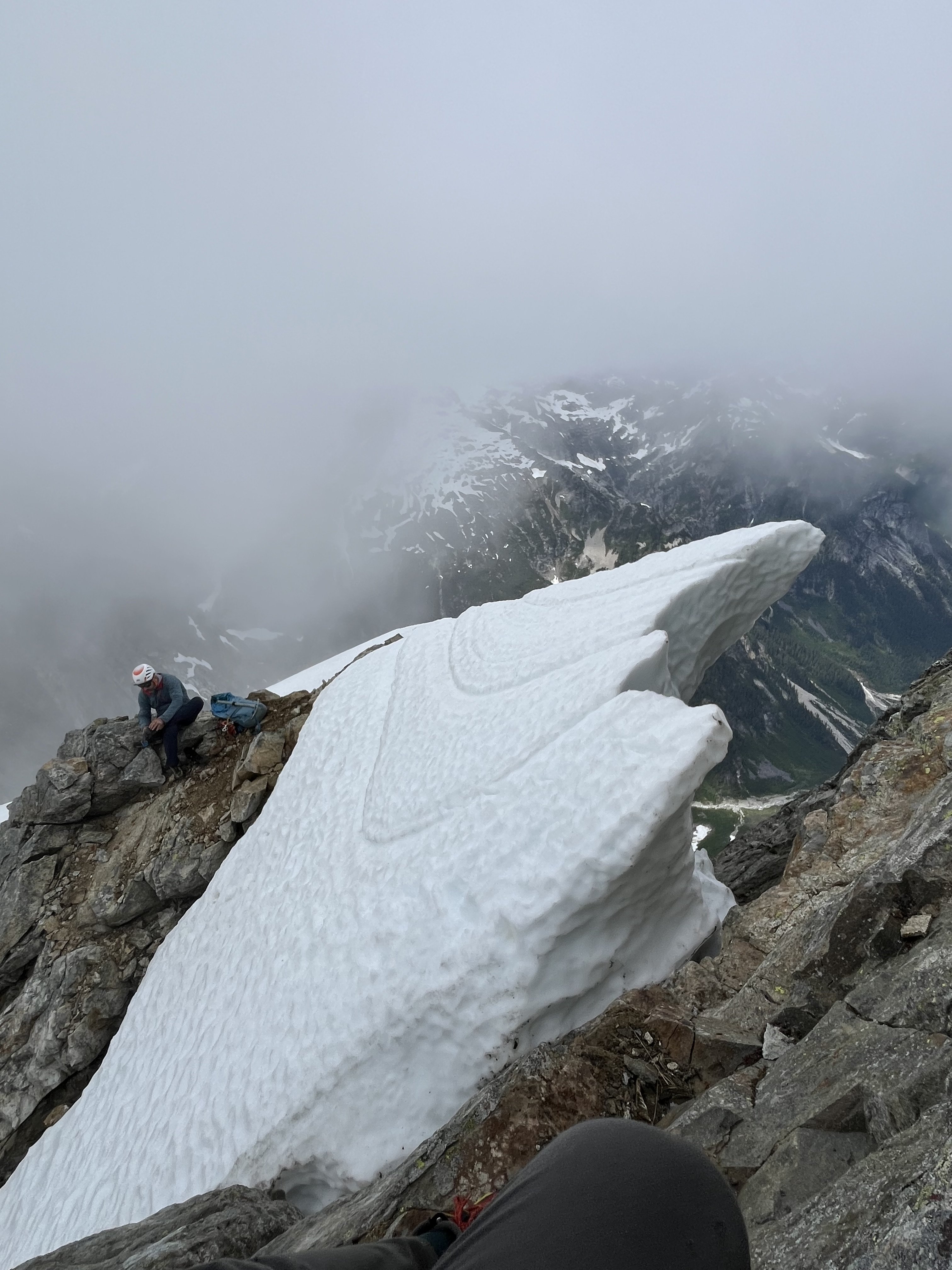
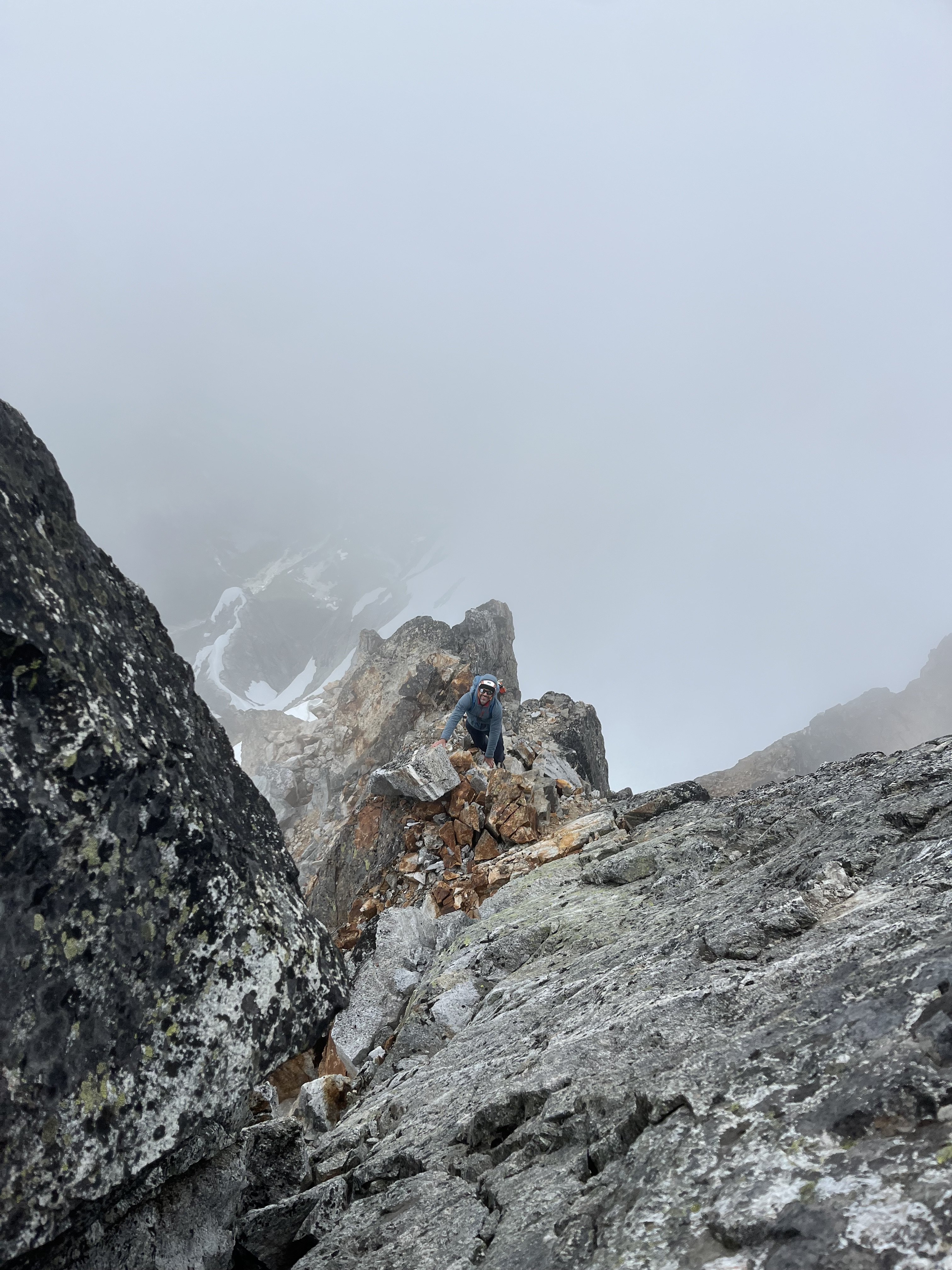
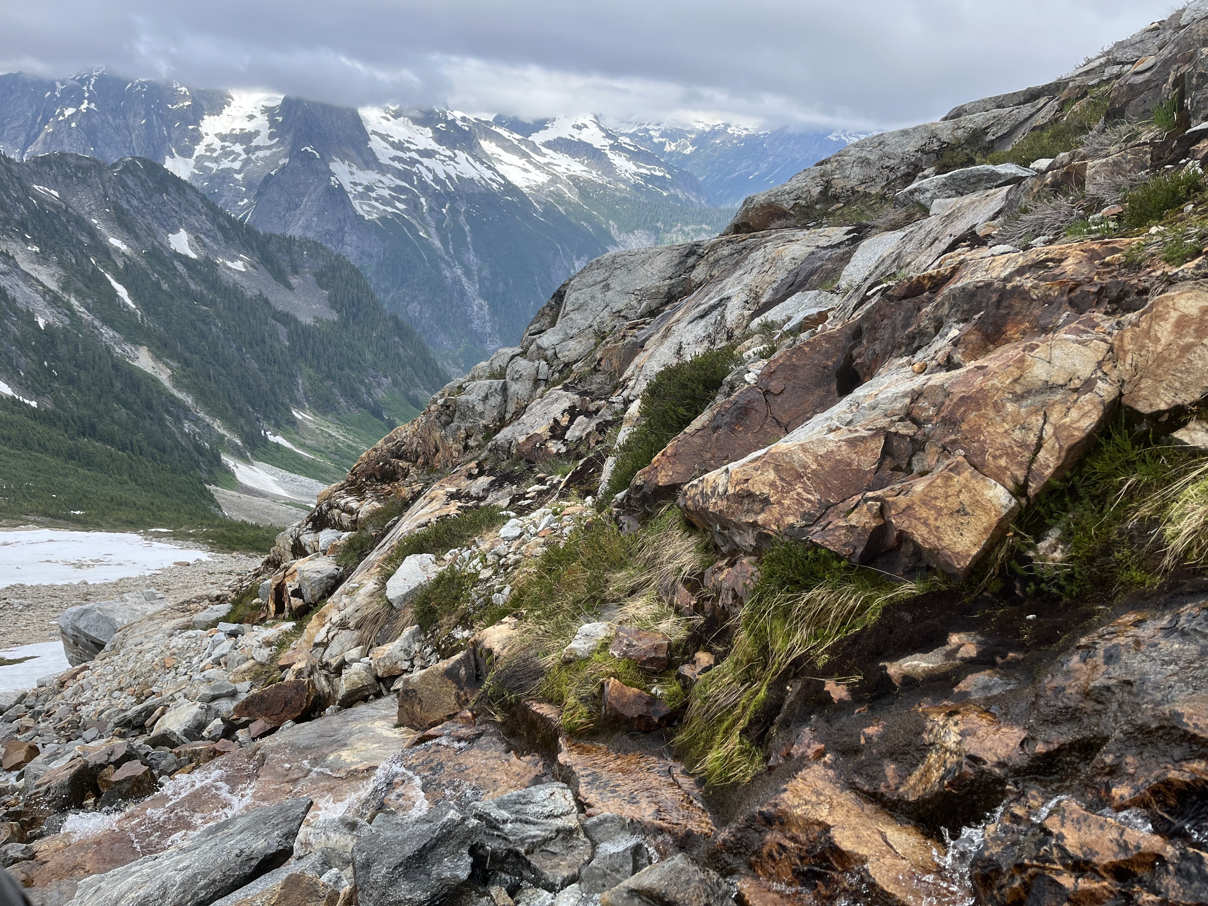
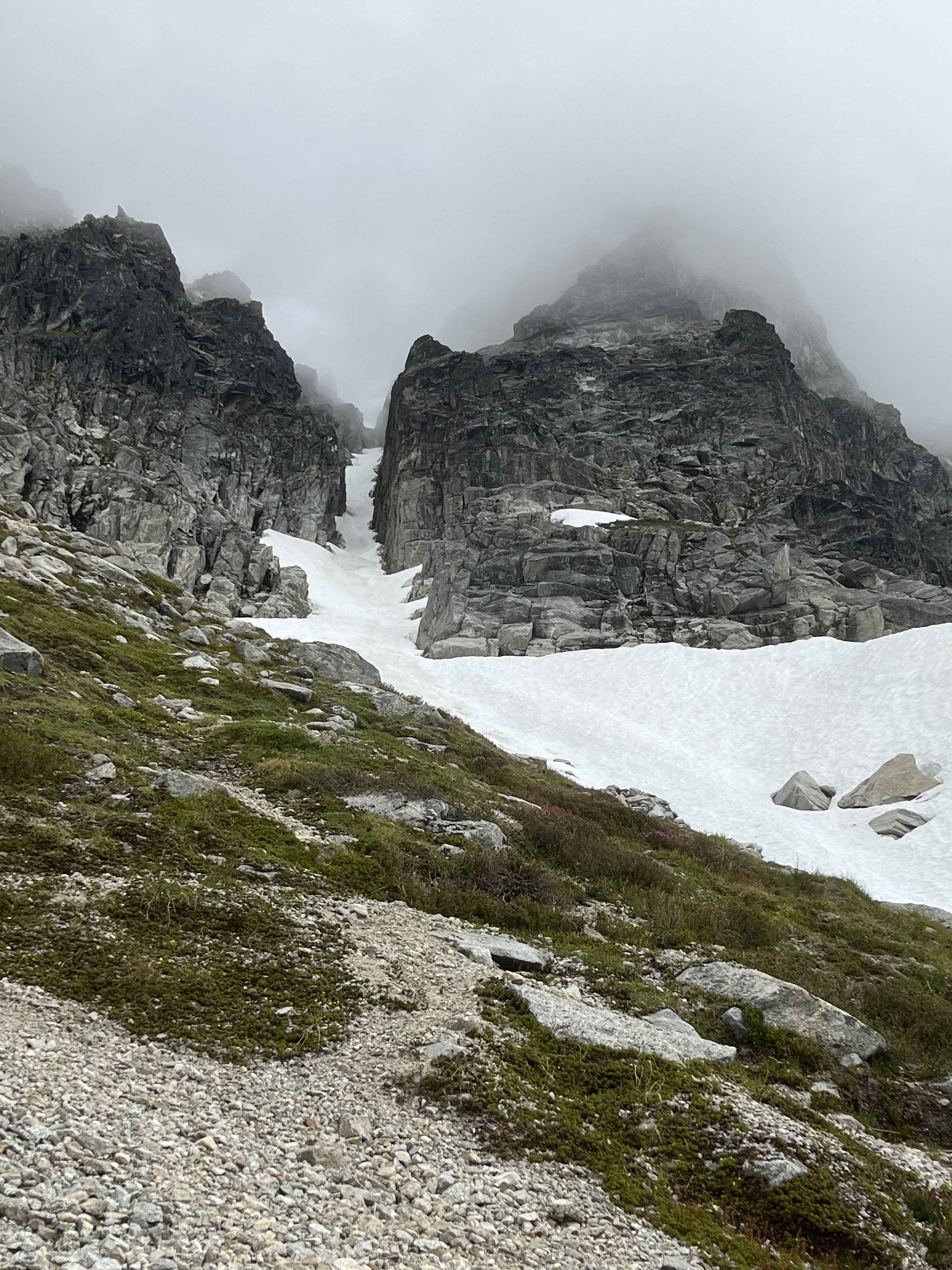
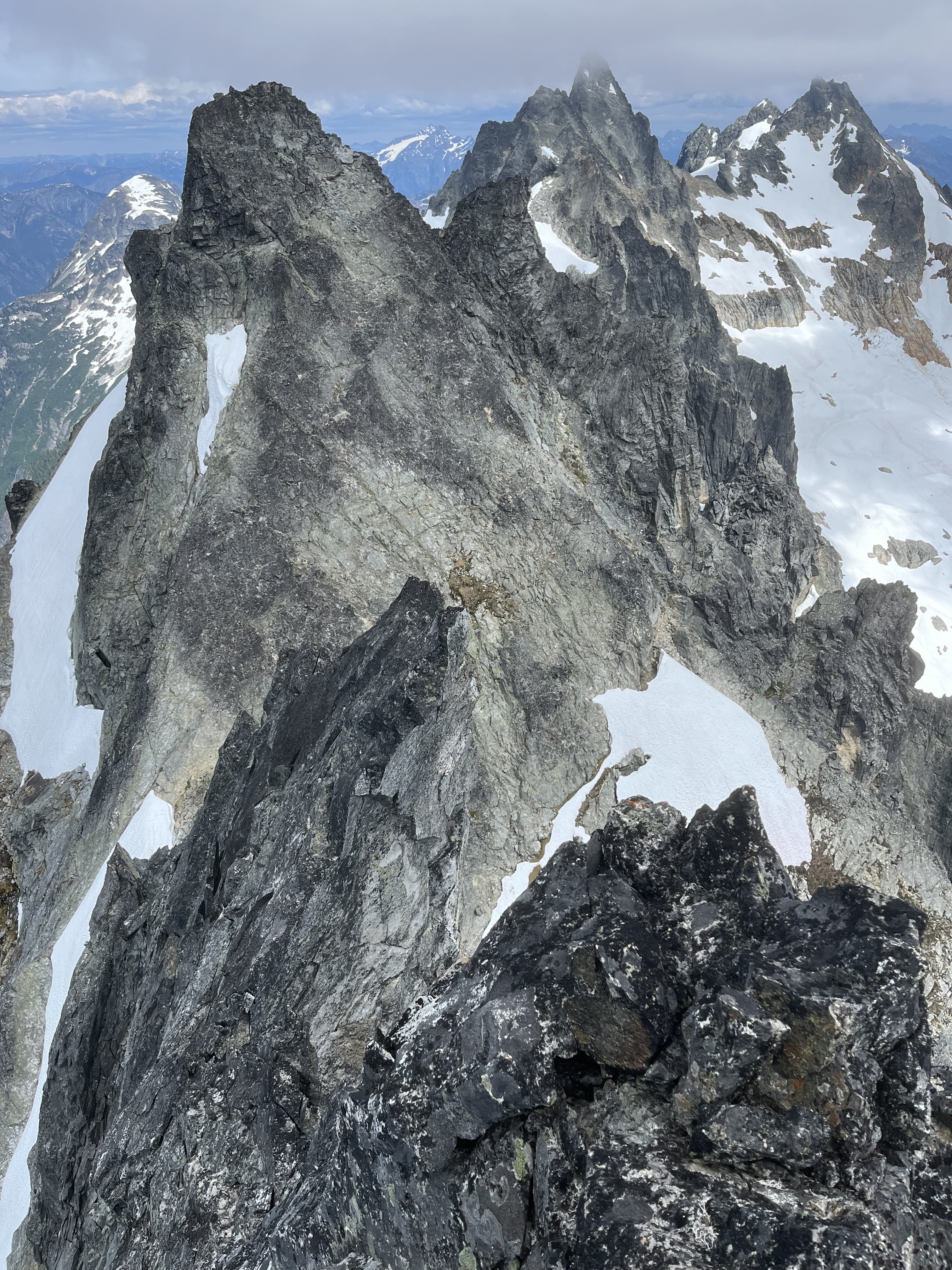
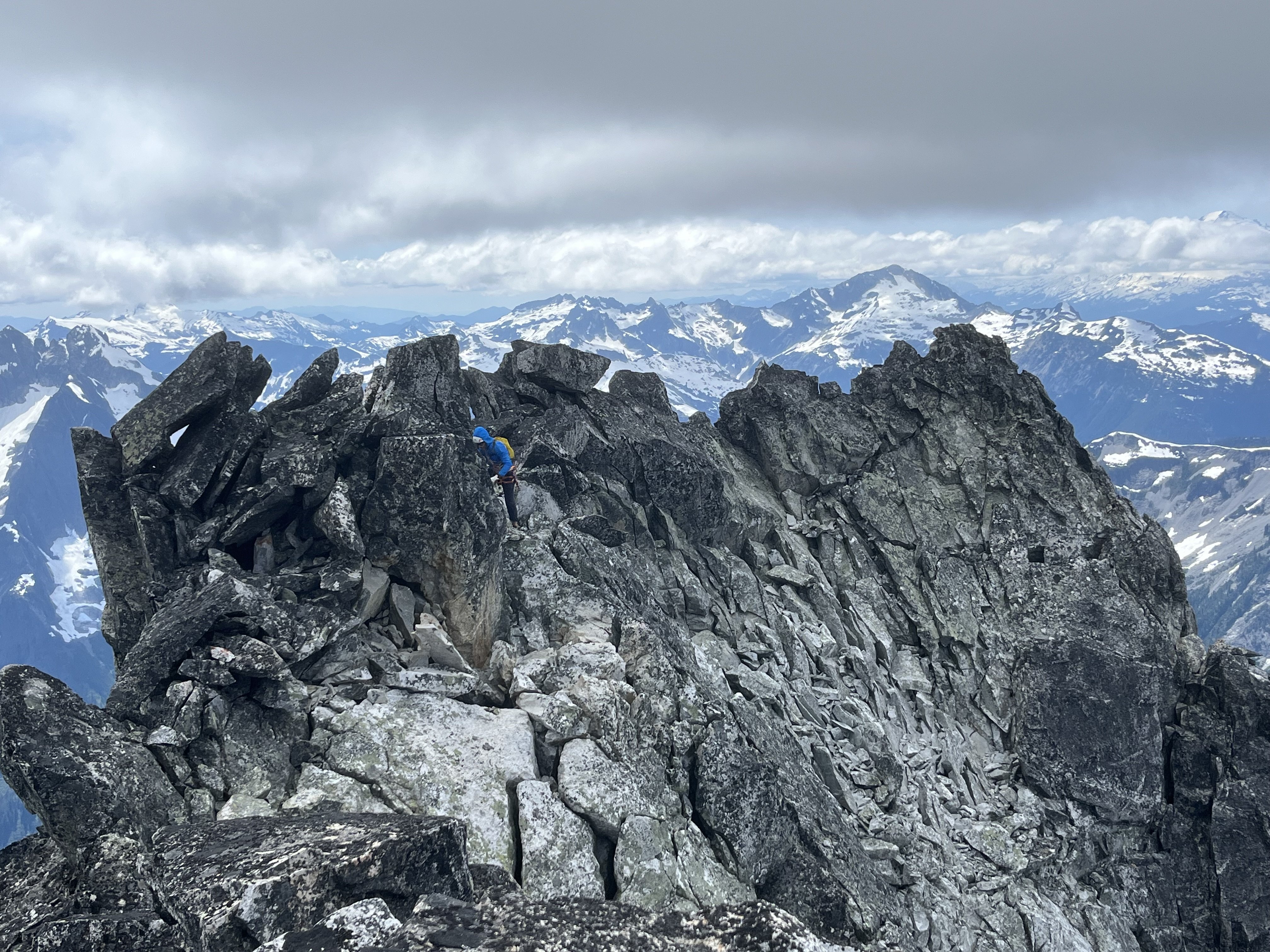
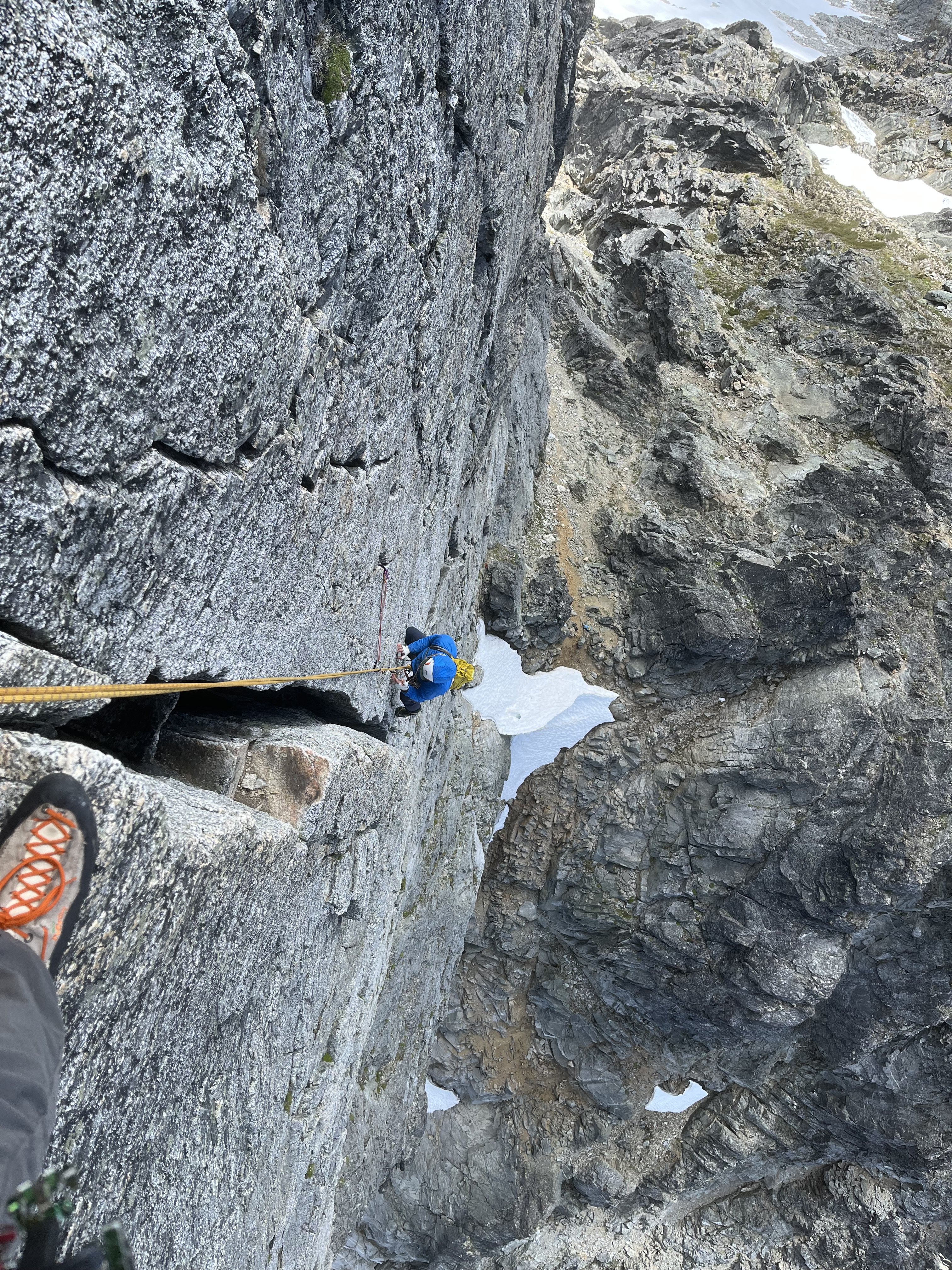
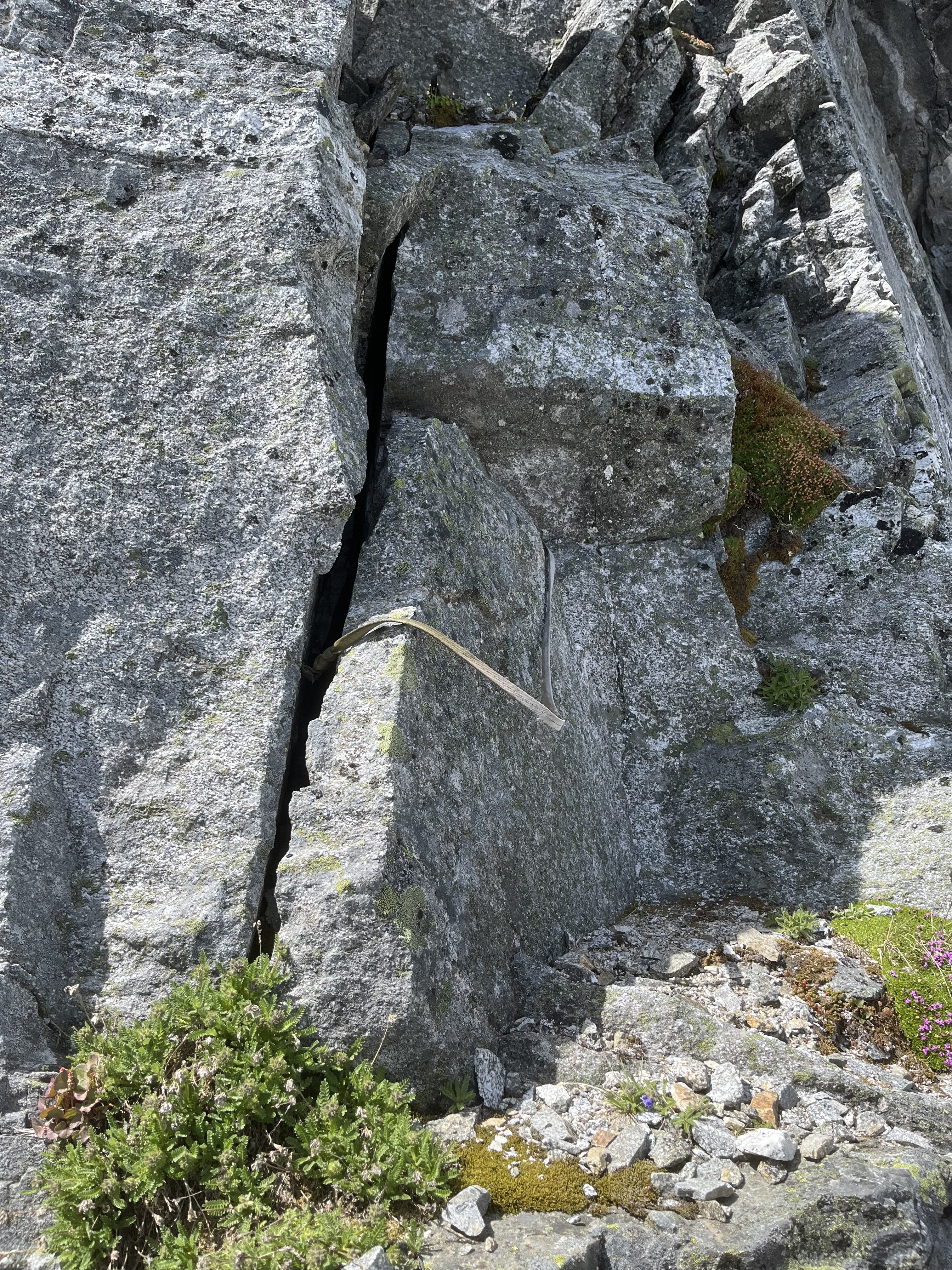
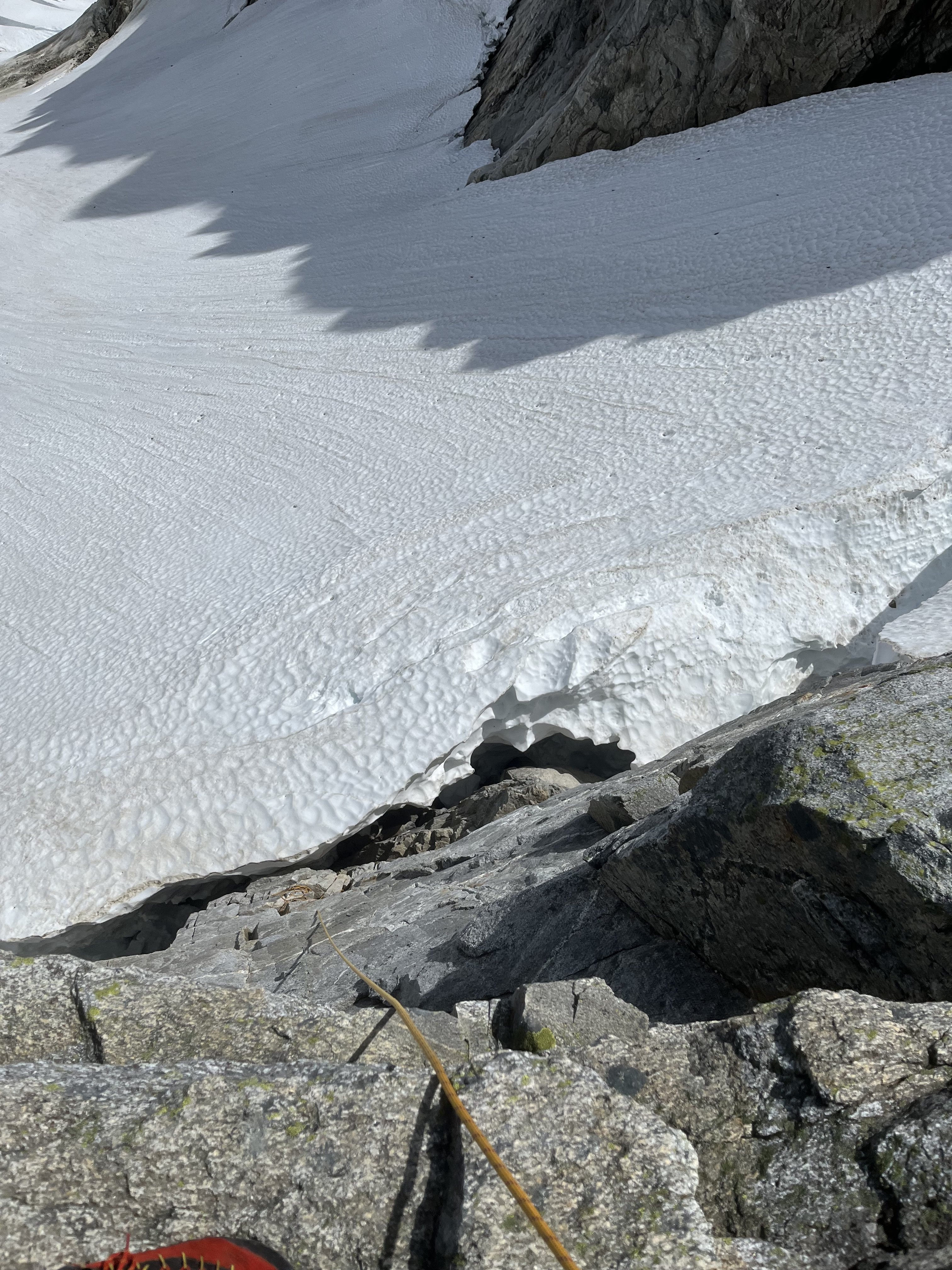
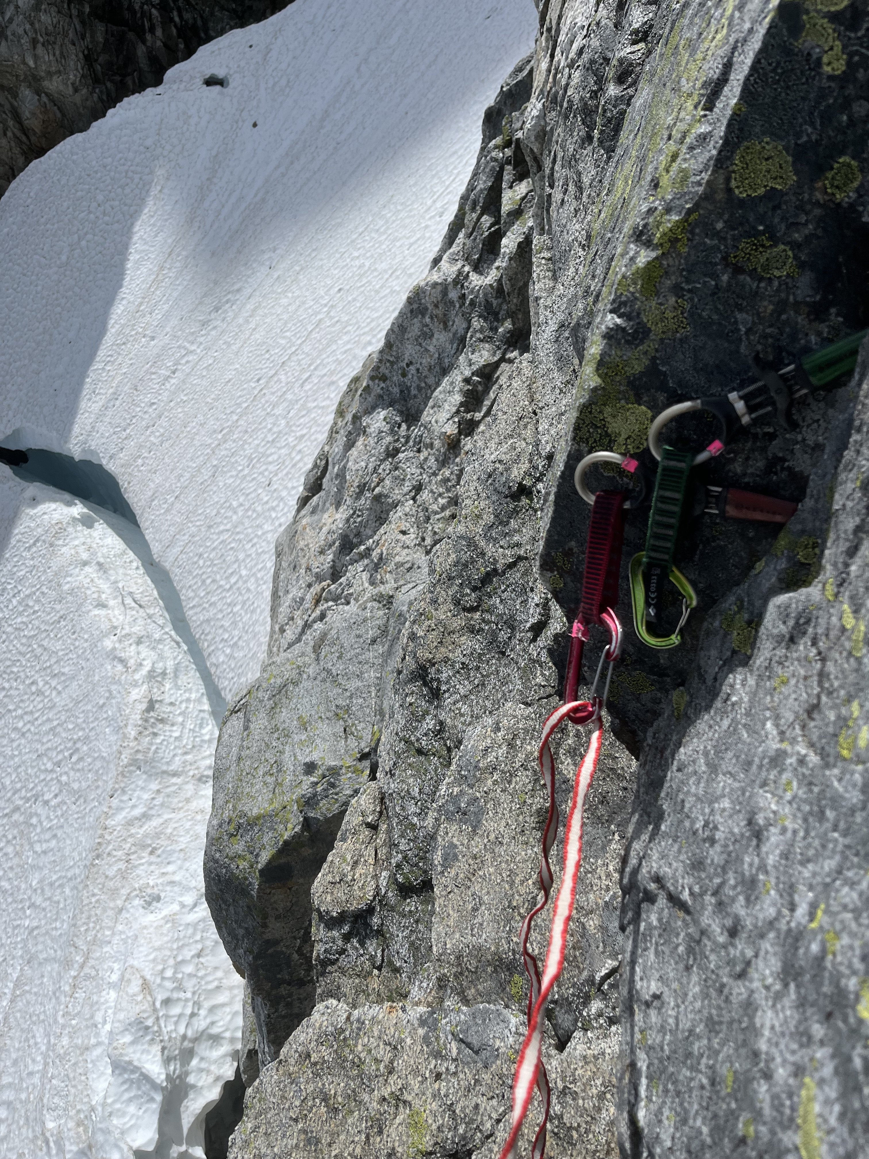
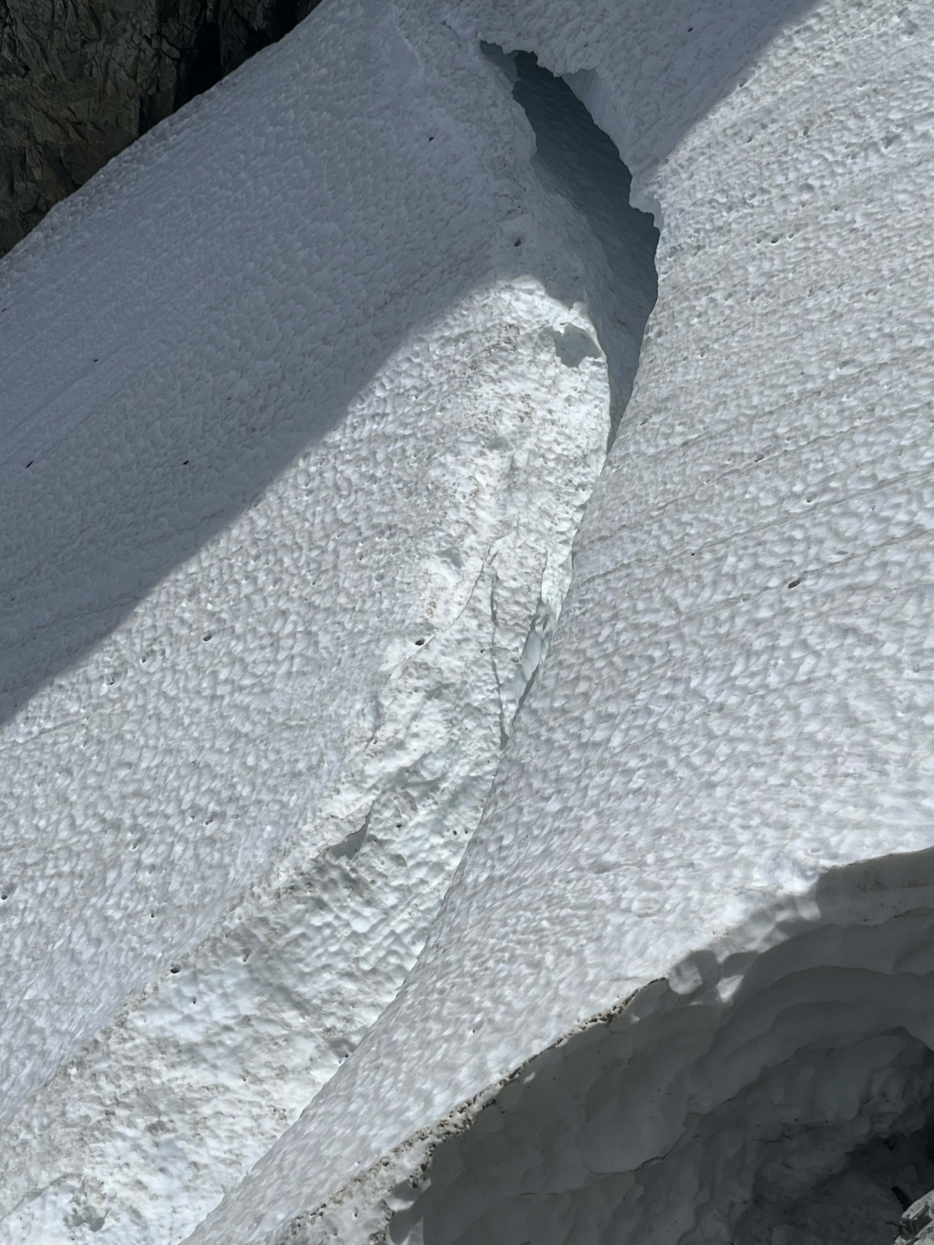
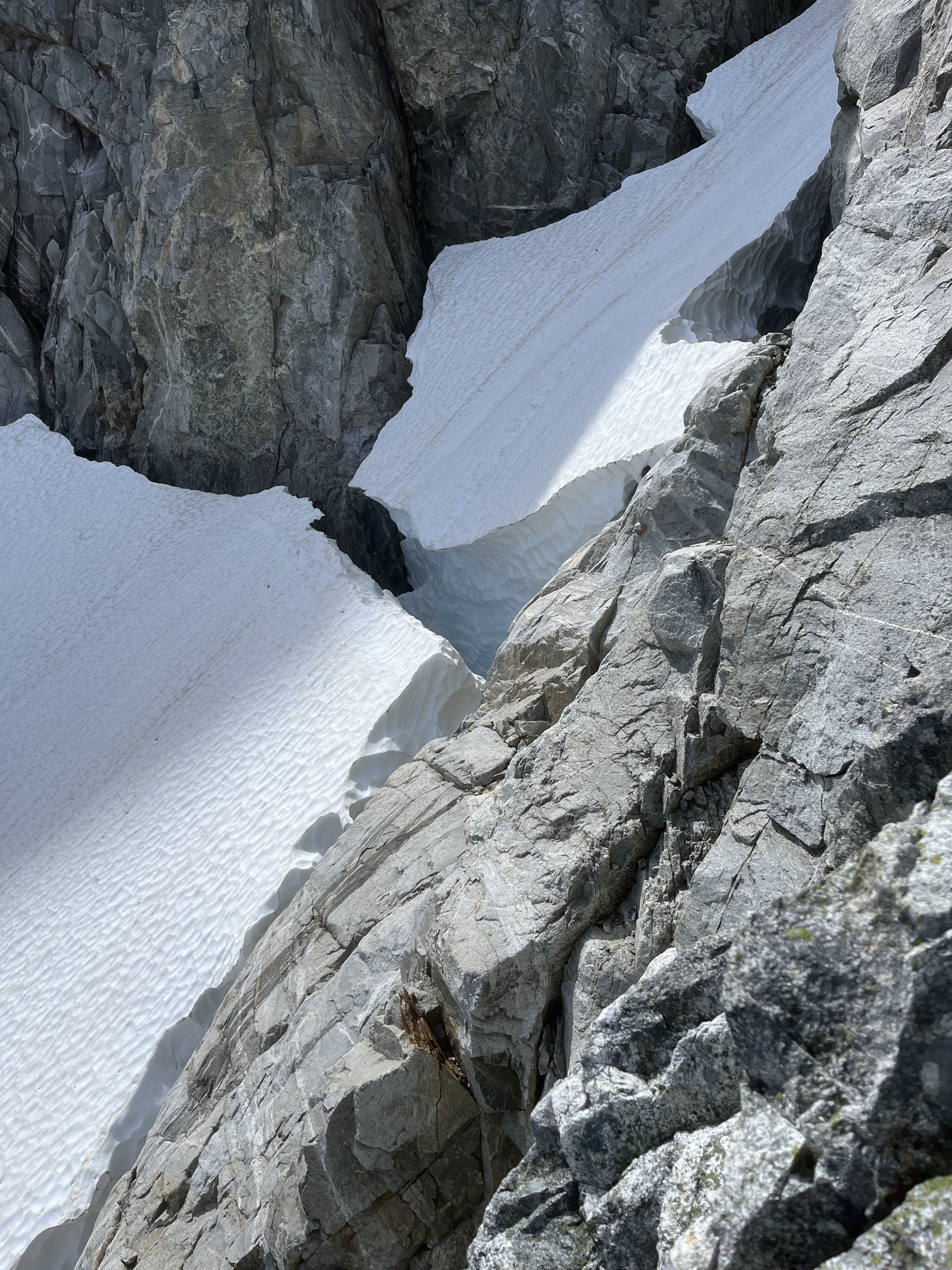
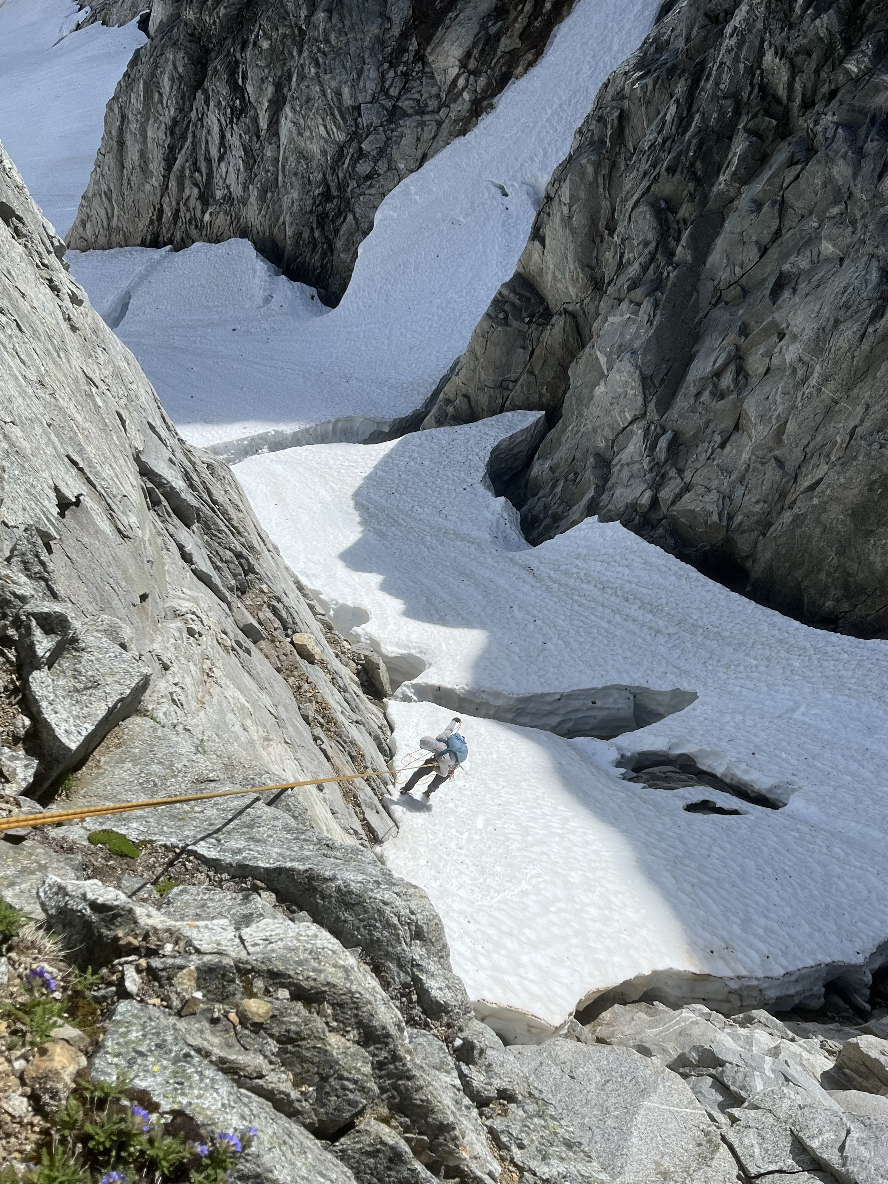
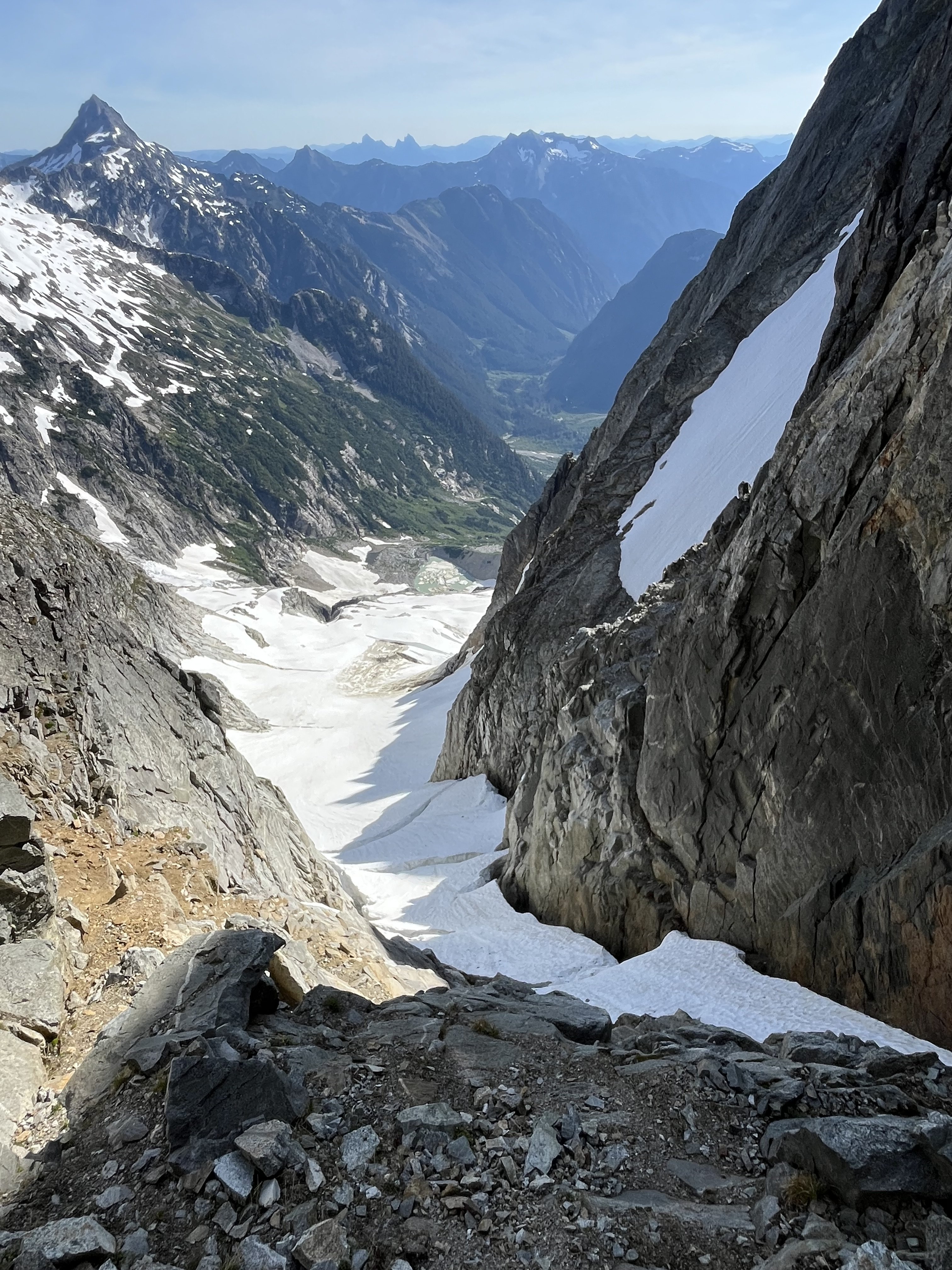
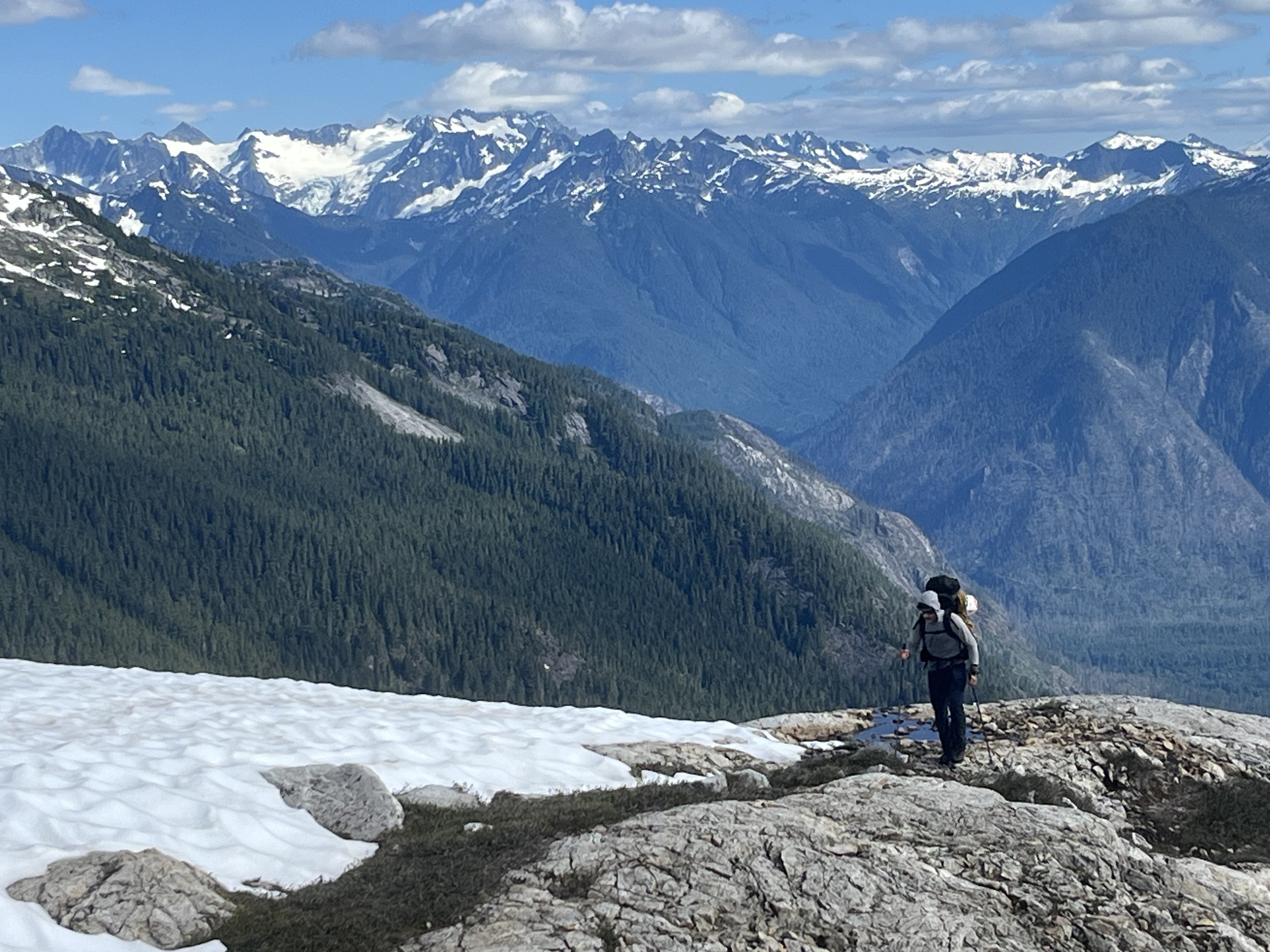
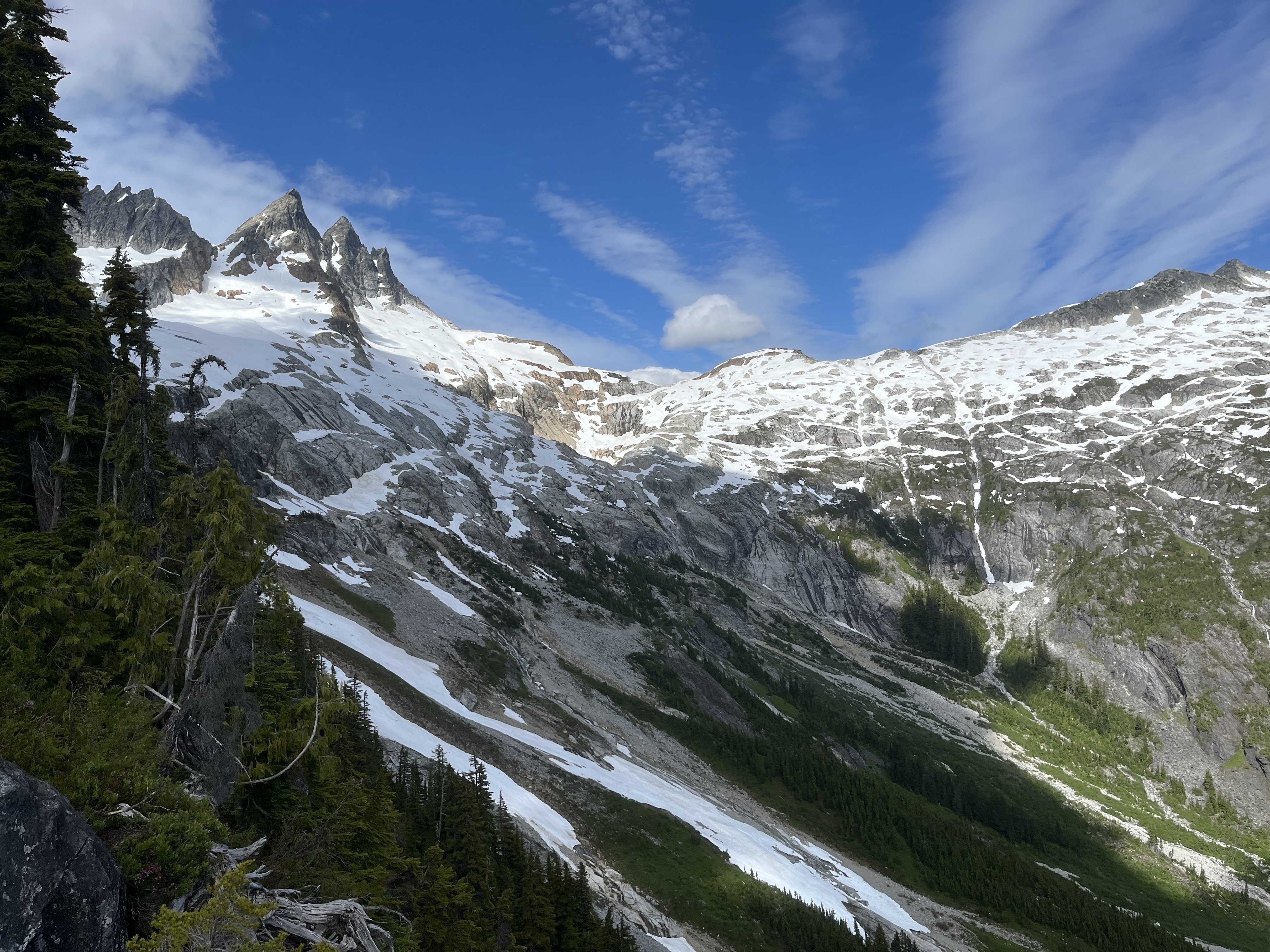
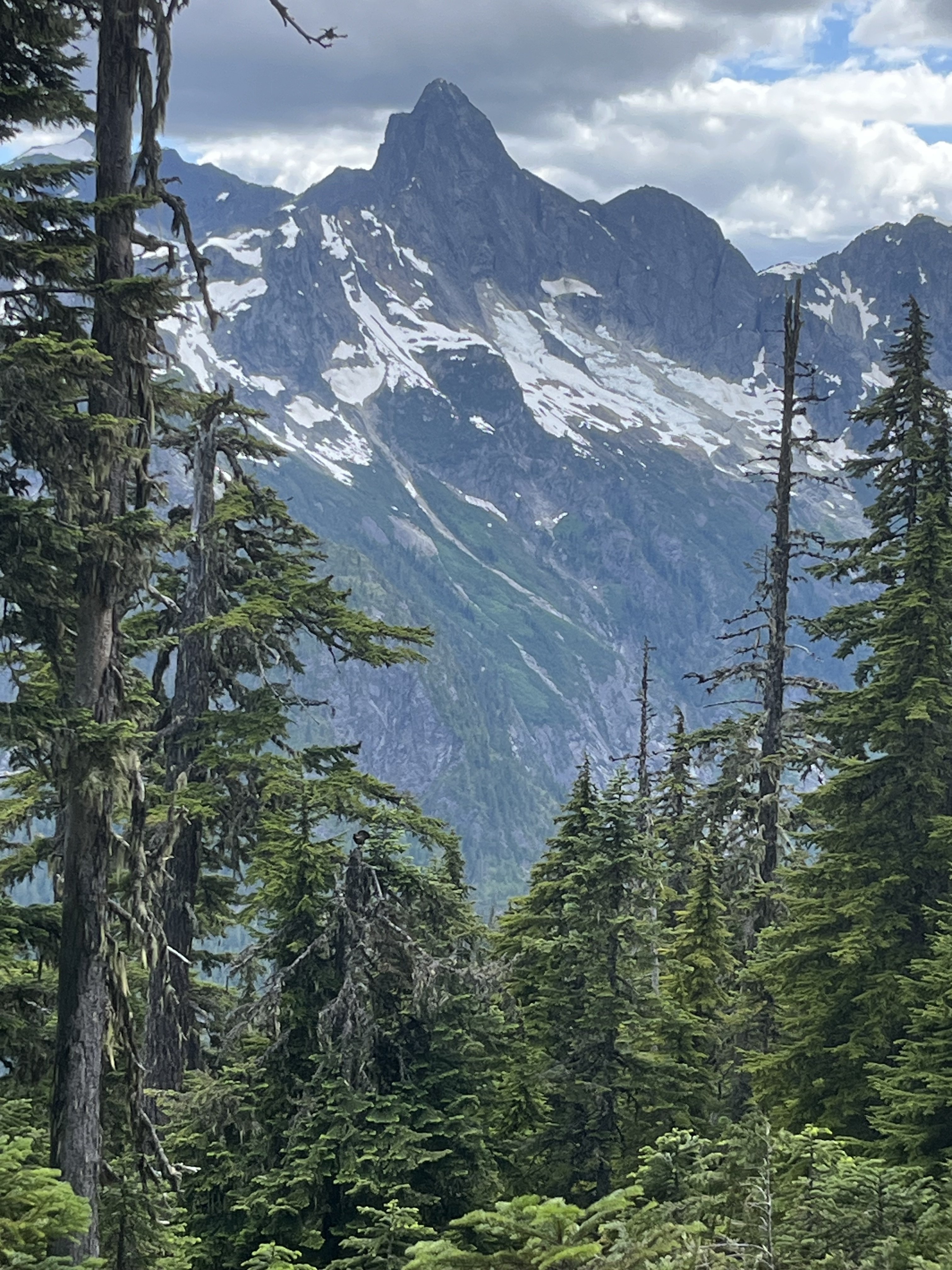
 10 points
 -
Trip: Gunsight - E and SW faces of Middle, S ridge of South Trip Date: 07/13/2025 Trip Report: I had the tremendous luck of finding a pair of climbers (Rebecca and Shane) who wanted to check out the Gunsight range using a rope team larger than 2 for the Chikamin. We climbed as a party of 3. They turned out to be excellent climbers and excellent company. First I’ll stick mostly to the things I wish I knew beforehand, inaccurate beta, etc. On our second day we blindly followed tracks of a party about a half hour ahead of us in the Chikamin which led to the lowest pass. Getting on the rock it seemed like possibly low 5th slab and too far south of Gunsight. We decided we were in the wrong place. I briefly scoped the next gully north which was terrible. We then found the right path, using mostly clean slabs. In Blake’s book the arrow isn’t quite in the right place, we were one notch north of his line, in the “s” in “peaks”. We had hoped to climb E face of Middle this day but with the lost time settled on S ridge of S peak. We would later find out that doing E face of Middle on day 2 is doable only if everything goes right, no route finding issues, climbing and descending efficiently. A better plan that I’d recommend to most coming from Downey is to aim for SW face of Middle for your day 2. P2 and start of P3 on S ridge S Gunsight: S ridge of S Gunsight is a garbage climb. The first pitch is not terrible but the face after an ok corner is covered in black lichen and any pro seemed worthless. Hard to find an anchor on top of the choss ridge. Much less than the reported 45m. The next very short pitch, again much shorter than in our description, has an exciting knife edge lean + leap onto the rock that begins the cannon hole (my first trad dyno I think). From there we expected 5.4 to finish the climb. I went back and forth, high and low, repeatedly dead ending near a notch with lots of tat. Finally I committed to a delicate and highly exposed 5.8-5.9 stem around a corner to get to a downclimb to the notch. From there I ran the rope out to the summit at somewhat dirty low 5th. Looking back I saw how the follower would be exposed to a big pendulum and deck, so I encouraged my partners to just rap that step off the existing tat. With a couple raps we were back on the east side retracing our steps to the notch. Numerous steep hard snow interruptions to the slabs involved time sucking crampon on-off transitions. I was grumpy about 2 days of effort to climb 3 pitches of choss but we caught a gorgeous sunset just as we reached the notch. From there we traversed high on snow and slabs below Gunsight to get to where we had stashed our bivies. The next day we tried again for E face of Middle. Rather than circle around the peak again Rebecca had the great idea of climbing the SW Beckey route, rapping S to the notch, then rapping E to get to the E face. The Beckey route was straightforward low-mid 5th choose your own adventure on fun solid rock with lots of knobs, which we began from a small cave just above the best moat crossing we found. The summit register’s last entry was from 3 years prior, a party doing gunrunner. We did one rap south beginning a little below the summit, backing up the slightly suspect block. From there a double rope rap from a higher confidence anchor got us to the notch. The anchor we found there wasn’t very great but we couldn’t find better options. I immediately found the e side to be mostly steep dirt. Angling slightly south I found an ok nut anchor maybe 45m down from the notch. A double rope rap from there got us down to the very dirty snow. This might have been the dirtiest gully I’ve descended up to that point. The high quality of the E face lived up to the hype, though misleading beta vexed us at times. Our first pitch was quite long due to low snow and glacial recession. Comparing our photos to some from 15 years ago there was some thing like 50-100 feet of rusty rock that had been covered in snow in the earlier photos. The pitch 2 crux is right off the deck and maybe sandbagged (or I was just tired). Awkward, tricky, exposed to decking, it took me about 4 tries to lead through it. I don’t think the pitch was more than 15m. This was another ledge where a good anchor was hard to find. Pitch3 (10c) was actually easier than pitch2. Shane had stopped one ledge short of the proper start of pitch 4. We worried about linking that step into pitch 4 because it’s supposedly 45m. In reality pitch4 turned out to be more like 30m. Oh well. The pitch 4 climbing was fantastic and its crux (10d) was another possible sandbag. I could not have led it. Very demanding powerful moves finally got me through it after a few attempts. By now the hour was late and we were looking at the mental crux of the runout 5.9 slab. Shane led this one too. Rebecca went second and I came last. I was glad to have watched them for beta on the subtle step down crux at the most run out point. Brilliant colors lit up the horizon while it was my turn but I could give it only fleeting attention as I concentrated at the crux. Once through I ran up the ridge (low 5th? Didn’t notice any 5.8) in the twilight, basically a full 60m rather than the 15m our beta advised. We repeated the rap sequence south to the notch as it grew dark windy and cold. The rope got stuck during the pull here. With much effort Shane finally freed the rope. The descent to the east was a known thing at this point but I argued that it was so bad that the descent to the west couldn’t possibly be worse. About this I turned out to be wrong. We did one short rap to an anchor south of the main gut/vomitorium of the gulley, with resident snaffles greeting us at both ends of the rap. From there Shane plunged into the unknown, over an overhang, choss diarrhea of all sizes being released. At a full 60m we went off rope and I took a clean slab ramp around a corner and found good cracks while they pulled the rope. Somehow that rap didn’t destroy us or the ropes. We placed a cam anchor and got past the steep icy snow onto lower angle stuff and began the traverse back to camp, arriving around 2am. We made dinner, celebrated, and tucked in around 3. Next morning I went back with the suspicion that our anchor could be reached on class 4 slabs that we couldn’t see well in the dark. It turned out to have a little low 5th, so rapping was definitely the right call for the circumstance. But I was glad to recoup our gear. Having encountered the worst and second worse gullies of my life on either side of middle gunsight I now think that the best way to retreat is probably down the SW Beckey route. It’s ledgey so it would be best to downclimb most of it with some raps where it makes sense. And best done in the daylight, after climbing it at least once so you know the way at least approximately. Faded from the unexpected epics our only goal for day 4 was to get back to Itswoot ridge, beginning around noon. But around 1:40 at about 7K’ we heard a voice from a distance. We stopped and listened. Heard it again. Could barely make out words like “broken ankle” “helicopter”, “alone”. We pressed the SOS. The voice seemed to be vaguely in the Sinister area but we couldn’t tell where. We started backtracking and did some Marco Polo every few minutes without success. Finally passing east of the north face of Sinister we saw what we realized was a person. He was not moving and covered in a gray sleeping bag so we hadn’t been able to tell him apart from a rock at a distance. Maintaining some privacy here, we found that he was indeed immobilized and in severe pain and needed rescue. His inspiration and his equipment were in disharmony and this had culminated in a long and presumably very rapid slide down snow NE of Sinister. Fortunately over cracks, unfortunately meeting some rock(s) along the way. A little while later a father and daughter were coming down the Chikamin. It was nice to have more help. We did our best to keep him warm and as comfortable as possible as we waited for SAR. When the helicopter came we were surprised that it took so many laps through the area (maybe 5?) before two rescuers finally were lowered down with a litter. The morning had begun mostly cloudy but the afternoon was quite brilliant. Some rain approached quickly from the north and reached us just as the helicopter took off with the victim and SAR people aboard. We restarted our ascent in the rain, reaching our turnaround point >4.5 hours after we had stopped. This guy was quite fortunate that several people happened to be in ear shot on a week day in such a remote area. The rain cleared half way up the Chikamin and gave way to that kind of really clear atmosphere that seems to come on the heels of misty alpine weather. We found a wonderful spot past Dome glacier, well before Itswoot and called it a day. The highlights of our last day included a brief swim in cub lake, the flora above cub lake, and the many berries along Downey. Less fun was stuffing our pockets full with entirely unnecessary flagging all along very obvious trail along Bachelor. Some of it quite haphazardly stuffed onto bark like so Gunsight delivered adventure in more ways than I could have anticipated. For people going there for the first time I’d advise to stay the fuck out of the gullies on both sides of Middle, bring lots of gear for rap anchors because there seems to be little traffic there, skip south gunsight, and expect everything to take longer than you’d think. Photo dump will go here: Gear Notes: Double to 2, one 3, one 4. 2x60m twin. In reach (please people). Knife for tape. Approach Notes: Downey approach is currently straightforward. Trail work has been done all the way to Bachelor
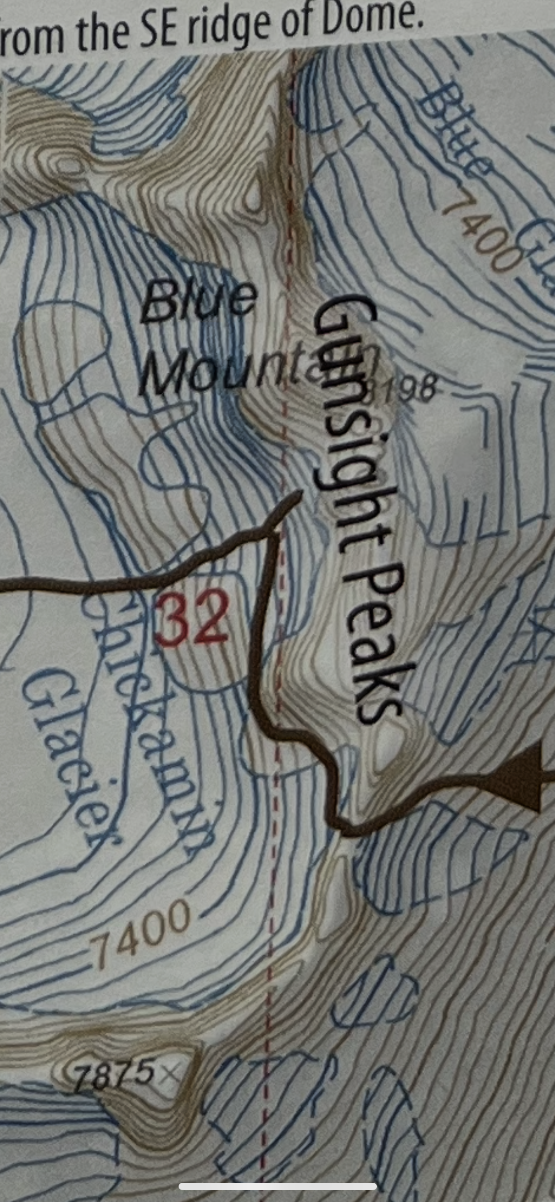
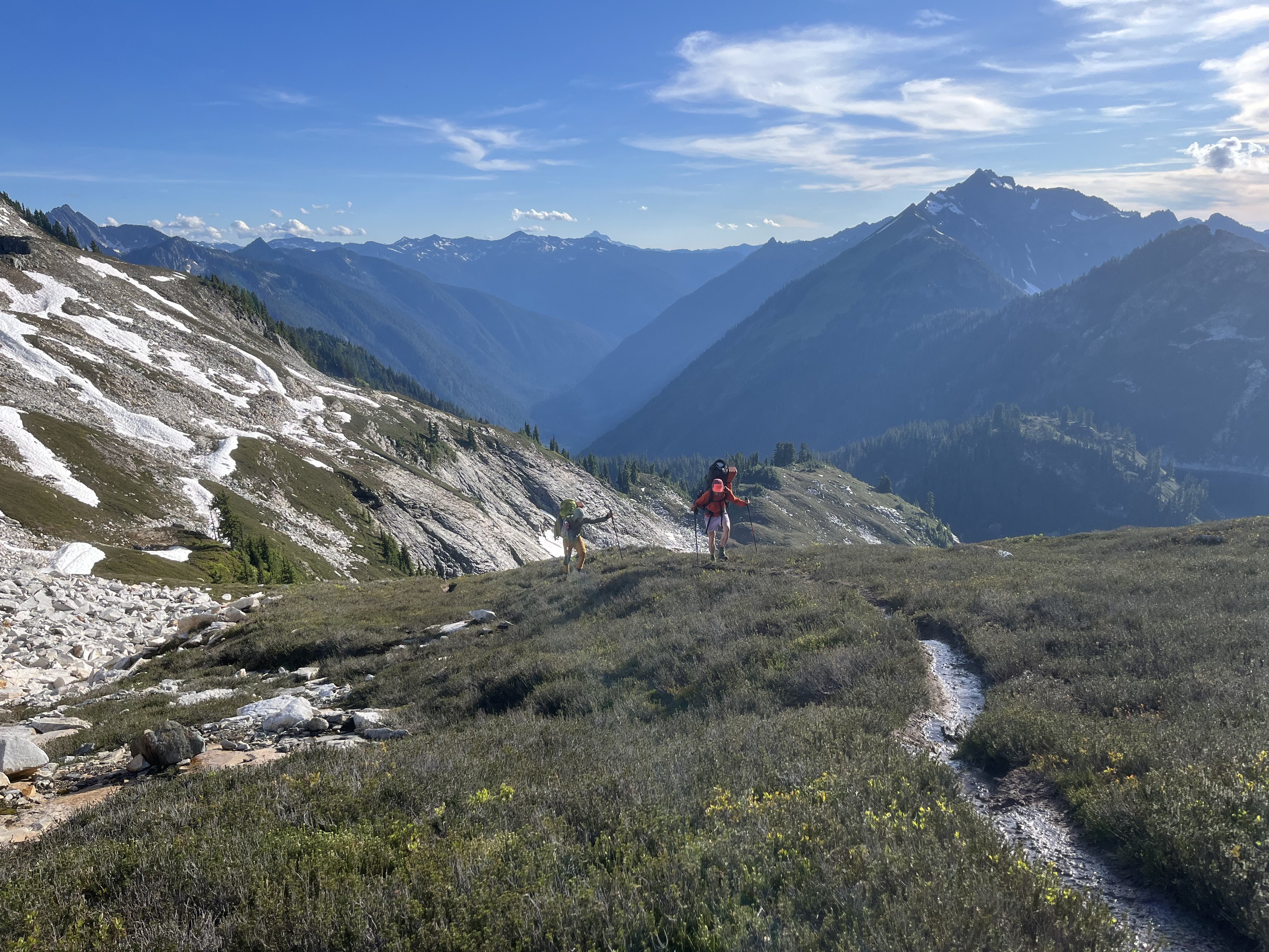
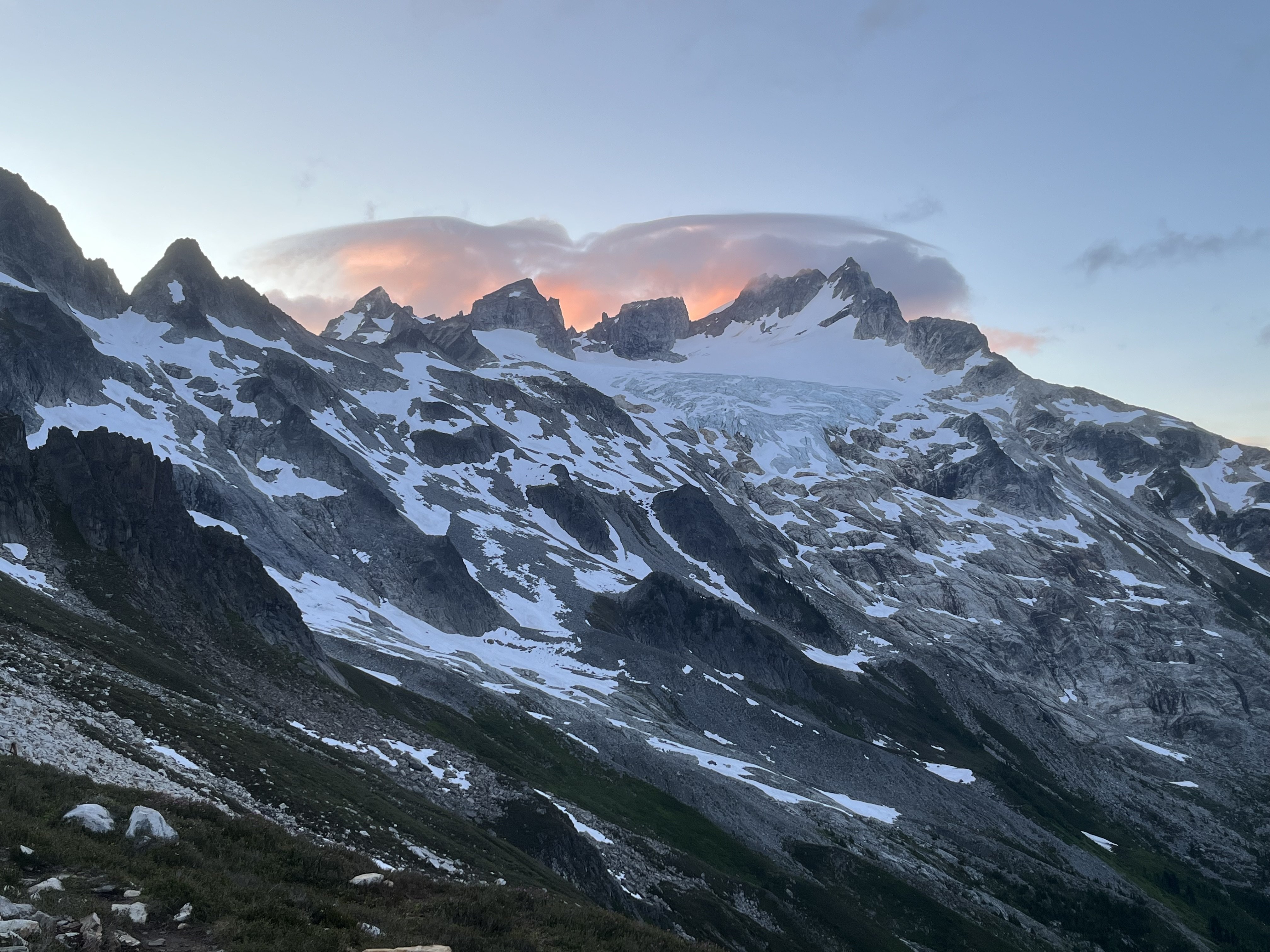
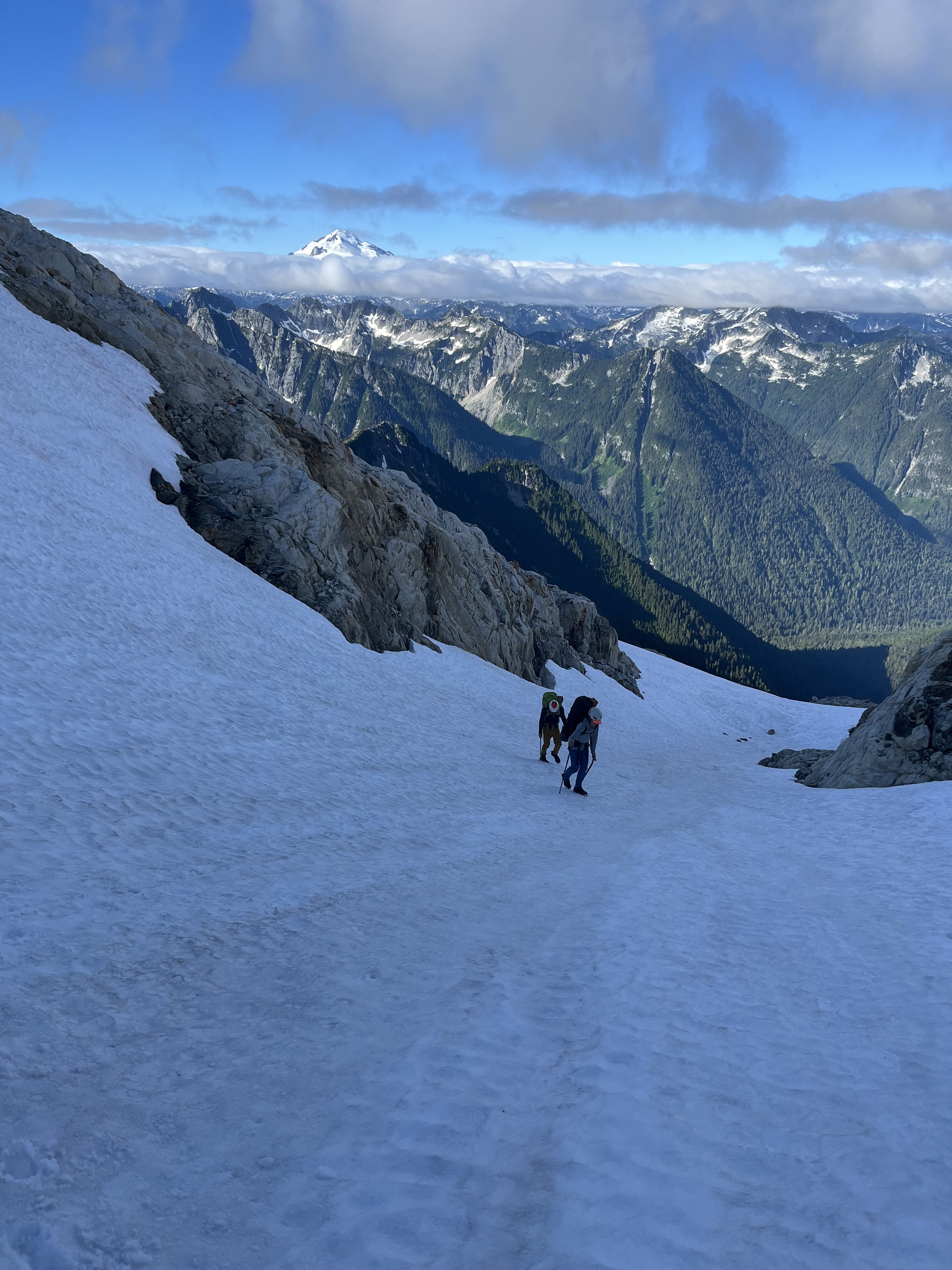
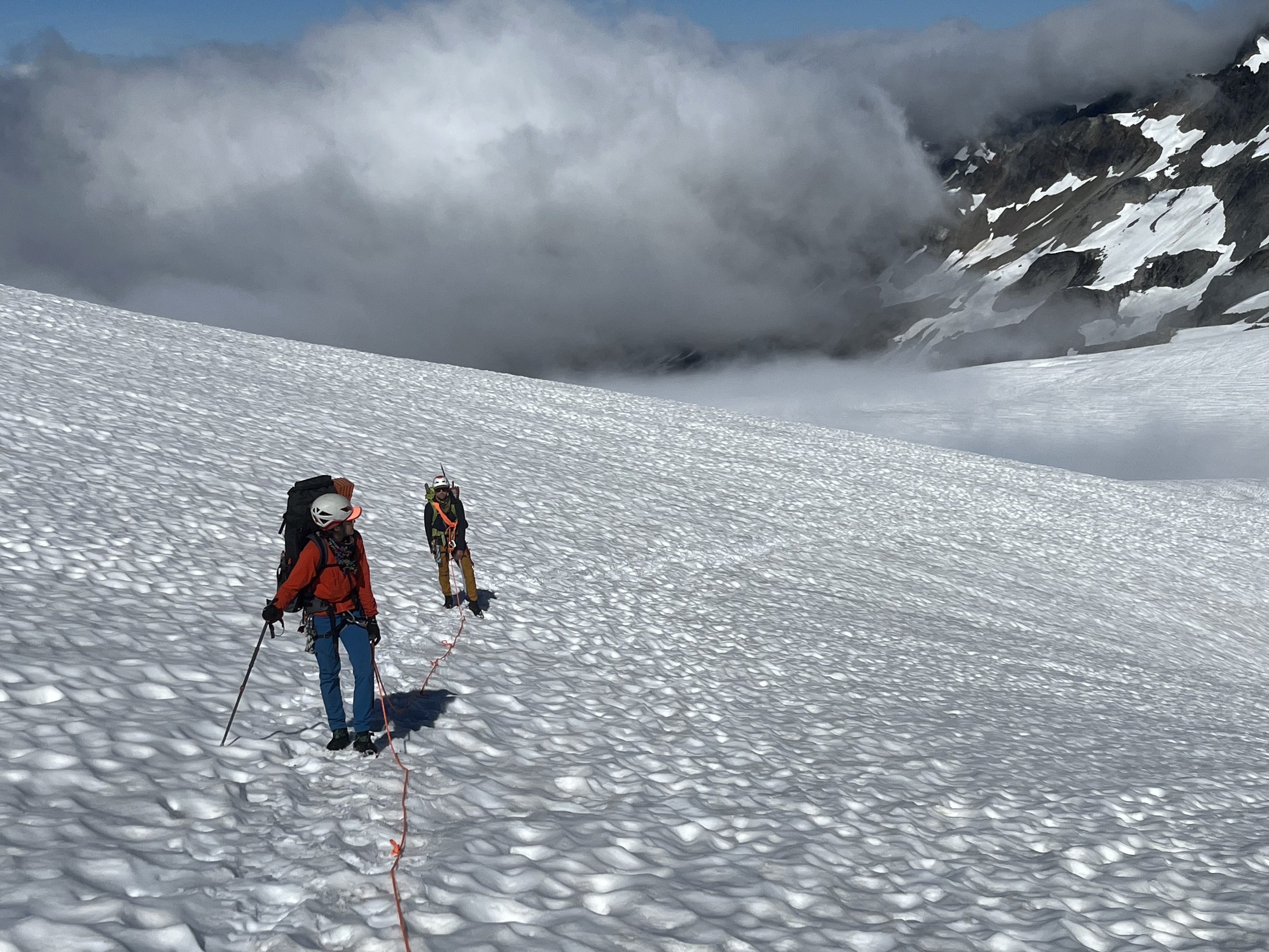
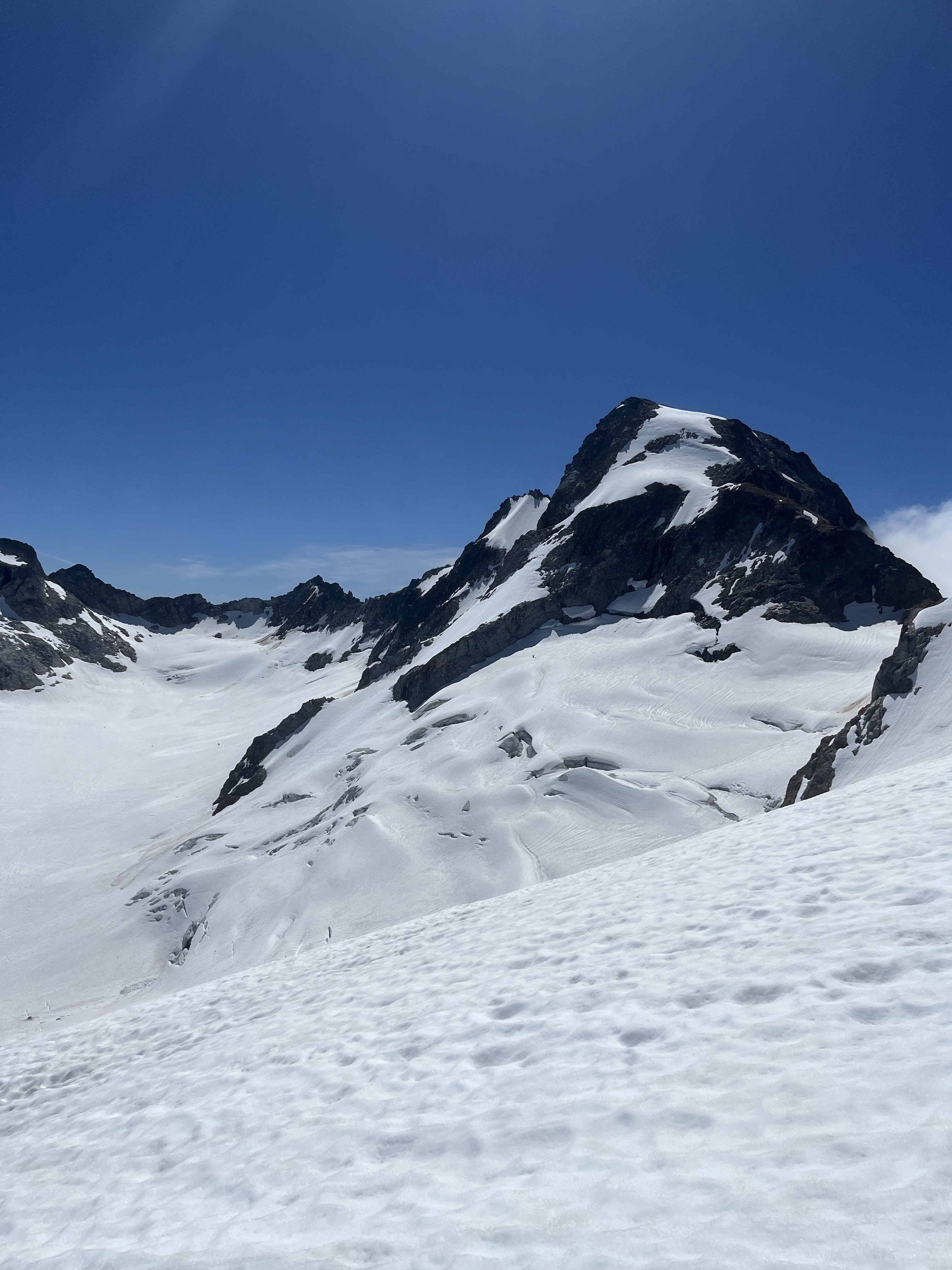
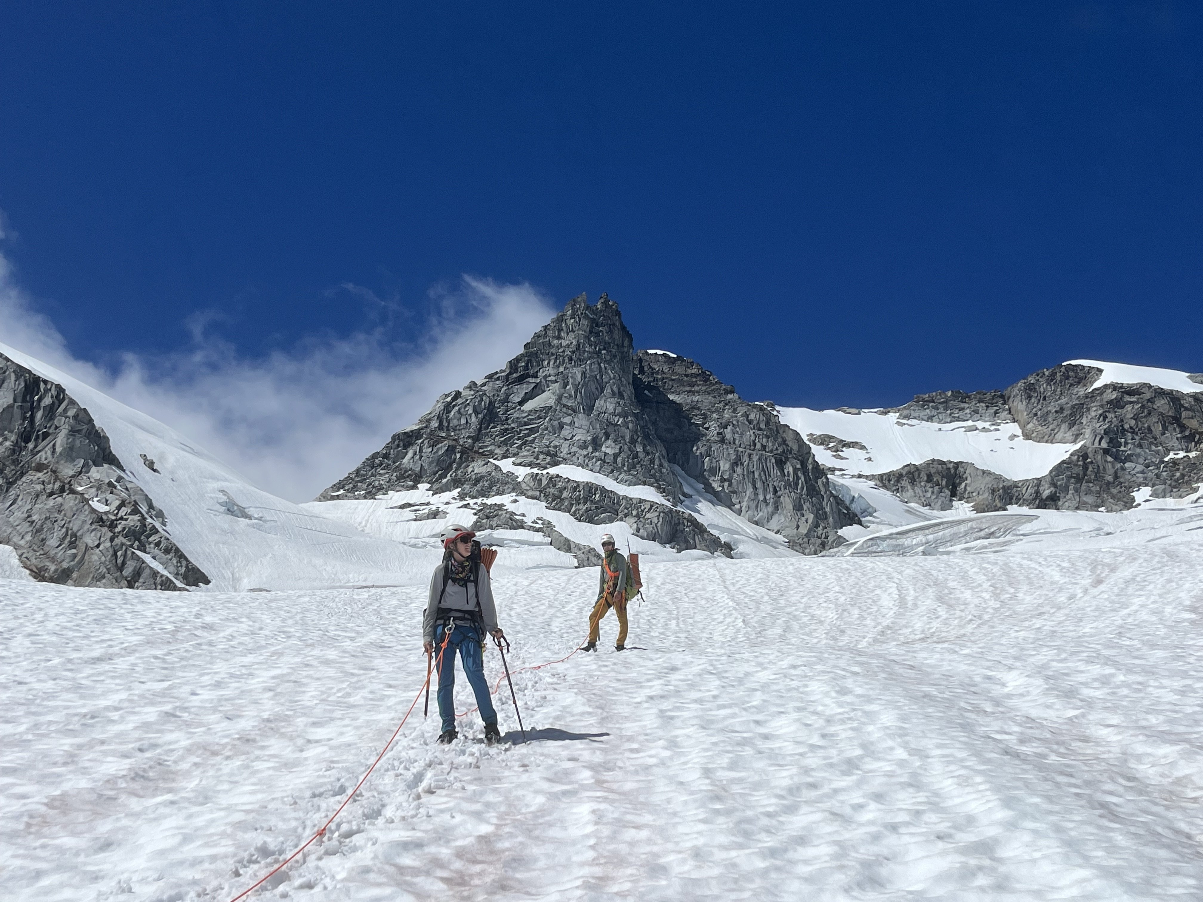
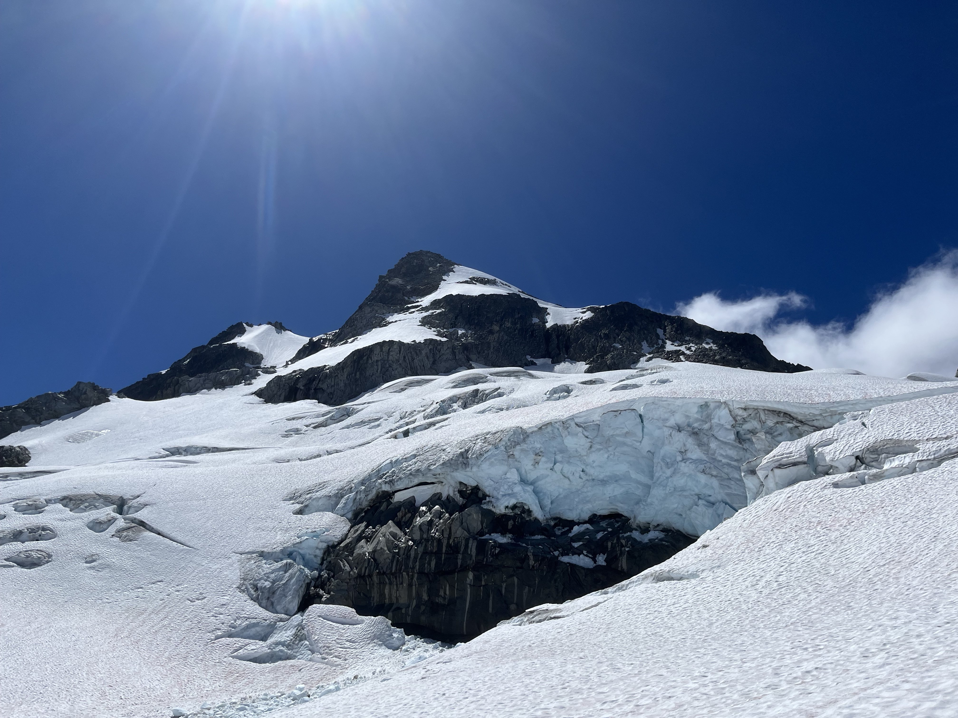
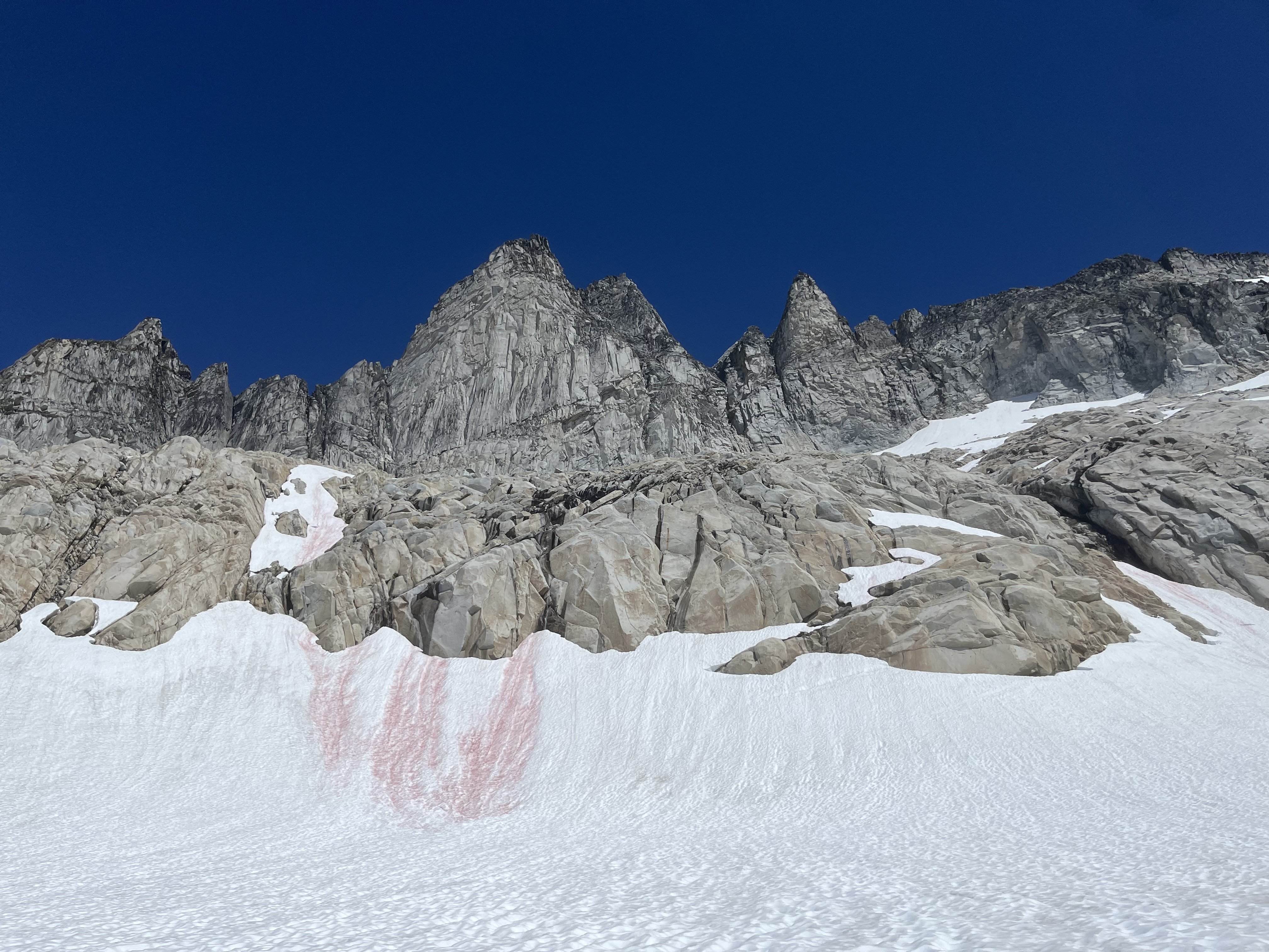
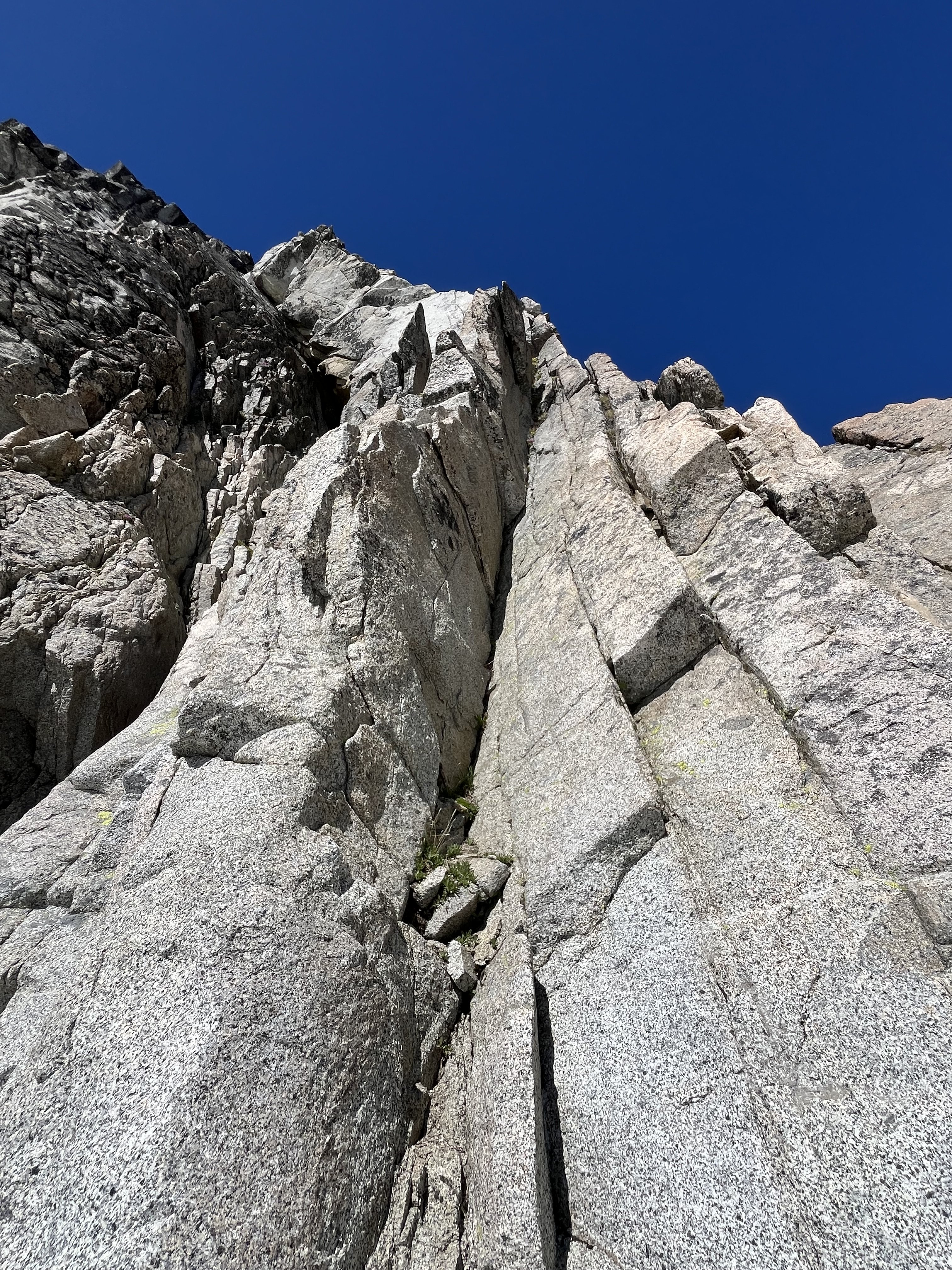
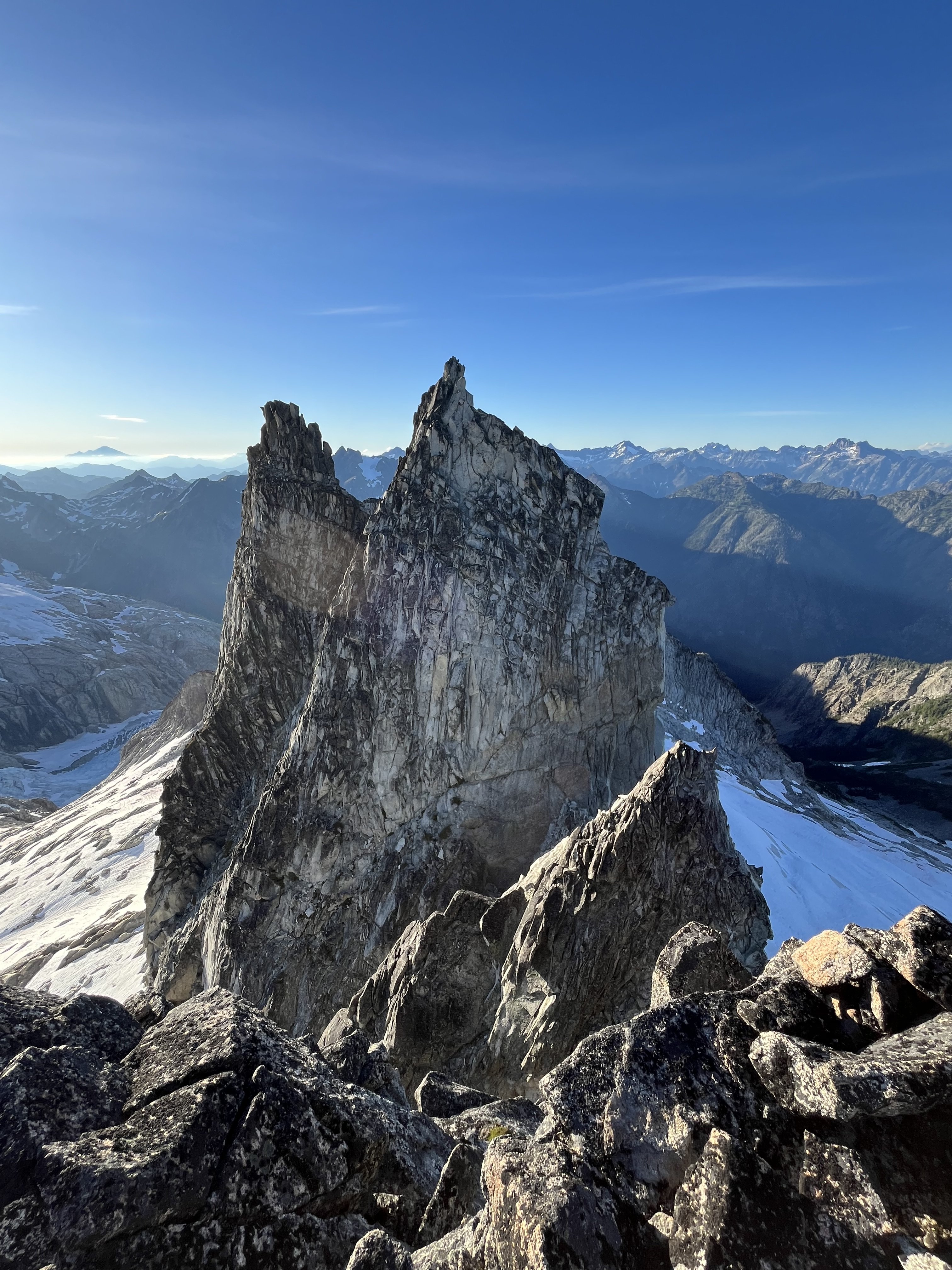
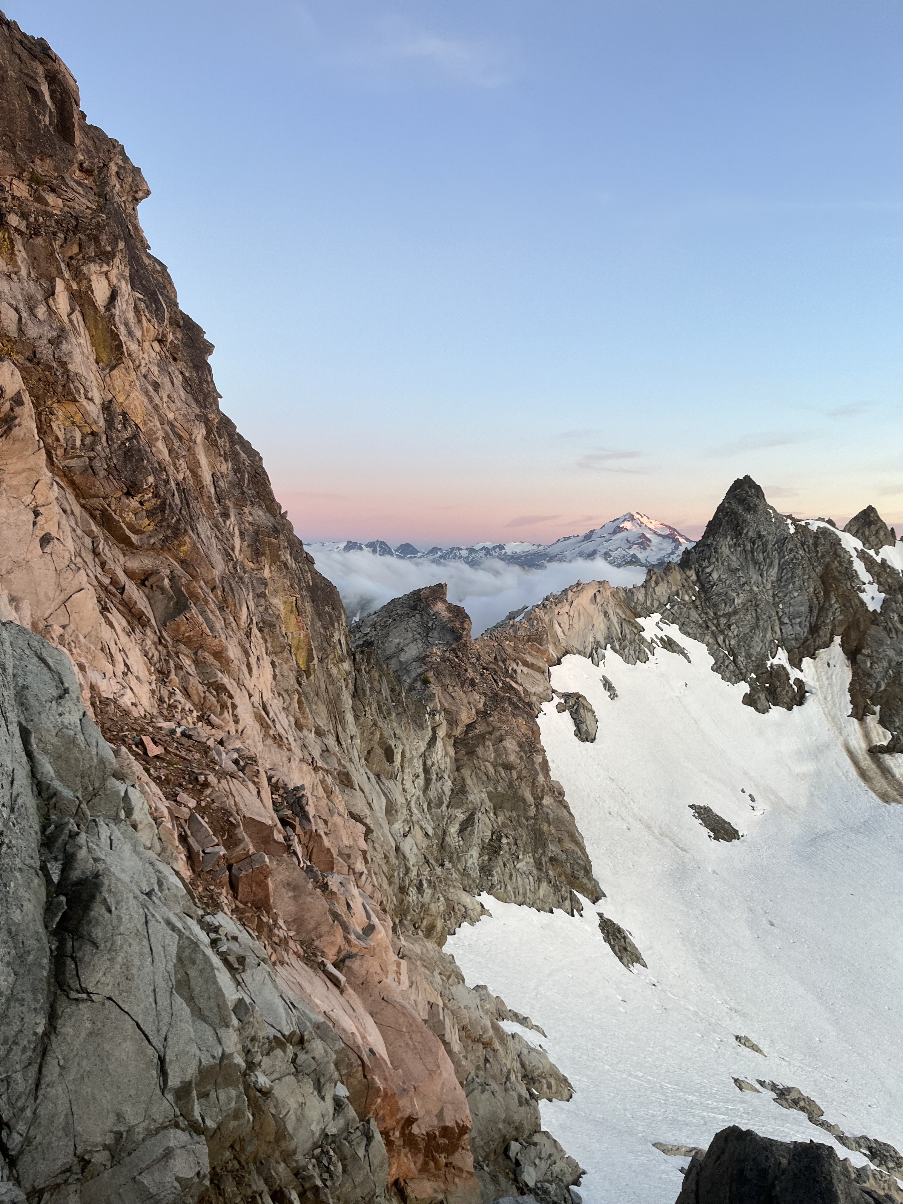
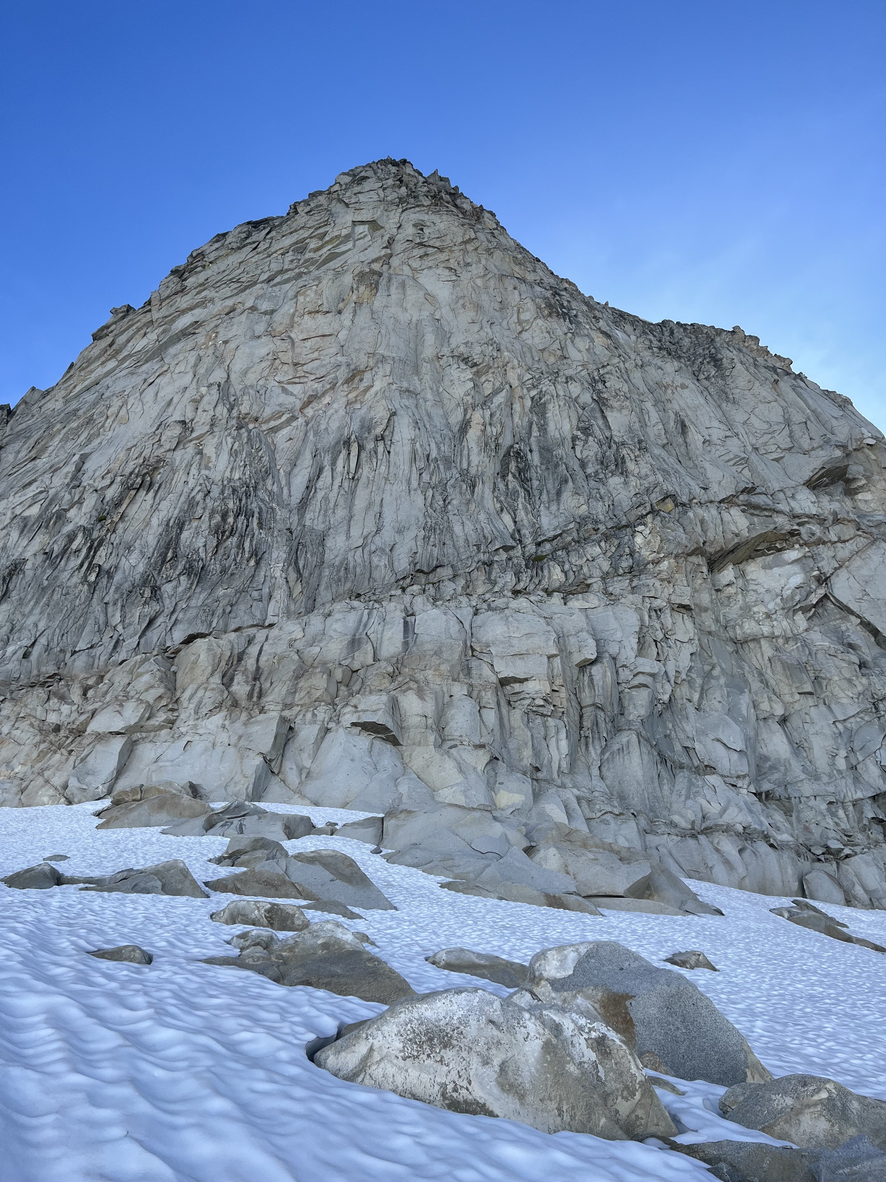
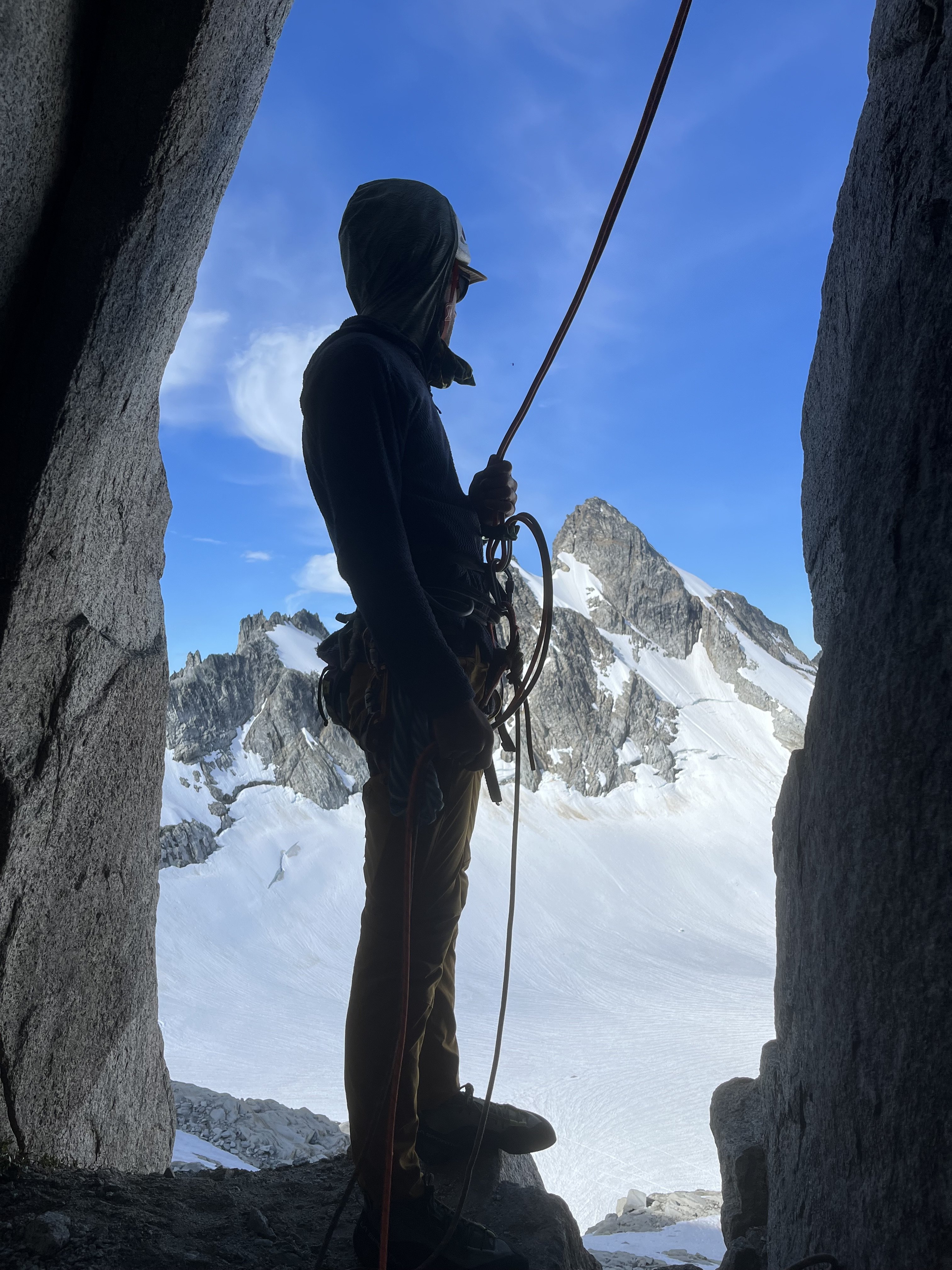
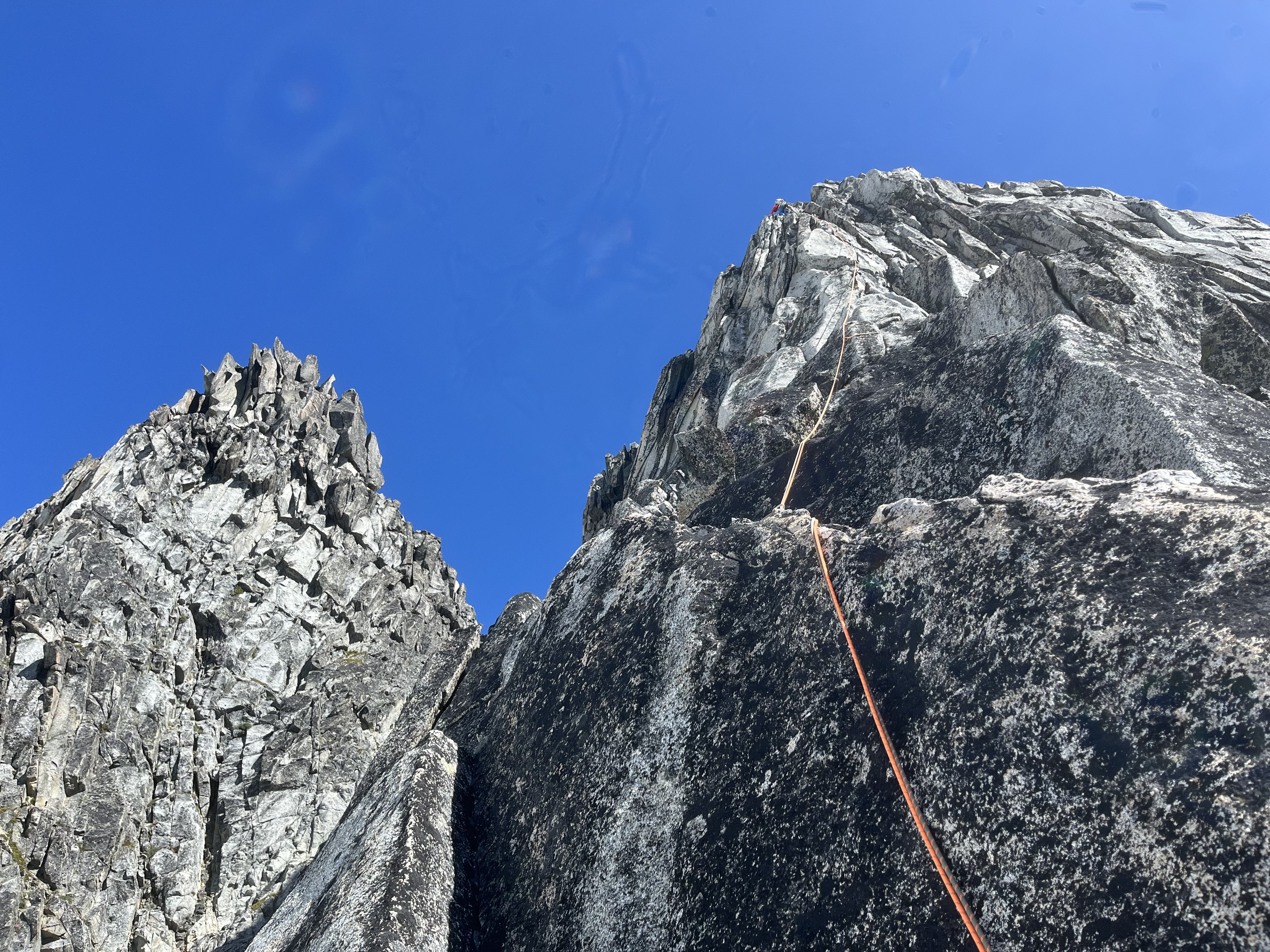
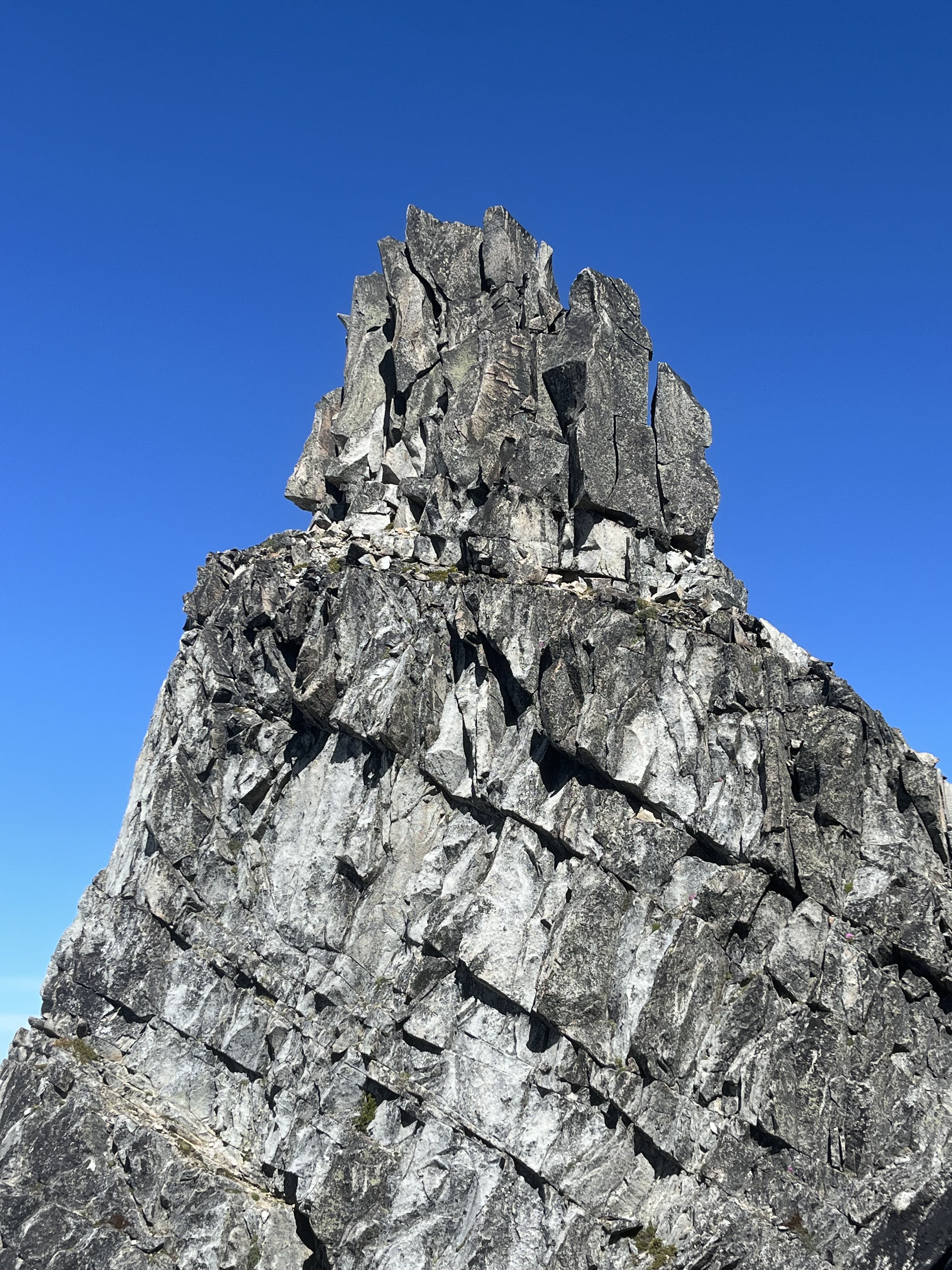
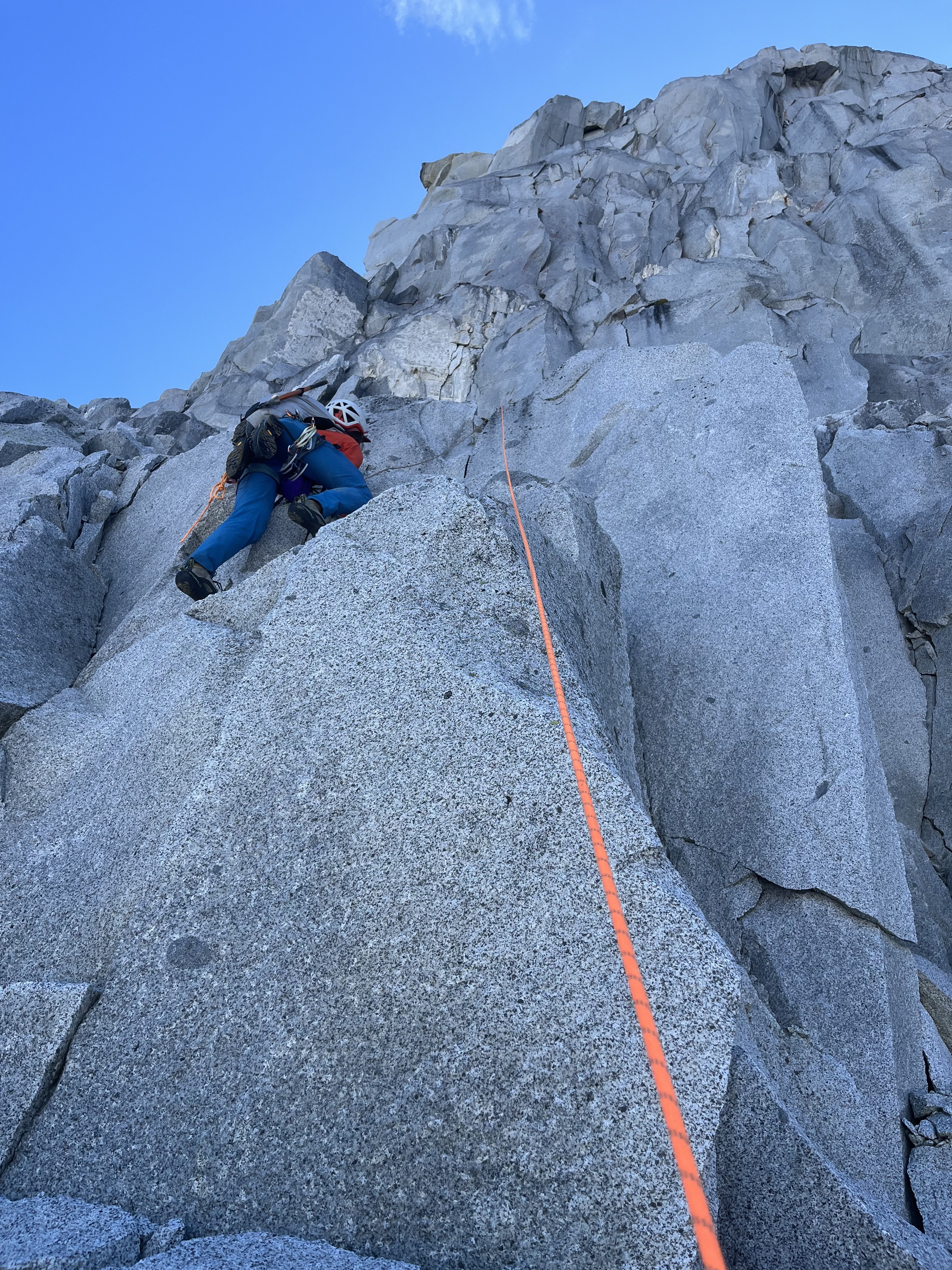
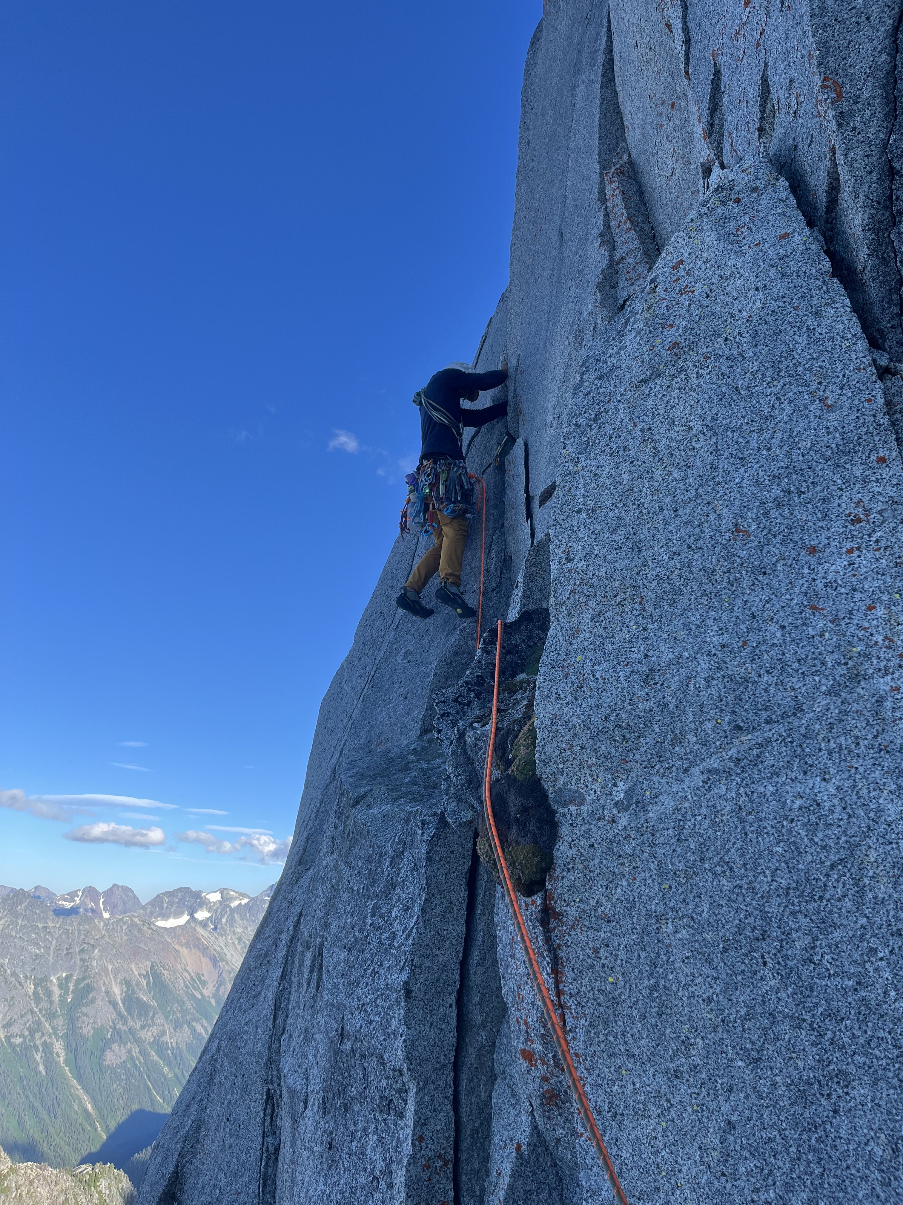
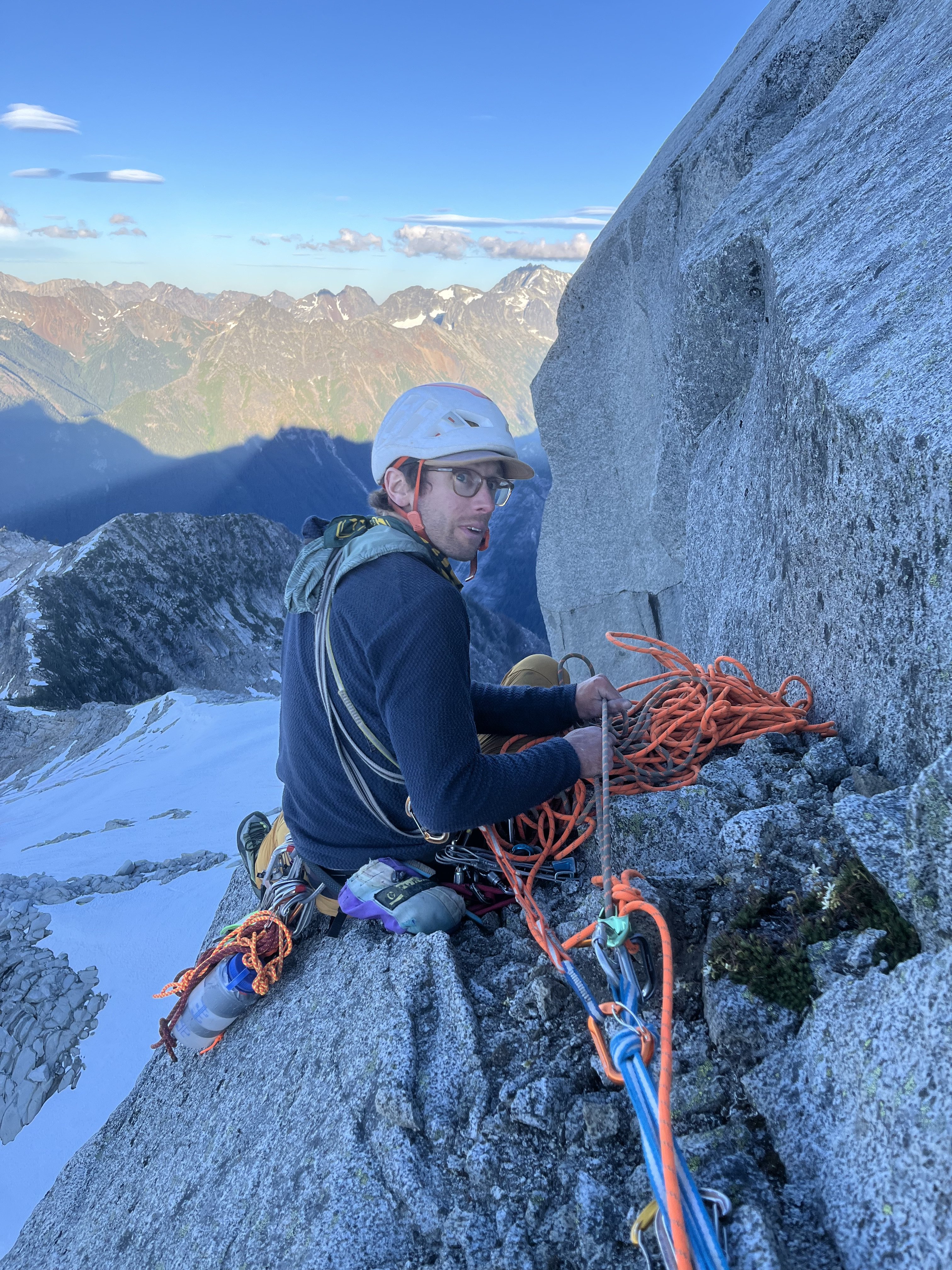
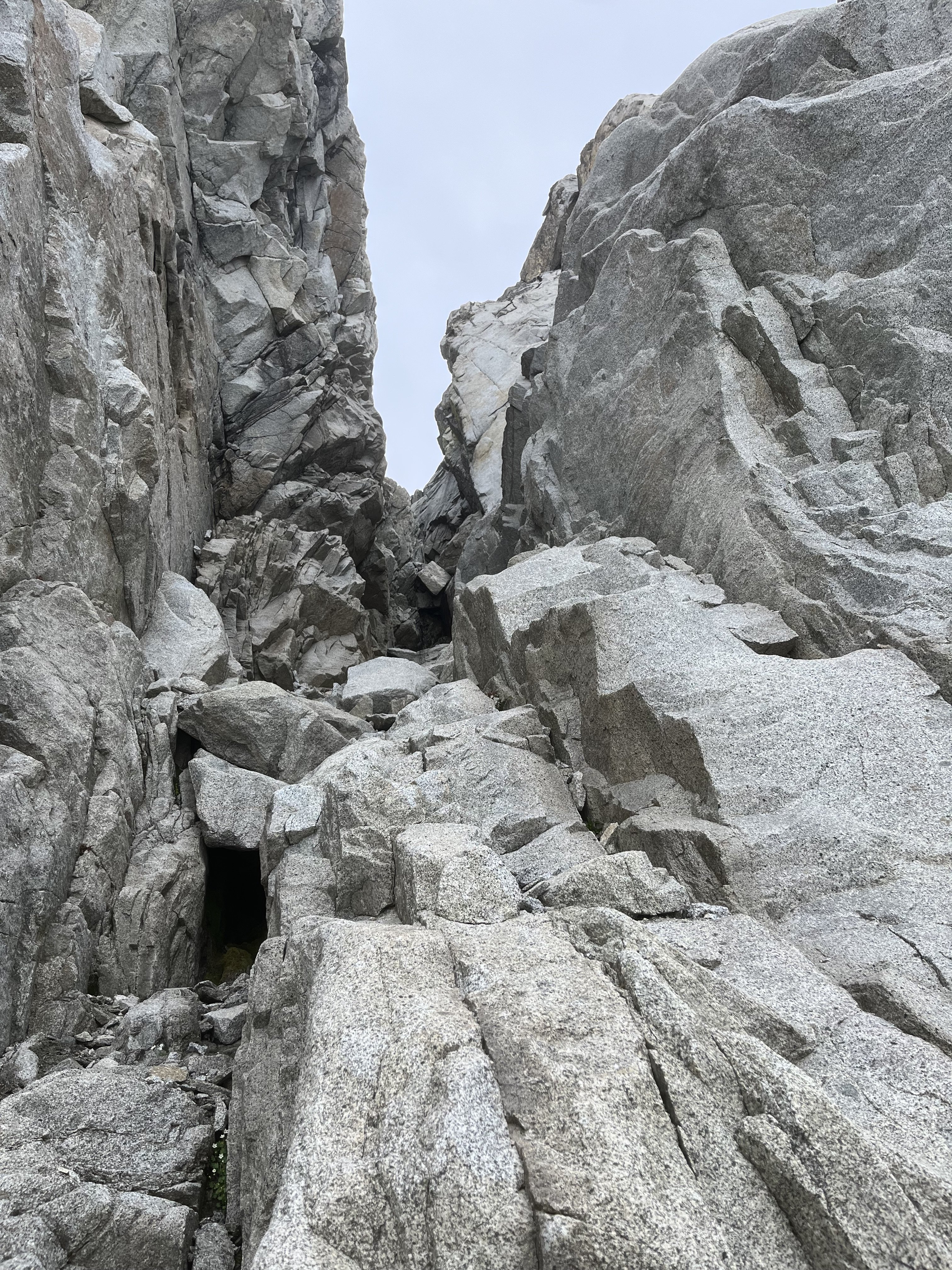
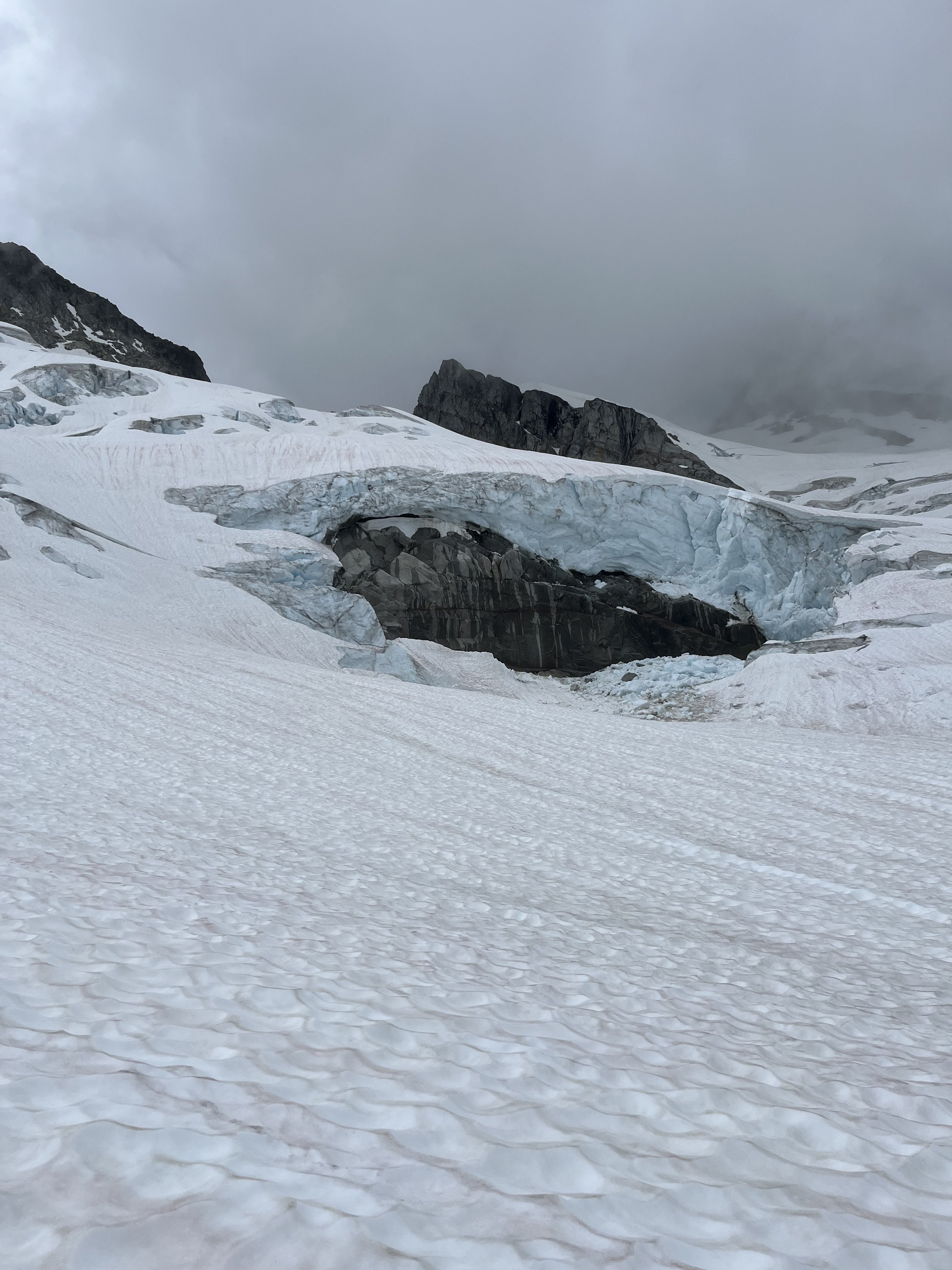
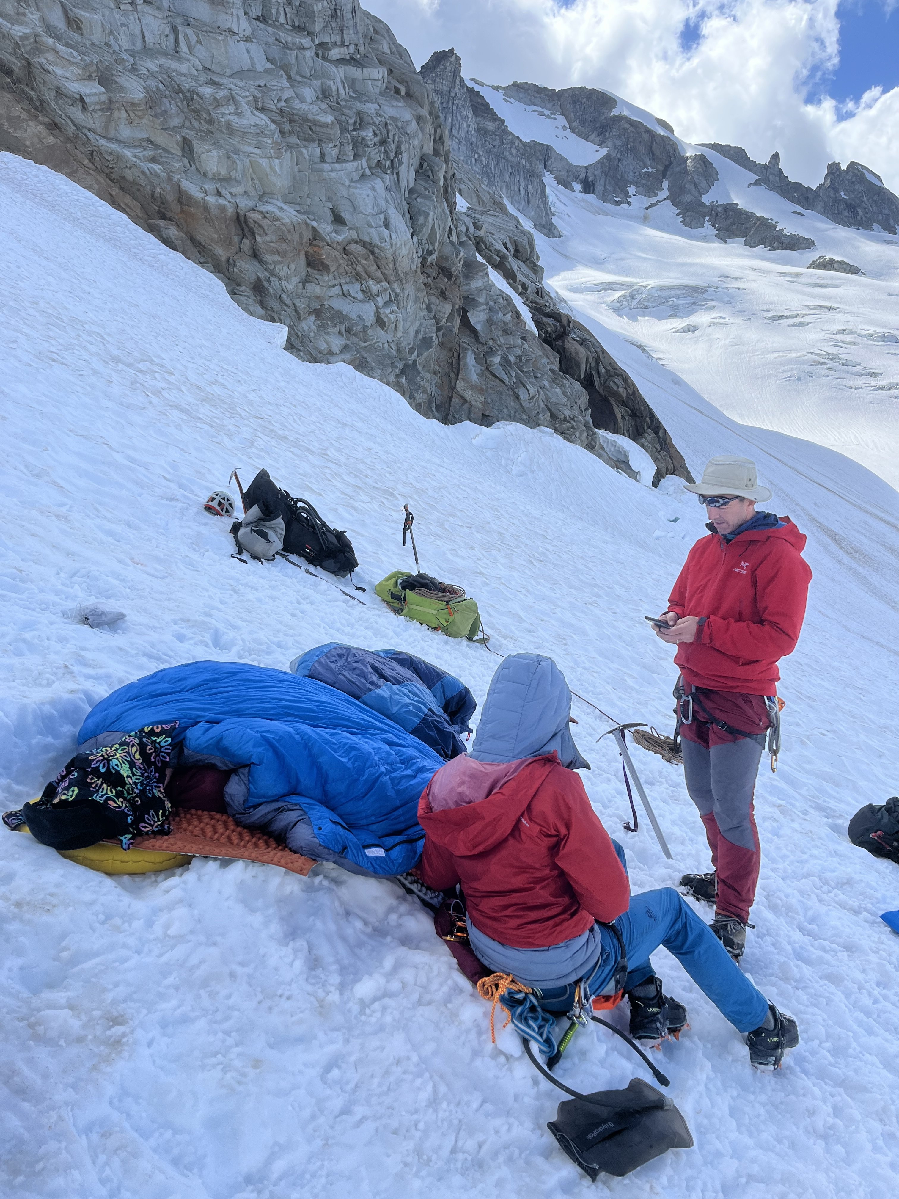
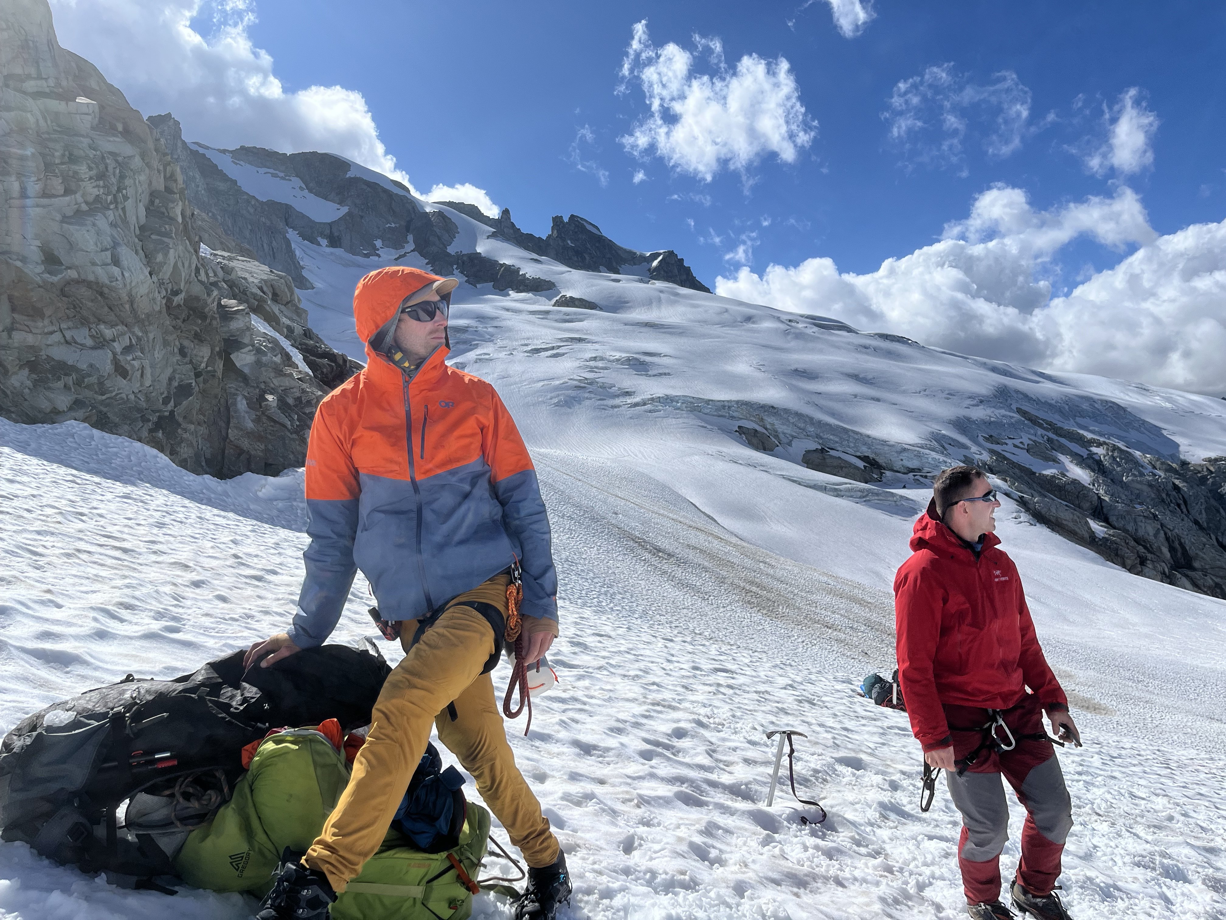
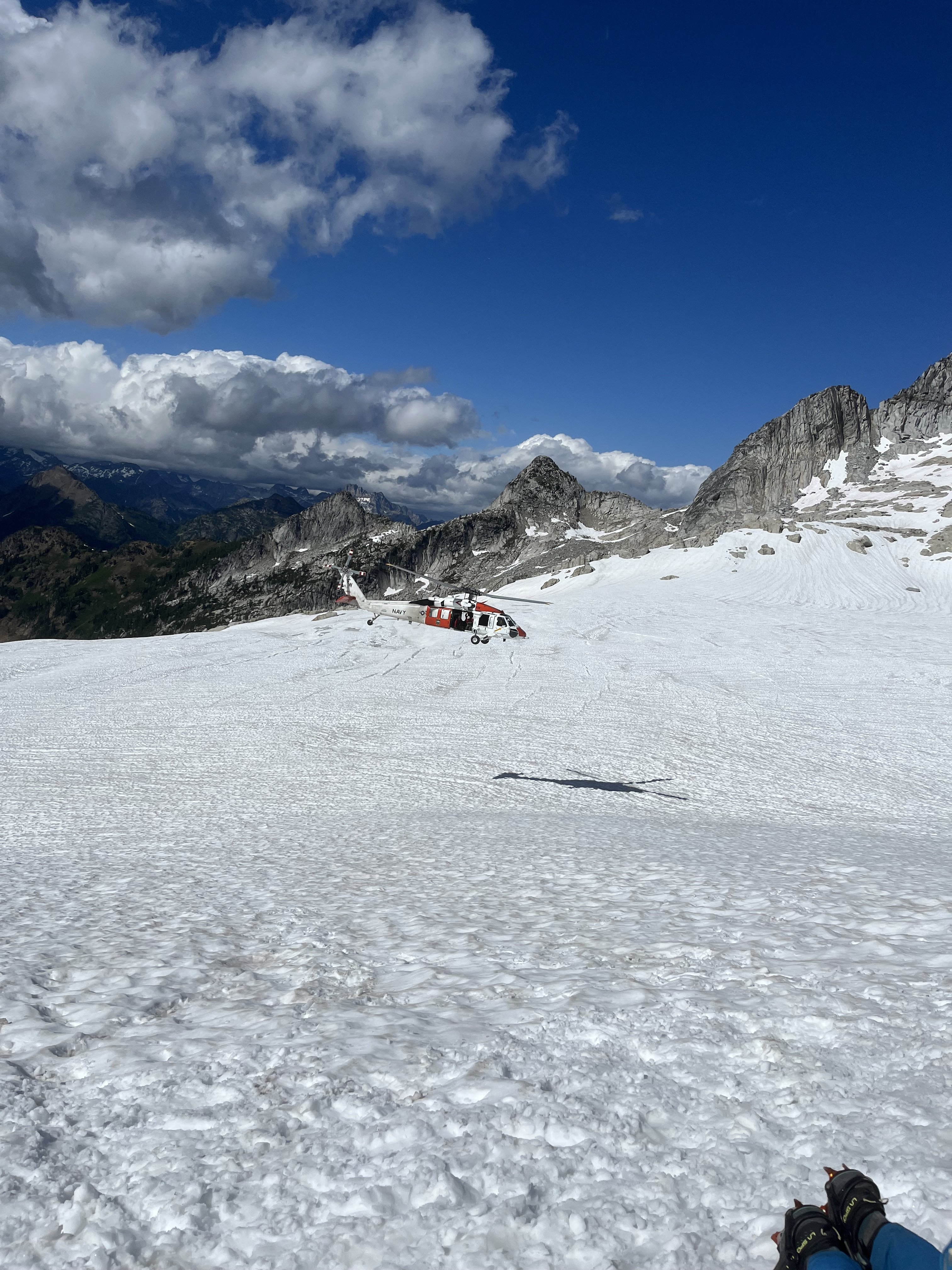
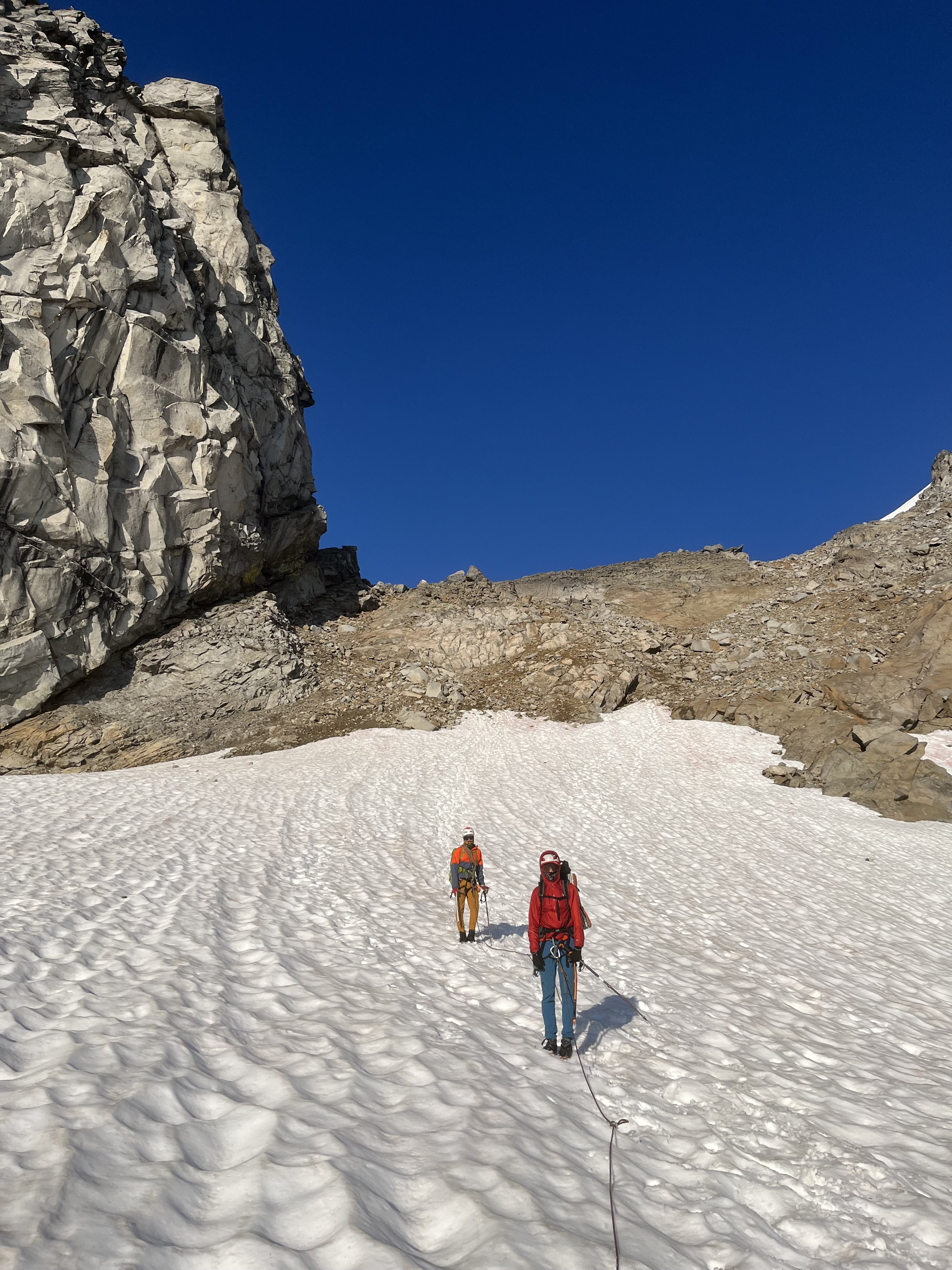
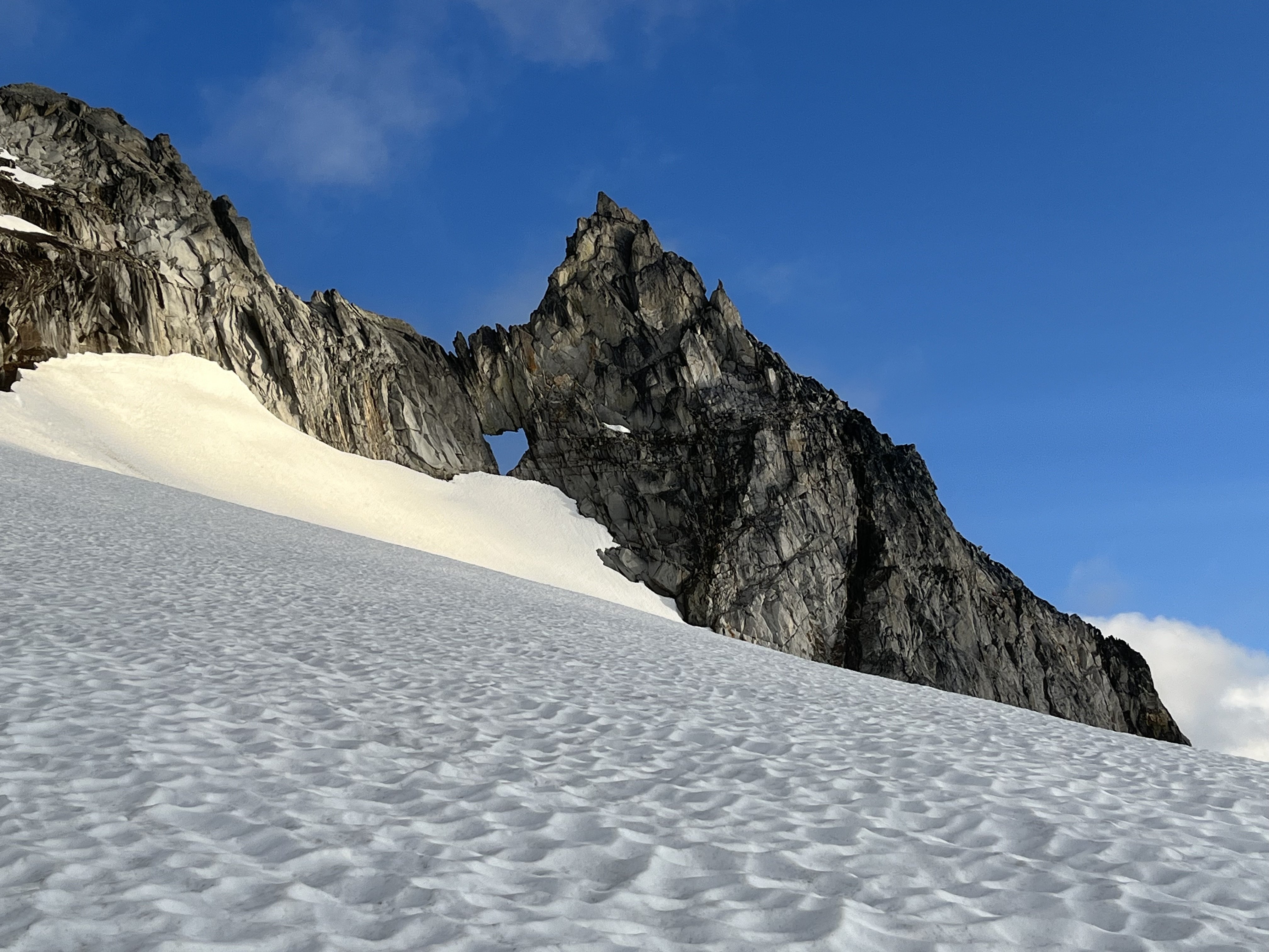
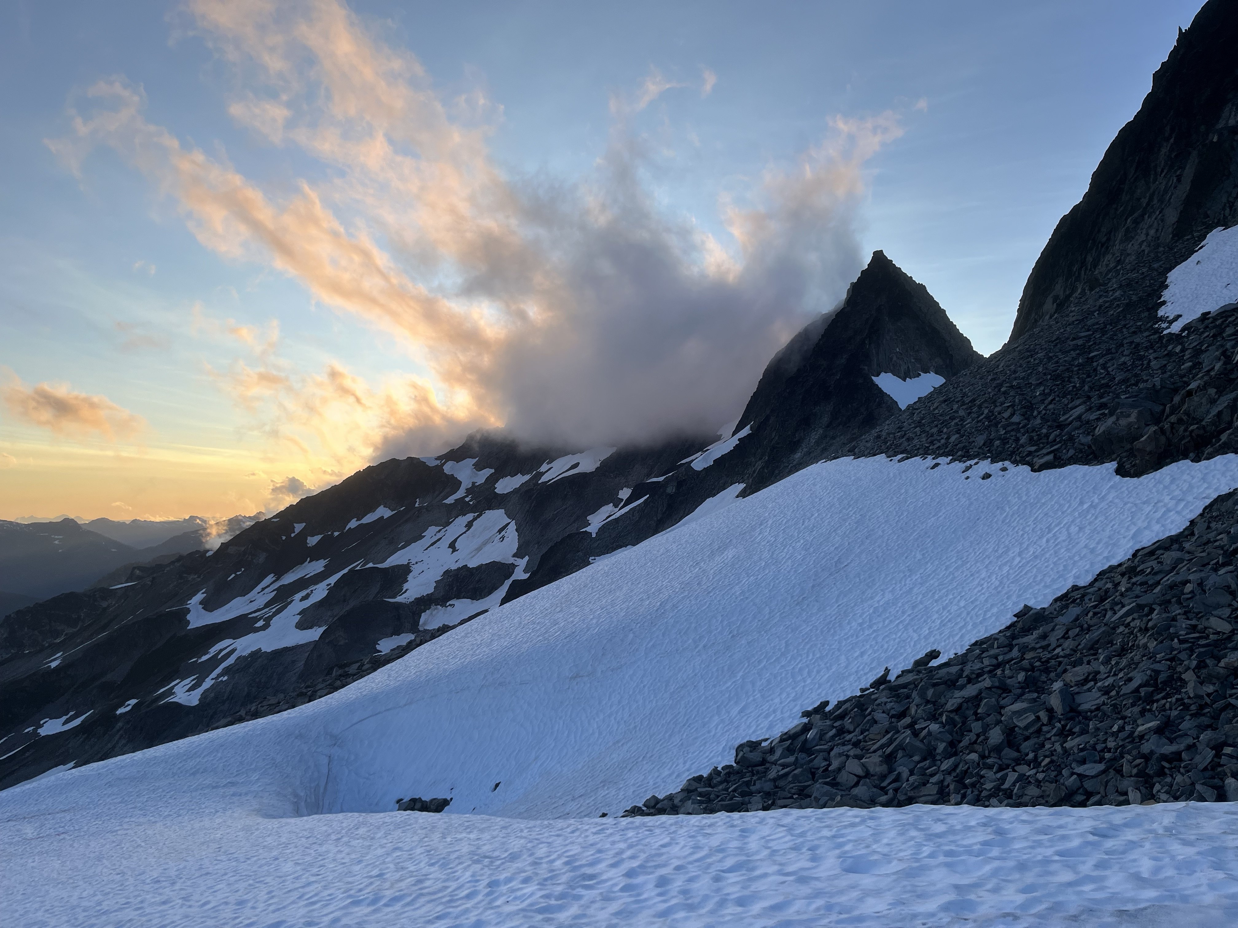
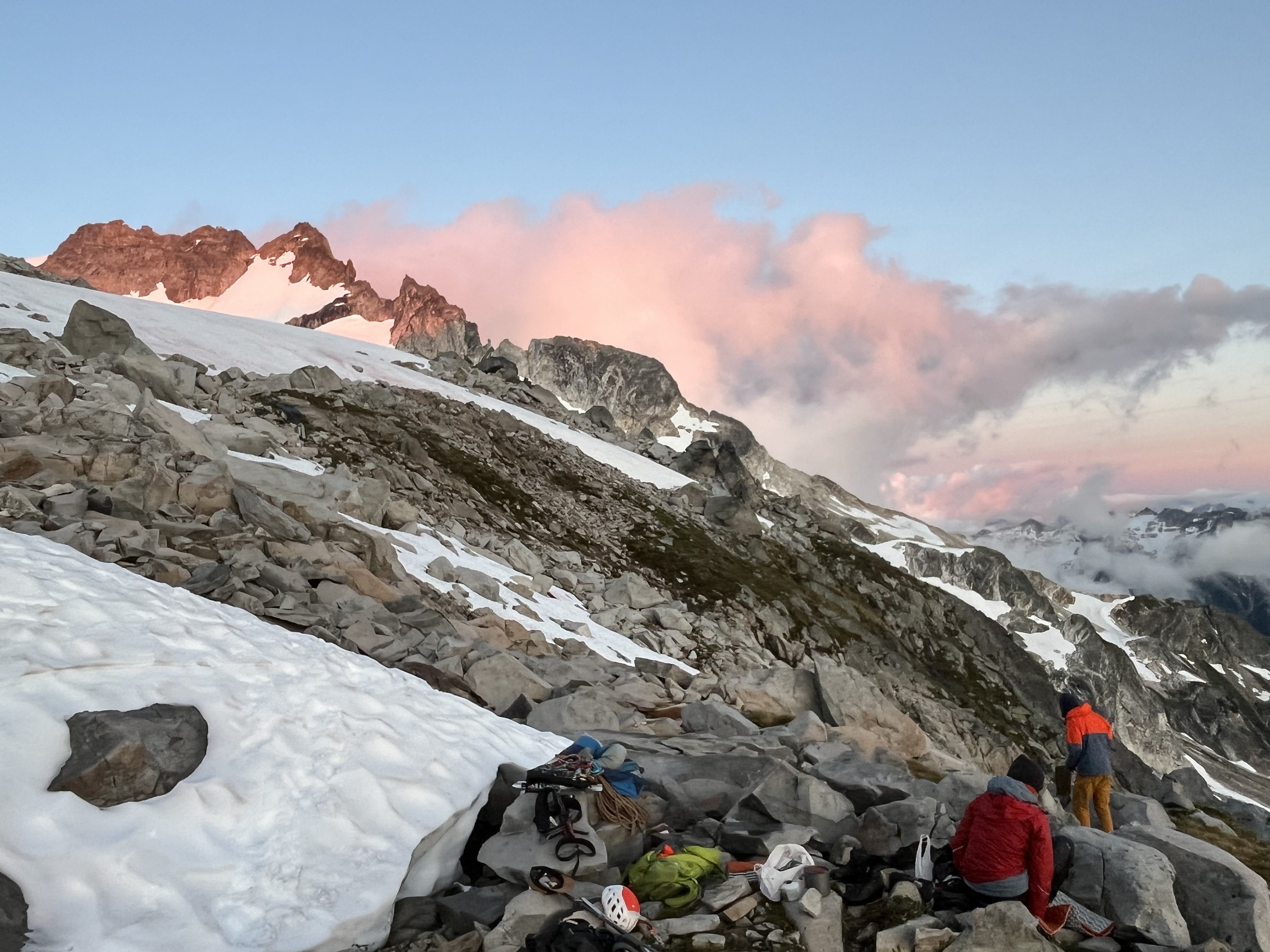
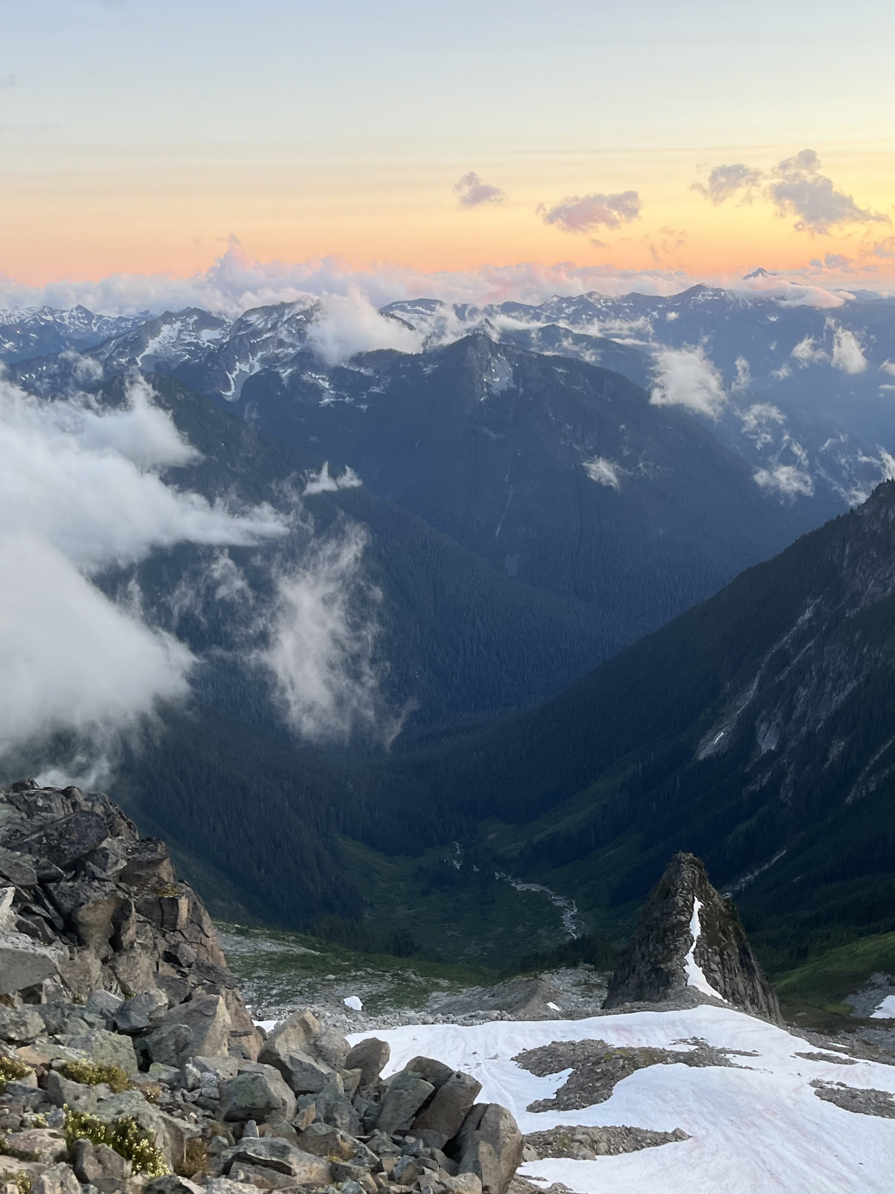
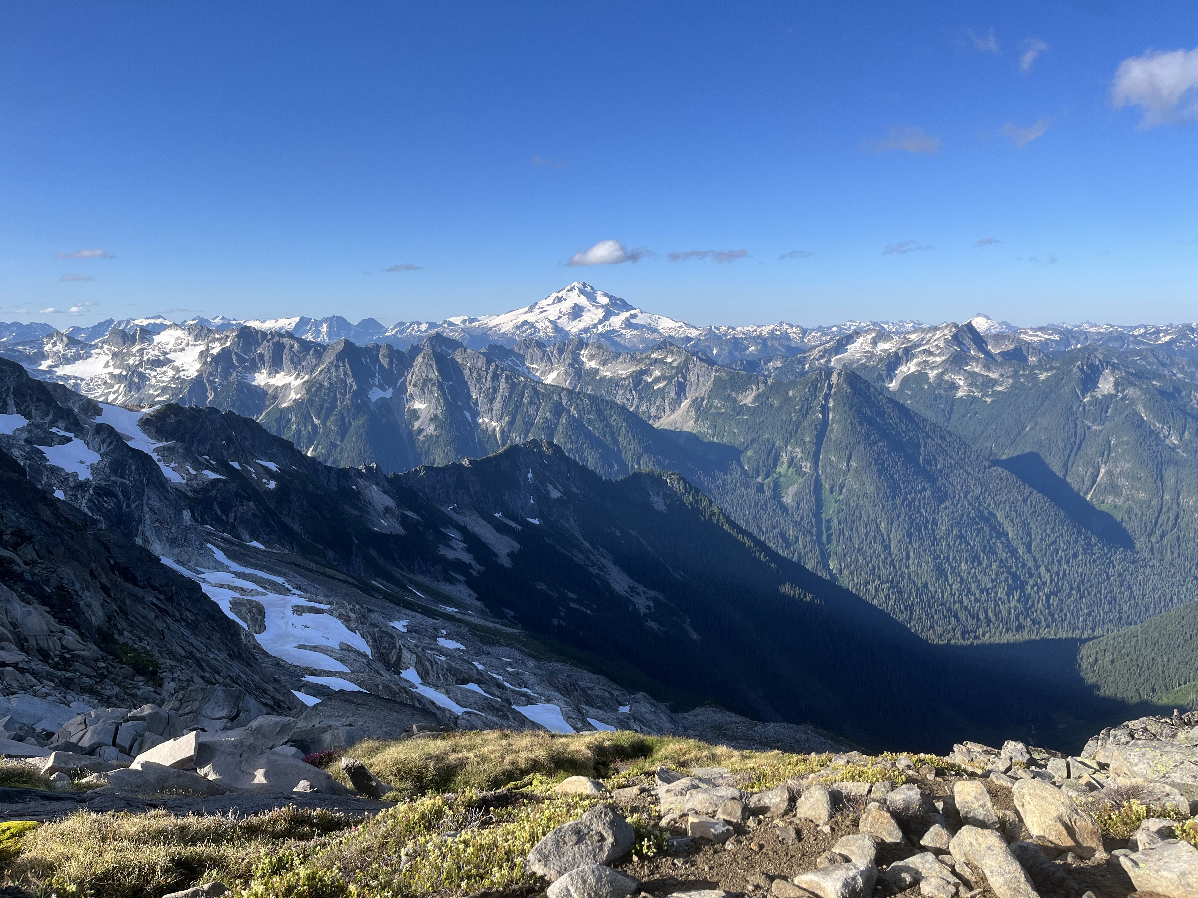
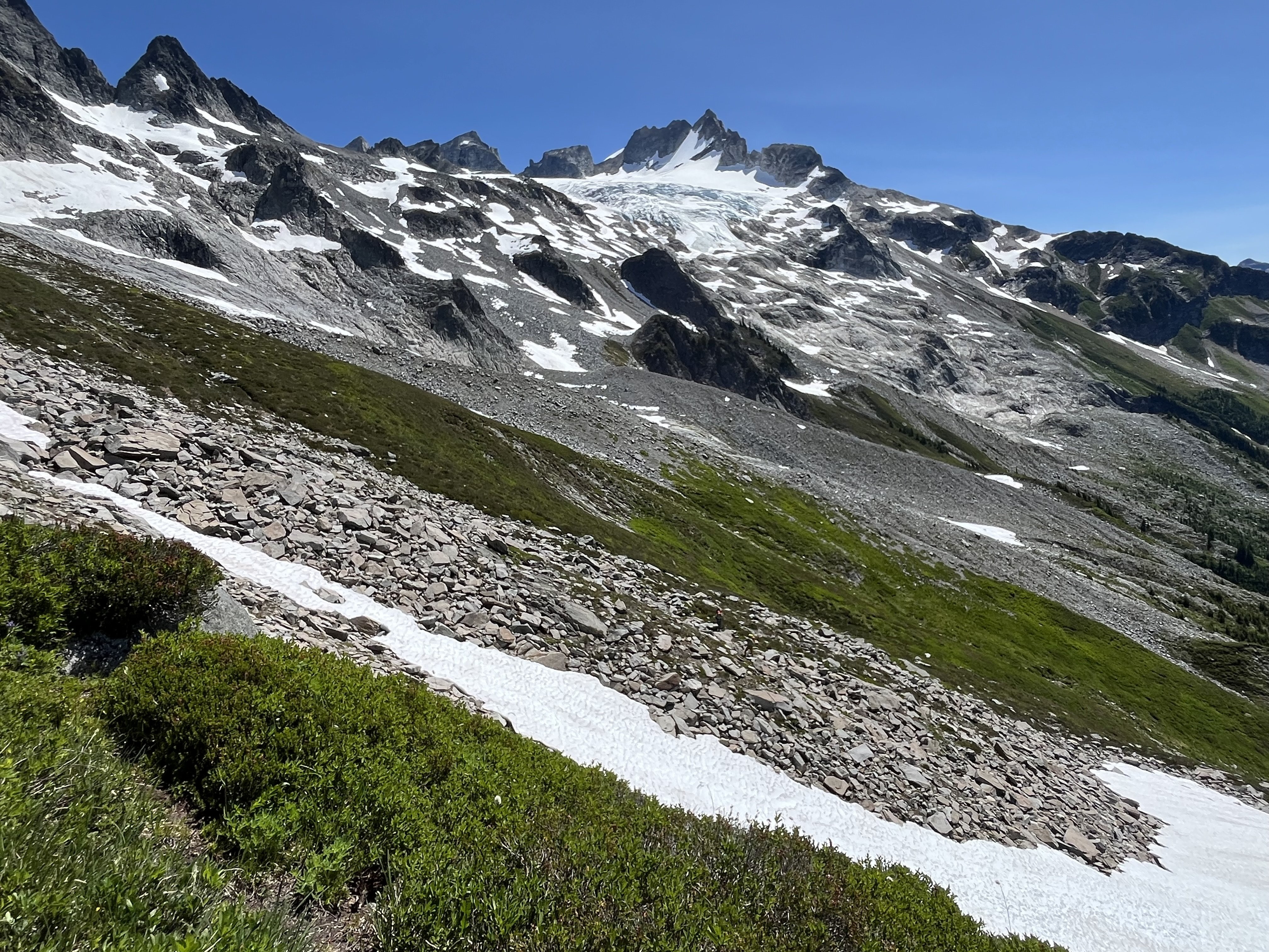
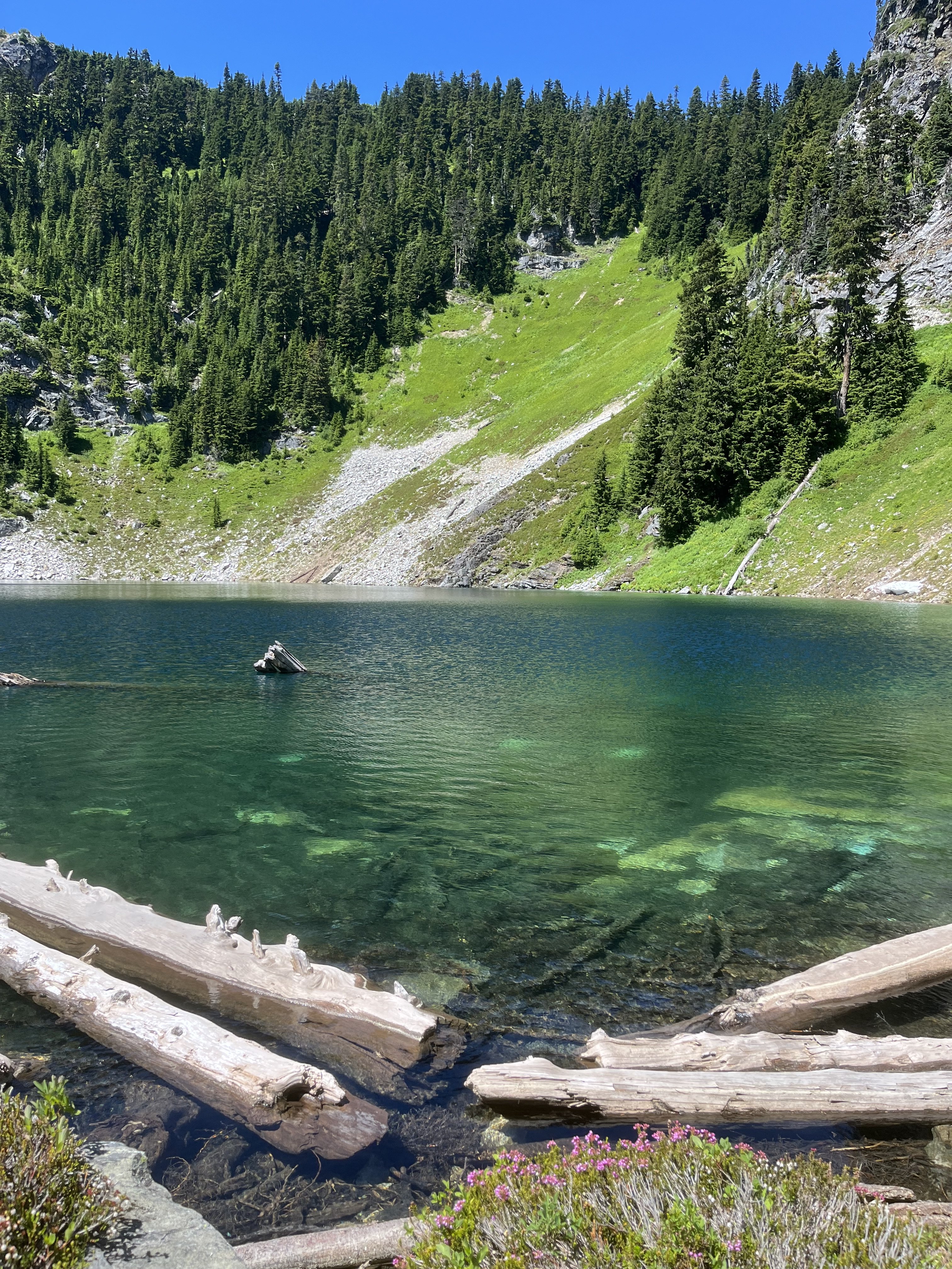
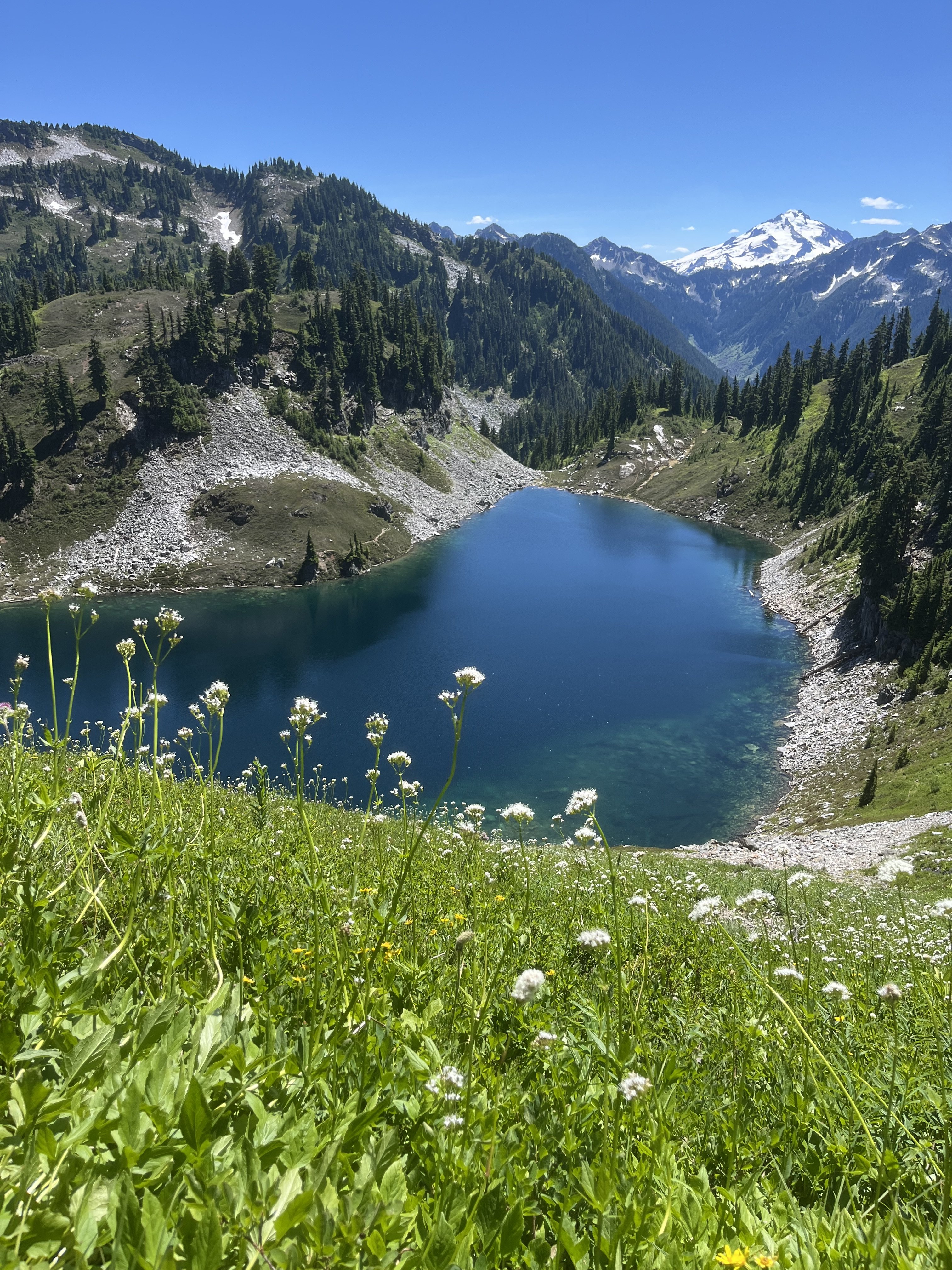
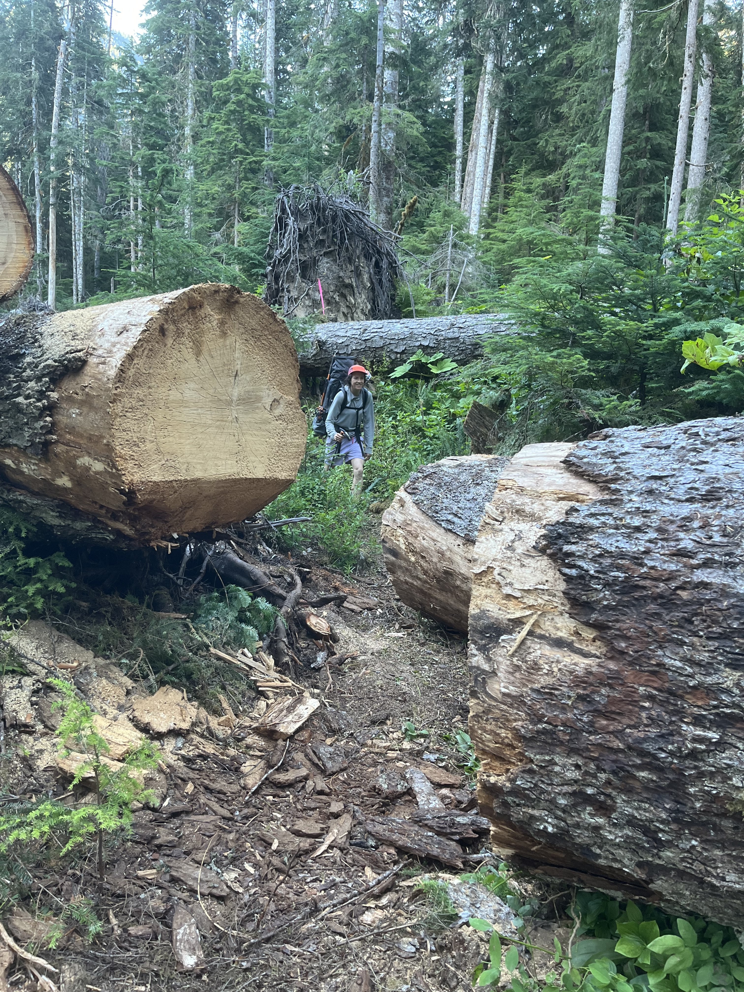
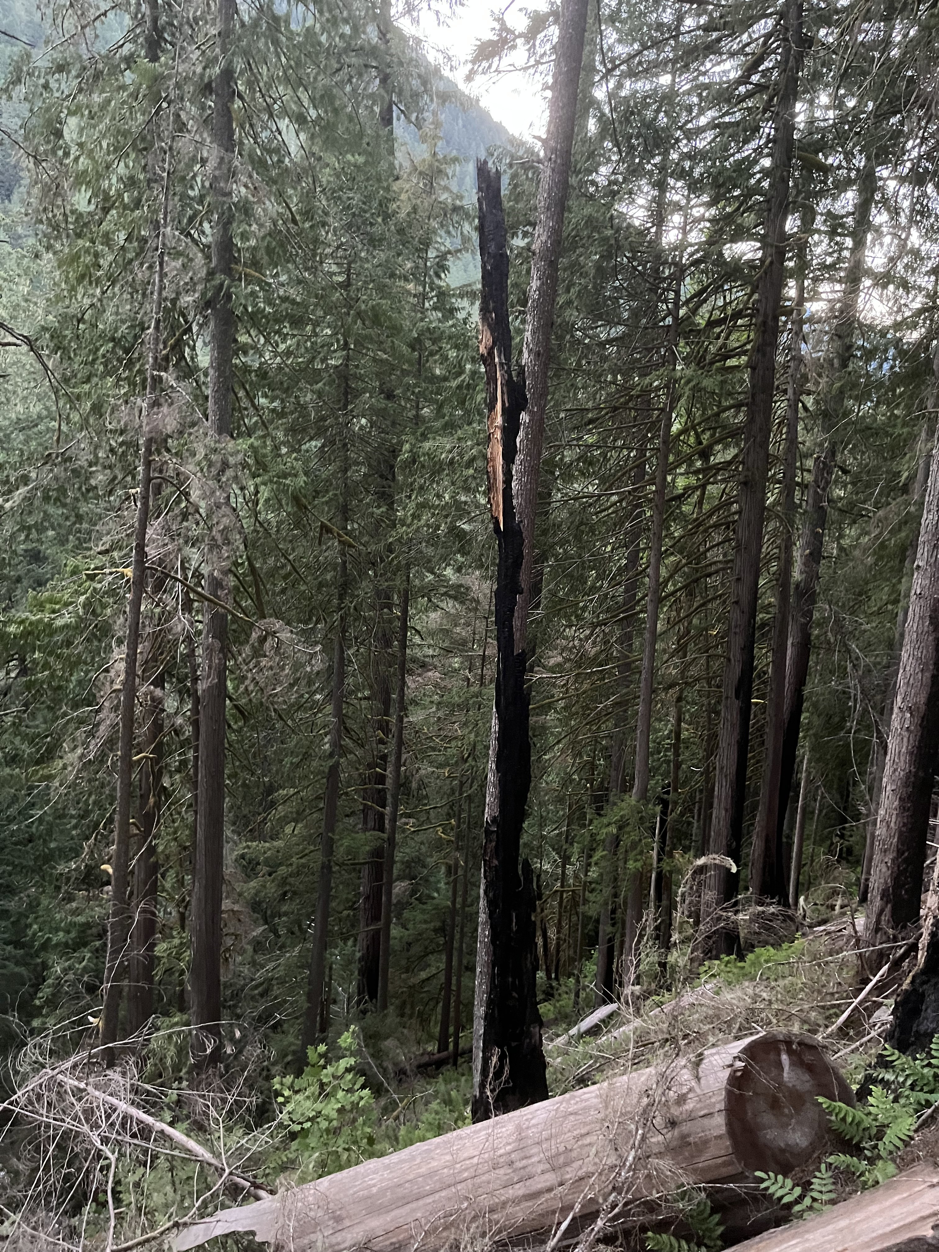
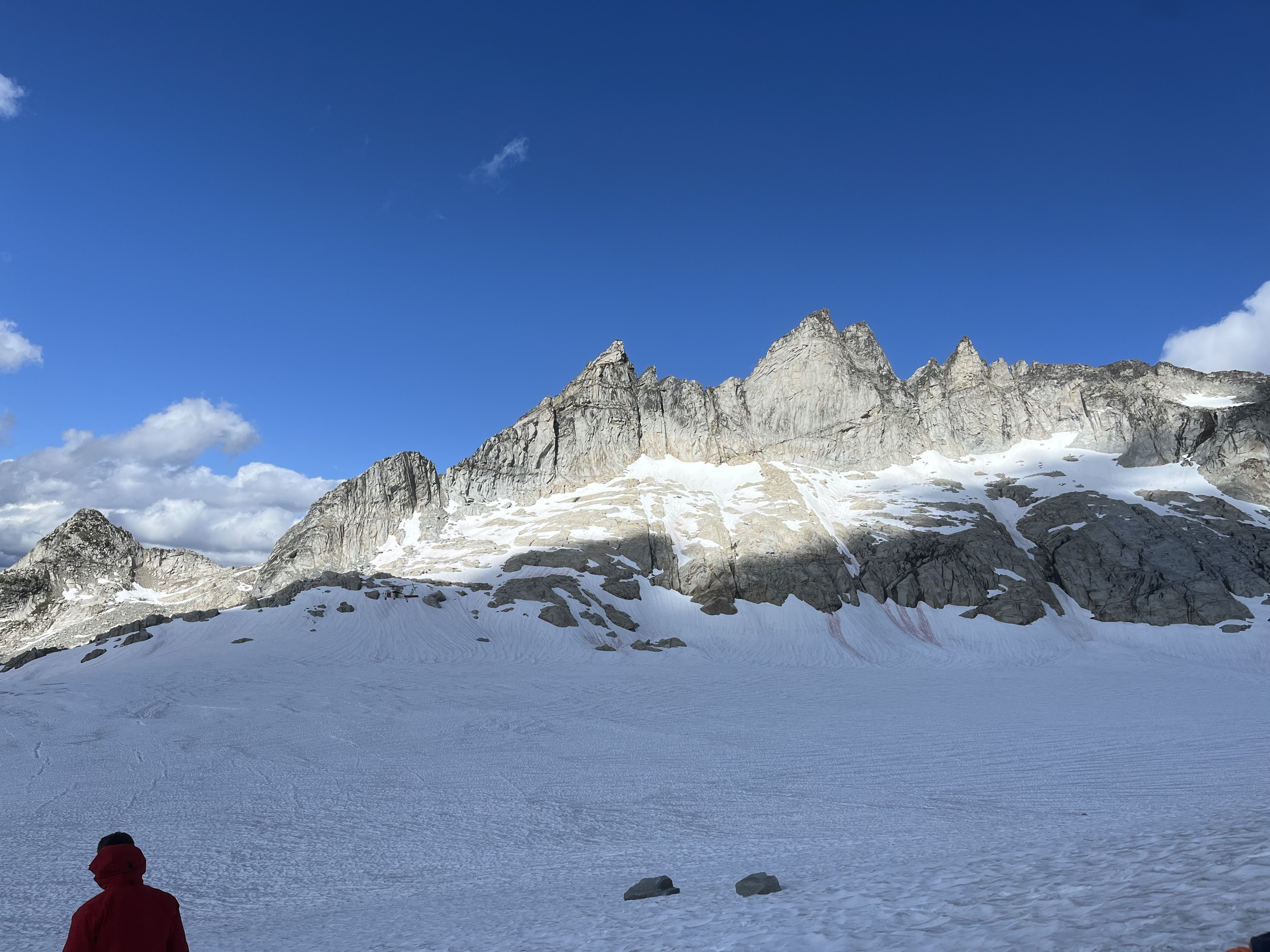
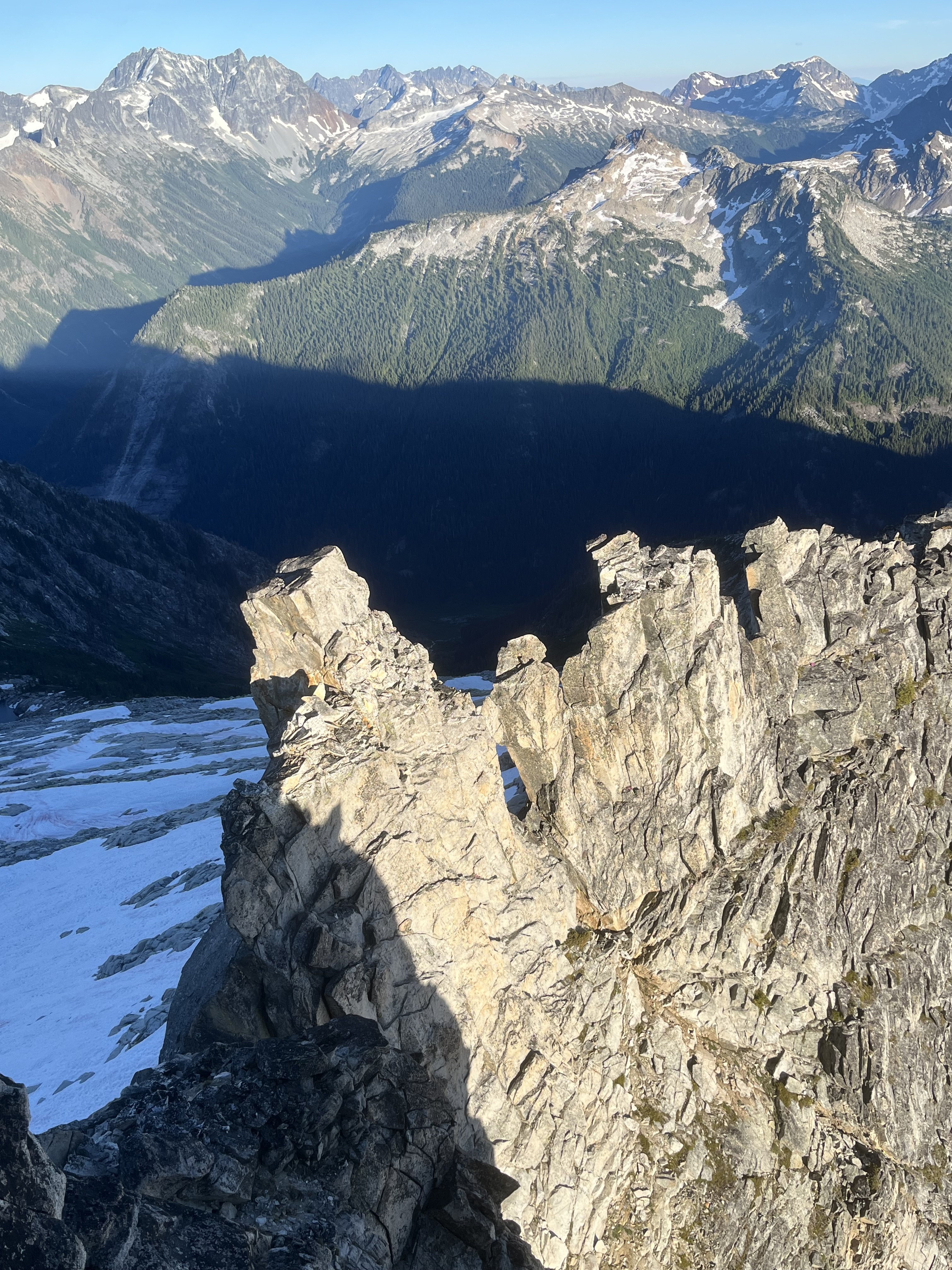 10 points
 -
Trip: Coleman Pinnacle - Standard Trip Date: 12/30/2025 Trip Report: It has been a slow start to the ski season. A very slow start. But despite the setbacks, I've managed to have a few good days the past several weeks up in the Baker backcountry. We're fortunate up this way in that our usual backcountry backyard emerged relatively accessible from the December Floods. US2 and 410 aren't quite so lucky. I've not been doing anything remarkable the past few weeks in the Baker backcountry, but I do have a new camera that I have been having fun getting to know and so why not post a few photos from the classic Coleman Pinnacle tour? This is an outing that I tend to come back to over the past 20, climbing it every 5 years or so, if only for the views and the fun run down into Wells Creek. If you haven't been out that way.....you probably won't like it. Best to stay near town and reduce your carbon footprint. Sunrise from the parking lot: The classic view of Baker from Artist Point never gets old (to me): @Trent approaching the heli line: @Trent and Coleman Pinnacle: Der Shukshan: @Trent skinning up under Coleman Pinnacle: Summit of Coleman Pinnacle: Out to Chowder Ridge: Descending from the summit with Baker looming ahead: Ptarmigan in winter plumage down in Wells Creek: Windy on der Kulhsan: coming back up over Table on the way home: Shuksan is one of my favorites in the North Cascades: Sunset from the parking lot. As Ice Cube would say, "Today was a good day". Gear Notes: flotation, but please, leave the snowshoes at home. Approach Notes: Heather Meadows to Artist Point to alpine glory
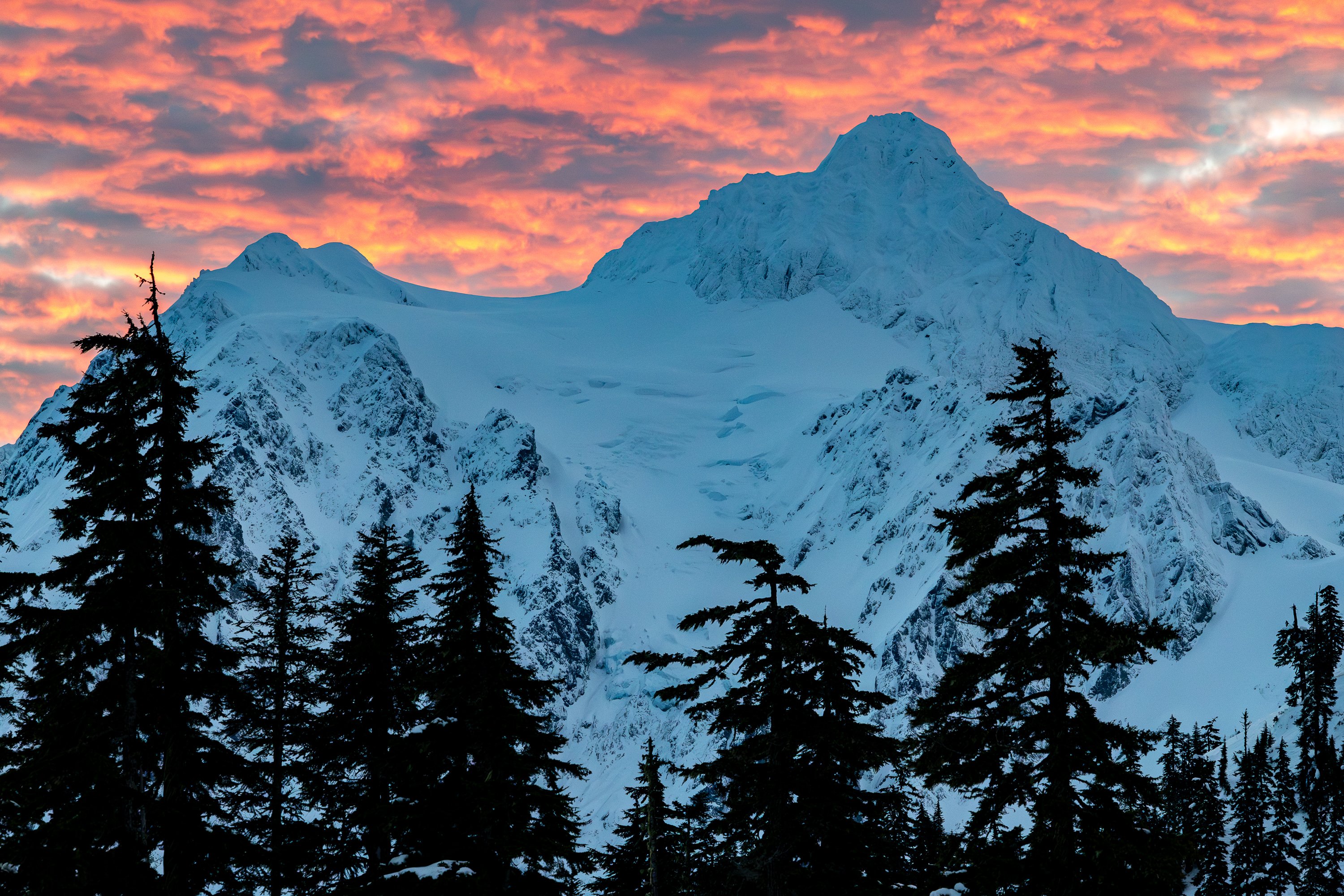
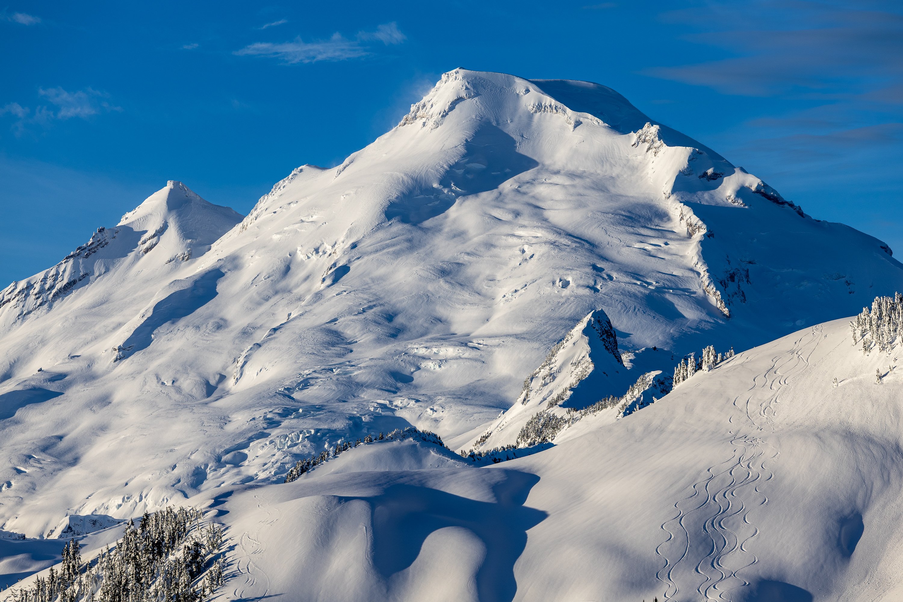
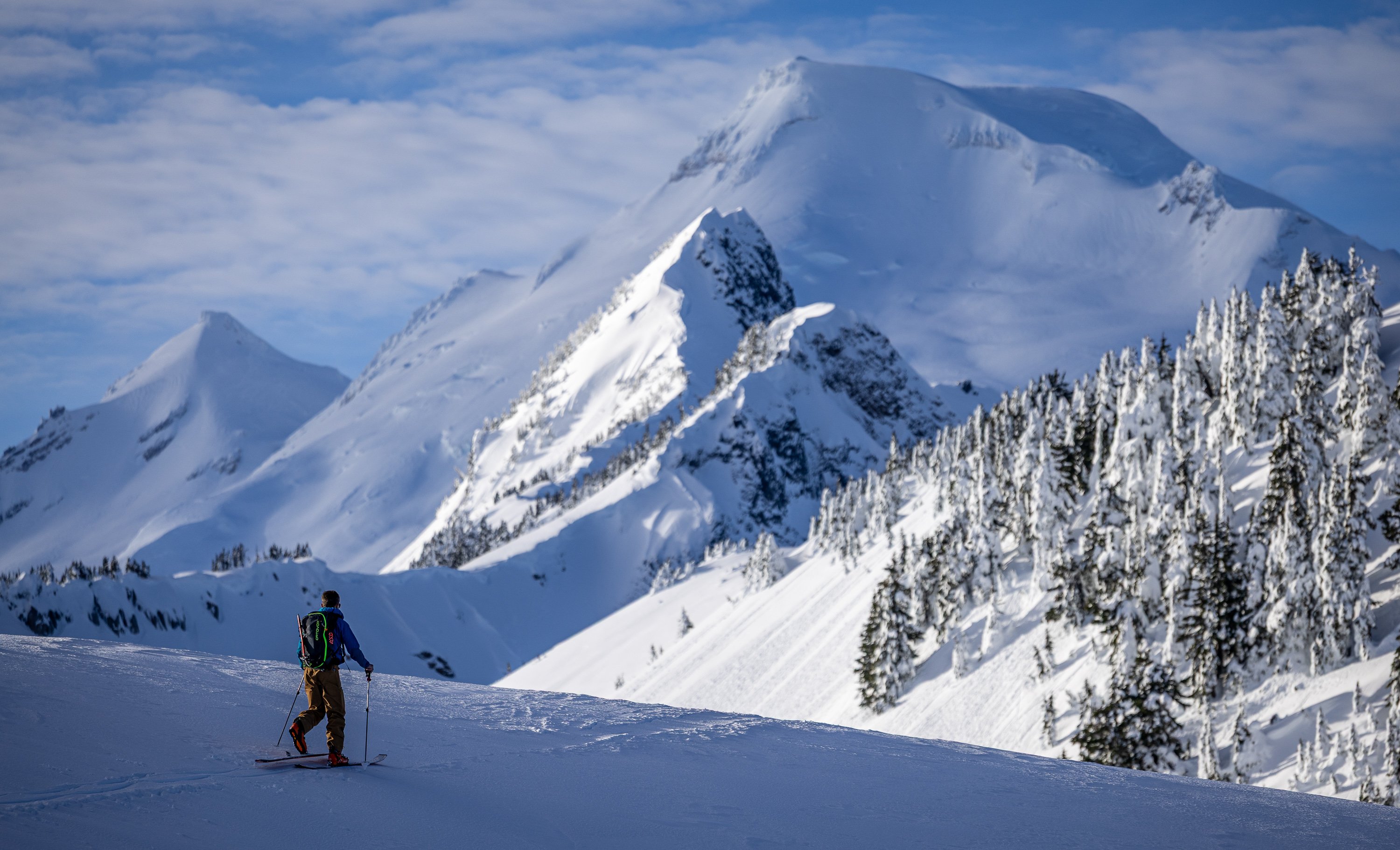

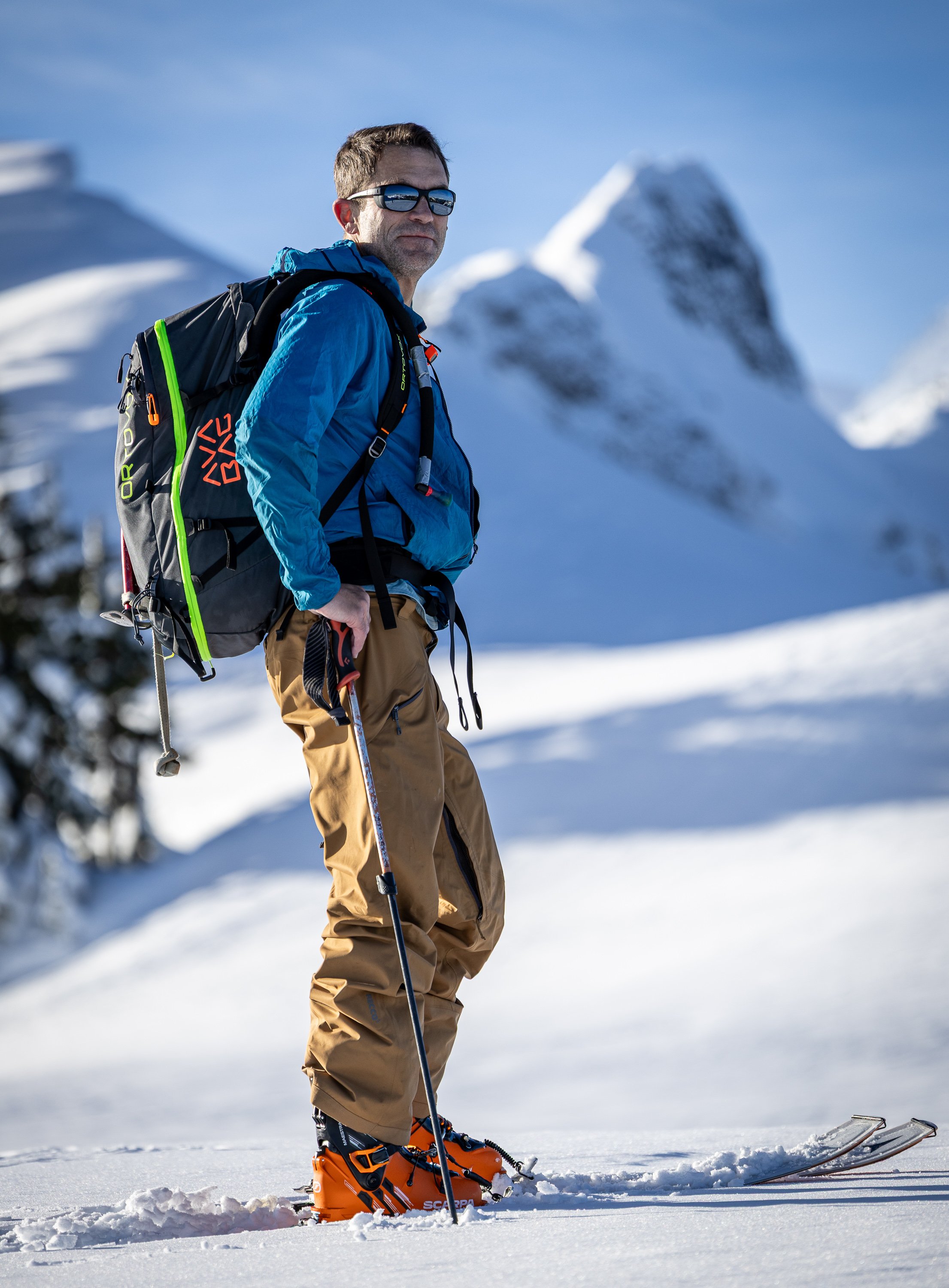

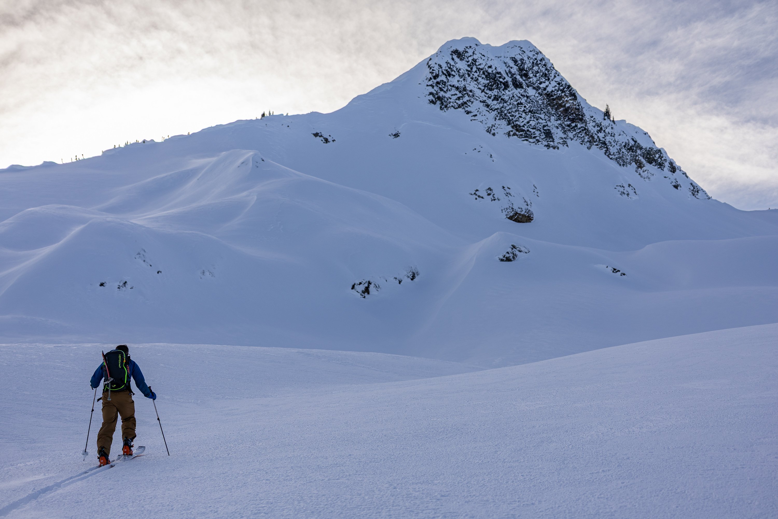

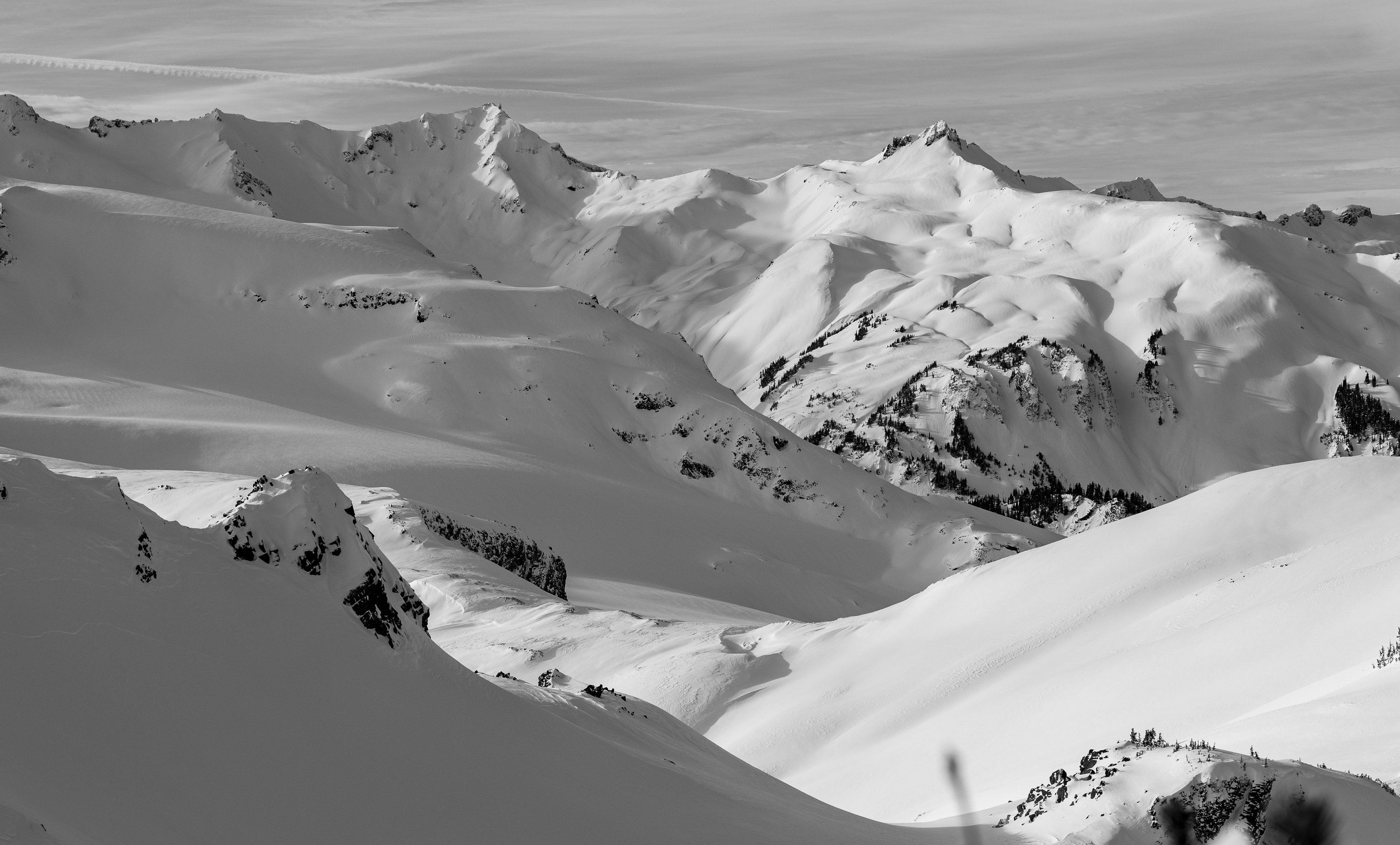
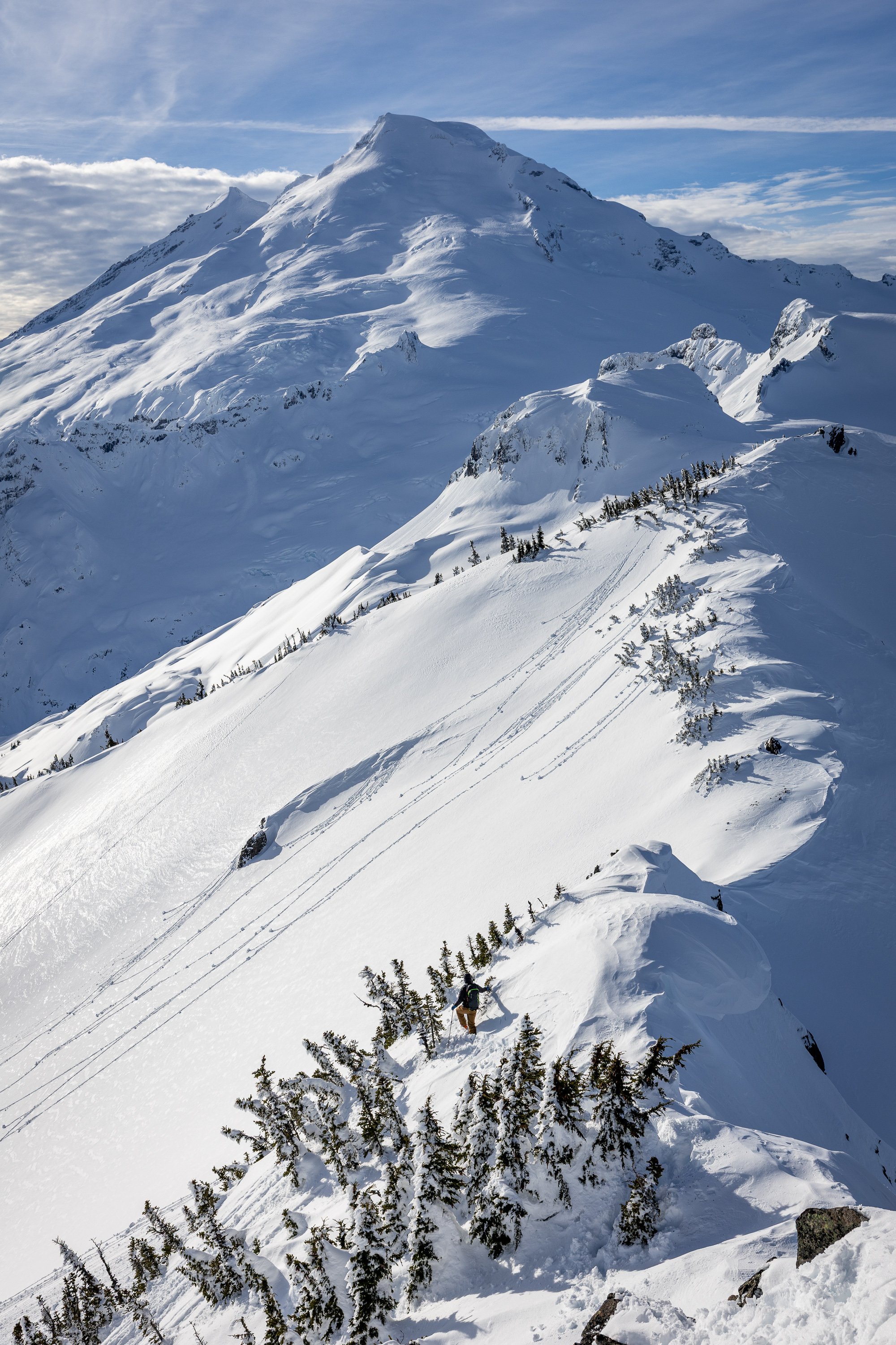
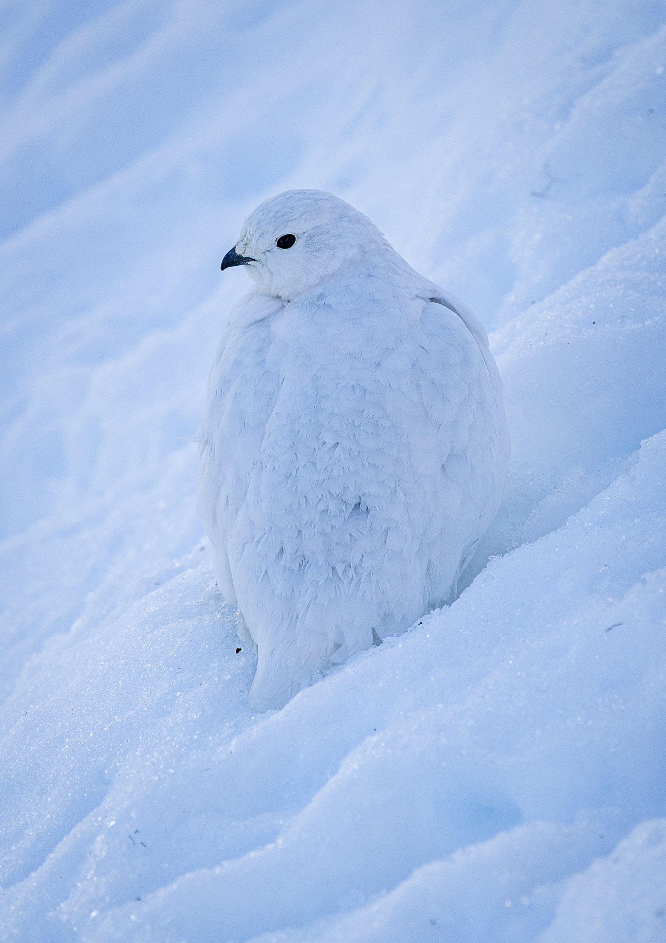
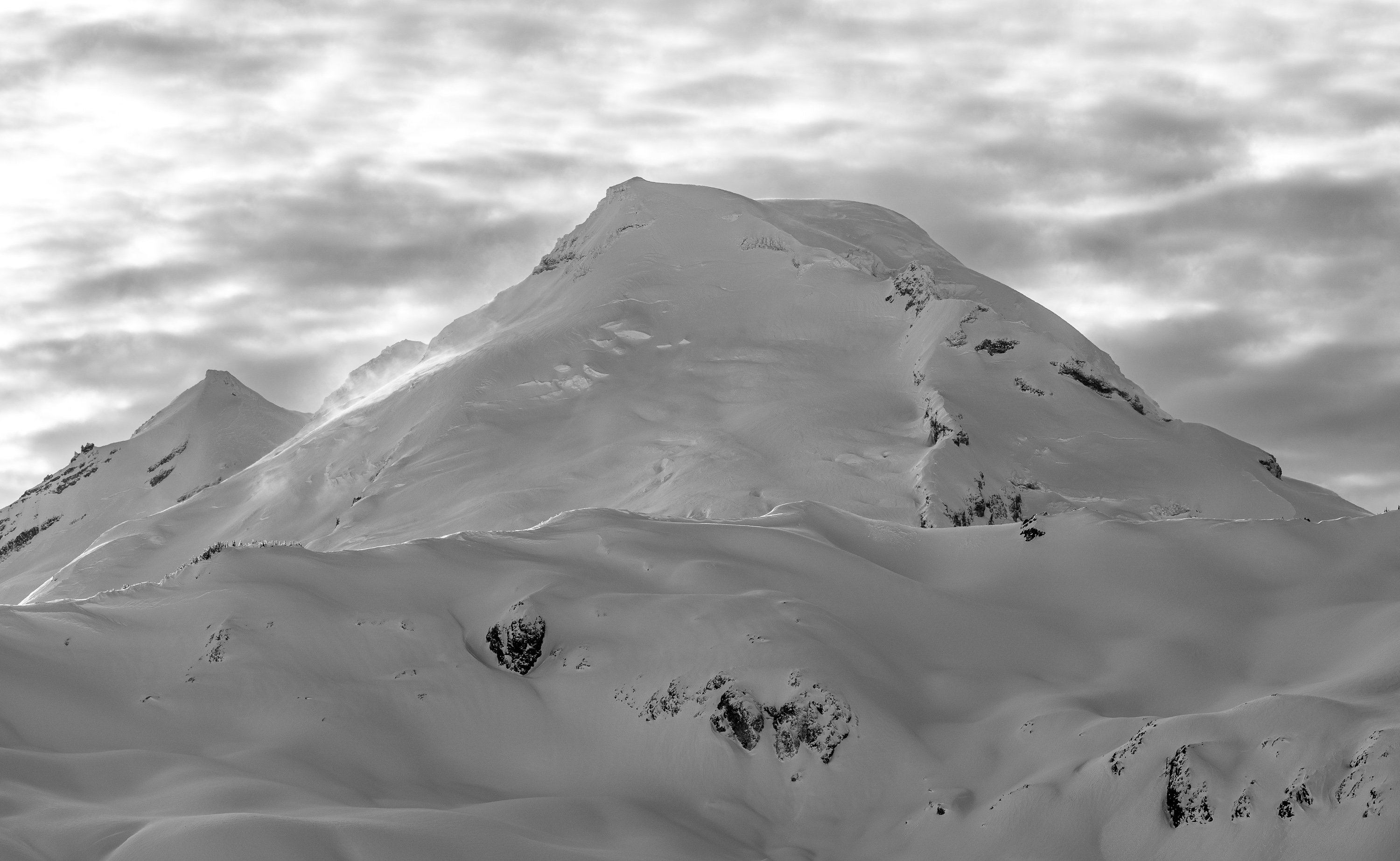
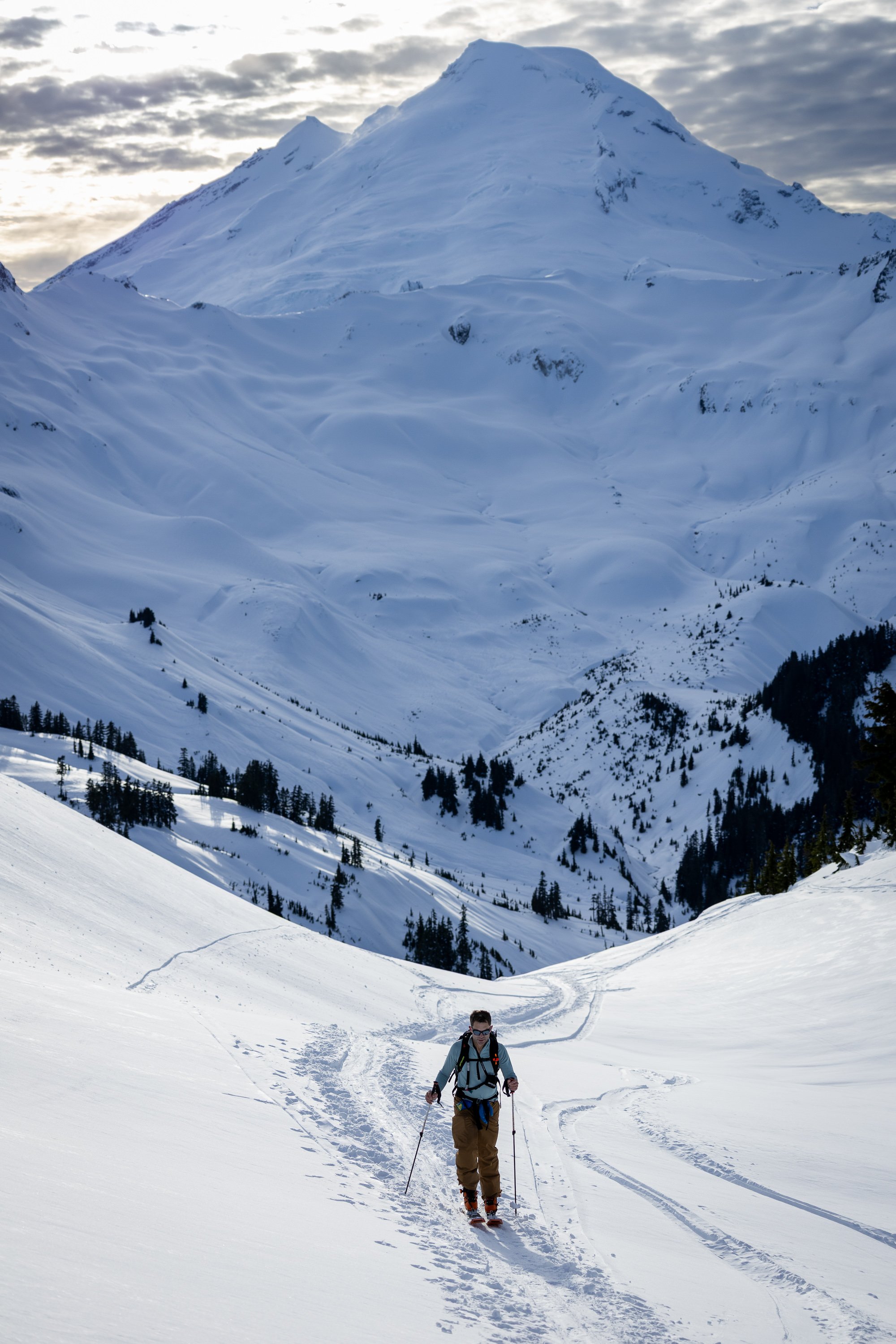
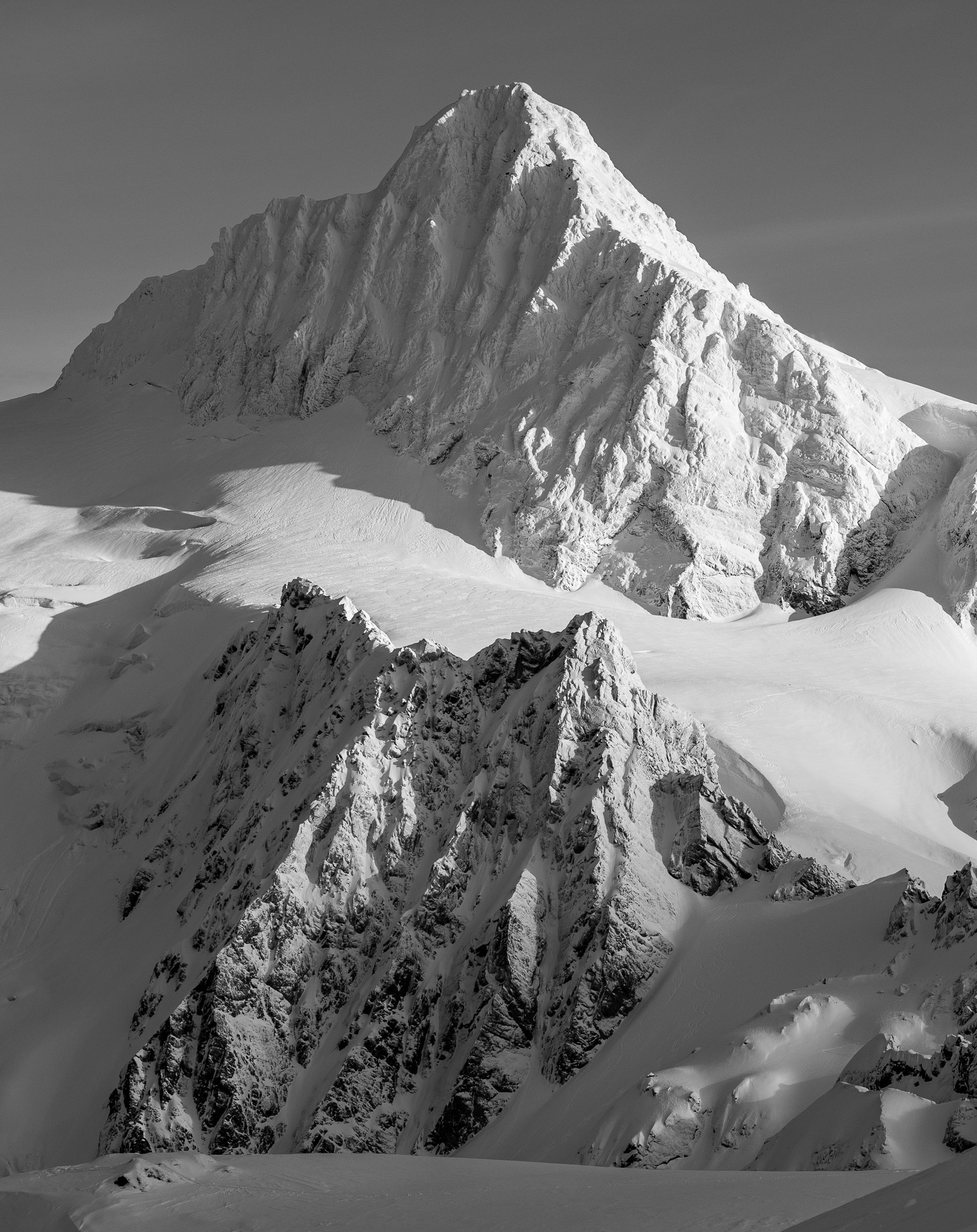
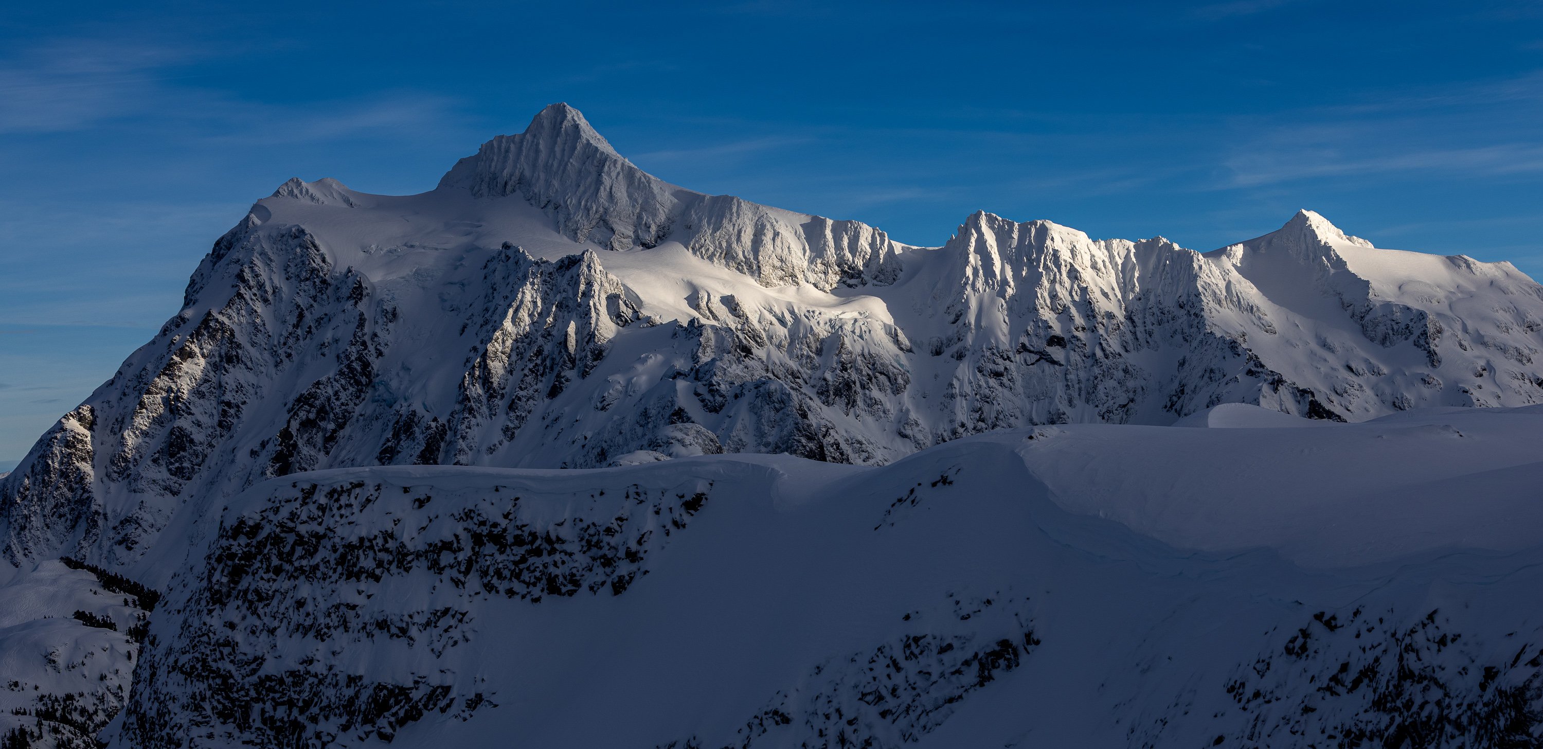
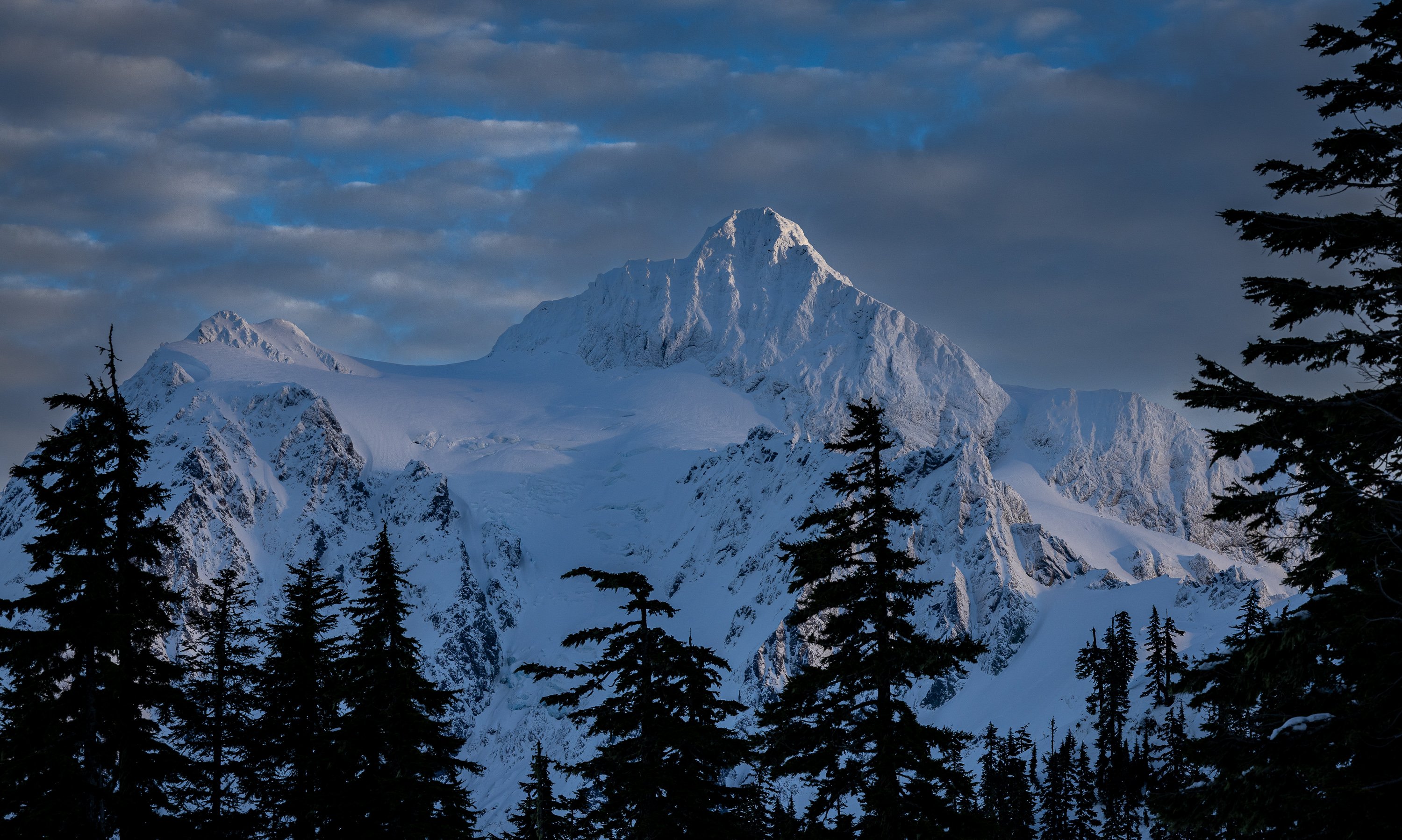 9 points
 -
Thanks for JasonG for the great overview photo! This route has been on my list for a while. The quality is so-so, and it's kind of dangerous with all the loose rock, but it sure was a grand adventure. https://spokalpine.com/2025/07/30/eldorado-peak-west-arete-iv-5-8/9 points
-
Howdy friends, it's my pleasure to present you all with the newest Washington classic - Negligence located off the Hannegan pass trail. This is a stellar line that links up several crack systems to access a shield about halfway up the large buttress seen across the valley. We spent most of the spring/summer of 2025 developing and cleaning this line and would like nothing more than people to get out there and climb the thing. Approach - From the Hannegan Pass Trailhead, hike Hannegan Pass Trail past the first two switchbacks about halfway to the campsites. Shortly after the second switchback, drop down the open talus field on your right. Continue down the talus almost to the creek, cut right into the woods, then make your way down to the creek from there. Jump from a large log across the first narrow creek band and you’ve found the tunnel through the slide alder. Be bear aware here, we found multiple fresh signs of them (probably due to the golfball sized salmon berries). Follow this until the major creek crossing, then cross the creek. After crossing, head through the trees directly towards the nose of the buttress, hopping another small creek braid before entering into the talus for the final approach. Follow cairns up the talus, then follow the path (likely overgrown) through the underbrush to the base of the wall. The route is located a couple hundred feet to the right of the nose. In total, the approach is around 2 miles, but tends to take around 45 minutes, give or take. Climb - This route takes a series of remarkable crack systems 400 feet up the Hannegan Buttress over four pitches. Protection is traditional, styles vary from off-width to tips, and all anchors are bolted for ease of descent (316SS all around). Each pitch ends at a conferable belay ledge. Pitch 1 - Depending on snowpack, either hop right into the offwidth start, or cross a deep snowfield to dig right into the rest of the pitch. A long continuous crack system varies from tight fingers to the wide stuff, favoring tight hands and good feet. This pitch reminds me of a steeper version of the Apron with lots of flared hands, sustained 5.9 climbing with several good rests. The bottom wide bit is a little dirty and will probably remain so since it gets buried under the snow pack, but it quickly cleans up. This pitch would be a classic all on its own. (5.9+) Pitch 2 - Amble up from the belay towards a notch gully in the leftward wall, clipping in a pin down low, then placing a bit of gear before firing a few fun moves to gain the gully. Make your way up the 4th class to a great ledge to top out this short pitch. (5.8) Pitch 3 - Step left from the belay and begin climbing up a wide box. Tread lightly on the red stone before pulling into the right-facing dihedral towards the alcove. Exit the alcove on thin tips, and continue upwards until bomber hands placements allow you the confidence to trend left in the flake system. Follow the flakes until the roof, then brace yourself for a thin, thoughtful, arching crux protected by small gear as you pull out onto the Shield. Save a .2 and your smallest cam for the business. The crux of this pitch is short and sweet. Its probably easier for folks with thin fingers or long arms and can easily be pulled through on gear. (5.10d) Pitch 4 - This one's in the money for best pitch in all of Washington! Climb the stupendous splitter to the top of the Shield. It is as good as it looks. Some finger crack moves will take you past a loose book size rock (never fear, that thing isn't coming out) to glorious hand jams. It gets a little steeper at the top so be sure to take in the scenery and catch your breath a bit. Top out on a large ledge. (5.10b) Descent: Rap with a single 70m rope. Use the intermediate anchor on the ledge climbers left between the P1 anchor and the ground. Otherwise, just rap the route. Gear - 70m rope Double rack .2 - 3. Singles of 4, .1, and a purple c3 (or equivalent tiny cam, or trango gold ballnut… the best option) to protect the crux. Wires, all sizes. Consider triples in .4 and .5 for the long first pitch and a 5 if offwidths make you shake. Background - The vision and much of the labor for this route came from Nate Fearer with additional help from myself, Neil Miller, Spencer Moore and Alex Pederson. The route name comes from the fact that Nate started this project while on paternity leave and completed it within the first four months of his son's life (he really is a good father and loving husband). The route was established ground up as an aid line, then dug, cleaned, and scrubbed. Then scrubbed, then scrubbed, then scrubbed. Further ascents will clean it even more. Also, we found some evidence of prior development out there including a bolted (2 pitch?) line left of the nose. If anyone has information on this route please let me know.
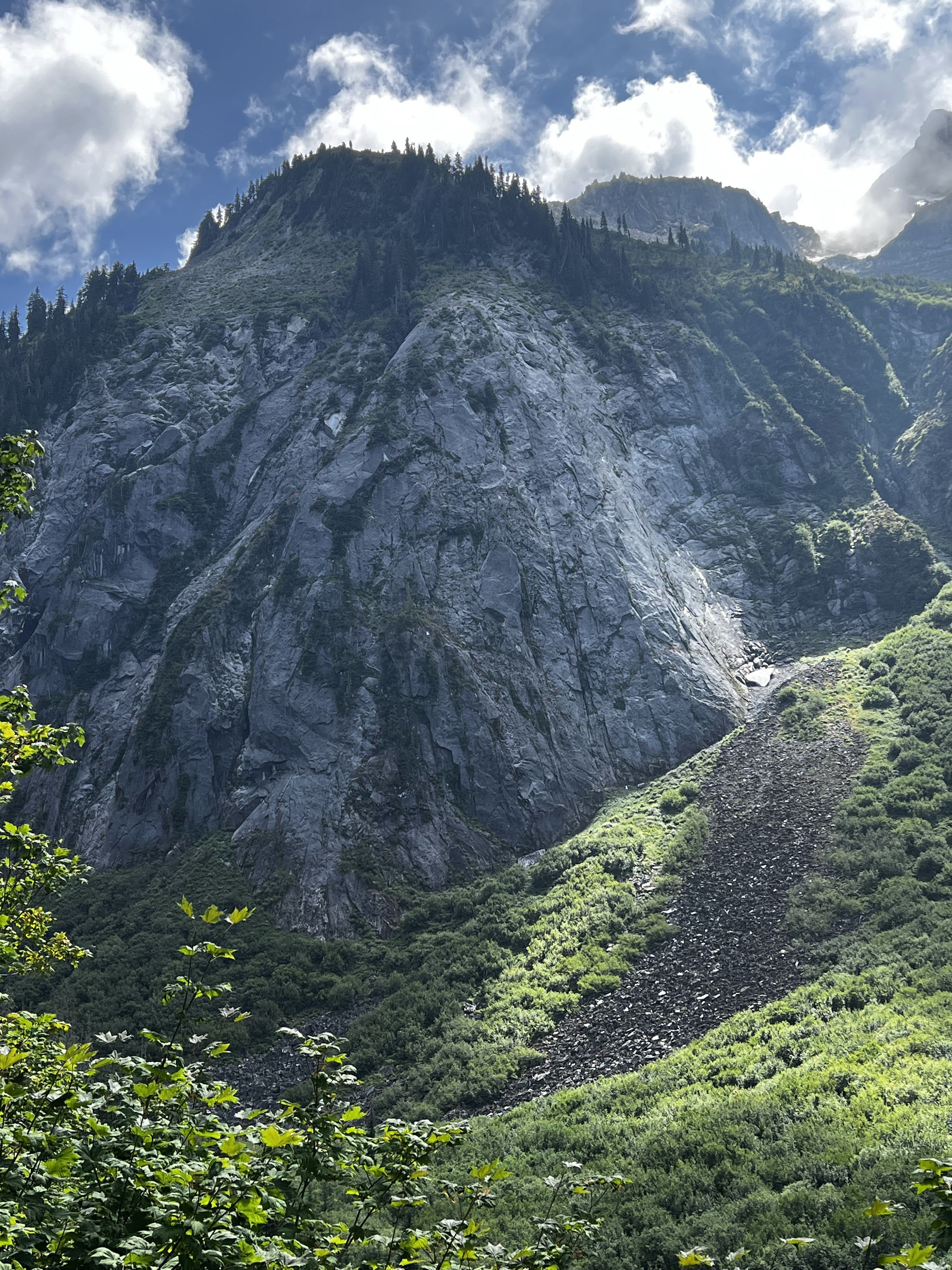
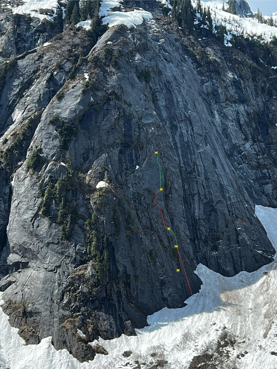
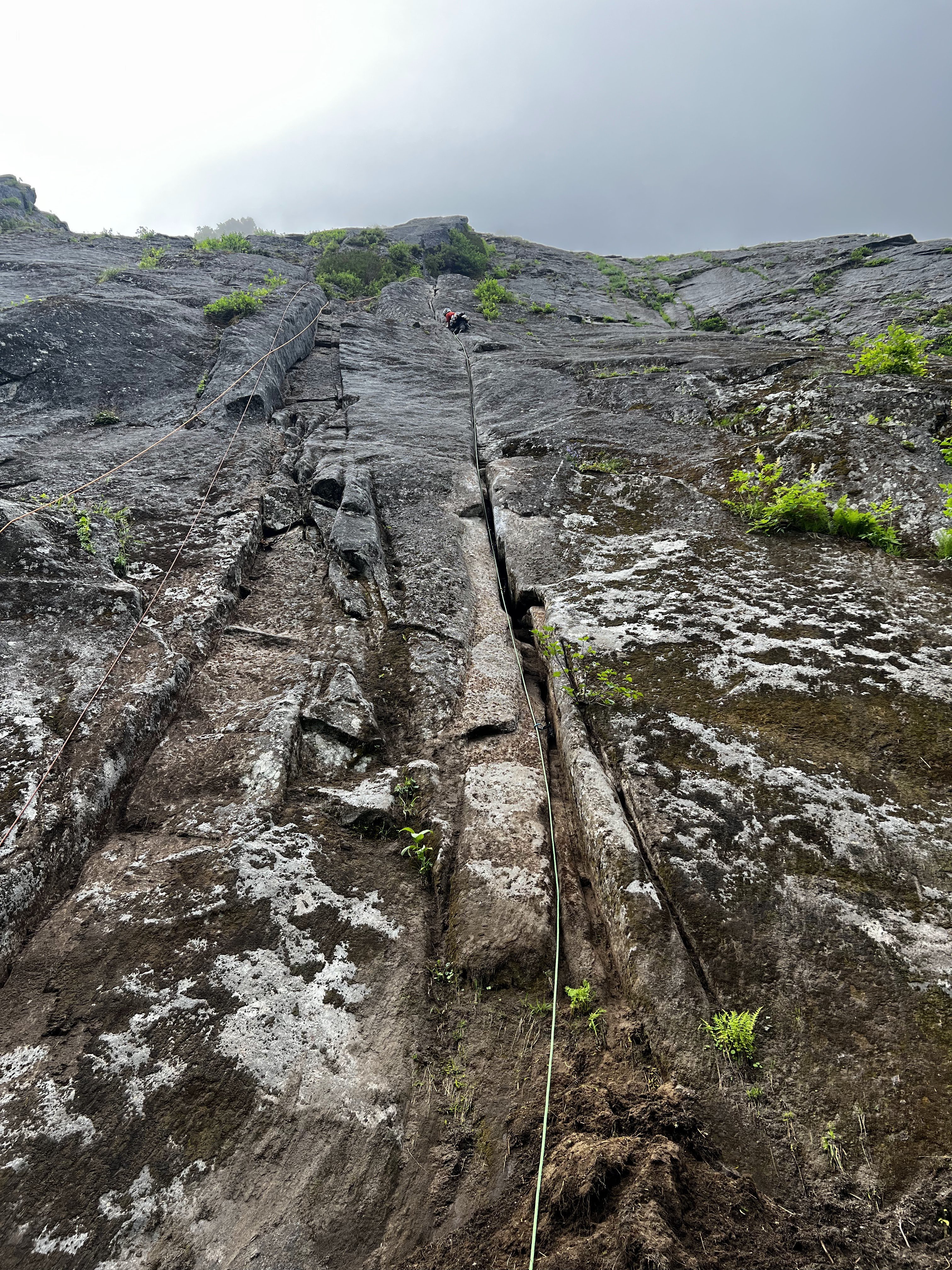
.jpg.2b582877bdbee4a7e892f3bb36fd185c.jpg)
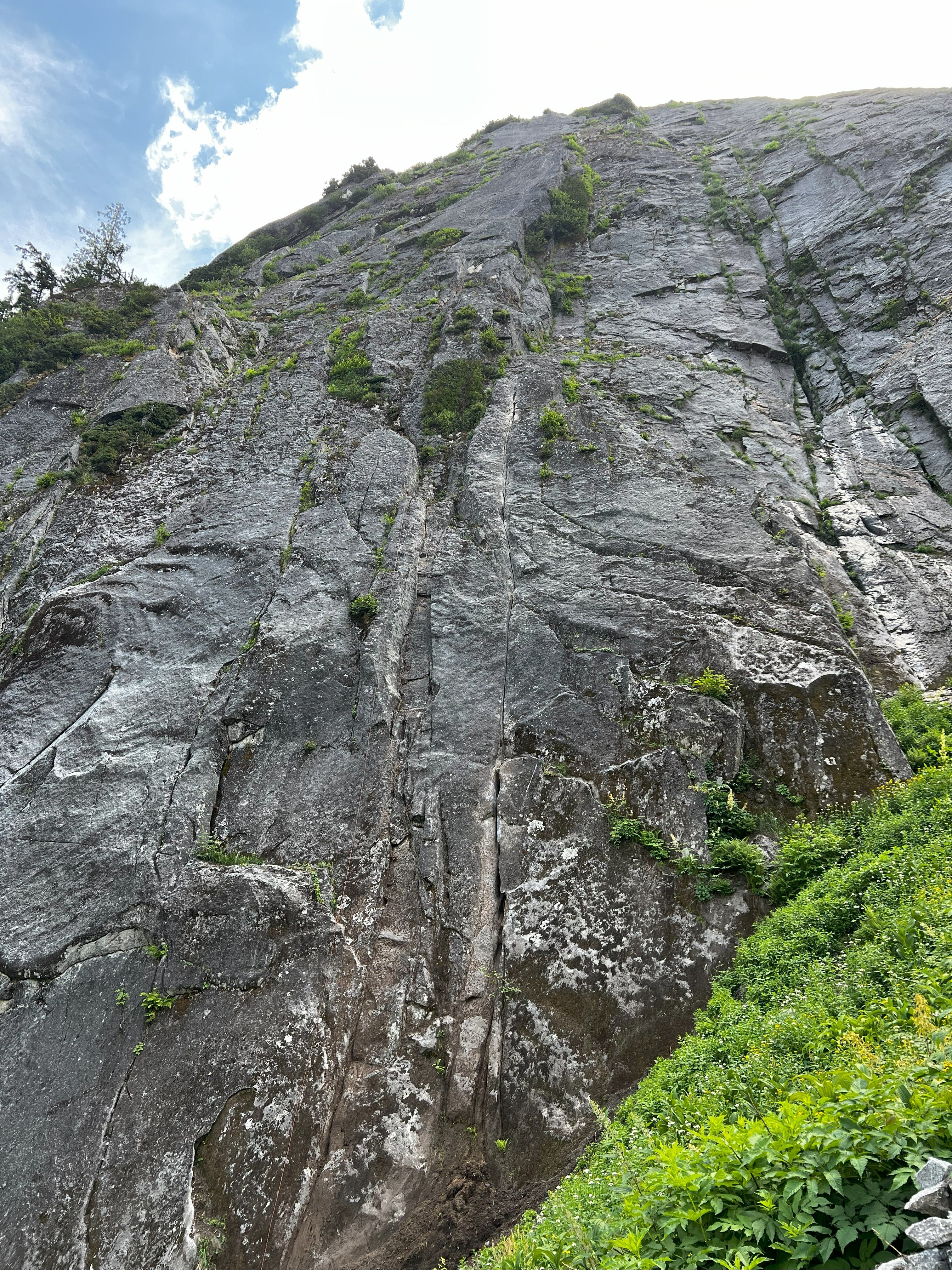
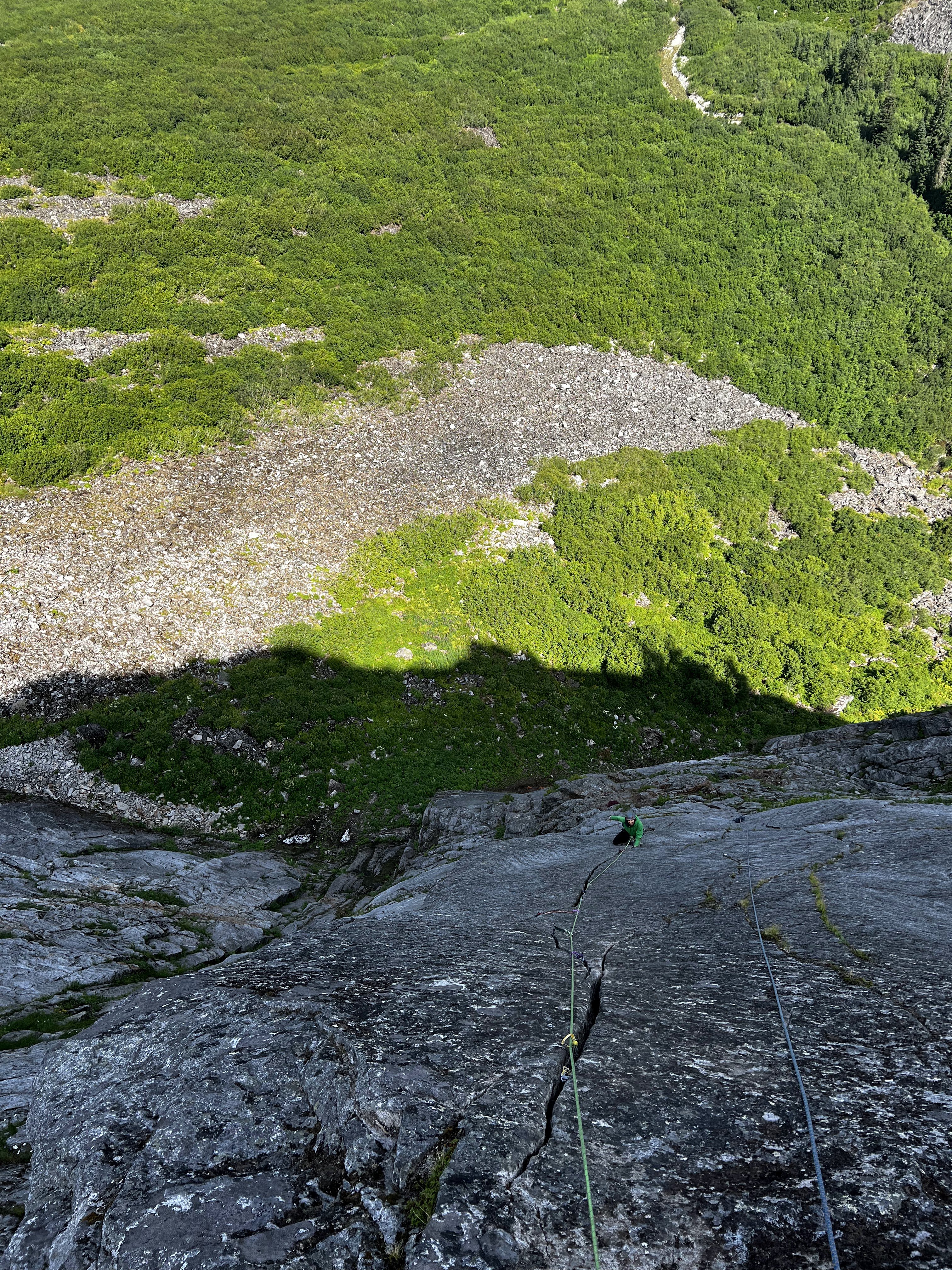
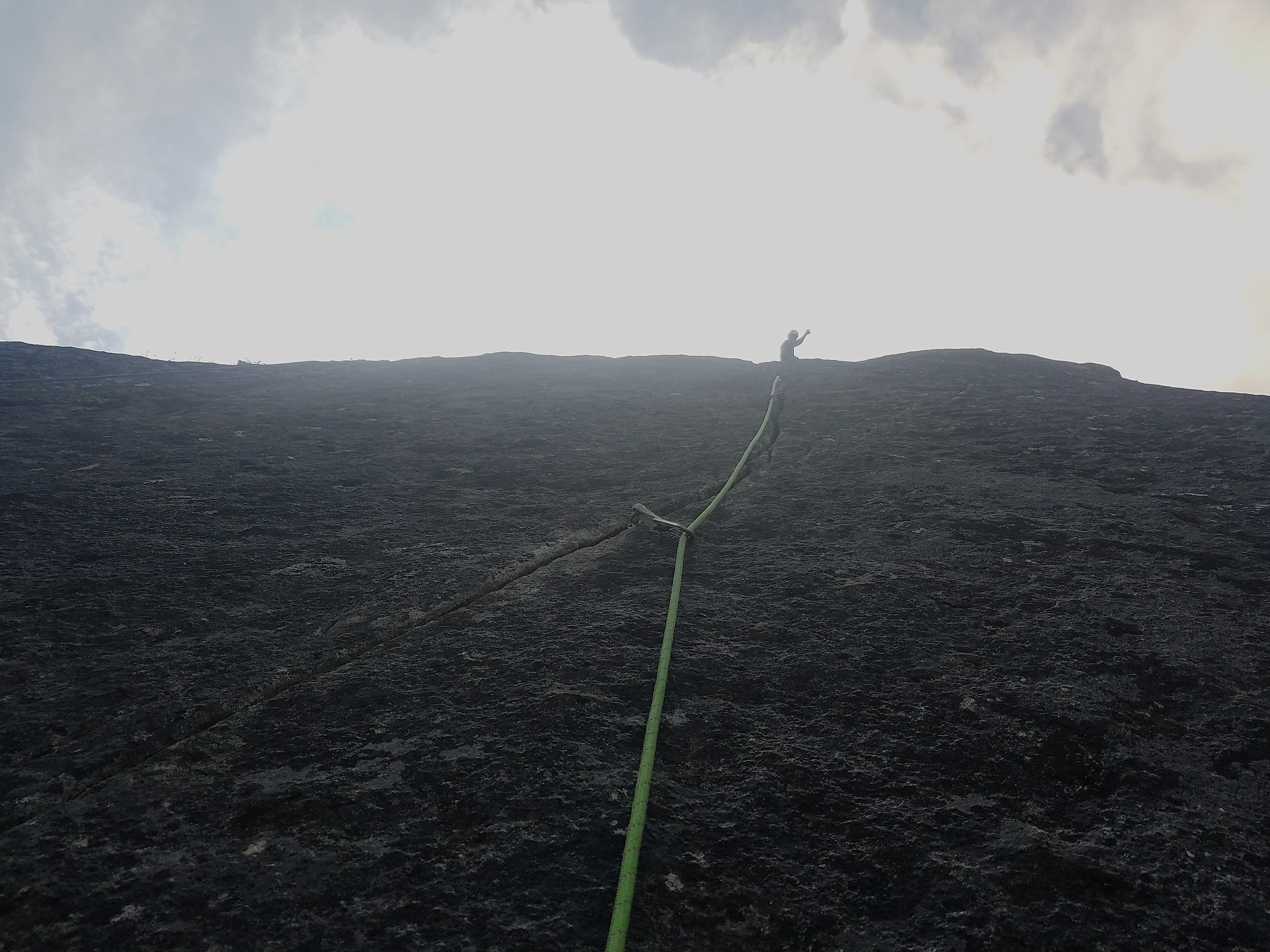
.jpg.bdabd6c4d8ebc9668d06dd06dc2df6a7.jpg)
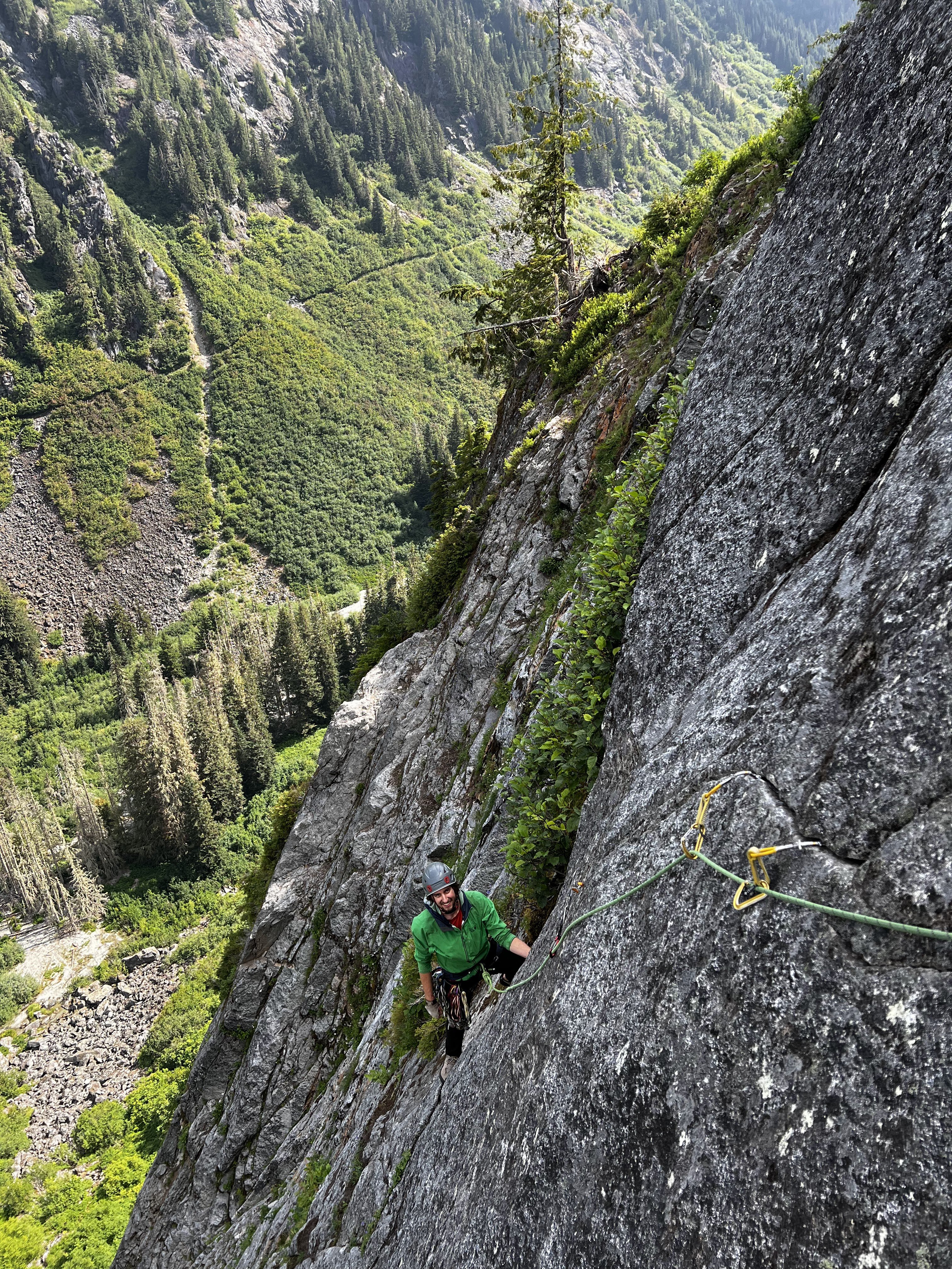 9 points
 -
Trip: Seahpo / Cloudcap Peak - NE Ridge Trip Date: 07/05/2025 Trip Report: After much discussion and planning and two planned weekends that didn't happen due to weather, and even a scouting trip with binoculars, me Fred and Dylan finally climbed Seahpo / Cloudcap on July 4th and 5th. I had been on a mission the last few years to climb Dallas Kloke’s Difficult 10 peaks and completed the list this past winter with Lincoln. Now as part of my midlife crisis alpinist proving I'm after the self declared Difficult 10 Bonus Peaks. Basically anything that the consensus says ought to be on the list but since it's Dallas's list it doesn't change (much like the bulgers). I consider these so far to be Gunsight and Seahpo. We hiked up through the crowds on the 4th of July with heavy packs loaded with all kinds of climbing gear since we didn't actually know much about the route. We passed a lot of day hikers and Ruth climbers that all asked us where we were going with all of the gear on our packs, I grew somewhat tired and only half jokingly suggested we tell people either Shuksan or Icy just to make it simple. Bizarrely then we met somebody who replied that they had climbed Seahpo!! We went up and over Ruth, then Icy just for fun and made camp near the northeast ridge of Seahpo, making camp in just about 8 hours. We had plenty of time to study the route as it came in and out of the clouds and were pleased with what we saw. On a scouting trip a month earlier the route had ample snow on the ridge which we weren't prepared to deal with. On the 5th we were up at 5:00 and hiking just after 6:00, thus allowing for plenty of sleep to make up for a week of extremely early mornings for work for me. No one argued with that concept. We took the Beckey variation of getting on the northeast ridge at the first opportunity instead of the glacier which we assumed would be in rough shape this far into the 21st century. The scrambling on the lower ridge was excellent class 3 with some easy snow walking, then we got to the top of a tower before a major notch. This notch was the main unknown of the entire route since there's not really any good way to scout it and we had no beta at all. It proved to be troublesome. Naturally we assumed we would just be able to rappel into the notch and climb out the other side, but it took us about an hour to discuss, scout for a descent, and then eventually build an adequate repel anchor. You repelled into the notch, over a moat, down some easy snow, and into the moat on the far side. The moats were deep but not wide at this time. We huddled in the upper moat a little ways down from (south of) the top of the notch, where we had scouted the only fusible way out of the notch. There was a groove/gully that looked feasible to climb up and regain the ridge beyond. The plan was for Dylan to rope gun the rock in his approach shoes and me or Fred to kick steps in any snow in our boots. Nobody wanted to bring boots, shoes, and rock shoes. Tom Sjolseth mentioned in the comments of his Jagged Ridge TR that the northeast ridge of Seahpo was 5.6 or 5.7, so we figured we needed to be able to do that at least. Dylan was confident that he could lead up the groove, but I stated not so subtly that I wasn't confident I could follow it. He made it look hard but doable, and got a good belay 55m above at a rap station. I'm not sure I have ever climbed on a single rope cow tail style until now, and me and Fred were very very concerned with how little rope we had left, hollering constantly as Dylan finished out to the anchor. (Naturally as in most of the Cascades pro was very sparse and anchor opportunities more so). There was exactly enough rope left for me to stand at the last stance while Fred made it through the most difficult part that the receding glacier had just vacated before I had to step on to the wall and make the hard moves. It was extremely doable on second but I'm glad I didn't have to lead it. Definitely 5.7R. We all made it up to the belay and determined that it looks solo-able above, so we put away all the gear, never to use it again. The rest of the route above was no more than class 4 if you made the right choices, a couple of times just for ease/fun we maybe made it 5.2. Jim Nelson’s book Classic Cascade Climbs must have forgotten about this first pitch, Tom gets a Redding credit in the book so Dylan is convinced that he intentionally sandbagged the route old school alpinist style, not sure, but the first pitch is definitively mid 5th. The book calls the whole route 4th class. We encountered some pretty solid rock on the ridge, easy steep heather on the south side, and a short cruddy gully crossing per Beckey. As I have discovered on most of the more difficult routes Fred Beckey usually pretty reliable. We crossed the gully on a ledge and followed some heather slopes to a short rock finish to the summit. We launch it around for a while hoping the mistwood break and we would get some views but it was not to be. The route finance straightforward enough that it wasn't a big deal in fog but it's always nice to have a good look around. I found out later that we would have been able to holler across to Tim Halder on Nooksack Tower if we could have seen it. The climbing was easy enough that we downclimbed everything to the belay station then made a double 60m rappel to a horn above the moat, south of the initial groove pitch. From here we made another double rope rappel down to the top of continuous snow at the top of the glacier. The upper randkluft it was melted down to where we could land on rock and simply walk out onto the glacier. This rap was long and extremely steep, overhung over sock and then transferring to overhung over snow, pretty wild! I went first and was collecting myself at the bottom of the rap until I thought about the 30+ feet of more than vertical snow directly over my head, so I skedaddled a ways back to the top of the glacier. We all gathered back at the bottom, stowed the ropes and cruised down the glacier, and back along the ridge to camp. The glacier was chill with just a couple of moat cracks to walk around, nothing I would call a proper crevasse, in fact I would hesitate to call it a real glacier anymore; still potentially dangerous though. We took some time packing up camp and congratulating and thanking each other, caught a few last minute views and then headed back up the slog over the shoulder of Icy, back over Ruth, then cruised down the very familiar route to the car. We hit the car about 8:30 for just over a 14 hour day. More congratulations (real this time since we made it back properly), thanks all around, then back to civilization and “reality”. The holiday weekend made it so I could lounge around and nap the next day feeling glad to have pulled off another very challenging mountain. This one definitely ranks in the difficult 10 peaks in Washington in my book, when taken as a whole. I would rate the mountain above the first pitch as pretty enjoyable scruffy fourth class rock and heather, similar to other Cascade peaks; Jberg, Triumph, Klawatti, etc. I think if there wasn't the tough first pitch it would be a pretty enjoyable mountaineering route in a remote location, to me at least, 5.7 ads a level up. The approach was extremely enjoyable and pleasant, better than any of the Difficult 10. We pretty thoroughly scouted the pitch out of the notch both on the way up and down the route and determined that the way we climbed it seems to be the most doable line. If you want to do this mountain you need to be sure you can climb someone insecure 5.7R for half a rope length. If I had to do it again and it was up to me to lead I would take rock shoes. Gear Notes: Half rack, 2x 60m ropes, light MTN boots or approach shoes and wet feet, axe, helmet, others wore crampons, not I, extra axe and pickets for steep snow we didn't need. Approach Notes: Trail to Ruth, over west Icy (the truth summit now thanks to lidar BTW), down the other side. Follow the ridge the whole way. Dylan ascending to heaven on Ruth: The whole deal with my partners looking badass: Seahpo: From camp: Camping in an awesome setting: Morning. Clouds rose up to greet us: Approaching the line: Atmospheric weather: The lower route calls to us: Fred on rap: First pitch from the notch, Dylan for scale: On route: Easy: Break time on the summit: Part of the register. The pencil crumbled in my hands as I signed us in, so take a new one: Fred on the last rap: Descent of the glacier: Strolling out beyond Ruth:
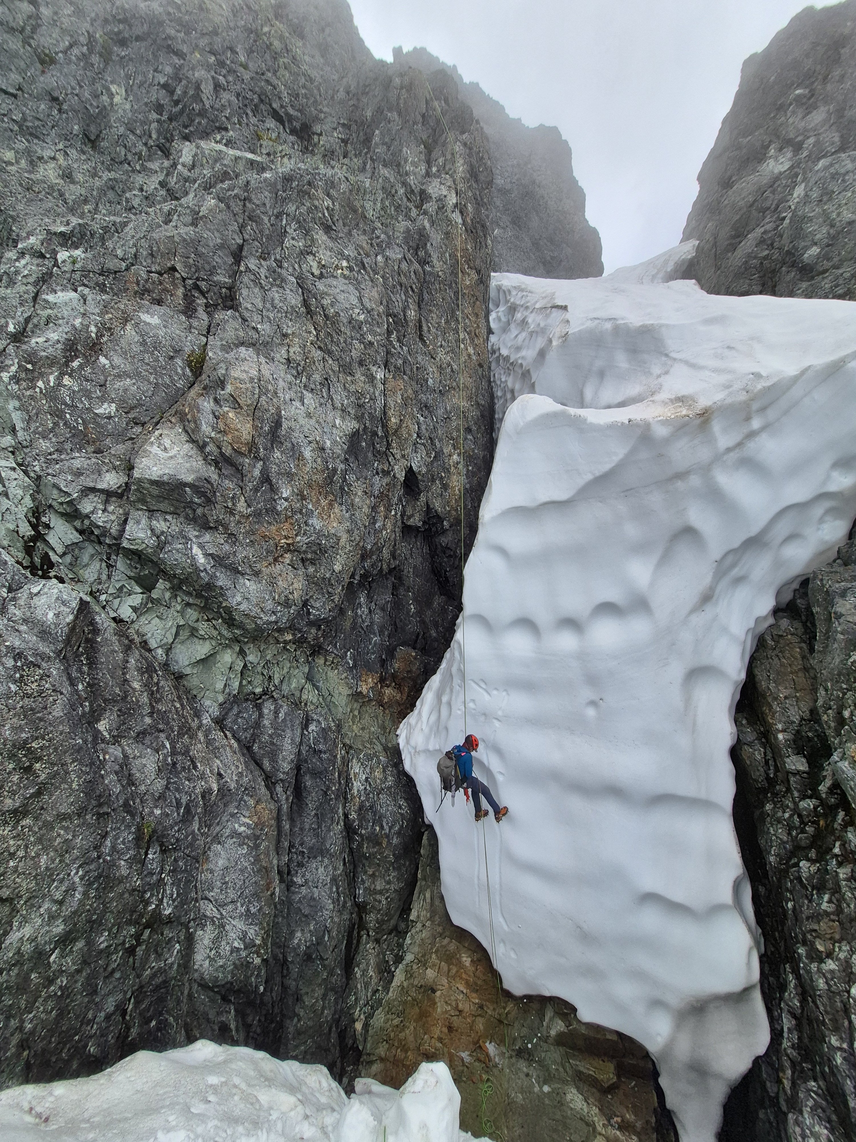
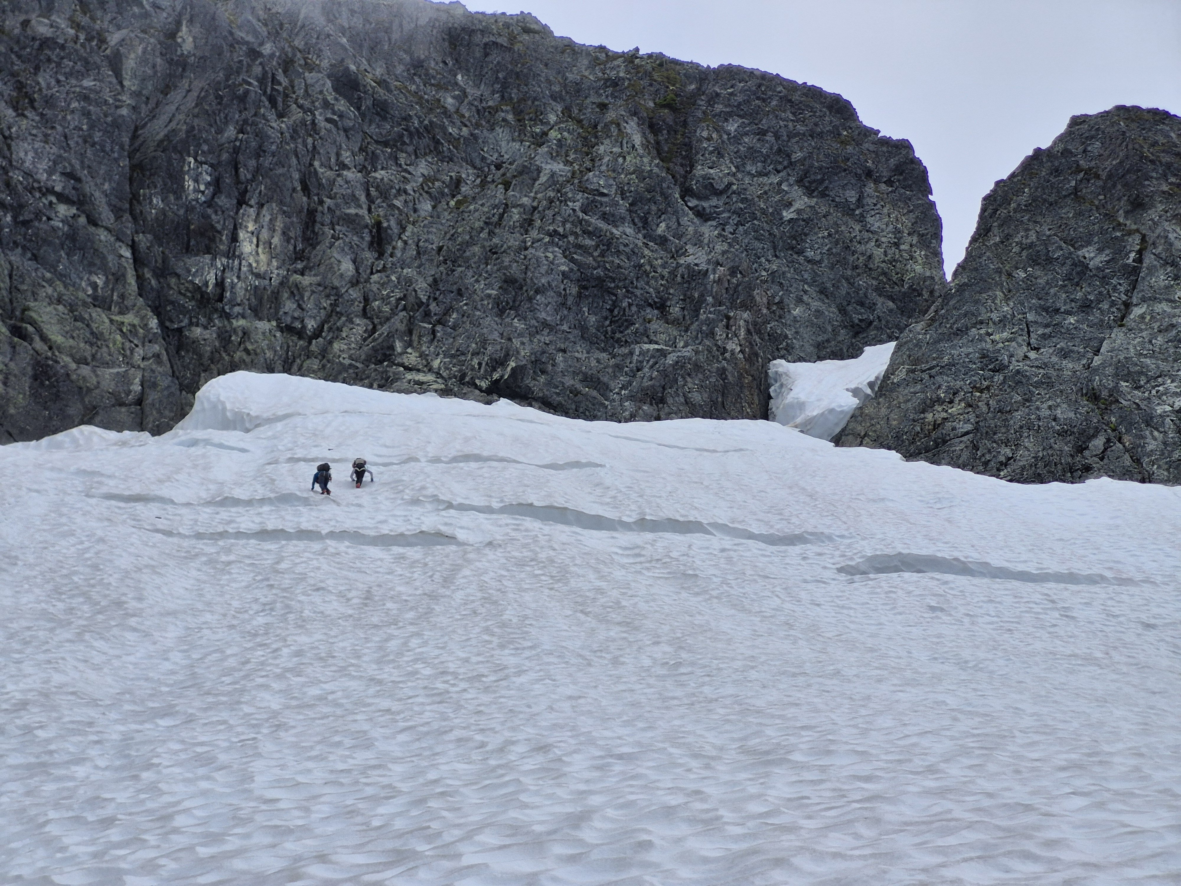
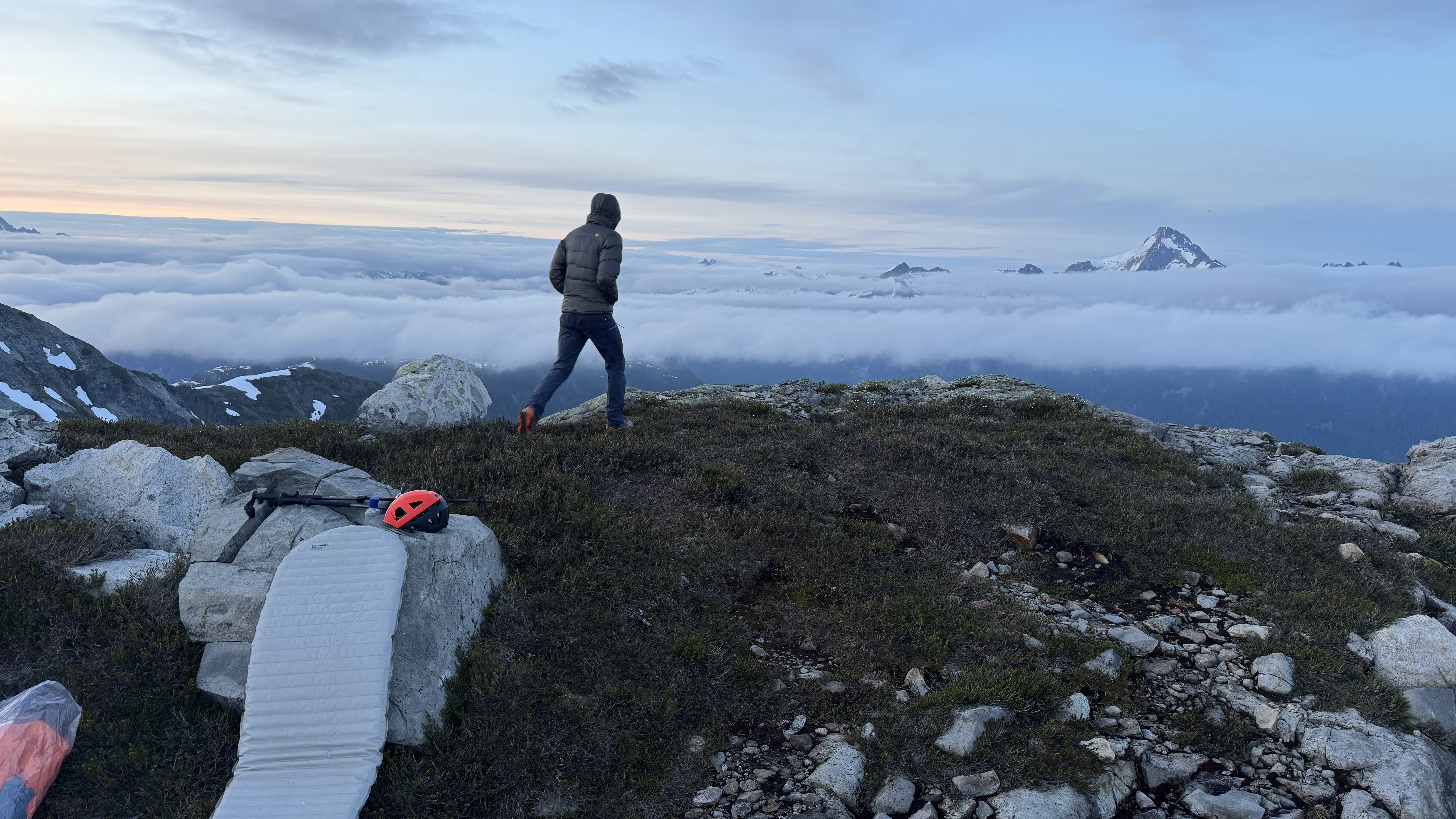
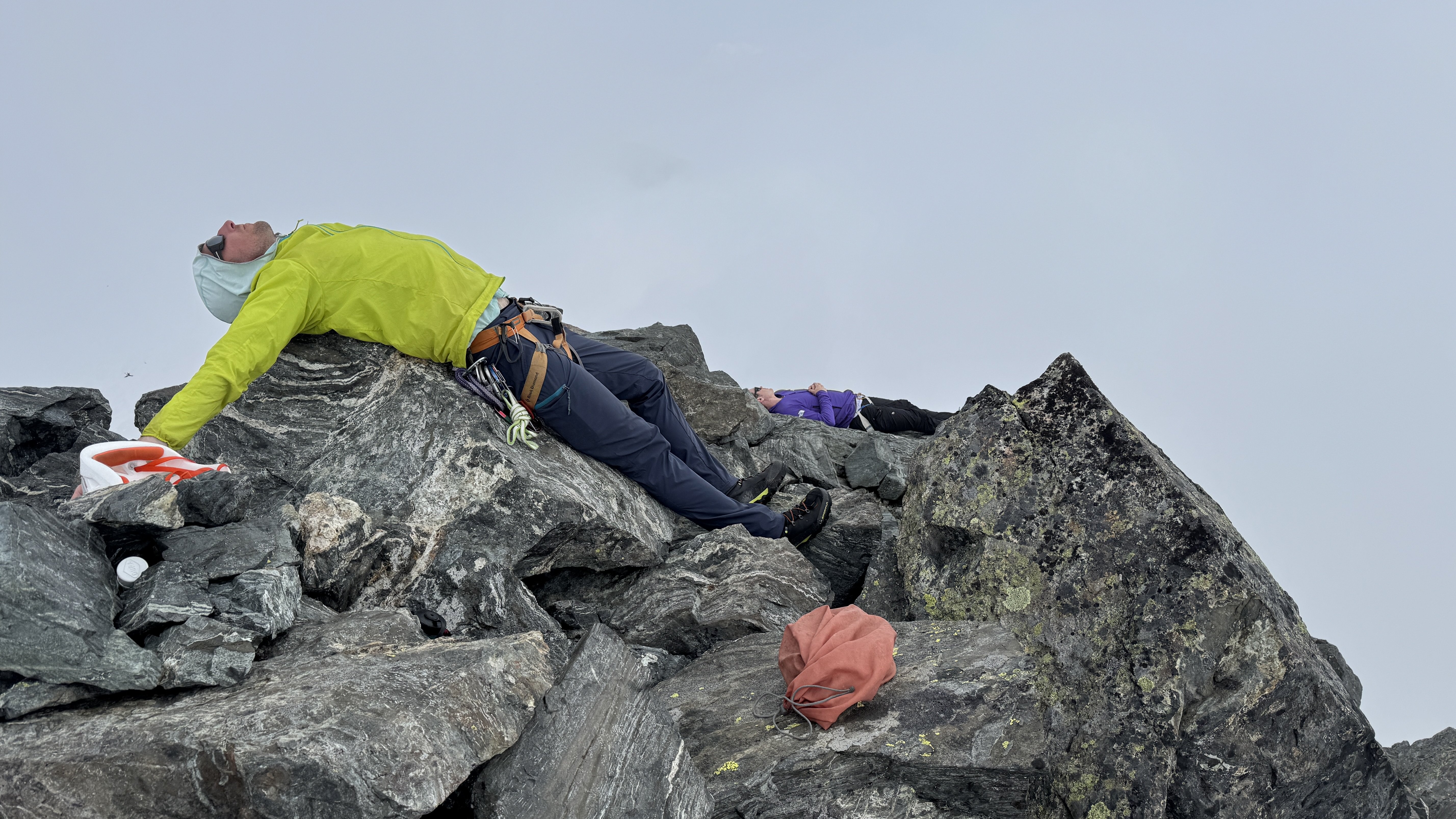
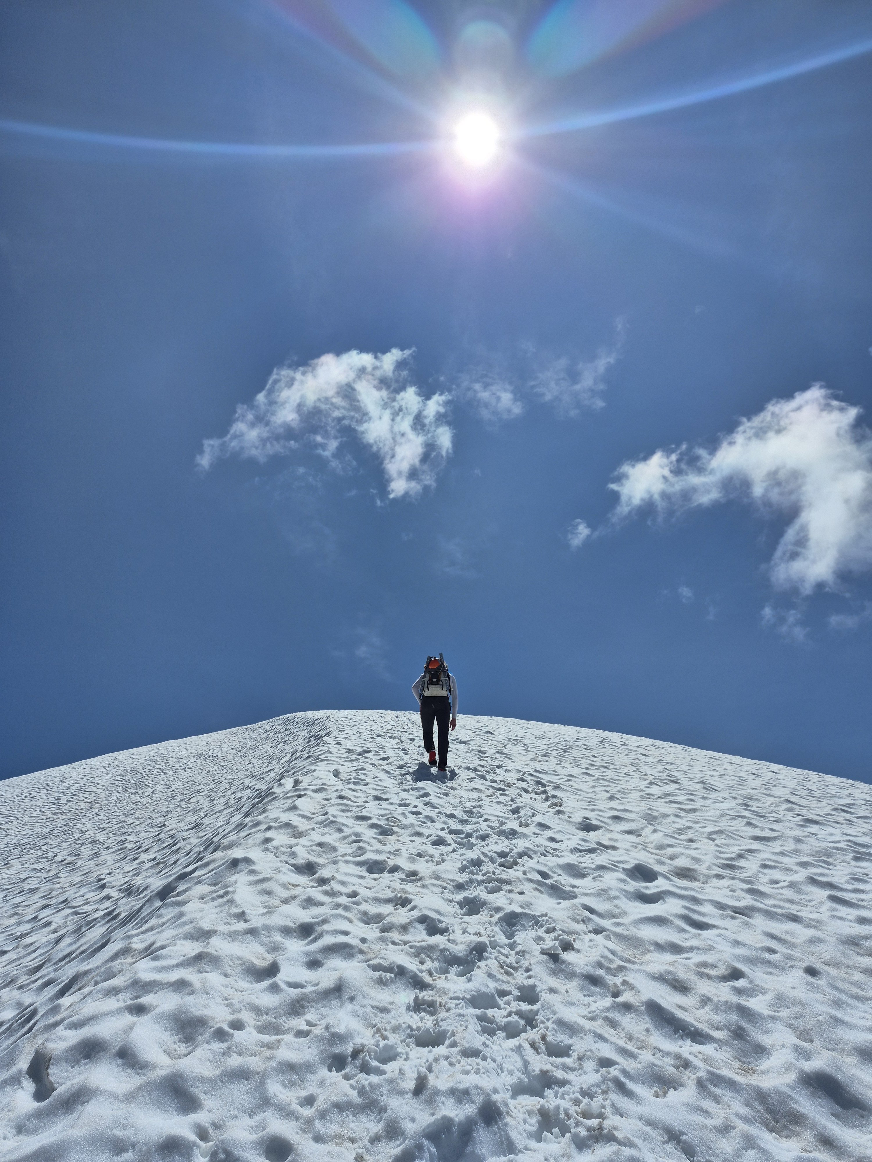
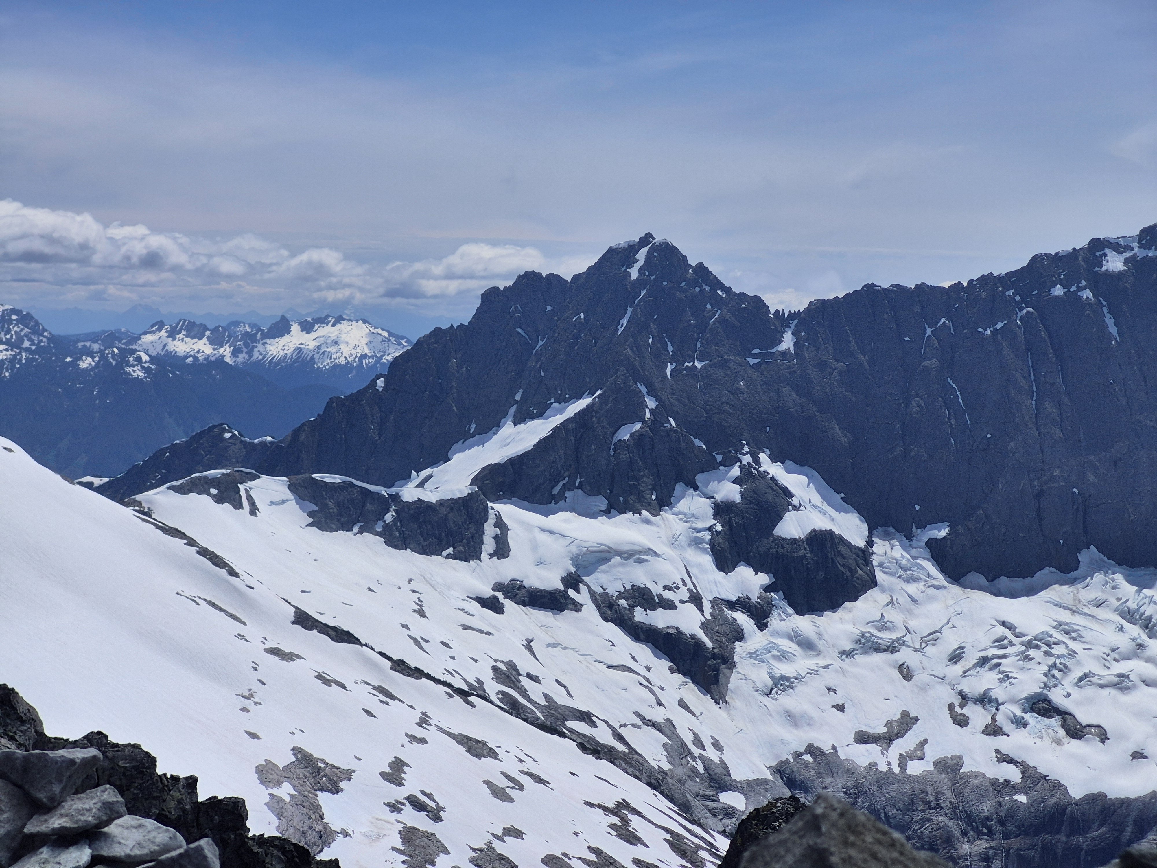
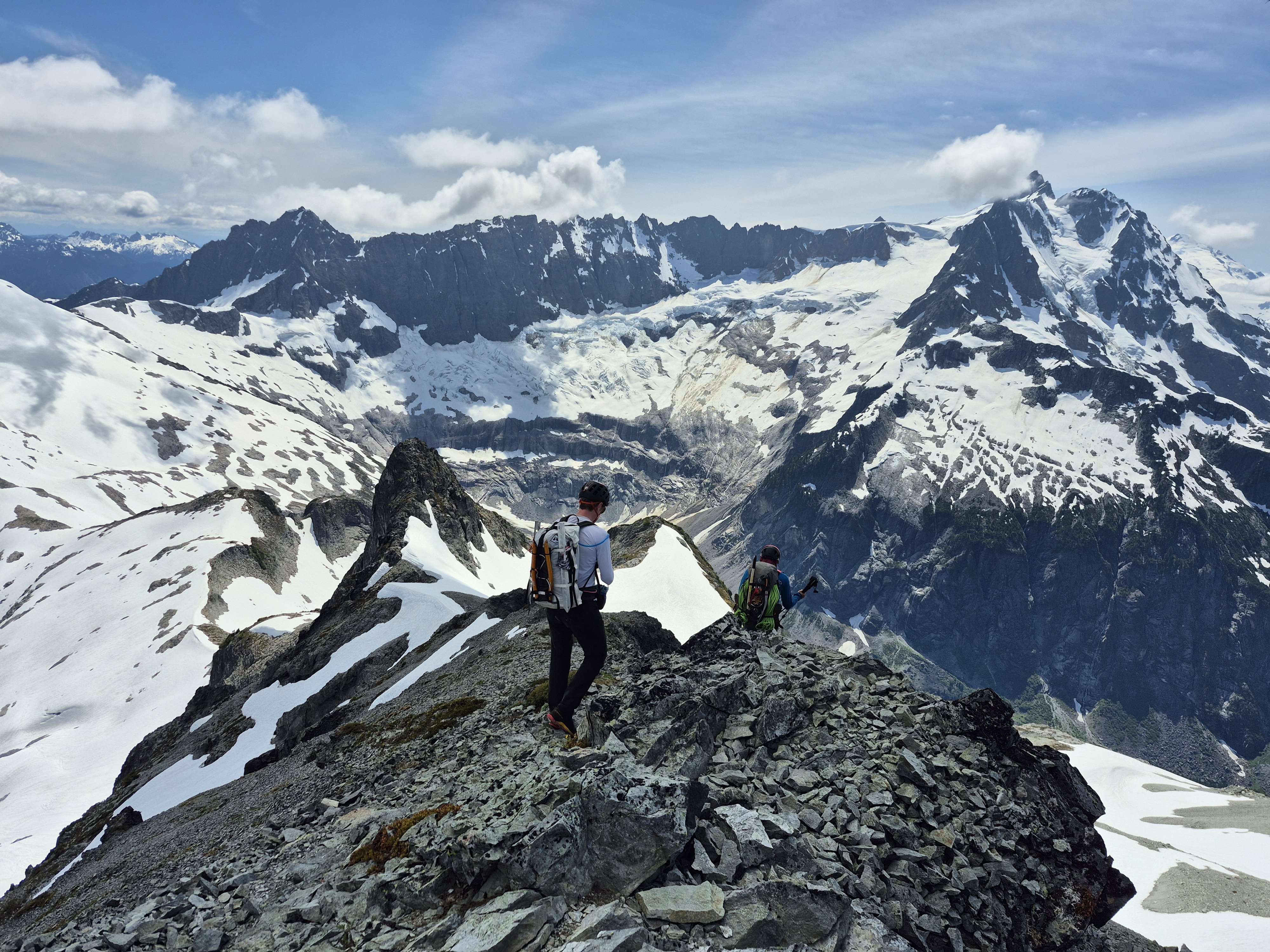
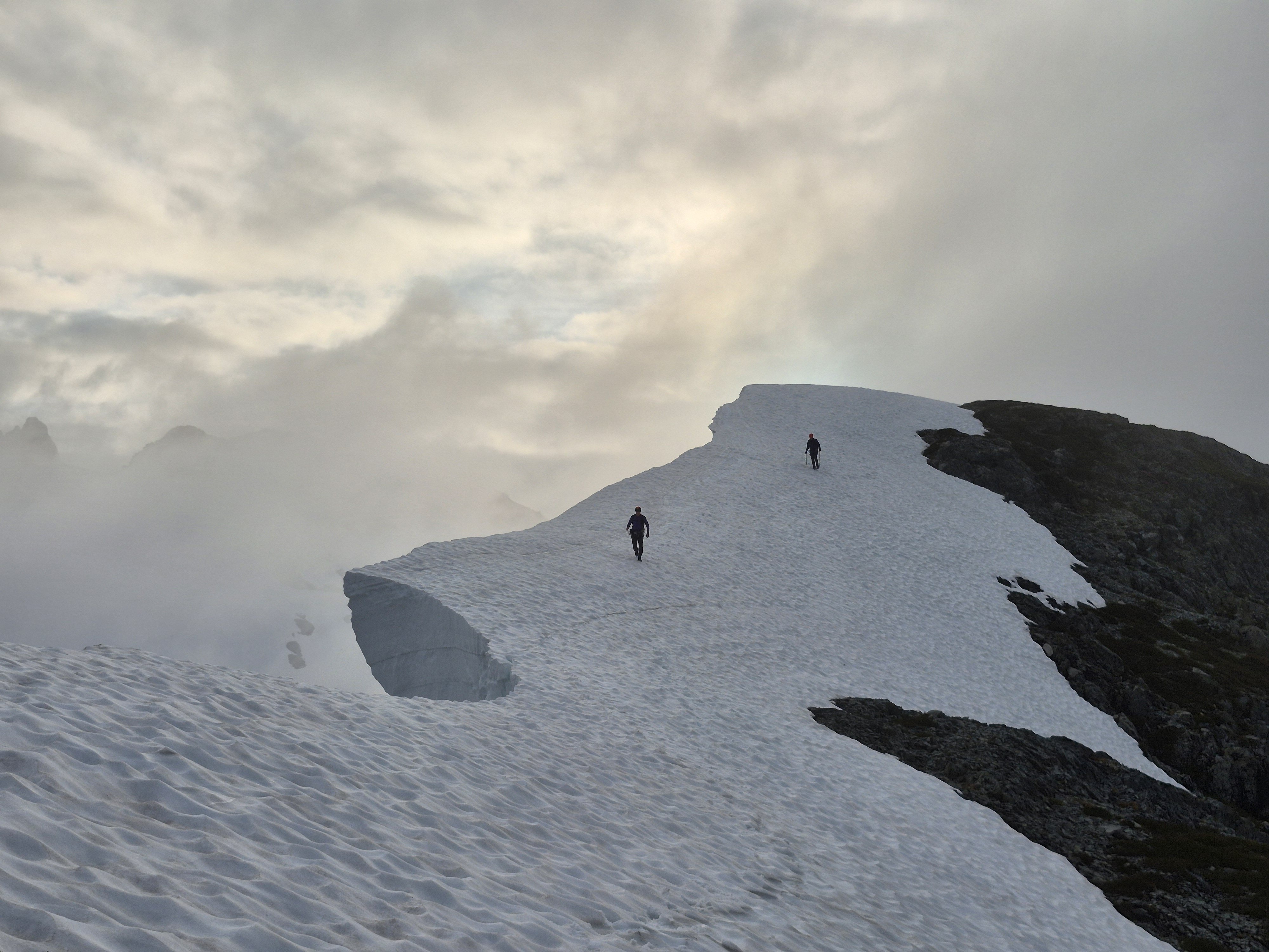
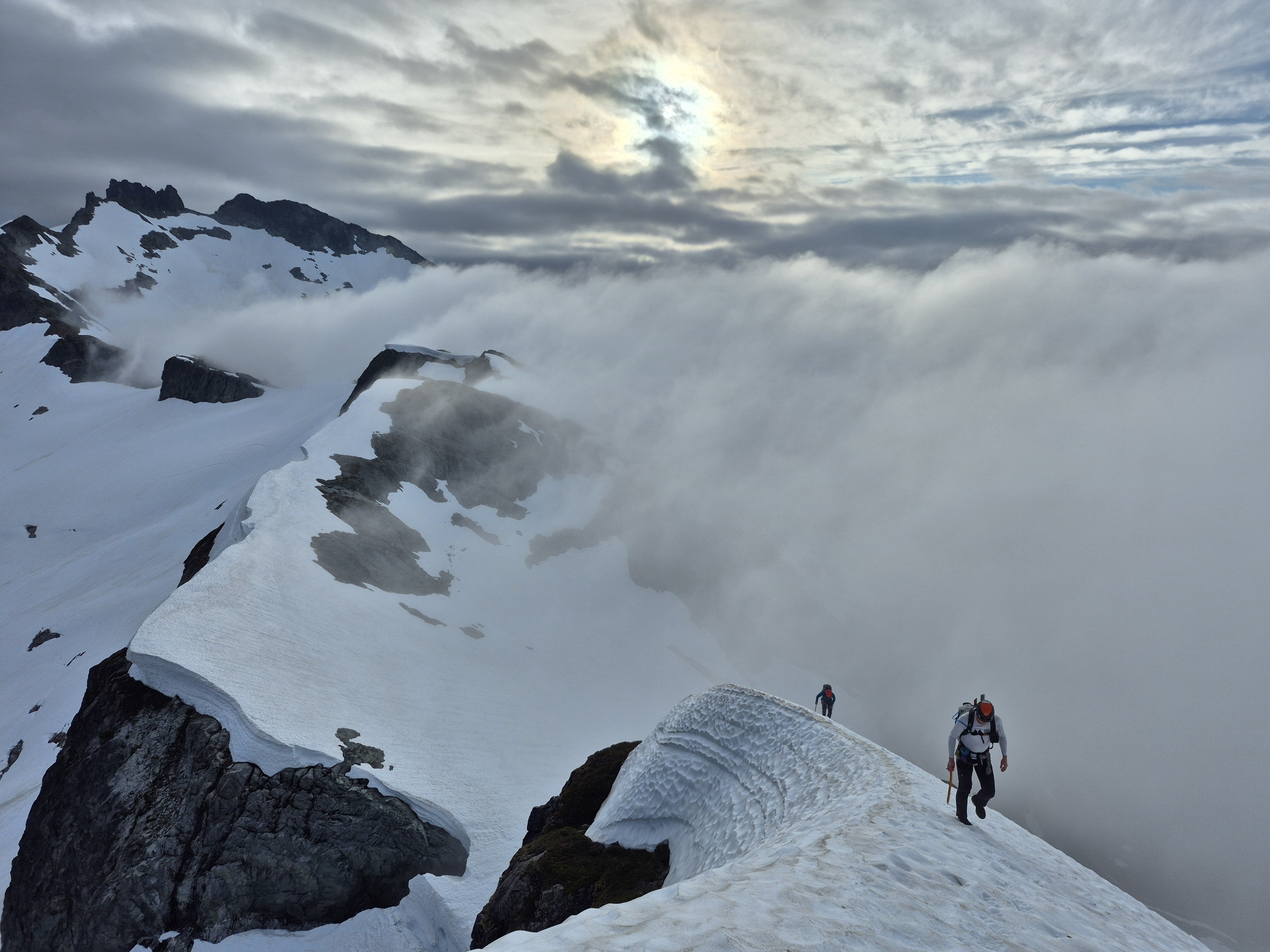
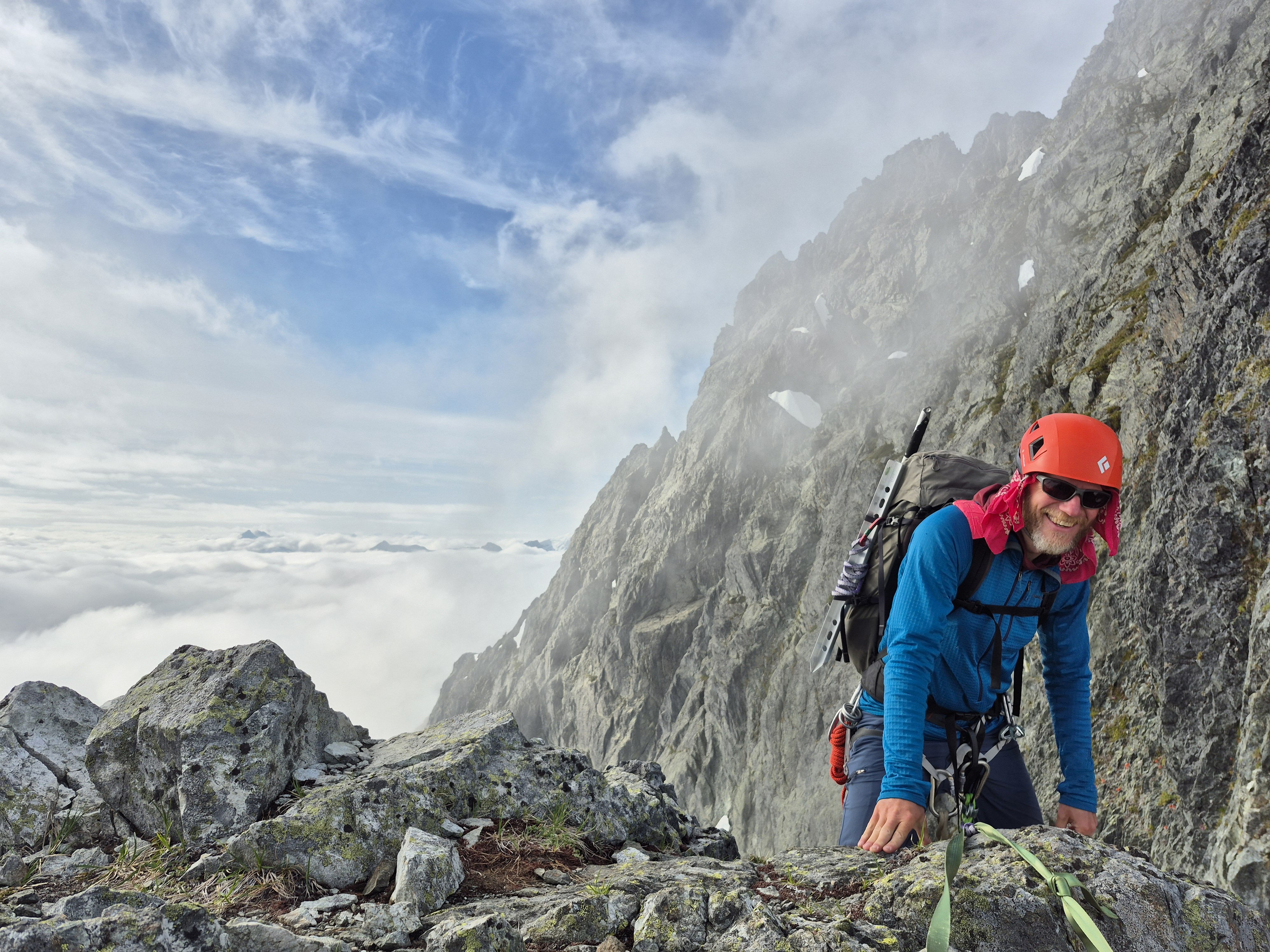

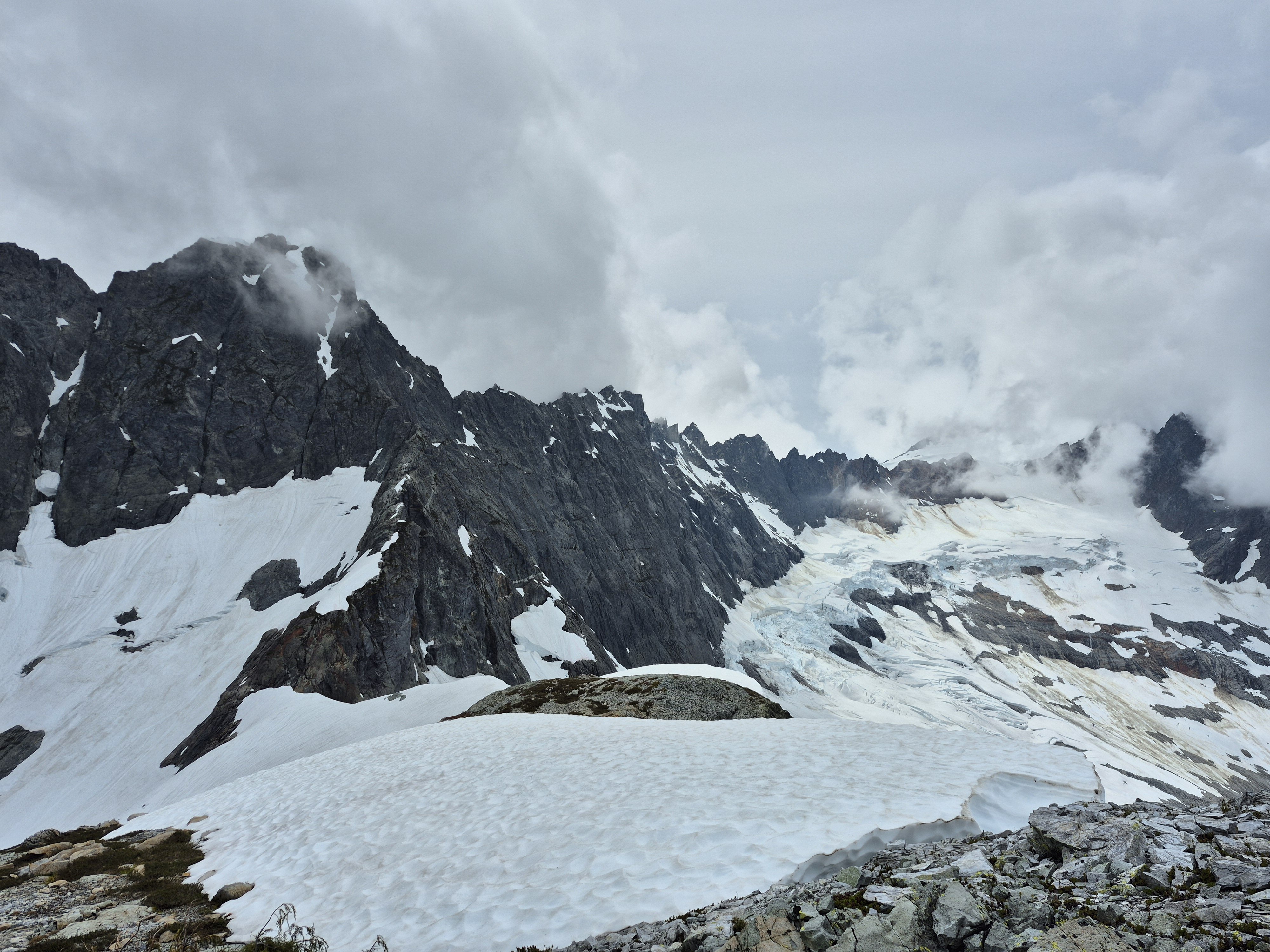
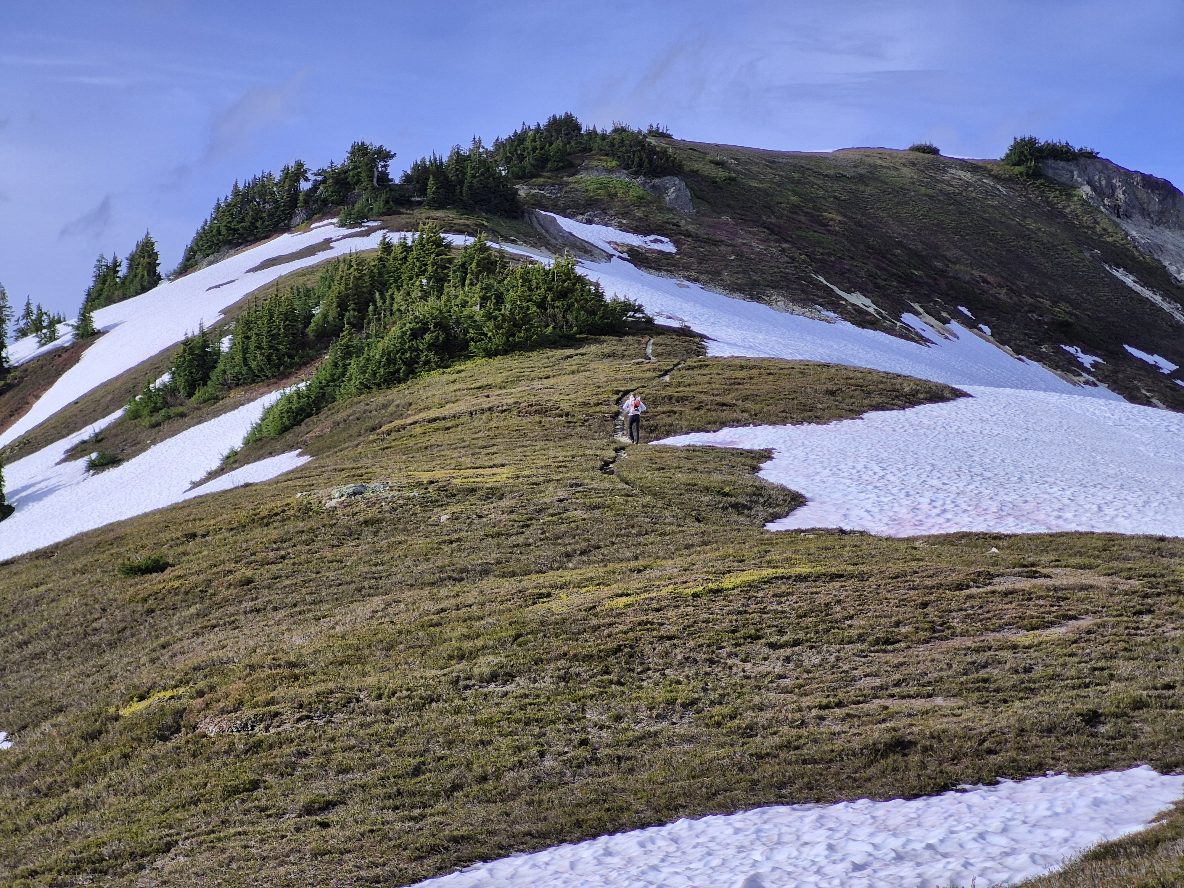
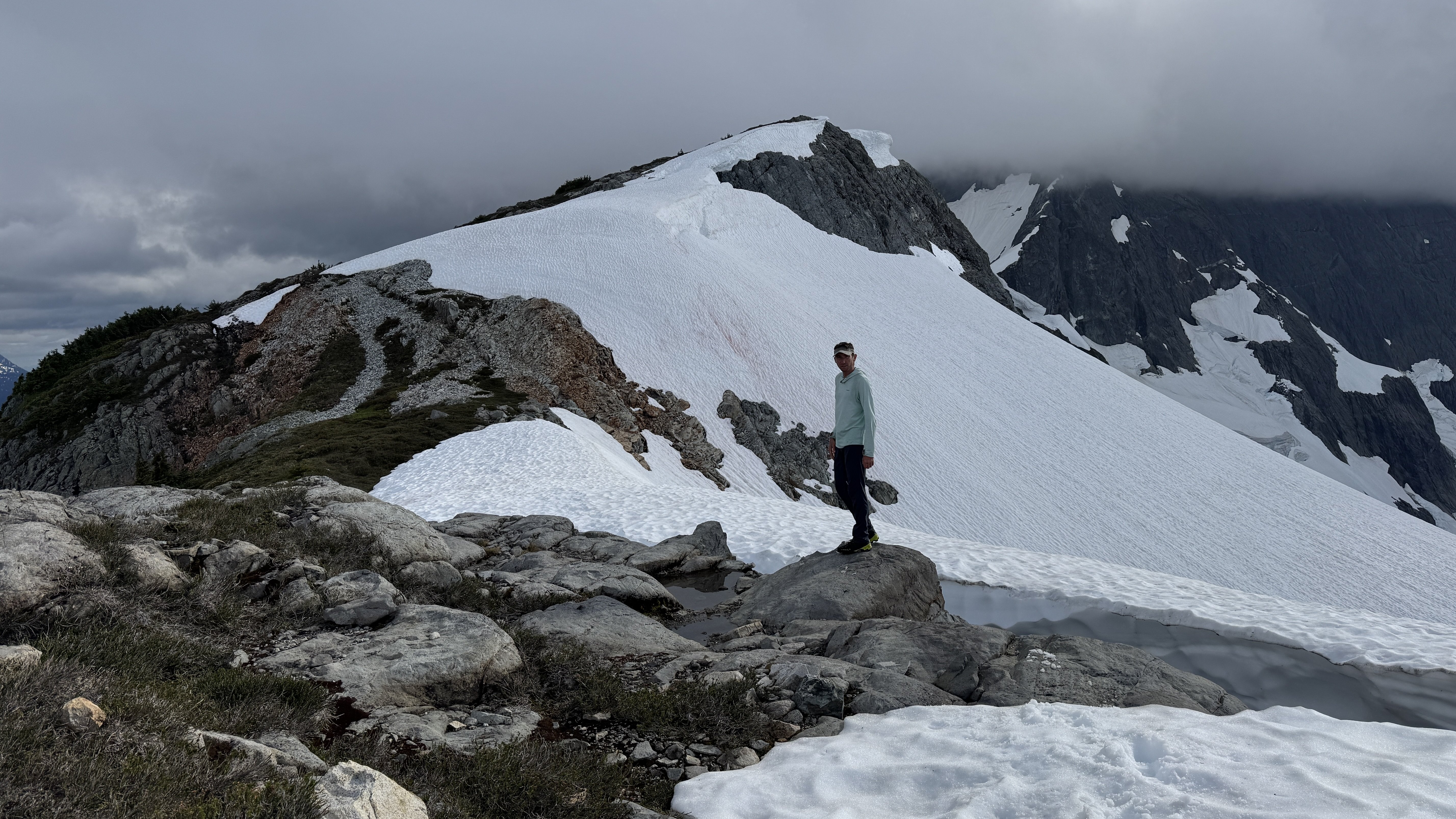
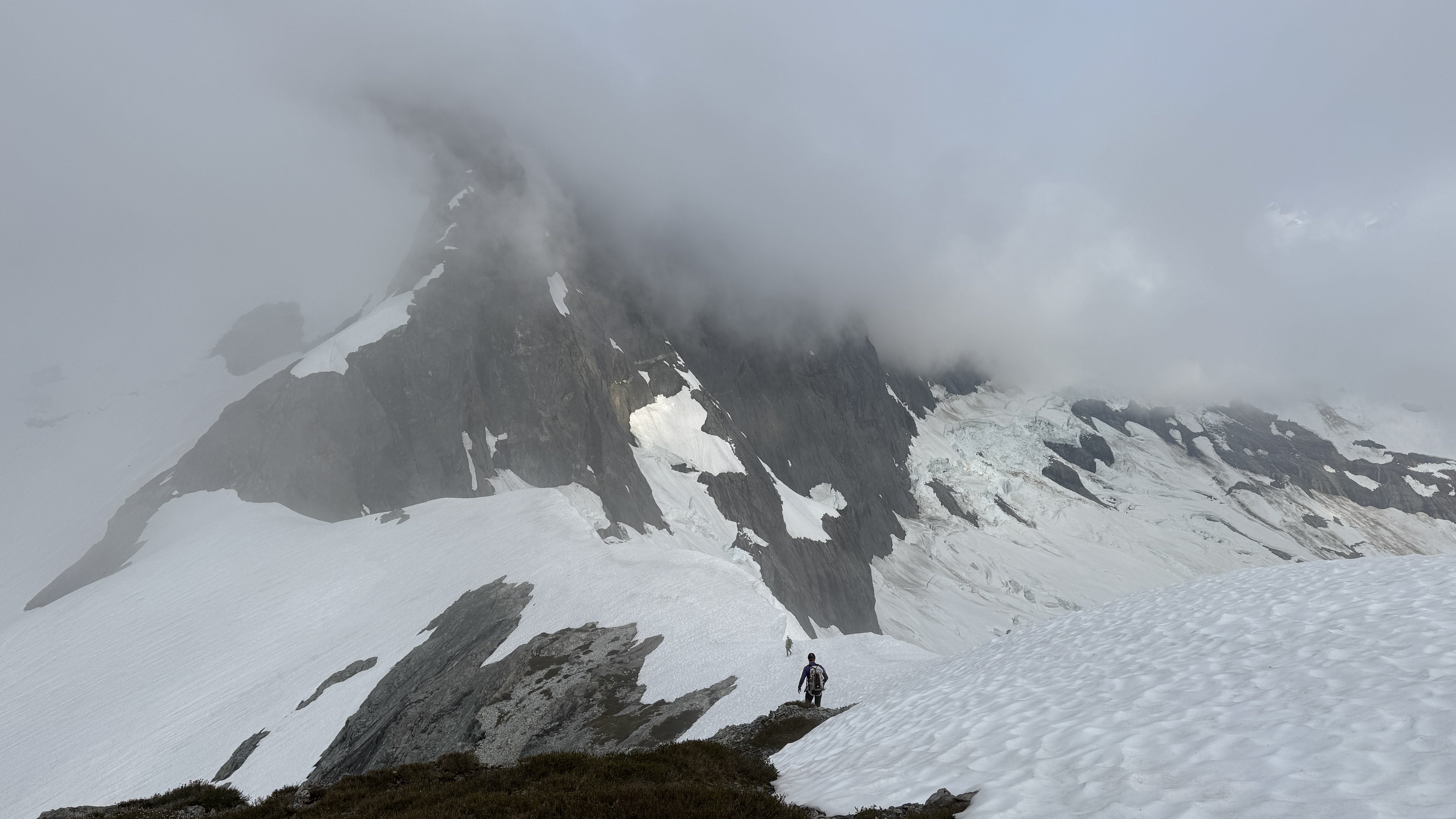
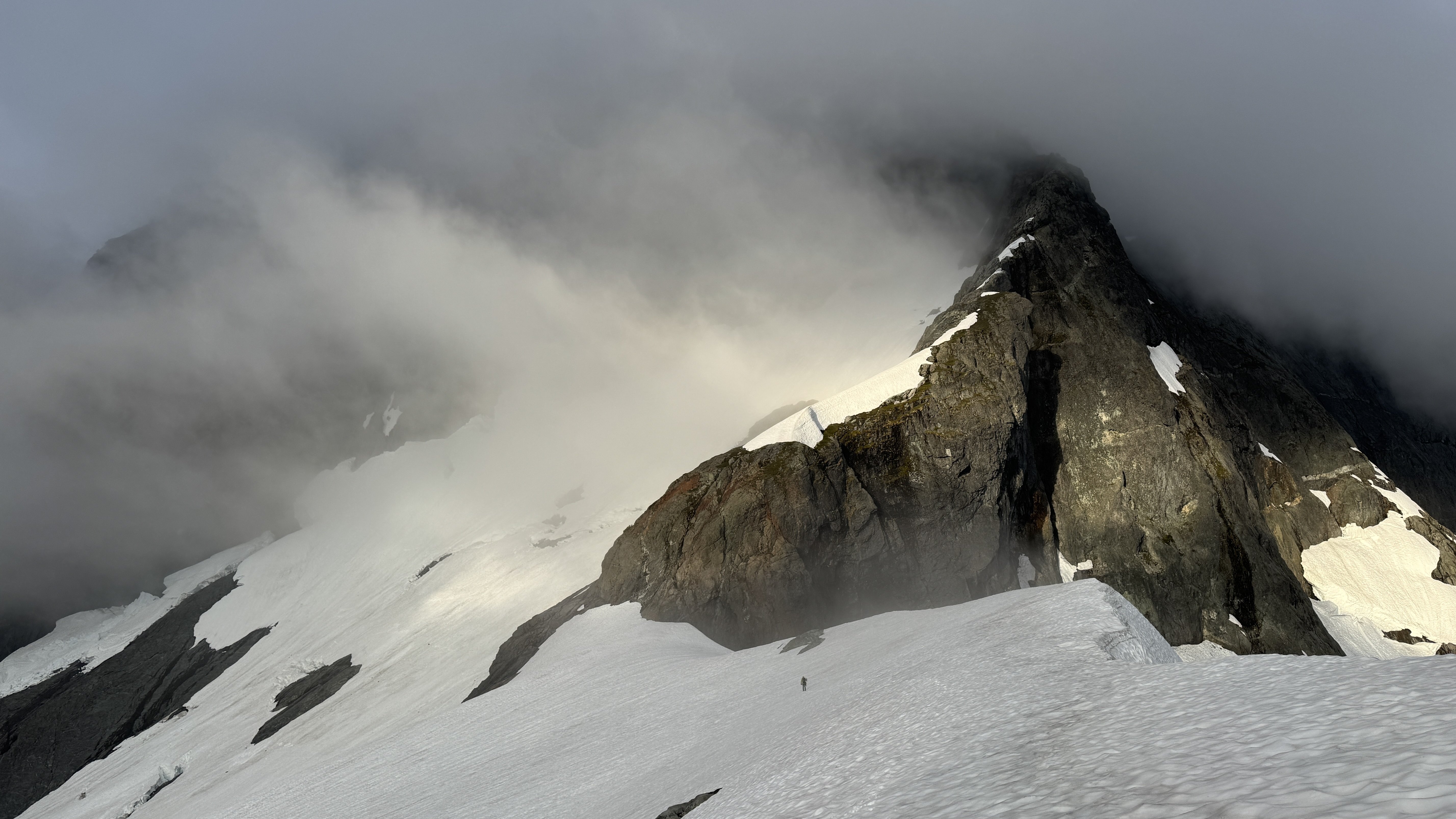
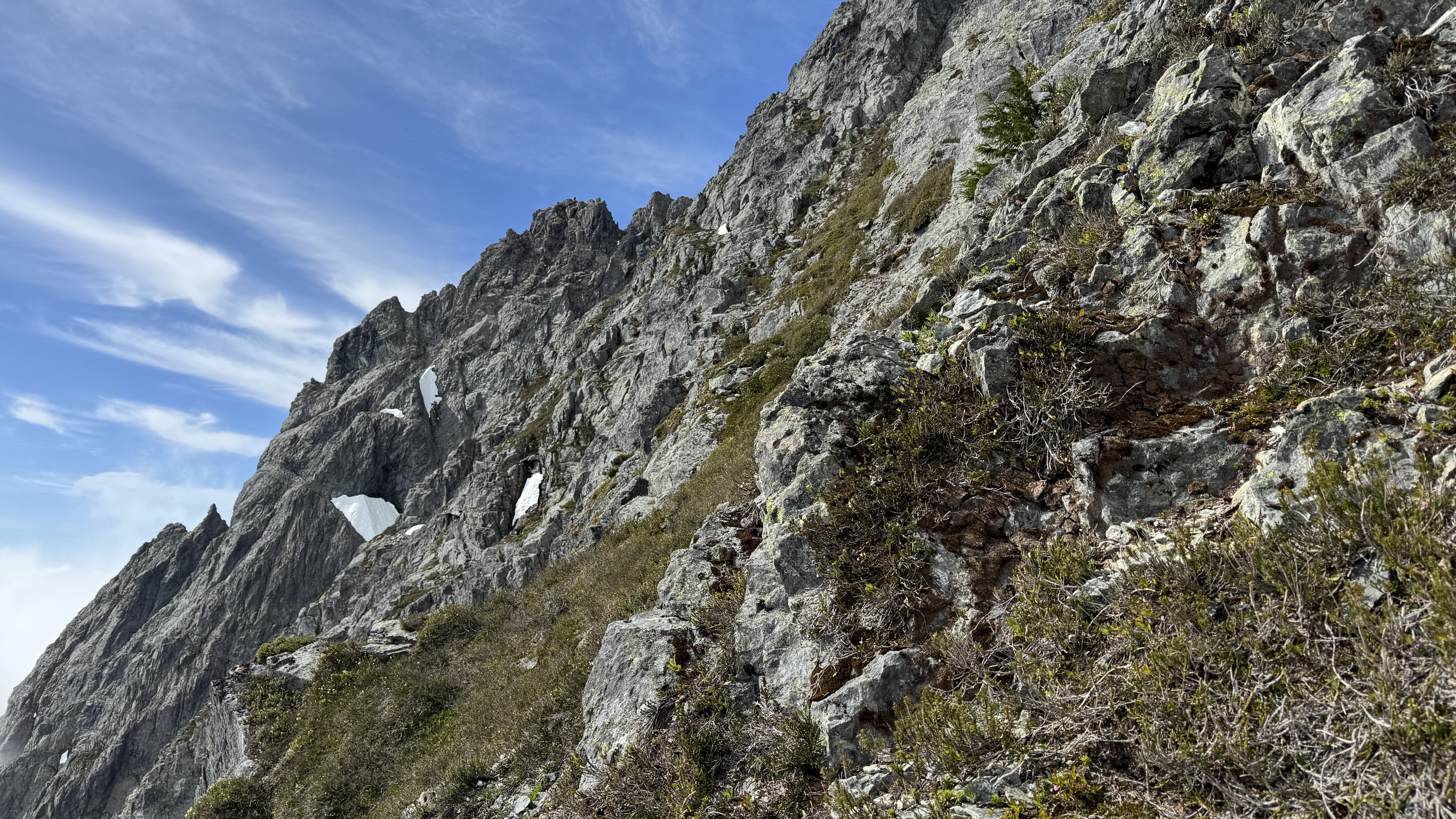
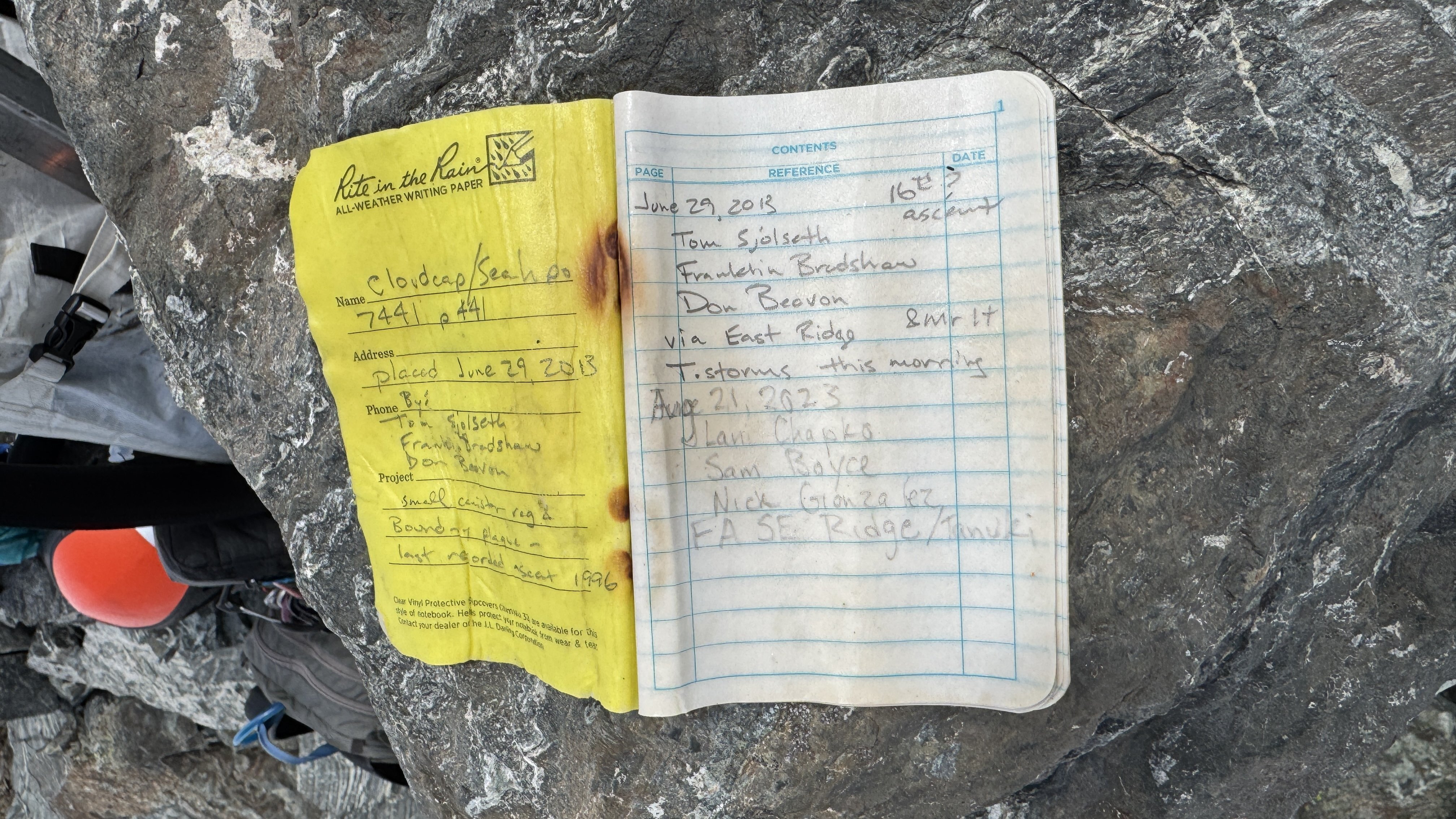
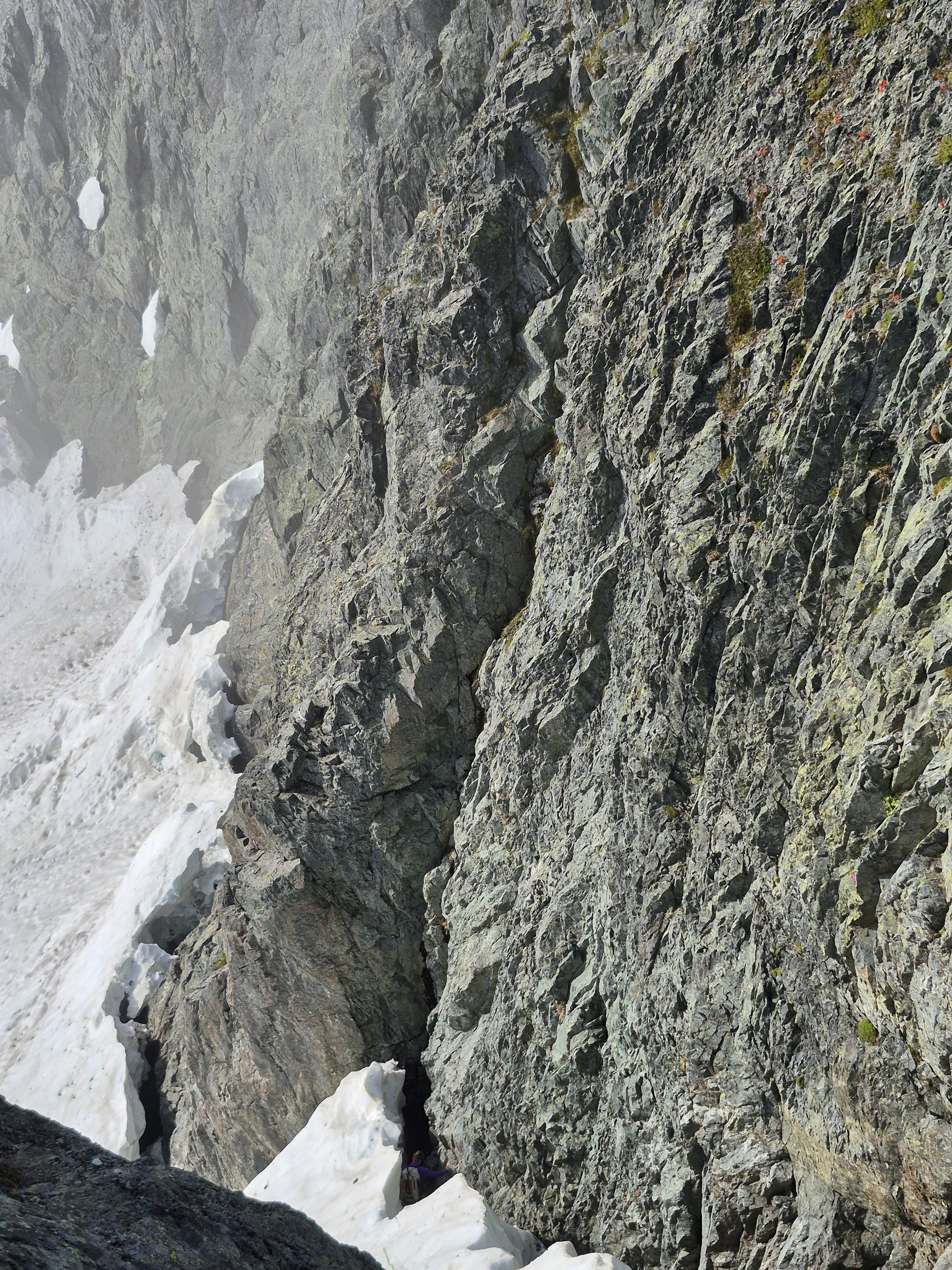 9 points
 -
Trip: Banks Lake - Spice Rack M10+ (a Salt and Pepper direct start) Trip Date: 02/17/2025 Trip Report: This line struck me the first time I visited banks. By no means an original thought, every mixed climbing pervert who ever drove by also looked at it and felt their pants tighten. How we got so lucky came down to three factors: great weather, getting passed over on a trip to the Rockies (I’m over it now), and JJ’s advertisement of his OnlyFans during a UIAA comp- resulting in a season ban. Looking for a cathartic substitute we pivoted to suffering upward. For the uninitiated, Salt and Pepper is the existing WI5 line conventionally approached via a short 5th class traverse from the left. This direct start provides two amazing mixed pitches and 15-25m of bonus ice depending on the main dagger's condition. Weekend 1: @ColonelCrag aka Christian Junkar, and JJ, aka Jedrzej Jablonski began this attempt’s reconnaissance in early Feb, aiding the start of pitch 1 to assess feasibility, then rap bolting an intermediate anchor at the dagger, along with a few permadraws in the roof. I joined for a caffeine induced day trip from Seattle, attempting to lead from the bottom. Several whips and rock releases later, the drill came up pitch 1. With dwindling sun, the p1 highpoint was fixed with an orange rope. Salt and Pepper’s main dagger was the biggest we’ve ever seen, adding 25m of ice climbing to the standard route. Weekend 2, Day 1: (More Development) Government Worker's Weekend (previously known as Presidents’) provided an ideal weather window with a cold snap in the single digits followed by several days of stabilizing temps. As expected, the dagger snapped. Left, right and middle towards the wall cleaved off, leaving just the optimal contact area at the wall and a thin curtain with a shower in the middle. Maybe 10m of bonus ice disappeared, forcing the line to continue further up the p2 rock roof, gaining the ice with several overhanging moves. The fixed orange rope had been buried by the breaking dagger, with perhaps 15m of it claimed by fallen ice. The visible rope was cut, leaving the buried rope to be fished out from the fall’s pool in summertime. We continued the development with Tom bolting bottom up and leading some sections, JJ bolting top-down, we met at the p1 anchor… dodging icefall from the roof releasing throughout the day. Typing this a week later, I still feel my back from top-stepping aiders while bolting overhead in the p1 roof. Meanwhile, Christian was rewarded for his patient belay with a micro-trax solo of the first two pitches on a fixed line and cleaned as much as possible with the given daylight. Day 2: (Send day) We slept in and began around noon. Christian led pitch 1 and easily danced up the pitch while tossing loose rocks over his shoulder. Having recently competed in finals at the Ouray Mixed Comp, his base strength and finesse made it look much easier than reality. JJ followed, while clipping a second single rope for me as the third, allowing us to “siege” or “caterpillar” the line. We opted for two single ropes as opposed to twins, for the ease of manipulation in the p2 roof. In retrospect, either method would work fine- though a twin rope might have too much give if you fell while following in the p2 roof to get back on. The pitch 1 dagger and subsequent traverse remain exposed to falling rock and ice and act as a decisive hazard crux following the technical crux. At the p1 anchor, we hauled a pig via tag line on the last climber. (The pig rested on the far right side of the anchor ledge, waiting to be tagged up to the p2 anchor belay cave. This pig contained water, snax, and normal boots and pons for JJ and CJ, who opted to wear comp boots for p1 and p2. I opted to wear normal boots and my standard 1100g development pons, and was not prepared for the resultant level of suffering.) JJ boldly led out p2, with delicate feet and only minor grunting in the power crux (a full stretch stein to v-notch). Leading the final 15m of ice in comp boots and no secondaries must have been terrible, considering the ice required heavy cleaning. JJ might have placed a single screw in the ice, then levitated to the belay cave on the right side. Once we gathered at p2 anchor, the pig joined us, only getting caught briefly on the dagger. With happy feet we finished the ice pitches about 4:30pm, the only snag being a brutal 3-man rope pull from the ground. The intermediate anchor needs improvement as noted elsewhere. Beers and ice cream followed, celebrating both the send and our luck. Route P1 M8+ 30m 8 bolts, 2-3 screws, 2 knife blades, .2-.4; belay from a bolt and ice screws on the ledge to the left of the first bolt. 10’ of choss gives way to better rock and generous bolts, then gains the left side of the dagger to the shelf, going right to one more bolt and connecting ice blobs to the upper shelf. Stubbies or knifeblades would be helpful in the upper ice. Bolted belay ledge includes a rap ring for bail. A single 60m can rap to the ledge, walking / downclimbing the rest of the way. P2 M10+ 30m 4 screws, 10 bolts, 7 permadraws… so bring 2 draws for hangers without permas, and draws for screws. We placed 2 screws and used 2 at the anchor. Climb rock for a move or two up towards the first bolt until you can step onto the dagger left. Traverse daggers for a couple of moves (screw optional) and then enter the roof following bolts leading to the upper dagger. Recommended to go left on the dagger and then back right to belay in a cave on the right of the main flow. This route could be aided after the starting dagger. P3 wi5 main flow P4 10m wi4 3min walk to the back of your lazy susan where the forgotten spices and flours remain untouched. Rap: V-thread from the top of P4. Bolted anchor on top of p3 to the right side. Double 60 to intermediate rap chains (located where p2 gains ice on the right side of the flow. This anchor needs fixing… the 6mm chain was too short and makes for high friction pull (3 men, 1 rope). Second ascent party should add quick links compatible with 6mm chain and rap rings. From here, a double 60m rap easily touches down. Gear Notes: Screws, KBs, .2-.4, draws, double 60m. Approach Notes: Start at the back of the cave, expect ice/rock shedding until at the start.
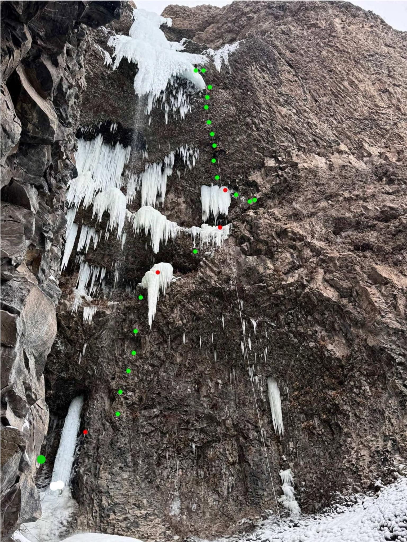
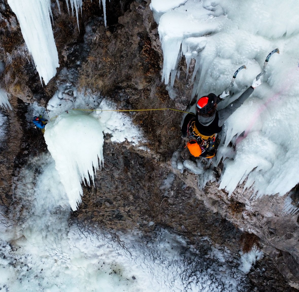
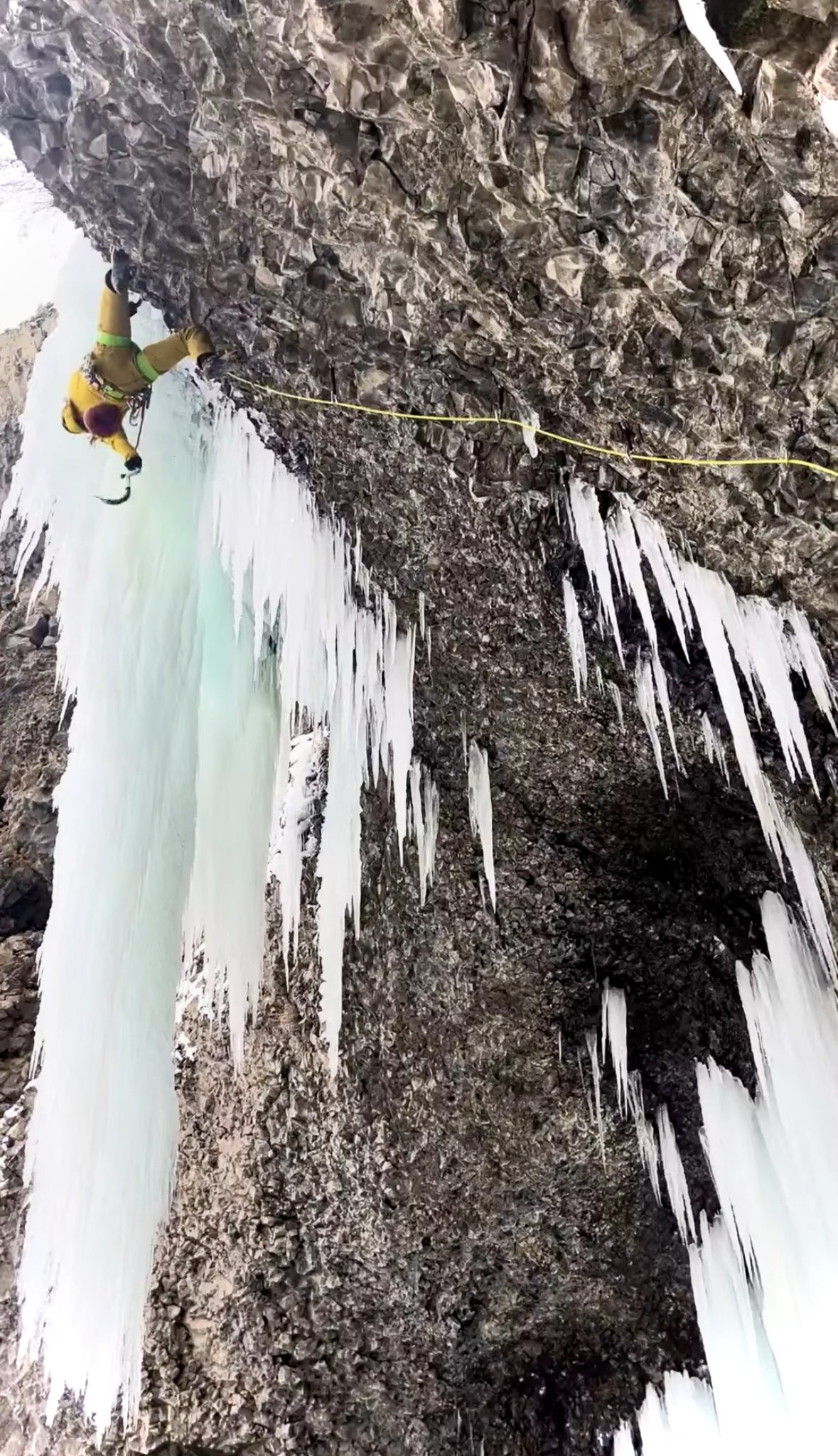
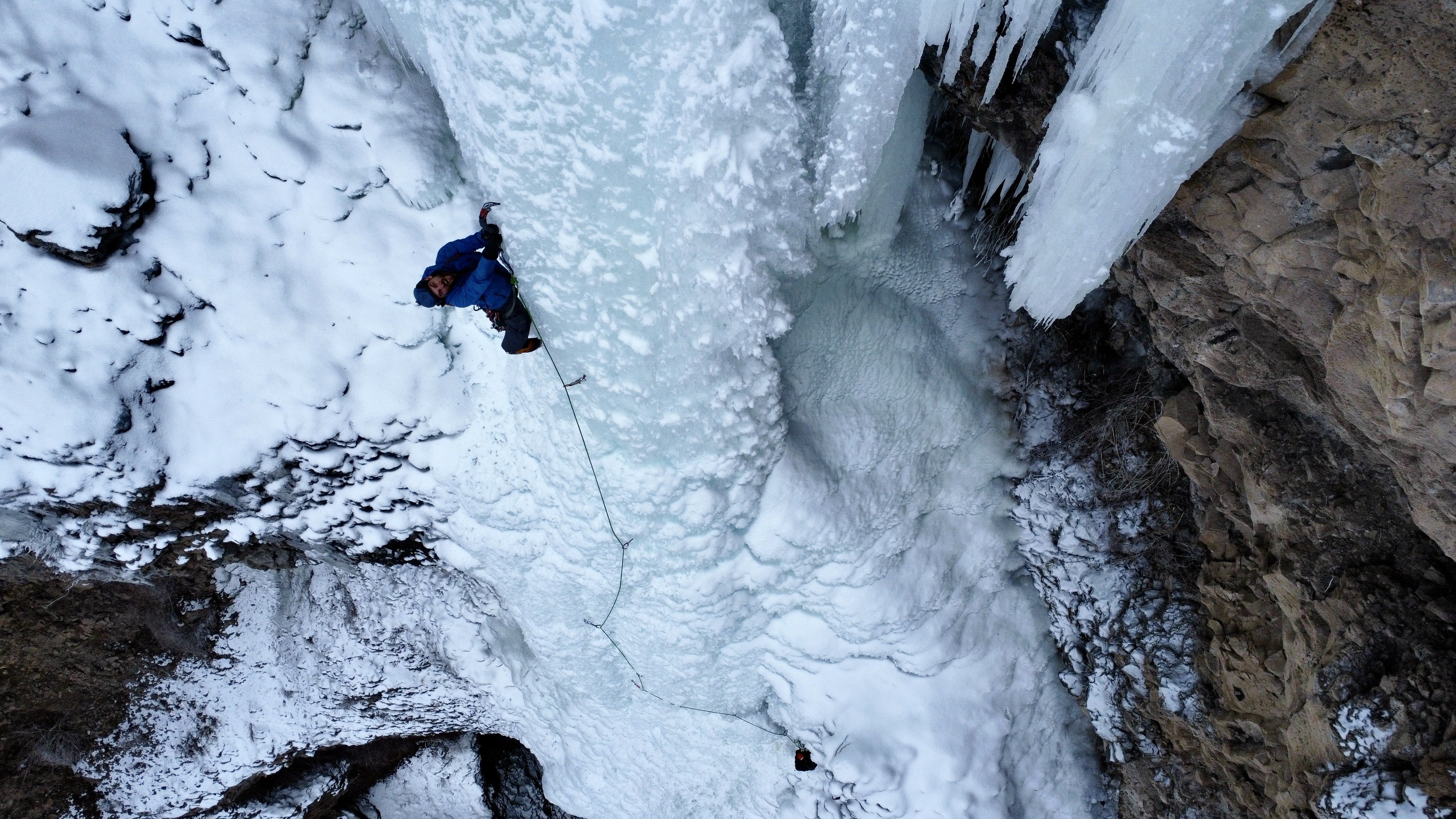
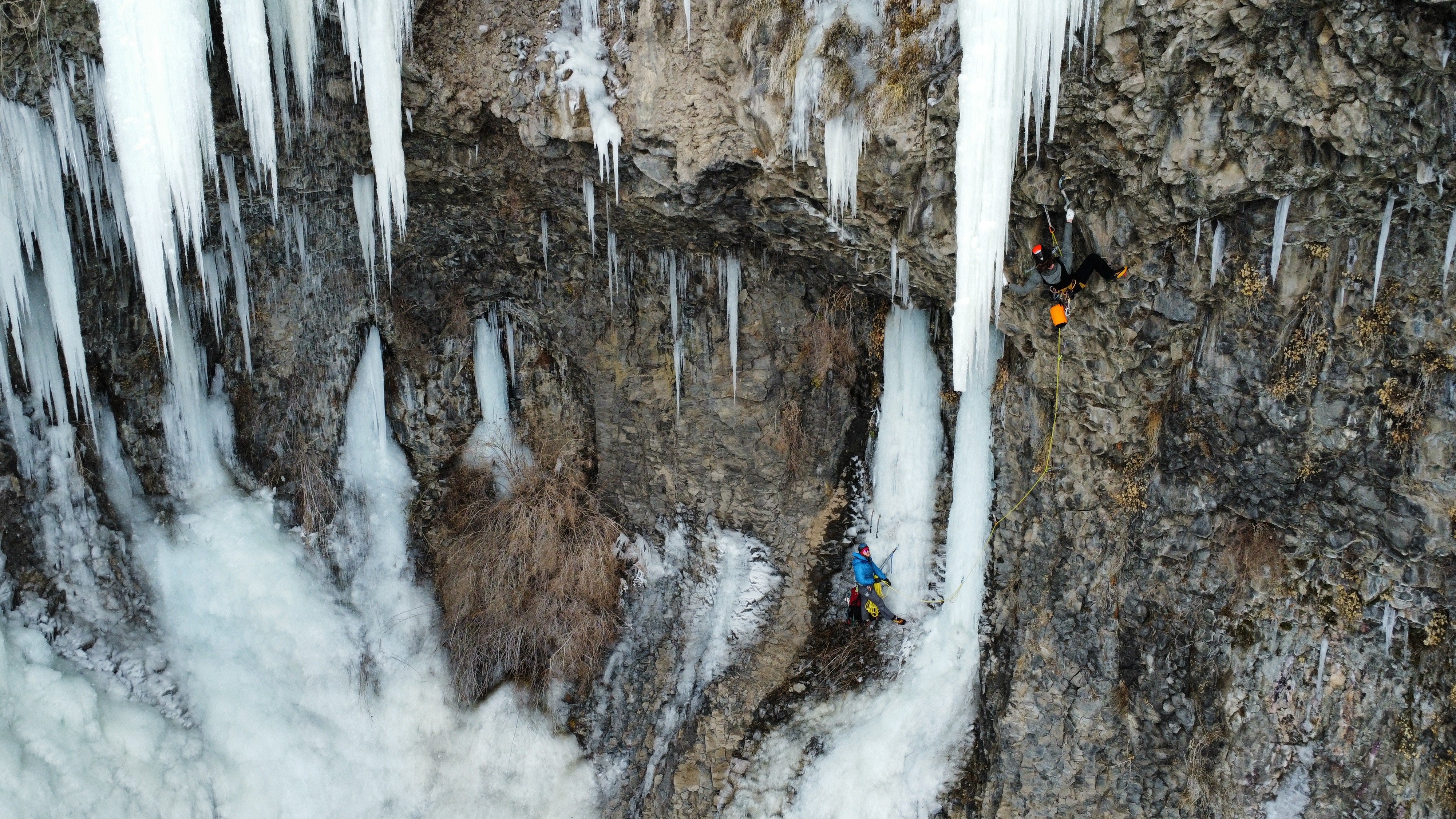
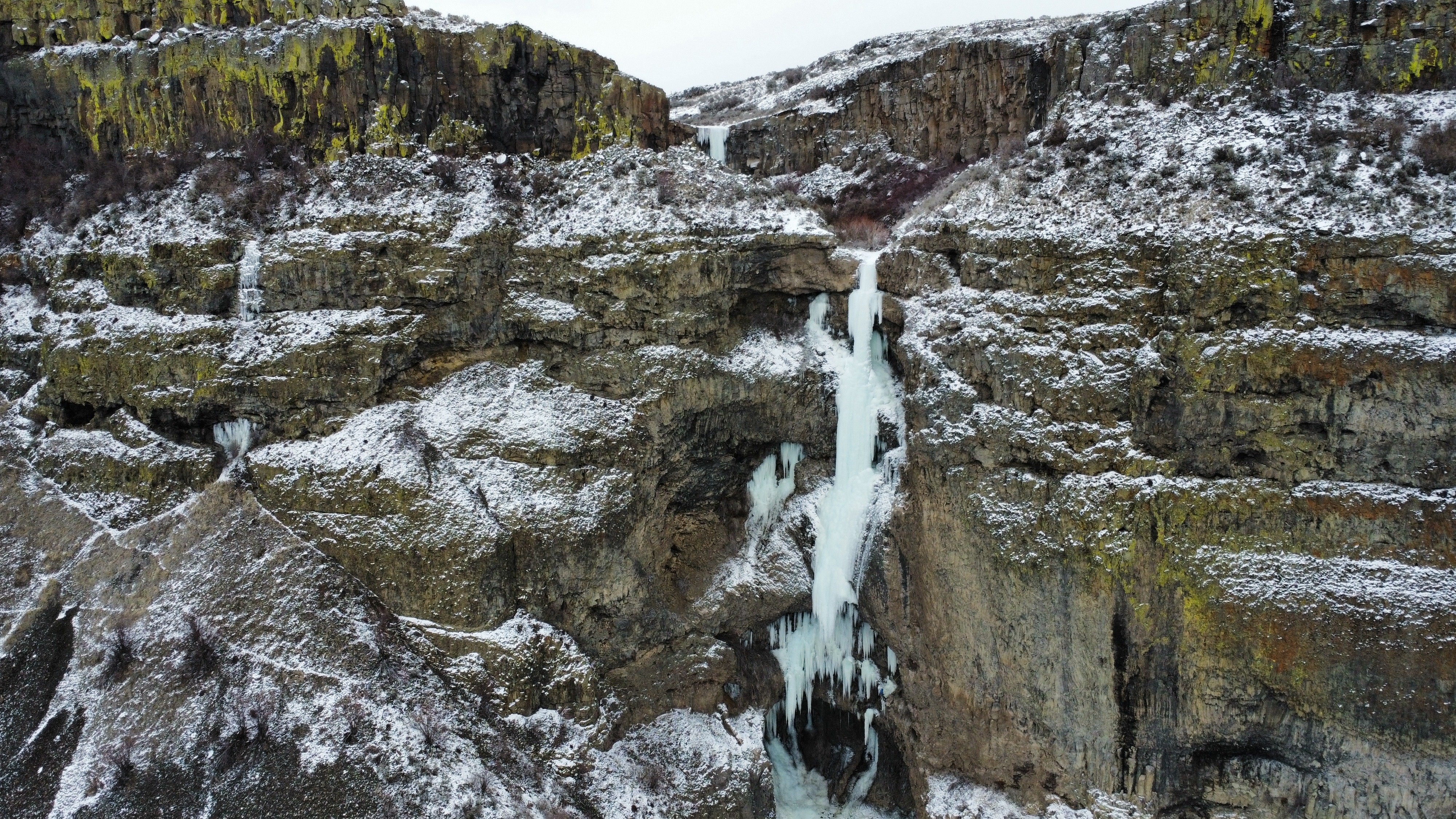
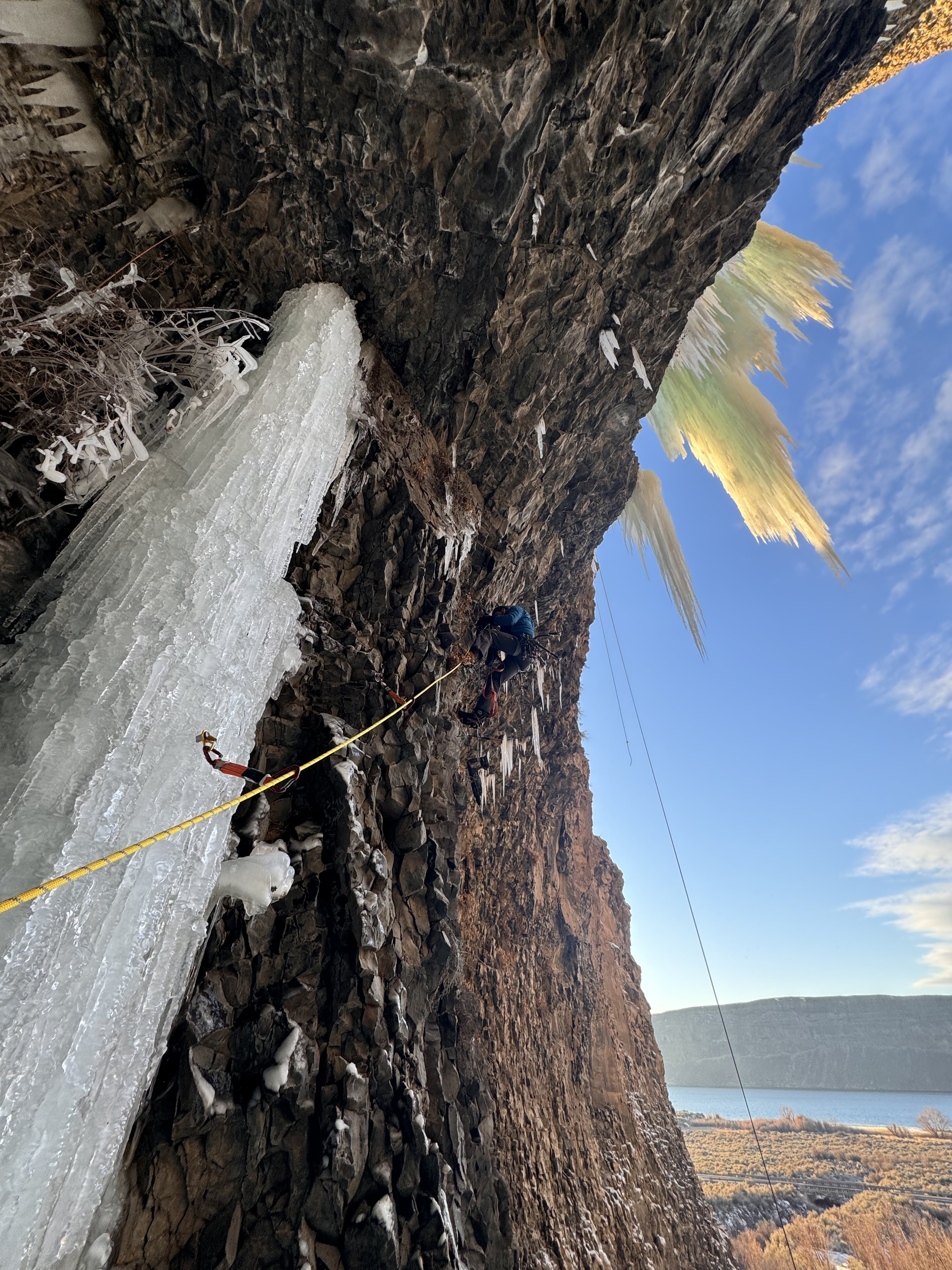
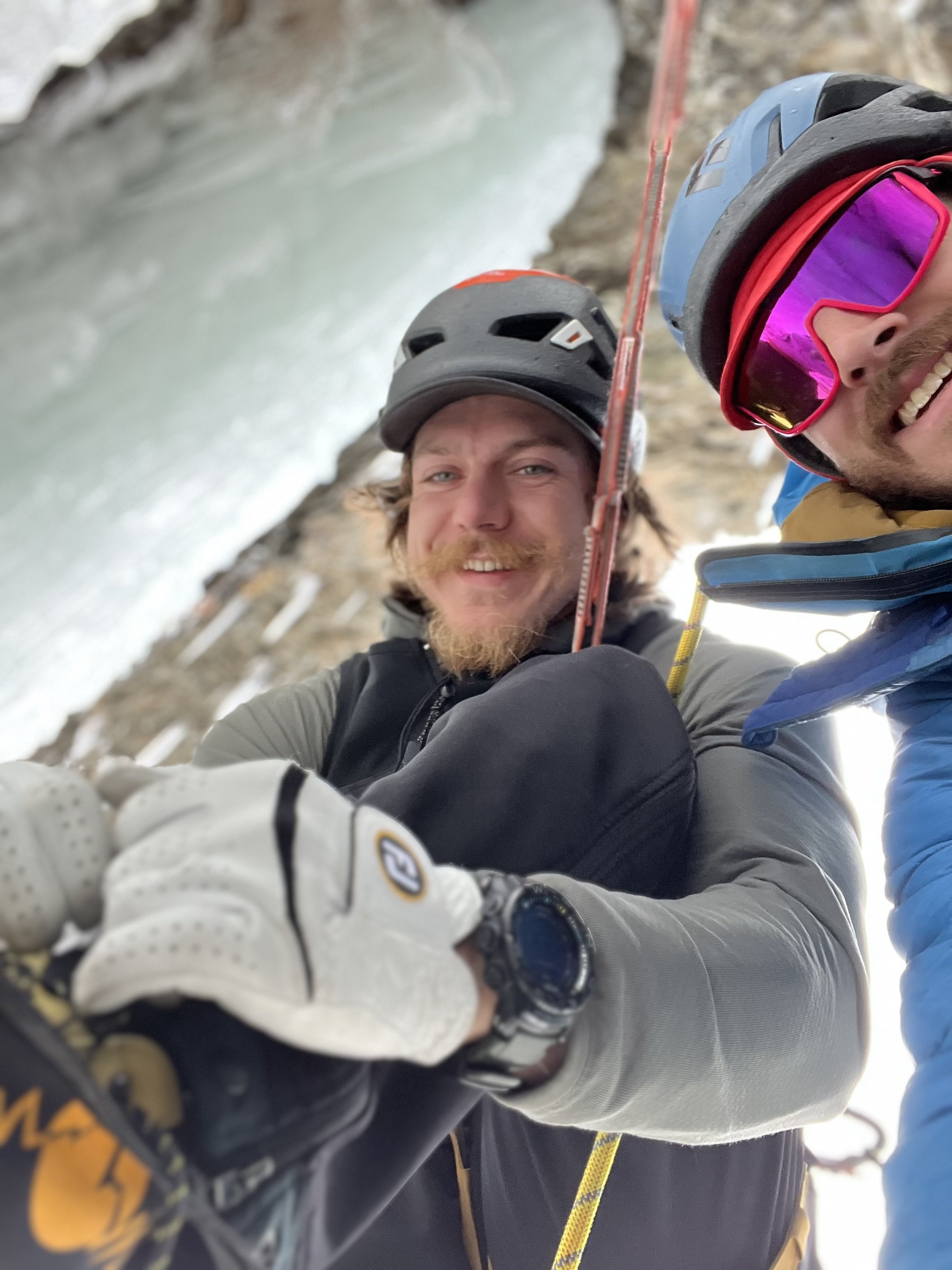 8 points
 -
Trip: Cascade River Road - Forbidden, Spider, Boston, and many more solo Trip Date: 08/11/2025 Trip Report: Went up to Cascade River Road for the past couple days to take advantage of the good weather. Didn’t have a partner so just decided to mess around for a while. Apparently my adult friends do this thing called work. Who does that! Summits were: Forbidden, Boston, Sahale, Magic, Arts, Formidable, Spider, Little Devil, Devil Benchmark, Teebone Ridge. Thursday 8/7 Dropped my mom off at work before heading north, got there around 11. Pretty cloudy and had big plans for the next few days so I just ran up to little devil peak and copy climber kyle. Bagged Teebone ridge and Devil benchmark along the way. Enjoyed some perfect huckleberries on the way up. Startled a large bear on the way down, only 25 feet from me. The fur was brown but I don’t think there are any grizzlies out there so who knows. Friday 8/8 Arose at sunrise and moving at 6am up to Cascade pass with 3 days of food, went over the cache glacier and saw a black bear on the other side of the col. This time we saw each other and maintained distance. Slogged it over to the other side of the middle cascade glacier where I got to the bottom of that South-facing gully around 1. Went up Spider mountain using the left gully at first before gaining the rib between the two. Got back to the ptarmigan traverse trail around 5 where I worked my way over to the access col to formidable for a nice night. Saturday 8/9 Arose once again at sunrise and climbed formidable in the morning in 4 hours camp to camp. Saw another party coming up as I headed down from the col. Slogged it back up to the middle cascade and felt pretty pooped by the time I got to the red ledges. Dropped the pack and scurried up Art’s Knoll. After that headed over to kool-aid lakes where I stashed a lot of gear before going up Spider. Made it back down around 6 or 7 before more slogging up to cache col for a sweet bivy site. Spilled my pad thai all over myself which I was unhappy about. Sunday 8/10 Another sunrise wakeup got me moving at 6, down to cascade pass, and up to Sahale where I summited around 11:30. Stashed overnight gear on my way up to the arm. Always fun passing people in trailrunning vests. Simply buying an vest and some poles won’t make you kilian jornet, still need cardio. Anyways, over to Boston where I topped out around 12 or 12:15? Explored the summit register before rappelling down. Yes I did carry a 60m purline all that way for 2 rappels. Training weight or something. Cruised it back to the car. Monday 8/11 Had to meet a neighbor in the evening to talk about watering his plants but nothing else going on. Also had a dentist on Tuesday preventing me from staying another day. Soloed up W. ridge Forbidden in 4:15 car to summit. Topped out around 7:15 before heading down at 8 with another soloist from Montana. Rope was nice for rappels. Back at the car by 12:30, home around 3:30. I guess I could’ve waken up later. Don’t see myself becoming some big free-soloist but the route seemed like a good option for it. Sure is nice to not fuss with ropes through easy terrain. Gear Notes: Approach shoes and Crampons would work for everything. I carried boots because I like carrying things I regret carrying later. Rapping boston feels good and a purline doesnt weigh much. Approach Notes: Forbidden can be reached without touching any snow
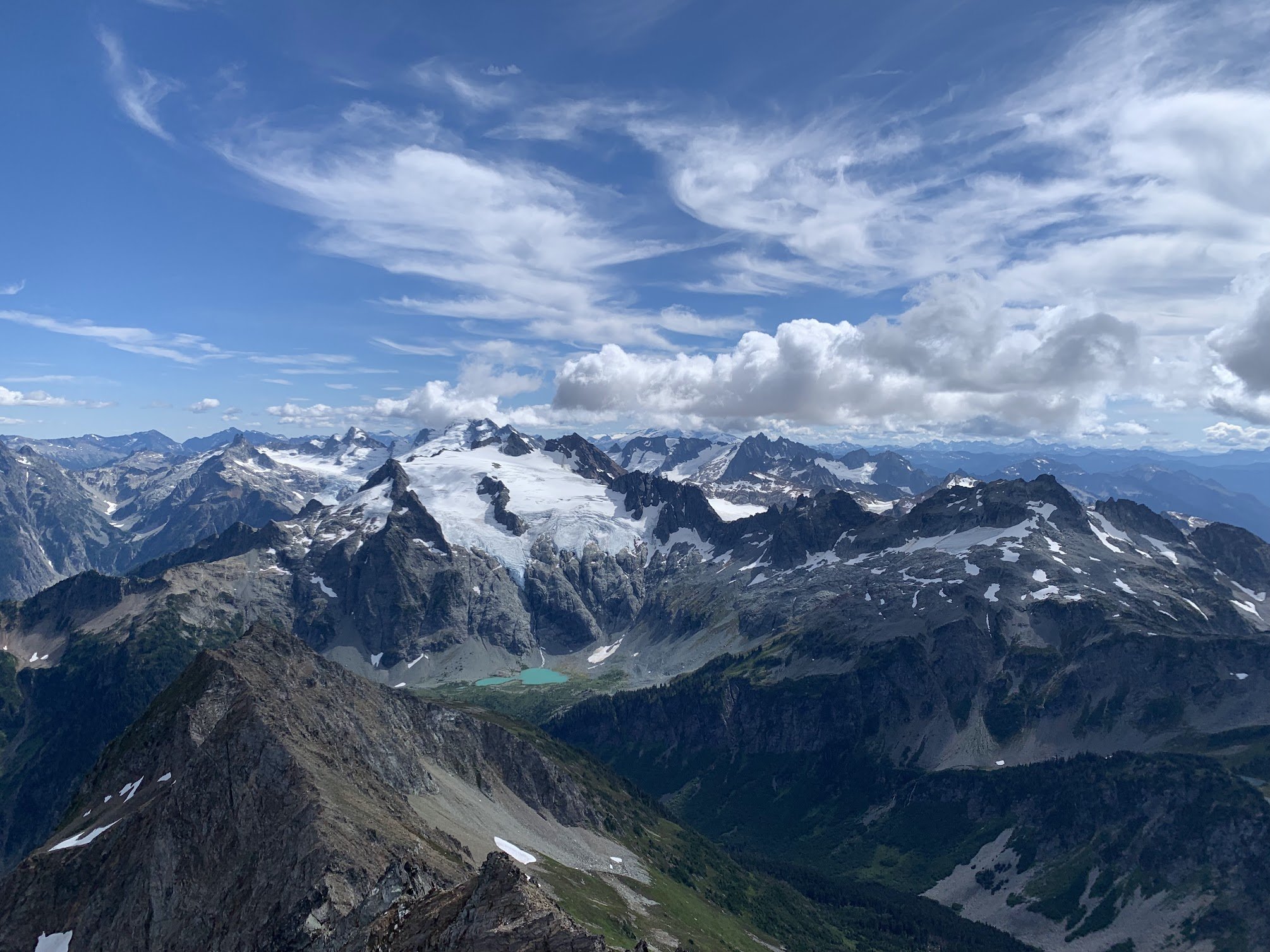
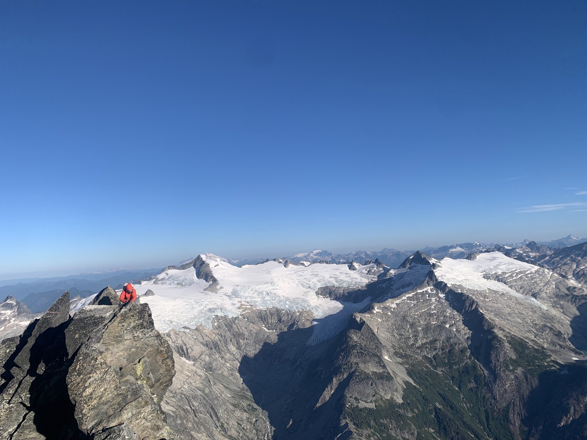
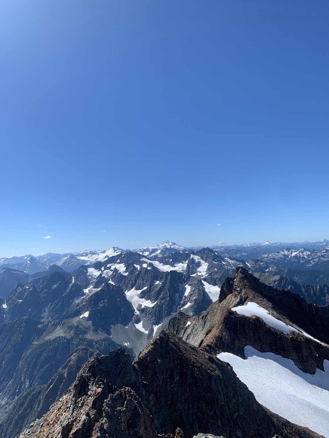
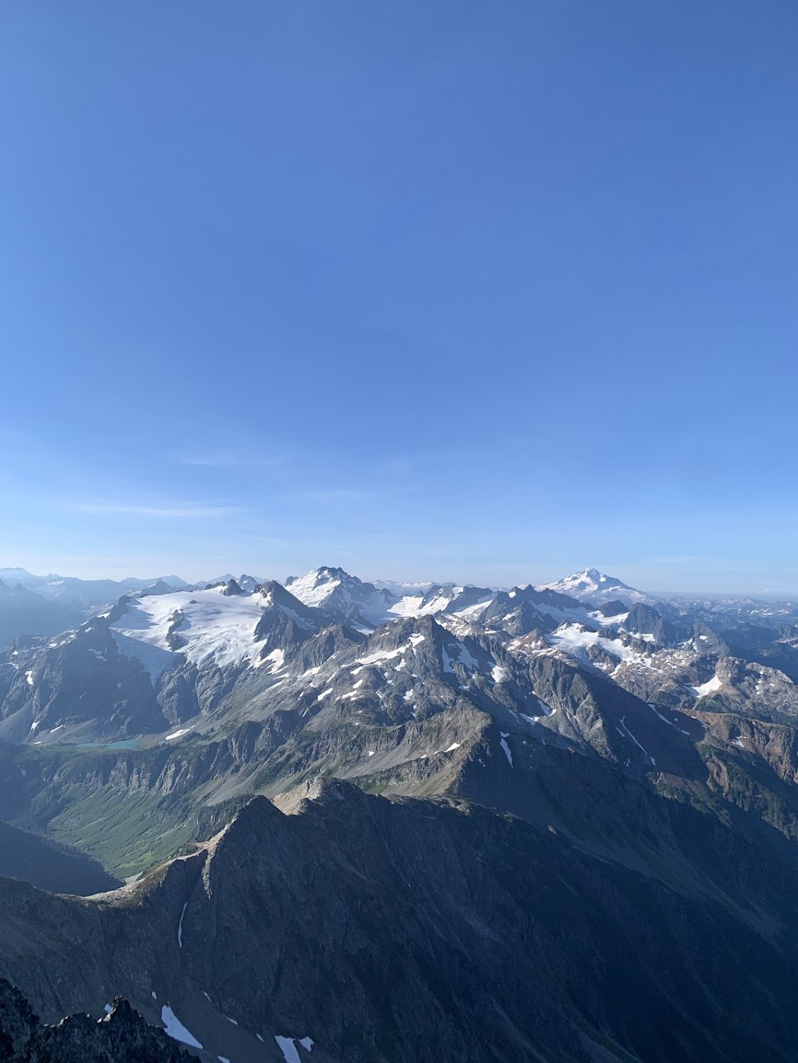
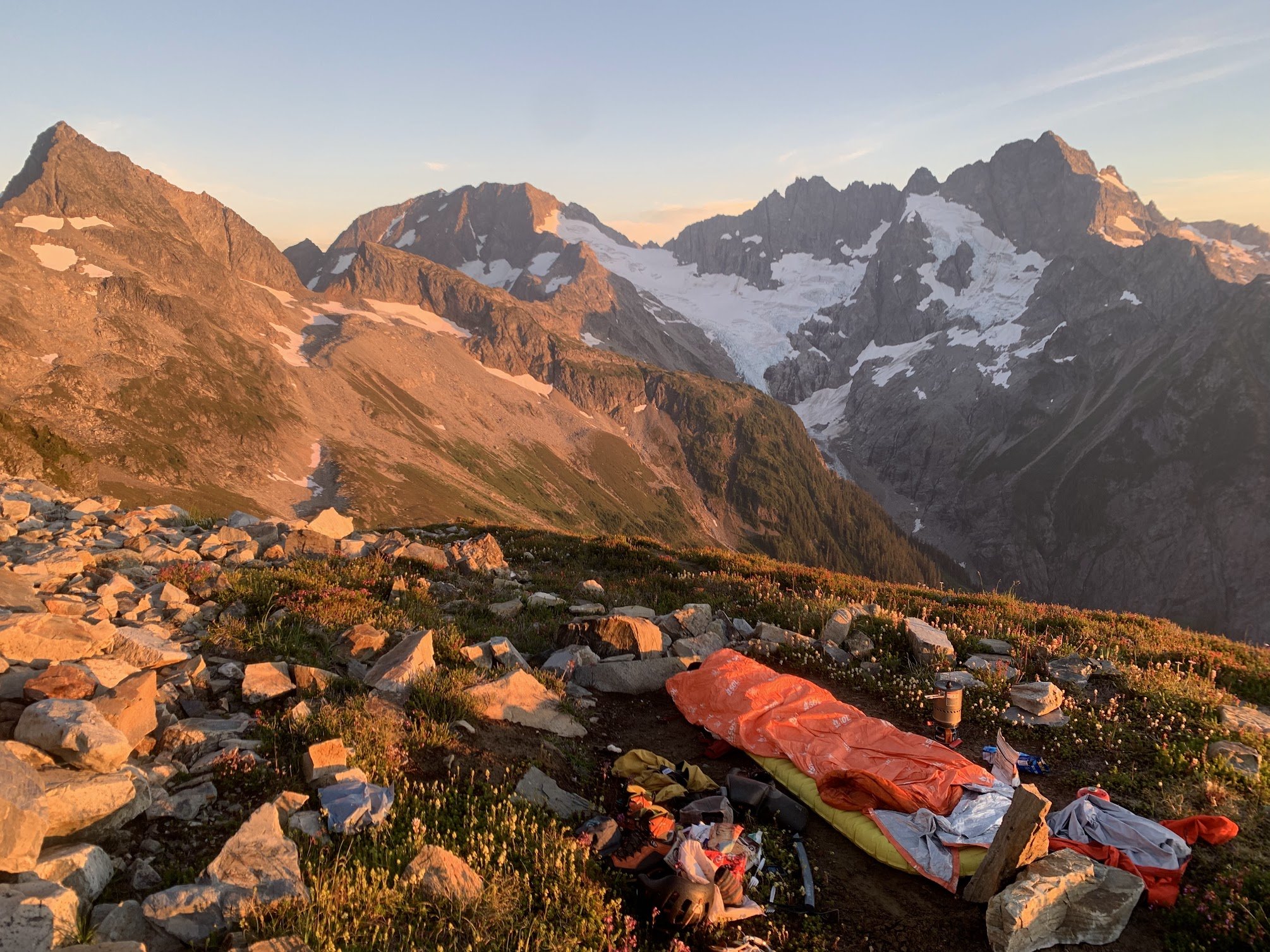 8 points
 -
Trip: Eldorado zone tour, with EMS - South and west ridges of Eldorado, SW face of Early Morning Spire Trip Date: 08/08/2025 Trip Report: Got to do some routes in the Eldorado neighborhood from a base camp last weekend. This was another trip I’ve been meaning to do for a long time where the pieces finally fell into place. Climbed with Ben who has learned quickly in the three years since he started climbing. Solid partner, his only real error was leaving glasses back at the car. On the first day this was mitigated with some tmnt Inuit tech. Cowabunga! Luckily at camp there was a climber who elected to stay there while his guided team climbed the E ridge. Heard the guide had extra shades and we arranged to borrow them for the weekend. Sky harp We set off for the south ridge. I love knife edges so found the route just barely in the worth doing once category. If you don’t particularly enjoy knife edges there’s no reason to do this climb. Unincorporated choss county Some fun atmospherics helped make it somewhat enjoyable despite some of the worst quality rock I’ve climbed. We counted it as good mental prep for W arete the next day. At the end of our three hour tour camp to camp we arrived to find the guide-lended glasses waiting for us. Most of the rock climbing in the next two days was in the shade, but this was still quite the score. Got up early the next day for the W arete and kind of raced another party departing camp right after us. There turned out to be a third party on the route that day too (!) Below Dorado Needle col we saw tracks through a snow bench above and left of the tarn, and followed these around to slabs near the sit start of the route. We misjudged the heathery path from below. What looked fine turned out to be dirty, crumbly, overly narrow and exposed, with mostly down sloping rock and dirt. This was a bit of a traverse coming from the NW to the ridge around 6700-6800’. Not at all recommended, there must be a better way, maybe more directly from the west? The other two parties took the considerably higher entrance from snow that bypasses all the green stuff, which seems more appealing in retrospect, though it looks like it has a bit of hazard too (steep, bad runouts). We were glad to be in front. There was one particularly thunderous episode of rock fall accompanied by muffled shouts and we were relieved to eventually see all 5 climbers back at camp that evening. After pulling through some legitimately scary terrain we soloed up briefly sound rock before it got questionable again. Then we started to simul. I think two blocks got us into the gendarmes. We had climbed up a chimney to a piton, but it didn’t look anything like photos of the crux traverse. After some confusion we saw another piton down below and realized we were above that crux. We rapped past it. It looks exciting, kinda wish we climbed it. Unintentionally mimicking the rocks’ posture From there two more blocks got us past the snow into lower angle terrain where we unroped. I found mostly pretty good stuff to the summit. The path of least resistance isn’t always the best path. It was so early I proposed heading back down for the SW buttress of Dorado Needle but we elected to rest up for EMS instead. With the south ridge the day before, the west arete completed the Eldorado compass for me (north and of course east ridges climbed before). South ridge! meh I enjoyed solitude on the summit for a while and left as a large group of sunburned youth neared the top. The hours drifted lazily by. We chatted with various day trippers throughout the afternoon. Next morning another early start had us retracing our steps to Dorado col. Celestial choss, earthly choss This time we passed by the tarn and its outlet stream. One slope looked inviting but it cliffed out on the other side. Proceeding lower we found a nice path through trees to cross the ridge with friendly heather downclimbing. EMS presents quite the striking mien all along the approach. We met someone at camp the night before who had his own route beta for EMS which he shared with us. Compared to Nelson’s it had a direct start, and above that, more of a diversion to the right and back left, rather than straight up. Both of these variations turned out to be good calls. The start was a little tricky in terms of climbing and pro. First piece The climbing quickly got to be really fun. After about 70m I took the lead. After scoping a more direct line I tried the shallow right facing corner diversion to the right, and was pretty delighted with this section. I think this wide low angle splitter was in this pitch. I stopped about 70m later just below the ledge below the crux roof. Ben took over again and dispatched the slightly wet moves and drifted out of sight. This pitch ended up maybe 80m with a little simuling to the slab under to the roof. As I followed pitch 3 the rope hung over some excellent mid 5th friction slabs, where Ben had fortunately not placed pro. I took these optional sections (easier ledges around) to make the pitch even better (out of frame right of this photo). Pitch 4 was another rope stretcher with quality stone and low-mid 5th climbing. Ben took off again and neared the ridge crest. He selected a scruffy 5.10 chimney to get us to the slab and stopped there. I got to lead the finger traverse above this slab, another route highlight. I crossed the crest and continued up it, placing hardly anything, mostly focused on keeping the trailing rope from crossing the abundant choss that now sadly replaced the excellent rock. A seventh rope stretcher got us near to the summit ridge. We did one more short pitch that turned out to be unnecessary, should have unroped after 7. Tempered expectations may have been a factor, but we reveled in how good this route turned out to be. It’s not Stuart range classic quality but I think it’s up there with some three-four star WA pass routes, with an obviously much more engaging approach and return than you can find there. Our descent began with sandy goat ledges on the south side of the ridge. When this cliffed out we crossed back north. It was very exposed here with a deep moat below, but with bomber easy staircase rock leading down. There was one low 5th body length, an awkward long step and then we were at the moat. The gap was significant but absolutely doable. Still got high dive butterflies before finally making the leap. When Ben’s turn came he sprang from both feet, launching far beyond the gap and came skating into me lol. The hypothetical descent to the south had looked atrocious during the approach, and there is at least one epic going that way documented here on cc. We instead followed the advice to climb snow to the choss saddle north of marble peak. At the crest we saw rather steep snow to the east, so followed the snow up and south to get a look around. This passed so close to the summit we thought we might as well tag it. Took rock down here to bypass the steep snow. I scouted south while Ben scouted north. We never found existing anchors, so when a good crack on the north end below the steep snow presented itself we set an anchor and rapped down. 70m easily made it, might have been 25m or so. Next we crossed the McAllister, almost exactly matching my track from 3 years ago (snow levels early August this year look even lower than early September 2022). Having decided to skip our last night out, we zipped over to camp where we packed up, ate dinner, and quickly hiked down, getting past the boulders and close to the bottom before pulling the head lamps out. The dip in the creek at the end was extremely necessary and welcome in a dumbfounding sort of way. Gear Notes: Doubles 0.3 to 1, single 2 and 3. Some C3s and nuts. Ax and crampons. 70m rope. Radios were very useful for our long pitch strategy on EMS. Approach Notes: Counter clockwise
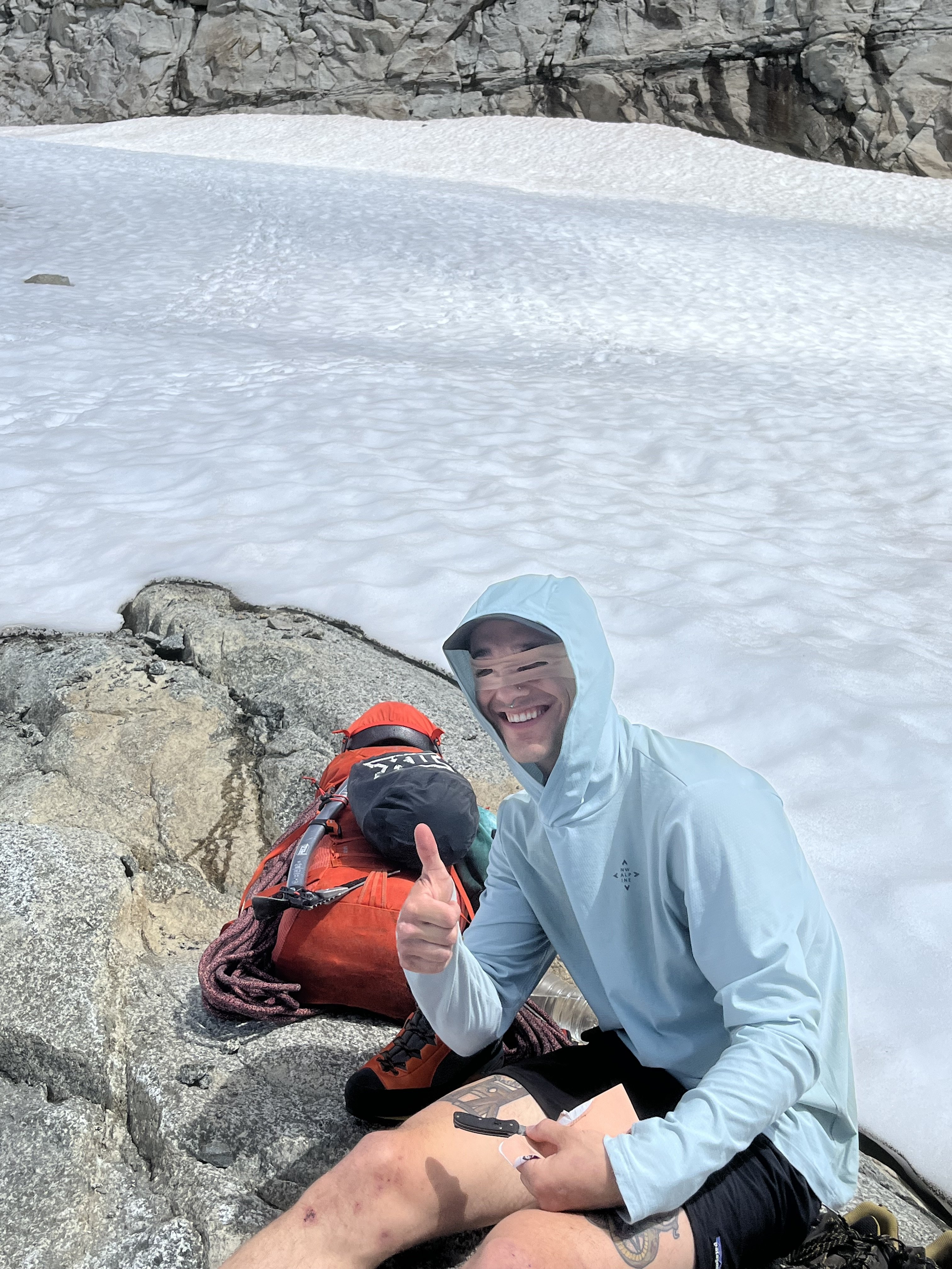
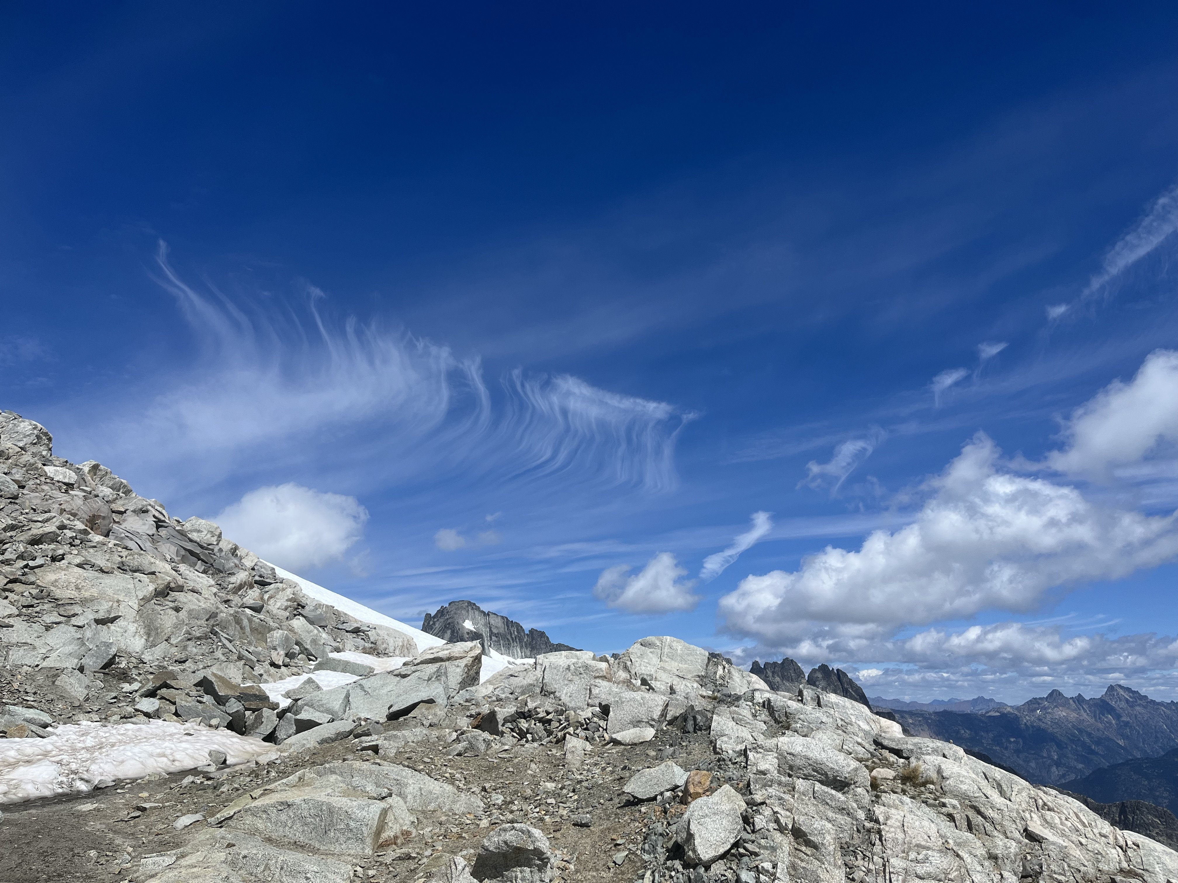
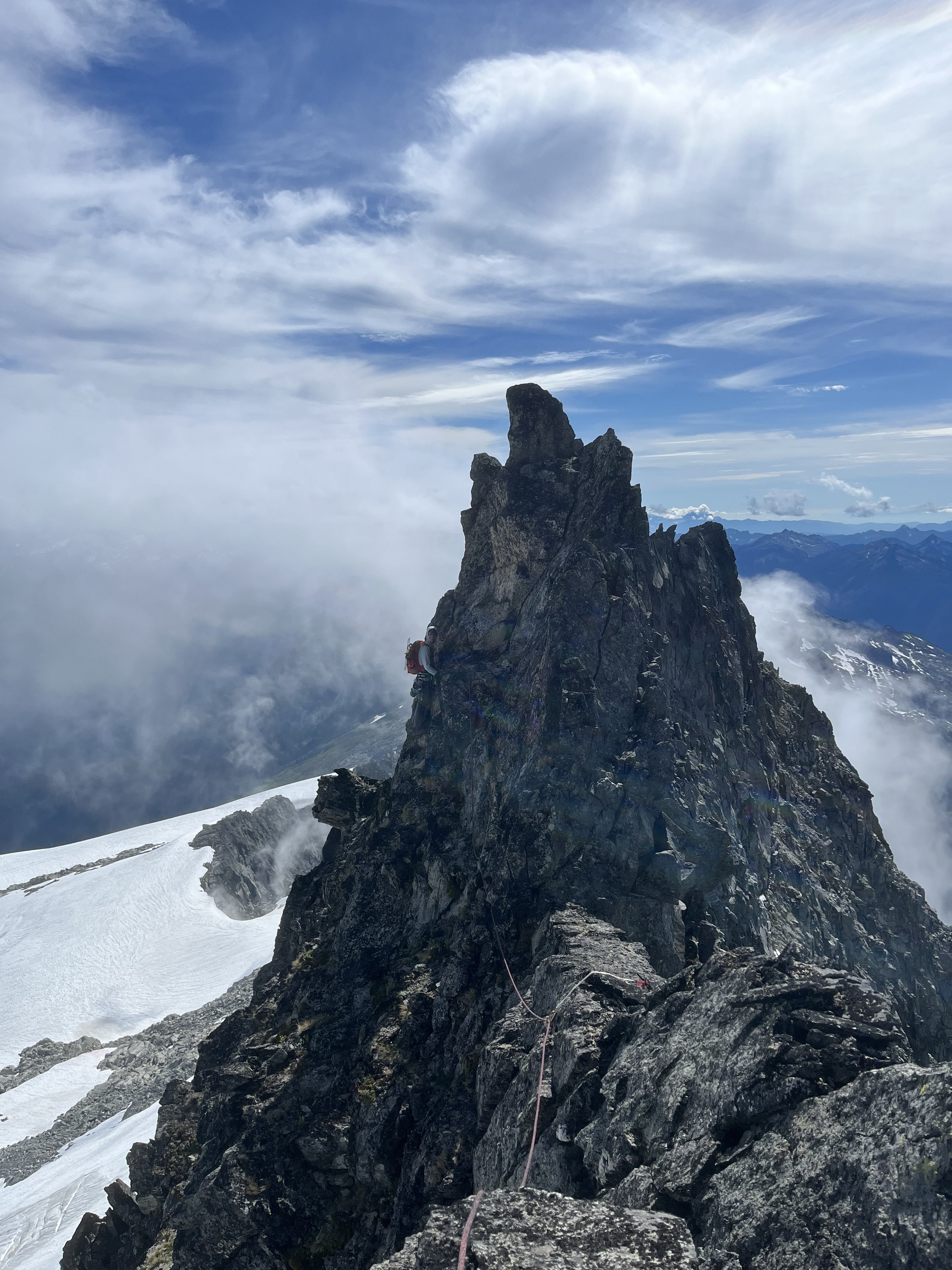
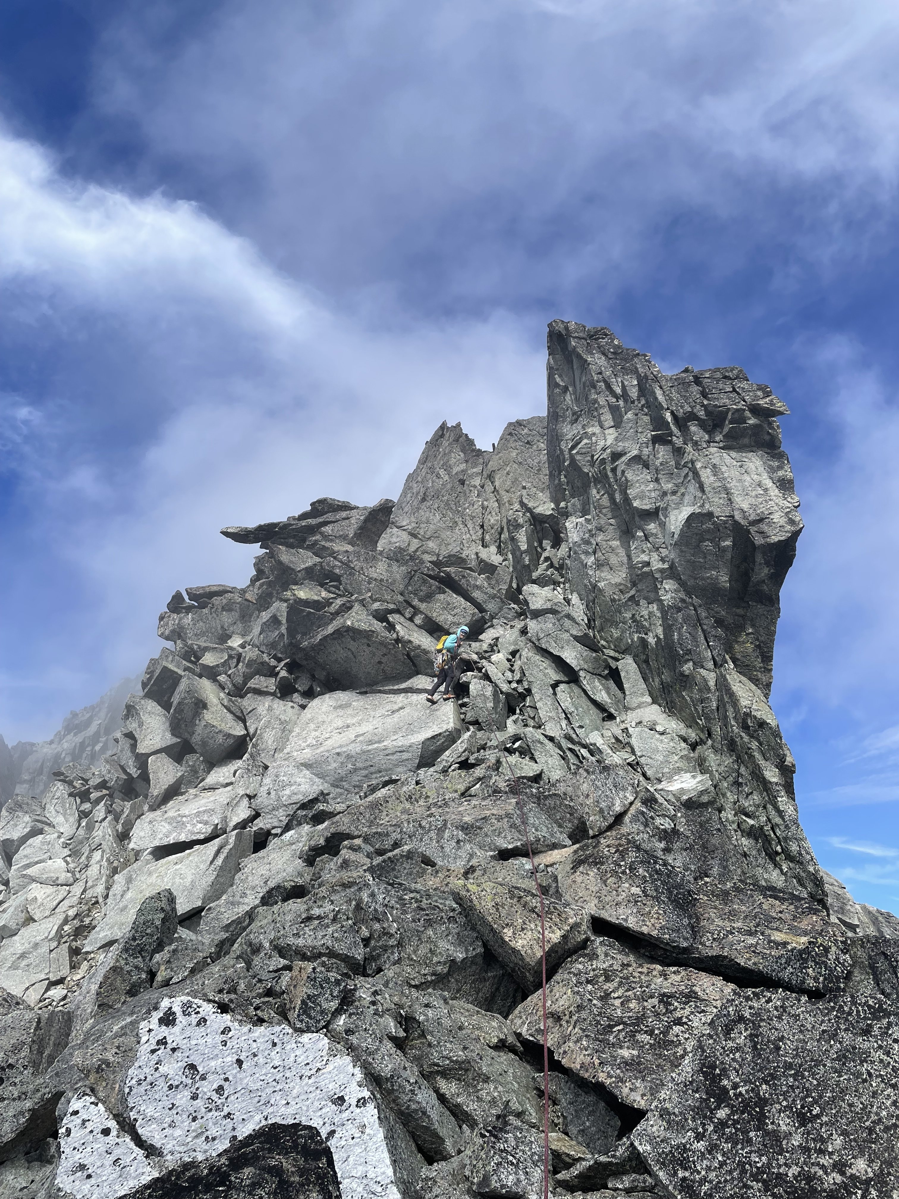
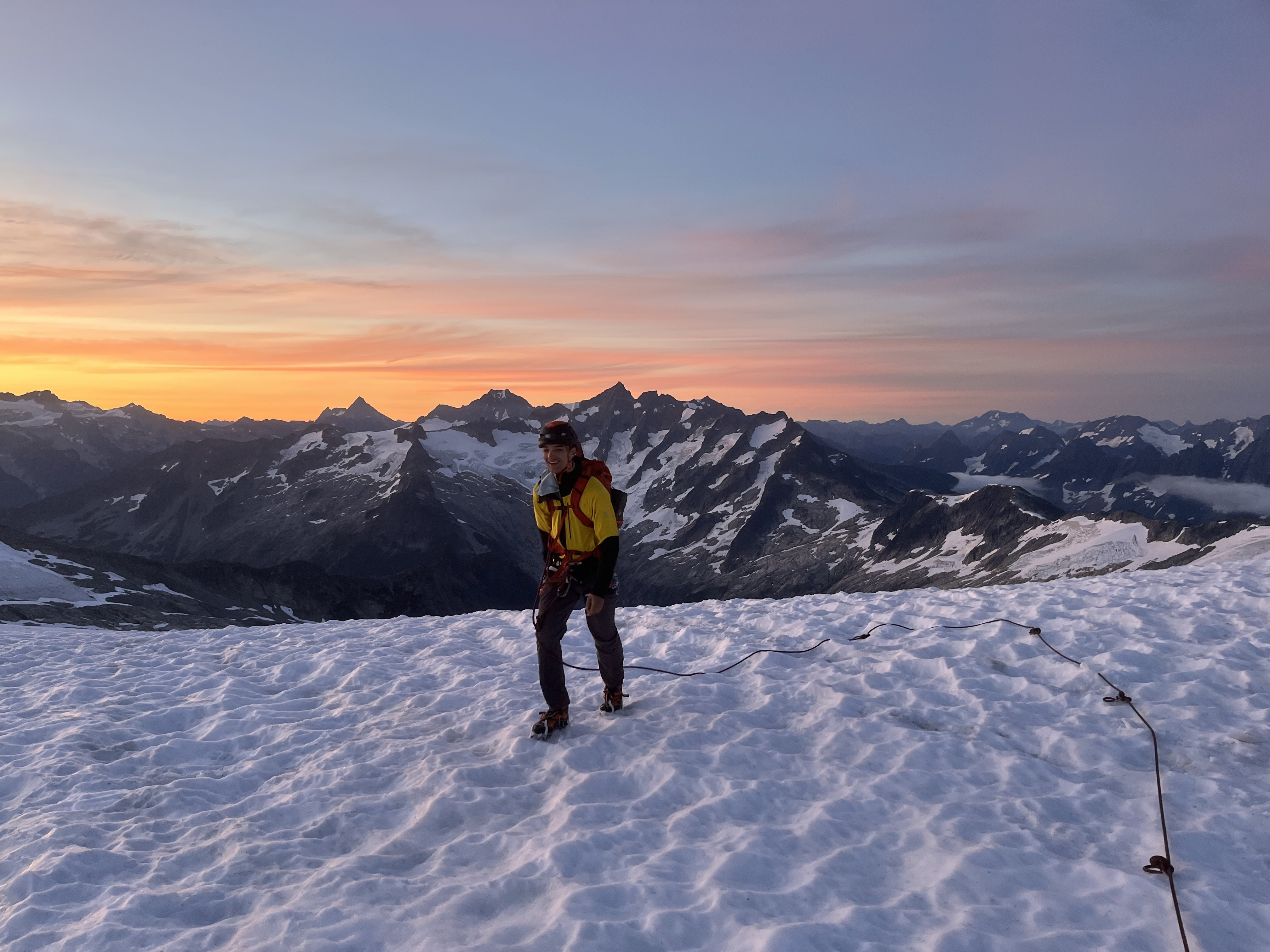
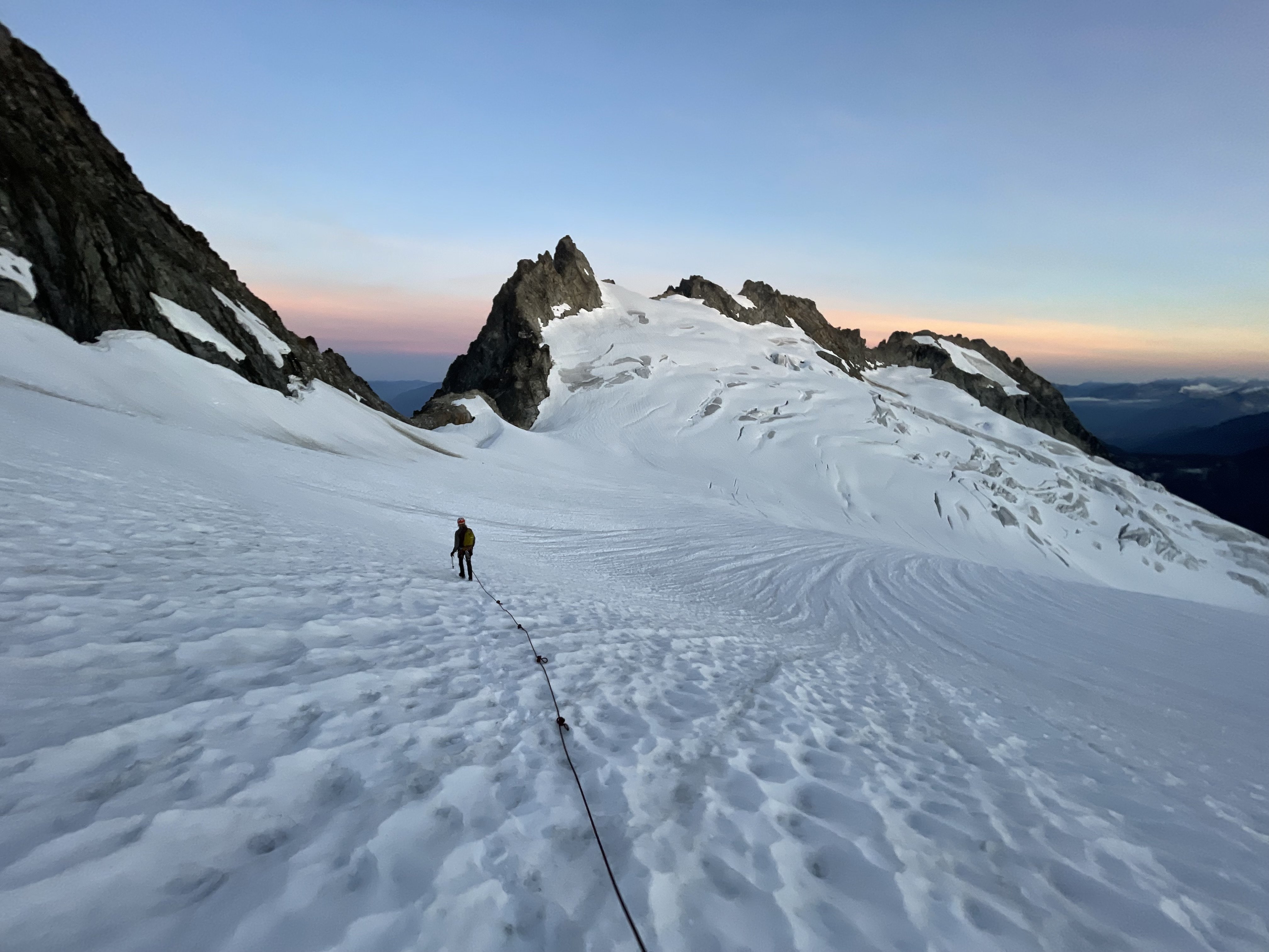
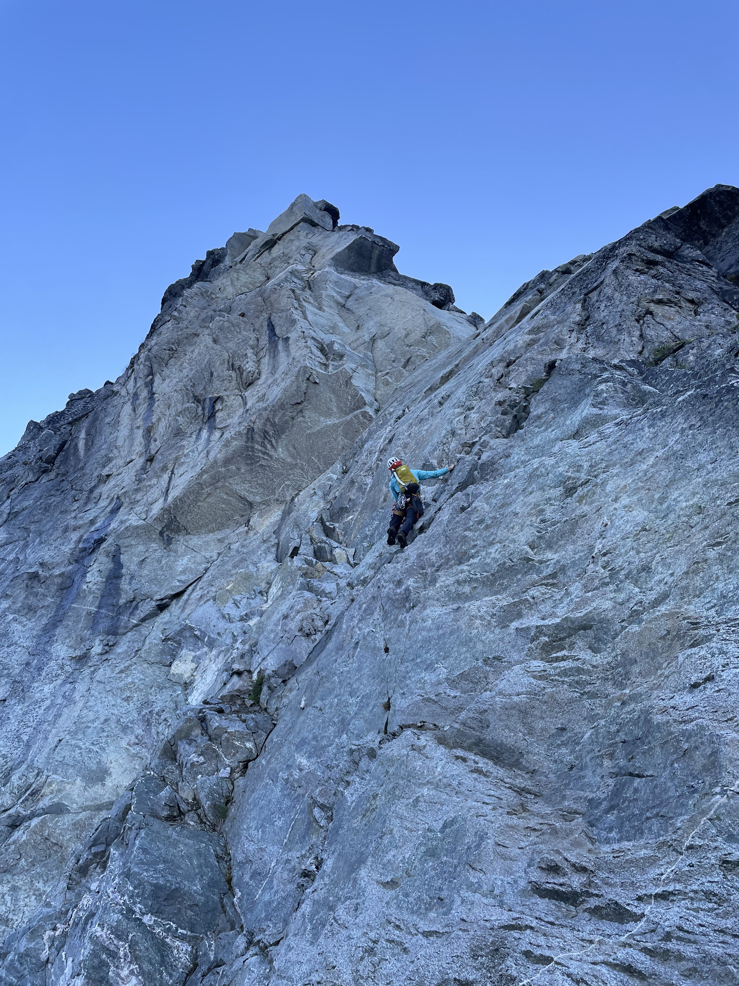
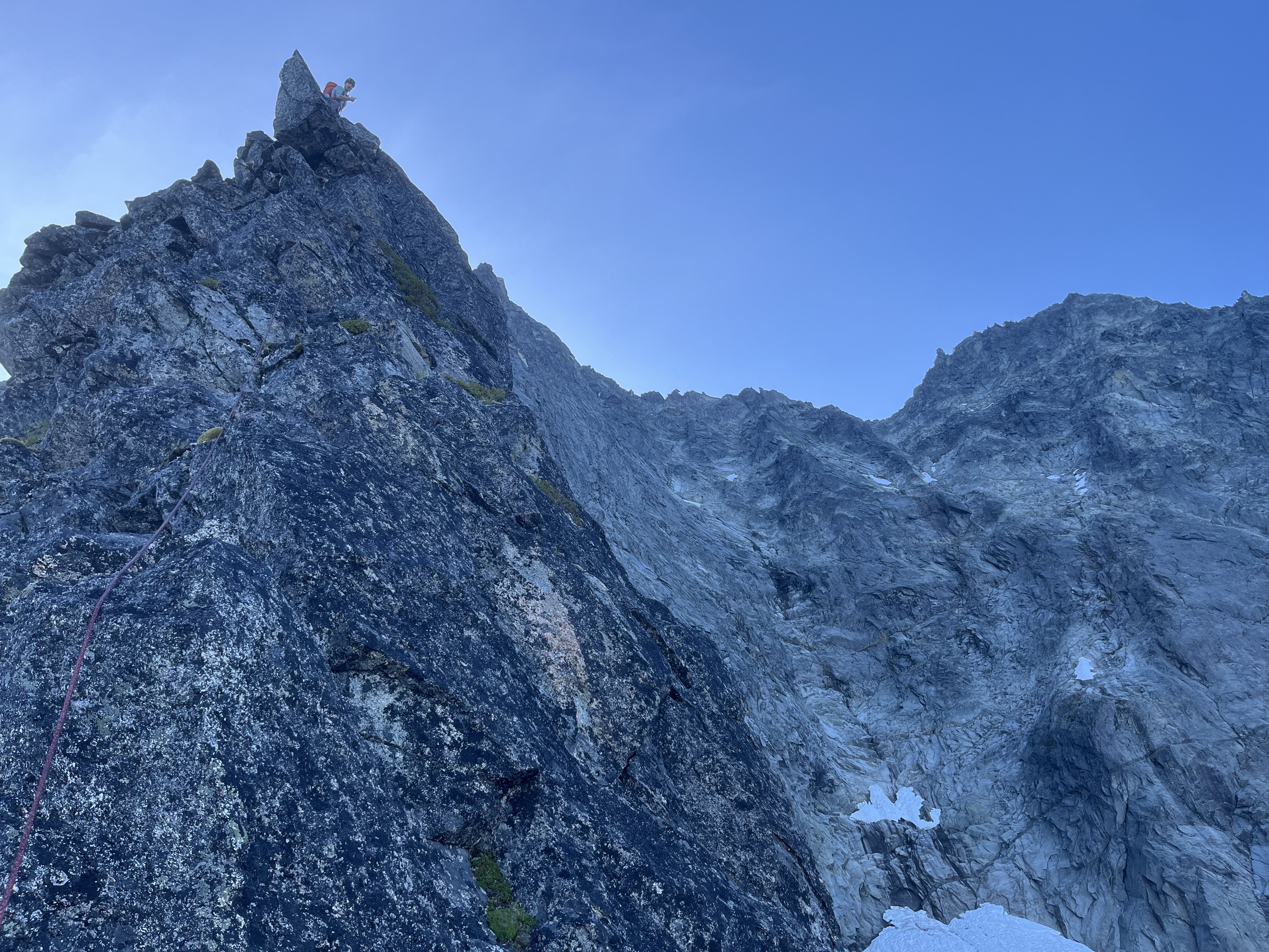
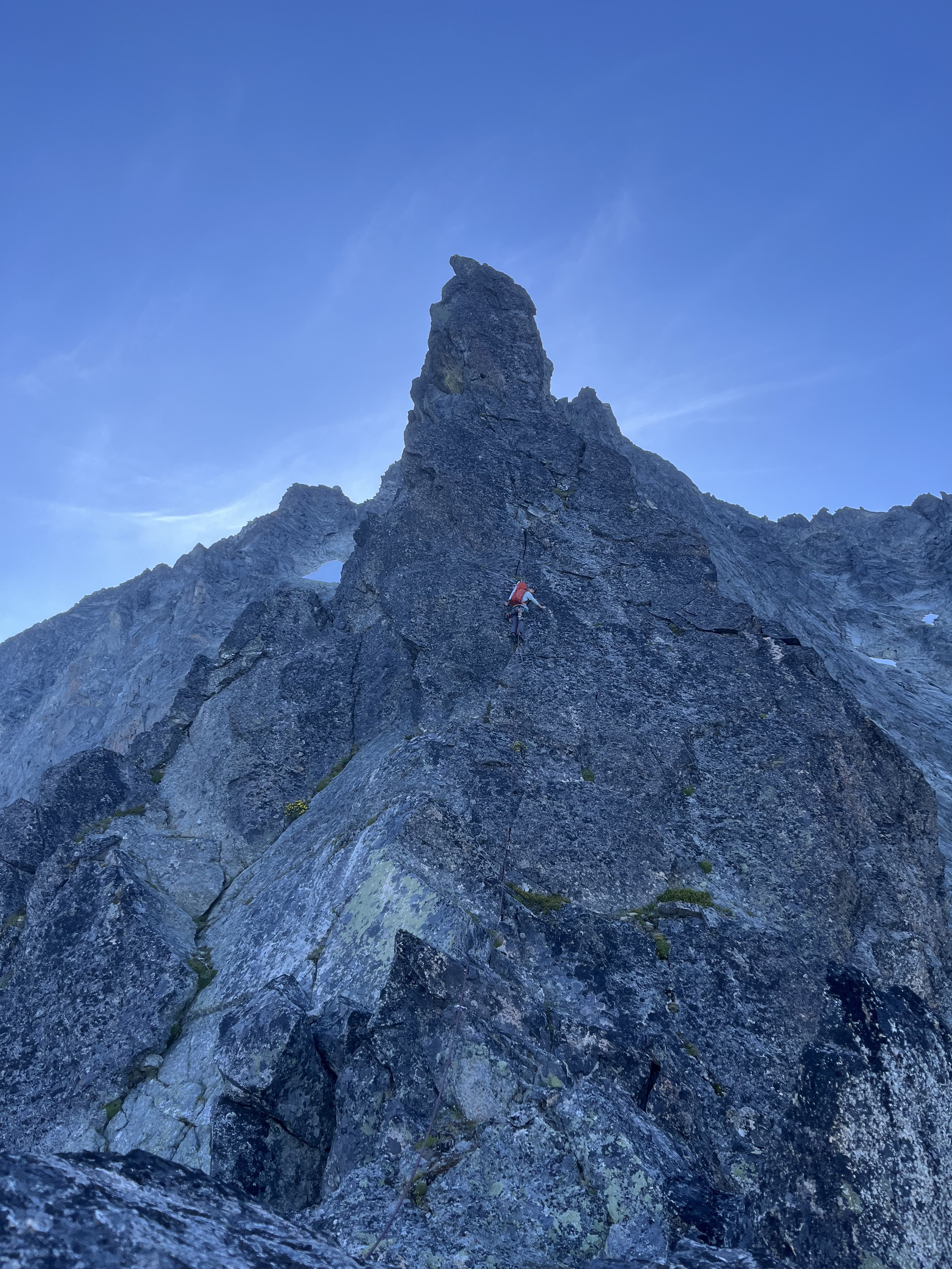
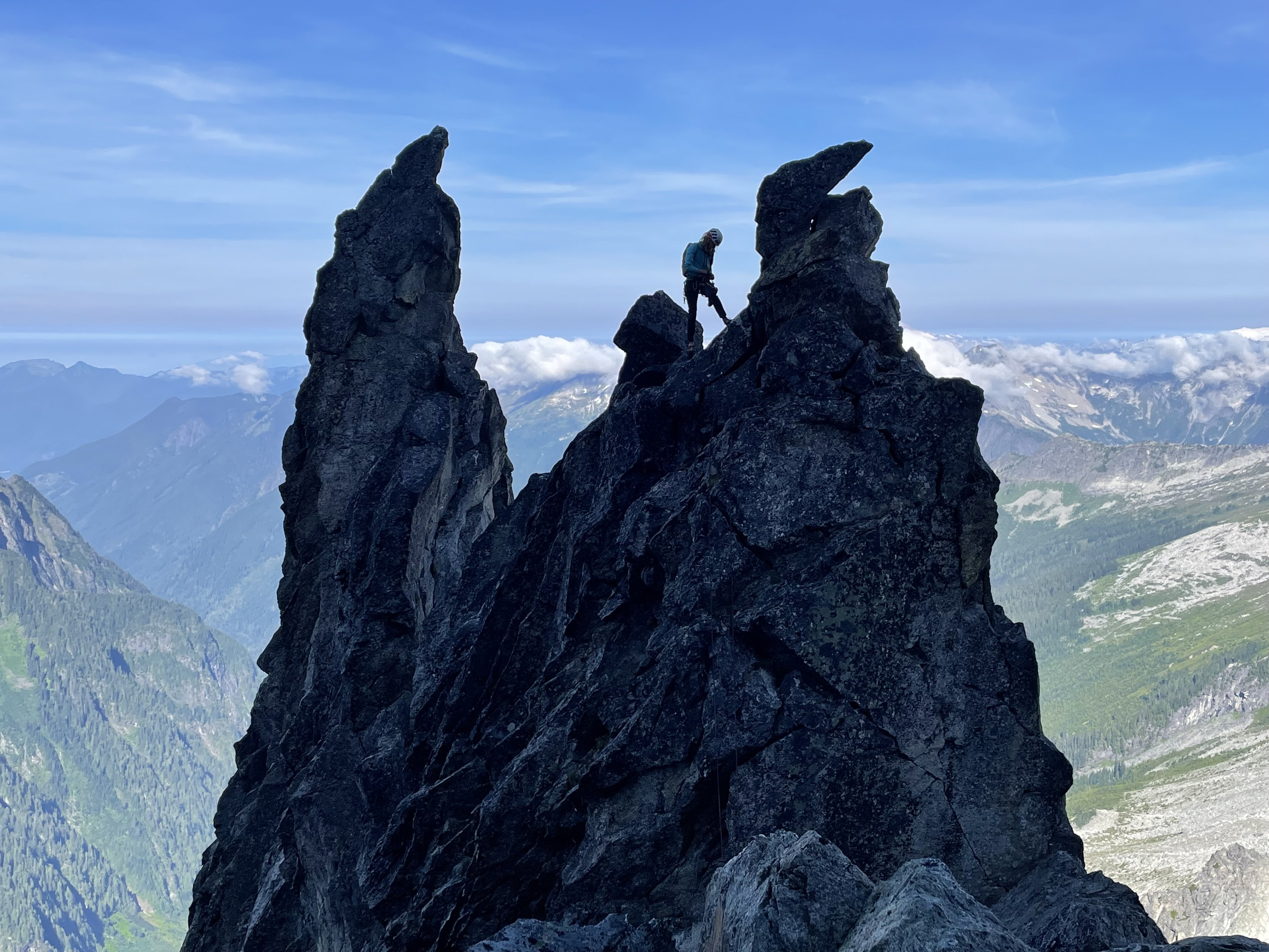
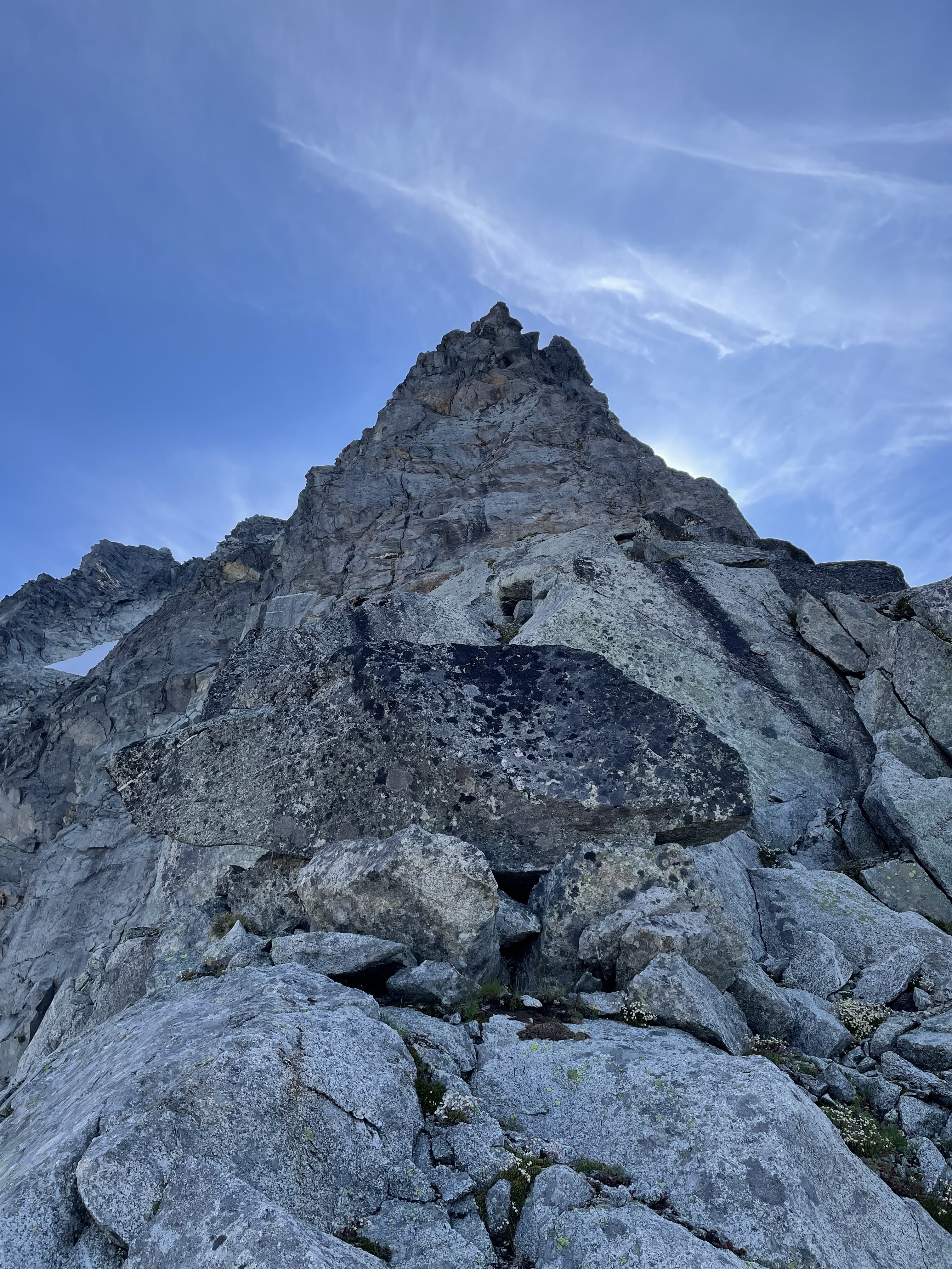
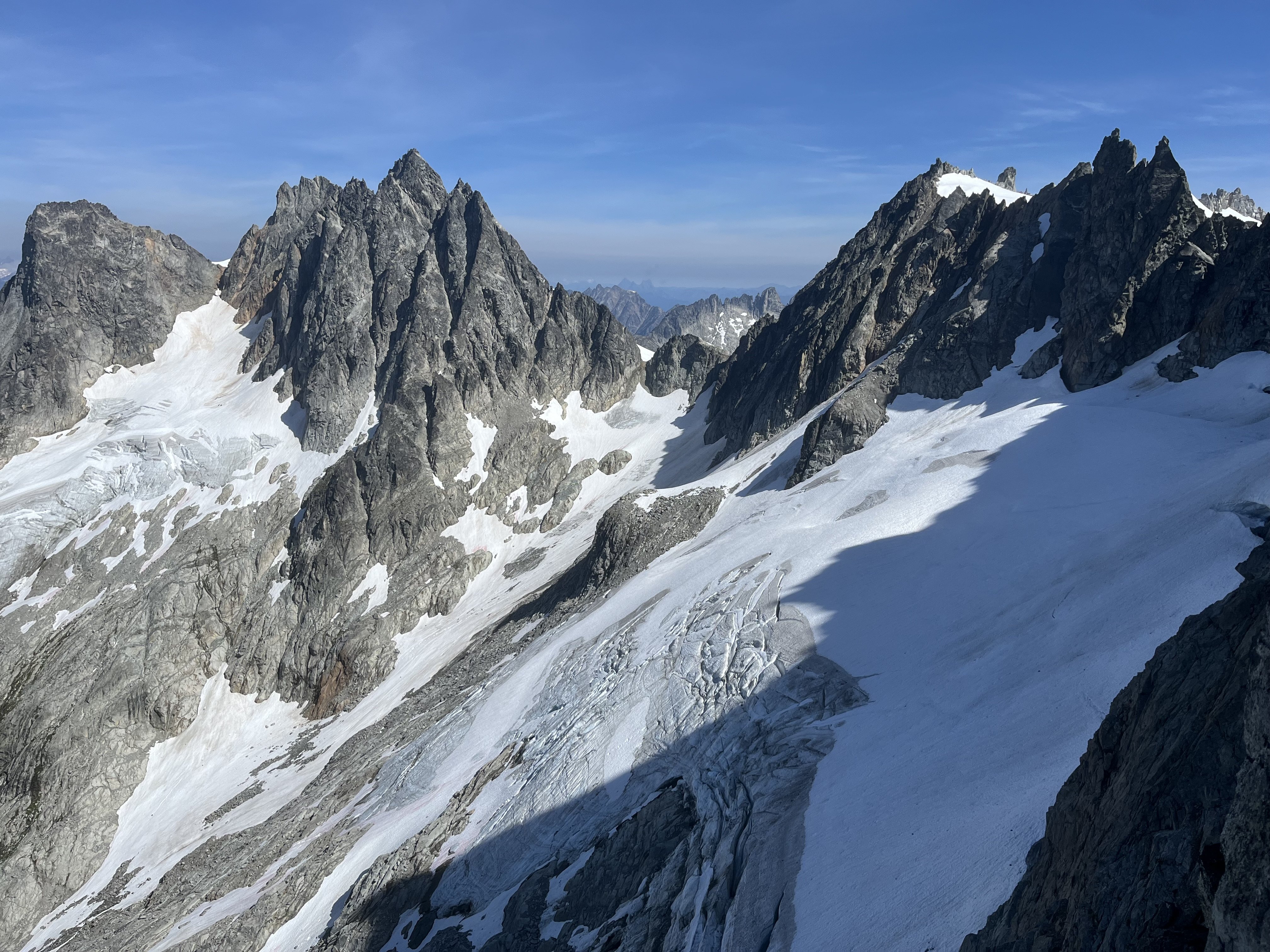
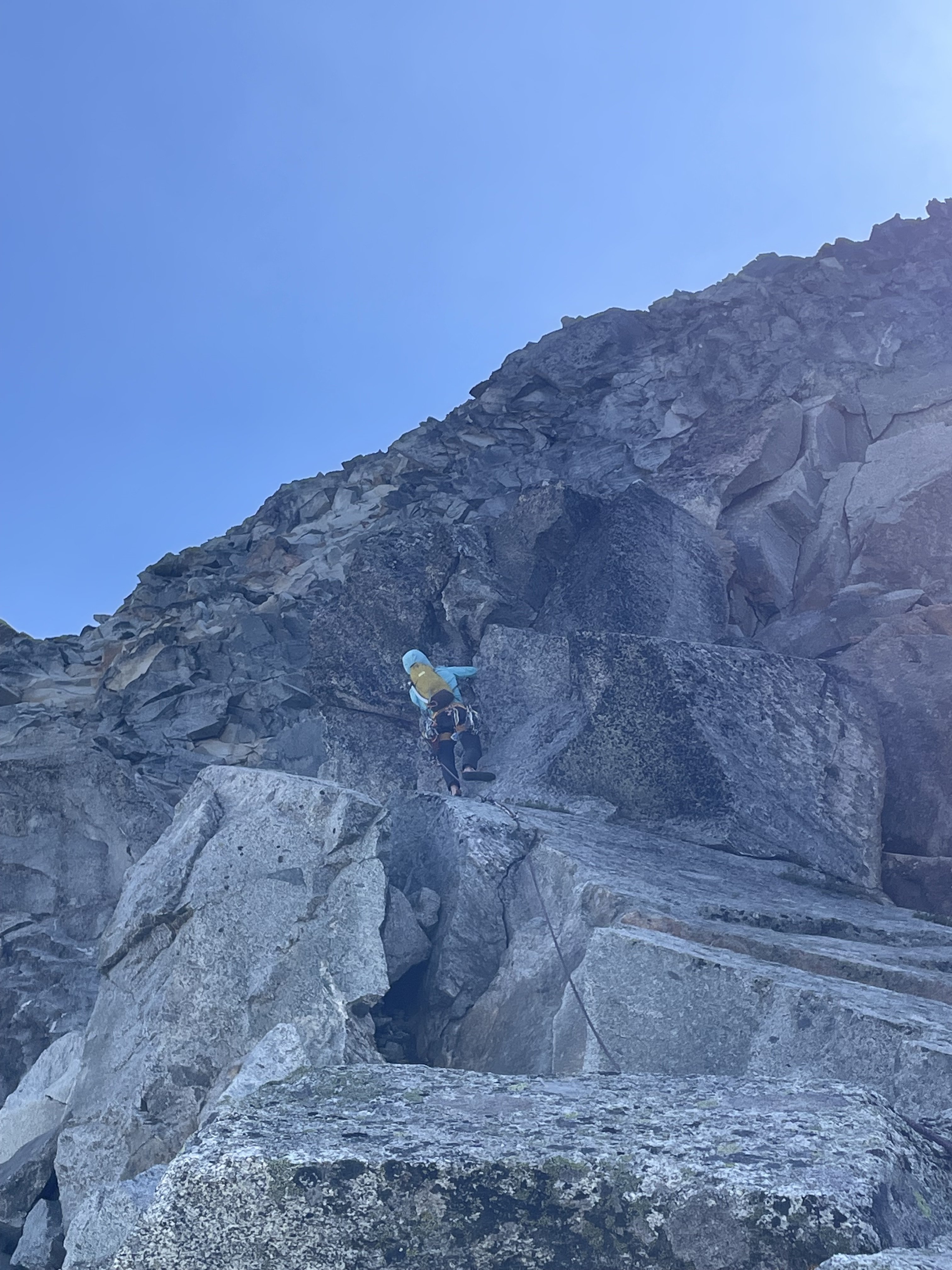
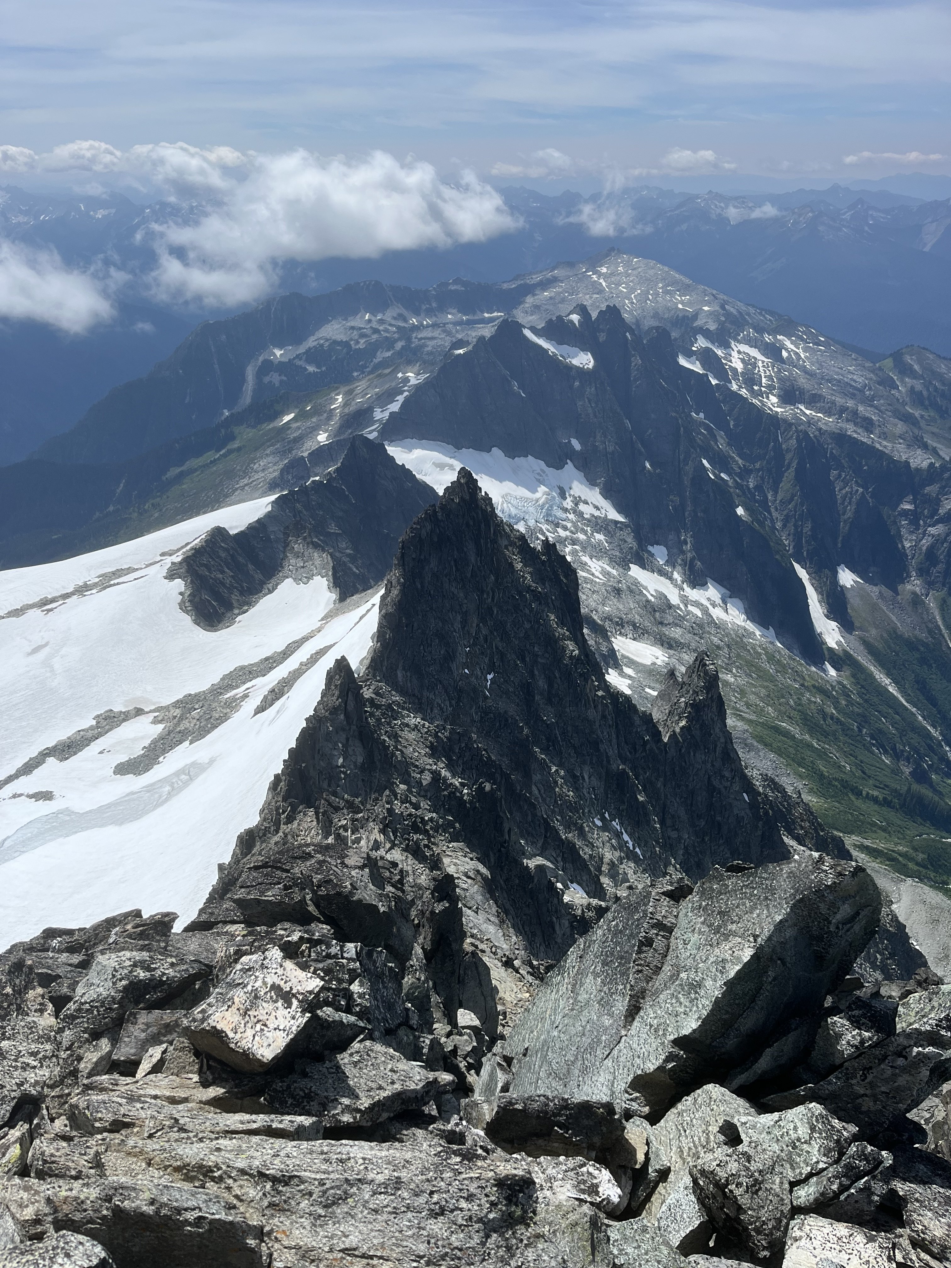
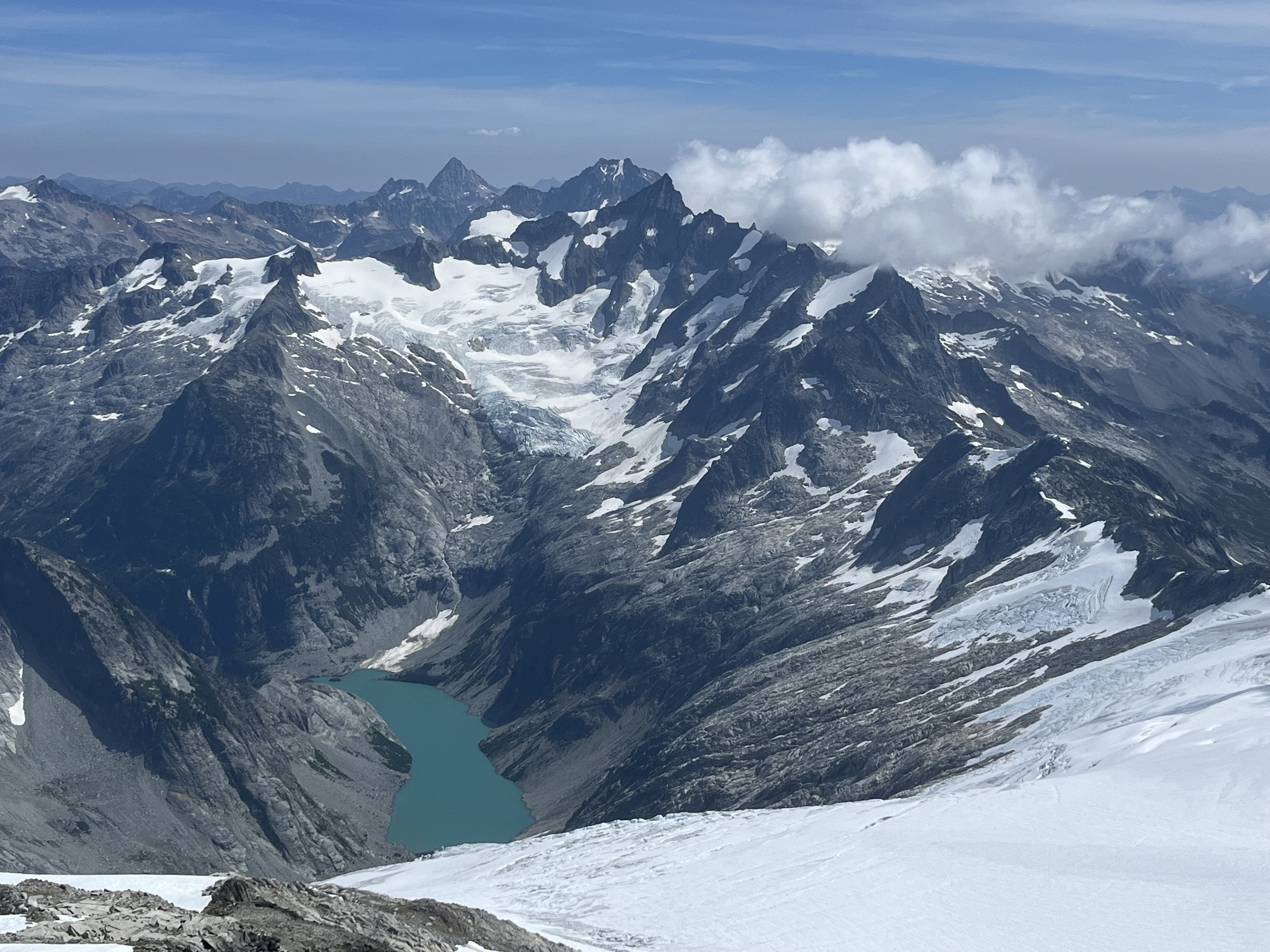
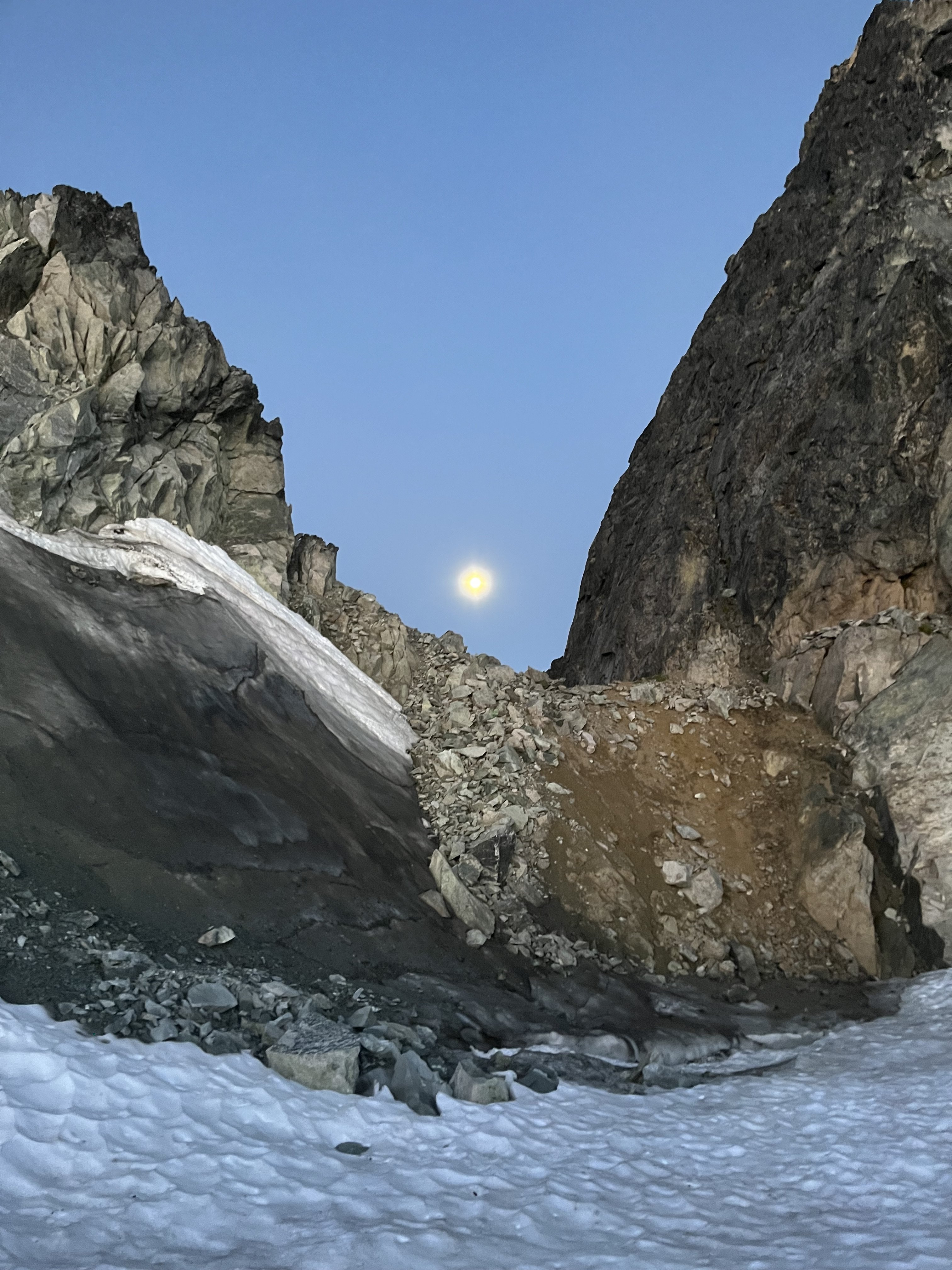
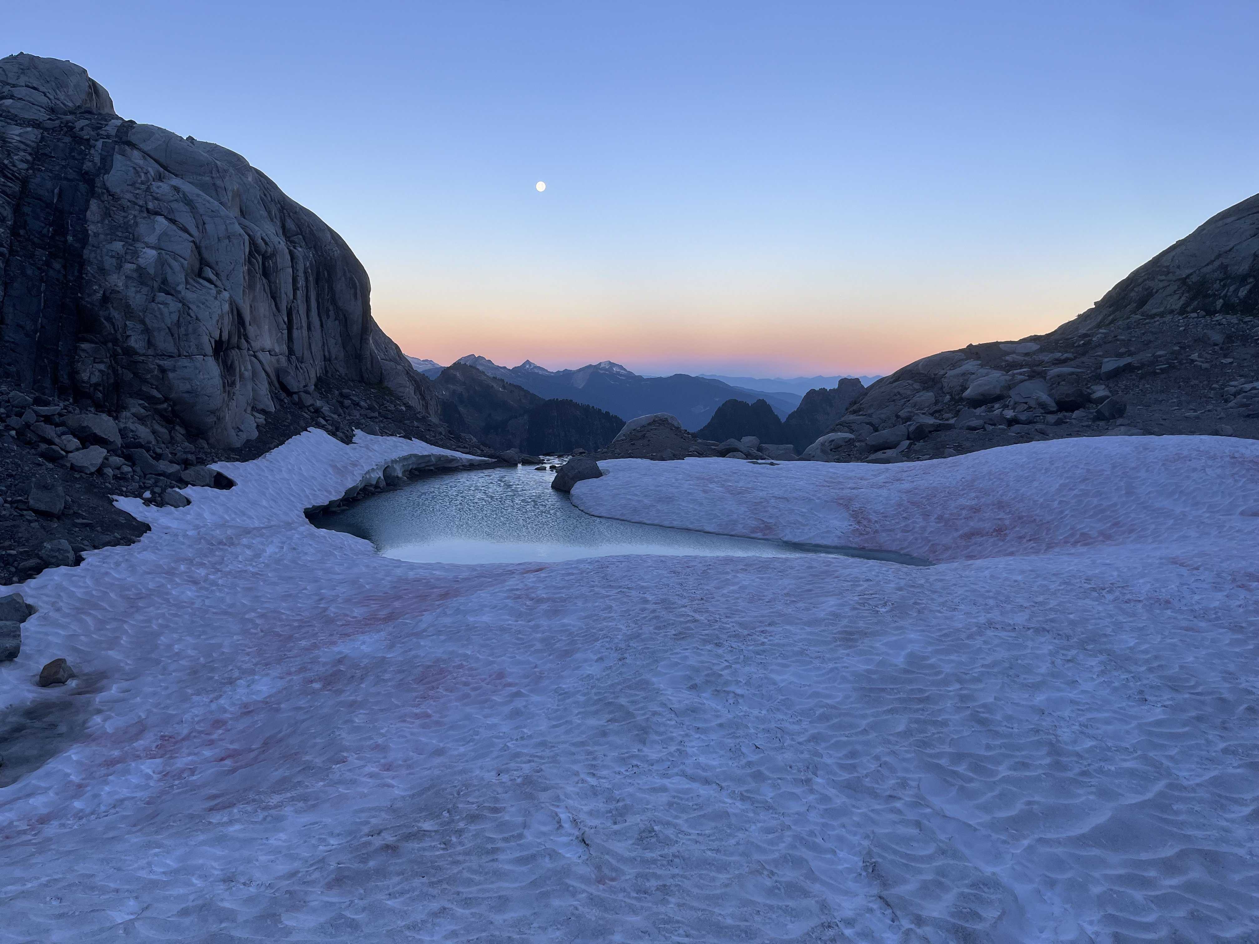
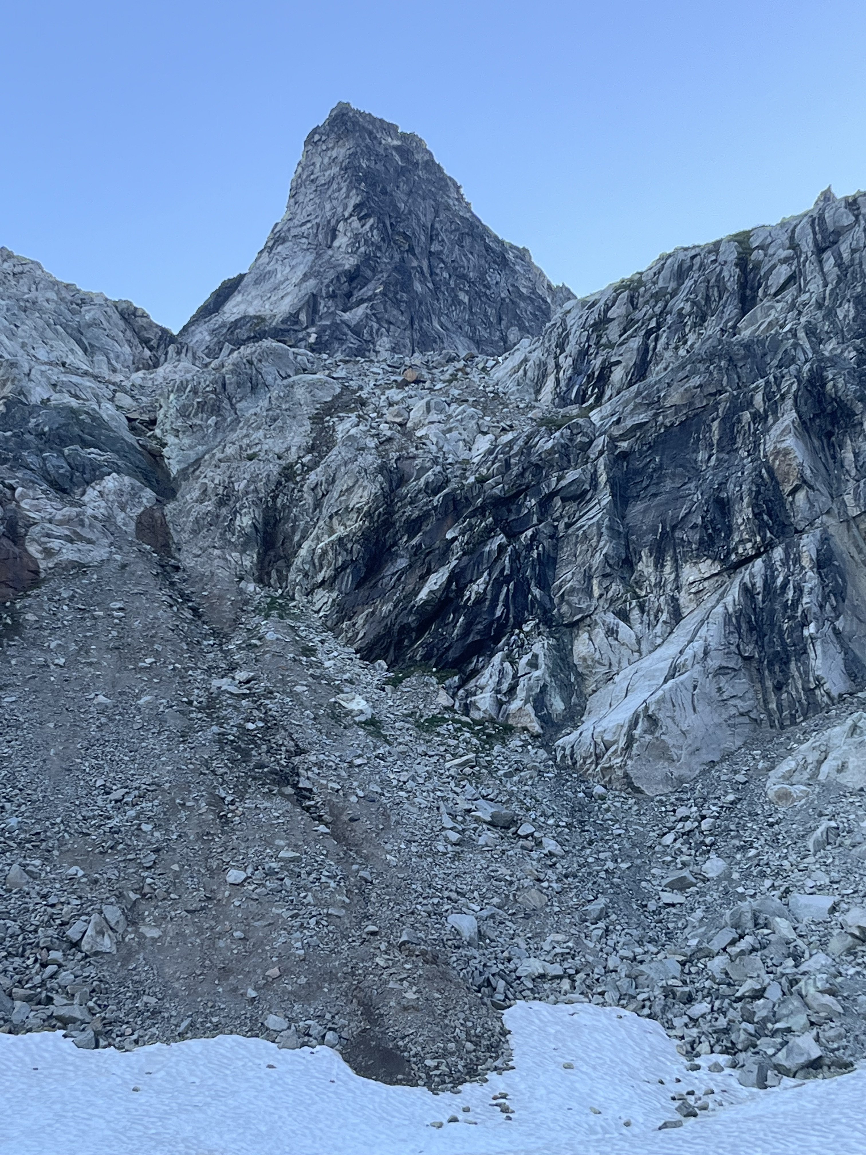
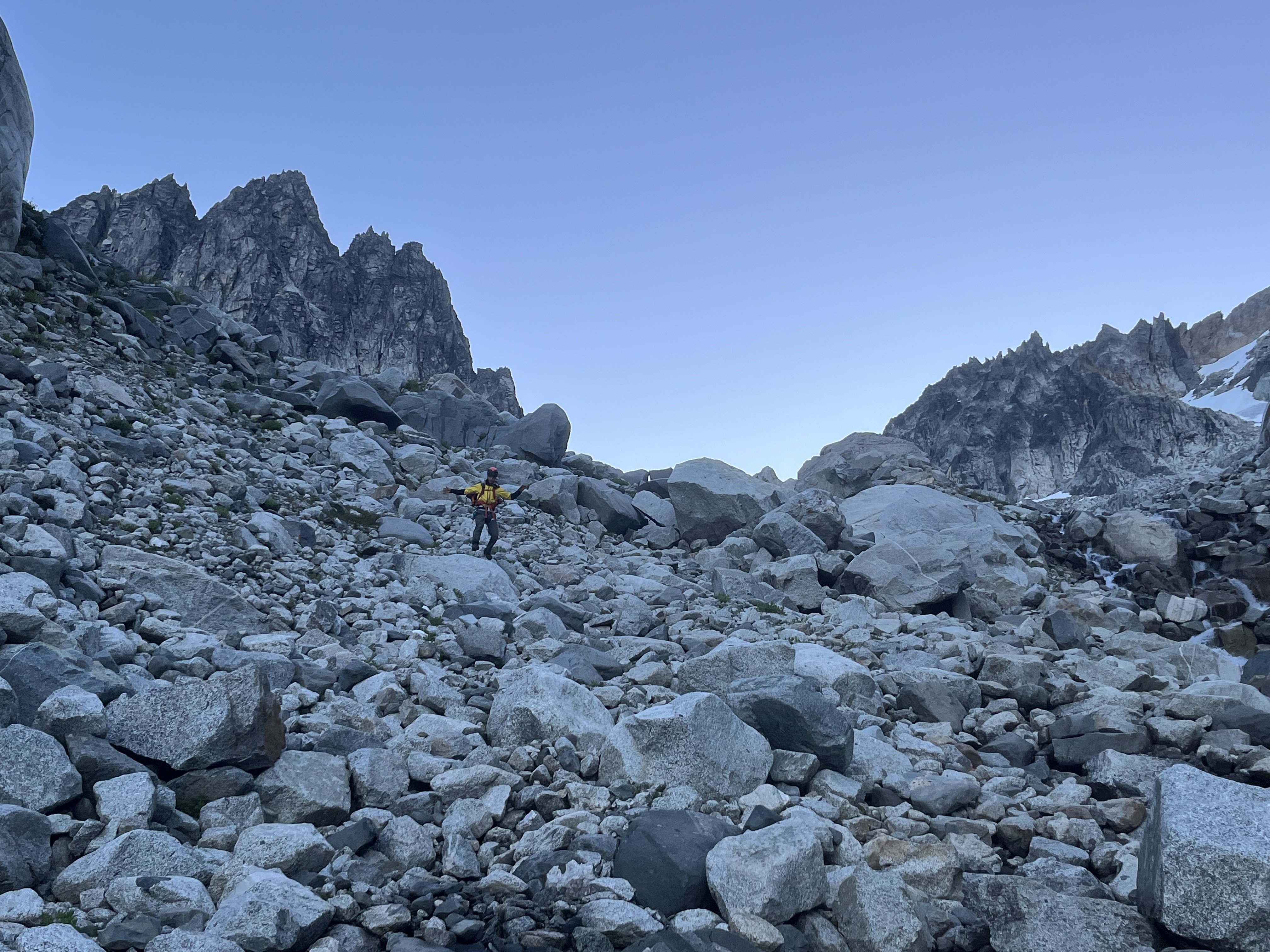
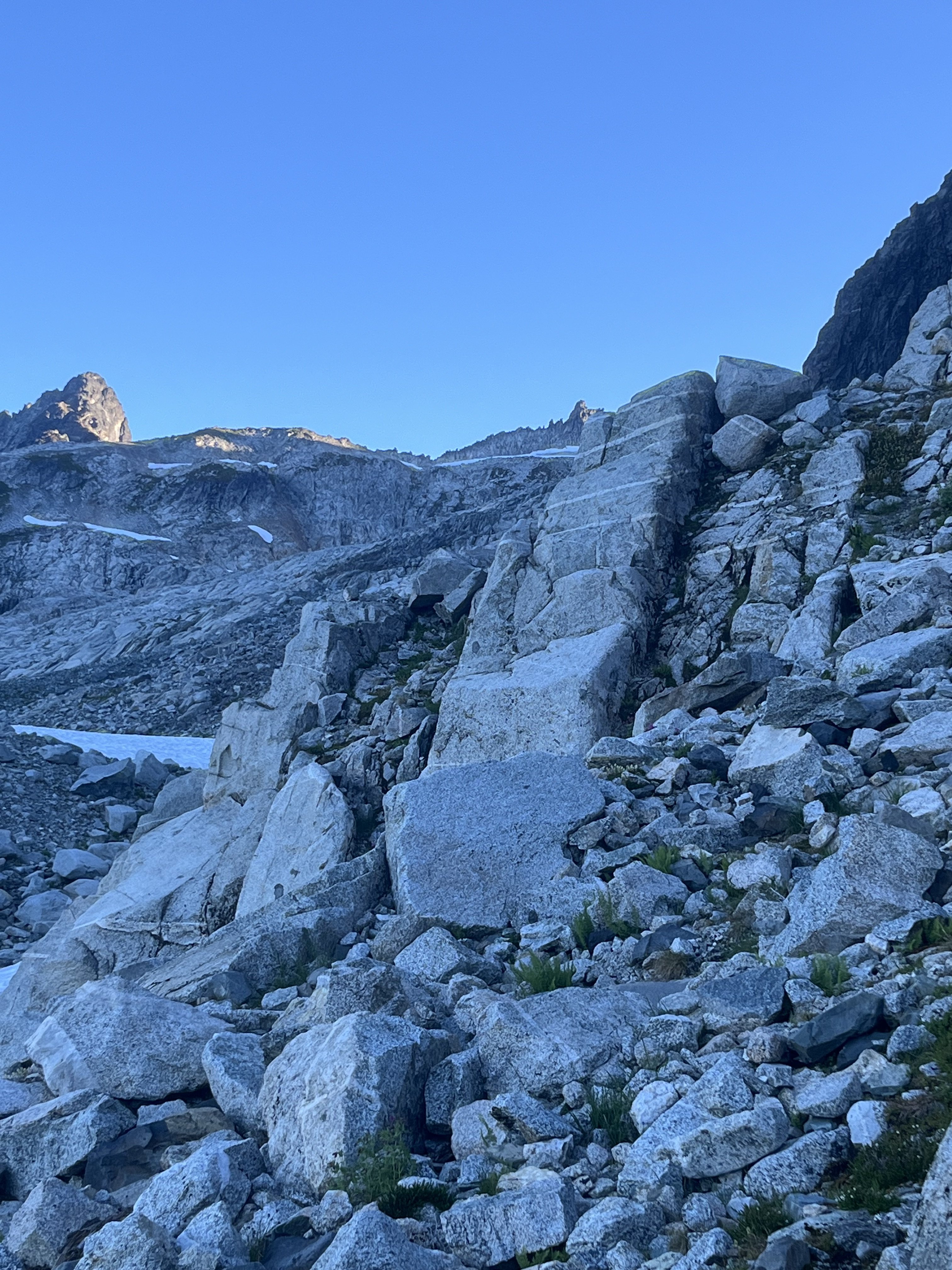
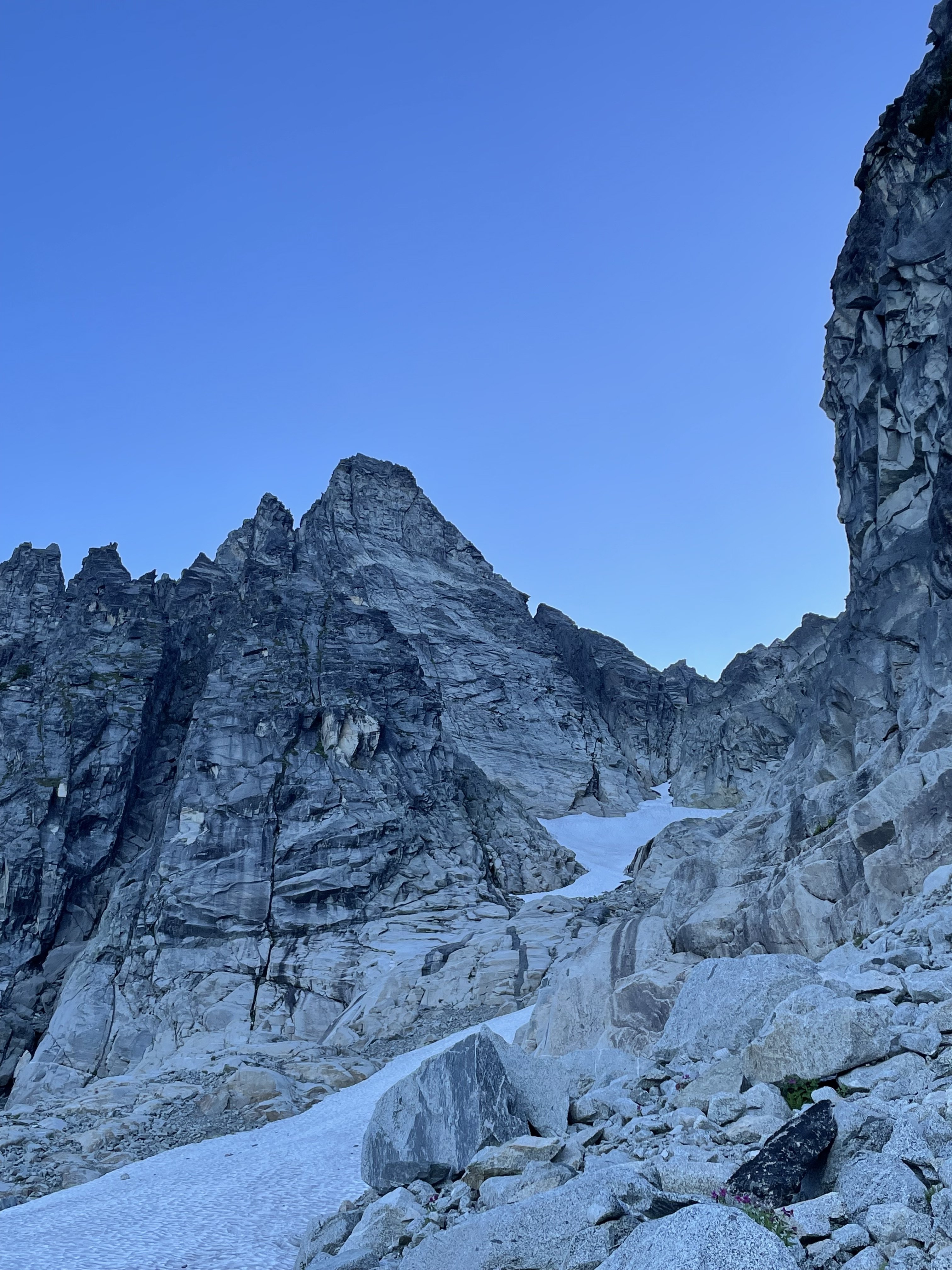
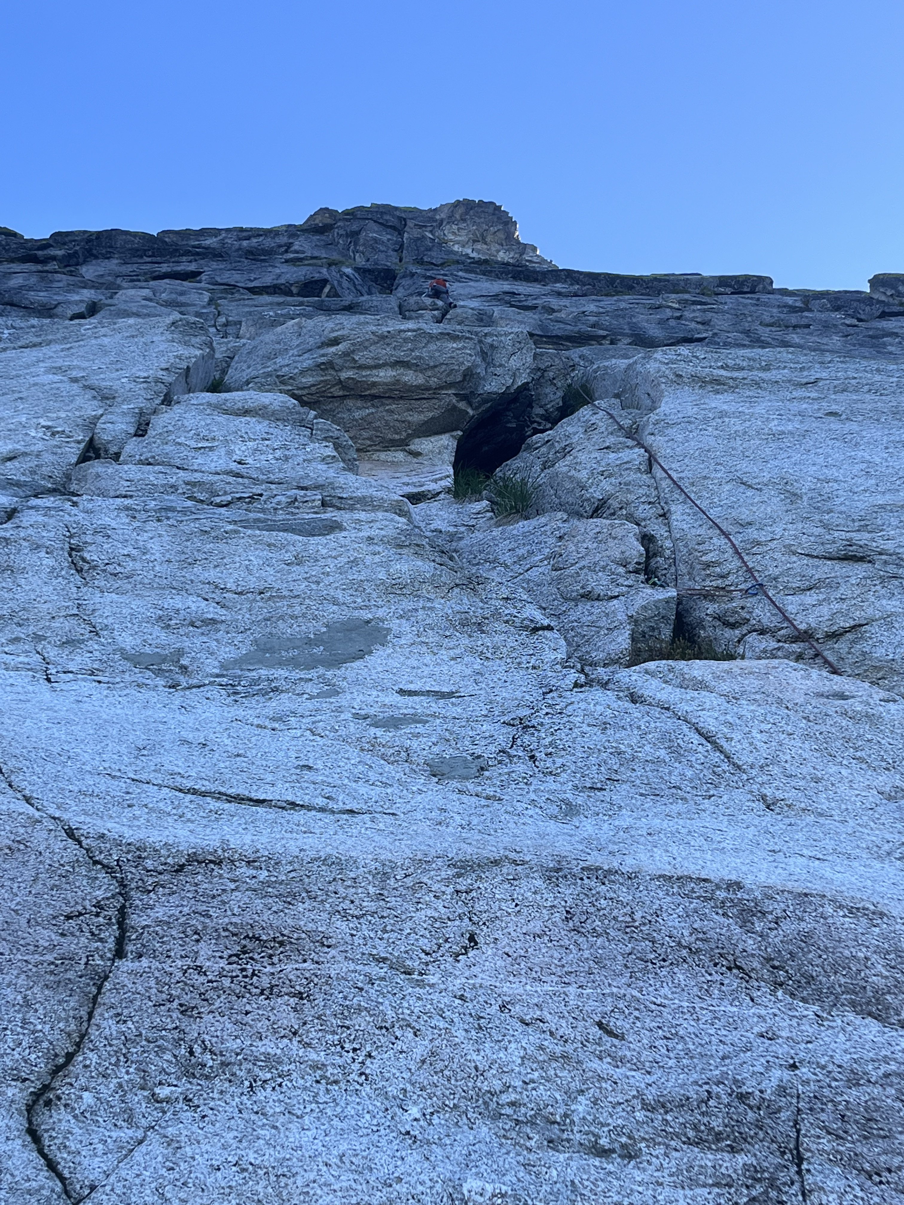
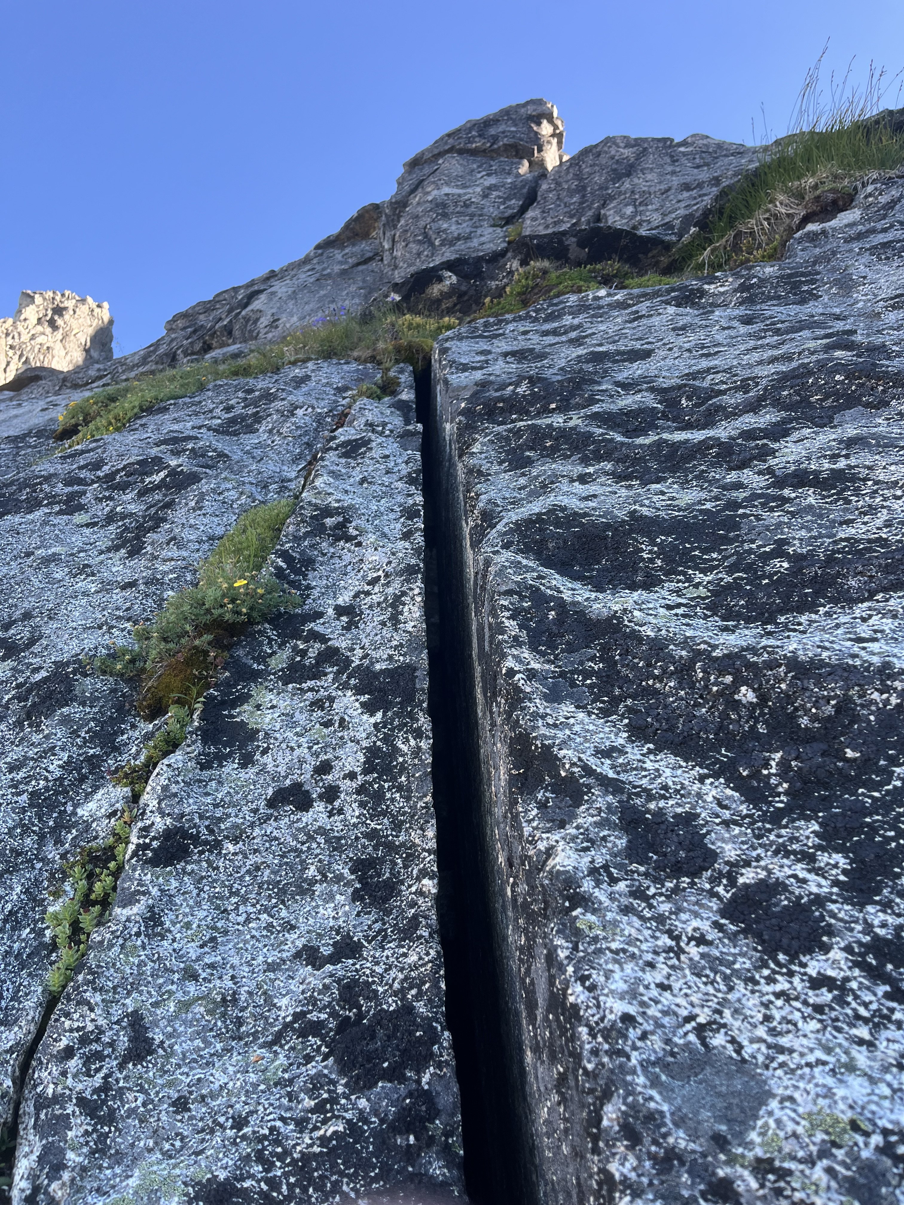
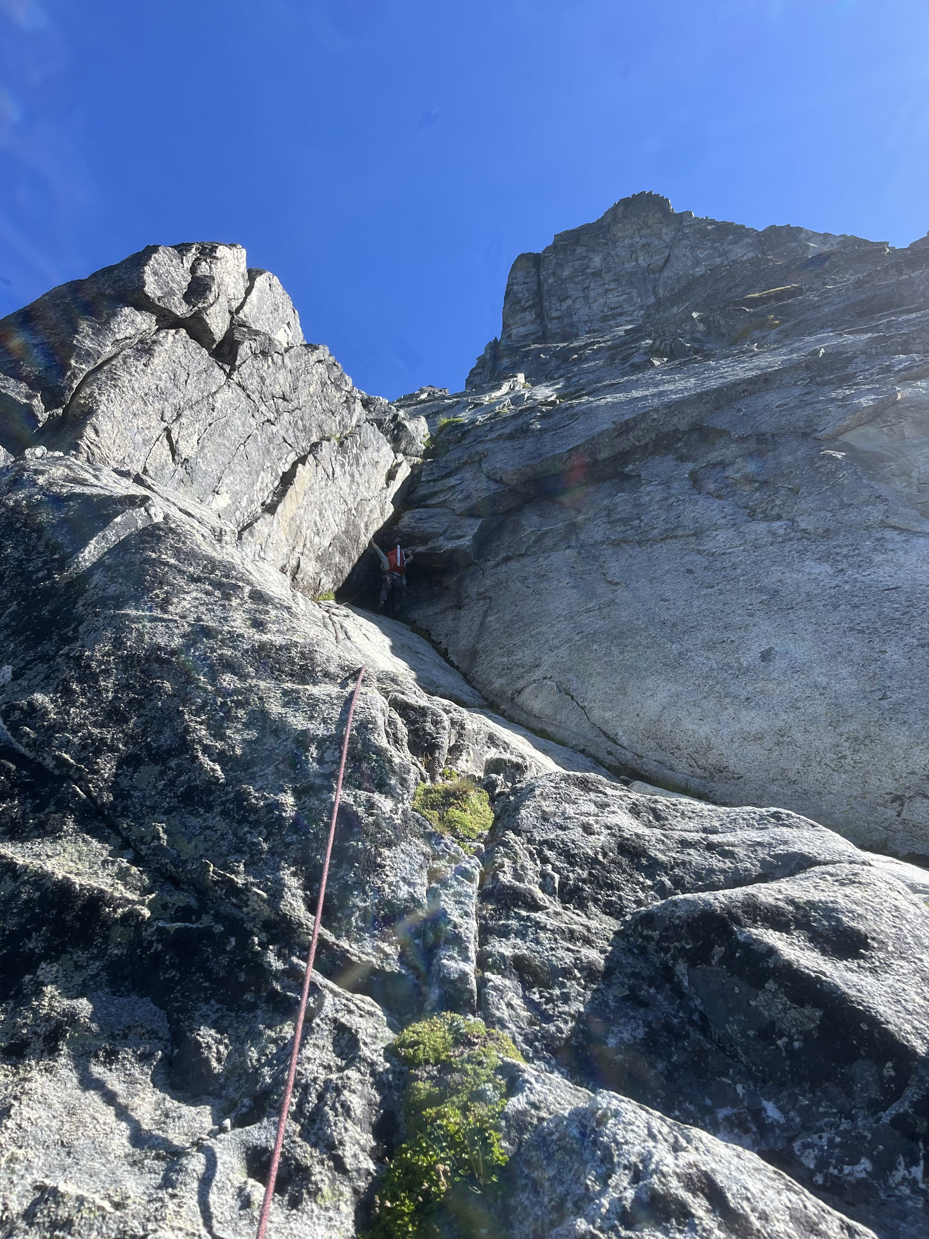
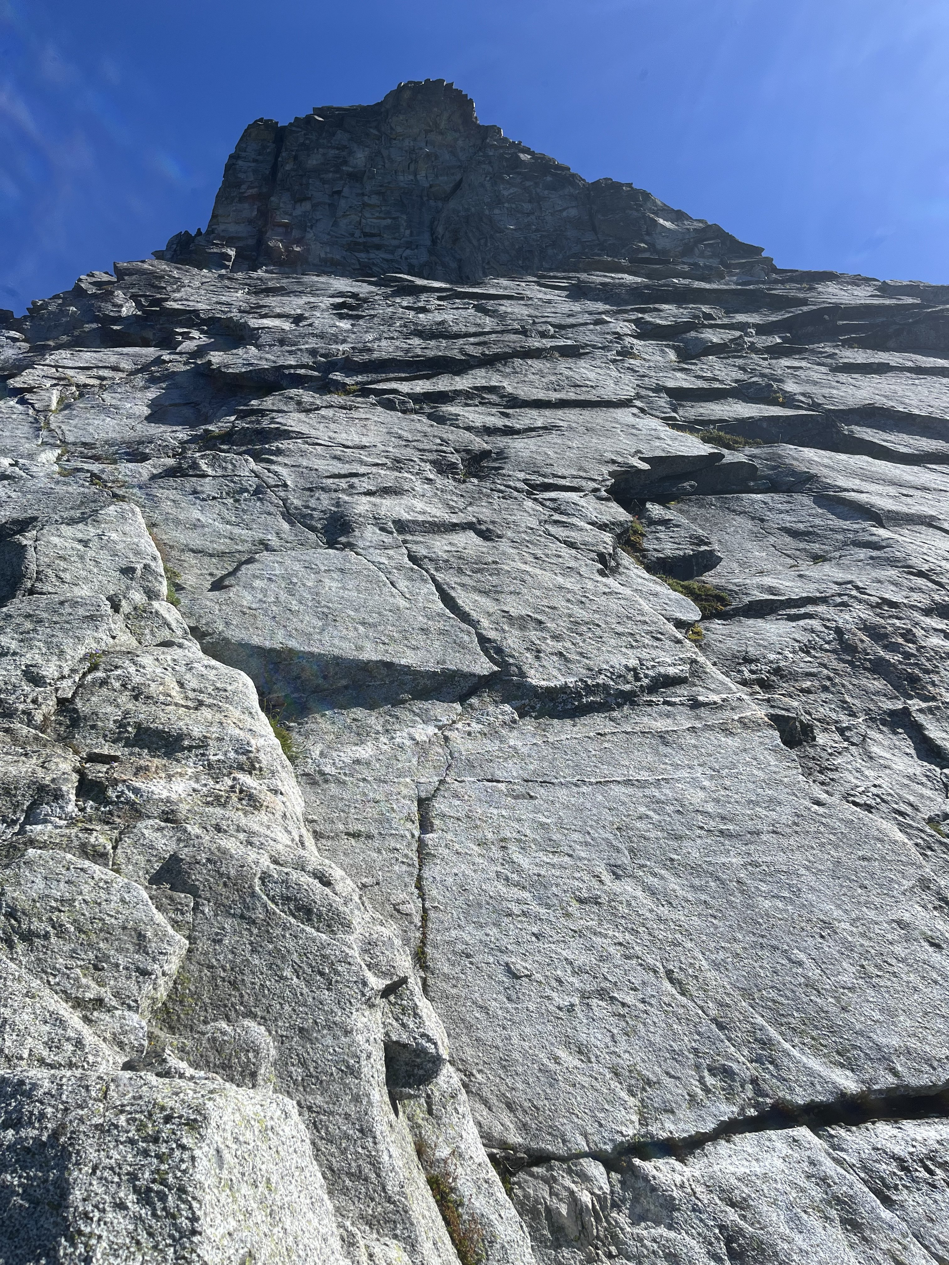
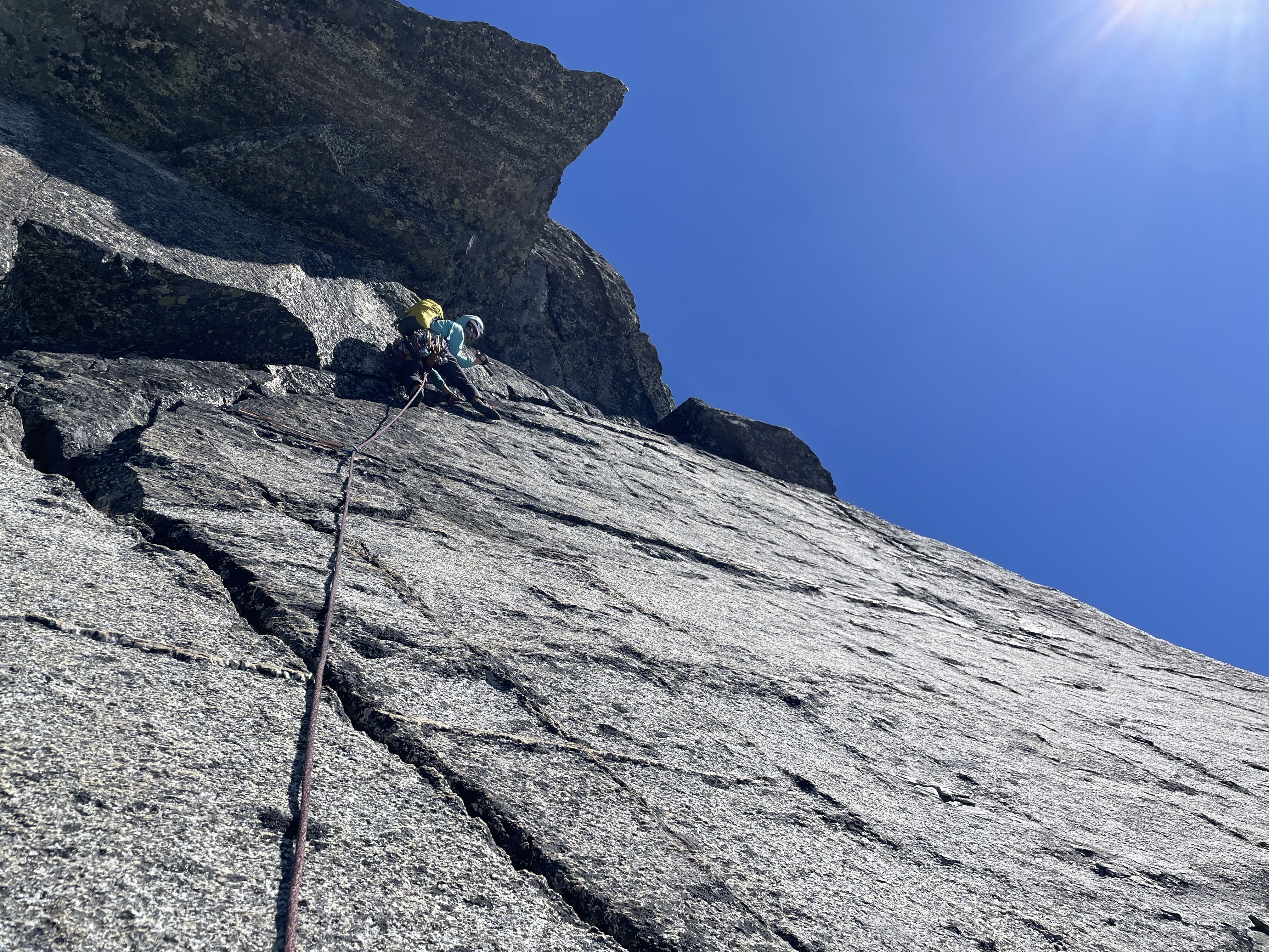
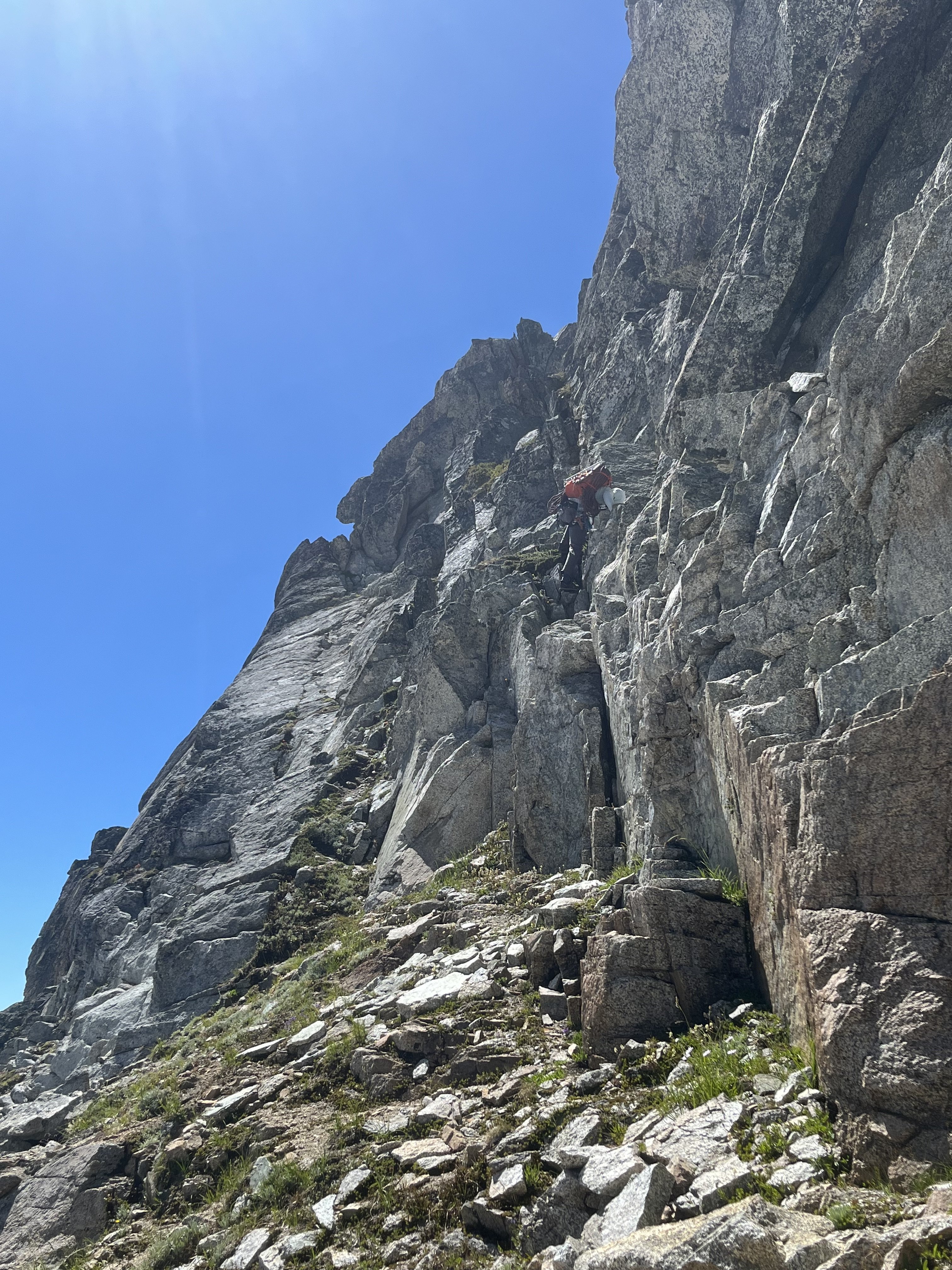
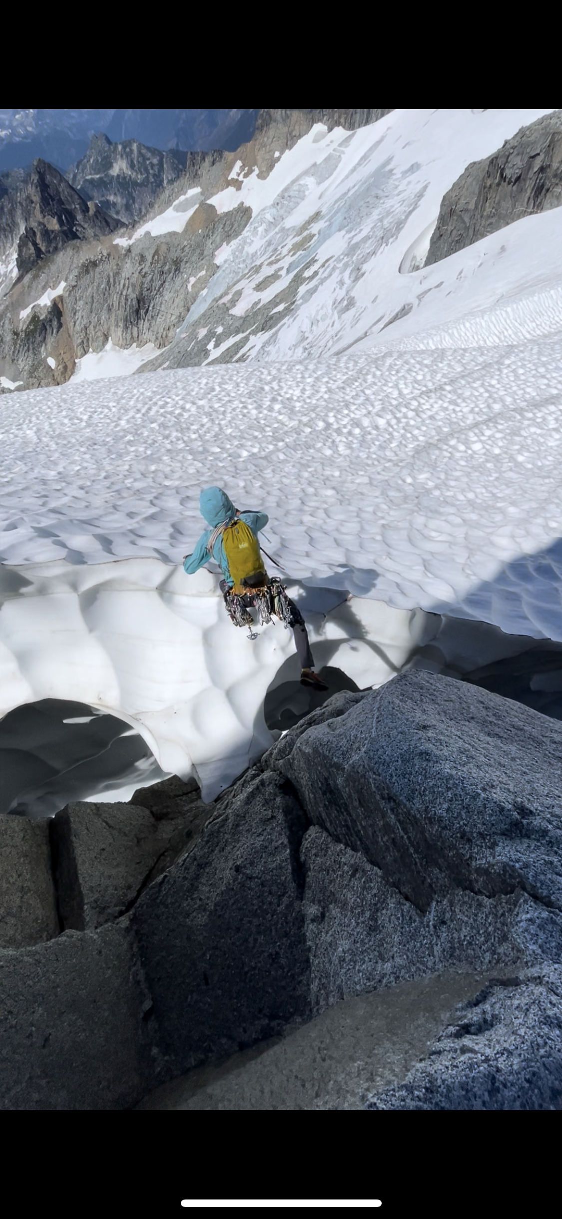
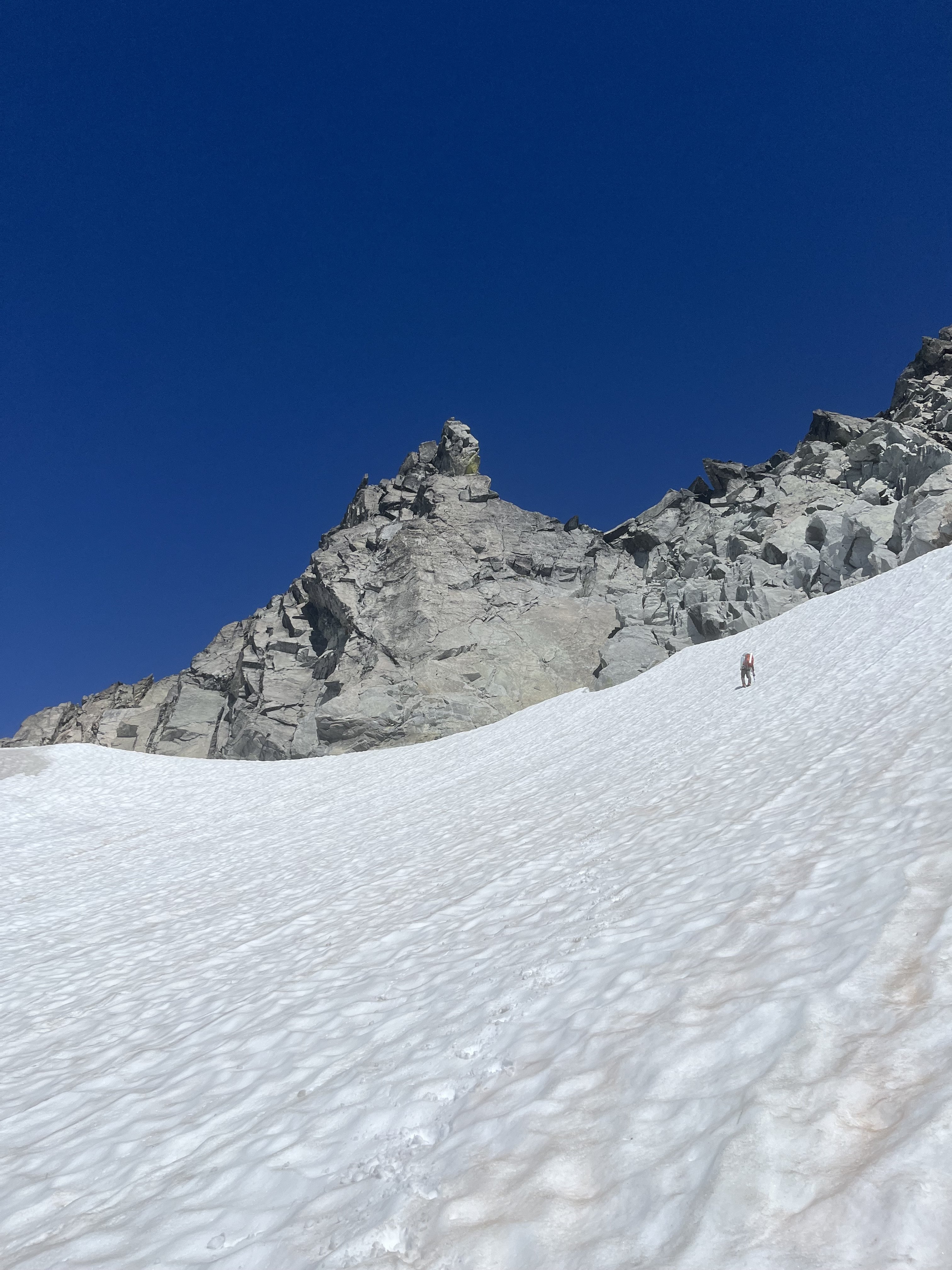
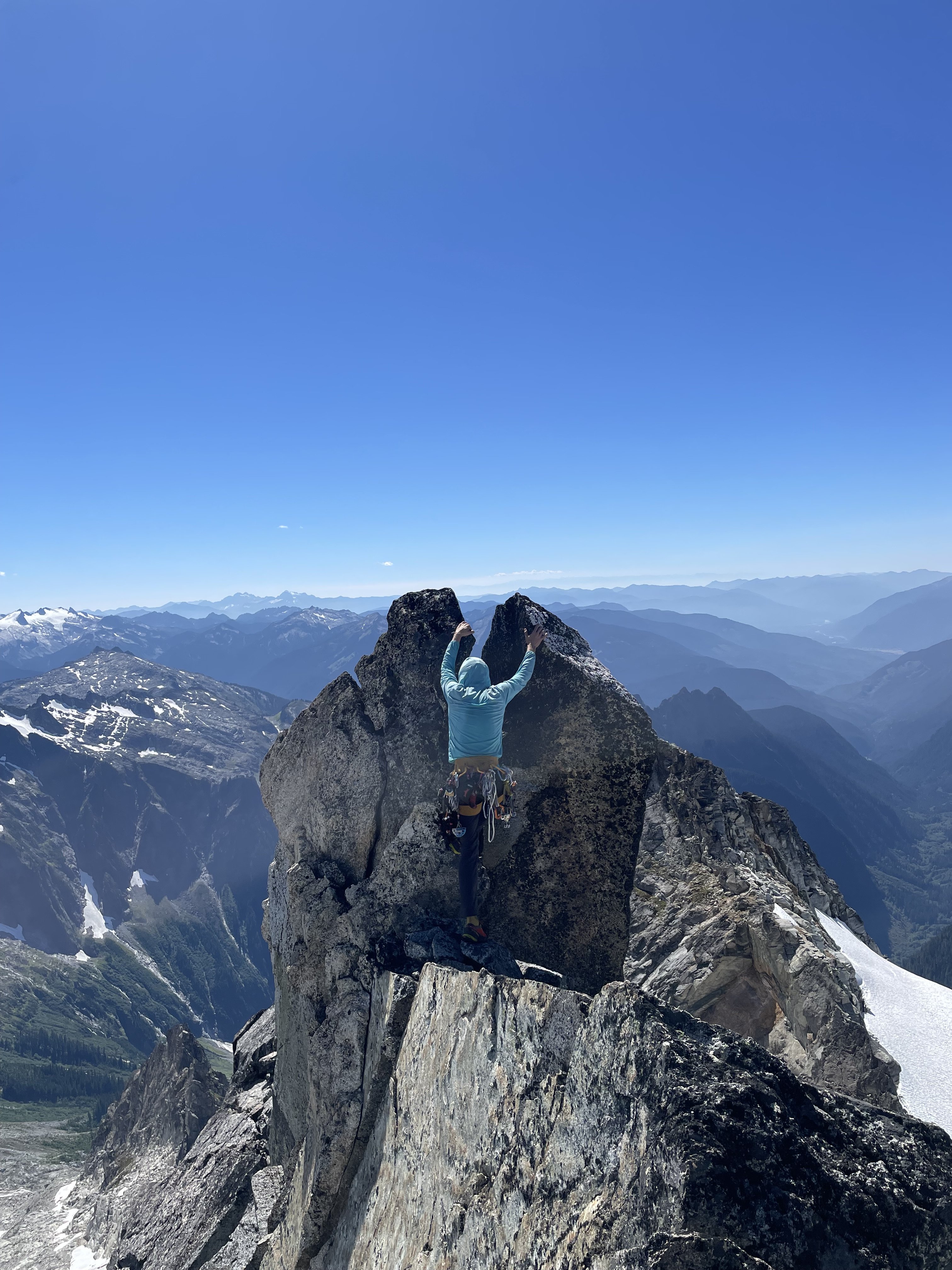
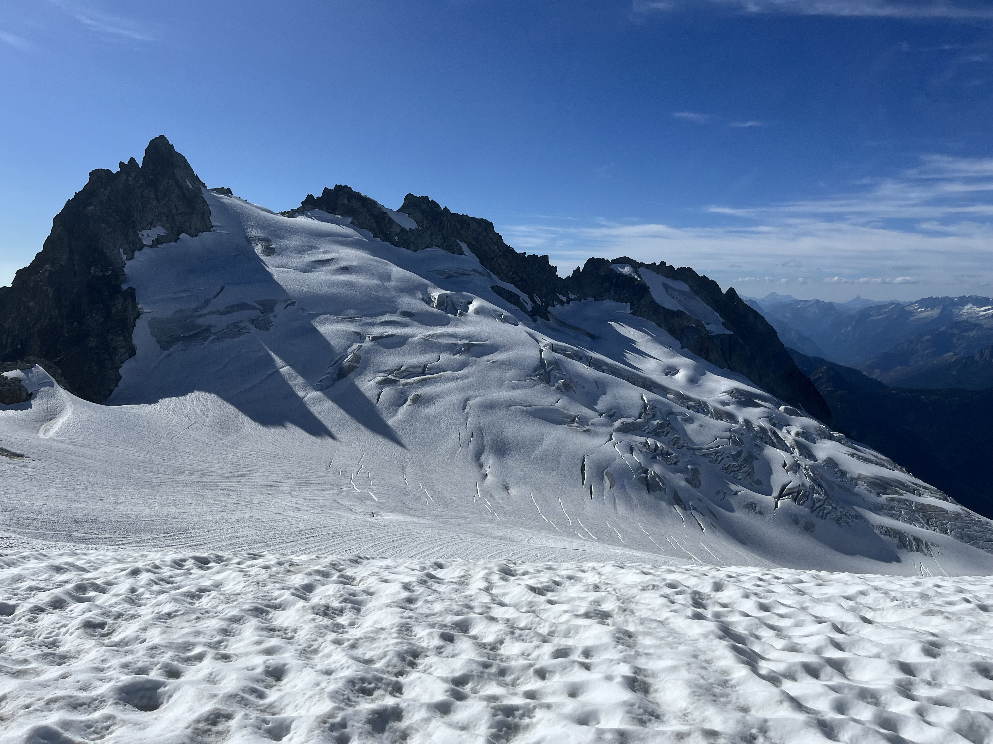
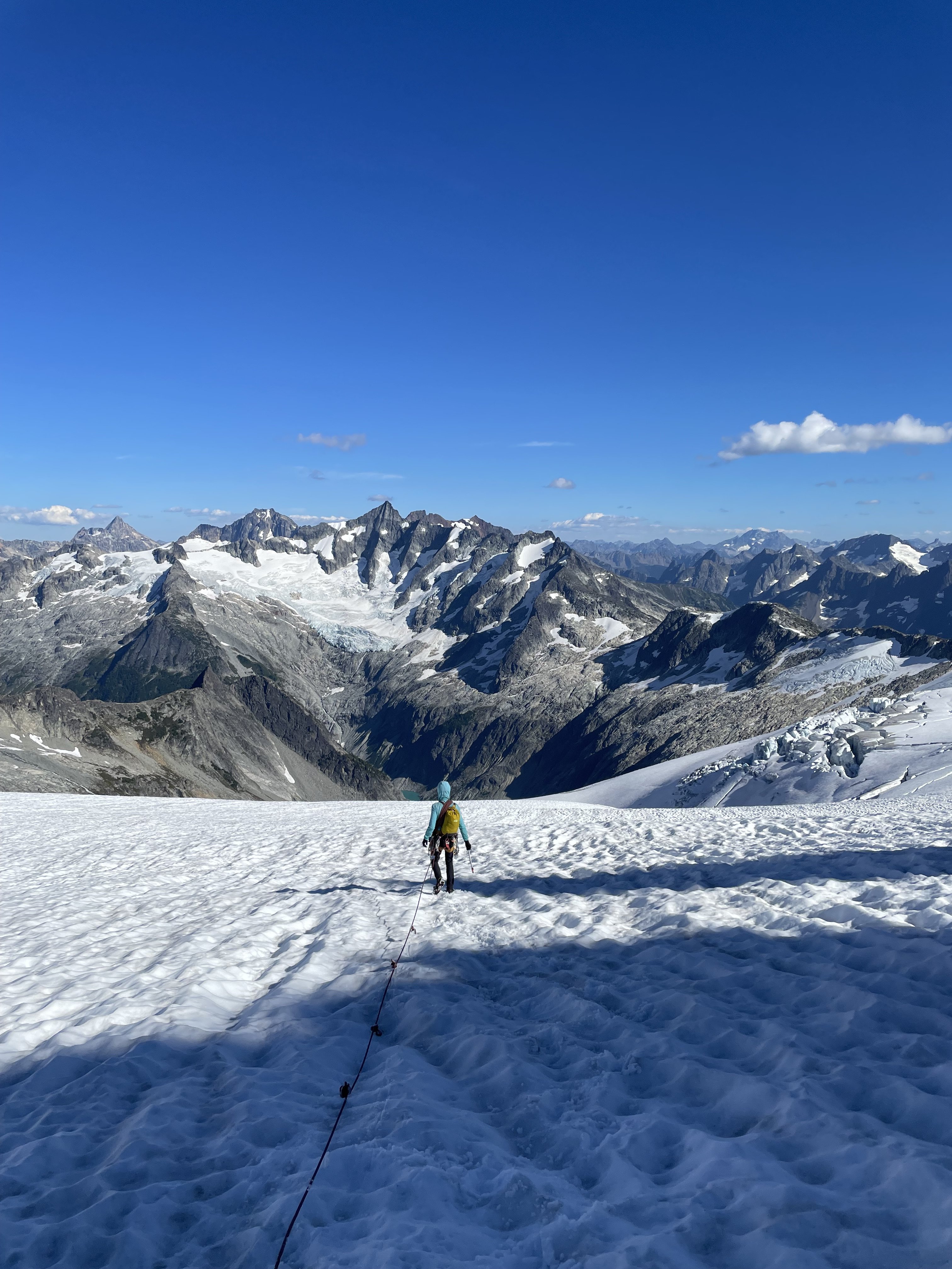
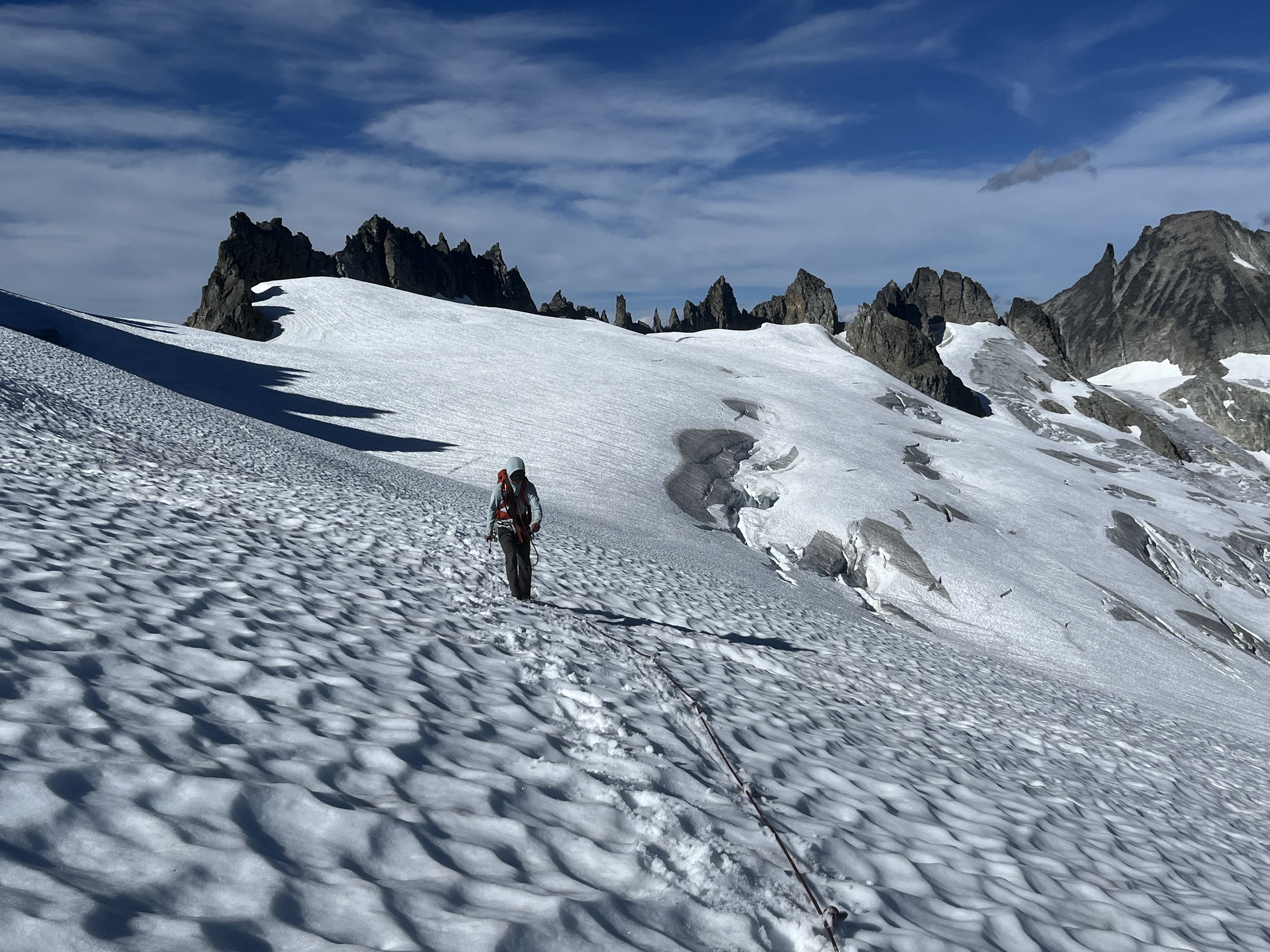
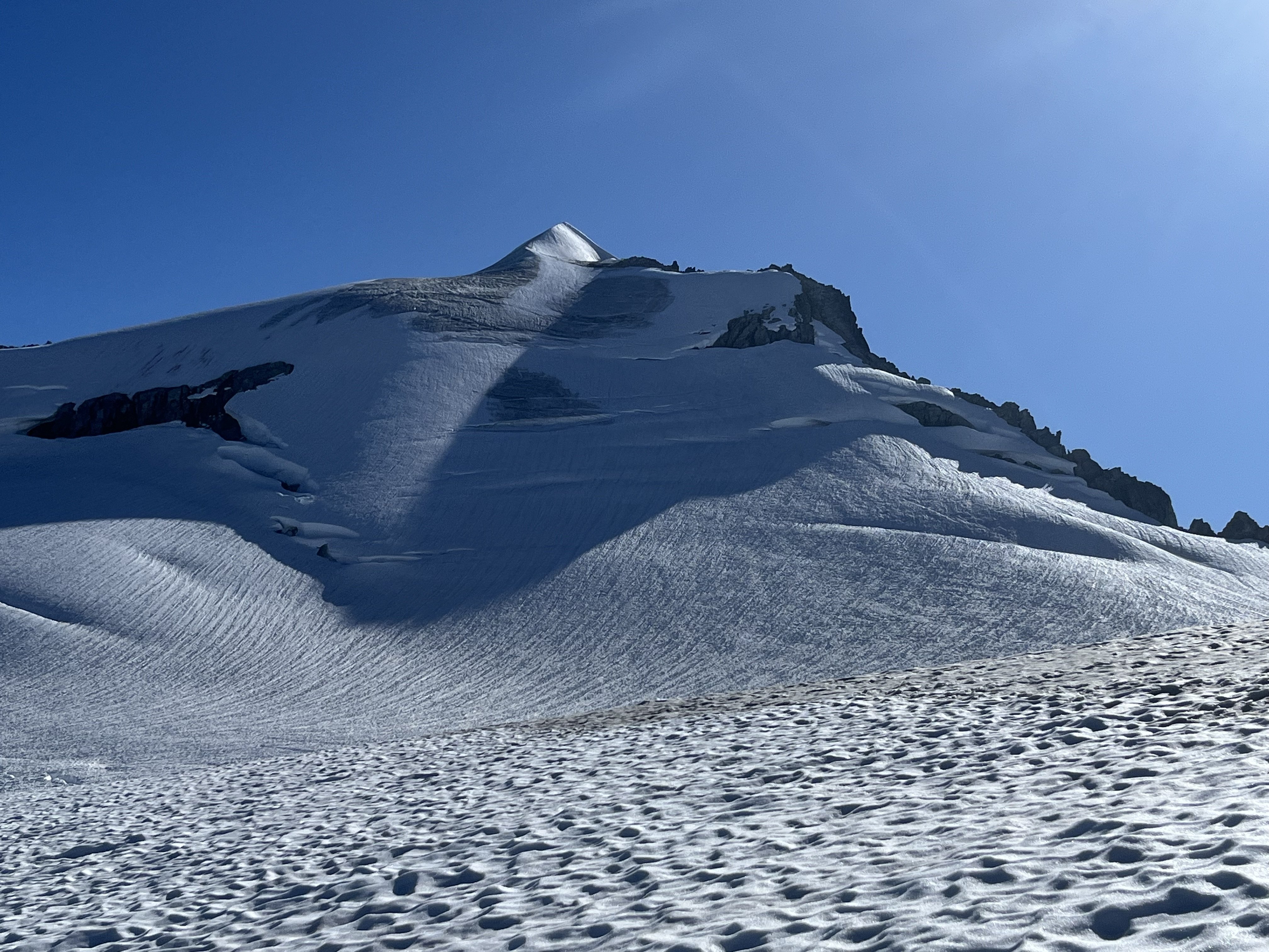
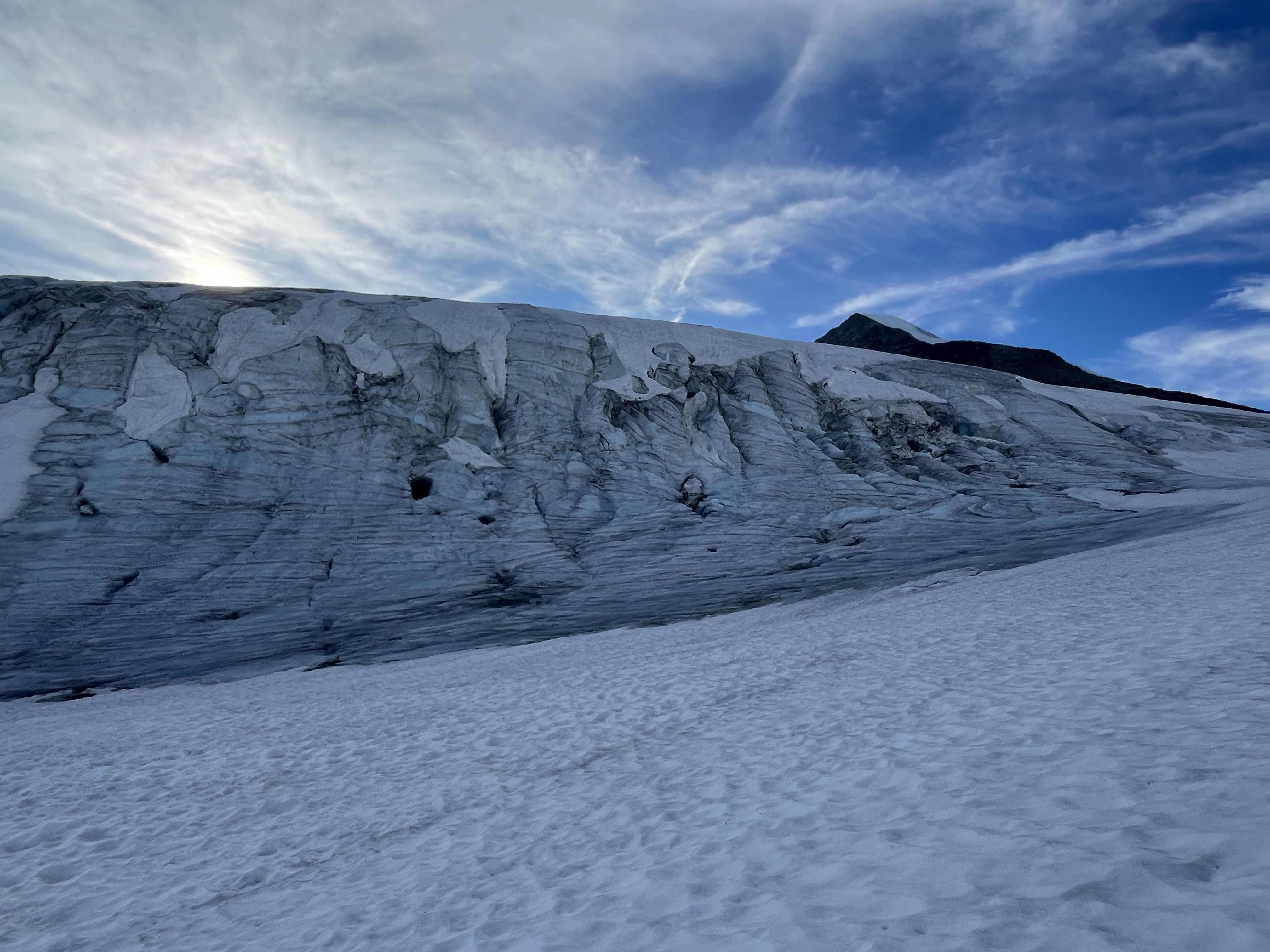
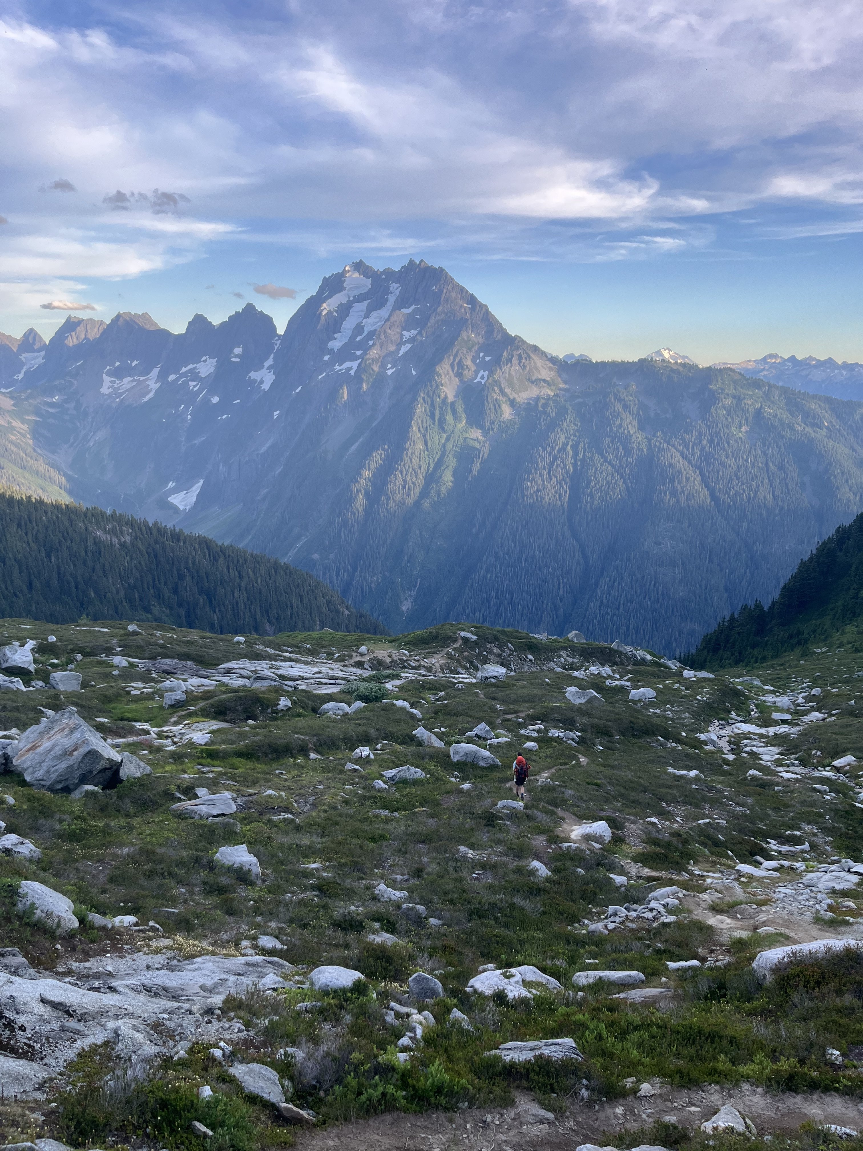 8 points
 -
Background: This is a trip report for the frostbite ridge of glacier peak. WHo was there? Me (the slab doctor), the anchorman, and capt. Kirk himself. In yearly tradition we go climb something every summer. Unfortunately the final disciple (Professor Science) was unable to make the trip due to life choices outside of his own comprehension. Day 1: after getting to the North Fork Sauk trailhead somewhat late in the afternoon, the disciples hiked up to the PCT and then down slightly to camp in the large bowl just below the ridge. stats: 11.5 miles and 4.8k gain Day 2: We slept in and hauled butt down to the Kennedy creek crossing. we had heard that you must actually wade to get across this but it was no issue for us to cross on logs. We then started the climb up to glacier creek and left the PCT there. Shortly after leaving the PCT we were at the toe of the kennedy glacier (3:45 pm?). There is a nice bivvy site here. We decided to attempt to make it up to the bivvy at 8.8k. Going up the side of the Kennedy was horrendous work. Large patches of glacial till/mud, exposed blue ice, and loose gravel made for tedious going. We made it to 8.8k camp at 7:30/8pm ish and were all pretty kicked in at this point. The bivvy was one of the best I have had, a beautiful inversion left us above the clouds with stunning views of Baker, Shuksan, and the North Cascades. Unfortunately the anchorman had the piles & was shitting a lot over the last 2 days. There are 2 flat spots for tents at the 8.8k site, but only 1 of them has a substantial rock circle. I would highly recommend not sharing this route with other parties for this reason, and for the significant choss hazards on the ridge that arise late season. stats: 12 miles and 5k gain Day 3: We were going by 7:30/8am up towards the rabbit penis on what I can only describe as some of the worst choss of my life. We were kicking down serious amounts of rockfall, I'm talking 4 or 5 basketball sized rocks at a time that would not stop and continue off the ridge until they were out of sight. Again I would really not want to be behind another party on this route, unless there was significantly more snow. After going tucking around to climbers right the rabbit peen we got on a short section of steep snow and then a cool sidewalk with significant exposure above the upper kennedy. We gained the ridge again after the sidewalk and crossed over to the other side. Here we went almost between the rabbit ears, and after spotting a cairn on the other side of the ridge we down climbed and began the short up and down section before the final ice pitches.IMG_3263.HEIC The ice was pretty trivial and we probably could have soloed all of it but out of an abundance of caution we pitched out the lower section. We then de-roped and simul soloed the final 100 ft of snice / steep snow. If you stay to the right side you will put out exactly below the summit rock jumble. After shmoozing it on the summit with a cool party of climbers from Kerala who offered us whiskey & cigs, we began our mad dash out. Our goal was to make it to the (former) Mackinaw shelter camp site which would leave us with a cool 5 miles to complete monday morning --some of our disciples had work the next day >: ) . We again busted serious ass and were at the shelter by 7pm ish that day?? 15 miles and 3k gain Day 4: an early wake up allowed us to do the 5.5 miles back in about an hour and a half and everyone got to work on time. 5.5 miles and 500ft gain.
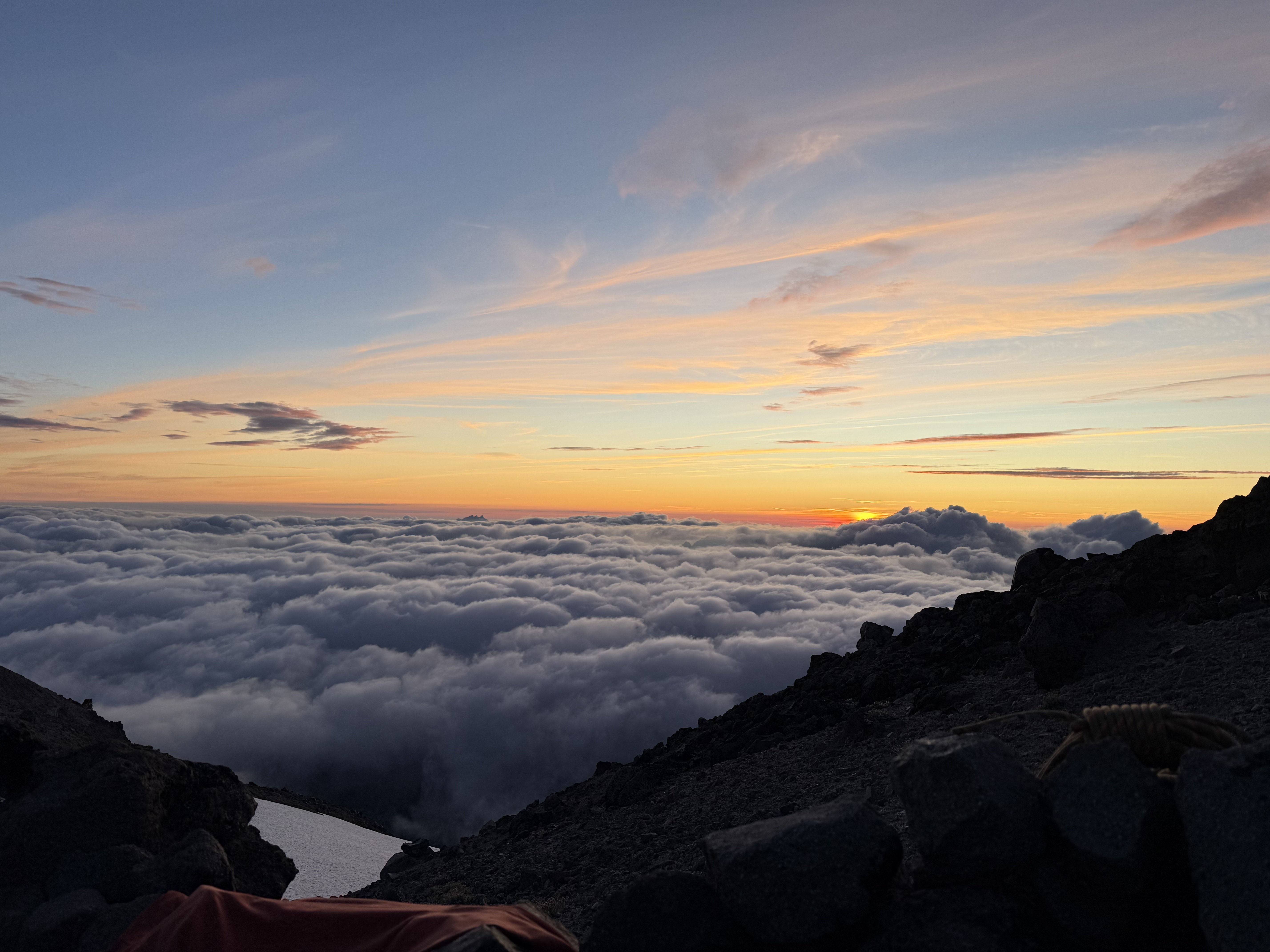
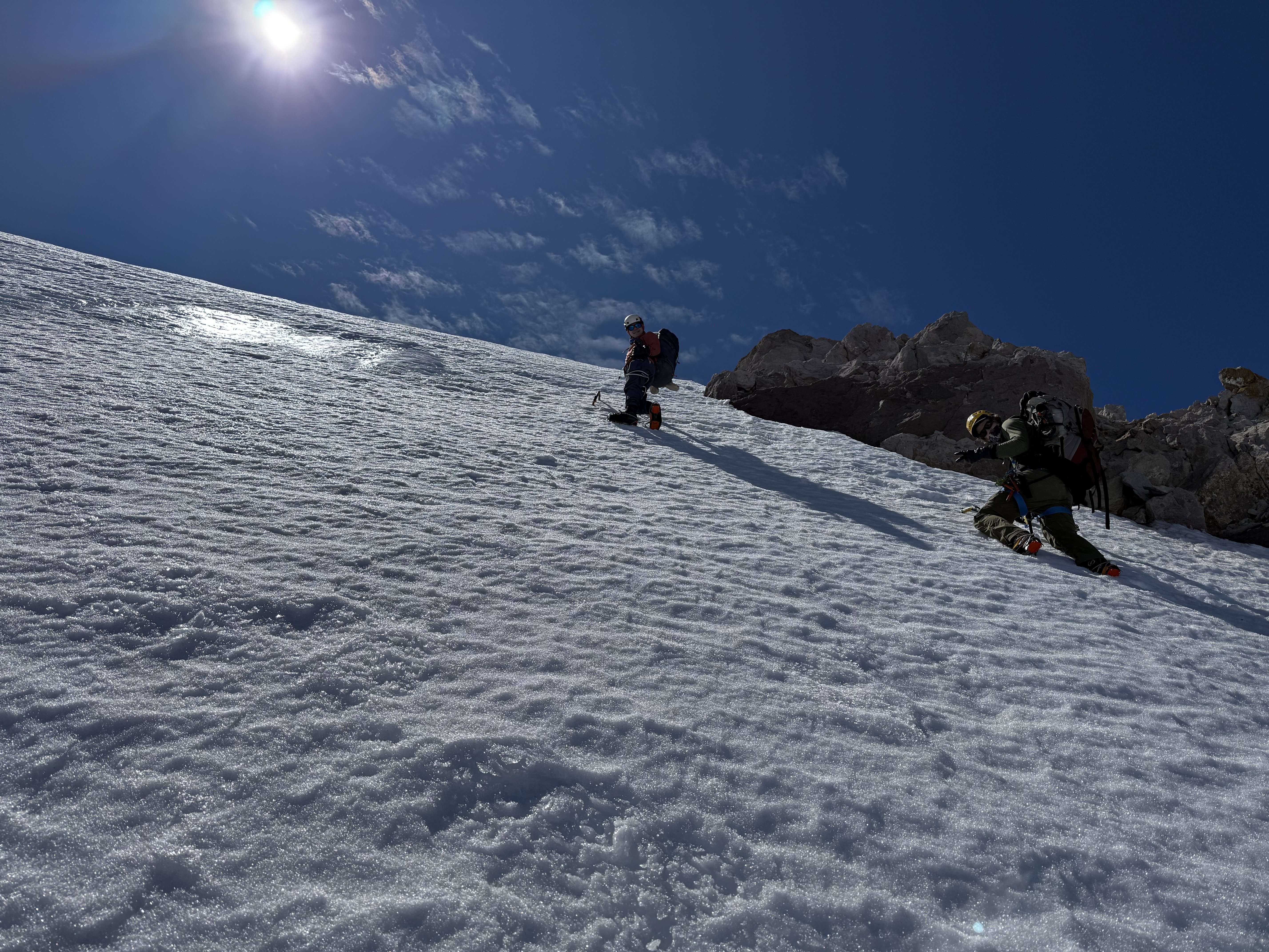
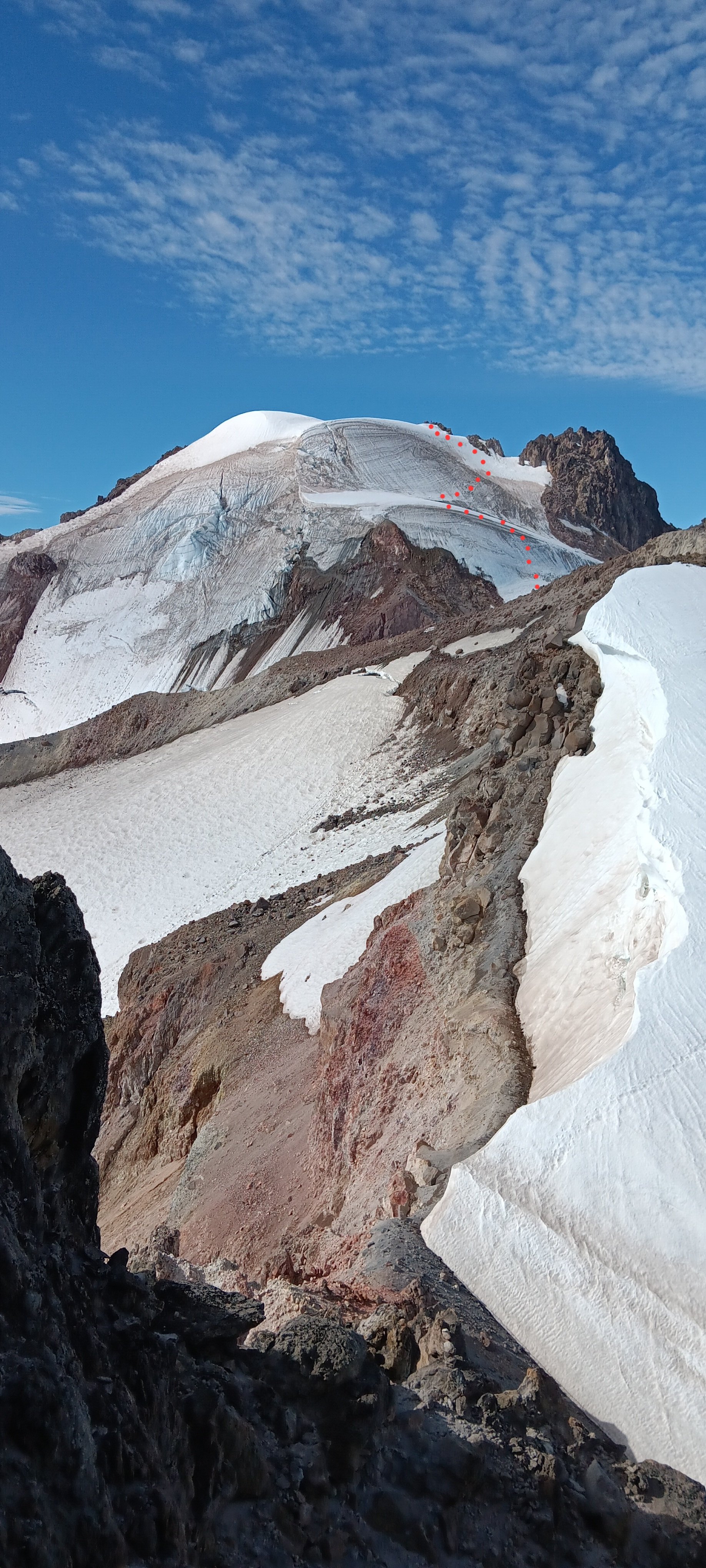 8 points
 -
There are plenty of trip reports out there about the Tahoma Glacier, so I won't elaborate too much on the route. Last year we had planned to climb this route but with a very terrible forecast during our dates we postponed it a year. This year we braved the rain on day 1 in hopes of the promised good weather for summit day. Thankfully it paid off. Leaving the trailhead Saturday morning in the rain. (Photo by my wife) Found fresh snow from the previous night that was now a sloppy mess.....still raining. (Photo by my wife) Rewarded with this view on Day 2. We moved from Camp 1 at 6,200 ft up the Puyallup Cleaver to high camp at 9,800ft at the base of Saint Andrews Rocks. Looking at the Puyallup Glacier. It was well filled in and easy walking up to high camp at 9,800ft. Looking down at the Tahoma Glacier from high camp. You have to drop down the ramp to reach the glacier proper. Sunset at Saint Andrews Rocks at 9,800ft. (Photo by my wife) Early morning crevasse navigation. (photo by my wife) Some more crevasse shenanigans in the broken up sections. More crevasse zigzagging. (photo by my wife) The team nearing the top of the route approaching 14,000ft. The summit with my wife and I. At 13,100 feet on the way down our 2nd person (out of 5) had a sliding fall into a crevasse. I have always said that if you keep your intervals tight you shouldn’t have to worry too much about crevasse falls. And over the last 15 years this has proved true in both the PNW and AK. With multiple small punch throughs over the years nobody has ever gone farther than their armpits. But this time was different. This is because if you punch through a snow bridge you will likely go up to your waist or backpack but then be tight and climb out on your own. I think this is true for typical crevasse falls….bad snow bridge, or winded over crevasse. These are times were you are surprised and fall right in. There is an entirely different type of crevasse fall. This is when you take a fall in steeper terrain and are unable to arrest that fall prior to the crevasse. I never really thought much about this because I feel really confident on crampons and look at those short locations as “do not fall” sections. But clearly with a less experienced group I need to take those sections a little more seriously. Our #2 guy on the rope was very tired on the way down which I am sure contributed to the fall. He fell in just such a place on a traverse above a crevasse on terrain I would call “no fall zones”. He fell off the upper lip and into a big open crevasse. The rope wasn’t super tight but there wasn’t an excessive amount of slack in the system. It was in difficult terrain where there were multiple obstacles stacked right after each other so team members were navigating different technical obstacles all at the same time (not ideal). Looking back I think I could have potentially avoided the incident by the use of running protection. I just felt so secure in those sections that I didn’t really think it necessary. But when taking newer people out it is better to take a couple minutes to add running protection than a hour to pull someone out of a crevasse. Lesson learned for sure, and I am just really glad he was ok. When the fall occurred, my wife who was leading the rope team had just finished all the technical obstacles and was on the lower lip of the crevasse. #2 was working across a traverse 8 feet above the lip of the crevasse and then had a 10 ft down climb to a narrow snow bridge. #3 had just finished a down climb and was just making a step across a thin snow bridge and onto the traverse. #4 was at the beginning of a down climb. #5 (myself) was anchoring the back on the slope above. When #2 fell he was unable to arrest in those 8 feet and so fell off the upper lip. He stopped about 30 feet below the lower lip and just above a sloping snow ledge. The rope never came tight to my wife (#1) because #2 fell towards her creating slack. #3 was pulled off her feet across the snowbridge onto the traverse. She was able to arrest. #4 was pulled off his feet and into the down climb. Myself in the back was able to arrest and hold the fall helped by #3 on the traverse. Thankfully #2 who fell in was uninjured. We were able to give him a little slack so he could get his weight on his feet onto the sloping ledge and then we started working on a plan. It took a bit of time to get things setup since the terrain was complicated where most of the team had arrested the fall. But in the end we were able to get everyone except for myself to my wife's position on the lower lip where there was a great spot for rescue. They were able to equalize 2 pickets (1 deadman and 1 end SLAM) and then used a 3:1 system with an ice ax at the lip to keep the rope up. Once the system was set 2 people were able to haul out the climber in less than 5 minutes. Having various different levels of experience on the team we spent a few minutes afterwards discussing and debriefing the incident. Here were a few lessons people found helpful. Place anchors further from the edge so there is more room to haul. When moving downhill keep walking down past the obstacle (body belay) vs. a hip or ice ax belay. This allows you to quickly run downhill should someone slide towards you creating slack. You need room to walk around at the anchors when performing a rescue. If in a safe spot think about just being out of the system. If not then use cord or the back end of a rope. Both the first 2 rescuers got pretty pinned into short tethers that prevented much movement initially. Have 1 person take lead on patient care and tell the person in the hole to put on warm clothes…even in best case scenarios it is going to be 15-20 minutes in the cold crevasse. If there is a ledge in the crevasse consider giving slack to get the person off the rope and onto their feet. Use the rope for backup should the snow give way again. Think through all the steps that need to get accomplished and try to figure out what can be done concurrently to speed up the process and gain efficiency. Here is the rescue in progress from the top lip of the crevasse at the beginning of the traverse. I ended up be "stuck" on the high side and only helped through directions. I felt the team plenty competent and taking the time to get me to them would just delay pulling out the fallen climber. One more shot as the fallen climber nears the lip. A shot looking up at the top lip of the crevasse and the traverse above. You can see the top of the upper down climb above the traverse on the left. The thin snowbridge is hidden behind the traverse on the left. The final down climb and narrow snow bridge are on the far right after the traverse. The whole incident took about an hour from the time of fall to having everyone out and gathered up at the lower lip. From there we continued down the glacier without further incident. Although people's nerves were a bit shot and any steep terrain encountered further down was negotiated with slow care. This resulted in a very long but safe day. Farther down the glacier at about 11,000ft. We hiked out the next day in beautiful sunshine and tired bodies. But got to see some goats in the process. (photo by my wife)
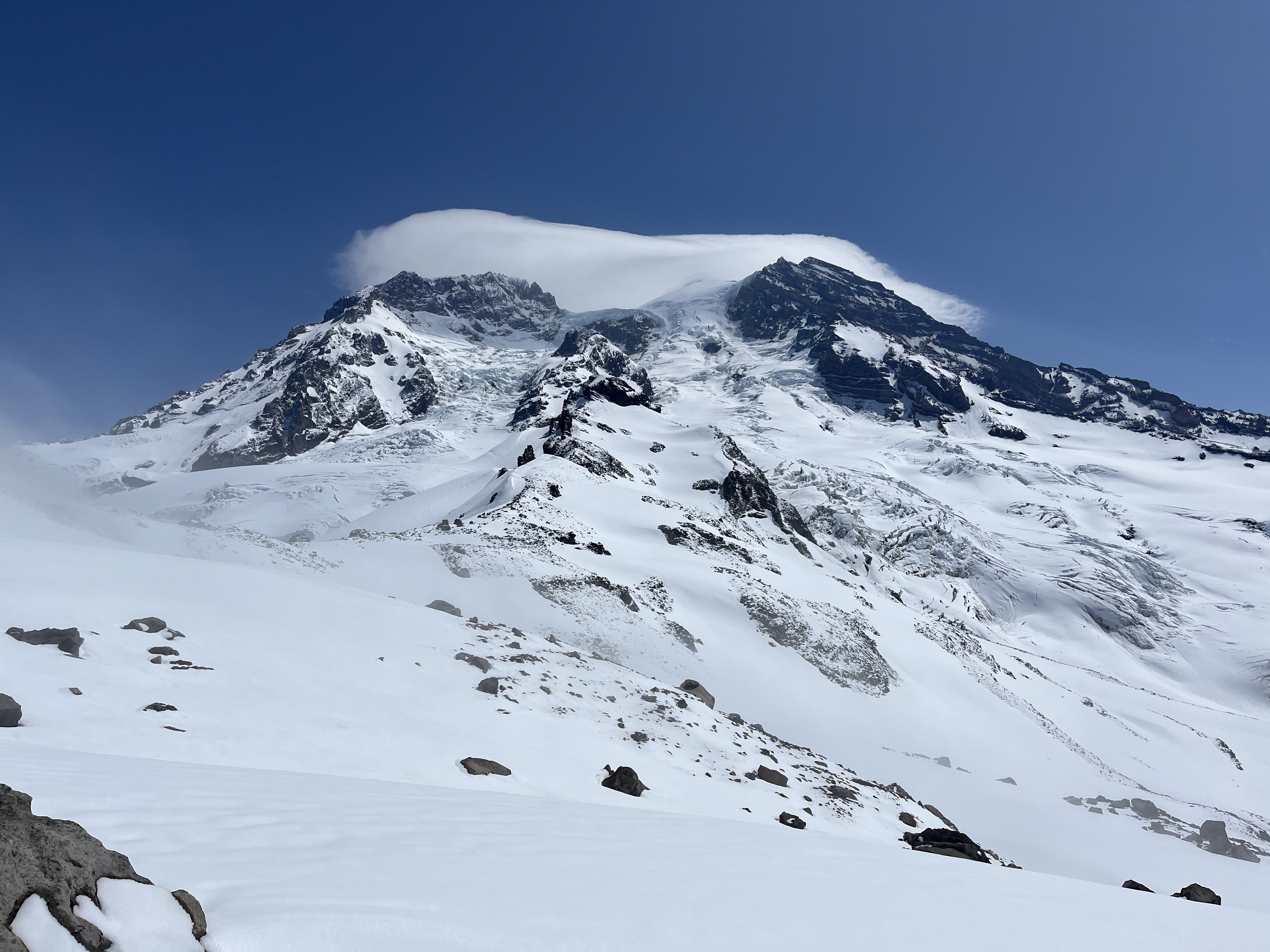
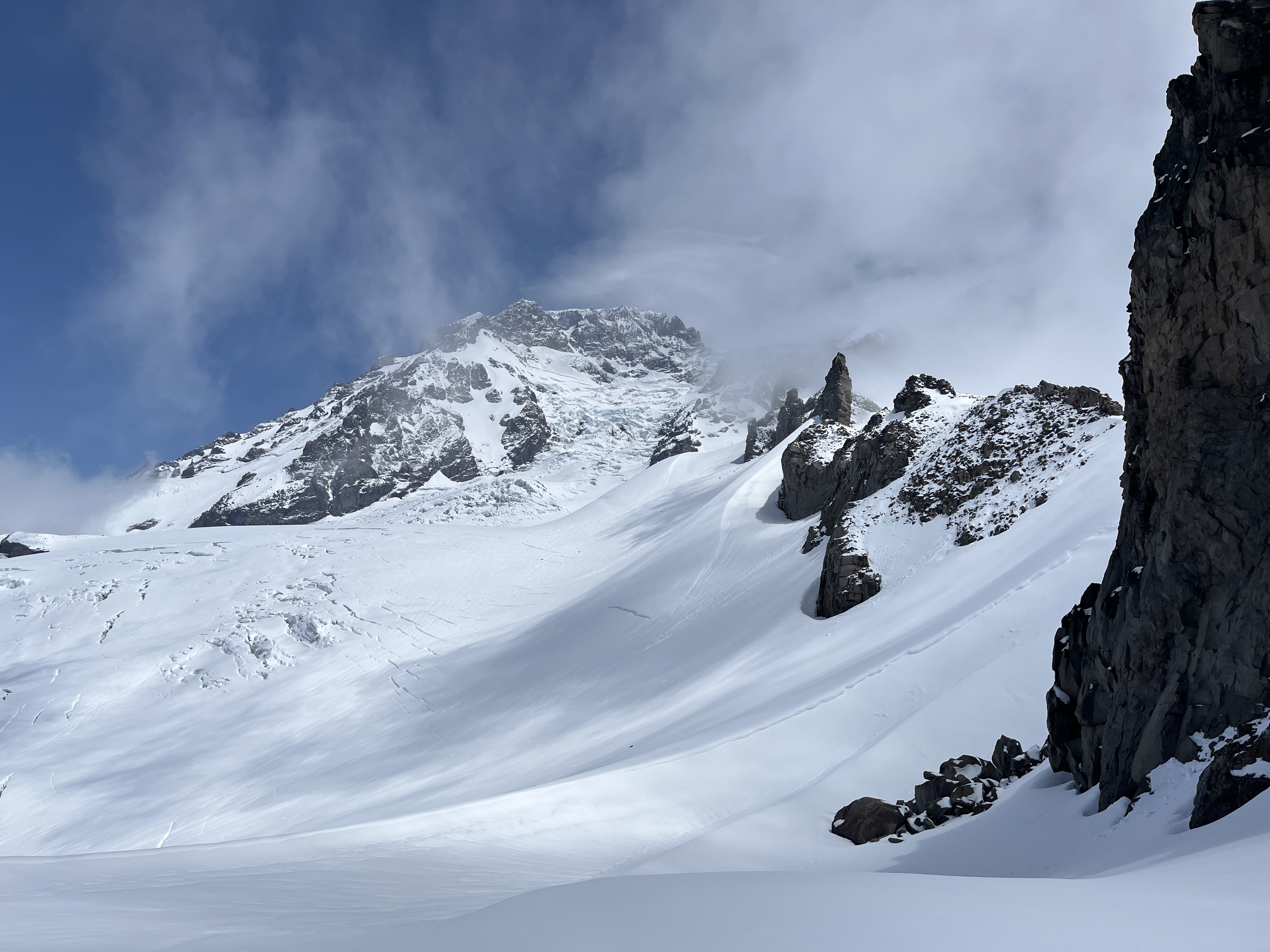
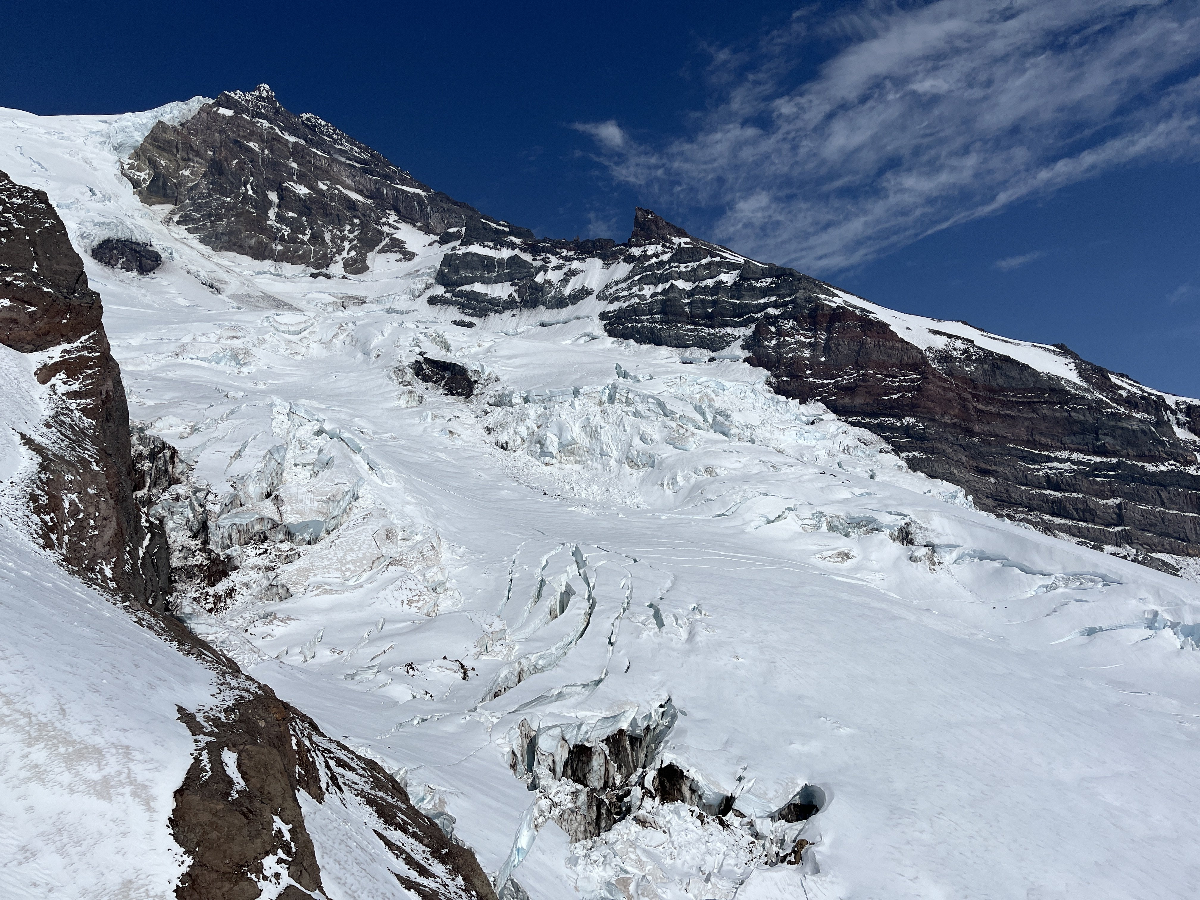
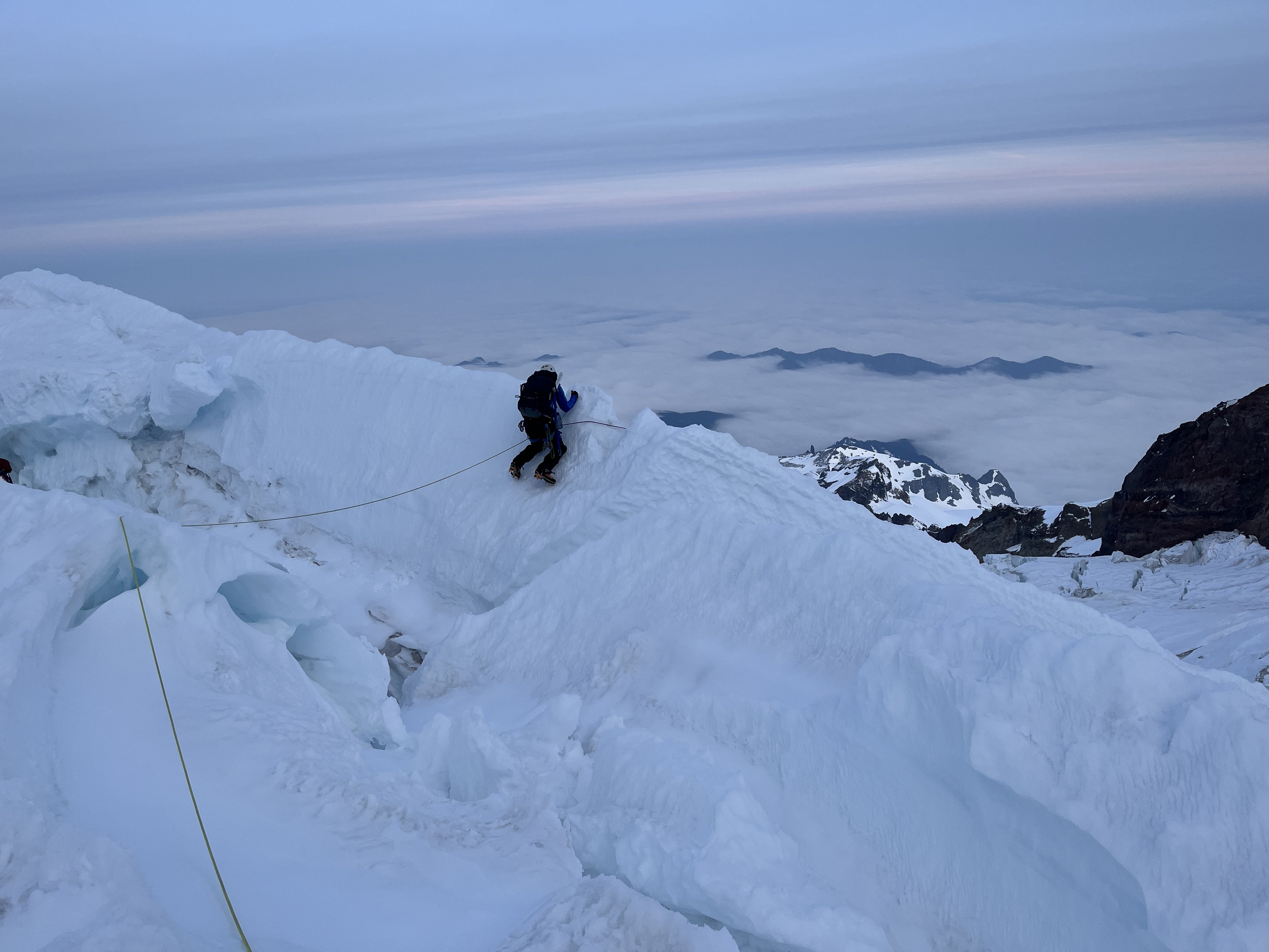
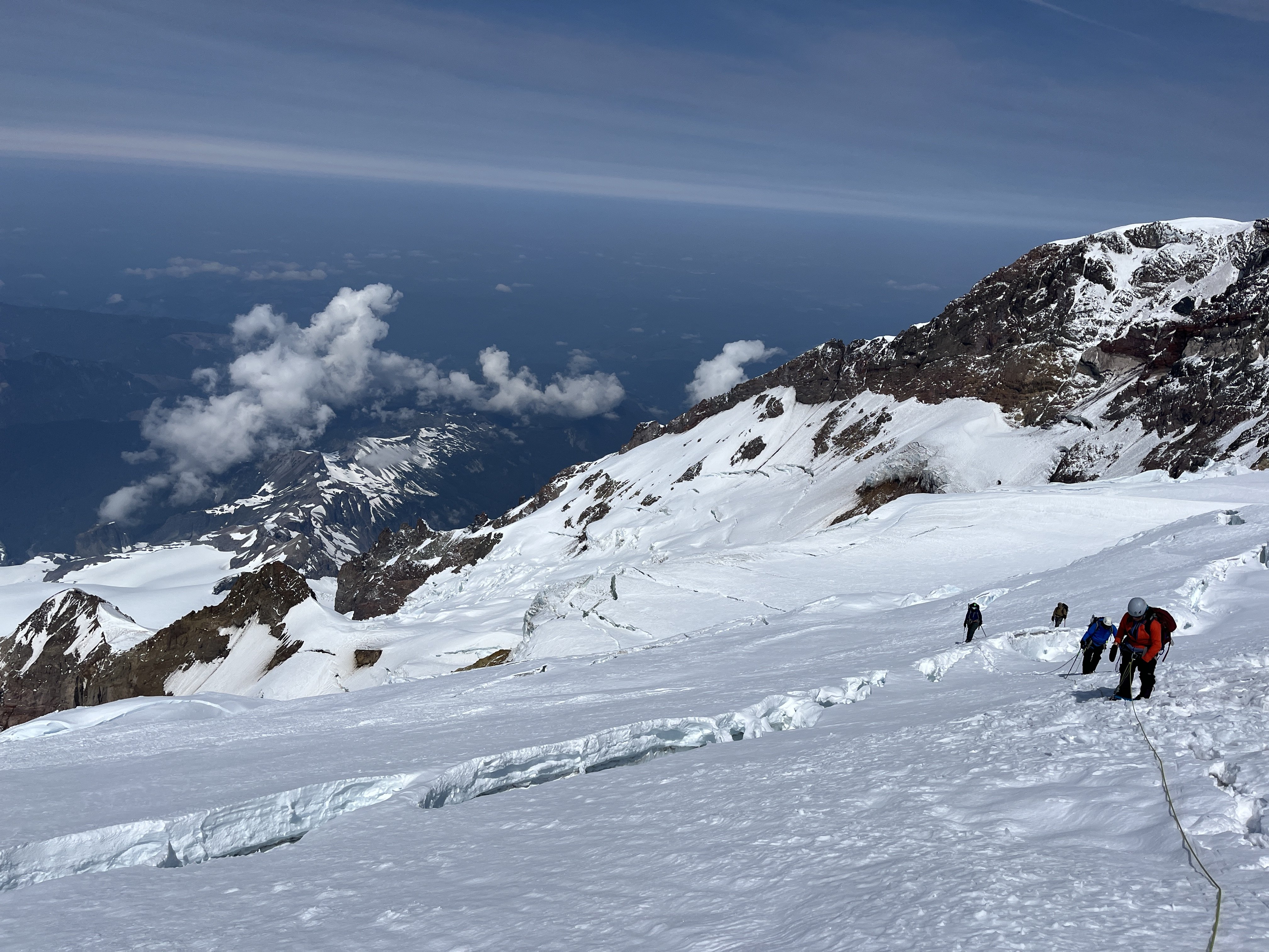
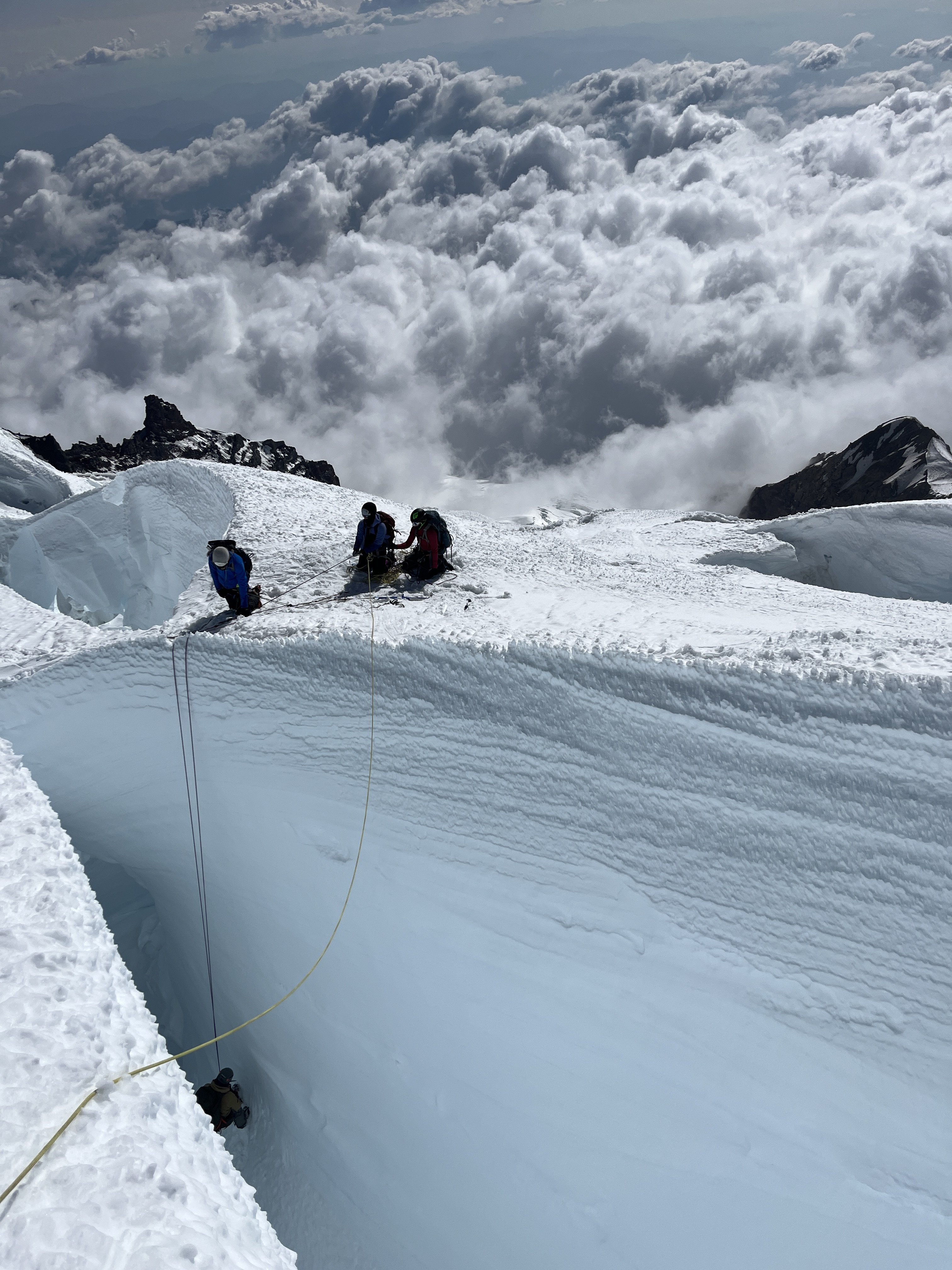
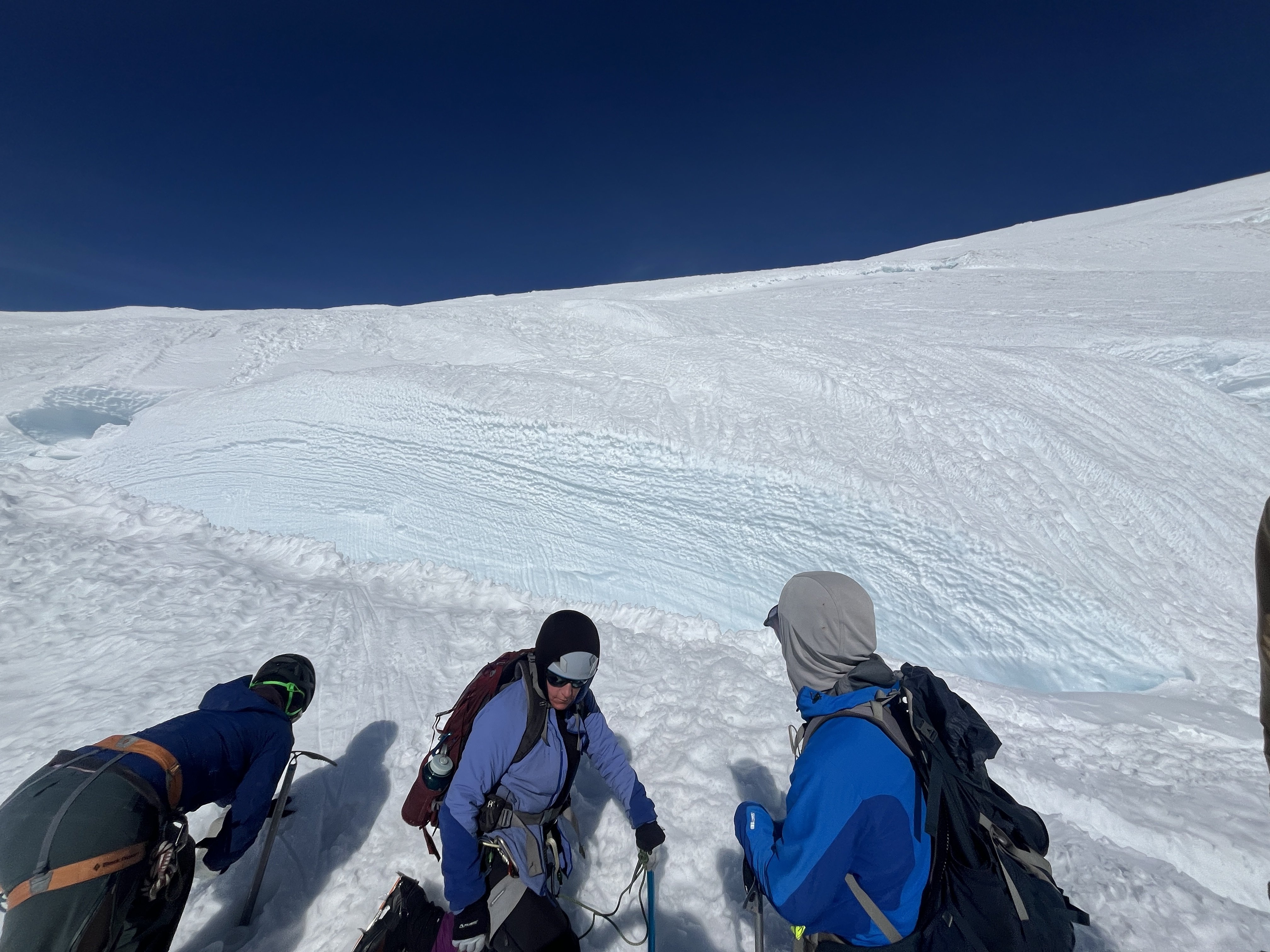
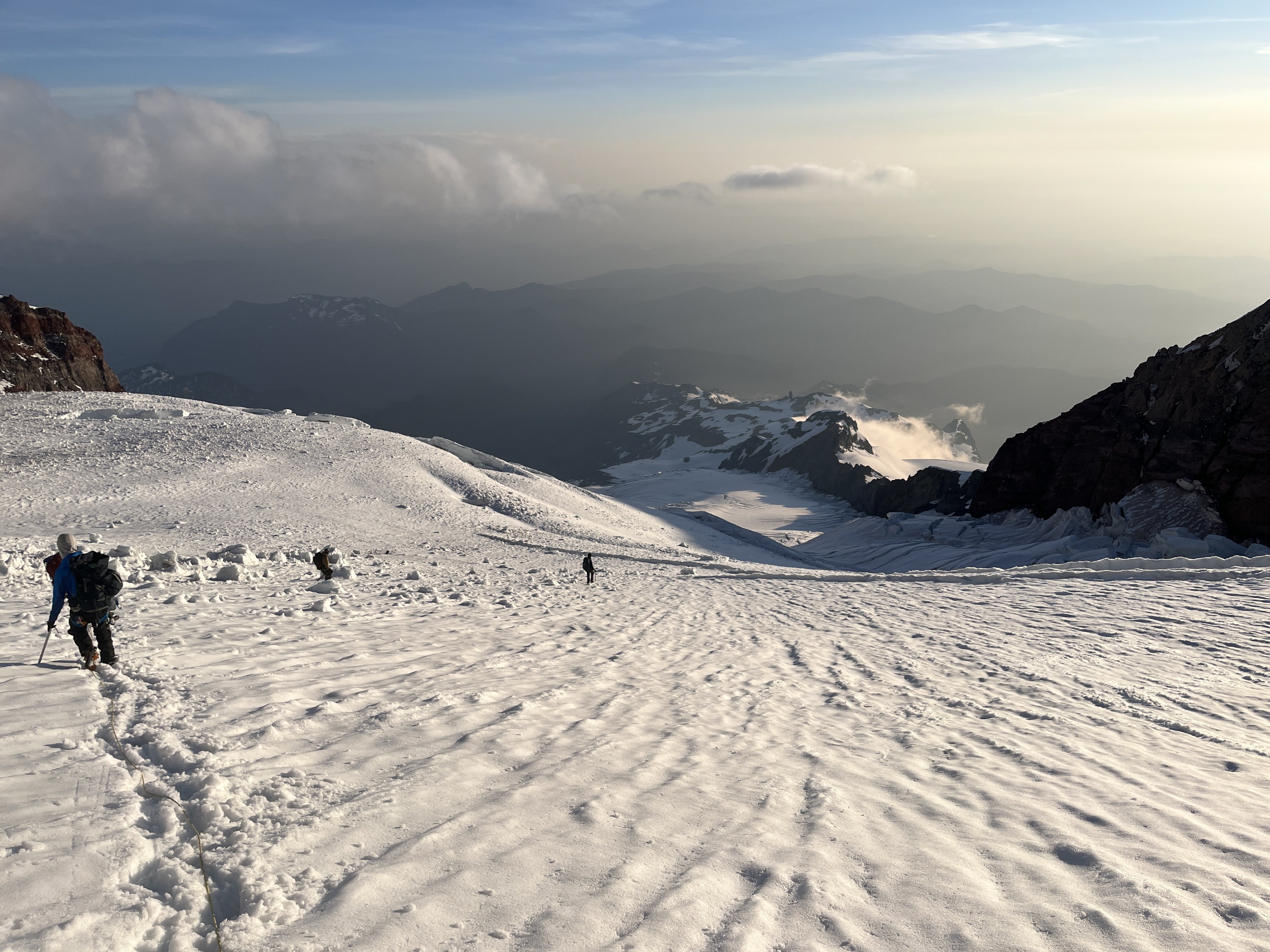
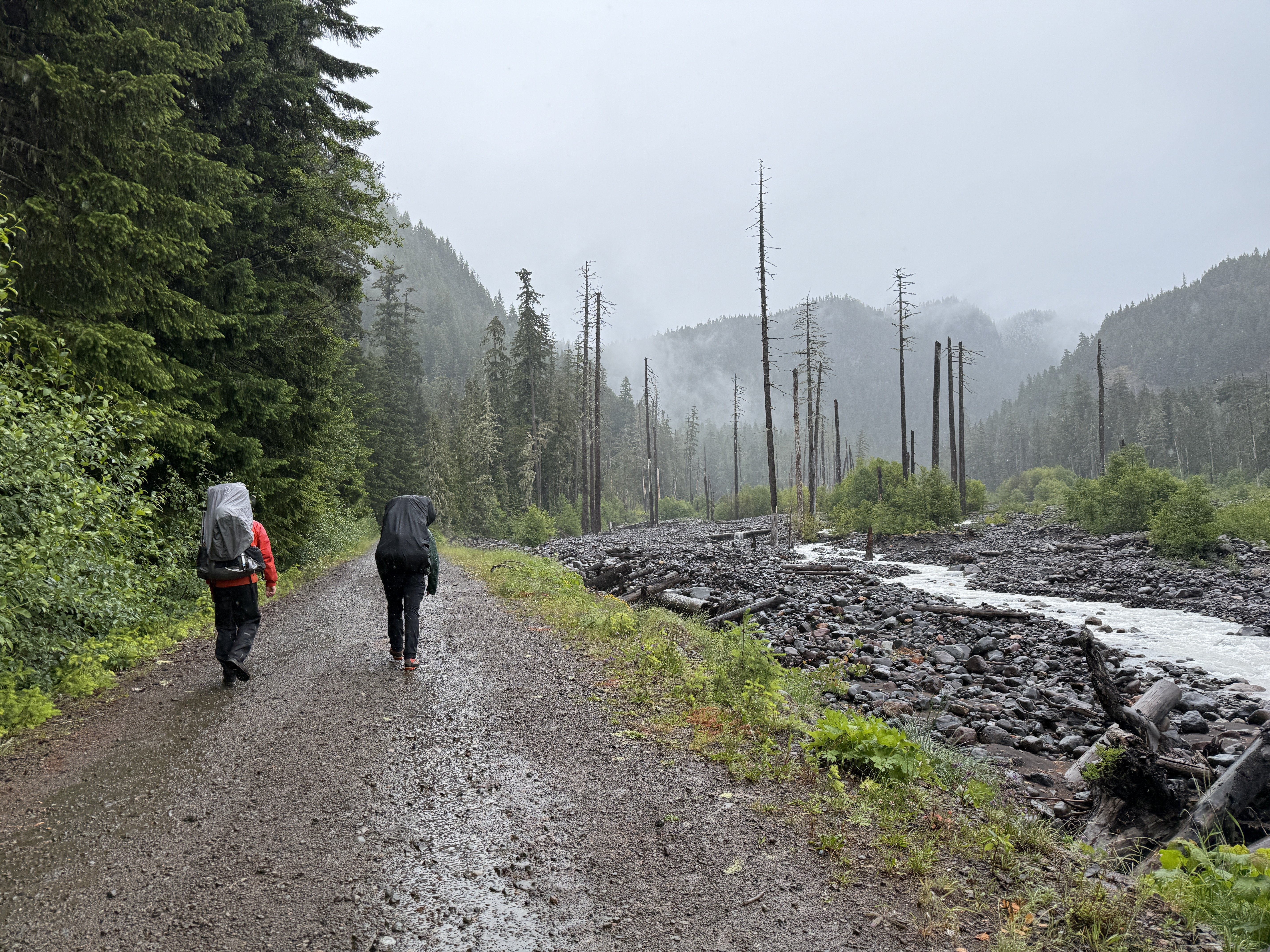
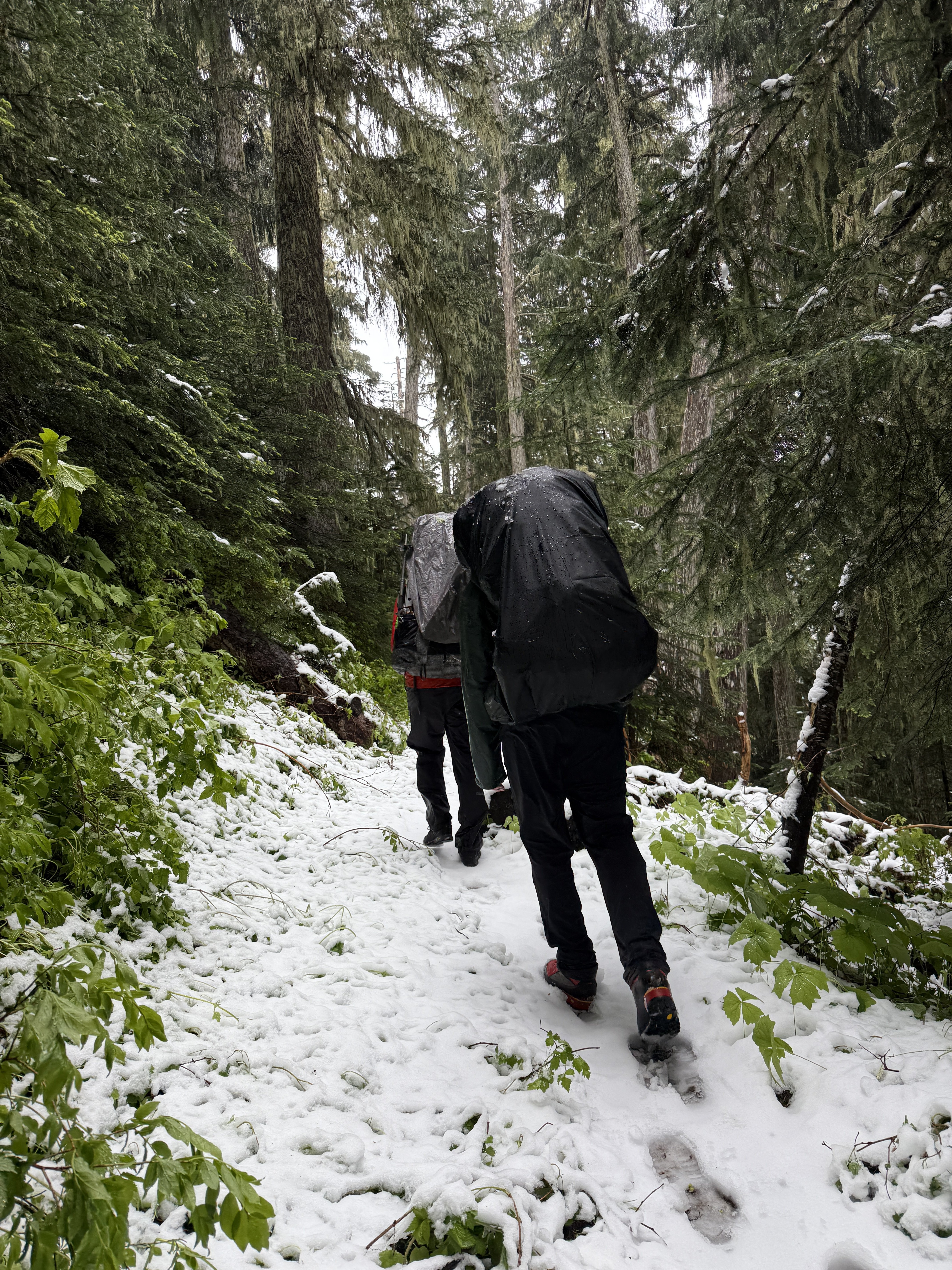
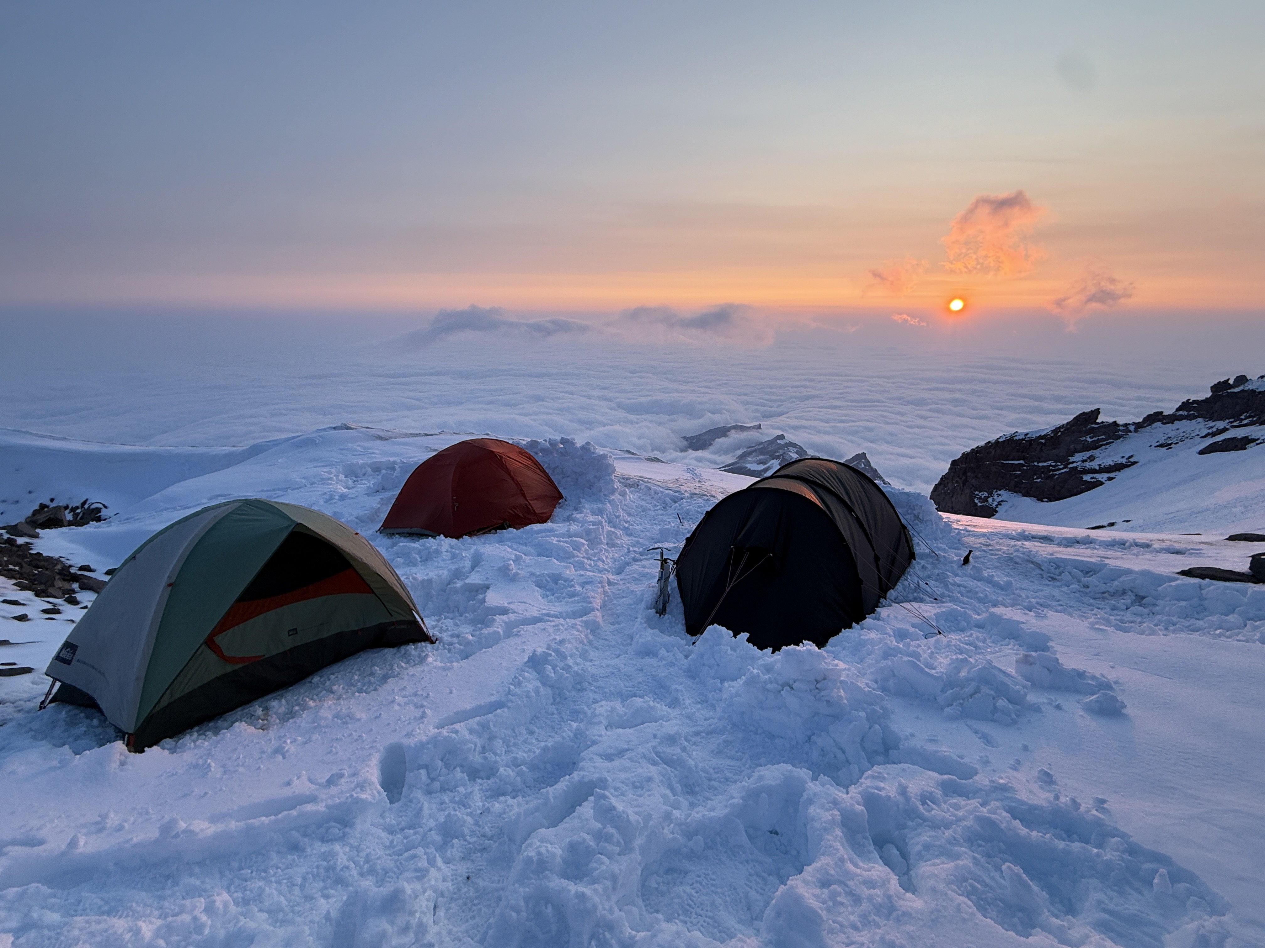
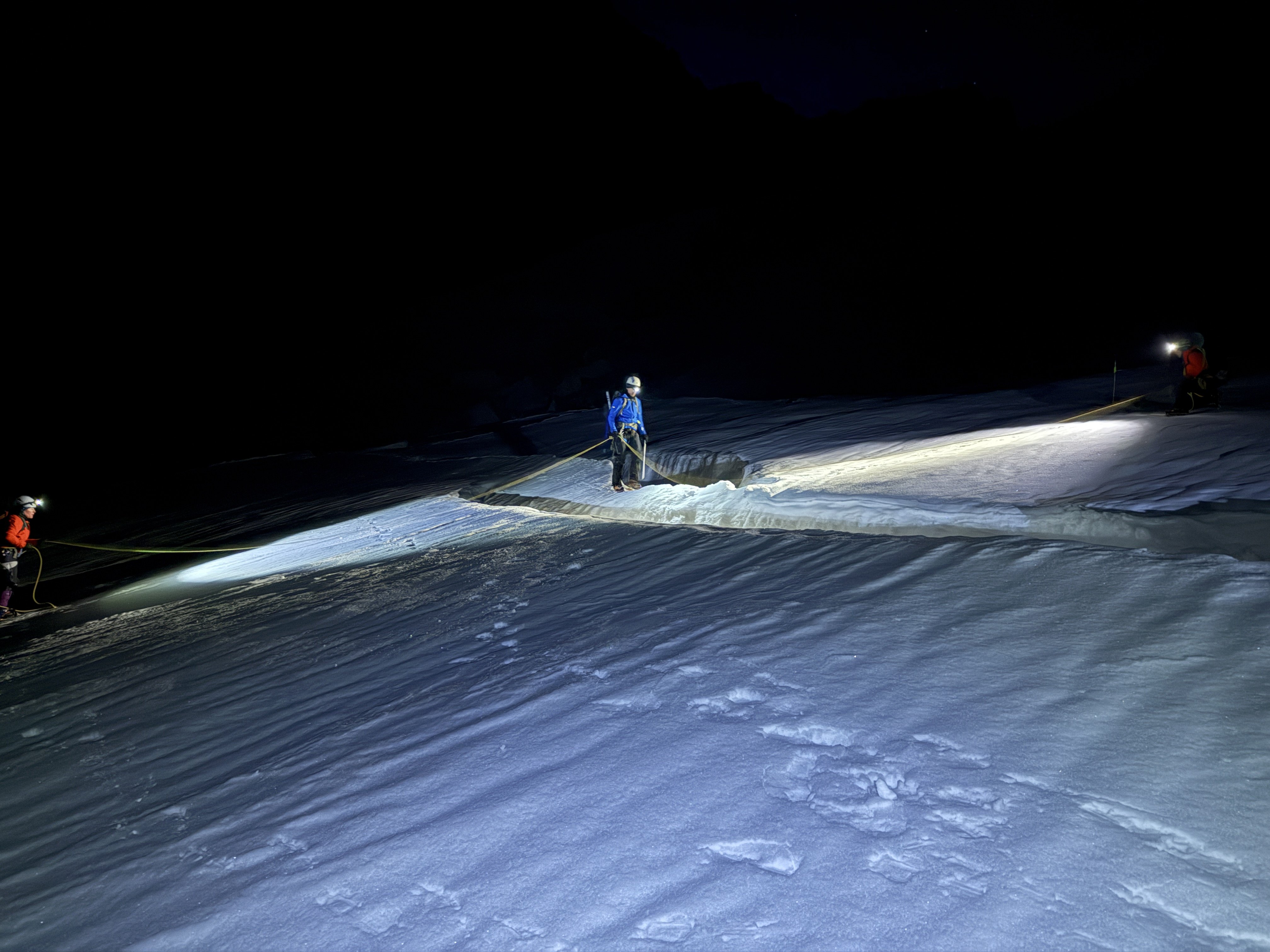
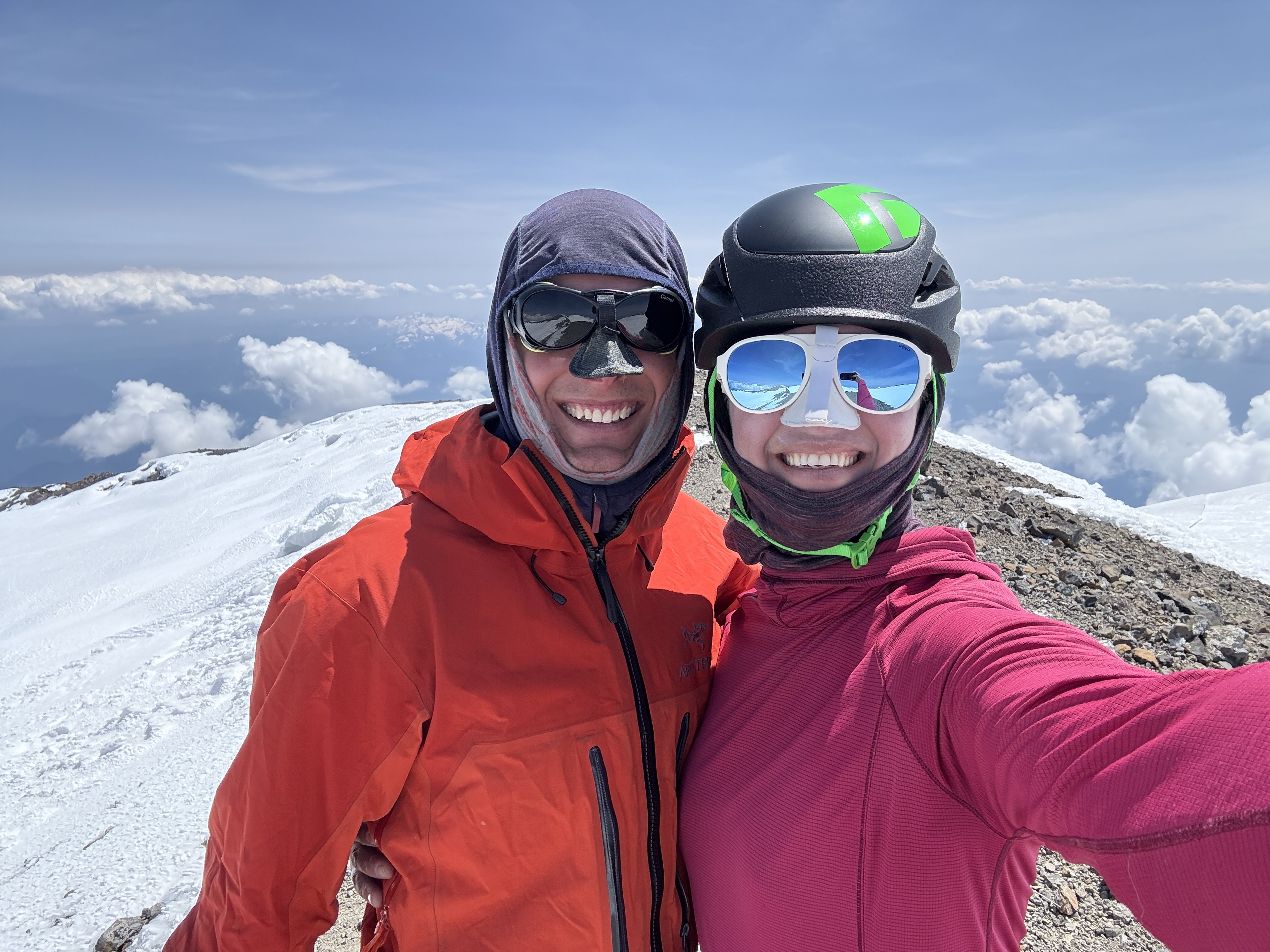
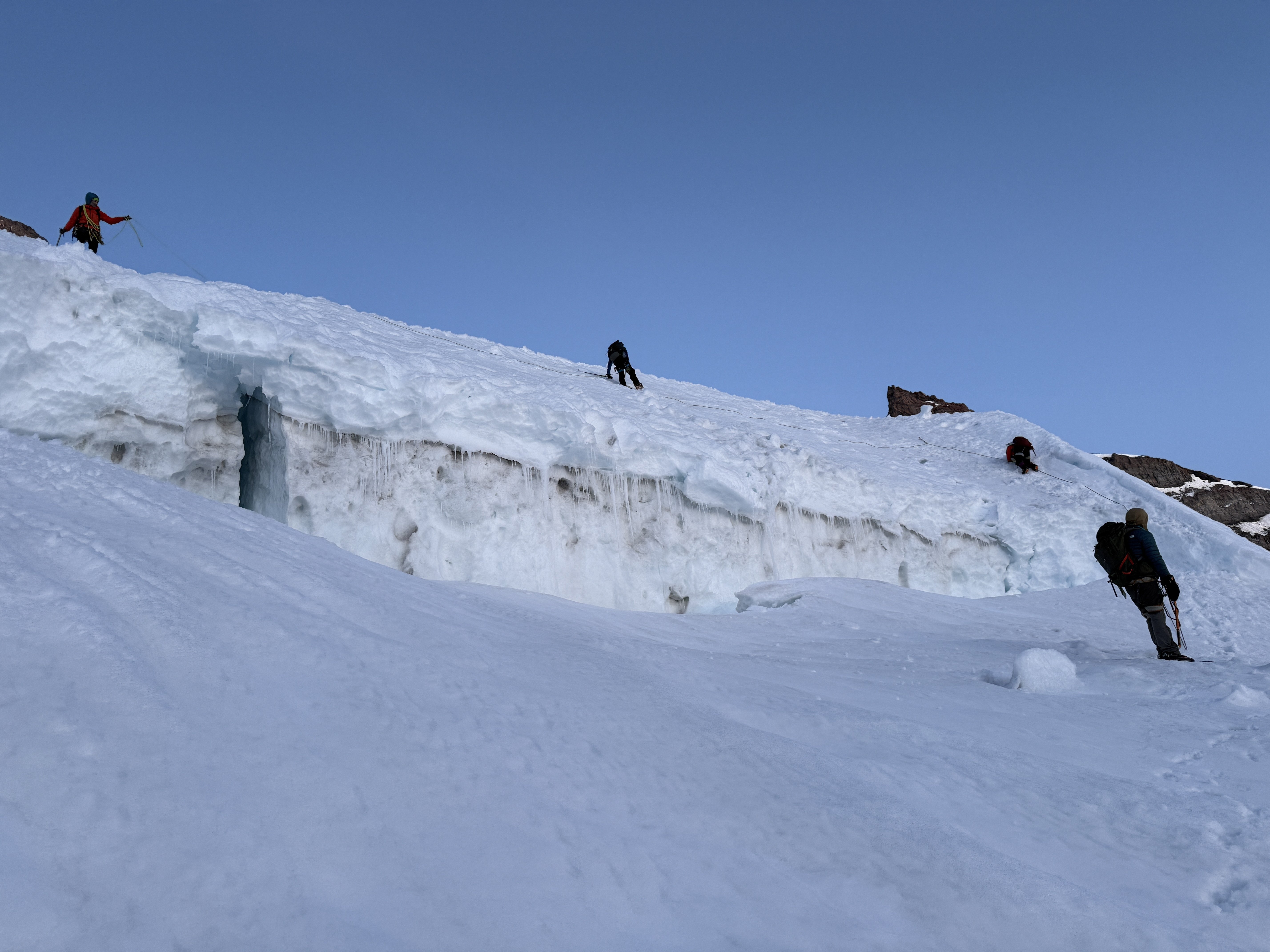
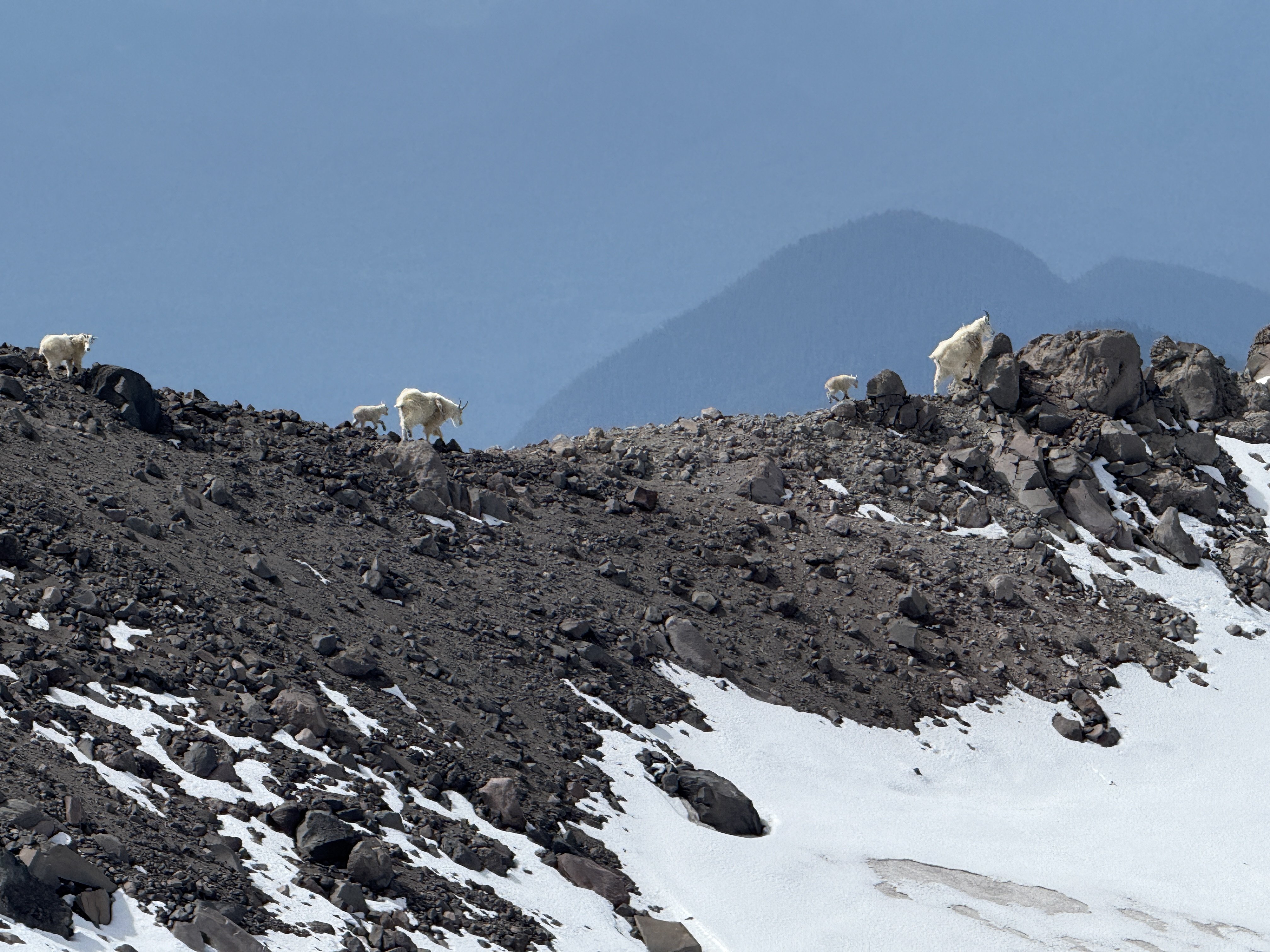
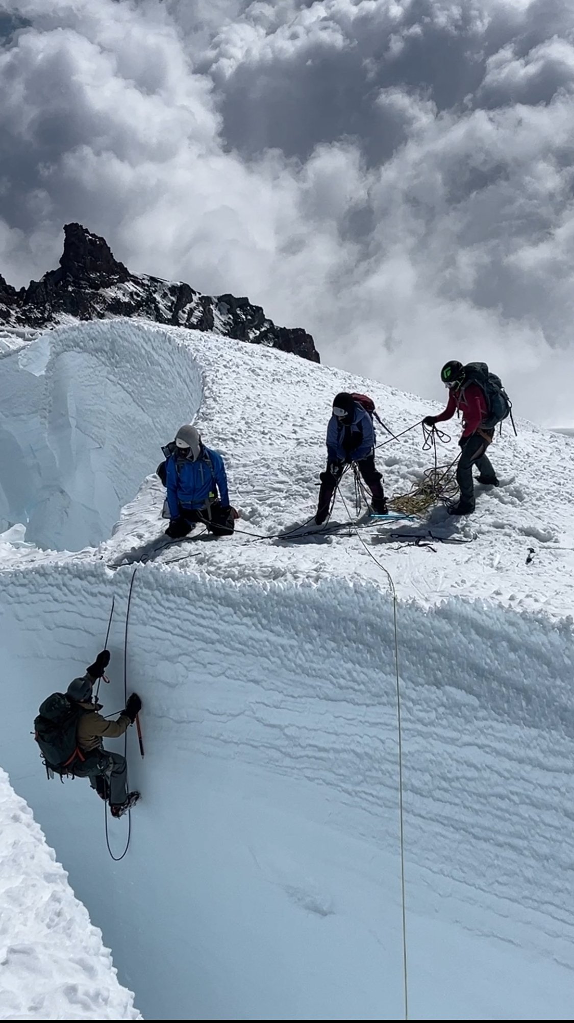 8 points
 -
Trip: Lincoln Peak - Southwest Face Trip Date: 01/29/2025 Trip Report: Lincoln! A peak that had been haunting my subconscious for decades, always taunting me on clear days as I drove home from work across the Skagit flats. Try as I might, I could never completely ignore it. It didn't help that it was on "Dallas's Difficult Ten" list, or that by a few years ago, it was the LAST one on the list for me to climb. By 2023 I had tried and failed on it with @kmfoerster. By the end of 2024 I had turned 50 and figured I may as well get on with some long term climbing goals. It didn't hurt to learn that @geosean also had this one peak to go on his run at the Difficult Ten, nor that @Trent was within one peak of finishing as well (South Hozomeen- he's looking for partners!). That, coupled with seeing "Lincoln" on @therunningdog's whiteboard, planted the seeds in my brain to make it happen in 2025. As @Trent would say, "It must be climbed!". And then last week we got a window and hatched plans to give it a go on Wednesday as a day trip. This was going to be a bit ambitious, we knew, and I would be lying if @Lucas Ng's TR didn't make me think maybe too ambitious? There would only be one way to find out. We started, as all good mountain trips do, with a home cooked meal with my family and @therunningdog. My son admonished us to start early for the Middle Fork so we could "get a workout in before bed". Tim and I declined and delayed as long as possible. It was cold out there! But we did eventually find our way to the Middle Fork about 9pm, settling in to a bivy at the Elbow Lake Trailhead to meet @geosean at 3:45 the next day. Sean was right on time and we bounced our way up the rough spur to where continuous snow started about 3500'. By the time we got geared up and rolling, it was about 4:15. From here, the day was pretty much a blur. We got to treeline a bit before sunrise, which was spectacular on the Twin Sisters Range We snowshoed from treeline over to the glacier where we ditched them and the stove and switched to harnesses, helmets, axe, and crampons. I think I crossed the 'shrund first about 8:30. And then it was game-on for a couple hours up to the summit. Lucas and Cole's tracks were basically gone and we kicked new steps the entire way, running across a few of their rap stations up high. The going was pretty steep the whole way, but conditions were very secure and basically perfect. We kept the rope in the pack and carefully traded trailbreaking duties up the various sections of the climb. What a position! Seward: Approaching the summit: And then, like in a dream, all three of us were at the summit block! It was 10:22am- about 6 hours from the car- meaning things had gone waaaay better than expected. @geosean and @therunningdog on the summit: The views, of course, were staggering. What a small and wild summit, especially in winter! But also, what a descent lay ahead of us. That's why I was a little concerned to see Tim start to downclimb while Sean dug the summit picket out of the snow. Uhhhhh....we're not rapping guys?...... "No Jason, let's go!" And so, I took a deep breath, put on my big-boy pants, turned around, and started down. It was a stimulating descent. Especially in this particular spot: But, by moving slow and steady, we made it safely down about as fast as we had gone up. Tim and Sean had to wait a bit for this mature mountaineer on the descent. I'm not going to lie....it was quite a relief it was to finally get back past the 'schrund and start the slog out! We stopped at treeline for almost an hour to melt snow and admire our tracks on Lincoln. It felt good to be down safe in the sun with a couple of good friends, marveling at the grandeur of the North Cascades. What a day! But January days are not long, and we had a bit of scruffy ground to cover before dark. So the snowshoes went back on, the brains turned off, and down we went. We arrived at the car a bit before 4pm, in the light, to all of the windows intact, a change of clothes, and snacks. It doesn't get much better than that..... Edit- Well, we could have remembered beer. THAT would have been better. Oh well, can't always have it all! Gear Notes: snowshoes (in winter), crampons, axe, helmet, second tool. We brought a rope and pickets but didn't use. Approach Notes: 4x4 will get you to 3500' or so up the spur.
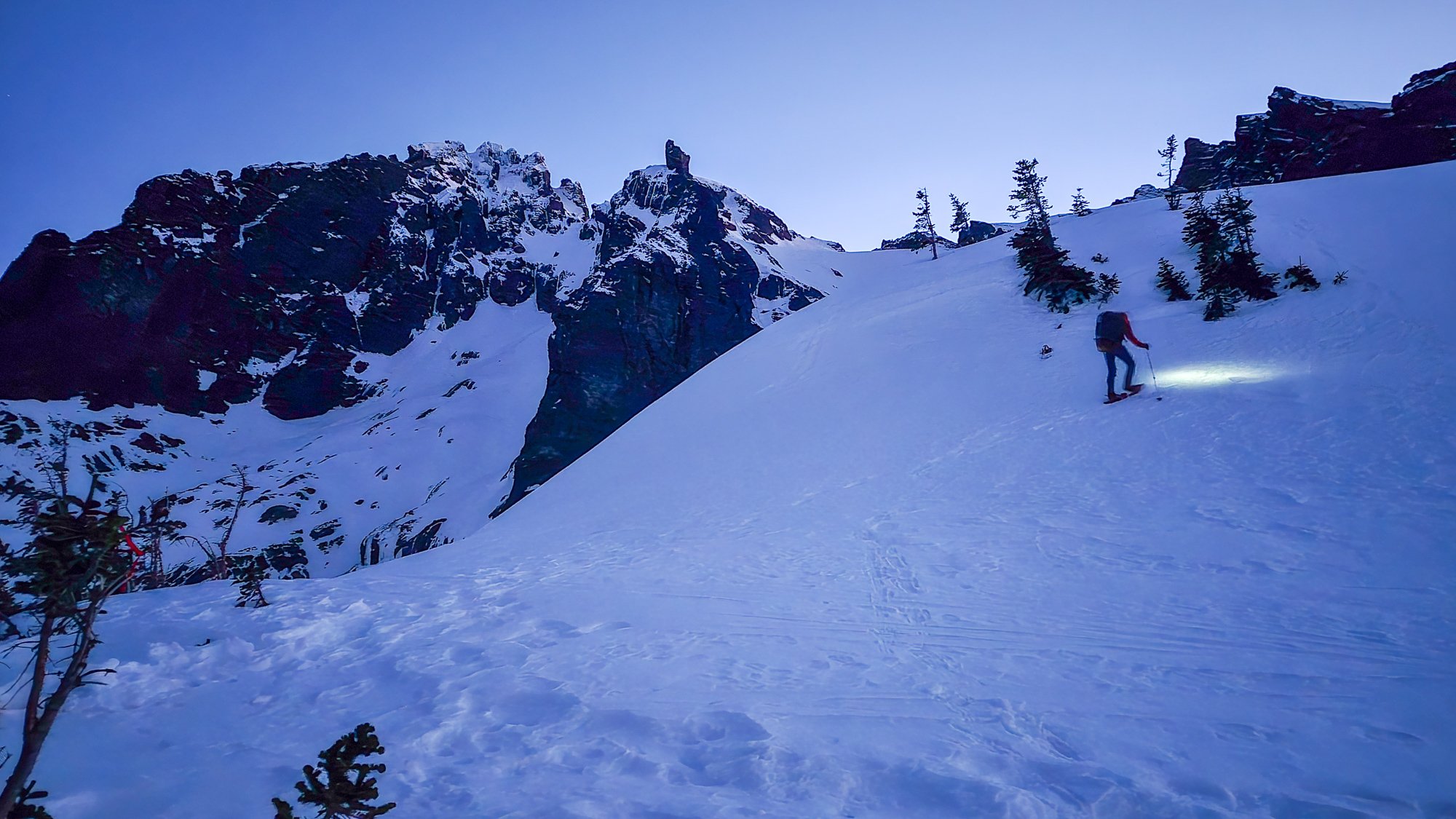
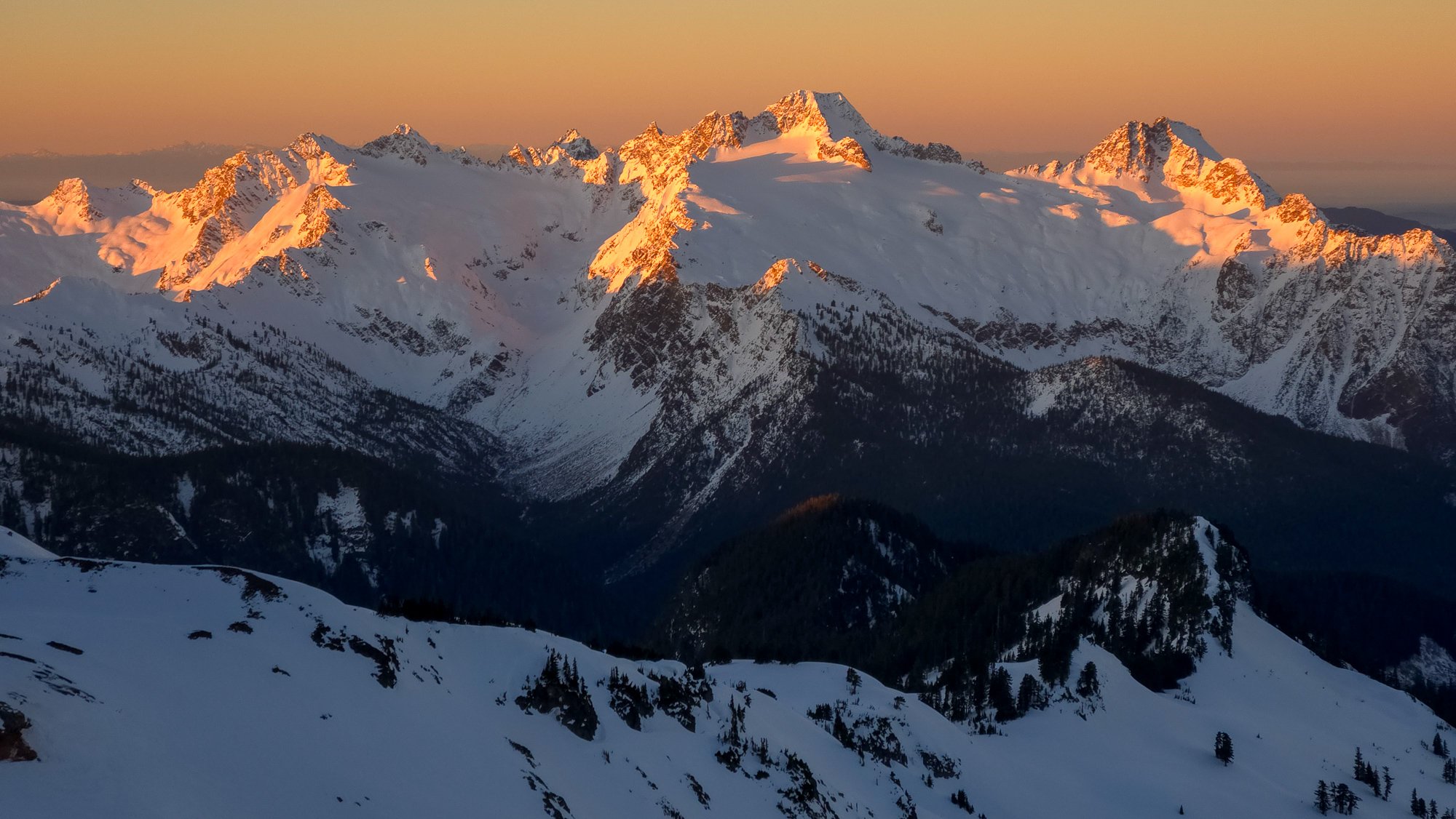
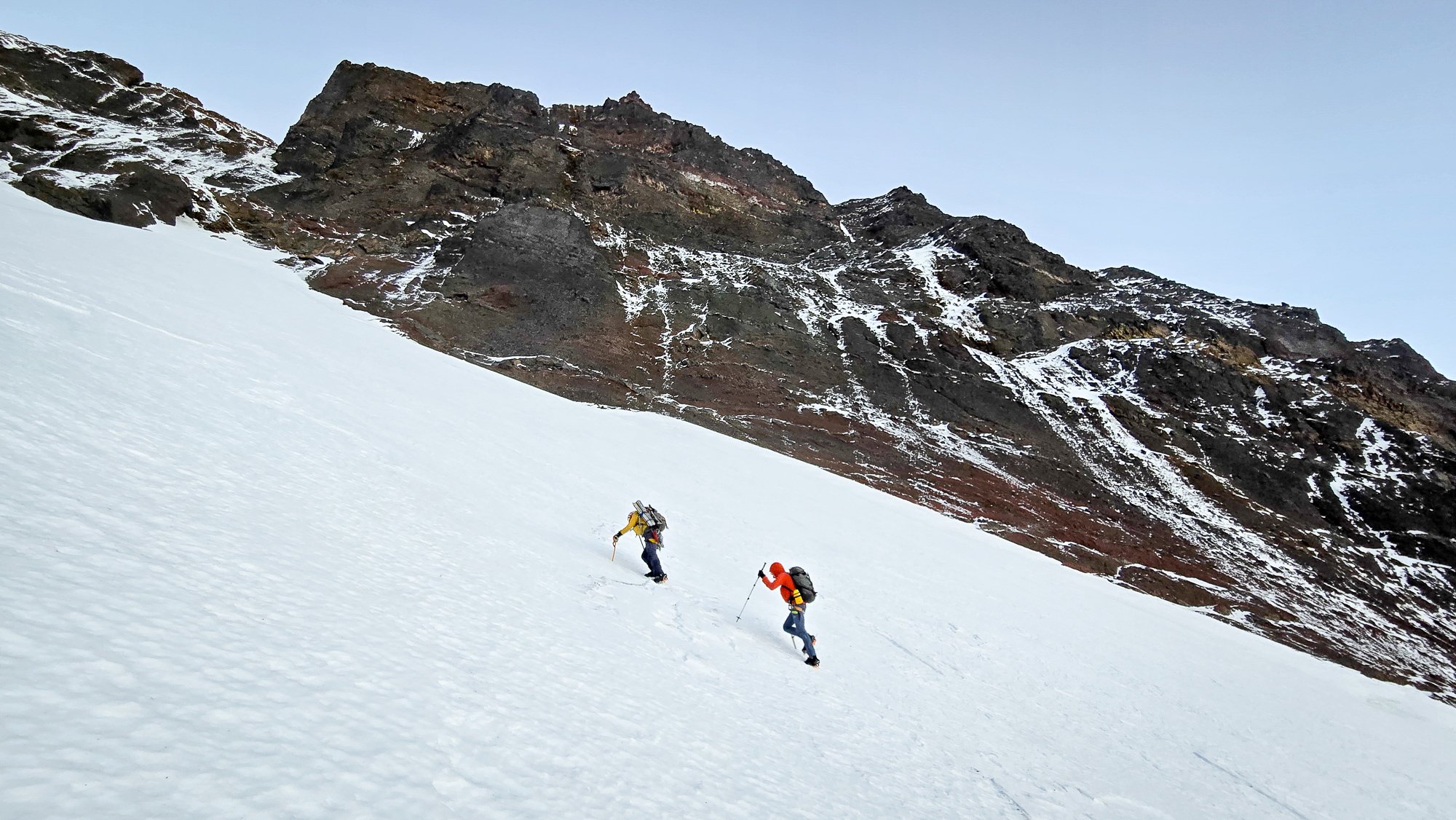
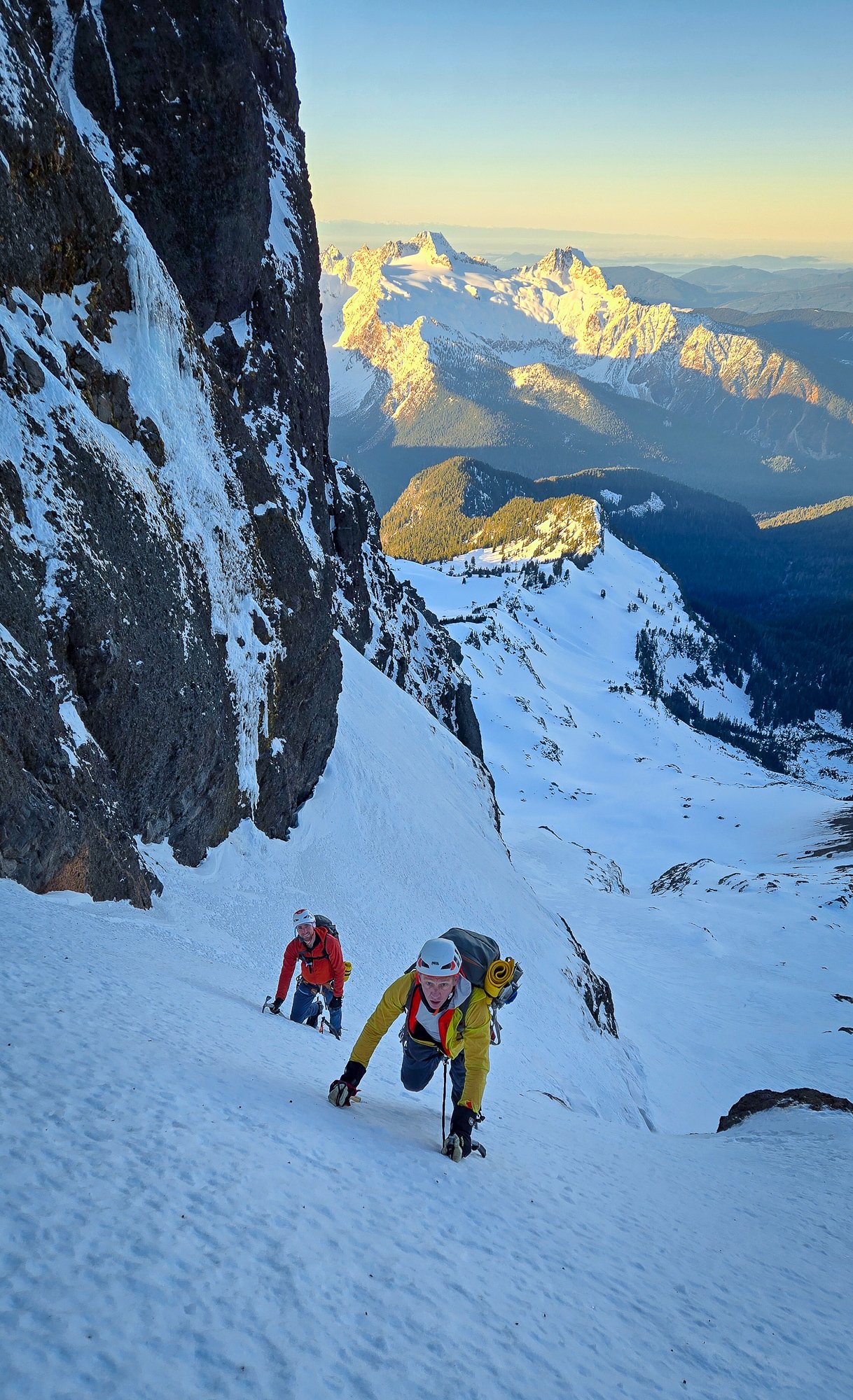
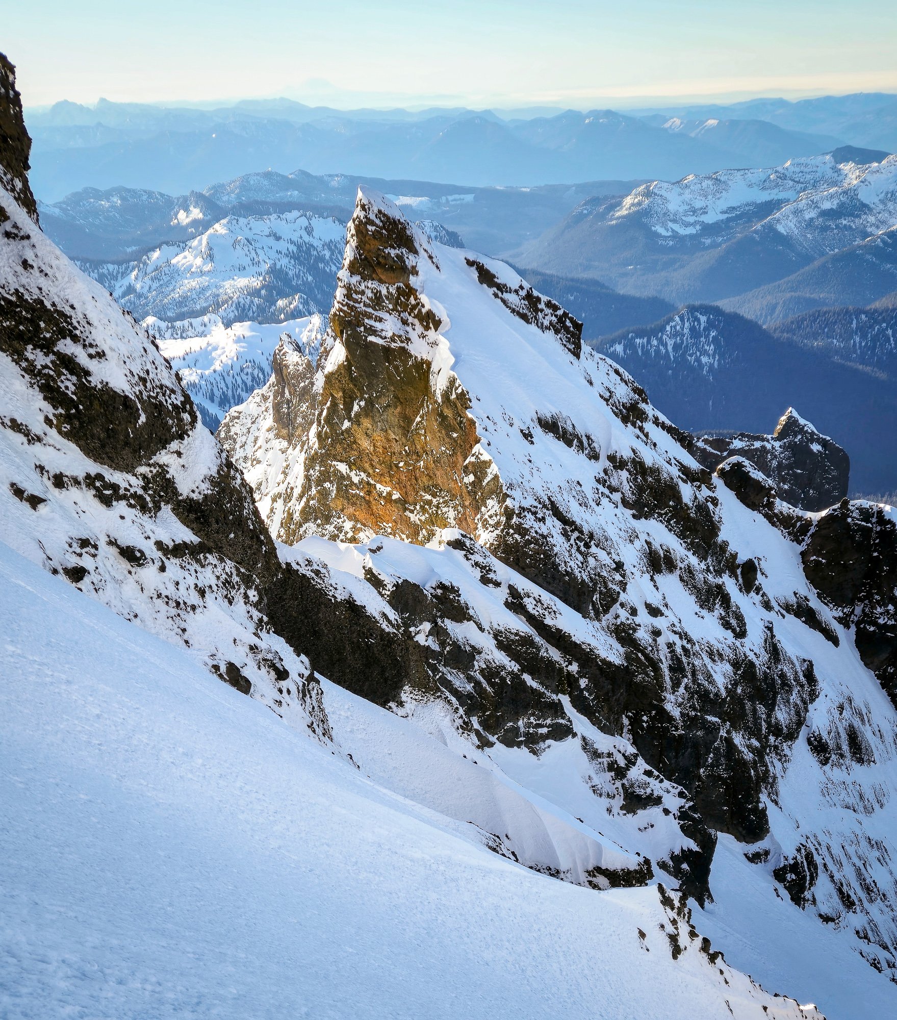
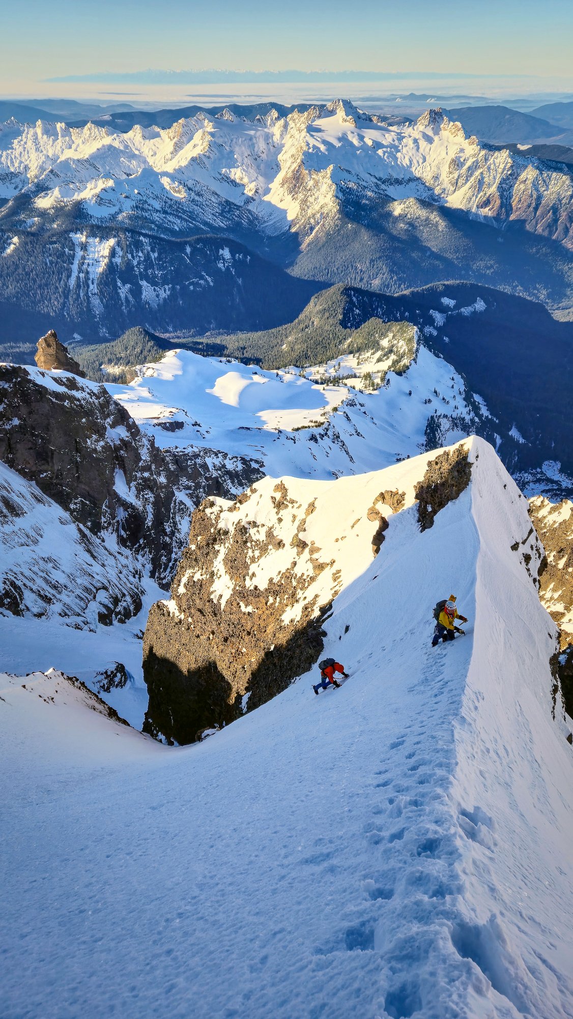
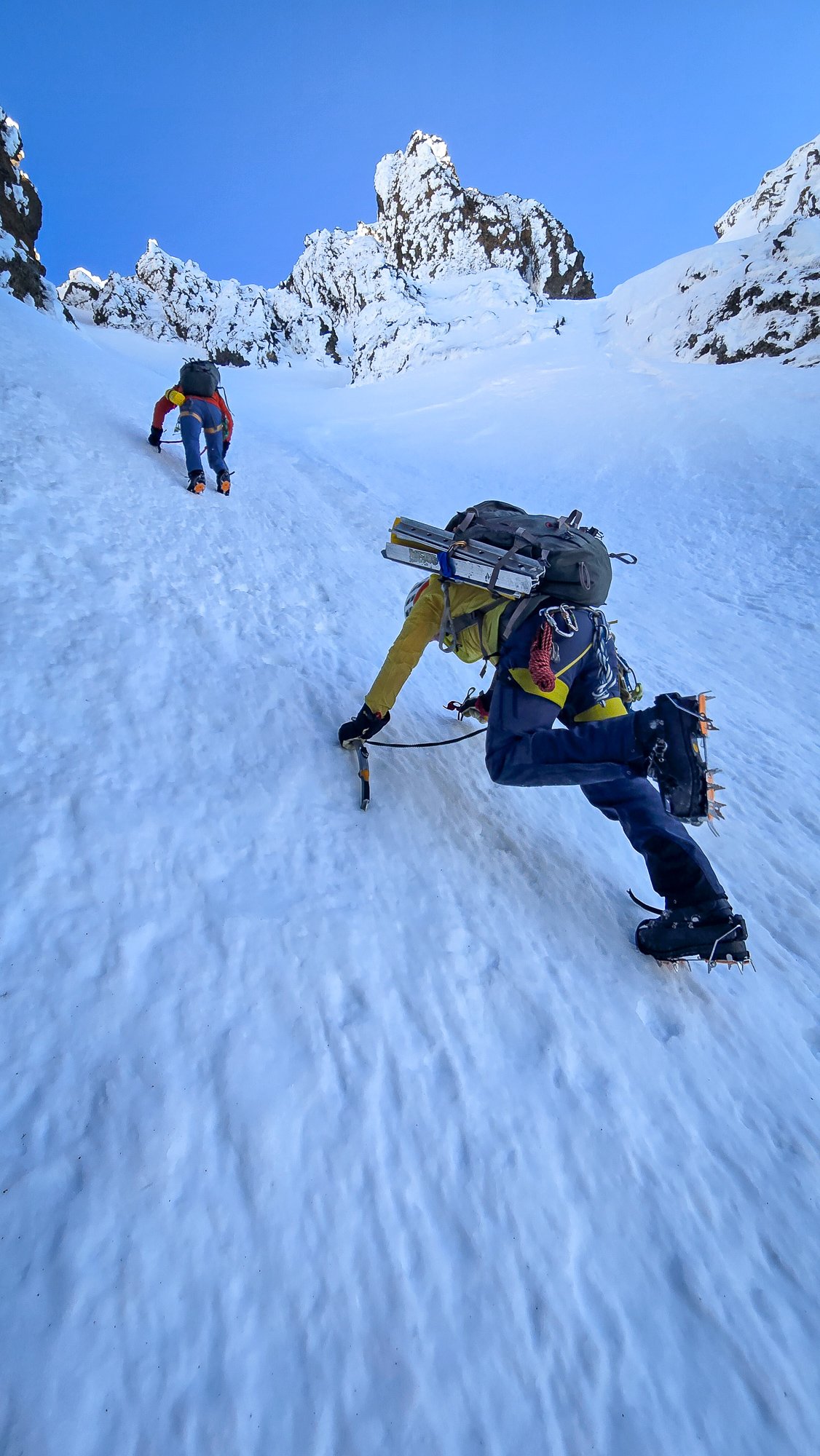
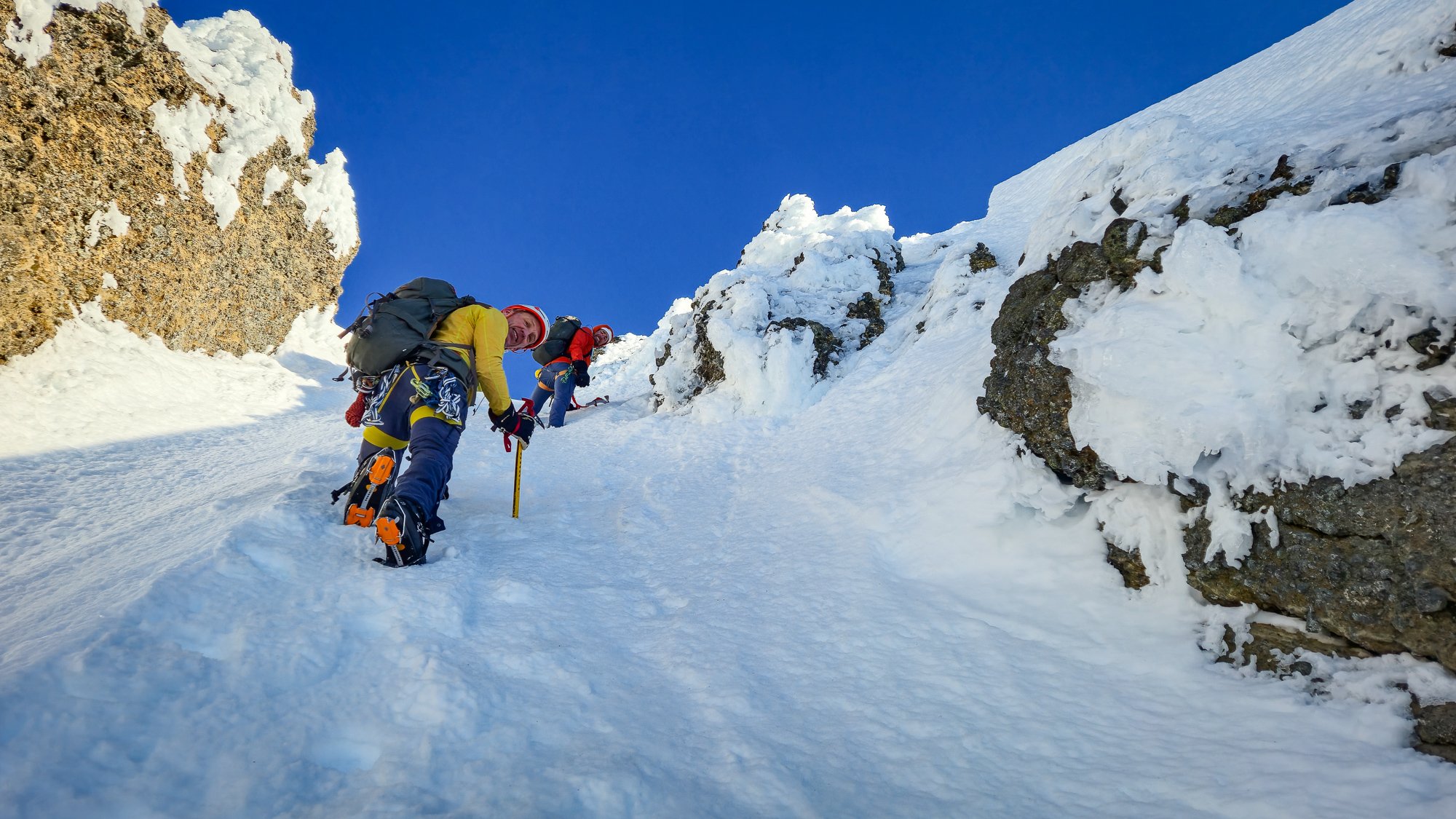

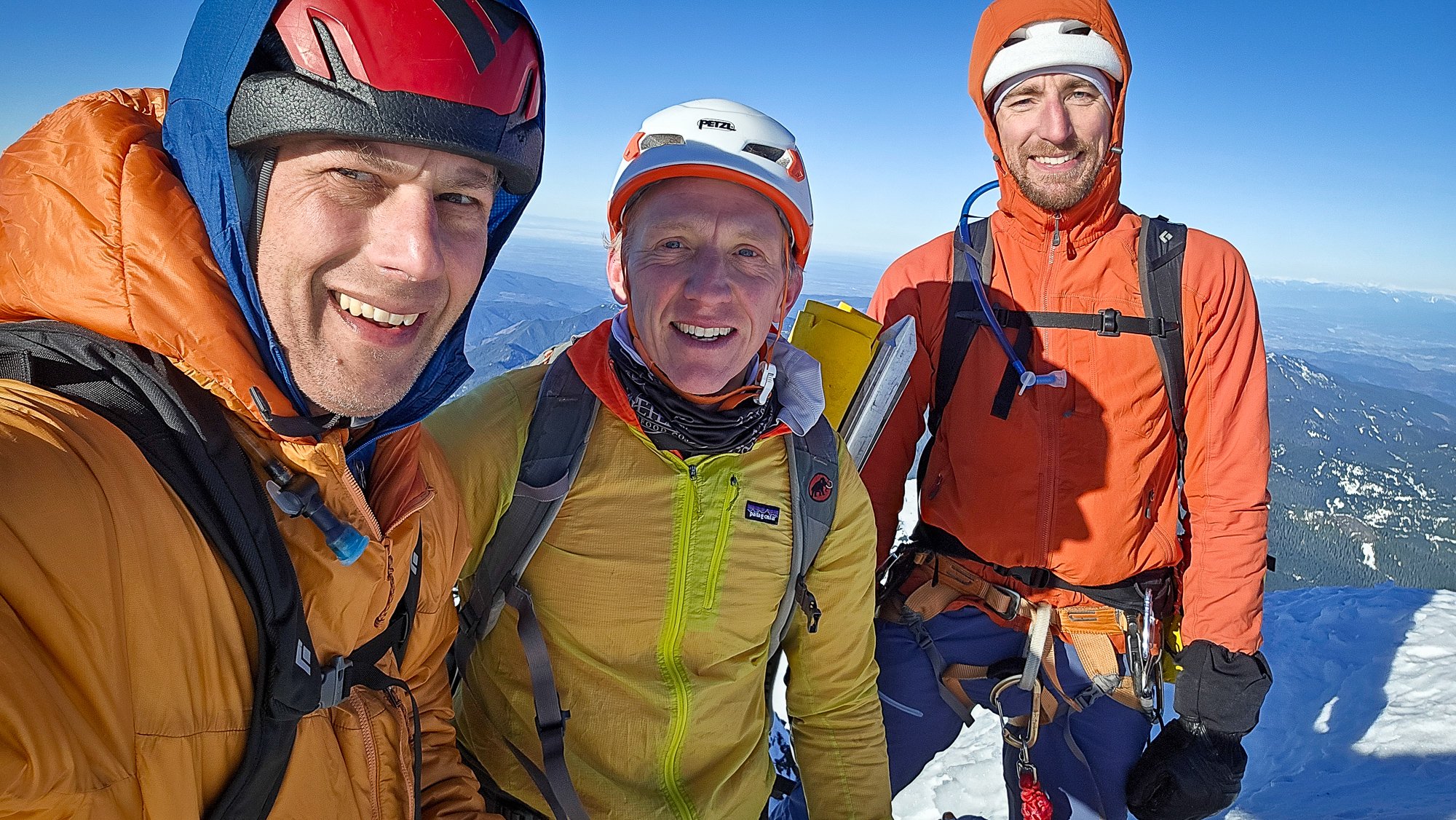
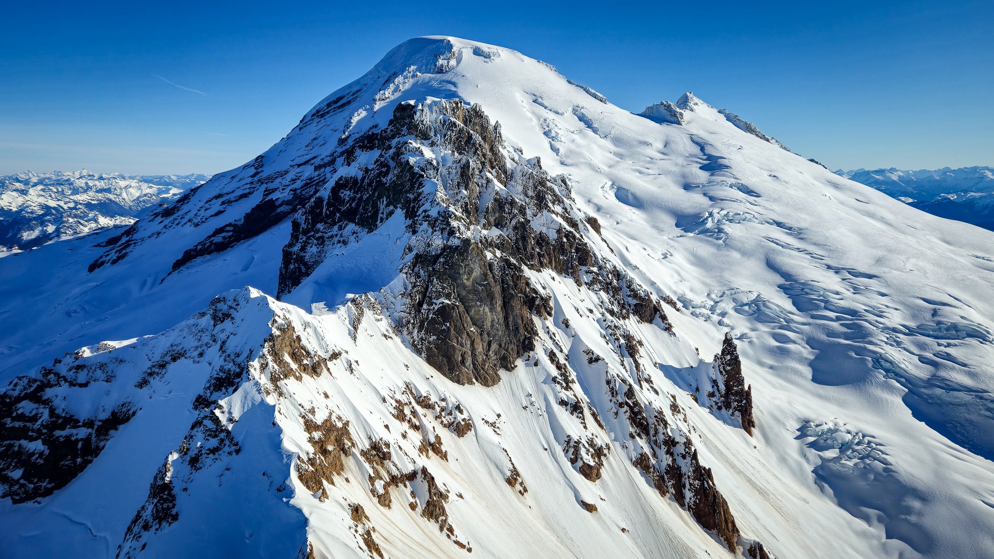
.jpg.665b3db19993070594beeb7877f8f0c9.jpg)
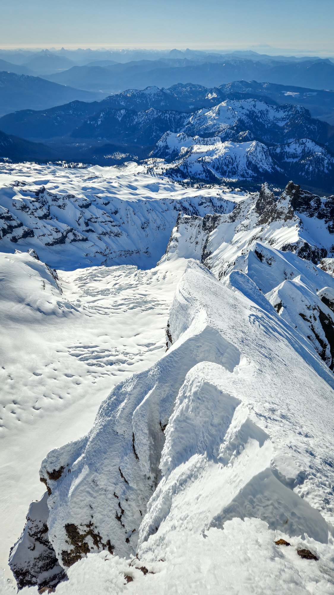
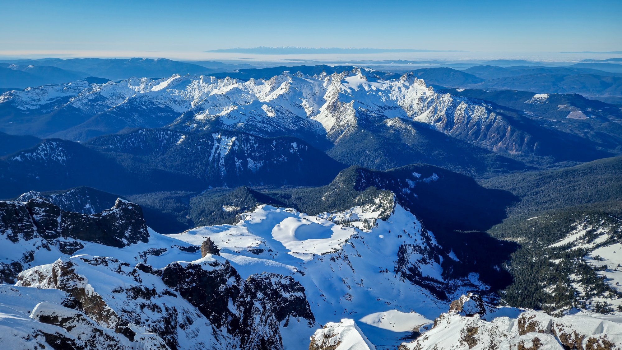
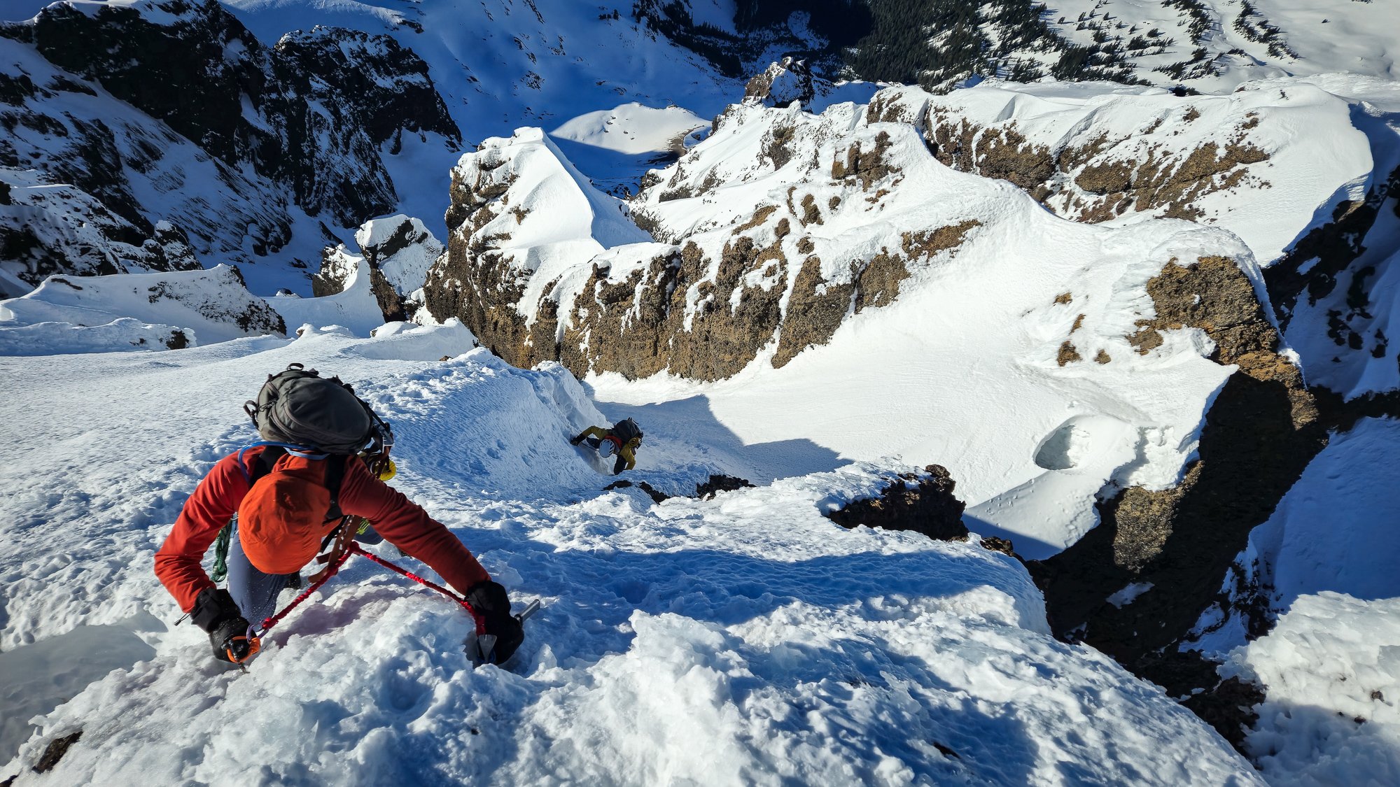
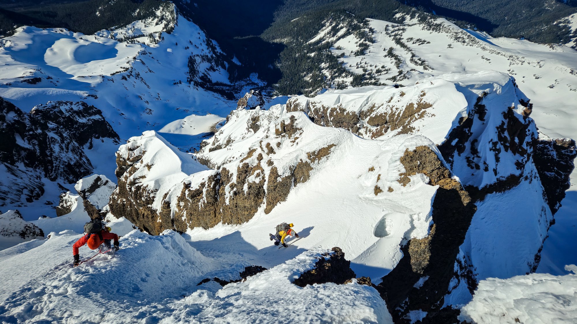
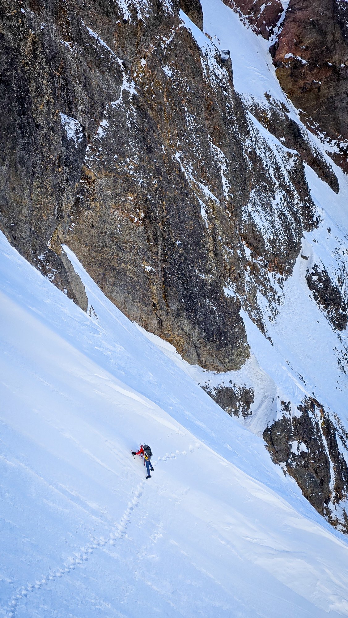
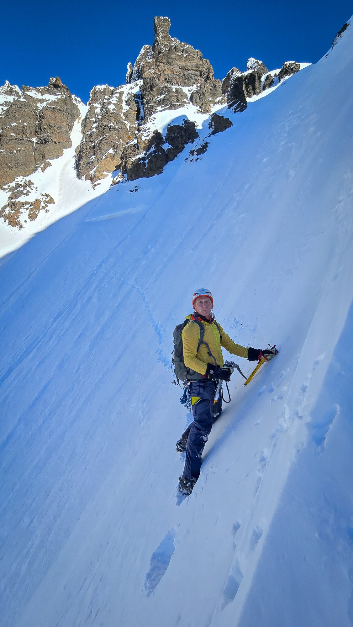
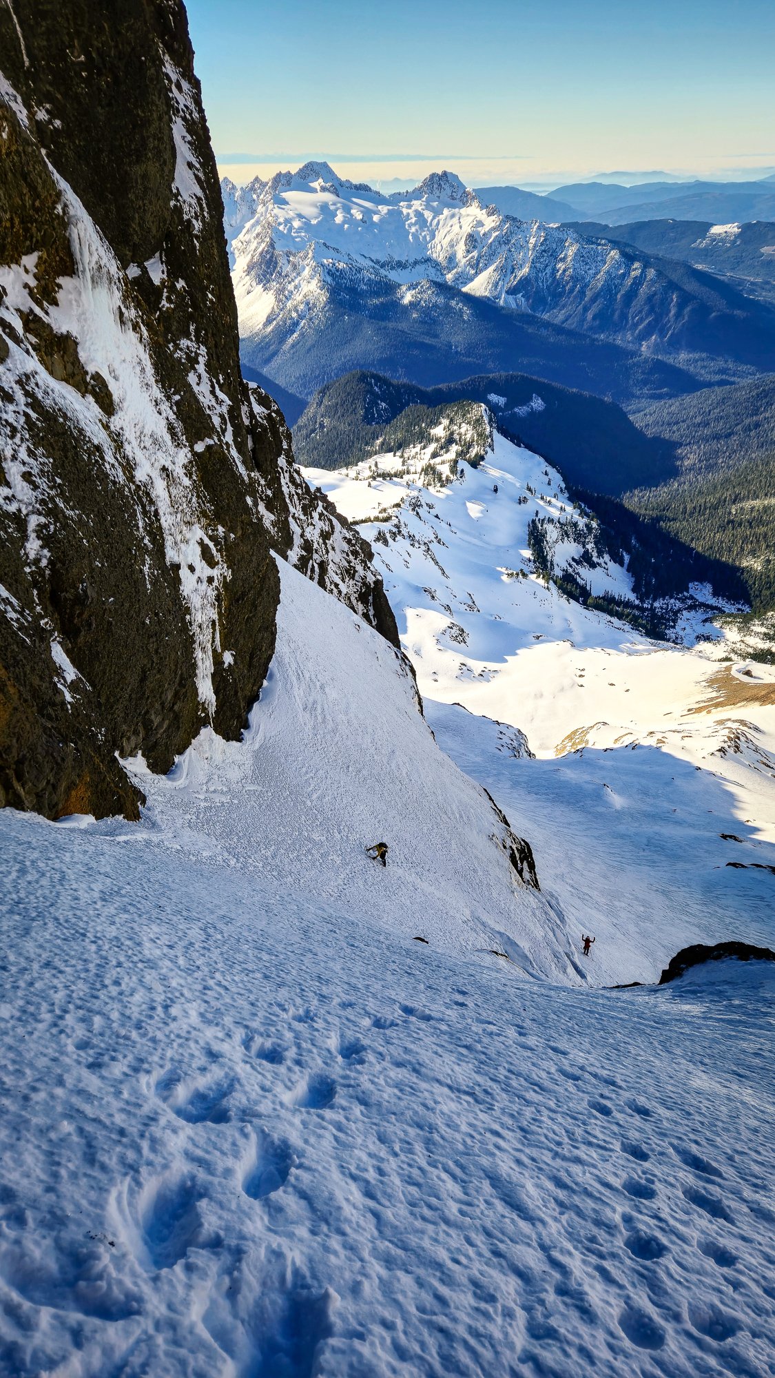
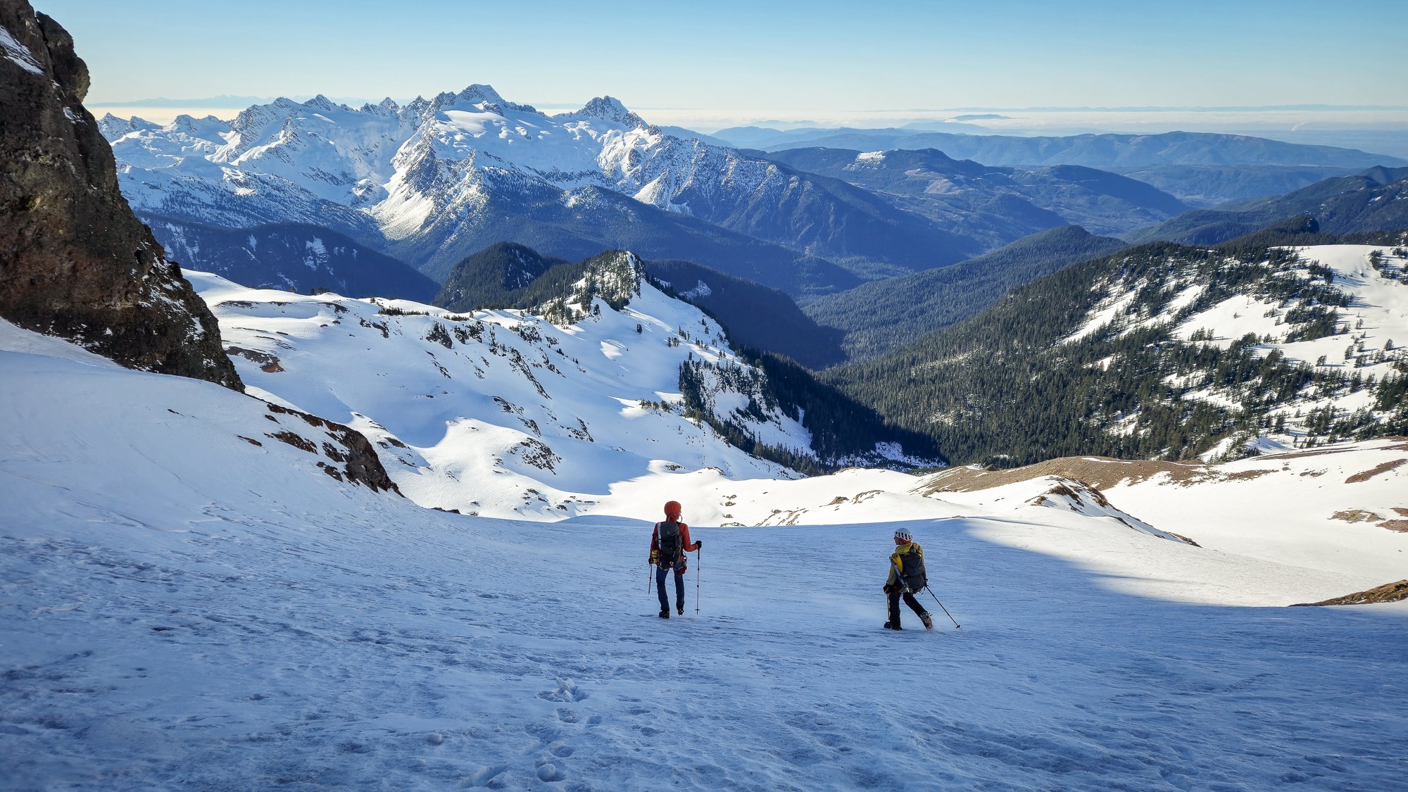
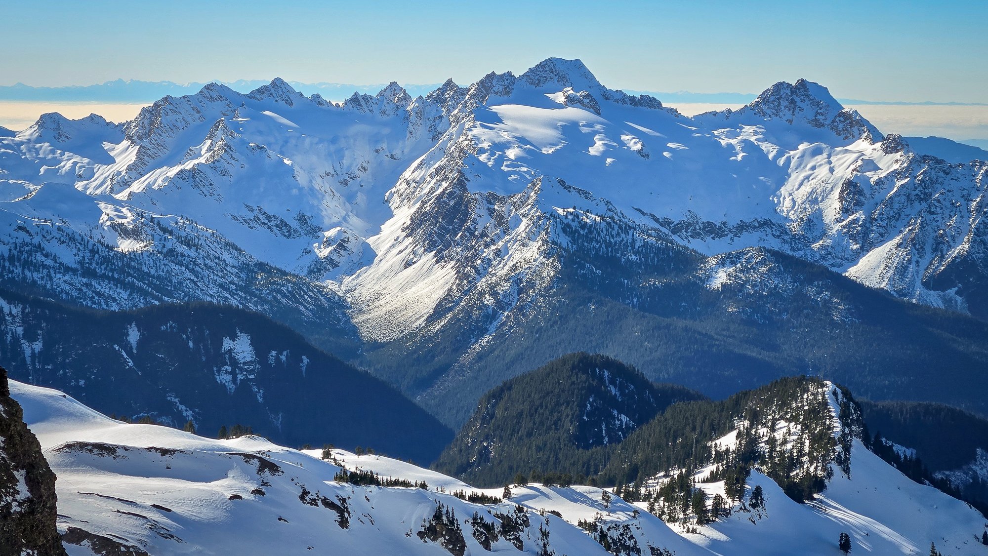
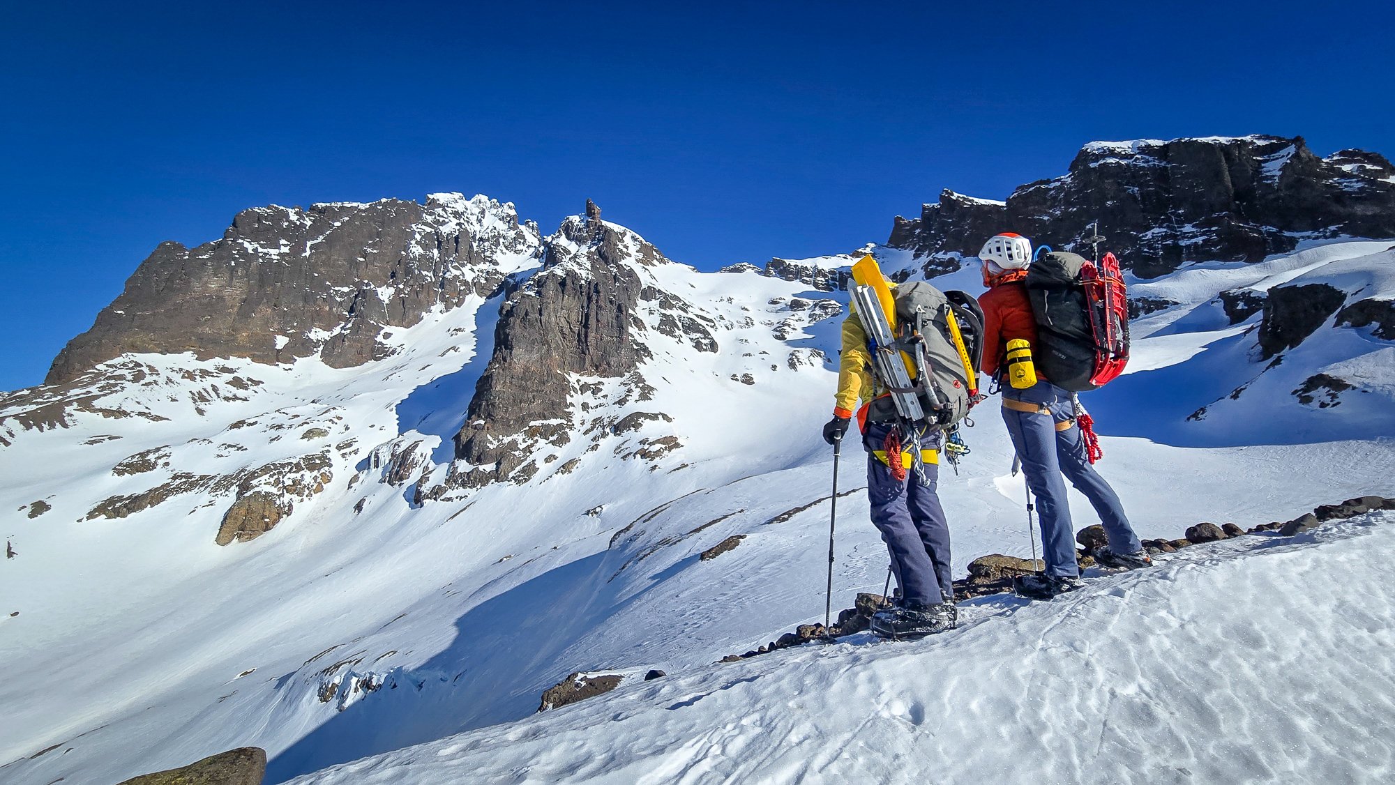
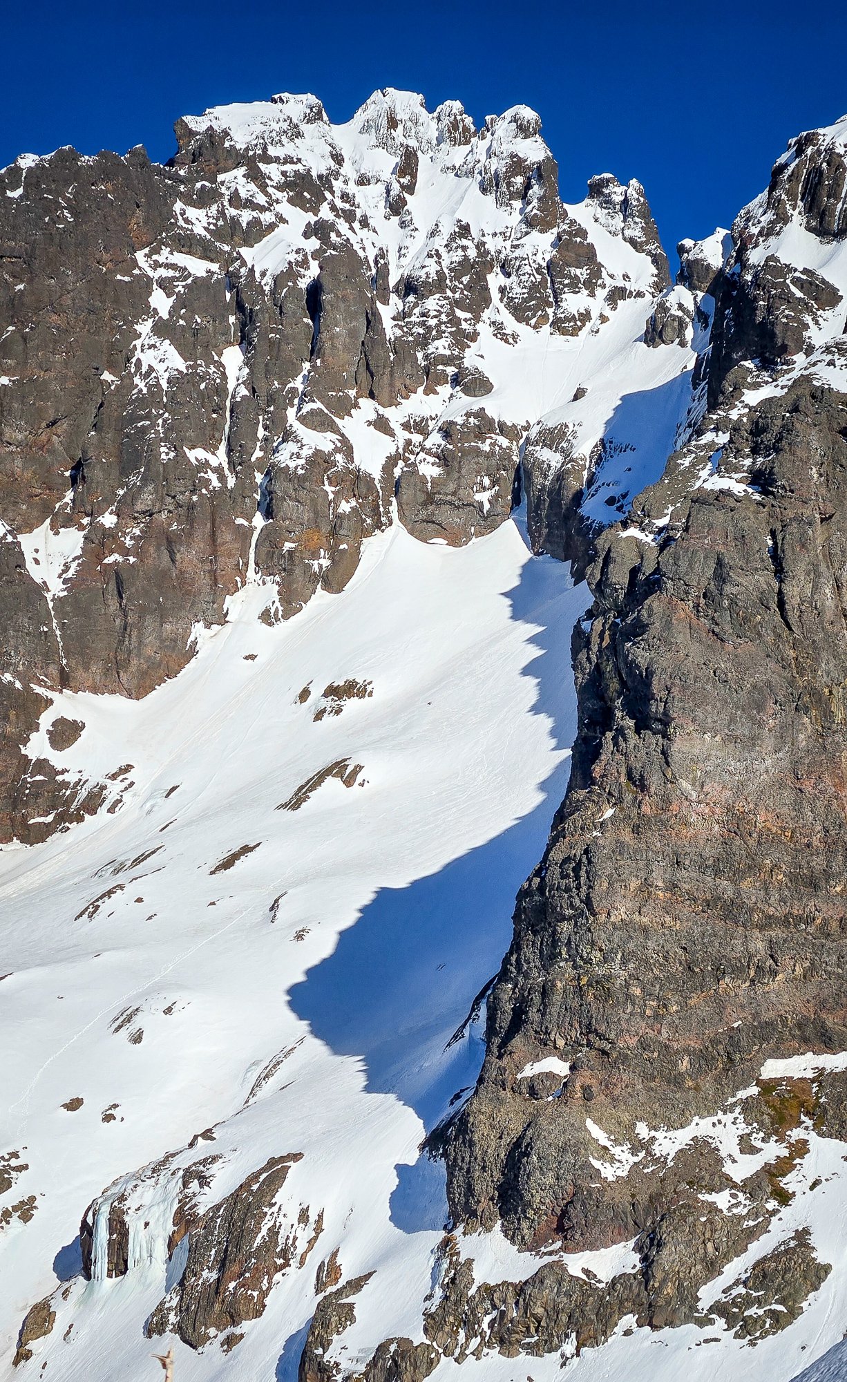
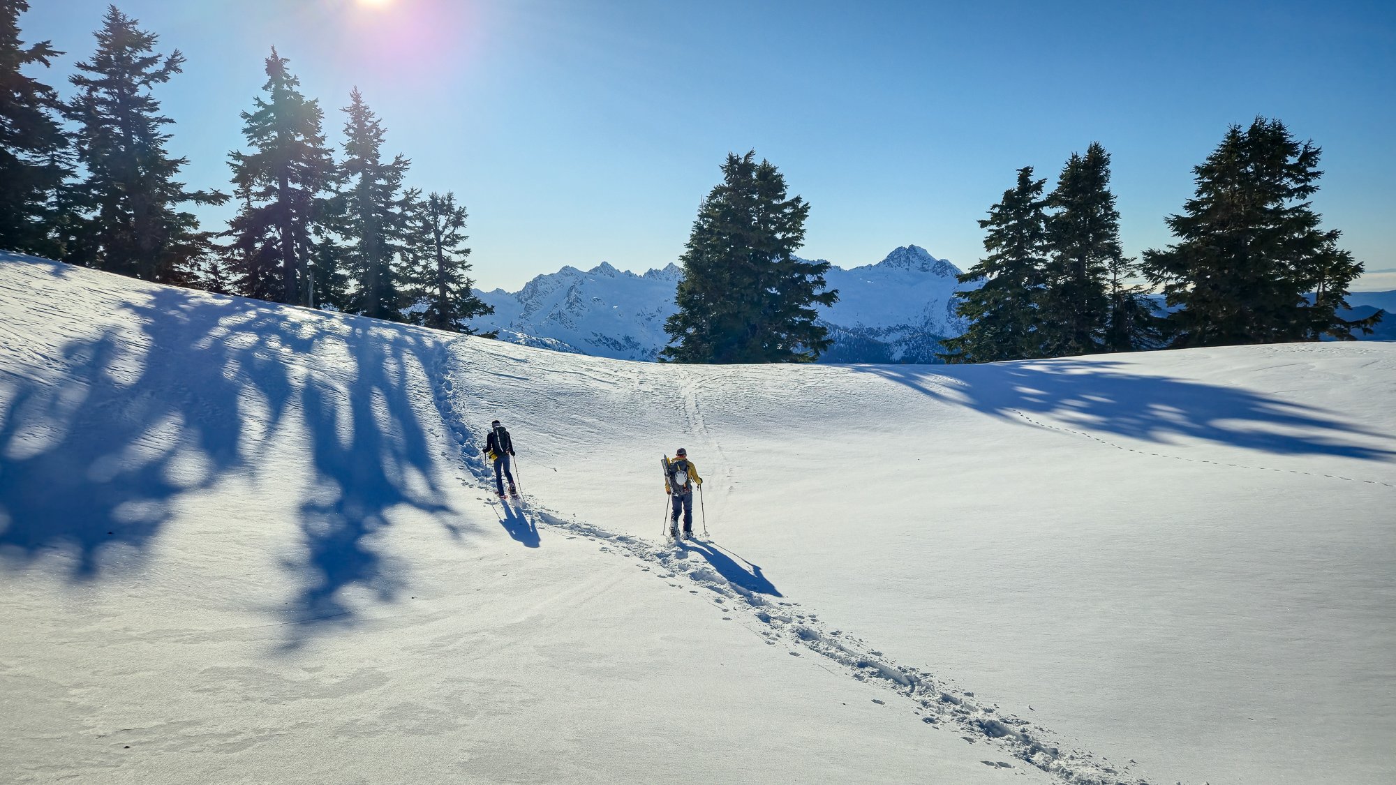
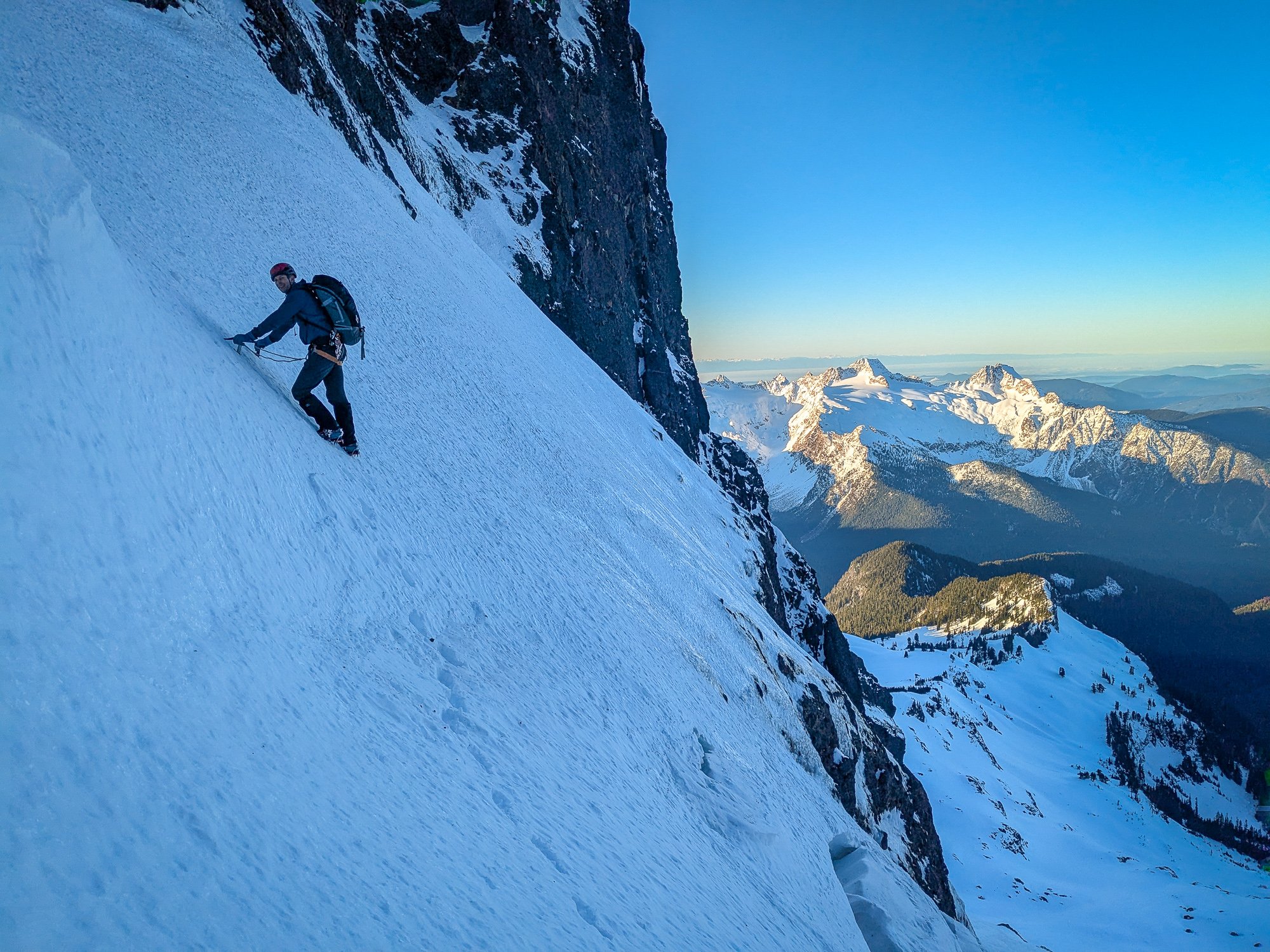
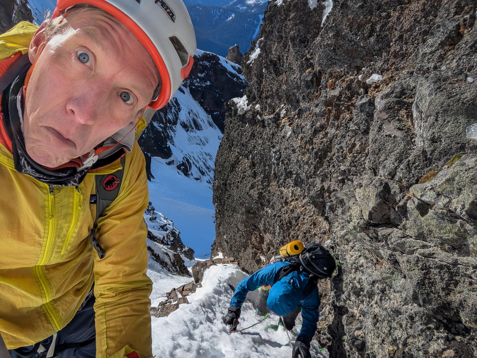 8 points
 -
Trip: Diptop Peak - South face/rib route - FA - 1,000’, 5.8 Trip Date: 09/27/2025 Trip Report: The complex south (or perhaps SSW) face of Diptop, Jason Hummel photo: “Not too bad for a couple of old guys.” “Not too good either.” The statement and its rejoinder were uttered upon arrival at the truck -- just after dark -- and ended 14 hours of moving, including pioneering a route up (with benefit of hindsight) a questionable objective. Apparently one person’s idea of a good time is another’s idea of a bad time. The exchange echoed an earlier sentiment: “One person’s inspiration is another person's embarrassment”. Diptop is just north of Mt Daniel, and just south of the insta-famous Jade Lake. Rolf sketched our approx route below, fairly borrowed from a Wikipedia image (in turn apparently derived from a pic by Martin Bravenboer): Our "meandering-like-a-drunk" route gained 1,000 vertical feet, and entailed 6 roped pitches (the last one v. short) and a fair bit of soloing. Photos from afar inspired hope that 1. we’d be climbing on granite, and 2. there would be appealing lines on the central buttress of the expansive south face, or on the face itself. Upon closer inspection: 1. the rock was granitic, but one might say it has exfoliated "in an unfriendly manner for free climbing." And 2., while there were cracks and attractive features, it was difficult to ascertain if the seemingly discontinuous lines could be joined. We leave that to more competent and/or bolder parties to figure out. The route was reasonably solid for the alpine, and had its moments of fun. It was mostly scrambling, though it had some contrived steeper climbing and some required steeper climbing. Rolf drew the short final bit -- arguably the crux -- to the ridge crest, not far from the summit. On some of the best rock of the route, although with limited pro, he made a couple of sporty moves with a Vlad-the-Impaler flake threatening his nethers: Despite a "limited alpine skill set", perhaps indeed an “ordinary person accomplishing extraordinary things” is possible, if by extraordinary the speaker meant finding an ignominious way up a fractured granitic face. Maybe they were just “projecting insecurities", since this venture was their pet project. We might have been mildly disappointed with the route, but random insults like “twee”, “cloying”, “piker”, and various vitriolic un-printables kept the mood light. And the surroundings weren’t half bad. A couple more photos below. First roped pitch, after several hundred feet of soloing up to 5th class: Relatively high on the route: An oblique look at the central buttress from the summit area: We approached from the Tonga Ridge/Deception Cr cutoff trailhead. This much shorter approach from the north (vs coming from the south) does require travel up/down some steep timber, duff, and a bit of brush, but offers scenery, solitude (until arrival at Marmot and Jade Lakes), and berries. A little off the optimum route on the last steep stretch of the return, while monkey-bar-jungle-gyming from tree to tree down pine-needle covered duff, someone might have mumbled “we can always rap”. I’m happy to share our approximate track if you’re interested in approaching the scenic lakes without the trail slog. More photos here: https://photos.app.goo.gl/H1e1ExQ1PTVEohUE8 And more about the rock in the area here (courtesy of Rolf: https://bluemarbleearth.wordpress.com/2024/09/16/tuck-lake-and-jade-lake-geology/ Gear Notes: Took a standard double rack, but a single would do. Approach Notes: See above. To access the south face, wander down from Diptop Gap.7 points
-
Trip: Strathcona Provincial Park Ramblings - Big Interior, Septimus, and Kings Peaks Trip Date: 07/21/2025 Trip Report: This past July @Trent and I went on a ramble to Strathcona Provincial Park up on Vancouver Island. We were supposed to meet up with @wbk at the end of the week to give the Colonel Foster Traverse a go, but we wanted to ease into it. And so we did, sort of. Or maybe we just got schooled by the "Island Alpine" we had heard so much about from @wbk. First off we had to navigate the BC ferry options to the island, which tend to book up early. Nevertheless their ferry system makes ours look decidedly second class, and it all worked our pretty smoothly once we were booked and in line. First stop was the trail to Bedwell Lake which I suppose is a good trail by Island standards, but a grunt nontheless. The bugs weren't bad at the lake but increasingly became annoying as we climbed to our camp just below Jim Lake. We were up early the next morning, rambling up and across on the climber's path to Big Interior. It turns out most use this as an approach to Nine Peaks, but we didn't fancy carrying all of our overnight and climbing gear over the summit and so we settled for the "approach" summit of Big Interior. The bugs, heat, and humidity followed us every step of the way. Nine Peaks from Big Interior: @Trent pulling up on to the summit of Big Interior: The views, of course, were grand, and we barely knew any of the peaks in any direction. So much to do in every range it seems like, there is never enough time to climb them all! But we at least had to climb another on this trip, so we reluctantly retraced our steps to camp. And then promptly moved it to Cream lake, to prepare for the aptly named Green Ridge on Septimus. Camp at Cream lake with Septimus looming above: Septimus: Cream lake: We were up early the next morning, crashing around the lake and down, down, down to meet the start of the Green ridge. Do not underestimate this approach! It is every bit a thrash as anything in the Pickets or North Cascades and was especially character building in the heat, bugs, and humidity. Thankfully we were through most of it in a few hours and soon battling the steep rock and veg into the alpine. @Trent out of the brush and about to do battle with steep veg on the Green Ridge: But soon enough we emerged into the full blown Island Alpine and the grand north wall of Septimus and Rosseau was revealed: Looking down at Green lake from Green Ridge: As we scrambled higher, we came across one of the more vivid bits of rock I have encountered in the mountains. Maybe some pillow basalts that have been smoothed by ice? And then a short rap, some steep snow and steeper rock (but still 4th class) as we wheezed our way above the bugs and on to the summit of Septimus: @Trent on the summit of Septimus: There was quite a flower garden directly on the summit of Septimus: And then the 5-6 raps down the South (regular) route on Septimus. We had heard that you may need two ropes to make this work, but it went fine with a single 60m. Take care if anyone is below you though, much loose rock! By the time we got back to camp it was late afternoon, the bugs were fierce, and a swim was called for to think about our options. It was decided that we would spend another night at Cream Lake, hike out for a "rest" day and then try for a single day trip before meeting up with @wbk later in the week for Colonel Foster. I mean, we're going to do all that, right? But first, there was a sunset to enjoy: In the morning the bugs were still fierce, the heat and humidity back in full force as we packed up to hike the Bedwell trail back to the car. Parting view of Septimus: Big Interior and Bedwell Lake: Thanks to a friendly campground host in the park, we found an excellent free place to camp just outside the park and on the way to Gold River. It was about this point that our appetite for Colonel Foster was waning as the pull of home and no bugs was growing stronger: But first, another peak! We had chosen the "hiker's" route up Kings Peak as the day trip the following, knowing that it was a big grunt and was likely to be hot and buggy as well. Still, it was enough of a challenge as to feel like easy mountaineering, and it was hard to beat the views. There are loads of very steep climbs on Kings, maybe the highest concentration of hard routes on any peak in Strathcona Provincial Park. But we didn't climb any of them! We did oogle other nearby mountains like Elkhorn, for a future trip to the Island: And of course, the Colonel: Soon we were on the summit with the ravens on a perfect day, finally above the bugs and the heat, feeling the bliss of "Island Alpine": But it wouldn't last. We were tired from 5 days of rugged Island peak bagging, and a bit mad from the bugs as we descended. We got in the car, changed our ferry reservation and headed home. Sorry @wbk, we'll have to come back for the Colonel! Gear Notes: 60m half rope (Septimus Green Arete), ice axe, helmet, crampons Approach Notes: BC Ferries7 points
-
You asked if anyone knew about the truckers. I was a part of that organization a long time ago. I remember when we placed the register on the Citadel, but I don’t remember which other summits we put registers on. We climbed lots of mountains in the Olympics as well as many of the minor peaks and even some unnamed peaks. The truckers were active from about 1970 to maybe 1977 or 78. Most of the time our membership consisted of 3 - 5 guys. Our name was inspired by a common phrase of that time: “Keep on Truckin’. “ we generally avoided common routes up mountains. We referred to our routes as “truck routes,” and the leader of a climb was referred to as the “mother trucker.” Almost every September, we would take a cross country route across the Olympics, following ridges as much as possible, and climbing any peaks, we ran into along the way. If you’d like to know more, you can email me (Dave) at sciguy300@gmail.com Nice pictures, and nice to see the register is still there after all this time Thanks for the memory.7 points
-
Trip: Johannesburg - NE Rib Trip Date: 07/24/2025 Trip Report: Another Johannesburg NE rib trip report is something the world likely doesn’t need but I’m in a bit of beta happy mood lately. Certain kinds of climbers might find the endless scrambling pretty enjoyable. And with perfect route finding the route doesn’t have to be especially sketchy, though as I found, navigation errors might be punished severely. The steep dirt embankment right off the road is a heads up rude awakening that foreshadows what lies ahead. And for such a short approach the bushwhacking is not insignificant. Steph Abegg has a good photo of the start of the route but the snow fan cuts off the very bottom of the slab and the elevation is wrong. You gain the rock more like 4100’. This confused me back in early June when I came to try the route. I got spooked off the slabs at the start. Thinking I may have missed something due to the “4400’” annotation, I climbed snow higher, but found only sheer cliffs above. On my way back down I saw from Steph’s picture that I had been in the right place after all but it turned out to just be really hard instead of easy class 4. During my second attempt I began by trying to follow blocky terrain on the left side of the slab. It started out good but when it came time to move right, a drip formed an impossibly slimy 10 foot wide barrier to passage. I retreated nearly back to the bottom and instead headed up to a right facing corner left of a roof with a wet slab below it. I went this way on my first attempt before bailing. It starts with a bit of lieback on a jug and a high reach to another jug, after which you can pull up to easier ground. Right after I took this photo my feet blew on slime. It’s a low angle stance, so fortunately I didn’t go far. Humbly I reapplied and was accepted on the second try. This short sequence felt like 5th class though as my fall demonstrated, maybe not exposed enough to count as true 5th. Though I’ve spent more than my fair share of time on that slab by now, I still have no idea where the path of least resistance is. Having failed to find the “easy class 4” I also failed to find the “sketchy 5th”. At the top of the slab next to the waterfall I found good solid rock and was on my way. Worse was yet to come in the jungle section. From the stream below I noticed some tall cedars and guessed that it wouldn’t be too crowded at their bases. This was true, I was able to move between them and the rock buttress without any real entanglement (18L pack with ax and tool covered in socks and just barely stuffed inside). However I was getting further and further west and not gaining enough elevation. Finally I saw something I was hoping to find, a steep, rocky and mostly dry bed. But guarding access was minor cliff band maybe 15’ tall. Overly committed, I explored three fairly terrifying options at 5.forest and managed to get through, relying far more on good fortune than I’d like. The episode left a bitter taste on an otherwise umami day. I definitely prefer my climbs not avoidably harrowing. Above that section I tended to stay in or just to the right of the gully between the two ribs, with a wider diversion to the right just above the last major snowfield. Where the vegetation finally gives way to solid, polished rock beginning around 6K’ was the highlight of the route for me, both because this was the best quality rock for the day, and because of the sense of relief for escaping what was just below. At about 6450’ I found a promontory with a great view of the northeast face. Beyond this point the rock quality declined some (but not terrible) and the route complexity increased. I saw that I needed to move diagonally up and right to get to where the snow was on my map. I found reasonable ramps and ledges cut with interesting quartz bands. There was one more section of minor drama with steep, exposed choss to get around the corner. Then I could see the snow and ice spilling down from Johannesburg’s north face. I gained the snow at 7200’, maybe missing the famous bivy, though I noticed one small one at 7000’ with good but not panoramic views. The snow arete was AWOL. My guess is the high heat has melted it down to a boring broad shape. Passage on the left was a little narrow but in good shape. There were no real difficulties with shrunds and crevasses and no mandatory hard ice. At the upper face especially the snow was steep enough that I was glad to have sharp things on each limb. Unlike my first time here, I couldn’t locate the summit register. Before long I began the descent to the east. It was helpful to have been up and down this way before. I had forgotten how much griffin shit is in this zone. I seemed to take a long time descending. Probably I was mentally fatigued from all the no fall terrain. It was a lovely afternoon as I traversed the basin over to the ridge off of Mixup, pierced with many marmot cries dying off with slow haunting decay. Industrious workers of the underworld, unite! More mental fatigue descending the slabs coming down from that notch, then a long overdue water break below the snow (though somehow I didn’t get dehydrated despite running out shortly after the summit). Pretty straightforward and gratuitously beautiful from there back to the trailhead. It took me slightly less time than going up and down Doug’s direct had, a little under 15 hours. I think I lost at least an hour with the slab and forest cliff navigation fiascos. Many reports say this climb is best done once. I think that’s not untrue but if you really like scrambling this could be a good one, because the scrambling goes on and on hypnotically. That said, it’s a slippery one. Gear Notes: Approach shoes, steel strap-on crampons, one tool, one light ax. Approach Notes: Last hair pin before the Cascade pass trailhead. Don’t fall down the very steep hard dirt.
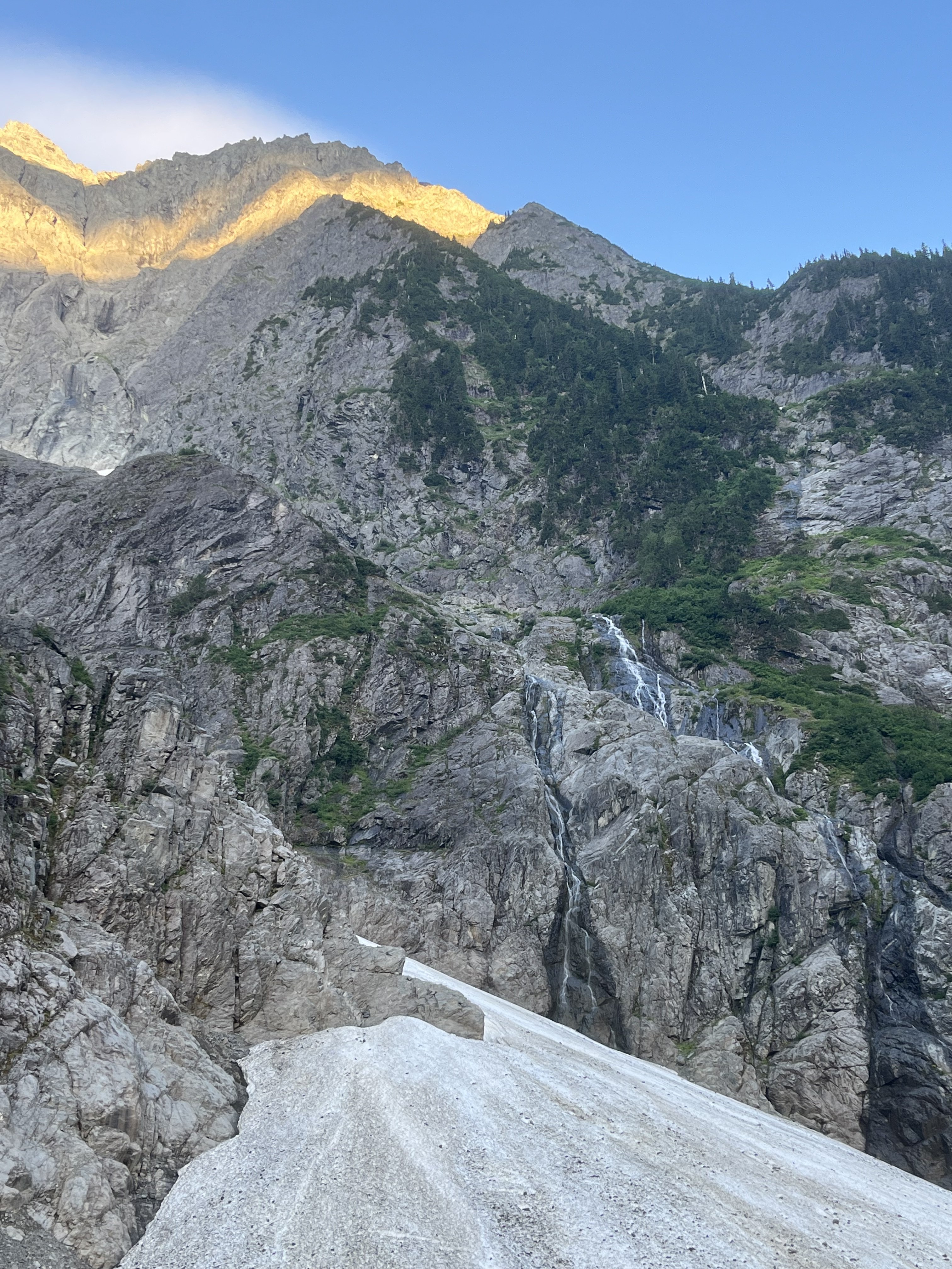
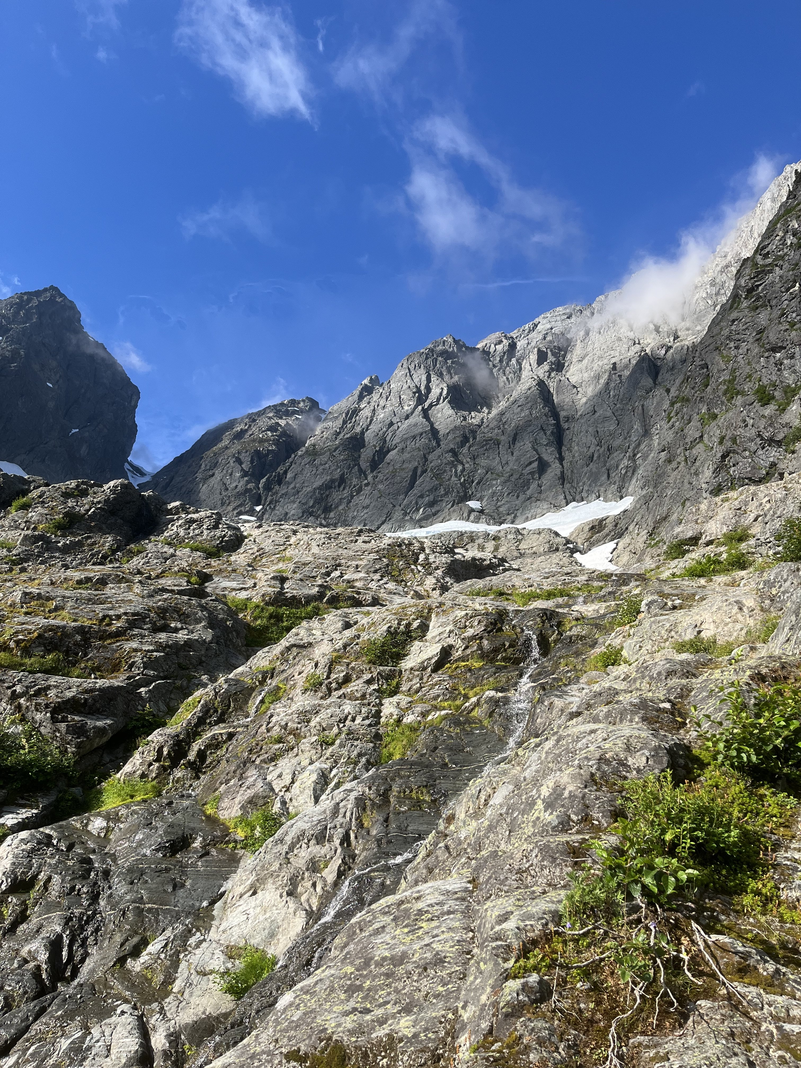
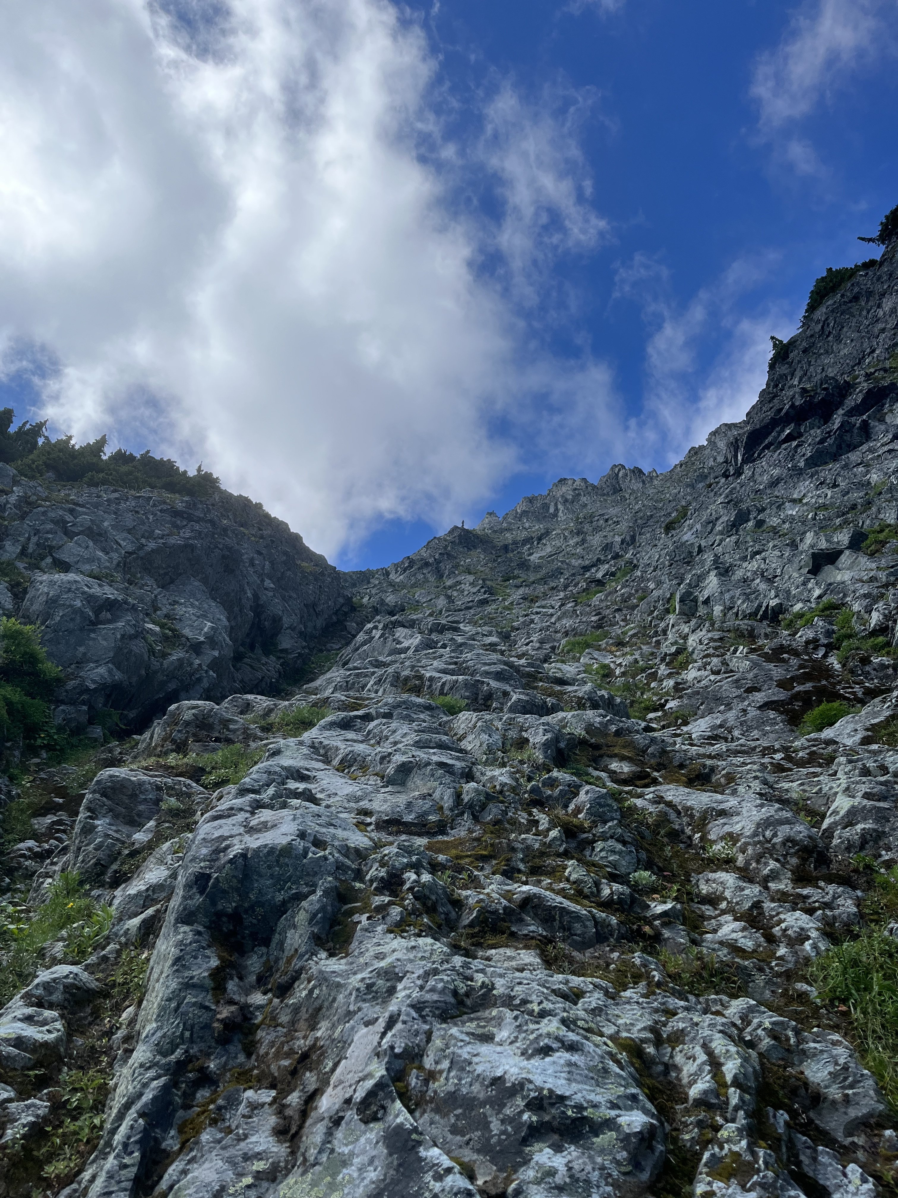
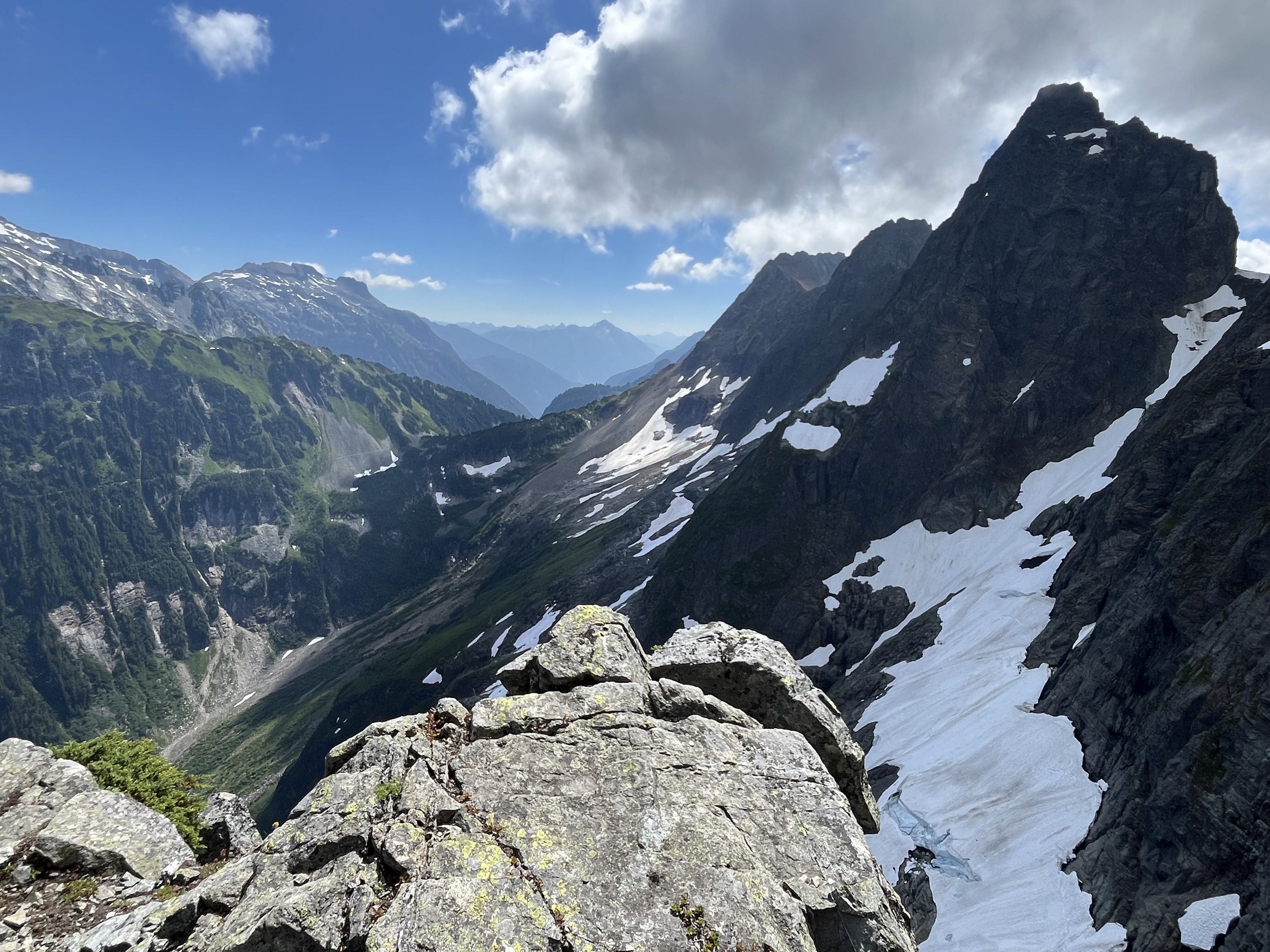
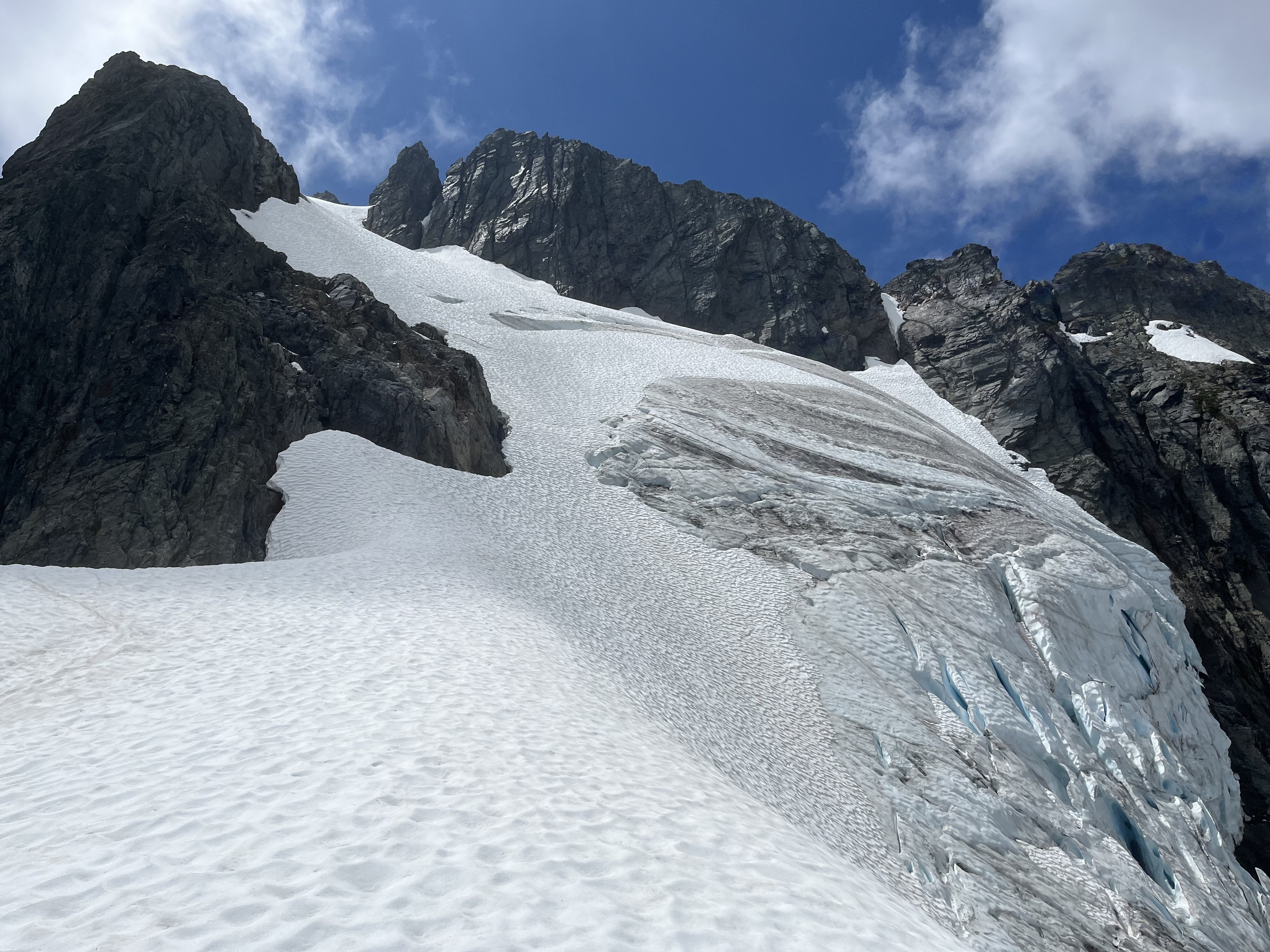
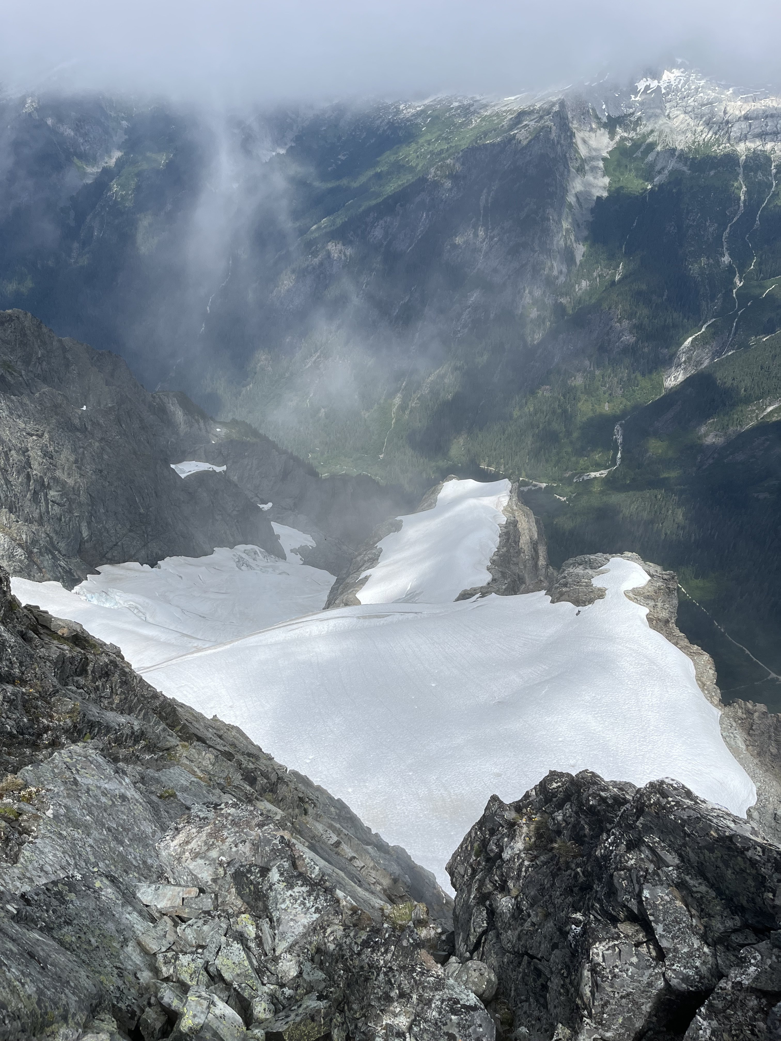
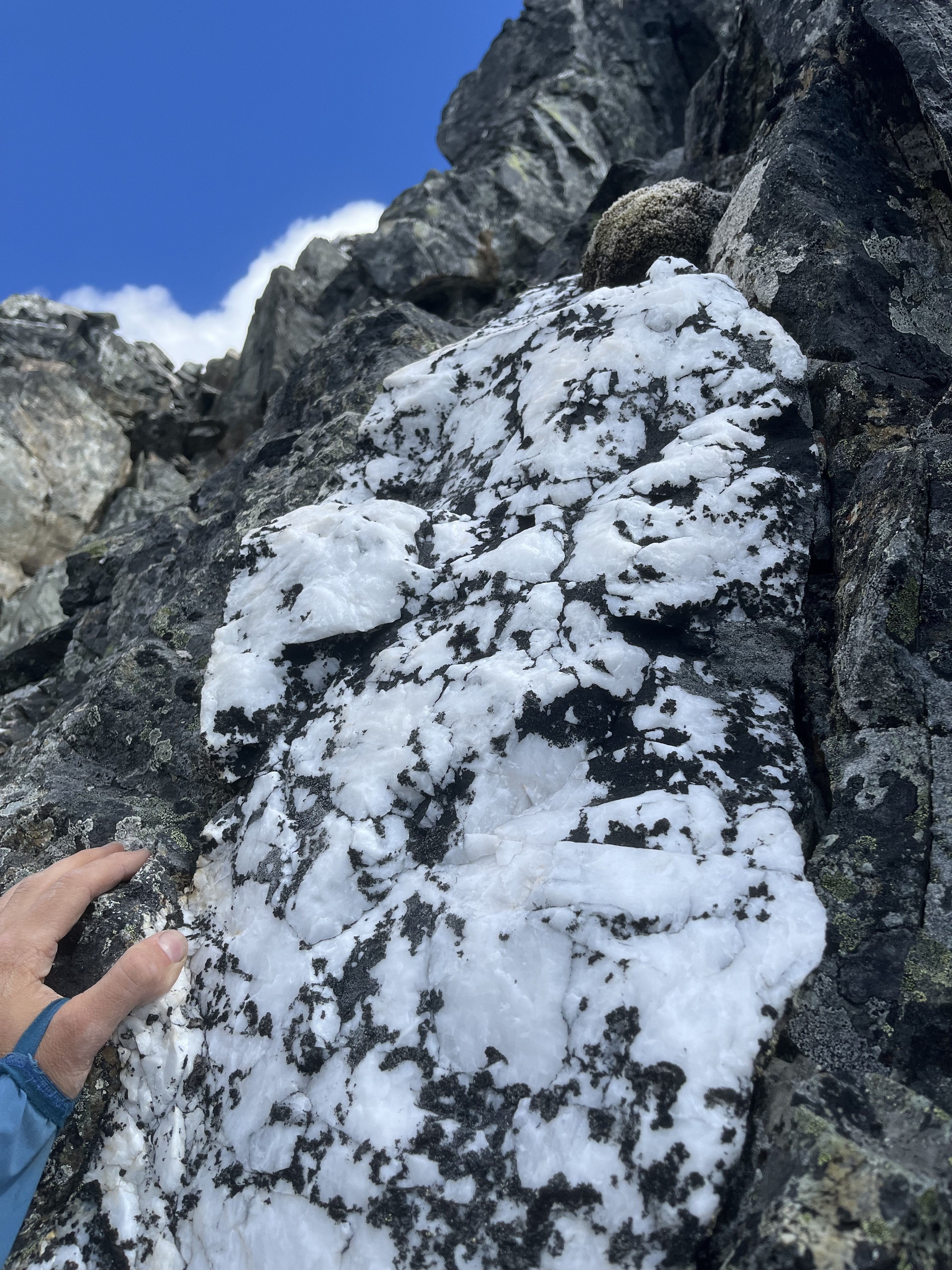
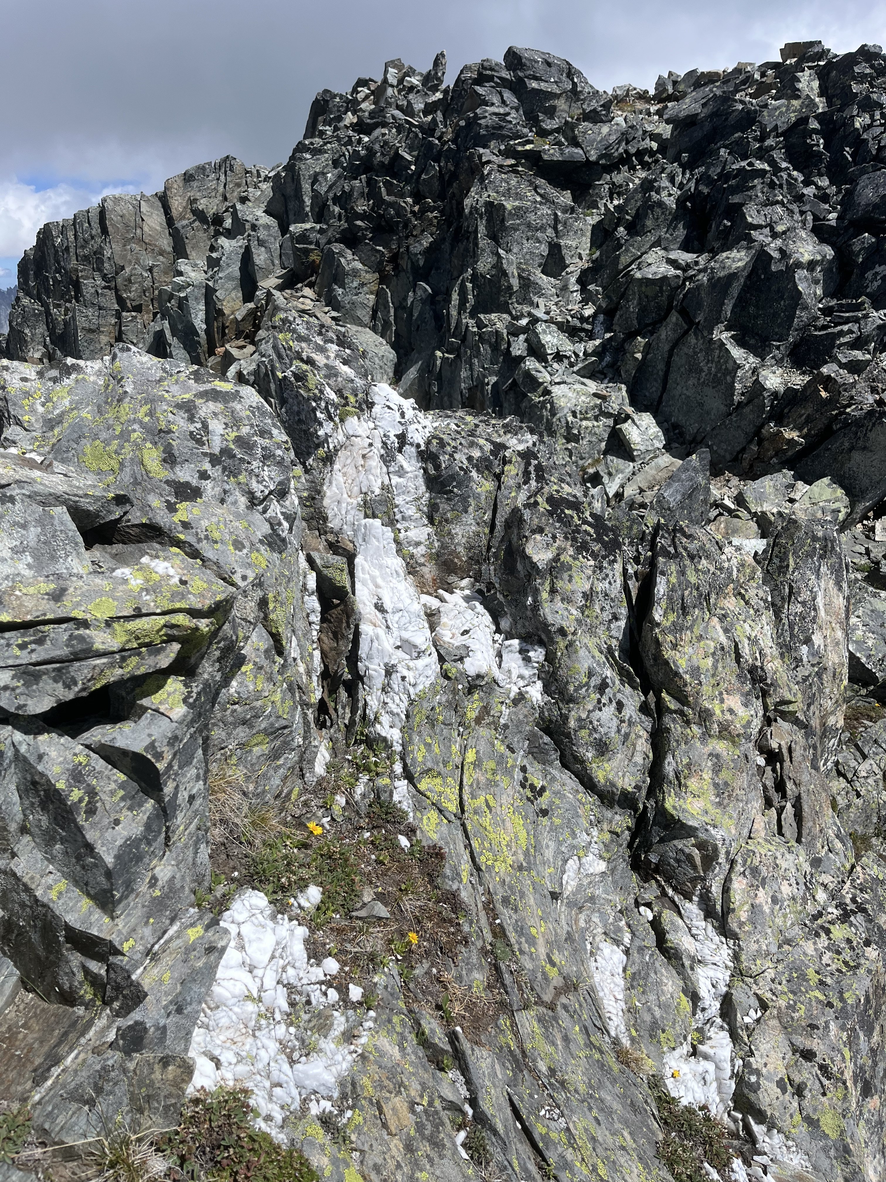
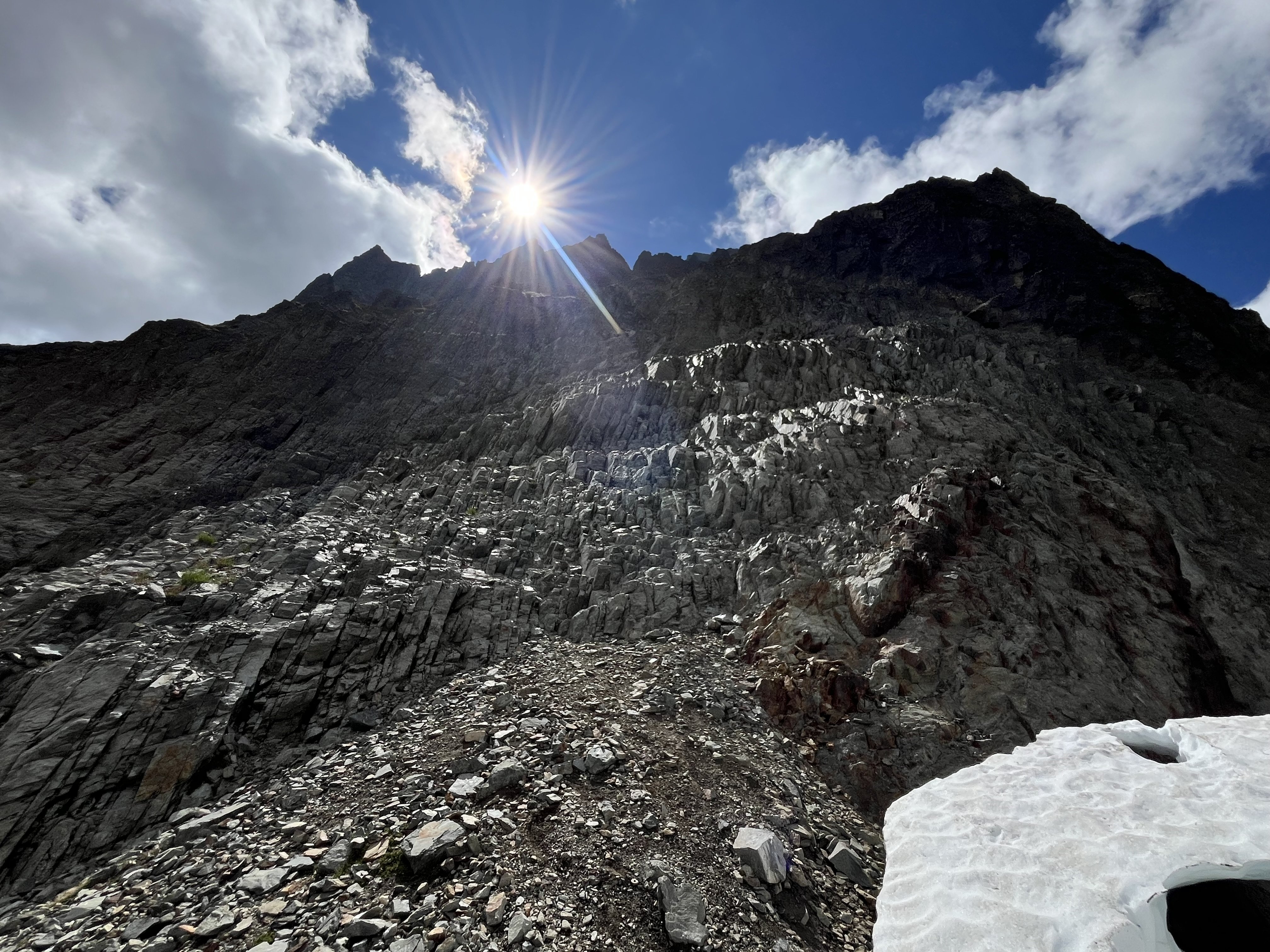
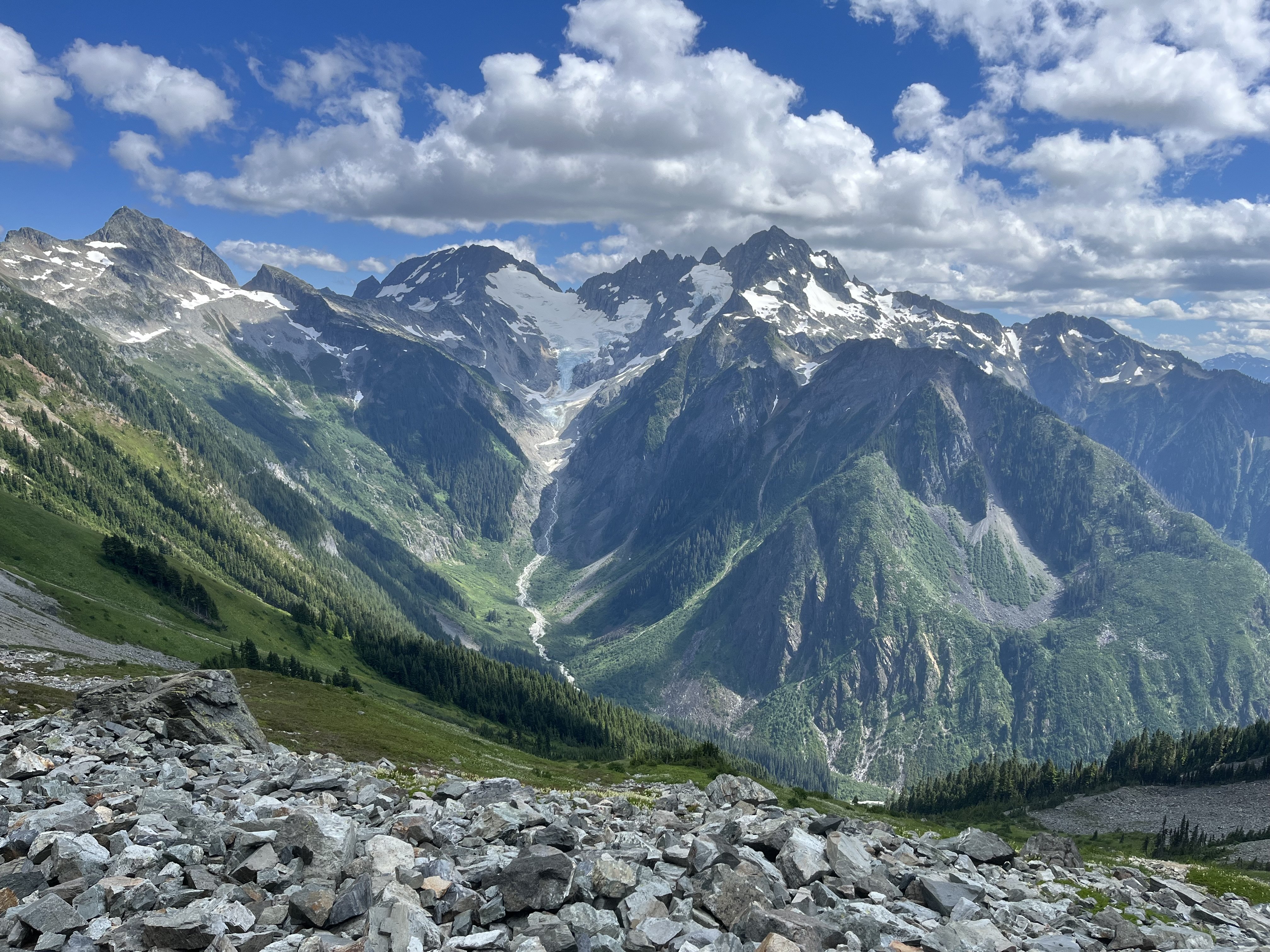
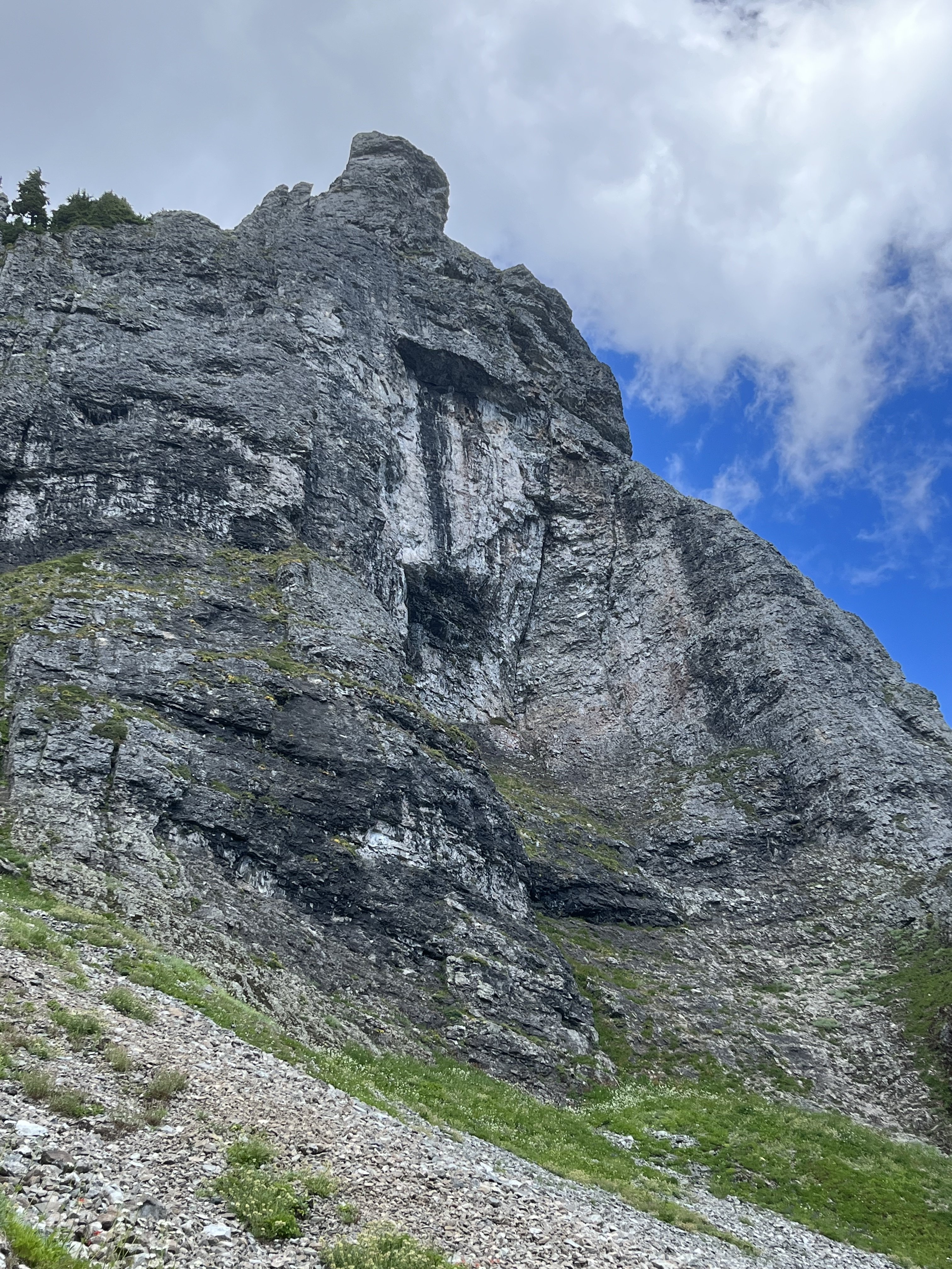
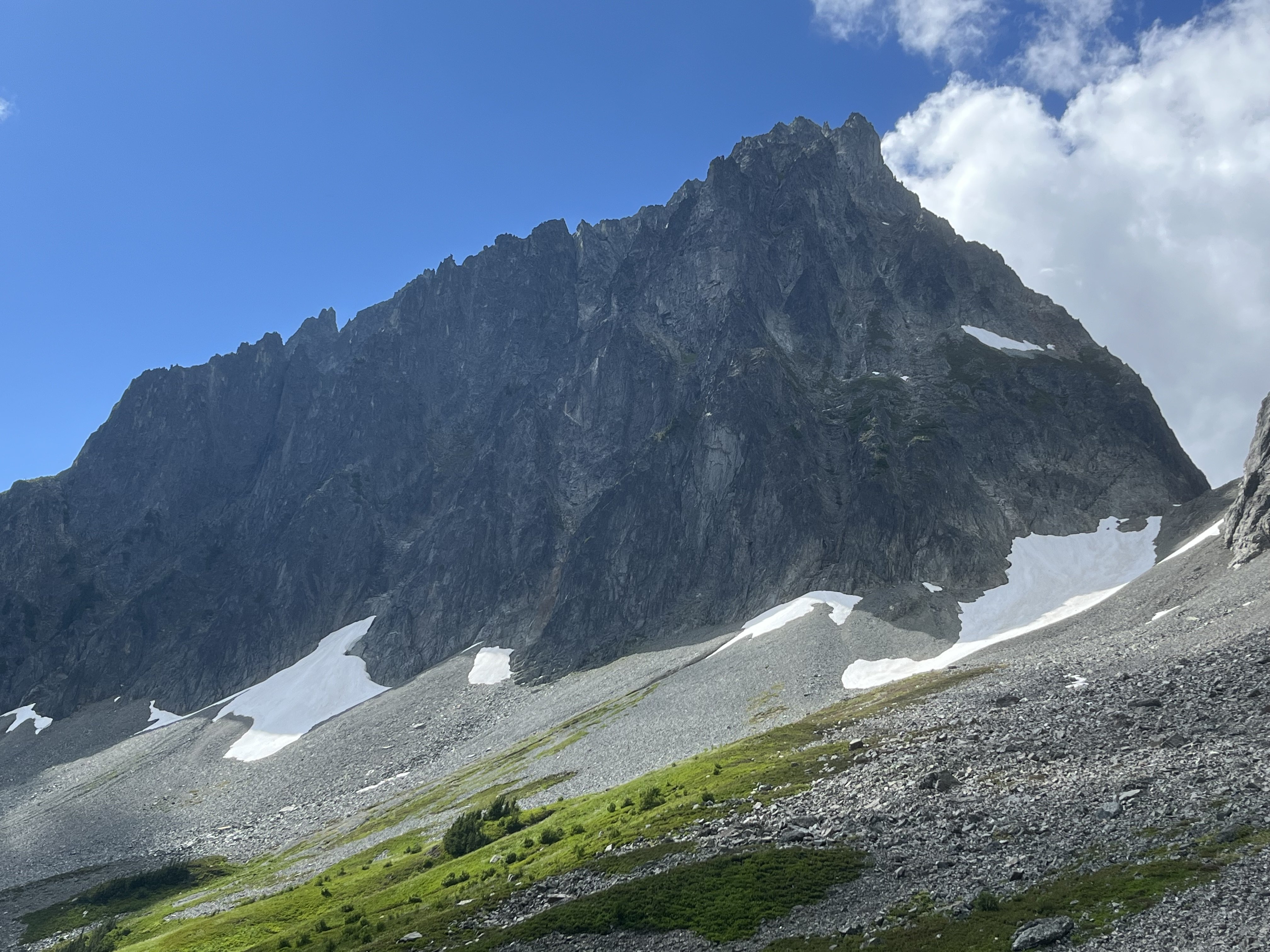
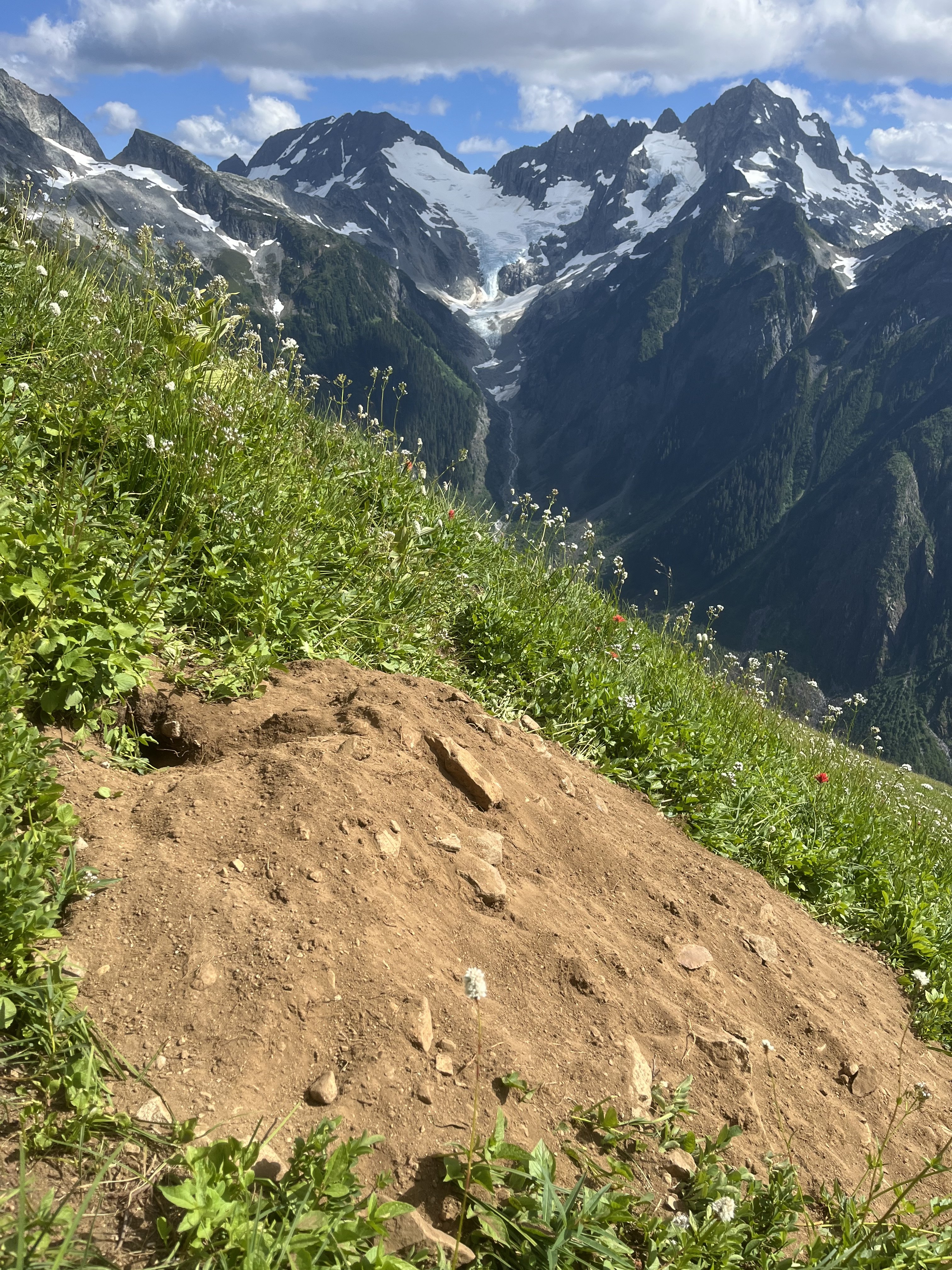
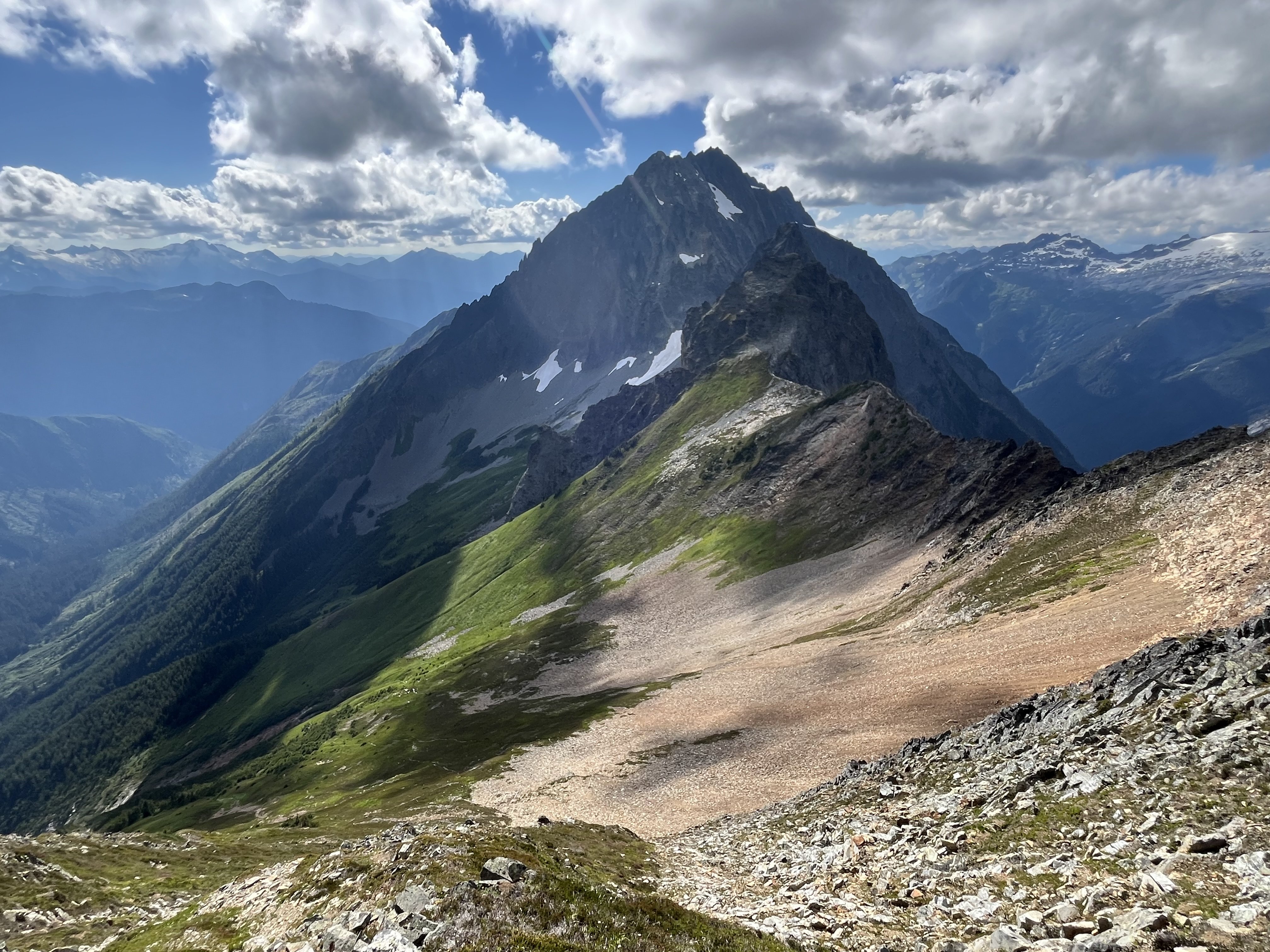
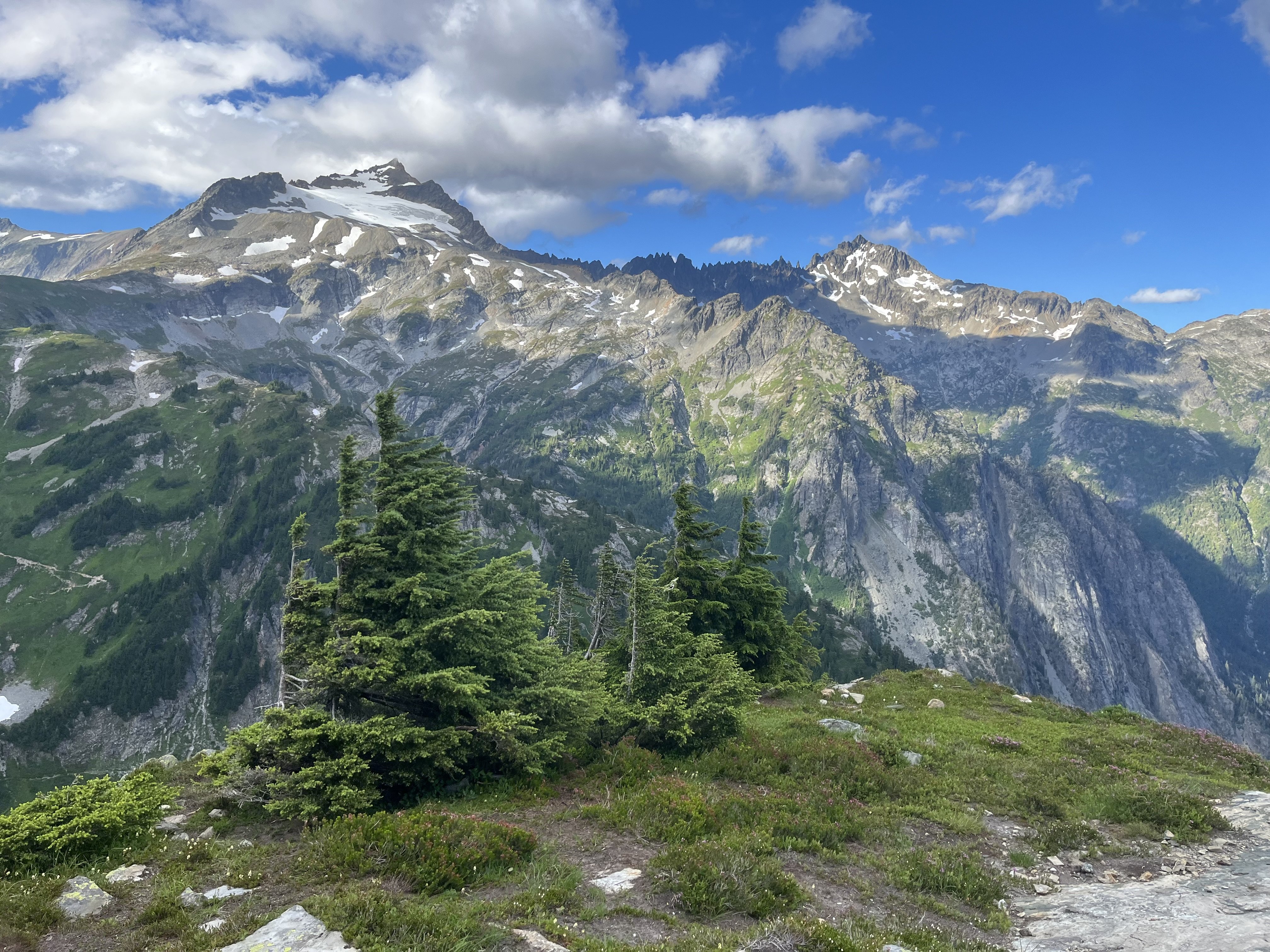
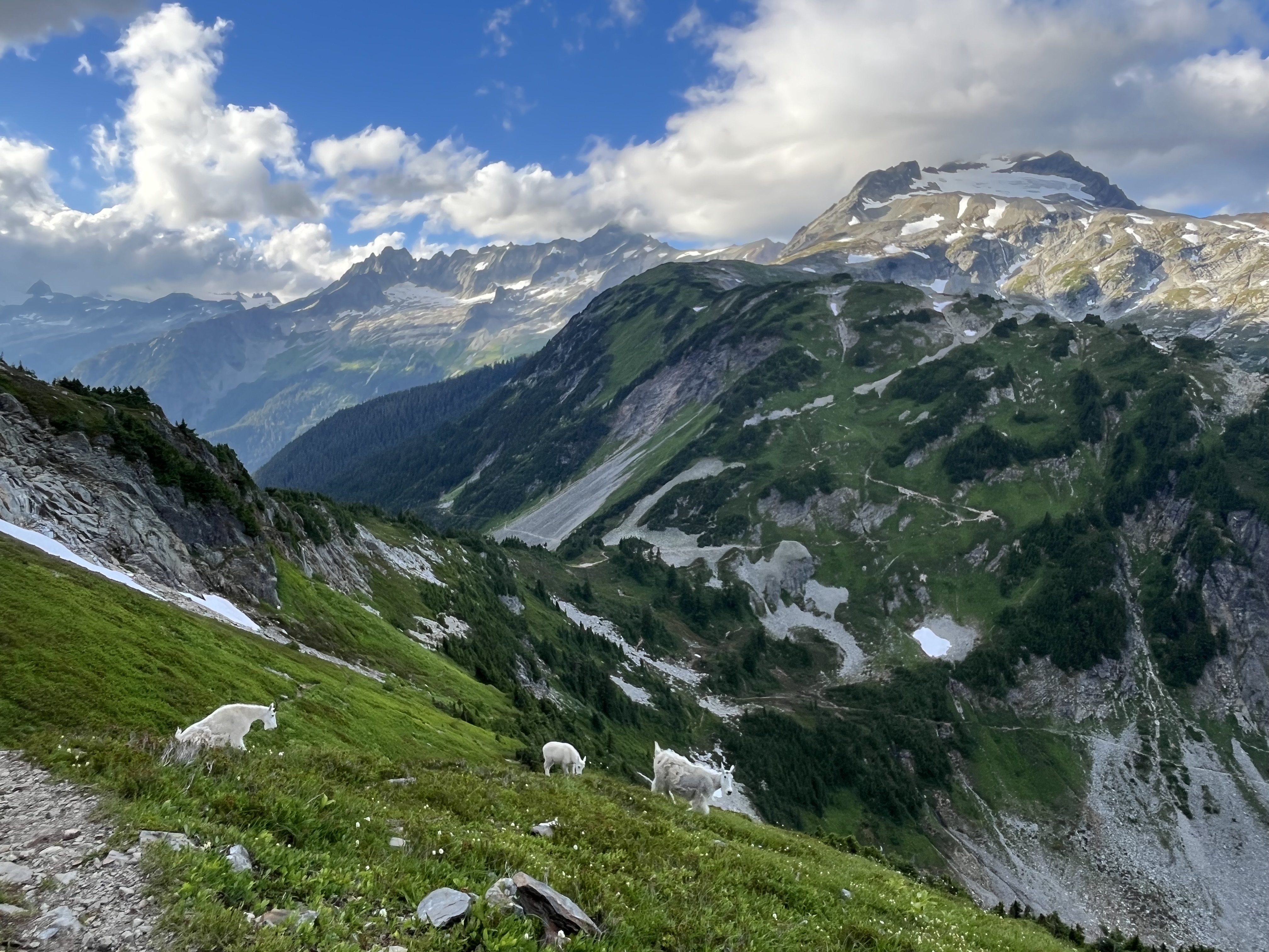
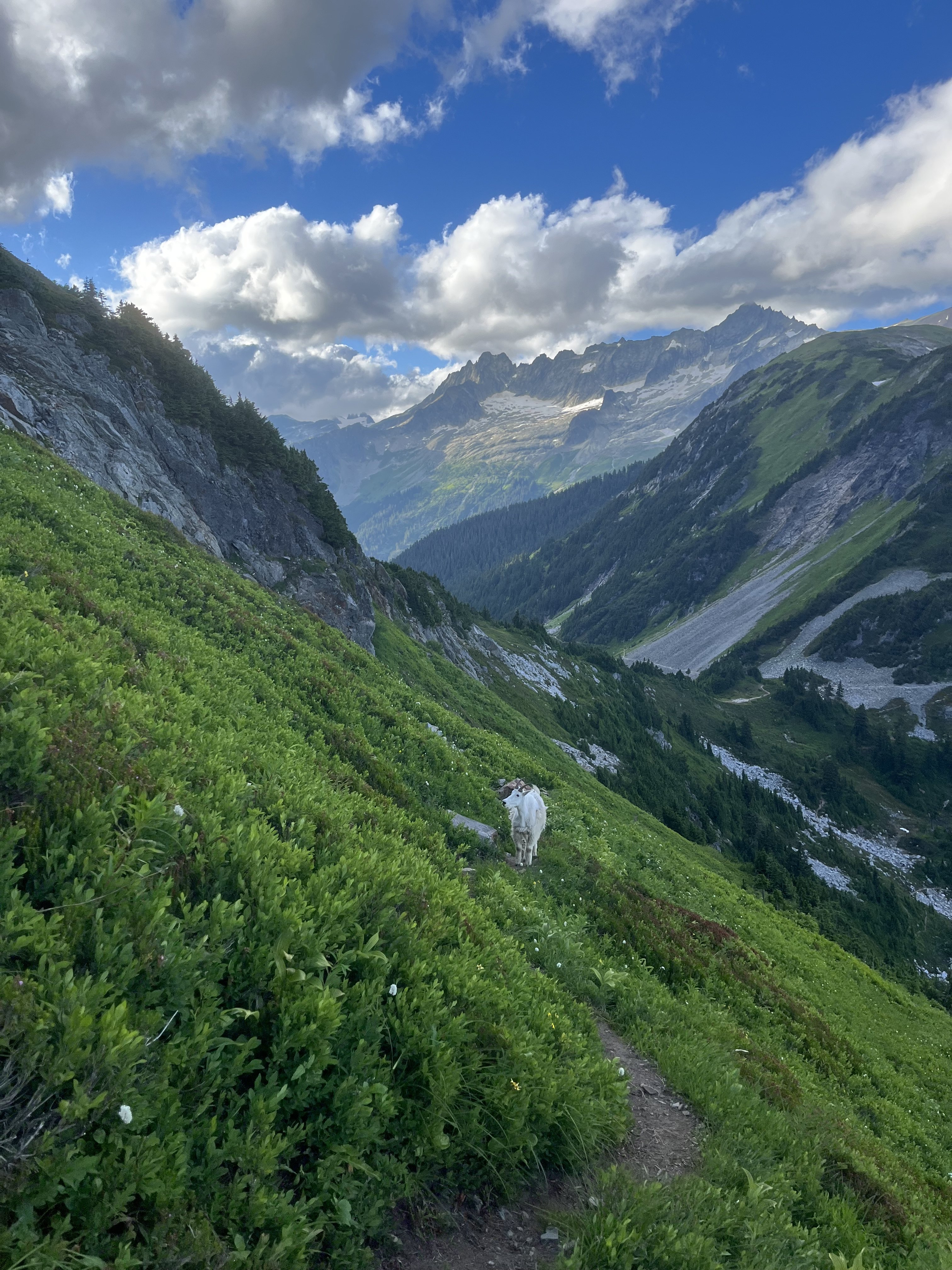
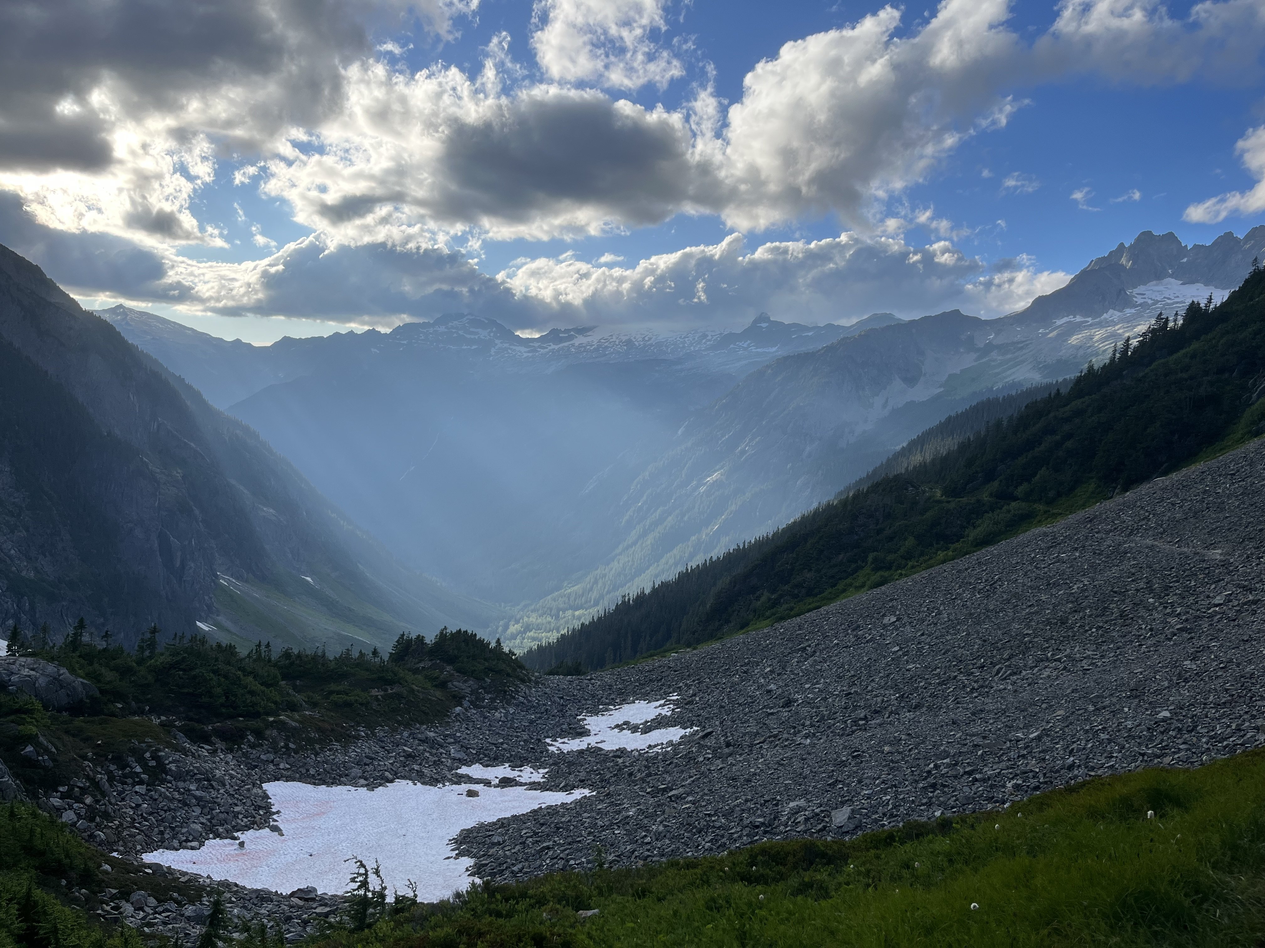
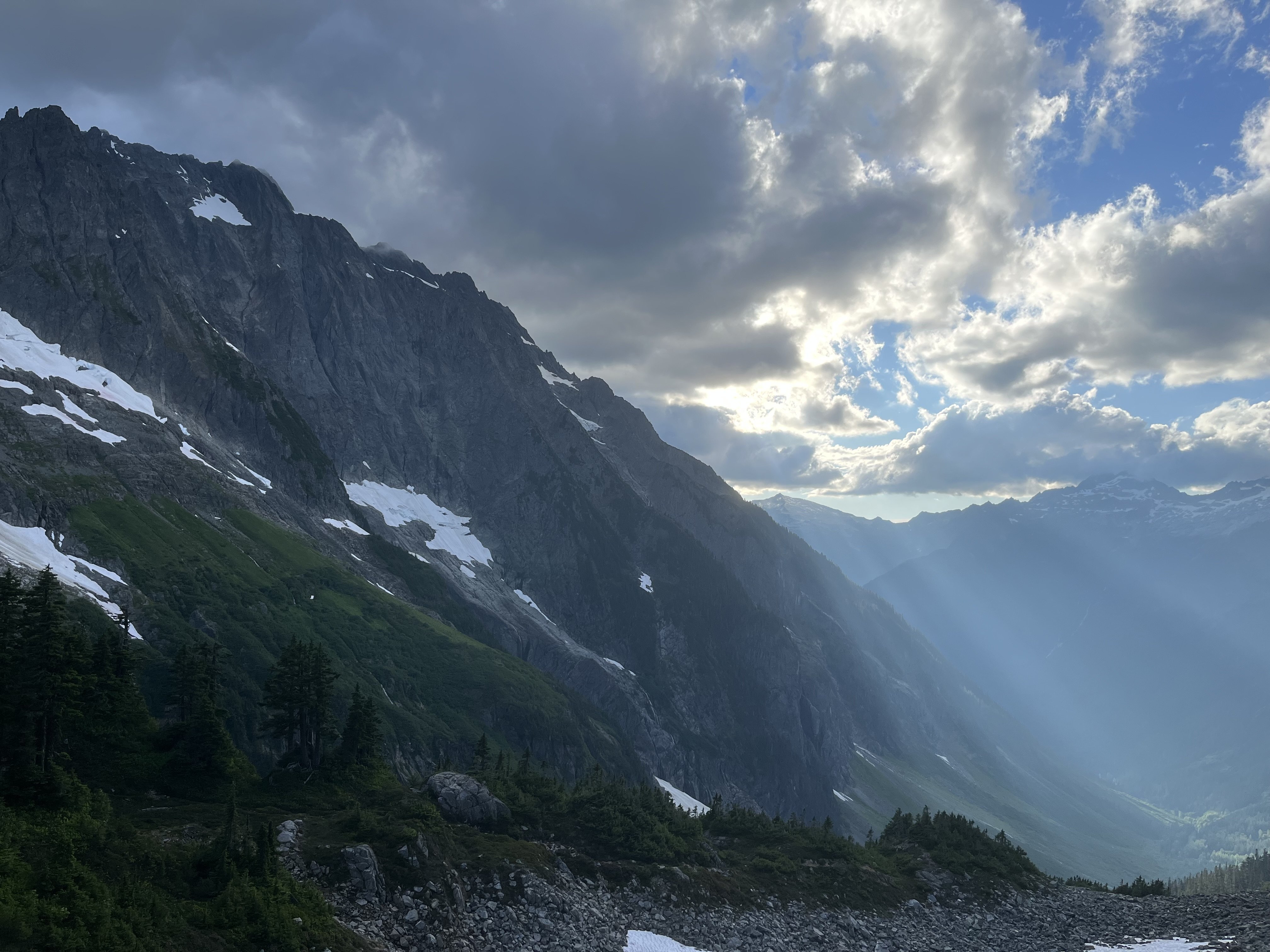
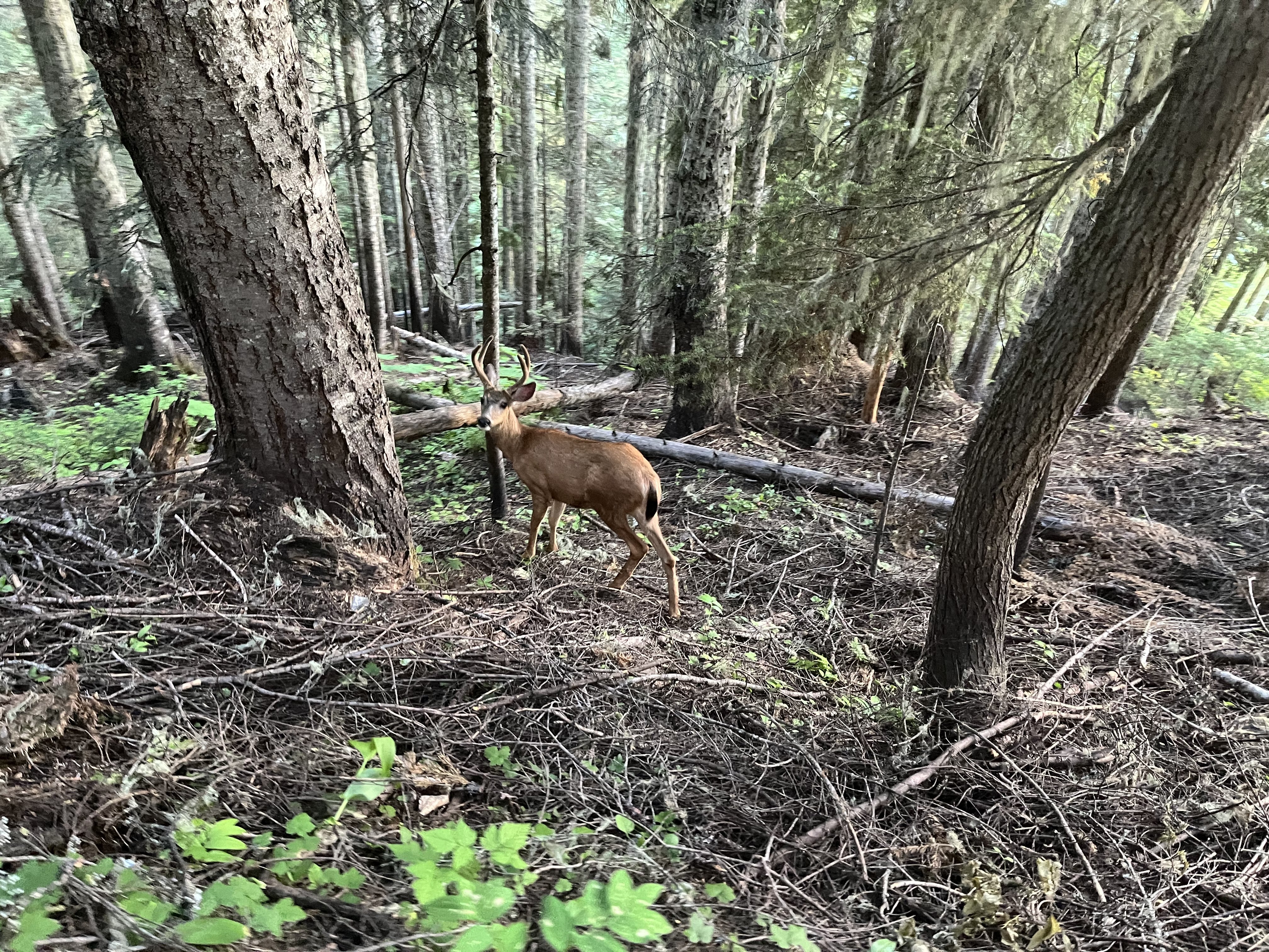
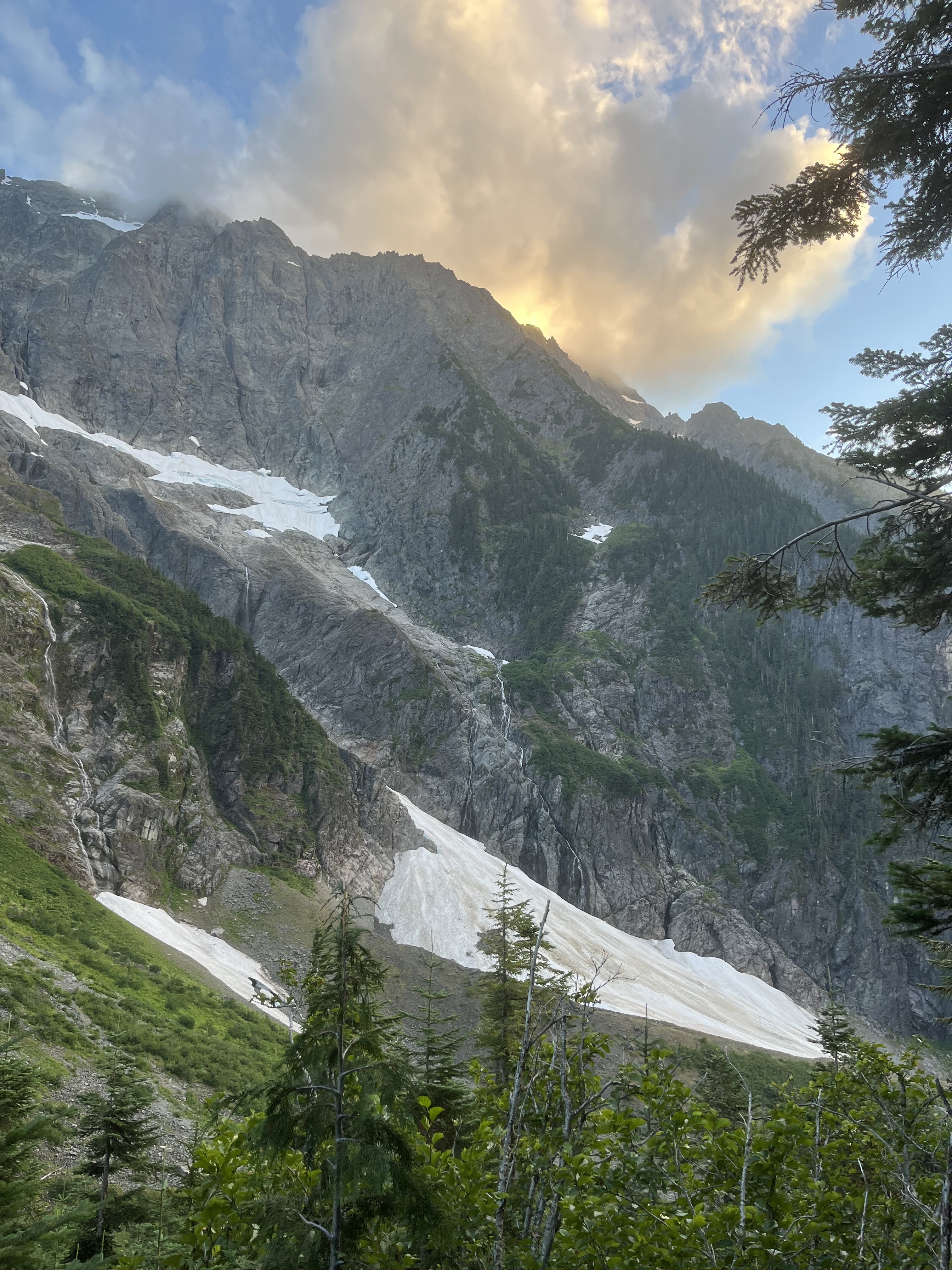 7 points
 -
Trip: Johannesburg mountain - Northeast buttress ‘51 rib Trip Date: 07/26/2025 Trip Report: I drove to the parking lot Friday night, threw my sleeping bag in the back of the truck, and fell asleep staring at Johannesburg. About an hour after sunrise I locked the truck and started walking down the road with just a hipbelt loaded with microspikes, ul rain jacket, ice axe, garmin, work gloves, 6 gu’s, and 500 ml of water. Getting to the snow was quite straight forward. I stayed on talus, just climbers left of the moraine for as long as I could, and then traversed straight across the moraine to where I could step onto the initial slabs to gain the rib. Figuring out these initial first pitches before the brush was slightly tricky, perhaps requiring the most thoughtful climbing of the whole route. Just above the slabs was a large patch of snow. I drank some water and filled up here and then started tree climbing. I was elated to not have a pack on for this section. The work gloves and trailspikes also made life much easier through this part of the route. Once I made it to the steep heather section I was able to mostly stay on the ridge crest with semi decent rock. I did not end up joining the 1957 route near the top like I’ve read in some trip reports, and instead continued up the 51 rib. This section contained the highest quality rock and climbing of the entire route. The crux of this section was probably a bomber near vertical handcrack(5.6) that lasted a couple body lengths. Suddenly, I was on snow. The glacier and snow conditions were nearly perfect, firm but not icy. I transitioned to rock close to the top of the glacier where it became too steep for 1 axe and microspikes. Moments later I was on the summit, 3h 40m from the car. I snapped some photos, and then started down the east ridge. The cairns were quite nice to have for encouragement. Less than an hour later I was at the C-J col. The heather up to Mixup was quite unstable, frustrating, and exhausting, but it was over soon enough. Meeting up to the Ptarmigan “trail” was mostly straight forward. I feel I could have found a slightly better way, but what I did worked just fine. Just above Cascade Pass, I emptied the rocks from my shoes, downed the rest of my water and a GU, and battened down the hatches before running down to the lot. The parade of hikers were true obstacles, but it was pretty fun blasting past them. Made it to the lot 6h 49m after leaving the truck. A very good day. Gear Notes: Work gloves, microspikes, axe Approach Notes: Short and sweet7 points
-
Trip: (Ira) Spring Mountain - East Ridge Trip Date: 01/25/2026 Trip Report: This long stretch of grim ski conditions had me casting about for other ideas in the North Cascades and Olympics (Ellinor, maybe I'll do a TR) these past few weeks. This past Sunday I cast off solo up the mountain loop highway from Darrington, aiming to get to the Lost Creek Ridge Trailhead. Surprisingly the MBSNF had a current report that you could drive all the way to the TH and indeed you could. Everything was in great shape, including to the turnoff for Pugh (not sure about the road up, however). 2wd would get you to the LCR trailhead at this time, which was somewhat surprising given the apocalyptic nature of this past December. Unsurprisingly, I was alone at the TH, and set off up the dry trail. It was generally in good shape, though with a good bit of blowdown in the first half mile or so. It had been 29 years since I'd hiked the trail and I had forgotten what large trees there are in this section of the Sauk. Of course, when they fall down, I wish they were a little smaller: Within a couple hours I found myself at Bingley Gap (hitting snow about 500' below gap), where I put on crampons, got out the axe and started up the steepening ridge. Views of Pugh and Sloan teased through the trees as I gained elevation: Within a few hundred feet above the Gap, the east ridge of Spring Mountain narrowed and steepened dramatically and I found myself doing some spicy scrambling in crampons sans helmet. Oops. (Don't worry, I found an easier way down to the north and below the ridge itself). Soon, Dakobed came into view: And then, not long after that, the summit of Spring, which was smaller and more noble than I was expecting: The view from the summit was sublime (about 3.5 hours from the car), extending across Sloan and the Monte Cristo peaks to the Olympics and up north past Darrington into the heart of the North Cascades. It was just me and a lone raven up above, croaking as it rode higher on the thermals. It was a beautiful day in the North Cascades. Out to Hall Peak and the Olympics: I stayed on the summit for about an hour (3 bars 5G service FYI), flinging digital poo at those that couldn't make it out with me that day. But I was a bit uncertain about the descent, since I didn't want to descend the way I had come up and left early enough to give myself some time to figure things out. Impressive views of the east side of Pugh slowed my pace on the way down. I had brought my new telephoto, which came in handy: Breccia Mountain: But I needn't have worried. Straightforward snow slopes (though steep-some facing in) were fairly easily followed from the summit all the way back to Bingley Gap. No sketchy scambling with crampons was required and within an hour I was on the trail bombing back to the car. I arrived early enough for a stop at the NF Sauk Falls (highly recommended), where a nice view of Spring Mountain was also had (summit is that middle rock): I hadn't seen anyone all day, nor a car, since leaving the pavement a bit south of Darrington. This was somewhat surprising to me, given that it was a beautiful Sunday, but then I remembered that there was a Seahawks game on. Too bad for those folks, I guess. I sat for a bit along the road as the sun sank west, admiring Whitechuck Mountain. I never get tired of a good day in the North Cascades. Gear Notes: axe, crampons, helmet Approach Notes: Lost Creek ridge trail to Bingley Gap. The east ridge can be followed, more or less to the summit from the Gap, though it can get spicy in places. An easier route drops a couple hundred feet on the north side of the Gap and then up and left through avy paths to the summit.
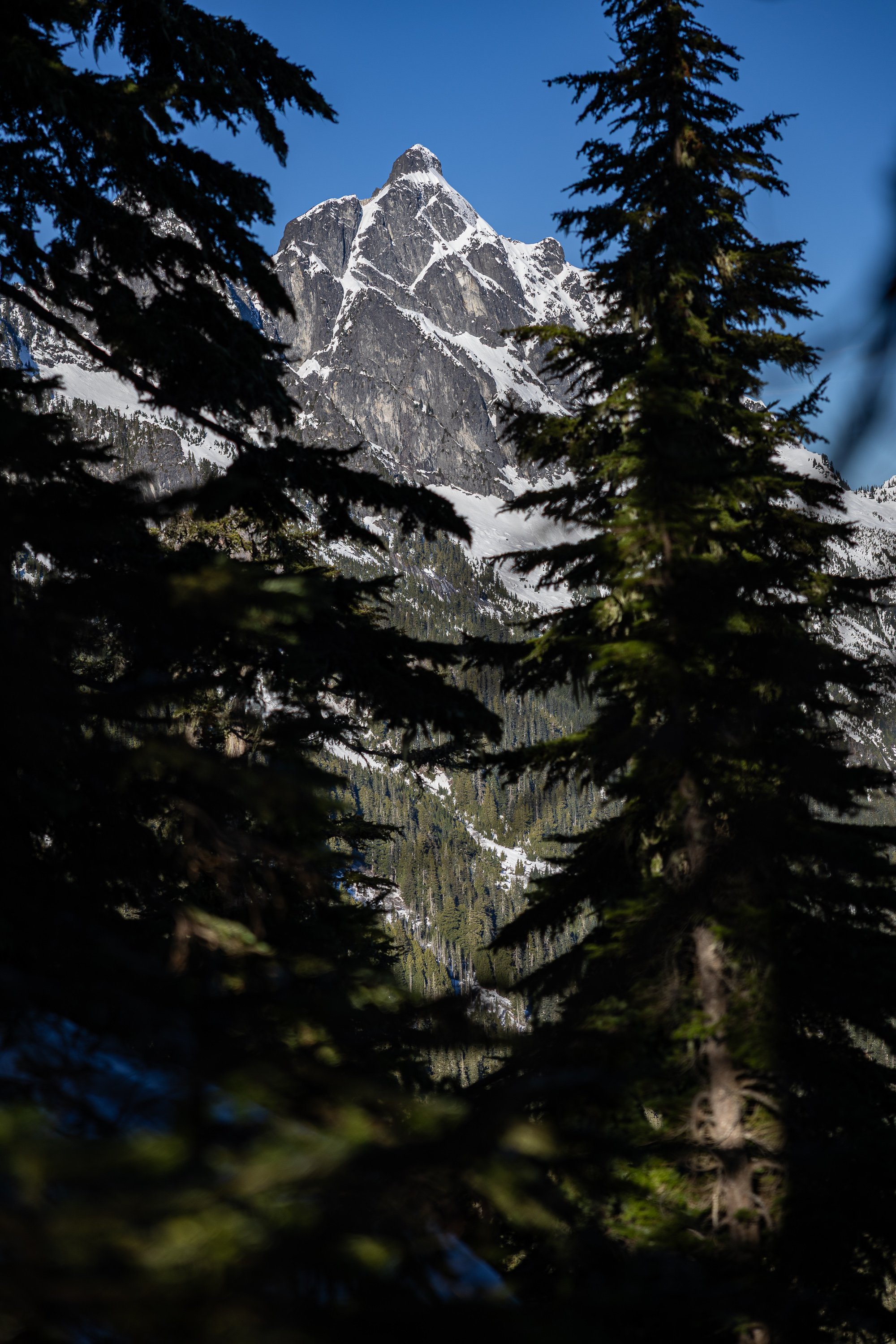
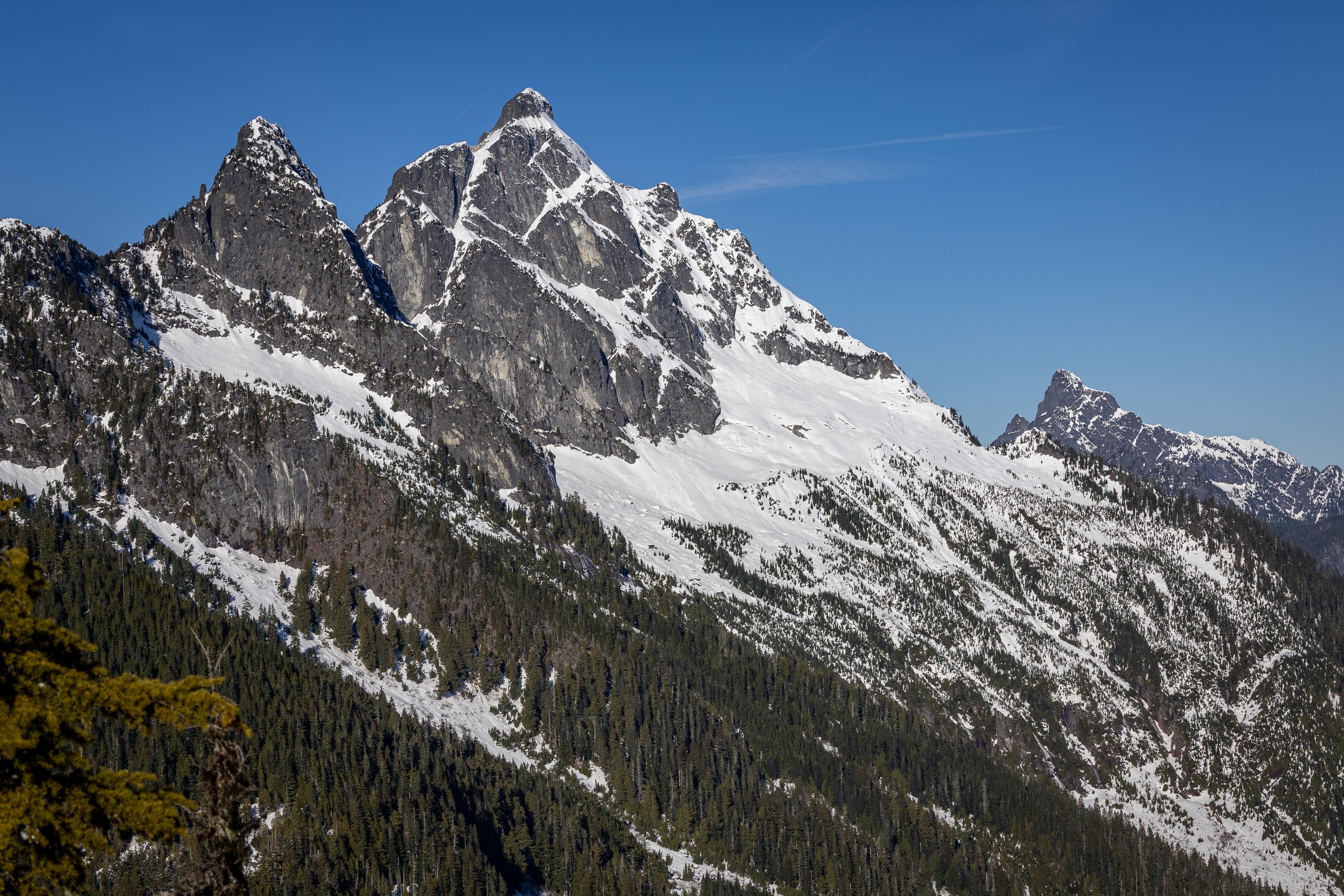
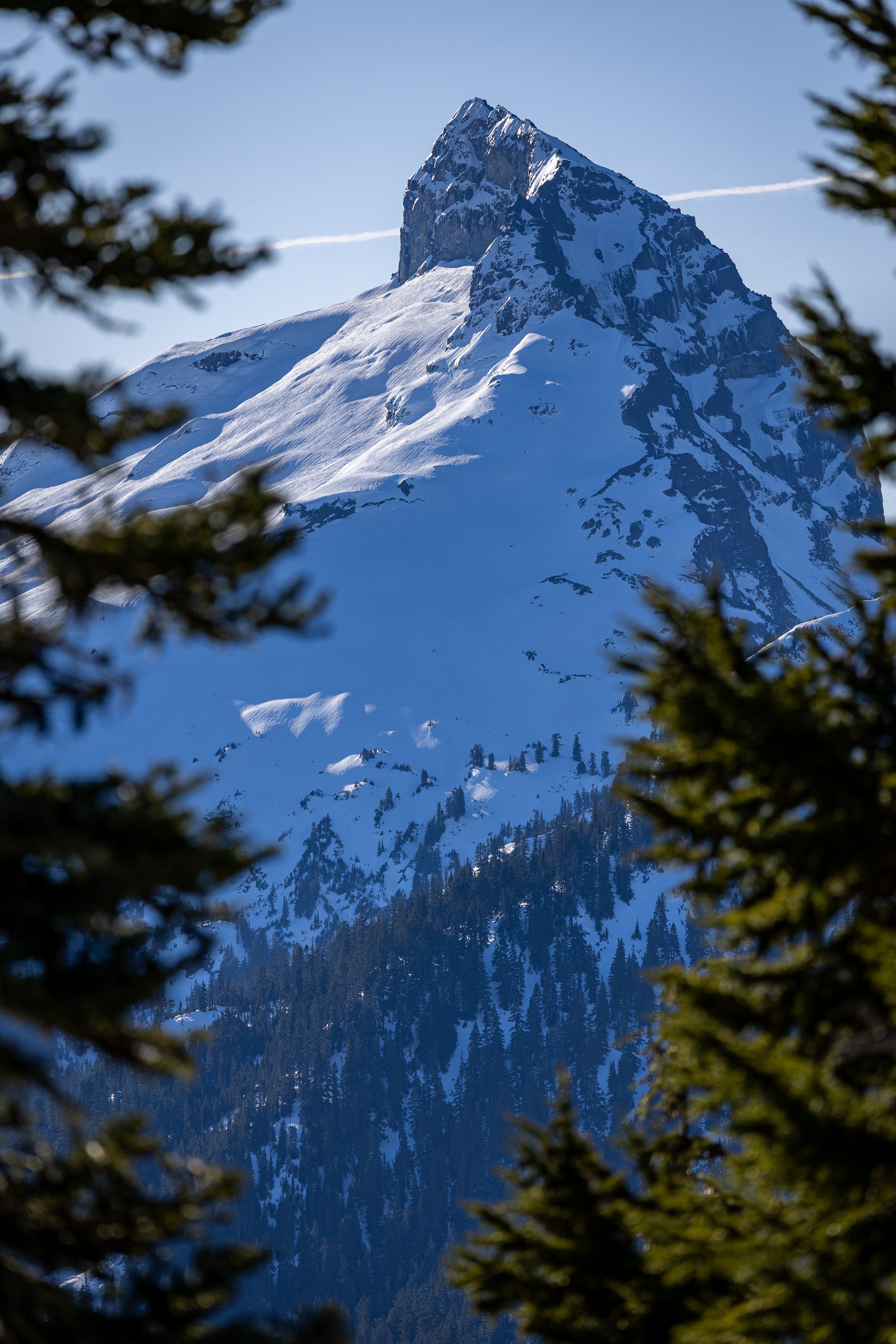
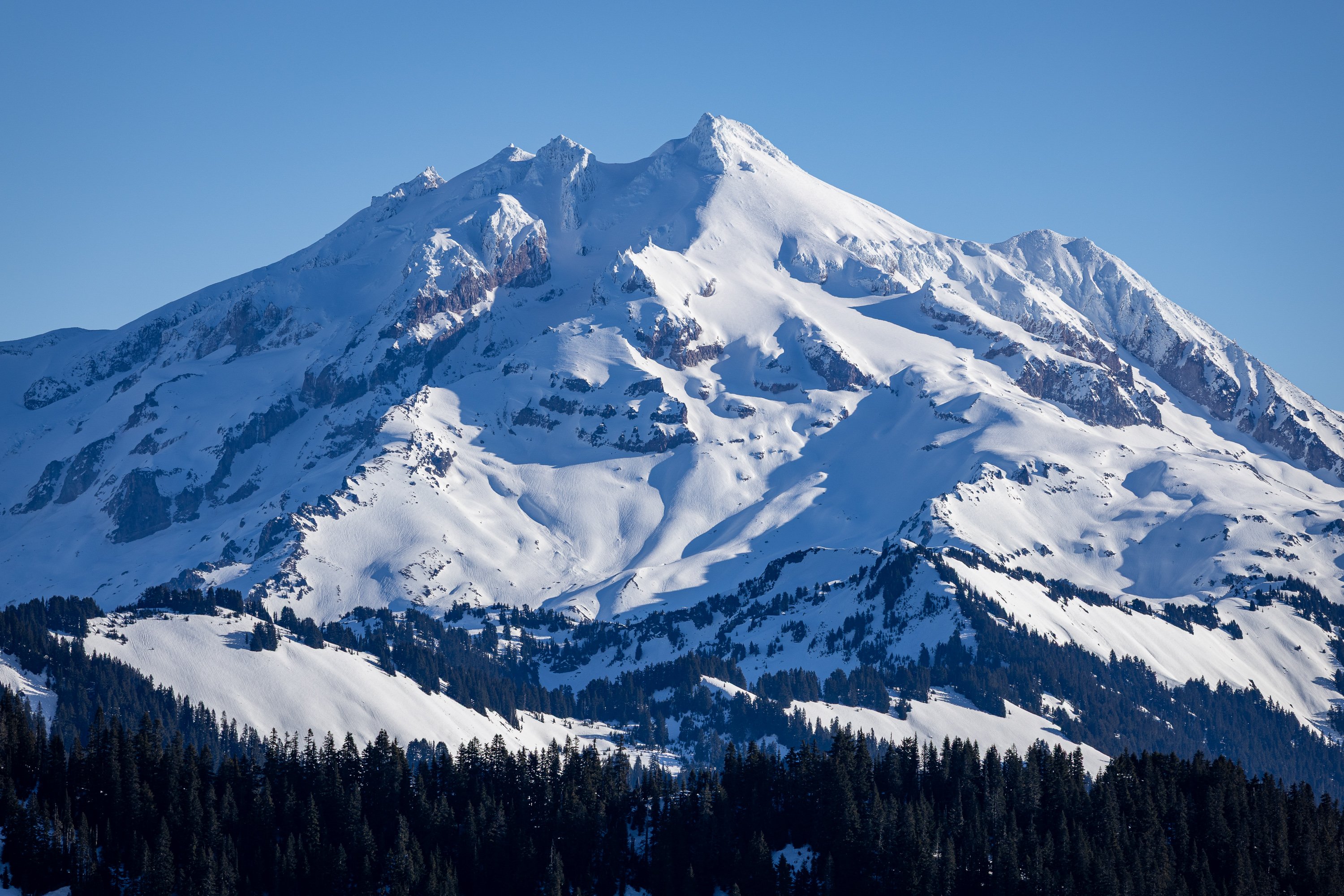
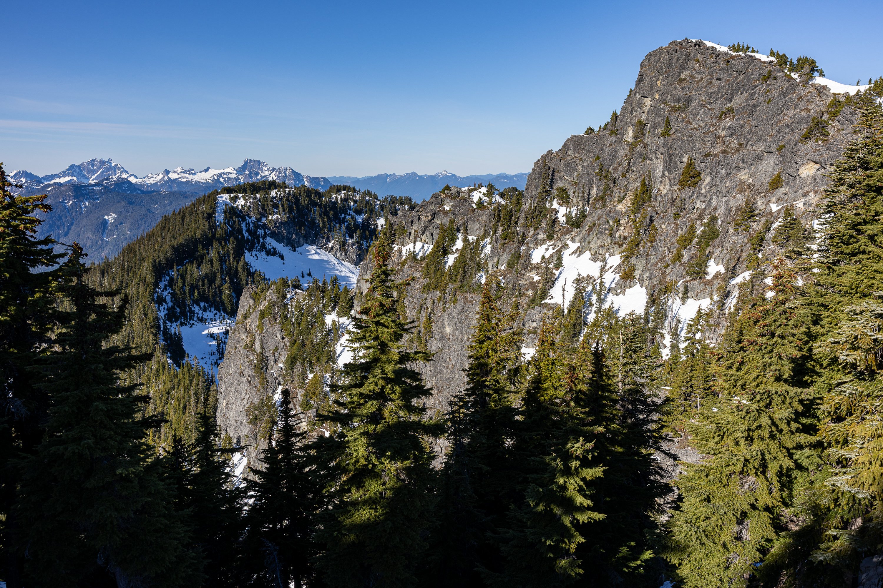
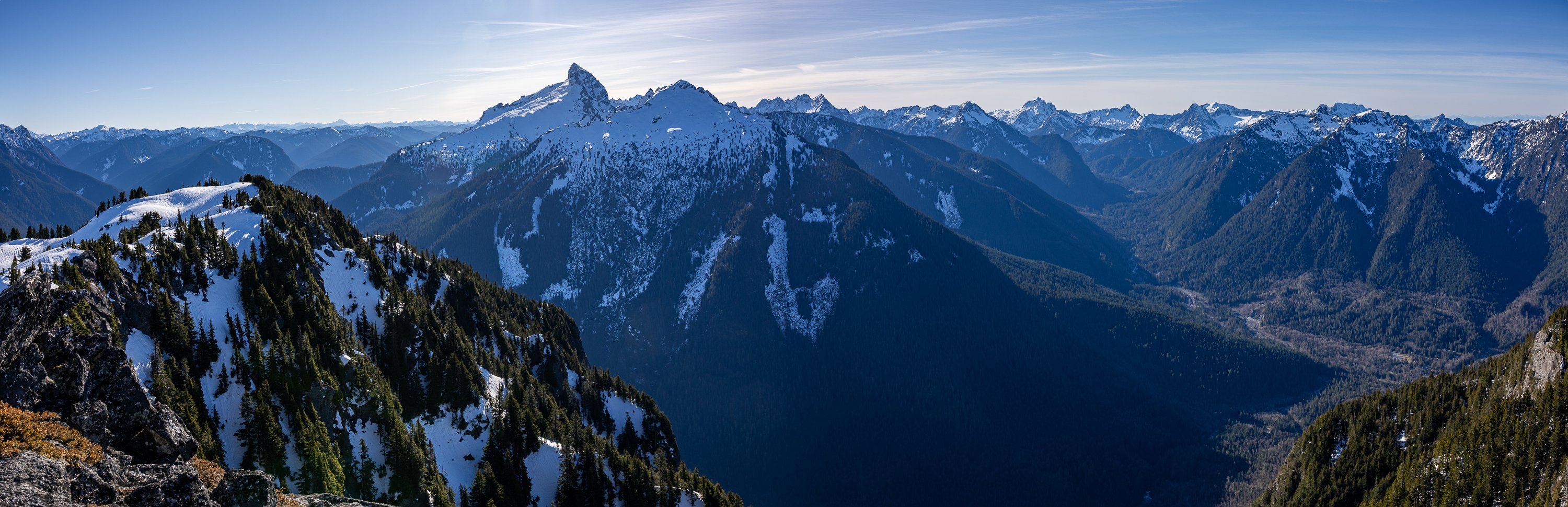

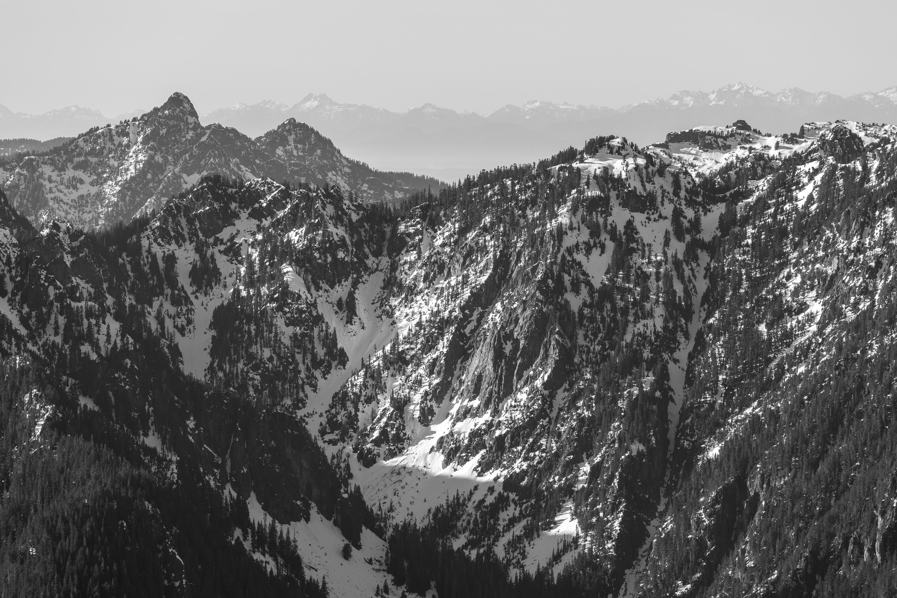
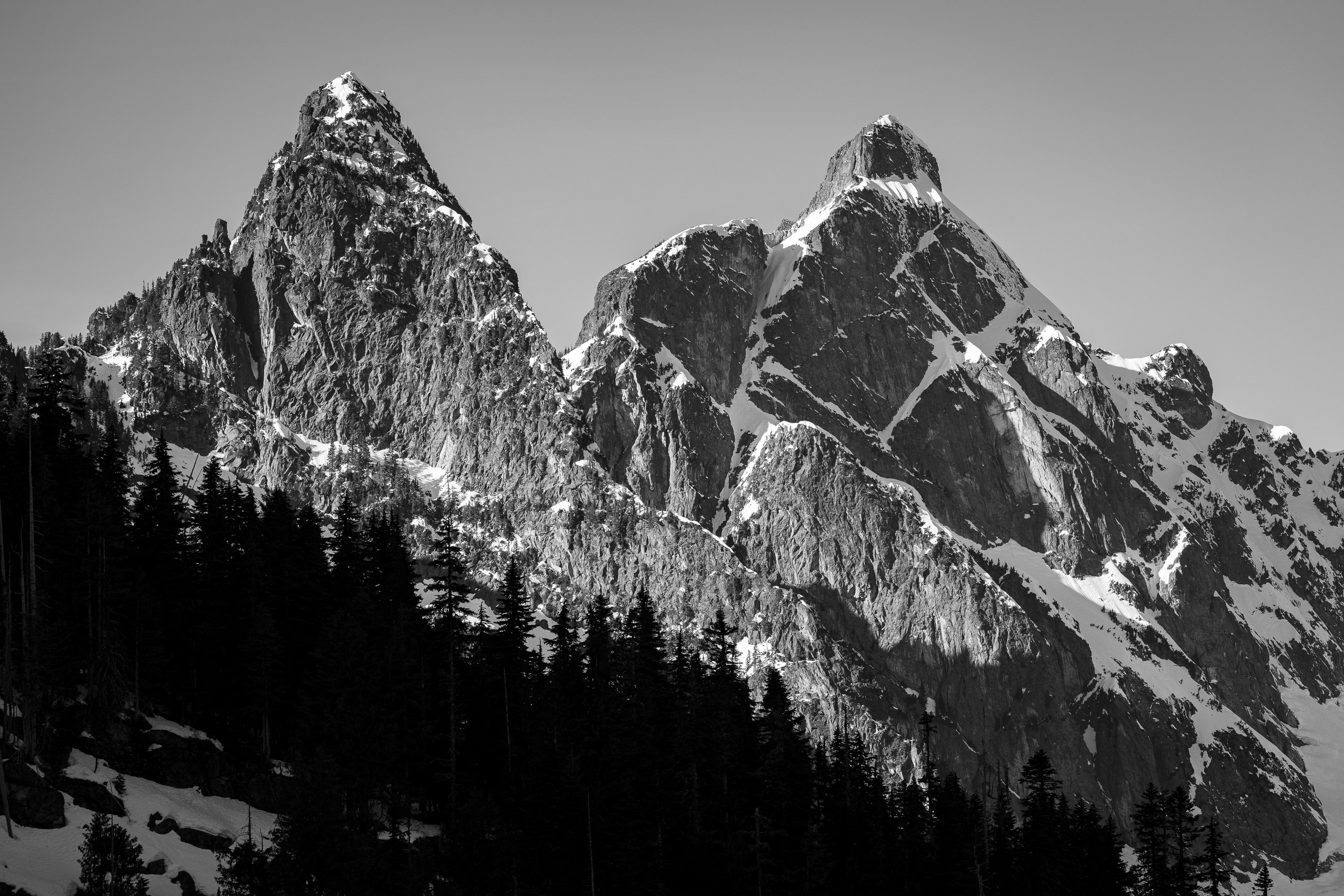
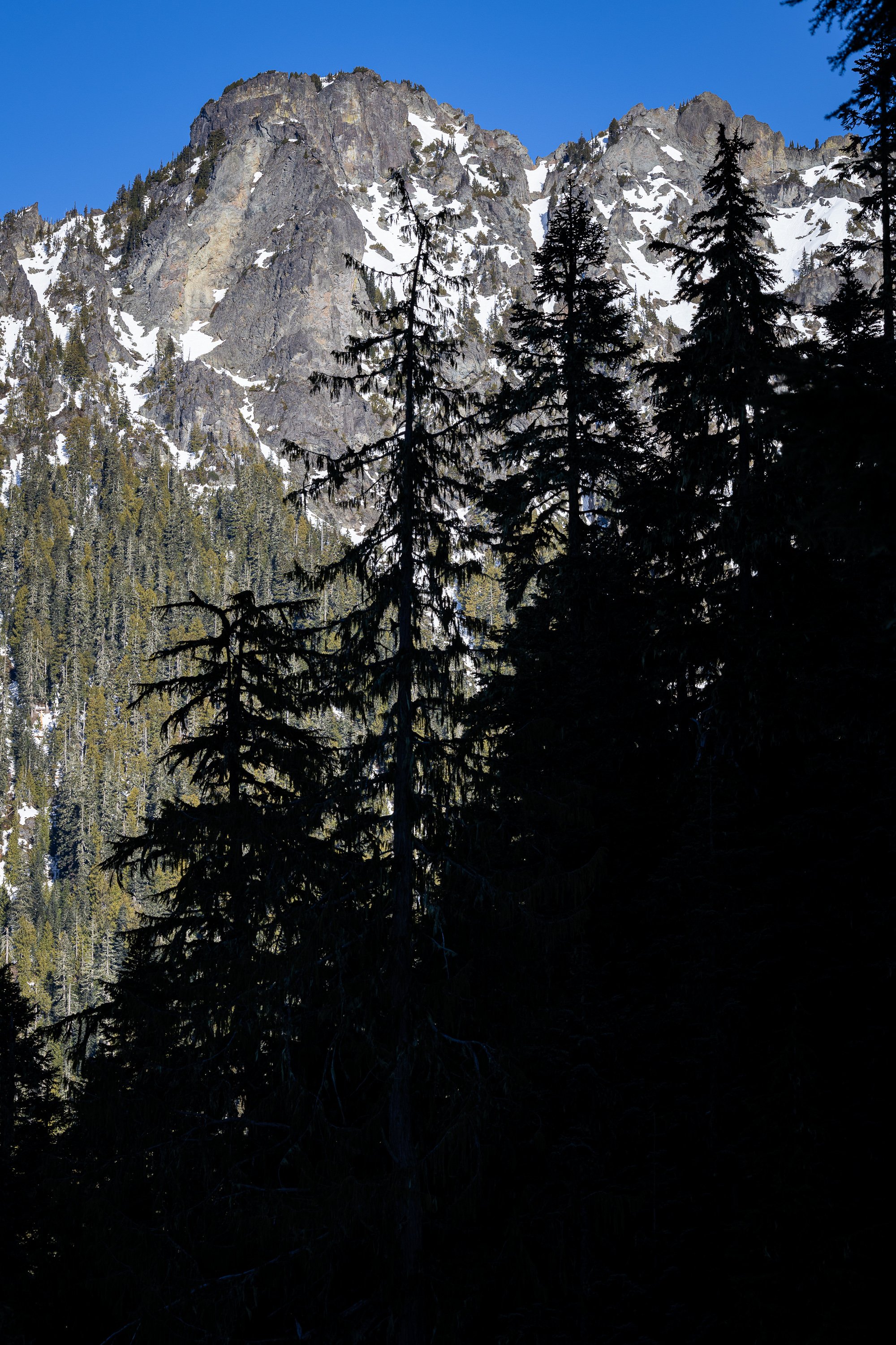
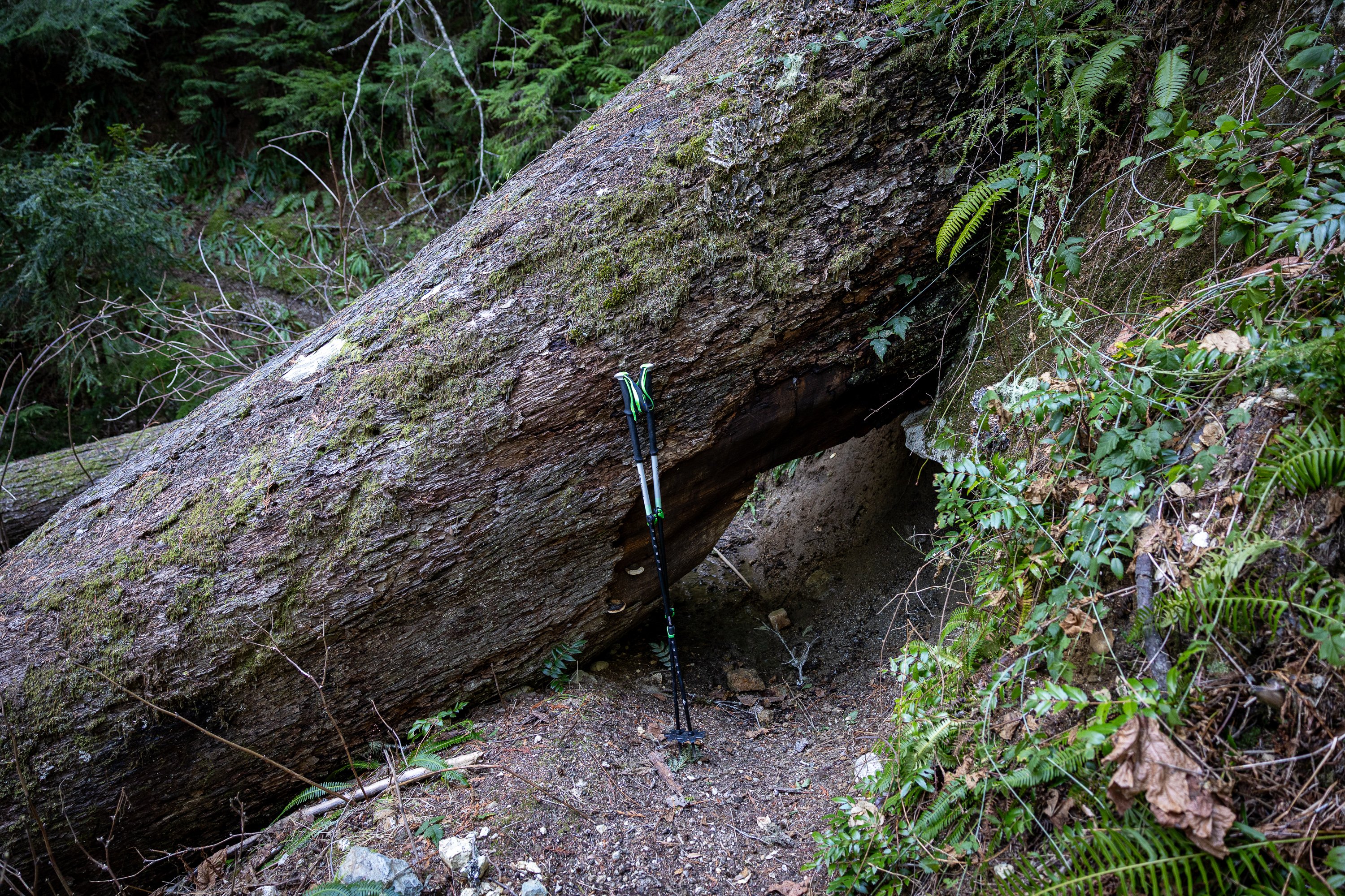
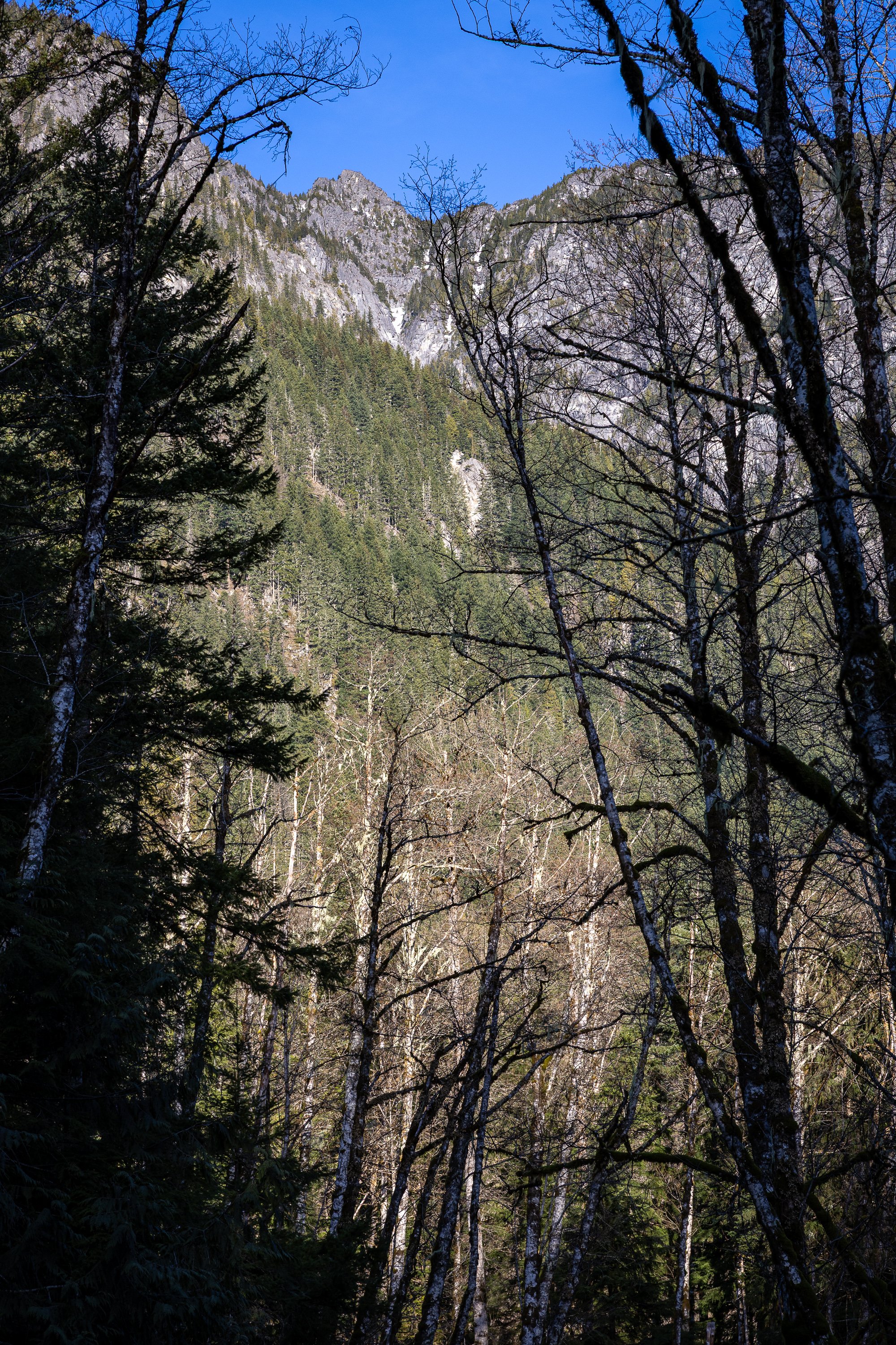
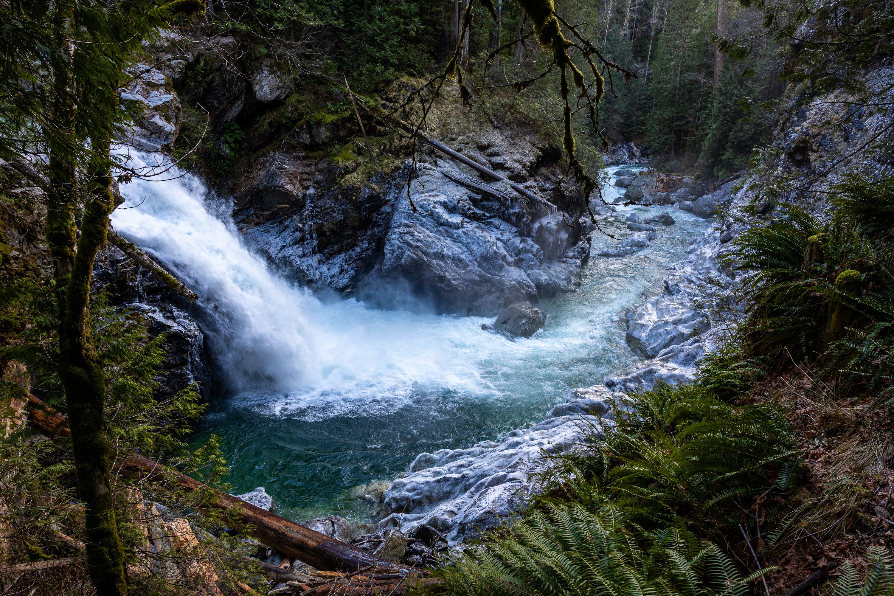
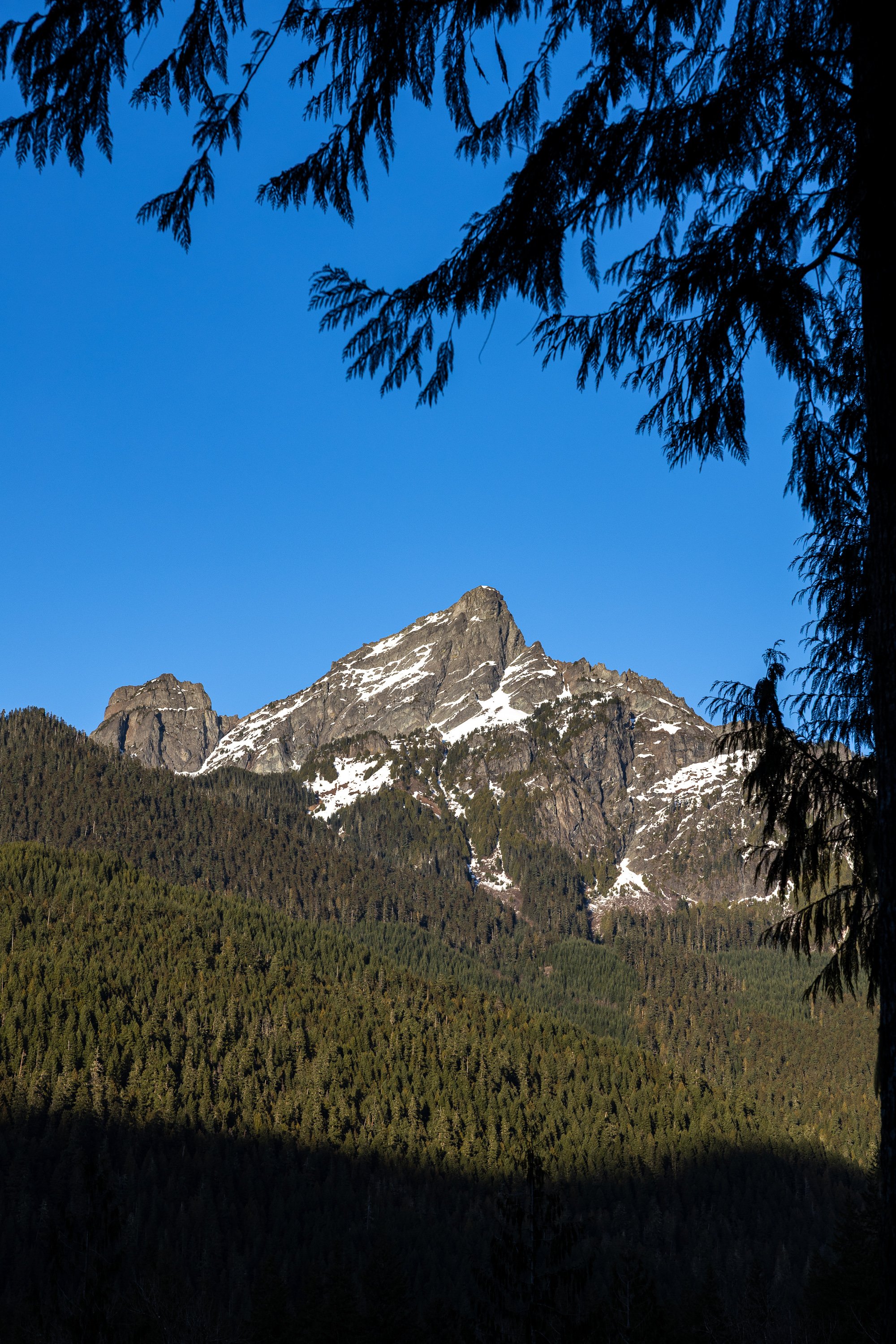 6 points
 -
Trip: Darrington - Gardening on Salvia (5.7 A2+) (A Ground Up Scary Darry Adventure!) Trip Date: 09/05/2024 Trip Report: WARNING! LOW QUALITY PHOTOS AND FEET PICS! Back in September of 2024, I teamed up with my homie Ethan @macropipette to go on a ground-up adventure in Darrington. We set our sights on the NE face of Mt Ulalach, an 800-foot slabby face on a granite dome. As far as we knew, the face hadn’t seen a lot of climbing activity, and we later found out some pretty good reasons why. Ulalach from Squire Creek Wall (Nathan P, Mountain Project) We departed the car with our packs loaded with the kitchen sink, eventually finding a “good” spot to turn left and begin our shwack up the forest slope. Immediately, we started post-holing in the spongy mixture of thick moss, decaying wood, and tangled roots. After about 150’ of this, I started to realize that this approach was going to suck big time. Fresh off a week and a half bout with Covid, I was drenched and wheezing as we slogged upward through dense brush and ankle-snapping blowdowns. All smiles for the most mellow bushwhacking of the whole approach! I have to applaud Ethan for sticking with it with no guarantee of any quality climbing ahead. A final push through brutal slide alder led to a welcome respite, easy travel on a boulder field. While my body was thoroughly worked, I could let my mind relax as we trudged up the final 1000’ to our campsite. We dropped packs and began surveying the face, and decided that tomorrow we would start our ascent up a flaky left-facing corner/arch and then aim for the steepest, square-shaped part of the face we dubbed “The Box”. "The Box" After a few puffs on a spliff and a guide’s ration of some gas station vino, Ethan and I called it a night. The Climb: Ethan sorts gear in preparation for our excellent adventure P1: 5.7 C0 We scrambled up a low-angle ramp to a small ledge, where Ethan took the lead. After moving up some easy terrain into the left-facing corner, he found his way up a right-trending crack that petered out quickly. After questing 20ft up the increasingly blank slab, he was forced to retreat and perform a heady downclimb. After regaining the corner system, he followed it up the loose, flaky arch and pulled the final mossy undercling moves to a well-placed stance for two. P2: 5.6 C0 I took the lead, pulling a couple of fun moves up and right to exit the arch. A slabby, dirty, and vegetated ramp led to a short but splitter finger crack, then to a gently sloping ledge. I spent probably 15 minutes throwing clumps of dirt and grass down the face, looking for gear to no avail. 15 feet above the nice ledge, I dug out a good cam placement and got a decent pin. I fixed the rope and descended to the ledge for a snack break. P3: 5.6 A1 R I pushed through a dense clump of bushes just above the anchor, then started up a slab with good edges but no gear. I finally reached the bottom of “The Box”, where the wall started to steepen. I decided to aim for a right-facing corner with a thin crack in the back. Still without options for protection, I slung a small shrub and had a quick laugh. Between me and the corner was a precarious stack of flakes. I looked down and determined that they would miss Ethan and the rope if they fell. I traversed under the stack and was rewarded with a perfect #2 C4 that granted me access to the bottom of the corner. From here, I made good time on cam hooks and pulled up to a roomy stance, the best belay on the route. Me reaching the bottom of "The Box" P4: 5.7 A1 This pitch held the best climbing on the route. After moving leftward up flakes, I reached a sequence of free moves on thin, incut holds. This bit was only about 5.7 but so fun, and well-protected with a downward pin behind a flake. Directly above me lay another right-facing corner that I shuttled up with cam hooks. Exiting the corner and wrestling with some bushes, I stepped left to what would have been a 10/10 belay stance if it wasn’t built out of loose flakes with only small gear available between them. In hindsight, the anchor I built was sketchy, and I really should have taken the time to drill a bolt. Pitch 4 P5: A gumby gets gripped on moderate aid: 5.5 A2+ I stepped left around the large flakes and got established in a hand crack, which led to easy climbing with lots of big loose flakes and blocks. I tiptoed around bushes and looseness before reaching some slab moves below a roof (barely any good gear to this point). I found a good inverted cam hook and poked my head over the top of the roof. My heart sank as I saw a broad, featureless slab. It seemed our relatively moderate line had come to a dead end. Hanging from the hook, I looked around for other options. 6 meters to my right, I saw a pair of thin cracks splitting a slab above, but I would have to nail the thin, dirty seam under the roof to get there. The seam was packed with moss and grit, and the rock looked crumbly. My last okay piece was now well below my feet. I composed myself and started placing a beak, chips of rotten granite fracturing from the seam with each blow. I tried to block all thoughts of zippering the traverse and taking the big, ugly swing as I put in a foul string of upward-driven blades and beaks. I gingerly inched closer and closer to a shallow 0.3 placement and finally breathed a sigh of relief as I clipped. At this point, I was nearly to the end of the rope, and the drag was so bad I could barely stand up in my aiders. Yelling curses, I pulled on the rope as hard as I could to gain the last bit of slack the rope would yield, then pulled the last few moves up and over the roof. The cracks were too flaring to accept cams or nuts and too shallow to give a solid pin. I decided it would be stupid not to place a bolt, which took the last bit of physical and mental fortitude I had in the tank. I fixed the rope and yelled down to Ethan, then sat at the hanging belay sideways, my left cheek resting against the cool, gritty granite. The sun was just kissing the horizon next to Whitehorse, and I felt a surge of gratitude for Ulalach for teaching us, humbling us, and allowing us safe passage on its steepest flank. There was another pitch of densely vegetated slab between us and the summit, but I knew our push was over. Ulalach had won. Ethan: After finally hearing JT yell that he had made a belay, I was pretty overjoyed. It was starting to get dusky, and we both knew we were looking at a lengthy descent in the dark. Cleaning the pitch with my large pack was not an easy feat, and after jugging up hundreds of meters of slab, I was pretty spent. I was thoroughly impressed by the work JT had put in to lead the last pitch, as the roof traverse seemed like quite a piece of work. Once I reached JT, we enjoyed a beautiful sunset and were promptly in the dark on the wall. Ethan's thoughts about descending in the dark Bonus Reel: The next morning, I was boiling water in camp. I dropped the Fritos bag I was eating from onto the cook pot, which promptly tipped over and poured boiling water onto my shoe. I started yelling and ripping the shoe and sock off my foot, but I’d already received some gnarly burns. Just my luck! Free foot pics. Can you guess which approach shoe I was wearing from the burn pattern? Not too far from the car, we ran into local legend Bill Enger, fresh off completing another fantastic-looking new route (Miracle Ramps 5.8+) on the South Face of the Squire Creek Wall. I sprayed about our GNARLY NEW AID ROUTE… How embarrassing. This isn’t an FA of the NE face or even remotely close to being a good route, but we named it anyway. Suck it! Any of you old-timers climb this thing? Tell us about it! Gear Notes: Too much junk! Approach Notes: Approach to the base of the Squire Creek Wall and climb an actually good route.
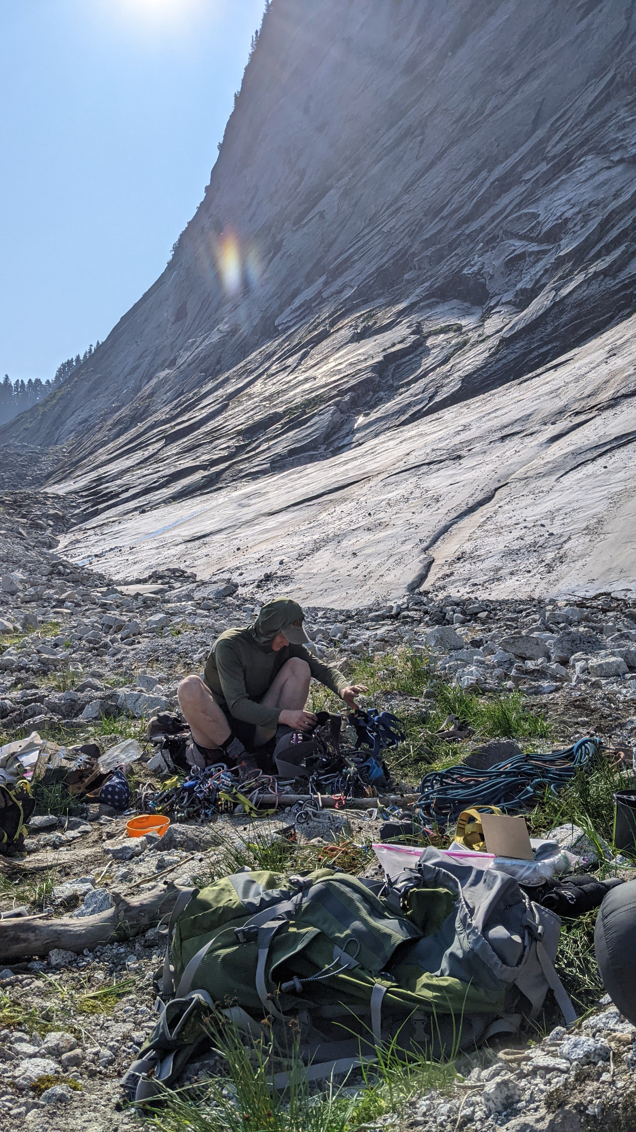
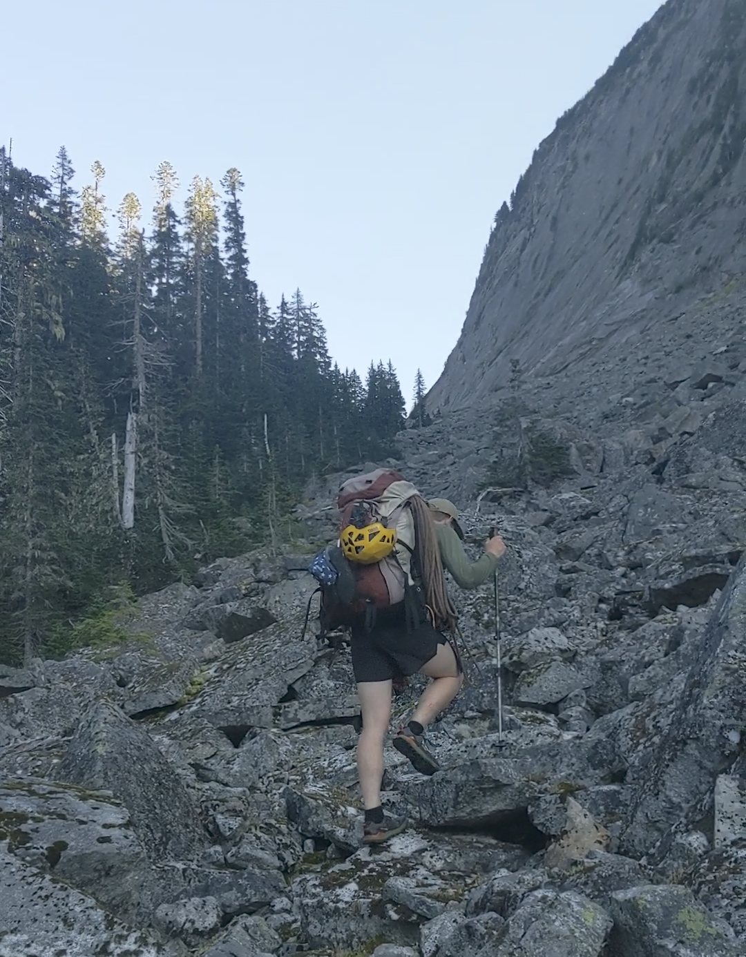
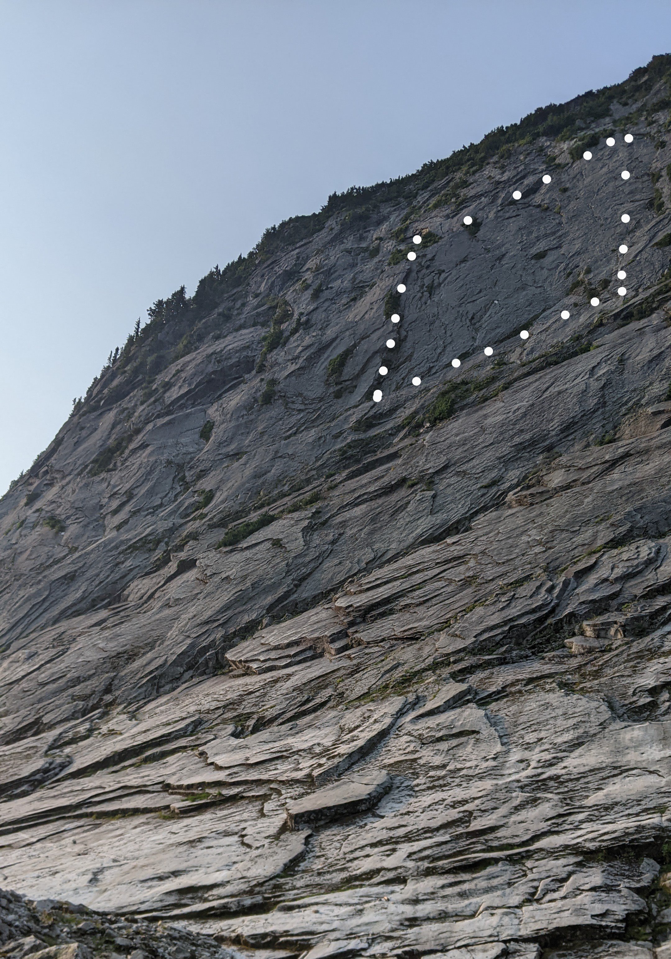
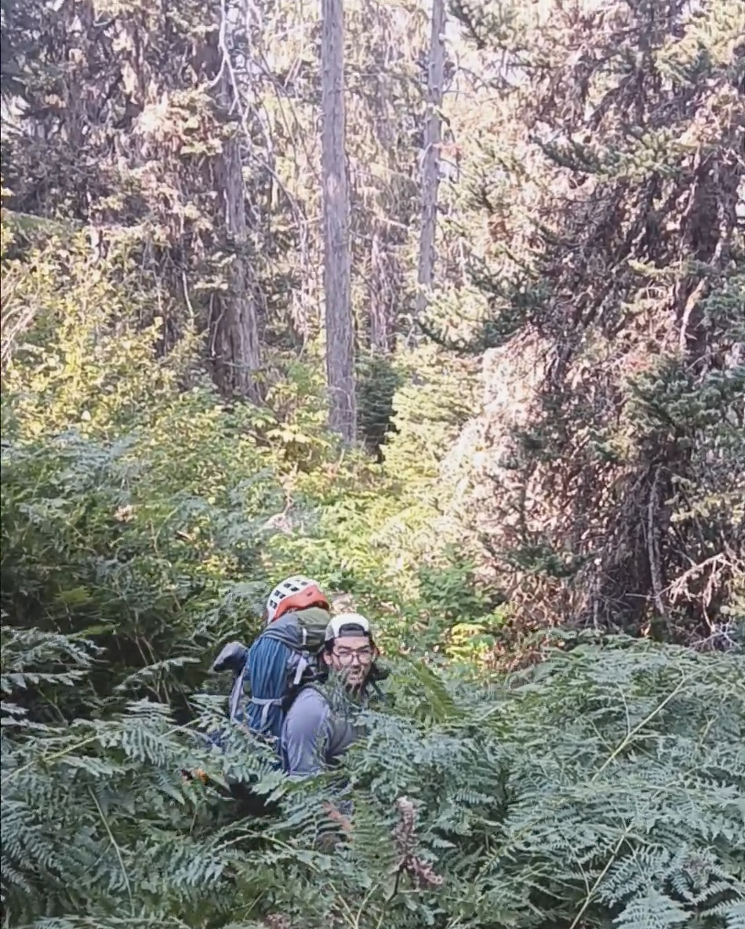
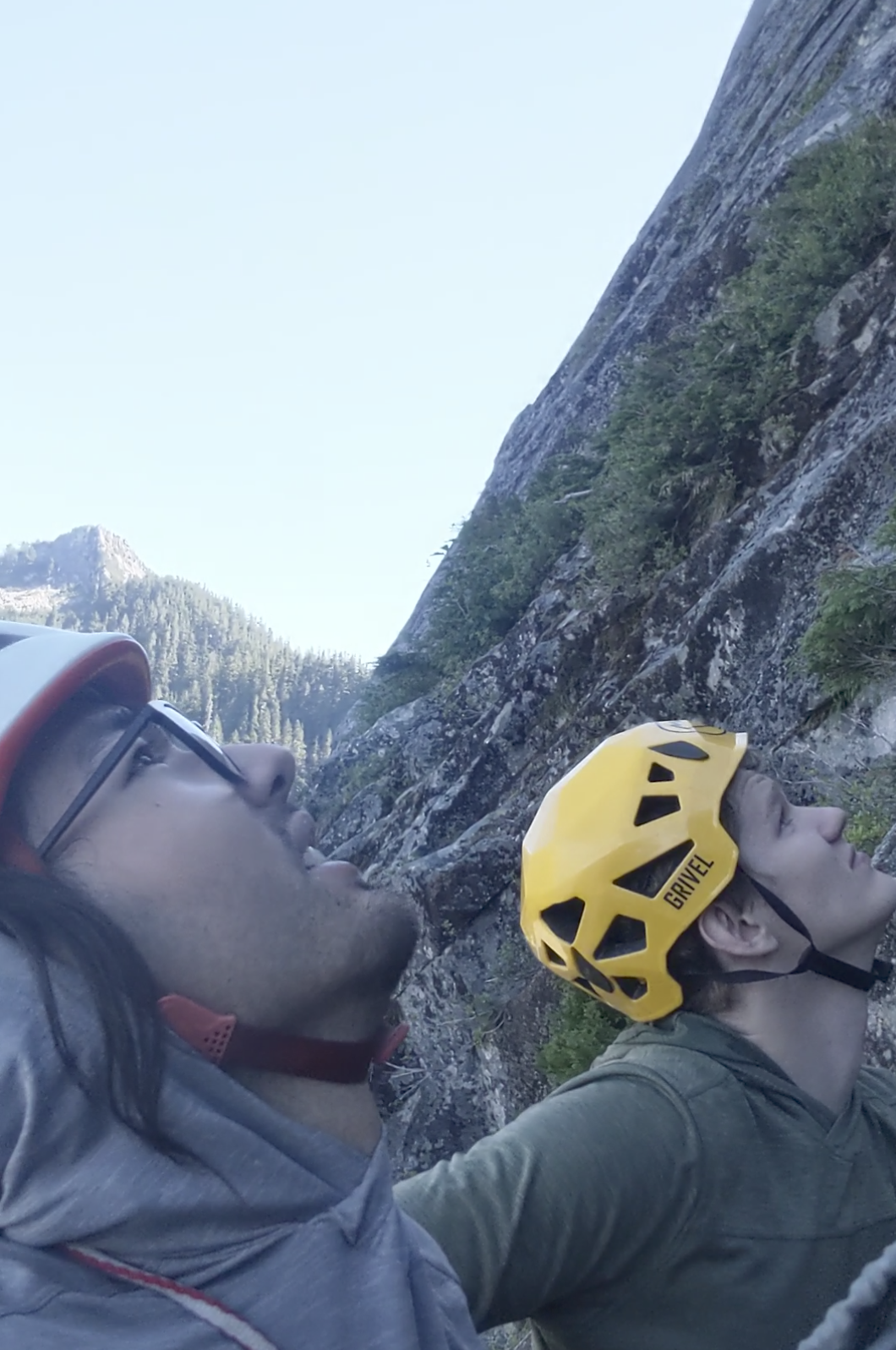
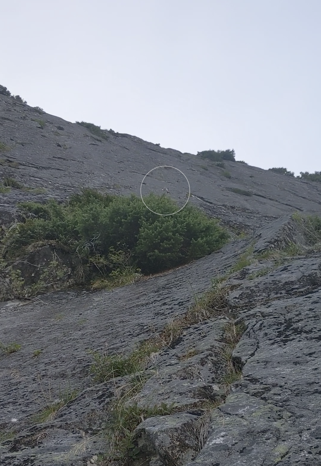
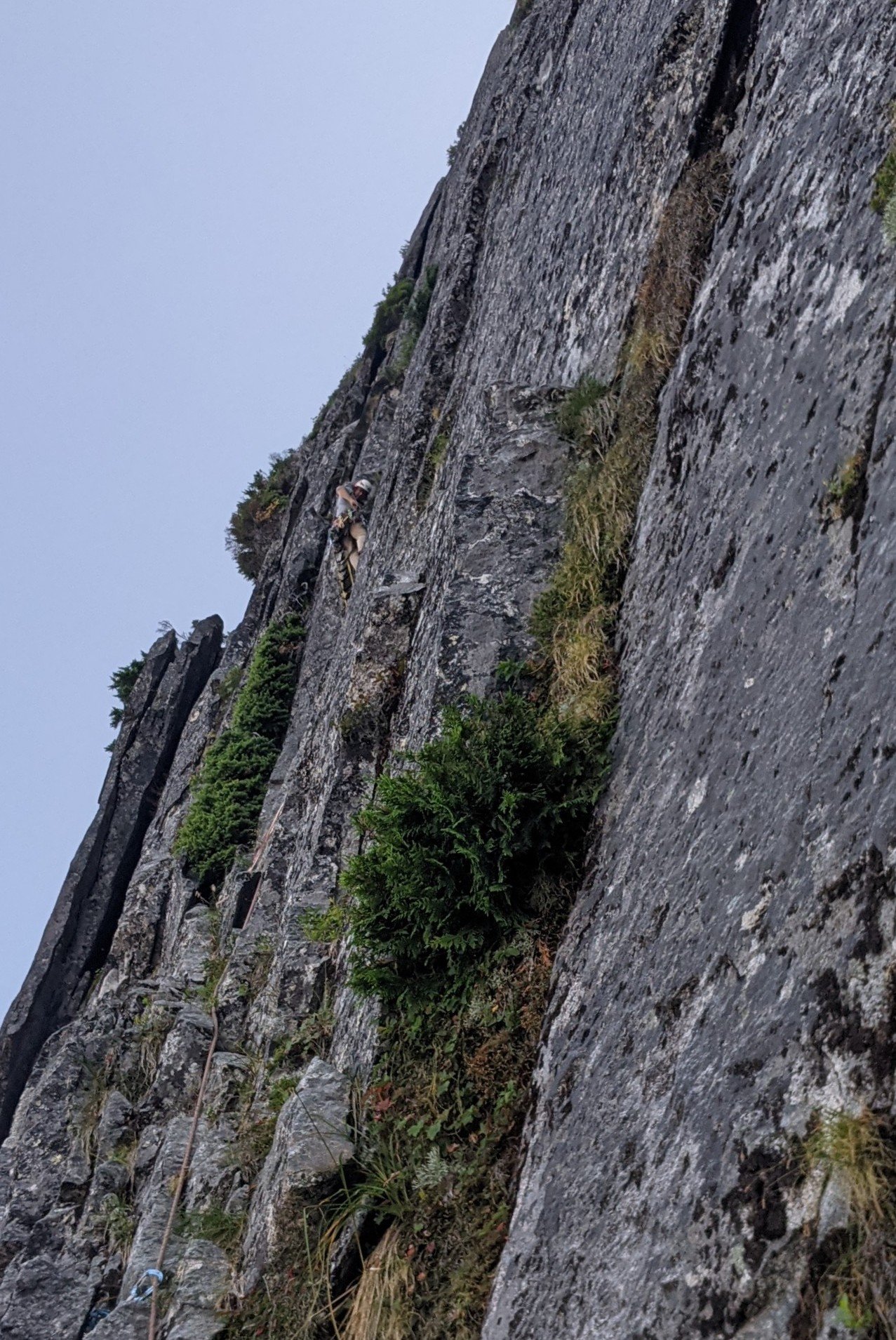
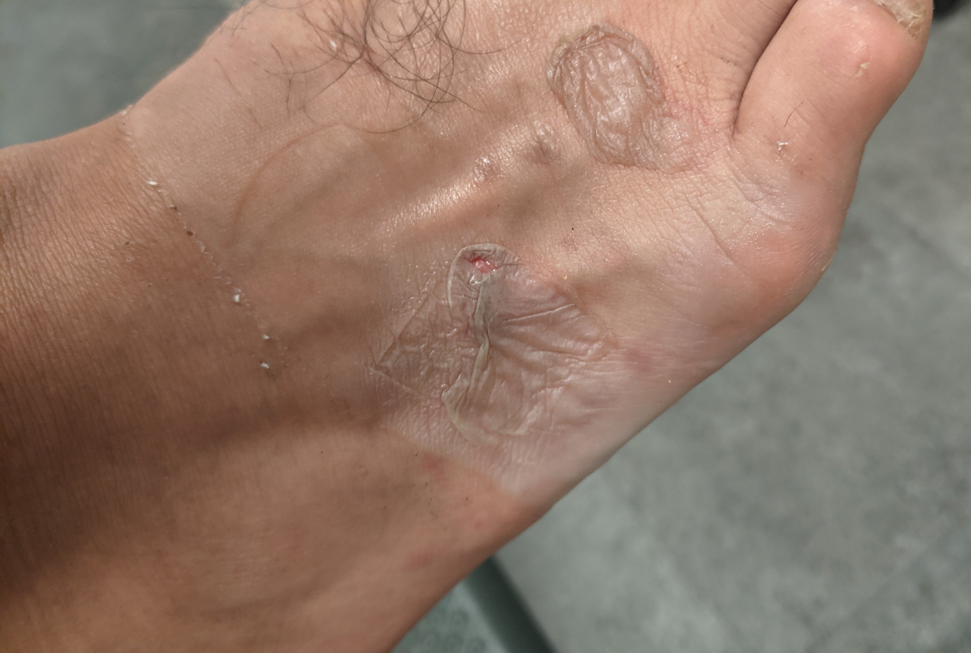
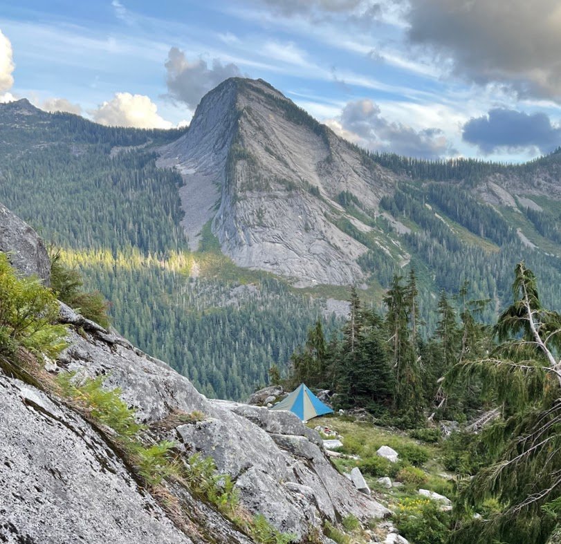 6 points
 -
A few days ago Lani and I did a fun link up on forbidden. We climbed the East ridge North Ridge and West Ridge. This is a rad way to move through a lot of scrambling terrain. Uncertain weather before the atmospheric river gave us a pretty narrow window to work with, so we headed up the evening before and bivied at the base of the East ridge. We left the B basin trail around 5pm and set up camp around 8 for an early night. The cloud ceiling quickly raised up, putting us in a thick,misty whiteout for the whole of the night. We woke up to even more whiteout and low confidence, expecting to bail we went back to sleep for a few hours. We ended up leaving the bivy around 8am. We climbed up the East ridge, then down climbed the north ridge. Down climbing the North Ridge was surprisingly mellow, we didn't end up needing to rappel. And the route finding was almost easier on the way down than the way up. There is only one 20' section of 5.5 at the very bottom, otherwise it's all sustained 4th class and secure low fifth. Once at the low bivy of the north ridge, the clouds again threatened us. So we sat and weighed our options. We ended up watching the clouds for an hour before deciding our fate. Our original idea was to traverse the glacier and climb the NW face/rib. But whiteout and impending rain steered our decision to "bail" back up the north ridge. Though the north ridge is such a fun knife edge it's hard to complain. We then down climbed the West Ridge. We hit the base of the West ridge 6 hours after starting up the East ridge and made it to the car just before 5, almost 24hrs after we left. The epic rains to come that night validated our decision to limit our time in the mountains on this one. For those who don't know yet, you no longer need to touch snow to climb either the west or east ridges. The glacier below the cat scratches is more or less completely gone. While sad, it does mean you can do this whole link up in approach shoes without carrying axe/crampons. Starting up the East Ridge Headed down the North Ridge, with clouds threatening to spill in from the west. Headed back up.
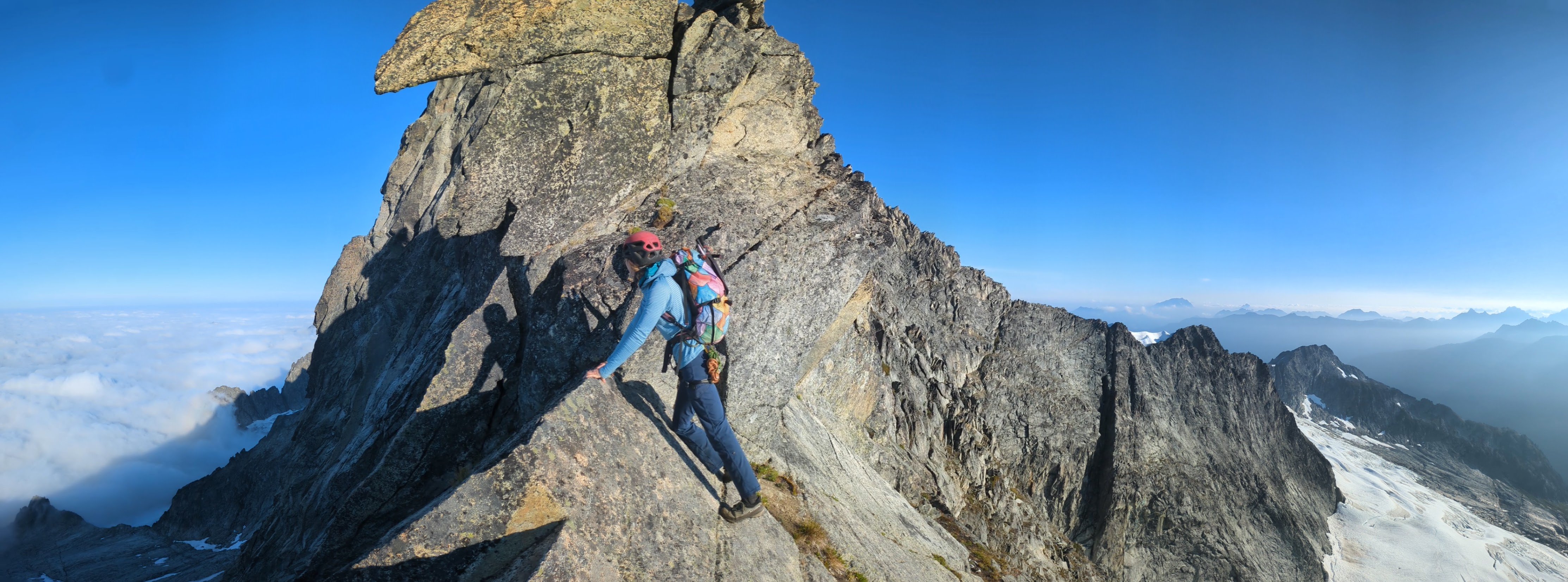
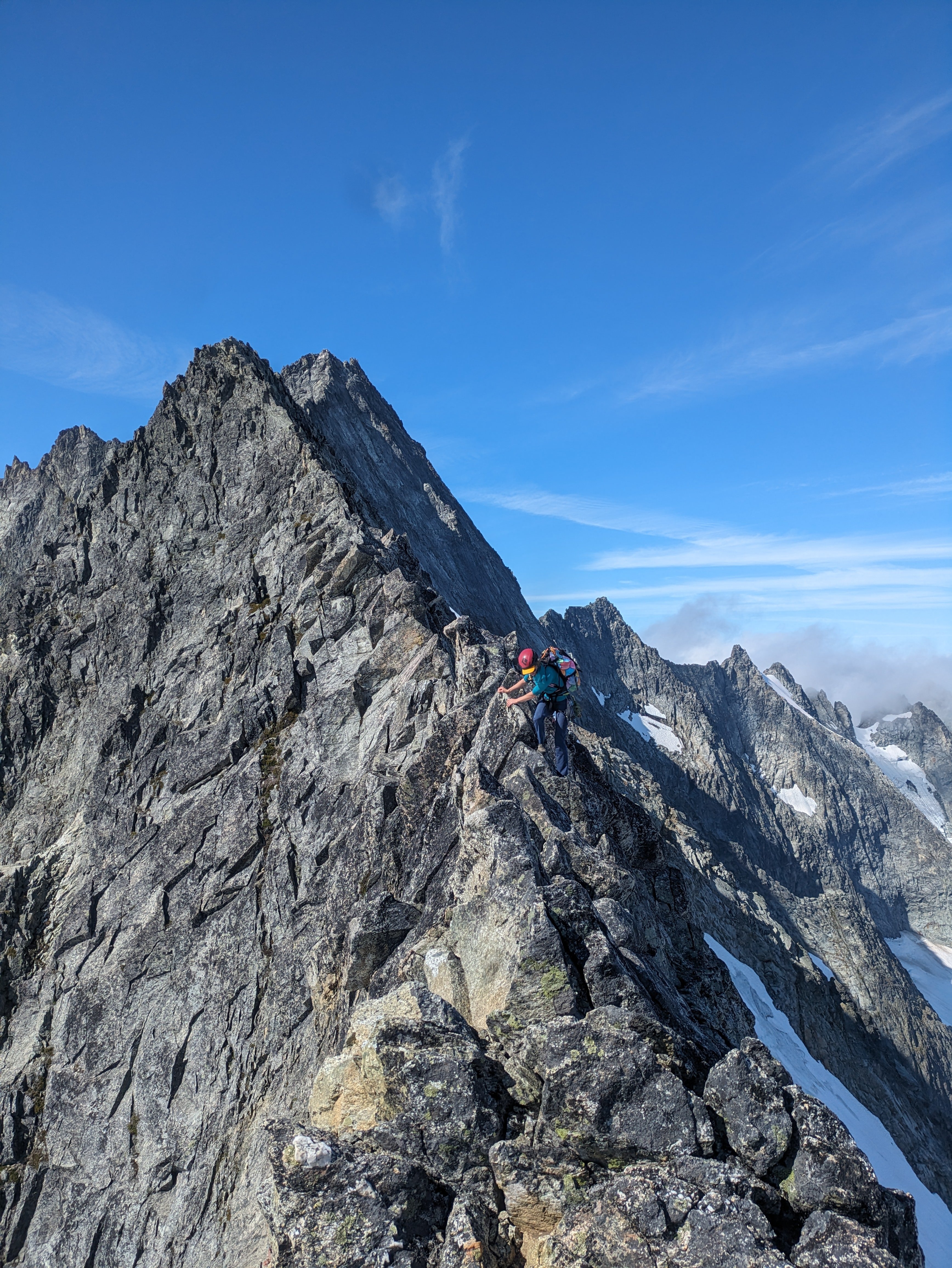
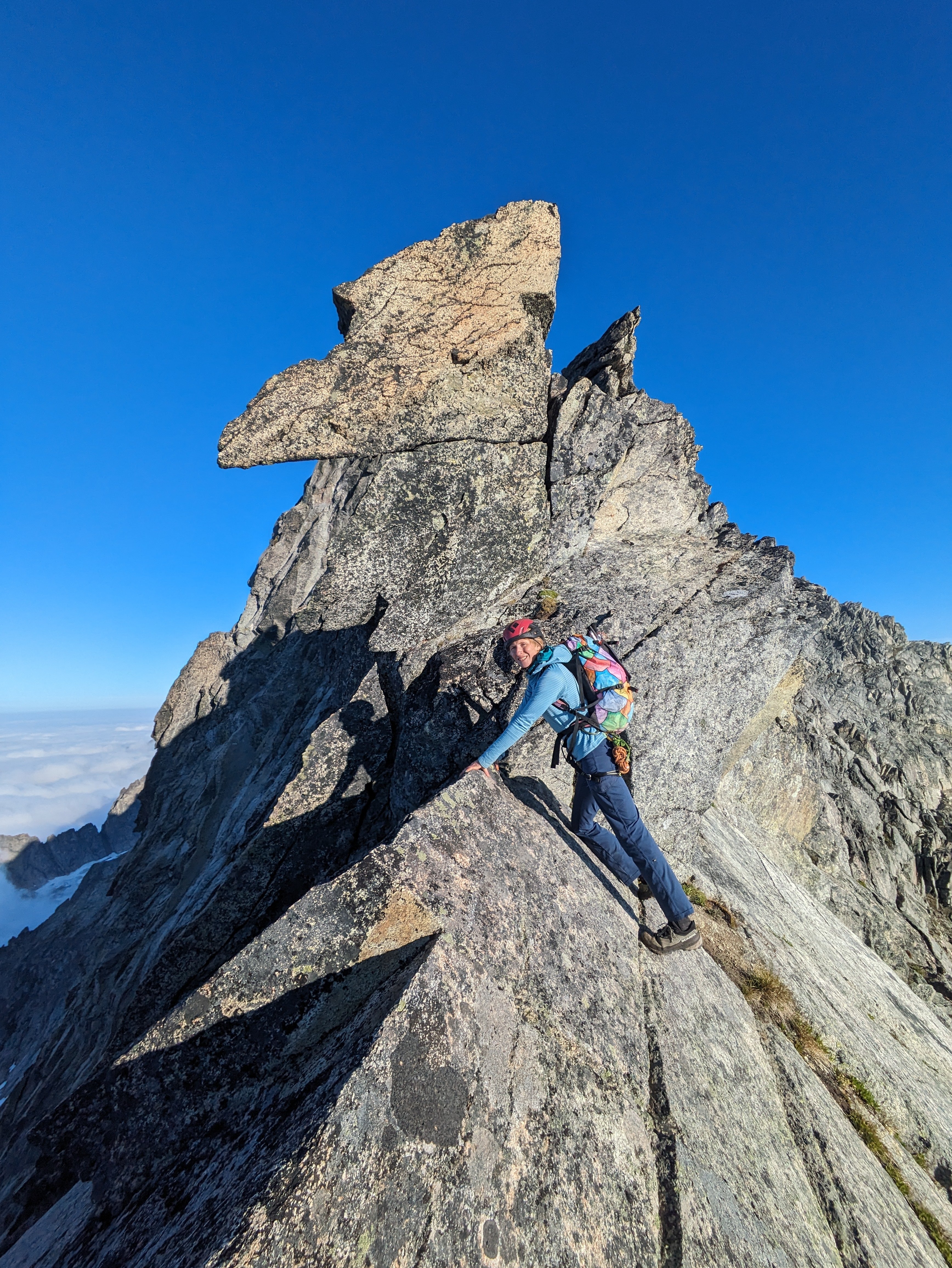
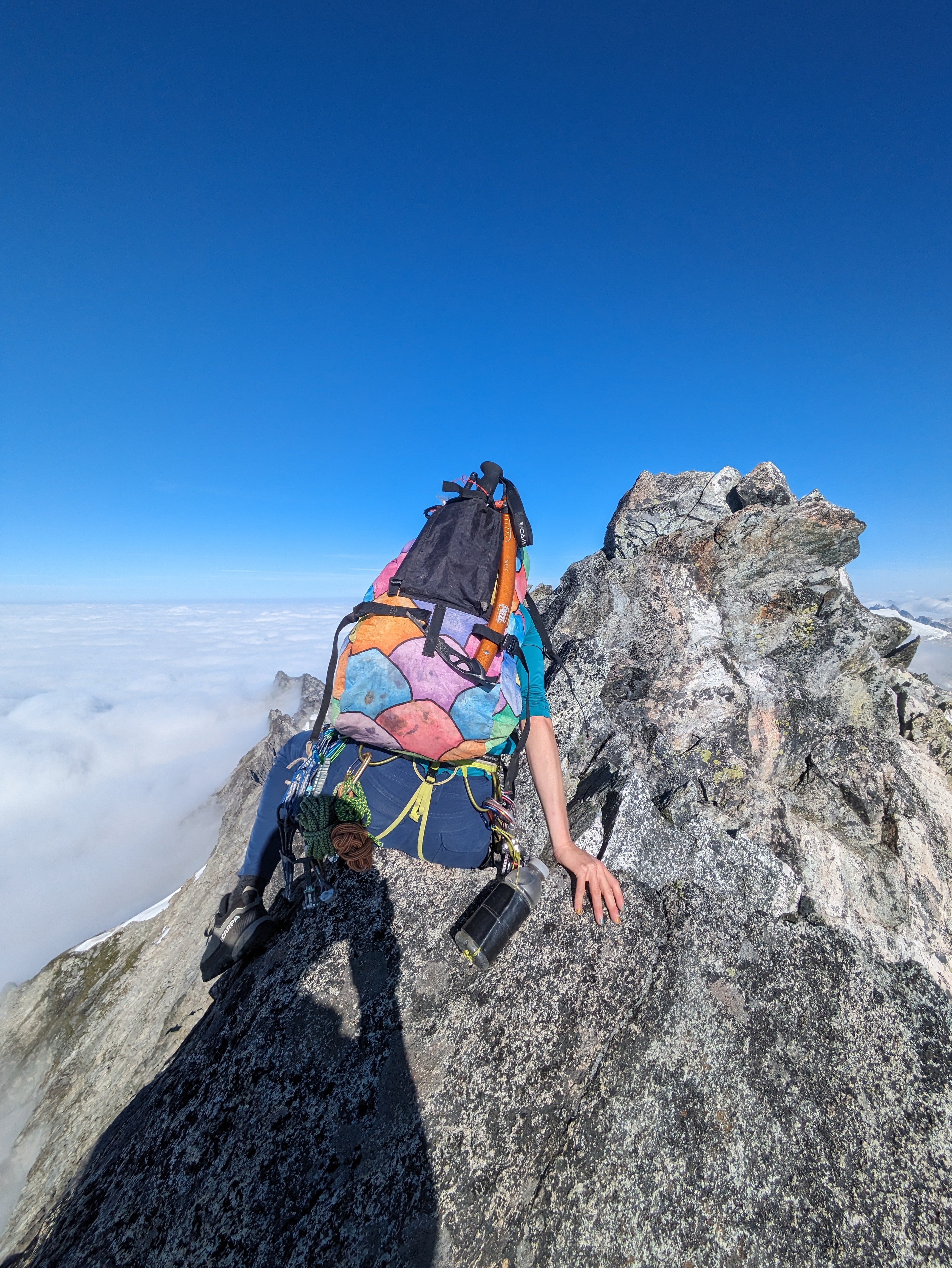
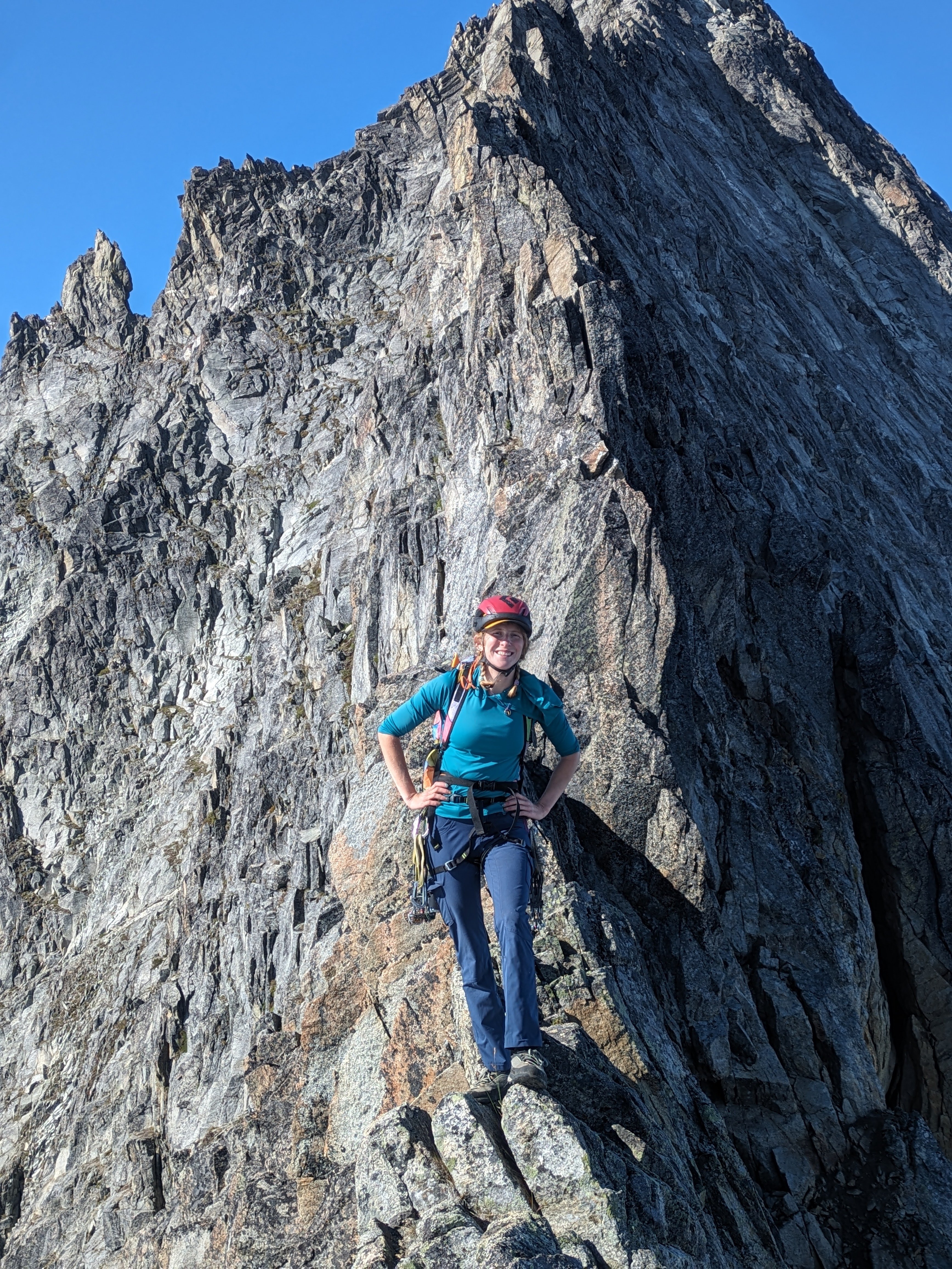 6 points
 -
This past Saturday, Trey and I made an 18hr C2C ascent of the NW face (ridge). Neither of us had been to the area before and were keen to check it out. Here's a little write up about two rock climbers going glacier walking and getting gripped. We left the car at 3:30am, enjoying good trail and crisp morning air. Passing several nice groups of folks on their way to climb Sahale (apparently the route of the weekend but we missed the memo). We soon arrived to Boston Basin and made our way up to Sharkfin col. Here we made a route finding error, assuming it would be the obvious snow gully to notch with a beaten in path. Both of us glazed over this part in researching the route. Whoops. Eventually realizing we were too far east, we descended to the correct gully. (Boston Glacier view from the wrong notch) Two raps brought us onto the snow. We snacked and rested for a bit, soaking in the enormity of the Boston glacier & Mt. Logan across the valley. We roped up and set off. As I led us through the maze of the glacier I came to accept two things: 1) I will fall into a bottomless pit at any moment, without warning. 2) I will never understand why people like glacier travel. (Boston Glacier - Sharkfin Col directly above Trey) We arrived at the North ridge notch and started up. I am really soft and this was one of the most fucked up bits of climbing I have ever done. It's quite steep dirt, but has too much gravel in it to create steps or just slam a crampon into. It just crumbles away as your try to make a step, also providing nearly nothing you can hold onto. So to climb it you are more or less kicking in an insecure feeling front-point into the muddy gravel with no hands, then standing up onto this single point, trusting your life to it. Rinse and repeat. I would suggest future parties climbing this in mid july climb over rock a bit further south on the N ridge and do a rap or two on the other side to the glacier. It would at least be protectable. Walking down the forbidden glacier to the toe of the NW face was very pleasant and served up incredible views. (Starting up what would be the Crux of the day. Looking back at N ridge notch) We took a lunch break at a nice flat spot and sized up the steepest bit of glacier yet to access to rock. It was quite a lot more broken up, with more ice exposed than expected. Armed with approach shoes, aluminum 'pons, an ultralight axe and no snow/ice pro this last section proved to be the most daunting. (Looking up at NW face. Route access from the right) I led us up, finding a narrow sliver of passable snow between the ice and crevasses to level with the access at ~7200ft. It was a mess of glacial chunder. Looking up, we spotted a ramp of snow at ~7500ft that would potentially provide access and we committed to continuing up. At several points there was only an inch of snow over ice which provided some quite puckering travel. Eventually we reached the snow ramp. It turned out to be at most 4 inches thick so we did a traversing lower off a bollard and finally onto the rock. A wave of relief came over us once on the rock. Back to my happy place. After hanging out on a ledge for a while, we headed up. The rock was much better than expected and provided excellent ridge climbing. We solo'd the route in 2 hours & downclimbed the West Ridge + cat scratch in another 2 hours, stopping at the bottom of the ridge to chat with some kind people who attempted the West ridge. (NW Face) "You can tell we're at the top because of the views" -Trey (Downclimbing the W ridge) Once down & off the snow, we rested on some nice slabs then chatted at high camp with some folks about their climbs the next day before leisurely hiked out of Boston basin in incredible evening light. While not quite on par with the CNR of Stu, The NW face + W ridge is a very high quality & fun ridge outing. If not for the price of admission, this would be one of the most popular climbs in the state. Don't be like us and sandbag yourself in late July on a low snow year. I'll do anything to not wear boots but having light boots and proper crampons would have made things much faster & more safe. Gear: We brought singles 0.2-#2 & some nuts (didn't use it but it was nice insurance), 7.8mm 60m rope, approach shoes, aluminum crampons, UL axe, some glacier kit.
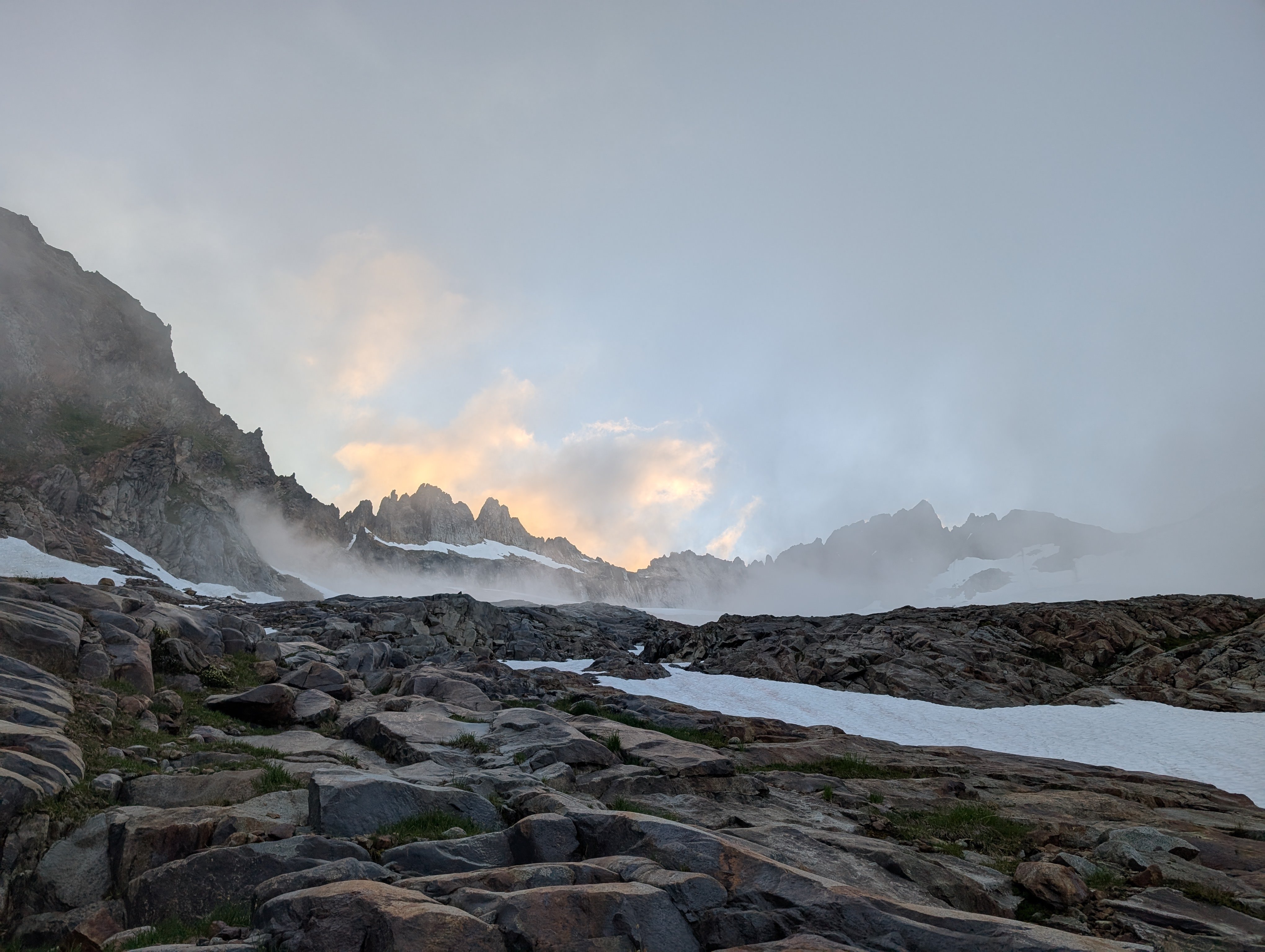
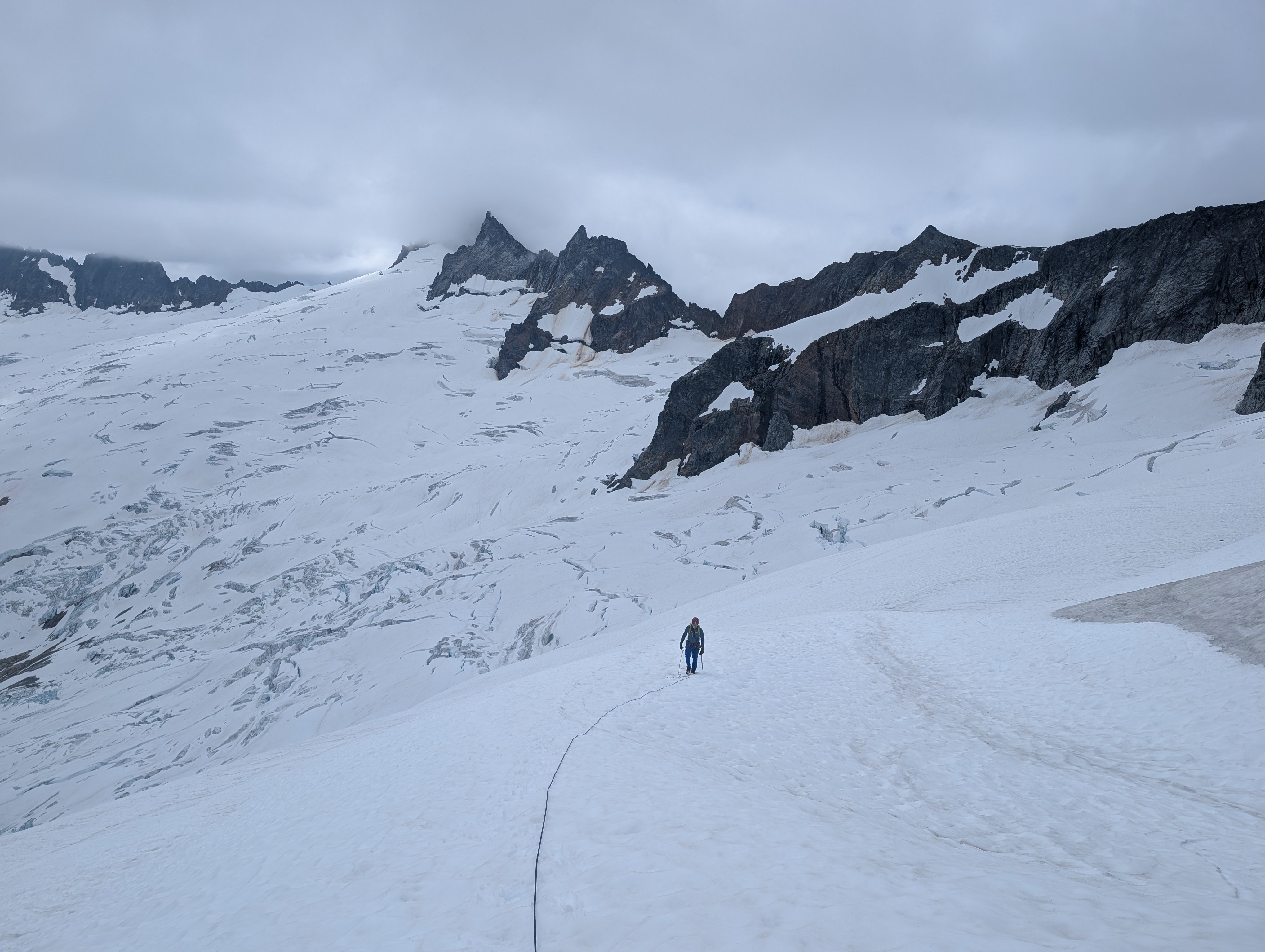
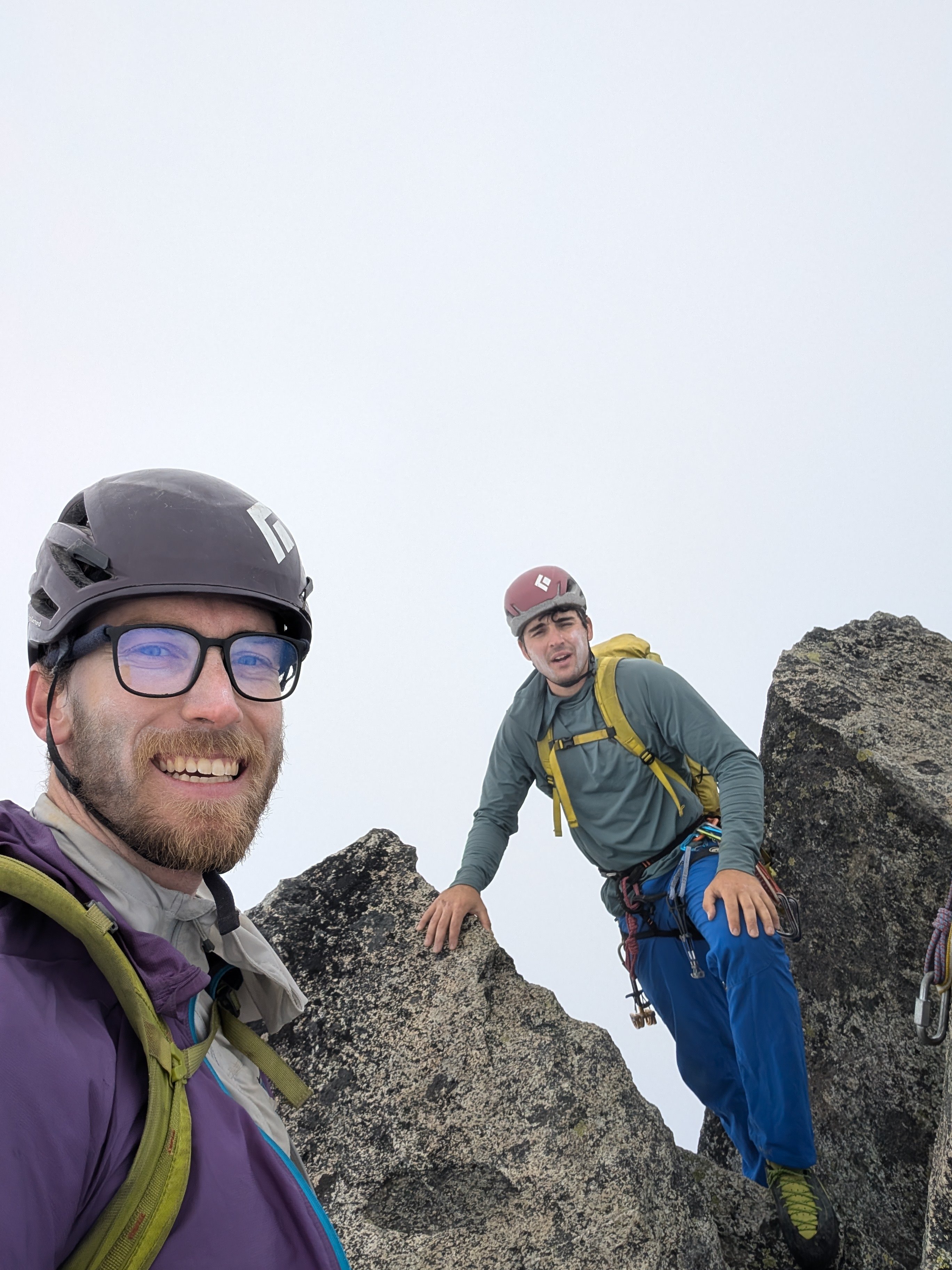
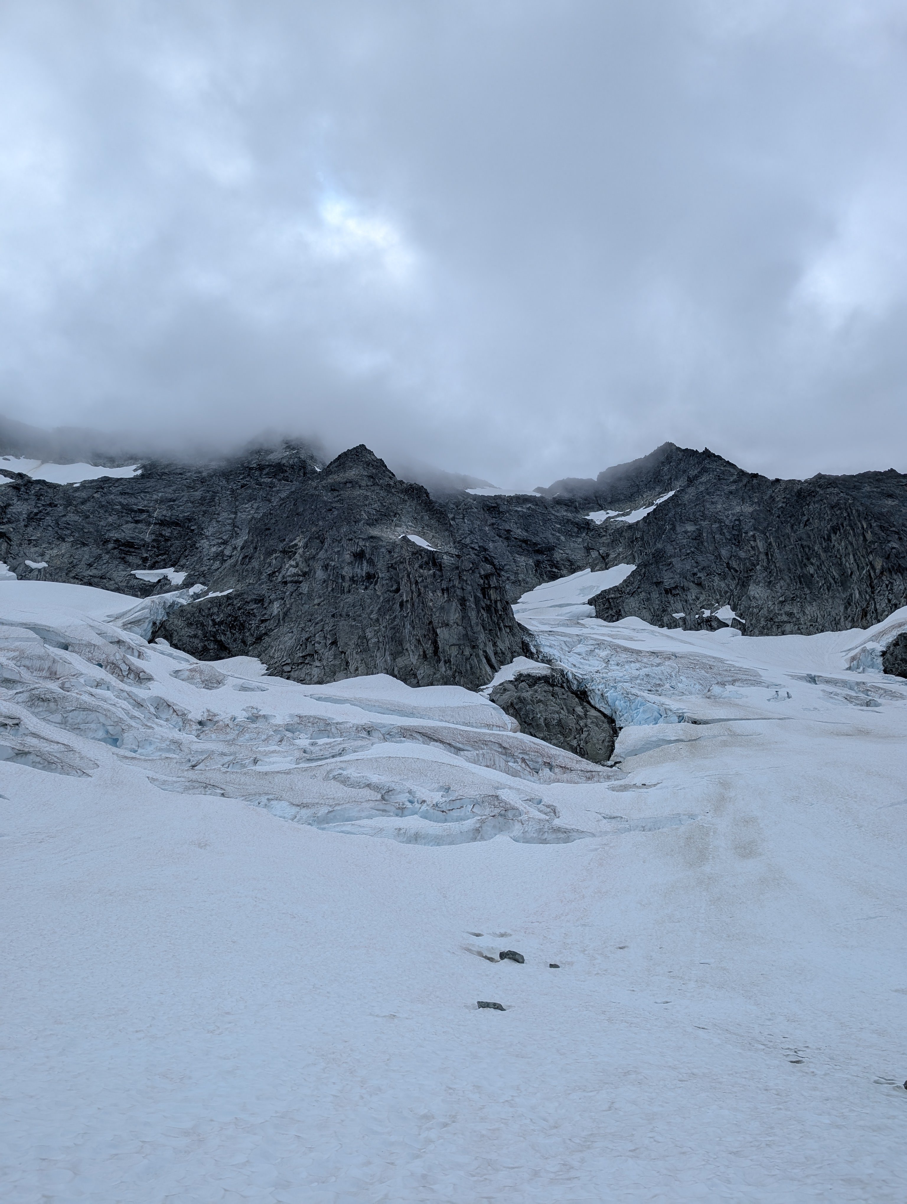
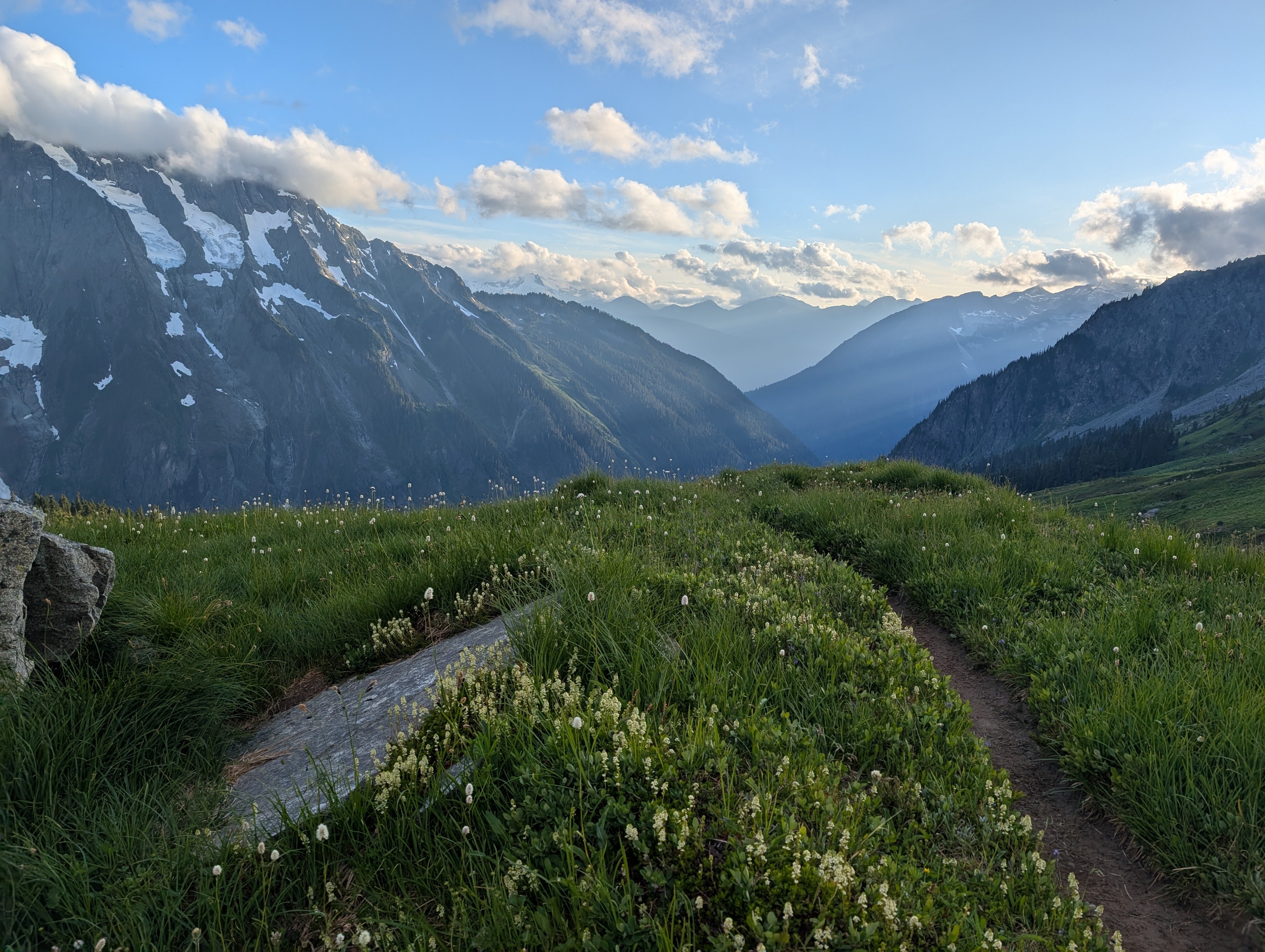
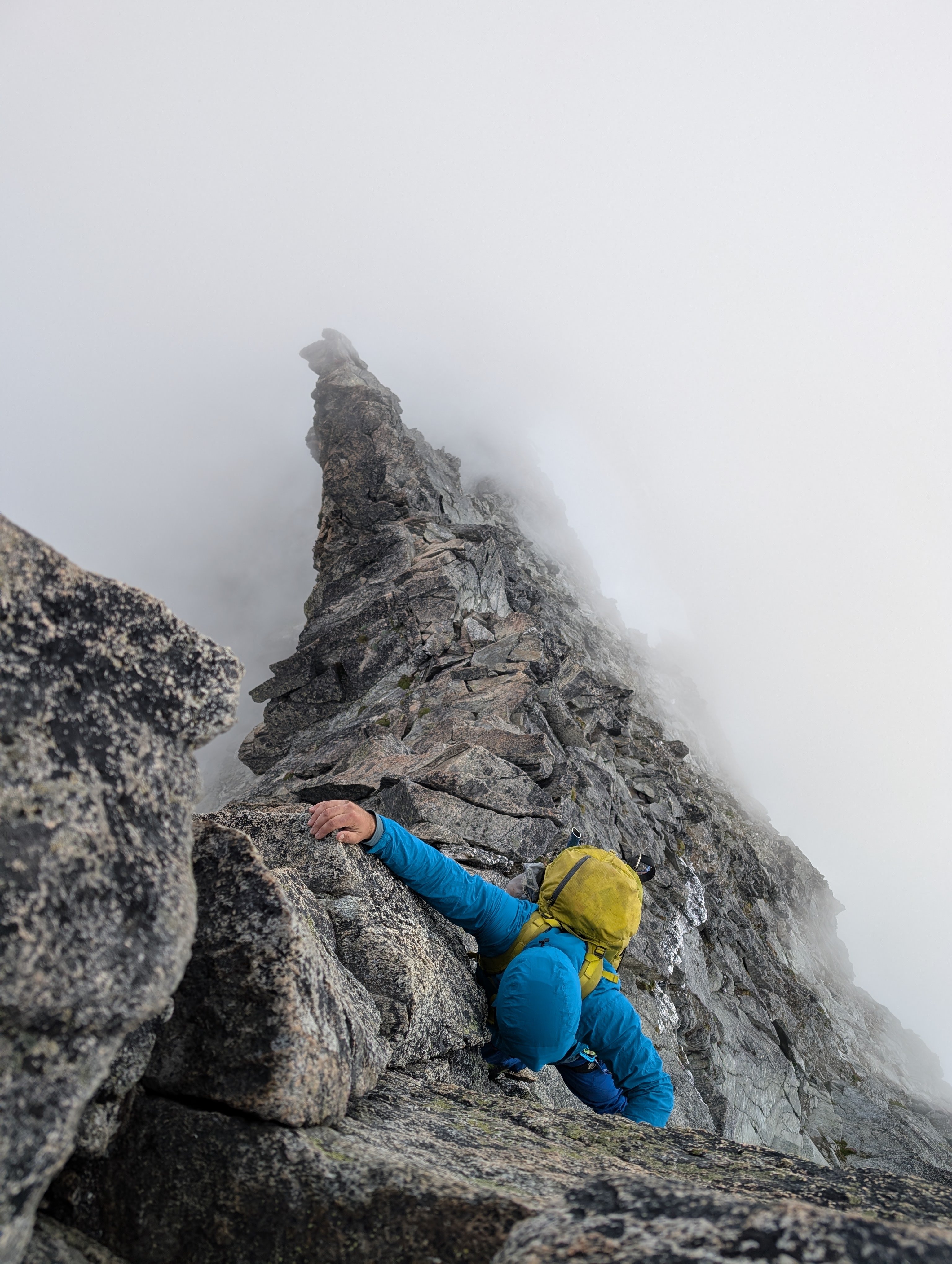
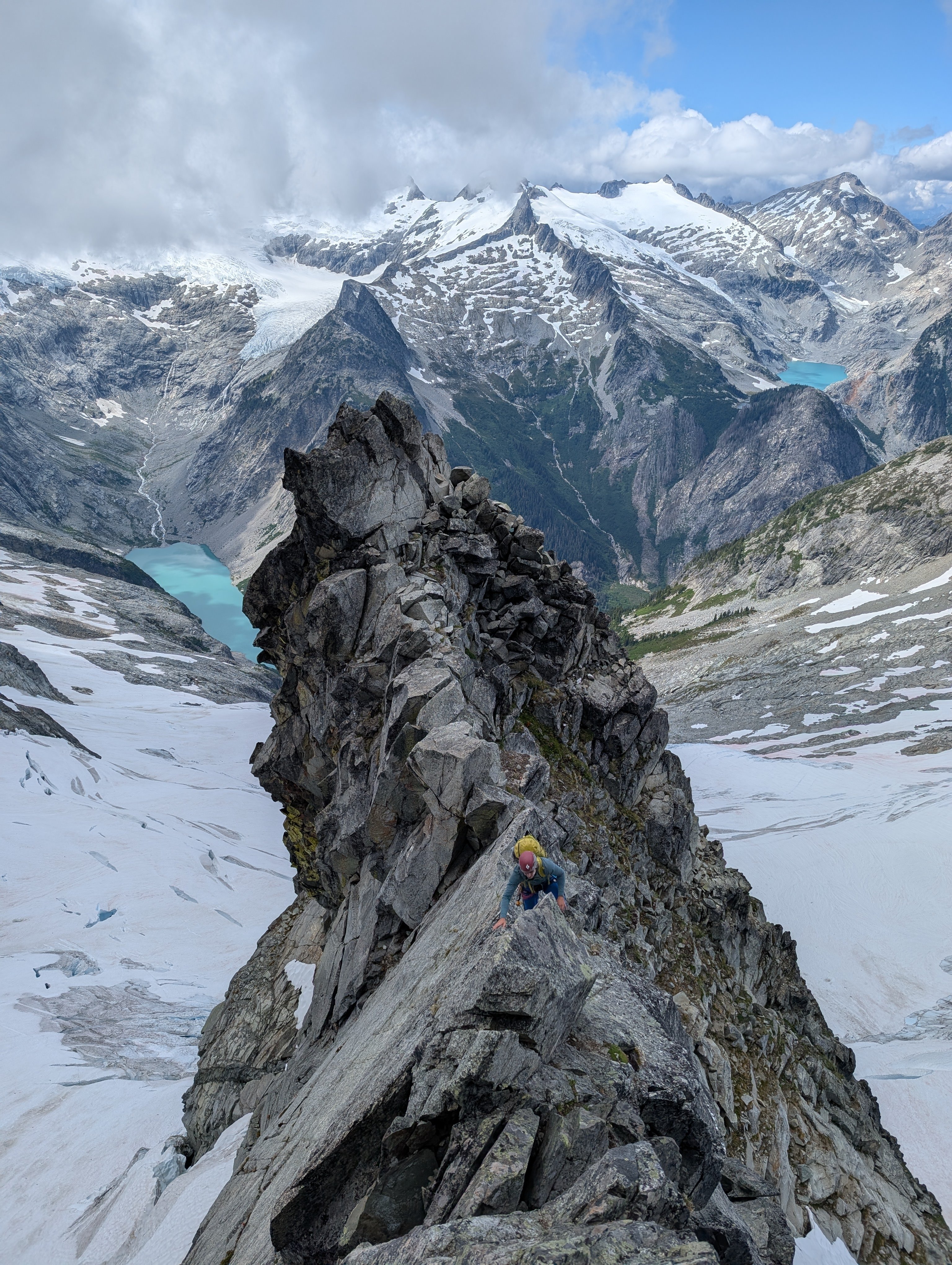
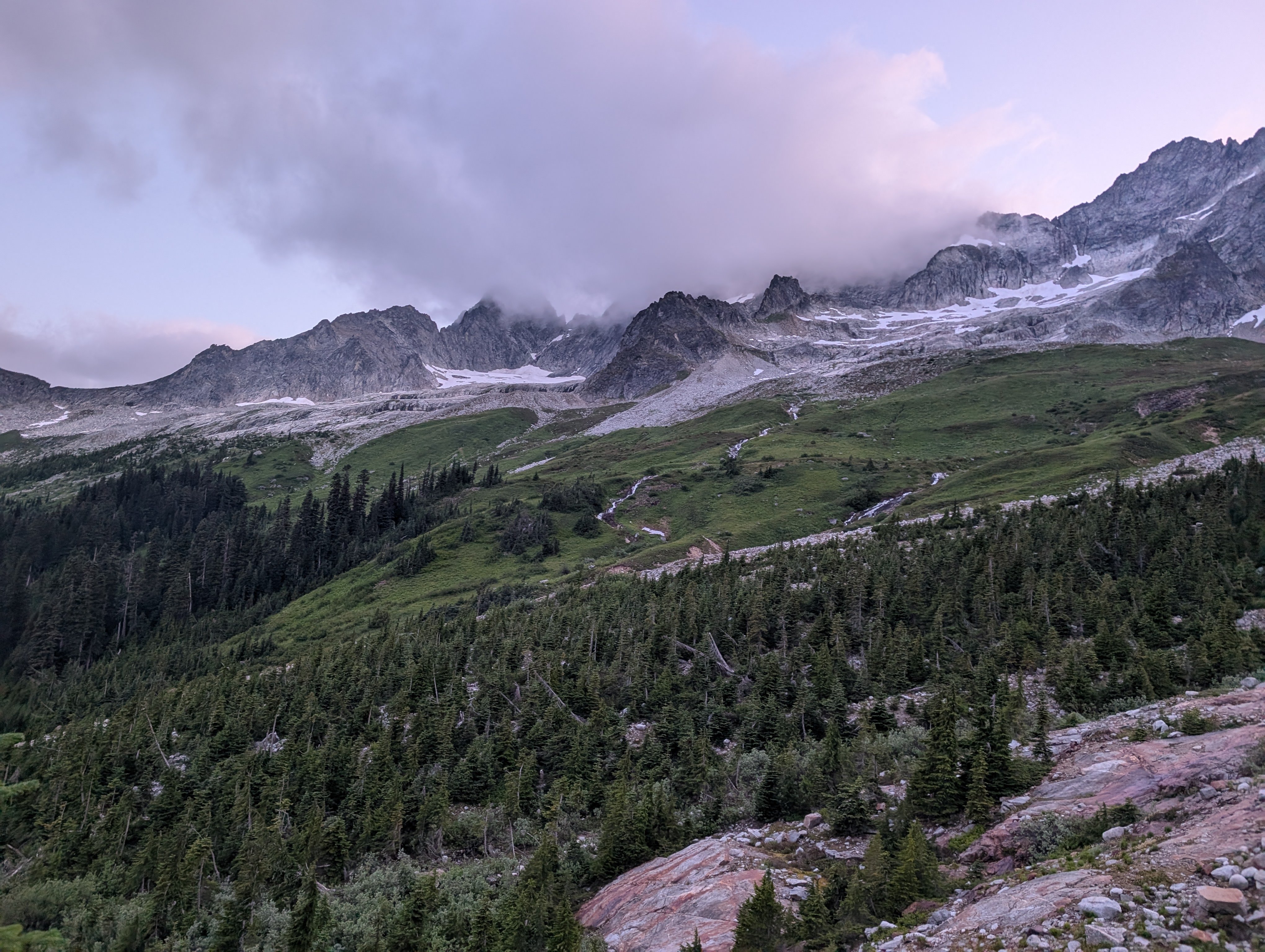
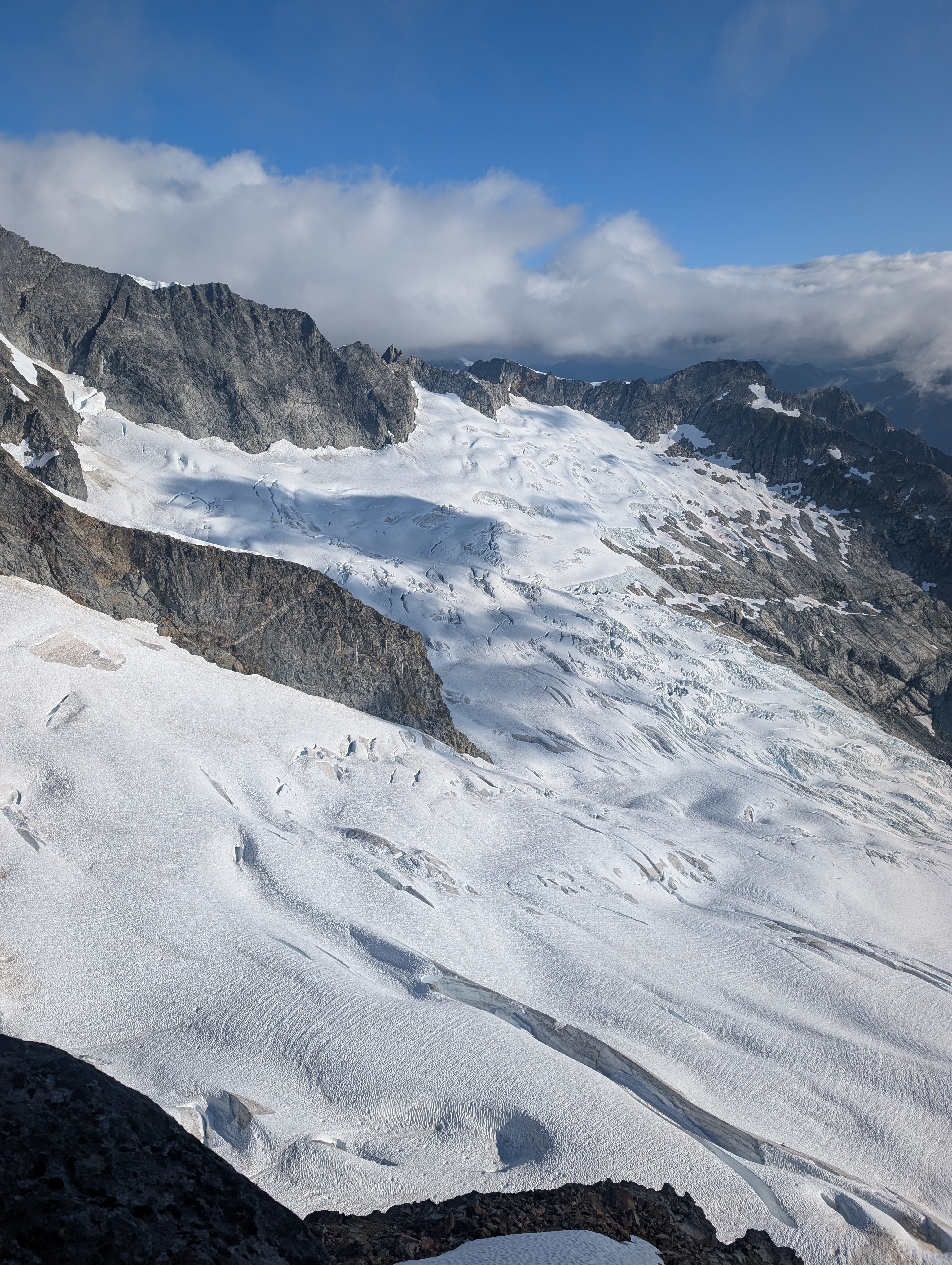
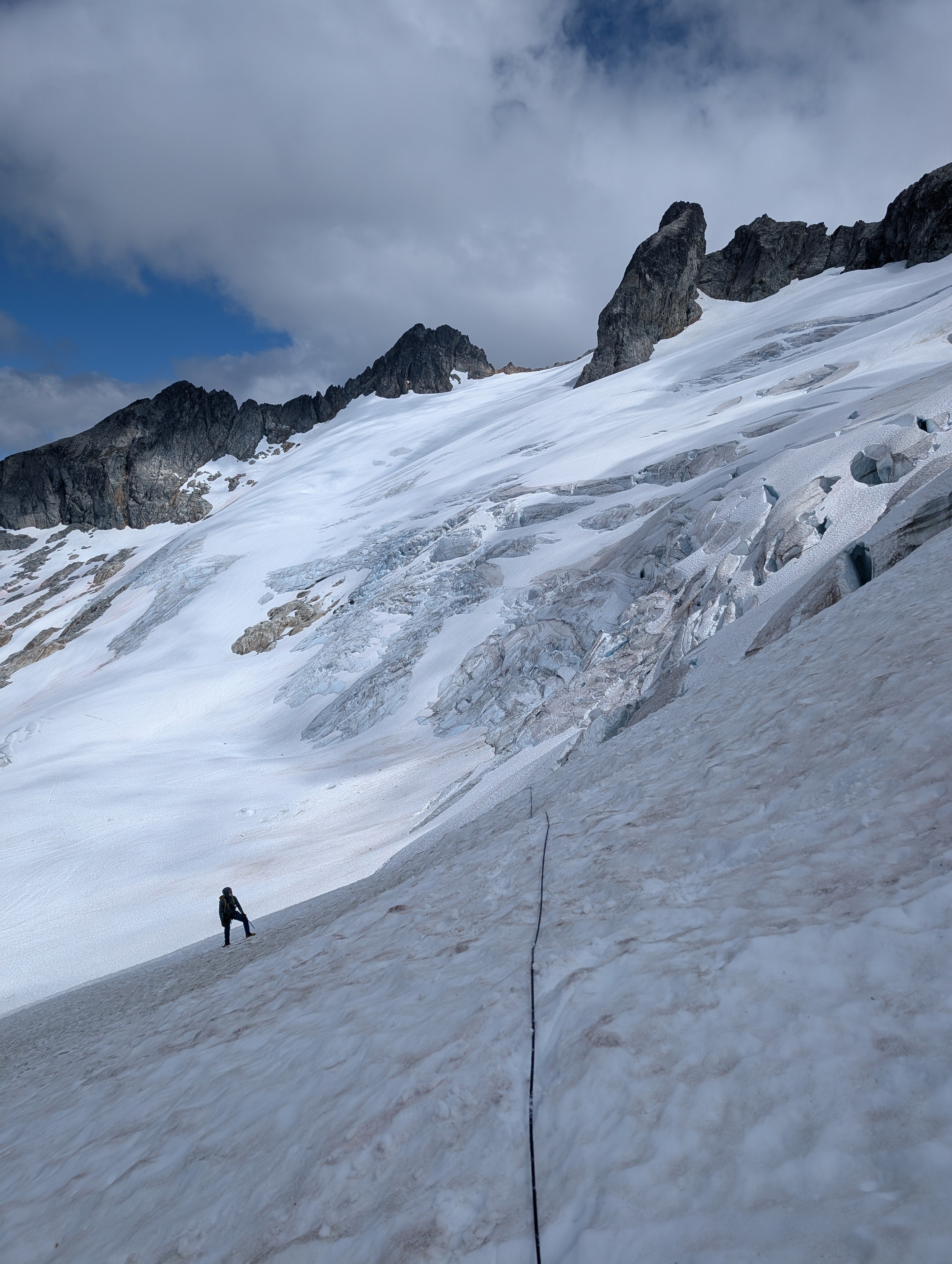
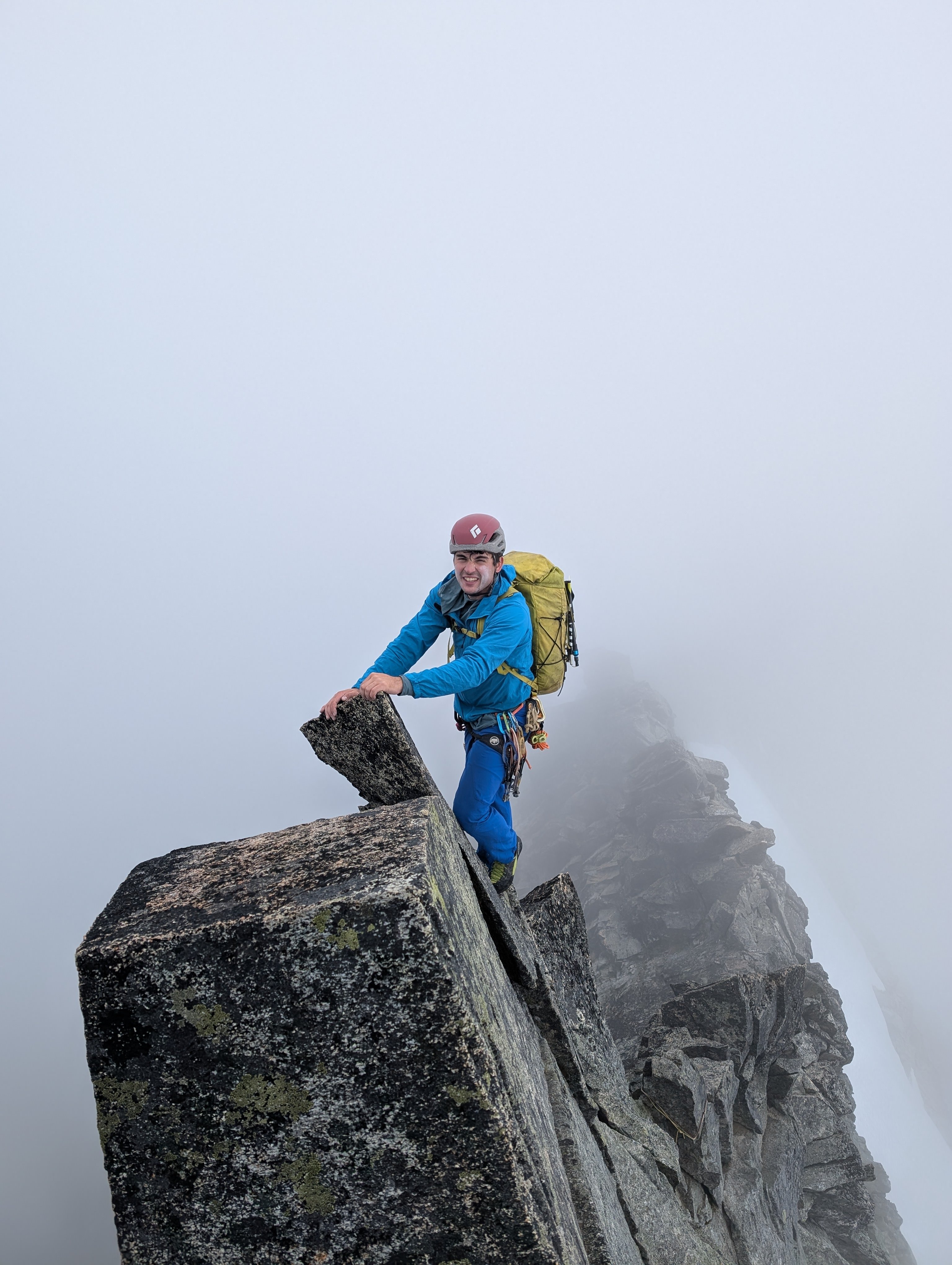
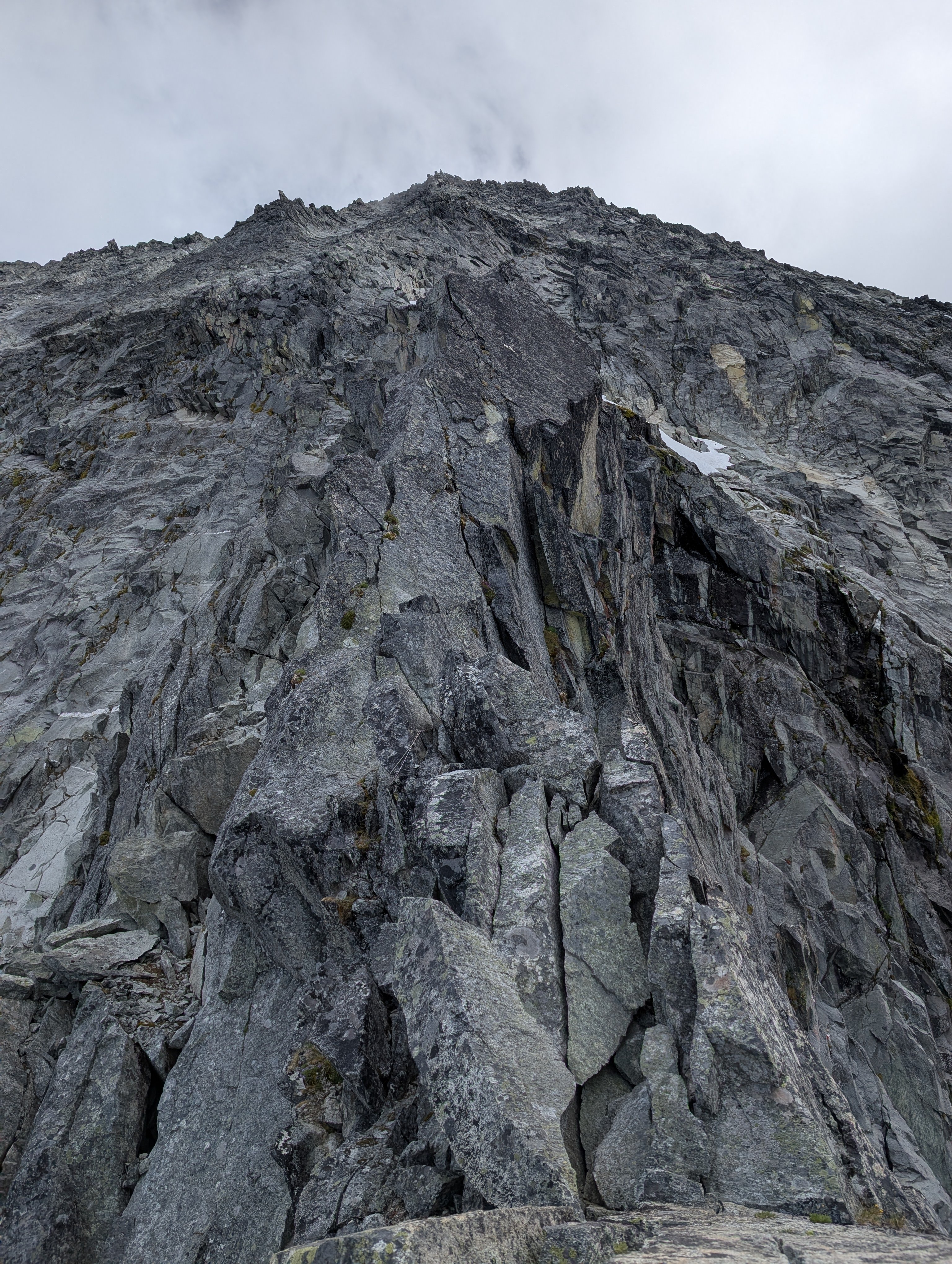 6 points
 -
Trip: Colfax Peak - The Polish Route Trip Date: 02/09/2025 Trip Report: "ILLUSION OF CHOICE" Kulshan and it's trusty sentinel. I stared at the line, tracing every section, noting unique features on the ice, taking inventory of everything I would need to pull through. The obsession was predictable. The route pulled me in singing a siren song of steep ice, promising views, and unbelievable positioning. It overtook me in a way I couldn’t quite articulate, in the way that only something brutally difficult and just within reach can do. I always want what I can’t have. I had been to the base of the climb two weeks prior and watched another party live out my dream. The climb was right there in front of me, but I was unable to interact with it. I lived the following weeks in its shadow, playing through the moves in my head instead of sleeping, going through my gear in the evenings like some sacred ritual. I had studied everything there was to study, I knew all there was to know about it - Nothing remained, except commitment. The alarm ruptures the stillness, a violence in the dark. I fumble for the headlamp, hands still clumsy with sleep. The air inside the truck is sharp and crystals glisten on my sleeping bag from the condensation. I briefly question the sanity of crawling out of the bag. I force down half a frozen donut with a caffeine pill, choke back some icy water, and tighten by boots with fingers that are already stiff. The first steps are always slow, heavy with doubt, the mind still tangled in the warmth left behind. The woods engulf me and Murray, our torch beams carve tunnels through the void, giving us a path to follow. Deadfall crunches beneath our feet and the glacier waits patiently. The woods release us and we weave through crevasses and serac debris. The stars burn above, unfeeling to the smallness of our effort. Pitches 1-2. Credit: Murray P. The first pitch was a wake-up call. Brittle and unapologetic; it kicked back harder than I expected, forcing me to fight to get purchase in the alpine ice. I didn’t believe the stories from the people that had climbed this before, about how variable the ice is up here. ‘How hard can vertical ice be?’ I naively thought. It was brutally violent to get a good stick and even harder to get decent screws. I lost count after five hollow screws and starting clipping them anyways. Part of me didn’t want to give Murray the impression I was struggling up here and the other part of me felt that if I fell, I deserved the bergschrund. It’s the flavor of climbing that demands you stay calm even when you feel the weight of the runout beneath your spikes. I was relieved when the rope came taught, signalling i could stop climbing and build an anchor. Share the burden, share the psych, and get a much-needed mental break from leading. Pitches 3-4. The Crux. Connected...still hard. A couple pitches later, the upper pillar arrived like a slow, inevitable tide. It was always there but now it was within reach. I could feel its gravity as I racked up. The lower ice appeared fat, but revealed itself as unreliable. I'd strike it and watch the fractures spiderweb outward, the sound hollow and unconvincing. Squeak, squeak, squeak, when I pried them out to retry for another swing. No easy way through. My calves were screaming, my forearms red hot. I knew I had to continue, I wasn’t even at the difficult part, yet my body was begging me for respite. I charged and got a stance below the crux, much needed rest...finally. The curtain hung over me like a guillotine, reminding me of the seriousness. Crux looming. Pitch Four. No hands rest. Our Skis visible on the glacier. I tossed aside any remaining fear, threw up the horns at Murray, and quested up the wild three-dimensional ice. After a couple body lengths, the familiar fire crept back into my arms. I wanted to climb it clean, I wanted to send, but the ice didn’t care. Pride is a useless currency up here, so I swallowed it whole, and clipped a tool. I hung there, weighting it just enough to drill a screw, and try to get the lava in my forearms to subside. My arms burned, but the pit in my stomach felt worse. I came here to climb, not to dangle like a tourist. But I wasn’t quitting, I wasn’t wasting this chance. I kept moving. I tried to keep my breathing steady, not letting the tension in my mind translate to my body. But the moment came—a simple shake out on a matched tool, something I had done hundreds of times before. In an instant I was airborne, cursing before the rope broke my fall. I slammed into the curtain, my right hip taking the brunt of it. I hung there for what felt like an eternity, choking down the frustration and stunned at how careless I was being. A fall on ice is a cardinal sin, and to do it in the alpine – unforgivable. I was disgusted with myself for not being stronger, not working harder in the months leading up to this, for tainting our send with a fall and clipped tools. I was ashamed but also guilty; I had taken the lead from Murray and made a mess of it. No time to cry…the sun was getting lower with every excuse I uttered aloud and to myself in my head. I pulled the rope back in and reset my feet. Swing. Placement. Breathe. Swing again. My tools vibrated in the curtain after every solid stick. I fought for every inch on the pitch and eventually when the angle eased, I was treated to some glorious neve. I only had two screws left so I pushed to an ice blob where I could bring Murray up. I could feel my heart pounding in my fingertips. I wanted to let out some kind of battle cry, but I knew better. This was just a small win, if you could even call it that. The route continued upward, unaware of my private hell. Hero swings above the crux. Credit: Murray P. We finished out the last 2 ice steps, quickly, but in the dark now. We coiled the rope and made a break for the ridge line, treading carefully in the unprotectable steep snow. We both stared at the summit. It’s only a short hike up and back, but I knew we weren’t going there—we couldn’t. It was dark, It was cold, and we needed to get off this thing as soon as possible. We traversed right past it and continued towards the planned descent. The cold sun had left us and the mountain reminded us who was really in control. Hands freezing, toes numb, and blanketed in the fresh moonlight, we hastily dropped back towards our skis. Our ticket home. Dusk on Lincoln Peak. Credit: Murray P. The silence at the base was heavy, the kind that only manifests after pushing yourself past the limit. This had been everything I wanted. This climb had consumed me, occupied my thoughts for weeks, dictated my training, my sleep, my diet. And now it was done. I should have felt something. Pride, satisfaction, maybe even relief. Instead, there was nothing. A quiet, empty space took hold where something should have been. And maybe that was worse. Because if this wasn’t it—if this didn’t fill that void—then what would? Maybe if I had climbed it in better style, or made better time, or hadn’t screwed it all up with a fall, it would’ve been enough. I’ll never know that answer. I clicked into my skis and took one last look at Colfax. The frozen waterfall was dancing in the moonlight, but it was already fading away. With every second, the climb became more memory than experience, a tale that gets told rather than an idea living inside me. The melancholy quickly retreated after the first few powder turns and didn’t return until I got a ski stuck in a creek bed a couple miles later. Gear Notes: 14 screws, 12 draws, 1 picket, Rack o Nutz. Approach Notes: Drove to the last pullout before the Heliotrope Ridge Trailhead, bathroom still not blocked in. Booted a mile or so on the summer trail then transitioned to skis and continued on the CD route until reaching Colfax. To descend, we traversed eastward along the North flank of Colfax, eventually reaching the Kulshan-Colfax col and could drop back down to the glacier.


 6 points
 -
Trip: Forbidden Peak - NW Face Trip Date: 07/13/2025-07/14/2025 Trip Report: This has been on my list for a while given the high praise in guidebooks. Checking rec.gov on Monday, somehow permits to Boston Basin were available for this Sun-Mon that Alex, Liza, and I had saved for this route. With Liza and my previous experience on W Ridge, we figured this would go smoothly, but as is tradition with Forbidden, we were a bit slower than expected. Day 1: Approach to bivy on base of NW Face We left the Boston Basin trailhead at 8:45 am. The trail was brushy as usual and the river crossings had easy rocks to hop over. After a bathroom break at the lower boston we made our way to Sharkfin Col. We shot up a snow finger arching right towards Sharkfin and scrambled up and left in a gully about 200 feet before the big notch at the end of the snow finger. Two raps down to Boston Glacier over/in and out of the two bergschrunds. We made quick work of the Boston Glacier (thanks to some faint tracks likely from the day before) and scrambled the classic “potato chip” gully/col up to the Forbidden Glacier. With the crumbling rock/sand combination, this required the full body tension of precarious slab climbing with the added bonus of explosive holds that kept things spicy. Walking down the Forbidden Glacier was very chill and there were some rocks that were poking out in the middle that had water flowing over them which allowed us to fill up before crossing below the route and ascending the glacier on the other side. We saw tracks from a team that did the NW Face Var of the N Ridge (Scary!). We then navigated around crevasses on the west side of the rib to a snow ramp onto the rib at ~7,600 feet. This was smooth sailing for the most part, but the little snow finger to get onto the rock is thinning out so threw in a picket given the large bergschrund right below us to ease our nerves. The snow finger didn’t look like it would last much longer than a week or two, so additional shenanigans may be needed later in the season. By 8 pm we found a small bivy, which we adjusted to make decently comfortable for all three of us and set up camp under clear skies with views of Moraine Lake. Luckily we had no bugs or snafflehounds overnight, just very gusty wind and the occasional sound of rockfall echoing around the cirque. Day 2: Ascent and descent We woke up and made breakfast as the clouds came and went, occasionally completely surrounding us in grey. After breakfast we made a quick 4th/low 5th pitch to the base of the knife edge starting around 8 am. All of us were stiff from the day before and were grateful for the warmup. The knife edge was very fun and super chill! A short section of crumbly rock, but otherwise quite solid. Clouds rolled in and out making it hard to suss out the route above us. The crux pitch took some figuring out and I’m still not sure if I did it right. The first bit was one quick 5.8 move that was quite fun above the old piton and perfect finger-sized gear. The second bit was a weird overhanging hand/fist crack that felt burlier than I expected. I pulled up into the crack then switched to the face to make use of some great footholds. The chimney pitch was quite loose, with multiple death blocks that I stepped on to avoid the crumbly rock-sand. I did not enjoy leading that…. After the chimney pitch it was fun ridge romping up cleaner rock. I was a bit gassed so I handed the lead to Liza. Luckily the clouds cleared and we had some fun sunny climbing. Liza made the mistake of shooting left onto the face rather than staying on the true ridgeline once the ridgeline got more licheny. This led to harder climbing on what looked like cleaner rock, but it had minimal protection and hid multiple death blocks that threatened a scary rope-cutting incident. She shot back over to the ridgeline on the right for more fun and cleaner rock climbing to the summit by 4 pm. No major mistakes happened, but we were way slower than expected with the fatigue, weather, and figuring out our simul dynamic with this trio. We ended pitching out more than we needed to. At this point the clouds started rolling in, so we decided to high tail out. As we began the rappels along the ridge, the wind picked up and it started to rain. This was probably the low point of the day as sideways rain blasted us along the knife edge rappels. After two raps along the ridge, we did two raps down the west side to an easy 4th class ramp that meets the first ⅓ of the W Ridge. We added some tat to some of the weathered stations. Four double raps down the Cat Scratch and we were out hiking! It was great knowing the descent beta from when we did the W Ridge four years ago. Luckily it was still light when we navigated the snow field and slabs below. We got back to the car by 11 pm. Overall: This was an engaging adventure that required a bit of everything. Knowing the W Ridge descent was very helpful. The climbing was not as good as we expected, but the knife edge and some of the upper ridge were a blast. The position, line itself, and the approach are amazing. 4 star line with 2 star climbing (though with more traffic/trundling could be 3-4 star climbing). Overall, an engaging experience, but we are still quite confused as to why this route isn’t called NW Rib because the only time we were climbing what I would call a “face” we were definitely off route… Heading up the snow finger towards Sharkfin (rap we used is just to the left, rather than up in the notch straight ahead): Chossy scramble up to Forbidden Glacier: Snow finger to access the base of the route: Looking down on the the snow finger and the bergshrund below it: Morning at the bivy spot: Looking back down the knife edge: Cruxing: Alex pulling the weird crux move: Liza following the crux: Solid exposure! Summit selfie: W Ridge descent: Gear Notes: Singles 0.2-2 with doubles 0.4-1. 1 picket. Axes. Crampons. Having another 0.3 would have been nice. Approach Notes: Boston glacier approach
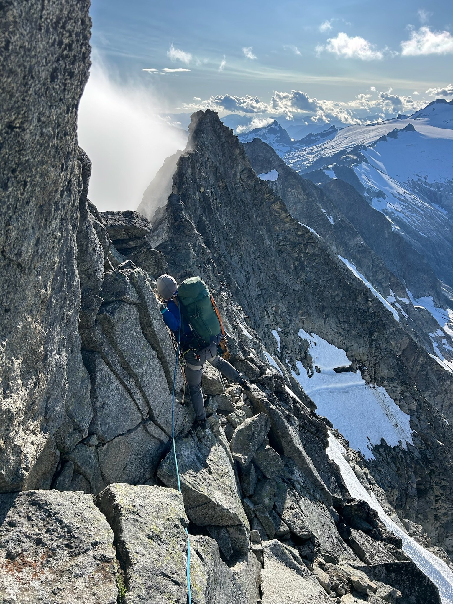 6 points
 -
Trip: Mount Index - North Face Trip Date: 06/29/2025 Trip Report: Kinda tired but figure I should write some stuff down while it’s fresh in my mind. I’ll split this into two parts, the story and the beta. The Story is pretty simple, me and a partner decided to go for the Index traverse on Sunday and Monday. We had extra time on saturday so we hiked into lake serene to make for an easier morning. Without light on Saturday night, we made the mistake of trying to bivy at the flatter spot in the topo on the north of lake serene. This is very schwacky. Don’t do it. It wasted a lot of time. Anyways, Sunday am we worked our way up the talus and then up to the ridge. It was still a little wet and loose so we decided to rope up. Halfway up, my partner bonked and our pace slowed considerably. We made it to the summit late and decided that in his condition it wouldn’t be safe to commit ourselves to the rest of the traverse. A nice summit bivy ensued and then 16 rappels + downclimbing the next day. We chilled in by the lake and hiked out at a reasonable time. In the descent we also realized it was prolly a good idea we didn’t commit ourselves to the traverse. It fingers were beat and the rock was so warm that touching the rock was truly painful. Wouldn’t be fun to be forced to climb in that. My partner has a brain and realized this blue collar suffer climbing aint for him, but if anybody wants to get on something suffery with me, let me know. I got a lot of time this summer and like to put my head down and work. Anyways on for the beta Beta: Approach via Lake Serene. Take the trail around the lake to the talus field. Follow the talus field up, eventually getting near the cliffs on the left but not on them. Eventually you will be forced into the bush to the right of the cliffs where there is a faint climbers trail. At times it can be decent but often, its only marked by the fact that you can see the ground every once in a while. Bushwack 4th class up onto the NE Ridge, pulling on lots of branches. Eventually you’ll get out of the schwack and onto the ridge. Take the easiest looking route up, roping up if you feel necessary. Climb this until you reach a slab with two pitons under a roof. Once here take the leftward brush filled ramp for about 50ish meters until you reach a short E facing exposed rock rib. This is a great pitch with exposure above lake serene. It will quickly ease up into a nicer gully below an open book feature. Climb to the treed ledge on the left side below this open book where you’ll find the crux pitch of the route. Start up on left side of the open book before traversing right on smaller holds to get to the easier gully above the open book. Here you’ll find a block with a lots of slings for a nice belay. At the block, climb hard right out of the gully and then climb straight up the steep trees and brush until it gets too steep. Here you should see a small hidden ledge going around right. Take the narrow, exposed ledge around the right skyline where you’ll finally see the North Bowl. Traverse, pulling steep brush, to get into the open bowl. Once in the bowl, the route goes up the steeper long gully on the left. Work your way up this thing, staying on the right side of it for most of the time. Eventually, before the gully turns right, you’ll find yourself on a nice ledge to the right of the gully with a slung tree and a piton + nut anchor above it. Climb up here and then to the left back into the gully. From here(when the gully turns right) it is 60 meters of steep bushwacking up to the toe of the North Rib. The North Rib is the highlight of the route. Stay right on top or barely(a few feet) to the right the entire time. This can be led in 2-3 pitches or one easy simul. It is exposed, but the holds are great unlike the rest of the route, and the location is amazing. Once at the top of the ridge, quickly climb up the small slabs onto the summit ridgeline. Scramble this, along, or slightly to the right for most of it until you reach the summit. slab with pins below roof. Ramp off to the left great exposure on E facing rib topping out of open book looking down rightwards turn at end of gully filled with steep branches. Taken from toe of N. Rib ig I'll have to come back for these guys summit bivy summit ridge scrambling(taken on way back) Gear Notes: Double rack to #2 but a single would probably be fine. Bring lots of double length slings, you'll be slinging a lot of shtuff. Approach Notes: Lake Serene -> boulder field -> Shwack
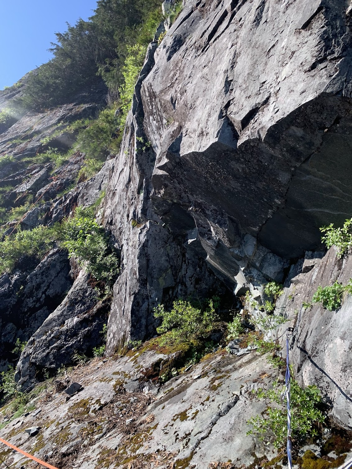
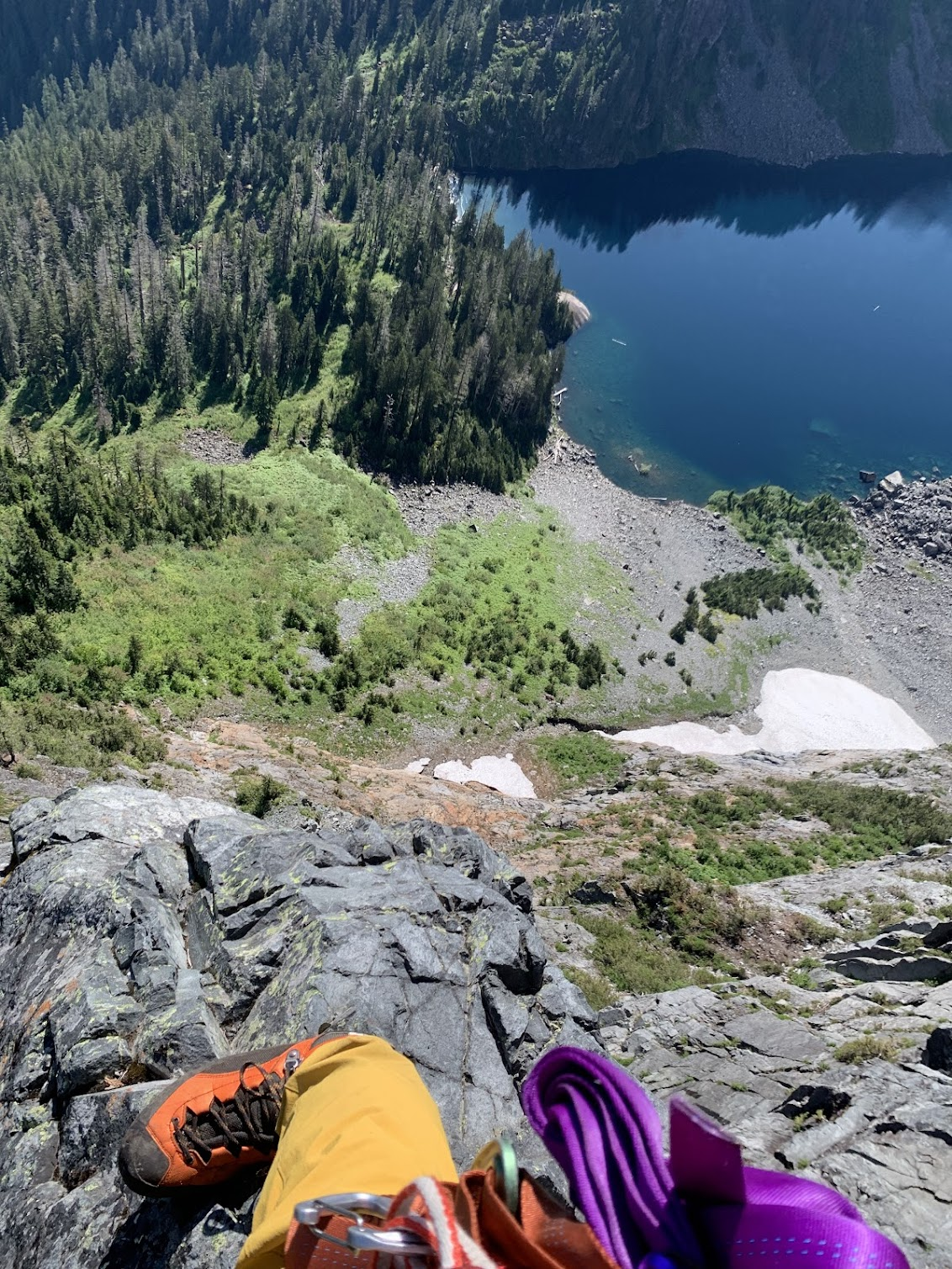
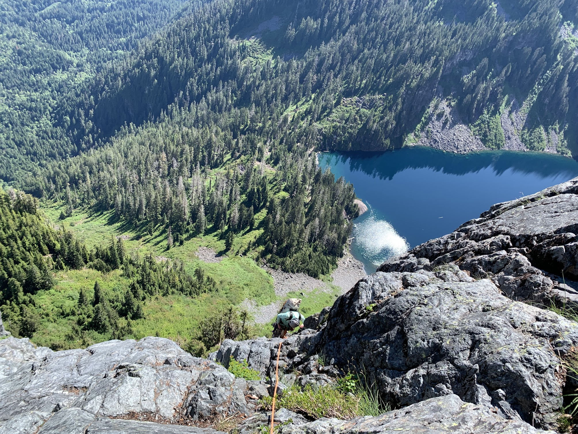
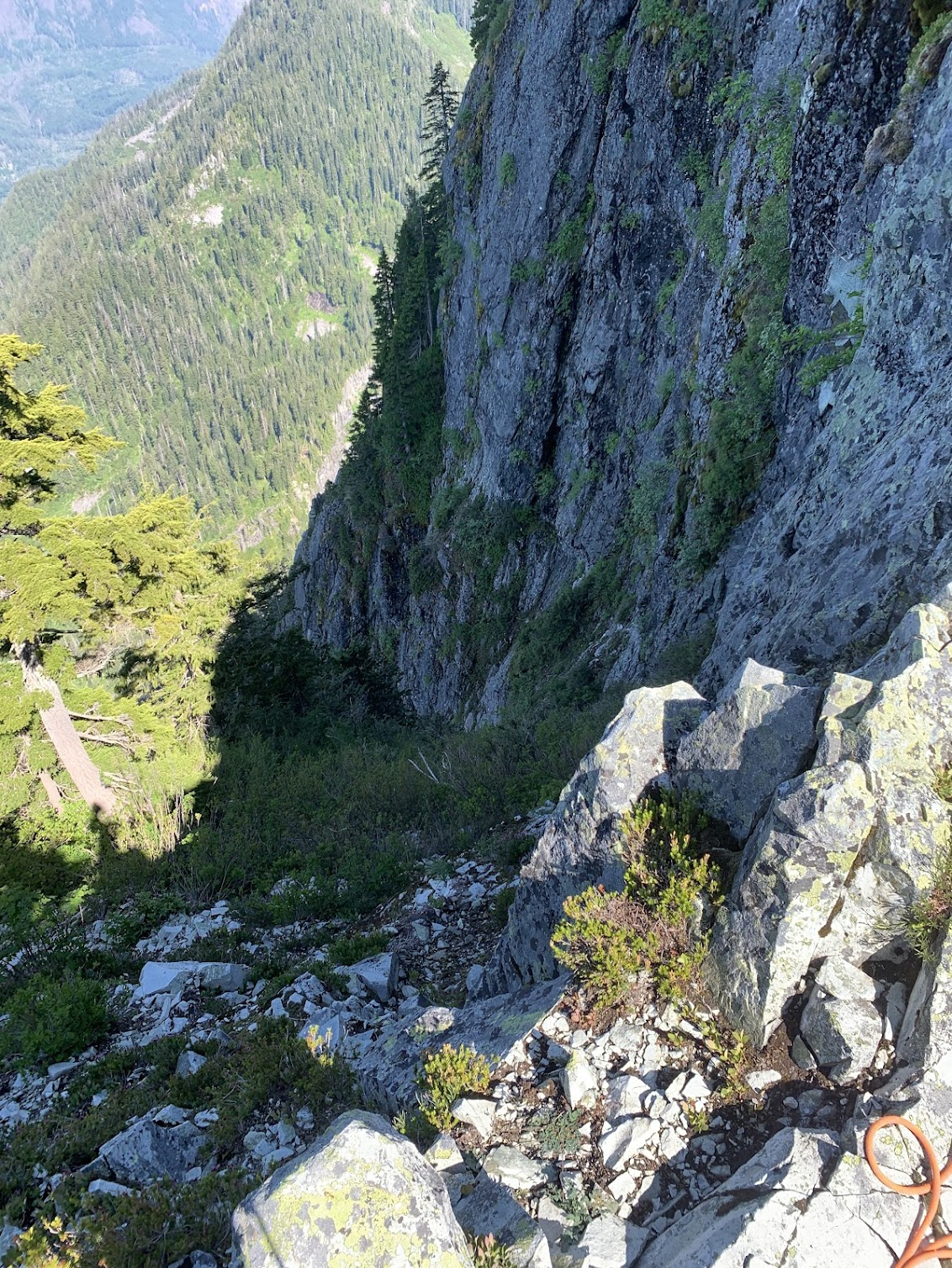
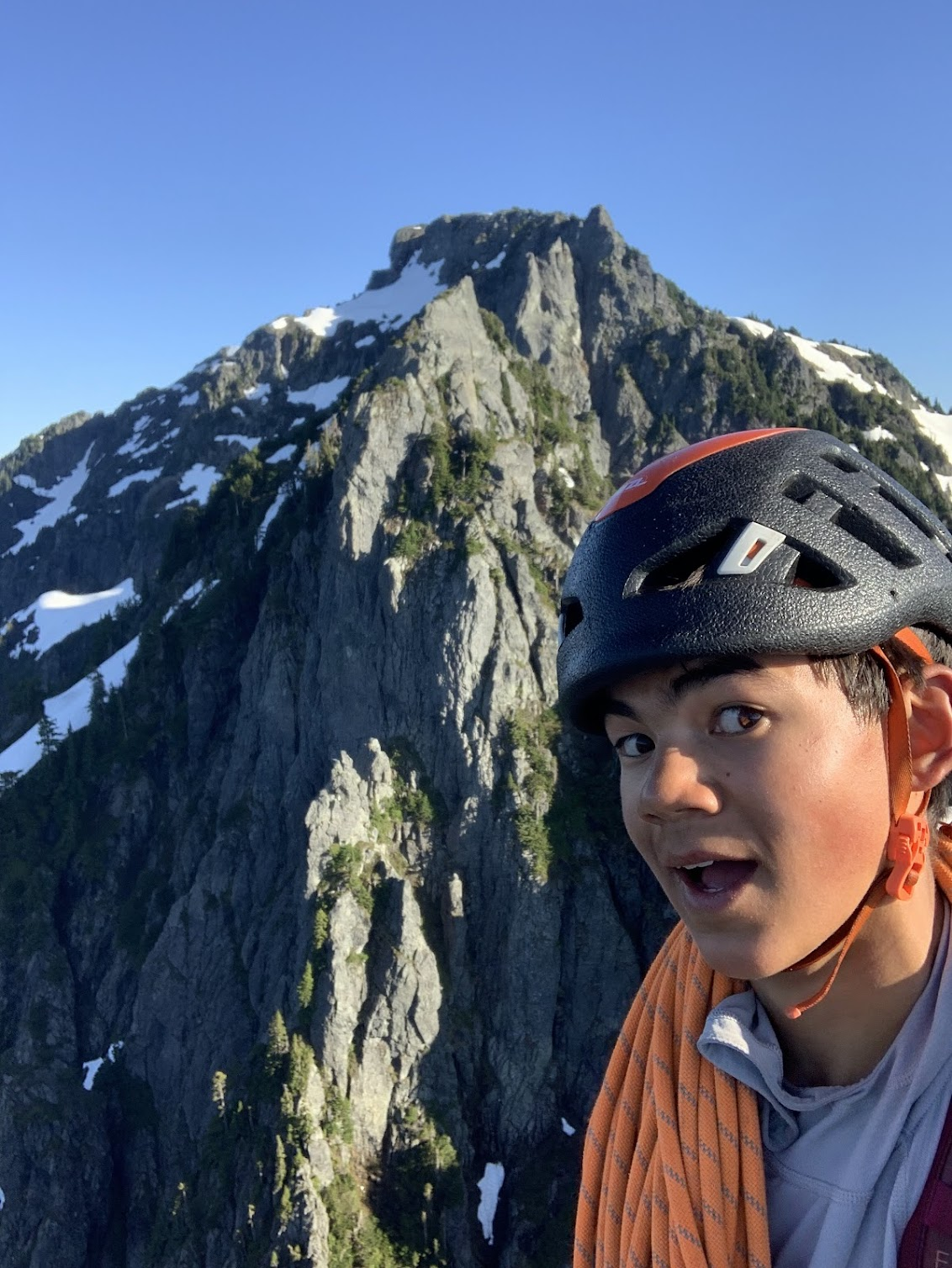
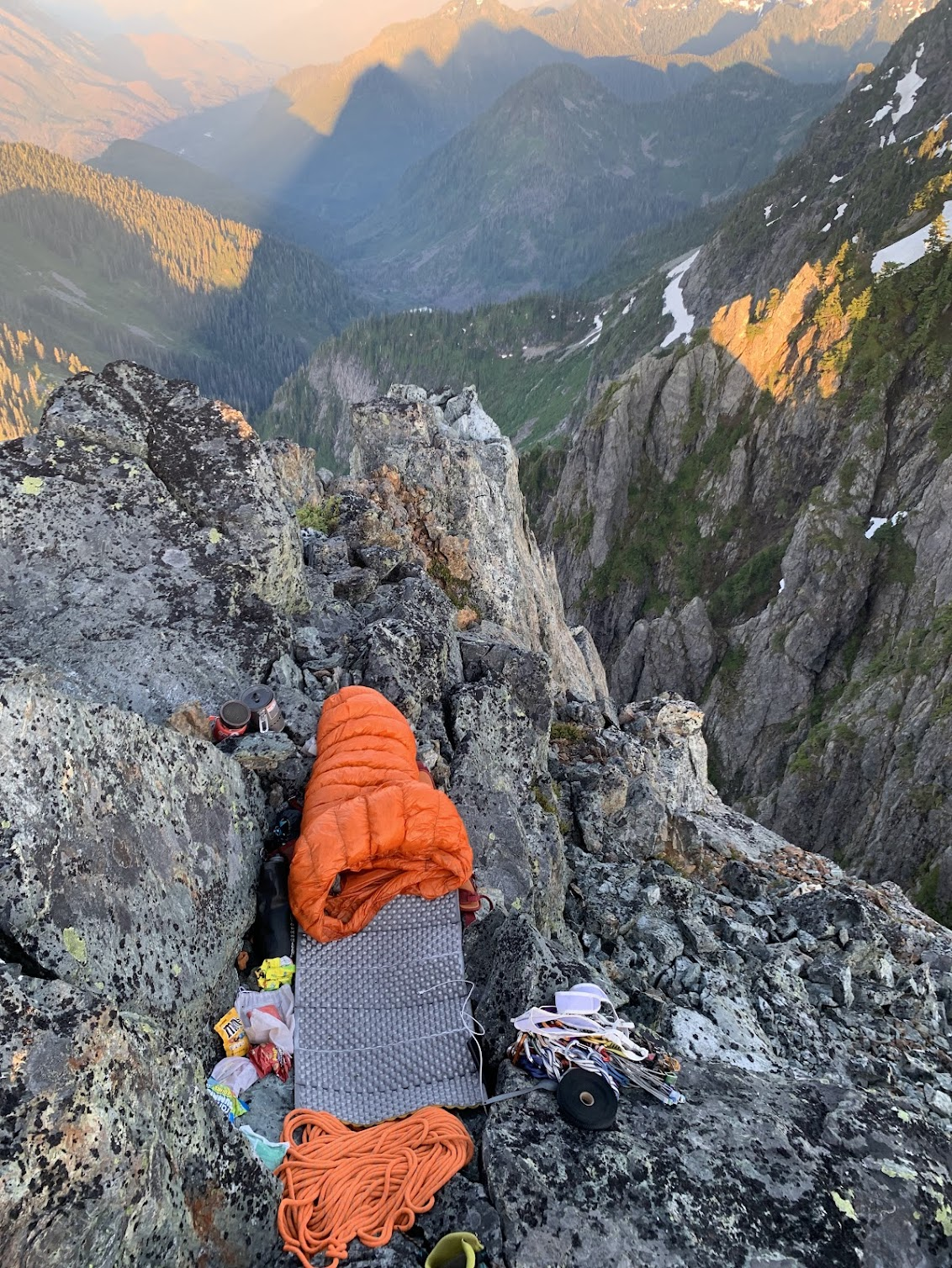
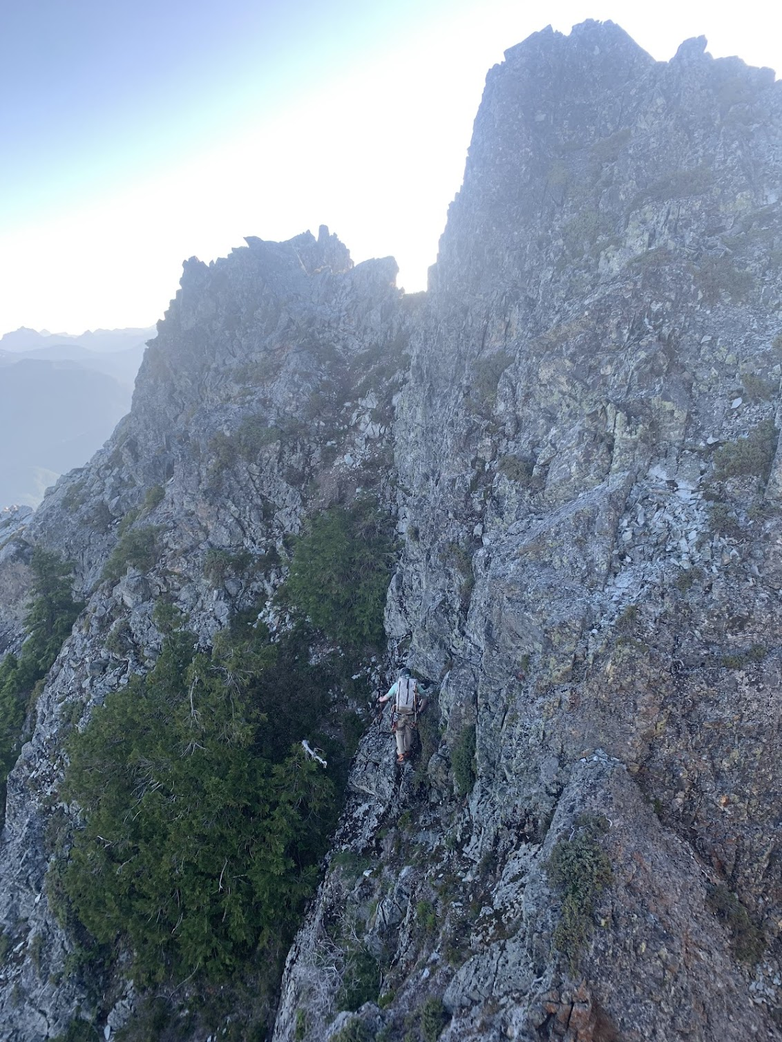 6 points
 -
Trip: East Fury - North Buttress Trip Date: 06/29/2025 Trip Report: In the couloir leading to the buttress from its east side, the drawbridge is up. It’s hard to think of a route in the cascades that I haven’t climbed that I was more excited to try. From Luna col the position of upper snow arete looks insane. And the photos in this 2017 report don’t hurt: https://cascadeclimbers.com/forum/topic/100747-tr-mt-fury-north-buttress-6232017/?tab=comments I was lucky to find a partner inspired enough to take a day off and put in the considerable effort to get out there and check it out. Saturday was a little cloudy and not too hot, which kept things relatively smooth on our way from big beaver to Luna Col. Even though I’d seen it before, the first sight of the northern faces of the southern pickets that rewards the grind up to -6400 was literally breathtaking. I let out a little pious whoa. The last mile or so took approximately forever but we arrived well before dark, 11.5 hours after drop off. A ghost set up our tent. From the col the couloir didn’t look too promising but wasn’t obviously impossible so we proceeded to go for it the next morning, leaving camp at 5am (4:30 might have been better). As in the trip report from 2017, we trended left on the descent to Luna lake, which worked well. From the lake we traversed W and SW, bottoming out around 4500’. At this point we could see the snow was not continuous in this first couloir and quite a bit lower, maybe 15-20 feet, than in the 2017 reference photo. We found a ~5.0 exit onto slabby rock and got up to easier ground. Continuing up we traversed as quickly as possible across the exposed face to the entrance of the main couloir. From below it still looked worth trying. But only about 200’ up it we encountered a hidden moat spanning wall to wall, just above where I am in this photo. It was tall and unnervingly hollowed out. Questing up and left on the rock for a bypass was fruitless. I found steep slabs without much pro. And transitioning from boots and crampons to rock shoes while exiting a tenuous snow location onto a narrow rock stance turns out to be very awkward. At 30m I ran out of rope (folded 60m half), placed a piece and down climbed on top rope back to the snow. We down climbed the steep snow back out the couloir. About to down climb to the first couloir. Looking up on our return to Luna lake I thought, hmm, we came down that? It looks improbably steep but is actually reasonable. All throughout the cirque there was surprisingly little activity given how warm the day was. At camp 12 hours after we left the evening was unpleasantly hot and buggy and I impatiently awaited the reprieve of dusk. In the meantime there was some helicopter activity near Outrigger. I hope everyone involved is all right. The heat was considerable already at 7am the next morning when we began our descent. I used crampons but there really was no hard snow to be found. We took a long break at the stream by Luna camp and it seemed then that we’d make our 5pm taxi in plenty of time. One small delay occurred when we saw two bear cubs climbing to the top of a tree right off of the trail. Mama wasn’t making herself seen or heard, so we backed up a little, made a bunch of noise and gave them a few minutes to clear out. We didn’t see the cubs again and did see the mother a little bit off trail, not acting aggressively. Checking the time. As the afternoon miles went by we realized that we were slipping behind and had to really push to get there right at 5pm. The driver was very nice and encouraged us to take the time to cool off in the lake. I don’t know if I have it in me to try this route again but if I did it would have to be possibly even earlier in the calendar, and in a year with above average snow pack come June. The west side alternative doesn’t appeal much to me, the photos from Steph Abegg make it look like overhead exposure would last a lot longer than it does while traversing in from the east. Gear Notes: Crampons, ax, whippet, 60m half rope, single picket, light rack and some bail gear Approach Notes: Big beaver to Luna col to Luna lake


 6 points
 -
Trip: Tetons - Black Ice Couloir to West Face on the Grand; Direct South Buttress to the summit on Moran Trip Date: 06/23/2025 Trip Report: Dallin and I had gotten skunked by climate change two summers ago in Canada, so this year we decided to book a week together in late June and go wherever the weather looked best, with the goal of climbing long routes to summits. We were just starting to get really excited for Roger's Pass when the weather changed and we bailed to a more southerly range, the Tetons. The week was starting cold so we decided to prioritize ice routes. We had reliable intel that Run Don't Walk was out, but Black Ice had seen a mixed ascent 10 days prior and temps/precip seemed to suggest it would only grow. Wanting to do all the things, we hiked up to the Lower Saddle prepped to link into the West Face. The Black Ice/West Face linkup is George Lowe's pick for the 50 Favorites book. In his topo he cuts left on a snow field to the West Face, missing the crux of BIC. Since BIC is hard to find in condition in this age, we opted to climb BIC through the crux if it looked good and then cut out left higher, if possible. This strategy worked out well. The crux of BIC was thin ice on slab to neve sticks above a chockstone, very fun. A long, snow covered slab/ledge system allowed us to traverse out onto the West Face, starting with the rock climbing on pitch 4. We only brought a single pair of rock shoes, so Dallin lead everything and I followed in full shank boots, making the old school 5.8 traverse pitch quite exciting. After 5 difficult (for me in boots) and wandery pitches we reached the end of the difficulties on the Lowe topo. At this point the weather came in, snowing and thundering. After dead ending a couple times on the scramble to the summit I downclimbed into a snow filled gully, reattached crampons, and climbed a tenuous verglassed slab to snow only to find it was powder on featureless slab. Luckily, a leaning flake crack provided a good torques and we topped out in a white out. The sun poked out again just in time to allow a quick navigation of the raps. After a night at a friend's house in Jackson, we repacked for a sunnier objective. That afternoon we paddle boarded over to Leigh Canyon and bushwhacked up the drainage until we were under the South Buttress of Mt. Moran. We bivied on cleared camp spots in some cottonwoods next to the creek. At 4am we rolled out of bivy bags and headed up through the brush and scree to the Direct South Buttress route. We had heard the first pitch of Blackfin was the preferred first pitch which accessed the second ramp. However, after looking at various options and downclimbing off one horror show of stacked blocks, we just scrambled higher on the first ramp and did the original low 5th start. More route finding difficulties slowed us and ate up time, but we persisted and gained the main line of pitches up nice cracks which appeared to be a lovely white granite in places. The traverse pitch and crux was not too bad, we opted to simply pendulum and aid at this point in the day. We reached the hanging bowl at 3pm and thought maybe we could still do the remaining 3000' to the summit before dark (oh hubris). Wet and vegetated slabs, sandbagged old school climbing, and extremely exposed tower ridge traversing in high winds saw us reach some good bivy sites in the second hanging bowl with a little bit of daylight left. We cut our loses and settled in for a cold and windy bivy. The next morning we were up and moving by 5am. Many more route finding difficulties lead to an off-route, overhanging, bomb bay chimney that ended with a mantle on to the summit plateau. We tagged the summit at 1:30pm and had a quick snack/water break before descending the CMC route. Neither of us had climbed the CMC or Moran before so this made for some interesting and surprising situations as we down-simuled and rappelled, culminating in realizing we had to rap into the Drizzlepuss notch and climb up the peak on the other side to escape. Once over the annoying DP, we raced down to the lake and paddle boarded leisurely back to the car with a beautiful sunset until hoards of mosquitoes found us. A dunk in the cold water and shivering night drive into Jackson with the windows down let the bloodsuckers escape. We got late night pizza slices and then had to drive 2 hrs around through Alpine to reach Driggs because Teton Pass was closed for construction... always one more problem to surmount! I passed out in the back of my car in Driggs at 2am and drove home the next day. Thanks to our families for letting the dads go big for a week! Double rainbow in Driggs was a good omen. Dawn on the Valhalla Traverse to reach BIC. Dallin on Valhalla Dallin finishing the Valhalla traverse Dallin's pic of me leading the mixed pitch to access the BIC Lookind down the BIC before it started getting more icey. Crux on BIC Dallin switching to rock shoes on the West Face Me following on the W Face Looking down the W Face on the BIC IMG_4881.MOV Dallin's video on the summit in a whiteout First rap off the Grand Enclosure with the clouds blowing off. Below the DSB on Moran Dallin's pic of me catching Z's below the DSB, I'm too soft to go with the rope bivy these days. Myself following one of the better pitches on the DSB Dallin's pic of me leading the penji to aid crack pitch. Dallin getting ready to follow the crux/aid pitch This is the "5.5" exit pitch from the DSB... friction slab feet and a jug rail... 5.9 in Squamish for sure and pretty consistent for the grades on this route. Endless 4th/low 5th on the upper SB. Dallin getting water at the second bowl before going looking for a good bivy site. Dallin cheesing when we thought it was almost over. Dallin leading what we thought was the last hard pitch... turned out to be a few more and lots of shenanigans. Myself following said pitch... quite good. IMG_3646.MOV Summit of Moran, finally! Gear Notes: All the toys... really, all of them. Approach Notes: Standard beta available on the interwebs.


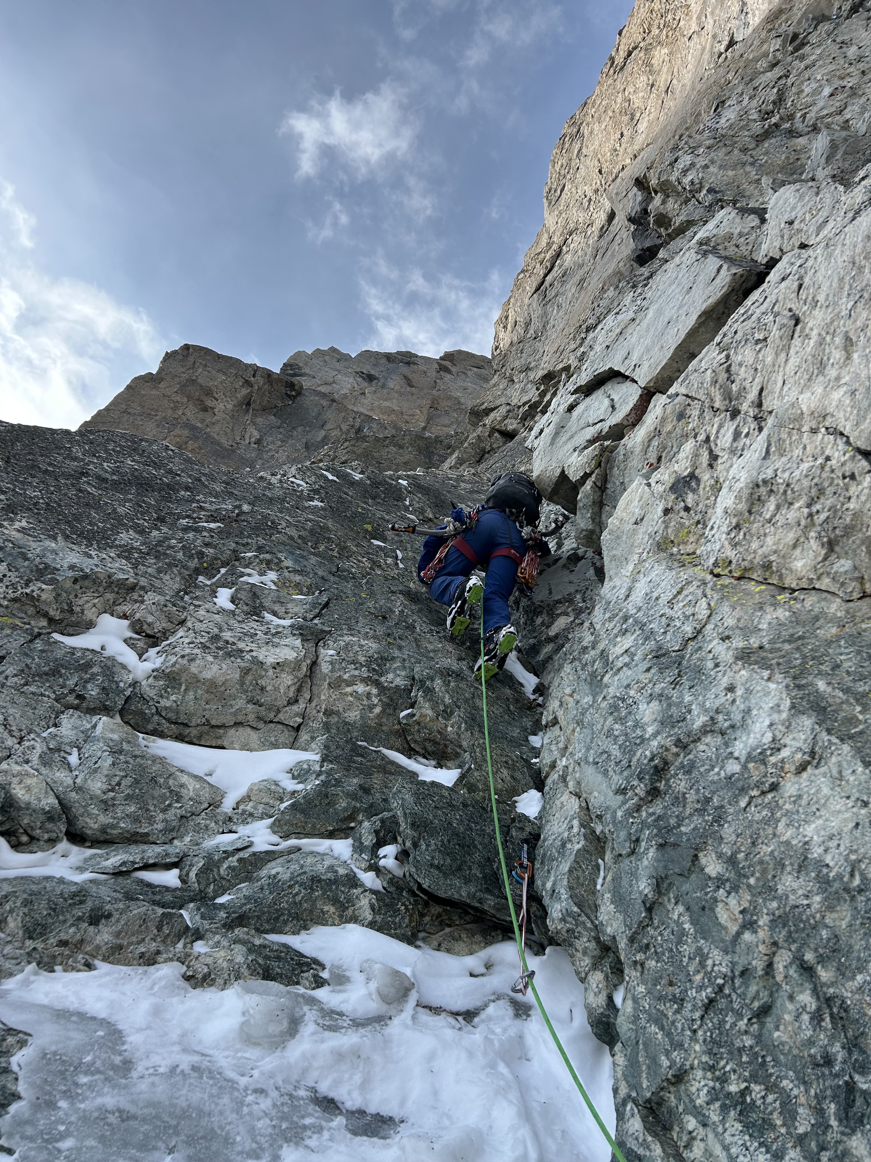


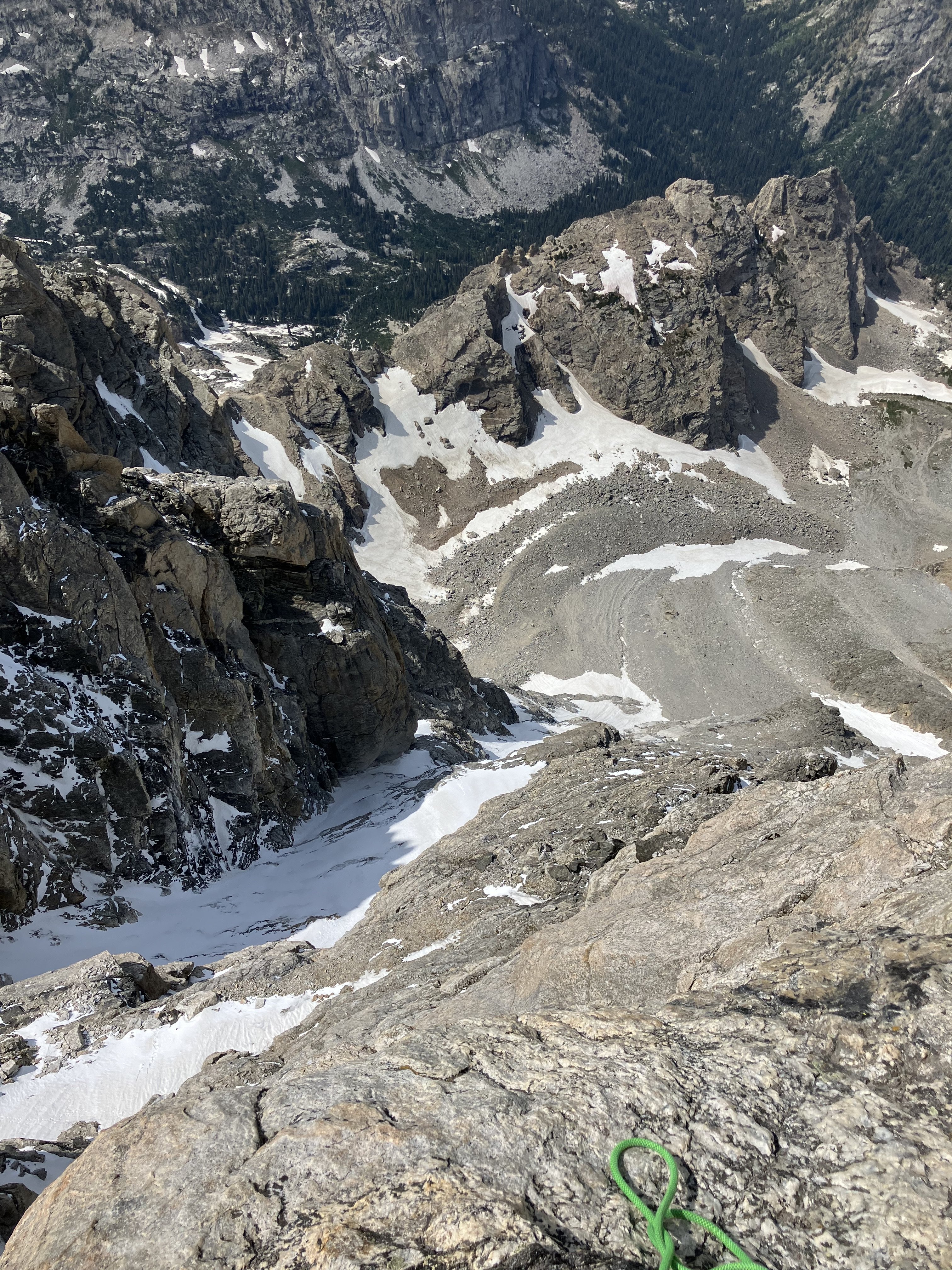

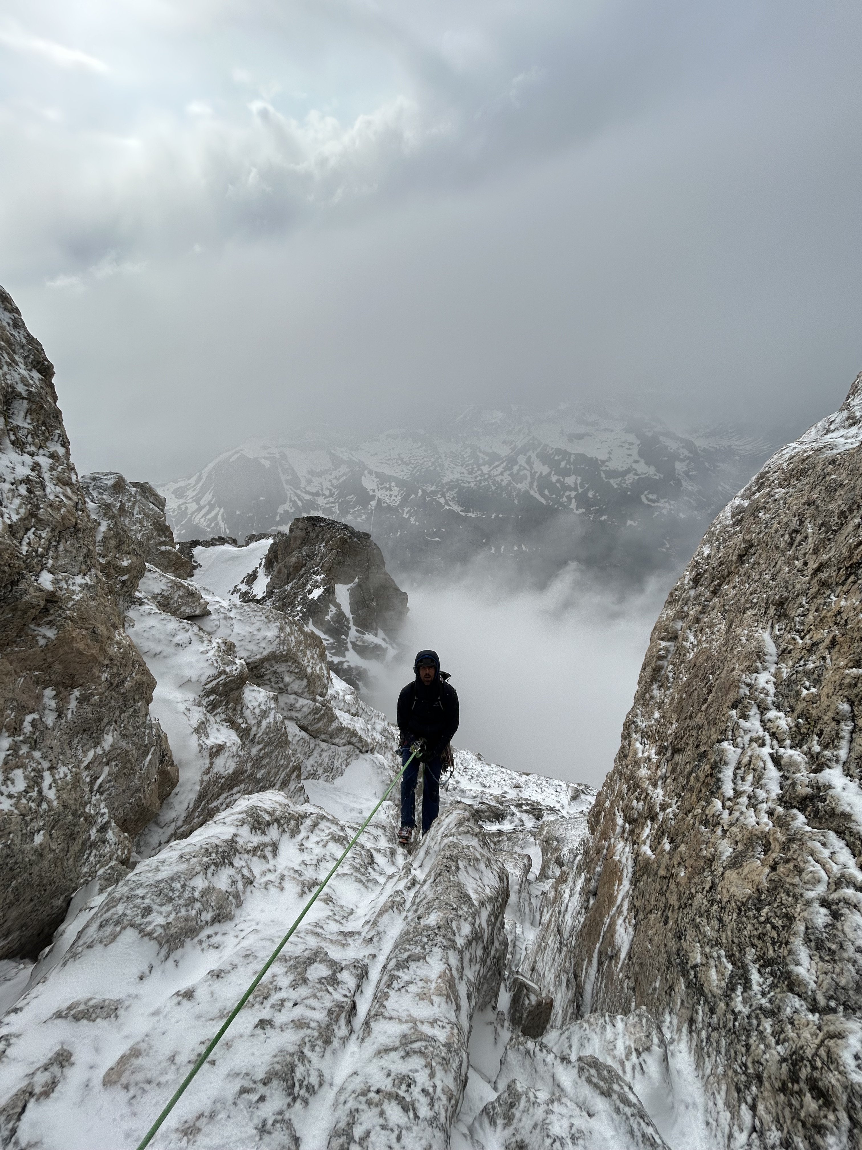


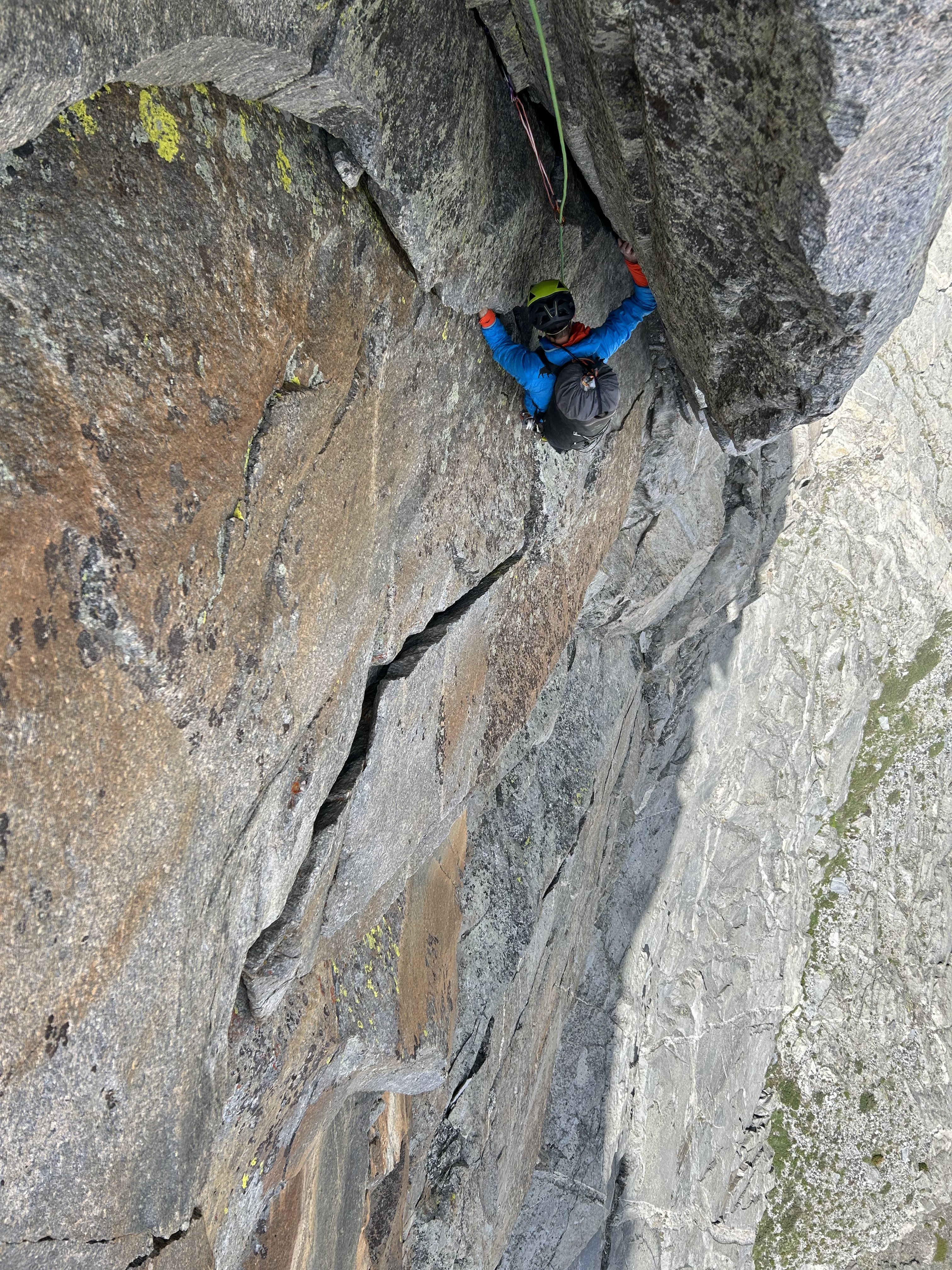


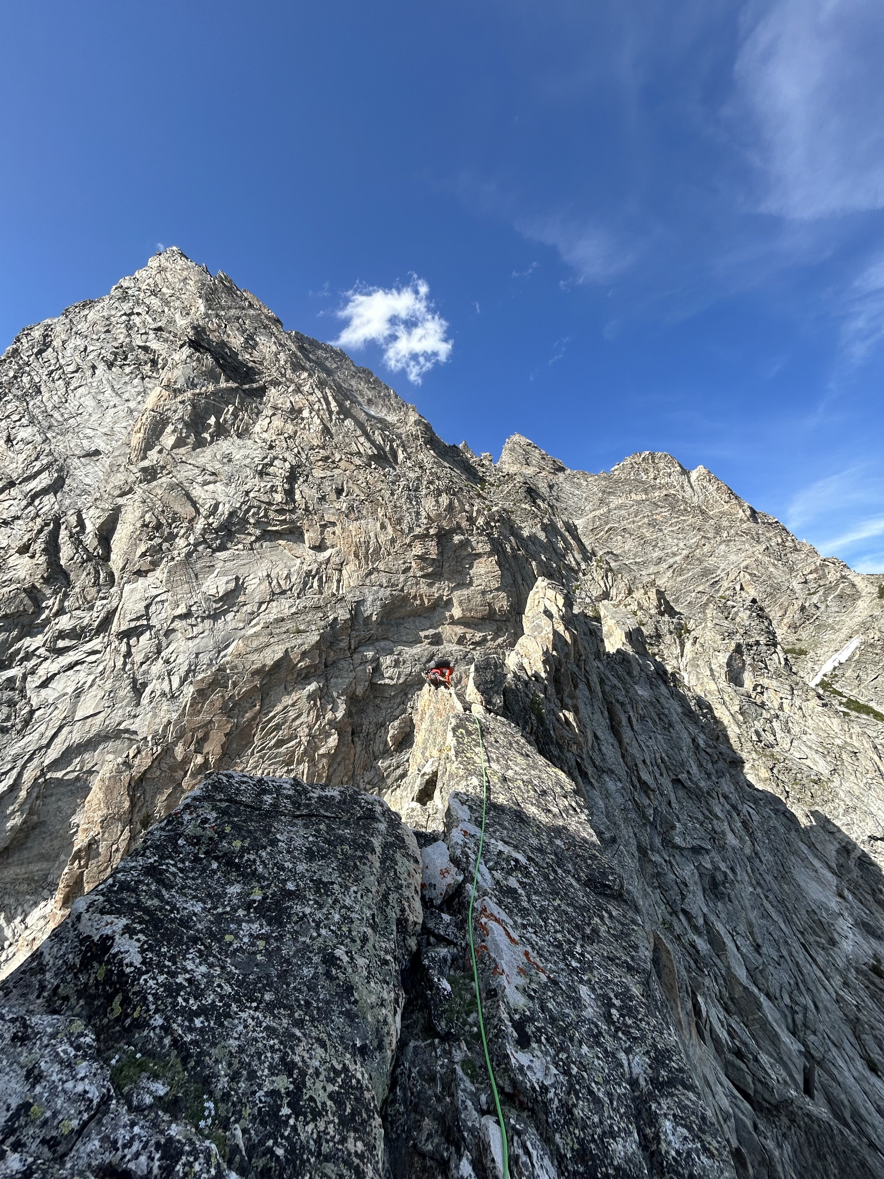


 6 points
 -
Trip: Mixup Peak - East route Trip Date: 06/10/2025 Trip Report: First day of summer break was yesterday for me. What I’ve learned from summer breaks is they pass fast, can’t just sit around. I’ve got a lot of things to get to but figured I’d set myself a standard by getting out the first day, even if my partners were busy. Spent Monday night at graduation for the old seniors and the mounties gear grab so got home at 9:30 and talked to my parents. Originally wanted to do an overnighter and bag magic too but couldn’t take a car on wednesday so I settled on just mix-up. Slept through my alarm by 30 minutes but was driving by 3:30 and and at the TH by 6. Later than I would’ve liked but wasn’t gonna do anything better with my day so figured I may as well give it a shot. Biked up the road in an hour and tossed it in the alder. 2 hours later I was at cascade pass with a lot of cobwebs in my face. Followed some goat tracks on the traverse over the cliffs and was soon moving up towards the U notch. There was one old track continuing to cache col but nothing super fresh. The gully towards the U notch was more melted out than I’d seen in any photos. Brought two ice axes and was glad to have em. Very doable with one tbh but if snow conditions were harder I would’ve definitely wanted both. Traversed around to the V notch and made a few 5th class moves before being on steep 4th class until I gained the hump. Was glad I brought a rope to rappel that. From here I was onto the slabby ledges and had a fun time working my way up. The summit was intimidating but I found a low 5th path onto the ridge. The final move pulling onto the ridge was steep and airy but I felt confident in my holds so took a lil breath and everything was okay. Summited around 12:30 and was very glad to see some rappel anchors with fresh-ish tat. Summit register was full but of the few random pages I flicked through, I found Jeff Wright, Fred Beckey, Martin Volken, and most notably, my freshman science teacher. Took a photo and he was pleased to see my find. Enjoyed the summit until 1 and then figured It was time to get off that god forsaken rock. Ooh but the views were pretty cool. First time looking at the middle cascade glacier, I could even see all the way out to dome. Gotta do the ptarmigan this summer I guess. Anyways, a couple rappels brought me off the summit block, then a lot of down scrambling, then 1 more to the V notch by 2:00. Wrapped around to the U notch and made a rappel down through the top section since there was an anchor already there. Was also this insane cornice thingy that seemed to be precariously balanced. Tried to stay off to the side because I didn’t wanna get killed by some goofy looking snow glob. Once at the bottom of the gully, it was a nice stroll with good views back to cascade pass. Saw a group of four goats at cascade pass which kinda scared me. 1 idiot teenager vs 4 mountain goats, I don't think the odds were in my favor. Lucky for me they ran up towards Sahale as I was taking off my crampons so it was a nice pleasant walk to the pass, where I arrived around 3:30. Saw my first humans of the day as a party was finishing the hike towards cascade pass and headed towards Glacier camp on Sahale. A nice stroll down the trail got me to my bike at 5, and by 5:15 I was at my car. I buzzed a hiker too fast on my bike which he was very unhappy about at first but then we made up and he turned out to be a reasonable guy. A bell on my bike might not hurt. Usually its cars buzzing bikers so was funny to be bikers buzzing hikers. Anyways, Twas’ my bad and we seemed to make up for it. I learned from it. Heres da photos for the populace Gear Notes: Rope nice for rappels. Crampons 'n axe ofc Approach Notes: aint so bad. Just walk n keep walking
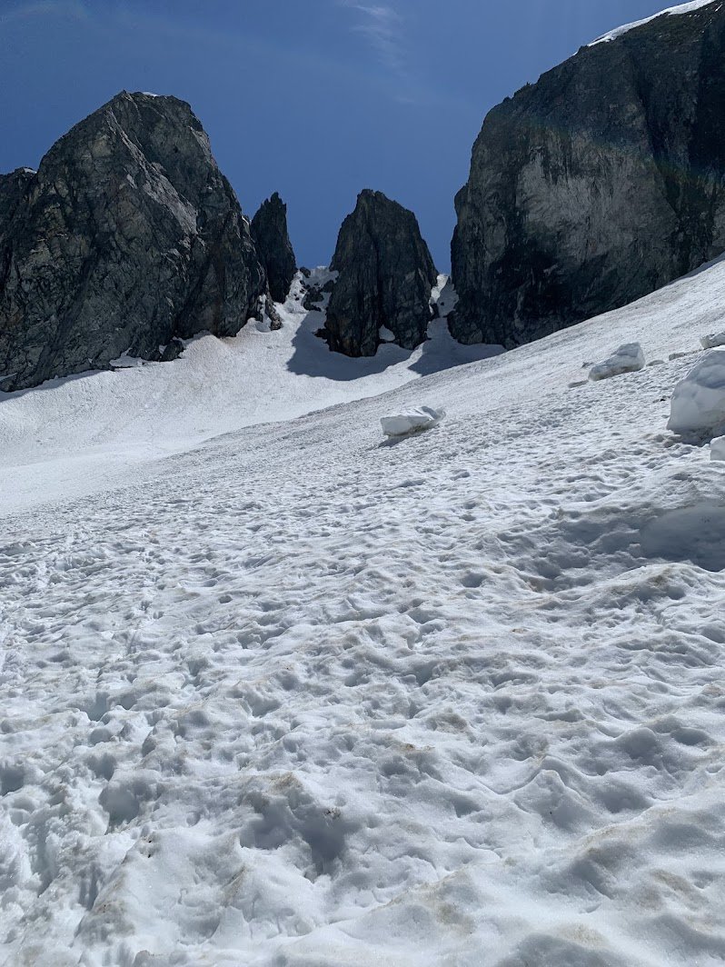
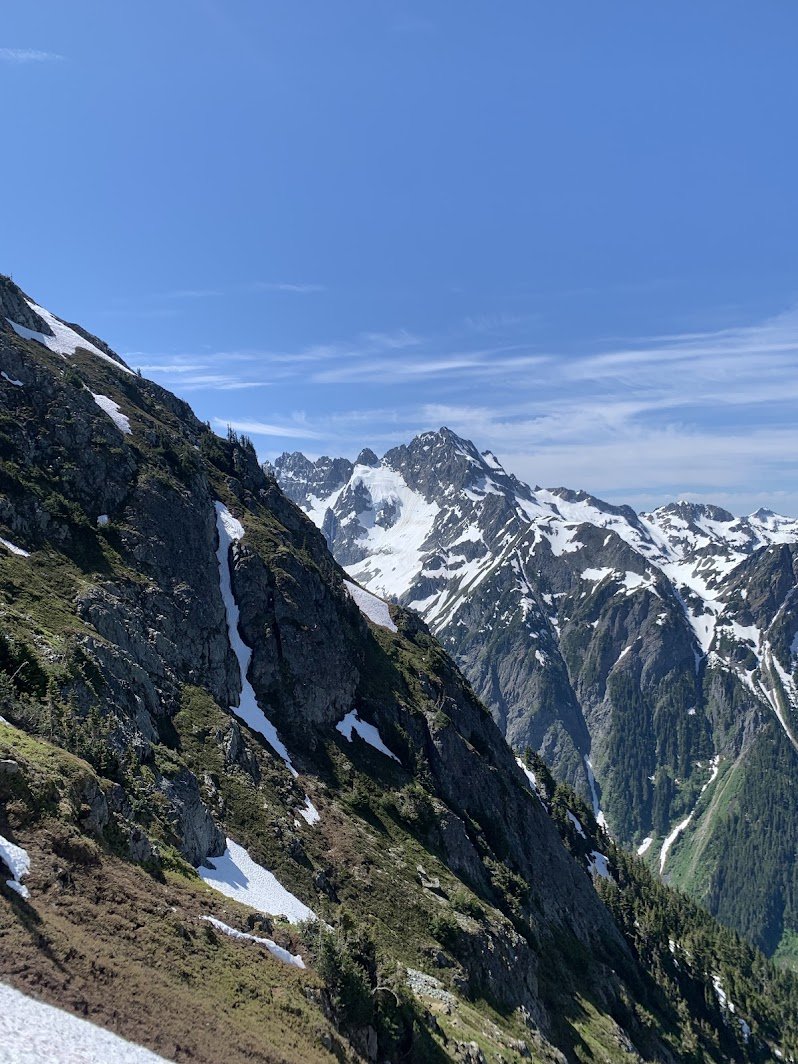
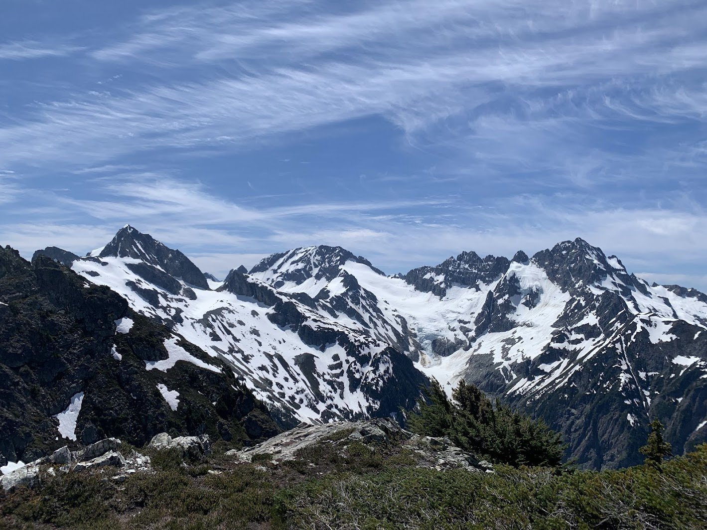
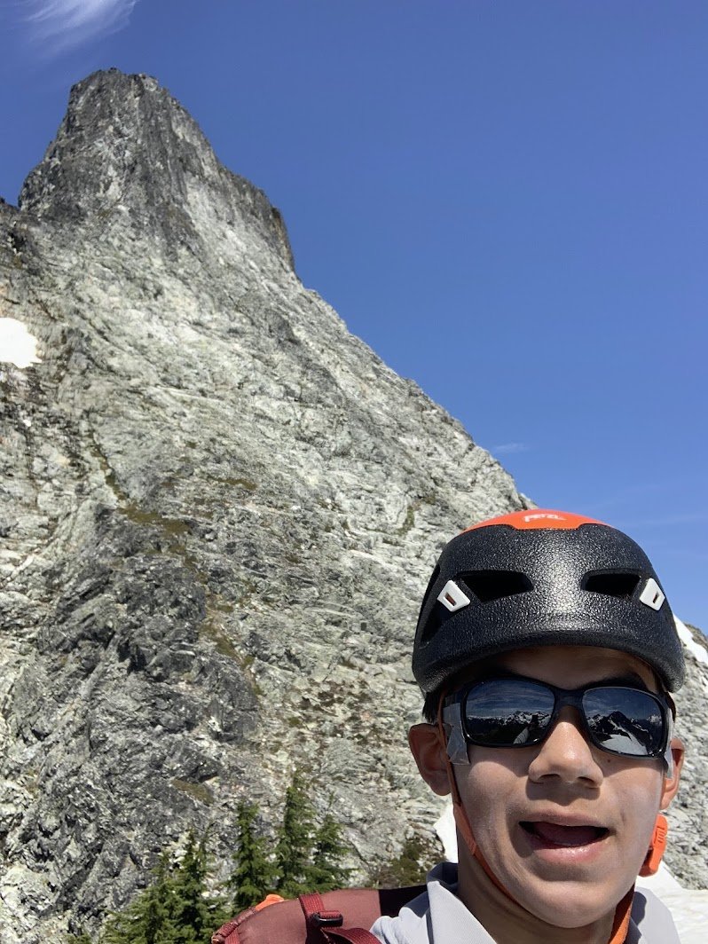
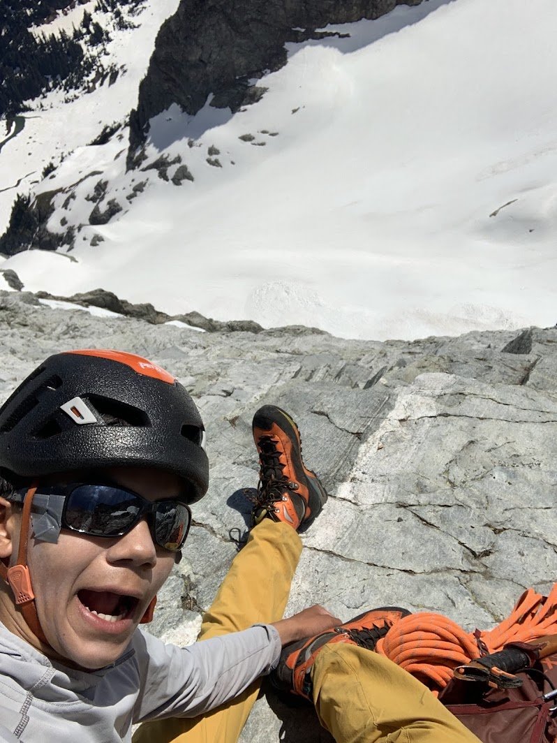
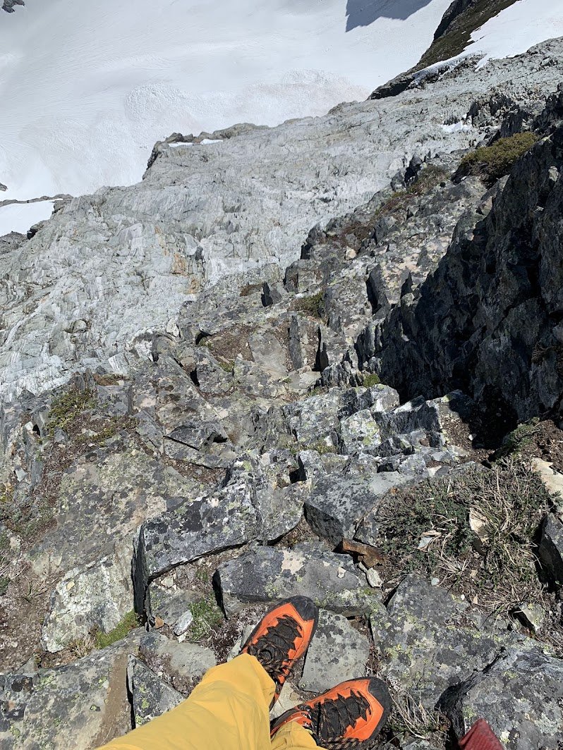
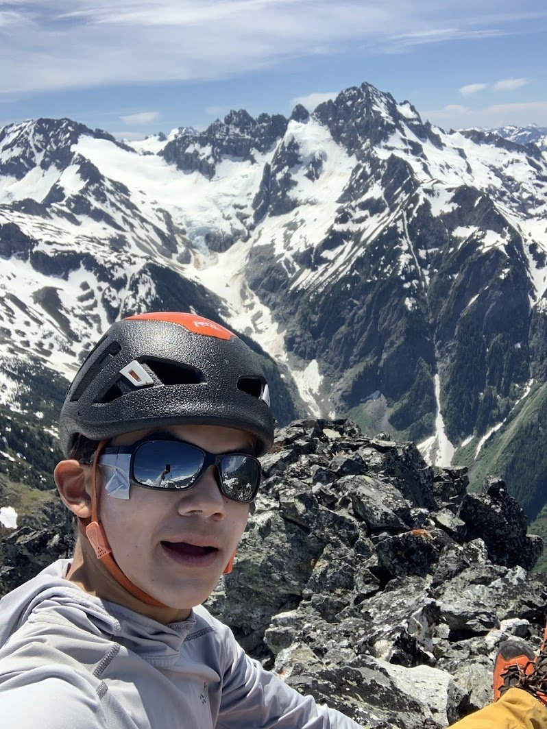
 6 points
 -
Trip: Davis Peak - South Route - Skiers Variation Trip Date: 04/23/2025 Trip Report: After reading this recent TR on a skiable route to Davis Peak in the NCNP we had to give it a try. My buddies and I had attempted Davis in January of '22 so we knew what we were getting into with the approach, but a skiable route to the summit that avoided the difficult scramble near the summit sounded awesome, plus it's always great to do a 3000' bushwhack with skis on your back. So the next time we were too sick to work but not too sick to go skiing we hit it up, Wed the 23rd. The bushwhack is bad, but not terrible, there is little undergrowth, just deadfall so it's mostly just navigating. Above 2600' it gets much better. The track Ryan Stoddard and Nick Roy posted is pretty much perfect, when we deviated from it by more than 30’ we regretted it. We hiked to the start of a boulderfield at 4200’ before we could start skinning, which was a bit farther than optimal, but not much, the 4000'-4200’ traverse below cliffs was postholing intermittently, so not ideal. Above 4200’ we cruised on firm snow, making great time skinning. The route up is straight forward hooking around to the west and up to the summit. We didn’t spend long on the summit as the snow was calling, naturally the skiing was over WAAAY too fast and we had to swap out for shoes and walk down, down, down. 12 hours after we started we were back at the car for a hot beer (not used to this spring thing yet). It was a nice route, rugged for sure, but an amazing peak in a spectacular position with views from an interesting angle into the Snowfield group and the southern pickets. Everyone should go do this! Ryan has a GPX on NWHikers No snow in sight, lets get it! Dylan and the Pickets. Gear Notes: Ski gear. Carried avy, axe, crampons. Dark clothes, the forest is sooty, I found work gloves to be nice for the deadfall and burned forest. Approach Notes: Park at the Gorge Creek overlook, at the east bridge abutment there is a trail up, go up.6 points
-
4/3/2025 with @lunger (who came up with the idea... some kind of Pyramid Scheme) and Eric Noll After a morning spent walking in steep forest and surmounting knobs of vertical snow on the ridge, we finally snow that was friendly for ski touring. A descending traverse West got us into a prominent slanting tube feature that descends from the shoulder of Pyramid. On this, we noted some shallow but sensitive windslab from recent E winds. Hopefully these wouldn't be found higher up on our intended line. Cascade climber Colonial We skinned upwards, peeked around the corner into the NW cirque, and saw imposing blue ice. To our surprise, a strip of snow pasted on a narrow ramp seemed to provide a weakness through otherwise unskiable terrain. The windslab had also gone away, winds slowed by the large buttress of Pyramid's North face. As we climbed, our excitement grew and we realized we would be able to keep the skis on and travel through this wild feature. The upper bowl even held deep powder (and tiring booting). Gaining the summit was a straightforward affair from the top of the cirque. The ridge is pretty low-angle. We chilled for a while at the ridgetop before moving to the summit. Wehrly likes it spicy Summit! The descent made for a neat line in a beautiful position in great conditions. Nowhere was it crazy steep, but we did feel the exposure especially as we made turns directly above the waterfall and sideslipped the ramp. With snow to 2000' this would make for a 5k descent! We had to make do with a turn-around near 4600', followed by an ascending traverse back to ridgetop and a multi-hour descent through the forest. Starting into the crux: Wehrly opens up the narrowest passage. "SO EXPOSED!" I heard him shout Noll followed: I went last: We sideslipped the ramp: Happy below the gnar! Avy debris, then some nice buttery pow Looking back towards the cirque with our skintrack from the morning blown in This was second attempt for me and Wehrly. We had tried in 2021 but turned around below the cirque when I didn't have a good feeling about the cornices. You are really going up the middle of a big avy path with a lot of overhead hazard. That day we skinned back up to the shoulder of Pyramid and did a long descent down the lower avalanche path. We stayed skier's left and had to negotiate a very steep section through smaller cliffs to reach the flat runout of the avy paths below. That year we skied to around 2000' among large alders and old growth. In retrospect, it might have been a good day for getting the complete descent. March 2021, typical travel on the climber's trail: March 2021, in the lower slide path: If you haven't enjoyed the Pyramid climber's trail in winter conditions, crucial beta is to pass the steep sections by traversing climber's right/West through trees on the ascent. This saves a lot of effort! We didn't have them, but it might be wise to carry a couple ice screws and a v-thread for this line in case you find icier conditions or are approaching it top-down, e.g. as the exit from the Isolation traverse. There are some options for variations. Also, it sounds like Erin Smart, Kurt Hicks, and Forest McBrian skied this cirque but likely traversed far skier's left to avoid the icy crux we skied (this looked passable to us but also thin and exposed) https://turns-all-year.com/trip-reports/march-23-25-isolation-traverse-plus. Skurlock photo with the line:
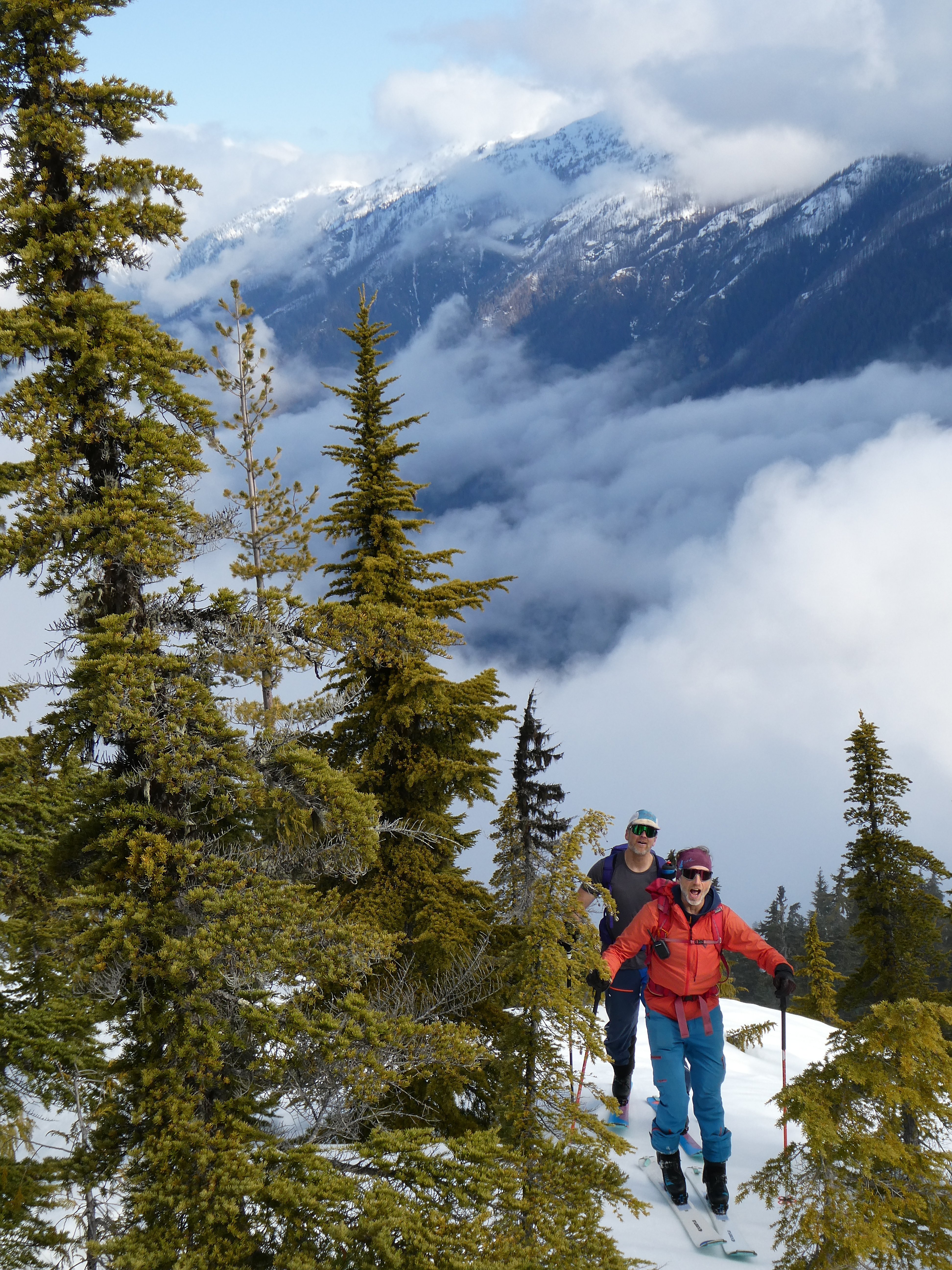
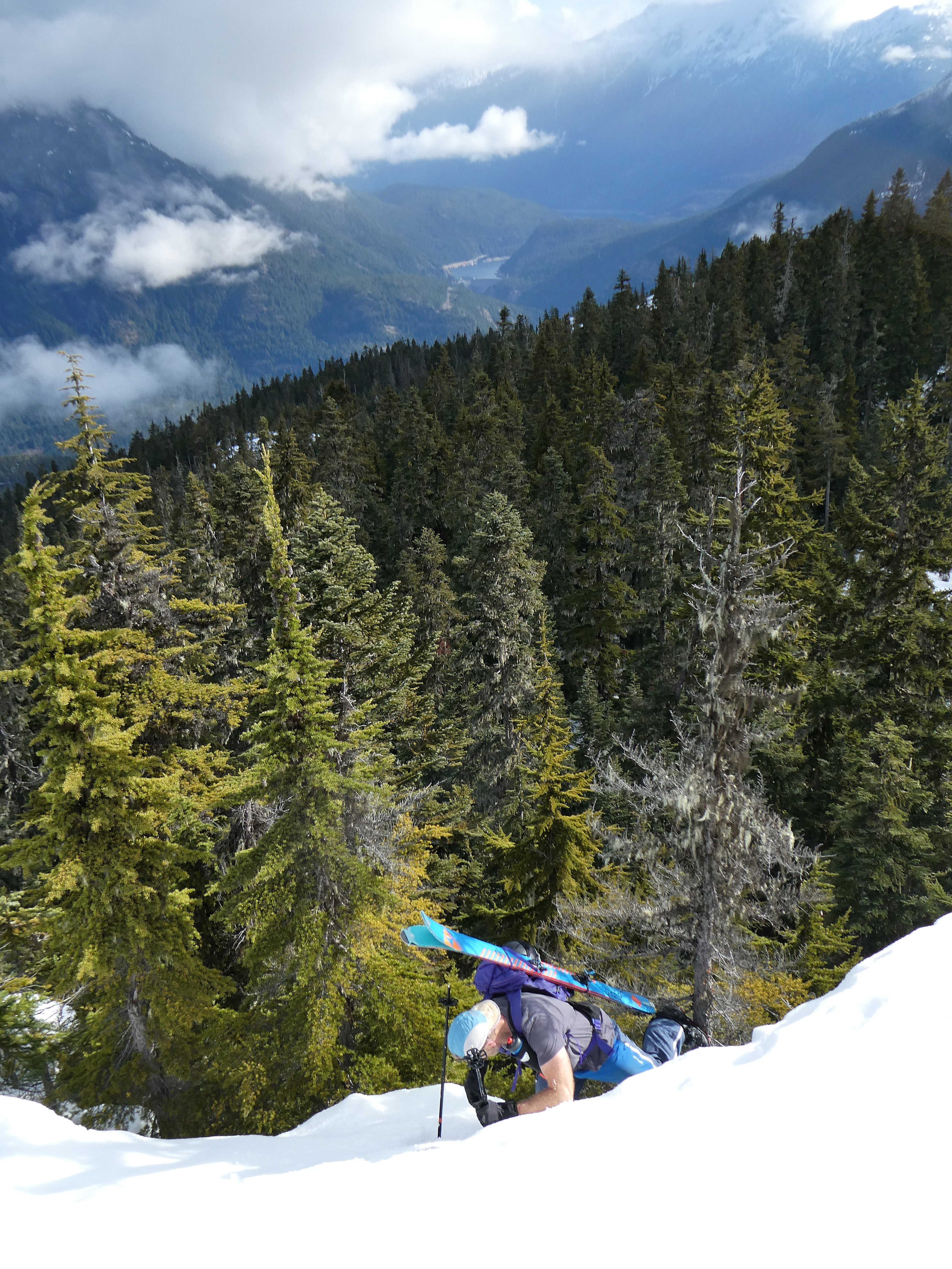
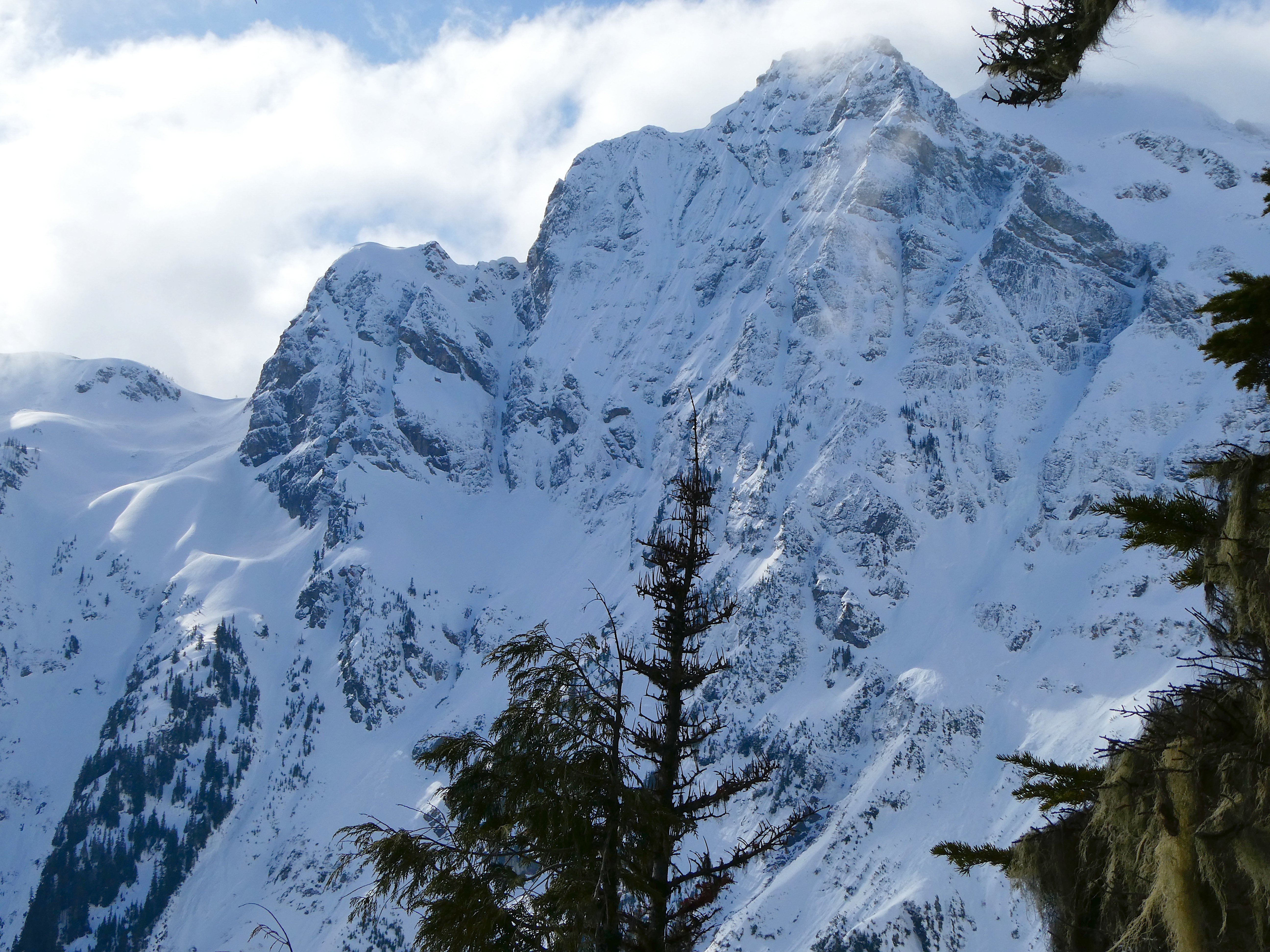
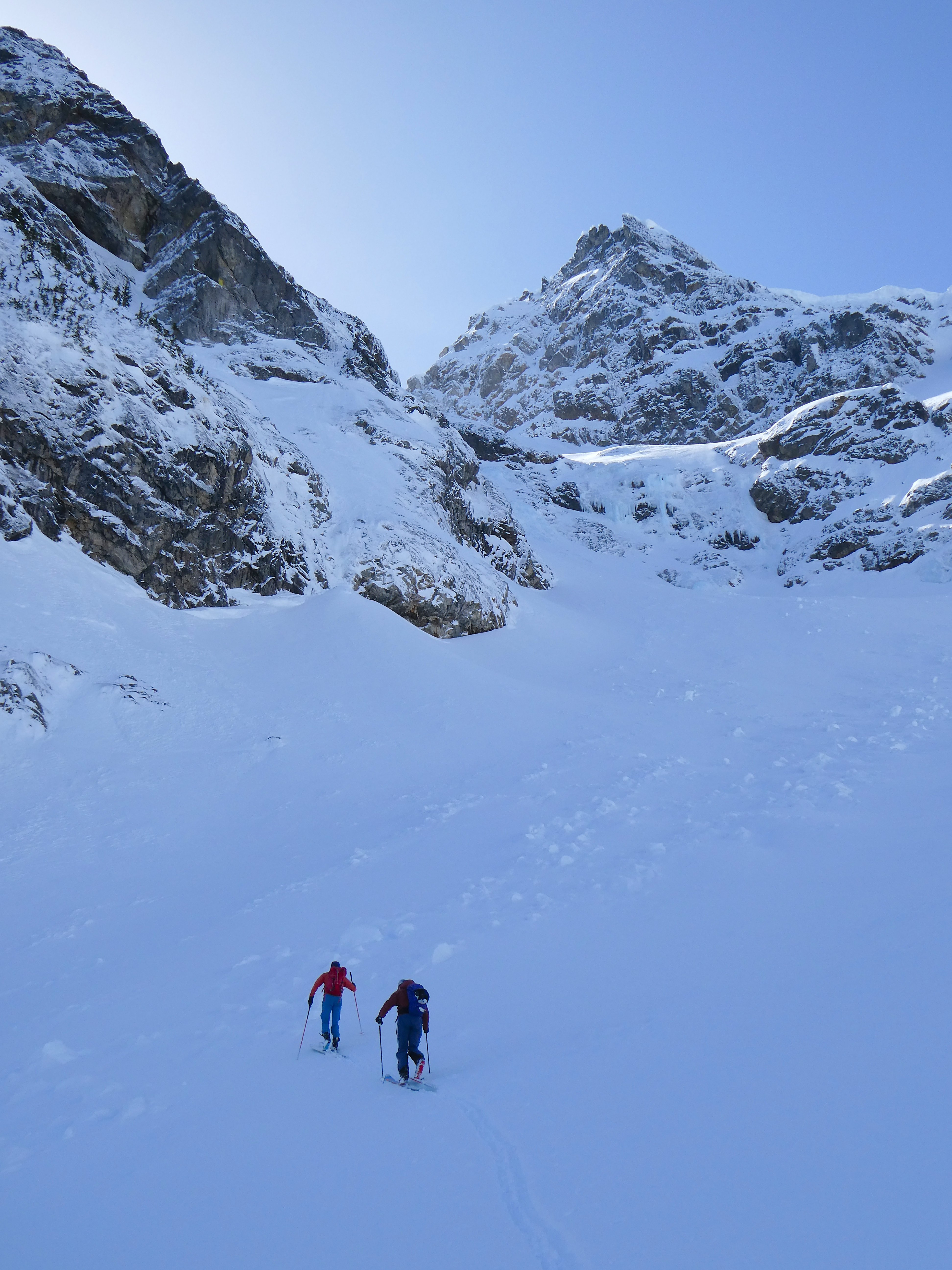
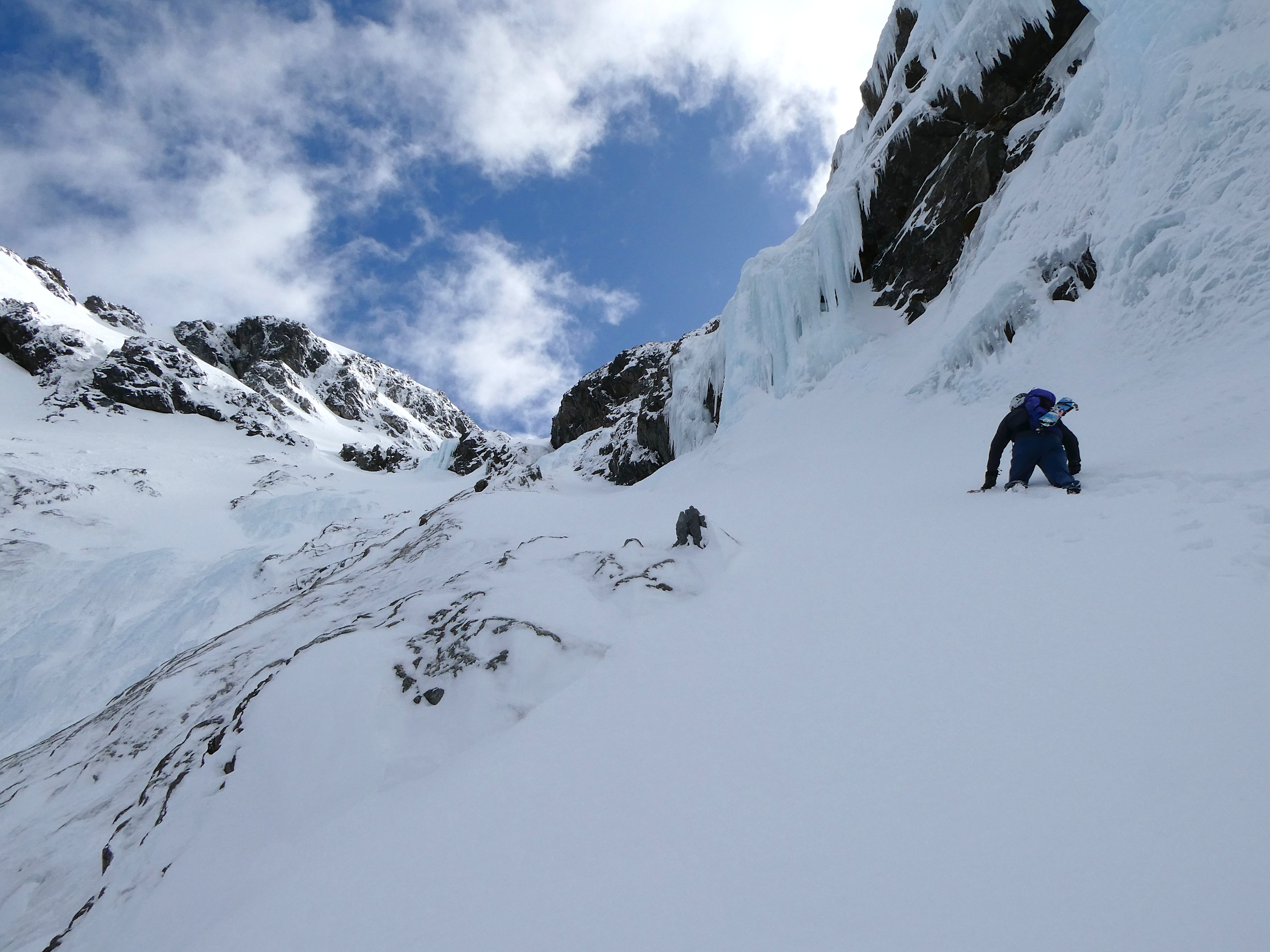
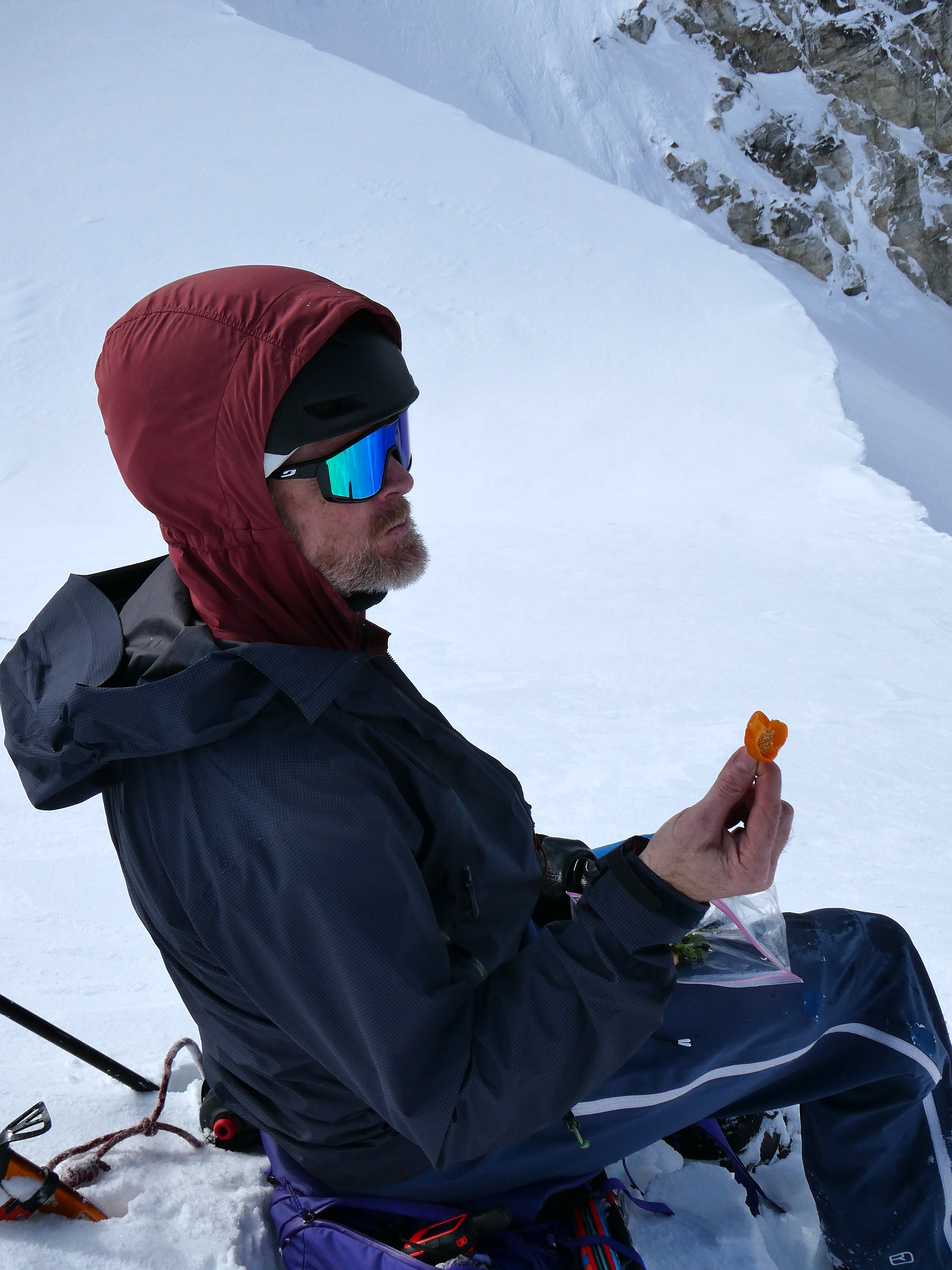
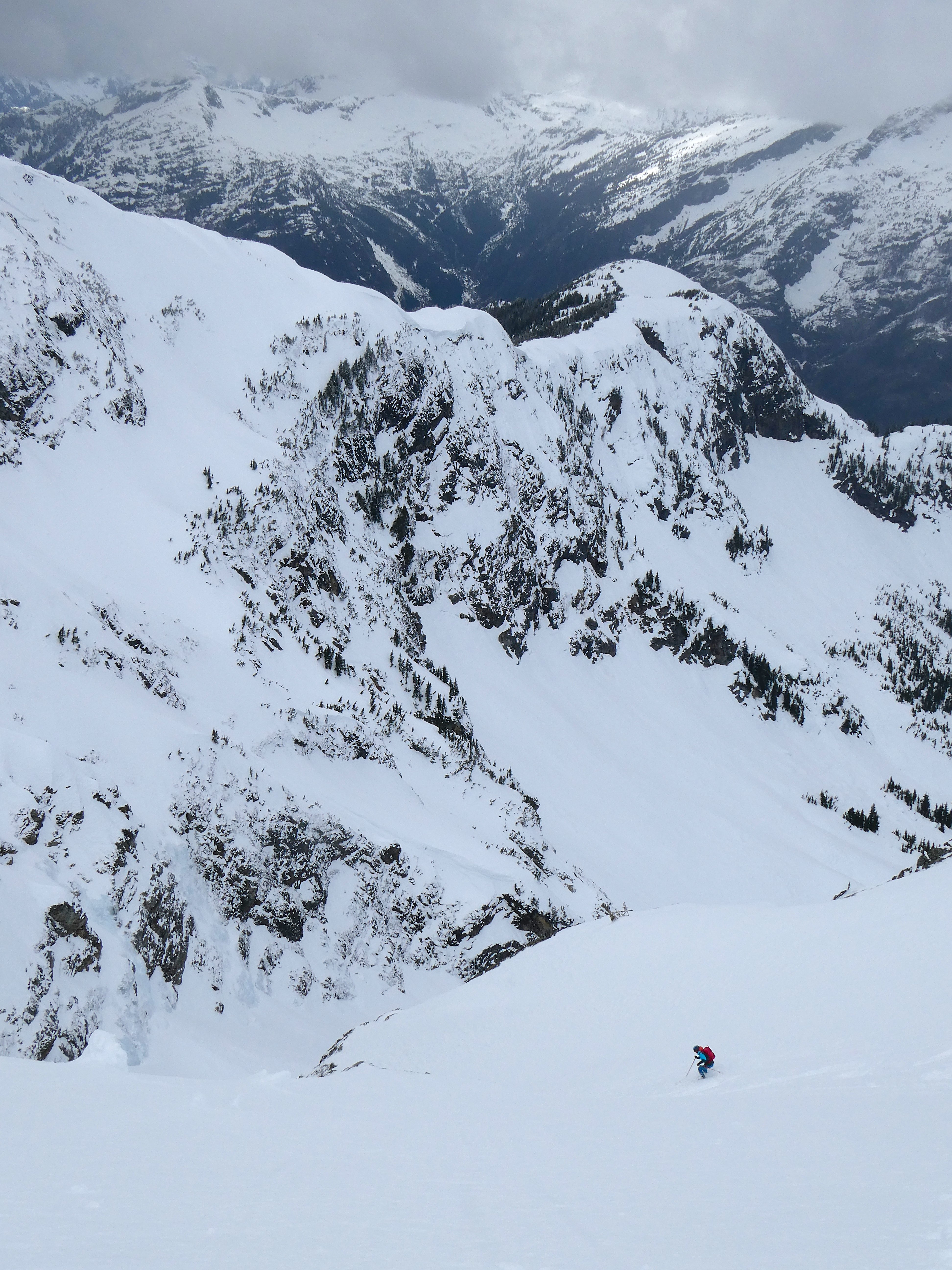

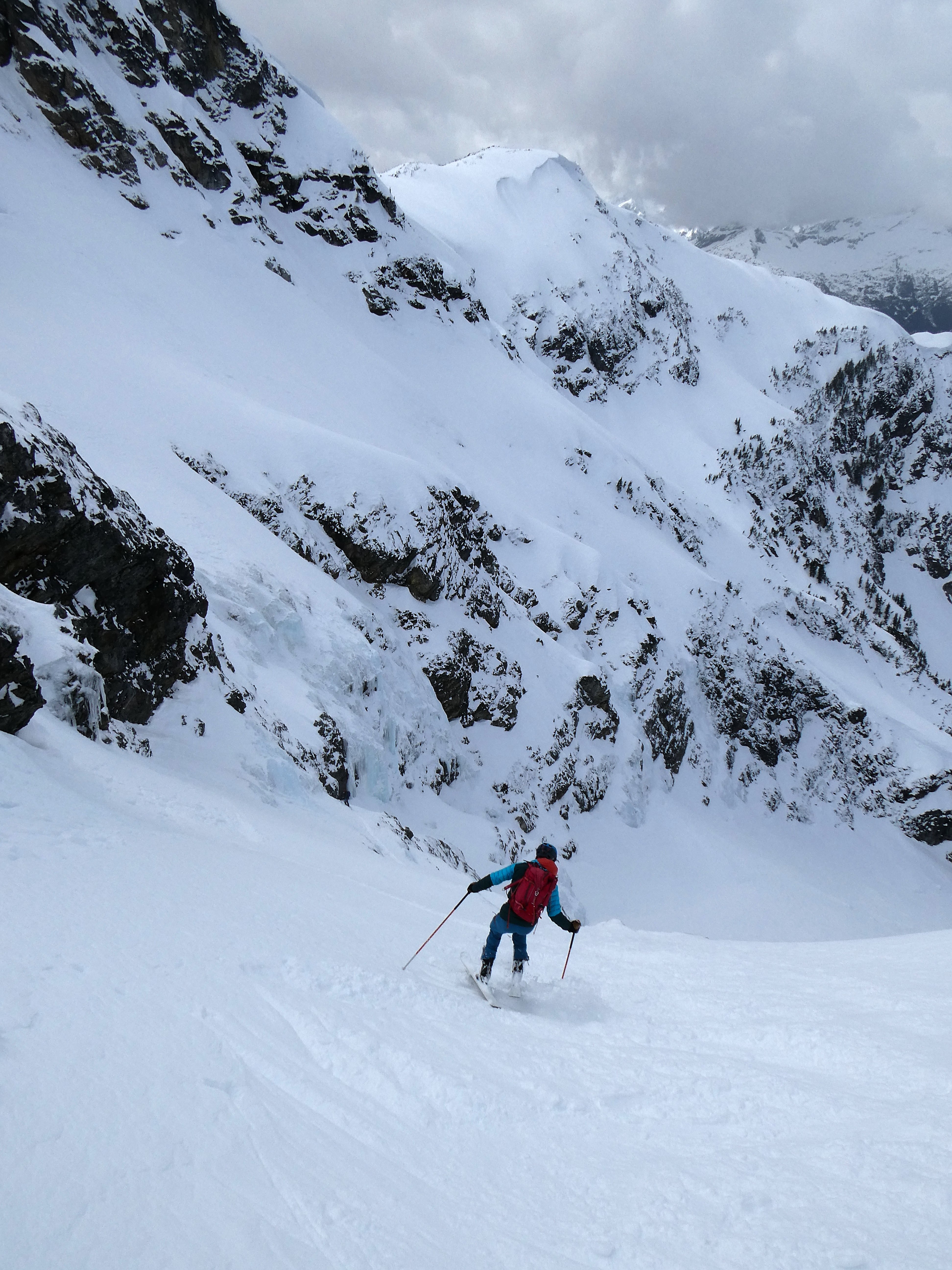
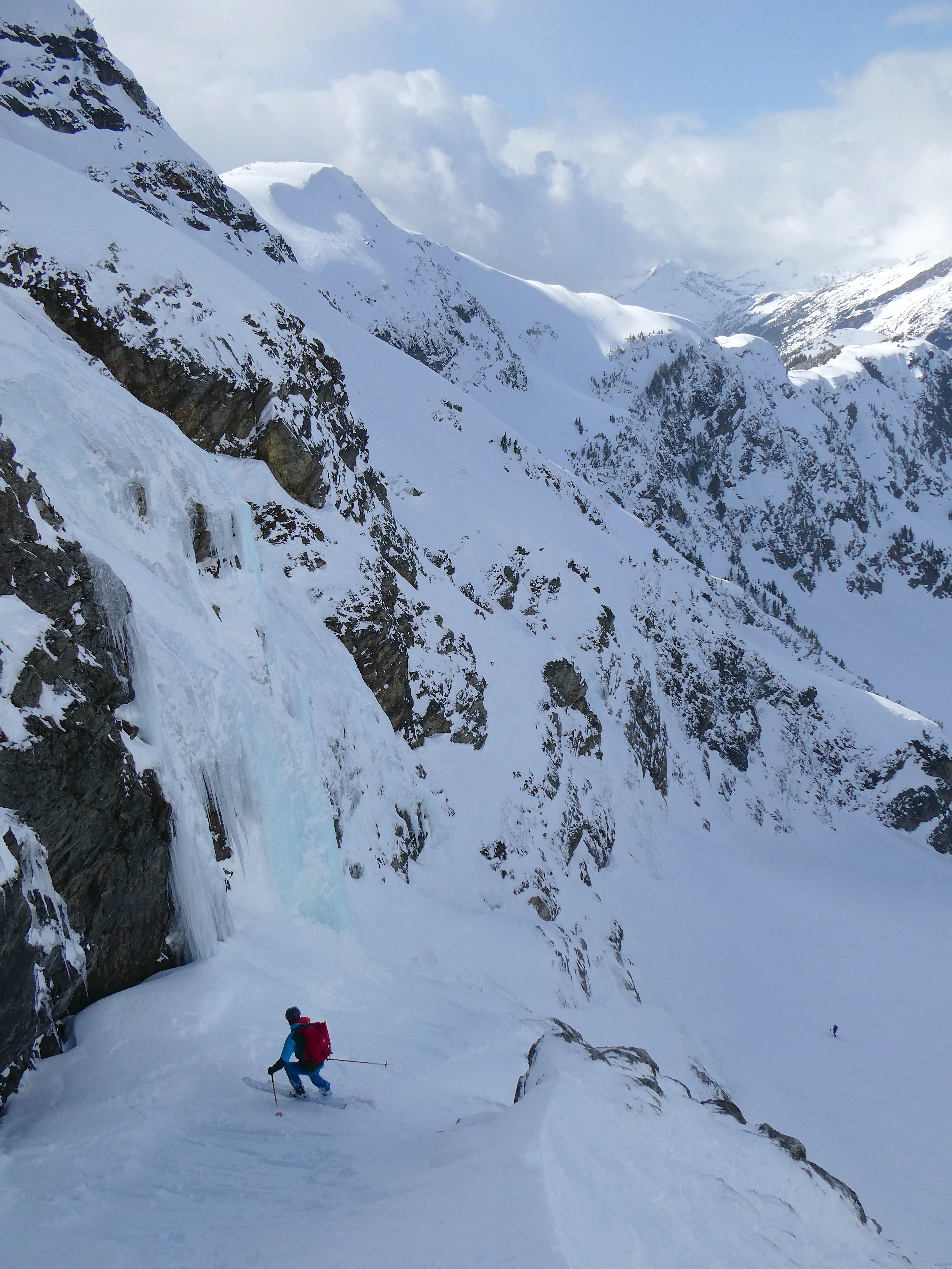
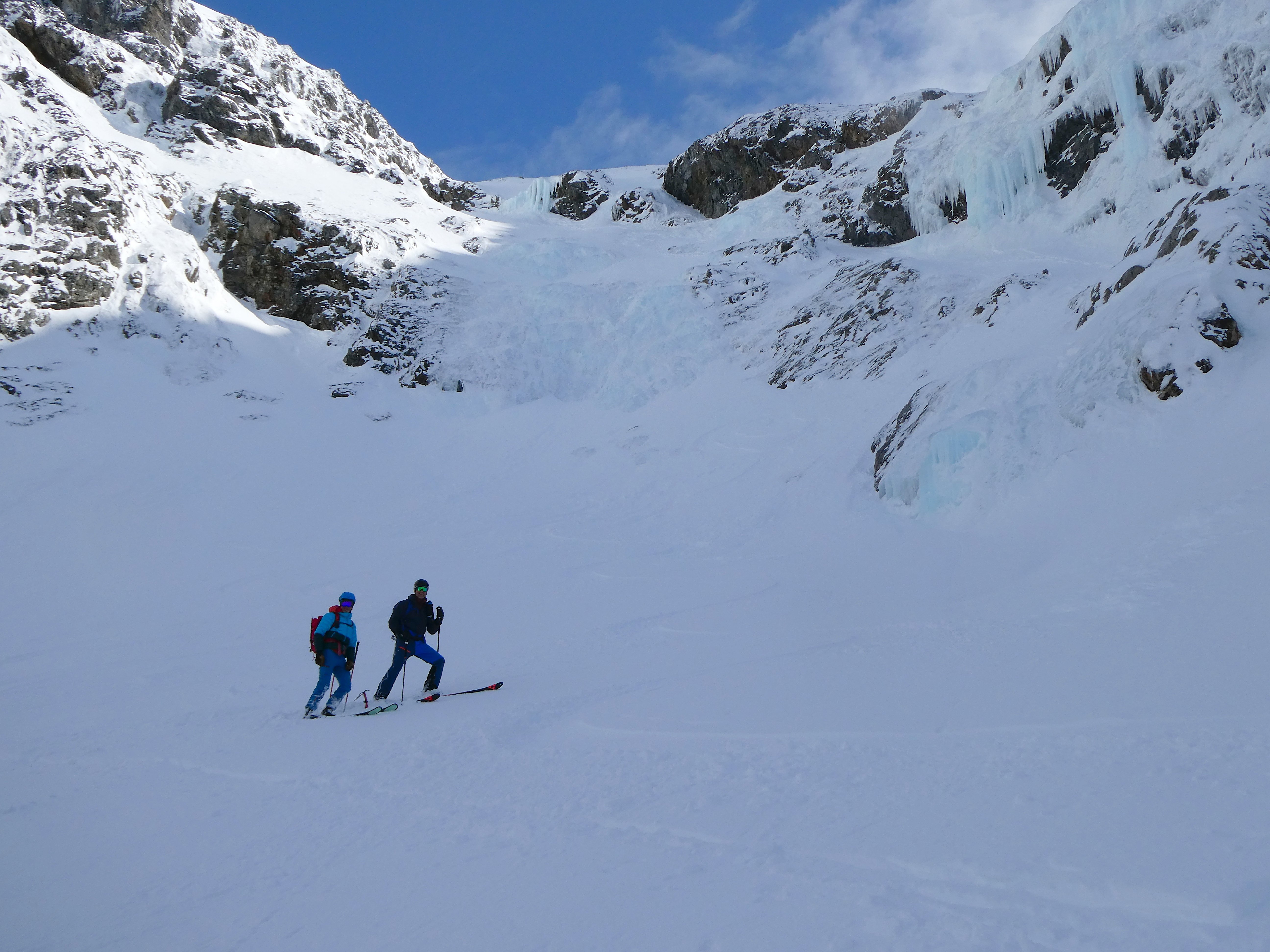
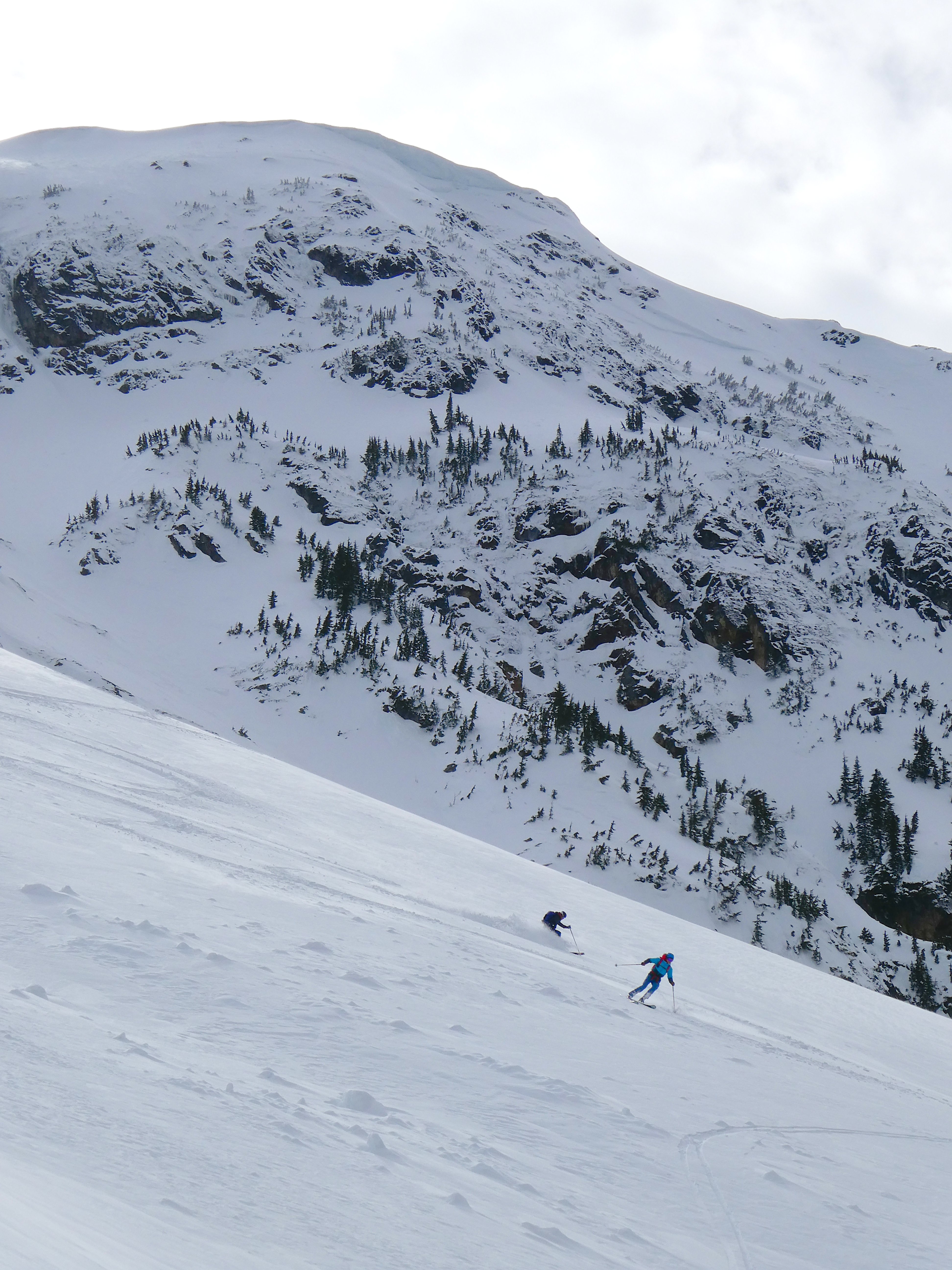

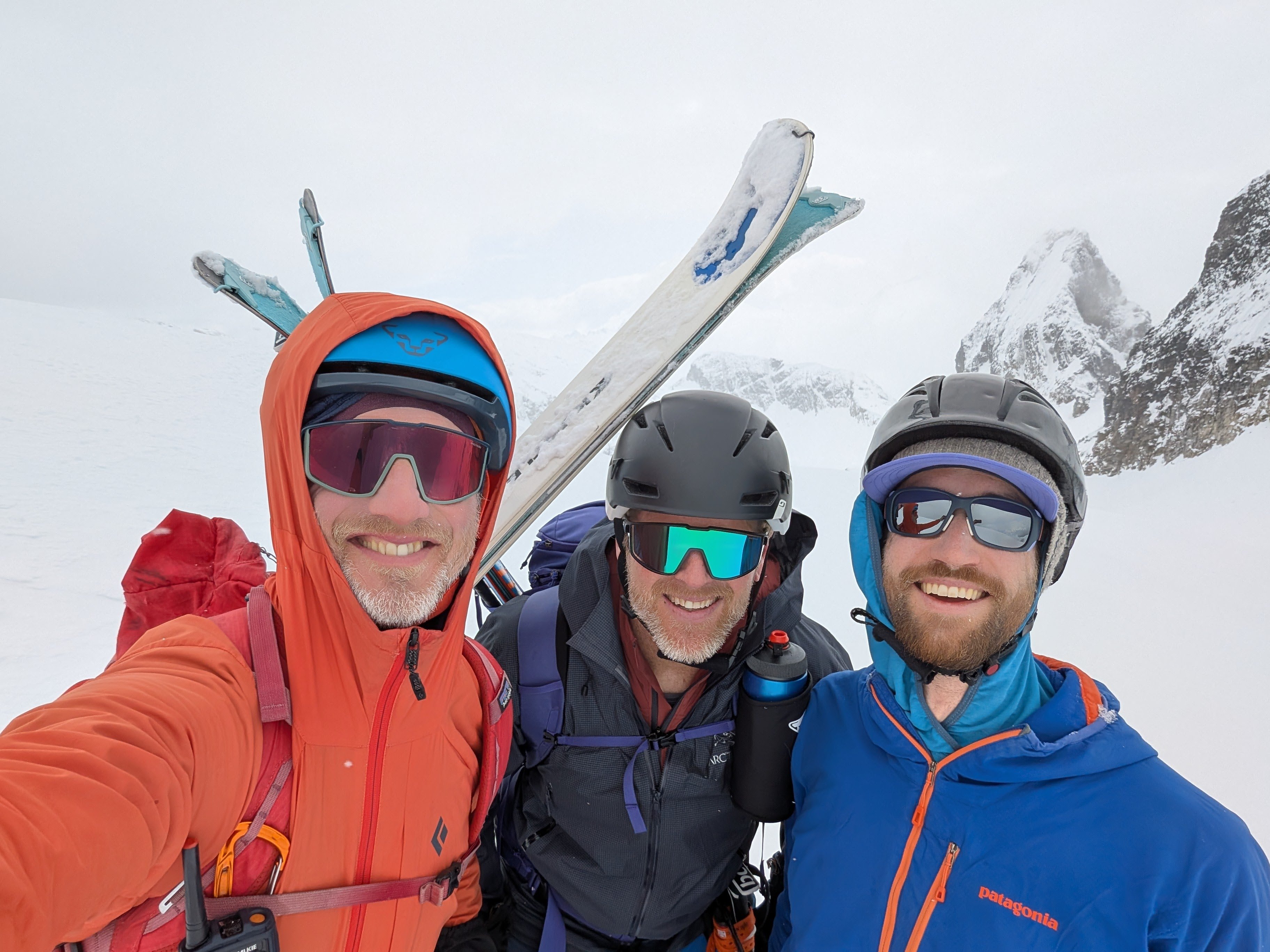
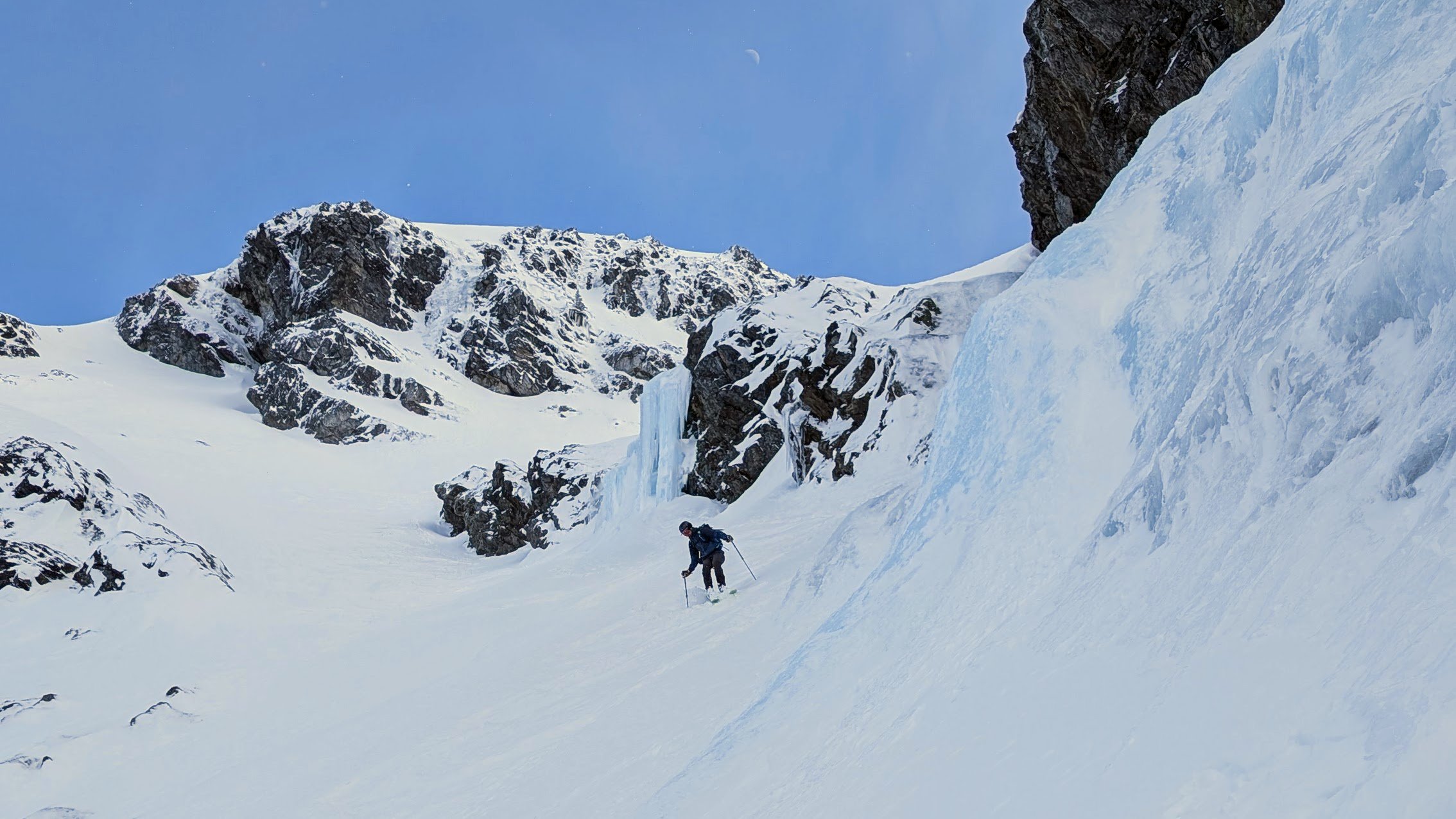
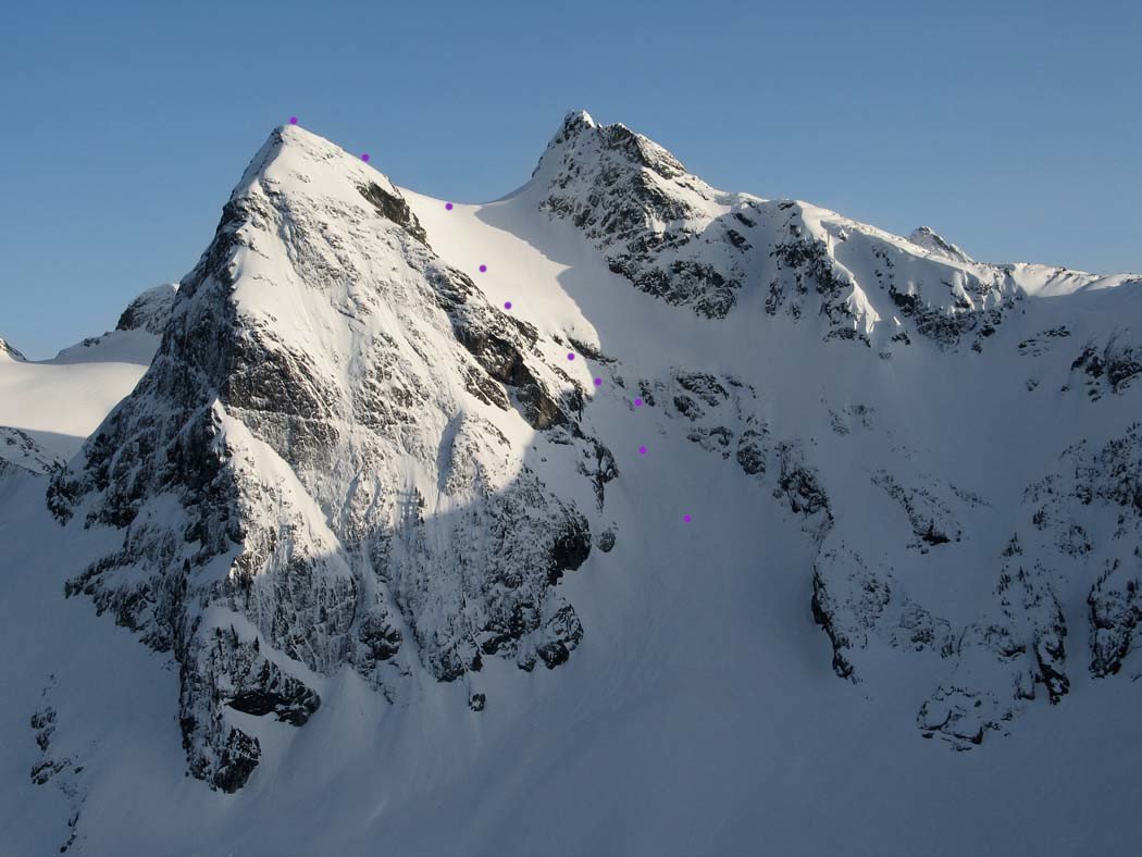
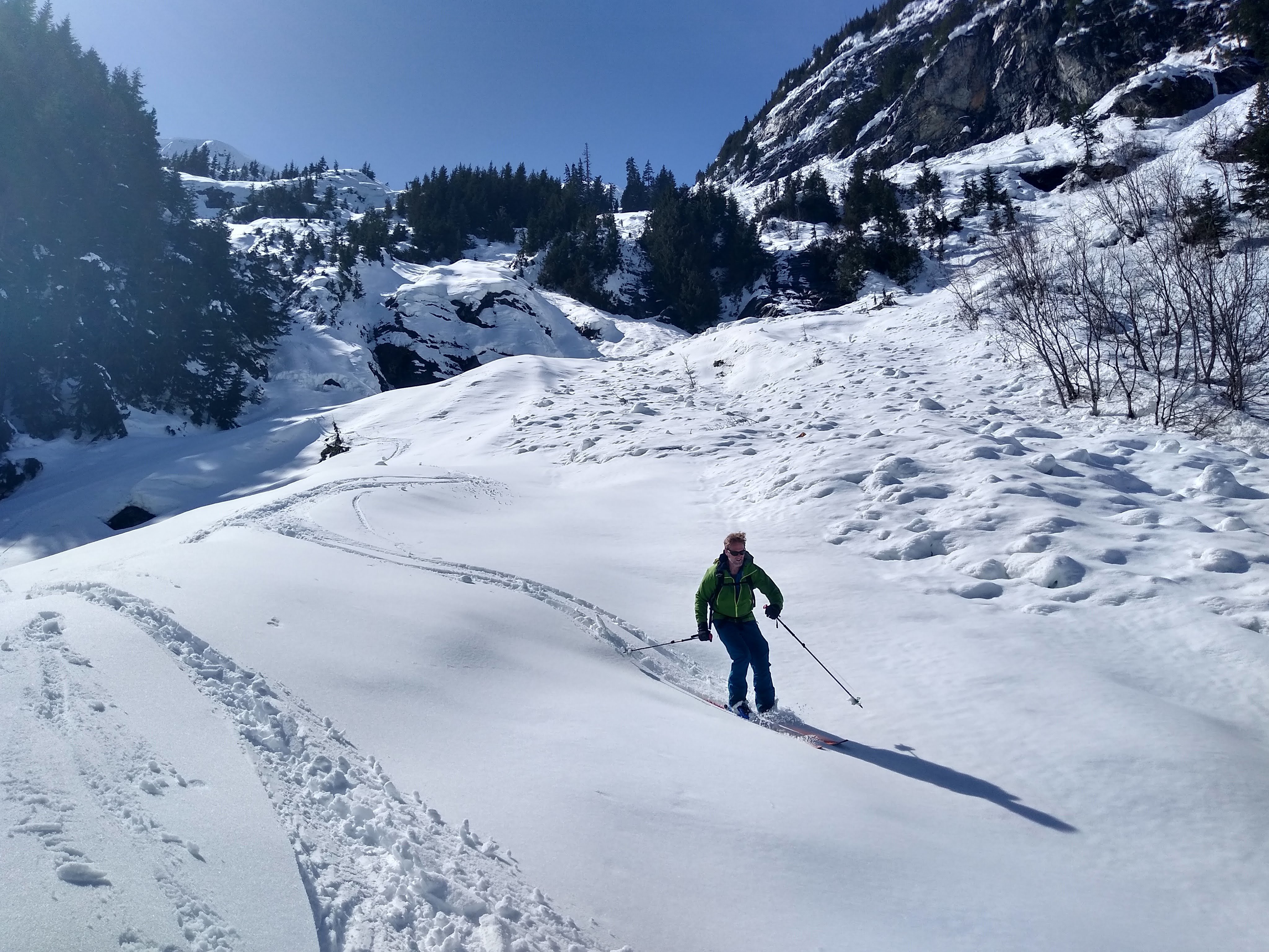
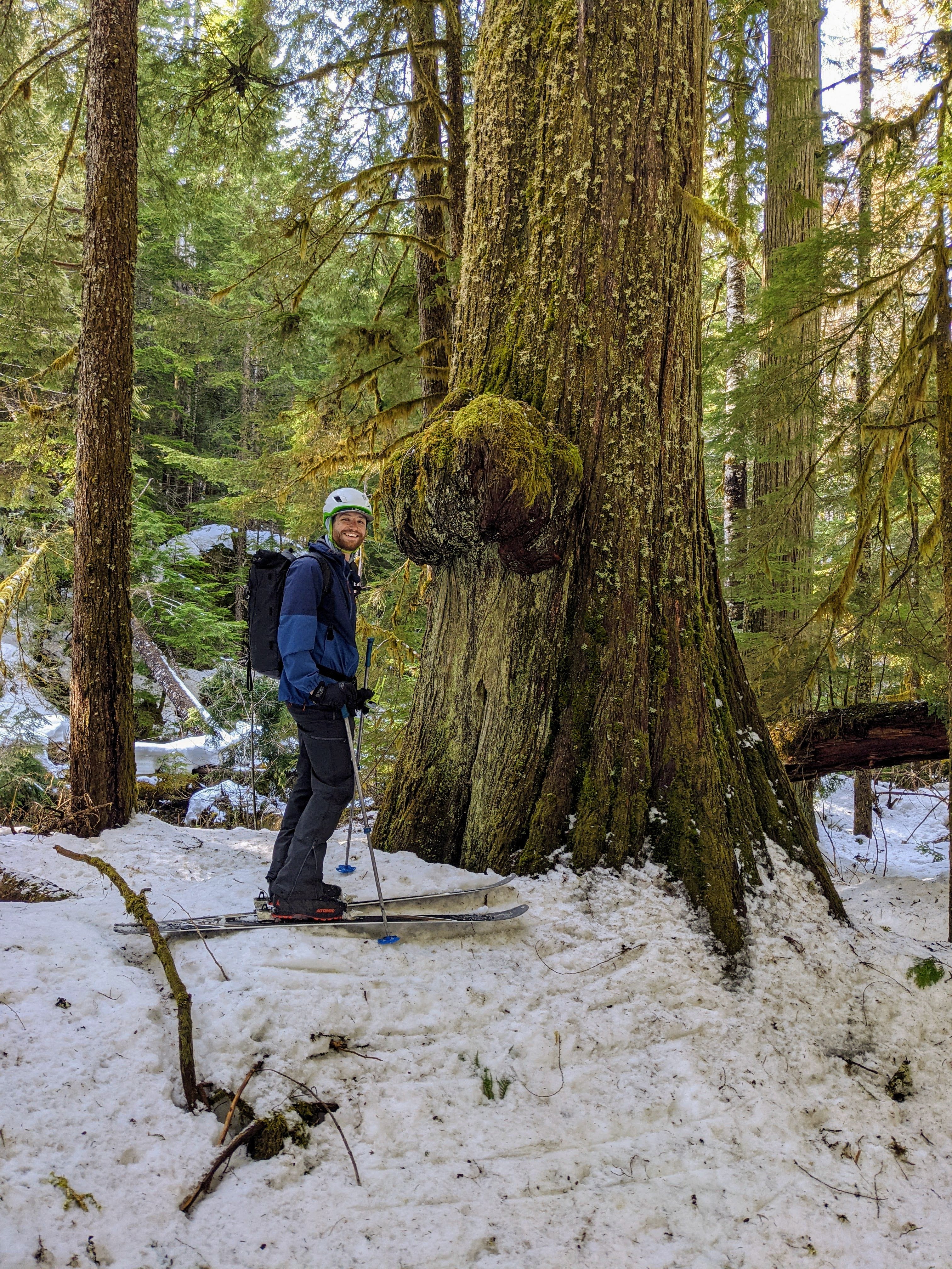 6 points
 -
Trip: Squire Creek Wall, South Face - Nature's Way Trip Date: 09/05/2025 Trip Report: I was joined by Rob Stephenson on Sept. 5, 2025 for a climb of the newly prepared route, Nature's Way. This is a three pitch route on Squire Creek Wall's South face, located just right (East) of the route Concerto in C for Drill and Hammer. p1: From the two-bolt anchor at the base, walk up granite ramps and blocks to a prominent V-gully. Ascend the gully to find good pro cracks at its top sides. Step out left to an easy mantel move on the slab. Climb up easy blocks to a large ledge, 5.5. p2: A series of ledges cut the wall into five or six distinct problems, each protected by a bolt or two. The crux is at the fourth bolt, where a rightward slanting seam forms finger edges leading to a nice face hold to the ledge above, 5.8. Then a final 5.8 move in a shallow dihedral passes two bolts to a helpful tree/bush providing balance holds to the anchor. p3: The obvious hand crack soaring above is the route objective. It may look intimidating, but there are good pro options for cams all along its length. With lieback moves or stemming at first, gain the only big knob on the wall. Hand jamming for a couple of moves brings one to a restful patch right of the crack. Prepare for some undercling moves and fire out to a foot edge on the left wall with a useful sharp-edged finger crack for resting. Another ten feet of undercling leads to the top of the flake with a blessed hold at the end. Small pro can be plugged in here, protecting the high step move onto the narrow ramp to the chains, 5.9. Route history, timeline Yale Lewis spotted the "curvy flakes" of pitch 3 in September of last year while we were finishing up a climb of Miracle Ramps. The idea percolated all winter, and we drilled the bottom anchor on May 25, 2025. On June 15, Yale opined that one pitch would reach the curvy flakes. When he climbed the first pitch we were halfway there; there was some foreshortening involved. He drilled one anchor bolt at the big ledge. I climbed the second pitch by going wildly left into the trees whenever it looked hard. But I made it to the goal, the bushy ledge at the base of the curvy flakes where I drilled the two-bolt anchor. Later in June, on a solo mission, I placed chain anchors on p1 and p2. On June 29, we made the first attempt at the big flake crack. Yale led over to the crack and placed two cams, but could not move up as the crack bottomed out. He backed off and tried climbing around the flake to the far left and placed a couple of bolts. These bolts will have to be removed as they are way off-route. We descended. In July I went up for two days by myself and finalized the second pitch, placing six bolts at the interesting spaces between the ledges. I cleaned the pitch with the wire brush and some trundling, all good fun. On August 10, I made the breakthrough on pitch three. I knew the crack would have to be cleaned before I could free it, so I would have to use direct aid to get on top. With new energy from Linnet Vacha and Sam Pickel, I got on aiders and gardened pockets every five or six feet. Feeling like I was on a big wall again was so great! I had assembled a double rack of cams between blue TCU and yellow Camalot, and I placed 21 of them. I drilled the top anchor, avoiding some very loose surface flakes, finding solid rock up high, and fixed a static rope. On August 22, I returned by myself for three days. I jugged up to the top a p3 and rapped with the wire brush. I got the lichen off all the foot smearing within three feet of the crack. Then lower down, I got out the ice axe and dug out the dirt from the hand crack section! So satisfying. On August 5, I teamed up with Rob Stephenson for the free climb. Overcoming the weakness of mental negativity, I found enough rest spots to get it done clean with ten cam placements. Rob opined that a confident, strong leader could do it safely with five placements, and I now agree. Special thanks to Yale Lewis, Linnet Vacha, Sam Pickel, and Rob Stephenson. Photos by Rob Stephenson. Topo by Bill Enger. Gear Notes: Double rack between .3" and .75", and one 2". Strangely, no No. 1 (red Camalot) was needed on any pitch. Specifically, used on the FFA: One blue TCU, One yellow TCU, One blue Totem, One .4 Camalot, One yellow Totem, One .5 purple Camalot, Three .75 green Camalots, One No. 2 yellow Camalot. Approach Notes: From the well-known "paradisiacal grassy saddle" bivy area, cross the wide granite apron and cruise past the start of Concerto in C to the opposite wall. See the two bolts with ring anchors, installed to provide a descent option in case of bad weather.
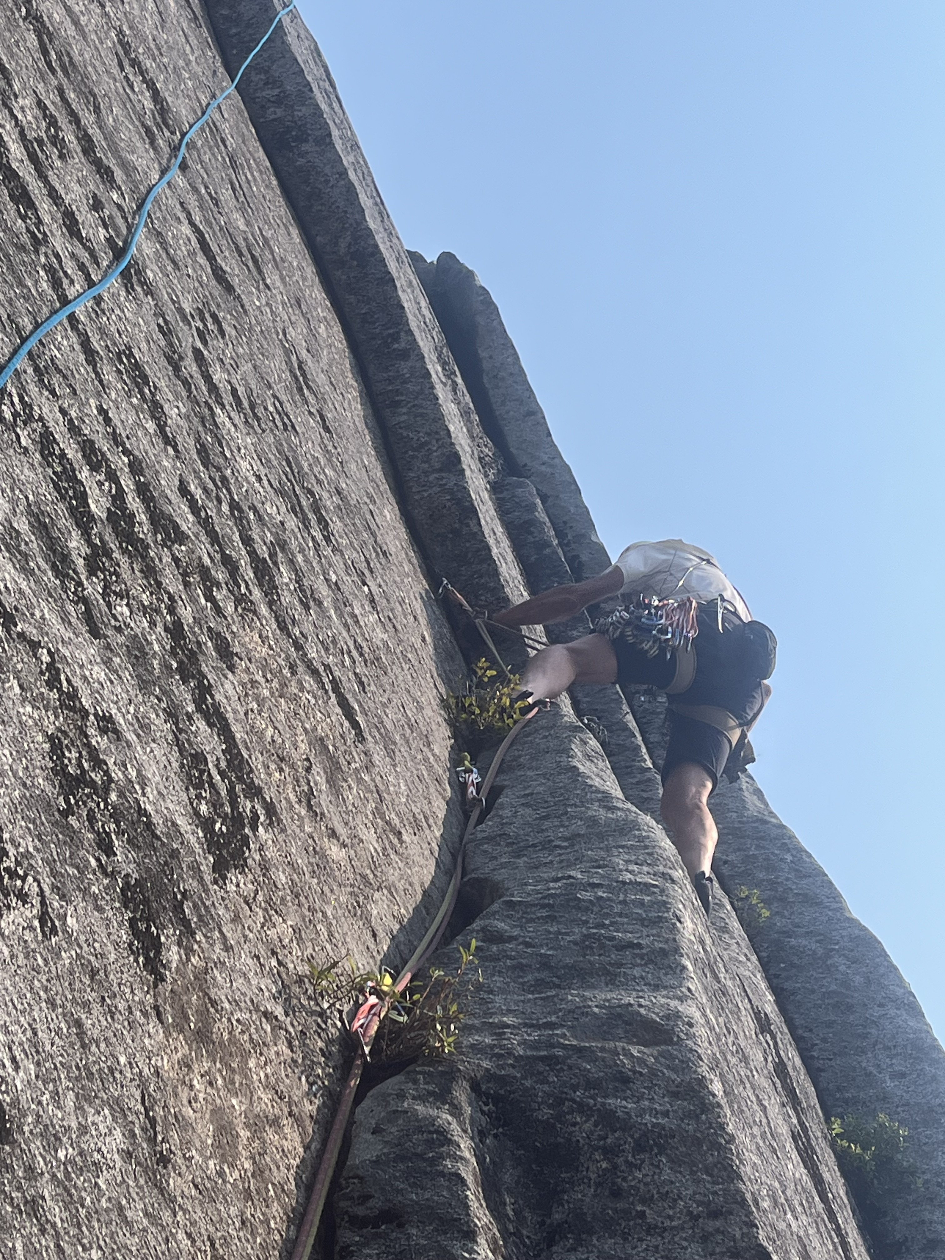
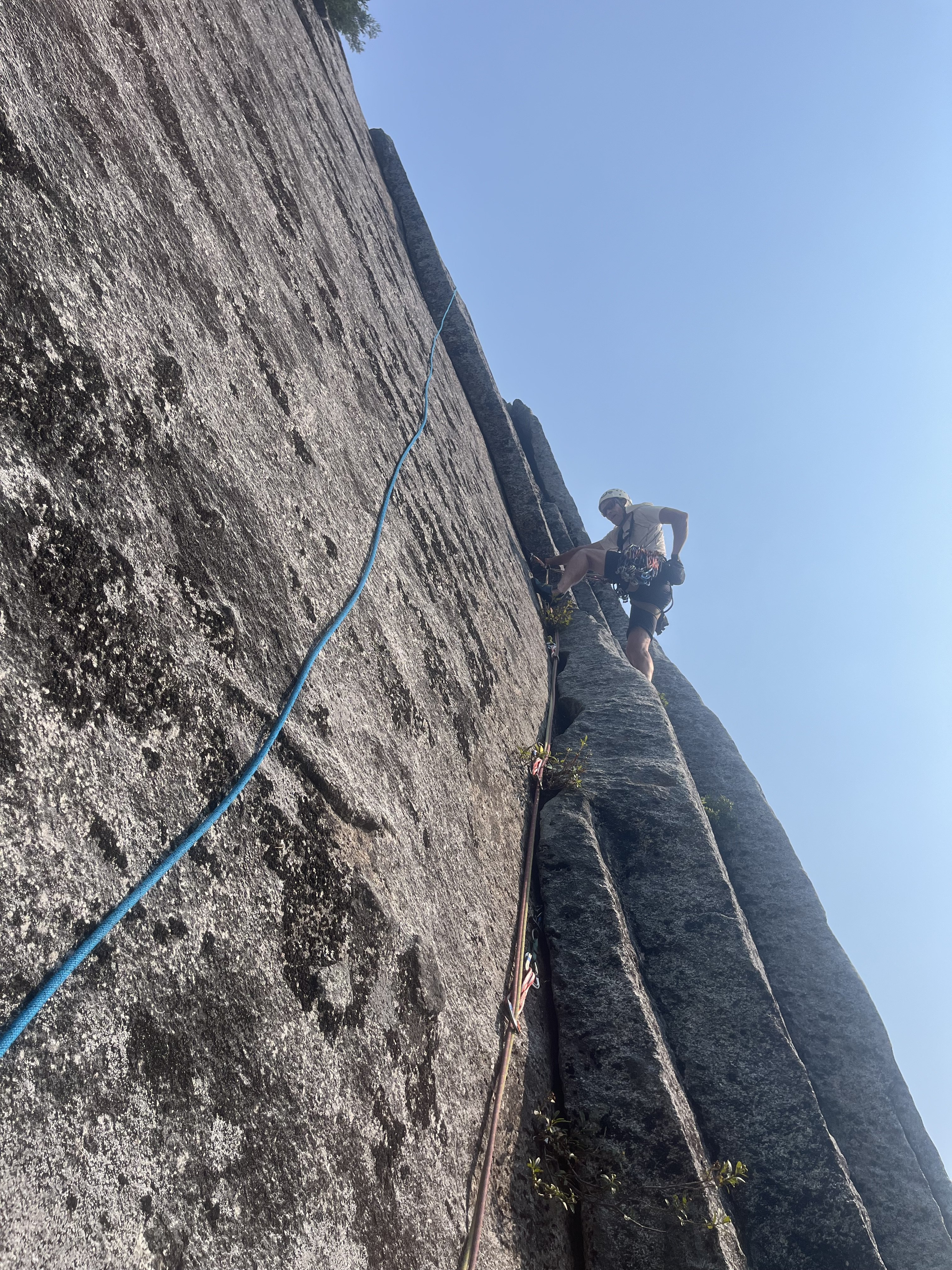
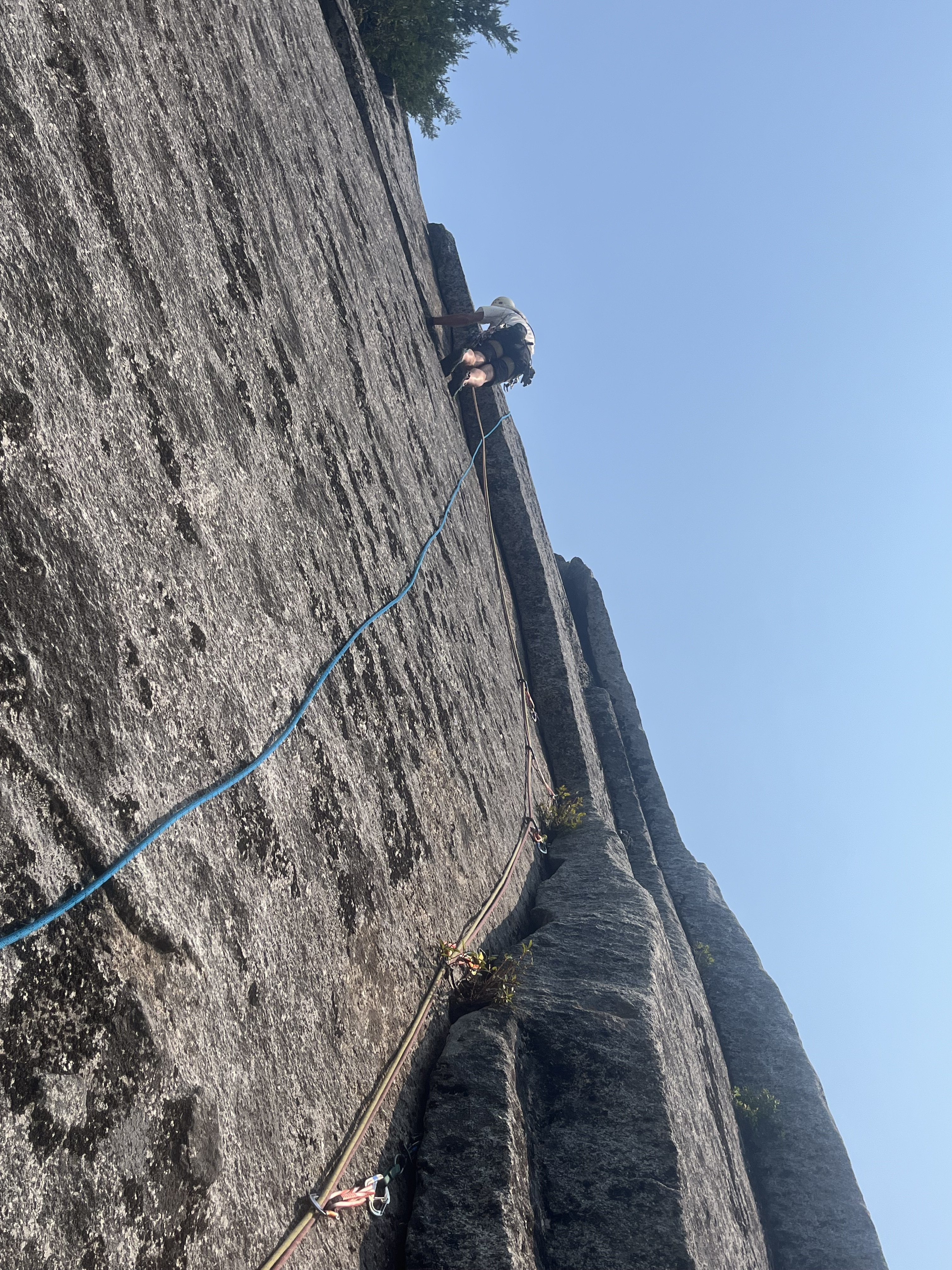
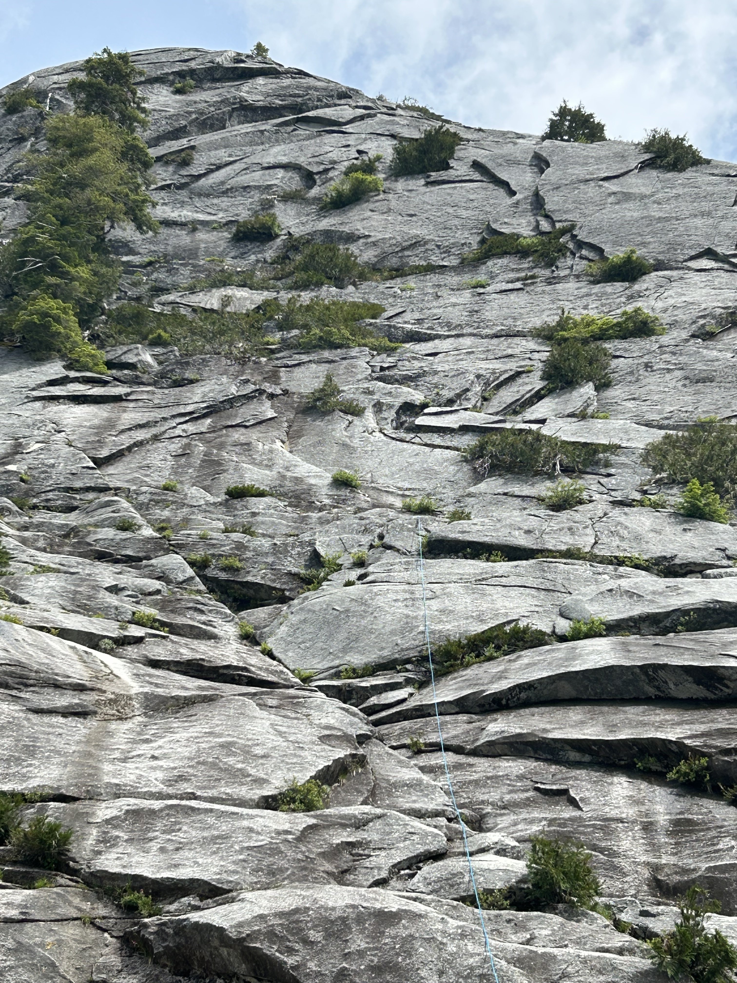
 5 points
 -
here’s one when I got new panniers on day 5 and just for fun, here’s what I was rolling with when the old ones exploded coming down from MSH ?
 5 points
 -
I was coming down the Baker River yesterday afternoon and passed by the slab feature shown in the photograph. I've seen it many times before but this time decided to grab a quick snap of it. It's located on the north side of the river at approximately 48.82863, -121.43918 if you want to google earth it. I'm sorry to say that it would be a hellish ~seven miles of vicious travel up the river from the trail end at Sulphide Creek. The view looks to the north. This is on the south-southeasterly trending ridge that extends from Mineral Mountain to the Baker River. Has anyone heard of anyone visiting or otherwise investigating it? From the air it looks much like something you'd see in Darrington. The photograph was taken from 48.80671, -121.43873, while at an altitude of about 6400'. The slab extends below the bottom of the frame, but not all the way to the valley bottom.
 5 points
 -
Trip: Tokaloo Rock (Sunset Ridge bailure) - Standard Trip Date: 06/29/2025 Trip Report: Sometimes prudence is the better part of valor....or at least that is what @Trent and I told ourselves as the murk cleared and we had our first good look at Sunset ridge after walking in for 10 miles in our venerable Lowa Civettas. We were camped at what we thought was going to be our "low" camp, next to some partially melted tarns to the NE of Andrew Benchmark, above St. Andrews park. Our high camp was planned for about 11.1k on Sunset ridge the next day. However, the entire upper mountain was very boney in the fading light and it looked like a several hundred vertical foot section of the ridge where the route went was completely bare of snow (~11.5-12k). Hmmmm. We had enjoyed the scenic ramble in from the NPS gate at their chosen spot on the still very drivable West Side Road earlier that day. Lush forest, interesting geology, wildflowers, and swirling mists, it was unlike most approaches to the highest point in WA. But then we got to camp and the predicted clearing didn't materialize and so we sat, napped, and stewed. But then, like magic, the veil was lifted and Tahoma was revealed! As was the camp of a neighbor, who had snuck up on us in the mists. We would find out the next day that it was none other than our very own @DPS, who I had last climbed with back in 2005! But as we turned in for the night, @Trent and I both agreed that we didn't want to climb Sunset the next day. We wanted to climb it in good conditions, not just climb it, and it was plain that it was not in good nick. And so we turned in for the night. I admit I wrestled with the decision throughout the night and didn't sleep that well. Were we just being old and scared? Would the route have gone fine? I felt like we never would know (actually, that was wrong- see below). But the next day dawned clear and bright and the least we could do was take a ramble up to Tokaloo Rock with light packs. It truly is a glorious side of the mountain and it was hard to complain about "missing out" on Sunset Ridge. Adams: Tokaloo Spire! From this side it looks very stout, which @Fairweather confirms below. Maybe easier from the other side? Looked blockier but neither really matches the Beckey description. Maybe another time! @Trent rambling up towards the top of Tokaloo Rock: Cumbre! What a view of the West side of Tahoma: Tokaloo Spire and St. Helens from the summit: Lovely parklands and Adams: We couldn't ignore how far we were from the car, however and in time retraced our steps back to camp and packed up. There was cell service up there so I checked if the nearby "Andrew" benchmark was on any peak lists. Turns out it on the "Mountaineers 100 Peaks in Mount Rainier National Park". As @Trent says, It must be climbed! And, so it was. @Trent admiring the view from summit #2 of the day: And then began the ramble out in our plastics.... which was long, but at least it was hot! My feet took a beating. Tahoma from the Puyallup River crossing on the Wonderland trail. Sunset ridge is the left skyline. That bare section is I think where @Nick Sweeney got to before they bailed (description and link below): The hike out through the lush forest was just as beautiful as the hike in, even if a bit longer (it always seems that way doesn't it?). Even though we didn't even get very high on the mountain, this route has set the hook in me. There is just something about climbing the entire mountain that appeals to me, and is a feeling that is easy to escape on the more common Rainier routes. Sunset is long enough, we a low enough start to be very sporting. We will be back! RESPECT: Western Tiger Swallowtail: Gear Notes: snow gear if there is snow.... easy class 3 scrambling to the top of the rock. The Spire is considerably harder Approach Notes: West side road to South Puyallup Trail to Wonderland Trail to off trail near St. Andrews Park. Good camps at tarns just NE of Andrew Benchmark
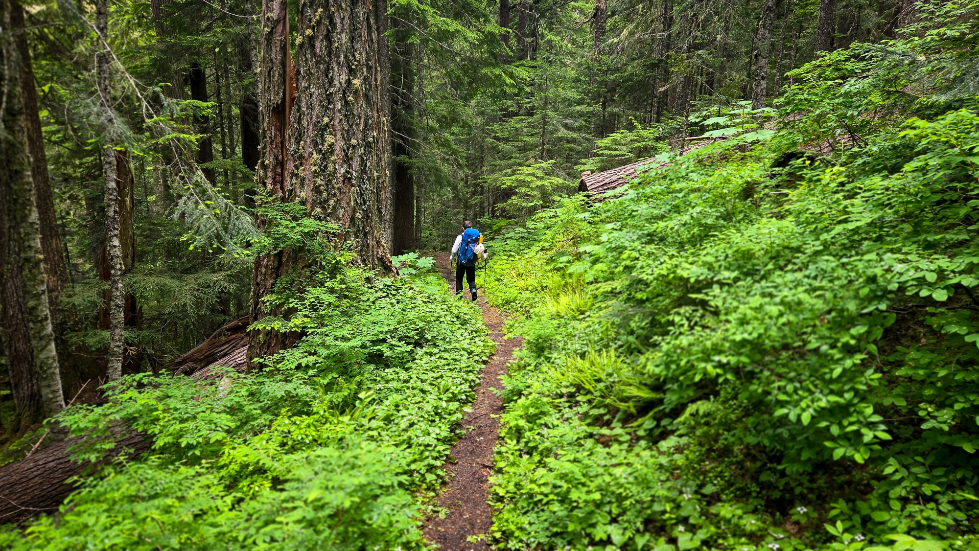
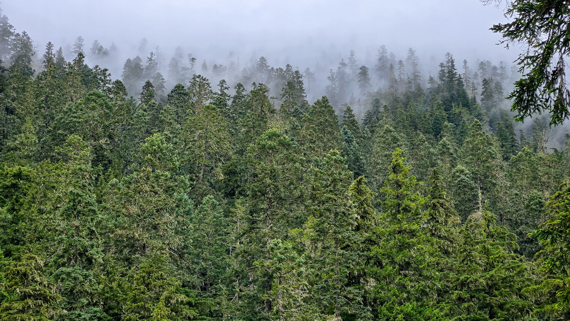
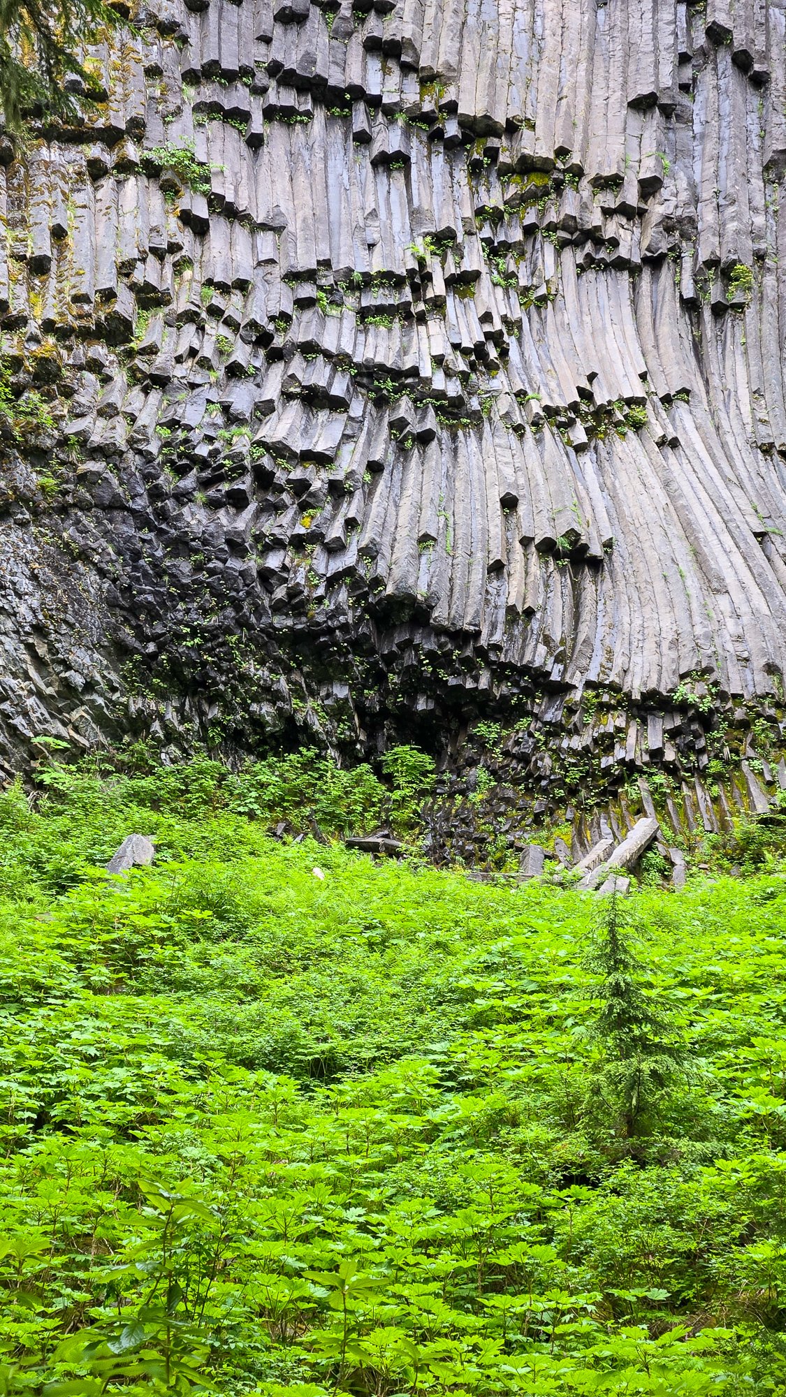
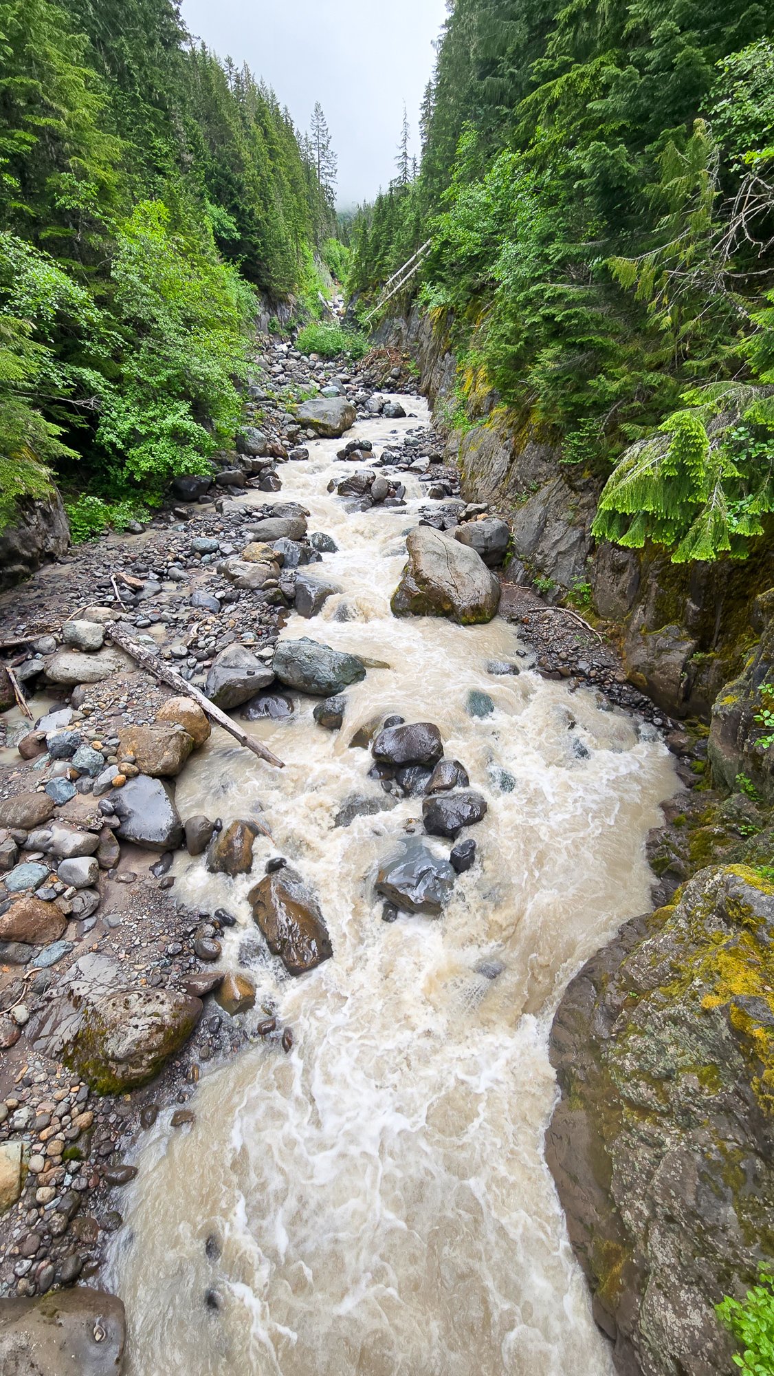
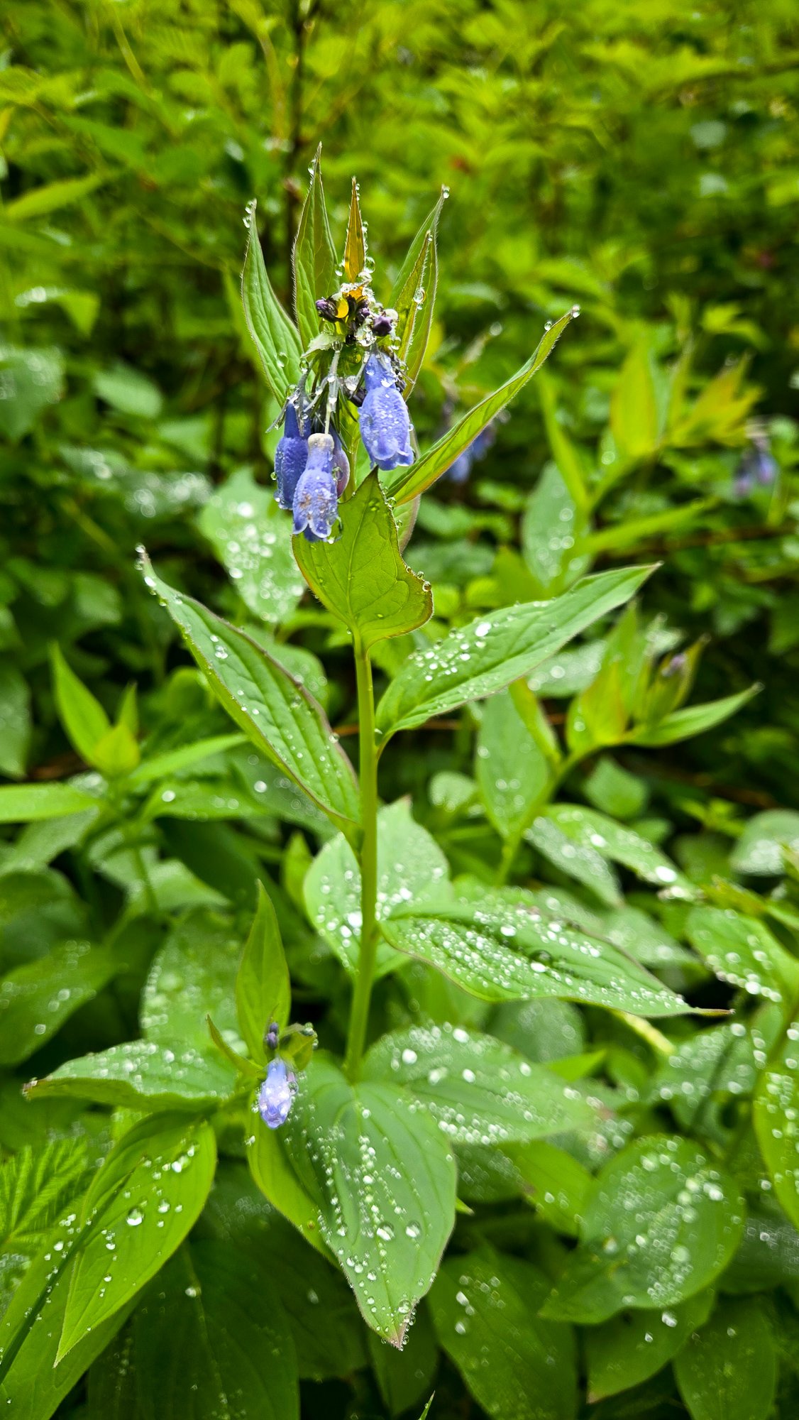
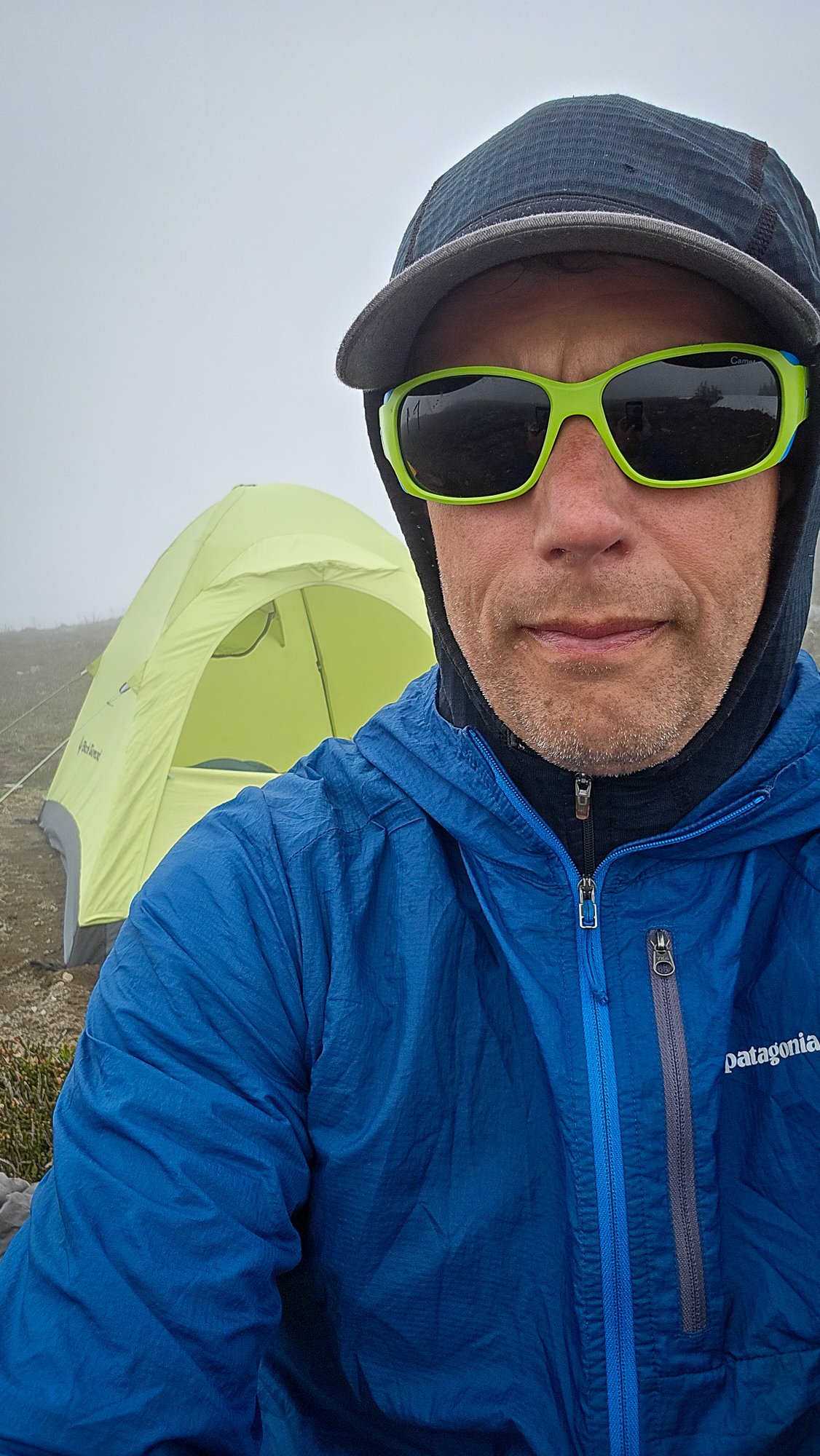
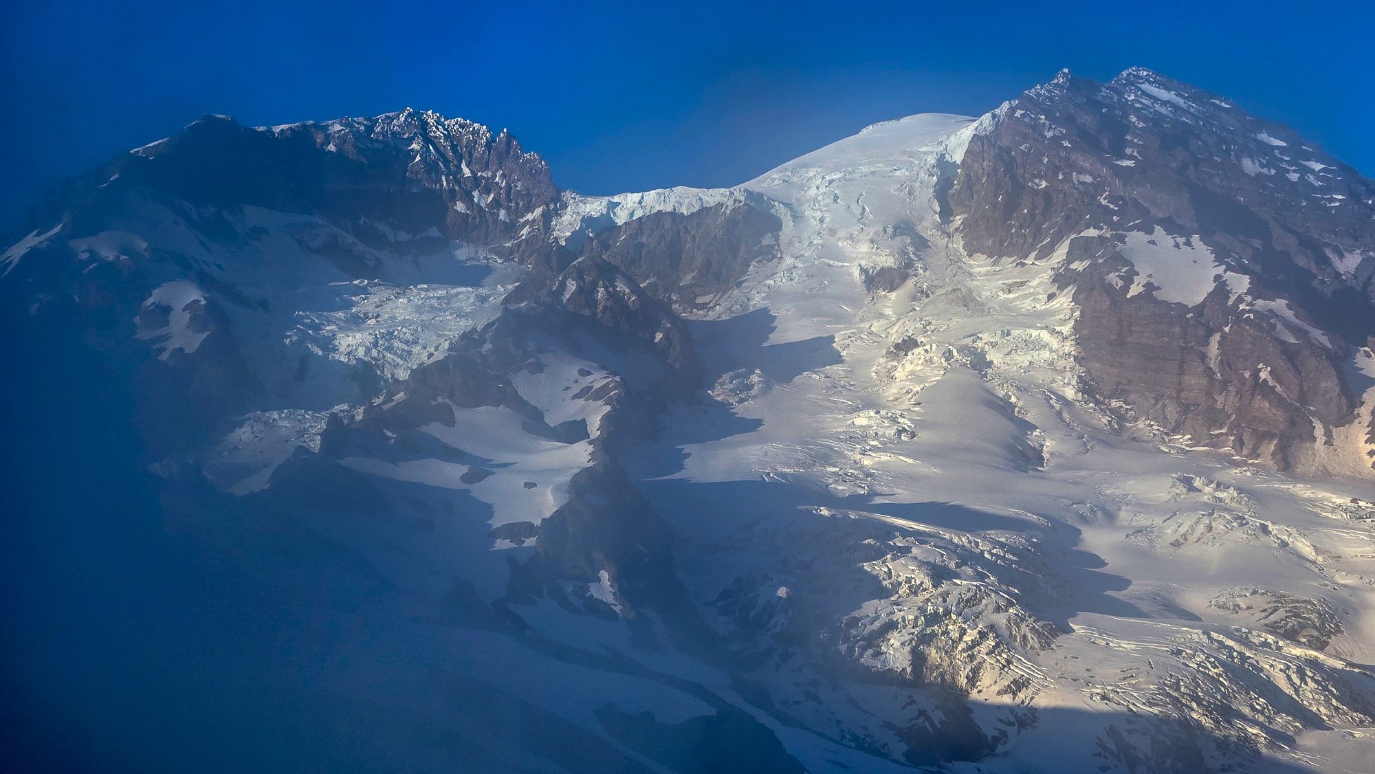
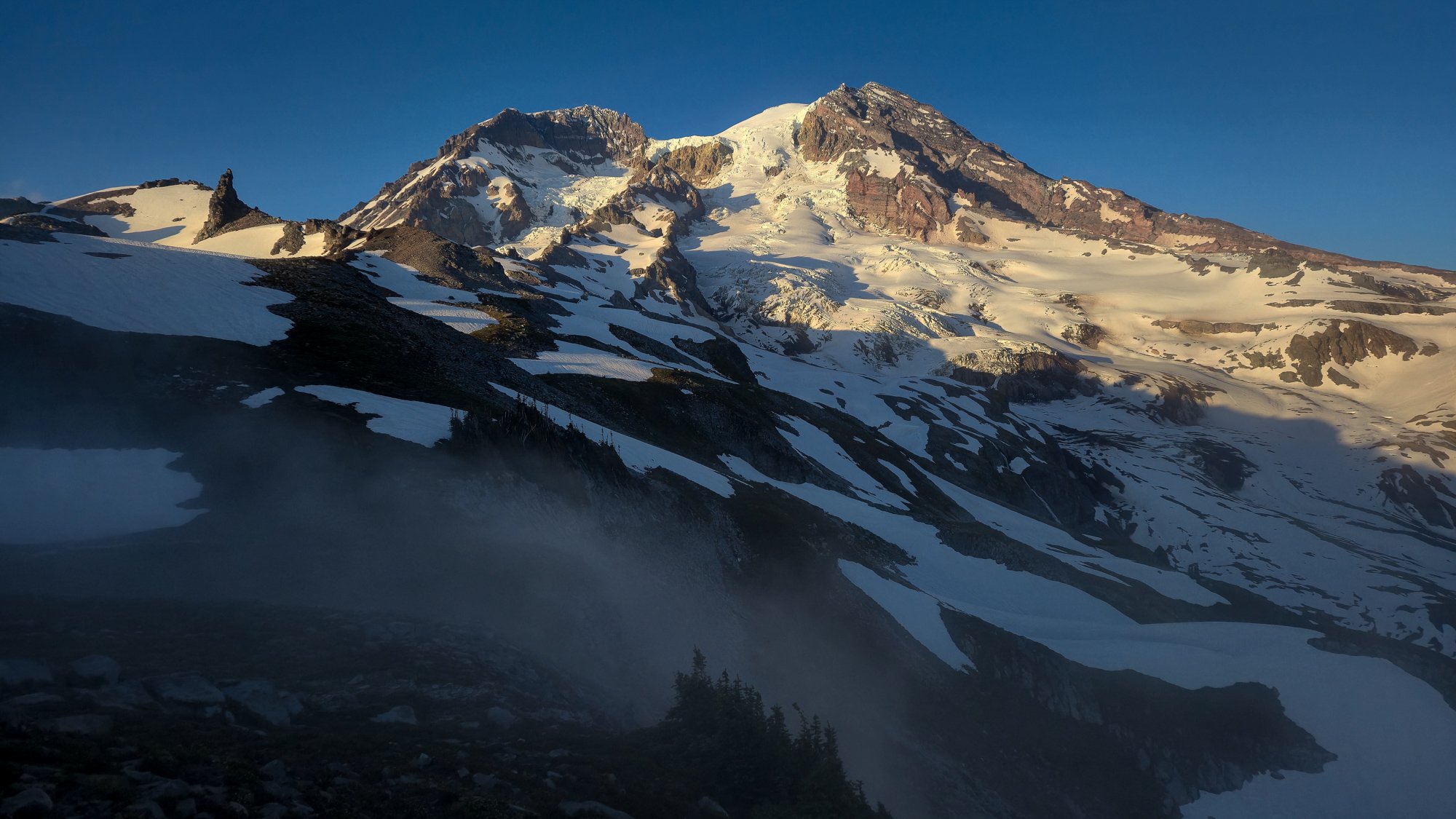
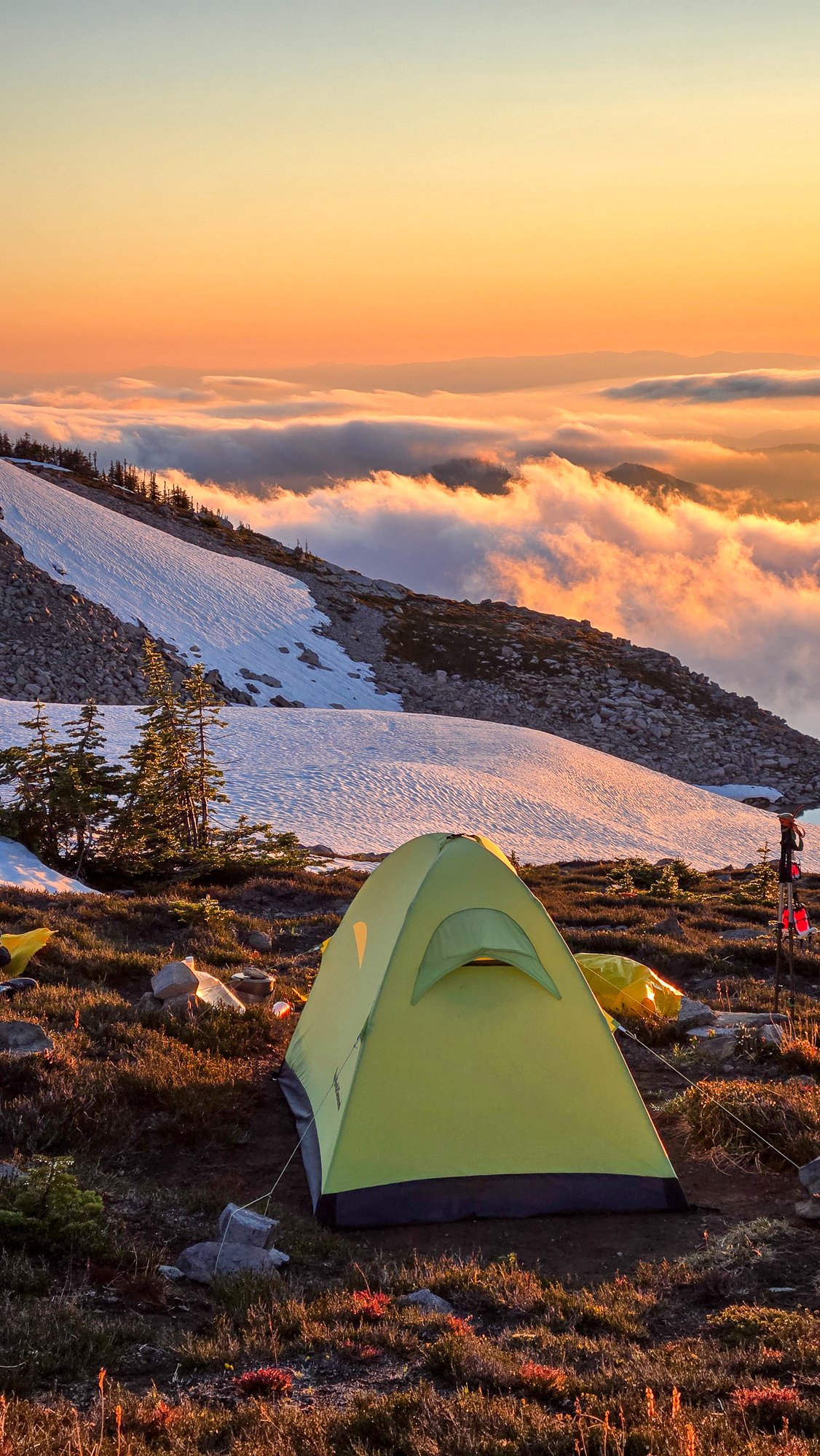
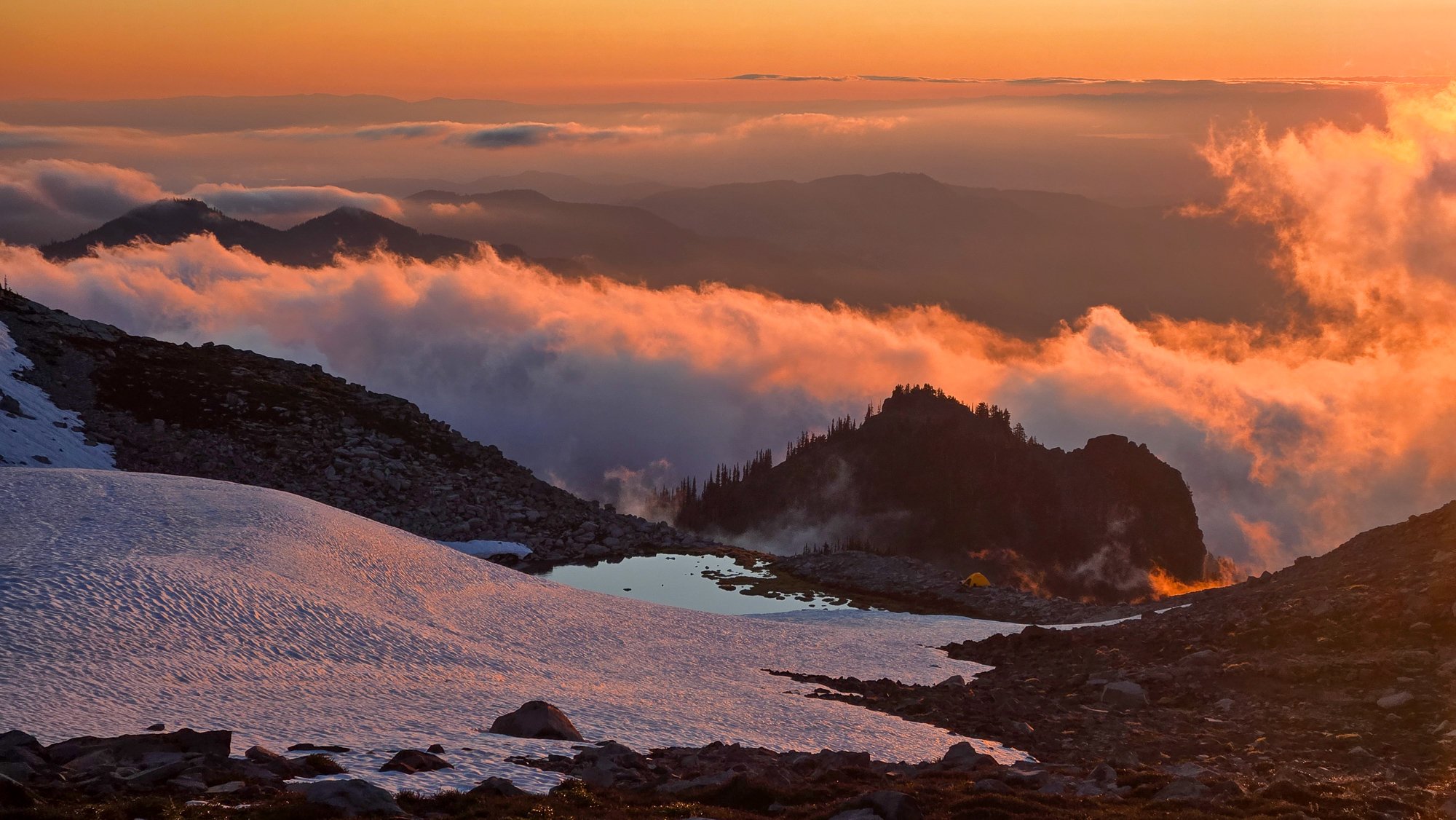
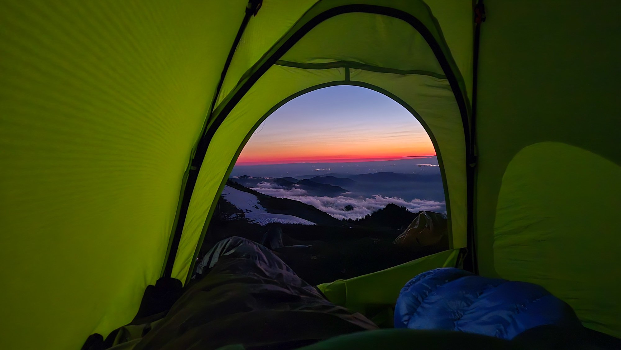
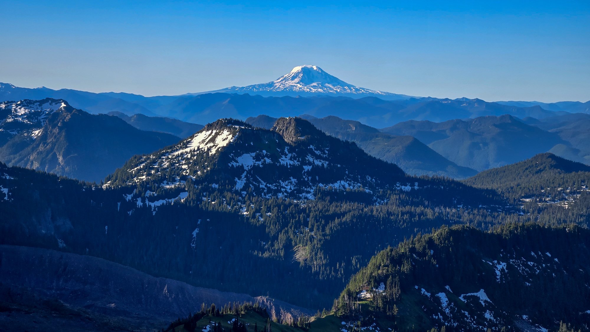
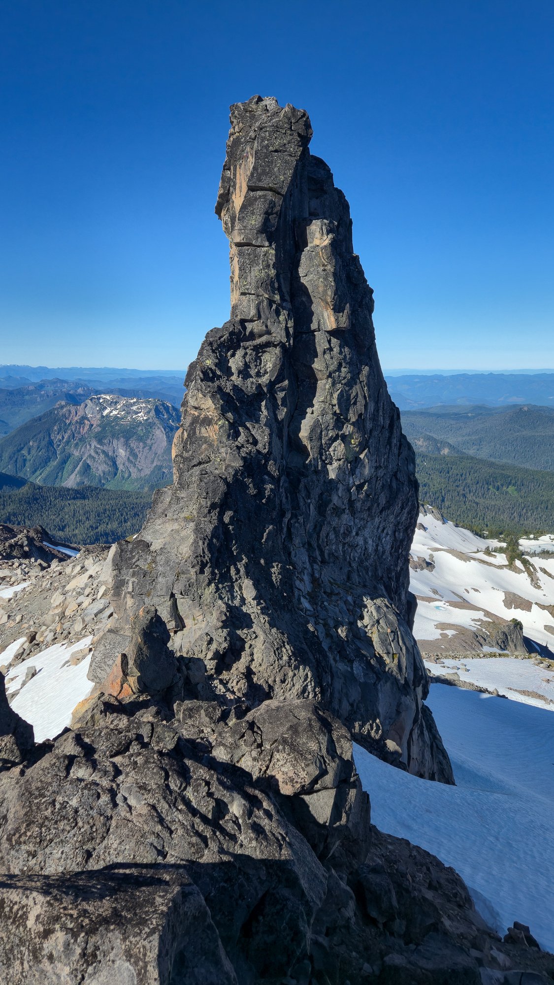
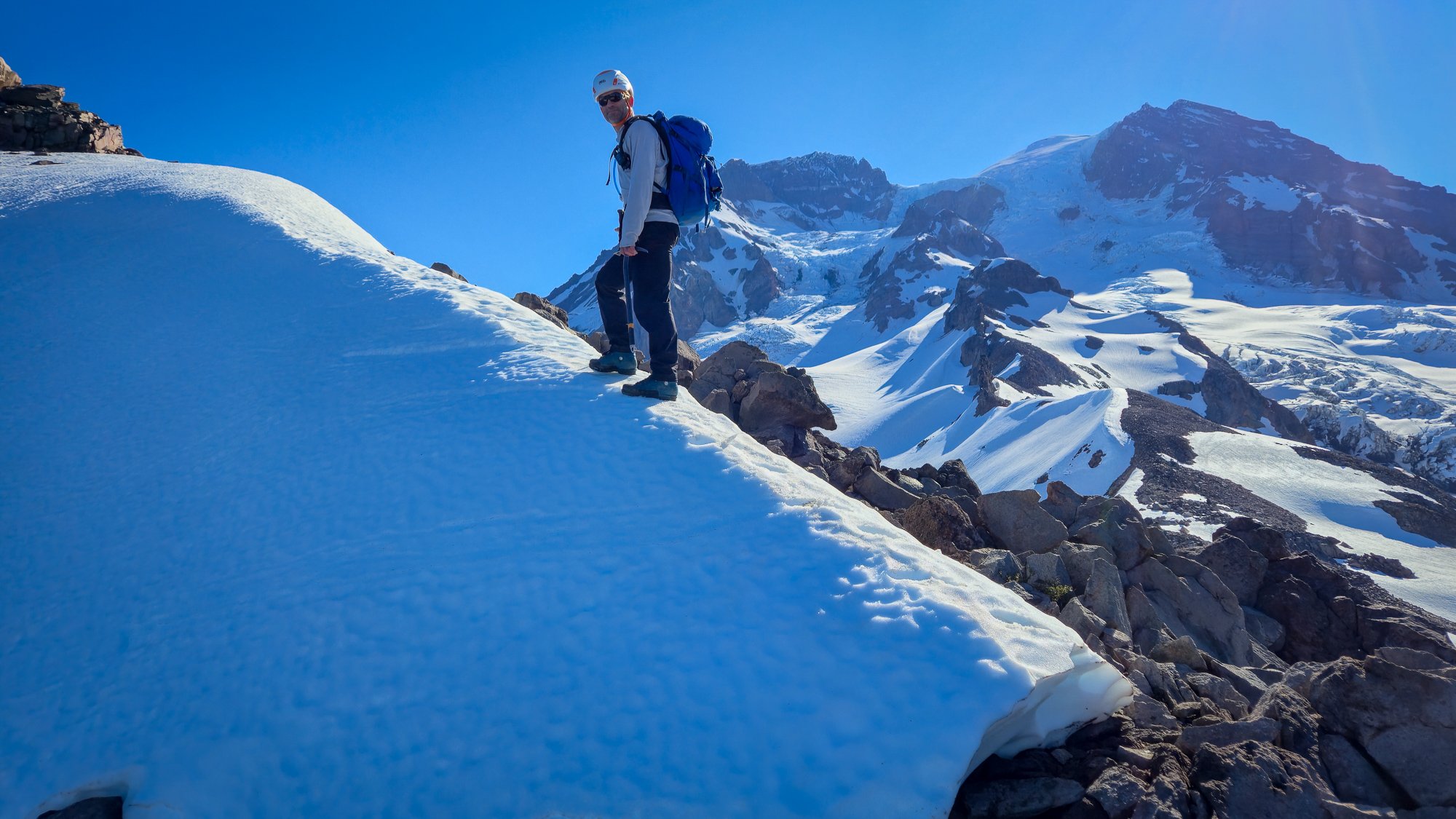
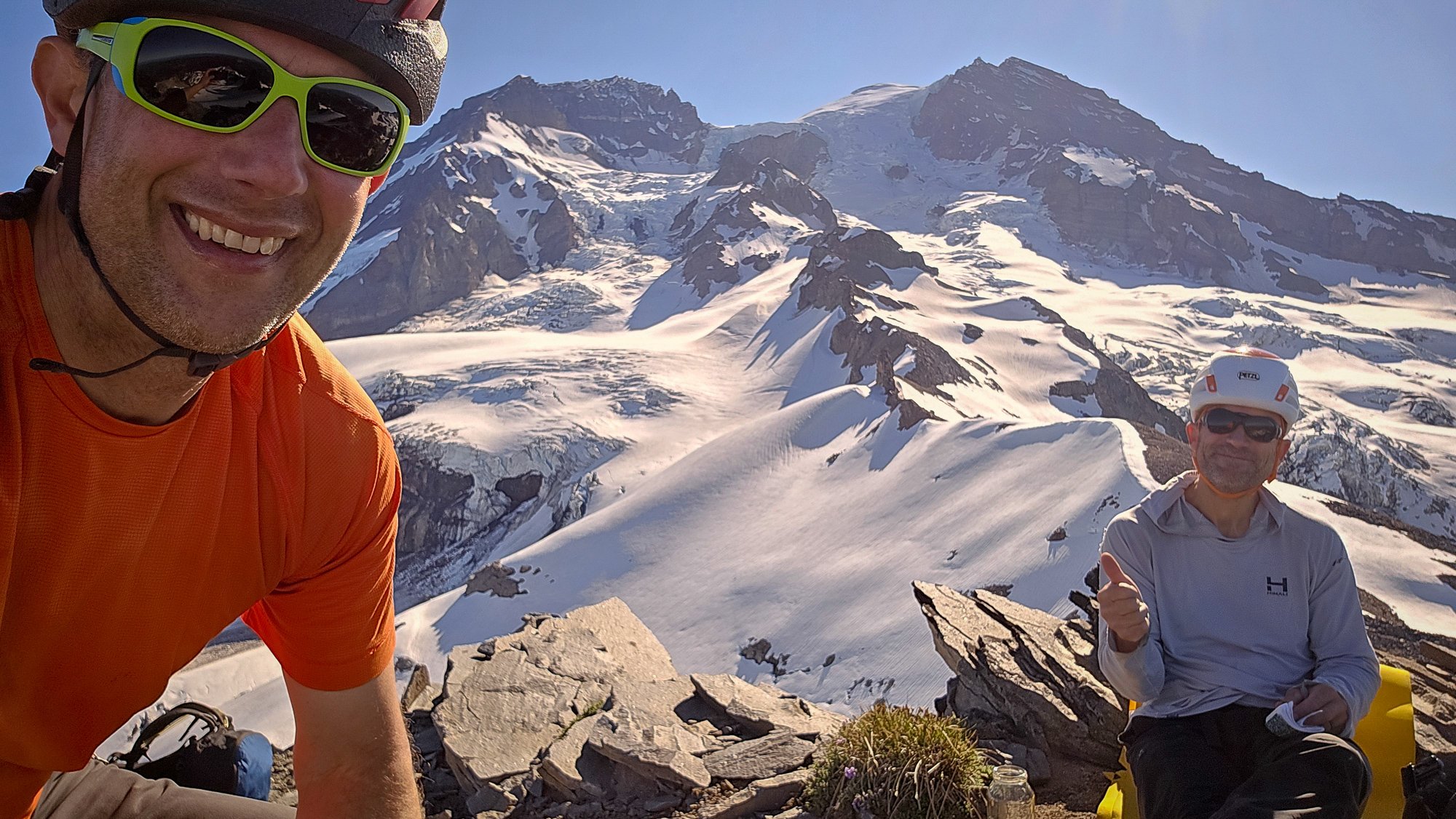
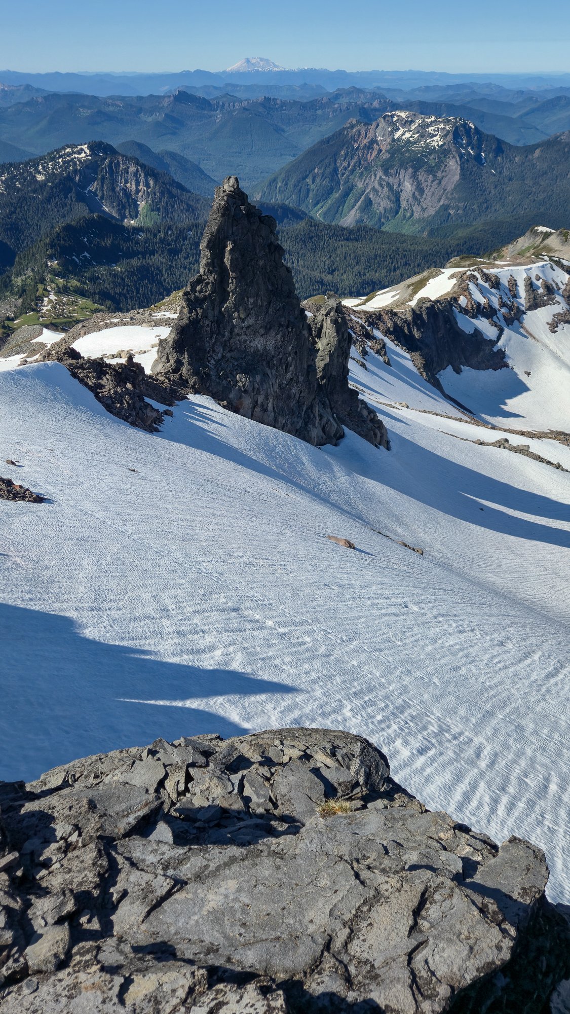
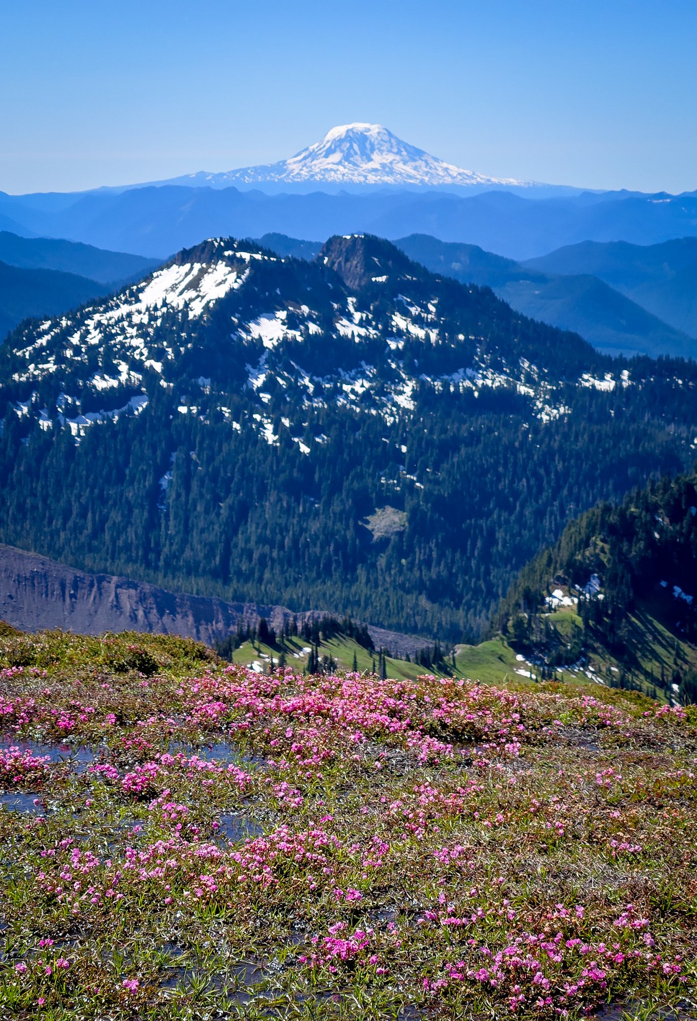
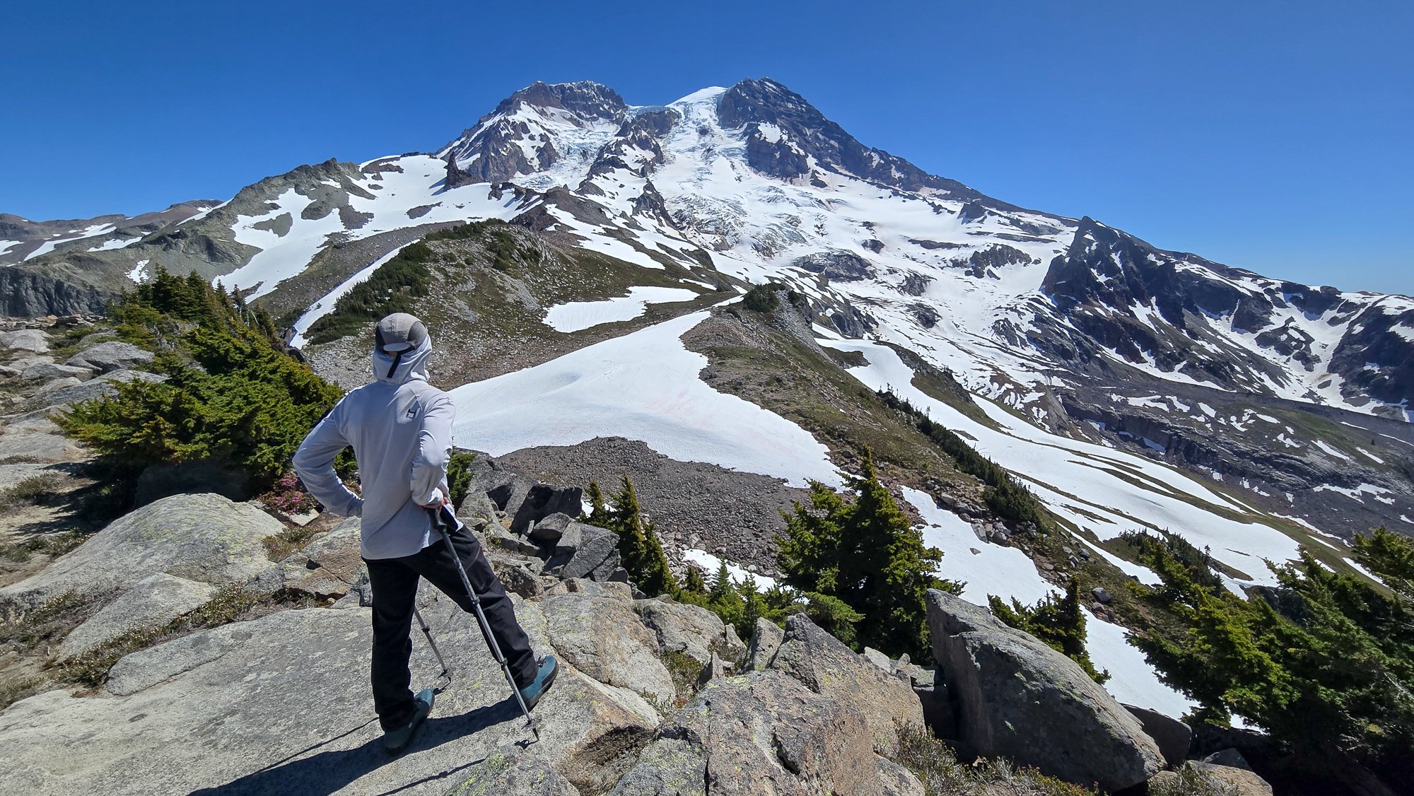
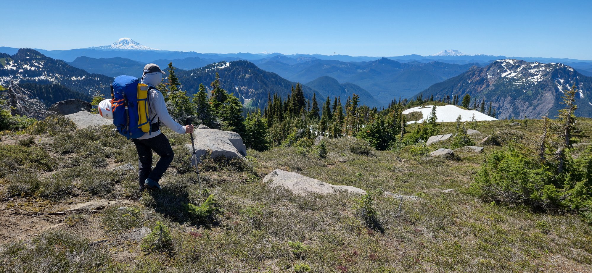
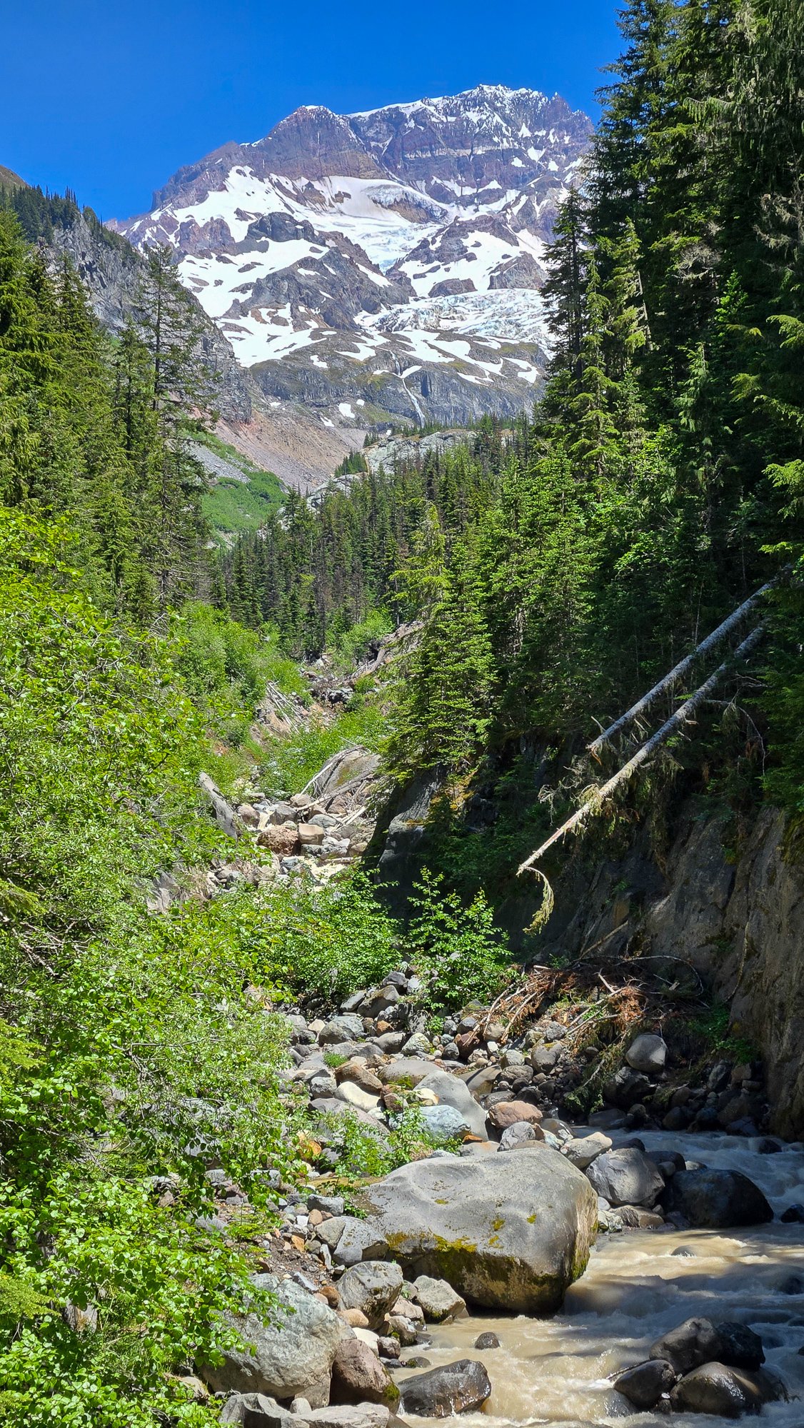
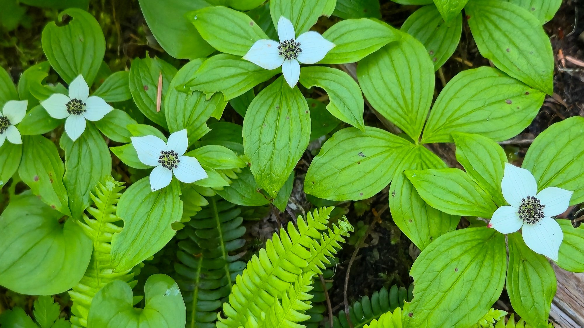
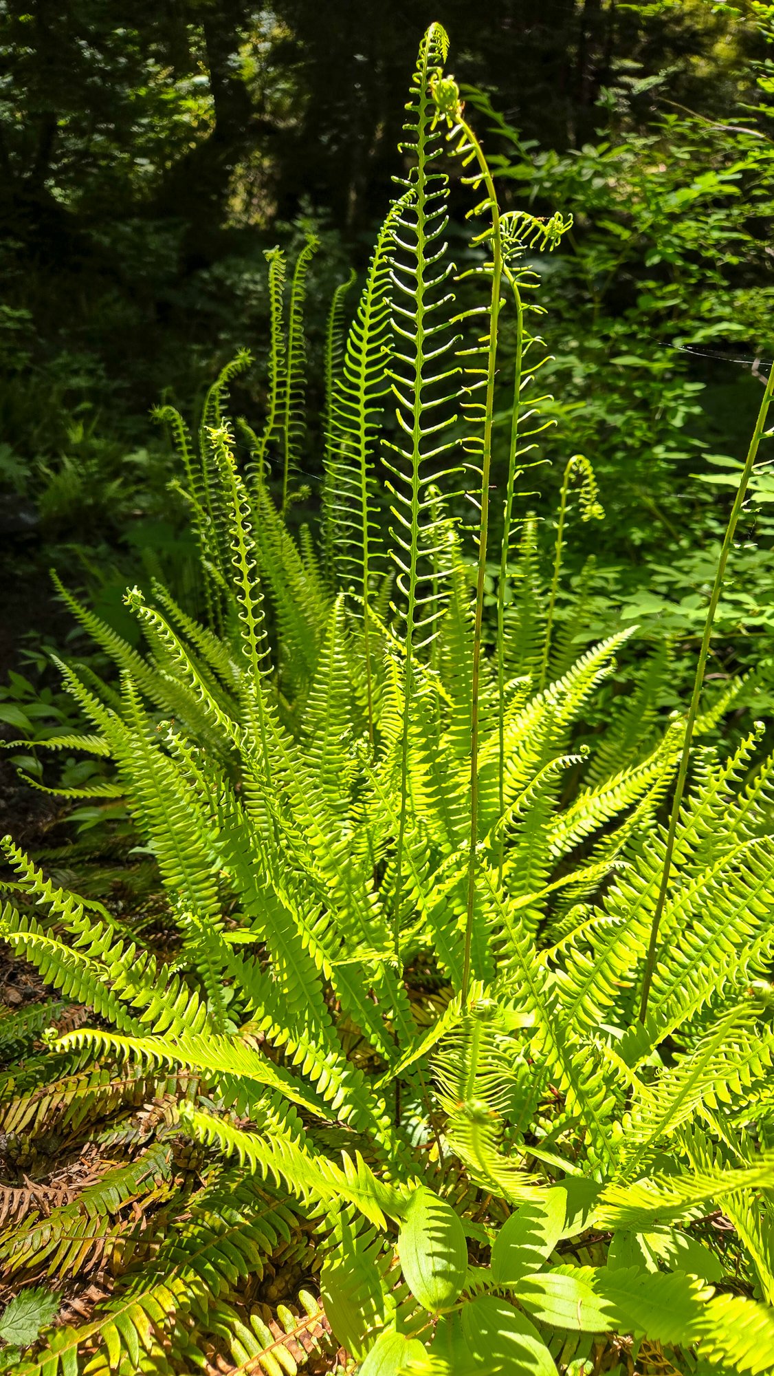
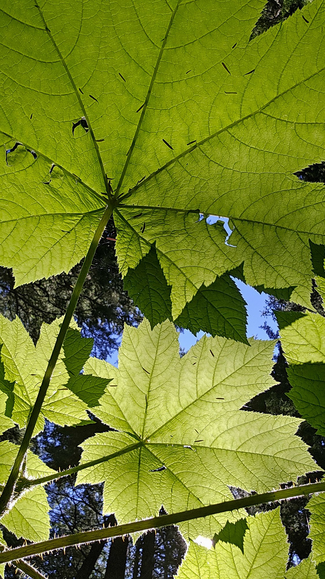
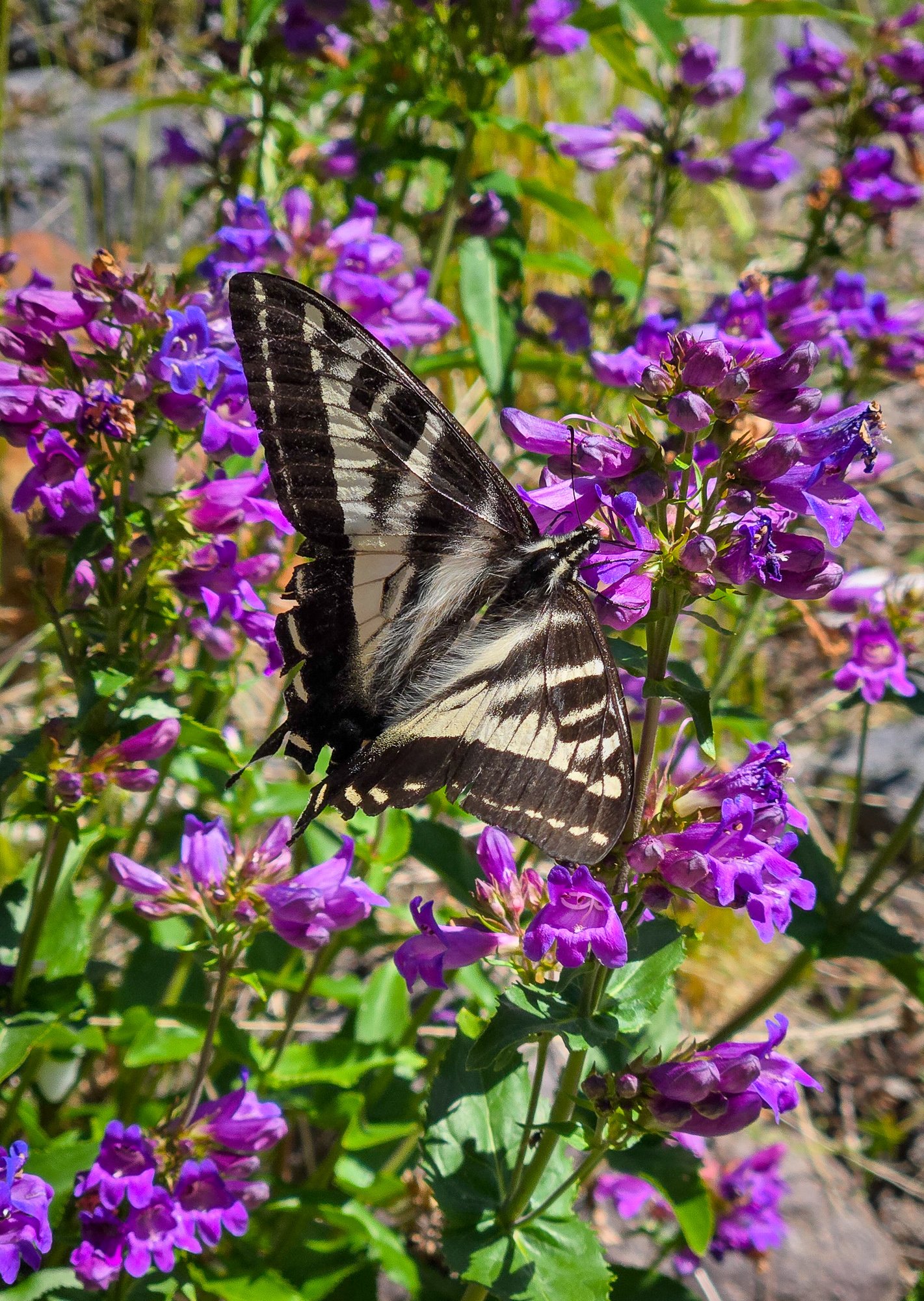 5 points
 -
Trip: Warrior - NE ridge Trip Date: 06/01/2025 Trip Report: After talking about it for several years, @olyclimber and I finally got out in the hills together to climb Warrior. It started, like all good Olympics trips, in the rain, wondering if the forecast for fair weather was ever going to materialize. Thankfully it did and @olyclimber and I headed out into the dripping forest along the Dungeness, marveling at how green everything was and how beautiful the waters were. It was going to be a good trip! Boulder shelter: Within a few hours we were at Boulder Shelter, one of the CCC era structures still in use today in the Olympics. @olyclimber , as his name suggests, has a long history with the range and regaled me with stories of his youth, scouting trips, and other entertaining adventures and misadventures in the Olympics. Before I knew it, we were under the cirque on the west side of Warrior, ready to leave the trail and head upwards to a scenic camp perched next to a tarn still buried under winter's snows. It was clearing off nicely and we decided to sleep out in the chilly breeze to admire our surroundings. It got cold during the night and dawn brought a hard freeze to everything, but thankfully our water was only slightly iced. It would be a very firm ascent to the col separating the two summits of Warrior, but thankfully the day was clear without much wind. @olyclimber ascending to the col: Inner Constance and the Rotten Rockenspiel: At the col we started the traverse NE on steepening snow, barely getting the frontpoints of our aluminum crampons into the hard neve. I offered to head on up and "have a look" while @olyclimber hung back. It never got really very dad friendly and I contemplated turning around at nearly every weird snow/rock transition. The abundant snow/ice on the summit rocks made it much more challenging than expected, but for better or worse I continued upward. @olyclimber wisely stayed back and enjoyed the sun at the col while I hemmed and hawed my way to the top. Constance and Inner Constance from the summit: The view west to Mystery and Deception from the top: The summit rocks. The easiest route starts left of the photo and works up and right. The direct route is supposed to be low fifth? We had some miles to cover and driving to do and so I didn't linger on the summit long, and we carefully descended the still rock hard couloir back to camp: Admiring Constance along the way back to camp: along with Mount Mystery as we descended from the high country and out the Dungeness trail: Thanks to @olyclimber for keeping the dream of Warrior alive for me these past few years and making the trip happen! We are quite fortunate to have so many adventures waiting for us just a few hours away. Gear Notes: ice axe, crampons, helmet Approach Notes: Dungeness trail past Boulder Shelter then up into cirque by small tarn, west of the summit. Climb prominent couloir NE to saddle between Warrior summits and then traverse steep snow to the NE until you can ascend up and right to gain the NE ridge. Follow up and right via exposed and steep scrambling. Best if snow free, which is likely by late June.
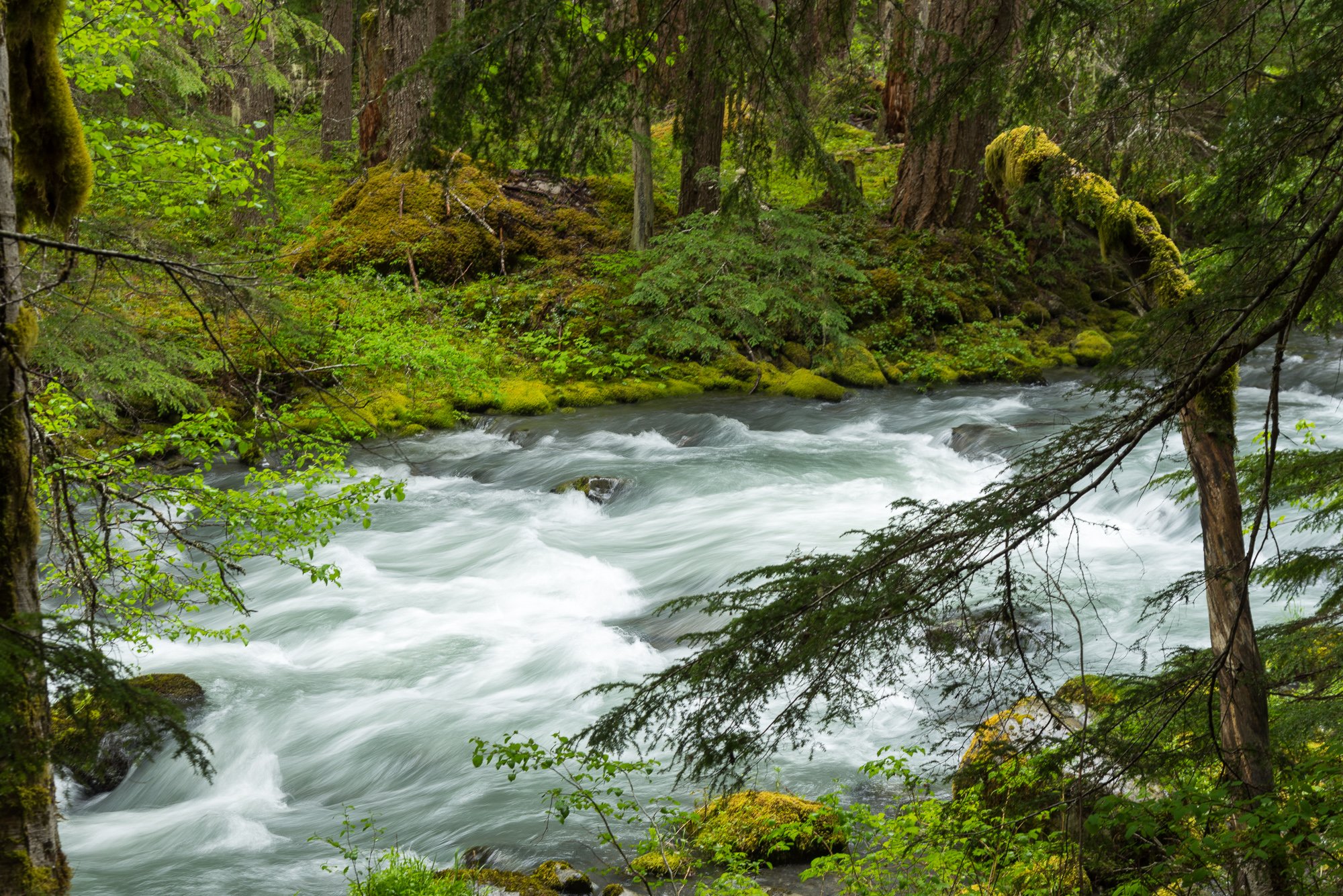
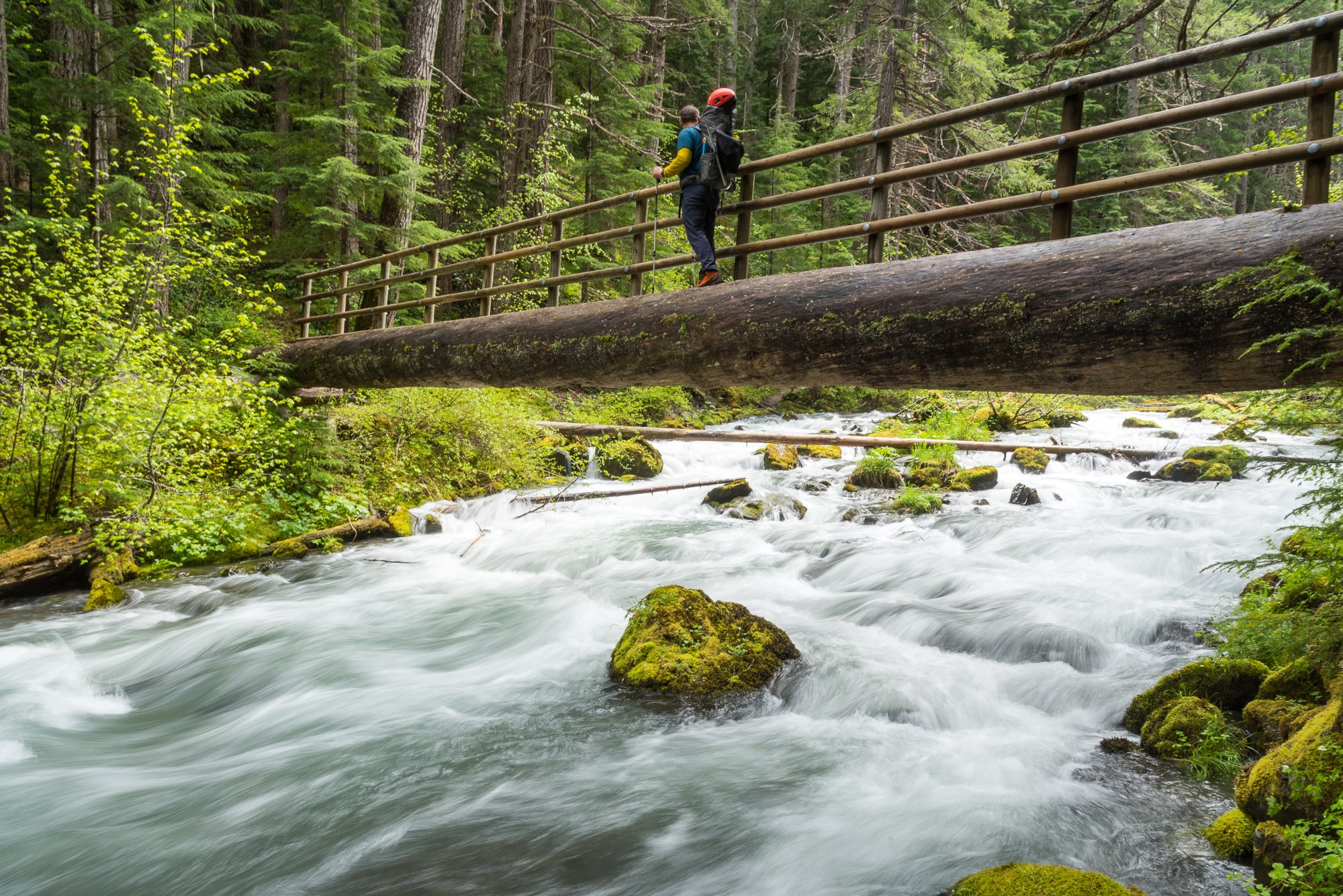
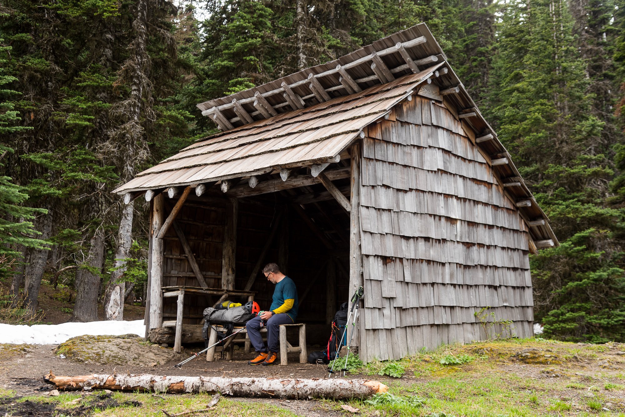

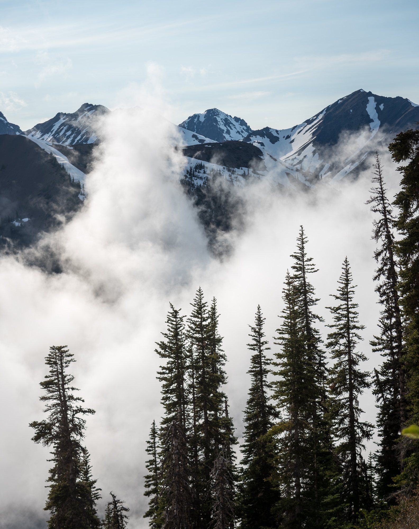
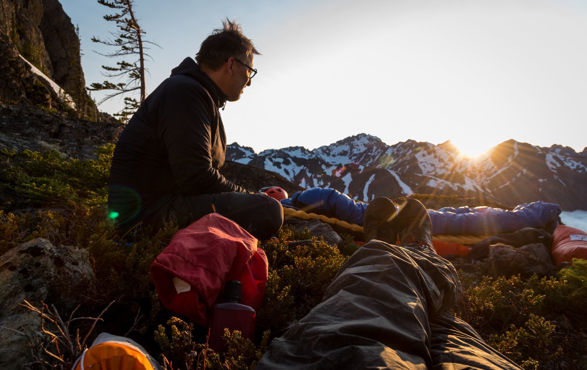

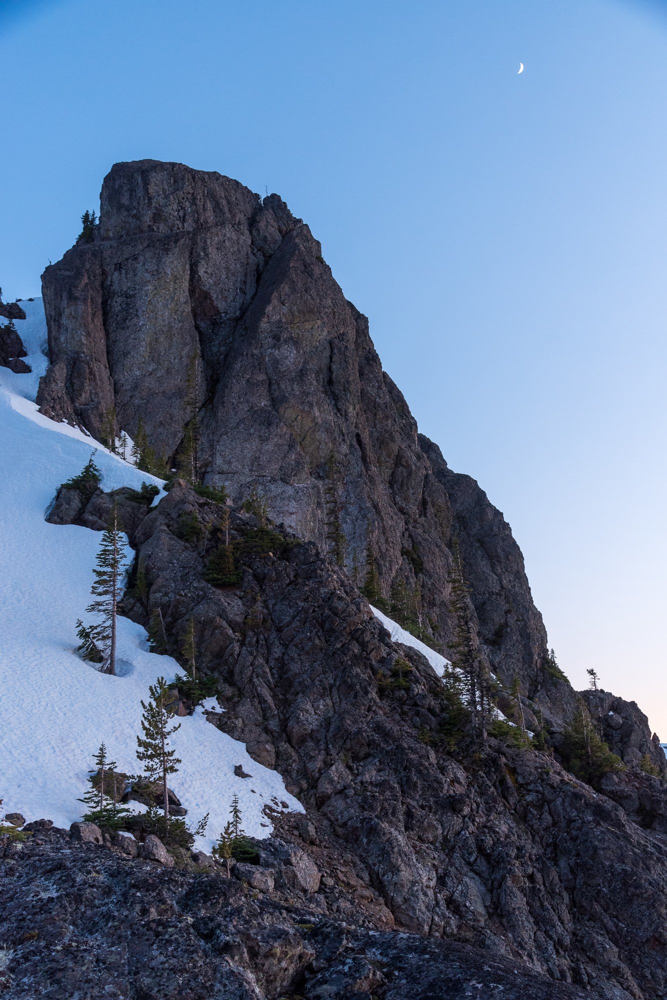


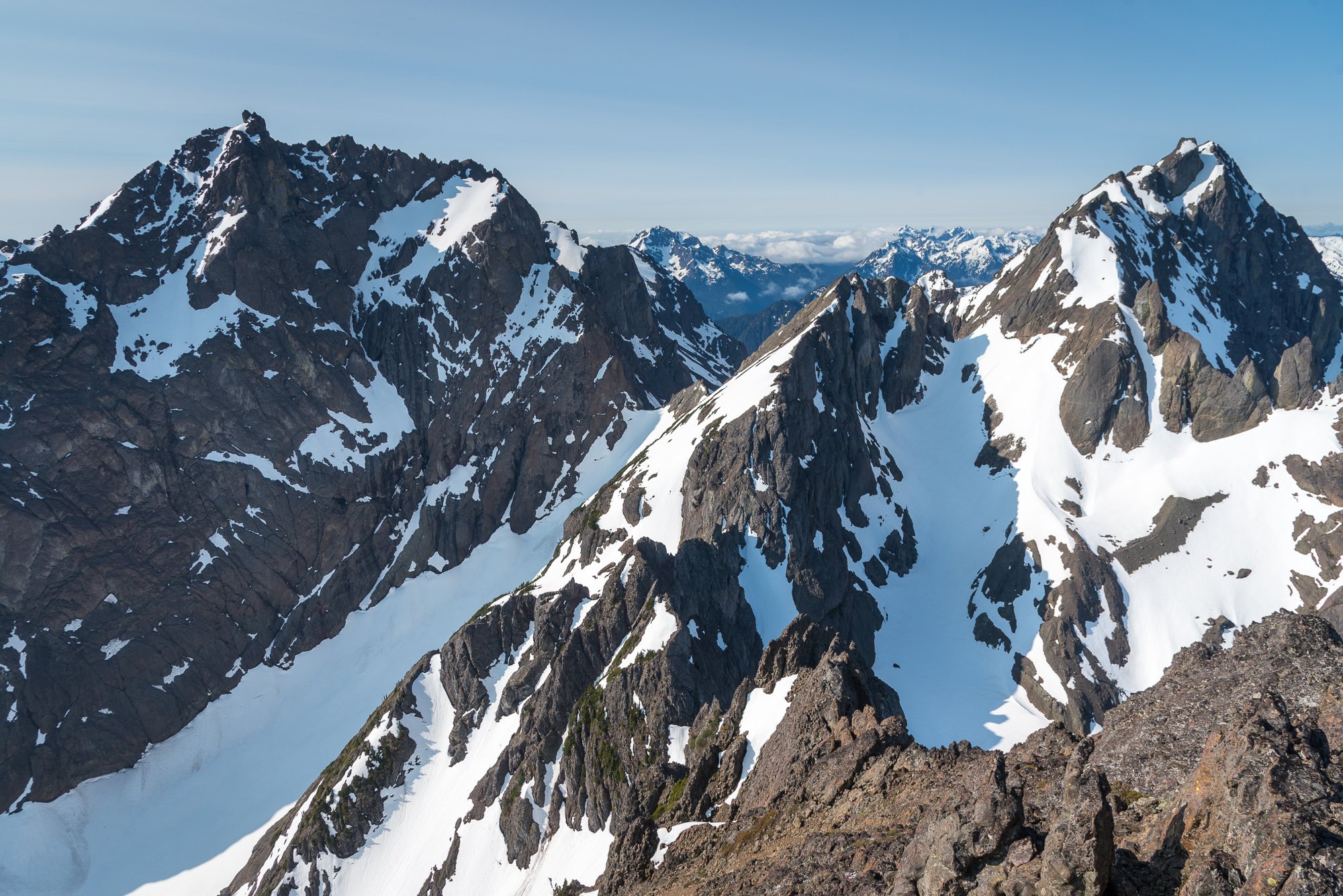


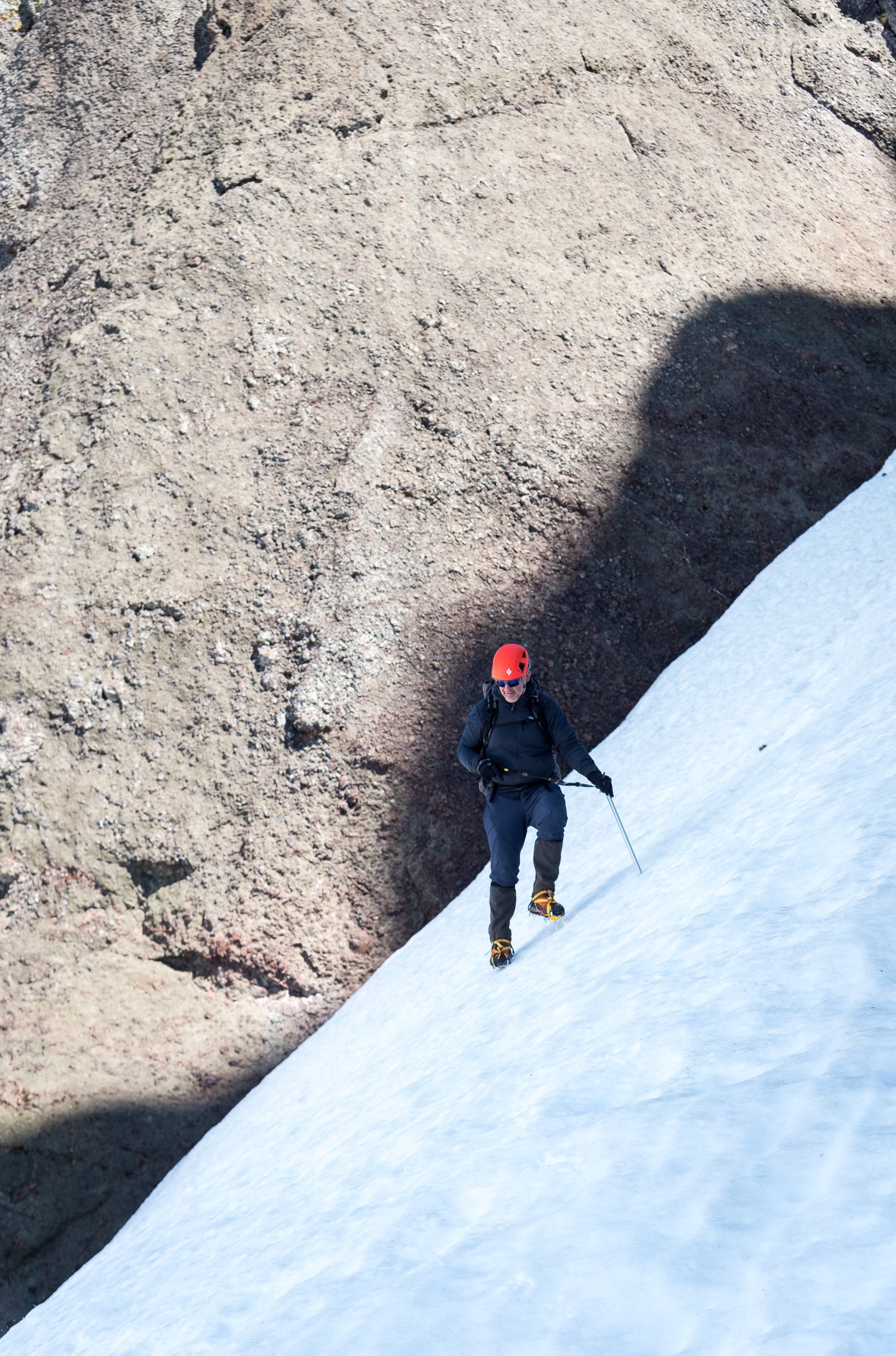
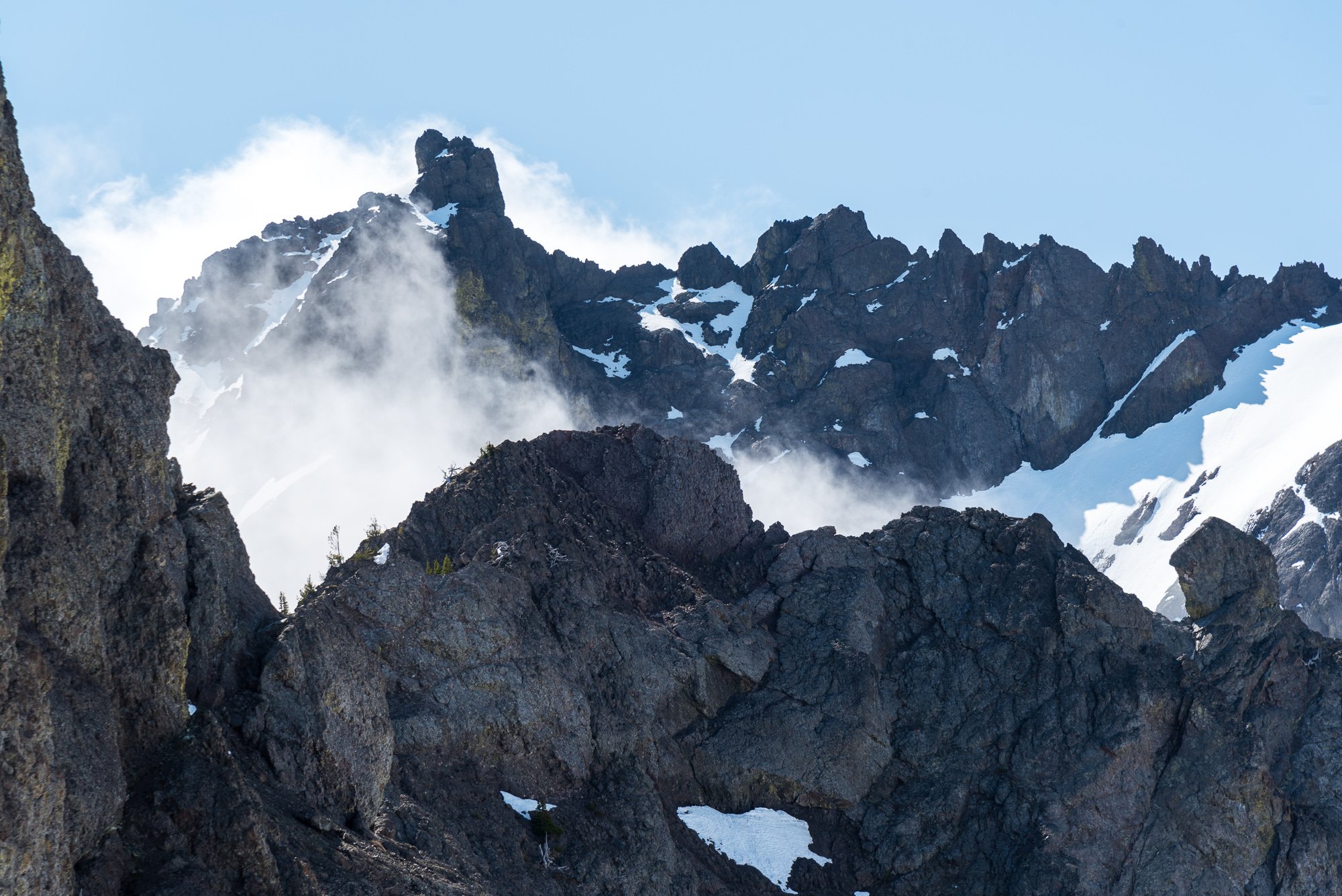
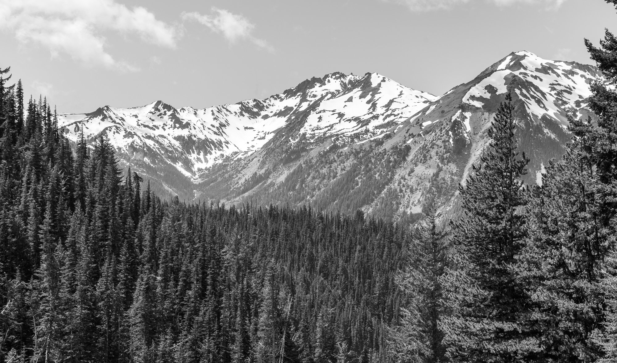 5 points
 -
Trip: Ingalls Peak - East Ridge Trip Date: 04/13/2025 Trip Report: Ingalls Peak: East Ridge. 04/13/2025 Gear Notes: 2 technical tools each 70 m rope Cams 0.2 – 3 with doubles 0.3-0.4 Hexes. Work well in icy cracks Nuts 6 60 cm slings, 2 120 cm slings 2 240 cm cordelettes for protection on horns Approach Notes: Skis or snowshoes5 points
-
Last month a group of 7 friends and I went on a trip out to the remote Icefall Brook. An otherworldly cirque in the mountains north of Golden BC, housing likely the highest concentration of big ice routes in North America. While out there we climbed several of the classic ice lines and one new mixed route that we think was pretty classic. The new route we climbed parallels Fossen falls for five pitches up to M7 WI5+ with an A1 roof crux that we did not have time to try and free. It probably goes free somewhere around M8 or 9. Overlay of the route. You can see Doug near the bottom of Fossen falls for scale. P1: Our first pitch followed an obvious chimney system up into a cave below the beginning of a steep flare. Protection was decent, but the rock quality wasn’t the best. The cruxes consisted of a few bulge pulls with poor feet and decent snice sticks. P2: The second pitch was absolutely classic mixed climbing. The ice on the right wall was barely thick enough for good sticks, but stemming, chimneying and good rock gear eased the stress as the ice got steeper and fatter. A tunnel and a bunch more rock gear protected ice took us up to what is essentially the top of Fossen falls second pitch. P3: From here, I stepped out right and tiptoed my way up a barely-there smear aiming for a short but steep pillar above. Again, gear was hard to come by, but when I did find something it was usually good. More incredible ice and mixed took me to another protected comfortable belay stance in the back of the main cave. A scary, but spectacular pitch. Kurt said following it was one of the best pitches of mixed climbing he’s done. P4: Now under the crux, it was Kurt's moment to shine. He started by trying to climb some thin glassy ice out to the right in order to skirt the roof but backed off when the rock above looked downsloping, loose and generally really hard. Instead he opted to take the roof straight on, tagging up the drill and placing 3 bolts with a few pieces of intermittent gear. Once at the lip, he sent the drill back down and started free climbing again. As he climbed out of sight things got slow and quiet. Standing in my cave I watched rocks rain down into the abyss as a combination of snow and down plumes floated in the air from Kurt's shredded down jacket. Eventually he called off belay and I also aided my way through the roof to save time. The climbing above proved to be hard, grovely, runout and wide. The upper part of this pitch was bone dry and entirely chossy. A less classy crux than we had hoped for. The first attempt going out right that we backed off of. Kurt approaching the roof, I'm hiding in the back left corner. P5: One more pitch up a slick ramp took me up to a pedestal just above the top of Fossen falls. With no suitable cracks for an anchor, I hammered my tool into a deep pocket and tagged up the drill, drilling the only bolted anchor on the route. From there we rapped onto Fossen and took that the rest of the way down. Slogging down to the hut, we were welcomed by some cold dinner and the rest of our group already asleep upstairs. We called our route “Jumping for Joy” (M7 WI5+ A1). A phrase that Kurt's late father used often, for the simplest things in life. Rack: Double rack .2-4, handful of pins and ~10 screw including several stubbies. 2 70m ropes for rapping, but 60's are fine for the route.
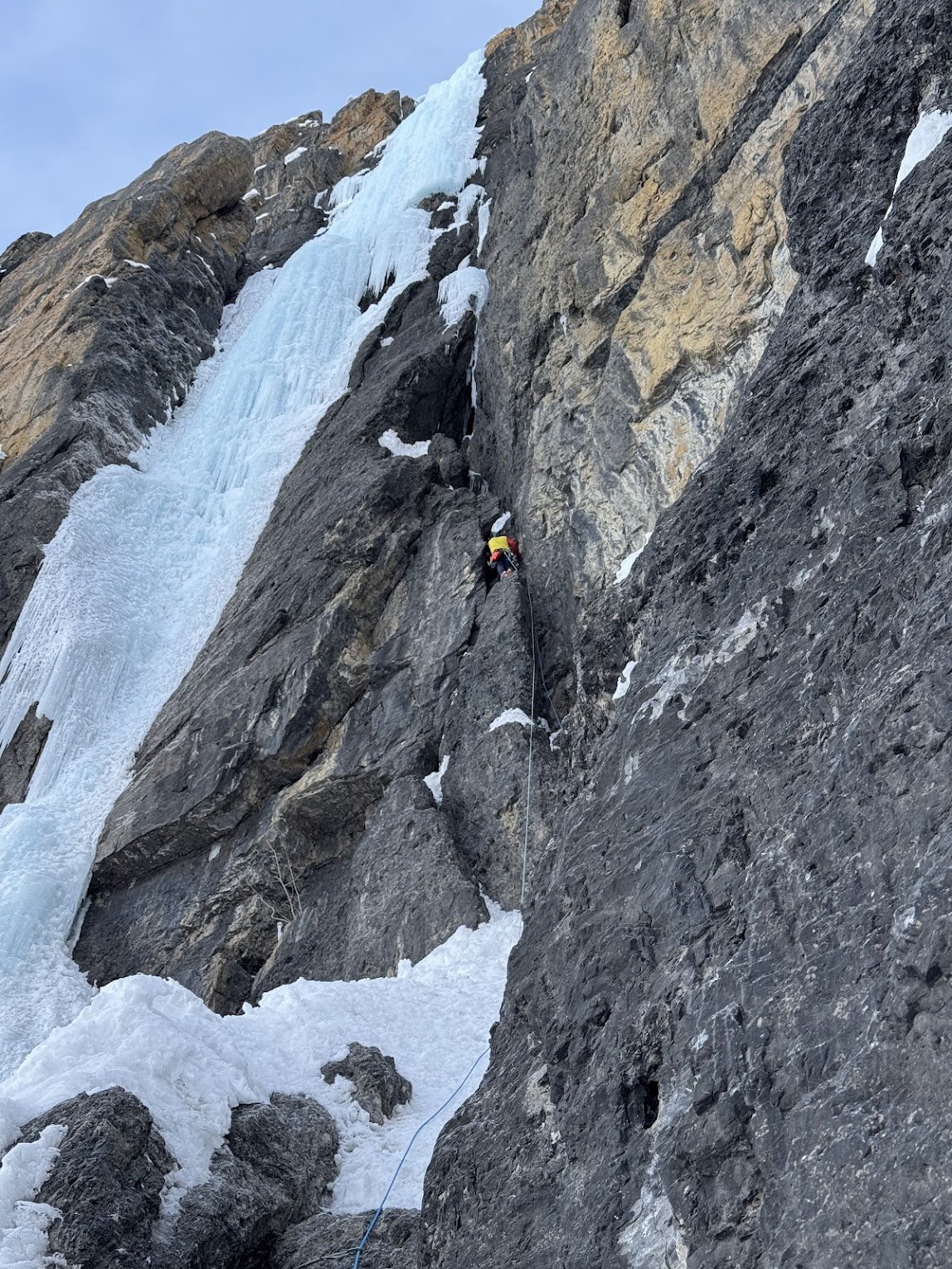
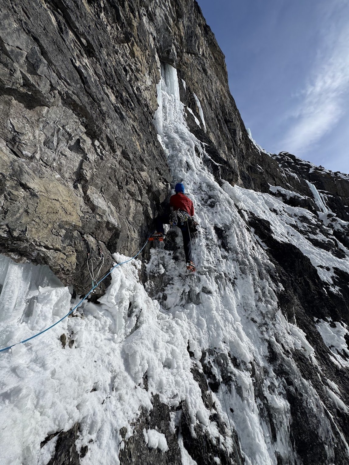
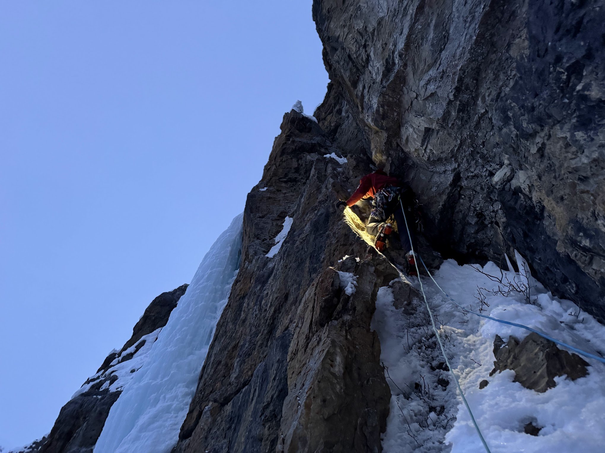
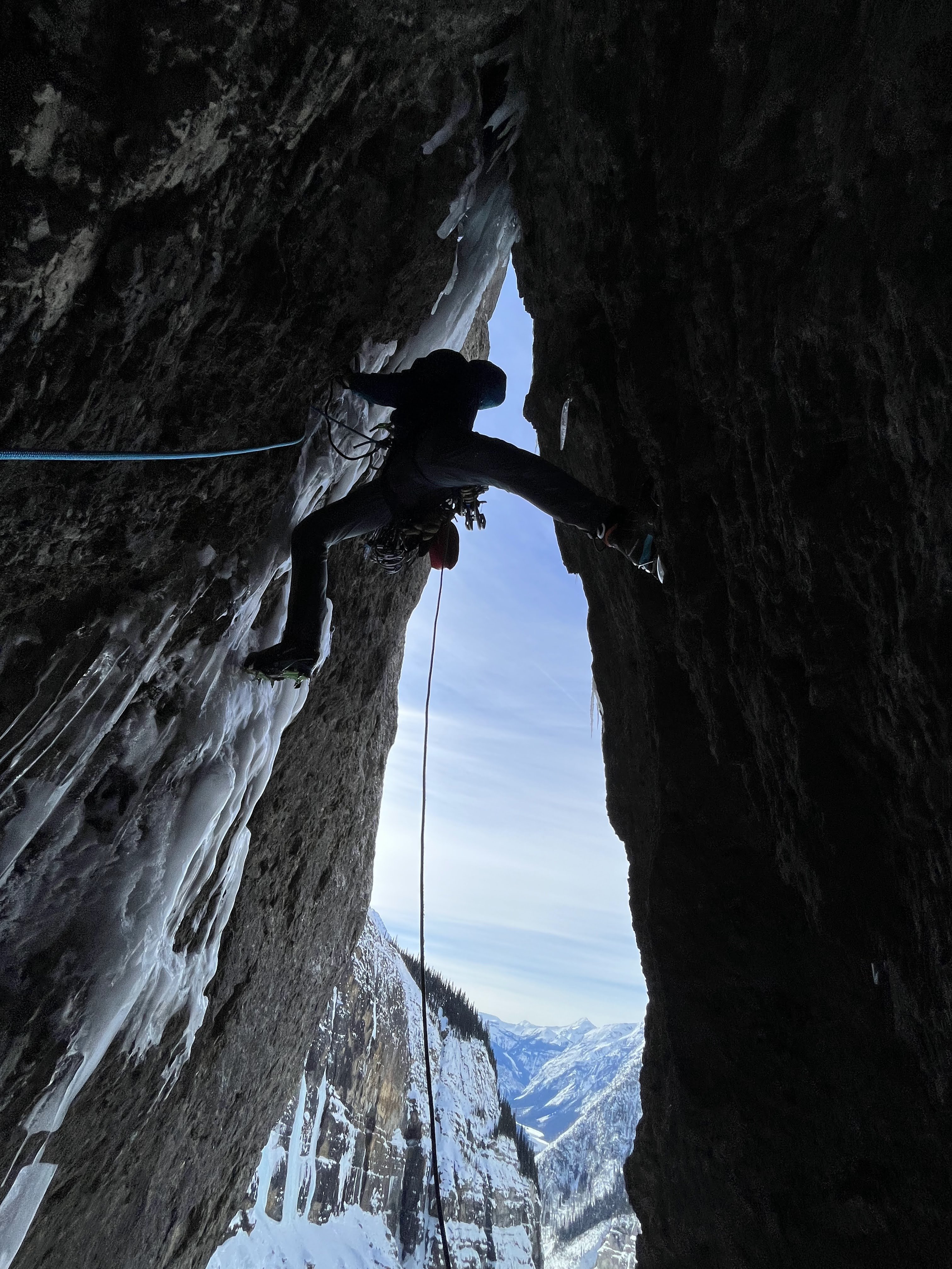
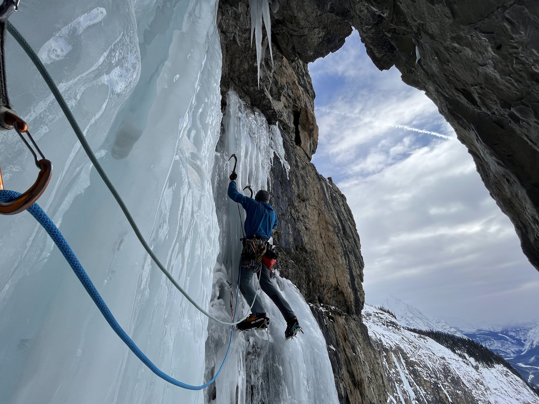
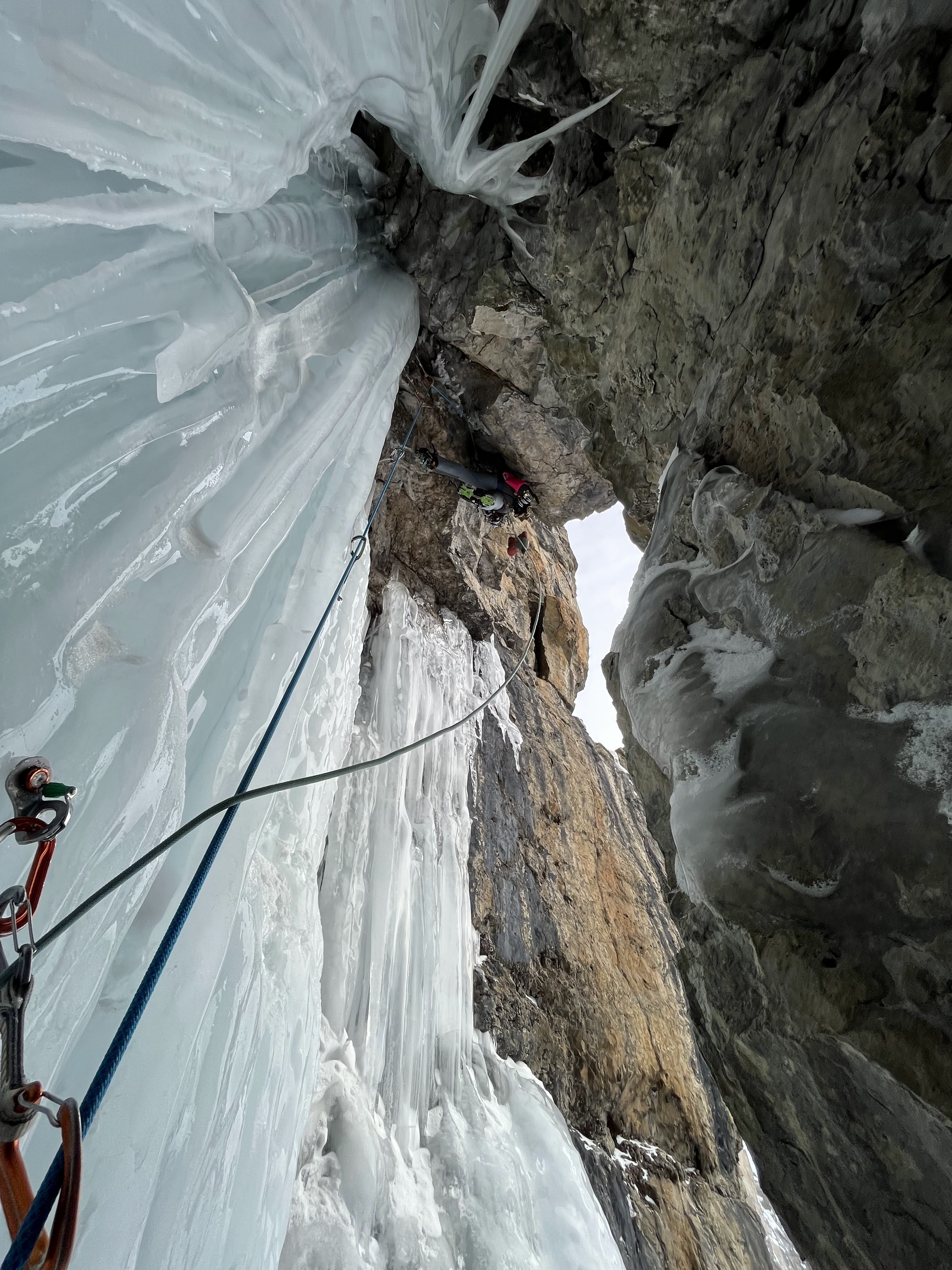
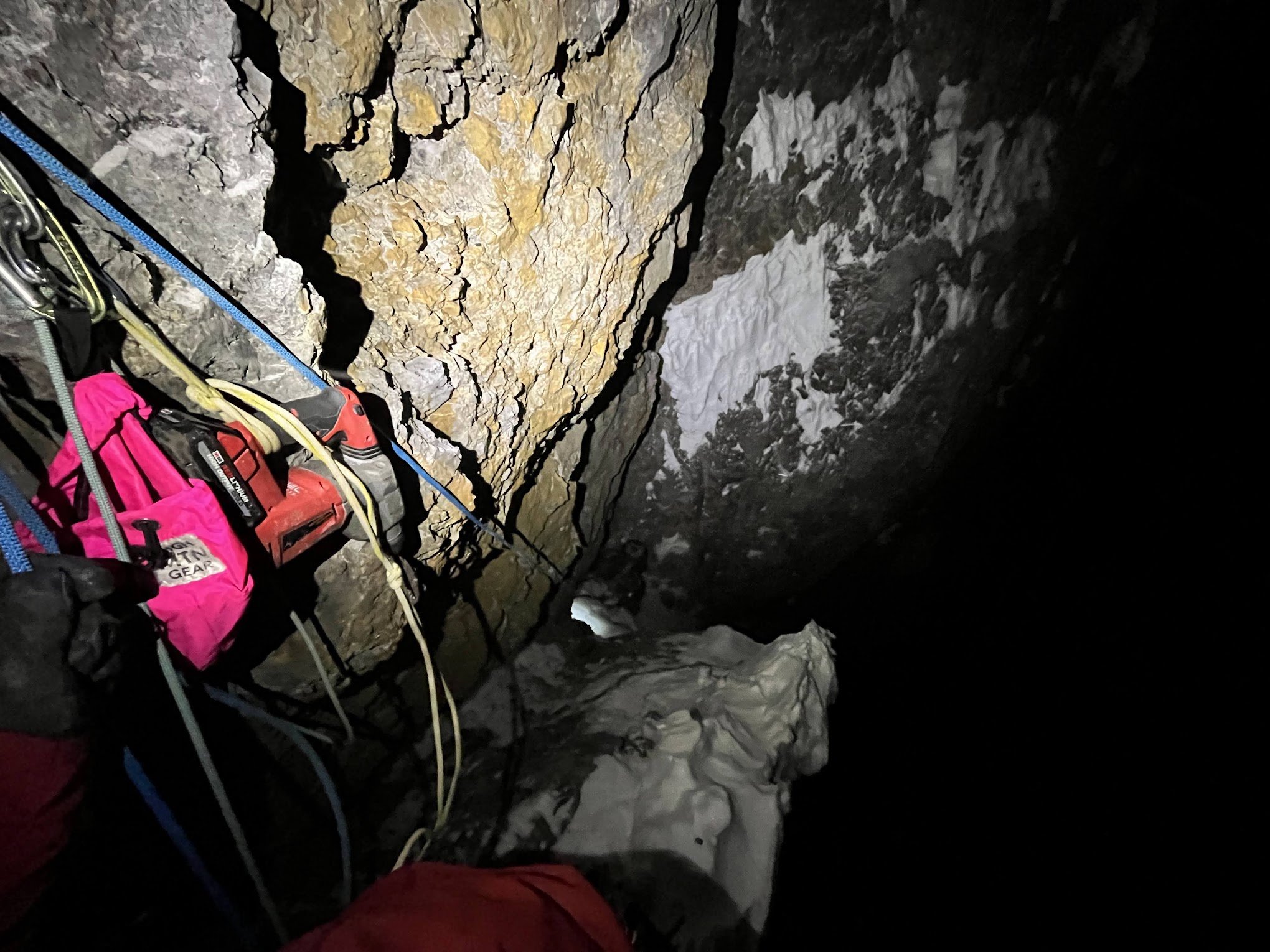 5 points