Trip: Glacier Peak - Frostbite Ridge
Trip Date: 08/18/2023
Trip Report:
North Face of Dakobed Solo (4th AI2 Steep Snow)
I had been eyeing this route all summer and finally the weather and ice conditions lined up for an attempt. The varied terrain felt like a good alpine test piece for me.
Day 1: Frostbite Ridge (Kennedy Glacier Approach)
Day 2: Descent via Gerdine Ridge Direct/Disappointment Peak Cleaver
Started the day at 3:01am from the North Fork Sauk Trailhead weaving through the forest by headlamp. Thoughts of rogue black bears and mountain lions were looming as it tried to keep about a 3mph pace. After about 3 hours and several water stops I made it to the PCT N-S junction. I tried my hardest this time to hydrate the day before and during the approach to be able to save on water consumption at the top and on the descent. The trail then continues on the PCT heading N over a ridge towards portal peak. Eventually descending to a beautiful meadow before being swallowed by the forest. I made it to Fire Creek Pass at 1130am, stopped for lunch and to fill up on water, the taste of a fresh roast beef sandwich while deep in the wilderness was pretty primal. At 12 I left the PCT up the Glacier Creek drainage for some light bushwhacking.
Soon I gained the ridge that overlooks the remnants of the Kennedy glacier and saw the bivy site everyone mentions. This would be a good stopping point (about 22 miles in) but i knew a summit bivy would make this climb more special.
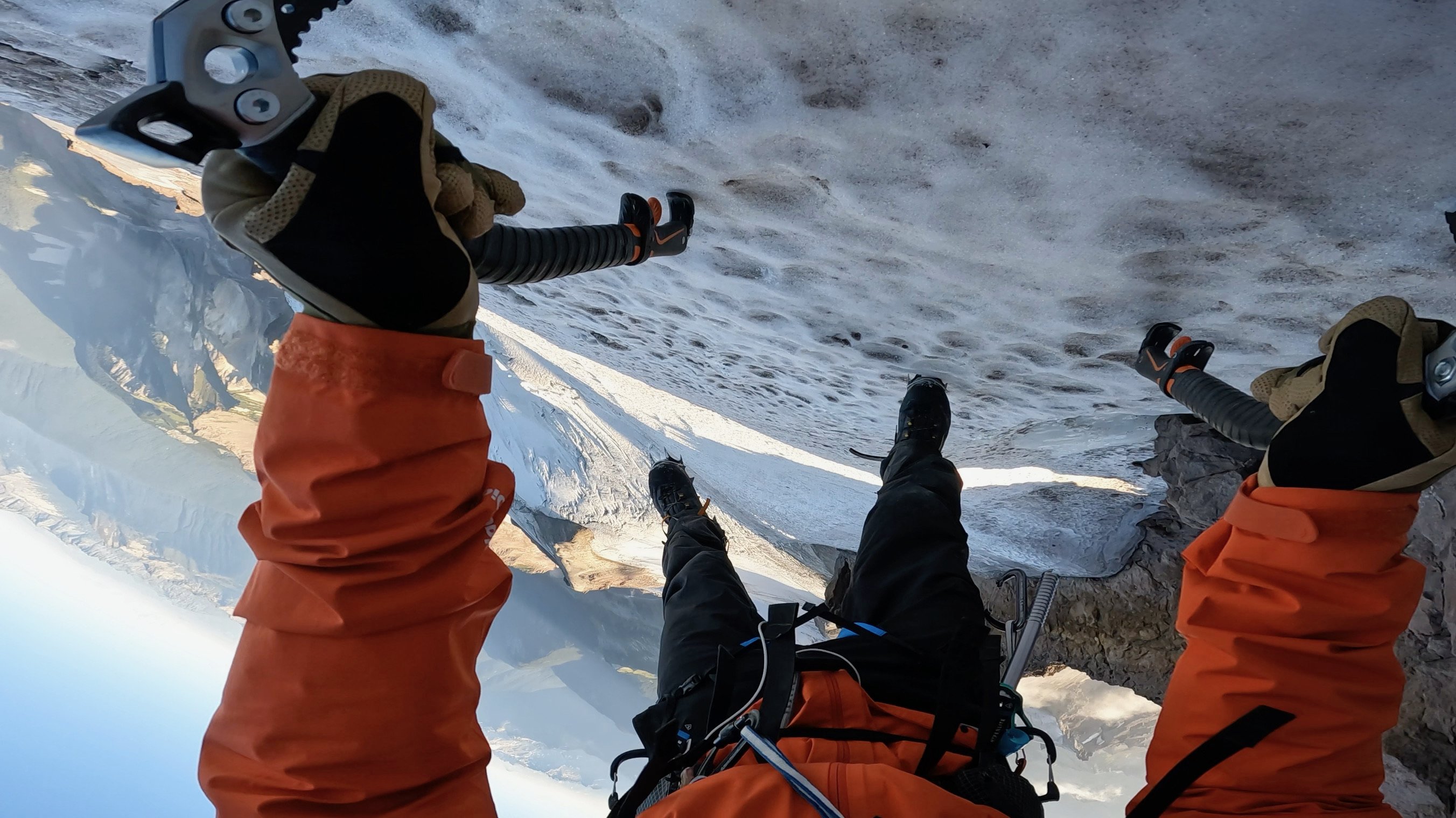
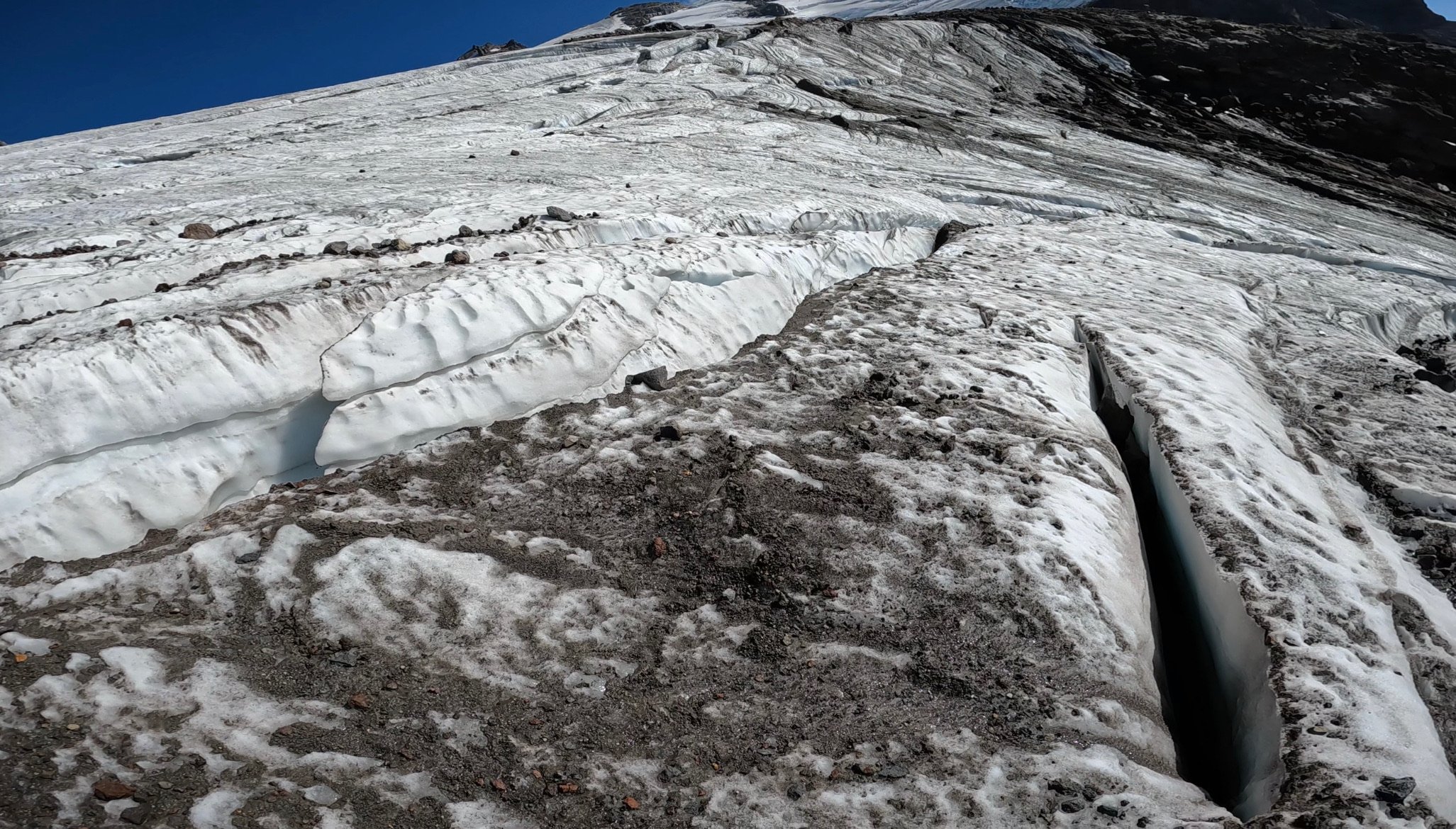
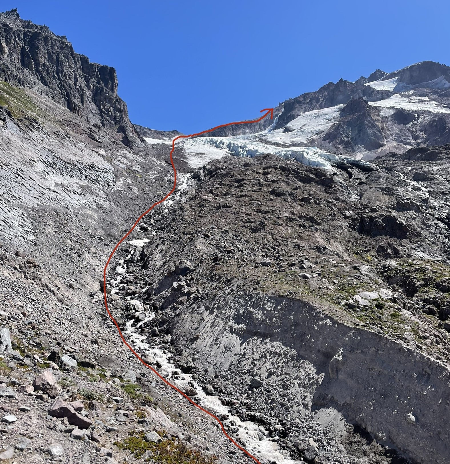
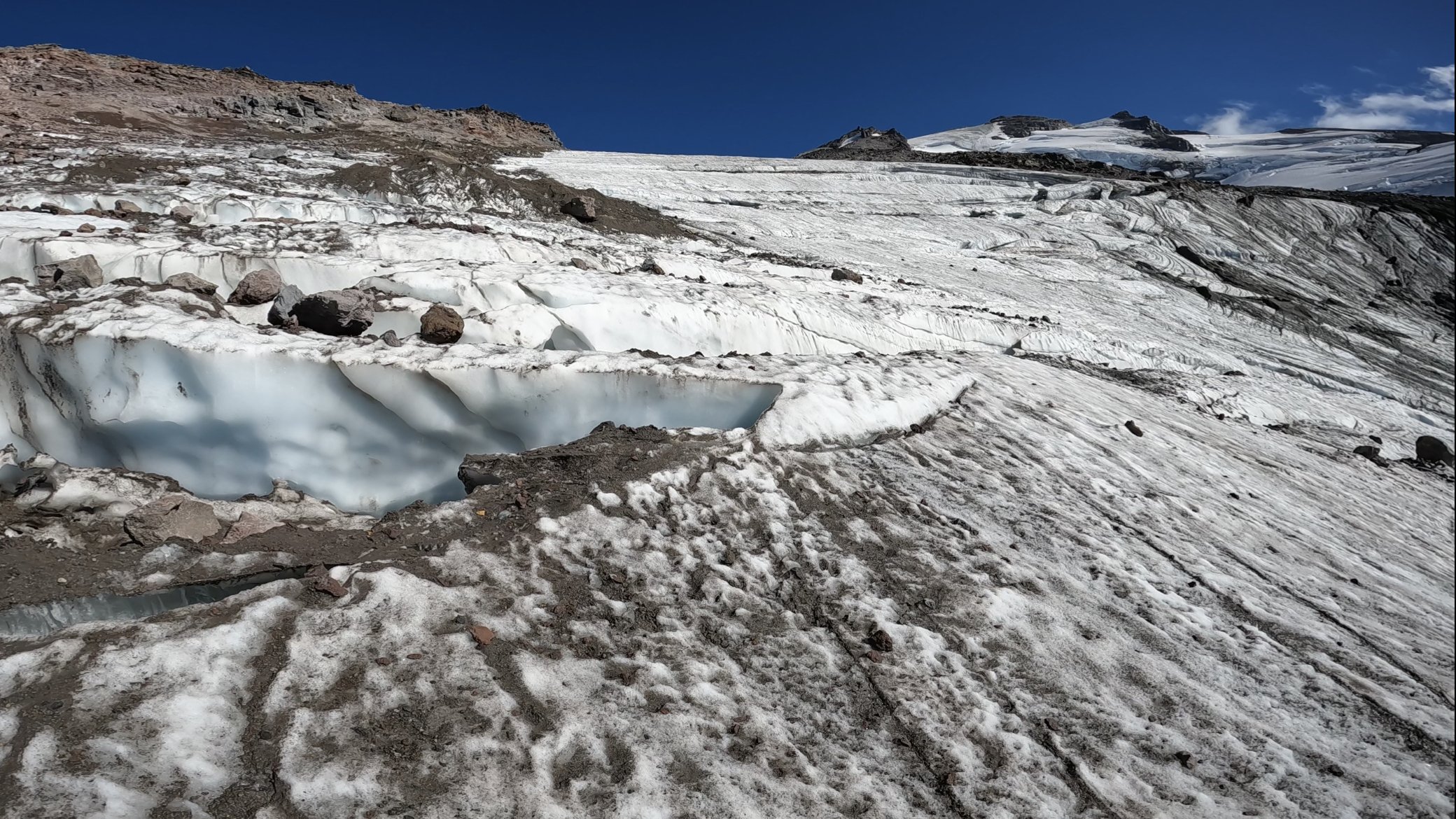
The climb up the left side of the stream was half ultra loose rocks and dirt and moraine covered remnants of the glacier. Rockfall on the left and seracs on the right. pick your poison here. I followed the rocks on the edge of the ice for what felt like forever until finally putting my crampons on at the foot of the glacier.
It looked like a bomb went off here, glacier broken to pieces, rocks everywhere, and somehow the loose rocks even had dirt and smaller rocks on top of them too. Had to zig-zag across the glacier to find connected pieces, moved slowly and deliberately through here. Only had to really step on 2 snow bridges, the rest was connected ice of the glacier.
Eventually the glacier joins with Frostbite ridge where I left my crampons on and pretended this was like DC. This “Ridge” is simply a pile of scree, every step felt like walking in ankle deep powder and dislodged tons of debris.
Struggled up the ridge, broke a trekking pole, and finally got on the little knife edge under the “rabbits dick”. Every step here raining rocks down both sides of the ridge. Really glad i was the only person out here for this section. Finally got to the feature and took the recommended bypass to the left across the steep snow slopes. This section was quite exposed and the wind blown neve was fun to climb.
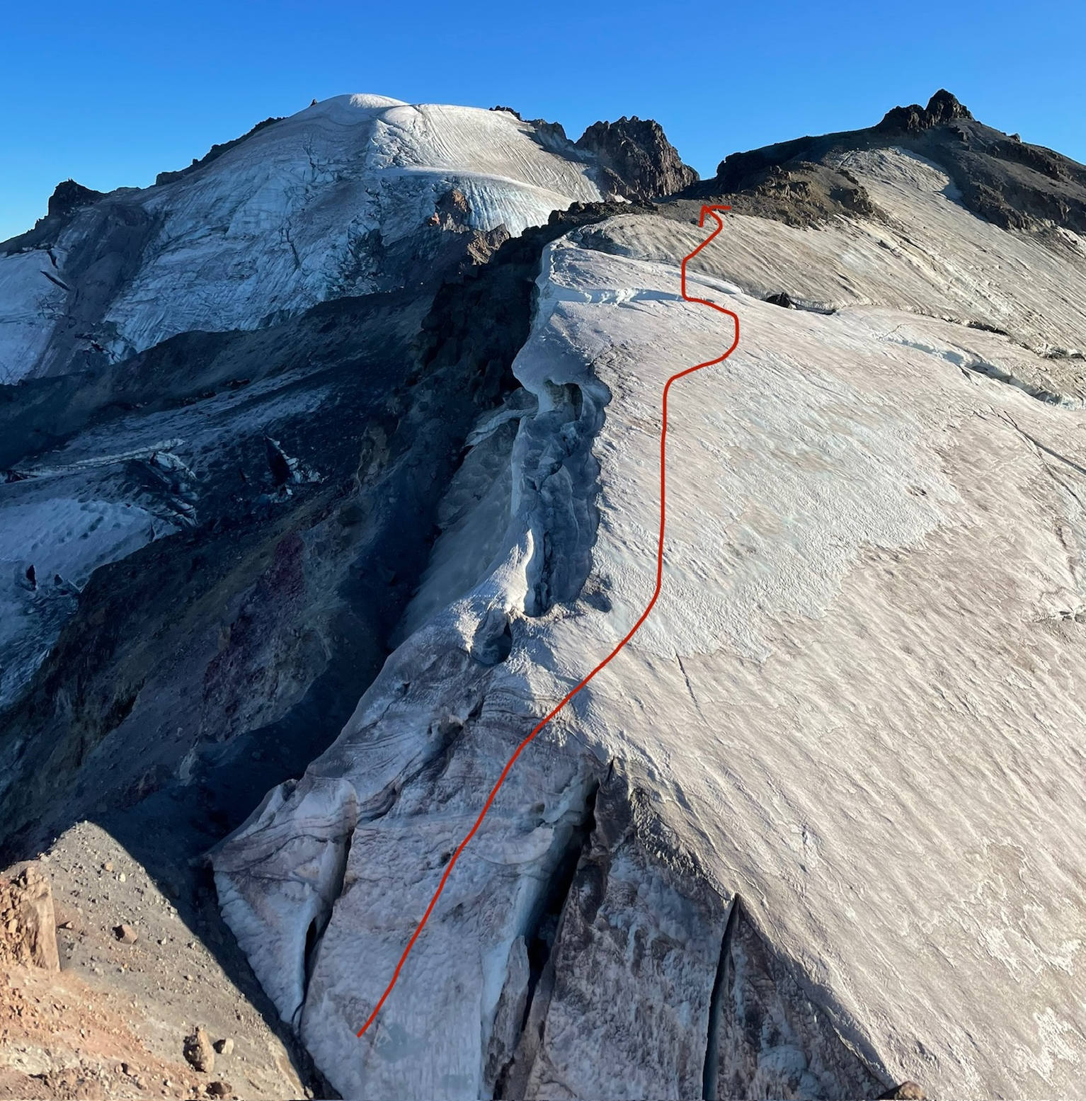
Finally got to the rabbits ears. The downclimbing here was way less sketchy that i thought it was going to be. Simple scrambling down to the steep snow field traverse, running water here. Motored up the upper Kennedy glacier and traversed around a hole to get to the ridge above.
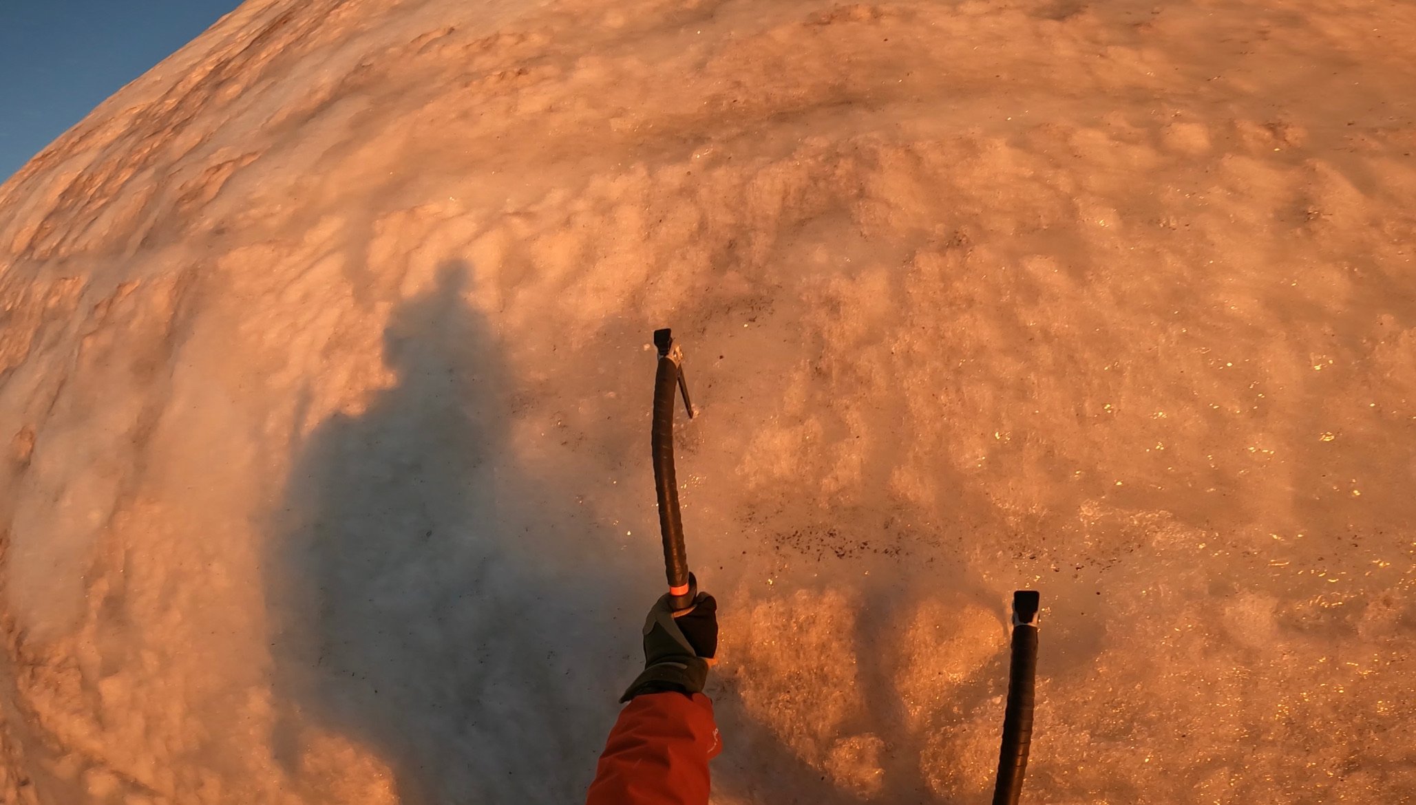
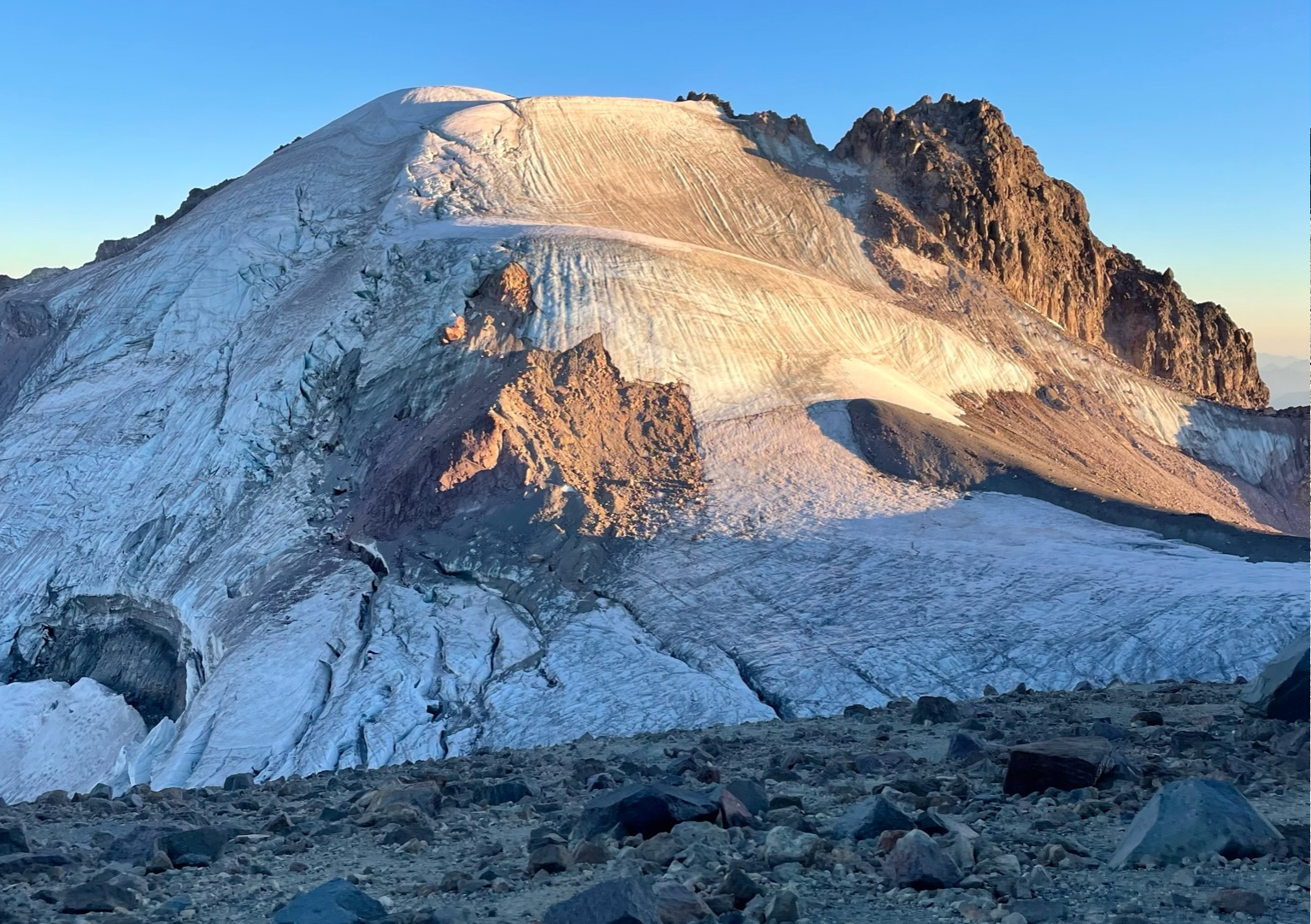
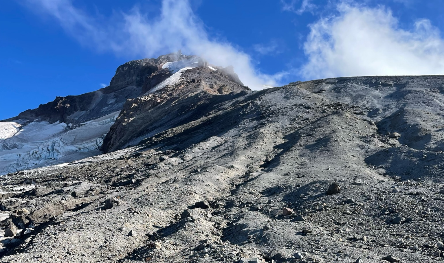
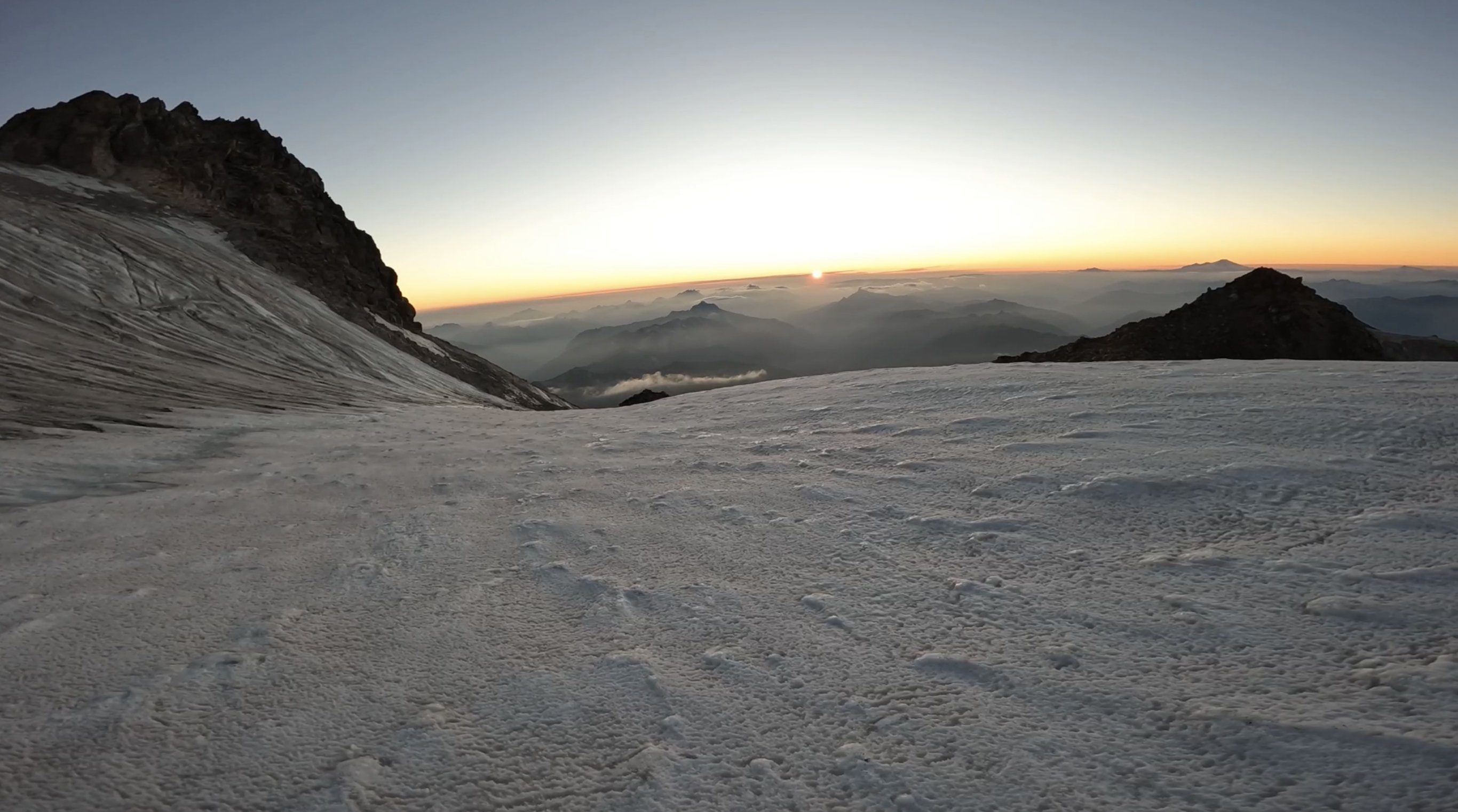
Then the unnamed headwall came into view, glowing in the evening sunshine. Sharing a sunset with the North Face of most remote Cascadian Volcano was special. I was racing the sun at this point, it was beginning to set and I only had about an hour to make it to the top before it was going to be getting dark.
The base of the head wall was all exposed ice, all the snow was gone. I climbed the first ice step in the sunset, and on the ledge feature that splits the headwall the sun went down.
Almost every stick was a hero swing, maybe 1/10 shattered some surface rot. The ice was steep enough that you couldn't walk up it, definitely at least AI2, but also had lots of features to rest on if you needed. I got some sweet gopro footage of the climb that shows the conditions/difficulty encountered.
https://youtu.be/lv3px5eKino?si=-lHOC3Eju77gPPuO
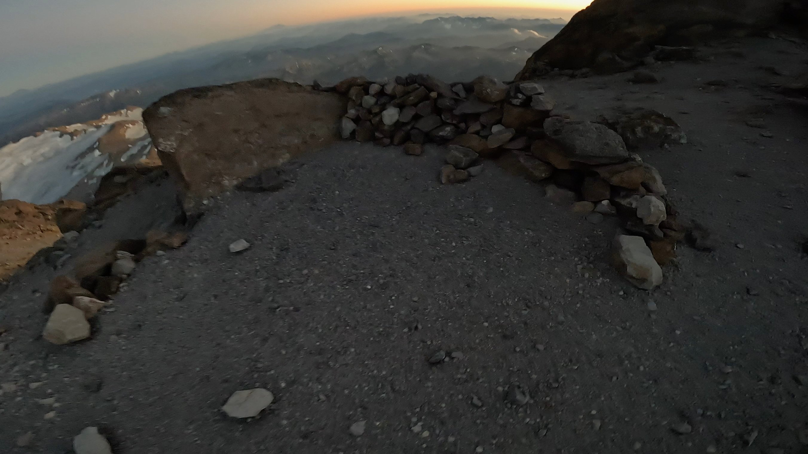
Climbed the second step and topped out at 830pm. I crested the snow dome in the back using both my axes as canes and out of breath from racing the sun up the headwall. I was completely worked but the summit was just steps away on a rock formation to the right. I got to sign the register in the last rays of sun for the day. Magical. It was incredibly windy, maybe 40+ mph gusts, and afterwards I retreated to the bivy site and set up my bag in the howling wind with shaking hands.
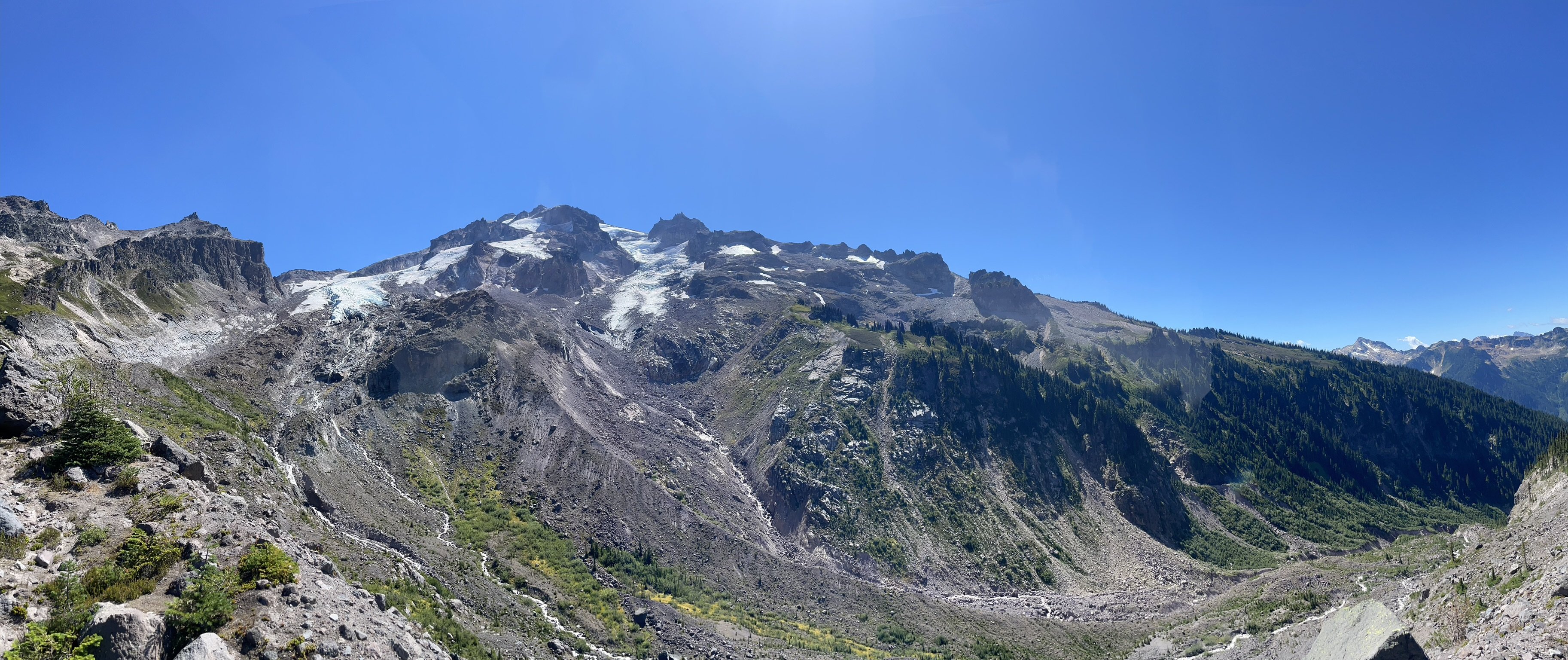
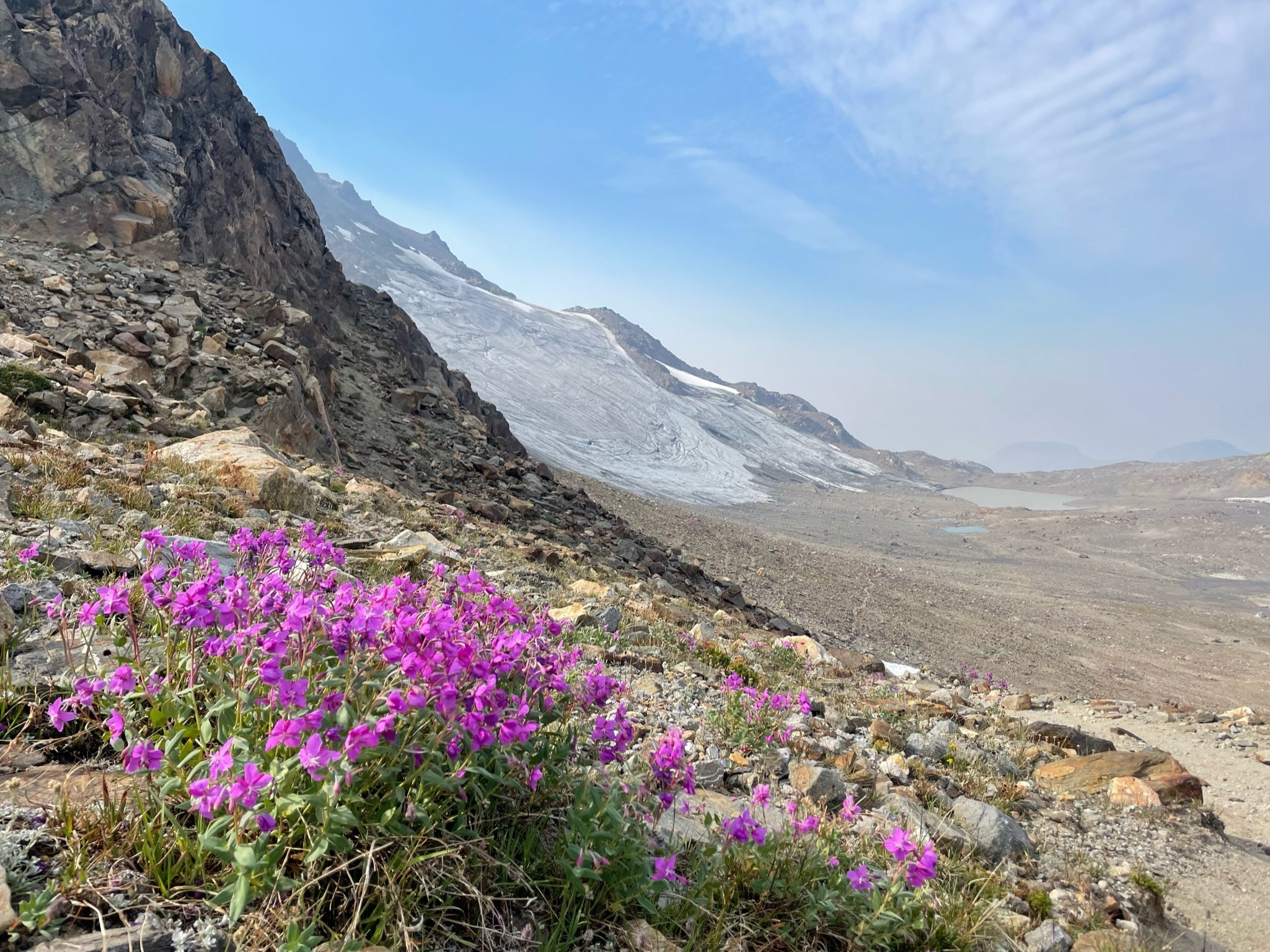
I didn’t end up eating my dehydrated meal because boiling water in this wind was going to virtually impossible with a Jetboil. I settled for a pop tart and fell asleep to the whipping sound of my bivy sack in the wind. Woke up around 1am and it was dead silent, poked my head out of the bag and the vast array of stars greeted me. Just the starlight was bright enough that I didn't need a headlamp to see around me. I slipped in and out of sleep until finally getting up at 630am to pack up. Chatted with a nice guy who made it to the summit for sunrise and got some beta for the scramble. I started the descent at 7am and made it to the car at 4:15ish. Opted for the loose scramble on disappointment peak since the Cool Glacier looked completely shattered and apparently the downclimbing isn’t that bad. I figured if there is an option to avoid soloing a glacier it should be taken. Some super chill people gave me cliff bar at the campsites by the base of the Gerdine Ridge, this was much needed as I just ate my last stinger moments before. If i thought Kennedy Glacier looked like it got carpet bombed, then the south side of the mountain looks like its been through a nuclear blast. The shattered landscape seemed to stretch on forever, but the occasional wildflower was nice to see. Doing this big lollipop loop had such varied terrain which added to the classic feel. It was also interesting/sad to see how much the ice/snow has receded from past trip reports on here.
This felt like a blue collar Mt Olympus, a little more rugged but overall similar vibes. Instead of finishing with mellow rock climbing, you finish with mellow ice climbing. Instead of a pristine NP trail to get to the glacier, you have PCT linked to a bushwhack chossfest. Instead of paved NP roads, you have the 10 mile potholed forest service road. No Cascades alpine ascent is truly complete without a margarita and Carne Asada stop at Dos agaves in Darrington.
Gear Notes:
2 tools made sense for me since I'm not a super strong ice climber. Unsung hero was the bag of salt and potassium i brought.
Packing List: https://lighterpack.com/r/0phmnc
Approach Notes:
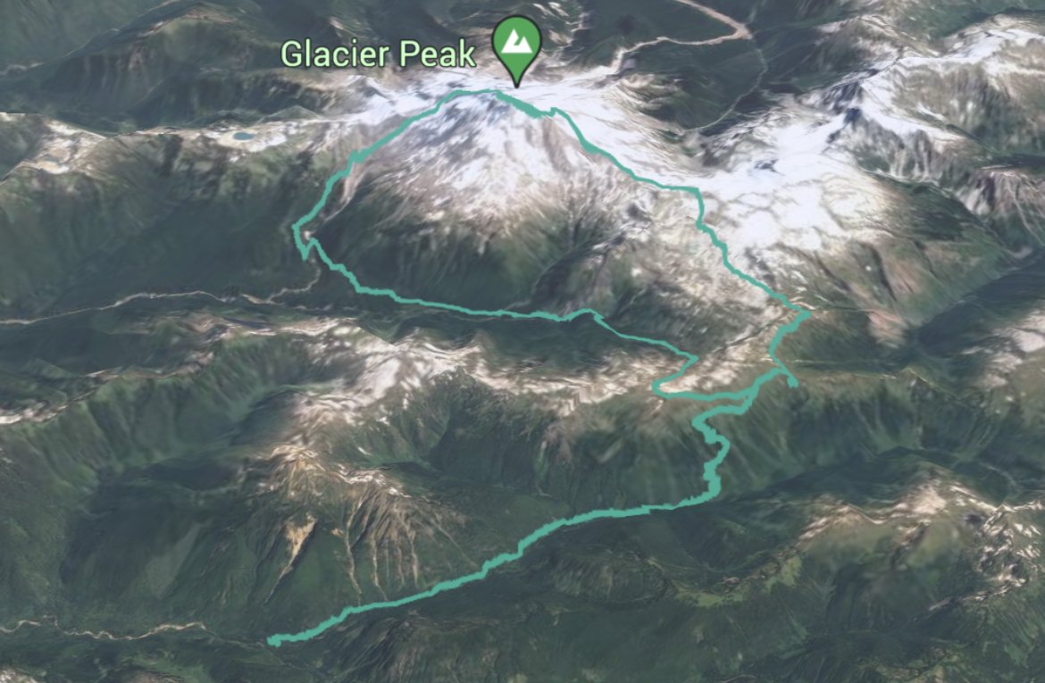
Stats: 36hr51m c2c, 17.5hr car to summit
Tracks: https://www.alltrails.com/explore/recording/afternoon-hike-a62344a-60


")


 tr0y changed their profile photo