

CascadeClimber
-
Posts
968 -
Joined
-
Last visited
-
Days Won
6
Everything posted by CascadeClimber
-
Not VIPS, just the commercial interests (hotel and guide concessions) and their paying customers (people staying at the hotel and guided climbers). So the road is good enough to drive, but only if you are a business making money in the park, or their paying customer. I knew this would happen and it irritates the living shit out of me. Whatever park person made this call is a fuckhead and can go to hell. If it's (the road, the park, or any portion thereof) closed to the general public it should be closed to everyone. Period. :mad: :mad:
-
 Yes, the picture was tweaked. Yes, it was tweaked without the photographer's consent. Yes, it was used without the photographer's consent (at least as far as he can remember). If I'm wrong, correct me. If not, I'm sort of surprised that the NWMJ group would do this. Not that I would have objected, but it's nice to be asked first, especially when taking artistic license with someone else's work. Here is the image after my post processing:
 -
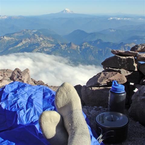
Climb: Mt. Baker-Coleman/Upper Deming Date of Climb: 9/17/2006 Trip Report: A fresh coat of snow covered up the late summer ugliness. Two large crevasses have appeared just below the col at 9000', one is nearly wall to wall. Three Canadians on the way down Saturday said, "...it's impassable. Well, maybe if you traverse way over. We didn't have the gear." Whatever. The only gear we used was two screws to hold our tent down. The rangers have closed the toilets with a crafty combination of duct tape and clothes line. The weather sucked (though it did de-Mountiefy the route). It was just good enough to keep going until about 9800', where it started precipitating in every direction except down. Fuck it. We went on up, stumbled around in 150 feet of vis and got to the summit. Props to Garrett, Dave, and Heather for kicking ass their first time in crampons and dealing with the weather to make the summit. Three of five human sponges on the summit: Gear Notes: Goggles (priceless) Goretex (worthless) Umbrella (shouldahad)
-
The left side of the ice cliff looks like it will go. I guess this is also called the Ptar. Ice Cliff route. Anyway, looking for a partner to go in Friday evening or Sat morning, summit and out on Sunday. I don't want to belay a bunch of pitches, so solid steep snow, ice, and choss skills required. Email me: loren@cascadeclimber.com
-
recovered.
-
The 23rd Psalm, Northwest Climber's Edition The Random and Omnipotent Goddess of Northwest Weather is my Shepard; I shall want. She maketh me to become soaked to the bone in green slide-alder thickets: She leadeth me onto the slick-as-snot log crossing the raging waters. She taxeth every fiber of my soul: She leadeth me unto the way-paths of Beckey and I take His name in vain. Yea, though the approach seemeth like a walk through the valley of the shadow of death, I will fear no evil devil's club: For thy Goretex art with me; Thy trekking poles and thy cortisone creme, they comfort me. Thou preparest a sucker-hole in the tempest storm for me in the presence of mine friends; Thou annointest my head with rain, ice, and rock fall; My courage runneth away. Surely Fred's "obvious gullies" and "easy 4th class terrain" shall beckon me for all the days of my life, and I will dwell in the House of the Cascades forever.
-
[TR] Squamish Apron- Unfinished Symphony 7/2/2006
CascadeClimber replied to fern's topic in British Columbia/Canada
Sendbot Fern! I like the truthiness of the word 'uselessest'. -
First summer ascent?
-
Here are a few pics: Directly in the firing line Fingers crossed as we head up to the Traverse of Angels Just past the Traverse of Angels. I have a short video from this spot that I'll post later. Jens turning the last obstacle before the summit ice cap. I took quite a few pictures between Thursday night, when we left White River, and Saturday when we got back there, but not a ton on Willis itself. For the first two hours it was dark, and for the last two hours we were hauling ass from one pseudo-safe spot to the next.
-
The do, or did. I saw a small group of them crossing the toe of the Adams Glacier a few years ago.
-
Send! Send! I would, but I'll be checking out some sweet granite in Renton.
-
I'll have a TR up in a day or so, but here are two pics, both from the top of Gibraltar Rock: Looking down at the team of two in the Ingraham Looking up at the upper mountain The ID team joined the red line along the lip, just out of frame to the right. L
-
I'm pretty certain that it was skied on tele gear by Dave Warnick in the mid to late 90s.
-
[TR] Wa Pass/Goat Rock (Mazama)- ice 1/1/2006
CascadeClimber replied to lcm's topic in North Cascades
Oh, there was more than climbing going on. Have you forgotten the white-boy-dance-of-warmth so soon? Perhaps a reminder is in order?? -
You've obviously never done it with McBee driving. It's 675 miles, 670 on I-90, and I've done it every time in 10 hours or less including a sit down dinner.
-
I want to clear up some things here, or at least provide my perspective. First of all, this is not a death-route or any such thing. None of the people spraying about how dangerous it is have been on the route. Yes, I understand that you've seen ice-fall (and a jökulhlaups, in one case). But you have not been on the slabs and seen the protection offered by the terrain. With dramatic flair, Jens may have inadvertently induced some of this misconception. Yes, it is exposed to icefall in places. Yes, those places are dangerous. But there was very little debris anywhere, and what there was was in the water course that we (quickly) crossed below the left-hand icefall, and on the small snowfield immediately below the right-hand icefall, which we didn't go near. The amount of debris was significantly less than what I've always seen below the Ingraham ice fall on the DC route, and certainly much less than I've seen nearly filling the moraine below the Ice Cliff glacier. Icefall from the left cliff may have hit us on the slabs. But it would have had to been very large, of the type Phil saw, or have happened in the few seconds while we crossed the water course. Perhaps the most dangerous place on the route was where we climbed between the two waterfalls below the right ice cliff. This is where I was most afraid on the route, but from the fall exposure and total dearth of gear. I made a mistake by wearing rigid-soled mountain boots, rather than rock shoes. Time is of the essence here, but having said that, this section is not exposed to large blocks of falling ice. Terrain undulations above pulverized the one serac fall that I saw later in the day. Had we been climbing below it, we may well have been okay, as the remains of the pulverized serac would have tended to stay in the water courses, which we avoided except to make quick crossings. A change of underwear would have been in order though, without a doubt. Had I been in rock shoes, I believe I could have covered this, the most dangerous terrain, in 15-20 minutes, which is not dissimilar to the amount of time many parties, in the dark, spend blissfully unaware of their position under the Ingraham icefall. I in no way mean to say this section is safe. But I also don't think we defied the odds by not getting the chop here, either. Above this fall line we scrambled for a while, soloed two (+/-) easy pitches,and belayed one traversing rock pitch with decent gear. The glacier was technical, but not difficult, even for a person of moderate ice climbing skill, like me. The rock climbing below the slabs is runout in places, but, with one exception (where we got shut down on our first attempt several years ago), there is gear where there needs to be. Jens made a brilliant lead of the crux pitch, which does have gear. I would have had to aid it. The other belayed pitches were generally in the 5.7-5.9 range. The route is in a north-facing cleft that is shaded much of the day. I felt much less afraid on this route that I did climbing up and down the C-J Couloir some years ago: This route offers much more protected climbing and more opportunities for safe rest. Secondly, I believe that this is a good line, with a nice mix of fun, relatively unbrushy rock climbing, slab walking, and sporty glacier climbing. I would repeat this route before I would thrash up the near-vertical forest on the NE Buttress, certainly. I don't want conjecture portrayed as fact by people who've not climbed the route to cause it to be labeled a death-route: It deserves to be repeated. Lastly, I have no death wish, nor do I think of myself as having 'huge balls'. I have a family and I enjoy coming home to them in one piece. We all take risks in the mountains: By going headlong into fear we become free of it, if only for small bits of time, and that experience of being free of fear is the essence, for me, of feeling alive. But I don't want anyone to label me as reckless because of speculative, subjective talk by people who've never climbed with me and haven't been on the route from which they are interpolating judgement of me. Enough said. Loren
-
Lost: Car door opener, Cascade Pass lot
CascadeClimber replied to CascadeClimber's topic in Lost and Found
With your momma. -
I think it got left on my bumper after a few too many beers a couple weekends ago. Toyota standard model: Black with three buttons on the front and a red one on the back.
-
They were numbers 4-9 on that route yesterday, and should have had nice set of steps to follow from Illumination Saddle across and up (courtesy TPM). Worst postholing was to the hourglass. It's in fine shape from there- a walk up. The upper buttress on Yocum looked tasty. Someone go get it.
-
Happy Birthday, Ms. Pandora. Thanks for all the climbing, laughs, and inspiration. You rock. In the beginning: Sometimes Pandora looks kinda funny: Pandora likes to sleep: Pandora likes to eat: Pandora likes to brush her teeth (barefoot): Pandora LOVES to downslog: Pandora likes to sit: Pandora Wethead: Pandora Hat: Pandora likes her name: Pandora has a fetish for magic white poop: But mostly, Pandora loves to climb:
-
Found: Jacket at #2 Newbie Girls climb @ x38
CascadeClimber replied to CascadeClimber's topic in Lost and Found
n0 m0r3 putt1ng y0ur g3ar 1n my pack wh3n 1'm n0t l00k1ng s0 1 hav3 t0 carry 1t d0wn d00d3tt3. -
I've only been climbing at Marble for a few years, but even in that short time it seems to me like the water flow is highly variable in both volume and path, even excluding the 'ice farming' project of a couple years ago. Anyone else notice this?
-
Okay, I'll bite: Where is said "in" overhanging glacier ice??
-
Saturday morning: Drive from Seattle to Ingalls then back to Seattle, then back to TH to retrieve gear forgotten needed for planned climb of Stuart on Sunday. Use all available brownie points to get wife to meet us at Exit 47 with slings, belay device, and water filter. Saturday Mid-day: Take out angst by going as fast as I can to Headlight Basin. Saturday Evening: Experiment with new arrangements for bones in left ankle while hiking down from Ingalls South Ridge. I recommend against the "bent-inward 90 degrees" orientation unless self-mutilation, masochism, and not climbing Stuart are your objectives. Sunday Morning: Sleep in and feel sorry for myself. Get up for an hour, then take a nap. Apologize to partner, who is beyond gracious and understanding. Marvel at the perfect weather for climbing Stuart. Take note of gear retrieved that is now not needed. Sunday Afternoon: Slowly hobble out to car. Occupy self by constantly swearing under my breath, but not repeating any single combination of curses. Salve ego and sore ankle with beer in parking lot graciously provided by Alpine Dave and AlpineFox.
-
That's because the trails and roads most often used to get to the thing are all washed out. The road to the White Chuck Trailhead is out about 10 miles from the TH, and the trail is washed out, too. Good luck- L