Bronco
-
Posts
3902 -
Joined
-
Last visited
-
Days Won
25
Everything posted by Bronco
-

[TR] West McMillan Spire Speed Climb - West Ridge 8/1/2011
Bronco replied to off_the_hook's topic in North Cascades
Climbers Path Turnoff (1,600 ft) : 45:28 / 06:30 Heather Bench [top of hill climb] (5,200 ft) : 1:50:30 / 07:35 That's 3,600' in 65 minutes. ? -
I thought it was nice that entry into National Parks was free on MLK but the road to Paradise was still closed.
-
New to Climbing in PNW - Lots of questions
Bronco replied to Mark Edmonds's topic in Climber's Board
-
Not sure how I missed this great TR either. You did a nice job of planning for contingencies, don't worry about the SAR call, it happens. Pretty badass effort!
-
auction Photo Auction to Benefit CascadeClimbers!
Bronco replied to JasonG's topic in Climber's Board
I'm submitting the opening bid on Eldorado and the Pickets. These would look great in my office! -
Am I the only one who is confused by this? What else is there?
-
Can't say I climb 'em like I used to but still getting out. Where's your TRs?
-
Can't make this one, maybe see you in January!
-
I clicked the donate tab and:

-
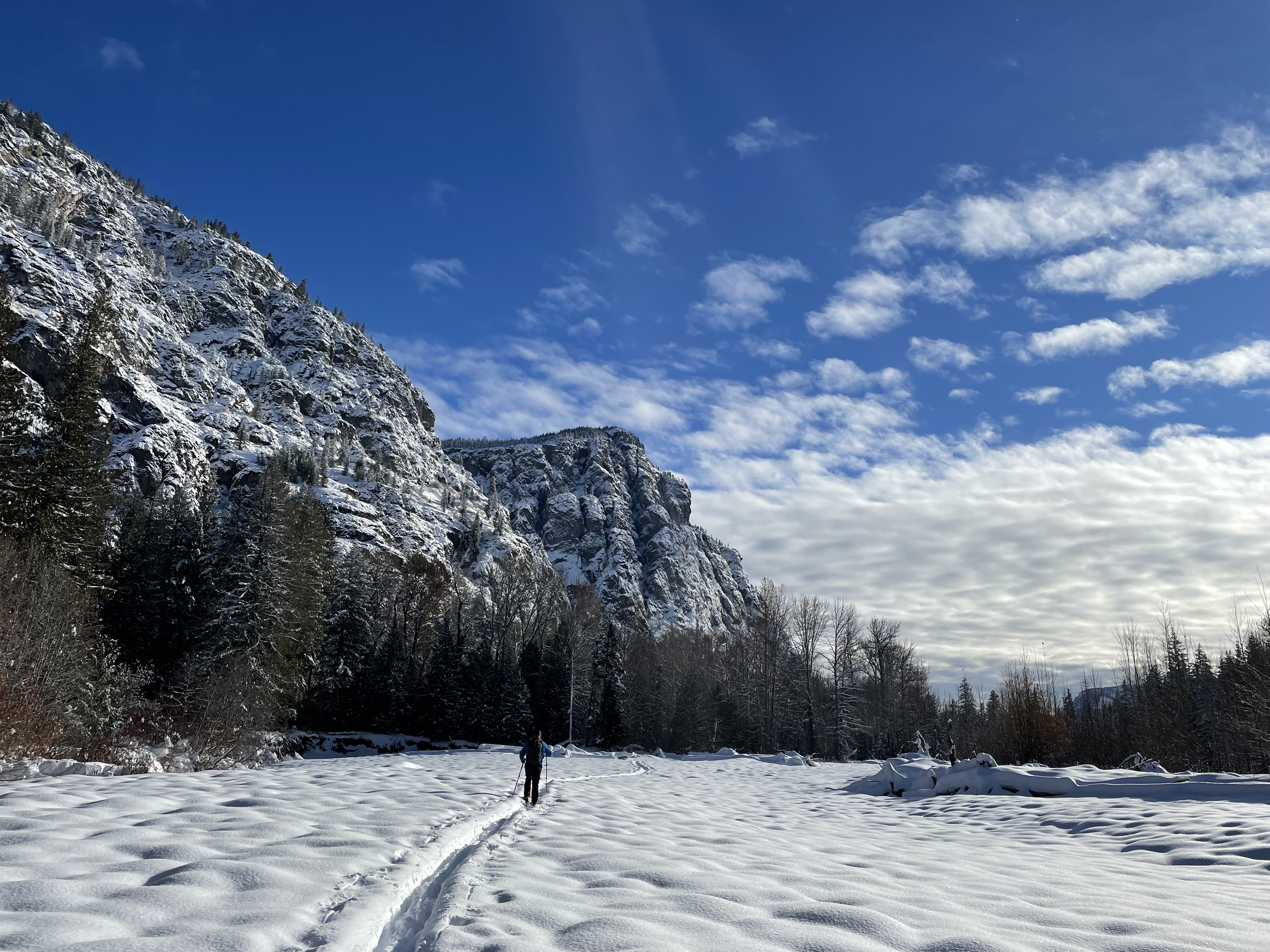
Washington State Department of Transportation North Central Region – 2830 Euclid Ave. Wenatchee, WA 98801– 509-667-3000 TRAVEL ADVISORY Nov. 8, 2022 Contacts: Lauren Loebsack, communications, 509-860-0000 North Cascades Highway to remain closed for winter WINTHROP – With nearly 30 inches of snowfall over the weekend, SR 20 North Cascades Highway will remain closed for the winter between Ross Lake Dam trailhead (milepost 134) and Early Winters gate (milepost 178). The route was closed between milepost 134 and 171 for potential avalanche danger on Thursday, Nov. 3. Throughout the weekend, the North Cascades and the area surrounding the eastern slopes were repeatedly hit with snow and rain. Though the immediate avalanche danger is now low, conditions are likely to change. Maintaining the closure now will allow crews to focus time and resources on the communities east of the mountain passes that have received up to 2 feet of snow in places. A snow berm has been built at the Early Winters gate at milepost 178 while crews focus on clearing routes on the east side of the mountain passes. Depending on resources and conditions, the road may be reopened to Silver Star gate for sno park access prior to the holidays. Spring clearing work is typically assessed in March and the seasonal reopening can be as late as June, depending on conditions. Updates on the spring clearing work will be shared in the North Cascades newsletter, the real time travel map, and on Twitter at @WSDOT_East.
-
Missed this the first time around. Mad respect for Kim putting up with your shenanigans!
-
This is serious stuff!
-
[TR] Good and Storm King - NE Butt, SW Route 08/19/2022
Bronco replied to geosean's topic in North Cascades
Funny, we found an abandoned rope in the "Black Notch" on Goode in 2012 where someone rapped the wrong gully and left the rope behind for some reason. We decided to just haul it out partially due to it being garbage in the mountains but also because it was set up on the wrong rap route. It's a long ways to haul a rope, especially when it's not yours to start with. -
That's a poetic finish if I've ever heard one!
-
Green Beckey lists the NE Route, NW Shoulder, SE Face and some other variations. You might check it out from the library or something.
- 1 reply
-
- 1
-

-
[TR] BOWAN MOUNTAIN (7895') - South Ridge / Southwest Face 09/03/2022
Bronco replied to Kuato's topic in North Cascades
I've seen a black bear with a complete white stripe down it's back, looked like a giant skunk. Tracks are definitely black bear. I had a cinnamon colored black bear encounter this spring in the upper Methow and found this guide on how to tell tracks apart useful: https://westernwildlife.org/black-bear-ursus-americanus/know-your-bears/ -
Same here, had a pair for a couple of years, the uppers are holding up great. I really prefer leather non-goretex approach shoes.
- 15 replies
-
- 1
-

-
- approach shoes
- trail running
- (and 1 more)
-
It certainly rolls off the tongue a little easier than Ptarmigan Direct.
-
Nice! Thanks for sharing the TR-
-
Haven't been in that way but remember how heinous the brush is along Bridge Creek and thankful for the trail. It could be pretty slow going cross country.
-
Pretty depressing to see the glacial recession in just the last two decades. I was listening to an endurance sport podcast this morning and the runner being interviewed was talking about traveling to Bhutan to participate in an ultra intended to increase climate change awareness. I'm not sure how people justify an International flight to raise climate change awareness, can you purchase a carbon offset or something? Sounds like a scenario from Idiocracy. https://newsinfo.inquirer.net/1147621/bhutan-to-host-worlds-toughest-ultra-marathon-to-raise-climate-change-awareness
-
Wow, great TR!
-
No, it sounds terrible!
-
[TR] Logan and Goode - Douglas and NEB 07/29/2022
Bronco replied to JonParker's topic in North Cascades
I'd say if Washington Pass rock is graded an "A", then the N. Buttress of Goode is a "B-" The most difficult part is generally gaining the toe of the ridge from the glacier, once you're on the ridge/buttress, it's pretty sustained blocky 4th and low 5th climbing. Obviously very exposed but relatively clean. It's been a while but I don't remember any hard moves after making the transition to the ridge.