Leaderboard


Popular Content
Showing content with the highest reputation since 11/26/25 in all areas
-
We are not dead! That was extremely trying. The server totally crashed in a terrible way right in the middle of a super intense week at work for me and I was taxed mentally to the max figuring this out. Luckily I have a couple really good friends, ex-coworkers...but they are friends to give me moral support and confidence to do everything I did which was rebuild everything on modern software. So the site is in a MUCH better place than it was pre-crash. I still have a bunch of maintainance to do, but the site is back up and going. Thank you for sticking around. We WILL keep this place alive dammit.14 points
-
I just had someone offer to buy this site. I didn’t get as far as how much or anything like that but it was a real approach to buy it. By someone who runs online communities in other spaces. I thanked him, his approach was genuine and I think it’s possible his group could run this community in a thoughtful way. But I turned it down. This site is not for sale. At least not by me. When a site is bought and sold the community becomes a product. There is then a need for the community to turn a profit somehow. i have a different vision, of making this site a nonprofit organization that benefits our community and those adjacent to it. That gives an option online for people to connect and share where we are not the product and are not being mined for our data or to be fed directly into the AI machine. But I can’t do this on my own. So if you or don’t you know is interested in helping please reach out. I’ll share more of my vision here but I’ll also listen, particularly to active members of the community. This is not mine, this ours.3 points
-
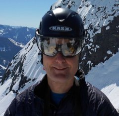
North Cascades shenanigans, celebrating that the site is NOT DEAD YET!
 2 points
 -
Trip: Strathcona Provincial Park Ramblings - Big Interior, Septimus, and Kings Peaks Trip Date: 07/21/2025 Trip Report: This past July @Trent and I went on a ramble to Strathcona Provincial Park up on Vancouver Island. We were supposed to meet up with @wbk at the end of the week to give the Colonel Foster Traverse a go, but we wanted to ease into it. And so we did, sort of. Or maybe we just got schooled by the "Island Alpine" we had heard so much about from @wbk. First off we had to navigate the BC ferry options to the island, which tend to book up early. Nevertheless their ferry system makes ours look decidedly second class, and it all worked our pretty smoothly once we were booked and in line. First stop was the trail to Bedwell Lake which I suppose is a good trail by Island standards, but a grunt nontheless. The bugs weren't bad at the lake but increasingly became annoying as we climbed to our camp just below Jim Lake. We were up early the next morning, rambling up and across on the climber's path to Big Interior. It turns out most use this as an approach to Nine Peaks, but we didn't fancy carrying all of our overnight and climbing gear over the summit and so we settled for the "approach" summit of Big Interior. The bugs, heat, and humidity followed us every step of the way. Nine Peaks from Big Interior: @Trent pulling up on to the summit of Big Interior: The views, of course, were grand, and we barely knew any of the peaks in any direction. So much to do in every range it seems like, there is never enough time to climb them all! But we at least had to climb another on this trip, so we reluctantly retraced our steps to camp. And then promptly moved it to Cream lake, to prepare for the aptly named Green Ridge on Septimus. Camp at Cream lake with Septimus looming above: Septimus: Cream lake: We were up early the next morning, crashing around the lake and down, down, down to meet the start of the Green ridge. Do not underestimate this approach! It is every bit a thrash as anything in the Pickets or North Cascades and was especially character building in the heat, bugs, and humidity. Thankfully we were through most of it in a few hours and soon battling the steep rock and veg into the alpine. @Trent out of the brush and about to do battle with steep veg on the Green Ridge: But soon enough we emerged into the full blown Island Alpine and the grand north wall of Septimus and Rosseau was revealed: Looking down at Green lake from Green Ridge: As we scrambled higher, we came across one of the more vivid bits of rock I have encountered in the mountains. Maybe some pillow basalts that have been smoothed by ice? And then a short rap, some steep snow and steeper rock (but still 4th class) as we wheezed our way above the bugs and on to the summit of Septimus: @Trent on the summit of Septimus: There was quite a flower garden directly on the summit of Septimus: And then the 5-6 raps down the South (regular) route on Septimus. We had heard that you may need two ropes to make this work, but it went fine with a single 60m. Take care if anyone is below you though, much loose rock! By the time we got back to camp it was late afternoon, the bugs were fierce, and a swim was called for to think about our options. It was decided that we would spend another night at Cream Lake, hike out for a "rest" day and then try for a single day trip before meeting up with @wbk later in the week for Colonel Foster. I mean, we're going to do all that, right? But first, there was a sunset to enjoy: In the morning the bugs were still fierce, the heat and humidity back in full force as we packed up to hike the Bedwell trail back to the car. Parting view of Septimus: Big Interior and Bedwell Lake: Thanks to a friendly campground host in the park, we found an excellent free place to camp just outside the park and on the way to Gold River. It was about this point that our appetite for Colonel Foster was waning as the pull of home and no bugs was growing stronger: But first, another peak! We had chosen the "hiker's" route up Kings Peak as the day trip the following, knowing that it was a big grunt and was likely to be hot and buggy as well. Still, it was enough of a challenge as to feel like easy mountaineering, and it was hard to beat the views. There are loads of very steep climbs on Kings, maybe the highest concentration of hard routes on any peak in Strathcona Provincial Park. But we didn't climb any of them! We did oogle other nearby mountains like Elkhorn, for a future trip to the Island: And of course, the Colonel: Soon we were on the summit with the ravens on a perfect day, finally above the bugs and the heat, feeling the bliss of "Island Alpine": But it wouldn't last. We were tired from 5 days of rugged Island peak bagging, and a bit mad from the bugs as we descended. We got in the car, changed our ferry reservation and headed home. Sorry @wbk, we'll have to come back for the Colonel! Gear Notes: 60m half rope (Septimus Green Arete), ice axe, helmet, crampons Approach Notes: BC Ferries2 points
-
I’m exploring ways to keep it going and making it more resilient. But what I did was a huge step. We are now on the latest OS, and dumped a bunch of old stuff that wasn’t used for the site, all the underlying components got upgraded. we just need to keep it simple. I will keep it going.2 points
-
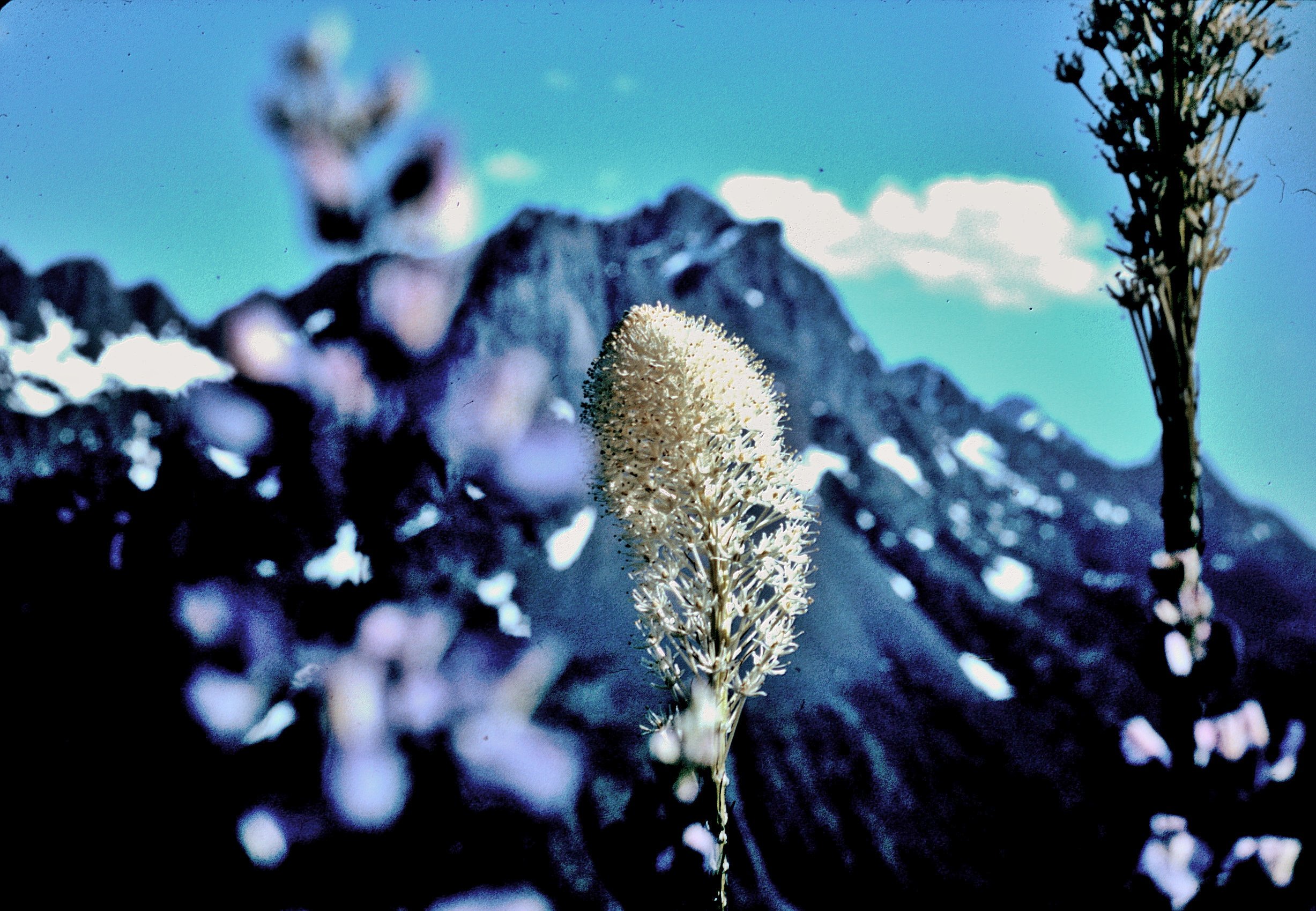
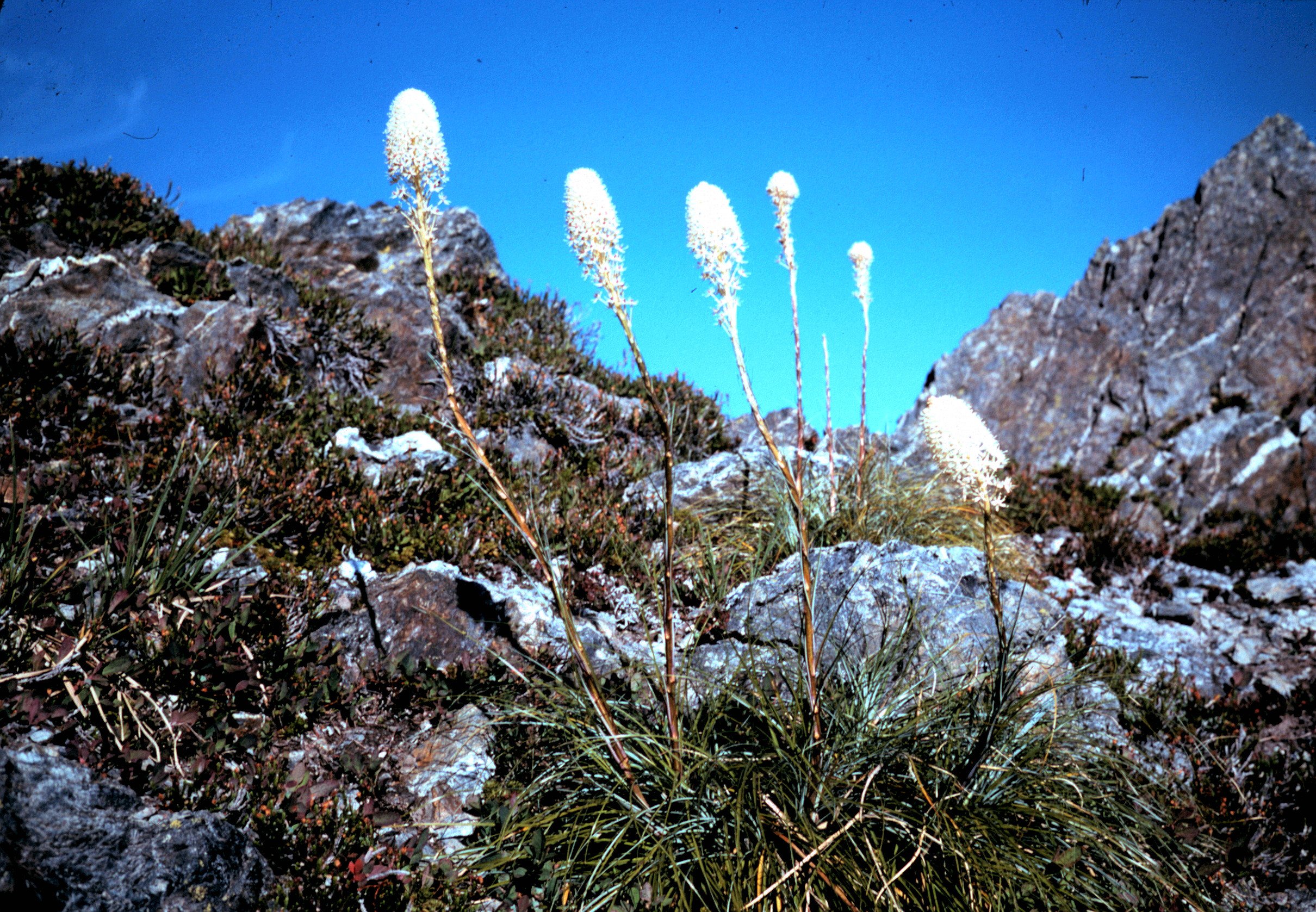
Red Route Photos (I'll add to these as I find more) Rich on Muncaster Summit Looking down into Enchanted Valley Beargrass Dave on Muncaster Along the ridge heading toward Crystal Pk Probably Crystal Pk Summit More Beargrass
.JPG.d3c1d6f463e04203de2c0d80f74e72ef.JPG)
.JPG.3c45b3f1ec41092cfc2b03e2e8893218.JPG)
.JPG.8b47ad9265f796c0d338a86920496621.JPG)
.JPG.c99eabbccf57d7aab064bff50e8d38ee.JPG)
.JPG.d151b9e49a4b0f0625356bb15ff2b3d4.JPG)
.JPG.27b59591ee2c982b2a7e6381755681a4.JPG)
.JPG.24e2604402b11abfd75a417a508c5acb.JPG)
 2 points
 -
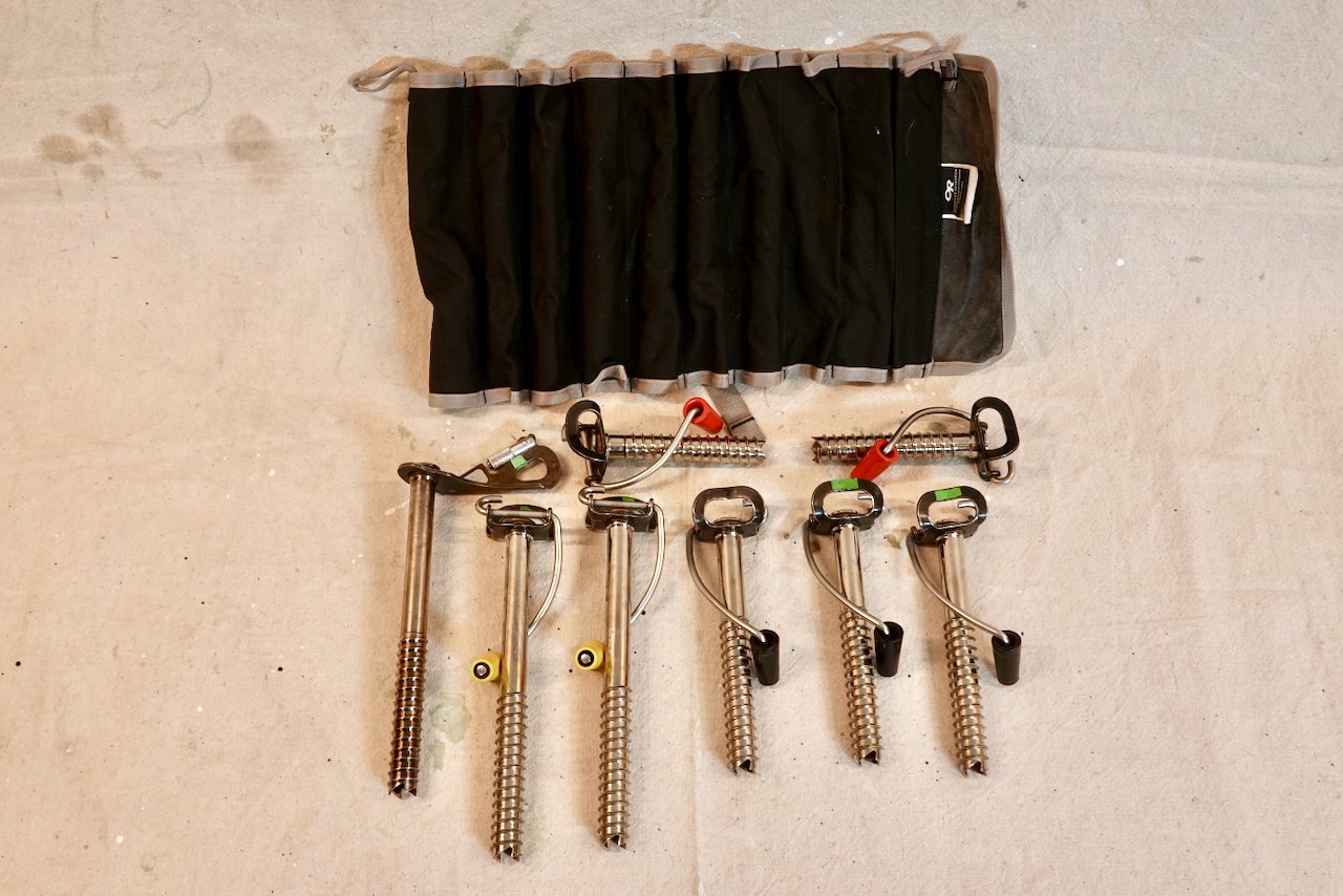
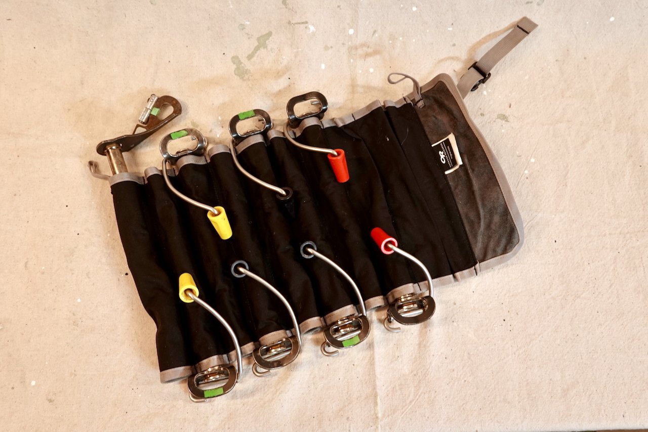
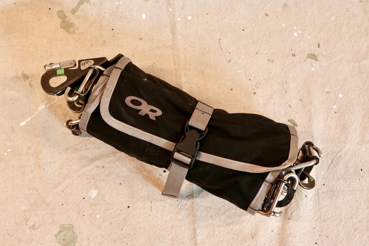
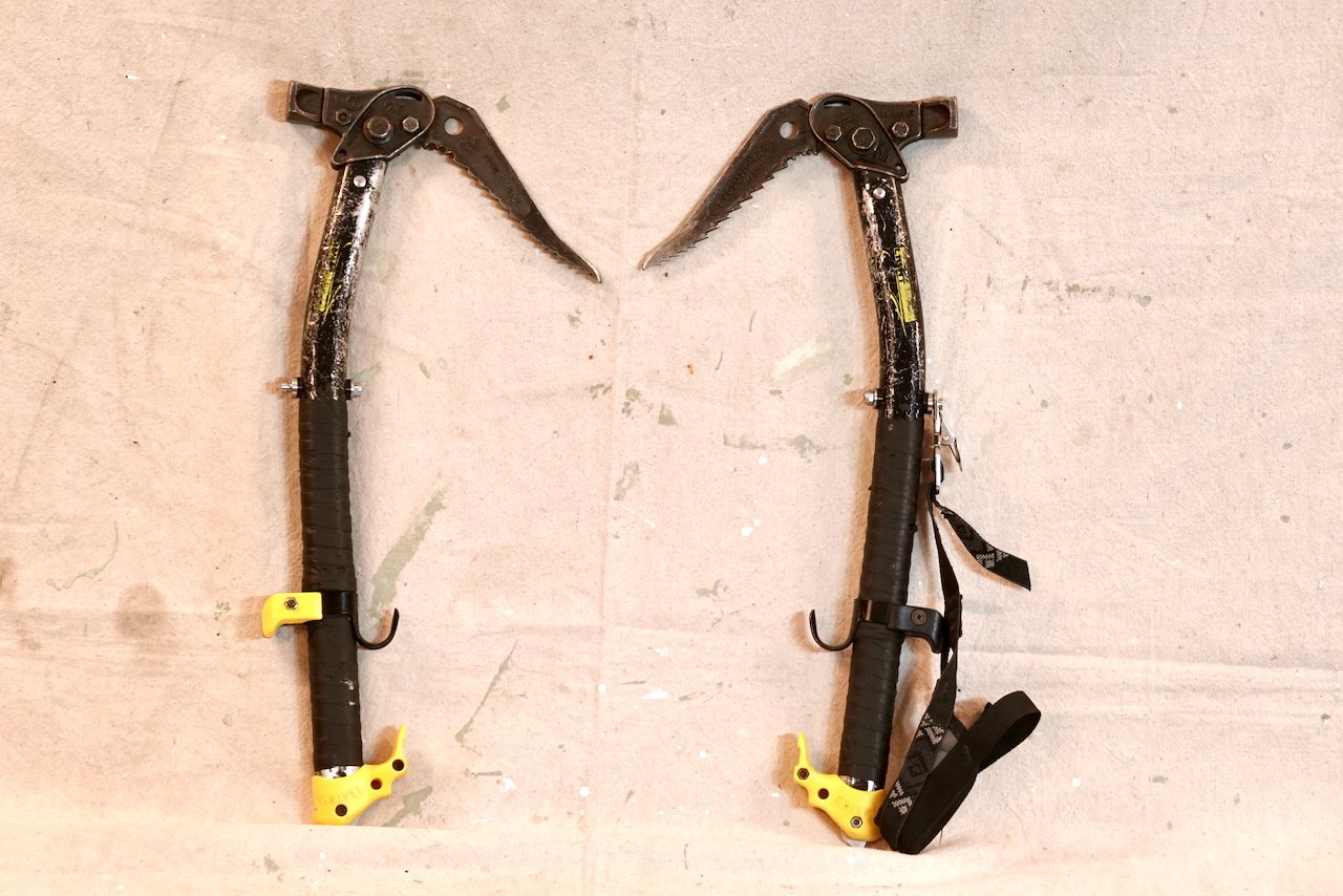
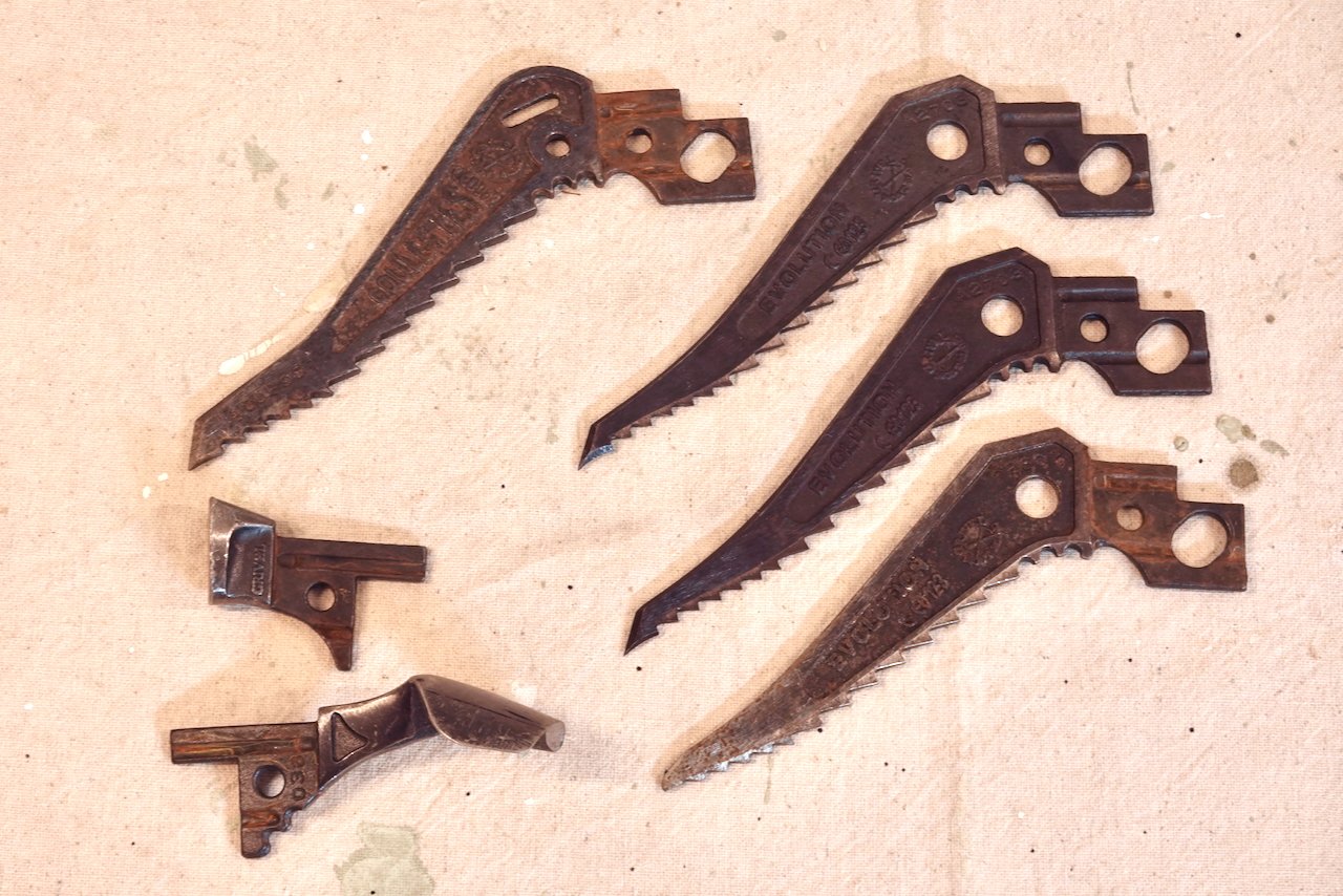
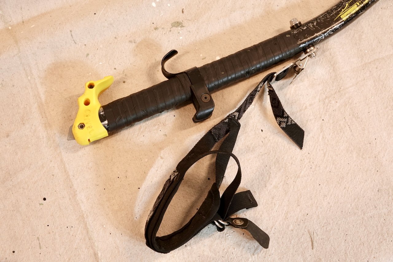
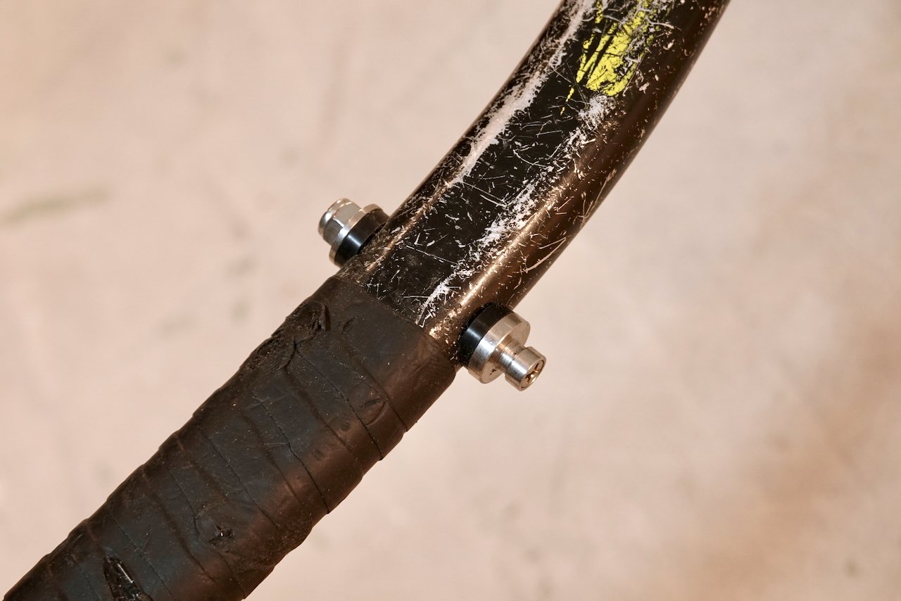
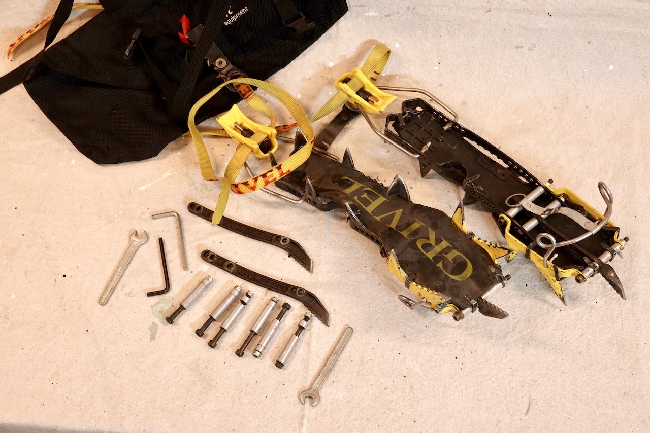
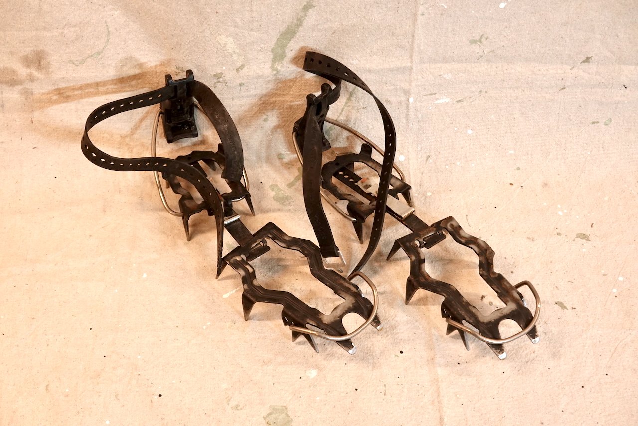
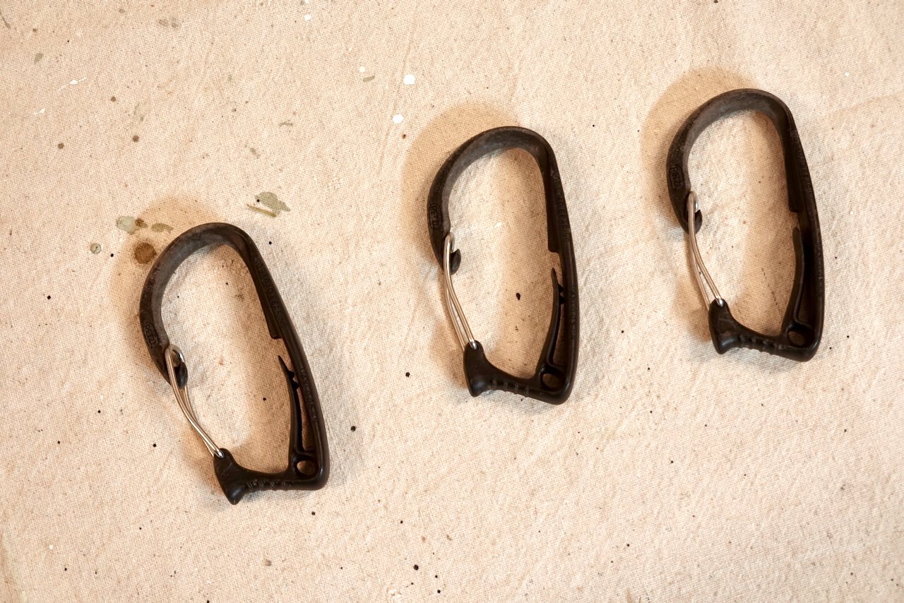
OK, be nice to the old fella. I'm cleaning out the basement, and my ice climbing days are finito. Some of this stuff is definitely antiquated, and may have lost all its cool/useful factor. I can handle that. First the good stuff: Ice screws! 1-20cm BD Express, 2-20cm Grivel 360s, 3-15cm Grivel 360s, 2-12 cm 360s. Teeth are in very good to excellent condition. These are all older style Grivels with a more compact hanger design. They're great for placing in tight spots. Included is an OR tool roll for hauling them around without damaging them or your pack's contents. Asking $300 for the set. Grivel Wing Ice Tools. Back in the day these got the job done, and still would, but....? They've seen some modifications: Originally came as the light alpine model with aluminum spike; I added stainless steel spikes, shaft was drilled, custom adapters and stainless hardware used to install BD quick release leashes. Then I realized leashless was the biz and added a pommel and upper grip. If nothing else, maybe the spare picks are still desirable. In addition to the Evolution picks mounted on the tools, I have 2 NOS Evolutions and 1 NOS Gulotte; unused. And another 3 Evolutions in various states of decripitude. Make me an offer. 'Had enough Grivel yet? How about a set of Rambo crampons! Comes with antibotts. Right now setup as mono's but all the hardware is there to convert back to dual. Points are in good condition, not used for scratching up rock. Comes with a nice Onsite Equipment crampon bag from our friends up north, eh? Let's say $50 OBO. Back to the land of BD. Good general purpose steel crampons; I forget what model they are. $30. 3 handy clippers to attach to your harness and rack all those sweet screws you scored from here. $10 And finally. I have 2- 60cm snow pickets; one an MSR Coyote, one is from SMC. (No pics) They're pretty much equivalent. $15 each OBO. Or, if you're one of those crazy, poor, badass kids who rolls the dice on bail gear, I might just give these to ya. A portion of the proceeds goes to support this fine site!
 1 point
 -
Thank you for all the work you do to keep this running. I will continue to post my trip reports and new routes here, first!1 point
-
Yeah, I was worried! It would be such a shame to see this place vaporize. Thanks!!1 point
-
Thank you for your efforts!1 point
-
Hey Artem, I live in Vancouver BC and would be down. Sounds like I don't have as much experience but I'm not a total gumby either. I'll send you a message with more info1 point
-
Not today, Satan!1 point
-
You Rock!1 point
-
Thank you so much for getting it back up. I've actually been working on a little project archiving all my TRs as PDFs in legit printable formats (not an easy task) out of fear/knowledge that someday this place will burn down and not come back...glad that time has not come yet!1 point
-
“WE ARE NOT DEAD YET!!!” Speak for yourself……….1 point
-
Yeah baby! Good work Porter and thanks!1 point
-
WELL DONE Porter!!! You deserve all the beer!1 point
-
I think we lost just a few posts as I had to restore from a backup to start the journey to recover the site. It wasn't much, that still does bum me a little and I'm sorry. But the site is back and I'm really happy. I was so stressed.1 point
-
WE FIXED IT!1 point
-
climbed with a guy who did a Peace Corps stint in Kyrgystan - says its to die for. did enough online research to be interested in a trip there myself, but I'm not likely to at my age... pm me and I'll put you in touch with him! If I could match your timetable, I might could get interested anyway or if Alaska interests you, Gates of the Arctic could be your spot for that time of year...1 point
-
Colfax or Lincoln may be in shape depending on the winter/road access but that won't become clear until you are pretty close. Mostly people ski in the Twin Sisters at that time but I am sure you could scratch your way up something! If you know someone with a gate key, that could greatly simplify the approach.1 point
-
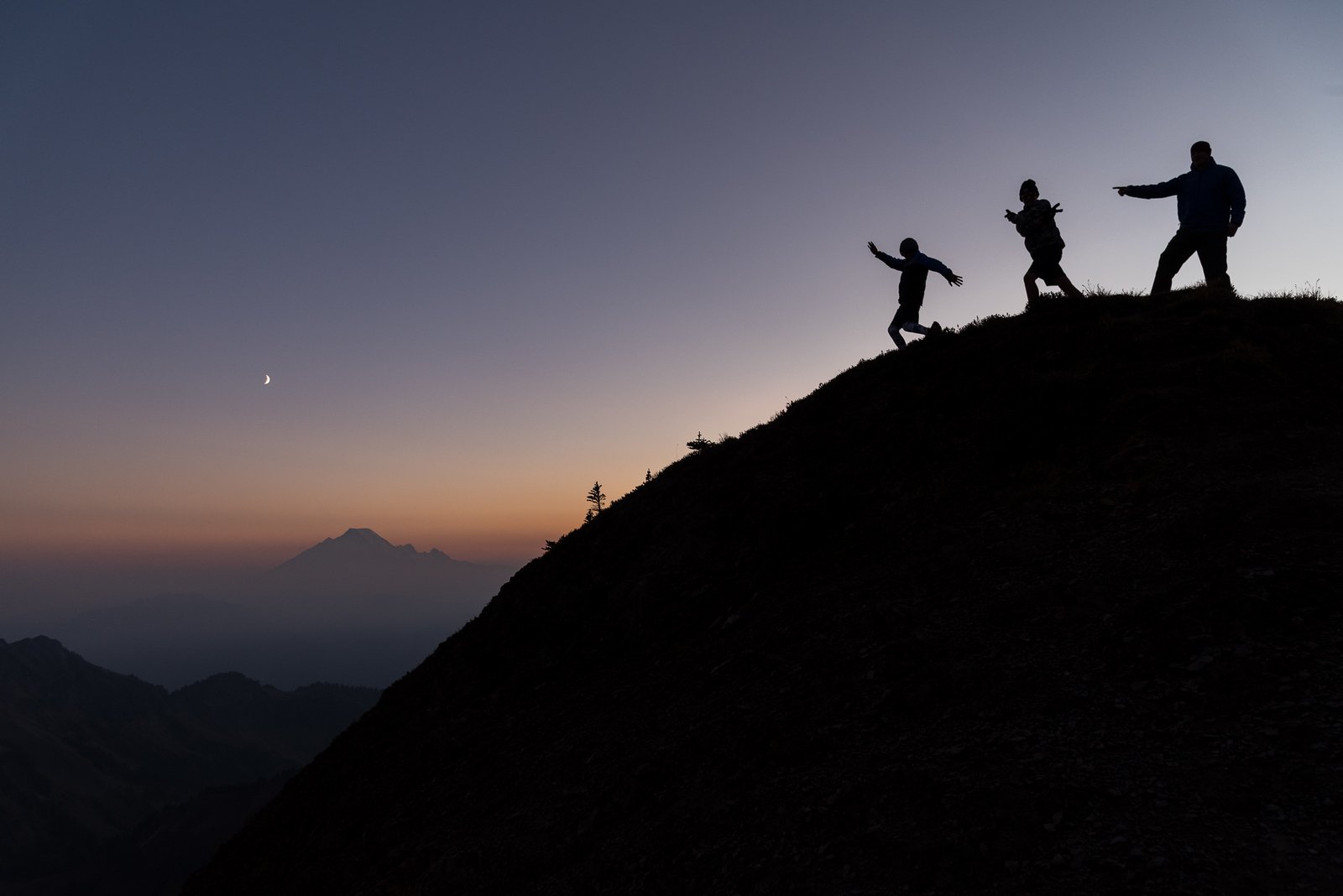
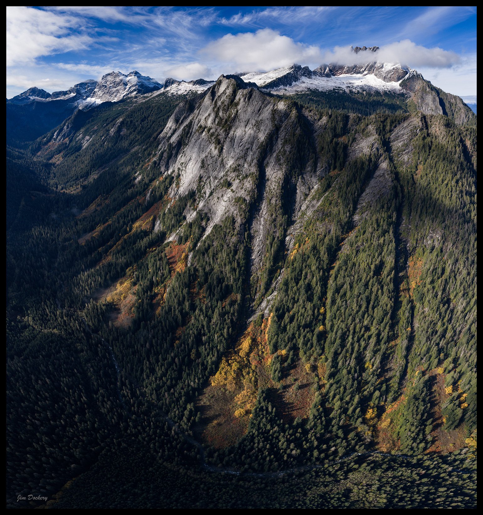
Drone view: Three Fingers, Squire Creek Wall, Whitehorse
 1 point
 -
The trip report for Nature's Way has languished in the North Cascades section without comment. I must bring your attention to what may become a classic NW granite pitch. Also, this "Rock Climbers Forum" needs some bloody content. If you are a crack climber, you may not pay any attention to news from Darrington, the slab paradise. But there is a new crack pitch you should be aware of, Nature's Way pitch 3. On a less-than-vertical wall, the giant flake forms a rising undercling crack of fingers width between .3" and .75" for 20 feet. The wall has been wire-brushed for clean smearing of feet. There is one rest stop halfway along, an edge for feet and a crack for fingers. After that, more pure undercling moves to the top of the flake. The pitch seems burly for this moderate slab climber. It has commitment, unless you enjoy underclinging with one arm while placing pro. It is steep enough to look intimidating at first, but not steep enough to be 5.10. I'd like some crack scholars to go up there and confirm, or not, my grade of solid 5.9. It takes three hours+ to hike up there. Bring sandals or the like for the creek crossing. It can be done in an easy day; I just did the second ascent, with my buddy Yale, yesterday, 10hrs car-to-car. It requires two 60m ropes, as the first two pitches are long, ~55m. Topo and approach details are on Mountain Project. It is restful to stand here and place extra pro: And, after some furious activity, to stand on edges and place some more: On the hike down yesterday, I daydreamed some future essay, "The Controlled Frenzy of Undercling". I hope some of you can plan to spend a day on a new crack climb. Let us know what you think. Bill
 1 point