Leaderboard


Popular Content
Showing content with the highest reputation on 09/09/22 in all areas
-
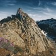
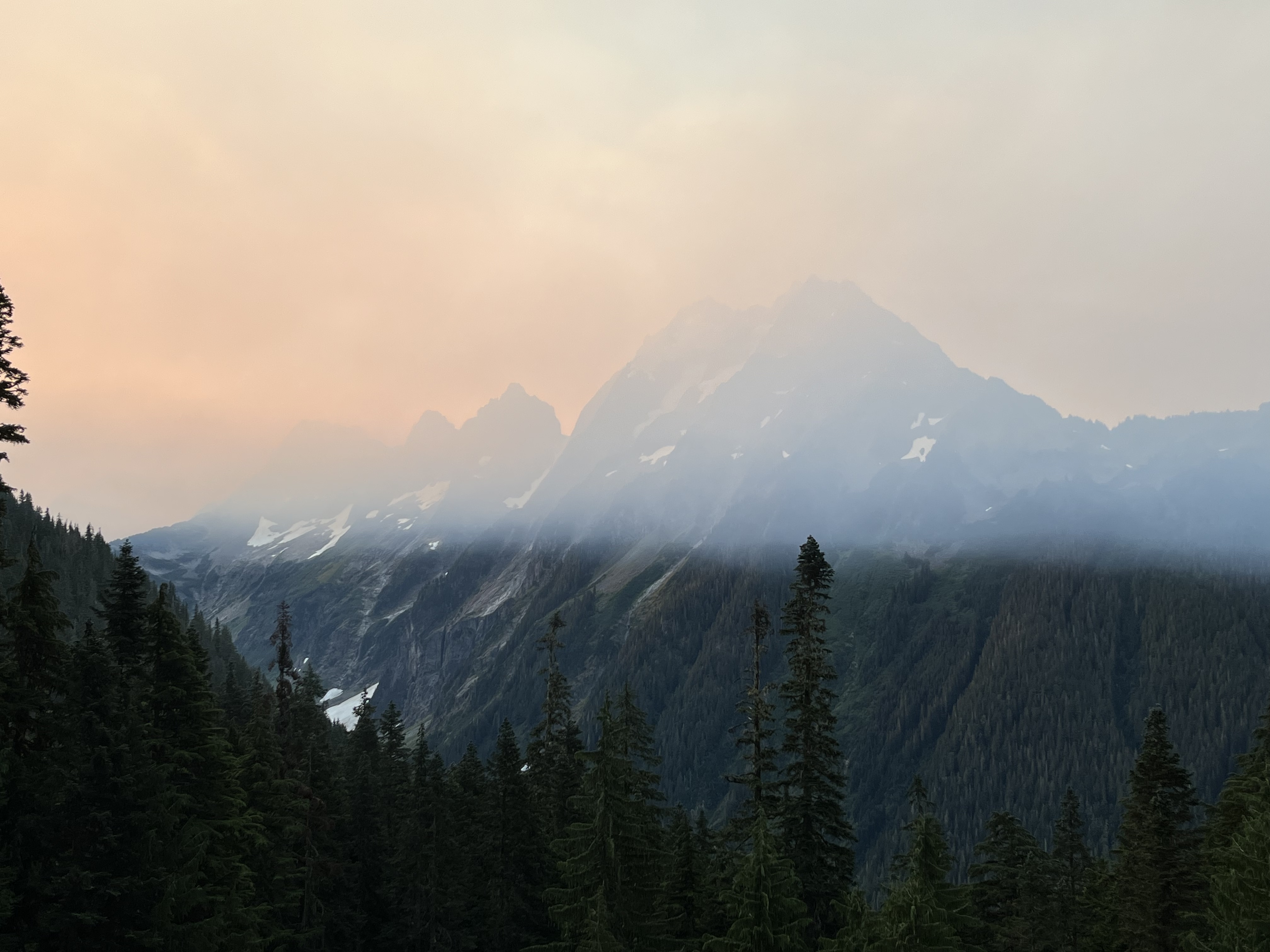
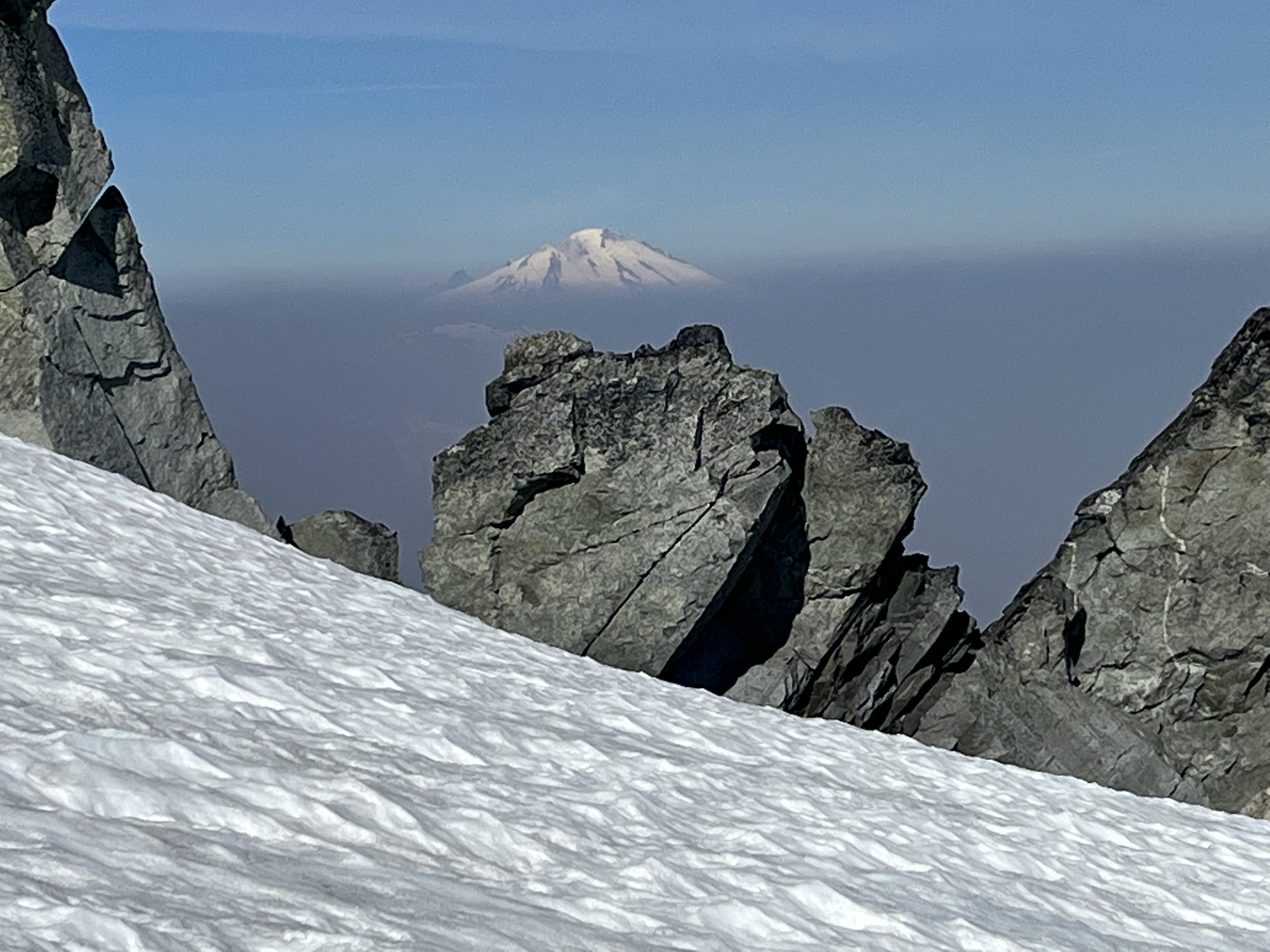
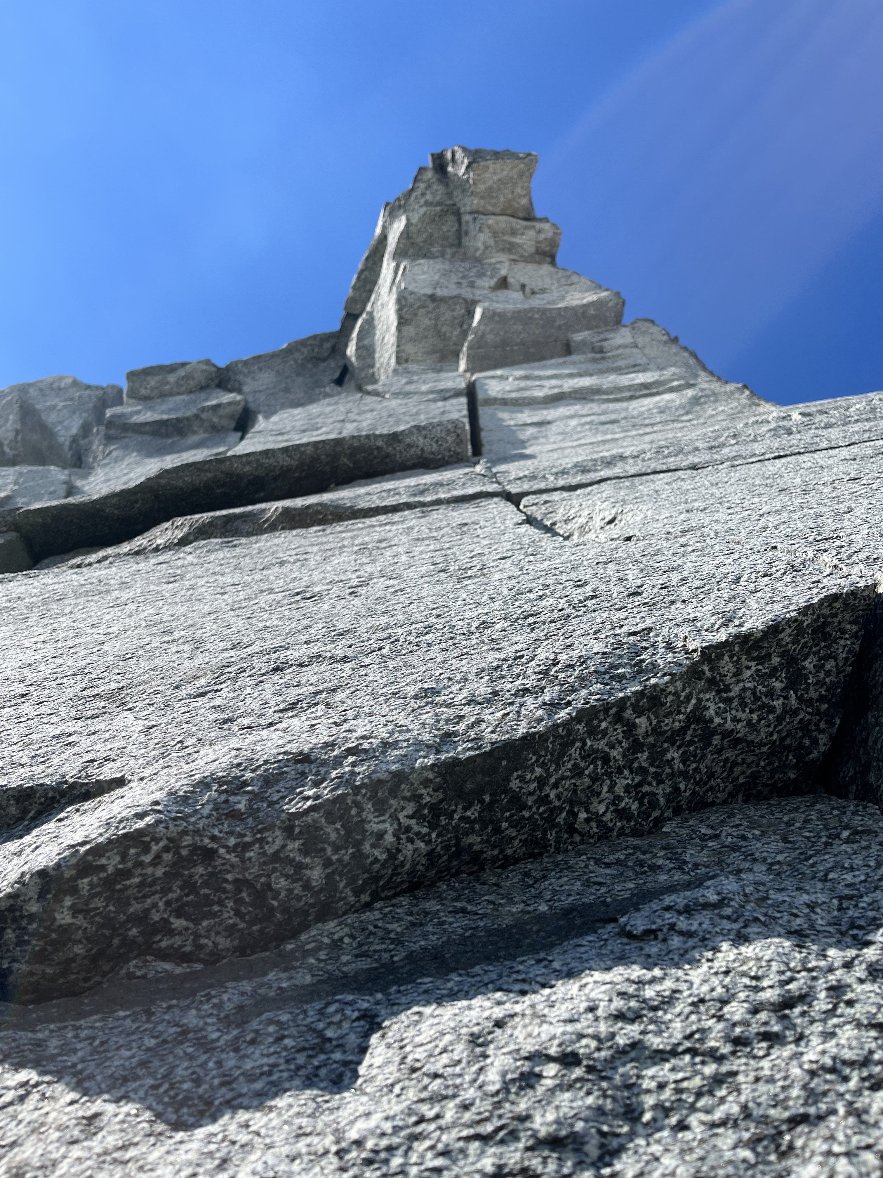
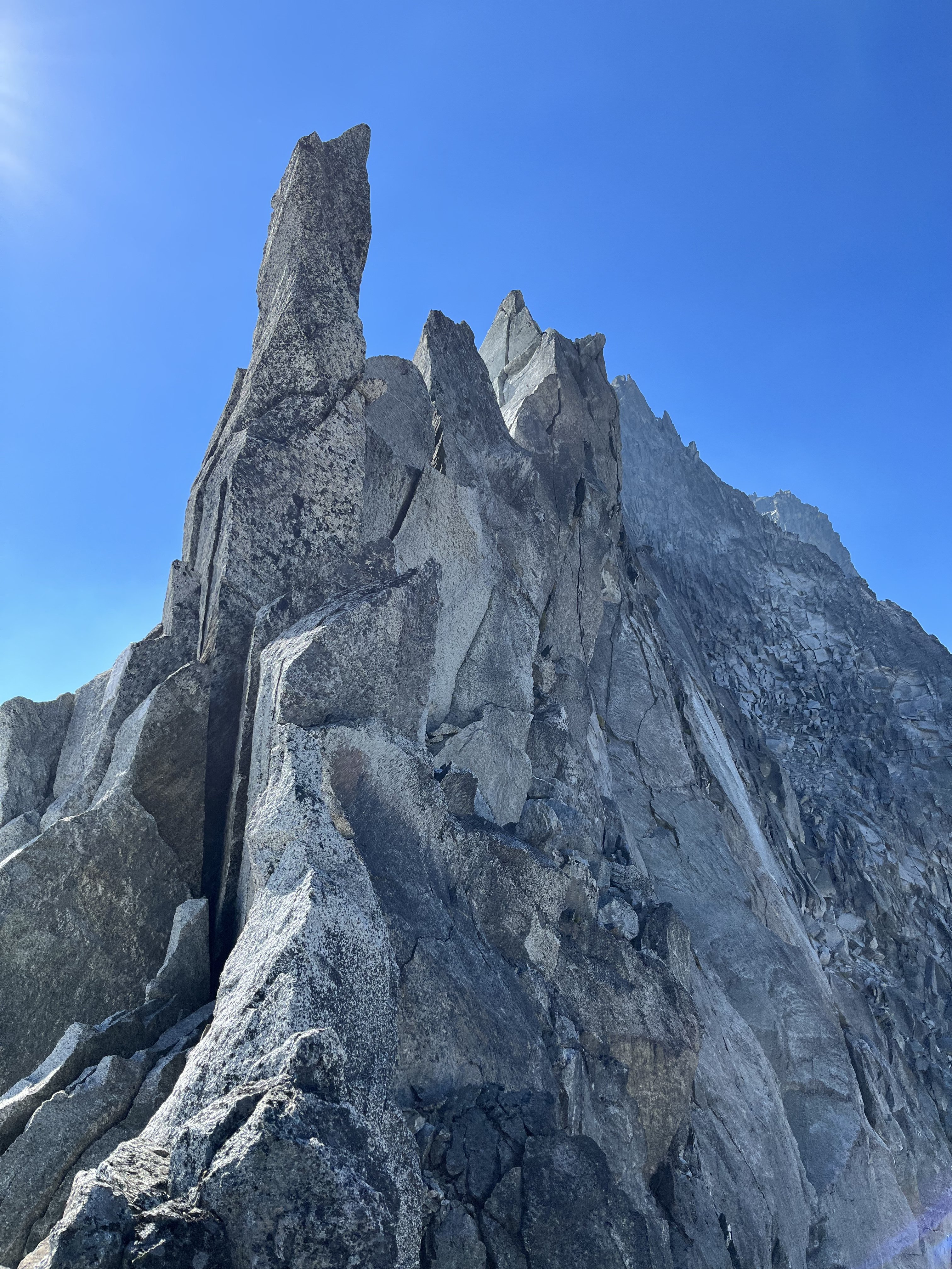
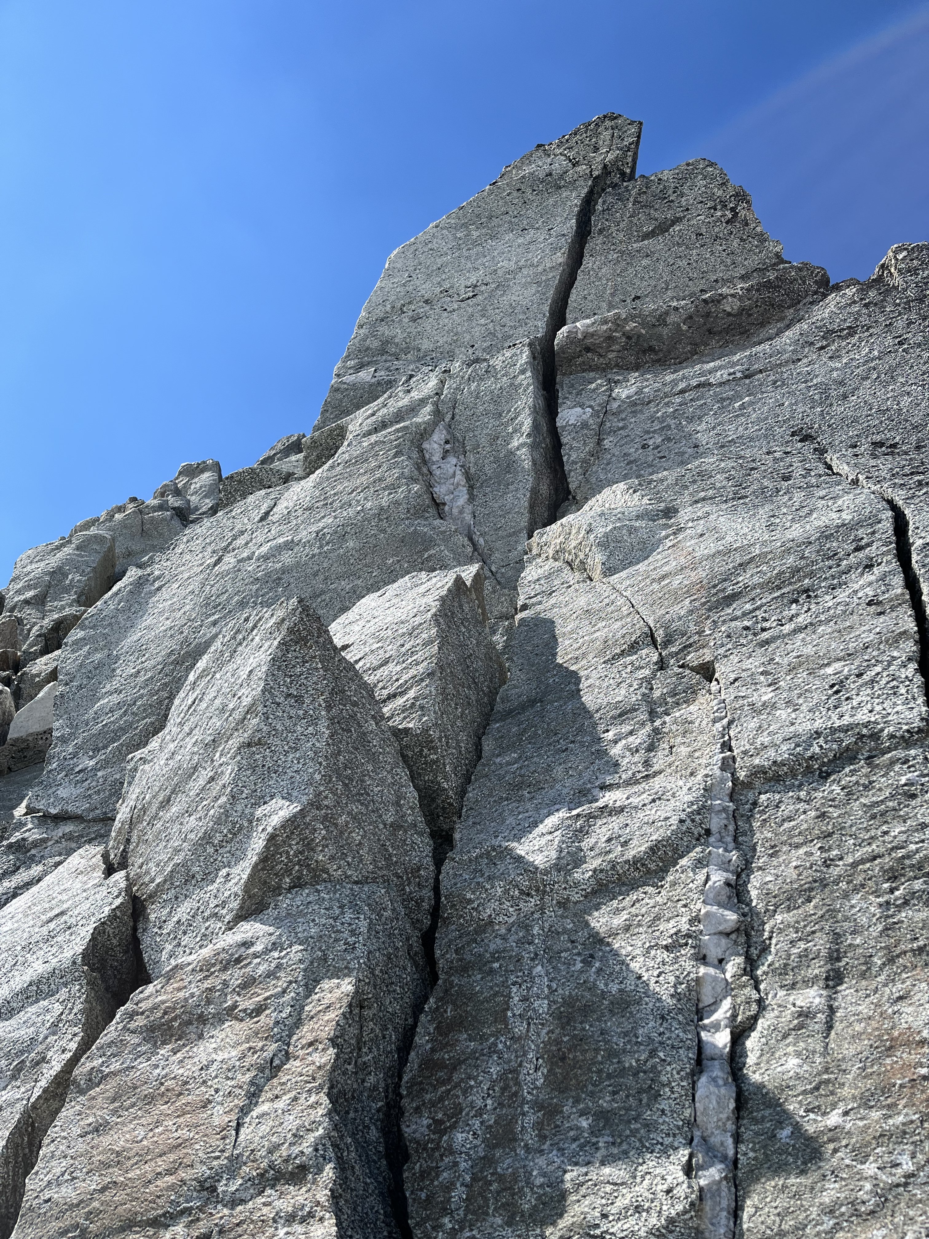
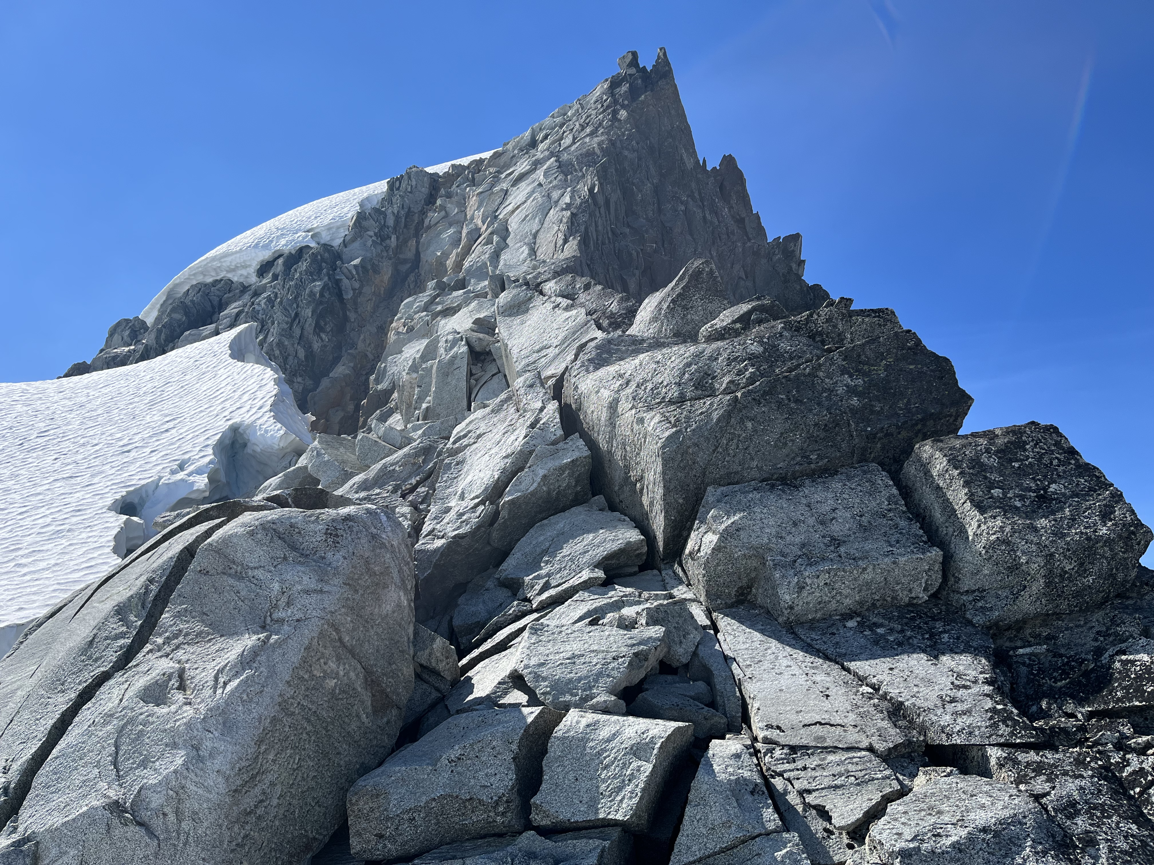
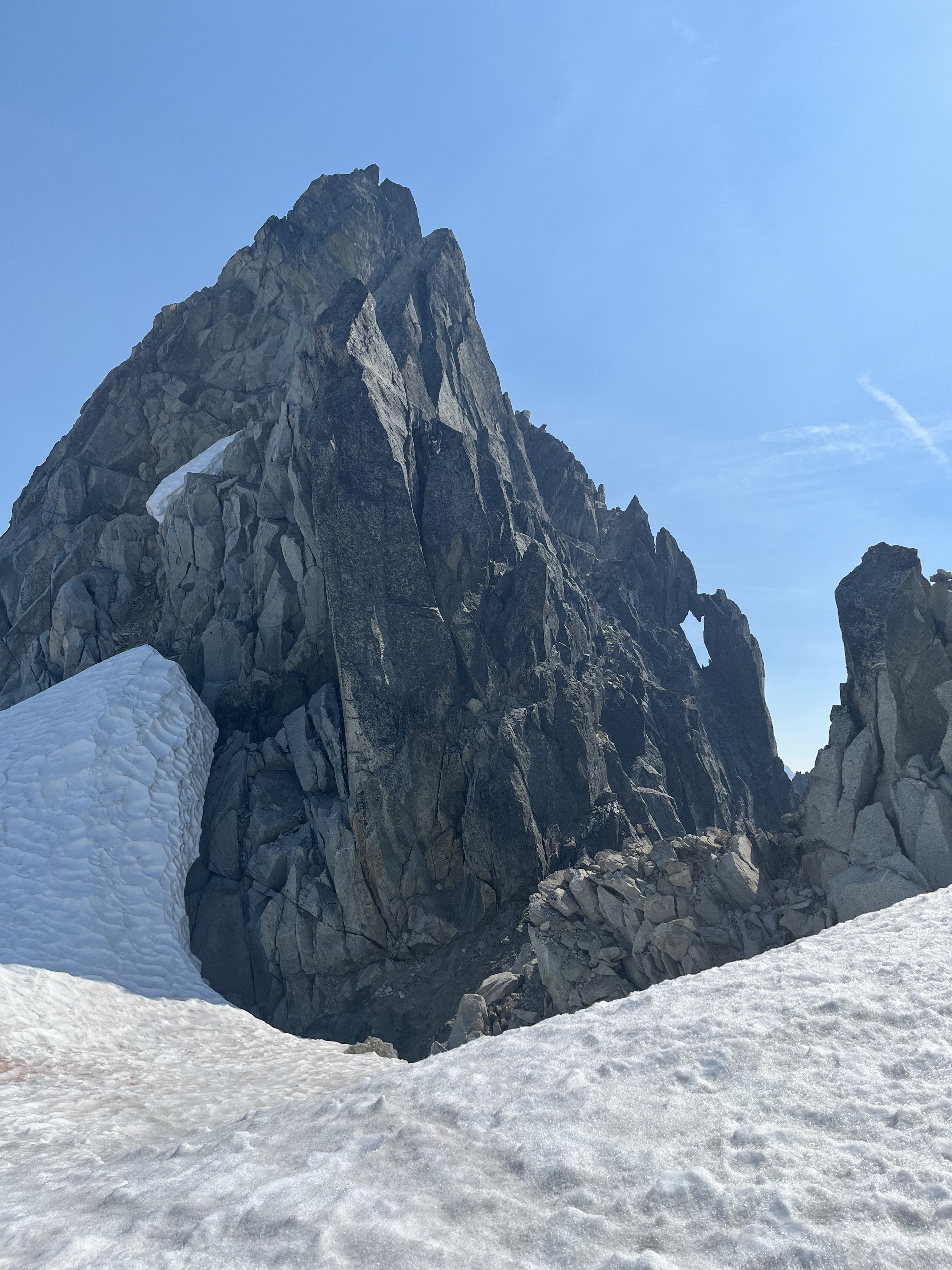
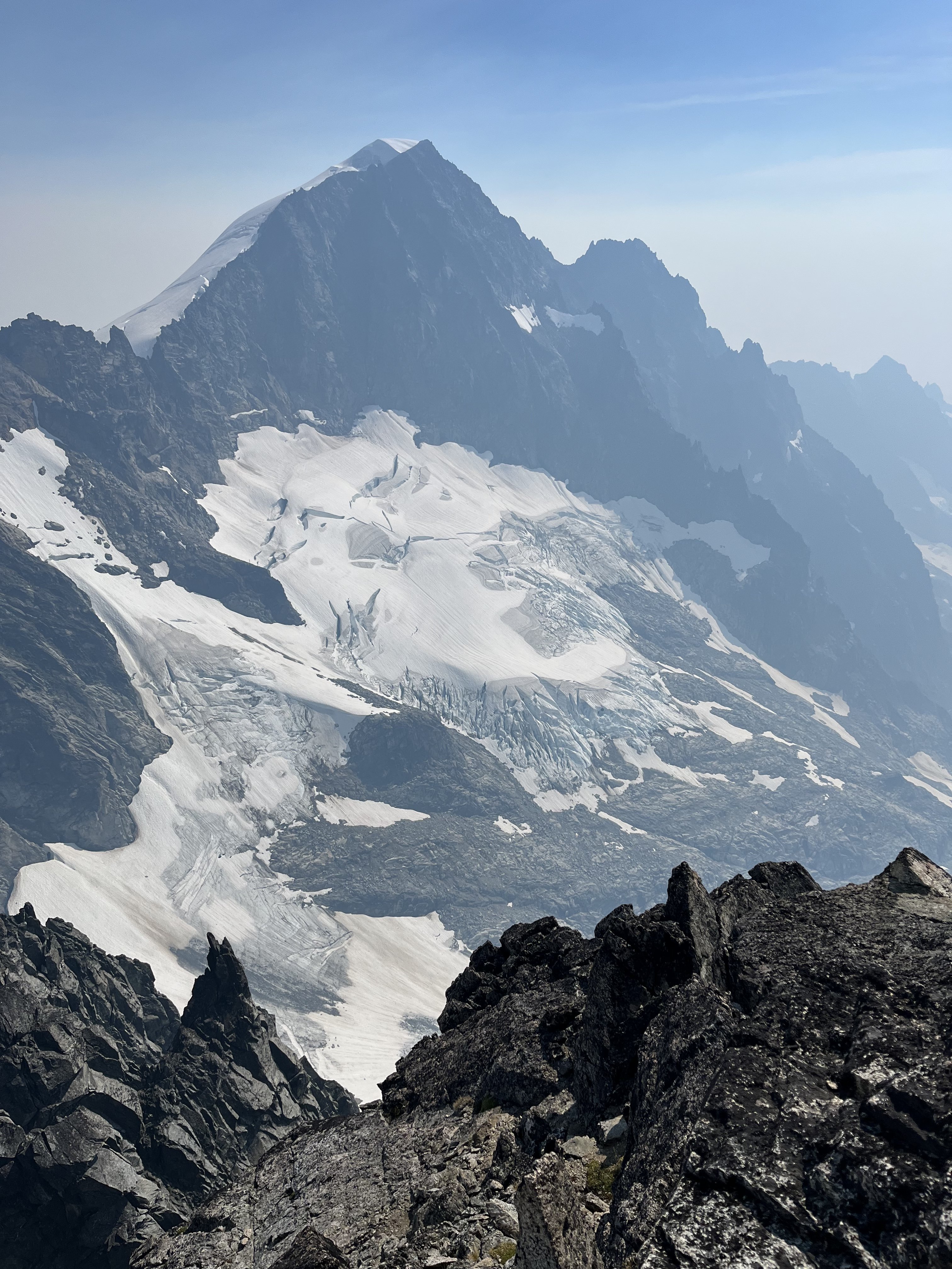
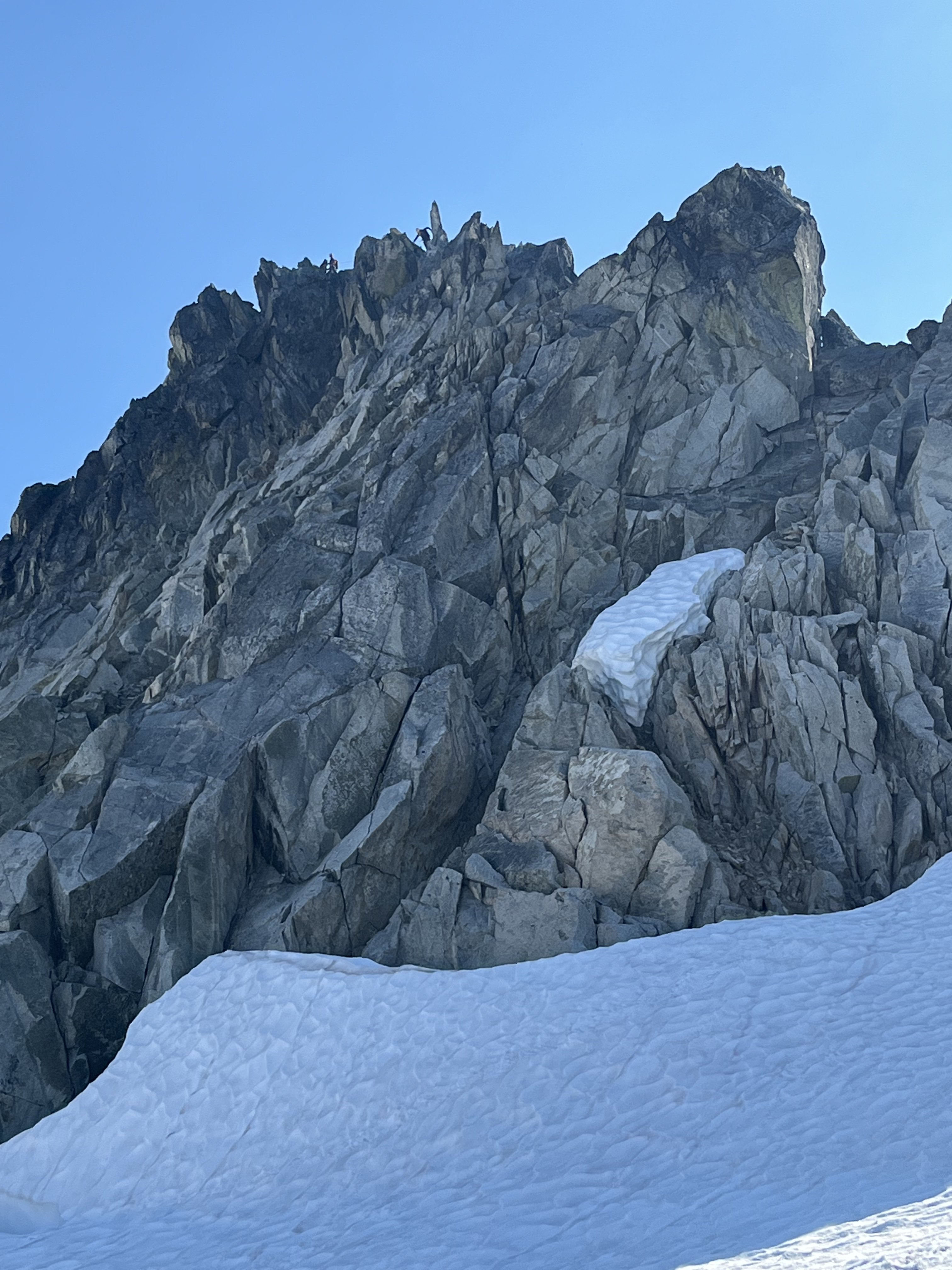
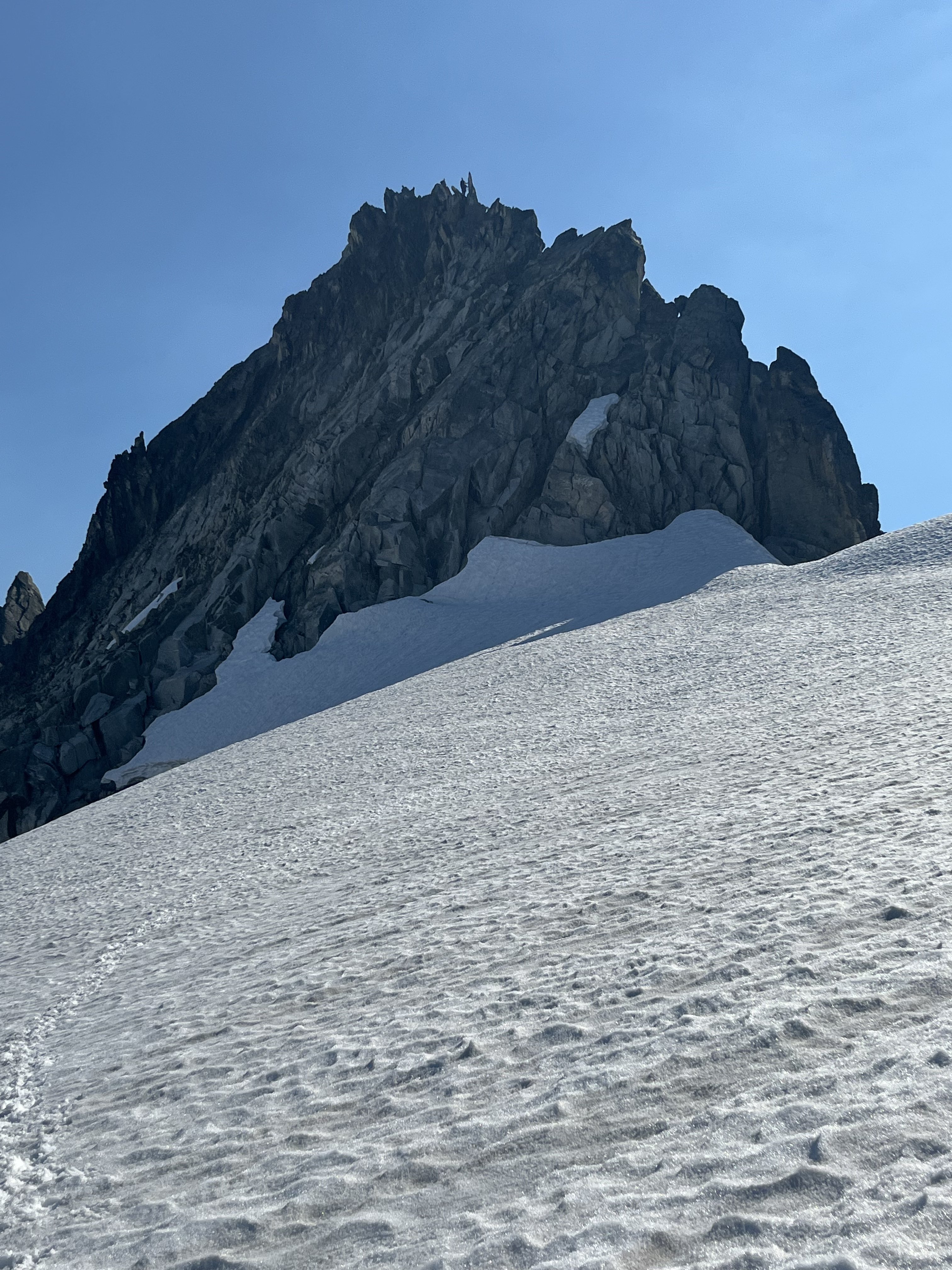
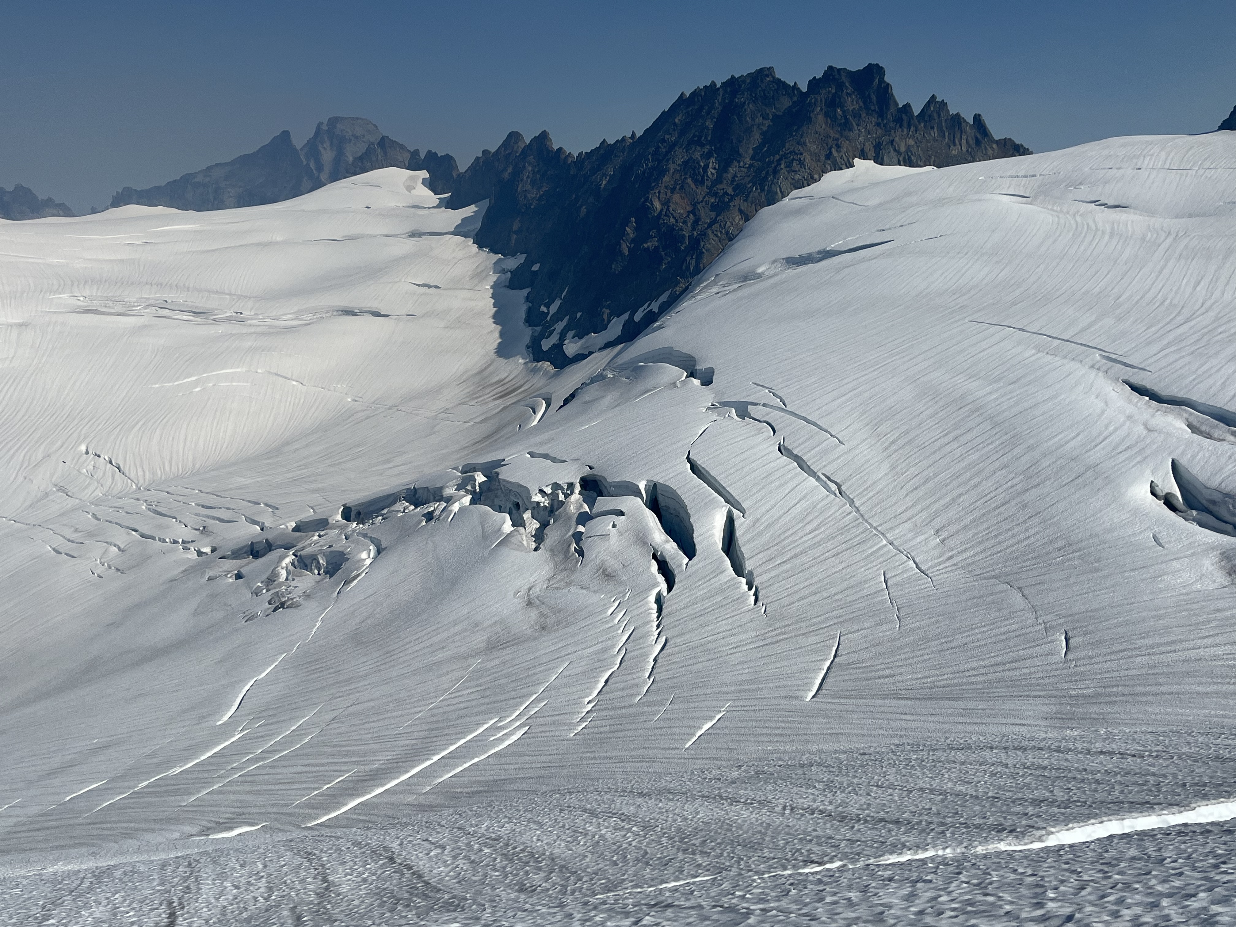
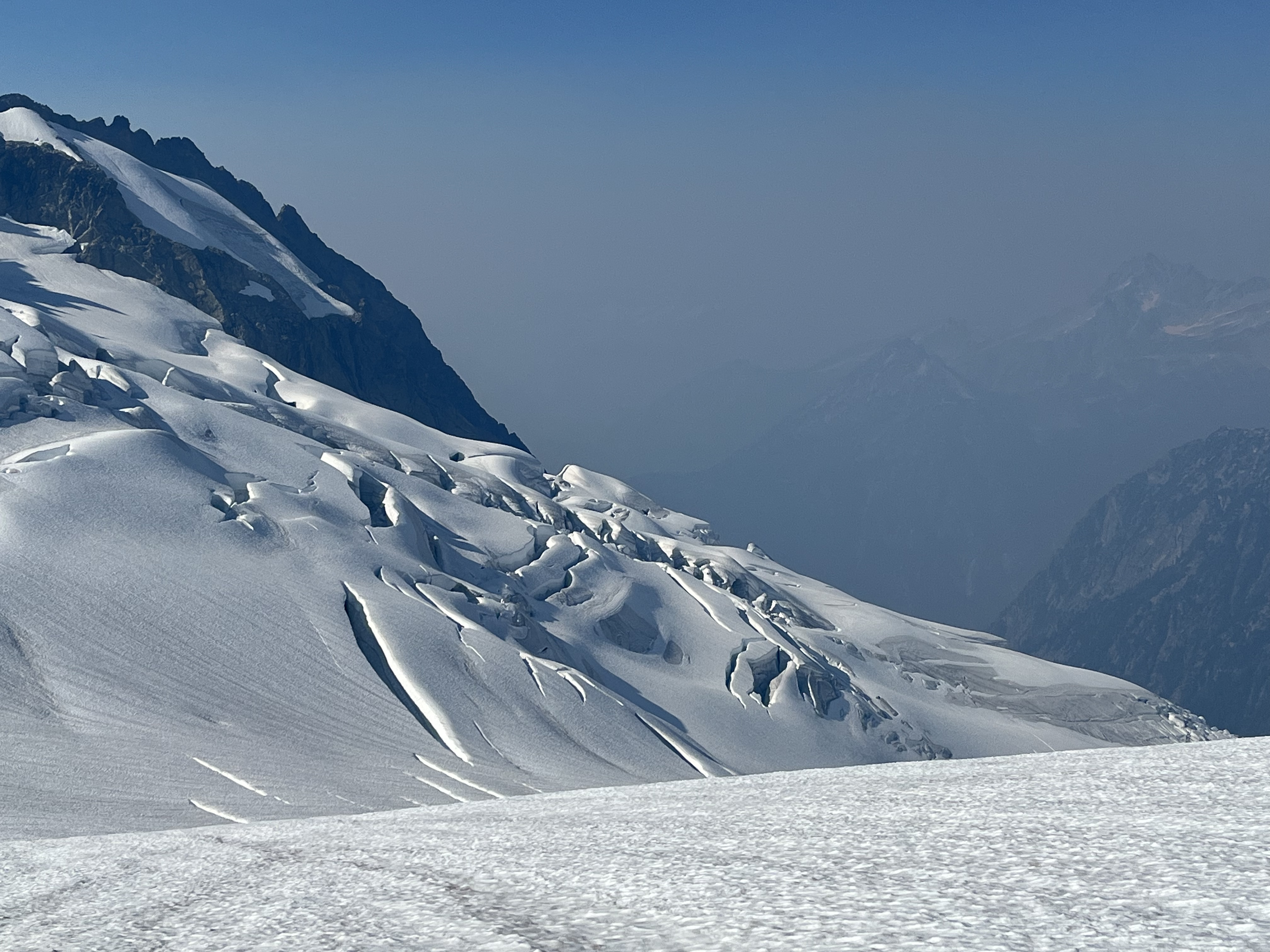
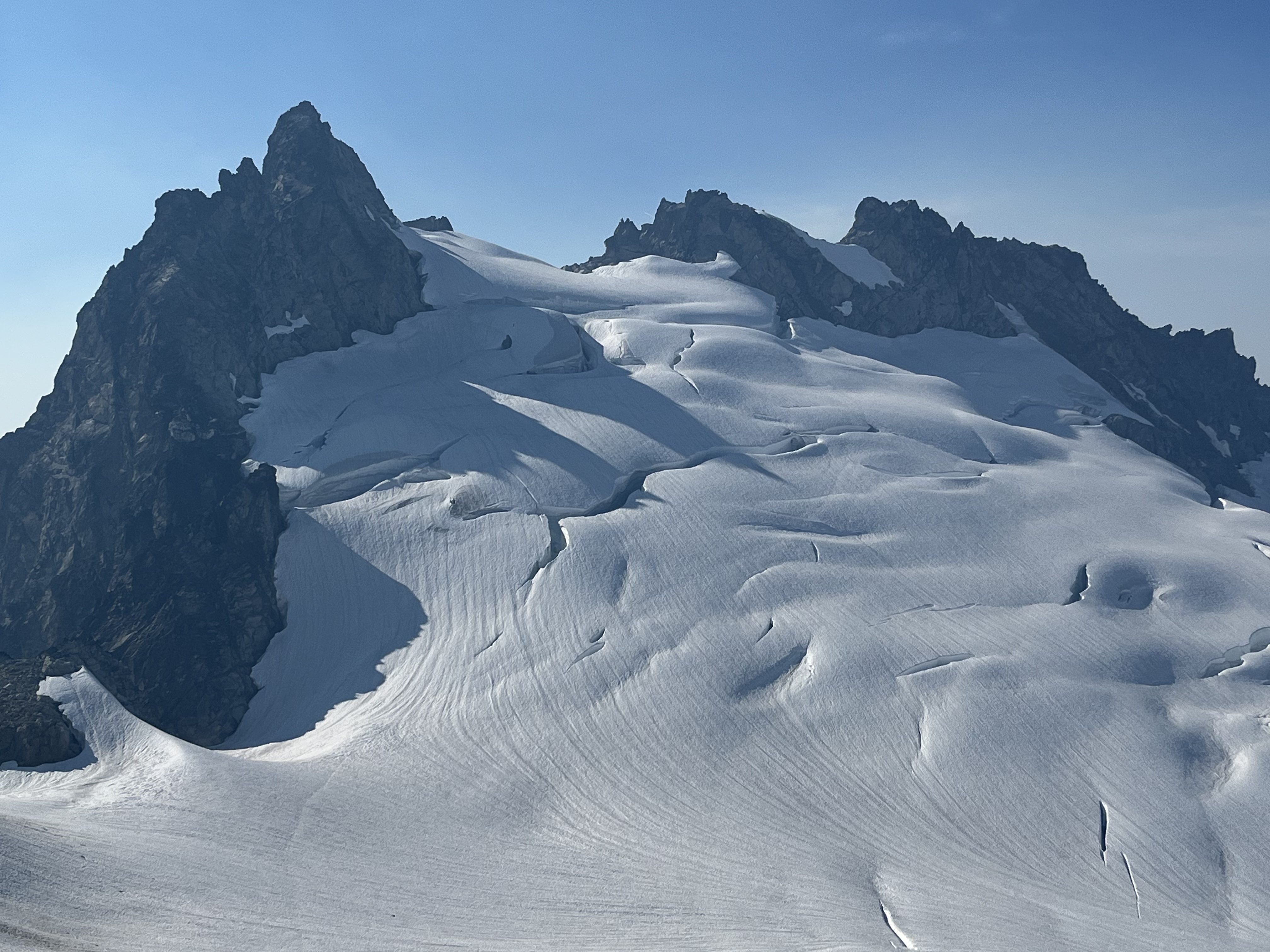
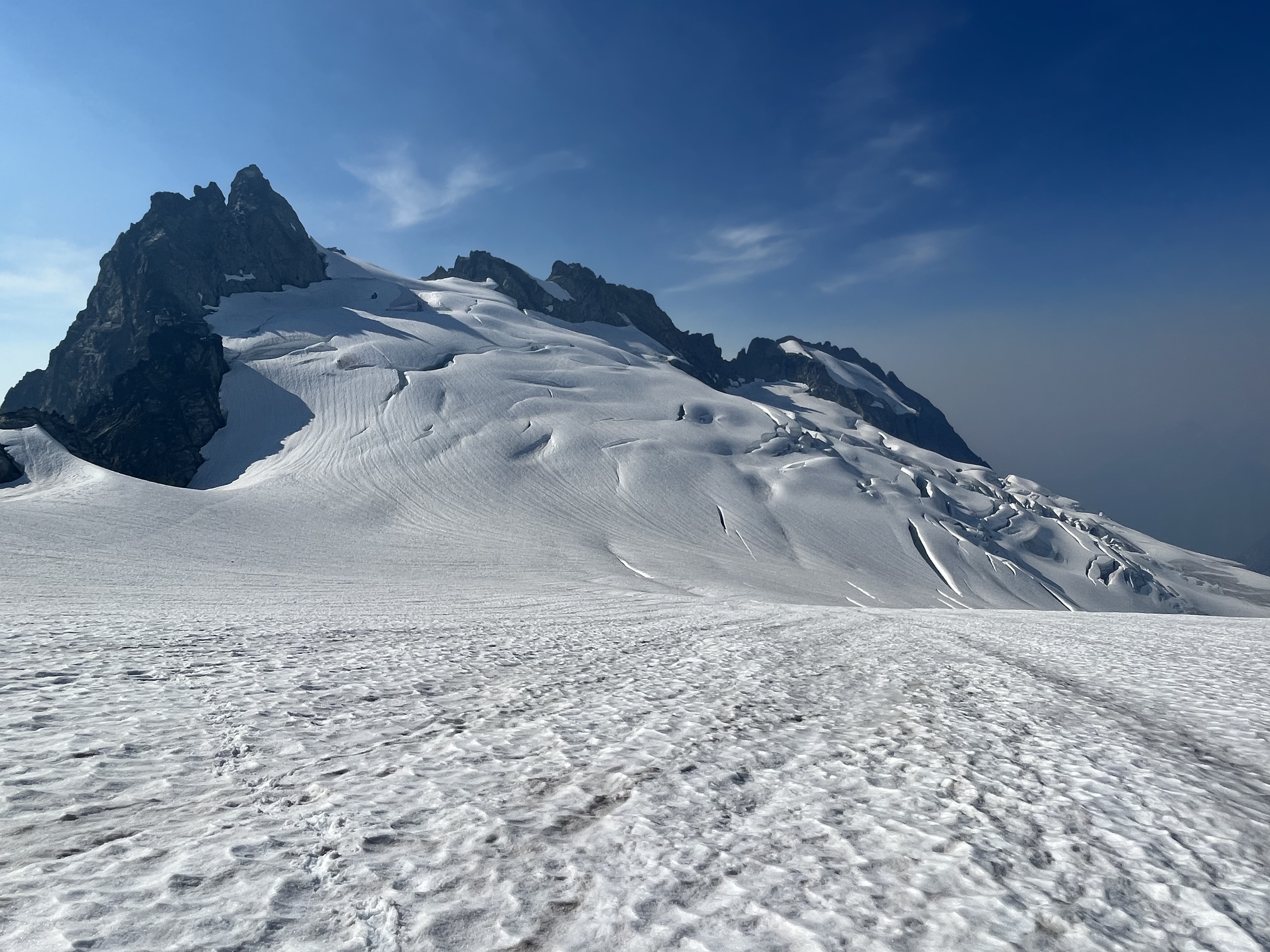
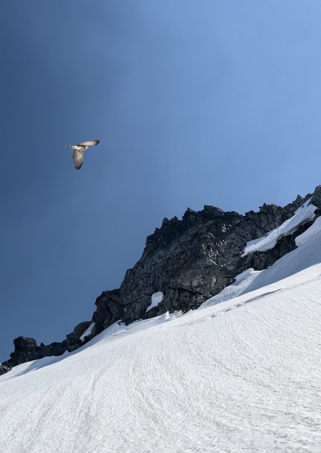
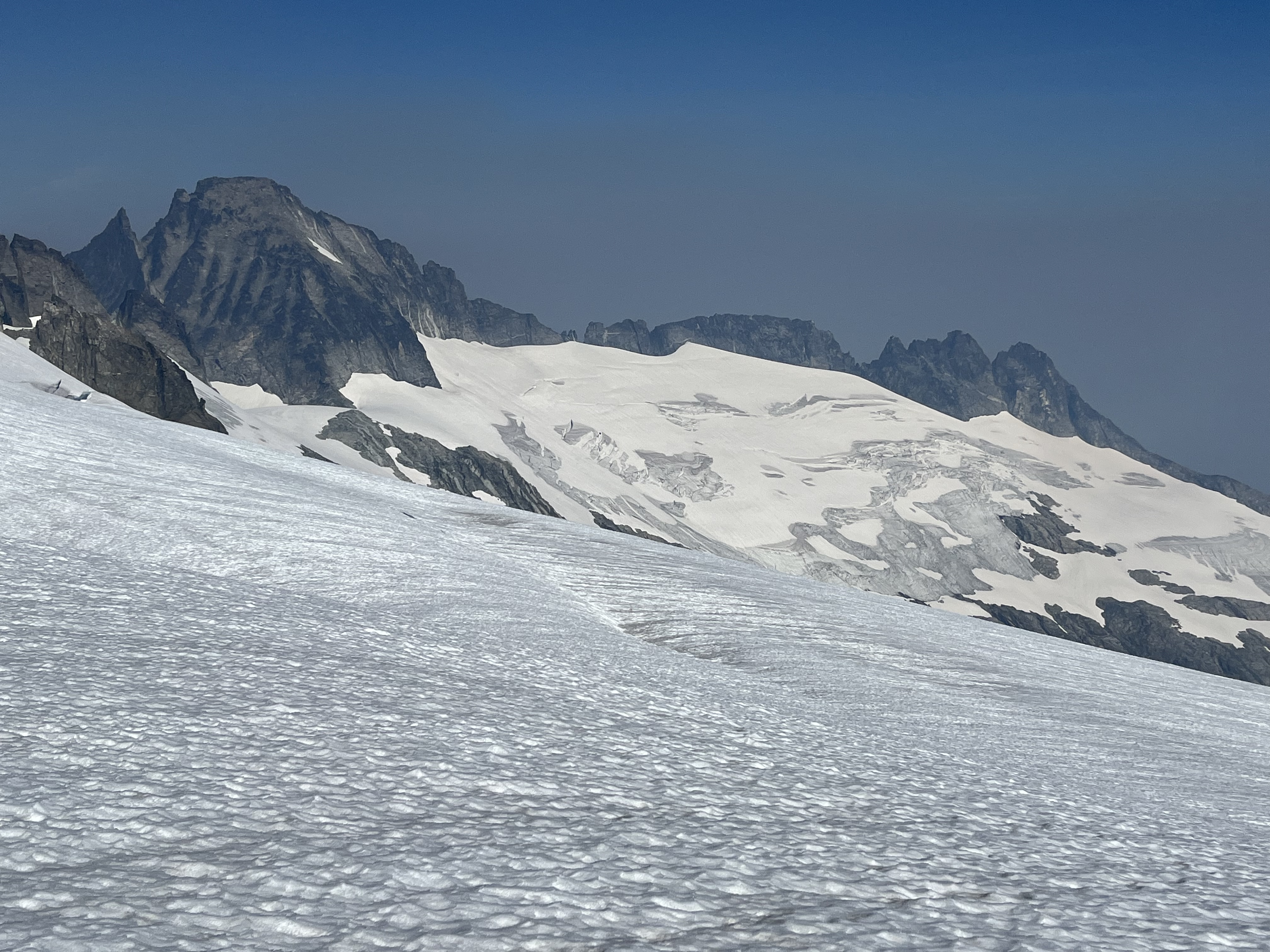
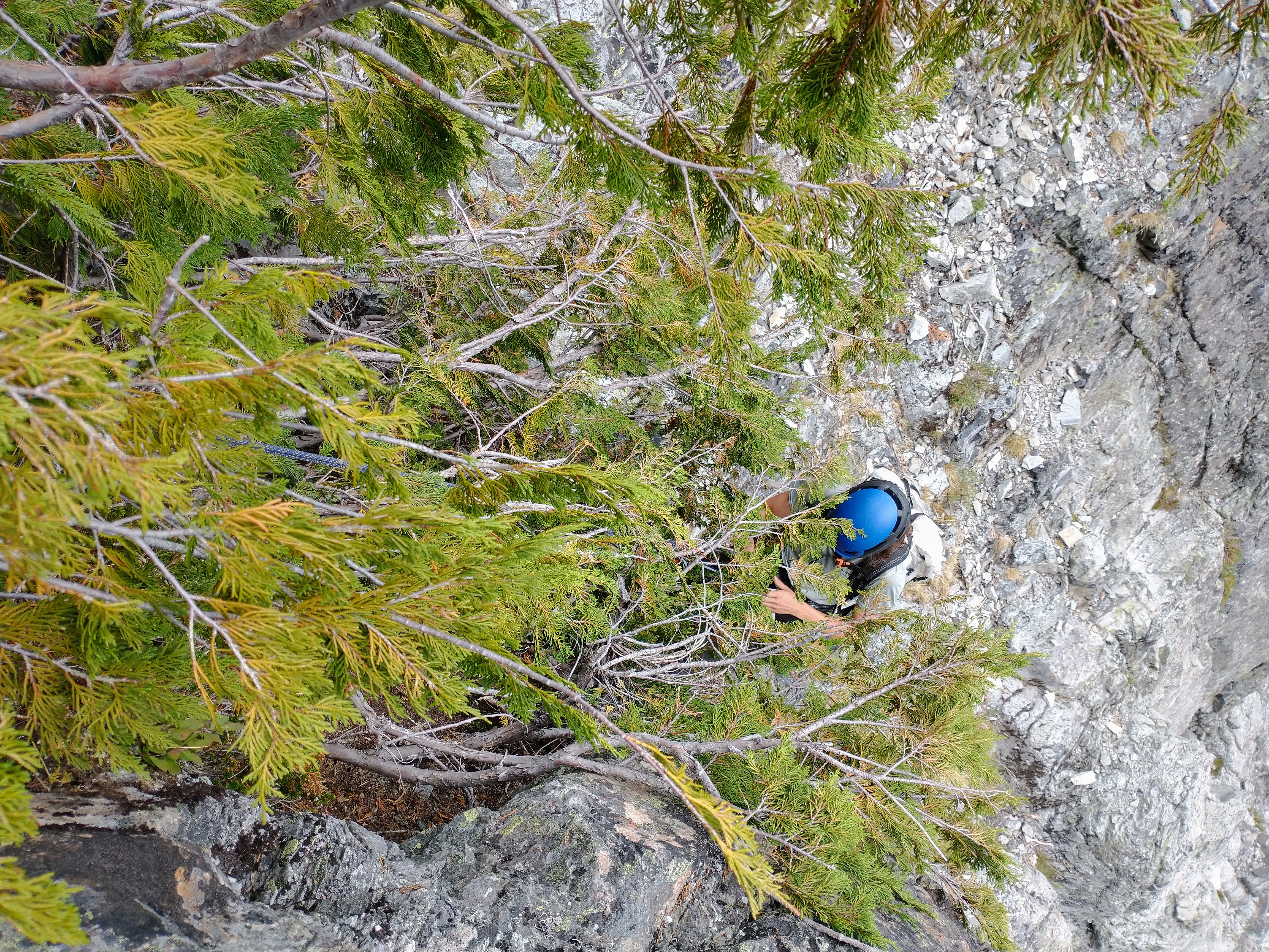
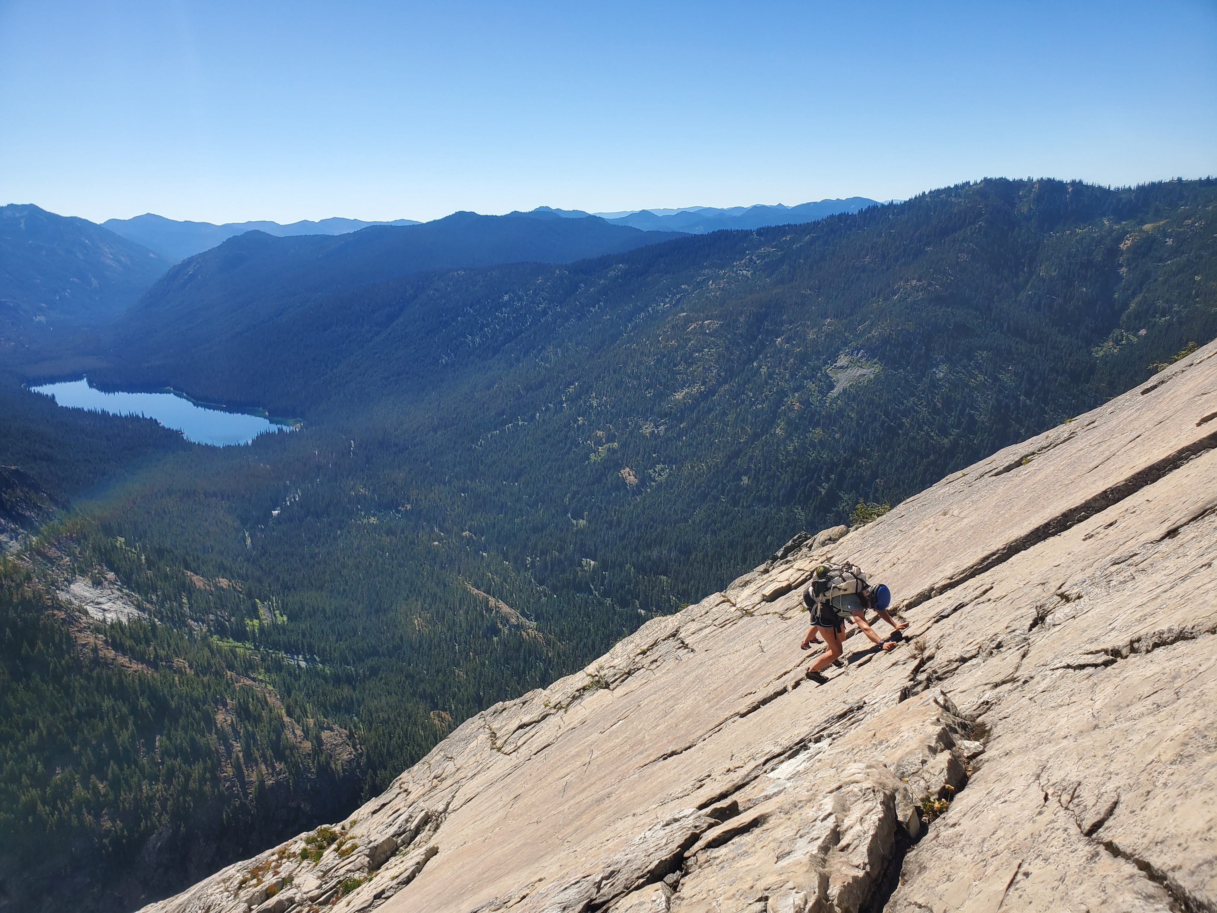
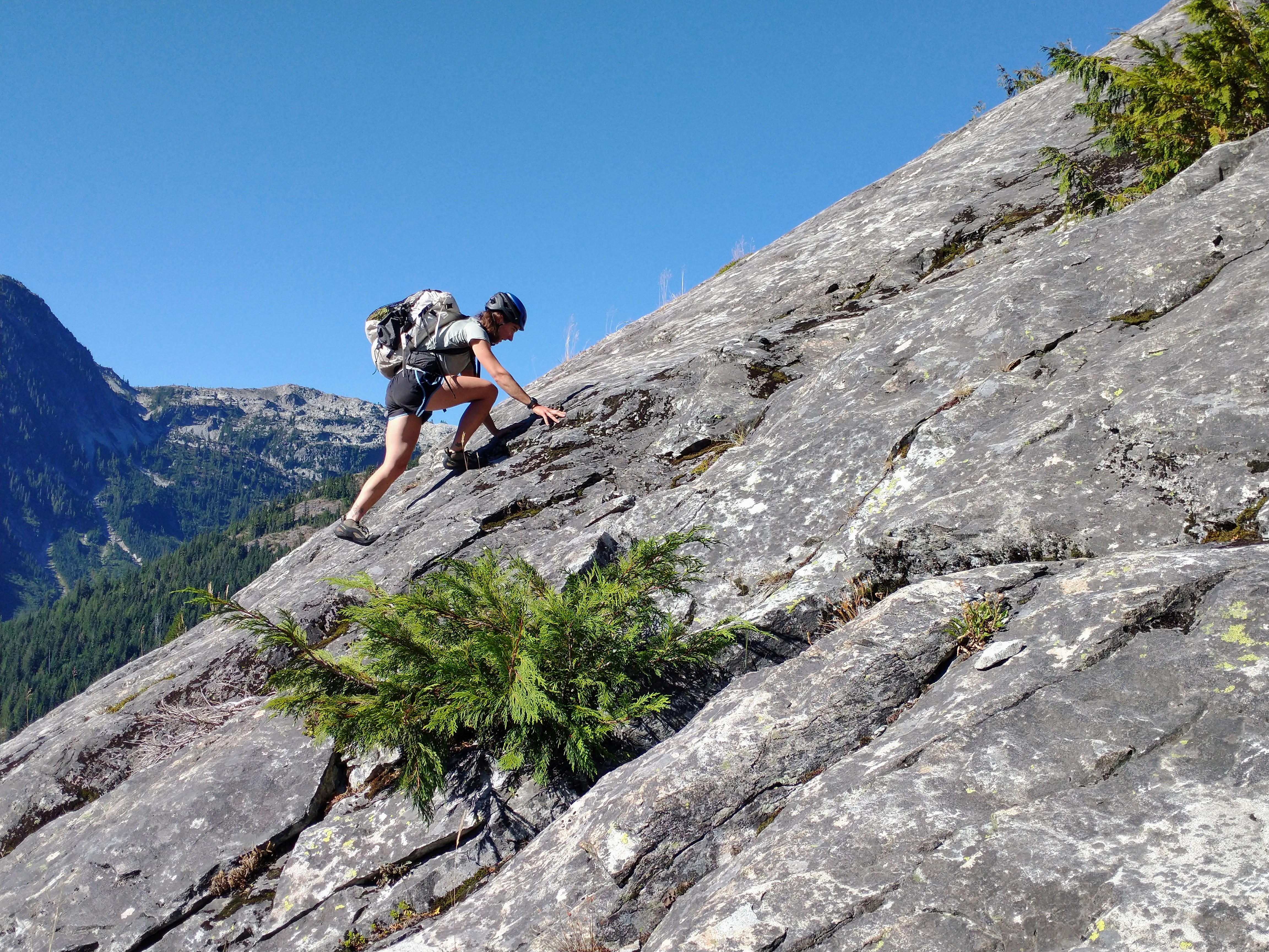
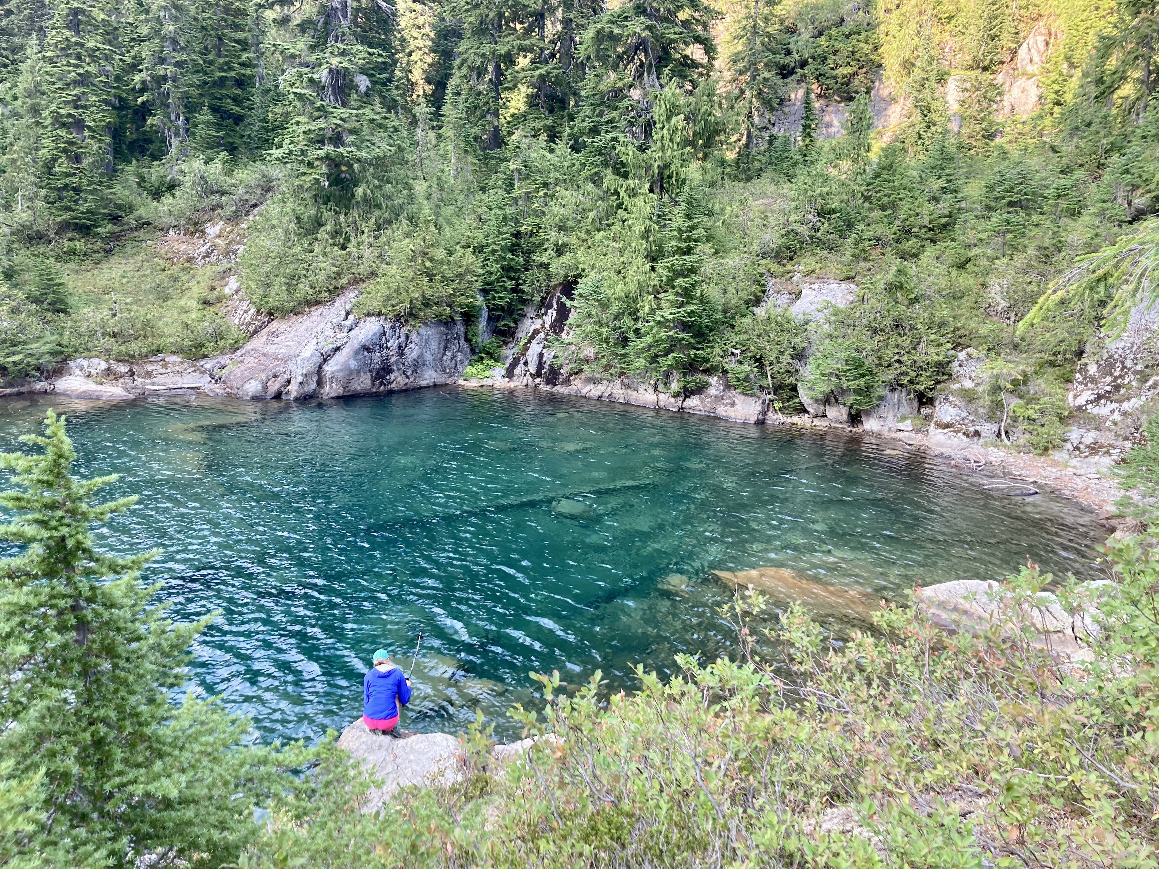
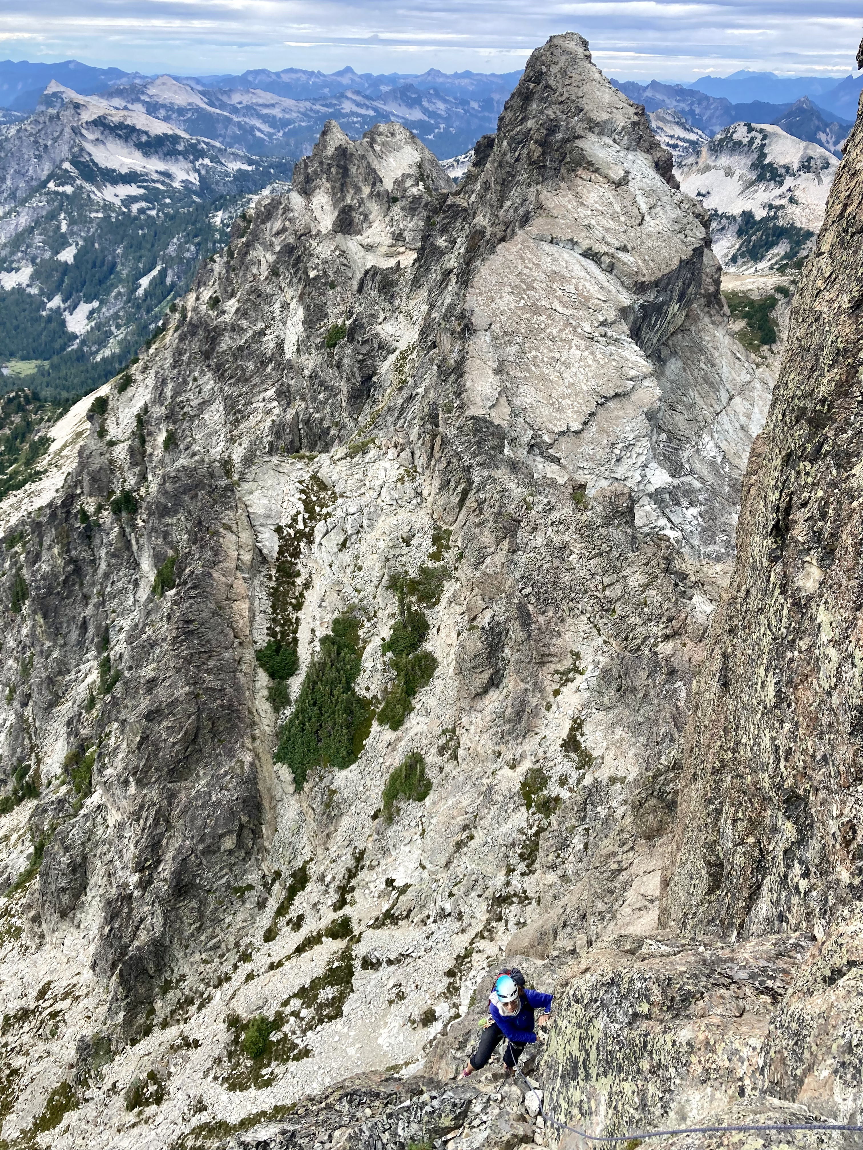
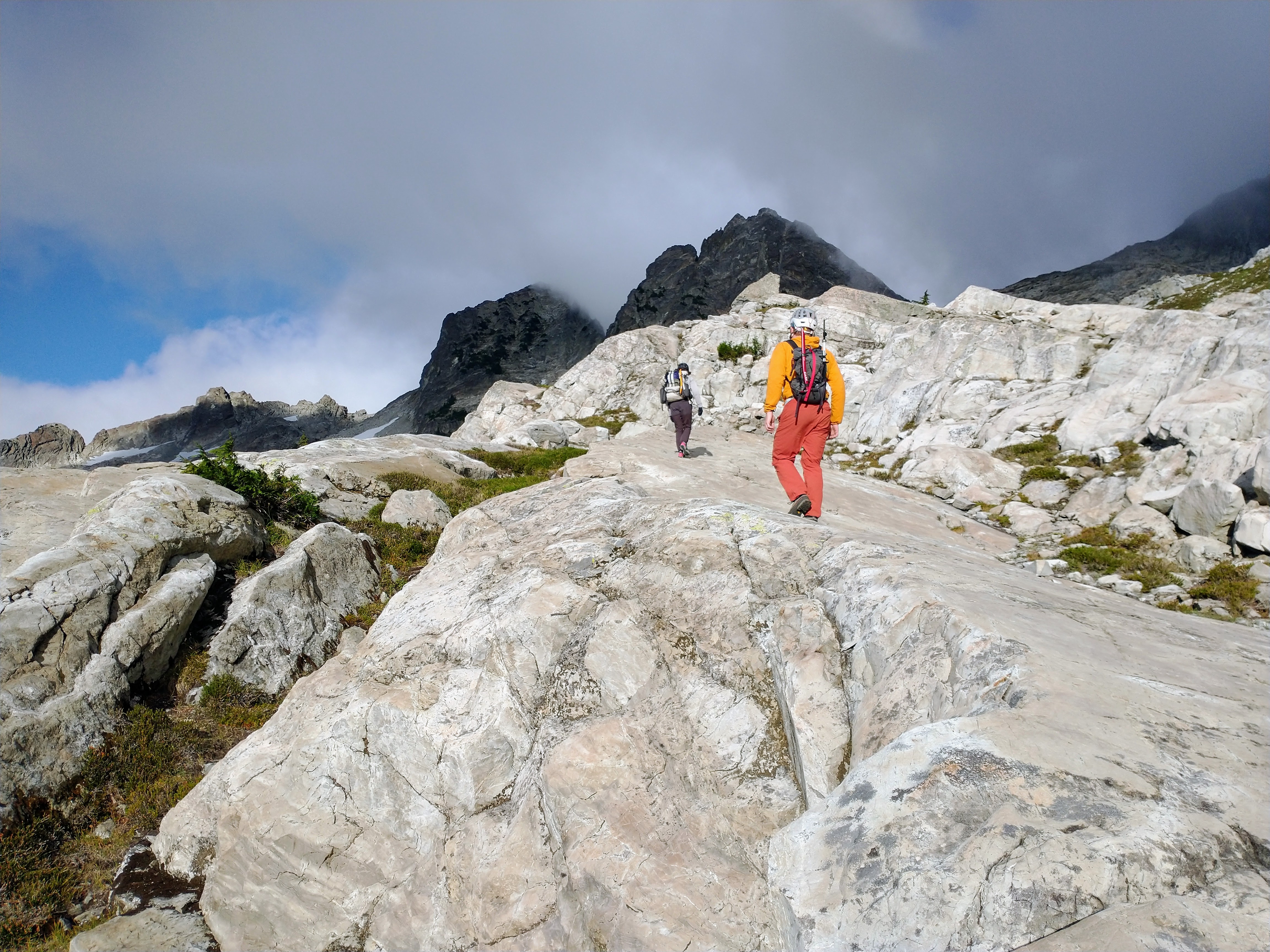
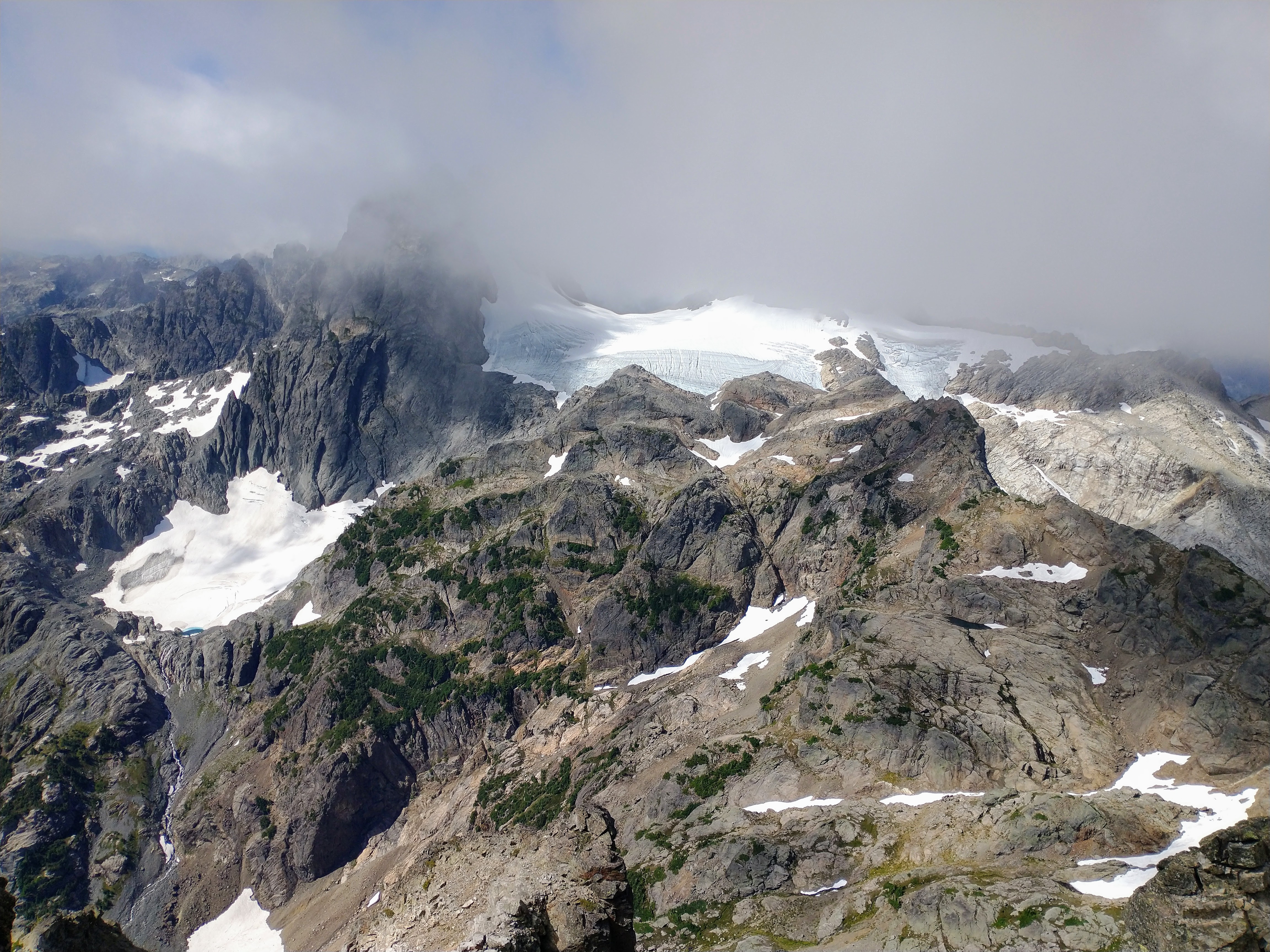
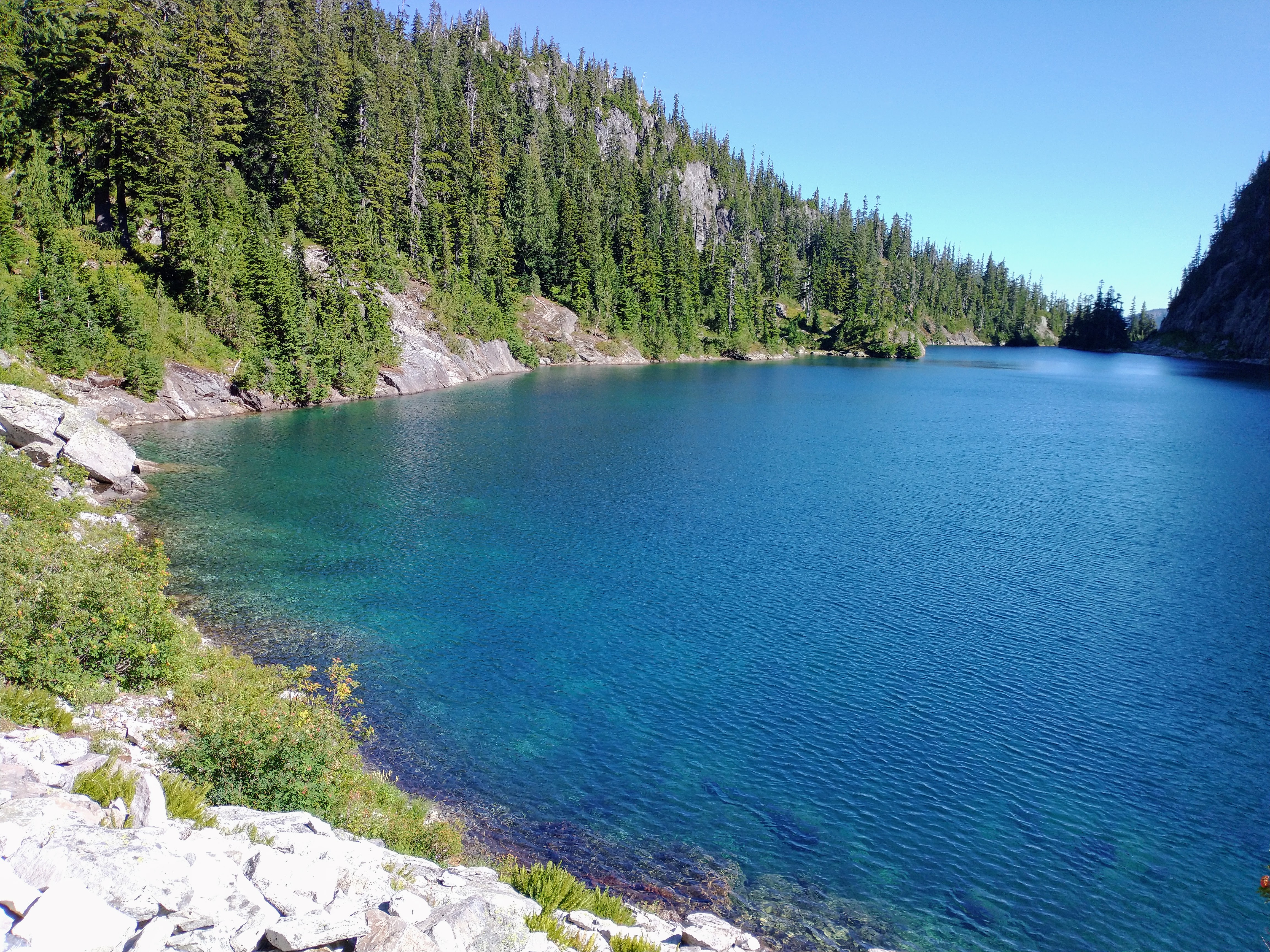
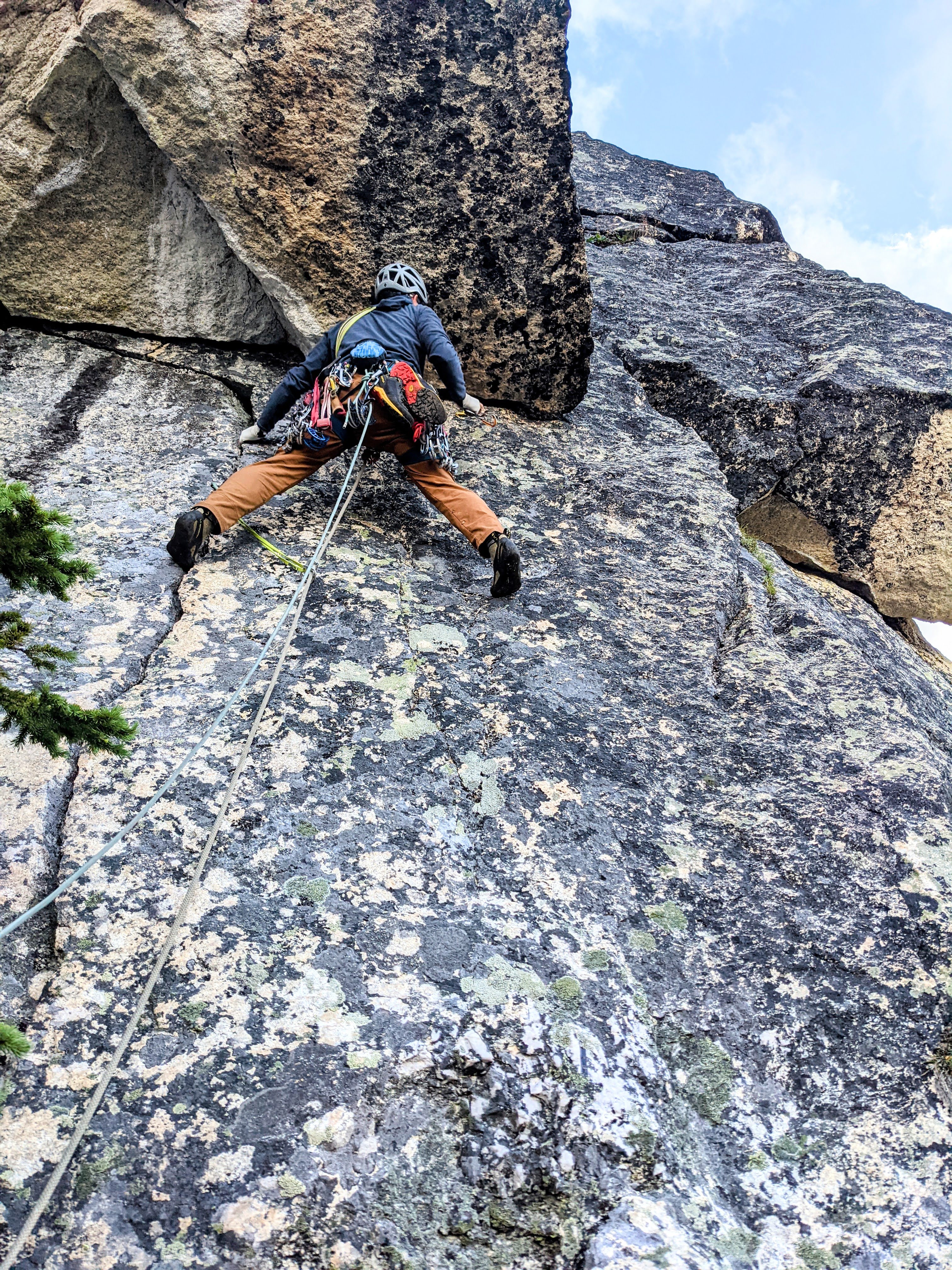
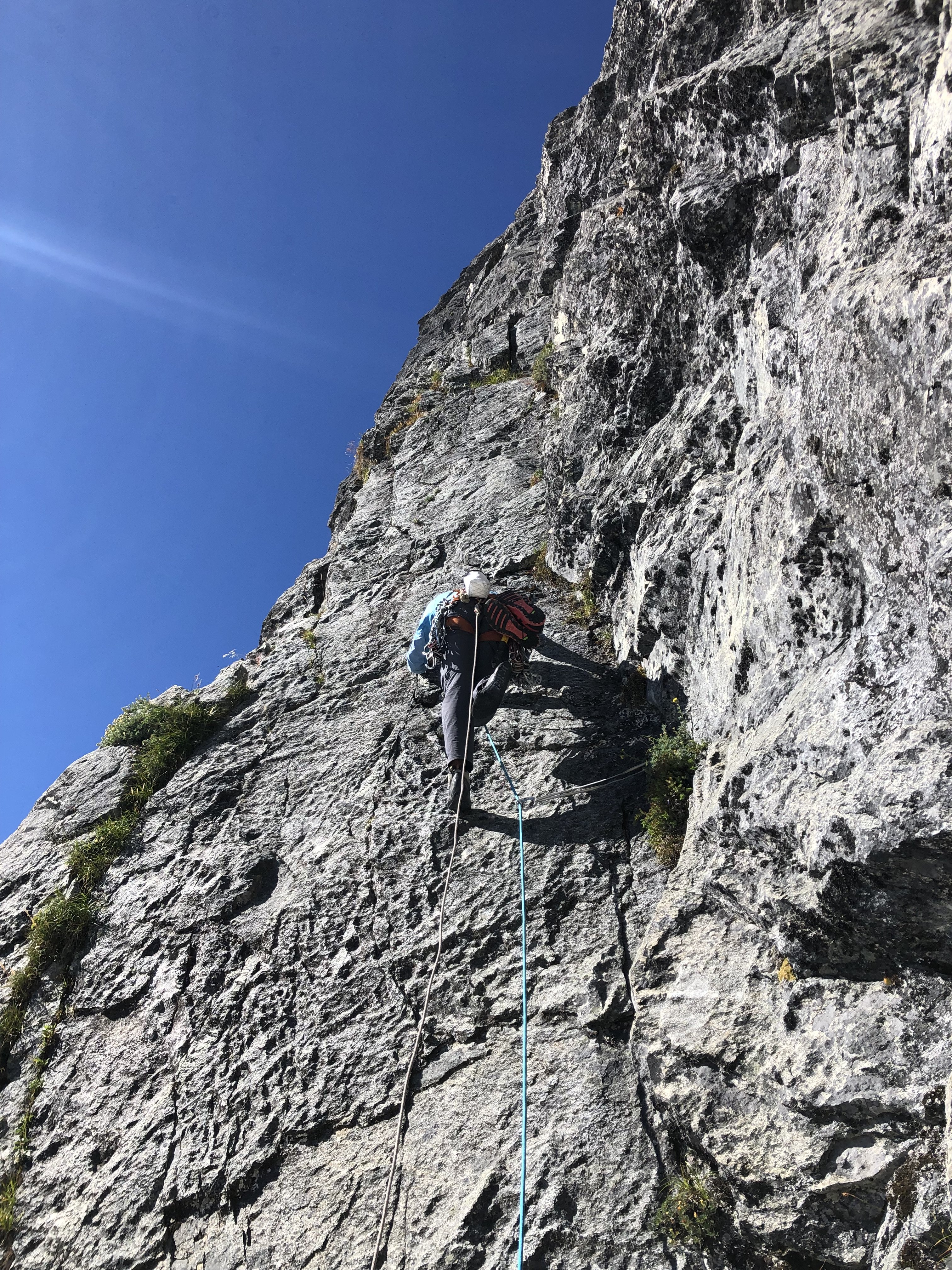
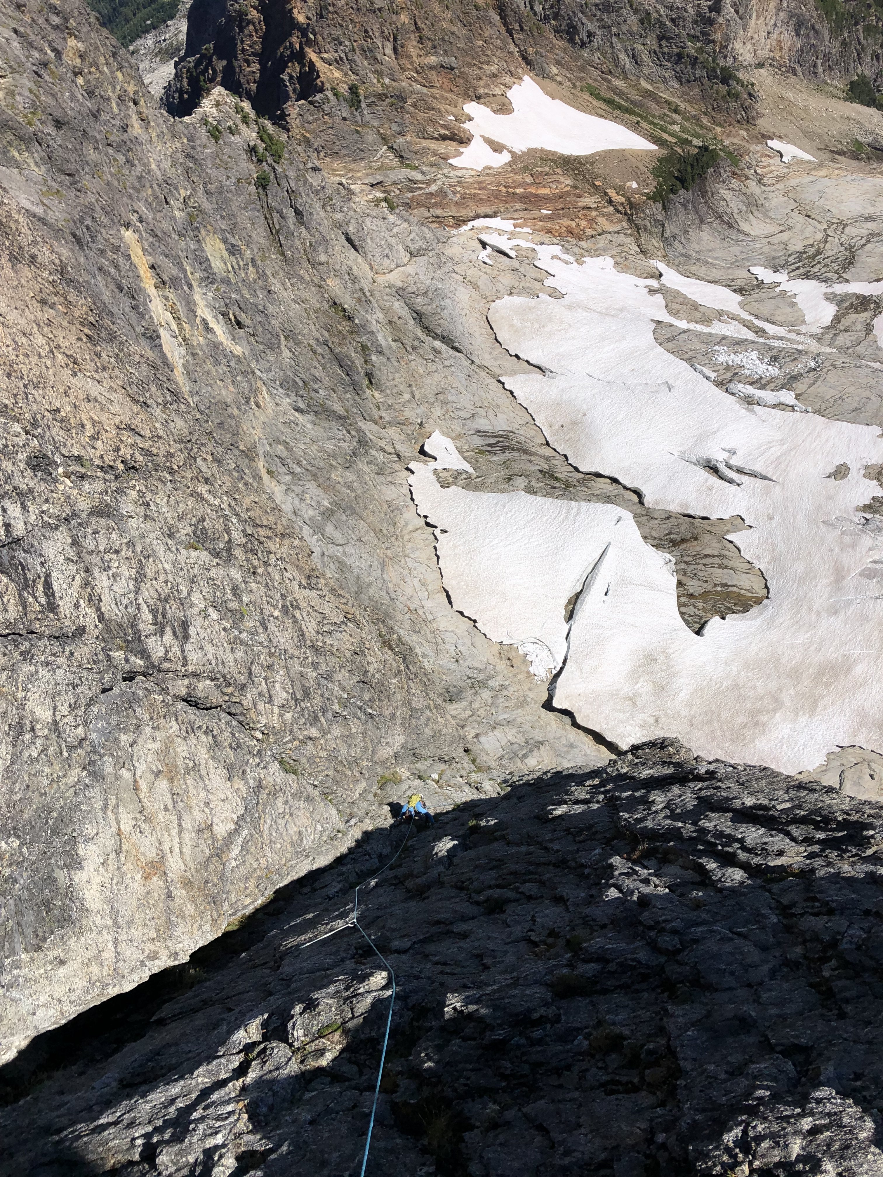
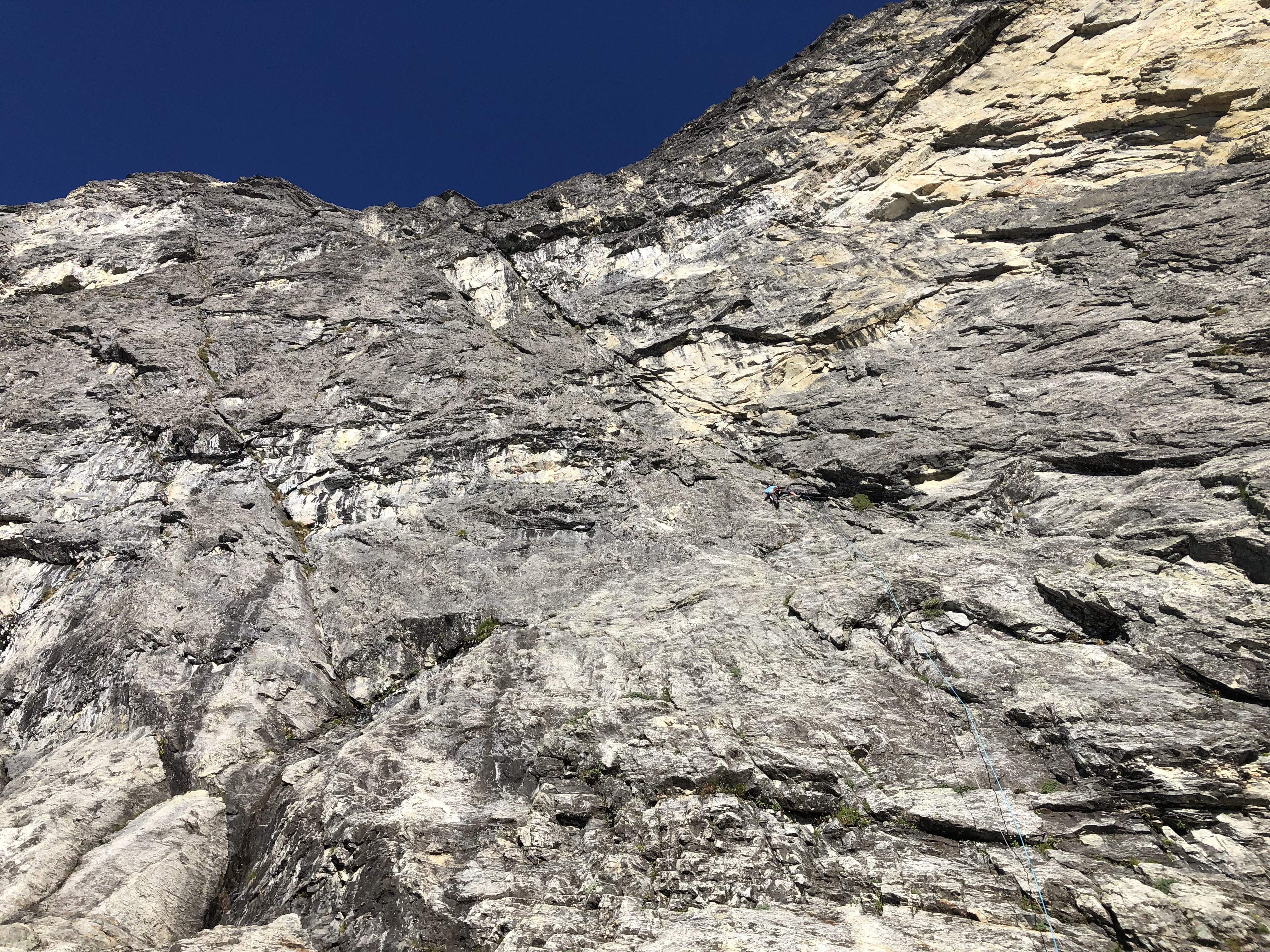
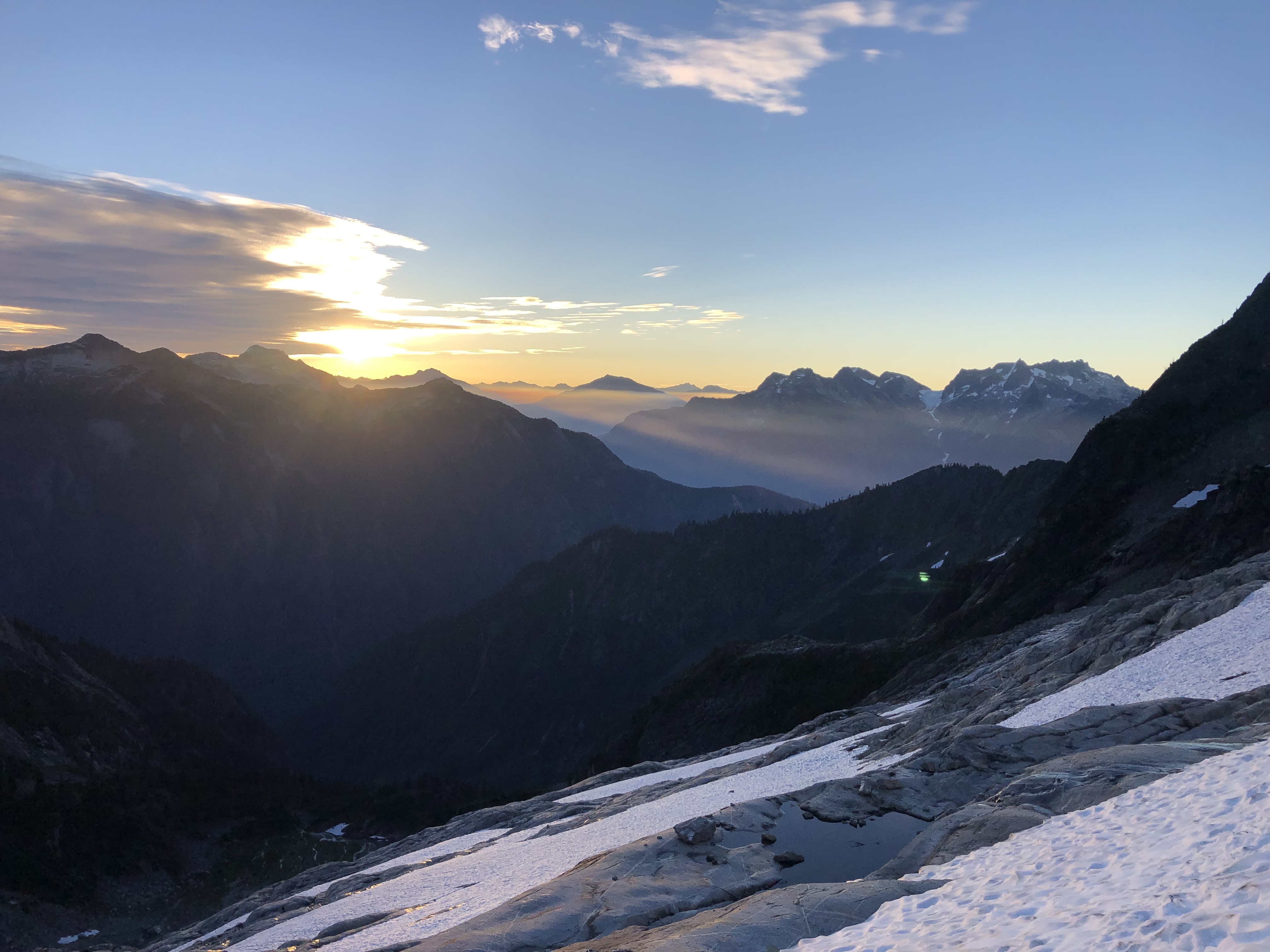
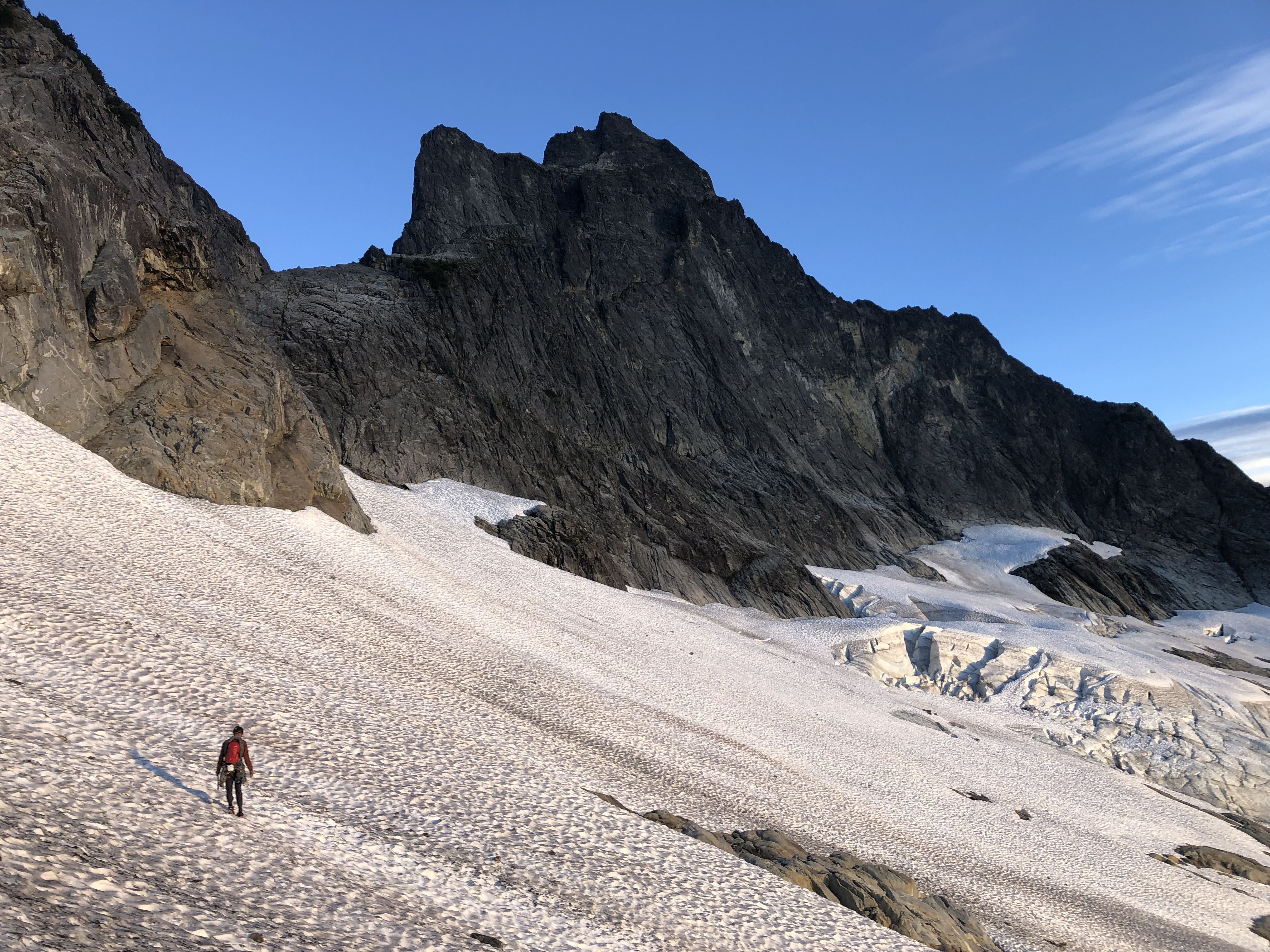
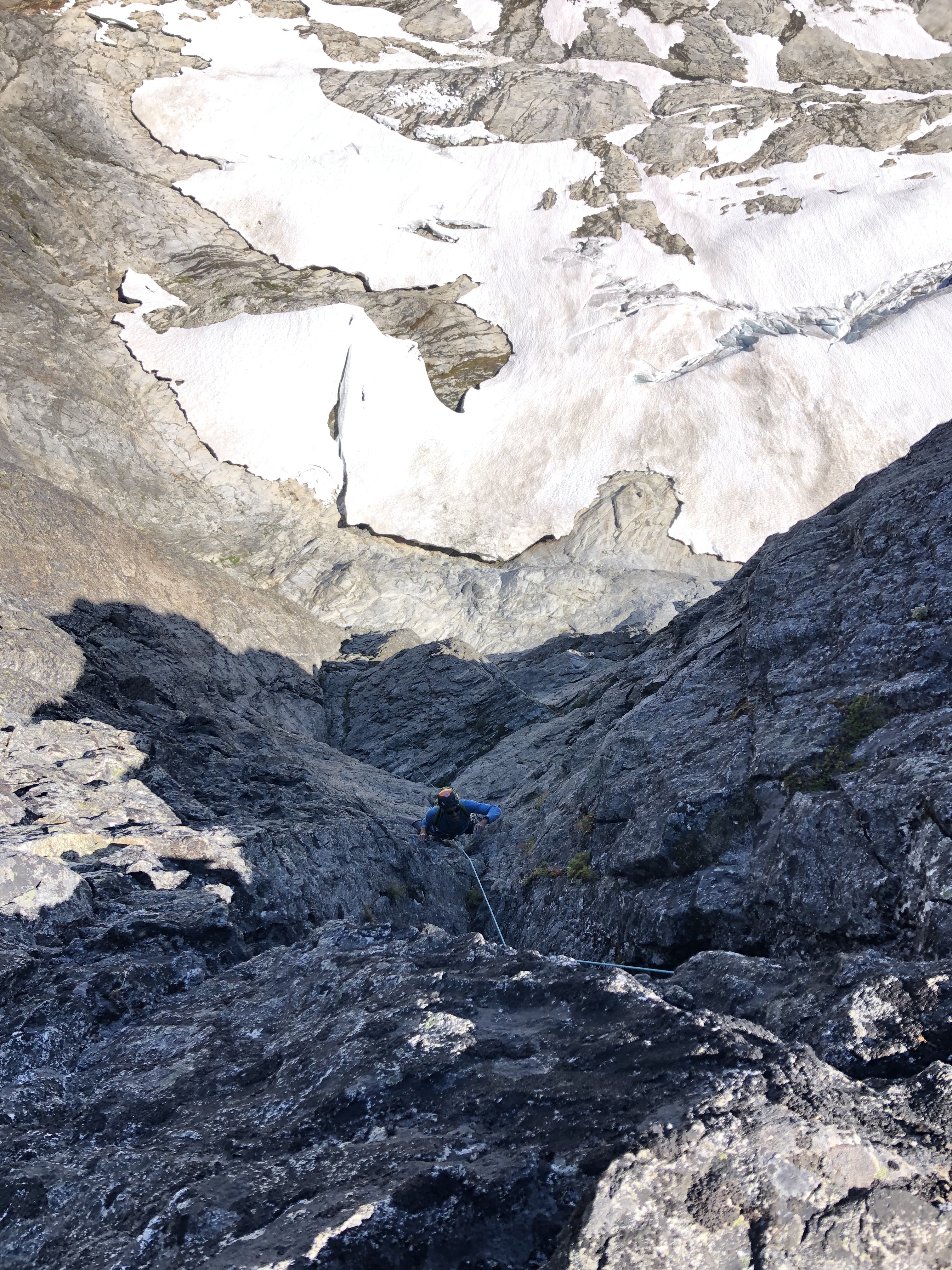
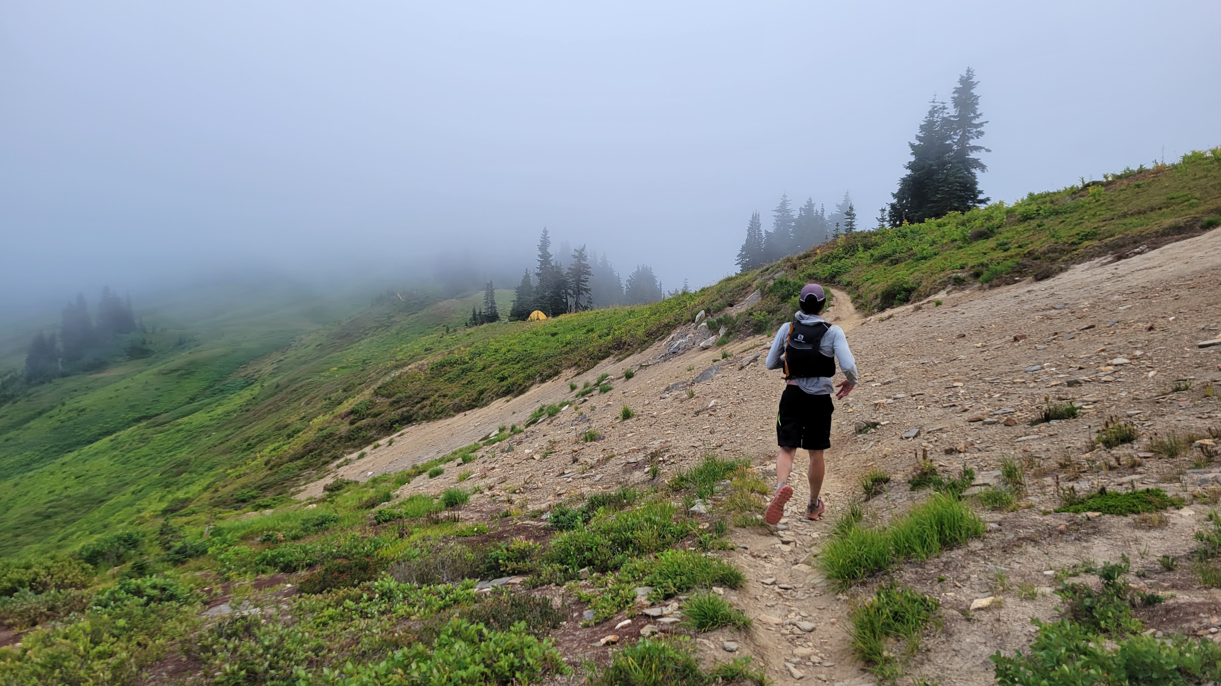
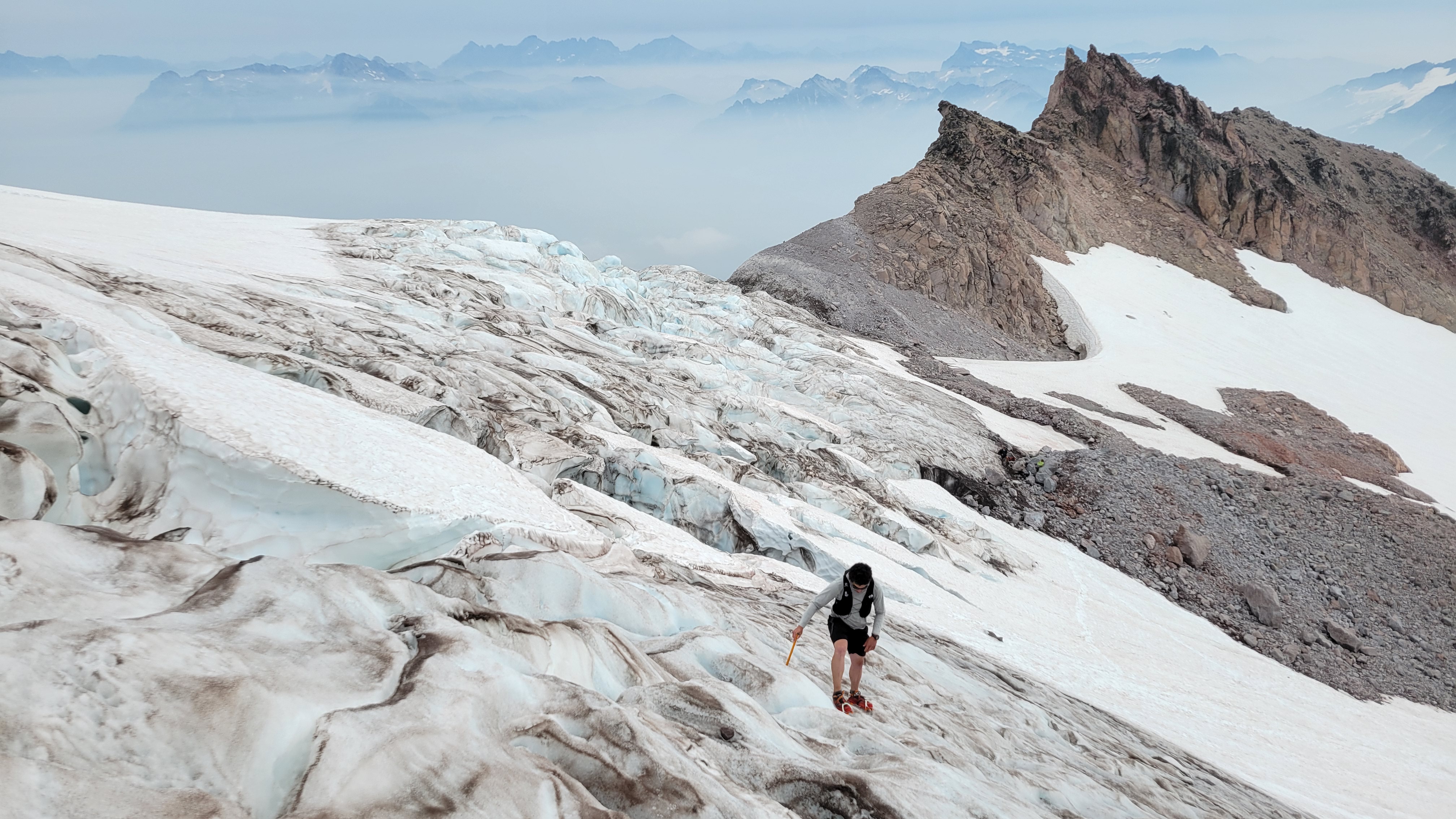
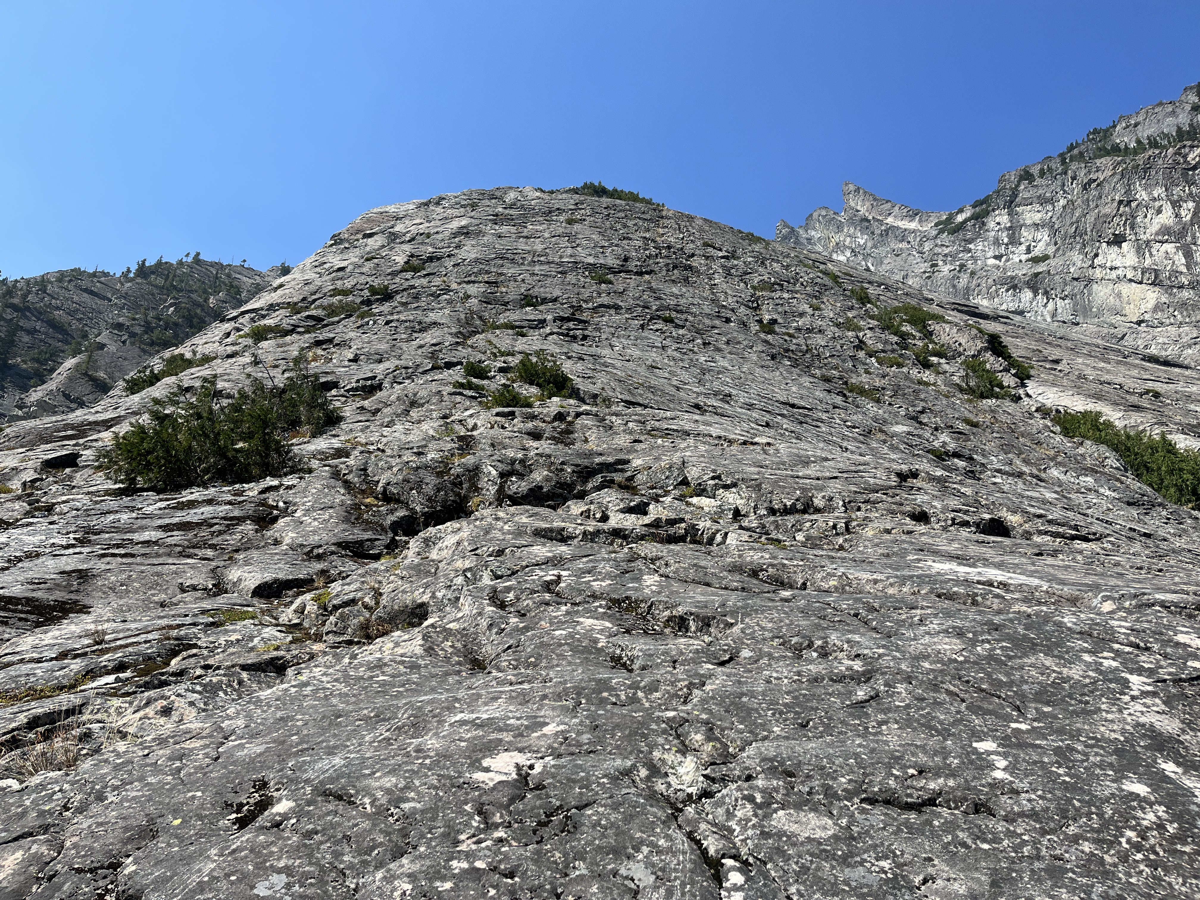
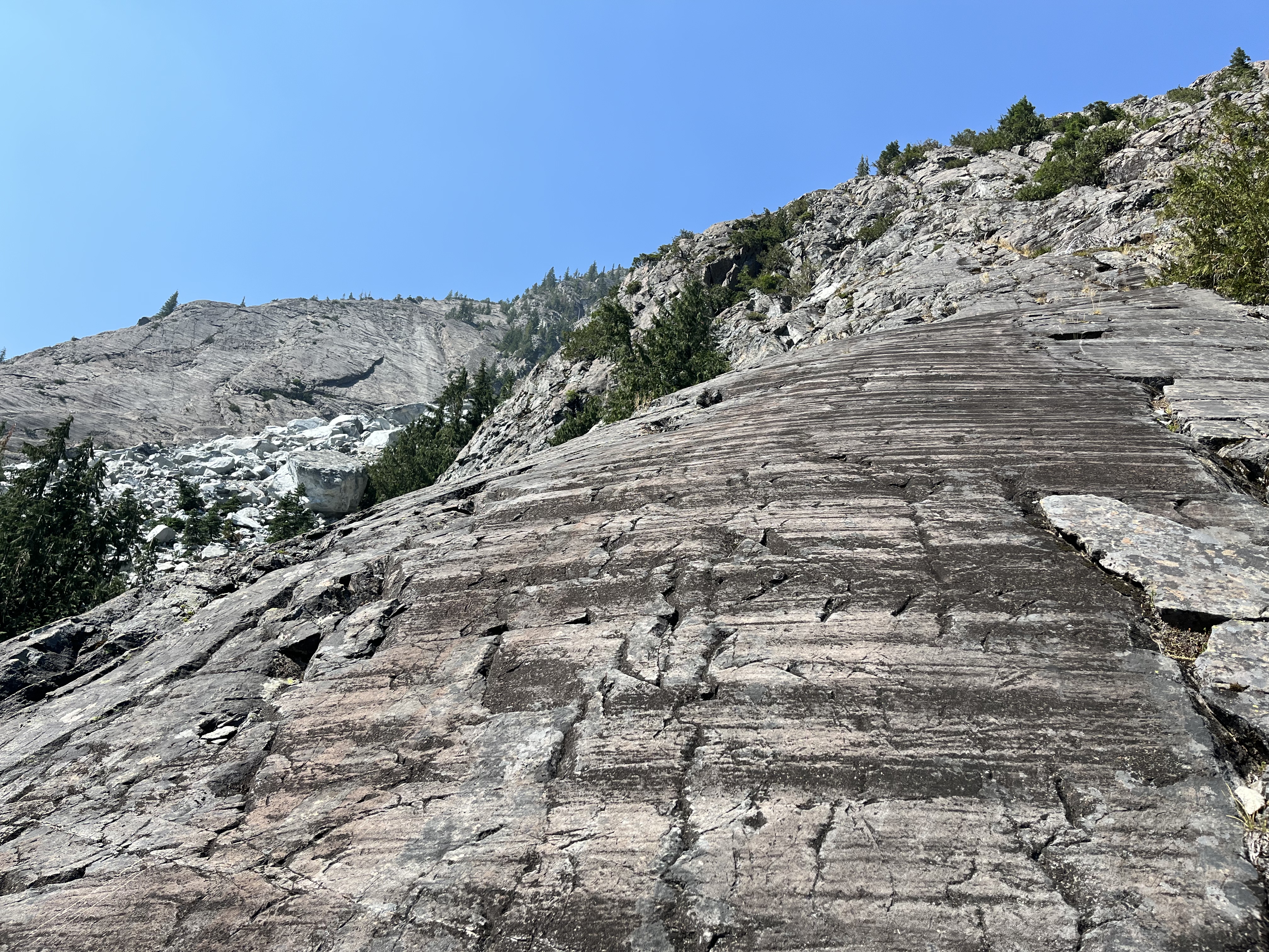
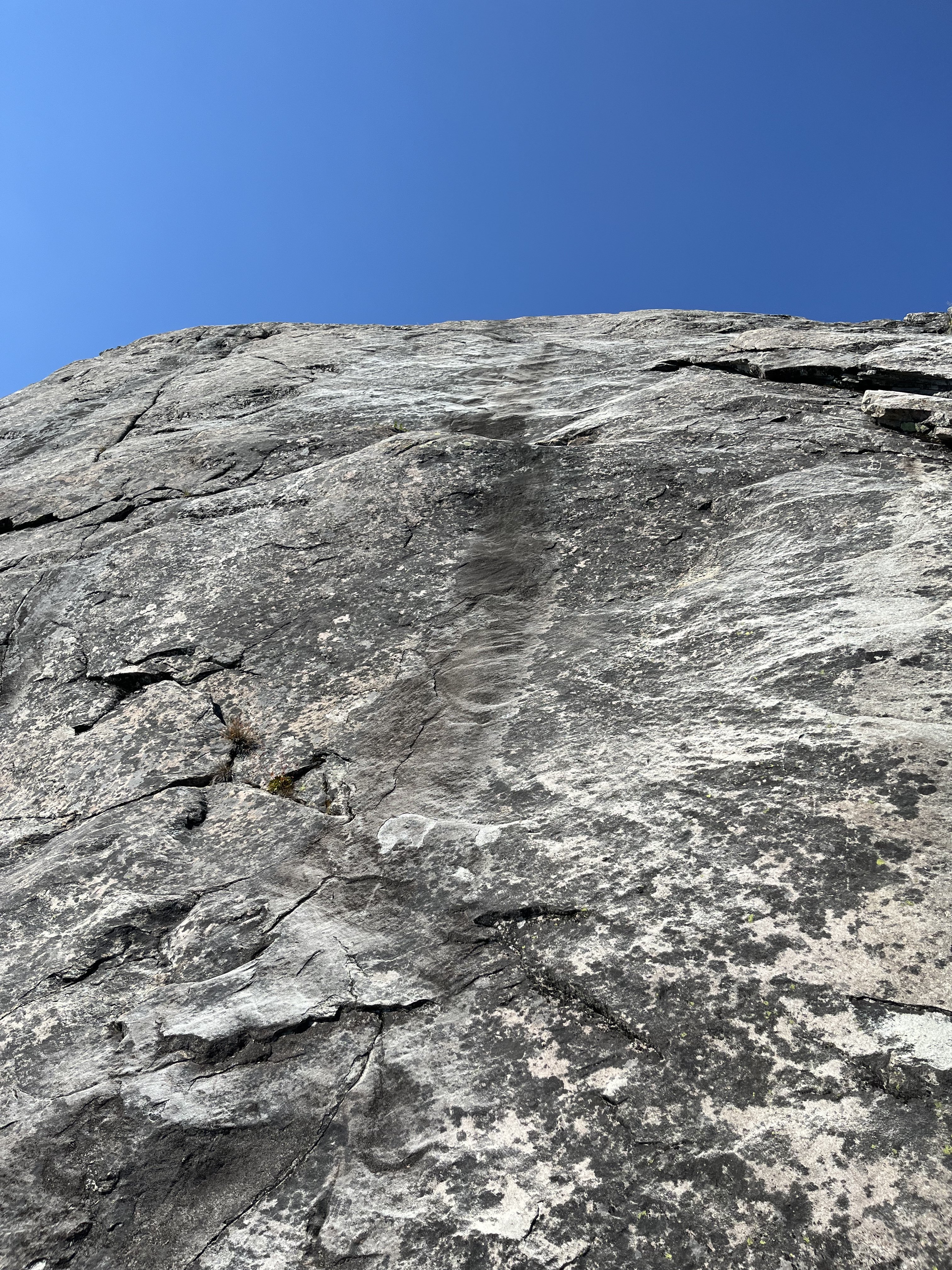
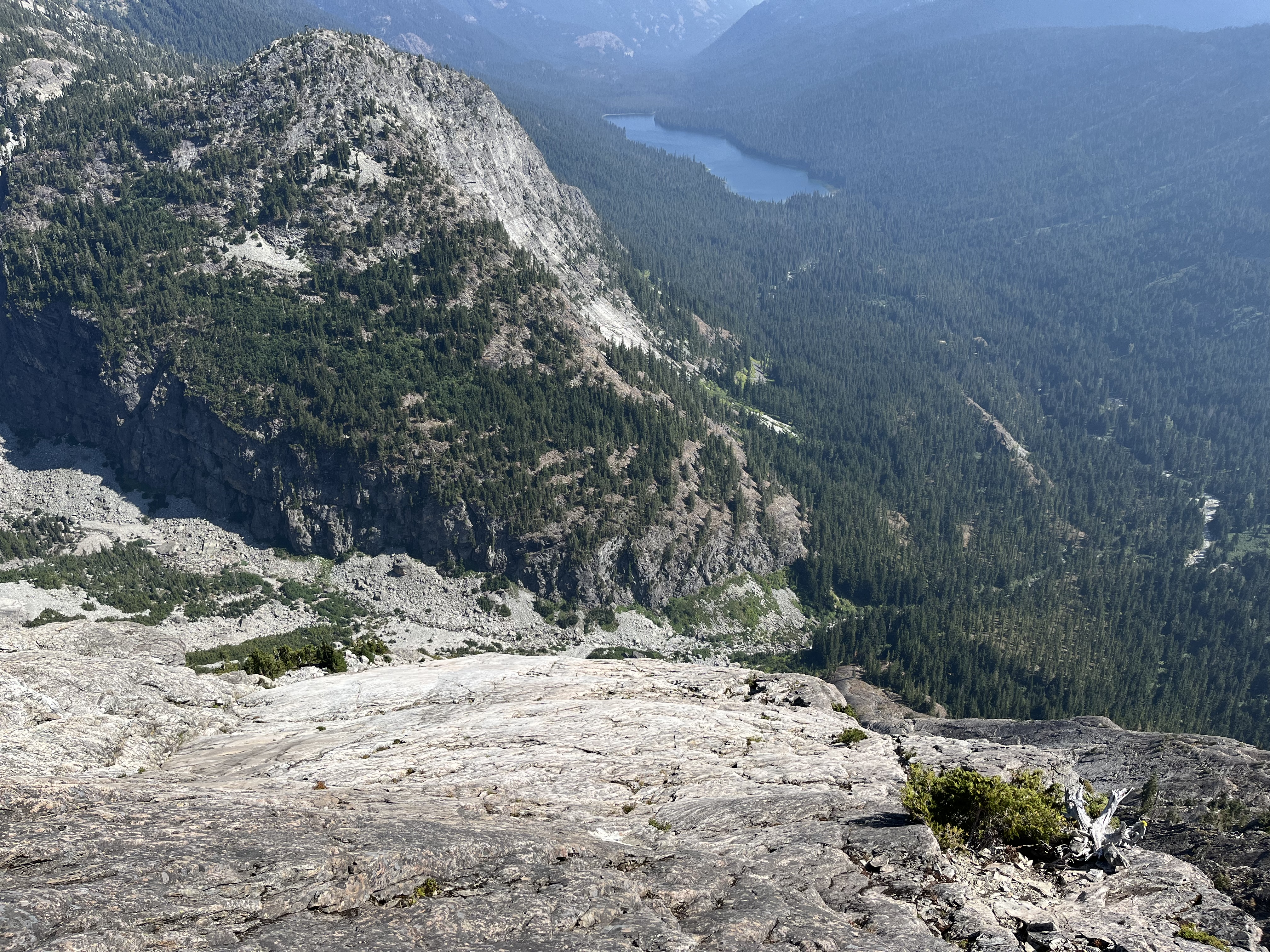
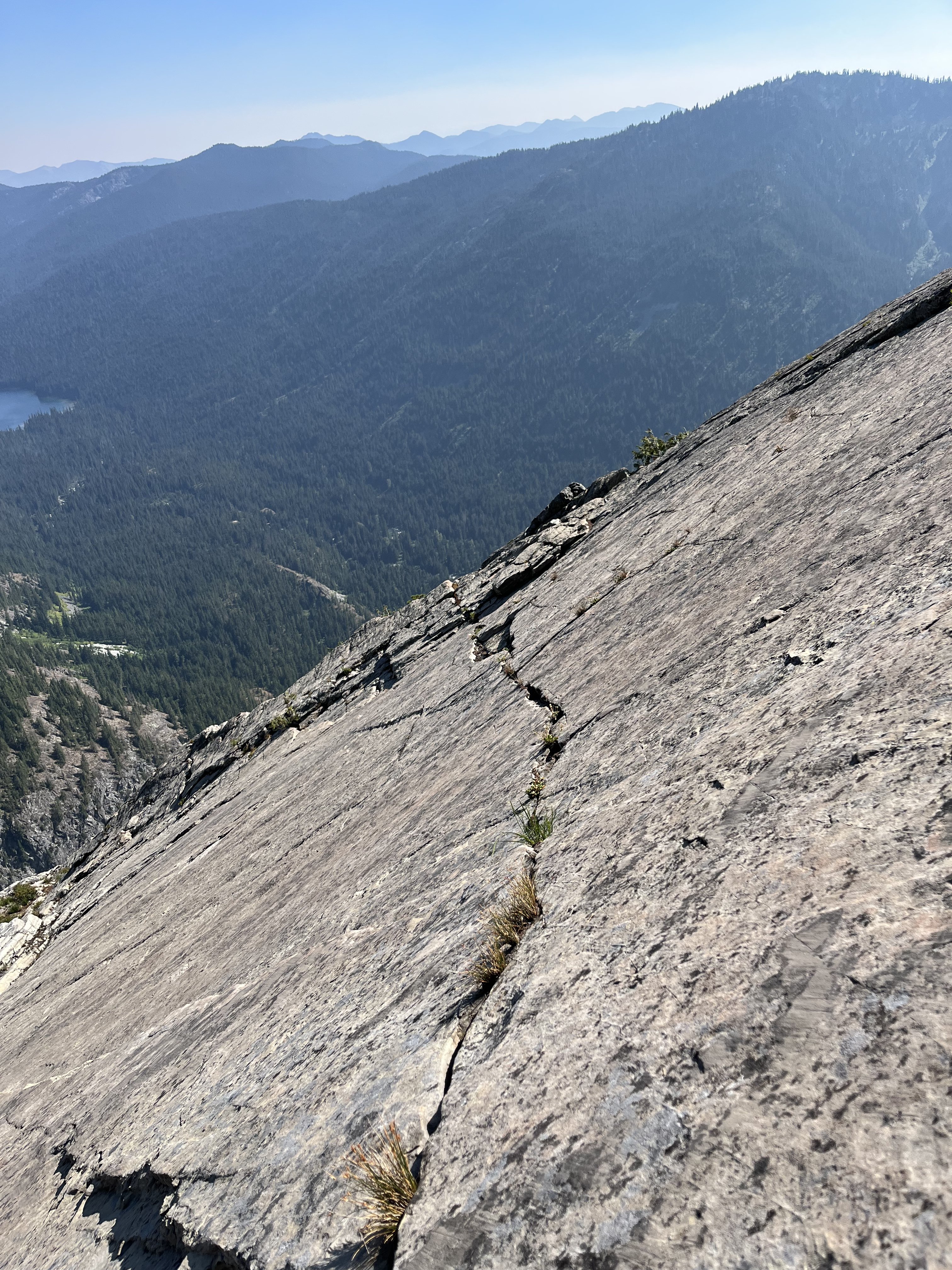
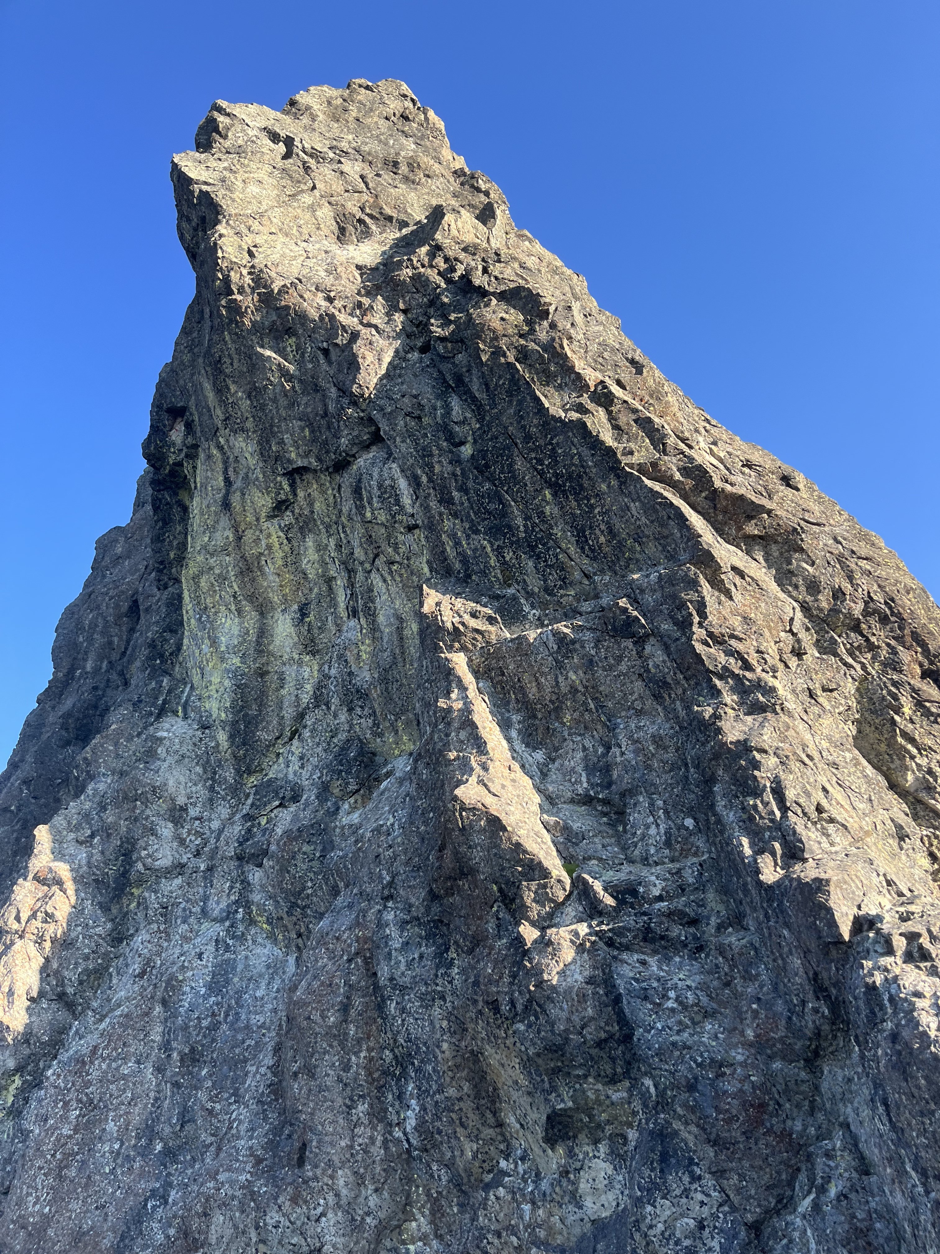
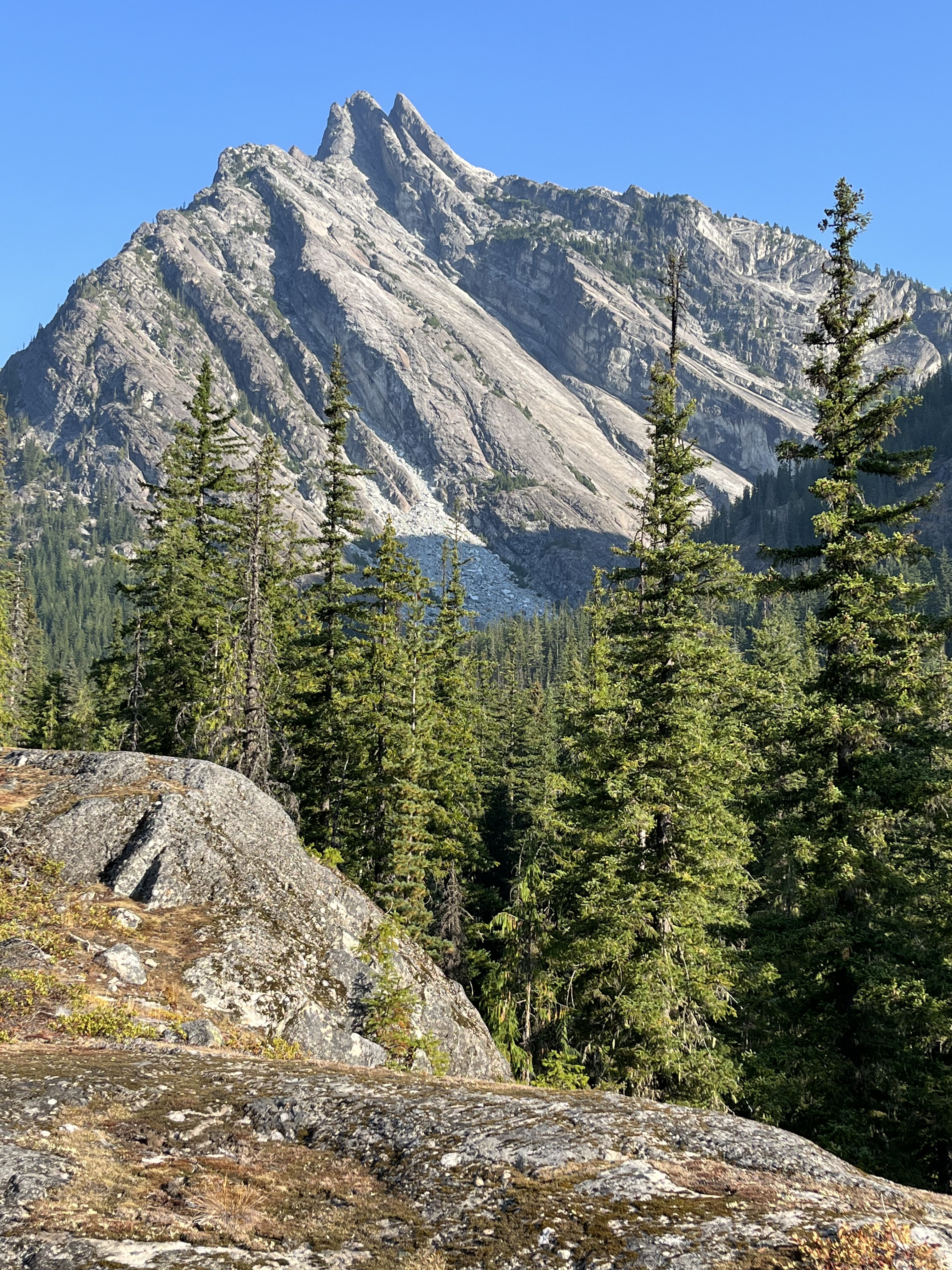
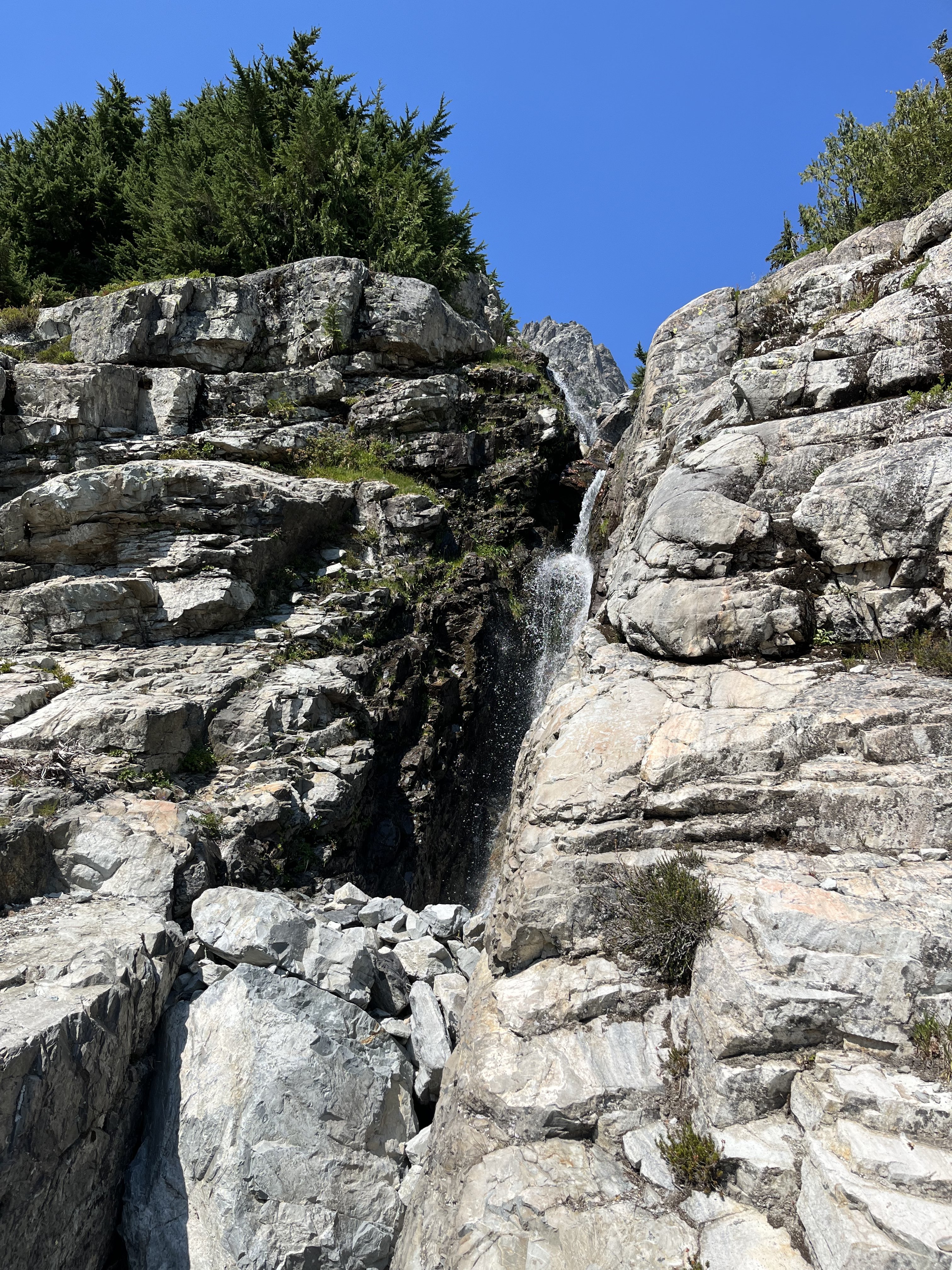
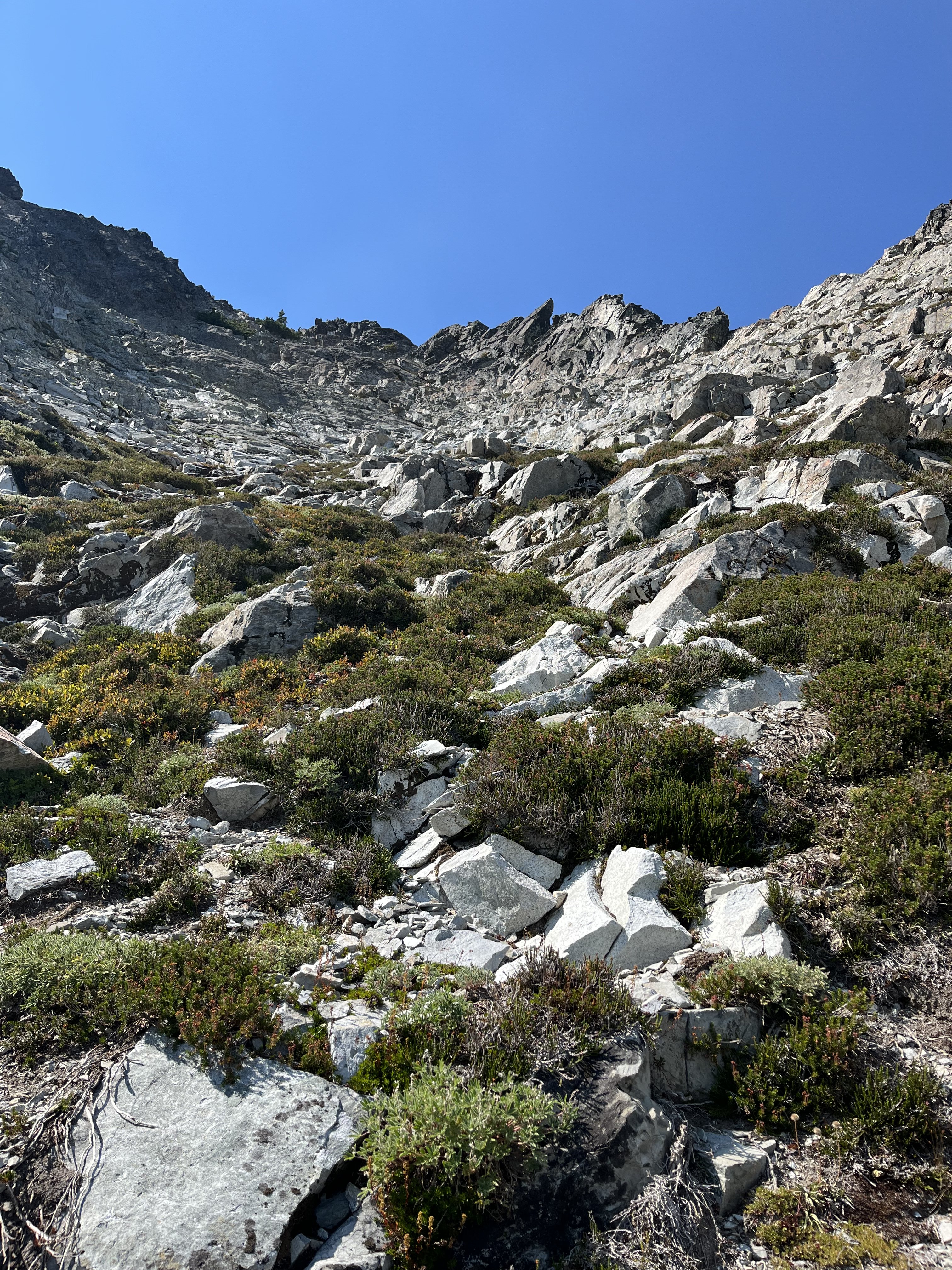
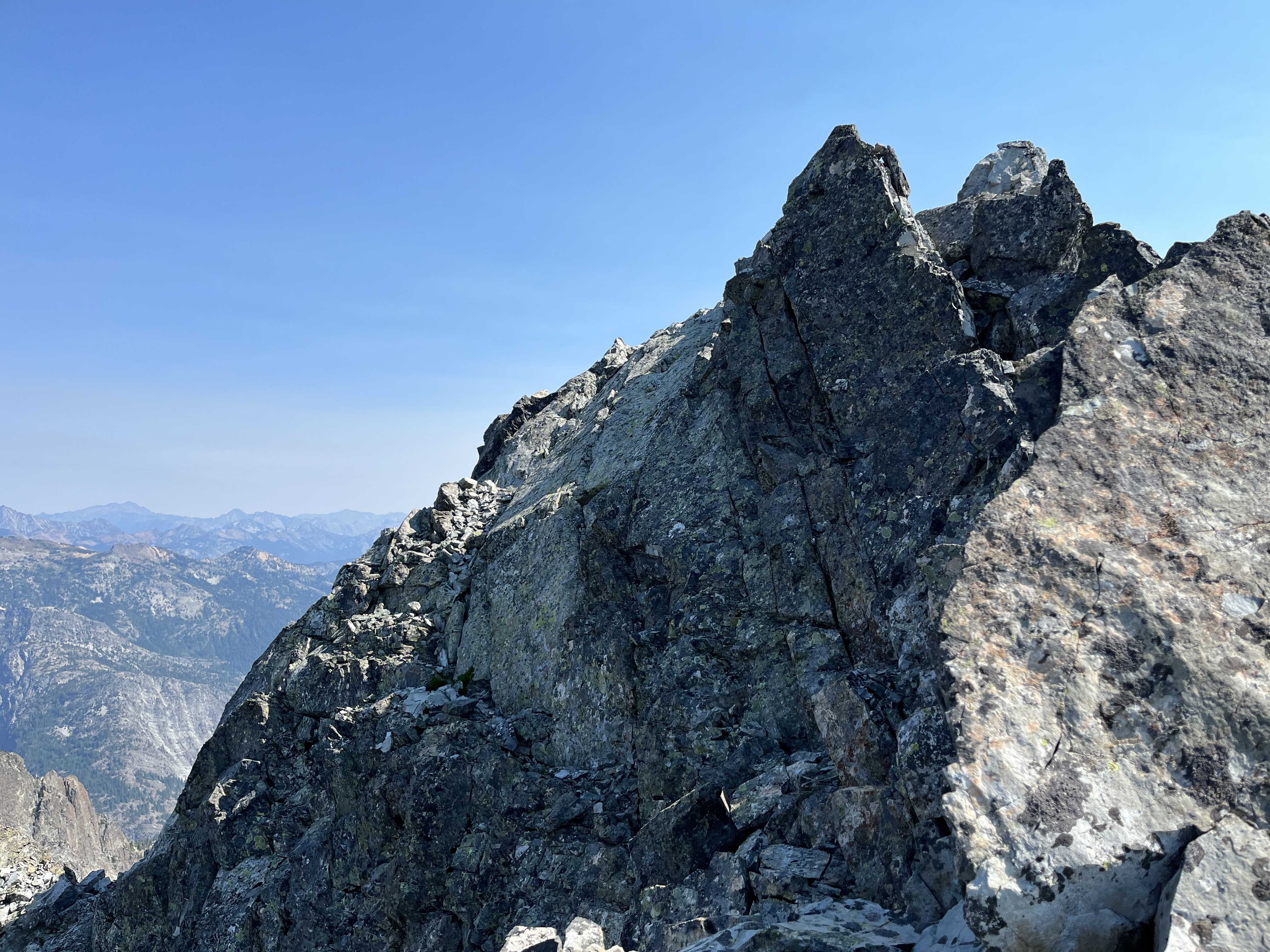
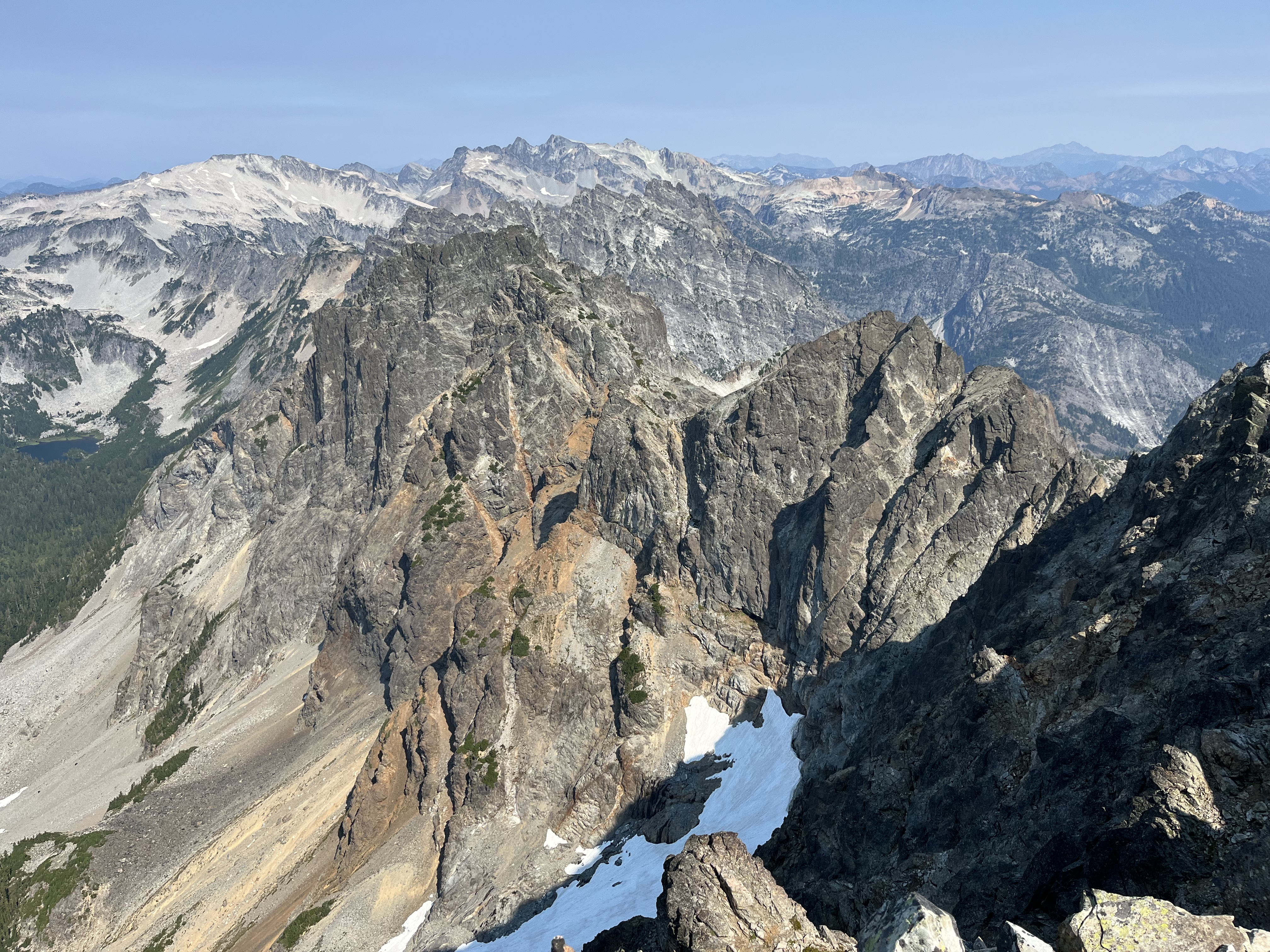
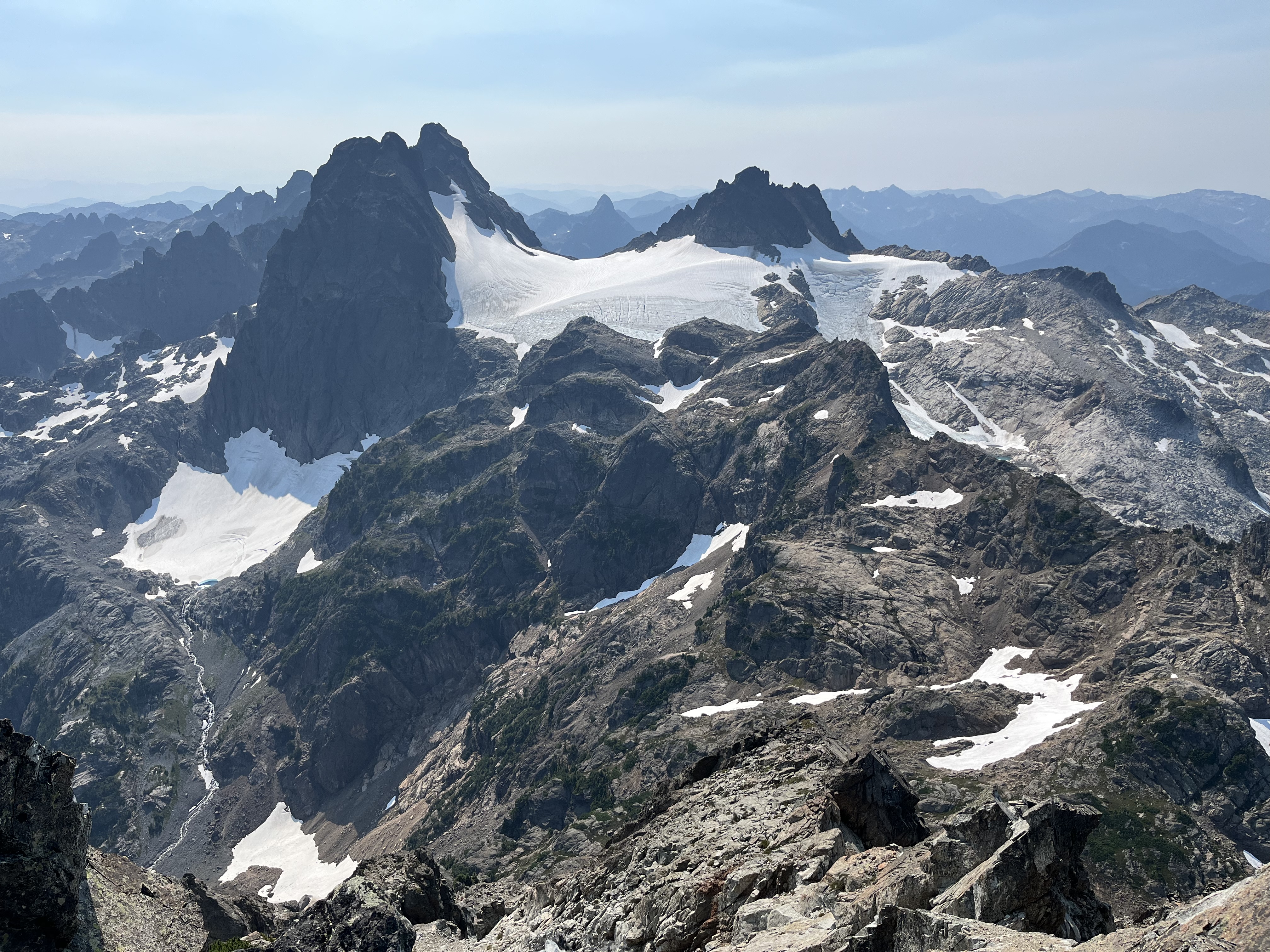
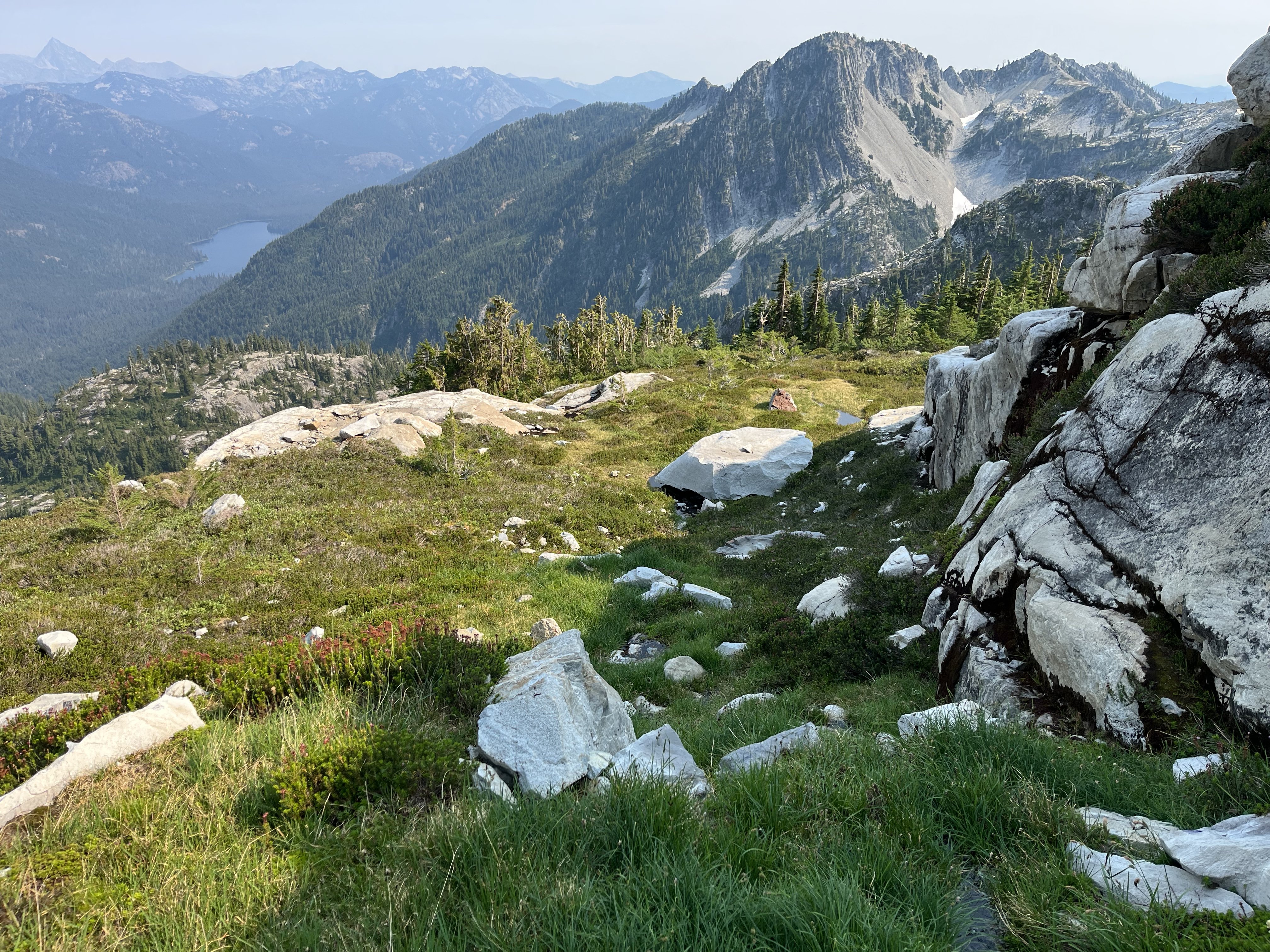
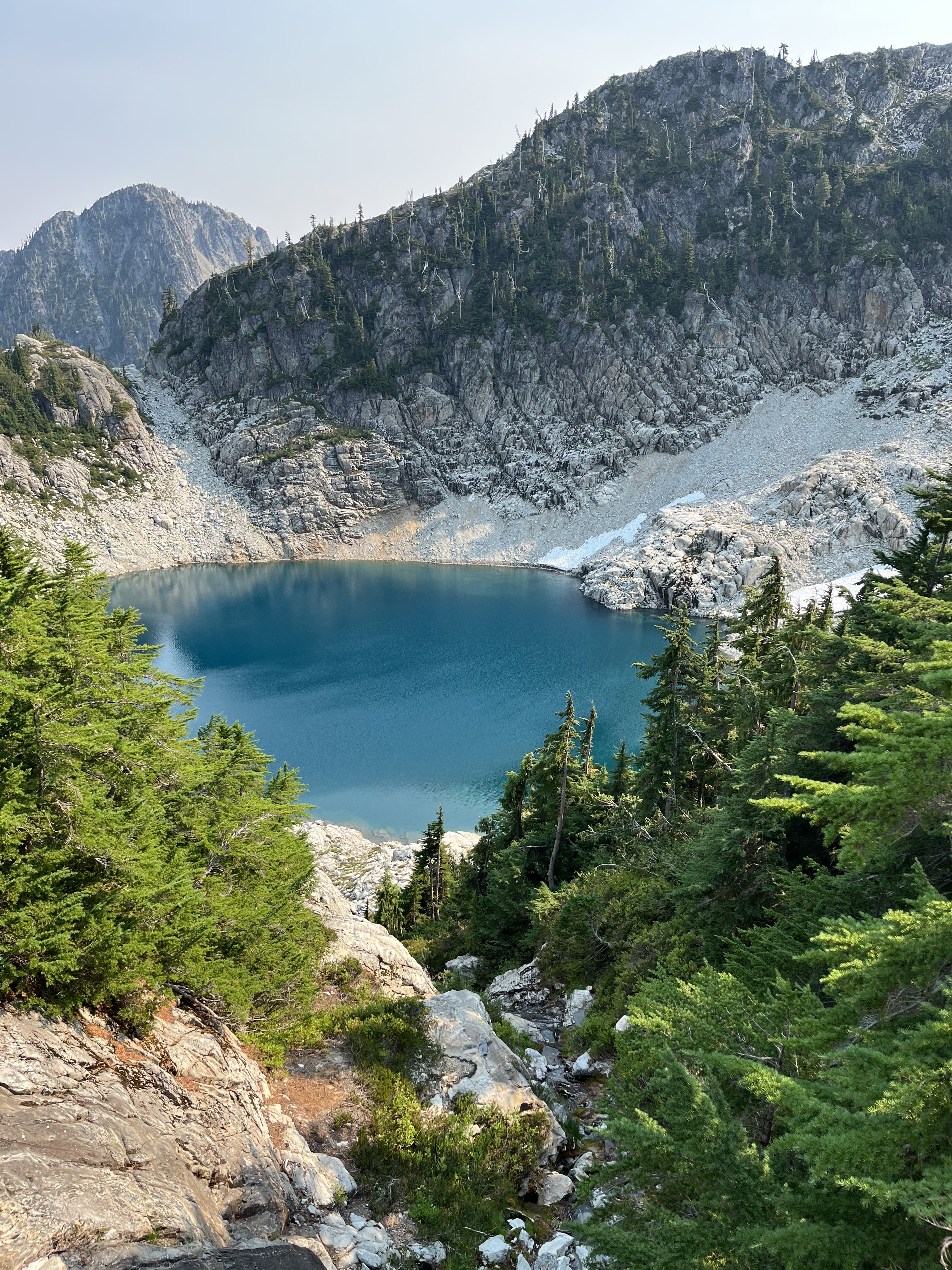
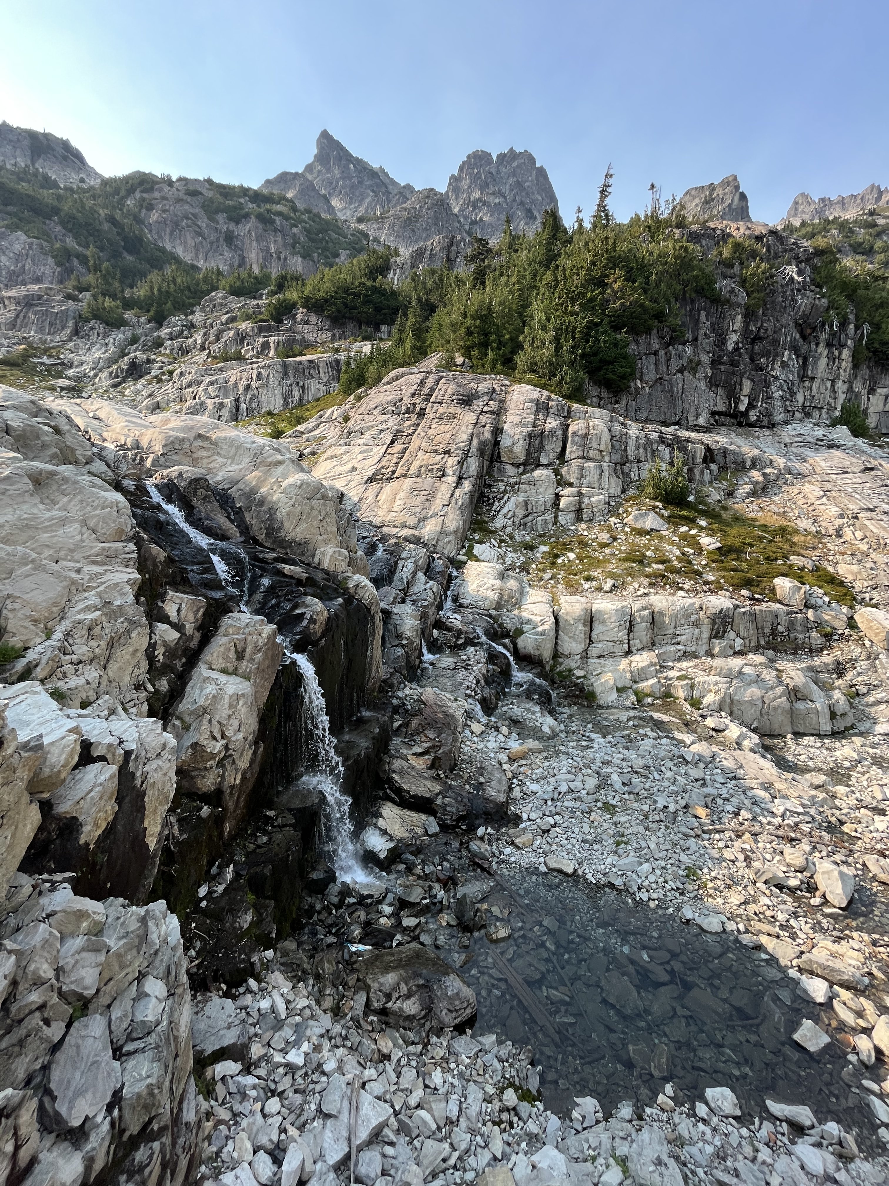
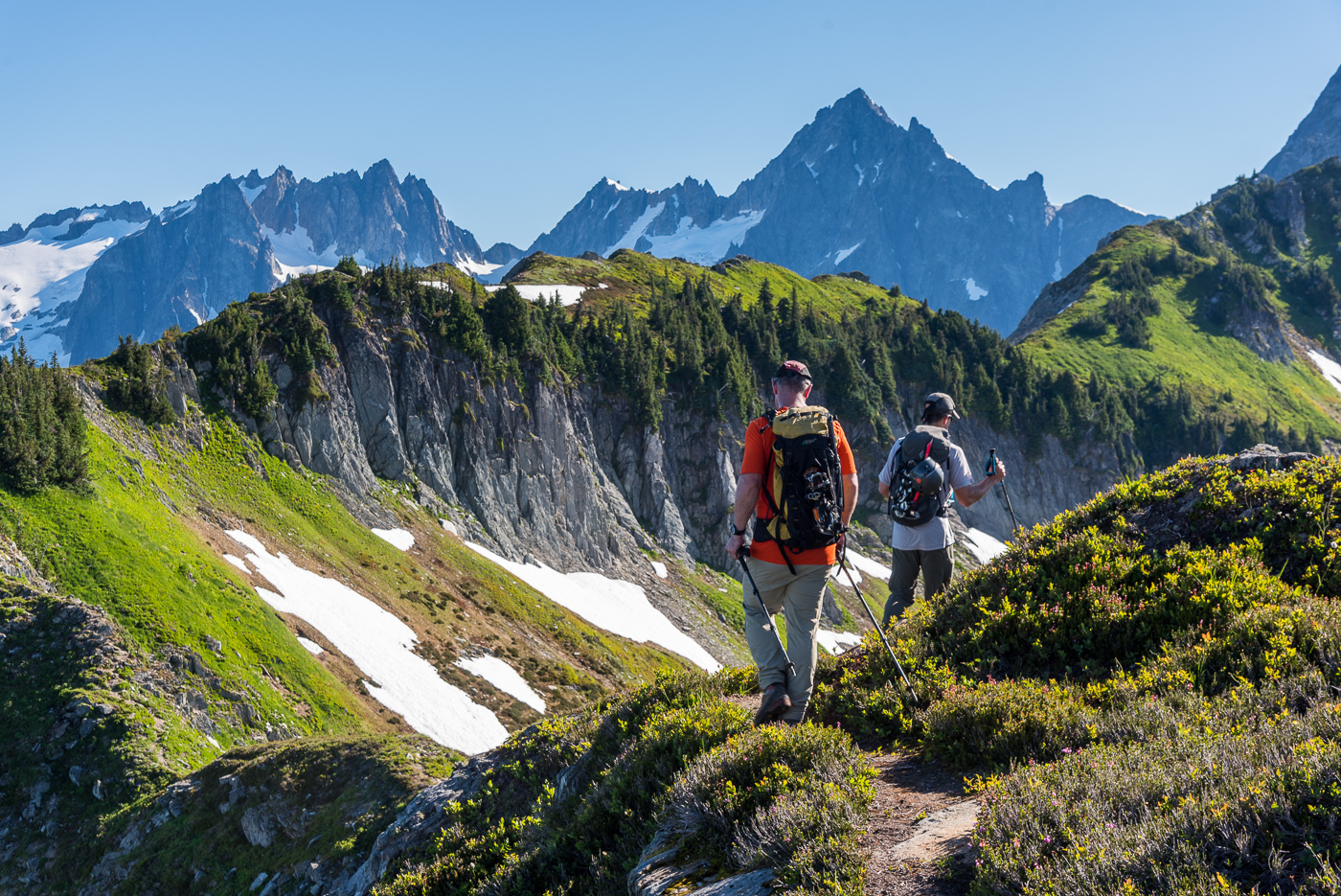
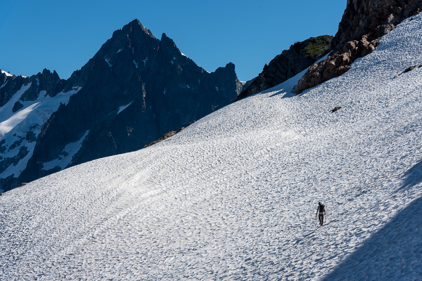
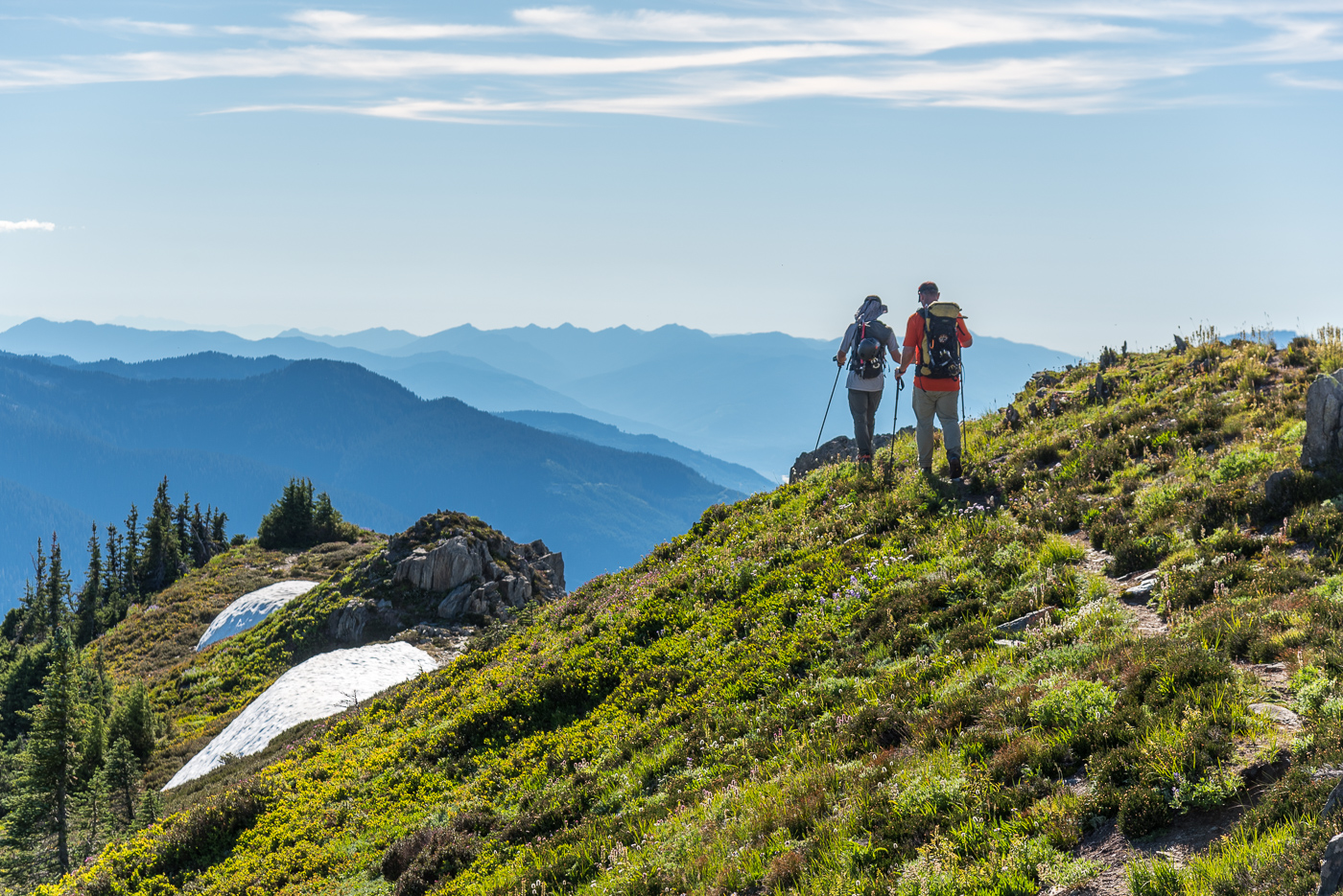
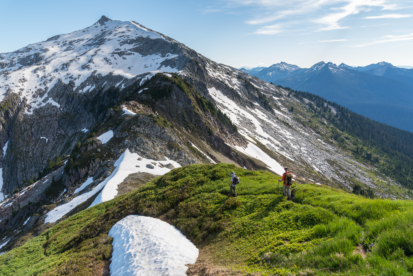
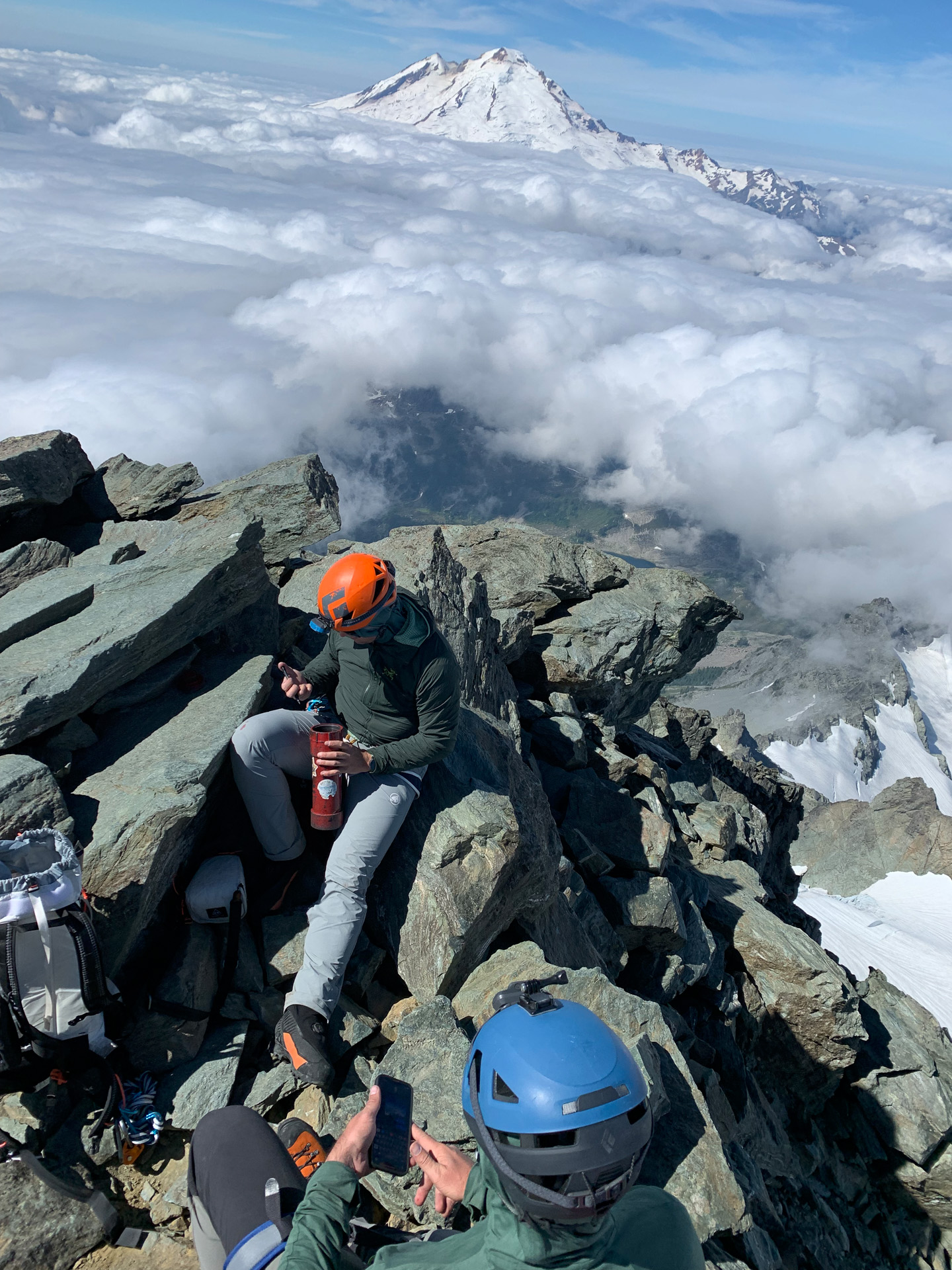
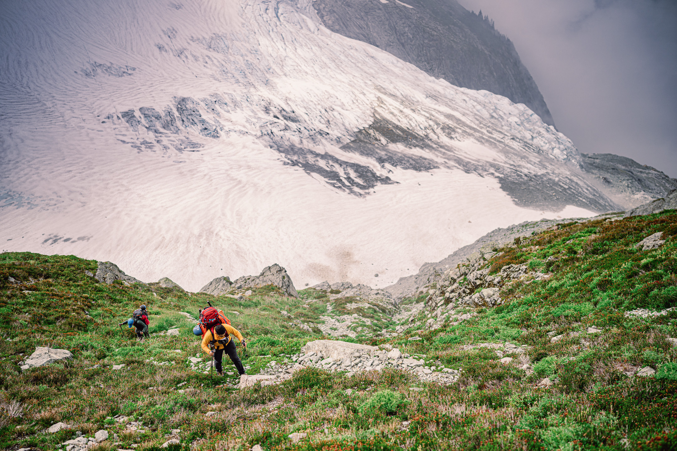
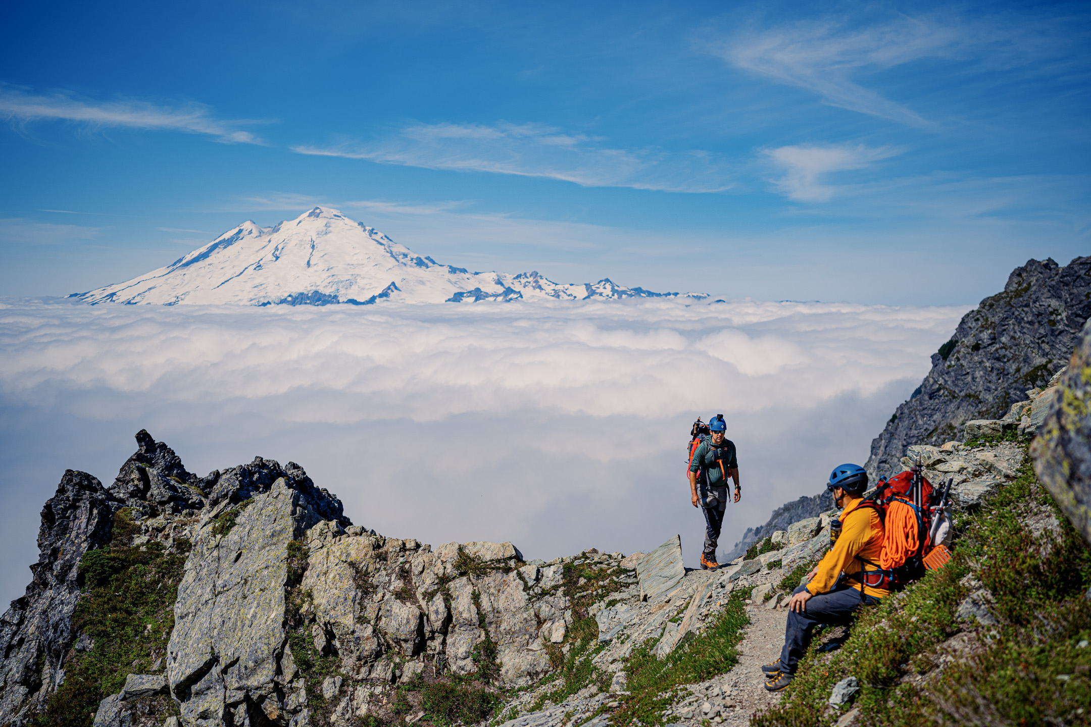
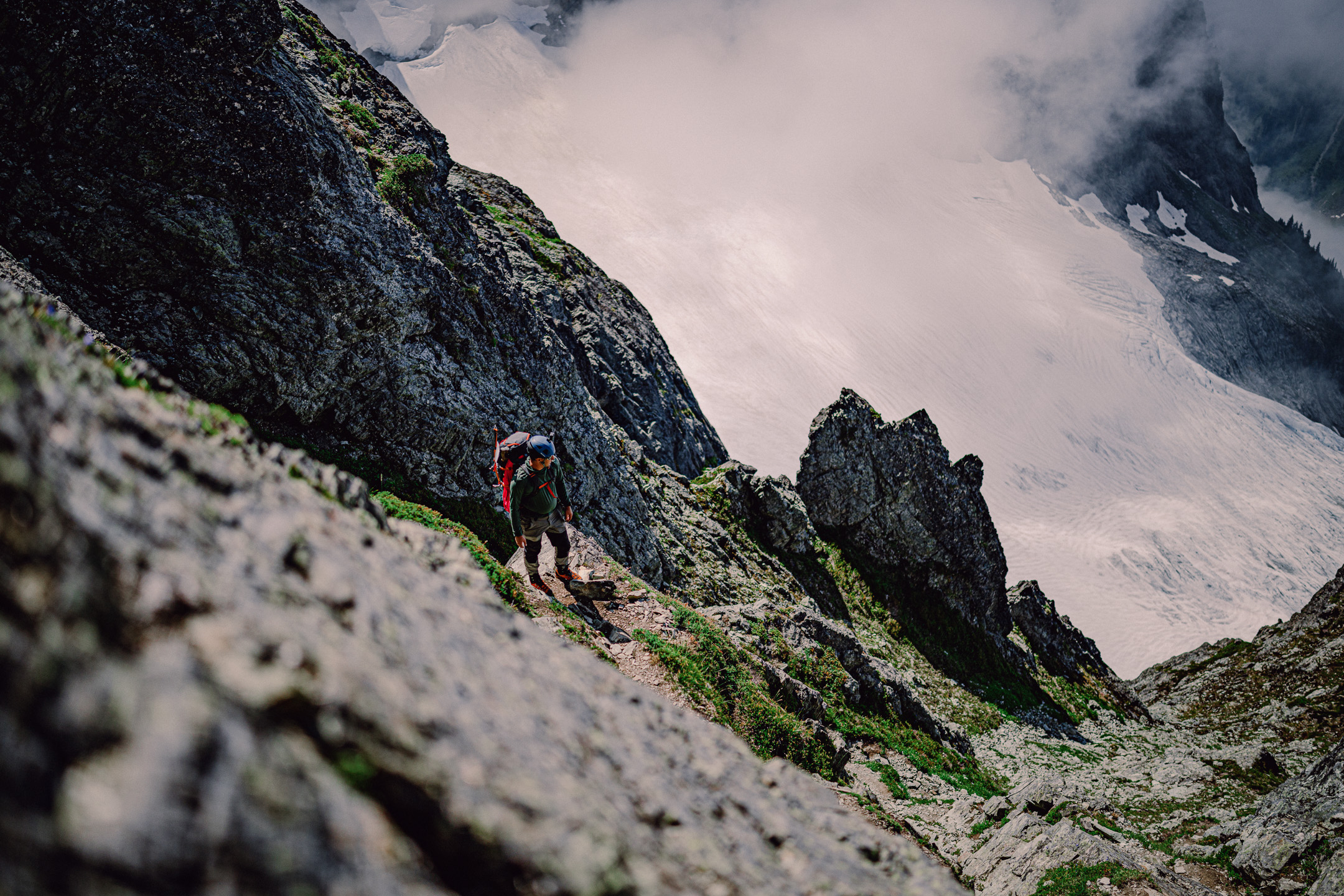
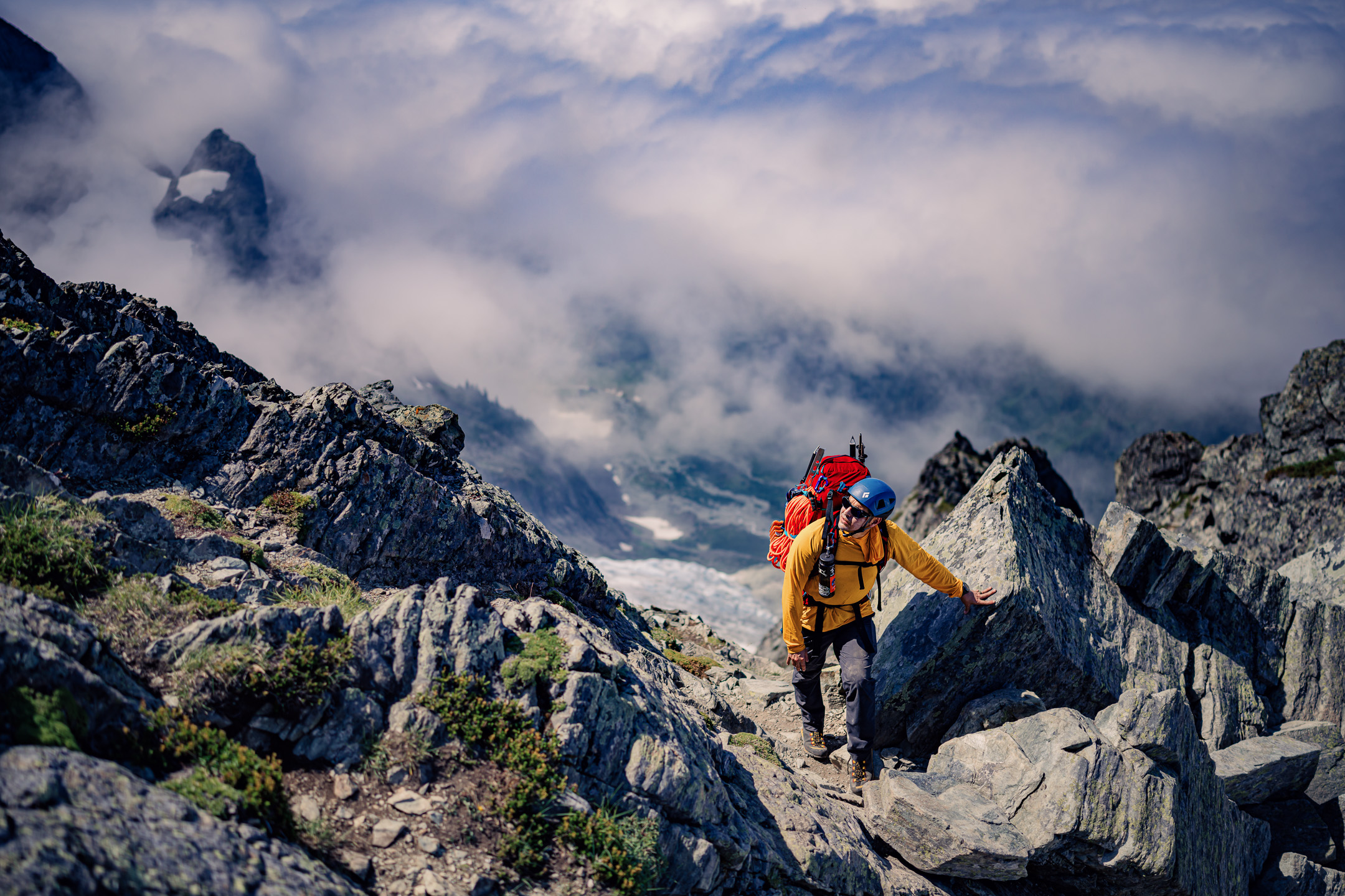
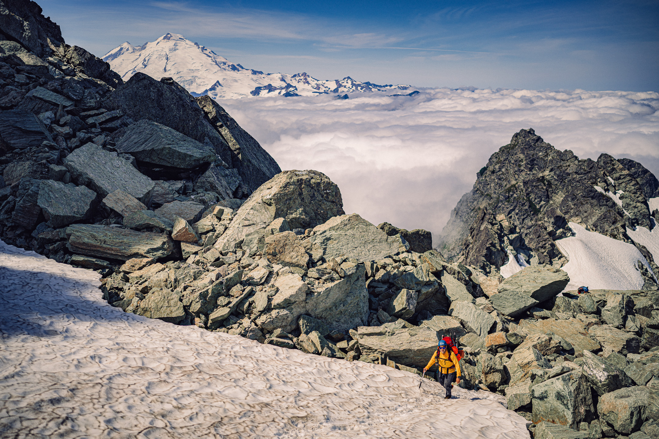
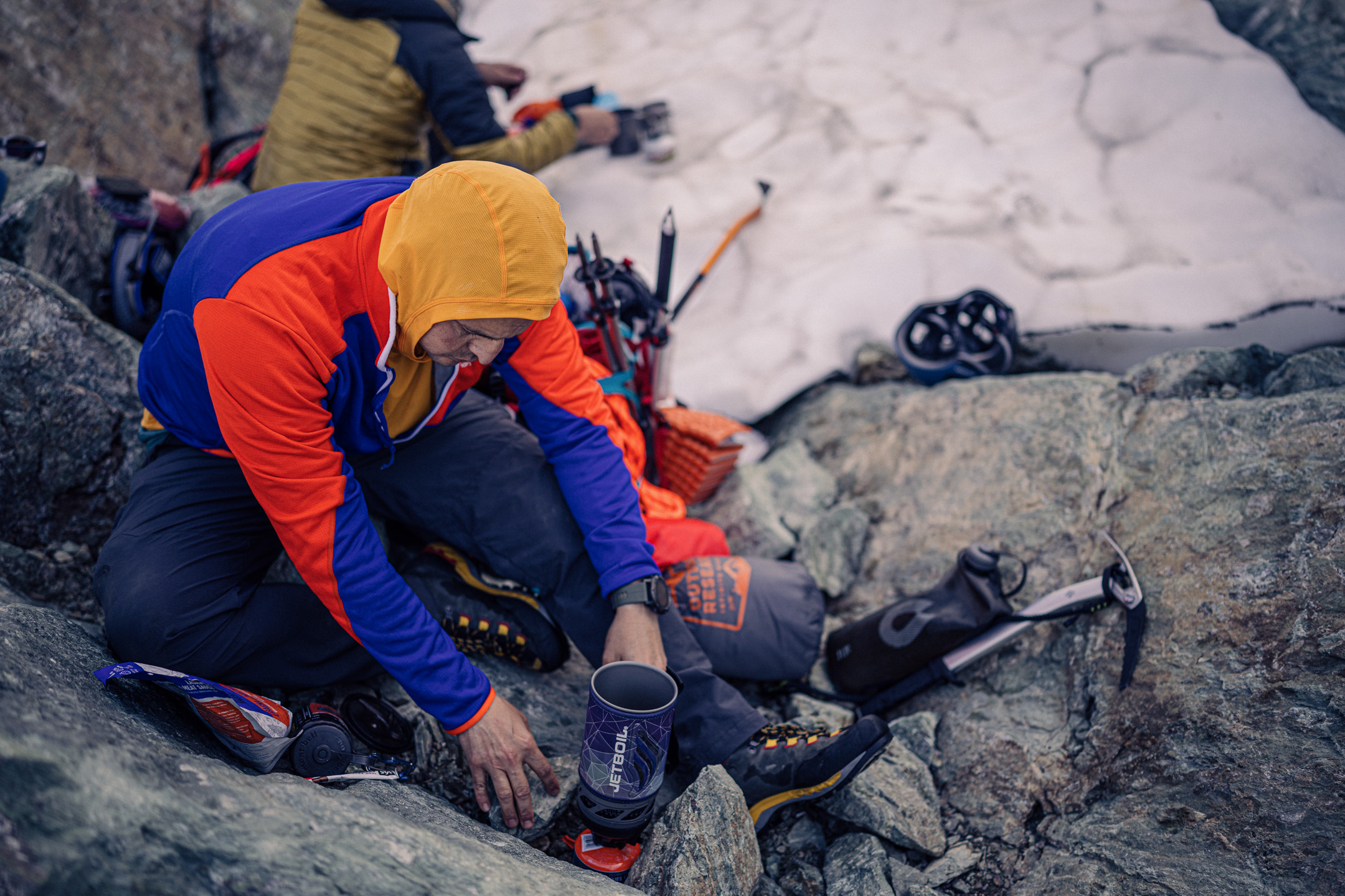
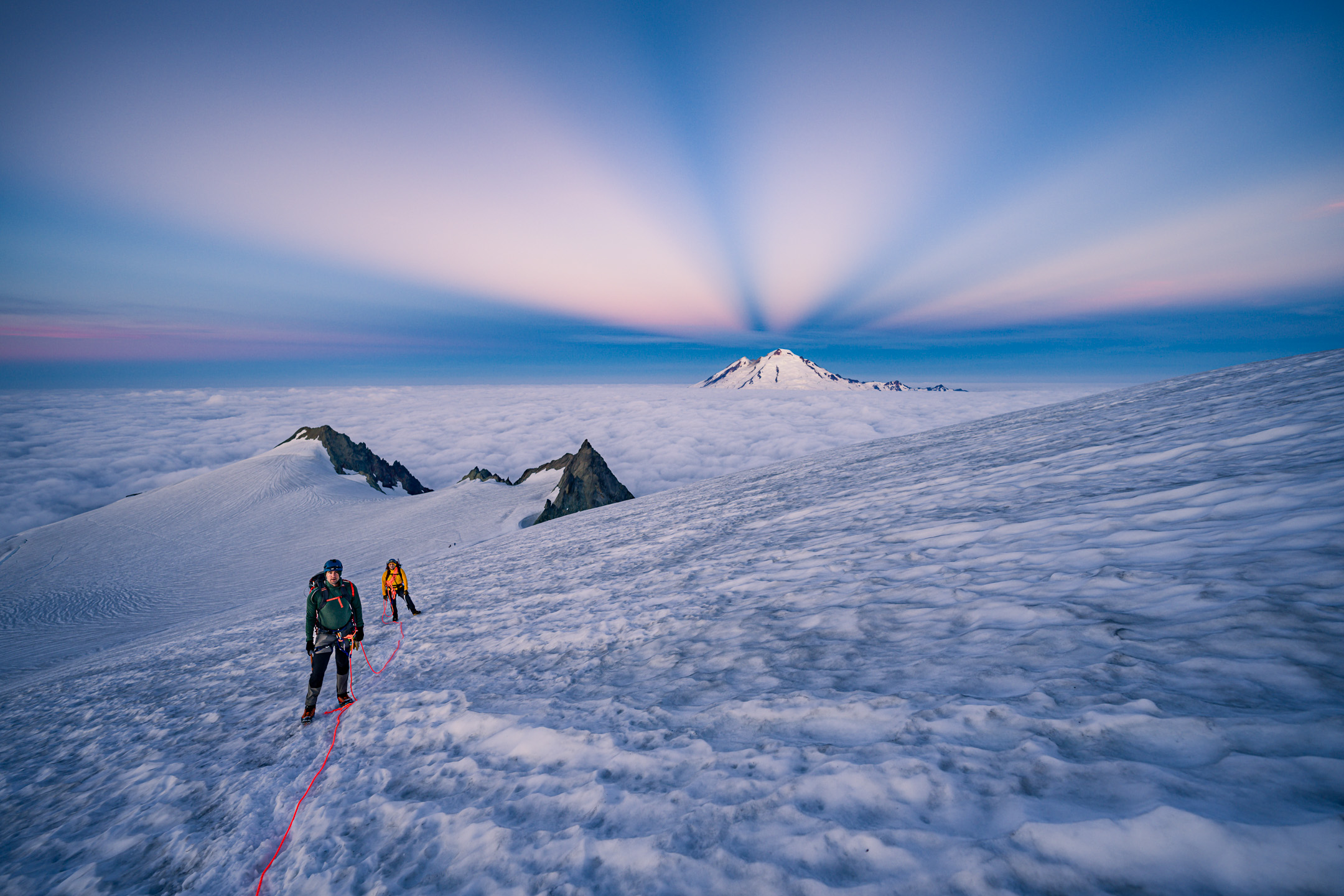
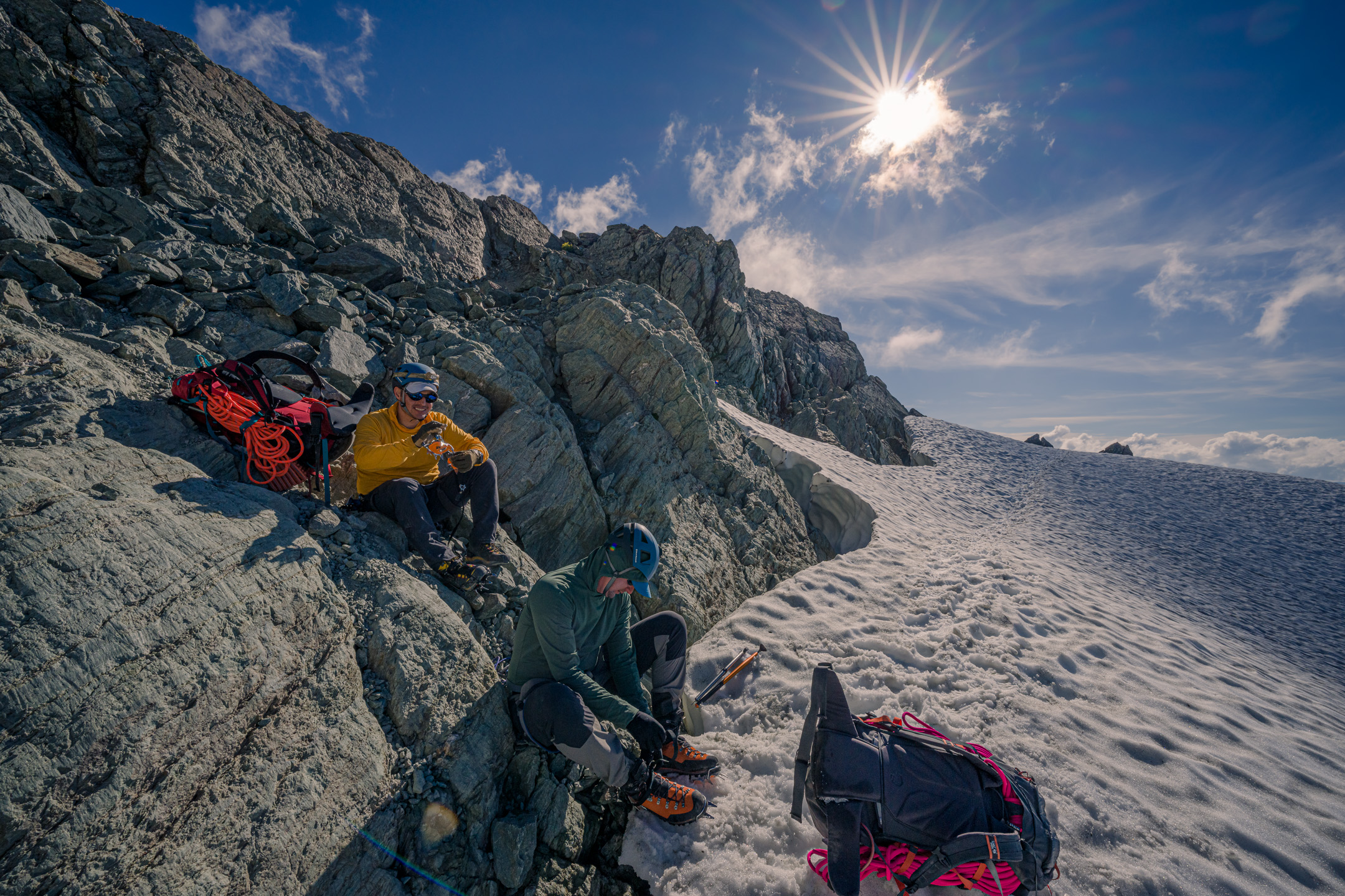
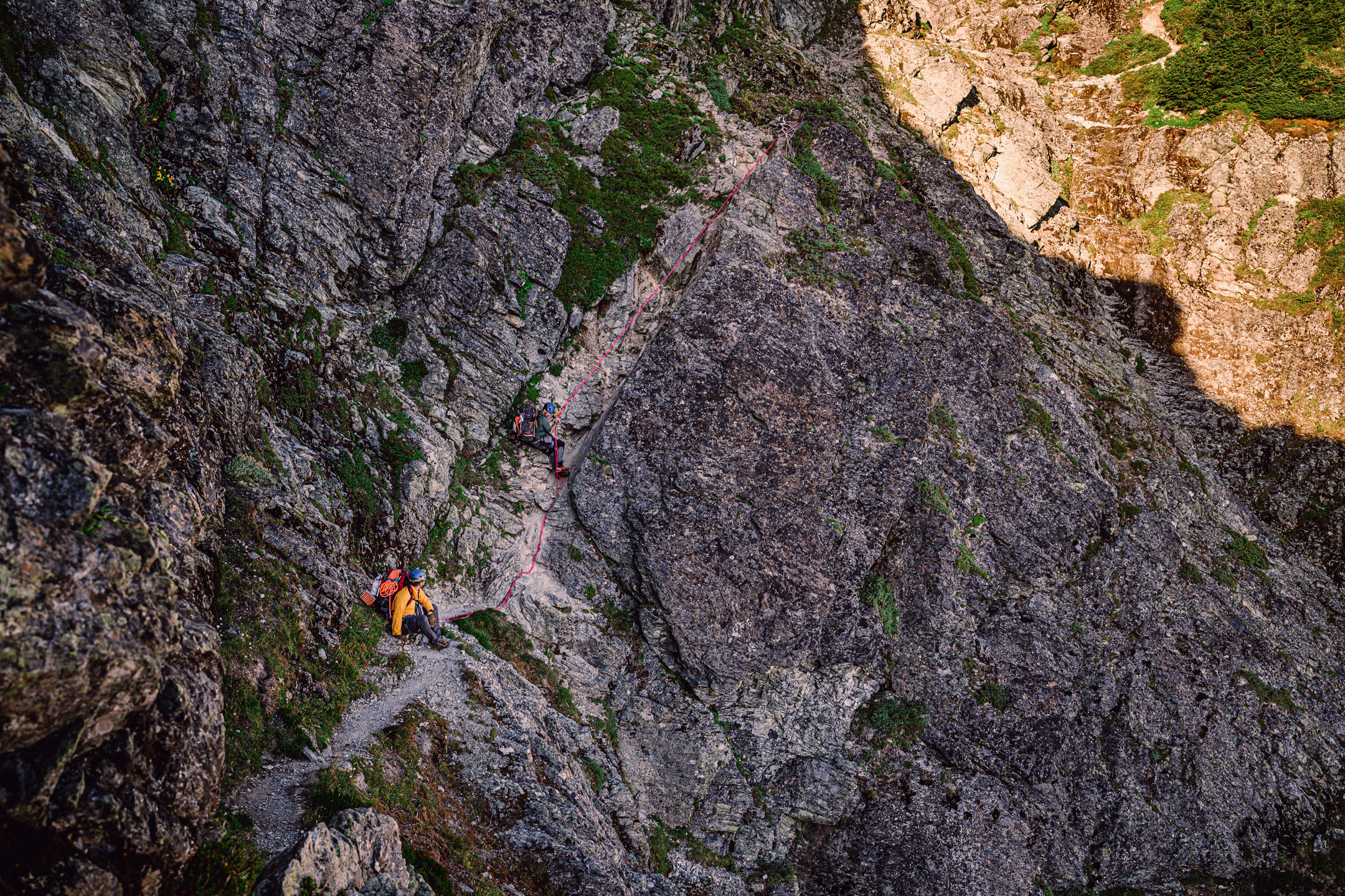
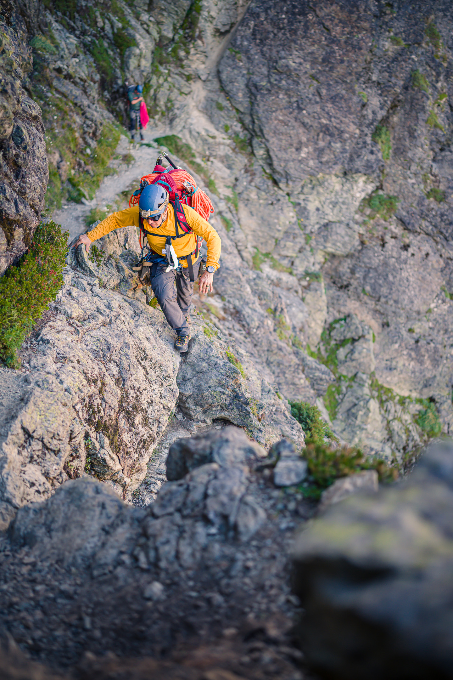
Trip: Eldorado + Dorado Needle - N ridge on Eldo, NW ridge on the needle Trip Date: 09/08/2022 Trip Report: Plans with a partner fell through again, so I took off on another last minute solo. I’ve had a lot of these this summer. It’s not a real complaint because I’ve been having a lot of fun. I feel fortunate to have some many great options near home. I hiked toward the Inspiration with several options in mind for the day, which turned out to be much smokier than I expected from the forecast I saw. I entered a pretty bad layer by the boulder field and abruptly popped out just past the E ridge campsites. The fact that only Eldorado was above the smoke made it an easy choice for the first objective. I climbed the N ridge. What little I found online about it tends to oversell it IMO. I think it’s a stretch to call it a cool route. While the rock quality is quite good, I found that difficulties were too short, usually only one or two moves at a time. It’s also devoid of exposure, at least the way I climbed it (on or just left of the crest) making it feel like a long V0 boulder problem. Slightly disappointing, but I contrived some fun moves here and there. At the top I wrapped around the NW side of the mountain, went up and over the summit and descended the E ridge. Partway down I split off and started traversing towards the pass leading to the McAllister. Klawatti was still enveloped in smoke so I headed down onto the McAllister towards Dorado Needle. My first time on this awesome glacier. The route up to the NW ridge looked intimidating from afar, especially solo. But it was never very steep and there was a pliable layer of snow the whole way, so my steps felt secure. At the notch I put rock shoes on and left everything else behind. I enjoyed this route more than the N ridge of Eldorado. Though short, it feels more like real climbing. The stone is pretty good, and there are some memorable sections, like an easy arete traverse with a piton at your feet trying to trip you, and a cool top out. At the summit I saw two pairs of climbers nearing the top of the E ridge route. Their profiles on the skyline looked cool when I was back down on the glacier. Climbing down was just as fun as climbing up, and the McAllister descent went without incident. I was visited by a bird before returning to the pass. By now Klawatti was finally out of the smoke but I was running a little short on time. Seemed like a waste to climb it on such a hazy day anyway. Couldn’t see Moraine lake at all, and Forbidden was barely visible. So I headed back to the car, with a long break to pick berries above the boulder field until I started to feel a little crazy. Despite that delay I avoided headlamp time, reaching the bottom around dusk. Took a ritual dip in the creek and headed back to civilization. Gear Notes: Approach and rock shoes. Axe and crampons Approach Notes: Inspiration glacier
 4 points
 -
Trip: BOWAN MOUNTAIN (7895') - South Ridge / Southwest Face Trip Date: 09/03/2022 Trip Report: BOWAN MOUNTAIN (7895') – Rainbow Ridge Traverse Approach – SEPT. 3-5, 2022 (Sat, Sun, Mon) Another perfect weather weekend for climbing and a long holiday weekend to boot. Dan O texted and wanted to know what I was doing. I said planning a climb. He said can I go, I said sure. So I had company for this trip, which was a nice change. Saturday: We started from Bridge Creek Trailhead at 6:45am. We headed down the Bridge Creek Trail to McAlester Creek Trail arriving at McAlester Pass (6000’) at 12:00 noon. There is water at McAlester Pass at a lake at the end of the meadow, not the best looking water, but water nonetheless. Distance was about 9.5 miles to the pass and the trails were in excellent shape. 5 minutes down the trail past McAlester Pass was the bootpath for Rainbow Ridge. The bootpath went along a shelf at the base of a boulder field. We walked past it the 1st time and doubled back. The bootpath was well defined with a few sections requiring some searching. The ridge was nice traveling with views of McAlester Mountain. There was some smoke coming up the valley from Lake Chelan, not bad, but enough to make the views hazy. We made it to the main lake on Rainbow Ridge (6100’) at 1:15pm. The lake was very nice and would make a great camp. We made our way up the ridge above the lake, the path was faint at times going up the slope. We made it to another set of lakes on the ridge (6750’) at 2:45pm. Along the way I jumped on top of a rock for a better view and noticed a bush shaking about 50’ away down slope. Out of the back side of the bush came a Grizzly Bear running down the slope heading toward Lake Chelan. I’ve heard of Grizzly Bear sightings in the North Cascades but I had never seen one for myself in the wild. The Grizzly was medium sized and looked pretty young, classic chocolate brown color with the blonde tipped punk rock hair hump between the shoulders. We were both a bit stunned. Holy shit, there are Grizzlies out here! There were several sets of fairly fresh bear tracks in the mud at the second set of lakes. It seems we had worked our way into a bear utopia. We headed up to the summit of Rainbow Ridge (7200’) that offered a great view of Bowan Lake and Mountain. The bootpath ended at the summit. We headed down the ridge toward Bowan Lake. The travel was a bit steep and loose in sections but doable. We arrived at Bowan Lake (6500’) at 5:15pm and decided to make this our camp for the evening. There were also a fair amount of bear tracks around Bowan Lake but they looked to be a day or two old. Sunday: We were up and moving at 6:30am. We headed up the valley toward the south col of Bowan Mountain. We arrived at the south col (7400’) at 7:45am. Our plan was to go up and over Bowan and drop over the summit and follow the ridge down to the Rainbow Lake Trail. One of the maps we had with us made this look like a good option. We started up the south ridge of Bowan, mostly Class 3 rock. We reached a deep gully on the ridge that we could not cross up high, so we headed down looking for a better crossing area for the gully. We found one probably 100 feet down from the ridge. The gully crossing was Class 3 with a little Class 4 depending on your route. We continued across the slope angling up on Class 2 rock. We crossed a couple more gullies using shelf systems along the way that were Class 3. We reached the summit of Bowan at 9:30am. I climbed over to the other side of the summit to check out the route down the ridge and it looked a lot more difficult than expected. Mostly Class 4-5 rock that would require a rope and gear. We had neither so we headed back down the way we came up. Once back at the south col we headed southwest down the slope toward a heather shelf. Once at the heather shelf we headed down and diagonal trending northwest. The hill side was steep heather and rock cliffs all the way down. When we would cliff out we would head across the slope until we found a down route. This pattern was repeated the whole way down. We finally reached the bottom of a deep gully that spit us out on the Rainbow Lake Trail. We headed down the trail to Rainbow Lake arriving at 2:45pm and setup camp for the night. The camps at Rainbow Lake are very nice with a pit toilet. I had planned on climbing McGregor Mountain on this trip along with Bowan. After figuring the amount of time it took to climb Rainbow Ridge and Bowan Mountain, I figured I’d need an extra day to complete the trip over to McGregor and back. I didn’t have an extra day to spare so we settled on summiting Bowan alone. Monday: We were up and moving at 6:45am, heading for home. It was a bit chilly in the morning, Fall was definitely in the air. We headed down Rainbow Lake Trail to Bridge Creek Trail back to the trailhead arriving at 2:15pm. The trails were in excellent condition. On the way back to the trailhead we passed a few people holding a sign about a get together at the trailhead. They said there was a bunch of food for us at the trailhead. We thought OK, we’ll check it out. Little did we know there was a church group that had setup a fantastic spread of food complete with chairs and a shelter. They had hot dogs, chili, beans, cornbread, cookies, brownies, lemonade and more. Coming off the trail dirty and tired, we felt like kings. It was the best ending to a climb I’ve ever had. The people were very friendly and we left with a bag full of food, a homemade cross and a prayer. With so much going wrong in the world today, it was uplifting to experience such great people doing good for total strangers. Some Tips and Notes: 1. There is a lot of bear activity on Rainbow Ridge right now. 2. It requires a lot of work and route finding to get up or down Bowan Mountain from the Rainbow Lake area. 3. Water access was pretty good the whole loop. Travel Time for reference: Saturday: Trailhead to Bowan Lake Camp (6500’) – 10:30 hours. Sunday: Camp to Summit to Camp 2 – 8:30 hours. Monday: Camp 2 to Parking Area – 7:30 hours. Total Mileage: around 28 miles Total Elevation Gain: around 5800’ Gear used: Trekking Poles, Helmet. Lake at McAlester Pass. Rainbow Ridge Bootpath. Dan O climbing out of the 1st Rainbow Ridge Lake area. Bear utopia party on the beach at the 2nd set of lakes along Rainbow Ridge. On the way down to Bowan Lake. On the way up to the south col of Bowan Mountain from Bowan Lake Camp. Heading up the South Ridge of Bowan Mountain. On the South Ridge of Bowan Mountain, Lake Chelan Valley in the background. 1st Gully Crossing on Bowan. Class 3-4. Final gully exit coming down from Bowan, popping out on Rainbow Lake Trail. Bowan Mountain from Rainbow Lake. View of McGregor Mountain on the way down Rainbow Lake Trail. Gear Notes: Trekking Poles, Helmet. Approach Notes: Entered via McAlester Creek Trail, did the Rainbow Ridge Traverse, Exited via Rainbow Lake Trail4 points
-
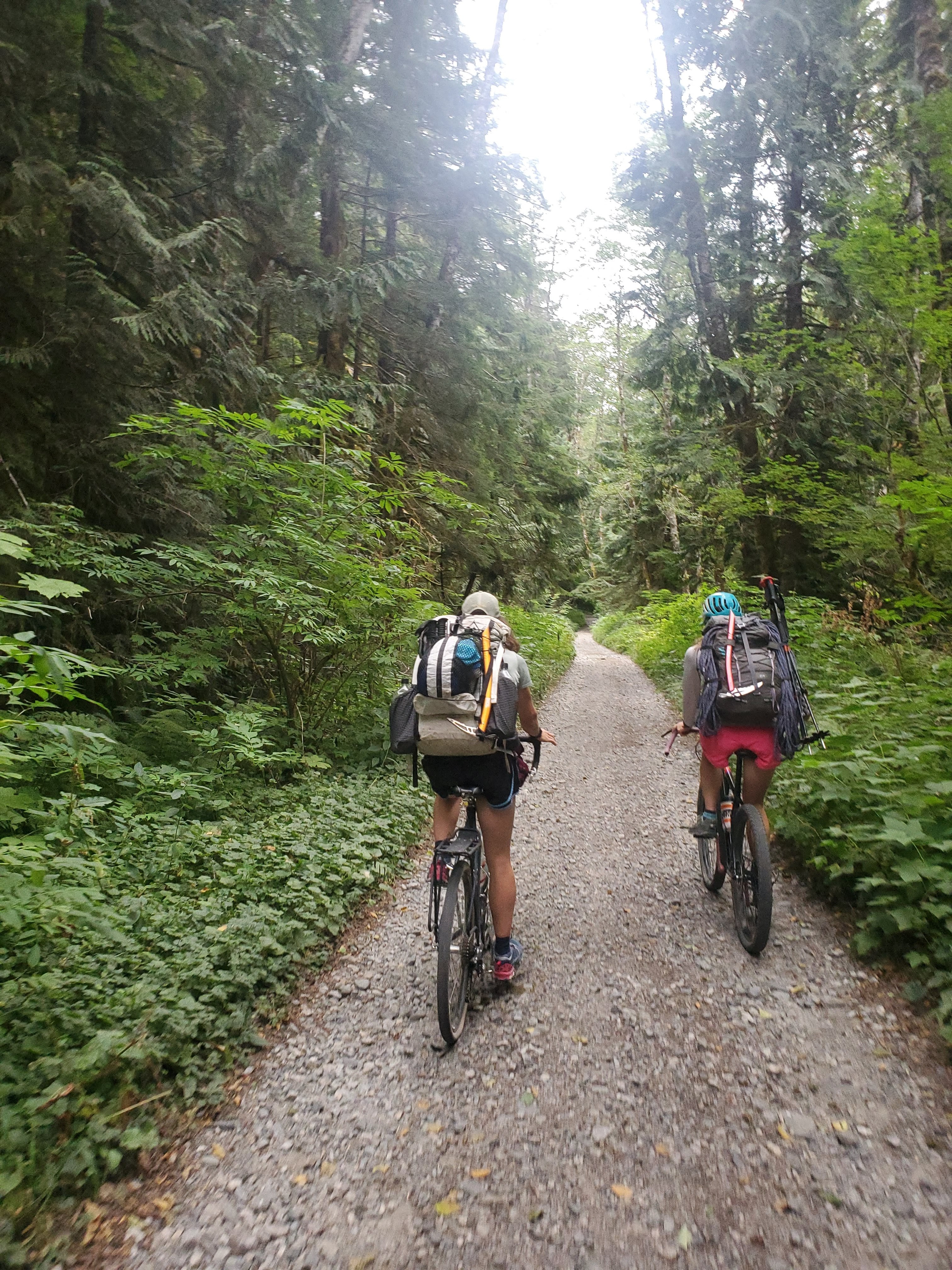
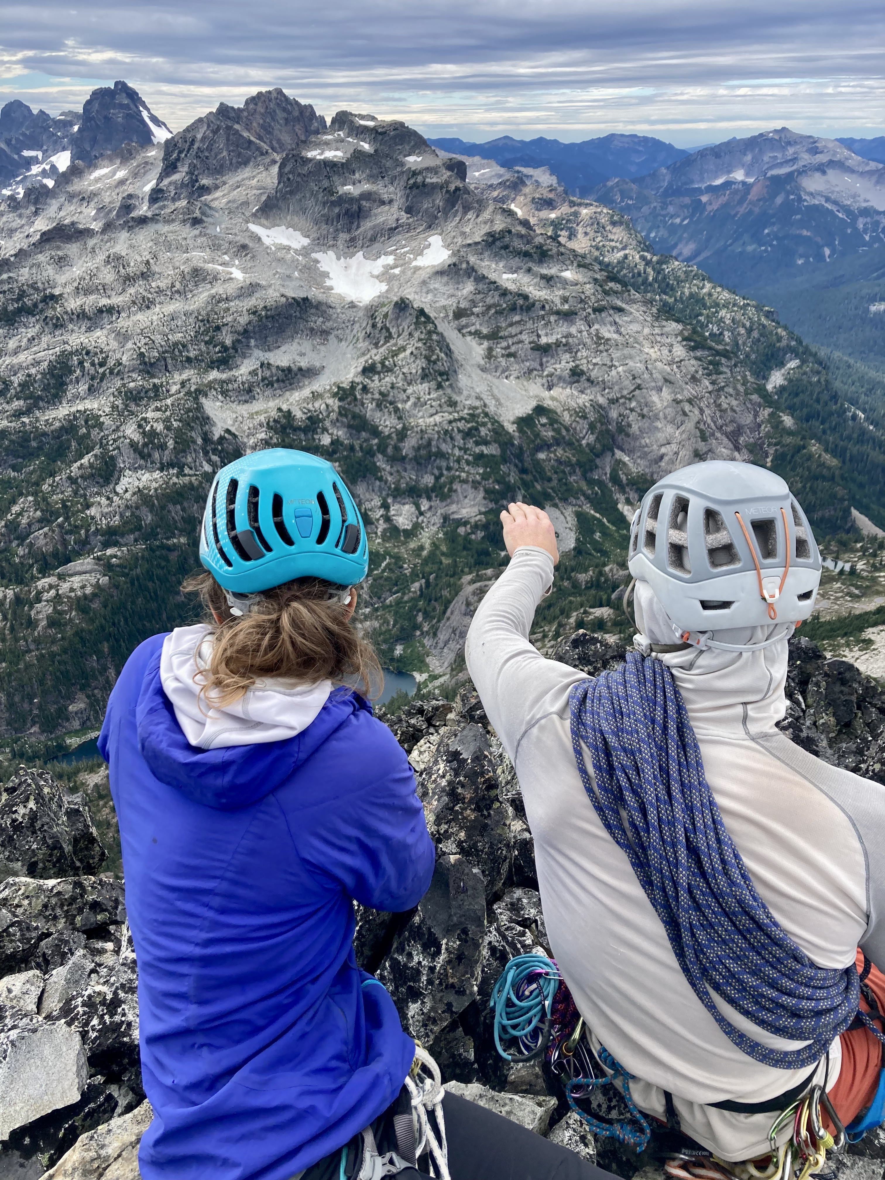
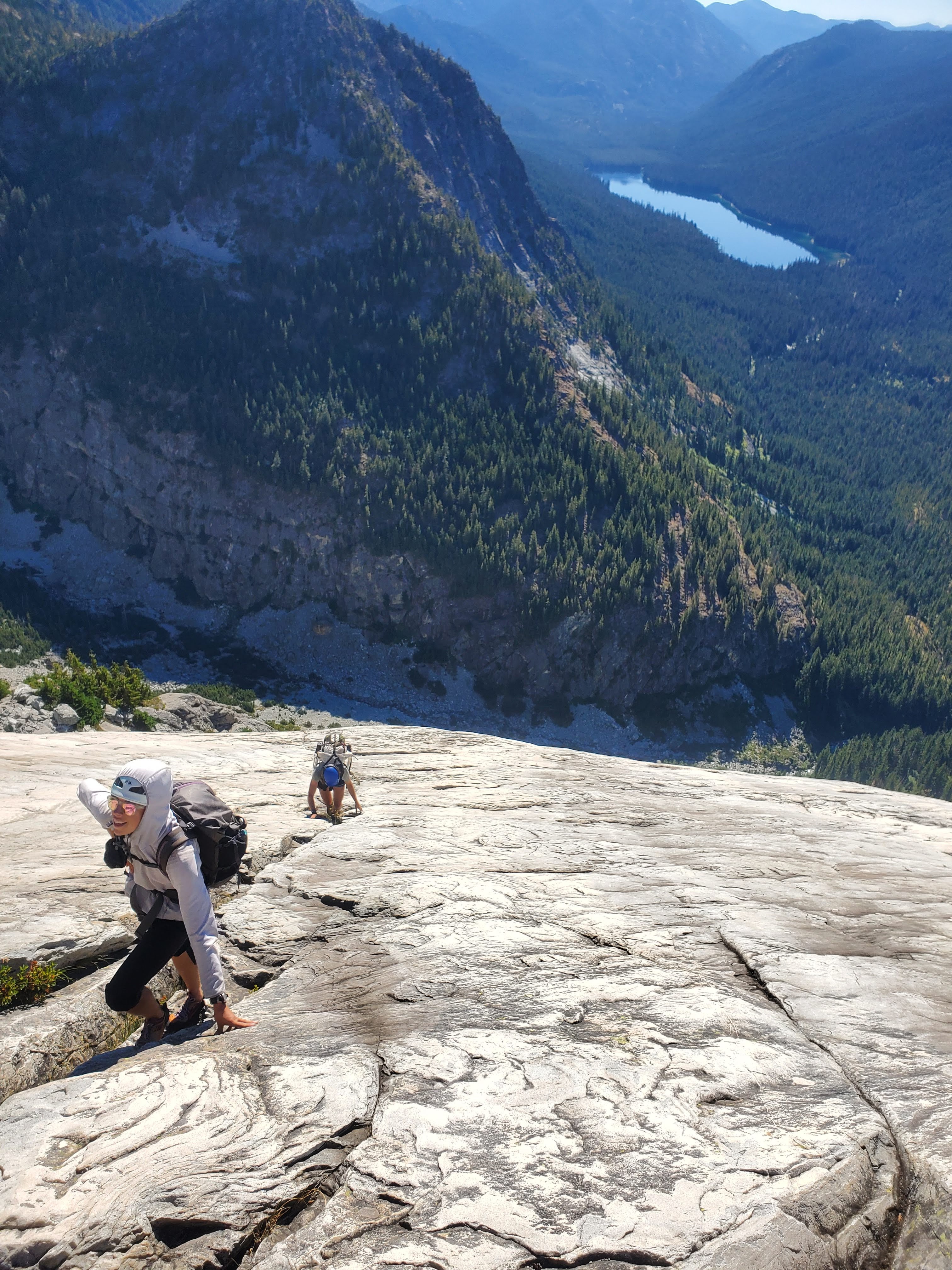
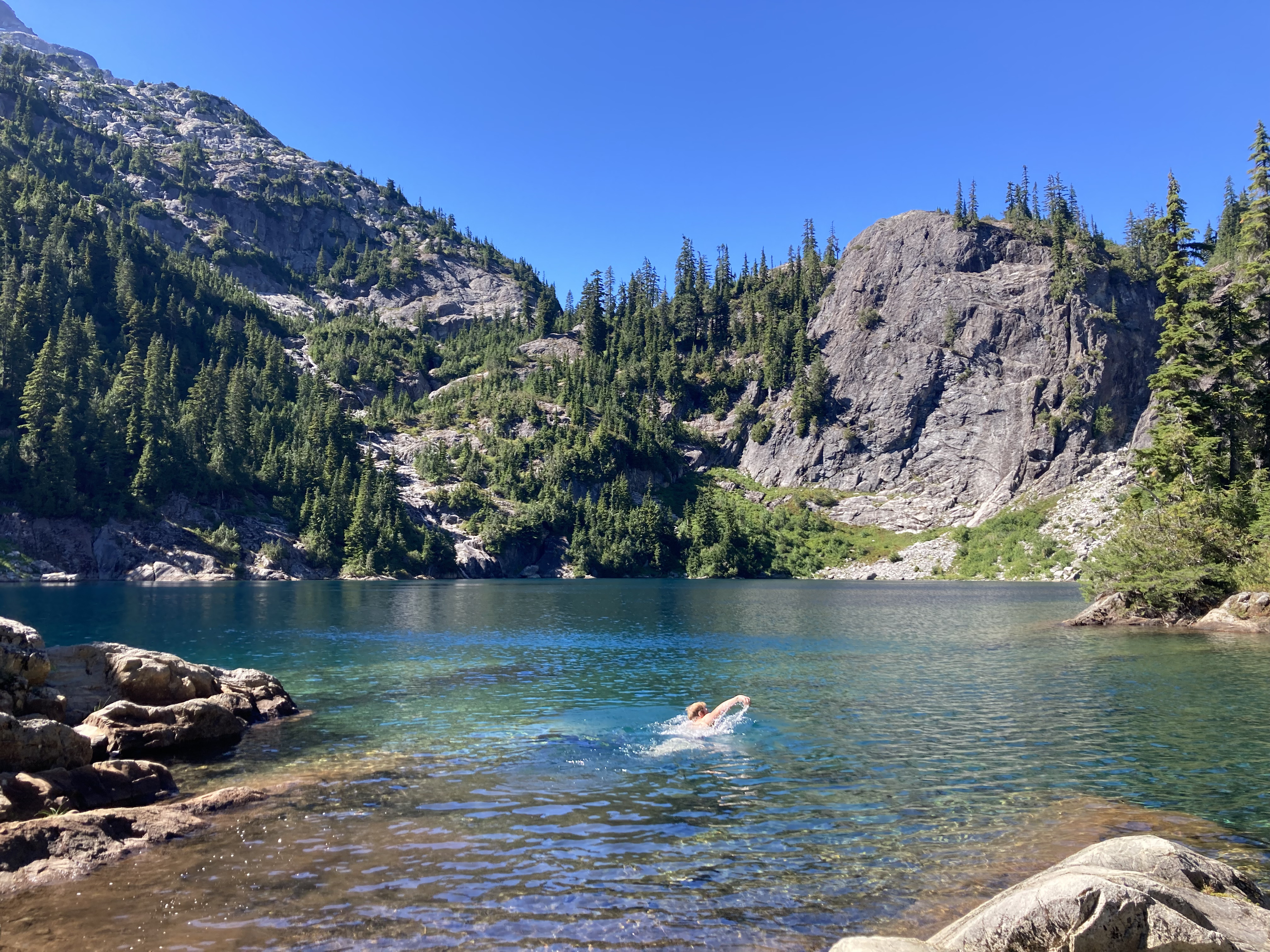
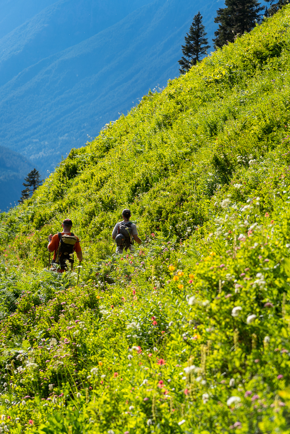
Jon! May I rudely interject some other perspectives in (slightly hijack) your TR? We saw your name in the summit registers just a few days after you signed them. It sounds like you had an awesome adventure!! We did too, and although our adventure visited the same summits, we took some slightly different approaches.....(I debated posting this but some people convinced me.) Thanks, @JasonG for the inspiring original BB TR! - Kat, Micah, and I biked from Dingford Creek TH to Dutch Miller Gap TH on Saturday at a humane hour: - We thoroughly approved of the Dutch Miller Gap trail. We camped at Lake Ivanhoe and did a good amount of hangin' at The Cove. I did not catch any fish but it's OK: - In the morning, we took the trail down and then tromped around and had some B1- open forest schwack for a bit, crossed Shovel Creek, then started up...I agree: the mega slabs were awesome!! So fun! That foot-then-handrail crack you describe/have a photo of was definitely memorable. I feel like none of these photos really do this route justice: - We scrambled the first bit of the summit tower, pitched out the chimney, then scrambled up to the summit of BB: - I agree the summit views were not the most amazing, Hinman and Daniel south sides in late summer... oof, so dry! Hinman cradling Lake Rowena and tiny part of Rebecca: Slightly more solid views: - We descended the SW face route. Happily, my partners nailed the complex descent while I attempted to keep up. Shout out to @Hoo for great chossy gully and cliff navigation. No one knocked rocks on each other and no one slipped on exposed 4th class. Hurray! We rapped the summit block (3x) and then down lower did two raps off cedars. Kat led, quite vocally, this memorable one: - The next morning we walked down the trail, stepped into the "timber" and did some B1+/B2- schwacking, then took a high traverse over to the notch and then up to Summit Chief. Summit Chief Lake basin was spectacular! - Glaciers around Chimney Rock from the summit: - The Cove delivered yet again that afternoon with blueberries and swimming and eating some of our last foods (so hungry): The ride out was awesome on my 2.25" tires until I learned some important life lessons about tubeless tires, sealant, and friends carrying the tire levers. (/snaffled) I felt lucky to have this adventure with Kat and Micah. Two very skilled, ridiculously fast climbers. Great people even if they do Strava...


 4 points
 -
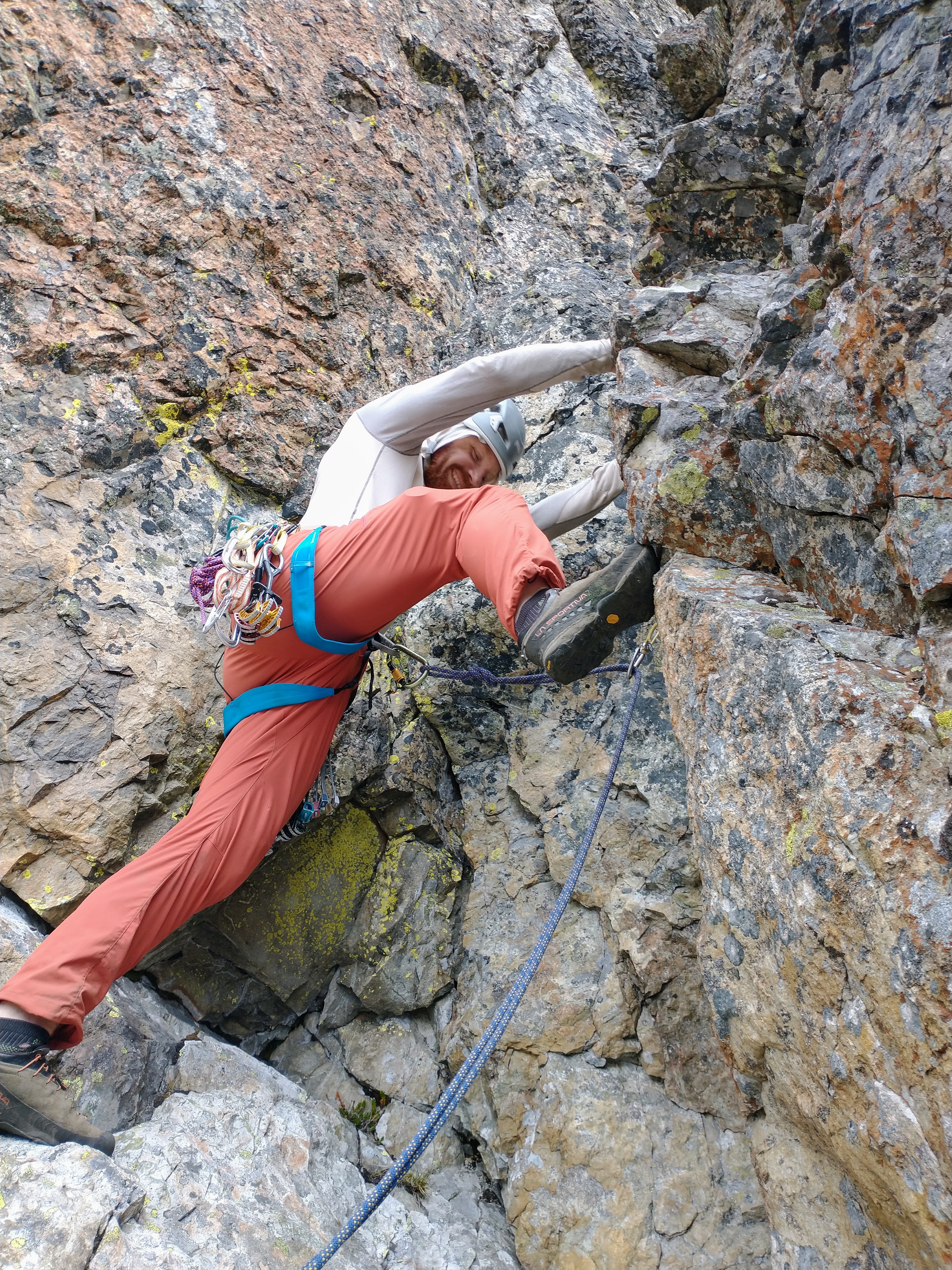
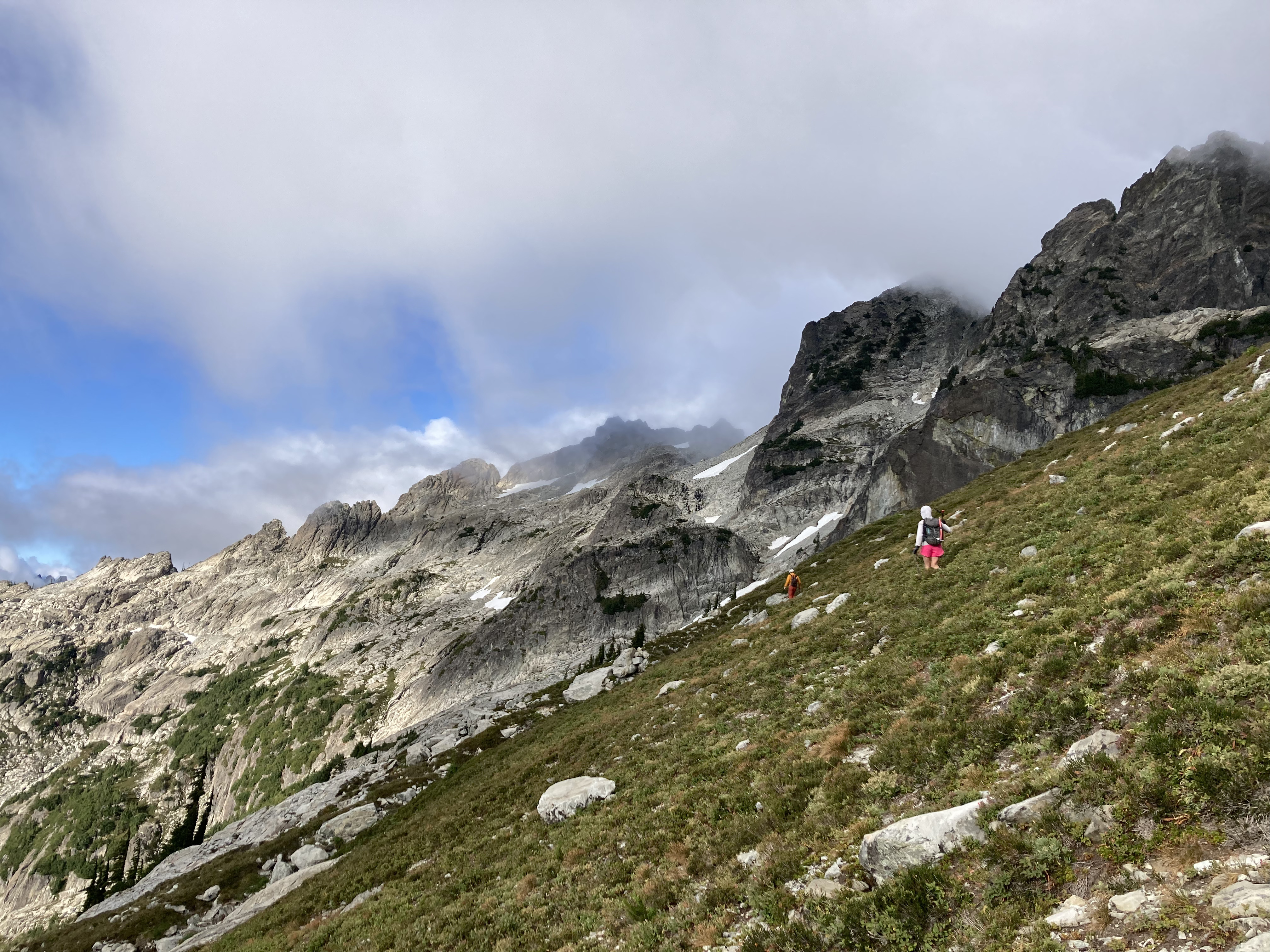
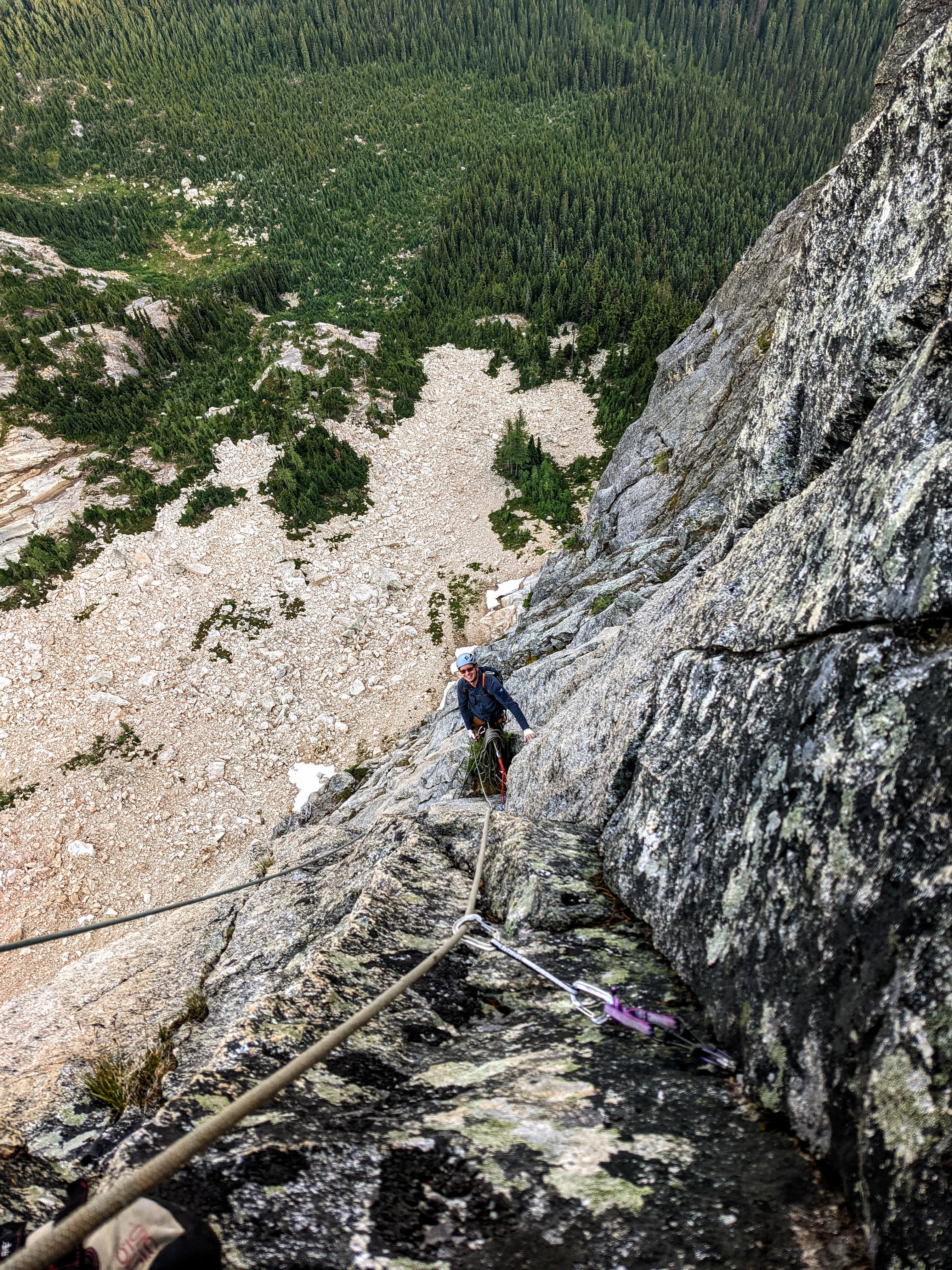
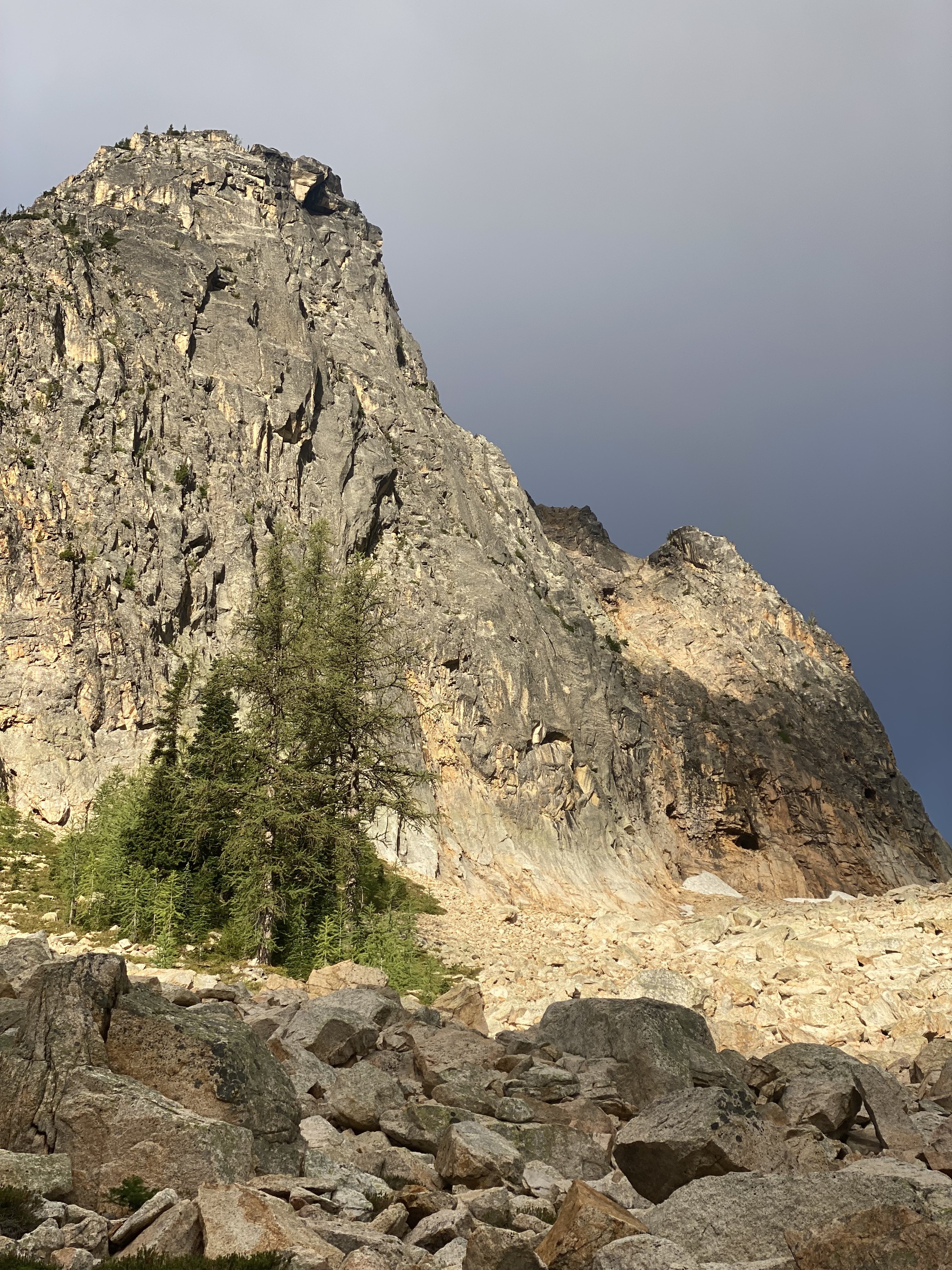
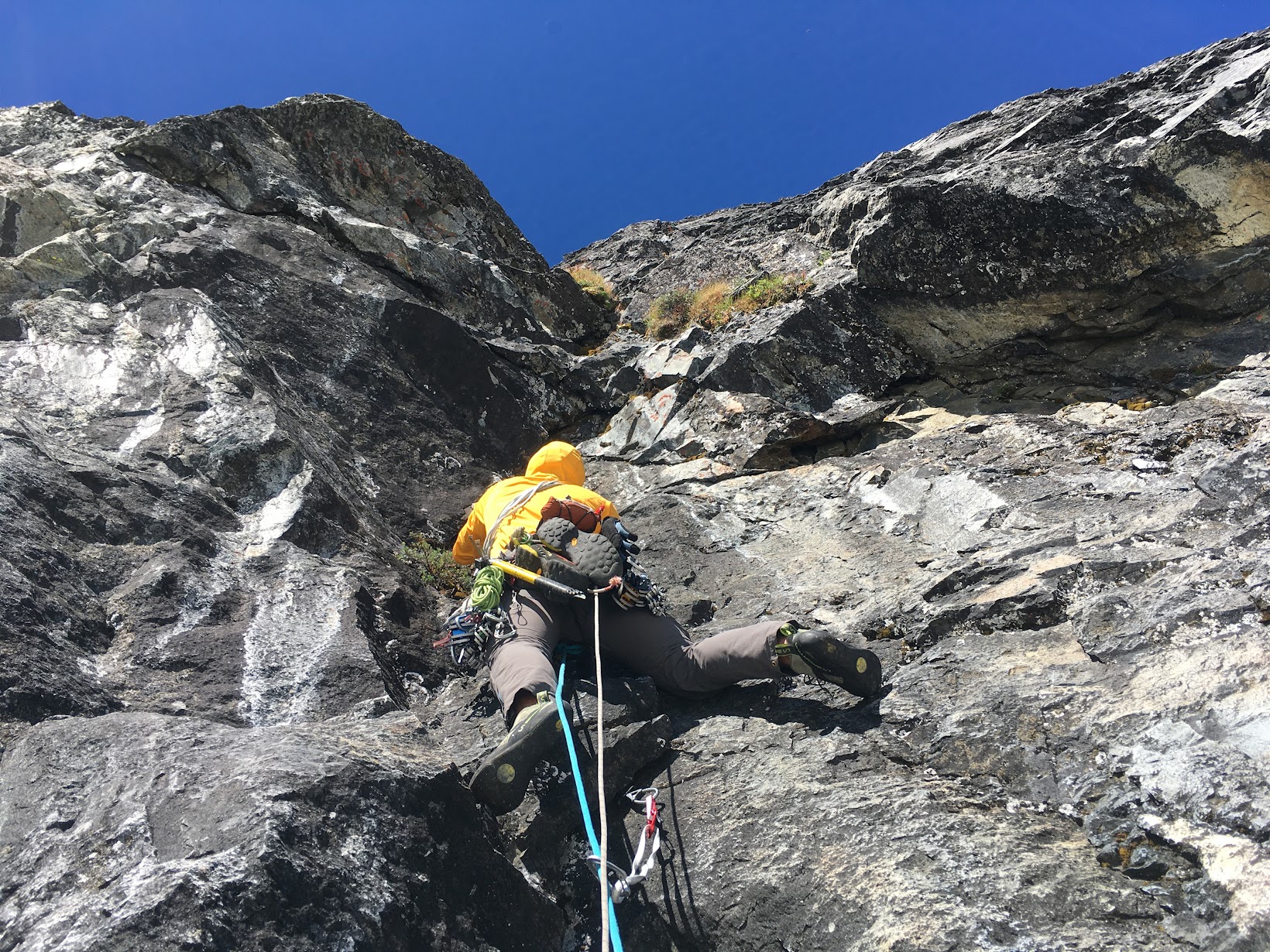
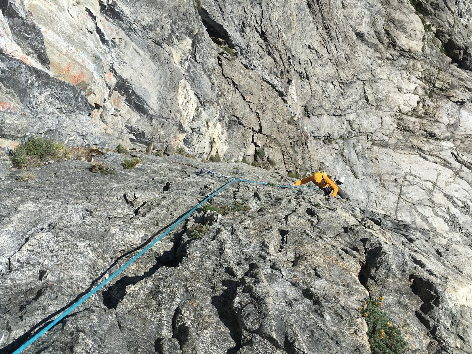
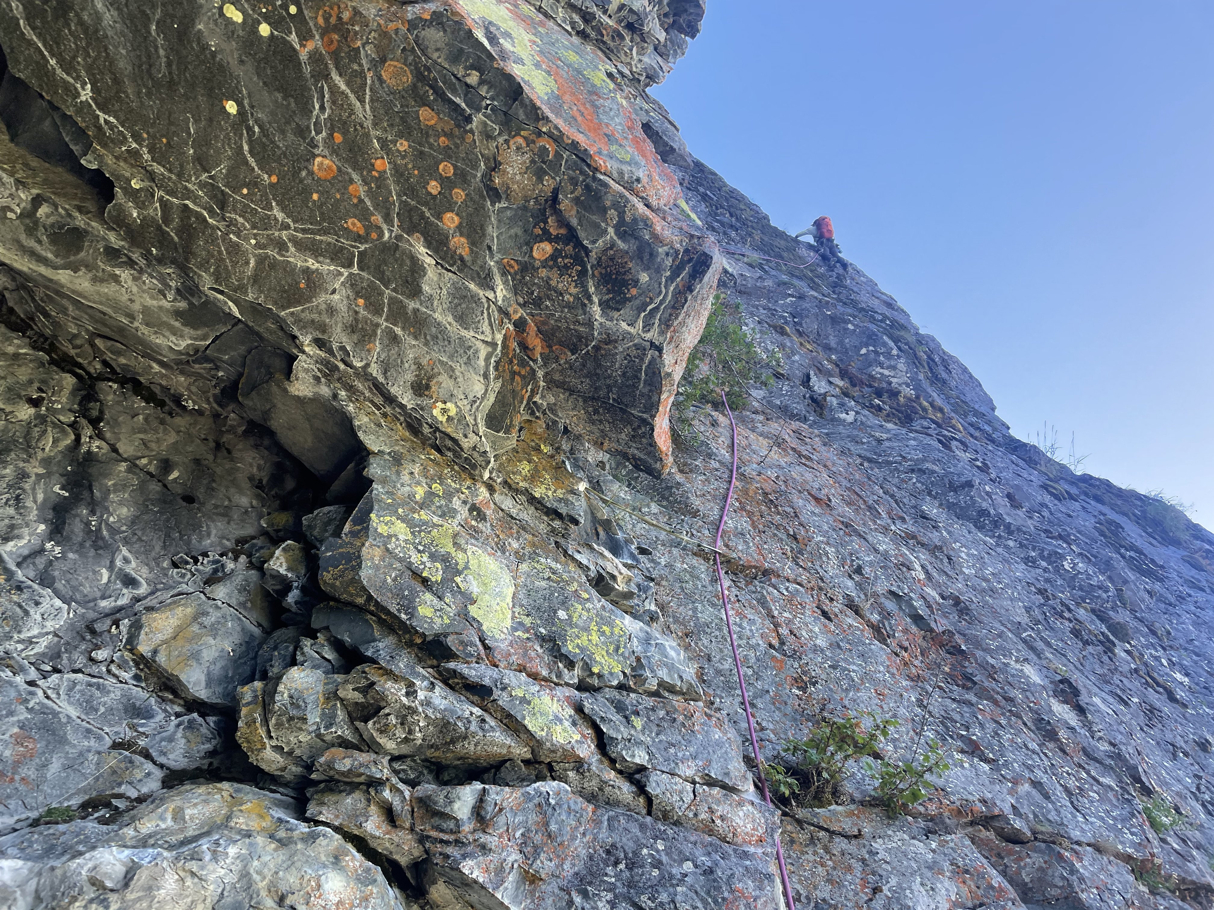
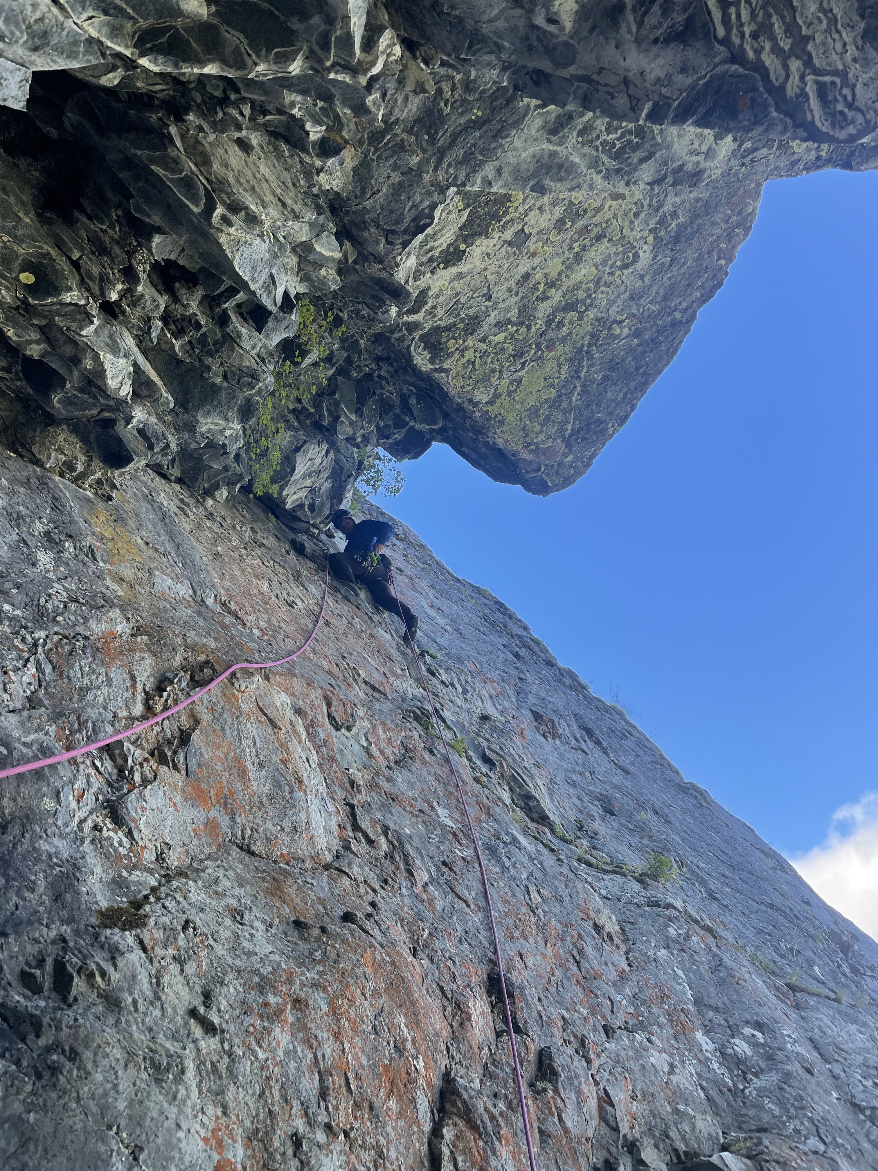
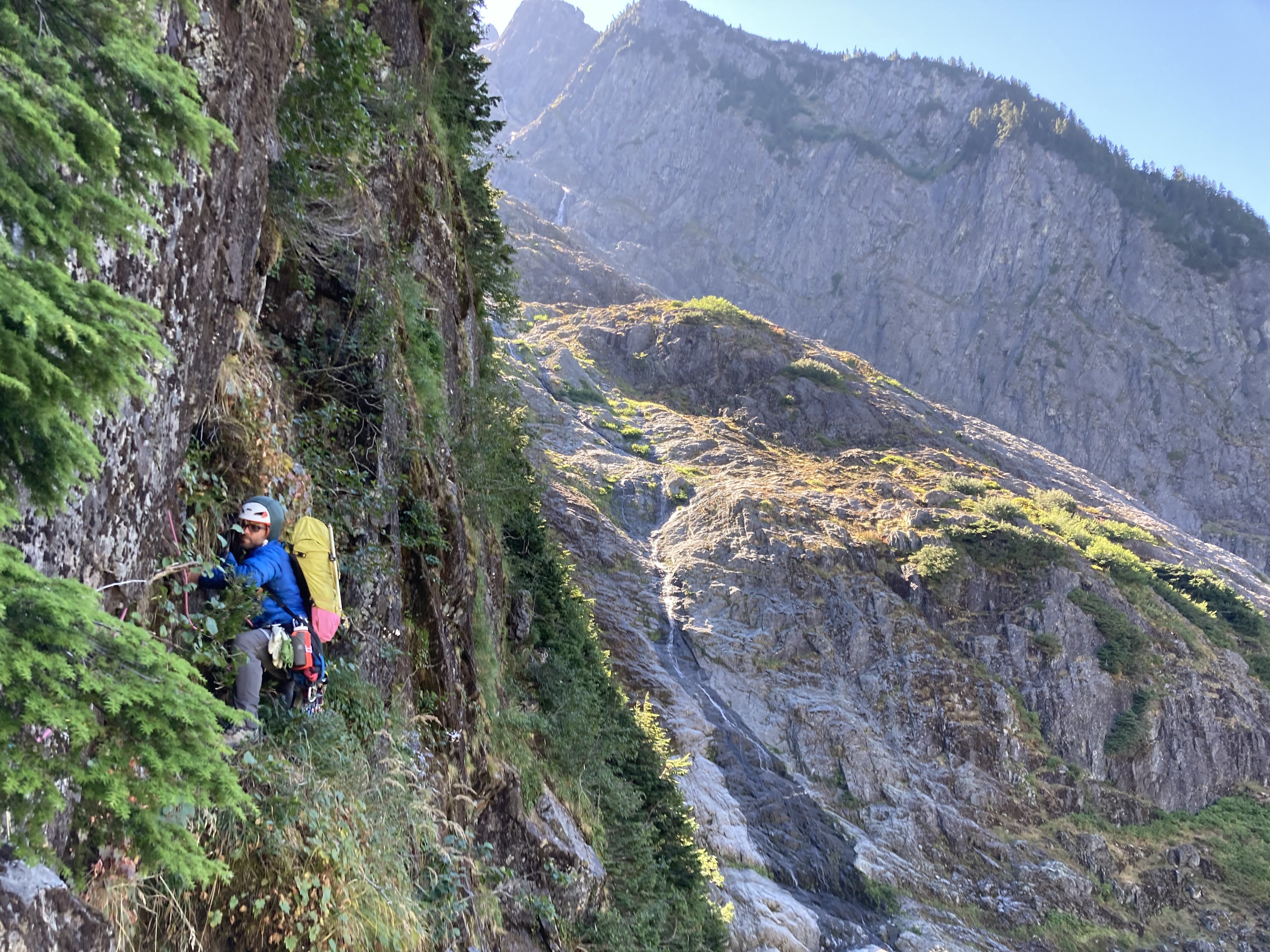
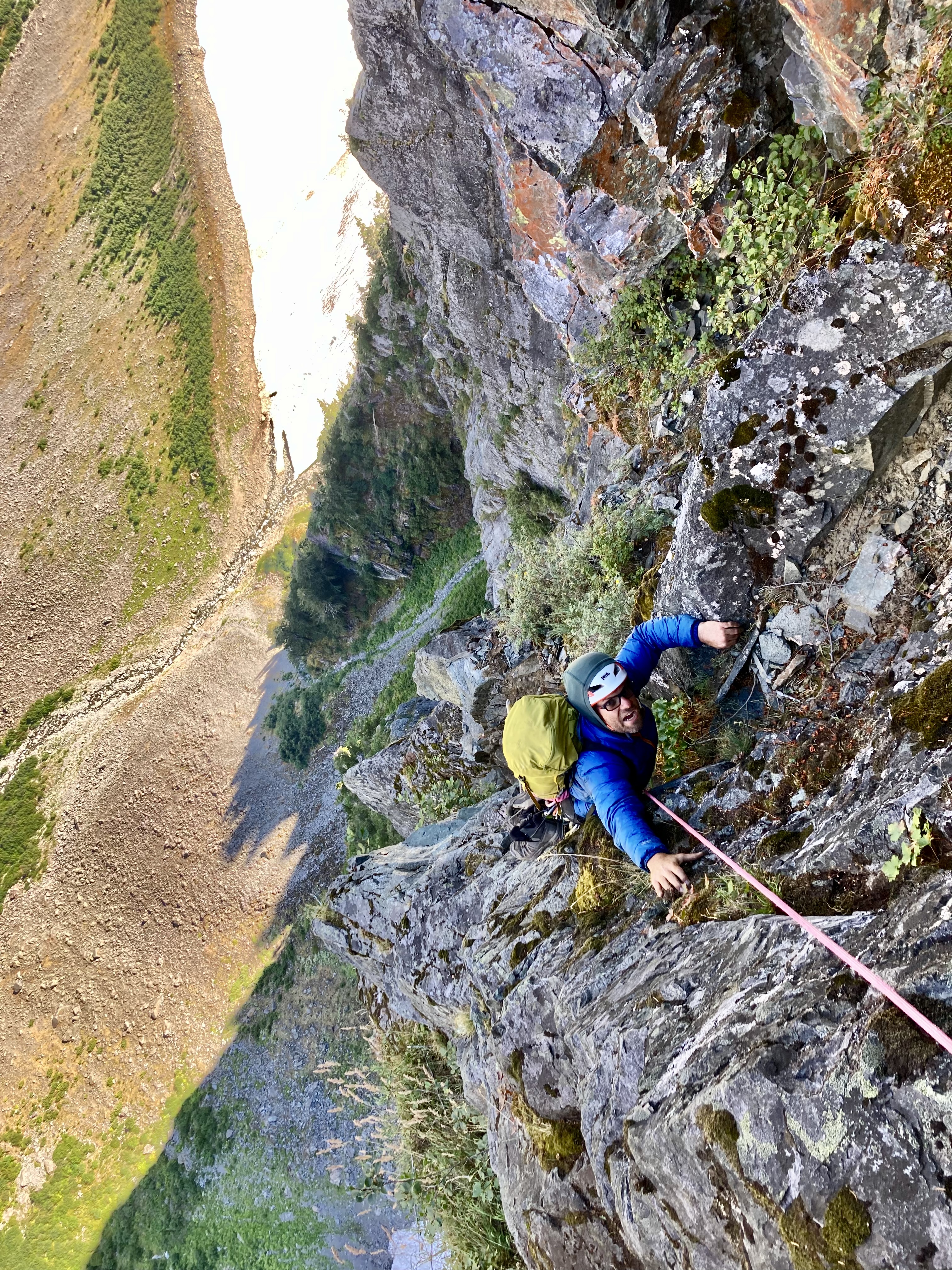
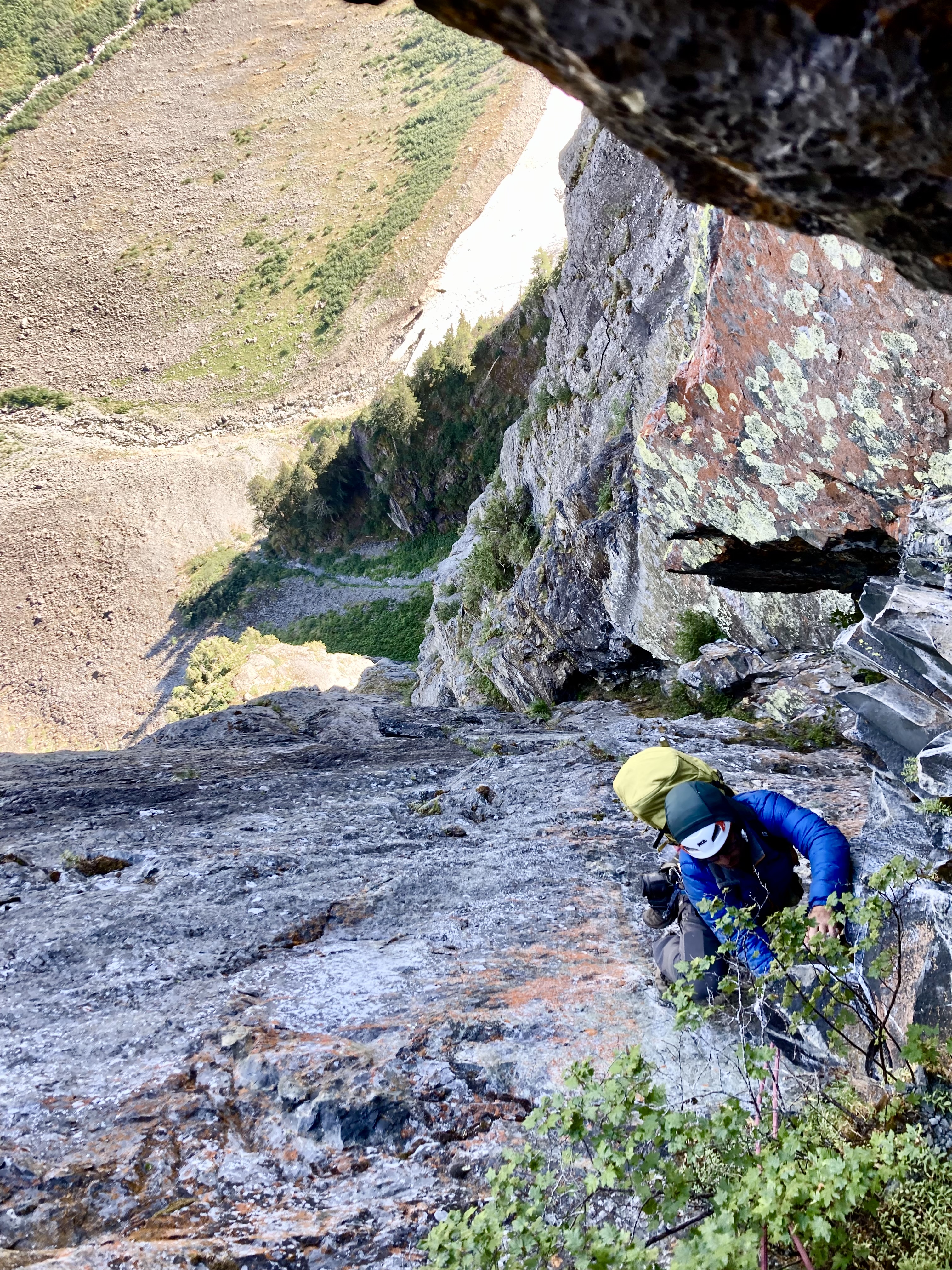
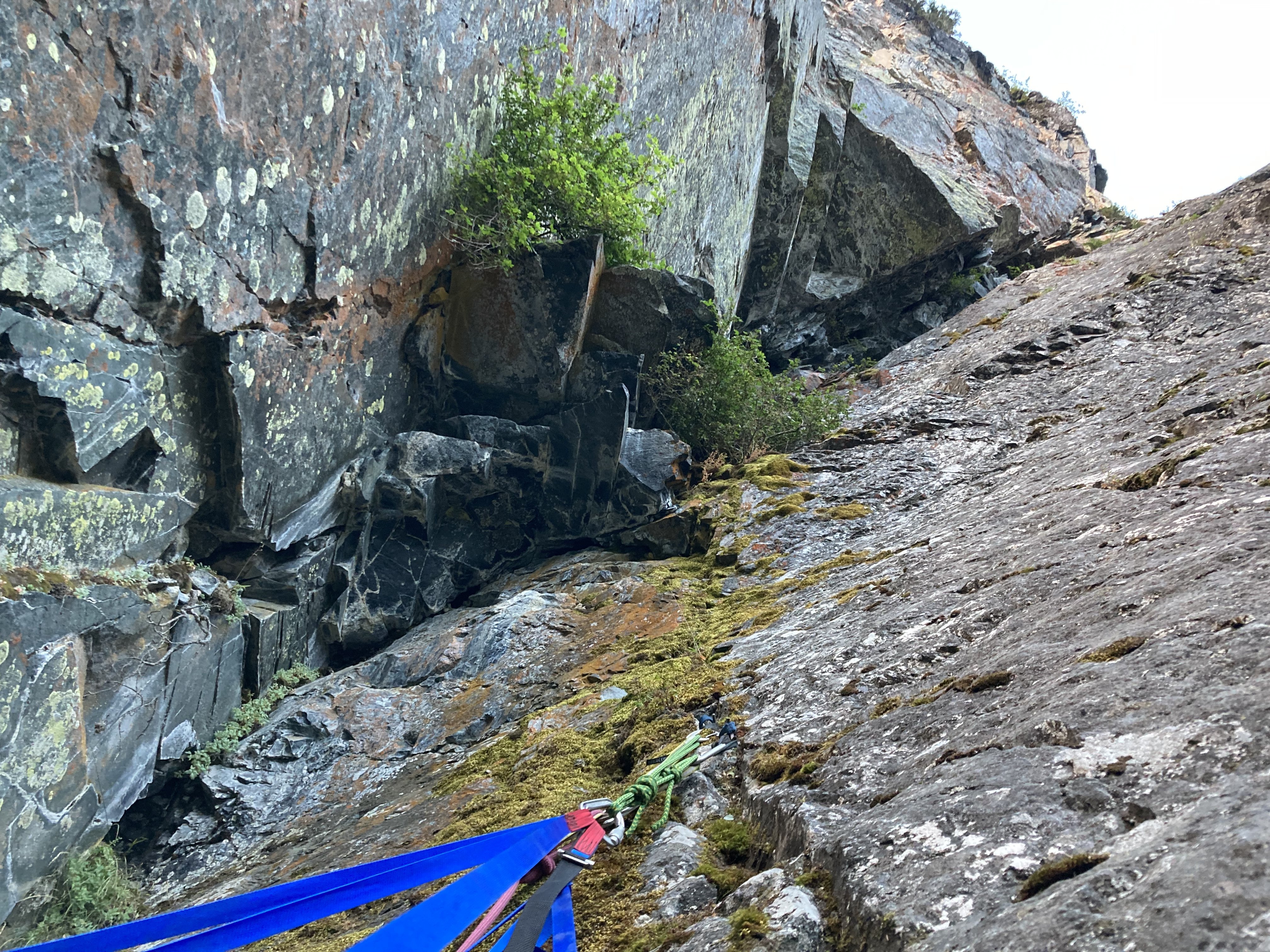
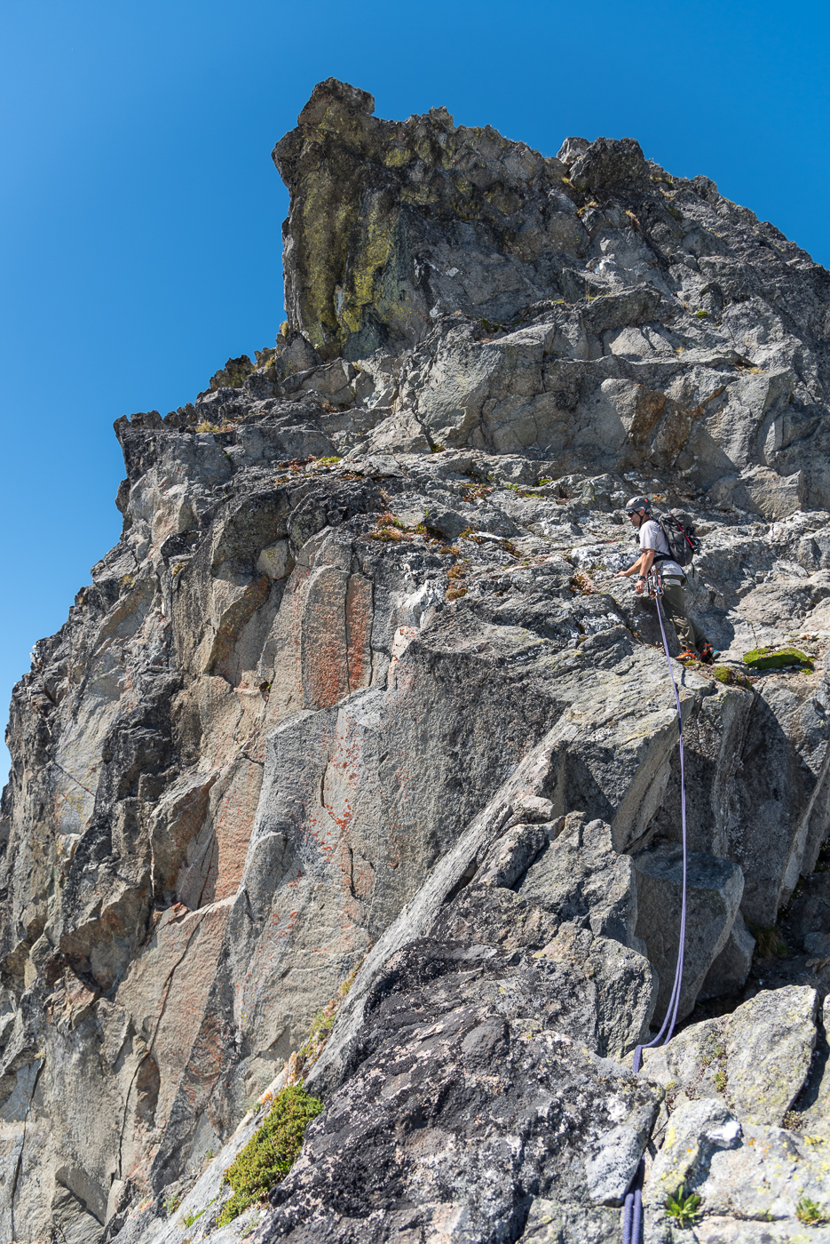
Trip: Porcupine Creek Wall - Salad Days III 900' 5.10+ Trip Date: 08/20/2022 Trip Report: It did not go unnoted when Eric Wehrly moved to town. While our more noteworthy first ascents may be of a…umm…slightly different style, in my mind’s eye I generally enjoy any adventure far from the road particularly if it involves unclimbed terrain. Finding like-minded folks at a similar point in life, that is old, is not easy. So I assumed at some point we’d tie in together. It did not happen quickly. While phone numbers were exchanged and talk of getting out occurred, the years passed by. Maybe I came on too strong. During Covid there may have been a day at Mount Erie where I loudly berated Eric to be my “New Best Friend!” as he TR-soloed nearby. Clearly, I needed a better incentive than that. Halfway up the Pacific Crest Trail between Rainy and Cutthroat Passes a large wall of granite stands proudly above the trail. I first walked by it eighteen years ago with my then girlfriend. From a distance it had the obvious geometry and tone of good rock. A friend and I almost went to check it out but we made other plans and the idea was largely forgotten. This summer I strolled by it again, with my now wife and our two teenage children. Still there, still grey, still splitter. A week later I spent a solitary day circumnavigating Porcupine Peak. The summit was eventually attained, and, on the descent I found myself beneath this wall I had considered for decades. Carefully glassing it I became discouraged. As I walked away I thought “almost but not quite, the start may not go and the rest is just a bit too dirty and discontinuous.” However, it’s amazing what some grainy iPhone photos and a bit of selective memory can do. Furthermore I finally had the sort of incentive Eric might respond to. On Saturday August 20th we stood below “the start that may not go” and sure enough it didn’t. As this had been my idea, I felt obligated to get us rolling so I began a long circuitous pitch climbing easy terrain off to the side before a long downward traverse led to a committing mantle onto a vegetated slab above. Struggling with massive rope drag from the severely Z-shaped pitch, I encountered a recurring theme of frantically hacking away a clump of heather to find a small cam placement. Eric quickly downrated my estimated grade and then scrambled up more heather covered corners to the base of a steep, relatively clean layback flake. Perfect edges made the otherwise intimidating flake go quickly. Unfortunately, the intended route up a long “hand crack” above the flake turned out to be 100 feet of 4”-6” offwidth. The scale of the wall was turning out to be a bit larger than anticipated. Instead, Eric made a delicate leftward traverse before committing to a steep, broken crack formed in part by some precariously hollow fridge-sized blocks. Easy terrain led to the base of what had appeared to be a splitter from the base of the wall. Above I could only see a slammed shut seam covered in a thick crust of lichen, moss, and dirt. Eric proclaimed it to be a finger crack. I was highly skeptical. But on new ground there’s nothing worse than being the person who forfeits your partner's last proud lead by bailing off into indirect, unappealing terrain. I spent several minutes pawing at the start, muttering random negativities. After a few minutes I finally committed to the initial moves into the corner then rapidly hung on a nut. But it was started and despite my deep pessimism about there actually being a climbable crack under the filth I found myself inching upwards. Sand and pulverized lichen poured into my eyes, my nose, my ears, and my shirt. Aiding up in 8mm dyneema slings progress was dispiritingly slow as I cleaned out every single placement. Time oozed on and hours later I finally pulled the singular hand jam at the very top of the 150-foot crack and flopped onto a good ledge. Now relatively cleaned out, Eric rapidly followed the crack free proclaiming it 5.10+. Having climbed three pitches in five hours and 45 minutes, simple math suggested that our rate of ascent was significantly slower than the sun's rate of descent. While I did not yet suggest bailing, I did point out this obvious observation. Yet Eric confidently proclaimed that the “walk off” would in fact be a walk and that we would only need headlamps once we were within spitting distance of our packs. Regardless of attitude at this point, the wall kicked back a bit and the next pitch looked easier. No reason to bail yet so Eric headed out, moving quickly across a thankfully clean hand crack before moving out of sight into the corners above. Progress slowed, the rope stopped moving, I almost nodded off. The clouds continued to build as the rope made halting progress. A random inquiry on my part was met with a stern “Not Now”. Eventually Eric reappeared above having navigated some sketchy 5.10 face climbing to avoid an impossibly munge-filled corner. Moving left and right, up and down he eventually retreated to a blocky alcove from which we could reappraise the options above. With the rack refreshed the obvious direction was through an overhanging V-shaped corner. Chimney moves, flared jams, wide stemming and possibly some tension left me once again above my gear, hanging off a sloping rail, feet stemmed out on small dishes, surrounded by thick mats of grass and heather pasted in corners. With my ancient Chouinard north wall hammer wedged into a hummock, a brief struggle ensued between which would be pried off first, the hummock or myself. Thankfully the hummock released, revealing a perfect hand crack. The climbing relented and the rate of progress discernibly increased. As I neared the end of a lead the sky finally cracked open with a brief squall and a lovely rainbow filling the valley. Despite the weather I finally felt committed to the climb. Going over the top was now the path of least resistance. Almost every challenging climb you undertake has that beautiful inflection point, when hours, days or even years of uncertainty just melt away leaving you relaxed and in the moment. Eric climbed another beautiful corner with sustained finger cracks under the hummocks and dirt. The final pitch was a perfect finale. Shockingly clean granite with delightful climbing up to and around a large roof followed by easy, clean slabs to the top of the wall. The Cascades were bathed in a beautiful soft glow and views extended from Dome in the far distance to the sun setting off the shoulder of Mesachie Peak. The walk off was anything but, and had it been dark we would have been in for a genuine epic. Yet much as predicted headlamps only came out as we finally exited the talus onto delightful heather meadows not far from our packs. If you're familiar with Eric’s and Rolf’s first ascents on massive walls of less than stellar rock I’m sure you’ve wondered what makes them tick. My simple observation would be an extremely positive mental attitude with a surprisingly conservative aversion to potential loose rock. My successes have largely been built off an ability to separate the negativity of my dumb brain from the mechanical motions of moving upwards. It’s worked but doesn’t seem nearly as efficient as Eric's approach. I’d like to think I might adopt some of his positive mindset in the future. That said I’m pretty sure we influenced each other, as we headed out down wet talus with heavy packs Eric could be heard muttering “If you added a few bolts...”. Hour and twenty minutes from parking Lot Enter the Drag-On (forever) In my happy place (after the rain) Exiting the wall Views South and North Old Dirty Bastard and Mr. Clean Postscript After Eric graciously spent another day of his life reclimbing and fixing the first four pitches with me I went back for the Labor Day weekend and put in thirty hours of cleaning, creating fixed anchors and adding several variations to avoid indirect, loose or excessively dirty terrain. Rock is excellent and clean throughout. Rappelling is quick and efficient vs. the unsavory walk off. There is a pile of good climbing up there.
 3 points
 -
The real question is whether Sasquatch is an inter-dimensional traveling super intelligent alien, or is he just another shy earthbound critter?3 points
-
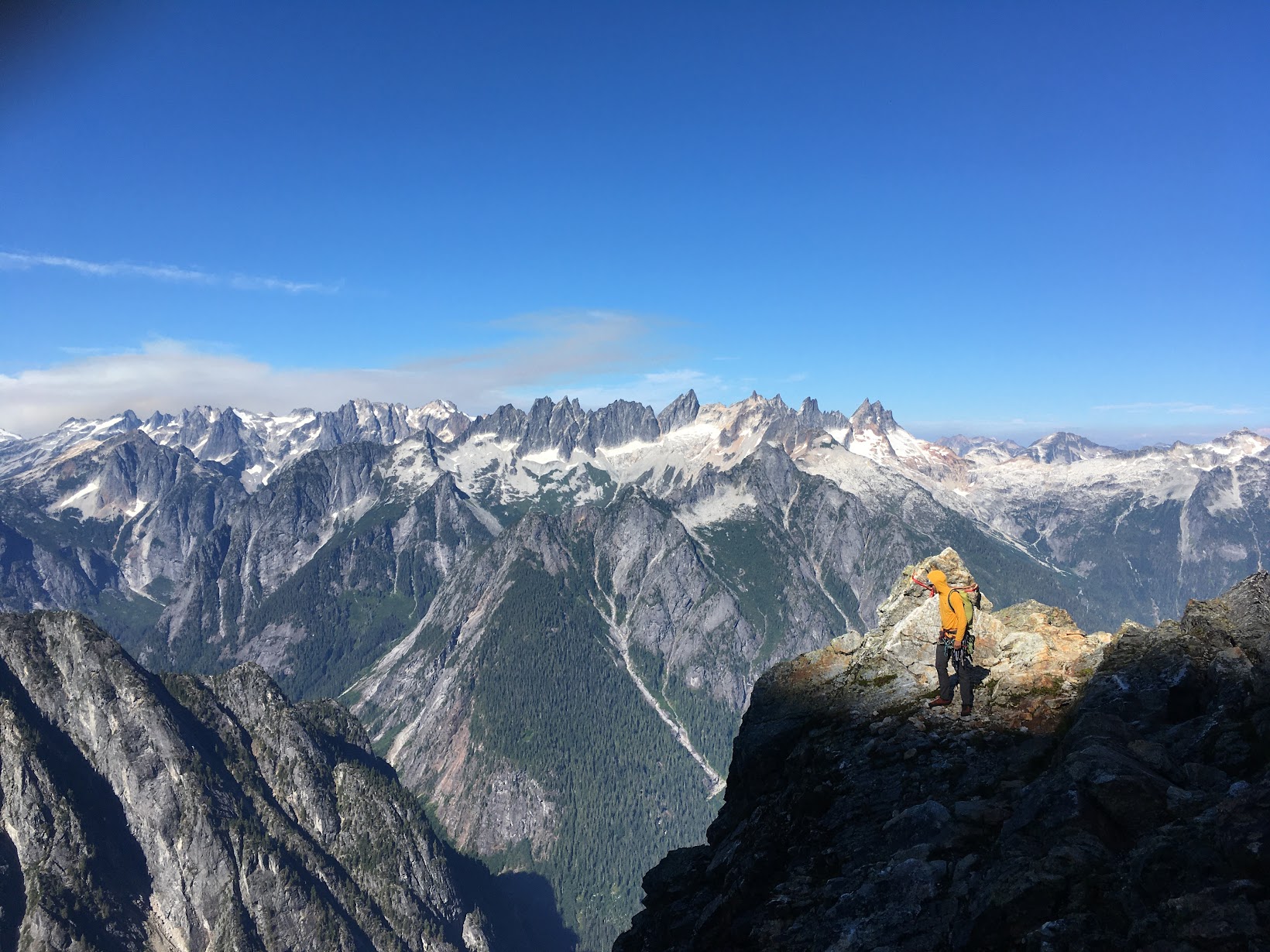
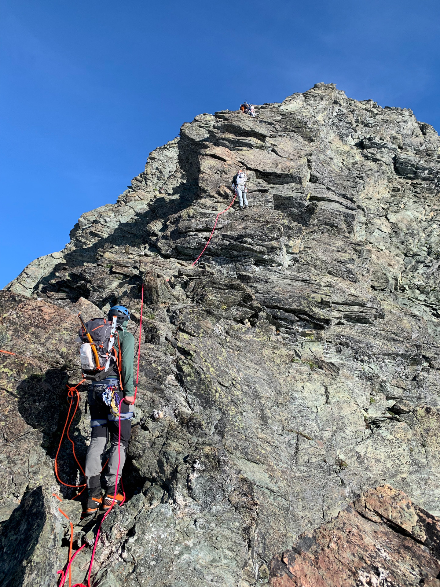
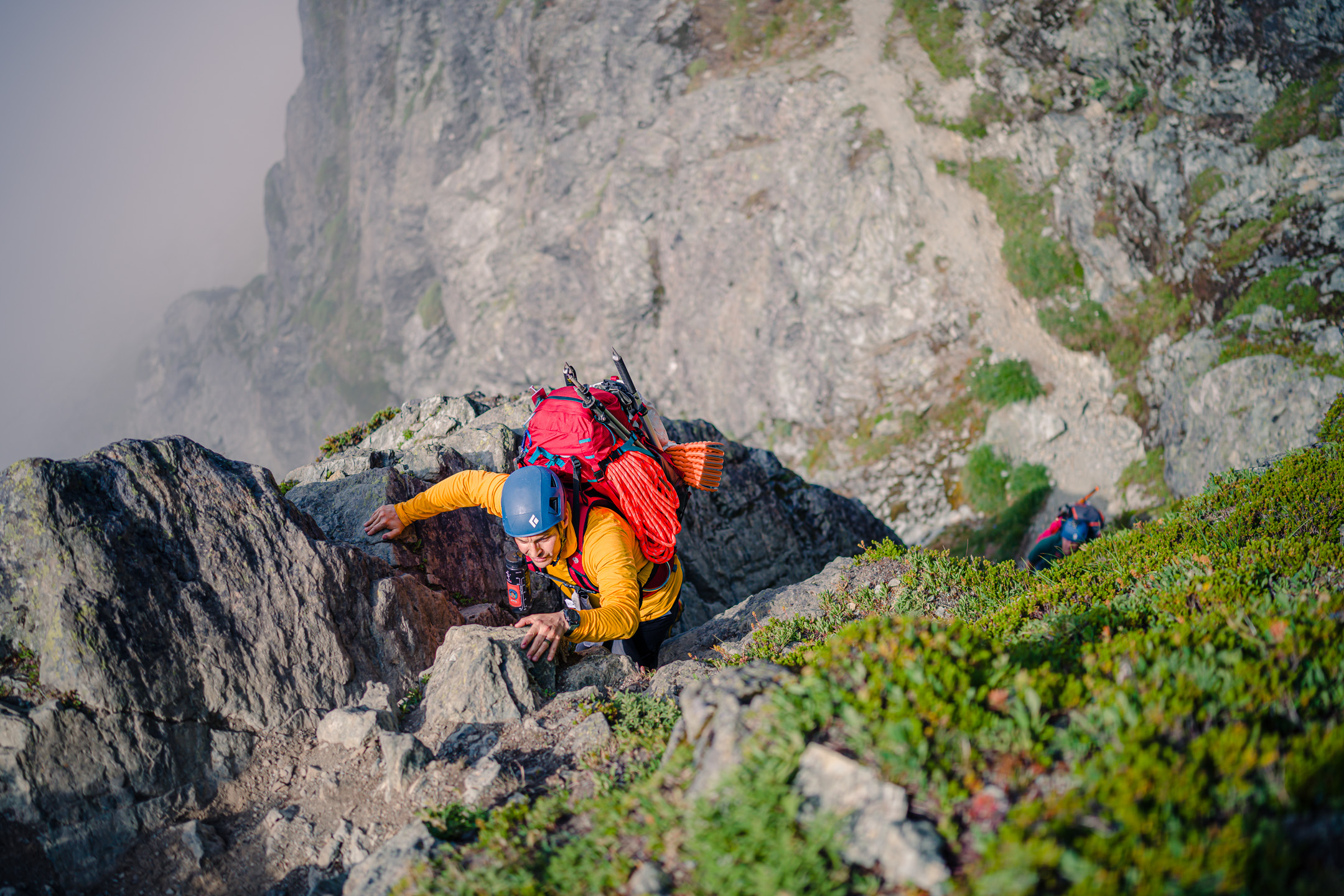
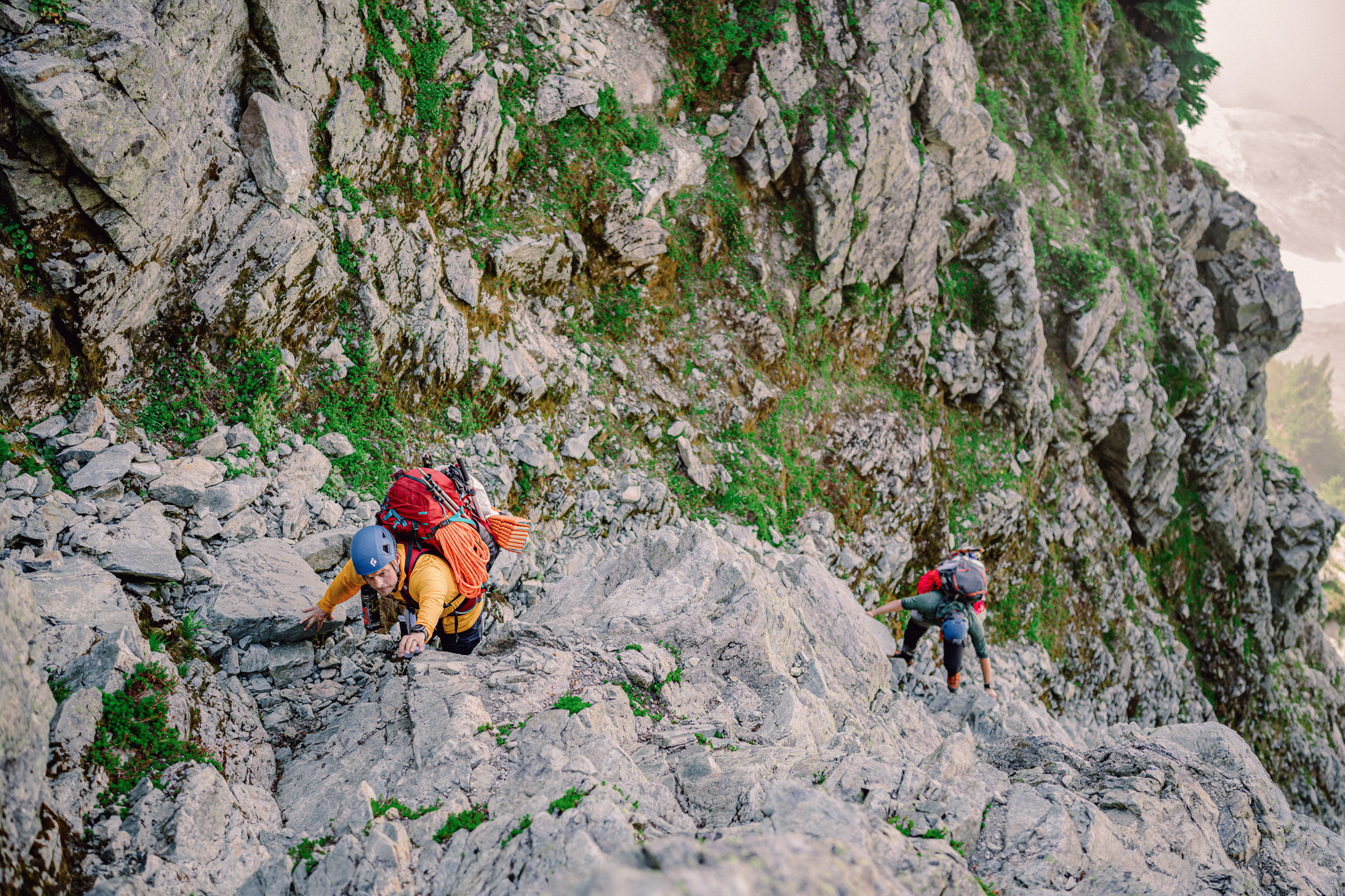
Trip: Mount Triumph - Memento Mori Trip Date: 08/29/2022 Trip Report: On Sunday, Duncan and I hiked out to Triumph with an open mind, and not quite enough food. We planned to repeat @rat & @lunger's east face route Memento Mori, but were open to more adventure if another line spoke to us. Turns out those jerks swiped the good one. The route was overall pretty high quality, with a good ratio of solid to portable holds. As far as we can tell, we followed their existing route except for pitch 5. Duncan build his belay at Tom's frayed rope (a single pink tricam girth hitched to a sling with the remains of a rope clove hitched to a non locker... yikes dude), which set me up for the hanging corner above. This roof went at probably 10- R due to an enormous moss clump that I had to face climb around on good, but unprotecable rock. The rest of the pitch offered little for pro, but enjoyable face climbing when the rock was good. My understanding is that Eric and Rolf belayed lower and face climbed up and right? Having pins made this belay feel comfortable, but are not necessary. Pitches six and seven are easy to follow and fun! Again, I used a beak to beef up the pitch six belay, but it was probably not necessary. Pitch Eight is the only one that didn't quite make sense. The FA description said to "Step left to a strenuous boulder move gaining another ledge". I walked left and scrambled around to said ledge at fourth class. However to the right is a short corner that looks like it goes at 5.9ish. I'm assuming that was just a typo, but would love to hear if we missed something. We chose to skip the alpine experience and descend the NE ridge sans shiver bivy, getting back to the car around 9pm for a full day out in the mountains. Approaching up P1 4th/low5th It's a big imposing wall! Pitch 2 is pretty spectacular Starting up P3 Starting up our P5 "Bet ya can get a turf stick with the alpine hammer" -Duncan Ralph I climbed hard right, up the face and back left into the corner. Can't say I recommend this variation. Duncan cleaned Tom's remaining gear. Future parties shouldn't rely on this for routefinding. Pitch 6 low angle corner P7 is straight up fun climbing! @rat & @lunger, did you climb this corner to the right? What a wall! Gear Notes: Double rack very small to #1 and single #2-#4, Full range of nuts incl. brass We used a long knife blade and #2 beak. I was glad to have them, but Duncan was indifferent. 70M rope would give you more anchor flexibility Crampons Approach Notes: Standard NE ridge approach. Access the glacier from top left and traverse over to the base of the route.
 1 point
 -
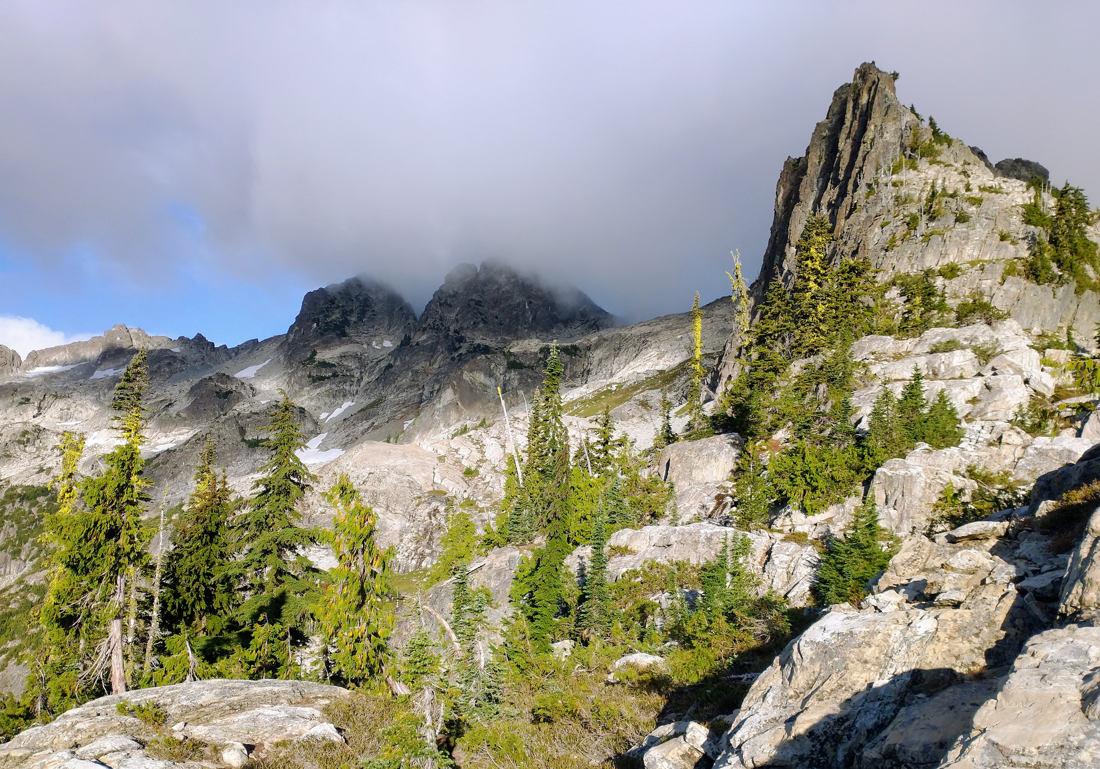
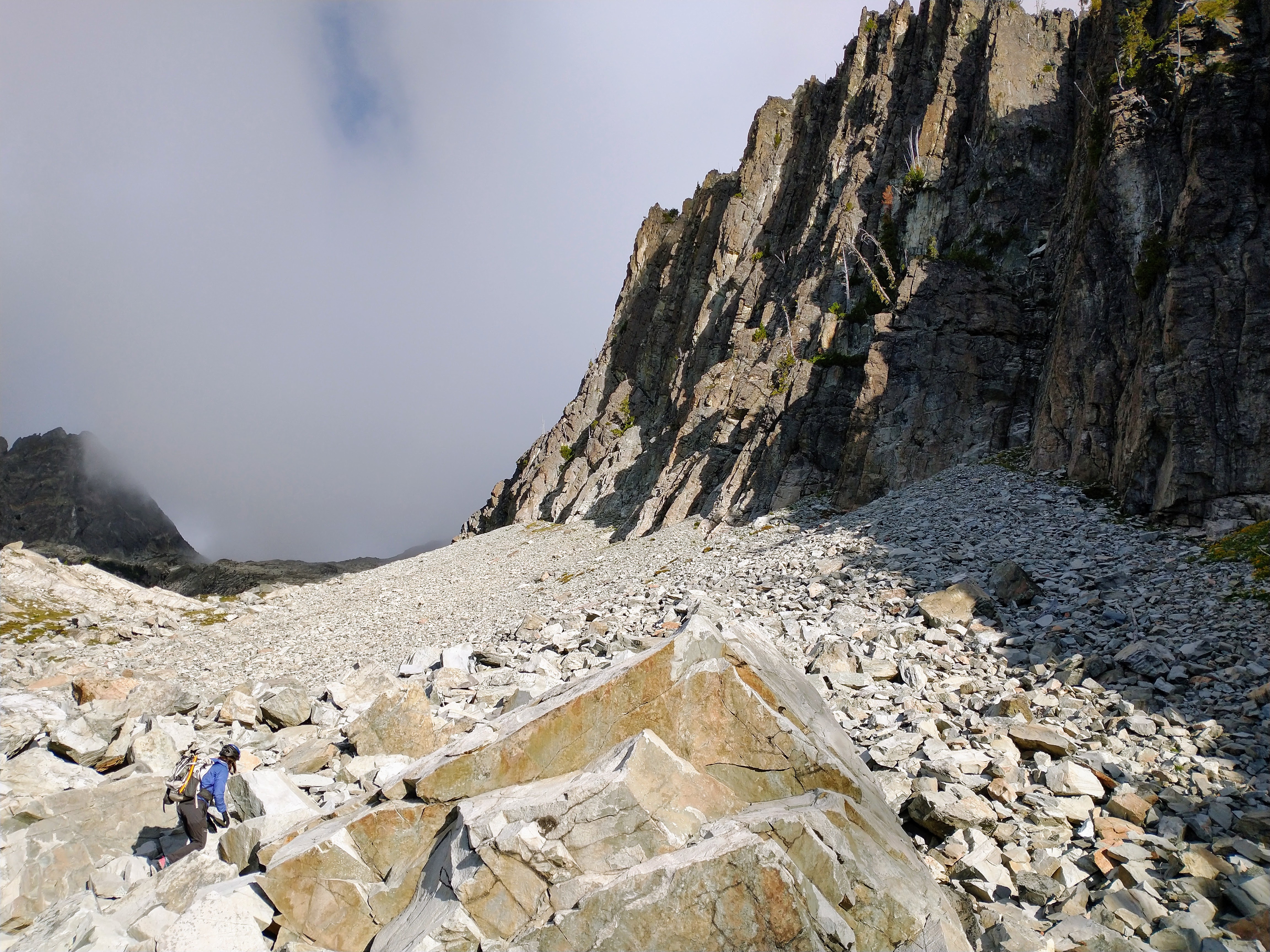
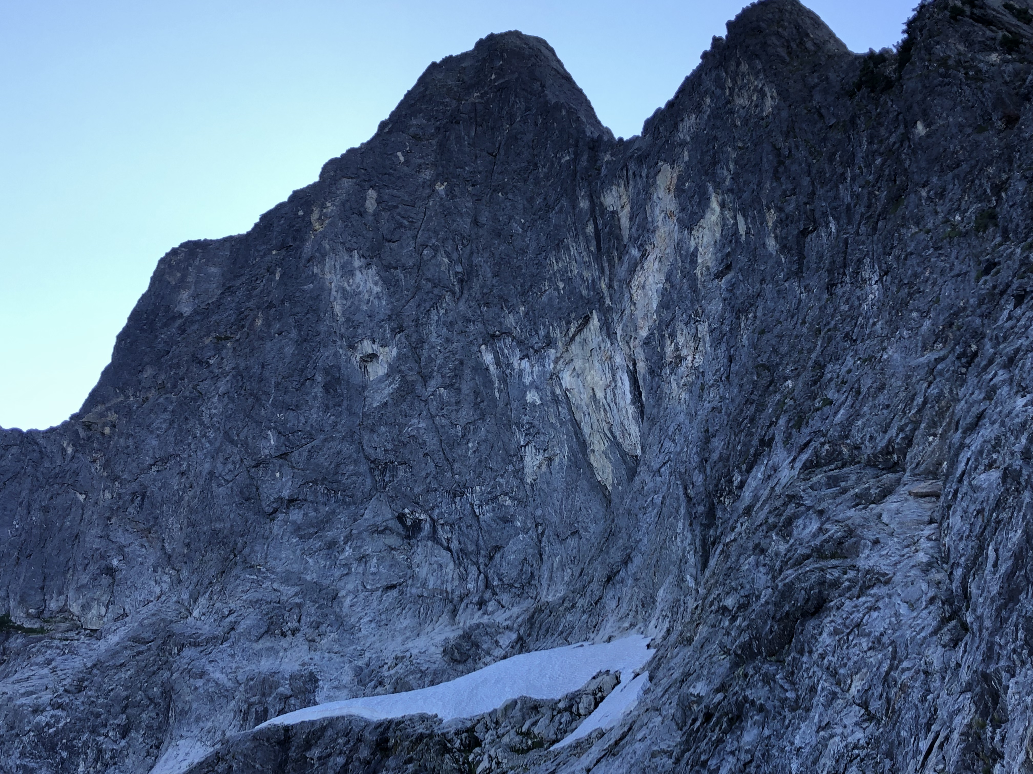
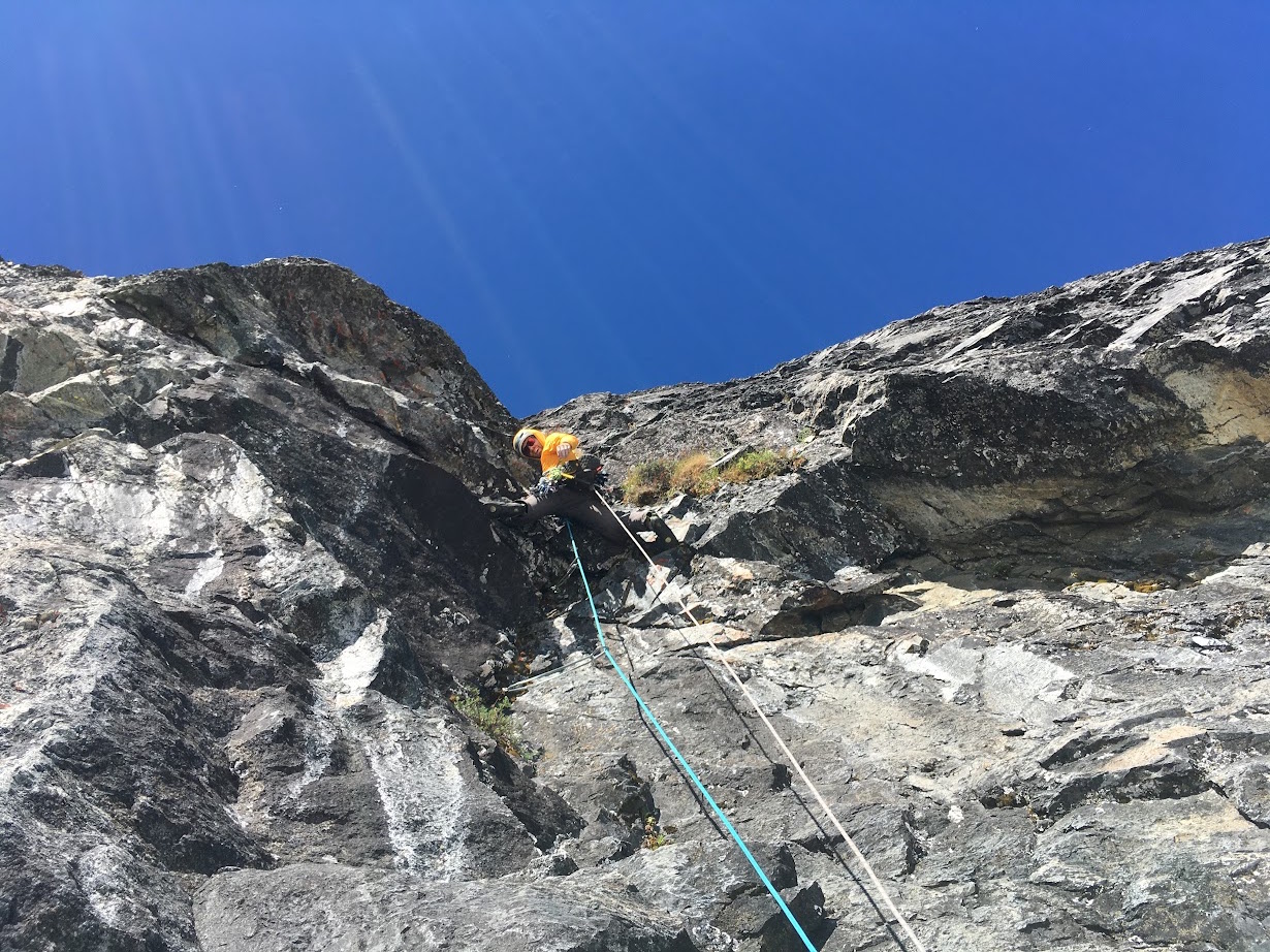
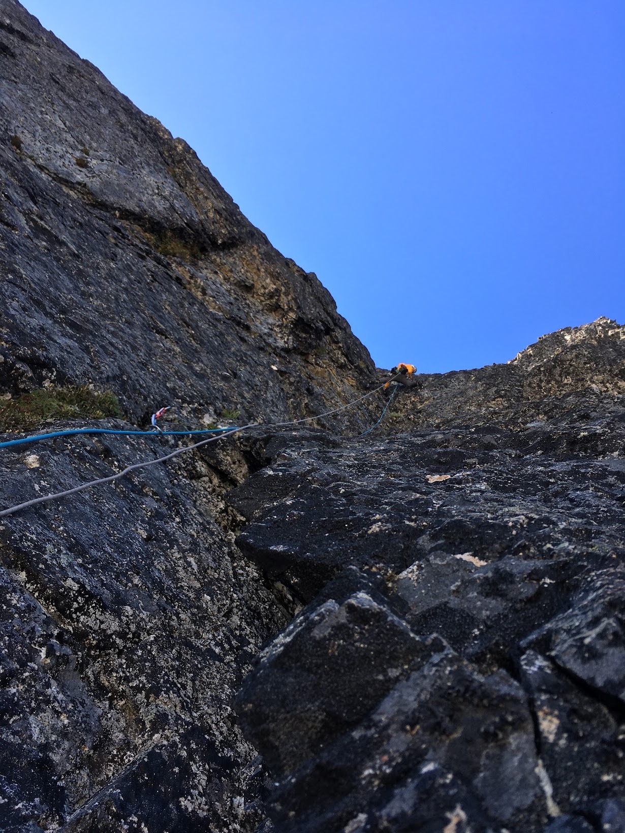
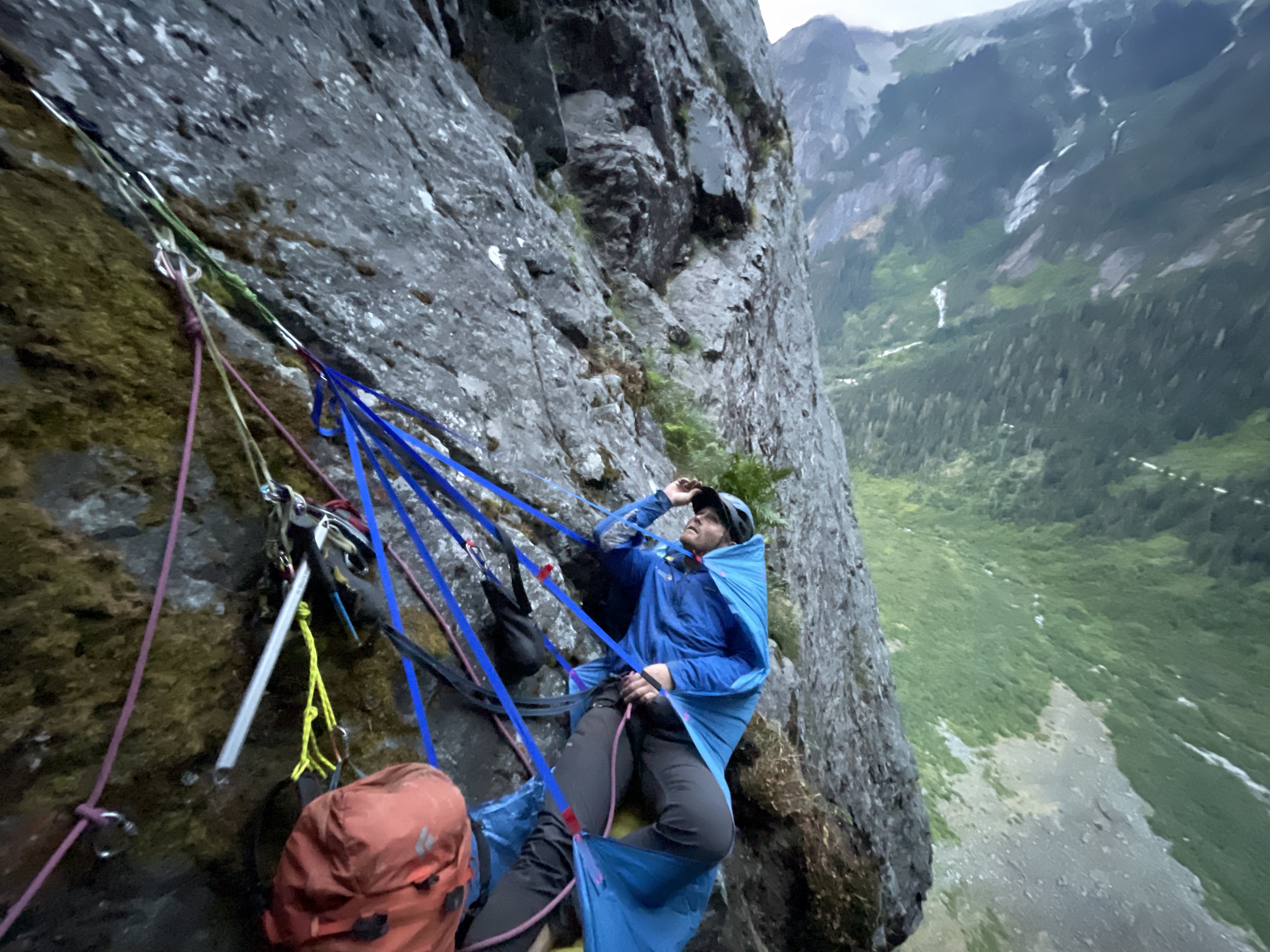
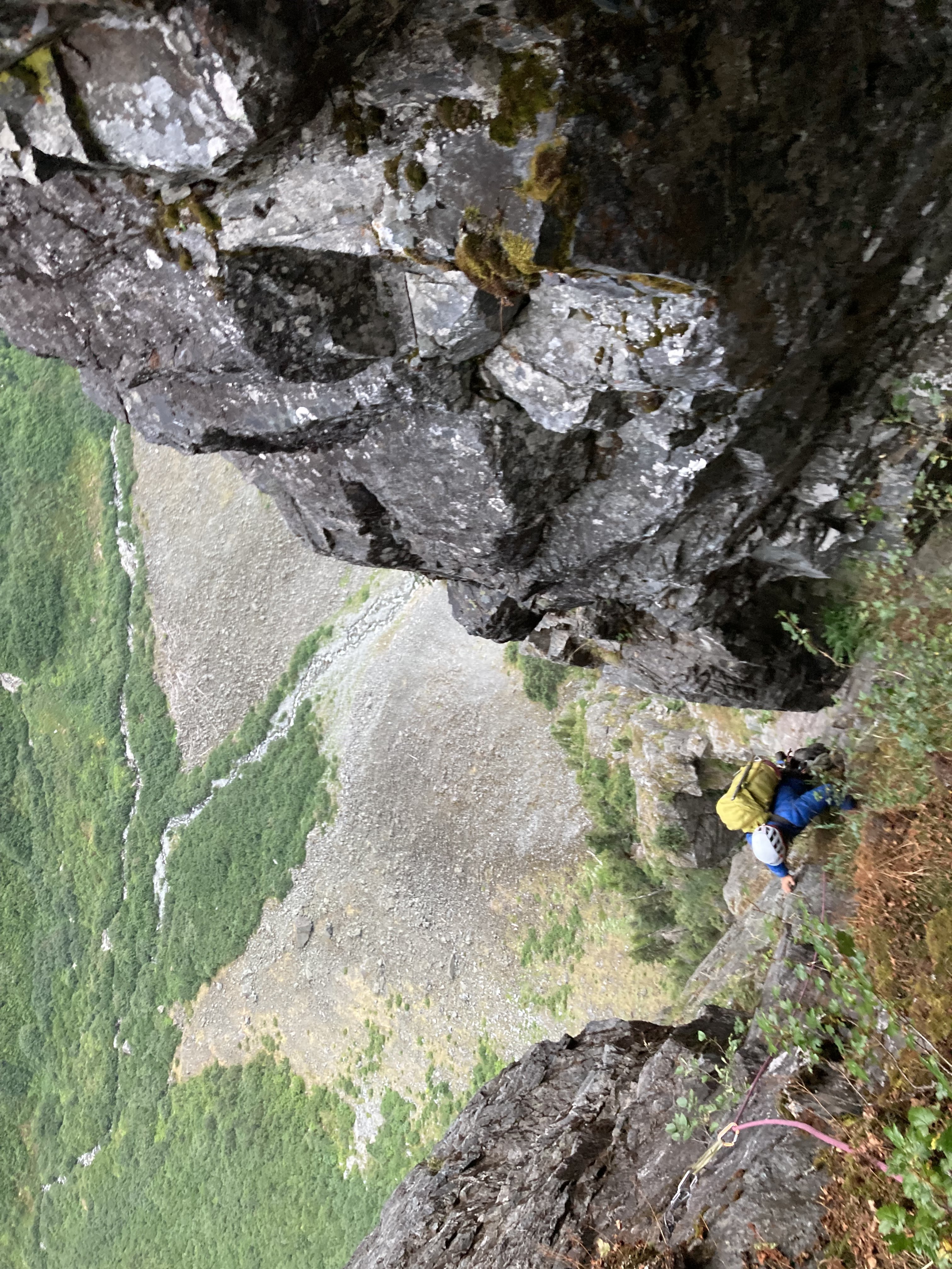
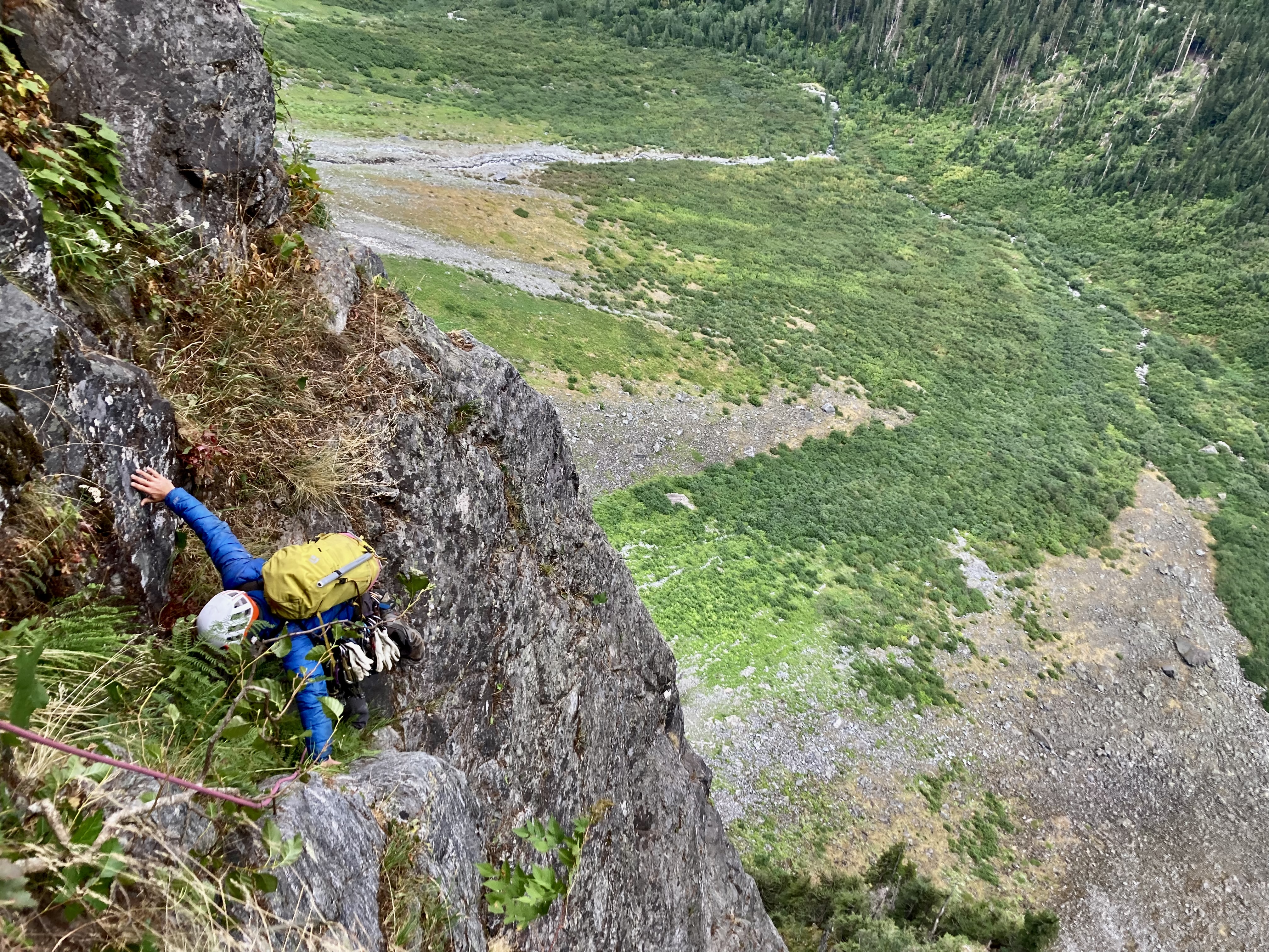
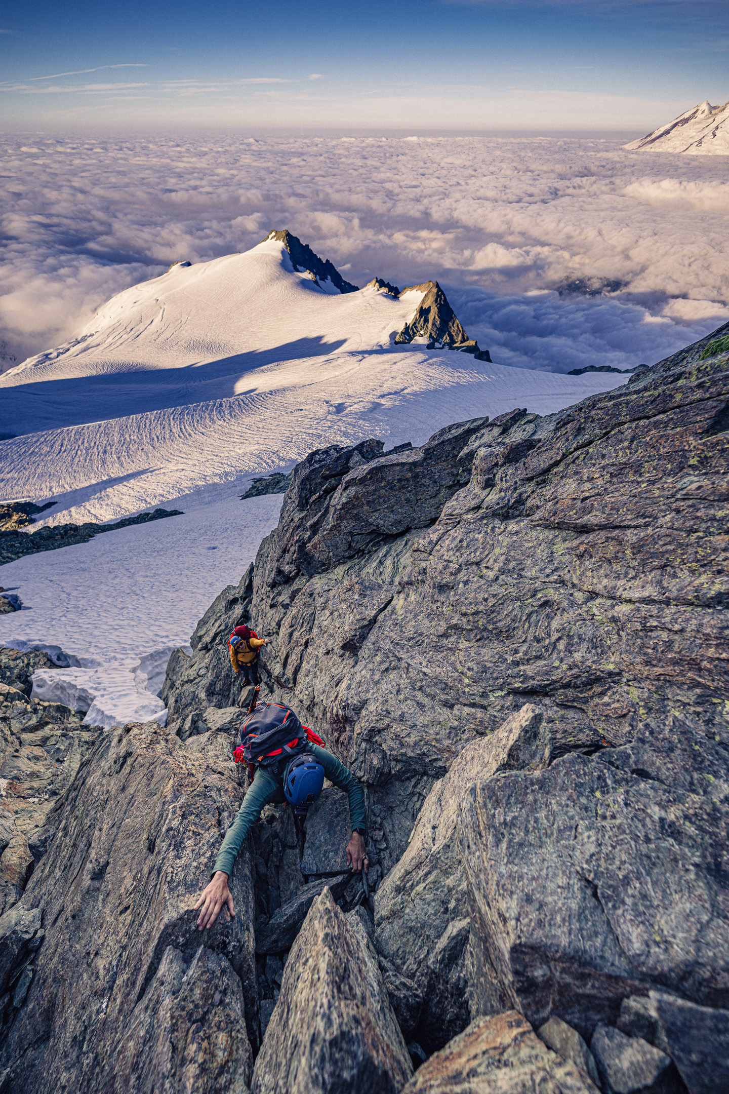
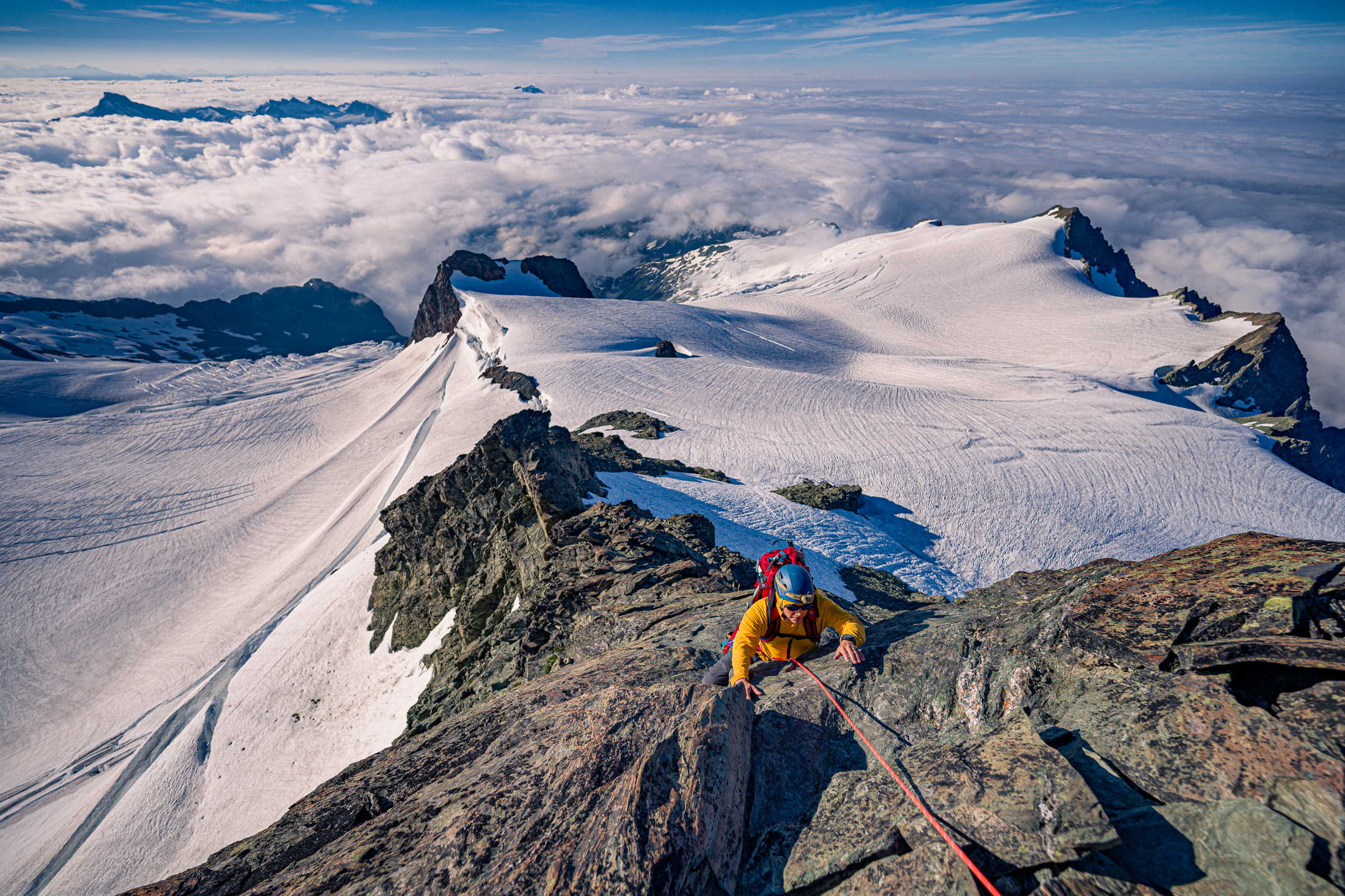
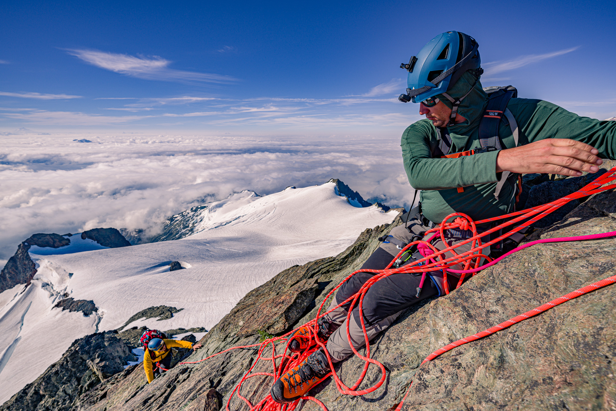
Trip: Johannesburg - “Flight of the Bumblebee” FA of the sit start to the NE Buttress of J Berg TD 5.9+R 1500’ Trip Date: 08/27/2022 Trip Report: This weekend, Kyle and I climbed the sit start to the NE buttress of J-Berg. We ended up rappelling due to injury after linking into the ‘57 route on the NE buttress. We added about 1500’ of steep and challenging climbing. The sit start climbs a tower with a bit of a distinct summit, so I don’t feel too bad claiming an FA. Becky likely wouldn’t have given us credit for anything, so judge it how you will. If linked to the summit, it would likely be one of the biggest monolithic climbs anywhere. TD+… ED…? Only one way to find out. This is likely a one and done for me, when we topped out the lower buttress I thought to myself “the climb we did so no one else had to”, but rapping where we did leaves the door open for at least one suitor to up the ante. The lower buttress in moody, morning fog We had a late start sat morning. The uncertain weather had us sleeping in and waiting. Lani and I had attempted the line a couple years ago and ultimately bailed because the climbing looked like it was going to be far more time consuming than our 2 day itinerary would have allowed. This time around, kyle and I packed a couple taco portaledges in case we had to bivy on the steeper lower wall. The approach involves a good bit of blueberry and devils club laybacking in high exposure. We came prepared this time and had leather garden gloves to grab the clubs… Kyle on the approach The approach is a bit of foreshadowing for what to expect on the rest of the buttress, but simply steeper… The first pitch was a long moss gully with difficulties that felt about like 5.7. For the second pitch, we discovered a sick splitter hand crack. Too short and too easy… Starting up the second pitch The third pitch was ledgy and mossy hand crack steps that fed into the main gully/corner that defines the route. This was the previous high point. starting up the third pitch The fourth pitch is what intimidated Lani and I off the route before. Steep, mossy overlapping roofs and steep corners loom above. This time around we were prepared to aid if needed and had a good bit of iron and a real hammer. We didn’t end up using the ladders and battled the moss with a nut tool and clawed our way up the slightly overhanging corner past a roof to a sloping ledge. We decided to start hauling the leaders pack at this point and ended up needing to tag the iron up for this belay. Kyle on the traverse above the P4 roof pitch 5 was more of the same, but with a chimney. Pulling through the chimney made me happy about the decision to haul packs. I ended up climbing a steep crack on the face to diverge from the main corner. To make faster upward progress, Kyle ended up climbing the thorn bush corner. He ended up unintentionally releasing about a ton of gravel when he stepped in the wrong spot. That reinforced the decision to take the spicy looking face. We ended up setting up a bivy at the top of this pitch. Glad to have the tacos as it was completely hanging. heading into the chimney on P5 kyle following the choss corner at the end of P5 chilling at the bivy in a super taco looking up at the upper corner from the bivy The next few pitches were actually pretty fun. Steep face and corner climbing on surprisingly solid rock. starting up P7. 5.7R up to the roof. kyle following the roof at the top of P7 The 8th pitch was the start to the sting in the tail. We climbed a runout face to the right of the corner. This took us up to the edge of the wall. The wall pinched off to a blunt, knife edge arete. A 5.8 downclimbing traverse into a rock scar was probably the most dangerous point on the climb. The last piece was maybe about 60 ft away and around the arete. A fall would likely chop the rope along the arete. Strong R. The rock scar was overhanging 5.9 stemming on less than ideal rock but with good gear. climbing up near the arete on pitch 8 kyle finishing up pitch 8 Once on the prow of the wall we had a few options. None of them looked good. The chimneys above looked truly awful, so we opted to traverse the arete to the right and found a mossy ramp that took us out onto the NW face. I belayed short for communication and to help make decisions. The next pitch was bleak, dead vertical terrain everywhere and so much munge. We ended up making a huge S shaped traversing pitch to work our way up moss covered 5.8 sketch blocks. We named this pitch “Phil’s Traverse” as we were intending on calling the route “the land of confusion”. The sting in the tail continues… kyle following the zag on Phil’s Traverse A long pitch of overhanging 5.7 tree climbing spat us out on a decent ledge where we transitioned out of rock shoes to prepare for the Forrest. I was nearing the end of the rope on a classic J-Berg tree pitch and grabbed a tuft of moss, as you do. This particular tuft was a bees nest. I felt stinging and saw a few on my right hand and about 100 bees shot out of the hole, dead set on face fucking me off the mountain. I let go in a knee jerk reaction and went for a slow motion, sports action highlight style whipper. I kind of wish I had a video camera on as it had to have been funny to watch. I ended up grabbing, and swinging off a tree on the way down, making a single rotation tomahawk and falling onto my feet as the rope caught me. Glad I took a lead belay. I ended up rolling my ankle and was otherwise unscathed. I belayed Kyle up and we weighed our options. We decided to find a place to bivy and wait until the morning to make any decisions. We ended up climbing up another 300’ of forest munge to the top of a heather slope. The top of the slope was a comfy knoll that marked the summit of the lower tower, and an awesome bivy! This was our summit and the first point where it was obvious we had linked into the ‘57 line. kyle rapping a steep section of the wall Waking up, my outlook was pretty grim. I could barely hobble around, so we decided to descend our route. I couldn’t really put weight on my ankle so I ended up glissading the last 100’ of 35 degree heather. Once back at the tree line we began rapping. We ended up rappelling about 1800’. Primarily rapping on trees and using an escaper we were able to get away with only leaving a couple gear anchors along the way. Traversing the talus back to the car was kind of miserable, but manageable. My ankle is starting to feel better already, crossing my fingers for a minor sprain. For the aspiring munge warrior, here’s pitch notes P1 5.7 180’ head up moss gully on the left to a big ledge with trees. P2 5.7+ 180’ traverse to left edge of ledge. Head up good hand crack. Traverse slab to the right and climb a nice finger crack up to a large ledge on the ridge crest. P3 5.8 150’ head up into the large mossy corner. Climb up to a distinct roof with hands to fists gear for anchor. P4 5.9 100’ continue up the corner. Mossy crack climbing leads to a rightward roof traverse. Pull past the roof onto the large sloping ledge. Two beaks in place for anchor P5 5.9 100’ continue up main corner on clean slab. Past a short chimney and a crack on the right face (5.9+). Belay at uncomfortable stance below a striped roof in a good crack in the main corner. P6 5.9+ 85’ continue up main corner past a small roof (crux) to an alcove at the base of the massive looming roof above. #4 critical for belay. P7 5.9+ 70’ climb the face to the right of the corner (5.7R). Up past an off width section to a section of steep crack/stemming on good rock. Belay in a cave. P8 5.9+ 160’ traverse out of the cave. Climb the face on the right up to a knife edge arete (5.8R). Traverse the slab rightward into a steep rock star (5.9+ spicy). Continue up past low angle broken terrain. Belay by a bush on a small ledge. P9 5.7 60’ head up and around the arete to the right. Traverse over on mossy ledges and build an anchor P10 5.8R 100’ “Phil’s traverse” traverse right. Up mossy blocks to trees. Traverse back left to a big tree for a belay. Heinous drag. P11 5.7 150’ climb the belay tree. Then continue up until rope drag stops you. P12 5.6 200’ trees up to the ridge crest to join ne butt route. Gear Notes: Double Rack .2 - 1 Singles 2 - 4 no nuts placed. Pins in place. Approach Notes: Park at cascade pass. Traverse talus to the base of the “munge cone”. Traverse to the right up steep ferns. Gain a steep ramp that cuts up and left on 4th class devils clubs. Mandatory devils club laybacking. We brought leather gloves for this. Traverse the ledge to an exposed perch by a steep gully.
 1 point
 -
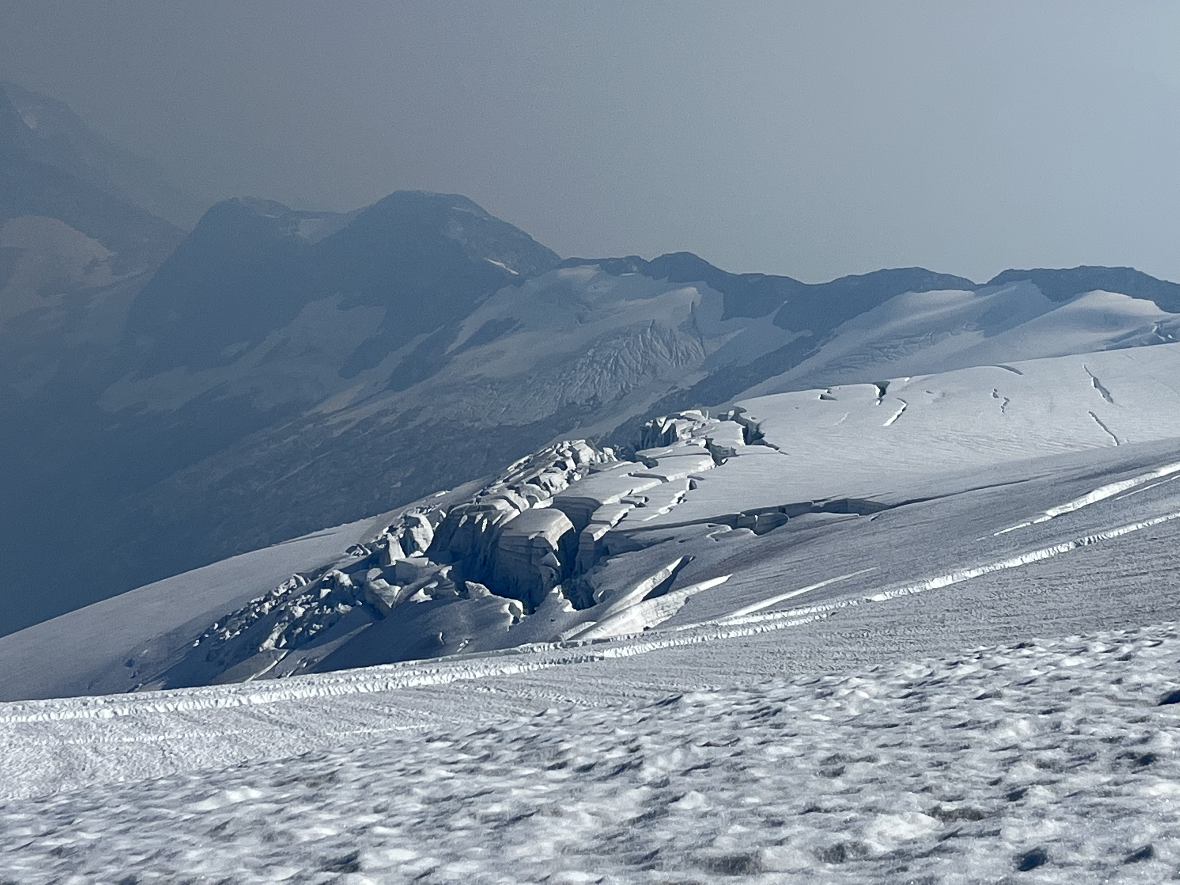
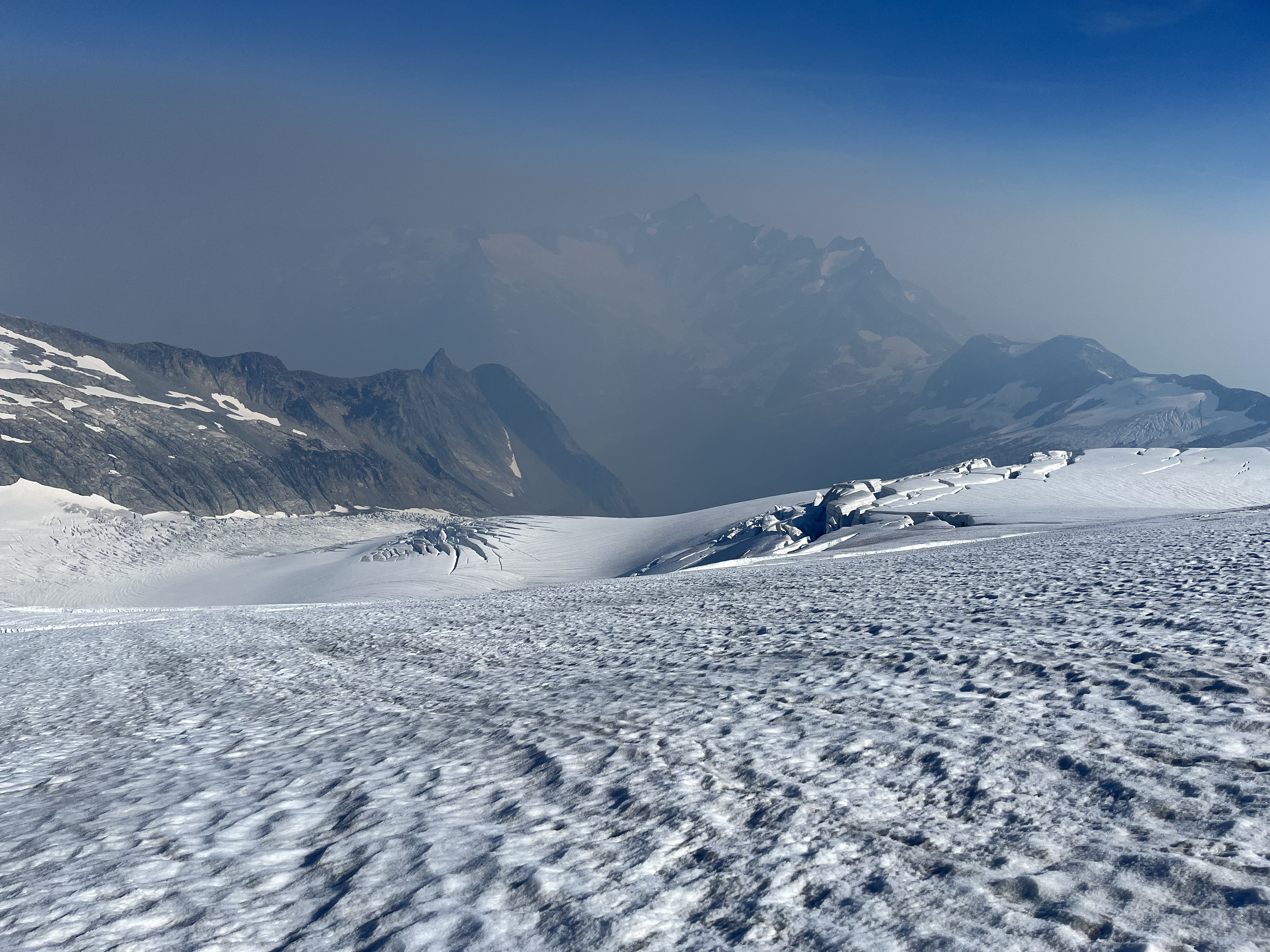
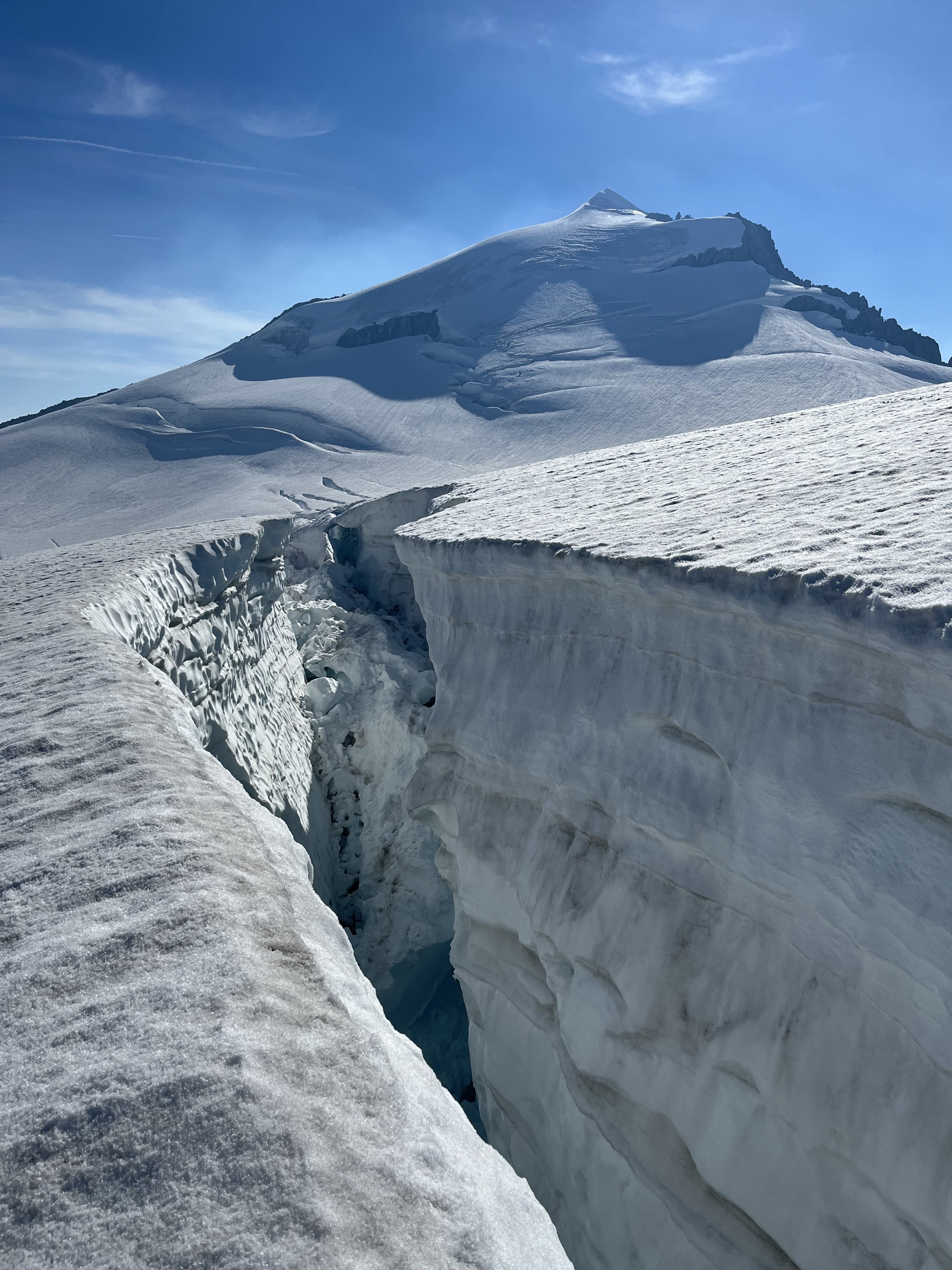
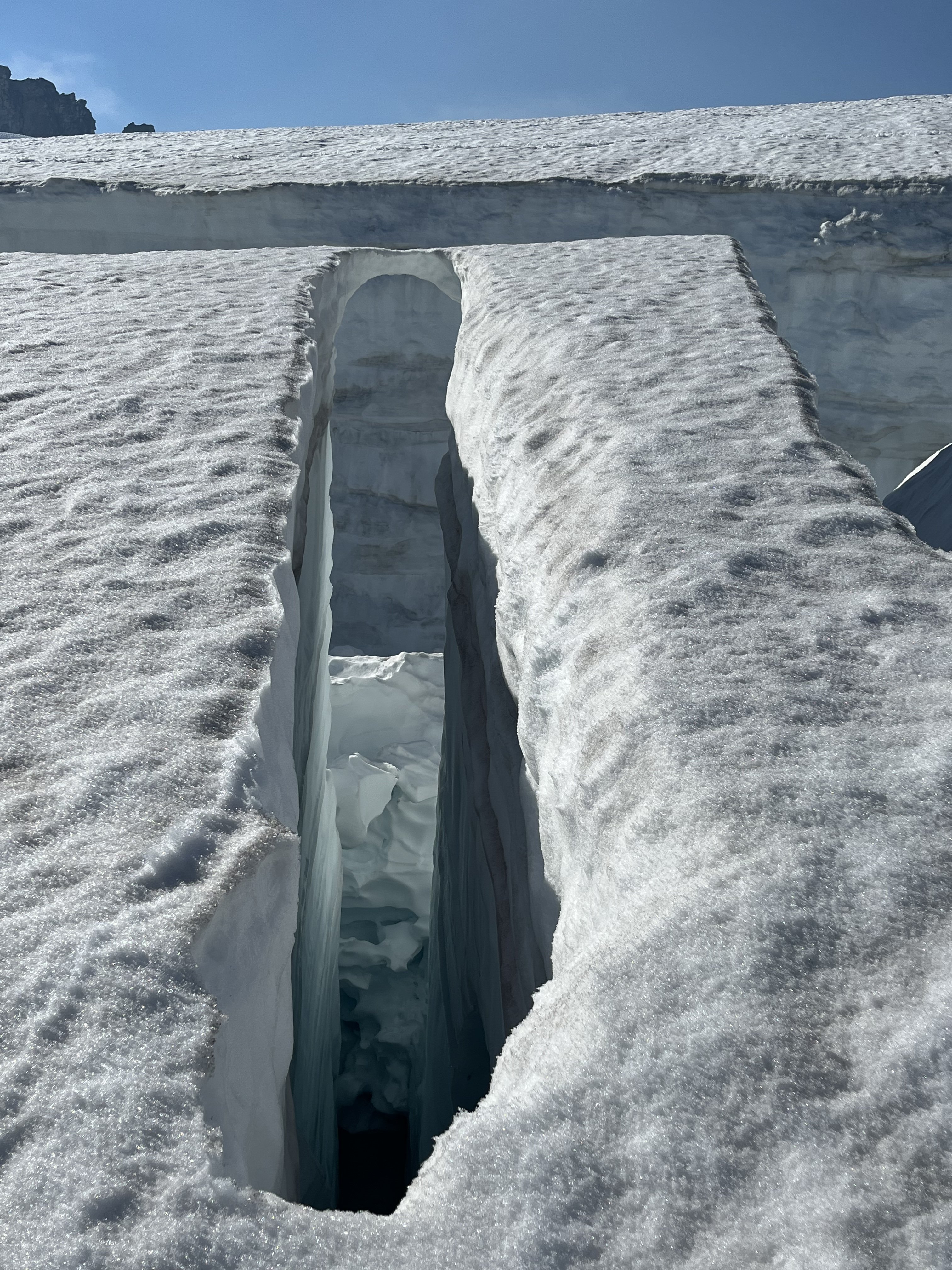
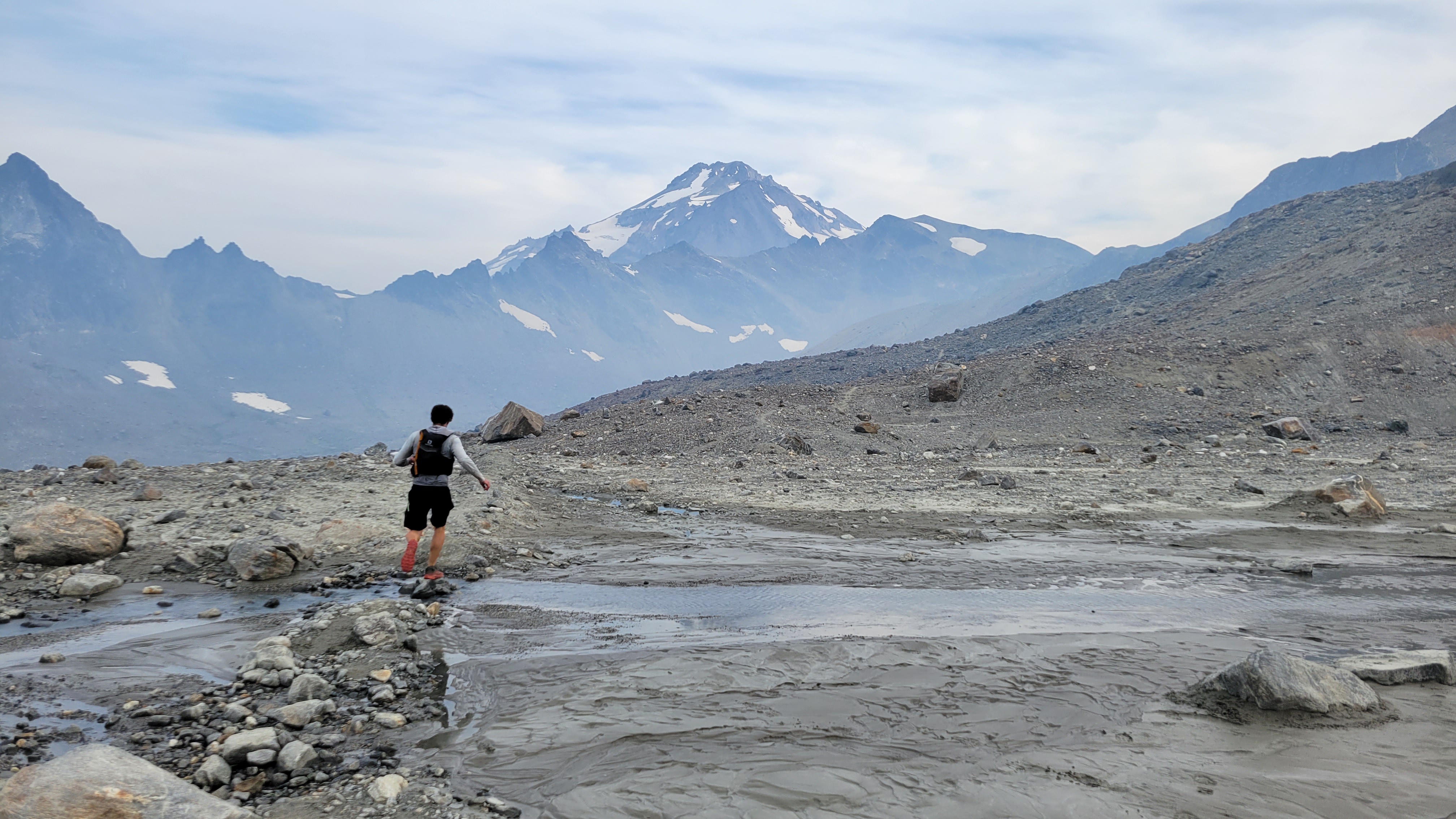
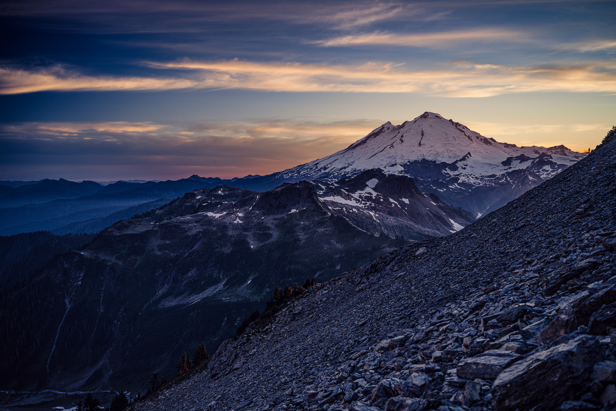
Trip: Glacier Peak - Cool Glacier Trip Date: 09/03/2022 Trip Report: Me and @MGraw and figuratively everyone else did Glacier Peak over the long weekend. To avoid most of the crowds we did it on Saturday as a run. We started at 4:50am, summited at 12:30, and hit the TH again at about 6:45 for a c2c of just under 14 hours. We thought that was pretty good but it's 2.4 times the FKT. More importantly for those interested... The conditions update!: The trail has ample water sources everywhere until about .5 miles past glacier gap, then none except on the ice of the glacier if you want to hunt for it. The trail is in excellent shape, recently brushed and re-graded to White Pass. The Cool Glacier has a tough entry with some blue ice walking through a serac field. It's low tech (no overhead hazard, you're on top of the seracs). But not really protectable and probably best avoided if you've never walked on solid ice. Several parties turned abck at the look of it. We found it very doable in runners and aluminum crampons. After that there are some bridges, but it's grade 1 glacier wlaking. Personally I thought the boot pack was kind of unnecessary sketchy, crossing very close to exposed ends of cracks where, from a different angle, you could see it was overhung. We took the far climbers left edge of the glacier immediately next to the rocks of the east ridge of Disappointment Peak. It was quite safe. The whole route is really pretty with great meadows, straightforward route finding, and a nice summit. A good time was had by all. Now my legs hurt. The boot pack goes from the farthest point of rocks about halfway from Mike's head to the ridgeline angling up left: Gear Notes: Aluminum crampons and axes, sneakers, Salomon advanced skin 12 packs. Approach Notes: Good water access all over, great trail, beautiful.
 1 point
 -
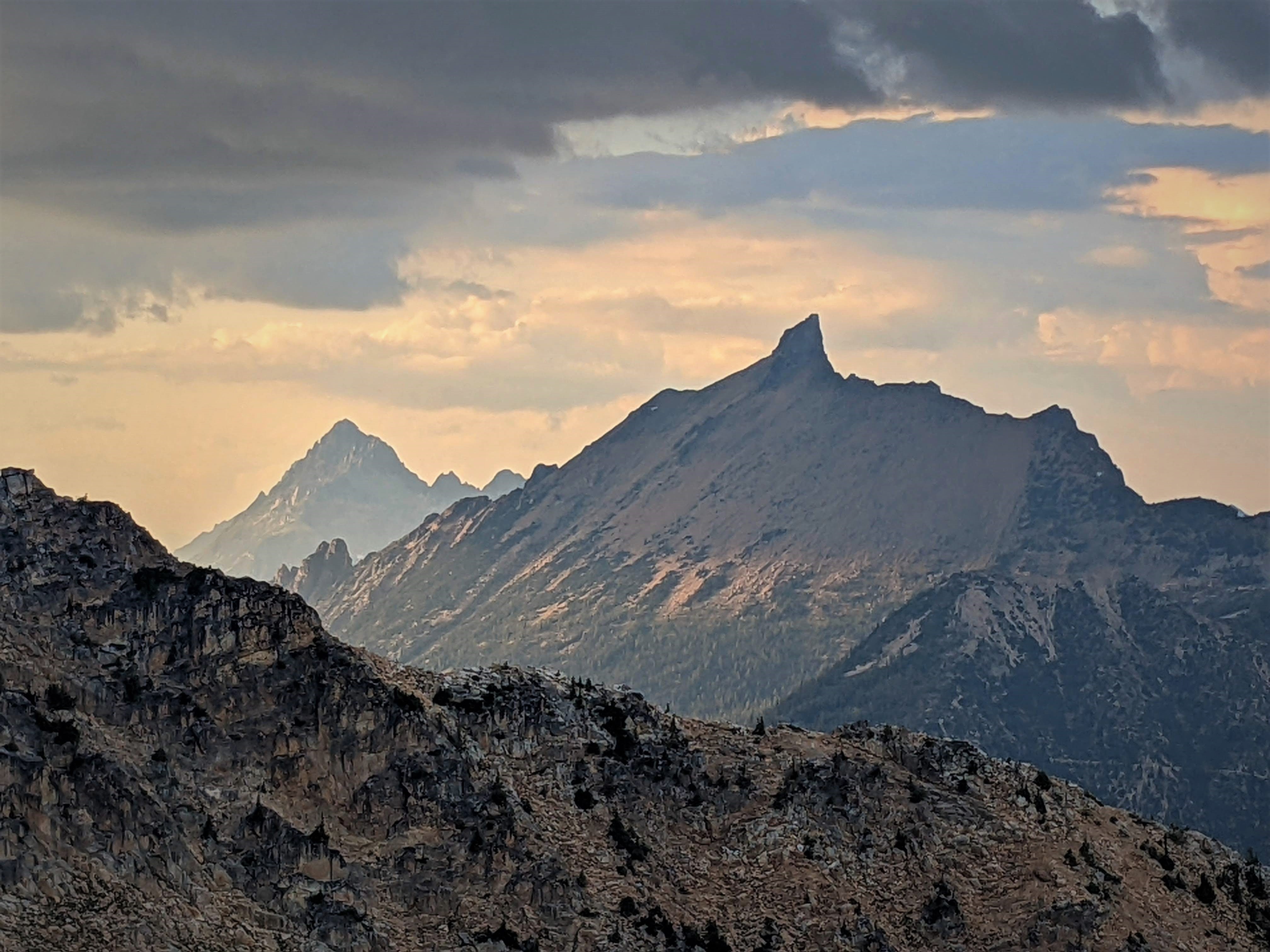
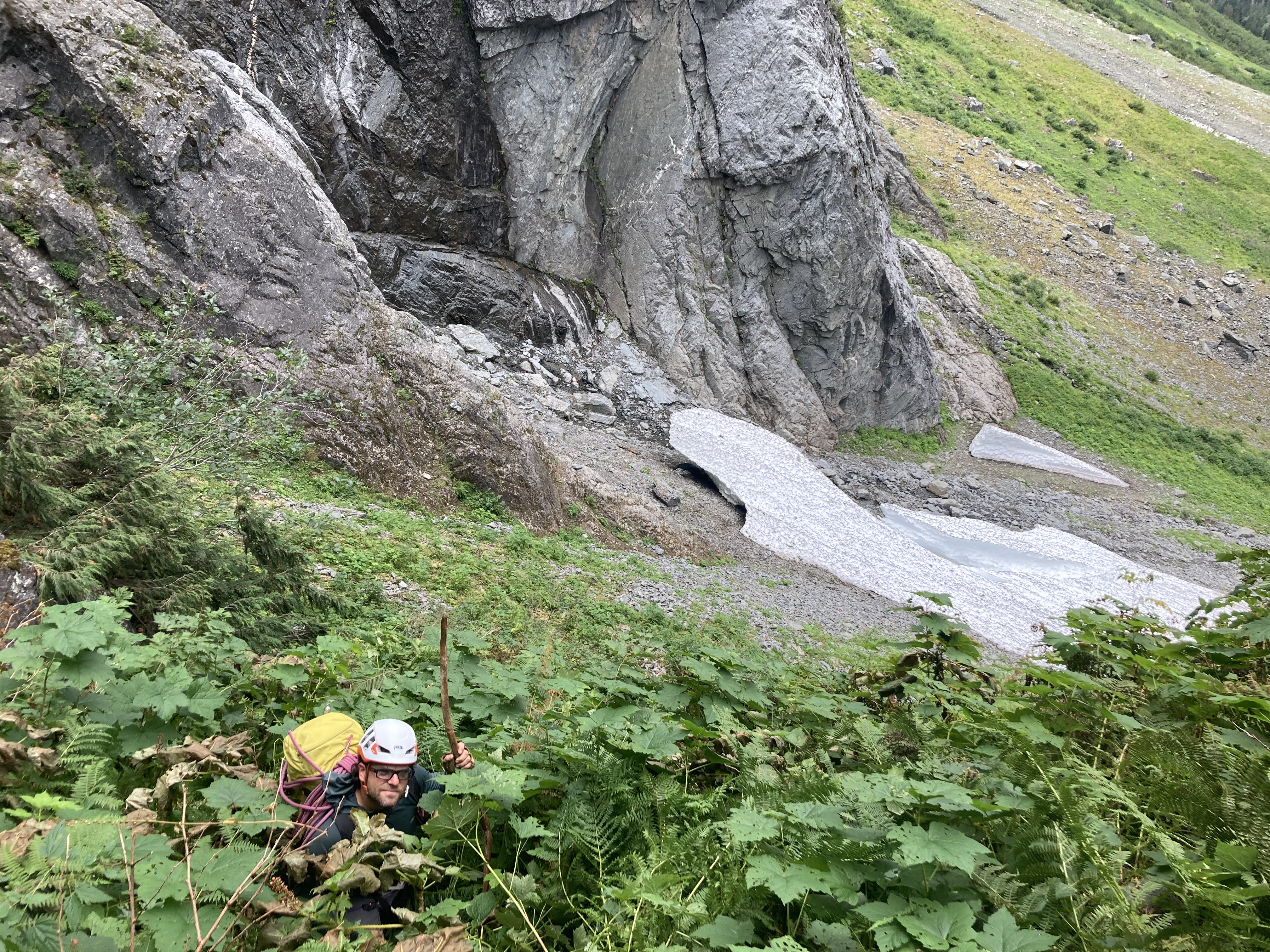
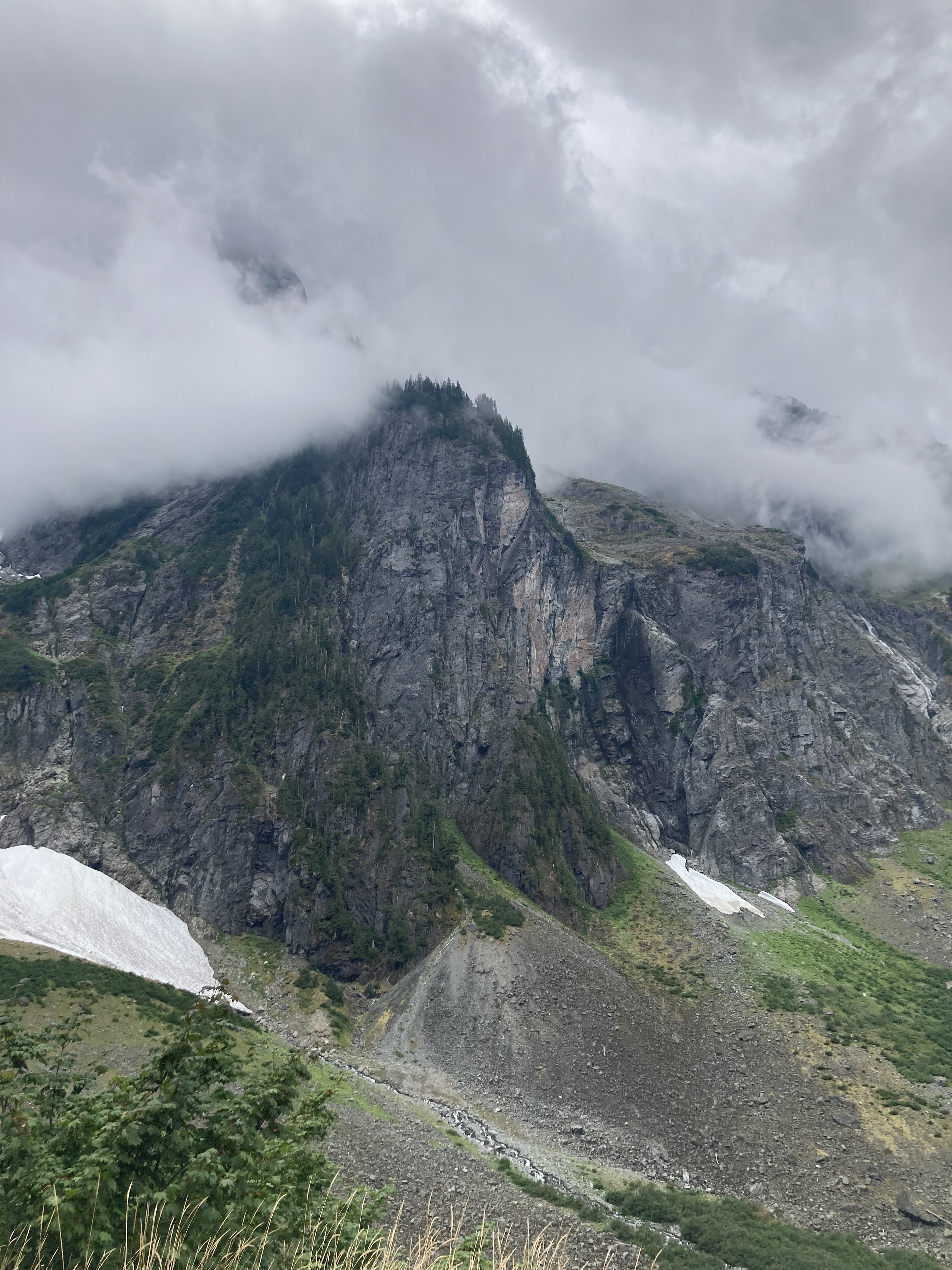
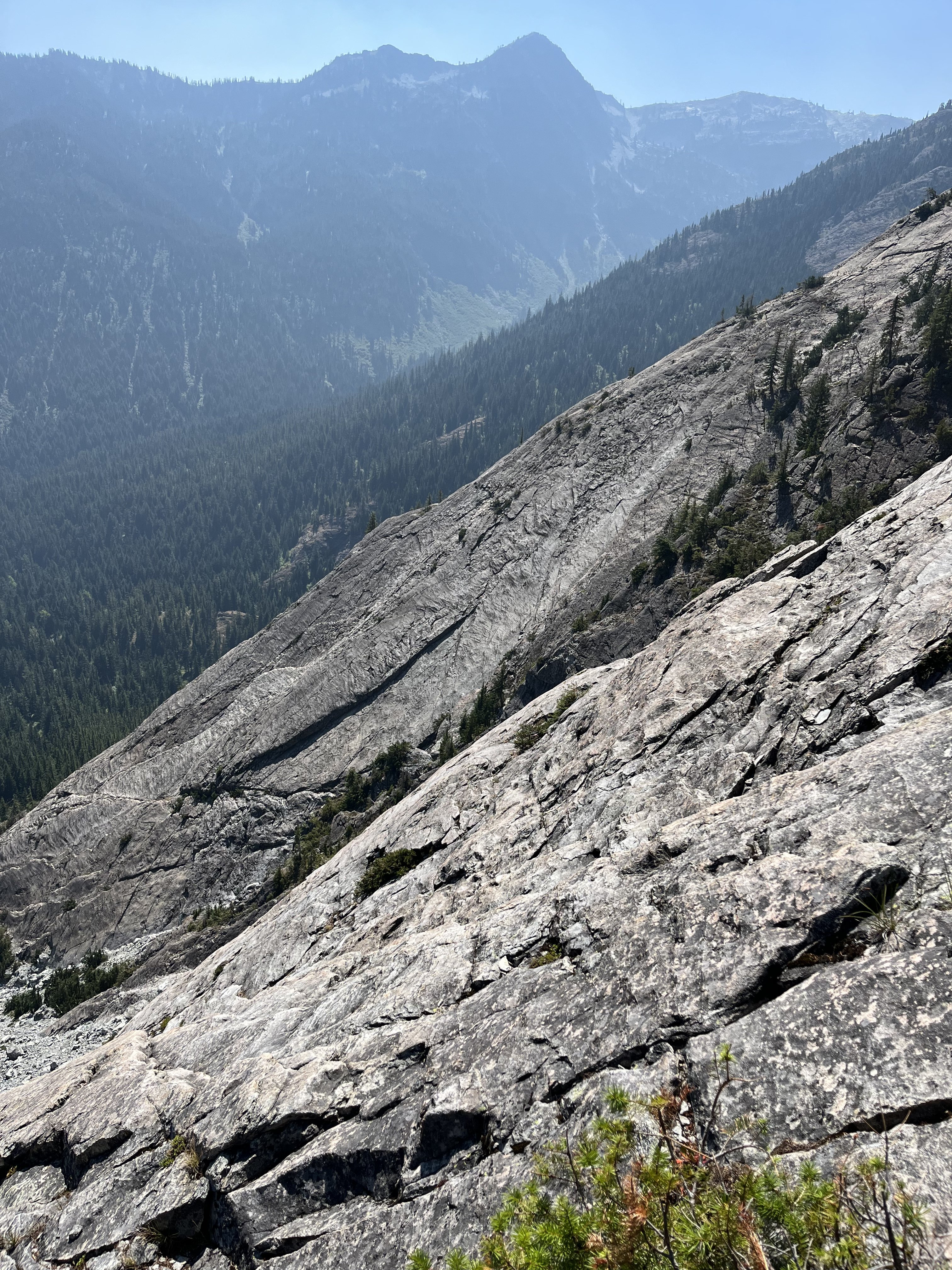
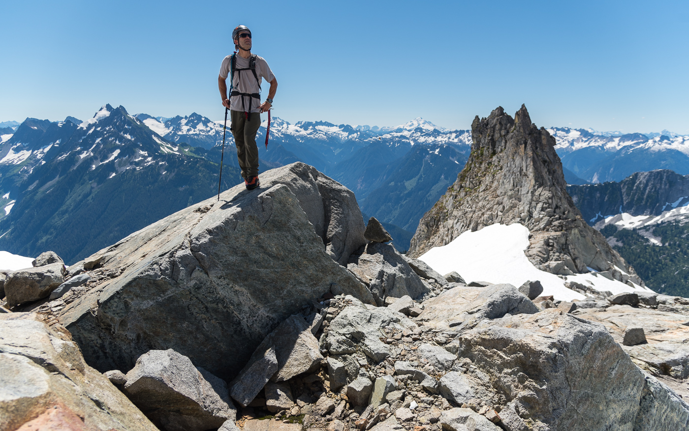
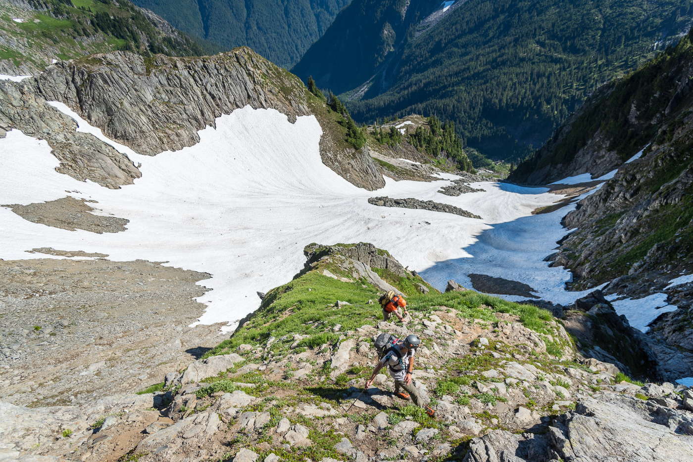
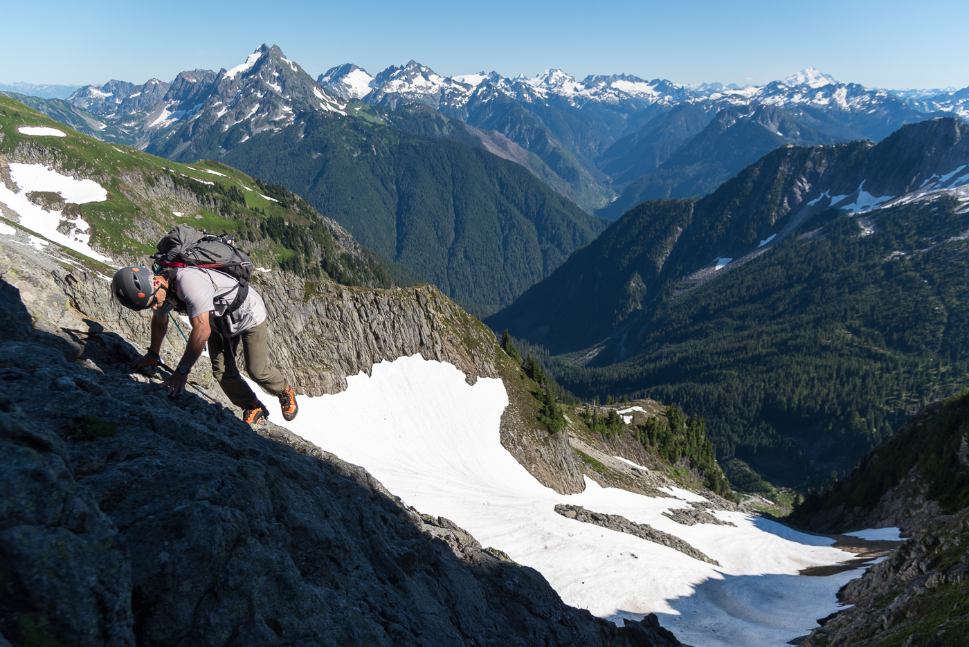
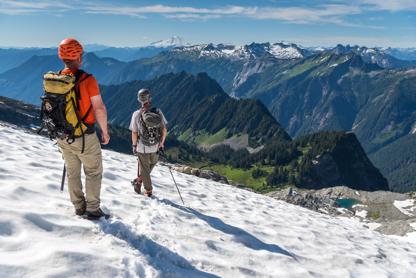
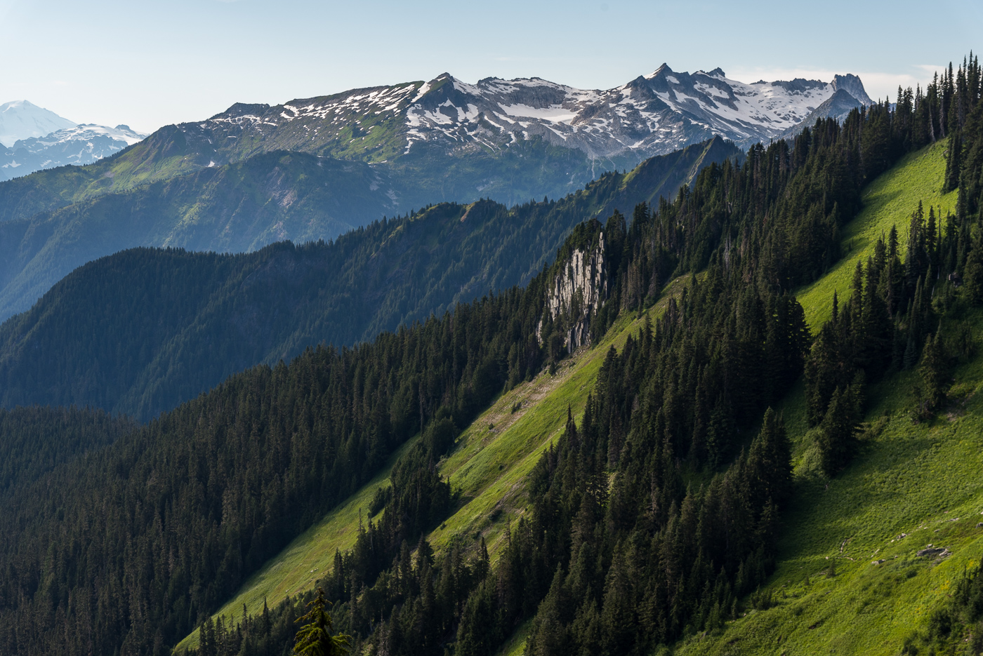
Trip: Bear’s Breast + Summit Chief - SE Face on Bear’s Breast; E to W ridge traverse on Summit Chief Trip Date: 09/01/2022 Trip Report: On Thursday I climbed the slab on SE face of Bear’s Breast (BB). From a bivy at Shovel creek, the next day I hiked to Chief creek and followed it to a lake below Summit Chief (SC), climbed the east side of the massif, traversed the ridge to the summit, descended south back to the lake, then went back down Chief creek to trails leading eventually back to the car. This involved tons of hiking but the mega slab on BB was really fun and the process of discovery made the SC excursion especially rewarding. Early Thursday morning I had driven an hour in the direction of the N cascades before I remembered to check the forecast one last time. I didn’t like what I saw. I had somewhat bold plans for 3 days in the Eldorado area. It seemed like a fair bit of smoke was forecast. The area’s main draw for me is the view, so I shelved that plan for another day. The smoke forecast looked clearer further south so I turned around and headed that way. Jason’s mega slab TR came to mind. I took screen shots of his unusually detailed beta before leaving service. Neighboring SC was also in the back of my mind. I didn’t know anything about it, but was pretty sure it had a scramble route. To make up for the comically long drive I did a mix of fast walking and slow jogging on the trail to Waptus lake, reaching it in 2.5 hours. I kept going until I found the Shovel creek campsite. I put my harness on to save space in my tiny summit sack and headed to the wall, reaching it about 4.5 hours from the car. I got water at the base, but partly due to the tiny pack I deluded myself into thinking 2L water would be enough for the climb. I would have probably run out even if it took 3L. It was a hot day and the route was in full sun. And the climbing, though easy, was pretty physical. The movement was close enough to hiking that I would invariably go too fast and have to stop to catch my breath. I found mostly class 4 (felt like 3 as long as you didn’t look down) and felt like I had to go out of my way to find low 5th bits, which I did seek out. High up on the face I found a repeating pattern of perfect horizontal foot/hand rails that I used to traverse right, trying to find a little shade. I eventually reached a crest and continued on to its apex, but cliffed out there. I backtracked a little and downclimbed suspect choss to the west side of the ridge, finding a gravelly path leading to the notch by the summit block. I was bonking pretty badly at this point and still hadn’t realized that I was becoming massively dehydrated. I put my rock shoes on at the the notch N of the summit block. I found the climbing just barely difficult enough to justify bringing these, my harness, and some rap cord this far. The chimney pitch might be cruxy if you’re a wide person. I’m pretty slim and I managed to wedge my torso quite snugly. The summit views weren’t great. It was hazy enough that I couldn’t make out much of the Chimney rock area. To the east I saw a landscape comprised mainly of dirt. On the descent I climbed down past the first rap to the station above the chimney pitch. It took me forever to set up my rap due to my growing exhaustion. After the rap I downclimbed exposed ledges to the skier’s left of where I began the climb. Back at the notch I had no choice but to sit and rest for a while despite noticing that I was beginning to fall behind schedule. The snow was firm coming down the E side of the mountain, so I used my axe. Crampons would have been nice but they didn’t fit in my tiny summit sack. At the first seeps I found I took another long rest and began guzzling water. As I drank and drank I finally realized how dehydrated I was. A few liters later I started to come back to life and picked up the pace. The scrambling on this side had pleasant solid slabs and ledges. I was racing the fading light. The darkness won but by the time I had resort to headlamp I had less than 200 feet to descend to reach Shovel lake. I did a bit of controlled veggie assisted sliding down the final slope, stumbling out at the exact spot where a single big river shoe sat. Descending Shovel creek in the dark turned out to be nontrivial. It wasn’t terrible but there was a little bit of everything, from dry log jams to bushes to gravel bars to boulder fields. The highlight was running into a small patch of berries that I wasn’t familiar with. Seemed to be delicious small red salmon berries, cap-like, almost as thin as thimble berries. I reached my bivy near 10pm, about 13 hours after leaving the car. It was a longer and more difficult day than I anticipated. I tried to eat and continue rehydrating. I slept poorly and felt physically and mentally sluggish the next morning. I considered hiking back early, or the grim prospect of relaxing by Waptus lake for a couple hours Instead I adopted a low commitment mindset to exploring for a way to Summit Chief. I crossed Waptus river and hiked to the junction with the DMG trail. Maybe I could take up the hill for while, and then traverse west at around 3600’. I’ll probably never know how that works because I was enticed by Chief creek. When I reached it I saw that it was perfect for rock hopping. Given the hour and the unknown, a summit seemed unlikely, so I decided to just go up the creek for fun and see what happened. It felt good to explore with this low commitment mindset, but it also weighed heavily on my mind that every step forward was a step further from pizza. I used some dry open ground to the left of the creek but mostly hopped rocks for 15 minutes until I reached a waterfall. I bypassed it with a bushwhack up to the side then rejoined the creek. More waterfalls followed. One bypass on the S side took me high above the creek and I went for a while through the forest there, trying to find the driest ground I could. I may have crossed the creek once or twice more, I’m already forgetting. At one point on the S side of the creek I realized I was entering a mile long stretch of impenetrable alder, but saw mature forest on the N side, so fought my way down to the creek and crossed again. There is another creek running S and E from a 5200’ knoll down to Chief creek. After crossing this I gradually moved several hundred feet uphill from Chief creek with relatively reasonable shwacking. This path reached a drainage leading N into the alpine. The huckleberries were out of control here. I contoured around another knoll and reached a beautiful unnamed lake SE of SC only 3 hours after I started up river. From there I saw appealing rock on the east side of the mountain and took high quality white ledgey slabs adjacent to a water course. I reached a shoulder and found that the nice slabs continued up a broad, barely convex gully-face. I rapidly ascended from the lake to near the top of this face. The wide face was narrowing to a point and the rock transitioned to blocky choss. The large blocks formed a fun hand crack system that I climbed at 5.5ish for around 40 feet to the first false summit. The false summit wasn’t too surprising given the topo, but I failed to notice how far away the true summit was. I kept expecting the next tower or blob to the west to be the summit. I was fooled about 3 times before I got a view of the real summit, still quite a ways off with several more notches in between. I began to feel concerned about my exit strategy should I encounter a gap too steep to climb. I could downclimb the way I came, but it would be more time consuming and mentally taxing than I would like. Continuing on I did one short low 5th downclimb on the S side to get around a small tower. I was able to traverse on dirty but sufficiently wide and flat ledges on the N side to bypass a couple more bumps nearing the summit block. At the base of the real summit block I took a ~5.0 left trending ramp to top out. The ridge traverse had been an exciting and interesting way to go, with some pretty fun climbing. I’m really glad it worked out the way it did. I think it took about a half hour from the false summit. The day was much clearer than the day prior, so I enjoyed the summit views more than the last one. I could see that descending S looked pretty smooth. Going that way I reached more great slabs which led to snow. Even in the warm sun it was firm enough that I had to find a low angle entry (didn’t bring traction on this day) to keep it safe. I glissaded with sharp rocks for brakes then kept down climbing fun ledgy slabs. I gradually trended skiers left to meet my ascent path near the bottom. I gorged myself on more huckleberries past the lovely lake and found minor improvements to my path traversing slopes above Chief creek. At the creek’s junction with another creek, I found that I could keep my bypasses to the S shorter and nearer the creek, and did more rock hopping between waterfalls than I had on the way up. This was probably a little slower than traversing in the forest but it was downright delightful. I reached my overnight pack 9.5 hours after I left it where DMG trail crosses Chief creek. I was very happy with the way the river travel turned out, with all the nice solid rock, with ‘onsighting’ a ridge I knew nothing of, and all those berries. It was a strange contrast to the day before, which felt a little like the mountain was working against me. This day it felt like the mountain gave way, continually drawing me upward with a steady rhythm of dissolving riddles. There was the small matter of being I don’t know, 14 miles or so (? I didn’t record it) from the car. I packed up and hiked to Waptus lake. Had a short swim at dusk then marched on through the night. I passed many tents but shared the trail only with nocturnal insects, toads of unusual size, and ridiculous amounts of horse shit. Autopilot worked well until about 2 miles from the car, when I started to get drunk legs. I finally arrived at the car a little before midnight for a 15.5 hour day. If anyone has been up Chief creek or traversed the SC ridge I’d be curious to know how you liked it. I rarely set off exploring with no beta. I found it very engaging and rewarding to do so. Easy to say, but I think it was mostly just good fortune that Chief creek ended up being relatively sane and that I wasn’t forced by terrain to settle for some sub-summit on SC. Gear Notes: Axe, rock shoes, rap for BB (crampons would be useful) Approach shoes for SC. Traction for snow is useful but didn’t seem mandatory. Approach Notes: Follow the creek . . . ?
 1 point
 -
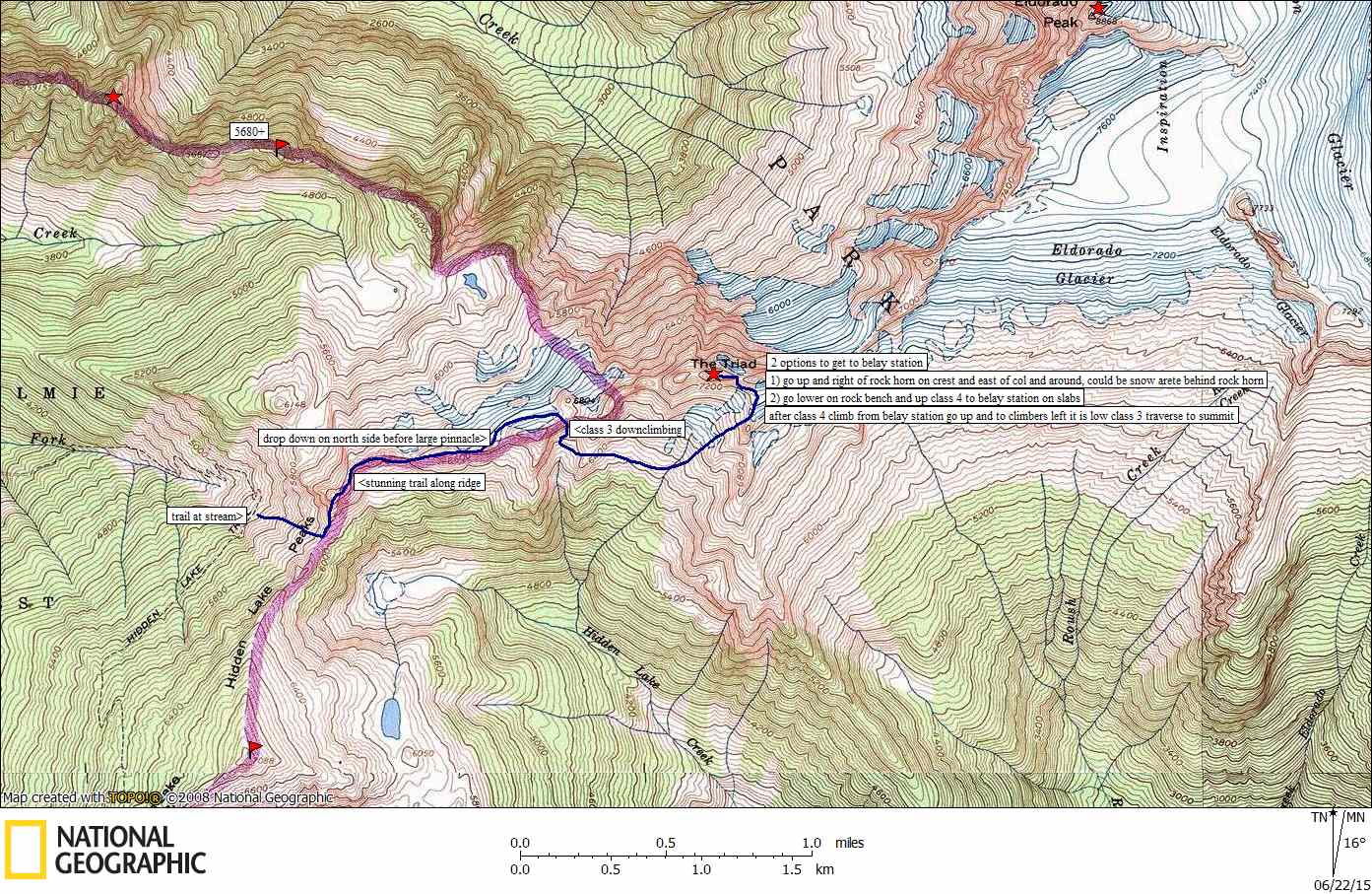
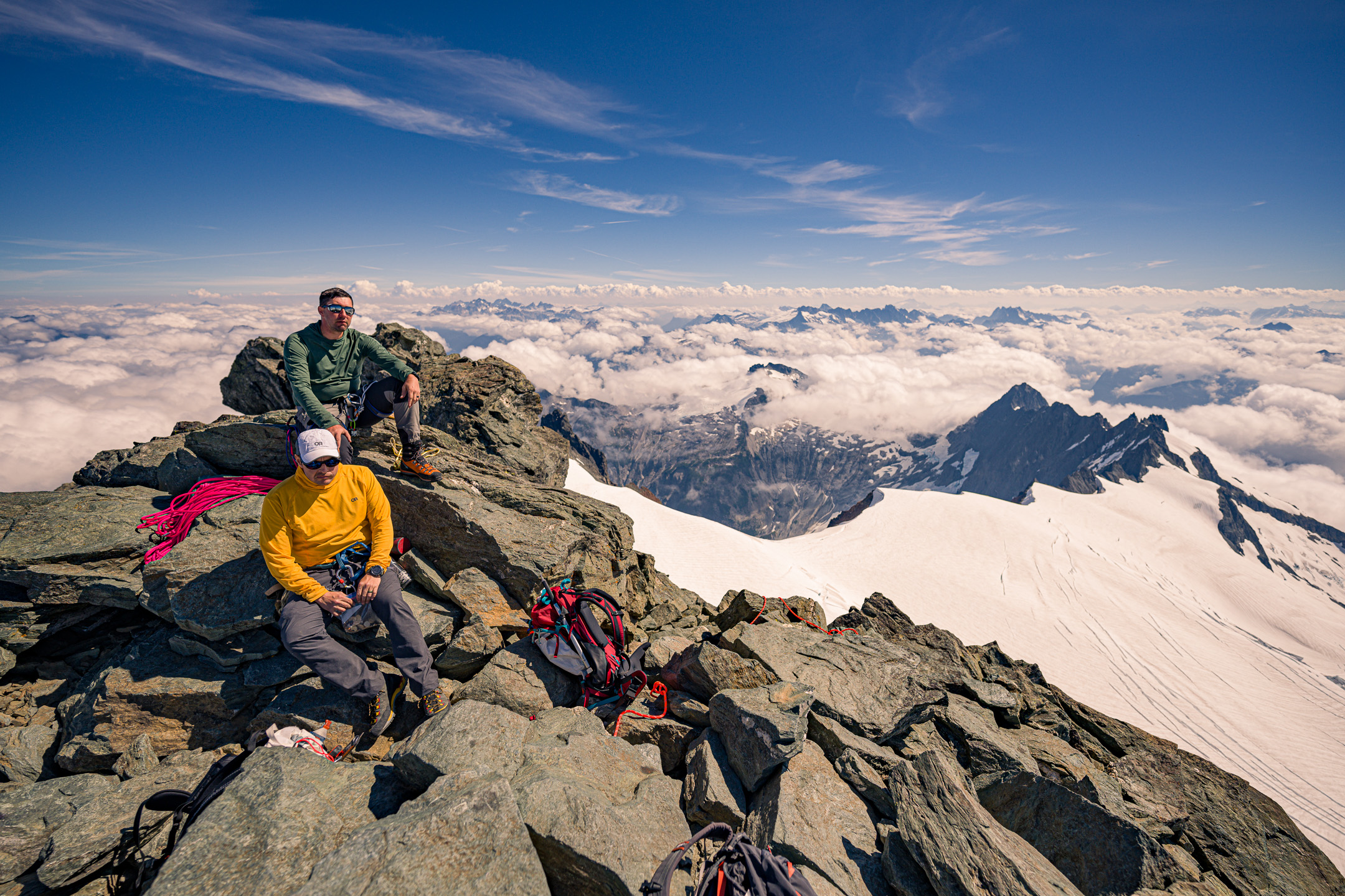
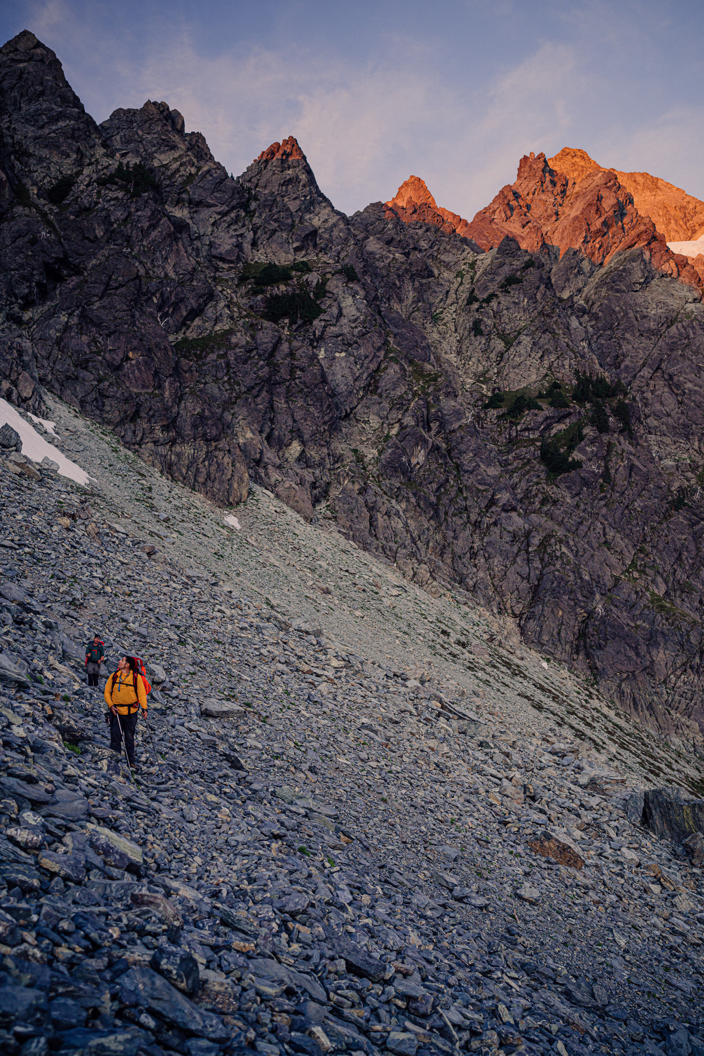
Trip: The Triad - East Ridge to Main Summit Trip Date: 08/06/2022 Trip Report: All the hardman FA glory on the site is pretty amazing this summer, but what is the blue collar climber to aspire to, you might ask? Well, the Triad of course! Nothing worse than low fifth (or old skool 4th) and an energetic approach separate mere mortals from the club of North Cascadian summits. It didn't take much to convince @Trent and @Kit to join me on an 11 hour ramble in the alpine a few weeks ago (even though Steve had already climbed it), following this excellent topo drawn by @Stefan: We started the morning watching a bear....get shot....in the meadows above the trail. I have to say that it was a bit surprising to hear a shot ring out and watch it tumble down the slope toward us! A first for me. But the MBSNF is the "land of many uses" and who am I to judge? I like meat as much as the next chossdawg. Just maybe wear orange after 8/1, eh. Regardless, we made good time to the pass above the trail and began the sound of music ridge run towards the Triad. Not much to report on the traverse to the peak that isn't included in the excellent topo. My thumb was still pretty buggered so @Trent was on the hook to lead the technical bits, which he dispatched without trouble. Difficulties were short-lived (1 pitch) and soon we rambled our way to the highest of the three dicks (read Green Fred for the full story). The day was perfect, without a soul around, so nice on an August Saturday in the increasingly busy North Cascades. And it remained quiet (no other parties) until we were back on the trail, close to the car. There are still lonesome weekend day trips out there! Gear Notes: Crampons, helmet, axe, light 60m rope, very small rack if you want to belay 4th class bits. Approach Notes: Sibley Creek Trail. Watch out for bear hunters!
 1 point
 -
well thanks for this! I have all next week off and am suddenly partnerless, so definitely filing this away as an option...1 point
-
I led all of The Nose off the couch this spring (a point of pride, but not particularly sure what that means) and Sam just ate this F---ing climb for breakfast. At this point in my life I am balancing on the knife-edge between adult responsibilities and still finding Ramen delicious. The mirror is reserved for mornings where I have not eaten too many carbs, and think that I may finally be ready to onsight Godzilla. What younger people need to understand is you can ADD stuff to Ramen, but not mashed potatoes. And not in a Nalgene bottle. These are beginnings of a story that are never meant to be written, but find their way into the lexicon of a few and create legends.1 point
-
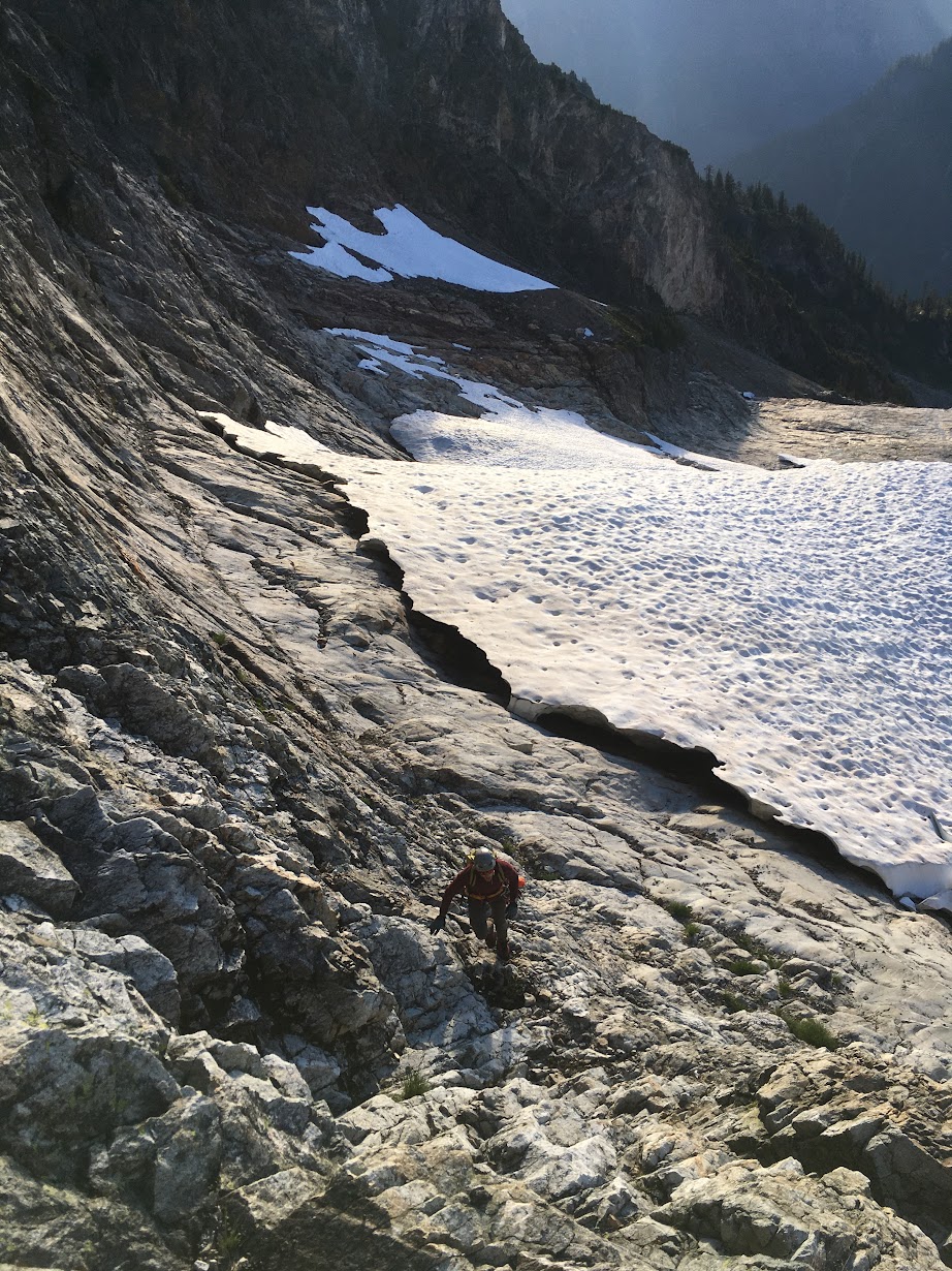
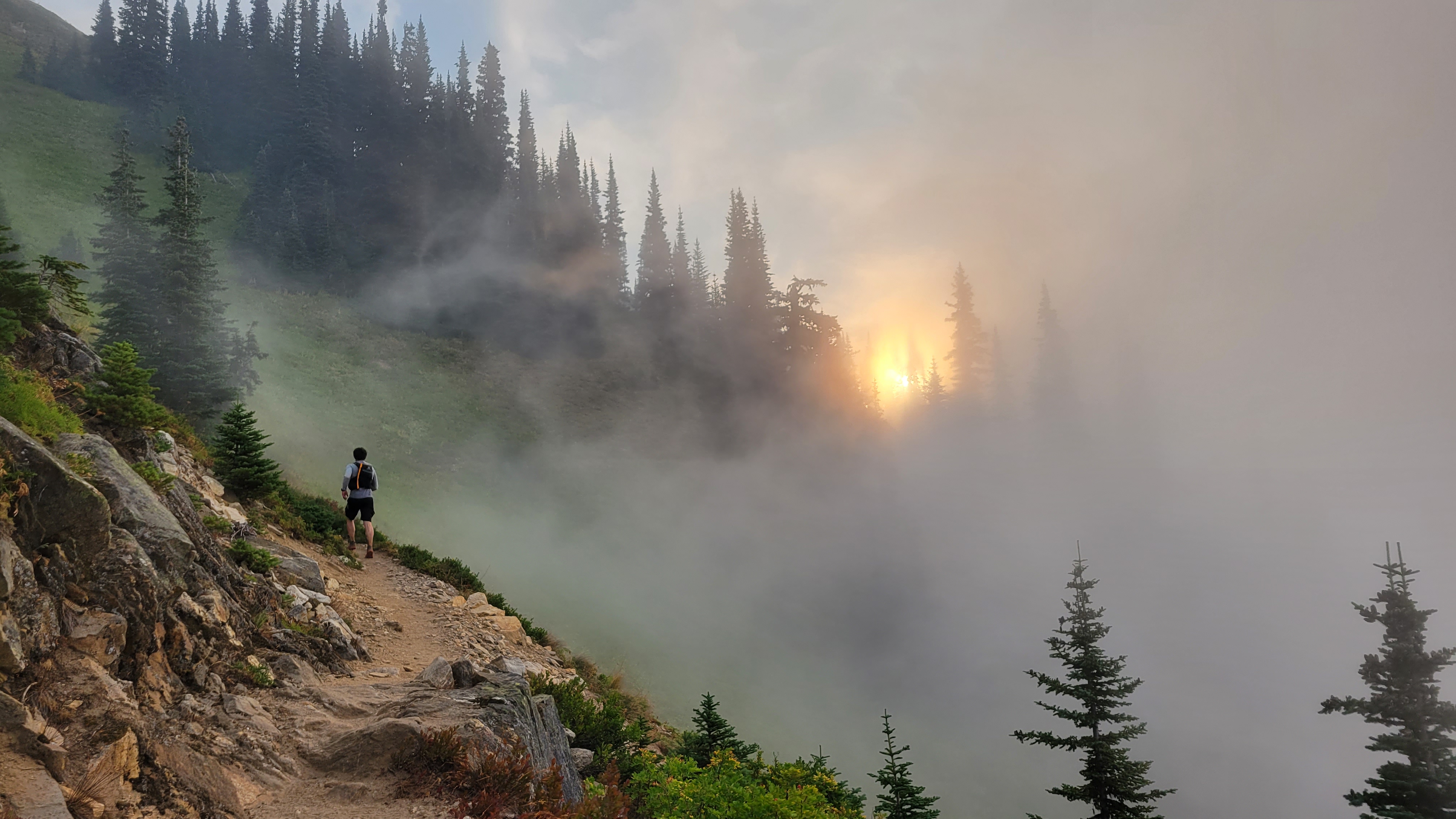
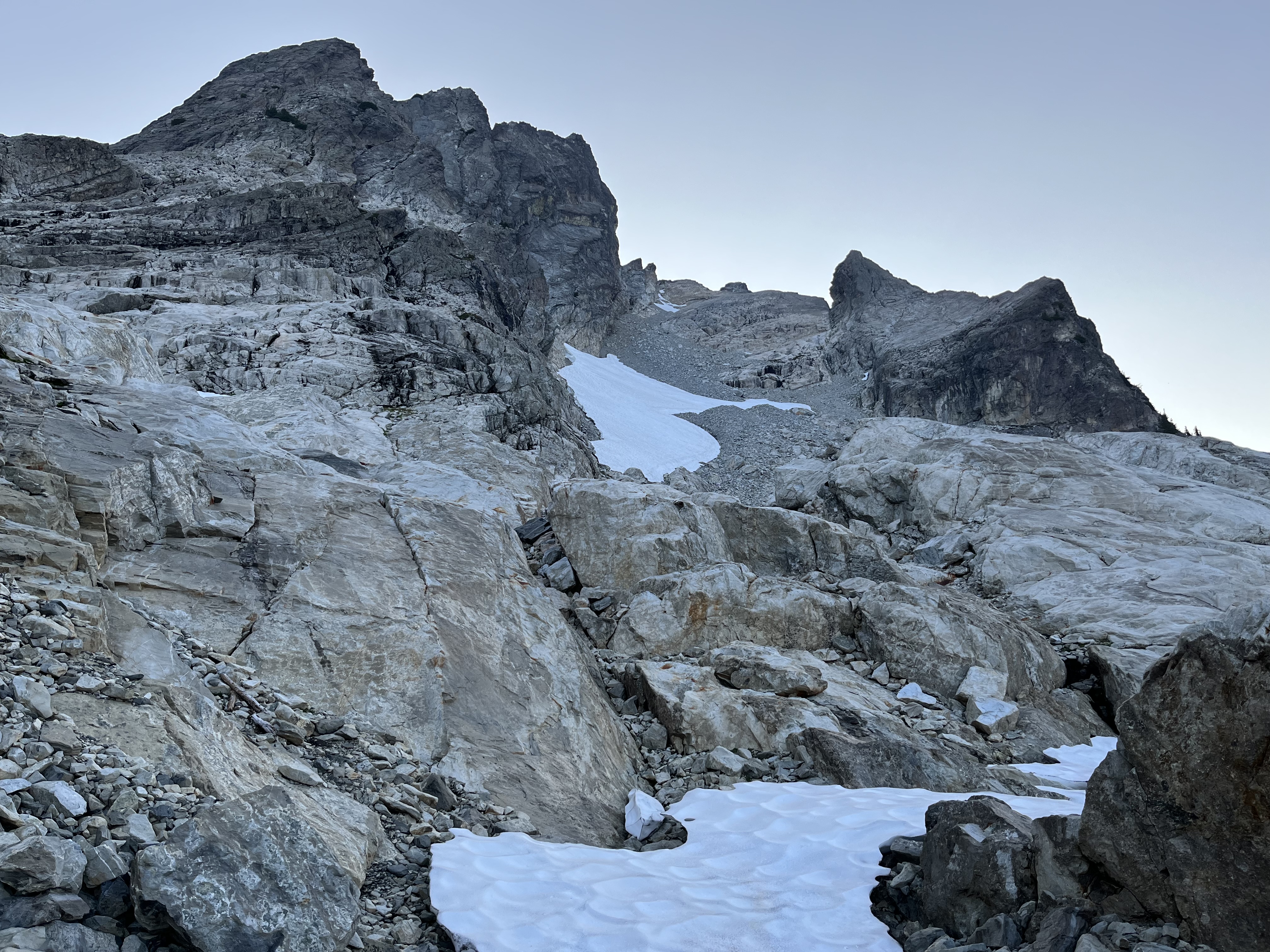
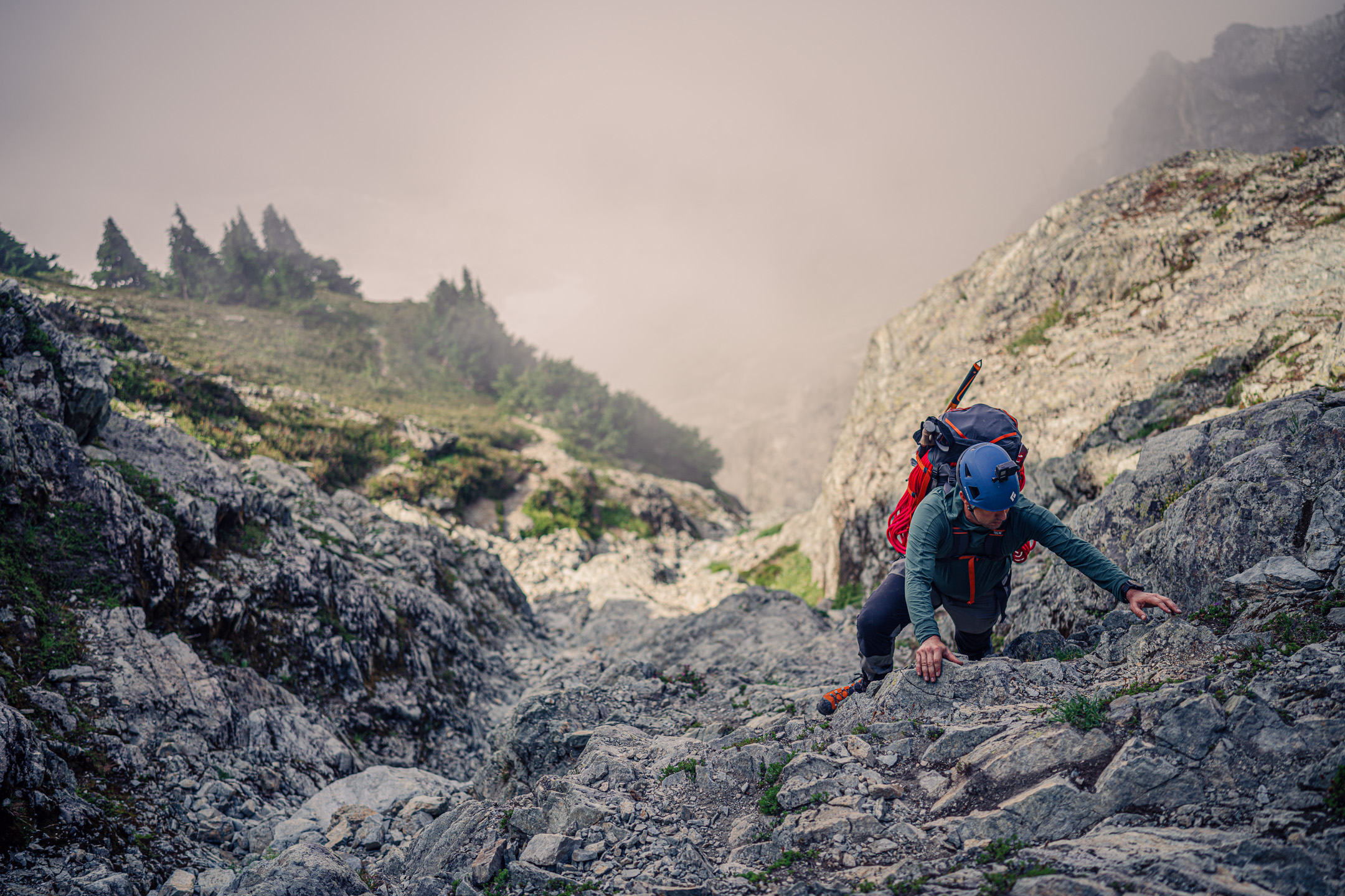
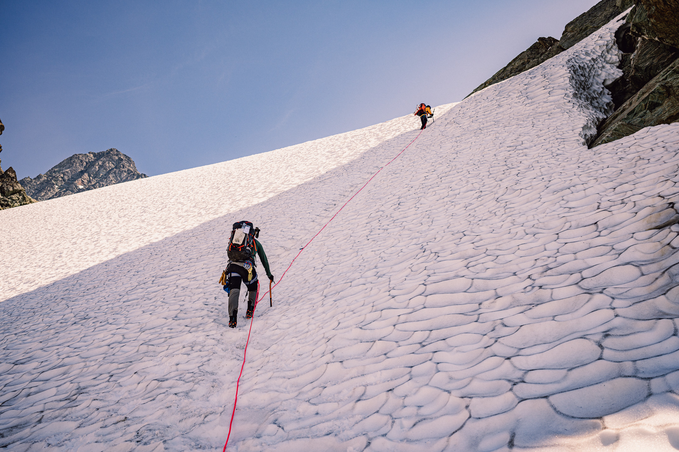
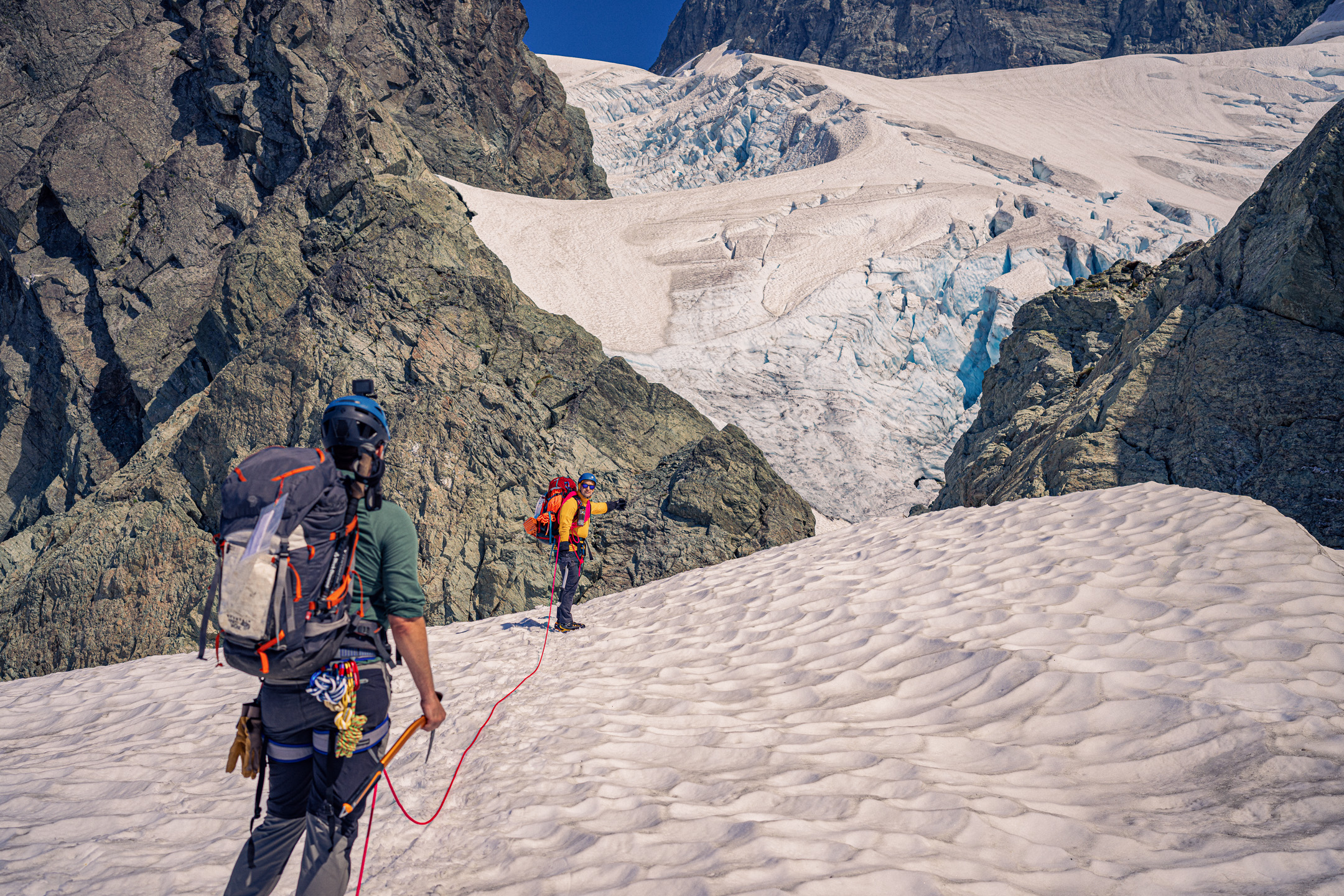
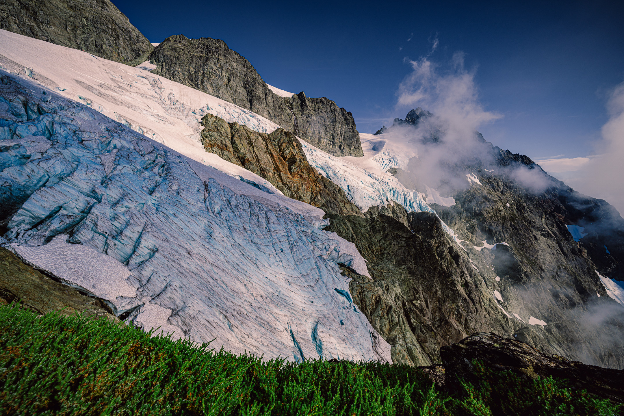
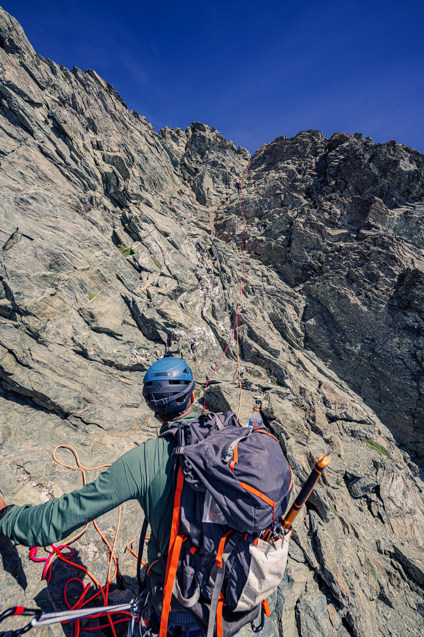
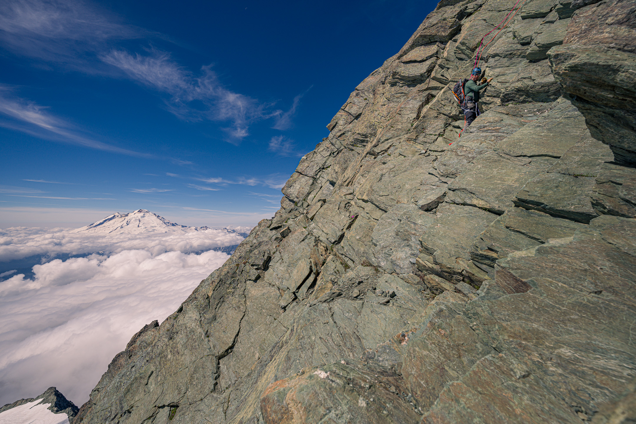
Trip: Mt. Shuksan - Fisher Chimneys and SE Ridge Trip Date: 08/19/2022 Trip Report: Background Back in May of this year (2022) I had offered to start up a 'climbing club' for my coworkers, to offer people a chance to get into the sport with minimal cost and also to continue maintain my own climbing instructional skills. We got together early every Thursday and worked on rope skills, gear selection, and other academic type content that was workable in a classroom setting, with the intent of 'graduating' with two weekend climbing trips in August. I had some field trips in July planned to practice snow and glacier skills, some conditioners up mailbox peak, and had booked campsites near Mazama for the first weekend, intended to be 'rock practical skills'. I left the second weekend open, not knowing what routes would be in the best condition that far ahead. Although I started out with 4 people, life and work chipped away at each person’s schedule so by the time the first weekend in August came around we had not yet gotten to do our practical snow skills. Additionally, only one person (Joe) was available for that weekend. In any case, we made the most of it, headed up to Klipchuck campground after work on Friday Aug 12th and had a great weekend, doing some cragging on Saturday and sent Spontaneity Arete on Sunday. Not a bad considering it was Joe’s first ever climbing experience of any kind! Not a bad first-time multi-pitch and alpine climb for Joe and my first alpine climb lead on my own! With the second weekend rapidly approaching I had to figure out what our objective would be. One of the other group members (Rob) was available for this weekend, making it a party of 3. Unfortunately, he hadn't been on the previous trip, so he had yet to do any sort of real-world climbing at all. Joe had some snow experience from a couple winter scrambles we had done in Japan, but Rob had none and neither of them had been on a glacier, used snow and ice protection, or done a climb with a bivy on-route. I also had never led a complex alpine route or led anything glaciated before. I was close to just planning a repeat of the alpine rock weekend in Mazama. However, while browsing rec.gov I noticed that previously unavailable permits for Price XC zone on Shuksan had become available, probably a cancellation due to the weekend only having a 2-day window of splitter weather. I wanted to get a complex route with glacier travel and technical rock under my belt this summer, so I decided to grab the permit and make Fisher Chimneys with SE Ridge our objective. There were no recent trip reports to cue me in to the condition of route, as well as tons of unknowns regarding Joe and Rob's comfort level on unprotected scrambles, steep snow, possible AI2-3 slopes and down-climbing. I don't think many people did Fisher Chimneys and SE Ridge as their first ever alpine climb, let alone first time literally climbing anything at all in Rob's case. However, Spontaneity Arete was also not normally a person’s first ever alpine rock climb and Joe had kept it together and followed me up that without issue. I knew that physical endurance wouldn't be an issue, we had all the gear, and the weather was going to be acceptable at a minimum. While not ideal, I also knew that I had enough tools in my mental toolbox that with a few extra ounces of gear I could problem solve our way through any alpine shenanigans and/or any hang-ups should someone decide they couldn't handle scrambling/down-climbing a given section and needed to be lowered, raised, given a hand-line or rope to ascend etc. I didn’t want to overburden myself so I made some judicious cuts to my clothing kit, accepting the fact that if the weather window collapsed it would be immediate cause to turn back. This left enough space to pack extra climbing gear just in case I had to build bail anchors, climb technical ice, or raise/lower us out of a situation. I also wanted to ensure I packed my mirrorless camera with a couple lenses this time; I’d skimped on photos my last few trips to focus on pushing my climbing grades but I missed the documentation aspect of the outings. I had us pack 2 ropes, a 60m 9.5 and a 50m 8.9, for redundancy and in hopes that we would be able to link some rappels on the way down for efficiency. In retrospect 2x 50m 8.9s would have been equally as effective and much lighter. There were two moments when the extra 10m was needed, but only because we were pitching everything out – both instances would have been overcome if we had been down climbing or simul climbing. Minus the ropes, what I packed for the trip. HMG Prism was just about perfect for this trip - gypsy camp with everything packed but perfect slimmed down on summit day. Of course, this would all add up to more time, so I planned to give ourselves every chance at success by leaving Friday early from work and hiking to Lake Ann that night to give us a full 48 hours to get from Lake Ann to high camp, the summit and back to the cars. Little did I know that we would use every second of it. Day 1 I listed Rob as the alternate trip leader on the permit since he would have an easier time skipping out of work early on Friday to make it to the ranger station in time to grab the permit. We all hit the road by about 2pm and by 6:30 we were all sitting at Chair 9 in in Glacier with permit in hand eating our last civilized meal before hitting the trail. We got to the Lake Ann trailhead a bit after sunset, welcomed by swarms of biting flies. As we headed downhill into the darkness, the flies seemed to dissipate, and we made good time to Lake Ann. It was somewhat difficult to find good spots, most of the great ones were already taken but we each had packed small bivy tents so we were each able to find somewhere tuck ourselves into for the night. Day 2 Approach We all woke up to a hefty layer of internal condensation in the tents, as Lake Ann was practically in a cloud of fog all night and into the morning. We did our best to keep our bags dry as we packed up and hit the trail by around 8am to tackle the chimneys. Misty morning at Lake Ann Previous GPS tracks had both a high and low route around the cliff bands leading into the chimneys proper. I didn’t realize at the time, but the low route was certainly the least used….and by least, I mean probably almost never. Unfortunately, we were a good 15 minutes into it before I realized this, so we continued to route find our way up to the chimney’s entrance on what was probably a less efficient path. The fog was still quite thick, and the combination of exertion and humidity had us all soaked. Off Trail but can't complain about the dramatic view hiking over the Lower Curtis glacier. Heading up the final slope to the start of the chimneys. Scramble It didn’t take long, and we arrived at the entrance of the chimney itself. Both Joe and Rob looked at the first section of class 4 and seemed like they wanted to ask if we were going to rope up, so I quickly started scrambling to keep the momentum going and show that it wasn’t as intimidating as it looked. Top of the dihedral that everyone likes to take pics of. Solid holds all over the chimneys make for fun scrambling. I was pleasantly surprised at the quality of the rock in the chimney. Certainly, there are loose pieces here and there, but most of the true class 4 sections had fantastic holds and in-between there were minimal patches of unstable dirt/kitty litter/rubble. The experience of more sustained rock scrambling with full packs was new for Joe and Rob but they kept at it steadily. About halfway up, where you make a traverse from the lower to upper chimneys we broke through the cloud cover and were rewarded with beautiful views of Mt. Baker…..and a very abrupt climate change from cool and damp to hot and dry. I was certainly hoping that the supposed running water at the bivy sites would be present and plentiful. Thus far we hadn’t seen anyone this day, until we finally ran into some people downclimbing near the top of the chimney. Rob's trial by fire scrambling with an overnight pack on his first day climbing a mountain. Joe finally soaking up some sun once we got above the cloud layer Rob taking in the elevation gained so far, looking down at the Lower Curtis glacier. At the top, the transition to snow was simple, the moat was not an issue. We hopped on the snow and continued un-roped to the base of Winnies Slide. At the base of the slide, the bivy spots were full, but we were told by the previous party that everyone up there had summited that day and were coming down. It wasn’t late, so we had some time to decide. We busted out the stoves and had a hot lunch at the lower bivy section while we waited for the occupying party to come down. When they arrived, they told us that the upper bivy was emptying out as well and had running water. I made the call to head up to the higher bivy. Winnie’s is steep but also had a great boot pack, so I used it as a good teaching moment to let Joe take lead and put in a running belay with pickets. It was a good spot for it, and I figured this might be a useful skill later in the trip; plus, it gave me an excuse to have everyone practice roping up, coiling the rope, using their ice axes etc. in daylight where I could see them, knowing that the next day we would be doing this on higher consequence terrain in the dark. Mt. Baker comes into view on the mid-chimney traverse. Passing the time with a lunch below Winnie's Slide to let descending parties clear out of the Bivy site. Joe heading up to the base of Winnie's Slide Practicing running belays using pickets on Winnie's Slide The Upper Curtis glacier comes into view nearing the higher bivy site The hadn’t seen pictures of either bivy site before the trip, and I was very pleasantly surprised to find a gorgeous site sitting alongside the seracs of the Upper Curtis glacier with incredible views of Mt. Baker. The cloud layer pushing up against the mountain made for a dramatic sunset. A couple parties came through the upper Bivy, including some climbing rangers who did their usual permit checks. We ate and organized our packs for summit day, finishing up around 6:30pm. We all tried to get to sleep early since our plan was to get up at 2am and be moving between 3am and 3:30, but I set another alarm for sunset to get a few pictures before fully going to bed for the short night. The Upper Curtis glacier was shedding ice and rock all evening into the night, an excellent reminder of the ever present objective hazards and motivation to stay efficient moving under the cliff bands to the left the next day. My Tarptent ProTrail Li has never been that easy to set up but perfectly, but it was great for this trip; light, well ventilated and with a compact footprint. The thin floor still always makes me nervous on rocky terrain. Sunset was worth interrupting my sleep for a half hour for photos Day 3 The Climb It wasn’t exactly enjoyable or easy to wake up so early, but it had to happen, so we pushed through and were moving by 3:40am. My goal was to be back at high camp by noon, a little over 8 hours later. This put my summit time goal 9am. I knew we had much more time than that, so I wasn’t going to consider truly turning around until noon. The boot pack from the parties coming down was still faintly visible so we made decent time in the dark across the Upper Curtis glacier. Despite the fact that Hell’s Highway was steeper than Winnie’s slide, the darkness helped mask the sense of exposure so I was able to just keep our party moving up the slope without needing to pull out pickets and do a running belay. We reached the Sulphide glacier just as morning twilight was beginning. The Sulphide was cruiser, very straightforward and direct path up to the summit. The boot pack was obvious once it joined with the more popular Sulphide glacier route. Tail end of the milky way over Mt. Baker was the consolation prize for having to be awake far too early in the morning. Shadows cast, I presume, by the Mox-Spickard-Redoubt mountain cluster blocking sunrise against a high-altitude haze as we moved up the Sulphide glacier. We encountered a number of parties once we got onto the main trade-route of Mt. Shuksan. There was no boot pack to the SE ridge so I had to somewhat guess where it started. As we neared what I thought was the beginning of the ridge, another party arrived, and we let them pass us given my expectation to be pitching everything out. This party had the same intentions so in the end they never really got ahead of us. This initially caused some delays waiting for them on the first couple pitches, however by the last pitch they were fully ahead, and we were our own limiting factor. The ridge was fun, had exciting but not intimidating exposure on both sides, and the rock was solid enough. I can see why most experienced parties would simul or solo the ridge, as the ‘crux’ 5.3-5.4-ish moves weren’t always protectable anyways. I think that the standard pitched climbing approach gave Joe and Rob a chance to relax at the belays though, which helped keep our pace consistent even if it was a little slow. The last pitch was long, and I hit the end of the 50m rope I was on; however by the time I got to the end it was just class 3 so I put a micro-traxion on a piece near the top and had Rob, who was belaying me, just start climbing to make it the last 15-20 feet to the top anchor. I got him on belay, had him remove the micro-traxion when he got to it, and then bring up Joe. We made the short scramble to the summit. Rob scrambling up to the start of his first ever rock climb (of any kind!), wearing mountain boots no less. Joe making his way up the ridge. This was his first time climbing in mountain boots as well. Rob belaying Joe up. We used both ropes in a caterpillar manner for the ridge climb. It wasn't super fast but I wanted to have them learn to manage the multi pitch transitions and system as their own 'second rope team'. This was also a great opportunity to show them how to build a releasable anchor using the second rope to be efficient with our anchor materials and get Joe climbing quickly without needing to tear down a separate anchor at each station. Me leading up the final (I think) pitch of the ridge just behind the party ahead of us. This photo courtesy of Joe. The combination of the other party and eventually our own pace resulted in us being at the summit around 11am; I hadn’t imagined being so close to our turnaround time. The summit register was in terrible condition, full of scraps of loose paper, we had to just squeeze our names into a space in-between the other entries. If I would have known, I would have brough a new one. We ate some snacks, enjoyed the expansive views of the North Cascades as the cloud layer was starting to break up and reveal the smaller peaks around us. After a short time, we began the descent Me signing the rapidly disintegrating summit register. I might start keeping at least a few sheets of 'write in the rain' paper on me for future climbs. Photo courtesy of Joe. Joe and rob looking a little tired......considering that Rob had never climbed even a single pitch of anything before today, Joe had never been on a glacier before, and I had was leading my first ever glacier-rock combination alpine route this was a huge success! Descent It was Rob’s first time ever rappelling on a real mountain. We had gone over the basic system in the ‘classroom’ at work, but he hadn’t had the previous rock trip to practice in a single pitch setting. I decided to go with a pre-rigged rappel with clove hitches between each climber on the anchor to make it as stress free as possible. After getting both of them set up with extended rappels, I would rap with coils to get the ropes down to the next station and set up. Having two ropes was great, but the 55m limitation from having a 60m and a 50m resulted in slightly imperfect linkups between “every other” rap station. I found the downclimbing easy to make up the difference, however for the Joe and Rob this improvisational transition and the end of each rappel added some extra time. Overall, however, these micro transitions to downclimb the last few feet after each rappel were faster than if we had doubled the number of rappels using just the single 60m rope. Joe coming down the first rappel from just below the summit. The 50/60m double rope setup reached the '3rd' rap station no problem. Here, the 50/60m rope setup did not quite reach the '5th' rap station. Here, Rob is at the last good stance to unrope at the end of the rap. This short traverse from the end of the ropes to the final rap station was not that difficult though. We moved quickly down the Sulphide without crampons as the snow was very soft by now. At the top of Hell’s Highway, we put the crampons on evaluated the slope. It had softened significantly, and we had been moving about 10 hours at this point, so I didn’t think Joe and Rob wanted to solo downclimb at this point. I put in a pair of pickets, had everyone remove their glacier rope setup, and set up a fixed 60m single strand rappel. Joe and Rob rapped down the steep section. Then I pulled the rope for them, packed up the picket anchor and downclimbed Hell’s Highway while they reconfigured the rope for glacier travel down below. After I tied back in for glacier travel, we made the very hot slog across the Upper Curtis back to high camp. While we packed up the tents another party arrived, happy to snag our spots for their evening bivy. After some snacks and refilling our water, we set off for the descent. We all downclimbed Winnie’s Slide and were happy to make our last steps off snow as we reach the top of the chimney. At the top, we ran into a guided group being short roped up the chimneys. Me, crampons on getting ready to go check out the snow conditions on Hell's Highway. Photo from Joe. The HMG camera holster bag worked really well, I had it rigged up with some carabiners, a cord directly to the camera and a bag strap so there were a couple redundant points to prevent the camera from going free - which actually came into play once, saving the rig from smashing on the rocks and/or rolling off the mountain. Considering Rob and Joe had spent over 13 hours doing a very large list of “firsts” on a tough mountaineering route, I knew that trying to force everyone to solo downclimb the entire chimney section wasn’t going to be a great idea. Although it took more time, I set up rappels on the tough sections of the chimneys. We reached the bottom of the final class 4 section around 7:30pm, a solid 16 hours since we set off that morning. It was a huge relief to transition back to trekking poles and take off the helmets. I made sure to follow the main upper route on the way down, which involved more 3rd class down climbing than I expected. Regardless, we just barely made it to the bottom of the very last scramble as evening twilight faded to true nighttime. Headlamps on, we started the monotonous trail slog back to the cars. Joe and Rob putting on the crampons at the high bivy site to make the final snow descent down Winnie's Slide to the chimneys. Rapping the 'dihedral'. There is some exposure to the bottom right, and in this instance the backed-up rappel was definitely a good choice for tired climbers pushing through a very long summit day. Joe getting ready to do the fun little 'au cheval' exposed step over on the chimney traverse section Very happy to be done with the chimney scrambling and have the helmets off. Little did we know, some class 3 sections lay ahead of us. Last light as we exited the chimneys proper and continued on our descent. We had a solid 4 hours of effort ahead of us back to the cars, but the respite from the sun was a welcome change of climate for the hike out. 6-ish miles and a few hours later, after digging deep into our energy reserves, we arrived back at the cars at 12:30am; 20 hours and 42 minutes after we had stepped onto the Upper Curtis Glacier that morning. This was a fun climb, and a huge confidence booster. My goal for the summer of 2022 was to reinvigorate my goal of leading alpine climbs; the last time I had led anything was back in 2016-2017; and at that time, I had led a few multi-pitch rock climbs to 5.7 but nothing truly alpine. Not only did I climb my two hardest alpine routes to-date over these back to back weekends but led them, and led them while teaching two brand new climbers overcoming a variety of alpine climbing challenges. Gear Notes: Put some pics in there. Approach Notes: Straightforward
 1 point