All Activity
- Past hour
-
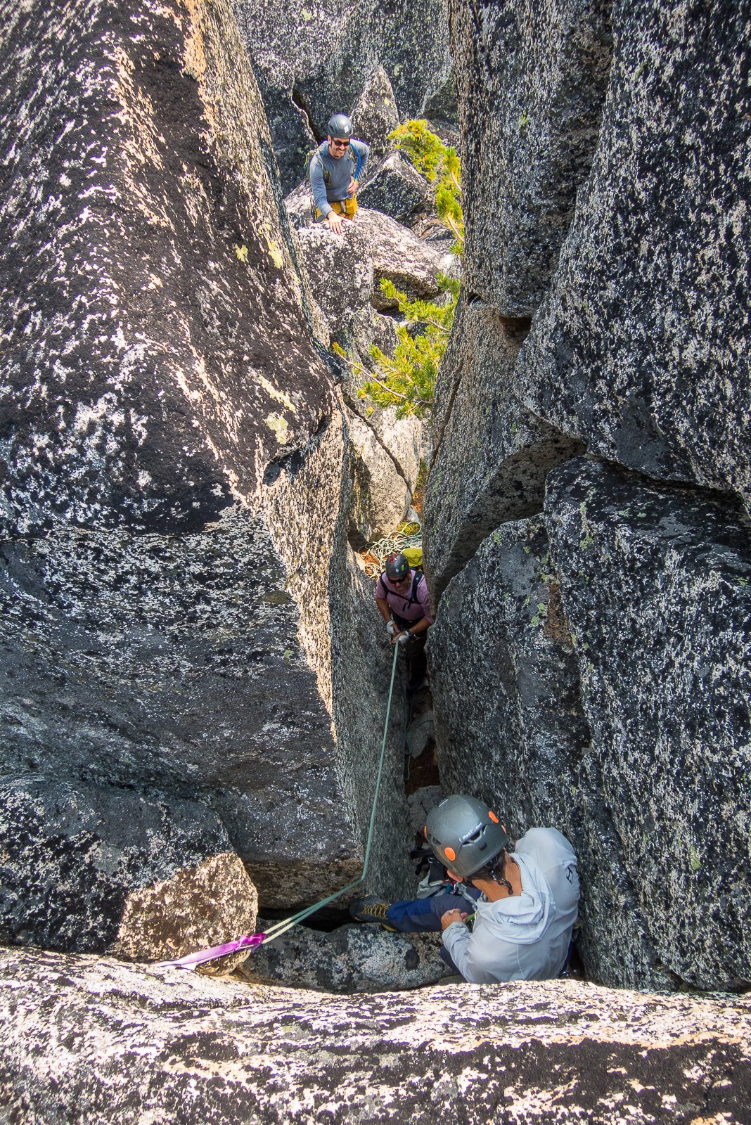
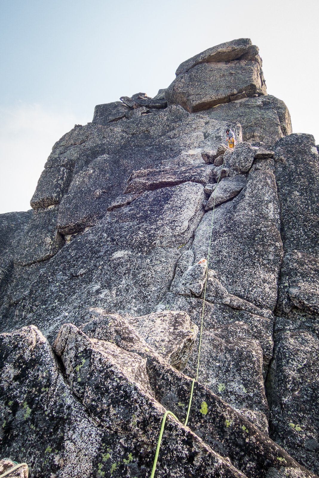
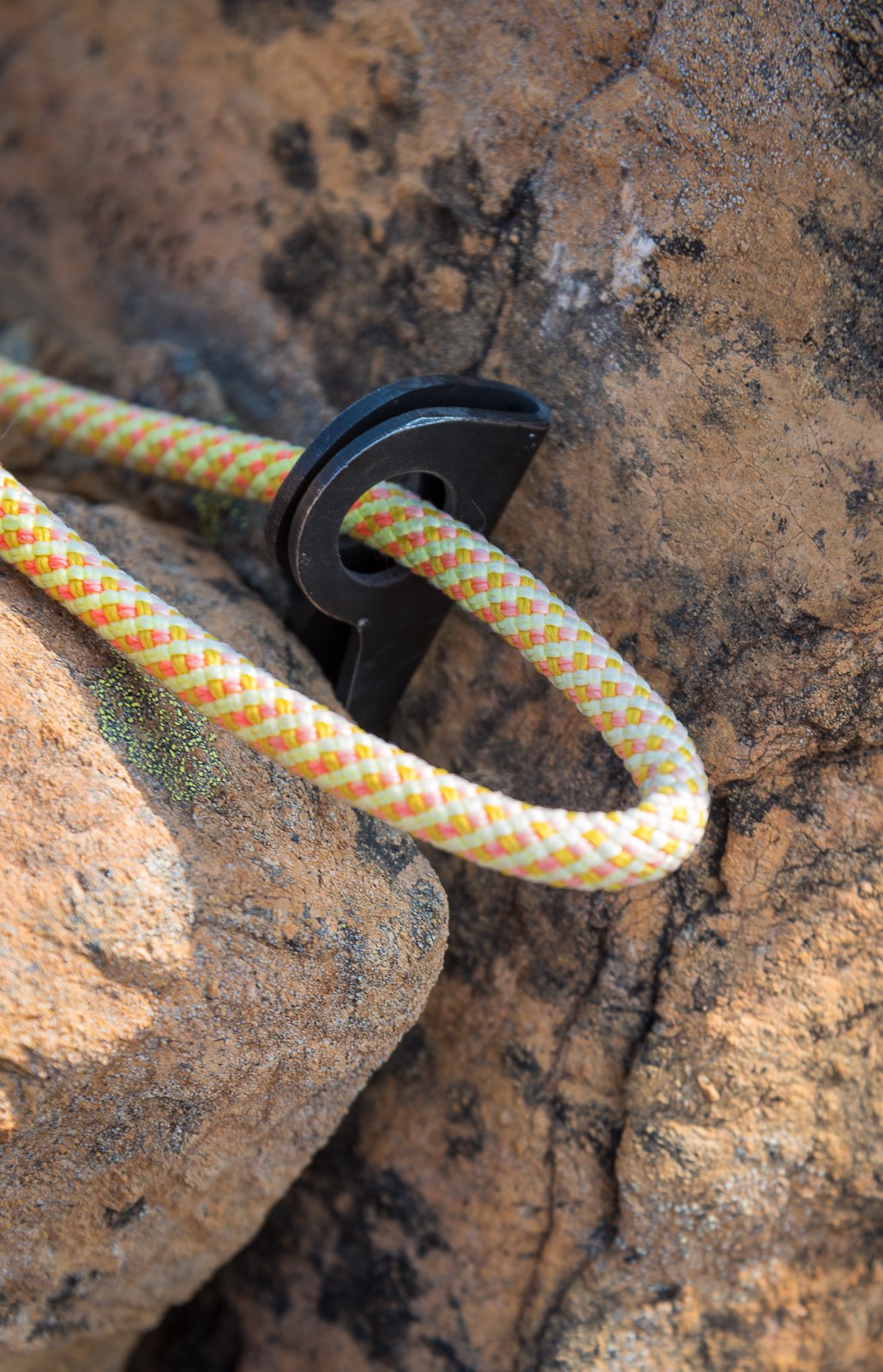
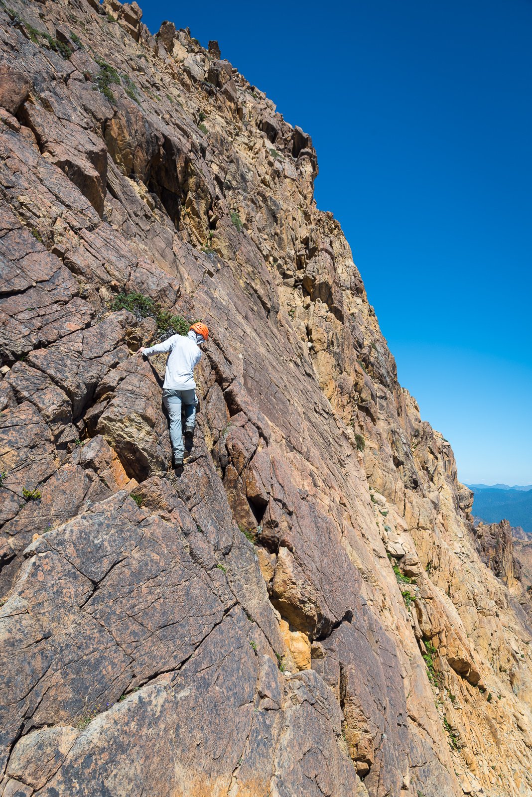
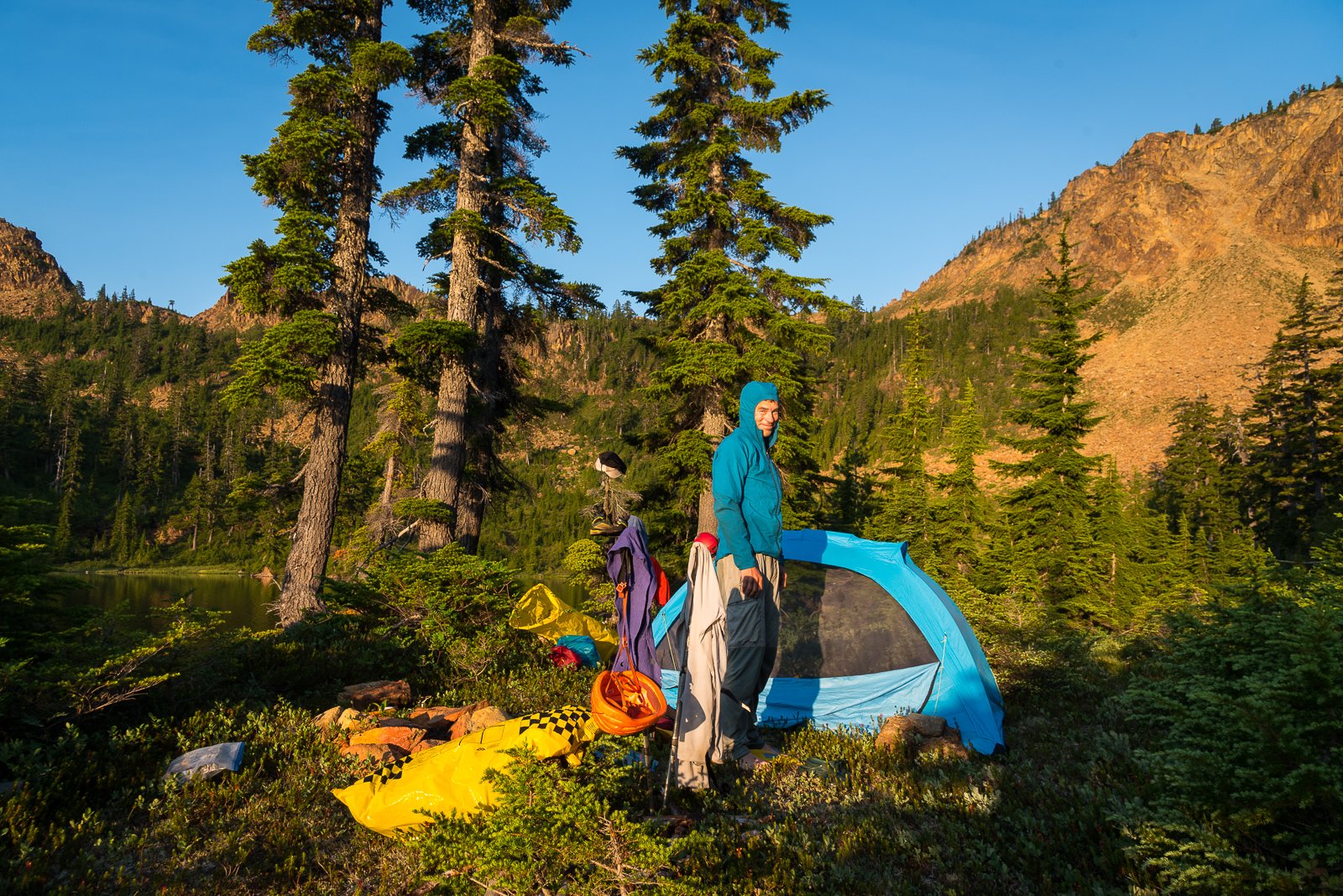
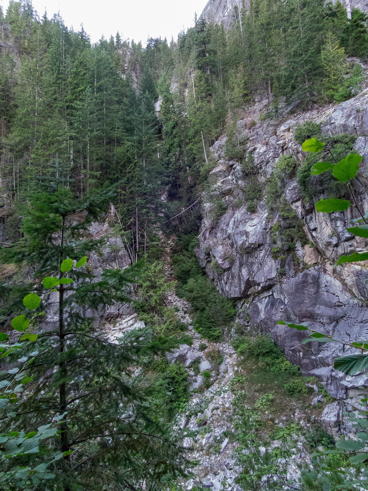
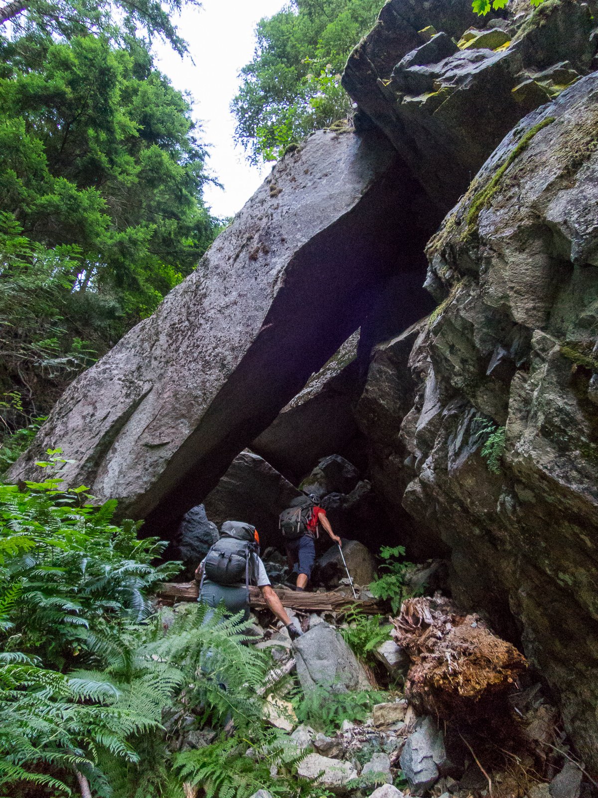
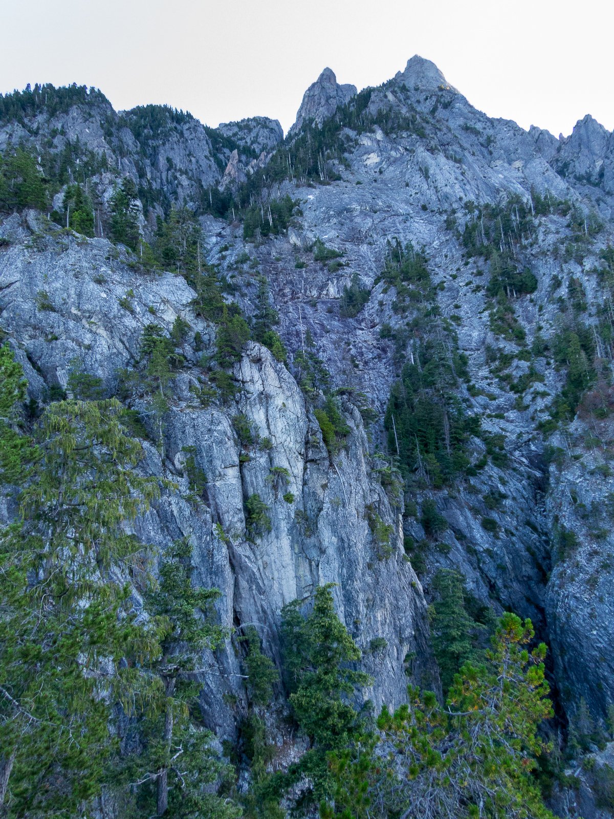
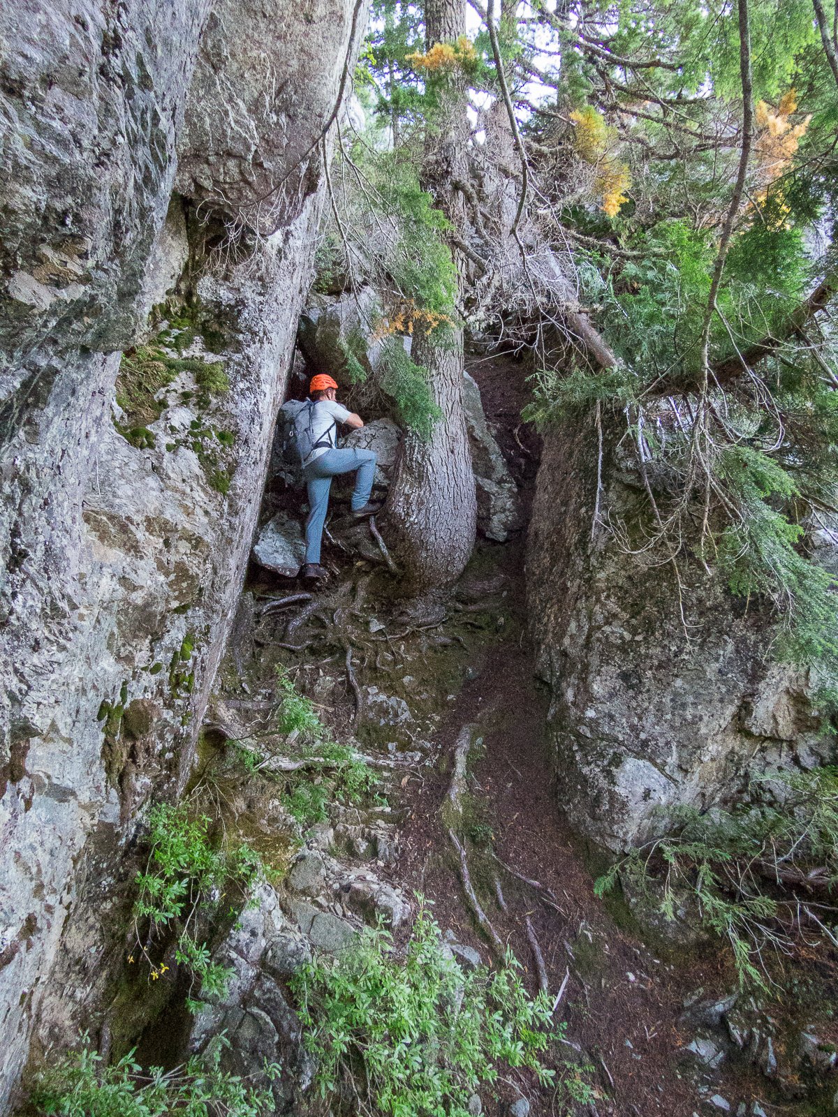
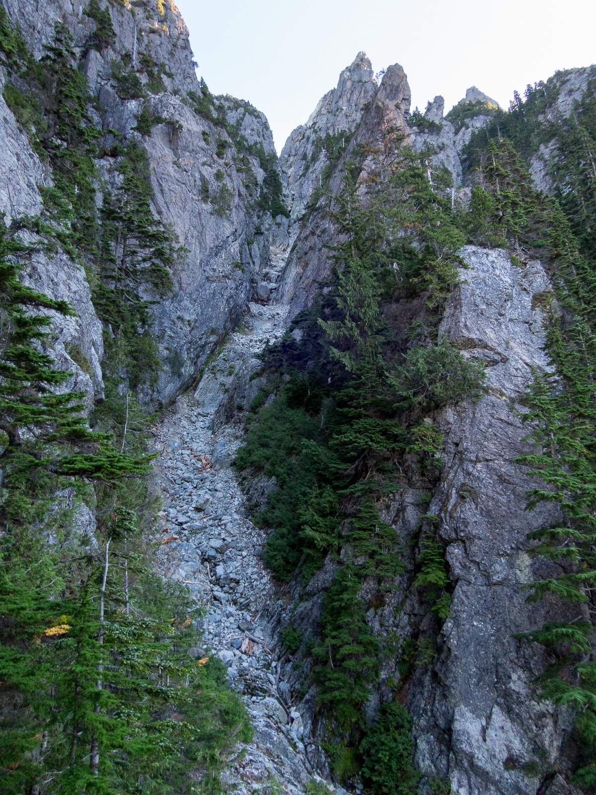
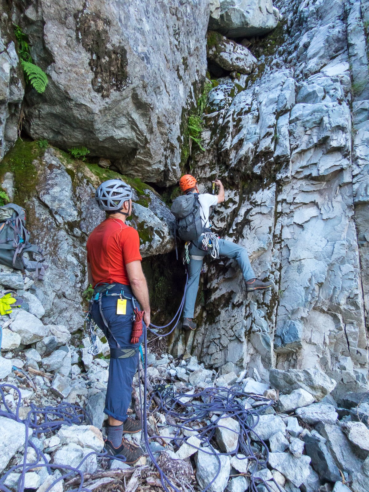
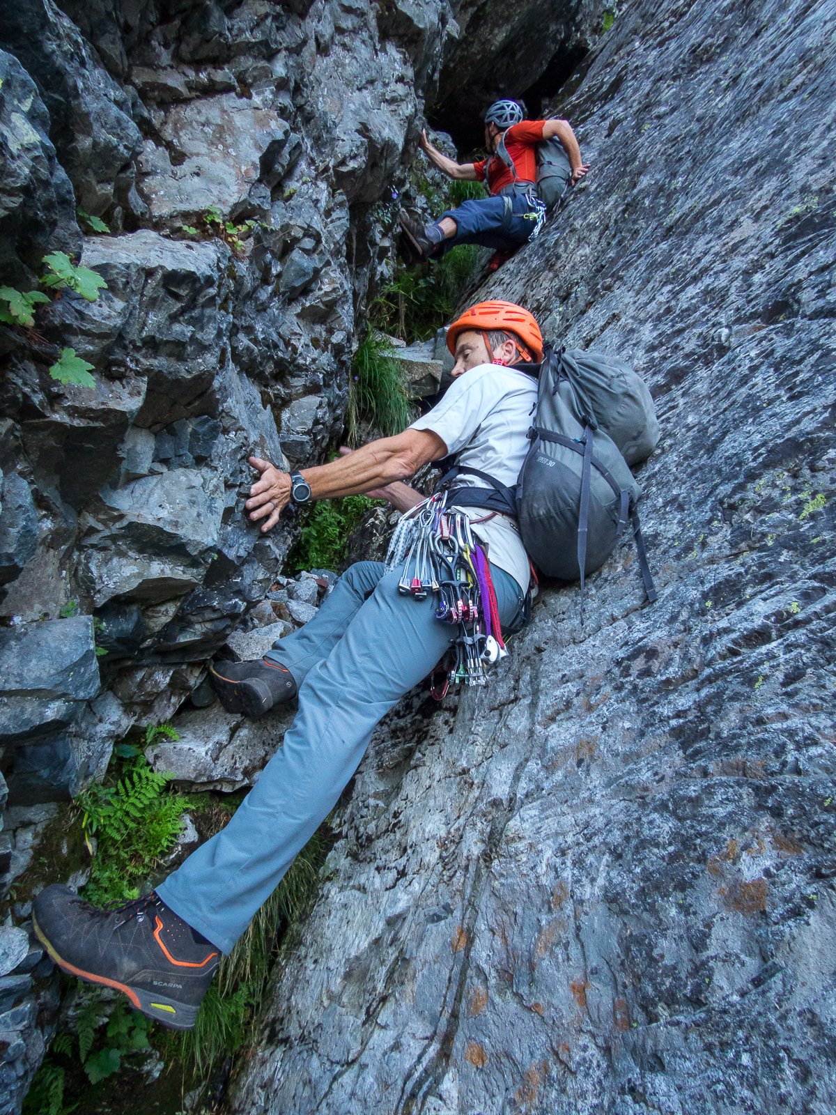
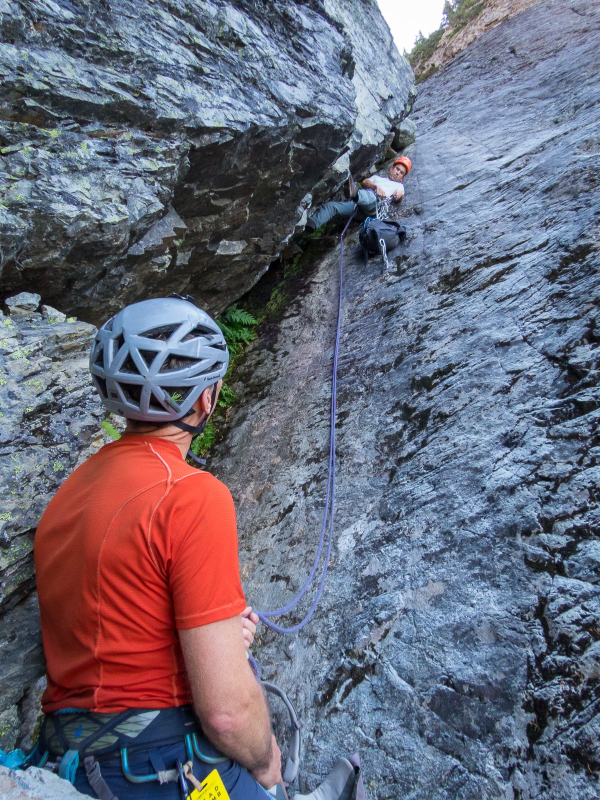
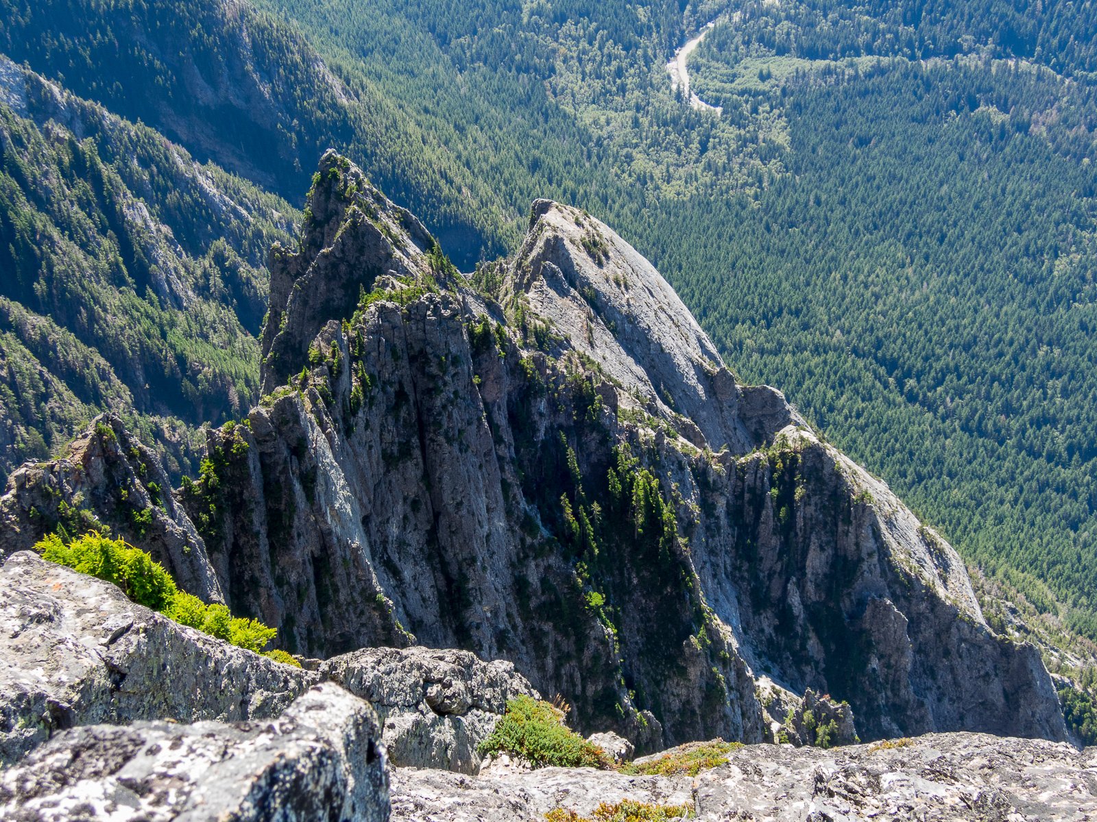
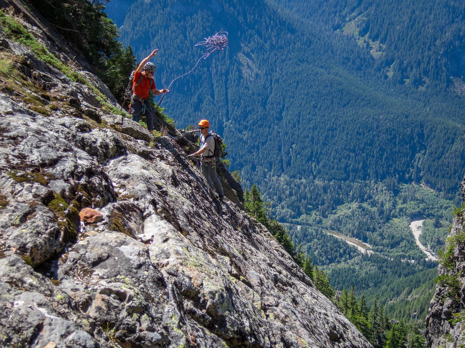
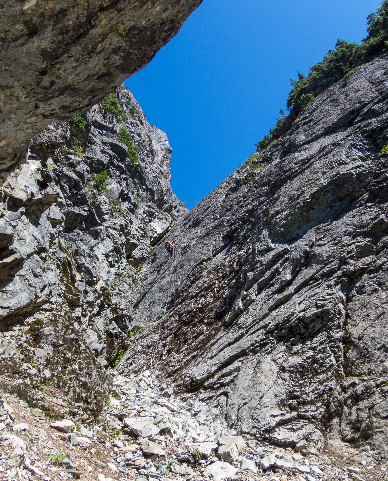
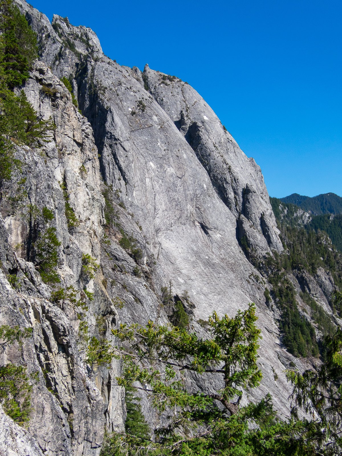
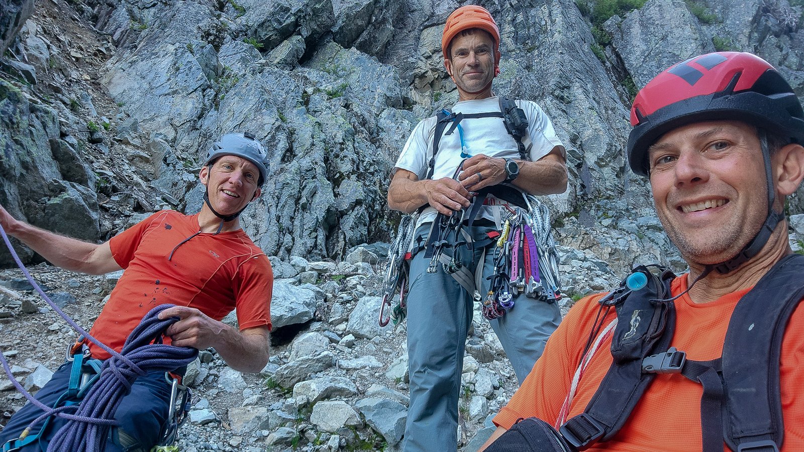
 Trip: Squire Creek Wall, 6p, 5.8+, FA - Miracle Ramps Trip Date: 08/29/2024 Trip Report: Miracle Ramps, 6p, 5.8+, Bill Enger, Anastasia Blagoveshchenskaya, Linnet Vacha, FA 8/29/2024 On August 29 this year three of us made the first complete ascent of a new route on Squire Creek Wall. It is on the right side of a buttress on the south side of the massif. It is a central buttress with an old route on its crest called Primal Scream. The new route, called Miracle Ramps, is a variation of the first six pitches of that route. This route shares the class 4 approach pitch, and half of the first pitch, of Primal Scream as I know it (it hasn't been published anywhere). From the "grassy saddle" bivy spot clean, class 4 ramps lead up to a shallow dihedral, then to a good ledge at a short wall (see photo). I had scoped these clean slabs from an exploratory climb of Primal Scream with Yale Lewis in June, 2023. The white granite slope appeared to continue far up to a great white spot halfway up the buttress. I thought it might yield five or six pitches of moderate slab climbing, which turned out to be correct. Approach pitch: From the grassy bivy area, walk directly up the middle ramp until it narrows into a dihedral with a small cedar bush in the middle. Knobs and easy friction connects to a form a path to the start dirt ledge. P1: Climb a short wall with a 3" horizontal crack above. Pull around this bulge to a couple of low hogsback ridges which lead to a pair of diagonal cracks with pro choices. Climb past a cedar bush on its left to some blocks, and look left for a bolt. Step out left onto the knobs to a dirt pedestal. This is where Miracle Ramps starts—see the four bolt leading up and rightward. Smear past the four bolts, 5.8+, to a trough and a couple more bolts. 55m, 6x, 5.8+ P2: Smearing and knobs lead rightward, and upward past three bolts to a thin crack with good feet. Don't climb the crack, but go rightward on knobs to the overlap. Pull the overlap on knobs, cross over a grassy crack with optional pro, and cruise to the anchor on above a flake on a good ledge. 60m, 9x, 5.8 P3: Step down and to the right to the bottom end of Ruffled Crack, a wavy-edged, 1-2" wide, undercling delight. Continue rightward on edges to some good pro in a 3/4" crack. Then move up and left on friction to a ledge with a finger crack for pro. Head for the one bolt on this pitch and up the knobs galore. When they end, step right and grab a good vertical crack with middle-size pro, which curves into an overlap. Optional small gear is under the overlap; pull this and reach for the ledge with the anchor. 45m, 1x, 5.7 P4: Friction and edges lead straight up to two bolts and an overlap. Step past the overlap on its left end. A bolt protects the start of a vertical seam with good right-leaning edges. Face climbing leads to another bolt and a bit of blocky climbing to the anchor. 40m, 4x, 5.8. P5: Follow the three bolts up to a wide crack, and some others with middle-size pro possibilities. Move up atop a large flake and see three more bolts above on a clean slab. Smear past these, 5.7, to the fractured cracks leading to the anchor. 60m, 6x, 5.7 P6: Climb cracks and blocks aiming for the space between the two prominent bushes in view. A slanting overlap system leads rightward, follow it and pull the overlap to a bolt above. Another bolt leads to a huge flake with a sweet left edge for laybacking. From the flake's top, smear past three bolts to the top anchor. 55m, 5x, 5.7. For the adventurous party wanting the full overview, two new bolts lead to the left to connect with the Primal Scream route. Doing this leads to the modern two-bolt anchor atop the sixth pitch of Primal Scream as I know it. There was never any evidence of where the original belay anchor might have been, so Yale and I placed modern two-bolt anchors at roughly 55m intervals. After three more of these pitches, it intersects the modern route, Concerto in C for Drill and Hammer, at its 11th pitch anchor. Follow that route or make your own way to the top. Special thanks to Yale Lewis for early support of this effort. Topo: Bill Enger, with help from Anastasia B. on p3 Anastasia leading pitch 2, above Linnet leading pitch 3, above The short wall at the start of the route, above The class 4 approach pitch from the grassy saddle bivy area In early season snow piles up on the grassy saddle, above Gear Notes: Standard single rack to 3" Approach Notes: Directly above the grassy saddle bivy area, go up the middle ramp to a shallow dihedral, on knobs, class 4. Alternatively, hike up the right side of Skeena26 following a faint path.
 - Yesterday
-
National Park Service Bans Food in North Cascades National Park Seattle -- The National Park Service issued Wednesday a unilateral ban on food in North Cascades National Park. The decision began when a park ranger noticed that a climbing guide was lugging large quanitites of food into the backcountry to prevent his clients from bonking and losing their balance on cliffs or steep snow slopes. "I arrived at Boston Basin camp and saw them sitting there eating this huge spread" said the park ranger. "I thought to myself: this is a wilderness area not MacDonald's. If you want to eat go there. Food doesn't belong in nature." In it's public statement announcing the ban, the park service expressed a concern that the practice might spread to other park users, and could lead to a proliferation of buffets, potlucks, or even barbeques in the backcountry. They said they were worried people might even invite local wildlife, such as bears, squirrels, and marmots, to their parties. Unfortunately the ban has already stirred up controversy, and many park users are upset with the decision. In response to this, a North Cascades park ranger and representatives from a number of local climbing organizations climbed Eldorado Peak--one of the most popular peaks in the park--without food, to assess the safety and efficacy of the ban. When asked to address those still upset by the new ban, the park ranger said: "This is how democracy works. If you don't like it, talk to your senator or congressperson. Or better yet, join the National Park Service! After 20 years of promotions, you'll be able to change this decision no problem. Actually, you'll kinda be able to do whatever you want."
-

Should North Cascades National Park Be Abolished?
thedylan replied to Fairweather's topic in Access Issues
I find myself agreeing with @Fairweather even though, yes, his rhetorical style is disrespectful. Here's my take: between the Washington Climbers Coalition, Access Fund, AMGA, American Alpine Club and other guiding companies, Wilderness Society, The Mountaineers, Washington Alpine Club, Skagit Alpine Club, Washington Trails Association, The Nature Conservancy, Conservation Northwest, and on and on, we can manage our lands just fine. In my opinion, the NPS is the only one not participating in democracy. We do not need an institution with punitive authority to realize our values in the management of public lands. Public opinion, advocacy, and volunteering are far more effective. Just my 2 cents. -

first ascent [TR] Vesper Peak - The Ragged Edge 8/18/2013
Bronco replied to dberdinka's topic in North Cascades
From FB: Rockfall Ragged Edge, Vesper Peak. ⠀⠀⠀⠀⠀⠀⠀⠀⠀ Spooky season is upon us! For anyone looking to climb Ragged Edge, take note that there was significant rockfall last weekend between Saturday afternoon and Monday morning that altered the route significantly. @alpine_captain shared this summary of the changes: ⠀⠀⠀⠀⠀⠀⠀⠀⠀ A large amount of rock fell from the “edge” of the main slab, right where it becomes more of a roof (which the 5th pitch traverses above). The last 10-15 feet of the 4th pitch are now more difficult and the protection opportunities are limited. These moves are hard to protect for the second as they make the final moves to the belay and a fall for a follower here would likely involve swinging out into space. ⠀⠀⠀⠀⠀⠀⠀⠀⠀ The belay at the top of the 4th pitch is now hanging, and the bolts are only ~4ft above the edge of the new section of roof. ⠀⠀⠀⠀⠀⠀⠀⠀⠀ The beginning of the 5th pitch now sports a wide step-across move to small footholds, although the hands on either end of the span are good. This move is rather height/flexibility dependent. ⠀⠀⠀⠀⠀⠀⠀⠀⠀ With more rain and drastic temperature swings expected this fall, keep those heads on a swivel! Rockfall events like this are hard to predict, but they often occur during or immediately after big weather events. ⠀⠀⠀⠀⠀⠀⠀⠀⠀ #climbing #rockfall #pnw #vesper #update #cascademountainascents - Last week
-
 😂 I forgot I blocked that word! But apparently it doesn’t block admins
 -
 When we finally get out in the hills together @olyclimber, remind me to tell you about the "rescue" on Sauk of a lady way up by the summit, at night, in November, in the snow, wearing those slippers (software won't let me spell their name!).
 -
Make a TikTok , get some sick drone footage, call it the best in Pacific Northwest, climb it in your Ugg boots.
-
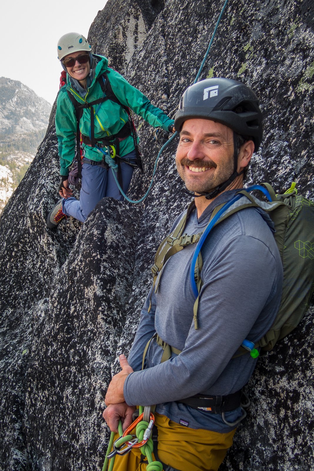
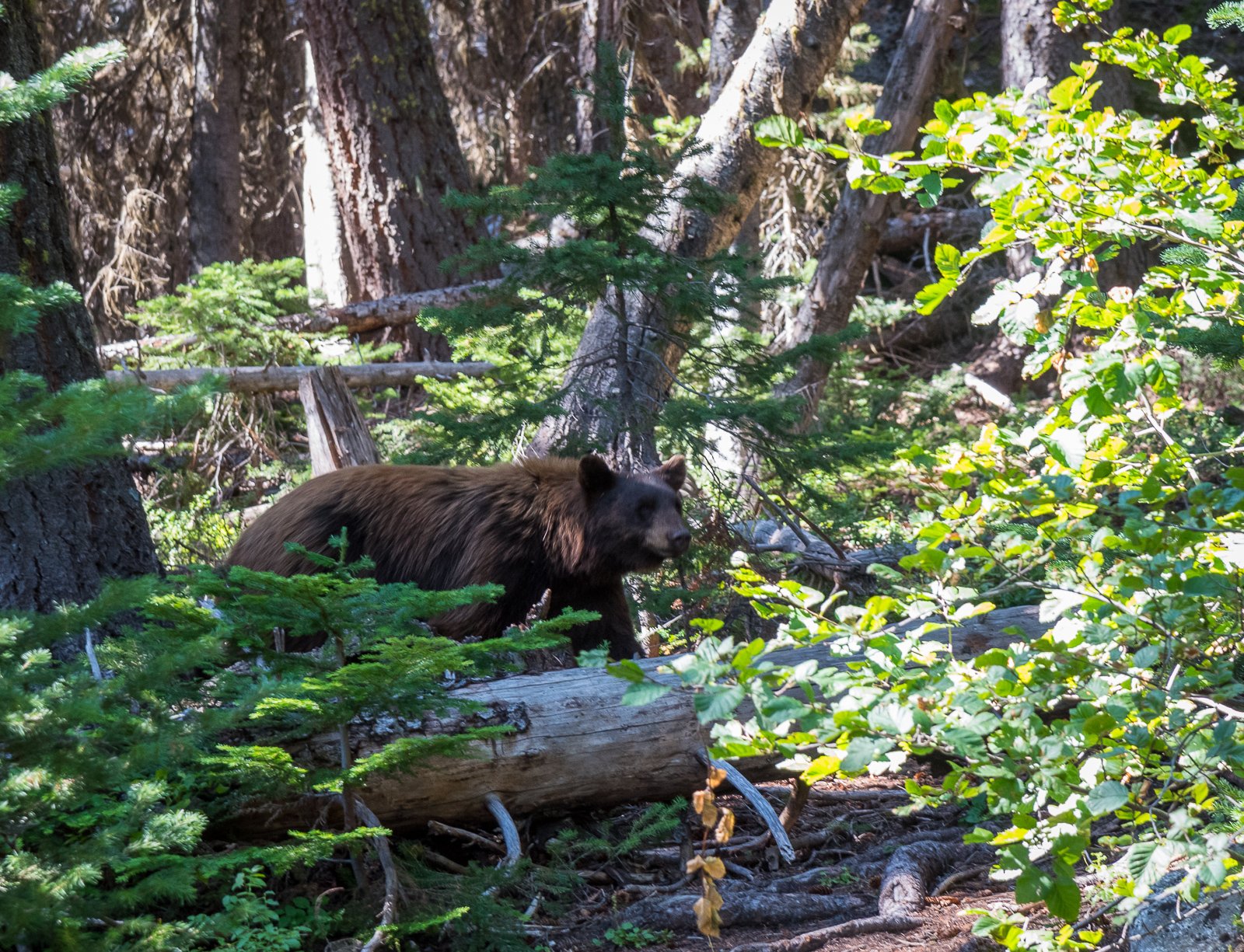
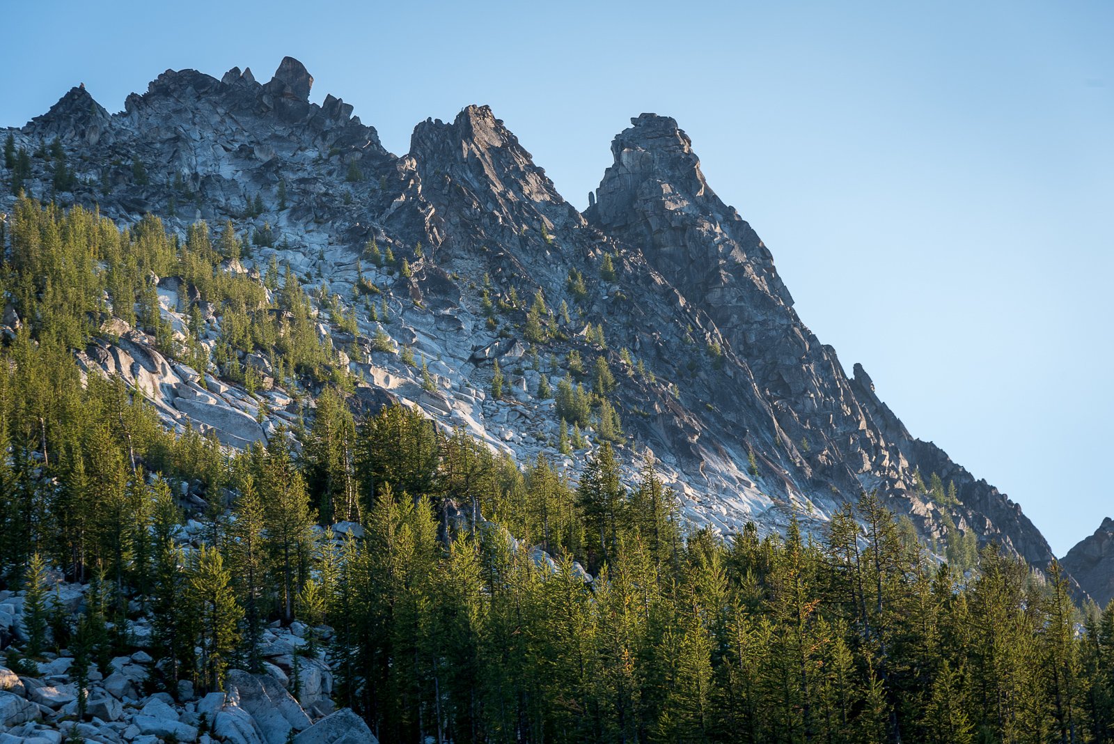
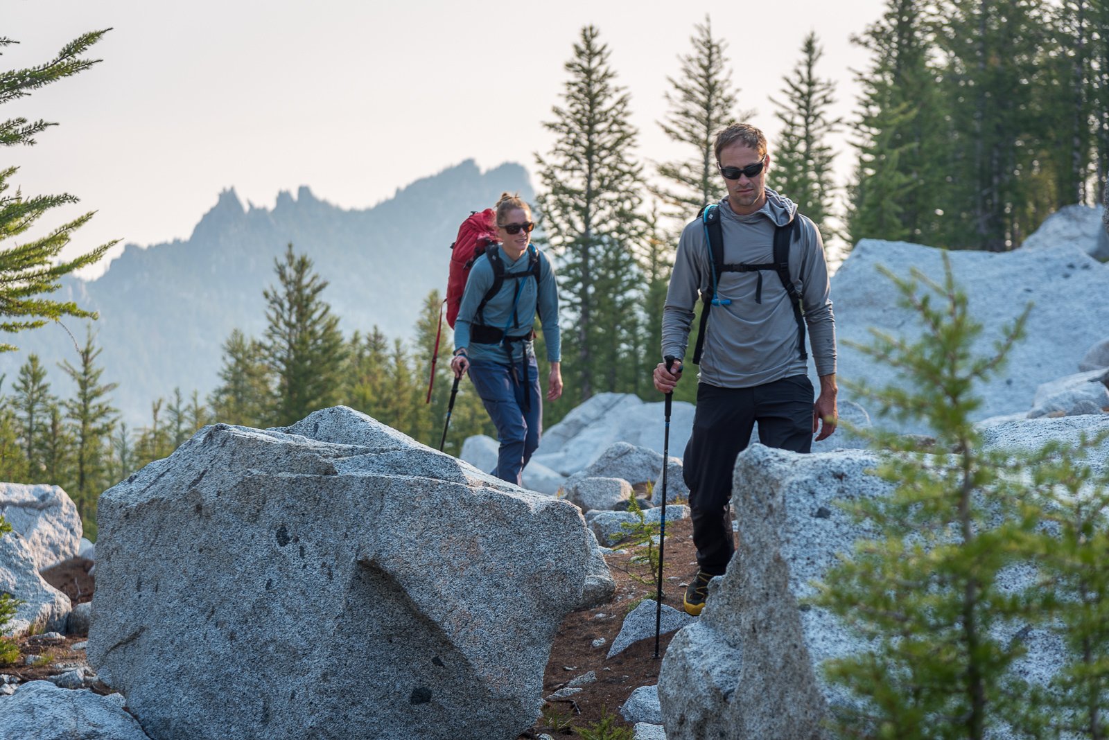
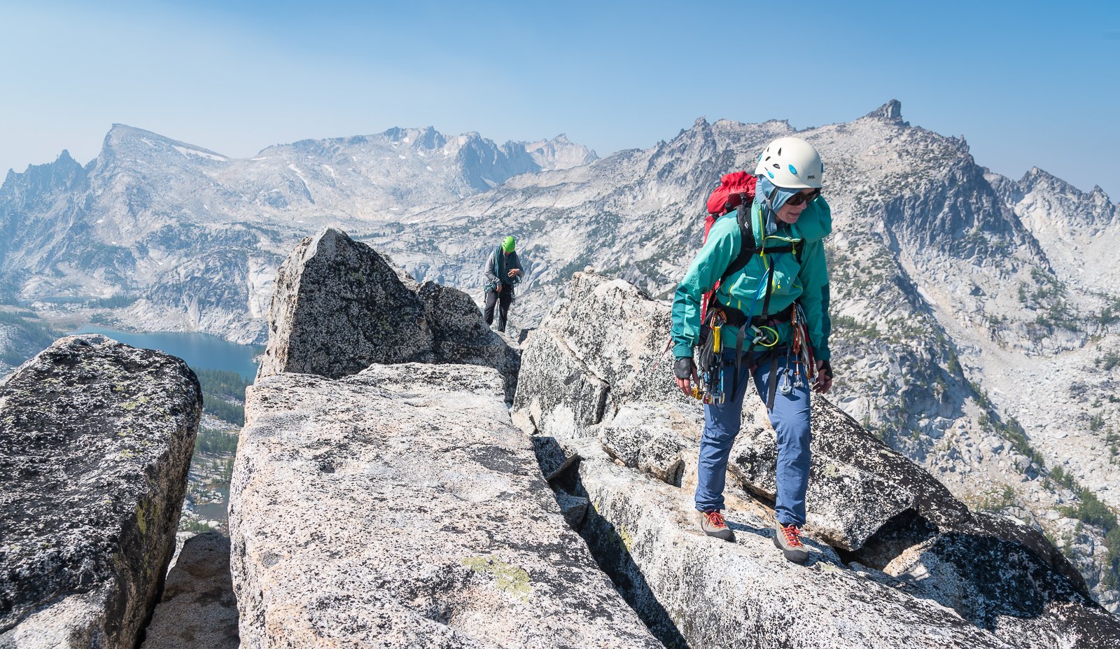
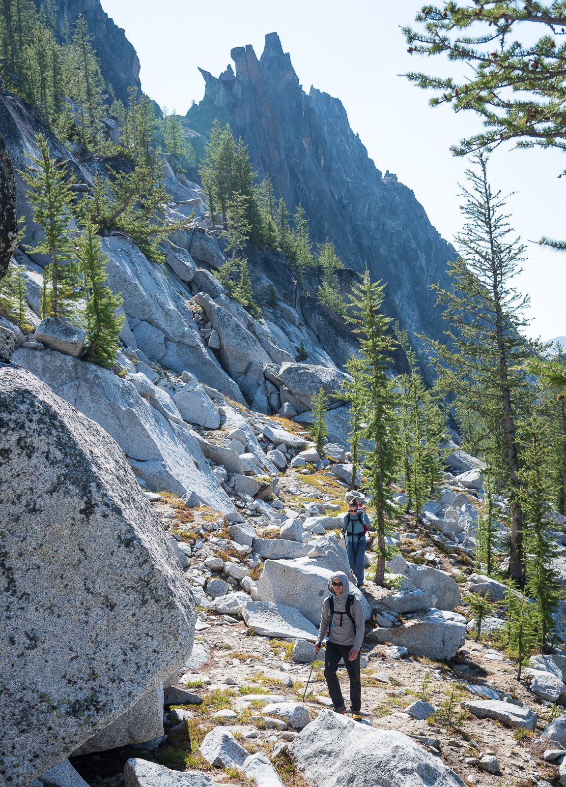
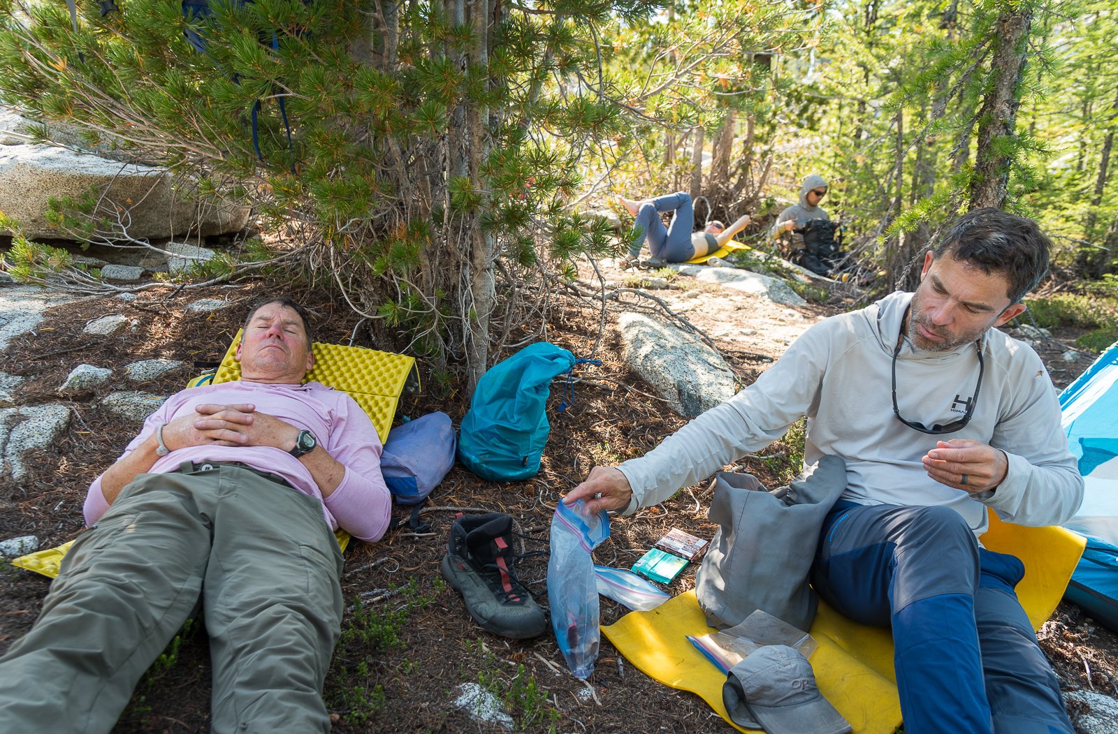
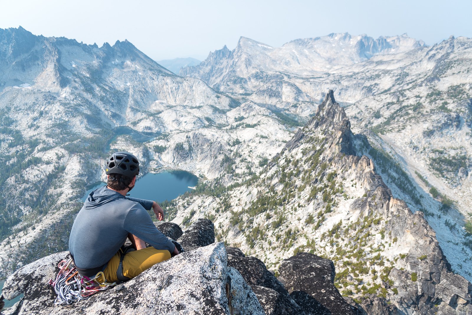
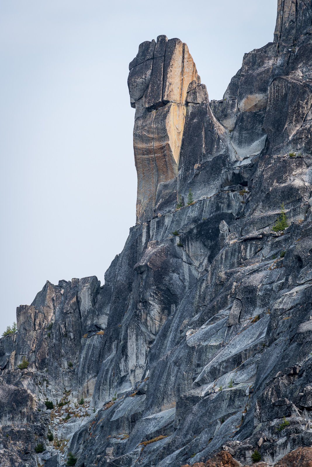
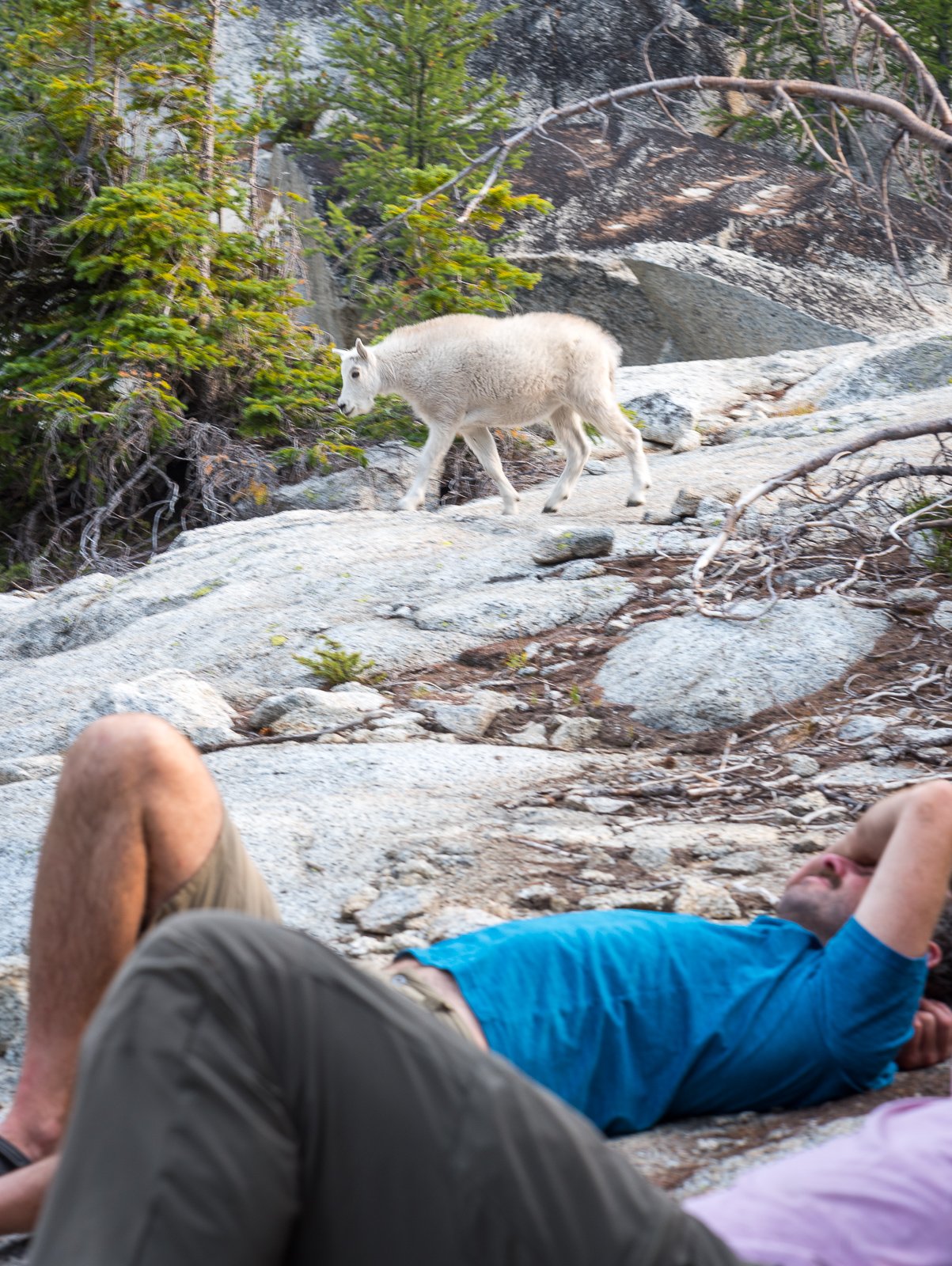
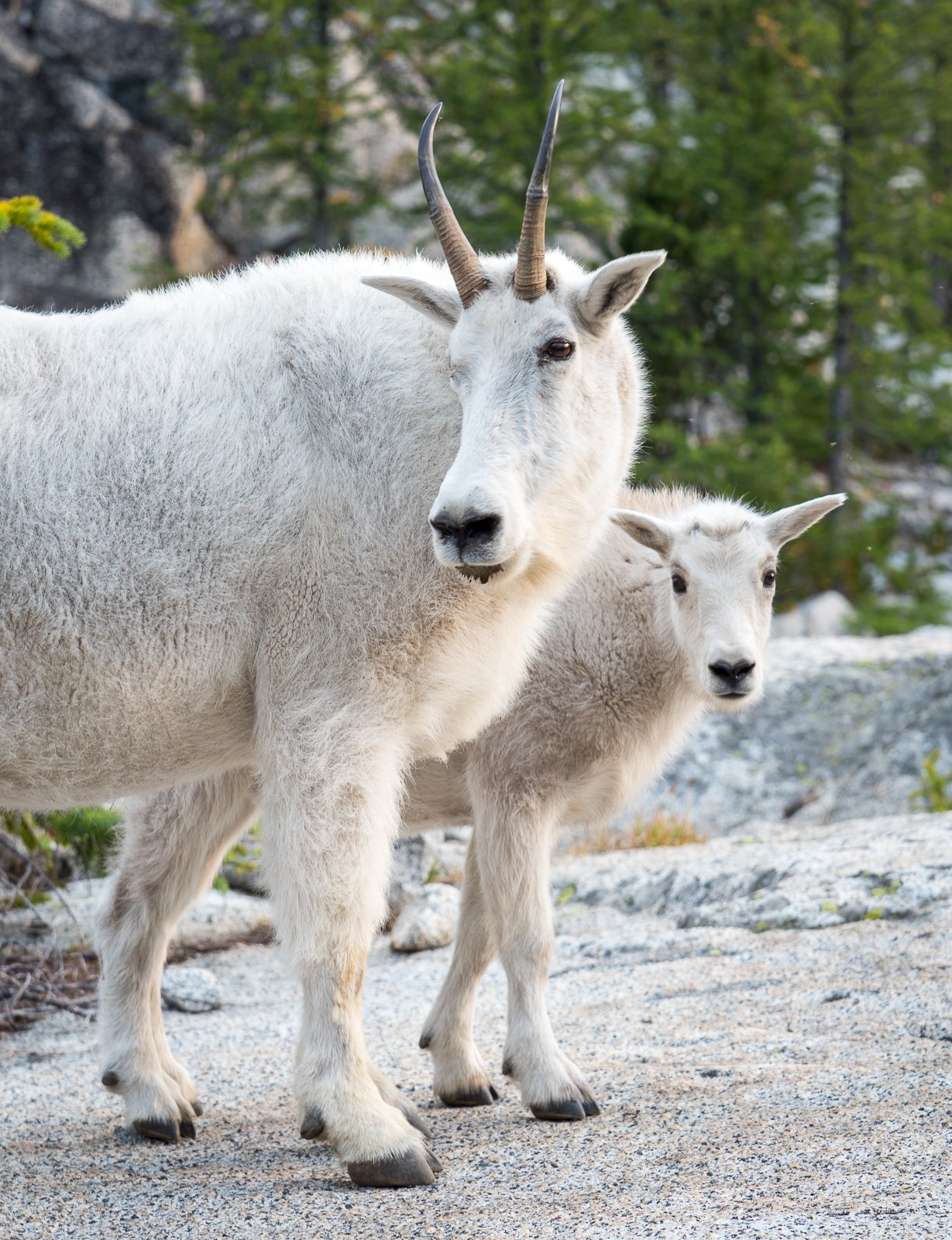
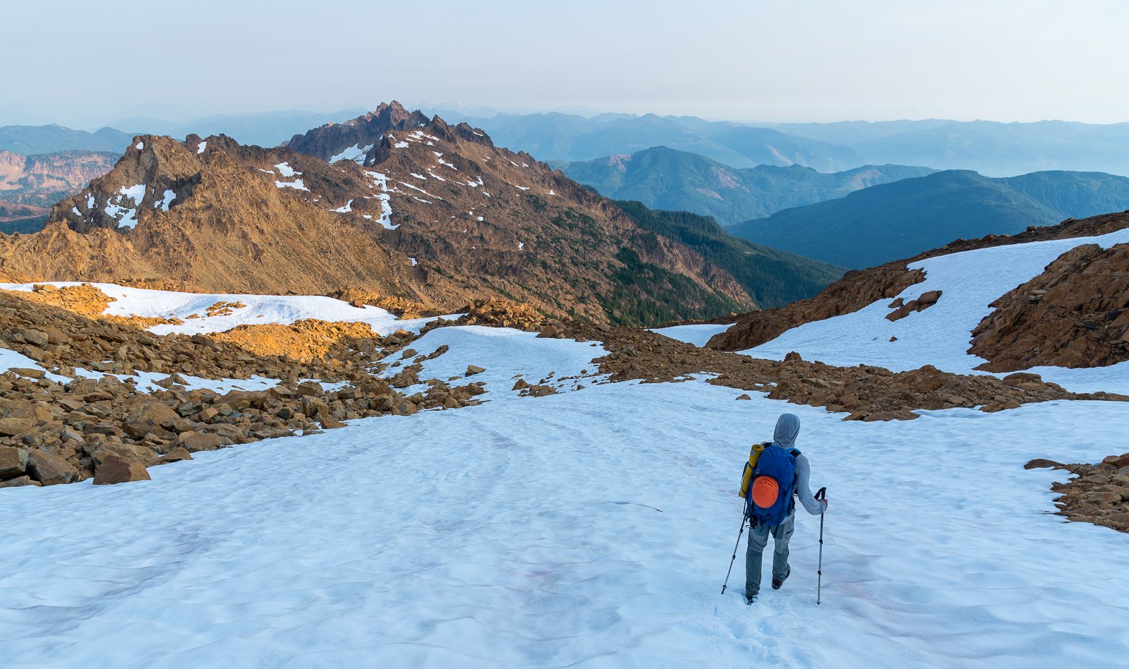
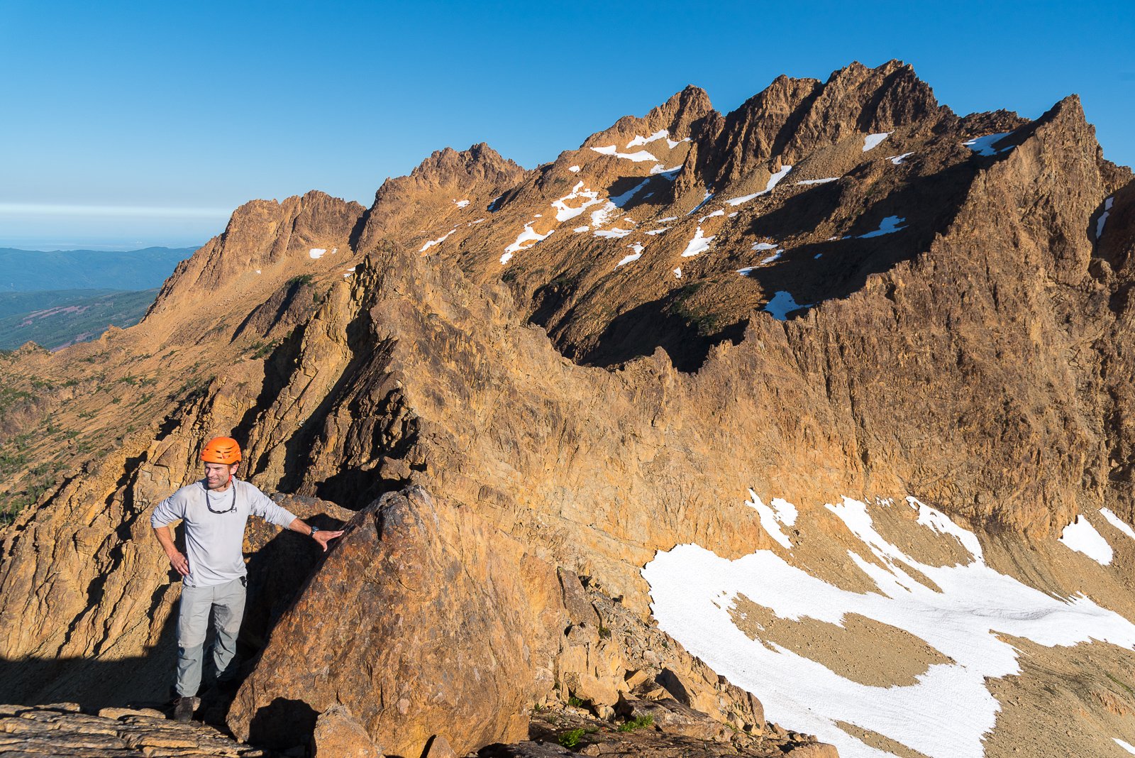
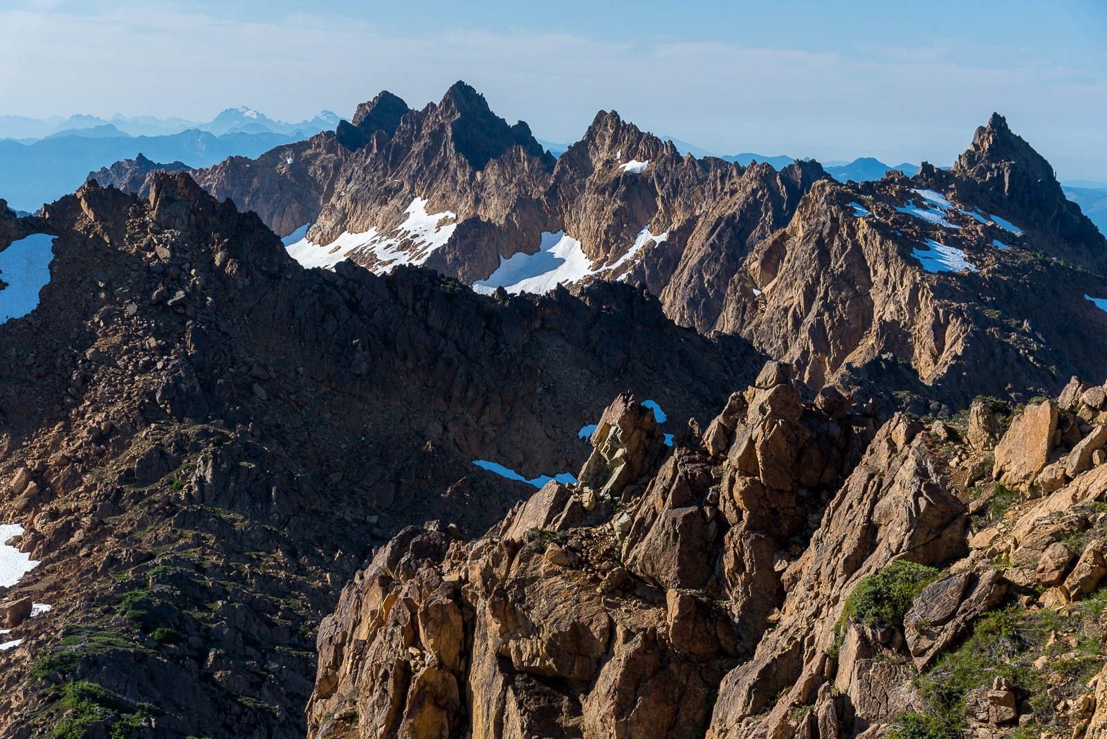
Trip: Tamarack Meadows Climbing - Prusik (West Ridge), High Priest (North face), Mount Temple (West route) Trip Date: 09/07/2024 Trip Report: This seems like it has been the summer of obscure destinations for me. Places I've long thought about going but never made happen. Maybe it's because they're not top shelf destinations, but as I've aged and don't go as hard, I've increasingly found these sorts of trips fun because of the lack of traffic, because of the lack of beta, and how they've forced me back into to puzzling things out on the fly. The climbs on the north side of Temple Ridge definitely fit into this category. The dream of the 90's is alive! Or at least that is how I sold it to @Trent, @cfire, @BrettS, John and Leslie a few months back. And, minus the unanticipated smoke haze, I think it pretty much went off without too much drama. An energetic approach to idyllic camps below our climbs, time to lounge after our short approaches and moderate climbs, plenty of chocolate, and no other parties around. A great 4 day trip! I won't spoil your fun with beta overload, but here are a few photos to whet your appetite for up trip up Temple Canyon.... Snow Creek wall from the hike in: Sow and cub seen at Nada lake: Mild shenanigans to get up into Temple Canyon: High Priest (on the right) from camp: Heading to WR Prusik on Day 2 (still a classic- I hadn't climbed it in 24 years): Looking down into the heart of the Core Zone a the start of the WR of Prusik: John at a belay on the WR: John and Leslie higher up: A couple of me on WR Prusik: @cfire on the summit of Prusik: John and Leslie arrive at the summit: Shield Lake Valley: High Priest and Temple from Prusik: @Trentwas over on McClellan while we were on Prusik: Heading back to camp through Nada Pass, with Prusik above: Camp life! Night life! Goat life! Gearing up for High Priest North Face route (Beckey description works well, as does Mountaineers) : @BrettS and Leslie on the North Face of High Priest: Summit of High Priest looking over to Prusik and the peaks of the Core Zone: Summit block of High Priest from descent: We rapped off the standard High Priest descent and kept high, running the ridge over to Mount Temple. Expect shenanigans, but it goes without undue hardship! And then you have the great mid-fifth pitch to the summit of Mount Temple: and the airy rap back down: After descending Mount Temple, we admired the Meteor. Supposed the crack on this west side is "5.12- or aid. From it's top step right into a 5.10 off-width" After a final night at camp, all that was left was to reverse the shenanigans getting back to Nada Lake, including a nice view of the Black Pyramid, The Professor, Comet Spire, and the Meteor (L-R): : A lunch stop at Nada Lake to admire the reflections: And arrival at Icicle Creek, relieved to find our drinks still hidden and cold! Gear Notes: Medium Rack to 2", helmet, 60m single rope, rock shoes Approach Notes: Core zone permit needed. Snow Creek trail to Nada lake. Go right at the second toilet and find a faint climber's trail leading up to a cliff band. Find a key ledgy 3rd class ramp that will take you up and right through the cliff band., Follow rib up and left and then up to where valley rolls off. Bits of tread lead up into Temple Canyon and then disappear. Follow your nose up the drainage to about 7200' where it opens up to good camping in Tamarack Meadows. An energetic and stimulating approach.


-
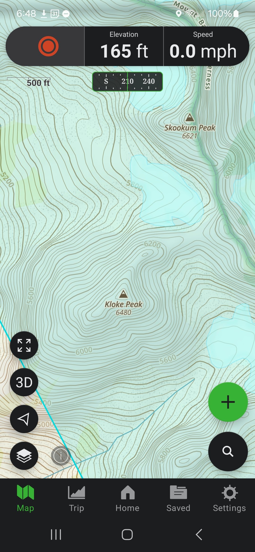
 I don't think a Kloke Peak summit registry is going to get too full anytime in the near to distant future.
 -
Thanks @Bronco! It was a bit rough this morning...made a few edits throughout the day today...
-
Nice work you two and great tribute to Dallas!
-
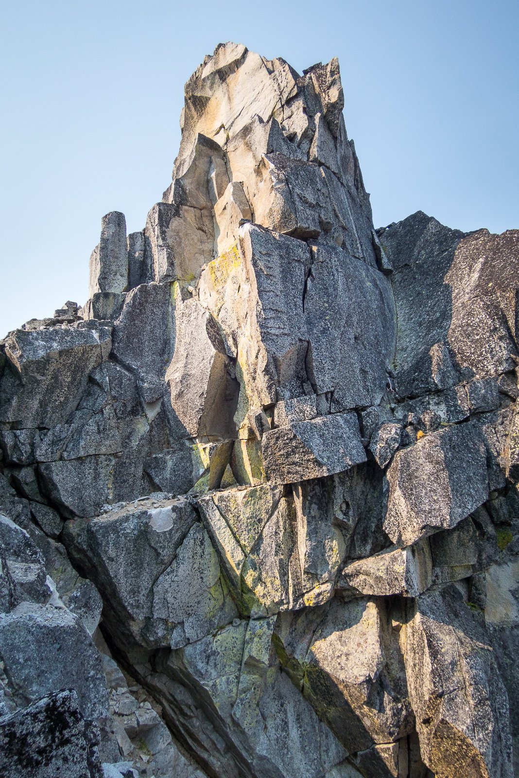
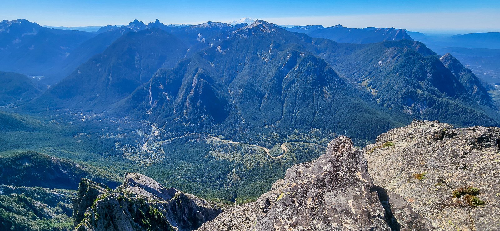
Trip: Southern Twin Sisters Traverse - Kloke Peak (register placed), Twin Crest, Saddle Slab, Shirley, Trisolace, Barbara, Nancy, Last Sister Trip Date: 08/03/2024 Trip Report: Ever since our climbing mentor Dallas Kloke died on the Pleiades in 2010, @Trent, @sepultura, @Kit, @John_Roper and others in the local climbing community have been thinking of ways to honor a man who had given much during his 50 years of pioneering ascents in the Cascades and beyond. These dreams became a reality in 2022 with the naming of Kloke Peak (formerly Hayden) in the Twin Sisters Range. The Twin Sisters were near and dear to Dallas's heart and he completed many first ascents in this area over the years. The peaks are also visible from his house in Anacortes, adding a bittersweet element to the commemoration. Like all worthwhile climbs, the naming process was difficult, involved and several times seemed to almost come to a complete stop. Imagine my surprise then when I got a call from the Everett herald on an October morning, deep in the mountains, letting me know that the WA State Board of Geographic Names had approved our proposal. Or, months later when a friend texted me a photo of the Gaia map with "Kloke Peak" prominently displayed on the summit, meaning that the US Board of Geographic Names in Washington DC had also approved our proposal. Surreal. We just needed to get a register up there to really make it official! Fast forward to this summer.... when @Trent and I managed to find three days to get away to the range and place the register. We toyed with the idea of a full traverse of the range (Dallas style!) but the time and effort for that was a bit more than we were willing to undertake in the heat and humidity. So we settled to starting from Green Creek (thanks @dberdinka!), climbing from the cars up through the Cinderella/Little Sister col. We dropped a bit on the backside and cached our gear, heading over to Kloke Peak in the early evening to place the register and marvel at the rugged appropriateness of Dallas's namesake. KLOKE PEAK!: (below) Steve had done an admirable job of prepping the register, complete with laminated photo, newpaper article, Rite in the Rain logbook, and Pelican case. All secured with cord and pitons. Please leave it up there! When the book gets full, bring it down and let me know. I'll be the keeper of it and hike up a new book as needed. After savoring the view for a time, Steve and I headed down to camp at an unnamed lake south of Cinderella. It felt as if we were the first people to camp there, almost no sign of anyone, except for a random rock hammer we stumbled across the next morning as we left camp! Soon after finding the hammer, we began the quest to bag the rest of the peaks south of Cinderella. We knew it would would be a big day, but the heat and humidity made it even more taxing than we estimated. It was a 14 hour+ whirlwind day for us to climb Twin Crest, Saddle Slab, Shirley, Trisolace, Barbara, Nancy, and Last Sister. There was a lot of 3rd and 4th class along the way, some loose rock, a lot of solid rock, and a bit of head scratching so as to not carry all our gear up and over all the peaks. Sometimes this meant linking improbable ledges on the west side of the peaks. Sometimes it meant backtracking after scrambling a peak by the "easiest" path. We had left the rope behind in a effort to save weight, but I would have been happy for it on the "easy" route up Trisolace (photos of it way below). This was probably very exposed 4th or low fifth terrain, but we couldn't see an easier way, even on the way down. Careful there! Also careful on the summit ridge of Trisolace. I dislodged a large rock right at the summit and it nearly took me with it. As it was, it pinned my leg and @Trent had to come over quickly, and carefully roll it off and down the mountain. Whew! I sat for a time getting my heart rate and breathing down, cursing myself for letting my guard down, even for a moment. It was not lost on me that this was the same type of accident that took the life of Dallas. Steve on Trisolace. I eventually got up the gumption to follow him: Me, a few minutes after my mishap with the large rock: And somewhere along the traverse: The day wore on and we got further and further south and farther from Kloke Peak: As the sun dipped towards the west at last we were on the Last Sister, looking down at the Step Sister. Steve had already climbed it, but I hadn't. Camp looked so close at Heart Lake (it wasn't, as we would soon find out). There was a brief period, as we neared the col between the two peaks, that I considered heading up and descending to camp in the dark. But then I slipped, fell, and went into full leg cramps on both legs! My day was done, I was totally spent. And so we went down surprisingly far to the surprisingly rugged Heart Lake, barely finding about the only decent campsite on the west side of the lake as the light failed. Step Sister as we hike down to Heart Lake: Our camp at Heart Lake the next morning: The next day was going to be a long one (14+ miles) and hot, so we didn't have much time to rest after the marathon peak bagging tear the day before. As the sun came up we were soon moving down through the brush below Heart Lake to an old logging spur that took us down and across the South Fork Nooksack. Here, we grabbed the PNT and followed the elk up valley, surprising a trail crew along the way that hadn't seen many people in awhile. Sort of as we expected, it got really hot as we hit the Elbow Lake trail up and over the ridge back to our car. But we had beer stashed in the river and chips in the car. It could have been worse! I would really like to hear of others' stories of climbing Kloke Peak. Even if you don't post up a TR, feel free to post your experiences in comments below! Gear Notes: Ice axe, helmet, leather gloves. Many will want a rope on Trisolace. Footwear and clothing you don't care about. Approach Notes: In Green Creek (thanks Darin!), out Heart Lake and PNT to Elbow Lake and back to Middle Fork Nooksack.


-

[TR] Roosevelt + Kaleetan + Chair Peak NW Ridge 9/10/24
Rad replied to mattjordan's topic in Alpine Lakes
Nice backcountry choss linkage. Glad it worked out. -
That's a true f'n statement!
-

[TR] Olympic Mountains - Cushman Six (FKT) 08/17/2024
OlympicMtnBoy replied to Mo 8501's topic in Olympic Peninsula
What fun! I love the Olympics for this sort of thing (although I move much slower and shorter distances with a two year old now). -
[TR] Roosevelt + Kaleetan + Chair Peak NW Ridge 9/10/24
OlympicMtnBoy replied to mattjordan's topic in Alpine Lakes
Maybe not the fun you were hoping for exactly but good work getting round and back! -
[TR] Mount Garfield - Southwest Route 08/31/2024
OlympicMtnBoy replied to JasonG's topic in Alpine Lakes
Nice, I wanna go next time! Still need to do that one, almost looks fun. -
Impressive!!! Thanks for the detailed report
-
Nice work, and thanks for the TR. Yeah.... Pete Doorish. 🍻
-
[TR] Roosevelt + Kaleetan + Chair Peak NW Ridge 9/10/24
JasonG replied to mattjordan's topic in Alpine Lakes
oof. Thanks for the honest assessment for all us dads and glad you made it thru without mishap. -

[TR] Roosevelt + Kaleetan + Chair Peak NW Ridge 9/10/24
Alisse replied to mattjordan's topic in Alpine Lakes
Good job making it out safely! -
Trip: Mount Garfield - Southwest Route Trip Date: 08/31/2024 Trip Report: "As has been reported elsewhere, Garfield is a hazardous enigma. It offers more than a climb, for it is also a physical and orienteering challenge. It is important to get a very early start. While a 12-hour r.t. is generally considered a minimum, only during the long days of summer will there be sufficient daylight for what is a long, steep climb, with some very exposed areas." -Fred Beckey, Cascade Alpine Guide I first read the section above in the 1990s when I was just getting into climbing and frankly was both attracted and scared by the photos and descriptions in the Beckey guide. An early trip report by @CascadeClimber and @philfort did little to dissuade my apprehension of this peak and so it sat for decades on the back burner. Always there, always taunting, even long after I probably had acquired enough chossdawgery skillz to make an ascent a reasonable goal. Turns out, two of my long-time climbing partners felt the same, and somehow it came to all of our attentions this year that Garfield could no longer be ignored. In the words of @Trent, "It must be climbed!" Secretly, I was hoping that @klenke was still correct and the the route was dumbed down by a bootpath and flagging. But I wasn't so lucky- he can rest easy on the golf course or the workfloor of the Lazy B, knowing that the brush has returned, the flagging rotted away, and that the blue collar masses have moved on (or died?). This peak is probably once again nearly as lonesome as it was when Fred first penned those words (the register went back to 1987 and traffic really has dropped off the past 10-15 years). I can honestly report that it is proper challenge for a Cascades Connoisseur such as those that frequent this esteemed site. (If you want hardman or hardwoman points, read no further and just photocopy the pages out of Brown Fred for your trip. If you're someone like me....read on) But we didn't know any of that when @therunningdog, @Trent and I rolled into the "gravel wash" that marks the start of this 4500' off trail adventure, late on a Friday night in Trent's old VW camper (nickname "Speedy"). There was another car camping there, but given the smoking and drinking we were pretty sure that they weren't heading to Garfield in the morning. Then again, I think a late evening of smoking and drinking would probably have been fitting preparation for the peak. Next time. Alarms were set for crazy early, I think about 430, since we had heard ample stories of unplanned bivies, thrashing exits in the dark, and general mini-epics. We were thinking 13-15 hours would be about what it would take and planned accordingly. But it turns out, us old dogs (combined team age of 158) can still beat Beckey and we were back to the van in about 11.5 hours, including breaks. The early start gave us extra time for beer and chips, so it wasn't all for naught. To be honest, the way up was mostly a blur. A dark gravel wash to an impassible set of falls started things. We went left into the forest when we should have gone right (be sure to keep that Beckey topo in your pocket and consult at all junctures!) and then I somehow thought that the real "dirt gully" below, wasn't the right dirt gully and kept going past it. Trent and Tim kindly put us back on the right track without too much wasted time The "dirt gully" wasn't that bad, but it wasn't that good either. You don't want to be on this mountain with more than about 4 people. 2-3 is about right so you can move as one team. Shortly after the gully you climb up and hit some slabs that force you left. We went all the way left then found a weakness to scramble up and right back towards the ridge crest which is below the "rock outcrop" and "razorback" that you hit right before the "tiny notch". You will be referring to the topo many times in this section, wondering where in the hell you are while looking way down into the "Great Canyon". It is a wild mountain. Soon enough you will come to the "glade saddle" where you will see a short gully leading to the "wooded ramp": which will take you to the brushy "key ledge" where you will be thankful for the brush for hiding the significant exposure. The brush will also distract you from the fatality that occurred in this spot, presumably due to the "trecherous footing" that Beckey describes: And then the meat of it, the "no. 1 Gully is reached, with the "no. 2 Gully" just beyond it: We had already chosen no. 1 Gully as our line, even though Fred describes it as the alternate path up, mostly due to a few of the more recent TRs we dug up which we compared to older no. 2 Gully TRs. I am sure that both have their pluses and minuses. The no. 1 Gully starts out easy, but then a step is encountered where @Trent ably put the rope up for Tim and I. It was a bit trickier than it looked with polished rock and moss. I sort of wanted to do a shoulder stand in the spirit of this peak, but unfortunately I was the last one up. So I grunted and lurched my way up. Then it was mostly easy 2nd and 3rd class scrambling until you had to turn right under the Leaning Spire to ascend slabs to a small col that dropped you halfway up the no. 2 gully. Here the way got harder with some slabby 4th mixed in with the slabby 3rd. We were in boots/approach shoes, which I think is the correct footwear for this route. The slabbyness isn't sustained or hard enough to warrant rock shoes. Plus rock shoes are definitely not blue collar! Style matters. Soon enough we were established in the no. 2 Gully and began to chug upwards to the "crux" chimneys. The first one we soloed: The next one, @Trent led, again. It was wet and involved a lot of grunting and pack dragging. Still, I think it is preferable to the variations that others have reported to the right. The notch between the Leaning Spire and the summit was easily reached after the chimneys, and here we went a bit too far left. You basically want to go straight up a cl. 3-4 slab above the col until you can burrow into a brush tunnel (complete with trimmed branches!) that will take you up and left to the summit ridge. A short walk right will land you on the true summit. If ever there was a peak where the summit was "halfway", Garfield is it! We dug out the register and marveled at who had signed in over the years. Some famous climbers in there and it was fun to take the trip back in time. The views weren't half bad either. It is a long way down to the Middle Fork and the van, less than two miles horizontally from the top. But, like most summits where the descent is worrisome, we didn't stay very long. The descent was also a blur, though it went faster than expected. Several bolted stations in the no. 2 gully greatly helped by keeping us out of the path of the inevitable rockfall. I think we did 6 30m raps total, about 3 in each gully. We paused on the "key ledge traverse" to oogle the Great Canyon in better light as we passed again: And also stopped to admire the Doorish part of the mountain as well. Anybody know that guy? I have to say that he's a legend, at least in my estimation. The routes he did, in the era that he did them, are truly astounding. He had a funny entry in the summit register talking about "a bit of an epic" he and Alex Cudkowicz had in June of 1988 where they ended up spending 2 unplanned bivies (in the rain!) establishing a route that they thought would go in a day. Yowza. Yeah, this should go in a day: But soon enough we were back at the easy slabs, scrambling down to the forest, the dirt gully, the forest, the gravel wash, the forest..... and then....BEER. Gear Notes: 60m twin rope, helmet, light rack to 2", leather gloves. Boots or approach shoes. Best to go after snow leaves the gullies Approach Notes: Middle Fork Road to gravel wash. Page 214 in Brown Fred has a great topo of the route/approach, which is all the experienced chossdawg needs.


-
Love the photos. I always knew you were Bulger-curious.
-
Disgusting. But happy for you!