
Search the Community
Showing results for tags 'first ascent'.
-
 Last summer, at a climber's get-together at Mario's house, i had the pleasure of meeting John Roper. For those of you who don't know of John, he is a towering figure of Cascades exploration, with thousands of ascents (including many first ascents) under his belt. He is also a member of the legendary Bulgers climbing group, and co-creator of the Bulgers Top 100 Peaks in Washington list. Suffice it to say i was enthralled, and managed to monopolize the conversation with him for much of the evening. A key question i asked him: of all those ascents, what is your favorite climb? Without hesitation, he said Wild Hair Crack on Himmelgeisterhorn. Its worth reading his writeup of that first ascent here here both because it is quite entertaining, and because it highlights John's reverence for the Southern Pickets. As something of a Picketeer myself, the conversation got me thinking: i had never been into Crescent Creek basin -- something i needed to rectify! As fall and then winter rolled in, i spent spare moments flipping through Red Fred, starting at the Challenger quad, and scouring the interwebs for lesser-known morsels about the Western half of the Southern Pickets. I also enlisted two good friends and climbing partners, Matt and Keith, in the project. Step one was equipping them with copies of Training for the New Alpinism. We are all mid-fourties to early-fifties, busy with families and careers, and so the luxury of getting in shape by actually getting out climbing a lot was out of the question. In its place, enter max strength box step-ups and weighted hill climbs. Less fun but quite effective. As our forth, virtual, team member, we had Mario, the person who introduced me to the Pickets 17 years ago, to act as my logistics co-conspirator as he recovered from shoulder reconstruction. I started brainstorming new lines during early morning training sessions at VW with Keith. Staring at Scurlock photos can do that to you. South Buttress on Twin Needles? Southwest Buttress on Himmelgeisterhorn? But what got me most excited was, while trolling through Roper's website, noticing mention of unclimbed peaks (peaks! not lines, peaks!) in the Pickets. What?!?! I homed in on Beep and Honk (named by John of course), two unclimbed sub-peaks on the unclimbed West Ridge of Ottohorn. That West Ridge, from the photos i had, seemed moderate and downright reasonable. An appropriate goal. Maybe. Wayne recommended to me years ago that to truly prepare for a Pickets trip, you need to get out on a couple of soul crushing training outings. We rounded down to one. On the Northeast Ridge of Triumph, on summit day I felt physically fit but mentally off, strung out after a surprisingly anxious night of non-sleep at high camp. Matt also wasn't feeling dialed in. The project seemed in doubt. As i get older, and particularly since becoming a father five years ago, risk and mortality are more mentally present when i'm in the alpine, sometimes to the point of making it just not fun. Had my ambitions outstripped my waning climbing ability and risk tolerance? We tempered our goals a bit, planning to climb Terror first, as a way to hopefully get some momentum before trying something new. This new framework got our team mojo back together, and with a reasonable albeit not stellar forecast, we headed off on our trip. In the afternoon Matt, Keith, and I began our hike in, loaded up on water after fording Terror Creek, and then headed uphill. We camped at 3600', to split the approach into reasonable chunks, which worked great. The next morning, with a mostly sunny forecast, we awoke in a whiteout. Here is how "Mostly Sunny" looks in the Pickets. We continued up into Stump Hollow, and over to the Barrier camp, and then sniffed out the correct place to drop off the ridge. We still had no views of the spires. But once we dropped in, the clouds started to lift, and by the time we arrived at camp below Terror, it was sunny enough to dry out and take in the scenery. That night the winds howled. Keith was nearly blown over during a nighttime pee run. We delayed our departure for three hours until the winds dropped. The weather turned fine as we hiked up to the Terror gully. The gully had begun to really melt out, and there was a tricky break in the snow (just above what is shown in this photo) that Matt led through with some nifty mixed climbing. I was happy to not have that lead! At the notch, after a bit of futzing around to find the best start, we began cruising up the enjoyable climb. Soon we reached the distinctive summit. On the descent, we used the skier's right side gully to bypass the tricky snow break. There was a rap anchor here, but it needed some love, so we beefed it up with a second piton and a better nut. It felt good to have Terror under our belts. So far, the trip was going right according to plan. The next morning, we hiked West below the spires, and gained the Southern Pickets ridge crest at the saddle just East of West Peak. We tagged West Peak, which is definitely worth a visit for the outstanding perspective. Here is Matt nearing the summit. You can see the goal for the rest of the day (the West Ridge of Ottohorn) laid out behind him. The summit views were outstanding (including Mongo Ridge over Keith's shoulder). Back at the saddle, Matt told us he was going to sit out the Ottohorn attempt. After talking it through, we repacked and Keith and I headed out into new territory. This picture taken by Matt a little later in the day shows the route over, from left to right, Beep, Honk, and Ottohorn. We began by hiking East along the crest. After a bit, it turned to a more defined rock crest, and i led a long simul-climb pitch to the base of Beep, the first tower. Here is me leading that block: and Keith following: Keith then led a steeper and somewhat heathery pitch up the start of Beep. I then tapped in for a fun pitch that began with thin cracks on a lichen-covered face, then worked up to dramatically positioned face climbing past a strangely shaped rock horn. Here is Keith following that pitch: And Matt, back at the saddle, watching us (look for the small red dot): Somewhere around this time, a helicopter flew by at close range, eyeballing us. We gave them peace signs and smiles. Not much later, a military jet blasted by right at eye level, less than a rope length out on the North side of Southern Pickets crest -- WTF that was loud! Keith then led us to the summit of Beep. We were pumped, an unclimbed summit in the Picket Range! That pump was only mildly deflated when Keith discovered that the sandwich he had packed for lunch was AWOL. It was 2pm and we had a lot more climbing to do. I led a intricate pitch of ridge traversing along the crest of Beep, and then located a lovely obelisk that could work as our rap anchor to drop off. A double-rope rap took us to just below the notch between Beep and Honk. Keith led a rope-stretching pitch up some of the finest climbing of the route, right to the summit of Honk. Unclimbed summit #2, check! I led a pitch that downclimbed delicately off the summit and traversed to the notch with Ottohorn, arriving at a comfy belay stance. This picture shows Keith as he was about to follow it. Keith arrived and we gazed up at Ottohorn above us. We were moving slower than desired, but were hopeful that the climbing would ease up. The belayed climbing so far had ranged up to 5.8, and we needed a bit easier ground to be able to move faster. However, hope is not a strategy... as we were immediately greeted with some tricky bits. Keith broke right around the corner. The pitch grew more challenging as he followed a set of steep steps upward. He followed that up with another strong lead that included a couple of 5.9 sequences, as he worked back to the ridge crest proper. At this point, it was abundantly clear that we were not going to finish the route before dark. Keith and i had "the talk" about bivying. Keith quoted the wise words of Mike Tyson: "Everyone has a plan... until they get punched in the face." We each have a couple of decades of climbing under our belts; i had experienced one unplanned bivy (with my now wife), and Keith had never had one. That clearly made me the expert, so i described what we should look for as we went home-shopping. We did one more traversy pitch along the crest. However, we then hit a notch where we had to rappel. The good news was that this rappel ended in a moat behind a snow bank. WATER! I felt smug as i filled my water bottles with snow. "At least we won't be dry at this bivy" i thought. Keith led one more pitch, and by the time i arrived it was time to hunker down. I explored and found a workable spot 15 feet below us on the North side of the ridge. After a bit of site remodeling, as the sunlight faded, i opened my pack to throw on some layers. I reached in, and to my horror, fished out a soaking wet shirt. I hadn't closed my water bottle fully (probably due to snow crystals in the threads), and it had leaked all over the pack contents. My puffy was wet too. It certainly wouldn't be dry at this bivy, all right. Keith reminded me of the mantra that both of our kid's preschools use: "you get what you get, and you don't throw a fit." I threw a small fit, and then moved on to laying down our two ropes as ground insulation. 10pm it felt great to be not moving, just talking. 11pm we tried to "sleep". Keith elected to use his pack as a bivy sack; i used mine as padding. We began hearing noises behind and above us. In my headlamp, i caught a large-eyed snafflehound chewing on my gear. Oh no you don't! I hung the gear from the anchor over my head. About every hour or two we sat up and talked about how increasingly cold it was becoming. We began to shiver and our toes got cold. Here is how we each looked in the morning. Finally it was light enough to start moving again. We were cold, hungry, dehydrated, tired, but in an amazing spot to watch the sunrise. We checked out of the snaffle-lounge, and got back on our way. Low-fifth climbing took us to the top of Ottohorn. You can see the excitement in Keith's eyes. Ok maybe he needs his morning coffee. We rigged a rappel off the Ottohorn summit ridge down to 3rd class terrain. However, as Keith pulled the rope, it got completely jammed. NO! I tried to get psyched up to lead back up and free it. A final desperate rope-flicking session by Keith managed to get it free. Meanwhile, Matt was starting to get worried. He had watched our progress on the ridge the day before, but hadn't seen us since late that previous day. Early in the morning he had hiked from camp back over to the base of the descent gully, and was yelling up to us. We yelled back, but he couldn't hear our responses, and so was beginning to fear that we were in real trouble. We scrambled down, gained the O-H gully, and arrived at the rap station above the giant chockstone. Finally, as we made that rappel, we established visual and verbal contact with Matt, to our mutual relief. Matt took this picture of us as we descended. Face-in downclimbing of the snow gully, tediously slow in our depleted state, took us down to Matt and the sunshine. We were wasted. And happy. And thankful. I declared my intent to retire from the sport. We rehydrated and refueled, then stumbled back to camp. Mr. Ed the camp mountain goat nosed around while Keith dozed in the tent. Matt hiked up to the shoulder of Degenhardt to stretch his legs. I sat by a melt stream and processed the climb we had just done. I felt a lot of gratitude and thankfulness. To Keith and Matt, for being great friends and partners. To my wife and daughter for their constant love. To John Roper for providing the nuggets of information that led to these first ascents. To Mario for his enthusiasm, coaching, and weather updates. To Wayne for inspiring me to think about unclimbed routes in the Pickets. And for the opportunity, as John said recently, for "rare FAs that were left unregarded in Paradise." The climb has exhilarating position and stellar views. The rock is sometimes loose, sometimes quite nice. As for the route name: since Roper had started a theme of cacophony, jumping from the 'horns (Otto and Himmel) to Beep and Honk, and since we were getting buzzed by aircraft on the route which added to the racket, we settled on "Bring The Noise". We enjoyed a beautiful final evening in camp. The hike back down to Terror Creek was surprisingly pleasant, as the threatened marine layer did not materialize. We managed to lose the path for a bit between the creek and the Terror basin trail junction, leading to a bit of 'shwacking around in the devils club. But what are the Pickets without a little brush? I think i may be done with the Pickets. But it was a trip i will always cherish.
 -
 Castle Peak: "The Drawbridge" First Ascent of the Middle North Buttress (5.10+/A1, 10p) (Schilling-Zentler) Morgan Zentler is a baller. Last year he finished the Bulger list with a frenzied push. His suffering knew no bounds in his quest for completion. I've seen him pass out without a net or tent in a hideous swarm of mosquitoes and picked him up after an epic Stehekin-Phelps Creek traverse with Tim Halder that was the alpine equivalent of 4 marathons in a row. My tolerance for choss is limited, so it's infrequent that we can find overlapping objectives. With his choss appetite satiated, his palette has become more refined. He set his sights on an extension of the bulger list, the top 100 Washington peaks with at least 400 feet of prominence or the P400. We ticked Colfax via the Cosley-Houston in May and he followed that up with a rare ascent of Lincoln several weeks later. So when he texted and asked if I wanted to try for an FA on the north face of Castle, I couldn't refuse. It was the last peak left on his list and I was due for a good N. Cascadian adventure. We approached from Canada via Lightning Lake in Manning Park, which involves a climb up and over Frosty Mountain. Encountering deep snow at tree line, we gained the crest just short of Frosty's summit and had our first views of Castle's N face. It was obvious that the face was bare enough for an attempt, so we descended, crossing back into the states and into a snowy Princess Creek basin before traversing up on snow up to the Princess/Crow creek divide. Dropping into the Crow Creek drainage we set up camp on the only dry spot on the ridge, 2/3 of the way down to the glacier at the base of Castle's North face. We scoped the face in the last few hours of light and worked out a reasonable line up the middle north buttress. A formidable list of cascade hardmen and women have walked by this buttress over the past 30 years, and for whatever reason, passed on it, to put up first ascents on other buttresses on the complex face. We agreed on a safe and clean-looking line that surpassed the obvious roof that guards the lower third of the buttress. The approach to the face was easy at first light and we were on rock less than an hour from camp. Gearing up, we were paralyzed by the whizzing sound of falling and exploding rock overhead. The first rays of sun had loosened up choss on the upper slopes and sent down a barrage of stones. They sailed overhead and cratered on the glacier. We hustled up easy fifth to get out of the firing line, setting up a belay at the base of an incredible looking dihedral and multi-crack system. Morgan took the lead on what would be the hardest pitch of the day. Progress slowed as he encountered hard (11b) climbing after 20 meters and had to aid a short section. He traversed out of the dihedral on a tricky flake with thin pro and was soon at a flat ledge with a good belay. I traversed left up a ramp and into a crack system that led through the roof. A delicate slab (with a good nut) led into the roof, which was surmounted on the left on fun but hard cracks and stemming. The pace slowed to a crawl as the next two pitches involved a lot of cleaning. When things turned desperate, we pulled out the nut tool and excavated a crack. Where there was moss, there was often pro. The angle had eased off a bit here, but it was difficult to get good feet on dirt and moss covered slabs from the unearthed cracks. Mercifully, at the top of pitch five, the face deteriorated and we followed the obvious route in a short traversing pitch to the ridge proper. The rock quality remained sound on the ridge and the cracks no longer required excavation. With the exception of one short harder hand/fist crack, the climbing was more moderate and less stressful. In typical Cascadian fashion, the last technical pitch involved dancing delicately around teetering blocks. After ten pitches of climbing, we emerged onto moderate snow slopes 400' feet below the summit and unroped for 3rd and 4th class terrain up the ridge to the top. We lounged on the summit, 14 hours after starting the climb, and took in the views of the Pickets, Hozomeen, and the lonesome peaks in the heart of the Pasayten. The walk off of the south side and east ridge was breezy and we were back at camp as twilight faded. We celebrated with scotch whiskey and tunes on the speaker. Morgan had finished a compilation of mostly chossy peaks with a first ascent on great rock. The walk back to Lightning Lake the next day felt entirely downhill.
 -
Trip: Mt. Hood - "The Pencil" FA Date: 1/30/2017 Trip Report: We've always heard "The Pencil" come up as an obvious unclimbed line on the north side of Hood. Let me start by saying it's totally possible that some hardmen/women knocked it off back in the 80's or something but, as there was no record or beta that we could find, we're thinking it's a new route. Community, please let us know if this is not the case, certainly don't want to be making false claims! Our buddy Mike had really been eyeing it for a while and made an attempt recently but got turned back about 1/3 of the way up. When we saw the weekend weather forecast we moved it to the top of the list and Mike, Jacob, Tim and myself were all psyched to go for it. The line The prime weather and conditions brought Mt. Hood climbers out in full force, us among them. Originally we had planned to climb in 2 teams of 2 as it's always super fun to be in the mountains with your friends, but unfortunately Mike put a nail through his hand in a carpenters accident a day before and had to opt out. Major bummer as he was the driving force behind the objective. He was still psyched for us to give it a go and provided us with what beta he had from his previous attempt and a showed us a few old photos of the potential exits onto the north face. So Tim, Jacob and myself followed through and were in the lot by 2:00 and skinning shortly after. We approached via the standard slog up the south side and were the first to hit the hogs back at about 4:45 where we ditched the skis, ate some food, and tried hard to convince ourselves to take off the belay jackets. To start the day off we wallowed over to the Devil's Kitchen Headwall and group soloed the route by headlamp, putting us on the top in perfect time to see the sunrise from the top of Oregon, a first for me. Sunrise Descending the Sunshine After a few photos, some water and food we descended the Sunshine Route to Snow Dome. From there we roped up and made a beeline for the bottom of the route. Pretty uneventful minus a little harmless fall in the bergschrund by Jacob. We crossed it once more and I started up the thin alpine ice. We were happy to find solid sticks and moderate climbing up to an obvious slung horn. Pretty sure this tat was from Mike's last attempt on the line. I brought up Jacob and Tim and launched off onto the next pitch which turned out to be the crux. The climbing was mostly thin-ish ice of varying quality. Anywhere from hero and plastic to aerated and garbage, but for the most part sticky and secure, with the odd front point on rock placement. I followed the line of least resistance that took us through a few steep vertical sections and was about a full 60 meters of WI 3/3+. I placed a small but decent looking nut (always hard to tell the rock quality but it looked pretty good actually) and 2 screws on the pitch, prioritizing finding a proper anchor with the gear I had left. Thankfully the climbing was secure and I found a bomber ice and rock anchor in a perfect location right below the final ramp. Starting the crux pitch Tim in the crux Belay The next pitch was a very quick section of secure WI3- right off the anchor that gradually mellowed into a snowfield with easy neve. This took us to the top of the pencil proper in a 60M+ rope stretcher. Tim and Jacob actually had to start simul-climbing so I could reach good ice to build a belay, so to future parties, a 70 would have been perfect if using the same belays. We were atop the pencil, but above us was another short 30 foot section of WI3 that would take us up and onto Cathedral Spire. Thanks to Mike's beta and a photo he shared with us, we suspected that the top of the spire would connect down to the north face via a small snow patch. The section looked to good to pass up so we decided to try and finish the route in a direct line and headed up. Jacob dispatched the lead in style and brought us up. We simuled the rest of the snowfield to the top of Cathedral Spire. The beta paid off and we had a short downclimb in loose, unconsolidated snow to the notch above The Ravine and joined the north face. 3rd pitch start 3rd Pitch Jacob starting up Cathedral Spire From there we followed the finish of the North Face Right Gully to the top, where we popped over the summit and into the sun. For the second time that day we stood on top somewhere around 2:30 in the afternoon. We celebrated a great day, reorganized, and descended back to our skis. Great skiing conditions capped off a perfect day of Oregon alpine climbing. Huge shout out to Mike for all the help with this one and letting us use his beta, knowledge and gear as well! Thanks for reading! Gear Notes: -4 screws, 1 stubby and 3 13's (could have used more although ice quality varied) -minor rock pro (.5-2 camalots could be useful as well as some nuts) -mini kb's (found a home for them, maybe not necessary) -2 pickets (solid in spots, but not on the route proper) -2 60M twins Approach Notes: Southside slog, up Devil's Kithchen Headwall, down Sunshine to Snow Dome, traverse diagonally in a straight shot to the pencil.
-
Location: Cape Horn Columbia Gorge. Take Cape Horn road, off Hwy 14, to the end (gate). Continue walking down the road (this is a private drive way) to the rail line. Follow the rail line west, down stream, (this is BNSF private property). Approximately 100 yards short of the rail tunnel, the climb can be found on a cliff band 50 yards up and above the rail. Route: 50m WI4 The first 10 meters lays back a bit, then sustained WI4 to the top. The ice ends in frozen brush. 5 meters through the brush to a rap tree. The water weeps out of the tree line above the cliff and is not associated with a major drainage. This climb was repeated today by Yeman, Andreu, Tohper and Jeff. The name Wind Walker seemed appropriate given the 60mph wind gusts we were climbing in. The Gorge ice right now is in better shape than most people can remember. Yeman and I also climbed Nancy's Run today, in awesome shape. Tomorrow may its last day. Peter
-
 Trip: Mt Stuart - FA: King Kong - Gorillas in the Mist Direct Direct Date: 9/9/2016 Trip Report: On September 9th I completed a long-term project on the West Face Wall of Mt Stuart: King Kong, AKA Gorillas in the Mist Direct Direct AKA The Joe Puryear Memorial Route - 11d, 900ft. It took multiple attempts over many years and is my most meaningful first ascent to date. This climb was a tribute to fallen alpinist Joe Puryear who died in Tibet in 2010. A lengthy trip report can be found on my blog which recounts not only this ascent but the first ascents of Gorillas in The Mist, Gorillas Direct, and my many failures/attempts in between: Sol Wertkin Blog
 -
 First Ascent of Epiphany (10 pitches, 5.8) and Revelation Peak, Middle Fork of the Snoqualmie. <<< WARNING: Despite the moderate grade, this is a serious route. Expect to find loose rock, challenging route finding, runout slab climbing, unfriendly shrubbery, and questionable protection. If those don't deter you read on and be sure to bring gloves for the approach and descent. Your hands will thank you. Also, when descending off the peak don't go too far North. Backtrack toward the top of the climbing and rap steep SE-facing slabs. I'd suggest thrashing down the forest just right (East) of the major gully that heads NE. You'll inevitable be doing some rappelling through shrubbery and forest, but it's not dangerous. We think you're more likely to encounter loose rock or possible dead ends in the gully. You'll eventually intersect a NNW-SSE gully that provides easy rock hopping back to the trail. Maybe you can find a better direct finish or a better route off the peak. Be safe. Have a grand adventure! >>> On Sunday, 8/28/2016, Kurt Hicks and I (Rad Roberts) climbed a new route (Epiphany) on what we believe is an unclimbed peak (now dubbed Revelation) West of the Pulpit. This is about 2 miles south of Garfield Peak, a few miles north of Mailbox Peak, and a mile north of the Pratt River. Our line was ground-up, on-sight, bolt-less, and all-free, involving 10 pitches of climbing up to 5.8 and several hundred feet of simul-climbing and roped scrambling over 1300 vertical feet. Grade III. Old growth forest, a pristine alpine cirque, a large cliff, and an unclimbed summit make for a great setting. Climbers comfortable with off-trail navigation, sub-alpine scrambling, and runout climbing up to 5.7 would enjoy this route. Most pitches are 5.fun with just a few crux moves. A few well-placed bolts would make this a more user-friendly outing and allow one to stick to the cleanest rock rather than wander around looking for gear placements. This peak was added to the Alpine Wilderness in 2014, so bolting would need to be done by hand. ......... When I was eight, my friends and I explored the forests of suburban New Jersey, climbed trees and rocks, caught critters in creeks, and generally roamed free until it started to get dark and we had to head home for dinner. The excitement of finding new climbing trees, fishing holes, or hidden corners of the forest was incredibly energizing. I've gotten bigger and older since those days, but my passion for wilderness exploration still burns bright. Technology has changed the game. Poking around the internet one night this summer, I found a cliff near the Middle Fork of the Snoqualmie River that basic research suggested was large, clean, granitic, and unclimbed. On a sultry summer evening, I headed out to get a closer look. My initial approach involved a heinous section of prickly devils club and a tangle of rotting trees. This is par for the course in sub-alpineering, and I was prepared with gloves and long pants. I made it over to a tongue of old growth trees, swam through some alder, and reached a giant talus field in a sublime cirque below an immense granite cliff. The rock was so hot you could have cooked eggs on it. I sat under a tree, soaking in the silence, and spotted the obvious place to start: a hand crack in a giant, clean dihedral. I could only see the first 60 meters or so, but satellite images suggested this would lead to a clean slab below a maze of towers and ramps that guarded the summit. It looked like a worthy adventure. On my way back down to the trail, I found a much better approach line, with only 100 feet of bush whacking. I marked the line on my GPS, left a few cairns, and hiked back to the trailhead in the dark. Before driving home, I dipped in the cool Middle Fork river. I was so excited about going back I couldn't sleep, my mind going over and over how we might climb this sleeping giant. The next day, I pitched the adventure to Kurt with a few choice images and the lure of a grand adventure on a big unclimbed wall. Like any good sand bagger, I downplayed the potential for scary runouts, dense and prickly vegetation, and hazards on the unknown descent. Kurt has enough experience to know when he's being hoodwinked, but he still agreed to join me. We've climbed and explored together in research for his I90 corridor guide, which will hopefully be out next year, but this would be our first new route together. Climbing with Kurt is like hitting the EASY button. He is an AMGA-certified guide with many years of experience guiding clients in the Cascades. He quickly dances up all kinds of mountain terrain, keeps ropes neat and tangle-free, and rigs rappels and anchors in seconds. Plus, he has great hair. We left the Middle Fork trailhead at a very civilized 6:15 AM just two days after my recon mission. 45 minutes later, we left the trail on a faint path, dived into the undergrowth at the appointed spot, and were ascending among old growth trees just a few minutes later. We managed to avoid the slide alder, crossed cleanly to the upper talus, and soon found ourselves at the base of the route. Easy. I started up the first pitch dihedral a little after 8 AM. The rock was polished and clean with a few moves of damp 5.8 hand jamming at the crux. I stopped around 30 meters because our larger gear, which I'd already placed, would be needed for the next section. Kurt fired off some nice clean 5.8 moves early in the second pitch and cruised up easier ground on clean rock with sparse protection, a theme that would repeat for much of the line. I climbed up to a slightly steeper section and cruised off right, lured by splitter hand cracks that promised some protection. It turned out these "cracks" were under, behind, or alongside blocks or flakes that seemed poised to pitch off the wall if a cam or climber's hand pulled hard on them. So I slung some shrubbery, went back onto the main slab, and continued to a crack with a few good cam placements. Kurt lead a lovely low angle slab for a pitch and I led another nice pitch with great rock, aiming for a small tree on the left of the giant granite bowl. This slab climbing was mostly 5.fun but required attention due to the sparse protection. Right near the end of the rope I found two of the best cracks of the day for the anchor. After two more slab pitches we were at the base of several steep rock ribs separated by deep, dark clefts. We followed clean rock for two more pitches up and right toward a treed ramp I'd spotted on satellite images. At the right end of the ramp, we swam through dense, short trees a hundred feet right to a break in the cliff. It looked possible to climb a steep step to the next tier. But when I climbed up to try, I found the one inch tree I planned to sling for protection had roots behind a block that moved immediately, and there were no cracks nearby. No good. I backed down and moved right toward another steep section of cliff. To get there, I had to step out onto a giant detached block on a sloping ledge with a crack behind it. I was careful not to dislodge the beast with my foot or place gear behind it. But the rock band above it was harder than it had appeared from below. It would involve a strenuous vertical lie-back on a rounded licheny edge with a one inch tree in pine needles for protection. There was no obvious protection above, and the moves would not easily be reversed if it turned out to be a dead end, so I backed off again, unwilling to risk a dangerous fall. So we moved another 50 feet right where the vegetation ended in a drop off below a wide vertical arete. There, we found a 30 foot feature with fun, airy 5.8ish moves with a nearby tree for protection and stemming. It was a nice rock rib in a great position. Kurt then scrambled right and climbed an exposed ramp to easier ground. We simul-climbed and scrambled about 200 vertical feet to the crest, moved right to bypass an imposing tower, and continued up toward the top. The final section was a narrow rock rib split by a lovely crack in a truly outstanding setting. And then we were on the summit. There were no cairns or other evidence of prior human passage. Any route other than ours to the summit would involve technical terrain and significant bushwhacking. These factors, combined with the absence of signs of prior human passage encountered on our ascent or descent, make us think this peak had not been previously climbed. For curious peak baggers, the topo shows the summit just under 3900 feet. The saddle with the Pulpit Peak to the East is at 3540, for a prominence of about 350 feet. We may never know whether we were the first or not, and perhaps it doesn't matter, but that perception enriched our experience. We soaked in the late afternoon light for a few minutes before rappelling down steep, clean granite on the Northeast side of the peak, aiming for a gully on the North side of the peak I had seen on my recon mission. Three double rope rappels and a single rope rappel put us down in the target gully. We followed it until it seemed prudent to move into the forested rib to the right. It turned out this was a bad idea. The brush was fairly dense, the woods were pretty steep, and we had to cross several stands of dense Devil's Club over our heads. At this point, I should mention that the gloves I'd loaned Kurt had large holes that exposed his bare fingertips. He ended up spending the next few days pulling tiny spines from his swollen digits. Sorry, Kurt. My gloves were quite new, but the spines still found unprotected flesh to prick. Sub-alpineering at its finest. Down, down, down we went. Eventually it got dark enough that we had to turn on our lights. We did three short raps off trees over drops too steep to safely downclimb. Finally, we arrived in the creek bed I'd ascended two nights earlier. This boulder-strewn drainage was easy to descend, and we soon made it to the trail and hiked back to the trailhead. The night was capped with a cold beer and a cool dip in the Middle Fork around 10 PM. In a world that seems to tug us in a dozen digital directions at once, it is a great luxury to find focus leading rock pitches and have long uninterrupted conversations on the trail. We felt grateful to have shared an amazing first ascent to a virgin summit less than an hour from Seattle. The climbing was quite moderate, the rock quality was good to excellent, and the position and summit were outstanding. Climbers aspiring to repeat this line should understand that there is a fair amount of loose rock to avoid in places, protection is sparse and sometimes tricky to place, and the descent is non-trivial. We have ideas for a better descent and may return to hand-drill a few bolts that would allow climbers to stay on the cleanest rock and mitigate runouts. Message me for suggestions and for help finding the painless approach line. Epiphany and Revelation are part of the 2014 expansion of the Alpine Lakes Wilderness, so please tread lightly. Anyone who has climbed Infinite Bliss on Garfield, which is about a mile or so to the North, knows the rock changes from clean granite down low to shattered rock up high. That never happened on Epiphany/Revelation. The climbing may look rather scrappy in photos, and I won't suggest it's perfect, but we were continually surprised at how solid the rock was and how much fun the climbing was. I loved the days of my youth in the forests of central New Jersey, but my body, spirit, and aspirations outgrew those woods. I am very, very grateful to have a host of majestic wilderness adventures hiding in the mountains of our backyard. Revelation Peak from the MF road. Note the lower 3 pitches are obscured by foreground trees. Approach via Pratt River Trail. 2.2. miles. Ascend x-country to the start. Our descent back to the trail. It might be better to rappel back down the Southwest Face. MF forest on my Friday recon The lower cirque in the afternoon sun. MF SnoQ in the background. The cliff. When you enter the forest you're aiming for a giant fallen cedar log. Follow this to a second and then up into open forest. Passing a large cedar in open forest. This approach is about as friendly as sub-alpine x-country travel gets. Pitch 1 Pitch 1 Pitch 1 Pitch 2 Pitch 2 Looking back down pitch 3. Starting up pitch 4. Looking back on the start of pitch 5. Later in pitch 5. Looking back from the top of pitch 5. Better two lobes than none? Looking up pitch 6 Pitch 7 (8 for us as we went to the left to look at those deep clefts) Finish pitch 7 at a tree belay reminiscent of the one at the base of the Split Pillar on the Grand Wall at Squamish. Looking down the large slab from the middle of pitch 7. Pitches 7 and 8 from a vantage to the left of the line. The tree upper center is the belay. The traverse pitch 8. End of the traverse pitch 8. The top of pitch 9, the arete by the tree, with some wild towers in the background. Steep scrambling above pitch 10. Scrambling above pitch 10. We bypassed this tower by heading down and right on the NE side of it, traversing, and then ascending again. The final rock rib to the summit. So how do we get off this thing? The second double rappel. Third double rappel. It's not sub-alpineering unless you are rappelling through dense shrubbery in dark. Actually, we now believe this can be avoided.
 -
 On Sept. 14, Chris Mutzel and I climbed a ~1,000' new route on the NNE-facing arete of Fallen Angel: Act like you're having fun III 5.10+. (John Roper, who climbed the peak from the S side decades ago, has an area-appropriate name for this striking feature: the "Grim Reaper Arete".) After a 100' or so of soloing, we climbed a total of 8 roped pitches to the summit. The pitches went 5.6, 4th, mid-5th, 5.8+, 5.10+, 5.10, mid-5th, and 5.9 (although there might be a mid-5th alternative for the last traversing pitch). Big-picture photos from John Scurlock and John Roper, respectively, below. In Scurlock's, the line drops towards the viewer (along the clean arete), and then winds a bit through the ledges to the left; in Roper's, the line initially drops down the right skyline, and ultimately foots to the left of the tree in the foreground. Approach notes: I took a gamble and lost on this one. Looking at satellite imagery, I had hoped we'd be able to approach from the north by tying into some suspected old-ish growth timber (there was some) on the climb up from the W fork of Newhalem Cr to the basin below our objective. If it worked, it would cut off a lot of distance and 1000s of v.f. vs the S-side approach from the Monogram Lk / Lookout Mtn trailhead. While we did quite well from the car at Newhalem Cr to the final climb from its W fork to the basin, above that we encountered just about every terrain obstacle the subalpine Cascades have to offer--somewhere high up on the BW scale, perhaps even establishing "New Wave" Bushwhack Ratings. A physical, but not mental, respite was offered by a sustained stretch of moss-coated 4th class frog-chimney that got us through the lower cliff bands: (I'm advancing my "little buddy" walking/bashing stick ahead of me.) Bottom line: approach from the south and enjoy a longer but scenic alpine tramp, unless you want to embrace the aforementioned travel and route-finding challenges. (I’ll buy good six-packs for anyone that repeats our approach and reports back with an optimal way up to that basin.) The climb itself was great. The rock, even the junky-looking first pitch, was quite solid and clean, requiring only sporadic, expected alpine gardening. The harder technical climbing, all ~3 pitches of it, was high quality, fun climbing on bright gneiss. Some was downright Index-like. We swapped leads, with Chris drawing the crux 5.10+ pitch 5--spectacular--which traveled near and then on the edge of the arete. On this pitch he expertly avoided a belayer-slayer that I inadvertently trundled while following, which marred our otherwise pure ascent as I weighted the rope to avoid a crushed foot. A reminder that you can't afford to lose focus for a second out here. Chris climbing the crux: Me following the crux: My 5.10 pitch 6 was more like a 15' boulder problem followed by scrambling on the arete's crest. Then we had two more pitches of rambling peppered with boulder moves over a sub-summit and the summit. We didn't find a reported register, but probably just overlooked it. Summit views from this western outpost of the N-Central Cascades were unique. Descent: from just W of the summit, we used a single 70m rope to make 4 rappels (all slung horns) down the South face; first directly down a rib, then angling skier's left to alight on an exposed ramp that you can down-climb E, which is where you need to go anyway to gain a notch that gets you back to the basin. (Unless you approach from / camp on the S of the peak, which I recommended above.) We were back at the bivy by 4pm, drinking big cans of beer. Given the complexity of the return route to the car, we decided to spend another night at comfortable bivy rather than risking the descent in fading light or night. Despite the extra workload imposed by my approach mistake, we had a blast (particularly on the rock) and recommend this route. Origin of the route name: C is relentlessly ebullient, so high on the climb it felt appropriate to yell the eventual route name before snapping a photo--this provided both a good belly laugh, and a mantra for the long 'shwhack back to the car. There are a few more photos in the gallery. And over here are even more photos, and a phone video Chris took of me trundling and muttering "explosion". Gear notes: Medium rack; tri-cams were money, brought pins but didn't use them. Compact ice tool useful for the occasional gardening. We didn't bring crampons, but you would want them earlier in the season, or when sensibly approaching from the south.
 -
first ascent [TR] Hozomeen Mtn, South Pk - North Face, IV+ 5.9
lunger posted a topic in North Cascades
On August 13 and 14, Rolf Larson and I -- henceforth little and big jackass respectively -- pioneered a line on the North Face of South Hozomeen (properly: Hozomeen Mountain, South Peak). If you've seen it, you know this thing is intimidating and steep. (By some objective measures, this peak is one of the steepest in the lower 48, and "... the South Peak ... has the steepest North Face of any peak in the Northwest.") We'd gawked at it from N Hozomeen three years ago, speculating that a massive, slanting dihedral feature might be the only feasible route for mortal climbers. Turns out it was feasible, just. Our line begins directly beneath the overhanging summit, travels more or less straight up to gain what we've dubbed (in respectful honor of Fred) the feature, and then primarily grinds up the right-hand facet of the giant corner to reach the summit ridge a couple/few pitches from the summit. ( BTW, big props to Beckey bros and crew, who summitted this beast in 1947 via the SW route. Inspiring. A movie honoring Fred worth sponsoring, if you somehow missed it: ) North Face, IV+, 5.9. 13 pitches to the W ridge, plus a short pitch to join the top of the SW route and then take in its crux pitch. We shiver-bivvied on a sloping ledge 11 pitches up, perched on the exposed right margin of the dihedral, a couple thousand feet above the basin--pretty cool. As far as we know, no other route has been established on this face. The pitches went 5.8, 5.8, 5.8, 4th, 4th, 4th (80+m, some simul-climbing), 5.7, 5.7, 5.8, 5.8, 5.8, 5.9, and 5.7. The last half+ (7 pitches) followed the Pissburger Dihedral. Then an easy pitch on the crest, and the "5.6" final pitch of the standard SW route. [Apologies for so many words and so few photos--album link below. Google recently shut down Picasa, with which it was easy to re-size and embed photos--the new product lacks functionality, and I lack time for extensive photo shenanigans.] This photo courtesy of Jason Griffith; belays marked w/ circles: For context, here's a shot of both Hozos taken from SE Mox Peak a few weeks ago. S Hozomeen is on the right, its north face is in shadow: https://goo.gl/photos/LpzJ1EdPNKHfLpDr5 And a shot of little jackass climbing high on the route (p. 11): https://goo.gl/photos/3ooZbpTG3An1Faah6 Should note that the moderate technical difficulty ratings belie the comprehensive difficulty of the route; this is not straightforward climbing, and careful route-finding and hold selection is mandatory. Some of our 60m 'moderate' leads took well over 1.5 hours! As mentioned above, the first three pitches go straight up to an easy ledge system that then yields the long dihedral. These first three pitches were quite solid and a lot of fun; a recommended crag with easy access . But the corner ... In an effort to give you a flavor for climbing the Pissburger Dihedral, here's a too-common scenario: launch from the belay, hope to protect it soon, find a crack behind a meager flake maybe 15-20' up. Maybe you put in an appropriate-looking nut, but a yank pulls right through as the flake expands. You slot in a crappy cam with a 1 in 50 chance of catching a leader fall, though if you whip it might slow you down, so you leave that mostly ornamental gear hanging there and hope for more soon. You wend, hem and haw to and fro and yonder, tapping and kicking holds to test. Up and right, back down; up and left, decide right is better; then up and right again. A number of deliberate, committing moves and 30-40 more perspiring feet above the ornament, you spy a small patch of vegetation in a faint corner. Out comes the compact ice tool. Scrape, scrape, scrape at this scratch card hoping to reveal a prize, only to find a shallow, flaring "crack"; try a nut, a sideways nut even - nope - maybe the tricam trick that 'worked' earlier will go here - nuh-uh. Poop your pants a little. Search the horizon for anything. Resolve to continue, ensuring you can reverse the moves. Higher still another ornamental piece gives you the false confidence to continue ... ok, so it's pretty much soloing. The 5.9 crux pitch (p. 12) above where we spent the night was stimulating in this manner too, and magnified thanks to the way it traverses above some large overlaps/roofs (and well above a tiny tri-cam). Overall, we can't really recommend the route. Had hoped the giant dihedral would hold a nice crack system. It had a crack, but for the most part it was comprised of very rotten and decomposing rock, or filled with copious humus. Not appealing; on one of my leads I ventured to the corner only to be rebuffed in horrific fashion by the rock peeling away at the slightest touch. So we were forced to find our way up the right-hand facet of the corner via sparsely-protected face climbing. Only near the top did some splitter briefly reveal itself. Squamish. The album for our trip, in not-so-great Google Photos (click on "i" to see captions): https://goo.gl/photos/SmEcZZ2r9BhFy3ZTA And the photo linked below courtesy of - who else - John Scurlock; shows an oblique view from the east, and our line rises to the first bench/notch to the right of the summit. https://goo.gl/photos/Z25Bs4QdRM7z2Tnq9 Thanks to little jackass, we onsighted the descent of the standard SW route, which felt long, exposed, and tedious, especially after a sleepless night and many hours of hyper-vigilance. My impish spouse tried (with some success) to implant this earworm as we departed in the evening: ... so every once in a while the cheeky, existential lyrics would humorously rebound in the Pissburger. A rewarding trip, with many fun/funny moments, and a fair bit of suffering; the whole package arouses that fight or flight instinct. Feel fortunate to have solved (and survived) this problem. Gear notes: We brought a large rack to 4", doubles to 2", large set of nuts, and definitely bring tri-cams through hand-size; used the small black tri-cam more this trip than I have in all previous combined. We had pins and used two to augment our shiver-bivy anchor. Did not bring a bolt kit but wished we had. Double ropes. Compact tool, but no crampons required. -
 Trip: Twin Sisters Range - Little Sister - North Face - 5.4 3p (FA) Date: 7/24/2016 Trip Report: Last weekend, Lisa and I went into the Twin Sisters range to check out the area. It was our first time there and we were inspired by recent beautiful photos from the area and the mention of many moderate routes in the new guidebook. On Saturday, the weather was much worse than predicted and we arrived at camp near Green Creek soaked from bushwhacking through underbrush. After looking up at the hills around us covered in clouds, we decided to set up camp. As the afternoon wore on, the weather improved a bit and we climbed Green Creek Arete. This route has some fun pitches towards the top, but is a lot of work to descend back down. It would make much more sense to climb this route and then continue on the north side of the ridge to climb the South Twin as part of a traverse of the range or something, rather than descending back down to Green Creek. Starting the descent: For Sunday, we wanted to head up the glacier and go climb something up there. To get up the glacier, you don't just go straight up the drainage to the base of the glacier, as there are cliff bands there that would make ascending difficult. Instead, we scrambled up slabs to the left and then traversed onto the glacier fairly high up: The views of Baker in this area are gorgeous: Up on the glacier, we ran into Darin and his partner, who were off exploring some unnamed peak in the area. At this point, we were still deciding which line we were gonna climb. Darin pointed out some lines on the N/NE side of the Little Sister that as far as we knew, had not been climbed and looked to have some good rock. So Lisa and I figured we'd check it out. We ended up climbing approximately this line, which as far as I can tell is likely a first ascent: It consisted of three pitches of climbing up to 5.4 in difficulty. The rock was remarkably solid with remarkably little loose rock strewn on the route for something that hadn't been climbed. There are many possible variations on this route on both the right and left. P1 (5.4, 40m): Start on the slabs just left of the top of the snow finger on the N face. These slabs are criss-crossed with cracks everywhere and can take all kinds of pro. One could follow the slabs further left to the Arete, but I wanted a bit of more vertical climbing. I found this by going straight up to where the slab hits a bit of a headwall. The headwall was very blocky, and while vertical, was probably only about 5.4. After the few moves up that, there was a few more slabby moves until I reached a belay just below another steep section. Looking back from near start of P1: Coming up on the headwall, with some easy blocky moves just left of center: P2 (5.4, 40m): This pitch started up another steep bit (5.4) through a bit of offwidth/chimney-type terrain, then you go up a big easy corner and then eases off into some lower angle slabs and scrambling up and right to reach a nice belay ledge. Looking down from P2: Higher on P2: Belay ledge with a view: P3 (5.0, 70m): From the belay ledge, scramble/climb straight up slabs to the summit, probably mostly 3rd/4th class but the exposure made it feel like some 5.0 climbing. From the belay ledge, our 60m rope did not reach the rap anchors near the summit and we simuled for ~10m. Looking up at P3 towards the summit: Lisa following up P3: Descent: We rappelled from the slung anchors at the summit back down the N Face. After that 1 30m rappel, we scrambled down a bit of a corner system to the ledge where P2 started. From there, we scrambled down skier's left and traversed across a deep gully onto the NW ridge. We did another 30m rappel here from a horn we slung and that brought us down close to the snow. Nice views at the top: Gear Notes: We had a single rack 0.3-2 and it was plenty. The glacier is mostly low angle and could be done without crampons/axes if the snow is not too firm, though we had both and found them helpful. The last bit of snow up the snow finger to the base of our route on the Little Sister was steep enough that I definitely wanted an axe, but this could potentially be bypassed by getting onto the rock lower. Approach Notes: Here's our approach track: The crossing near the cars is on some narrow logs lashed together with thin cords by climbers: The climber's trail after the Elbow Lake turnoff is copiously marked with blue ribbons and reflective blue diamond markers on trees. It's probably the best marked climber's path I've ever seen anywhere, someone put a lot of work into it. However, the last section just before you get to the Green Creek crossing is still quite overgrown and a bit scwhacky. This might improve over time as the area seems to be getting more popular (we saw 2 other parties in there).
 -
 Trip: Dragontail Peak - Direct North Buttress "Iceline Bling" WI5+ M4 (FA) Date: 4/3/2016 Trip Report: Climbers: Priti Wright-led 1st pitch (WI4) Jeff Wright-led 2nd pitch (WI4) (scribe/photos) Craig Pope-led crux 4th pitch (WI5+ M4) (photos) Went up to Dragontail Peak looking for some new ice! Camped at Colchuck Lake and got the bino's out. We spotted a nice-looking line just climber's left of Dragontail's toe. Ended up being 5 pitches (most were 60m) with 2 sustained pitches of WI4 and one thin crux pitch of WI5+ M4. After the crux pitch, easy snow leads to the first couloir of Triple Couloirs just below The Runnels. Super fun route! We've done lots of research and found no evidence that this line has been climbed. If anybody *knows* that this line has in fact been climbed before, please *respectfully* leave a note (with evidence, if possible), and we will definitely correct this TR. Thanks! Priti leading up the first pitch (WI4) Following, higher up on the first pitch Jeff leading up the second pitch (WI4) Craig and Priti following the second pitch Craig moving the belay on easy snow (P3) to the base of the crux pitch Happy Jeff Priti following the gnar on the crux pitch (P4, WI5+ M4) Craig on an outcrop where "Iceline Bling" meets Triple Couloirs Gear Notes: Took rock pro and pitons pretty well. 6 screws (10cm, 13cm), small alpine rock rack, KBs, Spectre Approach Notes: No snow on Eightmile Rd 3/4 of the way
 -
Trip: “The Circumvention”, aka. Fan-Wallace-m5+, FA Date: 1/11/2016 Trip Report: http://cascadeclimbers.com/plab/showphoto.phpphoto=110317&title=p1170012&cat=500“ The Circumvention”, aka. Fan-Wallace is located above Source Lake area. To the right of Flow Reversal, and Resistance Is Futile, yet left of where people skin up to Chair Peak. Best approached from the Flow Reversal area, up and right, reaching a sweet thin gully with turf hooks and thin ice. When it gets steep, there could be an exciting direct finish to the pitch, or the obvious off-width crack to the left. We did it in 3 short pitches, but best to do it in 2. Move the belay high enough to see the leader either finish on the ice daggers, or the exciting “Fan” finish to the steep ramp up and right. 60m ropes just reach the bottom. Pins, stoppers, screws and specters are all handy. more on blog
-
 Trip: Vesper Peak - True Grit II 5.8 - another new route Date: 9/25/2015 Trip Report: After intermittent work over the last two seasons I finished up another new route on the North Face of Vesper Peak. Once again extensive cleaning revealed a sustained moderate line in an outstanding position. The highlight of the climb is a long finger crack up the middle of the headwall followed by positive face climbing to a great belay perch. Some of the climbing is only so-so but overall I was pretty happy with the end result. Belays are all bolted and protection is about 50/50 bolts and gear. Bring a rack to a #2 Camalot including small-to-large stoppers and some extra finger to off-finger cams. Seasons starting to get a bit long in the tooth up there but it should be doable for a bit longer if you don't mind the chill and give it a day or two to dry out after rain. Pitch Description P1 Easy climbing on clean granite. Step left to a bolted belay below an obvious narrow chimney. 5.4 ~200' P2 Up a groove to the squeeze chimney then a difficult move onto a short bolted slab. The chimney can be avoided by moving right into a short corner (watch for loose blocks at it's top) 5.8 100' P3 A nice pitch. Slab, then a shallow corner, pull over a small overhang and follow jigsaw rock to a tiny belay ledge. 5.7 100' P4 Climb the long sustained splitter with a crux step across where the crack disappears briefly. Fun juggy climbing leads to a belay at the crest of the headwall. 5.8 120' P5 A short scruffy pitch of easy face and slab climbing leads to the top of the face. 5.6 (not 5.8 like in the image below!) 80' Click for Larger Image Looking down the headwall at the intermittent finger cracks Climbers on Pitch 4 of the Ragged Edge Gear Notes: Bring a rack to a #2 Camalot including small-to-large stoppers and some extra finger to off-finger cams. Approach Notes: See Ragged Edge TR
 -
Trip: Mile High Club - a new alpine rock route near Vesper, Sperry and Morningstar Peaks. 7 pitches, 5.10a. Date: 9/12/2015 Trip Report: Mile High Club is a new alpine rock route that Darin and I put up this year. We hope you will climb it and enjoy it. The purpose of this TR is to provide information on how to find and climb the route. First ascent stories can come later. We believe this route has all the ingredients of a modern classic: excellent climbing, solid rock, a striking feature and summit, grand alpine views, and a quick and easy approach and descent. The route ascends the southwest-facing buttress of a striking 5280 foot sub-summit of Morning Star Peak. The buttress is a very prominent feature on the east side of Headlee Basin, and it dominates the view from Headlee Pass. The rock, part of the Swauk formation, is metamorphosed sandstone, littered with positive holds, and devoid of continuous cracks. Mile High Club offers seven pitches of excellent face climbing and exposure on the crest of the buttress. Its low elevation and southwest exposure should give it a long season compared with other alpine rock routes. Although this route is fully bolted, climbers must be prepared to handle steep snow in spring, multiple rappels on the descent, and some loose rock on ledges. Care should be taken to avoid knocking rocks off the right side of the route as these will shoot down the approach gully. For this reason, climbers are advised to wear helmets for the short scramble in the approach gully and avoid lingering there. Hikers on the Sunrise Mine trail can hear and see climbers on the route. They could misinterpret shouts among climbers as calls for help and might even activate an un-necessary rescue. This is exactly what happened to the first ascensionists, who were greeted at the base of the route by a hovering helicopter with a spotlight and at the trailhead by a full search and rescue operation. Season: May through October. Approach: ~2 hours, 2100 feet elevation gain. Drive about 28 miles east on the Mountain Loop Highway, turn right on FR 4065 (1 mile past the Dickerman trailhead), and follow it about two miles to the Sunrise Mine trailhead. NW Forest Service pass required. Follow the Sunrise Mine trail approximately two and a half miles to the last major switchback (~4300 foot elevation) before the trail begins zig zagging up to Headlee Pass. Leave the trail and begin a surprisingly easy traverse northeast across talus toward the Mile High buttress. Pass just above a large flat-topped boulder near the first set of trees. Follow a natural passage through the small stand of trees to a second open talus field. Continue across open heather and talus, cross a strip of trees near a rocky bluff, and ascend to the obvious red gully right of the Mile High Buttress. A convenient seep just before the Mile High gully provides water through mid-season and for a few days after rain. Scramble up and left on rubble-strewn ledges to a lone fir tree. Pass the tree on a ledge to a single belay bolt at the beginning of the route. Route: Pitch 1: Hero climbing up and left on steep jugs leads to a beautiful face and arête. 115 feet, 5.10a. Pitch 2: Continue up the featured face to a belay on the crest. 70 feet, 5.9. Pitch 3: Cross a large ledge and ascend a 30 foot headwall with some cracks and good holds. Easier climbing leads to the base of the next headwall. Note that an intermediate anchor about 15 feet right of the climbing line and 10 feet above the lip of the lower headwall is used on the descent. 150 feet, 5.9. Pitch 4: Step right and climb a clean face to the base of a dihedral. 70 feet, 5.10a. Pitch 5: Climb the stunning dihedral and exit up and right to an airy belay. 80 feet, 5.10a. Pitch 6: Head up the lower arête, balance on top of a large flake, and climb a beautiful face to a spectacular arête. 115 feet, 5.10a. Pitch 7: Make a tricky move or two on a vertical face, cross ledges to the final headwall, and follow a clean ramp to the summit. 100 feet, 5.8 Summit: According to USGS maps, the peak is 5280 feet above sea level. This inspired the route’s name. There is a summit register with a secret. Please do not post photographs online or otherwise spill the beans. The idea is that only those who have visited the summit and become members of the Mile High Club will know its secret. Descent: Rappel the route using the pitch 3 intermediate anchor. Avoid a pendulum on the Pitch 7 rap by lowering down to the large flake before walking left to the belay. The starting ledge is several hundred feet above the ground and rather exposed. Climbers might want to traverse back to the starting bolt before unroping. It's possible to pull the rope on the final rappel from that position. Gear: One 70 meter rope, 12 quick draws, and a few shoulder length slings. First Ascent: Darin Berdinka and Rad Roberts, September, 2015. View from the point where you depart the Sunrise Mine Trail. The 5280 peak is on the left. View of the approach from the route. The trail is in the sun in the upper right. The MHC gully is in the lower left of the frame. Route overlay Another route overlay The start of Pitch 1 The top of Pitch 1 Pitch 2 Pitch 3 About to head onto moderate terrain on Pitch 3. Pitch 4 Start of Pitch 5 Nearing the top of Pitch 5 Approaching the arete on Pitch 6 Arete on Pitch 6 Arete on Pitch 6 Pitch 7 just below the Mile High summit On the summit at sunset with Sperry and Big Four in the background. A taste of the alpine ambience: Mile High Club is the right profile in this photo taken from the road. “Climb the mountains and get their good tidings. Nature's peace will flow into you as sunshine flows into trees. The winds will blow their own freshness into you, and the storms their energy, while cares will drop away from you like the leaves of Autumn.” - John Muir.
-
Trip: Mt Triumph, new route on east face - Memento Mori, aka the Tom Thomas Memorial Route Date: 9/12/2015 Trip Report: Rolf and I finally got our stuff together this summer and enjoyed discovering a new line on Mt Triumph. It travels directly up the east face: Memento Mori (aka, “the Tom Thomas Memorial Route”), 8 pitches, 5.9+. Approx. 10 hours on the route. The NE ridge is of course off to the right, and quite a ways left/south is a 1985 route put up by Doorish and Cudkowicz; theirs tops out on the south ridge at perhaps mid-height (?). Our belays are thinly marked in blue: A powerful moment en route occurred while climbing by Mr Thomas’s frayed rope hovering above our belay at the top of pitch 4. It’s been nearly 30 years since this kindred spirit passed, yet a stark reminder lingers in this spot. Affecting and sobering, even for crusty, salty types. The route is characterized by a ton of juggy and often steep 5.8ish climbing, with many passages of 5.9, perhaps harder through the pitch 7 roof. The route primarily travels on surprisingly solid Skagit gneiss, excellent climbing rock by our standards. As with all mountain routes, there’s some loose rock, but many suspicious-looking blocks didn’t react to striking/kicking tests and were quite solid. The route deserves more traffic than my photos indicate—an off day in that department. The tufts of vegetation are sparse and easily gardened when (infrequently) necessary. Get on this thing! It offers solid adventure and aesthetic pushing and pulling. Below is an uncharacteristic amount of beta to encourage traffic—suggest you ignore it for maximum enjoyment. p1 - From the glacier, 4th/low 5th slab leads to the large ledge left of a huge chimney. Possibly 3rd/4th if you want to climb directly under the chimney. p2 – Begin just left of the crack system leading to the white roof. Climb parallel cracks then commit to leftmost crack up left ramp. 5.8+, 60m p3 – Climb the left-facing corner, with light rock on right and darker gray rock on left. When it clamps down, move left to a thin crack on the exposed left facet of the corner. Face climb to a semi-hanging belay. 5.9, 55m Rolf follows p3: p4 – Continue up and slightly right to a pin belay below the end of the frayed rope hanging from the 1988 accident. The belay was exposed to some minor rockfall but options were limited. 5.8, 40m Rolf launches p4: p5 – The changing corners (and changing again) pitch. A piece of work, this long fun pitch moves out over the roof below, immediately exposed, and requires some route-finding attention; I was grateful for our two ropes here. Begin by traversing right and up approx. 15m, making moves over an exposed rib and crack/chimney, then wend your way straight up adjacent corners and ribs, switching and picking the easiest possible way—which will still be steep, airy, and engaging. Belay at the base of the obvious lower-angled chimney/corner system. 5.9, 60m+ p6 – Up the corner and chimney system, skirt to the left of the big roof, find a key belay that affords shelter from potential looseness on the next steep pitch. 5.8, 40m p7 – Surmount the roofs above, including a little bit of palming/stemming in a corner, to a good ledge. A short pitch but one of my favorite leads in recent memory. 5.9+, 30m A couple poorly lit pics of Rolf moving up p7: p8 – Step left to a strenuous boulder move gaining another ledge, then ramble rightward up to a good finish in a brightly scarred but solid corner near the ridge crest. Hit the NE ridge where it backs off to scrambling a couple hundred feet below the summit. 5.9, 45m While these all had their moments, pitches 5 and 7 exemplify one kind of incredibly engaging climbing that draws me to the mountains. Should’ve taken a pic of Rolf following on pitch 5, but was flat tripping on the quality and quantity of climbing. And of course, the views of the Pickets were typically inspiring. More pics here: https://picasaweb.google.com/ewehrly/2015_09_12MtTriumphNewRoute?authuser=0&feat=directlink We descended the South ridge for the complete alpine experience. Night befell us while still above the glacier, so we endured—I mean enjoyed—a shiver bivy on an exposed ridge. (Speaking of meditating on death: avoid an overnight cuddle with a skeleton.) While apparently neglected recently, this descent is actually kind of fun, and now is shored up with fresher tat. Nice moody light show on the next morning’s descent: Gear Notes: Medium-large rack up to 4", pins, glacier gear. Opinion: double ropes desirable. Approach Notes: As with NE Ridge approach, Thornton Lakes trail etc.; gain glacier where reasonable. (We approached Friday late afternoon and barely caught enough light to suss lines and make a try Saturday morning.)
-
Trip: Cathedral Provincial Park / Pasayten - Faith FA, Sentinel Direct, Grimface traverse Date: 7/19/2015 Trip Report: Unstable weather in the Bugaboos sent us to Pasayten via Cathedral Provincial Park, and at Blake's recommendation we focused our attention on the Deacon. It was a fantastic trip. We repeated the Sentinel Direct route, did the first ascent of Faith (5.10, 6 pitches, grade III, ground-up, onsight) on a cliff that we don't think has been climbed before, and finished with a classic ridge traverse on Matriarch, Macabre, and Grimface. Team shot at the trailhead. There is more fuel in the Wall Creek forest than I've seen anywhere. It's just a matter of time before the whole area explodes in a firestorm. Be careful. We lost the trail in a swampy area and were escorted up valley by a squadron of black flies. Yes, they're trying to bite you, but don't let them get into your head or you're going to be miserable. Zen. [video:youtube] The forest gave way to alpine meadows ringed by granite towers. The natural beauty of this area is just as inspiring as the climbing. Meditating on the hard-won view while ignoring the cloud of flies. At the trailhead, I discovered I'd left my sleeping bag in Seattle. Oops. A few layers of extra clothes and our tent made the nights bearable, but Brandon spurned my spooning overtures, so I usually woke up around 4 when it was too cold to sleep. By 5 it was getting light anyway. Dawn among the larches. The meadows come to life. We headed for the Deacon, a North-facing cliff with a few routes. We did Sentinel Direct, which starts in the right-facing dihedral on the left side of the wall. Brandon lead the first pitch, a lovely splitter crack and corner. Brandon lead the second pitch in good style. It involved an awkward move into a small corner with 5.10 fingerlocks before escaping left to a more moderate hand crack. I made the mistake of pulling out on a crack getting into the corner and pulled off a toaster-sized block. We both launched off the wall. The rope caught me and the block sailed to the talus below. The third pitch was a 5.7 blocky, rampy, chimney to the top of a tower. I started on my block by leading a fun 5.9 stem pitch. Apparently you're supposed to traverse right on a ramp before the top of the offwidth crack. I ended up doing a hand traverse and heel hook to get past a large wobbly block guarding the belay without weighting it. The next 10- pitch was fun face and flake climbing. It's important to always maintain 3 points of contact. Very serious business, this climbing is. A 5.10 face move led to a nice chimney. I lead a 70m 5.8 rope stretcher and Brandon took us quickly up another blocky pitch to the top. Thunder boomed around us as we unroped and headed for the summit. There is some fantastic, exposed block hopping to get you past a tower over to the summit. When I raised my hand at the summit it buzzed from the electric charges in the air. Time to go down. Cathedral Peak was getting soaked but it looked like we might stay dry. Or not. [video:youtube] We quickly headed down the E gully, which we learned is quite friendly even when wet. The evening cloud formations were beautiful and bizarre. And the sunset was lovely. The next morning we got an earlier start and focused our attention on an unclimbed line we'd spied on the large cliff to the right of the Deacon. We're calling this cliff the Bishop, because the central feature looks like a giant chess piece or pointy church official. It's the same height as the Deacon and has clean, steep rock. Our line went up an obvious corner on the right side of the cliff just right of where I'm pointing. I lead up a series of corners and small roofs on super clean rock. 5.9 45 meters. One of several good, short corners on the pitch. Around 35 meters I escaped right up a clean, blocky buttress leading to a large ledge. Brandon lead the second pitch, which had one 5.9 move and continued for 35 meters to a small belay. Future parties could link this with the first part of pitch 3. I then lead up the third pitch, stepping right onto a lovely but unprotected buttress next to a super thin crack. I was able to garden just enough gear placements to make this safe and arrived at a giant ledge after 60 feet. Above us, the cracks looked like dead ends or unprotectable seams. And the rock was steep. We thought if we traversed left toward the main wall we might find a passage. Bailing would not be easy as there were not a lot of cracks up here, but we had faith something would work out. At a large ledge I headed left for about 50 feet, including a couple of exposed moves, to a good belay at a ledge and crack. We'd call pitch 3 5.7R, 30 meters. Following the first part of the third pitch before the ledge traverse. Brandon continued left, not sure if anything would go. He worked his way up and left past the left end of a large roof. This was the key to the route. It opened up a magical passage on a rightward trending ramp through otherwise steep and blank terrain. Pitch 4 ran 5.7R, 45 meters to another giant ledge. We moved the belay left 80 feet and up 20 feet to the base of a corner below several cracks. I chose the one that went straight up from the belay. It turned out to be quite physical. At the crux, I had a crappy heel/toe cam, my hands on rounded holds, and had to blindly place a #3 in a flare. I find that the best climbing experiences are the ones where the outcome is in doubt but you somehow keep it together and succeed. I was unsure if I would send or whip off this pitch until I sank my hand into a great jam just below the lip in this photo. 25 meters, 10c. Brandon lead a wonderful series of hand cracks that went straight to the top of the wall. A finish with an explanation point! 35 meters, 5.10a. It's hard to explain the feeling of launching up a wall into the unknown. I've only done it a few times, but it's not like any other type of climbing I've experienced. You must solve the physical and mental puzzles of climbing and placing all your own gear as you go, as with any trad onsight, but you also have to figure out where the route should go, how to handle loose rock, what gear to save that you might need above, and how much risk you are willing to take. It's about having faith in your partner, faith in your abilities and experience, faith in the gear, faith in the rock, faith that you'll be able to piece together a clean line to the top, and faith that you can back off safely if necessary. Not blind faith, mind you, but faith borne out of experience and a deep awareness of each of these elements. As you climb, a stream of details are gathered by the conscious mind and merged with a river of intangibles that filter in through the peripheral subconsciousness of your mind's eye. They combine, as in a flow state, and turn thoughts into actions. Actions into experience. Experience into memory. The satisfaction that comes from a ground-up, onsight, multi-pitch route worthy of repeat ascents runs deeper than words can convey. It is the joint creation of the climber as artist and the natural canvas of the rock. Authorship is shared. It is vertical wilderness exploration. There is only so much you can see from the ground. You have to go for it to see what will emerge. The world is not completely known, despite what the internet might lead you to believe. Adventures can still be found by those who seek them. Partnership makes it richer still, a shared experience. I am deeply grateful for all of these. This time there was no thunderstorm. We marveled at the summit tower and dreamed of future lines on the wall. The backside of the mountain is a low angle plateau with great views of Cathedral and many other peaks. More alpine wild flowers. The descent was a super easy walk down a solid low angle ridge to the Northeast back to Deacon's basin. The next morning we tried a new route on another cliff, but what looked good from a distance turned out to be vegetated and unpleasant up close. So we down climbed and headed off to do the Matriarch, Macabre, Grimface traverse. It was a lovely and relaxed afternoon outing in our approach shoes. There are lots of interesting rock features, bolts where you need them, And great views on a perfect summer afternoon. More wildflowers. Views of the Deacon and Bishop are in the upper right, with Cathedral in the background. The perfect end to a perfect trip. A chill in the air socked in the peaks as we left for home. The climbing is stunning here, but the nature was even more inspiring. Please tread lightly if you visit this pristine wilderness. Back at the car, we were eager to dive into the river and start planning our return. Special thanks to Blake for providing great suggestions and Brandon for being the perfect partner, even if he does hog the only sleeping bag! We had an odd conversation at the US Border at Sumas: Border guard: Where do you live? US: Seattle, Mt Vernon. Border Guard: Do I know you? Have you come through here before? Me: We were here a few weeks ago, were you here? Border Guard: No. Are you wanted anywhere? Me: (Pause) Just at home by our wives. Border Guard: Well, don't hurry back. He handed our passports back and waved us through. We ignored his advice and hurried home to our loved ones. Gear Notes: Doubles to #3 Camalot plus single #4 Camalot. We had a 70 meter rope, but a single 60 meter cord will suffice. A sleeping bag would be nice! Approach Notes: Approach via Wall Creek. Stay on the trail on the East side of Wall Creek. There are good campsites in the top of the basin. Please keep this area pristine.
-
 Trip: Tower Rock - FA - Rapunzel's Back in Rehab - C1 Date: 7/15/2015 Trip Report: The Beast - don't be fooled, them thare are full-grown trees Tower Rock, 2 hours from everywhere, appears oddly neglected - Brown Beckey's got the tiniest blurb of the single route up it done in 1982 (anyone know of a second ascent? i can't find anyone who's tried it) but no picture n' no topo - tim olson's oregon rock guide has some more detail than beckey, but still the vast monolith appears to have continued unloved tower's just south of randle, an unladen swallow's flight from the cispus river - the face is gigantic,something like 1200 feet tall - the rock is basaltic, according to beckey, but like nothing i've seen - like over-baked brownies, it's composed of a hodge-podge of components - incredibly solid and compact, it's cross-hatched in all directions, crackless, and crumbles into bricks and blocks of all conceivable sizes - the tower looms over it's talus field, fiercely steep, it's upper-wall reminiscent of the right side of el cap, incredibly bulging and over-hanging tower is composed of two giant faces seperated by a ledge/fault system that was the path taken by the first team to climb the face - currently, after 7 days of effort, our route climbs the lower wall - it'll be just as much work to finish the upper wall, if the rock quality holds as it currently exists yeah, there's a lot more to go, but as it stands, what's there is 600 feet tall and a great day-tripper's aid adventure already - i figure the worst that can come of telling folks about this now before it's complete is that some other sad fools can go do it for me trip the first: fuck, this happened so long off i wonder if my recollection's right at all - me n' bill n' ben in the late winter - a burr up their bespectacled asses about a mythical 10-pitch free route up a largely untouched tower - the plan to hike to the top then set a rap-line down the likely route - out of town on a friday night to the frightful fall of rain - ghetto camp before the gate in gales of damnable damp - the roar of frogs - the next morning the most sordid thang - endless hours uphill w/ drill n' bolts n' chains in the continuous cloud-fuck n' frenzied chilly breeze - near the summit gob-smacked to gain a blazed trail barely a mile from a seasonal road - the top a huge disappointment, it characterized by clouds and beaming rainbows and rock so rude they rarely accoladed the attribution - soon there after the weekend righteously concluded and me around for the sweet family on the sabbath trip the second: on the reconnaissance earlier, dejected at finding a kitty-litter summit, we'd paused after a tortuous overladen descent on the boulder field and pondered on future options - a man w/ an aid-climber's conscious could do a take on "infinite bliss" and find a bitching way up the crazy big blank face - it was sure to take a mort of mortal work, but bill n' geoff are true gentlemen all measured and solid for this kinda goofy shit - we banged up from p-town on a friday night and made camp up at the turn around on the forest road - stumble-fucking up the forest we arrived amazed and ready to ramble on - many mozzies n' deer flies this damned trip - pitch 1 went quickly between geoff and bill, the later bounding up free on low-angle stacked mossy talus to make an anchor atop tier 1 - me i got tier 2 - all bolts at first until i no longer feared the ledge, then lotza 2-hook moves in a row until reaching the top of the tier where i left a fixed hook to protect a low-angle romp to the second anchor - we retired to camp n' soggy fires n' fulsome screeching music - day 2 we jugged to the top of p2 and bill and geoff got up a ways before yielding to me, whereupon i drilled n' hooked to a high point we marked w/ red tat before descending and returning to our troubled and lonely little lives - i recollect getting a true n' glorious drunk on in the passenger seat n' slumbering back to vantucky geoff putting up the first pitch on the scrubby, compact low-angle first tier the artist as a young asshole ascending the second steeper tier geoff workign on pitch 3, the first steps onto the very steep lower wall trip the third: lovely ospreys n' robins round the lake - pete n' pam play camp hosts - camp weddings n' nightly fishing sheenaningans - muskrats n' pond-skimming swallows - bastard mozzies n' mean biting flies, mostly in obeisance for the first couple cold days, but growing in malevolence as the weather waxed towards wicked hot - the sweet ne face of Tower almost totally shade-soaked for the mid-morning riser - kids n' retirees n' rv's n' jumping trout n' tame dogs - the listless routines of an aimless life - awake w/ the sun - fresh shits n' dewy breakfasts - a short but grim uphill grind through steep forest w/ plentiful windfall, shirt soaked through by the time we hit the sunny talus field at the base but soon blessed w/ shade - warm juggy work to start and then to the serious business - fear frenzies despite being armed w/ all the wonderful war machines of modern man - a long time of terror n' toil - the day dispatched, we make a rapid descent, each time by a different winding way - beer n' stripping soaked clothes off at the mercifully close car - me auolde yosemite food bin rummaged through for a desperate dinner, usually of beer n' tobacco n' pringles n' whatever benevolent bill threw my way - an hour or so of bird-watching n' binge-reading on maggie thatcher's frigid teeming fucking bush - to sleep at the post-gloaming in a grand 6-man tent alone, racked out on a queen sized inflatable air mattress, wrapped in down and dozy drunkenness - the night passed moaning to sore muscles as i twist n' turn until the dawn drags me to my addled senses, then it all runs off the reel much as it reckoned the day before... first several days of murmurings n' mumblings w/ just me n' bill (me a damn baby in comparison to my venerable and august elder - that baby weighing in at a mean 250 bare-nekkid pounds and a coward to boot of course) - bill a bastion of genteel sincerity that must sadly have bitch-left this world many generations ago - me strangely silent of song for days - my mind scrambled and saddened by the robust requirements of 6-weeks of family-left sorrows gone off in the valley - eventually songs to lift my times and shape my senses - "mining for gold" by the cowboy junkies running on an eternal loop in my mind - long after-shocks of "burn down the mission" caused by geoff for sure after 3 days of toil we grow weary and call in the cavalry - the silverman boys gonna come down n' save us from our misery - we make a rest day out of walking the mountain side w/ them, then retiring to the big boulder to pound pbr's n' provide Adult Supervision - they lounge around camp afterwards, contemplating on crashing the redneck wedding well under-way - we smoke bales of weed n' cackle n' cough n' find high times are treasure enough in this wicked world - eventually all good things must get on the bus w/ gandhi though and they roll off into the night in the hms revenge, ready i hope to return for more the last day done-off as surely as a band-aid - after a fearful arduous jug up the wild steep fixed lines ole bill baits the question ("good news or bad?" - which would you take?) - - dedication to a last day of determined work - 5 hours of bolting and hooking on endless steep traversing ground until i was gut-wrenched at what it was likely to take me to get get back to bill - epic amounts of gear left as i rapped into the void and quickly grew dependent on bill to reel me back in - the retreat then fully declared we rapped n' ruminated n' laid our plans like parchment paper, all of it ultimately putting us on sweet terra-firma w/ a fuck-load of gear to get off - surprised by bill's pronouncement of this day, i had no proper pack to cram all the crap into eventually we ambled on down the way, me overloaded like a gypsy carnival-whore w/ rope-bags aplenty such that i swooned on multiple occasions as the straps cut into me wind-pipe and i passed yards off unyielding to gratuitous thoughts, my mind in a true and lovely gray place - the last night spent in part w/ militant california-paul, such as exemplar of that shakespearean clap-trap about sounding of fuck-all and negative fury, yet yielding nothing our objective from the relative sanity of the rv park n' its teeming trout pond white-boys jugging the first 2 tiers - at this angle the lower wall takes up most of the entire frame, but the upper wall's just as big n' steeper 700 feet of ropes n' route-making machine just starting the second pitch bags of bolts n' drills n' bullshit - starting to install pitch 4 geoff at the top of p4, kyle jugging up to the mid-pt anchor closing thoughts: happy to share the discovery w/ the nw brethren - leave yer self-righteous bolting morals at home w/ yer bitches - the place went unloved for a reason - the only cracks evident are where awful rock-fall is just a geologic fart-in-a-stiff-wind away - if intending to push the route higher (what's there is plenty for a day-tripper), please let me or bill or geoff know so one of us can come along - perhaps a dozen separate lines could be pushed to the top in the same style, each likely to take weeks n' 1000$ to put in place - recon trip to the top found almost no real rock up there - at some point all lines must turn to awful kitty litter, but maybe it'll go anyhow? topo as it currently stands - hope to see this fucker get taller in the fullness of insensible time Gear Notes: - up to 30+ draws if clipping all bolts - 2 bathooks (talons can work, but they risk blowing out the drilled holes) - ideally 2 70 meter ropes, but 2 60'S can work if careful - cheater stick not bad idea, as many of the bolts were installed by a fear-fucked orangutan at his max reach - lower off tat or quick-links/biners for follower at traversing parts - helmets essential - much potential for rockfall of all sizes, especially if hauling or jugging - base area very dangerous in strong winds or if below climbers on first 2 approach pitches - upper pitches largely protected from natural rockfall (be careful up there ) Approach Notes: Exit 68 off i5 - east on 12 to randle (about an hour) - right (south) turn at randle (follow signs for tower rock RV park) - quick left about a mile south of randle, then another turn right about 6 miles later - rt turn at tower rock RV park/cispus learning center signs - left onto logging road (75?76?) just a 100 yards before rt turn to tower rock forest service camp (or straight for another mile to the RV park) - forest road is closed at gate near main road during winter/early spring - about 1 1/2 mile up road (stay on main road at split a 1/2 mile up) there's a turn around (about .25 mile past a steep switchback) - from there you can continue in car but there's no turnaround - walk or drive 1/4 mile to road-end - at wierd stone-forest-altar begin hiking up steep forrested slope - about 45 minutes to base - occasional game and human trails, generally trending right and up - copious windfall in middle section of trail - steeper for last 1/3 of trail - idea is to skirt talus field on right and join base from tree at right edge of wall - 1st bolt is just 5 feet off ground near clump of trees about 50 feet above a huge lounge-like boulder that is a great/safe observation spot descent: currently rapping from top of p5 to top of p4 is extra-ordinarly hard - in the future ideally there'll be a rap line straight down through p5 - for now be prepared to leave a fixed line to get back to the top of p4 and for the first rapper to have to haul the second back over - descending from the top of p4 requires 2 70 meter ropes or a stop at the mid-pt anchor (no rings) - the rap overhangs but you just barely touch the wall at the mid-pt anchor - use terrain to help you rap in the right direction
 -
Trip: The Himmelhorn - South Face-"Stonehenge" (FA) Date: 7/6/2015 Trip Report: The Himmelhorn, South Face First Ascent (“Stonehenge”) Jason Schilling and Tim Halder. 7/6/15. 5.10, 8 pitches 1400’ “We were born too late. Roper’s already been here. We’re just picking up his scraps.” Tim mused as we gazed up at the unclimbed South Face of the Himmelhorn. Maybe so, but he nor anyone else had ventured onto the big face in front of us. We wondered if there was a reason for its neglect as we tried to agree on a safe but proud line while lounging amongst the wildflowers of the Crescent Creek basin. I’d like to think that I’ve paid my dues in the Pickets. I spent three nights stormbound on the summit of Mt. Fury in 2008 with Donn Venema and Steph Abegg. Donn and I wore parallel sleeping grooves into the ice during that first bout of Picket's purgatory and I’d often wake up with his legs draped over mine or with his hot breath on the back of my neck. Fortunately we got along well. He invited me into the range for three extended trips in two years and became an alpine mentor and great friend to me. Donn and I sampling the bourbon at Perfect Pass during happier times (photo by Steph Abegg) The next year I was back with Donn and Steph and new partner Steve Trent. The trip came to a crashing halt when Steve was injured badly in a fall on the North Buttress of Mt. Terror. I stayed behind to care for Steve and help with his helicopter rescue and ended up spending four dark days in a coffin-sized crack waiting for another storm to clear. Although it took a while for me to recover phsychologically from that episode, I eventually emerged with a renewed passion for the mountains and climbing and a profound reverence for partnerships that make the alpine experience so worthwhile for me. That event changed my life in many ways. It exposed me to a wider circle of climbers and brought several people into my life that have since become dear friends. Tim was one of them. Tim and I were supposed to go the Sawtooths this summer to climb some of the classics and fish in the alpine lakes. A gentleman’s trip of alpine leisure. But when I asked him if he was interested in a week of route exploration in the Southern Pickets, he succinctly responded “yes sir!” Tim likes to sell himself short as a mediocre rock climber, but he has several things going for him which make him an exceptional partner on remote and unknown alpine trips. He’s an elite endurance athlete with an incredible motor. He’s also an elite joker. His accents on one pitch can range from Russian to British to Indian. But most importantly, he’s a gamer. Put him at the crag, and he’s bored and disinterested. Put him on an unclimbed face in the cascades or the Himalaya, and he steps up to the plate, big time. He’s an alpha choss-dog who’s quite capable of pulling a difficult technical move at 20,000 feet with an overnight pack on. A perfect partner for the Pickets. We shouldered monster packs on July 3rd and headed up through what Tim describes as a “medley of suffering” from the jungle of Goodell creek to a bivy at the breezy and scenic col below the Chopping Block overlooking the Crescent Creek basin and its namesake spires. Snow was scarce in the basin approaching the col and the water situation later this summer could be grim for that spot, unless the snowfield on the slopes above persists. We had our eye on the easternmost tower of the Rake as a warm up. Wayne Wallace informed me of it a few years back in the Index parking lot, mentioning that it was unclimbed as far as he knew. It looked short enough and reasonably solid. We were wasted from the approach and needed a short introductory objective to get acclimated with the Pickets. The Turret, right of center, above the Terror/Rake col After a leisurely morning at the col, we moved camp into the Crescent Creek basin amidst a collection of large boulders scattered about the heather. We were perfectly situated next to a stream with intimate views of the Crescent Creek Spires. Some snow persisted in the gully leading up to the Terror/Rake col, but soon we were directly beneath the tower, scouting our options. The rock directly above the col appeared compact and difficult, so Tim led off slightly left on loose ground. I followed with an exciting and airy pitch on improving rock. Tim took over on the final pitch as we simul-climbed easy 5th class terrain to the summit. We saw no evidence of an ascent and figured we may be the first to climb the tower. John Roper has since informed us that he had climbed it back in 1984, naming it the Turret. We were indeed picking up his scraps. Nevertheless this was a good introduction to what lay ahead. We spent the next day lounging and recovering at camp and took a leisurely stroll through wildflower meadows to scope the south face of the Himmelhorn. The South Face of the Himmelhorn, center We even had time to sew It probably sees an ascent every other year or so, by either the standard route put up by Ed Cooper, George Whitmore, Glen Denny, and Joan and Joe Firey in 1961, or the highly regarded Wild Hair Crack climbed by John Roper, Silas Wild, and Russ Kroeker in 1981. The face looked complex, but had several options. We considered the far left line that would lead past an interesting and steep dihedral before mellowing out on a long traverse of the summit ridge and its various pinnacles. The direct line looked most interesting to us, finishing on the summit tower and I was thrilled when Tim suggested it. Our plan was set for the following morning. Having nearly melted off of the first ascent of Golden Horn’s East Face the week prior with Joe Sambataro, I wanted to avoid another flirtation with heat stroke. We left our camp at four the next morning under clear skies and some of the warmest pre-dawn temps I’d ever experienced in the pickets. We were on the snow at 5 and started up easy ramps and ledges. The climbing was straightforward and fun and took us to a grassy col where we finally pulled out the rope and rack. Jason picking a line low on the South Face. Above us lay a feature we called the shield. It was three pitches of impressively solid rock. Tim led out on blocky, intermediate terrain for the first pitch and I followed with an attempt on an incredible looking dihedral. Tim start out on blocky ground on the first pitch of Stonehenge, the South Face of the Himmelhorn. I had to clean the lower part of the crack to reveal perfect hand jams but soon dead-ended at an unprotectable and flaring wide crack. I traversed left onto solid face climbing followed by a brief lieback and great hand jams. The rock went from solid to excellent as we moved higher. Jason encounters varied and solid climbing on the second pitch of ‘Stonehenge’ on the South Face of the Himmelhorn. “Tim’s Flake” on the fourth pitch Tim works past the incredible flake on the 4th pitch as the summit tower looms above Soon we were at the base of the summit tower and I lobbied for going straight up it to the summit. Surely we could find something that would go and take us to the top in 2 pitches or less. The rock was compact and steep. I had a cruxy traverse with poor feet but good protection down low and then the protection vanished. I aimed for a salvation crack 40 feet above my last possible piece of protection. The climbing was exhilarating. Pushing my fears aside, I moved past the runout difficulties to steep and joyous cracks and a belay 2/3 of the way to the top of the tower. Jason leads up the steep and runout 6th pitch. We were confronted with steep rock and sparse protection above, so Tim opted for a wild traverse on solid but unprotectable pock-marks to a notch between the summit tower and a pinnacle. Following the airy traverse of the 6th pitch The difficulties were over! He let out a whoop after reaching the notch and brought me over to his scenic belay overlooking the Mustard Glacier and wild McMillan Cirque. From there it was one cruiser pitch to the summit on low 5th class on deteriorating rock. It’s funny how so many of these N. Cascades peaks turn to rubble right at the top. I spied an old Kodak film register whose vintage seemed to be way before my time. We were amazed to find the original summit log from 1961 in the canister as well as the Roper and company’s chronicle of the Wild Hair Crack. The original summit register from 1961 We lounged on the summit for an hour, reveling in the views and the warmth, overjoyed with the climbing that was now behind us. I was overwhelmed with gratitude for this moment and the shared creative experience with Tim felt like a gift. The rest of the trip was all downhill, more or less. We spent our last night at the Chopping Block bivy, partying with the meager libations at hand, and watching Spinal Tap’s “Stonehenge,” in honor of our new route’s name. I could finally relax with the satisfaction of successfully returning to the range where I had learned and suffered so much. And it was reassuring to know that Roper had left a few blank canvases untouched and that more await for those who are willing to put in the effort. Summit or Siberia! (somehow my rotated photos reverted to their orignial state once they were uploaded to this server) Gear Notes: Double ropes, Double-cams from .4 to 3 Approach Notes: Goodell Creek to end of road, cross Terror Creek, then up up up like little hobbits to the Chopping Block ridge bivy.
-
 Trip: Golden Horn - East Face - F*@$ The Pain Away (FA) Date: 6/27/2015 Trip Report: Eight years ago, I just wrapped up an awesome week of climbing CBR, Girth Pillar, and TRL (aid) with my buddy Kyle and was keen to check out some other areas around Washington Pass. I hiked in the 10 miles along the PCT from Rainy Pass to scramble Golden Horn with Ty, Jaga, and my wife. We had just started dating and she had never climbed or scrambled, so I thought I'd throw her in the fire and see if it worked out - I guess it did! A short report is also up at Alpinist.com: Crumbling Holds and Expanding Cracks: Sambataro and Schilling's New Route on Golden Horn. From the ridgeline, you get a sneak peek of the impressive, unclimbed east face. Around the corner, Gordy Skoog and Jim Walseth did the first ascent of the Northeast Arete (Class III, 5.8) in 1979, with Lowell Skoog leading a KOMO-TV film crew to document the climb a year later. I knew it would involve some choss from my recon and rumors afield, but I’ve been eyeing those photos since we got back from our 5-year stint in Colorado. My partner Jason "Spiceman" and I have spent the last couple winters making the drive to climb ice in Cody, but this would be our first alpine trip together. We started hiking in via Swamp Creek off Highway 20 at 5:00 PM on Friday after work, involving some easy bushwacking and a steep sandy slope to gain the PCT. It required only 3.5 hours and 5 miles to reach camp at Snowy Lakes vs the 10 mile hike along the PCT. We left camp Saturday morning around 4:30am, scrambled up scree from the southwest and dropped down the east side via a snow couloir. Crampons and a tool/axe made the descent straightforward. We traversed to the base of the east face and started climbing at 6:30 am to allow enough time for the 1000-foot face, but this meant we were baking in the sun for over half the climb. Our 5 liters of waters just lasted to the summit. We hit the summit around 5:30pm and opted to stay an extra night in camp to rehydrate and recover. Pitch breakdown -I led the odd pitches, Jason even. We each onsighted our leads and followed clean: 1. 5.7 off snow to large bench, moved belay 2. 5.9 good cracks 3. 5.10+ linked intermittent cracks and finished with a boulder sequence on slopers – good rock 4. 5.10 R good rock led to a 20 foot stretch of kitty litter and poor protection, dubbed “Pitch of Terror”. It reminded me of the “Rite of Passage” pitch on King of Swords of the Diamond and my pitch on McNerthney Pillar of Mt. Waddington where a block fell in my waste. Kudos to Jason for committing to the terrifying expanding cracks and decomposing holds to top out this pitch clean! 5. 5.8 leftward ramp 6. 5.9+ on good rock 7. 5.10 intermittent kitty litter 8. 5.10 crack and bouldery finish 9. 5.8 corner/gulley 10. 5.6 gulley continued 11. 5.6 scramble to summit block First Ascent of East Face, "F*%# the Pain Away," 11 pitches, 5.10+ R. The name is an inside joke from listening to Peaches on our 13-hour road trips to Cody. For a good laugh, check it out on .For the first alpine climb of the season, it was quite the adventure with a strong and equally crazy partner. Topo of our route and the NE Arete climbed in 1979. Photo by Lowell Skoog. Our approach line from the InReach GPS/messenger The approach up the Swamp Creek drainage View of the East Face from the ridgeline at sunrise. Getting stoked! Tower at Sunrise Views from Snowy Lakes of Tower, Hardy, and Golden Horn Approach down the gully Jason at the base, ready to take on the hot sun Me starting up the first pitch with the east face above Jason starting up the second pitch on clean granite Jason following pitch 3, a highlight of the climb and the 10+ crux is shown here, transitioning from a crack around the corner to slopers. Jason heads off into the unknown of Pitch 4 with the soon-to-be-terrifying kitty litter above him Jason following Pitch 5 Me coming up pitch 6, and psyched to get a break from the hot sun Me heading out into the unknown of pitch 7, starting with another band of loose rock and doing his best to hold the rock together and get some pro And last but not least, the summit shot - the classy version! Gear Notes: Double rack to #3 would work well. We also carried #4 and #5 cams (largely unnecessary), knifeblades (but never placed any), and didn't leave any gear or anchors as you descend the standard scramble route. Tool and/or crampons for descent down gully. Approach Notes: Swamp Creek approach. See topo map.
 -

first ascent [TR] Lucifer - North Face "Agua Sin Gas" (FA) 5/15/2015
John Frieh posted a topic in Alaska
Trip: Lucifer - North Face "Agua Sin Gas" (FA) Date: 5/15/2015 Trip Report: Summary: New route on the north face of Lucifer on May 15 2015. John Frieh (Portland, OR) and Doug Shepherd (Denver, CO) "Agua Sin Gas" III W4/steep snow Lucifer is the peak just left of center: Details: I made my first trip to the Stikine Icecap in 2009 to make the first ascent of the west ridge of Burkett Needle. The climbing on the Needle was trumped only by the scenery; the Icecap seemed to be teeming with beautiful lines. I was amazed to learn many of them were unclimbed and as a result have more or less returned every year to attempt to climb one of them. In 2014 while approaching the West Witches Tit Jess and I spotted on the other side of what local climbers call "The Cauldron" or "Witches Cauldron" a very attractive looking face. I took a few photos and made a mental note to keep it in mind when a conditions and weather window coincided; I didn't expect it would be the following year. After reading SE Alaska's snowpack was 30% of normal earlier this year I more or less assumed I wouldn't get to climb there unless a weather window appeared early in the year. In August of 2013 I was shut down by extremely difficult glacier conditions in a low snow year and didn't want another "scenic helicopter flight" trip. I was in Salt Lake City the Monday prior training with some climbers when I noticed a solid weather window was taking shape. I pinged the usual suspects and Doug was available for a quick trip. I flew home from SLC Tuesday night, packed bags and drove to Seattle Wednesday night to meet Doug and catch the early flight north Thursday. Wally zipped us in Thursday afternoon; it was after he dropped us off as we were setting up camp that we realized I had in fact forgotten the stove in Portland. I think for most trips this would have ended the trip right there but the warm temps of the high pressure had turned the glacier into soup and we found a few shallow pools to collect water from. Still... no hot water meant no coffee which is an epic in my book. Doug earned a partner of the year nomination for not killing me right then and there. Given the heat wave we opted for a 2 am departure from camp in hopes of climbing a large majority of the face in the predawn hours. We found the same puddles we had collected water from the night prior unfrozen at 1 am so we knew it was going to be a mess. We managed most of the face before sunrise but we found the face slow going with numerous crevasses and sloppy snow in the unusual heat. We were hoping for a direct line up the headwall to the summit but given the temps and conditions opted for a safer, less direct line off the face climbers left of the summit. We managed the ~4000' face in about 12 hours; though we encountered some vertical snow/snice in places found the majority of the terrain to be moderate. All in all a good day out. We managed to snag a pick up some day and were back in Petersburg later in the day on the 15th making for a <24 hour Petersburg to Petersburg trip. Given my fuck up we opted to name the route "Agua sin gas" which in Spanish means "water without gas" Though usually this is reserved for still water (i.e. not sparkling water) it happened to also hold true for our situation. My 5th first ascent on the Icecap; my 10th in Alaska. Pictures: Glacier shenanigans Throw the horns! Partner of the year Gear Notes: Petzl Laser Speed Light screws. Arcteryx FL 30 was the perfect size for this route. Approach Notes: Wally at Temsco Air in Petersburg -
 Trip: Colfax Peak - North Face "Ford's Theatre" 500' AI4+ (FA) Date: 4/20/2015 Trip Report: Yesterday, Andrew Fabian and I skipped work and put up a fourth route on the north face of Colfax. The previous three noted in the Alpinist blog after Colin Haley put up his route earlier this month. I spotted the potential route back in February when I climbed to the col west of Colfax to get a cell phone call out to my wife. I’ve been itching to get on it ever since. Most of the route is hidden from the approach and previous beta has only speculated about seeps coming out of the rock forming the lower ice. ref: http://cascadeclimbers.com/forum/ubbthreads.php/topics/738732/2 It does indeed connect to upper snowfields and eventually tops out with the last 100’ of the Cosley-Houston. The route is in great shape, climbing 3 pitches of steep ice before mellowing out on steep snow gullies to the eventual summit. It’s a spectacular setting, with amazing views of Lincoln Peak and the Thunder Glacier cirque, and the Salish Sea far off in the distance. The climbing is fun and sustained, but with not many belay options after the first pitch. A bold party could likely combine the second and third pitches into one long pitch and avoid hanging screw belays. Big credit to Andrew for making the route go and rope gunning the hard pitches! Typical view of the North Face of Colfax. Polish route center left (hanging pillar not touching down). Cosley-Houston center right. The bottom portion of Ford's Theatre just visible to the right before it disappears behind rock buttresses. Before commiting to the climb we hiked up to Point 8704 to get a good view of the route and verify it would go, center left over Andrew's shoulder. Heading up to the base of the climb. I led the first pitch, a short 20m WI3 pitch to a great belay cave and nice stance. Enough snow gets blown into the cave to create a bomber picket anchor, saving screws for the next lead. Pitch 2 immediately gets down to business with a short free standing pillar and continuing up steep hard ice. Here Andrew leads out, with Lincoln Peak watching the action on Ford's Theatre while Assassin Spire creeps up right of Lincoln and the Wilkes-Booth route sneaks up from behind... Andrew stopped at a hanging belay ~30m up the WI4+ second pitch. From here we hung/aided/gumbied across an awkward traverse to move the belay before Andrew fired the last ice pitch, also AI4+. Steep! Looking down from the new belay for the final ice pitch. Steep snow Looking up the last 100' shared with Cosley-Houston All smiles on top: Overall we thought it's an outstanding route, slightly harder than Cosley-Houston but a good alternative for anyone looking for something new. With the snow fields feeding it from above I'm guessing that if C-H and the Polish are "in", so is this route. Gear Notes: We took 10 screws of various length. A couple more would have been nice. Pickets were also key for a bomber belay anchor on pitch one and for the top of the last ice pitch. Also nice for the upper snow fields. Small rock rack and pins carried but not used. Approach Notes: No sweat!
 -
Trip: Mount Dickey (Ruth Gorge) - NE Face "Blue Collar Beatdown" (FA) Date: 3/20-22/2015 Summary: New route on the NE face of Mount Dickey on March 20-22nd 2015. John Frieh (Portland, OR), Jason Stuckey (Fairbanks, AK) and Chad Diesinger (Fairbanks, AK) “Blue Collar Beatdown” V W4 M4 65 degree snow Details: After much deliberation over where the low would settle in the gulf and what that would mean for weather in the central range I finally committed and grabbed a last minute ticket to Fairbanks. I landed early in the morning of the 19th and Jason, Chad and I immediately departed for Talkeetna. We rolled into town just as the Roadhouse opened where we each pounded the traditional half standard, a Rudy and a Razzy before heading to Talkeetna Air Taxi. After some bag shuffling we departed for the Ruth. As always Paul was gracious enough to “fly slow” on our way in and, after some observations from the air, ruled out a few possibles and made a decision to look at the NE face of Mount Dickey. After establishing camp (one of the downsides of being the first team of the year is you can’t recycle old campsites) we skied over and glassed the NE face. Though what we found wasn’t exactly confidence inspiring it was enough to merit a “let’s go see tomorrow” plan for the following morning. Upon returning to camp we found in the 90 minutes we had been gone a pack of ravens had ripped several holes in both brand new tents, opened a few duffels to pull out their contents out but mostly shit on everything. You can probably guess how we felt about this. The following morning we departed camp at approximately 4:45 am and made the short ski over to Dickey. We cached the skis near the face and started hiking. To be honest I can’t recall when we reached the face (it all sort of blends together) but I want to say around 7 am or so. We climbed two full pitches of snice (snow ice) that took sticks great but was a little limited on protection options. Given how thin these pitches were in places it would be my opinion that possible repeaters of this route should plan on an early spring ascent. These two pitches put us on the snow ramp that slashed the face. We immediately started blocking it out; simulclimbing when the terrain allowed for it. We encountered bottomless sugar to mixed climbing and everything in between. I had the final block of the day that started at dusk and ended well past dark. Our original plan/hope was to be off the face before the sunset and then rely on my knowledge of the descent from my 2012 ascent to descend in the darkness or, worst case, enjoy a sit, brew and exercise session on the summit plateau. Unfortunately we were not and after getting shut down by complex route finding in the dark we resigned to digging a pseudo snowcave into the side of a snow fin and sitting down to wait for dawn. When we finally sat down and settled in it was around midnight so we "enjoyed" four long hours of the Alaska night. Ironically (at least to me I suppose) that night was the last night of winter and the following morning was the first day of spring. As none of us had brought any bivy gear the Reactor saw plenty of use that night. No one slept out of fear for their fingers and toes. As soon as it was light we blasted out of the cave and promptly restarted our efforts to get off the face. After two failed attempts we finally found a way off the face. It was much later in the day than any of us had hoped. We slogged over and tagged the summit around 5 pm or so (again: it all blends together). We reached 747 pass around 8 or so and sat down for a final brew session as the last of the daylight faded away. Coffee, Perpetuem and what little we had left to eat was consumed before we began what would end up taking another 8 hours to finally reach our tent on March 20th at 4 am. All told we were awake for 48 hours and more or less on the move for all of it minus the 4 hour "sit and suffer" session. "Blue Collar Beatdown" is my second first ascent on Mount Dickey and my 9th “first” in Alaska since my first trip in 2009. Many thanks to all the great partners that have climbed with me on these over the years. My thanks to Paul and the great people at Talkeetna Air Taxi for the superior service. I cannot emphasize how critical a solid, reliable pilot is to the “Smash and Grab” approach; arguably it would be impossible without one. Fly TAT; you get what you pay for. Also a big thanks to the great people of Mountain Gear and the Alta Group for supporting local climbers like us as well as many local projects that benefit the climbing community. Finally many thanks to my Gym Jones family for teaching me how to suffer and the power of self image. Onward. Pictures: Off the glacier Looking back Trenching it up. The trench exceeded 6 feet in places. The pseudo cave. A dark night As first light breaks we immediately started climbing again Hour 40. Wasted. Gear Notes: Petzl Lynx: everyone wore these Petzl Laser Speed Lights: I can't get over how light these are but how well they hold up. The future. Arcteryx Alpha FL 45: My third "big" route in AK with this bag. Absolutely love it. The roll top took me a little bit to warm up to but I am a big fan now. Perfect size. GUs and Shot Blocks for the high heart rate stuff; bars and peanut butter for the lower heart rate stuff. Coffee and Perpetuem makes the world go round Laser Speed LIGHT! Approach Notes: I'll say it again: My thanks to Paul and the great people at Talkeetna Air Taxi for the superior service. I cannot emphasize how critical a solid, reliable pilot is to the “Smash and Grab” approach; arguably it would be impossible without one. Fly TAT; you get what you pay for. http://www.talkeetnaair.com
-
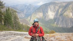 Trip: Lincoln Peak - Wilkes-Booth Route (NW Face) Grade 4+ AI4+ Date: 3/13/2015 Trip Report: Lincoln Peak Wilkes-Booth Route (NW Face) AI4+ Grade 4+ ~2000 ft. FA- M. Rynkiewicz, D. Coltrane 3/13/2015 Michal Rynkiewicz and I climbed the NW face of Lincoln peak via a combination of glacial, alpine, and water ice, with steep snow fields and amazing ridge traversing mixed in. I was inspired to climb this route by a 2010 TR of Assassin Spire by the phenomenal Cascade hardman Tom Sjolseth. His trip report included a few choice picture of the NW face of Lincoln with big inspiring flows that would possibly lead to the summit of Lincoln. Given that and the great snow conditions we have been having this year I didn't really have a choice but to go out and give it a try. We were a little concerned with the warm temps and recent snow, but upon views of the start we couldn't resist. We climbed the route in a single push from the Heliotrope ridge trailhead ascending the NW face and descending the SW face (Standard) route. It was a big day and one of the most amazing routes I have had a chance to climb in the Cascades. I feel very fortunate to be blessed with outstanding partners and to be allowed passage by this amazing mountain. Sunrise on the Sisters Looking at first pitch on Descent. This is the same start as for Assassin Spire and the route shares the lower portion with Shooting Gallery until you get to the upper Ampitheatre. Starting up the first pitch. The upper half of this pitch is the crux with poorly protected overhanging ice of dubious quality. looking down at the overhanging glacier while cruising up through the first snow field. Vertical ice curtain headed up to the glacier. Michal climbing the glacier to gain the upper amphitheater. This was a fun step of glacial ice with good protection. First views of the ampitheatre. We climbed the obvious flow in the middle. It was about 120m of amazing WI3+ plastic ice like I have never seen in the Cascades. We climbed it in two long pitches. There are other climbs to be had along the face. Climbers right is a slightly easier variation that would traverse in to the main flow, and climbers left the gully would probably go with a bit of shenanigans at the top. Setting up an anchor for the first pitch. Michal Starting out the first pitch, this pitch was a full 70 meters with a little simuling on 60m ropes. this was the harder of the two pitches with a few vertical step of ice that had good features. So Much Ice! Starting out the second pitch. This was the easier of the two with one short 85 deg. section at the start and about 50m to the top of the flow. Cruising the upper snow field with the amphitheater below. Amazing ridge climbing along bomber snow and rime. Assassin Spire is the rocky spire down and right. Navigating the upper ridge to the first sub summit. From here we had to downclimb a short portion of rime ice to get to the last pitch to the summit. Looking back at the downclimb section. Such amazing position. Michal Working his way up the last technical pitch to the summit. Looking up the gulley to the summit. This was another full 60m pitch, but relatively easy. Summit Selfie! All that was left was getting off #2 on the hardest peaks in Washington. Just downclimb 2000 ft of steep snow... Out of the danger zone and glad to be heading back. From here we traversed back along the north side of the peak to Heliotrope ridge. Thanks again to my amazing partner for the commitment, and strength to get this huge climb done. Special thanks to The Tom Sjolseth for getting after it and sharing the stoke! I would have never known this was an option without his beta. Daniel Coltrane Gear Notes: 9 screws, 3 pickets, small rack to 2", set of Nuts, and small set of pins, 60m rope Mostly used screws and pickets. Approach Notes: Approached from Heliotrope ridge across the lower portion of the Thunder Glacier.
 -
 Trip: Mt Rideout - Minus Six (NE Face) - 400 m WI3 70 deg. Date: 3/10/2015 Trip Report: The north couloir (aka Minus Five) on Mt Rideout was first climbed by Don Serl, Joe Bajan and Joe Buszowski in January of '83. A classic line that runs straight to the summit. In Feb. 1994, Rob Nugent and Bob Koen took an obvious left forking ramp out of the north couloir, traversing a couple hundred meters left across the midheight ledge of the face to reach a parallel gully to the left, which was followed to the summit ridge with some slabby 5th class rock to exit. Last Tuesday, Maxim de Jong and I climbed a separate gully left of the North Couloir to reach the same Nugent/Koen traverse and finishing gully. I guess the question that is brought up by this is, when is a variation to a variation a new route or not? The line we climbed was independent of the North Couloir throughout, so going by the numbering scheme for the Sumallo Cirque Max thought up in the 90s, our route would be Minus Six Couloir as it's the next line left of Minus Five, which is itself five gullies left of Zero Gully. I'd thought of Sumallo Cirque winter routes for a couple weeks but couldn't find an interested partner and/or was too busy with work. When Max became free, we originally tried to climb this on Sunday the 8th but only brought his pickup, no quad. When we ran into deeply rutted ice crust/snow at the gated bridge, 5 km down valley from the road end, we decided to come back in the midweek with his quad. With the quad, we were able to follow past snowcat, snowmobile and quad trails all the way to near the pulled-out bridge over the west fork of the Sumallo. We walked from there to the base of the face in about an hour. I thought we were there to climb Minus Five, but when we neared the base, I ended up heading into the next gully to the left, just following my nose. Max came along behind and said "Oh, this is where we retreated the last time". Max and Shaun had tried it once before but retreated from below the crux WI3 due to heavy spindrift and wind slab avalanches.We looked at the potential lower traverse into Minus Five and it looked like crap - unbonded melty ice over sloping rock - which left the straight up option as our only option Max coming up to where we started to belay. The straight up option was a narrow runnel of good ice but it was also a spindrift chute from the upper ledge. We waited out a few white powder douches before getting a stable spell. I led through and Max followed. Heading out from the belay, bottom of the ice visible A 60m pitch of WI3 with 5m of near-vertical to start and a long runnel of moderately good ice and snice followed, a couple screws and a couple good nuts helped. I belayed at a widening in the gully above as it opened out to the base of the mid-height ledge that crosses the face. Max led thru and out onto the ledge. We headed right and up to a point overlooking the North Couloir, which we still thought we were going to climb. Max heading to the junction with the Nugent/Koen. I had been supposed to bring pickets but forgot them, so at this point I had untied from the rope and was soloing next to it as that seemed a marginally safer technique. The snow was pretty stable, and there wasn't ,much chance of either of us coming off. The descent down the Nugent/Koen ramp to get into Minus Five looked feasible, but 100-150m of steep downclimbing didn't seem like the best way to make progress either. We saw a lwdge that might cross directly into the north couloir, but it also crossed a couple ribs, with unknown difficulty on the far side of the larger one, and we thought it might be time consuming. So we decided to head left and into the upper Nugent/Koen couloir line, even though we'd seen from below that it had a humungous cornice at the top. We traversed back left across the upper edge of the shelf for about two and a half pitches (some simulclimbing) to get into the upper gully. The rock varied between OK and total shit, so I ran it out 50 m, found a nut, simuled another 50 m, found a horn to sling to back up a crappy pin, and then belayed just beyond when the rock changed back to OK and a splitter nut crack appeared. Max led through into the Nugent/Koen gully. Traversing The upper gully was moderately angled but the cornice at the top looked like a cruise ship's bow hanging out over us, and it had not one but two crown line fractures! It was kinda intimidating. We found one or two sheltered belay spots along the sides of the couloir to huddle under while picking our way up. Max in the couloir Trying to decide which exit to take. We could see two possible ways around the cornice - a gully out right, or traverse a shelf right below he cornice to turn it on the left. I elected to go left. Heading up to the left exit. The left exit was one of the scariest places I have ever been in in the mountains. My helmet was a few centimeters from bonking the underbelly of the cornice, which hung out over my head a couple of meters. I know people bivy under these in the Himalaya and stuff but I couldn't help but think "this thing could drop at any second and if it does I'm fucked." When I got out to the left edge of the cornice, where it kicked back to just less than vertical, I was so relieved, and so worried about the rope cutting in to the overhanging part if I went any further, that I buried Max's old "experimental design" snow fluke and my tools in the snow and belayed right there. Max came up and led through over the bulge and onto the welcome flatness of the east ridge. Max with a couple of meters of steep snow left to go to the top. Once we topped out on the ridge we thought briefly about summiting but weather coming in and a desire to get off the mountain down a gully that we knew had more large cornices saw us decide to just head down. We found away around those cornices, and downclimbed the Silvertip-Rideout col gully all the way back to our tracks from the morning, where snow conditions relented enough that we could finally take off our crampons and plungestep back down the hill. We got back to the quad right at dark, for about a 12 hr round trip day. It was a good route - certainly not the longest on the mountain, but involving some fun terrain. I suppose I still need to go back to summit Rideout, though. Gear Notes: Small-med nuts, a couple pins, 4 tricams, 2 hexes, 4 ice screws (1 ea. 10 cm, 14 cm, 17 cm, 19cm), one "experimental design" flexible aluminum snow fluke from 1990. Should have broght a couple pickets. Single 8.something mm 60 m rope. Approach Notes: Big pickup with quad in back.
 -
Spring Mountain - FA: TickTac 2/22/2015 Trip Report: As promised, the windfalls have been taken care of, and the approach is clear and straightforward, taking about 25 minutes. Friend Chad and I put up a new 35 M pitch that goes from P1 of Ticktock and moves up left to find a nice arete feature that parallels Romantica's P2, ending in a set of belay bolts on a spacious ledge. It's 5.7+/5.8 and makes for a fun outing on great stone (typical of the area). We rapped Ticktock and dug the moss out of the cracks (which had not been scrubbed since 2005). It is in pretty good shape now, just needs a little rain and wind to flush. Gear Notes: 10 draws Approach Notes: Easy
-
.thumb.jpg.d8d6db40947cc944f6d3d87de772c58e.jpg) Trip: mount garfield west peak - preiss route Date: 7/22/1999 Trip Report: As I have never done an official trip report on this climb, I will now. In mid-July 1999 I was under the west peak of mt Garfield, in the woods trying to find the beginning of the rock wall. After traversing in from the trees, left of the rock wall, I gained the large ledge with a weak waterfall on its left side and an obvious stair stepped rock “gully” next to the waterfall. I then made a few difficult, (for me) un-roped moves just below and right of the obvious stair stepped rock. After approx. 60-80ft of climbing the easier “stairs”, I set up my first belay. The belay was in the first crack I came too, on the right side of the “staircase”. After rappelling and retrieving my pack I re-climbed the pitch. At the belay and staying on self-belay I exited the stairs, moving out right slightly to some fun 5.8-9 slabby rock with a few good cracks/pockets to add protection. After A full pitch I reached a shelf with a couple small pools of water on it. After retrieving my pack I went up, angling left, climbing easier rock un-roped until I reached the base of the great slabs. I then climbed sub-par 3rd-4th class rock un-roped, which seemed like awhile (6-700 feet?), eventually aiming for a small, thick stubby tree on the upper right side of the face. From here I self-belayed out of the tree via a few fun moves and went on to the next small tree patch. After retrieving my pack I decided to bivi here. It was only around 630-7pm but I felt like resting some. The tree patch had a few small trees and sandy ground but was tilted and not very comfortable. Looking back I should have went one more pitch and got to the large shelf below the upper headwall. But at the time I didn’t think of it and I can’t remember if I could even see it from where I was. I didn’t bring a stove so I ate my cold sandwich and tried to sleep. I awoke at 4am and started climbing at 430. Still un-roped, I climbed the hard to protect slabby rock. I reached the large ledge in less than a rope length. When on the large shelf below the headwall, I traversed it to its left side and self-belayed a fun (5.7) blocky corner. This pitch ended at a small sandy notch. After retrieving my pack I continued self- belayed up from the notch via a few thin moves (5.9+) with a solid thin crack for protection. After these few moves I reached easier rock on the rib. I continued up easy rock without the rope on until I reached what looked like my last obstacle, a rock wall of maybe 60-80 feet. I tried it with the rope in my pack but I felt it was little hard at the time, and I didn’t want to do something stupid, so I broke out the rope again. It seemed it was in the 5.8/9ish range with good protection. And then was finished. I walked A little down and left thru a small gap in the trees to the gentle northern slopes, then walked right 40-50 feet and climbed the back side of the final 30 foot summit rock. It was 1230pm. little did I know I would miss work the next day as I had a mini epic descent, but that’s another story. Preiss route IV 5.8/9 west peak mt Garfield July 1999. I belayed 4-5 harder pitches (with good pro) out of aprox 14-16(?) pitches. I took my camera but unfortunately I forgot to load the film before I left my car. Small/med rock rack to 3 inches. didn't need pins http://www.cascadeclimbers.com/plab/data/504/medium/2014-11-21_21_29_57.png[/img]
Trip: mount garfield west peak - preiss route Date: 7/22/1999 Trip Report: As I have never done an official trip report on this climb, I will now. In mid-July 1999 I was under the west peak of mt Garfield, in the woods trying to find the beginning of the rock wall. After traversing in from the trees, left of the rock wall, I gained the large ledge with a weak waterfall on its left side and an obvious stair stepped rock “gully” next to the waterfall. I then made a few difficult, (for me) un-roped moves just below and right of the obvious stair stepped rock. After approx. 60-80ft of climbing the easier “stairs”, I set up my first belay. The belay was in the first crack I came too, on the right side of the “staircase”. After rappelling and retrieving my pack I re-climbed the pitch. At the belay and staying on self-belay I exited the stairs, moving out right slightly to some fun 5.8-9 slabby rock with a few good cracks/pockets to add protection. After A full pitch I reached a shelf with a couple small pools of water on it. After retrieving my pack I went up, angling left, climbing easier rock un-roped until I reached the base of the great slabs. I then climbed sub-par 3rd-4th class rock un-roped, which seemed like awhile (6-700 feet?), eventually aiming for a small, thick stubby tree on the upper right side of the face. From here I self-belayed out of the tree via a few fun moves and went on to the next small tree patch. After retrieving my pack I decided to bivi here. It was only around 630-7pm but I felt like resting some. The tree patch had a few small trees and sandy ground but was tilted and not very comfortable. Looking back I should have went one more pitch and got to the large shelf below the upper headwall. But at the time I didn’t think of it and I can’t remember if I could even see it from where I was. I didn’t bring a stove so I ate my cold sandwich and tried to sleep. I awoke at 4am and started climbing at 430. Still un-roped, I climbed the hard to protect slabby rock. I reached the large ledge in less than a rope length. When on the large shelf below the headwall, I traversed it to its left side and self-belayed a fun (5.7) blocky corner. This pitch ended at a small sandy notch. After retrieving my pack I continued self- belayed up from the notch via a few thin moves (5.9+) with a solid thin crack for protection. After these few moves I reached easier rock on the rib. I continued up easy rock without the rope on until I reached what looked like my last obstacle, a rock wall of maybe 60-80 feet. I tried it with the rope in my pack but I felt it was little hard at the time, and I didn’t want to do something stupid, so I broke out the rope again. It seemed it was in the 5.8/9ish range with good protection. And then was finished. I walked A little down and left thru a small gap in the trees to the gentle northern slopes, then walked right 40-50 feet and climbed the back side of the final 30 foot summit rock. It was 1230pm. little did I know I would miss work the next day as I had a mini epic descent, but that’s another story. Preiss route IV 5.8/9 west peak mt Garfield July 1999. I belayed 4-5 harder pitches (with good pro) out of aprox 14-16(?) pitches. I took my camera but unfortunately I forgot to load the film before I left my car. Small/med rock rack to 3 inches. didn't need pins http://www.cascadeclimbers.com/plab/data/504/medium/2014-11-21_21_29_57.png[/img]


