JasonG
-
Posts
5259 -
Joined
-
Days Won
343
Everything posted by JasonG
-
ummmmmm, yeah. None of us were in our happy places after the fall.
-
Ugh. That descent is tedious when dry, it looks terrible with thin snow. Well done!
-
I have a pdf I can send you..... The spirit of Dallas lives!
-
While it may be possible, I don't ever leave the crampons and axe at home on a major peak this time of year. It is a long way to go to be turned around by a section of icy neve. But I don't have firsthand experience on Dakobed this time of year.
-

[TR] Washington North Cascades - West Ridge of Colfax Peak 10/06/2018
JasonG replied to Eric Carter's topic in North Cascades
Sweet! I bailed off the C-H many years ago and probably won't be back. But I could see myself doing this! Looks like a good fall route. I would imagine that cornices might prove to be a problem in the spring? -
A fully enclosed (all four sides) bombay chimney in the upper summit ridge, right above one of the Doorish routes (I think).. The final bit of the Diamond overhangs so dropping rocks down the chimney means they don't touch anything for a long way. It is totally wild, and completely unique in my Cascadian ramblings.
-
Climate change, the latest findings, and how we use the outdoors?
JasonG replied to jon's topic in Climber's Board
Totally agree, but if people don't think their actions matter, that is also wrong. The issue is whether of the majority of people in the world care enough about carbon emissions to change their behavior and the way the global economy is structured. And on that point it is pretty obvious that they haven't, and likely won't, until it makes economic sense. -
Climate change, the latest findings, and how we use the outdoors?
JasonG replied to jon's topic in Climber's Board
The only real organizing people need to do is pay attention to how they vote (both with their dollars and ballot). It all flows from that. Every election is an opportunity towards revolution. Just look at 2016. -
Climate change, the latest findings, and how we use the outdoors?
JasonG replied to jon's topic in Climber's Board
Huh? Who is buying all that fuel? I know you and I are, with everyday decisions, including where we set the thermostat, how far we live from work, etc. -
That thing is crazy!!! I'll have to go back thru my slides to see if I have any. I have fond memories of dropping rocks thru it and watching them touch nothing for a very long time.
-
Climate change, the latest findings, and how we use the outdoors?
JasonG replied to jon's topic in Climber's Board
You can get to pretty much a lifetime of trips in a 1991 Civic and a few minutes of walking. I'm going on 21 years with that option. -
Climate change, the latest findings, and how we use the outdoors?
JasonG replied to jon's topic in Climber's Board
I'm not sure a lot has changed since this national address got Jimmy Carter laughed out of the White House: I don't think either party is very interested in trying to put the pinch on people's lifestyles, 40 years later. Maybe I'll be proven wrong, but I suspect that we'll keeping pumping and burning until it isn't profitable to do so (and I don't suspect that global carbon taxes will make it not profitable any time soon). -
Hahaha!!! @sepultura has been skiing up there for decades. He'll fill you in for a few barrels of Canadian Hunter. As you've gathered, it is a small community of backcountry enthusiasts.
-
[TR] McMillan Spire - South Face to West Ridge 09/28/2018
JasonG replied to BruceKaufman's topic in North Cascades
Perhaps the fastest time from joining CC.com to a TR? You're certainly in the running @BruceKaufman. Keep 'em coming! -
[TR] Mount Chaval - Standard Western Ramp 09/28/2018
JasonG replied to JasonG's topic in North Cascades
Added captions ...... -
[TR] Mount Chaval - Standard Western Ramp 09/28/2018
JasonG replied to JasonG's topic in North Cascades
This road is no longer accessible, I think as of this year. 15+ years ago I came out this way from Chaval and I agree that it was a decent trail. Given that you can't drive the Grade Creek Road any longer, probably the Jug Lakes fisherman path will be the only trailish option going forward. It looked ugly getting from the upper Jug Lake to the 6100' col though, at least without snow. And yes, Granite Lakes!!! -
Yeah guys, thanks for all the years of hilarity and beta overload! I went from a single young buck to a married middle aged dude with two kids in those 17 years. I'm still at the same desk with the same title though, which is somewhat strange, funny, and depressing all at the same time. @gapertimmy @jon @olyclimber
-
So......I've never climbed at Beacon. Are these all free-solos you're doing on 5th class terrain?? I have to admire your determination no matter the grade.
-
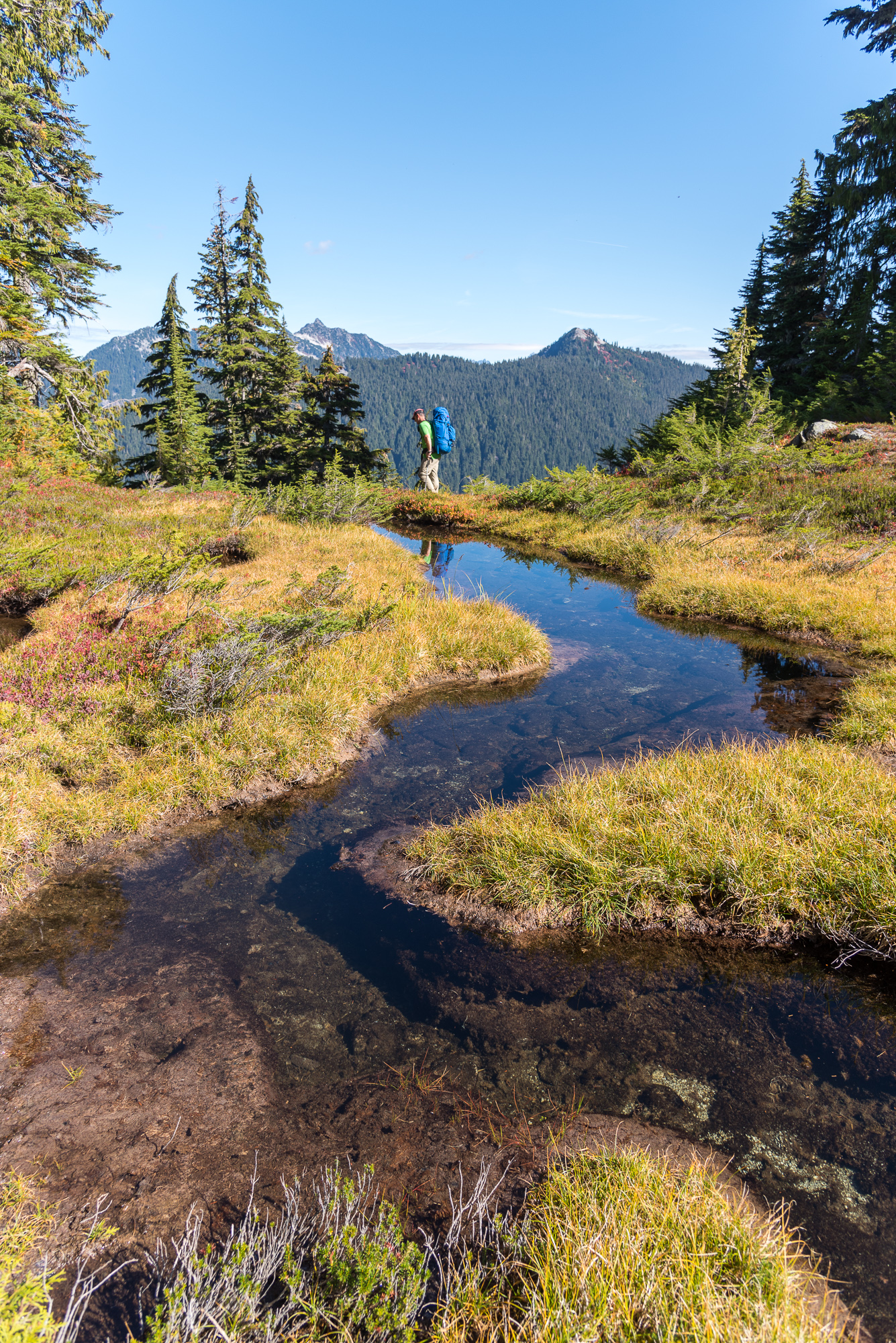
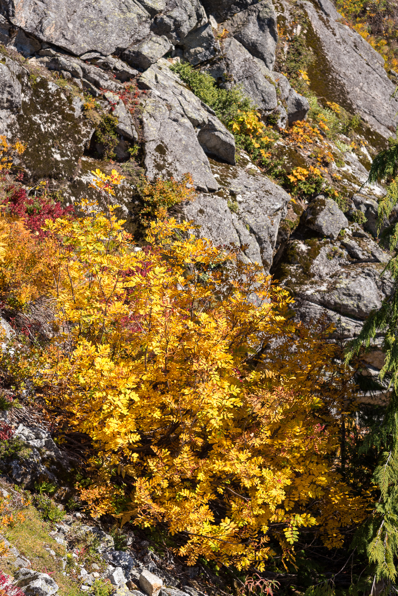
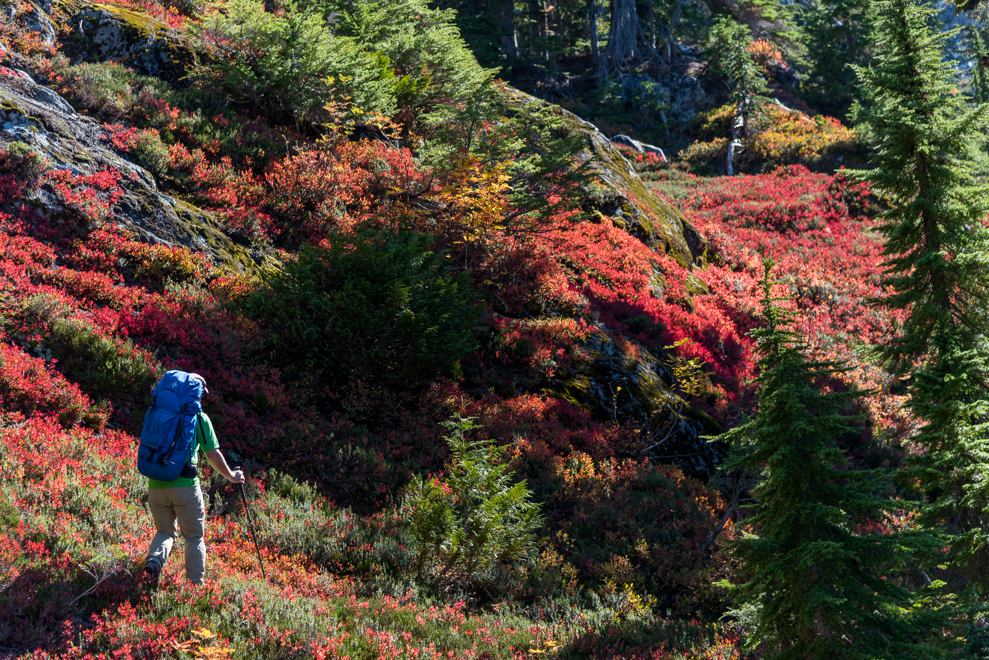
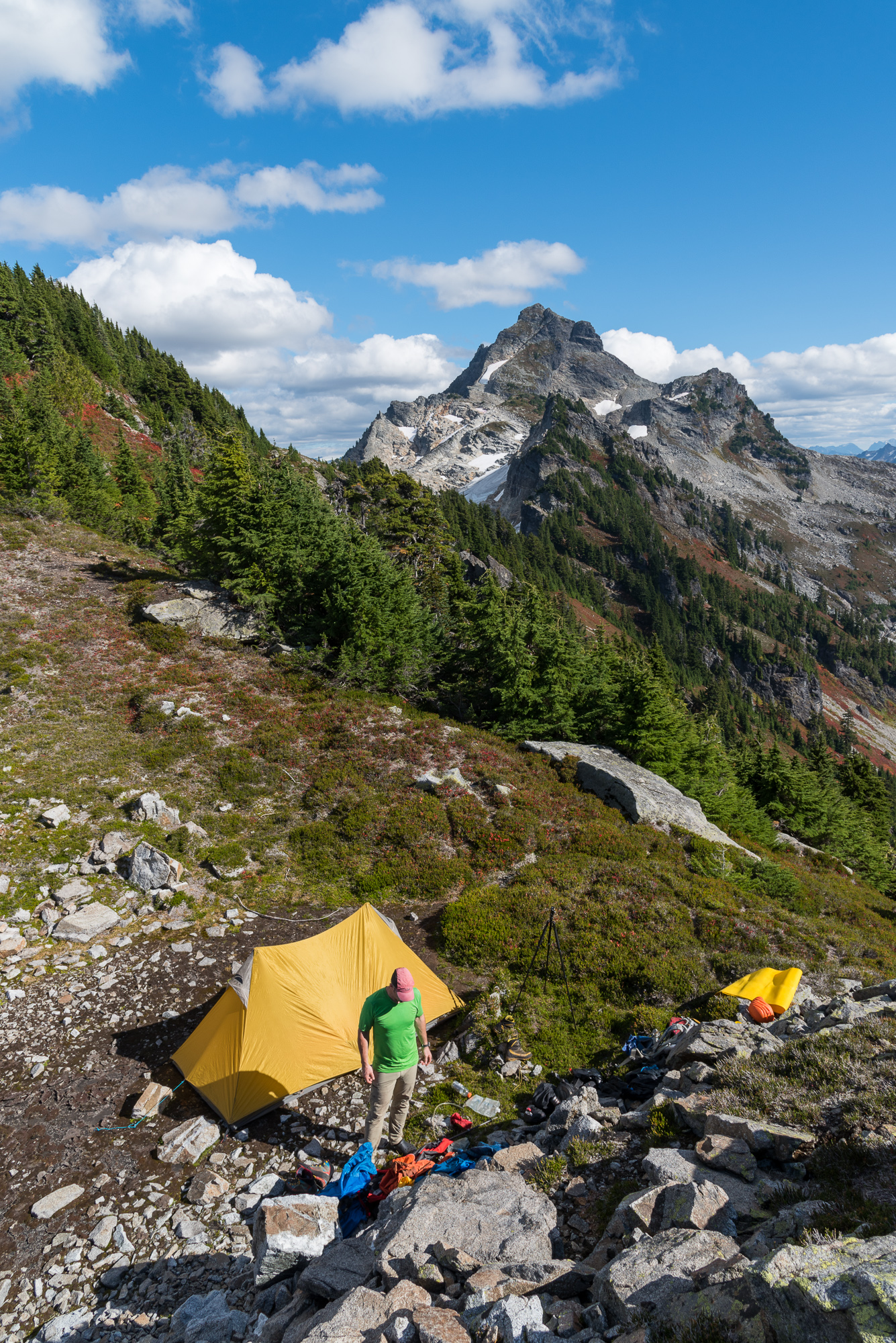
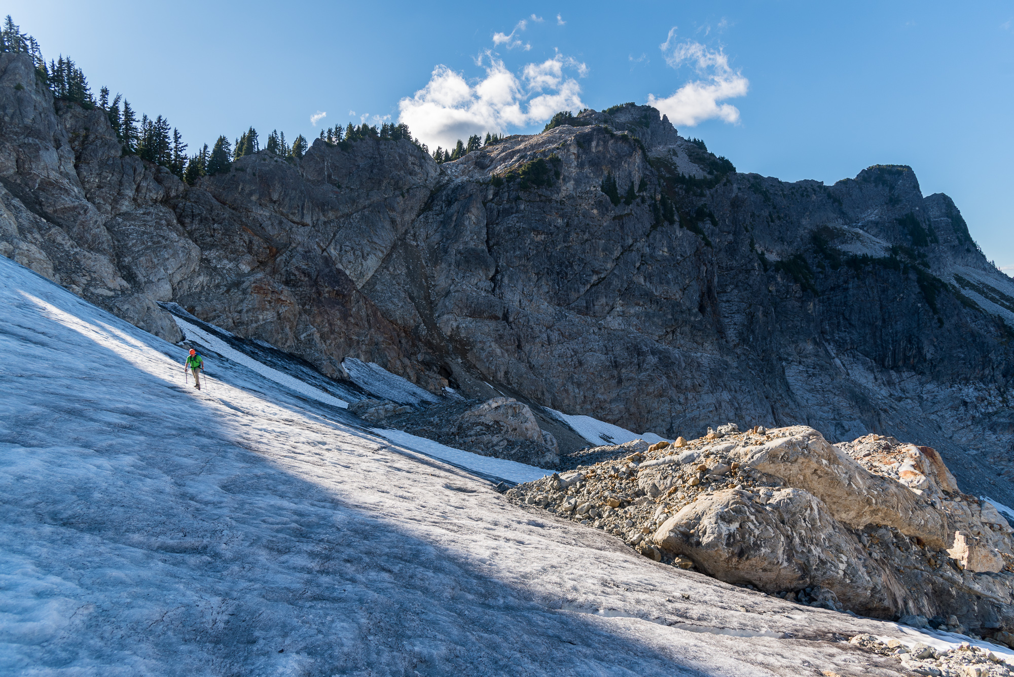
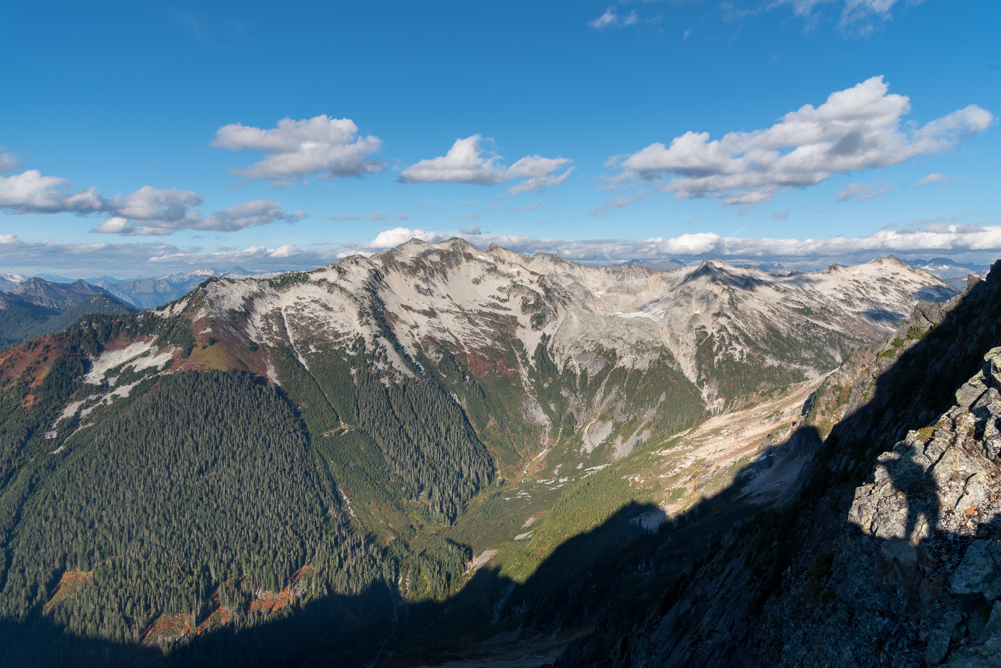
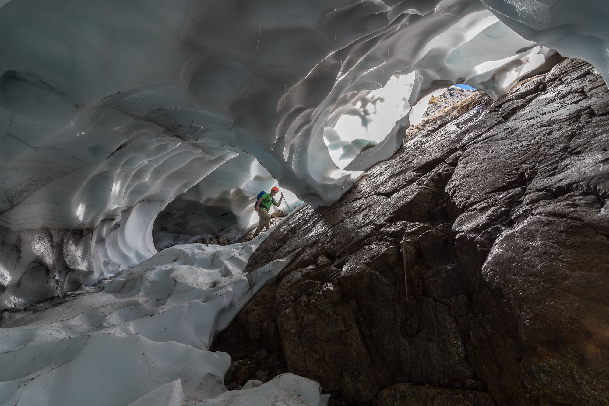
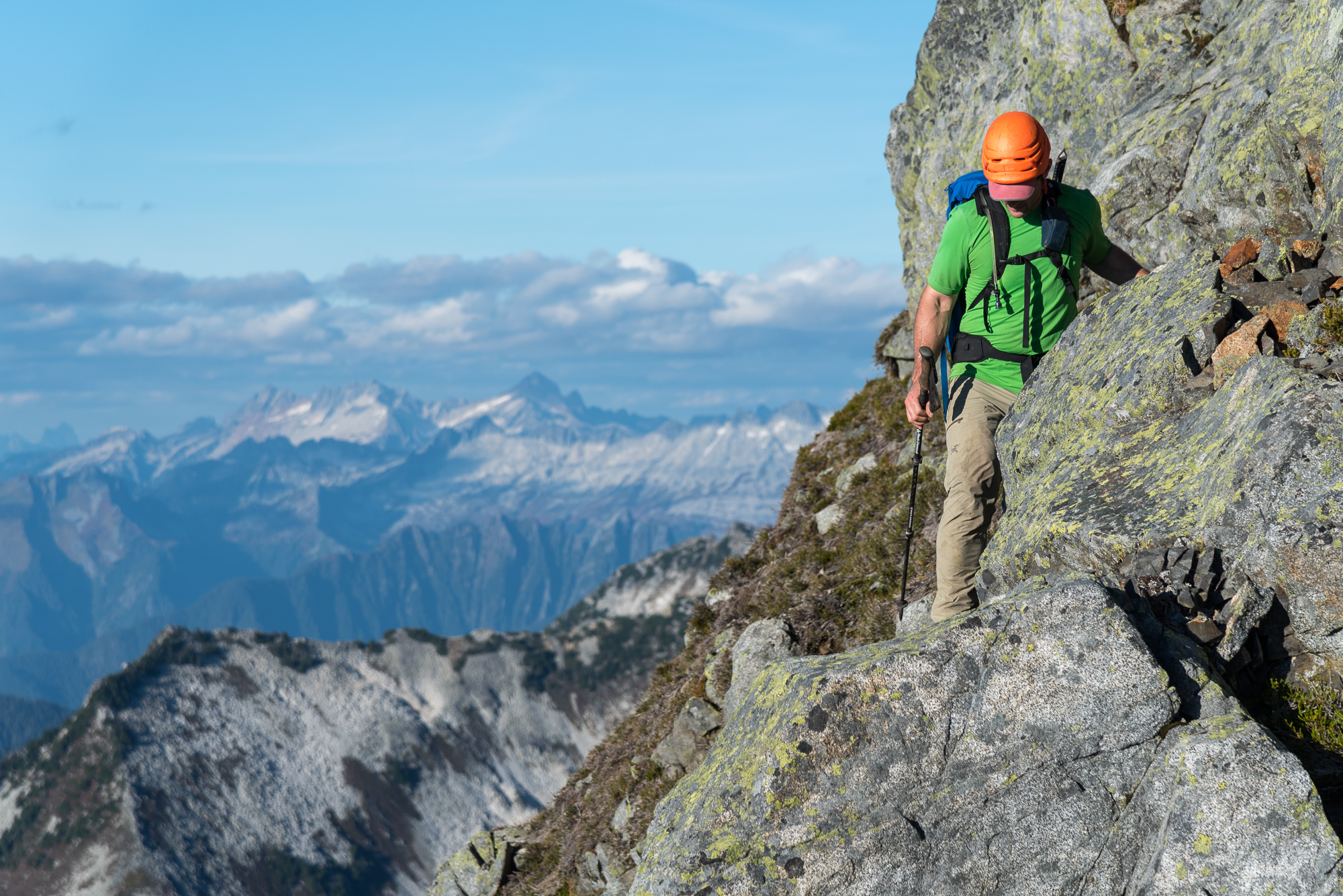
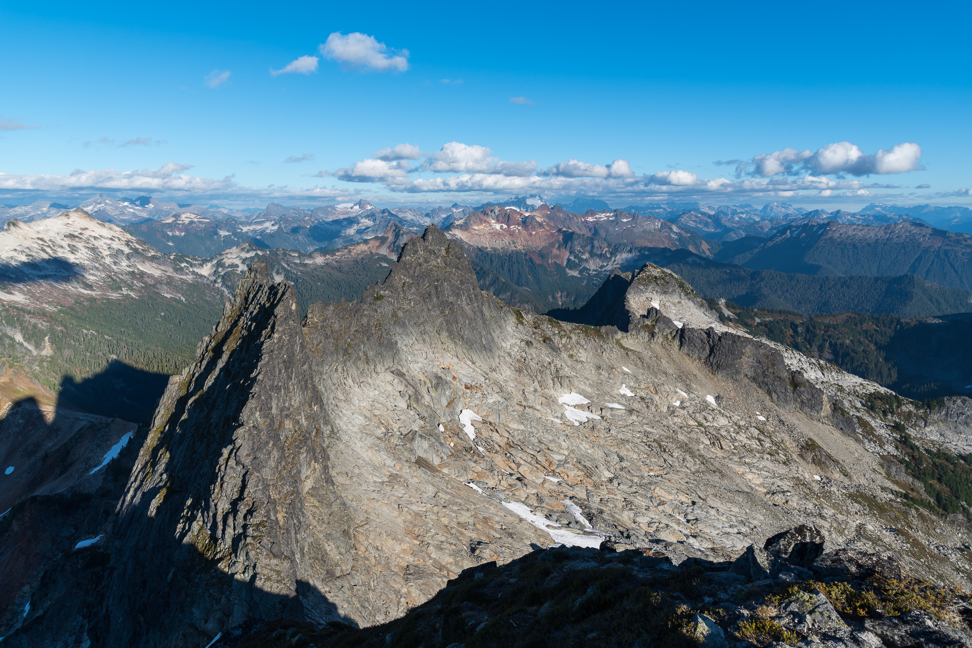
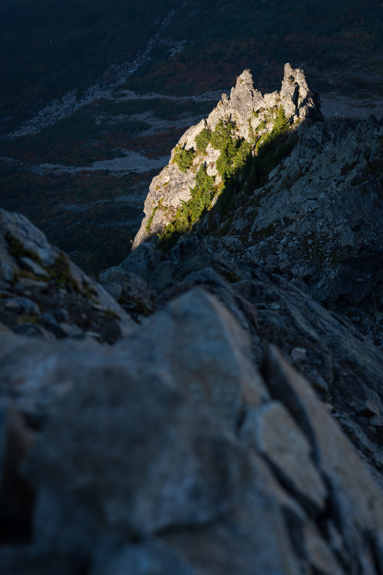
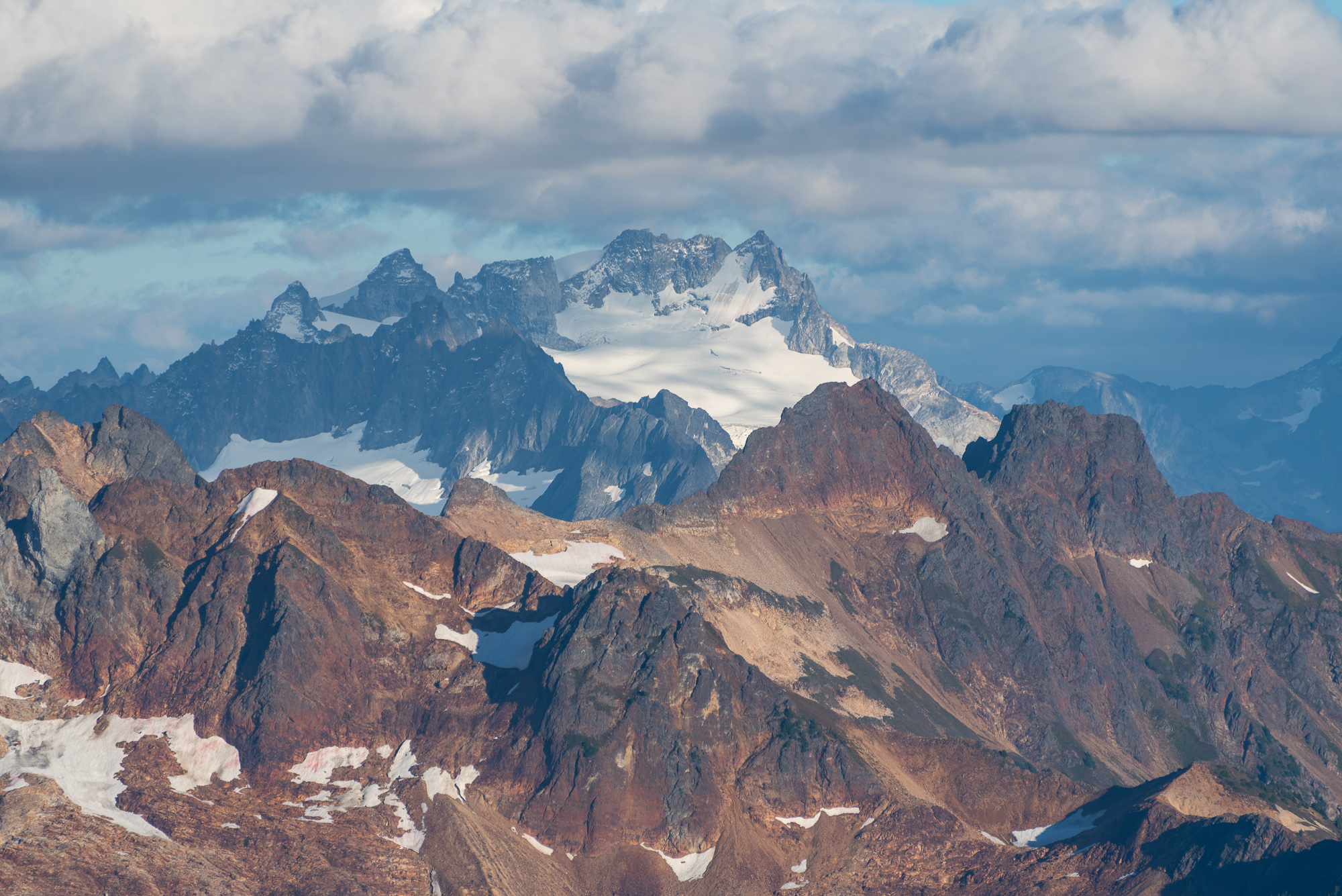
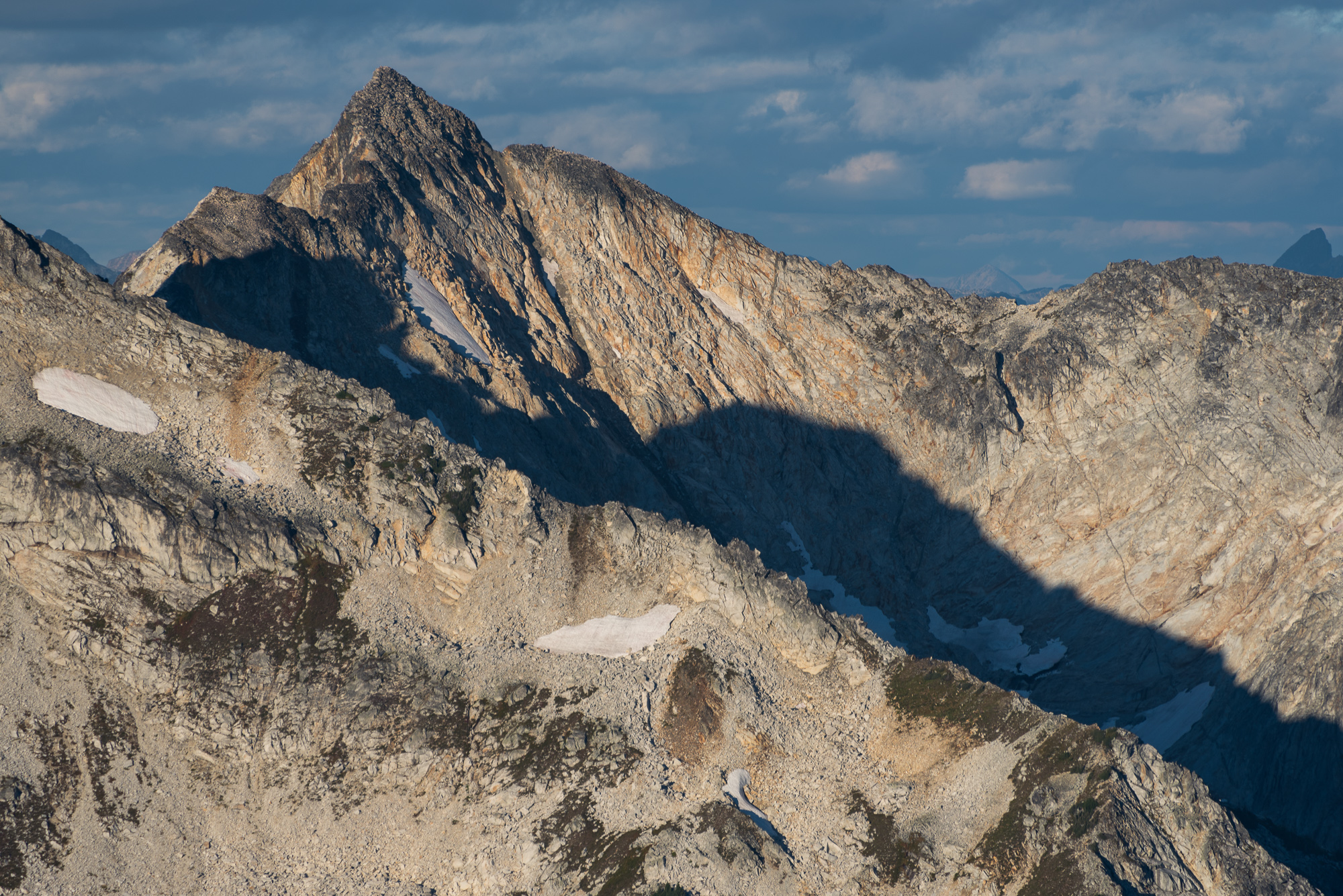
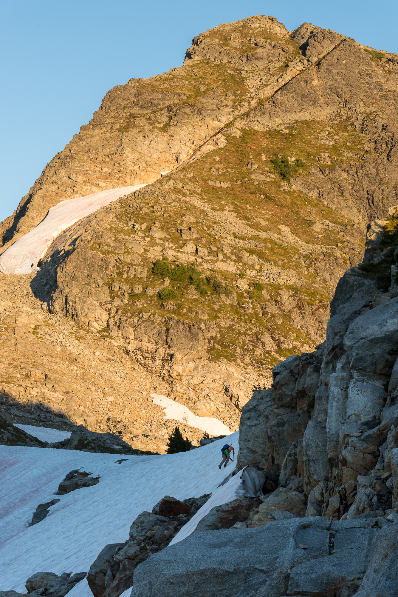
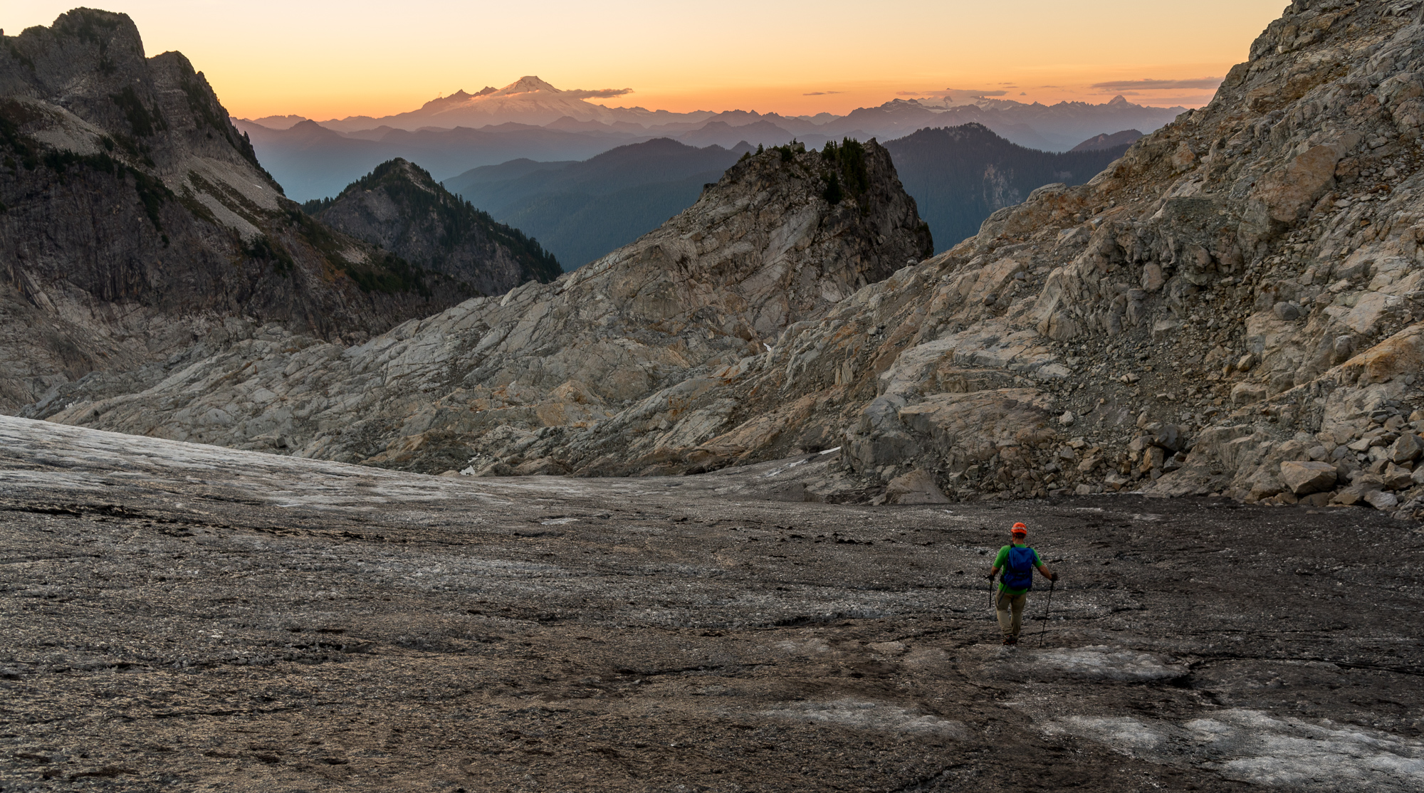
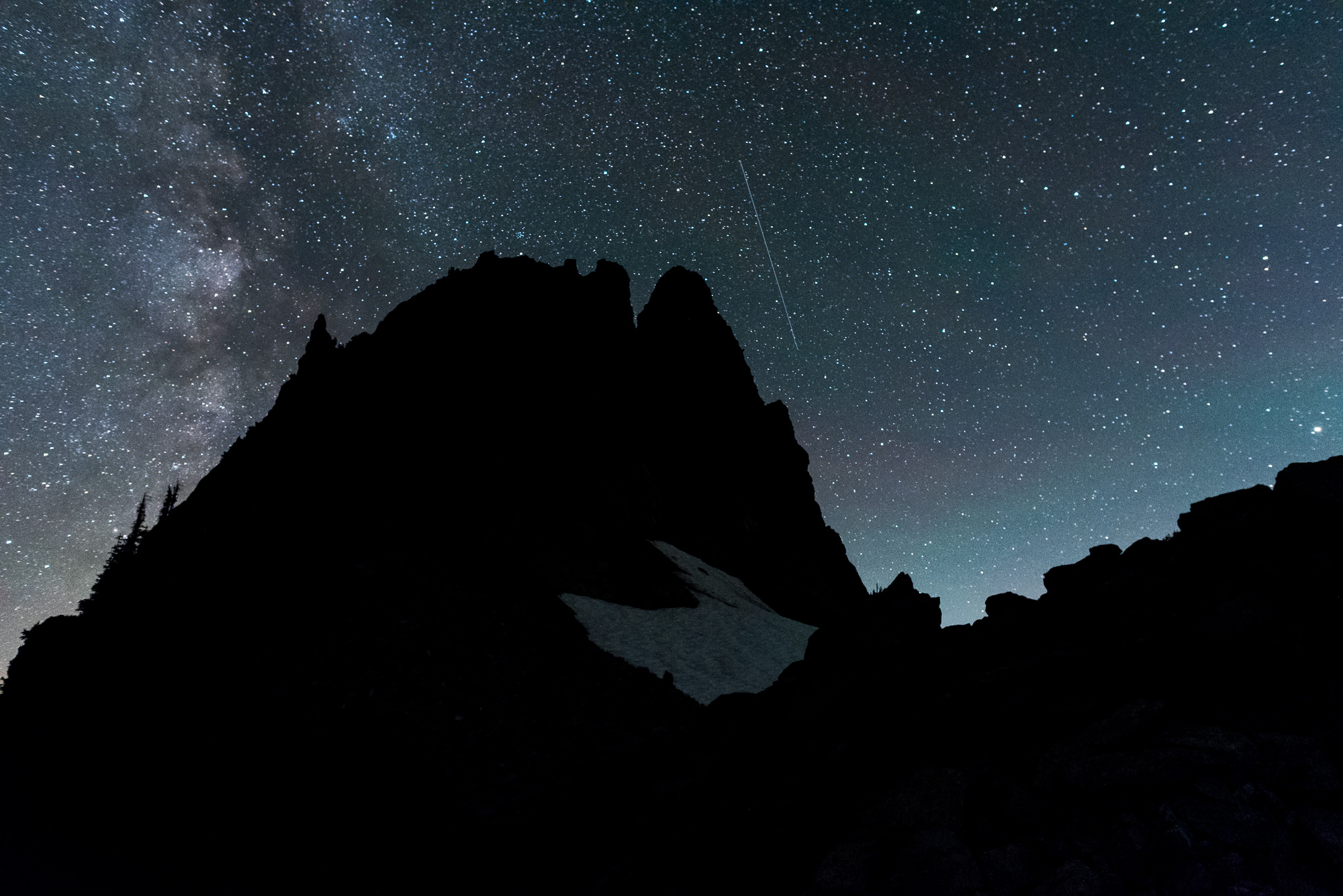
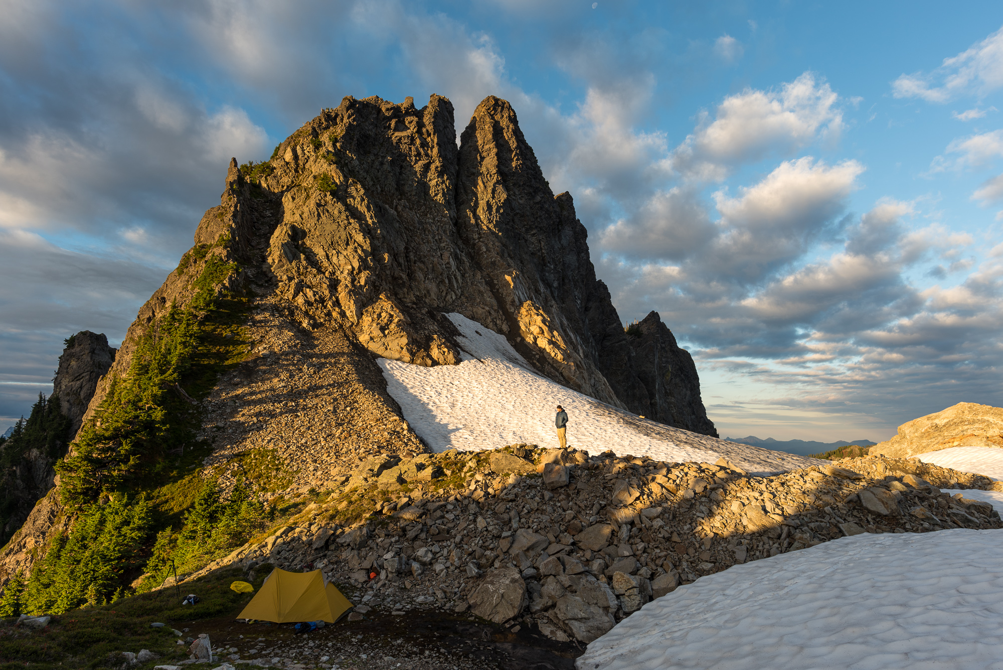
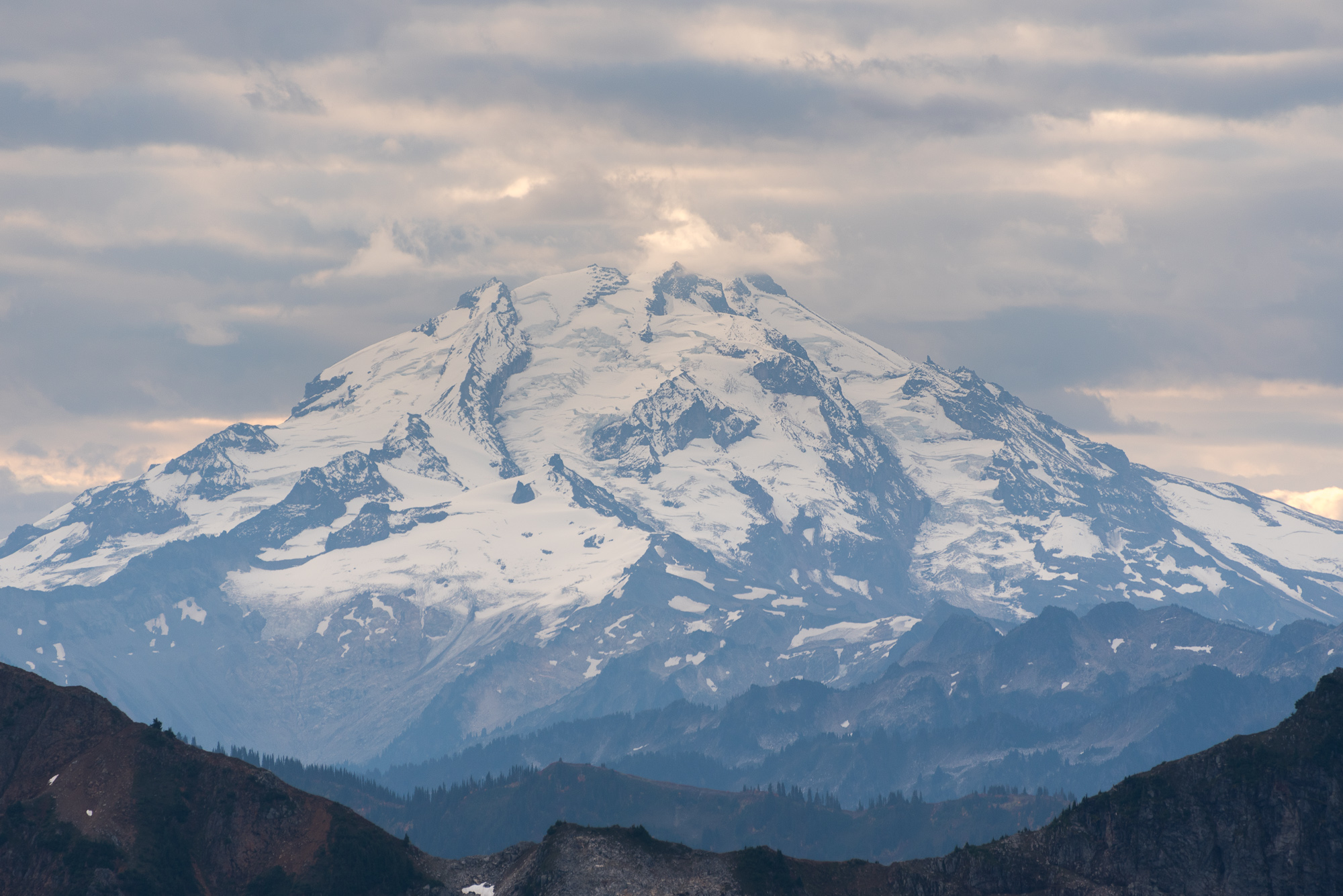
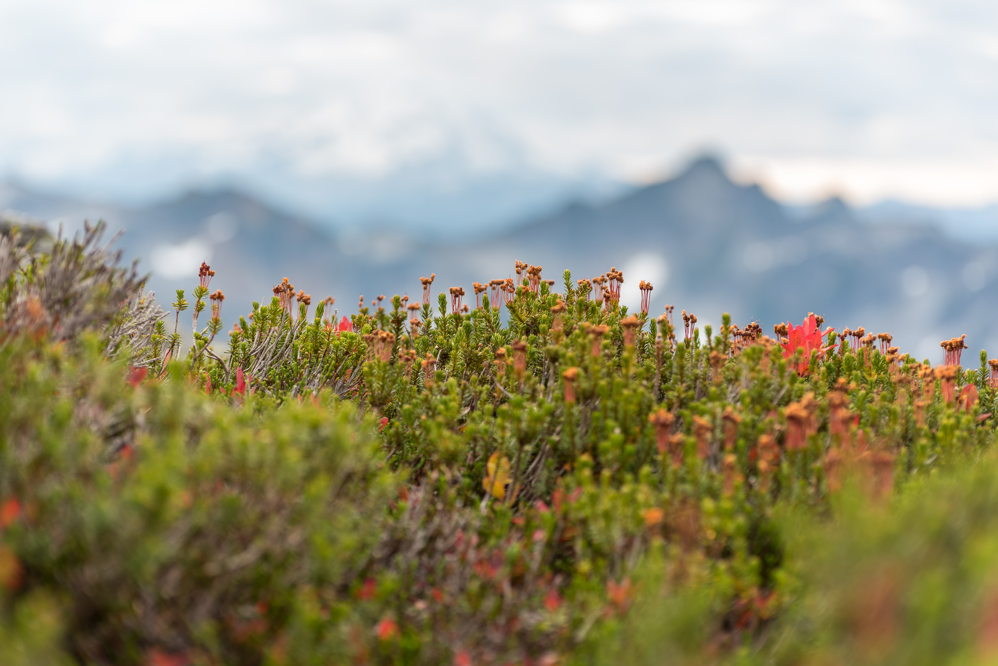
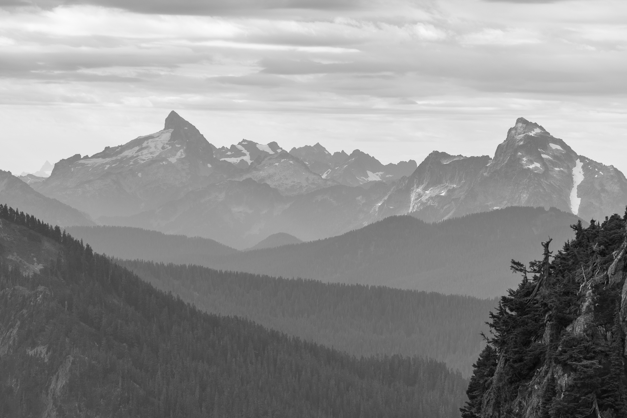
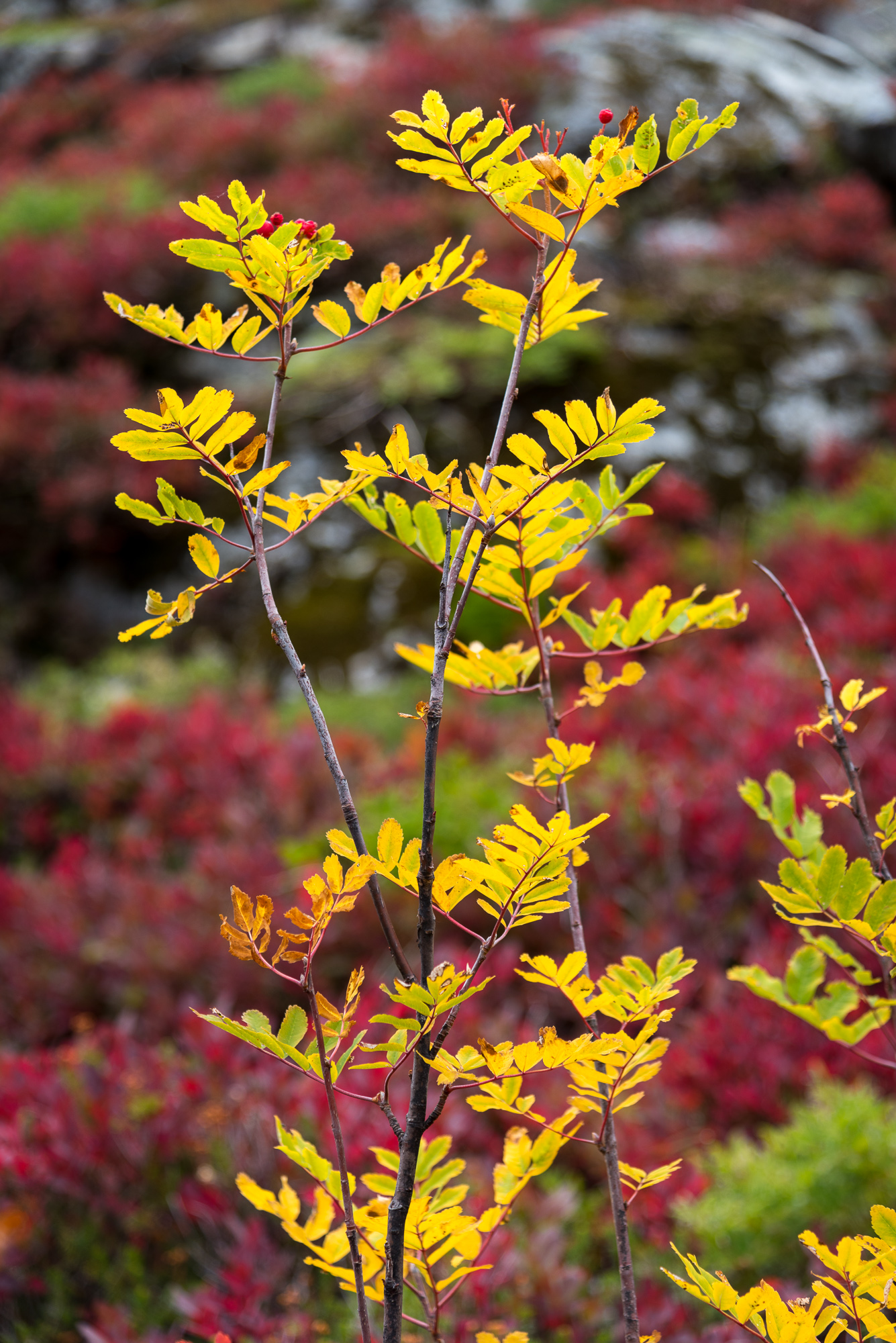
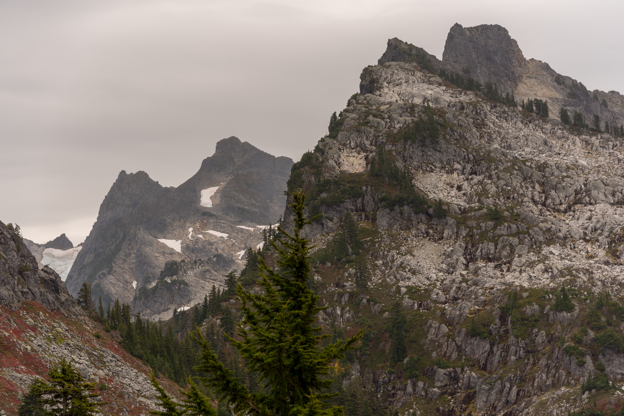
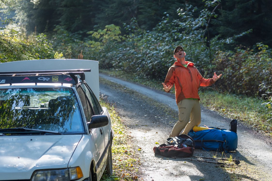
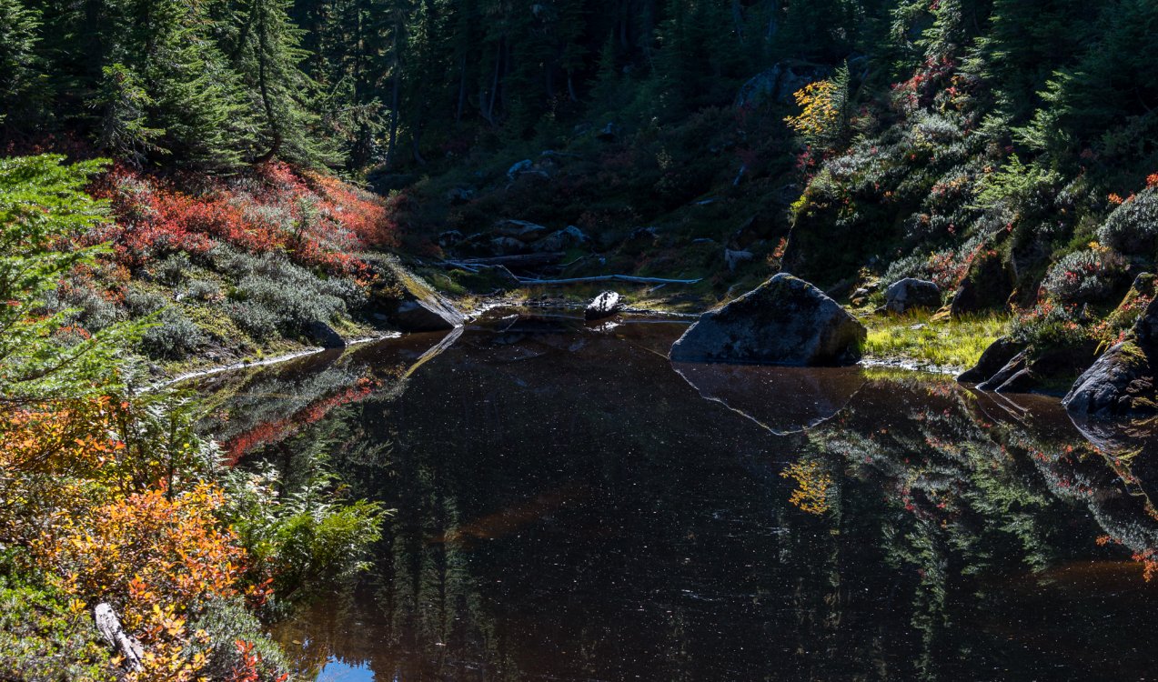
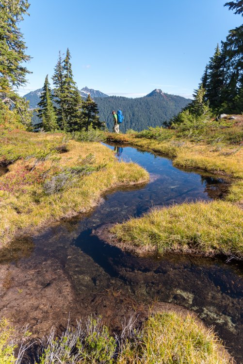
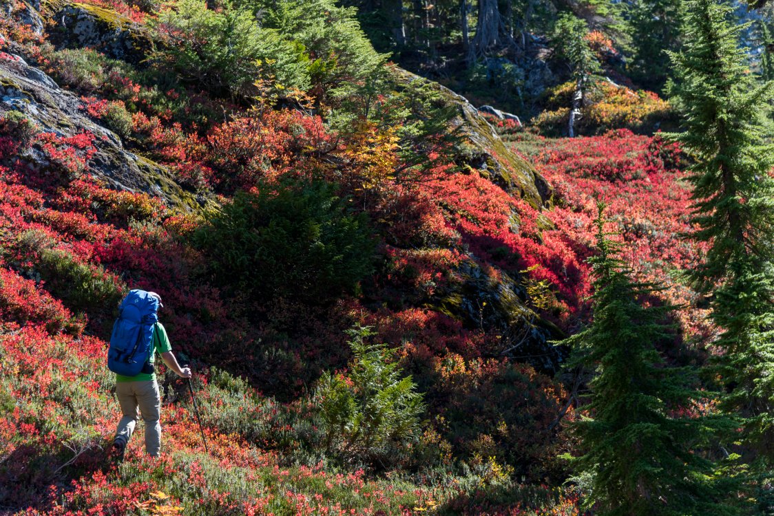
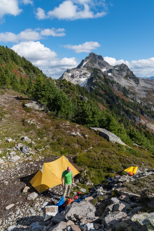
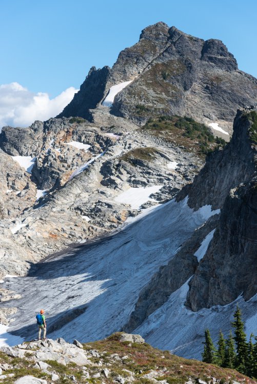
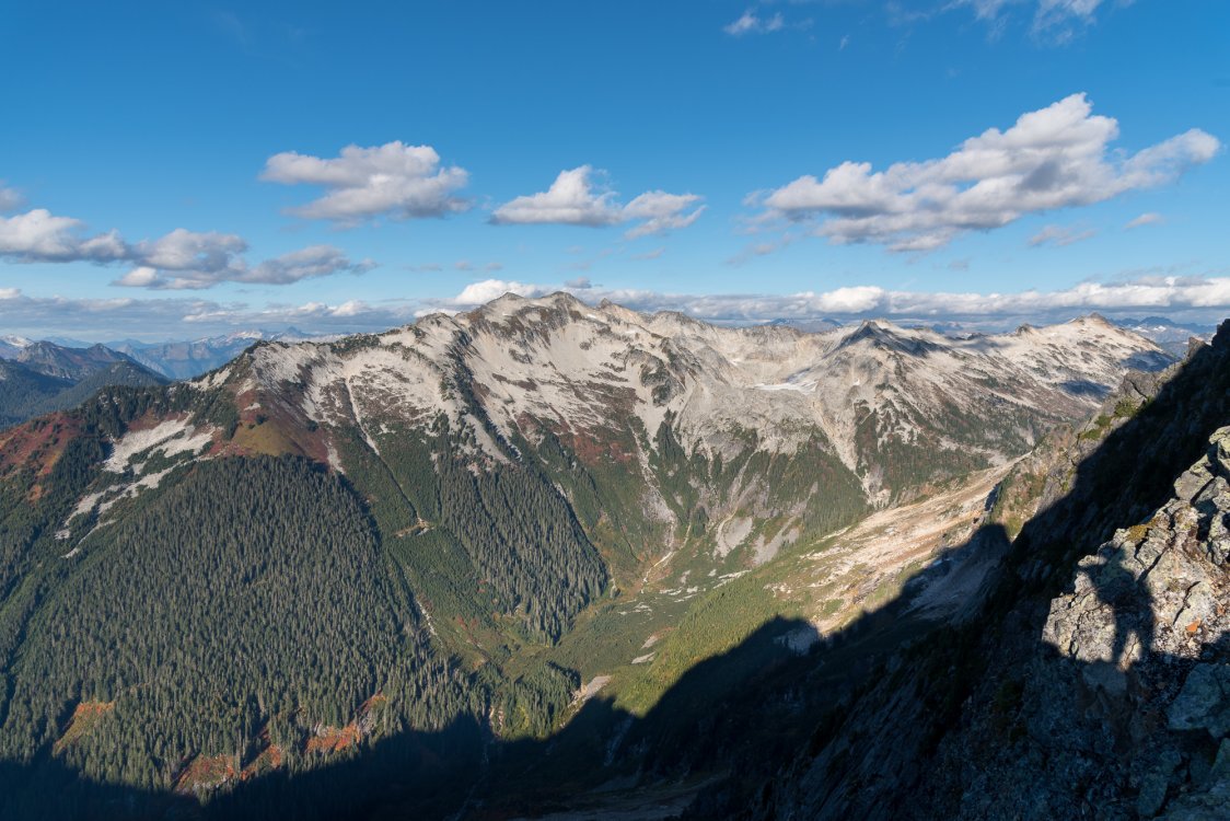
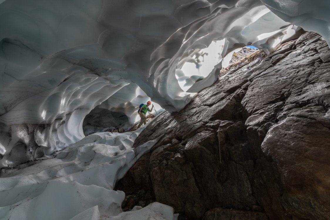
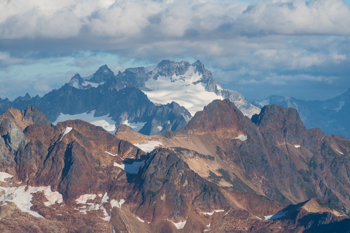
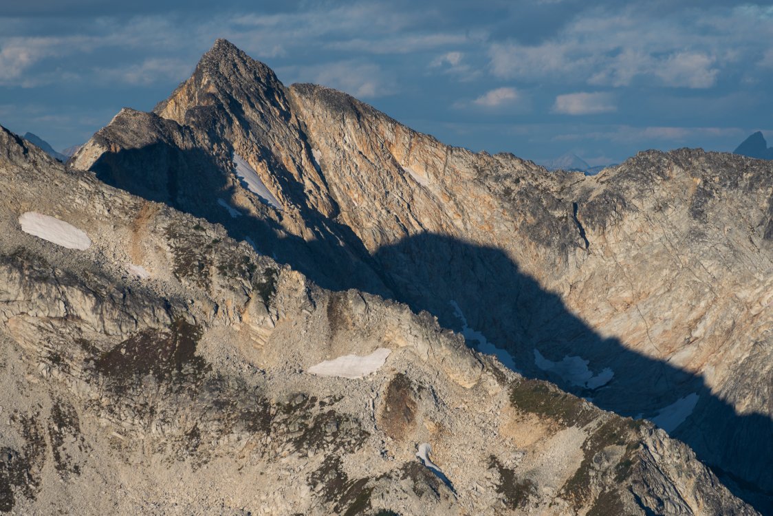
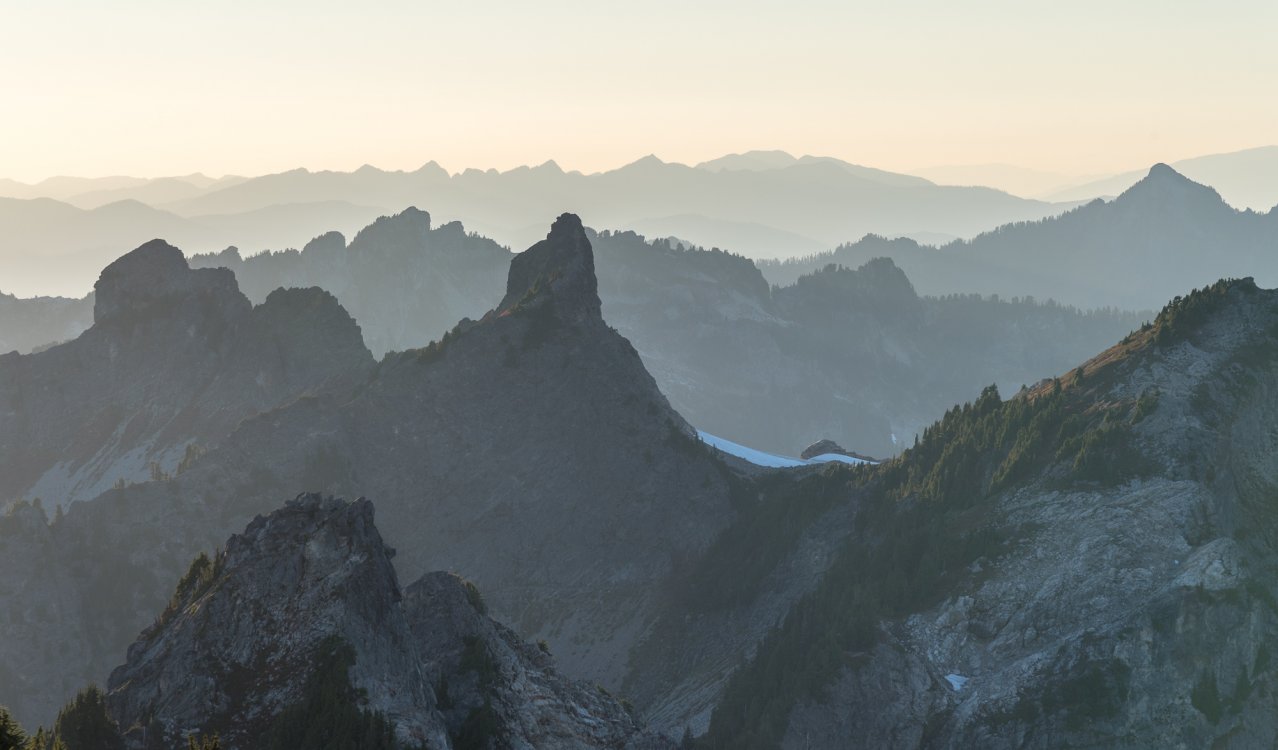
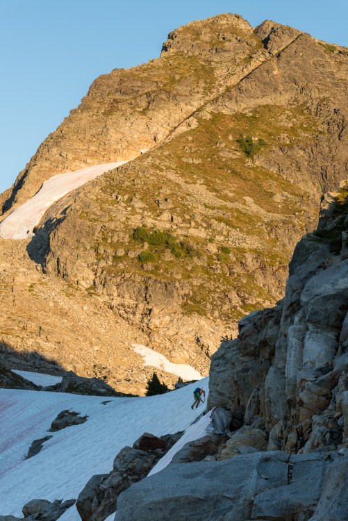
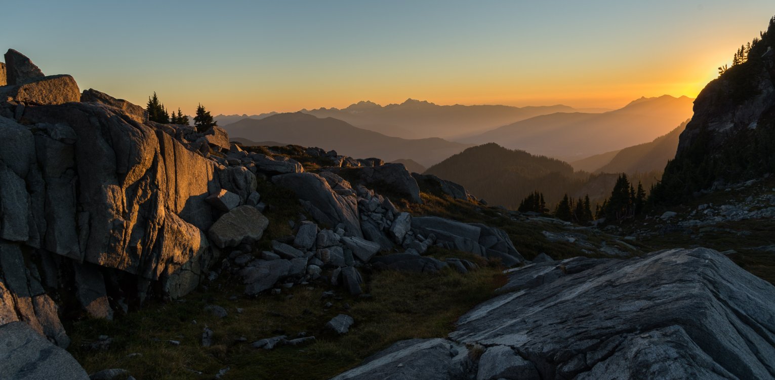
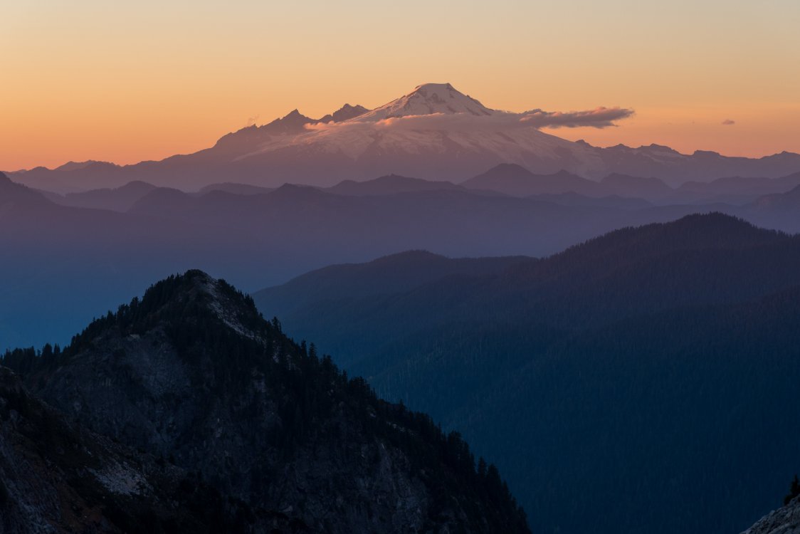
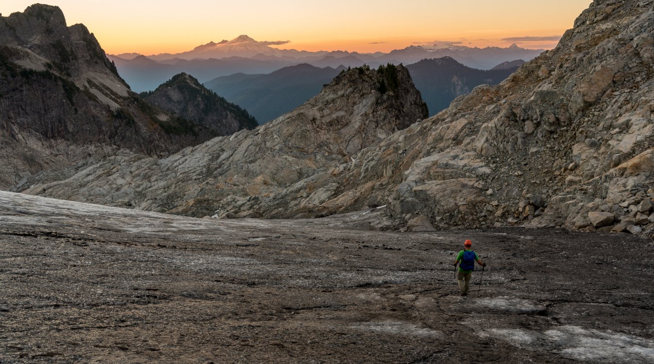
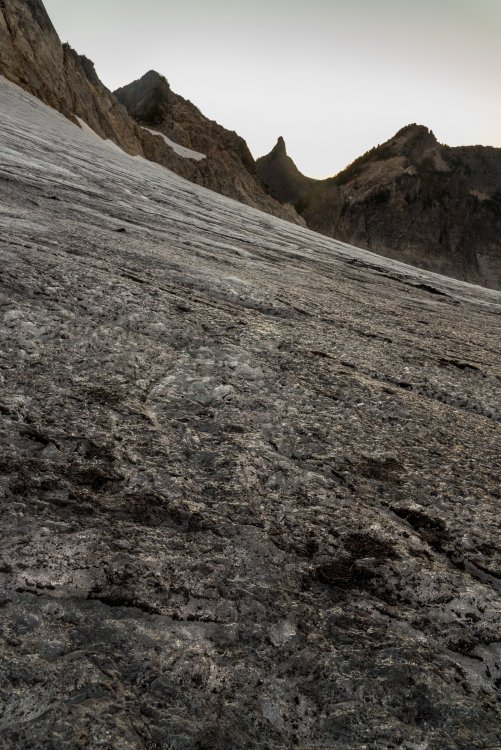
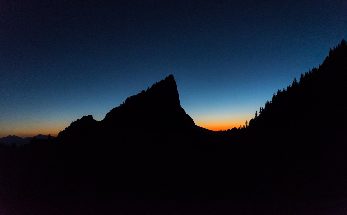
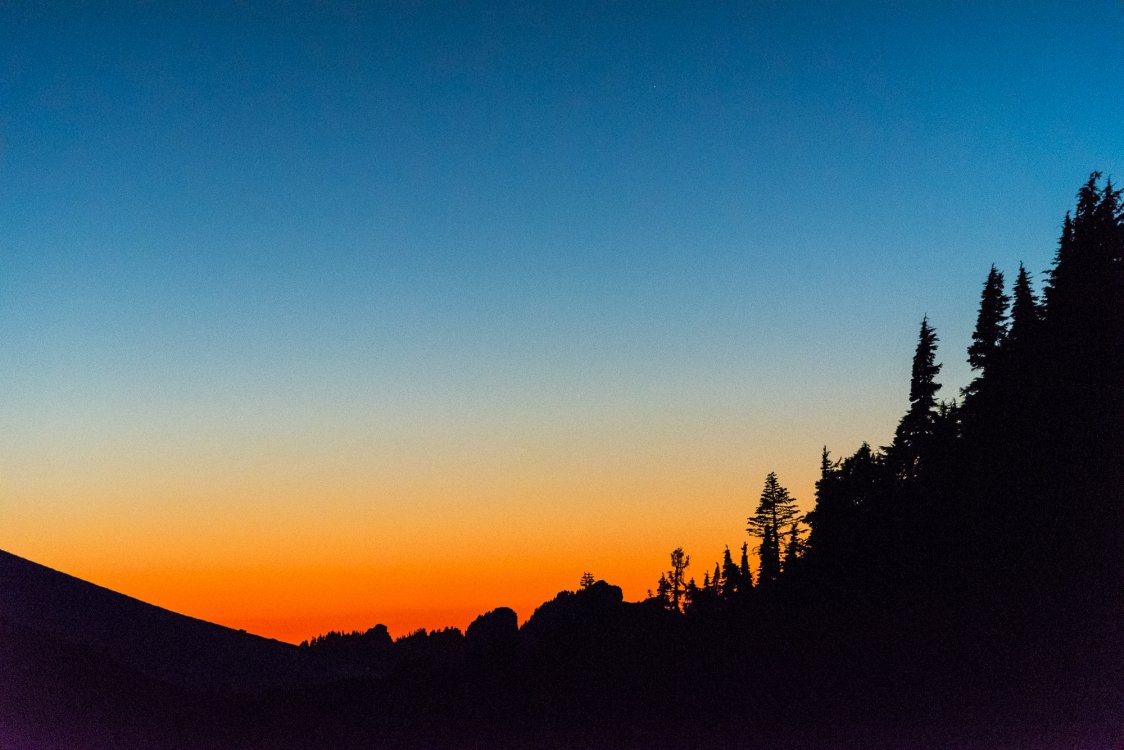
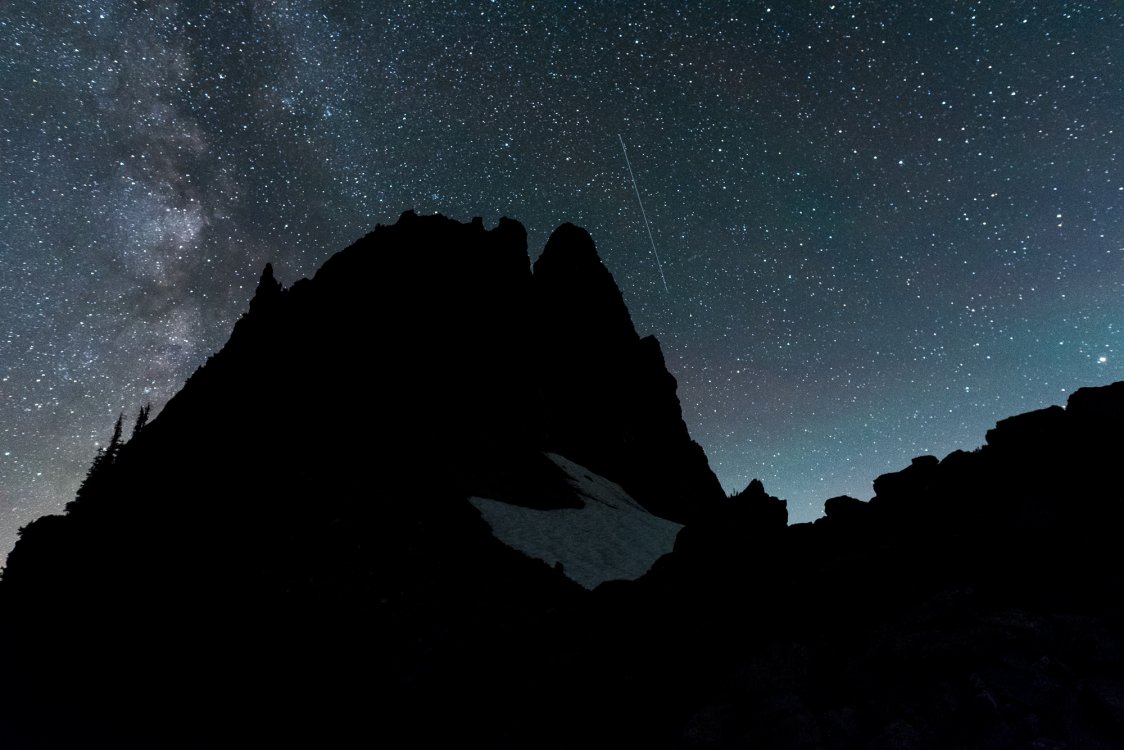
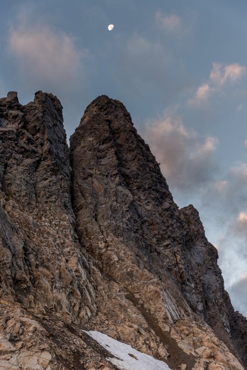
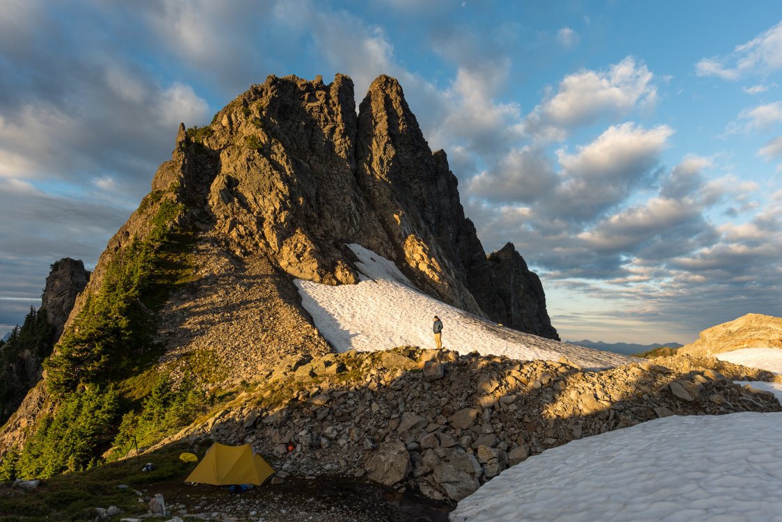
Trip: Mount Chaval - Standard Western Ramp Trip Date: 09/28/2018 Trip Report: Ahhhhhhhhhhh.....fall in the high country. Perhaps my favorite time of year. Crisp air, vibrant colors, no bugs, and long enough nights to actually get some sleep. Sure the glaciers are wrecked and the rock often damp, but it give you an excuse to head off the beaten path and do a bit of chossing! And chossing Kit and I did this past weekend on Chaval. We had the pleasure of zero trail between the car on the Illabot road and the peak, flavored by terrain that was always just a bit more rugged than the map would suggest. Given the modest altitude and barriers to admission, I was a little surprised that 2-3 parties a year climb Chaval. I guess its prominence from Darrington draws many potential suitors. At least one likely got more than they bargained for. We found a pair of Merrell boots neatly tied to each other and hung over a tree branch on the ridge leading to camp. Huh? We couldn't come up with a good reason to leave a pair of boots like that in the middle of such rugged terrain, or at least one that didn't involve a rescue. Just another Cascadian mystery that I probably will never find the answer to. And isn't mystery a big part of what draws us back to the hills time and time again? CHAVAAAAAAAAAAAAALLLLLLLLLLLLLLLL!!!!!!! Mount Chaval, "It's like rehab for fat people" . Kit pauses at infinity fat camp. It doesn't get much better for fall colors on the west side: There she be, from camp. Kit had steel, I had aluminum. One was better than the other. Snowking: This wasn't mandatory, but it sort of was, just because it was there. Kit just below the summit: The view east from the top of Chaval: Dome: Snowking: Trying to beat the sunset: Time to get out the headlamps: The gloaming has begun: Yes, it looked like we attacked North Korea: My favorite: Dakobed: Sloan, Monte Cristo Peaks, and Pugh from camp: As we hiked out, the rain began to fall: Gear Notes: Helmet, ice axe, crampons Approach Notes: Park on Illabot road, on the western end of the old clear cut near the bridge over Illabot creek. Diagonal across lower part of unit, cross small stream to gain rib which is followed steeply upward to the top of the old unit. Angle up and left to ridge, topping out near small tarn on USGS quad. Follow ridge, generally, to 6100' col where good camps lie with year round water. You'll need to deviate here and there from ridge as it is craggy in sections. Past 6100' col you'll drop off north side to glacier via crappy gully (late season) or steep snow. Follow glacier up to ridge again and the prominent ramp which splits west face of Chaval. Take that ramp all the way to summit ridge and summit via some exposed class 3.


-
Chair Peak - Found skis, boots, jacket, and pants
JasonG replied to george 19's topic in Climber's Board
Littering isn't very interesting -
Chair Peak - Found skis, boots, jacket, and pants
JasonG replied to george 19's topic in Climber's Board
Right spot, and perhaps an interesting story behind it all. -
Thanks for this honest tale @Dannible. I've had a couple close calls myself and now subscribe closely to the advice you give above. For others, they didn't get the second chances we have now. Please don't roll the dice if you are a newer/younger/bold climber. It doesn't take that long to put a rope on.
-
I was wondering if anyone would notice that. A rarity!
-
[TR] [TR]Mount Pugh - Standard scramble route 09/19/2018
JasonG replied to Zeno's topic in North Cascades
https://caltopo.com/map.html#ll=48.14517,-121.3716&z=15&b=t Consult the Green Cascade Alpine Guide for additional routes. -
So stoked!