Alisse
-
Posts
456 -
Joined
-
Last visited
-
Days Won
35
Everything posted by Alisse
-
Jon!!! Nice work!
-
Hey @Ian Lauder I wasn't trying to critique your choice of pro or anything like that, I just hate carrying pickets. Heavy, loud, annoying to carry.. that's all I meant. Skis on the other hand, I'm totally fine carrying!
-
We found a phone in the dirt at a great bivy spot at the Hogsback on Mt Baker on Saturday. Trying to find the owner .....
-
Nice! That was one of my favorite climbs last year. You had great weather, sounds like a good adventure! That's a lot of pickets to carry ?
-
Hey @DPS He was not with Jason, I think he was with a Dave or a Tom... I'm embarrassed the name didn't stick.
-
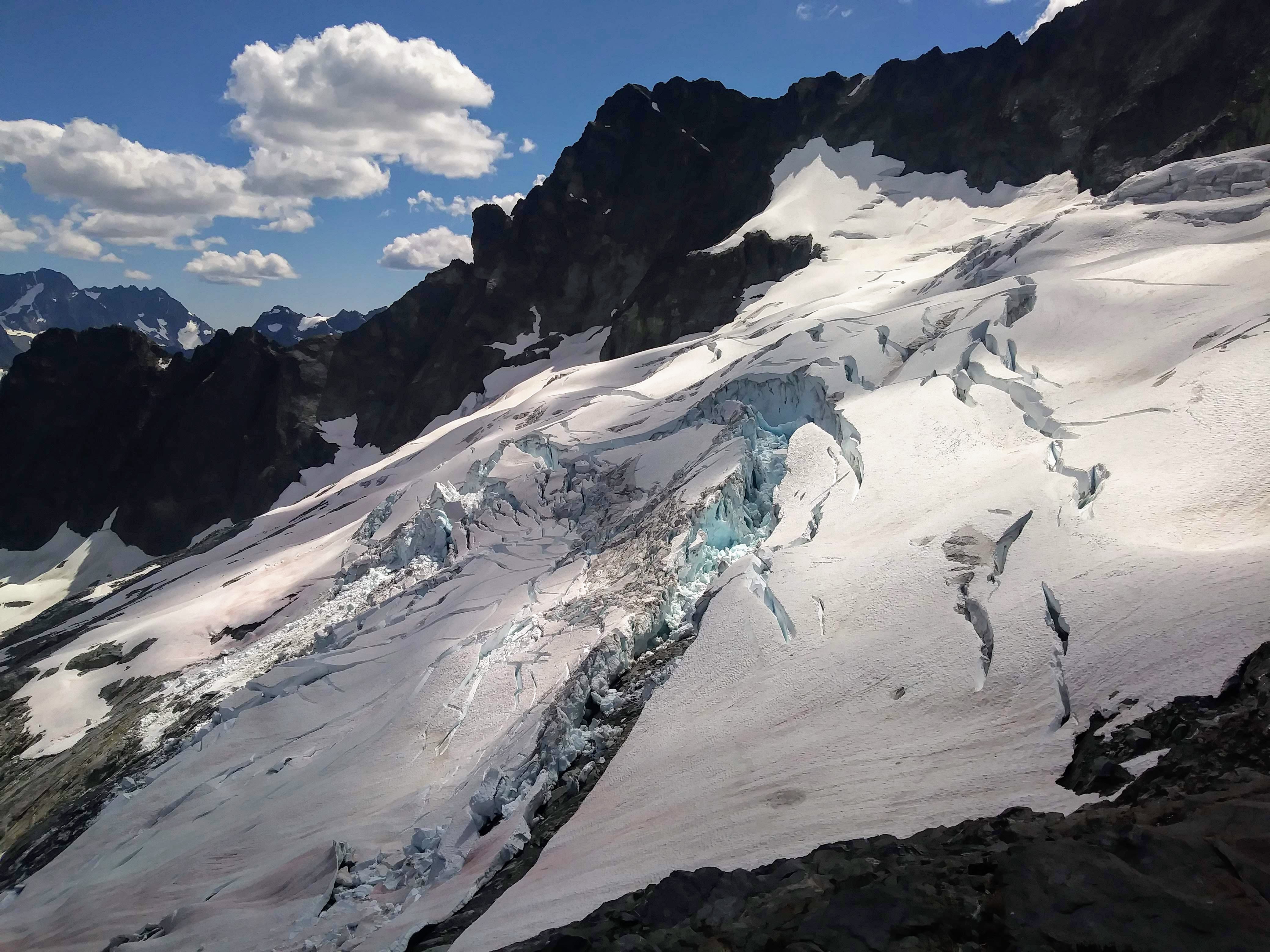
Trip: Mt. Baker - North Ridge Trip Date: 07/19/2020 Trip Report: I just wrote a nice TR but then hit the back button on my phone, d'oh.... Gist was: getting to ice step was pretty straightforward, it's an interesting route, AJ was my ice rope gun (thank you), we found a half pitch of AI3, the rest of route was very mellow, which was a little disappointing. There were 14 people on/at the ice step when we were there and I bet at least 30 people climbed the NR yesterday...nuts. Walking down was not cool and I vow to only ski down volcanoes from this day forward. On the summit I met @Juan Sharp and his partner (I'm not confident I remember his CC handle, sorry!) who had come up the Boulder. Pics without captions, feeling lazy: Gear Notes: We brought 7 screws of varying lengths, did not need the shortest ones. We brought 3 pickets but didn't use any of them. Approach Notes: Long traverse around 6600'...
-
Hello! A friend and I are planning to do the Ptarmigan Traverse on skis next week, likely Tuesday-Friday, hopefully including Dome. We both have plans this weekend so on Monday we'll finalize things. Weather for next week looks fairly stable at this point, though. If you're interested in joining us, get in touch! Of course, we'll want to know about your climbing and skiing experience ? Alisse
- 1 reply
-
- 1
-

-
Fun TR, love the first photo of Lani ?
-
 Awesome! Looks like a good adventure!
 -
[TR] Mt. Daniel - Daniel and Lynch Glaciers 07/06/2020
Alisse replied to Alisse's topic in the *freshiezone*
Never, Michael! I refuse to believe it -
How was it? ?
-
[TR] Mount Formidable - South Route 07/05/2020
Alisse replied to Ian Lauder's topic in North Cascades
Looks like a good adventure! -
[TR] Corax Peak - North Face 07/05/2020
Alisse replied to tanstaafl's topic in Central/Eastern Washington
I hadn't heard of this -- thanks for the TR! Glad you're getting out -
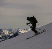
Trip: Mt. Daniel - Daniel and Lynch Glaciers Trip Date: 07/06/2020 Trip Report: I had a great couple of days out in the Alpine Lakes Wilderness with my skis, getting about 3800' skiing, a new summit, blue skies, and lots of peace and quiet. Scatter Creek was still flowing enough that I didn't want to see if my Civic could drown/be swept away. So I started my Sunday by walking the road for three miles, to the Cathedral Pass trailhead. The views started early. Cathedral Rock and some of Daniel behind, from the road! I couldn't really start skinning until about ten minutes from Cathedral Pass. Ah well... the views from the west side of the pass were incredible, down into Deep Lake. Deep Lake Wow, what a beautiful basin! I skinned up the boot track to 7000' and peeked over at views of Rainier and the Chimney Rock group, then got some pretty fun turns down to my camp near Peggy's Pond at 5500'. Pretty good view from where I set up camp... Cathedral Rock and STU! The next morning I went up and over and down and up and down and up the summit of Daniel. More carrying... So dang nice! Hinman. I'll be back for you earlier in the year, next year... and then skiied the Lynch Glacier -- super fun, great snow, not a soul anywhere all day. It was a sea of clouds to the north of Daniel, and I could barely see Baker and Glacier out there. The top of Forbidden was poking out, too. Oh yes, this will be excellent... Pea Soup Lake under the cloud layer Skiing the Daniel "glacier" (is there actually a glacier here?) had less than awesome snow, as expected, but it wasn't sticky, so..good enough! Beautiful, beautiful... About the slay the slush A soul-satisfying time. Gear Notes: I brought whippet, light axe, light pons, and ski pons. Definite overkill... Approach Notes: Up and over and down and up and down and up!
-
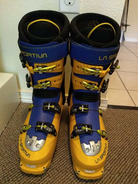
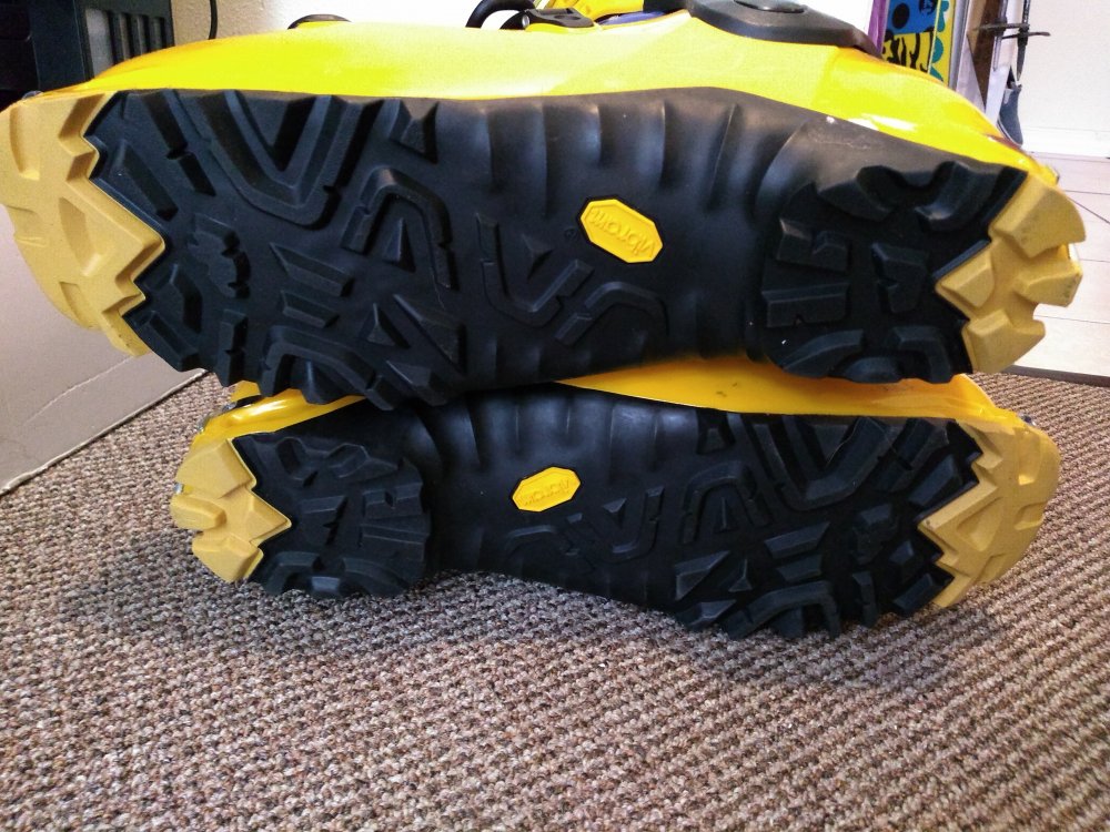
for sale FS: Like new La Sportiva AT boots $250 OBO
Alisse replied to Alisse's topic in The Yard Sale
Still available, work well for summer turns! -
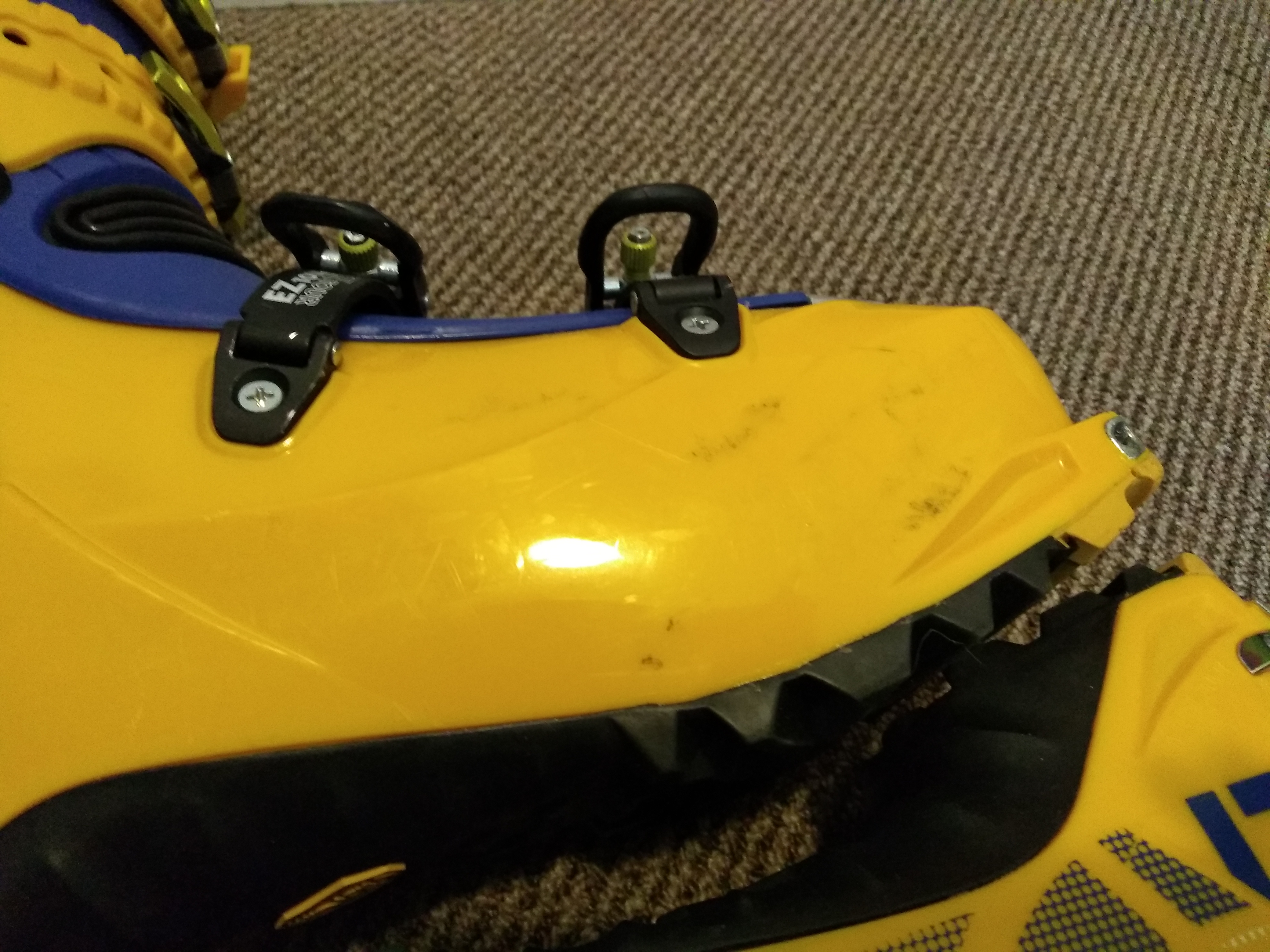
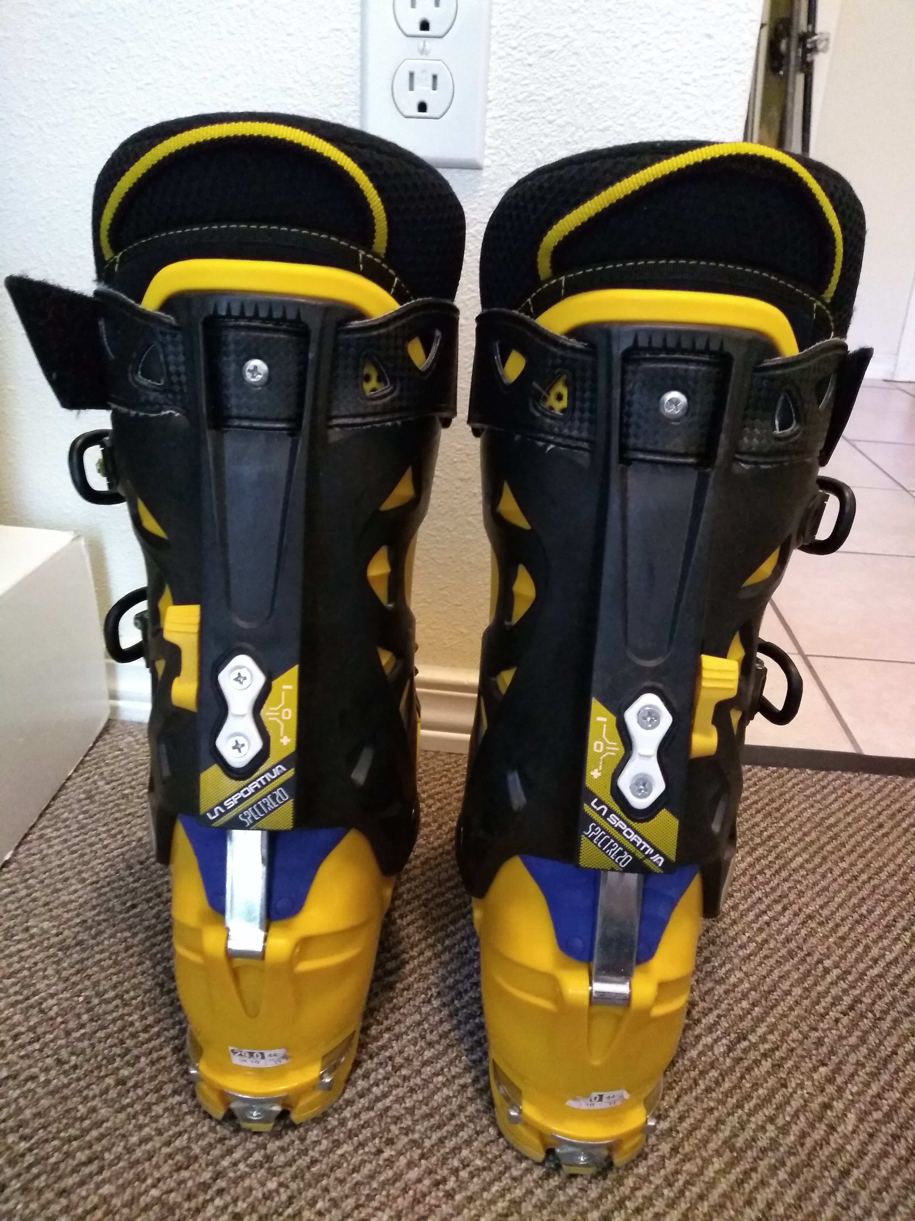
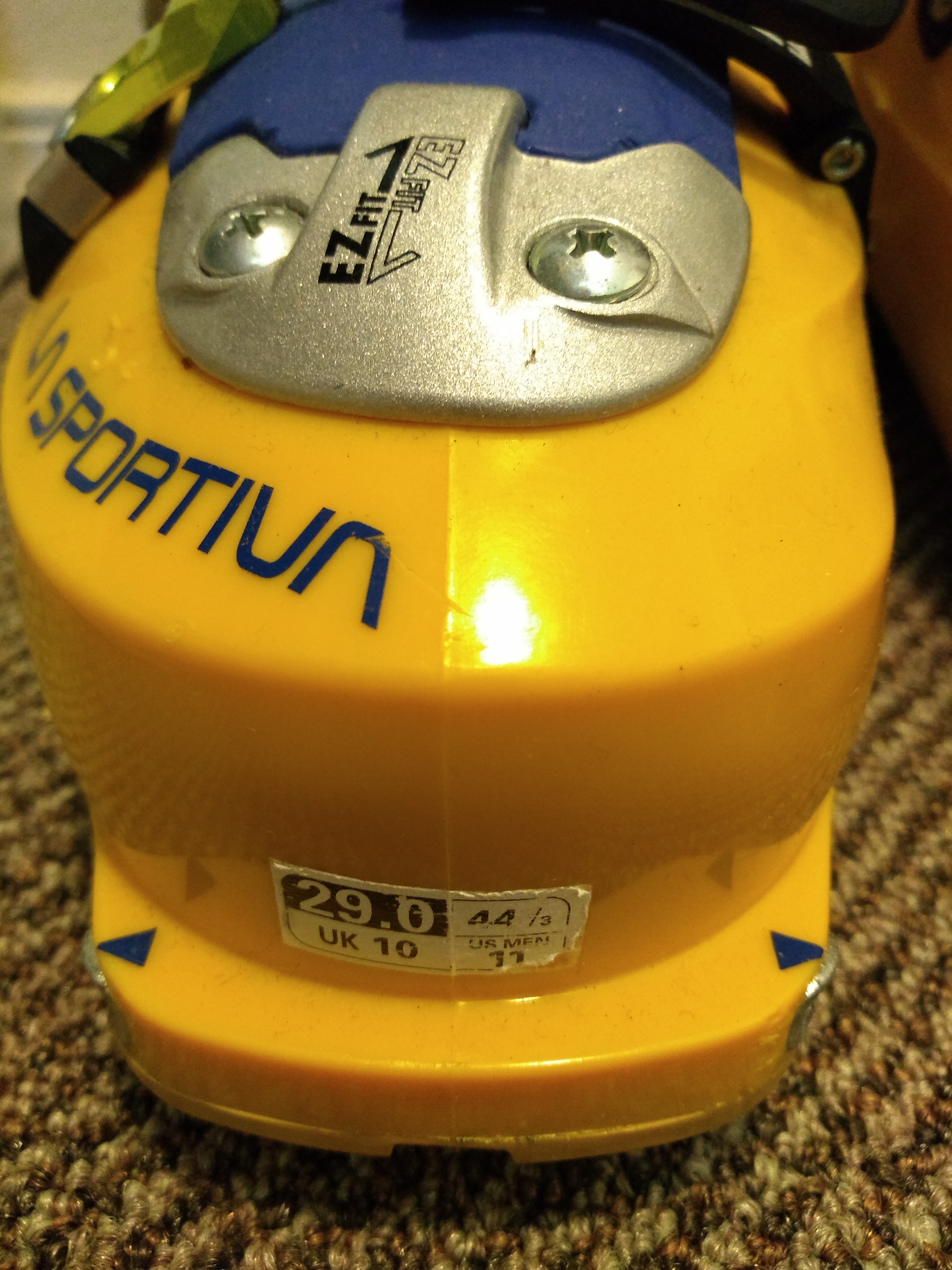
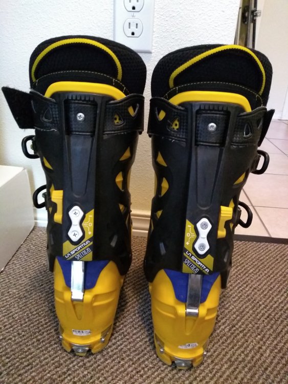
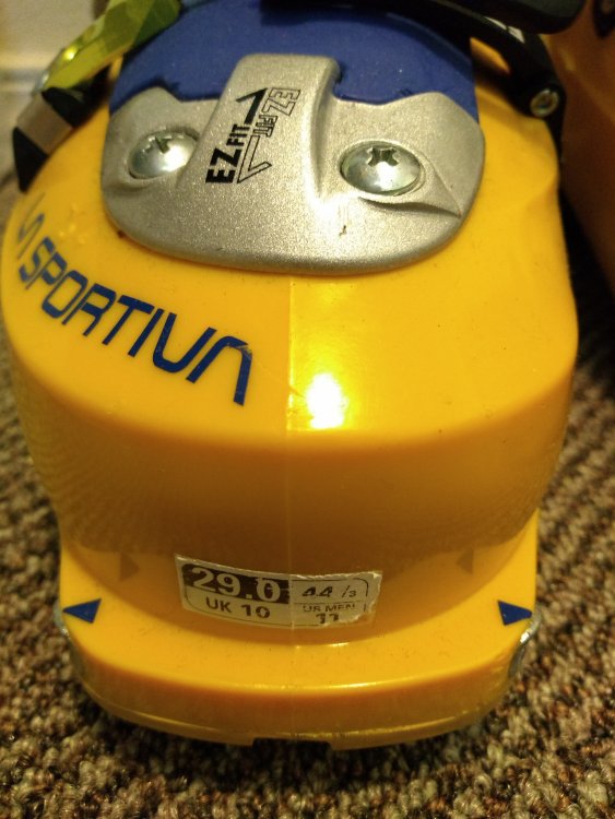
VERY lightly used La Sportiva Spectre 2.0 AT ski boots, mondo 29.0. Great shape, only a couple very minor scuffs (see photos). Vibram soles in near new condition. $250 OBO. In Seattle, will meet you. Alisse Threesixoh 224778three

-
I enjoyed reading this, and maybe you will, too: https://blog.nols.edu/2020/04/06/patience-in-the-mountains
-
idea MYOG - Gear mod's and personal creations.
Alisse replied to kmfoerster's topic in The Gear Critic
Old phone cord, haven't seen one of those in many years. That website you linked to reminded me to add rope rug making to my list! -
idea MYOG - Gear mod's and personal creations.
Alisse replied to kmfoerster's topic in The Gear Critic
Maybe, probably? I haven't seriously looked into it. Trying to keep a dying forum alive -
idea MYOG - Gear mod's and personal creations.
Alisse replied to kmfoerster's topic in The Gear Critic
Love the thread! Tinkering with gear... something low-risk we can do at home! Let's see... I won't take credit for coming up with this: when the foam grips on my ski poles started coming off, I tore them off completely and replaced them with rubber electrical tape -- and extended them further down the pole to give me more options for where to grip it. I would love to hear what other people have done to create a secure water bottle holder on a backpack shoulder strap.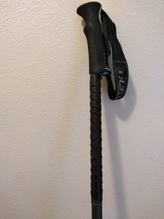
-
Nice work! ? Oh, wind slab... Backing off sounds it was the smart choice. Your wisdom will carry you into old age in the alpine!
-
[TR] Marble Creek Cirque - Lost Marbles Couloir 03/09/2020
Alisse replied to JasonG's topic in the *freshiezone*
Way to make it happen! Didn't take long... -
@aaronohn was up there last Sunday.......
-
[TR] Sloan Peak - FA: Superalpine (WI3-4, 1000') 02/28/2020
Alisse replied to Kyle M's topic in North Cascades
Glad you're okay! Going to read the blog post now... -
[TR] Alpental Backcountry - Pineapple Basin via Source Lake 03/01/2020
Alisse replied to Asfahl's topic in the *freshiezone*
Homemade cookies, that's +5 partner points for sure!