Alisse
-
Posts
456 -
Joined
-
Last visited
-
Days Won
35
Everything posted by Alisse
-

[TR] Mount Shuksan - Price Glacier 05/27/2018
Alisse replied to jefetronic's topic in North Cascades
Great TR -- sounds like an awesome outing, happy birthday! ? -
[TR] Sahale Mountain/Peak - Quien Sabe and Sahale Glaciers 05/27/2018
Alisse replied to Alisse's topic in North Cascades
I guess it depends on what kind of adventure you want Cascade Pass would definitely be the easiest way! We saw 0 people heading up to/in Boston Basin until we were on the summit (then we saw a group of 3 at the very base of the glacier) but as we got onto the Sahale Glacier, we saw probably 10 people.... -
[TR] Little Tahoma - Fryingpan Glacier 05/27/2018
Alisse replied to JuanBelay's topic in Mount Rainier NP
Love those ski descents -
[TR] Mt. Rainier - Sunset Ridge 05/25/2018
Alisse replied to ScaredSilly's topic in Mount Rainier NP
Congratulations! -
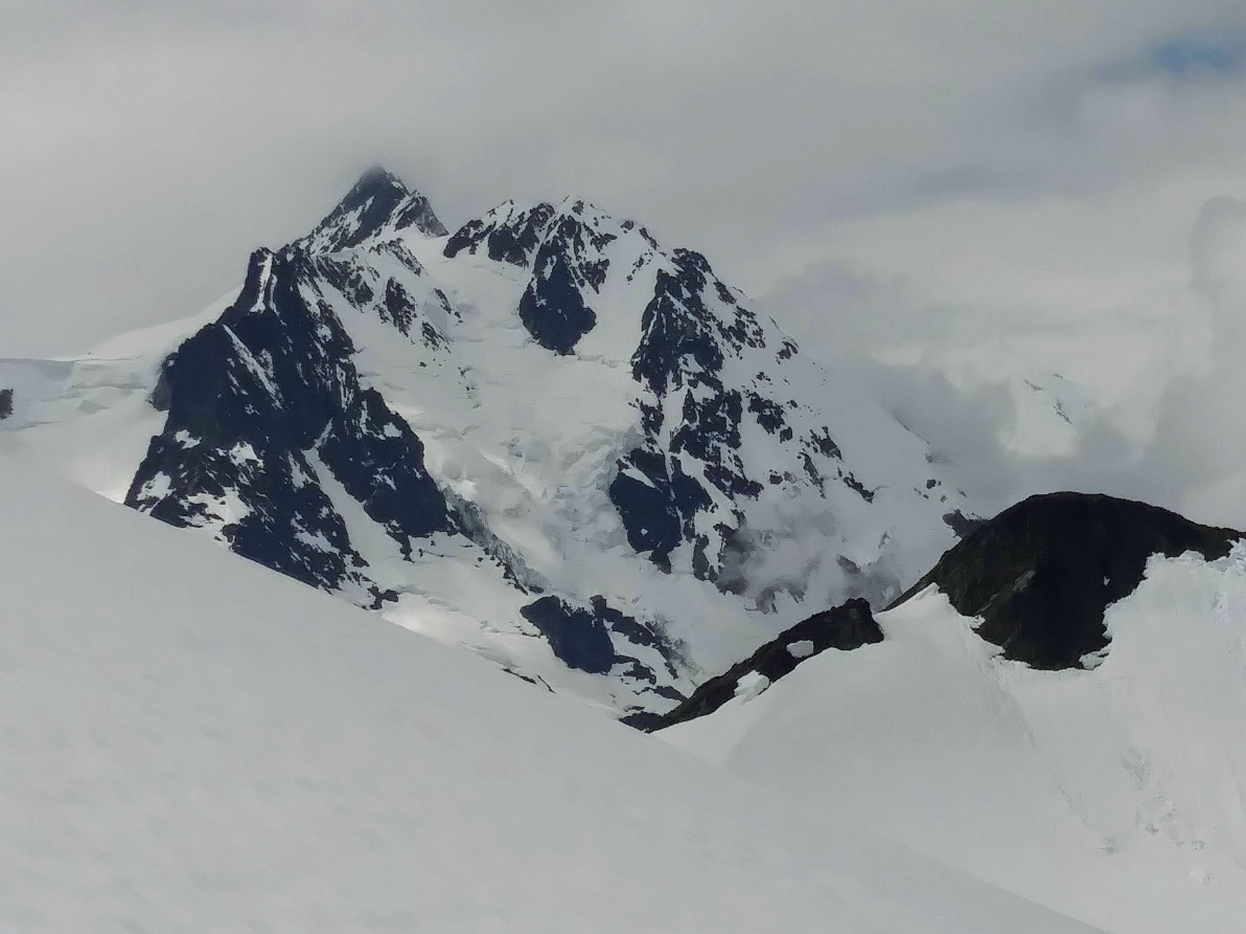
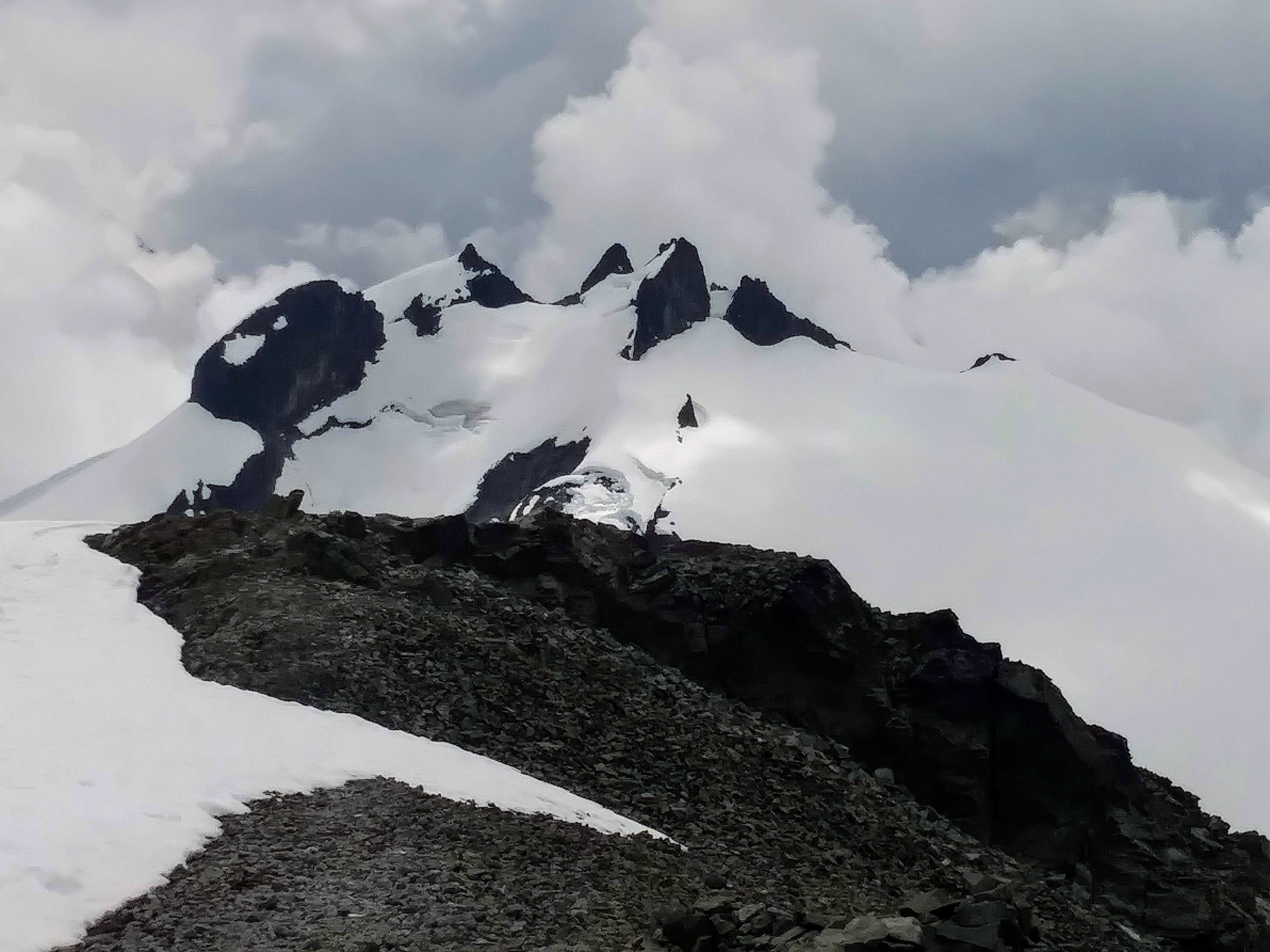
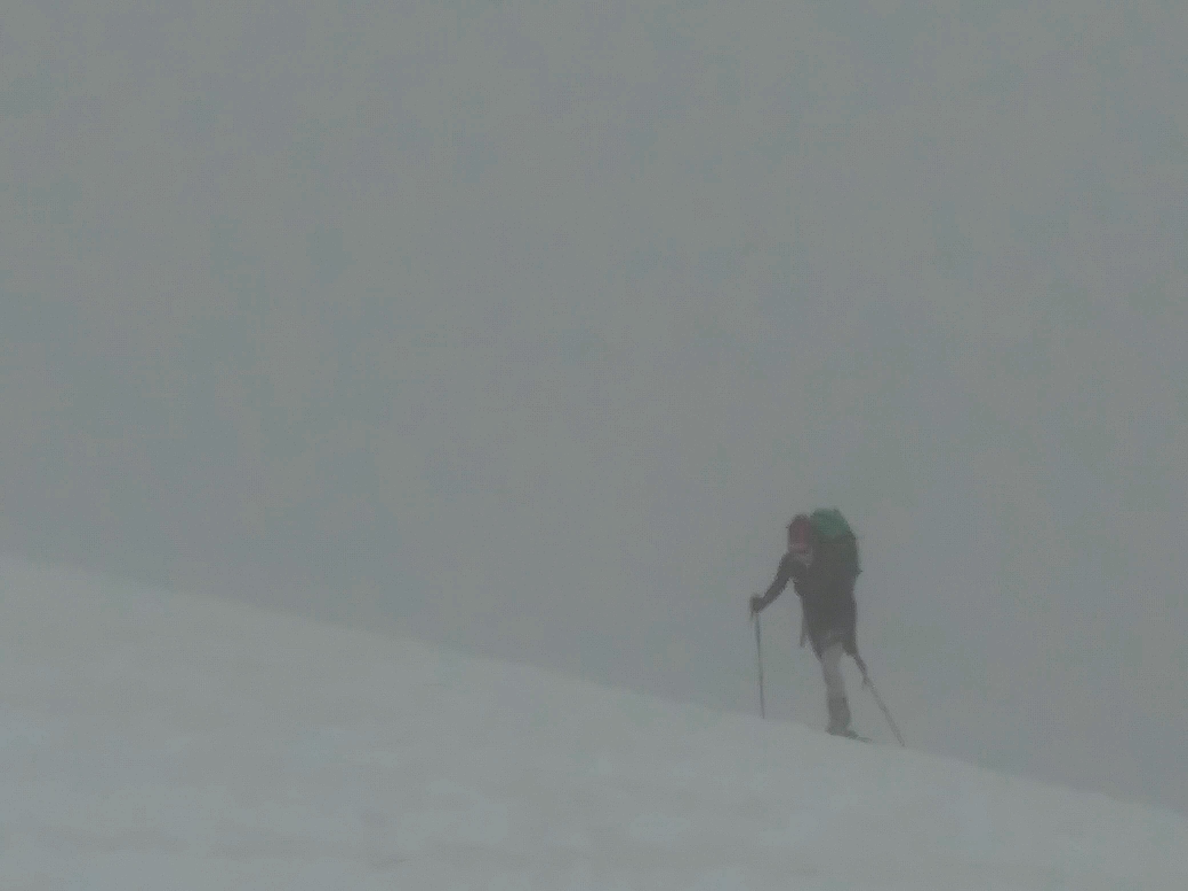
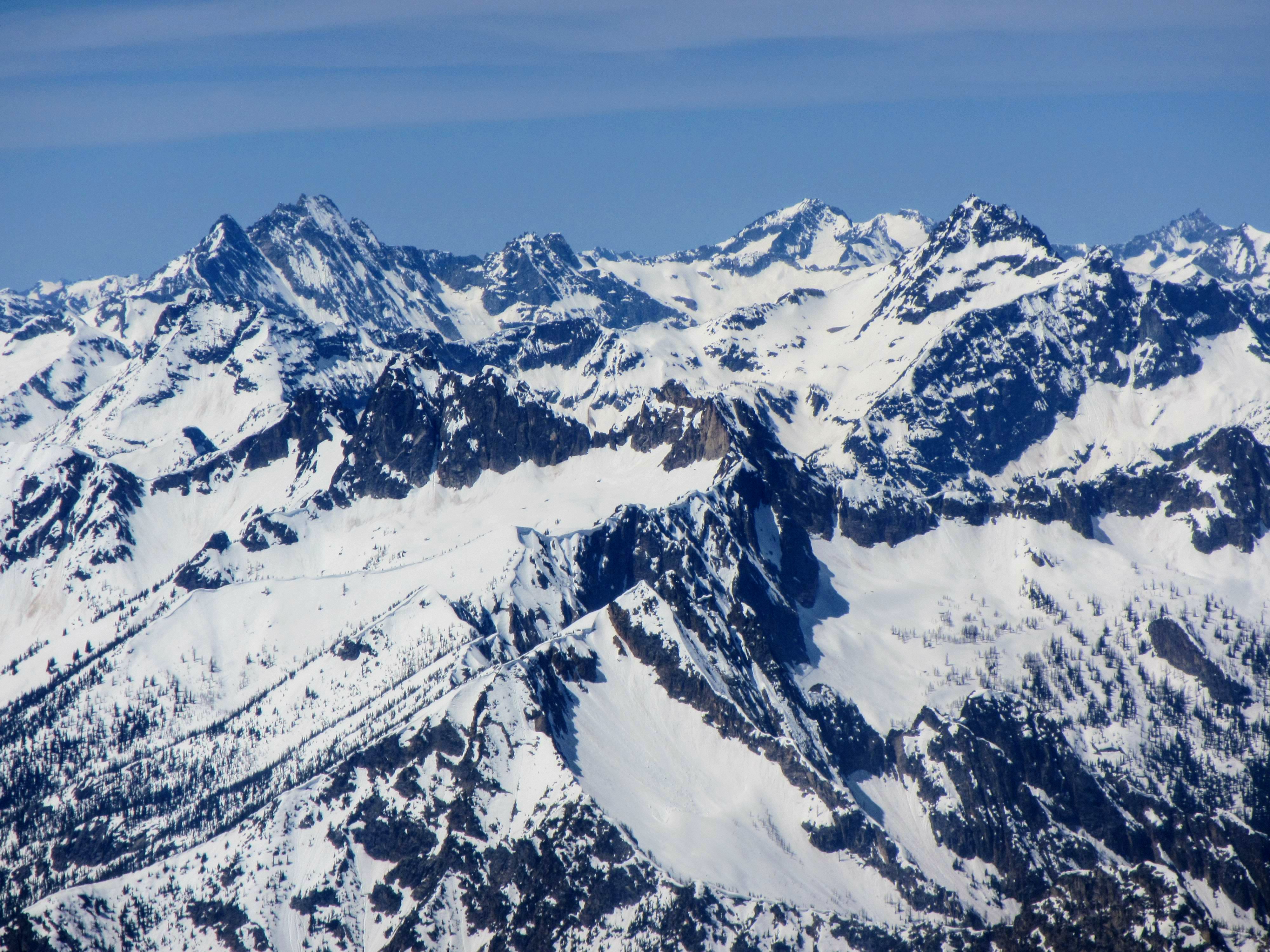
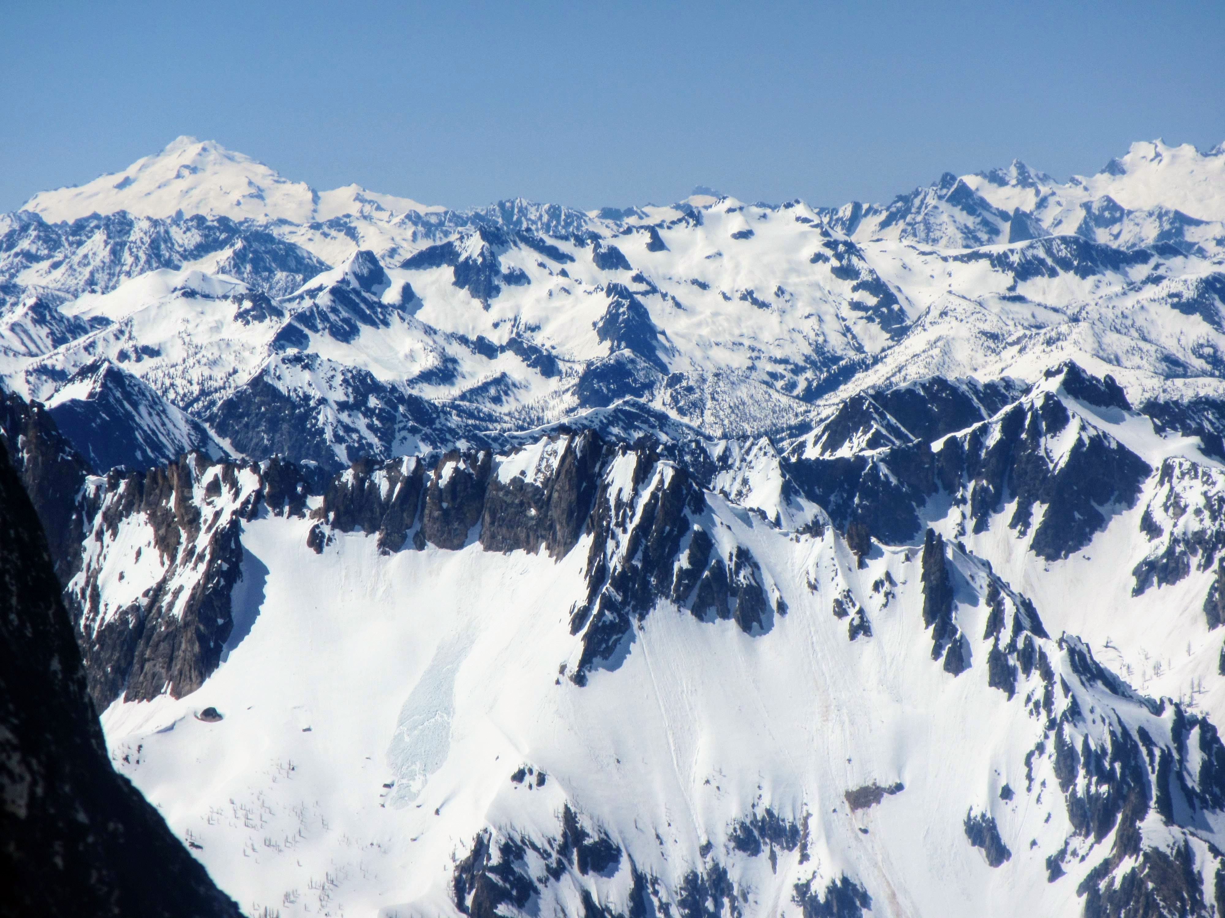
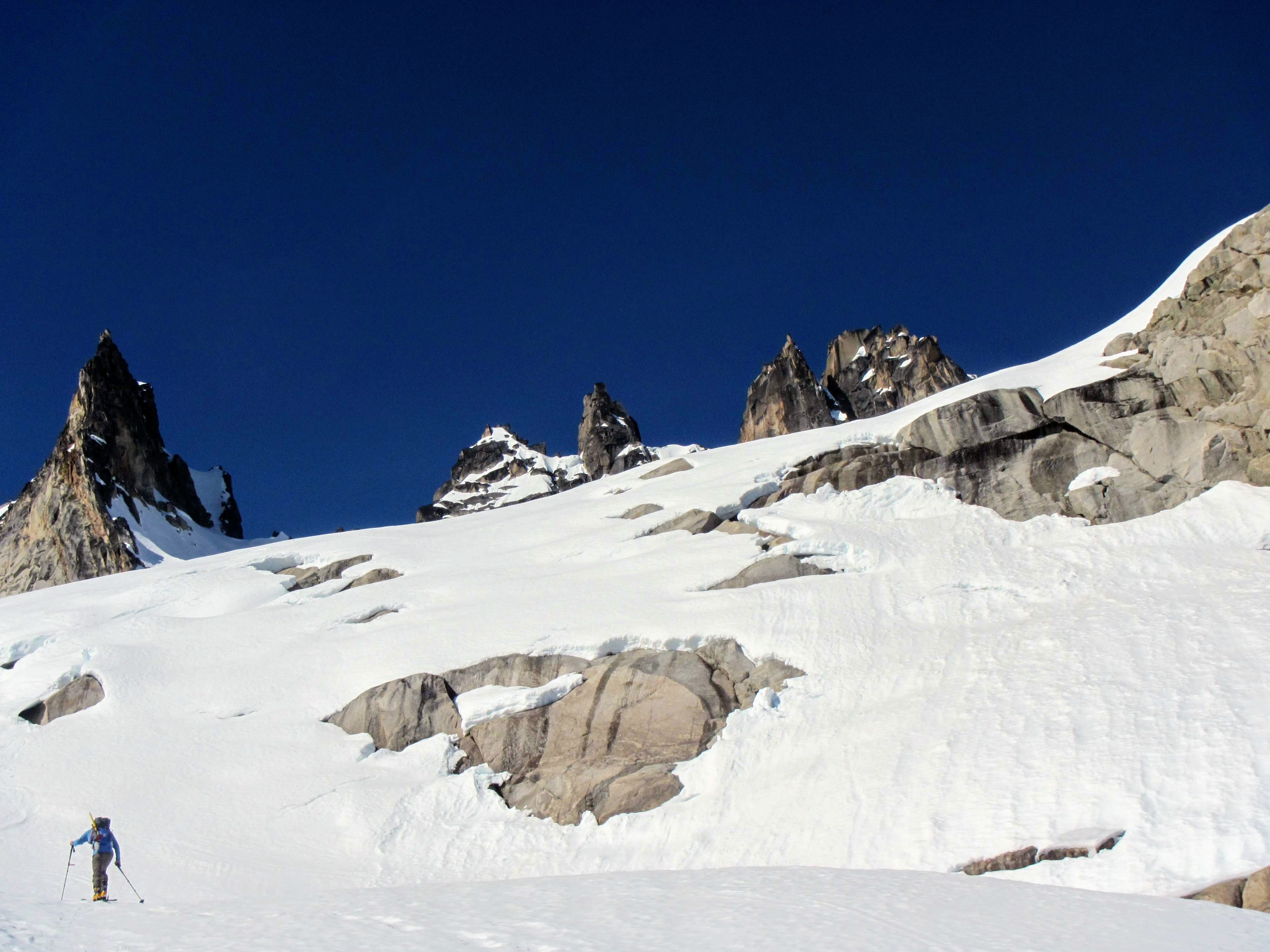
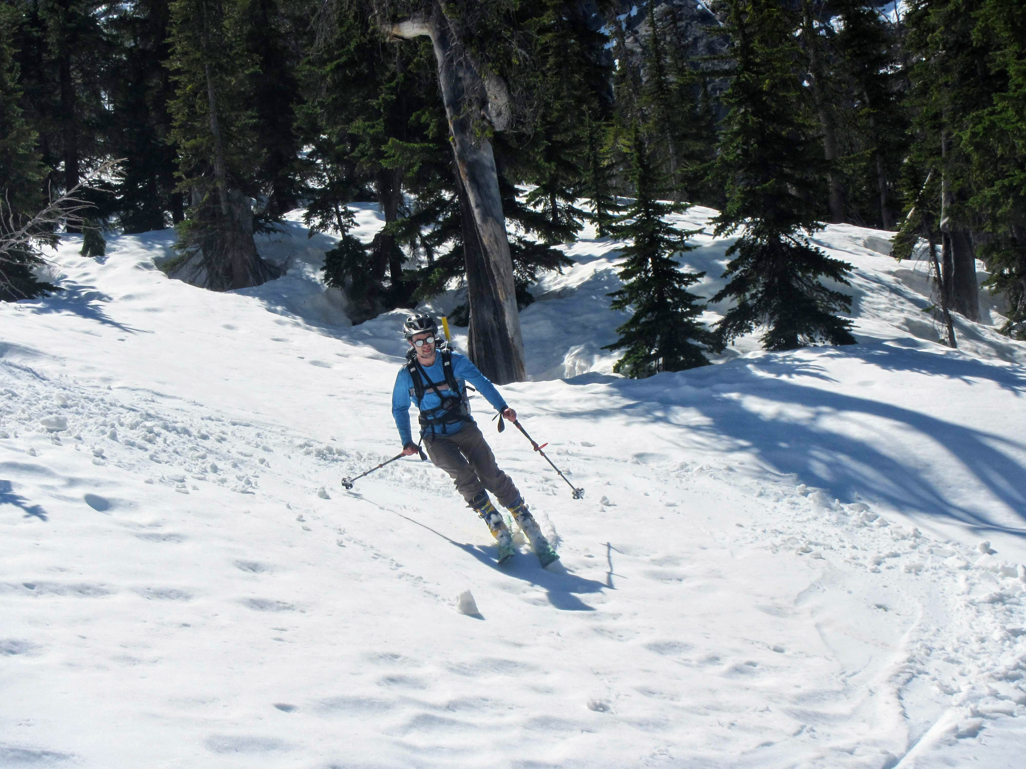
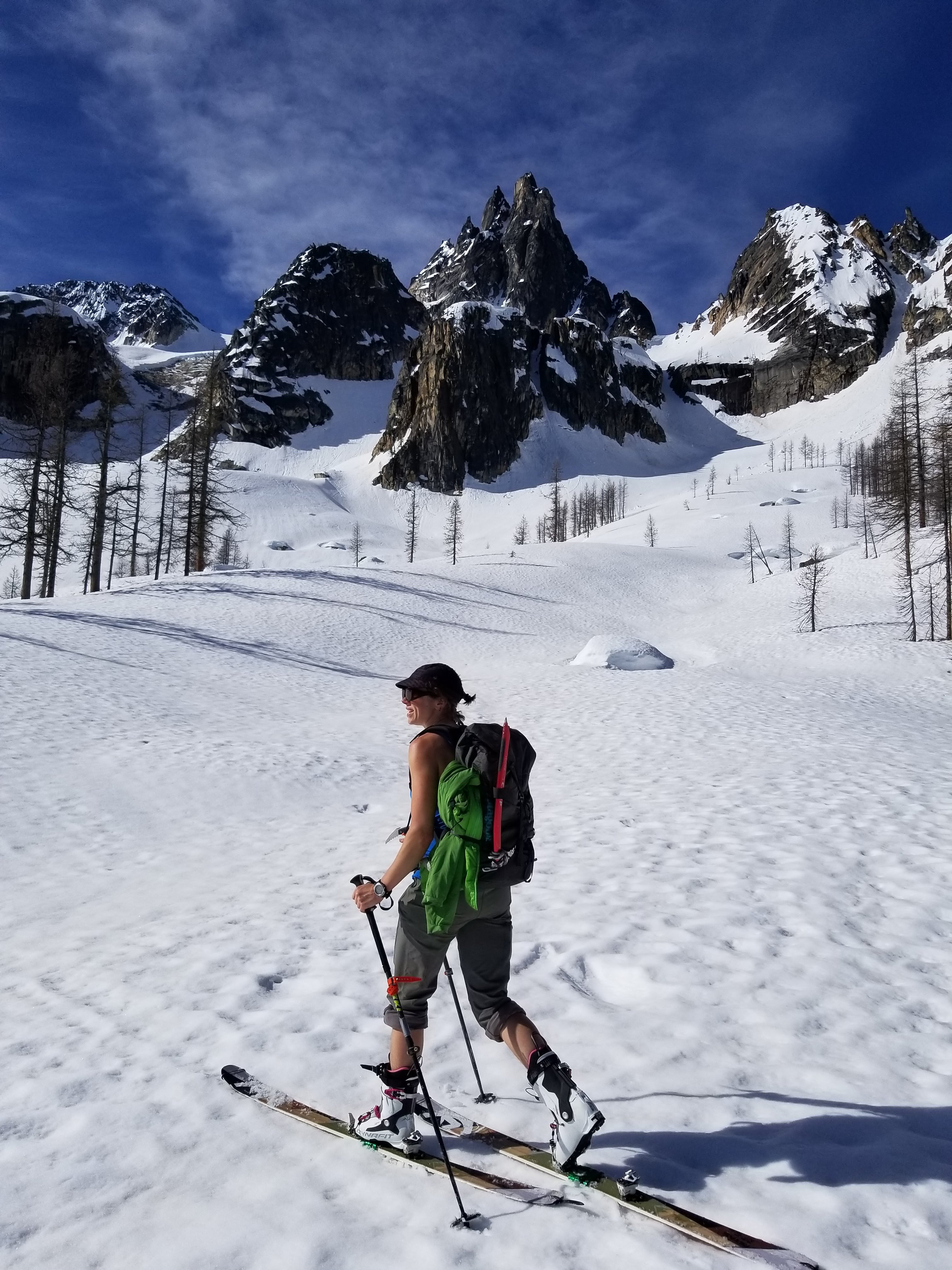
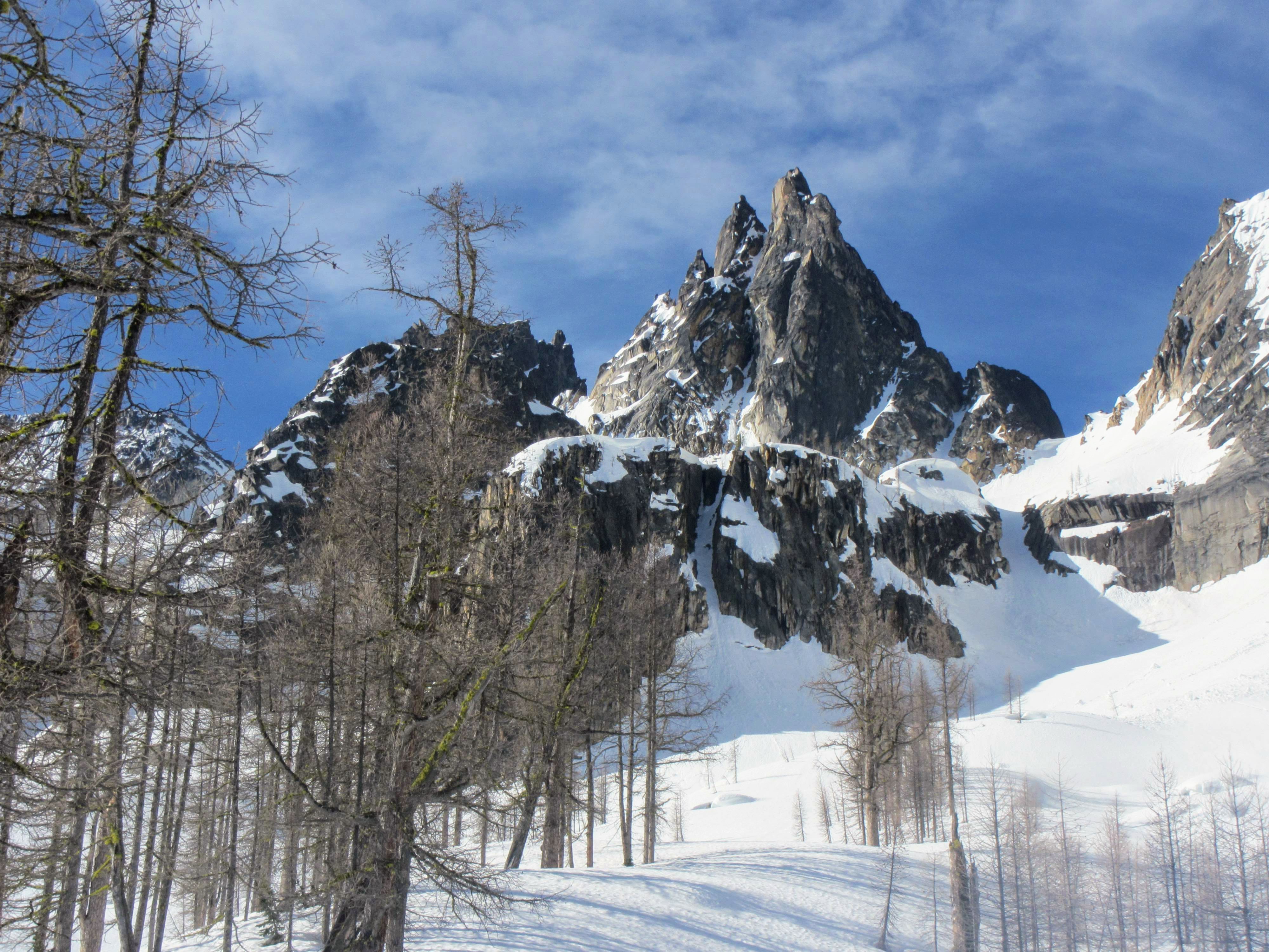
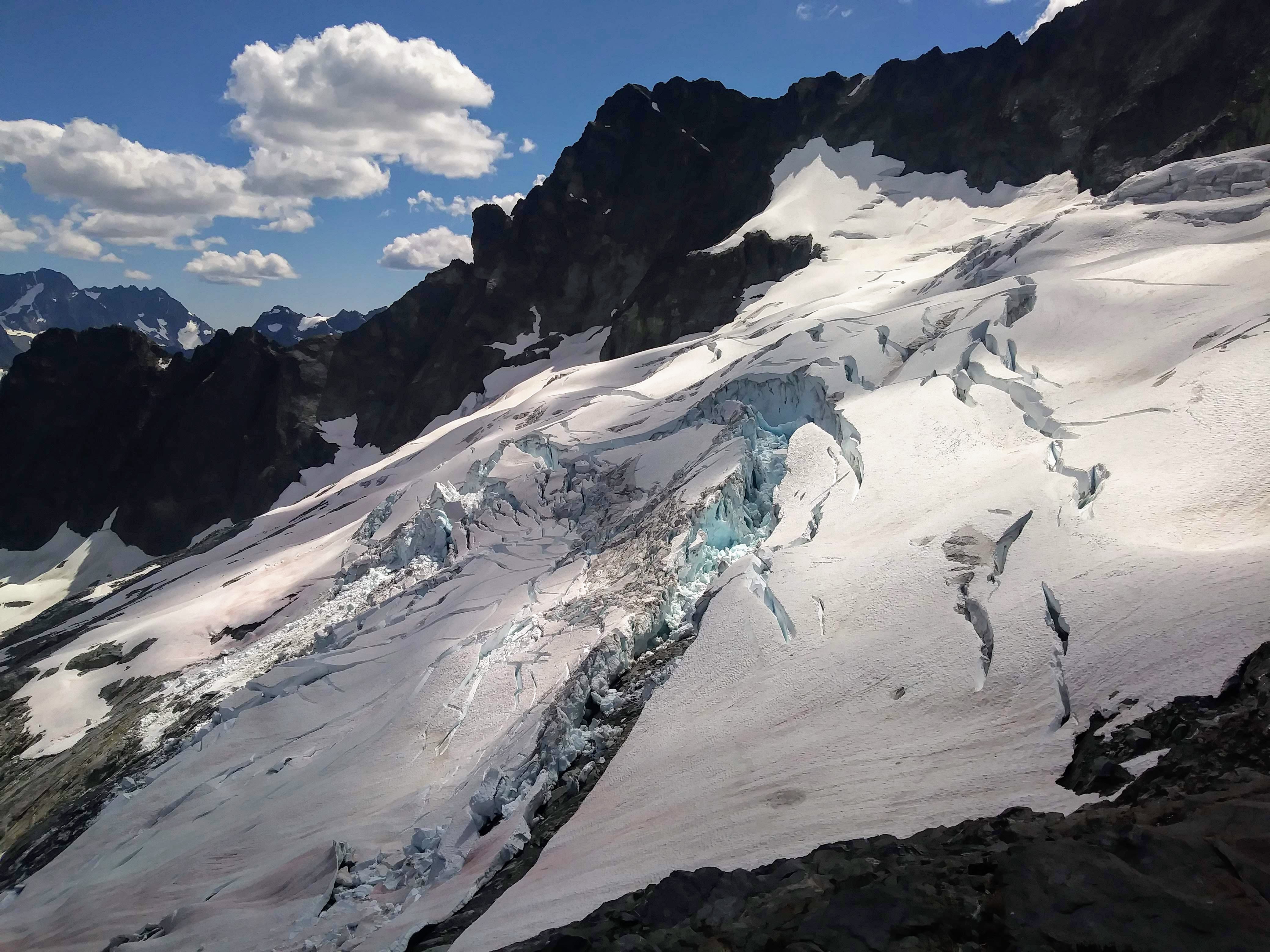
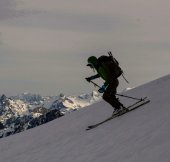
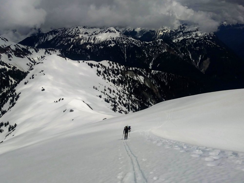
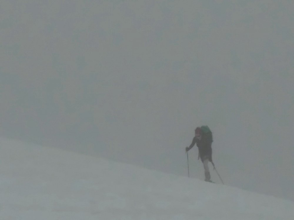
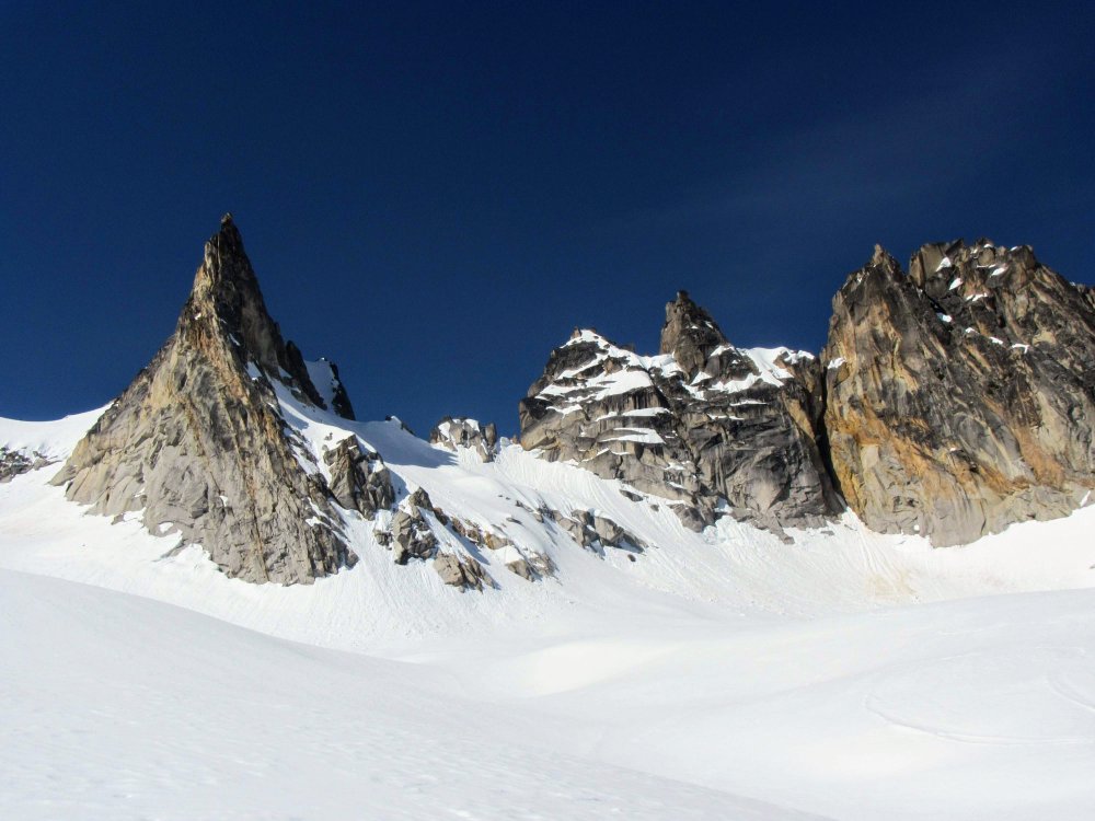
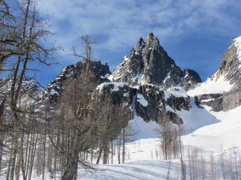
Trip: Sahale Mountain/Peak - Quien Sabe and Sahale Glaciers Trip Date: 05/27/2018 Trip Report: What a trip! What a day! We got excellent conditions and fantastic weather, we got Boston Basin all to ourselves, and we got to ski from the bottom of the snow-free summit pyramid to within a 3-minute walk to the Cascade Pass trailhead. Amazing! Cascade River Road is still gated, so we parked at the gate and at 4:15ish in the morning, set off up the road to the Boston Basin trailhead. Carrying skis through the downed trees and minor bushwack was not the best part of the trip. Crossing Midas Creek was not bad. Got up onto the ridge right before Boston Basin and switched to skinning (finally!). The morning's low clouds began lifting, creating some beautiful effects. Skinning conditions were perfect, styrofoam snow with good ski crampon bites. The Quien Sabe Glacier was in great shape, very few open crevasses (especially our route) so we picked a line that never had us above any open ones. We felt comfortable being unroped until we got up to where it steepens before the Boston-Sahale col; here we switched to crampons/axe/rope/glacier mode. Definitely some more open ones up there, although peering over the edge, it appeared to be more like a big sink-hole with a not-too-deep bottom, but I wasn't about to jump in and test the "floor." Up at the col, we were dismayed to see the giant cornices. Hmmm. Hmmm. We've seen the diagrams of cornice "roots" and we know the danger of cornices. Cornice on one side, steep snow on the other with moats and scary things down below. We weighed the options and talked about the risks, the concerns, the (excellent firm) snow conditions, the (now over the horizon) sun. In the end, we chose what was not the absolutely most conservative decision. I'm still thinking about this one. We picked our way up and as far away from the cornice as possible, getting excellent axe and whippet bites, excellent secure feet. We took our time -- no-fall zone. We got up and over that slope, and could clearly see the summit block now with some less-steep snow and the rock scramble. The snow here was less firm and so I deadmanned a picket before stepping up onto a snowpatch, and then used my 5 slings to protect the rocky section as we continued up. I think we summitted around 11:45 am. The summit views were AMAZING!!! We hung out on top for around 30 minutes, then made the one rappel down to the soft snow of the Sahale Glacier. It was a full 30m rappel to the snow. Few crevasses, nice snow, and some fun terrain had us hooting down the glacier and then the Sahale Arm. Saw my first marmot of the season (!) lounging and enjoying views of Johannesburg. We were able to stay in the drainage out Cascade Pass and there was continuous snow almost entirely to the Cascade Pass parking lot! Incredible. Got back to the car around 2:50 and drank beers and smorgasborded. The worst part was finding out at home that my skis now, too, have become victims of the sticky pollen! I had just waxed them, too. Gear Notes: approach shoes, ski crampons, aluminum axe and crampons, crevasse rescue gear, 60m half rope Approach Notes: Boston Basin trail with skis...type 2 fun
-
Today we went in through Boston Basin, summitted Sahale, and skiied out via Cascade Pass. The Quien Sabe glacier was in great shape, very few crevasses. Skinning was great, firm snow, great for ski crampons. I bet it was excellent skiing. I'll post a TR later today.
- 1 reply
-
- 1
-

-
Wow, nice work!
-
All proceeds from beer and raffle sales going to the WCC for the Liberty Bell Conservation Initiative!!!
-
I don't have any suggestions, but I'm curious to hear them!
-
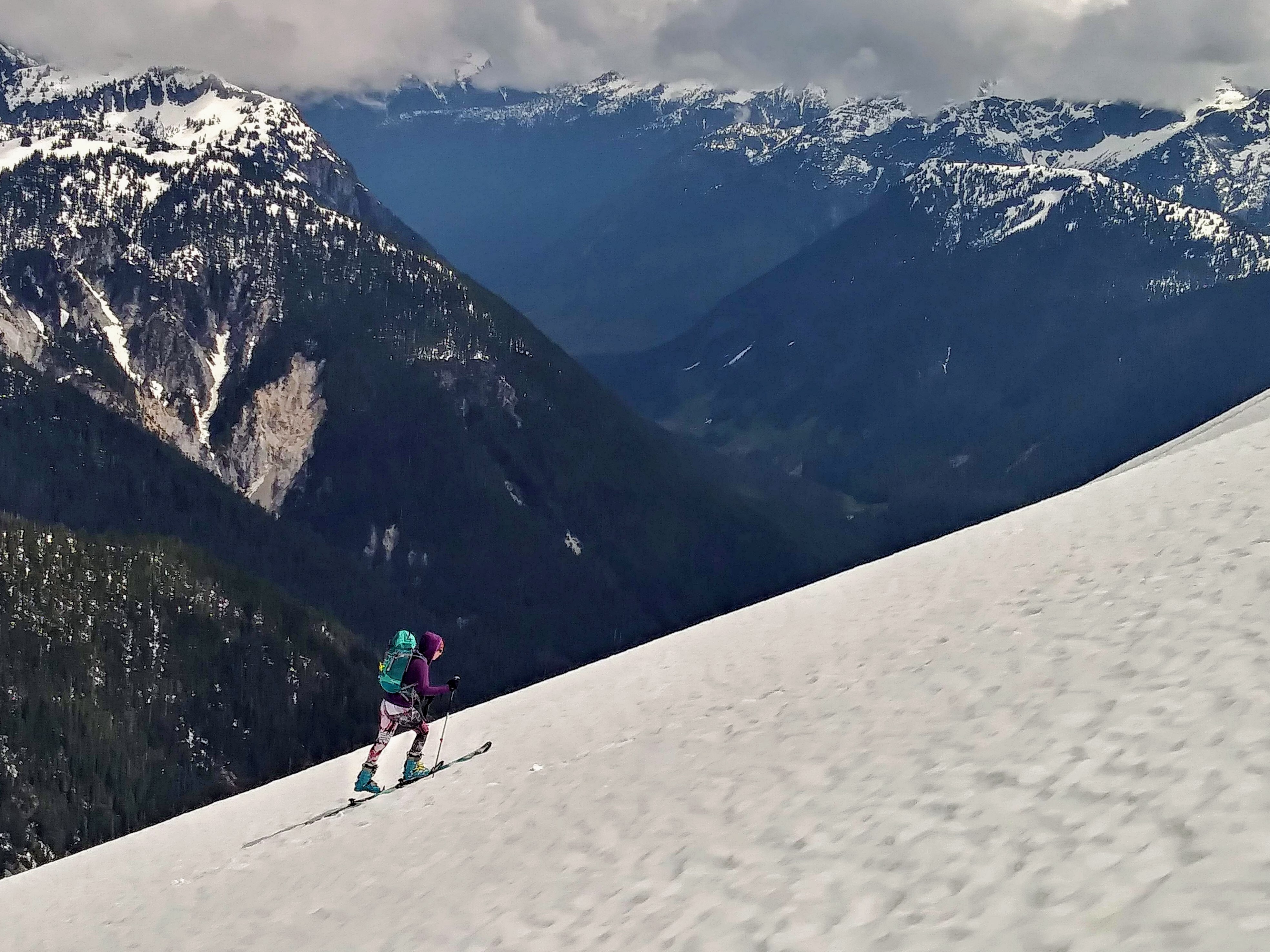
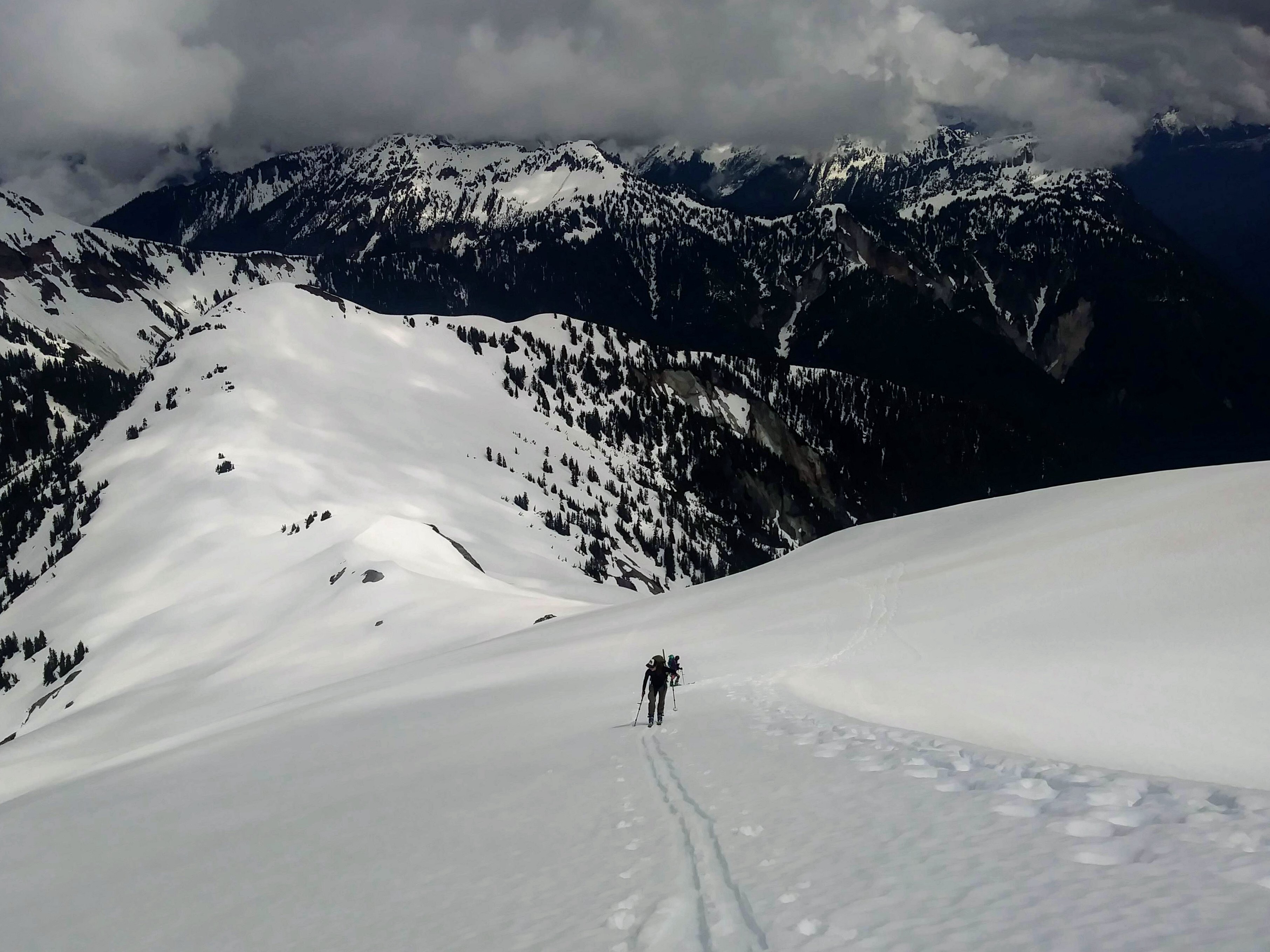
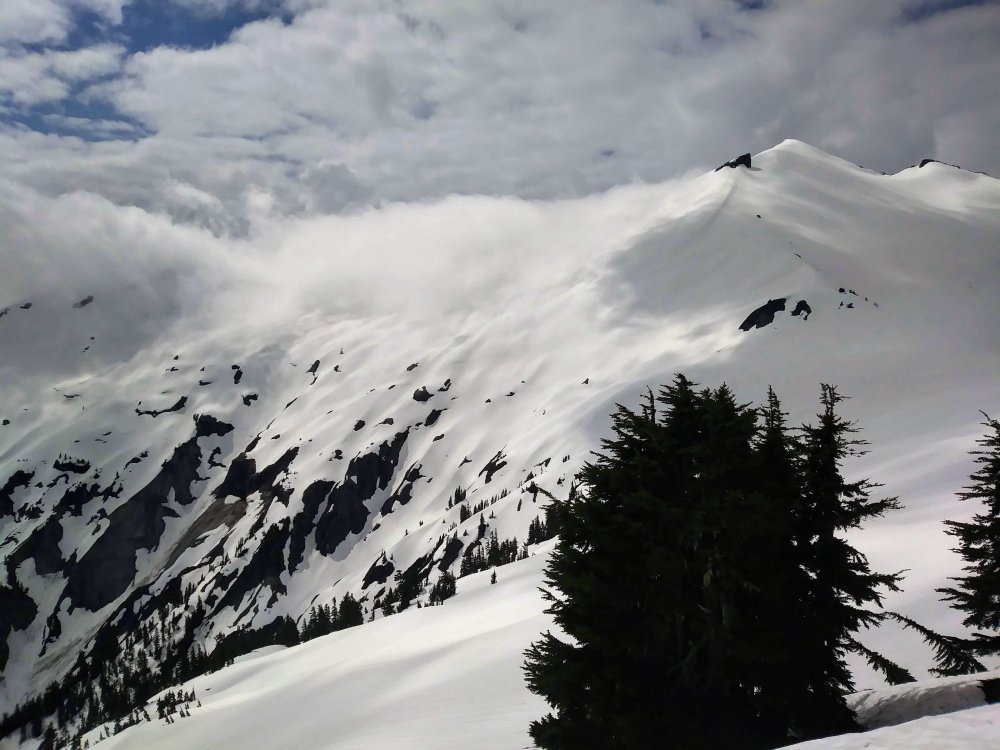
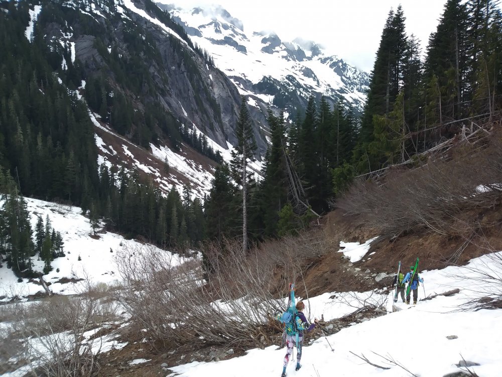
Trip: Ruth Mt - Ruth Glacier Trip Date: 05/20/2018 Trip Report: A beautiful day on Ruth with grouse seemingly everywhere and waterfalls abound! We had pretty low expectations because of the forecast, but thought if we decided to bail, a few hours in Bellingham would also be fun. Luckily, it only drizzled on us for a short while, the clouds kept the sunshine at bay, and we got some great skiing in!! Where were all the people? Only saw one guy coming out after summitting early, a guided group doing glacier rescue practice, and a pair of skiers who had bailed, passing us on their way out . Road drive-able and fairly dry (except for one creek running over/through it...) within .2 miles of Hannegan Campground. There's a giant washout that took out the road plus some right before the campground, impressive. Almost no snow there, so we opted for the summer trail...pretty easy going/few blowdowns, it just doesn't gain elevation very quickly. Carried for awhile (4+ miles?) until we got to continuous snow. Anyway, we opted for the point 5930 circumnav route and that was OK..Clouds swirled in and out and at one point we were almost completely "in a ping pong ball" but happily it passed through. A lot of my photos look monochrome/black and white due to the light. Unfortunately I forgot my real camera so hopefully these aren't too pixelated. Shuksan was gorgeous and all the views were sporadic and interesting with the light coming through clouds. I haven't been in that area much, lots to learn and do! Sweet bivy spot and Icy The snow was GREAT for awhile, far exceeding our expectations...then it got grabby and mushy. So it goes! The slog out was beautiful and the rock in the valley was awesome, but my feet were sick of walking in my ski boots. Great day with great friends in a beautiful place!! ? Gear Notes: Approach shoes would have been wise Approach Notes: Moat-y around the SW side of point 5930


-
- 1
-
-
I feel like I need to add/clarify that he was actually the one to suggest this idea. At first I was like no way! But then I thought..hmm, I'll see what the Internet says..
-
@JasonG Thanks. I certainly was not about to rope up with him without the two of us practicing crevasse rescue thoroughly. Yes, post your pics!
-
Ok, perhaps this sounds like a stupid question, but I'm curious to hear different perspectives. I have a friend coming into town from NH the first week of June and he is stoked to climb the North Ridge of Baker, and has a lot more ice experience than me. Great! However, he doesn't ski, and I have had this image of climbing the North Ridge and then skiing the Coleman-Deming. He doesnt have a whole lot of glacier travel experience. I have never seen the Coleman-Deming in person. What are your experiences trying to do glacier travel with people travelling by different modes? How dumb would it be to suggest he descend solo so I can ski? Thanks for your thoughts!
-
[TR] Sahale - South side - Ski from the summit tower 05/08/2018
Alisse replied to JasonG's topic in North Cascades
That bear looks skinny! Beautiful photos (yes, as always). -
@JasonG Oh! That must be the southern Pickets to the north of Shuksan, then! I didn't post the pic of what I think is Black and Goode in my original post: Thank you for your mountain identification assistance ?

-
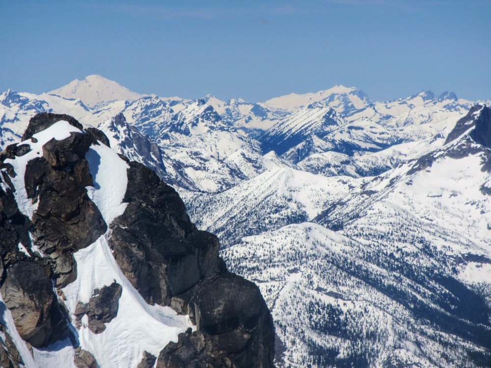
Trip: Silver Star Mt - North side Trip Date: 05/12/2018 Trip Report: Celebrated Hwy 20 opening by heading east for a wonderfully beautiful trip up Silver Star! Had to carry skis for ~40 minutes from the pullout but then great skinning conditions all the way up! Put on the ski crampons around 5200' and kept them on until the col. Ultra mega hyper super happy place Views just got better and better and it was fun and interesting seeing Vasiliki Ridge, Burgundy Col and the Wine Spires from the east -- I'd been on that side just once in an aborted attempt to climb the East Face of Chablis in July 2014 (meeeemories....?), it was very cool to be on skis this time! Booted up on snow from the col to the final summit block, a chimney move with a useful rap station to yank on. Fantastic views, I think I saw the Twin Sister Range? And Black and Goode and Glacier and what I think was Dome? Oh yeah, then the skiing. Skiied from the summit block (ok, mostly side-slipped but did make a few turns between rocks).. The snow was AMAAAAZING, truly, for most of the descent, and then it got heavy and slushy. I kept my skis on for perhaps too long, having fun in the woods trying to stay on snow and avoiding logs and dirt. Finally after I hit the second rock I decided to give up. A wonderful day in the mountains, love the blue skies and sweet snow! ? Gear Notes: Ski crampons and whippet ? Approach Notes: Follow the creek!


-
[TR] Eldorado - Standard (Eldorado glacier) 05/13/2018
Alisse replied to Mia's topic in North Cascades
Wow! Fell hip-deep in a crevasse! Glad it wasn't worse. Nice pics! -
Nice! Looks beautiful. Only one face plant, good work!
-
@JasonG Let me know when you want to go climb it again ☺
-
I also like my sleep @JasonG but with the freezing level being so high for so long, we wanted to be up top early. A lot of this route is on a ridge, though, on very moderate slopes. I guess you might already know that. Looking at maps, it could definitely have been Hozomeen, but it looked further away? Here's a pic:
-
Trip: Ruby Mountain - North side Trip Date: 05/07/2018 Trip Report: After many phone calls and texts and posts on many forums, I successfully found a poor victim a partner for skiing Ruby yesterday! Thank you Chris!! I woke up at 12:15 AM and drove to meet Chris at the Gorge Lake Campground, we carpooled from there over to the highway closure/Ross Lake Resort trailhead. We left the car at 3:45 AM to take our skis for a bit of a walk up the snow-free trail. We had an OK time route-finding through the forested hillsides and probably couldn't have done it much faster even with a more direct line. We ended up starting to skin around 4,000' if I remember correctly. Beautiful, beautiful, beautiful!!! The weather was a bit cloudier than expected (but that was a good thing for the snow/avy concerns). Google Photos auto-stich! A little off, but I'll take it.. Once we were supposedly in sight of Ross Lake, the lake and surrounding mountains were completely socked in -- but eventually it opened up quite a bit more and we got some good views! The cornice was not as threatening or overhanging as it could have been. We got up to the summit at 9:00 exactly. The summit repeat/antenna thing was weird. We saw a box of cartridges at the top and wondered about that. What I think must have been Redoubt Glacier -- WOW. And I saw a very big, far-off mountain that I thought maybe was Slesse, but it was too far east to be Slesse. Not sure. Directly north of us. There were sort of mixed reviews/experiences for the latest ski trip reports coming out of the general area, so I was keen to see what we would encounter (maybe, somehow, possibly there would be amazing frozen snow on the way up?). It ended up being a sort of mediocre wet kind of snow that was sticky but not as bad as it could have been! Not terrible for skinning, not terrible for skiing. The line that we took down was conservative -- we stayed on the ridge that we took to ascend, mellow terrain. Just one little slough that turned into a really small loose wet. No roller balls sighted, one natural tiny loose wet slide off the rocks far, far away from us. We took a better way down through the woods and found that we could have been skinning from around 3,300'.... not too much slide alder/open creek to contend with right now. Somehow I lost my little metal loop thing off my ski boot (for the leash) and also the plastic protector thing for my whippet! Not sure how that happened. I failed at LNT... We got back to the car at noon. It was full-on sunny and beautiful and Colonial and friends (and all the rest) were looking so good! Chris just happened to have some Pacifico beers in a cooler (!) in his car and that was a great way to end things. This trip fed my soul!!! Thanks to a different Chris (https://chasingmastery.com/) for the GPX track :-) Lessons: - Don't plan on wearing ski boots for the entire thing and then as you leave the car decide not to do that, and decide to start on in the Chacos that you have on your feet. Don't try to switch back into the Chacos while you're still on steep duffy forest slopes. Gear Notes: Carried aluminum crampons but did not need them one iota Approach Notes: Follow your nose south :-)
-
Yep. No dice. ? And now the weather trend for that day is worsening. Ho hum... Weather/partner anxiety is getting to me.
-
Guess I need to reactivate Facebook to find partners ??
-
@JasonG thanks! I'm prepared ?
-
There's a recent Enchantments traverse TR on Turns All Year, might have your answers!