
bedellympian
-
Posts
534 -
Joined
-
Last visited
-
Days Won
55
Everything posted by bedellympian
-
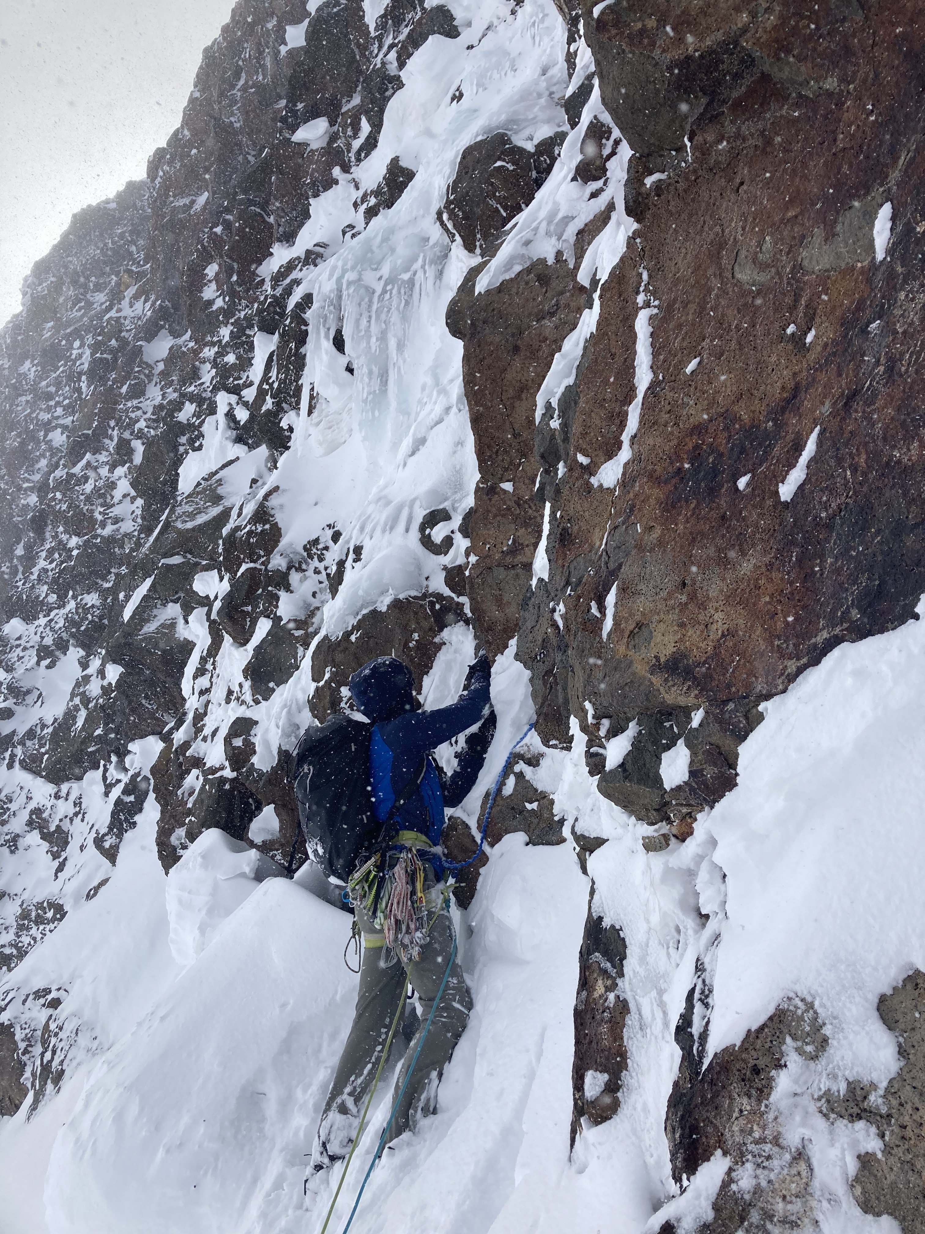
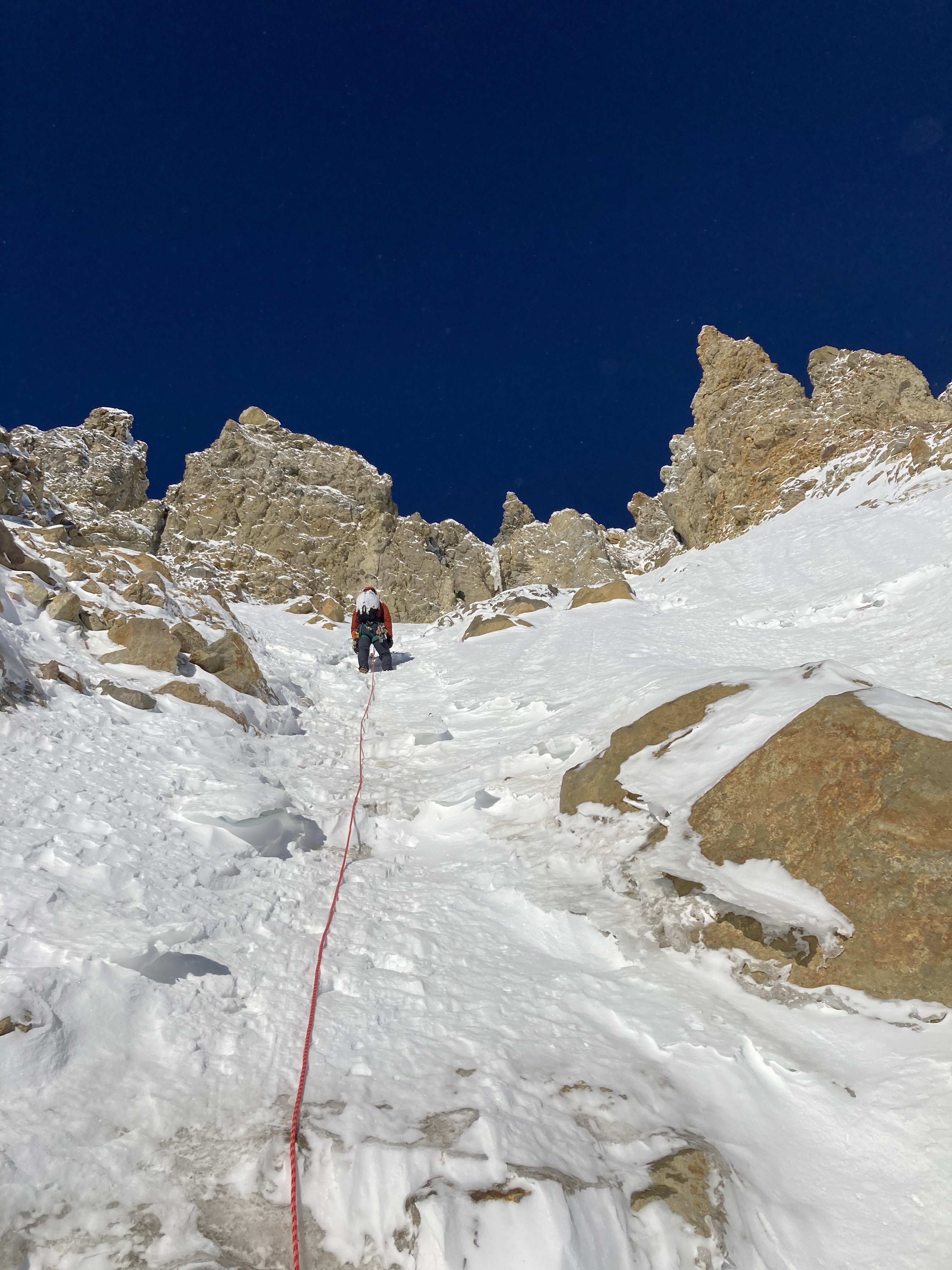
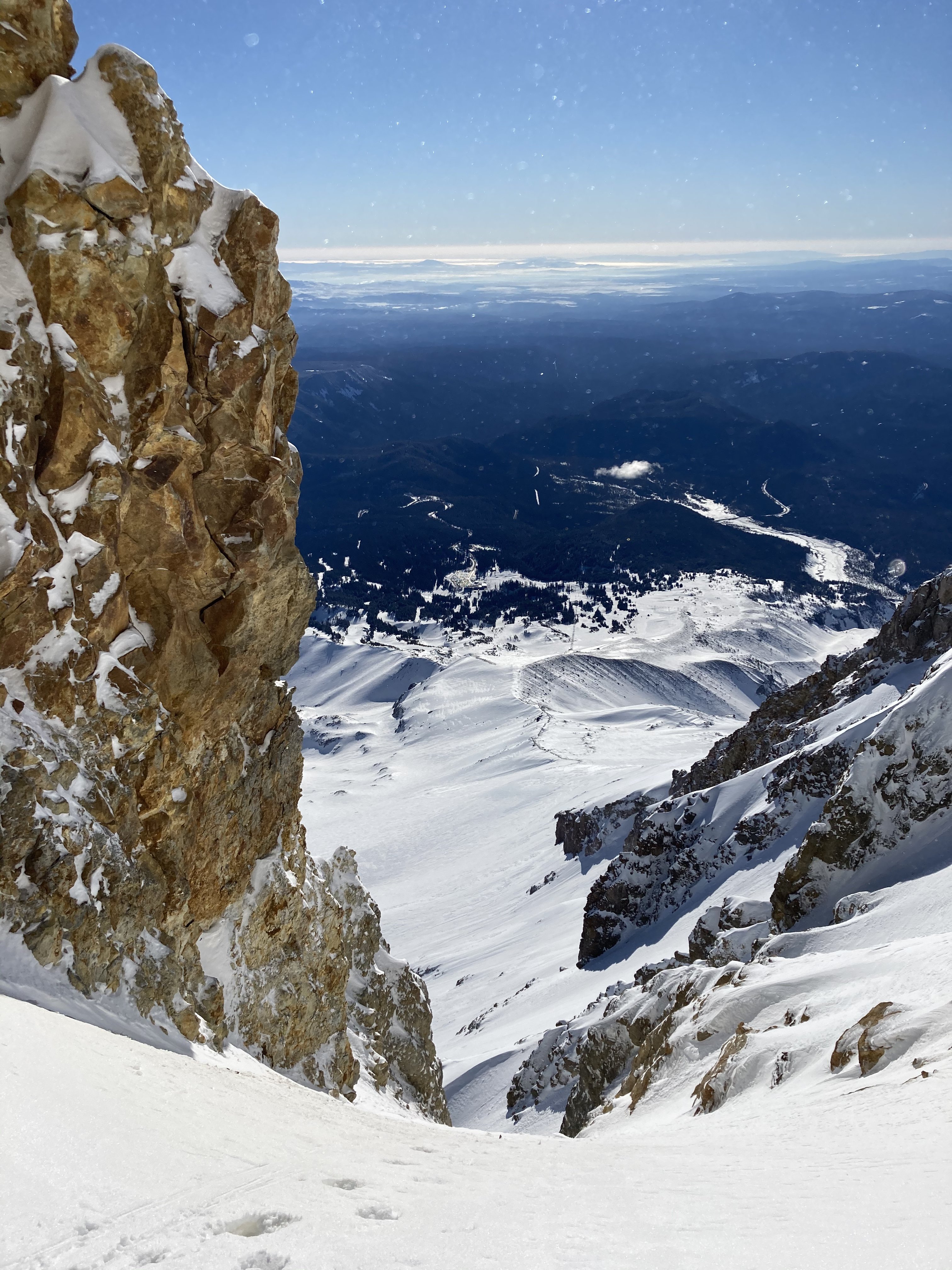
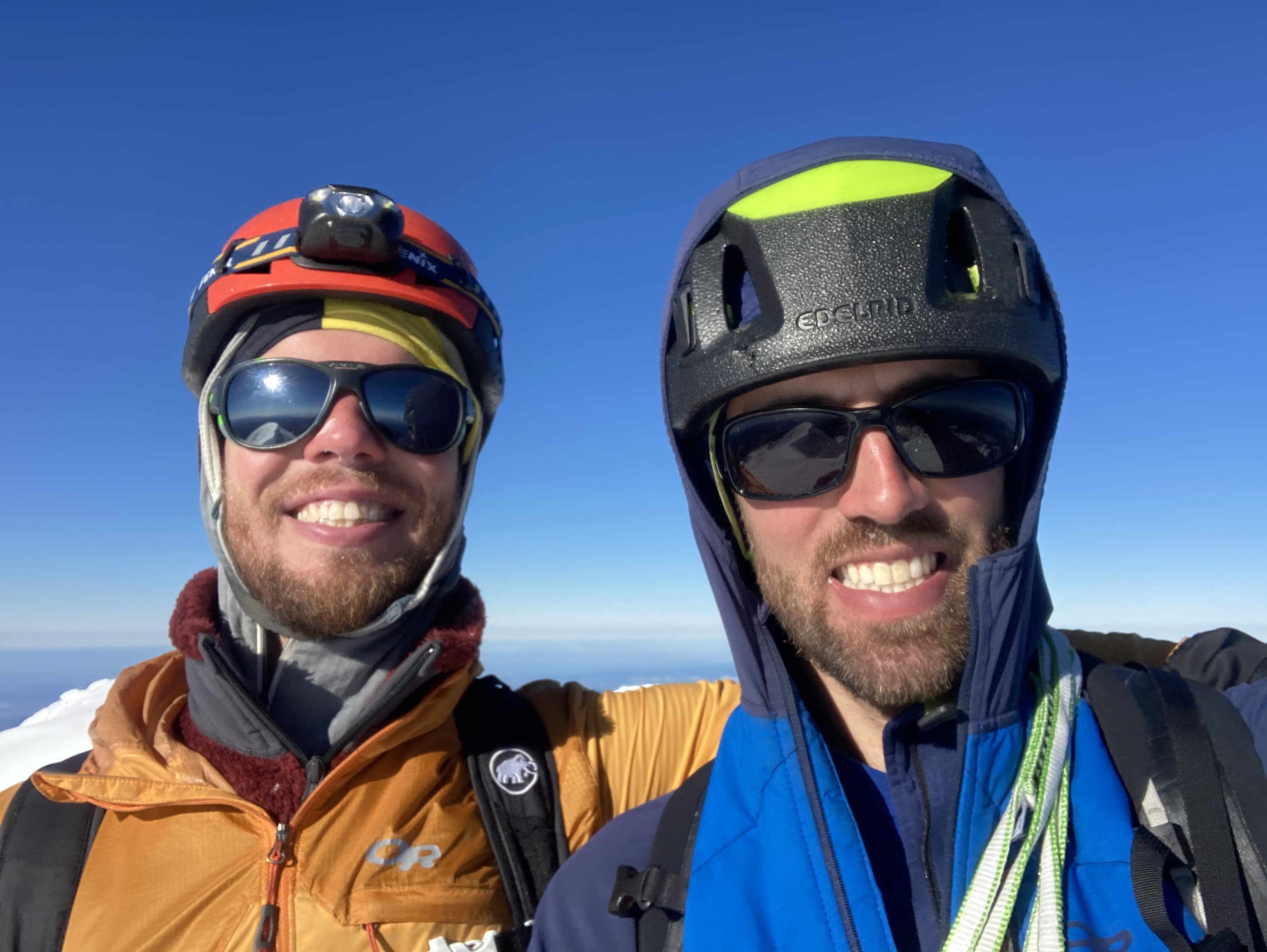
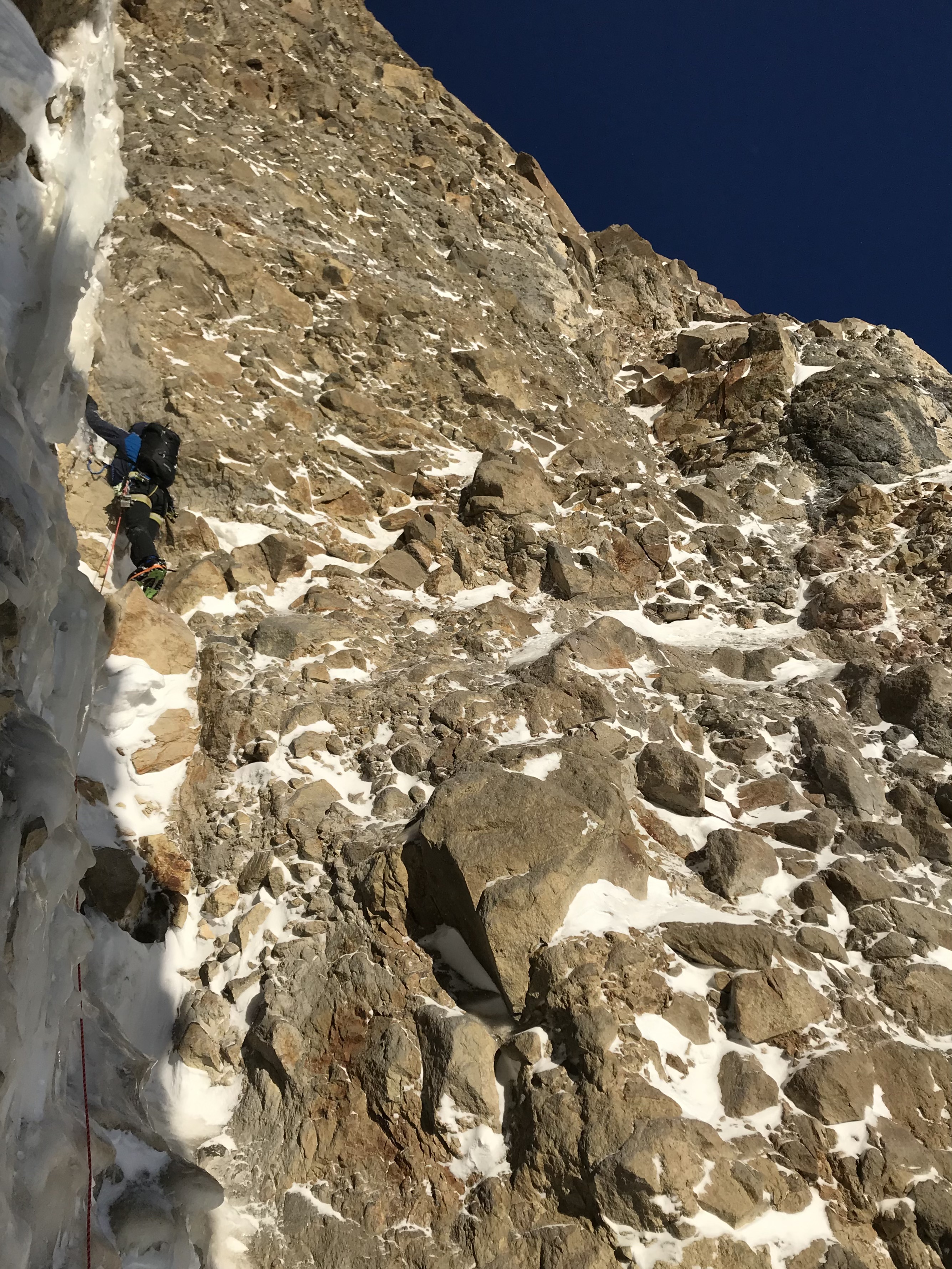
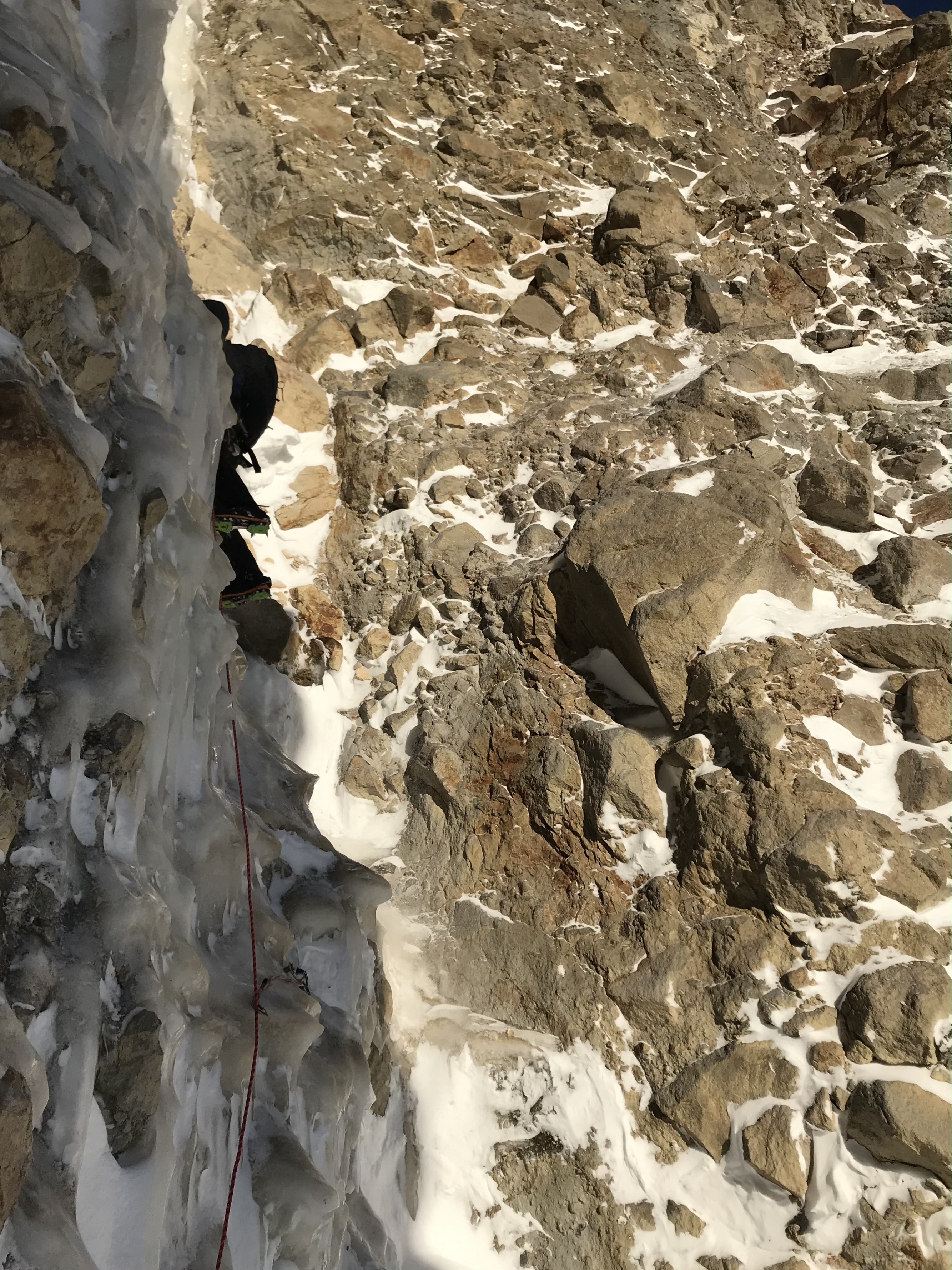
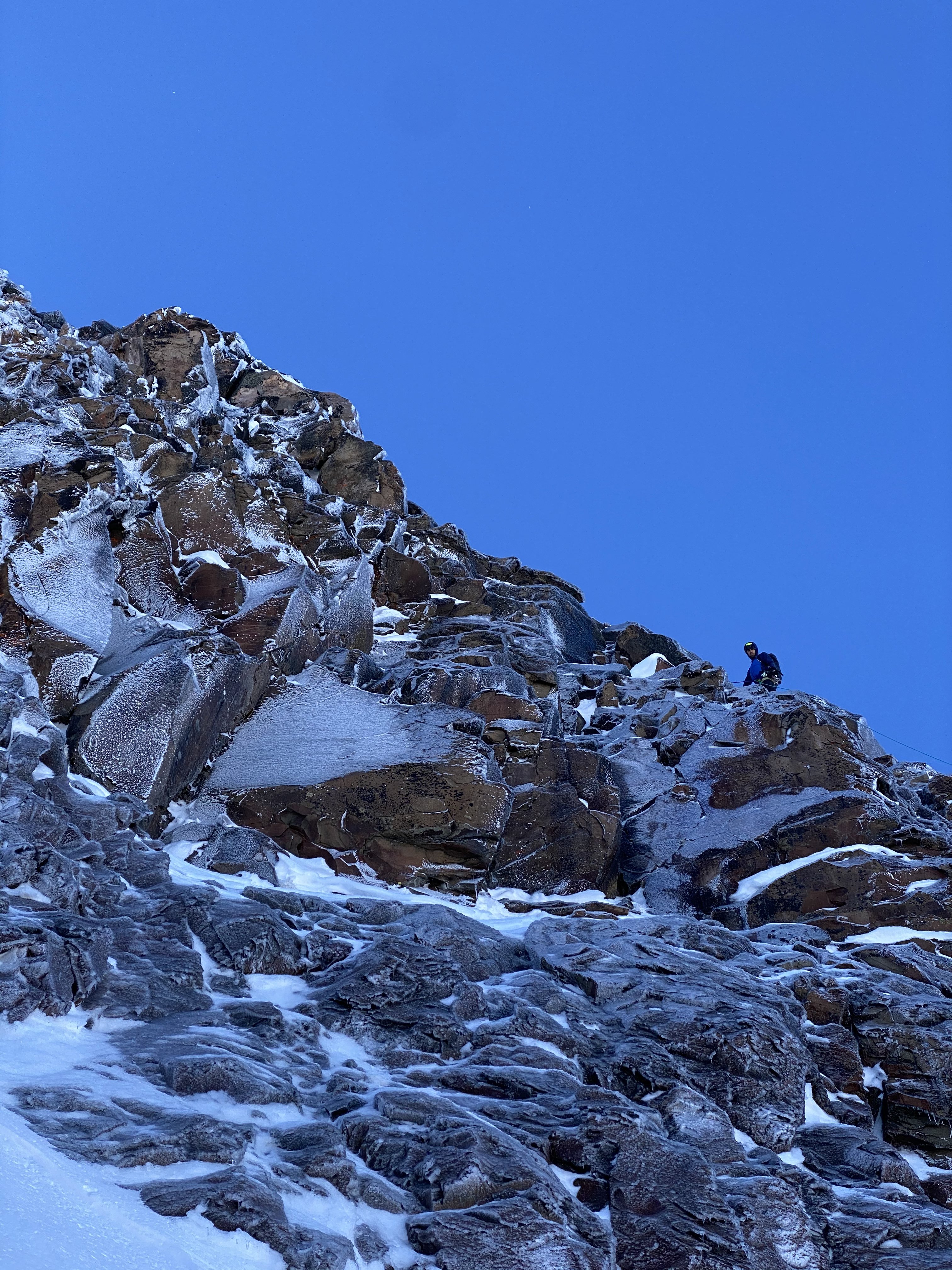
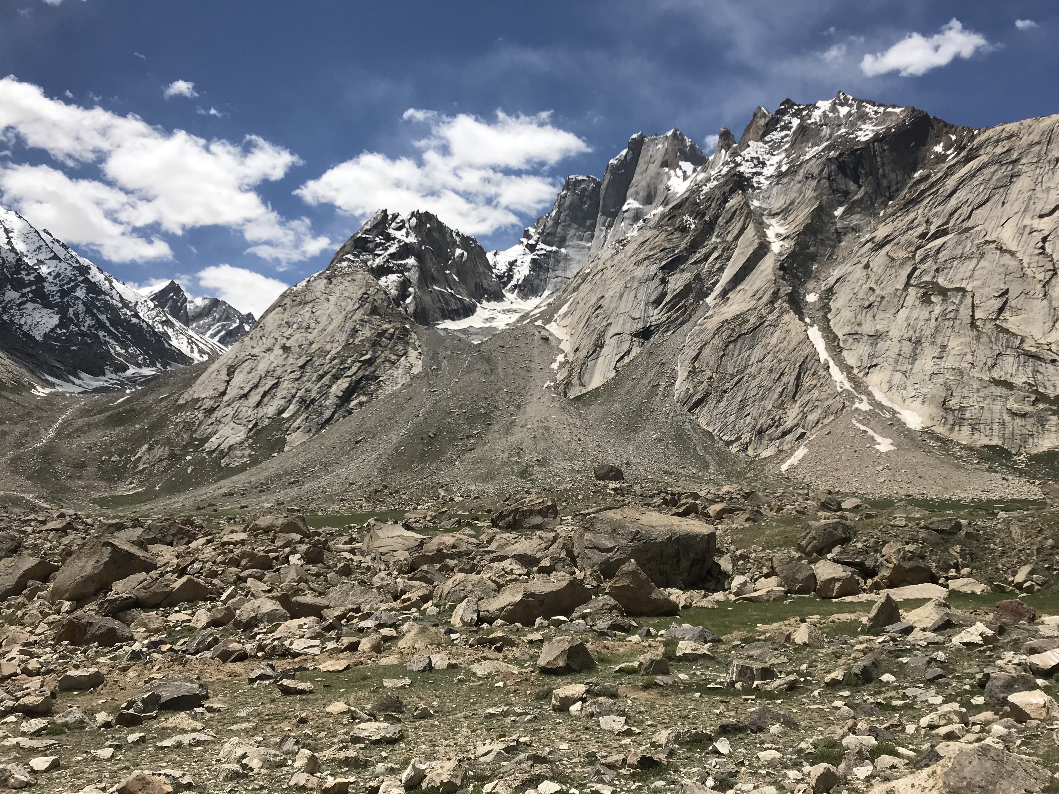
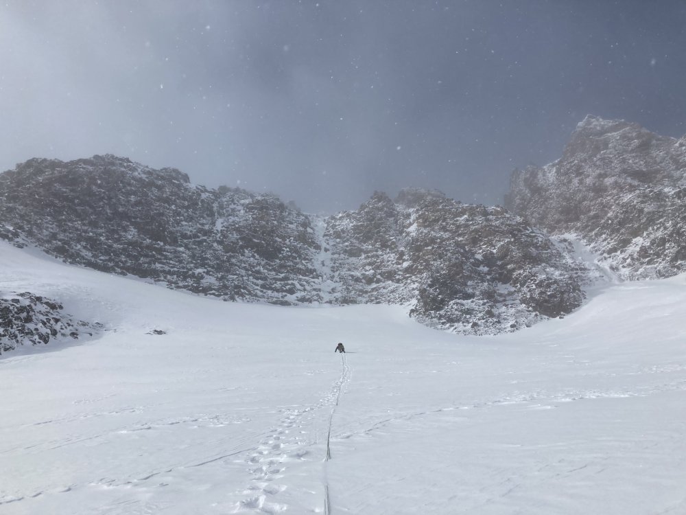
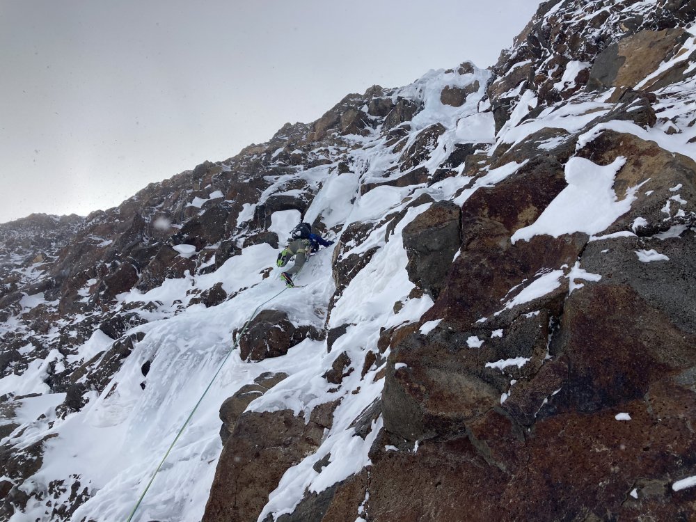
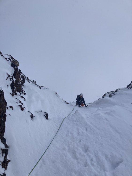
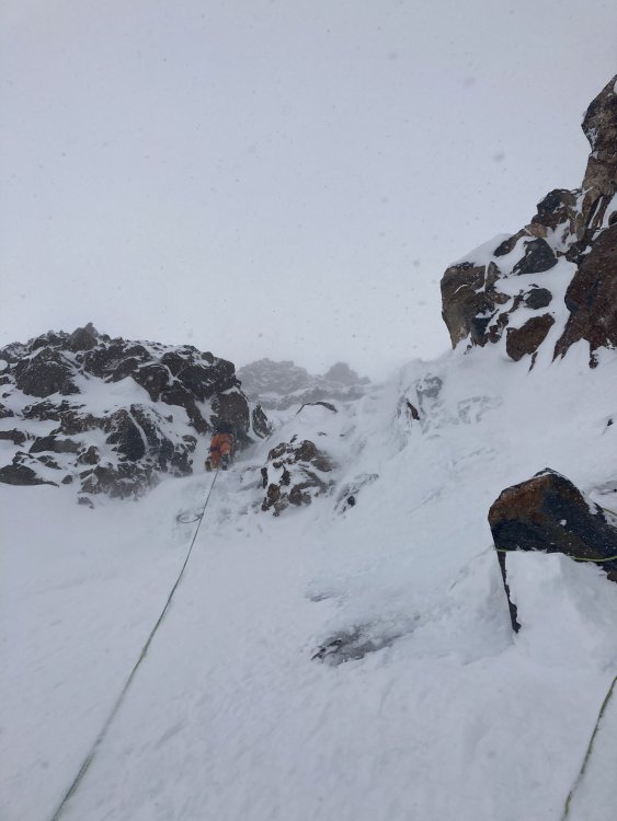
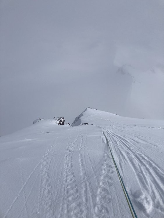
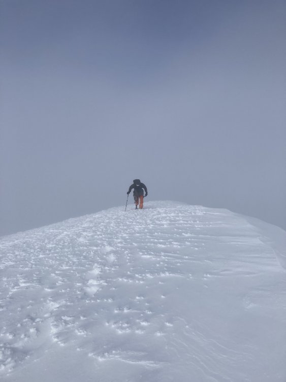
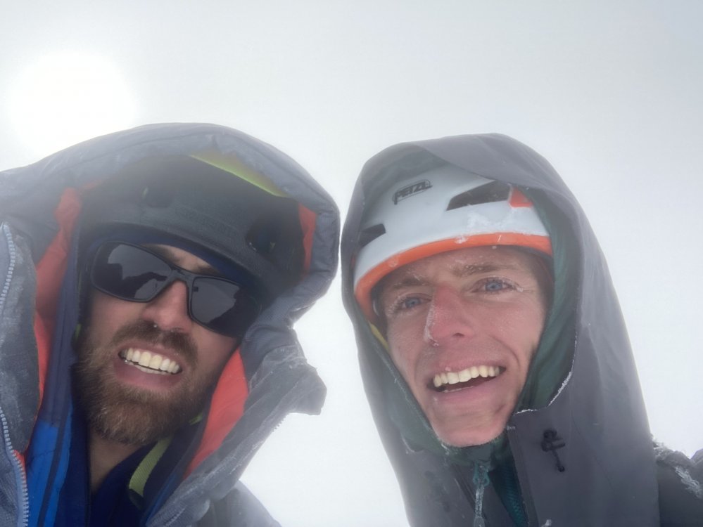
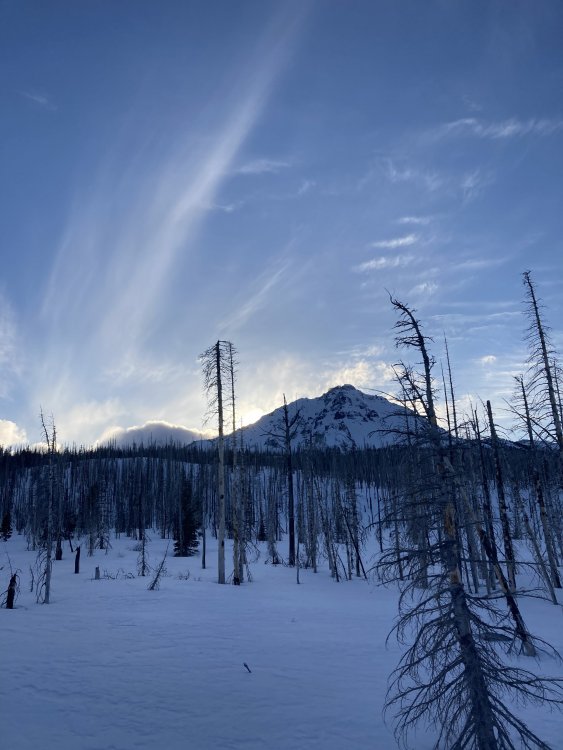
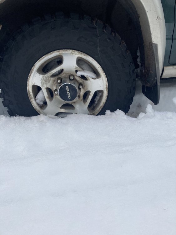
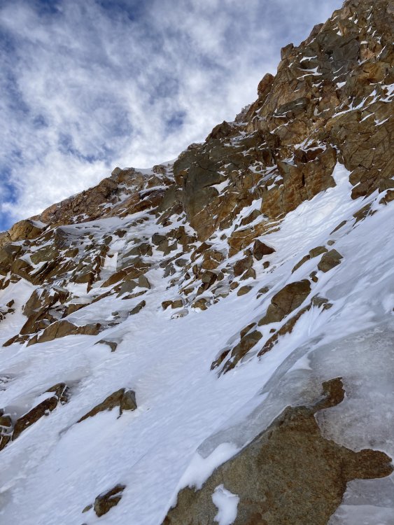
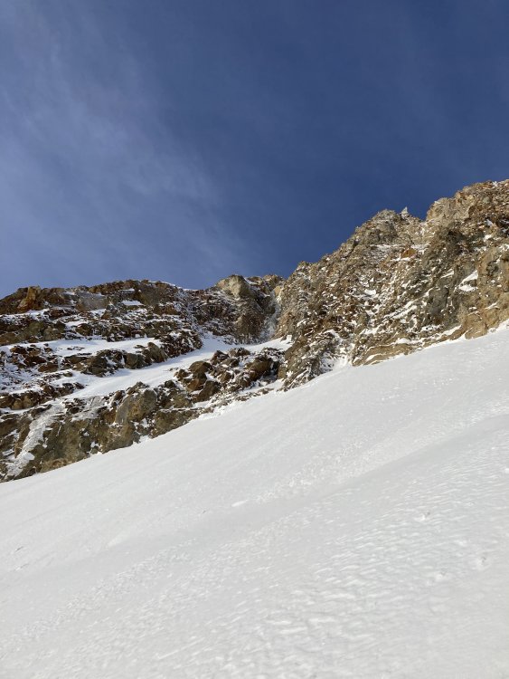
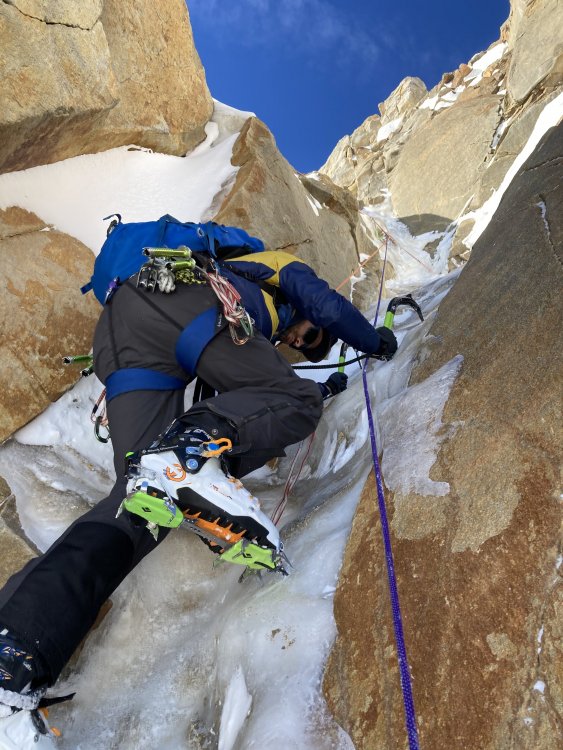
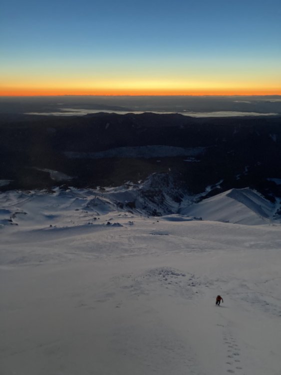
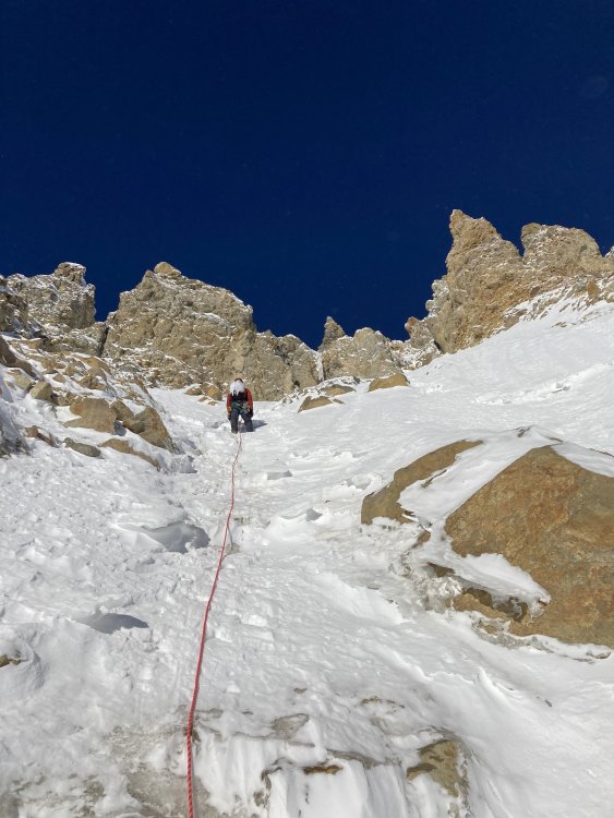
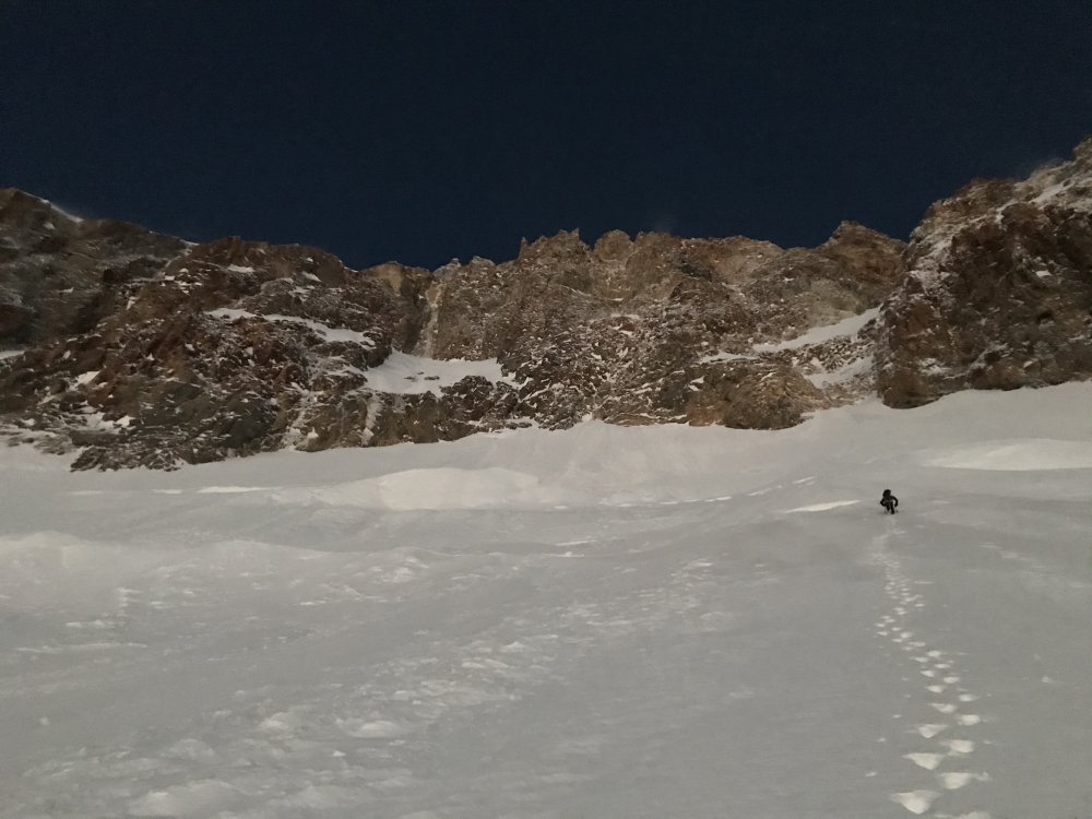
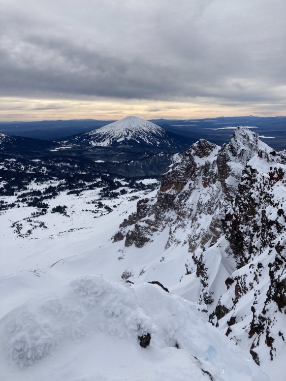
Trip: Middle Sister - Emde/Ablao Trip Date: 03/06/2021 Trip Report: Probable second ascent of the Emde/Ablao with Adrien Costa. This is the ice smears and columns to the L of the Direct NE Face route from Oregon High. Perhaps some other people know of someone who has climbed it? Steep snow above the schrund (currently covered) leads to a varied and engaging 60m pitch (difficult to protect) with a couple overhanging bulges. Above this we traversed L on snow to join the E Rib. AI4/4+ R/X seems about right. Me approaching the route, NE Face Direct's couloir is to the R. Photos of me by Adrien (obvs). Me starting the crux. Approaching the crux bulge. Adrien topping out the crux pitch. Adrien leading easier terrain above between spindrift pulses. Coming up the E rib. Adrien approaching the summit. The thing you do when you top out. North Sister with sun setting. Still got a few miles back to the car. Road conditions beta. Gear Notes: screws, cams, pins, nuts Approach Notes: long skin from before Pole Creek TH (17 miles and 4k' round trip from where we got the truck stuck)

-
I agree with Jason that if you don't touch the summit you did not climb the peak. I also agree with Gene that if you get home safe and have fun that is more important. I will add that if you're going to spray about your trips just be honest about what you did and don't try to couch it in a way that implies something other than the truth. I got within spitting distance of an unnamed summit in India a couple years ago soloing, certainly closer than the Challenger scenario you mentioned. I turned around when I got to a loose rock band just below the top. I did not summit, I did not climb the peak. I accomplished everything I wanted to by staying safe, having fun and testing my body at altitude. If you need to hide the truth to portray a certain outcome then your ego is much too involved and you should probably do some serious self-reflection.
-

[TR] Mt Shasta - Avalanche Gulch 02/22/2021
bedellympian replied to adventure43's topic in California
Spring ski is definitely the best way to go on Shasta, the mountain is made for it. Look at the Hotlum Wintun route if you enjoy some steeper angle, otherwise the west face if it ever fills in with snow this year. -
I would advise checking different aspects and trying different volcanoes from Hood. Hood gets very wet/rimey storms and the South side gets side-blasted. Often the Sisters, Jefferson, or Adams will have much drier snow (as in it actually deposits snow and not ice blobs).
-
I figured I'd share this as its helped me a fair bit as someone who trains constantly. I've told several partners about it and they have started doing the same thing. I find it very helpful for mountain athletes, especially when the local weather is not consistent (i.e. winter in the PNW). Most endurance athletes keep a weekly total of their volume and start their weeks on either Sunday or Monday, but I've started beginning my weeks on Saturday (or whatever your first free day is if your schedule is not traditional). This allows you to have more flexibility on the weekends. I used to start my training weeks on Monday and I would spend hours watching the weekend forecast, trying to move around workouts and adjust aerobic session lengths in anticipation of what I would most want to do that weekend. Obviously you want to keep your training fairly consistent, but you also want to take advantage of those occasional winter weather windows. Too often I would see next weekend looking really good and slack off on my volume a bit in the hopes of going into the alpine, only to have the forecast slowly shift and I'd be left trying to do all my vert and my long effort for the week by lapping crap snow in terrible weather. Conversely, I'd see terrible weather coming and would front load my week so I could spend a little extra time with the wife on the weekend, but then a good weather window would appear and I'd be left wondering if I should go way over my volume to try something while tired, or just sit around and watch a great opportunity pass. Now that I start my weeks on Saturday I can make last minute plans and have way less stress. If the weekend is great, I can go do an alpine day or ski tour that fits within my weekly volume, and then do shorter strength and easy aerobic as needed to meet my weekly total by Friday. If the weekend is crap I still try get a longer effort but it can be on the lower end of that range and it could be out in the desert or just around town without pressure to hit a certain mark, then I can do some medium-long efforts before/after work during the work week to make sure that I still hit my volume by Friday. For those of you tracking weekly volume and still trying to enjoy some mountain adventures with your days off I highly recommend this strategy.
-
I found out what the units for the wind vane fletchings are... They are in knots (nautical mph) cause everyone knows knots! 1 knot = 1.15 mph A half line = 5 knots A full line = 10 knots A triangle = 50 knots So a wind vane arrow pointing from L to R at 700mbar with a triangle, a line, and a half line coming off its side means wind out of the West at 10,000ft with an average speed of 50+10+5=65 knots or ~75mph (so stay the F%$# home!)
-
In my experience, if the Time-Height is white at summit altitude, then it will be clear. There MIGHT be a summit cloud capping it, but it won't be anything major.
-
This past Friday on Hood was a perfect example of how Time-Heights are better... NOAA pt called for 80% chance of snow and high winds out of the W. The Time-Height showed that while there would be clouds and precip it would be clear above 6,000ft and the winds would actually be out of the NW at that elevation. We went for it and poked out of the clouds at the top of Palmer, while there were high winds in places we were mostly sheltered by the mountain. We were the ONLY climbers or skiers on the entire upper peak that day and climbed Reid Headwall in beautiful conditions under perfect blue sky. We encountered strong winds at Illumination Saddle and on the summit ridge but otherwise it was just a little breezy. We had to start and finish skiing in the cloud layer in what looked pretty terrible from the parking lot, but persistence and confidence in the forecast paid off.
-
Classic... https://www.youtube.com/watch?v=mXzVNFrLzk0 <iframe width="560" height="315" src="https://www.youtube.com/embed/mXzVNFrLzk0" frameborder="0" allow="accelerometer; autoplay; clipboard-write; encrypted-media; gyroscope; picture-in-picture" allowfullscreen></iframe>
-
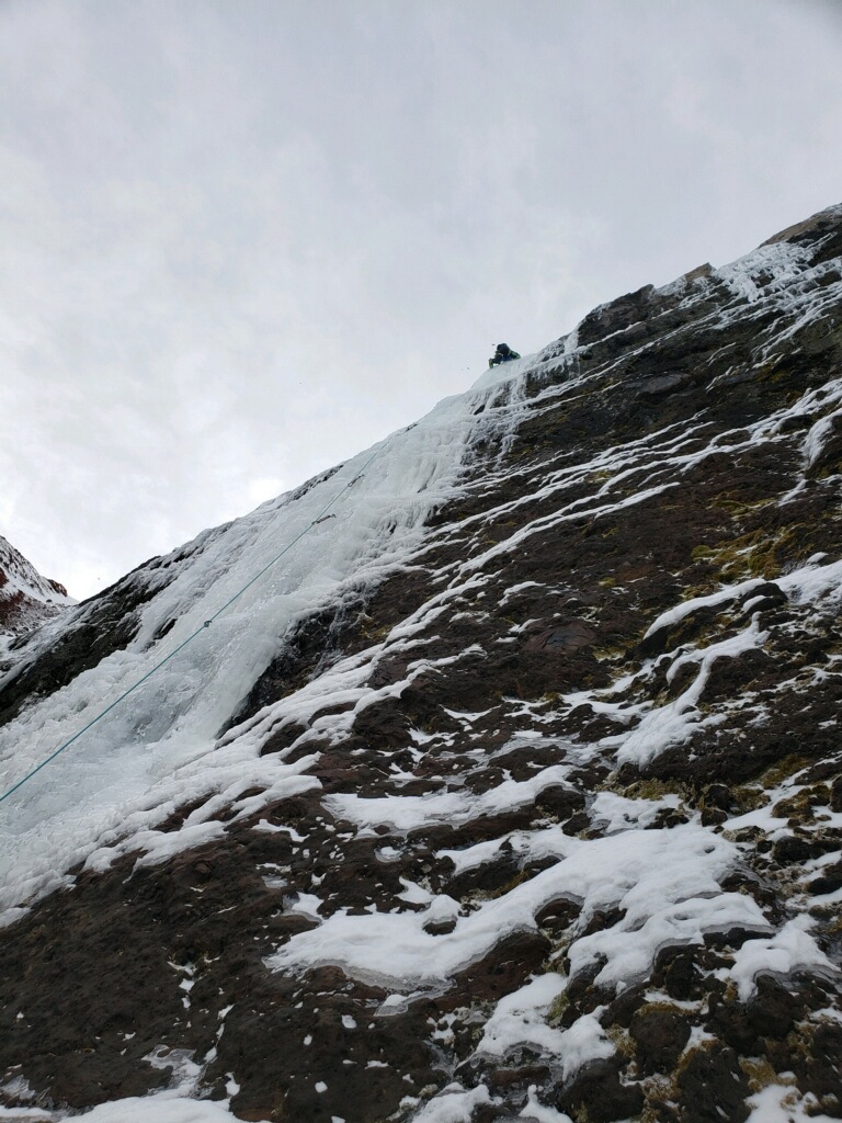
[TR] Wy'east (Mt. Hood) - Fric-Amos 01/23/2021
bedellympian replied to bedellympian's topic in Oregon Cascades
Totally, this experience has me rethinking when and what climbable conditions look like on this face. -
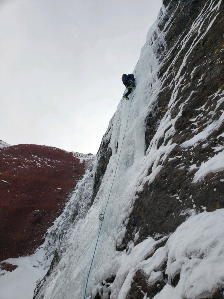
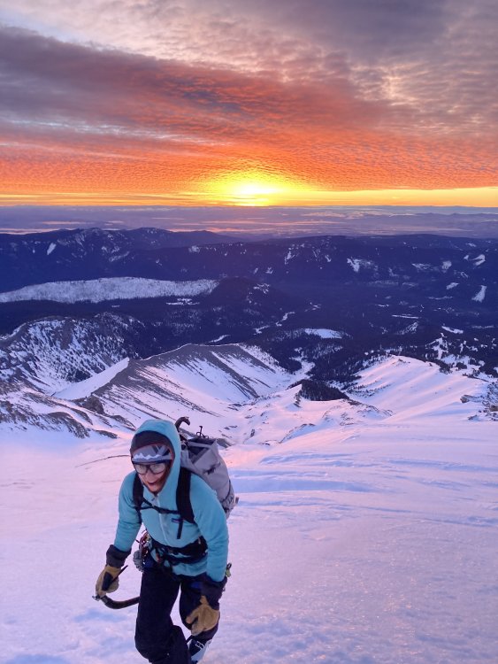
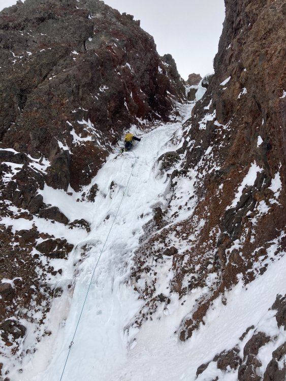
Trip: Wy'east (Mt. Hood) - Fric-Amos Trip Date: 01/23/2021 Trip Report: I went up to the Black Spider last weekend with Lindsey and Riley. We found the Fric-Amos in very nice condition but were too late on a warm day and bailed up an easy mixed pitch to the L of the main pitch. Thankfully the weather granted me another opportunity and I came back this weekend with Kyle to get it done. Noah and Matt saw my Insta story from the first weekend and jumped on the send train. They acted as true gentlemen, coordinating with us and giving us a head start. The route is currently in good condition (but don't expect a straightforward WI4). We used an approach pitch to the R of the original both times that follows an easy ice slot (the original would probably go but is discontinuous ice blobs up a vertical cliff). The crux pitch is a full 60m or could be broken up, expect tricky and sustained climbing but with good ice. Above this snow slopes take you through one more short ice step and up to the summit ridge. This may be one of the more frequently formed ice routes on the Spider given that it is in a shaded cleft, unlike most of the other routes. Though you are basically going for one mega pitch, it is very good and I would recommend it! I talked to Bill Amos the next day and he believes ours was the 3rd (and Noah and Matt the 4th) ascent of the route (2nd was Marcus and Marsha, go figure). Awesome sunrise approaching on first attempt... Lindsey and Riley below the face, clearly too late... The face... Closer view of the Fric-Amos (original approach pitch is on the L, our approach pitch was on the far R of the hanging snow field)... Riley following the approach pitch, classic slot... Our escape pitch... The crux pitch (taken during from 1st attempt)... Kyle booting up to the face on attempt 2 (much earlier)... Kyle's pic, me below the face... Kyle's pics, me on the crux... Looking down from top of crux... Kyle leading above crux... Looking down from ropes off... Summit selfiez... Gear Notes: Screws: 2xstub, 4x13, 2x16, 1x22 (used for the belay but not any good) Rock gear: nuts, cams 0.4-0.75, pins (not used), 2 med hexes (not used) Plenty of slings if you're going to do the crux as one pitch. Approach Notes: Boots from Timberline, crossed White River ~8,800ft.


-
Green lines (I'm pretty sure) are relative humidity as a %, so yes cloud cover/precip in essence. I always use the 4km to be honest and don't understand the difference between the 12 and 4. The 4/3 looks like a shorter time frame than the 12 and 4, and the 12 looks like it has a little less detail than the 4km. I know TMG uses the 4km at Troutdale for all their guiding on Hood.
-
Every xx/00 to xx/12 is 12 hours, it covers 84 hrs.
-
x-axis starts on the R and goes back L (counter intuitive right?) and is in xx/yy format. xx is the date. yy is the hour in UTC (8 hours ahead of us in winter and 7 in summer so 00=4pm PST and 12=4am PST). basically you just look for the date and the 12 which is about when you'd be heading up with an alpine start most days. If its white (clear) above and to the L of that then its clear skies.
-
I've been aware of UW's time-height forecasting system for a while but really started using it this year. There have been several days where NOAA pt predicts clouds or high winds but the time-height shows its calm and clear above 5-6k' and its right on. Reading them takes some getting used to, they are definitely not the most user friendly, but once you've practiced a bit it's easy enough. Time goes from R-L on the x-axis in UTC (date/hour, 00=4pm PST day before and 12=4am day of), elevation is on the y-axis in mbar pressure (800 is aprox 6k', 700 = 10k'). Green = clouds/precip, arrows = wind (more fletchings = more wind, they point in the compass direction), temp is deg C shown in red lines ("0" line is the freezing level). Here is the link to a map of the time-heights. Click on the location down wind of where you want to go. Look for white above 800mbar with small wind arrows, there's your window. https://a.atmos.washington.edu/mm5rt/rt/timeheights_d3.cgi?GFS+current_gfs+
-
You are aware of the problems with this strategy, yes? https://www.amazon.com/review/R2JGNJ5ZPJT4YC
-
Wy'East Gear and Experience Requirements: Should I climb it?
bedellympian replied to GranolaEater93's topic in Newbies
Agreed, SS of Hood is definitely a step up from Adams, South Sister, Helens. If that feels comfortable and easy for you then consider Wy'east. Also, worth finding some steep snow with a big flat area of soft snow beneath it and building some anchors in that and practicing your skills. Try different things and try to make your tool placements and pickets fail. Realize that snow is super variable, but despite that this will give you a great idea of what you can/can't get away with. -
[TR] Broken Top - Richardson-Rocket Link-up 12/29/2020
bedellympian replied to bedellympian's topic in Oregon Cascades
Here is a rough approximation of our route in caltopo for those interested... https://caltopo.com/m/B36T Also, for those without a sled, this would definitely be doable with a skinning approach. I've certainly done individual routes on BT in an ~8hr car-to-car this way and you can also camp out near the peak as I've done several times. -
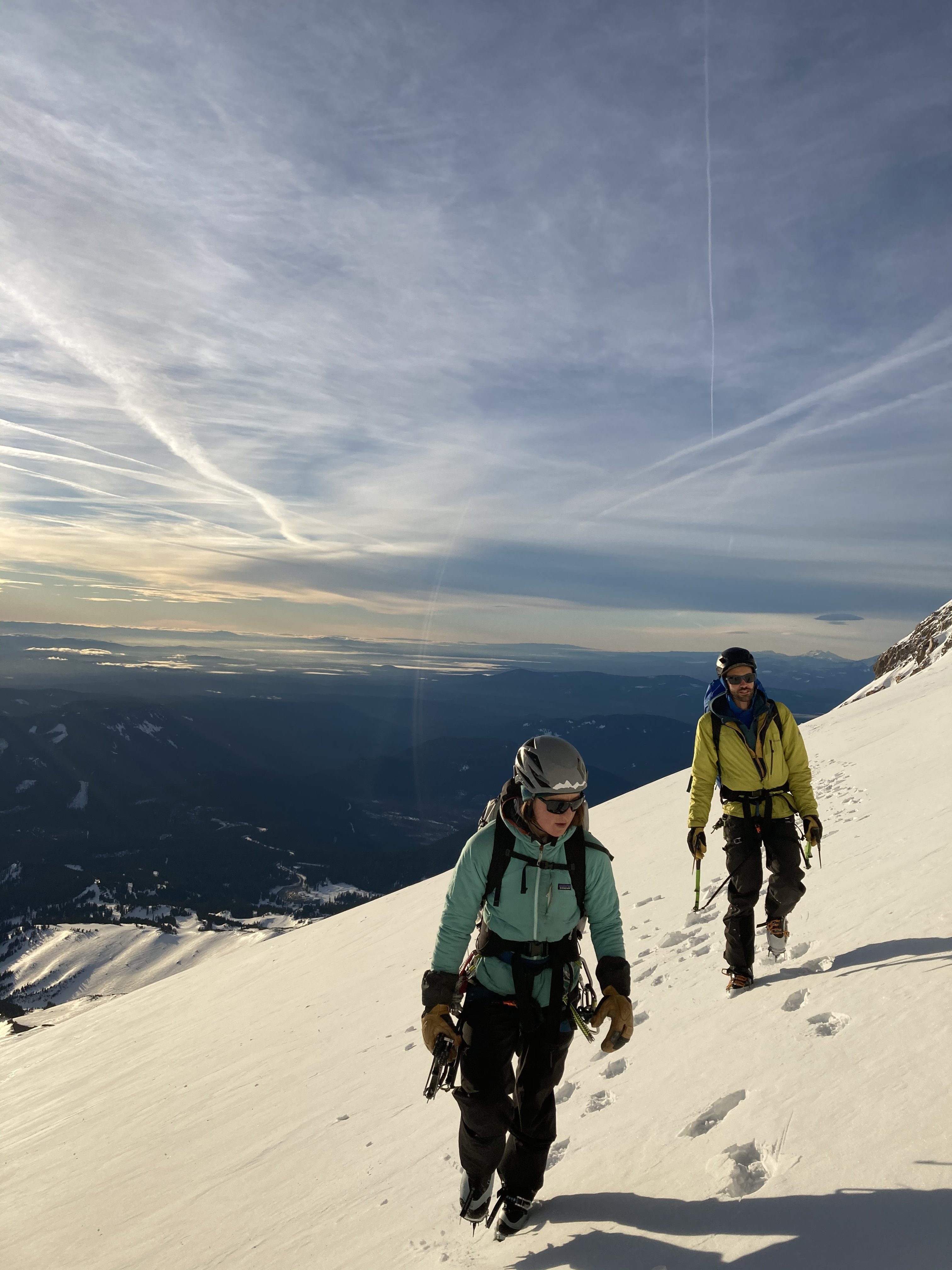
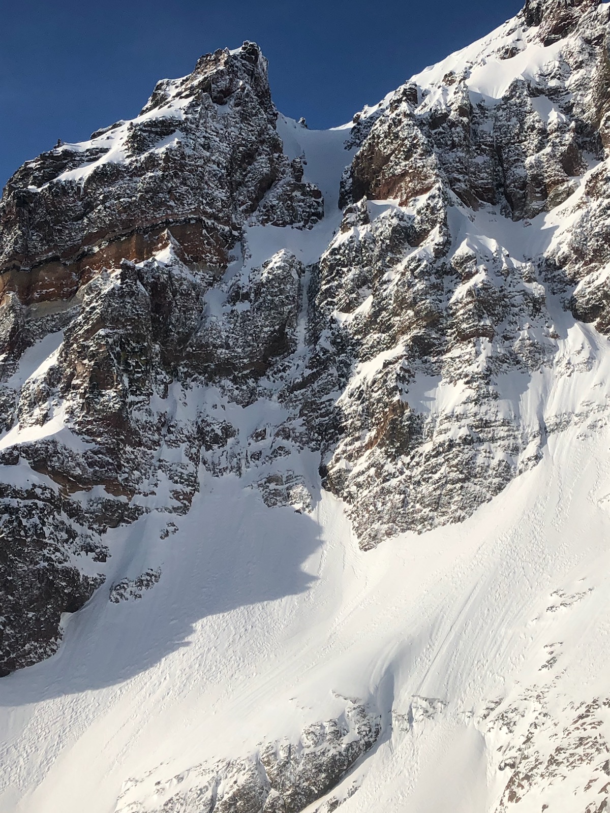
[TR] North Sister - Complete East Buttress 12/23/2020
bedellympian replied to bedellympian's topic in Oregon Cascades
Here are some more pictures... The upper buttress from just before you down climb to the R on the lower buttress, you can see the double ice gullies that start the upper and the black gendarme on the ridge ahead. Landon enjoying the view S before we start the upper. Looking back at the lower, you can see the cliff you rappel, just R of the snow crest. Landon leading the ice starting the upper. Me leading the headwall on Glissan Pinnacle. Me leading the summit pinnacle pitch. Landon down climbing EMC. Ice options on the N side of the lower buttress. It could be a fun cragging mission in and of itself when its fatter later in the season. Bottom of the lower. The first pitch climbs the obvious short pillar, then you go up and right between the tower and cliffs.

-
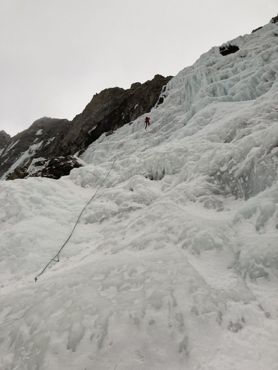
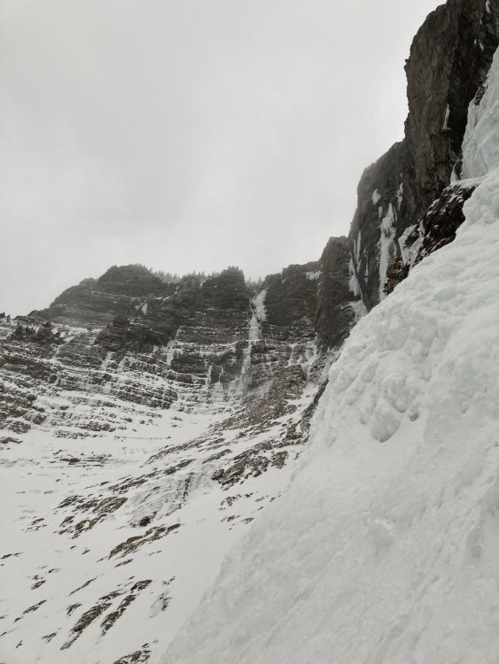
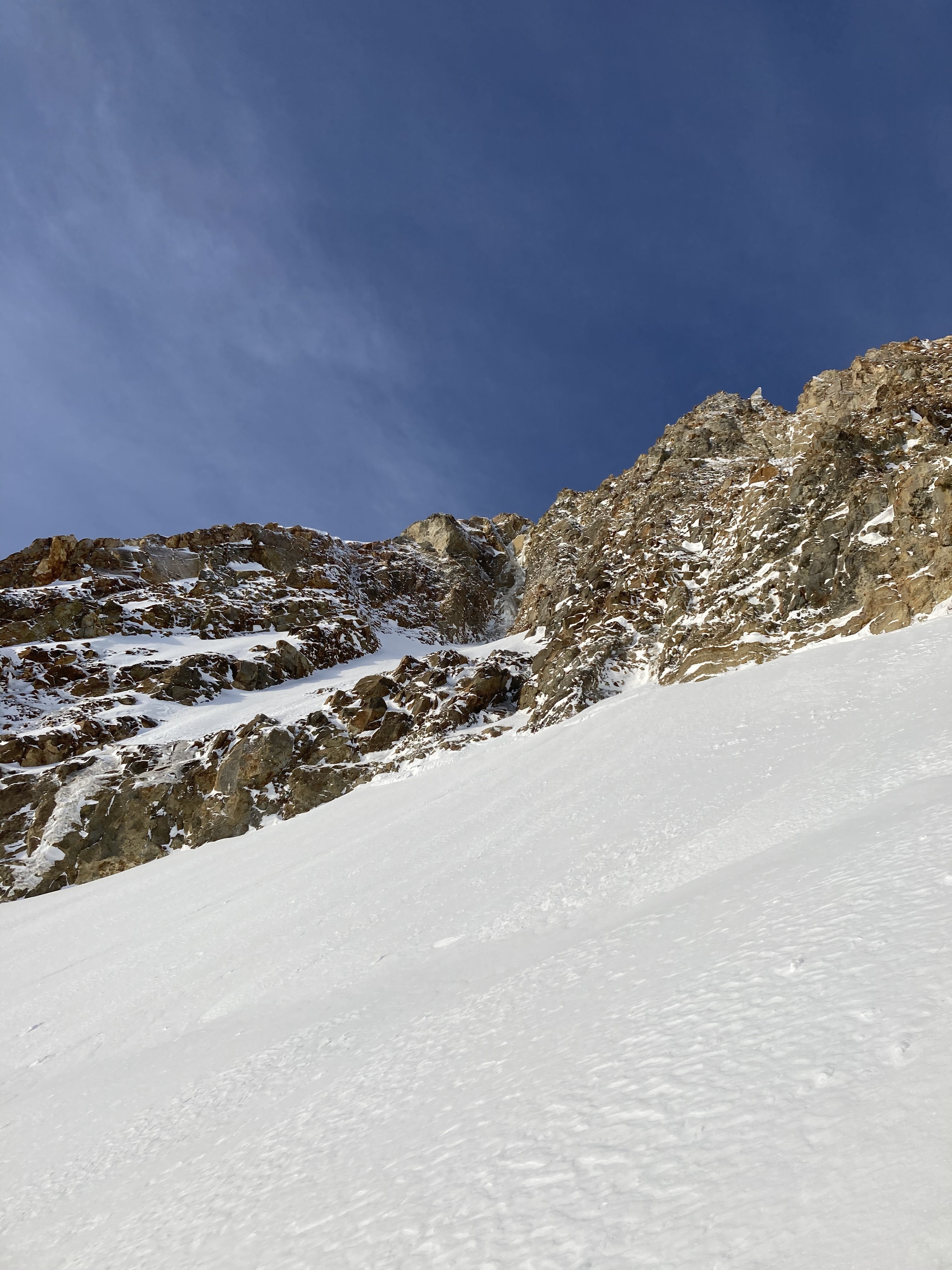
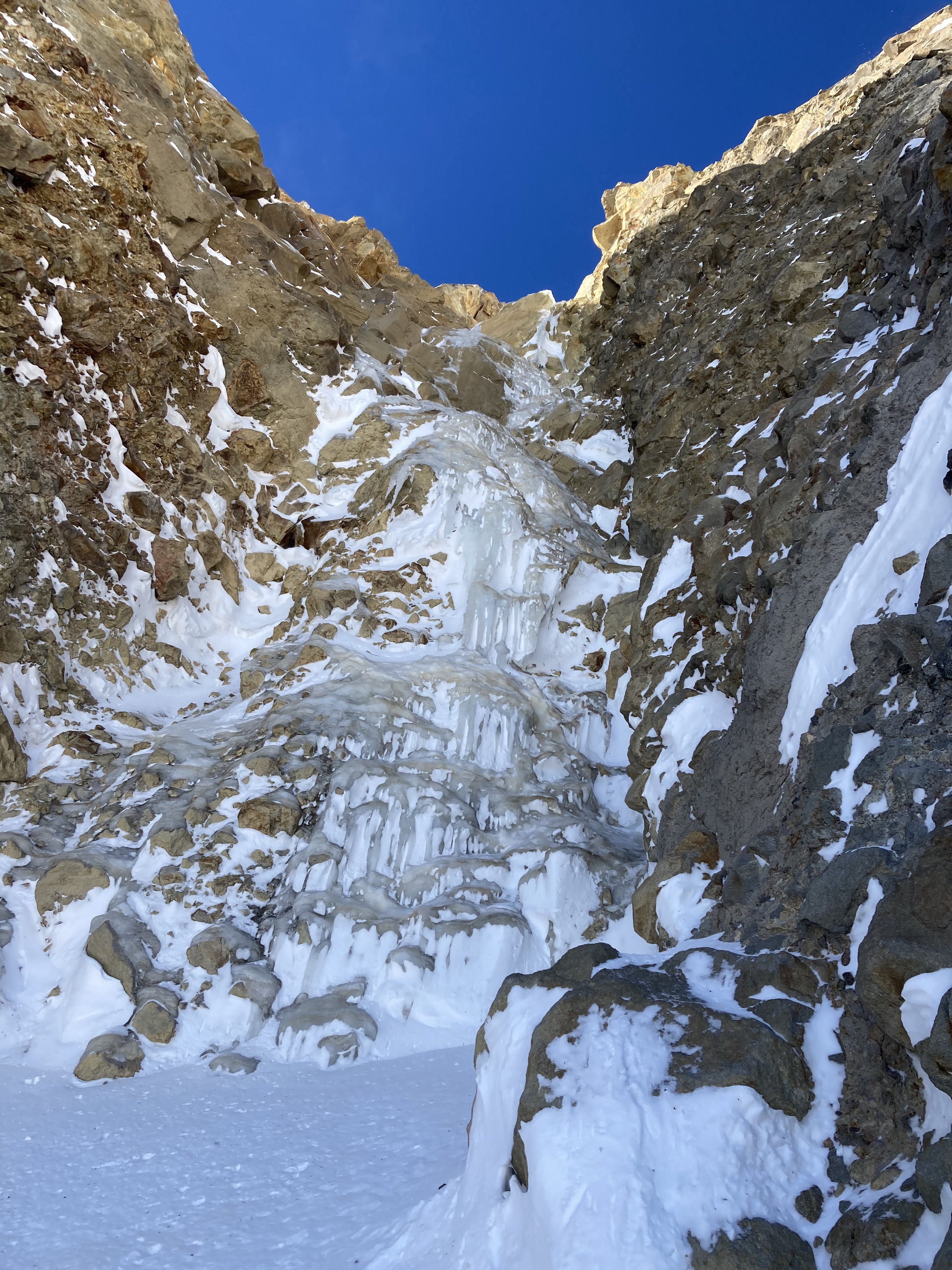
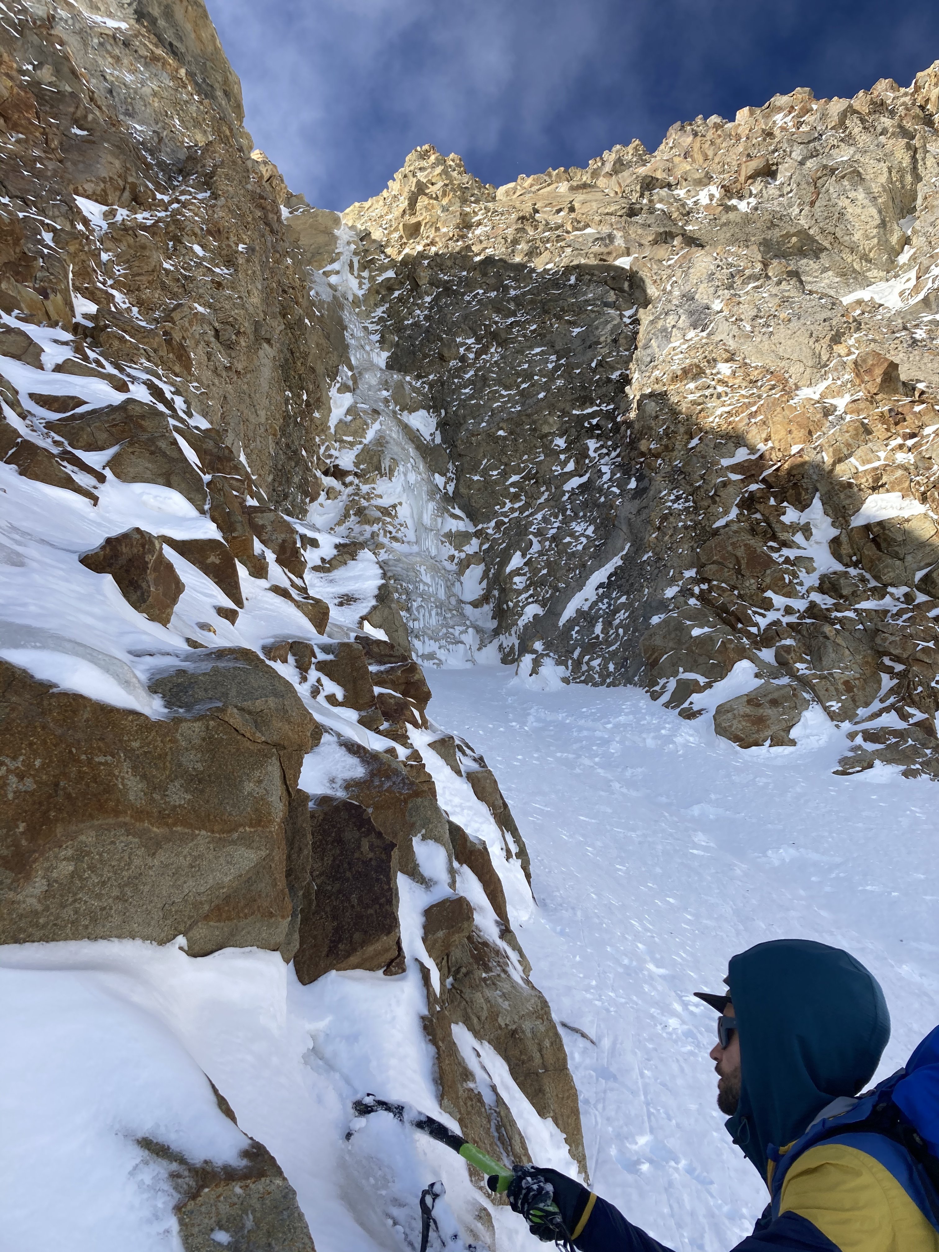
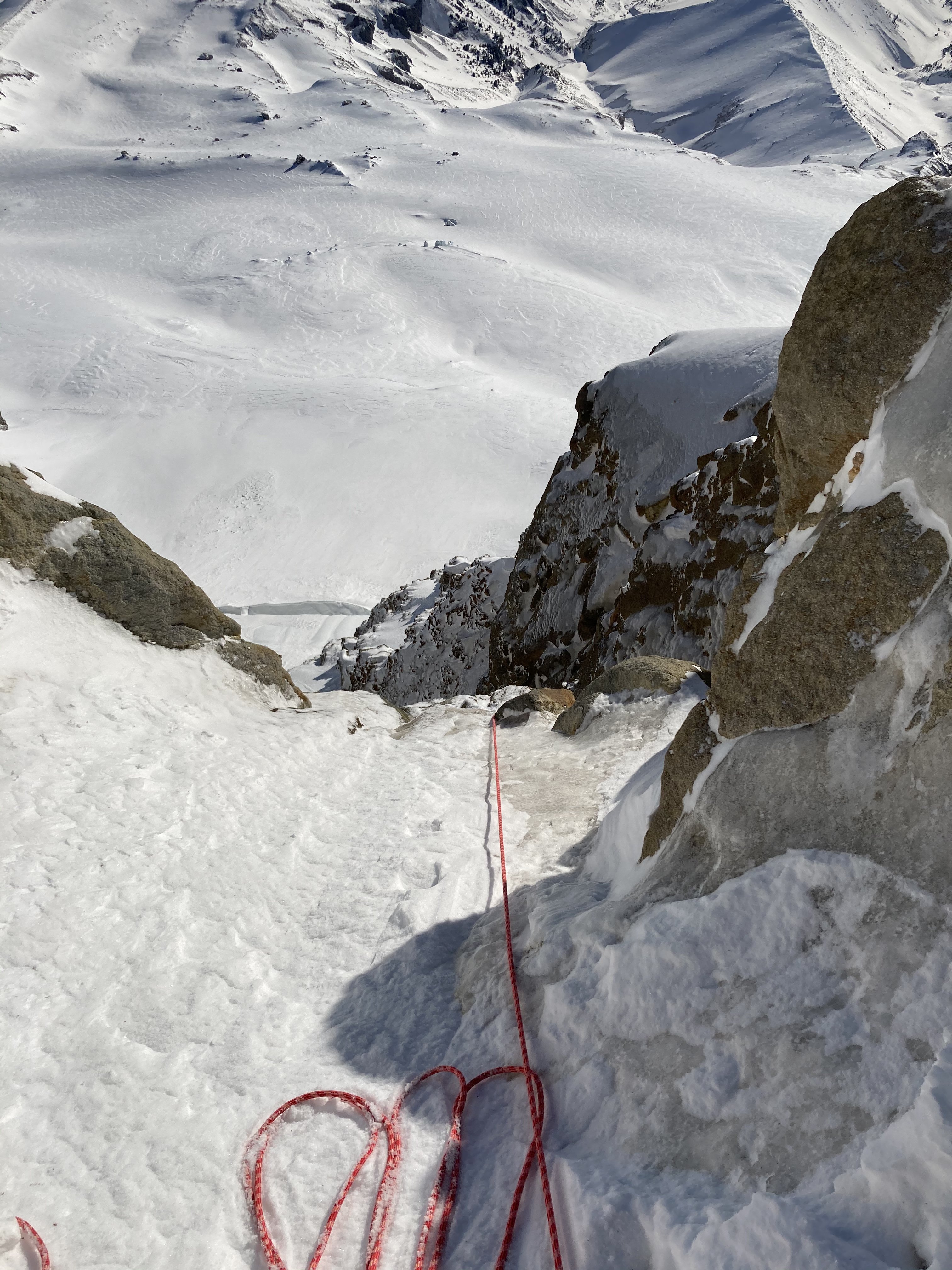
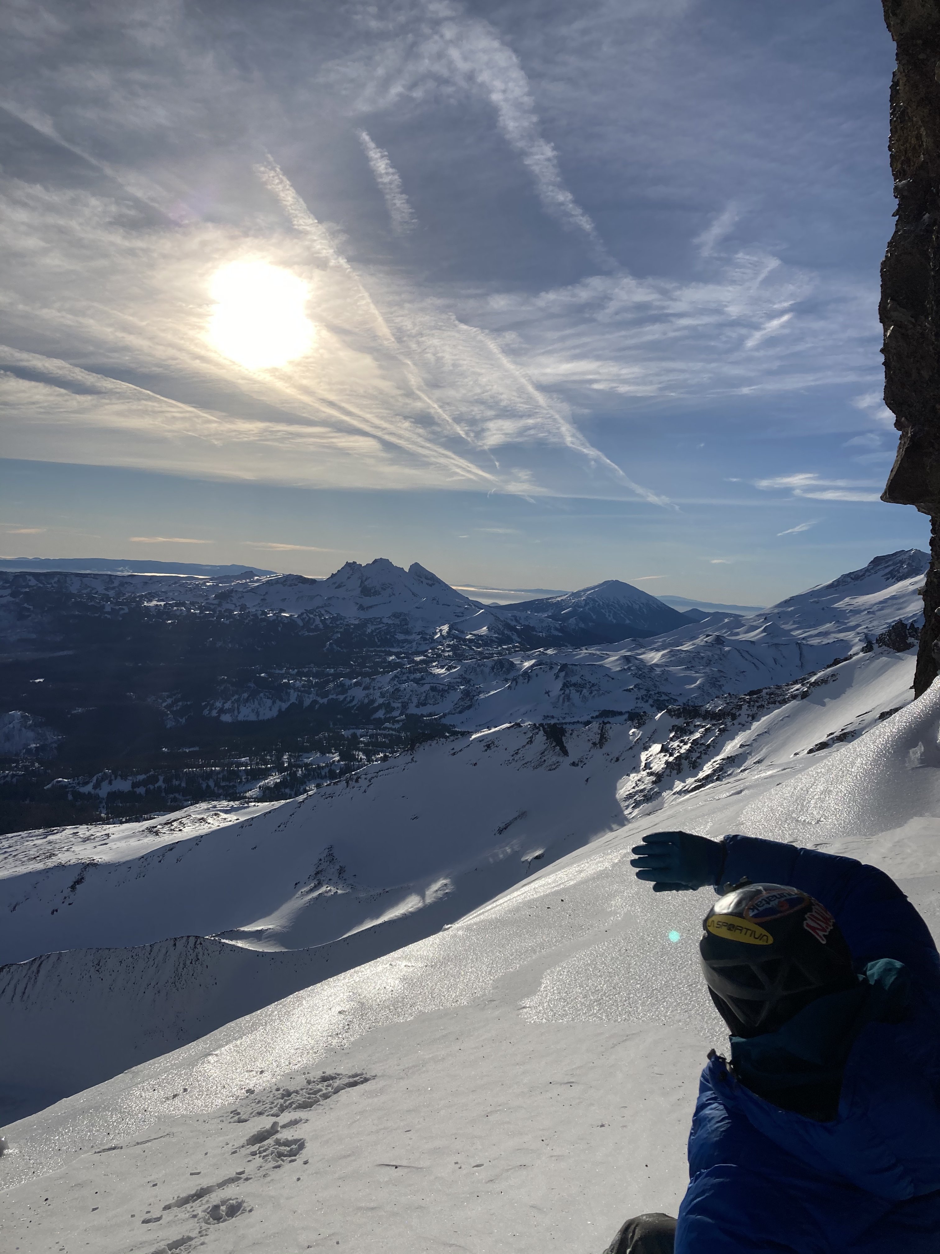
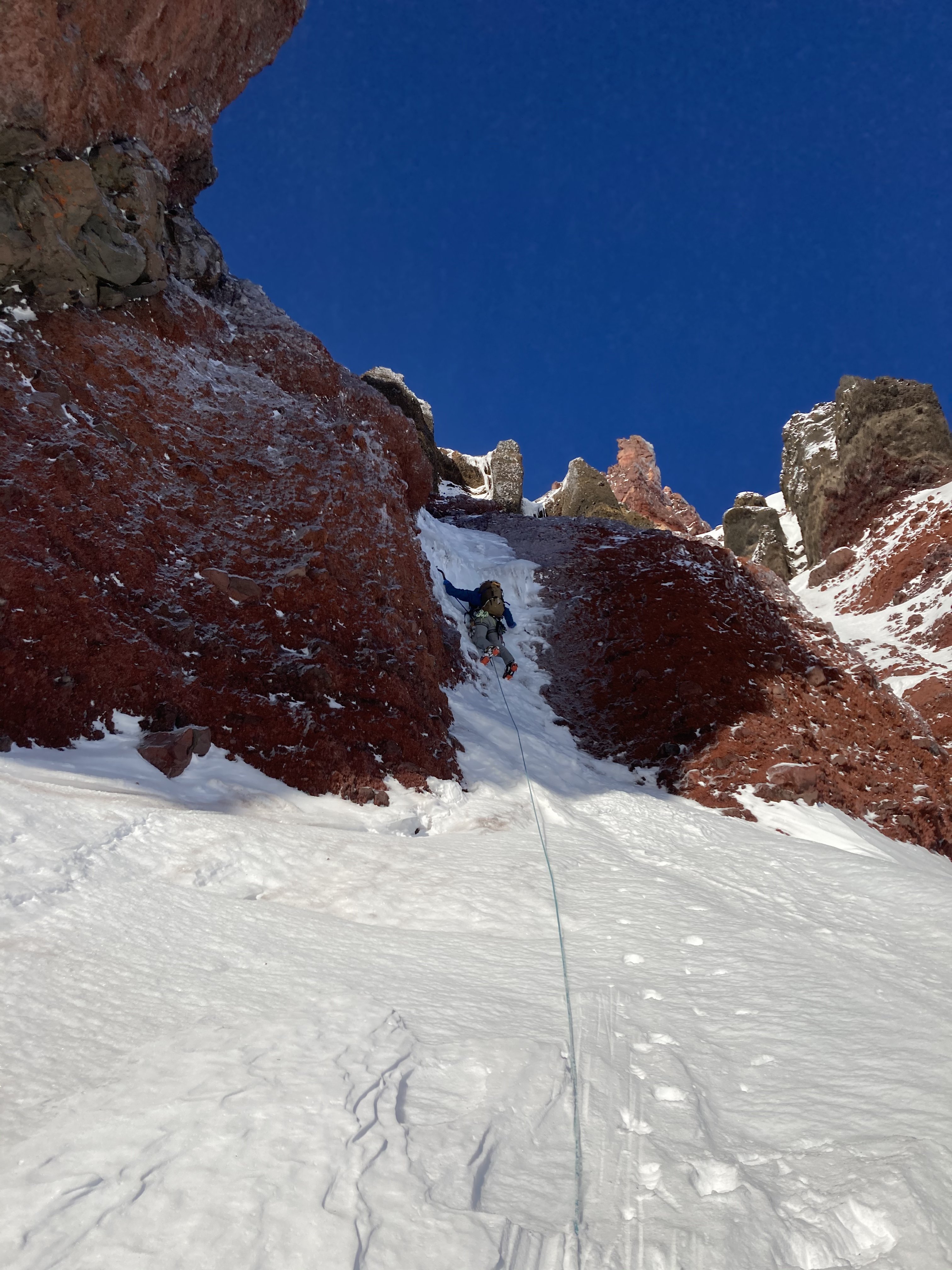
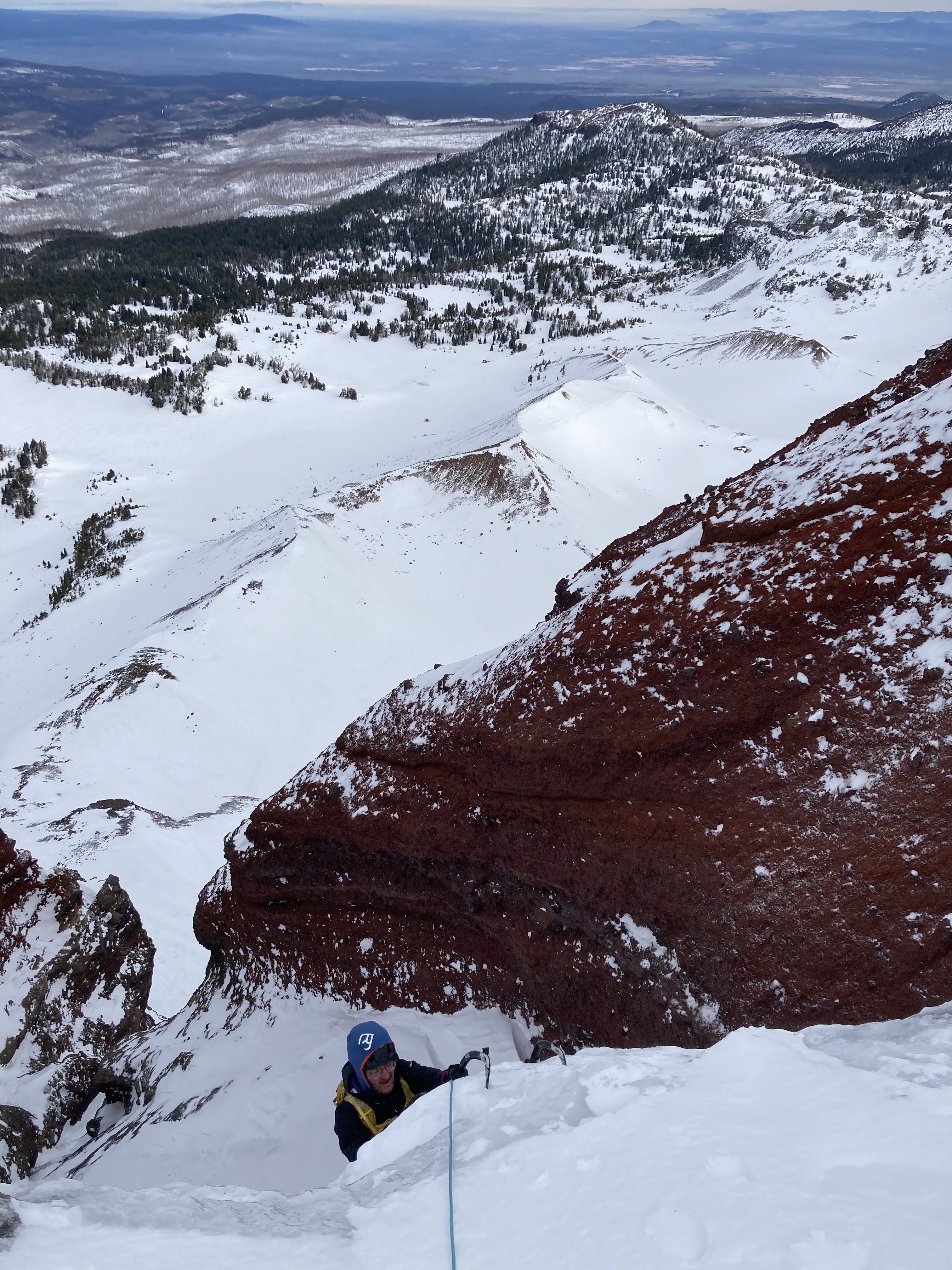
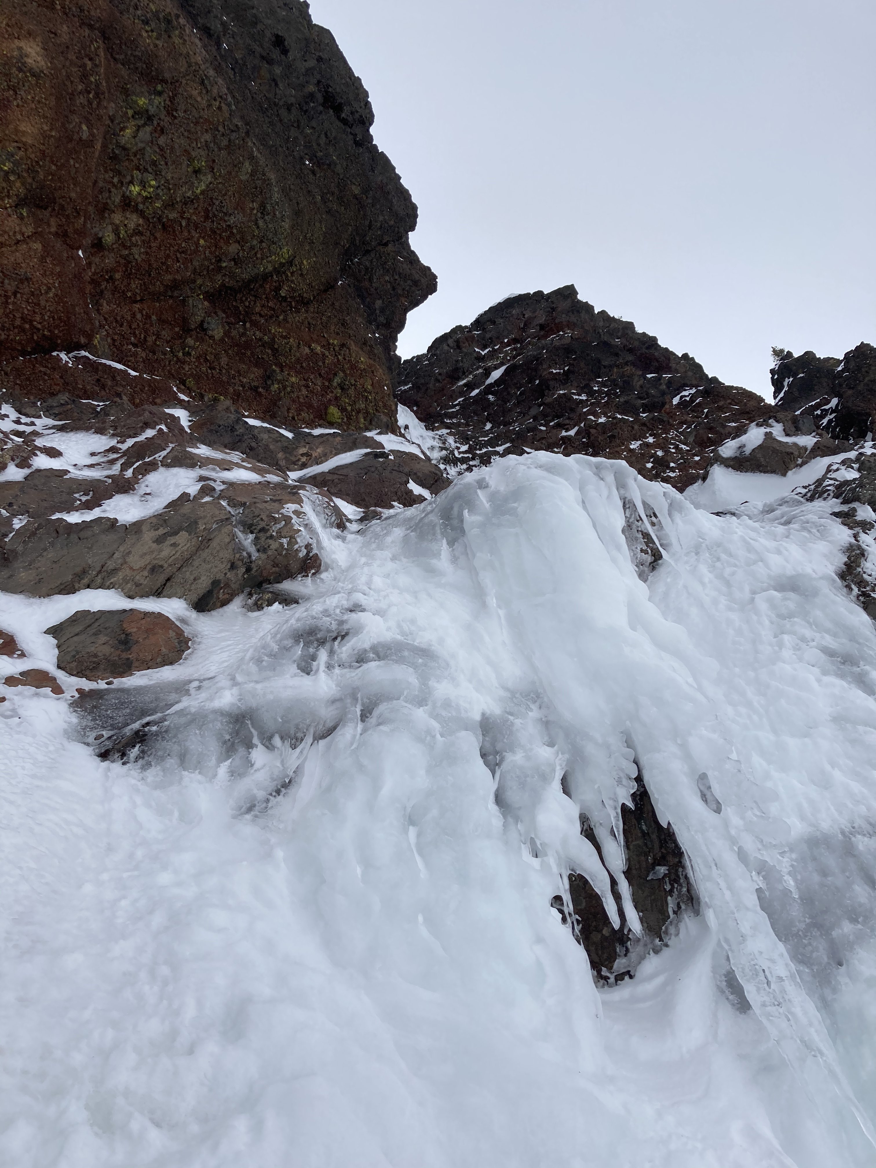
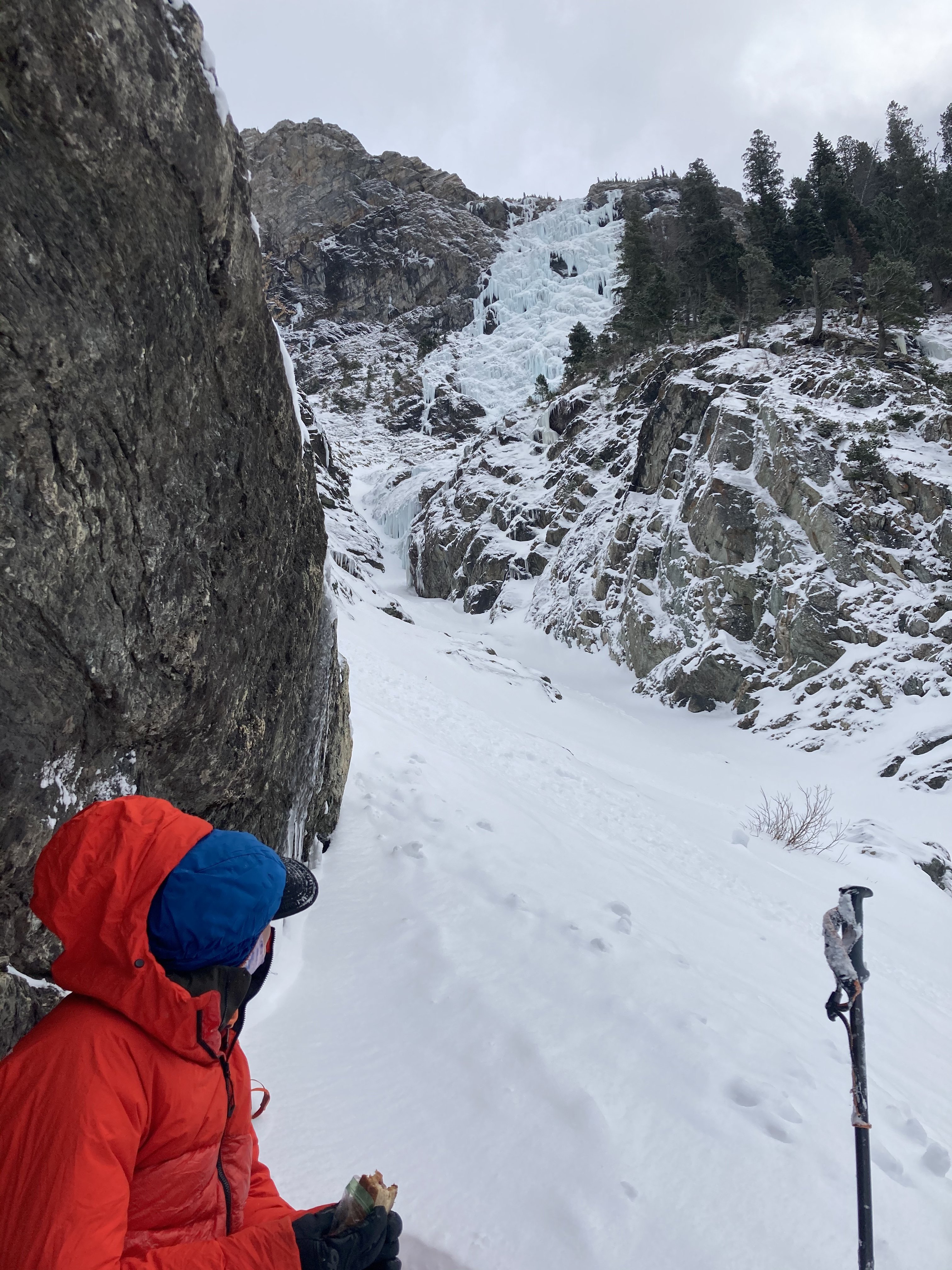
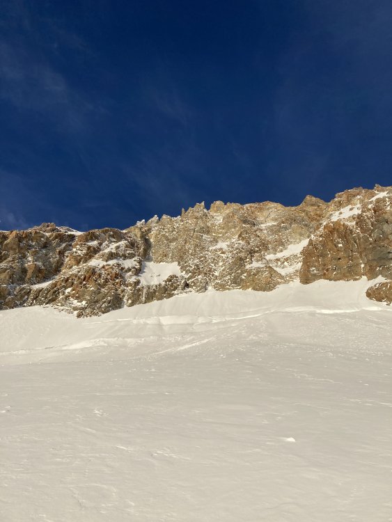
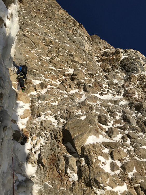
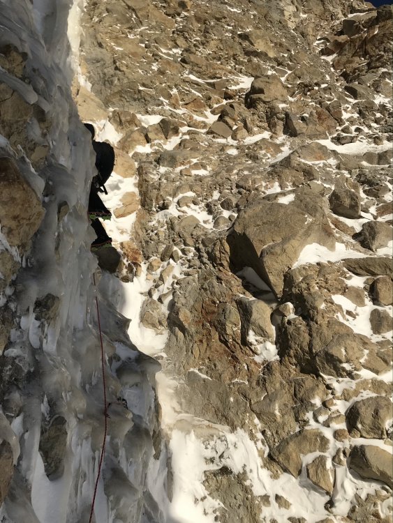
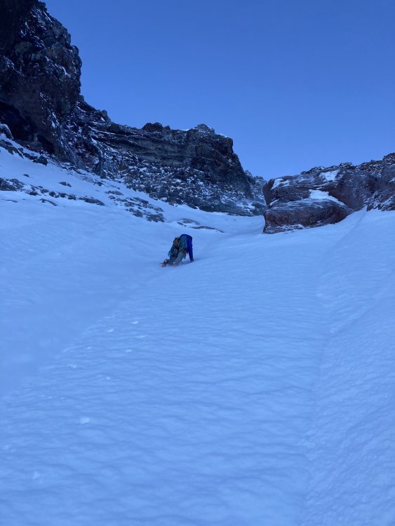
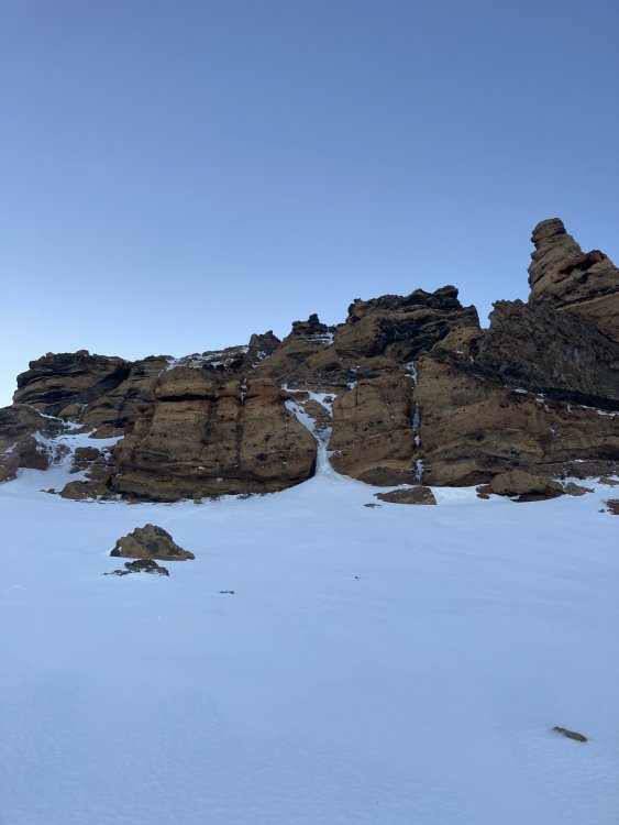
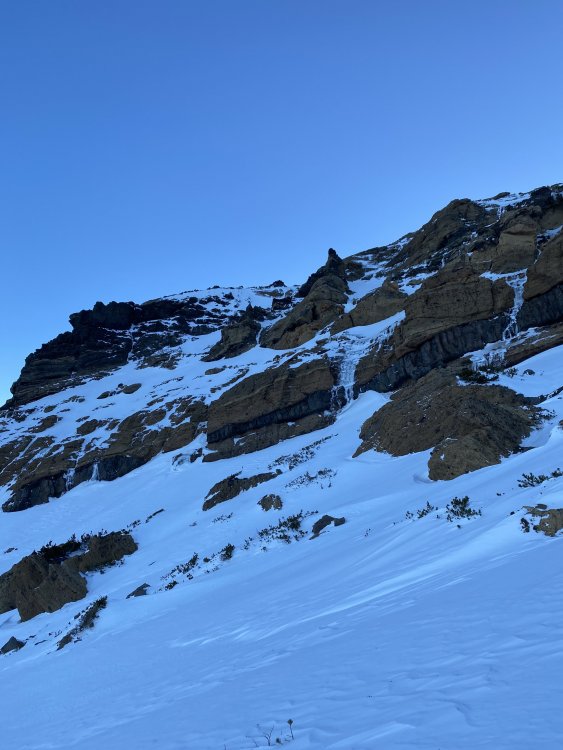
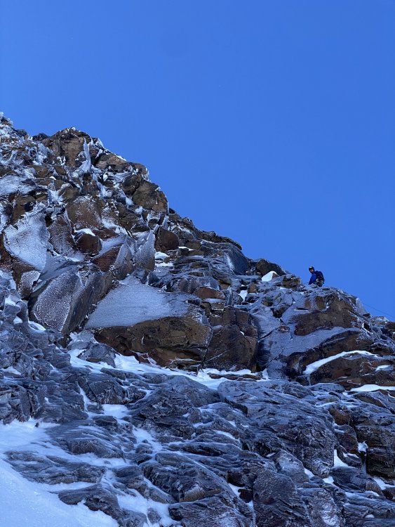
Trip: Broken Top - Richardson-Rocket Link-up Trip Date: 12/29/2020 Trip Report: The Routes: The Full Richardson is an ice route on the N side of Broken Top. First ascent by Clifford Agocs with Brandon Seymore. It is essentially one 35m pitch of WI4+ up the headwall of an amphitheater that you pass through on the North Buttress Route (listed in Oregon High). If this route were listed in Winter Dance it would probably be described as 150m WI4+ (pitch 1 optional WI3 30m or climb around on snow ramp, pitch 2 WI2 50m up the gully, steep snow up to the headwall, pitch 3 WI4+ 35m, rappel or climb steep snow up and right to a walk off) The amphitheater seems to be producing more ice in recent years as winter temps increase. It was attempted several times by other locals starting in the 90's but rarely found in climbable condition. Based on what I saw on this outing, it seems that there are at least 5 possible routes for the confident smear/mixed leader. Here is a picture of me leading the main pitch... The Rocket Launcher (has definitely been climbed by Pete Keane who calls it Rocket Launcher, this might also be called Cold Sweat FA by Aaron Lish, but that might be a different line, we're trying to track down more info) is a finicky ice line on the East face of Peak 9094 (Broken Top's South summit). Because it is in the Crook Cirque (the so-called crater) which is a South facing glacial bowl and East facing, it can be hard to find in good condition. It starts up some easy ice mixed ledges for ~50m (exposed WI2/3 when fat) and then climbs a beautiful gash feature which is steeper than it looks into a hanging bowl (55m WI4, probably deserves an R rating most of the time). From there the obvious course of action is to just climb the easy snow for 90m to the summit ridge (often corniced), and then either head up to your R and tag the 9094 summit or down and L until you can down climb open snow slopes to the valley below the glacial moraine. Here is a recent picture... Our day: Clifford Agocs and I used a sled to get to the wilderness boundary by Ball Butte just before dawn. We opted to boot (not recommended, but our desired linkup and Landon's success booting on the rain crust on our North Sister climb the week before convinced use it would be okay, it was just okay). We hiked around BT via No Name Lake to the Bend Glacier and transitioned to crampons etc. at the base of the North Buttress Couloir. We soloed the approach pitches to the base of the Full Richardson and I got the sharp end as Cliff had already snagged the FA. Ice was in difficult condition (brittle but sticky to get the tool out again), definitely solid 4+ in the Rockies, Cody, etc. similar to steepness to leading Cleo's at Hyalite when it's fat but without the hooks. On top anchor options were limited. I dug down, bottomed out some screws in decent ice and tied them off. We then unroped and front pointed the snow up to the summit pinnacle and followed the standard scramble to the summit. We down climbed the summit and made one short rappel, then we traverse the W face to the top of the 11 O'clock Couloir. We tried to saw the cornice with the rope but its a big ice block with the weather we've had so Cliff body belayed me down next to it to check the snow before we both committed to down climbing. Once in the crater we traversed over to the base of the Rocket Launcher and soloed the first few steps until aerated ice and snice over some steeper/exposed rock made us rope up. I lead ~15m to a belay stance just R of the the crux pitch (left a fixed pin for ya). Cliff lead the next pitch in lovely spindrift conditions which started on good WI4, involved stemming through vertical snice, and climbing easier alpine ice up to a short vertical pillar. The pillar was pretty awkward so he brought me up and I got to lead the vertical ice into overhanging rock with an awkward move left, digging through snow for a stick and hooking a blob on the overhang to skate my way through (not hard per se, but definitely some of the more awkward ice I've climbed). I made a belay in some rock 15m up and then we simuled the snow up the bowl and gully above to the ridge. We hiked back to the sled in the fading light. Luckily the increasing winds were at our back, though the variable drifts made for some frustrating post-holing at times. Roughly a 12hr car-to-car. Pictures: Leading the Richardson... Cliff topping out Richardson... BT summit shot, Rocket Launcher climbs a hidden cleft on the L face of the peak on the R (Peak 9094)... Approach ice on the Rocket Launcher. You can just see the main ice in the cleft in the upper middle of the photo... Cliff leading the main pitch on Rocket Launcher, he's just above the difficult snice section and you can see the awkward pillar poking into view at the top of the gully... Gear Notes: 1x stubby, 4x 13cm, 3x 16cm, 1x 22cm, 2x knife blades, smallish nuts, long slings, 6-8 alpine draws, 1x 60m half rope Approach Notes: Sled + slog


-
[TR] North Sister - Complete East Buttress 12/23/2020
bedellympian posted a topic in Oregon Cascades
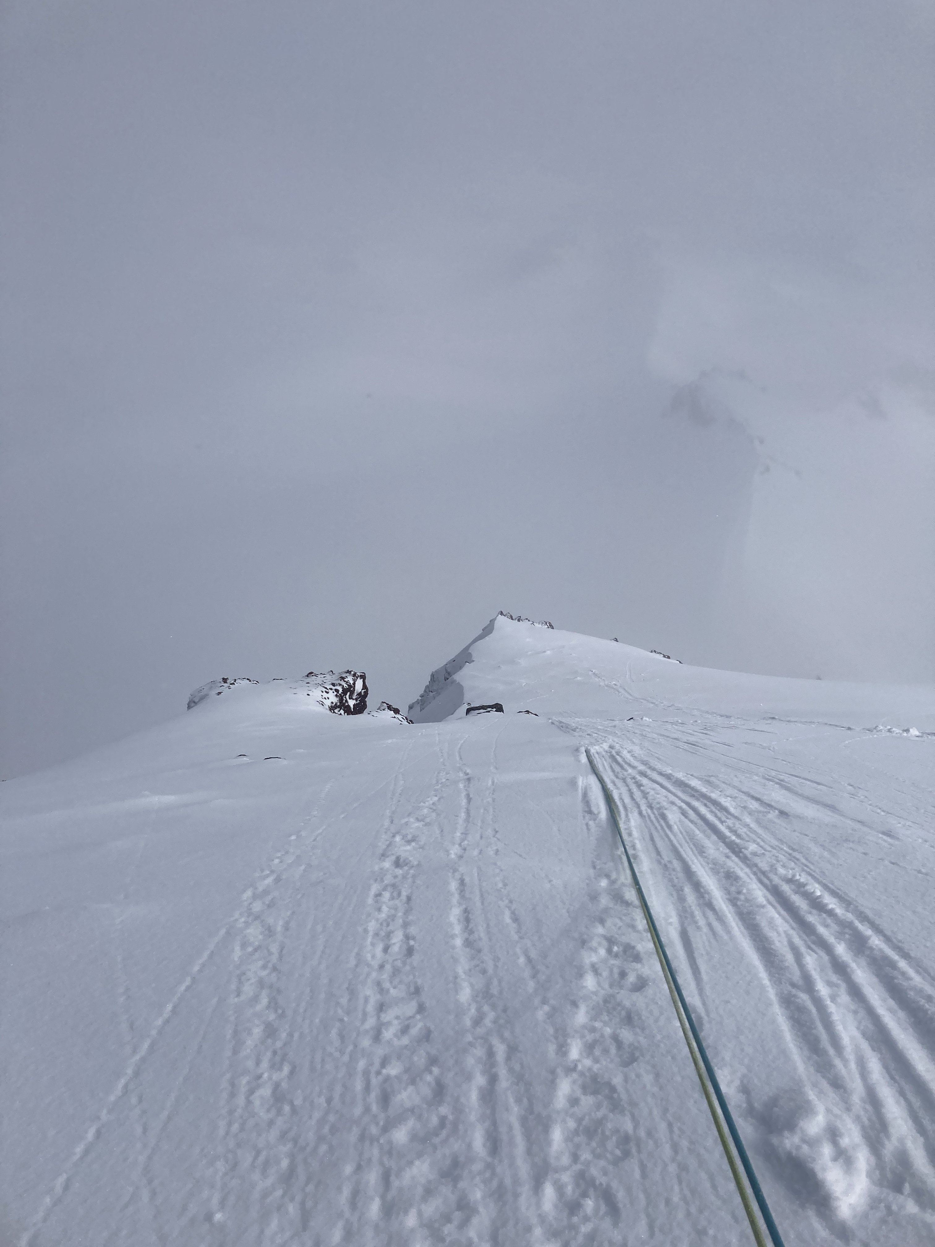
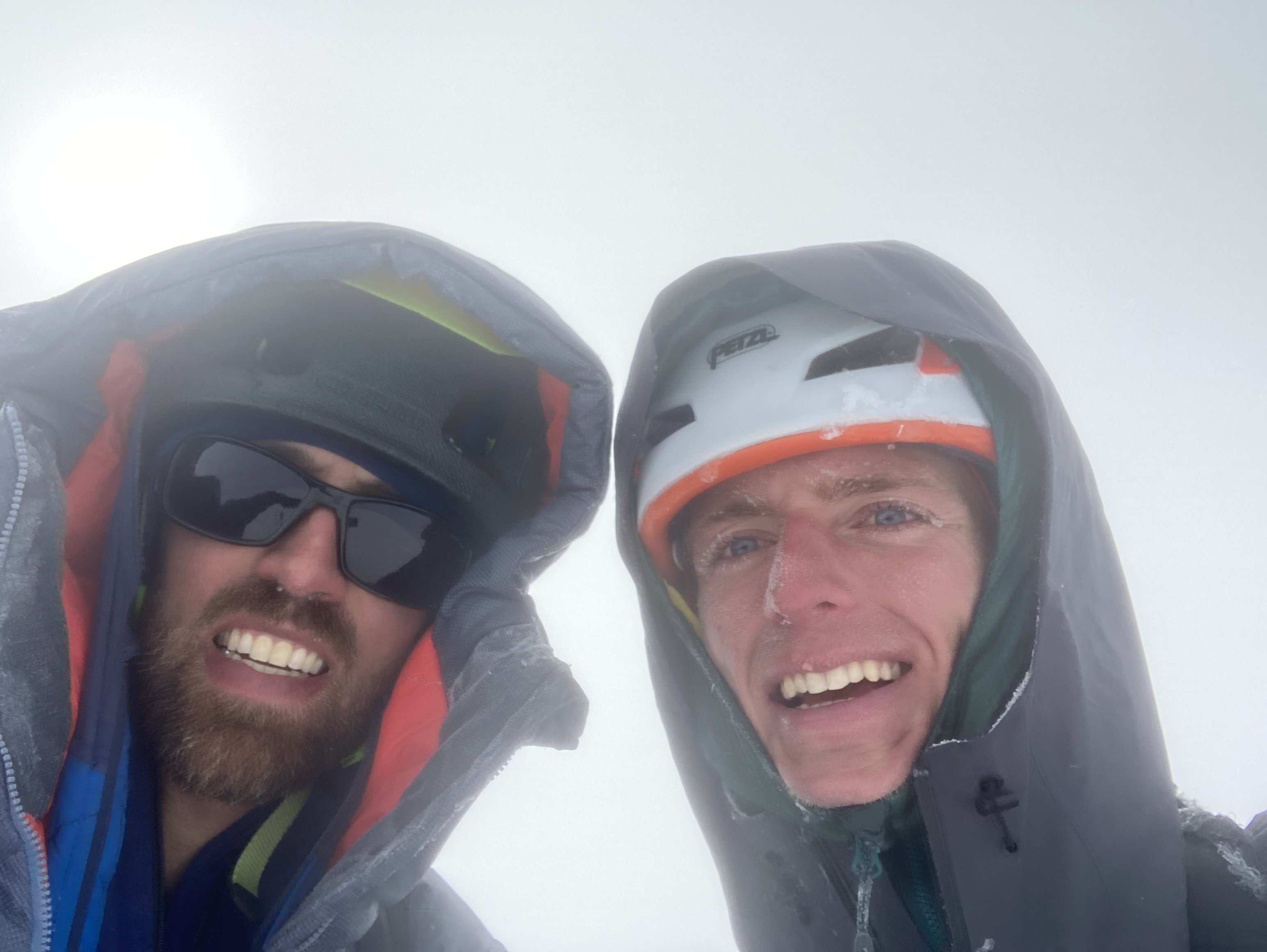
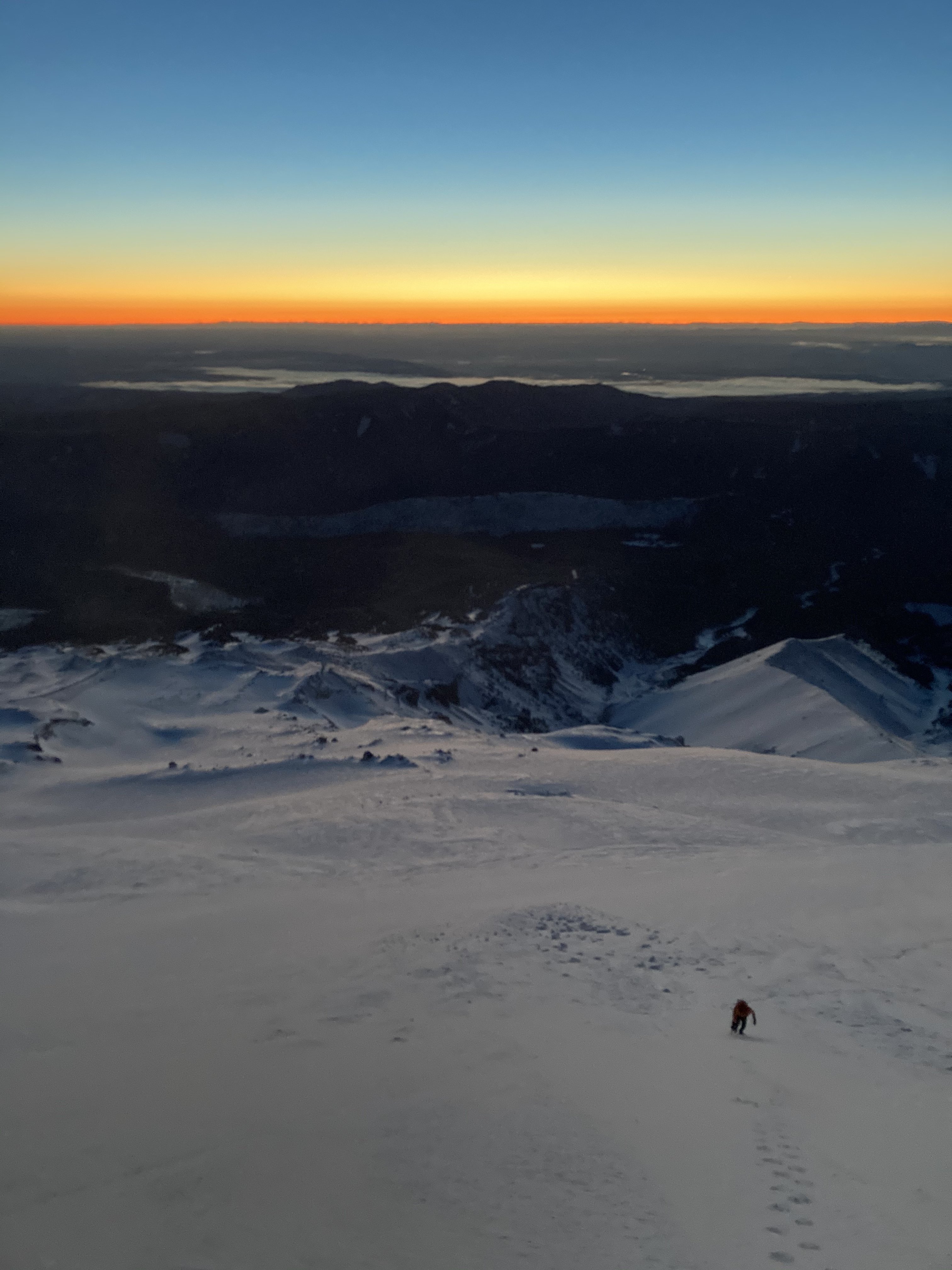
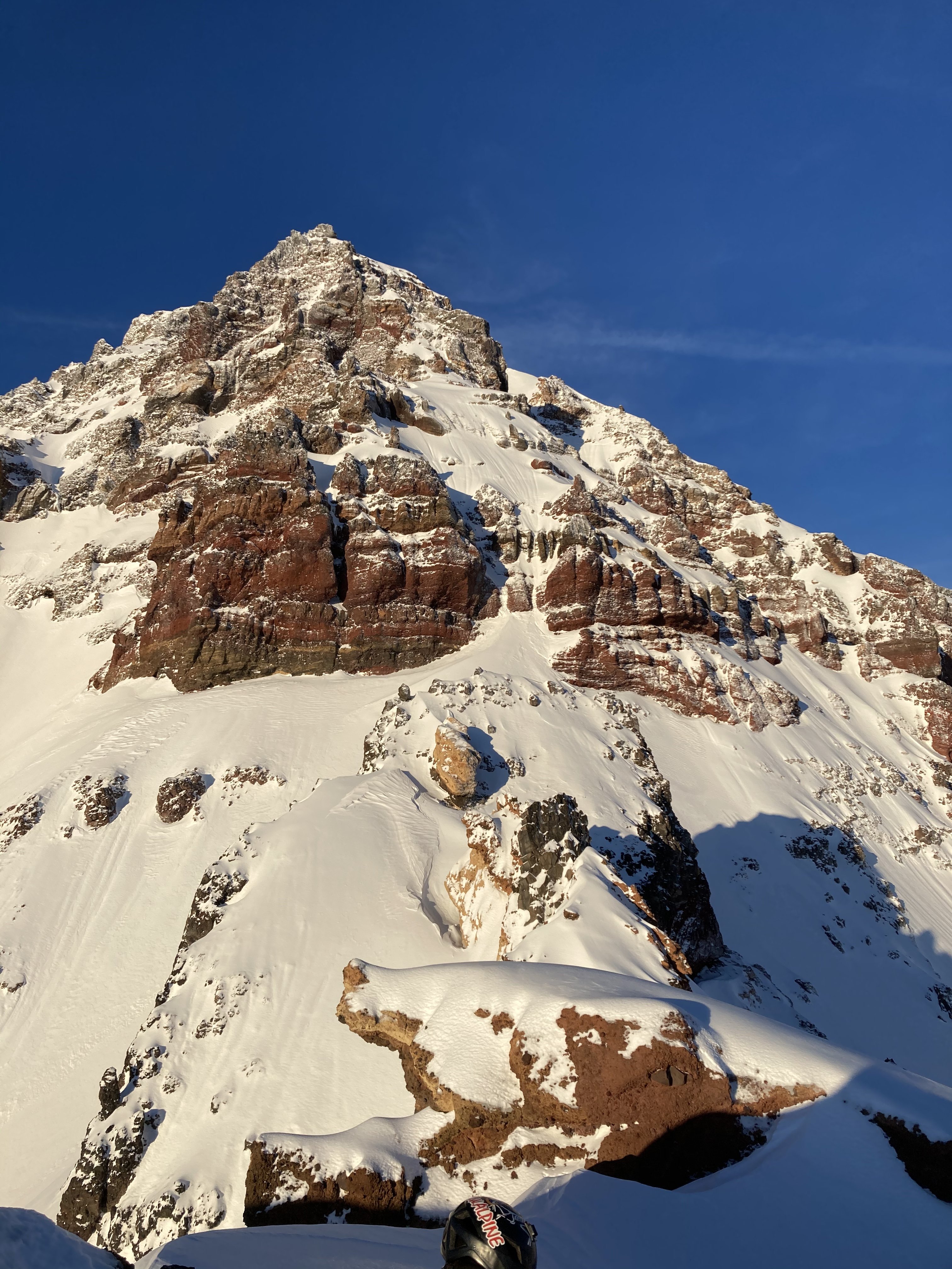
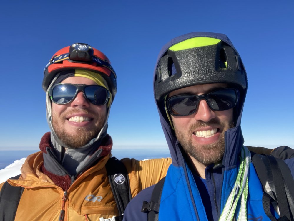
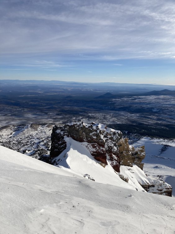
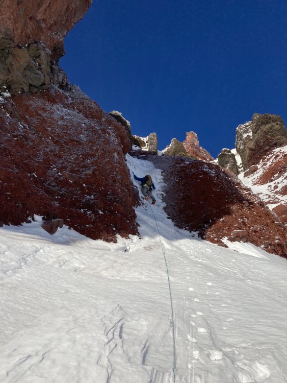
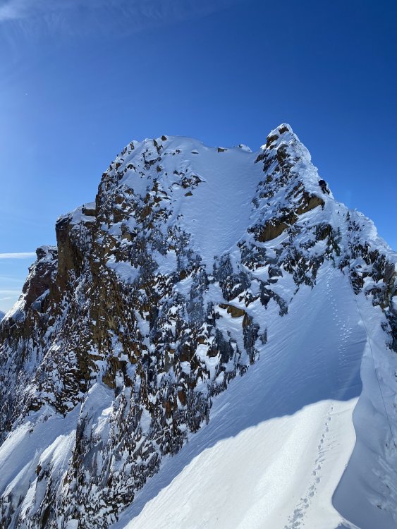
Trip: North Sister - Complete East Buttress Trip Date: 12/23/2020 Trip Report: The East Buttress of North Sister is listed in the Oregon High guide book but it doesn’t receive much praise there. However, a close reading would interest any winter climber. The Complete East Buttress (“Direct” would be inaccurate) is an obvious extension of this route and several local climbers (myself included) have made the mistake of thinking this awaits a first ascent. However, it has been done, and soloed, by @now_climbing and maybe others too. When Chris first told me he had done it I was a little disappointed as the mystery was diminished, but when he told me it was his favorite alpine climb in Oregon that piqued my interest and I got quite excited to try it in early season conditions.Last winter around this time @kyleptarry and I came darn close despite no ice on the upper buttress and plenty of post holing in wind packed powder.On 12/23 this winter @lim.landon and I decided to give it another go. We hoped the recent rain up to high elevation had created ice earlier than last year but we were betting against ourselves. Despite our pessimism we got lucky and enjoyed near perfect conditions on our way to the summit.Though a little contrived, this route is really good and deserves more attention: long, varied, good rock (for volcanoes), and pitch after pitch of memorable moderate mixed climbing. I've listed a pitch-by-pitch breakdown below, though it would probably be more fun if you go explore for yourself! ?Hopefully someone else can repeat it while its in good nick! Here are some pictures... Pictures SPOILER ALERT - PITCH BREAKDOWN P1- climb the short vertical ice pillar in the middle of the lower buttress follow easier ice up the gully to a tree and short ice step (WI3+/4-) P2 (simul)- short ice step and snow up to base of cliff, go over ridge crest to R traverse snow and climb up first snow/neve/ice gully to broad snow field on ridge crest simul/solo snow field, stay on crest over a couple high points until you are cliffed out P3- down climb steep snow/neve to the R/N side and traverse at highest opportunity to regain ridge crest P4- black gendarme, climb up and right, down the back side, weave through some orange rock features (downclimb some steep snow) and terrain/body belay (M3) climb up to the next high point on the ridge (easy snow) and rappel off the fixed tat (25m free hanging rappel), this is the end of the lower buttress walk up the snow ridge and right to the obvious double gully which starts the upper buttress P5- if ice is in climb the L of the two gullies (WI2/3), if its dry climb the R gully (runout M4 on nubbins) and traverse back L on easier ground P6- v-slot, continue up this cool feature above the L gully from the last pitch, you can link with the last pitch if you came up the L gully (M3) simul up steep snow above these pitches and either skirt the next cliff band on the R up more snow/neve, or go to the chimney on the L P7 (optional chimney)- climb the chimney past a chock stone and onto low angle slab, some more scrambly bits and then snow above this P8- the snow narrows and steepens with a big rock face feature on the L ending in an exposed and runout slab section (M3 R), climb snow above this and body/terrain belay P9 head up and L (don' get sucked R or you'll be stuck beneath steeper rock), until just below the top of the ridge, then a slight R and some short moves to the ridgecrest (M4) P10 (3 options)- move the belay down the ridge crest to the base of Glissan Pinnacle (the slightly lower of the 2 summits that forms the headwall at the top of Early Morning Couloir) and... option 1- traverse steep exposed snow L over the Thayer Headwall to get around Glissan to the true summit (Prouty Pinnacle) option 2- climb the headwall of Glissan directly (actually quite good, what I would recommend, but more time consuming) (M4, 60m rope stretcher) option 3- traverse steep snow R over the top of EMC, from here you can descend or wrap all the way around Glissan to the summit (definitely the longest distance, and the least cool) P11- summit pinnacle (Prouty Pinnacle) walk across the snowy saddle and climb the NE aspect of the summit (either sketchy rock slabs to snow on the L or stacked jenga pile on the R (M3+ R), OR if both those are looking terrible you could go all the way around the summit to the W side and climb the Bowling Alley gully (AI2/3)) Descent options: down climb Bowling Alley to the W and descend the standard S Ridge, OR rappel the last pitch to the saddle and traverse around Glissan on the N side (steep exposed snow, option 3 from P10), and down climb Early Morning Couloir (I prefer this second option as it gets you back to the base more directly). Expect either descent to be exposed and unprotectable, with lots of high dagger down climbing for over 2k'. Gear Notes: 60m half rope (a 70 would make things a little more comfy), 2 knife blades, nuts from tips to 0.5, single set of cams from 0.4 to 3, screws (2x stubby, 2x 13cm, leave the vthread at home this time of year) Approach Notes: Pole Creek is accessible with high clearance 4WD. Skin/slog is a straight shot on snow (less than 2 hrs car to base) -
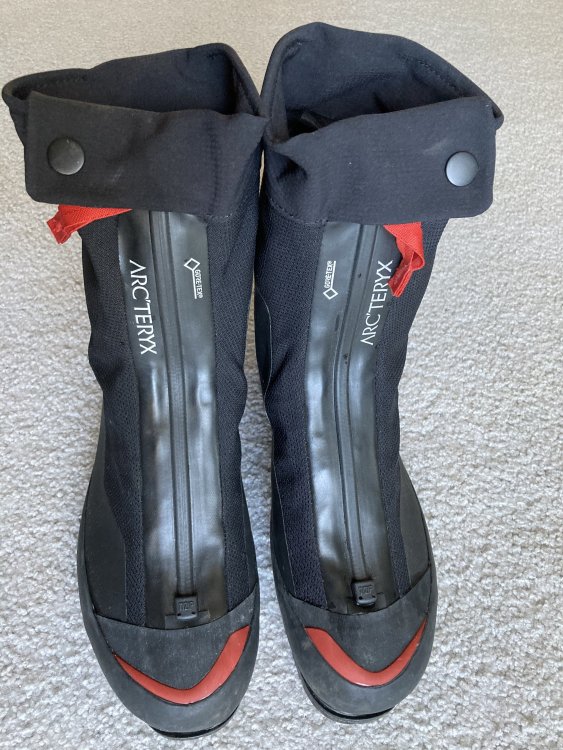
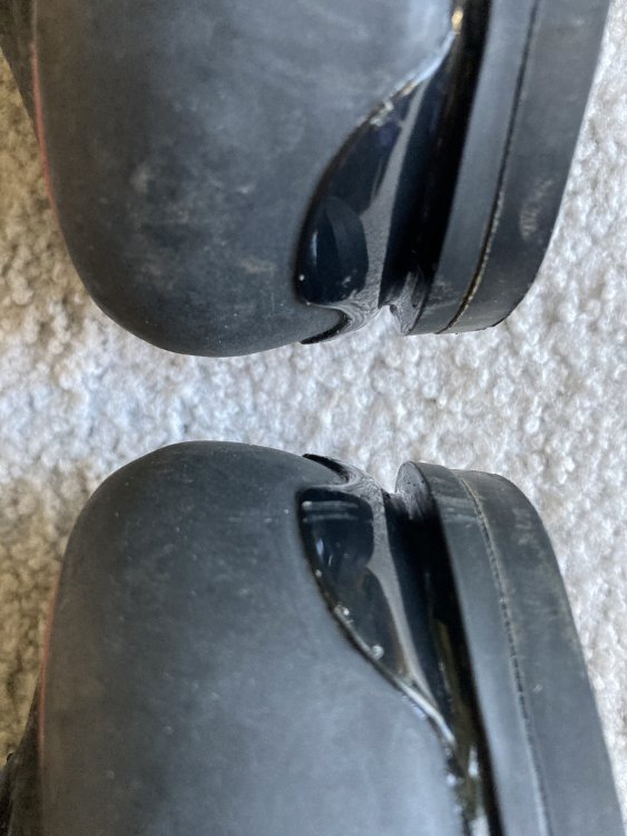
for sale Arc'teryx Acrux AR Boot size 10
bedellympian replied to bedellympian's topic in The Yard Sale
Bump, for price drop. Can also pickup in Central Oregon. -
$550 shipped, obo. Used for two pitches of dry tooling, basically new. Bought them online last May and found they didn't fit my feet well. Message me if you want additional pictures or have questions.

-
@olyclimber and @JasonG thanks for the help! Pictures are now posted.
-
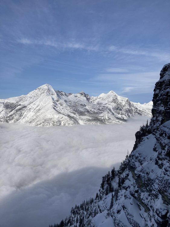
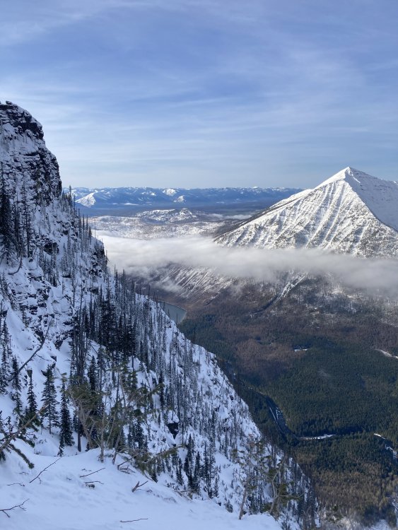
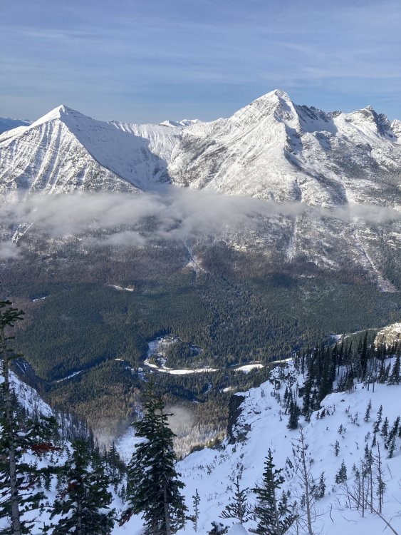
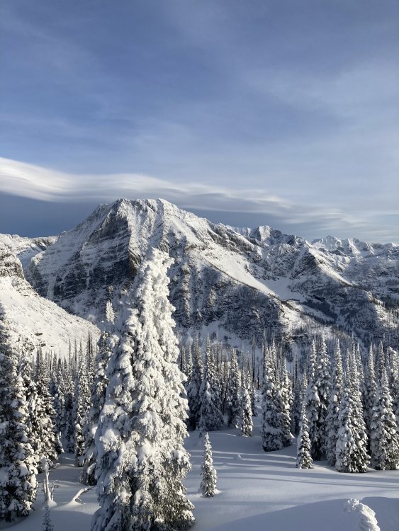
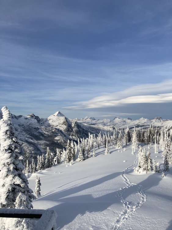
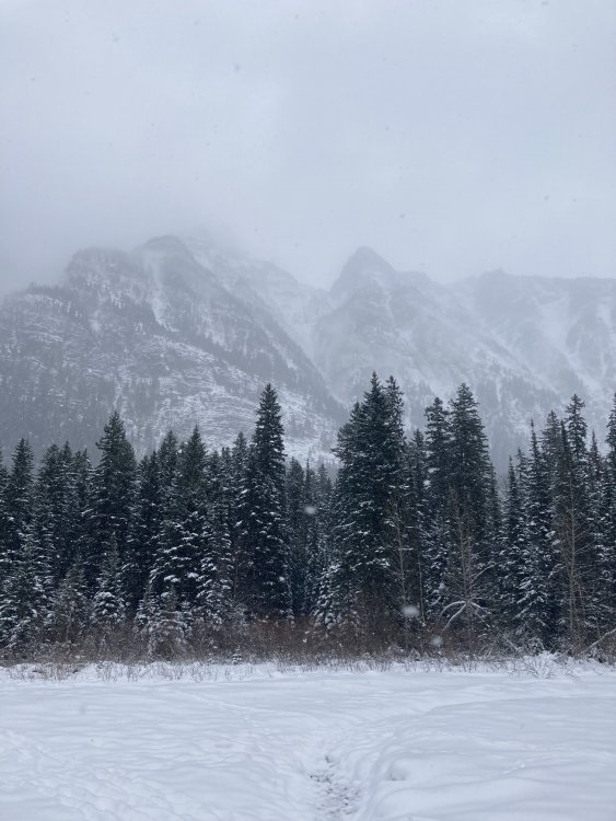
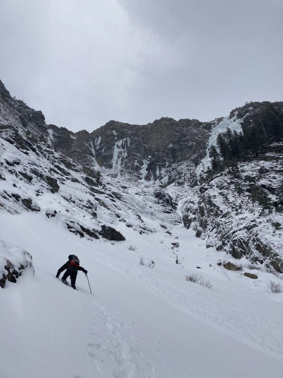
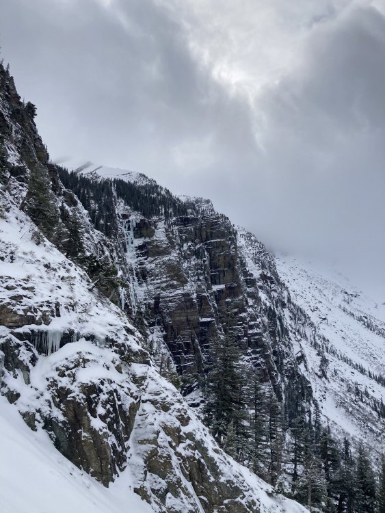
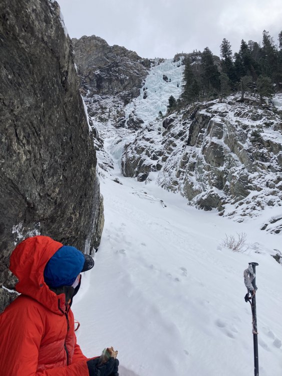
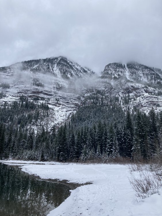
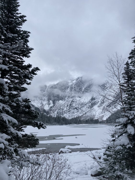
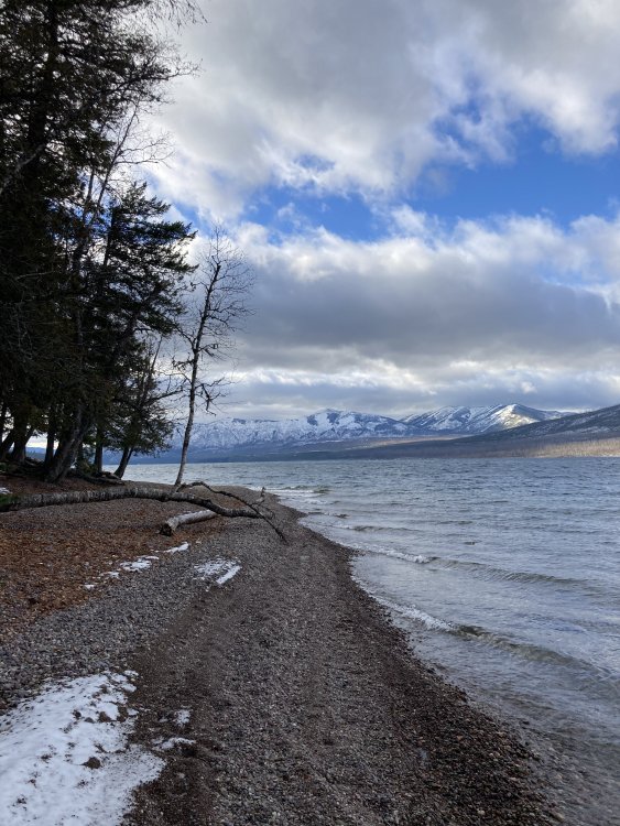
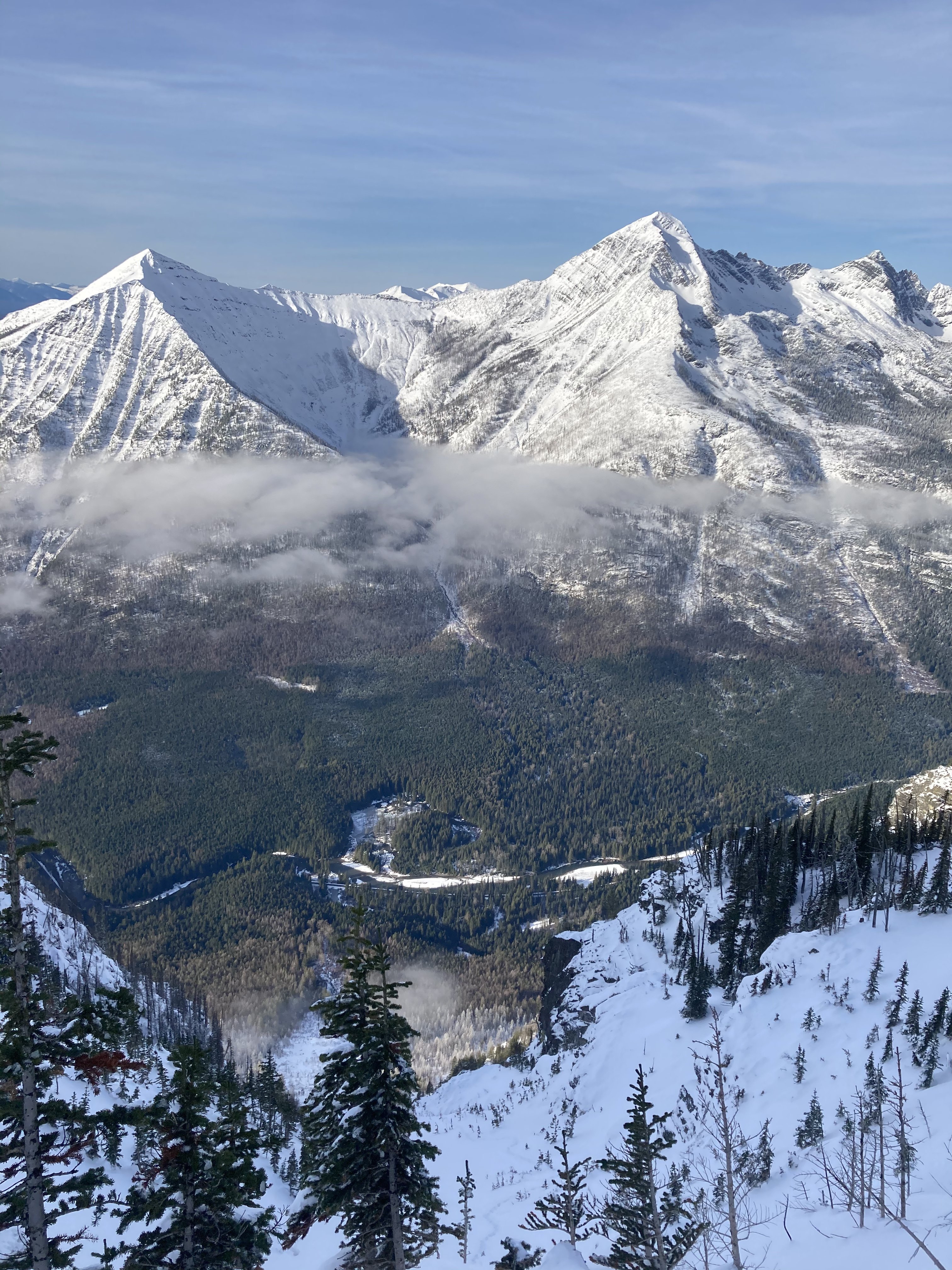
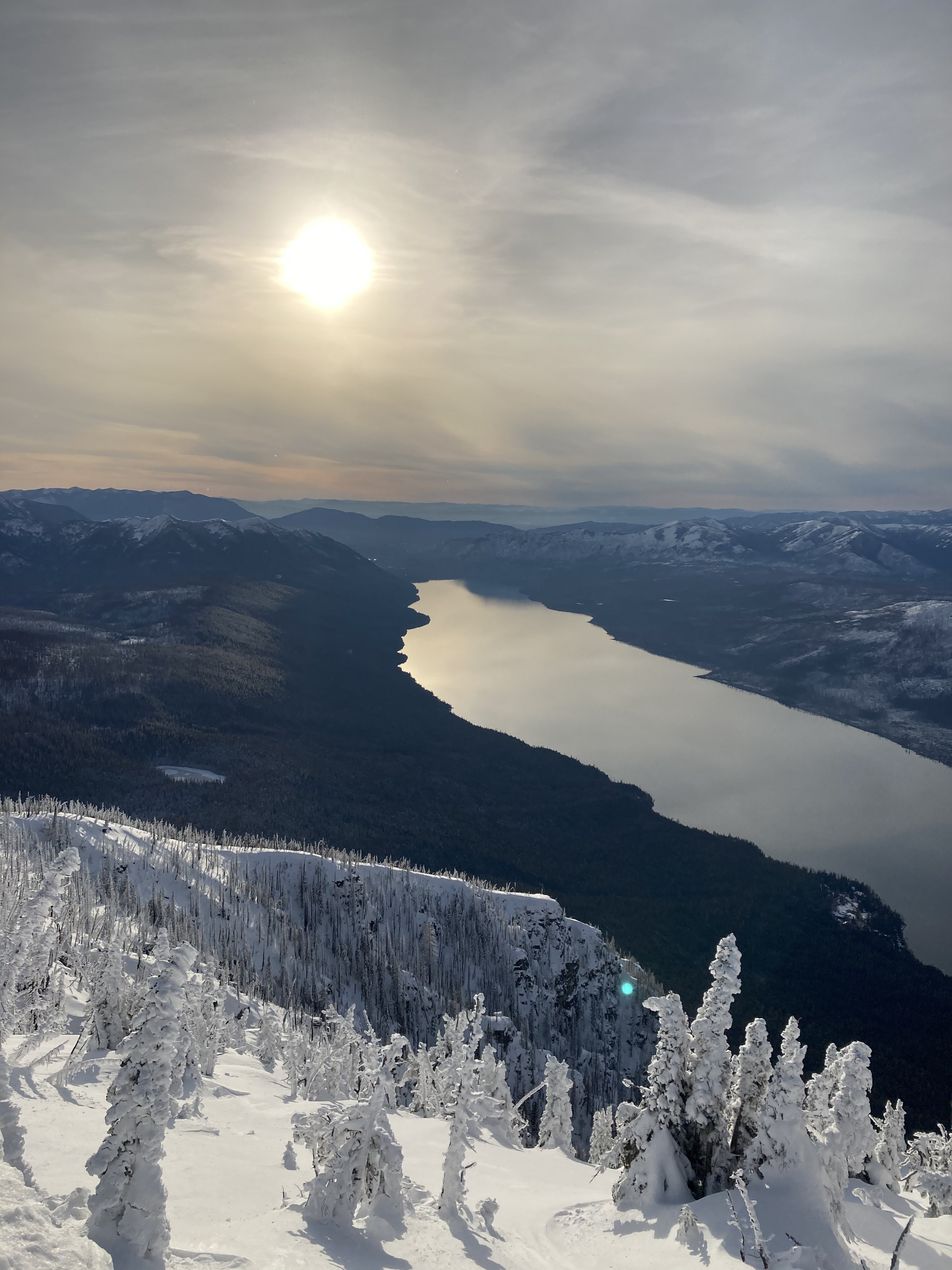
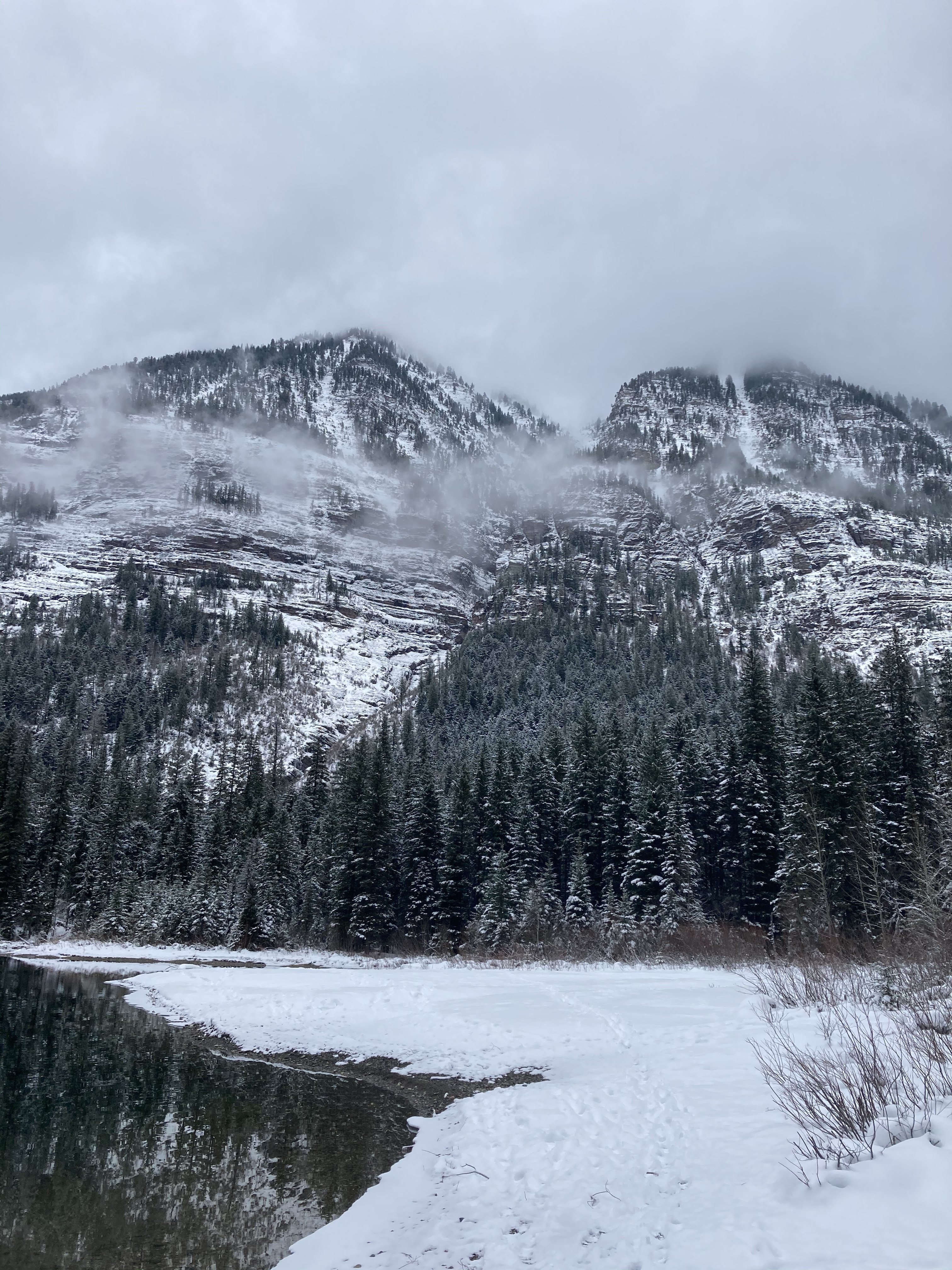
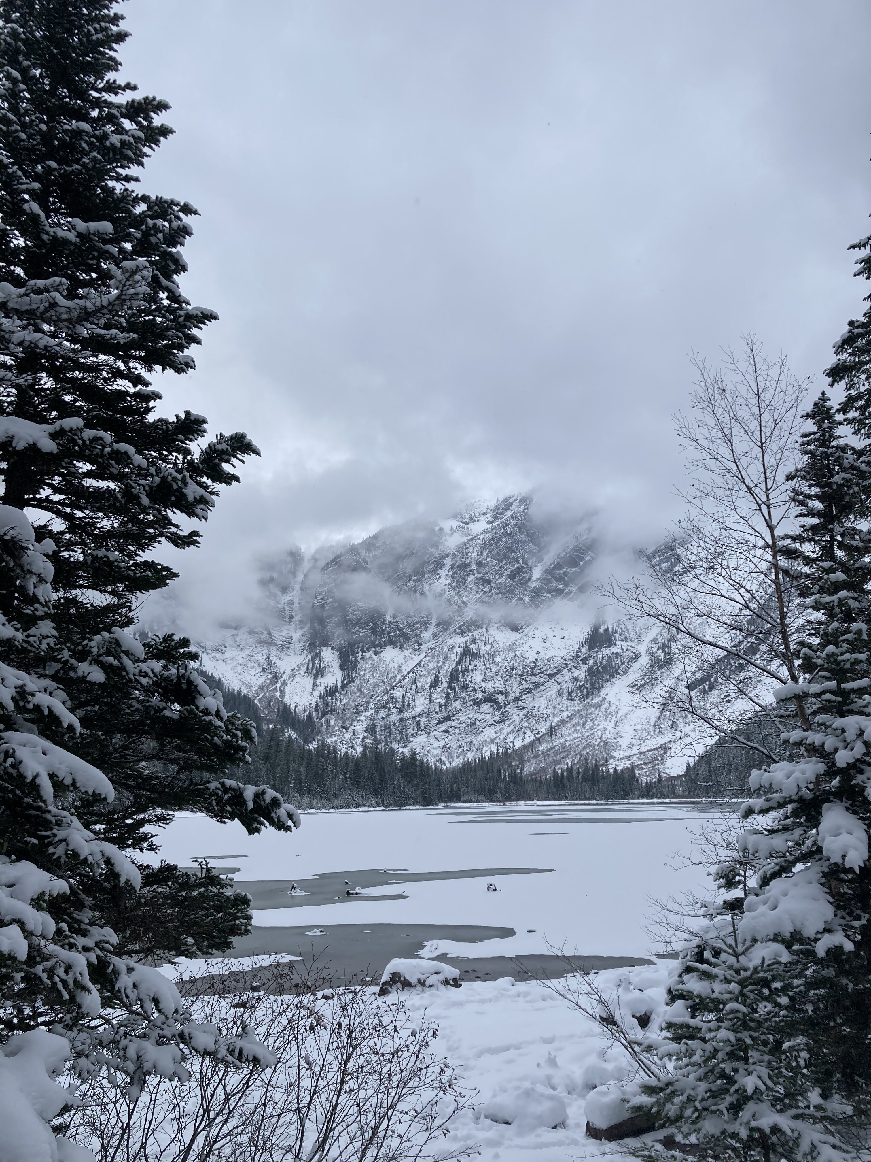
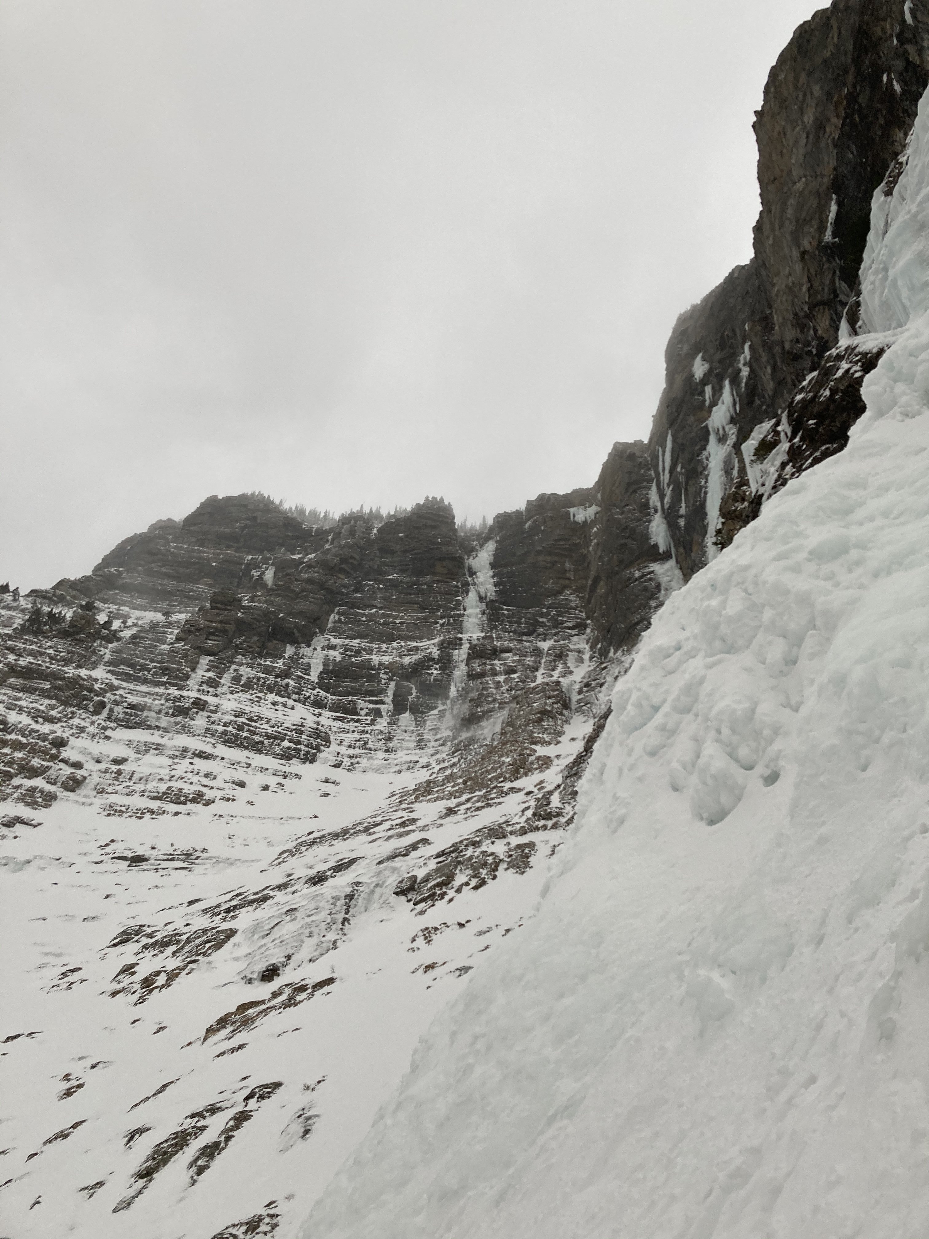
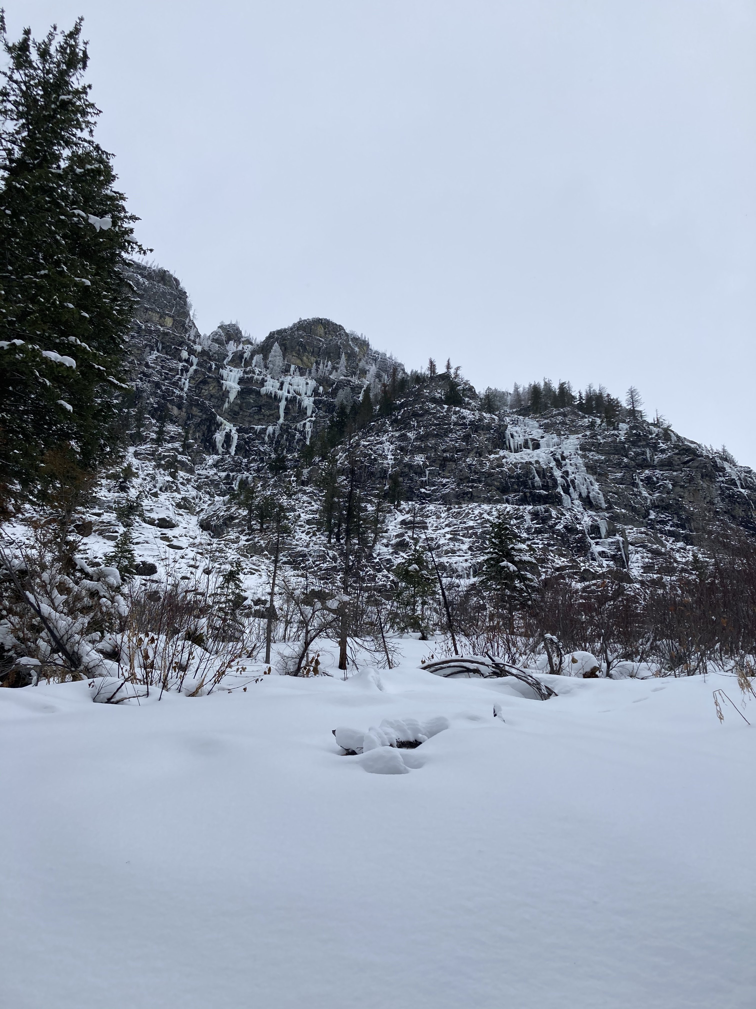
Views from up on Mt Brown... Views from Avalanche Lake basin... Sprague creek pillars... Lake Macdonald...