Leaderboard


Popular Content
Showing content with the highest reputation on 08/26/25 in all areas
-
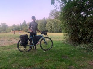
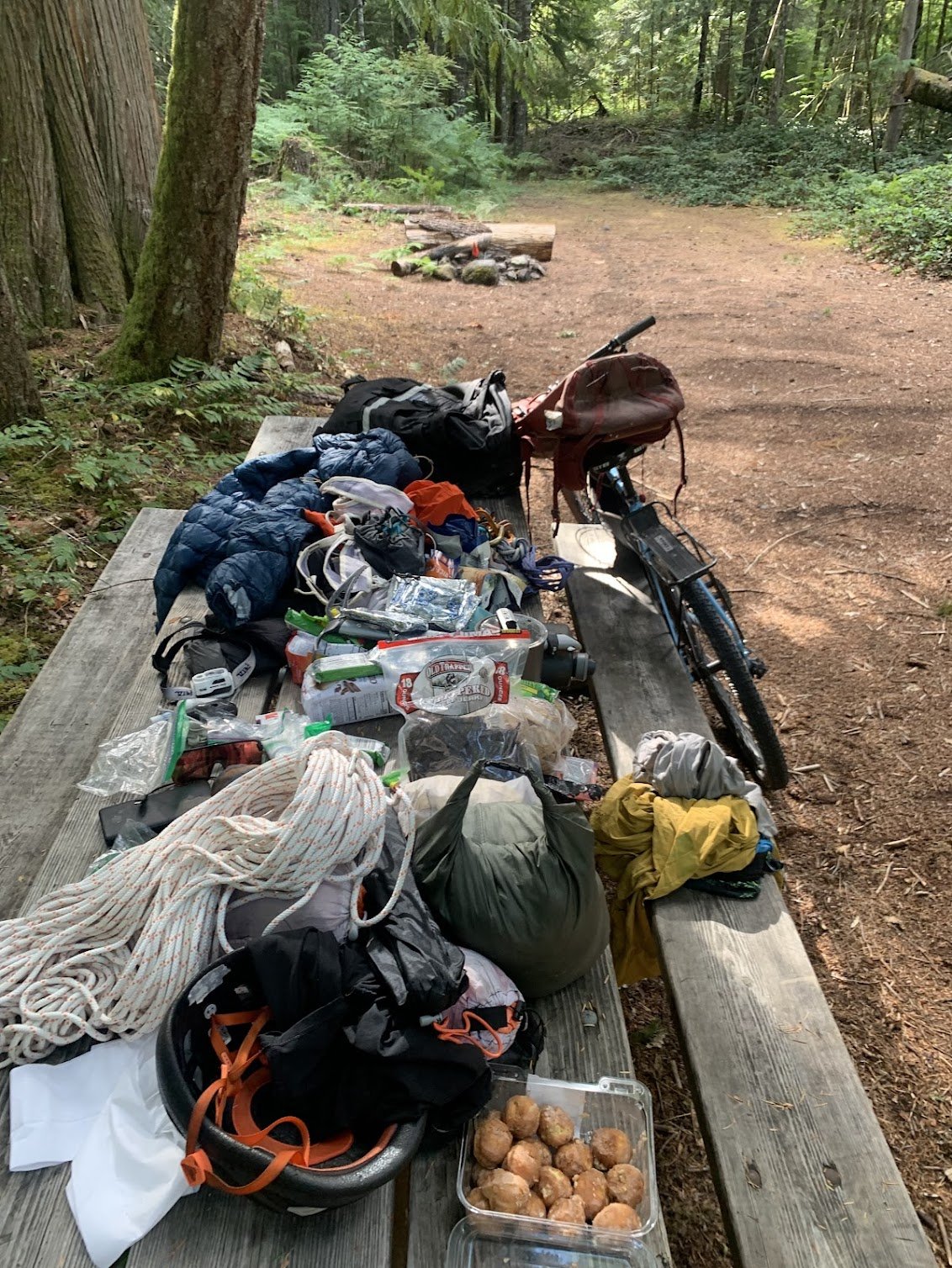
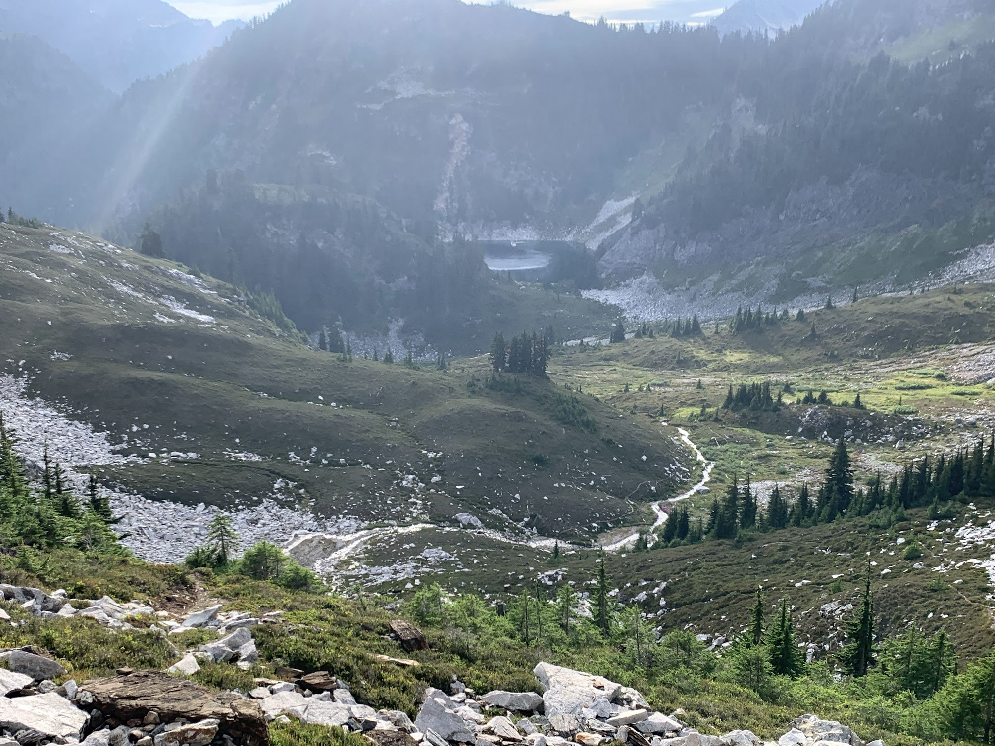
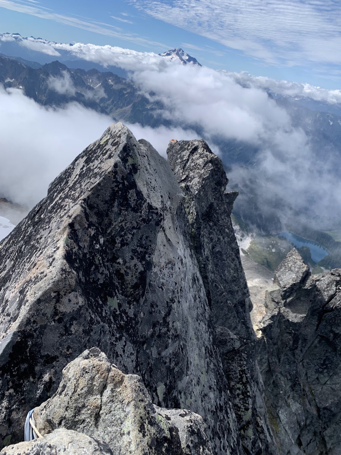
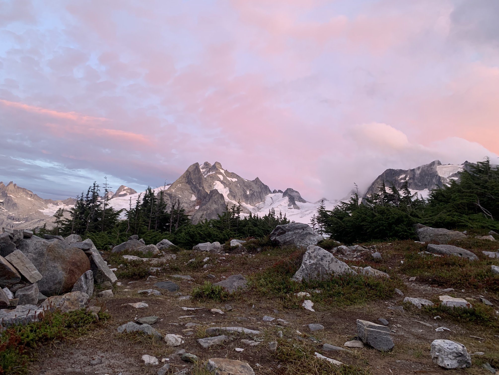
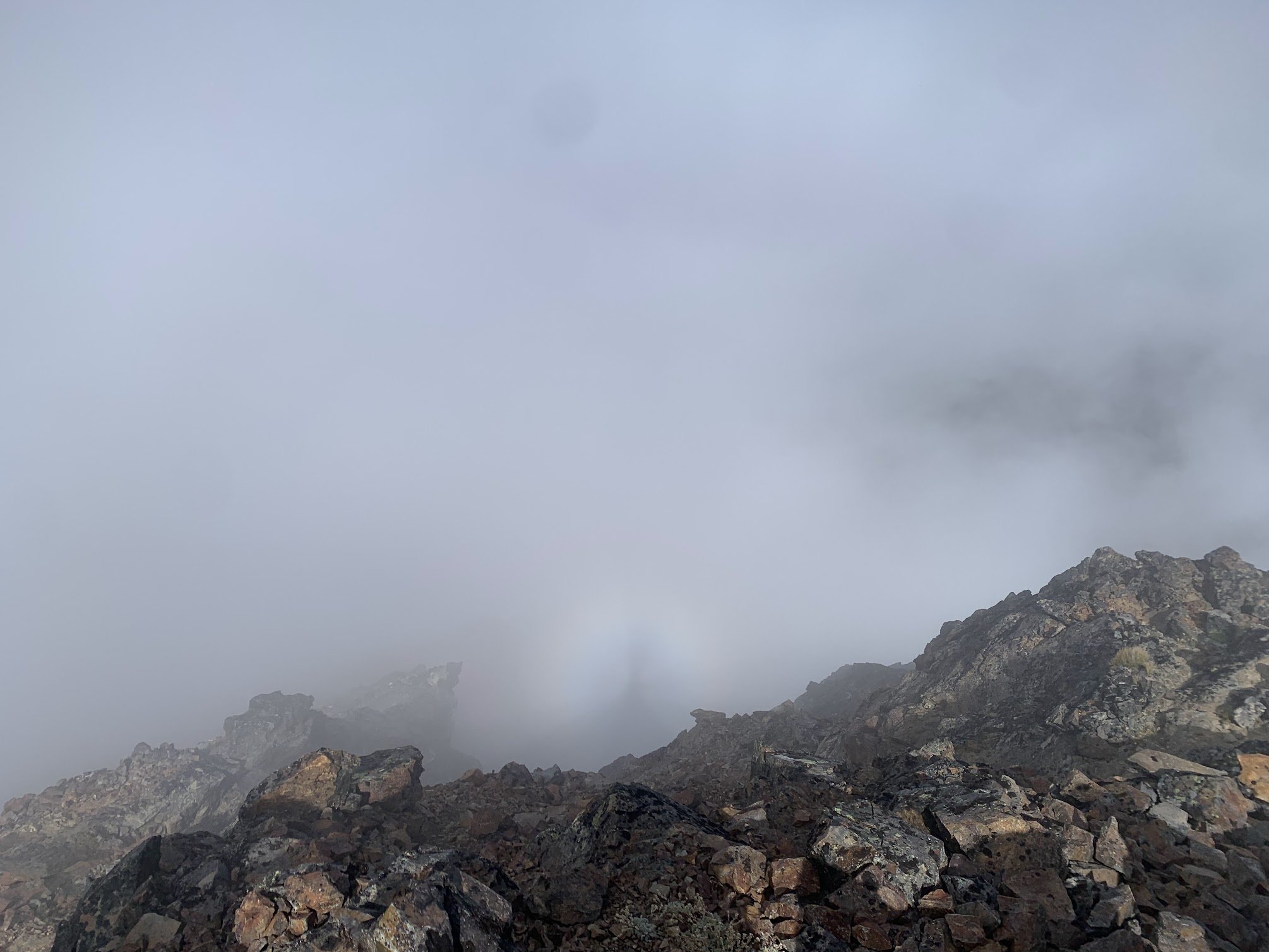
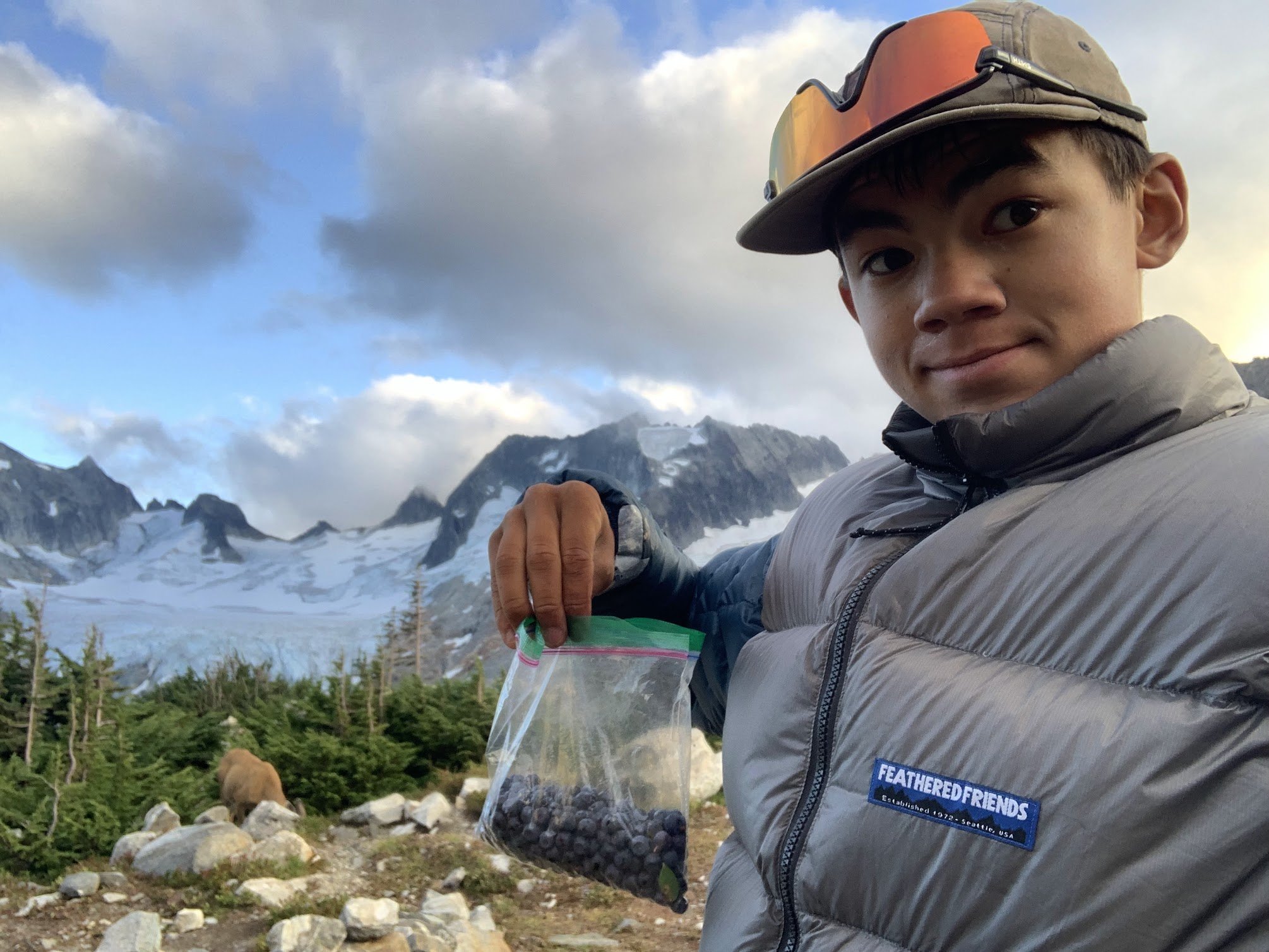
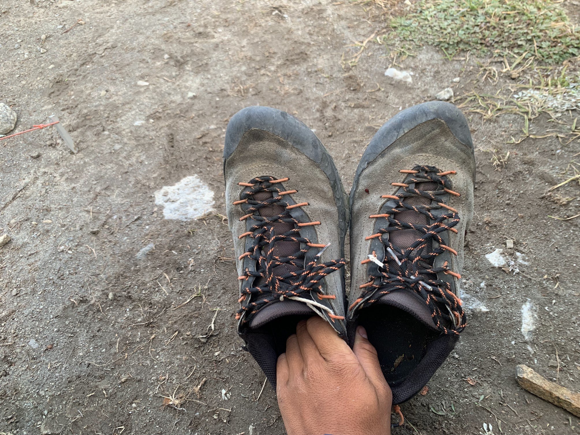
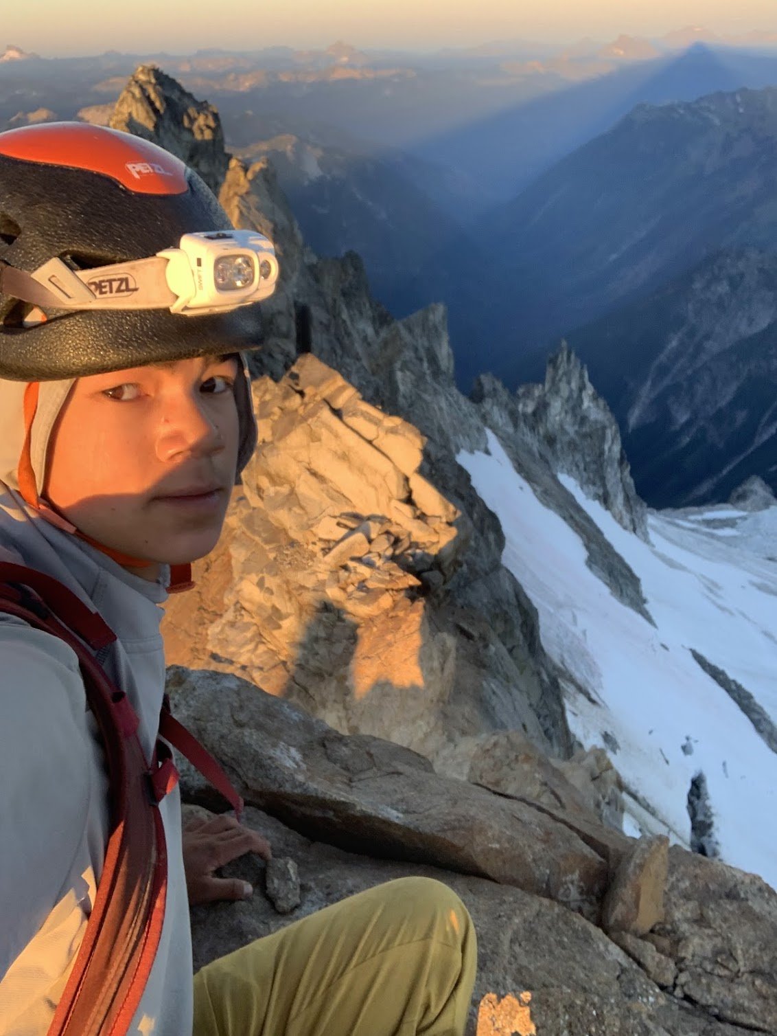
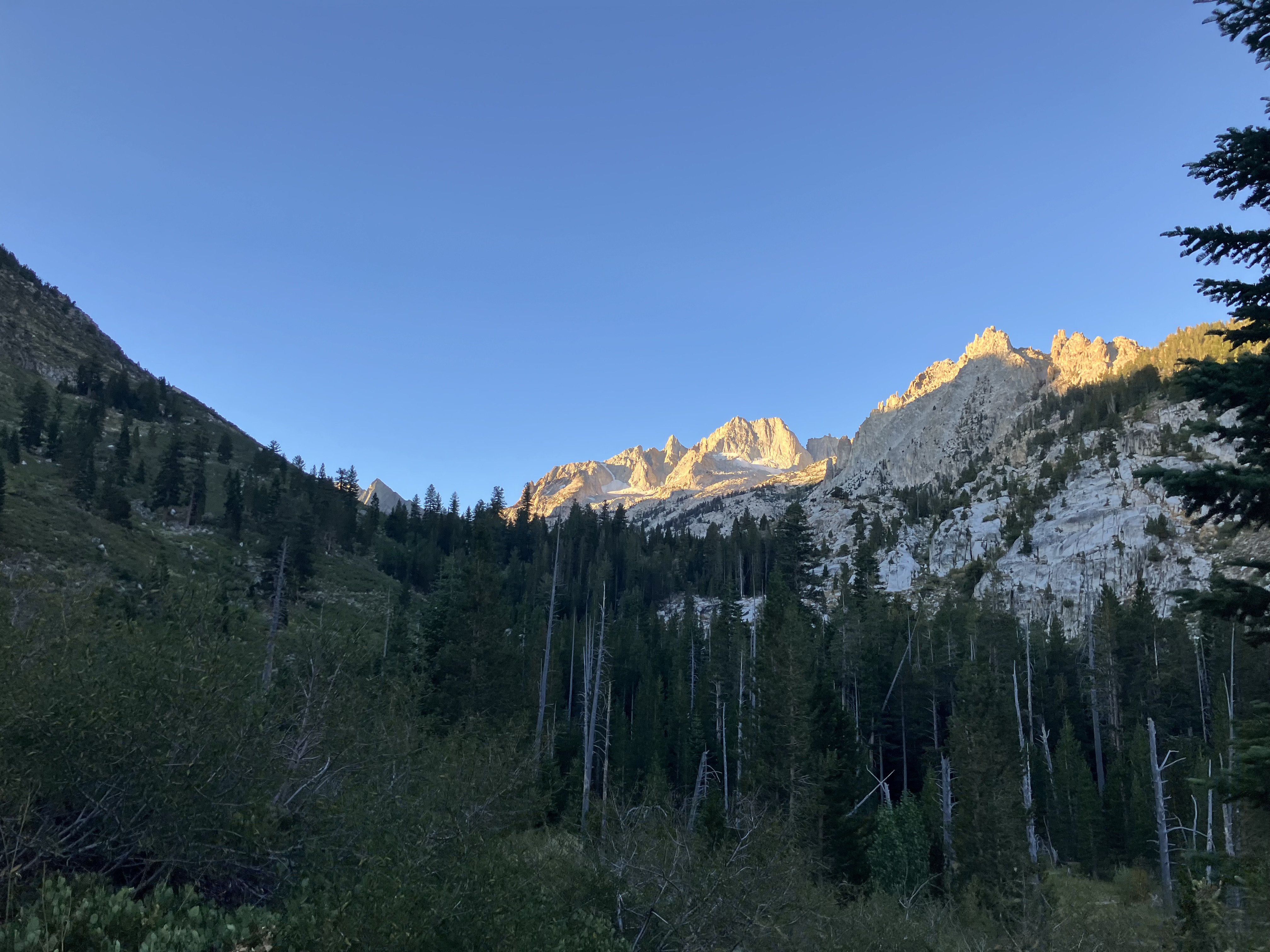
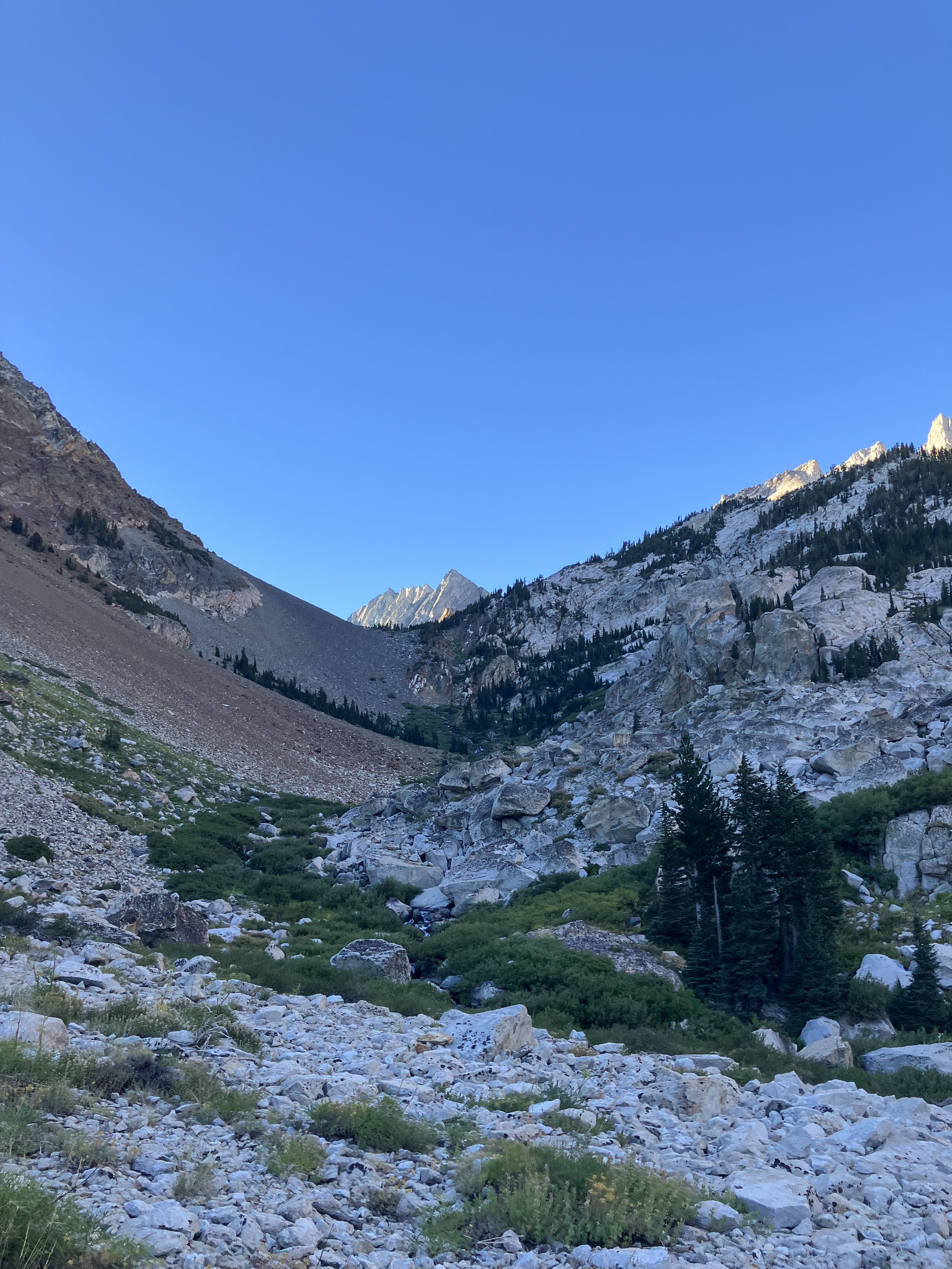
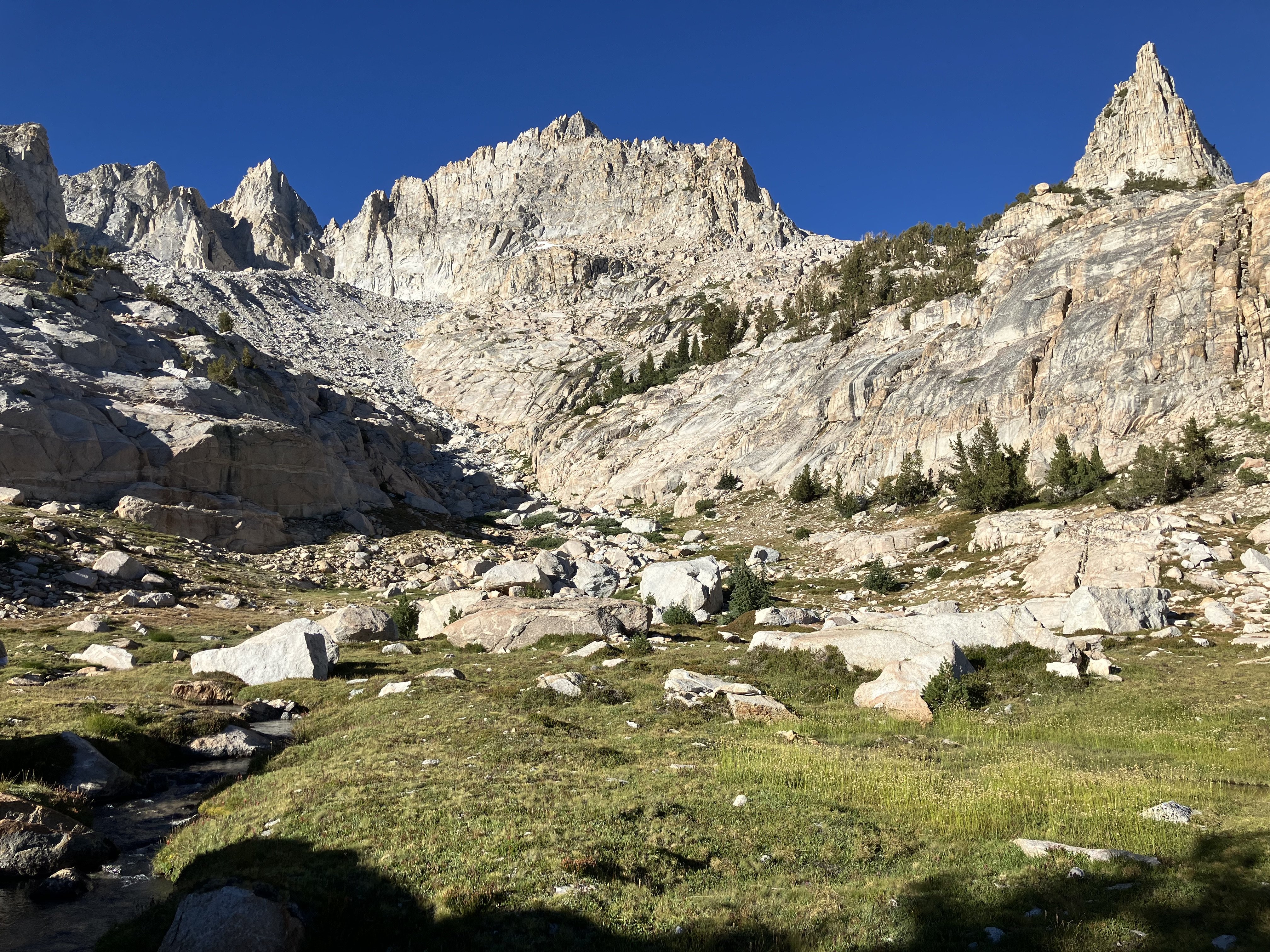
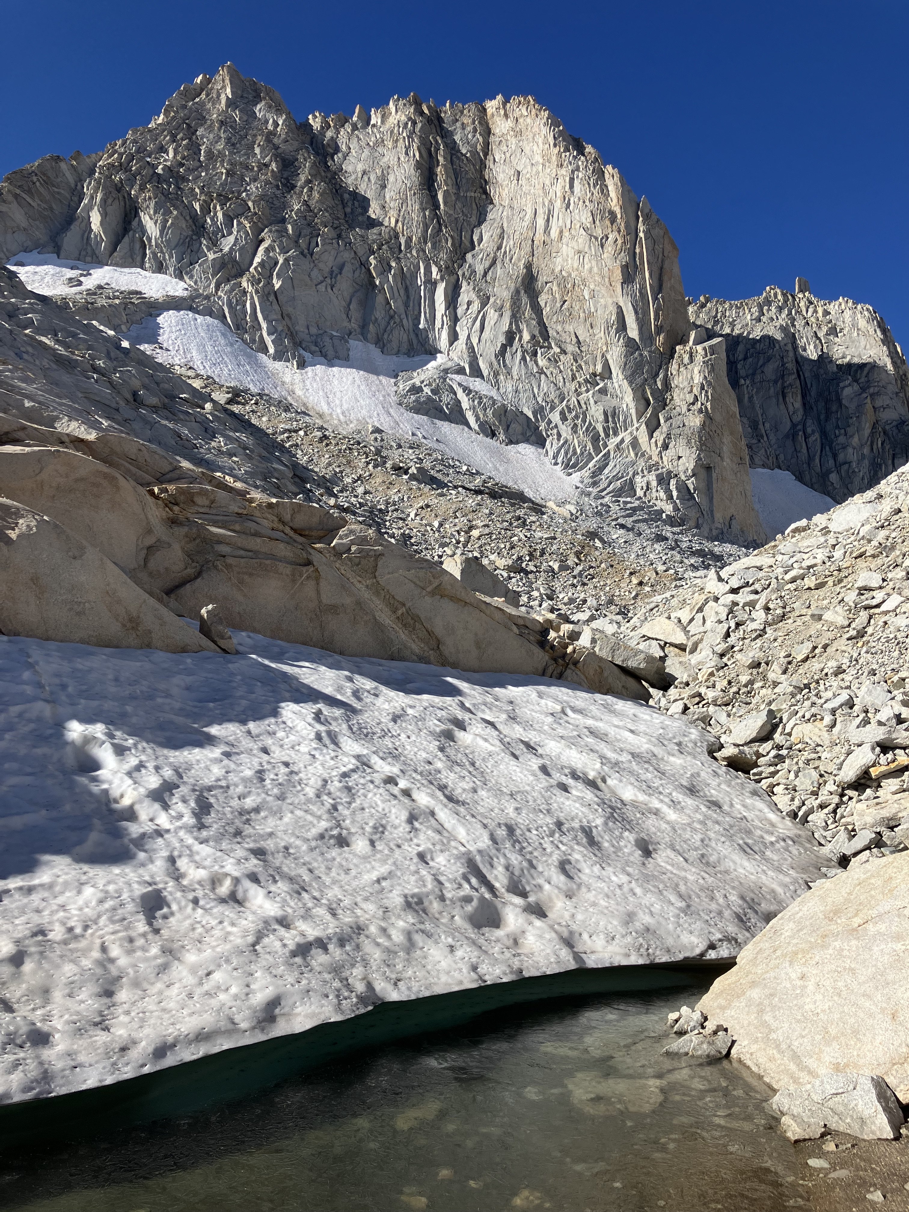
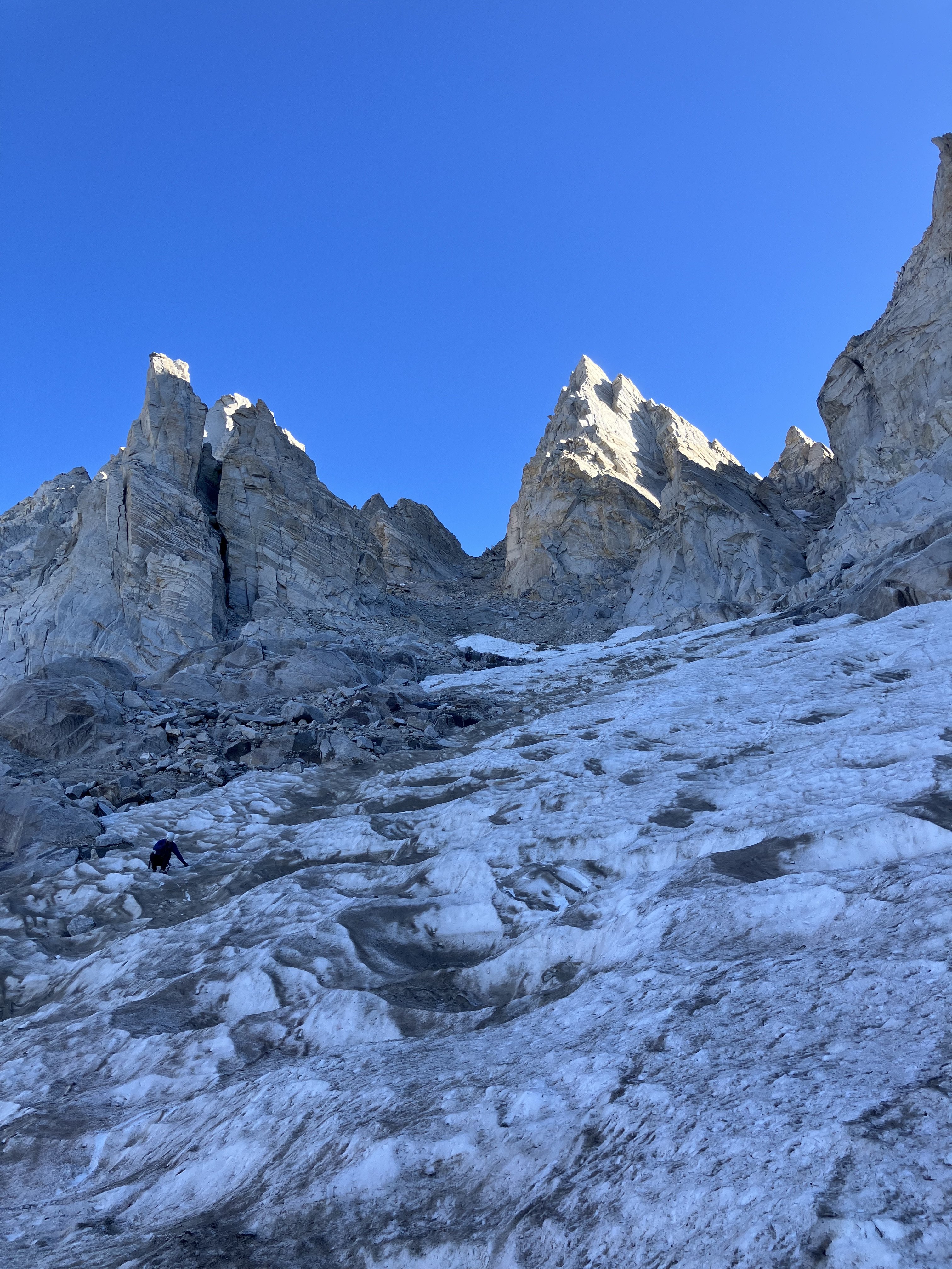
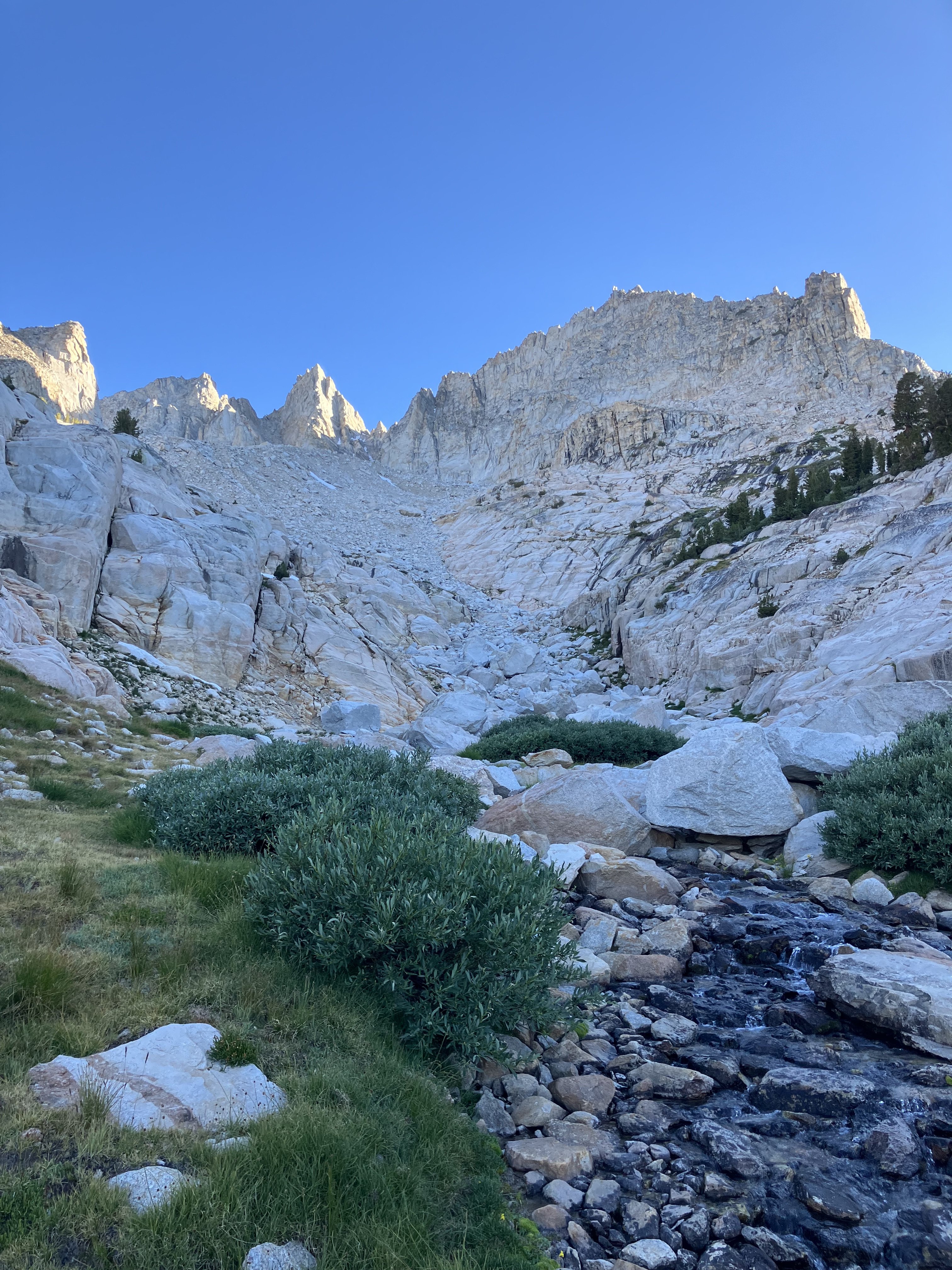
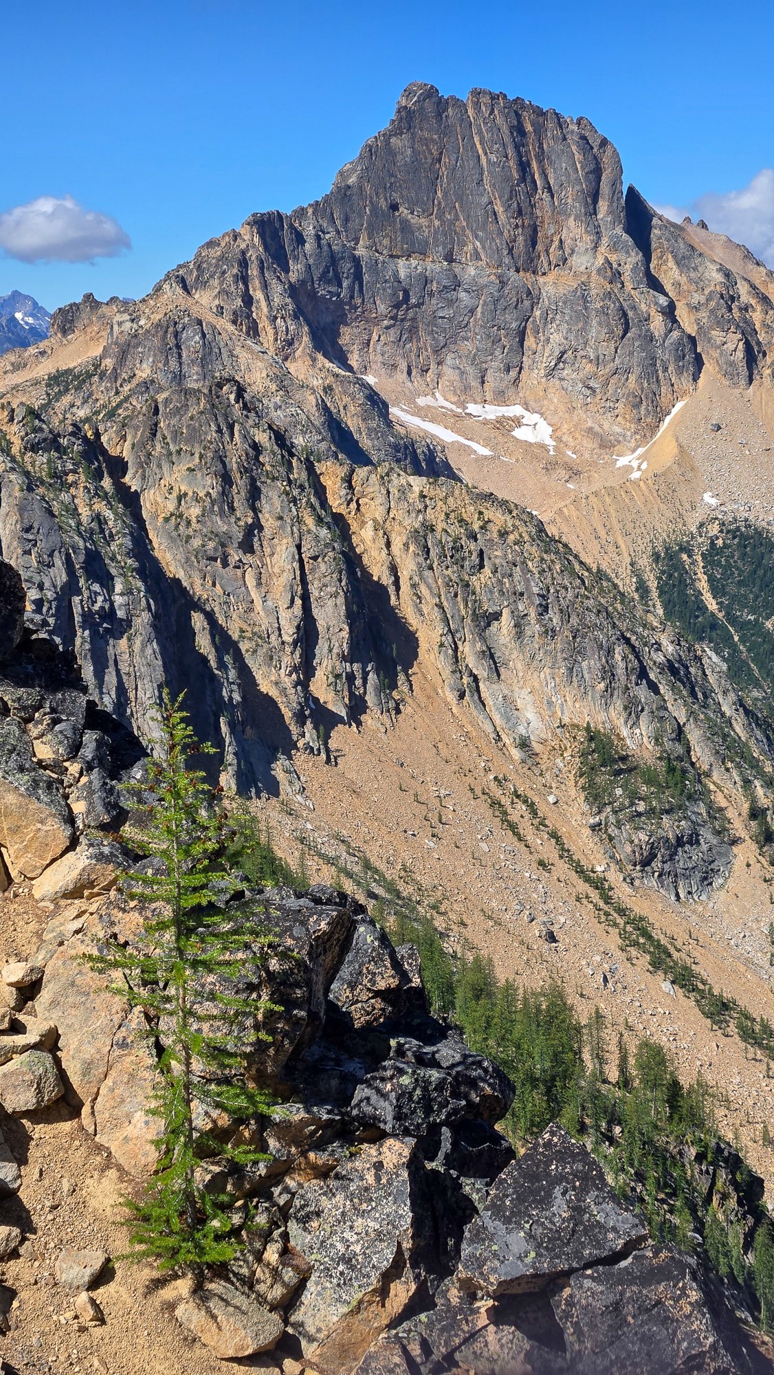
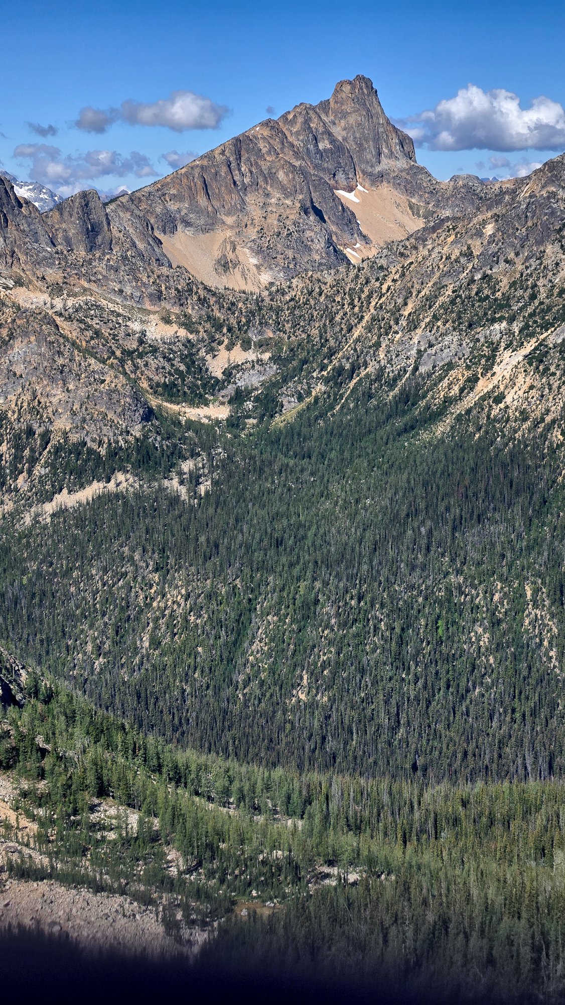
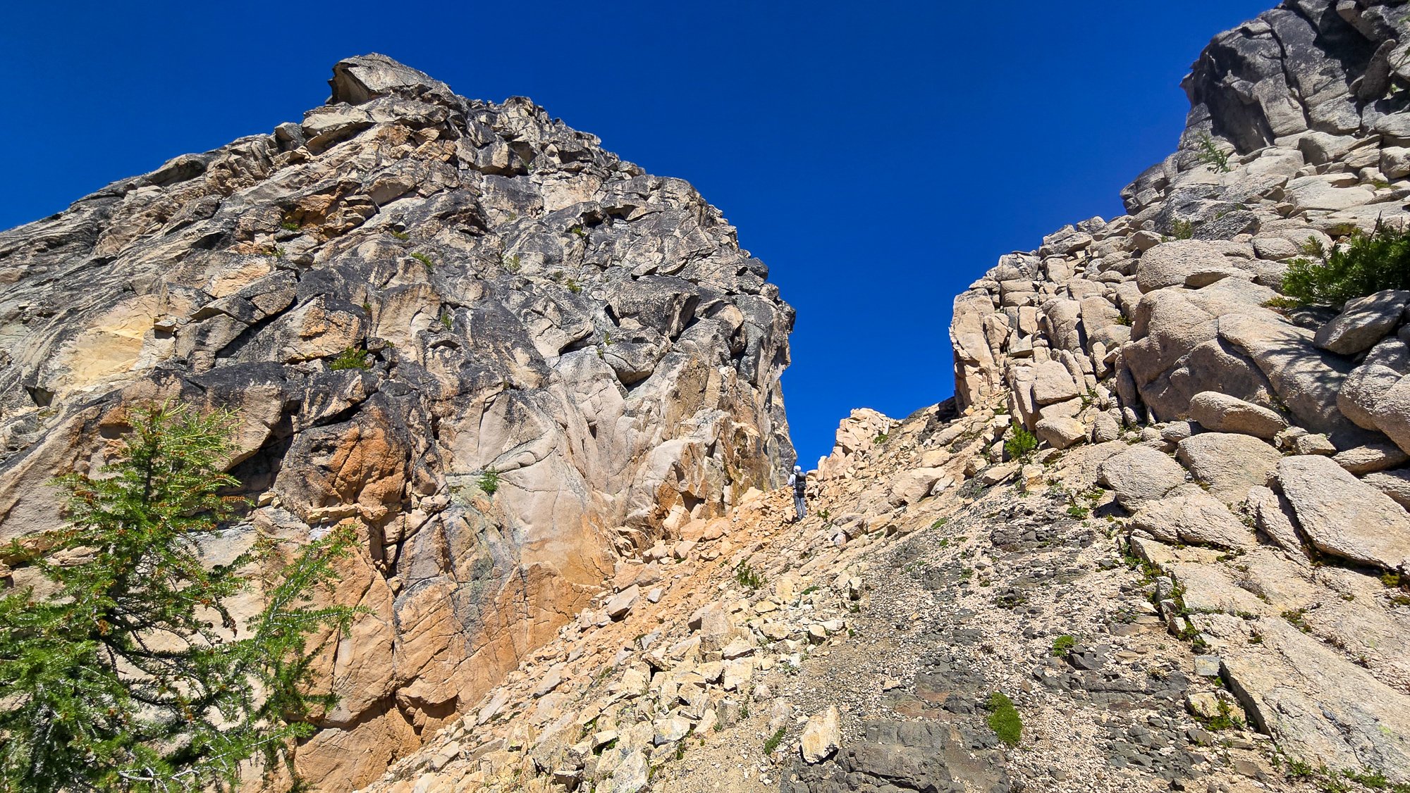
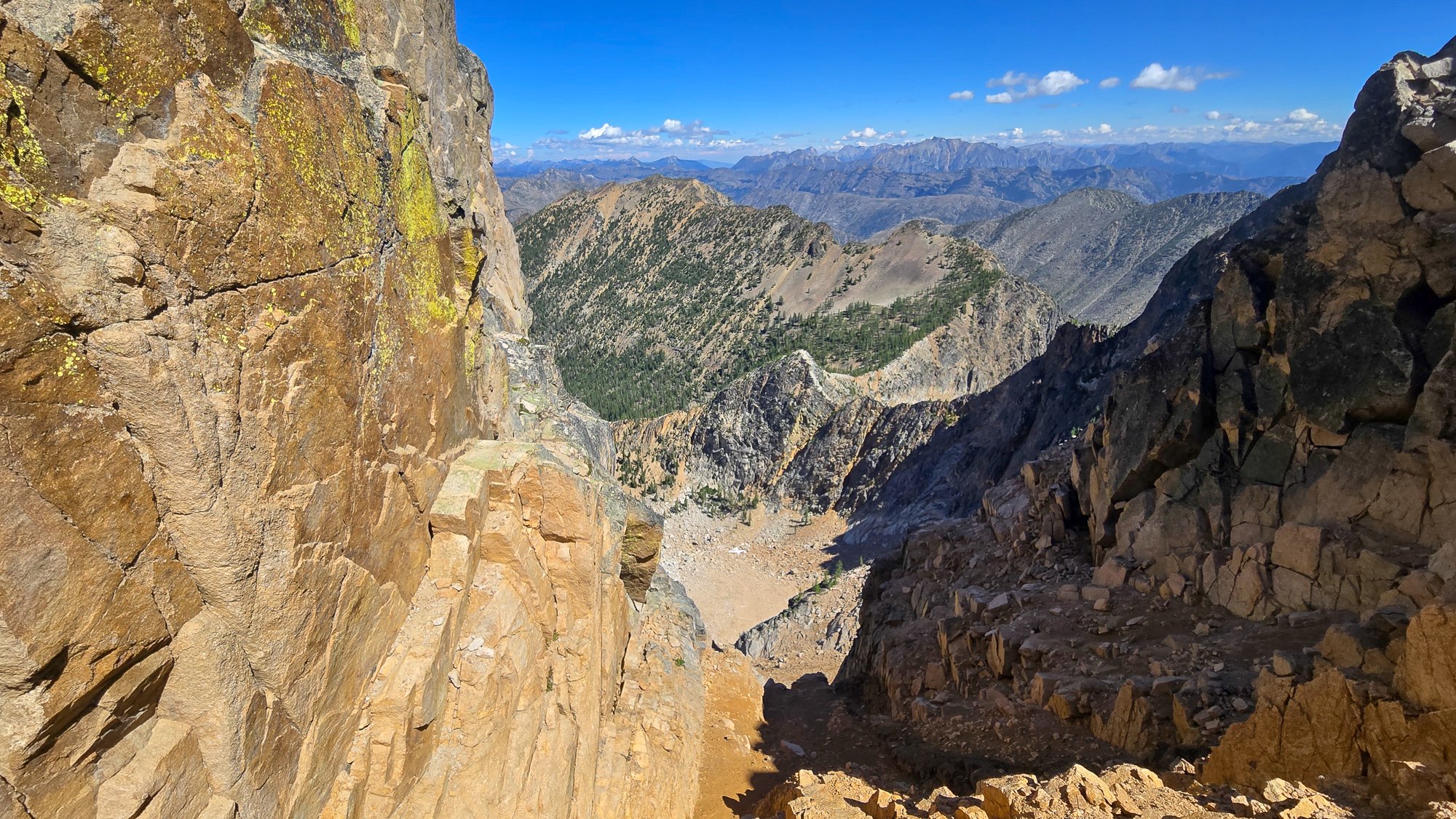
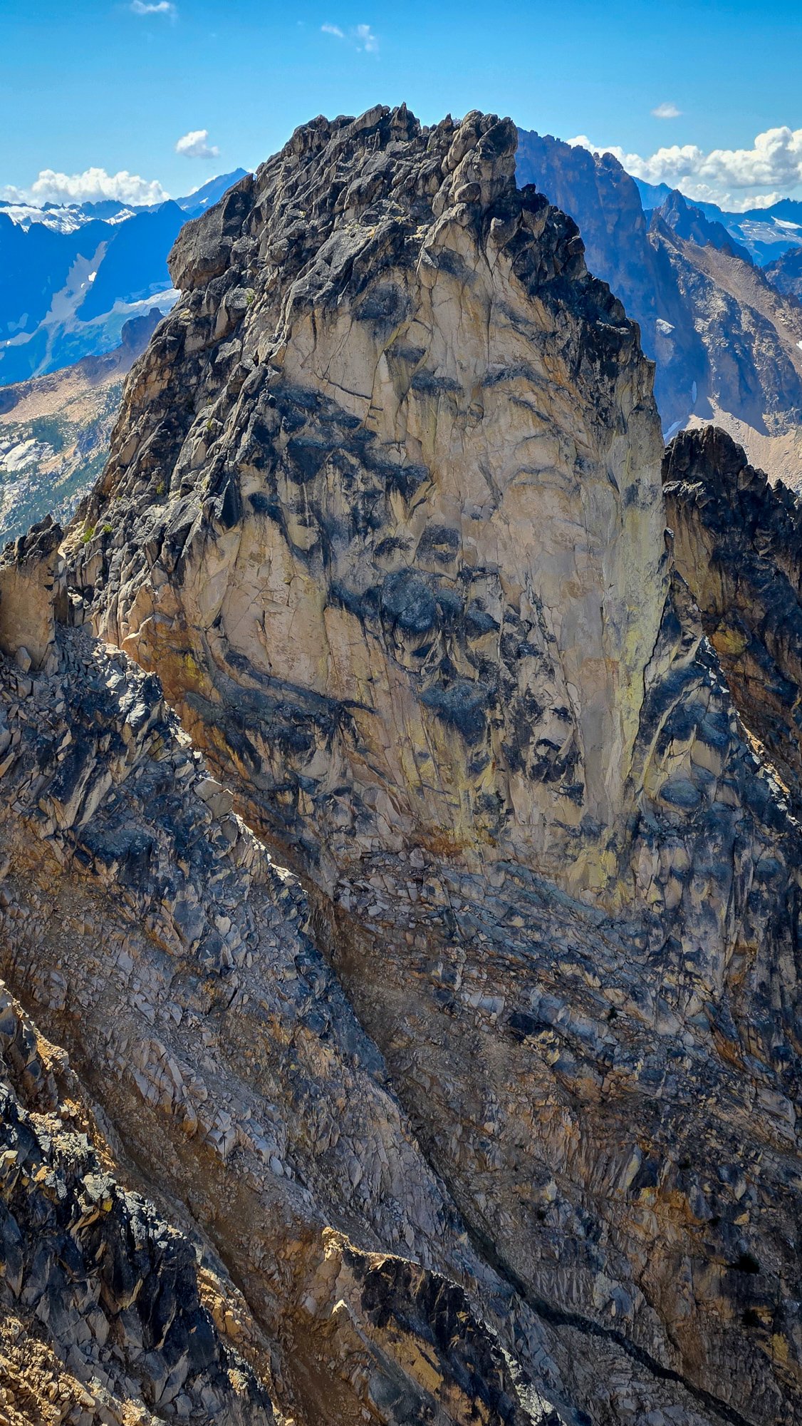
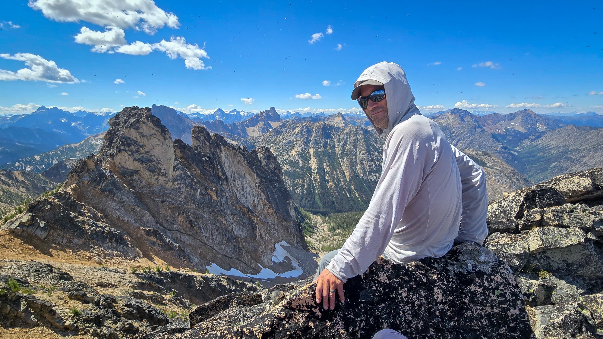
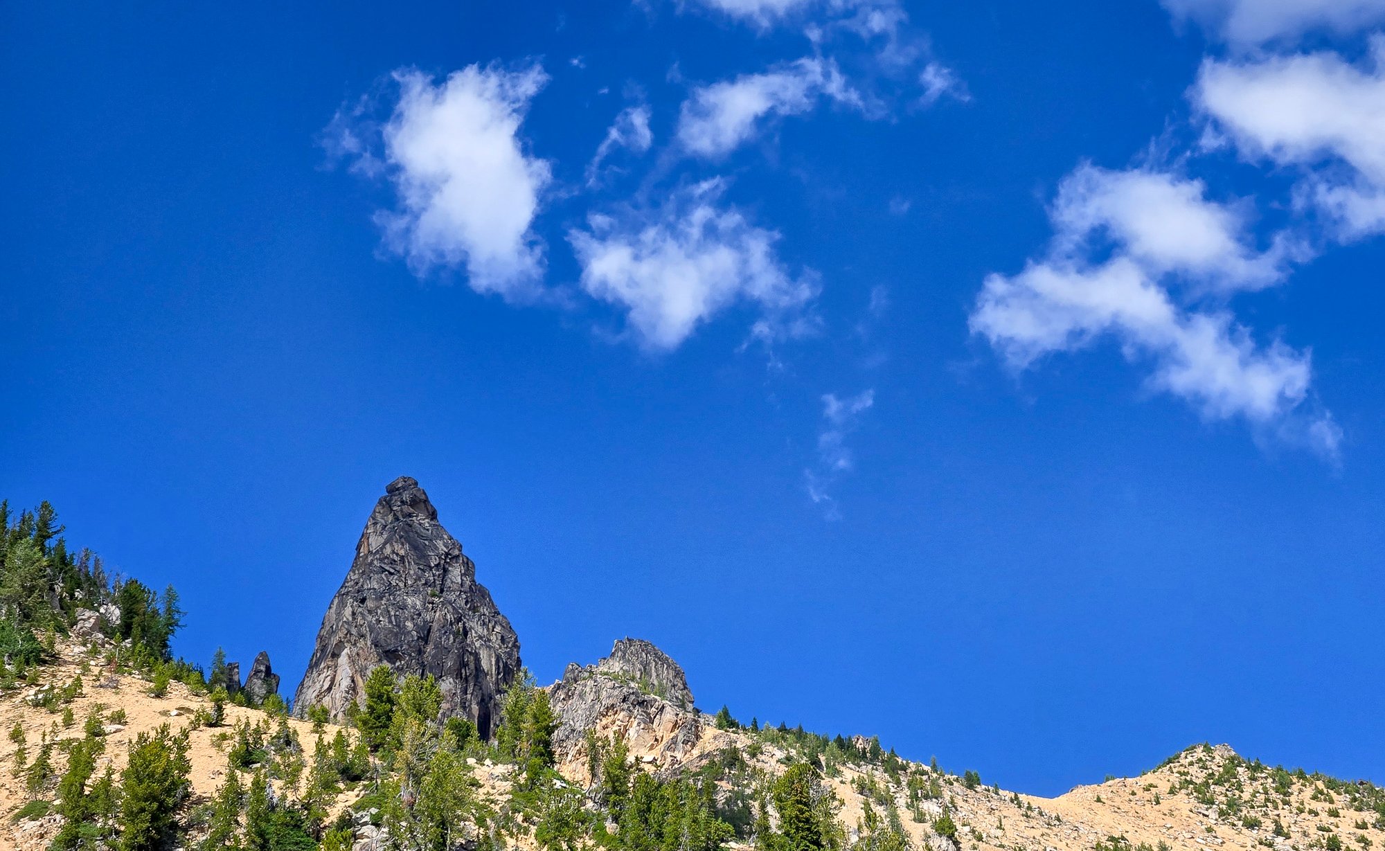
During the past school year, I’d made the plan of doing a bike to climb trip this summer. Mainly due to the fact that it’s difficult to borrow a car from my parents for a while, but it also just seemed like a neat concept, and I was down for an adventure. After getting back from the North end of the ptarmigan traverse, I was inspired by the peaks further south. My partners were either out of commission or had came up with the lame excuse of “work” and “paying bills” so I figured I’d make it a solo trip. The peaks on the ptarmigan traverse made good sense for this since they’re usually 4th or low 5th making it a pain to bring rock gear. The only challenge was glaciers, but I hoped with my later-season climb they would be mostly dry. I was pretty lazy about prep so a late Saturday night found me and my brother binging a show. I woke up at the too-early time of 7am on Sunday and packed my bike before setting off at 10. Sunday 8/17 The first day was quite chill until I got to the centennial. At my first break on the centennial, I went for my phone when I realized my pannier pocket had been completely open and in a position to spill out the contents for the last hour while I’d been biking down a windy hill and over railroad tracks. I looked around but couldn’t find it so I asked a kind stranger to see if I could call my parents to find out the location. The man, Tom, ended up driving me back an hour of biking to the last known location but after a 1.5 hour ordeal, I came out empty handed. I figured I’d continue on with a garmin and stop by somewhere to get a map. Hour or so later, When I reached down in my frame bag for some snacks, I found it tucked behind some bike tools. The rest of the day went smoothly and I got into Darrington around 6 or 7 in time to get some food, buy groceries, and set up camp. Monday 8/18 As was the trend for the trip, monday was also a moderate day. I biked 30 miles to the trailhead and hiked up to itswoot ridge. The Downey/Bachelor creek trails are now well cut out. Always able to see your feet. At the Bachelor turn-off I ran into two climbers who were coming down from dome. Once I got to cub lake, I met a backpacker who had twisted his ankle a few days ago. An hour later I watched a helicopter come pick him up. I worked it up to Itswoot ridge where I went over to back the peak before setting camp at the established bivy sights to a nice view of dome and glacier. Tuesday 8/18 Trying to save phone battery and figuring the ptarmigan was obvious, I navigated the old fashion way. I knew that I had to climb through snowfields to the spire col so went to what I thought would be the obvious one. Once I was climbing the gully to the col, I found that it was much much looser than I had expected. Topping out, I realized I was definitely in the wrong place, I’d gone to the spire/west spire col. A shitty descent and some more vert later, I got to the right col. I scrambled up spire peak and enjoyed a mix of sun and clouds. TR’s had reported a licheny slab that wouldn’t be fun in approach shoes but it wasn’t too licheny anymore. From here I made the awful descent down to the basin where I traversed around to cub lakes. The only snow of the entire day was between the col and the base of the spire point. I got into cub lakes early and bagged 7340 and Lizard before heading to bed. Wednesday 8/20 The goal for the day was simple, Sentinel and Old Guard. The south cascade glacier was entirely dry and it was cool to see all the glacier monitoring equipment. I found a nice left leaning ramp up the West face of sentinel and scrambled to the top. With the sun and clouds there was a cool glory effect. I descended down, traversed over to the Leconte Glacier, and followed the dry glacier to the col. With some endrunning I was able to stay entirely on ice except for a large snow patch right before the col past the schrund. The scramble up was fun and I enjoyed good views of the more northern peaks. I descended back down and got back to camp by 4. Made some oatmeal and figured I’d scramble up old guard at 4:30. Made it from camp to the base of the North ridge in 45minutes before realizing that there may be some 5th class. It ended up being about 5.6 but it was a secure chimney so I felt comfortable. Made my way down by 6:30 where I found a deer at camp. Picked lots of berries alongside the deer before settling in for the night. Also lots of unfazed marmots. Thursday 8/21 Woke up to find my helmet 20 yards away from my tent. The marmots had stolen the foam padding from it. Spent the morning walking over to the dome-dana col. I went up and over to the itswoot ridge side since I didn’t want to solo the Dana glacier. Set up a nice camp before scoping out conditions. Figured it would probably be do-able but I wanted to do it in the early morning before sun hit everything and while snow conditions were firm. I was doing everything in approach shoes and hybrid crampons so steep stuff was not my forte. Listened to podcasts and sat around for the easy afternoon. That night was horrible, some mice disturbed me for two hours, eventually getting into my tent by making holes in the mosquito netting. My food was hanging but they still walked around by my feet. Didn’t get a ton of sleep. Friday 8/22 Started at 5am, picked my way up the glacier trying to stay on ice. Summited dome at 6:30, down by 7:30 before the sun had even hit camp. Figured I might as well make it down to the trailhead where I found myself at 2pm. Quickly packed the bike and headed towards darrington where I stopped to gorge myself at the burger place. Afterwards I hopped back on the bike in the 93 degree heat to bike to arlington where I camped in a park. This night also sucked too. Loud music + heat + my grimy body only gave me like 2 hours of sleep Saturday 8/23 I knew it’d get hot so I was moving as soon as it was light out, made it home in 5.5 hours where I showered and gorged myself. I’d been doing some moderate rationing for most of the trip so was, and still am, quite hungry. Overall it was a great trip to end the summer. I’ve got a oral surgery tomorrow that will put me out for 2 weeks and by then, I’ll be a week into the school-year. Been busy getting out recently but with this off-time, I’ll probably put together some mini-TR’s on my site(https://lucasfng.blogspot.com/). I’d been wanting to do a long trip over the summer so this satiated my hunger, though it would’ve been nice if I could've got more than one in.
 2 points
 -
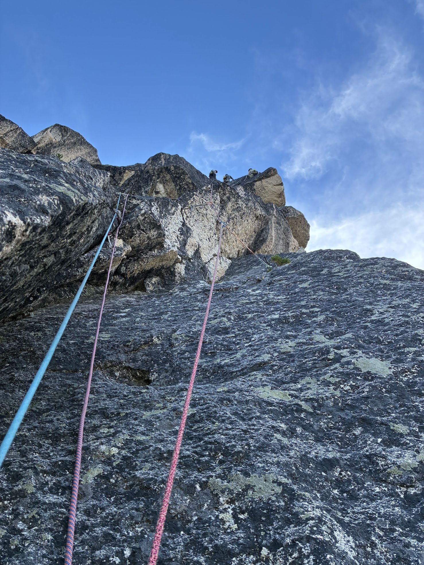
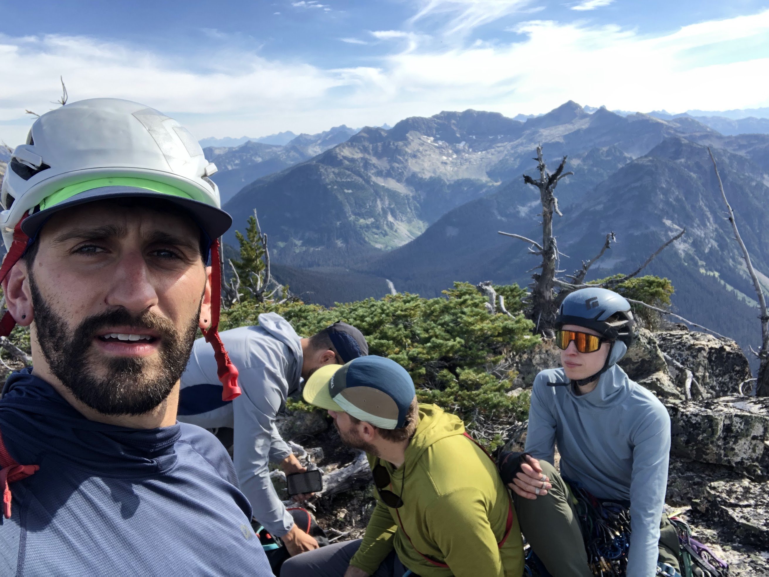
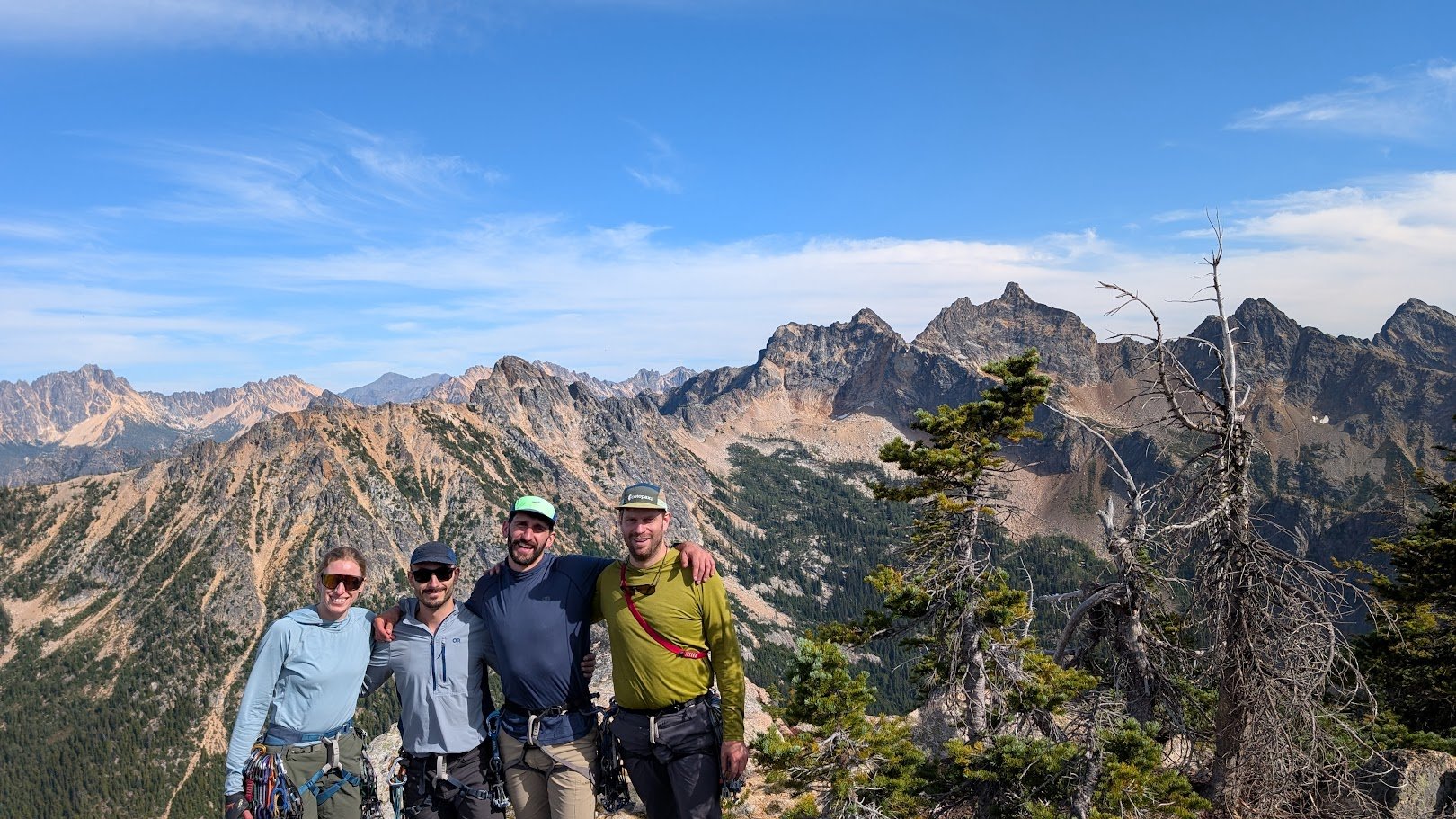
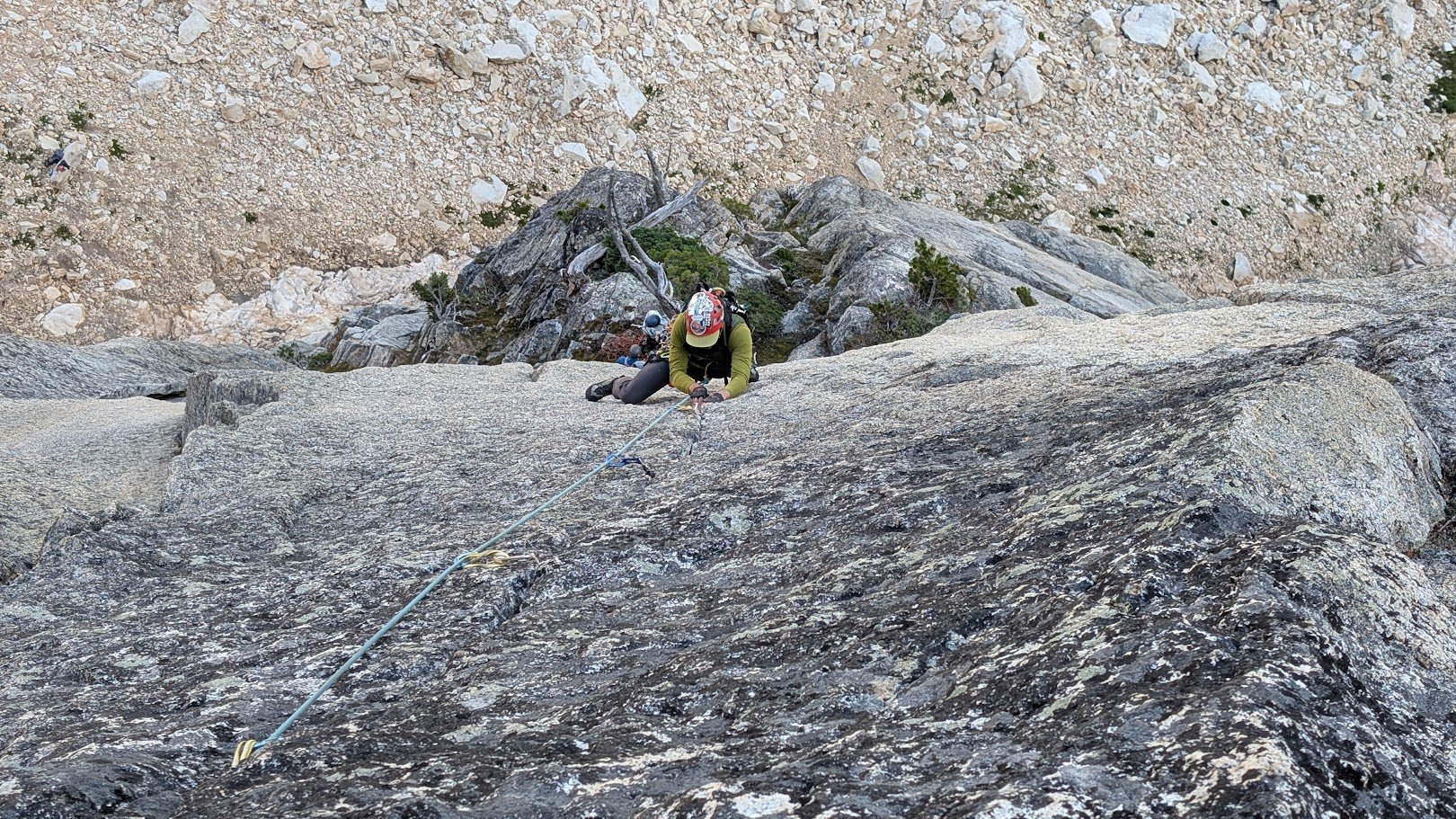
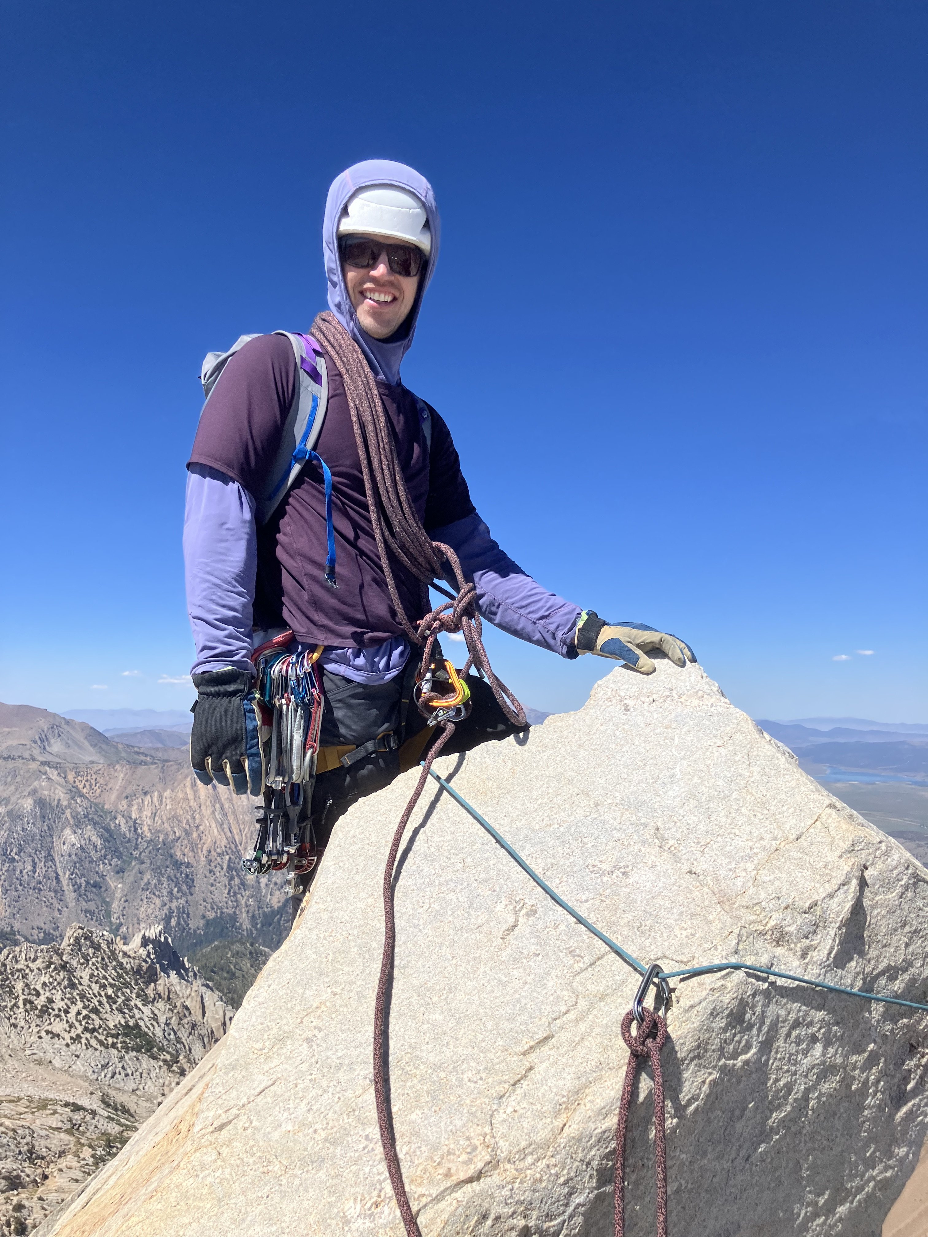
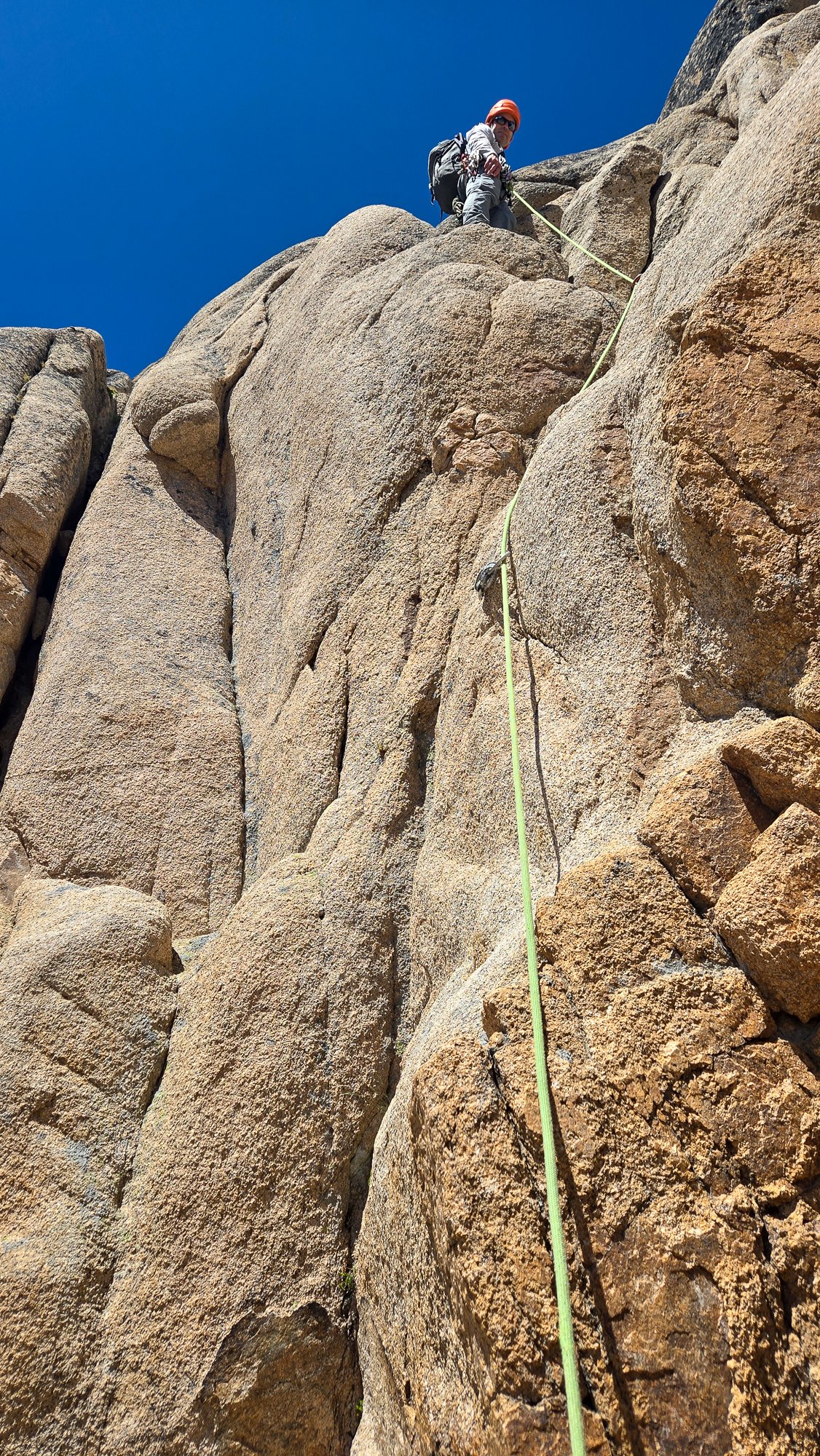
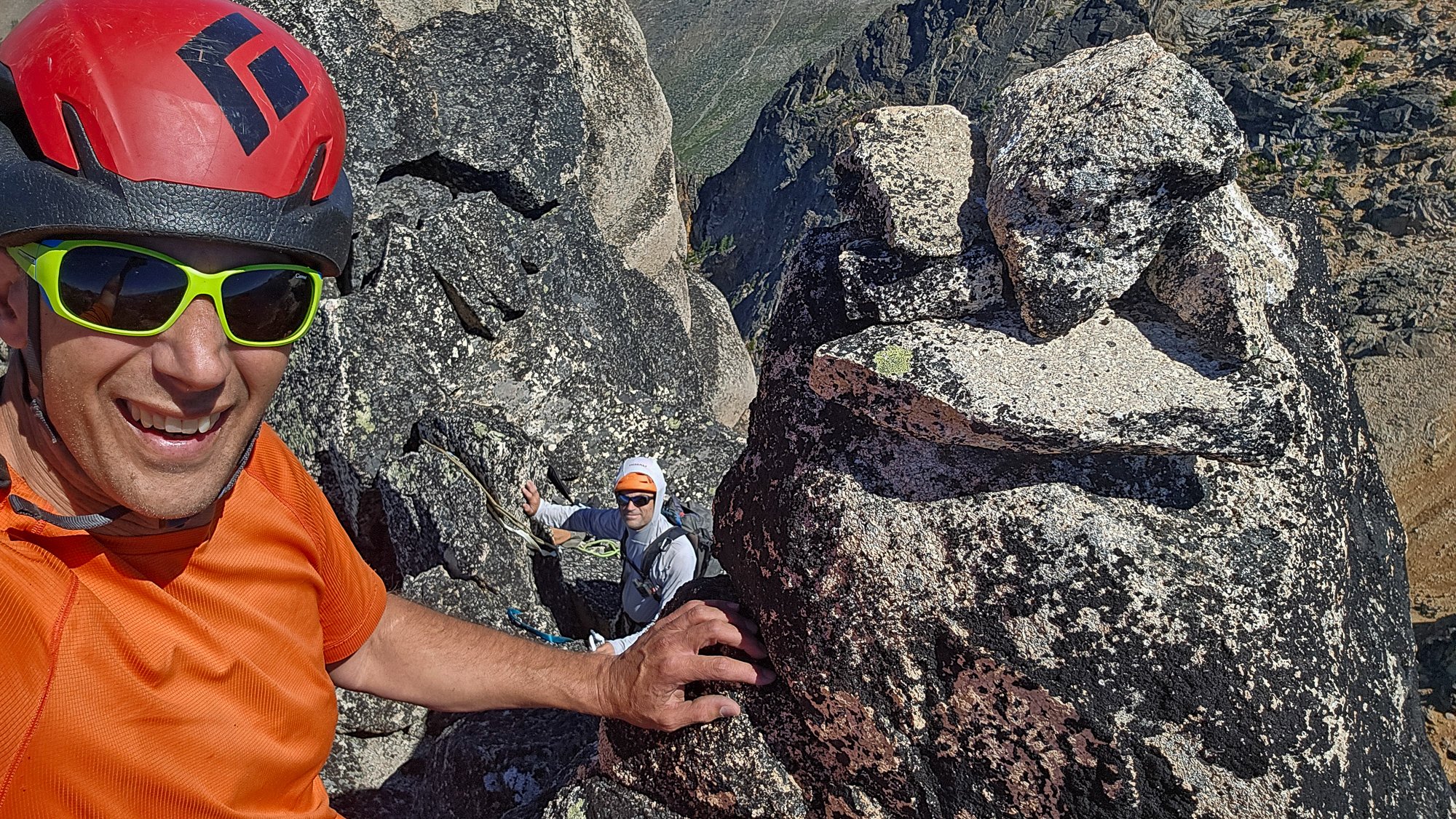
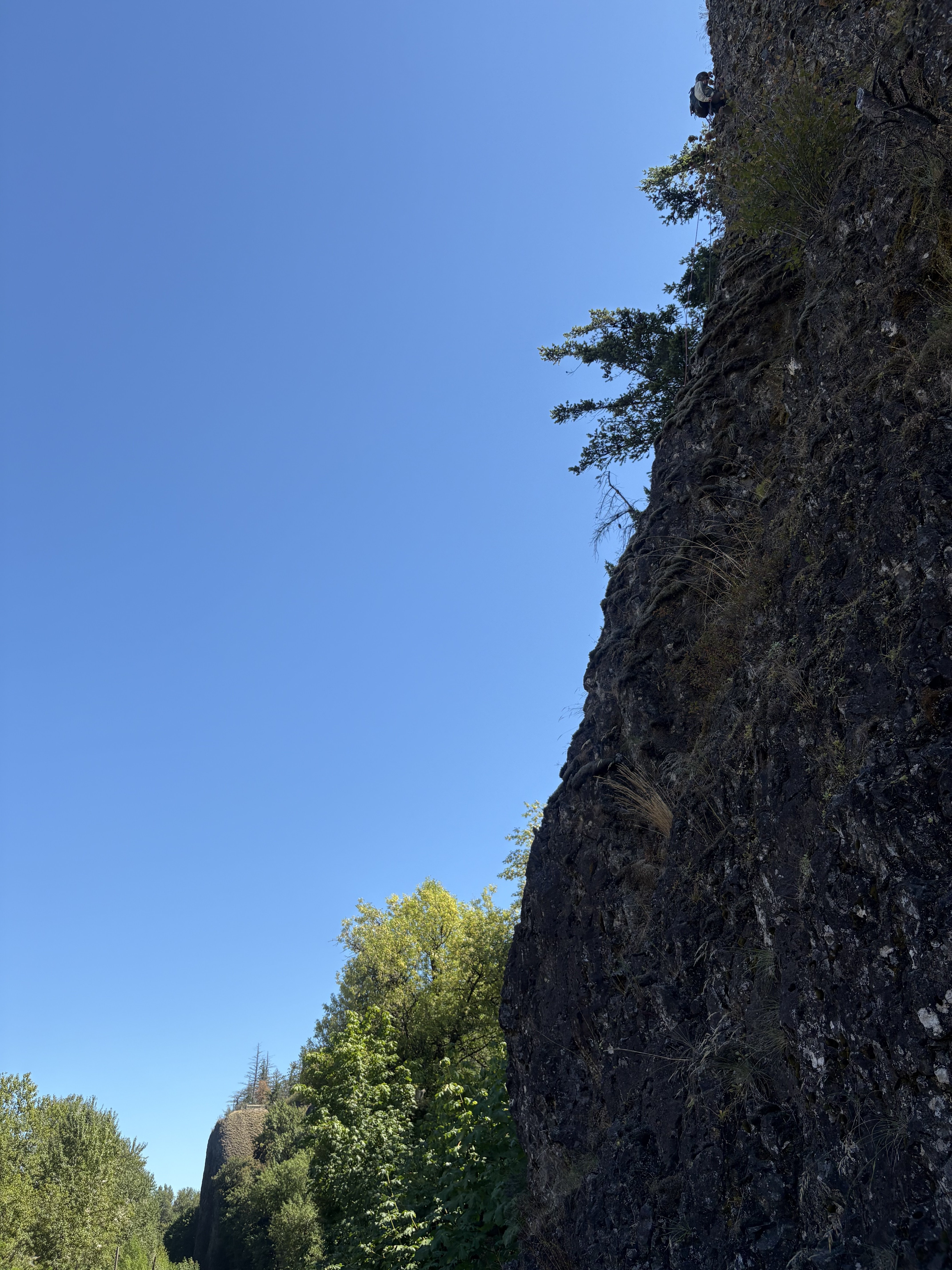
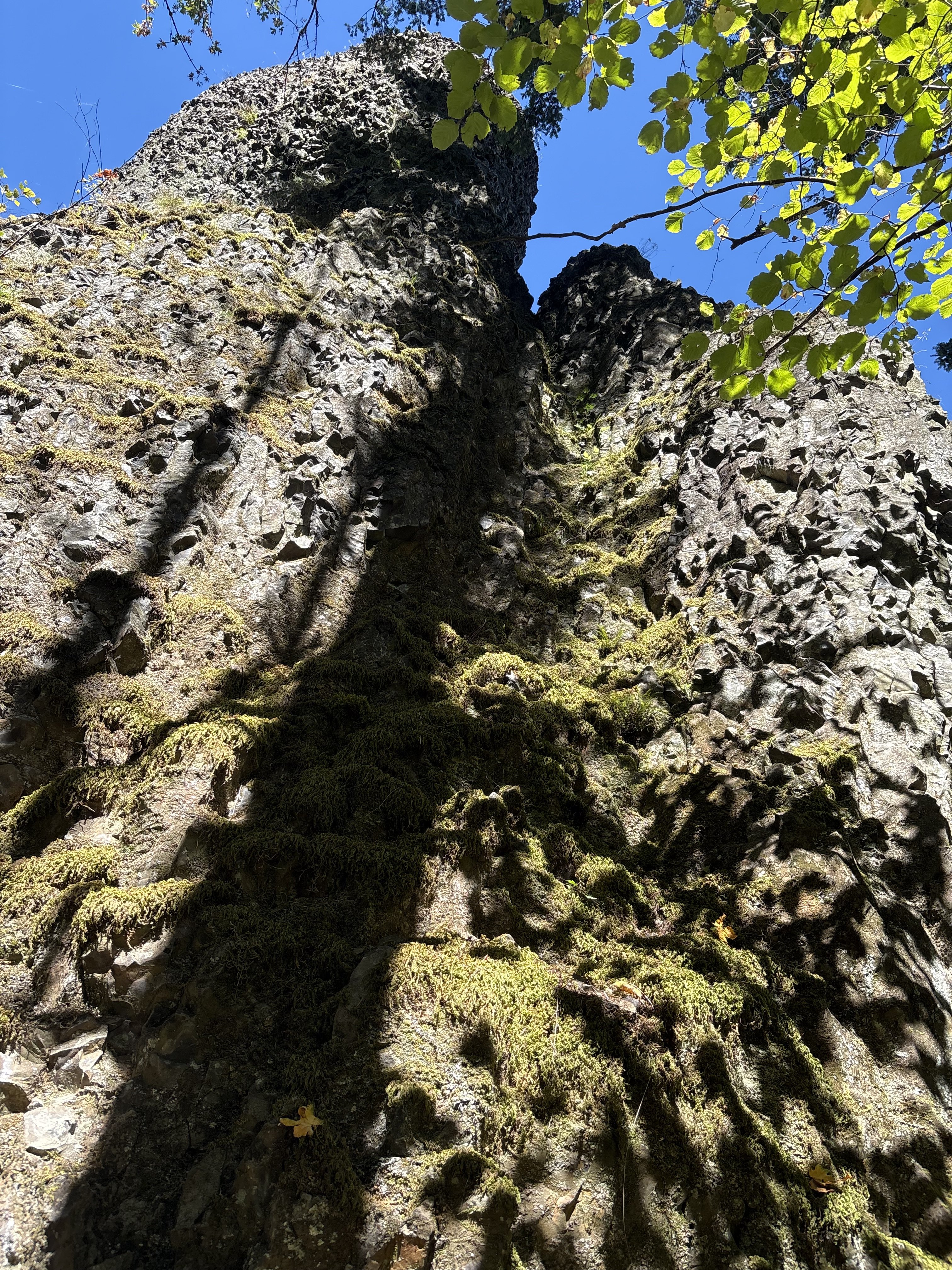
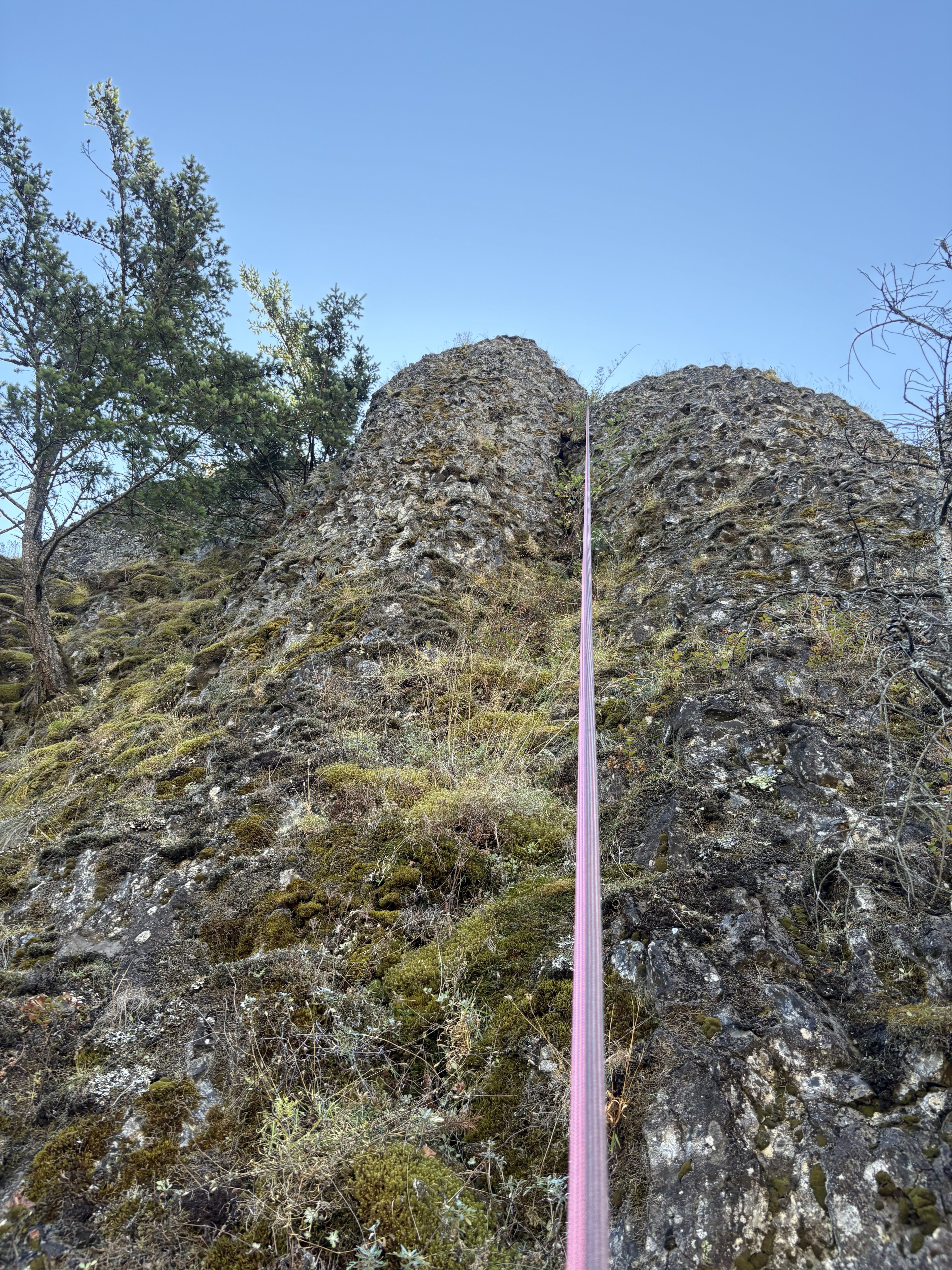
Trip: Porcupine Peak - Salad Days 5.11a Trip Date: 08/23/2025 Trip Report: Climbing and Crowds on a Newish Classic Liza, Kurt, Marc, and I headed out over the weekend to climb the newish @dberdinka and @lunger route, hoping for some fun, remote climbing in one of our favorite zones. After a solid week in the Sawtooths earlier this month, Marc and Liza were feeling strong and psyched to push their grade. A climb with bolted anchors, mostly in the 5.8–5.9 range with a single splitter 5.11- pitch sounded like just the ticket. We left Easy Pass trailhead around 8:30 a.m. and made quick time along the PCT before turning off on the climber’s trail toward the base. Following the approach line on Mountain Project’s map turned out to be super helpful. The first 400 feet of trail were a bit schwacky, but we soon hit a more established path. Liza and Kurt had climbed Arrested Development (5.10-) the year before and found the climber’s trail felt way more "developed" than last season. The approach took us about 1.5 hours. When we arrived at the base, two parties were already on route with one finishing P2, the other starting P1. As we snacked and racked up, three more teams arrived behind us. We were expecting maybe one other group… not SEVEN! But everyone was friendly and in good spirits. Liza and Kurt headed up first, with Marc and me climbing behind. Some highlights from the day: P1 (5.8) starts with a fun, heady mantle protected by a bomber cam just below—great start. P2 (5.9) was a blast: good jams, a wide layback crack, a delicate face move, and then a bolted jug haul to the anchor. Super varied and enjoyable. P3 (5.11-/10+?) was the crux: Liza and Marc led it and totally crushed it, especially considering it was their first 5.11- trad pitch. Liza took a quick rest for finger pain and Marc got the onsight. Tape on the left pinky was nice beta. This pitch gobbles up nuts and will take all the 0.2s and 0.3s you’ve got. P4-6 (5.8/5.9) The next three pitches served up moderate jamming, laybacking, stemming, and some delicate bolt-protected face moves between crack systems. By then, four of the teams (including us) were stacked on top of each other, climbing around and over each other. Fortunately, everyone was having a great time and the vibe stayed positive and chatty. After a quick scramble pitch, four teams topped out at the false summit together, took one look at the awkward mantle to the true summit, and collectively said “nah.” Instead, took some photos and all combined our 70m ropes for a mega party rappel down the route using all the techniques (carabiner block, simul rappel, gri-gris, ATCs, single-strand, double-strand)! The rappels were straightforward. Though it’s unclear whether the party-rappel saved us time or cost us some, but it sure was fun. Unfortunately, one of the ropes got a coreshot on the final rappel…. We packed up and made it back to the cars by 7 p.m., tired and happy. Final thoughts: The climbing was well protected throughout. The rock was a bit slipperier than expected. A great route for pushing into the low 5.11 range in an alpine setting. Thanks to Darin and Eric for putting up this route and all the work to clean and bolt it! Party climbing! Cruxing Summit selfie! Gear Notes: We brought triples 0.3-0.5, doubles 0.2 and 0.75-1, singles 2-4, and a set of nuts (many sm-med). An ideal rack would be doubles 0.4-1, single 2-3, set of nuts (many sm-med), and as many 0.2-0.3 cams as you want to carry (triples or quad). Approach Notes: Follow PCT until
 2 points
 -
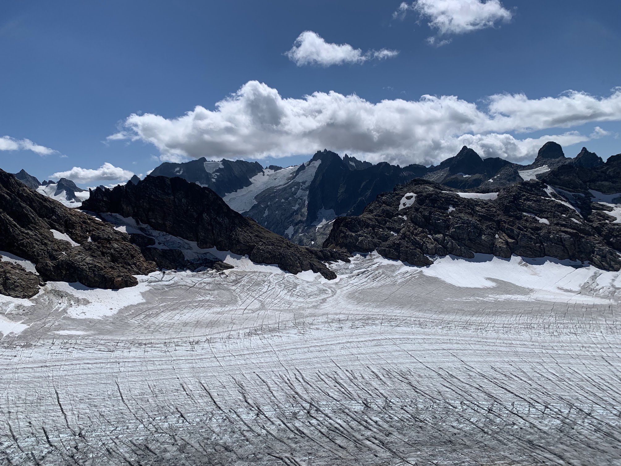
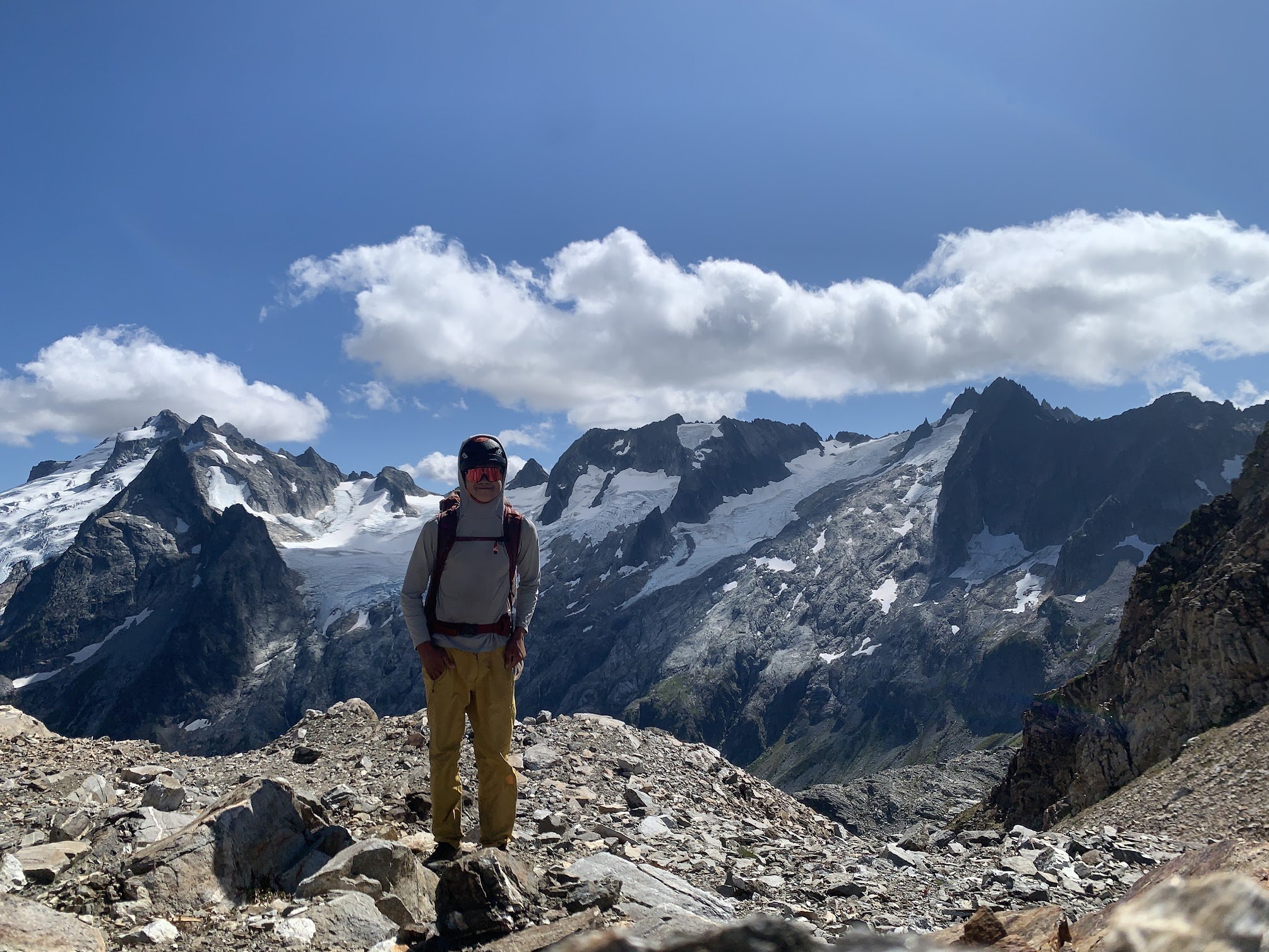
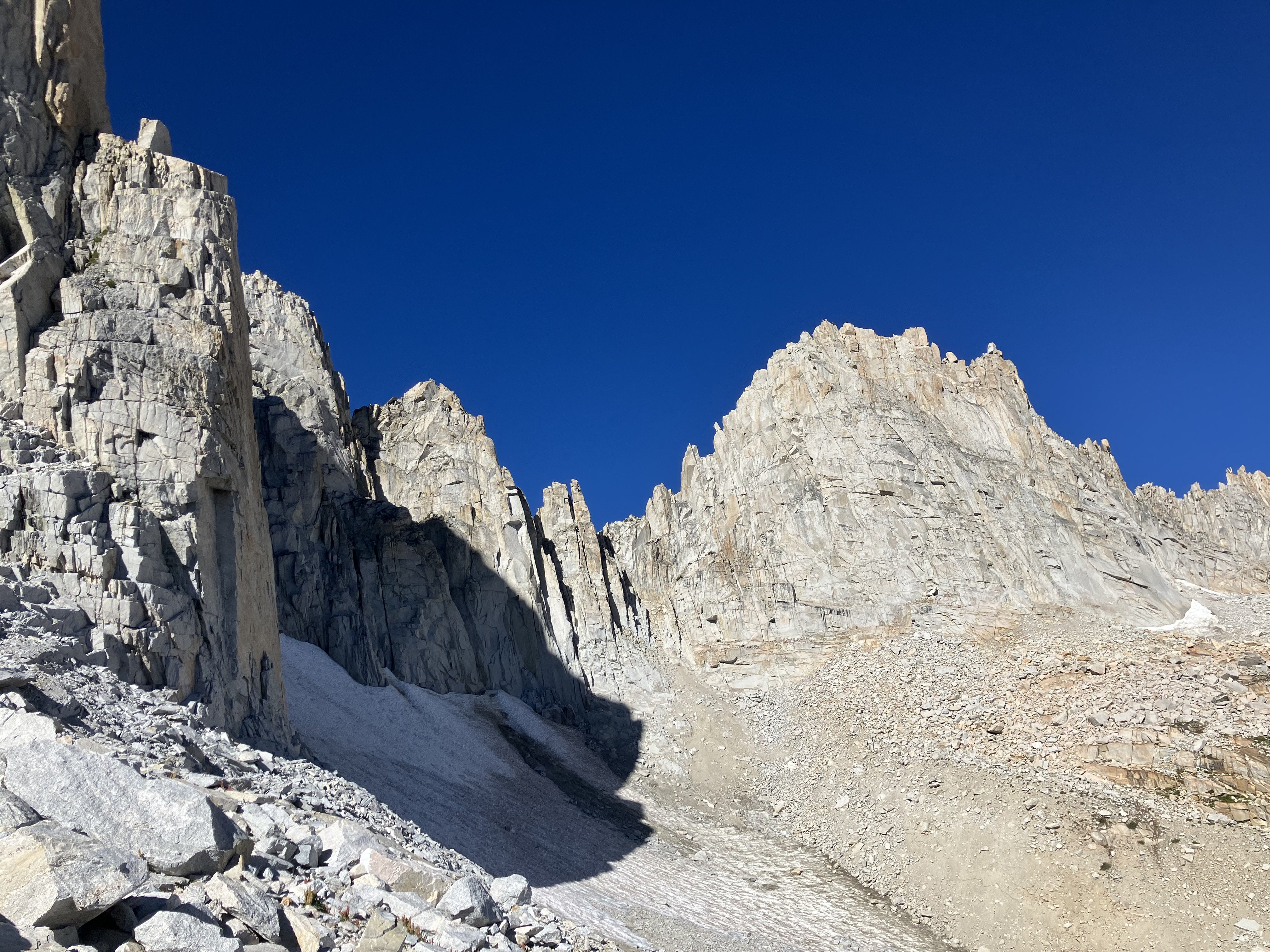
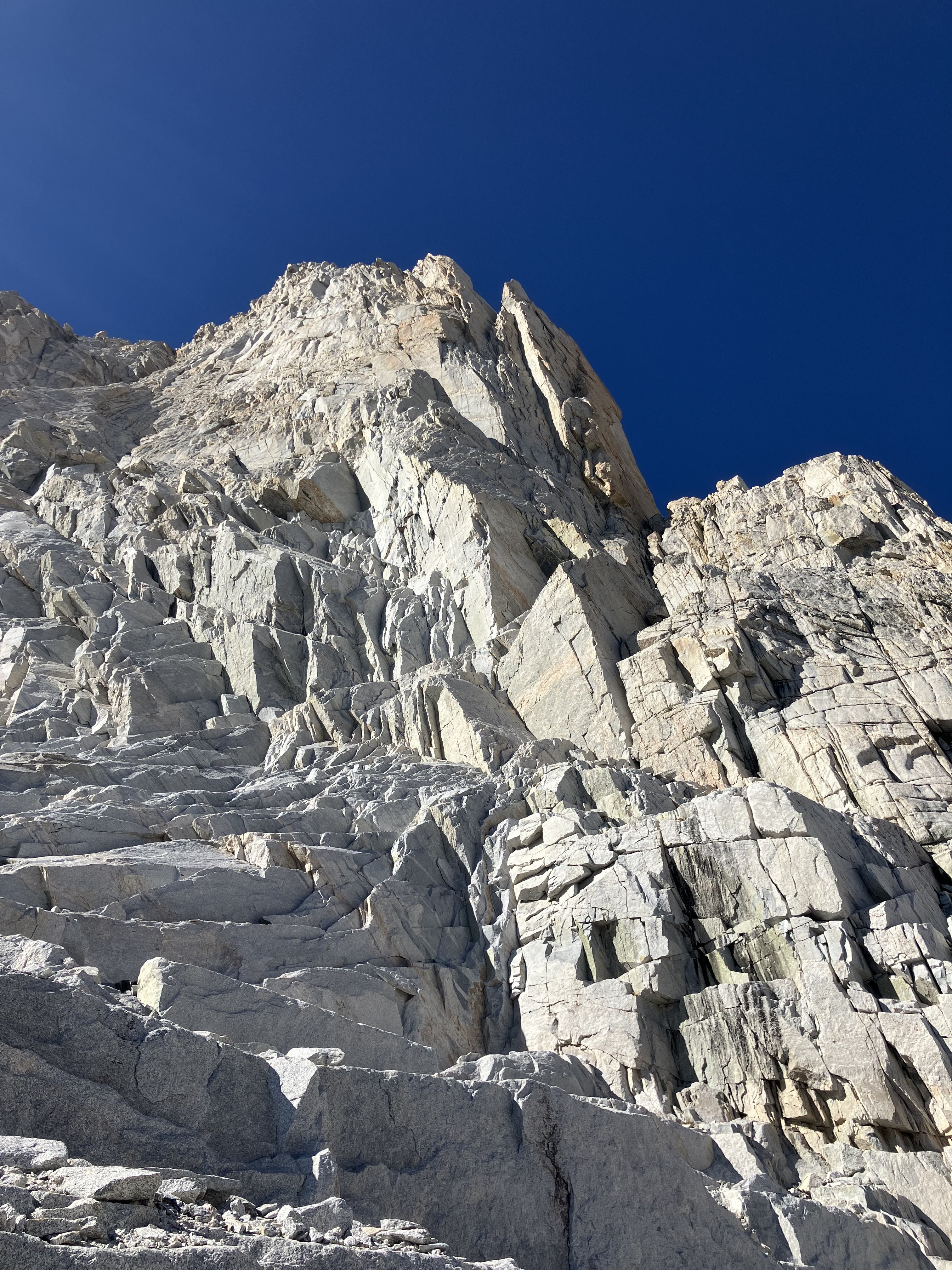
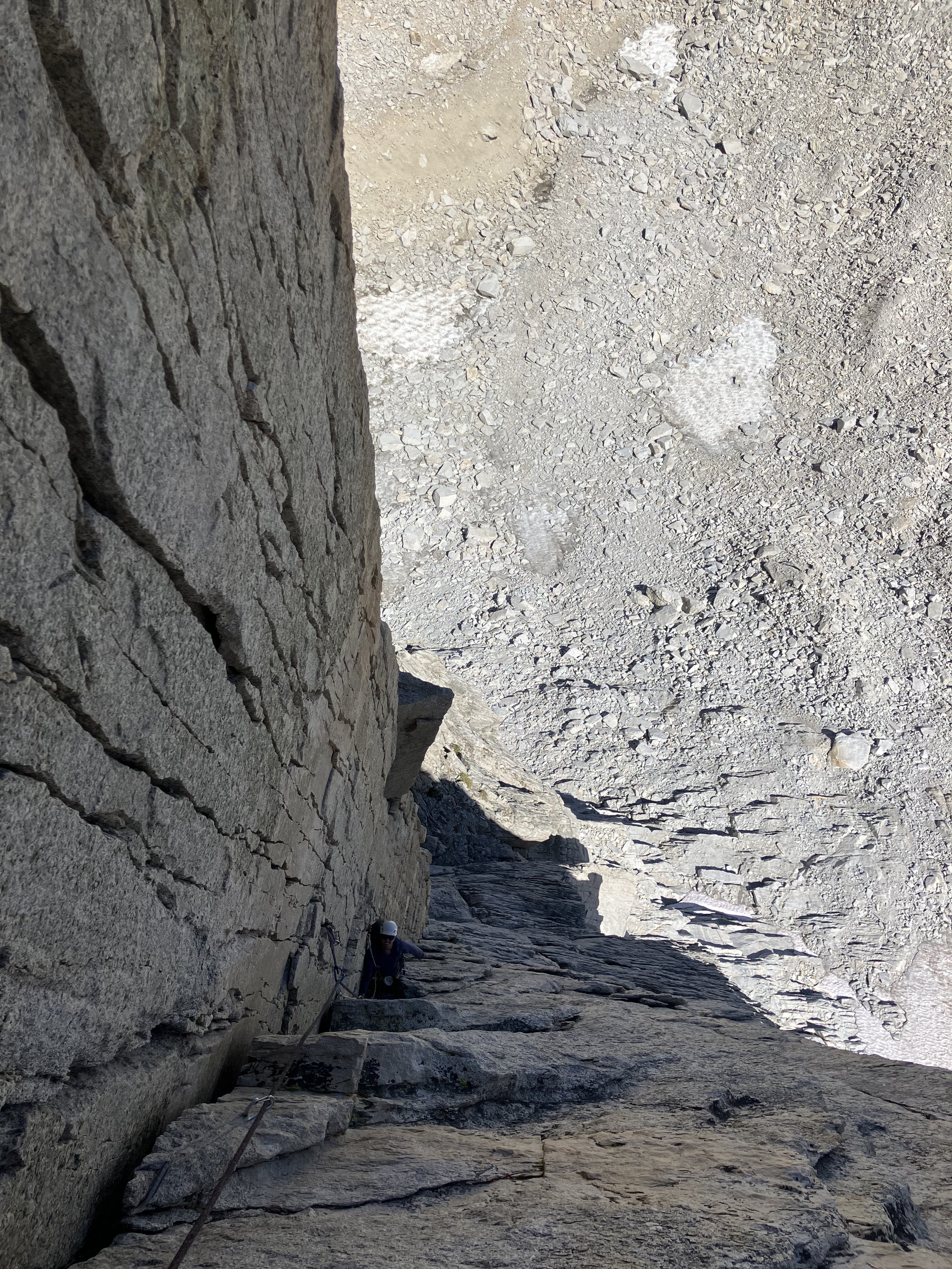
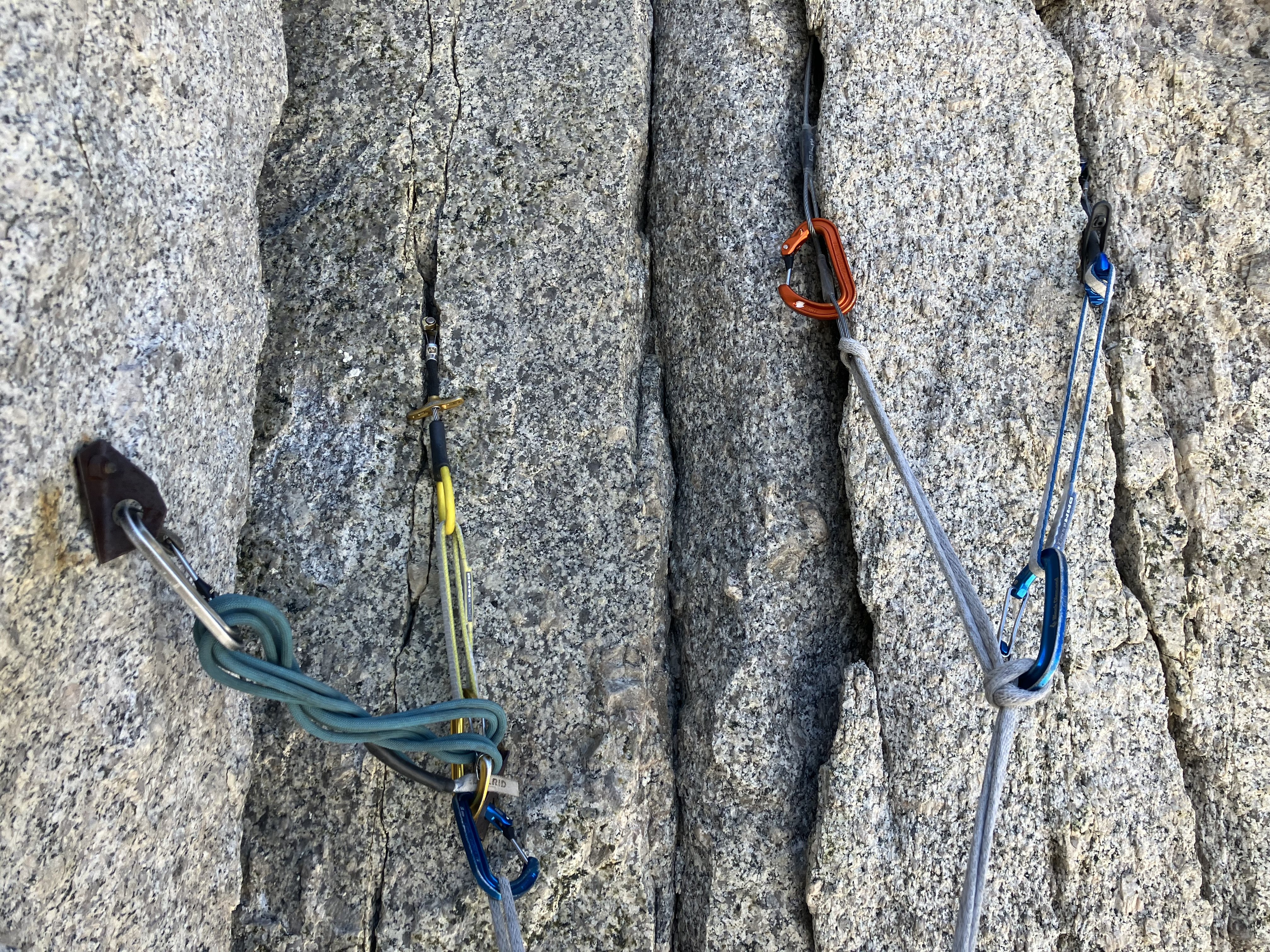
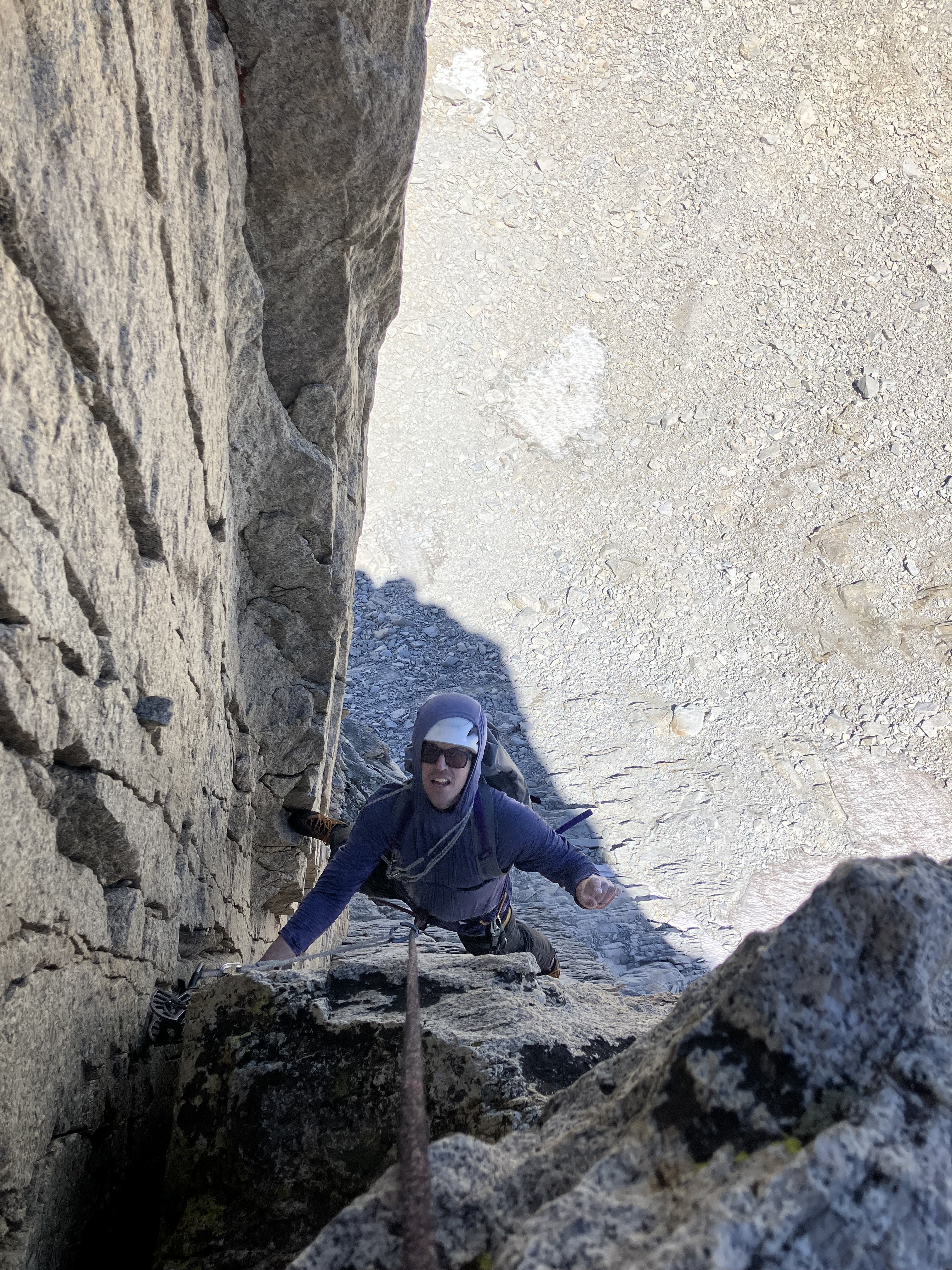
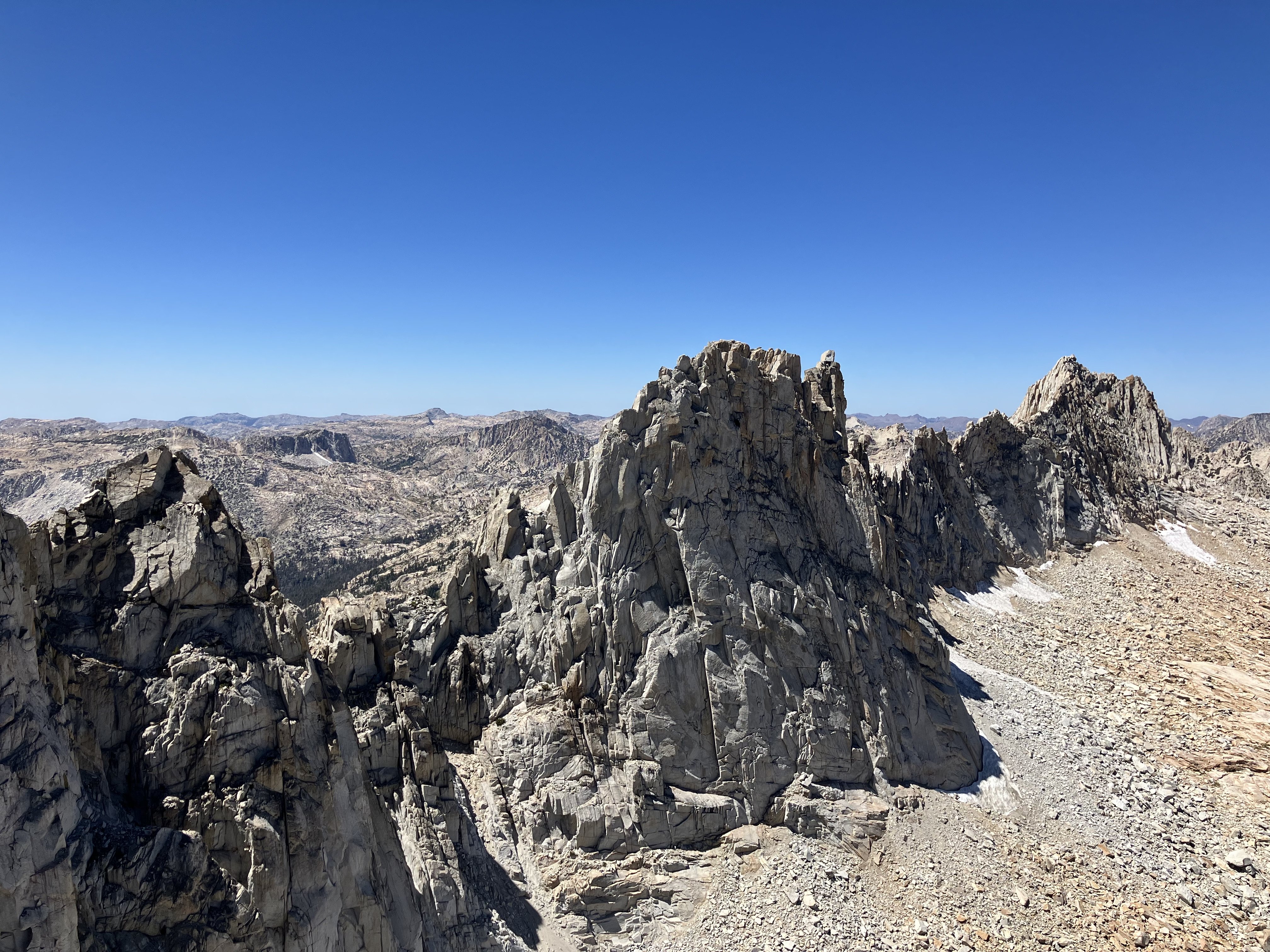
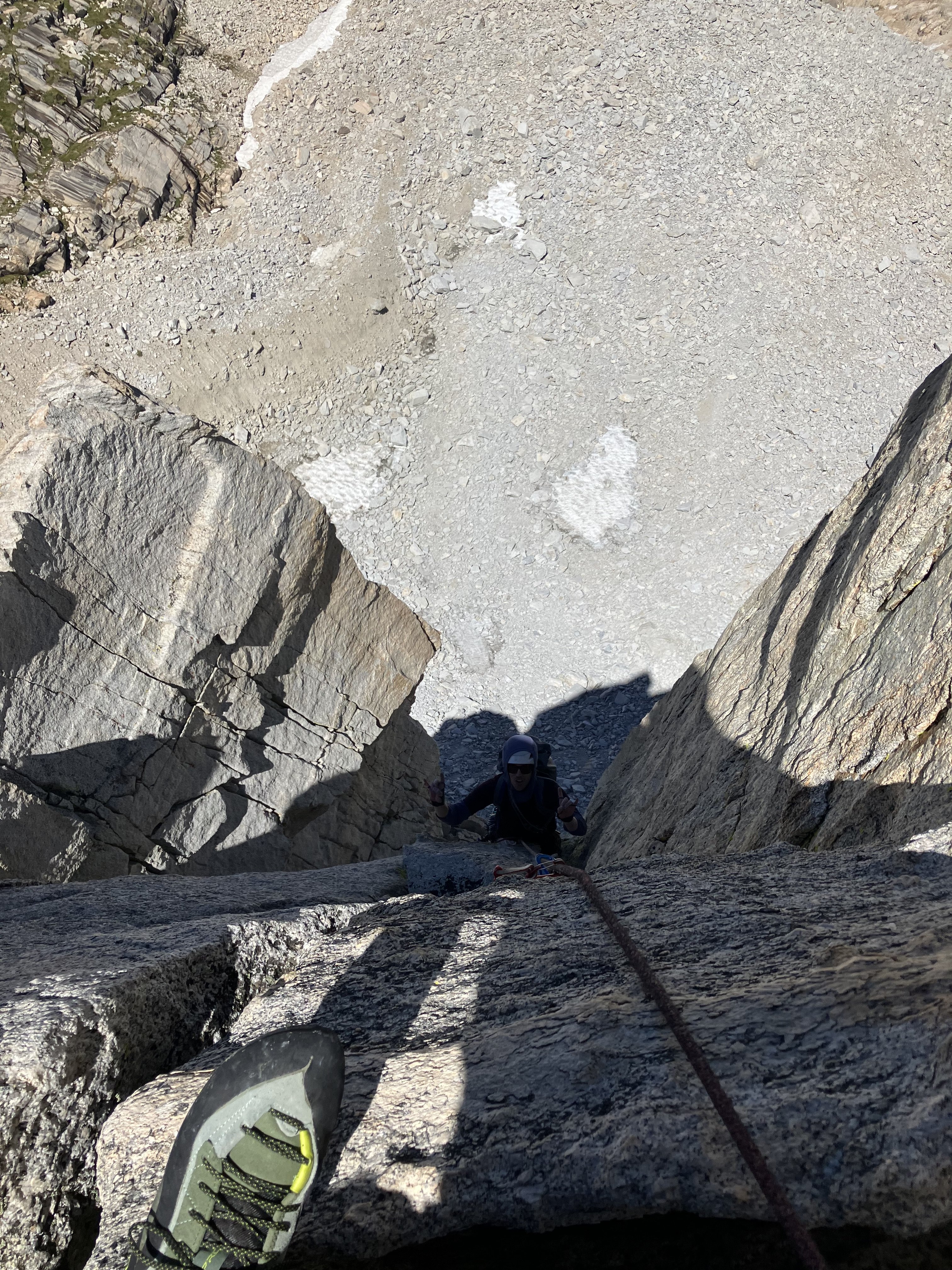
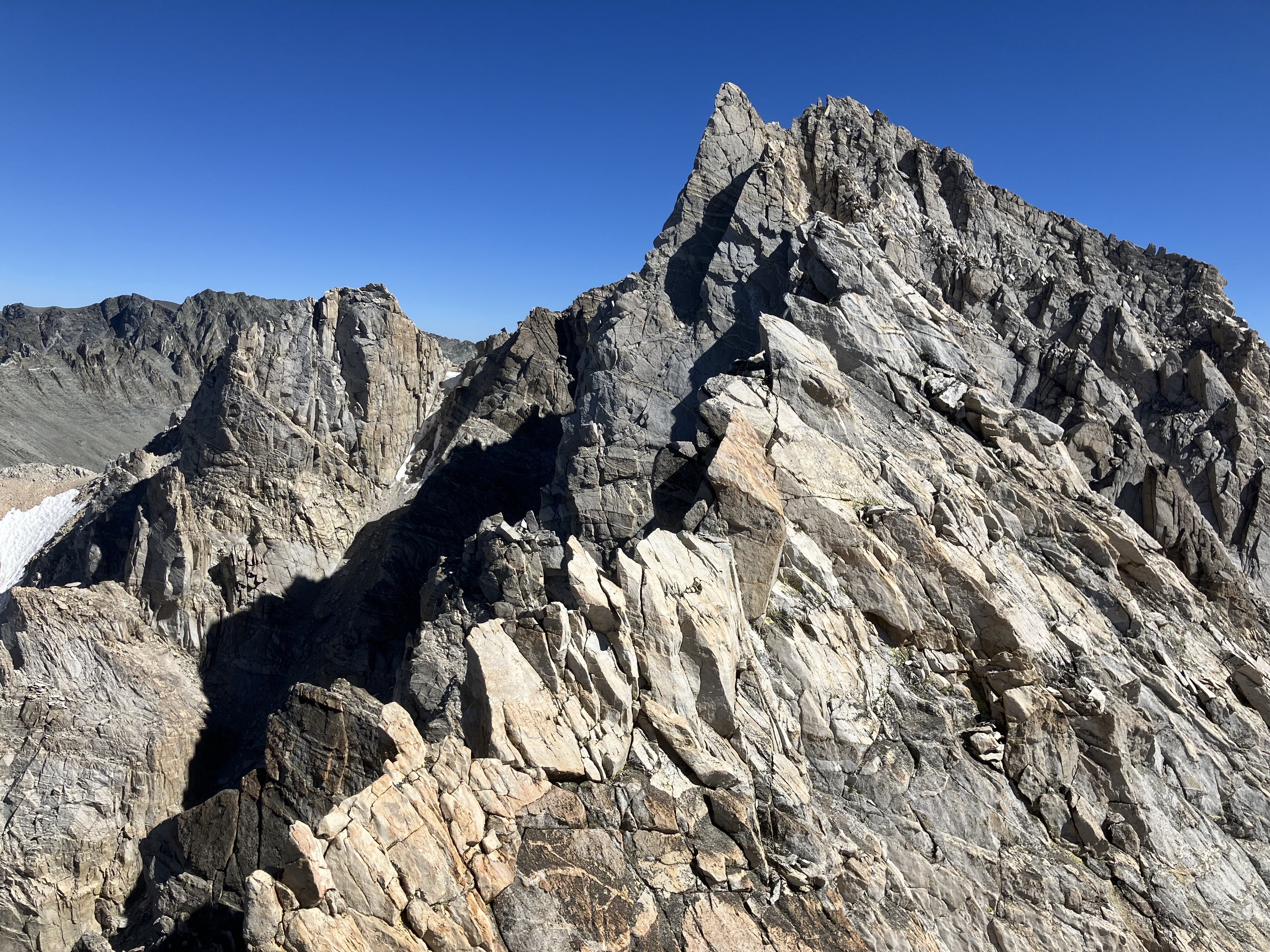
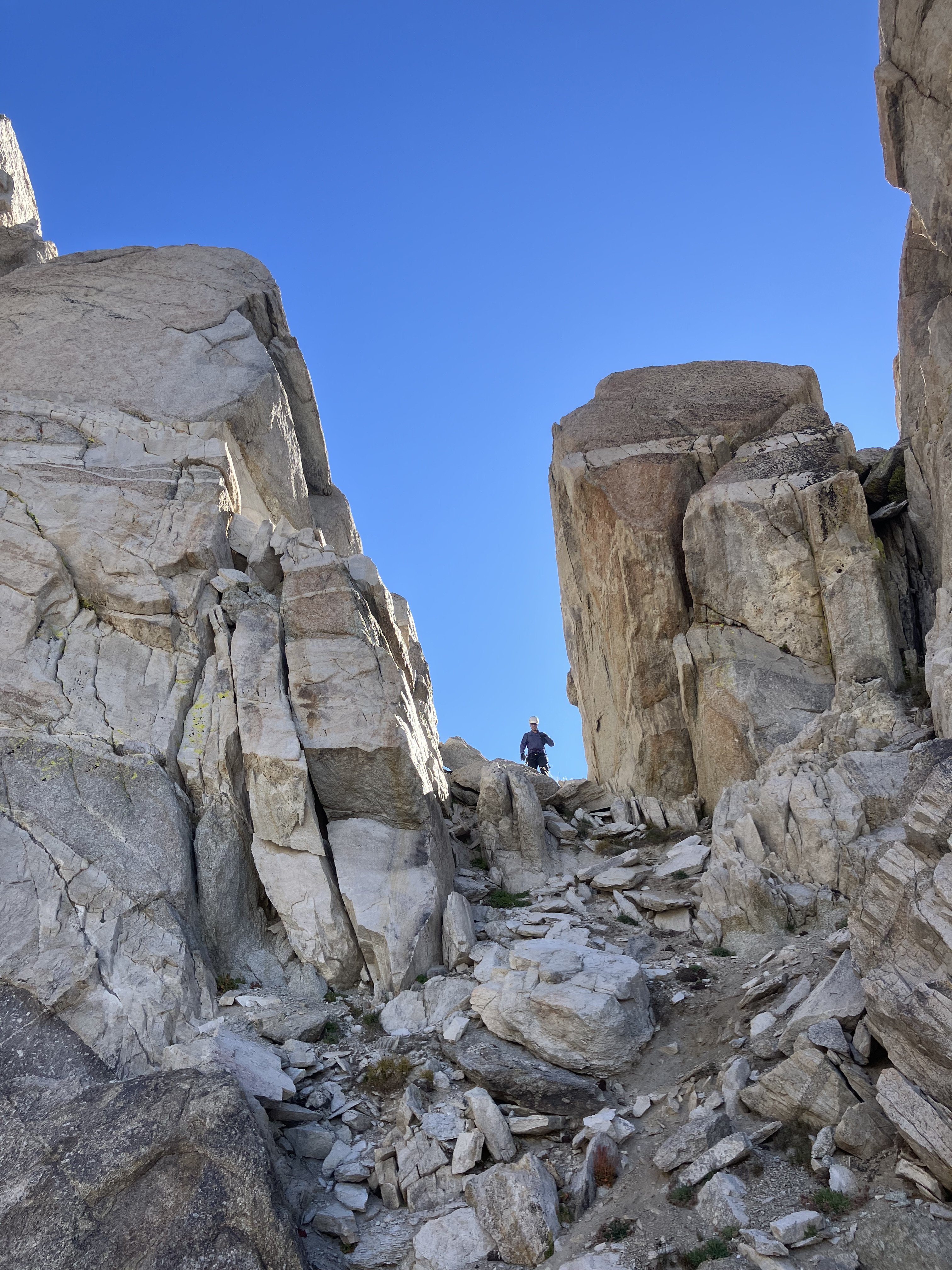
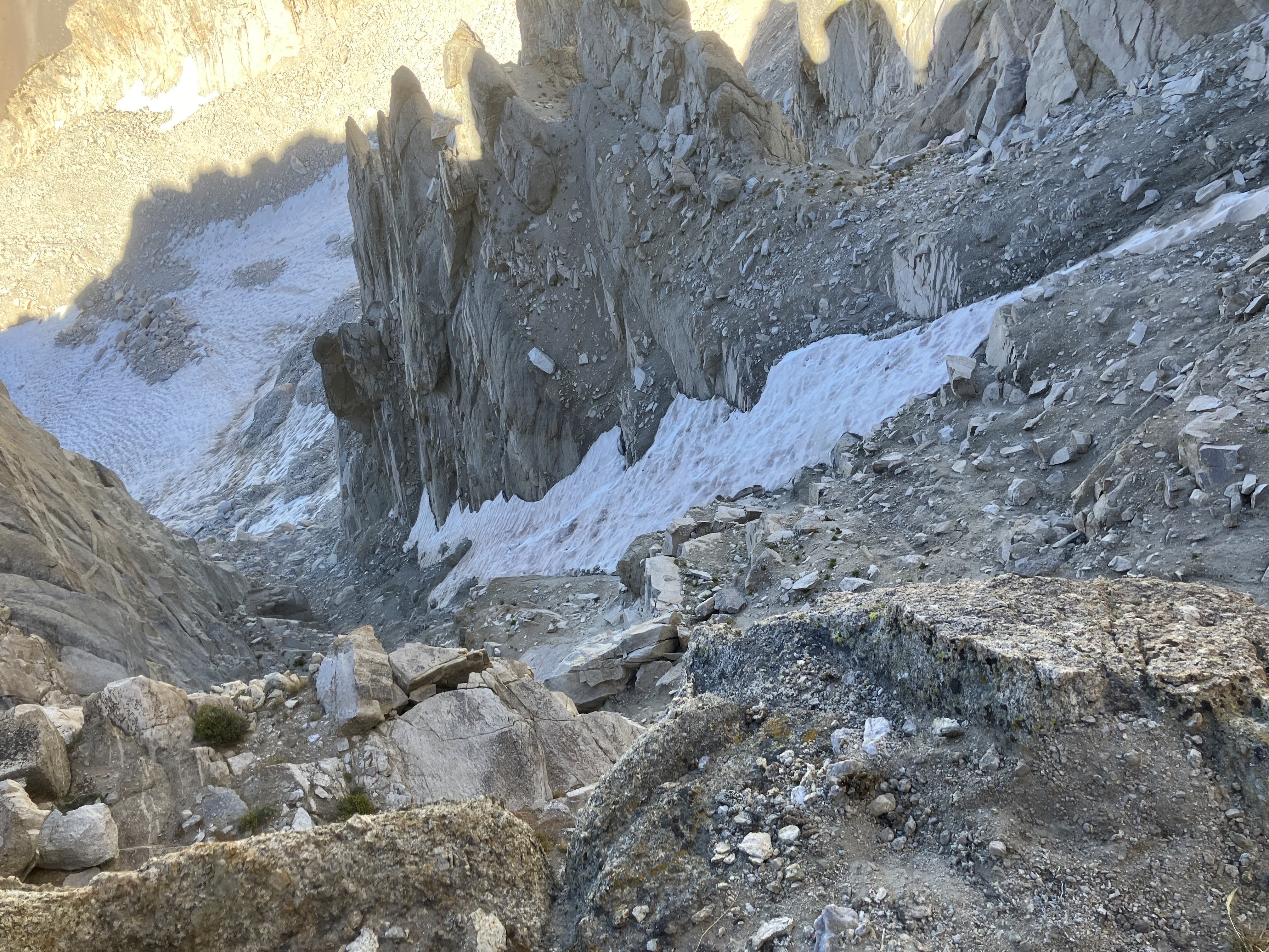
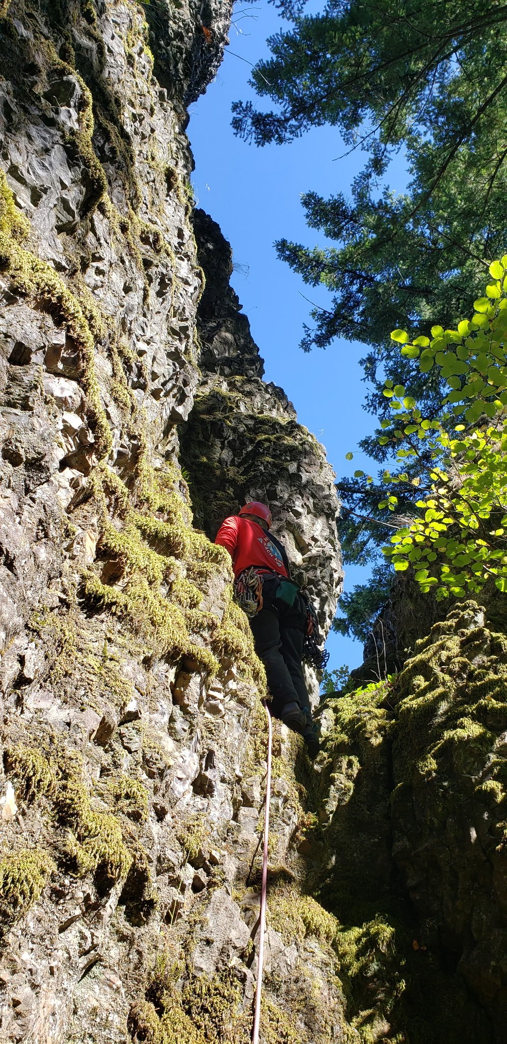
Trip: Dragtooth - North Buttress / The Dragway Trip Date: 08/19/2025 Trip Report: Got to sneak in a quick 24hr mission with my friend Miles while visiting family in Reno. We climbed the Dragway on the Dragtooth of Sawtooth Ridge because it was a short drive for High Sierra climbing, a "short" approach, and a short route. We failed to factor in the ridge traverse and descent as significant factors and it took a little longer than anticipated. Sawtooth Ridge is the NE boundary of Yosemite NP but this route is approached from Twin Lakes on the E side of the range, so you are in FS and Hoover Wilderness the entire day unless you drop off the ridge line to the W. The rock quality is good by N Cascades standards but poor by Sierra standards, as is apparently the case on much of Sawtooth Ridge. This route felt quite a bit harder than other 5.10s I've done down there, but if you like 5.10 OW and fists with the occasional thin stemming move you will have a good time. The descent has several options, none of which are great. We traversed the summit ridge for quite a while but didn't like how it looked so dropped down a gully to the W to some sandy slopes and reascended to the Matterhorn/Dragtooth Col. In retrospect continuing the ridge traverse just below the crest on the W side appears to go easily. The couloir from the col back to the E was pretty atrocious scree/dirt/ice. We opted for the skiers R couloir after the initial rappel, which appeared better than the L, but was quite awful by any standard, even Canadian Rockies! Maybe bring crampons? Or climb Matterhorn on the 400' of shattered 4th class ledges and descend the 3rd class dog route on that peak, which would add some mileage but would be way faster than waiting for a helicopter rescue after getting pounded in the couloir. Here are the pictures... Approach, Dragtooth with the route and the Matterhorn visible. Head up and R to the Tarn after the scree at the head of the valley. Creek next to the tarn. Horse Creek Tower on the R. Saddle to it's L is way to route. View of the route following obvious dihedral, note ice on the water. Sawtooth Ridge N of the Dragtooth. Route up close. 3rd pitch, 1st dihedral pitch Fun anchor shenanigans. Rest above Crux on Pitch 4. Sawtooth Ridge to N Last hard pitch, amazing splitter crack from fingers to wide hands. Looking over to Tuolumne. Miles on the summit. Ridge traverse shenanigans. Matterhorn is the prominent peak. Miles in the col, starting down the gully of choss. Yummy choss gully. Negotiating firm snow once out of the couloir. Matterhorn in the sun. Back in the meadow by the tarn. Route not visible from here. Just 3k' hike down to the car and a 2.5 hr drive home! Gear Notes: Doubles to 4 Approach Notes: Free day parking at Annett's Mono Village, Horse Creek Trail to the top of the scree field then climbers trail to the tarn and cross country to the route.
 2 points
 -
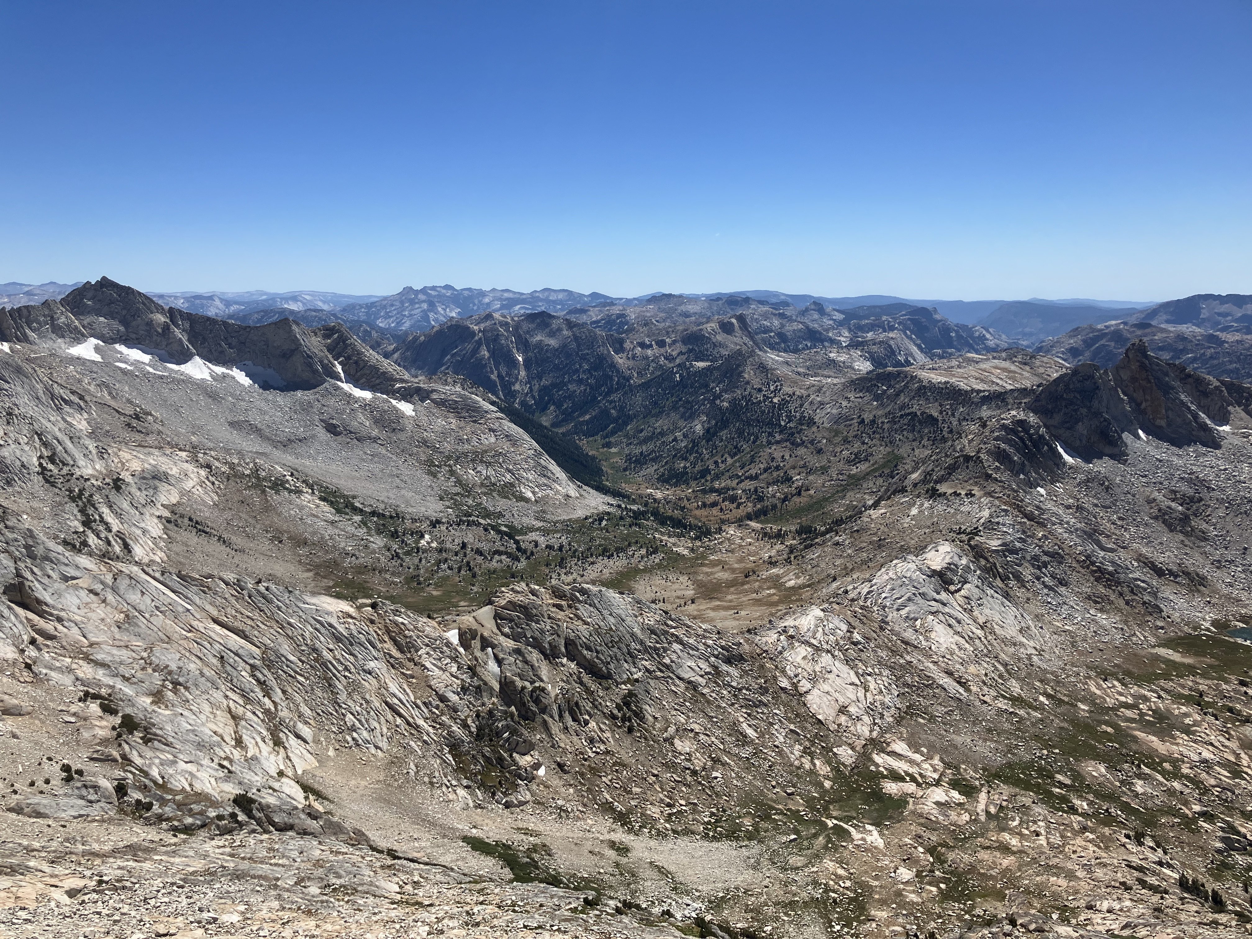
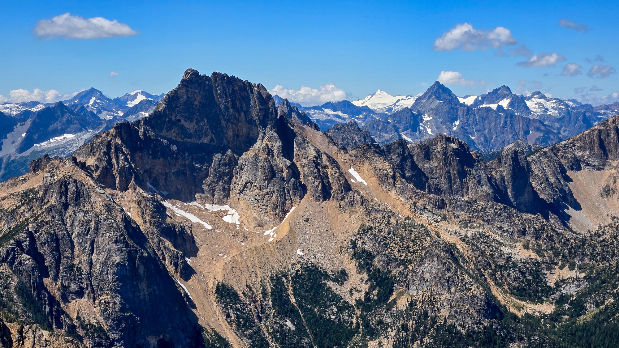
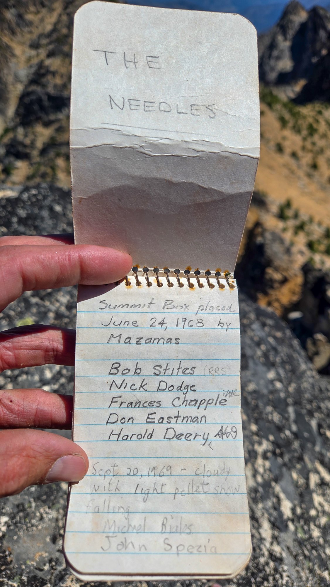
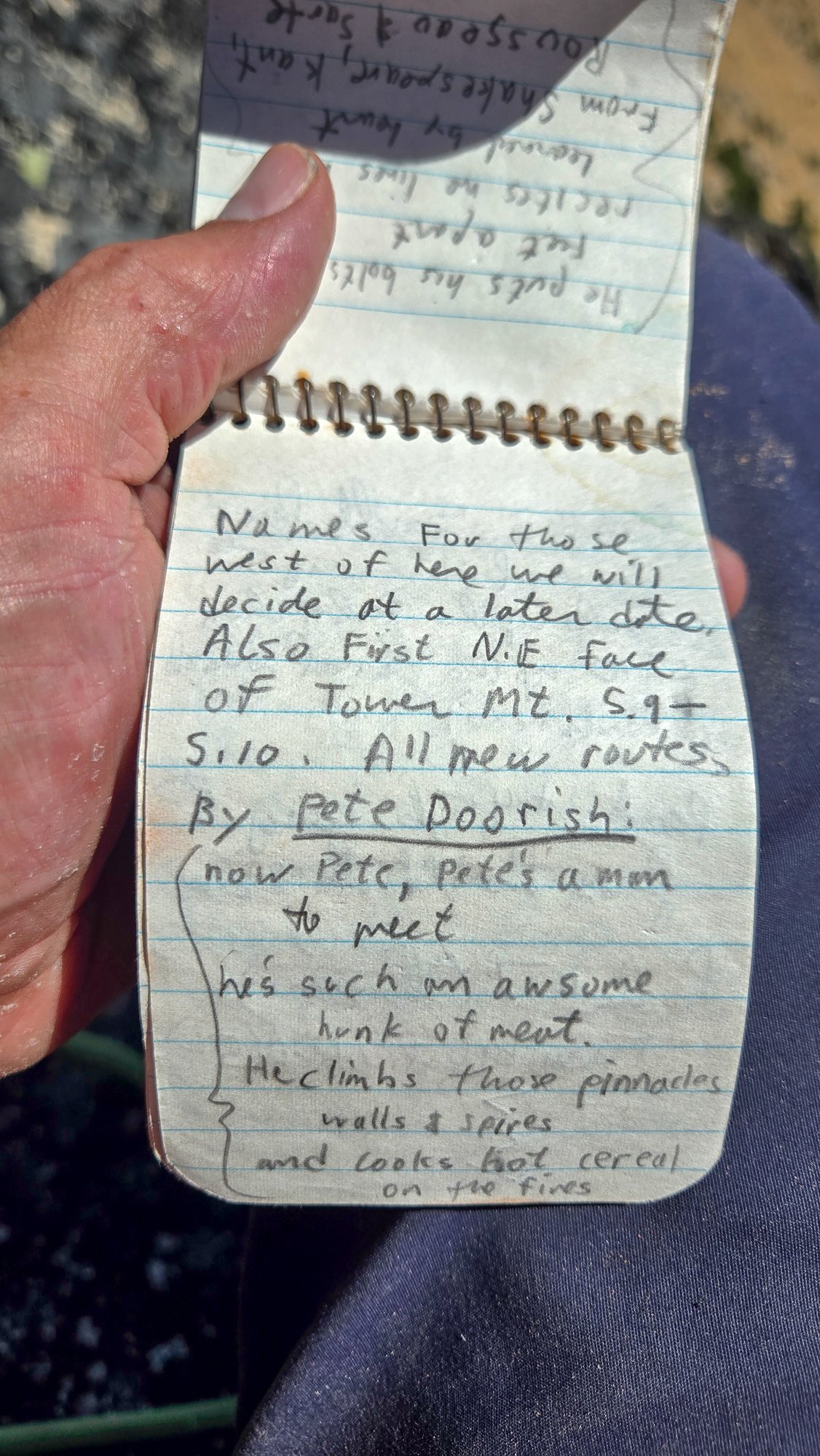
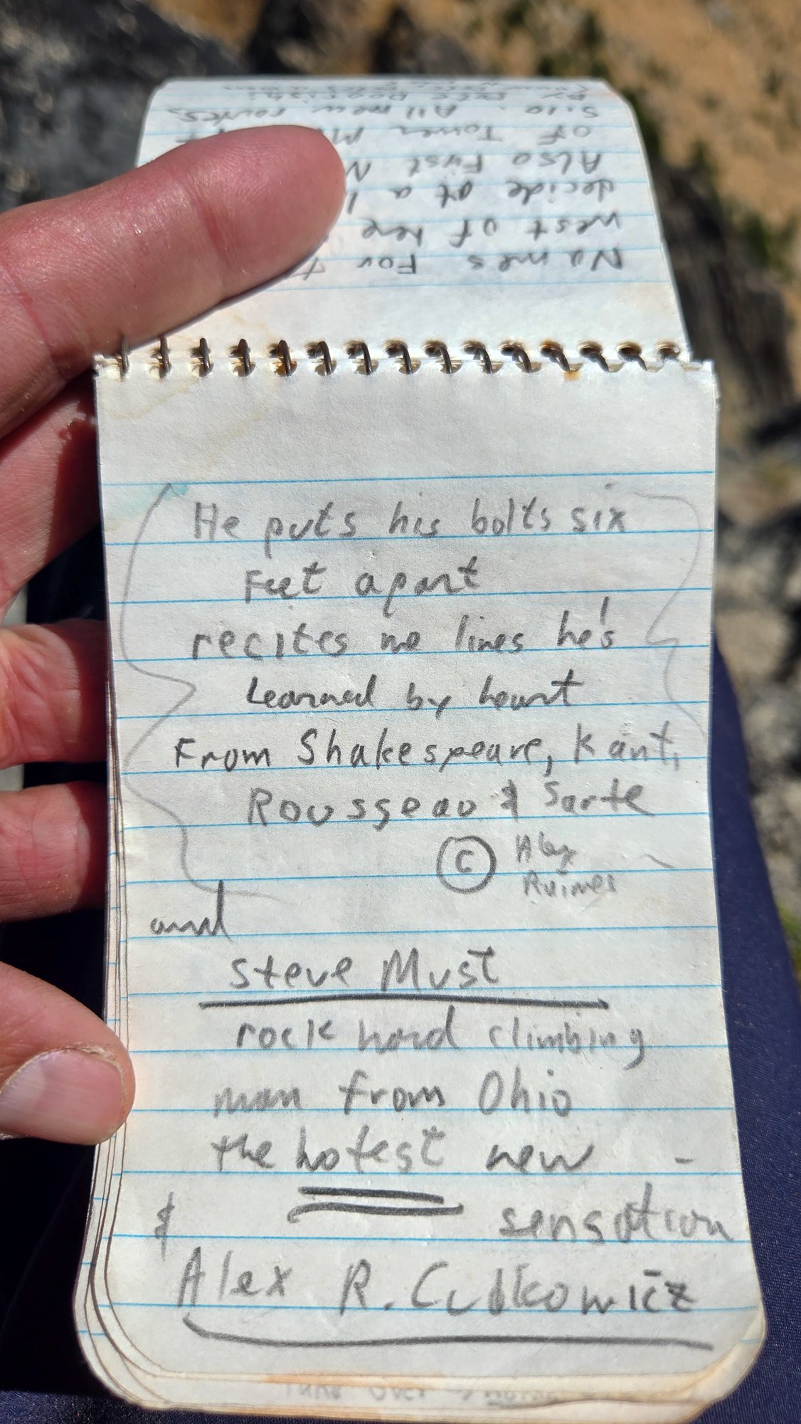
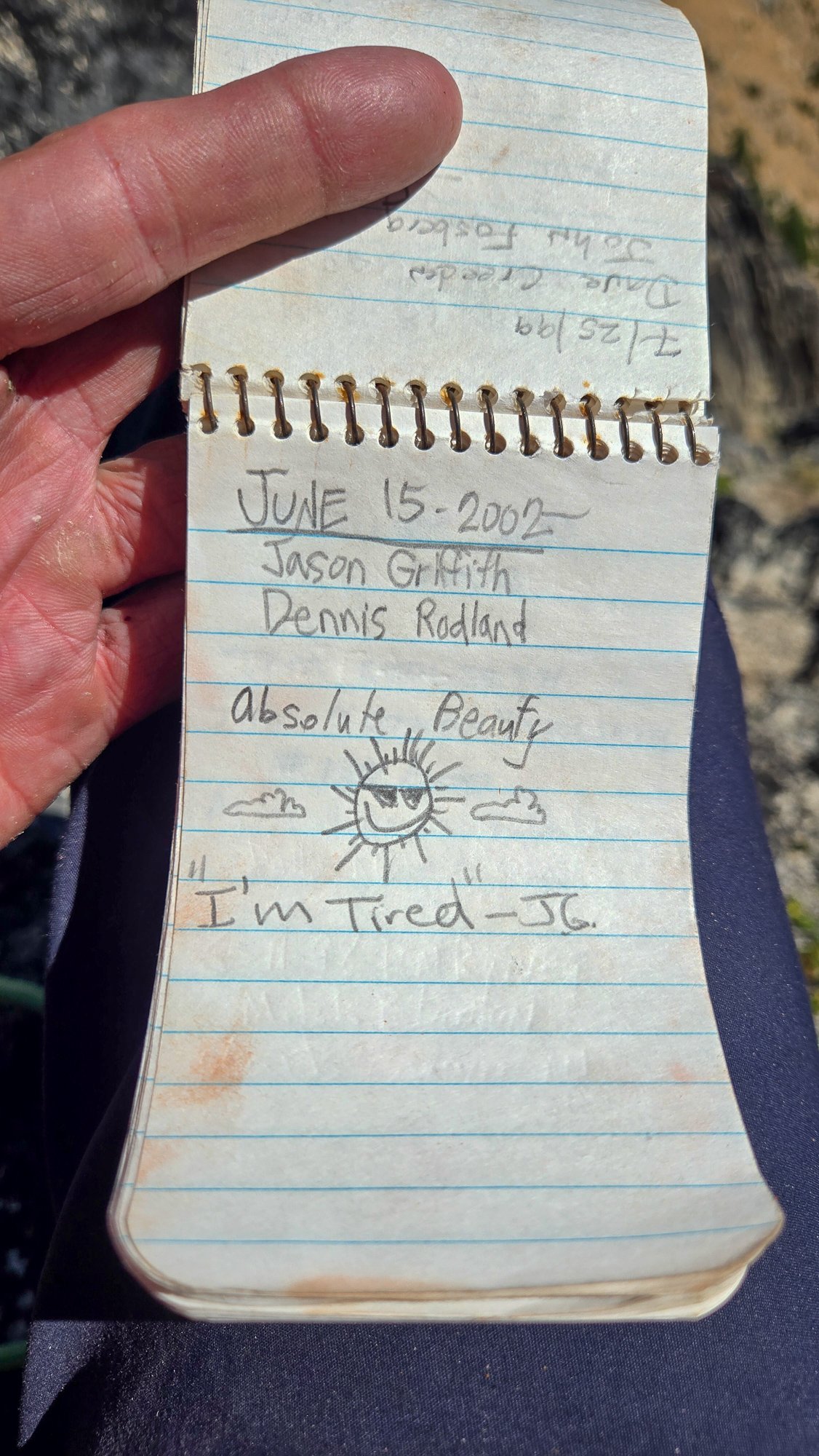
Trip: High point of The Needles (AKA Big Methow Needle) plus the East Peak - Standard Trip Date: 08/02/2025 Trip Report: It seems to be that after 20 years you can repeat a peak and it is almost like you've never climbed it before. Almost. The memory of the character building approach in soft snow wasn't entirely forgotten when @Trent suggested the high point of the Needles (Top 200!) on a Saturday a few weeks back. I had last been up that way 23 years before with my friend Dennis and we had gone straight up from the highway/campground, traversing endless ribs and isothermic mush for a few short 5th class pitches. BUT, Steve had found a better way! Or, so I sincerely hoped, and so I found myself gearing up on the shoulder of 20 again, peering into the brush and looking for the faint hint of a trail @Eric Gilbertson had mentioned was in there. After some minimal thrashing indeed a halfway decent trail emerged, though downed logs were beginning to reclaim it slowly but surely. Things were looking better than I remembered and we continued up. Thankfully the valley thrashing is relatively short lived and the ascent up an open forest rib soon lifts one to views and cooling breezes. A couple hours slogging brought our first views of the Methow Needle, which was more impressive than I remembered. The views to Tower and Golden Horn were also much better than I remembered: Soon we were at the base of the climbing, racking up for 3 pitches of 4th/mid fifth class: @Trent took the sharp end first and launched up on the surprisingly steep first pitch, which was solid, if somewhat kitty litterish: A couple more rambly pitches brought to the lonesome summit, which really hasn't gotten much more popular since the register was placed in 1968. It was a much more entertaining read than most, and I especially enjoyed the firsthand accounts of FAs by Pete Doorish and his partners many moons ago: We were definitely not worthy, but we were there, on the summit nonetheless: And the views, of course, were better than I remembered. Buckner, Boston, Sahale, Tower, Eldorado, Mesahchie, Katsuk, Kimtah (L-R): When I had last climbed it via the not recommended approach in less than ideal snow conditions, I was a young man and was still thoroughly whupped by the end of the day after climbing only Big Methow Needle. This time, we were older and wiser and had some extra energy to head over to the East Peak of the Needles which afforded a grand view of the North side of The Needles, along with many ladybugs (visble at black specs in the photo of @Trent below): But, pleasant as it was up there, we couldn't stay forever and reluctantly had to descend back to the brush and blowdown to battle the masses back west across the pass. Still, a parting view of Big Methow Needle as we dropped to treeline was a good reminder that we have an exceptional backyard here in the North Cascades: Gear Notes: Light Rock rack to 2", 60m rope, helmet Approach Notes: Stay in the valley and find an old trail up Pine Creek on south side. Where it crosses to north side of creek follow for a bit longer into timber until it peters out and you head up via open forest to treeline and the peak.

 1 point
 -
Trip: Seefar Peak, Brooks Range, The Long Way - East Gullies From Marsh Fork To Dalton Highway Trip Date: 07/28/2025 Trip Report: TLDR Version/Intro: Me and 4 buddies went to the Brooks Range in Alaska for 12 days of hiking through one of the largest wilderness areas in North America. July 28 to Aug 10. We had a blast and it went great. We got flown in by a bush flight, walked along many river valleys, hiked up a talus pile peak and then through the wilderness, across rivers and over hills to the Dalton Highway where we got picked up by a commercial shuttle service that drove us back to Fairbanks and the World. Long version: Day 0: Drive from Bellingham to Seattle, Fly from Seattle to Fairbanks on Alaska Air (duh), van ride, Uber ride. Walk around town, hit a bar, Thai food. Beers in the hotel room. Day 1: Fly to Coldfoot on Wright Air, slight delay due to missed flight (don’t believe the hotel that you don’t need to be early to Wright Air, they take their business very seriously). Immediately upon landing in Coldfoot we jumped into prop plane the same age as my parents and fly with Dirk of Coyote Air into Upper Marsh Fork landing strip on the Marsh Fork of the Canning River. The flight was incredible, frequently with wheels just clearing ridgetops and flying the terrain up and down valleys. Extremely scenic, caribou and sheep. Upon landing there was much exclaiming and pointing and backslapping. Once we got settled down and the final packing completed we hiked up valley. Warm, patchy sun, overnight hard rain. Glorious, glorious, glorious! I got a good chuckle out of everyone later admitting that they were forcing down the nausea the whole bush flight and hiding it from the others. 5.5 miles, 2.5 hours. “Rainy Camp” Day 2: Hike up Marsh Fork, cross into unnamed very upper East Fork tributary of the Ivishak River drainage. Camp at headwaters. Hard day, with technical talus and side-hilling above cliffs and raging water. The river was running pretty high from the previous night's rain so walking in the canyon bottom was not an option for us, otherwise this would have been easier. Cool and misty with rain. Amazing, just like home but nothing like it at all at the same time, so great all around; we expected weather, didn’t rain enough to get wet. Much exclaiming about the scenery. 12 miles, 9 hours “Frosty camp” Day 3: Awoke to frost on the tents and plants. Hiked down canyon to junction with upper east fork of the Ivishak, down river past multiple small confluences, easy walking. Over interminable ridge with tussocks (our first!) to Ivishak River main stem. Camp in a “hay field”. Bluebird sun and warm, 2 long great breaks for lunch. Much exclaiming about the scenery. We pushed hard on this day to set ourselves up for a potential summit tomorrow assuming the weather held out. We didn't want to get stranded up high looking for a campsite with no water. 16 miles, 11 hours “Hayfield camp” Day 4: Ascended Ivishak valley toward Continental Divide, turn south to climb Seefar Peak via dogleg east gully, awesome snow in first gully, then major talus slog to the summit. Amazing time spent on the summit, warm but breezy. Lots of cool fossils in the limestone. Descent to the south and west terrible talus, so we bailed off the ridge early to Wind River valley. Made camp. Amazing dry tundra camp next to river. Shoes and socks dry at camp! First time since 5 minutes into the trip. Bathed in river and washed clothes. Bluebird, sun, warm. Much exclaiming about the scenery. A good time was had by all. 10 miles 4000', 10 hours “Swimming Hole Camp” Day 5: Hiked down Wind River, saw wolves with puppies, then later moose which led us into a lousy tussock field, camped in side creek. Very mediocre spot, but extremely close to water and some dry wood, so we had a fire and drank margaritas to enliven the spirits a little. It worked. Much exclaiming about the scenery. 14.3 miles, 7.5 hours “Margaritaville Camp” Day 6: Up wind River tributary, saw a grizzly with two cubs, a heard of sheep way up high, and a lone wolf across the valley making quick work of the talus. Up a unique talus-ey canyon, over two passes, one being the Continental Divide, down a tributary of a southern fork of the Ribbon River. Great walking most of the time. We got showered on twice, but mostly sunny. The area where we looked to camp was somewhat brushy with knee-high vegetation and it took a bit of looking to find a good campsite, eventually made a spot work quite well with great moss and blueberries. 13 miles, 8 hours “Barefoot camp” Day 7: Nice enough weather early, quickly turned to rain, then hard rain, despite the Inreach weather saying it would improve throughout the day. Misery. Trudged up to beautiful lake, too windy and cold to enjoy it. Saw wolf puppies briefly. Over pass separating the Ribbon and Accomplishment Creek and down to tundra on other side, just past dangerously slick boulder field. Dove into tents soaked through. Very cold and wet. Lunch in tent, nap. Whiskey helped spirits a lot... at least in my tent. Less exclaiming about the scenery today, though everyone admitted it would have been great if we could have enjoyed it. 8 miles, 4 hours, no breaks. “Sunny dry happy fun camp” Day 8: Woke to fog but no rain, weather improved dramatically throughout the morning. This was clutch since our base layers were completely soaked. First thing in the morning everybody got ready to hike then leapt into our wet clothes and immediately started walking quickly to warm up in an attempt to dry out some clothes. Down Accomplishment Creek, up side creek over a pass with lots of caribou antlers, half way down canyon on other side to camp. Beautiful country, lots of exclaiming over the scenery, sunny and warm, dried out everything. Decent walking. Saw moose, wolverine. Drizzle just before camp. “Sewing camp” due to a near catastrophic pack blowout. 9.5 hours. 16 miles Day 9: Drizzle, fog, cool. Down interesting puzzle canyon, that was tons of fun to figure out, left side, right side, in the creek, does it go? It goes! Saw a griz at a distance, then across a big river, nameless east tributary of the Sagavanirktok, (tough, fast crossing), hardest of the trip. Slogged up a tussock hill, to canyon, over pass and down to Sag valley, mediocre camp, not many options. We were told that the Sag was a tough crossing that kills people from time to time, so we were excited to get a look at it from up high. I had done a lot of satellite and map reconnaissance of the entire route and had picked out an area of the Sag that is quite braided, hopefully making for the easiest crossing. I had read a few scattered reports of people who crossed just a couple miles further north and had to use rafts. “Lumpy camp” 12 miles, 7.5 hours Day 10: Foggy AM, then sunny and warm. Across the Sag! It ended up being not that big a deal, but it helped that we were on day 10 and river crossing 1 million +/- a couple hundred thousand. Up the valley wall to an amazing broad sunny saddle with rolling fog, for a tea break. We were on a plateau above the confluence of the Atigun and Sagavanirktok Rivers. The fog started to break up after break, we walked slowly; some bad weather was predicted today and the next couple so over the previous few days we had hustled to make sure we could get across the Sag before the rain set in. Unlike the previous days, the weather report ended up being pessimistic and we had great afternoon sunshine. We strolled through tussocks to camp on a sunny alpine tundra slope. Amazing day. Surprise sun! Everyone tard sailed all their gear out on the tundra to dry out everything. Dry socks even!! The low tundra around camp made for great lounging and camping, and beautiful. The sun and sense of accomplishment really made the light on the hills glow that long afternoon. “Kick Ass Camp” 5 miles, 5 hours Day 11: Hiked off the plateau to the Atigun River, up the river valley to the road, road!? Long road walk to Galbraith Lake camp. My knees hurt after the 8 miles of road for the first time in the entire trip. Mostly cloudy with sun patches and a short drizzle. Surprising amount of traffic on the road, saw a civic! Fire and celebratory attitude at camp. “Galbraith Lake Campground” 6 hours 15 miles Day 12: Woke up leisurely, lounged around, day hike to West Galbraith Peak, tea and coffee on the summit. Camp time, eating everything that was left. Mostly cloudy, mild. “Galbraith Lake Campground” 5 mi, 4.5 hours Day 13: Lounged in the tent, rain and drizzle, picked up by van at 11. Wes from Dalton Highway Express picked us up in a beater 15 passenger van. Two entrees and a beer at the truck stop in Coldfoot. Food at the farthest north truck stop and bar in America was cheaper than in Bellingham. “Hotel Camp” 10 hours in the van, zero walking. Photo credits to Mike Graw. Gear Notes: backpacking gear, bear spray, rain gear Approach Notes: Airplane, deproach by van.1 point
-
Different people! Not to say anything of Mr Ng’s ability or potential. Maybe we all want to spot the next jeans wearing Cheamclimber, but I think it best just to encourage and help out the youth who clamor for the hills in our little community here. No sense in saddling expectations or projecting where someone is going. He will find his own way, and I hope his motivations are always his own. I do enjoy the TRs! Thanks Lucas!1 point
-
Just saw this. You arrive and draw a number and wait your turn. Depending on how much the gods hate you that day you may be subjected to people ahead of you who have done no research about what they want to do and take up 15 min or more time chatting with the ranger on duty. My last visit was a few weeks ago to get a cross country zone permit for Arriva. We waited quite a bit, even though we got there around 9 when the 7 am crowd should have been and gone. The people in front of us wanted to "backpack somewhere" but didn't know where. The ranger walked them through options, asked questions. It was swell.1 point
-
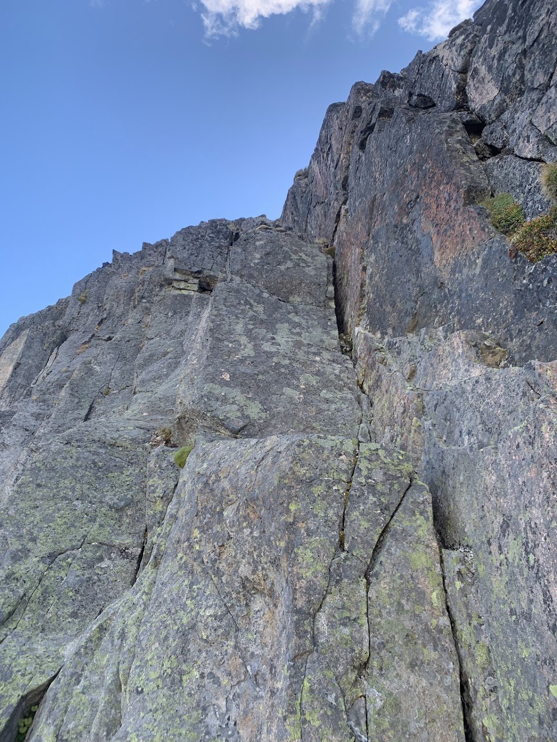
Trip: Meulefire and Indecision - East Face Date: 8/2/2008 Trip Report: It has long been a goal, nay, a lifetime dream of mine to climb every peak in the Repulsive 69. To those not in the know, the Repulsive 69 is a list of the sixty-nine most obscure and unappealing peaks in the Cascades. Inclusion in any “Selected” or “Classic” guidebook is an automatic disqualifier for this list. No one has completed the Repulsive 69, as two of its peaks are as yet unclimbed. As far as the race for completion goes, Dallas (aka Obi Wan) has a comfortable lead with sixty some odd. Scott (aka The Moat Master) is a distant second with twenty-twoish. I am unsure of the exact number, he keeps his count secret. Jason (aka Snaffle Bait) is in the running with nineteen. I am trailing the pack with a measly fifteen. Jill (aka Dr. Jill) has climbed twelve, but she has a lot of spare time and could easily catch me. I needed a few of the grand boys ticked this weekend to pad my lead over Jill and gain on Scott. I pulled out the cell phone and started calling prospective climbing partners. What would it be this weekend? Seapho Peak? Berge Mountain? Canadian Border Peak? Or the ever-elusive South Hozomeen? Damn caller ID. Ever since I set my sights on completing this list, most of my regular partners won’t answer the phone anymore. Just when I was ready to give up, the phone rang. Caller ID listed Scott. “Wanna go climbing this weekend?” he asked. “What, couldn’t find anyone else?” I retorted. “Shut up and be at my house at seven AM, and make sure that you are not followed”, was the answer. “Where are we going?” I inquired. “I’ll tell you on the way. I have an FA route scouted on one of the 69”. An FA on one of the 69! This would be our golden ticket to Cascade mountaineering history! I could hardly contain myself. I arrived bright and early at Scott’s place packed to the gills and ready for anything. “Lose the rock shoes.” he said. What was I thinking? This was one of the Repulsive 69, not exactly known for their quality rock. Once out of cell range, he finally revealed the objectives, Meulefire and Indecision, with the added possibility of Little Johannesburg or Repulse! This would be an epic weekend indeed! Fisher Basin The approach to Silent Lakes Silent Lakes. Muelefire in the background. After a quick march over Easy Pass and up Fisher Basin to the Silent Lakes, we dropped our packs and ran up Fisher Peak. To enjoyable for inclusion in our list! The next day we set out for the crown jewels of Grizzly Basin, Indecision and Meulefire. We summited Arriva to check out our prospective route, the North Ridge on Meulefire, and said hi to Mr. C. on the summit. The ridge looked good, but getting on it looked difficult. Too many gendarmes and notches. Well, we would have to get this mighty one via the dog route. The North Ridge on Muelefire After traversing down heather slopes to Grizzly Basin, the real business on Meulefire began. We started climbing what quickly became fourth-class scorist. For the uninitiated, scorist is a combination of forest and blocky scree that is common on sub-alpine slopes in the Cascades. Scorist has ratings from class one to class five, and further gradations reaching 5.9. The rating system is quite similar to the commonly used YDS. I watched Scott pull a figure eight over a u-shaped fir tree, spraying needles everywhere. “Nice move!” I yelled. After the scorist, we emerged to a seemingly never ending field of steep heather interspersed with steps of unusually shattered rock balanced precariously at their angle of max repose. Scorist attained We finally reached the summit ridge and followed to a notch just NE of the summit. Beckey says one lead of 5.2 to the summit. Who needs rock shoes for 5.2? And what exactly is 5.2? Well, in exploring my low fifth-class boundaries, my grade-inflated head was certainly wishing for some sticky rubber! The next 30 meters were enjoyable climbing on surprisingly solid rock! I guess that it can’t all be bad. We topped out and looked over at Indecision. To our untrained eyes, the summits looked to be the same height. A ten-minute scramble took us to the top of Indecision. The last entry in the summit log was from Roger Jung, on a solo traverse from Fisher in 2003. The author contemplates 5.2 The summit of Muelefire. Another tick! Joe and Joan Firey and John and Irene Meulemans made the first ascent of Meulefire in July of 1966. However, Indecision, the higher peak according to Beckey, was not climbed until 1972. The question arises, why didn’t the Firey and Meulemans crew, who were prodigious peak baggers and FAers in their day, climb both peaks when the other summit was only ten minutes away? Beckey’s guide lists Meulefire as a lower sub-summit of Indecision massif. Perhaps this is comeuppance for the Fireys and Meulemans, who nabbed the first ascent of Arriva the day prior in 1966, when Beckey and crew had climbed the slightly lower East Peak in 1940. After a rap off the summit, and an interminable steep scree, slab, and heather down climb, we got lucky and rapped through the scorist to Grizzly Basin. The next day, unable to recall what the traverse to from Fisher to Repulse looked like, we climbed Fisher again. It would certainly be a coup to pull off on ascent of Repulse, the namesake of the Repulsive 69! The traverse had been done the opposite direction by Roger Jung back in 2003, but it was too involved for us on our last day. Oh well, this is how the ball bounces when you are bagging the big boys. We decided to get Little Johannesburg on the way out. The second run up Fisher. Black peak and the N Ridge of Repulse in the background. But like so many of these Repulsive climbs, the mountain had other ideas. On the traverse down to Fisher Basin, Scott slipped and took out a chunk of his palm on a talus block. We limped our way back over Easy Pass under the scornful gaze of Little Johannesburg and to the car for some warm beer. Little Johannesburg patiently awaits our eventual return and conquest. Another two of the proud giants vanquished, and my list closer to completion! Graybeard. A worthy peak but it made Nelson's book. There will be blood The price paid Gear Notes: Forget the rock shoes, eye protection (for scorist), first aid kit. Approach Notes: Over Easy pass, hang a left up to Fisher Basin, take obvious gully up to col, good camping at Silent Lakes.1 point
-
This approach is an appetizer of nettles and other thorny shrubbery types that thoroughly enjoy tickling your ankles with utter abandon. The 5.4 on the super gorge classic corner is a splendid main course in prime conditions currently. Though we wondered if frozen moss would allow for less rope drag when pulling to rap? How old is the pin by the tree?
 0 points