
Leaderboard


Popular Content
Showing content with the highest reputation on 08/18/25 in all areas
-
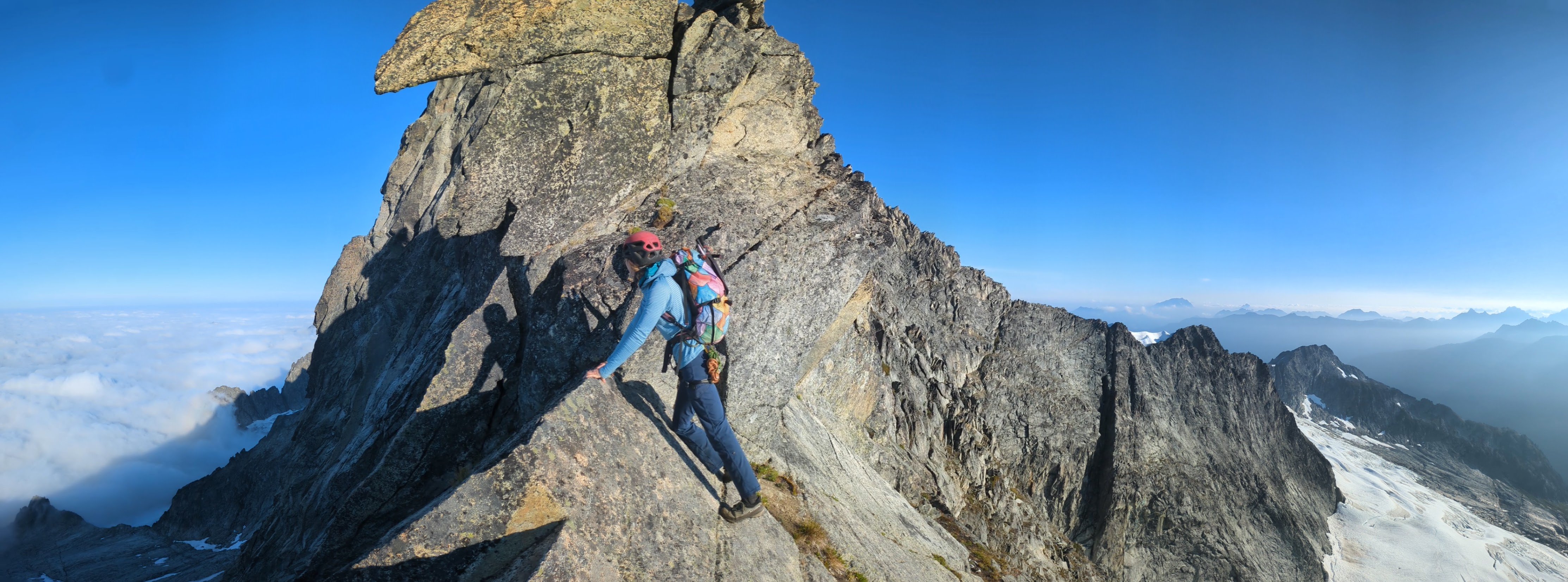
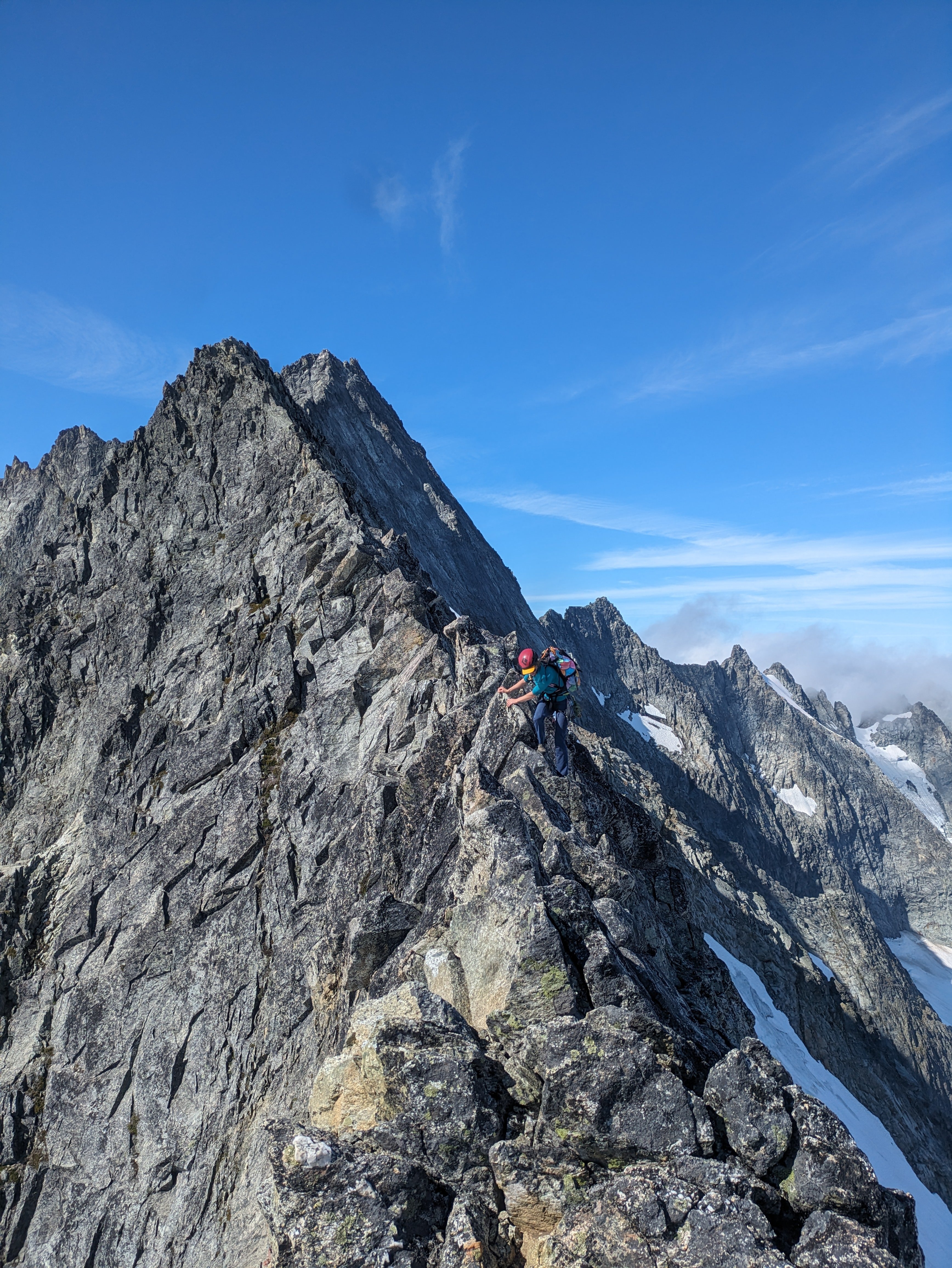
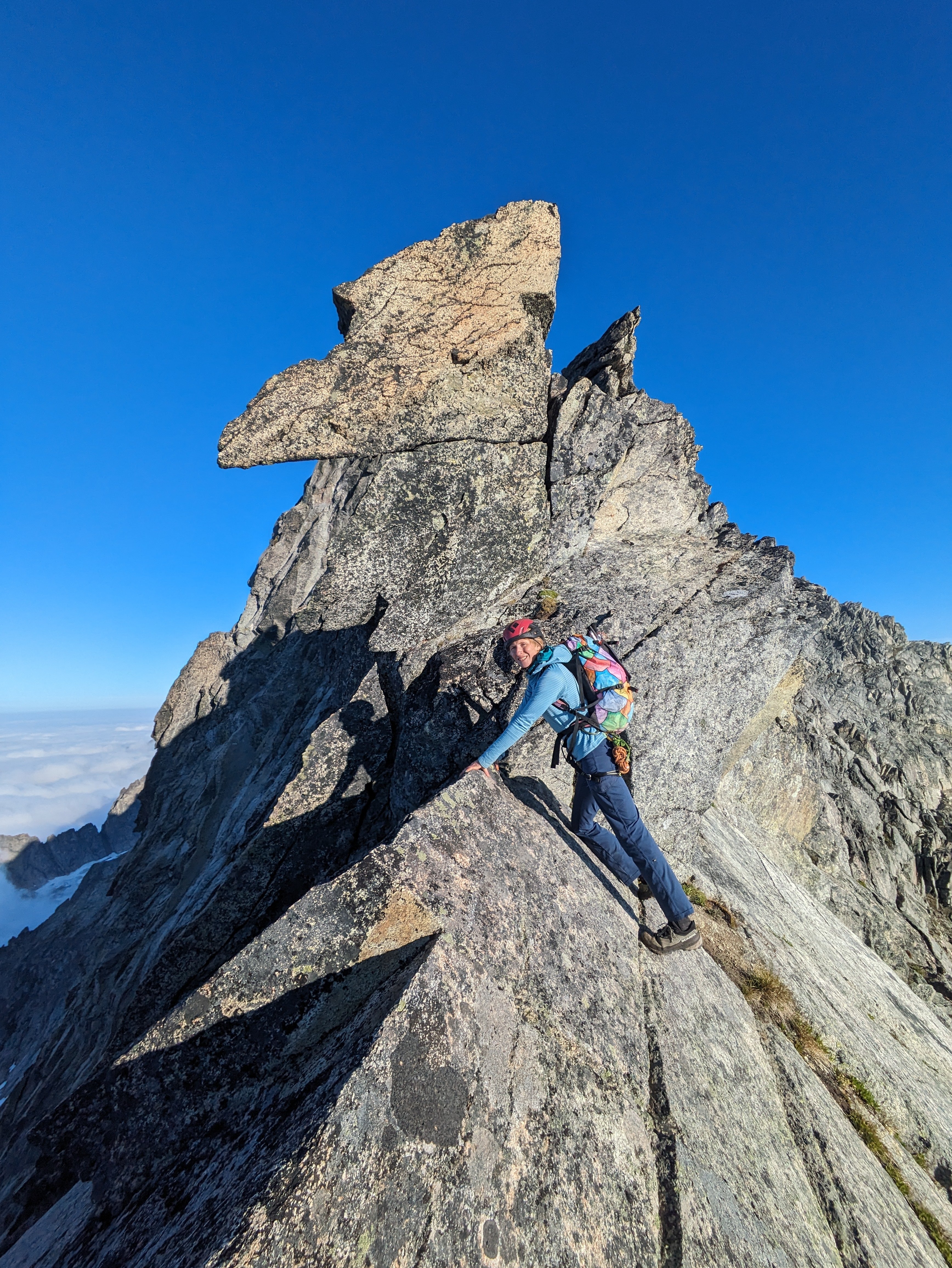
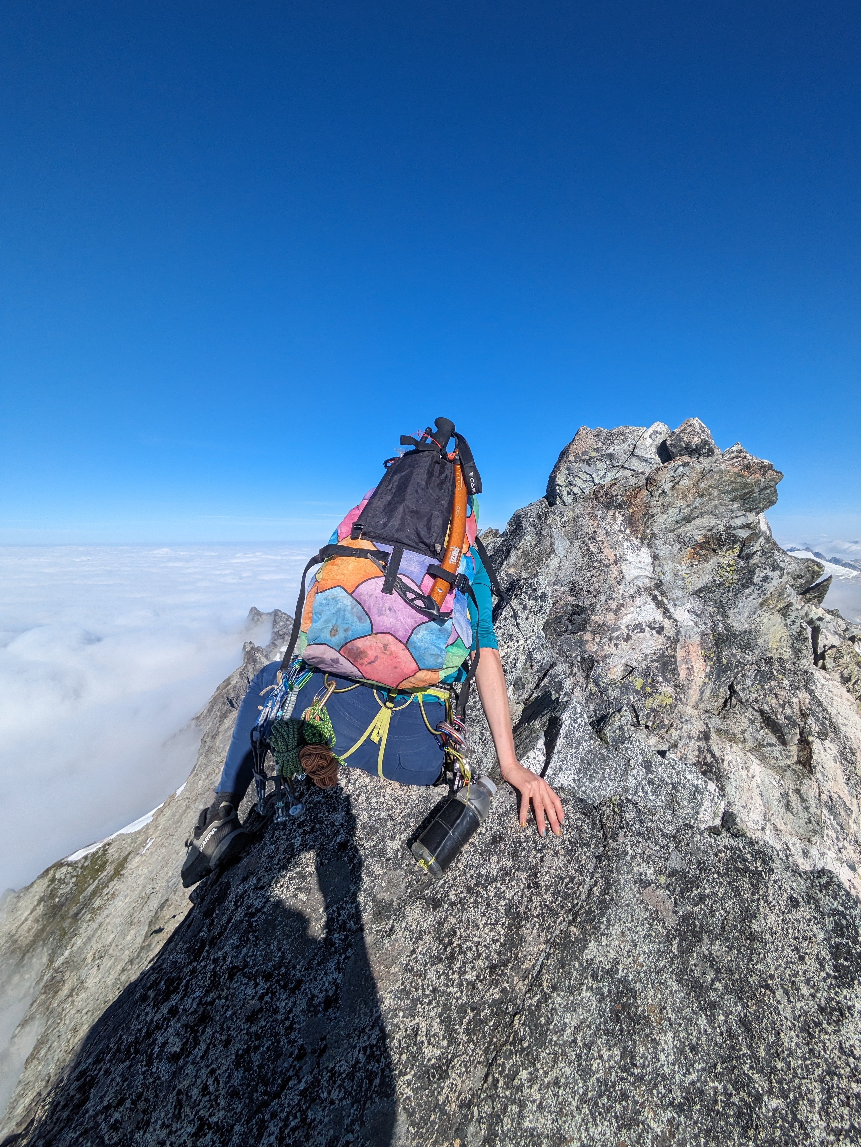
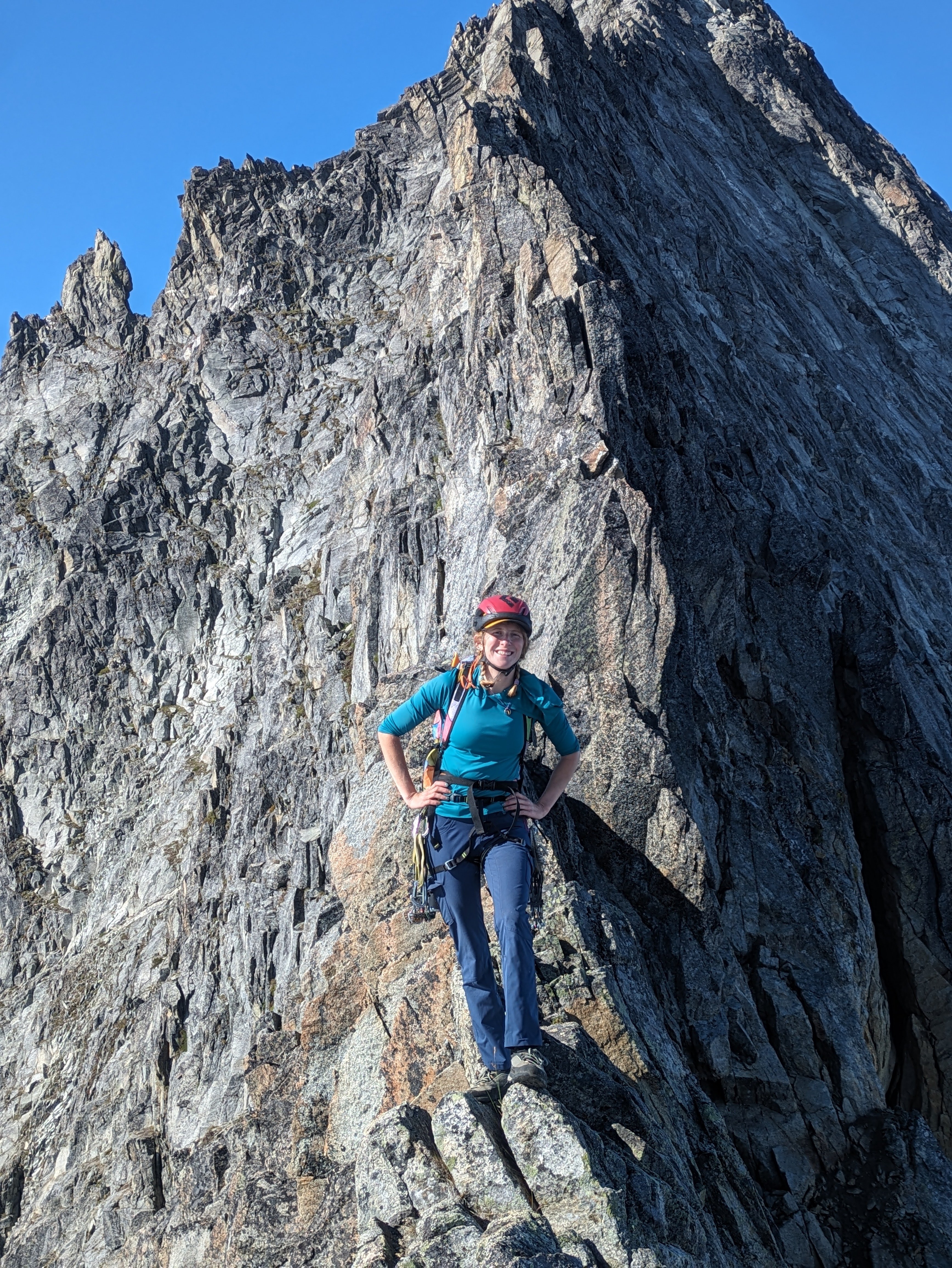
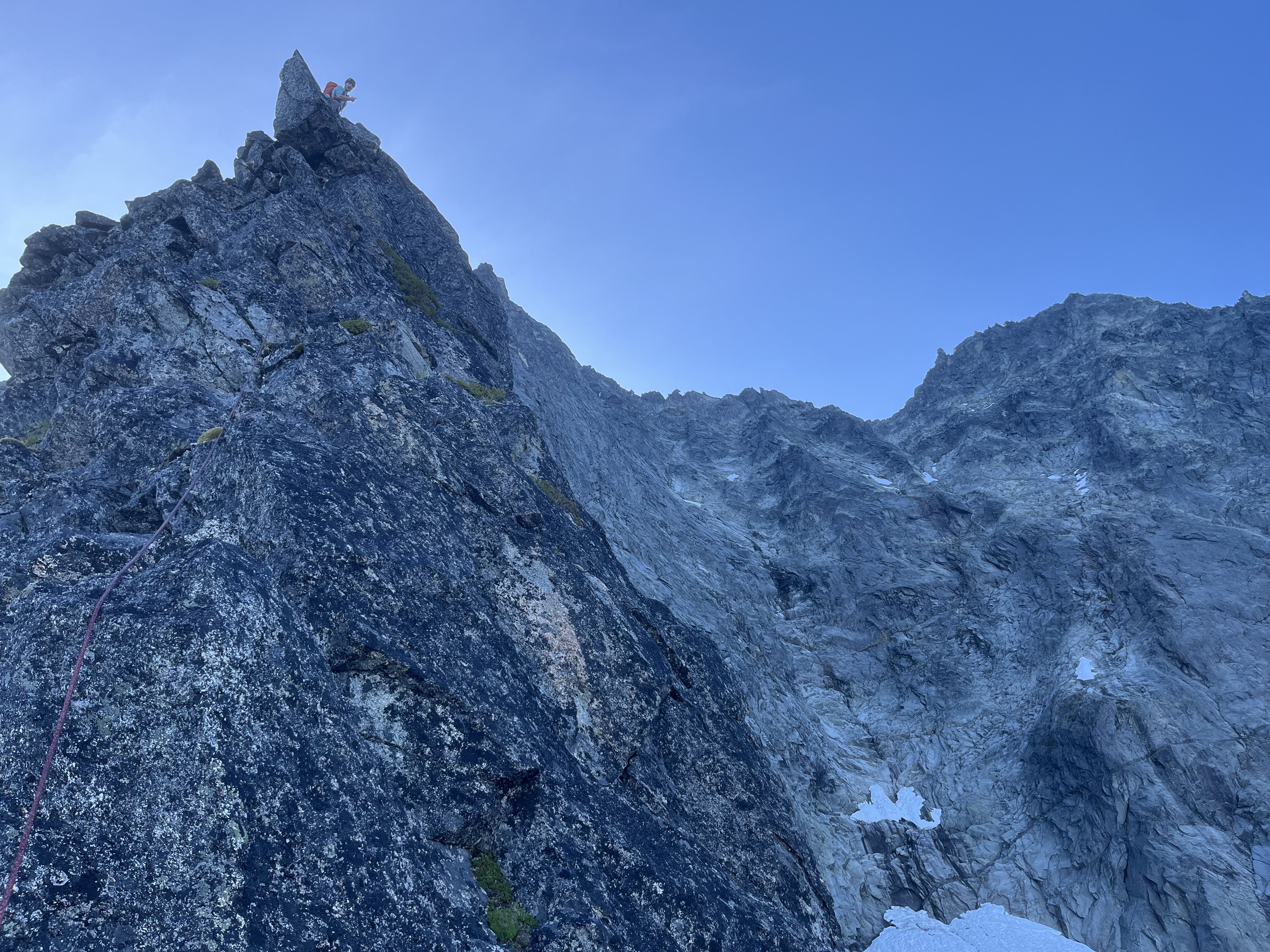
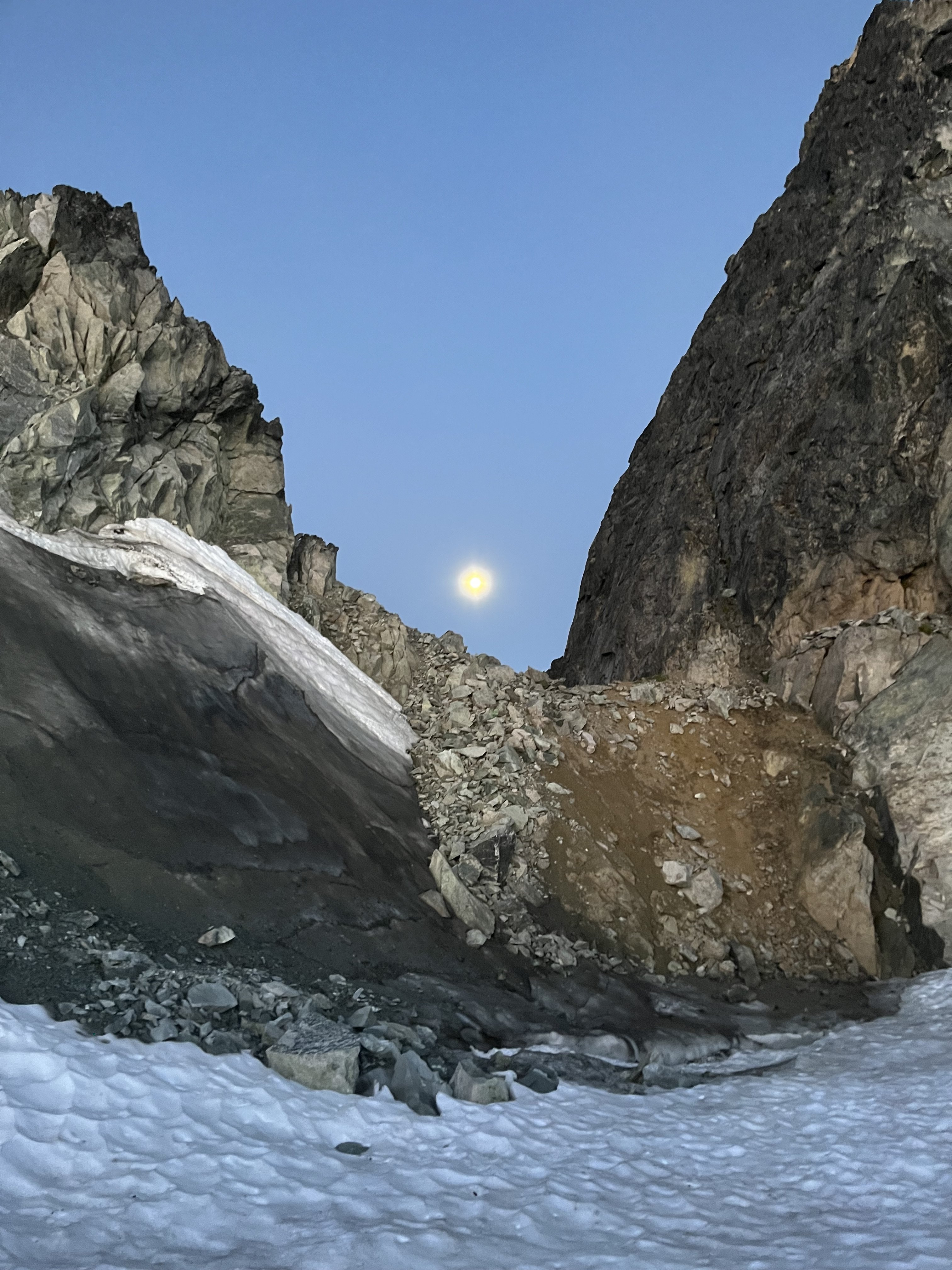
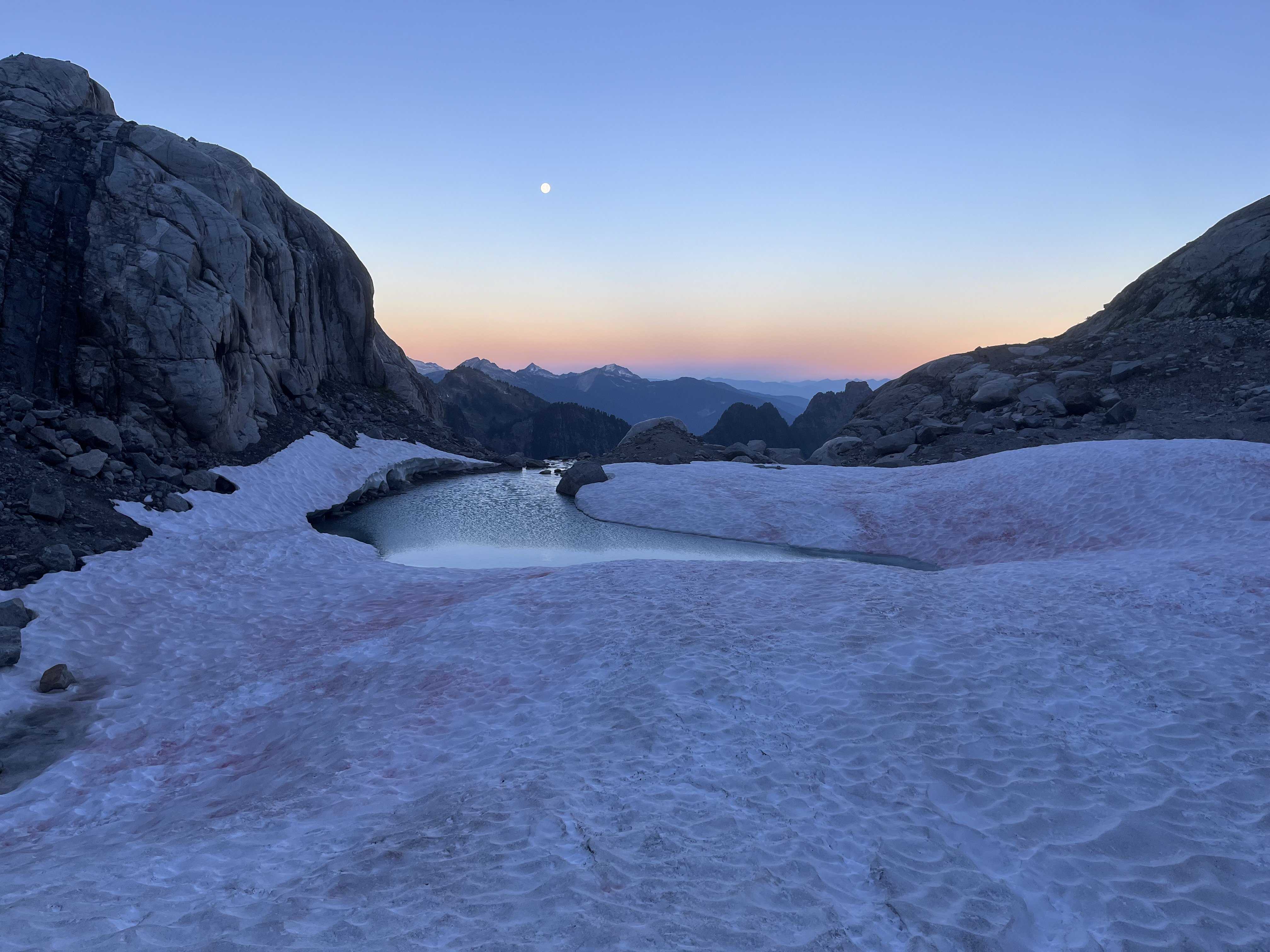
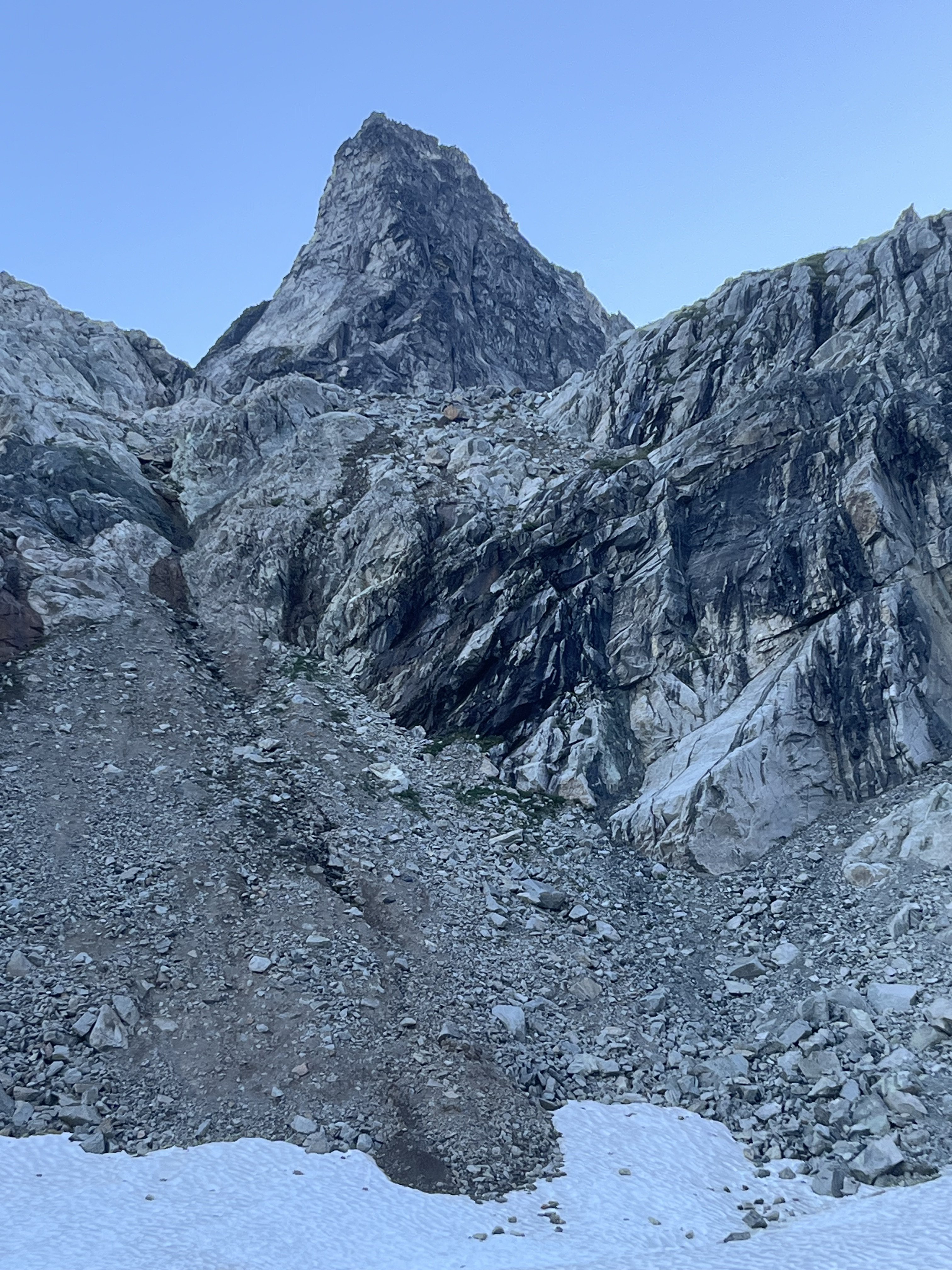
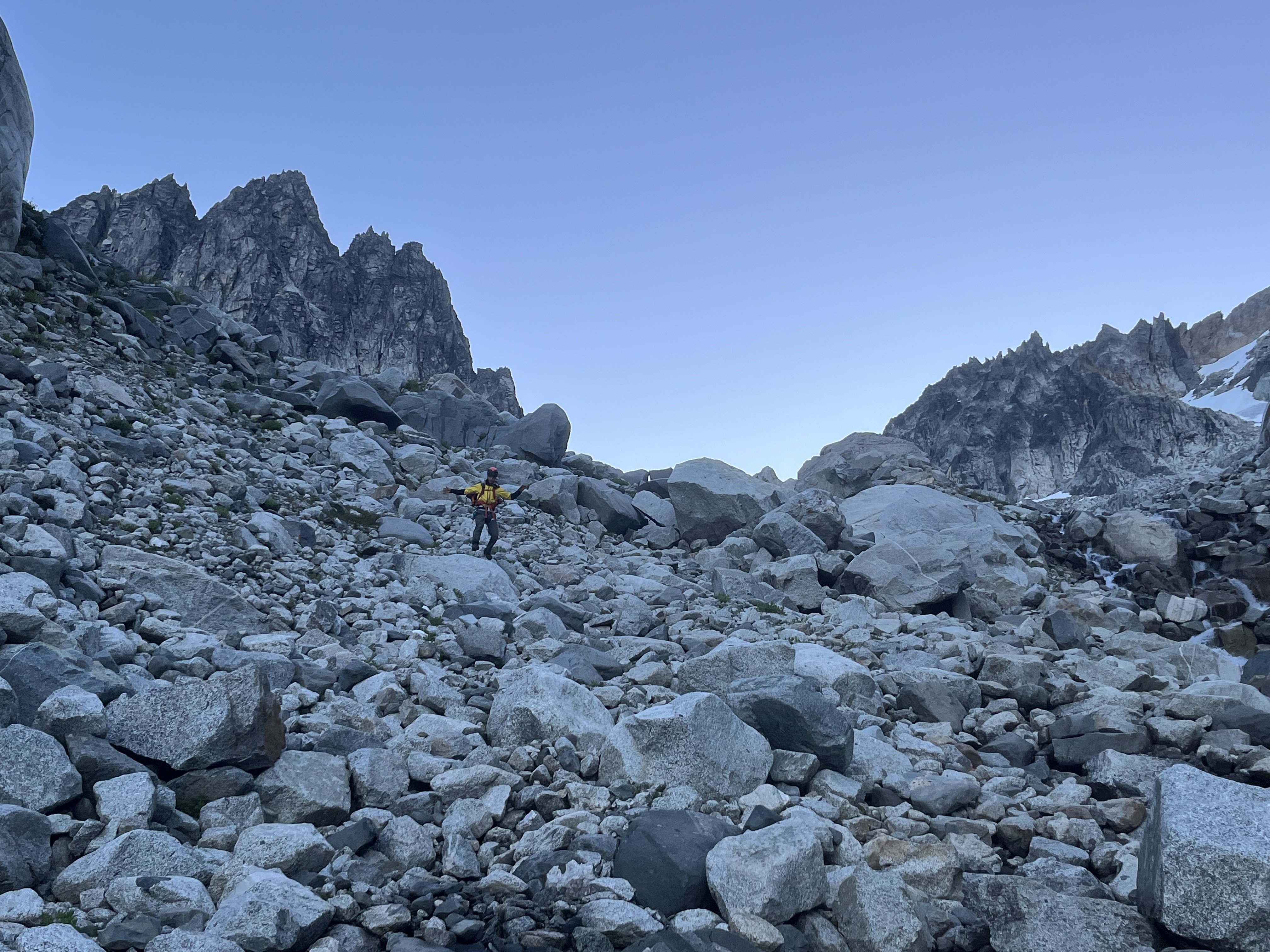
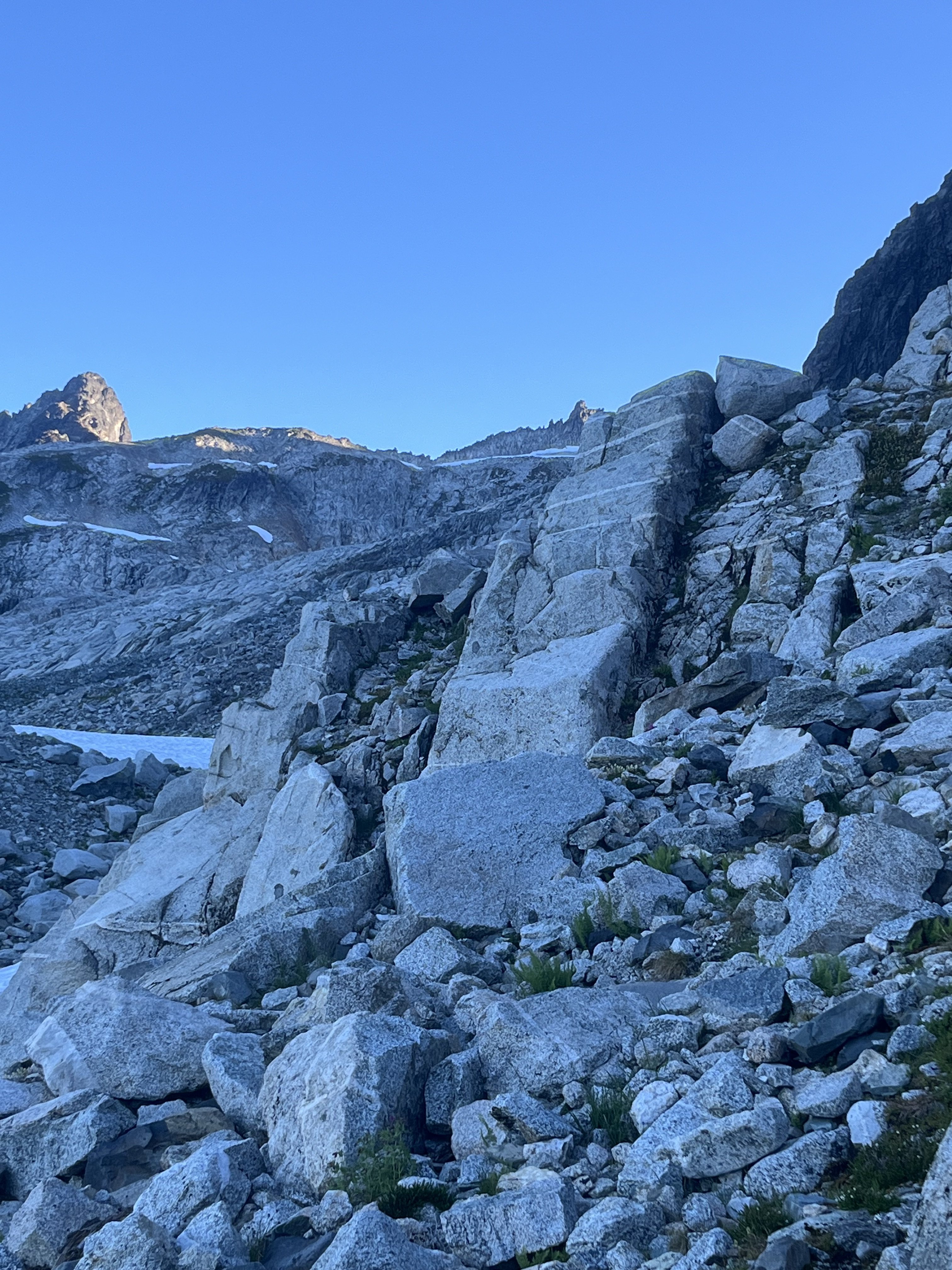
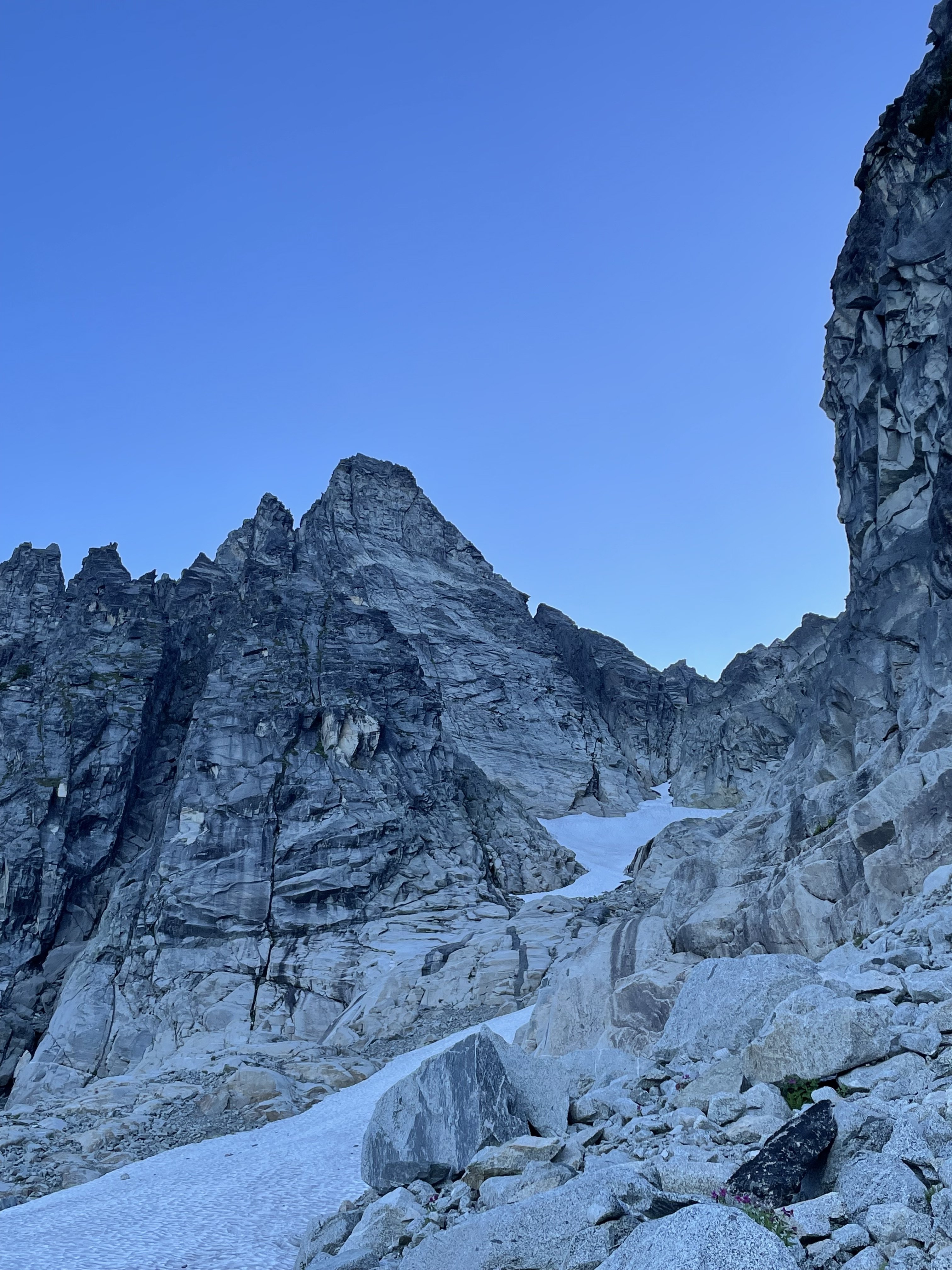
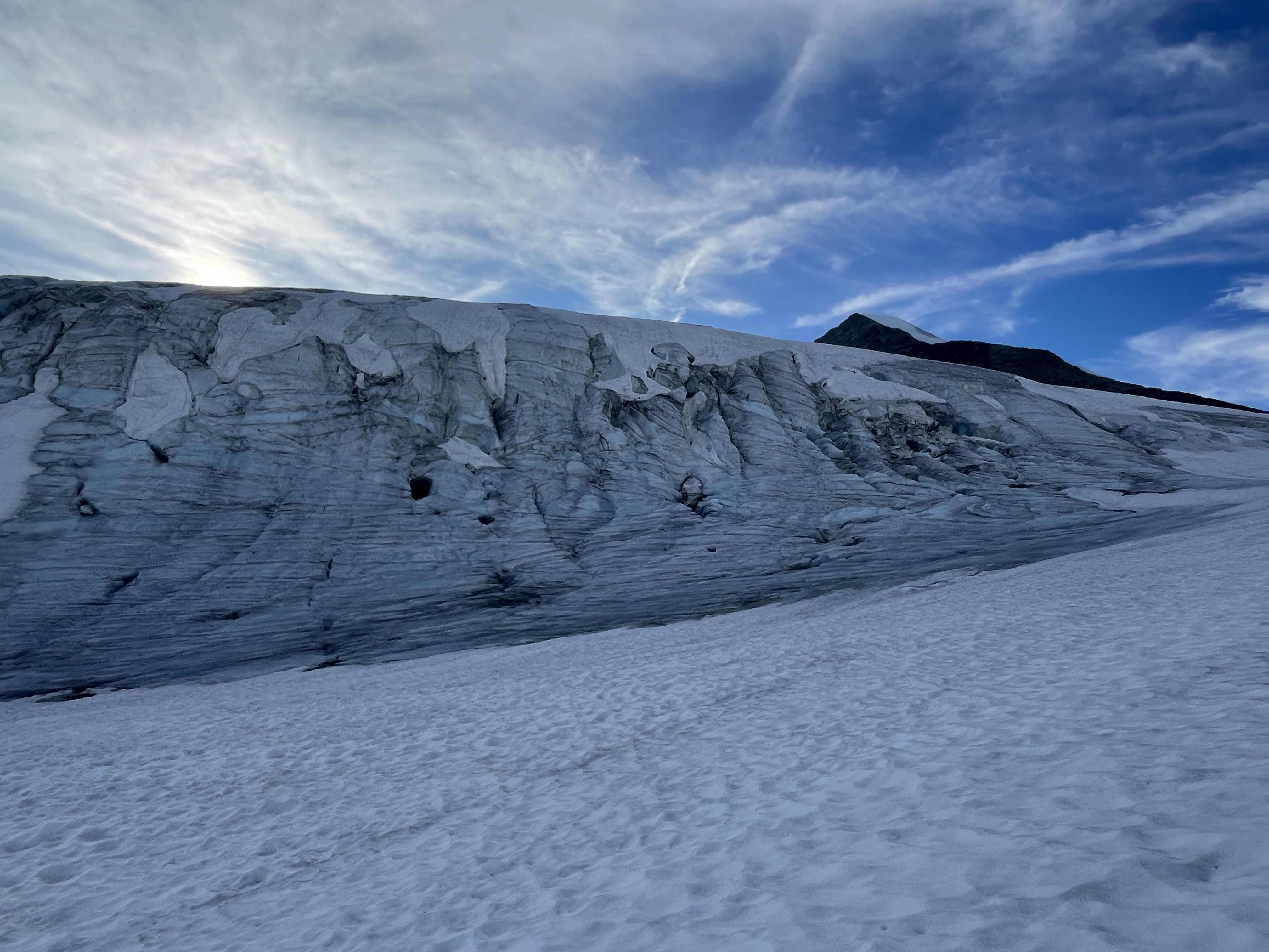
A few days ago Lani and I did a fun link up on forbidden. We climbed the East ridge North Ridge and West Ridge. This is a rad way to move through a lot of scrambling terrain. Uncertain weather before the atmospheric river gave us a pretty narrow window to work with, so we headed up the evening before and bivied at the base of the East ridge. We left the B basin trail around 5pm and set up camp around 8 for an early night. The cloud ceiling quickly raised up, putting us in a thick,misty whiteout for the whole of the night. We woke up to even more whiteout and low confidence, expecting to bail we went back to sleep for a few hours. We ended up leaving the bivy around 8am. We climbed up the East ridge, then down climbed the north ridge. Down climbing the North Ridge was surprisingly mellow, we didn't end up needing to rappel. And the route finding was almost easier on the way down than the way up. There is only one 20' section of 5.5 at the very bottom, otherwise it's all sustained 4th class and secure low fifth. Once at the low bivy of the north ridge, the clouds again threatened us. So we sat and weighed our options. We ended up watching the clouds for an hour before deciding our fate. Our original idea was to traverse the glacier and climb the NW face/rib. But whiteout and impending rain steered our decision to "bail" back up the north ridge. Though the north ridge is such a fun knife edge it's hard to complain. We then down climbed the West Ridge. We hit the base of the West ridge 6 hours after starting up the East ridge and made it to the car just before 5, almost 24hrs after we left. The epic rains to come that night validated our decision to limit our time in the mountains on this one. For those who don't know yet, you no longer need to touch snow to climb either the west or east ridges. The glacier below the cat scratches is more or less completely gone. While sad, it does mean you can do this whole link up in approach shoes without carrying axe/crampons. Starting up the East Ridge Headed down the North Ridge, with clouds threatening to spill in from the west. Headed back up.
 4 points
 -
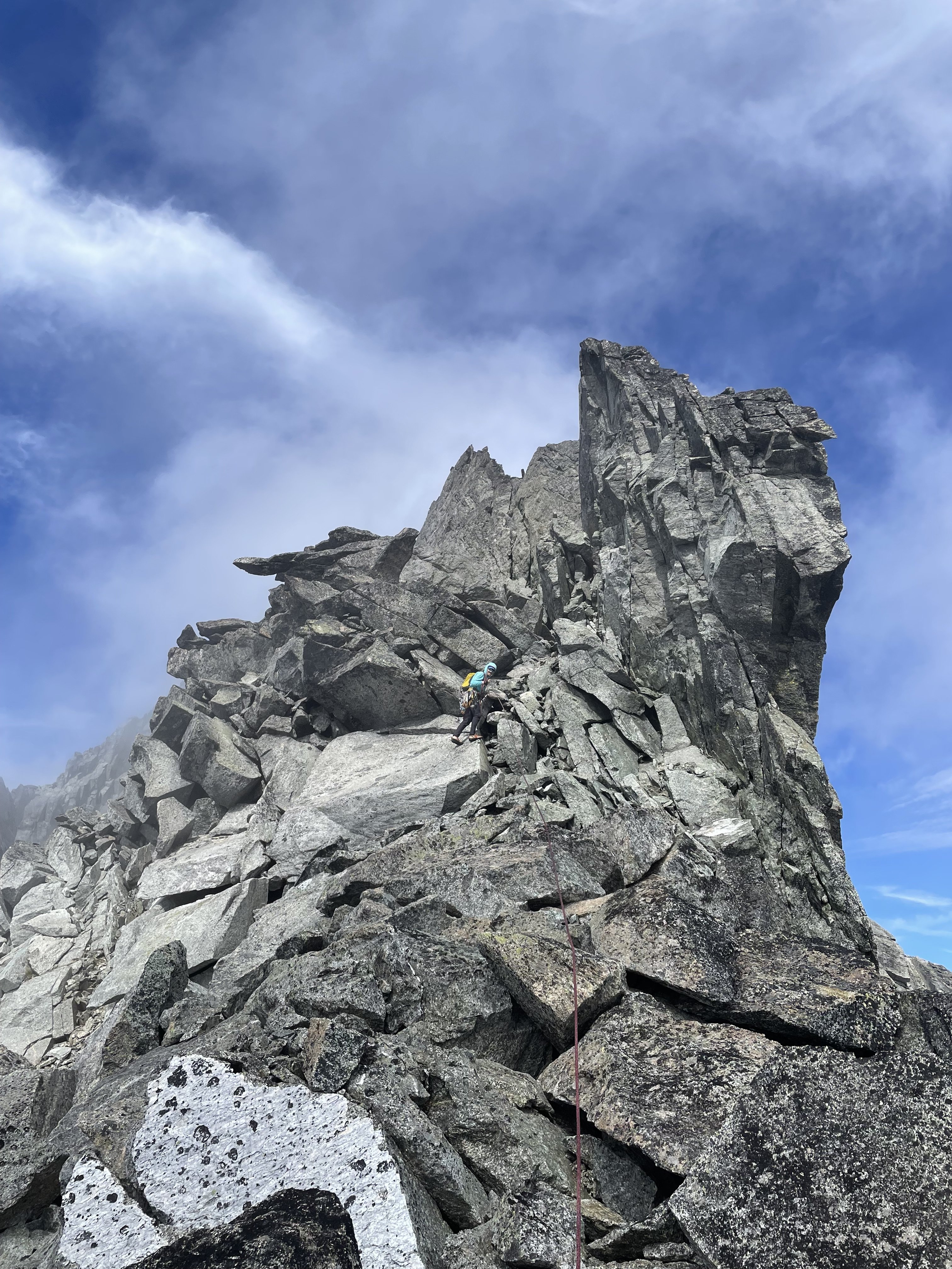
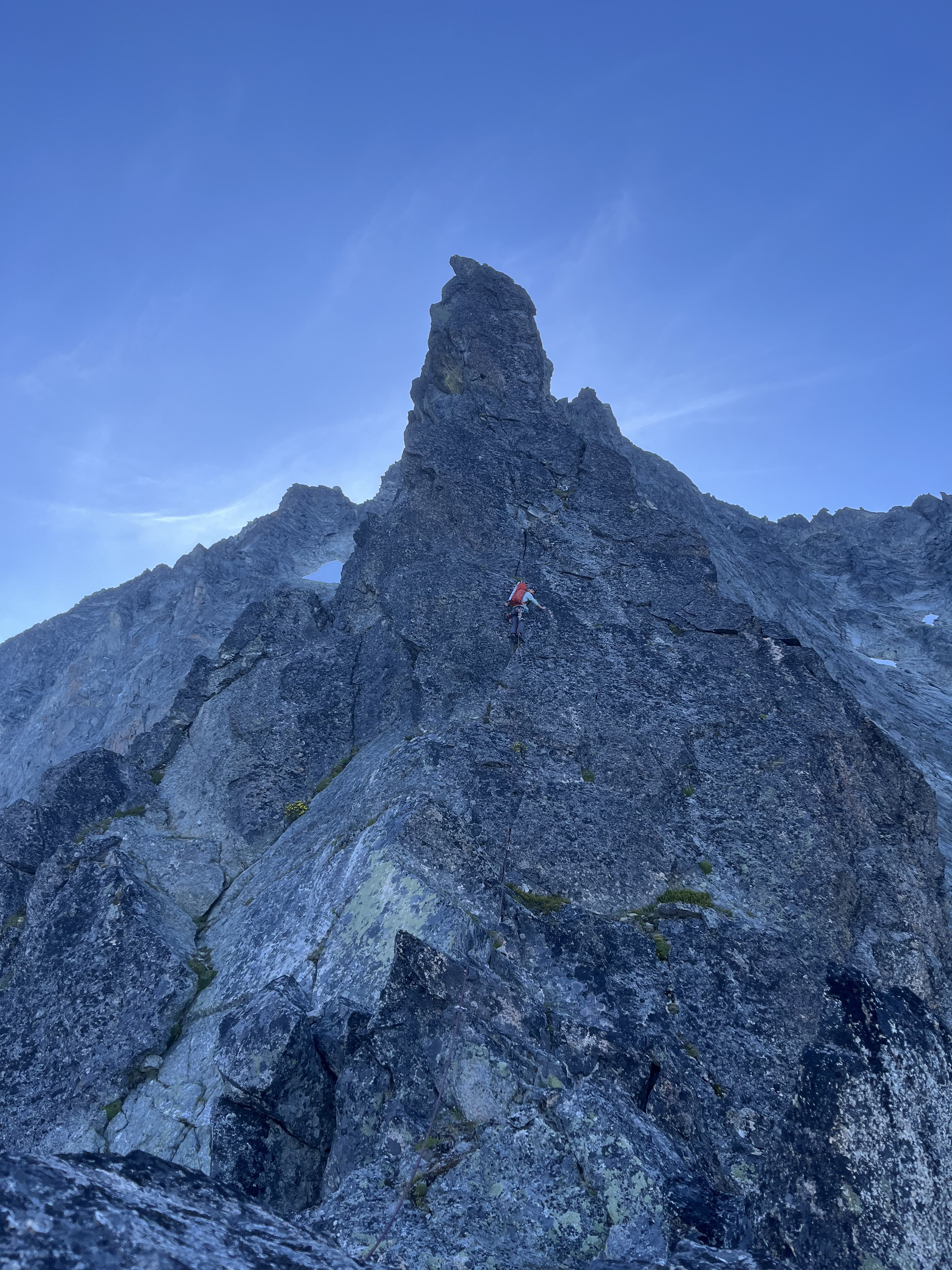
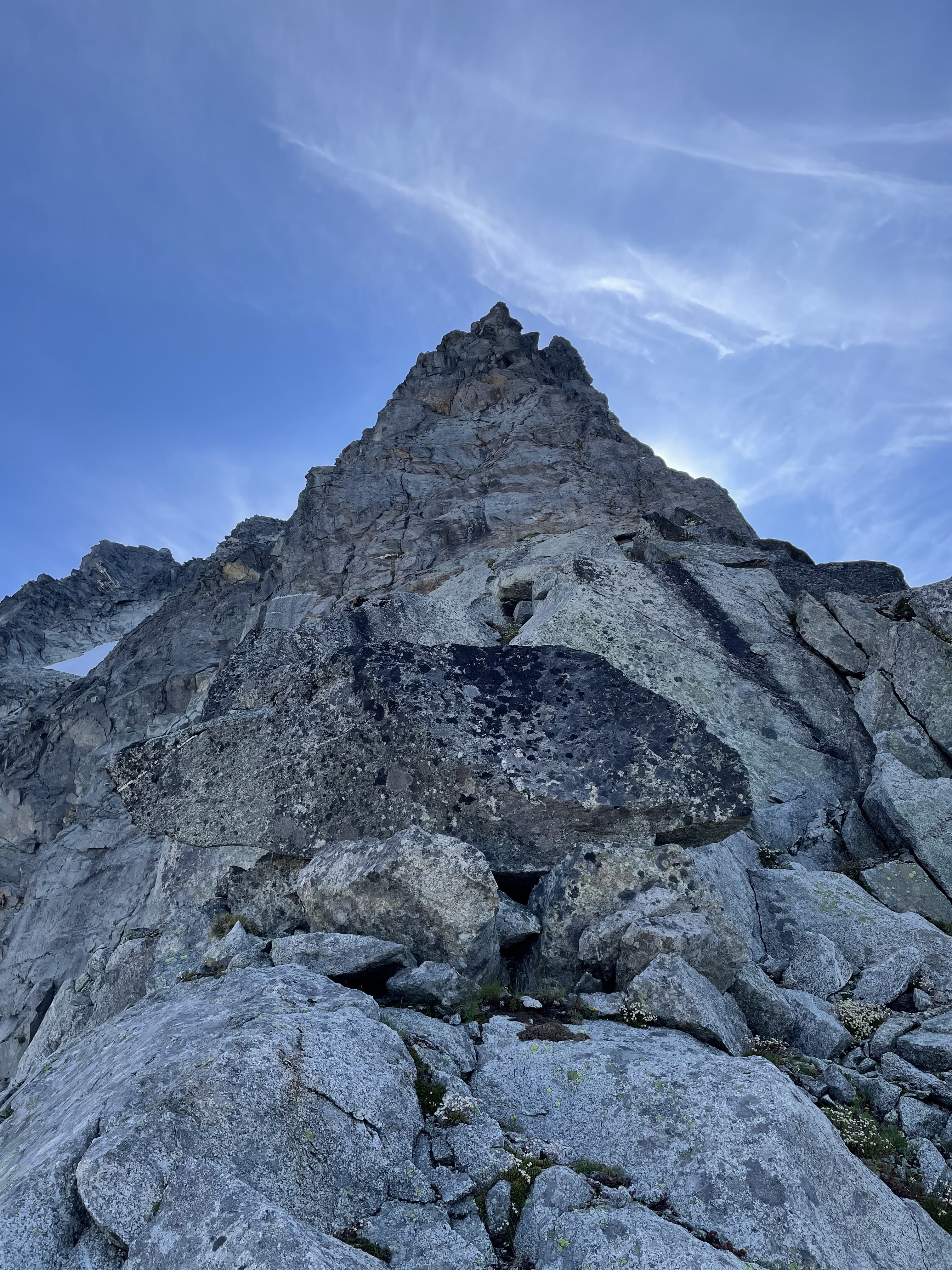
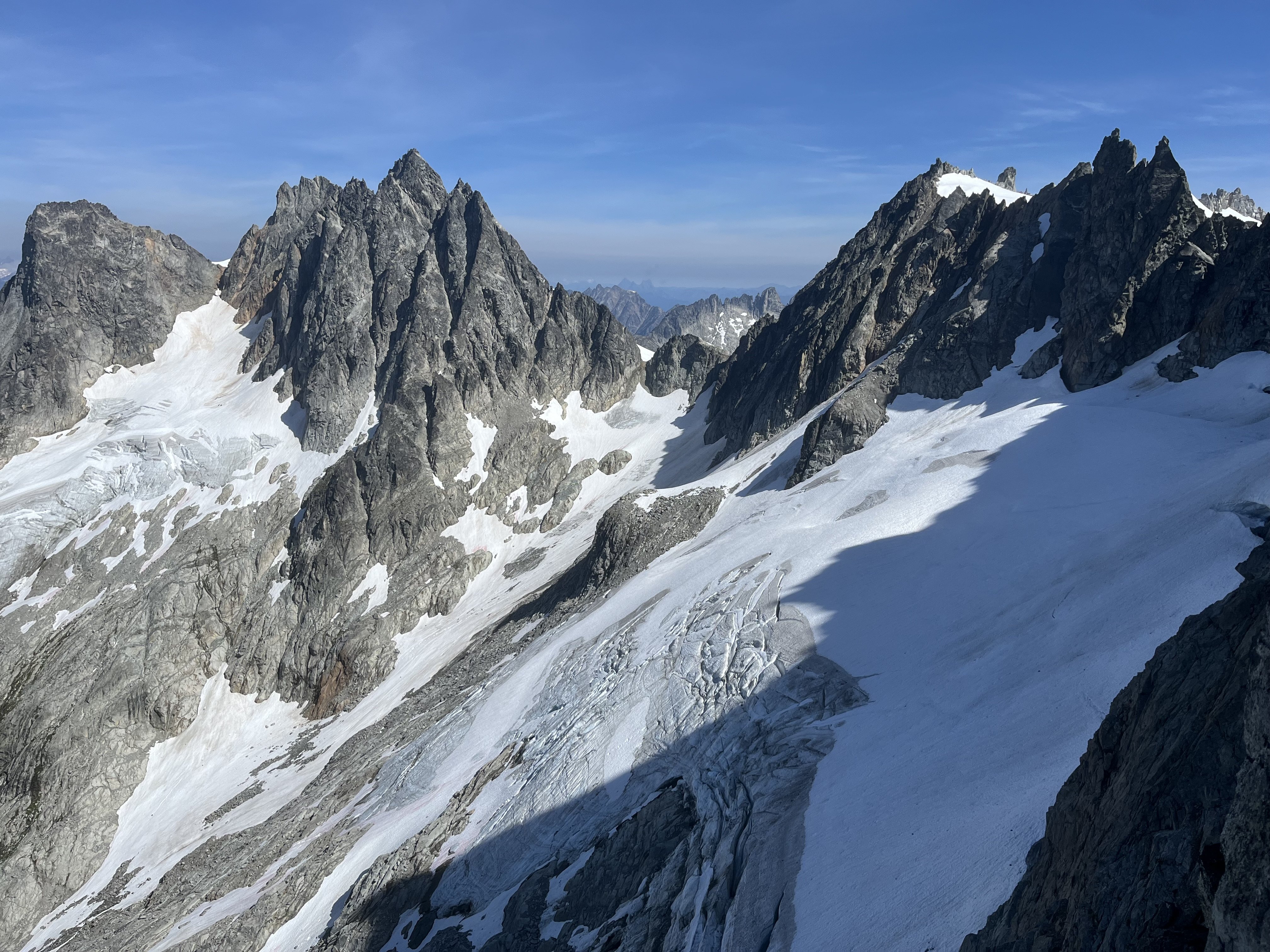
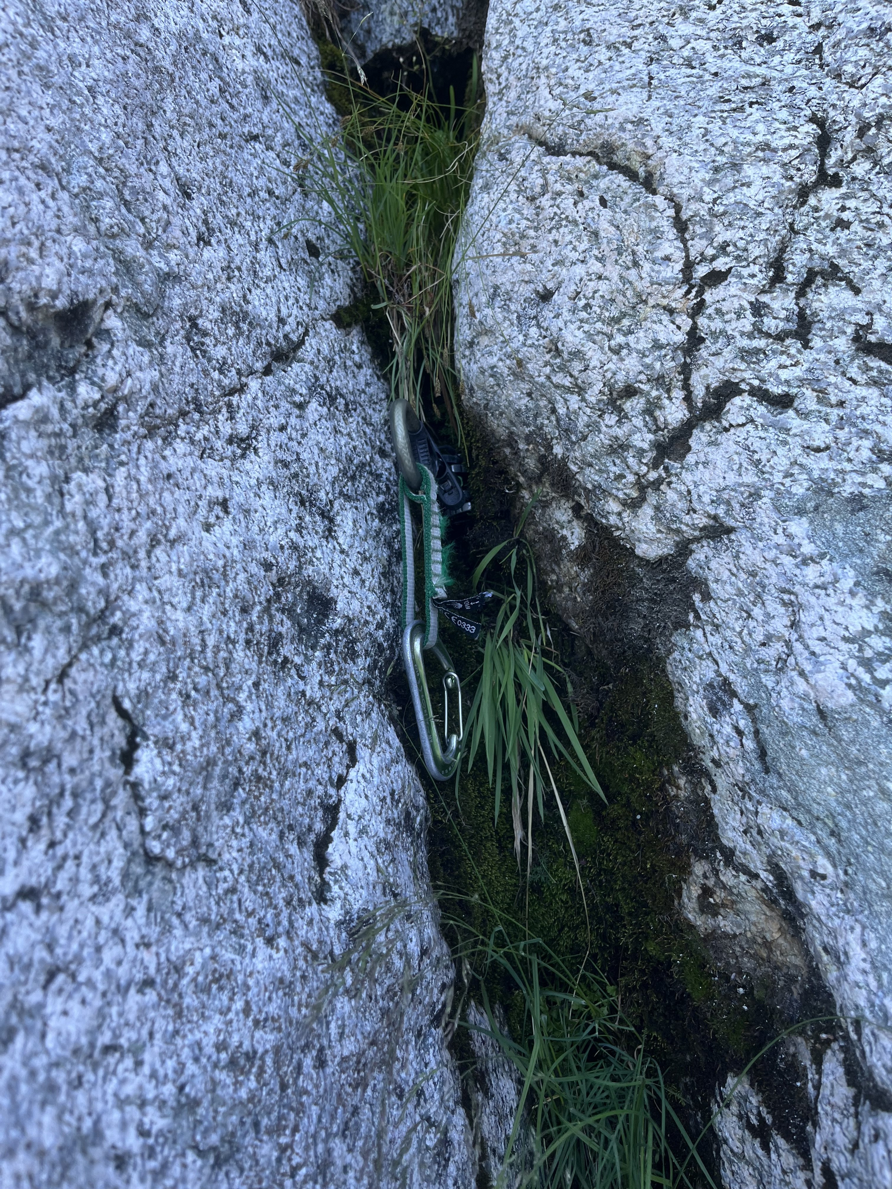
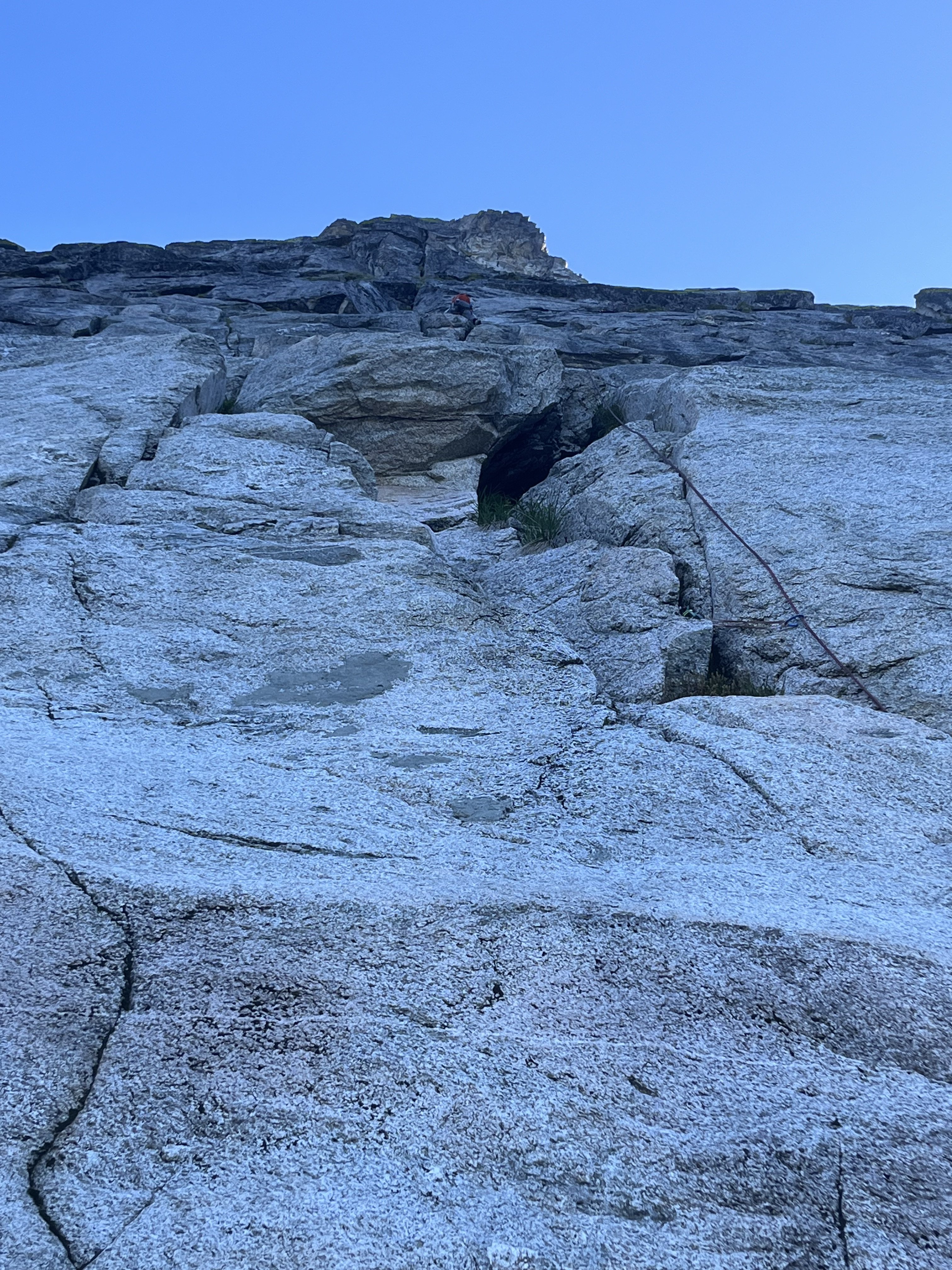
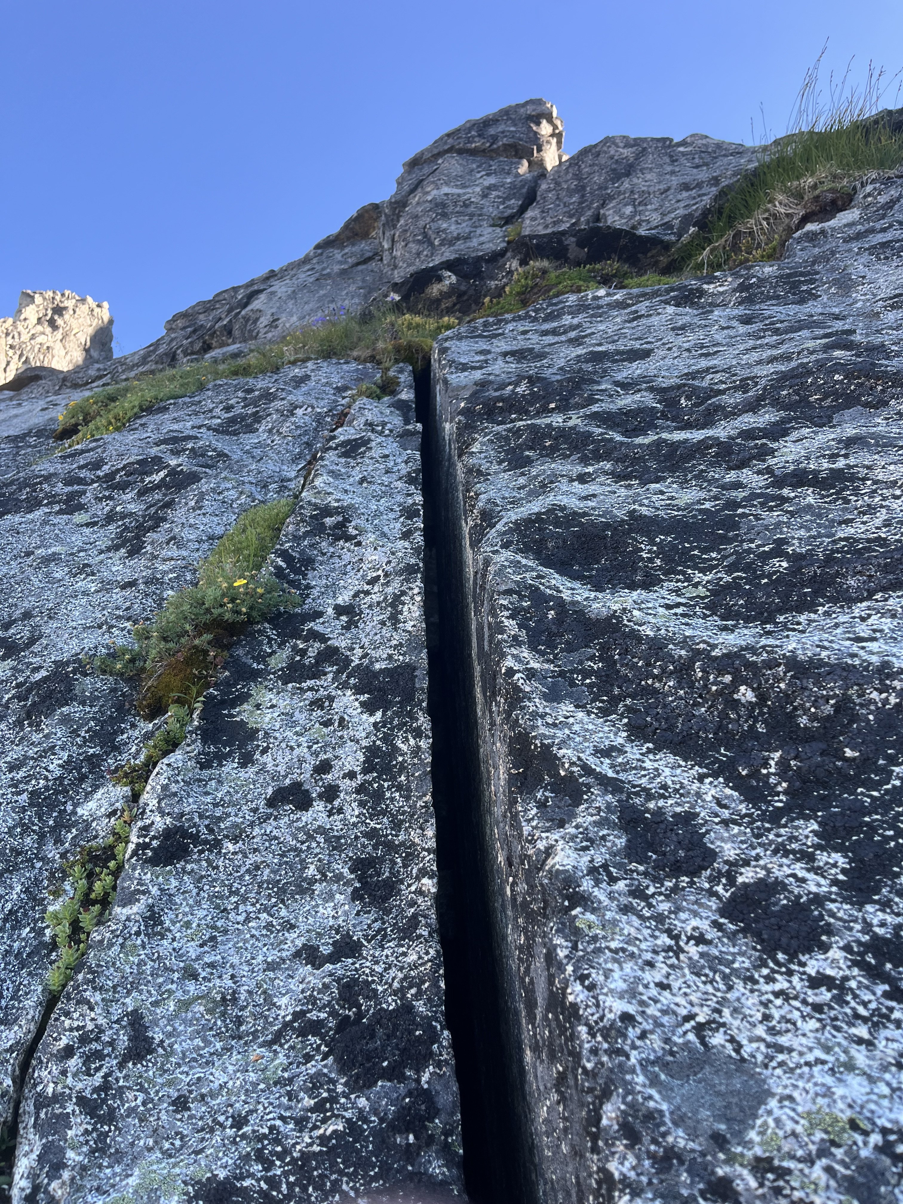
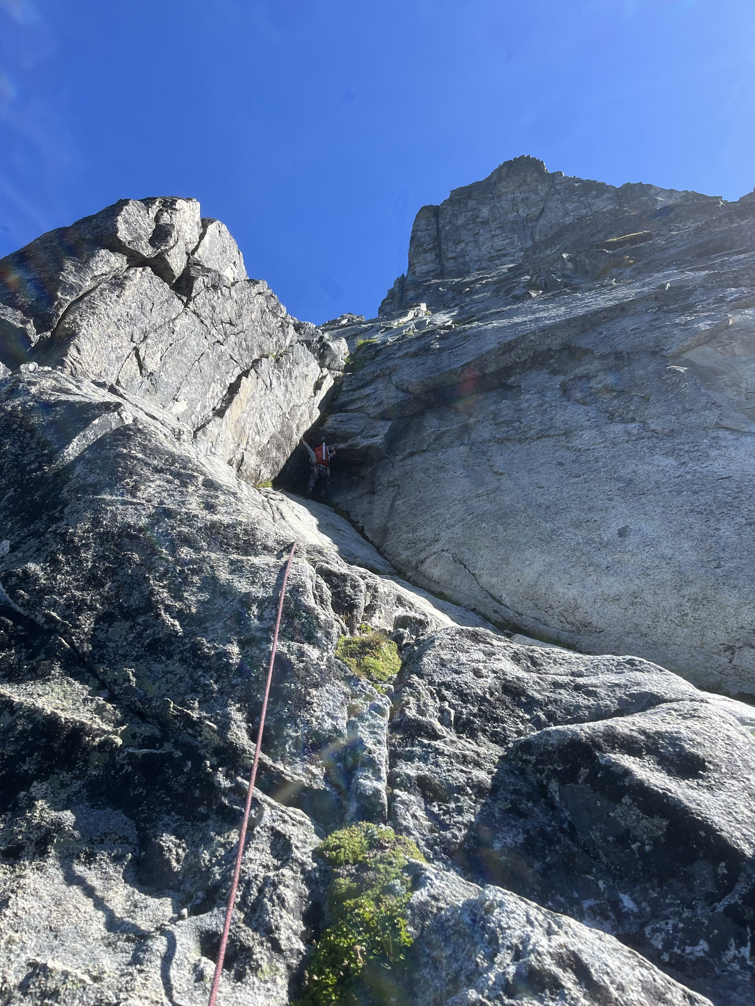
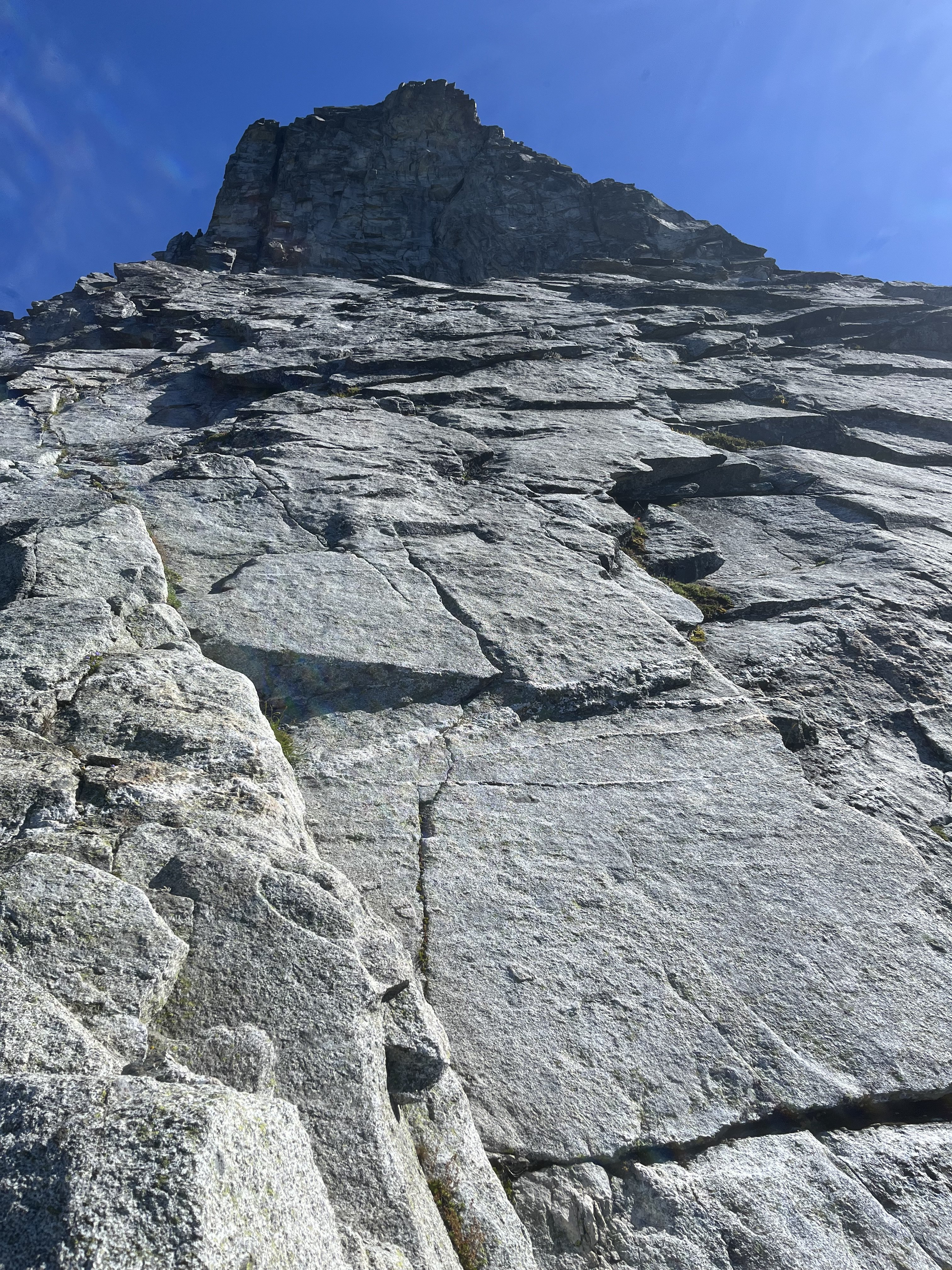
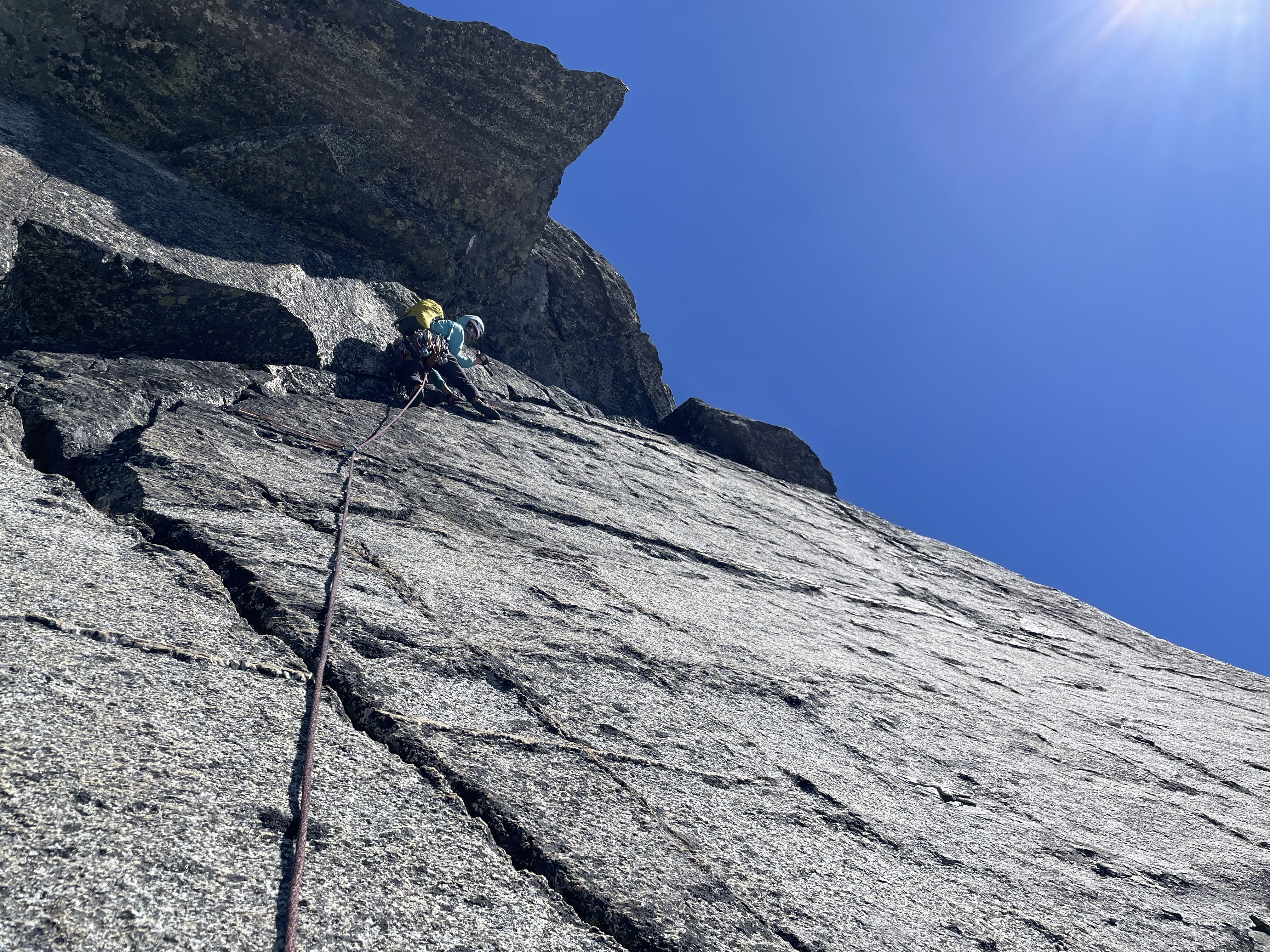
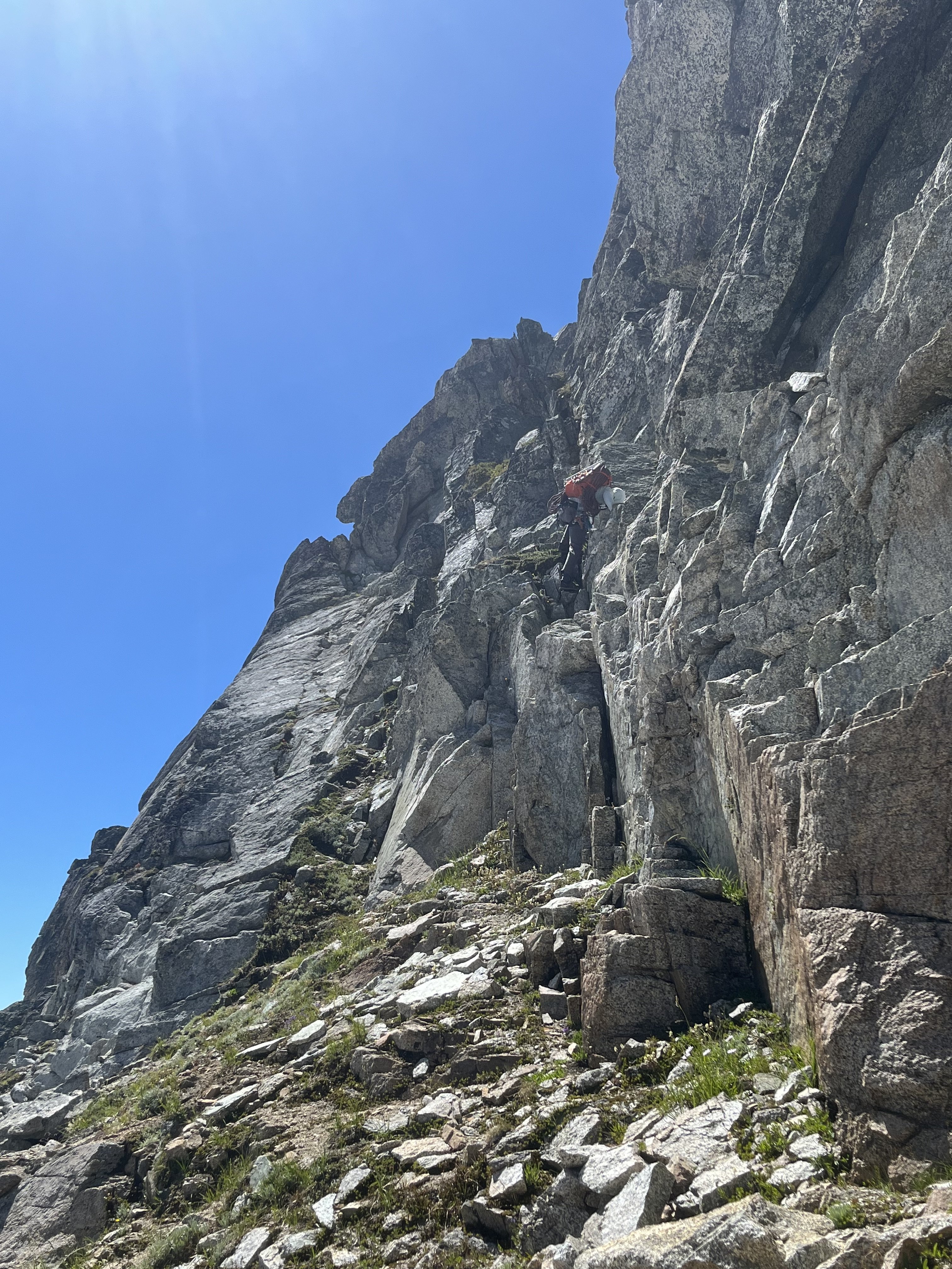
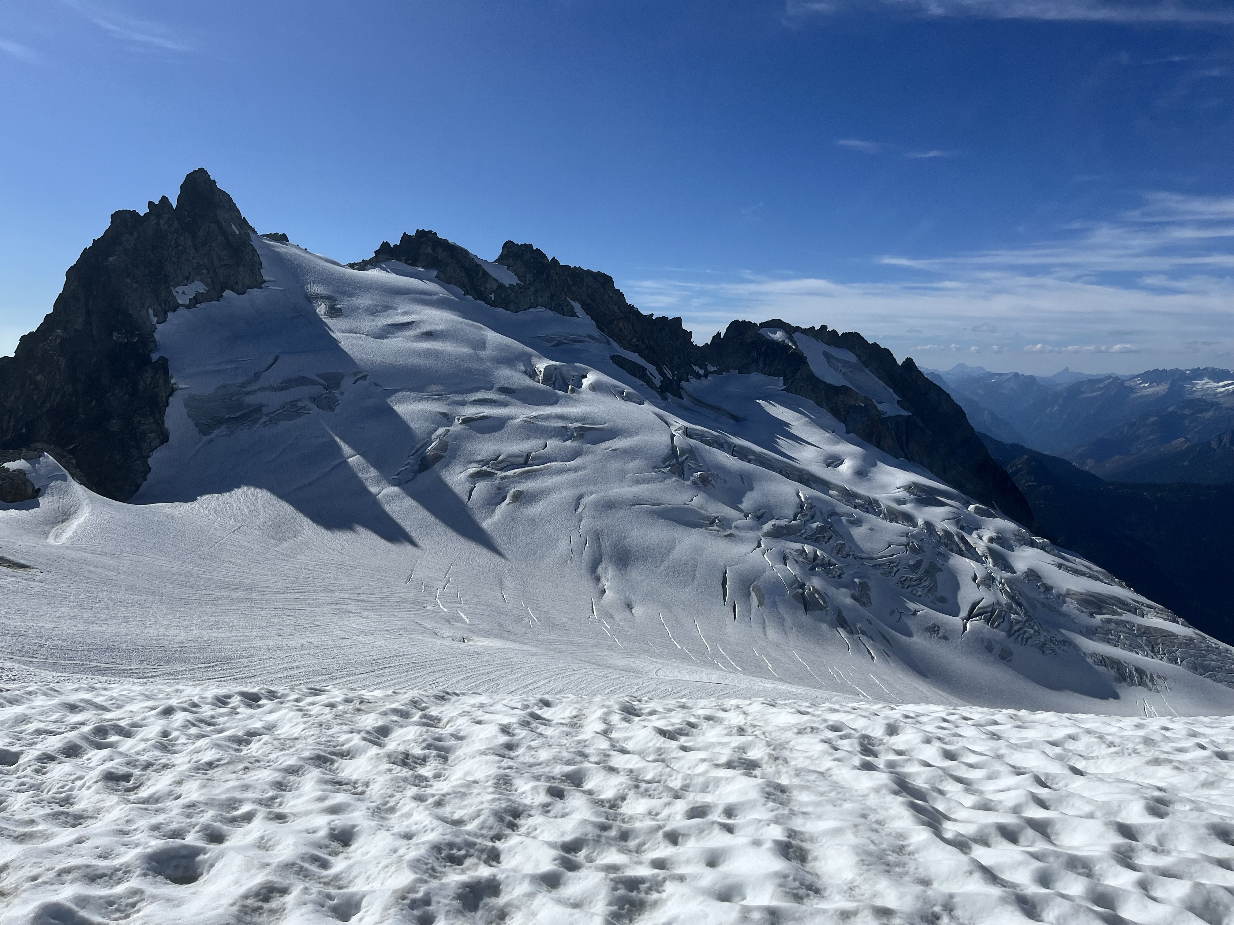
Trip: North Cascades, Arches Peak aka Little J-berg - North Face Central Buttress, 10 pitches plus soloing, ~1,600 vertical feet, 5.6/7ish Trip Date: 08/03/2025 Trip Report: A couple of weeks ago, Rolf Larson and I climbed a probable* new route on this peak. Anyone cresting Easy Pass has been greeted by the big north face of this peak. There is one reported route on the face from the late 1970s; the party climbed the left-hand "Plumb Line Buttress" 2,700' from the valley floor to the summit, which clocks in at 7,945'. They reported loose rock. (See photo of register page in the album linked below, the AAJ, or Beckey guide.) Of three relatively prominent buttresses, our route climbs to the western false summit (circa 200' west of true summit) via the central buttress -- the most prominent one lit up (furthest left) in the photo below. We believe the 1977 line appears in this photo as a nondescript buttress in the shade further off to the left. Our route wends up the gneissly-featured buttress on pretty good, pretty clean Skagit rock--we began climbing behind the third snow-patch from the right on that prominent shelf, directly below the toe of the sunlit buttress. (Also available here: https://photos.app.goo.gl/BV3itCHmqcoo7qL38) We had fun on this route, which thankfully was in shade while we climbed. Didn't take many climbing photos, but snippets of conversation went like this: "How'd you like that section of hand crack?" "I preferred my section of laser-cut finger crack." "Yeah, I went Squamish style and laid it back." Here's Rolf putting in a piece at perhaps mid-height on the face (the rope is out of view, off to the right): The first pitch was probably the steepest and most sustained, fwiw, and had a 5.6 or maybe .7 move. A couple of steep mini-headwalls were also climbed in that range of difficulty, but a person could avoid these if willing to take looser rock. We unroped for a few hundred feet of mellow scrambling after the first pitch or two, but some steeper terrain compelled us to again rope up and resort to pitching and simul-climbing on fourth and low-fifth terrain. The climbing is moderate, but generally solid and fun, with adequate protection. *As you will see in the summit register pics, Roger Jung soloed a route on the north face, but it's hard to say if he took our route -- there is certainly latitude to wander on that big north face. The photo album, which includes some pages from the register: https://photos.app.goo.gl/4JU83LgK6XKFdbSA7 We descended via a walk off to the south and east--no crampons required. The short-ish approach, moderate and generally solid climbing, and straightforward descent (not to mention the blueberries!!) might make this climb more appealing than some of Rolf's and my other routes. I'll wait for Rolf to correct me on any details (which are already fuzzy), downgrade the level of difficulty (as is his crusty wont), etc. etc. Here's an early musing about Arches from the cc.com archives: Gear Notes: Standard rack with emphasis in finger-sized pieces; tri-cams were useful Approach Notes: Via Easy Pass, drop to and cross Fisher Creek, find your way up through the lower cliff bands, wiggle-chimney between moat and rock to the start3 points
-
Nice line, especially the side view. Naming history: Little J-Berg. 7945’ on map. P745 (now Lidar P790). This was the original (August 23, 1968) name for this summit since from Easy Pass its shape resembles that of massive Johannesburg Mountain near Cascade Pass. (A "berg" is a mountain; a "burg" is a town.) Fred Beckey was lukewarm about this name for his guidebook, so Legends Peak came to mind to honor Indian legends and legendary climbers. The alternate name was Arches Peak for its arcing shape and for a blocky arch low on its north slope and was so recorded in green Fred CAG. I still like Little J-Berg best.2 points
-
That really puts it in perspective. Nicely done gents.1 point
-
As if you stepped out of a time machine into the hallroom of the Darrington hardmen of yore.1 point
-
Boom! Just look at that proud face! (at least I hope that is your buttress on the skyline)1 point
-
Thanks for the foot pictures btw. Normally we have to pay for those.1 point
-
Gardening on Salvia is definitely some other best that YouTube has to offer. But naming something up in Darrington after it is next level. Traditional is made alive or revived or made new whatever. Thank you for this contribution to the zeitgeist.1 point
-
I’m trying el cap soon after last climbing it 40 years ago! Also hoping to repeat an fa called solid gold on prussik 37 years later1 point
-
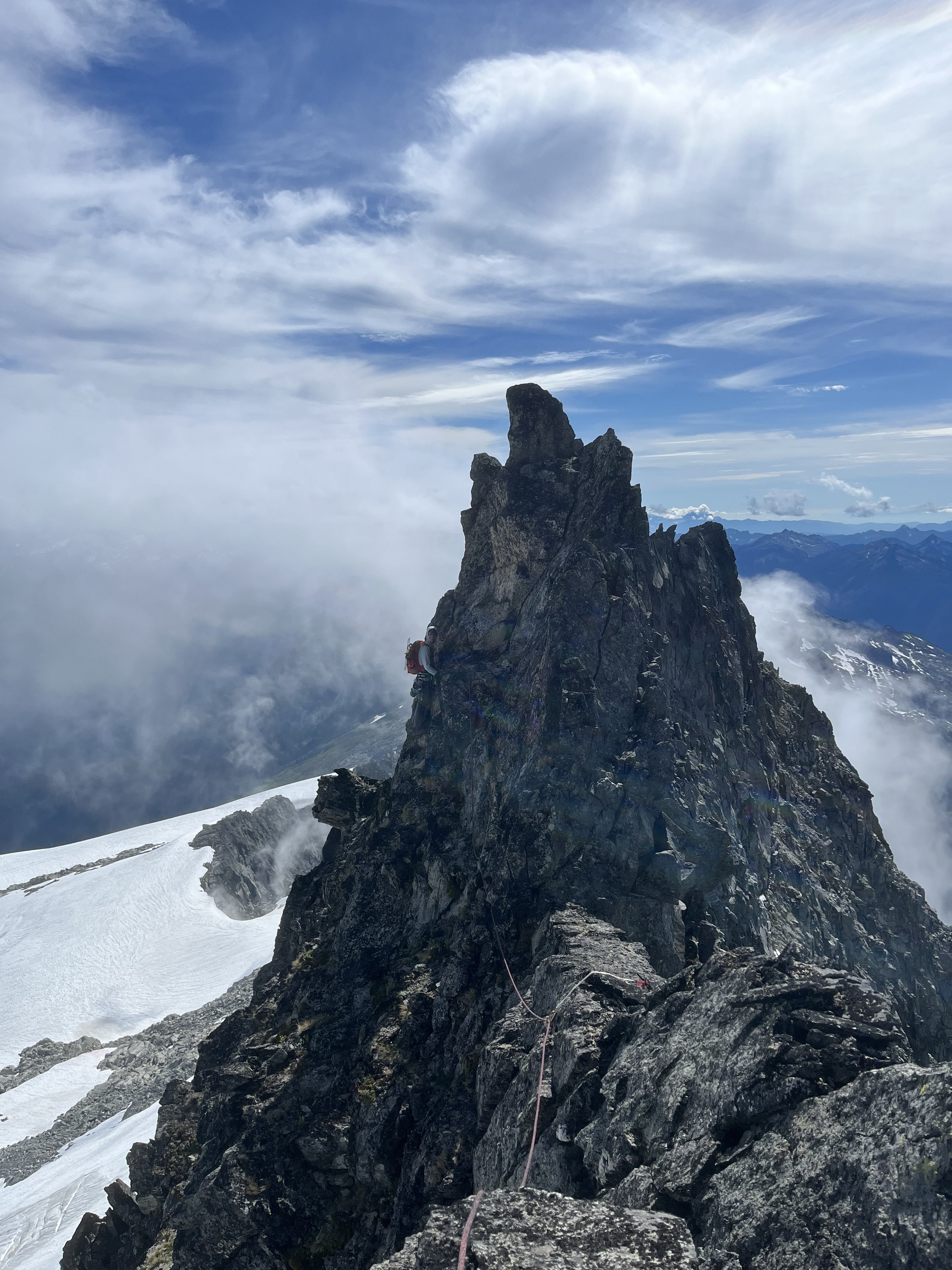
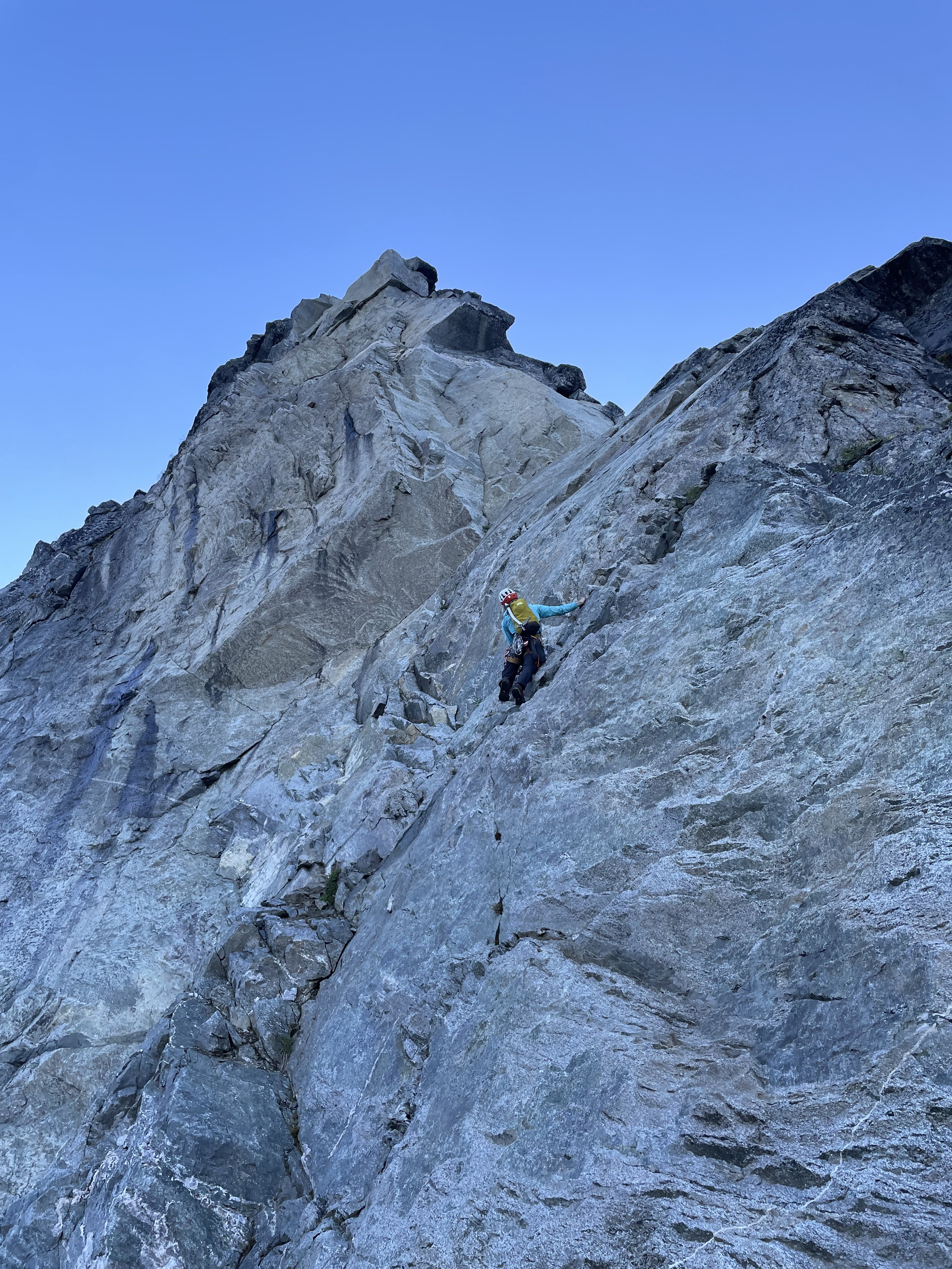
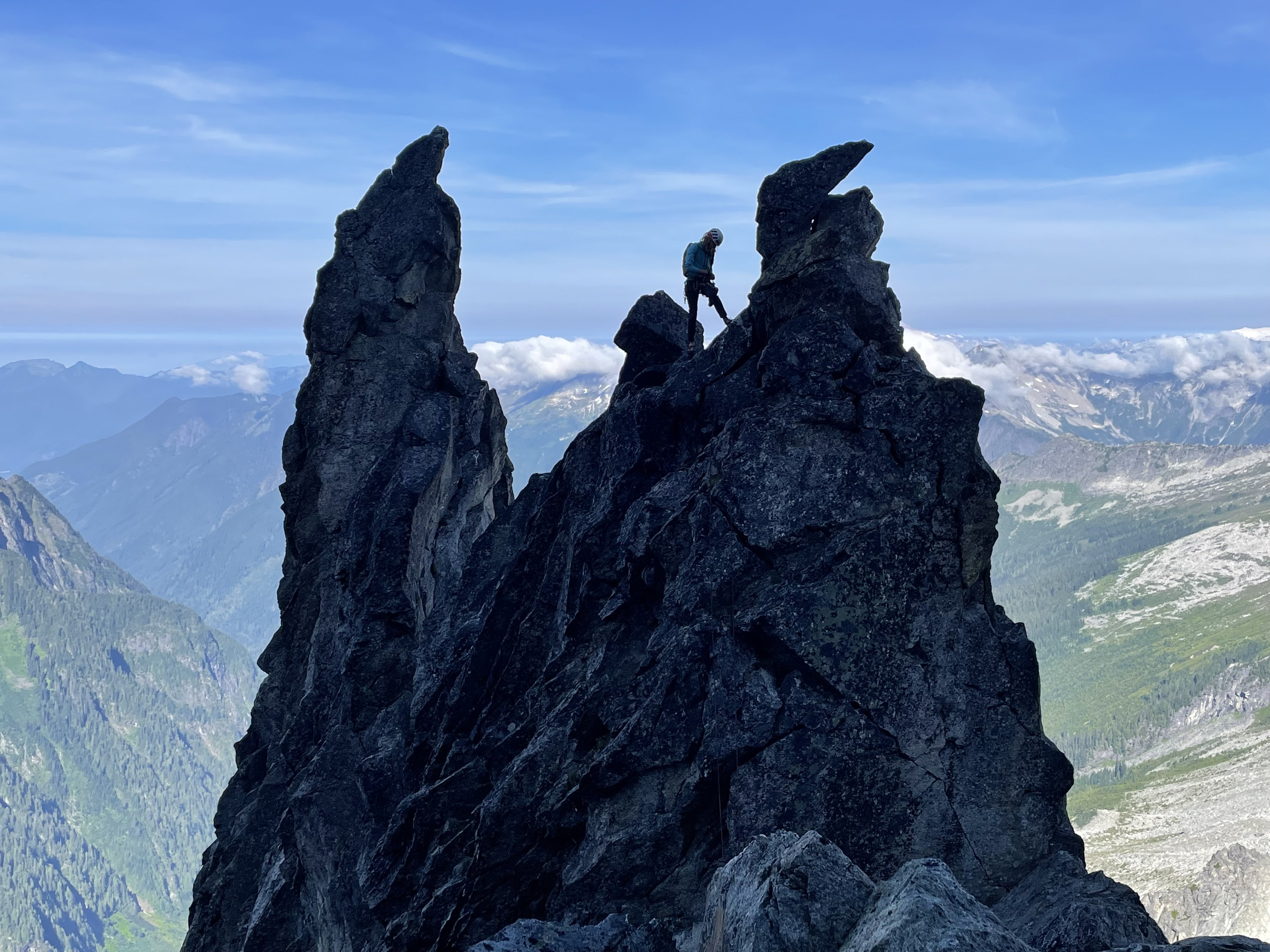
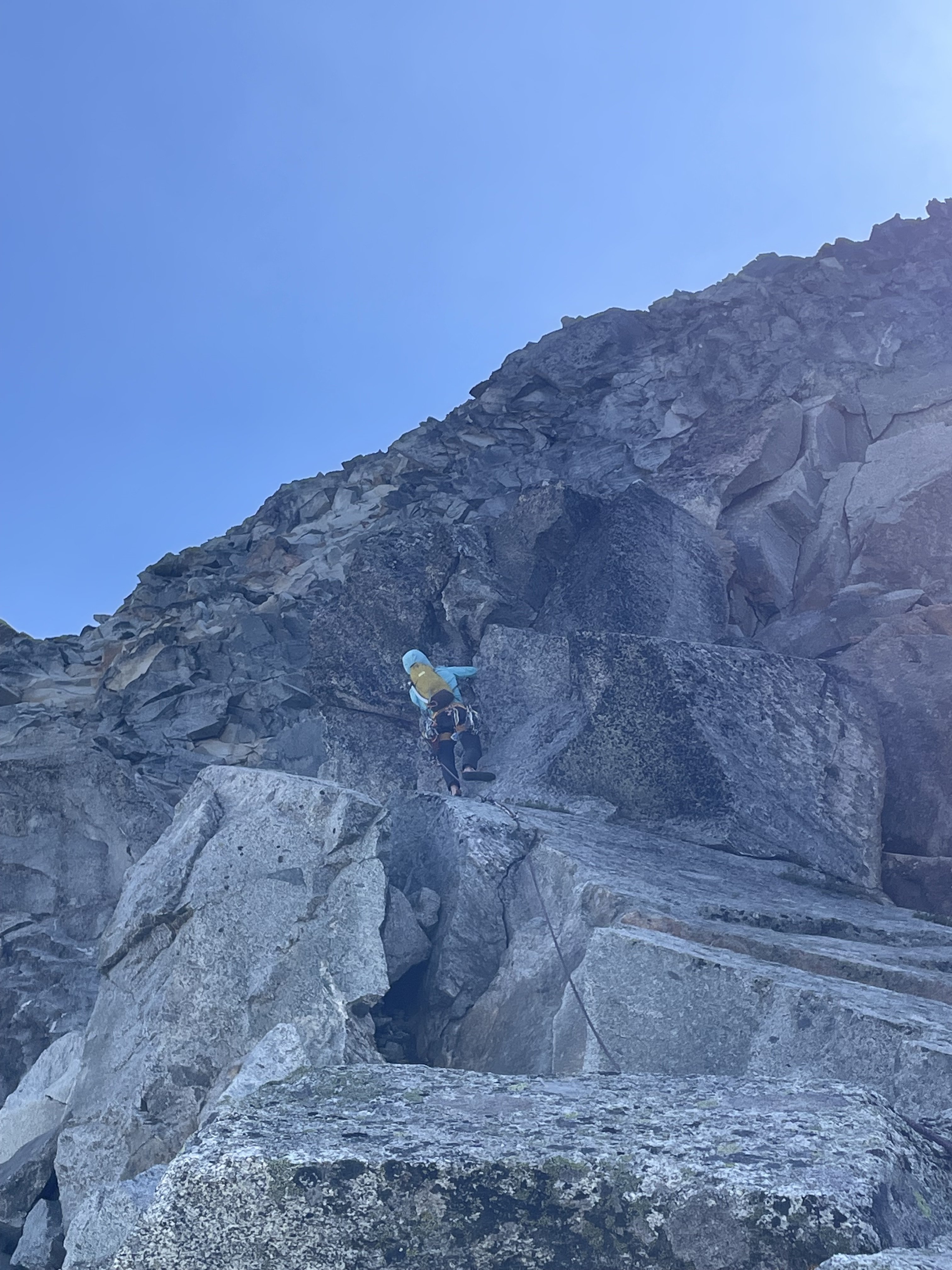
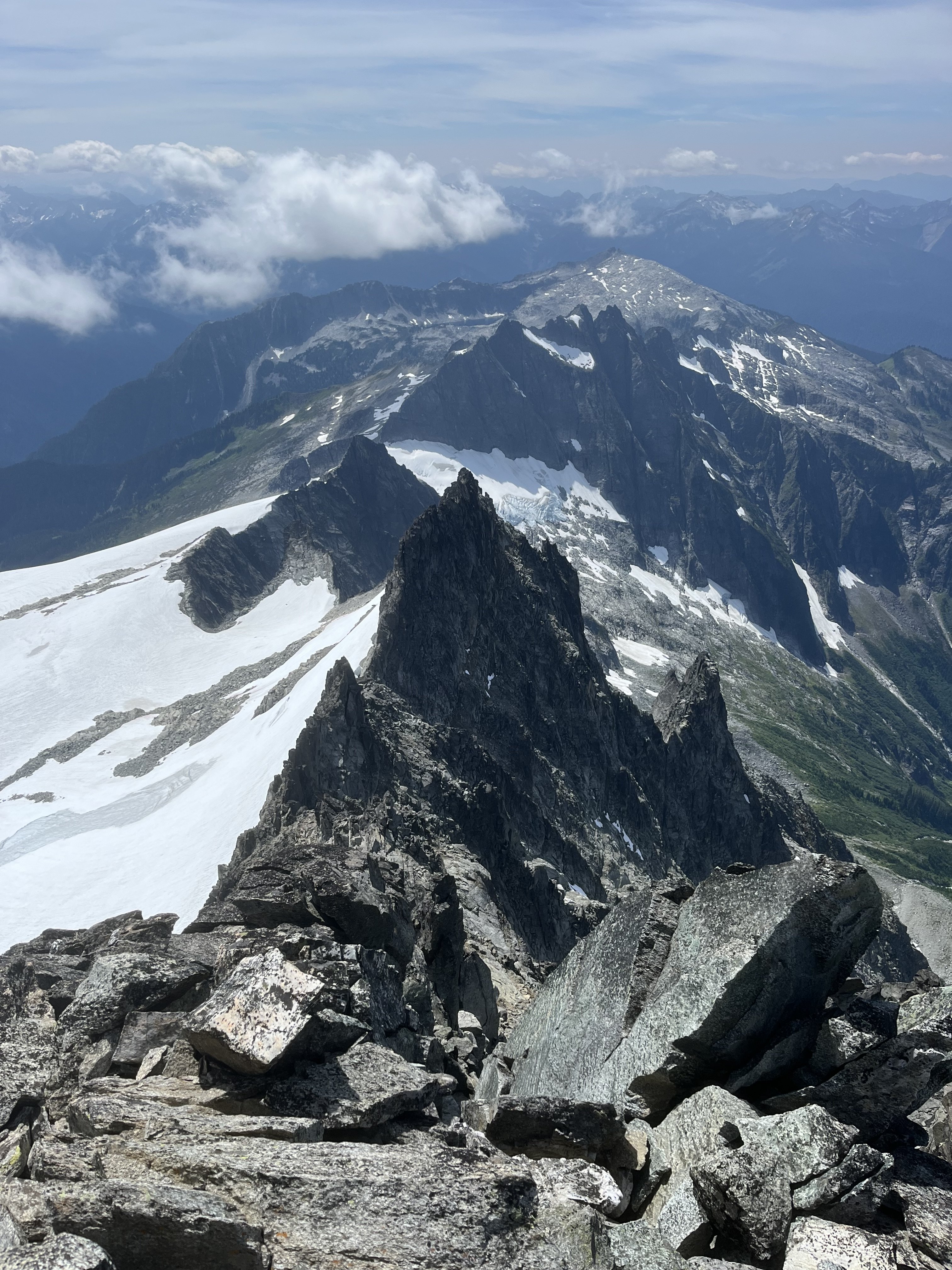
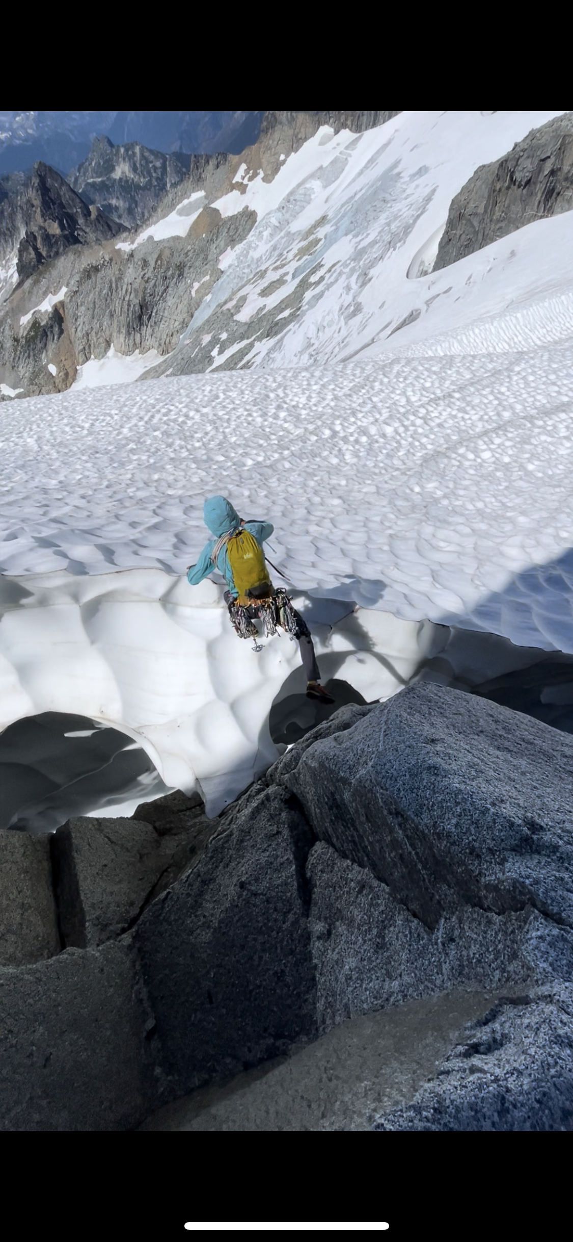
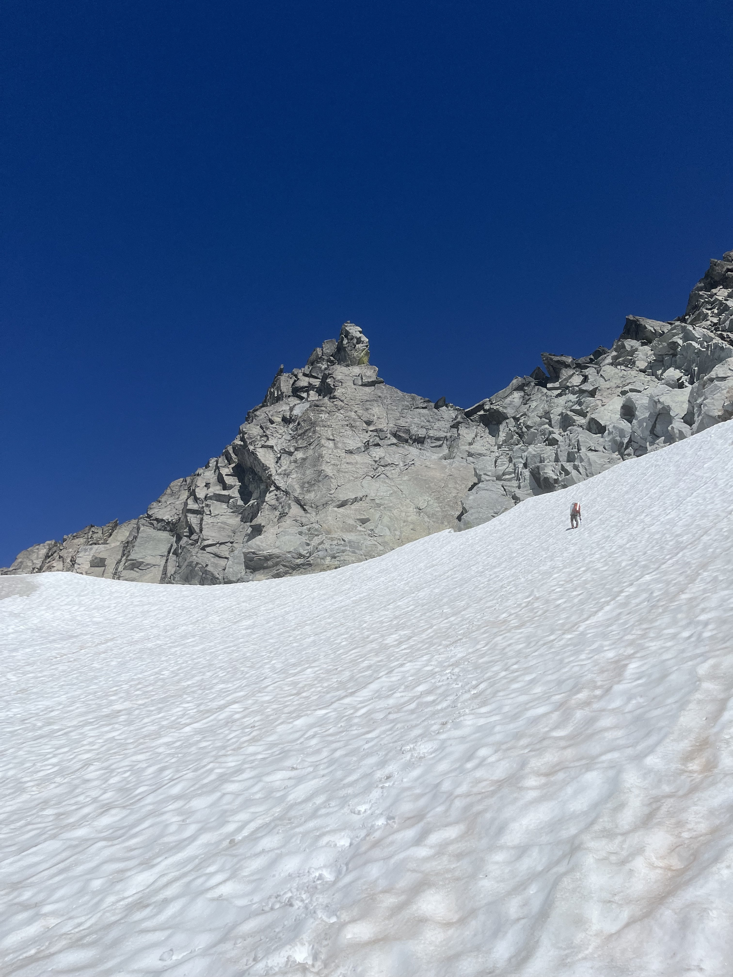
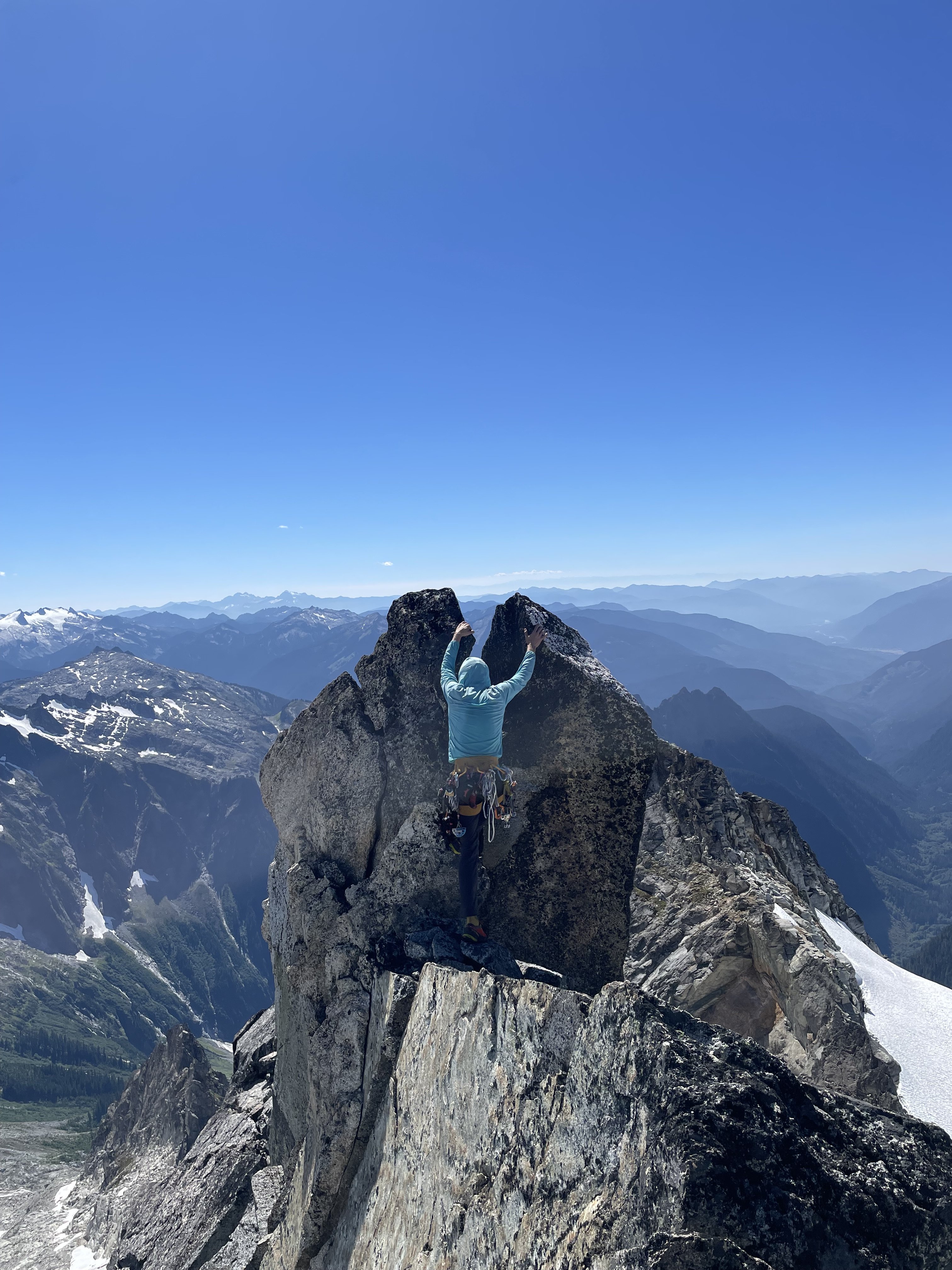
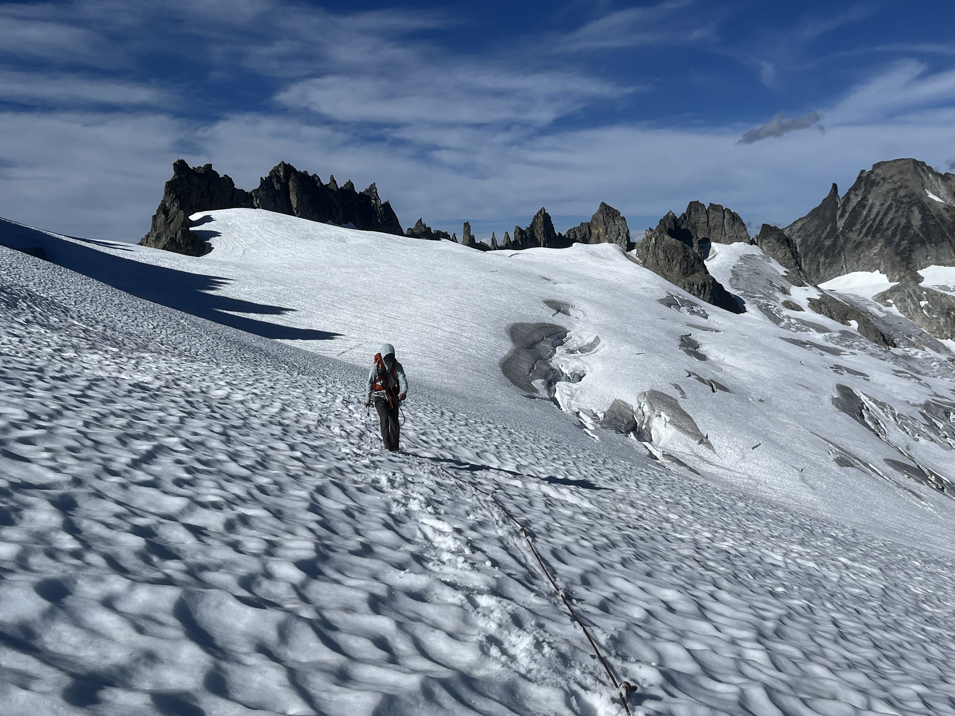
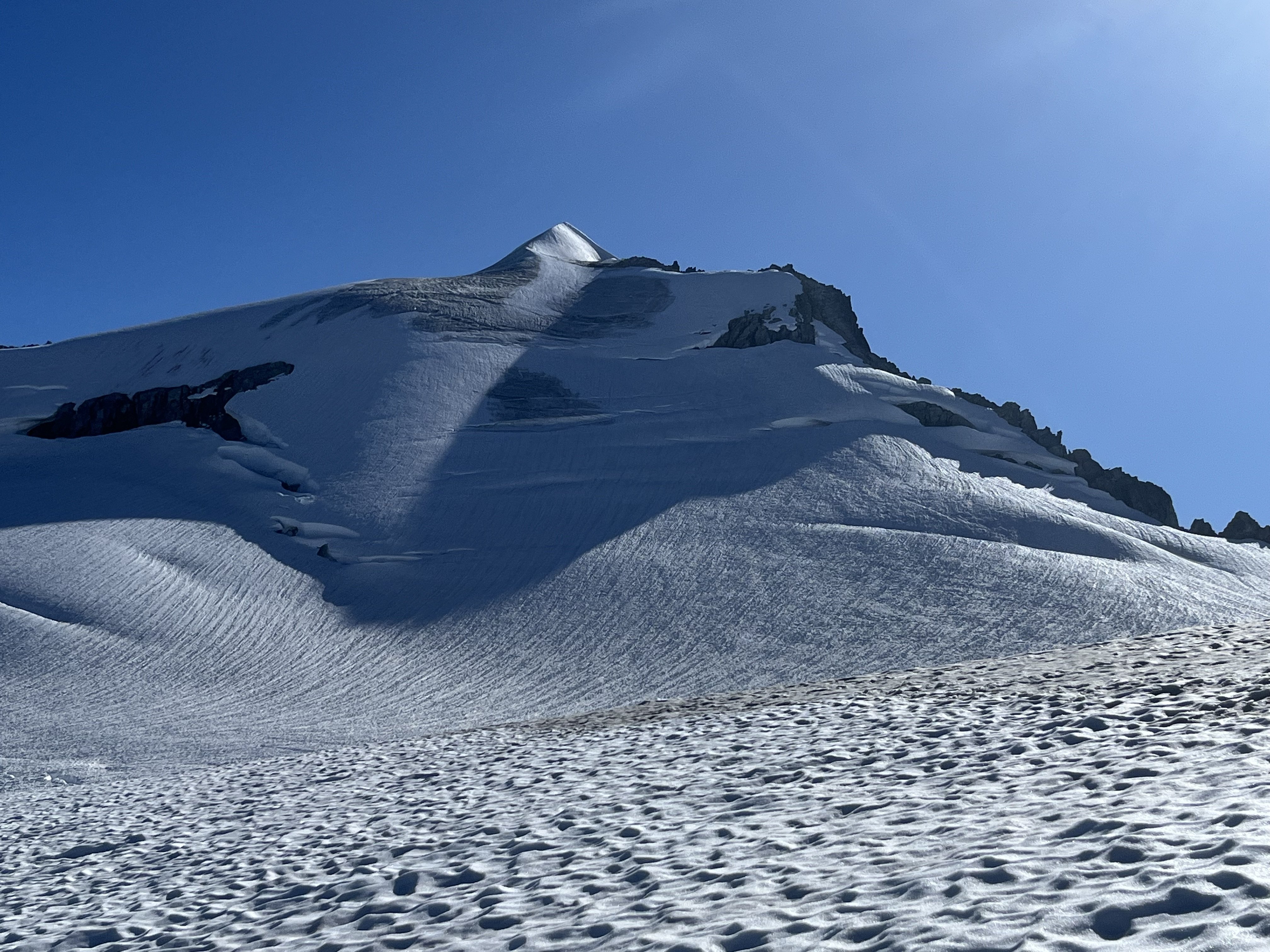
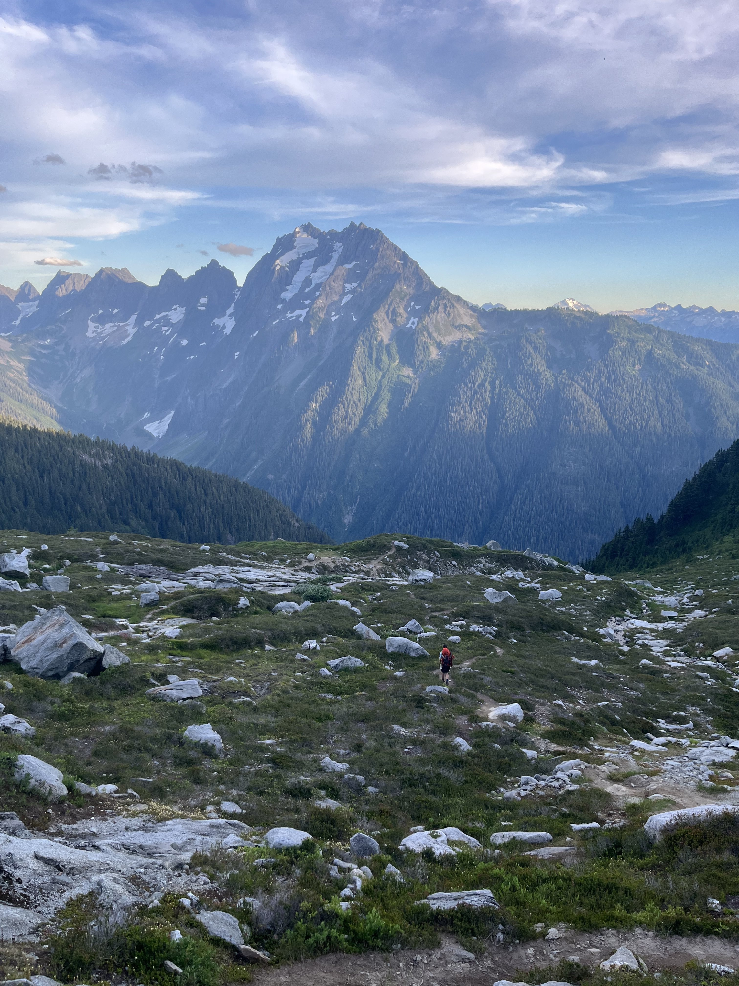
Trip: Eldorado zone tour, with EMS - South and west ridges of Eldorado, SW face of Early Morning Spire Trip Date: 08/08/2025 Trip Report: Got to do some routes in the Eldorado neighborhood from a base camp last weekend. This was another trip I’ve been meaning to do for a long time where the pieces finally fell into place. Climbed with Ben who has learned quickly in the three years since he started climbing. Solid partner, his only real error was leaving glasses back at the car. On the first day this was mitigated with some tmnt Inuit tech. Cowabunga! Luckily at camp there was a climber who elected to stay there while his guided team climbed the E ridge. Heard the guide had extra shades and we arranged to borrow them for the weekend. Sky harp We set off for the south ridge. I love knife edges so found the route just barely in the worth doing once category. If you don’t particularly enjoy knife edges there’s no reason to do this climb. Unincorporated choss county Some fun atmospherics helped make it somewhat enjoyable despite some of the worst quality rock I’ve climbed. We counted it as good mental prep for W arete the next day. At the end of our three hour tour camp to camp we arrived to find the guide-lended glasses waiting for us. Most of the rock climbing in the next two days was in the shade, but this was still quite the score. Got up early the next day for the W arete and kind of raced another party departing camp right after us. There turned out to be a third party on the route that day too (!) Below Dorado Needle col we saw tracks through a snow bench above and left of the tarn, and followed these around to slabs near the sit start of the route. We misjudged the heathery path from below. What looked fine turned out to be dirty, crumbly, overly narrow and exposed, with mostly down sloping rock and dirt. This was a bit of a traverse coming from the NW to the ridge around 6700-6800’. Not at all recommended, there must be a better way, maybe more directly from the west? The other two parties took the considerably higher entrance from snow that bypasses all the green stuff, which seems more appealing in retrospect, though it looks like it has a bit of hazard too (steep, bad runouts). We were glad to be in front. There was one particularly thunderous episode of rock fall accompanied by muffled shouts and we were relieved to eventually see all 5 climbers back at camp that evening. After pulling through some legitimately scary terrain we soloed up briefly sound rock before it got questionable again. Then we started to simul. I think two blocks got us into the gendarmes. We had climbed up a chimney to a piton, but it didn’t look anything like photos of the crux traverse. After some confusion we saw another piton down below and realized we were above that crux. We rapped past it. It looks exciting, kinda wish we climbed it. Unintentionally mimicking the rocks’ posture From there two more blocks got us past the snow into lower angle terrain where we unroped. I found mostly pretty good stuff to the summit. The path of least resistance isn’t always the best path. It was so early I proposed heading back down for the SW buttress of Dorado Needle but we elected to rest up for EMS instead. With the south ridge the day before, the west arete completed the Eldorado compass for me (north and of course east ridges climbed before). South ridge! meh I enjoyed solitude on the summit for a while and left as a large group of sunburned youth neared the top. The hours drifted lazily by. We chatted with various day trippers throughout the afternoon. Next morning another early start had us retracing our steps to Dorado col. Celestial choss, earthly choss This time we passed by the tarn and its outlet stream. One slope looked inviting but it cliffed out on the other side. Proceeding lower we found a nice path through trees to cross the ridge with friendly heather downclimbing. EMS presents quite the striking mien all along the approach. We met someone at camp the night before who had his own route beta for EMS which he shared with us. Compared to Nelson’s it had a direct start, and above that, more of a diversion to the right and back left, rather than straight up. Both of these variations turned out to be good calls. The start was a little tricky in terms of climbing and pro. First piece The climbing quickly got to be really fun. After about 70m I took the lead. After scoping a more direct line I tried the shallow right facing corner diversion to the right, and was pretty delighted with this section. I think this wide low angle splitter was in this pitch. I stopped about 70m later just below the ledge below the crux roof. Ben took over again and dispatched the slightly wet moves and drifted out of sight. This pitch ended up maybe 80m with a little simuling to the slab under to the roof. As I followed pitch 3 the rope hung over some excellent mid 5th friction slabs, where Ben had fortunately not placed pro. I took these optional sections (easier ledges around) to make the pitch even better (out of frame right of this photo). Pitch 4 was another rope stretcher with quality stone and low-mid 5th climbing. Ben took off again and neared the ridge crest. He selected a scruffy 5.10 chimney to get us to the slab and stopped there. I got to lead the finger traverse above this slab, another route highlight. I crossed the crest and continued up it, placing hardly anything, mostly focused on keeping the trailing rope from crossing the abundant choss that now sadly replaced the excellent rock. A seventh rope stretcher got us near to the summit ridge. We did one more short pitch that turned out to be unnecessary, should have unroped after 7. Tempered expectations may have been a factor, but we reveled in how good this route turned out to be. It’s not Stuart range classic quality but I think it’s up there with some three-four star WA pass routes, with an obviously much more engaging approach and return than you can find there. Our descent began with sandy goat ledges on the south side of the ridge. When this cliffed out we crossed back north. It was very exposed here with a deep moat below, but with bomber easy staircase rock leading down. There was one low 5th body length, an awkward long step and then we were at the moat. The gap was significant but absolutely doable. Still got high dive butterflies before finally making the leap. When Ben’s turn came he sprang from both feet, launching far beyond the gap and came skating into me lol. The hypothetical descent to the south had looked atrocious during the approach, and there is at least one epic going that way documented here on cc. We instead followed the advice to climb snow to the choss saddle north of marble peak. At the crest we saw rather steep snow to the east, so followed the snow up and south to get a look around. This passed so close to the summit we thought we might as well tag it. Took rock down here to bypass the steep snow. I scouted south while Ben scouted north. We never found existing anchors, so when a good crack on the north end below the steep snow presented itself we set an anchor and rapped down. 70m easily made it, might have been 25m or so. Next we crossed the McAllister, almost exactly matching my track from 3 years ago (snow levels early August this year look even lower than early September 2022). Having decided to skip our last night out, we zipped over to camp where we packed up, ate dinner, and quickly hiked down, getting past the boulders and close to the bottom before pulling the head lamps out. The dip in the creek at the end was extremely necessary and welcome in a dumbfounding sort of way. Gear Notes: Doubles 0.3 to 1, single 2 and 3. Some C3s and nuts. Ax and crampons. 70m rope. Radios were very useful for our long pitch strategy on EMS. Approach Notes: Counter clockwise
 1 point
 -
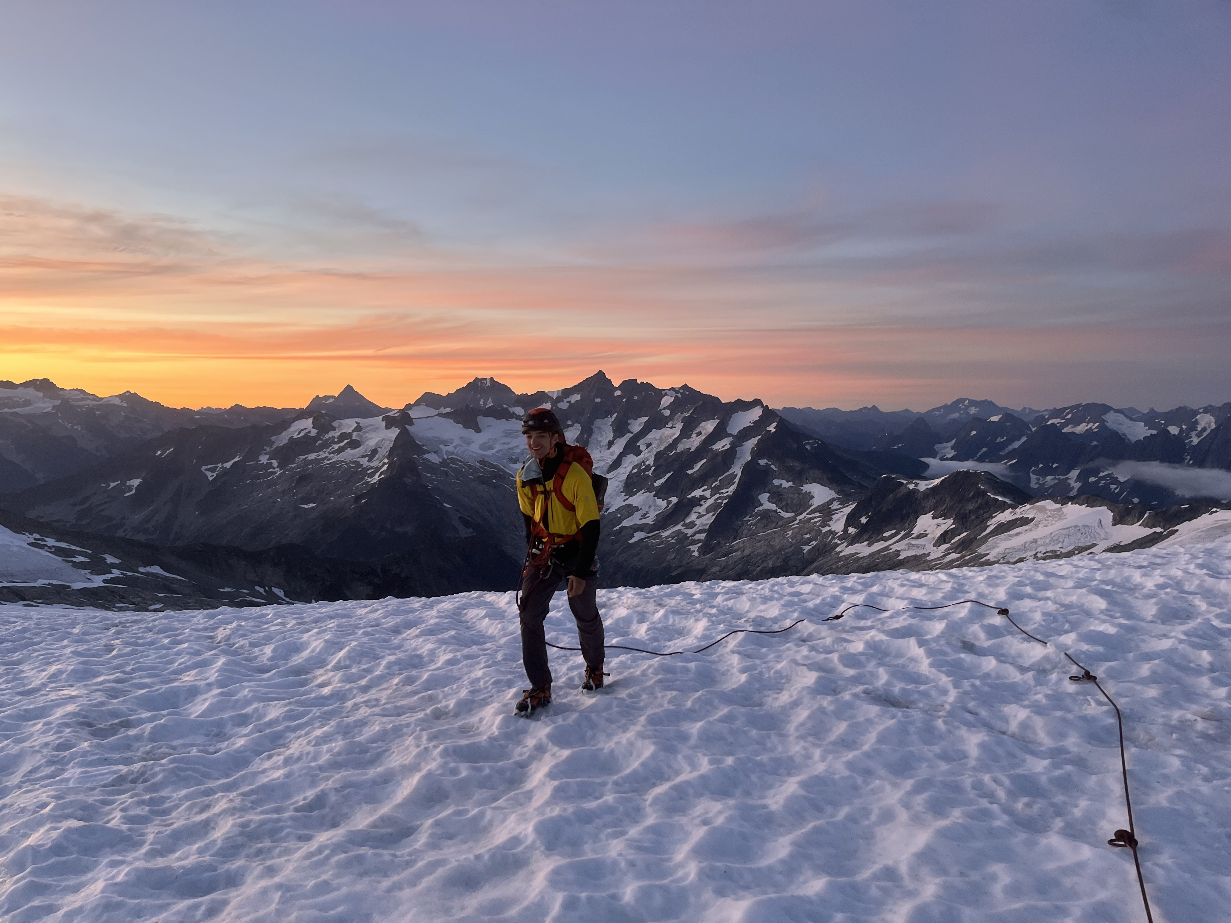
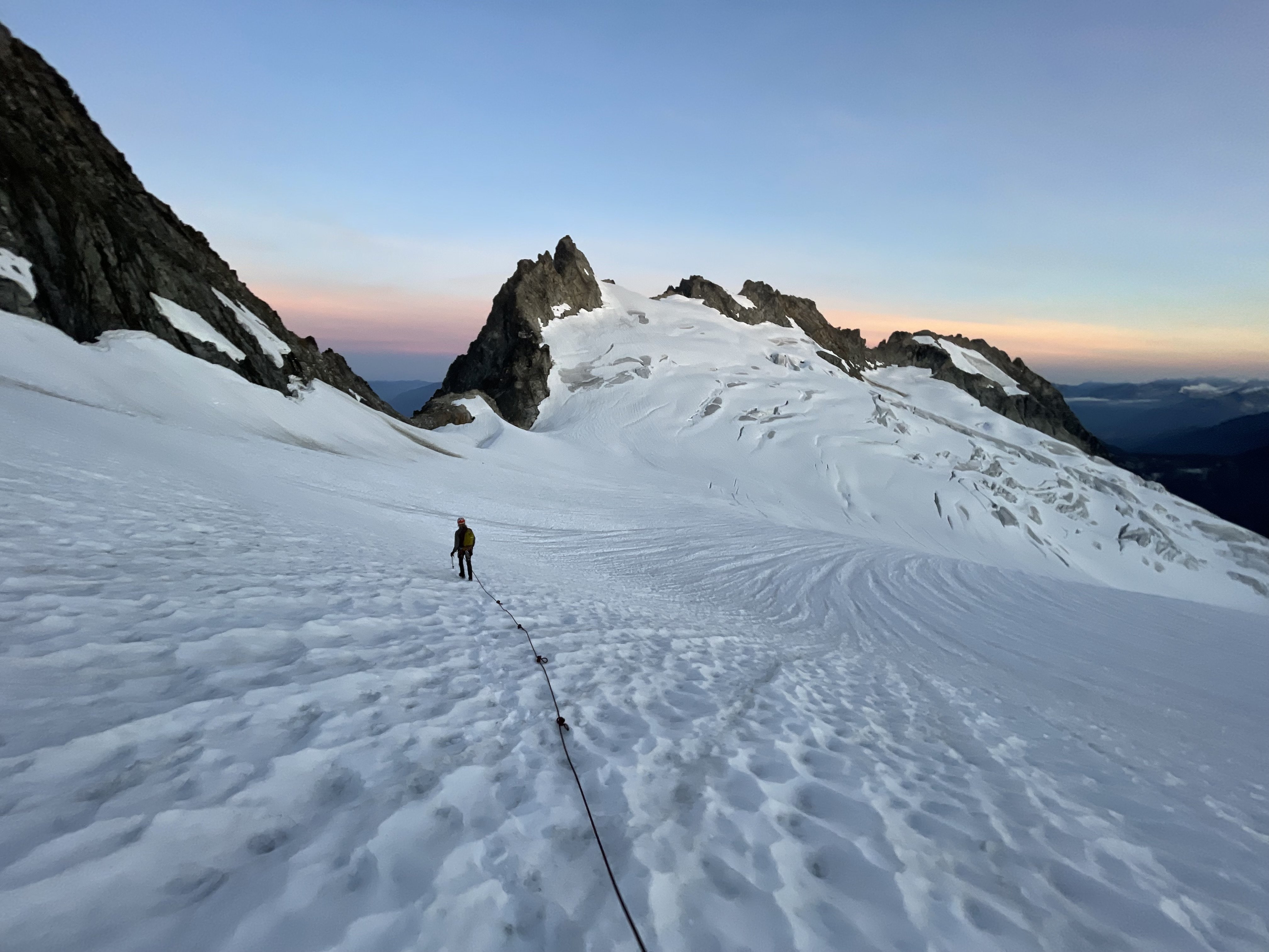
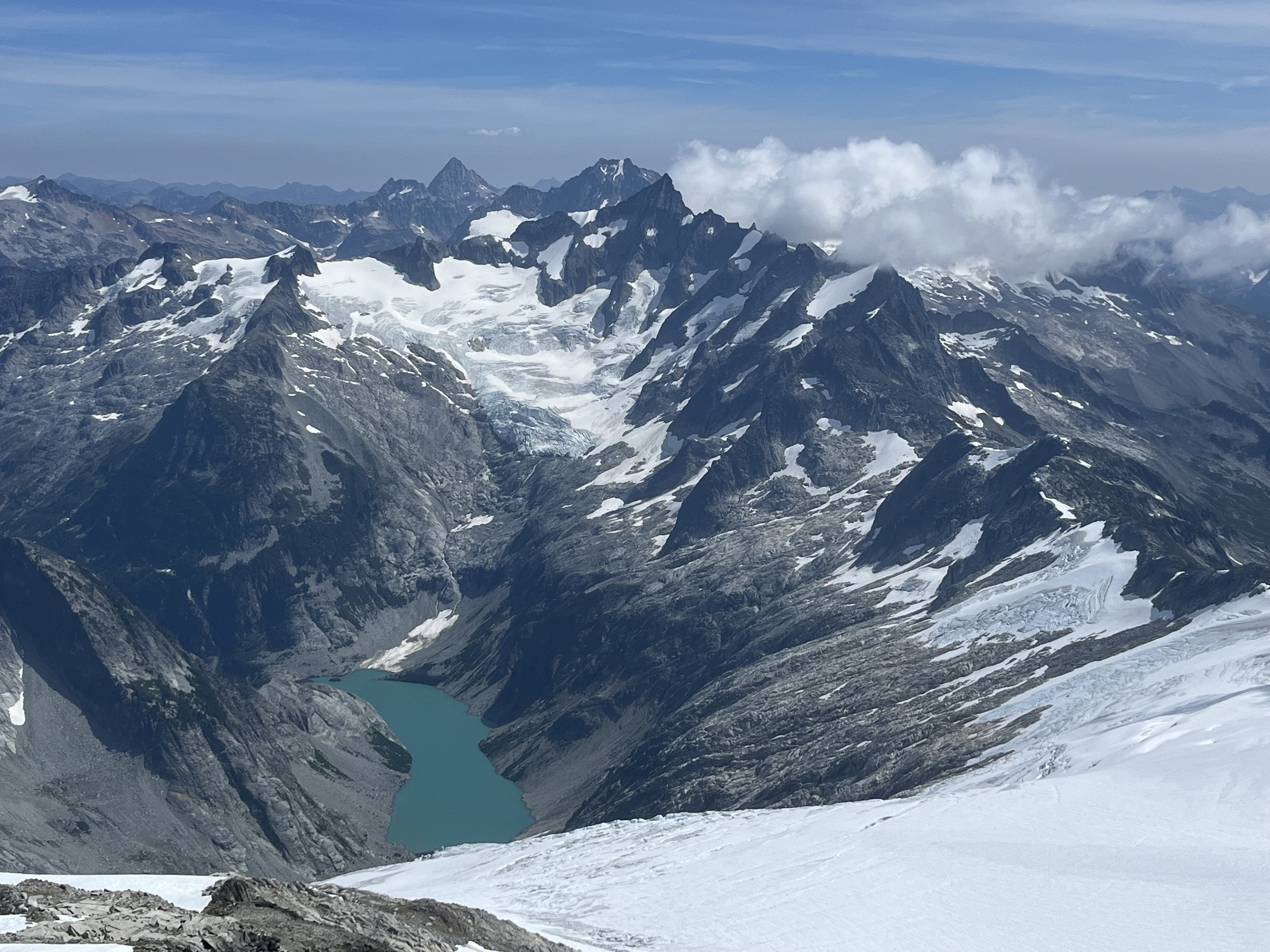
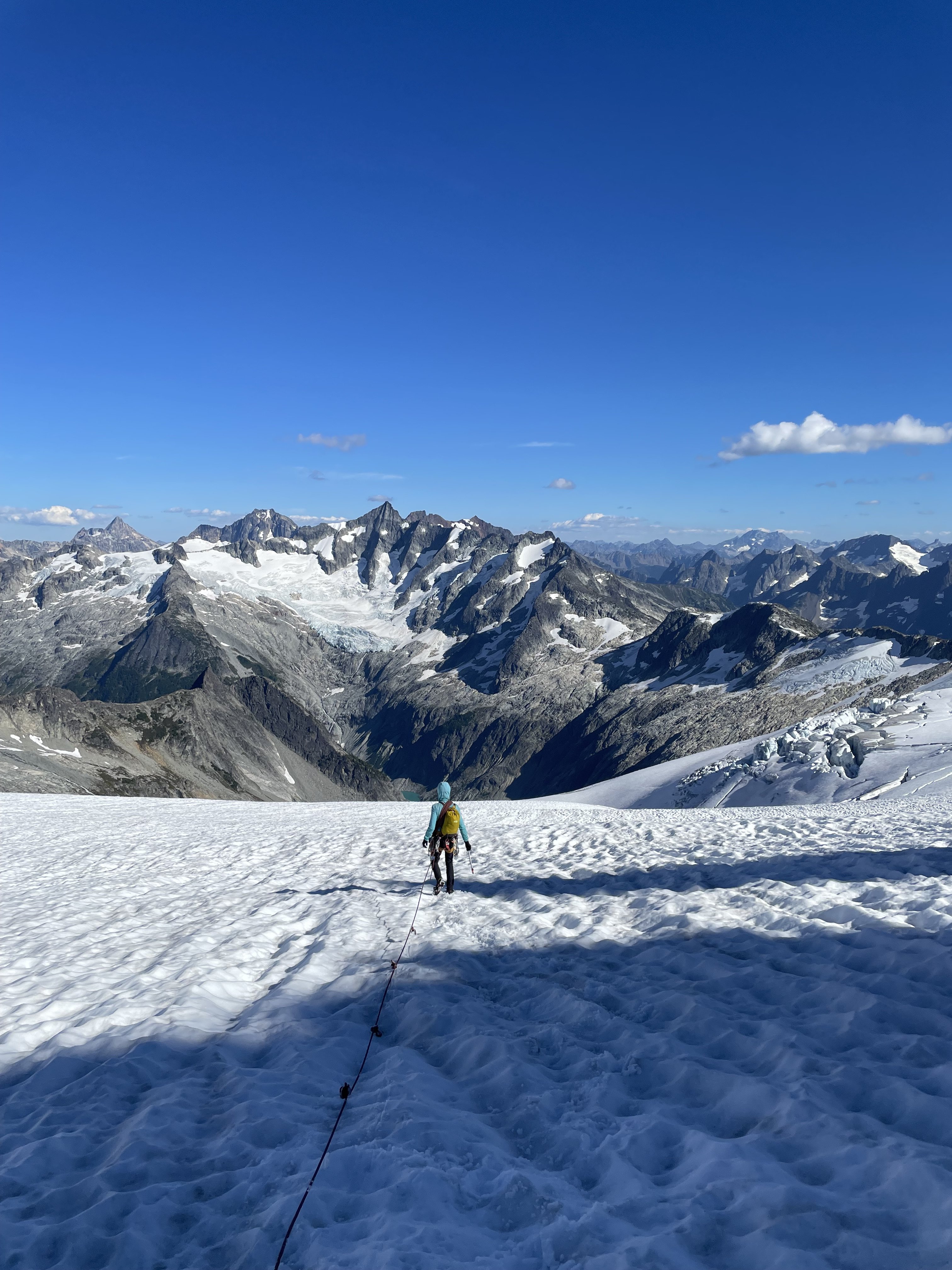
Trip: Baker to Glacier Peak: - 17 days across the North Cascades Trip Date: 07/20/2025 Trip Report: The result of years of imagination and separate efforts. Perhaps it started after exploring the Ptarmigan Traverse, but wanting more. We started gradually exploring the areas to the north and south. Many of us have noted, with some surprise, that there was not a defined “High Route” for this area, unlike some other spectacular ranges of the American West. A few years ago some mountain runners established a “North Cascades High Route”, starting from Silver Creek and ending along the flanks of Agnes mountain. This was an impressive and inspiring feat. Nevertheless we felt it incomplete and starkly contrasted with the style in which we experience these mountains. Although in the end, our route would include much of the same terrain traversing the heart of the National Park and Cascade Crest. But as we played with the possibilities of this terrain it was hard to ignore the striking aesthetics of the volcanos near each end of the range. With both Baker and Glacier Peak being slightly higher than the peaks of the crest, they act as natural waypoints to assess exactly where one is in the vast sea of Cascade summits. It would be impossible to include every spectacular basin, cirque and summit into a single high route but starting and ending with the volcanos gave us a framework to operate in. The route we eventually completed is actually composed of many different shorter routes, linked together by various less visited terrain. Within reason, our goal was to 1) stay above tree line, 2) avoid trails and 3) keep it only lightly technical. We suspect that climbers with the required stamina, skillsets and schedules will likely choose other exploits in the range, or beyond. Nevertheless we present here some basics of our North Cascades high route. Mount Baker Our route up and down the Park Glacier had some obvious benefits. Most significant was that we could change out proper mountaineering gear for more of a hybrid backpacking kit upon return to the TH (Artist Point). The route itself is pleasant, with a scenic approach and lovely high camp. The day we climbed it the snow was soft enough not to require any belay or rappel applications, though in more firm snow that would not be the case. The upper part of the glacier was fairly broken up considering it was early July. We managed an improbable line between a series of large cracks. This line may not have been viable even a week later in the season. We stood on the summit late morning of July 5th. Shuksan Navigating this terrain presented a few obvious and a few not-so-obvioius options. Perhaps at first glance one would think Fischer Chimneys…and then descending from the Crystal Glacier onto the Nooksack. Unfortunately the bergschrund separating the two was gaping by early July and would have required a substantial amount of extra gear that would become dead weight for the week to follow. Additionally the prospect of immediately starting this traverse by hiking on trail through the forest did not match the criteria we set forth. Looking instead to the North side we scouted various lines contouring high above the deep, alder filled basins. There were definitely viable lines through the majority of the terrain, but we determined them to be too complicated and conditions dependent. The biggest concern being that the time involved would be hard to predict. It could take a few hours, or a few days. Additionally there was a good deal of objective hazard traversing high in this terrain. Ultimately we chose a safer and surer, albeit less appealing line. Hiking the ridge above Chair 8 and eventually descending to meet with the White Salmon approach, we faced our first bushwhack in the hottest part of a very warm day. Once escaping the alder hell we climbed to a ridge above and contoured forest down towards Price Lake. We crossed the outflow and traveled along the approach for the Price Glacier route for a while. There would be some fuckery along the base of Nooksack tower getting down to the glacier. But once down there we continued on part of the Nooksack Traverse until Ruth Mountain. Mineral High Route On a map this looks like comparatively straightforward terrain. We did not have a pre-scouting trip for this zone. And we definitely underestimated it. The bushwhacking before and after Chiliwack pass was steep and complicated. Before we escaped tree line onto Mineral mountain there were a series of steep and improbable gullies that took us far longer to complete than what we imagined. In hindsight I think we started out in the wrong gully and paid the price. Eventually we reached “the route” but by then we really weren’t sure if the terrain would go. Finding some clearing among the multitute of brush-gulleys. Above the forest travel cleared again. Although we soon found an abandoned, and completely full backpack. A startling sight this far into remote territory, we searched around for signs of remains but found none. The pack was probably out there for at least one winter, possibly more. We noted its location and passed a message to the park service before continuing our quest. Mount Challenger via Easy Ridge This terrain was fairly straightforward, although the day we did it was very un-summerlike. With no chance of shortcutting the impasse in these conditions we continued the sog and slog down to the lower bypass. Climbing out above the crossing was fairly sketchy. It is very eroded, hard packed and water running along the surface definitely made it attention worthy. Some of the steeper scrambling between there and Perfect Pass was also potentially consequential in heavy rain. Nevertheless we made it to the pass, but soaking wet and in high winds plus white out conditions. Crossing the Challenger glacier in near hypothermic conditions was very….engaging, to say the least. We were all very relieved to step back to “dry” land an hour later. Northern Pickets Descending into the basin is fairly straightforward, albeit somewhat tedious and extended side hilling. The climb back out through Luna Lake and to the Fury shoulder is pleasant, scenic and fun. Especially given that this day the sun had returned. The lower part of the Fury glacier develops some pretty sketchy moats early in the summer and may require walking on exposed glacier ice around 30 degrees. Rather than spend time with that we found a bypass to the north, which lines up with one of the ways parties may choose to climb Fury. We skipped the summit and instead climbed Outrigger along the way. From the col we ascended a 50 foot 5.0 pitch, followed by some rightward traversing 3rd class terrain to the south ridge. Looking back, there was a way to avoid the initial low 5th entirely by starting a bit further west in the col. Descending Outrigger was one of the highlights of the trip. Easy hiking, with the Southern Picket skyline so close you can almost touch it. There was a 15m rappel, which could certainly be bypassed by down climbing 4th class terrain slightly east of the anchor. A short but exciting and exposed bit led to continued easy hiking. Southern Pickets Getting from Picket Pass to the bottom of the basin was pretty fucked. There is some 4th-ish slab downclimb that some parties have rappelled. Beyond that, some of the beta out there is pretty snow dependent. Our planned line was not viable and it took some time to find another way down. Two of us independently destroyed a trekking pole in this zone. Once at the bottom there is some unavoidable alder to contend with. You ever get through one of these, look back from a higher vantage point and realize oh wow, I could not have possibly taken a worse line. That’s what happened here. We should have stayed closer to the cliff along the SW side of the shwack. Oh well. Climbing out to the east of the McMillan spires was fairly straightforward. We managed to avoid brush entirely. Other than a few deep gullies it was a breeze, and an incredible position. From McMillans to Highway 20 Choose your own adventure, depending on legality. Once the Sourdough trail re opens you can traverse east towards elephant butte and then south along Stettattle ridge. Until then, a legal option would be to find Goodell Creek trail/approach and take that to the highway. I cant remember which of these we took… Highway 20 provides the only on route resupply. You could probably utilize Cascade Pass, or even a trip to Holden. But we did not. Isolation Traverse- much has been written on this. Its awesome Looking back to the Pickets, Redoubt from the Mccallister glacier Eldorado to Cascade Pass- decent travel along a nice ridge and basins. Nothing too complicated. Sahale arm trail for a mile or so is a nice reprieve. If you wanted to add some major style points throw in the Torment-Forbidden Traverse through here, although its likely to add some gear complications. Ptarmigan Traverse- MUCH has been written on this. Its awesome Classic White Rock Lakes shot Dome peak area- leaving the Ptarmigan and finding the Dana then Dome glaciers. We scouted a route along the south side of Dome. It probably would go but on the trip we ultimately took the Chikamin glacier around past the gunsights and onto Kaiwhat Pass Doin’ the bull dance. Feelin’ the flow. Workin’ it. Workin’ it To Canyon Lake- The terrain eases here and may involve some bushwhacking but nothing crazy. We abandoned our map, and rationality…instead navigating on vibes alone. Our line to Totem pass was awesome and on paper probably shouldn’t have worked. Between the pass and Canyon Lake there may be a way to avoid significant brush but we did not find it. Still it went quick (downhill) Canyon Lake trail- Seems decomissioned. It’s overgrown and washed out in different places, but still a comparatively decent 5 miles. Image Lake to Lyman Lakes- We looked hard how to avoid such an extended on trail section but there really weren’t any viable alpine options. When we came to this section we were exhausted and very calorie deficient. The easy miles were welcomed. The trail itself is well maintained and incredibly scenic (cloudy pass in particular). Just a hop, skip and a “fuck!” away... Lyman Lakes and beyond- We climbed over Chiwawa mountain without much difficulty. Although the last few hundred feet were steep, slimy, scree covered slab when approached from a direct north line. Pretty gross. It would be better to find the main ridge further east and continue to the summit from there. It started to rain when we were on the summit, so we schemed a bypass for the exposed scrambling awaiting on Fortress. We found a line of weakness that allowed us to bypass to the south. It didn’t take long from there to find the pass no pass trail and follow it towards High Pass (another really scenic on trail moment). Bypassing Fortress For Napeequa we took a path of least resistance well south of the summit, descended to another saddle and then back up and around Hoof. Eventually we had to traverse below the north side of Ten Peak. It took a while but overall it was straightforward. The Honeycomb and Suiattle glaciers brought us to Glacier Gap, along the standard walk up for GP. We were greeted by friends with treats. The next morning we jaunted up the last couple miles. It was a busy weekend on the peak. Spirits were high, despite the suicide gestures Standing on the summit felt surreal. It wasn’t necessarily a positive emotion. Spending the last few summers obsessed and the past few weeks starving made this moment feel like a weird dream. The hike out from there is long, but we crushed it in hopes of making it to Olive Garden in time. Which we did. All the pasta…dipping donuts in wine…it was finally over… By the numbers: 17 days 175.2 miles (73% off trail) 86k vertical gain (86% off trail), 88k lost Average vertical change per mile: 993 feet Average time from camp to camp each day: 14 hours Average calories/day ~3800 Body weight lost- 18lbs (9.6% total lost) Pizza consumed- nowhere near enough Gear Notes: a picket, 2 screws, 3 cams, 4 nuts Approach Notes: the whole thing was an approach...1 point
-
Trip: Twin Sisters Range - Hayden & Peak 6136' Date: 8/10/2016 Trip Report: In the last couple weeks I made separate trips with my friends Matt and Dave to explore the potential behind the Green Creek Glacier, in the deep west-facing cirque formed by Hayden, Little Sister and Peak 6136'. We found some really spectacular climbs on ridiculously good stone. What they lack in length they make up for in being densely concentrated. Link-ups are derigor if you're going to make the effort to get back in here. The Green Creek Valley is definitely not as wild as it once was. On both trips I encountered familiar faces. Which is great! But.....pick up after yourself! It was super depressing to encounter your shit paper fluttering about on the approach along with bits of micro trash both high and low in the valley. Undoubtedly human impacts will only become more obvious but at the very least there doesn't need to be garbage strewn about. Approach Hayden Peak is remote. From the Green Creek Glacier the easiest way to get there is to pass between Little Sister and Cinderella Peaks and then traverse through several bowls on the west side. A more direct and interesting approach can be made by climbing over the top of one of the minor peaks above the glacier. The Green Creek Needle sits on the southern aspect of an attractive pyramid of rock (which I hence proclaim as Ribbon Point). The northeast aspect of Ribbon Point has several dihedrals separating long strips of slabs. These slabs are stupidly solid, clean and extremely easy. A bit of a shrund problem may exist, followed by some dirty 3rd class up a gully to reach them. From there it's 3 or so pitches of 5.0 to the summit. (Matt and I climbed the same aspect on the next peaklet north but it was not as good). An easy down climb on the west side and a traverse leads to a saddle in Hayden's east ridge in maybe twenty minutes. This approach will only work once snow melts off the slabs which doesn't seem to typically occur until mid-July. Earlier in season you could climb Green Creek Needle, rappel off the back side and then go up the south ridge of Ribbon Pt at 3rd/4th class. Ribbon Point approach to Hayden Best 5.0 in the universe on Ribbon Point Hayden Peak - NE Pillar Hayden has a really beautiful spur of rock dropping of the east ridge into the basin between Hayden and Skookum. I climbed it twice with both Matt and Dave it was so good. Four pitches of progressively harder rock leads to the tiny summit of a prominent pinnacle on the east ridge. A short rappel leads to a spectacular, exposed 4th class scramble through a series of towers to a longer rappel (75') that intersects the normal east ridge route. From here exposed 3rd class scrambling with route finding issues on more great rock leads to the summit. On the crux pitch either climb the wide crack on the right (5.7) until you can move left across the face (5.9) into a great layback corner. Or start with the short chimney on the left and then climb back up and right across the face (5.7r - micronuts for gear) to the same 5.9 moves into the corner. Awesome. To get off Hayden retrace your steps to the last rappel the work down ledges to the east then west. If it's not easy scrambling you're doing it wrong. Matt near the top of first (5.4) pitch Dave starting up the pitch of 5.7 Looking up at the crux Looking down Matt scrambling through the exposed 4th class towers Looking at Hayden from Ribbon Peak. The NE spur is out of sight but tops out on the solitary pinnacle at center-right before following the ridgeline to the summit. Peak 6136' - North Face Dave and I were on a day trip and bailed out after Hayden. Matt and I had hiked in the day before and had time for another route. Peak 6136' is just a high point on the broad west shoulder of Little Sister. It's 500' north face is one of the steeper in the range and is obviously composed of excellent rock. Matt and I climbed a very direct line to the summit via series of frequently steep and splitter cracks. We scrambled into the alcove below the grey slab in the center of the face. Matt started up the obvious left trending arch for 15' then traversed a ledge to a finger crack. When the crack intersected the arch he pulled the bulge and continued up a 140' of intermittent finger cracks on great stone, belaying when the angle kicked back. The second pitch followed the obvious, steep cracks in a left facing corner with several overhanging bulges that caused me a fair bit of grief. A short chimney led to ledges (belay on the second at a good crack). For the third pitch Matt headed straight up the face above the belay with tricky gear before pulling through another budge and following an easy but very exposed arete to a large ledge just below the summit. From the narrow top it's an easy walk off towards Little Sister. Matt starts up first pitch slab. Pulling out of chimney on second pitch. Topping out. Matt approves. Walk off of Peak 6136' Heading down the glacier Gear Notes: Doubles to 2.5". Include small offset nuts and extra small-medium stoppers. Approach Notes: Green Creek Valley. 5 hrs to base of Ribbon Point. Good camping exists in pockets of grass around 4500'. Beyond that flat, dry sites become more improbable.1 point


