
All Activity
- Past hour
-
 ahutton joined the community
 -
Kelty Cloud 6500 Pack vs Wild Things Andinista
ahutton replied to erewhon's topic in The Gear Critic
It's now over 20 years later; and I still don't regret the purchase of the Kelty Cloud (or my Hilleberg tent) and it's as durable as it was on day one though a bit dirtier. Sometimes good gear is good gear. - Today
-
 More meat left on that bone.
 -
 Elizard joined the community
 -
Hey did you end up finding anyone for this attempt? Short notice, but we just got shut down by the aftermath of the storm last week, and I'm chomping to find another opportunity to make it up there this season. Happy to discuss in more detail.
-
 John, Yep, I saw that photo when looking for lines other than the first ascent. If the summit register is to be believed, the Plumb Line Buttress is probably the, in my flea-bitten opinion, less aesthetic buttress starting from the right edge of the leftmost snow patch. We initially had our sights on the thinner rib west of our central buttress but there appeared to be a section of rot where it first gets steep and another below the top so we opted for the safer option. It's anyone's guess where Roger Jung went but I wouldn't be surprised if he climbed roughly the same line as us. I would call ours a "possible" rather than "probable" first ascent. To add to Eric's list of stats: We took about 6 hours on the route but that's 'cause one of us is "old and in the way".
 -
John Porter has a nice sunlit shot of the whole north face here.
- Yesterday
-
 HAHAHAHA, how true. I already want to go check it out. Thanks for the post!
 -
 Rodny Rodriguez changed their profile photo
 -

Partners wanted: All the Things and Types for the PNW
Jaredvg replied to wingy's topic in Climbing Partners
Sent you a DM - I’m always looking for partners as well. - Last week
-

MRNP Carbon River/Mowich Lake Access Closed
Fairweather replied to Fairweather's topic in Access Issues
Access to MRNP just got worse. (For Pierce County residents.) https://mynorthwest.com/chokepoints/sr-410-white-river-bridge/4121822 -

Baranof Island Alpine Traverse August 22 - 25, 2023
Joe_Poulton replied to Fairweather's topic in Alaska
There was a guide a few decades ago that was planning to open this traverse up as a guided outing. It didn’t happen however. I just came across this bit: https://www.kcaw.org/2017/11/17/sitka-hikers-wrap-epic-six-year-baranof-island-trek/ -
A moment ago I was searching here for anyone possibly climbing with POTS. I have 4 kids now; the 2 oldest most likely have POTS; one of our 4 year old twins survived two open heart surgeries in her first two years of life; both at UCSF Benioff—the best pediatric cardio-thoracic surgeon Dr Reddy is down there. But back to POTS; found something somewhere else so, I figured I’d drop it here: https://blog.weighmyrack.com/how-to-climb-with-pots/ Anyone here have kids with POTS that go out in the woods hiking or climbing?


-
 Thanks for the clarification, John @John_Roper -- I've seen it variously referred to with the -burg, the -berg, the full name with either an e or a u, and sometimes the hyphenate J-. Presumably the playful J-berg is truncated to make clear it's a smaller version of the real deal, and refers to a mountain and not a city? Anyway, now we know, J-berg! Fixed it in the title, etc.
 -
I have been gone from the area for over 20 years now. But I never thought that this would happen in my lifetime. Rather melancholy about that now.
-
 That really puts it in perspective. Nicely done gents.
 -
 As if you stepped out of a time machine into the hallroom of the Darrington hardmen of yore.
 -

FA - Helms Deep - The Stairs of Cirith Ungol - 6 pitches, 5.11c
wayne replied to aawait92's topic in Alpine Lakes
We tried it today, it could use a good scrubbing -
Nice line, especially the side view. Naming history: Little J-Berg. 7945’ on map. P745 (now Lidar P790). This was the original (August 23, 1968) name for this summit since from Easy Pass its shape resembles that of massive Johannesburg Mountain near Cascade Pass. (A "berg" is a mountain; a "burg" is a town.) Fred Beckey was lukewarm about this name for his guidebook, so Legends Peak came to mind to honor Indian legends and legendary climbers. The alternate name was Arches Peak for its arcing shape and for a blocky arch low on its north slope and was so recorded in green Fred CAG. I still like Little J-Berg best.
-
 Chauceeer joined the community
 -
Thanks for the photo, Jason -- a much better perspective on our line. You got it, Joe--minimal brush involved to cross the creek to talus, and the creek was easily crossed this time of year.
-
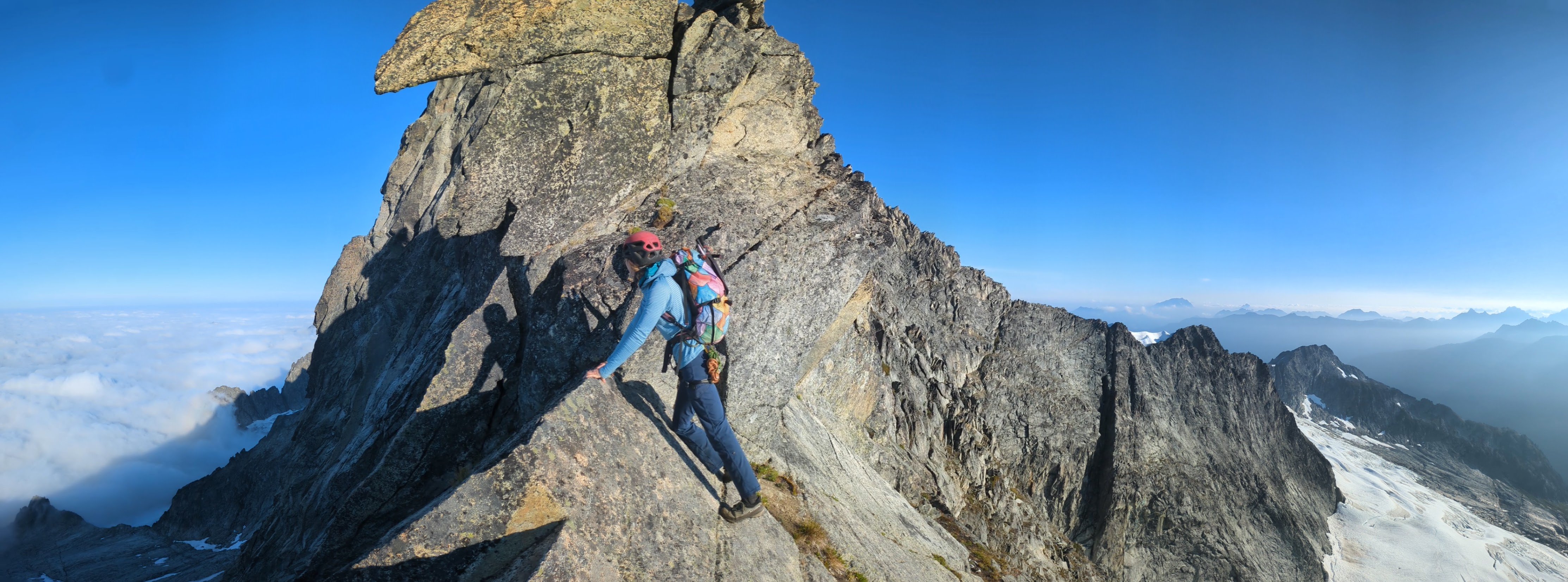
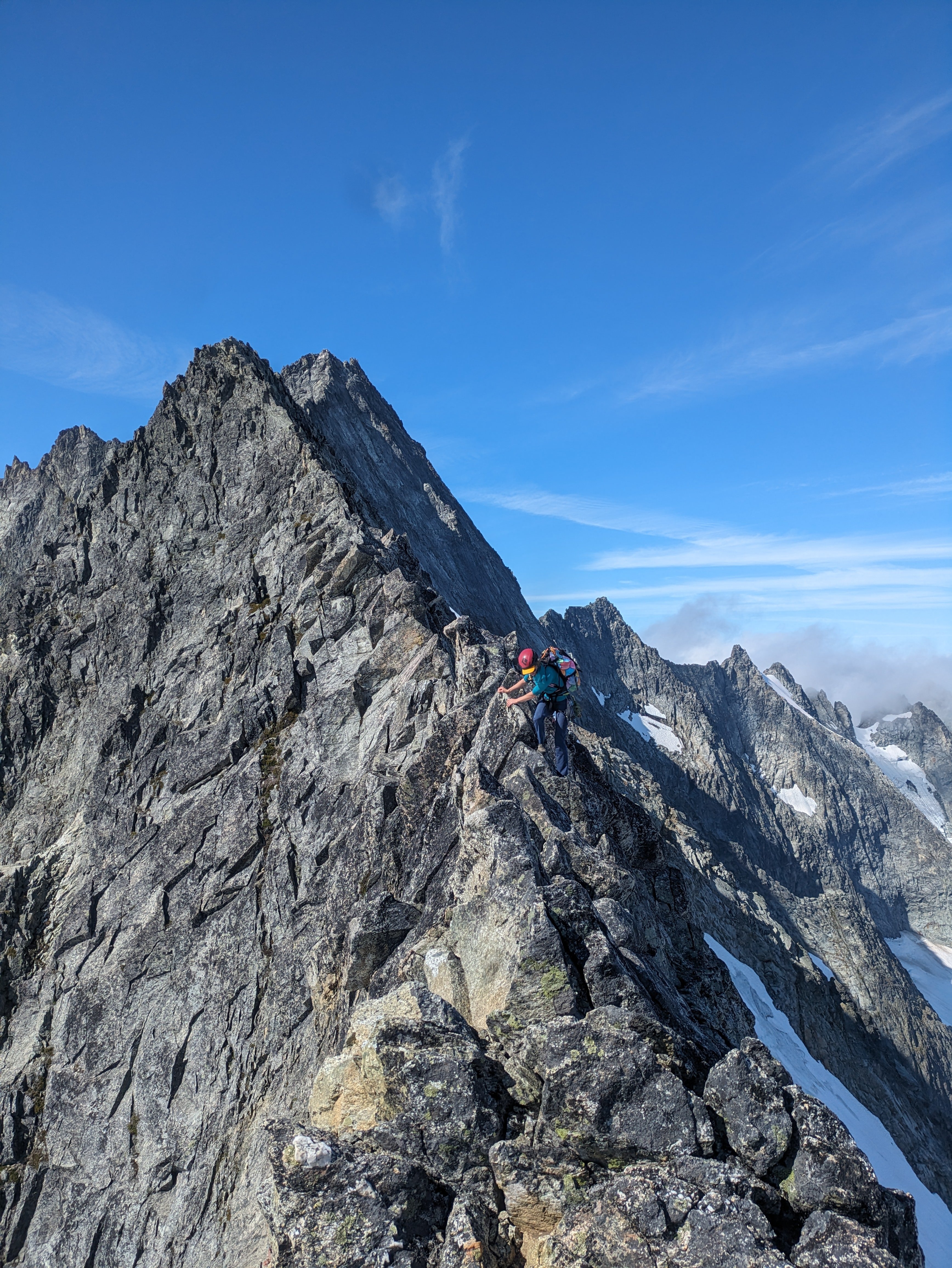
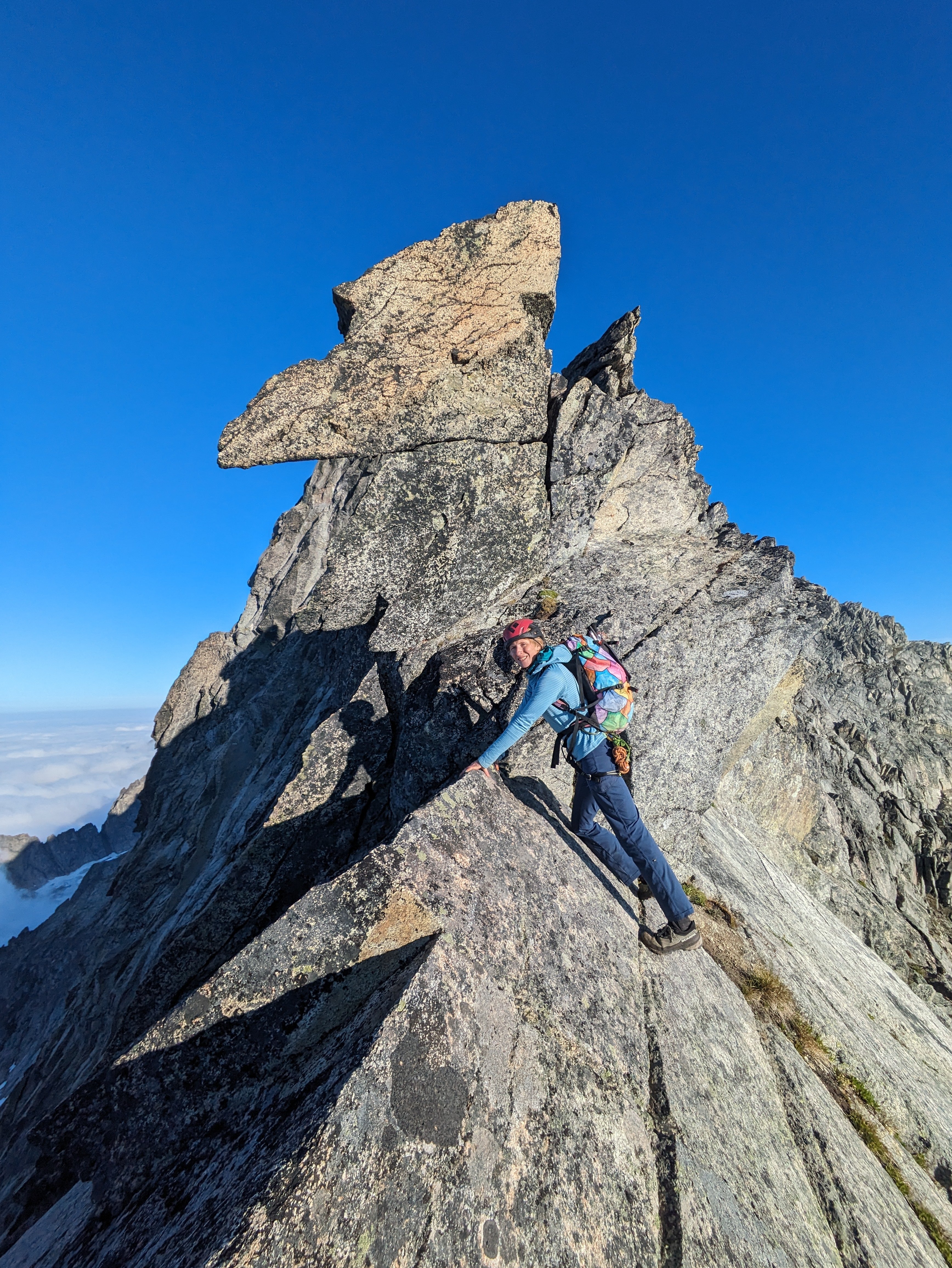
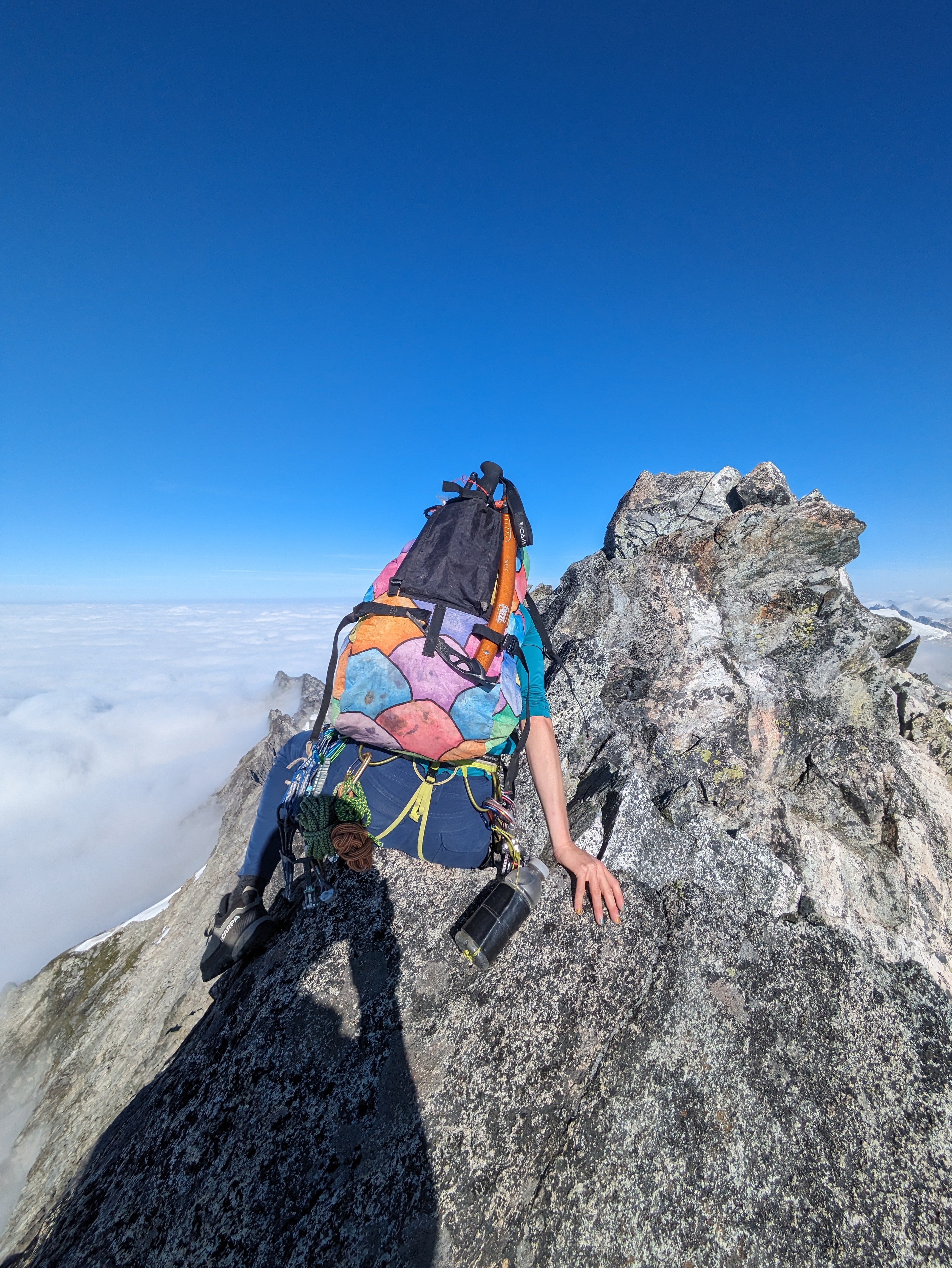
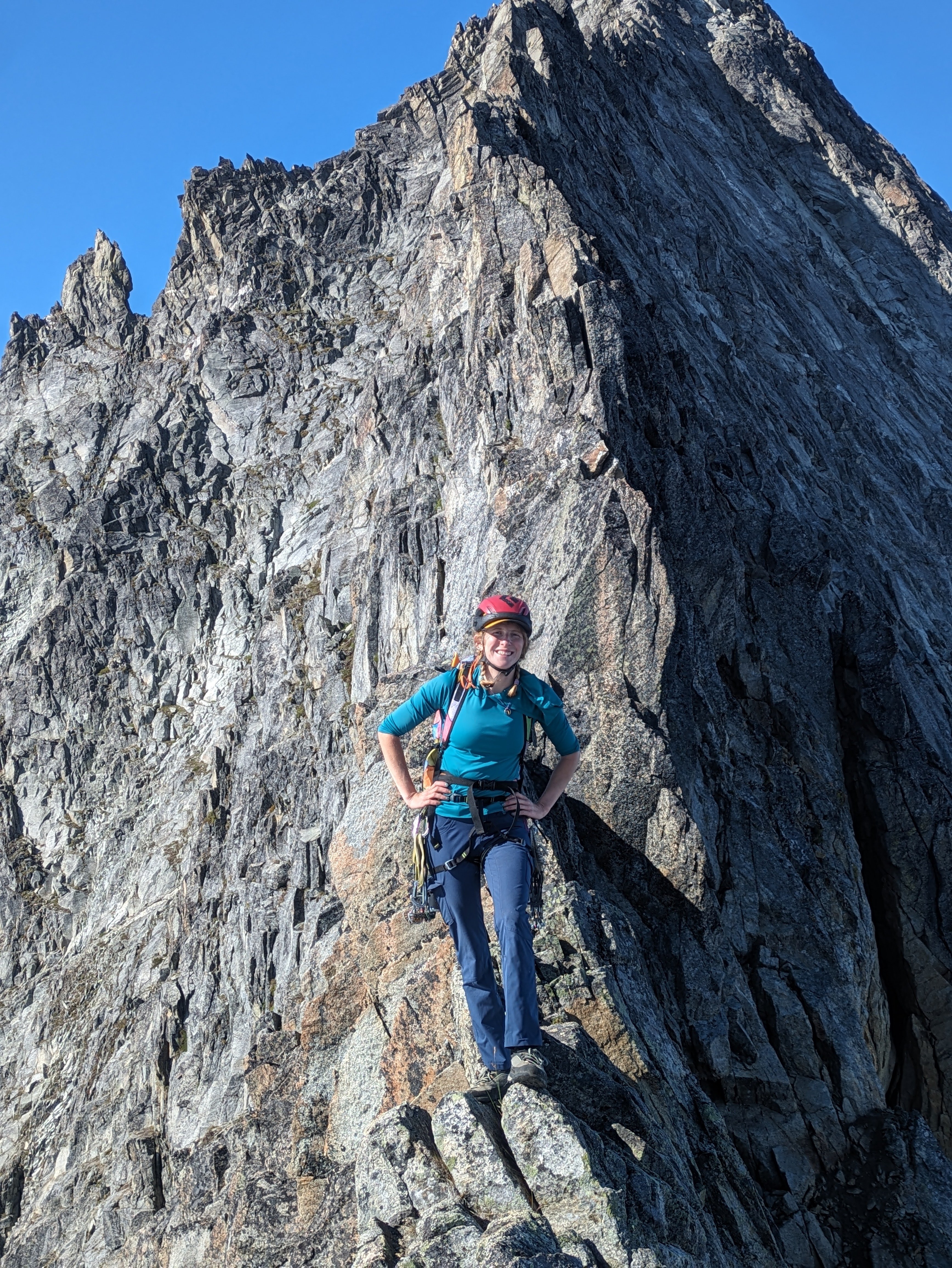
A few days ago Lani and I did a fun link up on forbidden. We climbed the East ridge North Ridge and West Ridge. This is a rad way to move through a lot of scrambling terrain. Uncertain weather before the atmospheric river gave us a pretty narrow window to work with, so we headed up the evening before and bivied at the base of the East ridge. We left the B basin trail around 5pm and set up camp around 8 for an early night. The cloud ceiling quickly raised up, putting us in a thick,misty whiteout for the whole of the night. We woke up to even more whiteout and low confidence, expecting to bail we went back to sleep for a few hours. We ended up leaving the bivy around 8am. We climbed up the East ridge, then down climbed the north ridge. Down climbing the North Ridge was surprisingly mellow, we didn't end up needing to rappel. And the route finding was almost easier on the way down than the way up. There is only one 20' section of 5.5 at the very bottom, otherwise it's all sustained 4th class and secure low fifth. Once at the low bivy of the north ridge, the clouds again threatened us. So we sat and weighed our options. We ended up watching the clouds for an hour before deciding our fate. Our original idea was to traverse the glacier and climb the NW face/rib. But whiteout and impending rain steered our decision to "bail" back up the north ridge. Though the north ridge is such a fun knife edge it's hard to complain. We then down climbed the West Ridge. We hit the base of the West ridge 6 hours after starting up the East ridge and made it to the car just before 5, almost 24hrs after we left. The epic rains to come that night validated our decision to limit our time in the mountains on this one. For those who don't know yet, you no longer need to touch snow to climb either the west or east ridges. The glacier below the cat scratches is more or less completely gone. While sad, it does mean you can do this whole link up in approach shoes without carrying axe/crampons. Starting up the East Ridge Headed down the North Ridge, with clouds threatening to spill in from the west. Headed back up.
- 1 reply
-
- 6
-

-

-

-
 Sounds very fun, excellent. Great looking line. Looks like little to no bushwhack either, no issue with creek this time of year?
 -
 Boom! Just look at that proud face! (at least I hope that is your buttress on the skyline)
 -
 Thanks for the foot pictures btw. Normally we have to pay for those.
 -
Gardening on Salvia is definitely some other best that YouTube has to offer. But naming something up in Darrington after it is next level. Traditional is made alive or revived or made new whatever. Thank you for this contribution to the zeitgeist.
-
The Professor and the Beast with yet another exploit. Thanks for sharing.
-
Trip: North Cascades, Arches Peak aka Little J-berg - North Face Central Buttress, 10 pitches plus soloing, ~1,600 vertical feet, 5.6/7ish Trip Date: 08/03/2025 Trip Report: A couple of weeks ago, Rolf Larson and I climbed a probable* new route on this peak. Anyone cresting Easy Pass has been greeted by the big north face of this peak. There is one reported route on the face from the late 1970s; the party climbed the left-hand "Plumb Line Buttress" 2,700' from the valley floor to the summit, which clocks in at 7,945'. They reported loose rock. (See photo of register page in the album linked below, the AAJ, or Beckey guide.) Of three relatively prominent buttresses, our route climbs to the western false summit (circa 200' west of true summit) via the central buttress -- the most prominent one lit up (furthest left) in the photo below. We believe the 1977 line appears in this photo as a nondescript buttress in the shade further off to the left. Our route wends up the gneissly-featured buttress on pretty good, pretty clean Skagit rock--we began climbing behind the third snow-patch from the right on that prominent shelf, directly below the toe of the sunlit buttress. (Also available here: https://photos.app.goo.gl/BV3itCHmqcoo7qL38) We had fun on this route, which thankfully was in shade while we climbed. Didn't take many climbing photos, but snippets of conversation went like this: "How'd you like that section of hand crack?" "I preferred my section of laser-cut finger crack." "Yeah, I went Squamish style and laid it back." Here's Rolf putting in a piece at perhaps mid-height on the face (the rope is out of view, off to the right): The first pitch was probably the steepest and most sustained, fwiw, and had a 5.6 or maybe .7 move. A couple of steep mini-headwalls were also climbed in that range of difficulty, but a person could avoid these if willing to take looser rock. We unroped for a few hundred feet of mellow scrambling after the first pitch or two, but some steeper terrain compelled us to again rope up and resort to pitching and simul-climbing on fourth and low-fifth terrain. The climbing is moderate, but generally solid and fun, with adequate protection. *As you will see in the summit register pics, Roger Jung soloed a route on the north face, but it's hard to say if he took our route -- there is certainly latitude to wander on that big north face. The photo album, which includes some pages from the register: https://photos.app.goo.gl/4JU83LgK6XKFdbSA7 We descended via a walk off to the south and east--no crampons required. The short-ish approach, moderate and generally solid climbing, and straightforward descent (not to mention the blueberries!!) might make this climb more appealing than some of Rolf's and my other routes. I'll wait for Rolf to correct me on any details (which are already fuzzy), downgrade the level of difficulty (as is his crusty wont), etc. etc. Here's an early musing about Arches from the cc.com archives: Gear Notes: Standard rack with emphasis in finger-sized pieces; tri-cams were useful Approach Notes: Via Easy Pass, drop to and cross Fisher Creek, find your way up through the lower cliff bands, wiggle-chimney between moat and rock to the start
- 11 replies
-
- 10
-

-
-
-
-
In case you haven't seen it yet:


