Search the Community
Showing results for tags 'CCTripReport'.
-
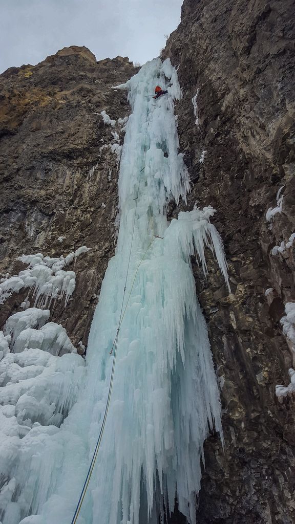
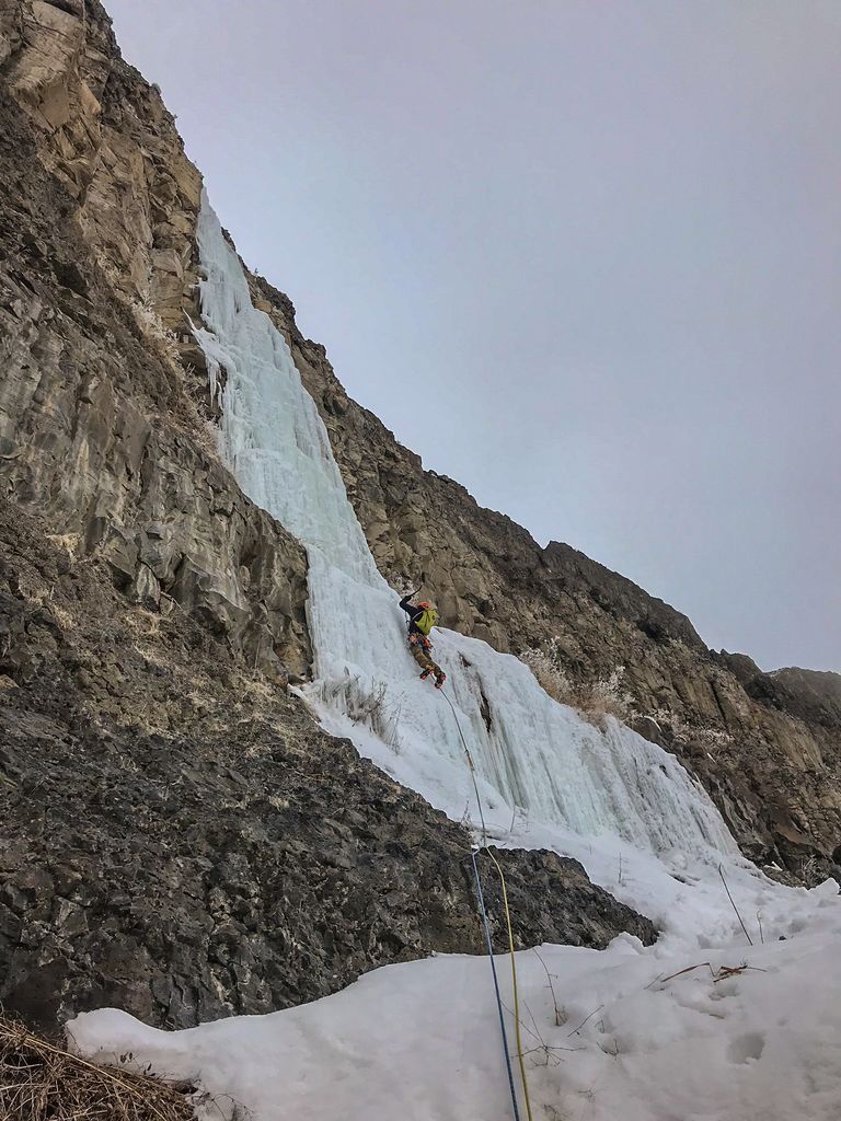
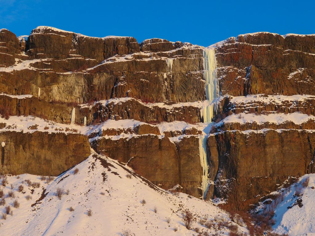
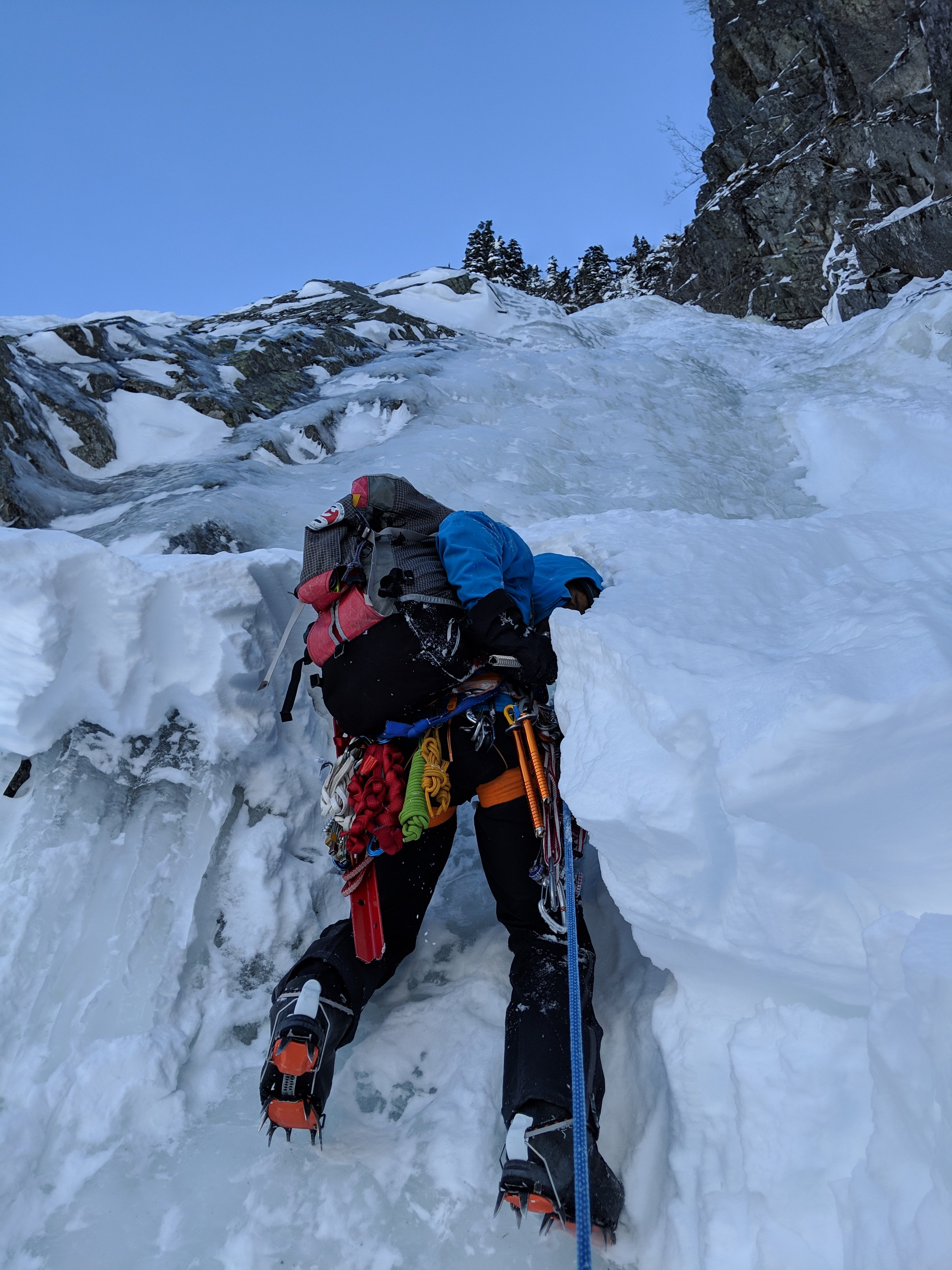
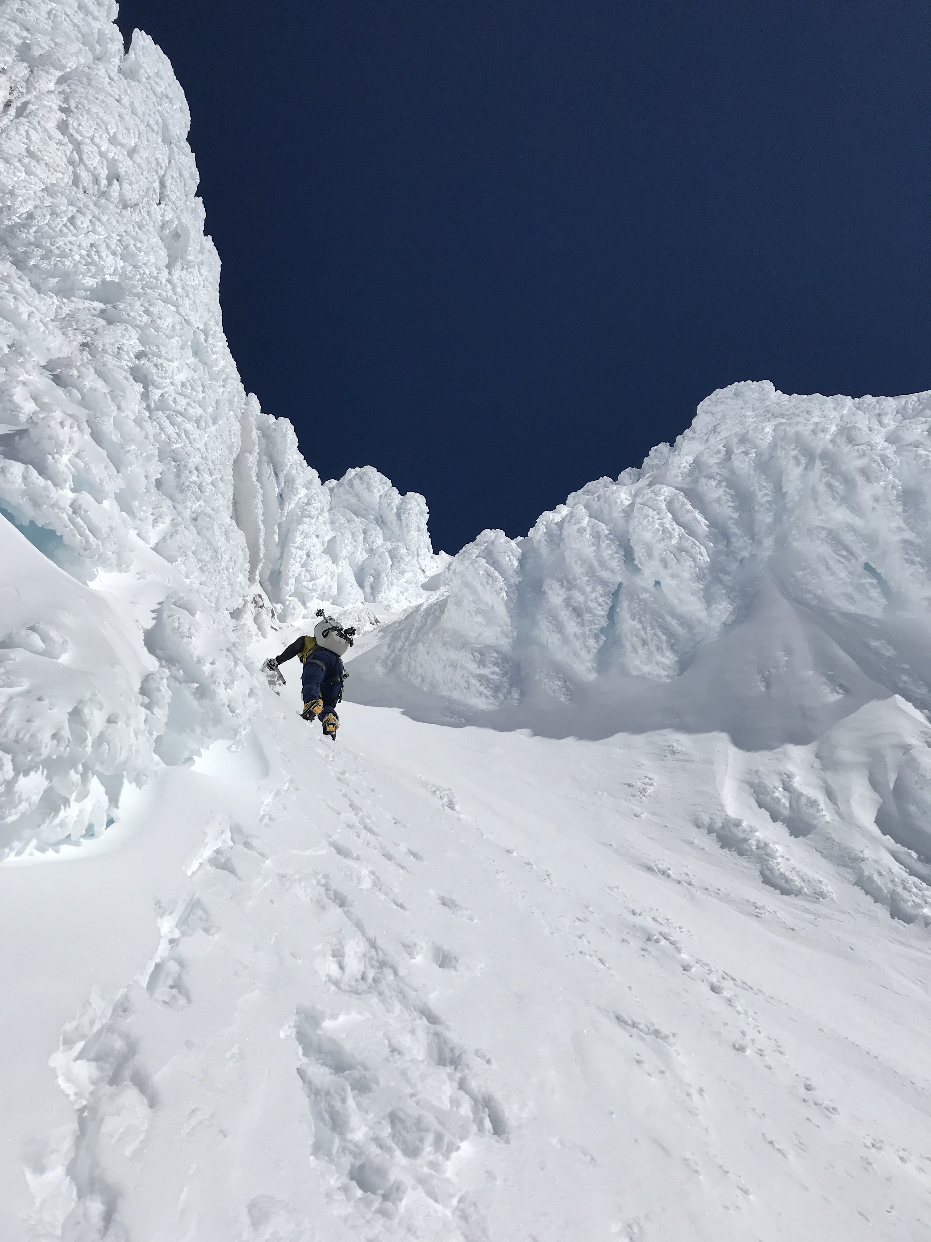
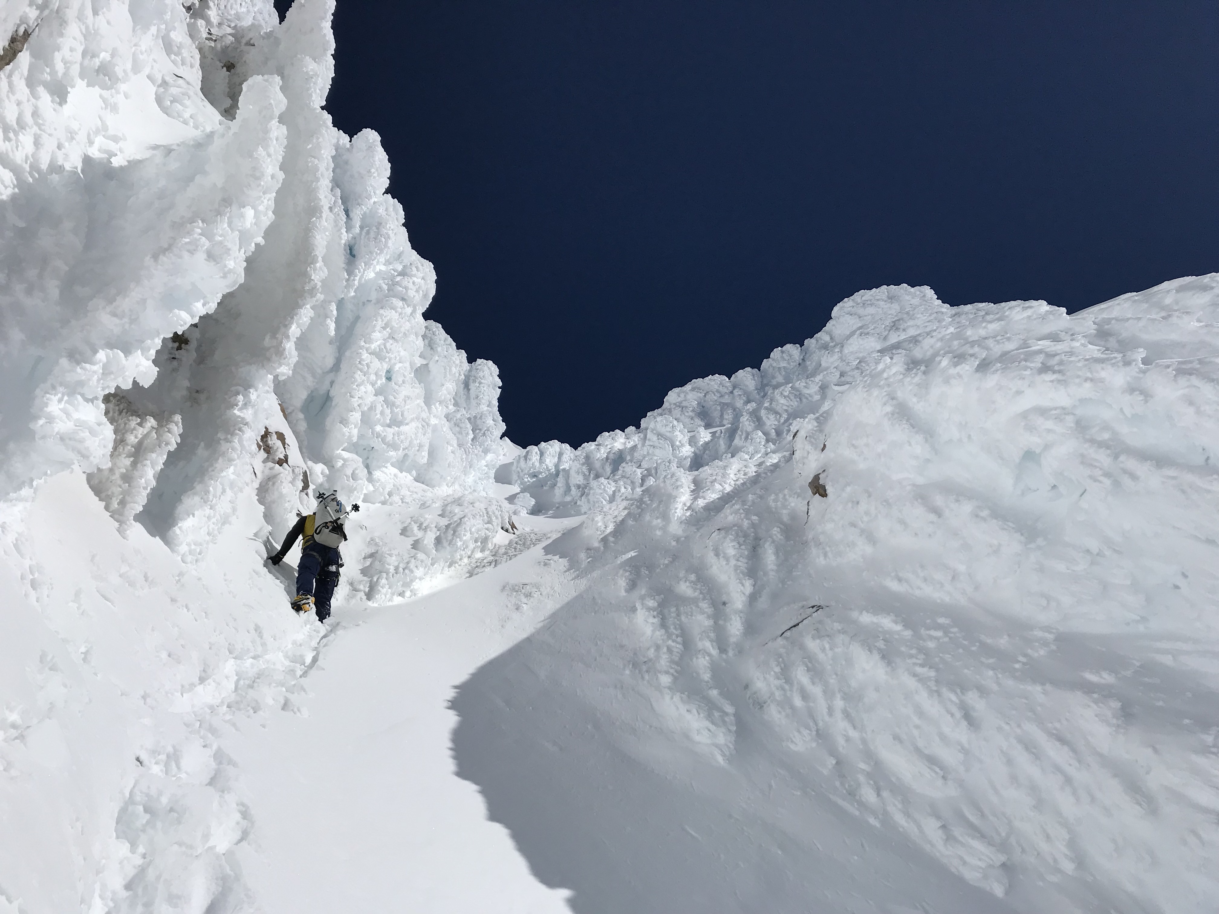
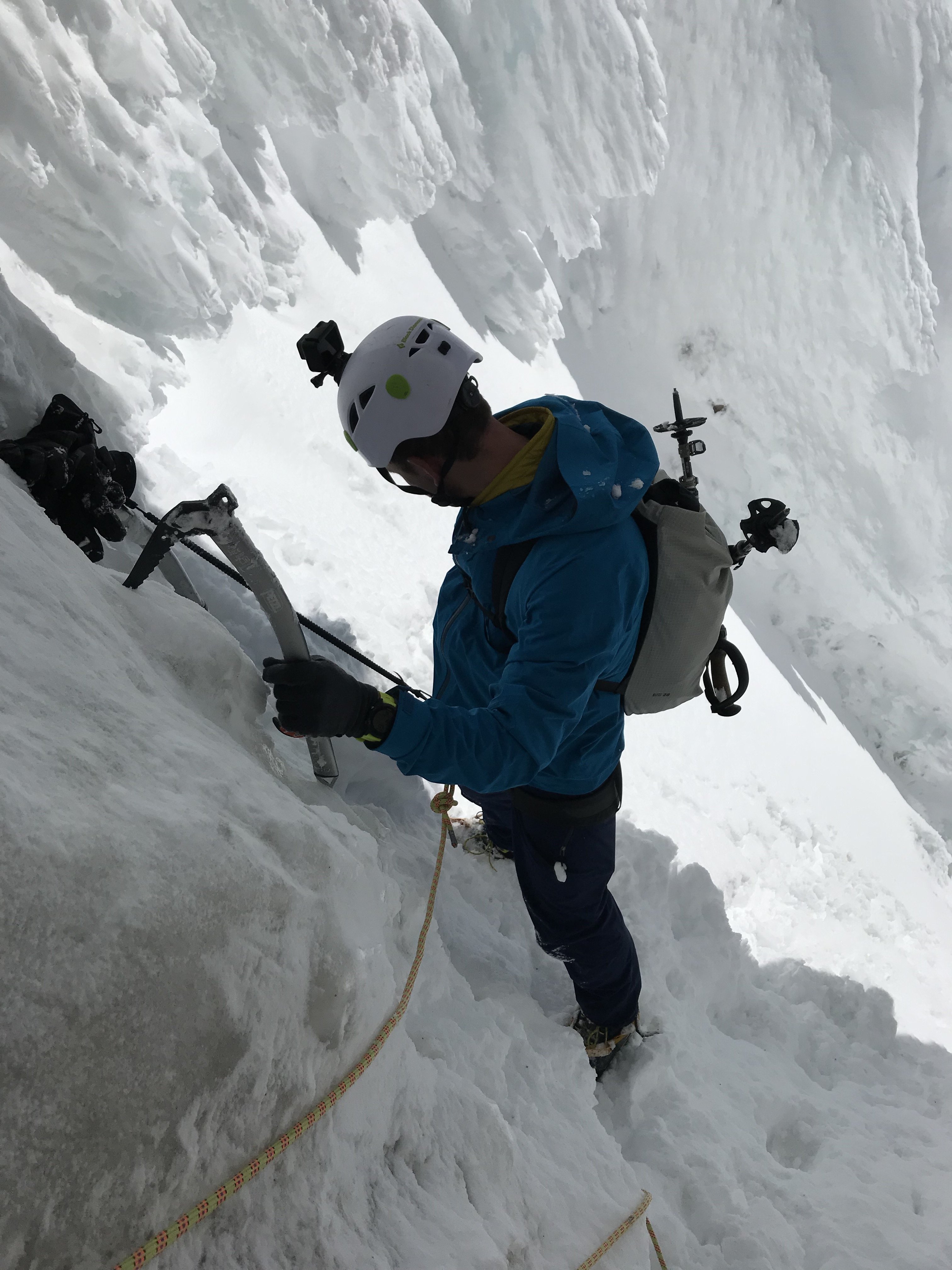
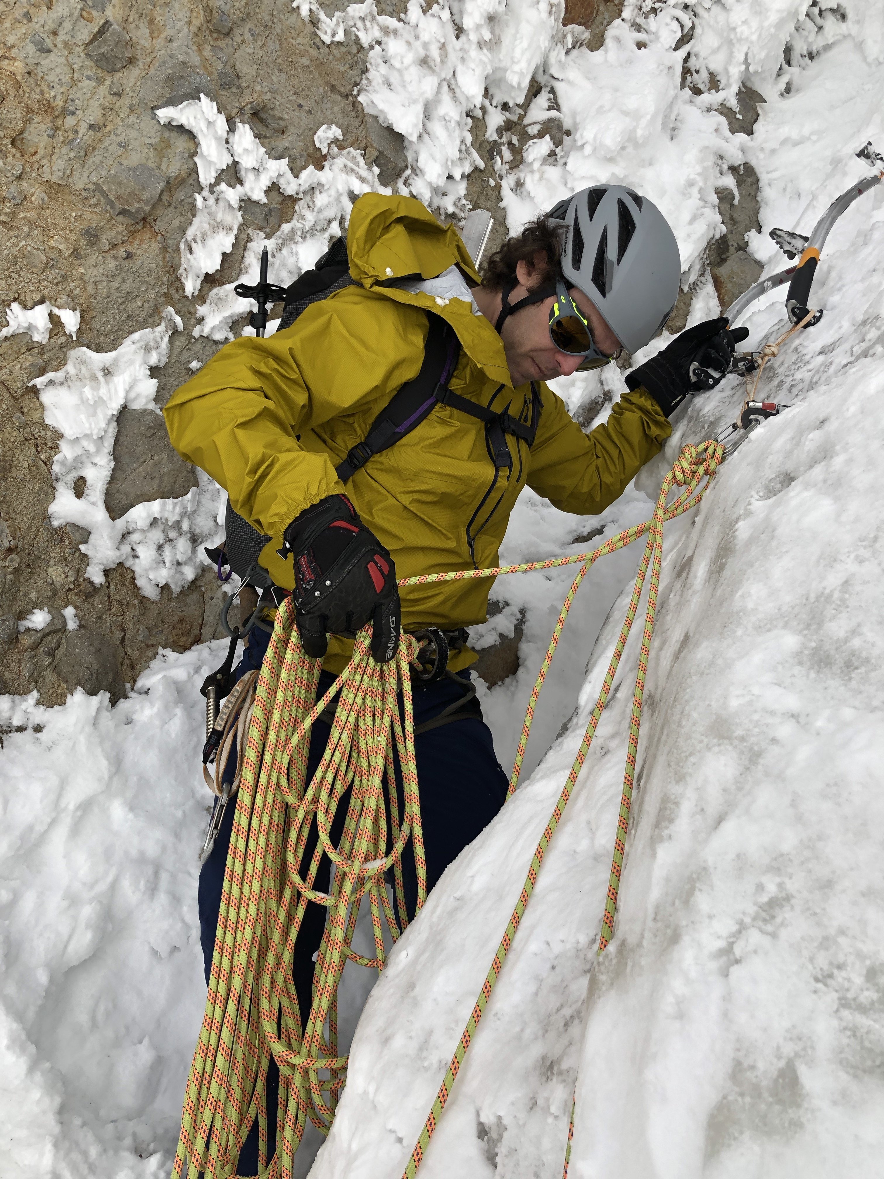
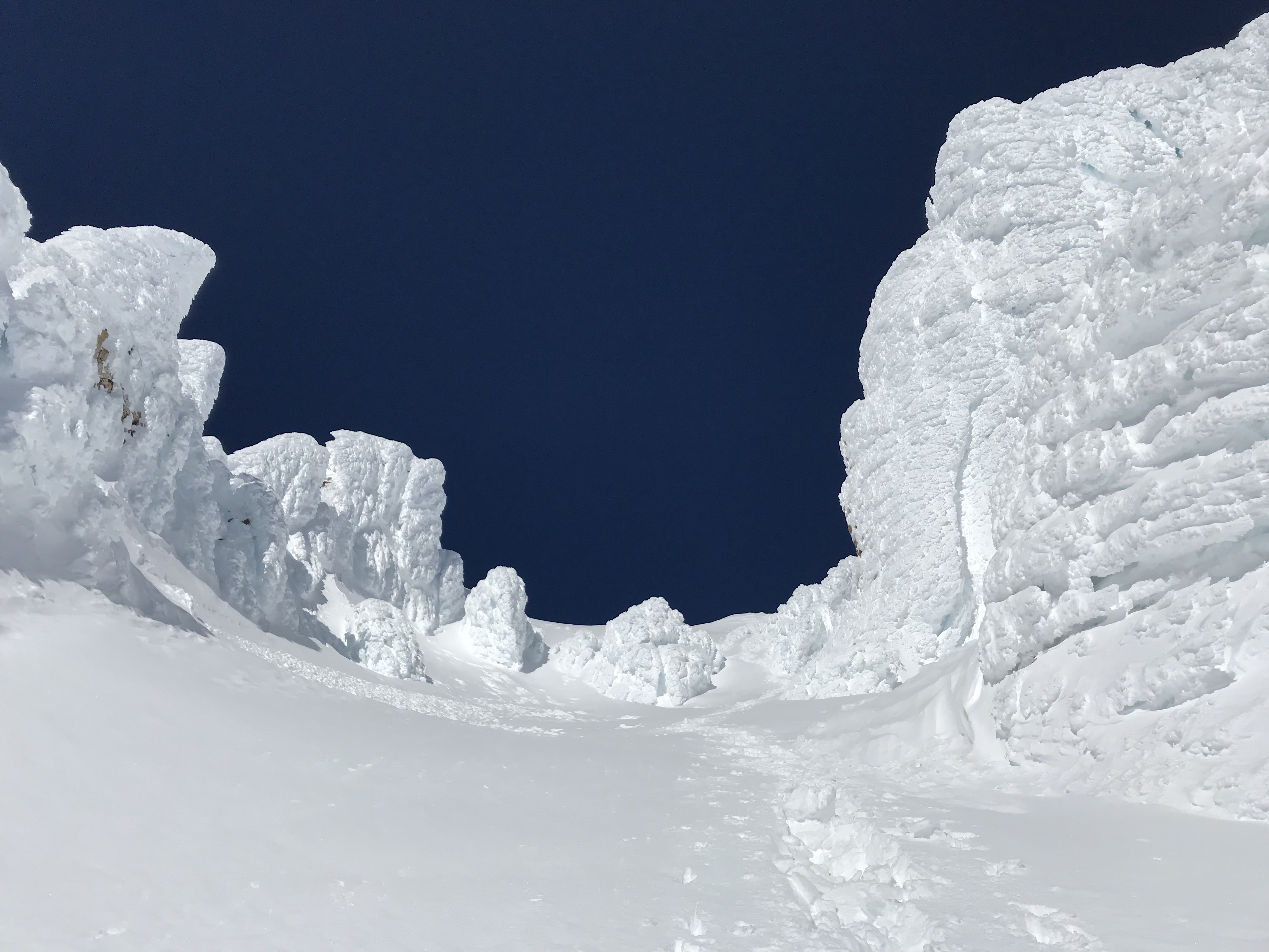
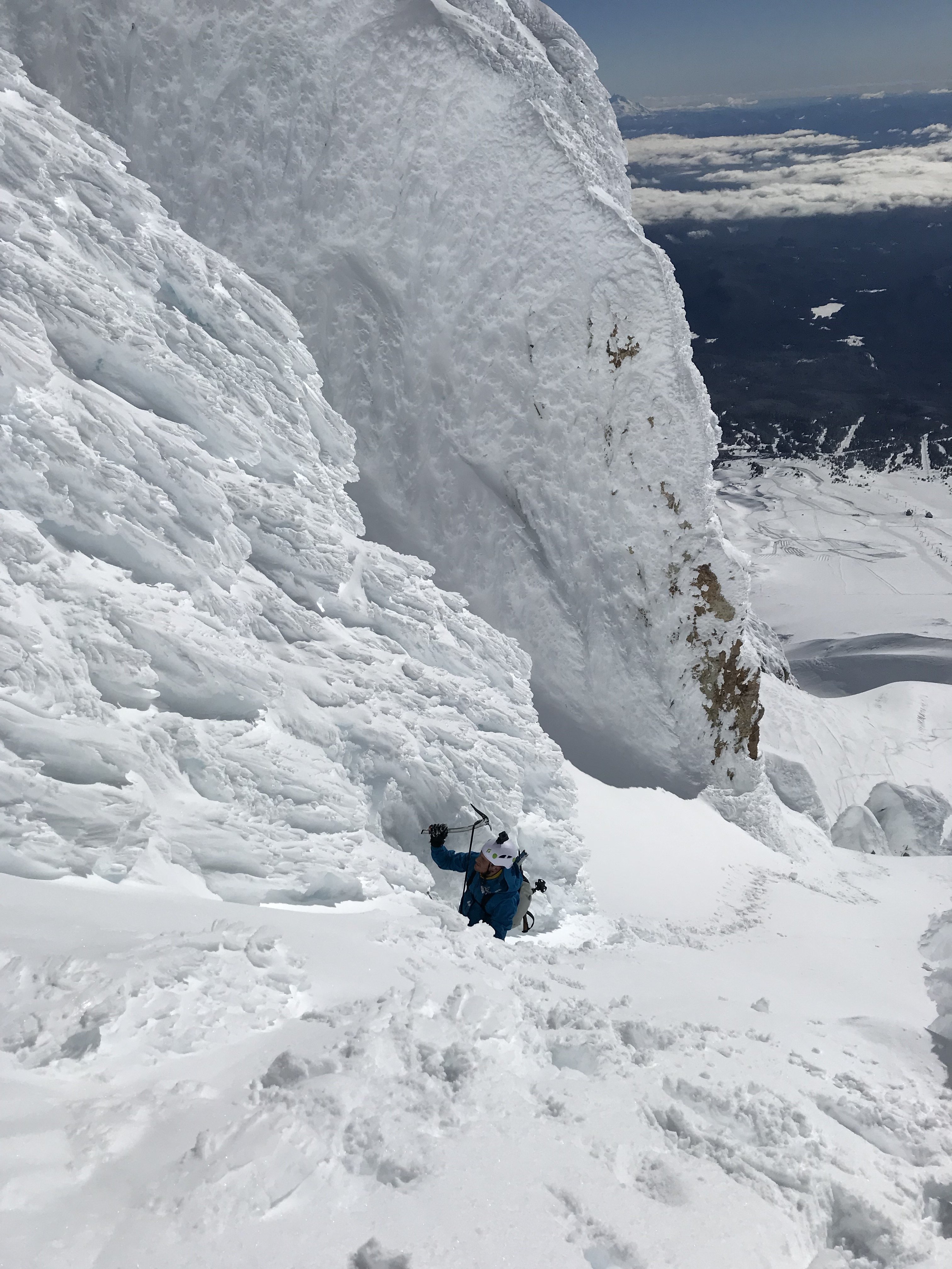
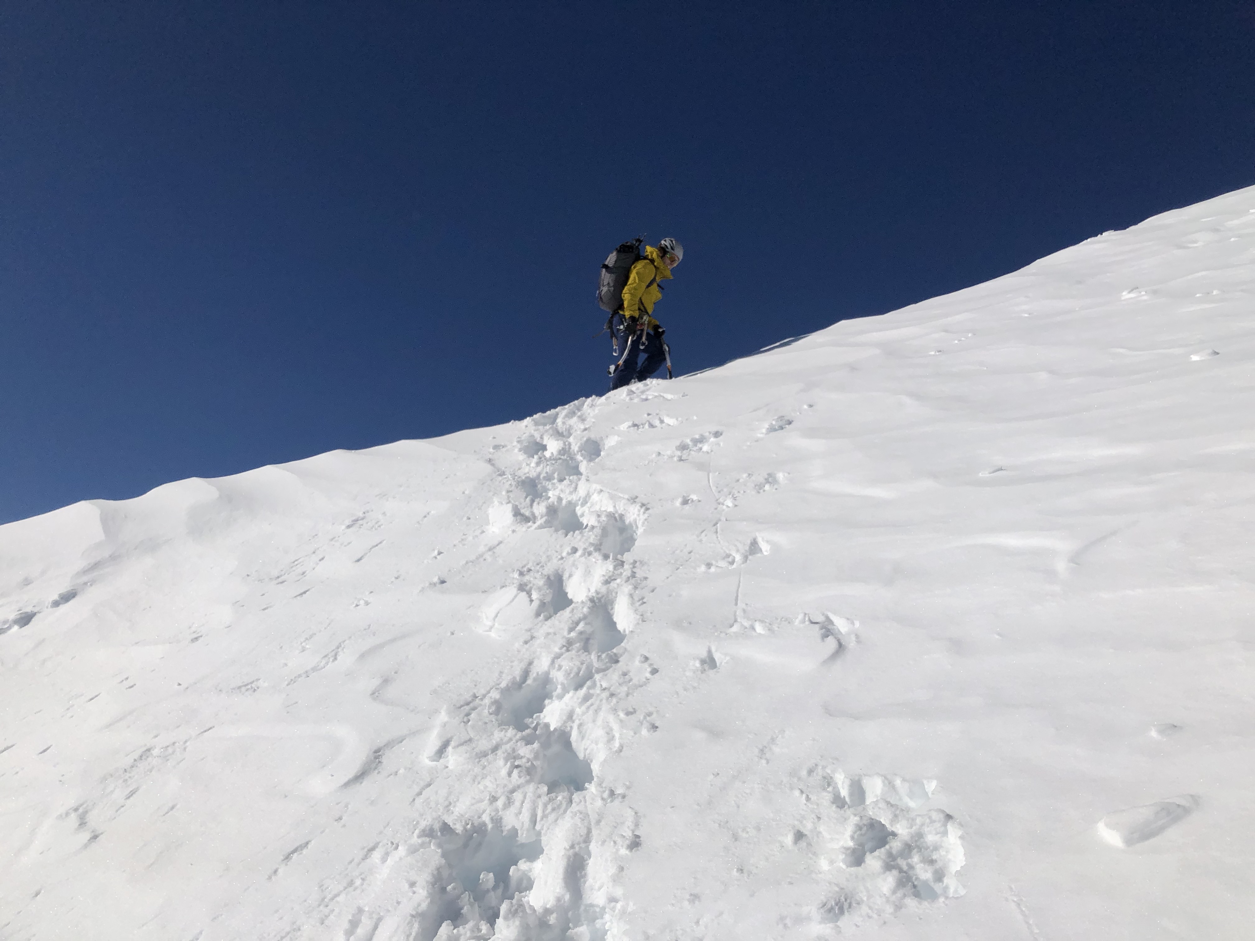
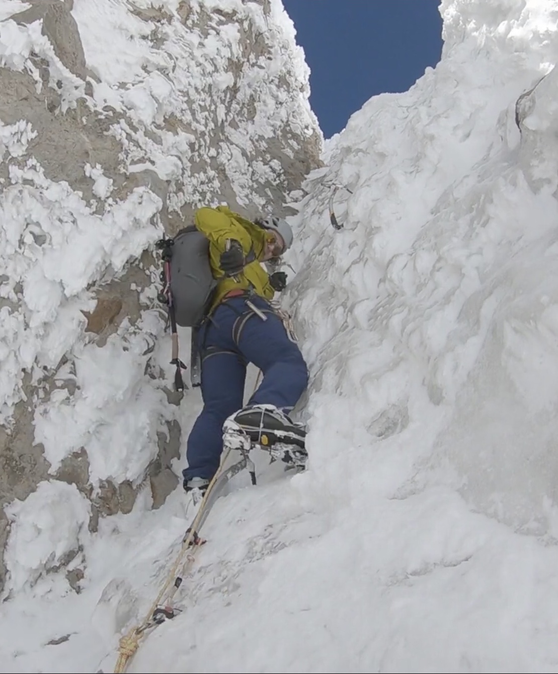
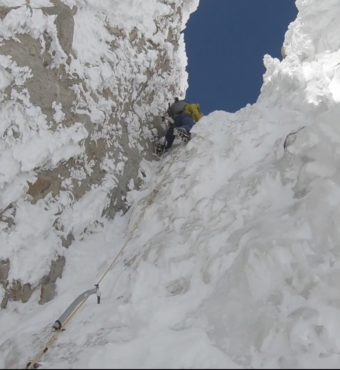
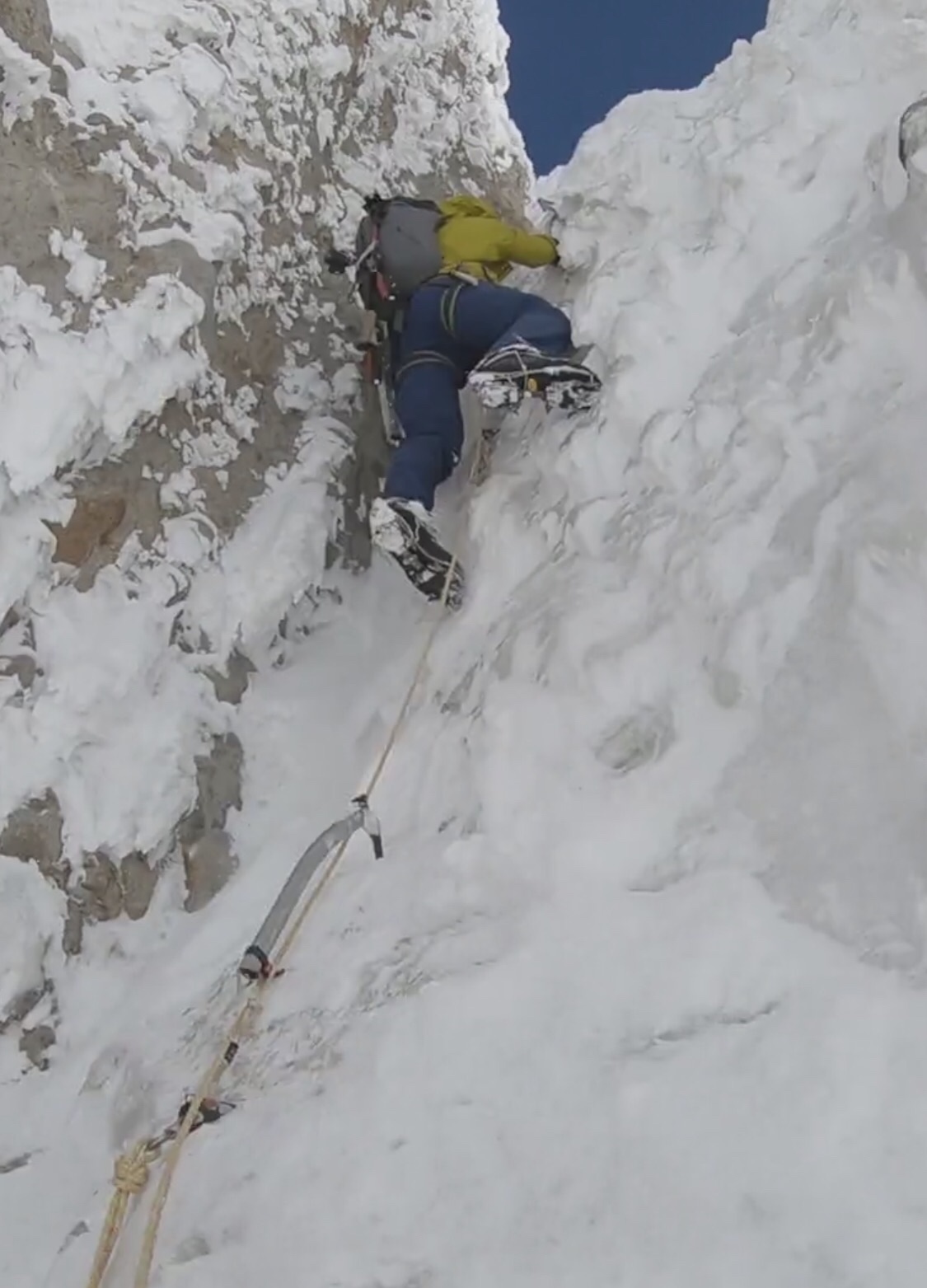
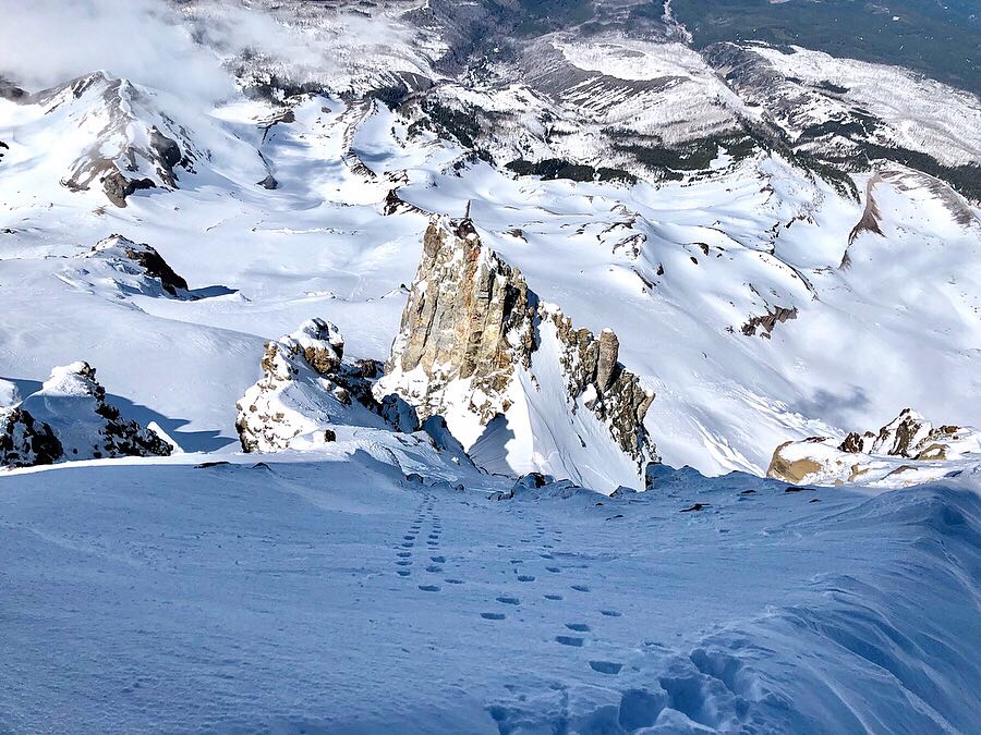
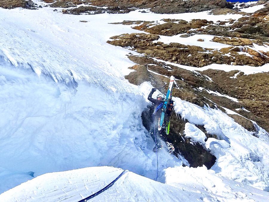
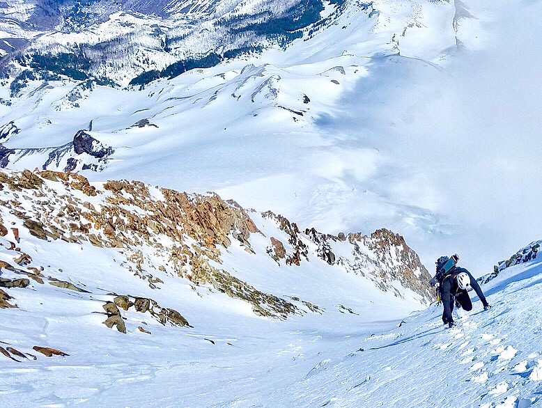
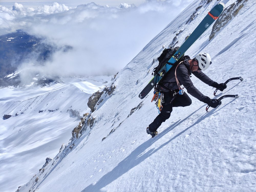
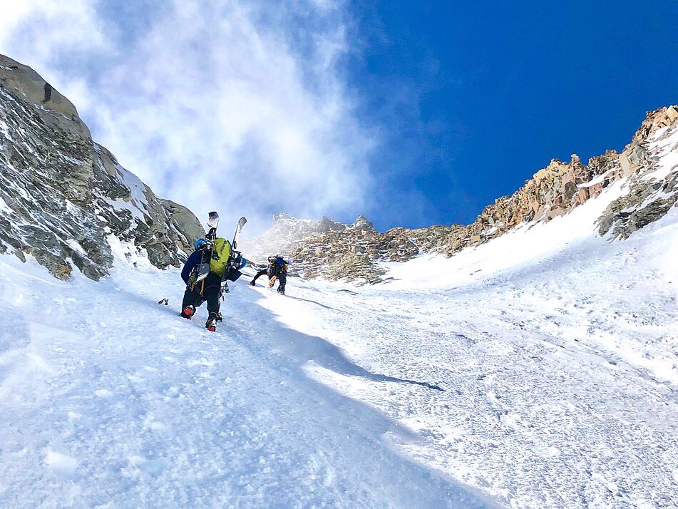
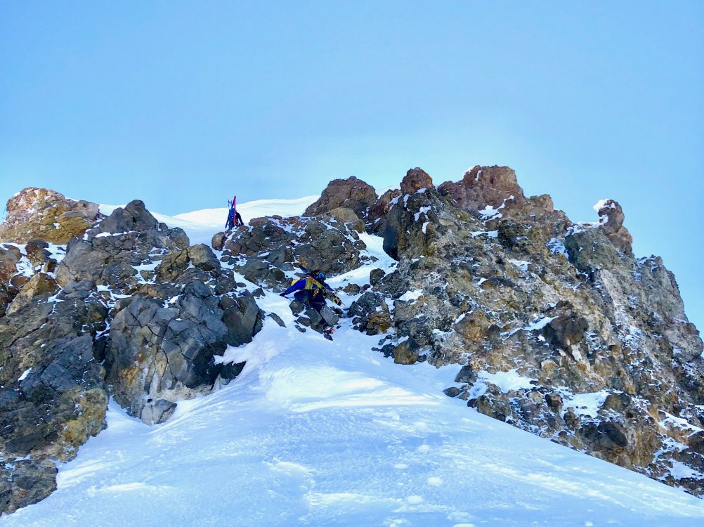
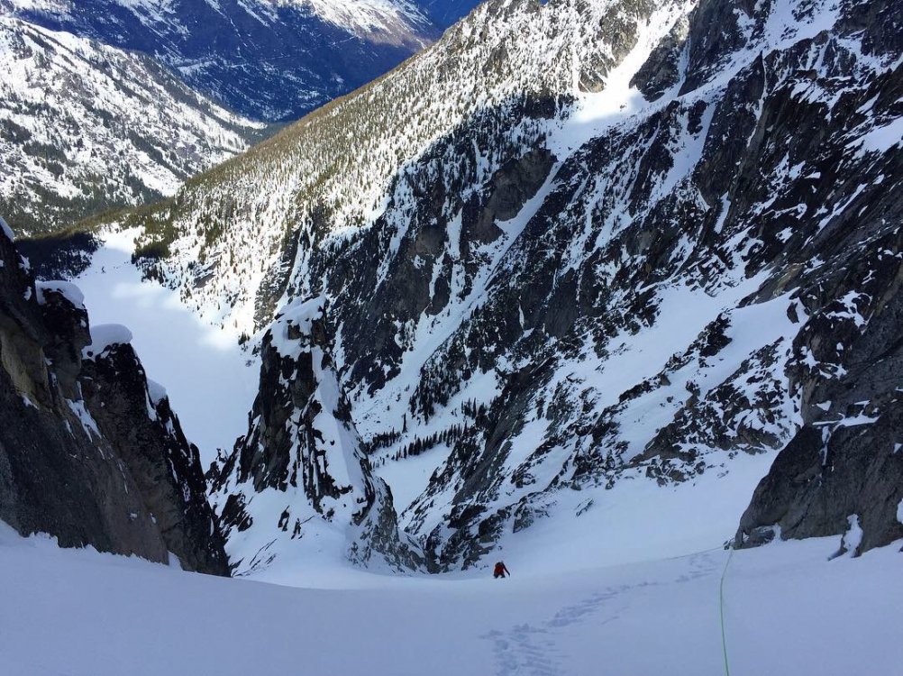
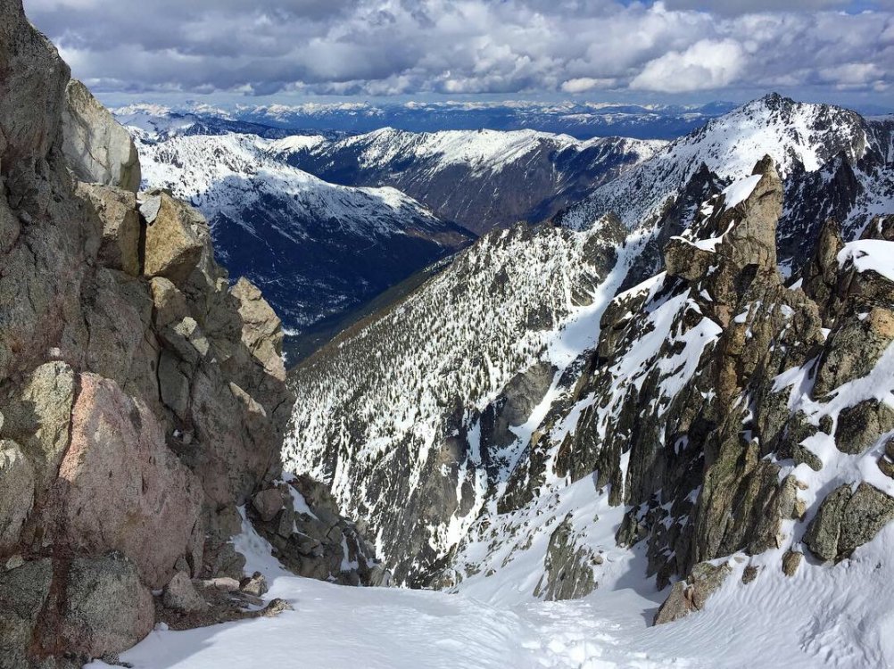
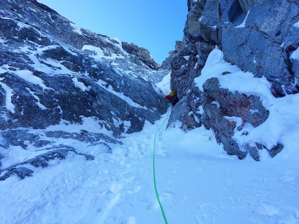
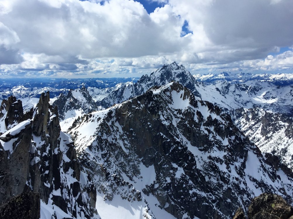
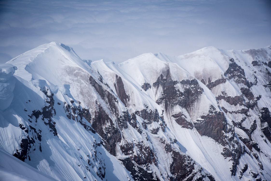
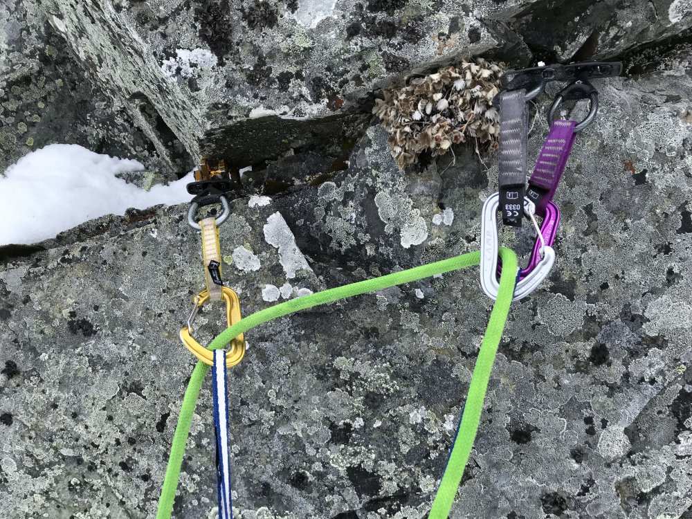
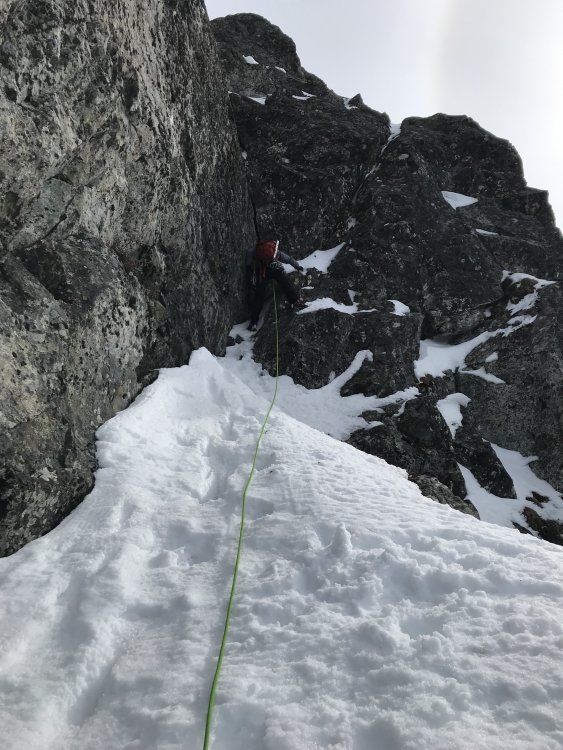
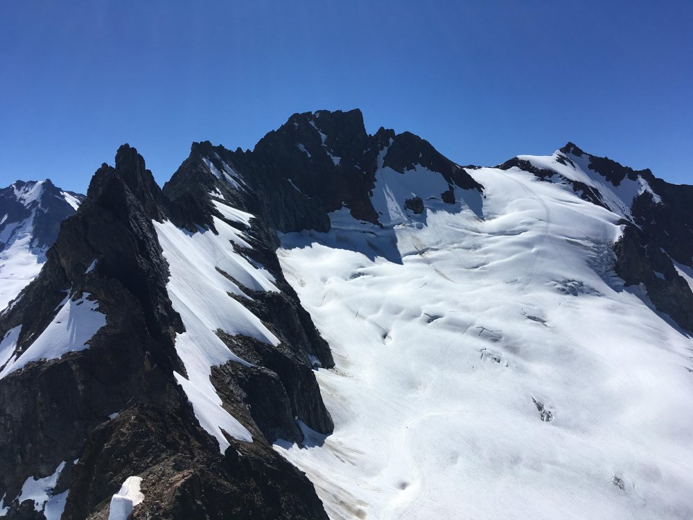
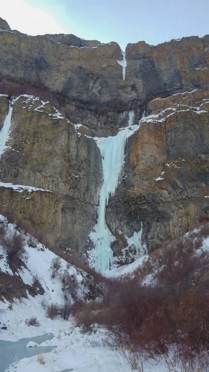
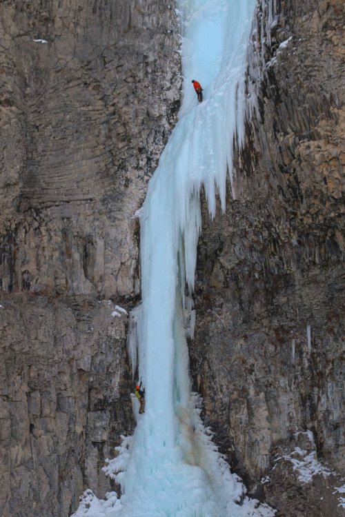
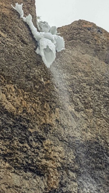
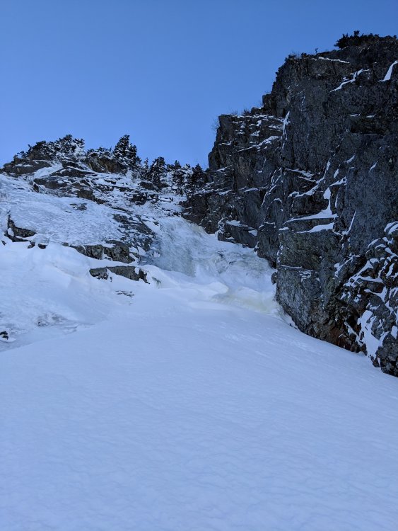
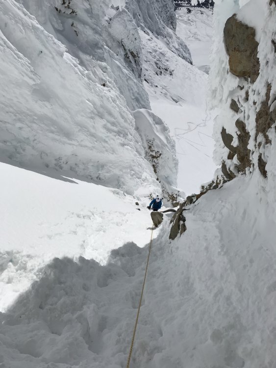
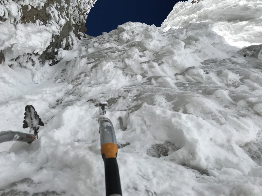
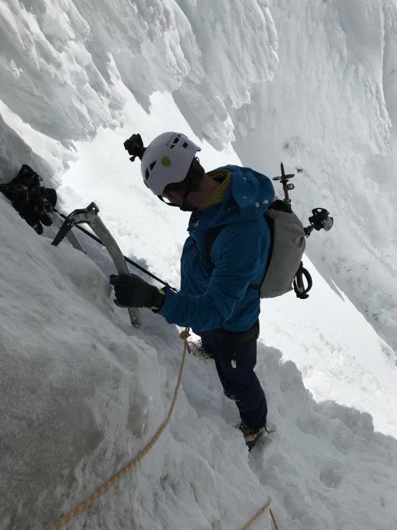
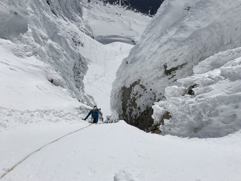
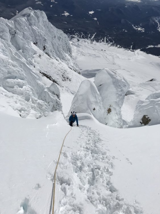
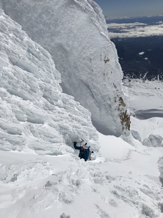
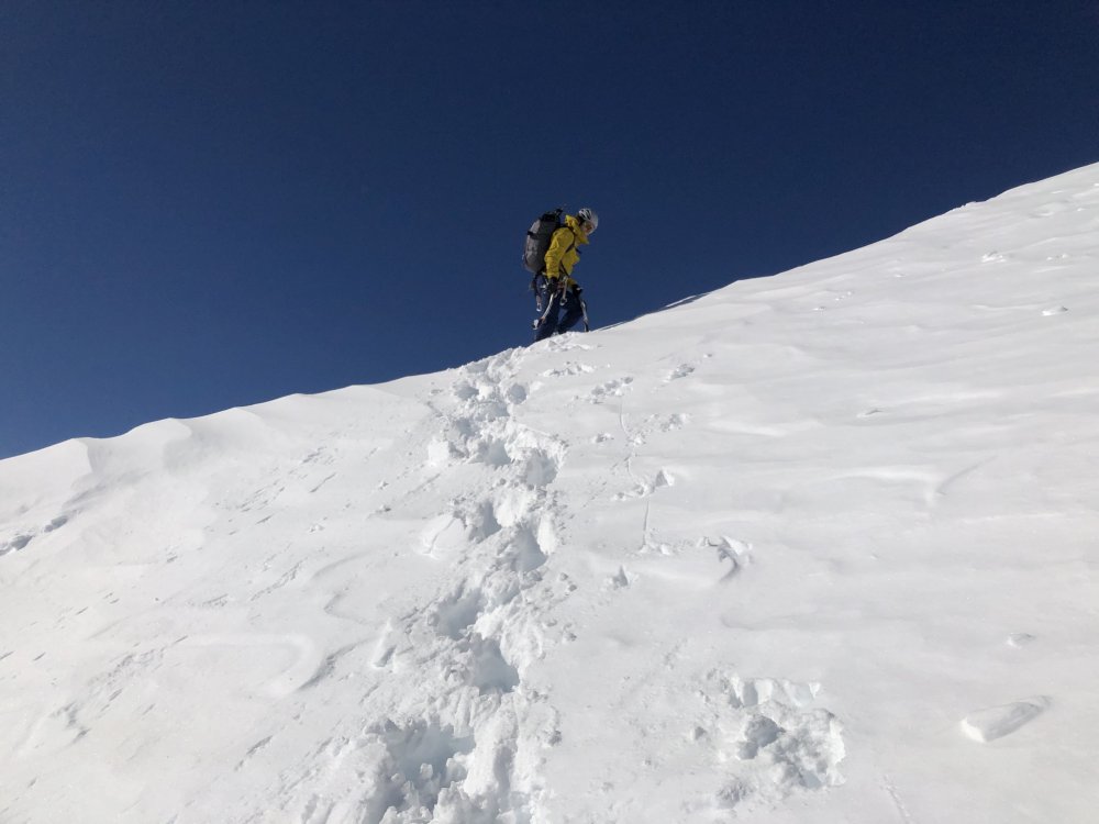
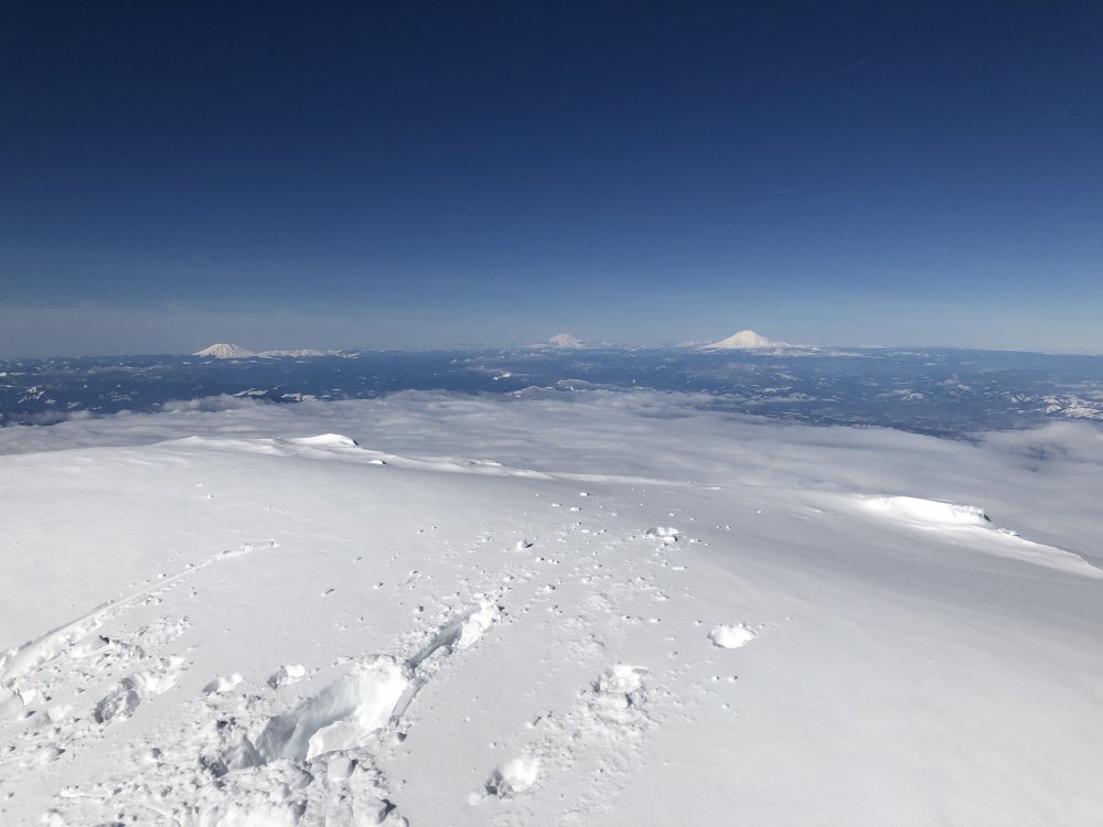
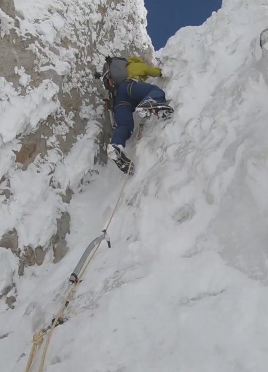
 Trip: Mt Hood - NF right gully (IV, AI3+, 50-55 degrees) Trip Date: 04/20/2019 Trip Report: Noah Kimmes, Ben Luedtke and I climbed the right gully on the north face of Mt Hood last Saturday. No issues to speak of on the approach. Glacier travel was very straight forward. We followed the left flank beneath the cliffs. There are a couple WI3-4 flows still in here if you feel like a warm up. We crossed the bergshrund on the far right. Thin ice/crumbly mixed and a bit of overhung snow but it goes. Partially fell through the snow bridge. A short snow ramp above this leads to the first WI2 pitch which we simuled. Rock and ice fall hazard from the cliff face above to the right at this point. Middle snow slope was in great condition. Solo'd with solid boot steps and good sticks in the icier sections. Exit ice pitch at just below 11,000' went at WI3+. Ice was a bit thin and aerated but solid enough. Lots of features for feet. Good screws on the pitch but anchor was tough. Chopped through snice to thin ice for a stubby, got a decent 13 and a buried tool. Snow was a bit deeper from here to the saddle at Cathedral Spire (amazing position). More of the same booting to the top. Summit cornice was minor to nonexistent. Super fun route! Definitely my new favorite on Hood. Full story forthcoming on erikofthemountain.com Cheers! Approach to Eliot Glacier. Noah leading an ice pitch on the approach. Crossing the bergshrund. Snow right above the WI2 pitch. A look down the middle snow section. Lots and lots of front pointing with epic views. The upper part of the center snow section. The upper ice pitch. The crew! Cathedral spire from near the summit. The summit block. Gear Notes: What we used: 1/10, 4/13cm screws & 1 picket (tool belays most effective) What we brought: 1/10cm, 4/13cm, 2/17cm, 0.4, 0.5, a few nuts & 2 pickets Approach Notes: Left TH at 3:00am. We could skin from the gate but had to boot a couple dirt sections.
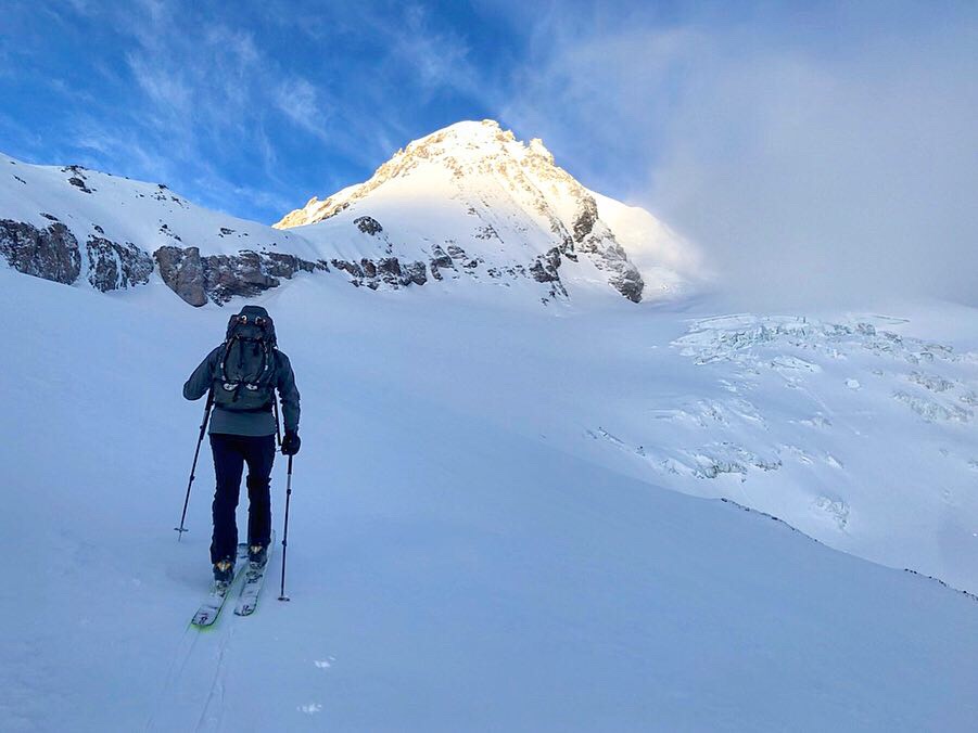
-
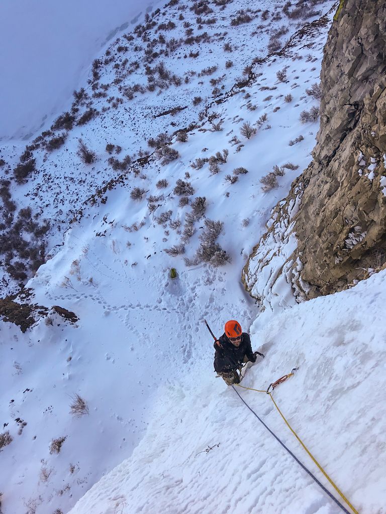
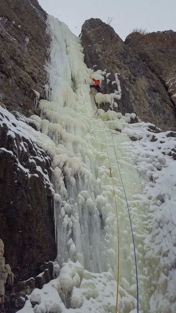
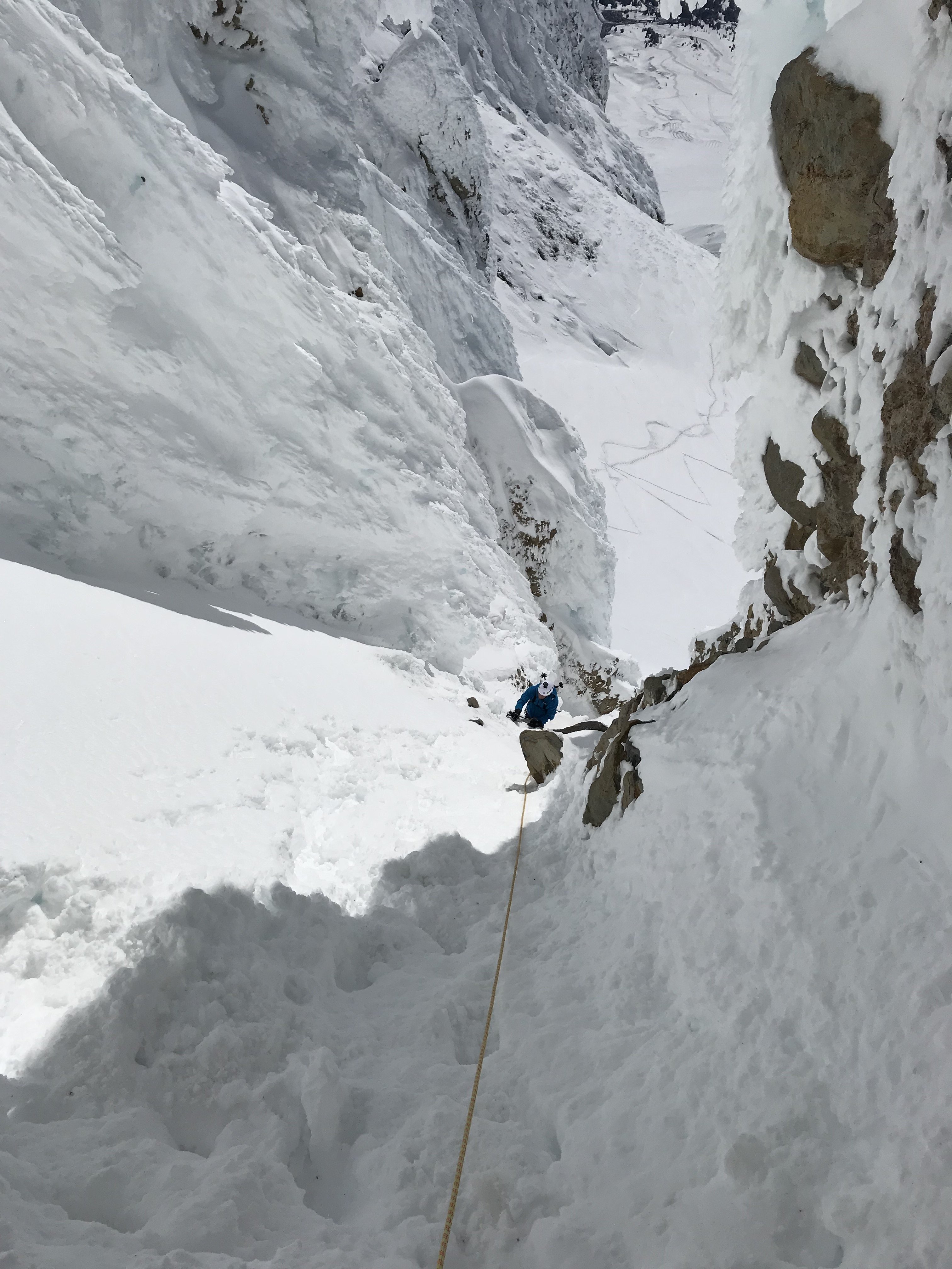
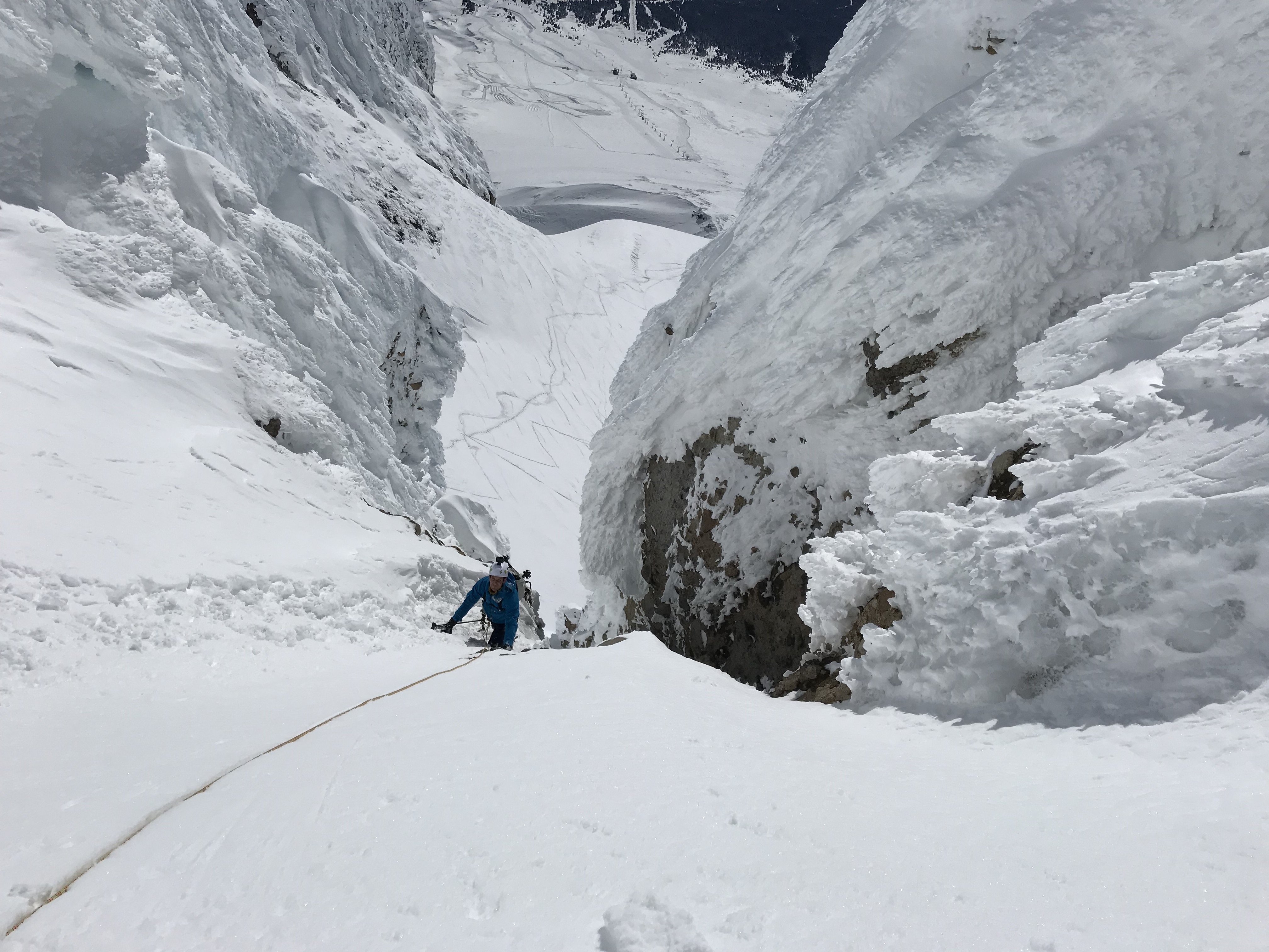
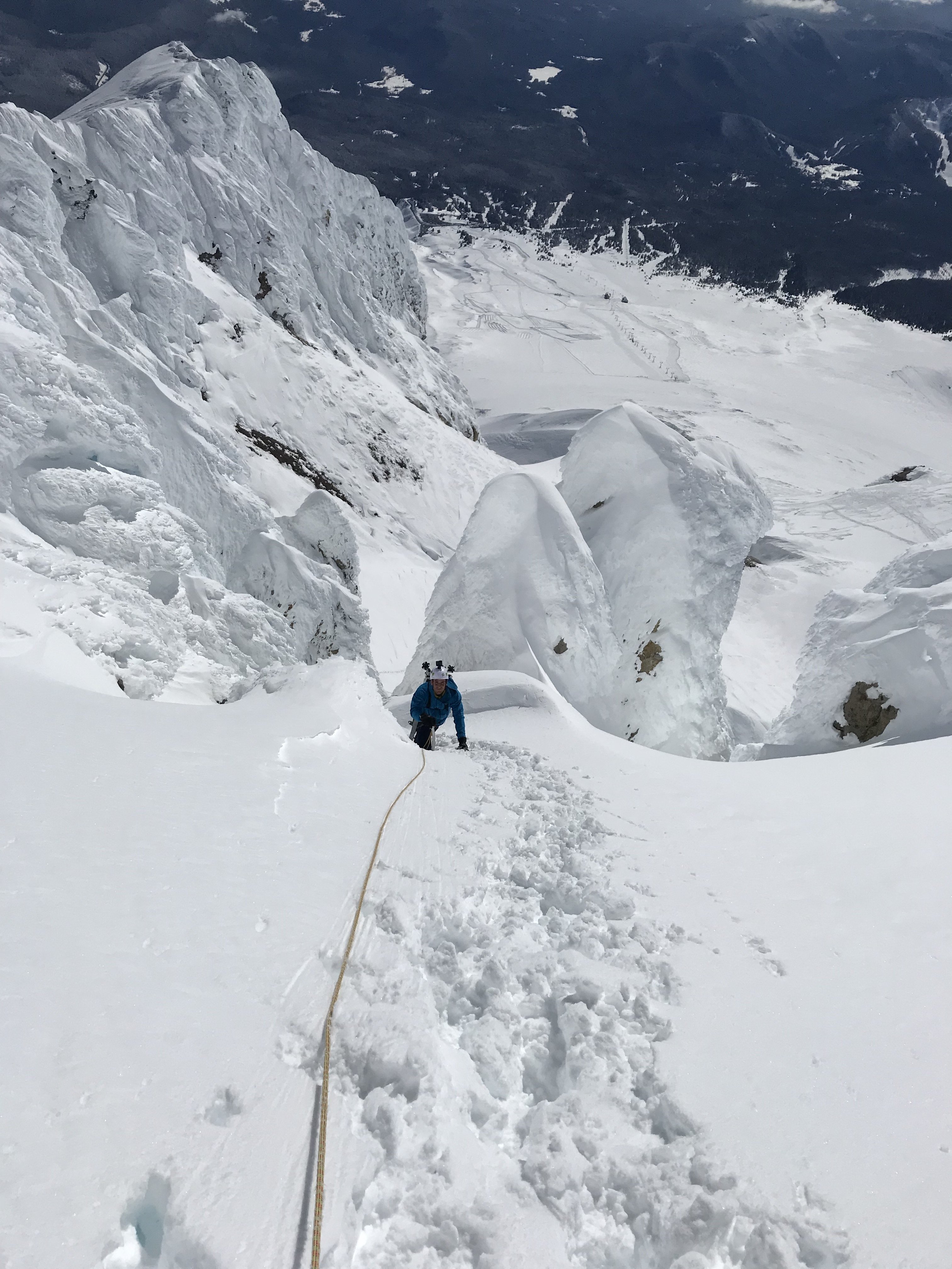
Trip: Mt. Hood - Devils Kitchen Headwall Trip Date: 04/20/2019 Trip Report: I probably should have posted this a few days ago, but oh well, better late than never. For all you Hood-rats, the mountain is in great shape. Had a friend go up the North face on the same day and it was great. He also sent a few photos, and the ice on the Elliot and it’s looking super fat! Back to the route I climbed. Conditions were looking good during the week, so I decided to make the quick trip up to Hood. The plan was climb Devils Kitchen Headwall and get some nice aerobic work in. I got to the lot with a rain sleet mix and the temp hovering right around 33/32. I was hopeful that as I gained some altitude, either Id be above the clouds or it would turn to snow. I started at 3:30 from Timberline, I cruised past the Mile and the clouds stayed low and the precip stopped around 6500ft. I made it up to Palmer in less than an hour and a half. Once above the clouds, I turned my headlamp off and the glow of the moon lit the way. Saw a giant group of 10+ skiers coming down at about 4:30, which was a little odd, but I just assumed they were going for a midnight ride which they were. At this point, just above Palmer, putting crampons on, I realized that I was going to be climbing the headwall in the dark so I slowed down the pace a little. I’ll also note that the snow was pretty firm, but not icy. There was only one other person in front of me and lots of little white dots following behind, a very peaceful morning. There was no wind up above Palmer and that held true all the way to the summit. I got to the Hogsback right at sunrise and rested below the route while the sun rose. I’ve never climbed this route before so in prep, I’d read a bunch of old TR and checked the guide book just to make sure I know what I’m getting into. At the base of the route, I inspected it from below and it looked stellar so I continued up. Anyone else like to get artsy mid route, I must be the only one Also being solo added another layer of delicacy, so I was in no rush once I got into the technical stuff. The ice itself was stellar, there was only one section that was a little thin, but I could always swing into the rime and it would hold pretty well. There was also no spindrift coming down the chute, so that was quite nice. On some older TRs there was some exposed rock probably near middle/ bottom, not quite sure, but when I was up there, it was all filled in. Right before the crux section, I took a quick break and the barfies ensued. That was not a fun 2 minutes. The final crux section was in super fat, it would definitely take screws. It was a little brittle, but once a pick was in, it was super solid. Topped out that final couloir or whatever you want to call it and found steep snow all the way to the top. Route finding was not hard at all on the upper portion. From the base of the route to the summit was under an hour and made it to the top around 8. I could have descended via Pearly Gates, but there were a few groups at the base so I opted to go down the Old Chute. It was in prime condition for skiing and I was able to plunge step all the way back to the Hogsback. I’ll also note that the bergschrund around the base of the Old Chute was fully filled in, no signs of it even being there. Rested at the Hogsback right as the masses arrived to the fumaroles. I took my crampons off at the top of Palmer and found some soft snow to walk through back to the bottom. The snow around the Mile was already turning to corn around 9:30 and the skiers were heading up in full force. I think there was some skimo race happening later in the day. Was back in the car, leaving the lot by 10am. C2C was something around 6 hours. Not sure how conditions are going to change this week, but the route was in excellent condition. Gear Notes: you could bring screws/ rope if you want em Approach Notes: straight forward
-
Trip: Mt. Stuart - Ice Cliff Glacier Trip Date: 04/20/2019 Trip Report: Jacob Krantz and I climbed the Ice Cliff Glacier (AI2, 60-70 degree snice) on Stuart on April 20th in 21+ hours car to car. We climbed three pitches of mostly steep snice and a little AI2 on the left side of the lower ice cliffs. The upper couloir was sustained and exposed at 50+ degree snice with a short bit of true WI2, but very secure climbing. The right hand exit had no cornice issues, although massive cornices still loom over the majority of the couloir. We chose not to go to the true summit since it was in the clouds and we were tired. The descent down the couloir to the Sherpa Glacier was extremely icy and grabby on skis and we actually chose to downclimb some of it. Lower glacier was awful breakable crust. All in all, about 24 miles, 8000-9000 ft gain, and one wild day of suffering and adventure in the mountains. For a more detailed, TR, see https://climberkyle.com/2019/04/20/mt-stuart-ice-cliff-glacier-ai2-60-70-degree-snice/. Entering the broad basin at 5400 ft. Looking up at the Ice Cliff Glacier. Starting up steep snow to the base of the cliffs. Leading up through steep snice and easy ice. An incredible setting! Looking up the exit couloir. We took the notch on the right. Soloing a nice AI2 bulge in the constriction in the couloir. Topping out on the route! Our little "summit" for the day. Sherpa Peak. First few turns into the couloir. It only got steeper and icier... Spooky loose wet slide that took out our skintrack through the woods, on a NW aspect in the basin around 5400 ft. Must have happened during the late afternoon at some point. Gear Notes: Used 2 pickets, 5 screws. One might want more pickets if you want to protect all the steep snice. Approach Notes: Road was skinnable a little before the Eightmile trailhead, but melting fast. We kept skis on all the way to Stuart, although just barely in places. Creek crossings were generally easy to find. The section after you leave the Stuart Lake trail is brushy. Be prepared.
-
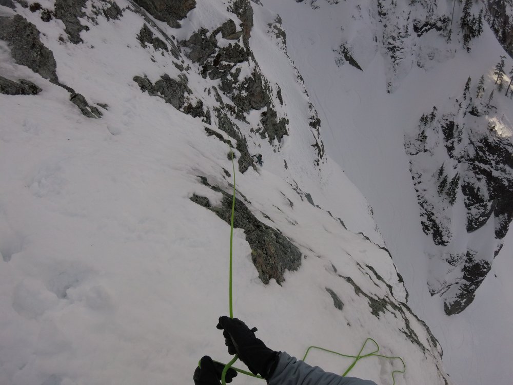
Trip: North Early Winters Spire - Early Winter Couloir (III AI3 M4+) Trip Date: 04/20/2019 Trip Report: I've been dreaming about this route for years, ever since I saw it in the Supertopo guidebook for Washington Pass. It seemed so rad, but also hard, so I kind of wrote it off. With a last minute partner and plan, we got the thing done. Thanks Dane! This was a really good route, one of the best couloirs I've done. Go get it! You can view the full TR and photos on my site: Spokalpine Strategy Notes Start early to maximize your time on firm snow, but not too early because sleep is important. Be prepared to aid climb the cornice pitch, but hopefully you’ll be able to bypass it with moderate mixed or AI3 ice. The descent follows the standard summer descent on bolted anchors until you reach the chockstone in the West Couloir. There is a piton and nut anchor in the skier’s right hand wall that gets you down past the chockstone with a single rope. Gear Notes: One 60m rope is sufficient. There are no fixed anchors on route, but it seems that a descent could easily be done with a single 60m rope by leaving rock gear if bailing. We brought cams .2-3 (small sizes most useful), nuts (small sizes most useful), 5 ice screws (useless), two pickets (one would be ideal), and 5 pitons (angles and lost arrows). Approach Notes: Walk straight toward it
-
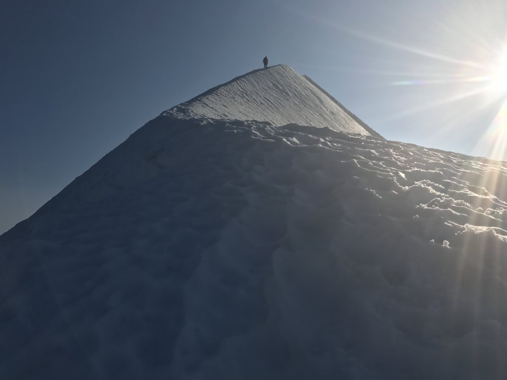
Trip: Sahale Peak - Sahale Arm Trip Date: 04/20/2019 Trip Report: Me, Fred, and Max skied Sahale arm and summited yesterday, 4-20-19. The road was closed at MP18 so we had a nice 5 mile warmup to the summer trailhead. We started hiking in runners at 7am. After 4.5 miles we hit the abrupt beginning of continuous snow, it was glorious... the way spring skiing ought to be; hike dry road bet to 4' of snow. Bam. Skis on. We skinned up the gut toward the pass, booting a short section though the cliff band at 4800'. From there it was cake to 100' below the summit. We cached skis there and booted up, around the east side to the top. It was a one at a time affair up there, we each tagged it and bailed back to the skis. The exposure was real, on steep snow, and added a killer thrill. The snow was firm at the top, mashed potatoes at the bottom, but pretty good all the way to the pavement. Summited at 2:00, car at 6:00. 11 hours with a couple of long breaks. 7300', 18.4 miles. P.S. I did this on my phone in about 10 minutes... post your trips people! Its great to hear what is going on out there, and this forum is way cooler than facebook! Gear Notes: Skis, axe & crampons for the top 50' Approach Notes: Trail shoes. Lots of road.
-
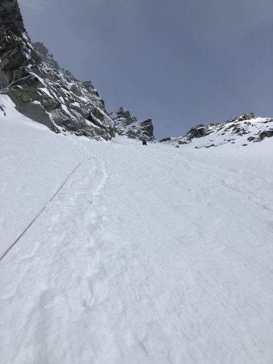
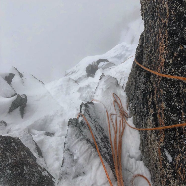
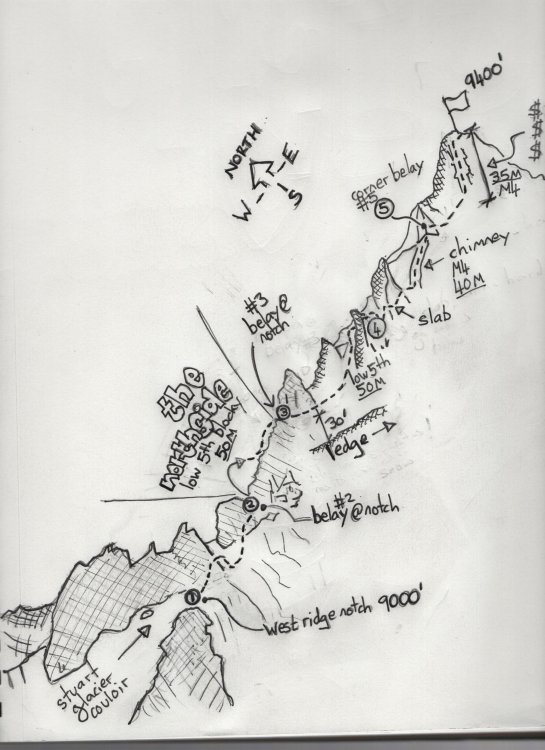
Trip: Mt Stuart - Stuart Glacier CouloirTrip Date: 04/05/2019 There is no bergschrund, the ice pitches are so minor that we barely slowed down. The top West ridge was full value, ice & mixed conditions were fantastic with cracks open to take gear, but accumulation in the backs of cracks in the top pitches making the best mixed conditions I've ever had in the Enchantments, but I would say that since Danny lead the technical jazz. No photos up there as we were hauling ass & cold. Very scary avi conditions on the descent with propagating cracks on the Sherpa Glacier & enough slabs peeling off to make a guy very happy to be down. Also white-out & nuclear winds on summit were unforgettable. We climbed straight up the west ridge after the tiny notch on exit from the north. I thought this was great, but the ledge ~30 below the tiny notch may be a better route.. 14 hours tent to tent (in the 5400vf meadow) Photos are not in order..... Looking down N face exiting to tiny notch:Exit top of couloirIce pitches...minor Gear Notes:Small cams 0.3 -2", rack offset wires, pins: LA, KB, beak, didn't use screws except one shit one.Approach Notes:Snowshoes from 1/2 way up road & to camp. No snowshoes above 5400vf. Very bad avi conditions on descent on Sherpa Glacier. GPS (or solid previous knowledge) essential to get off summit in nasty storm.


-
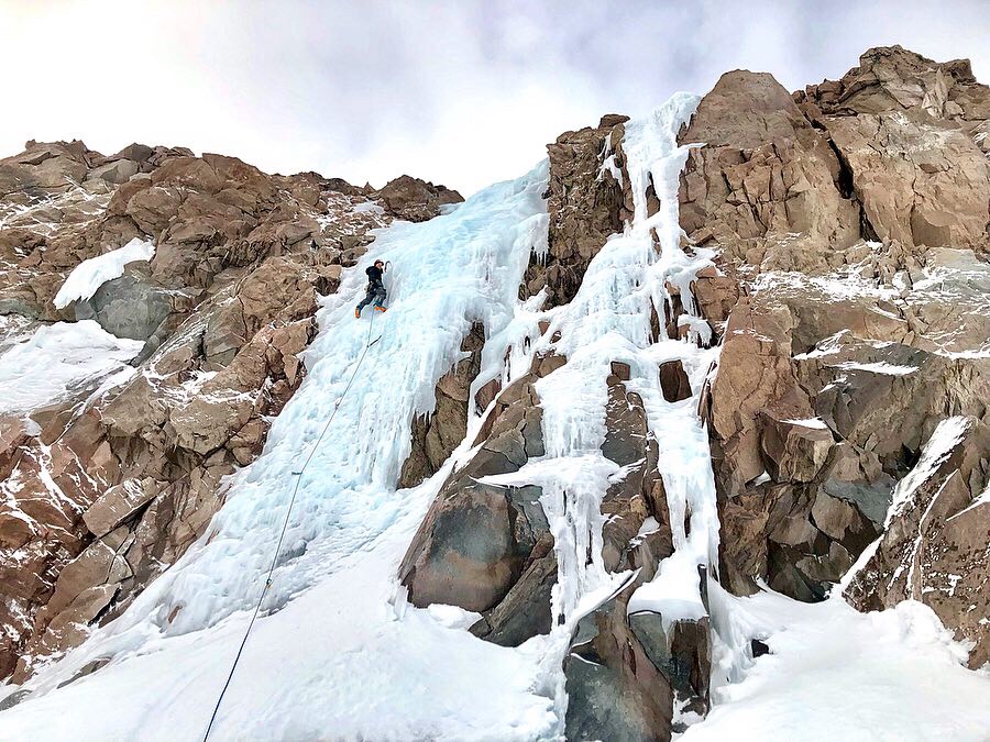
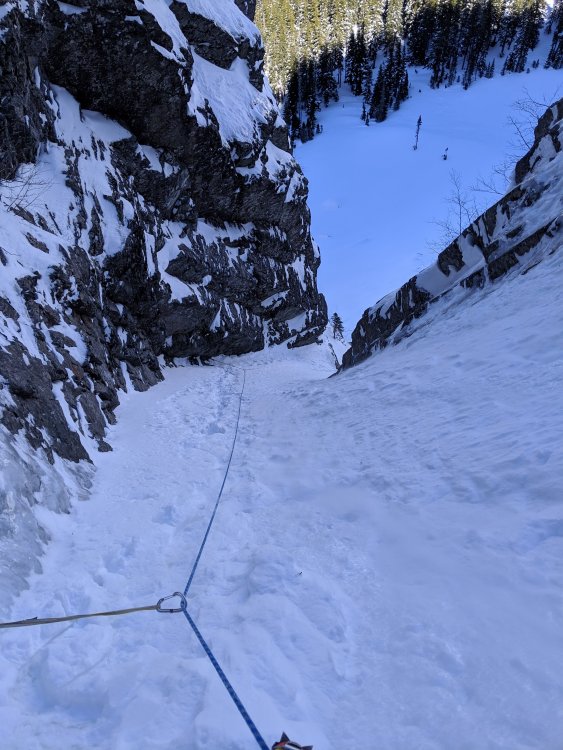
Trip: Dragontail Peak - Triple couloirs Trip Date: 03/31/2019 Trip Report: This last weekend a friend and I climbed TC's on Dragontail peak over two days. Ski'd in to and out of Colchuck Lake on the approach, continuous snow coverage on the road in the first day but on the way out on the second day there were several patches of bare road about 20-30' long. The trail was very firm, packed snow. got to the lake around 1pm the first day and just hung out as we were going to get an early start the next day. There was another group of two coming in about the same time we were to climb TC's as well. We got up at 2am the next day and did the morning routine and started to head up to the base of the route. The ice on the step up to the hidden couloir is in good shape and was very enjoyable. We made our way up to the base of the runnels in the dark and the first pitch had great coverage. Not super thick ice but enough to be secure climbing, couldn't put a screw in it or anything though. We ended up bailing off the runnels as the following options proved to be too thin for us. We then rapped down and opted for the runnels bypass, which was a mix of snice and sugar snow on slab requiring some excavating for dry tooling in spots. Rapped into just below the second couloir from there and climbed up the mixed chimney which I thought was really fun. Good sticks in thin ice and stemming. The pitch between the second and third couloir was in not great shape as it was sugar snow over slab. I chose to keep to climbers left as it offered more placements for dry tooling and protection. This turned out to be quite loose in places (very sorry to the party below us!) and steep. The third couloir was very straightforward with no complications. We either simul soloed or simul'ed the couloirs as they were very wind firmed dry snow and made for solid steps. The way back down through Asgard was pockets of loose dry over wind firmed snow. I was told by another friend who met us there on the second day (he was skiing) that the Colchuck Glacier was about the same. Glad we got a decent weather window that actually turned out to be better than expected. Just intermittent clouds the whole time. This was a really fun climb! Gear Notes: -Cams .3 to 1 -Half set of nuts -4 tri cams -2x 10cm and 2x 13cm screws (didn't use any) -A bunch of pins, mostly knife blades and one small angle, as I knew the snow wouldn't take a picket. Definitely proved the most useful along with small stoppers. Approach Notes: Still a bunch of snow on the road but it feels like its melting out fast. Was surprised how much bare road there was on the way out. The trail is packed and bootable in the morning but in the later part of the day post holing is pretty common. Same goes for the road too. I was glad to have skis as it expedites a lot of the travel on the way out.


-
Trip: Snoqualmonix - Pineapple Express Trip Date: 03/30/2019 Trip Report: Another lap on it w/ Rolf. Thinnish ice down low but well adhered to the rock and more quantity than expected. The upper NYG pitch was quite dry. Still a very fun outing for this late in the season. It was a GroundUp-TeamFree-SmashAnGrab redpoint our sponsors (Geritol and Dr. Scholl's) would like to point out. No good pics on the route so I included a shot of the start of last year's instant classic, the Turf Testament... --I'd like to add a recommendation to rap after the 4th pitch since the traverse to NYG is a bit tedious, but more importantly the turf on the last pitch of NYG is not frozen. We had to be very careful not to damage it. Gear Notes: Don't forget the Tricams. Approach Notes: Need younger knees.

-
Trip: Mount Saint Helens - Worm Flows Trip Date: 03/24/2019 Trip Report: Last weekend @Bronco, @Kit and a couple others went down to join the gong show that is the pre-limited entry St. Helens spectacle. It has gotten a bit more popular in the 18 years since I last skied it, making for a loud and chaotic TH bivy. There was plenty of snow from the car, however, making for an efficient skin to the crater rim (if you had ski crampons). The sheer humanity visible along the way was pretty entertaining, although I think the entertainment value was lost on the two older Asian dudes we saw consulting a map, who were later rescued by helicopter (cold, but fine). We escaped the masses by traversing west to the highest point on the rim (we left our skis where we hit the crater). The ski down was OK, but the visibility less than ideal. Still, it was pretty great to be drinking beer at the car less than 30 minutes from leaving the summit. That, at least, hasn't changed. Gear Notes: skis (or a splitboard if you are mentally deficient like me), ski crampons Approach Notes: Follow the conga line up the snowshoe superhighway from the Marble Mountain SnoPark


-
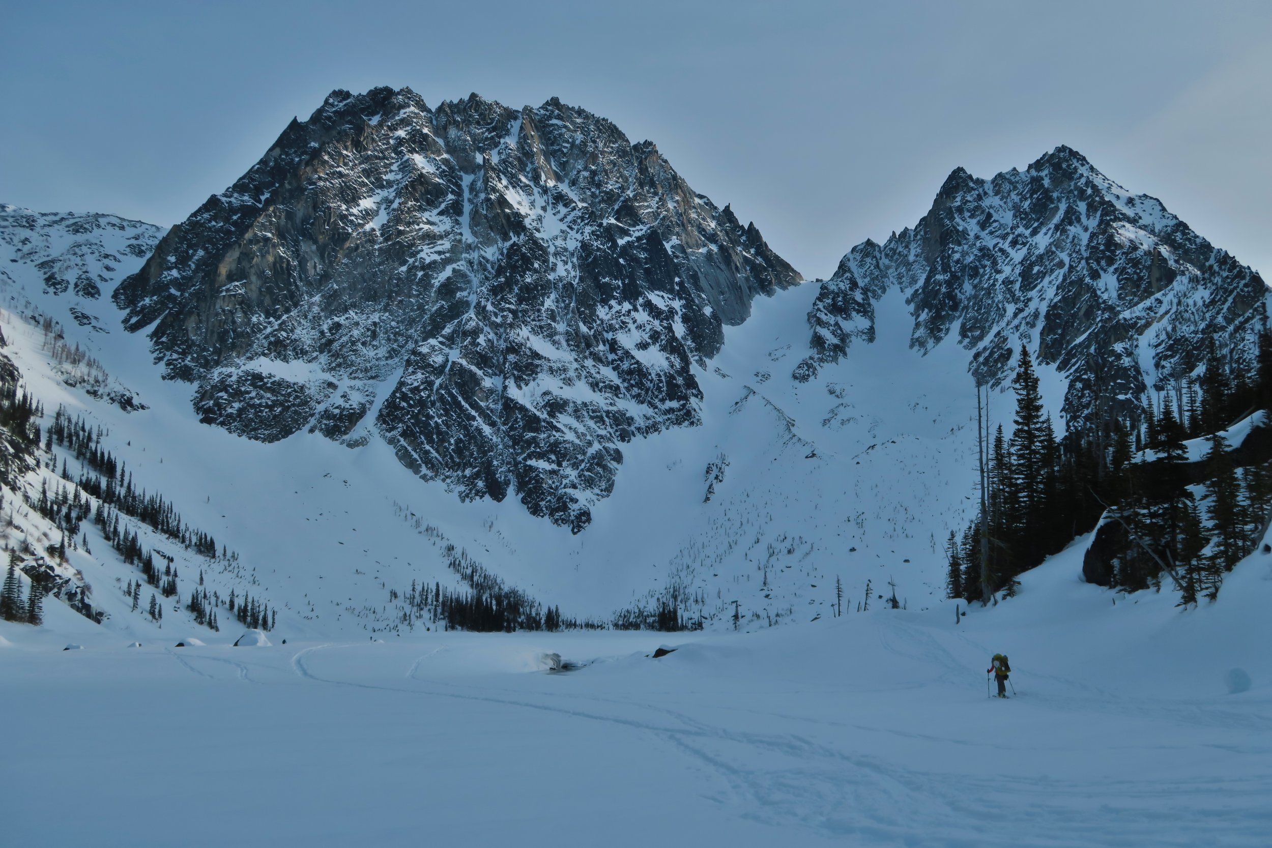
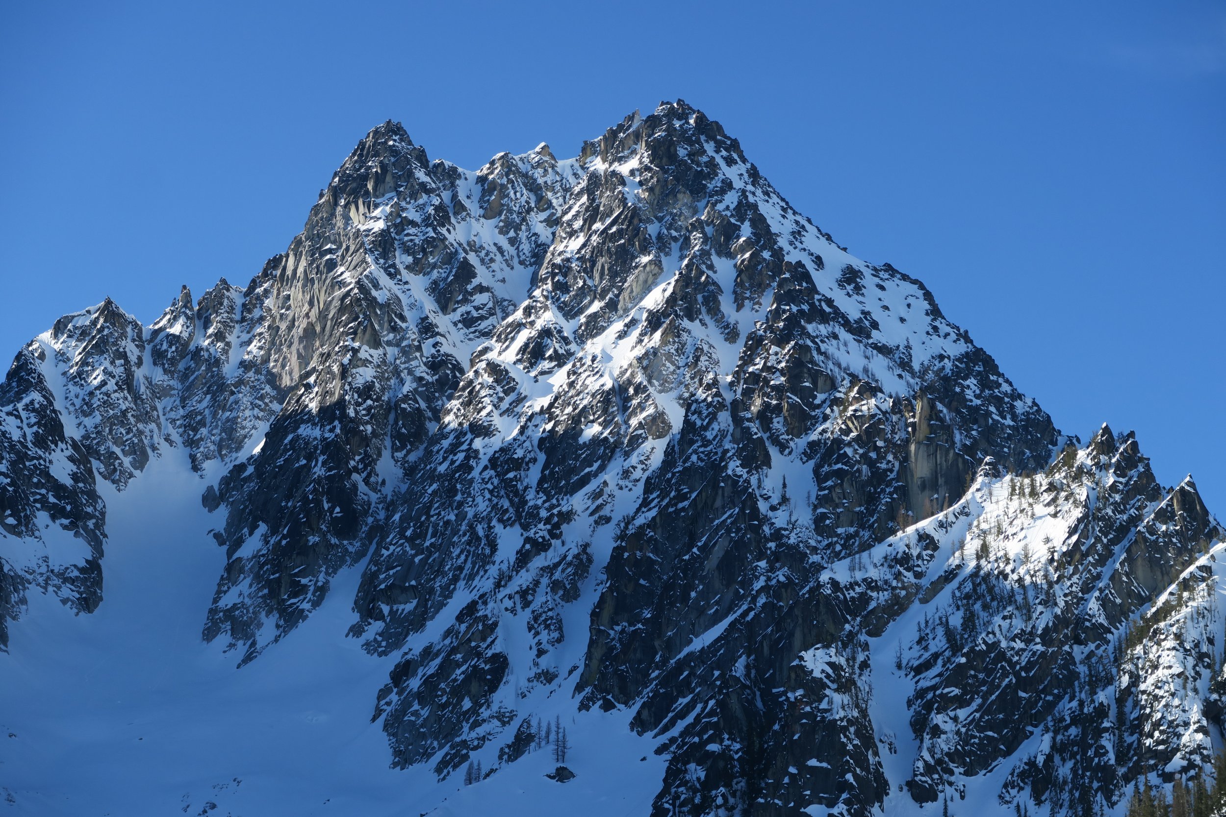
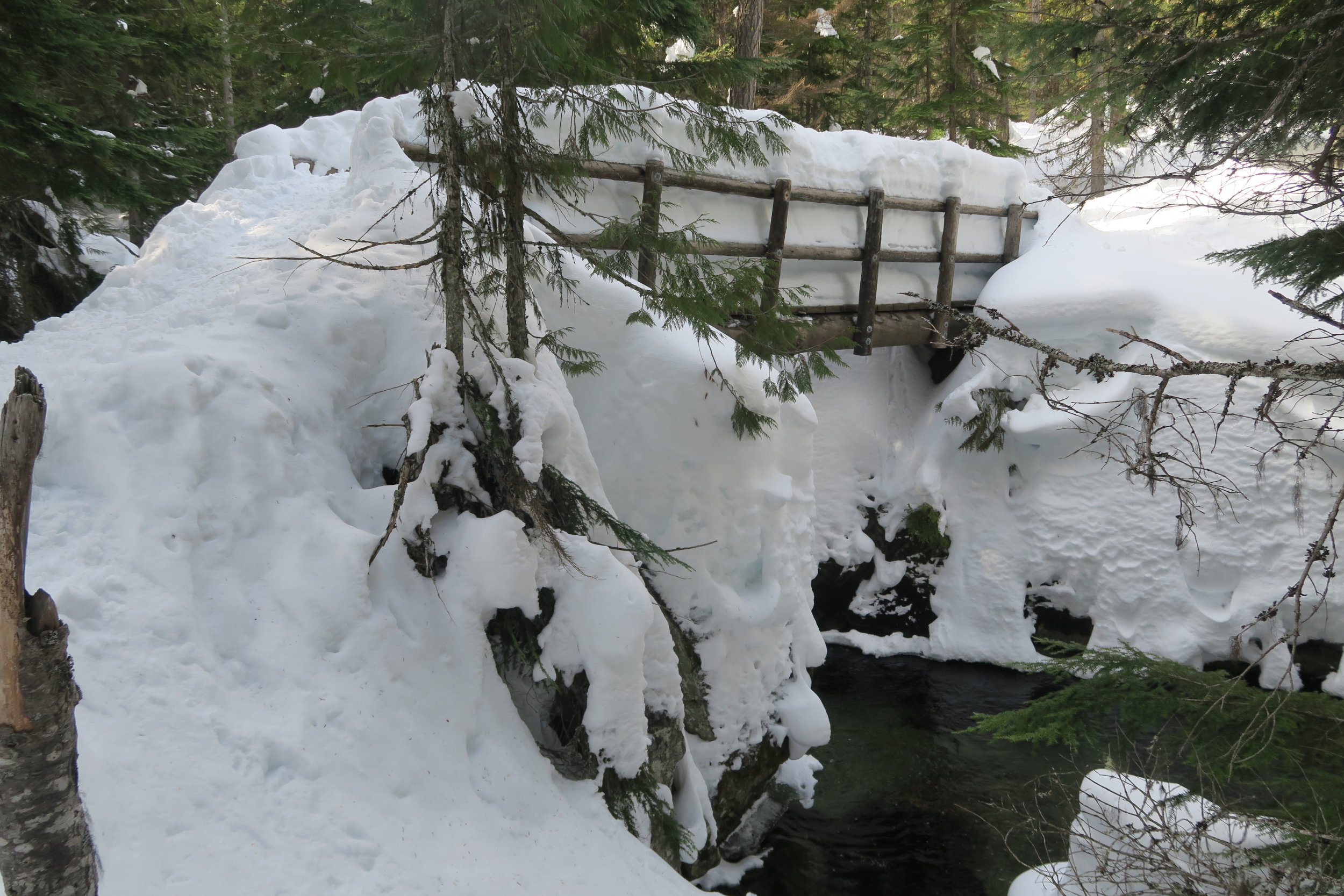
Trip: Colchuck Lake area - conditions Trip Date: 03/16/2019 Trip Report: Given the spectacular weather this past weekend, (March 16th-17th) I considered making an attempt on Colchuck’s North Buttress Couloir on skis. But due to a lack of mental realism about how out of shape I’ve gotten and just how much longer approaches take during winter conditions, plans evolved into just a nice camping trip next to Colchuck Lake with about 10 lbs of pro/pickets/crampons/ice tools along for the ride as bonus training weight. Everything is well snow-covered, we were able to skin right from the car. Snow on the gated Eightmile Road has almost every kind of human tracks you can imagine on it: snowshoes, skis, split boards, snowmobiles, it was even packed enough to be bootable with only a few inches of boot penetration, but I’d still recommend floatation of some kind. At the normal summer trailhead, snow looks to be about 4 feet deep right now. The trail up to Colchuck Lake has a well-packed snowshoe track the whole way up. Skinning up was fine (though it took me longer than I’d like to admit) with only one occasion where a fallen tree forced us to take skis off to hop over. Without skis, the packed path was supportive to boots for 9 out of 10 steps, but when postholes did happen they were waist deep. When we reached the lake, there were probably half dozen other parties in sight, most camping. We briefly talked to a group of 3 who had made an attempt at Triple Couloirs, but found the runnels to be way too thin right now and were forced to turn back there. We just camped and went no further than the lake. Just for the sake of curiosity, my avy probe went 7 feet deep in the snow by the lake before hitting what felt like ground. Skiing back out along the trail the next day was quite challenging, the most difficult tree-skiing I’ve ever done. We kept skins on to help keep speed down with all the sudden maneuvering required. My girlfriend soon opted to just A-frame the skis on the pack and walk instead. I stubbornly kept skis on the whole way, but with all the shenanigans that “skiing” there required, I progressed at exactly the same pace as her walking downhill. It is unclear which mode of travel was actually more effort. We observed a wet natural avalanche let loose on the distant side of the Mountaineers Creek valley, around noon on a very sun-soaked southeastern aspect slope, fortunately comfortably far away from us and coming to a stop well before reaching the trail’s elevation below. Finally, at the lower of the two places you cross Mountaineers Creek (the bridge at 4000’) the skis finally felt efficient again, with some worthwhile stretches of gliding down the path. And of course, once back on Eightmile Rd, the gliding on the skis was heavenly, with only two significant spots that required some skating for some otherwise non-obvious uphills. Triple Couloirs up close The Runnels on Triple Couloirs with maximum camera zoom Colchuck Ski shenanigans coming down from Colchuck Lake The bridge across Mountaineers Creek at 4000' Gear Notes: a 50lb climbing/skiing/winter/overnight pack Approach Notes: solid snow cover all the way from Icicle Creek Rd


-
Trip: Mt. Rainier - Ingraham Direct - Ingraham Direct Trip Date: 03/18/2019 Trip Report: Start: 0200 Muir: 0600 Muir Departure: 0715 Top of Cadaver Gap: 0900 Bergschrund crossing: 1100 Summit: 1415 Muir: 1730 Paradise: 1930 Takobed in the winter – an objective since first touching foot on the summit three years ago. Last year, attempts were called off due to lack of ski ability; however, after having my first season of skiing, plus this winter season, confidence levels were enough to give this a shot. Departing from Yakima, WA, you can see glimpses of the Eastern routes and even the summit from some houses in town, so the stoke was extra high – naturally. Car camping at Paradise, we awoke around 0030, opting to have an extra hour for travel above Muir – will come handy later on. Leaving the cars by 0200, under a near full moon travel was smooth until we hit Pan Face/ Point. Immediately equipping ski crampons was necessary for the face – then, we opted to boot the three-small terraces up to the Point. Guided by moonlight we cruised up the Muir Snowfield seeking an uphill path on the breakable & slippery crust. Peeking into the public hut, we were the only folks at all of Muir it seemed at 0600, although someone did leave a bag of jerky – cheers. Getting a full hour break in was the plan, enough time for snackage, drinkage and rope time. My friend chose to ditch his skis at Muir, based on a broken/ finagled binding and less time on skis this season thus I decided to carry my skis up to the summit for easier rope/ glacier travel. Marginal-minimal rock activity and decent snow conditions lead us up to the top of Cadaver Gap as we sought a more alternative route. The top inch of crust, shin-deep powder and layer adjustments landed us at the top around 0900 still plenty of time to plug away to. Stepping onto Ingraham Flats, there was immediately a huge bergschrund to our right with covered shooting cracks fracturing outward. To the far looker’s right somewhat left of The Icebox, there was a boot-pack & skin-track coming from Cathedral Gap. Looking over to the cleaver, their path continued however we chose to follow a boot-pack hugging Gibraltar Rock – mistake. Navigating minor three-foot splitters, my friend stepped onto a solid-looking bridge and fell in about knee height before crawling forward. Walking a few feet further left, the bridge was much firmer. Just one of three sketchier crossings. Soon after we took our first proper break since Muir, scoping out the rest of the Ingraham. A few hundred feet higher the path mounted a bergschrund with no other immediate option around. Initially, we thought we could borrow steps about 10m left of the primary step, but hollow snow proved too sketchy. Making a deadman picket (in case he fell off and into the schrund), I belayed my friend as he made a high left step and pulled himself up by plunging his axe and kneeing into the snow. Note: the schrund appeared to be full at least at this point of entry but remained untrustworthy. After mounting the bergschrund, travel became much easier, crevasse crossing became more benign, a perfect time to put the head down and chug away at the elevation. Snow conditions remained consistent as earlier and wind conditions were quite dismal compared to the 20mph forecast. Nothing to report up to the summit. Reaching the crater rim around 1355, our initial route did not seem feasible as a huge moat had formed but was simply surpassed traveling 30m to climber’s left. Tagging the windy and cold summit, we immediately began descending but hastily got off trail and found ourselves exposed above massive gapers to skier’s left of Lil’ T so throwing crampons back on we ascended 30m or so and were back on track. Skiing conditions were mainly survival skiing: firm snow mixed with ice and wind runnels left edges and whippet useless. More precise turning was essential, especially between 13k’ and 12k’ where it changed to 3-inch crust on 6-inches of powder. Navigating down the bergschrund was quite easy, we chucked gear down and slid/hopped down off the overhanging portion. Roping up again, descended few hundred feet to the flats, where I threw skis back on and my friend ran back to Muir. Snow conditions from here until Paradise were awful – refrozen sloppy snow now crustier than the crab itself. Once at Muir we repacked out bags, stuffed face with all the food left in our bags and began the slog down being pushed by massive winds. Gear Notes: Crevasse Kit, Skis, Ski Crampons, Whippet Approach Notes: Crusty Crab
-
Trip: Millenium Wall - n/a Trip Date: 03/17/2019 Trip Report: avalanche paranoia convinced Kyle Flick and me to scale back our ambitions and just run a couple laps on Millenium Wall today. Ice was fat, plastic, basicallly superb, and Millenium is an avalanche-safe venue --- which is good, because we saw debris depositions in places that in forty winters here, I'd never identified as avalanche paths. four significant debris depositions just in the switchbacks above the Snow Creek Trailhead! While climbing, we watched slabs peel every few minutes from the the summit area of Snow Creek Wall -- White Fright might as well have been named Old Faithful. Besides what we could see happening on the Wall, we heard, repeatedly over a course of three hours, numerous major roars from the Toketie Lake vicinity. We were early enough to climb in shadow, but as soon as Millenium came into sun (noonish) we headed for the parking lot. some very unusual avalanche activity this year --- maybe a good year to be more conservative than usual. Gear Notes: ice tools, crampons, sscrews, rope Approach Notes: significant avalanche debris deposits over the trail switchbacks immediately above the Snow Creek Trailhead... trail is firm in morning, but we were post-holing coming down at 1300.
-
Trip: Snoqualmie Mountain - New York Gully Trip Date: 03/16/2019 Trip Report: Lael and I climbed New York Gully yesterday on Snoqualmie Mtn. We had great conditions and were treated to warm temps and high quality ice. We left Bellingham around 5, left the car around 7 or so on skis. The approach was fairly straight forward once we found the right parking lot/skin track (which took a bit, below is a pic with the approach laid out and where to park.) We left our skis on the ridge before dropping down to the north side of the mountain. The boot pack to the base of the route was slow and tiring as I post-holed about hip deep. We started up the route around 11, opting for the Direct NY Gully variation (mostly because we were so done with post-holing but also because there was another group right behind us and I was hoping this would space us out). Forecasts called for freezing levels around 6-7k so we expected any ice to be pretty rotten. It actually turned out to be pretty good! First pitch of the Direct variation was very high quality and quite fun. Only got one piece of gear but the climbing wasn't very hard. We then met up with the normal route and belayed there because the other team was a bit ahead of us. The next pitch was shorter, a left-hand traverse to another belay as we were moving a bit quicker than the team ahead of us. They were very nice and then allowed us to pass at the base of the box gully. We had a 60m rope so I knew there would be some simuling and communicated such to Lael. I had 9 draws and led about 90m through the box gully to near the 5.8 crack. I had to run it out more than I'd like given that the climbing wasn't super easy. It was a blast of a pitch though, the ice was good, the movement was fun and it was practically bolted with the pins in there. In fact, I don't think I placed more than a piece or two on the whole pitch, just clipped fixed pins. Lael followed every pitch much faster than I lead them. I topped out at a nice crack for a 3 piece belay from which we climbed about 40ft to the base of the 5.8 crack. It wasn't as hard as it looked but conditions were in our favor. I traversed to the base and put in a #2 then racked my axes and took off my gloves since it was sunny and warm. I jammed up the crack, pulled on the old webbing around a chock block in the top, clipped a biner on that webbing, and just like that, the crack was done. The difficulty didn't immediately ease though. I got out my axes and climbed some pretty steep turf and ice to a tree which I passed in favor of a rocky spine to belay off of. From here we traversed across a solar face with some pretty bad roller balls, so we simuled across to the trees where we unroped and headed for the skis, got there around 4:30 so we spent perhaps 4hrs or 4.5hrs on the route, in 6 pitches. The snow was atrocious from a whole day of sun and warmth but it still beat walking down! Had a great day of fun and hard climbing. Gear Notes: single rack from .4 to 3, 2 knife blades, 1 13cm screw (would have liked more), some nuts. 60m single. Approach Notes: Short, but a bit slow..


-
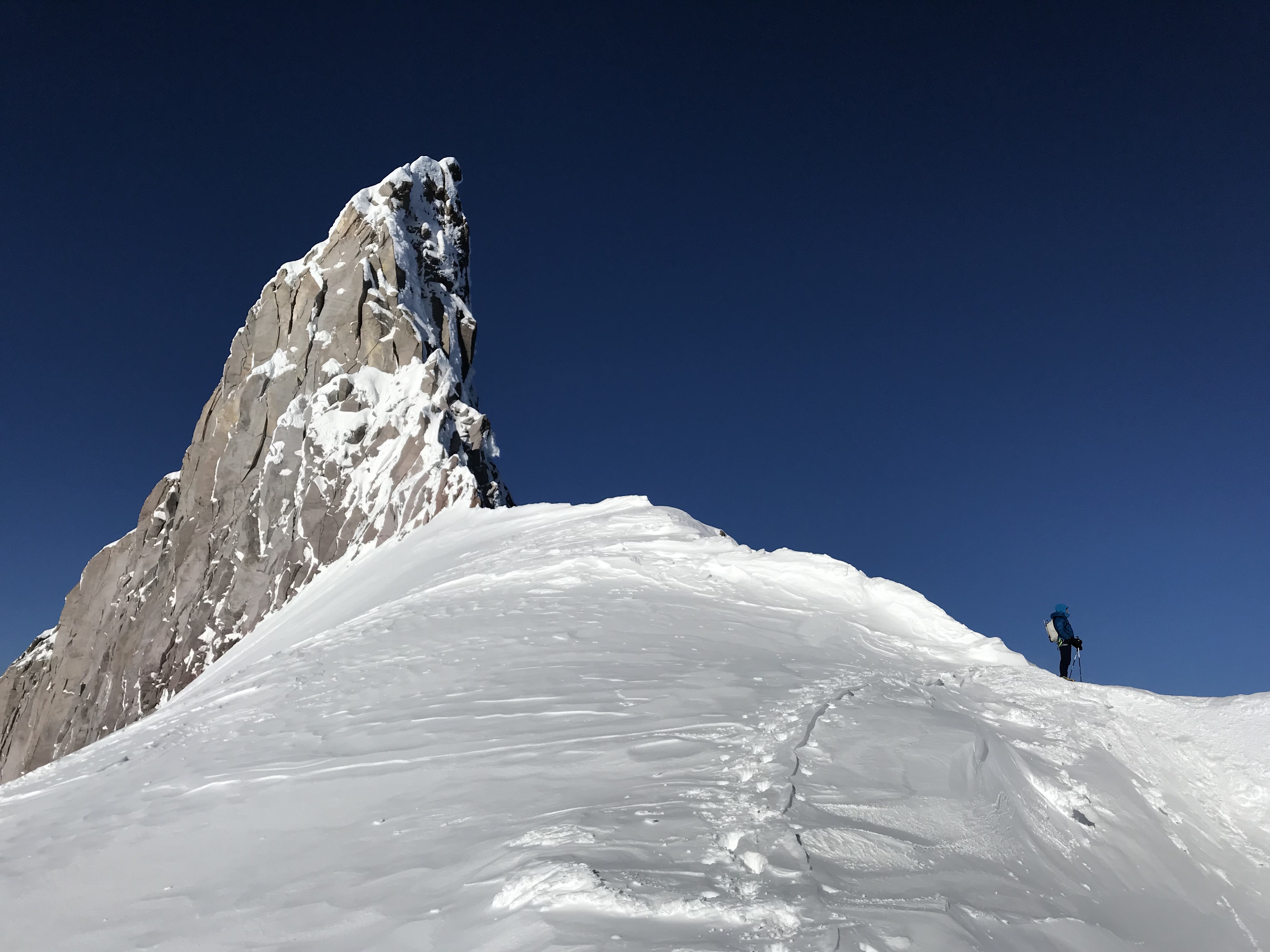
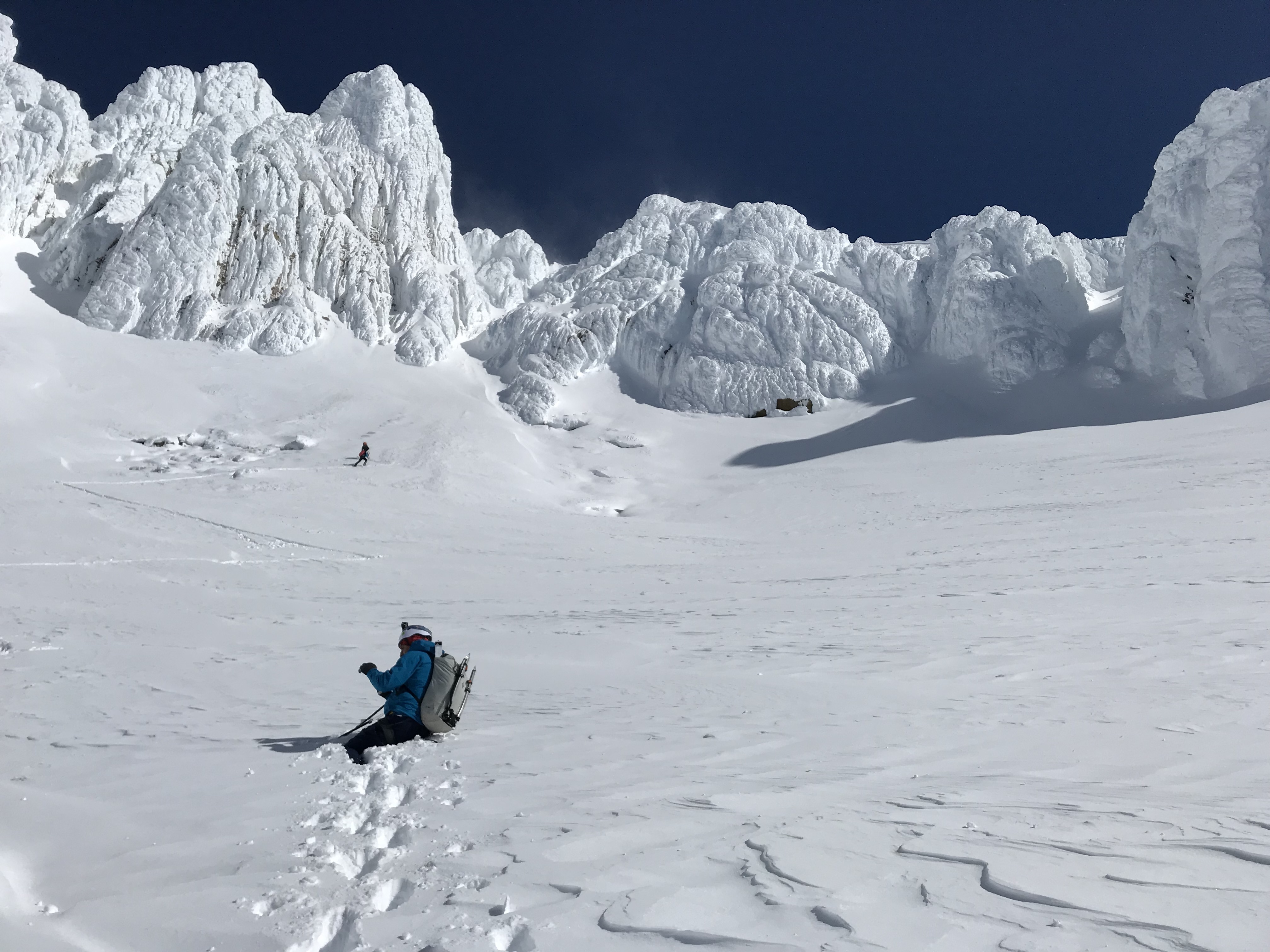
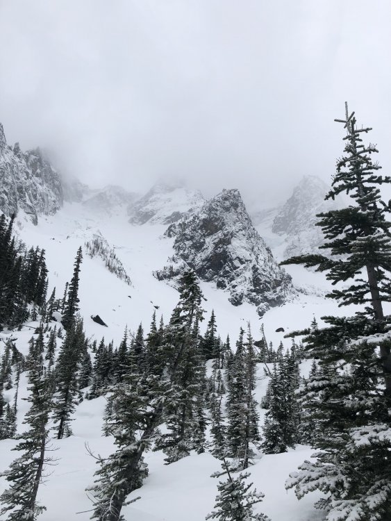
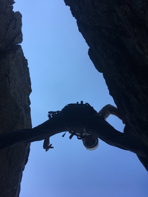
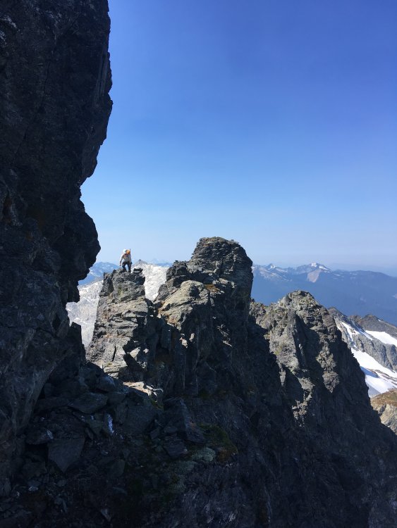
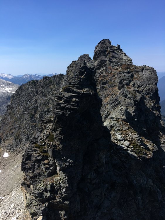
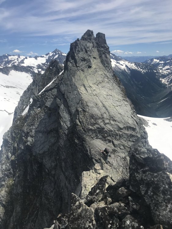
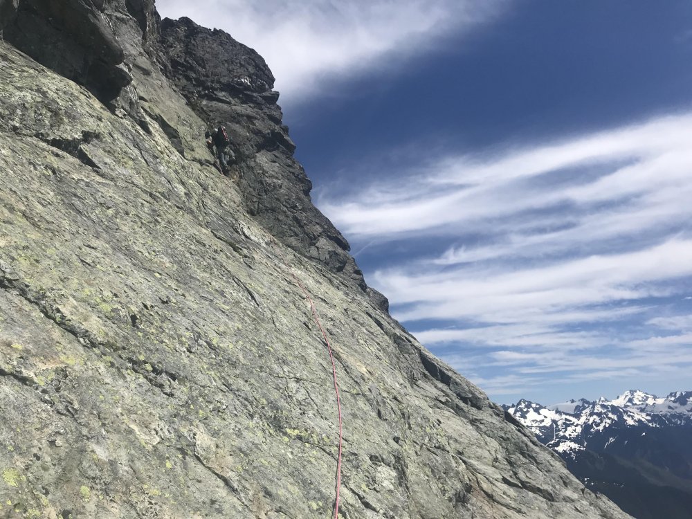
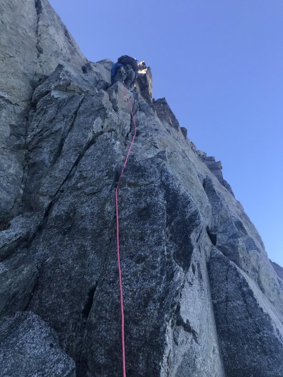
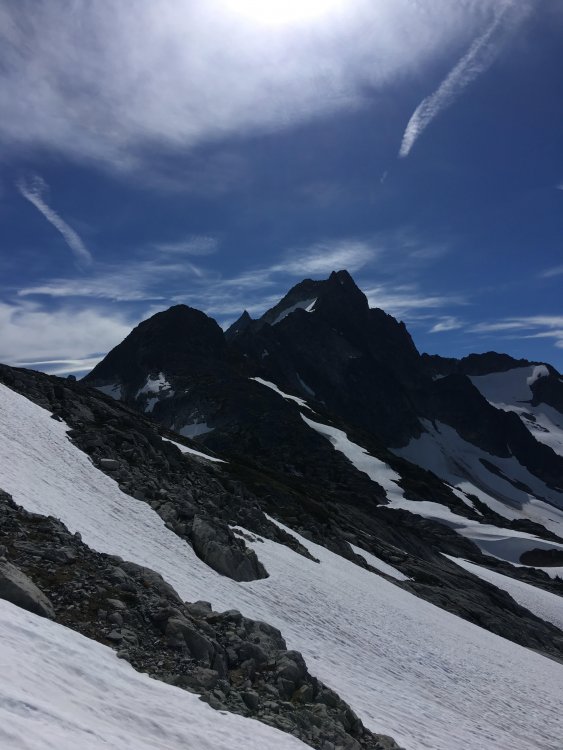
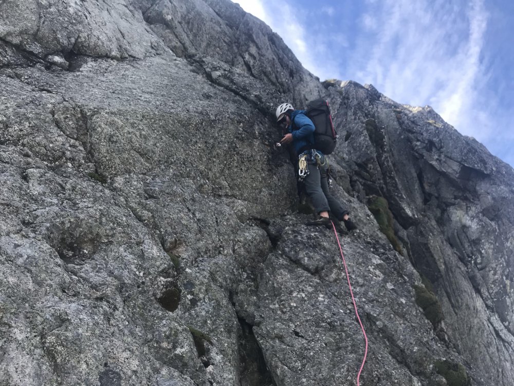
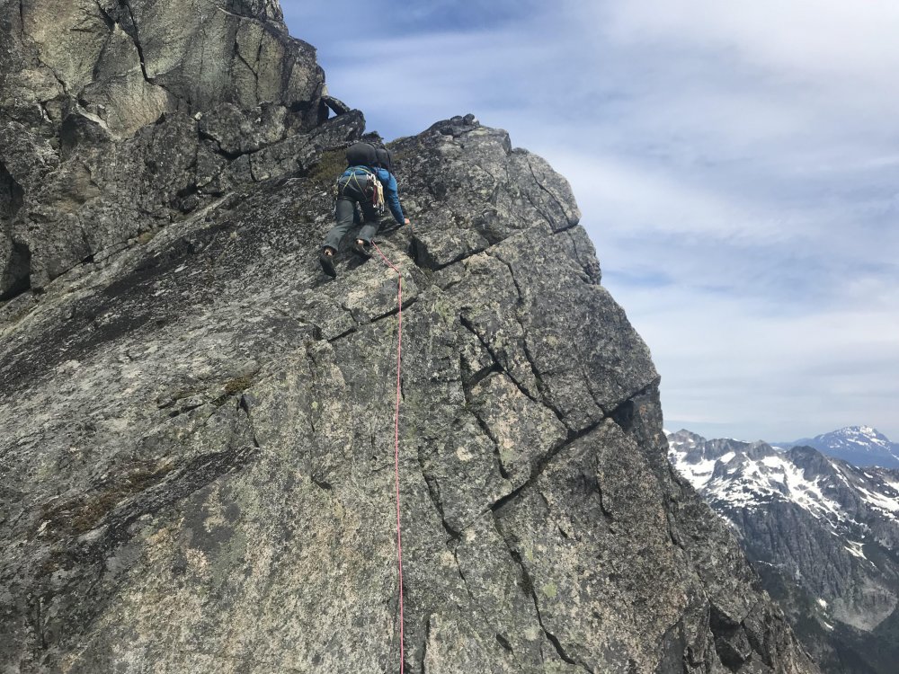
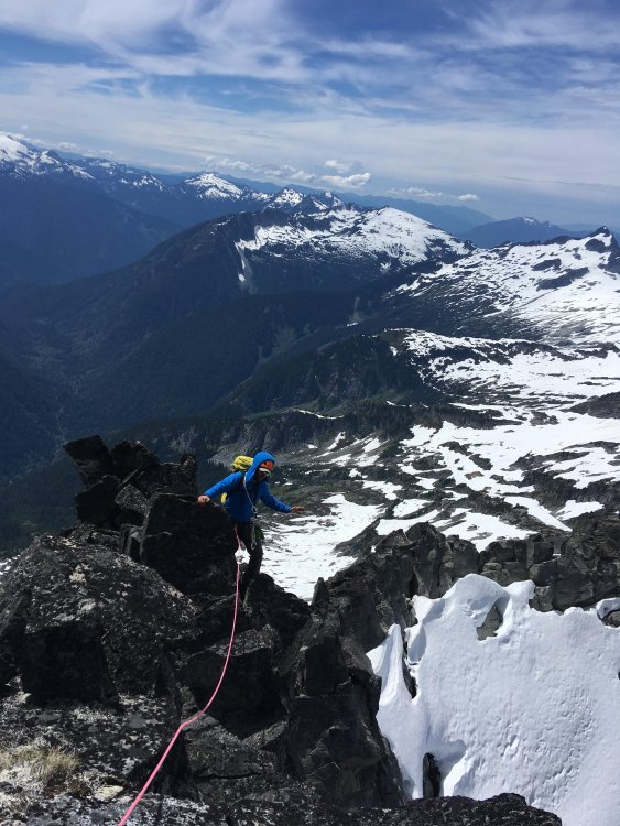
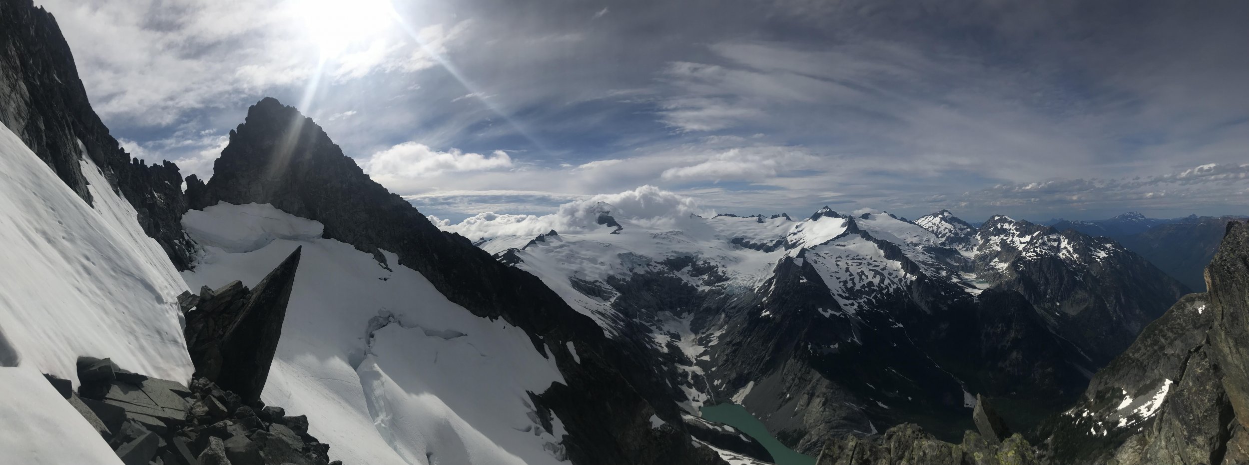
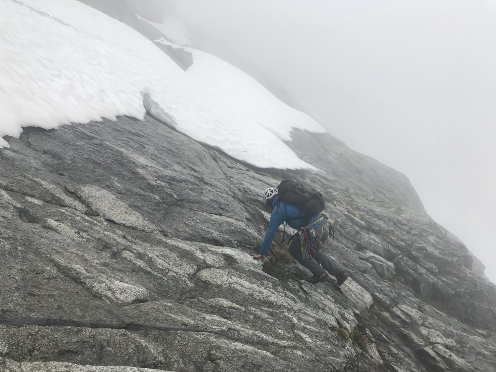
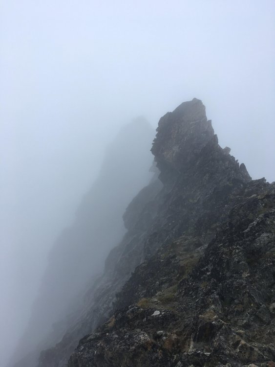
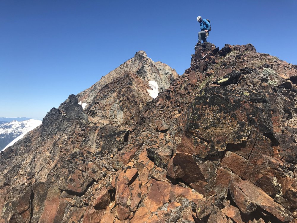
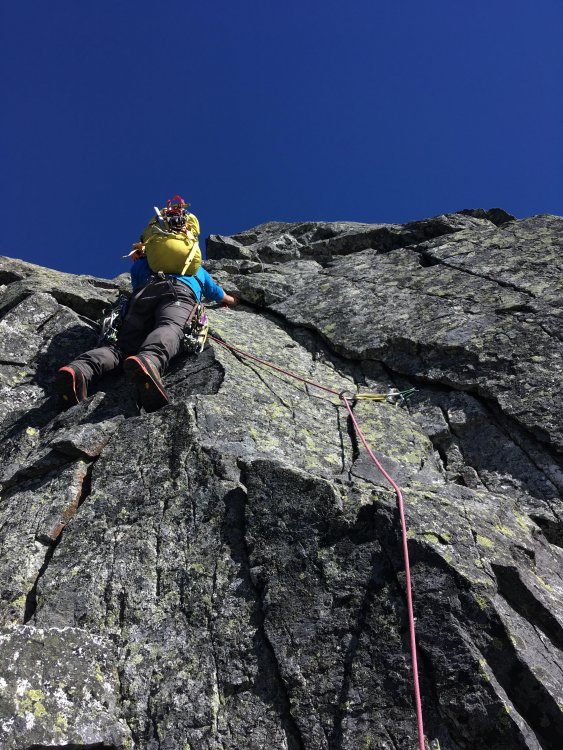
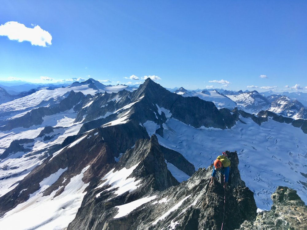
 Trip: North Cascades- Boston Basin - The Boston Marathon Trip Date: 07/10/2018 Trip Report: This is super delayed, but i was looking though old pics and thought this trip was worth sharing with y'all. Kyle was most certainly the brain-child behind this absurdity. I think it was sometime in the summer of 2017 he mentioned this idea of solo circumnaving boston basin. I was a bit suspicious that things might be a little more involved than was anticipated so told him i'd join in for a recon mission. We trail ran the sahale glacier route one day and gawked at the rest of the ridge, reading the unknown v known terrain and looking at the way the ridges tended to run. It was clear we were going in the wrong direction. For one, we would have to do the tft backwards, which would have honestly been the most chill weirdness. Downclimbing the ridge to sharkfin looked damn near suicidal. So we regrouped and planned a 2 day mission from the other end. We decided to start at the hidden lakes th and start on the triad via the sibley pass approach. When we hit the triad it was clear the "triad traverse" approach as described for marble creek basin didn't really let on to how gnarly the scrambling would be if one were to stay true to the ridge. We estimated summiting the triad sometime before 10 am, somewhere around mid afternoon we finally were running up the eldorado glacier. After tagging eldo via the east ridge, we ran over to the torment col while the sun was setting. After soloing the s ridge of torment in the morning, we realized we again had underestimated our objective, so we bailed down b basin and gorged on berries. One last attempt that summer would be thwarted by an overuse injury. And the september rains came, and boston basin stood like that itch you just cant reach all friggin winter long. Summer came around again and we were racking up at our first opportunity. Sometime in early July. looking back towards eldo and the triad on an early recon We Again set up the car shuttle, but this time the road was closed at the eldo th, and we had 4 days off, so we figured we'd tentatively plan on just tossing the triplets, cascade and j-berg in on the final day (our plan was to scramble the j berg summit ridge and bushwack down the gnar forrest straight back to the eldo th.). Weather ultimately meant this final link would not go, but its certainly something to aspire to. We set off from the trailhead for the triad. This time, we were prepared for the choss. early scrambling Kyle down-soloing some 5.6 choss on the triad Some 4th class funk on the triad 100ft tower we climbed along the way, 5.7 nothing on top suggested we were the first to visit such a bizzare place some more down climbin w face of w triad 5.6 R super aesthetic The first time we visited the triad we stayed true to the ridge crest east of the eastern summit and down-climbed somewhere about a third or half way down the east ridge. This proved to be an extremely dangerous experiment in natural jenga. We pushed off multiple oven to mini cooper sized blocks that impeded safe passage. We ended up bailing down some 500 ft 5.4-5.7 wall to the glacier. This was the boldest down-soloing i've ever committed to and would never be recommended. Remembering this experience, we opted to drop off the ridge after the eastern summit of the triad. A quick jaunt accross the glacier brought us over to eldo. We decided the truest line would be to climb the south ridge of eldorado. We found info on the south face, but none on the south ridge. We thought this odd, but the ridge looked quite reasonable. It ended up providing 4-6 epic and high quality pitches of easy rock climbing. A worthy stand alone mission and my second favorite (second to the west arete) way to summit the mountain. the first pitch gaining the s ridge of eldo second pitch some good ol' fashioned knife ridin good conditions meant a casual walk down the e ridge From the summit of eldo we decided to stop and rest at eldo camp rather than push through the dark to the torment col. I mean, there is a toilet there, thats pretty darn good motivation. We woke up early the next day and scurried across the feint climbers path leading over to torment. The torment col is always a neat place to hang out and fill up water. The true line here is the NW ridge of torment. We quickly glanced at the beckey bible the first time, and saw that it had gone. But when we got to the base of the ridge the gnar choss was quite strong, and we weren't entirely sure if we had the beta memorized, so we bailed back around the mountain to the south ridge. This time around we had taken some photos of the guidebook and decided to turn reason off. Getting on the ridge was the crux, purely mental, it turned out to be fairly easy going. There was one exposed and runout 5.8ish knife-edge pitch somewhere in there, but it all kinda blurred together. Soon enough we found ourselves on the summit of torment and in familiar terrain. The TFT awaited, finally some classic easy ridge travel! A classic b basin white out slowly creeped up as we reached the w ridge notch. It became apparent a storm was comming in so we scrambled to get the tarp up. We knew we were in for a wet night. looking over at the nw ridge of torment the entrance to the ridge, what looked like 5.10 from afar turned out to be 5.6 some more ridge scrambles on torment topping out the crux pitch of the nw ridge looking back at the entrance to the tft. getting on the glacier required a 20ft pendulum, then we had to rap down that high bergshrund. our first overhanging rap off a snow bollard. things were wet and snowy on the "3rd class rock" bypass variation We woke up on day 3 soaked (i say woke up, but there wasn't that much sleep). Rain stopped around 1 pm. The whiteout however persisted. We eventually got restless and started up the w ridge of forbidden. Neither of us had been down the east side of the mountain before, so we knew we were in for a good challenge when the whiteout lingered, but we knew we had to keep going if the traverse was going to go down. Finding the raps down the east ledges was tricky, but not unreasonable, we eventually got onto the e shoulder of the mountain below the start of the east ridge route. and knew that we had no clue what layed ahead, so we tucked tails and pitched the tarp. west ridge with a fog break another little break in the whiteout while descending the east ledges our bivy the next morning, j-berg looking classy as ever We awoke on day 4 with the sun and our first view of the nw ridge of boston. And we were decidedly a little concerned. Nonetheless we packed up and found our way down to the end of the e shoulder of forbidden. if ya think boston peak is choss, try scrambling around out here, it will change your understanding of the word. We reached the end, and the large cliff that would feed us to the the notch below the sharkfin ridge. this was truly un-rappellable terrain. So we backtracked to a low 5th class gully. A very stressful hour of downclimbing and rappelling spat us on the edge of the Qiuen Sabe. Another gully by the notch led us up to the steep hanging snowfield below the sharkfin ridge. We were short on time because of weather and opted to leave the subsummit west of sharkfin for another time. We quickly found ourselves at sharkfin. We climbed something on the sw ridge of the tooth, hard to remember exactly what we did. It was solid, exposed and 5.8. Had a hanging belay and no other signs of climbers. Not sure what we climbed, but it was fun. After some victory food on the summit we rapped off and set sail into a sea of virgin choss. I think there was maybe 1 more rappel to access boston, then we started up the ridge. We soloed about 1500 ft of low 5th class before hitting a vertical section and roping up. A circuitous combination of rappeling and ridge climbing brought us to the famous "ore" describing boston. A knife edge ridge guarded the easier looking summit headwall. The prospect of bailing at that point seemed worse than climbing the ridge, so i pushed up. The rock was best described as feta cheese. And i had to mow about a foot of the surface rock off as i au chevaled to ensure the entire ridge wouldn't collapse with me on it. I fabricated a belay half way across this called "off-belay". Kyle didn't look convinced i had found gear. Climbing delicately through the remaining pitches we found ourselves in unprotectable low 5th. So we soloed to the summit. The register up there is pretty rad, its a neat summit and the regular route doesn't look that bad. A few rappels and we knew we had done it, sahale was like the icing on the cake. And a 2000 ft boot ski down to the sahale arm was the reward. We blasted obscene music and trudged down to the cascade pass th. Overall we pitched out 26 pitches, rappelled 26 times and the gps read 26.2 miles back at the eldo th. A proper cascades test-piece. Some day we might go back and add j-berg. Maybe when memory fails us. "The Boston Marathon" VI 5.8R scouting the downclimb to the qiuen sabe looking over at the nw ridge of boston starting up sharkfin the final approach to boston. We ended up climbing just under the ridge crest for good 4th and low 5th class traversing until the gendarme right before the ridge starts gaining elevation, thats were we roped up the first roped climbing on boston finishing up on the first pitch of the au cheval Heres the track i took of the traverse loaded into caltopo, my phone died for about half of boston peak, so there is a straight line through that section. Gear Notes: Single Rack to 2, 50m half rope Approach Notes: We approached via the hidden lakes th with a car shuttle to the eldo th
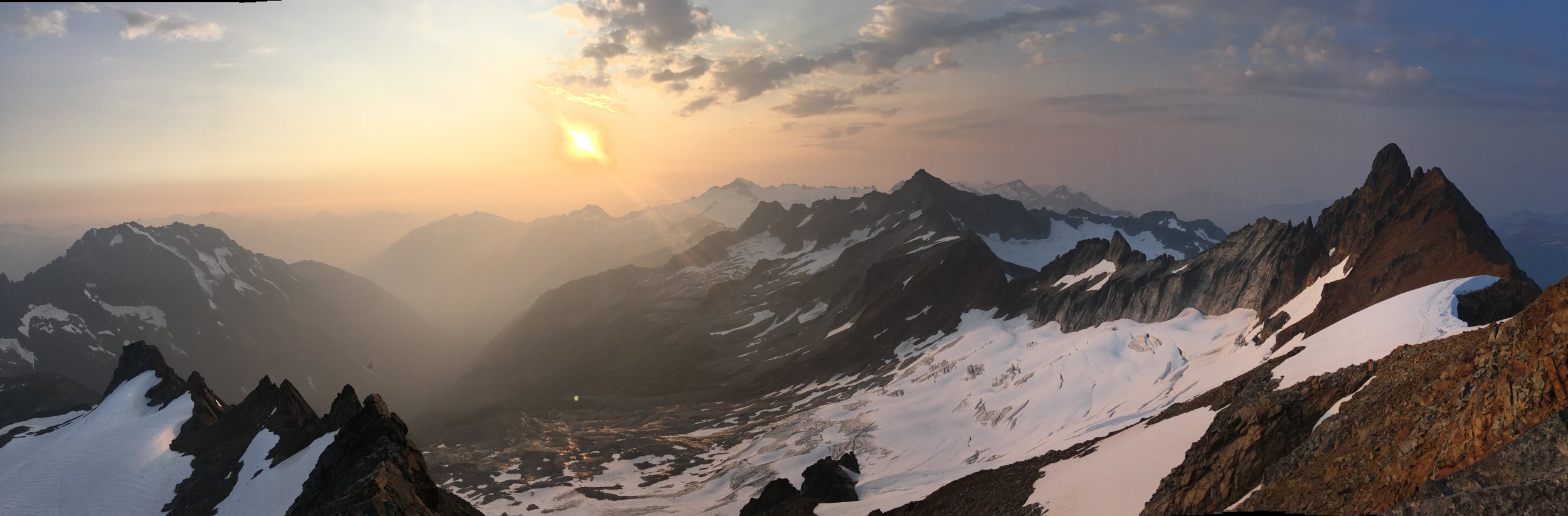


.thumb.jpg.e1bfe41408e1b7f12c77d6a1201c222a.jpg)
-
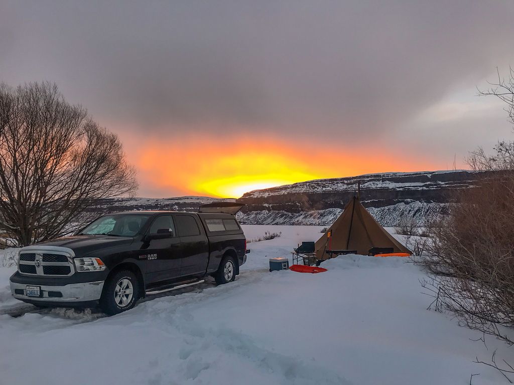
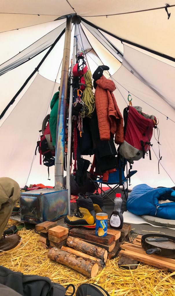
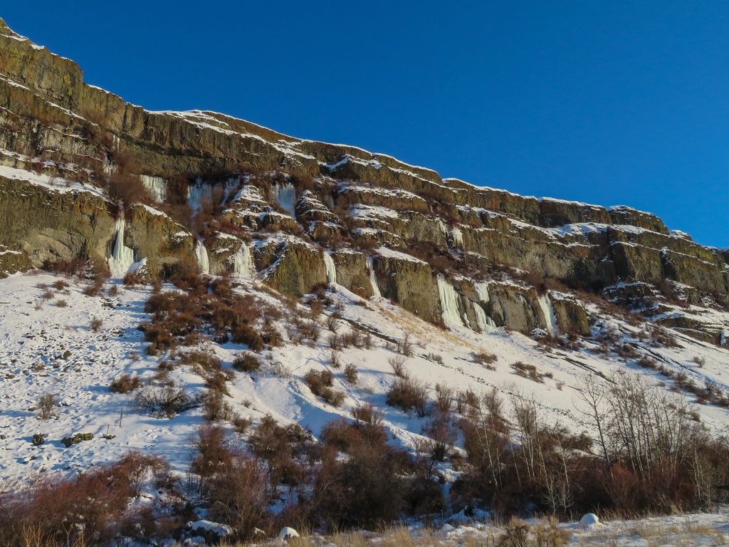
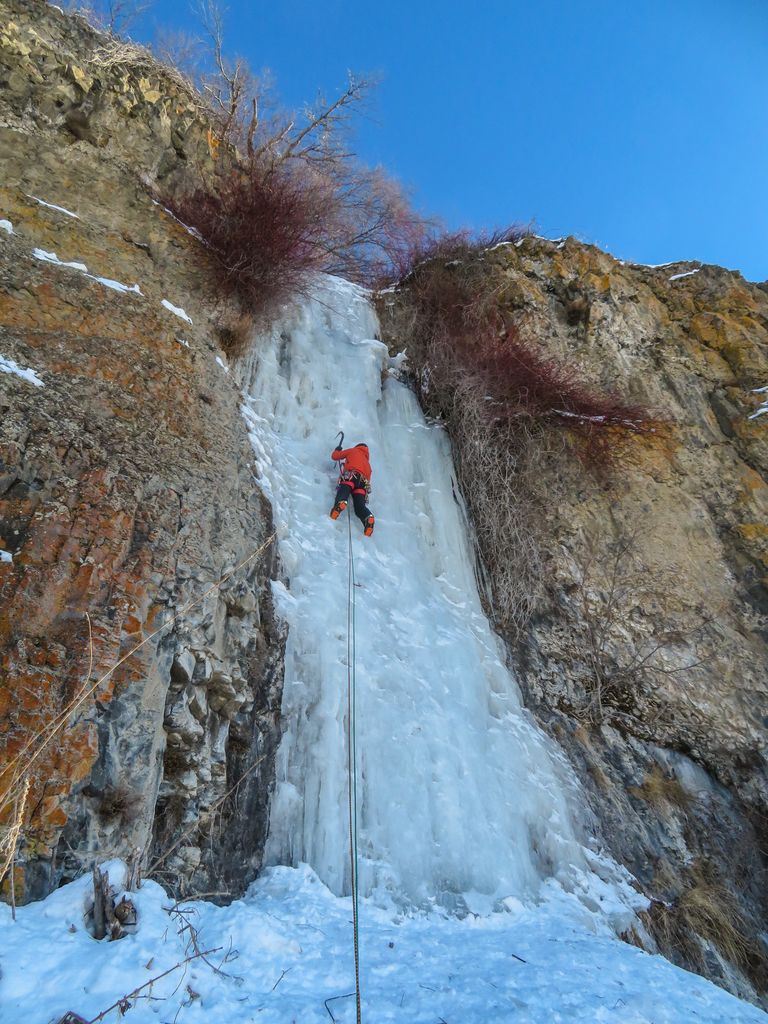
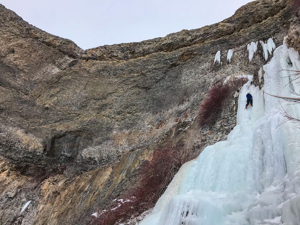
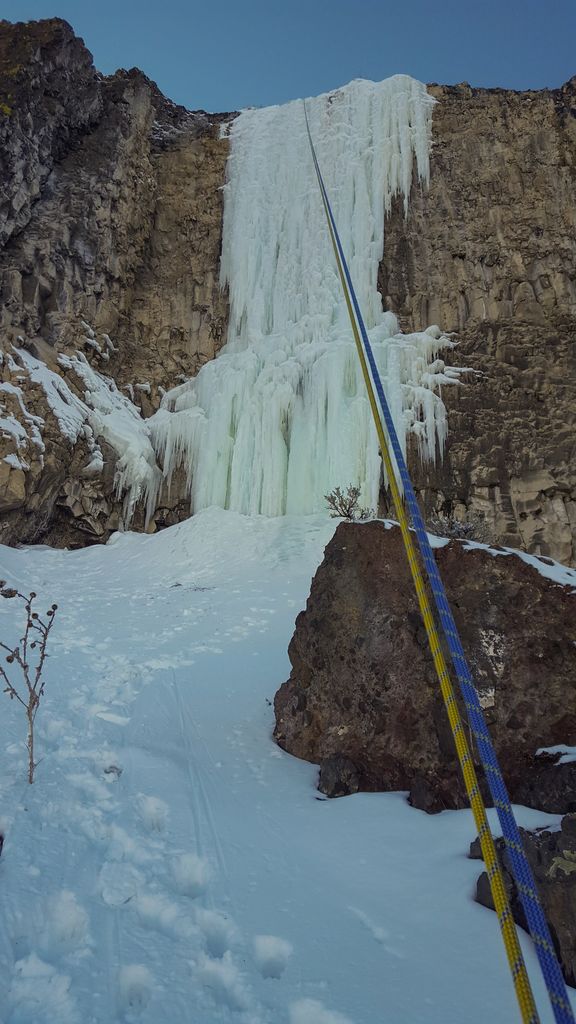
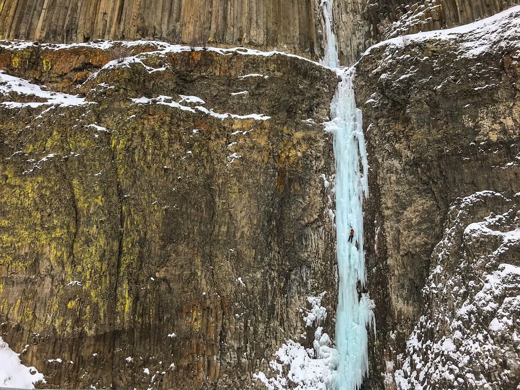
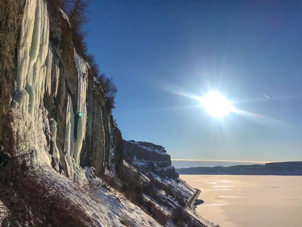
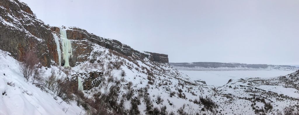
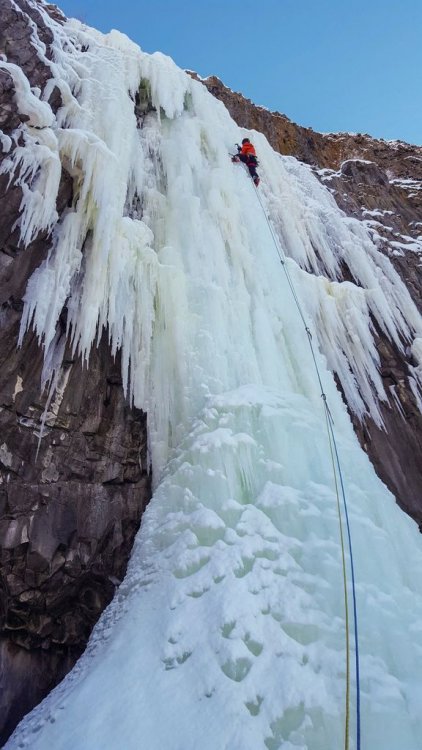
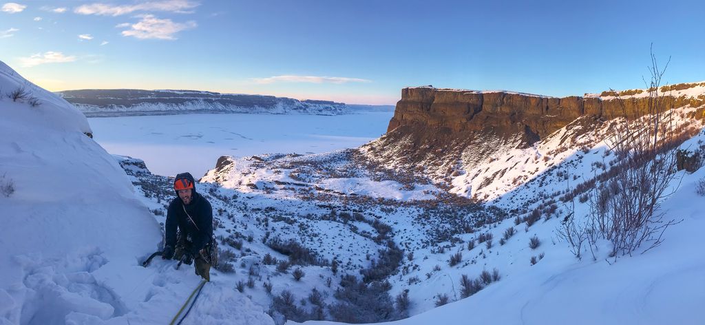
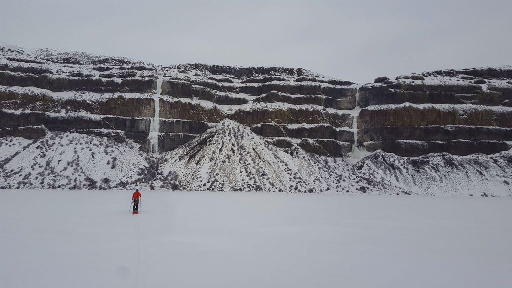
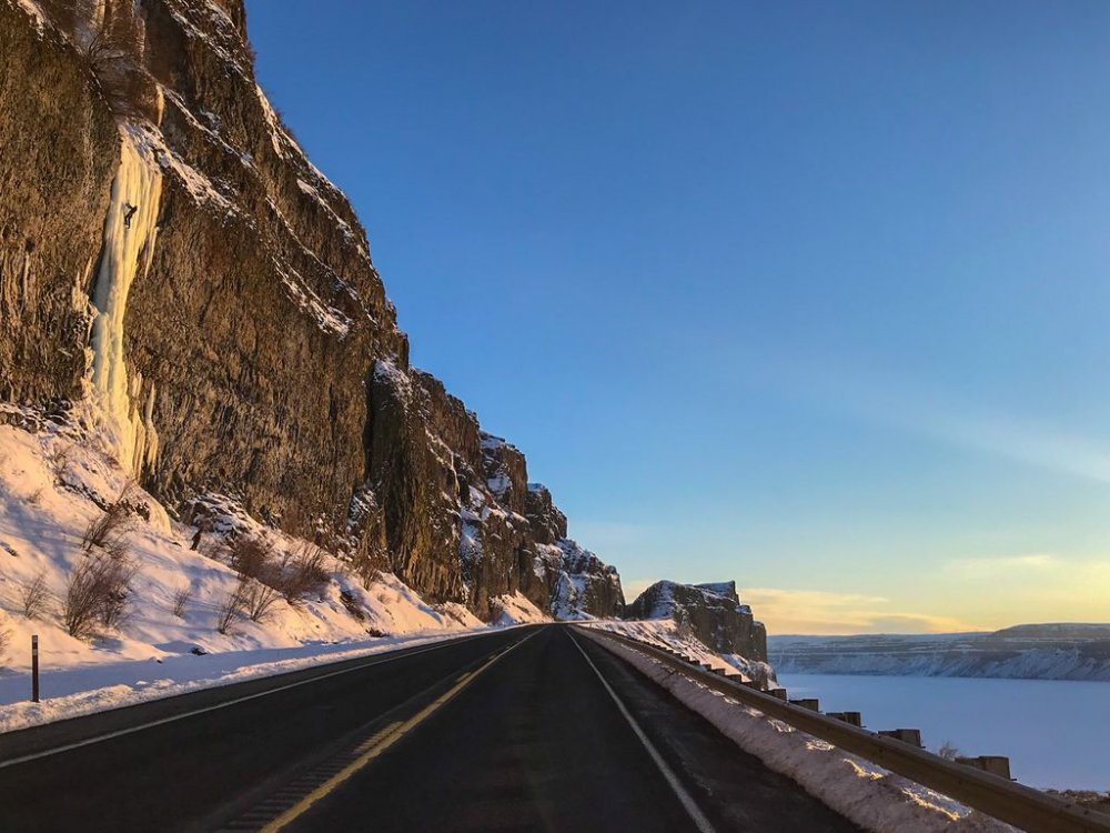
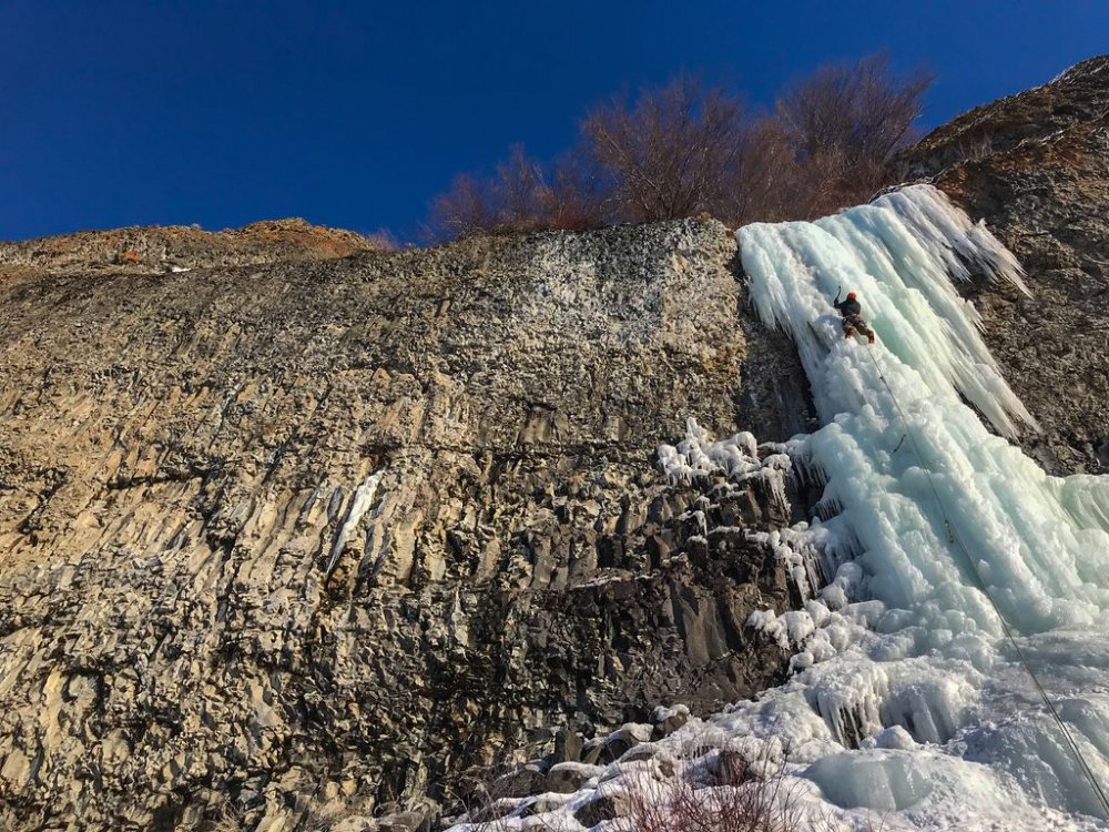
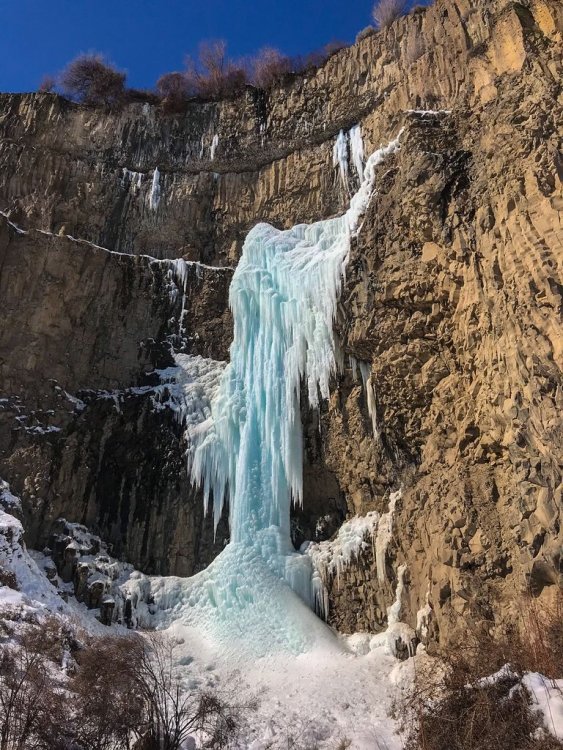
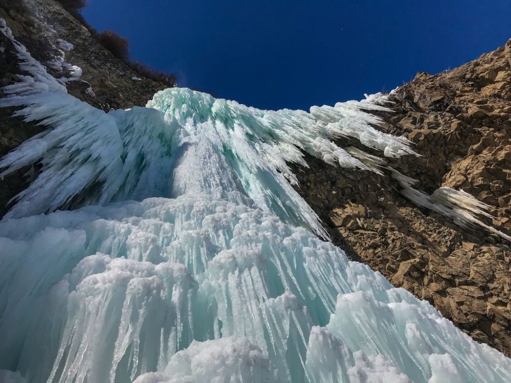
 Trip: Banks Lake, WA - Zenith, Emerald, Cable, Razorblades plus others Trip Date: 03/03/2019 to 03/14/2019 Trip Report: With reports of an incredible season at Banks Lake, my partner (Joe Peters) and I decided we needed to get over there. We drove over on March 3 to find a good place to set up a camp. Joe had to finish a couple things at work, but my wife Trisha came out to climb for the 1st two days until Joe got back. Then Joe and I were able to spend another 9 days climbing some of the wildest ice I have ever been on. Banks lake is that good!! I didn't list any grades in this trip report. Banks is a funny place and I found that grades were tricky to judge. In the end I decided that Wayne Wallace was right when he said..."Grades don't matter, everything here is hard." We camped in Joe's tipi tent which is pretty luxurious complete with stove for heat and drying gear. The best spot we found to camp was right across from Salt and Pepper. Camping limit is 15 days, it was free, and there was a toilet. We were able to sit in camp and stare up at Salt and Pepper every evening. Evening light in our camp. The view of Salt and Pepper from camp. (photo credit Joe Peters) Living it up inside the tipi. With that stove we could be sitting around in a t-shirt. It was absolutely essential for drying out boots and other wet gear after climbing every day. Here is a brief overview of our trip. 3/4 - Peewees #2, 3, 4, 6, and 7 3/5 - Climb below Emerald, Trotsky's Folly and Trotsky's Revenge (also called Phase Transition) 3/6 - Peewees #1 and 5 3/7 - The Emerald and Satan's Panties (also called Absent Minded Professor) 3/8 - Tea 'n' the Sahara 3/9 - The Cable and H2O2 3/10 - Unnamed climb Butch Cassidy in Moses Coulee 3/11 - Bombs over Old Baghdad (the climb across Banks lake at MP3) 3/12 - Shitting Razorblades 3/13 - Salt and Pepper 3/14 - Zenith I will just let the pictures tell the rest of story with a few captions. Peewee's Playground. I referenced these from right to left starting with 1 and ending with 8. Me leading Peewee #4 on the 1st day. A great place to start getting used to Banks ice! (photo credit Trisha Thorman) Craig Pope had just put up this line which he thought was probably an FA. It transitioned from the ice through the rock and out to the hanging dagger. It is Peewee #2 and he named it Turn the Page. This is a couple guys from MT climbing it on TR in the beautiful afternoon sun. The next day Trisha and I climbed this little flow. It was fantastic steep climbing that eased off about half way up. It is right off the road at the Emerald Pullout. It is amazing to me that there are so many of these lines that don't have names. Anywhere else and these good pitches of ice would all be named! Trisha doing a TR lap on Trotsky's Revenge. Day 3 Trisha headed back home and Joe arrived. Here Joe is arriving at the top of the fantastic Peewee #1. This is Satan's Panties (also called Absent Minded Professor). Rumor is that it hasn't come in for multiple years. It was a really fun multi-tiered climb that was a great warmup for the bigger climbs at Banks. The Emerald sits tucked up in a small valley above the main Banks Lake proper. It was a fantastic steep pitch of excellent climbing. It even faced north so it didn't get any sun to ruin the ice! Me leading the Emerald. (photo credit Joe Peters) Joe topping out on the Emerald at the end of a great day! With a cloudy day we decided to brave the lake and head across for some of the bigger lines. Thankfully the lake ice was thick and solid with no noises. The climb directly above me is Tea 'n' the Sahara. The one to my right is unknown.....it never came in this year unfortunately (or at least the dagger never touched down). (Photo credit Joe Peters). A closer view of Tea 'n' the Sahara. This was definitely my favorite climb of the trip. It consisted of 4 steep pitches each about 90-120 feet in length. The ice was typical Banks with plenty of excavating but the position and length of the climbing make it a classic for sure. Joe climbing the final steep 4th pitch. Looking back up at pitch 4 of Tea 'n' the Sahara from rappel. We were able to rappel the entire route with 2 rope stretching 70m rappels......take 70m ropes! (photo credit Joe Peters) The Cable....it is such an amazing, steep, crazy, gymnastic, different route. An absolute must do at Banks. Here Brian Williams is a little past halfway up the long pitch. Me leading the Cable. It is so good......just go do it! (photo credit Joe Peters) The Cable in the setting sun. Next we went to climb H2O2. Here are a couple of unknown climbers on it the night before. Yet another great pitch of climbing right next to the road. Here Joe is putting up H2O2 in the evening sun. The following day we drove over to Moses Coulee. Unfortunately Butch Cassidy and the Sundance Kid were pretty wrecked by the sun. This is an unnamed climb on the same road about 1/2 mile before Butch Cassidy. After reviewing the guidebook and talking with several other people this is actually Butch Cassidy. The climb between Butch and Sundance Kid is unnamed (although climbed). The WA ice guidebook has the wrong mileage to these climbs. Looking up at Unnamed route Butch Cassidy was awe inspiring. There were so many hanging daggers through the steep upper roofs. I gave it a go on lead but ended up sitting on a screw in the roof. I found out I wasn't fit enough to lock off on a tool and clean hanging daggers for that long. Still an awesome experience! Me approaching the large ice roof of hanging icicles. (Photo credit Joe Peters) The next day was cloudy so we headed back across the lake. This climb is right across from MP3. It isn't in the WA ice book and nobody seems to know what it is called. After staring at it disappearing into the fog above we decided to call it Stairway to Heaven. (Edit: sounds like it is called Bombs over old Baghdad) Here is Joe leading up pitch 2. The next day was time to get on Razorblades. This is a climb that had been on my list to do for a while and it didn't disappoint. Some years the first pitch isn't in or so thin that you can't protect it well. This year it was fat! Me leading up the crux first pitch of Razorblades. I don't think I have ever climbed ice by pulling on ice mushrooms with my hands instead of swinging my tools into the ice....fun but funky! (Photo credit Joe Peters) Finally after staring at Salt and Pepper every night for a week, we decided we needed to go and do it. The guidebook made the 1st pitch sound hard and scary. It climbs the loose rock on the left and traverses up the snow ramp to the ice. It was loose, but I found a decent pin and a couple cam placements. You definitely don't need a #3 C4. I would take a couple of KB pins and a set of cams from BD .3 to #1. The crux step of rock is easy 5th but it is loose and a fall would be very bad. Joe climbing up the steep ice of Salt and Pepper. It was a fantastic climb with big exposure. This is looking straight down for about 300 feet. We wrapped up our trip with Zenith. A fitting end to a fantastic trip. It was very fat this year but still steep and long! (Photo credit Joe Peters) Joe and I on Zenith. Being a roadside crag, many times a few people stop and watch. Sue Tebow was one such person but she was kind enough to leave us her contact information so we could get a couple pictures she took. It is always a treat to get both the leader and the follower in the same picture. Thanks Sue! (Photo credit Sue Tebow) A final parting shot of the huge deathcicle above Zenith. It was so fascinating to look up at but we wasted no time in getting out of there. It consisted of a thin hollow tube of ice that extended 30 feet or so below the cliff. Out of the center poured a huge amount of water. (Photo credit Joe Peters) Gear Notes: Ice screws and 70m ropes Approach Notes: Short and easy unless you are crossing the lake!


-
Trip: hubba-hubba hill - the funnel Trip Date: 03/15/2019 Trip Report: not so much a trip report as a caution. Mark Shipman and I tromped up Hubba-Hubba Hill this morning to jump on the fattest ice I'd seen in the Funnel in decades. Warm temps and falling bits & pieces convinced us to climb a more sheltered line left of the main Funnel flow. After climbing our very short line, we hemmed & hawed about jumping on the main flow, but the bits & pieces were getting larger, and the snow under our feet was by that time propagating micro-slabs from our footsteps - so we bailed & glissaded back to the parking lot. While loading our gear into Mark's car, we heard a roar, and I jumped around the car to where I could see the Funnel. All three feeder gullies above the funnel were running full volume, pouring what must have been tons of snow into the staging area where we'd been standing not an hour earlier. We watched slack-jawed while snow poured through the funnel, completely obscuring all four climbing lines for well over a full minute. In past years I have climbed over avalanche debris piles 10+ feet tall when approaching these climbs, and I had always told myself these piles were the result of numerous repeated events. as of this morning, I'm thinking maybe not... caught unprepared, neither of us had the presence of mind to dig out a phone (in the pockets of sweaters in our packs) and record this epic slide for y'all. sincerest apologies. take care on shaded/north-facing slopes near treeline this weekend! nwac appears to have received reports of similar events from other observers... -Haireball Gear Notes: irrelevant Approach Notes: park at Eightmile road, cross the river and walk uphill. or - stay at your car with binoculars/camera and wait
-
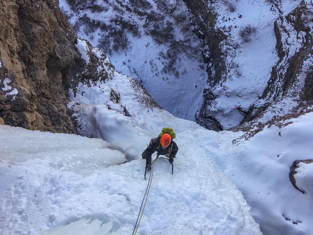
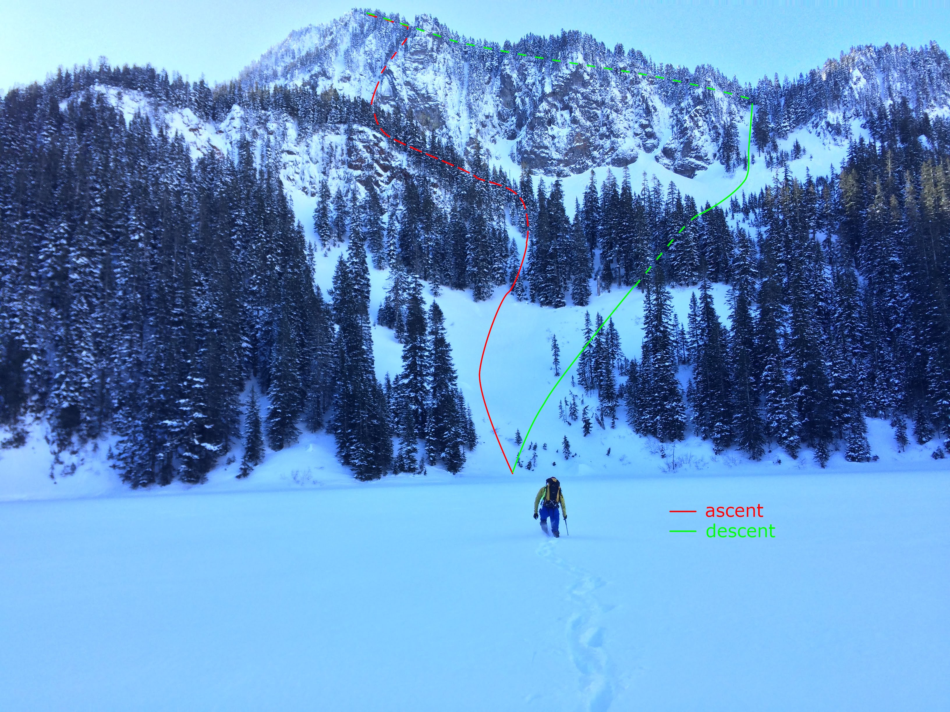
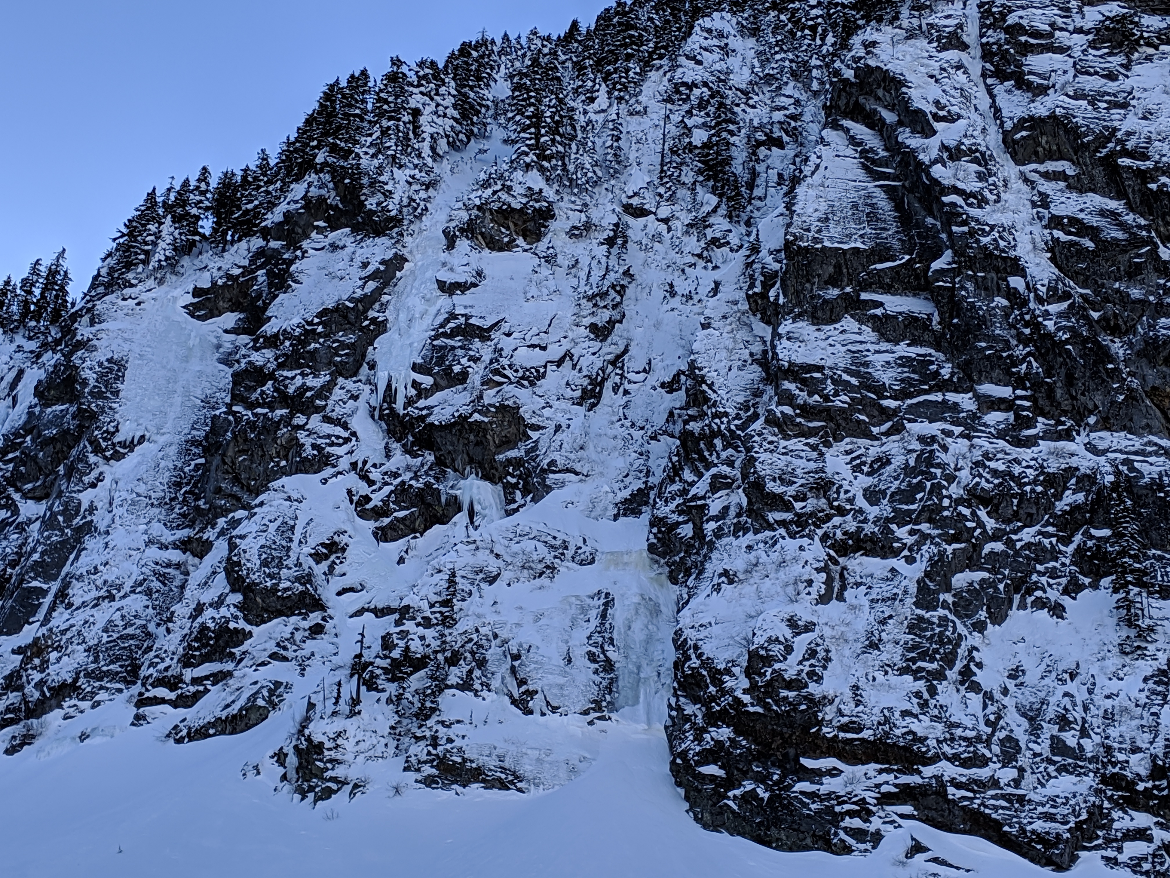
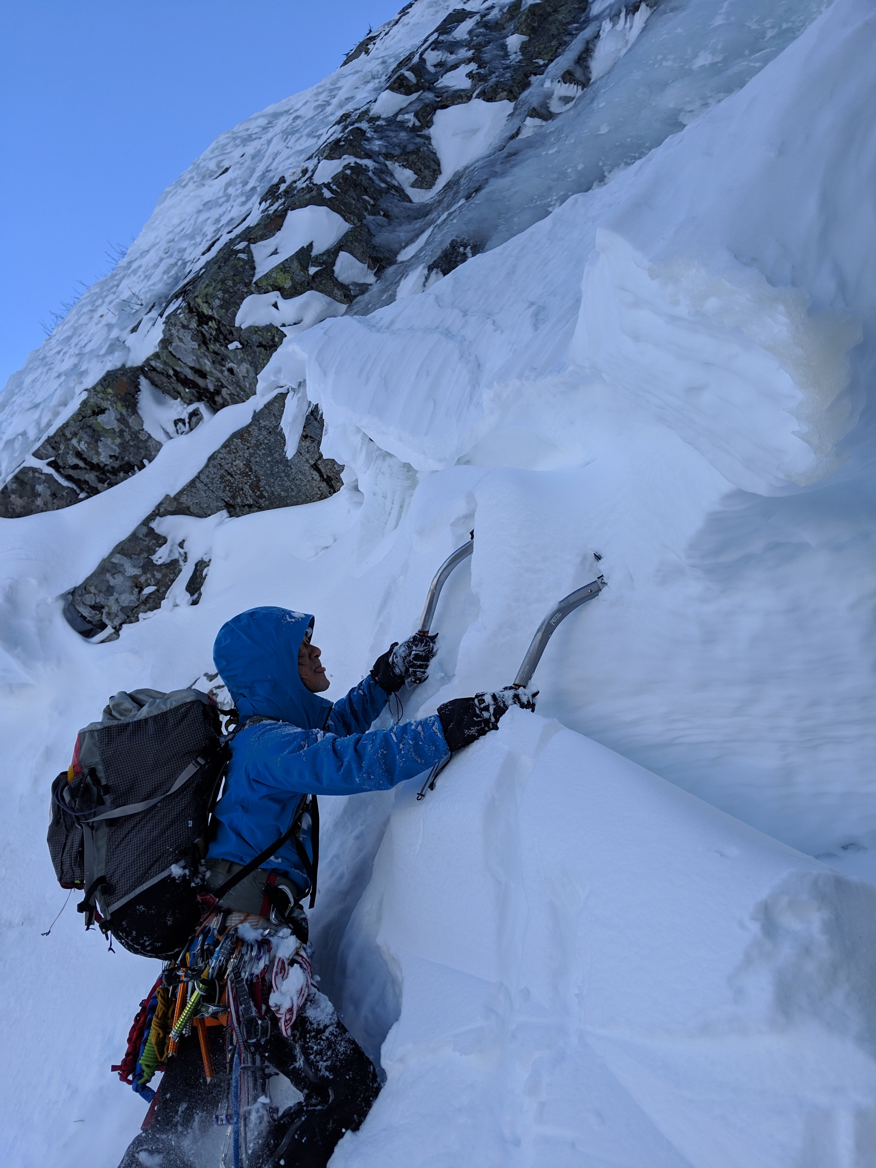
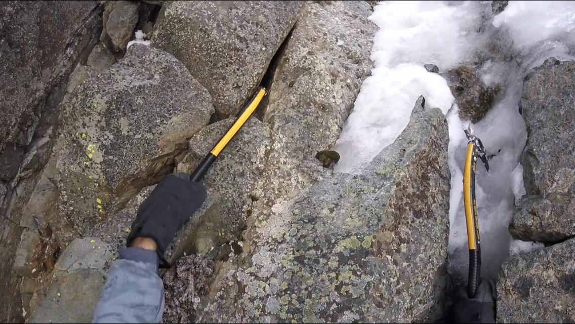
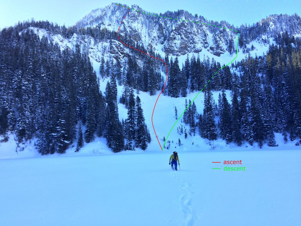
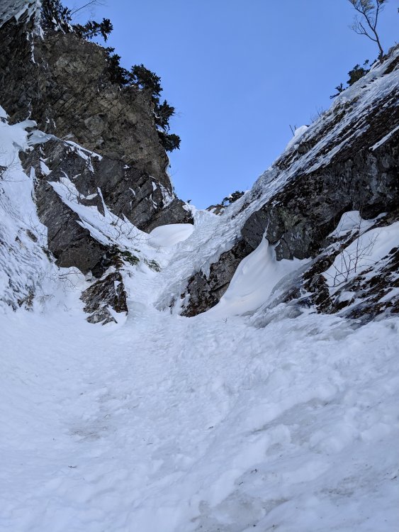
Trip: Abiel Peak - North Face Gully Trip Date: 03/10/2019 Trip Report: I haven't seen any recent TRs, so posting... Hiro and I picked Abiel Peak to be our next ice climbing destination. Since there are multiple routes we decided to come and see which one to climb [checkout the old TR and AlpineDave blog for options]. It turned out to be North Face Gully. Here is an overview of the climb: Most of the route is hidden from the approach. Here you can see only the beginning of it at the bottom center: Closer: Soft snow accumulated at the bottom. We spent plenty of time taking turns and cleaning it up: There was decent ice under snow: Most of the first pitch was a solid ice. The second pitch was mostly snow. We did simul climbing. Looking down while at the 2nd pitch: But simul climbing came to the end very soon, because the third pitch unexpectedly popped around a corner: It is not vertical, but steeper that it looks like on the photo . Ice wasn't making it easier: at some places it was thin, at others - crumbly snow-ice mix. How does the saying go: placements are getting closer as pucker factor goes up? Nevertheless we made it up and after that it was only about 30m of snow to a ridge. The ridge met us with sun, warmth and view to Rainier. When walking towards the summit there was a short section of snow covered boulders with lurking cavities in between them. For a descent we went West staying on a ridge as it kinda circles clockwise. It was just walking. We came back to a car by a sunset. After eleven hours we returned to a car with Granite Mountain saluting us in sunset colors. Gear Notes: 7 ice screws, 2 pickets (used one), 0.4, 0.5 & 1 cams (used all), small nuts (used few). Approach Notes: Solid footpath until Lake Annette. Crossed the lake.


-
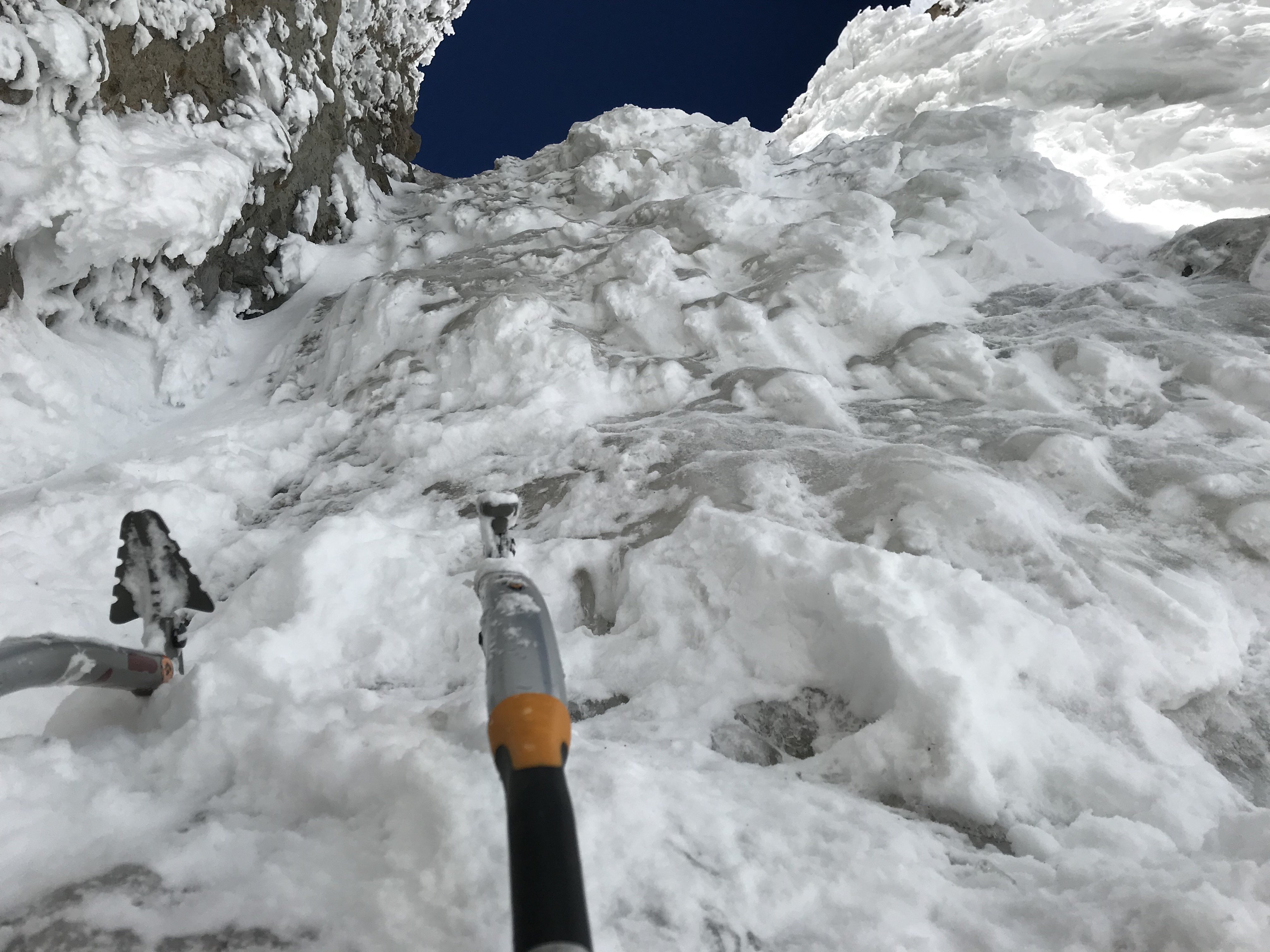
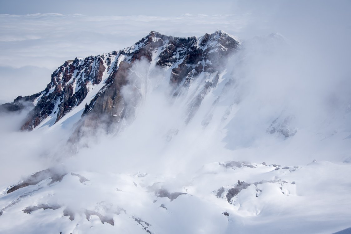
Trip: MT. HOOD - Devils Kitchen Headwall Trip Date: 03/10/2019 Trip Report: (please forgive my subpar writing ability) Mike and I started up from Timberline at 5am on Sunday with our eyes set on the Reid headwall. As we headed up the groomers to the top of palmer everything was going smooth. Once above palmer we slowly made our way over to illumination rock, breaking trail in some good old thigh deep powder. One would think that this would be a pretty good sign that the Reid headwall is probably not in, but we were both too stubborn to call it. We stopped for a quick second once we hit Illumination rock to put our crampons on and then headed down to the base of Reid headwall. The first 20 feet started out as really nice hard packed snow and them quickly turned into thigh to mid chest deep powder. We managed to make it about 70% of the way to the base before we decided that it would take us a week to wade through the snow to the base. At this point we had two options, option A) head home, option B) slog through the thigh deep snow back up and over to the Devils kitchen headwall. Naturally we went with option B) After a good effort to get up to DKH we ran into another party down below that was aiming for the DKH. On any other day with snow conditions not so unforgiving we might have beat them to the base of the route. Not today though, these smart guys were skinning up like the rest of the smart people on the mountain. As we followed up through the deep snow we were faced with another dilemma. Do we follow these guys up the regular DKH route or give them some space like good humans and find another route. Once again we went with the second option and decided to head up to the DKH Variation on the right. As we headed up the snow was just getting worse, but we kept going optimistic that maybe we would find some ice or firm snow. Once we got to the beginning of the first step in the DKH variation route it quickly became evident that this was not in. To really confirm this i headed up the first step to see what the snow was like above. To my surprise it was total shit.... Now what do we do? Give up and finally call it a day? Definitely not! So we headed back down and waded through the snow once again over to the standard DKH route thinking that the two guys in front of us must be more or less off by now. Bingo! finally some decent climbing conditions. Looking up into the main couloir. Mike climbing up the first Ice step. Looking up the Second ice step. Conditions were really good on this and the Ice was thick. Mike at the bottom of the second ice step. getting the rope organized below the second ice step. Mike topping out the second ice step. Looking up towards the final slopes to the summit. The climbing was really mellow from here on up. mike coming up the last little bit before the summit ridge Summit ridge finally! All in all our day was longer than usual but we finally managed to climb something! DKH is definitely in good conditions right now. Ice is fairly thick and does take screws nicely. No need for really anything other than a handful of short screws right now. Gear Notes: 3 Ice screws Approach Notes: Thigh deep powder


-
Trip: Shuksan, Icy, Ruth - Nooksack Traverse Trip Date: 03/01/2019 Trip Report: Fred and I went and did the Nooksack Traverse over the first three days of March. We had fun, I think. We had probably the worst snow conditions of any ski trip I have ever been on, extremely cold temps for Washington, a crevasse fall, and several equipment issues. I might not go back... this year anyway. We parked a car at the Hannegan Pass Road picnic area right at the highway, then drove up to the lower ski lodge. The trip into the White Salmon valley was typical. We traversed in and lost ground to some guys who skied the clearcut, but they didn't have overnight packs. Skinning up the WSG was a breeze really, excellent snow if you were going downhill. We opted to climb the Hourglass instead of Hells Highway. We found about 20' of hard water ice... surprising. It was tough with a single axe and only two screws. Bring real ice gear and do it though! There was another bigger step above that we skirted on the left and topped out on the Sulphide. I would guess it was WI2. Fred approaching the Hourglass: Summiting was easy after dropping our packs at the bottom of the pyramid. We had lost a lot of time in the Hourglass, it's not worth it as a time saver, so we tagged the top and headed down. We skinned down to the flat spot on the Crystal Glacier while the sun set, getting the tent up just at dark. The crossover from the Crystal to the Sulphide was easy, poor light made it seem hard though. Fred on the summit of Shuksan: After a long cold night we packed up and headed uphill for a warmup skin and a look into the Price Glacier. The topout looked unlikely with a crack already running completely across the headwall. We skied down to the entrance to the Nooksack Glacier to check it out, a little trepidatiously we worked our way in, and found bad news. It looked scarry, way scarry. Obviously it's steep, but there is a serac just below the only cornice free entrance, then a crack running completely across the base of the headwall. We balked. We walked the cornice with hopes of rapping over it and downclimbing through a gap in the bergschrund at a minor rib. The drop in on the Nooksack headwall from further east above the cornices, photo by Fred: This option didn't really seem safer, so we went for another look. I really wanted to bail at this point; the WSG is a pretty darn good consolation ski, but I also really wanted to do this route, and Fred never bails (jk). We strapped our skis on our backs and Fred began downclimbing on belay. We only had two pickets so it would be a thin running belay at best. When he got to the top of the 'schrund he couldn't see over, so I set a 2 point anchor and began lowering him... Then the lip blew, it collapsed under him and he fell, the picket and axe I had in blew, as did an intermediate picket Fred had in, and I began rolling. I rolled probably 60' down a 50° slope. My first thought was "oh shit, Fred! I blew it as a belayer!" My second thought was "oh shit, ME! This is going to suck." I think I bounced off the far side of the 'schrund, then hit bottom. We both had the same thought when we hit the ground: "get your head up so you don't suffocate." When I could see again Fred was a few feet away and we were in a 20' deep crevasse. We had fallen about 10' over the lip, then 20' more into the bottom, but we were OK. We both check in with each other, then tried to climb out. The bridge we were on was not the bottom, and it was super hollow, my feet kept punching through into air. I had to take my pack off (with skis on it remember) and use it to push against so I could get my feet up and onto firmer snow. After I got untangled from the rope I climbed the far wall of the crevasse, it wasn't hard, just steep, loose snow. Fred did the same and we were seemingly fine. We later debriefed and realized that this might actually have been the best case scenario. If the anchor had held and I had lowered Fred he would have been free hanging, then we would have run out of rope before he got to the bottom. My only choice would have been to go Joe Simpson on him and cut the rope. The slope and 'schrund from below, photo by Fred: So anyway, we skied down and crossed the Nooksack Glacier without needing to skin. It was close, and there was some shuffling, but we made it through. Fred hanging out below a big serac: Looking back across the Nooksack: After more crappy, technical, icy skinning with crampons, we made the Icy Peak shoulder. My crampon broke about 30' shy of the summit of Icy when I was climbing the icy gully and kicked a rock slab (they were aluminum). But Fred pushed on. We camped between Icy and Ruth for another cold night, making camp just before dark again. More icy hard skinning led the next morning to Ruth and eventually the skin all the way back to the highway. Fred nearing Ruth summit: The East Nooksack from Ruth: Well, I'm glad we did it. Perhaps it is not the best year, perhaps we are just not good enough skiers for the headwall, who knows. We had fun, kind of. I'm glad we did it, glad we made it out, and glad I don't have to do it again, at least until there is another good weather window! Gear Notes: Standard ski mountaineering gear, ski and boot crampons, lots of clothes. Approach Notes: Traversed in from chair 8.
-
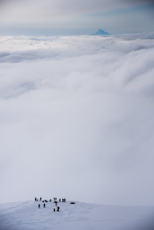
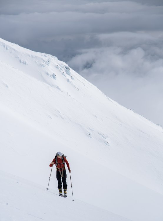
Trip: North Cascades - Easton Glacier Trip Date: 03/05/2019 Trip Report: Monday March 4th, buddy and departed for Easton Glacier of Kulshan. Starting from the sno-park trailhead at 0230 March 5th, roughly 3-4 miles from summertime trailhead, the trail had been groomed earlier that day. We cruised up the groomed path until roughly 6500’ where transitioned onto heavily tracked out trail by snowmobilers, which had rose well into the glacier. The Easton had appeared to be filled in and solid as Cascade concrete allows, no shoot cracks were prevalent even around moats where snowmobiles had appeared to ride through. Rising to about 7500’-8000’, strong Northwestern winds pushed in a fat system, dropping visibility to below 20’. After a 20min break around these elevations, we decided to pull the cord and bail as conditions only worsened and could see the rest of the system moving in from around Washington/ Cascade Pass region. The ski down was great here and there, on the snowmobile tracks it was rather poor. Tons of variable snow conditions surely a result from many freeze thaw cycles and heavy traffic. Cruised on groomed trail all the way down to the car with the occasional section of skating, I would say no more than 400m at a time. Overall, great conditions, smooth sailing on the ascent as well as descent, glacier roulette was very forgiving this trip, certainly will be in prime conditions after the current cycle moving through if AVI does not jump to high. 8.5 hours; 23.45 miles; 6300' ascent; 6400 descent Gear Notes: Ice Axe, Crampon, Ski Crampons Approach Notes: Smooth and fast, bring the music
-
Trip: Broken Top - North Face Trip Date: 03/04/2019 Trip Report: Broken Top Circumnavigation 3/3/19 – 3/5/19 Mallory and I decided to take advantage of the impressive snow coverage this year and attempt a route that probably doesn’t come in during your average Central Oregon winter: the north face of Broken Top. On Sunday afternoon we skinned out to just north of Ball Butte and established a cushy basecamp in the rolling hills before Broken Hand. Life above the inversion layer was good and our stoke was very high. Alarms set for 4:30am, we fell asleep under the brilliant stars of the clear, cold night. By the time we were moving Monday morning, the sun was cresting the horizon and providing some much needed navigational illumination. We cruised around No Name Lake and glided our way onto the Bend glacier with little difficulty. Espying a likely looking couloir with two noticeable steps, we skinned up to its base and dug a snow pit to assess snowpack stability. Green light: send time. 9am. Our first crux was encountered very quickly: a gaping bergschrund at the terminus of the Bend glacier. I was surprised to find it so open with all the recent storm snow but no matter: we roped up and Mallory led up a suitable snowbridge. I took the next pitch, quickly fired up 20M of moderate snow and found a bomber ice screw placement in a flow on the right side of the couloir. I wanted to get to the base of the first step but our 30M rope ran out, so we simul-climbed another 30M and I dug out a stance to bring Mallory up. While I furtively prayed against getting a pair of crampons to the face and attempted to shield myself from the barrage of ice and snow giving way to Mallory’s masterful axe swings above, he scrambled his way up 15ft of ice and fired in a mediocre screw: “It’s a bit thin up here, I’ve got the screw about half way in, what do you think?” “Clip it, don’t whip it, bud!” He sent the next 10ft of the step and continued onto the snow above, sunk a picket, and brought me up. The ice step challenged me, and looking at the rock step ahead I was pretty skeptical. Mallory grabbed the rope without hesitation and set off on pitch 4, placing another picket below the step but was completely unable to find protection in the 20ft rock groove. No matter, he’s a crusher, dry tooled his way up, and buried his axe to bring me along. It was about time I started pulling my weight so off I went, laboriously breaking trail up 60+ degree powder snow. From below we’d scoped deeking climber’s right above the couloir, but looking at the snow to the right which was even steeper than what I was on, I decided the exposed rock slope to my left looked more inviting. An absolutely worthless orange Metolius gave me the mental fortitude to quest into this vertical unknown, alternatively yanking blocks of volcanic cascade choss off the mountainside and finding some of the most bomber jugs I could possibly hope for. This absolutely gripping pitch (not suitable for your budding 5.8 leader) led me onto more steep snow slopes above, upon which I simul climbed with Mallory once more until the snow got deep enough to dig out a stance and belay him through the rock section. We were nearing the top of our route but time was ticking, and fast. Getting ready to take off again, I said, “I’m going 30 meters and I’ll place a picket. Start climbing with me, and after another 30, I’ll put in another picket. From there, I’m going to the summit.” 120M later, I crested onto the NW ridge and threw Mallory a long-awaited belay. We were ecstatic with the send, but very aware of the descent ahead, the setting sun, and our immense hunger/dehydration. 5pm. Letting go of the true summit 60M above us and our dreams of steep descents into the Crook crater, we guzzled some water, split a Clif bar, and started down the NW ridge. We quickly decided on traversing the west bowl above Green Lakes, the SW slope, and the Crater Creek drainage back to basecamp. We transitioned at lightning speed and I took off to find a way through the mini ridges that populate the top of the west bowl. “No, stooopppppp!” I twist around and see one of Mallory’s skis rocketing down the slope, blatantly ignoring the engaged ski brake. At least I got some nice turns down to Green Lakes, and we resigned ourselves to the headlamp skin. Basecamp provided the essential shelter and water, and our exhausted bodies drifted off to a blissful sleep under yet another beautifully clear, starry night. 9pm. We skinned back to Dutchman on Tuesday morning. The one hitch in our trip: we couldn’t turn on phones and notify friends of an extended stay in the backcountry. A huge thanks to those who were concerned about us on Monday night. Upon return to civilization, we heartily enjoyed one of the most delicious burrito I’ve ever tasted at the Bachelor nordic center. An epic adventure chock full of unbelievable views, great friends, astounding courage, dogged perseverance, and most of all that deep feeling of humility in the mountains that relentlessly tugs at the heartstrings and brings us back again and again. Gear Notes: We took 2 pickets, wanted 4. Took 2 screws, could have taken 3. Went way too heavy on the rock gear. Approach Notes: Watch out for the cliff NW of No Name Lake
-
Trip: Broken Top - North Face Trip Date: 03/04/2019 Trip Report: Broken Top Circumnavigation 3/3/19 – 3/5/19 Mallory and I decided to take advantage of the impressive snow coverage this year and attempt a route that probably doesn’t come in during your average Central Oregon winter: the north face of Broken Top. On Sunday afternoon we skinned out to just north of Ball Butte and established a cushy basecamp in the rolling hills before Broken Hand. Life above the inversion layer was good and our stoke was very high. Alarms set for 4:30am, we fell asleep under the brilliant stars of the clear, cold night. By the time we were moving Monday morning, the sun was cresting the horizon and providing some much needed navigational illumination. We cruised around No Name Lake and glided our way onto the Bend glacier with little difficulty. Espying a likely looking couloir with two noticeable steps, we skinned up to its base and dug a snow pit to assess snowpack stability. Green light: send time. 9am. Our first crux was encountered very quickly: a gaping bergschrund at the terminus of the Bend glacier. I was surprised to find it so open with all the recent storm snow but no matter: we roped up and Mallory led up a suitable snowbridge. I took the next pitch, quickly fired up 20M of moderate snow and found a bomber ice screw placement in a flow on the right side of the couloir. I wanted to get to the base of the first step but our 30M rope ran out, so we simul-climbed another 30M and I dug out a stance to bring Mallory up. While I furtively prayed against getting a pair of crampons to the face and attempted to shield myself from the barrage of ice and snow giving way to Mallory’s masterful axe swings above, he scrambled his way up 15ft of ice and fired in a mediocre screw: “It’s a bit thin up here, I’ve got the screw about half way in, what do you think?” “Clip it, don’t whip it, bud!” He sent the next 10ft of the step and continued onto the snow above, sunk a picket, and brought me up. The ice step challenged me, and looking at the rock step ahead I was pretty skeptical. Mallory grabbed the rope without hesitation and set off on pitch 4, placing another picket below the step but was completely unable to find protection in the 20ft rock groove. No matter, he’s a crusher, dry tooled his way up, and buried his axe to bring me along. It was about time I started pulling my weight so off I went, laboriously breaking trail up 70 degree powder snow. From below we’d scoped deeking climber’s right above the couloir, but looking at the snow to the right which was even steeper than what I was on, I decided the exposed rock slope to my left looked more inviting. An absolutely worthless orange Metolius gave me the mental fortitude to quest into this vertical unknown, alternatively yanking blocks of volcanic cascade choss off the mountainside and finding some of the most bomber jugs I could possibly hope for. This absolutely gripping pitch (not suitable for your budding 5.8 leader) led me onto more steep snow slopes above, upon which I simul climbed with Mallory once more until the snow got deep enough to dig out a stance and belay him through the rock section. We were nearing the top of our route but time was ticking, and fast. Getting ready to take off again, I said, “I’m going 30 meters and I’ll place a picket. Start climbing with me, and after another 30, I’ll put in another picket. From there, I’m going to the summit.” 120M later, I crested onto the NW ridge and threw Mallory a long-awaited belay. We were ecstatic with the send, but very aware of the descent ahead, the setting sun, and our immense hunger/dehydration. 5pm. Letting go of the true summit 60M above us and our dreams of steep descents into the Crook crater, we guzzled some water, split a Clif bar, and started down the NW ridge. We quickly decided on traversing the west bowl above Green Lakes, the SW slope, and the Crater Creek drainage back to basecamp. We transitioned at lightning speed and I took off to find a way through the mini ridges that populate the top of the west bowl. “No, stooopppppp!” I twist around and see one of Mallory’s skis rocketing down the slope, blatantly ignoring the engaged ski brake. At least I got some nice turns down to Green Lakes, and we resigned ourselves to the headlamp skin. Basecamp provided the essential shelter and water, and our exhausted bodies drifted off to a blissful sleep under yet another beautifully clear, starry night. 9pm. We skinned back to Dutchman on Tuesday morning. The one hitch in our trip: we couldn’t turn on phones and notify friends of an extended stay in the backcountry. A huge thanks to those who were concerned about us on Monday night. Upon return to civilization, we heartily enjoyed one of the most delicious burrito I’ve ever tasted at the Bachelor nordic center. An epic adventure chock full of unbelievable views, great friends, astounding courage, dogged perseverance, and most of all that deep feeling of humility in the mountains that relentlessly tugs at the heartstrings and brings us back again and again. Gear Notes: Took 2 pickets, wanted 4. Took 2 screws, maybe could have taken 3. Went way too heavy on the rock gear. Approach Notes: Watch out for the cliff just NW of No Name Lake
-
Trip: mt. kent - north face Trip Date: 03/05/2019 Trip Report: sub-alpinism seems to have understandably fallen out of favor given conditions in the coulees, sw b.c. and patagonia. couple of overview photos from yesterday: yesterday's route provided a half dozen entertaining ice/turf/rock steps. once above the last step, ~300 v.f. of forest take you directly to the summit. the quickest descent is down the east ridge then down the large avalanche gully on the left side of the face: there is old red webbing around a tree on skier's right but it is now easily down climbed. if you mistakenly drop down the burdick/fortier gully as i initially did, you could probably do a couple raps down the final two steps w/ one rope. the last couple of steps before the forest: annotated photo from ~2007: the photo above was copied from this thread: Gear Notes: the usual sharp stuff. Approach Notes: xc up east side of alice creek.
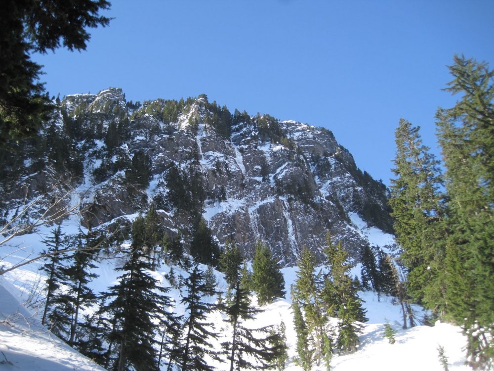
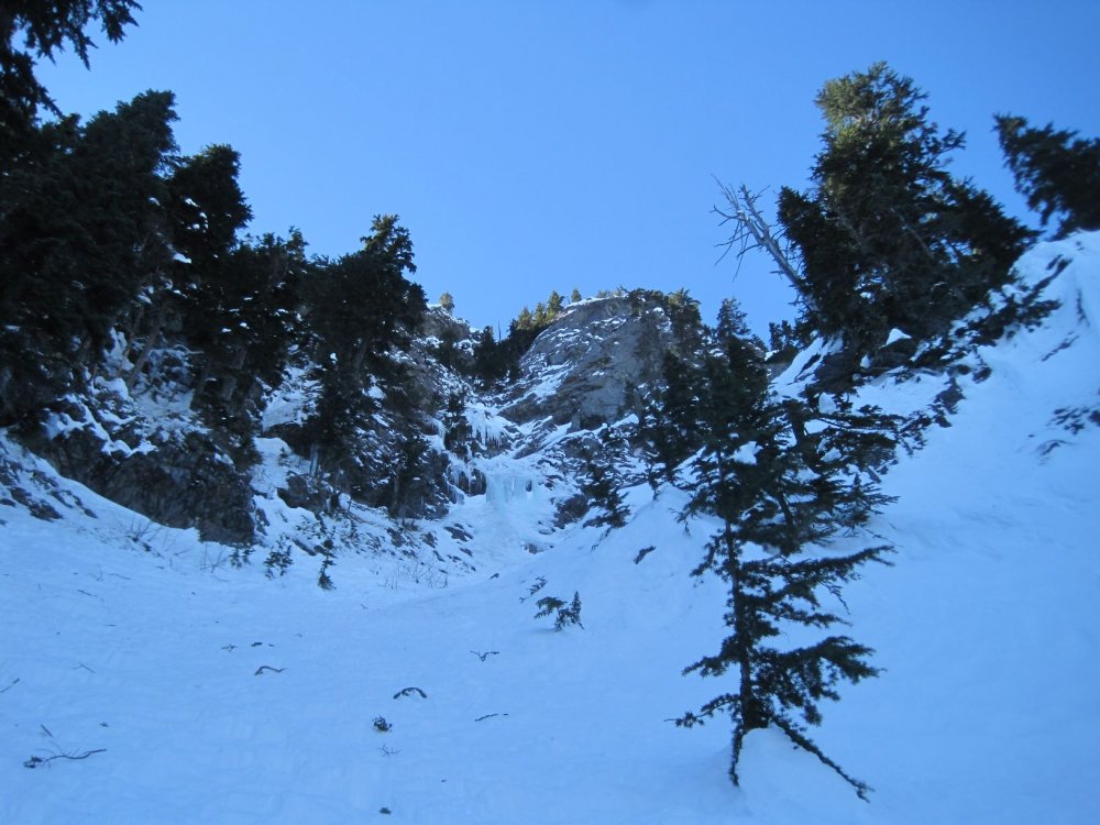
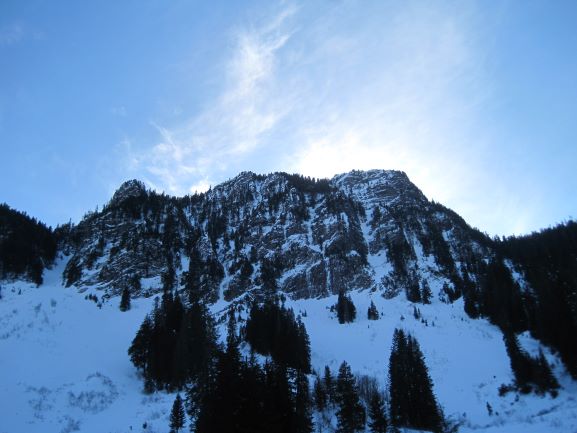
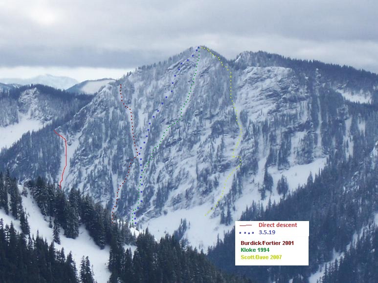
-
Trip: Mt. Hood - Reid Glacier Headwall Trip Date: 03/03/2019 Trip Report: With clear skies in the forecast, my partner, Landon Lim and I, decided to head up to Mt. Hood and check off the Reid Glacier. Last time we got turned around by bad weather before the saddle, so this was our first attempt actually on route. We started from Timberline at around 3:30am at a nice leisurely pace. With no issues, and lots of white dots below us, we made it to the top of Palmer by 5am and continued to the Saddle just before 7am. There we put harnesses on, but didn’t rope up and met a few groups going to Leuthold and another who gave us the opportunity to break trail on the Reid. We’d seen images the prior day of some serious swimming in unconsolidated snow on Cooper Spur, so we were prepped for a full day. Illumination Rock basking in the morning glow Dropping down to the glacier First tracks on route, always a pleasure Dropping down to the Reid Glacier we found the path boot packed but still very soft at 9000ft. After getting on route around 7:30am, we thought we’d bypassed the bergschrund until I post holed into it. It kind of traverses from the visible spots at the base of Leuthold, all the way up to the base of the West Crater Rim. With no effort we traversed around it, finding a more stable snow bridge. The snow, starting at the base of the route, was knee to ankle deep, which continued until after the first ice gully at 9800ft. If you look closely, you’ll see 2 holes, thats apart of the bergschrund that we missed, keep an eye out The gully itself was kind of tricky, a short AI2 at best, but passable. It begins with steep snow that turned to snow covered ice. In the thick of it, the ice got really thin and under it was rock so placements were rather precarious. It was low angle enough to where the secondary points on my crampons weren’t engaged, but if they were and I dropped my heels, I felt like I would just pop off because of the conditions of the ice, probably just my own bad technique though. Maybe if you stick right in that first gully, there would be better ice, just a tad steeper. looking down at the first gully looking up, above the first gully the rime shroom that sucked us in, also next to where we down climbed and traversed to get back on route looking down before we traversed, we probbably should have trended left begening at the first zig zag, but the crux is route finding, so expect to do some. Above the first gully is where we should have trended left over the ridge and dropped into another chute, but we continued upward on the right side of the ridge towards a singular giant rime mushroom that sucked us in and forced us to downclimb and then traverse to the left. As we entered a second gully of steep snow, we were surrounded by giant cliffs coated in rime. This section looks like a majority of other photos you see, in a steep couloir. Didn’t experience any rock or ice fall on route, just debris from my partner who plowed through the upper sections. In just about all of these areas, you could kick in deep to rest. Above this section we were to the right of ridge where you could look over and see a few groups on Leuthold and the Queens Chair. Landon checking out the ridge we were about to traverse End of the traverse where we were funnelled into a maze of giant rime shrooms making our way through the rime shrooms our buddies behind came into earshot right before we crested the ridge. Final moves before pulling the ridge, but the route wasn’t done yet. Basically at the ridge I was talking about. You can see, on the left, where we were funnelled back into. The ridge leads you right there. At that ridge, looking over the way at several parties climbing Leuthold and another group chilling at the Queens Chair Above the ridge, we were funnelled back into some more rime cliffs where there was another section of ice, less than 10 moves of AI2, but it was quality ice. From there it opened up again and we moved left at the base of a mushroom where we took a break and put on glacier glasses. We were in the shade the entire morning and didn’t hit sun until we linked up with summit ridge. Around this corner/ mushroom around 10,800ft we were presented with two options: a steep pitch of ice probably 15m in length or a traverse around another mushroom in steep snow, we choose the ladder. In the guide book, it shows a traverse like we did, but I’m sure the pitch is possible. Small gully where we cruised through a few techy moves, but nothing difficult. Looking back at the second gully with some fun moves Continuing up, we navigated through more snow with a tech moves. We crested the summit ridge where we found a great view of the Cathedral Spire and ran up to the summit around 11:15am and chilled for a lil. There were a few other groups up there, much different from the serenity of the Reid. the last bit, before linking up with the summit ridge, not too far over from the old chute. Cathedral spire looking real nice from the summit ridge Summit Ridge Obligatory summit photo, the stoke is real! The descent was rather forgettable, we down climbed the Pearly Gates where there was a lil bit of ice and cruised down to Crater Rock, making it to the car around 12:30pm. 9 hours in total and my 2nd trip to the summit. Gear Notes: 2 tools and horizontal points would be sufficent for the conditions. You could bring gear and a rope and not place anything like we did, always nice to take the gear for a walk. Approach Notes: Pretty straight forward, if you’re unsure, it might be useful to have an image of the route. Always trend left.
-
Trip: Cascade River Rd - conditions Trip Date: 03/02/2019 Trip Report: With ambitious hopes of finding winter alpine climbing and maybe also a certain Spanish-rumored City of Gold, I found myself out on the Cascade River Rd this past Saturday (March 2nd.) Although my plans were ultimately thwarted and uninteresting, I figured I should at least share a report on the current state of the road. Indeed, as the park service reports, the Cascade River Rd is gated at milepost 18; but right now that’s a pretty moot point, because it’s unlikely you’ll drive even that far until things warm up and the snow melts back a bit. Patchy snow began about 4 or 5 miles away from Marblemount. Around milepost 10, it got thick and swimmy enough that my car (a 2017 Subaru Forester with average tires,) required chains to keep going. At milepost 16, right by the entrance to Mineral Park Campground, the only car ahead of us had parked (a Subaru Outback.) We tried driving forward on the unbroken road beyond that, but my car was having none of it, we were forced to park at milepost 16 as well. From there, the road had 1 to 2 feet of snow depth on it, ideal for skinning if you’re skiing. Also packed enough you could walk it in just boots, but still without a doubt more tiring than if the road had been melted down to bare gravel. I hope all the rest of you did something more satisfying with that glorious weather weekend than all the lame road walking I ended up doing! Gear Notes: Approach Notes:

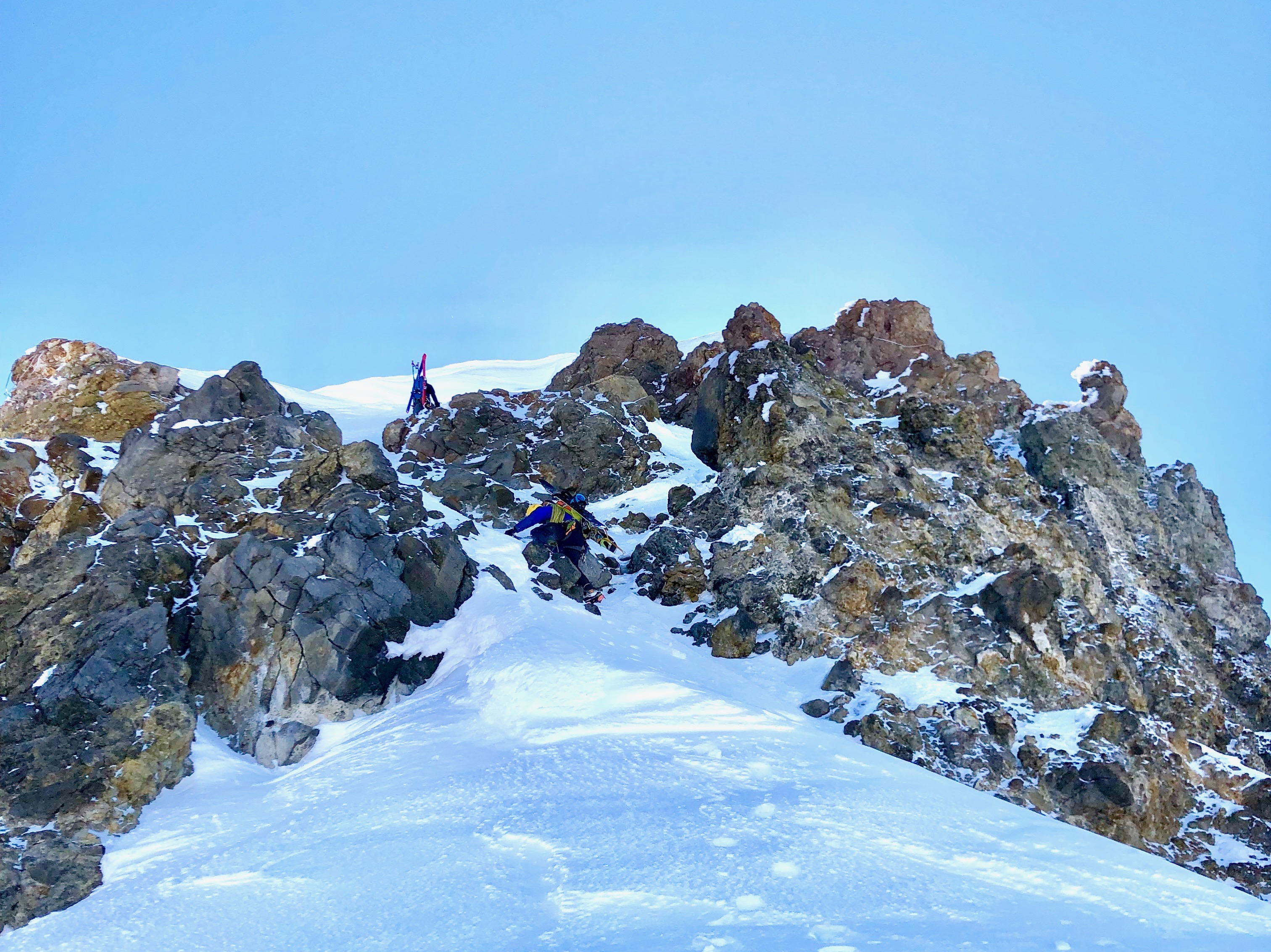


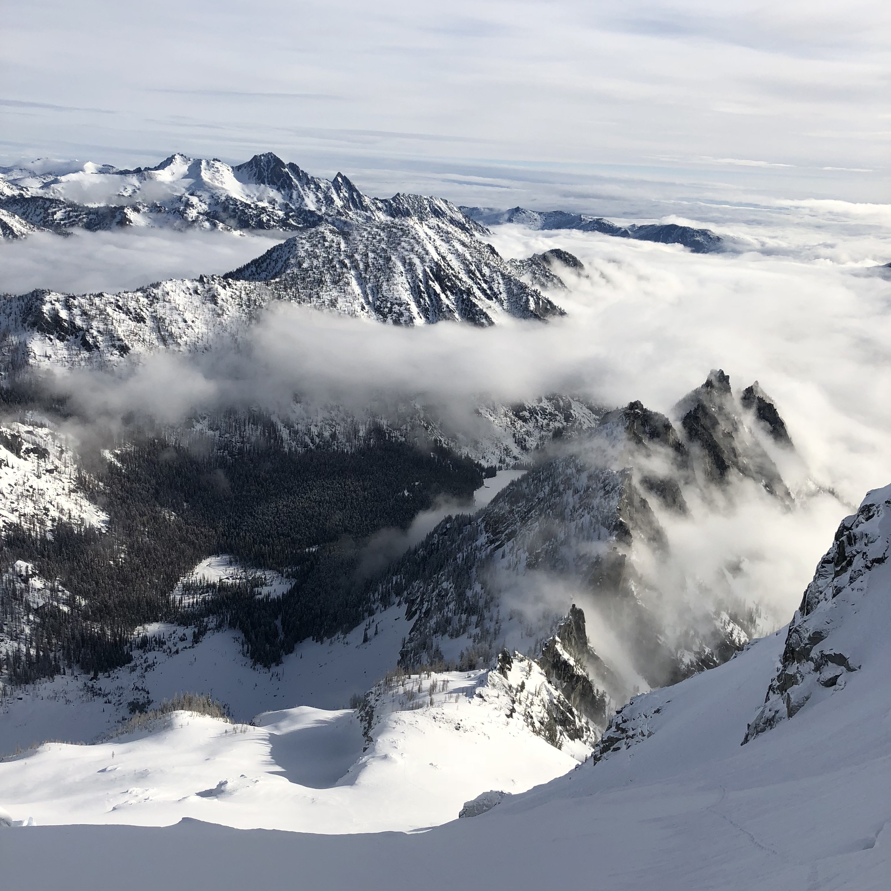
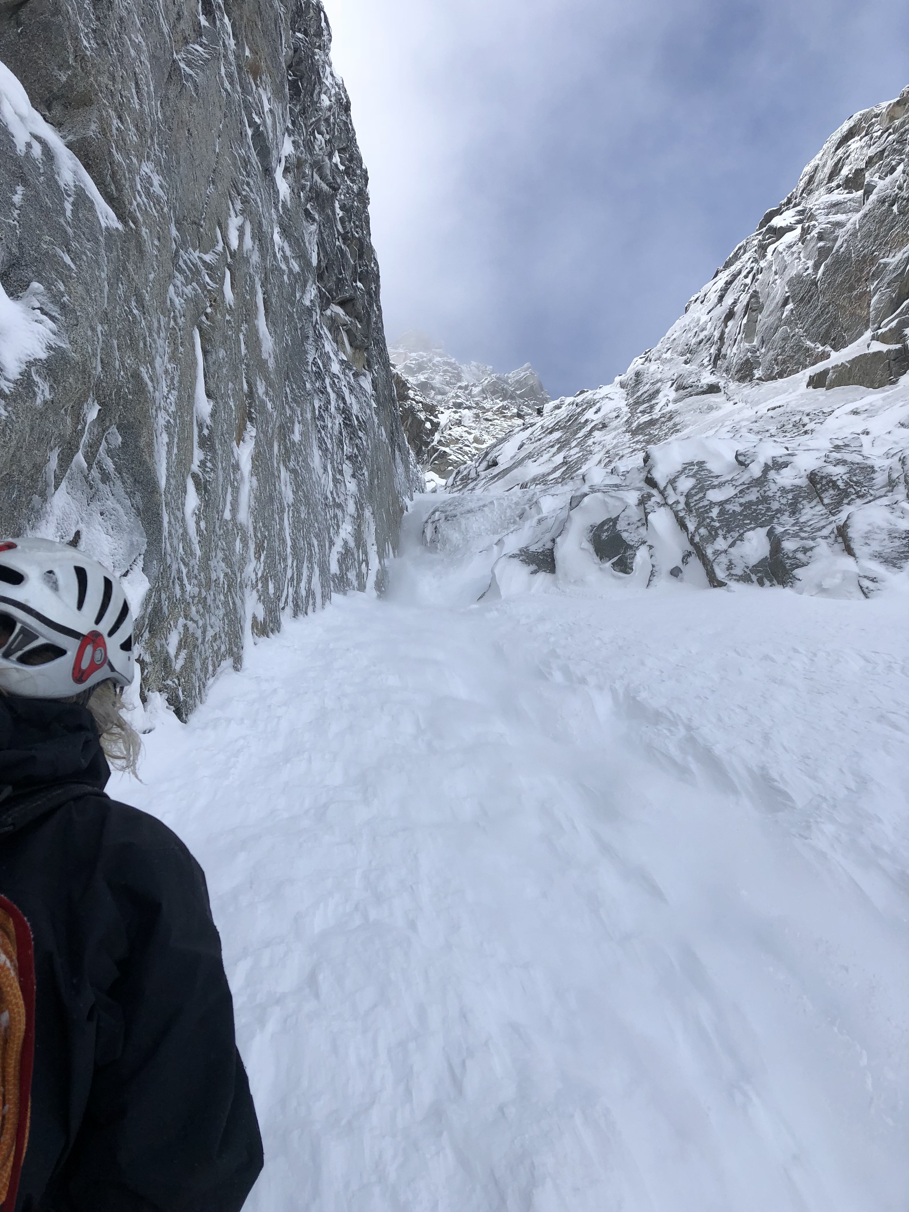


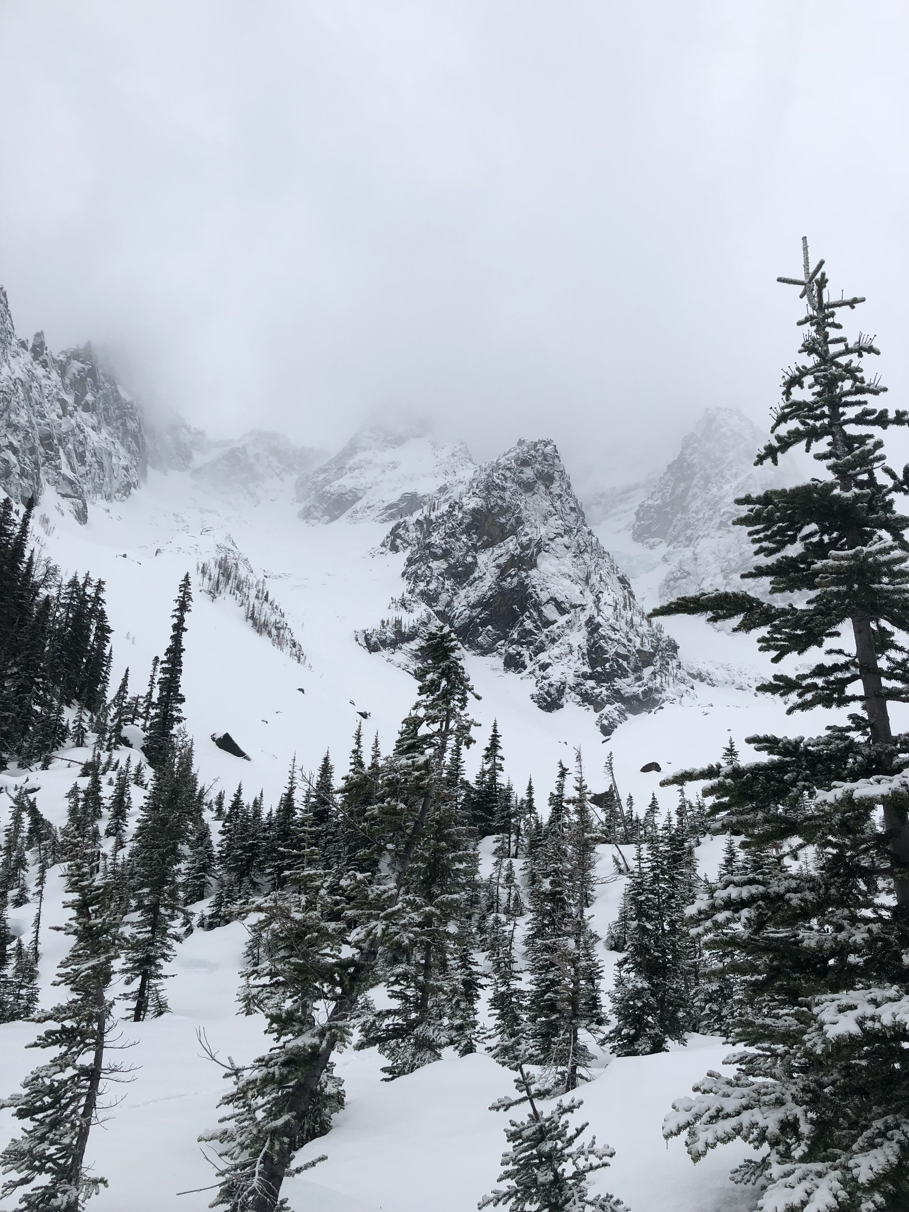

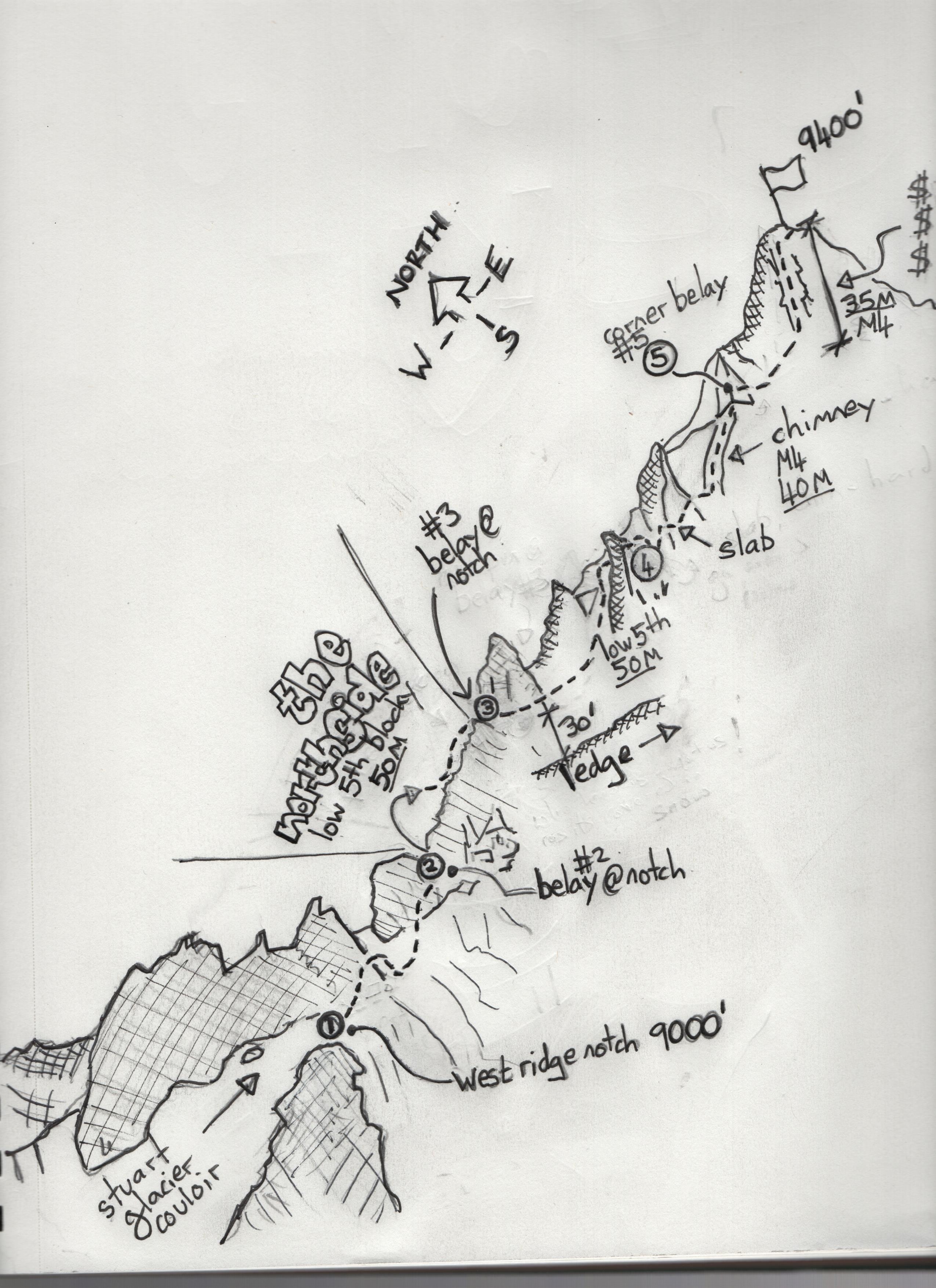


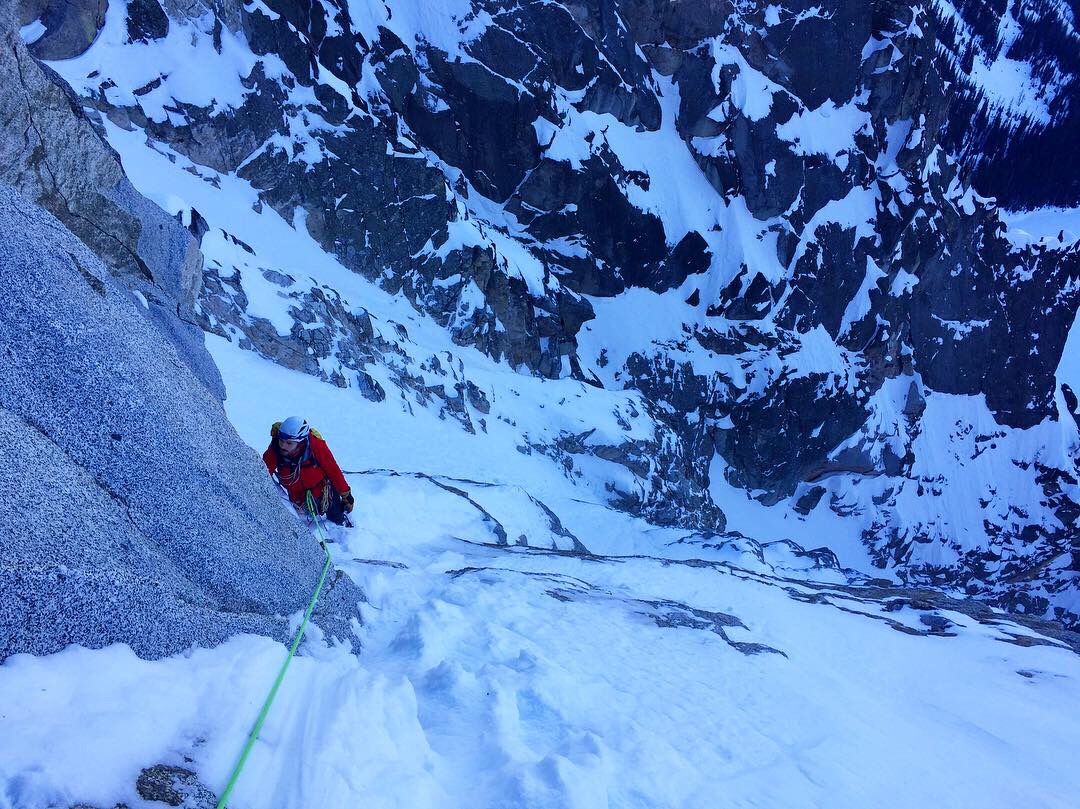
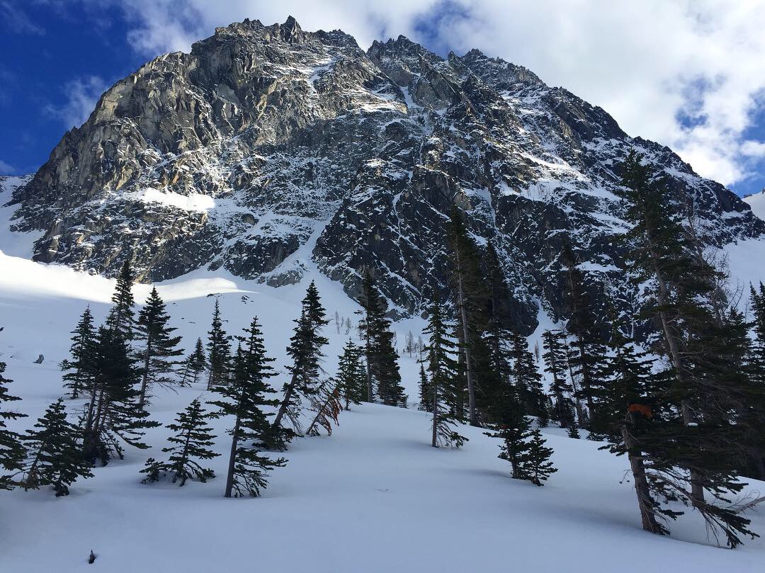
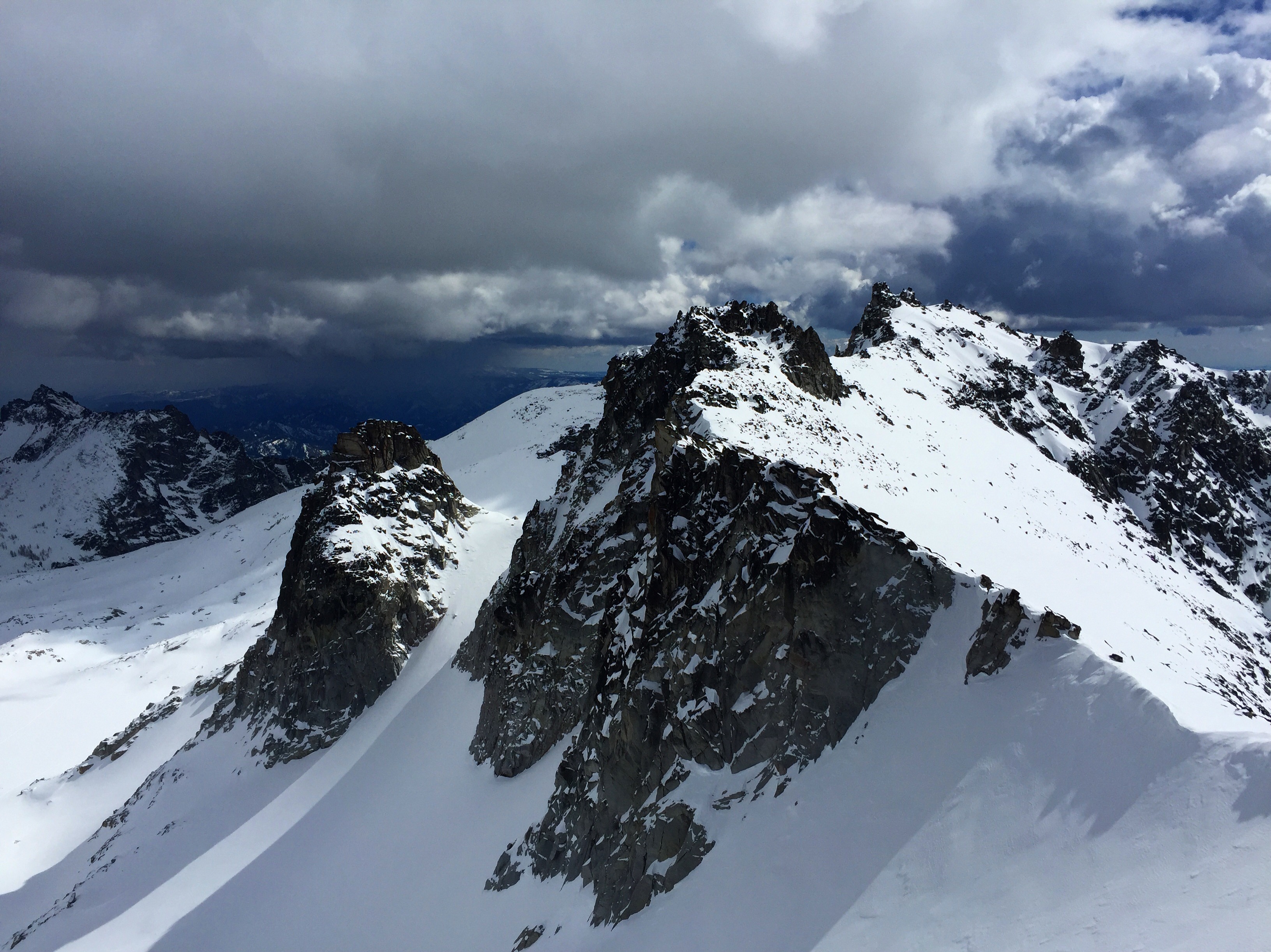


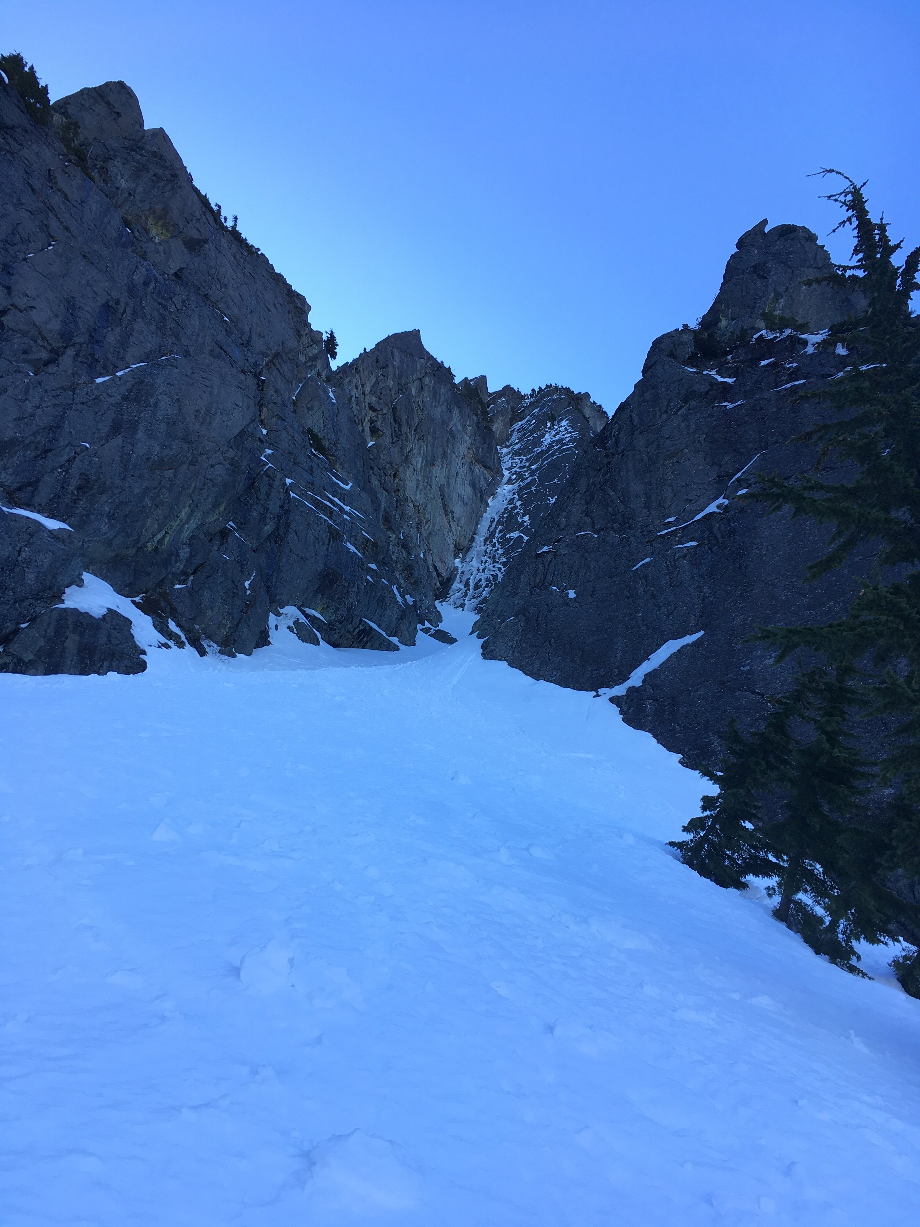

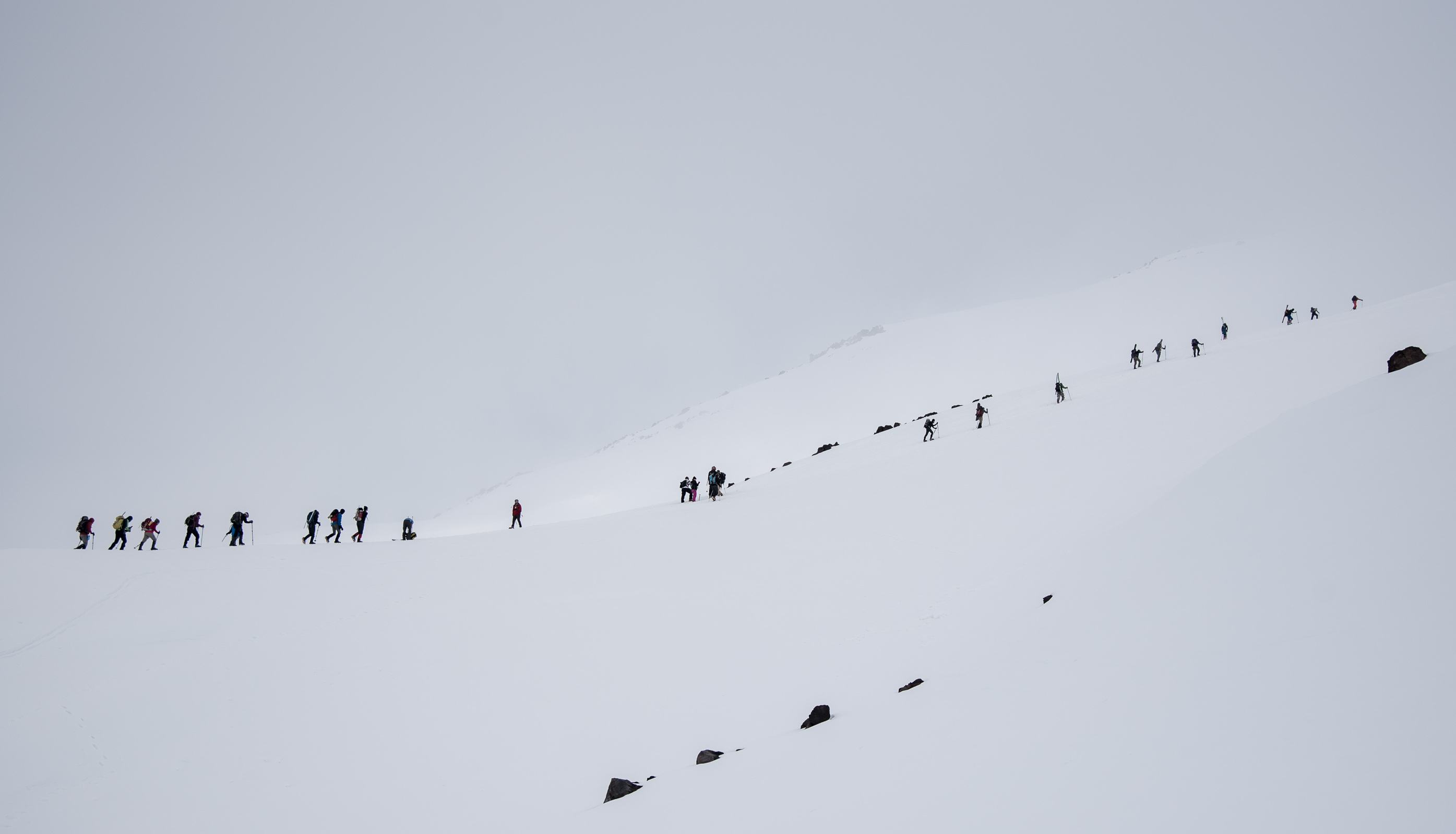
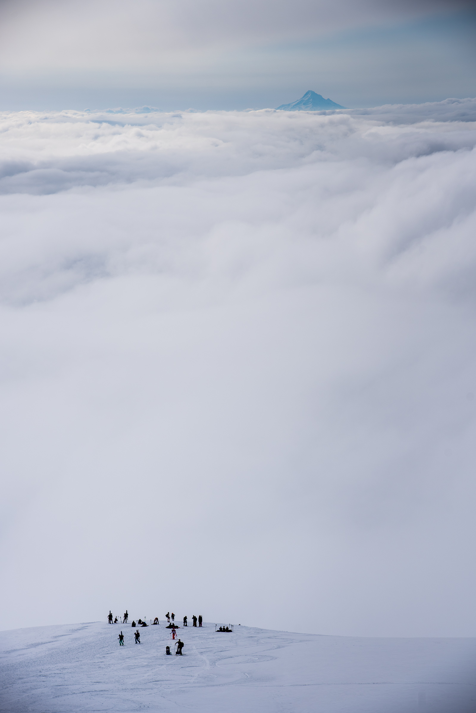

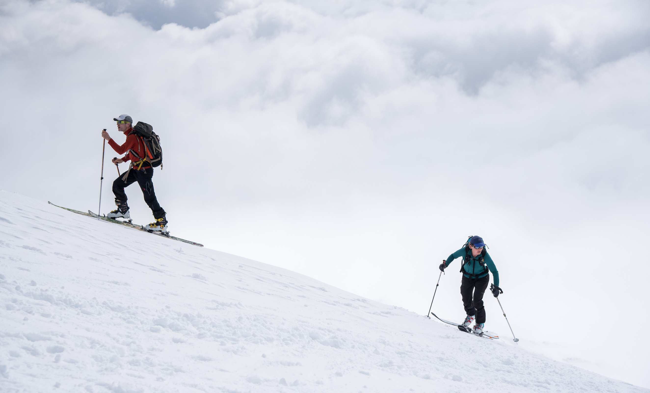
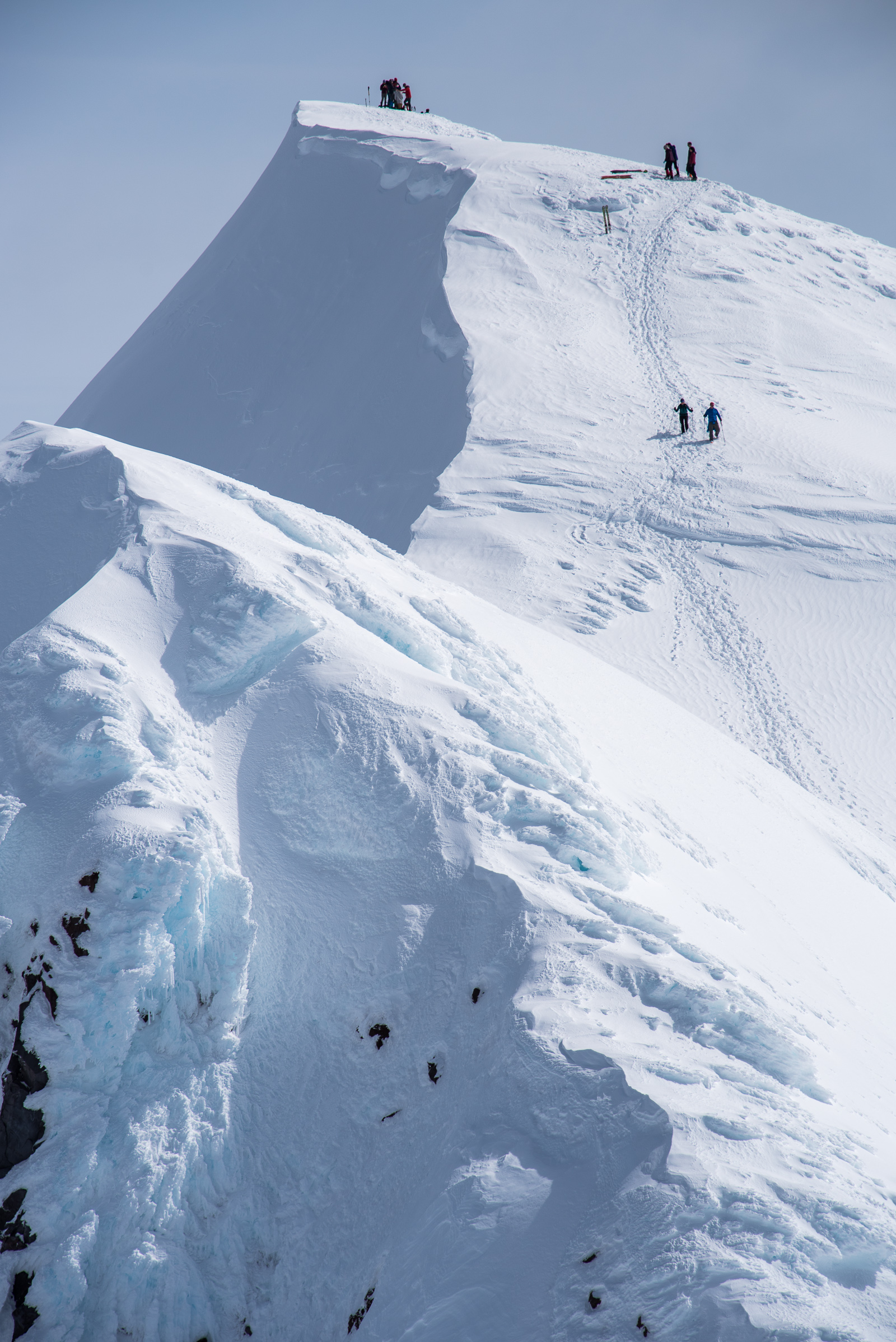

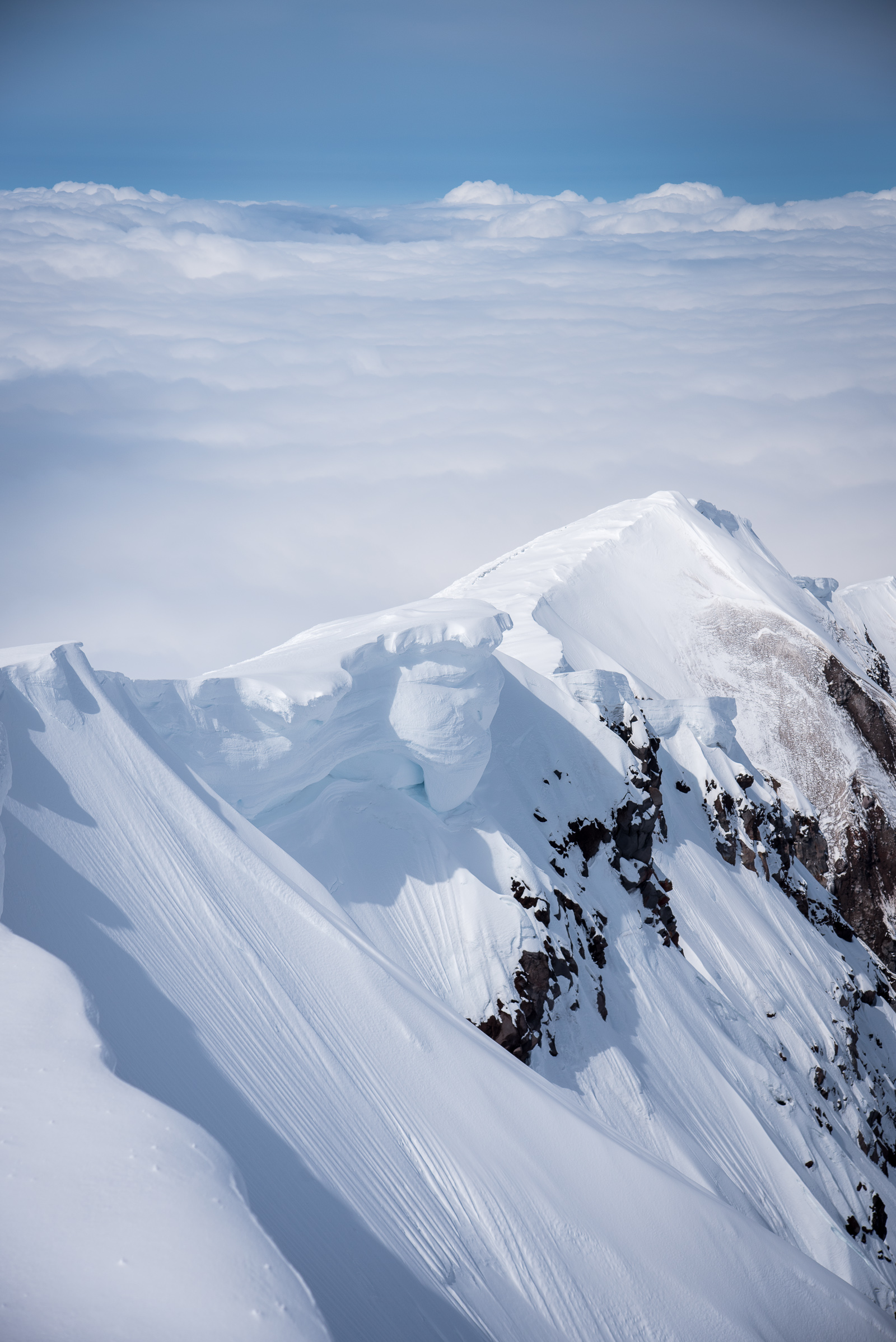
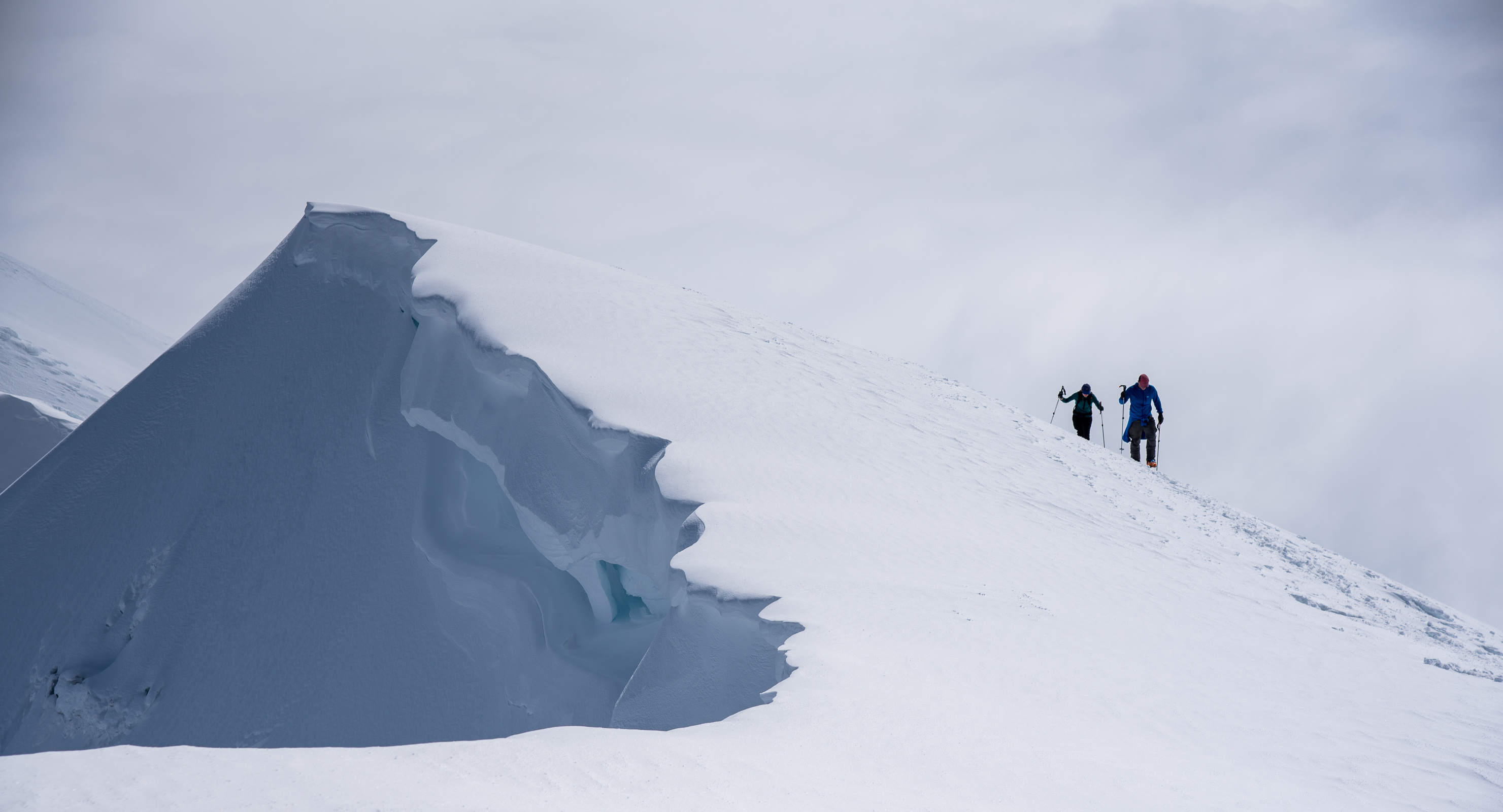


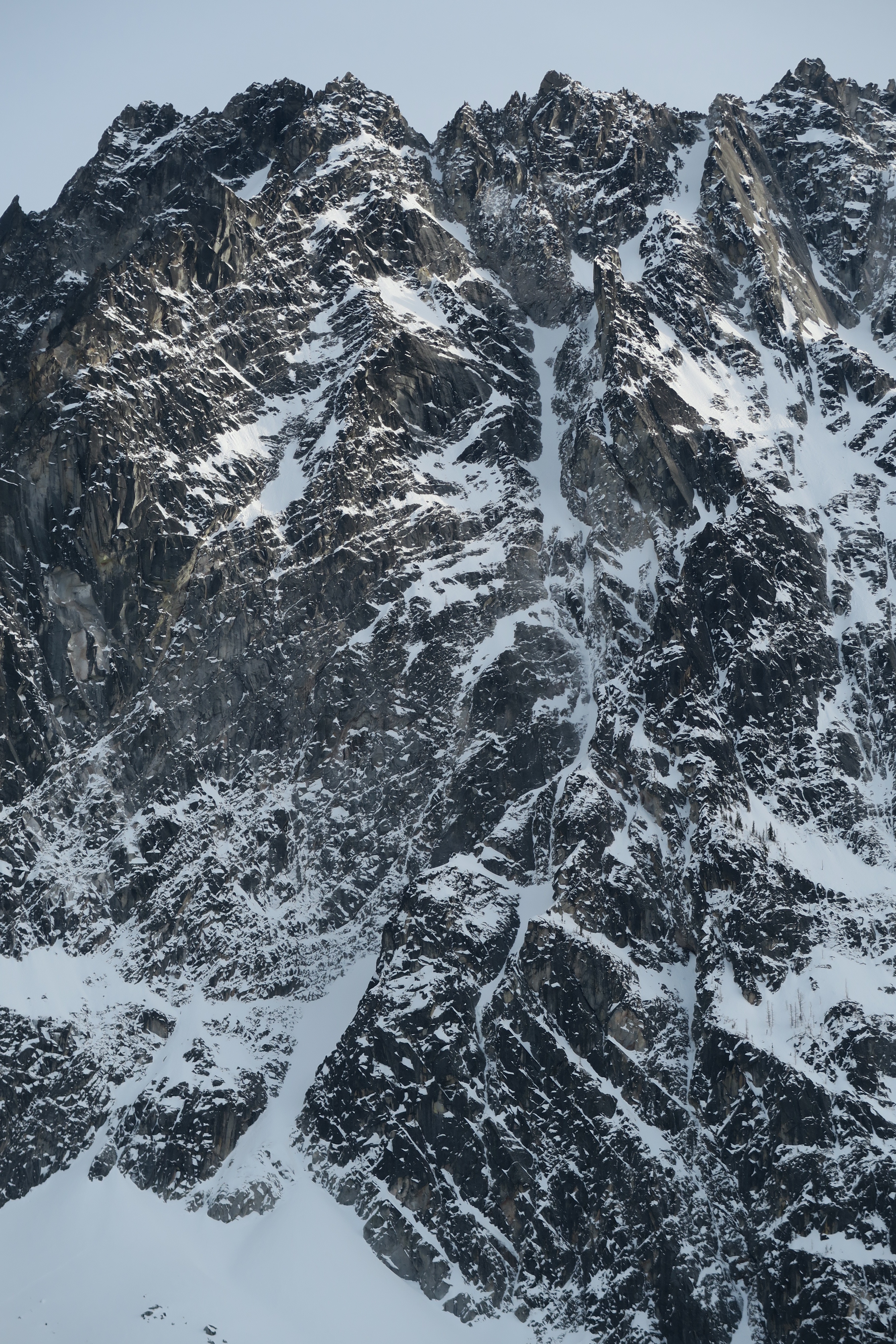
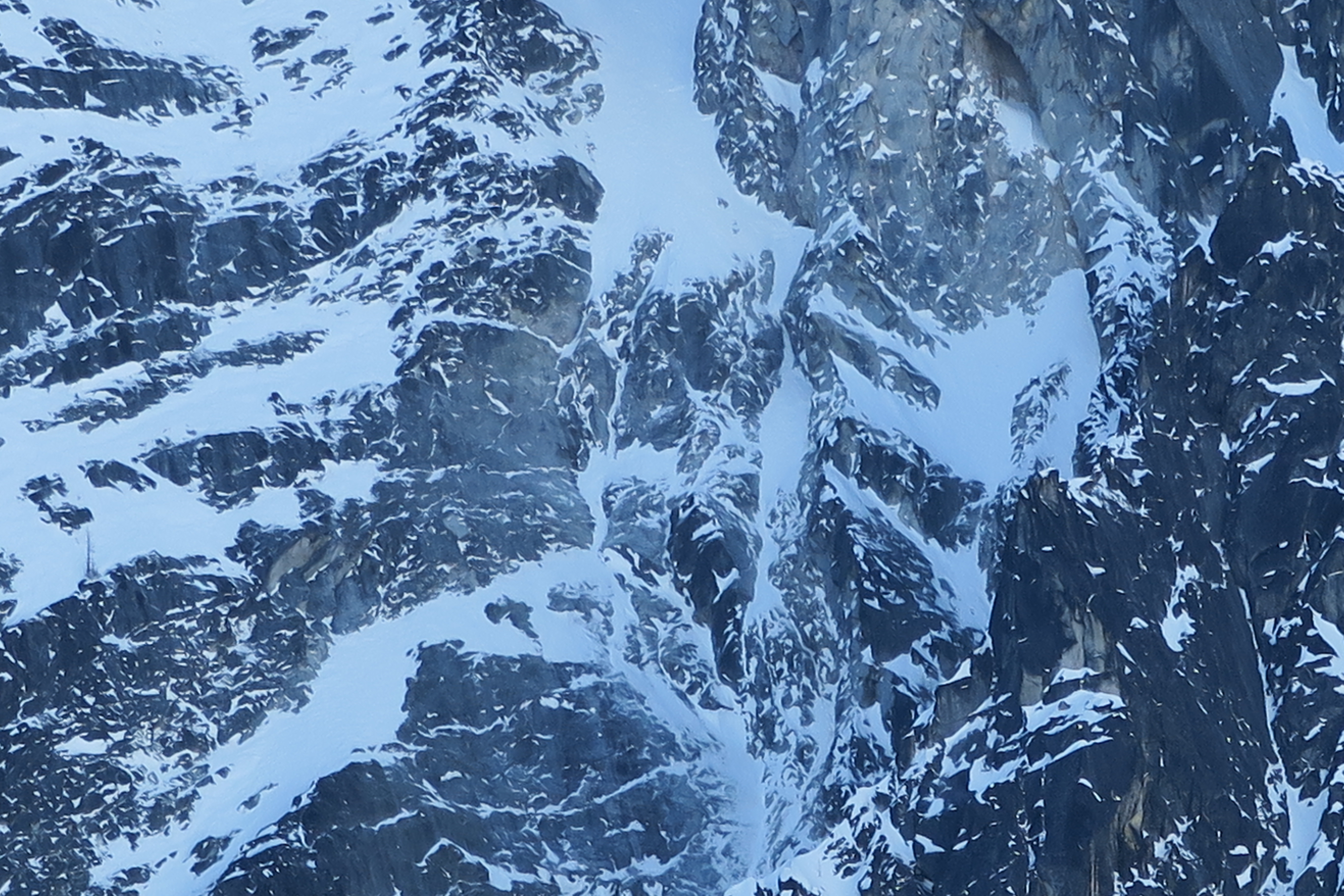
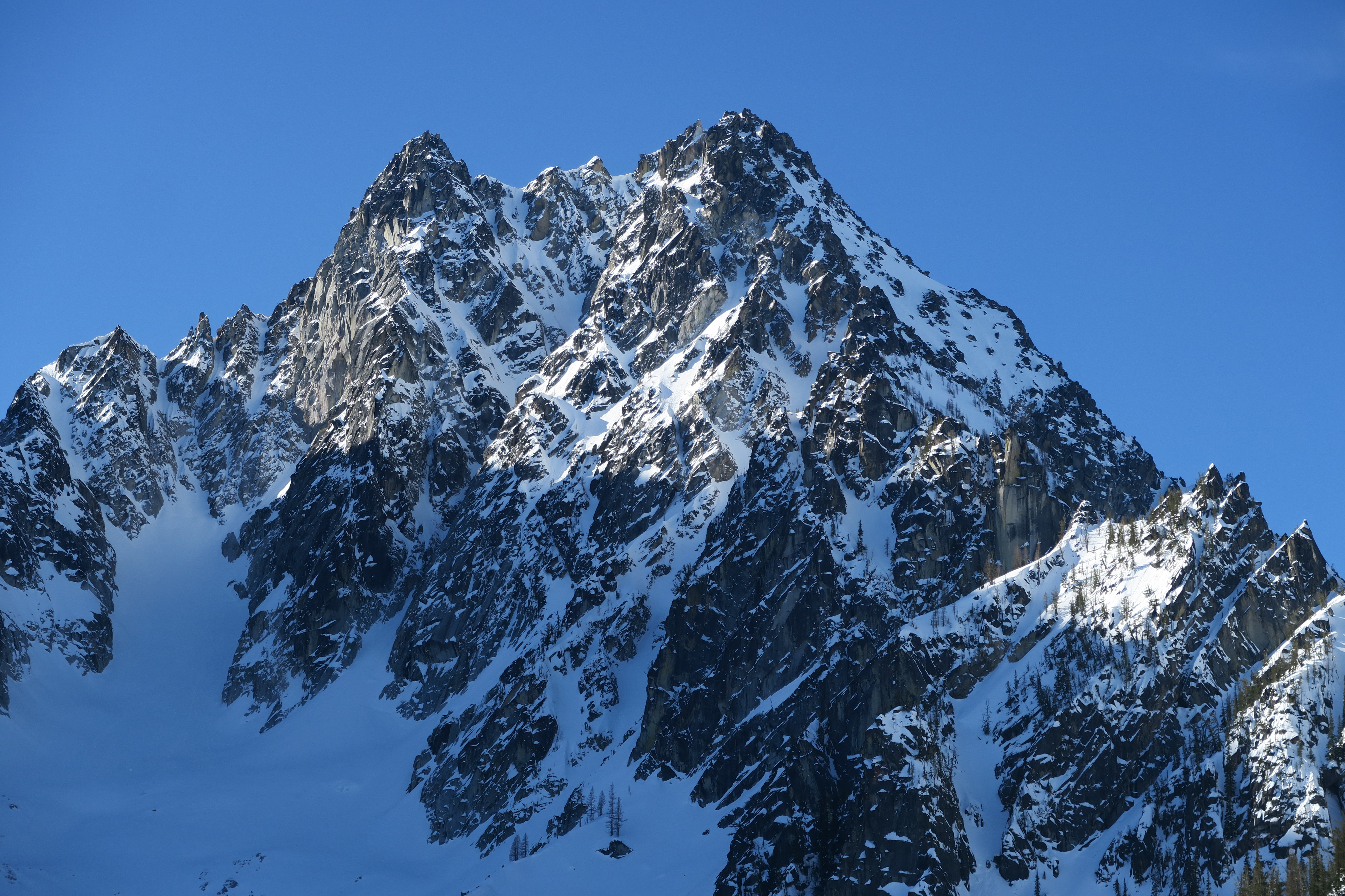
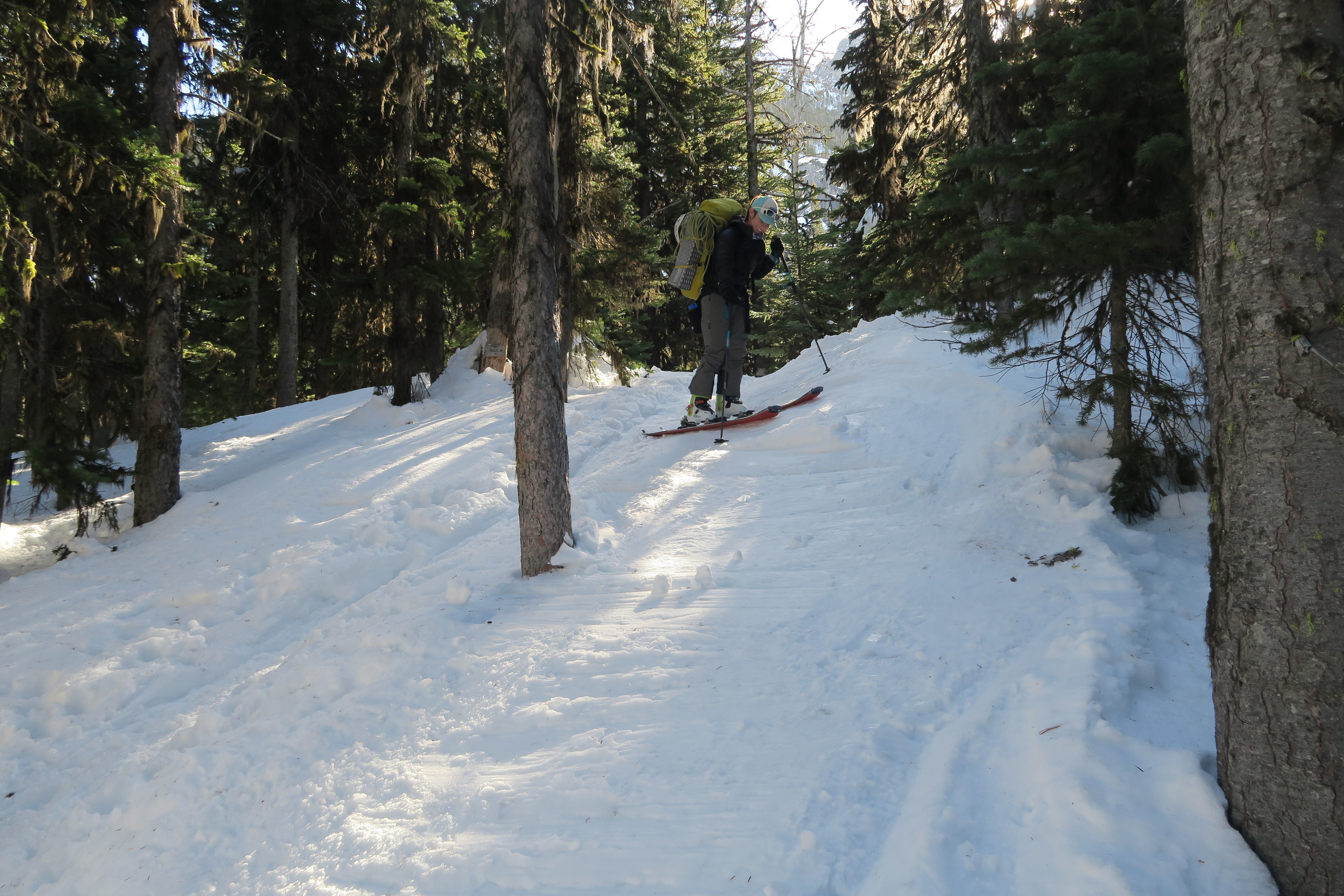


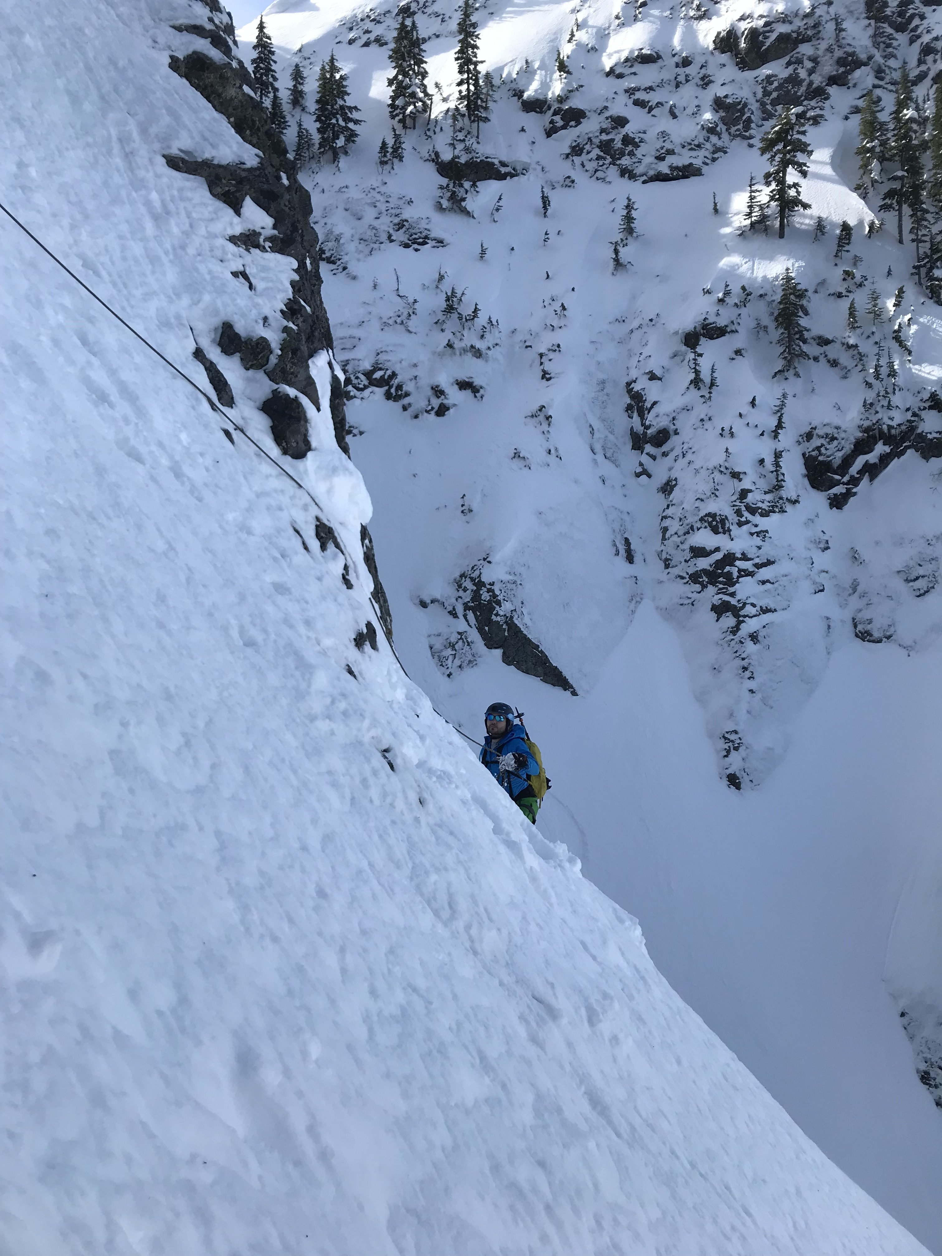

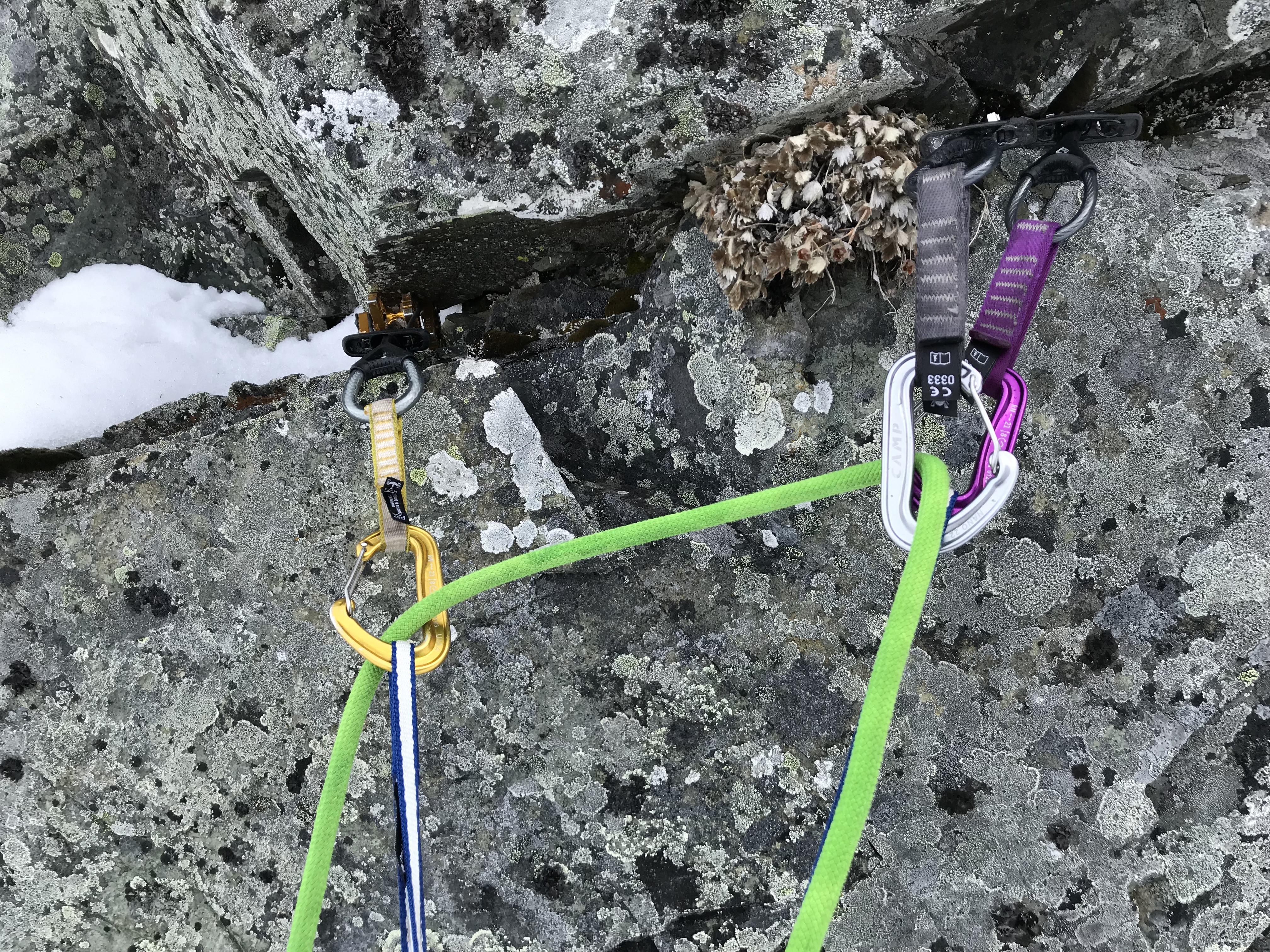
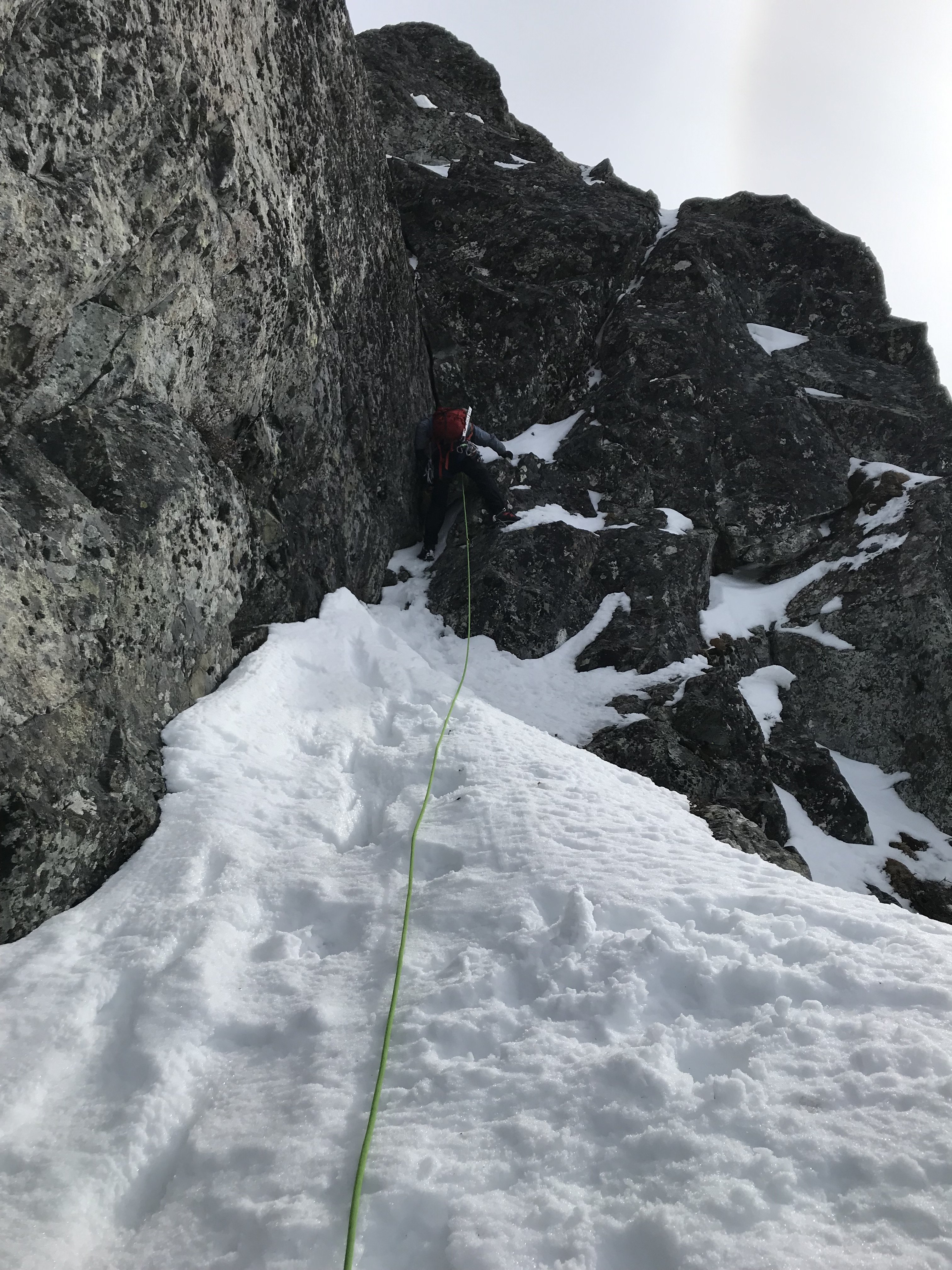
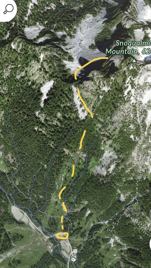


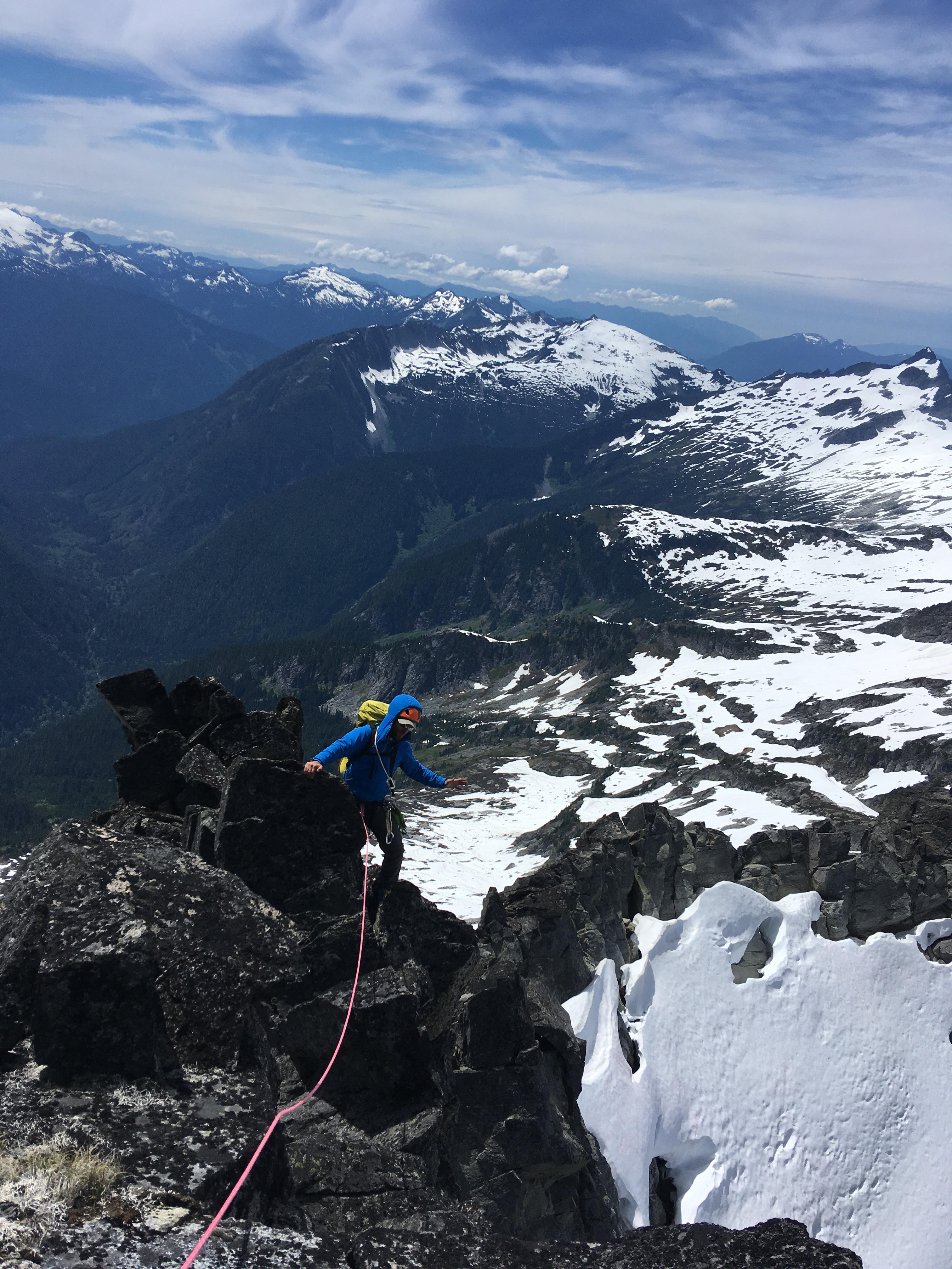

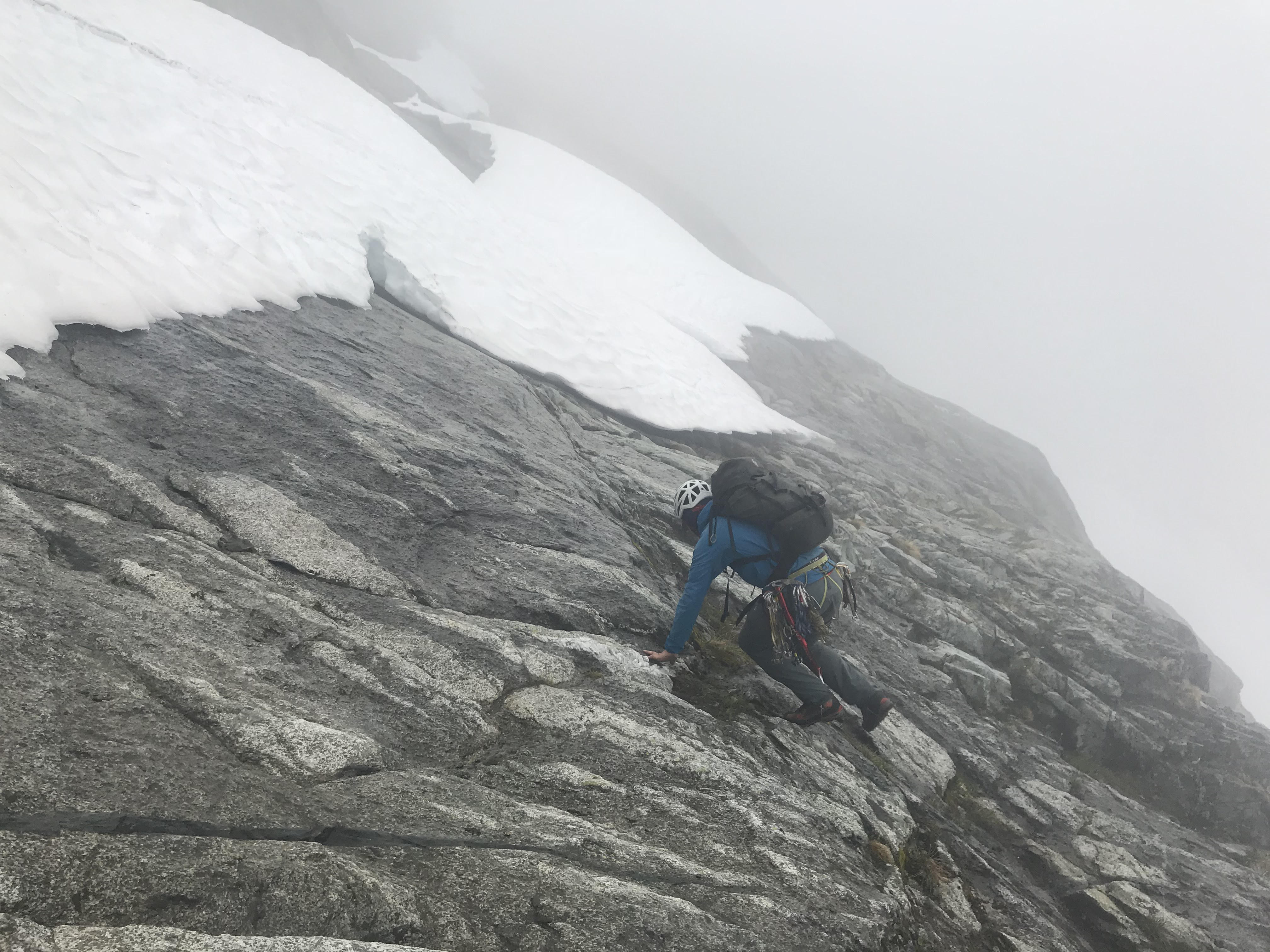
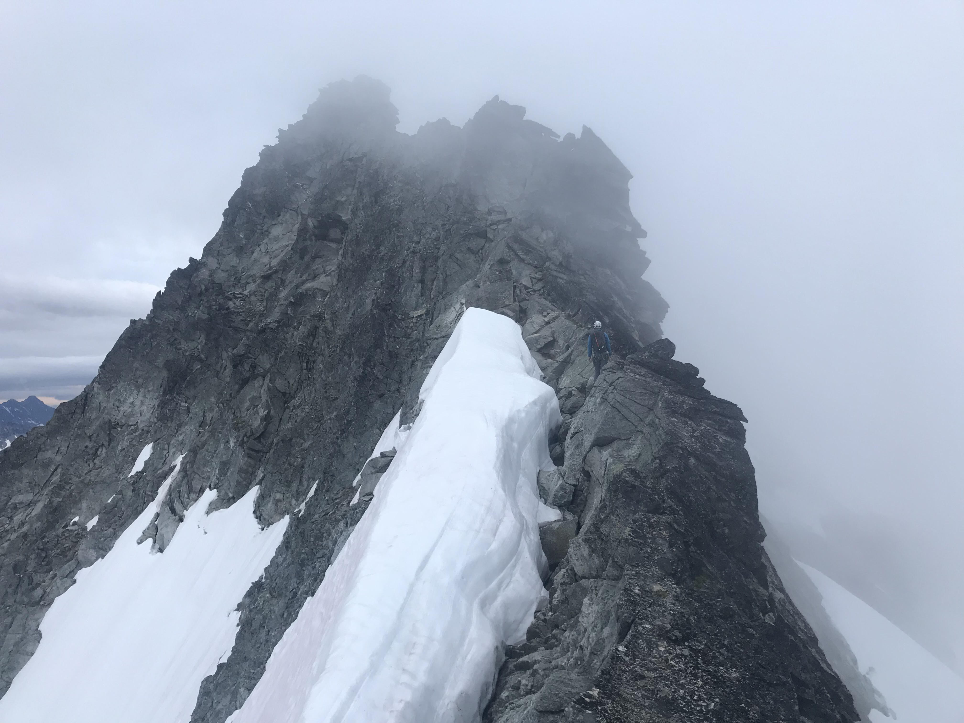
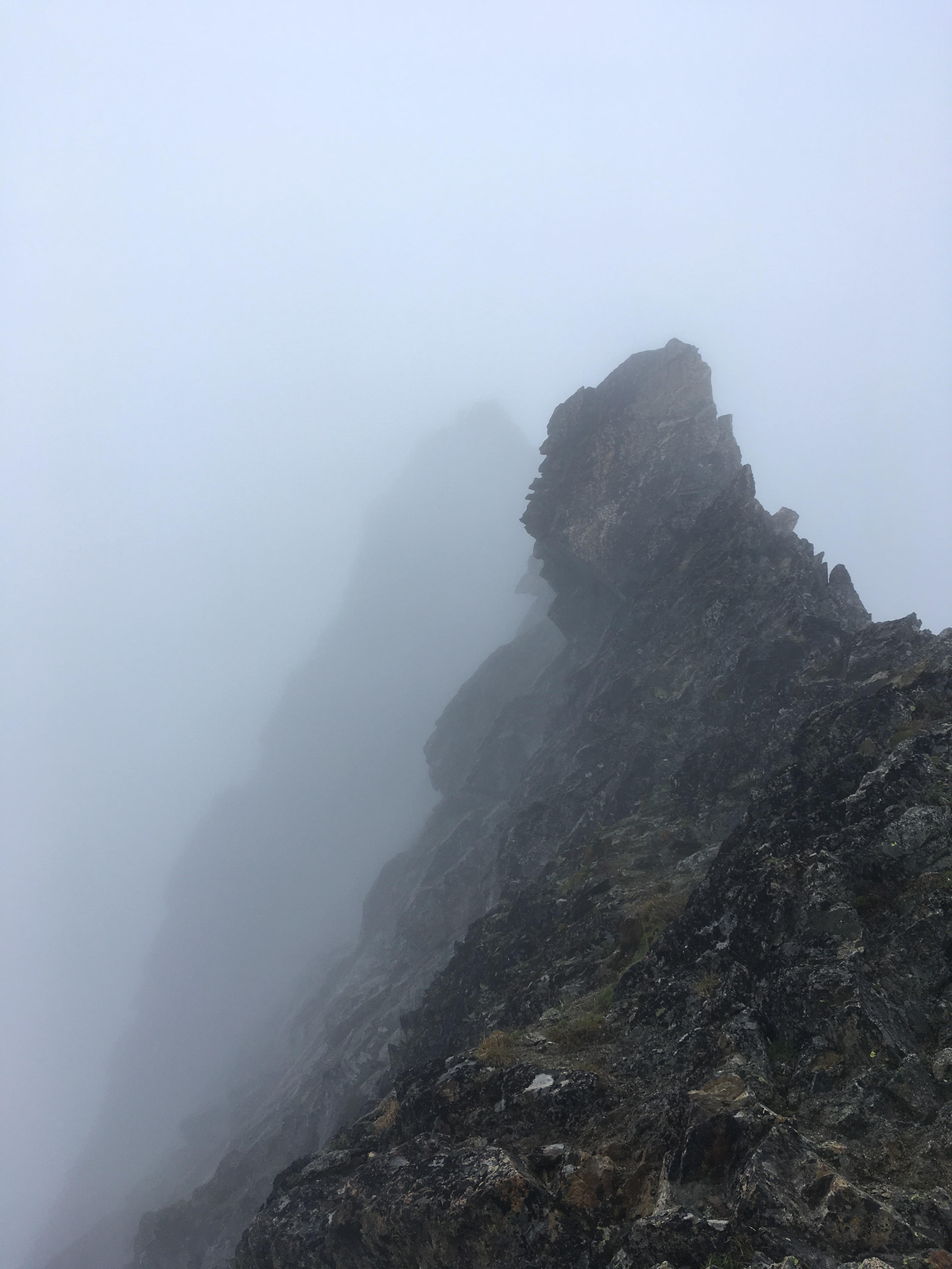
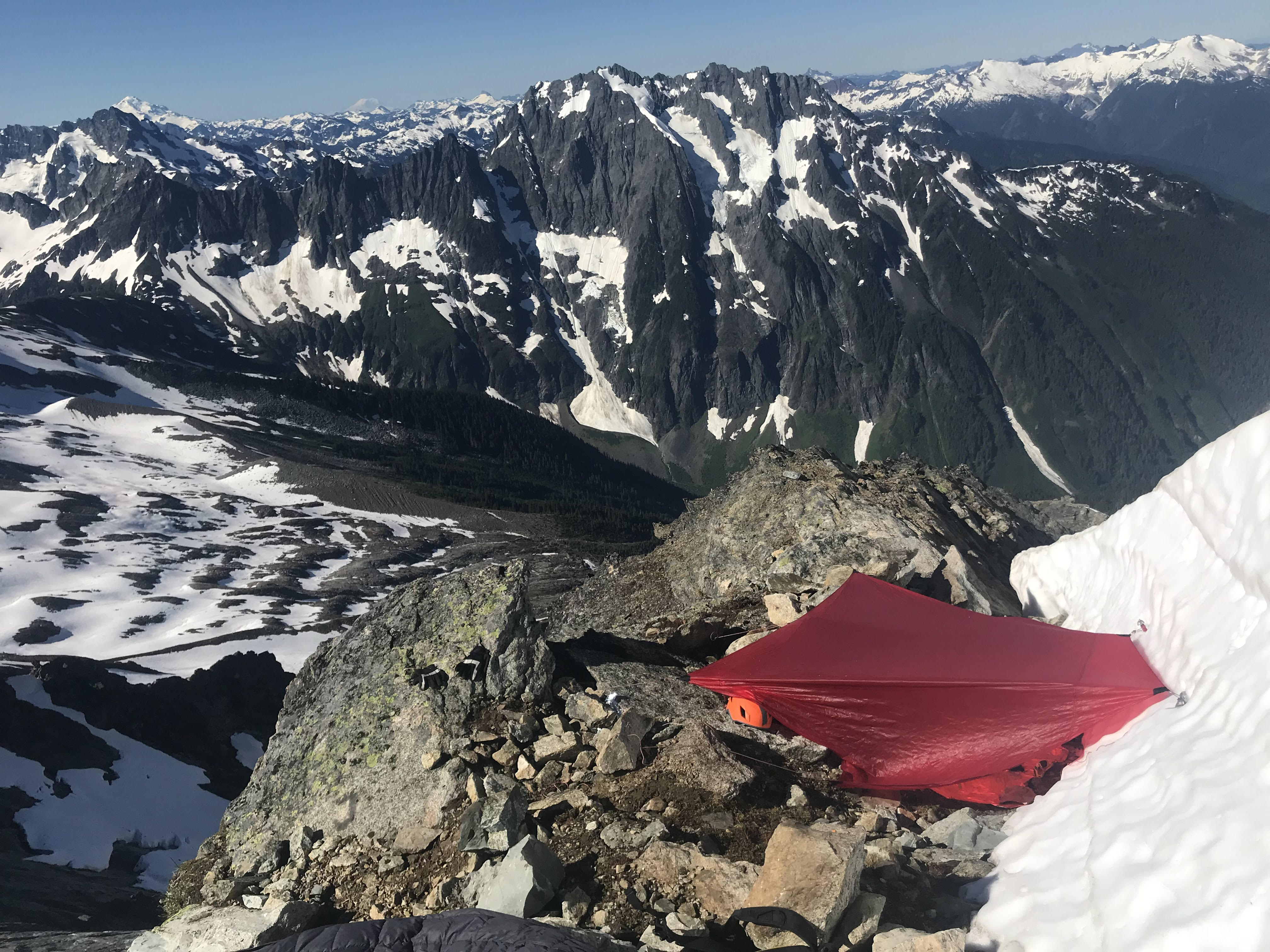

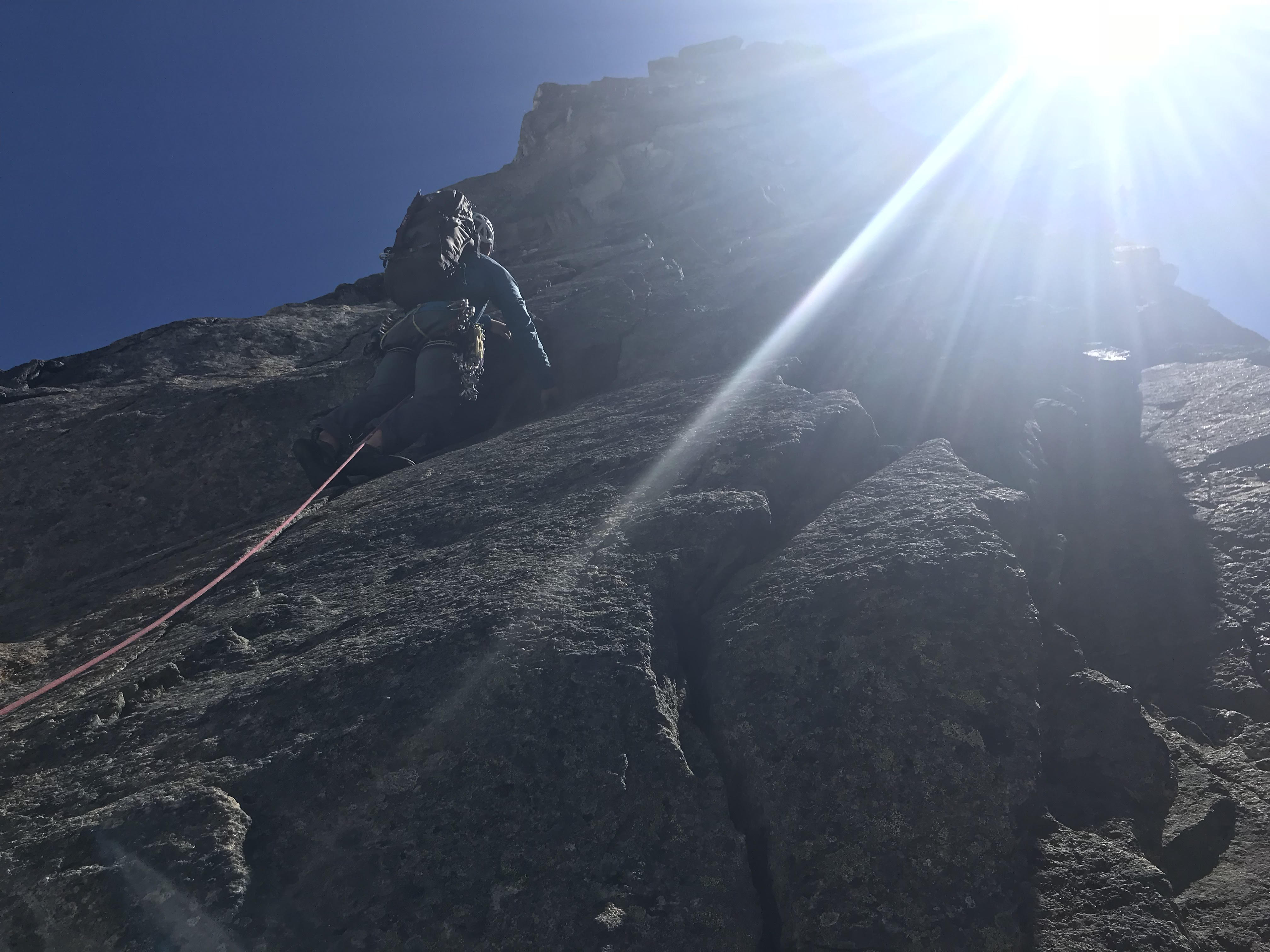

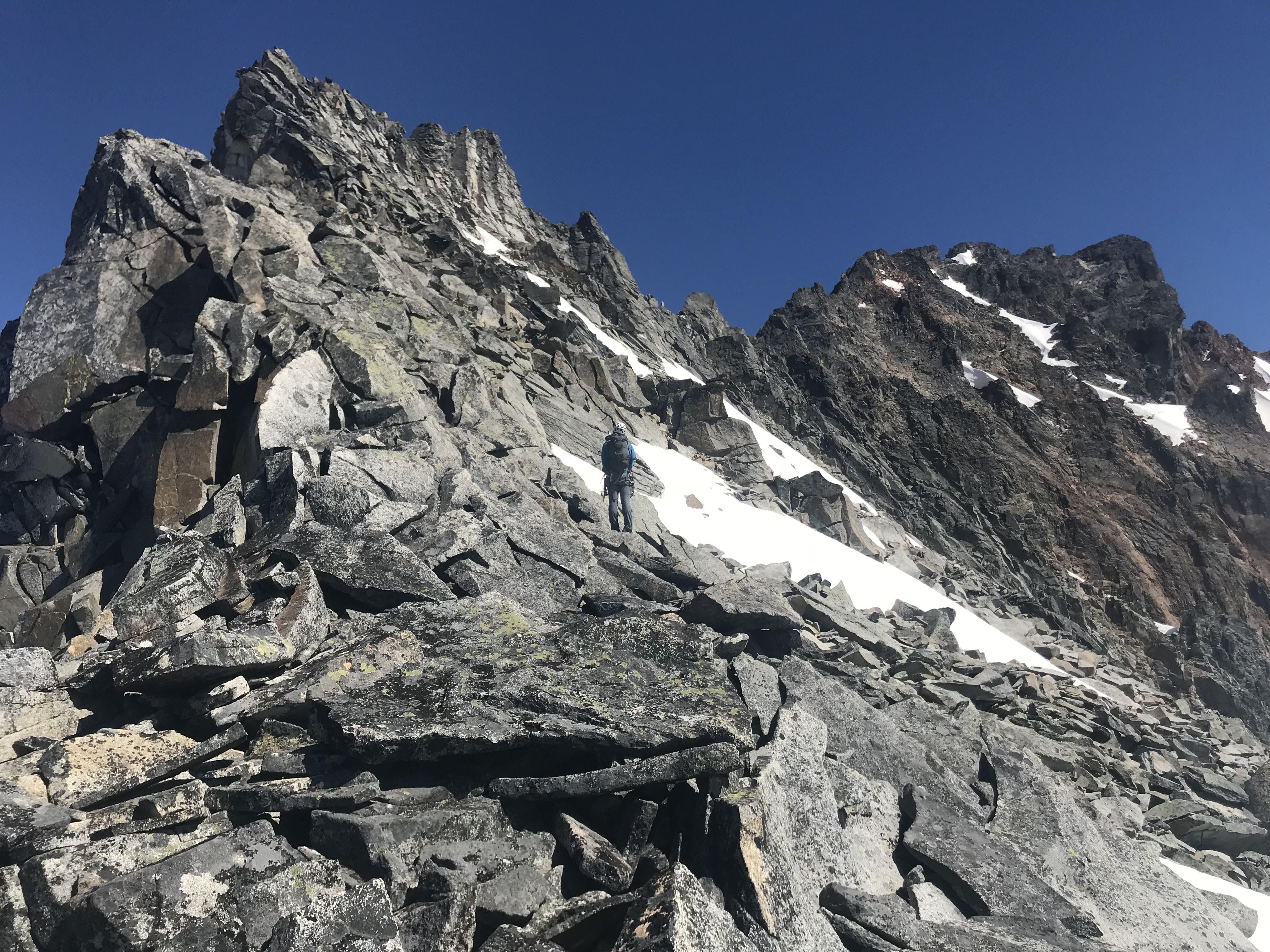

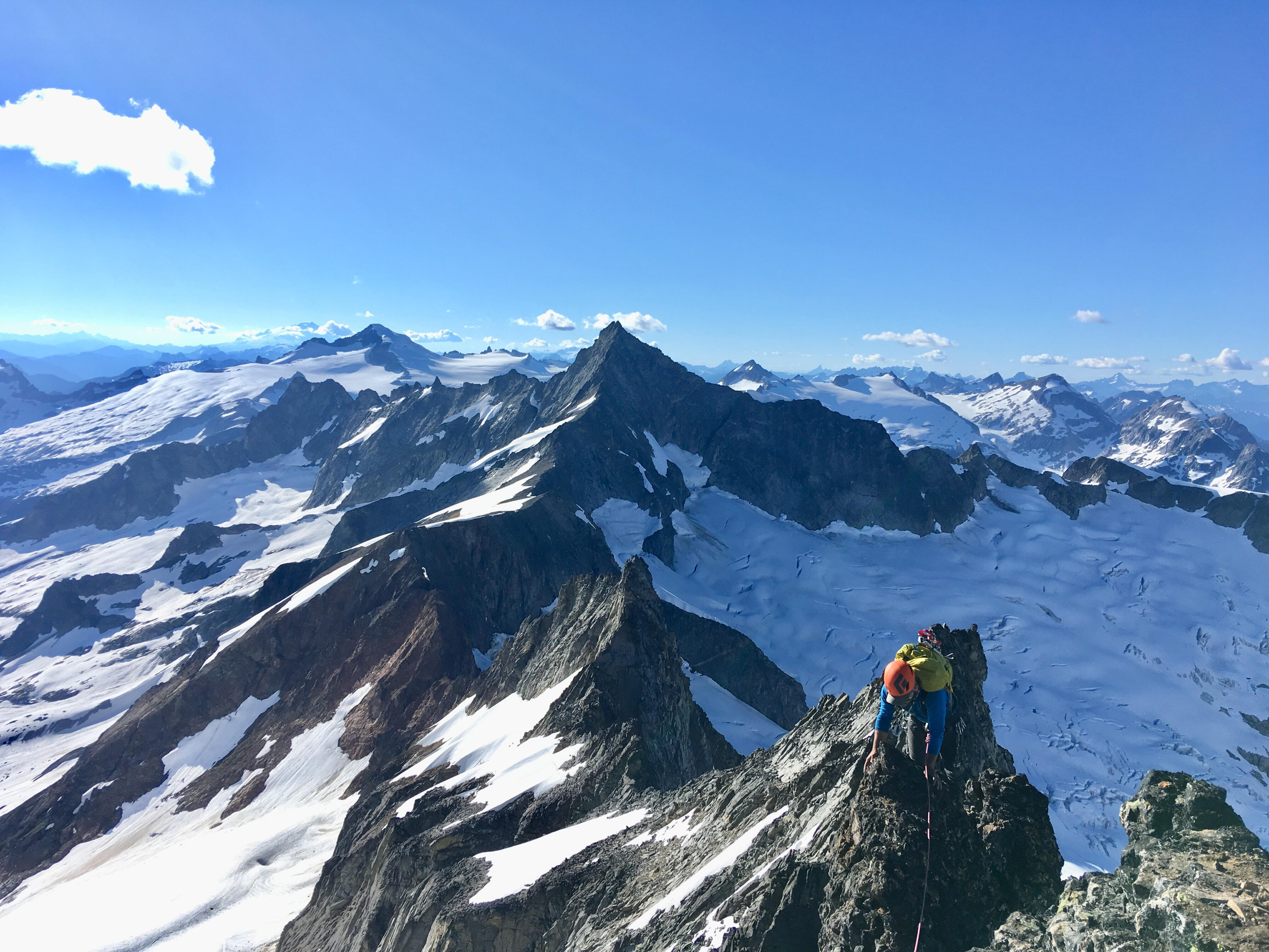
.jpg.22eb2979f0d666bcc955d7e97c379357.jpg)