RobUSA
-
Posts
6 -
Joined
-
Last visited
-
Days Won
2
RobUSA's Achievements
")


-
Hello! My best guess is that weather & conditions actually look pretty favorable for an edge-season scramble of Mt St Helens this week. The light glazing of snow might not even be there. What I'm seeing in the weather is that our region did indeed get a few inches of snow in the mountains last week, falling through Thursday, the 28th. That snow seemed to stick down to maybe 5000' elevation, then all the days since then (except Monday) have had clear skies where likely most or all of that has melted away in places the sun has been able to touch. (And I somewhat doubt Monday added any snow, the precip amounts were small, and it may have even been warm enough to fall as rain instead of snow, and if it was warm-rain it would actually speed up the melt of any lingering snow.) Since the weather forecast for the next few days to come looks mostly clear & dry, there's a reasonable chance the route itself will be nicely clear & dry by your Oct. 6th date. The aspect that a slope faces relative to the sun makes a huge difference too. Since that Mt St Helens route is entirely south-facing, then sun is going to help clear snow & dry it much much faster, whereas if you went somewhere else and were on a north-facing-aspect, you'd probably find bits of snow, frost, and re-frozen ice still hanging on. Some data sources that go into my thought-process for making guesses like that: The weather forecast: https://www.meteoblue.com/en/weather/week/mount-saint-helens_united-states_5809218 Webcams at Crystal ski resort, particularly the Ridgeline Cam at 6872' and Chair 6 top at 7002', looking to see if snow is present on the ground there. It's not an exact indicator of what things could look like at 8300' on St Helens, but it helps make an educated guess. https://www.crystalmountainresort.com/the-mountain/mountain-report-and-webcams/webcams NWAC Telemetry sites data. It's a bit of an art looking through the list of all those weather stations and selecting one that is close-enough in distance and also close-enough in elevation and has sensor-type that's useful to you (e.g. snow depth.) Probably the White Pass Upper site is the best rough-indicator to suggest what might be going on at St Helens. I prefer to tap the buttons to view as "Graphs" and over "7 days", my brain just finds it easier to make sense of the data that way. https://nwac.us/weatherdata/map/#/station-table/39 https://nwac.us/data-portal/graph/12/ I think we're still early enough relative to the winter-season that you don't yet need a SnoPark permit for your car. Yeah, looks like that starts Nov. 1st, so you don't need one yet: https://www.parks.wa.gov/134/Sno-Park-non-motorized-Permits Though obviously, go prepared for some shallow snow potentially being there nonetheless. If shallow snow is present, the route is probably still do-able if you have the right experience & right gear. Some Kahtoola Microspikes are likely the perfect tool for the job on Mt St Helens Worm Flows route. If it were me, I'd also bring an ice axe at this point in the year, or at least poles. Likely the snow is too shallow for any ice-axe-arrest to make sense, but when there's a little snow on the ground, a mountaineering axe is still my favorite version of a walking-stick to give me an extra point of contact with the ground while making any step that might be slippery. Keep in mind that we are just random strangers talking over the internet, so I don't have any knowledge of what your outdoor and mountaineering background & experience is so far, which makes it hard for me to right-size the advice I should give. I'm assuming you're someone who already has a lot of experience with off-trail travel, snow travel, navigating above treeline, etc. So you probably already know these things, but you know I gotta say them anyway just to cover the bases 🙂 Really take the "10 Essentials" seriously on this. Make sure you have redundant ways of finding your way back. An app like Gaia GPS on a smartphone with GPX tracks loaded and offline-maps pre-downloaded is a great start, but have at least one more something as a backup in your group too, whether that's some other second GPS device, or a paper map & compass that you know how to use, or at very least a partner with a second smartphone who also has it covered. Remember that navigating up volcanoes is easy, navigating down volcanoes is the hard part. Only go if there's not going to be a whiteout. You're going to want a fairly cloud-free day in that weather forecast, because on a volcano, if there are clouds in the sky, there's a good chance that you're traveling to a high enough elevation to be in them rather than simply below them. Bring snow-appropriate boots, and gaiters, so you don't get snow in the tops. (Wet socks & cold temps are no fun.) At this time of year I'm usually using some 3-season mountaineering boots, or some sturdy leather hiking boots that have been treated with Atsko SnoSeal wax. Bring enough layers that you can stay warm even if you're forced to stop somewhere. Although rare, there's always a slim chance of badly twisting an ankle or getting lost or something else that limits your ability to keep moving. Be hyper-aware of what time dawn's first-light and dusk's last-light are. Plan your timing so that you get back to your car with at least a few hours to spare before dusk arrives, so that you have a safety margin. If need be, make a pre-dawn start, it's infinitely better to wear a headlamp at the beginning of an alpine day than at the end of one. If you find you're getting into fresh snow that's deeper than about 10 inches, at least start to think about avalanche potential. If you're not already AIARE Level 1 certified (and thus know the importance of the holy trinity of beacon/probe/shovel when the fresh snow starts to pile up,) then don't keep going forward, just turn around before there's any possibility of risk at all. (Also: if you're not already AIARE Level 1 certified, I highly recommend finding a course and signing up! The human-factors and group-dynamics topics are awesome to learn about even if you think you'll never do anything where avalanches are possible.) Don't go alone. Don't get yourself into trouble. Make cautious decisions, especially during shoulder-seasons like this when temps are chilly, walking is slippery, and daylight hours are short; margins are overall smaller right now. It's okay to turn-around if things aren't quite right, it was surely still a beautiful day out for a hike even if you don't summit 🙂 Be safe & have fun!! - Rob
-
 RobUSA changed their profile photo
 -
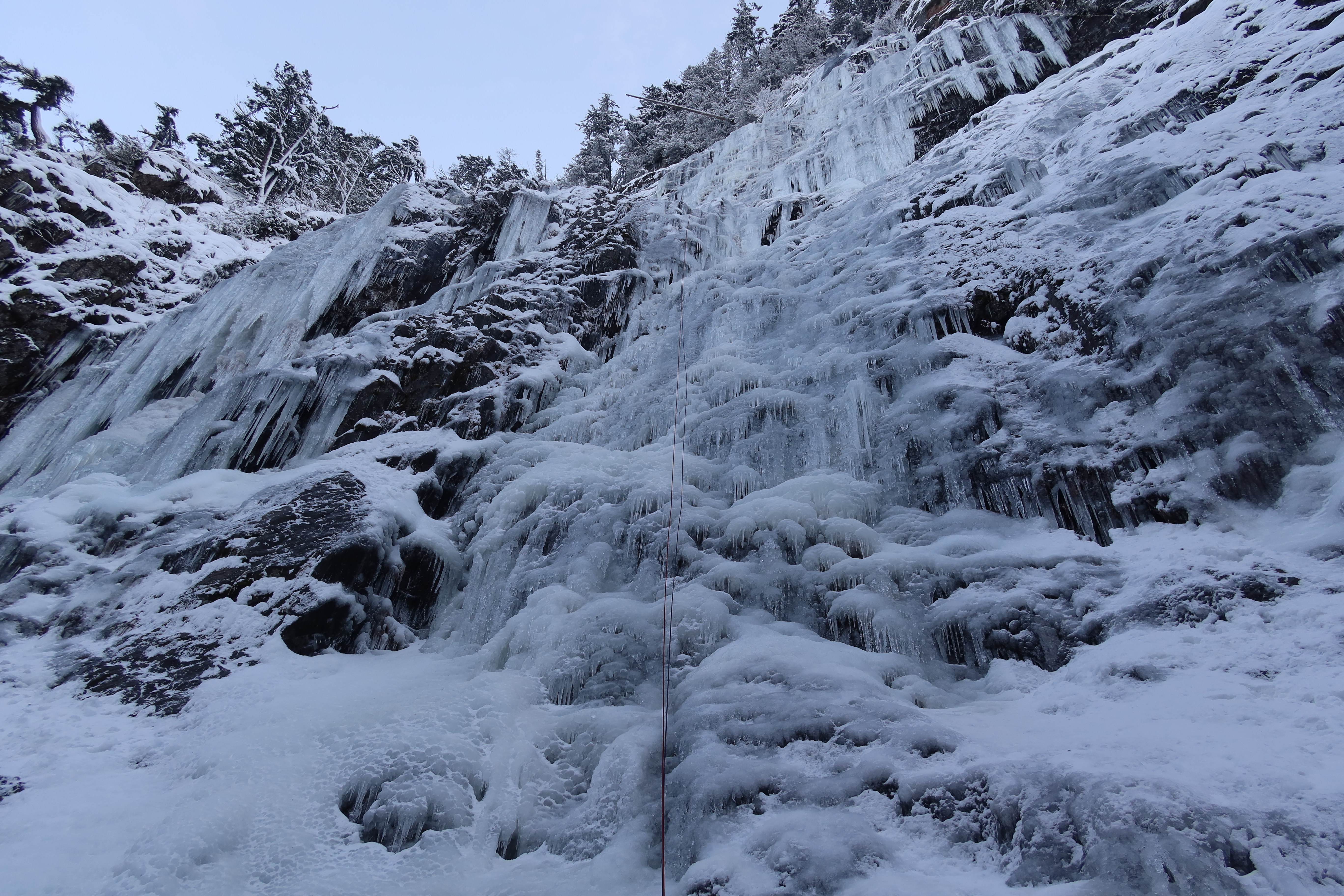
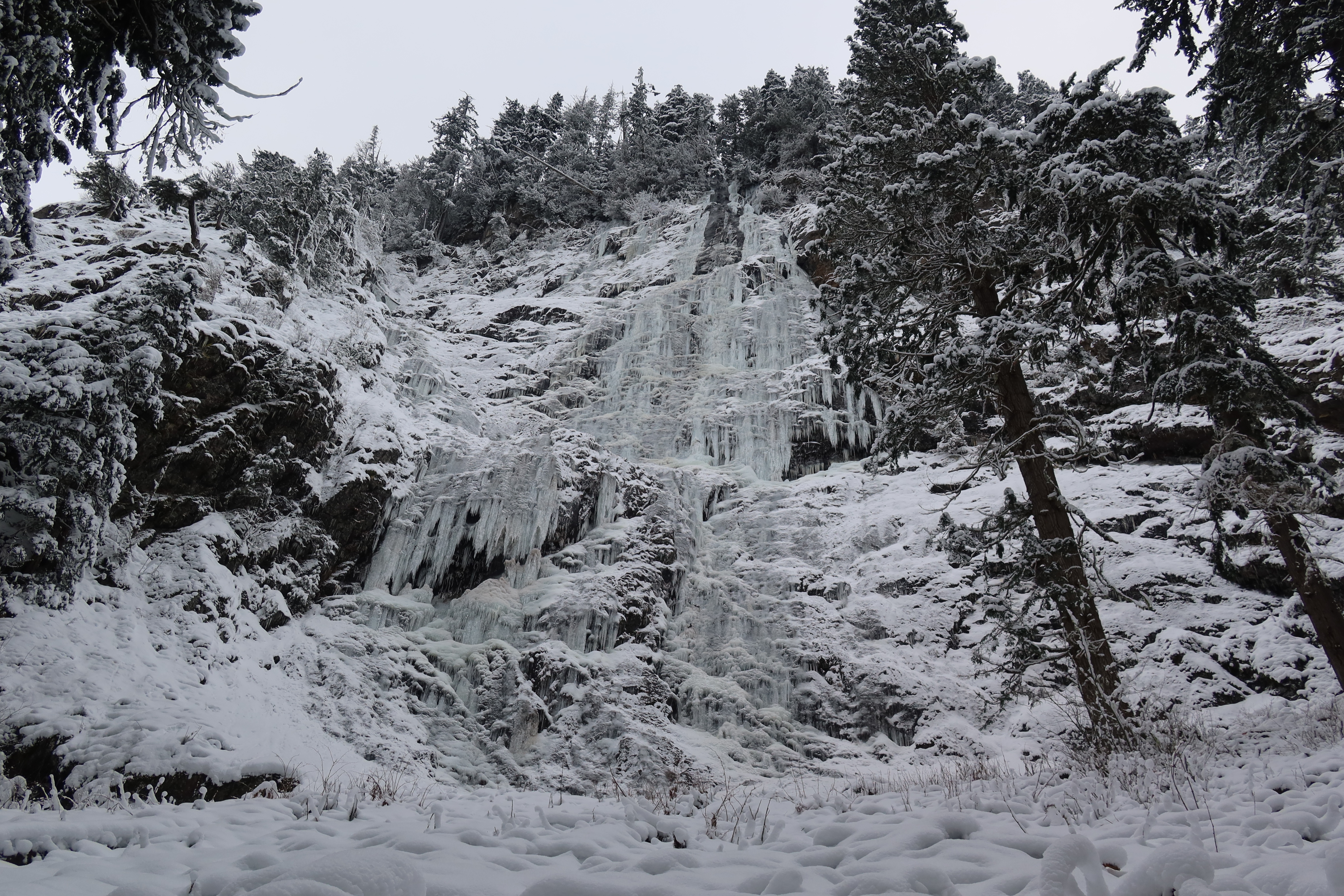
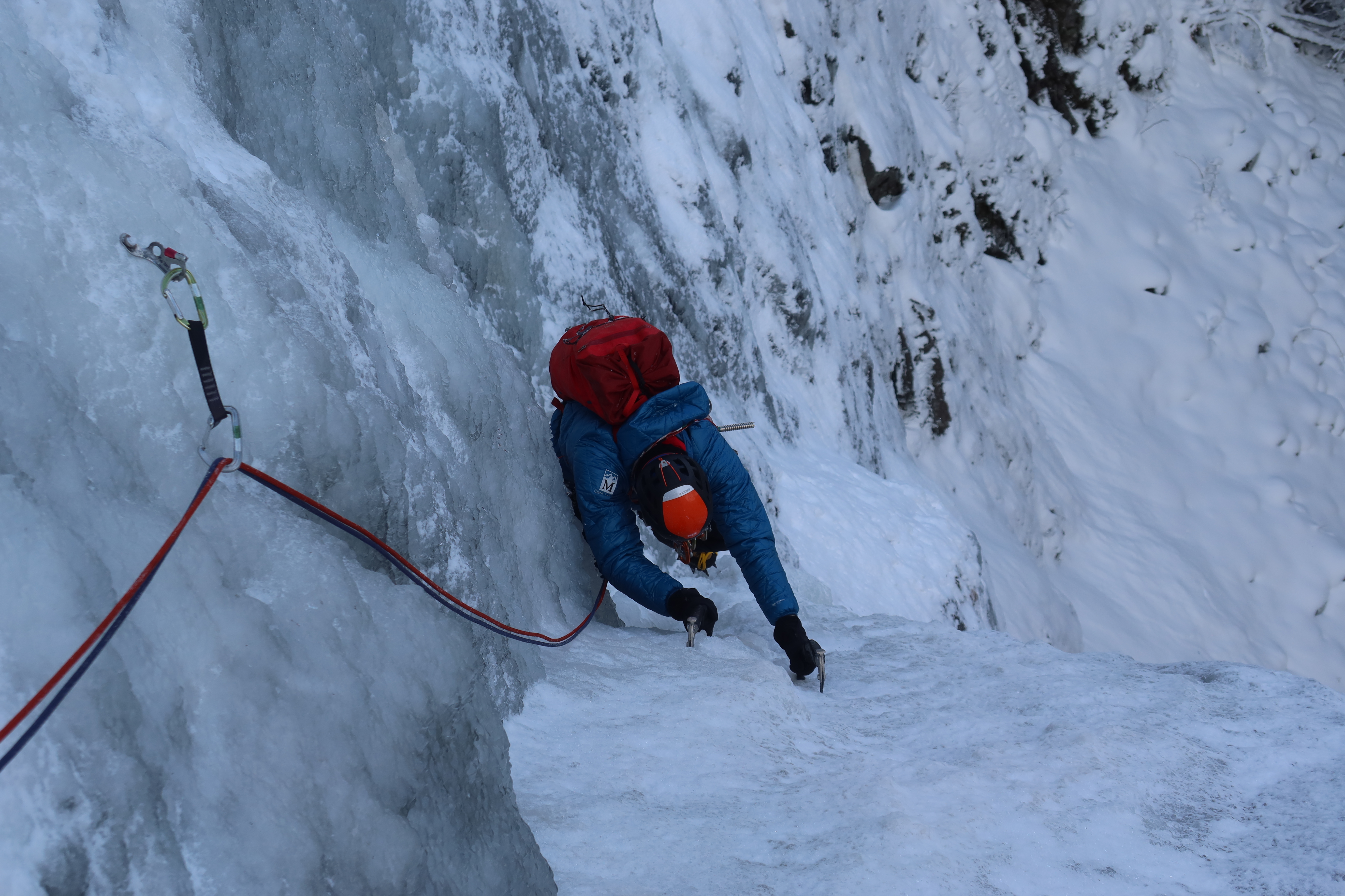
Trip: Skookum Falls - Far Right Wall - center, then left Trip Date: 12/29/2021 Trip Report: I managed to get out and climb Skookum Falls with my friend Chris on Wednesday, Dec. 29th. Full details here: https://rocknropenw.com/2021/12/30/skookum-falls/ Gear Notes: 4x 16cm screws - used the most 2x 13cm screws - useful, could have used more 1x 10cm screw - really could have used more 7x longer screws - used occasionally, wished half of them had been shorter Approach Notes: 2 miles of flat easy trail from the Skookum Flats North Trailhead on Forest Road 73
-
I'm crossing my fingers that this issue of missing pictures in older trip reports is something that eventually gets fixed. CascadeClimbers has been such a great resource for looking up pictures of routes, and a picture really is worth a thousand words. There's an incredible amount of knowledge stored in so many trip reports from years past, and it would be a shame to lose it. Another one of many, many examples on here that have been immensely valuable to me in the past: Thanks for all the work you are doing maintaining CascadeClimbers!!
-
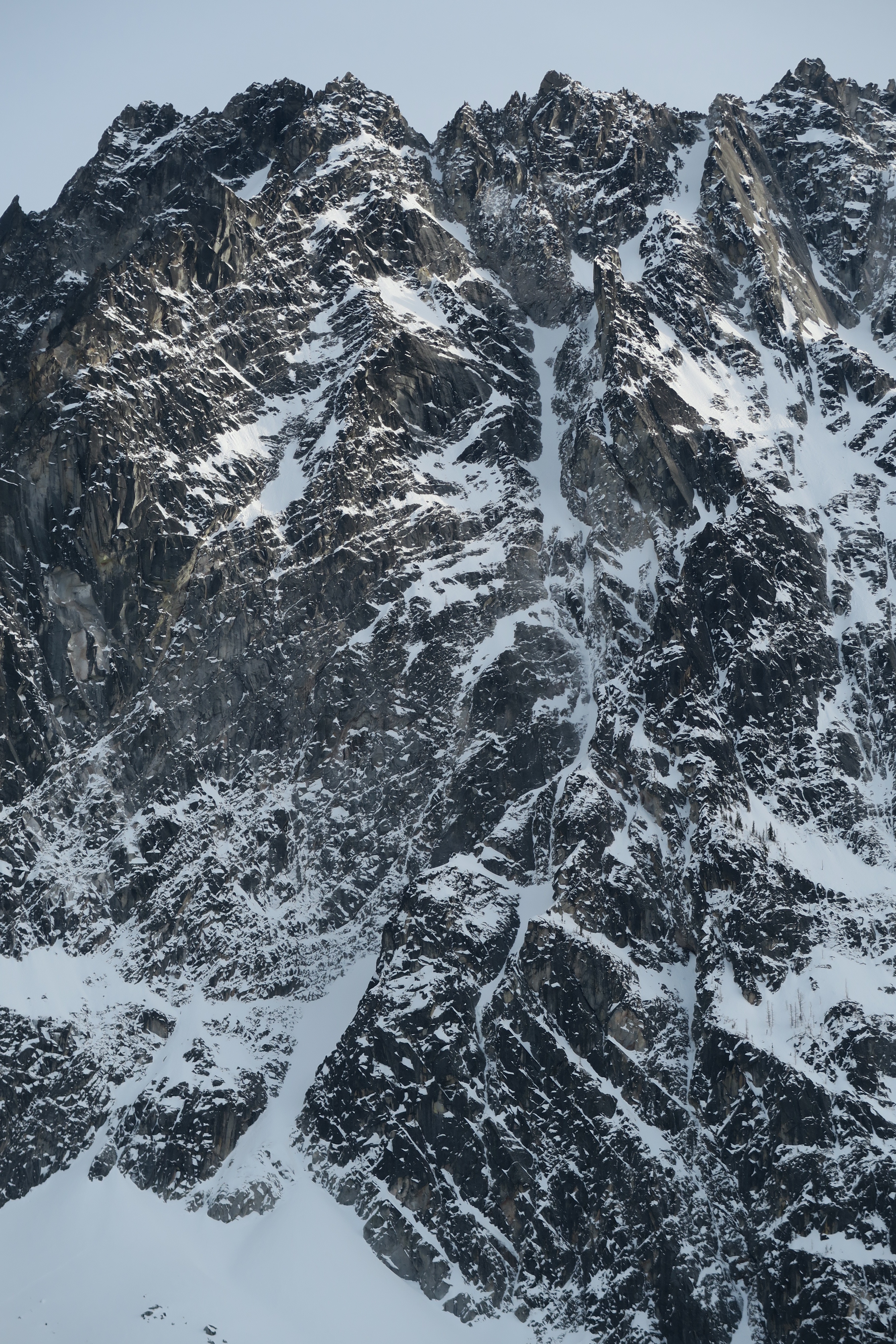
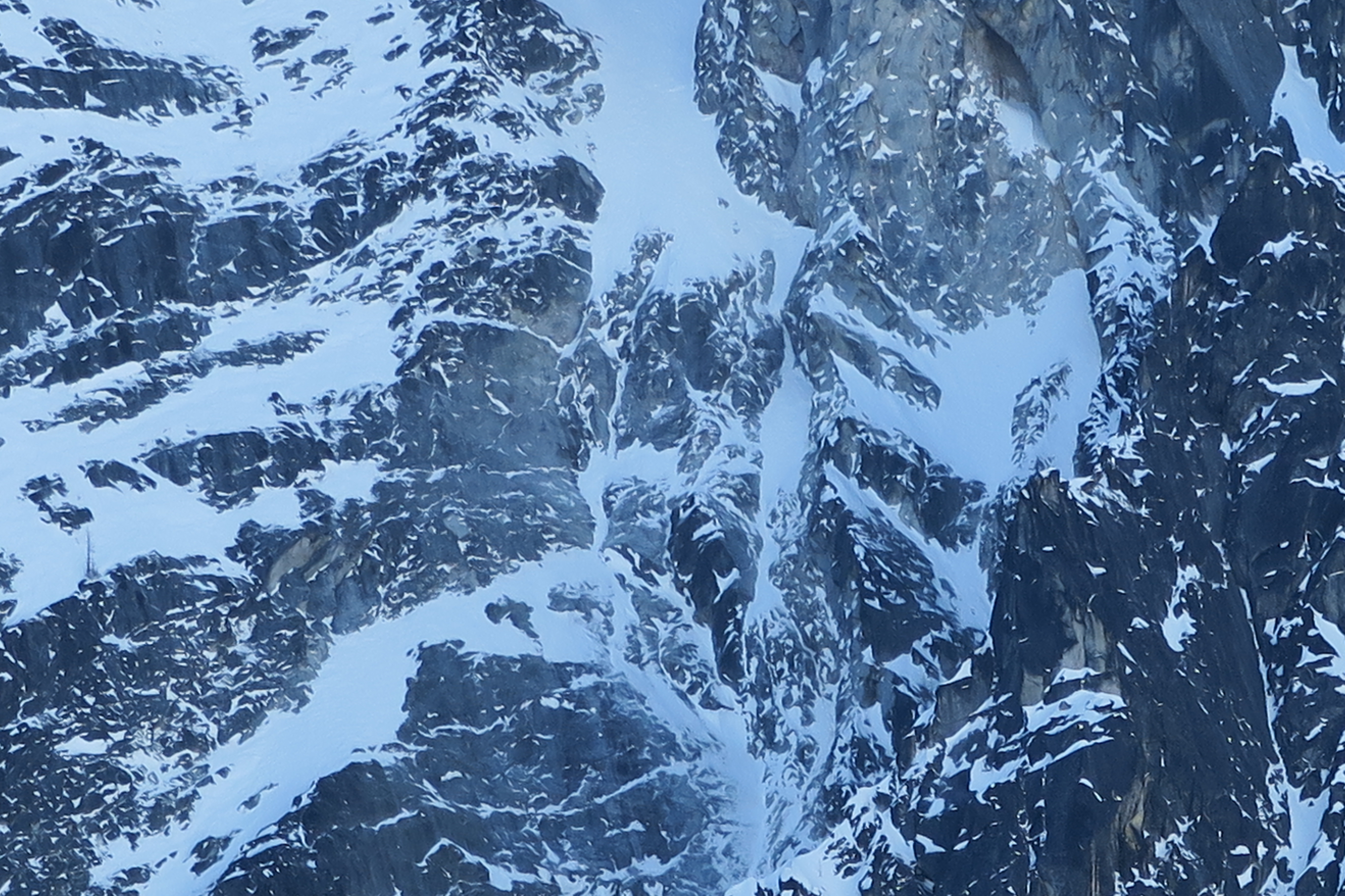
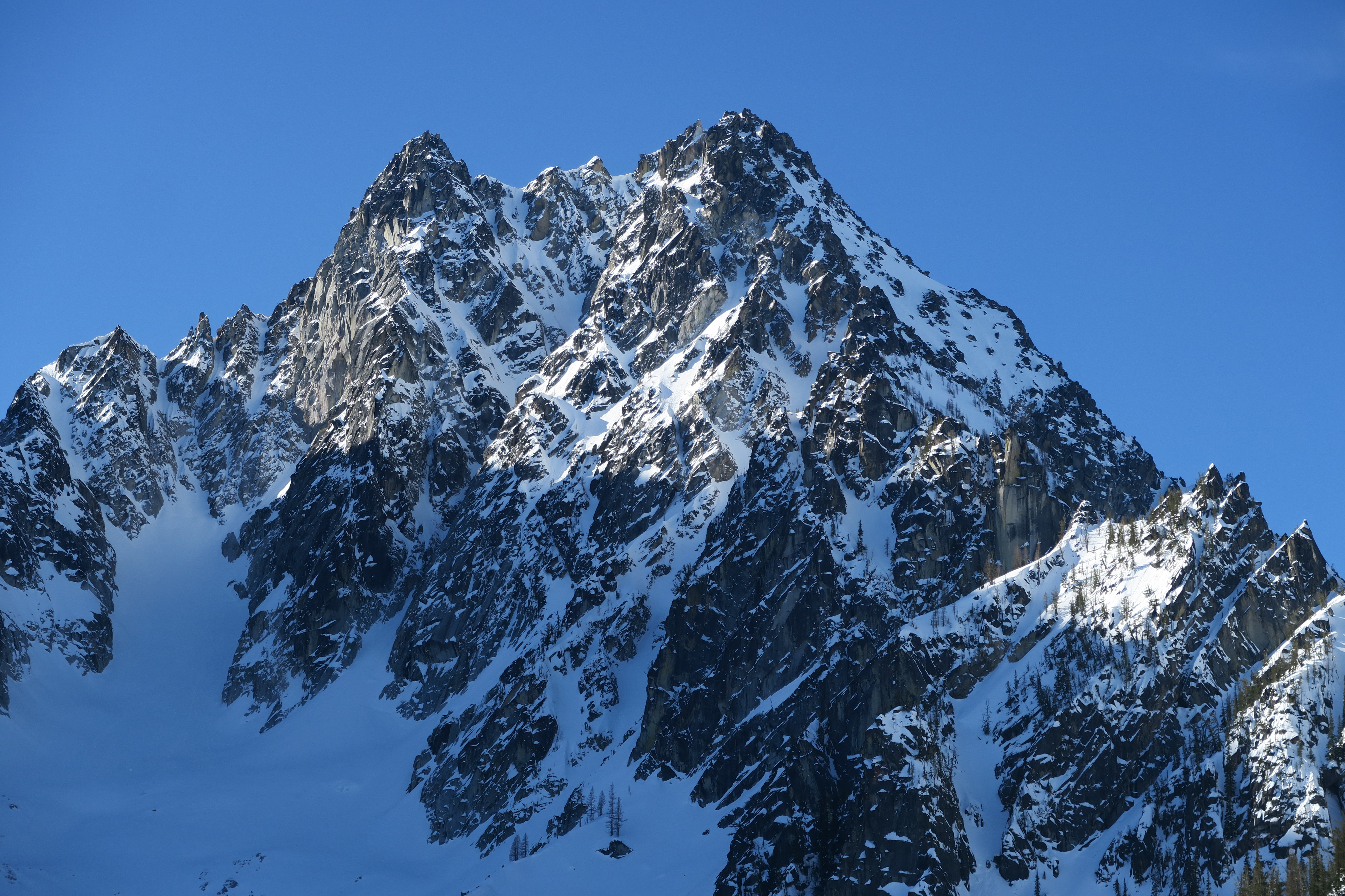
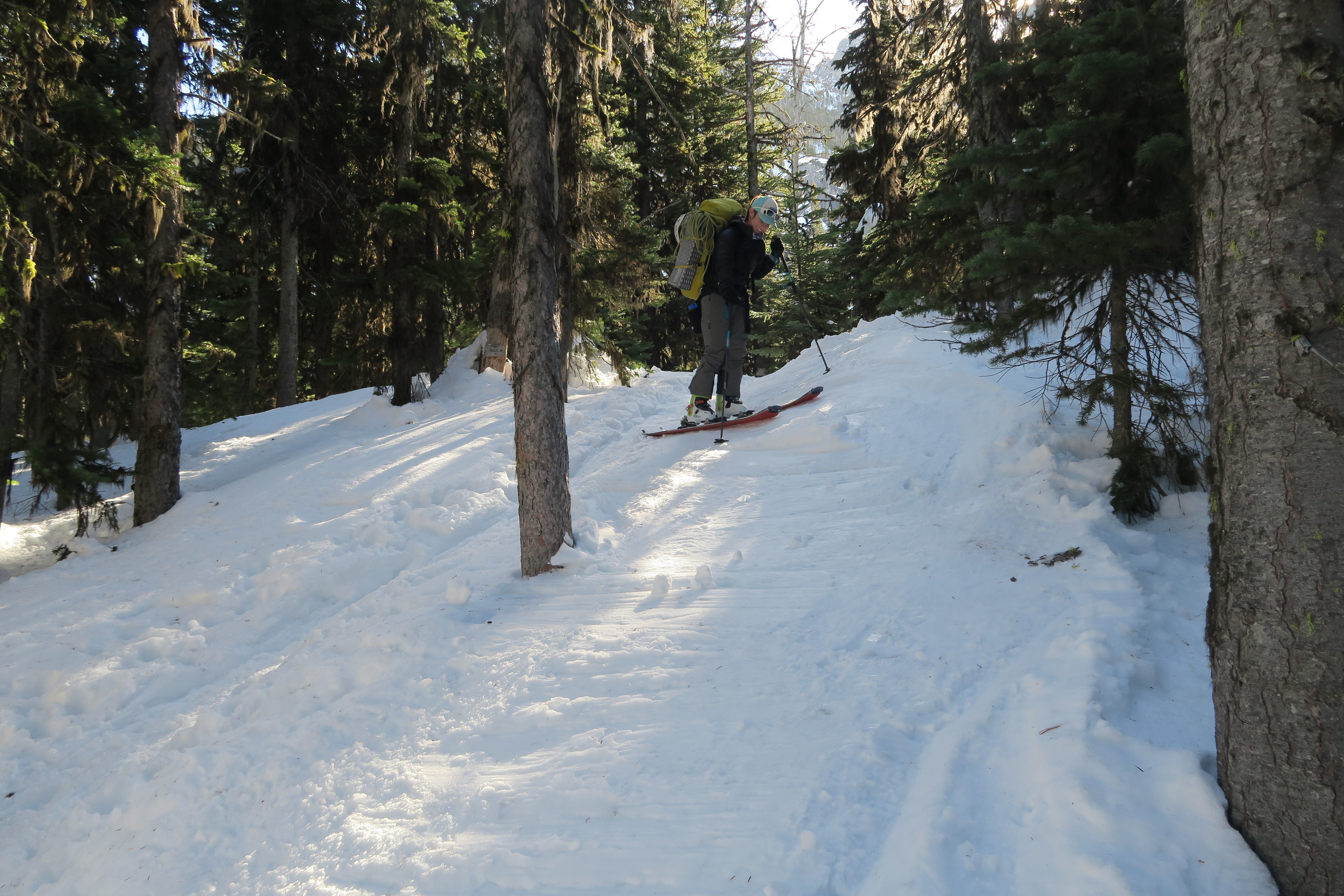
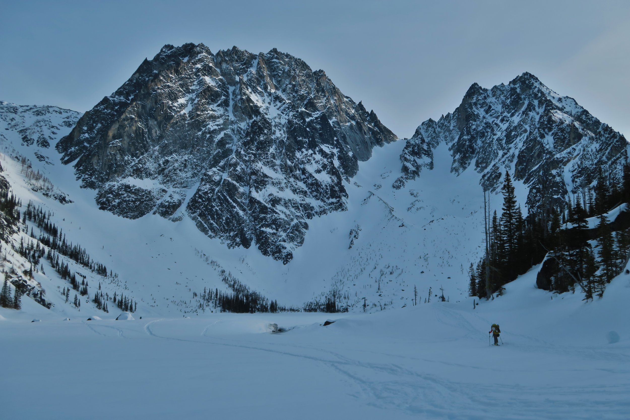
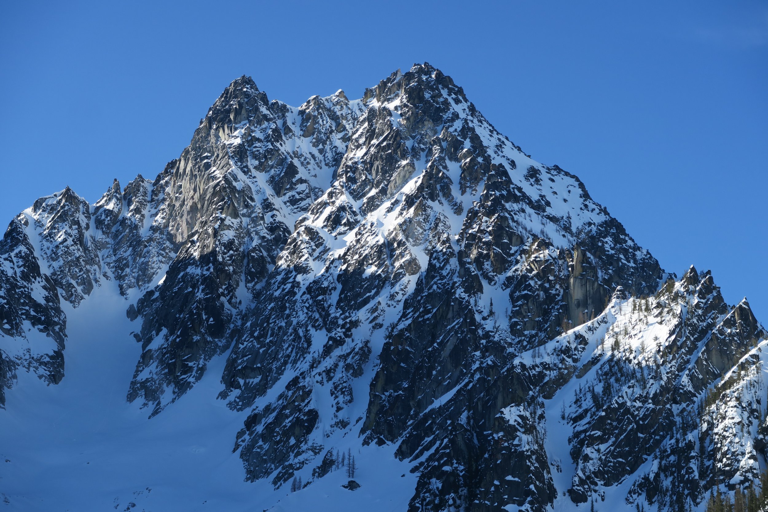
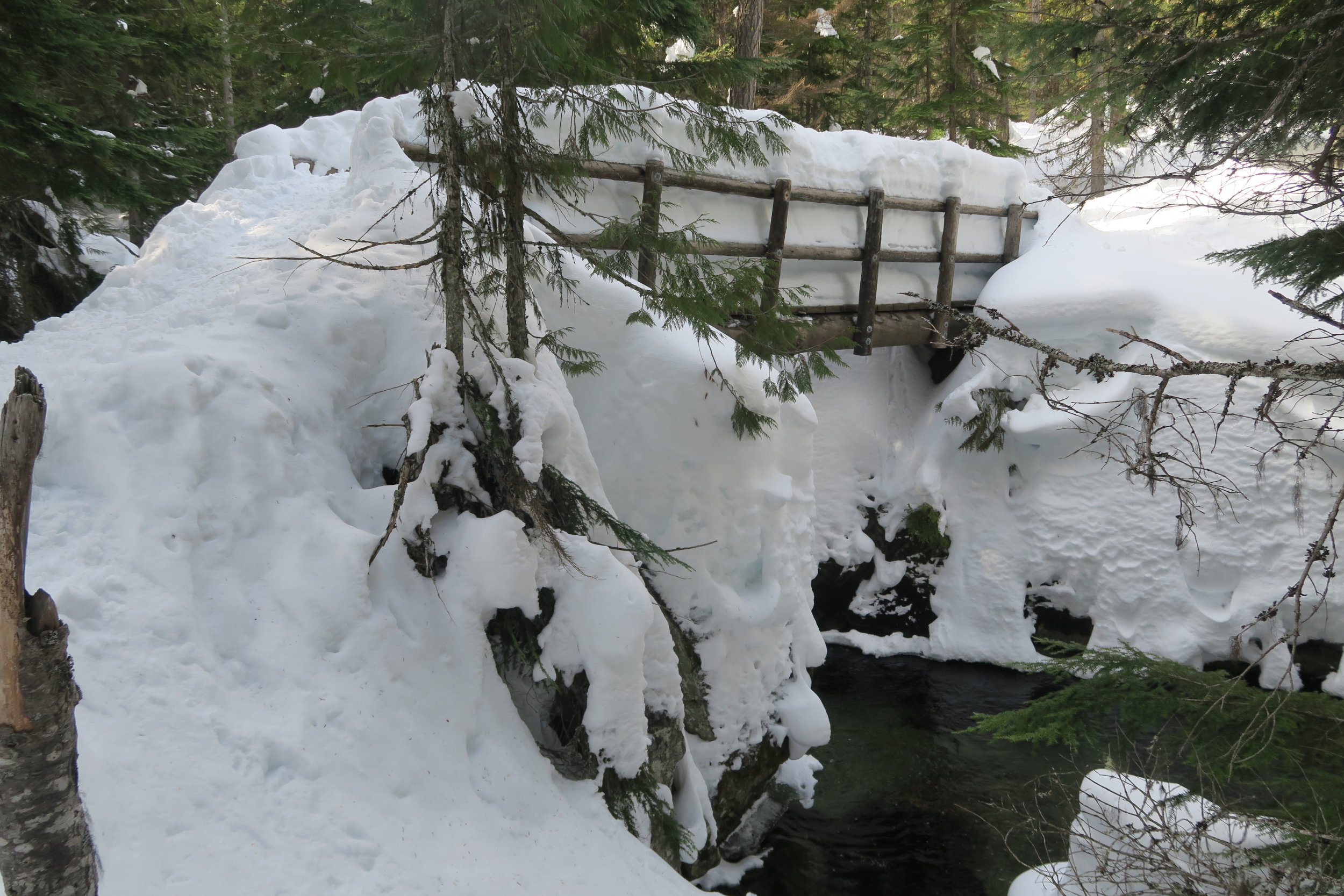
Trip: Colchuck Lake area - conditions Trip Date: 03/16/2019 Trip Report: Given the spectacular weather this past weekend, (March 16th-17th) I considered making an attempt on Colchuck’s North Buttress Couloir on skis. But due to a lack of mental realism about how out of shape I’ve gotten and just how much longer approaches take during winter conditions, plans evolved into just a nice camping trip next to Colchuck Lake with about 10 lbs of pro/pickets/crampons/ice tools along for the ride as bonus training weight. Everything is well snow-covered, we were able to skin right from the car. Snow on the gated Eightmile Road has almost every kind of human tracks you can imagine on it: snowshoes, skis, split boards, snowmobiles, it was even packed enough to be bootable with only a few inches of boot penetration, but I’d still recommend floatation of some kind. At the normal summer trailhead, snow looks to be about 4 feet deep right now. The trail up to Colchuck Lake has a well-packed snowshoe track the whole way up. Skinning up was fine (though it took me longer than I’d like to admit) with only one occasion where a fallen tree forced us to take skis off to hop over. Without skis, the packed path was supportive to boots for 9 out of 10 steps, but when postholes did happen they were waist deep. When we reached the lake, there were probably half dozen other parties in sight, most camping. We briefly talked to a group of 3 who had made an attempt at Triple Couloirs, but found the runnels to be way too thin right now and were forced to turn back there. We just camped and went no further than the lake. Just for the sake of curiosity, my avy probe went 7 feet deep in the snow by the lake before hitting what felt like ground. Skiing back out along the trail the next day was quite challenging, the most difficult tree-skiing I’ve ever done. We kept skins on to help keep speed down with all the sudden maneuvering required. My girlfriend soon opted to just A-frame the skis on the pack and walk instead. I stubbornly kept skis on the whole way, but with all the shenanigans that “skiing” there required, I progressed at exactly the same pace as her walking downhill. It is unclear which mode of travel was actually more effort. We observed a wet natural avalanche let loose on the distant side of the Mountaineers Creek valley, around noon on a very sun-soaked southeastern aspect slope, fortunately comfortably far away from us and coming to a stop well before reaching the trail’s elevation below. Finally, at the lower of the two places you cross Mountaineers Creek (the bridge at 4000’) the skis finally felt efficient again, with some worthwhile stretches of gliding down the path. And of course, once back on Eightmile Rd, the gliding on the skis was heavenly, with only two significant spots that required some skating for some otherwise non-obvious uphills. Triple Couloirs up close The Runnels on Triple Couloirs with maximum camera zoom Colchuck Ski shenanigans coming down from Colchuck Lake The bridge across Mountaineers Creek at 4000' Gear Notes: a 50lb climbing/skiing/winter/overnight pack Approach Notes: solid snow cover all the way from Icicle Creek Rd


-
Trip: Cascade River Rd - conditions Trip Date: 03/02/2019 Trip Report: With ambitious hopes of finding winter alpine climbing and maybe also a certain Spanish-rumored City of Gold, I found myself out on the Cascade River Rd this past Saturday (March 2nd.) Although my plans were ultimately thwarted and uninteresting, I figured I should at least share a report on the current state of the road. Indeed, as the park service reports, the Cascade River Rd is gated at milepost 18; but right now that’s a pretty moot point, because it’s unlikely you’ll drive even that far until things warm up and the snow melts back a bit. Patchy snow began about 4 or 5 miles away from Marblemount. Around milepost 10, it got thick and swimmy enough that my car (a 2017 Subaru Forester with average tires,) required chains to keep going. At milepost 16, right by the entrance to Mineral Park Campground, the only car ahead of us had parked (a Subaru Outback.) We tried driving forward on the unbroken road beyond that, but my car was having none of it, we were forced to park at milepost 16 as well. From there, the road had 1 to 2 feet of snow depth on it, ideal for skinning if you’re skiing. Also packed enough you could walk it in just boots, but still without a doubt more tiring than if the road had been melted down to bare gravel. I hope all the rest of you did something more satisfying with that glorious weather weekend than all the lame road walking I ended up doing! Gear Notes: Approach Notes:
-
I was on February Buttress on Sunday. Conditions were beautiful, the south-facing rock is getting a lot of sun. It looks like this coming weekend is shaping up to be just as nice there too. February Buttress is half-visible from the 76 gas station, it's the dry rock gently sloping from the right. This is where the 1st pitch of Ground Hog Day starts: Ground Hog Day, viewed from the side This is where Aquarius starts. Notice the bolt on the face? Neither did I at the time. To start Aquarius, stand where our rope touches the ground here: