-
Posts
17 -
Joined
-
Last visited
-
Days Won
1
1 Follower
.thumb.jpg.d8d6db40947cc944f6d3d87de772c58e.jpg)
Recent Profile Visitors
1129 profile views


Kuckuzka1's Achievements
")
Gumby (1/14)
4
Reputation
-
 Kuckuzka1 changed their profile photo
 -
best of cc.com "Forgotten" Alpine Ice Cascade Testpieces (FACTs)
Kuckuzka1 replied to Kyle M's topic in Ice Climbing Forum
Two Canadians did a stellar looking route right of the lower N ridge on Stuart during the arctic blast of February 1989. Not sure exactly the line they took but looks like fantastic ice. Check out the 1990 Canadian Alpine Journal for photos and a well written story -
[TR] Johannesburg - 1957 NE Rib 08/01/2020
Kuckuzka1 replied to The Real Nick Sweeney's topic in North Cascades
In mid July 92 did the left most route (1963 ridge/rib) in 15/16 hrs round trip and found the route really good, with the upper 3-5 pitches on the rib being great rock in the 5.7-8 range. And the bonus of NO bush! I recommend the route and I have never figured out why climbers choose the brushy 57 route. Maybe do it in winter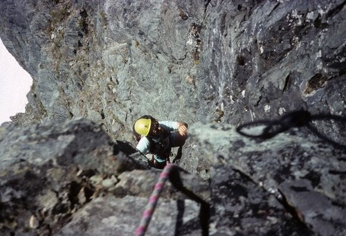
-
[TR] Mt. Index - North Norwegian 06/25/2020
Kuckuzka1 replied to Sam Boyce's topic in North Cascades
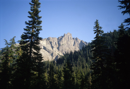
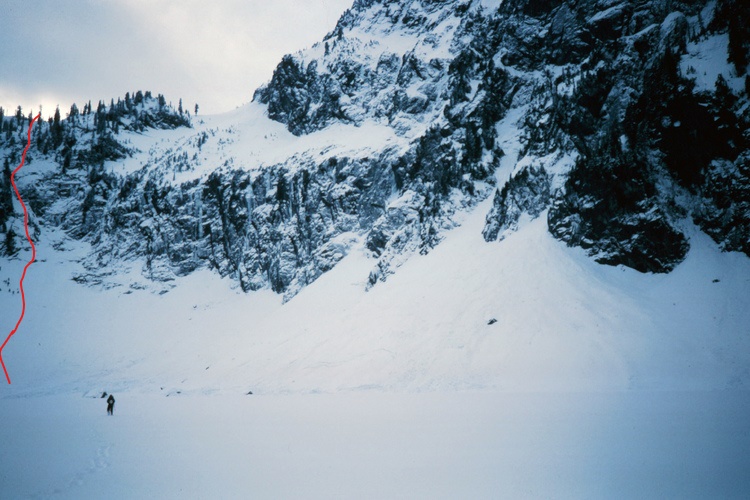
Fred gave it a grade V, But if anyone would know a grade VI It'd be Wayne. It's so cool seeing some different routes, attempts or otherwise on this site. I believe It's future really depends new content. Also it would be cool to a good photo with the approx line of the original line as I've tried but still not sure where it is -
[TR] Sperry Peak - East Face Gully Attempt 11/29/2019
Kuckuzka1 replied to Kyle M's topic in North Cascades
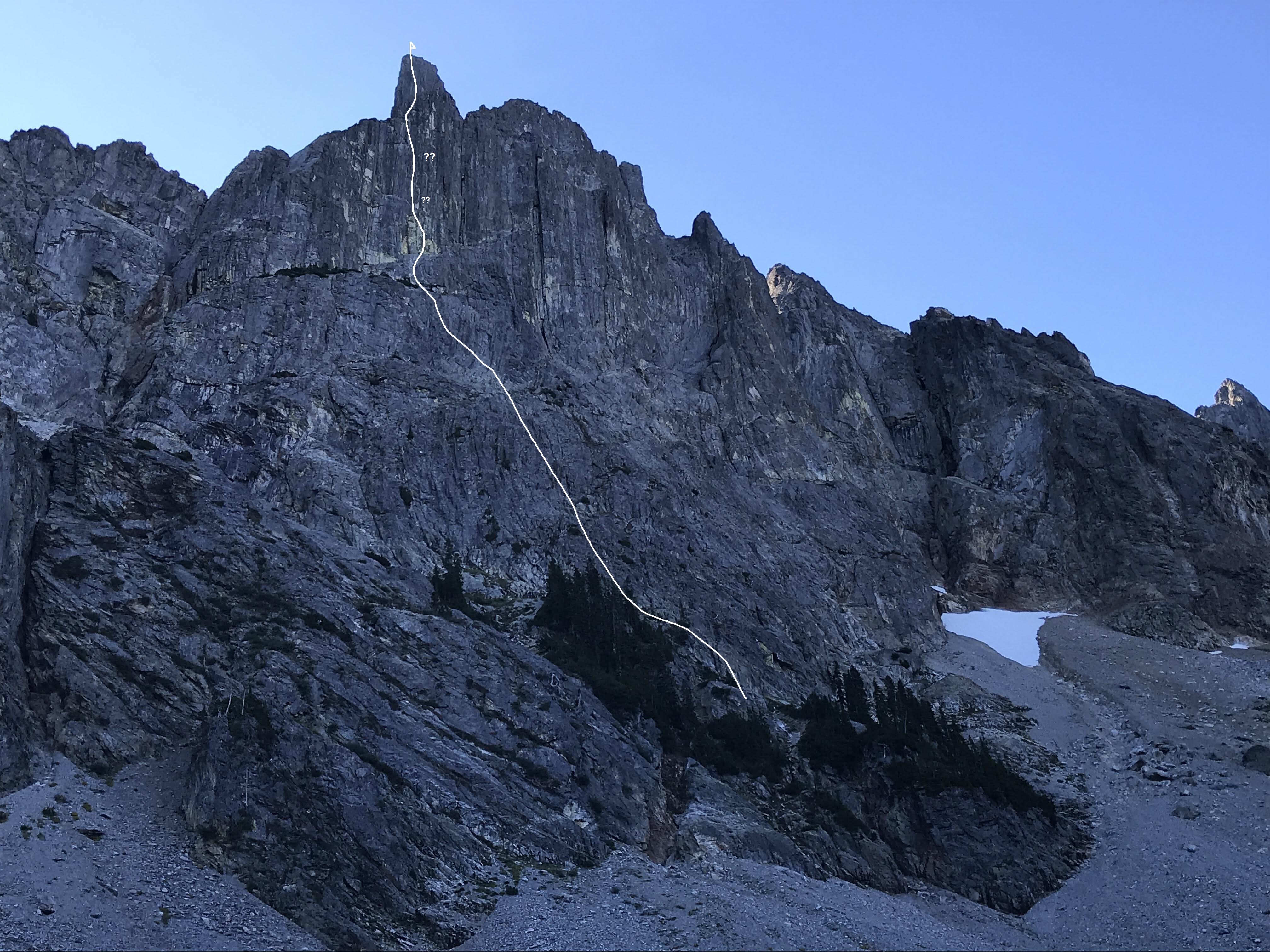
Here's the approx line done in summer. recommended. Photo credit to Kyle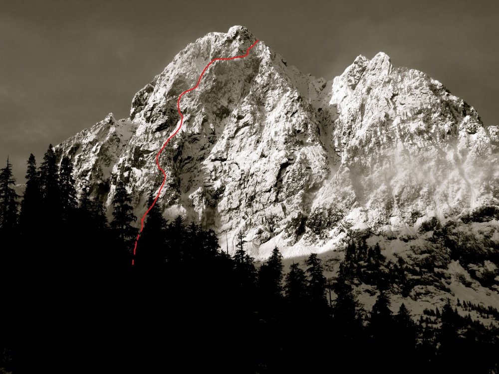
-
Yep, I believe Don and you wanted to do the N.face but what were the odds back then a couple other climbers were just beginning it! Good times friend!!
-
[TR] Mt. Stuart - Ice Cliff Glacier 05/24/2020
Kuckuzka1 replied to kmfoerster's topic in Alpine Lakes
I'm pretty sure the drip left of the higher one is blue moon in June, Maybe someone out there knows for sure -
[TR] Mt. Stuart - Ice Cliff Glacier 05/24/2020
Kuckuzka1 replied to kmfoerster's topic in Alpine Lakes
Cool, you see that ice drip left of girth pillar? never seen that before, looks hard, steep and not great ice but other than that looks great -
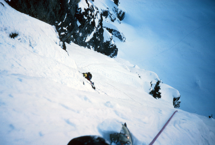
Cool, This route was my 1st winter route done during the arctic blast of 1989. after walking across the frozen lake we did a couple rope lengths of WI2-3 to the climbers left of the big waterfalls and gained east ridge at dark, next day was bluebird and a cold summit. great memories
-
I have heard he did them ground up, cannot confirm though. So there is another rap bolted route up valley from the other rap bolted debacle MHC. Soon it will become the new standard of how climbs are done in the cascades, The new breed gym alpine climbers flock to these routes and I'm sure they are popular. but I personally think it's a step in the wrong direction. A main argument for keeping I-B was they "doubted more routes like I-B will be done in this style" Well they are here, and for better or worse they're here to stay
-
[TR] Humpback Mountain - Humpback Flows 02/07/2019
Kuckuzka1 replied to Justin Pucci's topic in Alpine Lakes
I have looked at those flows for the last 30 years but I didn't think they would be worth the hike in. I'm sure someone in the 70's-90's already did them -
[TR] Mount Stuart - Girth Pillar 07/31/2018
Kuckuzka1 replied to John Douglass's topic in Alpine Lakes
Frickin awesome! a one day ascent of girth pillar. watching the vid was thinking how rad that would be to be on that pillar in winter!!! -
Very cool. I always thought you did that line with martin and that the face had one ascent. the rock looks very Snoqualmie passish?? Yeah tat pillar looks like a mini North pillar of the north twin (Blanchard/Cheesmond 85) Looks like many good lines still available
-
North America, United States, Washington, Little Big Chief Mountain, Falcon Route Climbs And Expeditions Climb Year: Publication Year: 2004 Little Big Chief Mountain, Falcon Route. Jeff Hansell and I made this new route (IV 5.9) on September 10,2001. Little Big Chief Mountain is located in the seldom-visited Summit Chief Valley in the North Central Cascades. The Summit Chief Valley is a tributary of the Middle Fork of the Snoqualmie River Valley. The route is never really hard, but is remote and demands a variety of alpine skills. From the end of the Middle Fork Valley Road, hike up the valley for about three hours. At a small steel bridge, leave the trail and hike cross-country in a southerly direction to the entrance of the Summit Chief Valley. The objective should be visible on the east side of the valley. Hike up into the Summit Chief Valley until you reach the flat gravel wash at about 4,650'. There are great low-impact camp spots. From camp ascend a talus field for 900 feet to the base of the route at a prominent left- trending gully. Follow this for 50 feet; move right to a dead tree. Go up and right to another dead tree and continue to easier terrain. Ascend sloping heather benches to the prominent right-trending ramp and follow it to the beginning of difficulties, just left of the prominent chimney. The First pitch features an undercling to the right (5.8). On the second pitch, climb a groove for 60 feet, then move left onto a rib and into another groove. On pitch four climb a steep headwall (5.9) to yet another groove. Follow this groove on pitches five and six (5.7/5.8) to easy terrain and a big ledge, which is at the elevation of the top of the prow to your left. Pitch seven trends slightly right to a ridge near the summit crest. On pitch eight keep traversing right on exposed rock to the crest (5.7). Class 4 climbing on the narrow ridge leads to the 7,225' summit. Descend the ridge to the south for several hundred feet, then turn left and gain a pocket glacier. Go down the pocket glacier and trend left over glacier-polished slabs. Keep trending left and reach the ridge crest at 5,400'. One to two rappels then take you back into the Summit Chief Valley. Continue trending left, follow goat ledges, then descend through steep forest to camp. Martin Volken Seems the route starts more to the left, sounds great
-
Curious if this is the aprox line taken?

-