ScaredSilly
-
Posts
1242 -
Joined
-
Last visited
-
Days Won
4
Content Type
Profiles
Forums
Events
Everything posted by ScaredSilly
-
I recently found my hard copy of this guide and seeing it has not been posted up (at least I could not find it) I thought for fun I would post it. It was written probably 25 plus years ago by Make Dale. The Cascade Brush and Bushwhack Rating System by Mark Dale For years there has been something sadly lacking in the climbing world. Something necessary to help describe the total mountaineering experience in those areas blessed with challenging peaks surrounded by primeval forest. That something is a brush and bushwhack rating system. After years of the hand-to-limb combat encountered in below-timberline approaches, one comes to realize that this part of an ascent can be half or more of the battle. (Notice the use of fighting terms.) And yet, just how does one accurately relate this important facet of a climb in words? "It was ugly, real ugly," "Brutal," "A freaking flail," "Oh, not too bad, but I did lose a pint of blood." Well, these are pretty good subjective descriptions, but what's missing here is something more definitive. What we need is a way to portray in a more precise manner those endearing struggles with the brush. Therefore I propose the Cascade Brush and Bushwhack Rating System. This system is so named because most of my experience in the past ten years of climbing has been in the Washington Cascades. It's perfectly applicable, though, to other ranges of a similar nature, e.g. the Olympics, Northern Selkirks, British Columbia Coast Range, Alaska Range or any mountain group where below-timberline approaches necessitate brush-beating and bushwhacking. This system rates both difficulty and grade much like the technical climbing ratings in use today. Before defining system nomenclature here are a few guidelines for describing your favorite flail: 1. Conditions described must be when the approach is snow-free, since snowpack greatly affects most bushwhacks, reducing their difficulty considerably. 2. More demanding terrain, e.g. cliffy or steep, will increase a bushwhack's difficulty and grade as compared to one with the same vegetation on level ground. 3. Both the density and the type of brush are important factors. I'll take an open area of mature devil's club over a dense stand of slide alder any day. 4. Grade is determined by both time and distance involved in completing the approach, as well as the duration of the difficulties. 5. Since creek and river crossings play an important part of many approaches, a special sub-rating has been devised for these. 6. When a mechanical device such as a machete is used the bushwhack is no longer "free," and an aid sub-rating must be used. Difficulty Ratings These apply to the "free" difficulties (no aid used) and range from BW1 to BW5, where BW stands for "bushwhack." Difficulty ratings apply to those areas of worst brush that can't be avoided. BW1 Light brush. Travel mostly unimpeded, only occasional use of hands required (e.g. mature open forest). BW2 Moderate brush. Occasional heavy patches. Pace slowed, frequent use of hands required. BW3 Heavy brush. Hands needed constantly. Some loss of blood may occur due to scratches and cuts. Travel noticably hindered. Use of four-letter words at times. BW4 Severe brush. Pace less than one mile per hour. Leather gloves and heavy clothing required to avoid loss of blood. Much profanity and mental anguish. Thick stands of brush requiring circumnavigation are encountered. BW5 Extreme brush. Multiple hours needed to travel one mile. Full body armor desirable. Wounds to extremities likely, eye protection needed. Footing difficult due to lack of visibility. Loss of temper inevitable. Aid Ratings When artificial means are used to penetrate brush, then an aid rating should be used to describe the device required. These ratings range from BA1 to BA5, where BA stands for "brush aid": BA1 Machete or sickle BA2 Gas-powered weed-eater BA3 Chainsaw BA4 Agent orange BA5 Bulldozer Creek and River Ratings These ratings are used to describe the difficulty in crossing watercourses. The range is WA1 to WA5, where WA stands for "water": WA1 A dry crossing is possible by using rocks or logs. WA2 Possible wet crossing, but a dry crossing can be accomplished with some finesse. WA3 Wet crossing, ankle- to calf-deep. WA4 Wet crossing, calf- to knee-deep. WA5 Wet crossing, greater than knee-deep, possibility of getting swept downstream. WA6 Water deep enough to require swimming. WA7 Water temperature, current velocity, to factors make an attempt to cross potentially lethal. (Frequently a factor in Alaska and New Zealand, for instance). Grades Grades range from I to VI and follow the same general guidelines as climbing grades: I Brush beating can be done in a few hours or less. II Generally will take less than half a day. III Could take most of a day, but hardened parties will be able to complete in a short day. IV Will take a long day and involve continuous battle. V A 1+ to 2-day bushwhack, difficulty rarely less than BW4, large quantities of bandaids and wound dressings will be needed unless properly attired. VI The most extreme of bushwhacks, requiring over 2 days to complete with probably a BW5 encountered along the way. Epic Ratings E1 Unplanned delays require explanations to significant other. E2 Same as E1, but with companion of opposite sex (not significant other). E3 Overnight bivy required. E4 Same as E3, but with companion of opposite sex. ... E10 Whole party vanishes. Following are some examples of rated bushwhacks: Picket Range, Goodell Creek approach -- Grade III - IV, BW4 Mt. Shuksan, White Salmon approach -- Grade I - II, BW4- Mt. Spickard, Silver Creek approach -- Grade V, BW4+ Mt. Blum, Blum Lakes approach -- Grade III, BW3+, WA5 Devils Peak, Coal Creek approach -- Grade I, BW2 Monashees, Thor Creek approach -- Grade VI, BW4, BA1 Chimney Rock, standard approach -- Grade II, BW2 And there you have it. No longer must one try to decipher the deranged mutterings of a victim of jungle warfare. A person needs only to apply the appropriate brush ratings to relate his brutal experience to others. And who knows? With advances in bush technology and the competitive nature of climbers, we'll probably see difficulties pushed to BW6 and beyond. And there just HAVE to be some Grade VII's out there! So come on, folks! The next time you report a mountaineering trip that involves green hell, use the Cascade Brush and Bushwhack Rating System to tell others about it. They'll be glad you did!
-
Perhaps a better solution would be to have single sticky forum thread for the south side TR. In a similar fashion as there is a single sticky thread for Mt. Hood.
-
[TR] Mt. Hood - South Side Pearly Gates 05/24/2020
ScaredSilly replied to GregD's topic in Oregon Cascades
You are correct that the Hogsback shifted. It goes back forth and has done so for centuries. It is well documented. While that does change the route some and where people may go, my comment was more of an overall assessment of climbers these days just going for or being given a second tool way too early rather than learning good technique. Which for lower angle slopes is not efficient and later becomes a crutch because they lack they proper technique. I will be honest taking a new person who was correctly placed in the middle and giving them two tools gets them up the hill in the short term but does nothing for them long term in making them a competed climber. -
Permits have been required on Adams for sometime now. But I have never bothered mostly because I have not been on the south side in 35 years. The other sides are more interesting.
-
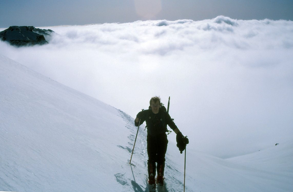
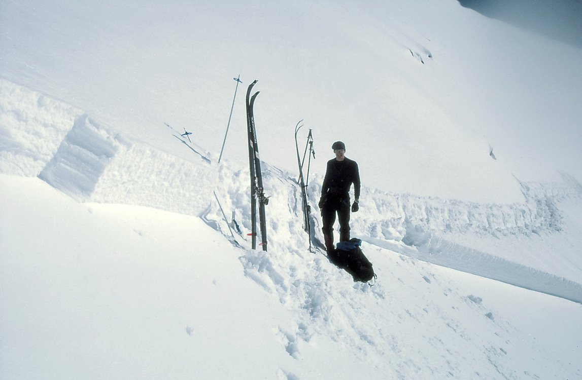
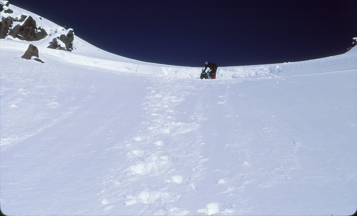
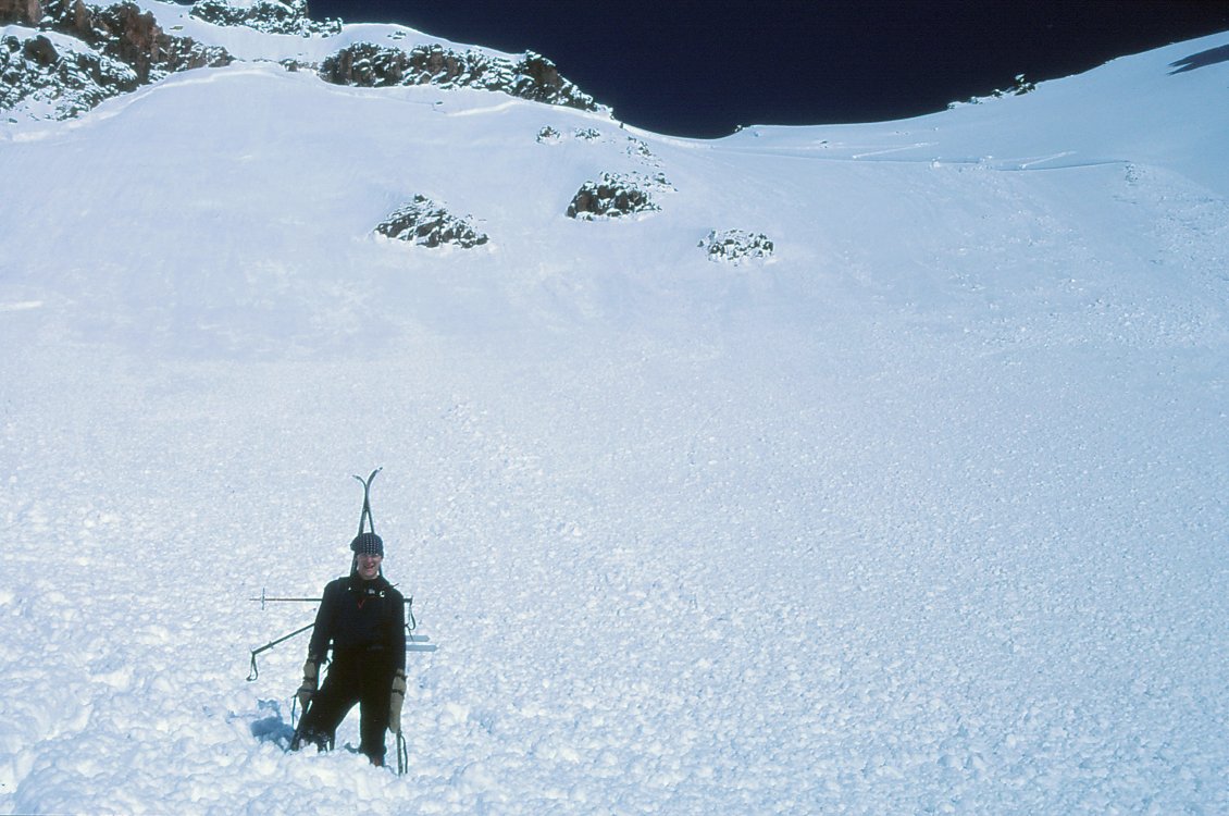
Some misc ramblings. I remember from doing the route in late August of 97. We rambled up to the Angel Glacier that afternoon, mostly solo, think we used the rope in a couple of places. Had a nice bivy and watched a couple of others top out in the dark. During the night the face to the right lighted up with rock fall. In the morning we crossed the glacier, no cracks that I remember. The bergshrund was interesting as I literally burrowed a hole through it. The lower slopes were straightforward. The pillar my partner John lead as he swapped out his boots for rock slippers. His secret weapon. Some where above I lost my lead head so John lead for a while but then bonked as it got dark. I remember coming around a corner and here he was both tools in marginal névé and a couple of crappy nuts for a belay. My turn. Mean while it was now pissing sideways with snow and all I could see above me was a huge ass cornice. I resigned myself to having to tunnel my way through it. I told John to just talk to me as lead out. I as I went up I found some good pro, that was a relief. Finally, I made my way up to the cornice and found that if I went to the right I could by pass it. And much to my surprise I walked right up to the summit. It was now a full on gale, we bivied in the rocks and unfortunately John dropped his bivy sac so I took the outside. In the morning we headed down the west side. It was casual. I remember getting down into a nice meadow to take a break and failing asleep on my pack. I woke when I rolled off of it and into the mud. When we got to the road we snagged a ride back to the parking lot by a couple of climbers. Oddly enough I gave them the picks from my tools as they had broken a couple. I might have a few pictures but need to did through the archive.
-
Oddly this weekend I was sorting through stuff and read through a log I kept whilst making my second attempt on the East Buttress of Denali. Probably one of the most real and most humbling experiences because I had to call for the rescue after my partner and I were avalanched by a collapsing serac. I compare that experience to having a couple of semi trailers full of bowling balls dumped on ya. I was in the better place so my partner took the brunt of it as well as being dumped in to crevasse. After schlepping him out and back to a safe location I had to go back up solo through crevasses and retrieve gear, then call for a rescue. We got short hauled off with no assistance (a first on Denali). That was a wild ride but with great views. Eight years later I returned and did the Cassin, I remember our bivy at 15,500 on the face and with the feeling of just being out there. That said, what has been the most real are the partnerships. Egging each other on, or saying fuck it lets go drink beer. Either way we're happy.
-
[TR] Mt. Hood - South Side Pearly Gates 05/24/2020
ScaredSilly replied to GregD's topic in Oregon Cascades
A couple of comments, glad ya got up and down without incident but a few observations. The route has not changed, people have. People have skipped learning to be competent with a single tool and immediately go to two tools. So while one may feel way more secure using two tools in a low-dagger position that feeling is misplaced. And for what ever reason when I look at your picture it reminds of years ago when I went by three climbers in about the same place, all with their axes also in their left hand which was the the down hill side. Just after I passed them they all went sliding down the Hogsback. May just be the perspective. That said, the middle climber needs some mentoring on rope management so to keep it out from under their feet. -
[TR] South Sister - Silver Couloir 05/25/2020
ScaredSilly replied to adventure43's topic in Oregon Cascades
Nice job on getting to the north side of the hill. Lots of effort, just wish the routes were longer. Gotta bring skis though as that is really the way to go. -
[TR] Cerro Aconcagua - Ruta Normal 02/02/2020
ScaredSilly replied to bellows's topic in The rest of the US and International.
Interesting, it does not sound like you acclimated very well ... years ago when I was there I developed a respiratory infection on the way into Plaza Argentina. I got my SpO2 checked and remember it being in 70s but my the time I recovered it was in the lows 90s. -
[TR] Broken Top - Oh to be young and dumb - Crater 02/16/1985
ScaredSilly replied to ScaredSilly's topic in Oregon Cascades
That is just sad. Seeing a heard if elk is impressive but that is just sad. -
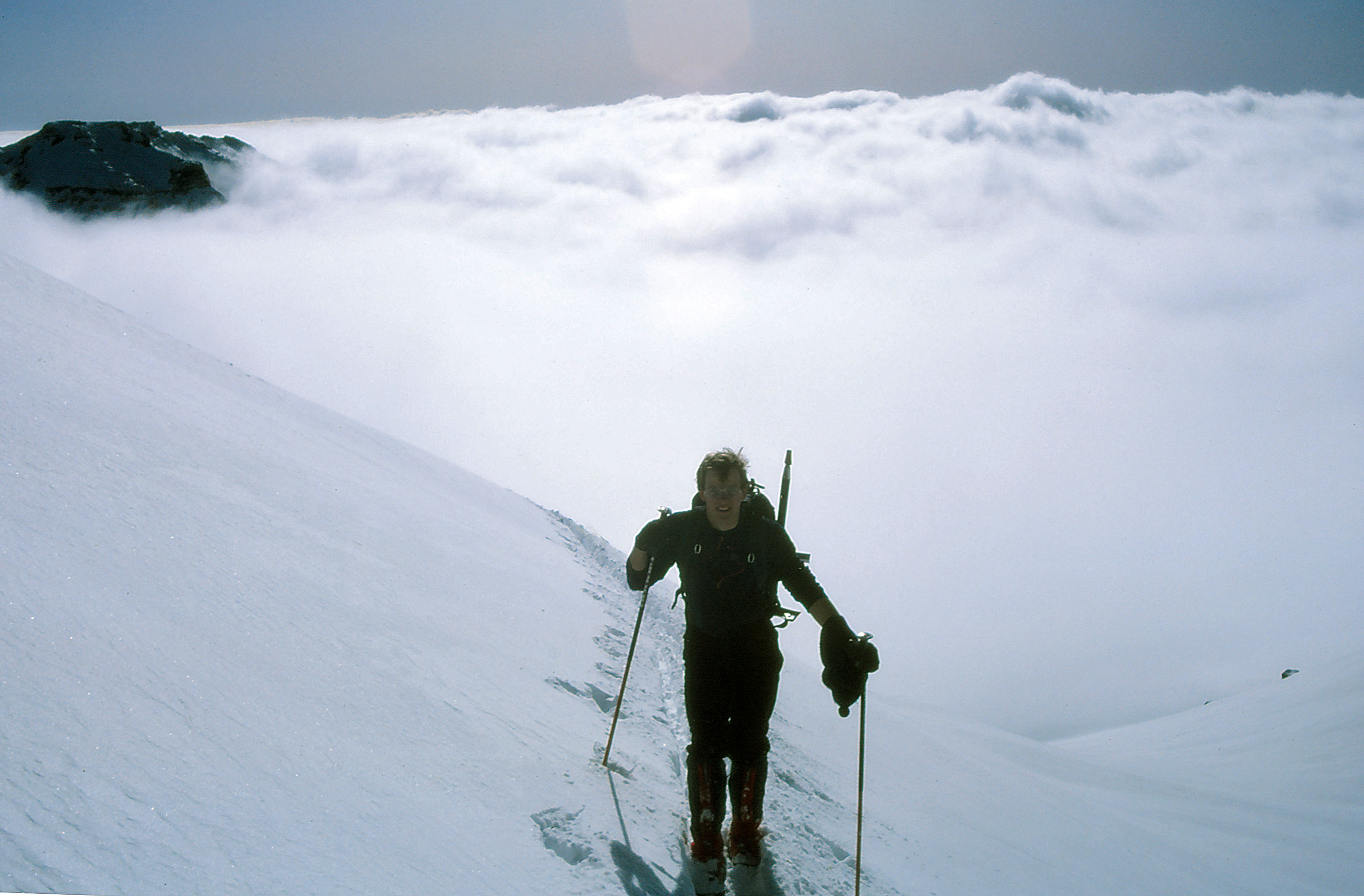
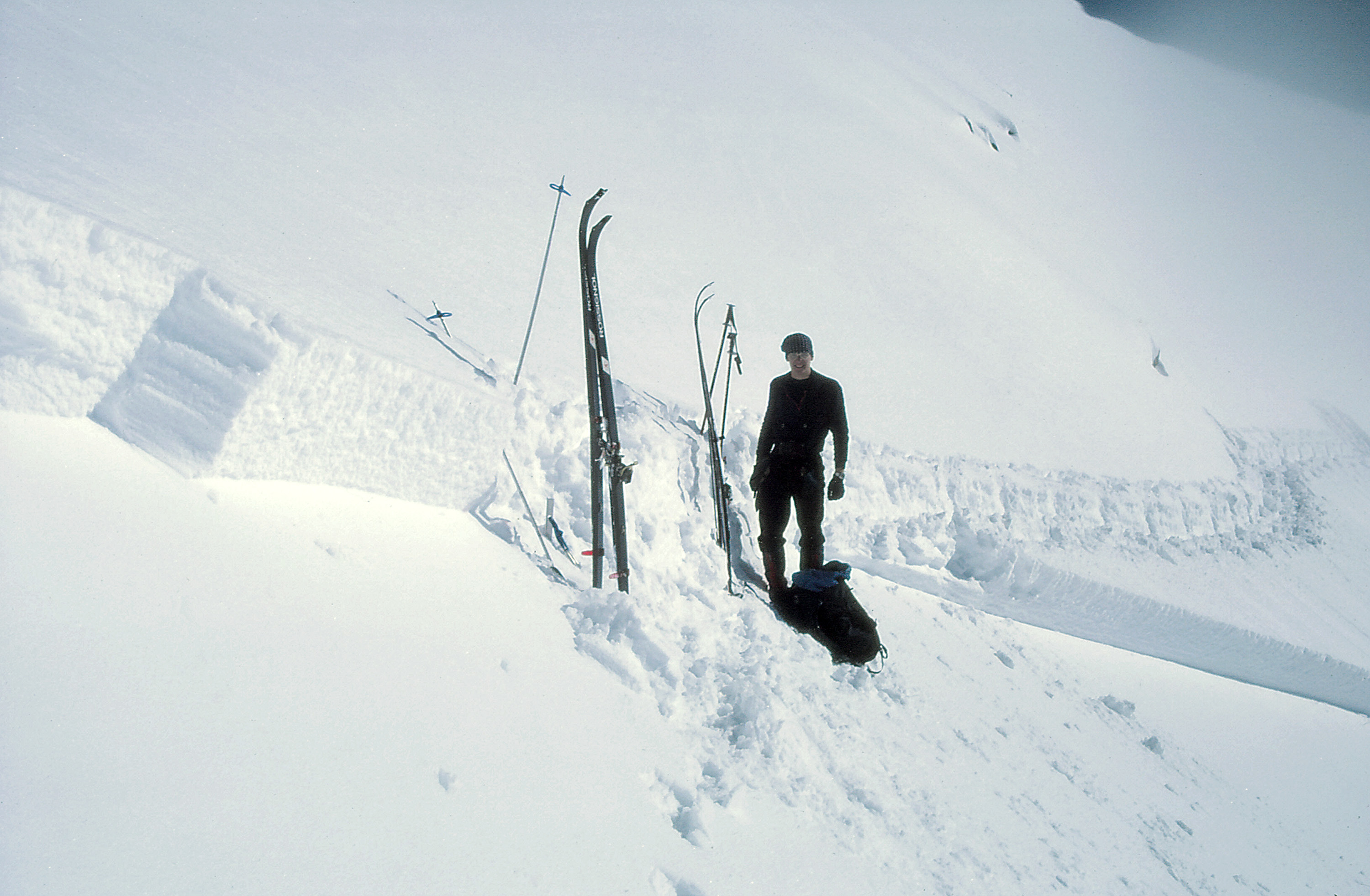
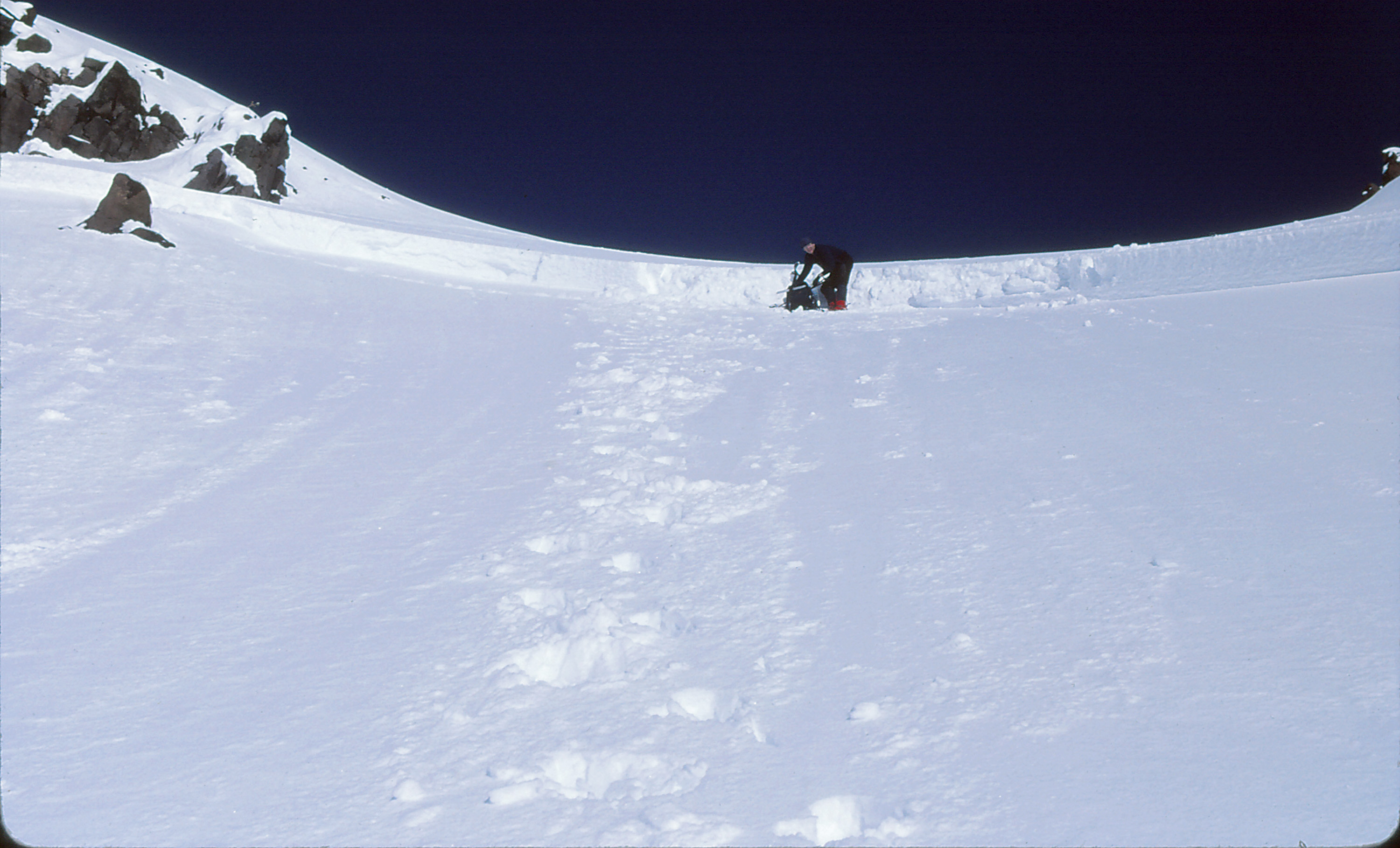
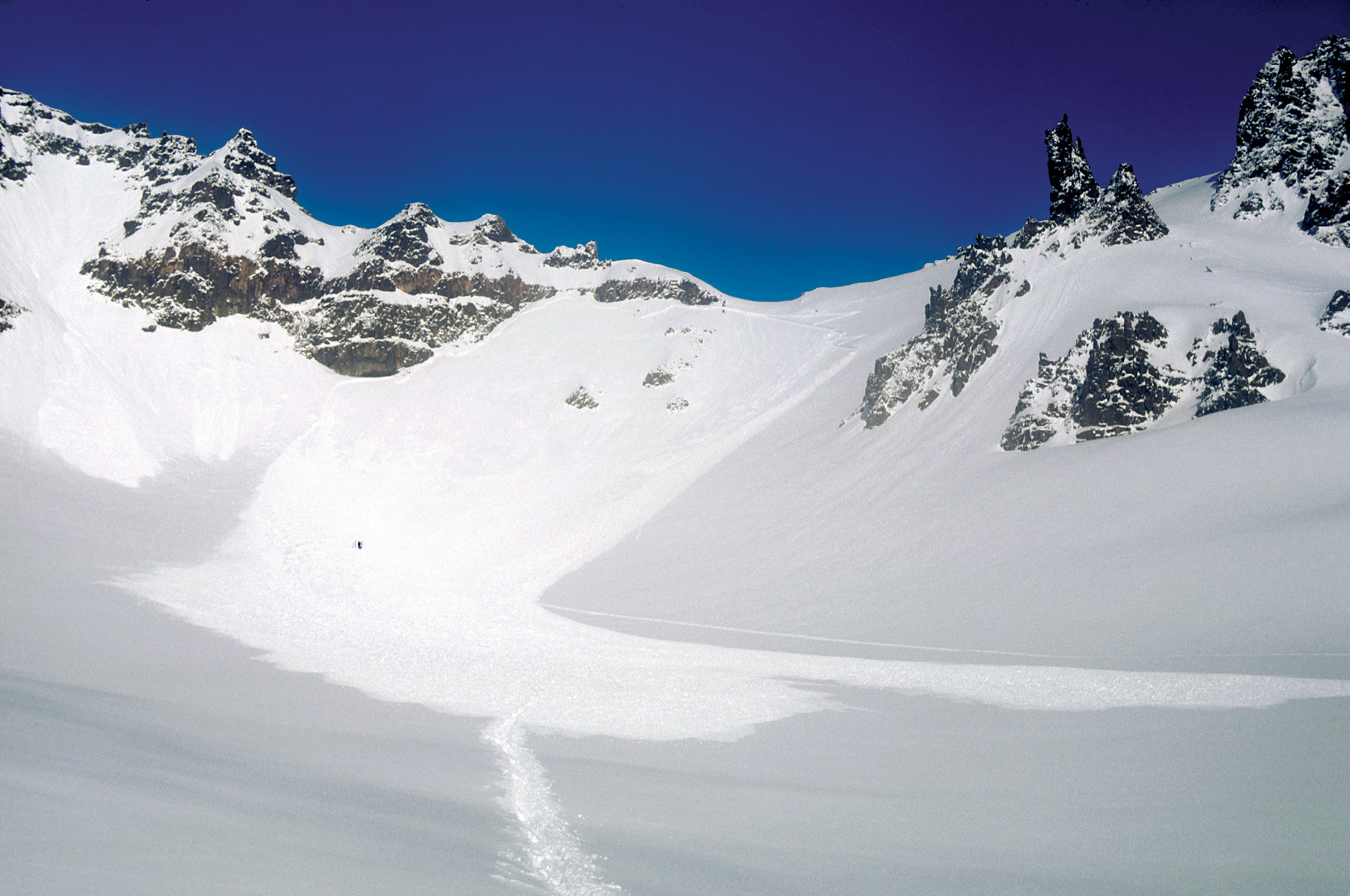
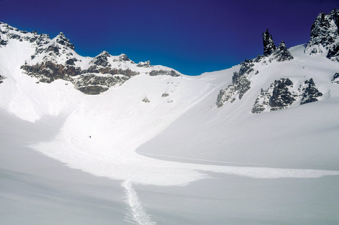
Trip: Broken Top - Oh to be young and dumb - Crater Trip Date: 02/16/1985 Trip Report: For fun I thought I would post a trip report that happened 35 years ago. A friend recently sent me scanned versions of his slides so I thought I would post them up with the story. We were both in college at OSU, me finishing my undergrad, and Andy finishing his masters. My girlfriend had an invite to spend the weekend skiing at Mt. Bachelor so we decided to go along and climb Broken Top as neither of us had been on it before. So that Friday night we left Corn Valley for Bend, she dumped us off at the end of the road that evening and we skied in a ways and camped. The next morning we skied in into the Broken Top crater. Andy and I discussed various ways to gain the rim. We finally decided on a route up but not one that I was to my liking as I wanted to take a less direct but I felt safer route. But I deferred to Andy as he was more experienced than me. At this point I will let the pictures tell the rest of the story. Mt Bachelor in the background. Hmm, 30" crown and well we are still on top. I think walking down is the preferred option. Hmm, nice debris field and damn near wall to wall. WTF were we thinking??? The dot in the middle of the debris field is me putting my skis back on. Epilogue: As our ski tracks are visible, we had nearly gained the ridge when we set off the avalanche. We were both on the same cut when the ground went out from under us and we dropped a couple of feet to the bed surface. Both of us just stood there and watched as the avalanche ripped down the crater. Had either of us been caught we would have been dead. Not withstanding the fact that back then few people had transceivers or could we afford them as students. I saw Andy a few years ago when he gave me these images. He admitted that his decision making that day was not the best. Oh to be young and dumb. Gear Notes: A functioning brain Approach Notes: Go long from Mt. Bachelor
-
My fence will be a Colt .308
-
[TR] Mt. Hood - Yocum Ridge Solo 03/21/2020
ScaredSilly replied to landoclimb's topic in Oregon Cascades
I would love to rope up with Landon ... yeah he is young but reading his posts there is some good stuff there that this well aged alpinist sees. Besides being young, he can carry the rope and the rack. Though he does seem a bit pre-occupied with Mt. Hood, I am sure that will change :-). -
[TR] Mt. Hood - Yocum Ridge Solo 03/21/2020
ScaredSilly replied to landoclimb's topic in Oregon Cascades
Did ya try the "Find my iPhone?" app??? Could of had the summit and your phone too!! Nice work :-). -
Ya gotta watch the units carefully. Not a shit load of money but a shit ton of money. And as DPS noted are you gonna use metric or imperial tons?
-
[TR] Mt Hood - Sunshine from Timberline 03/19/2020
ScaredSilly replied to adventure43's topic in Oregon Cascades
Nice, gotta love early morning sunshine on Sunshine. I have traversed around a couple of times but after doing a route and having a vehicle at Cloud Cap. I have always found it to be enjoyable. -
Okay the third time will be the charm. Get Kyle when he is healed and git the damn thing done to the top!!
-
Get a job and pay for your own vacation. Especially, as It been done before by several others: http://www.alpinist.com/doc/web15x/newswire-ueli-steck-climbing-alps-82-4000-meter-peaks
-
Nice on the ice
-
[TR] Sloan Peak - FA: Superalpine (WI3-4, 1000') 02/28/2020
ScaredSilly replied to Kyle M's topic in North Cascades
Nice attempt, get better and get back on it. -
Easy way for you to win 2 free Ice Screws
ScaredSilly replied to Sapiecha's topic in Climber's Board
Who even has a FaceButt account anymore (or even had one to begin with?). -
It does not matter what the cost is to the county (or the other points which are indisputable), it is what is being required for liability to the county. Clackamas County is one of the few remaining counties in the state that didn’t require all SAR volunteers to go through the sheriff’s office. Like it or not, this change is/will be the norm.
-
So few of the old guard are left ... if you ever get the chance to spend sometime with them do so. I have great stories from Fred, Dee, and many others.
-
I visited Dee a few times over the years. Great fun. When he found out we had done Curtis Ridge he asked us to sign his copy of Challenge of Rainier. I thought that was an honor. Some trivia, when Dee came home from K2 his wife decided that she did not want to be married to a climber. Dee's second wife was much more understanding. She was a peach.
-
[TR] North Sister - E Buttress 12/28/2019
ScaredSilly replied to bedellympian's topic in Oregon Cascades
Nice ... gotta love early winter and low snow 4x4 approaches.