


spotly
-
Posts
867 -
Joined
-
Last visited
Everything posted by spotly
-
I suspect Brian was having one of those in-the-moment I'm-a-cupcake things since he did fine on the stroll back to the trailhead.
-
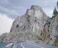
Trip: - Harrison Peak. South Face Date: 10/11/2008 Trip Report: I’ve wanted to climb Harrison Peak for a while, so as Brian and I headed up the highway Saturday morning, I was pretty excited. The excitement lessened when we reached the trailhead and stepped out into the cold….brrrr. When it comes to cold rock, I’m a wuss. My fingers give up the ghost and refuse to function. We headed up the trail with clear skies and high hopes that the temperature would go up a little. The forecast called for 48 degrees in Sandpoint so I knew it would be colder in the mountains and maybe even too cold for the fingers. With that in mind, our backup plan was to bypass Harrison Peak and head south to do the Low Traverse over to Little Harrison Lake to take in the fall colors and maybe retrieve an abandoned hex off of The Fin (ashamed look). Heading up the Harrison Lake Trail From the lake, the climb up the ridge was an easy –follow-the-cairns affair. We eventually reached the base of a talus slope that extended upwards and to the right. We chose a line between cliff bands and with just a little route-finding effort we were soon at the base of the South Face route. We found a spot that was somewhat sheltered from the freezing wind and had a bite to eat before heading up the first pitch. Harrison Peak from the west ridge. The route is the light rock in the center of the south face. The start of the left hand variation was obvious, as was the start of the right hand variation. I guess I threw out all common sense because the crack I went up would be called the middle variation or even better, the stupid variation. After about 50 feet, I’d had enough of that and decided to traverse right into what looked to be a better crack. The traverse involved a shallow finger crack with no feet. It protected well though and was pretty fun. Beyond that, another crusty crack led up to a thin belay stance with good pro for an anchor. From a distance, I admired the nice rock that I should have been on. Brian really enjoyed this pitch. He fell twice and thinks he broke two toes, but all in all he was mostly smiling as he wiped the blood from his hands. Brian on the shallow finger crack on the first pitch. Brian took the next pitch and ran it a full rope length. The pitch was fun - even the run out section near the top. The route description says 3 pitches but having hosed up the first pitch, we lucked out and got an extra out of it. I led up the third pitch and found the rock quality greatly improved over the lower stuff. It was clean and there were several excellent problems to solve. I stopped and built an anchor on a boulder directly below the crux corner of the last pitch and brought up Brian. I mentioned that the crack above looked like fun so Brian let me take it. It protected very well, which I’m thankful for since the starting moves seemed strenuous. After the initial crack, the pitch leveled off and traversed across a skinny shelf to the base of a second step, which required some more wining and grunting. From there, the summit was a short scramble. Me on top of the crux corner. Last pitch. Narrow ledge on last pitch. Brian nearing the summit. I think this was one of the best summits I’ve enjoyed so far. It was overhanging a sheer wall and gave great views to the rest of the crest looking south. We hung out for a while and had a bite to eat. The wind had picked up again and we got pretty cold so we decided to head down. The East Ridge descent route was pure suck due to ice on the low angle slabs. Rather than take any chances, we decided to chuck the rope down and rap past the nasty sections to the talus. Looking back up at the ice hanging from everything, I’m glad we didn’t try walking down it. It was growing late so we set a quicker pace to the packs and back down the trailhead but still didn’t get there quick enough to avoid walking part of the rocky trail in the dark. The days are sure getting shorter – we should have picked up the pace earlier on. Doesn’t matter really though – what better way to spend a day. The summit team. My hero shot Looking down the north face. Brian looking down the north face. Roman Nose Peak (top center) and The Beehive (right center) The east ridge walk-off was a bit slickery so we did a rap to get past the icy sections.
-
I redid personal website and would value any criticism from a layout/user interface perspective. It's just a family and friends thing but I'm striving for some level of quality so......thanks.
-
Thanks for the response. I hate answering my own post but I just got a reply back from Montbell and they're recommending this. I think your suggestion on sewing for extra dursbility is a good idea too. I'll surely bring something for field repairs on the next trip with it. I was envisioning the thing ripping all the way out then scattering gear from Aasgard Pass all the way down through Perfection Lake.
-
The corner of a package of Mountain House food put a nice clean one inch cut in the silnylon fabric of my pack. Of course, duct tape wouldn't work nor did the repair kit from my sleeping pad - nothing would stick. Any experience with repairs to this type of fabric? Thanks.
-
For Summer, the Rainbow is a good tent. I'm not fond of it when the temp dips and the wind picks up though. It's a bit breezy even when set with the sides down. I just took a new Big Agnes Seedhouse 1 SL on 4 days into the Enchantmnets and it did really well with the wind. It's very light for a 2 wall tent - under 3 pounds. It set up fairly fast but not as fast as a single wall of course. I spept with my bag cover the first night just-in-case but wound up having no moisture problems at all. The only issue I have with it is it was kinda cramped crawling in and out of...and I'm not a big guy. Also, with the floor layout like it is, no chance of squeezing 2 people head-to-toe in this one.
-
REI also sells these. They're cheap to replace when your partner (or you) drop one and they've worked well for me on the few occasions I've used them.
-
Mt. Maude is the plan - hiking with the spousal unit and a friend.
-
Trip: Yellowjacket Tower - Date: 8/23/2008 Trip Report: Brian and I headed over to Leavenworth on Friday night. About the time we hit Reardon, Brian somehow realized he'd forgot to pack his helmet. We stopped at Wally World in Leavenworth where I picked out a nice pink Hello Kitty bike helmet for him. He rejected my assistance. We planned on finding a spot in one of the campgrounds up Icicle Canyon but they were all full so we threw the bivy bags out along the shoulder of the road and got a few hours of sleep. In the morning we got an early start and decided the head up R&D route on Icicle Buttress before hiking up to Yellowjacket tower. I forgot to bring the runners so we had to scrounge for extra webbing and cord and biners to make due with. We were the first on the route so we got it done in less than two hours instead of the 5 hours it took last time. We walked off climbers left and drove east a few seconds till we spotted the bridge crossing the creek. From the turnout near the bridge, we walked a few yards further east and spotted a trail that took us to a road just north of the bridge. I expected to see signs that pointed out private property along the sides of the road but the sign we saw indicated that the bridge was also private. We threw on our cloaking....cloaks and tip-toed across. Once on the south side we headed left and qucikly came to a 'Y' in the road. Taking the right branch a hundred feet or so delivered us to the trail, clearly visible on the right side of the road. Go right here for 100 feet to the trail The trail kicks back right away and we ground our way up it to the base of Yellowjacket's large gully - blocked by a large chockstone. The approach took about an hour. We opted to head right then up around the chckstone rather than tackling it head-on. We found a few sandy ledges and a 4th class corner that got us back into the main gully. From there, we wound our way up the loose crap, hopping over a large downed tree further up until we eventually spotted the chicken head studded wall to the right. First gulley with chockstone We headed directly towards that and came to a tree with rap slings. Looking up and left we found the "hidden" gully. Since it parallels the main wall, it would have been very difficult to spot without first reaching the wall. The gully looked blocky and easy so we we scrambled up, coming to one crappy section where a rope might have been nice - a bit of a grunt without much for hands or feet. At the top of the gully, we saw the first technical pitch; a right facing dihedral. I had a hard time spotting good gear placements in the fractured rock lower down but there were several horns and tunnels to sling and the pitch was fun and easy. A tree at the top contains rap slings and I used that for an anchor to bring up Brian. There was lots of pitch in that section and I was glad it didn't get all over my gear. From the tree, we opted to scramble through a small tunnel to the base of the summit block. Me enjoying the slinging Brian in the tunnel - top of the dihedral The last pitch starts out with an easy ramp with a crack for solid scrambling. At the top of the ramp I came to a horizontal crack that took a 1 inch cam. Not knowing if this would be my last placement, I stuck a 3/4 in with it and headed up. A few moves later I spotted a pocket which took a pink tricam perfectly. Much to Brians chagrin, I set it very well. The last section was supposed to be slabby but I found it quite positive with some stemming and a few small but sharp finger holds to the top. The top - jeesh...and old ring piton, several slings with rap rings, and a weird set of chains - double nuts, huge hangers, and a single lenght of chain between the two (no rings). I belayed up Brian and we enjoyed the views for a few minutes before rapping off. All total, we did 5 raps to get back to the base of the first gully - the summit block, the dihedral pitch, the hidden gully (rap straght down, not through the gully), base of the hidden gully to the main gully, then over the large chockstone. Me on the summit Belaying Brian to the summit Weird anchor setup The summit team After we got back to the car, we drove up past 8-Mile Campground and found a road to the creek where we pumped water and spotted a pretty cool crack. There was a team of three already on it but I wanna climb it next time we're up that way. Looked 5.8 or 5.9. Cool jambs to be had I think Gear Notes: We took way too much pro for Yellowjacket. Only used a medium nut, four slings, 3/4 and 1 inch cams and the not to be forgotten pink tricam. Approach Notes: Hot and steep. Turnout around 6 miles where a bridge crosses the creek. Take the bridge and go left on the other side. Then right at a 'Y' for a hundred feet to a well-trodden path on the right. Follow it up to the base of the tower. Loose and sandy but not too bad.
-
Nice TR. Kinda sucks to read about people getting so far off-route and making it down in a day when we were spot-on and still had to bivy! On LJT, I found the left side to be easy 5 till the last 4 or 5 moves over the top where it went vertical with little crimpers. I may have taken a wrong turn though.
-
Don't fret for Eric, he's got an ascender
-
Yeah, we got so far off route I guess the critters had never seen a human before
-
Nicely written report and great pics. Thanks for sharing.
-
[TR] Valhalla Range - 8 Days in Valhalla 8/3/2008
spotly replied to G-spotter's topic in British Columbia/Canada
Great action shots and stunning setting. I'm jeleous. -
Trip: Dumbell Mountain - Date: 8/9/2008 Trip Report: This should be titled "Two dumbells on Dumbell" actually. If we had paid closer attention to route description, we might have gotten away with climbing Dumbell's true summit instead of two of the wrong ones. The TH parking was stuffed and cars were lined up a quarter mile down the road. Somehow we managed to scrunch the little Yaris into the brush right by the kiosk though We signed the register and shouldered our ubber-light packs, heading up the very nice and very wide Phelps Creek Trail at around 2ish or so. The flies were thick and provided encouragement to keep moving. We passed several slide areas and one huge avi-torn section before finally arriving at Spider Meadow. The clouds had begun building dark and thick and a slight drizzle dampened the dusty trail but not our spirits. There were quite a few groups camped in the south section of the meadow. Wild flowers were abundant. I'm gonna have to bring the kids into this area for camping real soon. Beyond the meadow we reached the intersection for Spider Gap and Upper Phelps Creek Basin. We headed right and soon emerged from the trees, intent on camping with a view of the mountain. With the winds picking up and thunder to the west, we decide to retreat and selected the first available spot in the trees, which was right at the intersecting trails. Carl found a nice spot for his bivy and I set up the Tarp Tent. We got things set up right as the deluge hit - rain and hail and lightning. From the cover of the sil tarp, I watched as a river ran through it - my tent that is. The surrounding soil turned to mud, which splashed up through the screens and into the tent. I did not choose wisely. We momentarily entertained the idea of heading up to Spider Gap but a friendly hiker dude and his son, whom had just ran off the mountain, convinced us that to do so would surely result in death by voltage. During a lull, Carl built a bonfire, which upped our spirits and helped to dry out soaking feets. We awoke to a cloudy sky and drizzle on Saturday but decided to head up to the upper Phelps Basin anyway. Our pace was slow as we stayed one step below the rising fog, guessing at line of approach and enjoying the adventure. We gained the upper basin by following a gully to the far right, climbing left of a waterfall and snow patches. Once into the upper basin, we hung out for a while, waiting for a glimpse of Dumbell and an indication as to which of the several visible gullies to ascend. Within half an hour Dumbell appeared through a small hole in the clouds. We set off up a gully to the far right side of the upper basin. From the top of the gully we picked up a small path that ttok us back west and up steep heather and to the base of a snowfield. The fog had mostly lifted by then and directly ahead we could see Dumbell's summits. Here's where we threw out common sense. Instead of headng right (counter-clockwise) around the massif as the beta clearly suggests, we continued up the snowfield then circled clockwise (left), looking for something that even remotely resembled the route photo from SummitPost. We slogged on through talus and snow until we encountered an impasse - the main ridge at the top of Phelps Basin. Off the other side and directly below was a glacier. Overhead and east were dirty class four ledge and gully systems leading to a summit. Even though the route that lay in front of us had no resemblence to what we expected, we decided to play on it anyway. No summit register was found and another summit very close and just NE looked a few feet higher. What we already suspected, was now confirmed - we were on the wrong rock, even though the elevation showed as 8,400 something. Dejected and ashamed, we downclimbed and began circling counter clockwise, arriving back at the top of the snowfield. We decided to climb one more of Dumbells's summits just for the hell of it. This one topped out at 7k something with views that provided no clue as to the location of the true summit. Having heard some big rockfall earlier and being in full denial of our lack of route finding skills and ability to read simple instructions, we surmised that the true summit had actually collapsed. It wasn't until we got back to the upper basin that we took a real long look at the route photos and realized we should have started circling right and at a much lower elevation than we had. We arrived back at camp just as the rain began to fall. It rained all night and Sunday dawned cloudy and soggy but not rainy The hike out went quickly. Rain splashed the windshield as soon as I shut the car door - how's that for timing Yeah, we made a huge route-finding blunder. But still had fun and enjoyed the weekend in a beautiful setting. I see it as just a good excuse to head back again - that's my way of coping with defeat anyway I was thinking about heading up The Tooth again before the season turns chilly. Perhaps I should hire a guide for that one. Gear Notes: Ice ax Approach Notes: Something other than the way we went
-
The Olympus Stylus SW models hold up pretty well (I have the 1030 SW). They're crush resistant to #200 or so and waterproof. Plus, they're shaped just right for slipping into a T-Shirt pocket. Only bad experience has been that I got a small pebble stuck in the lens cover channel and it messed up the cover mechanism...which cost $100 to get repaired. That was a dumb mistake on my part and I'm happy with the quality and the durability otherwise.
-
I've no experience with the glacier later in the season but we did see a few cracks opening up, which I assume (based on other TRs) can be avoided by staying right on the glacier. I can't imagine the bergschrund would be much fun in September though. The sun hits the glacier pretty early so it had softened up a bit by the time we got on it. Even so, we used crampons and they were handy for the harder snow in the runnels on the traverse to the rock. They were also nice for the short and steep snowfield before the glacier, which will probably be melted out by the time you get up there.
-
I'll certainly split that last pitch up next time or at least get smarter with my runners. I'll have to keep an eye out for that hold on the last crack too. That block seemed secure to me but so did that hold that popped on me last year. Still, I don't think bolts are needed.
-
[TR] Enchantments - Little Annapurna, Enchantment Pk, Cannon Mtn 7/31/2008
spotly replied to kevino's topic in Alpine Lakes
I'll be camped at Gnome Tarn on the evening of Friday, Sept 26th. I gotta be out of the area by Saturday evening (27th) so a Friday or Saturday climb would work for me. The only route I could lead would be the 5.7 West Ridge. The South Face 5.9 routes look like fun too and I could follow if I found someone set on one of them. -
[TR] Enchantments - Little Annapurna, Enchantment Pk, Cannon Mtn 7/31/2008
spotly replied to kevino's topic in Alpine Lakes
That was an ambitious day. That's an excellent reflection shot on Colchuck. I'll be up there for 4 days of solo in late September. I'd like to grab Prusik Peak but not willing to haul up gear in the off-chance that someone could join me. -
Thanks for the beta. One last question, is the road doable with a low clearance car (a Toyota Yaris)?
-
Sounds like you had fun. I've been motivated to get up that route for a while now. Gotta get a partner motivated too though - maybe I'll direct em to your TR
-
What might a 5.7-5.8 trad leader who plans on pitching it out or running-belay want for a rack for the west ridge of Pigeon Spire - cam sizes, nuts, ?..? It sucks, but I only get a full day in there. Any other short climbs at 5.8 or below that we might be able to get in on the same day or on approach day? I suppose we could hit Bugaboo Spire and see how far we get before turnaround time. Thanks
-
11 hours seems like pretty good time RT for such a hot weekend. I struggled with the approach on Thur but felt better Friday and had a good time with the climb...other than the steep snow traverse directly above the open berschrund, which was certainly my psychological crux. We didn't see any bear during the trip but by the amout of bear doo and torn up trees near Holden Lake, sure seemed like lots around that area.
-
Trip: Bonanza Peak - Mary Green Glacier Date: 7/25/2008 Trip Report: Bonanza Peak TRs abound but here's mine too in case anyone wants more pics This was Carl’s idea. I wasn’t too fond of it because I’d heard the rock was loose and sucky 4th class – meaning we’d be climbing 5.10 with boulders raining down (I have an active imagination). I’m glad I went. We both called and prepaid for round trip tickets on the slow ferry from Fields Point to Lucerne ($34.50 each). We also sent the required email to Holden Village to reserve space on the bus that runs from the dock up to the village ($9.00 RT each). I picked Carl up about 5am on Thursday and we headed to Chelan – a relaxing trip across highway 2 when done that time of day. At fields Point, we paid for the 3 days of parking ($12 total) and hauled the packs down to the dock. The Ferry arrived on time and a few hours later we were clinging to the seats of the old school bus, heading up the steep switchbacks towards Holden. It was 1:30 by the time the packs were off-loaded and we hit the trail. We headed out of town on a flat road that brought us shortly to the obvious trail. For a while, we had some shade and level footing but we were soon switchbacking up the hill, fully exposed to the sun. It was hot and we were both guzzling water along the way. There were a few small water sources higher up and we used these to refresh our supply. By the time we reached Holden Lake, my stomach, which had been bothering me for a week, was in full crap-mode. I was ready to explode and had slowed considerably. We took a long break, protected from the swarms of bugs by mosquito netting and Deet – the bugs were scary thick, like on some sci-fi movie. Hoisting our packs, we headed right around the lake and quickly took the wrong path into the swamps, ducking, dodging, diving, dipping and dodging and expecting to run into some ancient lost tribe. We quickly recognized our error after only an hour then retraced our steps. Then we decided to spend an additional half hour climbing up and down car-sized boulders just to test our balance with heavy packs and also to get the most out of our trip. I took a few cool shots, like that was our purpose all along, and then we retraced our steps…again. We eventually found the correct bushwhack route and before long we were churning up towards Holden Pass. I must admit, the approach had kicked my ass by this point and I was ready to bivy leaning against my trekking poles. I couldn’t convince Carl to jump up and down on my stomach – I’m not even sure if he had a jump left in him anyway. On hands and knees, I arrived at the pass and collapsed face down in the remaining patch of snow. I muttered something about it having been a pretty mild day but I think Carl saw right through that. We set up camp, ate, and then hung the food before retiring our luxurious digs. Carl to his bivy sack and ¼ inch thick leaking Thermarest and me to my mini tent and 2.5 inch insulated pad. Carl spent the night blowing into his pad and I finally caught my breath about the time the sun came up. . Please, jump on my stomach Holden Lake Bonanza Peak and Mary Green Glacier Holden Pass Carl wonders where the trail is Finally! The Trail Holden Pass The day dawn glorious, made more so by some private quality time with nature. We got started up the route about 6:30. Climbing up the ridge from camp brought us to a short scramble through the trees and up to a large heather bench. After exiting the trees, we hung a left towards a ridge, hopping the boulders to its crest. The ridge topped out against a cliff, leaving us with the option of traversing across a slab of across a short stretch of steep snow. The slag looks slick so we went with the snow. On the other side, we scrambled class ¾ up next to small waterfalls. Some sections were wet and mossy but the holds were mostly positive. We traversed left from the top and scrambled across a few more waterfalls to the glacier. The glacier looked to be in excellent condition with only a few small crevasses showing. Carl led off and chose to stay right until reaching the top bench. The glacier is much taller than it appears from below but we reached to flat section in good time. We traversed left above the top, wandering through blocks from a small slide then more steeply up the bergschrund. The right side would have been a more direct line past this section and up onto the snow thumb. It was hard to see the condition of the bridge from lower down though. Instead, we continued up the middle, crossing the bergschrund on a wide and thick bridge - man, that thing is deep and wide! Once across, we traversed right towards the steep snow thumb. This was my personal crux area as I’m not overly fond of steep snow with yawners below to begin with. We reached the rock in good time. As usual, it appeared milder up close. We both switched to approach shoes, shoved both 30 meter 8mm ropes into packs then started up. The climbing was very pleasant. The rock was loose enough that I wouldn’t climb below another party, but not nearly as bad as I expected based on previous reports. Staying 4th class or lower was pretty easy and the few “off route” moves that were stiffer came supplied with good holds. We loitered for a short time on the summit before heading down. Some easy down climbing and a few raps put us back above the snow thumb. The snow had softened but footing on the steepest parts was still good. Once safely below the bergshrund, we picked up the pace and soon arrived back to our stashed gear above the slabs. I looked for rap slings on the far edge of the cliff above the slabs but couldn’t find any. We did find some about 100 feet farther back towards the glacier though. The rap put us on the edge of the first steep snowfield, which we would have to cross again. In hindsight, we should have just set up a rap on the cliff above the other side of the snow. Carl left his ice ax on top and had the pleasure of climbing back up the waterfall to retrieve it. Guess he really enjoyed that last rap. Got back to camp and ate an early dinner and retired. Heading up from the pass Small, steep snowfield above heather benches Scrambling the slabs next to the waterfalls Starting onto the Mary Green glacier Upper bench on the Mary Green Glacier Crossing the bergschrund Heading towards the snow thumb Climbing up the fun stuff The summit team Heading down The hike out was uneventful. We arrived in Holden just in time for lunch. For only $7.00 we got to enjoy a leafy salad and half a bowl of African peanut soup. A wave of nauseas ness once again engulfed me…for some reason. Carl went for seconds. I found out later that he actually owns a Holden Cookbook and wondered how two people so completely different could get along. Then I wondered if he’d be willing to jump on my stomach. It was an easy day; surely he had a jump left in him. The bus ride to the dock was bumpy and I kept my eyes focused on the trees and away from the busty lady across the aisle. I daydreamed of mountains unclimbed. Burgers in Chelan then over to I90. We talked about Bonanza Peak and about our next adventure all the way home. Time flew by. Gear Notes: Pickets. 60 meter rope for raps. Approach Notes: Stay out of the swamp and off the boulders at the lake. Go right of the swamp.