


spotly
-
Posts
867 -
Joined
-
Last visited
Everything posted by spotly
-
There was water on the high route when we went through at the end of August last year. There are several good spots near the "trail" for camping. The trip from Maude over to Carne goes fairly fast though so we opted to press on to Carne Meadow for the night.
-
We thought about it but in the end, getting back to town at a reasonable hour to spend time with the kids won out. Good reason to get back up there again anyway
-
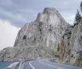
Trip: Liberty Bell - Beckey Route Date: 7/18/2009 Trip Report: I was up in this area a few years ago and only had time to grab Blue Lake Peak, SEWS and NEWS. The rock quality seemed ok but the texture felt kind of "soapy" to me. So I wasn't too motivated to extend the day even further. I've wanted to go back and climb Liberty Bell ever since though. Toby and I left Spokane after work on Friday and made it to the Blue Lake trailhead way before dark. I went to sleep and Toby wandered around - I'm old and Toby is young. I tried out some of those wax ear plugs and they worked very nice. Toby tried them too but said he could still hear me snoring. Liberty Bell Group from the hairpin at Washington Pass Anyhoo, the next morning, we were up by 5:30 and on the trail by 6:00ish. There was a group of 6 at that were up and getting ready as well. If Liberty Bell was their destination, we hoped to be up the nasty gully before they arrived at its bottom. We made really good time up with virtually no navigation errors. Before long we were at the top of gully and getting our gear ready. Avi debris Toby in the loose gully More loose gully fun to be had After some water and a snack, we searched out the beginning of the route. I expected a large shelf heading climbers left but a small one looked like it headed in the correct direction. I checked it out and rounding I corner I saw that I could start up an arête with plenty of pro or drop down into a shallow gully and climb up a chimney with a tunnel in it. The tunnel looked neat so I took it and found it to be some enjoyable 5th class to a tree near the bottom of a slipperier looking chimney. The "ledge" to the first pitch Top of first pitch Toby had climbed the route before and was happy to let me take all the leads so I brought him up then headed out up the next pitch. The second pitch chimney had a few awkward moves but I looked closely and found the holds where needed. One smear skidded off slightly but mostly, the rock felt good. The exit from the chimney was easier than expected once I stretch my reach as far as possible to get hold of a bomber edge at the top. I stretch the rope out to just below a chockstone with a piton then set up a gear belay and brought up Toby. There's a better stance about 30 feet lower where a more comfy belay on a sandy flat spot would have been nice. The third pitch was the most fun. From the belay, there are two pitons to the right. I clipped first one then was surprised to see the second a few feet above it - just right of the traverse. Figuring rope drag would suck, I unclipped from the lower piton then took the little finger crack left. There were no foot holds but the smearing seemed ok…other than one spot at the end where I slipped slightly. I continued upwards and to the right, finding a nice belay at a bush, well short of the 15 foot slab on the last pitch. Rope drag was really bad at. I brought up Toby and we coiled the ropes and stashed the gear then scrambled the last pitch to the top. The little slab was fun then there was some blocky sections to the summit. Toby contemplating the short slab on the last pitch scramble We ate lunch and posed for our hero shots then climbed back down to the top of pitch three to gather our gear. A little more downclimbing and we found the bolted rap station back to the gully. Two raps and we were off. Toby moving around too much for a real hero shot My hero shot We took care heading back down to the trail but still managed to launch a few short-range missiles. The hike back to the car was quick and the drive back to Spokane was tiring. My wife hade home-made pizza waiting for me Heading back down Gear Notes: Medium rack to #3. Approach Notes: Gully is dry and loose. Trail through avi debris easy to follow.
-
Thanks much. No snow up the gully?
-
Anyone been up to Liberty Bell lately? How are the conditions on the approach? I haven't climbed Liberty Bell yet but familiar with the approach as far as NEWS and SEWS. Thanks
-
Maybe it's your magnetic personality or that I'm easily recognized as a push-over. Don't get me wrong, I didn't mean to imply that my experience with every one in the store was bad. Just that there were enough things that rubbed me wrong to sway me to shop elsewhere. I was not alone in that perception either. But the point of my post wasn't to diss the current state of the store but rahter to contrast it with what I feel it used to be.
-
Anyone got a pic that shows what the first pitch for sw face of East Ingalls looks like? I assume it's the same pitch as for the east ridge of North Peak since it takes you to the notch. I'd like to know what we missed out on due to my suck route-finding. Plus, I may want to go back sometime and grab that east ridge too.
-
In years past, it was a mixed bag for me. Rude and unknowledgable sales people and piss poor customer service in the store. I continued to buy there from time to time because they often had some items that REI or Mountain Goat didn't carry. In the last several years, their service has greatly improved and the crap sales people have moved on. I don't view them as the store of last resort any more. I am slow to forget though, so I don't go running there first either.
-
Even basic courses require raw material to work with. He should start someplace like here.
-
Tazz, you kill me. Reminds me not to try any BSing when you're around. Though some does slip through
-
[TR] Liberty Bell Mountain - Liberty Crack 7/4/2009
spotly replied to GregD's topic in North Cascades
The grungy white tee shirt isn't "in". Other than that one glaring detractor, excellent -
Trip: Ingalls Peaks - Date: 7/11/2009 Trip Report: Lloyd and I hiked into the Ingalls Peaks area on Friday and set up camp in the upper basin along the trail. We snagged a nice spot next to a stream with excellent views up to Ingalls Peaks and over to Mount Stuart. There were lots of aggressive goats about so we took care to keep our gear in sight as we set things up. Baby of mean goat Mean goats I woke early in the morning feeling totally unrested due to the shenanigans of the out of control kids in the camping spot about 100 yards away. Apparently the adults had taken out insurance policies on these kids because they sent them over to our camp spot to play on the cliffs. I forgot my ear plugs and toilet paper wasn't helping much. Lloyd ran them off once as they jumped up and down on a snow bridge over a waterfall next to his tent - screaming for all they were worth. Later, we saw them on South Ingalls hurling basketball sized boulders into the basin below. After tea and oatmeal, we packed our summit packs and headed up the hill to the start of the East Peak. The original plan was to climb the East Peak then do the east ridge of the North Peak. Sometime along the way, we both decided that we were too lazy to haul over the heavier packs. So the plan changed to climbing the East Peak, rapping off then getting on the standard route up the North Peak. I guess we should have gleaned a little more beta on the route. We both assumed it would be a straight shot all the way up the couloir to the notch between North Peak and East Peak. We followed steep snow up as high as it went then crawled into the mount. The gully heading up towards the notch was full of slick, green and rotten rock. I lead up a chimney to underneath a chockstone where nothing presented itself. Every hold I grabbed wound up at Lloyd's feet. After what seemed like hours of grunting and crying, I decided to place a couple of Hail Mary pieces into a rotten crack and make a controlled slide down the shiny green crap. We stood in the moat trying to divine a route then decided to take the wall up the right side. There were only a few placements and plenty of slick green rock but there were also some more positive holds that eventually got us up into a loose gully just below the notch. From there, the climbing was easy and on solid rock - enjoyable. We later learned that we should have hopped of the snow and onto the left side much further down rather than following the gully all the way up. Our goal Lloyd climbing up the gully Lloyd chewing me out over my choice of lines We spent a few minutes on top then rapped off, grabbing the two cams I had left in the chimney on the way down. Two raps down the snow got us to gentle slopes. We didn't look back. Happier Lloyd Rapping the steeper snow We headed up the south face/ridge of North Peak and ran into a substantial roadblock at the second belay. The guy at the belay was friendly and the hour or so went by semi quickly. The shenanigans of the 4 or 5 people clipped into the 3rd pitch anchor were not amusing but I'm told it gets even worse up there so we made the best of it. Once we finally got to climbing, it went pretty fast. In sharp contrast to our little fiasco on East Peak, the climbing was fun and enjoyable but way too short. We spent a few moments on the summit then headed down before the other group clogged up the works again. One of them was kind enough to untie and drop our rope so we were able to make a single strand rap off of the 3rd pitch, avoiding the 10 or 15 foot downclimb. I eyed the slings on the edge to climbers right and it looked like a single rope rap would have made it - should have checked it out I guess. Lloyd on the 2nd pitch of North Ingalls North Ingalls Peak from South Ingalls Peak We dropped our gear at the base, switched into boots then headed up the South Peak. From a distance, it looks more difficult than it actually is. There's a foot path through the Dog Tooth that leads down a short section of scree into a loose gully. The gully had easy 3rd and 4th class sections - on mostly solid and positive holds. Once out of the gully, it was a short walk to the summit where we signed the register then headed down. We arrived at the base of the North Peak to claim our gear then slid back to camp. I may have left a .75 cam at the base but hoping Lloyd has it on his harness. Lloyd was cruel and forced me to get my gear packed right away so he could get home to a soft bed with three pillows and no screaming kids. Ingalls Peak South Me checking out Ingalls Lake
-
I'm thinking about doing a traverse from East Ingalls through South Ingalls this year - starting from east. What's the best route on East Ingalls as far a rock quality? How's the ridge at the outlet end of the lake? Thanks
-
Good TR. I'll keep that Prusik Pass tree in mind for next time. From the end of the raps, we traversed directly horizontal back to the start of the route. Hardly any elevation lost. I thought that was the standard way denalidave, that's a great story about getting your camera back.
-
[TR] Boston Basin - Torment-Forbidden Traverse 7/4/2009
spotly replied to Calder's topic in North Cascades
Nicely done. How was the temp? I might head into there this weekend and not sure which bag to bring. As noted though, looks like the weather may be questionable -
Very nice. Since you're not using your rack anymore, maybe you should sell it and buy a camera
-
Sorry for your loss.
-
[TR] Colchuck Cirque - Backbone Ridge 6/27/2009
spotly replied to telemarker's topic in Alpine Lakes
I enjoy reading about other people's experiences, even if it's on a route I've done (haven't done this one...yet) or one that's been written about by a dozen others. More is better. Nice TR. Thanks. -
So, anyone here who's done this route care to chime in on the NE ridge route? We decended nearly to the lake to get to the north chute but if we had wanted to follow the ridge proper, a way didn't appear obvious from the 8kish notch.
-
Trip: Cannon Mountain - North Colouir Date: 6/28/2009 Trip Report: My friend Dave has been wanting to climb Cannon for some time now because it's one of the top 40s. It didn't look too appealing to me due to the approach and better views to be had (I thought) on other, closer summits. I was interested in checking out Druid Plateau though. Most of the picture I've seen of the plateau showed a baren landscape with a scattering of rocks and dried up pools. I thought the views earlier in the the season might show a more watery landscape. So it was with semi-eagerness that I picked Dave up at his house and we drove off towards Leavenworth for the second weekend in a row. There were relatively few cars at the trailhead. We picked a spot with enough room in front of the car to throw down the bivy bags then commenced to snoring till 3:20am. The old road was a surprise though I'm not sure why. It was very grown over but the trail through the alder was easy to follow even in the dark. We arrived at a large slide area in short time. We were both expecting the road to switchback once before the slide but it didn't and we stood staring at the drop for a few minutes before turning right (south) and whacking the bush. After several hundred vertical feet, a faint path appeared and disappeared and we mostly followed that upwards. We negotiated a few very steep steps by shooting up the middle and worked our way through a little swampy area. Eventually we reached green trees, some hard snow then the open NE ridge. We followed the ridge on top and below the crest on the right till reaching a notch at around 8kish' A strong breeze kept things cooled off nicely but it disappeard as we stepped through the notch on our decent to Coney Lake. We traversed the talus and compact snow west of the lake, heading towards a large snow bowl (felt like being in a microwave) below the north colouir. Dave led off up the colouir, kicking good steps as he went. The snow was moderately steep but the run-out was a "fun" slide into the bowl. We topped out on the snow and began to pick our way up the loose pebbles towards Druid Plateau. Pretty soon, the summit block was in sight and we both took turns climbing the easy slab up. I was impressed with the views from this vantage point. It was an excellent angle for a sttraight-on view up Mountaineers Creek and Mt. Stuart's north ridge. We enjoyed the summit area for a while as we ate lunch then packed up and started back down. We decided on the NE ridge for a decent and had a great time navigating through tunnels and around blind corners till finally reaching a saddle above the basin next to Coney Lake. We knew we should have been able to continue along the ridge with no need to decend towards the lake but the route must have been hidden by some special magic because it certainly wasn't appearant to either of us. The drop from the saddle to the basin was just plain crap. I hugged the wall to the south and was thankful for the bomber hand holds as my feet slipped from under me a few times. We eventually decided on a loose chimney, which we downclimbed face in till reaching a narrow but solid ledge. The ledge took us over to where the snow reached the rock. We negotiated a small moat and continued the face in downclimb on 60 degree snow till it tapered off a bit. Neither one of us cared for that crappy route down. We were glad to be back on solid ground and looking gleefully forward to regaining several hundred feet back to the ridge after traversing above Coney Lake. By the time we regained the ridge and started back down through the burn, the sun was swelting. We stopped at the little swampy area to pump some water. Before too terribly long, we had regained the road and did the short slog back to the trailhead. We stopped at Cashmere for a "world famous" Rusty Burger. It was a little more than ok. I enjoyed this route up Cannon. I think we should have spent some more time looking for the way back to the notch via the ridge rather than dropping down that crappy gully back to the lake though. Either way - all worked out and I need the extra exercise anyway. Gear Notes: Had a hat but lost it. Ice ax and crampons used. Drugs for the decent back into the basin would have been nice. Approach Notes: Maps on SP show the old road switchbacking but we ran into the slide on the straight away so that seems innacurate. Walk to the slide then whack yer way up.
-
I've tried quite a few different foods but feeling like it's a dart-shoot. Hopping out of the bag and shoveling down some oatmeal and a tea seems "ok" but the first hour or so feels sluggish. I've also done the big carb load the night before and just had tea in the morning - seems to work sometimes. Anyone have a favorite breakfast routine that privides them with some longer-term energy without slowing them down early on?
-
Anyone know if the road is open to the TH yet? Also, I forgot about the border crossing issue - has anyone here gotten the new Enhanced Drivers License? How long did it take to get in the mail? Their site says 2 to 3 weeks. I'm hoping less than 16 days
-
best of cc.com [TR] Assguard Pass - Assguard Pass Std. Route 6/21/2009
spotly replied to olyclimber's topic in Alpine Lakes
Gear list please. Any doubles required? -
I know. The ice in the water wasn't melted in the correct shape to get the tip of the peak in the reflection. I had a tantrum and almost called it quits right there
-
No bolts. Webbing set perfect for single rope raps. (ADDED): Actually one bolt on top. The only thing I did to the pic was adjust the levels slightly. On top of everything else going right, we actually had perfect lighting