


spotly
-
Posts
867 -
Joined
-
Last visited
Everything posted by spotly
-
 We led on a 9.7 and the leader hauled up a new 8 that I borrowed from Toby. For the rap, we tied the two together with an EDK with 1.5'ends - no slippage or rolling of the knot. I brought an ultralight summit pack that we didn't really need and which was probably a bad choice given the nature of the grovel and the delicate material of the pack. Thought we'd need it to stow layers but the temp was perfect for sweatshirts. Guess it came in handy for stowing the rack and such on the rap. For water we both brought a half liter nalgene and that was about right. If there were more teams ahead of us though, I think we'd have been parched. Wasn't much wimpering other than the occasional slick spot and bitchin because we kept racking on the wrong side for the route Most sniveling was due to being done with the climbing and heading west towards the snowy roads.
 -
Yeah - I can't believe I drove so far for a few hours of off-width It was nice to get in some trad and get away from the lingering Spokane winter though.
-
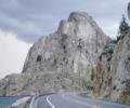
Trip: Devils Tower WY - Durrance w/Bailey Direct Date: 4/18/2008 Trip Report: Brian F. and I teamed up for yet another great trip. We headed out after work on Wendesday and before we knew it we were looking at the vague silhouette of Devils Tower at 4 am on Thursday morning. The park campground was closed and the KOA at the park entrance didn’t leave out any night registration forms. Too tired to move, we found a spot at the KAO and slumbered for a few hours. Turns out the KOA was closed for renovation too so on our first day we were left without a patch of dirt to call home. Since it was still early we decided to head into the park to grab a hike. We started out with the fairly short Tower Trail, which circles the entire tower fairly close to the base. The trail was paved the entire way. Along the way we say colorful prayer bags (sacks?) hanging from the trees, which were placed there by one of the several Native American tribes that believe the tower is sacred ground. We also saw the remnants of huge columns that had tumbled from the face probably hundreds of years ago. Spring still hadn’t sprung here any more than it had in Spokane. We saw just a few small flowers, the grasses were all brown and the deer were all really skinny. The little hike gave us a great opportunity to scope out our intended route for the following day. Back at the parking area we met a few rangers and asked about camping options. They recommended a FS campground some 23 miles away. A guy at the KOA told us about another place a mile away. We chose the closer one even though access to the restroom meant having to navigate through the diner. We set up camp then headed back to the park to hike the Red Beds trail. The Red Beds trail wraps around Devils Tower like the Tower Trail but from a further distance, proving some good photo ops. The main feature of the trail is the large red clay cliffs that are visible from the park entrance. The clay was soggy and stuck to our shoes like cement. Having been awake since the previous morning at 5 am, the heavy shoes made for a tiring hike. There were lots of neat rock features and plants along the trail and I’d highly recommend it. Contrary to the trails name, the red cliffs encompass just a small part of the hike. By the time we reached the car, we were beat so headed back to the campground for a short nap. Afterwards, I left Brian to his book while I went to stare at the prairie dogs and hike part of the Joyner Ridge trail. I also spent some time at the visitors center watching a team climb what looked like a vertical crack that extended to…. infinity and beyond. I enjoyed listening to their conversations (even though they were far enough away to look like specks on the face) and the clanking of their gear and could hardly wait to start our climb the next day. Back at camp we set up the laptop in the car with the screen looking like we were at a drive-in theater then popped Close Encounters of the Third Kind into the DVD player. It got as far as the opening credits then went into hibernate mode – I gotta figure that danged thing out. I brought along the new 15-degree stretchy bag and even though the temp was really low at night, I slept well. It’s nice to have the extra room for stuffing in a parka and blanket. We were both up after sunrise and I took the time after breakfast to head over to the diner for a cup of real coffee. No sense heading up to the rock too early or we’d just freeze our butts off. We got to the trailhead about 9, loaded ourselves up with gear then headed out on the grueling 15-minute approach to the route. At the sight tubes we took a left up the obvious switchbacks and arrived at the base of the optional Bowling Alley approach pitch to the sound of another team up above. They hadn’t started up the Leaning Column pitch yet (pitch one) and we hoped they weren’t too slow on the route. Brian grabbed the rack and made decent time to the belay then hauled me up. The other team was working on the Durrance crack (pronounced Durrince according to the ranger) (pitch two) so I started up the Leaning Column. The crack kept me somewhat off-balance and I found it kinda slippery to get to the section where the upper half of the column was broken away from the main wall. I did an inelegant mantle-like grovel over the top then squeezed into the narrow chimney behind the leaning section. This area was barely wide enough to turn around in. I hung out here for a bit waiting for the other team to clear off the belay above. Turns out they were already off and just hadn’t pulled their trail line up. Time wasted. The squeeze to the top of the pitch required hips and shoulders and nose and so on. It was easy to protect via a small crack in the main wall. Brian made it look easier by staying mostly out of the crack and stemming up. Even so, his arrival at the broken section wasn’t ballerina-like either. Brian led the second pitch (Durrance Crack), which was supposed to be the crux but we both found the moves pretty easy. Even the move into the right hand off-width near the top was simpler than expected. The crack was polished and feet seemed tenuous at times. Brian took the third pitch (Cussing Crack) also. He clipped the anchor then “forgot” to place anything else – I was glad he had at least clipped the anchor. No cussing was heard. The pitch required some goofy contortions, which felt much stiffer than the 5.5 advertised. I took the next two pitches (Flake Crack and Chockstone crack) and ran them together in one long pitch. Flake Crack took pro easily and other than an awkward lean to the left, it was a fun pitch. Chockstone Crack was also fun but I was unable to locate the slot mentioned in the guidebook that would have protected the move over the top of the chockstone so I just reached high and found a bomber positive hold and pulled over to the anchor. At this point we had finally caught up to the other team and I chatted while she (didn’t catch her name) finished belaying her partner to the top. We elected to finish the route with the Bailey Direct finish rather than the Jump Traverse pitch because it looked much more fun. I think it was the best pitch on the route but that might be because I was getting sick of all the off-widths. We enjoyed the summit for a bit then rapped down the route. Actually the first rap took us to the anchors at the top of pitch 5. From there, 3 more double-rope rappels took us climbers-right of the main route and ended up at the packs at the base of the Bowling Alley. The route took 2 hours to climb and 1:45 to rap. I hear it takes much longer in the summer. We stopped at the Battle of the Little Big Horn memorial on the flight back. Guide books call the route 5.6+ to 5.8. Was stiffer than 5.6 for sure. Gear Notes: Took a medium rack with doubles in .75, 1, 2 and 4. Rap requires two ropes – we trailed a 8mm and tied it to the 9.7. All anchors are bolted (no chains). Used both 4s but could have gotten away with 1. Approach Notes: Paved trail to the sight tubes (10 minutes) then short section of switchbacks to the Bowling Alley approach pitch (5 minutes), which runs 5.6ish if you're leading and 5.14d if you're following...
-
Laundry bag worked best for me when I was using the top loader - and in the front loader. Any more I just spend the bucks and take it to the laundry place. Costly though because I run the machine through one empty cycle first to remove any detergent residue.
-
I'm still learning to use the Silent Partner and appreciate the pointer on tying the knots at the end while in the pack. I've been tying in, which works, but not having two trands of rope hanging out of the pack is a better idea - thanks. I've tried the backups and found it to be a pain in the arse. If I get to a point that's at or above my comfort level (currently 5.6ish when soloing) I'll pull up some slack and tie one on through that section. Finding a long and well-protected 5.4 to 5.6ish route worth hauling in all the weight is my major stumbling point with soloing (literally - and it still hurts)
-
I've been using the Yates Rocker (same as the Singing Rock) for 4 years now and never used a chest harness. I wonder if that's a new caution because I don't recall reading that in my docs for the Yates.
-
Thanks - I'll find drier stuff at Post Falls.
-
Forecast for McCall looks nice for this weekend. Can I expect the routes on Slickrock to be free of running water this time of year or still too soon to drive all the way down there? Anyone know what it looks like right now?
-
Thanks all. Looks like we'll just climb on the 9.7 and either carry or have the leader trail the 8mm. I'll carry water to the base and we can decide on how much to take up the route based on the number of teams in the queue in front of us. Weather permitting, should be a fun trip to start of the season.
-
I talked to em today and the only thing closed will be the same ole stuff for the falcon closures - Durrance will be open. I'm actually liking the twin idea. I have an 8.5 and access to an 8. Never belayed twins but doesn't seem like it'd be any more difficult than a single.
-
I haven't done a route yet that was full of chimneys and off-widths which also required a double rope rap. So I'm curious about the mechanics of hauling up the extra rope and water we'll need for the Durrance route on Devils Tower. We've decided to bring an 8mm for the second line and will tie it to a 9.7 for the raps. I was thinking it'd be easier to haul it up on lead rather than have the second struggle through the large cracks with it in their pack. Or maybe it's not really that big an issue on this route? Any thoughts? Thanks.
-
I found the drawings in the David Fasulo book to be pretty useless - it's difficult to see what the ropes are doing unless you already know what they're doing. The other book looks interesting - I'll check that one out. I attach my ascender (previously a prussik but now a Ropeman) to the rope while climbing but it's set back near the tie in knot and won't take the load in a fall.
-
Some of the guide books offer up some good ideas to get you started. Here's a few that I found useful. Start out with some of the easier ones to get an idea of how the author rates a climb then go from there. 75 Scrambles in Washington Summit Routes - Washingtons 100 Highest Peaks
-
Beta request - Perren Route to Neil Colgan Hut
spotly replied to spotly's topic in British Columbia/Canada
Yeah, I hate the loose crap and a picture of the traverse pitch certainly looked loose. The route overall looks interesting though so we're hoping to get up it then run up Mount Little sometime in August. Thanks for clearing up the conflicting descriptions. -
SummitPost describes this route as having 4 pitches from 5.4 to 5.7. but I've read descriptions for guided hiking tours that go from the Fay Hut to Moraine Lake that describe the descent of the Perren Route as being only "steep and exposed" in places. Maybe it's not a contradiction at all but for a hiking tour I'd expect to see mention of having to rap and not just a blurb about steep and exposed. Anyone have any beta on the approach to Neil Colgan Hut from Moraine Lake? Thanks.
-
I use 6mm on an 8mm rope and it's worked fine on dry and wet ropes. Haven't had to ascend it when the rope is frozen though.
-
Kids 6.5 Madrocks. Used a few times only. Free - you pay shipping or pick up in Spokane.
-
I take it out of the pack and hang it from the ceiling hooks in my exercise room. I'll make sure it's semi-organized and that the slings are untangled. Depending on who coiled it last, I may recoil the rope.
-
Good point. Thanks.
-
I've use a Montbell UL Stretch 40 for the summer and pretty happy with it. Their latest comparable version is 35 degrees. The stretch design is more comfortable on those occassions when you have to sleep with your clothes on.
-
It's worthwhile. Expect hoards. Be sure to get your walking stick and get it stamped at each station and don't forget summit stamp. It's a cool momento but all those stamps add up. Carry your own food and water since the costs on the mountain are crazy. We dicided to enjoy a little sake and sobe at the summit as we watched a thunderstorm pass. At least the rain washed away the smell of urine on the way down. Turns out we were there on their national everyone-climb-Fuji day (or something like that) so the decent was soooooo slow. There is a bypass scree trail that allows a fairly quick decent once you reach it.
-
"How to Use a Sliding X Anchor in Rock Climbing" was particularly ROFL material.
-
The top one is from the end of Colchuck lake and the other one is of Leprechaun Lake in the Enchantments. A friend and I did the traverse through there last Fall. If you're interested in seeing more pics from that area, I've got a TR posted here.. Some of the images have the hires versions to look at.
-
The Olympus 770SW is a nice camera. It wish it took AAAs though. It takes good underwater pics but getting the water off the lens can be a pain due to how far recessed it is. I always carry a lens cloth, which helps. I've smashed it against the rock and dropped it several times and it still takes pics. The front is pretty scarred up and gouged though. These pics were dummied down for the web bit I attached one hres link so you can get an idea what it will do. With a better photographer I'm sure they'd be much nicer shots. High Res version of above picture.
-
Like this?