
Leaderboard


Popular Content
Showing content with the highest reputation on 08/03/22 in all areas
-
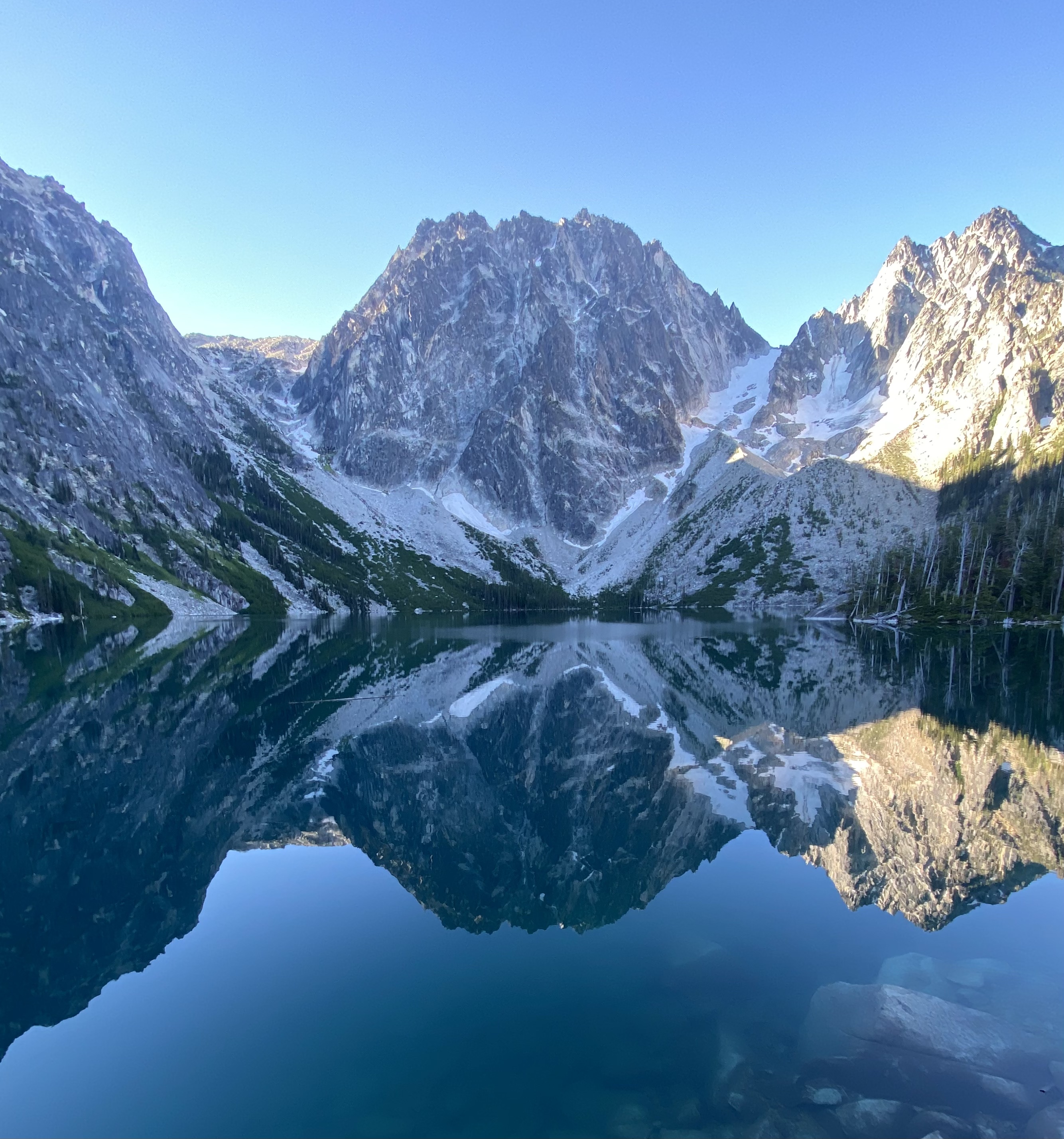
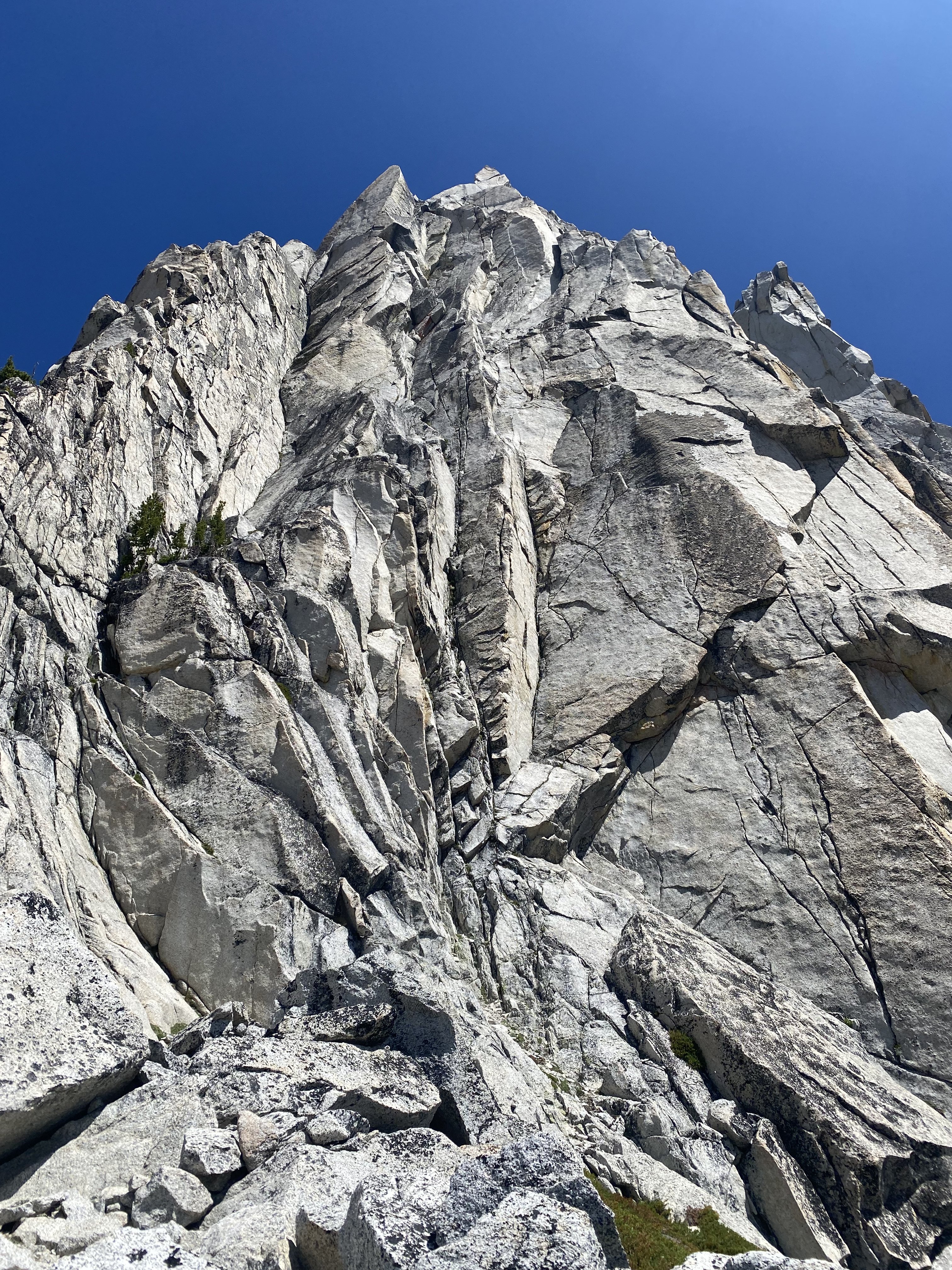
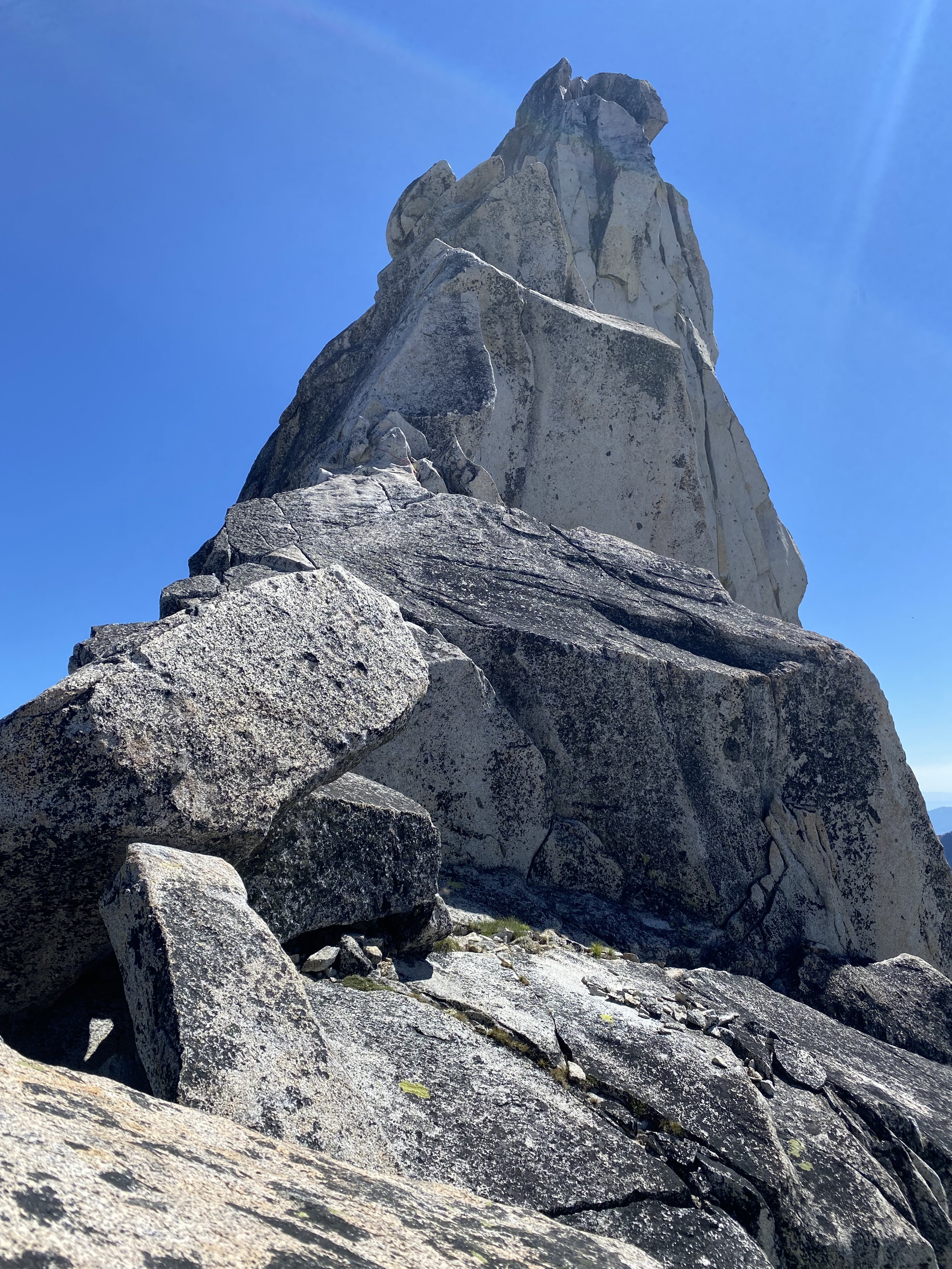
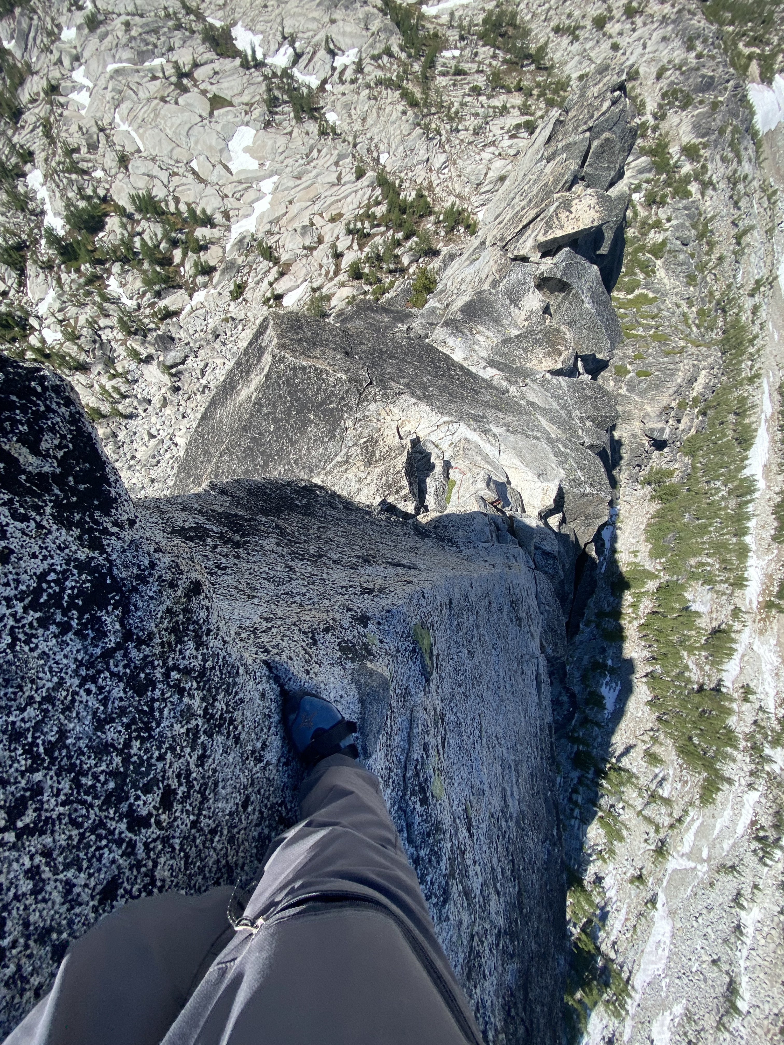
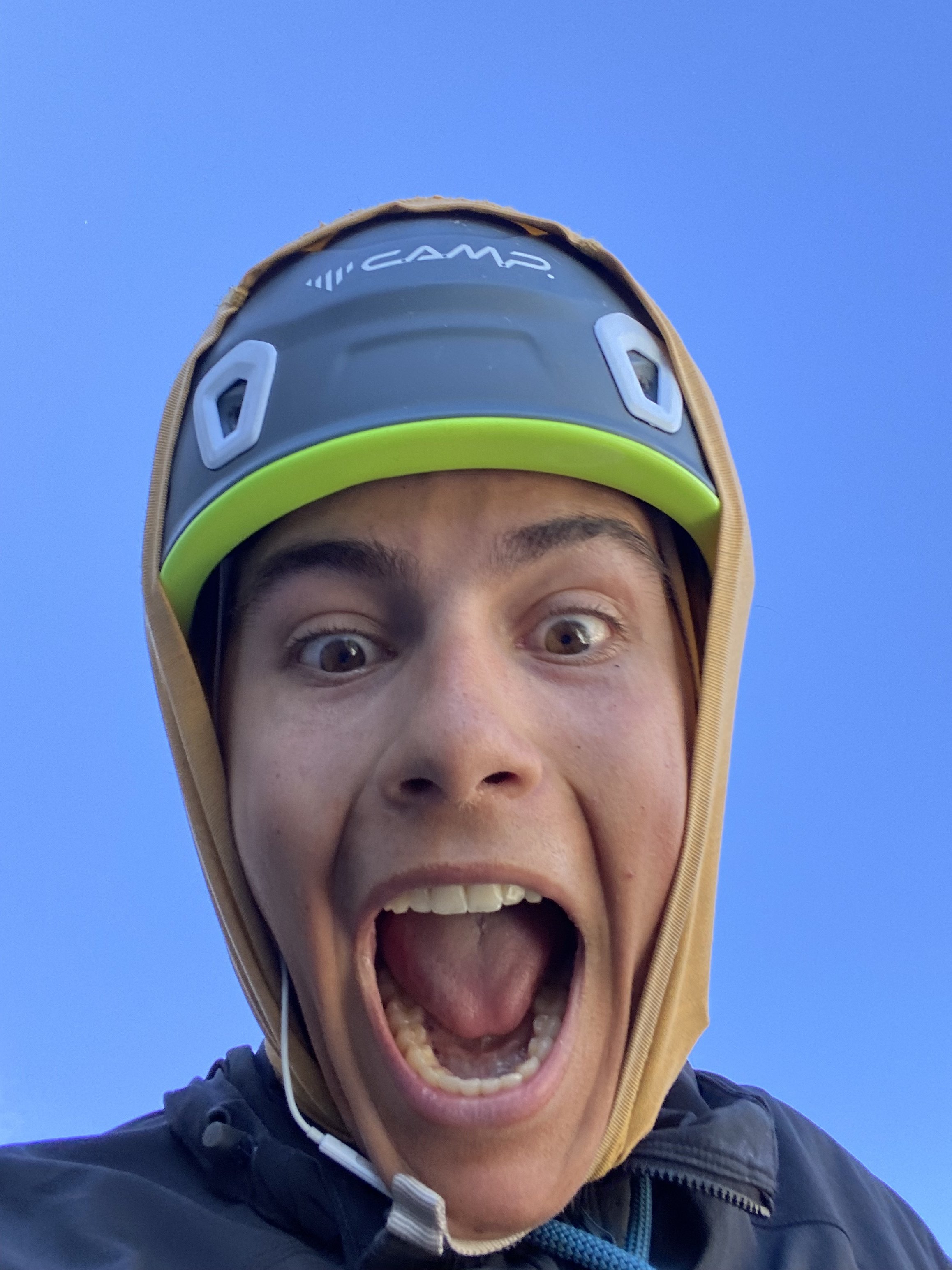
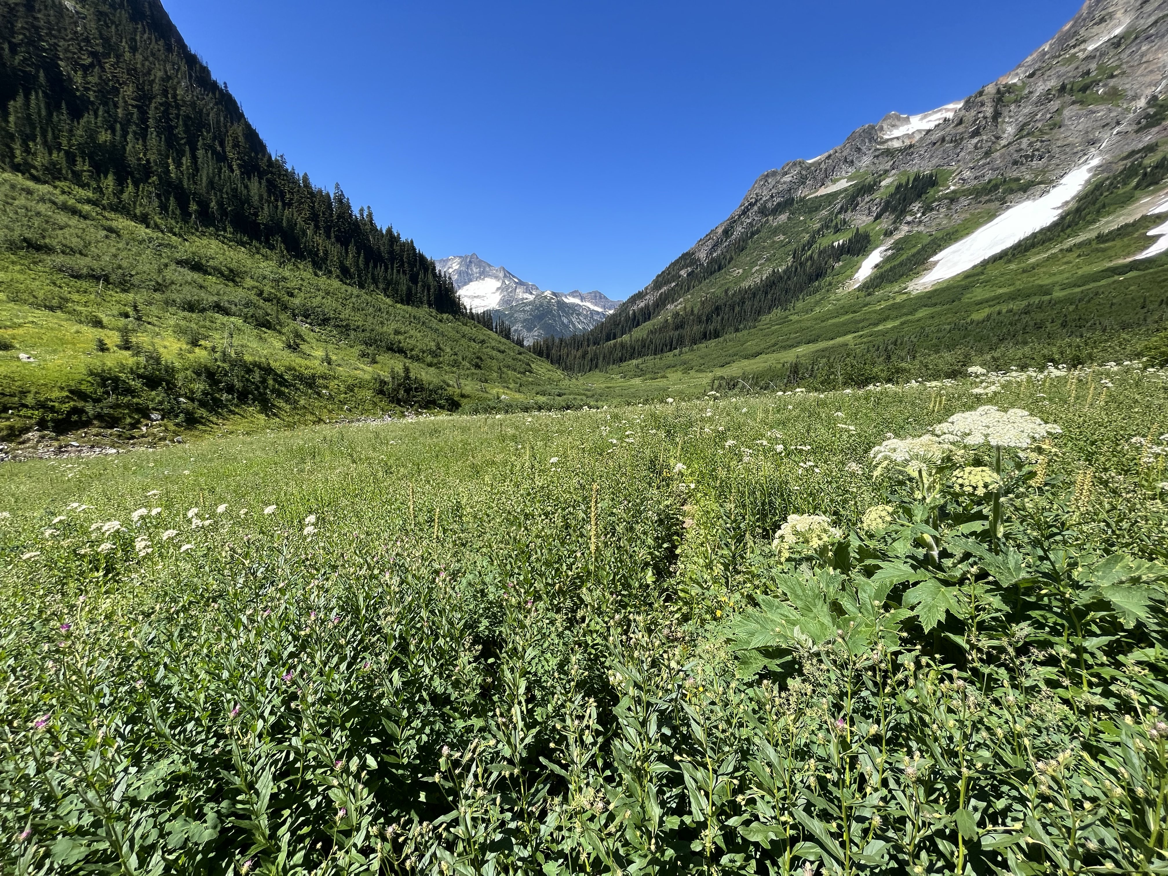
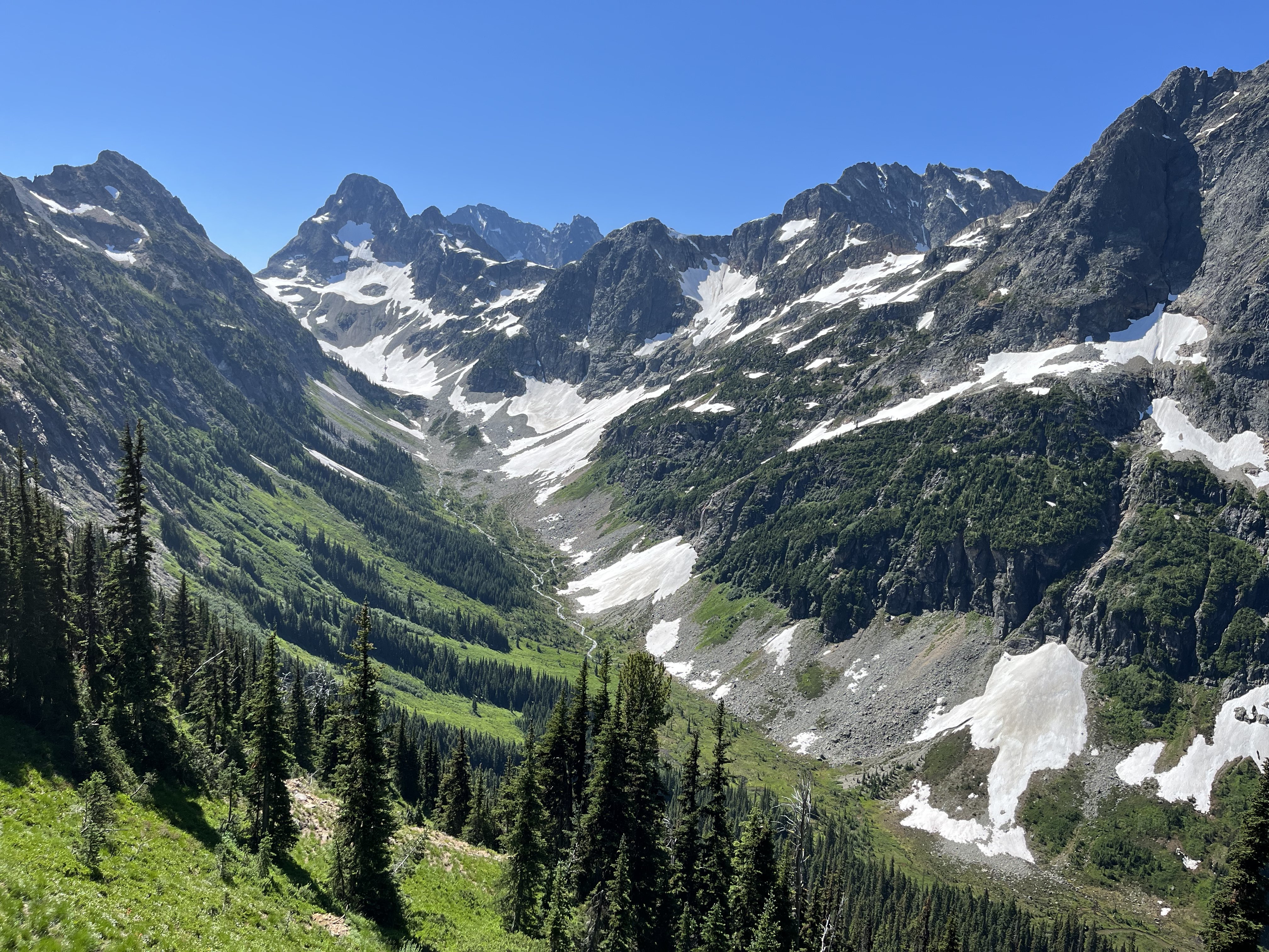
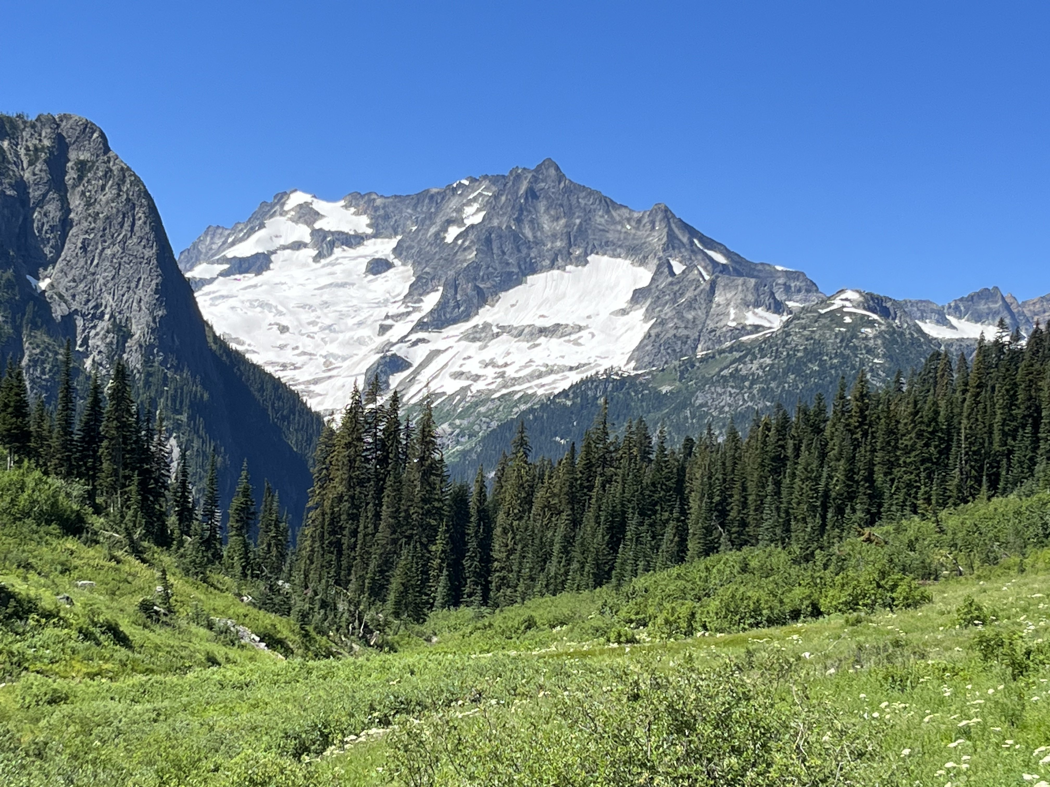
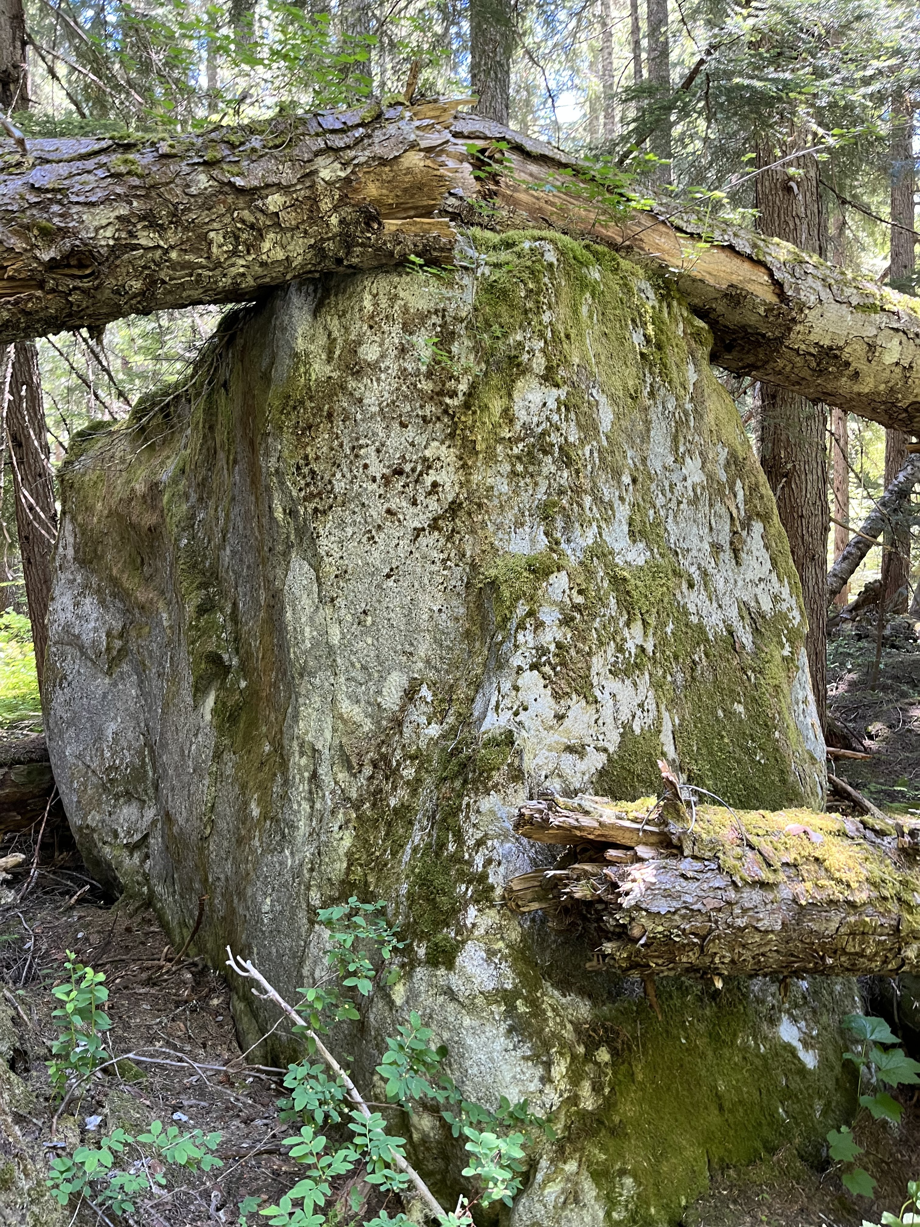
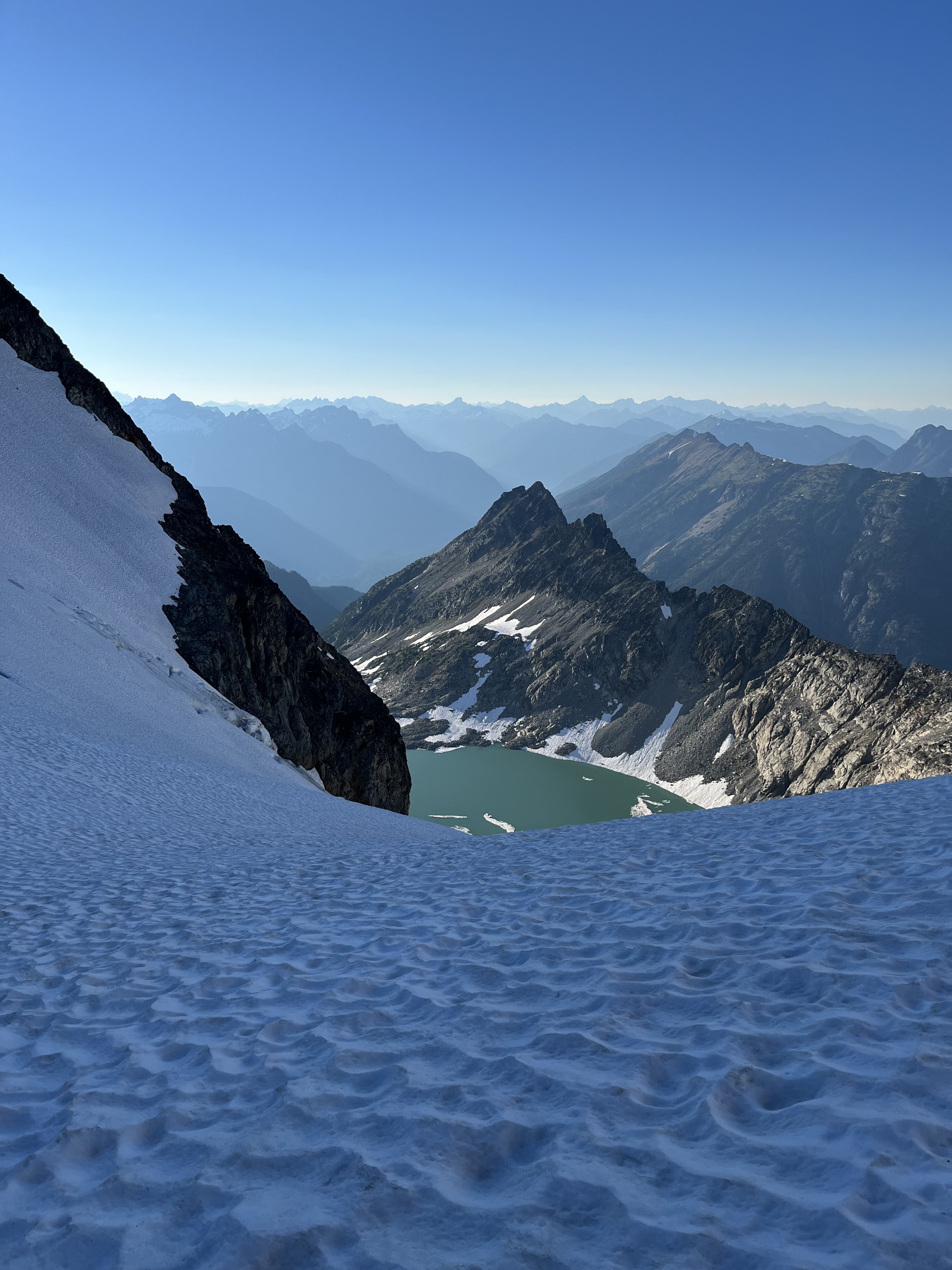
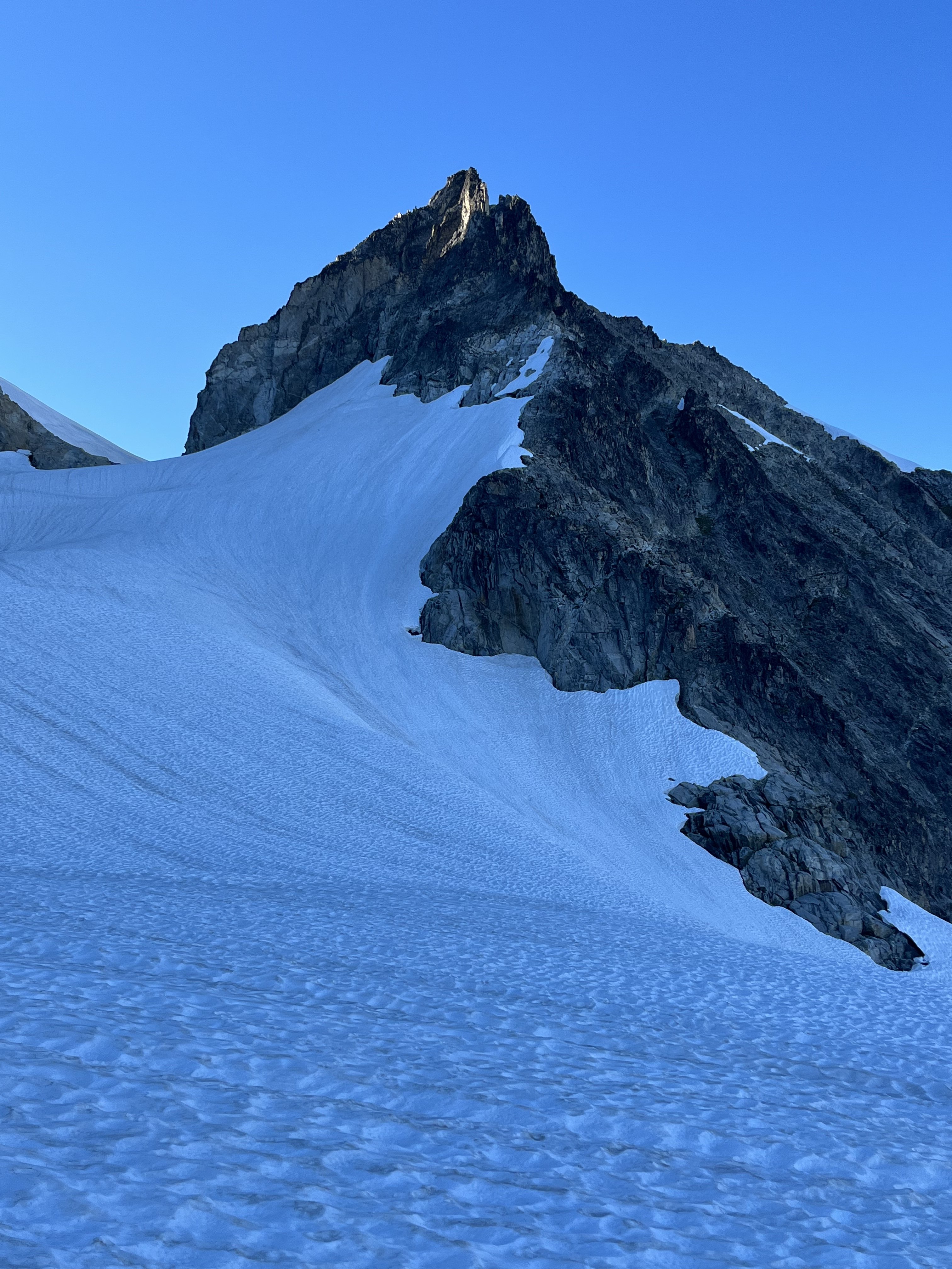
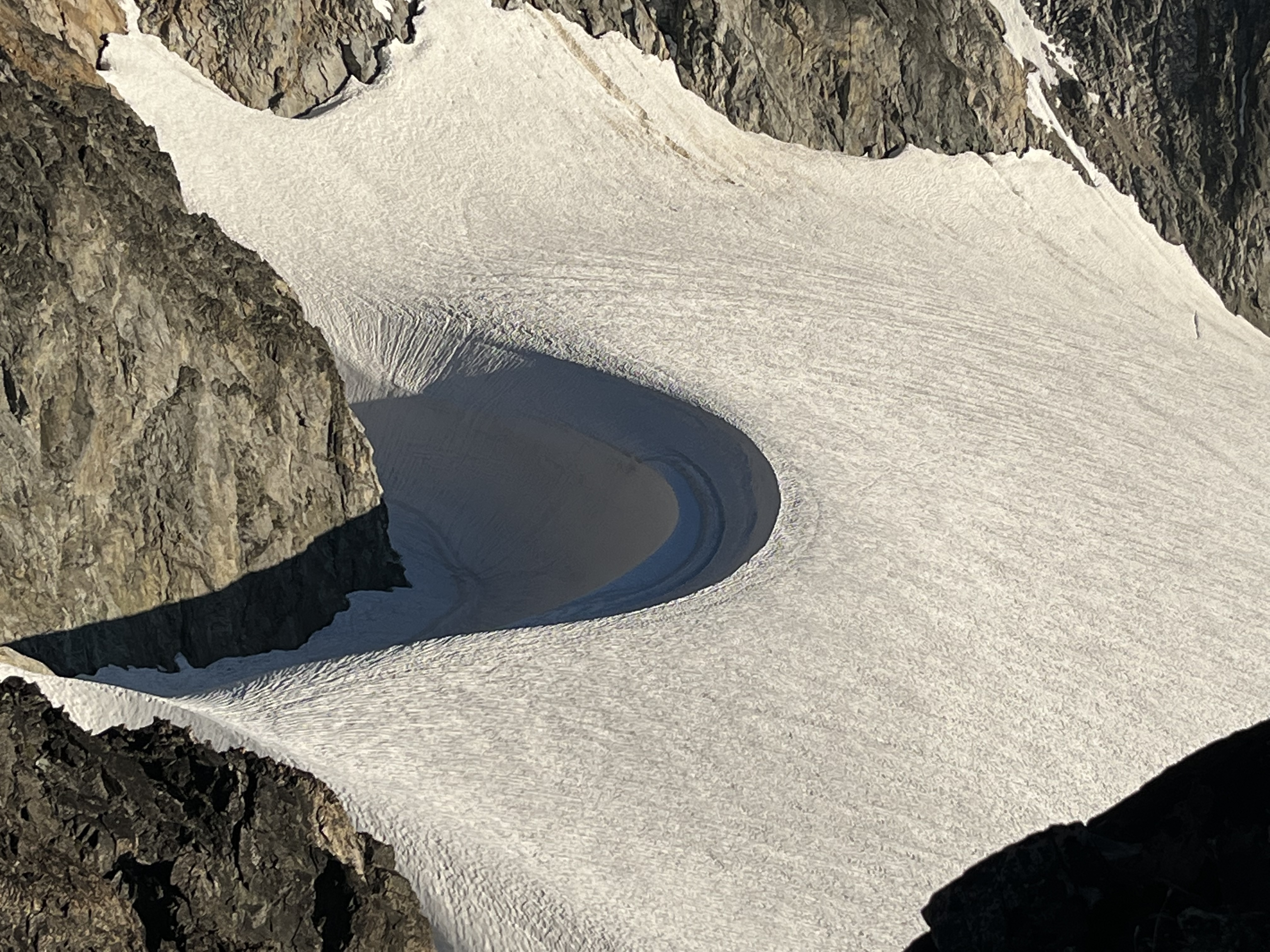
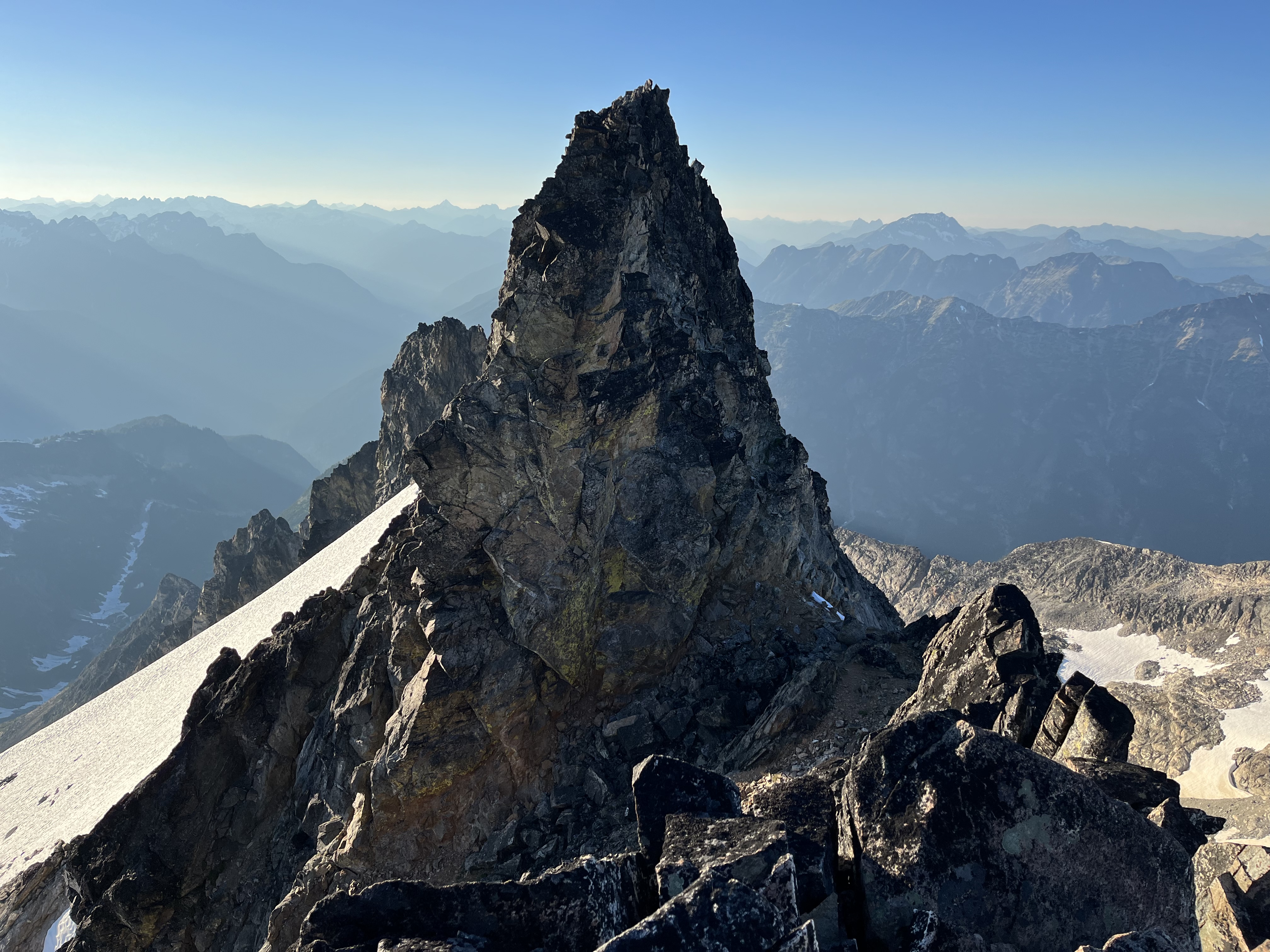
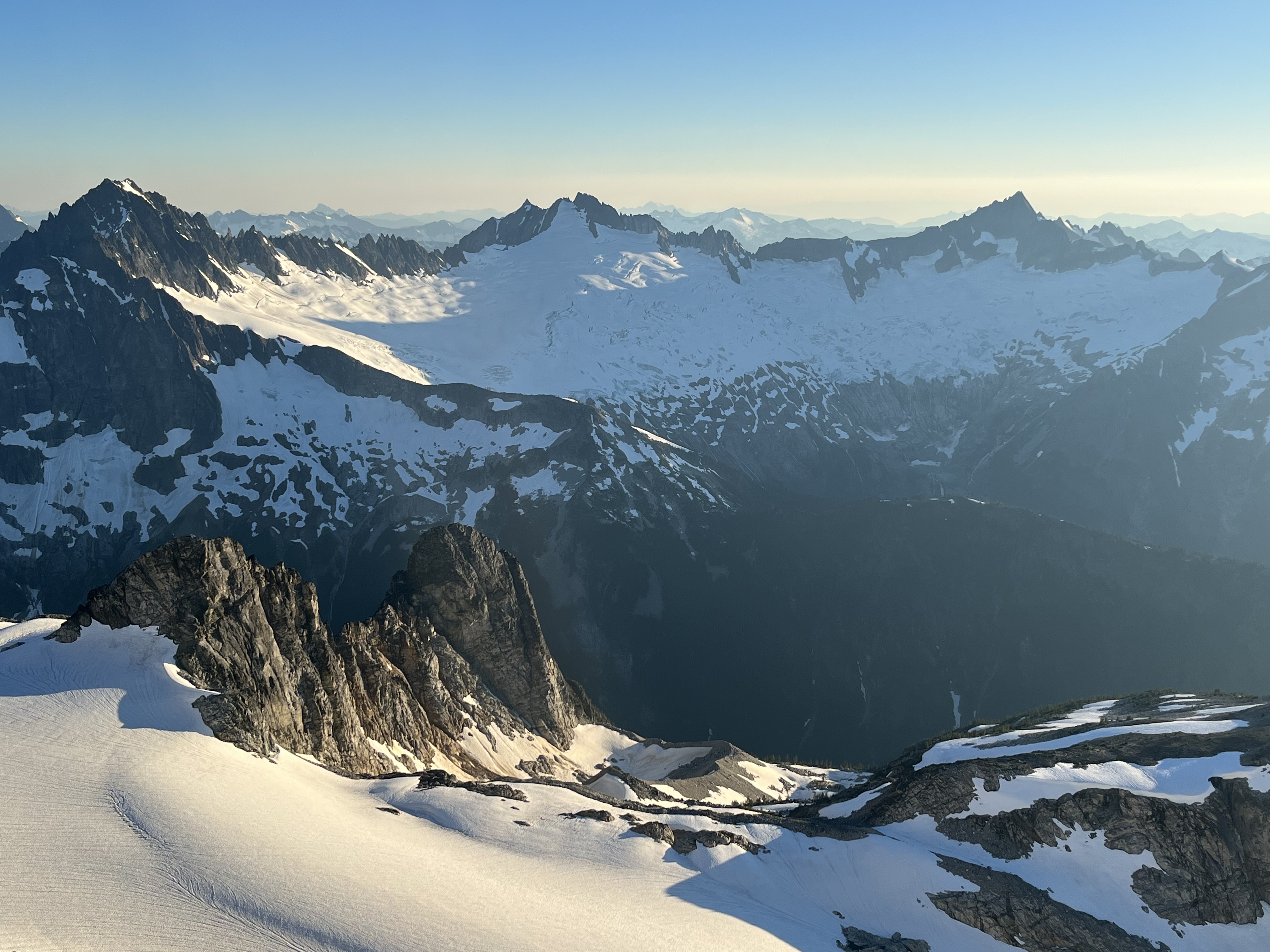
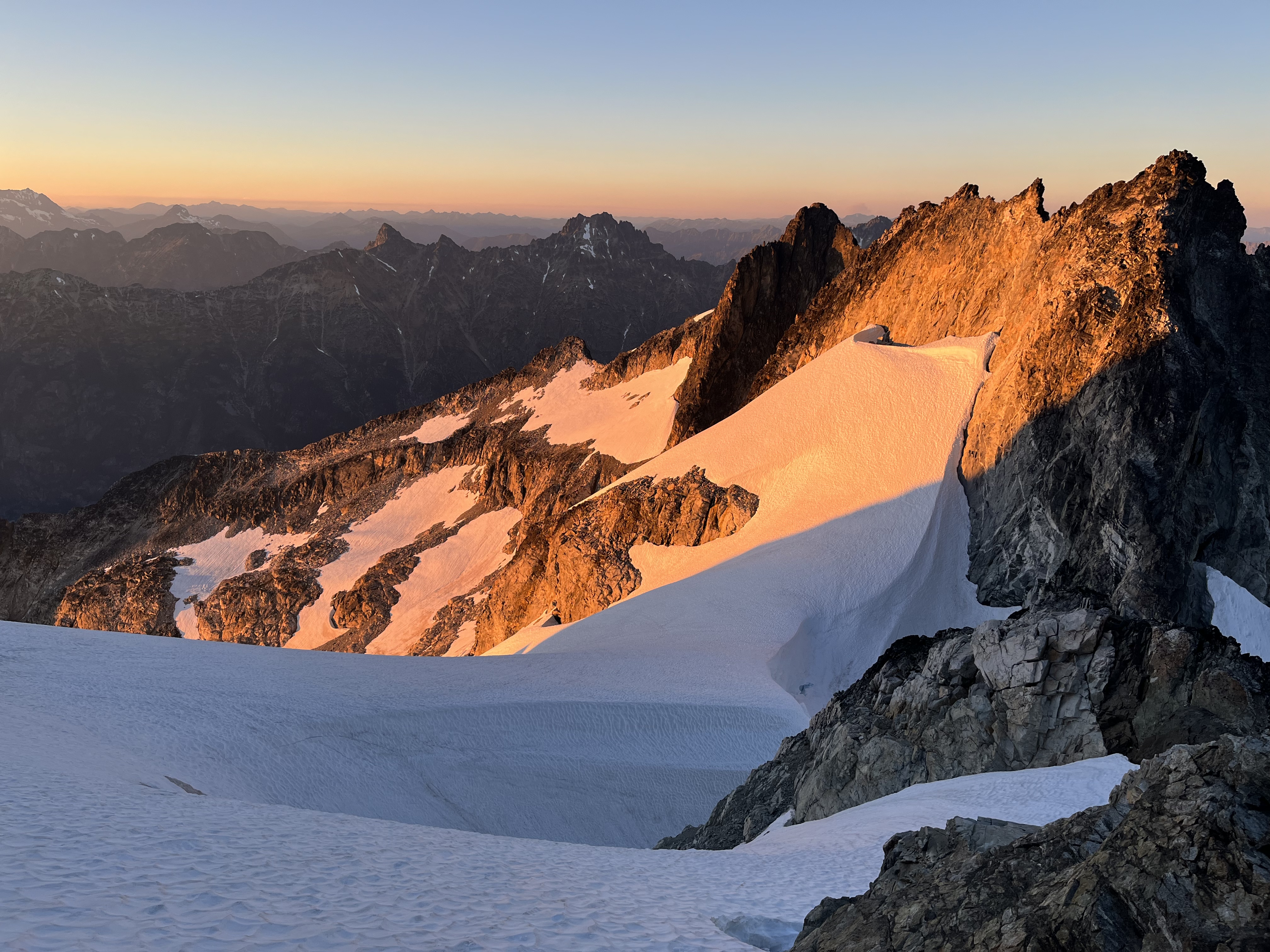
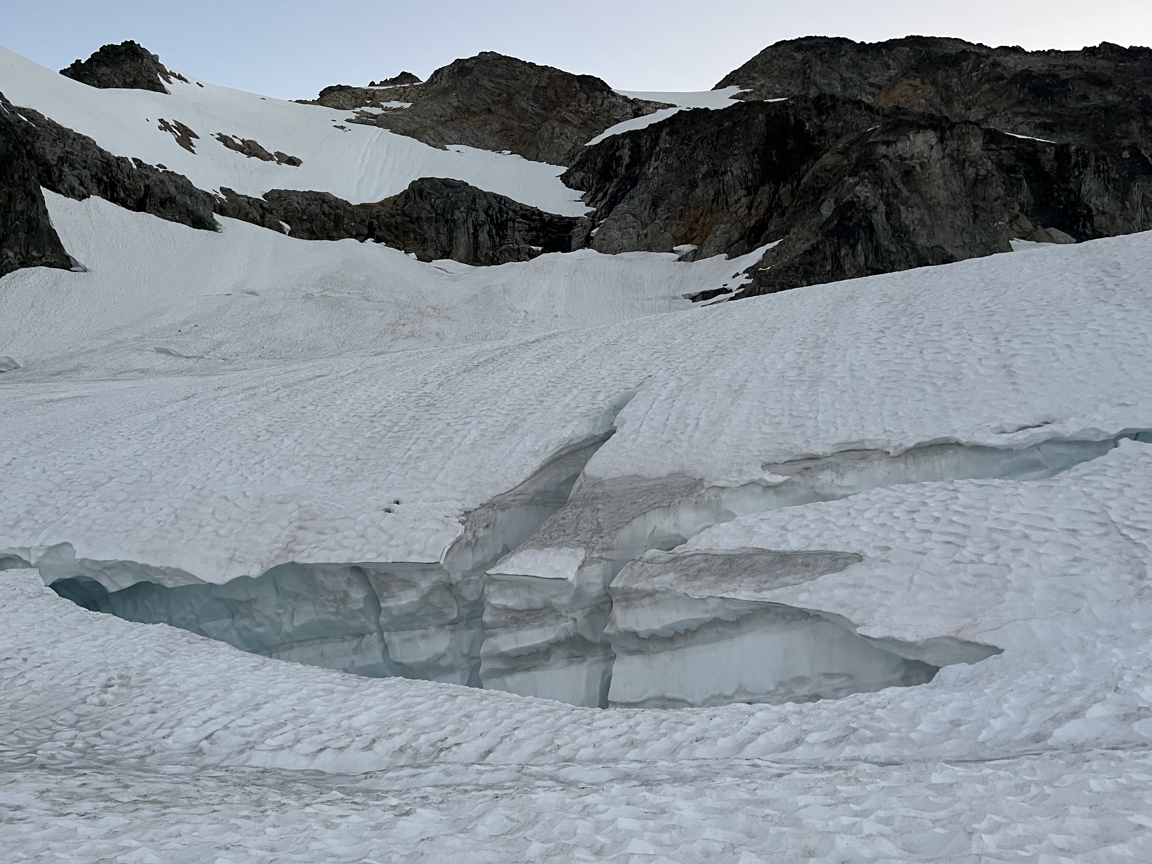
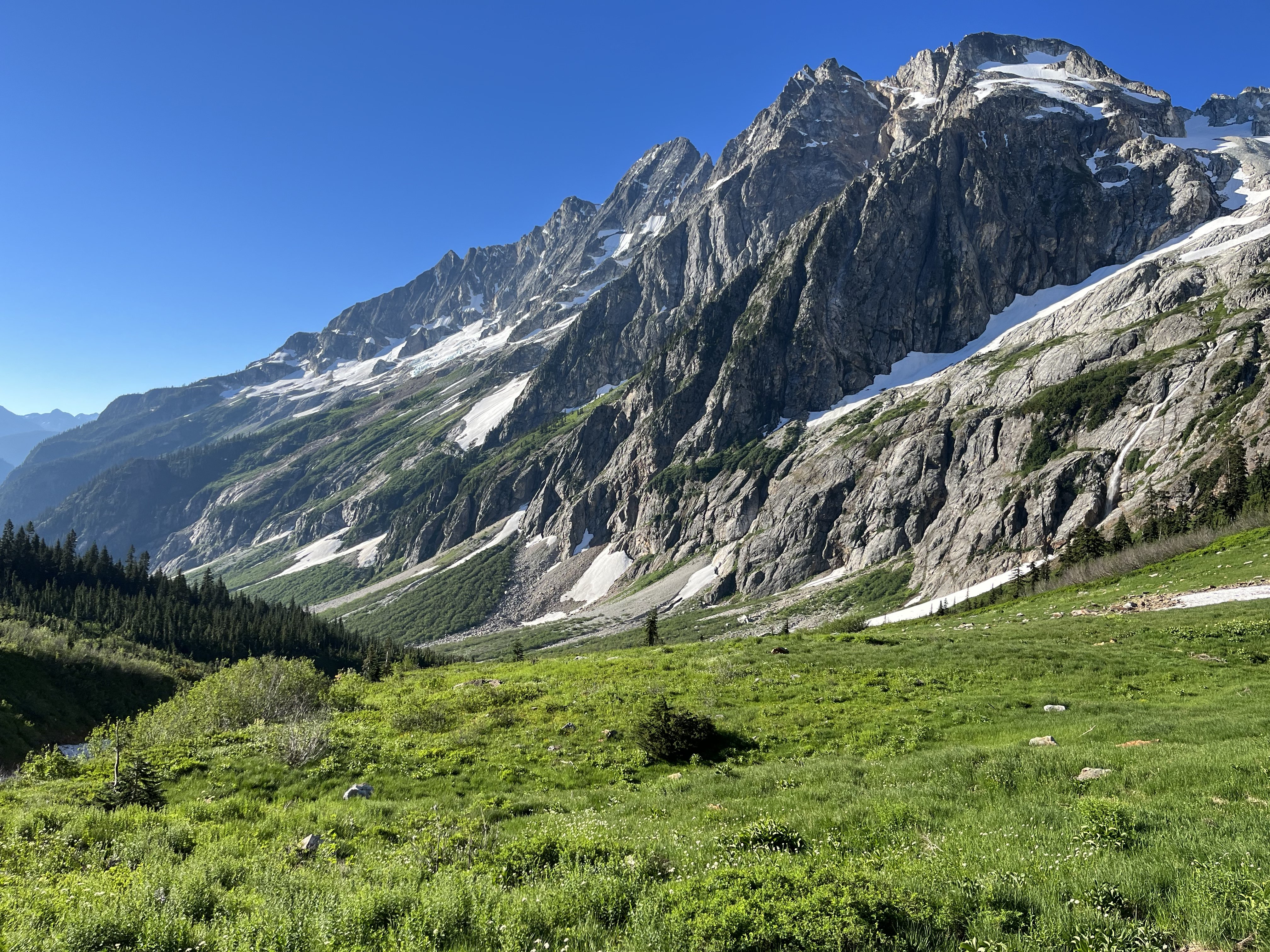
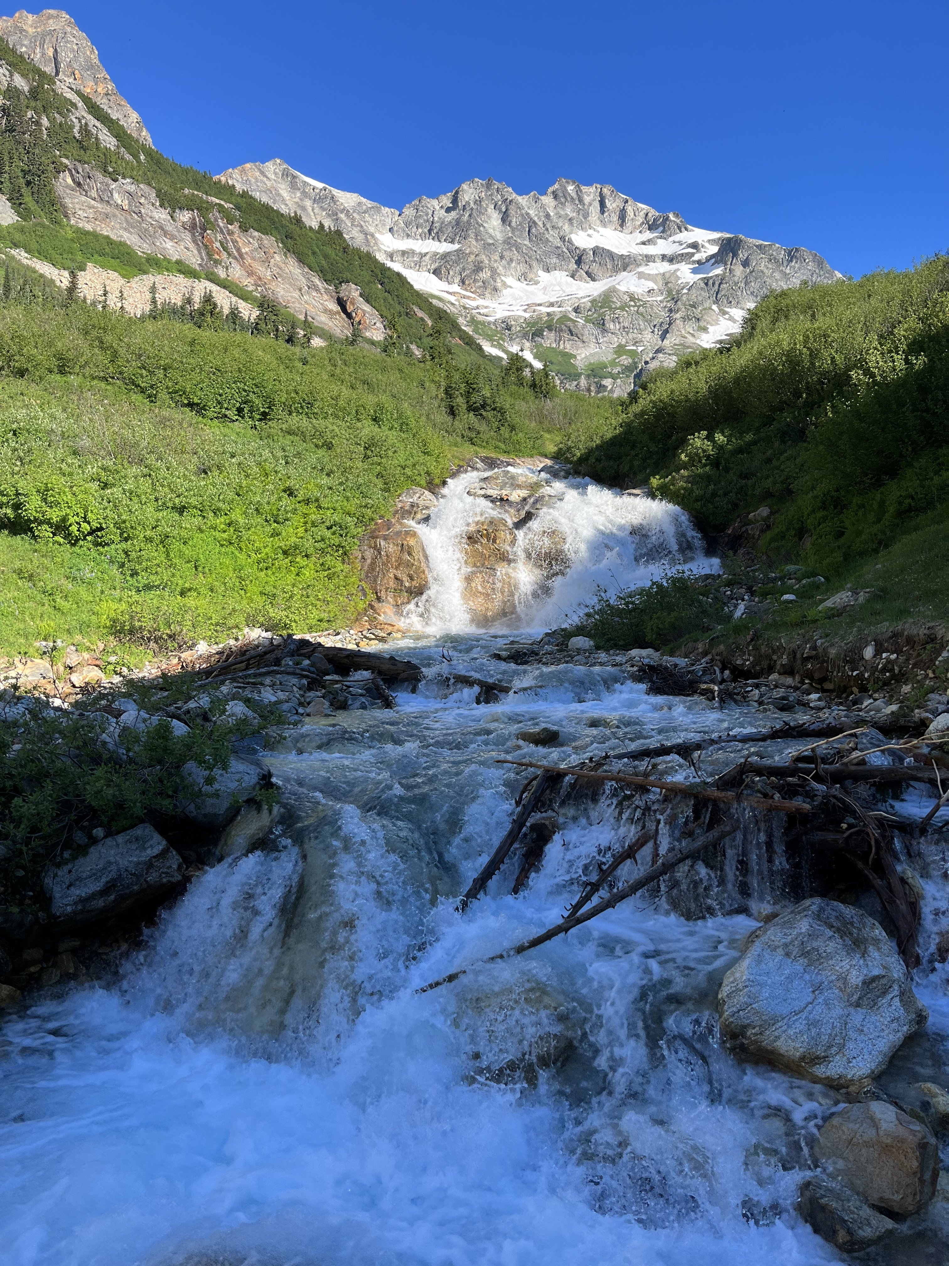
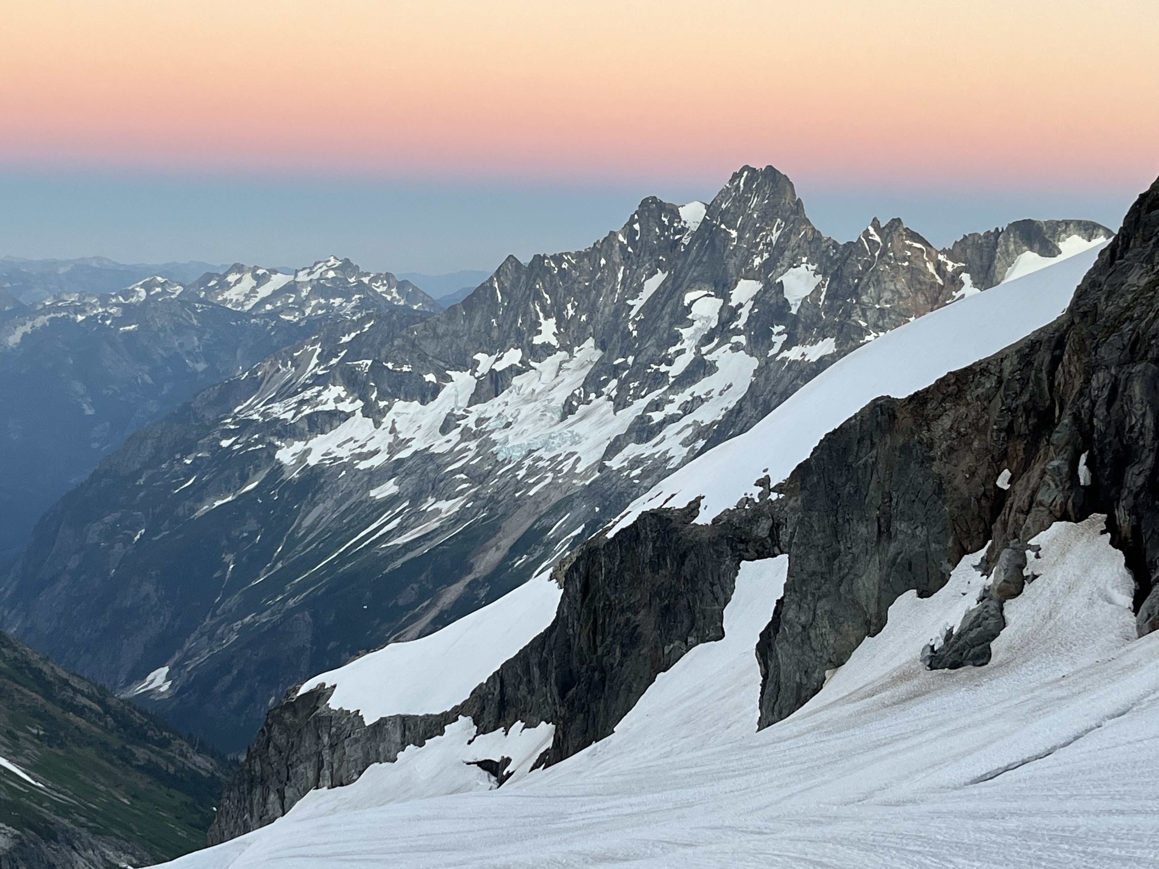
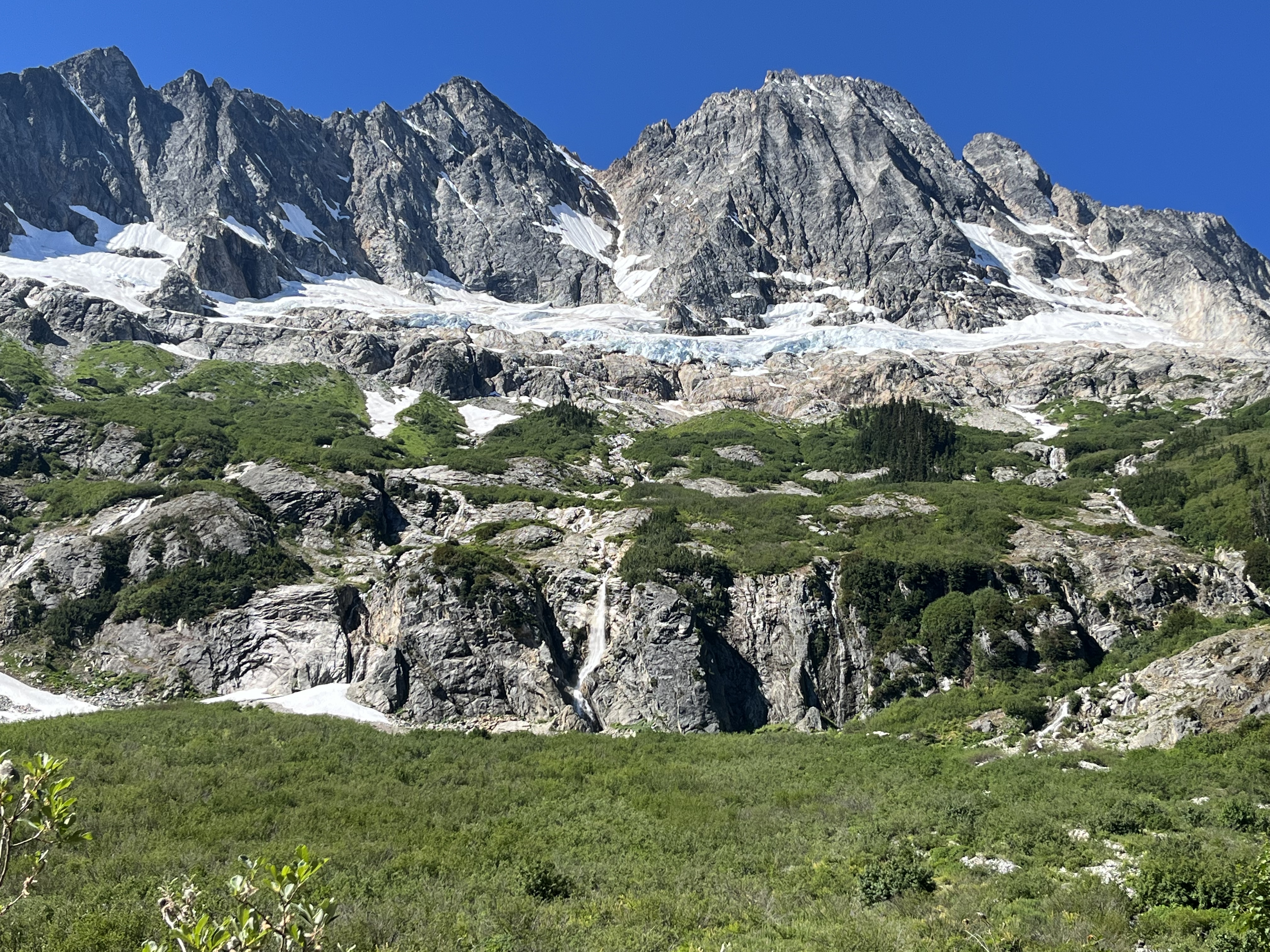
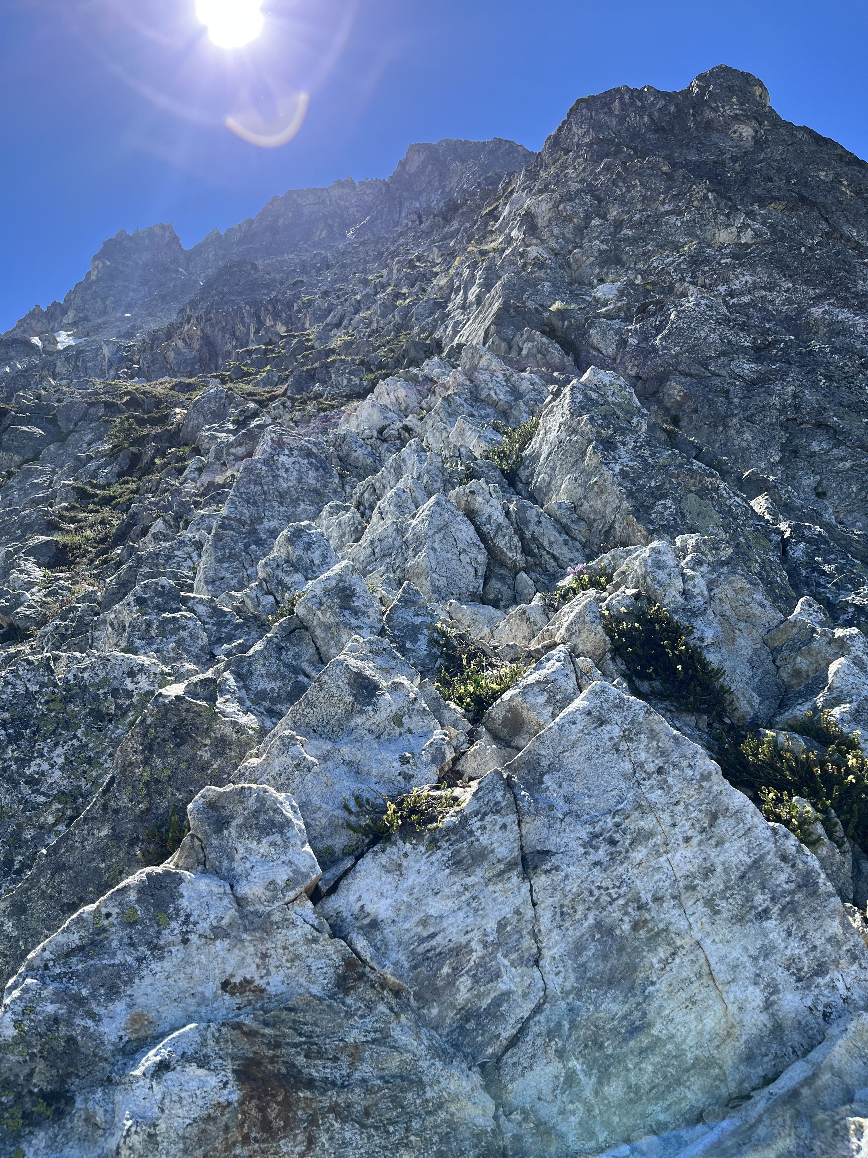
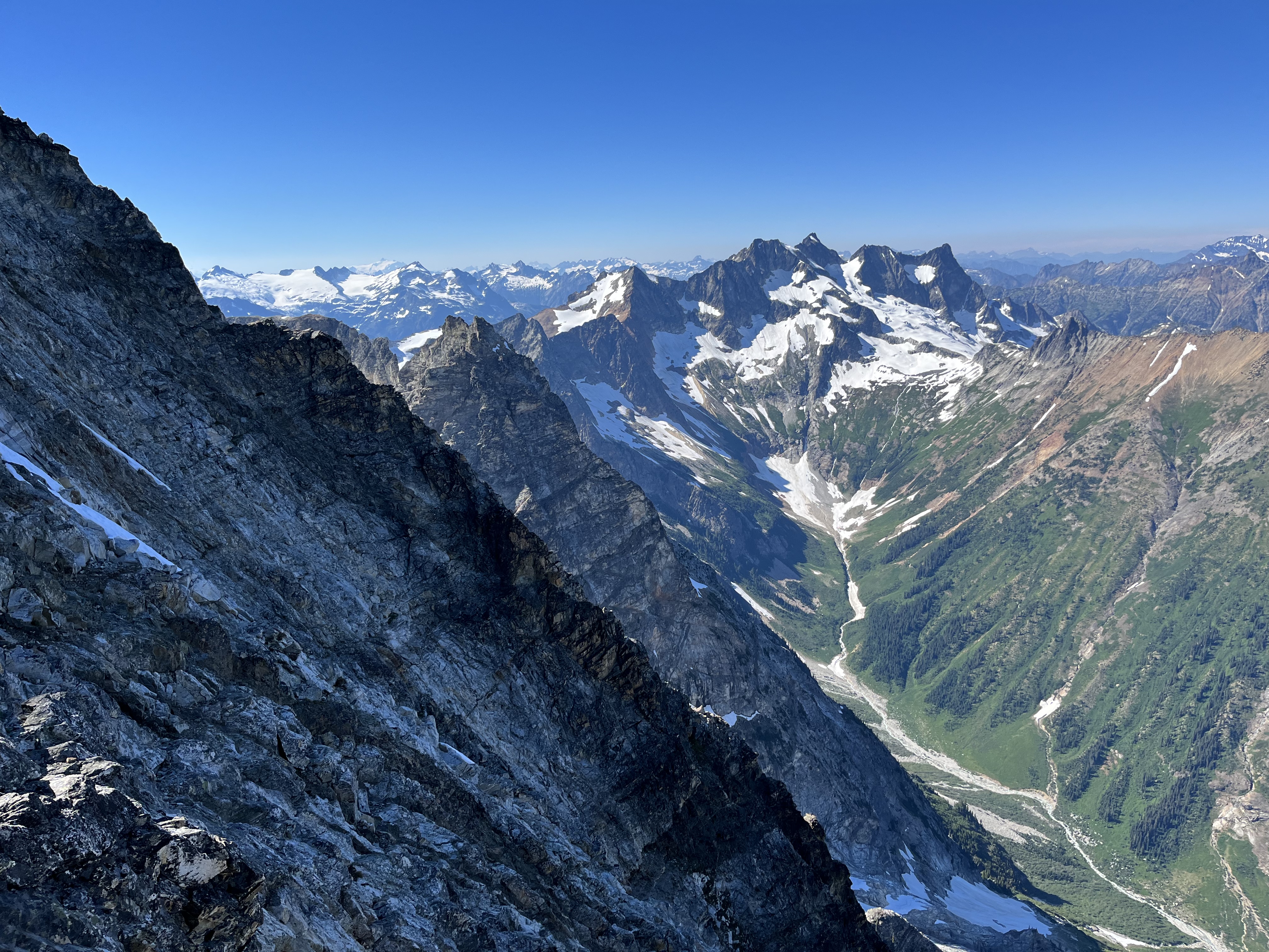
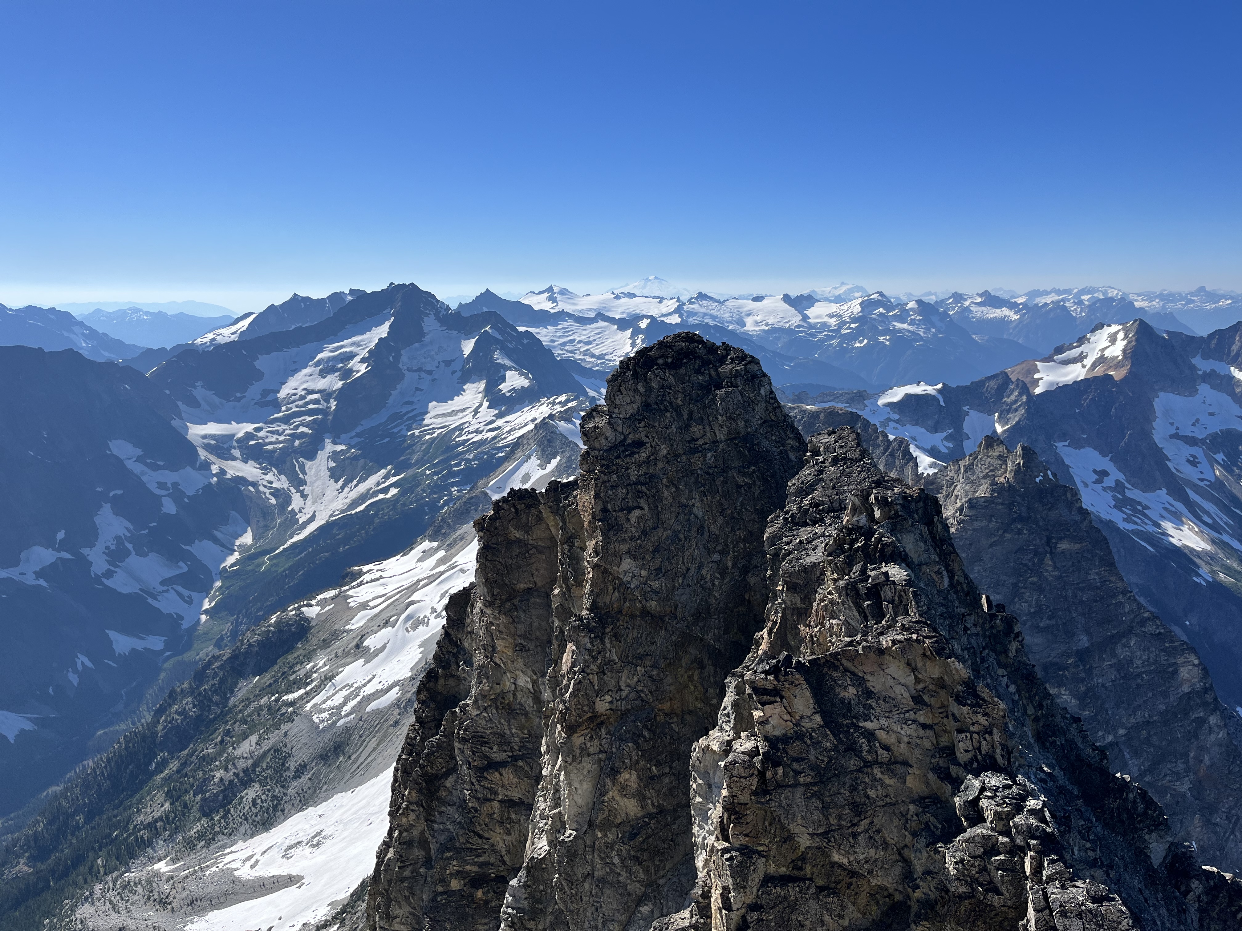
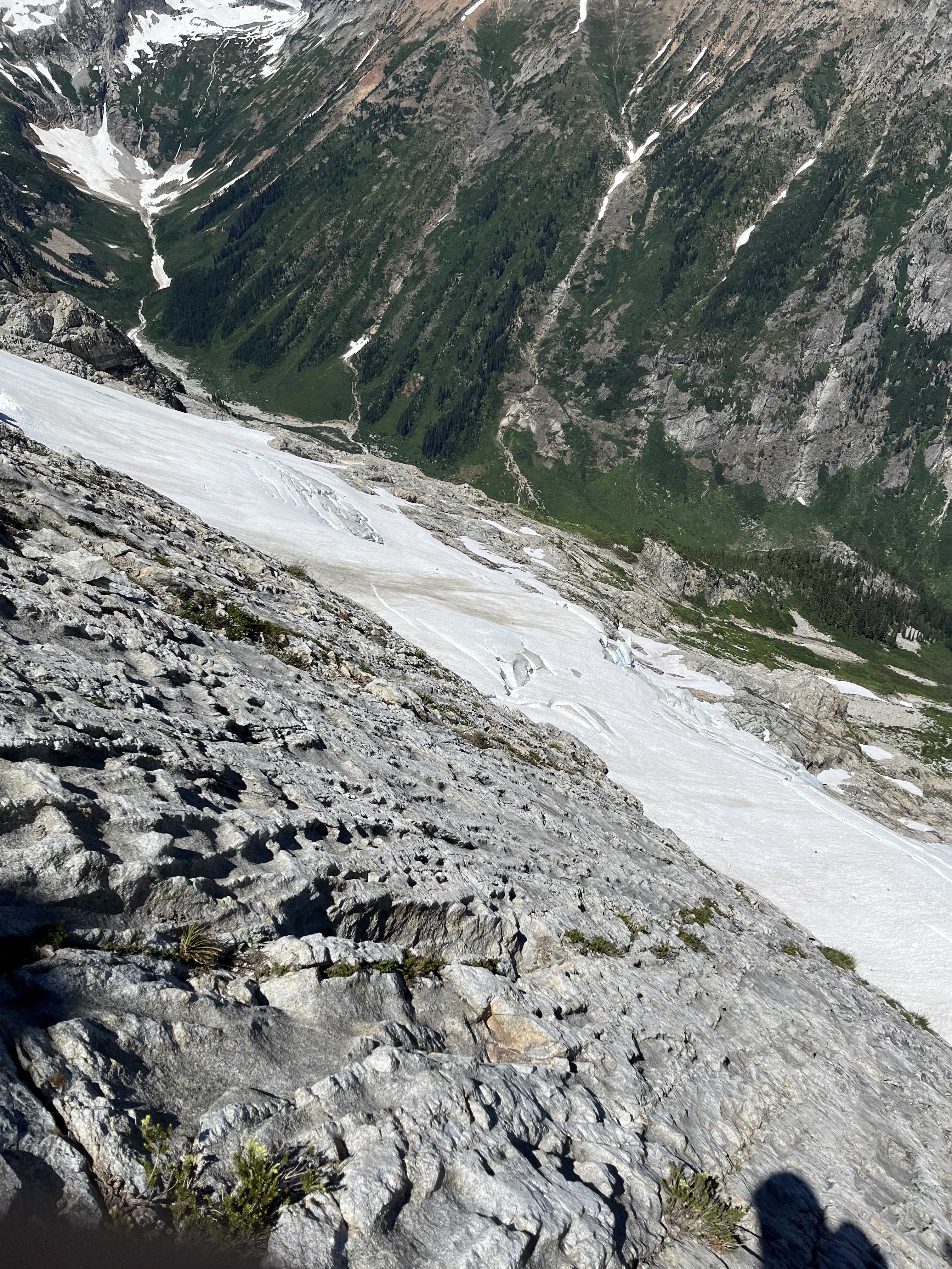
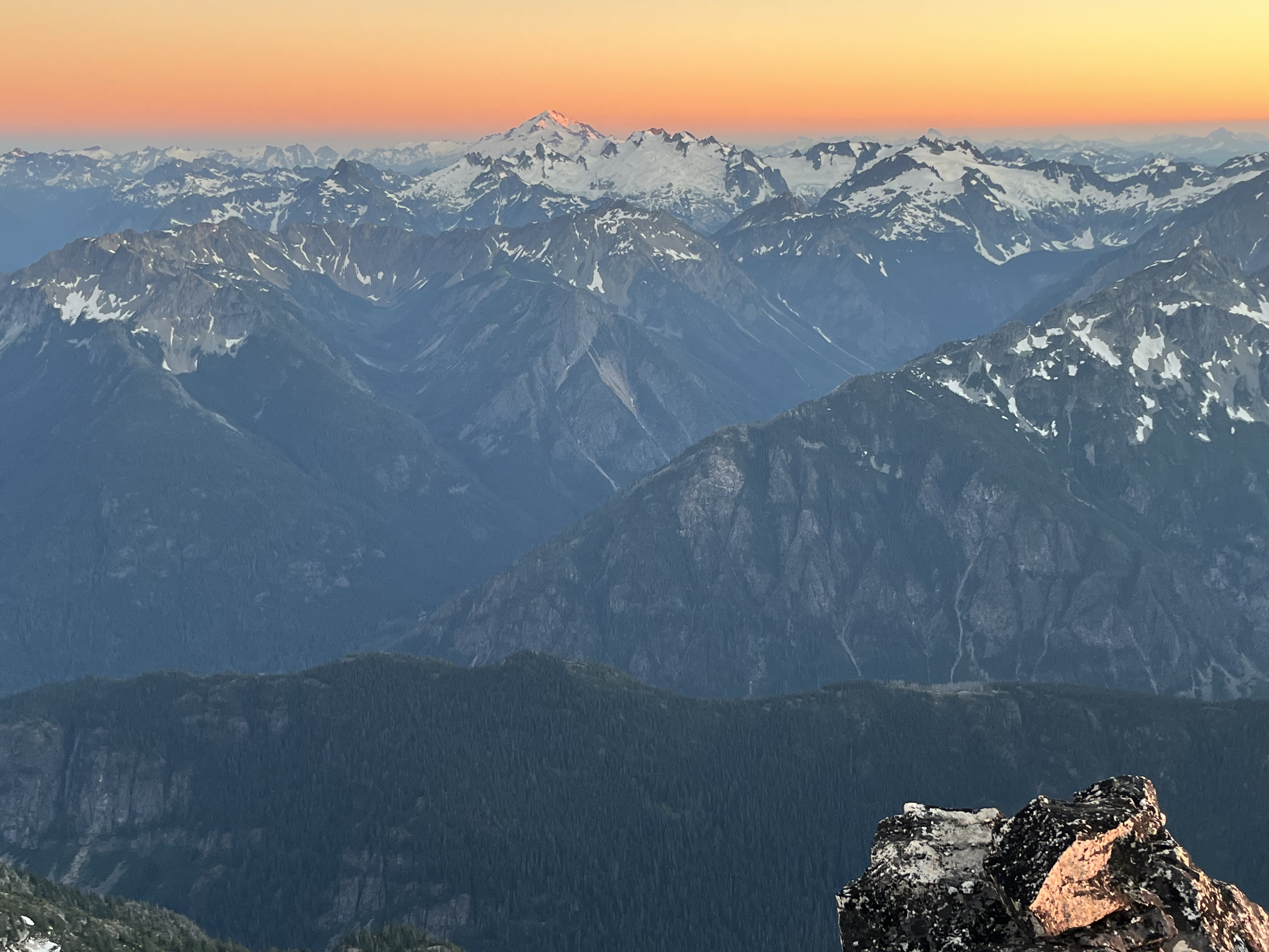
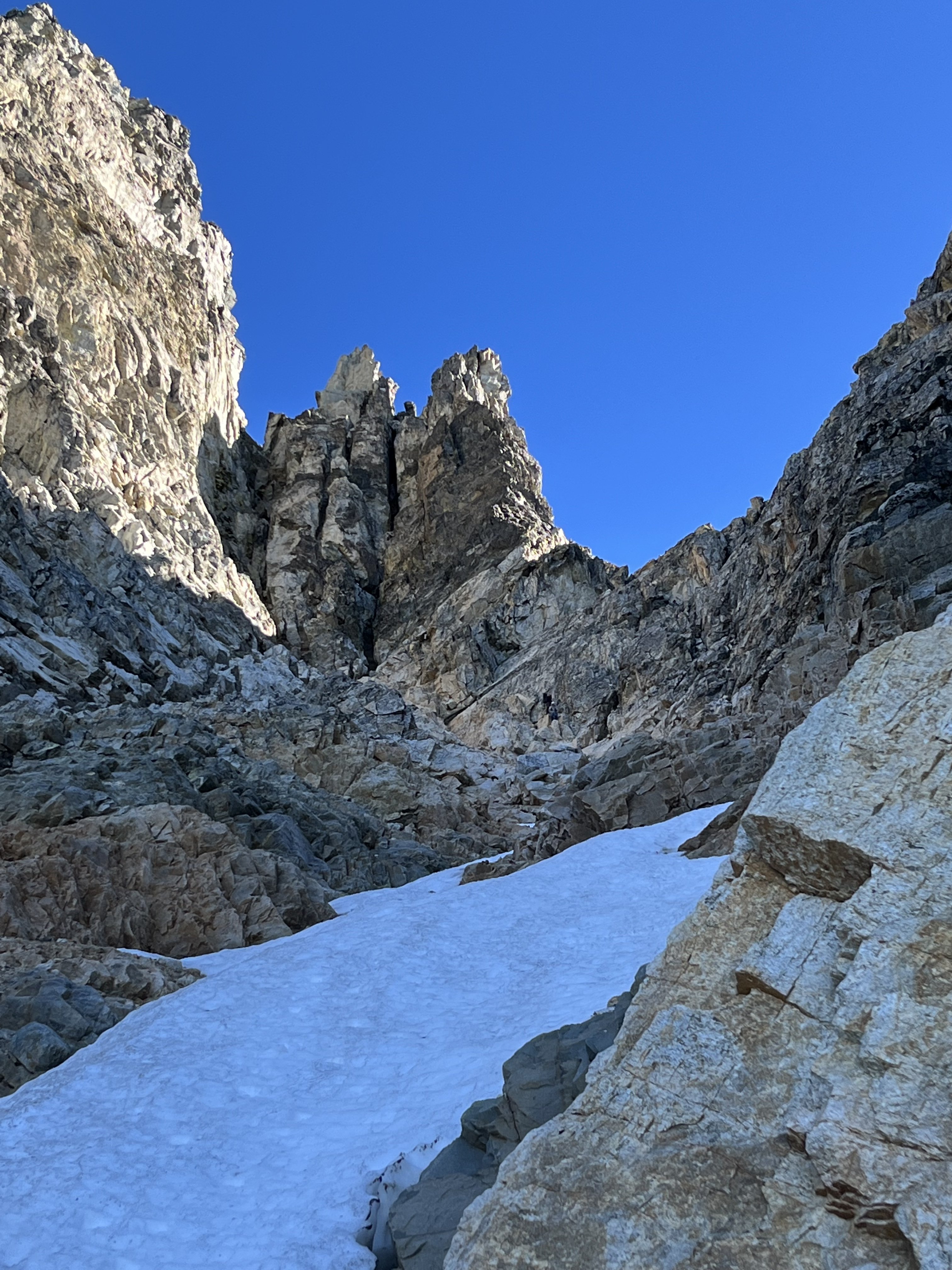
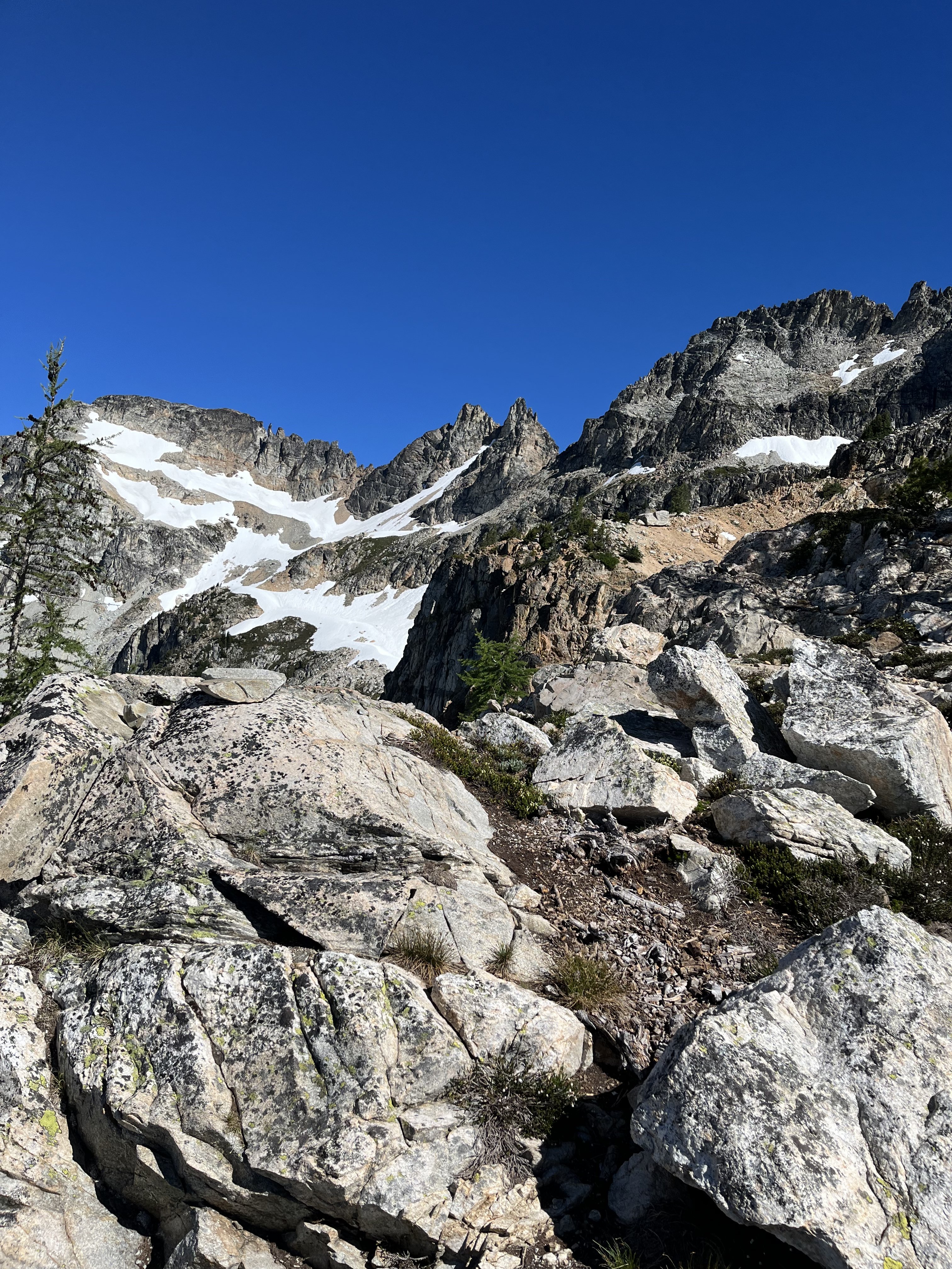
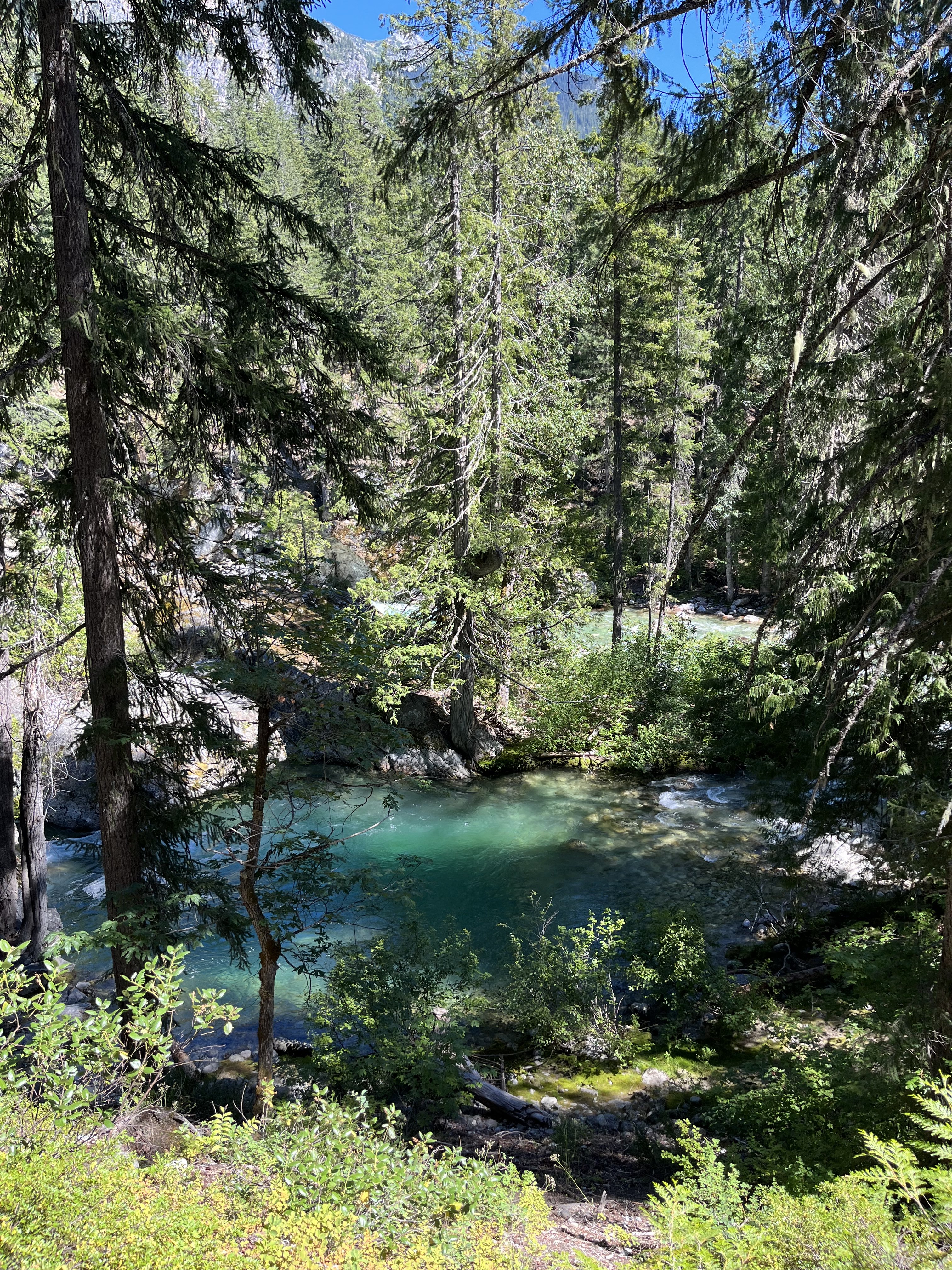
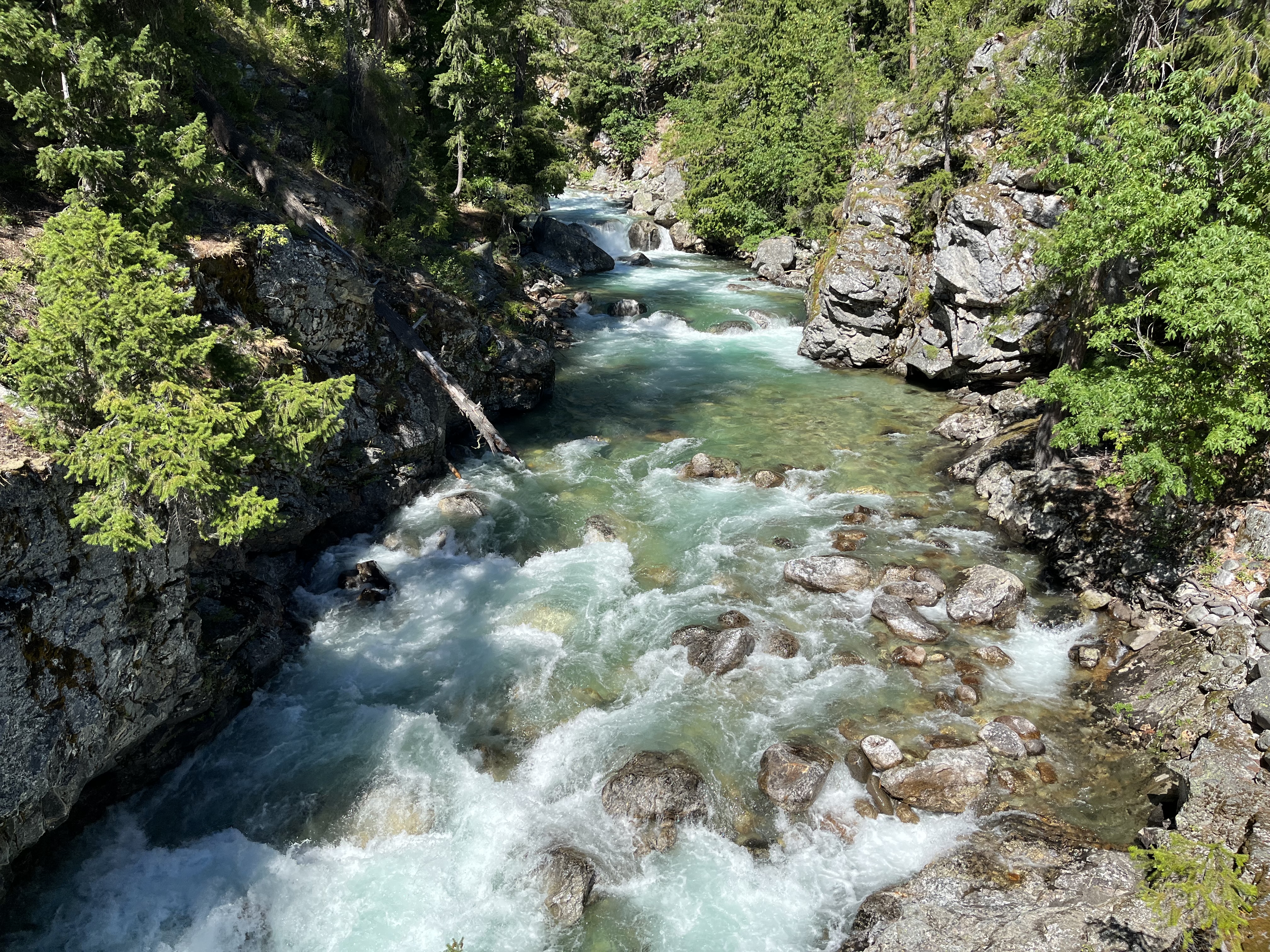
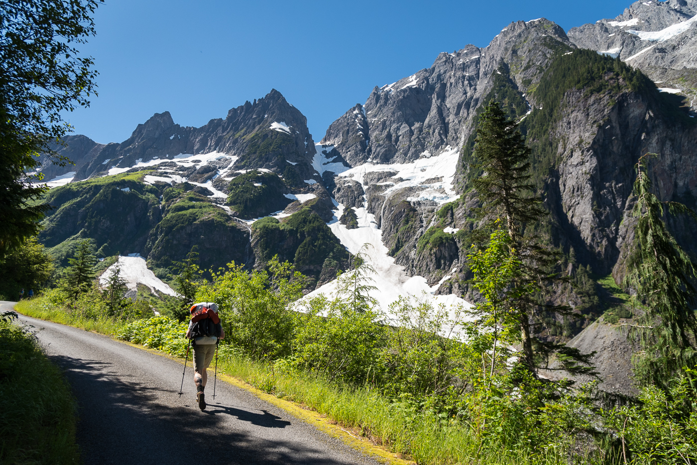
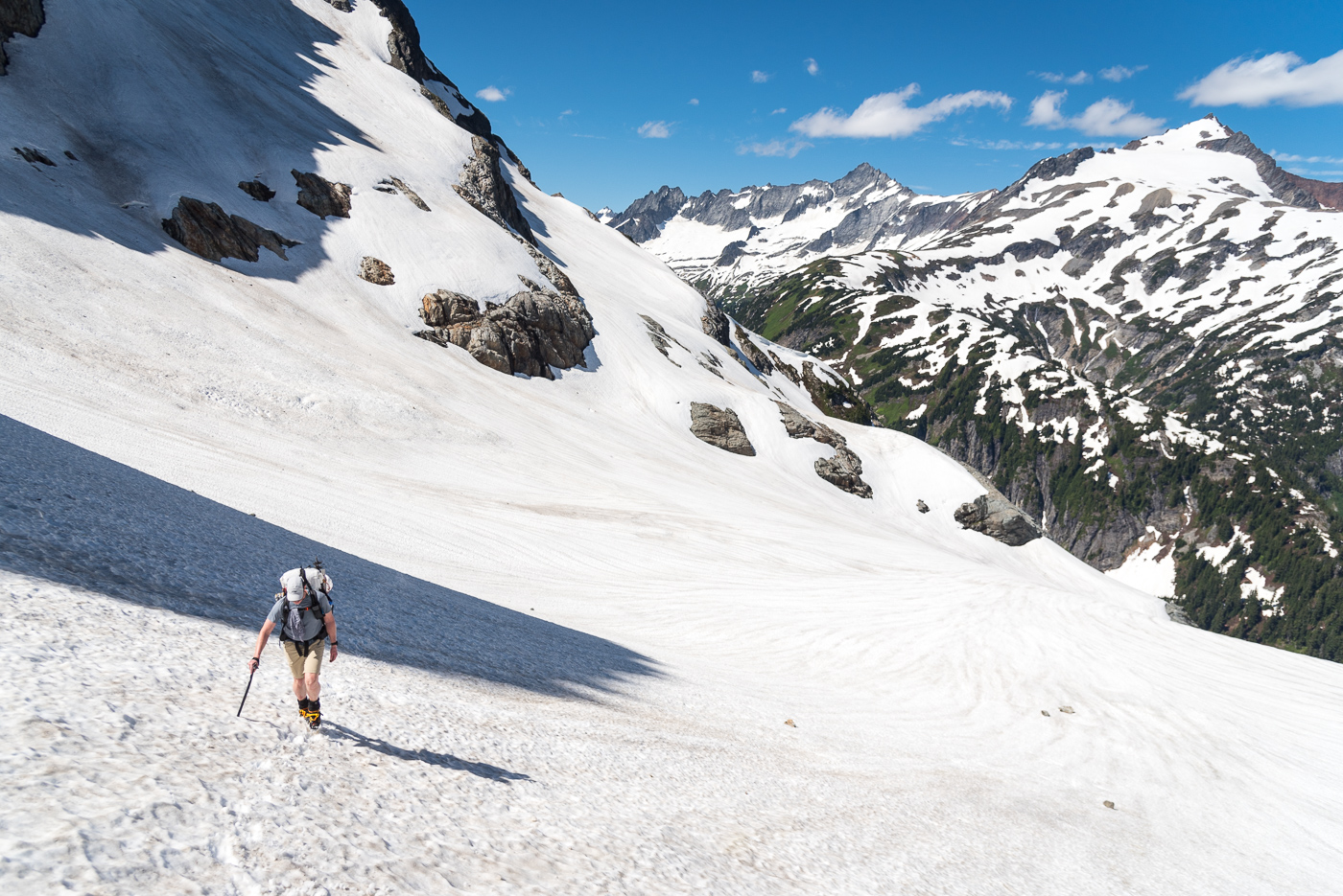
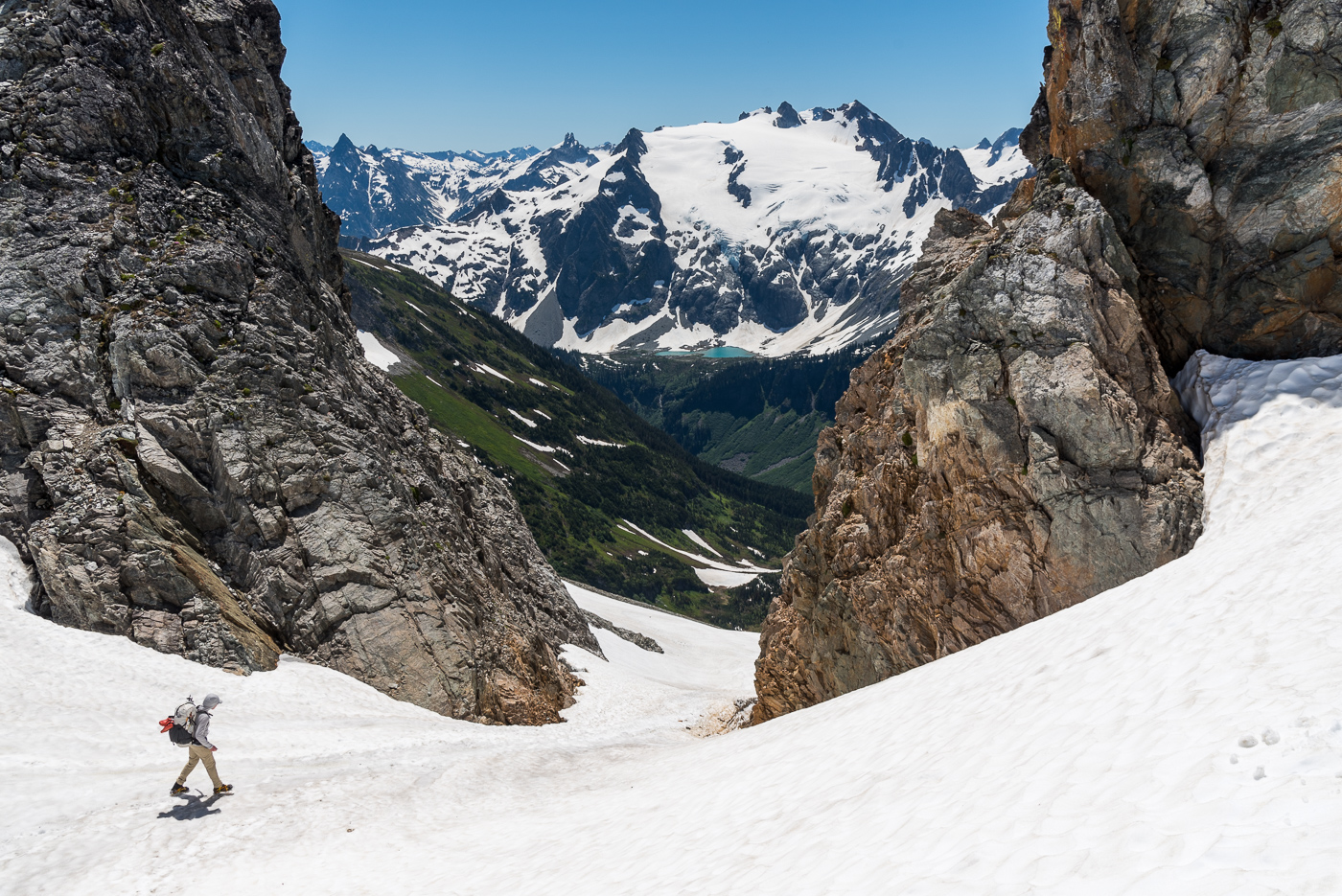
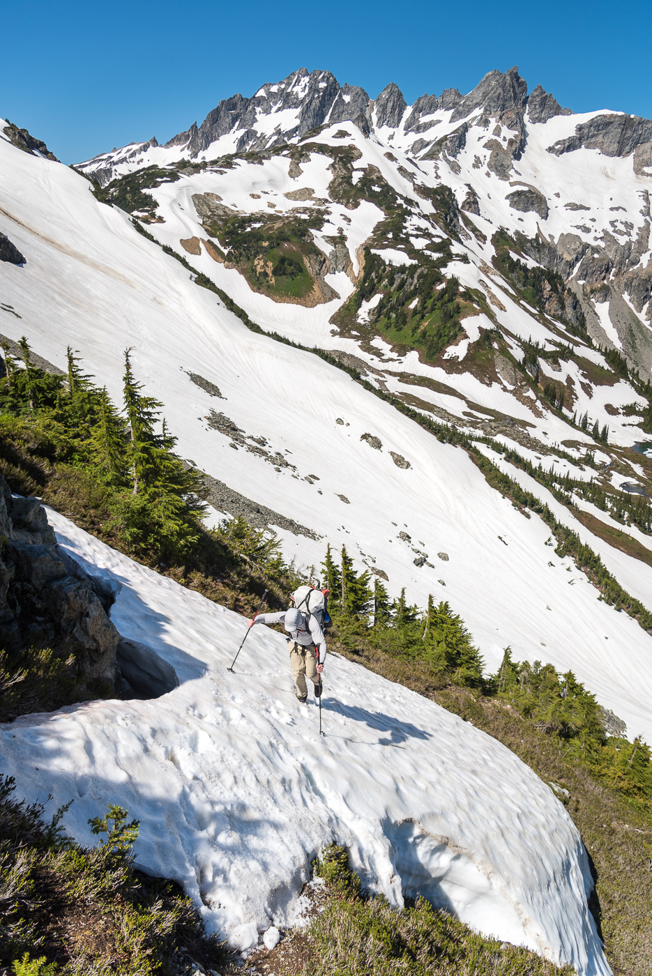
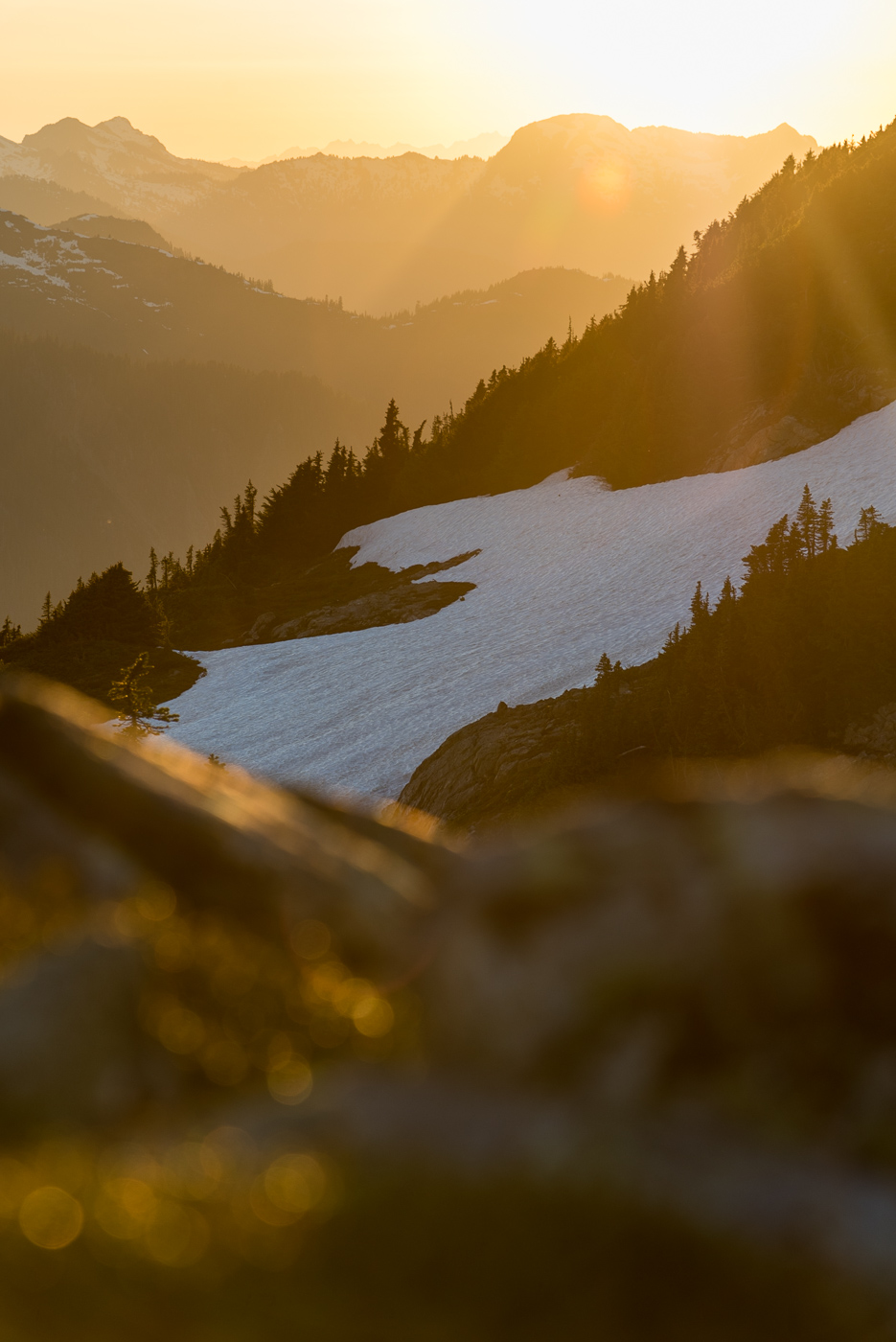
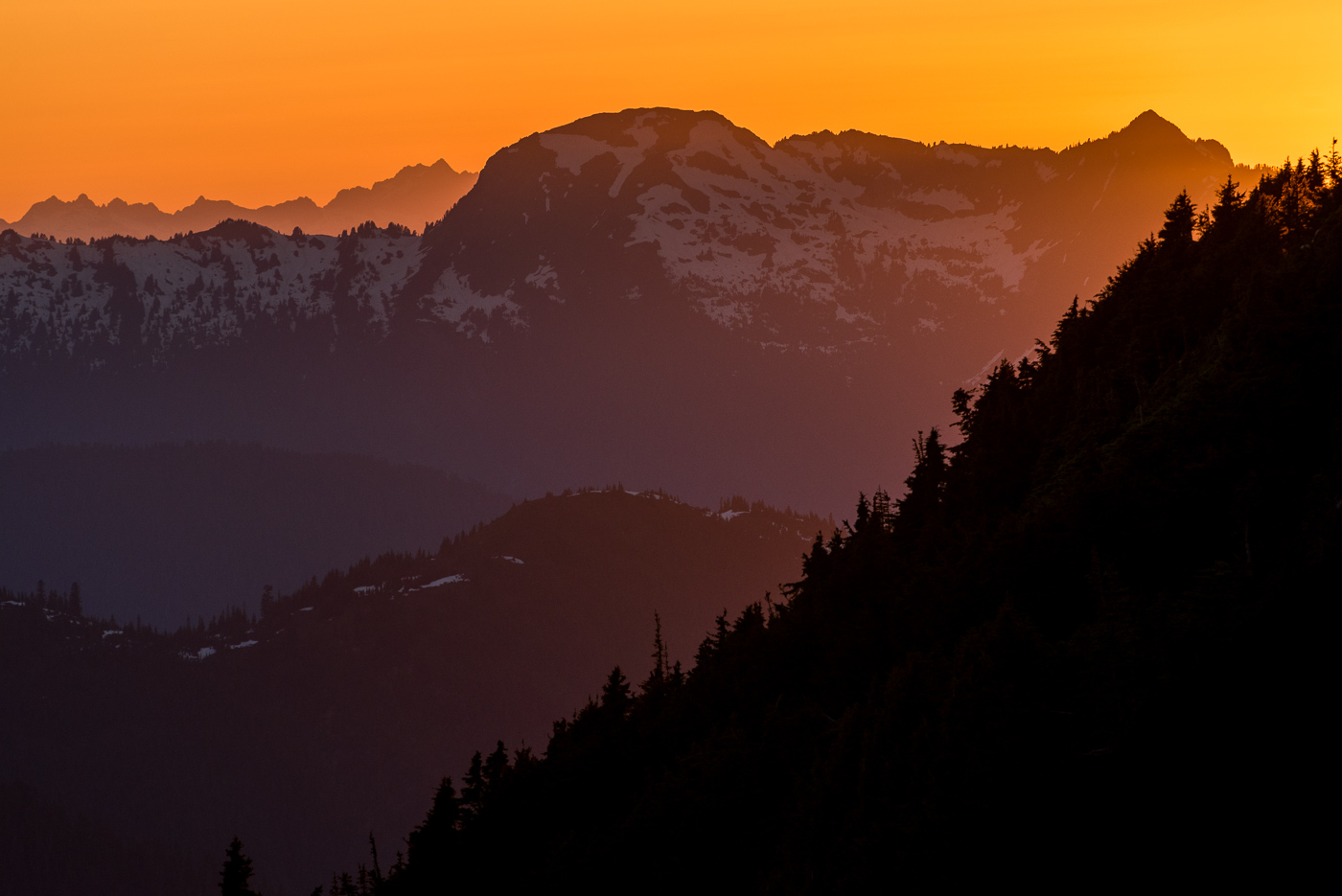
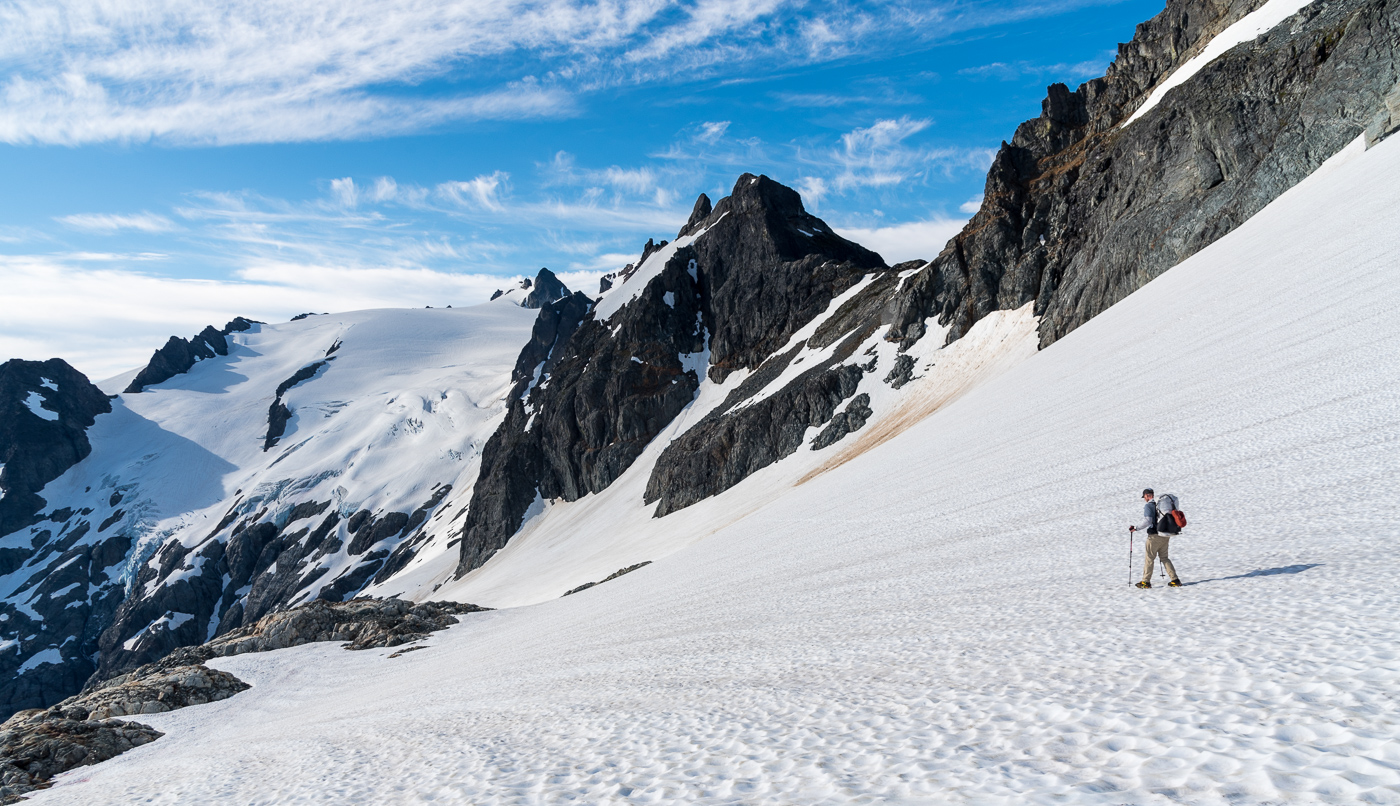
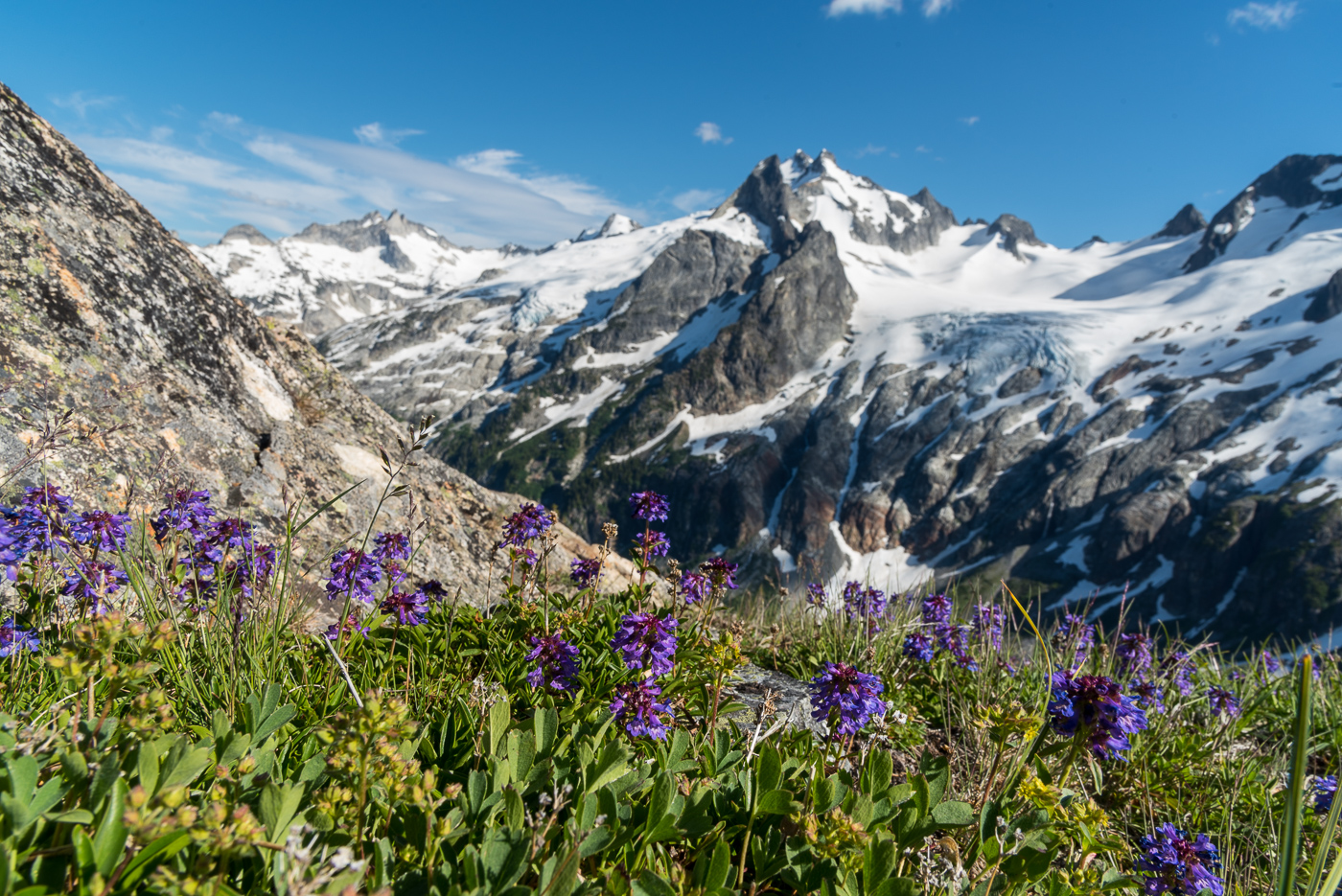
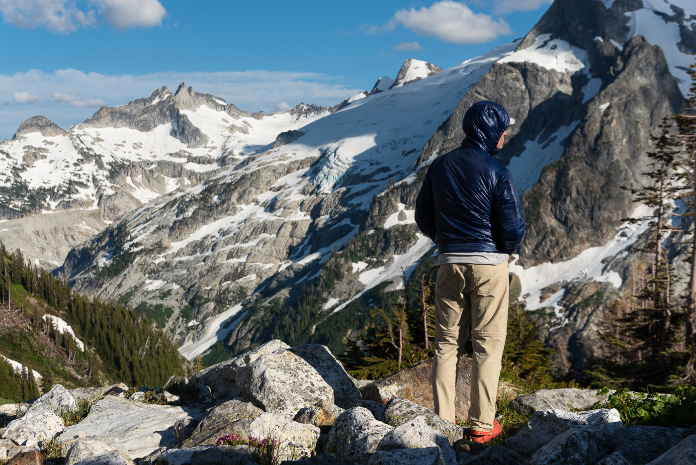
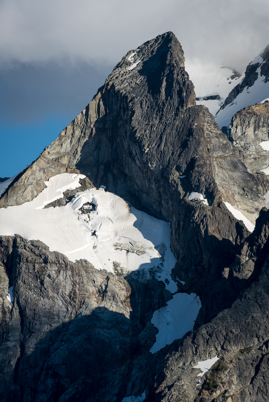
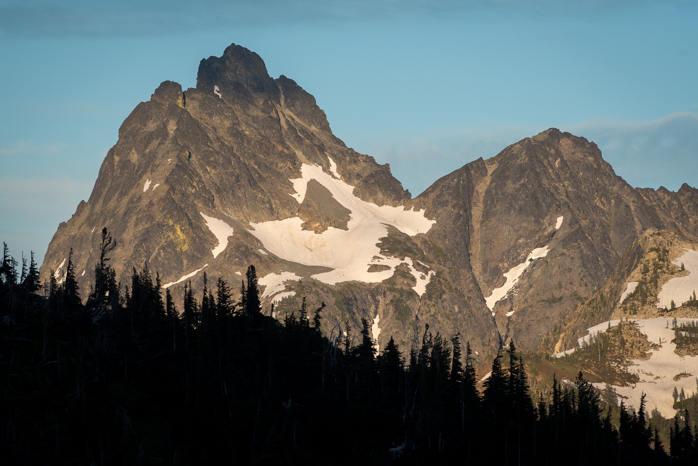
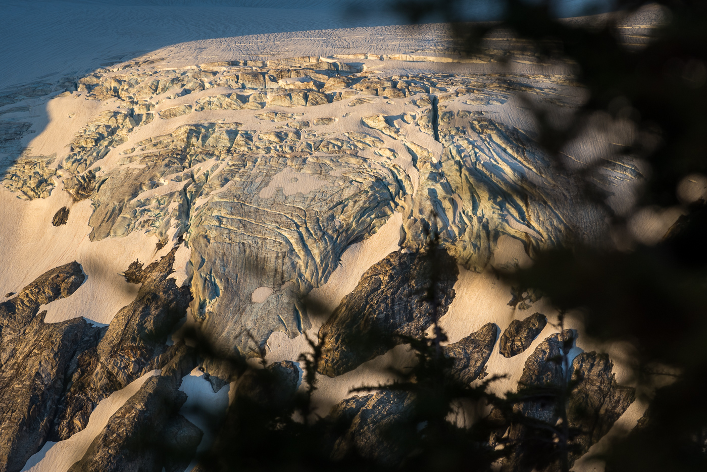
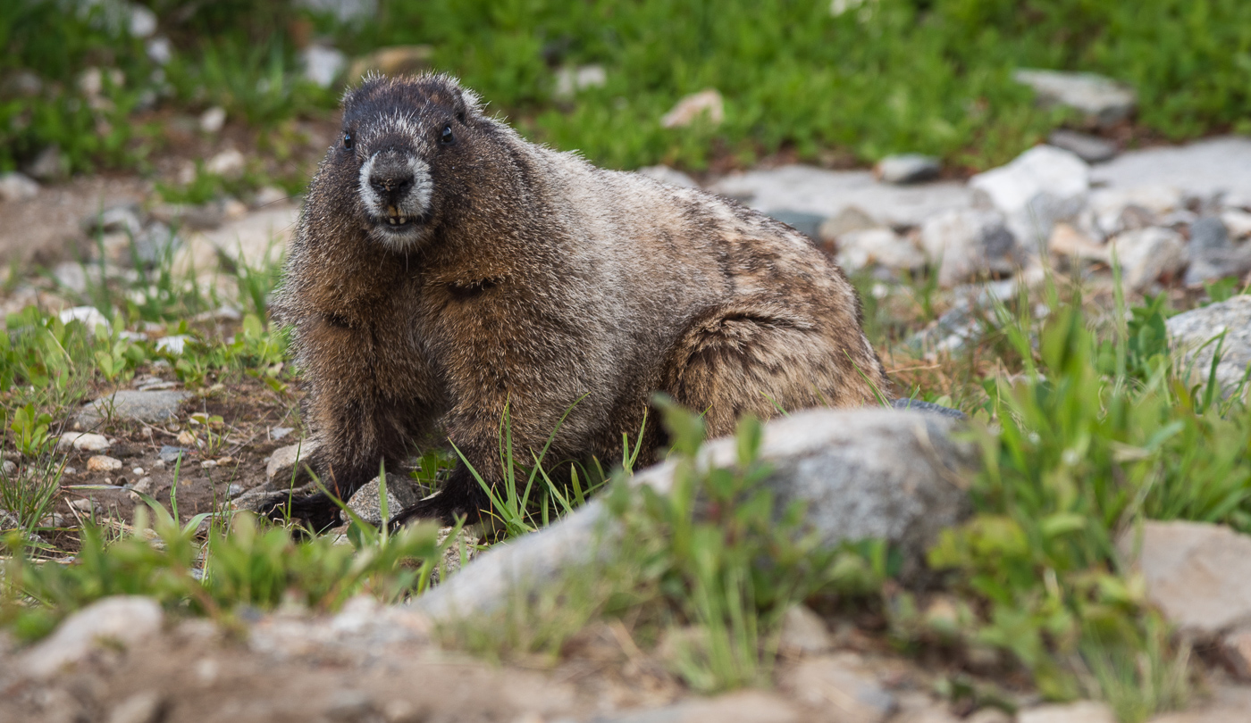
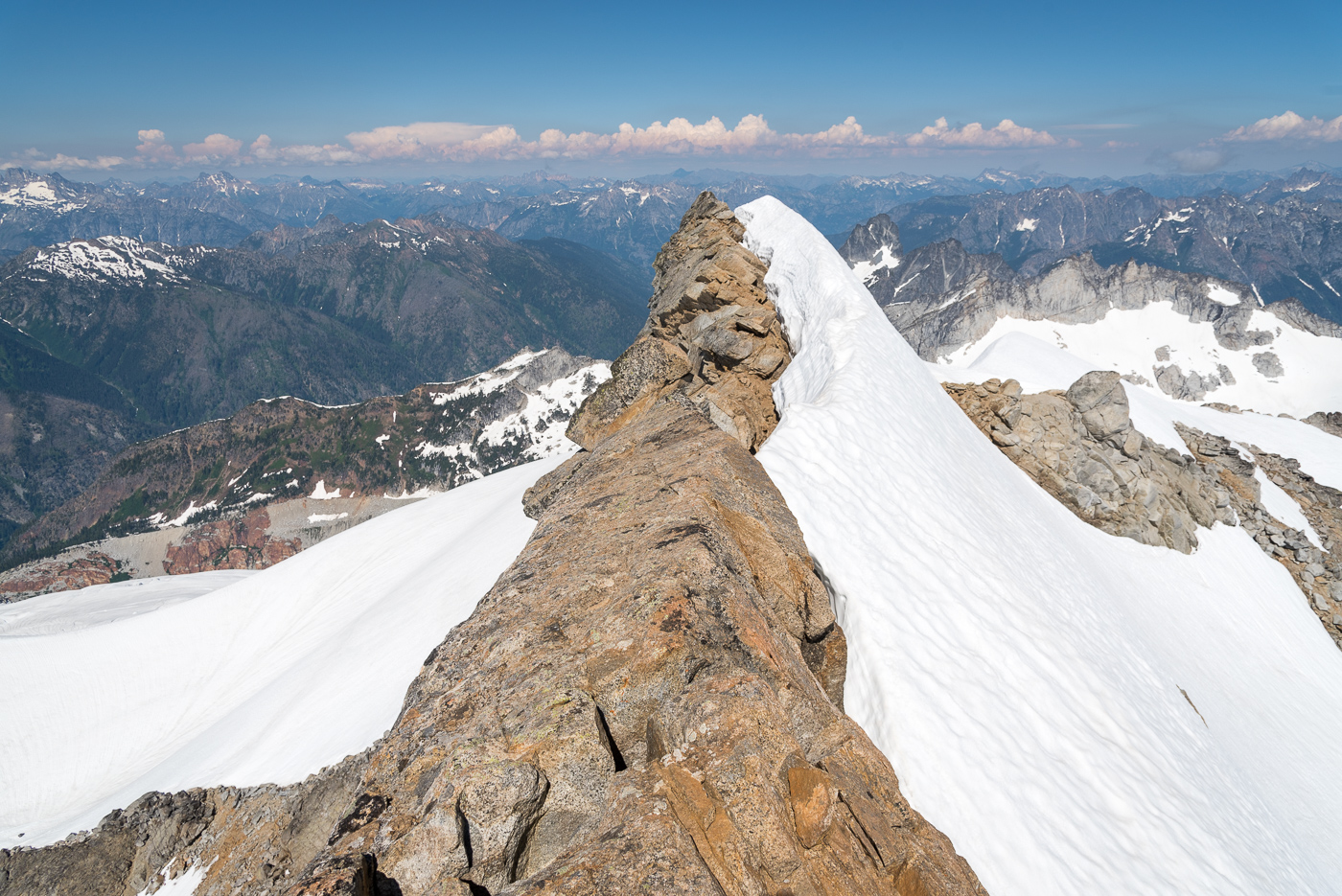
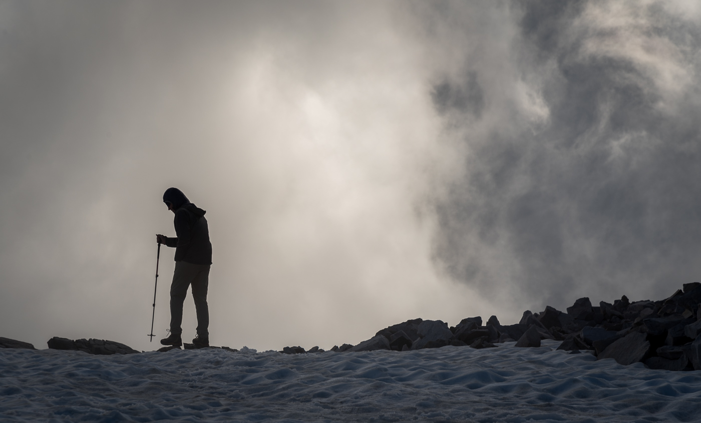
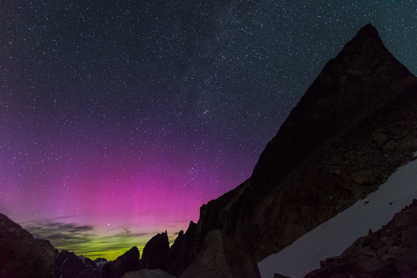
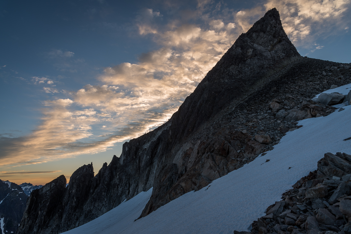
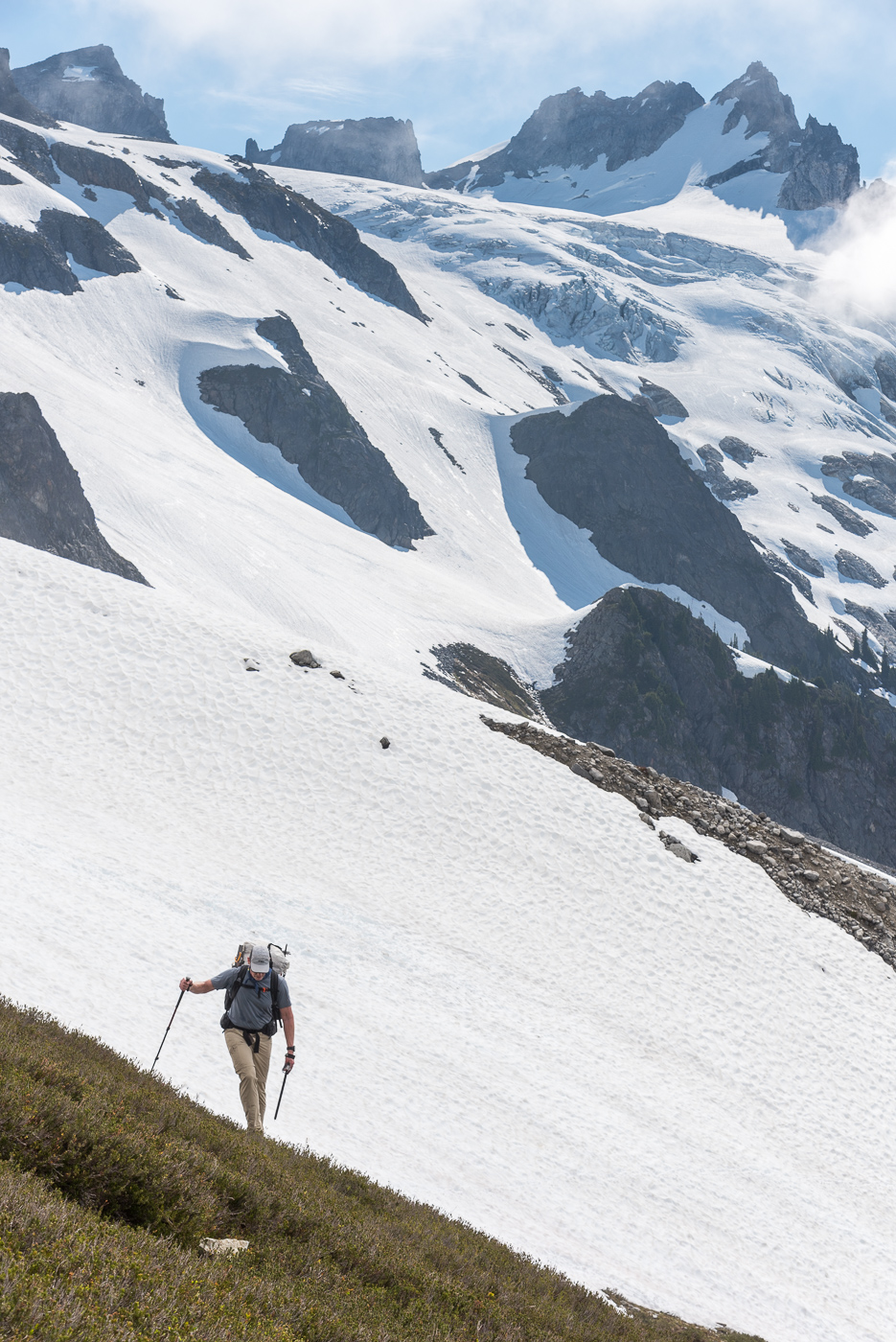
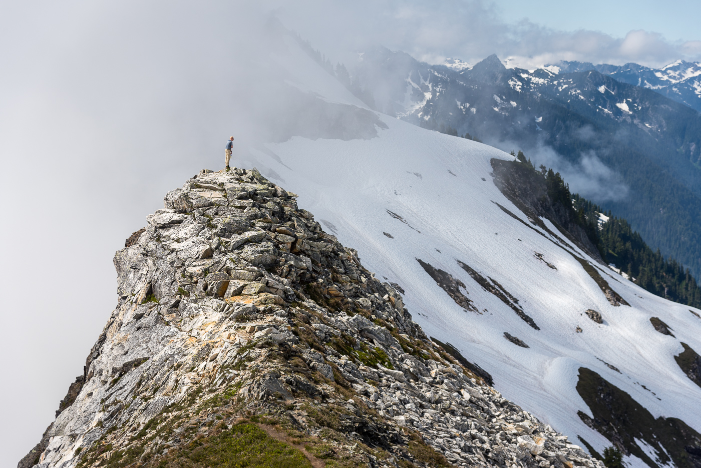
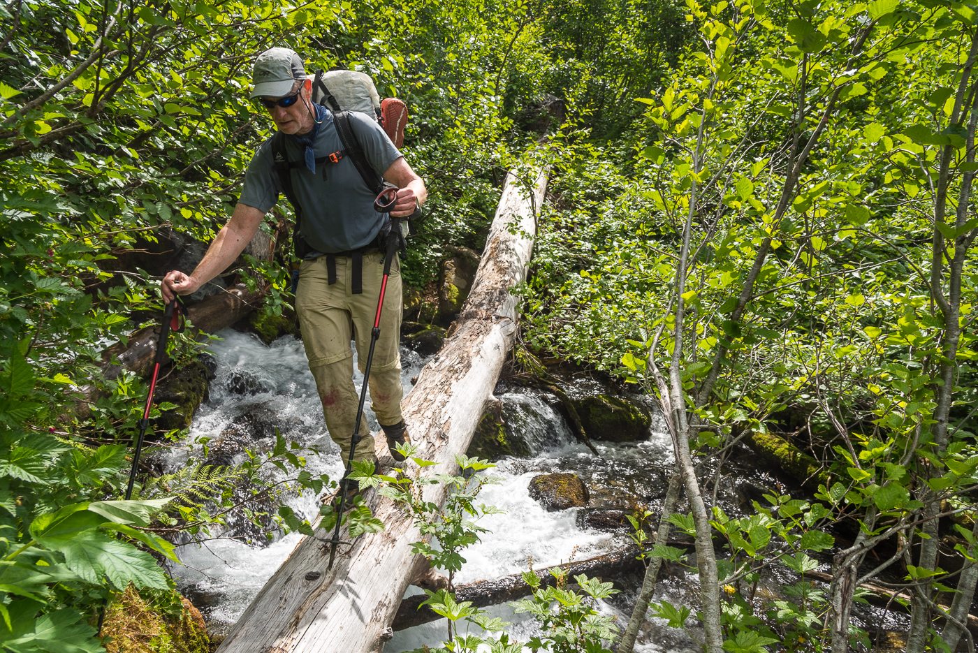
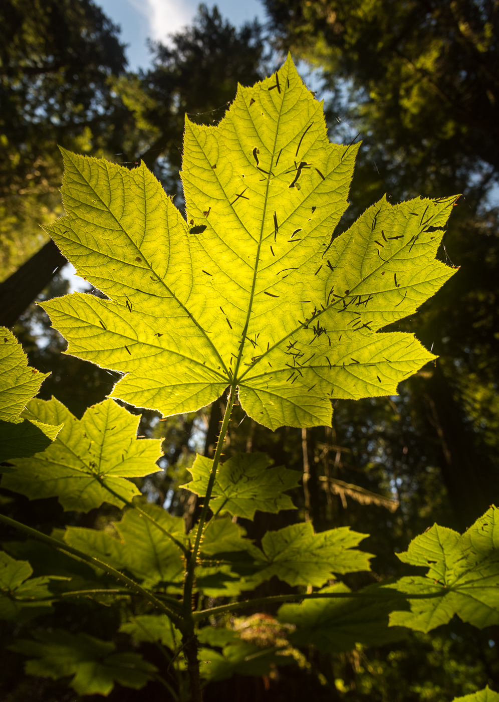
Trip: Prusik - West ridge Trip Date: 07/27/2022 Trip Report: This started out as a pretty rough night of sleep at the Stuart lake trailhead. I woke up sweating and a bit unhappy; even considering not getting out of the car to go on this adventure I had planned for myself. I have this experience a lot; I get excited and drive long distances or hike in large approaches just for my mind to try and convince me that I don't want to be there or that it doesn't sound fun. I find that 100% of the time if I fight those feelings and push through I have the time of my life. This was very true for today. I got my shit together and left the trailhead. Made it up to Colchuck and over Asgard in what felt like no time. I hear a lot of people complain about the hike up to Colchuck lake. Yes, it's busy but isn't everywhere else we go in most of our daily lives? At least most of these people that we encounter on the way up are happy, movin, and enjoying what we all come out to enjoy. Anyways... Making up and over Asgard before the day got too hot was the way to do it! down at the icicle, it was going to be 100 something and I didn't want any of that on the way in. IMG_1349.HEIC Dragontail looked extra special that day. The usual interactions with the furry locals up on the plateau ensued (cautions walking around trying not to get headbutted). It was getting hot at this point. The heat was not the biggest issue I found. That would be the mosquitos. They kept you moving!!! If you stop at all a million would swarm and start chewing. I definitely moved faster than I was in shape to do only because I had no other choice. The plan for today was to romp up the west ridge of Prusik. The pictures I had seen of prusik were mesmerizing, to say the least. The biggest thing I noticed was how different this mountain looks from every angle. From the first sight of it after Asgard, it looks like a tiny point along a much larger ridge. Every time you get a bit closer it seems to grow up out of the ridge it's a part of. IMG_1384.HEIC Up close and personal with the south face. after making some questionable route-finding decisions I made it to the base of the west ridge; Just below the obvious heavily cleaned crack above the notch. Rock shoes and the fanny pack went on and up I went. This route is something else. You find yourself wandering up some low filth CLEAN rock with some intermixed interesting moves until you pop up to a flatter section of the ridge. This was one of the highlights for me. A combination of butt scooting and finger rail scootching with the exposure of the south face below you is something else. Enjoy the exposure, pull a slab move, climb some crack, squeeze a chimney, then enjoy the views. IMG_1370.HEIC IMG_1376.HEIC IMG_1379.HEIC The raps were straightforward, I believe with a bit of down climbing I did four rappels. After a little bit of walking back to the notch, I was able to collect my stuff and get eaten a bit more by the buzzers. The rest of the trip was very uneventful. A quick dip in a few of the lakes on the way down kept the temps down and kept me happy. I can't recommend this route more to anyone. It has clean rock, great views, and interesting movement. Maybe just wait until it isn't 1000 degrees. Gear Notes: Good attitude Approach Notes: Walkin
 3 points
 -
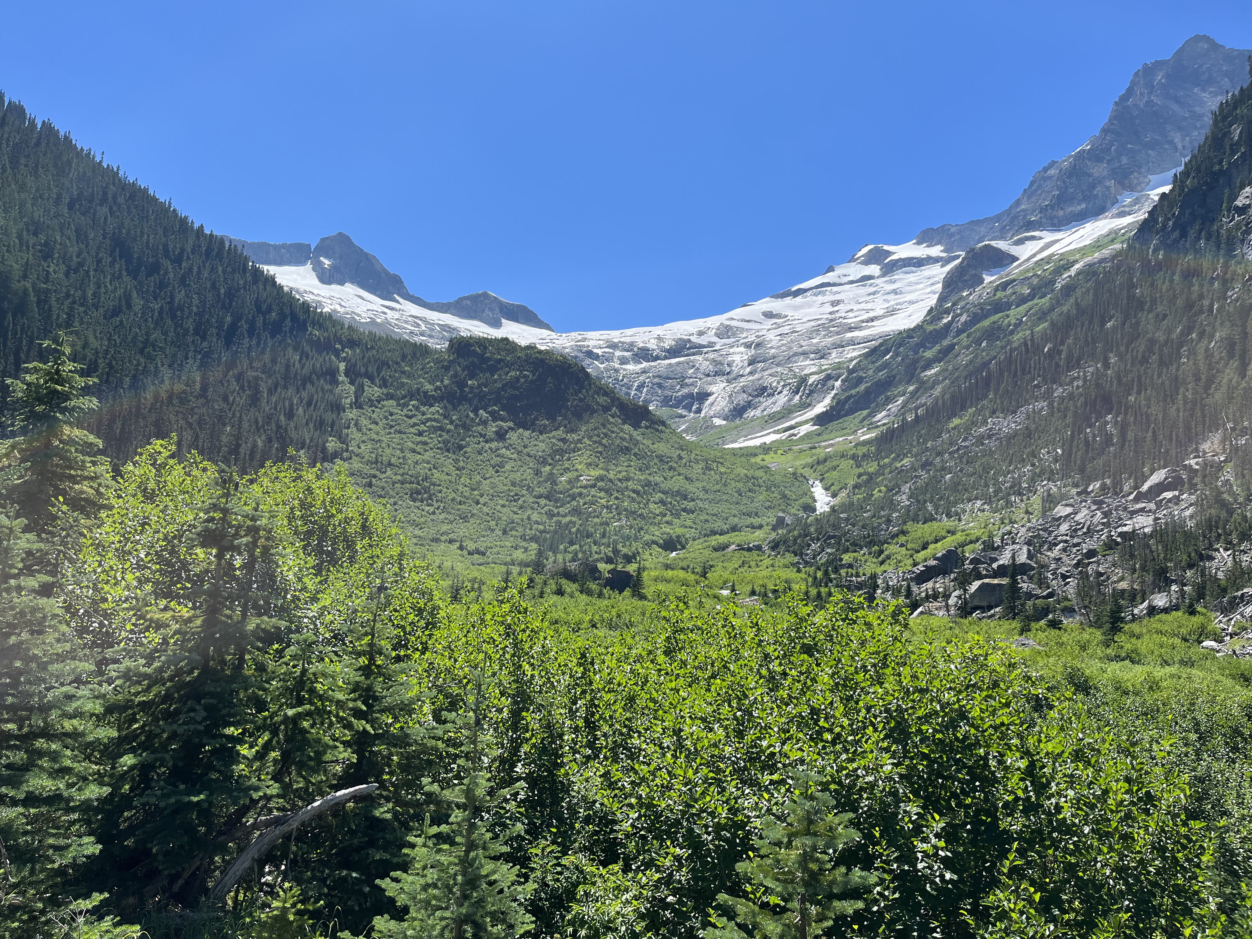
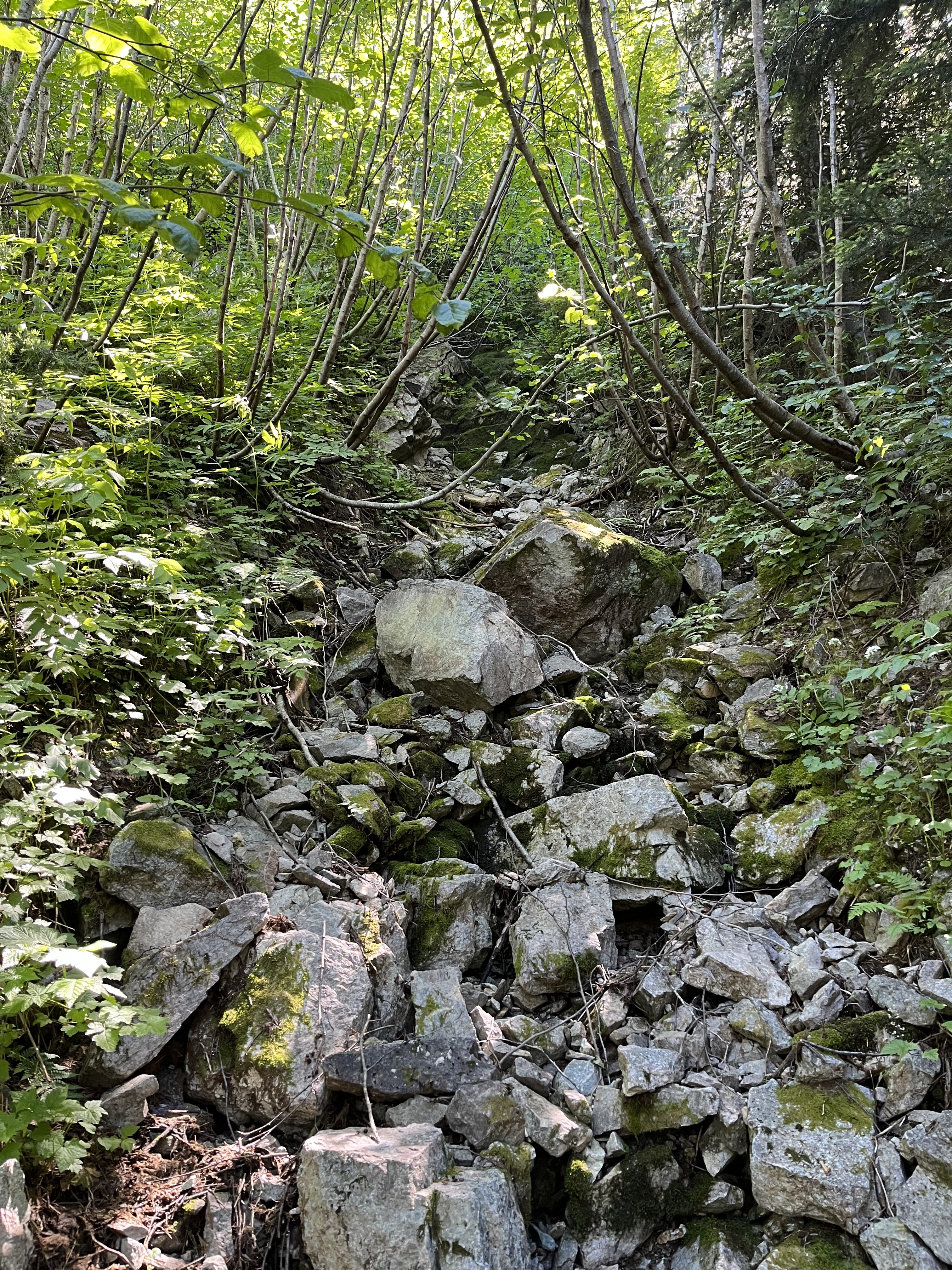
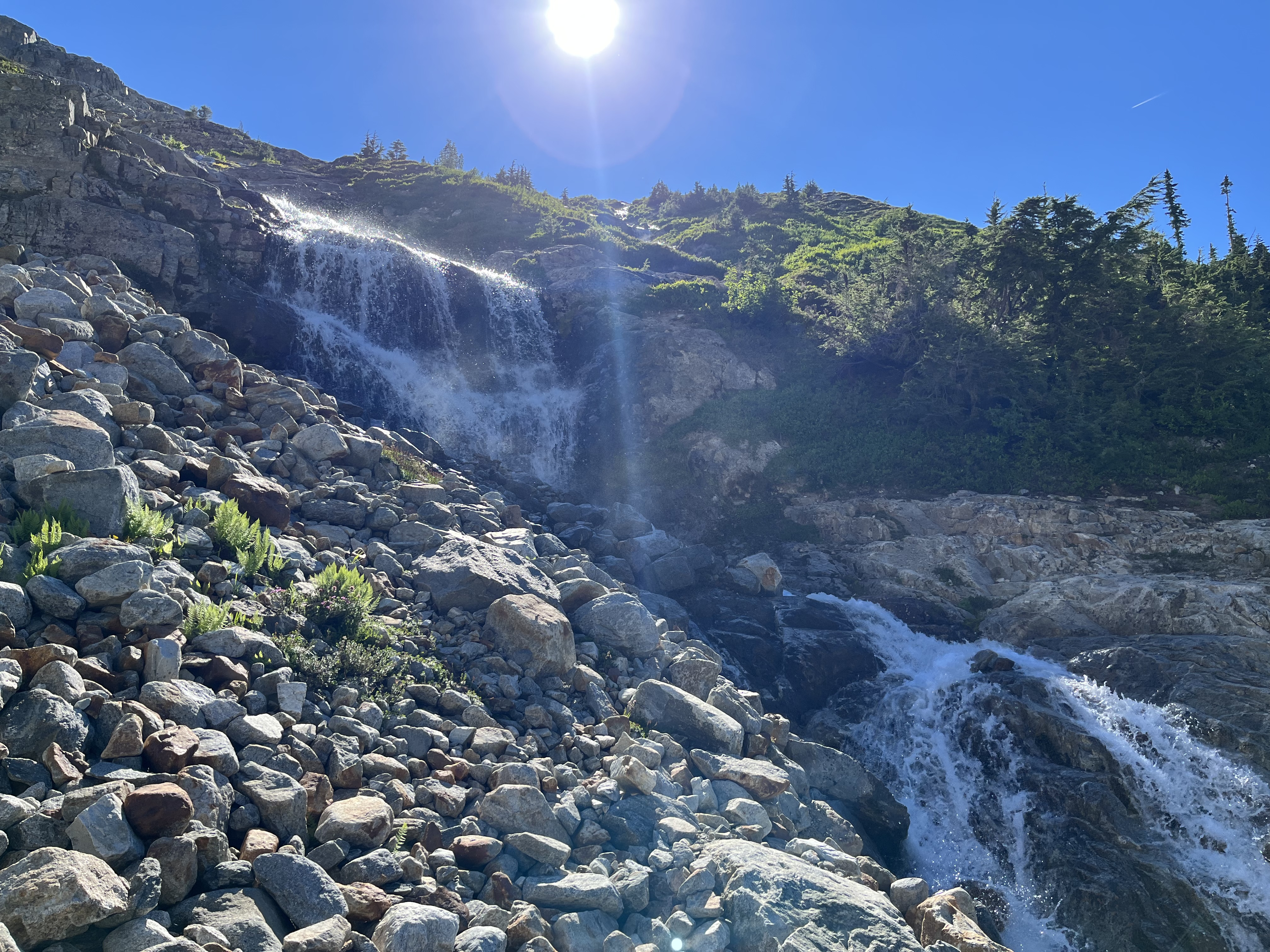
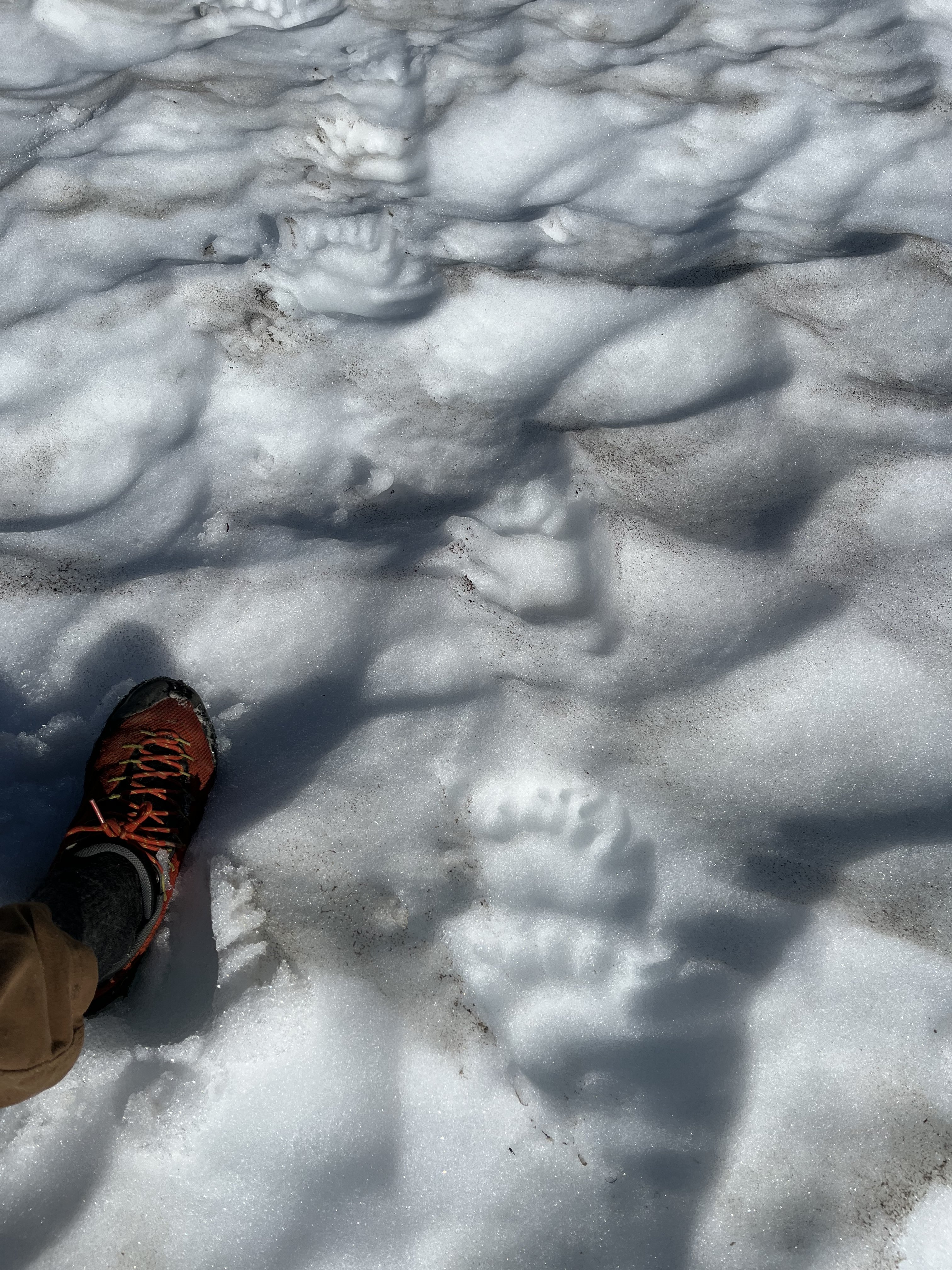
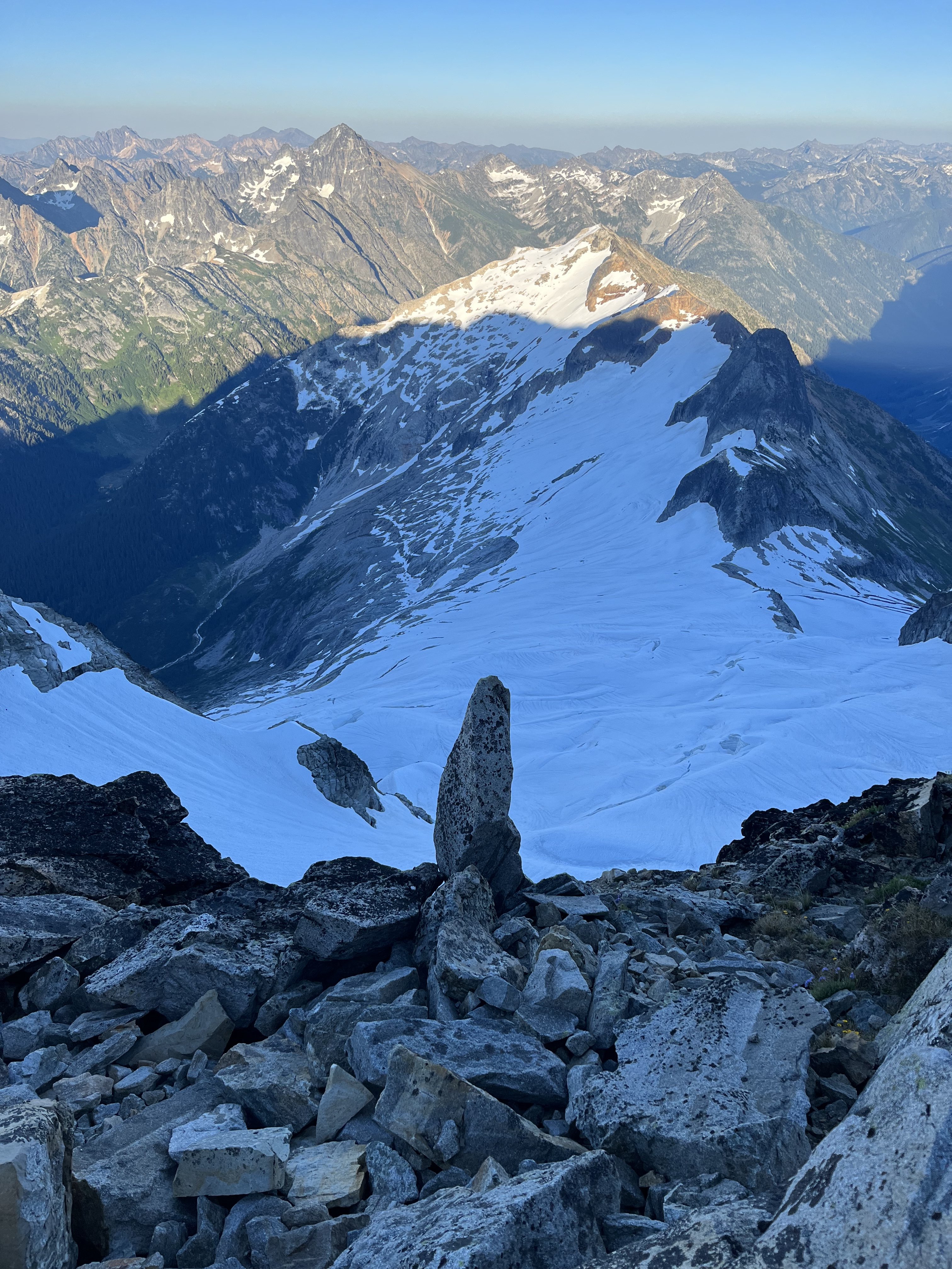
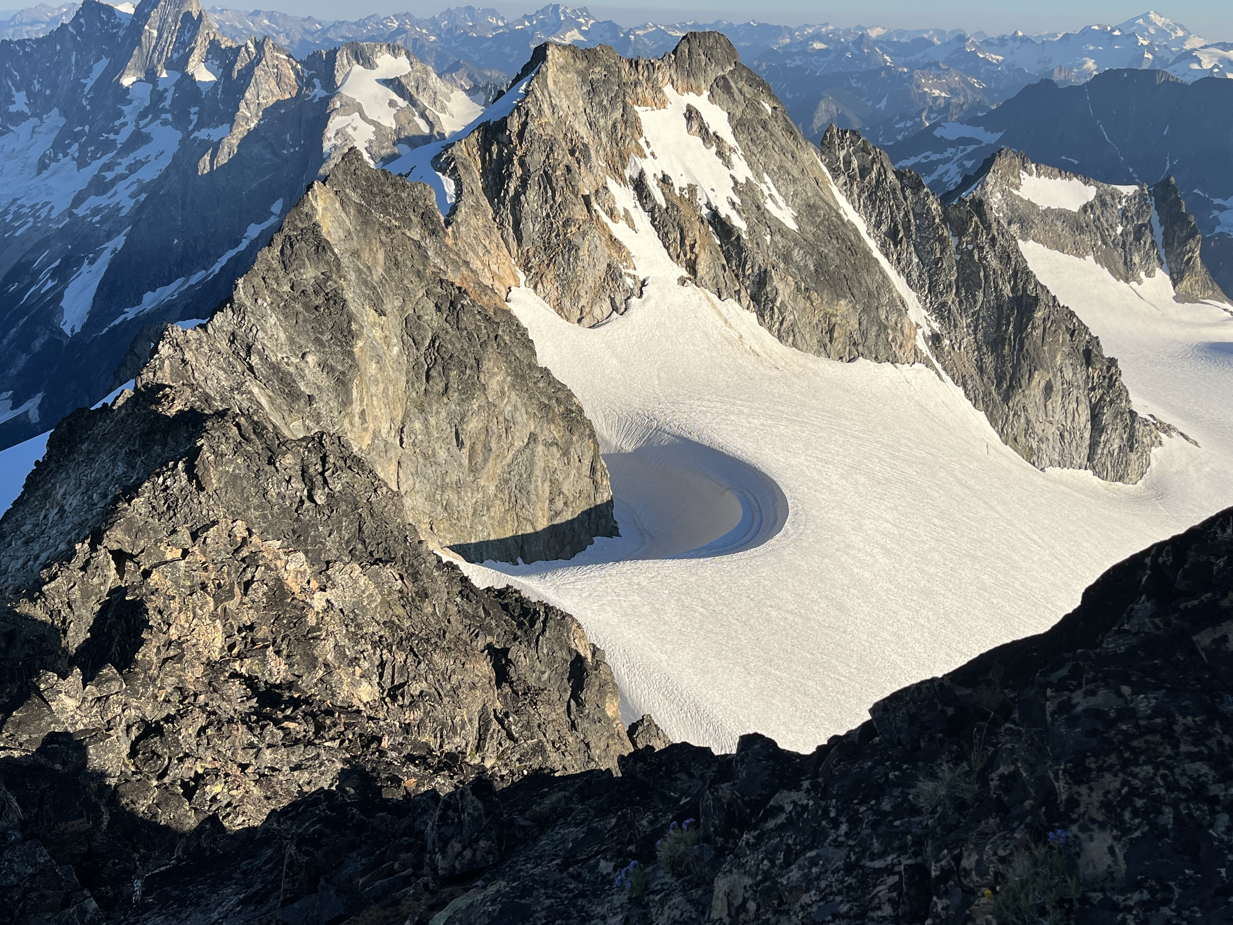
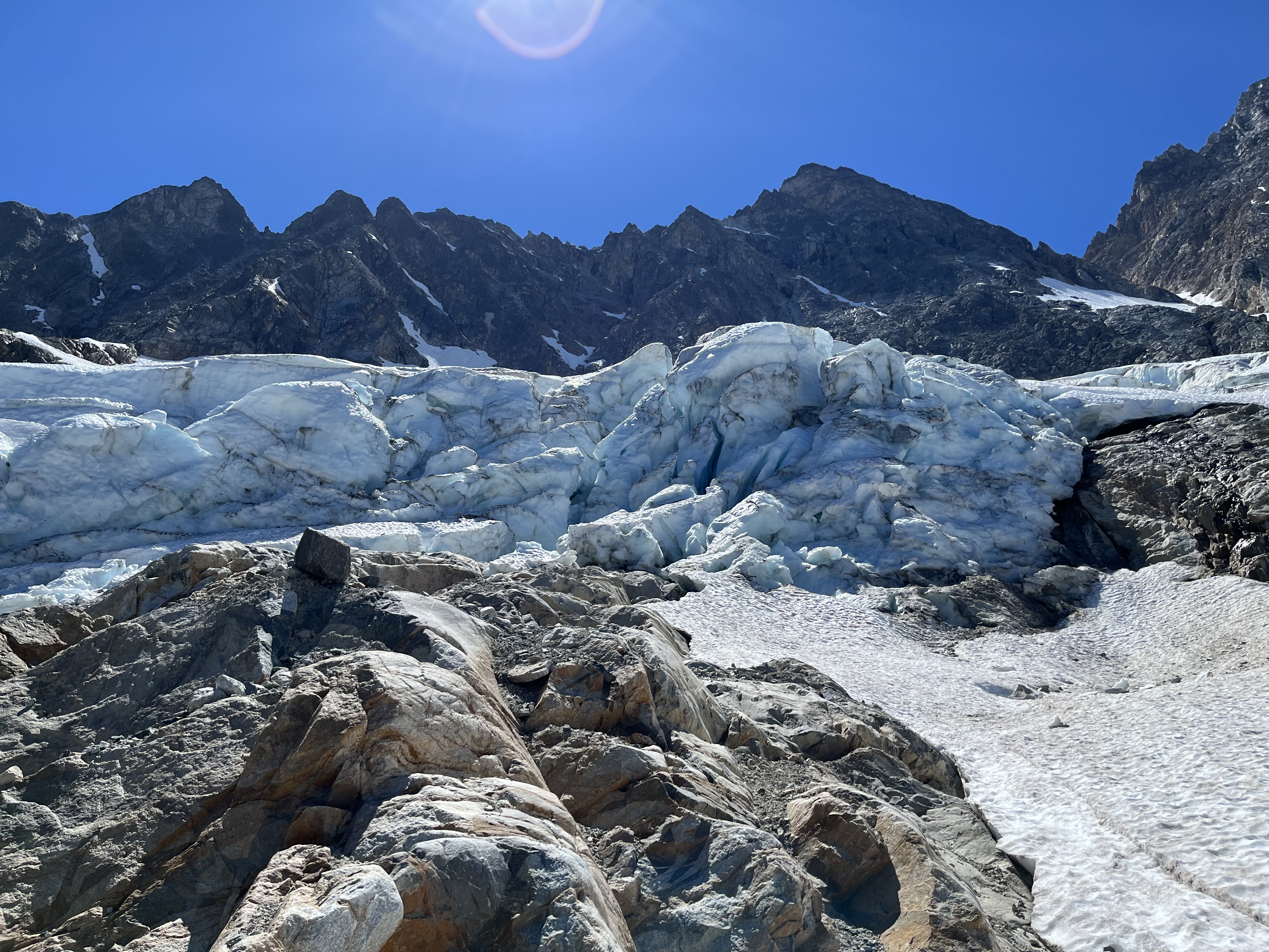
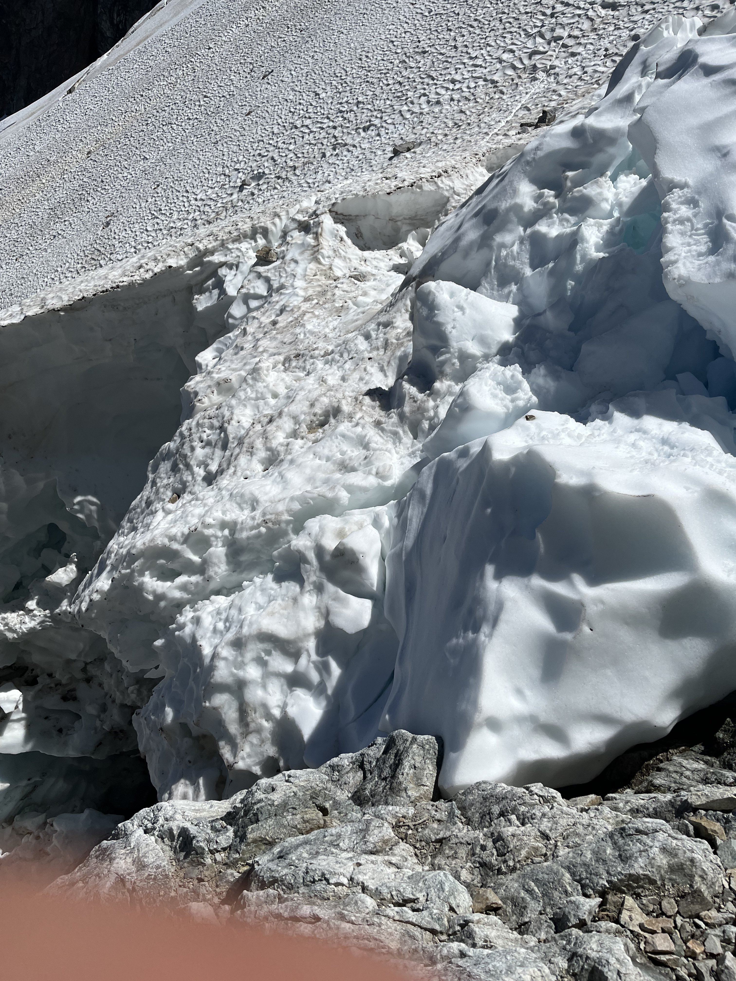
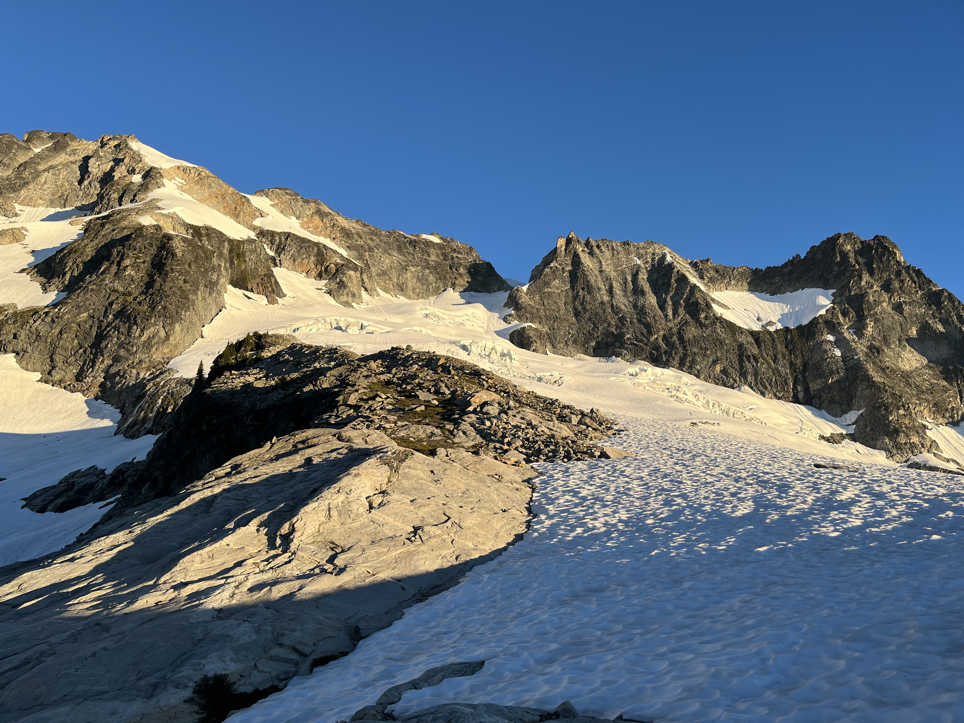
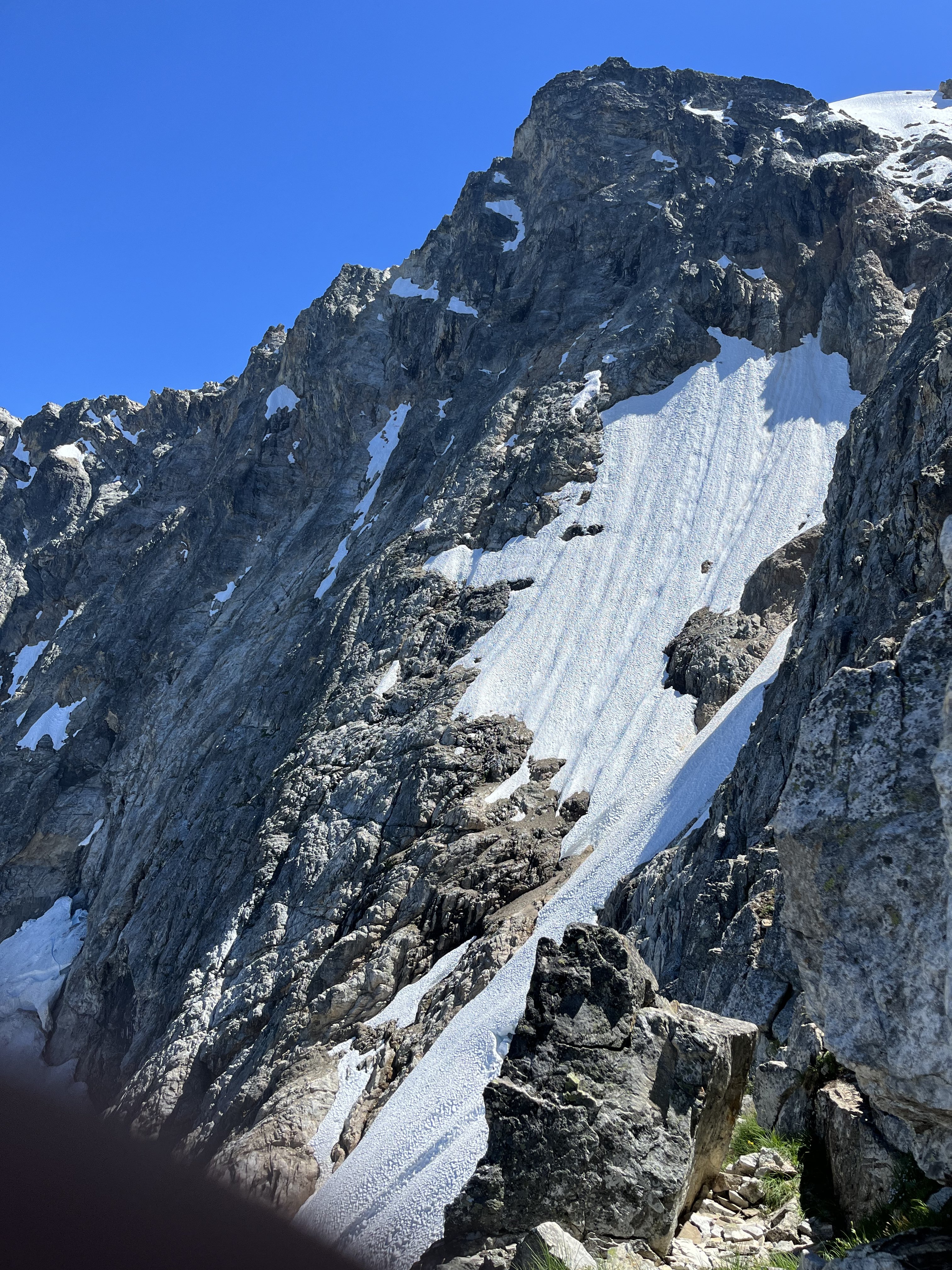
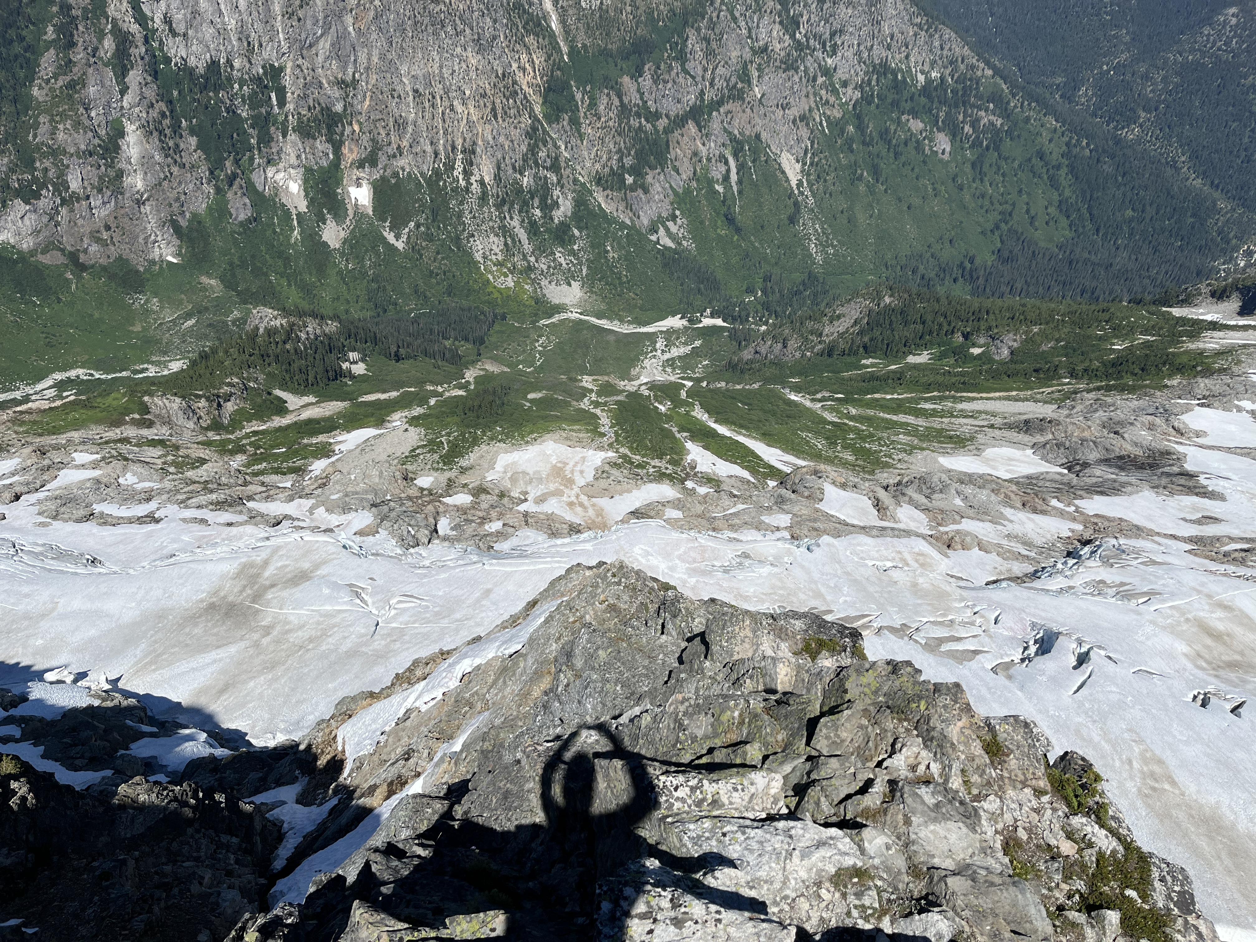
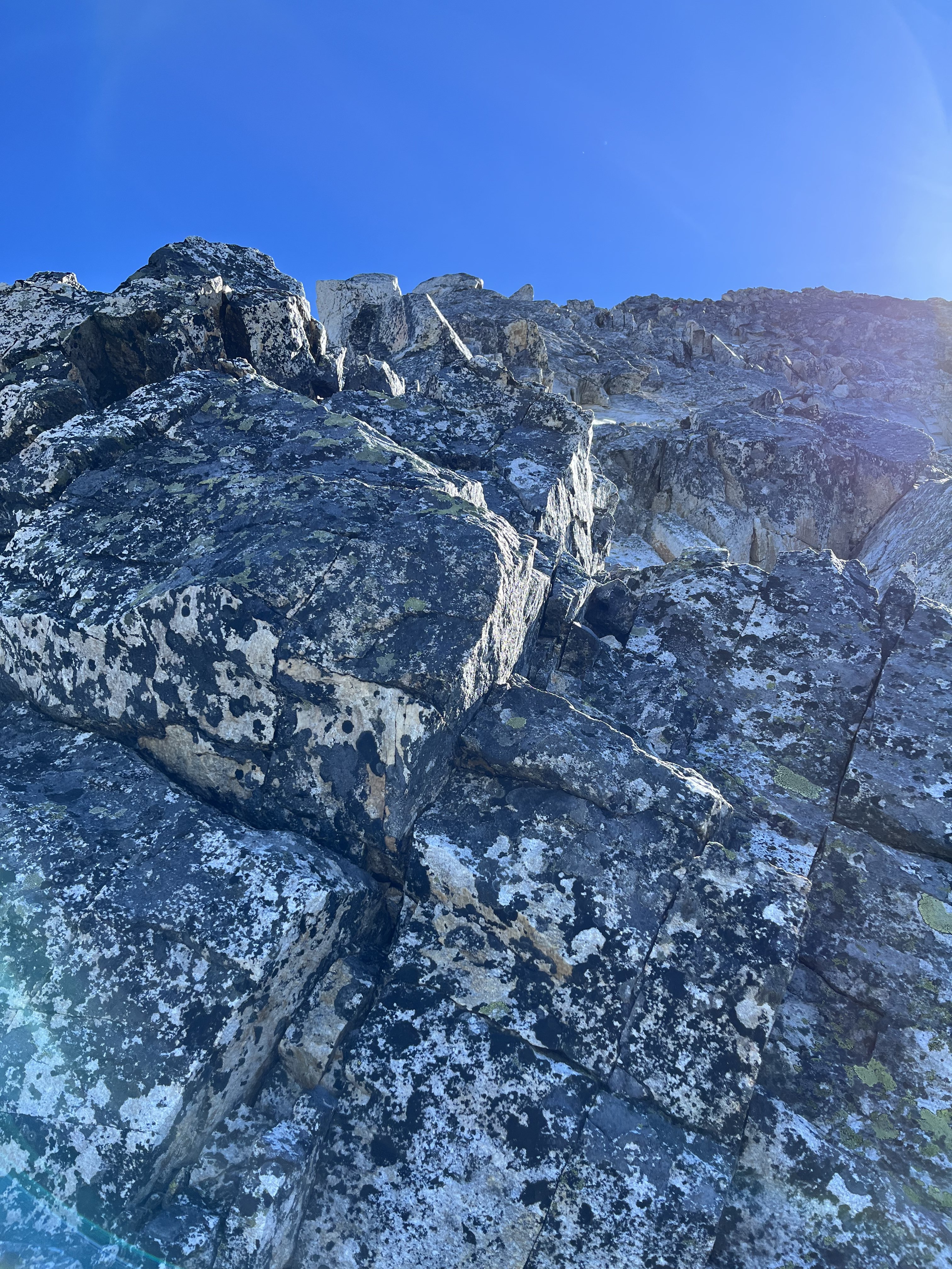
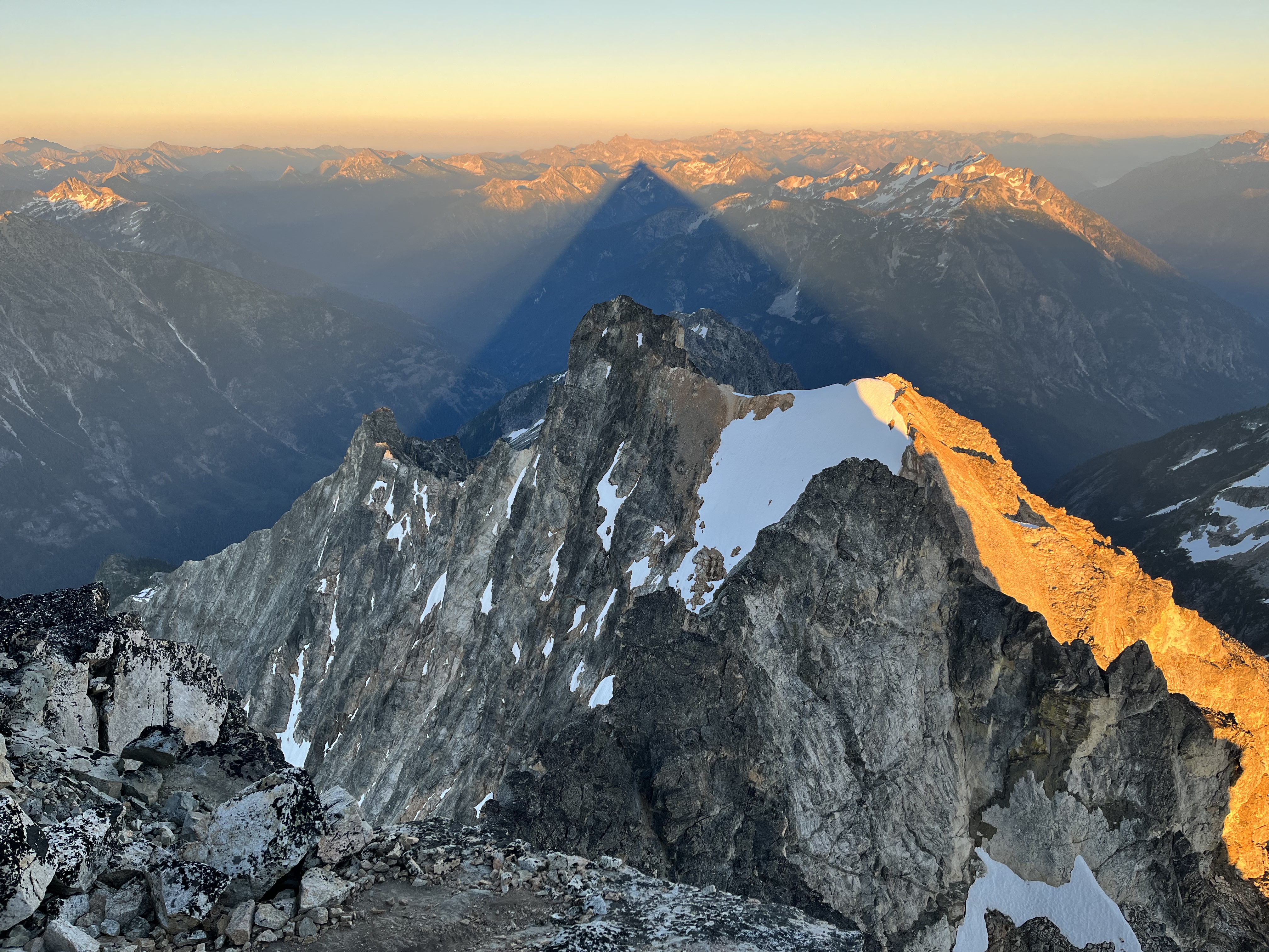
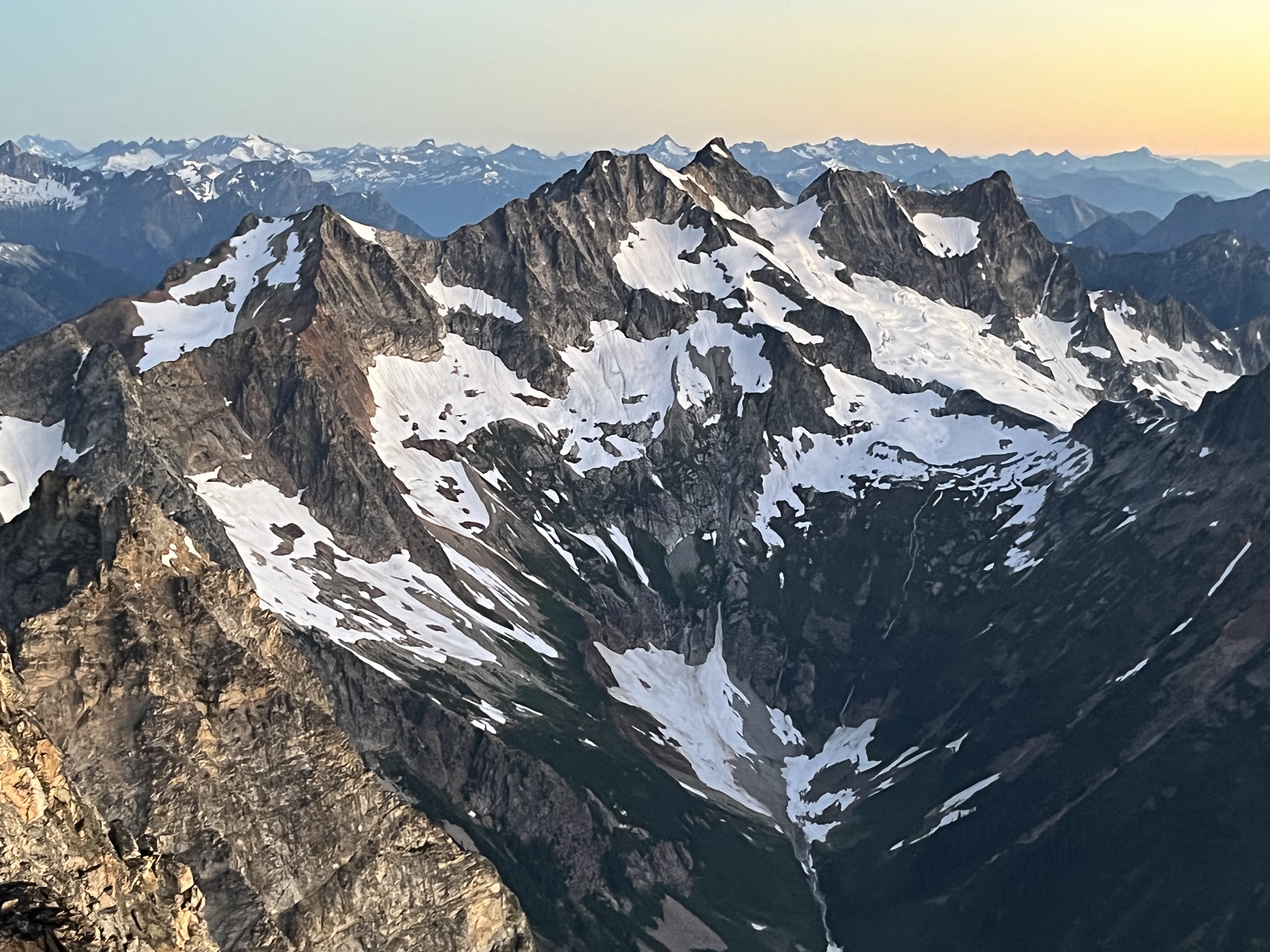
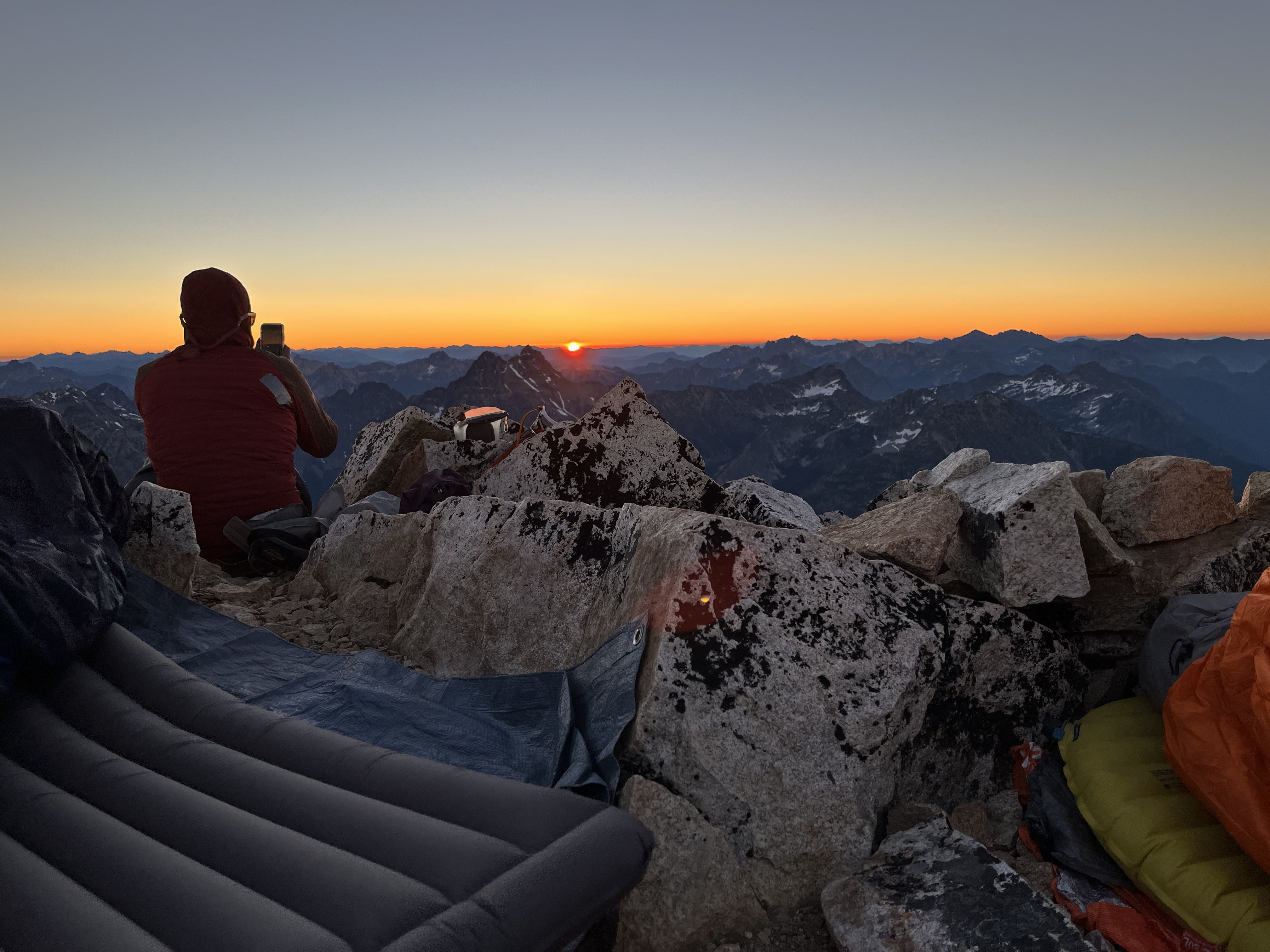
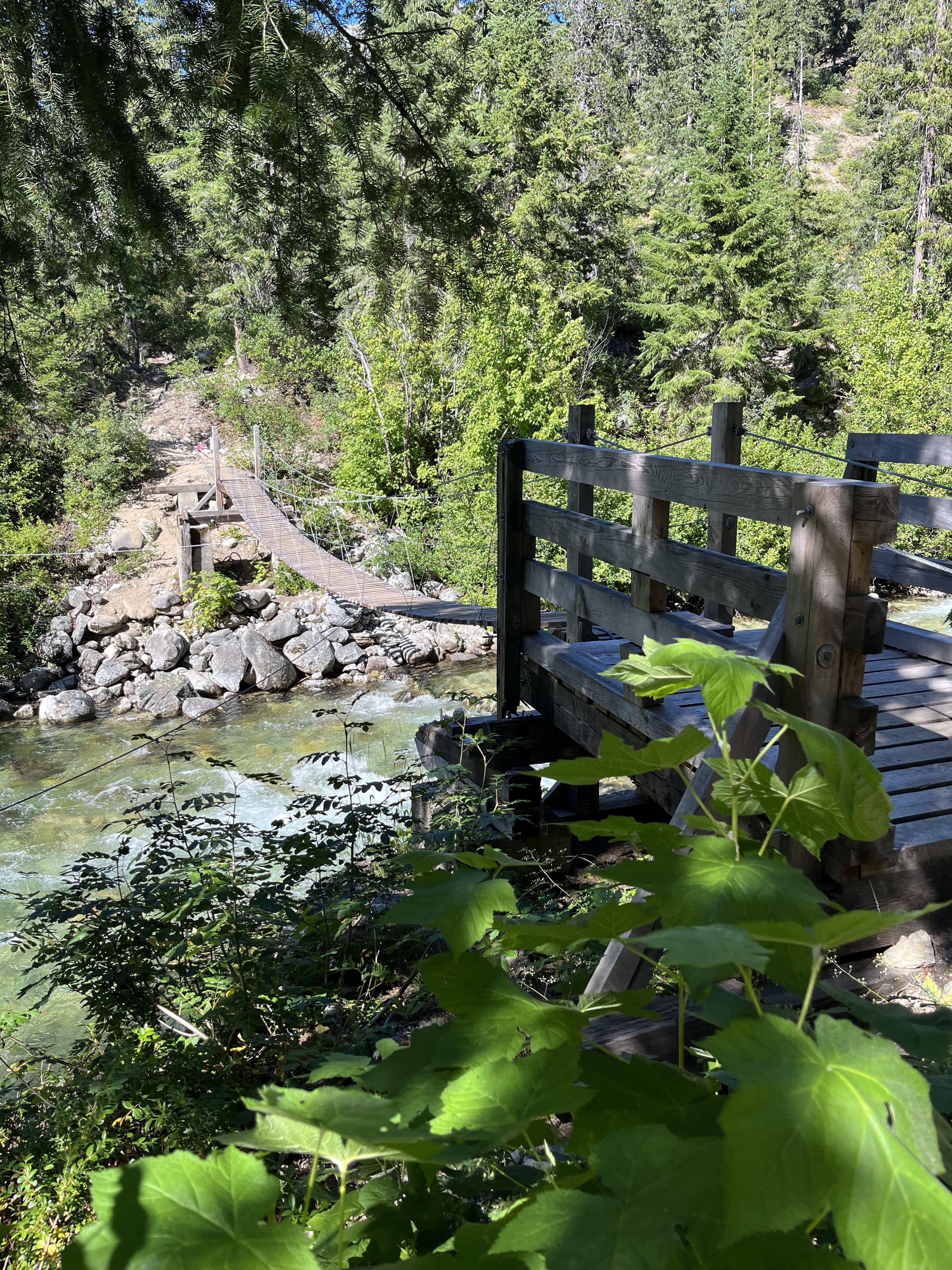
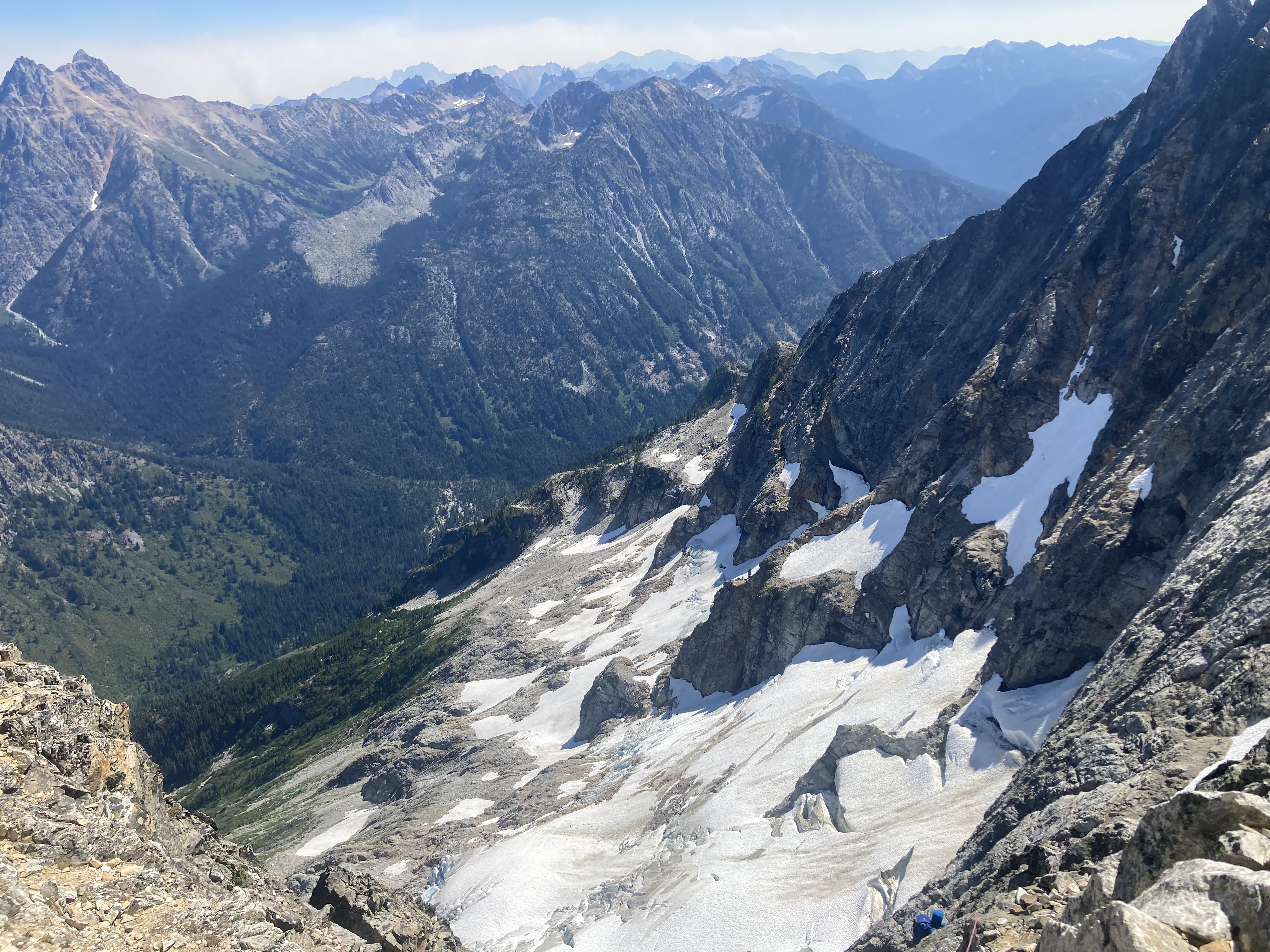
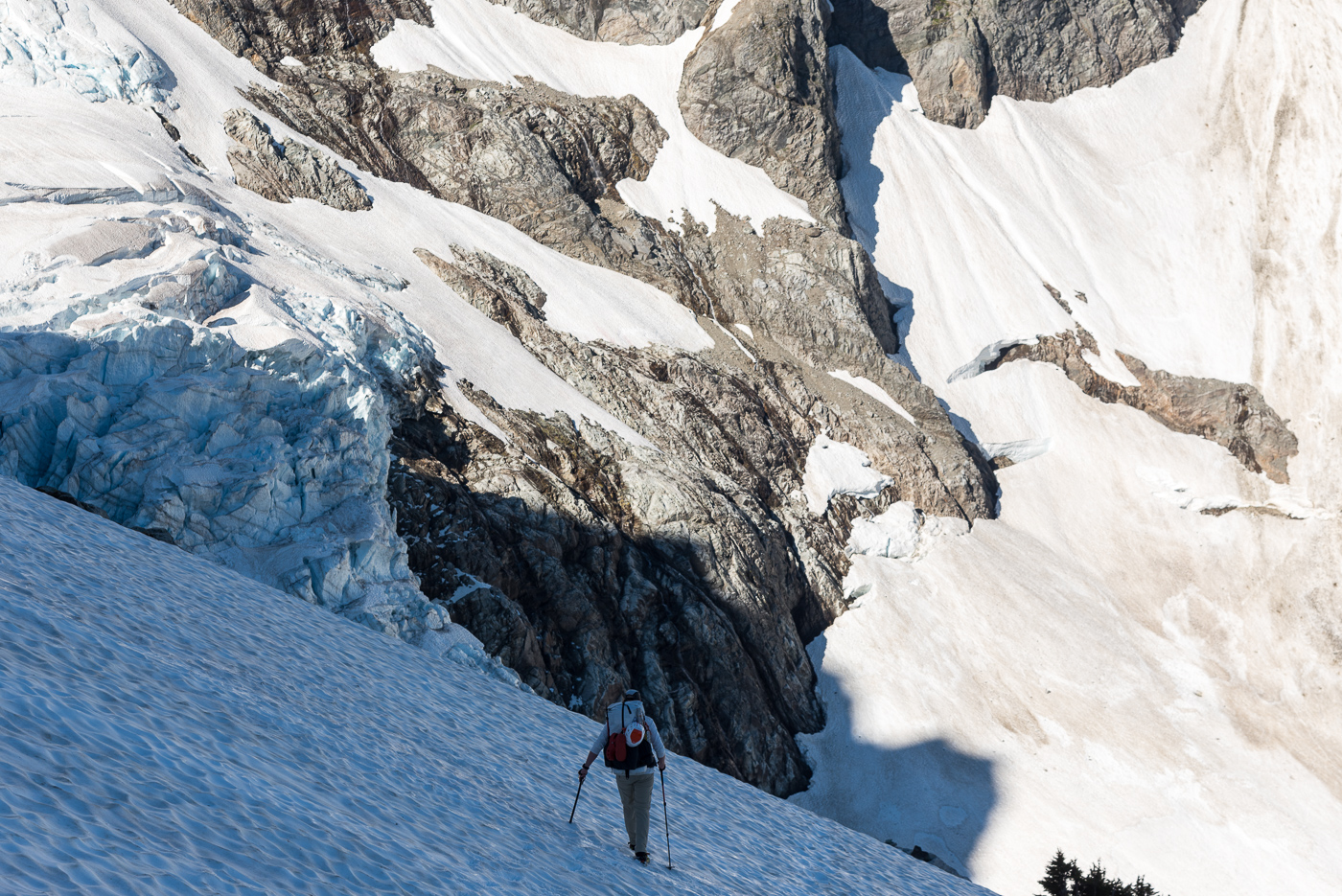
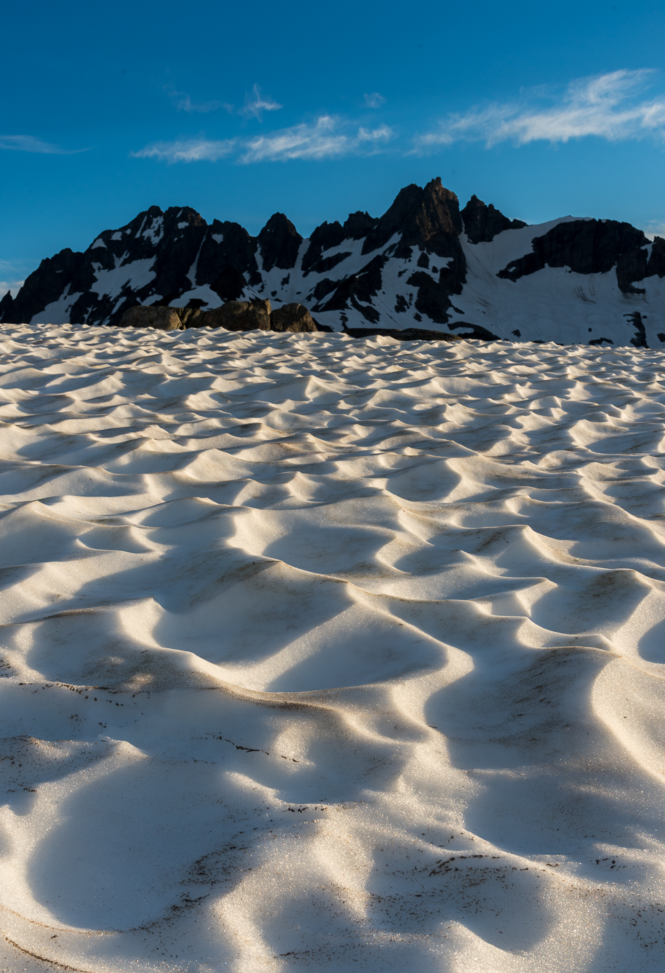
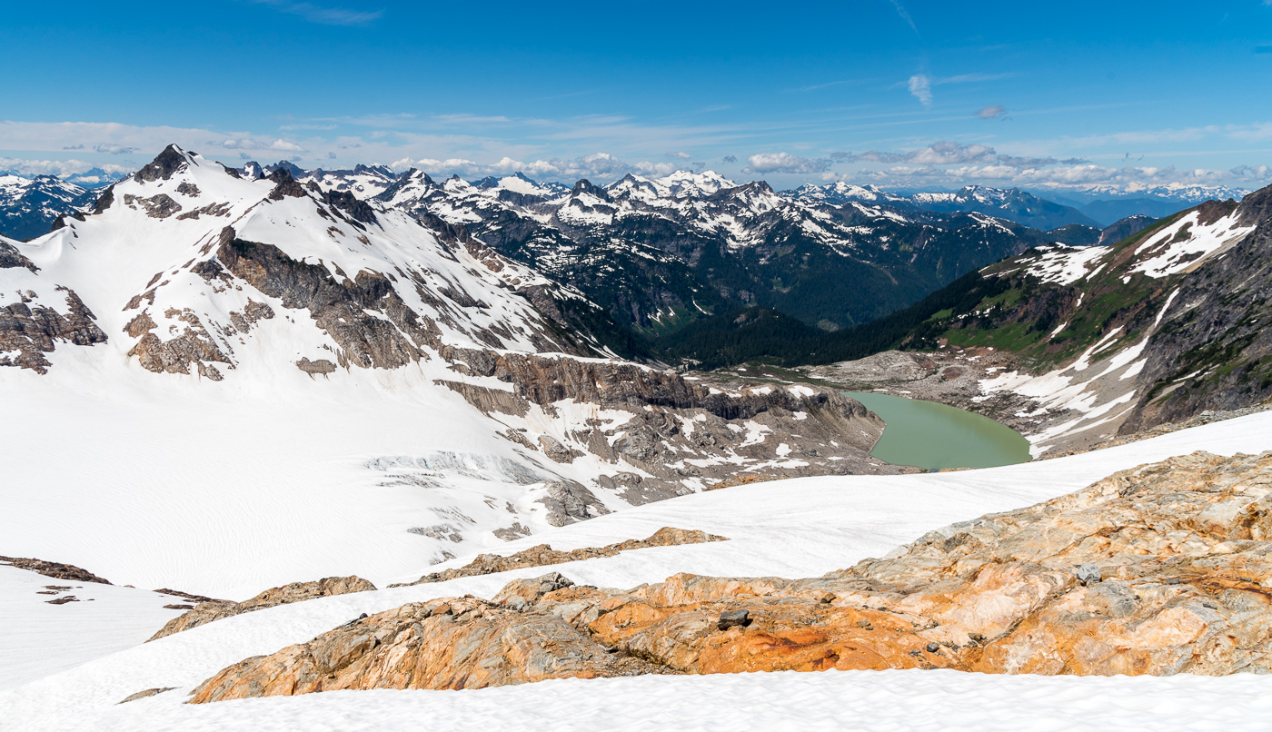
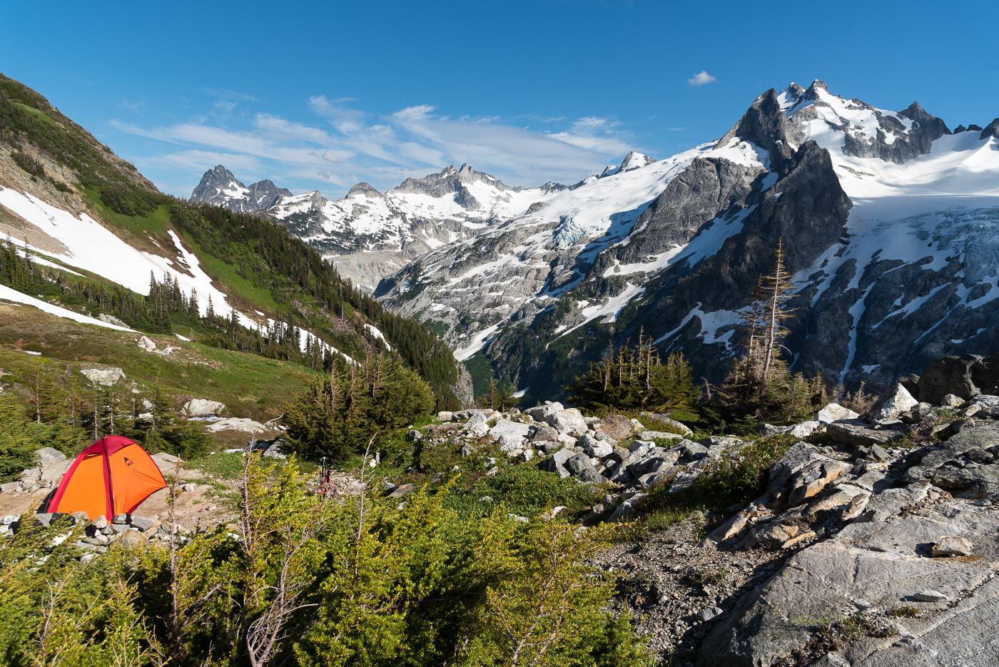
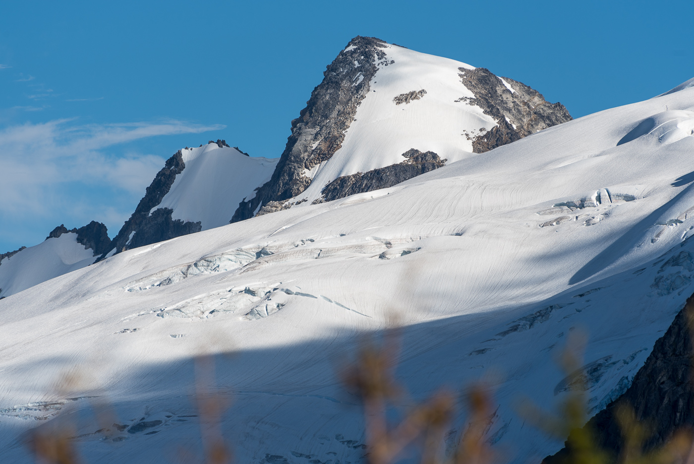
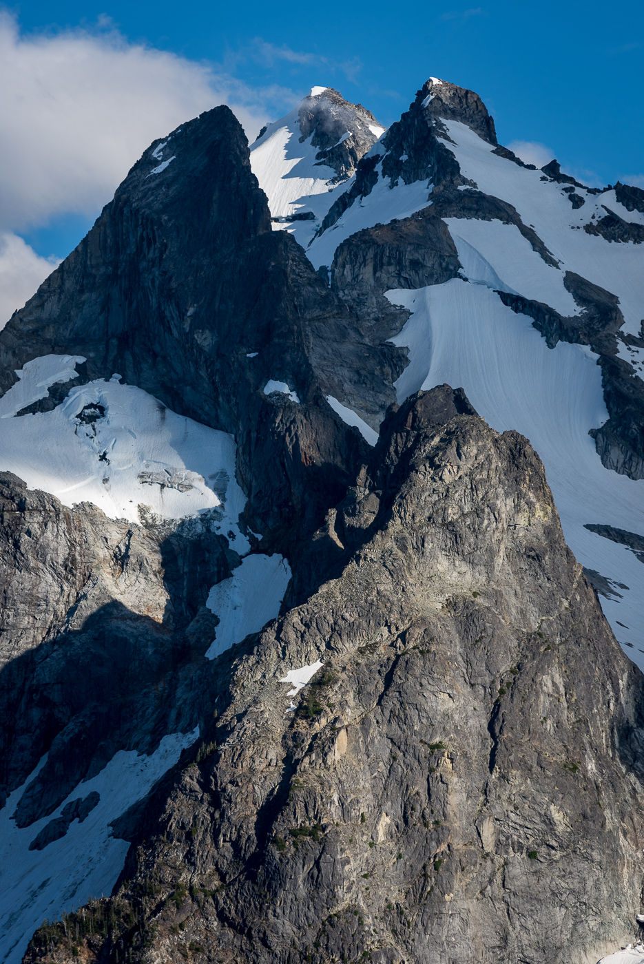
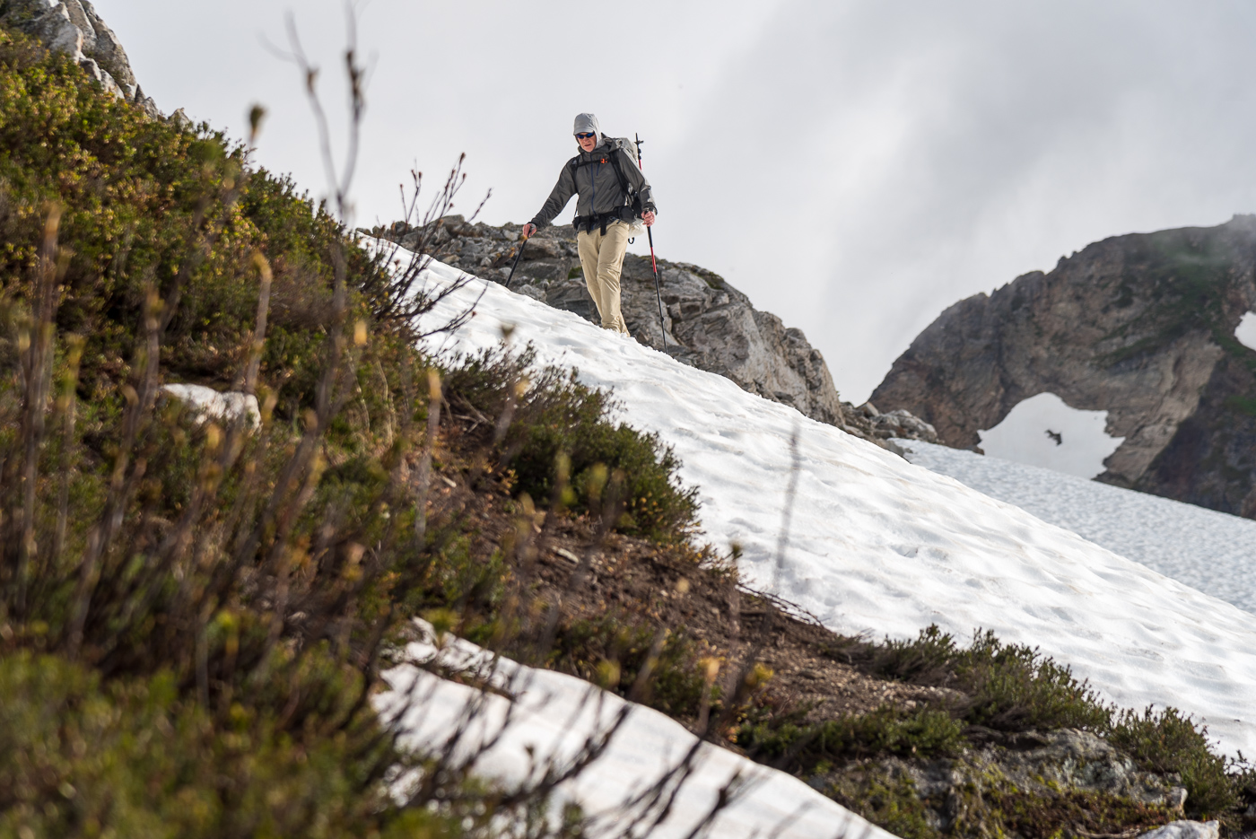
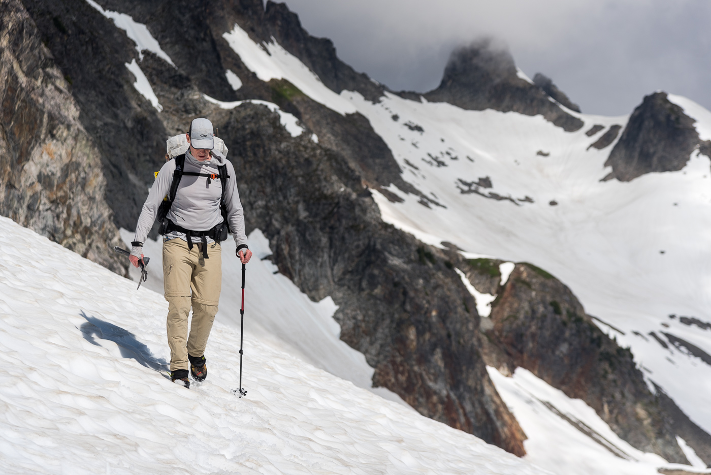
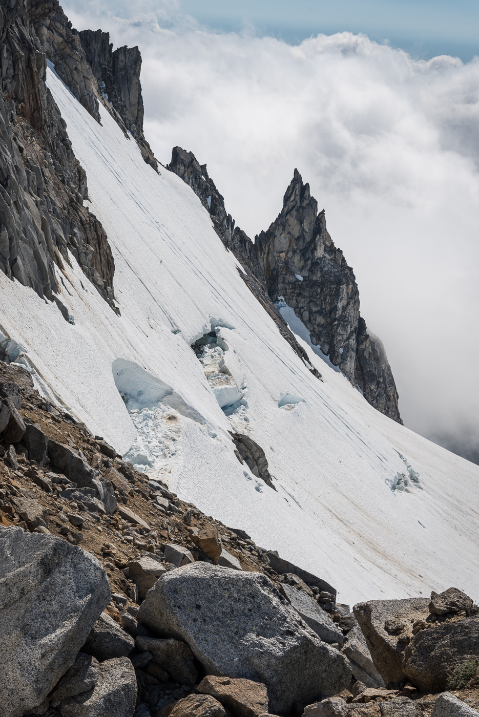
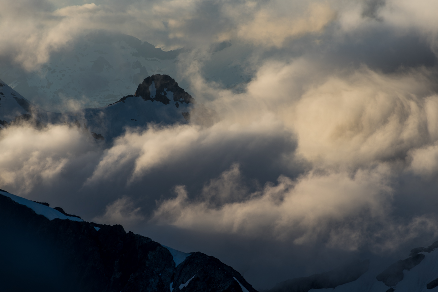
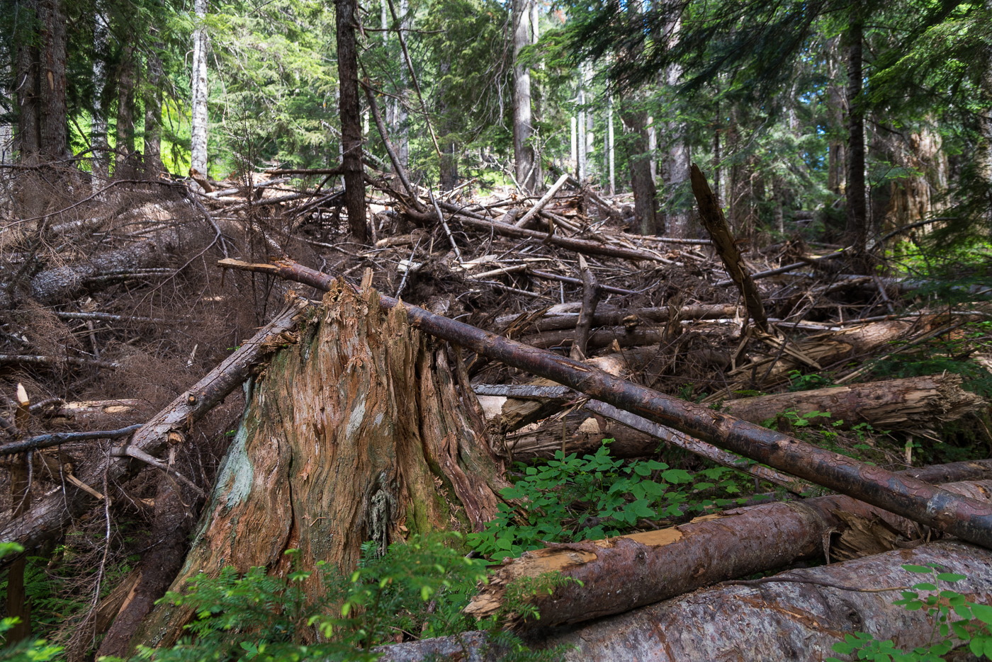
Trip: Logan and Goode - Douglas and NEB Trip Date: 07/29/2022 Trip Report: I wrapped up my 37th orbit with a loop from Easy Pass to Bridge Creek trailheads, climbing Logan via the Douglas and Goode’s NEB. Storm King was a low priority option going into the trip and didn’t make the cut. I had the pleasure of excellent conditions interspersed with horrible shwacking and a death march to conclude it. In many ways the timing couldn’t have been better for me. I sprained my ankle less than two weeks prior on the way to Fury. In the first hour afterward I was worried that most of my summer masochism would need to be cancelled, but hobbling back towards Luna camp, with vitamin I kicking in, I started to suspect the injury was not that bad. It swelled more like an orange than a grapefruit. I was game for Jacobs Ladder on Prophet the next day, which was welcome consolation for missing out on what I’m guessing was an awesome day for the NE Buttress of East Fury. Fast forward to a few days ago, I haven’t tried foot jams yet, and would like to avoid them, but walking feels fine. So a route with endless blocks and ledges sounds like just the ticket. Just needed to not twist it again in the many miles of trail-less travel. Besides my ankle I was also concerned about the heat. On the one hand I got away with not taking a sleeping bag. I always travel with a puffy and wool hat. I supplemented this with long johns and was just barely warm enough at night on a mat in a bivy sack. On the other hand, the heat obviously made things kinda brutal. For beta and inspiration for this loop I used Hiking down easy pass to Fisher was pure joy. This was the location of one of my first hikes in the N cascades, probably 12-13 years ago, getting my denim soaked in the brush. It’s actually more breathtaking than I remembered, was great to be back. The fisher creek crossing was briefly disorientating because there’s more water than land in the zone, with pools and twisty side channels everywhere. I gradually found my way moving south along the east side of the creek feeding into Fisher (presumably Douglas creek? I don’t see a name on the map). The ground was dry and relatively open and easy. There’s lots of huge erratics in this area. As I approached the the “pill box” from the summitpost description I chanced upon dry stream beds that I followed upwards. The maple+alder made for good hand holds without getting in the way of my feet. I thought this might have been a shortcut vs the TR I referenced, but after topping out on the other side I found very thick and young evergreens and chest high brush. Progress was slow here but at it was another beautiful scene down near the creek. It’s hard to say whether or not I found the path of least resistance. Finally free of the brush, I headed up snow and rock, trending right. I came across bear tracks in the snow and filled up at the last spot for flowing water that I could see. I arrived at the bivy col at about 6pm, which was later than I liked. But it was a good thing because it meant shadows were now extending down the Douglas, cooling it down. Some of the crevasses are quite large. But there was a fairly direct path through them and I felt good about the firming snow conditions and the gentle angle (<30 degrees?). The swale at the top of the glacier is a really cool feature. Looks insurmountable at first, but I found an easy way on the right side. I then cut back left above one more crevasse to gain the ridge (a little steep here, don’t fall in). The scramble to the summit is pretty fun, good rock for a Cascade scramble. The views speak for themselves. I slowed significantly near the summit both ways due to some really stubborn cramps. I carefully followed my ascent path on the way back down to the col, getting there just before headlamp time, with incredible purple views of Goode. It was a 12 hour day. Two pairs of eyes were reflected in my headlamp as I got ready for sleep, but they were far enough away that I couldn’t tell what they were. I left the col a little after 6am the next morning. The TR I linked earlier had me expecting smoother sailing than the day before. That turned out to not be the case. Descending the basin above North Fork wasn’t too bad, though I don’t know if I was always on the easiest path. I wonder if the ‘magic staircase’ was flowing instead of dry, because I don’t think I found it. The worst part was lower in the valley. I could find bits and pieces of a trail, but it’s very faint and overgrown. Occasionally I’d lose it and end up in the worst shwacking I’ve ever encountered. Walls of alder with a foot of water underneath. Feeling actually stuck. The other TR doesn’t mention this at all, so maybe better route finding makes this avoidable. I don’t think I lost more than an hour here but it was certainly terrible. The north fork ford was only knee high but very swift, wasn’t easy. The route up to Goode glacier looks improbable from below. Pretty cool how it comes together. The snow-rock junction is in good shape at the start of the NEB. It’s exposed and dirty getting up to the notch (took me a while to find a safe way) and the stone was burning my hands. But from the notch to the summit is awesome, and pretty well shaded. There’s a super knobby slab at the start. Unfortunately it doesn’t last long but what comes afterward on the ridge proper is solid, blocky steps as far as the eye can see. I was reminded of a slightly less steep version of the upper half of the NW face of Forbidden. As I climbed I couldn’t help thinking how surreal it is to be in the exact moment that you’ve thought about for years. The ridge steepens at 8400’ and I hit one dead end, with about 10 feet of rock that was too steep and featureless for me to solo safely. I backtracked down the steep face to the left and found a bypass that allowed me to regain the ridge. As is so often the case with ridge climbs, there are occasional dirty ledges that can make sections easier, but the best climbing is on the ridge crest itself. Aside from this one bypass, I stayed true to the ridge the entire way to the summit. I passed a party of two maybe ½ way up the ridge and other party of 2 just before the summit. I got there a little before 5, for a 10.5 hour day. The next party arrived shortly after and later in the evening the lower party arrived. Everyone was nice, we chatted about climbing and spent the time pointing at and naming all the crazy stuff you can see from Goode. We squeezed all 5 on the summit that night (one of the spots looked pretty gnarly, 5 is a tight fit). I heard there was a guided party that day too, so 7 people in all on the route that day. I started to feel sick when I arrived at the summit. I think it was mainly due to the heat. This was a bummer but I gradually improved and took in the sunset, then the new moonset, headlamps down in the valley SW of Goode (night hiking?) and a couple of fuzzy shooting stars. The notions of up and down that climbers obsess over started to lose meaning while staring into space with hypnogogic mind setting in. The next morning we all got a leisurely start. I started my day popping my head up for a view every few minutes in between a few last sips of sleep. I left the summit at 7am, just after one party started rapping. I downclimbed (5.4?) to the highest snow patch (plenty of snow on the route right now BTW) as I had run out of water. I melted some for a freeze dried breakfast then made my way skier’s right up a ramp leading to the notch. It was here that I got to really test out my lightweight rappel system that I assembled after some online research (I did a short sanity check in town earlier). This was <$100 and shaved 3 lbs and I didn’t die. The second rap got me a ways into the firm snow finger on SW side of Goode. I used my light axe with a good bite (found on Quien Sabe some years ago), crampons strapped on to approach shoes, and my pole in the other hand. It was face-in downclimbing to some gross dirt-choss, then more face in walking backwards down steep snow. I paused to look at Storm King and estimate time. I guessed that going for it would mean getting back to the trailhead around midnight. Realistically, if I wanted to climb it, I would have had to do the Goode descent the day before. But it was more important to me to enjoy the summit of Goode than to tag another choss pile, so I was happy with my decision to skip SK. Maybe I was jaded from the shwacking the previous two days, but the way down the burn wasn’t as bad as I was expecting. I had downloaded somebody’s GPX and it was pretty helpful. I think this is another section that’s only semi-intuitive. I thought I would find running water on the other side of Goode, but didn’t. I descended the burn around noon with temperatures soaring and my water run out. Probably downed a liter in couple minutes at the first stream back on trail. I didn’t keep track but I’m guessing I drank about 2 gallons of water throughout the day. I also had less than 1000 calories because my body wouldn’t tolerate the bars I had remaining (again, likely due to the heat). At the end of the day I think I counted 4000 uneaten calories in my pack (that should have been eaten). I guess I need to revise my nutrition strategy for trips like these. The hike out is a blur given my nausea and the heat. Dipped at park creek (delightful!). The bridge at Bridge creek is another fantastic scene. One of many in this loop that I wish I had more time to savor (honestly, 4 days would have been more fun, though any exit from Goode seems inherently awkward logistically). I also remember one giant cedar on the trail, some cool bluffy terrain, and the suspension bridges were a fun surprise too. On the rare occasion of a cool breeze, I felt like I was drinking water through my skin. I filled up one more time at the last major creek >8 miles from the road and met up with one of the parties I shared the summit with. Together we blasted out the next 5 miles, took a short break, then made one more push for the car. Even in my approach shoes my feet were just starting to get medium rare by the time the hike was finally over. I had a bike at Bridge Creek TH and a bike light, but since it was getting late (finished at 9pm for a 14 hour day) and I was depleted, I happily accepted their offer to drive me back to Easy pass. Thanks Hank and Steve! Gear Notes: Approach shoes, crampons, one axe, one pole, and a rappel setup worked for me, but this means unroped glacier travel and low 5th soloing. Approach Notes: Hard to say
 2 points
 -
Great TR. your posts are always inspiring! The Goode glacier is such a cool fucking place. Heck, the whole of that area is a cool place. We had the same exact situation in the descent. No water and blisteringly hot temps made for nausea and general heat exhaustion.
 2 points
 -
Way to get your shit together and get it done! In my experience, you never regret going...only not going. For the photos, the site currently doesn't work with Apple HEIC file format. You have to convert them to JPG first. Because I want to see the photos I'm going to do that for you now ;).2 points
-
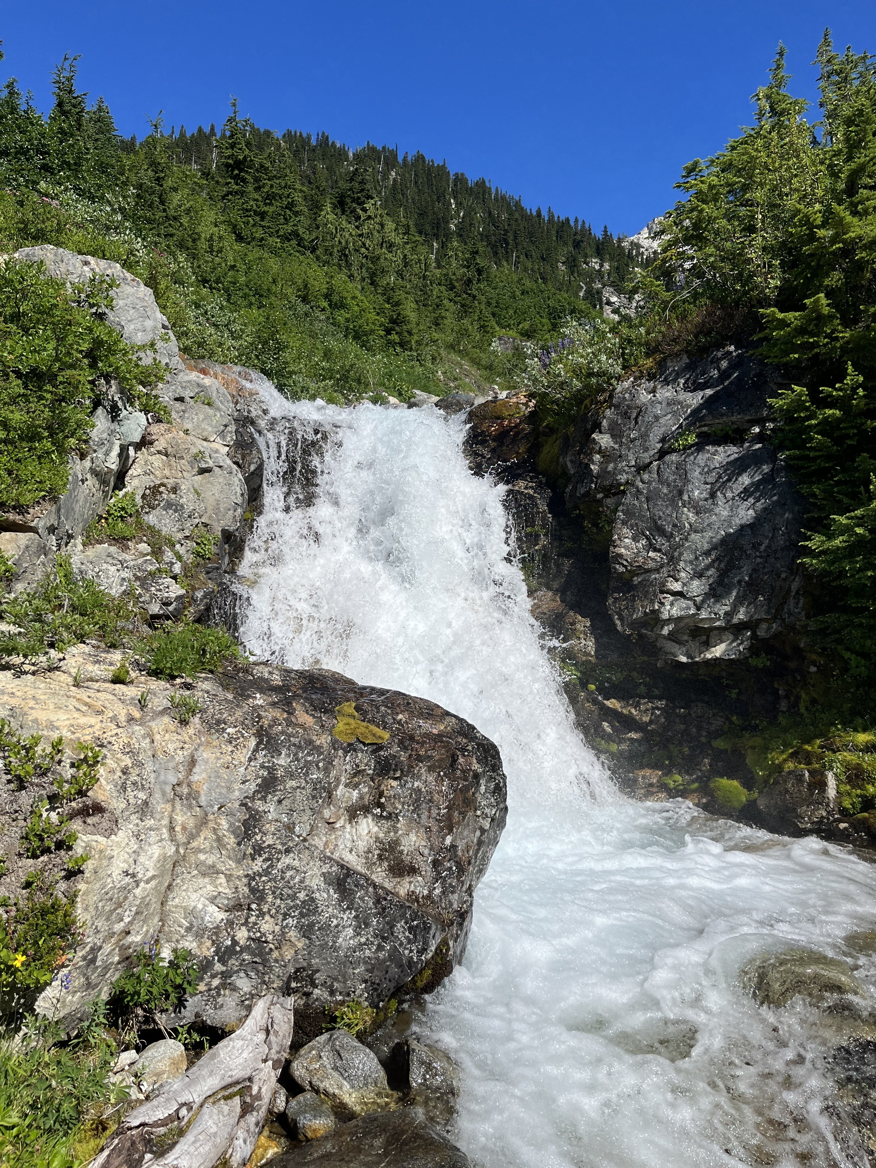
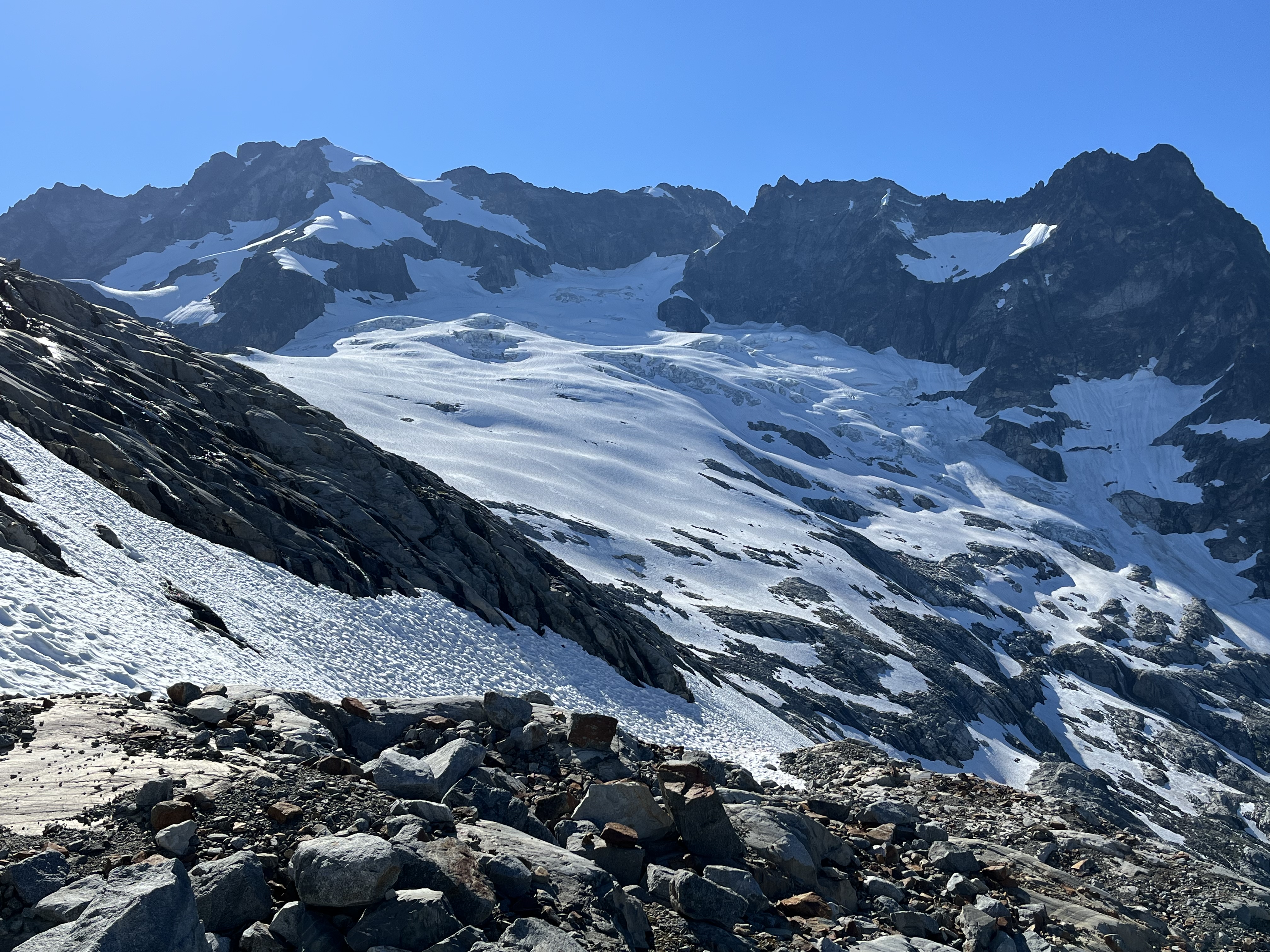
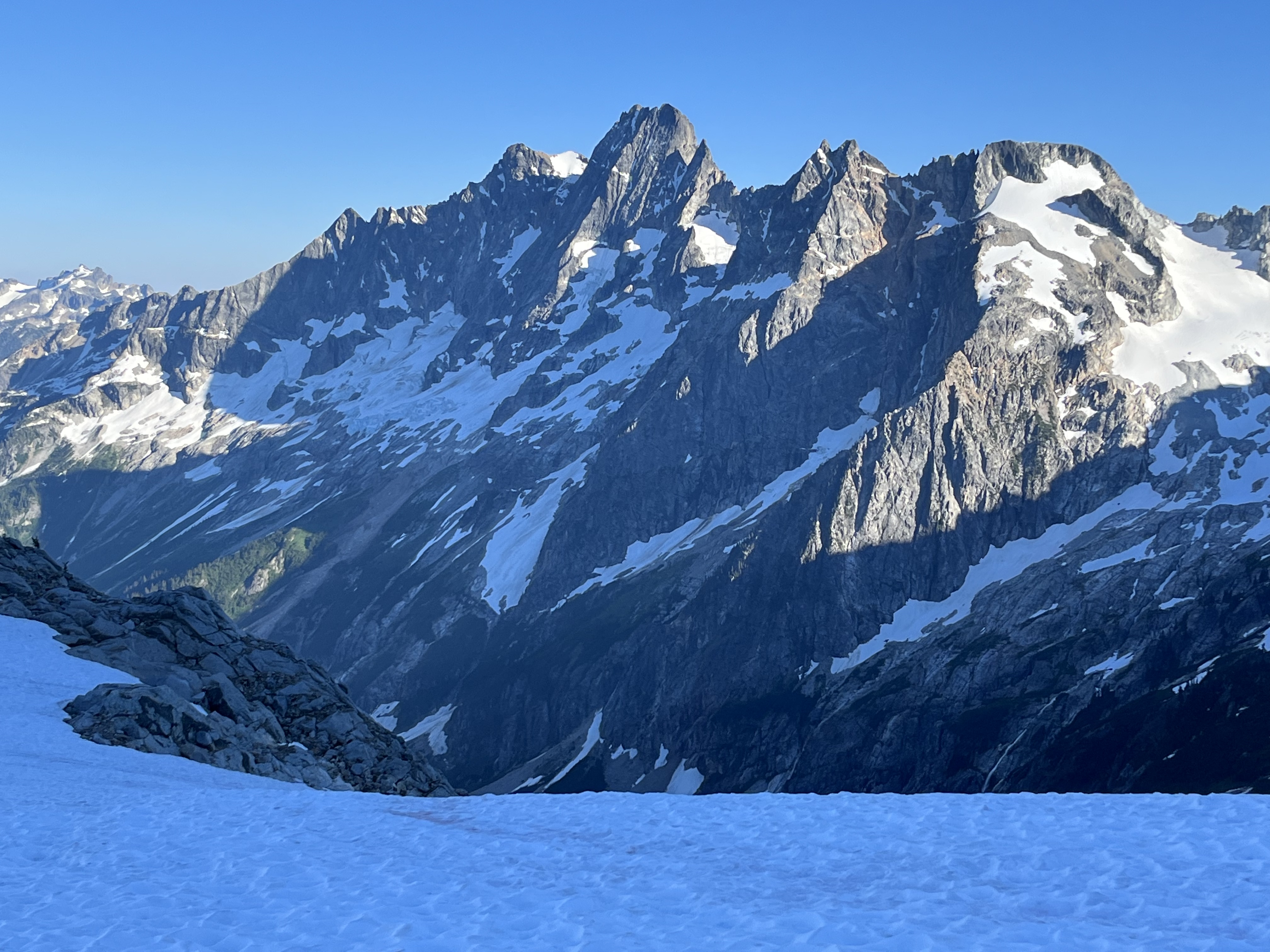
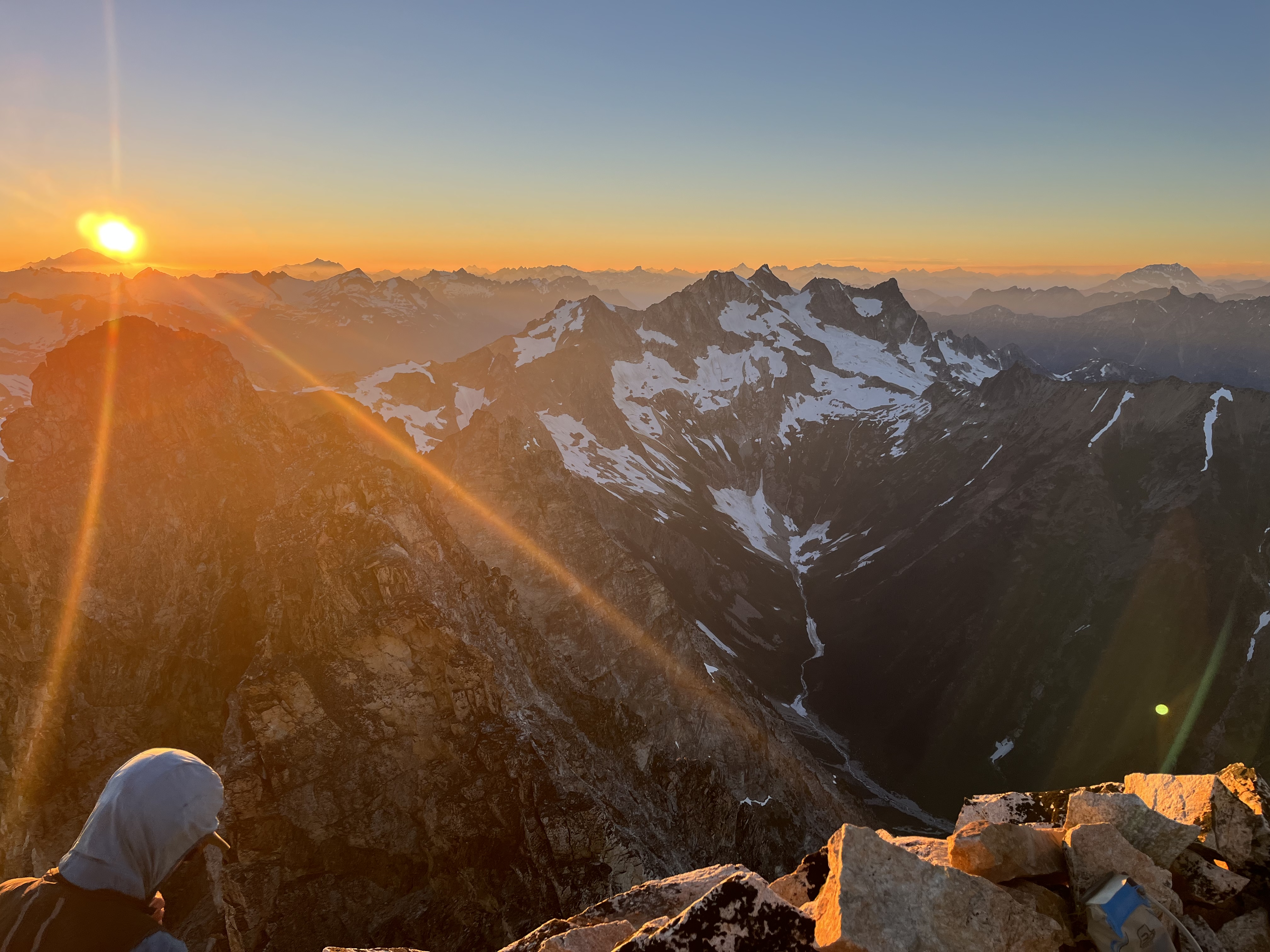
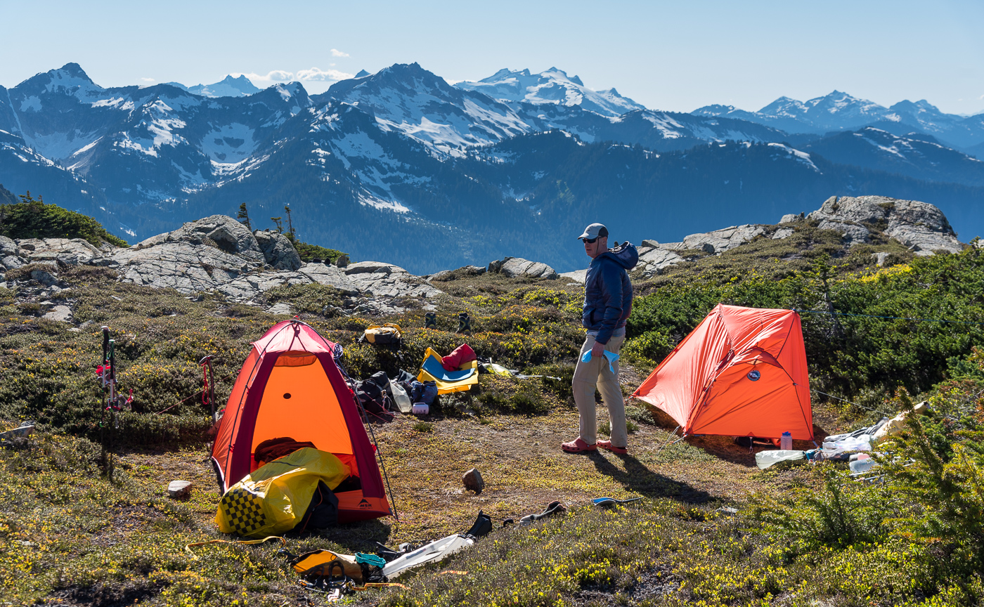
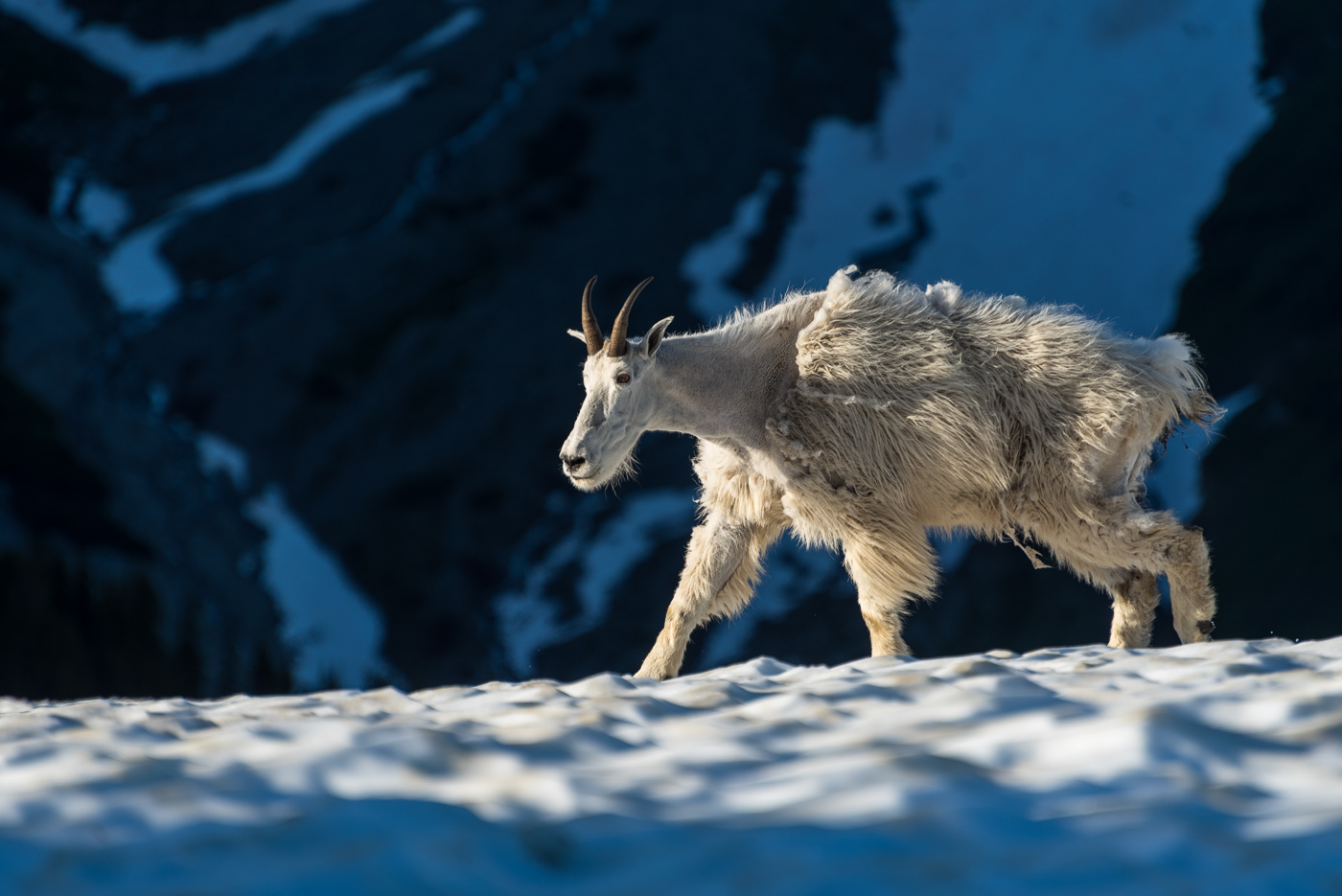
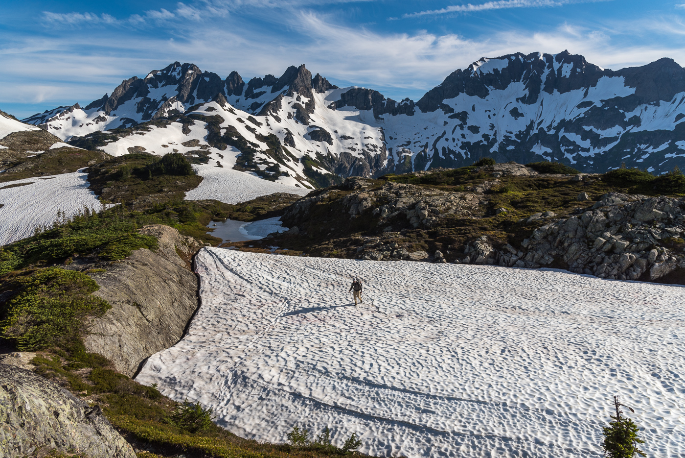
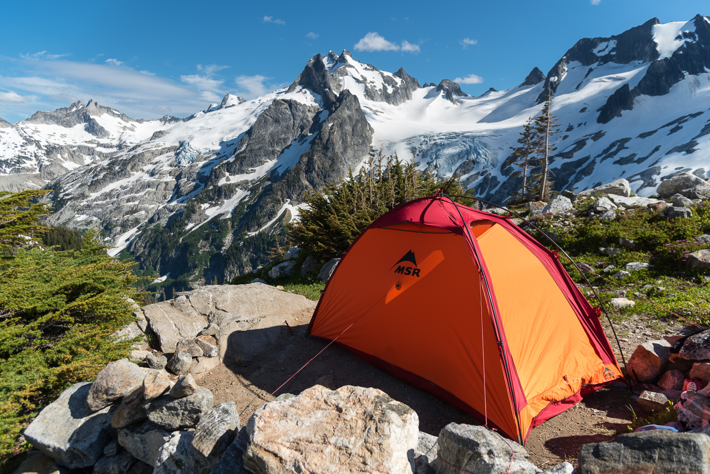
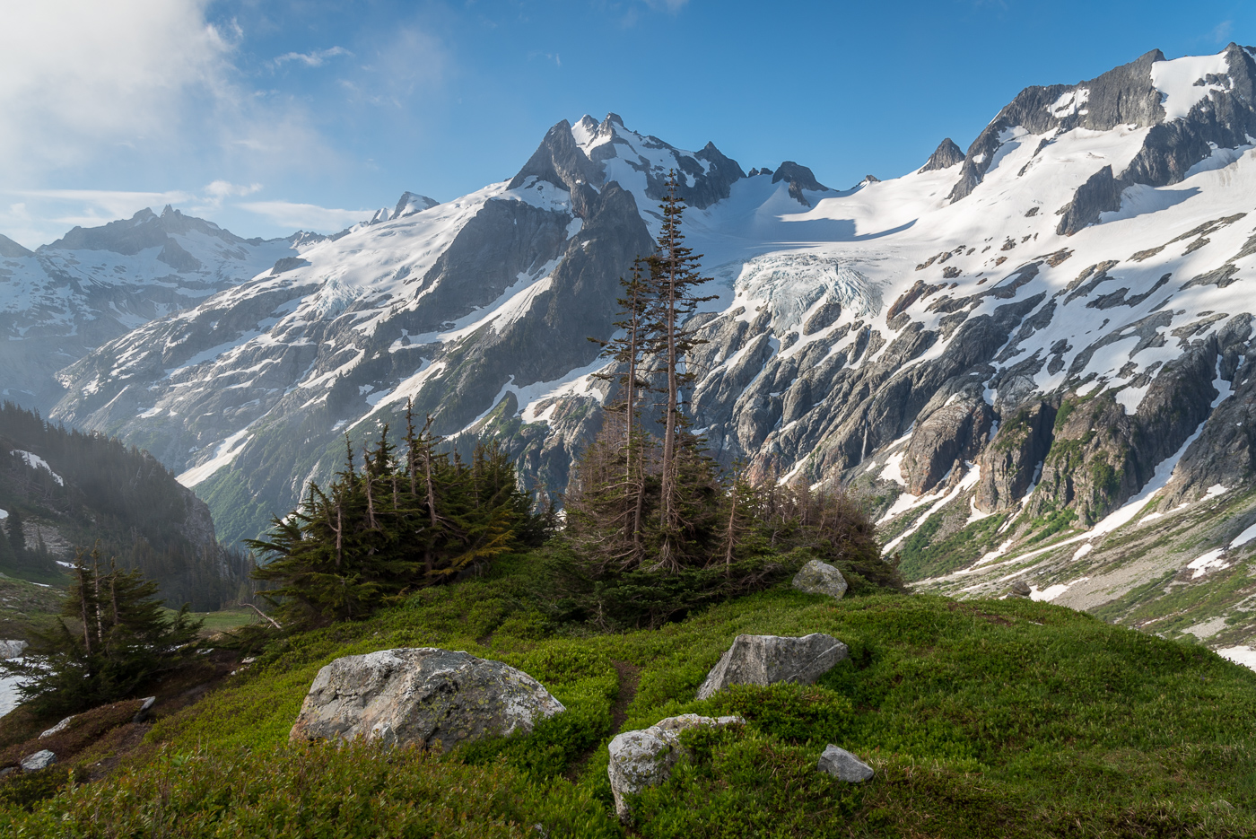
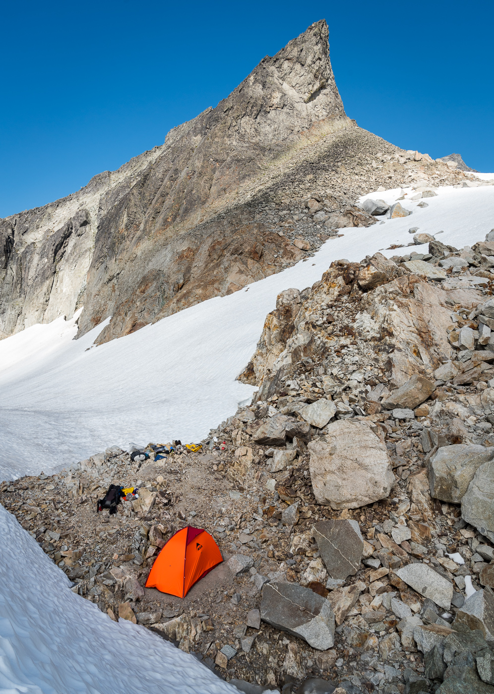
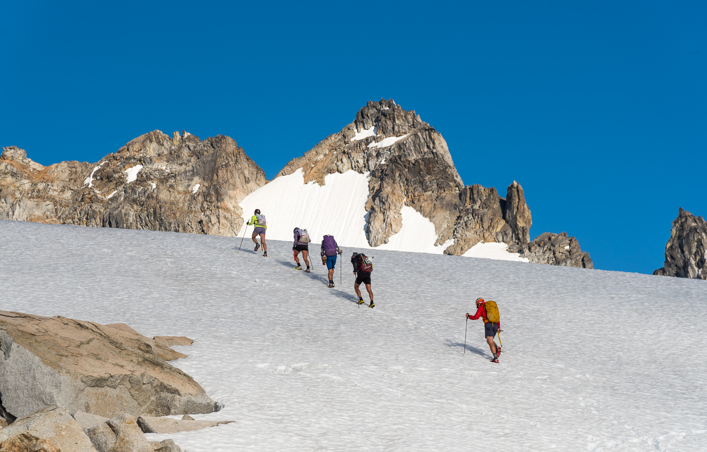
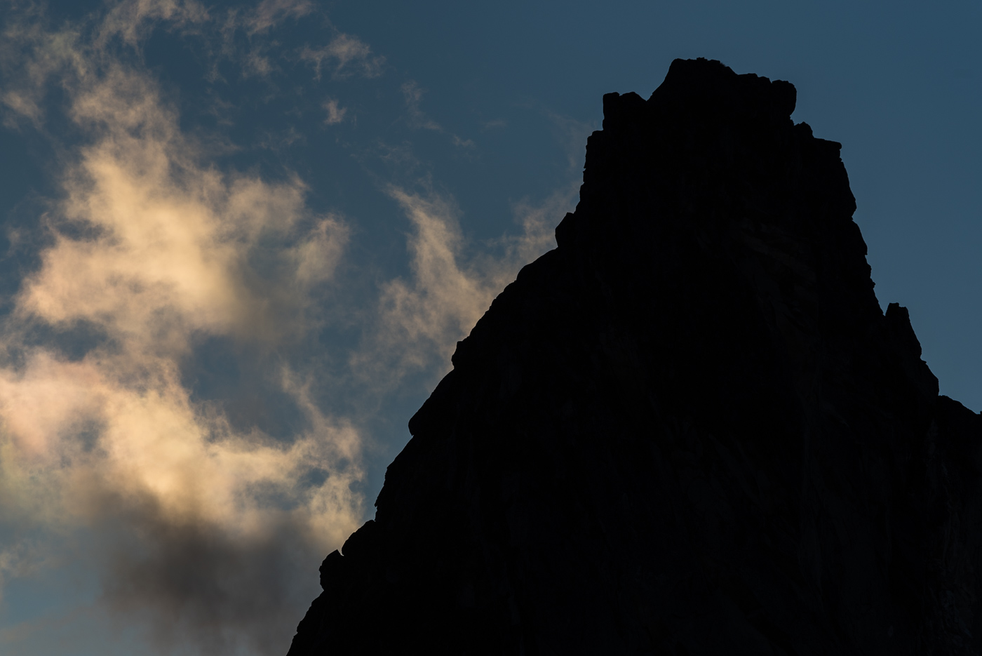
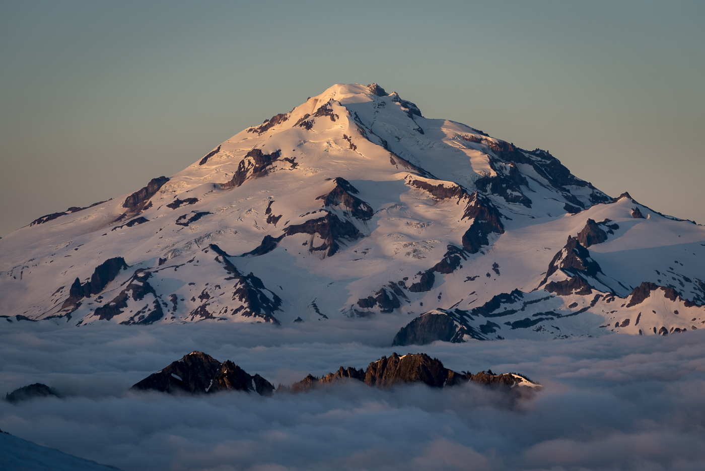
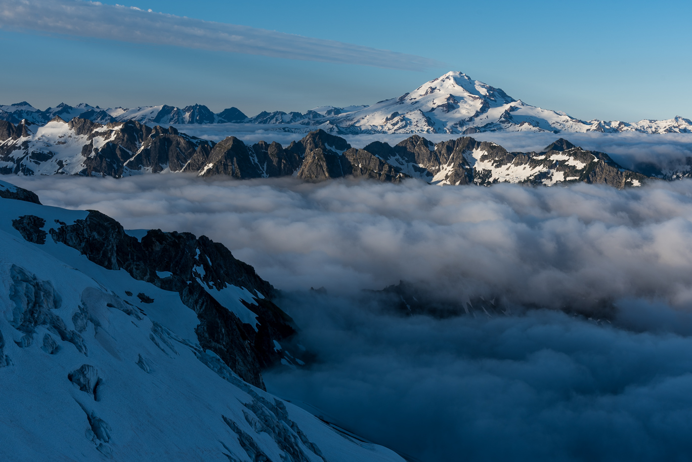
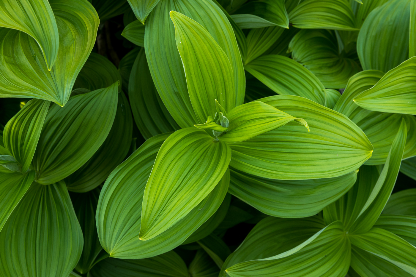
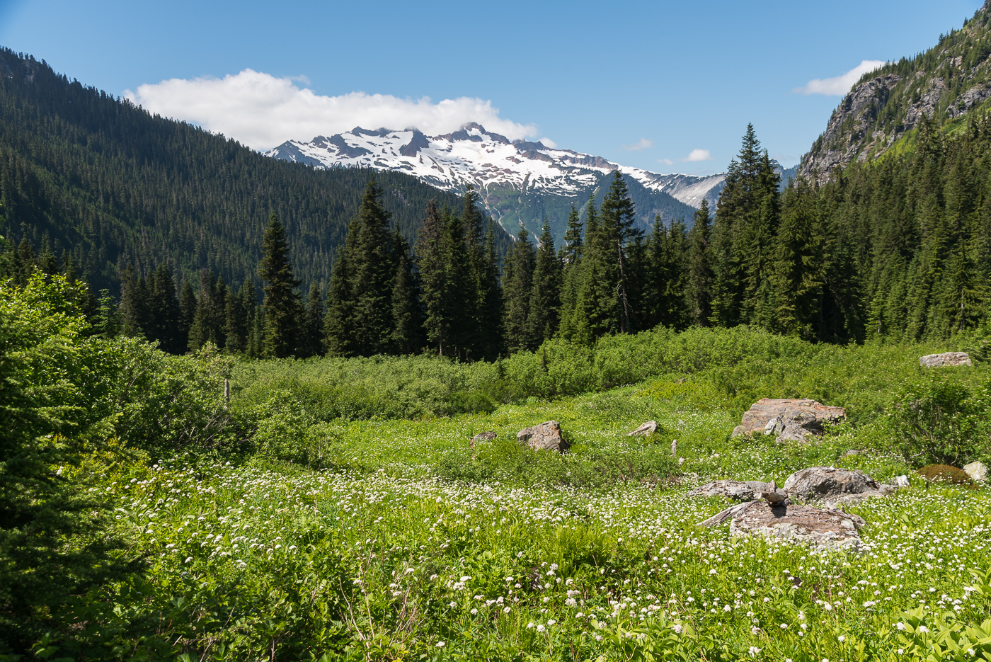
Trip: Dome and the Lizard - Ptarmigan (Ptarmithumb) Traverse Trip Date: 07/22/2022 Trip Report: Ah, the classic Ptarmigan....is there a finer high traverse in the Cascades? After 25ish year of rambling around the range I'm not sure there is a more scenic and pleasant high route. And so, after a 19 year hiatus it was time to return with none other than @Juan Sharp. My thumb was still broken with a pin, but no matter, we would take it easy over 6 days and savor the experience. There is probably too much already written about this particular trip, but I will say that it is worth repeat visits, if only to camp in the places you wished you had camped the first time! And, amazingly enough, the traverse was much quieter than I had it in 2003. Probably "closures" on both ends had something to do with that (check notes below for additional beta). High points, for us, included perfect weather, good snow conditions, few bugs, an evening visit from a couple curious goats, ethereal marine layer mists from White Rock Lakes, Northern lights from the Dome/Dana Glacier col, solos of Dome and the Lizard (for me), sunrise/sunset on Dakobed, and a surprise visit from @jenny.abegg and partner who were mountain running from Canada to Stehekin, along the crest, in ONE WEEK. They covered in A DAY, what took us 4 days! To say we were amazed would be an understatement. I can't wait to see the movie made by the film crew running along with them for a couple sections. Low points would be the brush of Bachelor and Downey Creeks, but there is always a price of admission to the glory of the North Cascades parklands. I'll be back, but I won't wait as long next time! Heading up the closed cascade river road: @Juan Sharp below Mixup on the way to Cache col: Formidable: Camp 1 with a good view of the NF of Spider: Traversing over to Middle Cascade Gl: Passing thru Spider/Formidable col, Old Guard and LeConte in the middle: Climbing up above Yang Yang Lakes: Camp 2: Formidable at sunrise: Heading out on Day 3: Traversing to LeConte Gl.: South Cascade Gl.: The majestic north side of Sinister/Dome and the Chickamin Gl.: Camp 3 at White Rock Lakes: NF of Sinister and the Chickamin: Elephant Head and Dome from WRL: The aptly named Elephant Head: Agnes! Snout of the Dana: The German Helmet lost in the mists to the right of @Juan Sharp: Summit ridge of Dome: Hydramatic Spire: Camp 4, North Cascades style: @jenny.abegg and crew heading towards the Chickamin one evening: Dakobed from Camp 4: Surprise aurora borealis one night....it didn't look like this to the naked eye, 25 sec. exposure. Heading toward Itswoot ridge on day 5: Dome and @Juan Sharp: Sussing out the way to Cub lake from Itswoot ridge: False hellebore: Getting to the fun part in Bachelor Creek: @Juan Sharp crossing Bachelor Creek after doing battle with the worst of it. Note the bloody shins: The Bachelor Creek trail has sustained significant damage from slides this past winter: Camp 5, on the banks of Downey Creek: We're not in Colorado any more! Thru the burn at the end of the Downey Creek trail: Gear Notes: 30m rope, glacier gear, helmet, ice axe, crampons Approach Notes: Cascade River Road closed at Eldorado. Bachelor/Downey creek trails officially "closed" but in decent shape, esp. thru the burn. Bachelor Creek trail in good shape above 4500'. Cross Bachelor Creek at the alternate 4500' crossing. Flagged from there down to old log across Bachelor Creek at 4100'. Lots of blowdown in Lower Bachelor Creek and upper Downey Creek trails. Much bear sign.


 1 point
 -
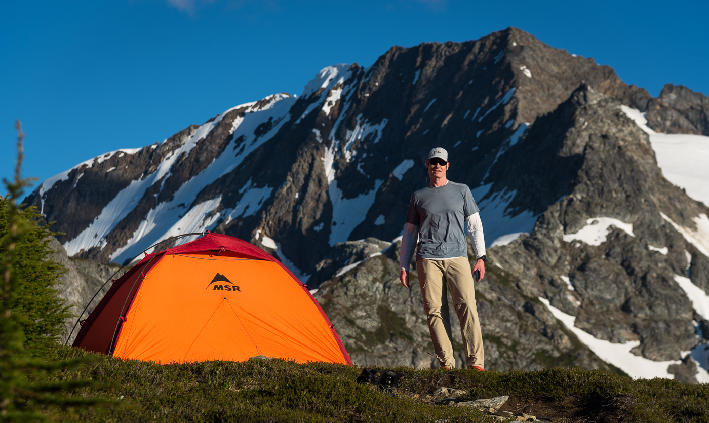
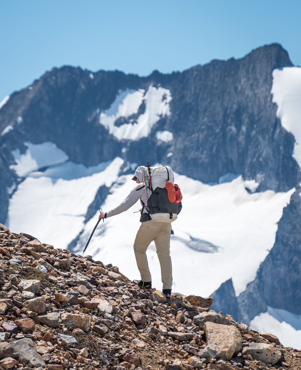
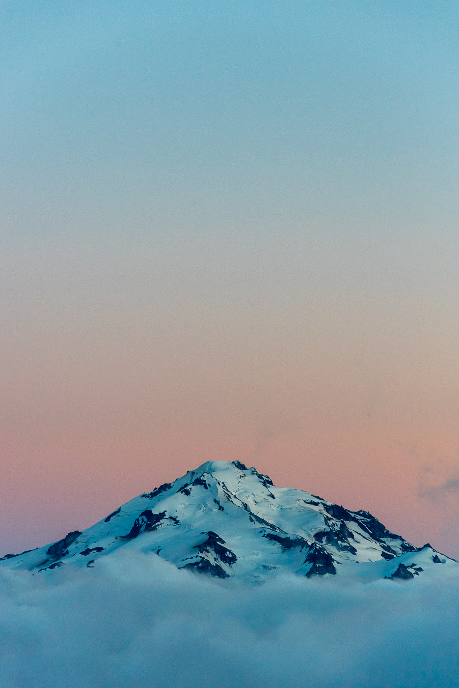
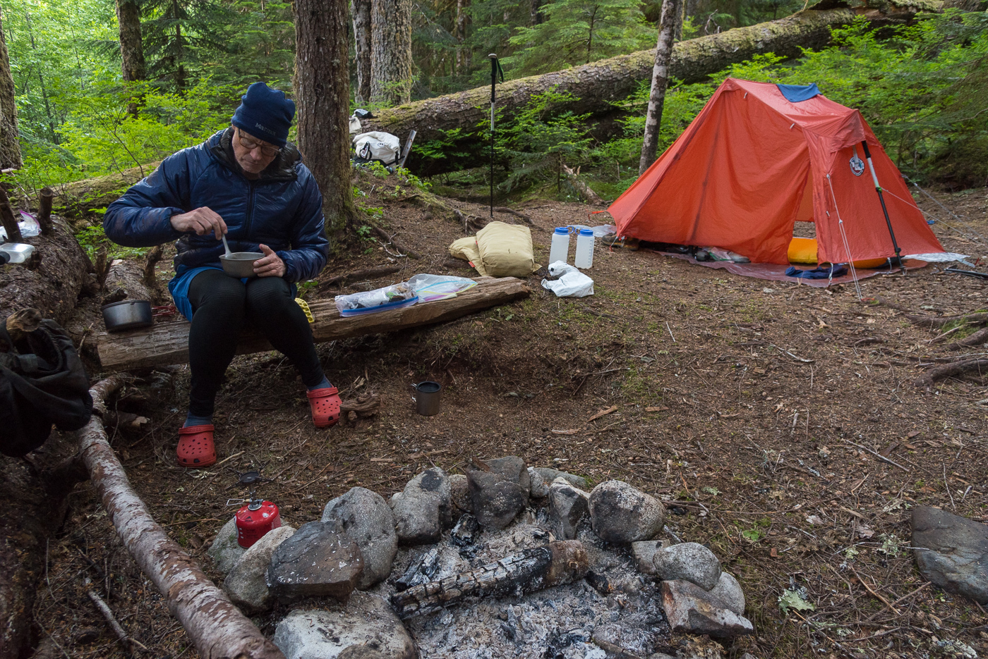
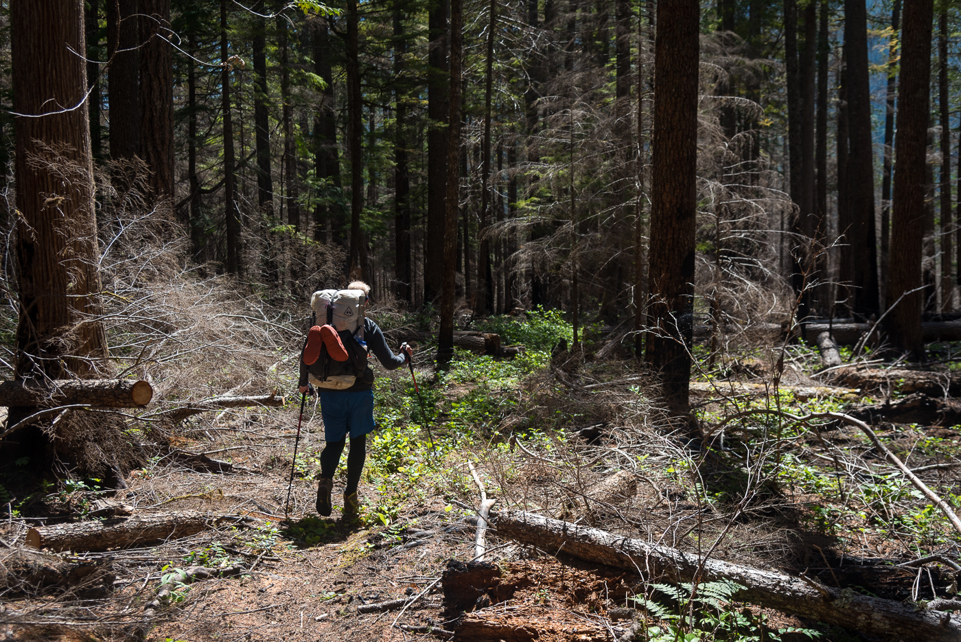
Trip: Mt baker - North Ridge Trip Date: 08/01/2022 Trip Report: This adventure started in the most likely place, Instagram. A guy named Remy, who had worked at the same climbing gym I currently work for sent me a message. My boss had heard from Remy that he was looking for partners that wanted to do a lot of climbing; My boss also knows that I am in the same boat. After some messaging back and forth we decided we would give the north ridge of baker a try! Most would say attempting a long and committing route with a new climbing partner would not be the best idea. Most of the time I would agree. The only reason I am able to make this exception was because of our mutual friend/boss. He has known both of us for a long time, with a good understanding of our experience and comfort level in the mountains. Remy and I planned for a full casual day of hiking up the road, up the trail, and to camp. Then a full alpine start climbing day. Then a full day to sleep and walk out. If the weather and company are equally as good this is my favorite way to approach bigger climbs like this. Making the large approach and distances more manageable physically and mentally. I find this is also how I rap my head around larger technical obstacles; Breaking them down into small chunks that I can easily understand and take one at a time. The small chunk mindset works super well until you need to have any amount of forethought about your objectives but for the purpose of giving me confidence that I have the ability to do larger and harder routes, this mindset helps a lot. Remy and I started out our approach day a little bit late putting the pressure on us to get to camp and get to sleep. Making it worse was the fact that I had forgotten my bike back home in a rush to get ready and out the door early. We put our minds together and decided that strapping the packs to the bike like a mule and both pushing that one bike would be faster than swapping out riding the single bike. This feat of engineering let us push up the hill to the trailhead in less than 2 hours. Putting us right back on schedule. We hoisted our packs and walked up the heliotrope ridge trail with excitement for our next day. After arriving at camp and getting our tent set up, I cooked my usual top ramen with a side of tuna (I am still getting better at backcountry cooking). We talked over at time plan and decided on a midnight start. Our alarms rang and it was time to boogie. I threw my boots on and racked up for the big day to come. We did some traversing to get up out onto the helio trope ridge and then out onto the Coleman glacier. The glacier was surprisingly simple and fast travel. Most of the cracks were completely exposed making them obvious and easy to avoid. Until higher on the mountain we did not find any unstable bridges. We hiked in a timely manner up to the toe of the north ridge. The beta that we had gotten from a month before was that gaining the toe of the ridge was out and traversing to lookers left around the ridge was needed. That turned out to be completely false for the conditions we found but existing in our own little headlamp bubble it was hard to tell that at the time. Moving around the toe of the ridge and accending found us just next to looker's left of the ridge for about a thousand feet. Looking up at the ice step and the steeper snow seemingly right above us we pulled out the rope length and prepared to siml. This was not the case. A little after the above picture was taken I arrived at a nearly 50ft wide crack that the GPS track we had, seemingly cruised right over. With the north ridge not gainable to us to the right and icefall to the left we decided to descend slightly and explore our options to the left. Past some broken blocks the glacier seemed to mellow out and provide access around the crack back to the north ridge. The above photo was taken after traversing around the large crack. beautifully broken glacier. Tomfoolery moving through the north face icefall This portion of the climb is something I am debating still in my head. We had no beta on the icefall we were making our way through. The bridges we were crossing were super solid but would they have been later in the day if we needed to descend? what would the icefall hazard be like after the sun heated everything up? Was I in over my head? I believe that the decisions we made were safe enough for the route and situation we were committed to. Remy and I on the way out discussed every decision we made in detail and the reasons behind them. This type of do-it-as-you-go climbing was new to both me and Remy and it was really fucking awesome. You can see in our GPS track we were finding the best crossings were farthest lookers left but we constantly were moving lookers right to see if there was a route back onto the ridge. Finally, after lots of large crack crossings and zig-zagging, we found an entrance to the north ridge around 600 ft below the ice step. A look at the upper north face icefall from below the ice step. Back on route finally. As we looked down the ridge in the light a clear bootpack and a RMI team moving up it made all the hard work we just put in seem meaningless. But was it? I feel like I had to engage more active decision-making, risk management, and route-finding skills much much more than I normally would have on a well-tracked route like the north ridge. I feel I grew as a climber as well as my personal ethic in the mountains. It was a freeing experience to decide to tread my own route and make it work. The ice step was in super good shape. A short section of pretty high-quality vertical ice then followed by another pitch of low-angle ice. This led to a knife edge ridge to the summit bergy which was a simple crossing with some steep snow to the top. The descent was very simple, just a trot down the Coleman Demming which was in very good shape. Back to camp at 2pm made it a 15-hour day including all the icefall buffoonery. Overall a super fun climb with a super cool person. I hope you enjoyed reading about an adventure and thanks for sticking around! Gear Notes: 6 Screws, 3 pickets (wish we had a few more screws) Approach Notes: Heliotrope (bring two bikes)1 point
-
Love it. Thanks for posting. Your stoke and smile remind me of a certain Canadian climber who caught the climbing bug as a teen and shared some amazing and fun stories here before moving on to higher dimensions. Sigh. Can't wait to see where your path leads.1 point
-
Five on the summit, dang! Thanks for sharing your adventure with us 🙂1 point
-
Such a fantastic route, thanks for the great report!1 point


