Leaderboard


Popular Content
Showing content with the highest reputation on 05/25/19 in all areas
-
Worth a watch... https://www.youtube.com/channel/UCOYnpuacr0hmFlciAgGvMYw/videos1 point
-
Oh, I'm not second guessing your decisions. I'm just glad you're OK. Really. Trying to get out. It's never enough.1 point
-
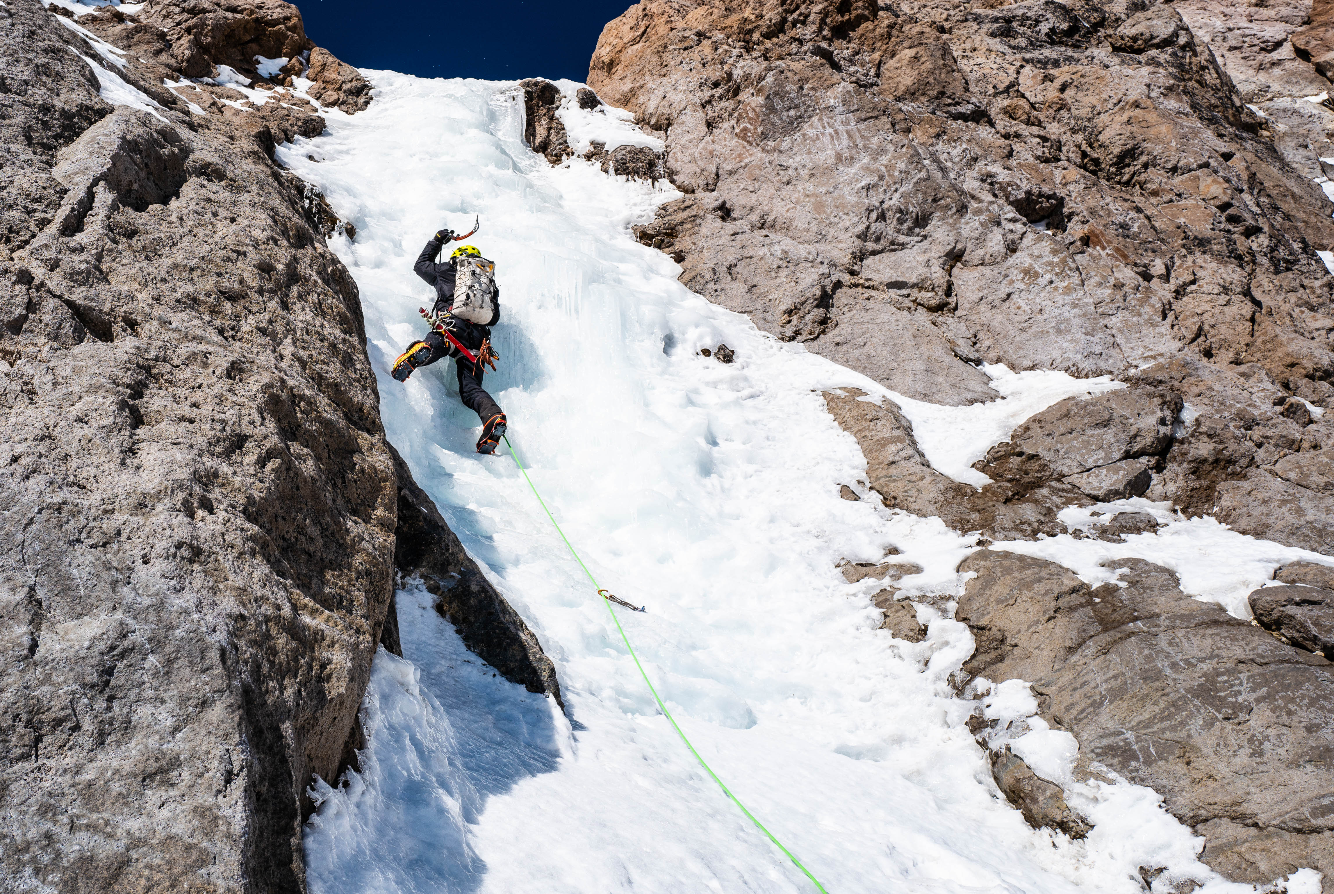
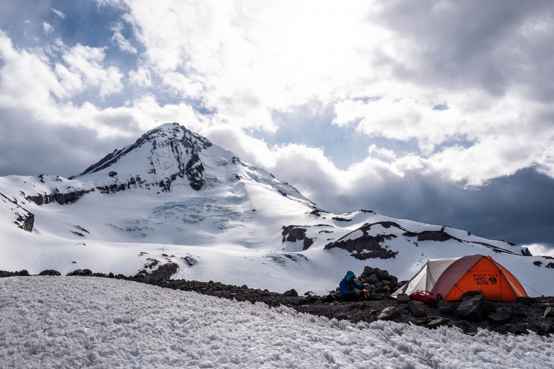
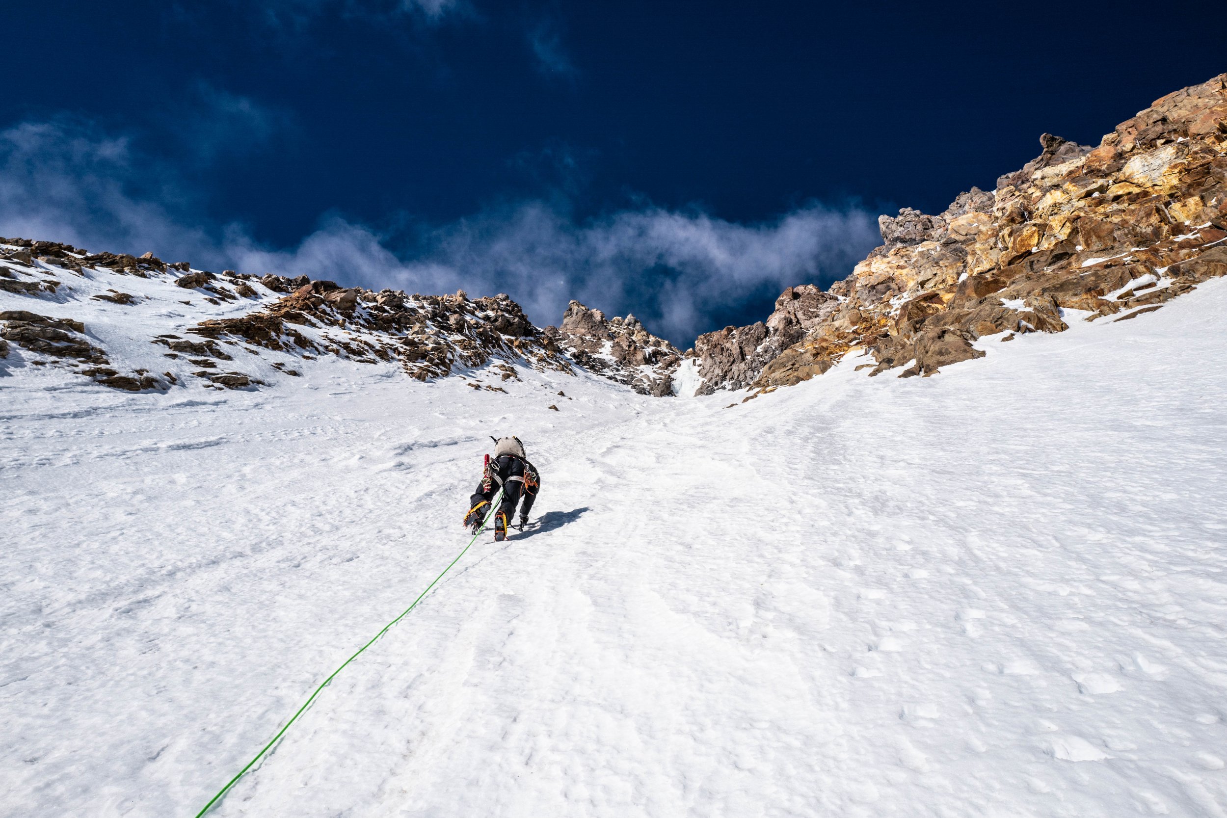
Trip: Mt Hood - North Face Trip Date: 05/01/2019 Trip Report: For the detailed version, check out the post on my blog. Went up the North Face Right Hand Gully on May 1st, 2019. The climbing was in great conditions. The shrund is definitely opening up and may become more complicated to cross over the next few days. The right gully fully goes all the way to the summit without any significant difficulties. The two ice pitches are in fat/easy condition. Get at it! Gear Notes: Alpine ice climbing gear Approach Notes: Tilly Jane trail in good condition!
 1 point
 -
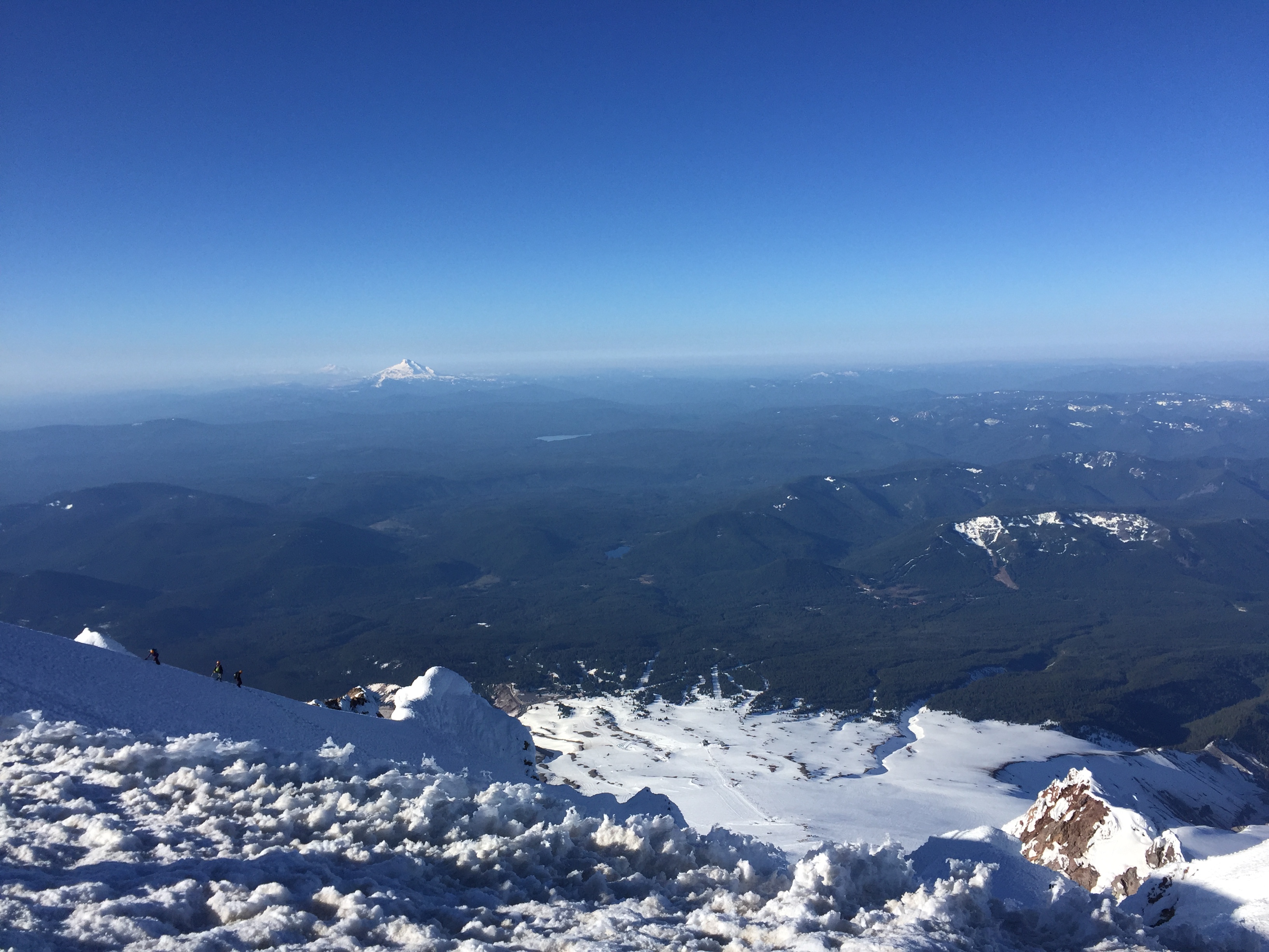
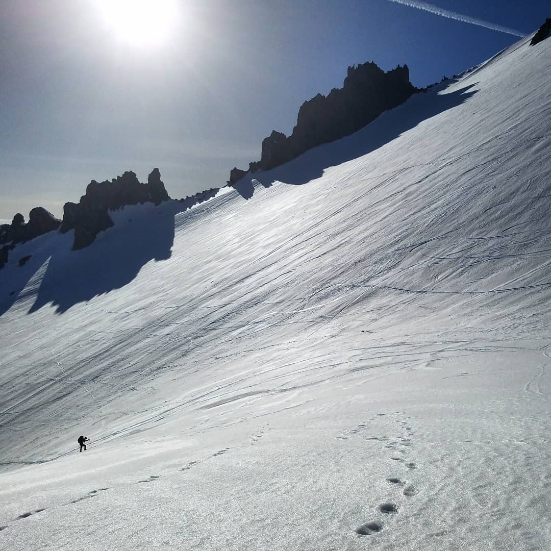
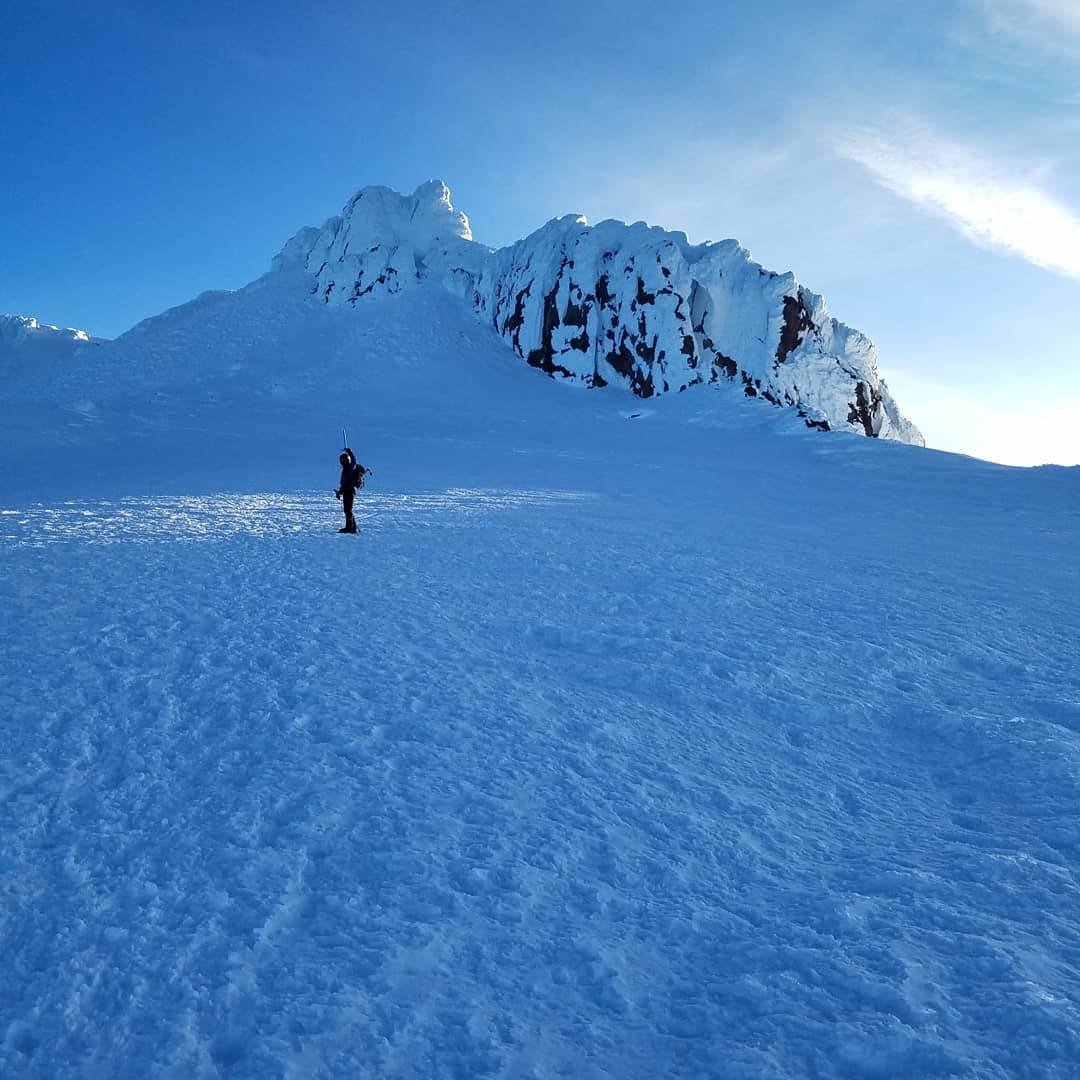
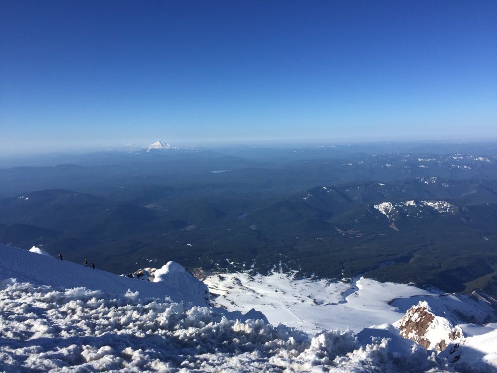
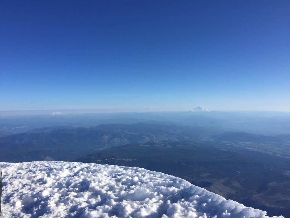
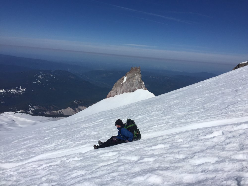
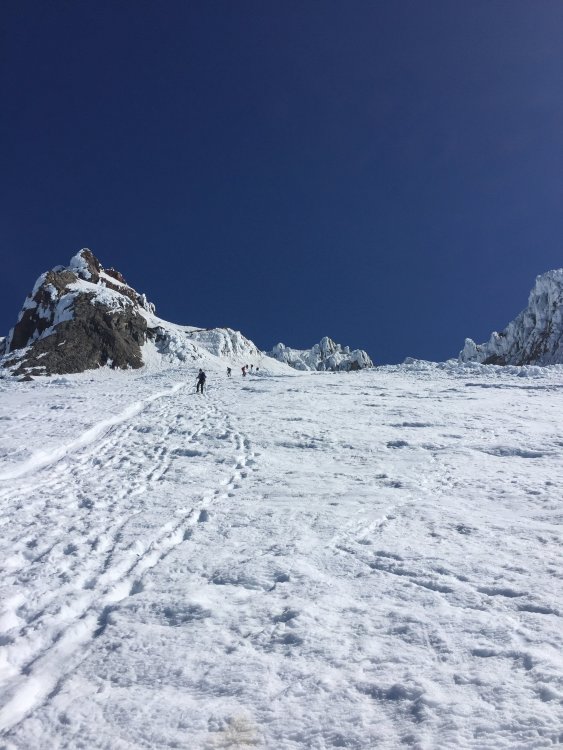
Trip: Mount Hood - Pearly Gates, South Side Trip Date: 05/11/2019 Trip Report: Getting there: Left Seattle area around 7:30 PM Friday 5/10, we got to parking lot in Timberline at 12 AM. Several parties were departing at that time towards the summit, my partner and I decided to sleep a couple hours before. We slept until 2:30 AM and set out towards the summit at 3:00 AM. Conditions: Snow starts from parking lot, no need for snowshoes if climbing at night. We put on crampons at 7200 elevation because it was getting icy. Upon reaching the hogg's back we chose to follow the crowds and went via the Pearly Gates, it's very icy there now and extremely crowded. Crampons and ice axe and helmet is all you need. some people had ice tools, but it's unnecessary. I counted at least 200 people climbing through out the day on the mountain. Summit: We got to the summit at 8 am. Gorgeous views as it was a very clear day. Return: We attempted to go down via Old Chute to avoid the bottleneck in the pearly gates. Some people were climbing via old chute, but I decided to explore a different route alternate path right next to pearly gates, this proved to be an excellent choice as it avoided bottleneck and felt safer than the old chute. Stats: 5 hours from parking lot to summit ( we were going very slow). 2h40m from peak to car. Last 2 miles felt like forever as you see cars very near yet very far. 5100 feet gain. 8-9 miles rt, can't really say as gps was acting up. https://www.instagram.com/iron_knee/ Gear Notes: Ice Axe, Crampons, Helmet Approach Notes: Paved road all the way. Snow stats from parking lot.

 1 point
 -
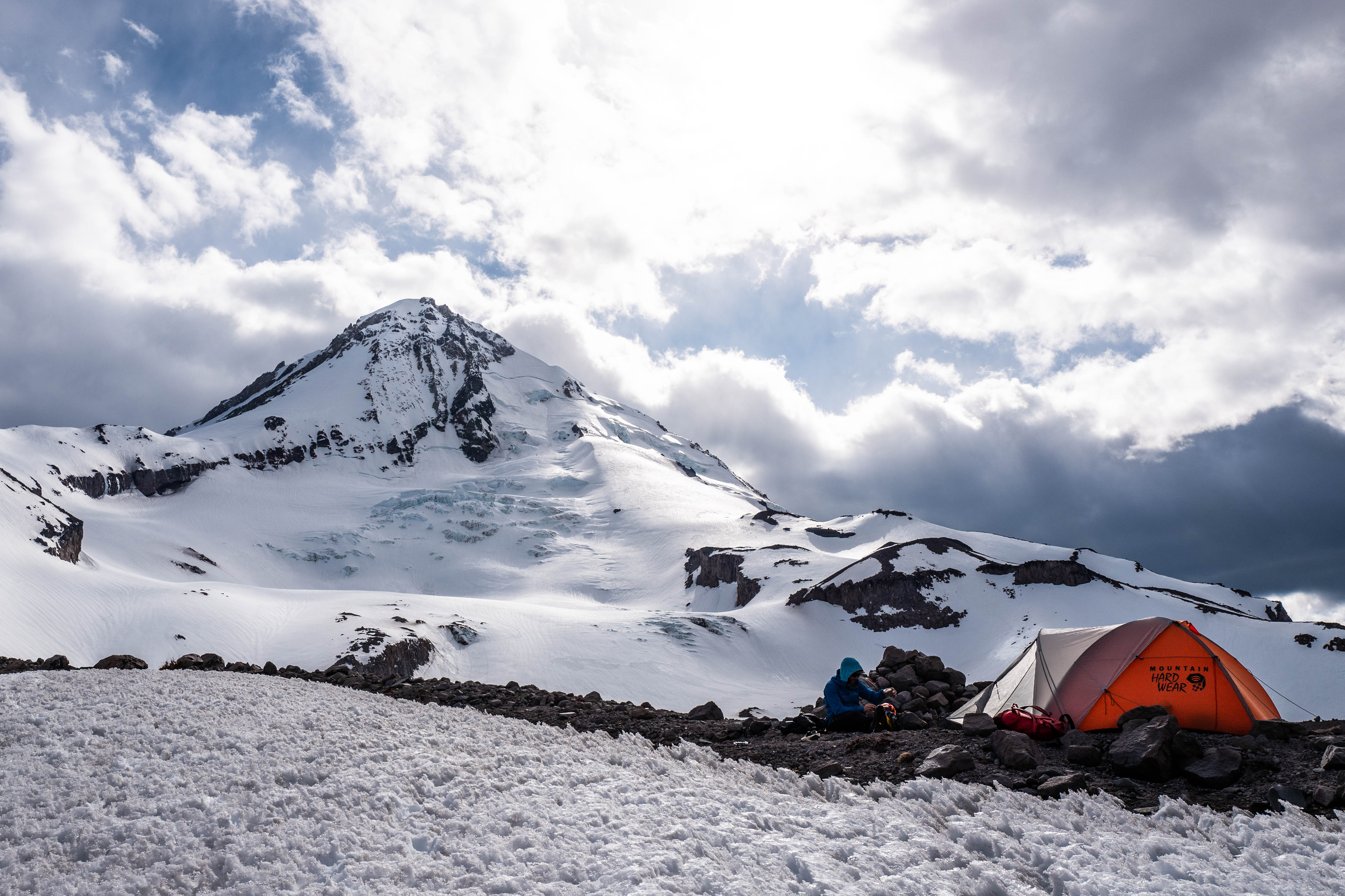
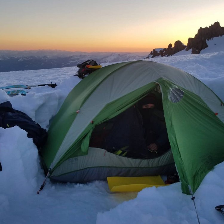
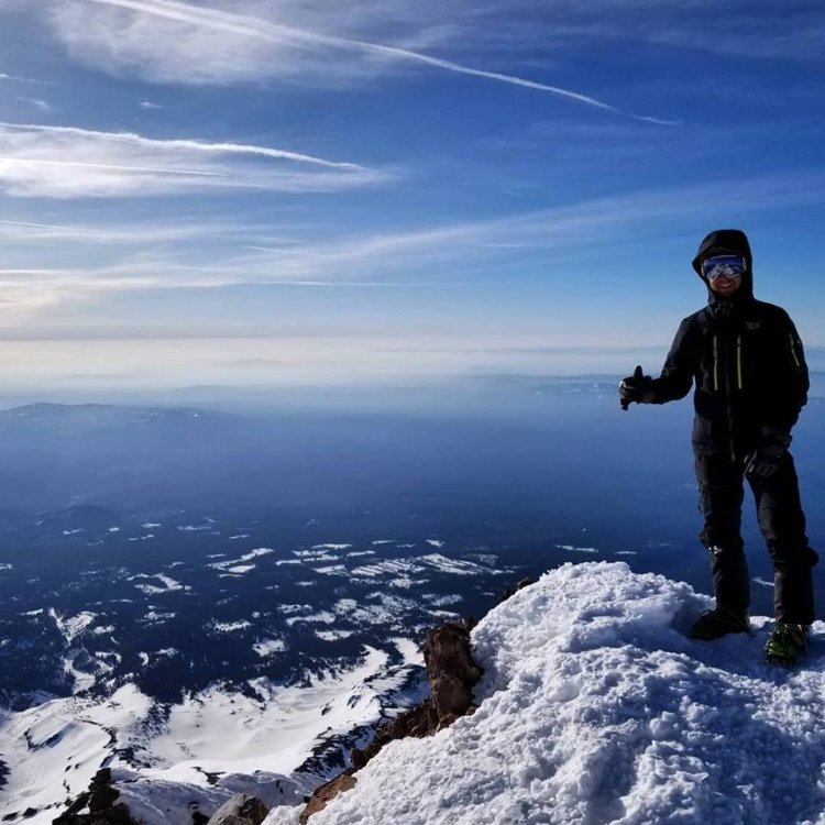
Trip: Mt. Shasta - Avalanche Gulch Trip Date: 04/29/2019 Trip Report: First time down to Shasta and we had success. The conditions are awesome right now. Very straight forward route. Lots of ice fall on summit day even with cold temps. Great ski from 13,500. Gear Notes: Skis and pons Approach Notes: up up up


 1 point
 -
Trip: Mt Jefferson - South Ridge Trip Date: 10/22/2018 Trip Report: Don't listen to the haters, this route is damn fine. I was lucky to snag the very last Pamelia Lake permit Thursday night. Because I knew I needed sleep before my big trip, I got none and I was really droopy heading out Saturday morning: had tea with a nice person about to travel far away, printed my maps/permit, texted plans to my coparent, and overshot Pamelia Road by 15 mins all in a dizzying podcast muffled blur. The low point of my trip was at Pamelia Lake. It turns out the BeFree filter's bad reviews have merit: with a hard squeeze drops were coming out slower than I was perspiring. It's been used for about ten nights total. For some reason, after sucking on it hard (no, there's no pun there) the flow upgraded to an infuriating trickle and my trip wasn't ruined. I got to Coyote Lake after a few hours of slow and sleepy PCT, mostly nondescript except for this huge owl. There were a few peeps on the other side; I was surprised by how few I'd seen given all the cars at the TH. I heard the climber's trail is hard to find, so I decided not to try and just bushwhacked uphill starting right where the PCT meets the lake. I love bushwhacking. I love the expeditionary feeling, the independence, the navigation, and the mindfulness it mandates. As a bonus, no predator could hunt me without making a lot of sound, so it's safer than a trail. Right? Well, I had a mild navigation problem. I'd intended to camp at a flat spot at 7100 ft. I popped atop a knifey ridge and utterly failed to read the terrain, so I did my best and (finally) read the altitude instead: 7700 ft. I'm way off, but in a good way? I scramble a bit more with headlamp and find a narrow perch at 7800 ft to call it a day after trying and failing to pinpoint myself on the map by moonlight. Wake naturally at 6:10 after sleeping well. I still don't know exactly where I am, but uphill seems sensible. I consistently find excellent boulders to use for climbing, next to no scree. If you're one of the many annoying folks that whine about this route, I'm so excited to tell you that if you stick just a bit to the SE you'll have nothing to complain about. Traversing to the N side of the pinnacle was certainly not trivial, but easier than I expected: dry at first, then with some ice I could navigate around, then the crampons came on. It was wicked to dislodge rocks and see them explode into many pieces 1000 ft down seconds later. Took a few false starts till I found the way to the summit; I'd agree with peoples' fourth class assessment, though there's one narrow snowy ledge on the North side of the pinnacle that has some crazah exposure facing East (fourth pic down from here). This was the one spot where conditions weren't ideal: snow was soft and a few inches deep. Slippery, no purchase. Did I mention conditions? Extremely good, everything in shadow was very firm snow or dense water ice. Very trustworthy. This is my first mixed snow/ice/rock experience and it was SO rewarding, made me feel so competent :->. Descent was similar, though I opted for screeing instead of the boulders. Accidentally found the climber's boring trail and followed it. Decided to descend via Hunt's cove, got my bushwhack fix there with a nice, steep shortcut. So dreamy in the fall. I might've picked some boletes on the way back as an offering to my dad, who expressed want for them and specifically asked me not to climb Mt Jefferson. Back in town only five minutes late to pickup my daughter this time. Such a rewarding excursion! Gear Notes: Crampons, ice axe, Assam tea Approach Notes: I'm 80% sure the mushrooms are called Fat Jacks, and 100% sure they're nontoxic by way of human experimention.1 point
-
https://www.planetmountain.com/en/news/alpinism/david-lama-hansjorg-auer-missing-in-canada.html0 points