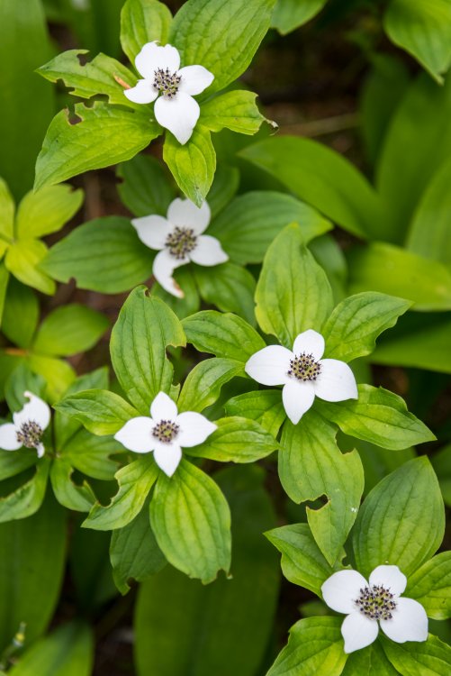
Leaderboard

.thumb.jpg.cfcdfe2598dc61c43a4b4e26b530a5fe.jpg)

Popular Content
Showing content with the highest reputation on 07/16/18 in all areas
-
Trip: Cordillera Blanca - Various Trip Date: 07/10/2018 Trip Report: I had a great two week trip to the Cordillera Blanca from 6/29-7/13. I planned this trip intending to use it as a recon to aid in planning future trips. I was able to take detailed notes on logistics and make many great contacts in the area. We spent time in the Ishinca Valley climbing Urus Este and Ishinca, and attempting Tocllaraju. This trip was supported by the American Alpine Club's Live Your Dream Grant - thanks. I wrote up a few short trip reports, linked below: Urus Este Ishinca Tocllaraju attempt Gear Notes: Cheap pickets are available in Huaraz. Bring everything else. There are some rentals of old-school gear available if you forget anything. Approach Notes: Burros are cheap - make them haul your shit!2 points
-
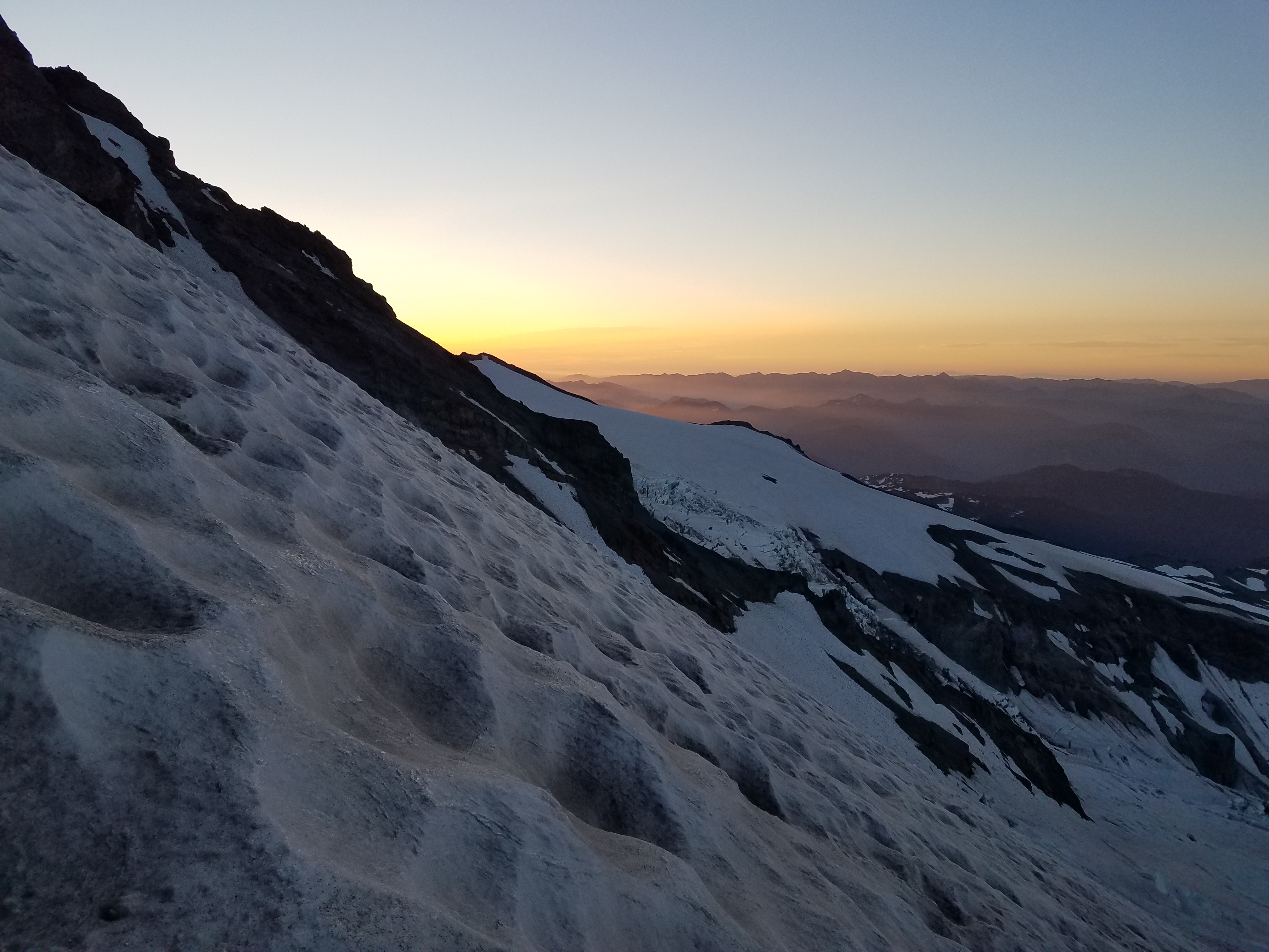
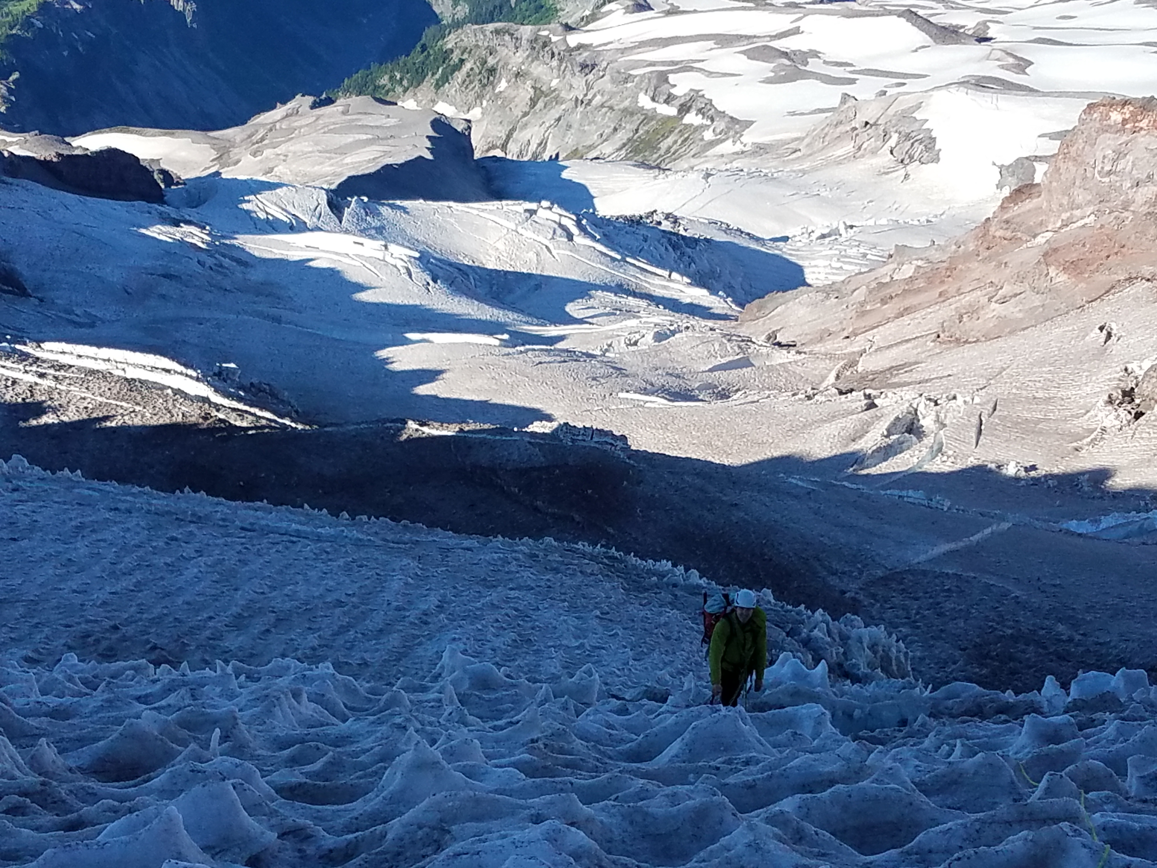
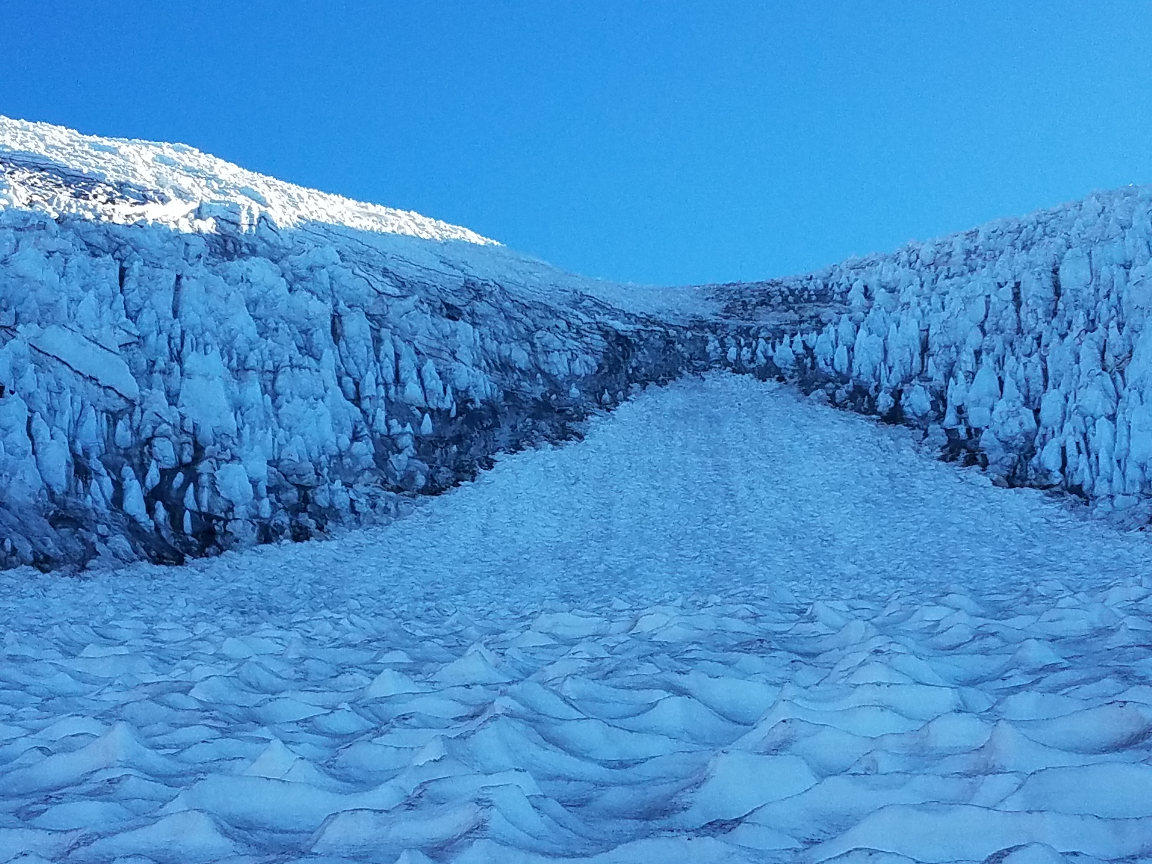
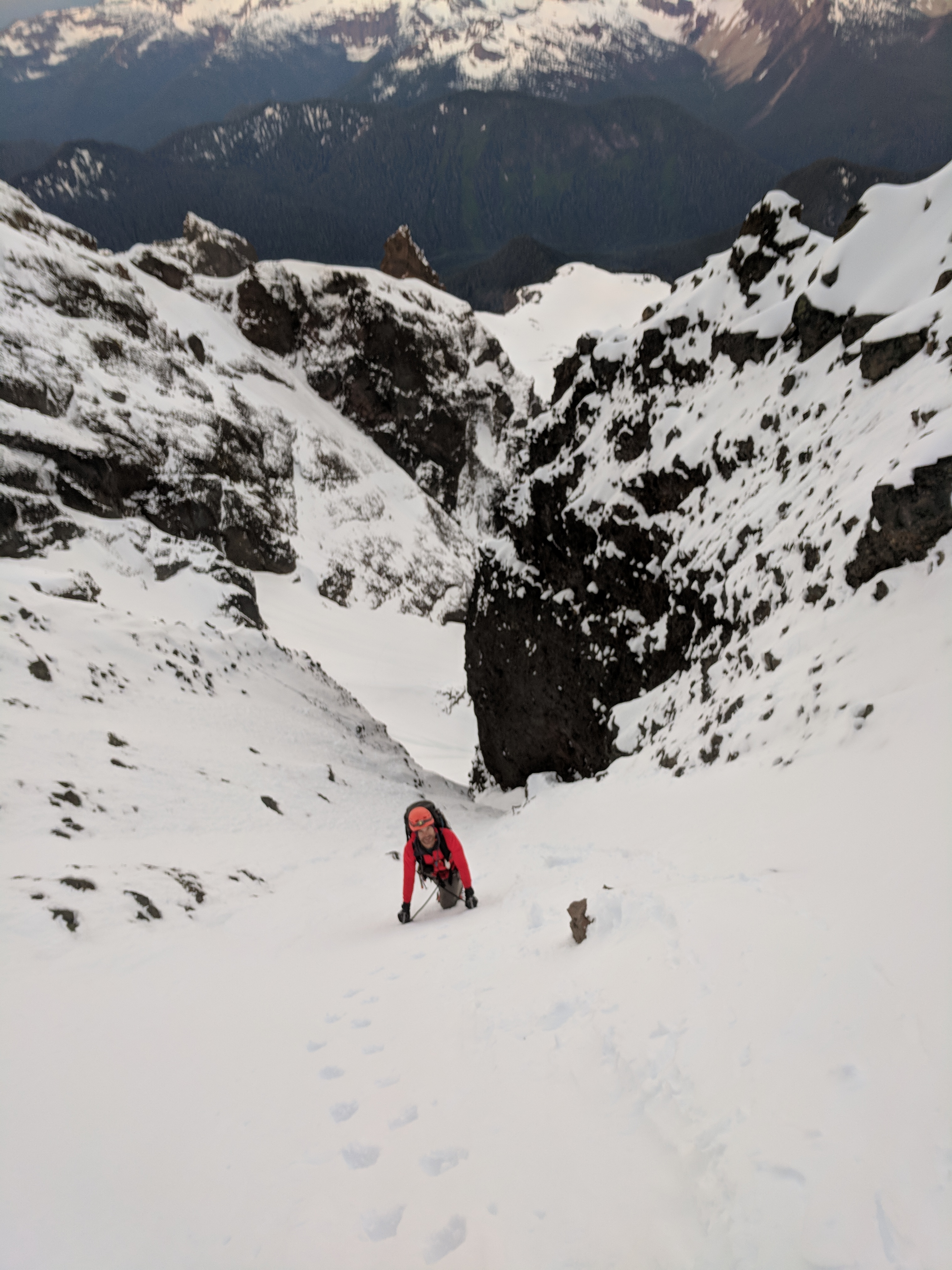
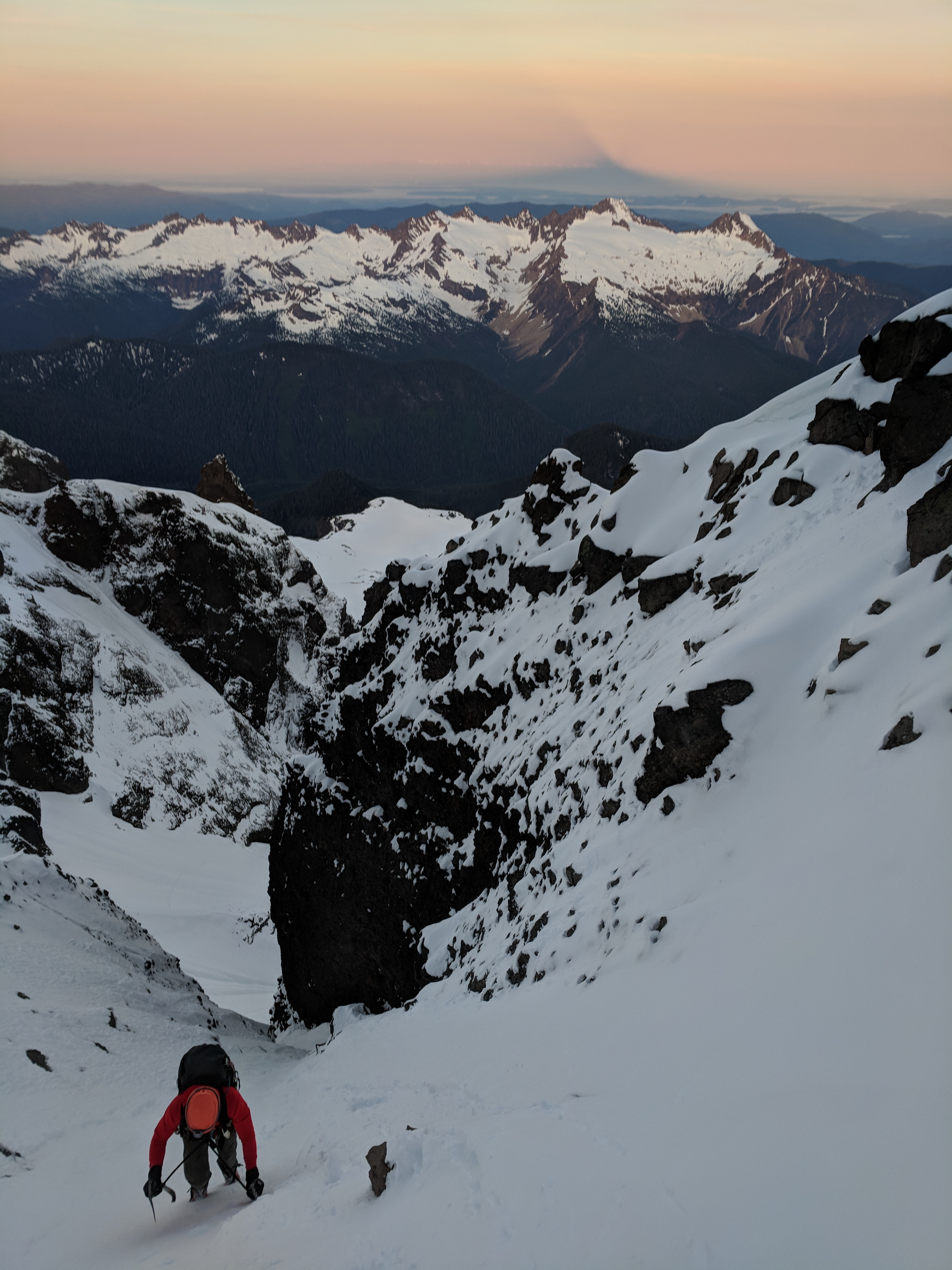
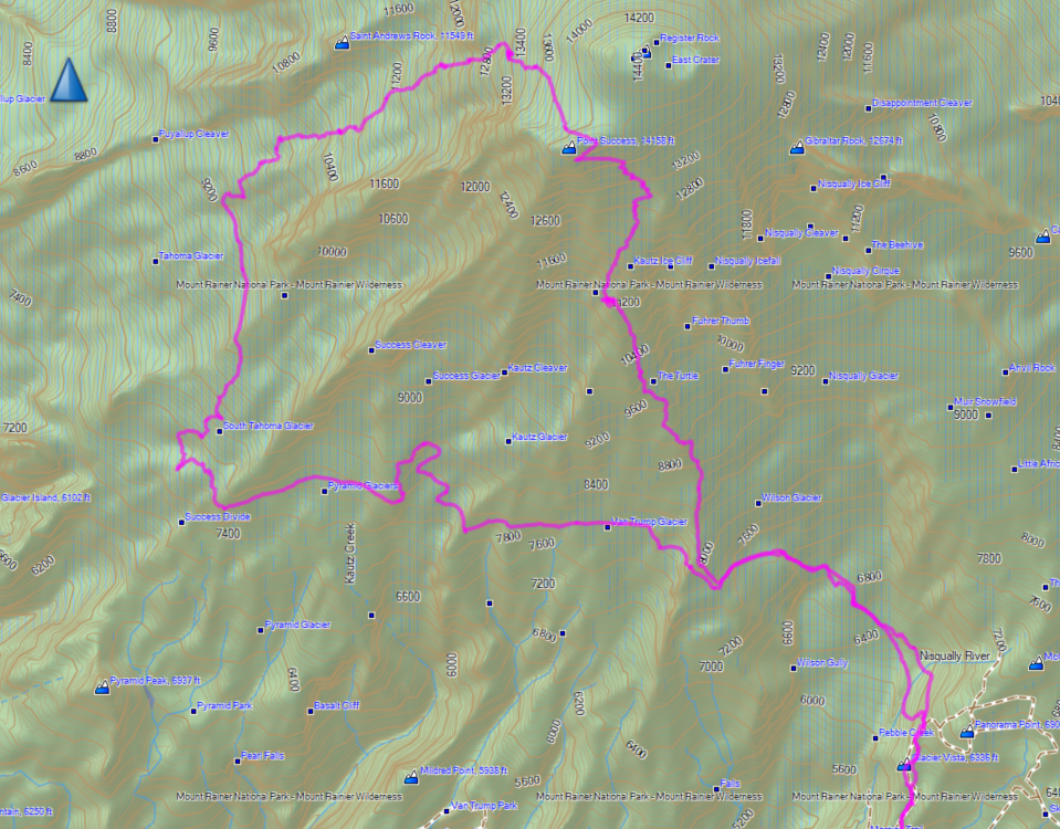
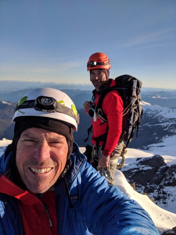
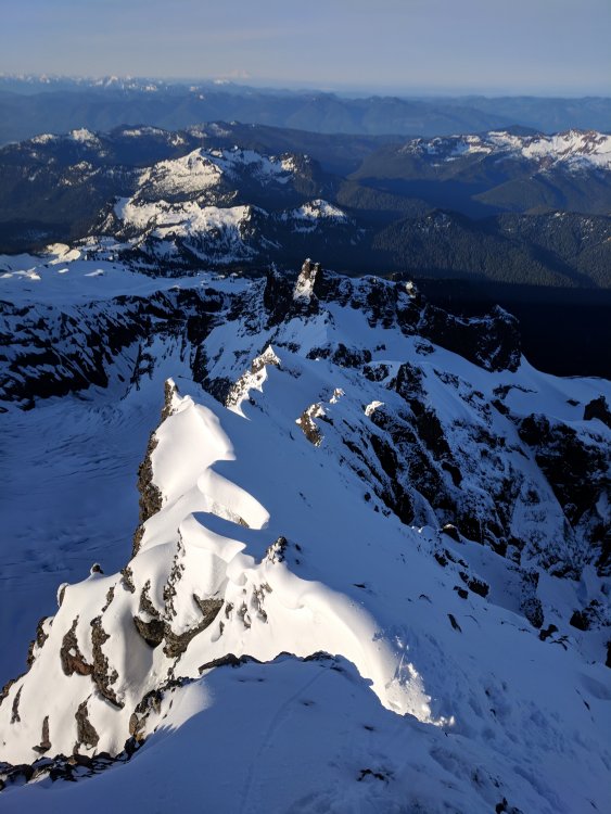
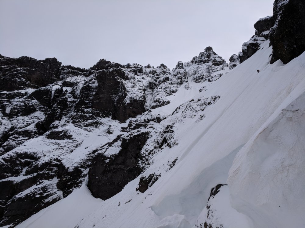
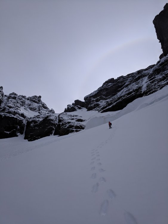
Trip: Mt Rainier - Kautz - Tahoma Trip Date: 07/14/2018 Trip Report: Sean and I were debating the idea of Slesse, and last minute Friday opted to bail and go to Rainier. My brainchild was single push up Kautz and down Tahoma, then back to Paradise for a full-value tour. We started at 2am and summitted around 1pm. We were expecting to use our own rope to rappel, so the fixed rope was a pleasant surprise, though the rope has seen better days (it did hold me, at about 225lbs with all gear). I think we missed the 1st ice pitch? The pitch we did climb was casual and fun. I was exceptionally slow above 13k, I guess working at sea level makes it tough to move fast up there. We had a real discussion about down DC or down Tahoma, we opted for Tahoma. The Tahoma was really fun, and definitely still has lots of life left this season. We broke through no crevasses and only had one jump that was seriously questionable if it would go ... We exited the Lower Tahoma glacier around 7pm, and lost visible light on the lower elevations of the South Tahoma Glacier. We lost of a lot of time trying to get across this POS, we ended up crossing very low around 7800 feet. I had a GPS track of the traverse from Success to Paradise, so it was a matter of staying awake and following a track to get back. We thought about heading down to the road and trying to hitch a ride, but we were not entirely sure about where the trail was and thought that getting lost trying to find a trail might be more frustrating that the long way across back to Paradise. It was an awesome, full value trip on Rainier - a venue without equal. Combining everything into a single push really helped reinforce what is possible given enough food and water. Thanks Sean for being a great partner! Final stats: 21.6 miles 11,250 feet of vert 26.5 hrs c2c Gear Notes: Two Tools helpful, a hammer to pound pickets. Approach Notes: LONG WAY back to Paradise


 2 points
 -
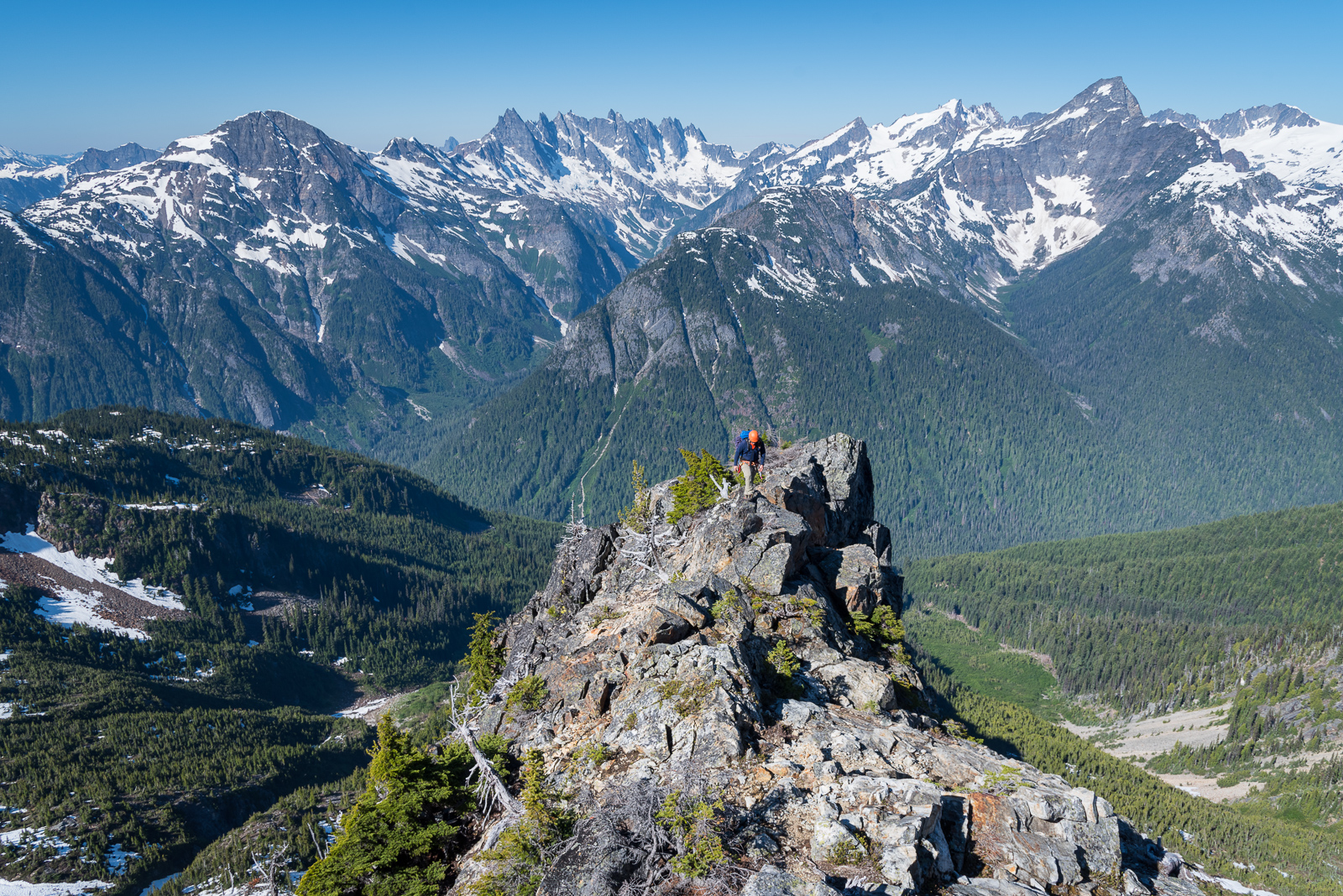
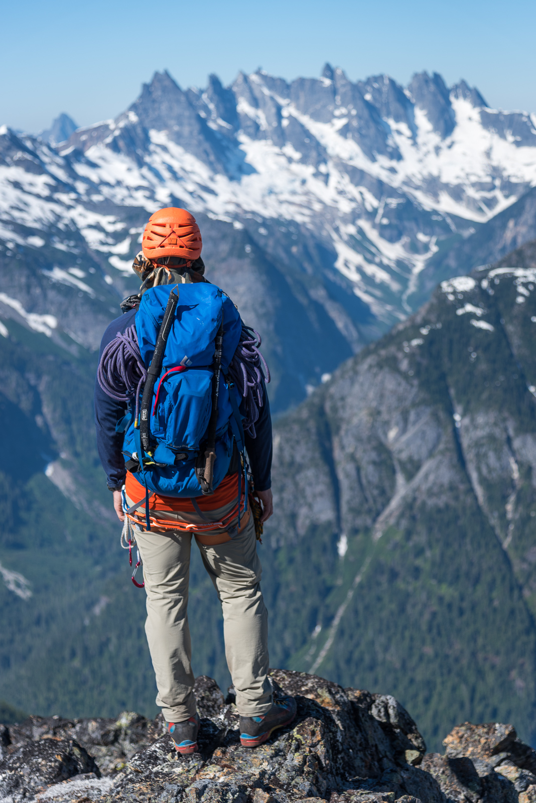
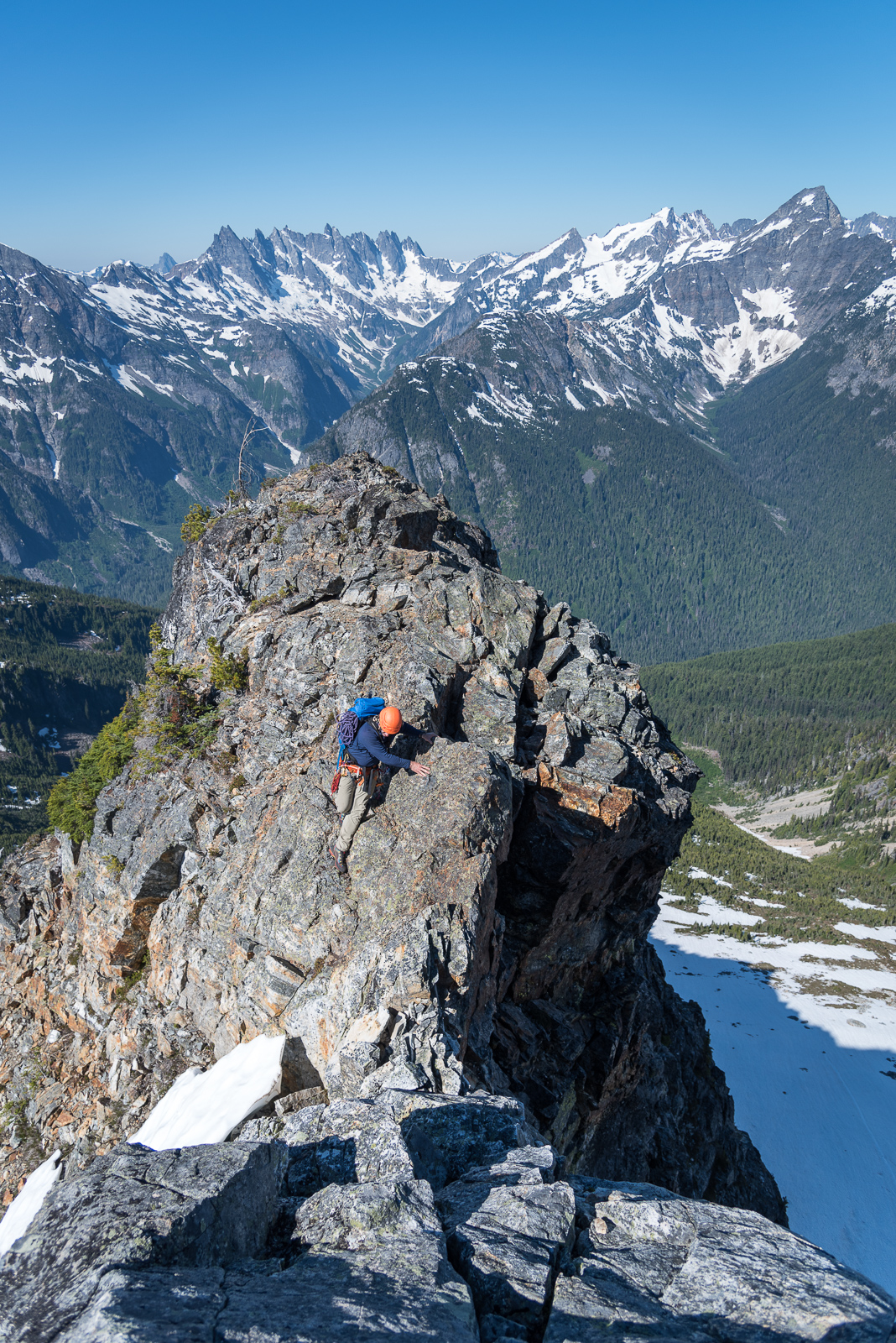
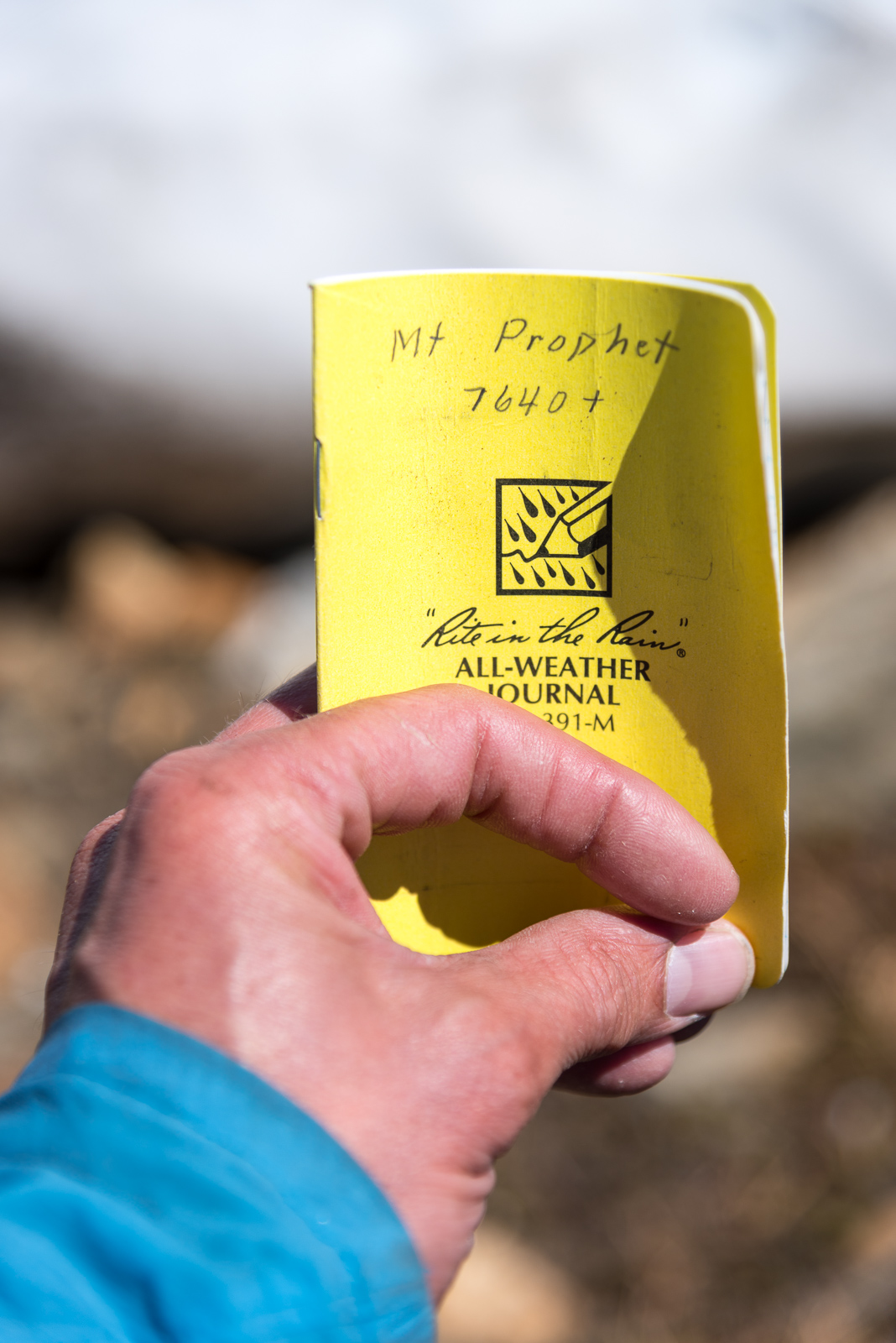
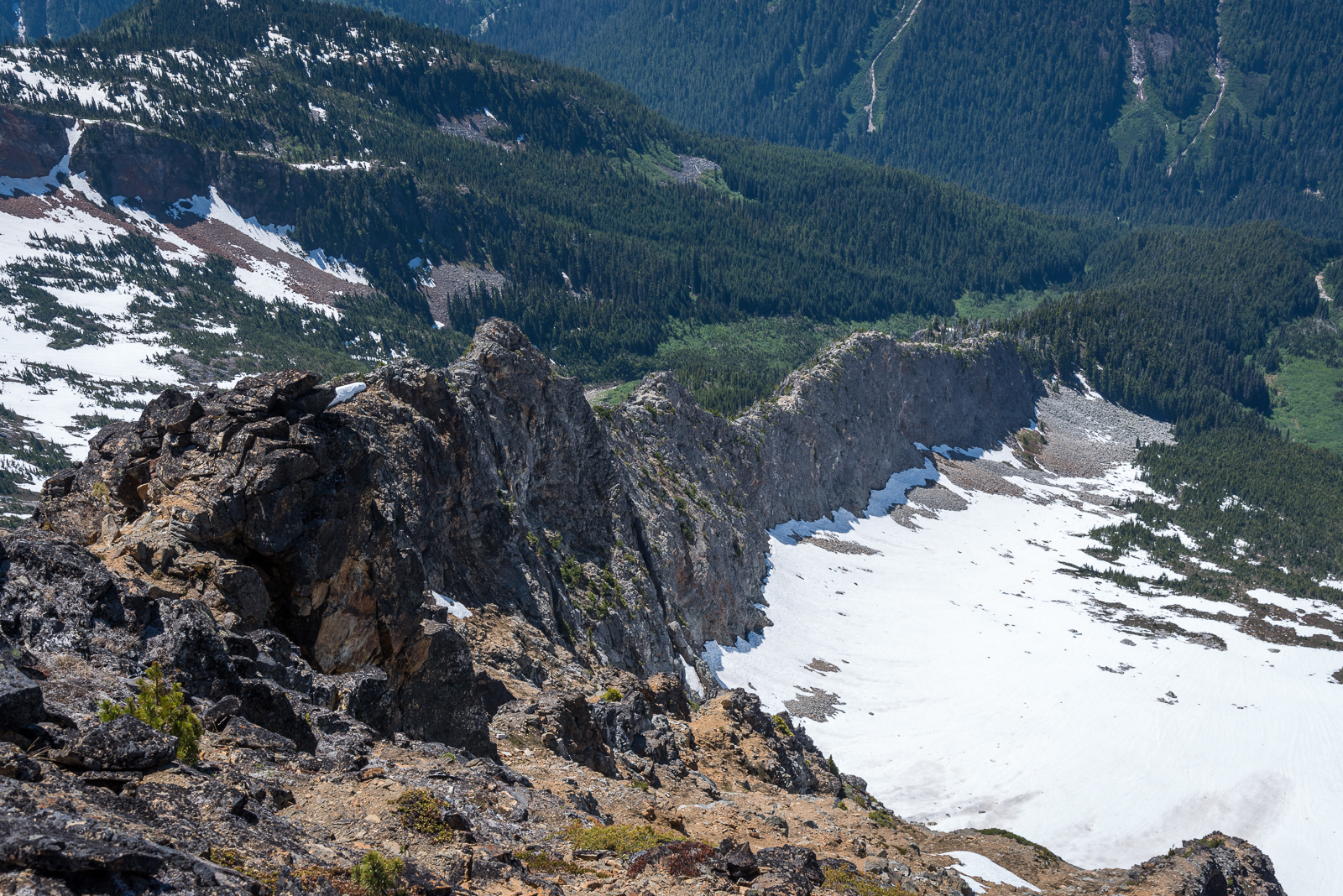
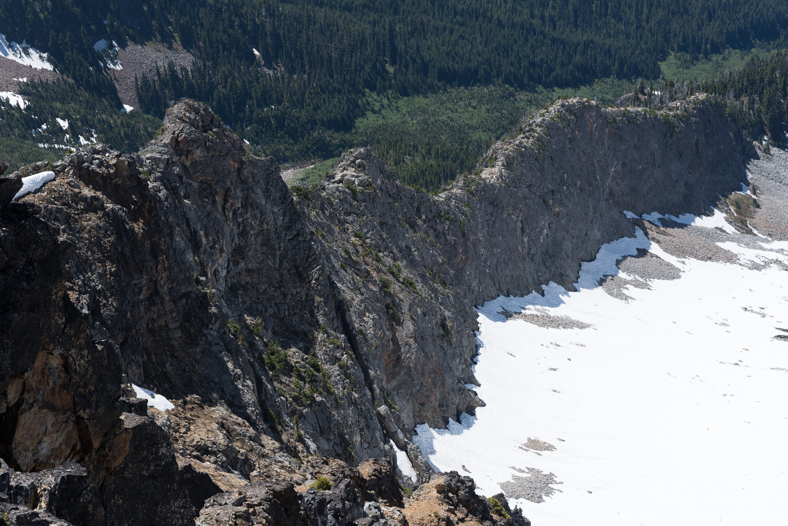
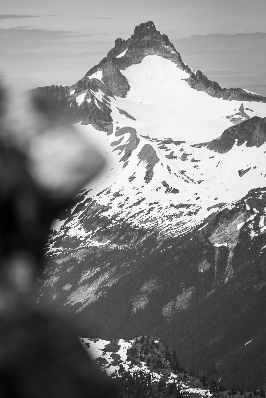
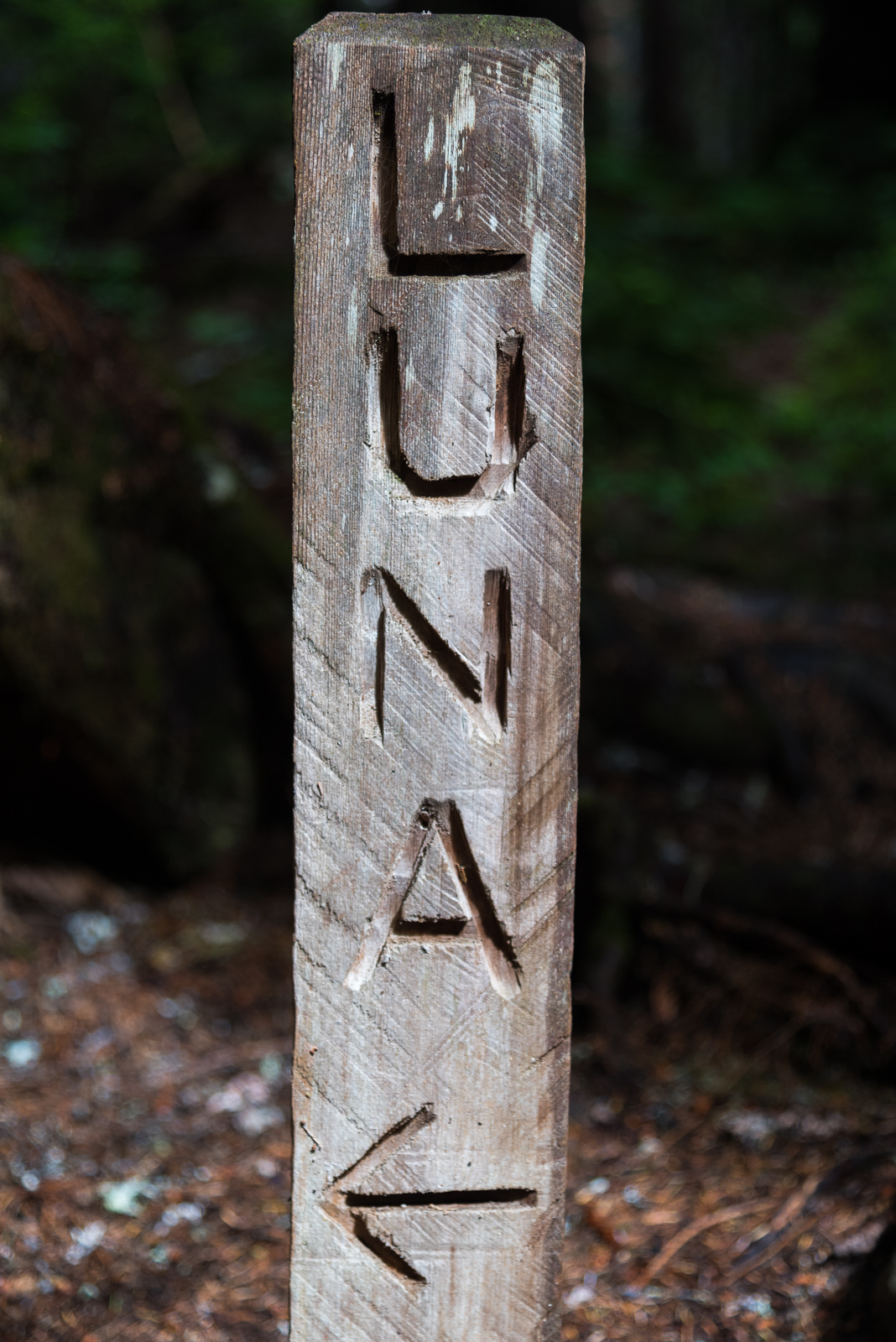
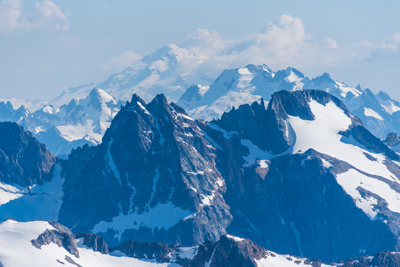
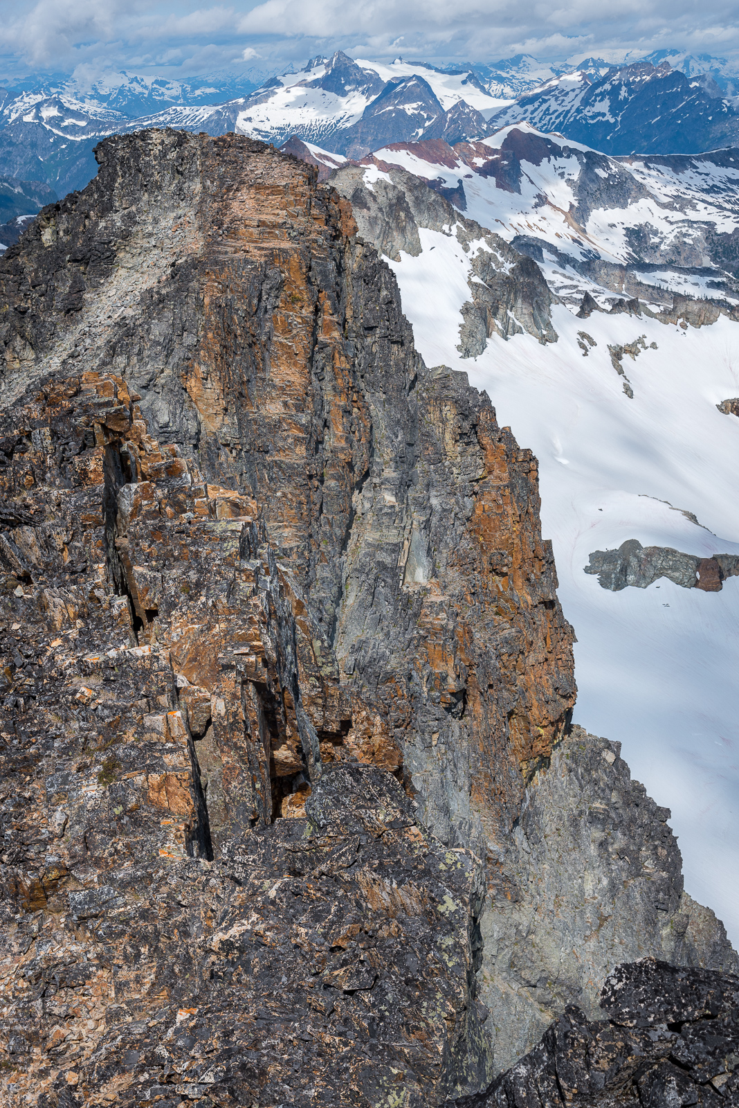
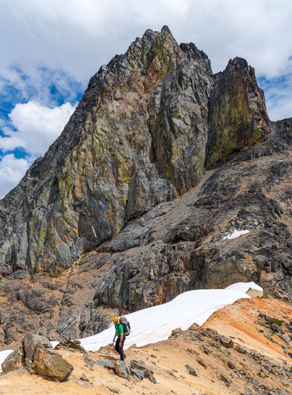
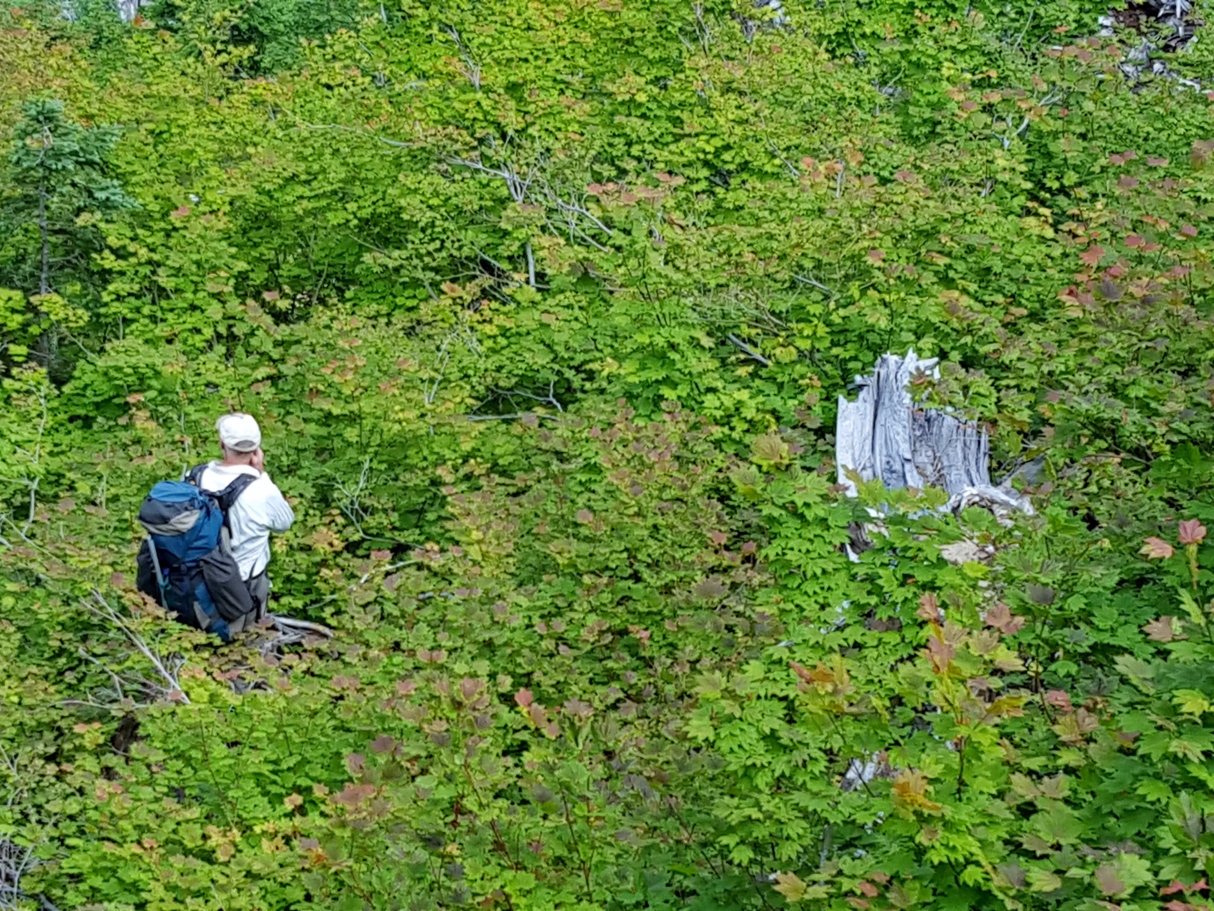
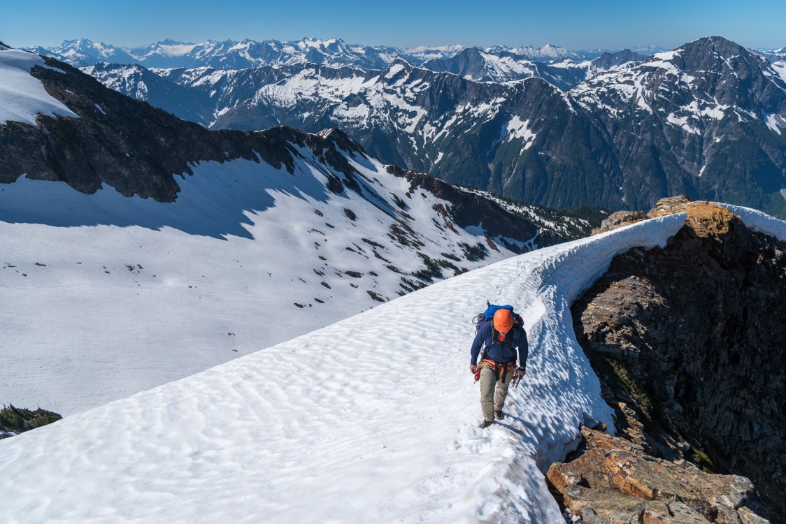
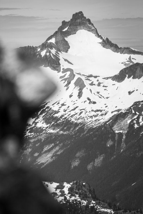
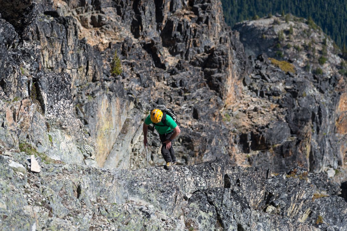
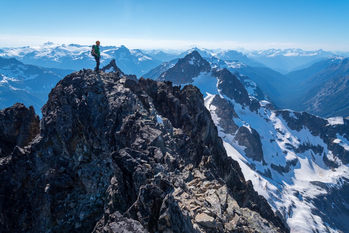
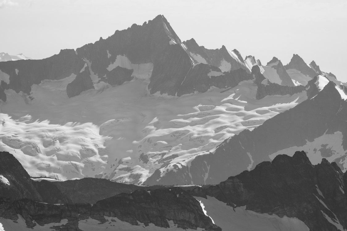
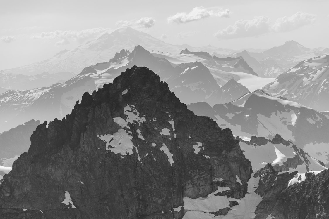
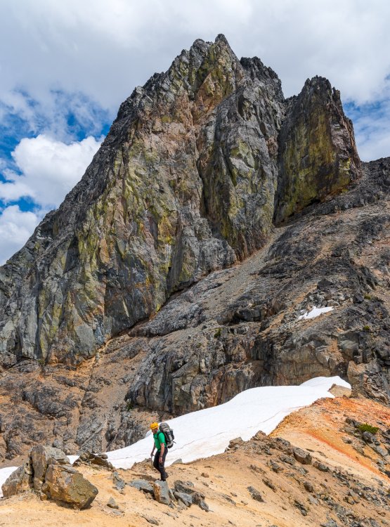
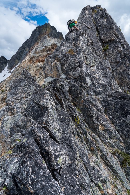
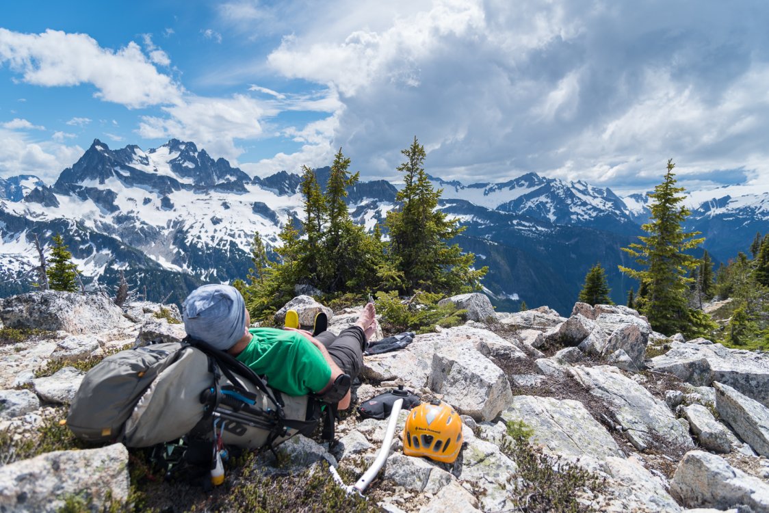
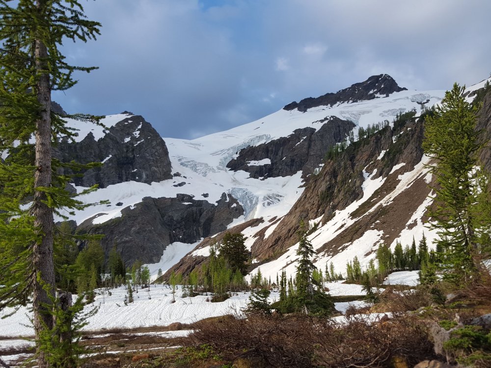
Trip: Mount Prophet - "Jacob's Ladder" (AKA full SW rib...FA?) Trip Date: 06/24/2018 Trip Report: "And Jacob went out from Beersheba, and went toward Haran. And he lighted upon a certain place, and tarried there all night, because the sun was set; and he took of the stones of that place, and put them for his pillows, and lay down in that place to sleep. And he dreamed, and behold a ladder set up on the earth, and the top of it reached to heaven: and behold the angels of God ascending and descending on it." - Genesis 28:10-12 KJV Grunting our way up the prominent rib on the SW side of Mount Prophet (above, in photo taken from Luna Peak by Martin Shetter), nobody would have mistaken Kit Moffitt and I for angels. Although the summit of Prophet this past Sunday was certainly much closer to heaven than the bug infested forests back at Luna Camp, our home for two nights as we investigated the directissima up the SW rib. Our aim was to explore above 5450' on the feature, where everyone seems to traverse off the rib into a typically crappy talus basin (via 4th class down climb). Given the ominous warning on SummitPost, Kit and I went in with a rope, rack, and even a pair of rock shoes: "The rib has cliffs on either side and no one has yet explored the possibility of climbing it directly to the summit. That could prove to be a bad idea."- SP We were a little disappointed that the gear stayed in the pack the entire time, however (long way to carry it!), but pleasantly surprised to find fairly clean and exposed class 3 climbing for ~1500 vertical feet to the summit. There really is no reason to leave the SW rib for future parties, until it is time to descend. We did go down the "SW rib" route (south of actual SW rib, described well on SP and found it to be your typical mix of scree, talus,and pain). We also found a way back on to the rib at about 5600' that only involved a bit of exposed class 3 (seems easier than how the lower access is described on SP?). Given the obvious difference in quality between the two scramble routes, I suspect that future parties will follow the loop that Kit and I did this past Sunday. However, I wouldn't be surprised if someone has ascended the full SW rib before we did this past weekend. Does anyone have info of previous parties, before Kit and I go claiming this massive, 3rd class, FA?? It is quite prominent as you descend out Access (Axes? Pickaxes?) Creek, and I noticed it back in 2007 on the exit from my first Pickets trip. It was fun to come back and explore something that has not been documented before- our very own backyard adventure! Just goes to show that there are still plenty of blanks on the (climbing) map, even for the blue collar set.... Calling the resort for the boat pickup, saving 12 miles RT: Luna Peak: Mac Spires, Inspiration, The Pyramid, Degenhardt: Blue collar! Nearing the summit as the rib fades: Jack: "Jacob's Ladder" from the summit Old habits die hard. Hanging out with the ghosts at Good Food, post trip: Gear Notes: Helmet, axe, crampons (early season). We brought gear in case it was technical, but found nothing over exposed class 3. Approach Notes: Big Beaver trail to just before Luna camp, then head uphill a steep vertical mile to the summit. It goes from hiking to scrambling at about 5800' The slope turns into the SW rib which is followed religiously to the summit. Descend on the south side of the rib until you can regain it about 5600'


 1 point
 -
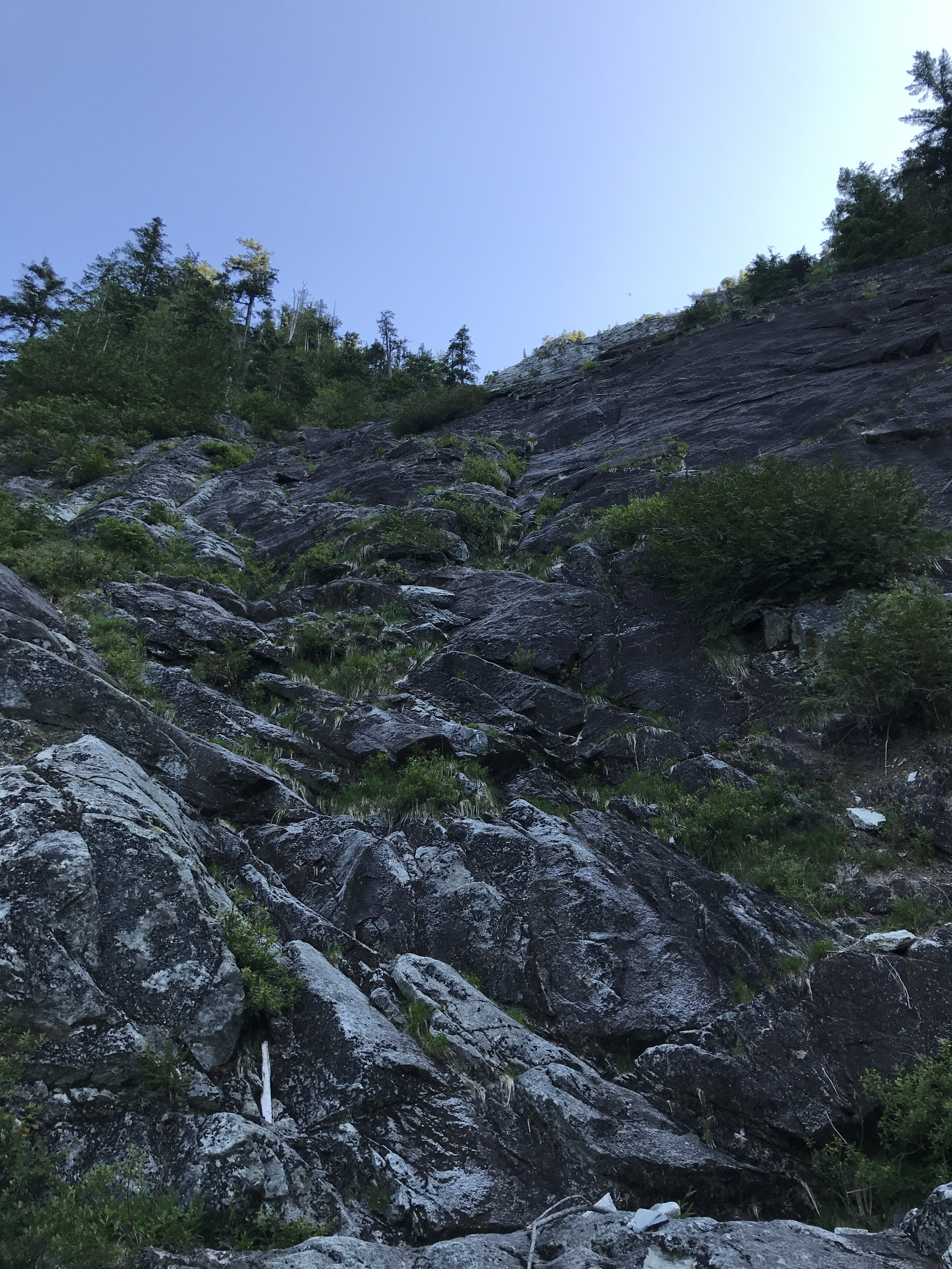
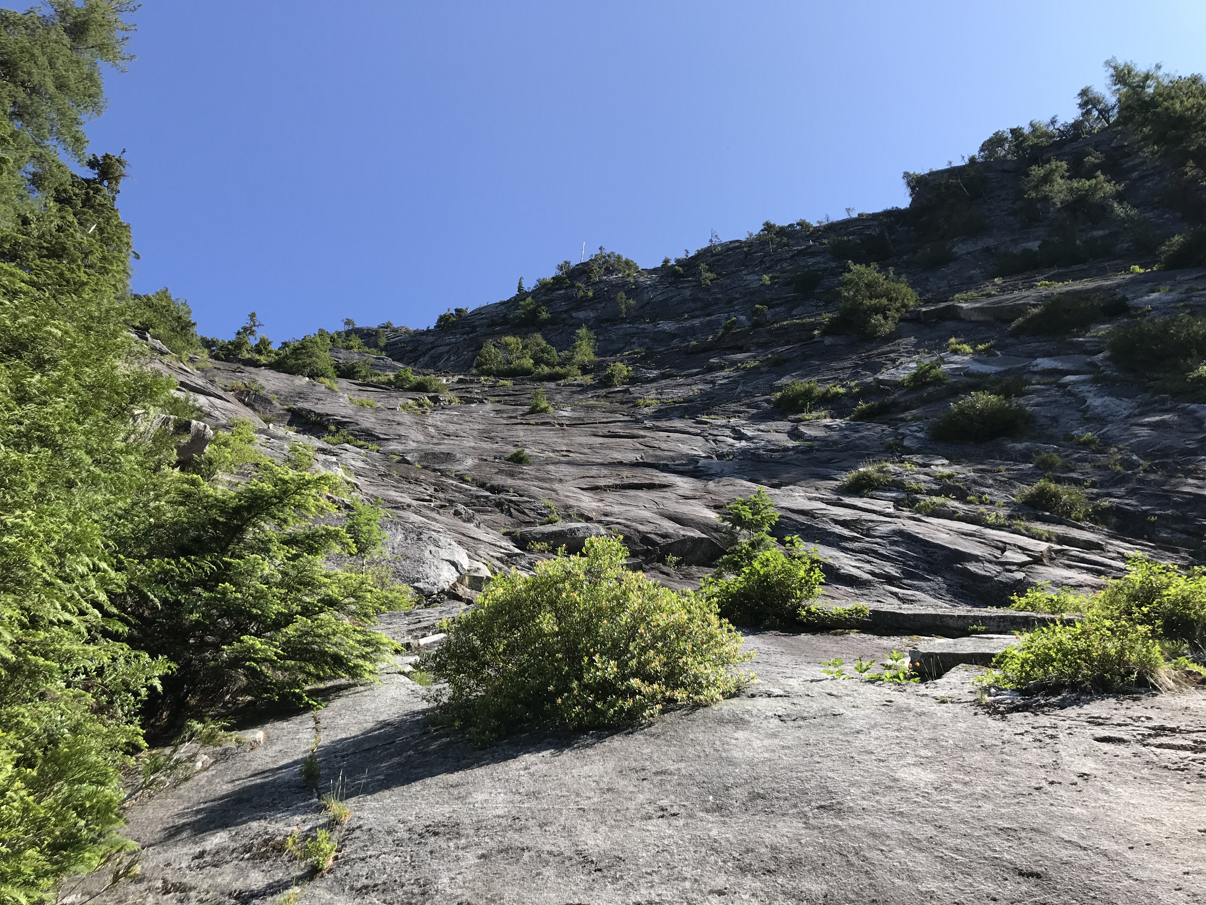
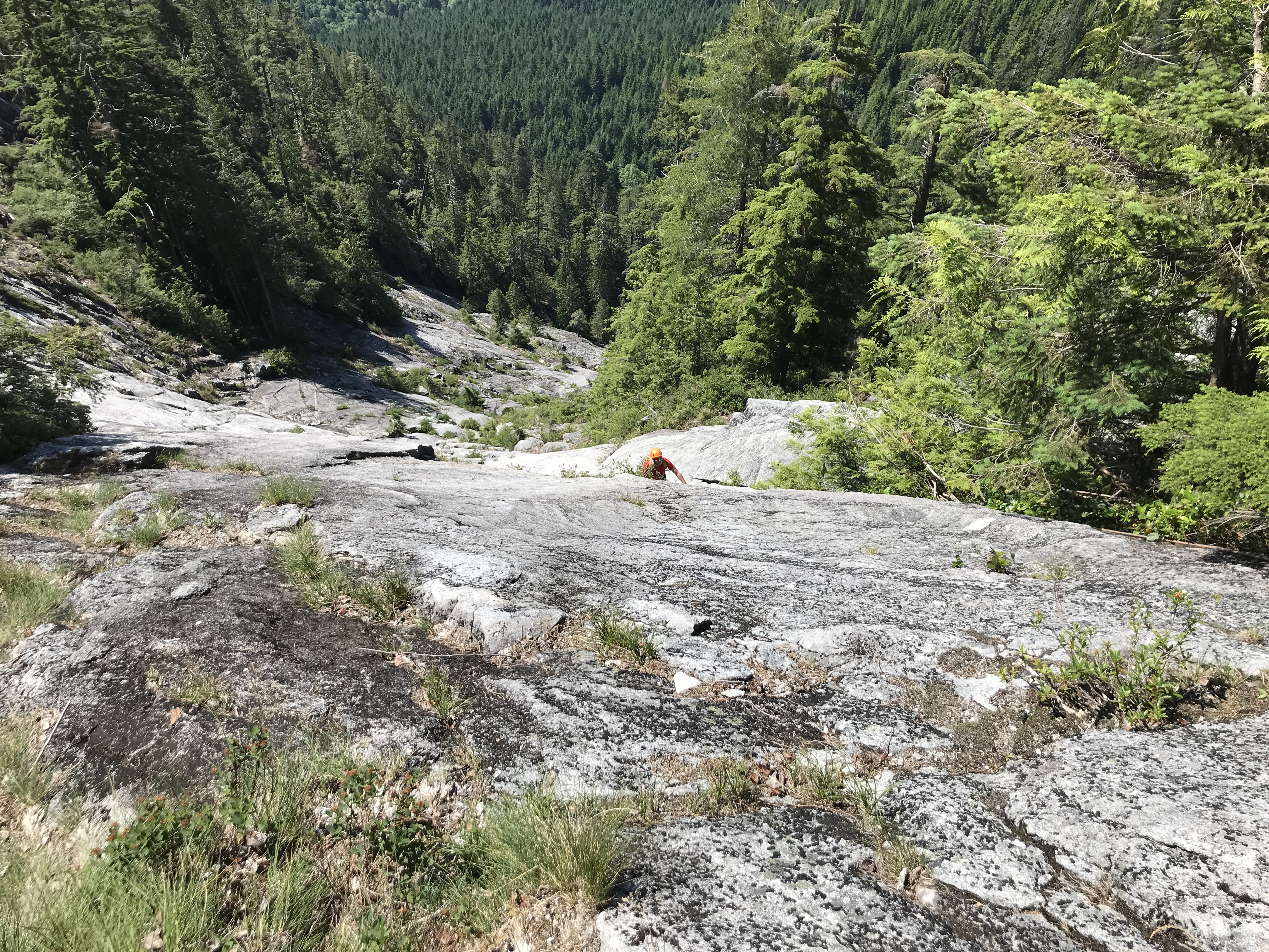
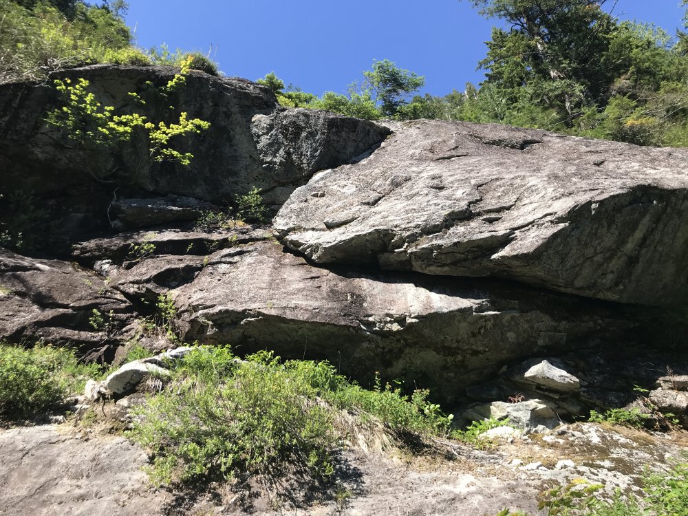
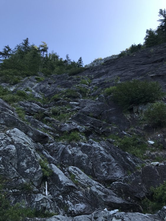
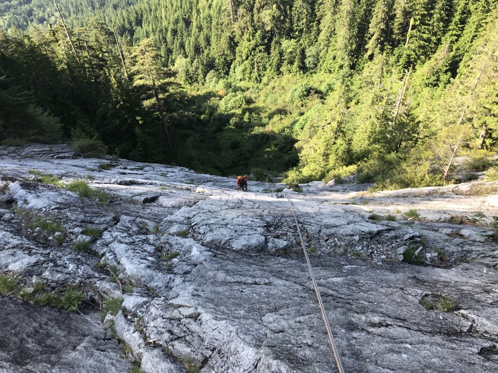
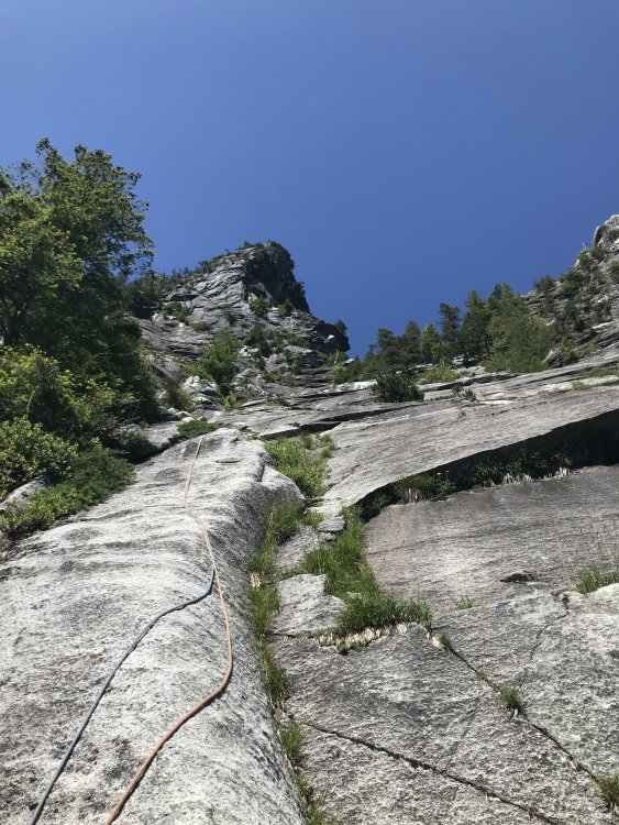
Trip: Quartz Mountain - Training Day Trip Date: 07/14/2018 Trip Report: Looking for a long route somewhat close to Seattle, we ran across Training Day in the new Snoqualmie Rock guide by Kurt Hicks. We had never heard of it before, and it sounded like it was just what we were looking for. 13 pitches, with about an hour long approach, and a short drive from Seattle. Ornulf and I met up in Issaquah at 5:45, and after a quick drive started hiking at 6:30. After a half hour on the CCC Trail, we turned left and started up hill. There was no trail, but we kept heading upward. The forest was relatively open, with minimal bushwhacking. The last few hundred yards to the base had some bushwhacking, but nothing too obnoxious. The start of the climb was not fully obvious, but it looked like one could take any of a few different paths on the first pitch. we went up the left side of the base, and went just right of a roof. The first few pitches were straight forward, and not too difficult. Then at pitch 4, the difficulty started to increase. As the difficulty increased the number of bolts increased. Any move that was somewhat difficult generally had a bolt right next to it. Some would argue there were too many bolts, and we did not end up clipping all of them, but for those less experienced with slab they will be much appreciated. Pitch 7 was the crux pitch, and was a continuous 5.10a slab, and heavily bolted. This pitch had the 22 bolts. Only downside to this pitch, was that it ended with about 15 feet of pulling on cedar trees to get to the anchor. Pitch 9 was the second crux, with some high steps to get through a couple of small roofs. After pitch 9, the climbing quality decreases as the climb starts to traverse up and left towards the notch. the rock is covered a bit more in moss/lichen and there are more trees to grab/climb through. though getting to the notch is pretty cool, and you get some great views. Plus, after the 13th pitch, the rap line is essentially straight down, and straight forward, with clean rope pulling. only challenge is the ~200m of bushwhacking back to the start. Route finding throughout the climb was straight forward with a few spots where you look around, but then it becomes pretty clear. The descriptions in the guidebook are spot on, though the ratings might be high (but I have mostly been climbing at index), plus some of the lengths in the guidebook seemed to be a bit short. We used 2 60m half ropes, and they were perfect. . There was some run outs on the easier ground but we never felt that we needed more gear/bolts. the guidebook also called for a double rack up to #3. Overall we only placed 6 or 7 pieces throughout the full climb. So, bring a light rack up to #2 (we placed the #3, but you could have placed the #2 if needed). Overall it was a fun day out. I definitely recommend the route to others looking for a long climb off the beaten path. looking up at the start of P1. we went up here and right of the roof. top of p1, looking up. looking down p3 looking up p6, which goes up and left. looking up p8 Ornulf getting ready to pull on the cedars at the top of p7. looking across p13 towards the notch and the great view. p13 is a short traverse that lines you up for the plumb rap line looking up towards the notch, 2 raps down. Gear Notes: 22 draws, and a light rack up to #3 Approach Notes: The new Snoqualmie Rock description is pretty solid. There is no trail up to the base. After you start up the hill off the CCC Trail, just keep going up and join the drainage and go up until the rock is there on your left, and bushwhack a short way to the base


 1 point
 -
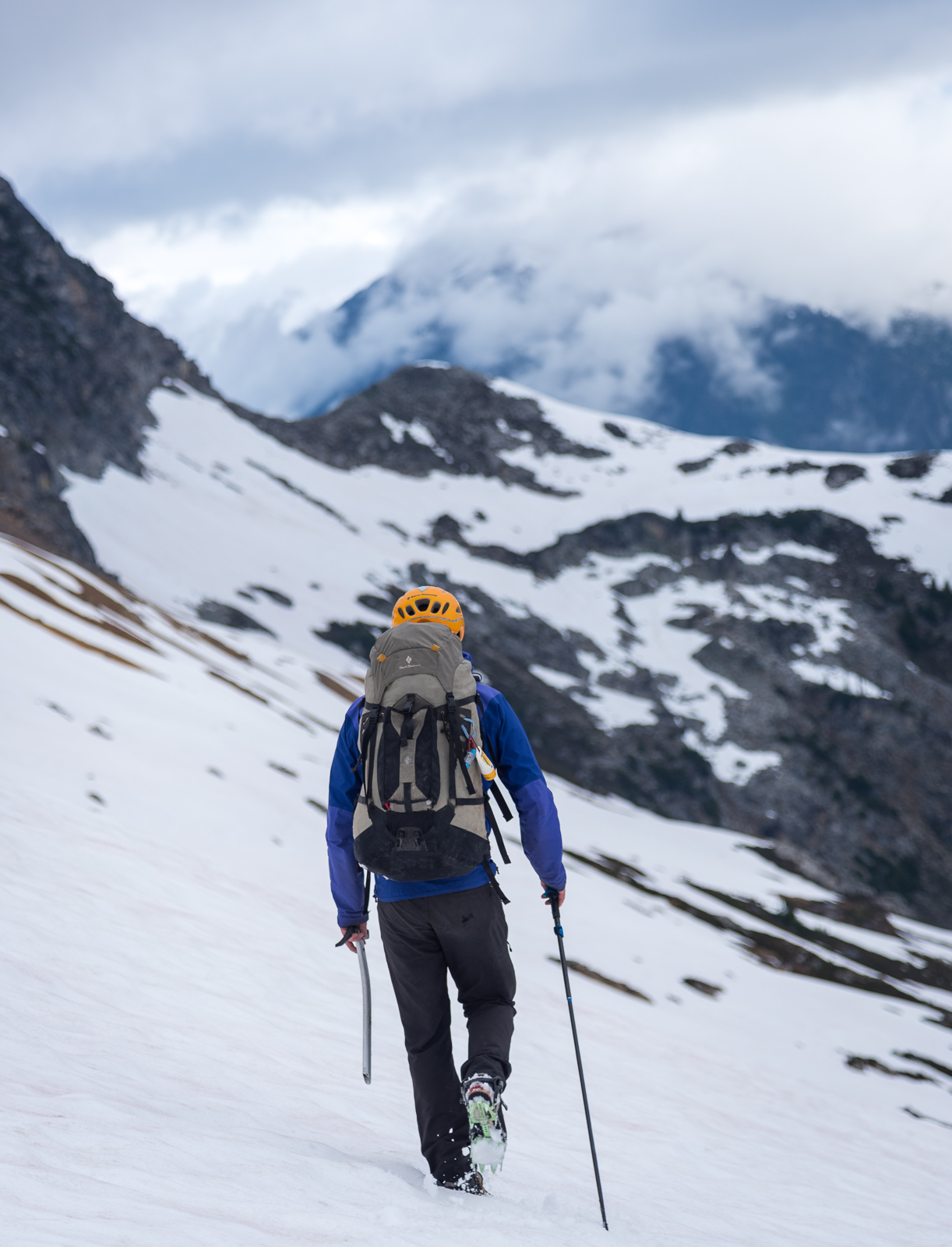
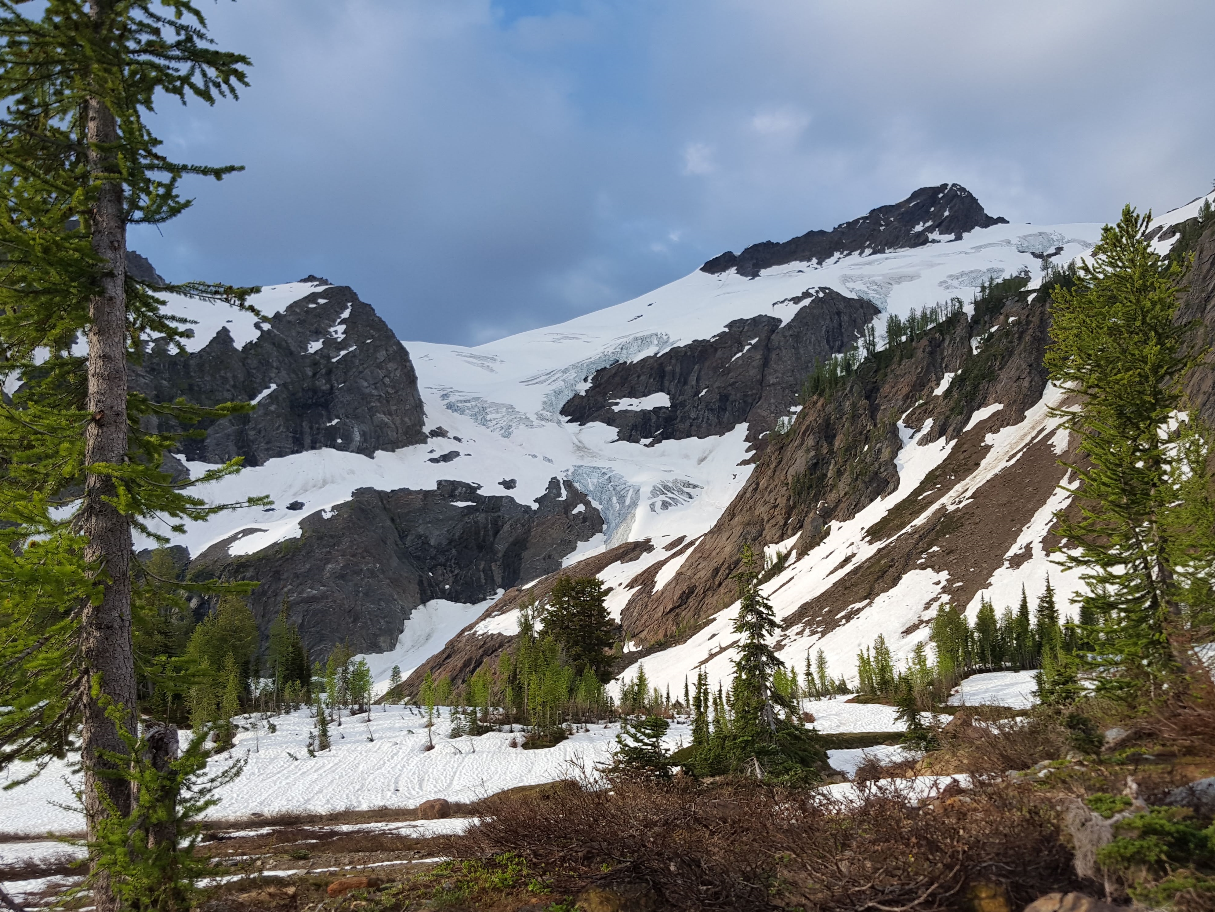
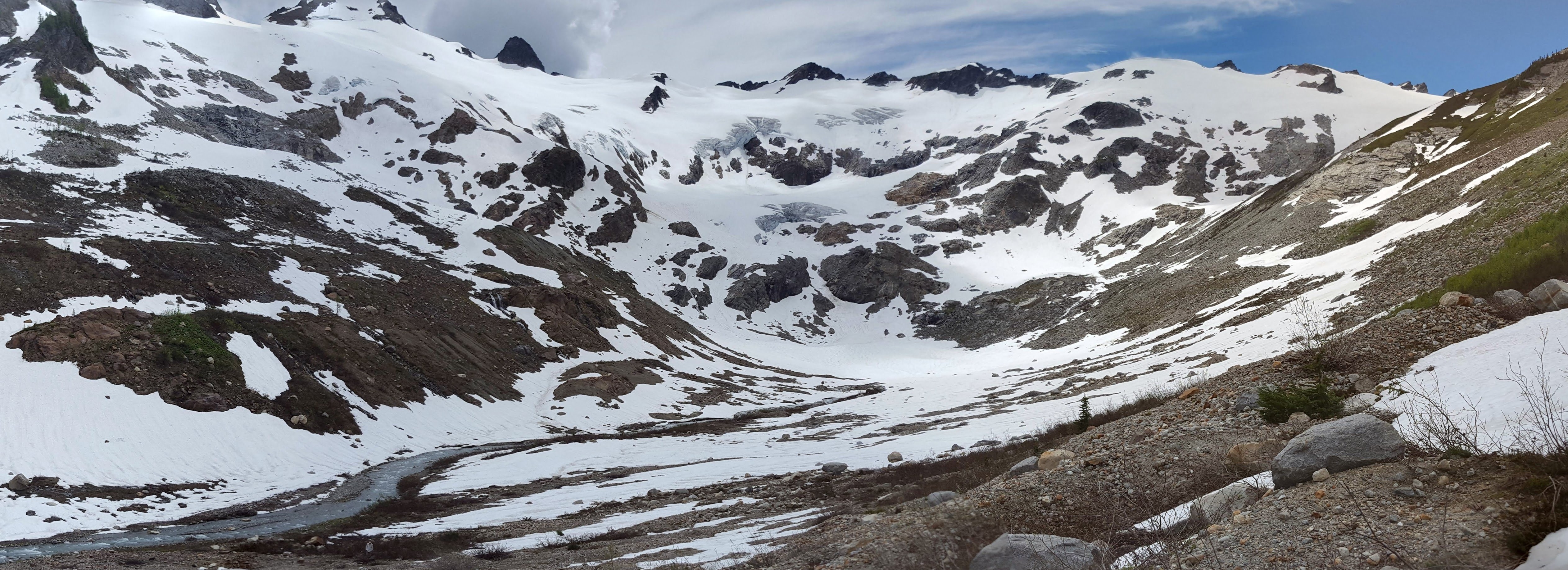
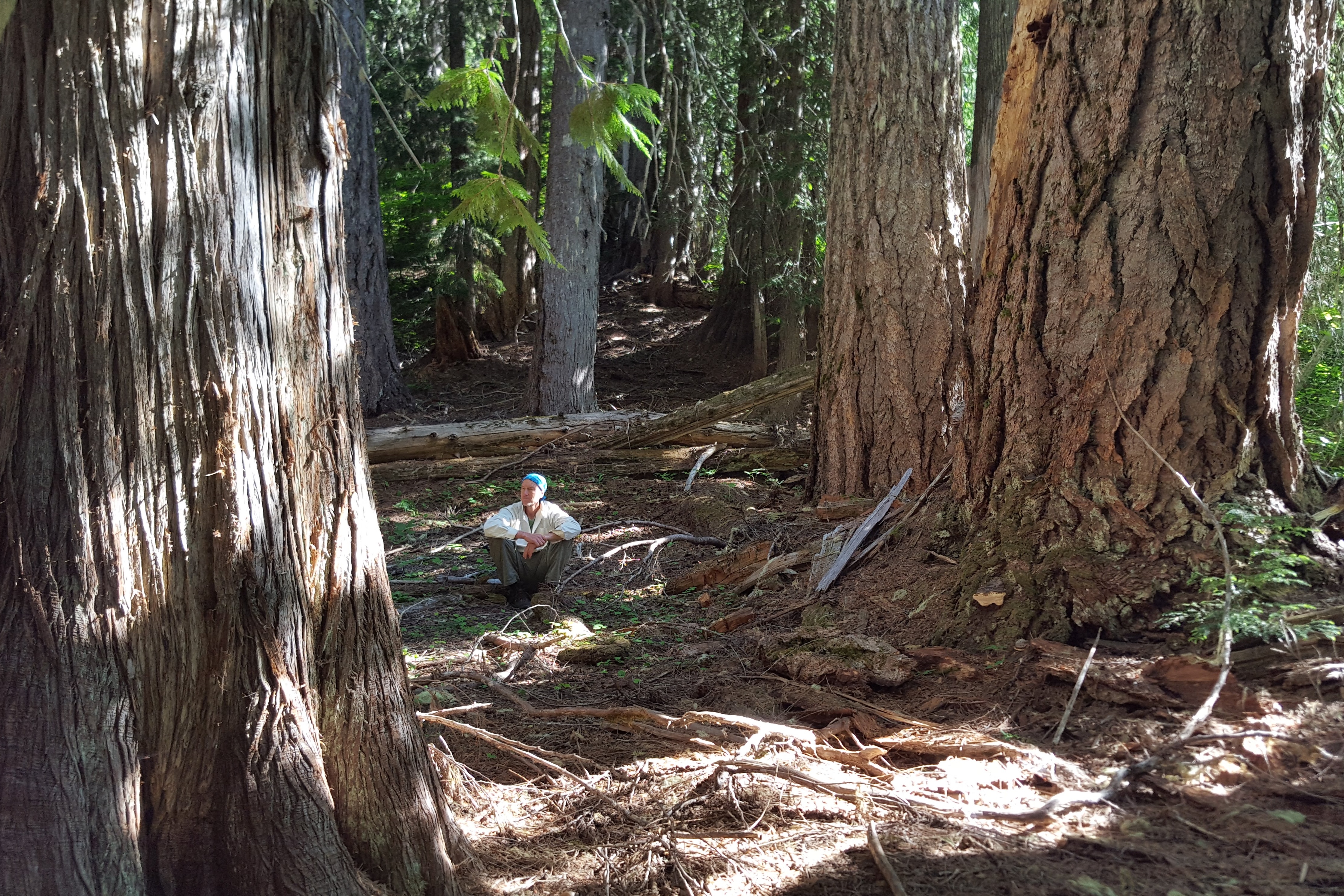
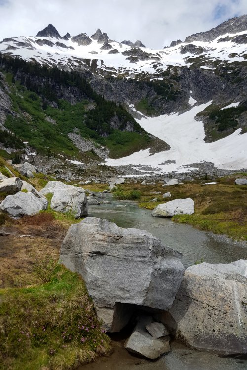
Trip: Mt Logan - Fremont Glacier Trip Date: 07/06/2018 Trip Report: Hi everyone, first TR on the site for me. Figured I'd share conditions on this classic, very fun and demanding (in approach) climb. We climbed Logan via the Thunder valley over a 4-day trip. I liked the itinerary, since it gave us a little more time to make the approach less suffering, and our summit day wasn't too long. The hike in is through beautiful old growth forest. A pair of hikers warned us about a bear ahead near the trail. They had turned back when they saw it. We did our "hey bear" calls as we walked, eventually rounding a corner and it was about 50' away in the brush. We looked at each other for a couple of seconds, then it decided to lumber off into the woods, and we kept on going. Our first campsite was at Junction, which is a nice spot that's a little more open than the other campsites which are more forested. There are nice views of Buckner and bits of the Boston Glacier as well as what I guess is Tricouni peak. No fire ban meant we were able to smoke out the mosquitos, which were plentiful. The next day, we followed the trail into Thunder basin. The trail is cleared until a bit past Skagit Queen, so the only blowdowns begin after there. Thunder creek crossing requires a ford, and the spot where the trail crosses (marked by a cairn) was pretty deep, high thigh for me and waist level for some of the others in the group. That may have been the crux of the trip! On the way out we found a better spot about 200' downstream, where the water was much shallower. We continued up-valley and made camp at the terminal moraine of the defunct Wyeth glacier. This spot had great views but puts you 500' above the climbers trail to Logan. It also saved us from the mosquitos of the valley. We were confused by conflicting beta about where to go from here. I mistakenly thought we should gain the visible 7600' col to the North, mistaking Pt. 8546 for Pt. 8248. In the morning, we made a rising traverse through heather benches and snow to reach this col and realized our mistake. It wasn't all bad, though, because we got amazing views of filtered morning light in the mountains to the East. We figured out our mistake, but then an incorrect topo I'd pulled from Summitpost led me to think we could just traverse the big SW rib off Pt 8546 at around 7400'. We traversed a bunch of blocky, loose terrain to the rib and again realized we were in the wrong spot. At this point, Dafna made it clear that the GPS track she'd loaded clearly showed the traverse about 1000' lower, so we made our way down there and found the faint trail through the larches. We wasted about an hour in this excursion, which was not too bad, but I don't think anyone was feeling too certain we'd summit at this point. Now in the basin draining the Fremont, we made quick time to the base of the glacier. Seeing some tracks (which looked no more than a day old), we decided not to rope up on the glacier or for the moat crossing.  After the loose rock at the start, the scrambling is superb, and it went off without a hitch. We were back in camp by early afternoon, and we used the sunny skies to dry our gear and feet as we packed. The skies were threatening rain. We wanted to move camp down valley for a shorter hike out the next day. Soon after descending below treeline, the thunder and rain began. We decided to camp at the Thunder horse camp, where there are a few trees for hanging food. My tent-mate Meira was cold and wet (she didn't bring rain pants), so I busied myself making dinner and a fire and didn't bother to take off my boots for a few hours. This turned out to be a big mistake. I have had "warm immersion foot" once before (after a long day in boots on Mt. Triumph), and when I finally took my boots off and dried my feet, I recognized the tingling, itching feeling in my feet. I was cursing myself for this mistake the whole way out the next day. Luckily, it was not nearly as painful as the first time I got it. But I think I will have to be more careful in the future. It came on in only a matter of hours, maybe 5 hrs in wet, not too cold, boots. My core did get cold at one point which may have contributed. I'd be curious to hear about other mountaineers' experience with this problem. I haven't ever had it occur in ski boots, which is weird, because I love spring touring and my feet often end up quite hot and sweaty. Maybe the liner is able to absorb enough water to prevent full immersion? The hike out was uneventful, besides the many stops for huckleberries, which are just starting to come in, and a long break at Junction for lunch and drying of feet. I highly recommend this adventure! Gear Notes: Brought rope and crampons and didn't use them. Approach shoes are nice but will be a compromise for the snow up high. I used a goretex lined leather hiker and was very happy with the choice until the foot issues occured. Approach Notes: Be ready to hang food or bring a bear can.1 point
-
Trip: North Cascades --Eldorado Peak - East Ridge Trip Date: 07/11/2018 Trip Report: Steven Gnam and I set a new speed record on Eldorado Peak's East ridge on Wednesday, June 11th. We started the climb around 12:30 in the afternoon, and finished around 4 o'clock. Although we had both previously been on the route, this trip initially was meant to be a scouting mission. Setting of at a moderately fast pace, we emerged onto the first boulder field 7 minutes ahead of Leor's first split (trip report found here: With great weather, good feelings, trail and glacier conditions, we decided to go for it! Total time: 3h30m Ascent time: 2h15m Descent time: 1h15m Gear taken: ice axe black diamond z poles microspikes 20m glacier rope ultralight camp harness with carabiner ultimate direction skimo pack light gloves wind shell hat sunglasses buff Gear used: black diamond z poles microspikes (summit ridge only) axe (summit ridge only) hat sunglasses windshell Just want to say thanks to Steven Gnam for a great day, and Leor Pantilat for the inspiration! Gear Notes: ice axe, microspikes, poles, running shoes Approach Notes: Route in good condition--a bit of snow in Eldorado basin1 point
-
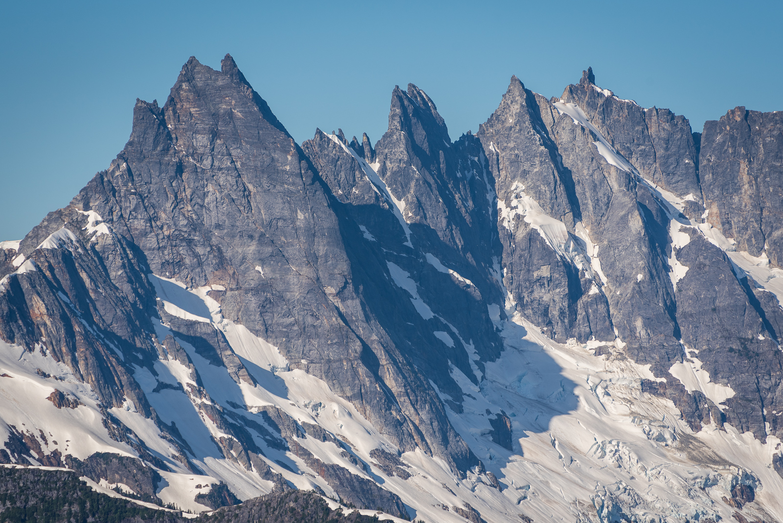
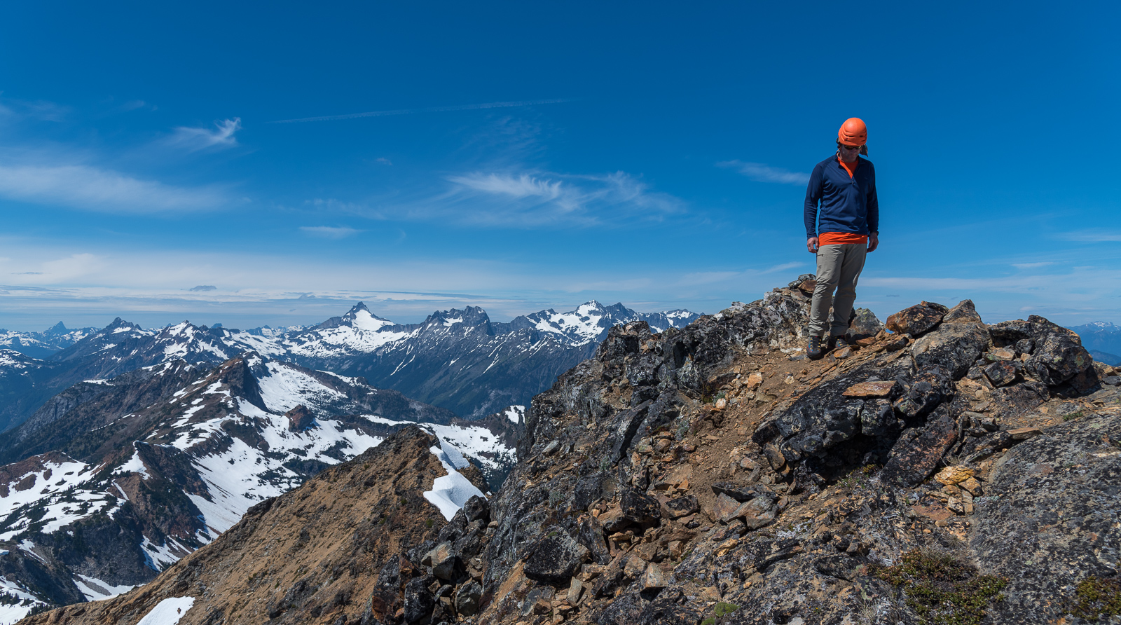
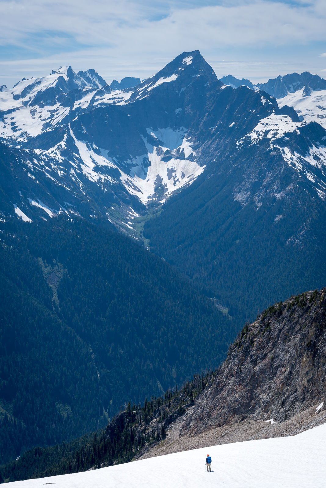
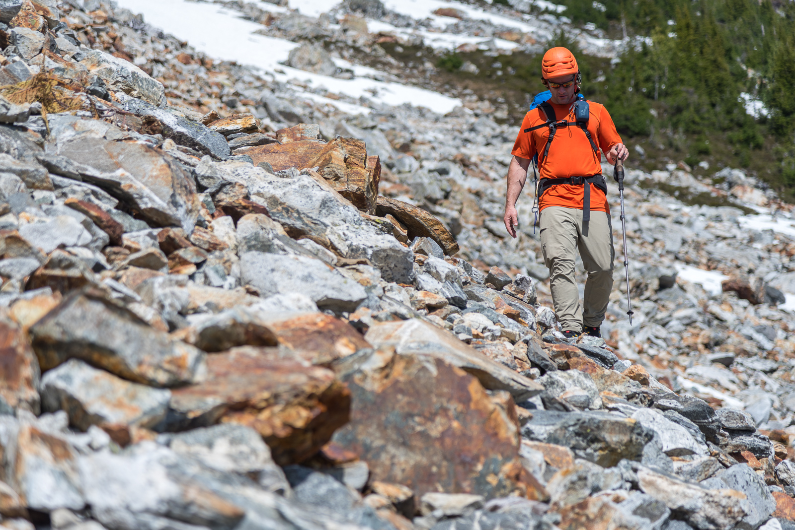
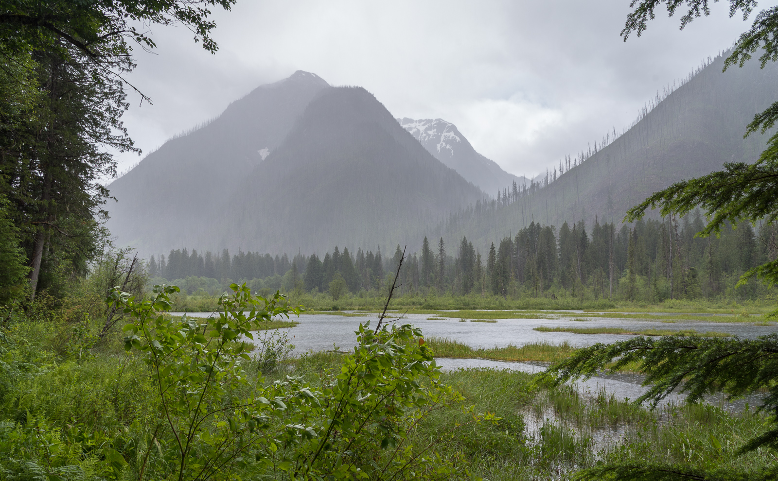
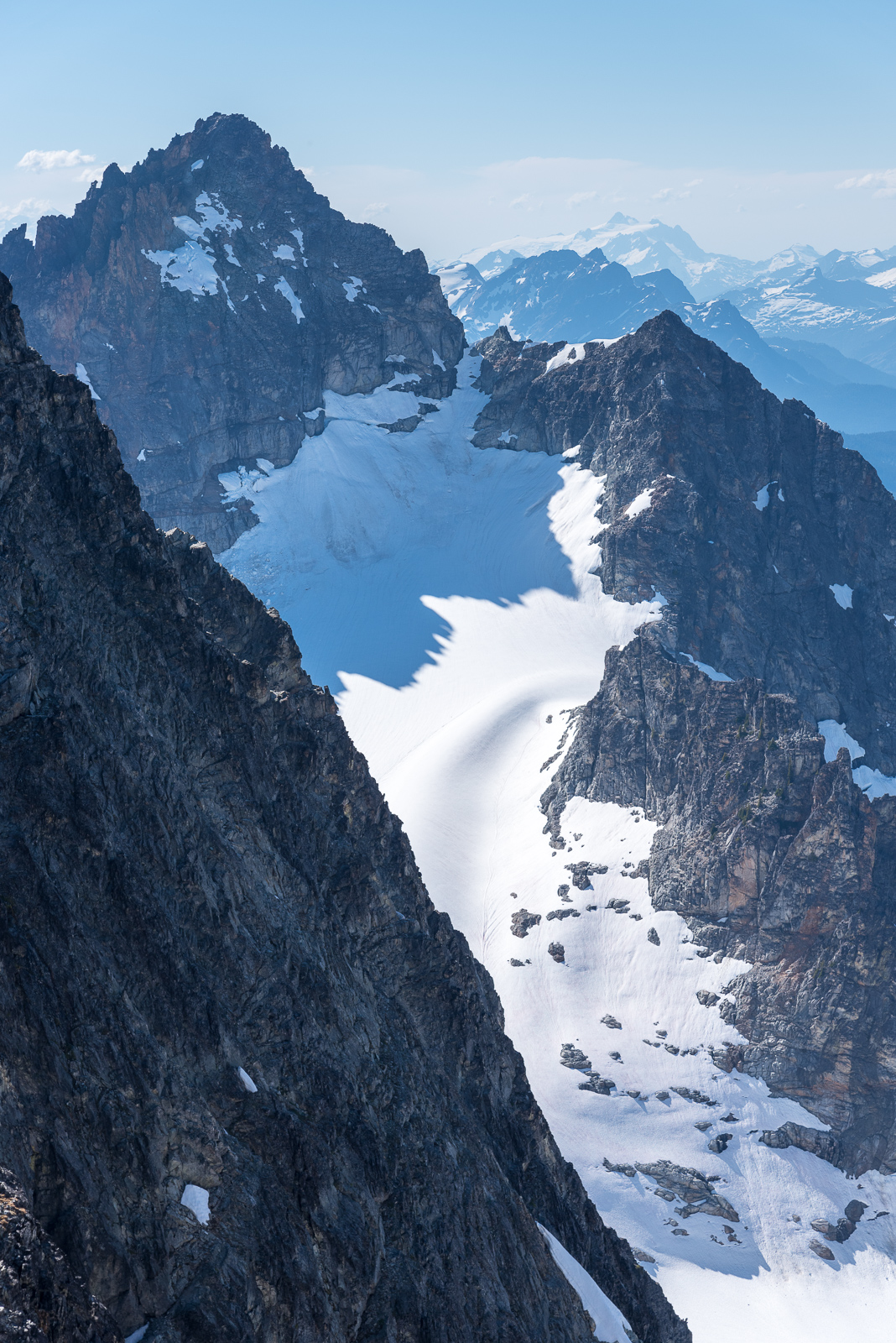
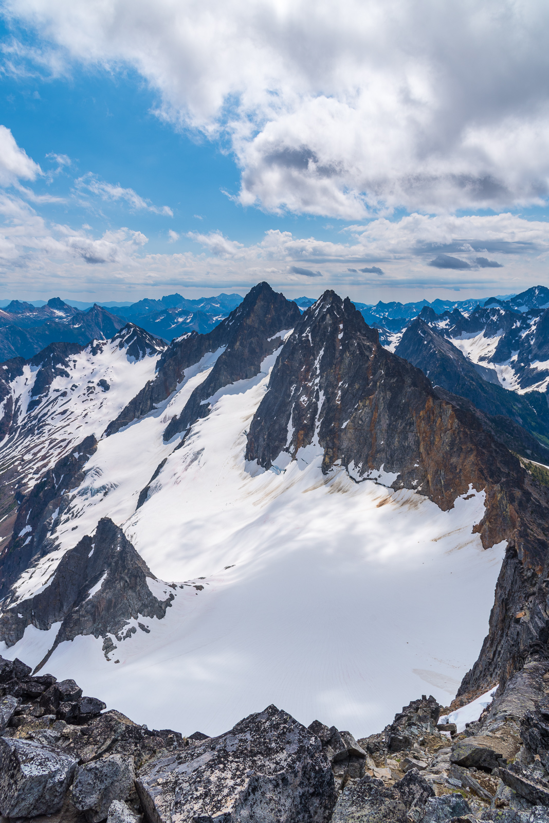
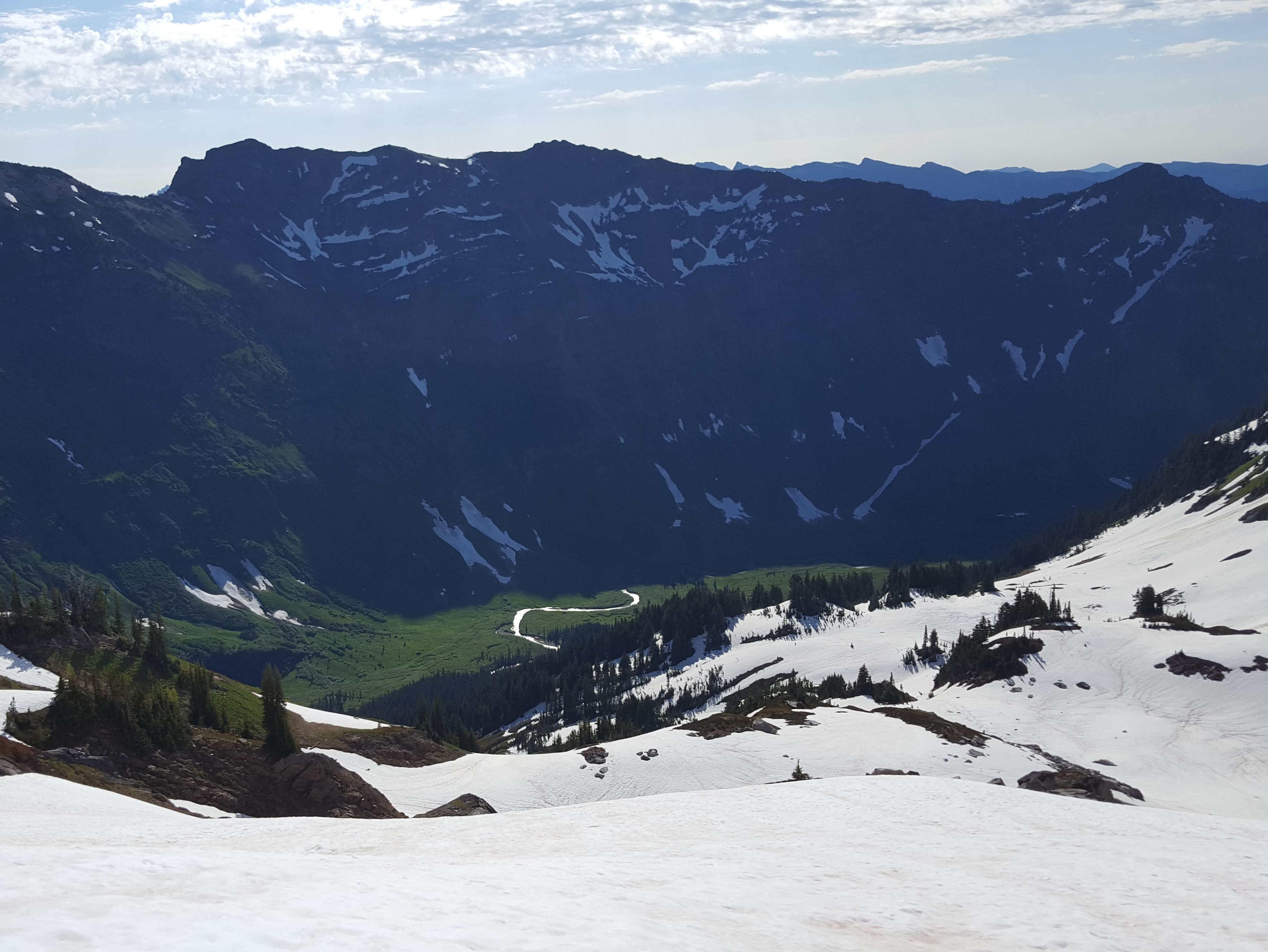
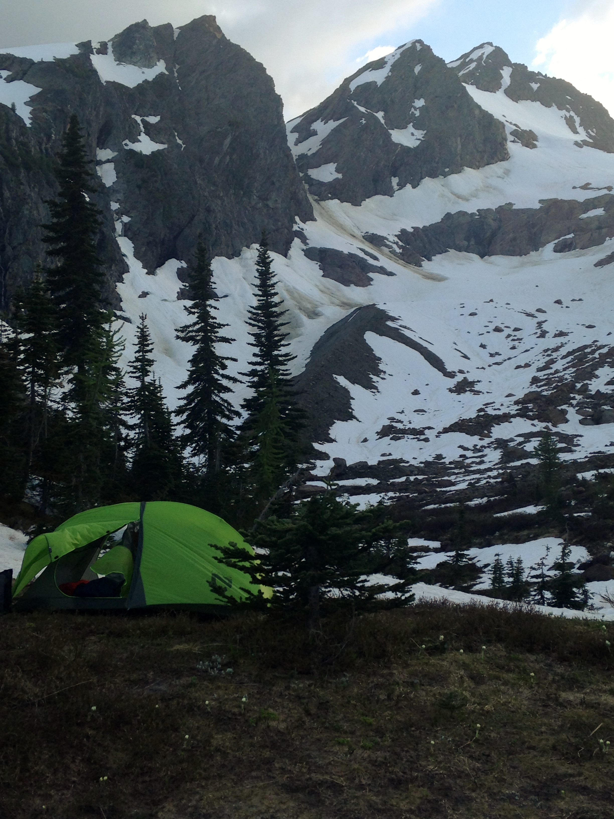
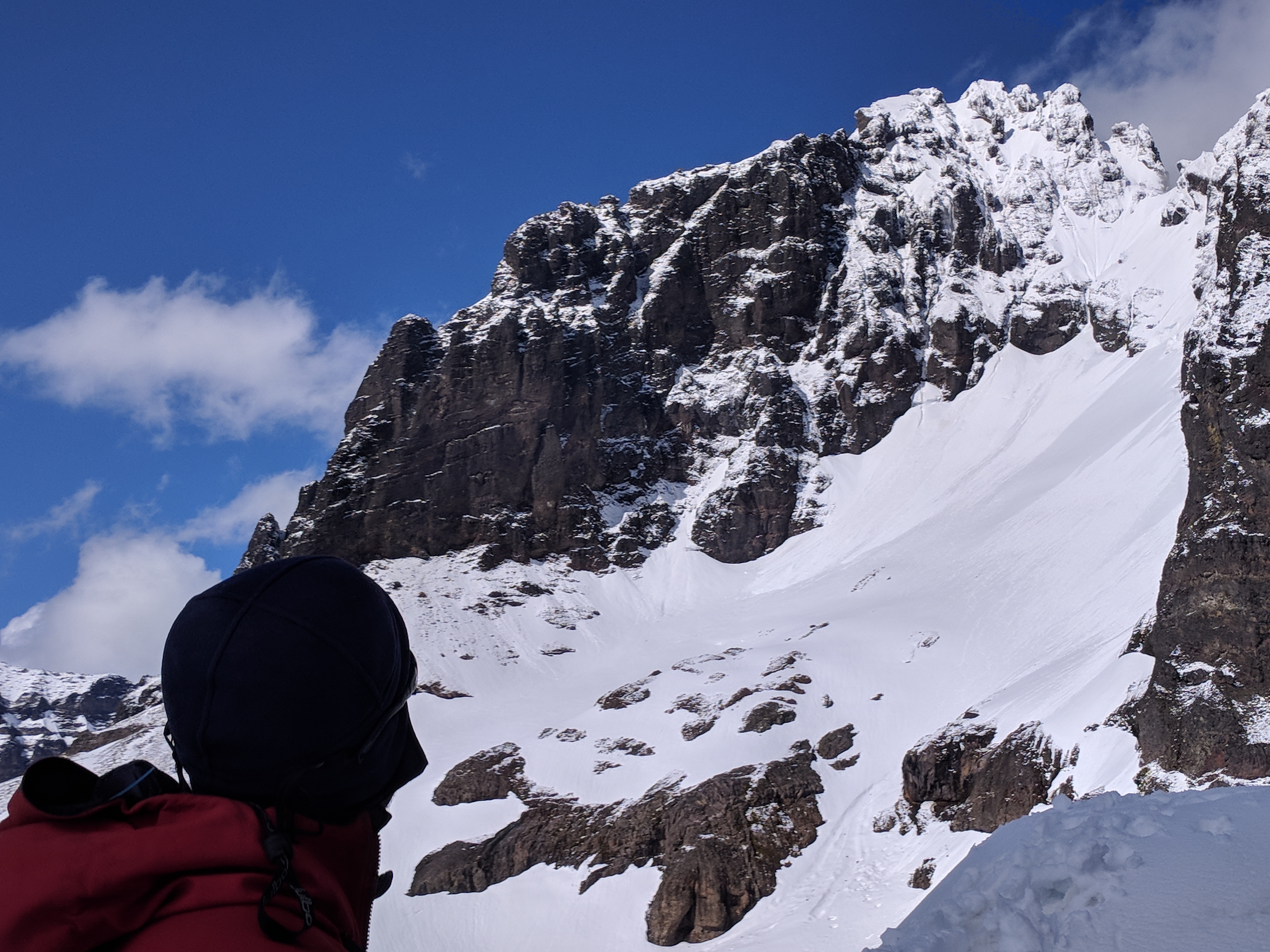
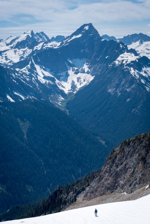
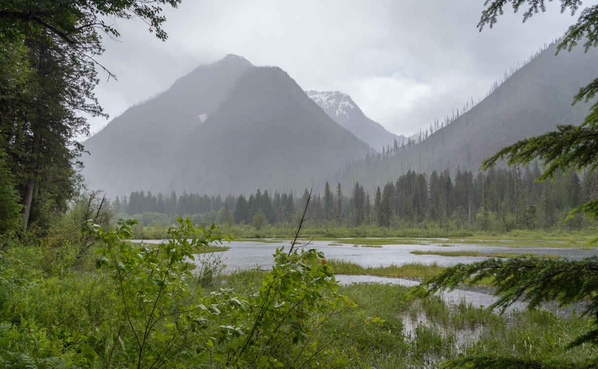
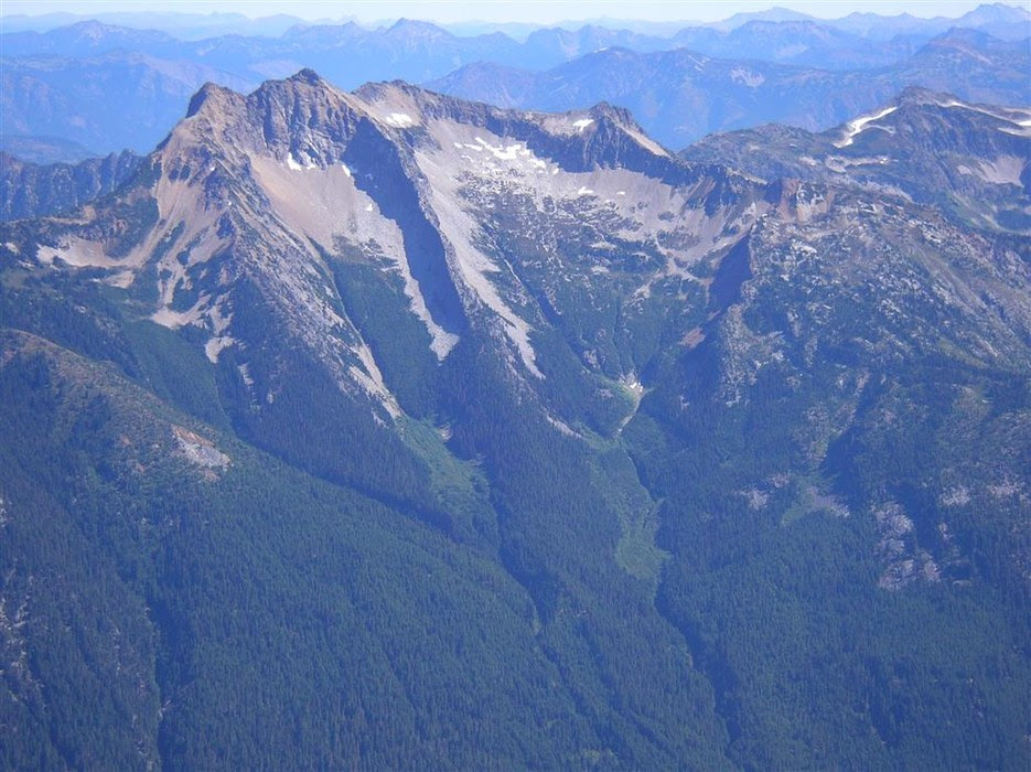
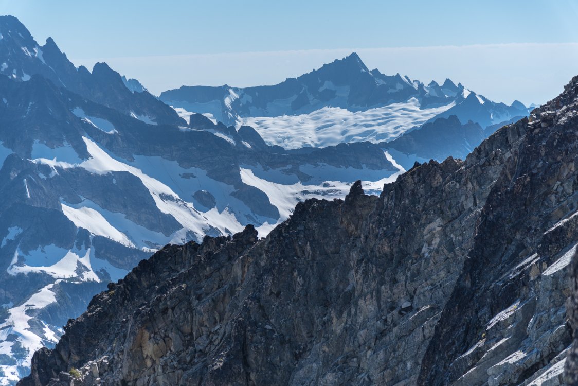
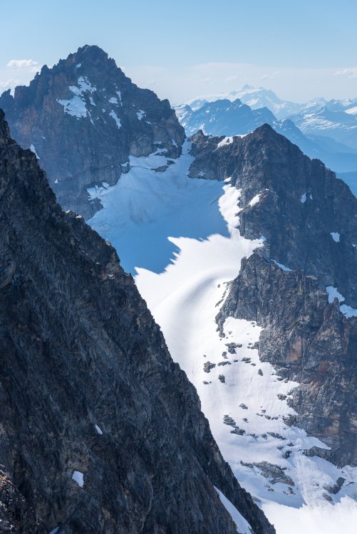
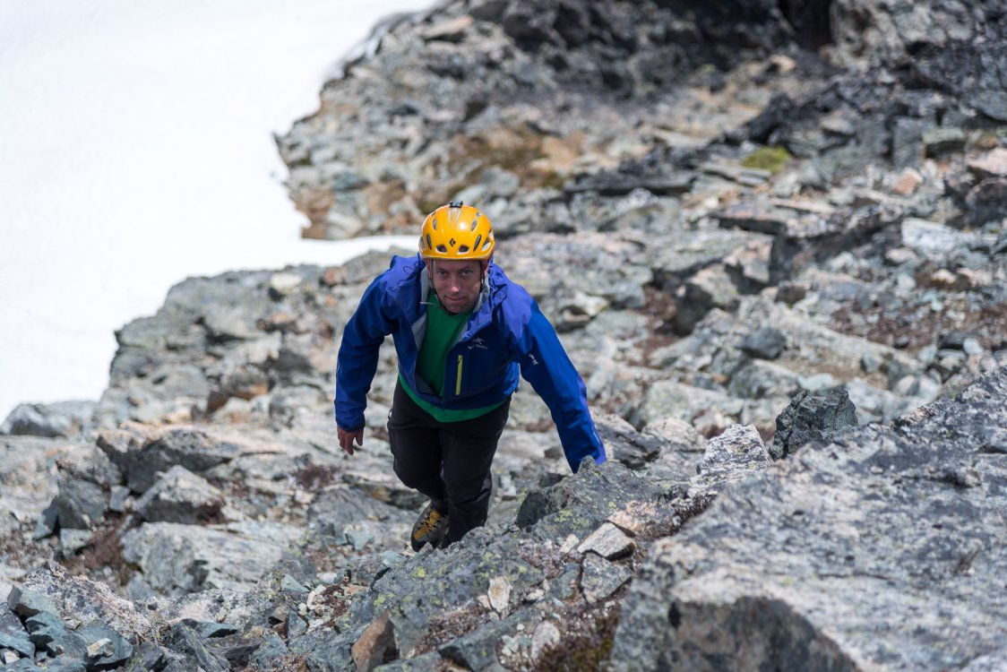
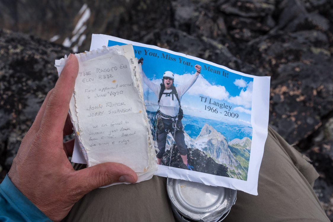
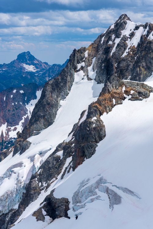
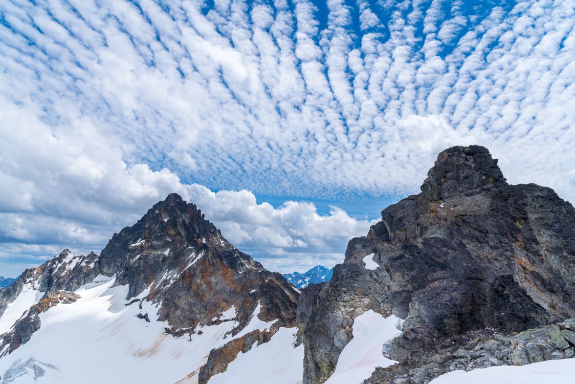
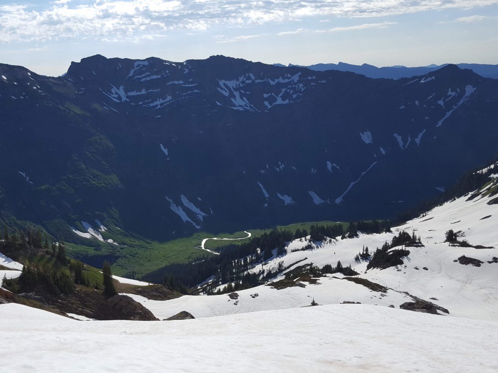
Trip: Ragged Ridge - Mesahchie, Kimtah, Cosho....south side Trip Date: 07/06/2018 Trip Report: The yin and yang of the North Cascades in one trip, a collection of experiences that seems much longer than could fit in three days...... A classic trail to an impressive pass, followed by a footsore traverse to a first camp with airplane wing views across the valley where the last of the grizzlies was shot in 1967. Choss, choss, and more choss, in all its varied forms on the south side of the ridge, including a winding gully up the imposing Mesahchie, highest of the ragged peaks on Ragged Ridge, climbed in the late after noon of day 1. A wind whipped night in a tent not as guyed as it should have been, an early start to another footsore traverse across endless gullies and ledges to easy snow and talus slopes leading to Kimtah (I had climbed Katsuk on a prior trip and Josh wasn't that interested). Storm clouds gathering to the west as we close in on Cosho, finding a register with the scrap from the FA in 1970, along with a photo of a friend who never made it to Cosho since he died on Luahna in his quest for the 100 highest. Traversing again, this time too high, running the ragged tippy top, praying to not meet the same fate as T.J. and Dallas and so many others, sans rope. Finding a second camp on an old moraine just as the thunder roars and the rain falls, diving into the tent to wait it out. Emerging to cook dinner during a lull, shortly after the rain starts up again and continues all through the night. Packing the wet tent, how did my battery go to 14%?, embarking on a snowy side hill in the rain. Punching my leg into a deep hole, my heavy pack dragging my body below my knee, so painful!, sheepishly and desperately calling to Josh to rescue me. Limping down a steepening ridge in the rain, brush soaking everything, getting off route despite checking the phone and making corrections. Battery is at 9%. This is a lot steeper than it looks on the map. OK, it's mellowing out now. Where's that trail? The trail! Lunch! German tourists sitting too close at our 4th of July pass lunch spot, drying gear in the hot sun, so many clean looking people on the trail, Chinese tourist clogging the bridge over Thunder Creek, are the North Cascades going the way of I-90? A full campground and busy highway but nobody wants to pick up a slightly battered hiker trying to look harmless. Suddenly a guy whips a u-turn and Josh and I are saved. He's a shop teacher with a house in Winthrop, and obviously a very good man. Too nice, even, to take any of the beer we pulled from the creek, exactly where we left it two days before. Camp 1: Forbidden from Mesahchie: Kimtah: Summit of Mesahchie.....4th of July pass looks so very far away: Forbidden: Katsuk, Snowfield and Baker all lined up: The Inspiration Icecap Stormking, Sinister, Dome, and Glacier: Be honest, you haven't given Arches enough credit, have you? This, for a long ways: Looking back at Mesahchie and Katsuk: Summit of Kimtah: How many pictures are you going to take on this trip?? Careful out there people: Kimtah and thieves peaks: Running a little too high west of Cosho.... Time to decompress: Uh oh: Why can't the weather be coming from the east? Clearing after the first round: Heading down between rain squalls: Don't rush the transition, yo: Gear Notes: Helmet, ice axe, crampons Approach Notes: Easy Pass to 4th of July Pass. ~6800' contour to camp below Mesahchie, and thereafter 7400-7800' to traverse the south side of the ridge, dropping stuff and going up from the traverse.


 1 point
 -
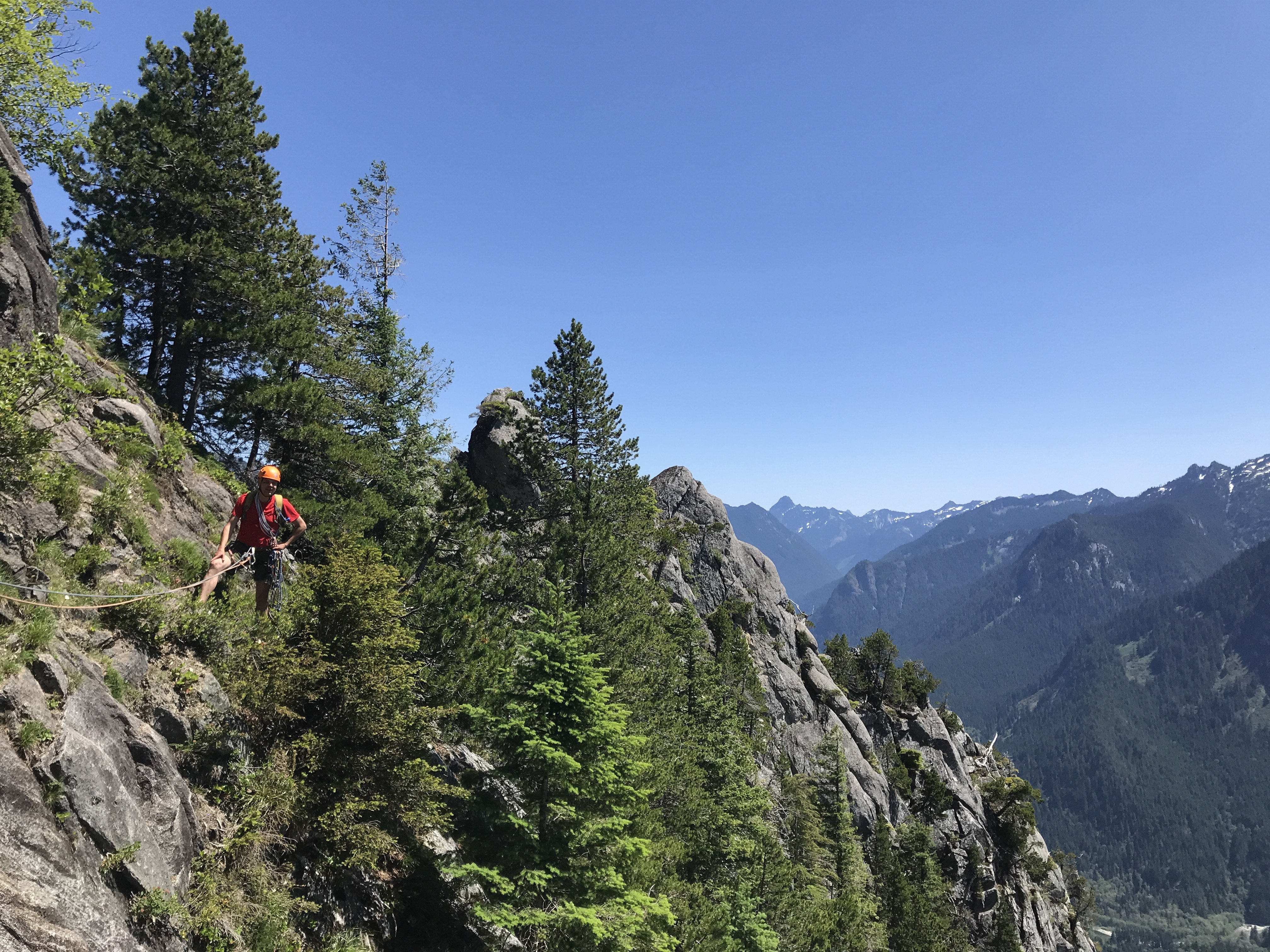
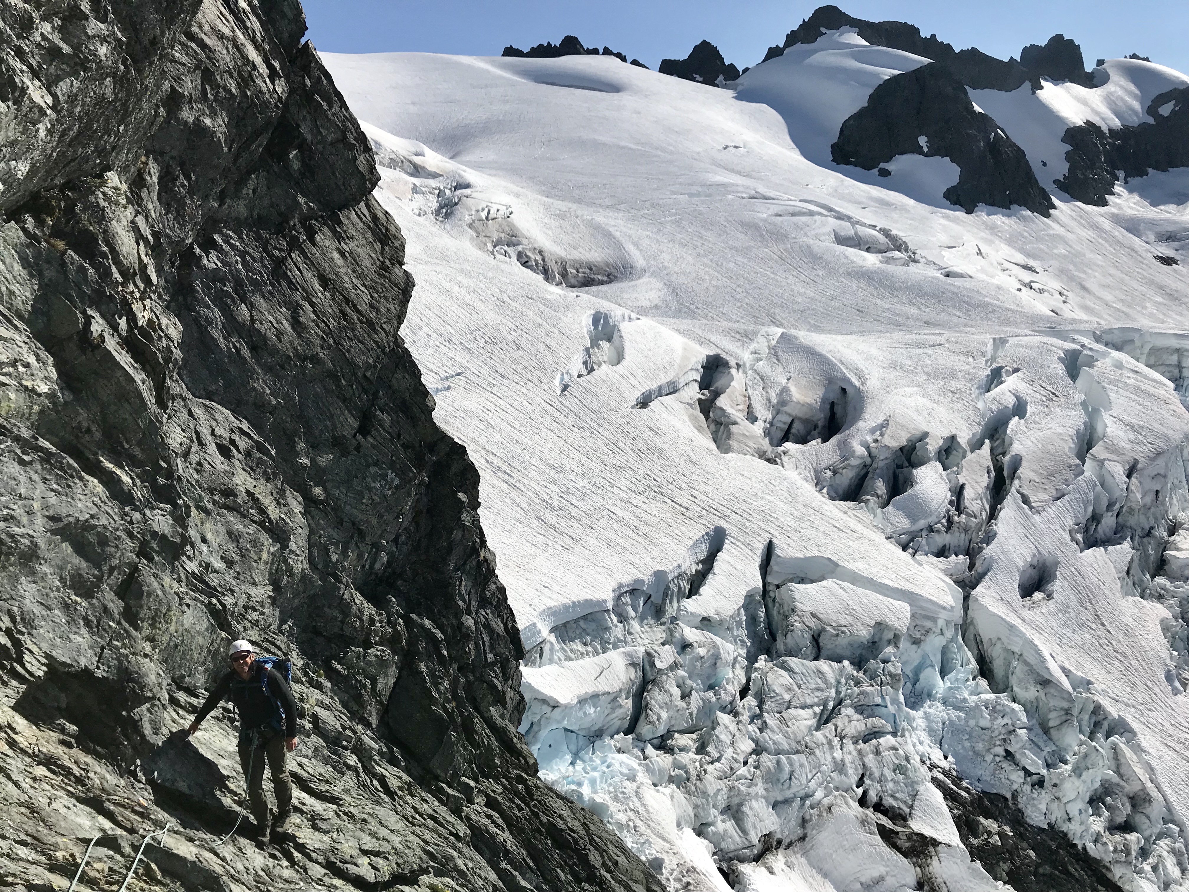
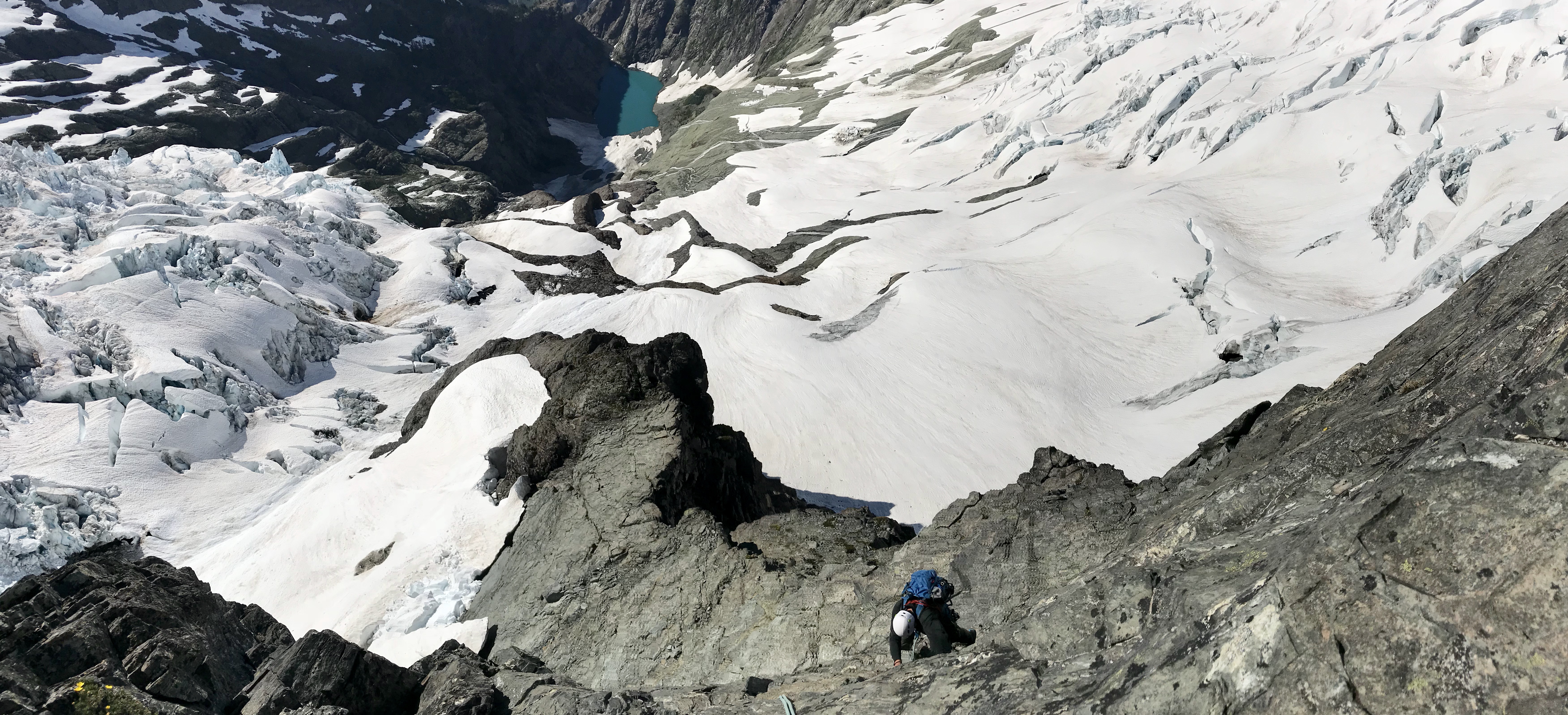
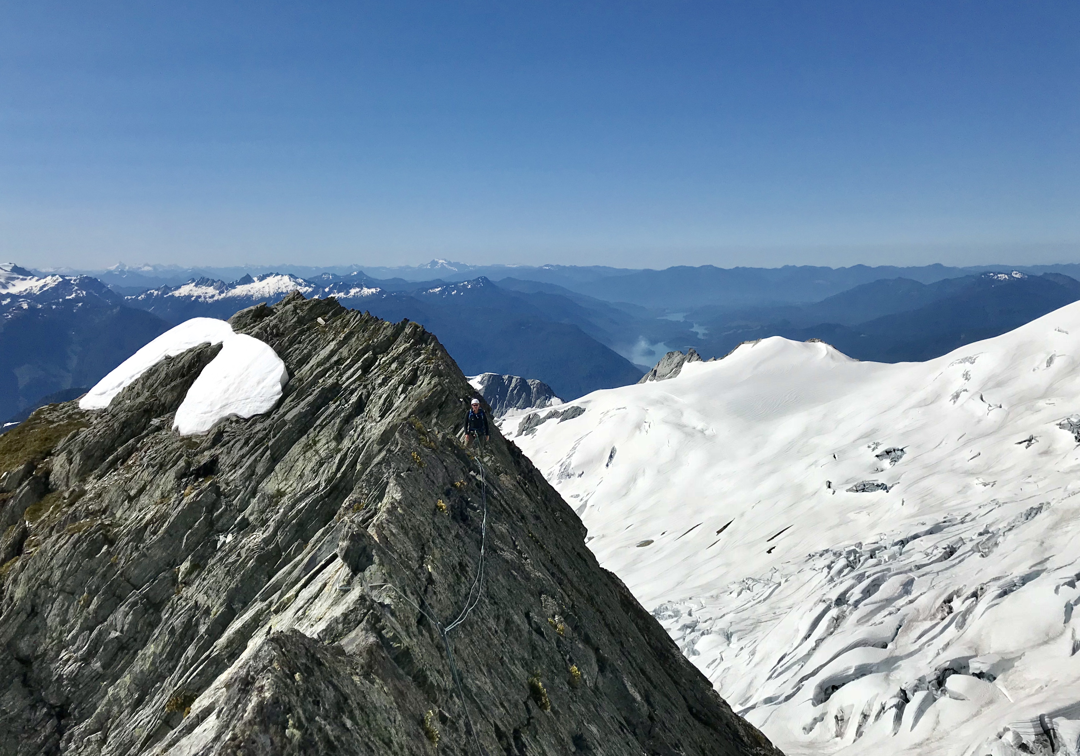
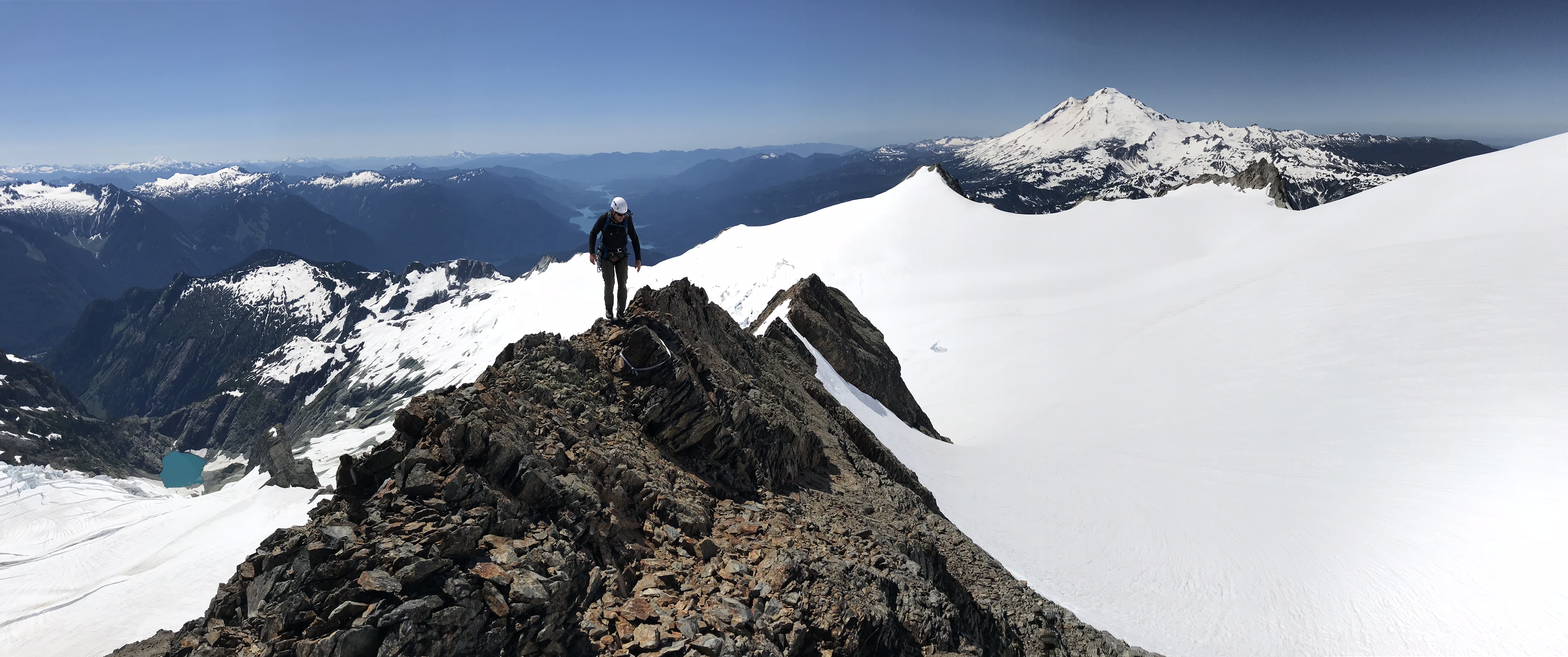
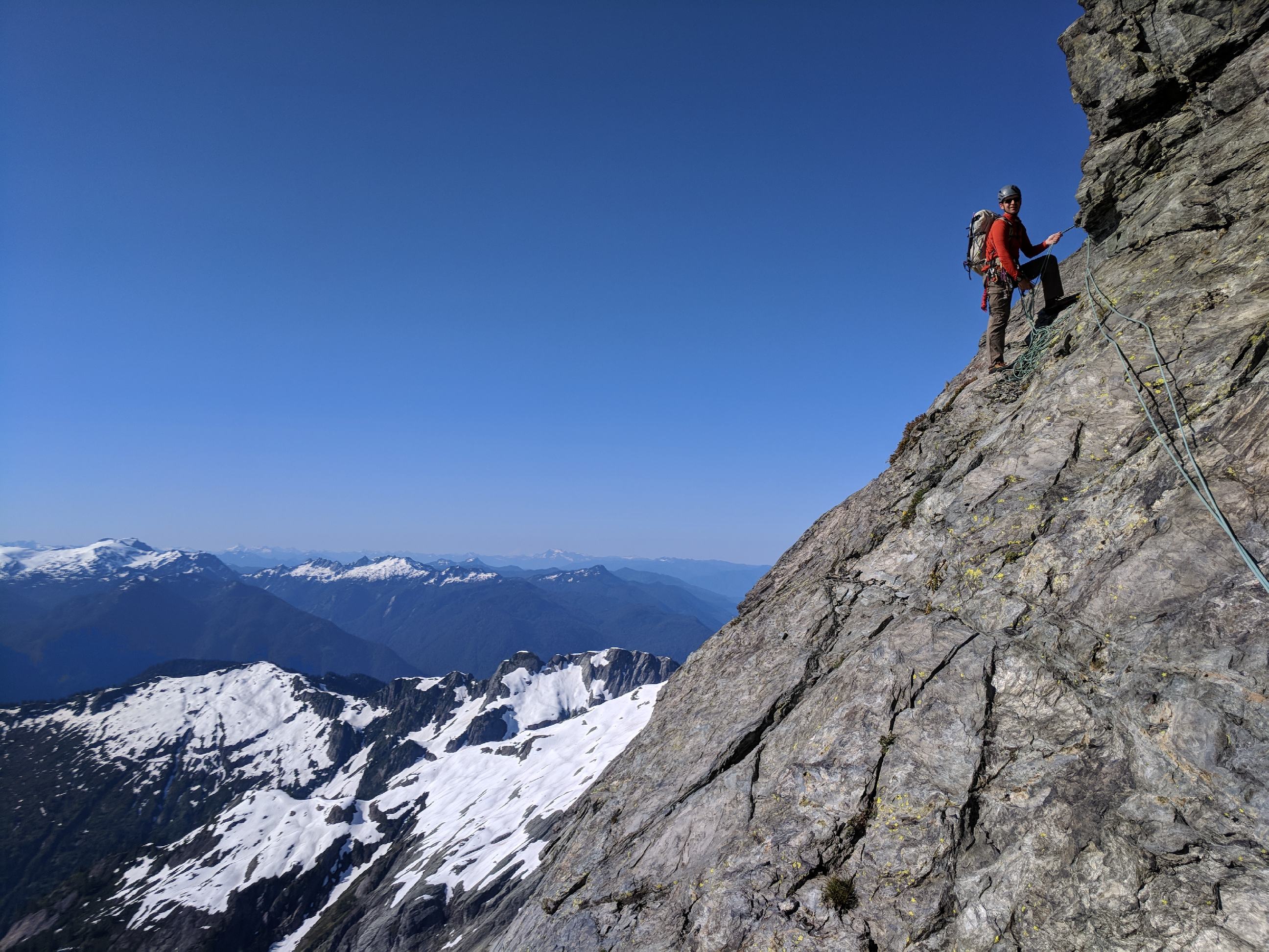
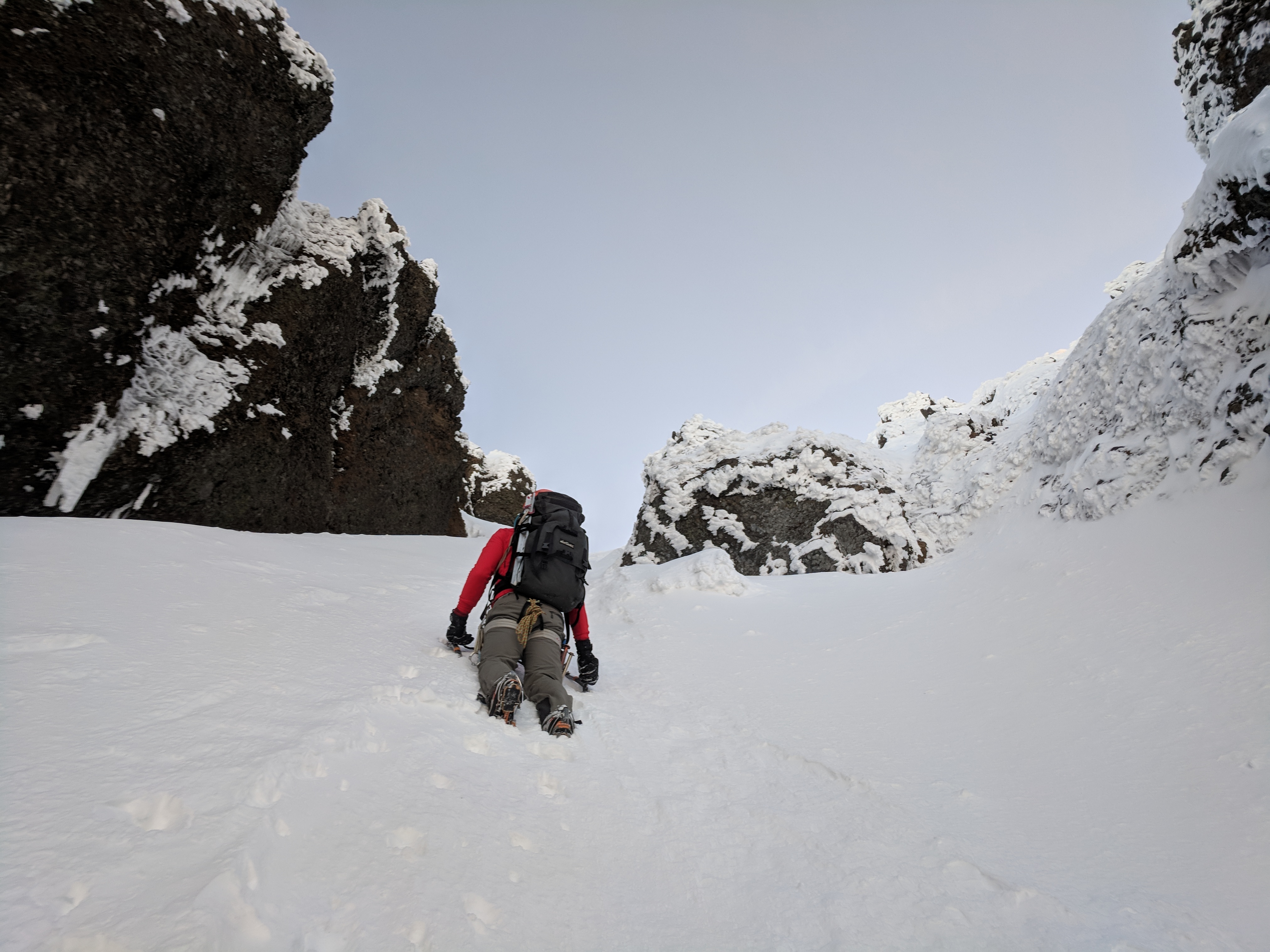
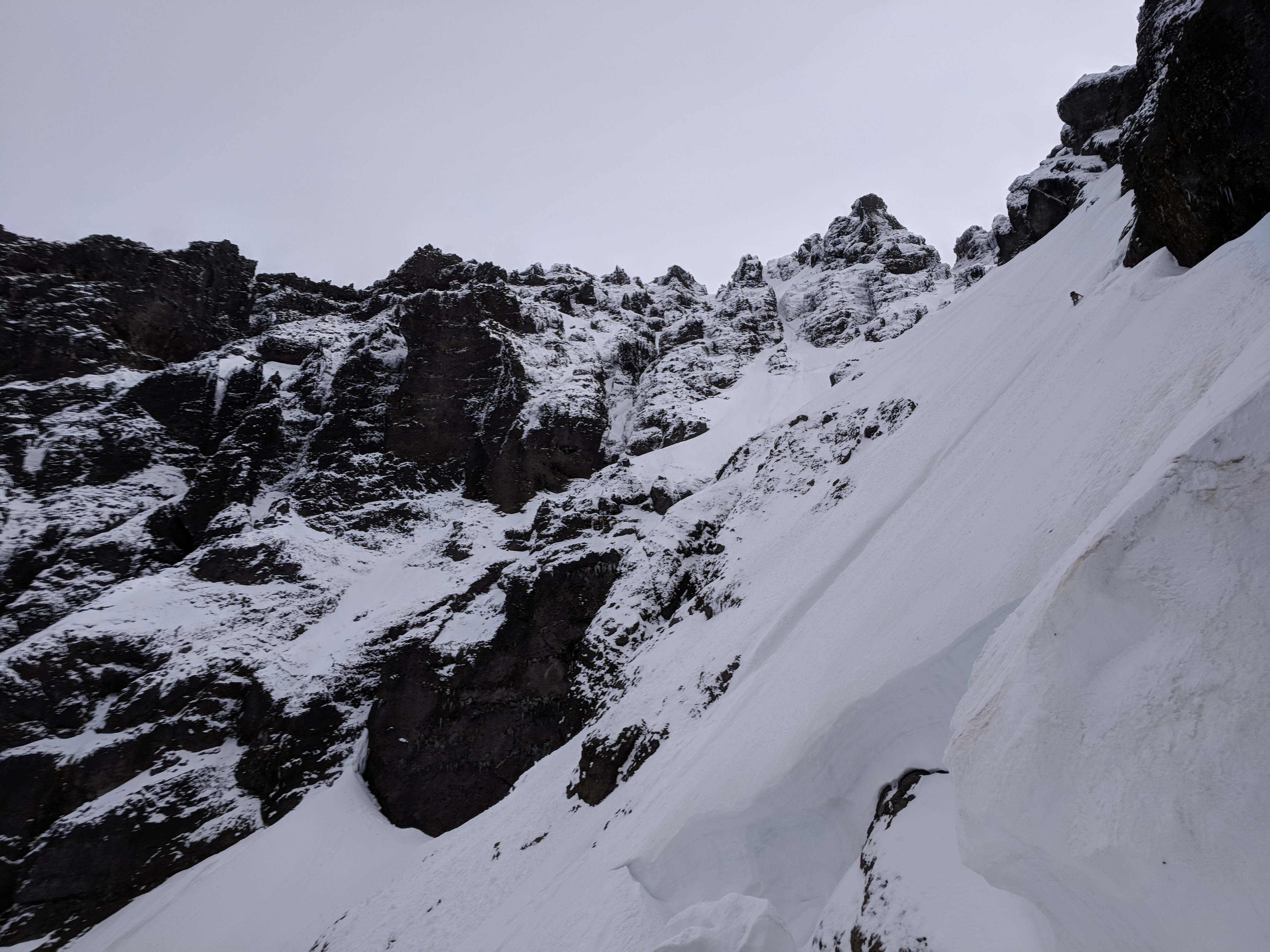
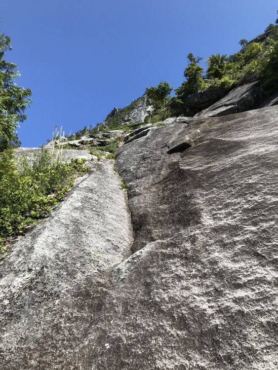
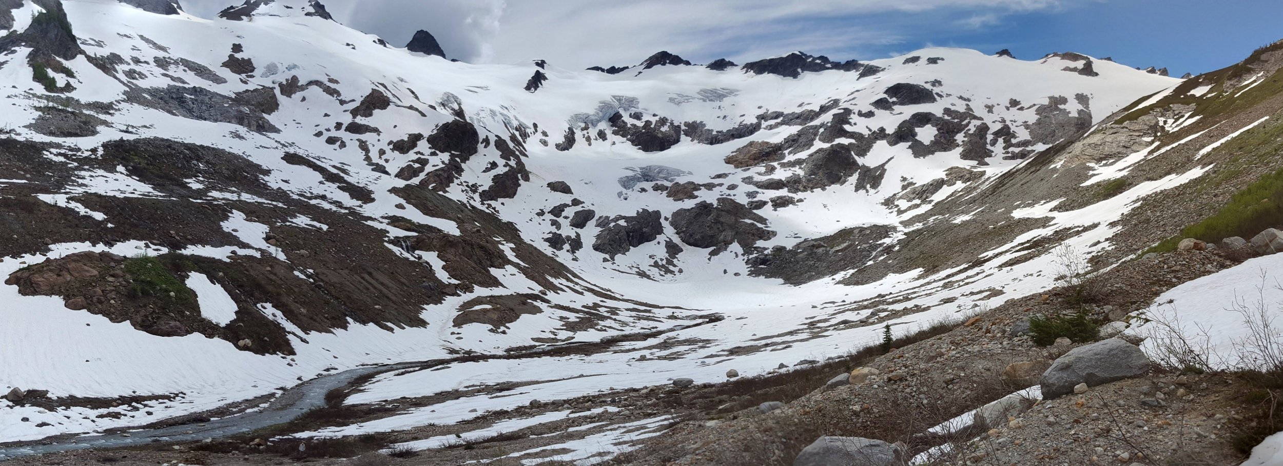
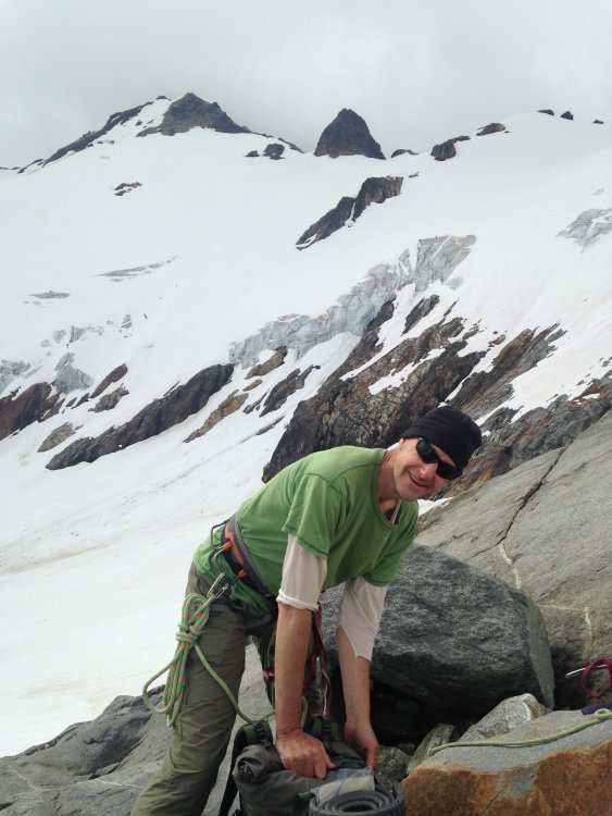
Trip: Mt Shuksan - No-Fo-O-Fo Ridge Trip Date: 07/14/2018 Trip Report: Ok maybe the name's just a personal joke. Call it the complete southeast spur of the mountain. With a day off and the desire to wander around in some alpine ambiance I was extremely fortunate to cross paths with Chris Martin (Cfire) who was amiable to my somewhat weird idea of climbing the entirety of the ridgeline separating the Sulphide and Crystal Glaciers. The finish of this feature is the frequently climbed southeast ridge of the summit pyramid. Access was a harrowing traverse underneath the terminus of the Sulphide Glacier. Seracs, debris piles, rushing water and thin fields of snow over downsloping slabs. We ran and Chris still managed to take a sizeable block of fortunately slow moving ice to the thigh. The ridge itself was a lot of fun. Generally good rock along some choss. Lots of 3rd and 4th class along with a stretch of very exposed 5th up an intimidating tower. Some down climbing, a rappel and a particularly incredible “a cheval” section. Of course the views down into the chaotic bases of the Crystal and Sulphide Glaciers were the highlight of the day, creaking, groaning with the occasional collapse both seen and unseen. Recommended for the incredible position as well as some pretty nice climbing on the lower and upper sections of the ridge. Looking down the crux pitch. Another view of the same with Sulphide Glacier in background. The amazing a cheval stretch. Photo doesn’t do it justice. Top of the second part. Description III 5.6 Start just right of the toe. Solid 4th class rock and a short bit of 5.0 choss is followed by a transition to grey shist(?) below a steep tower. Traverse to the base then follow a ramp back up left to the skyline, a short blocky bit leads to a decent belay ledge below the slabby headwall. Start on the left then traverse right (5.6?) to a hand crack then easier terrain. From the summit of the tower traverse an amazing a cheval section then downclimb a steep, featured 4th class slab to a notch by snow. Continue scrambling up the ridge line until a 40’ rappel drops onto the Crystal Glacier. Bypass a small nunataq then climb the second stretch of the ridge by its left skyline. Looks chossy but turns out to be reasonably nice 3rd class rock. From the tip of this feature a steep downclimb on snow leads to the broad bench below the summit pyramid. Follow the excellent SE ridge to the summit. Gear Notes: Small rack to 2”. A doubled up skinny 60m rope was adequate. Approach Notes: Traverse below Glacier will be slow and (more) dangerous once snow melts off rock slabs. Go early summer most years.


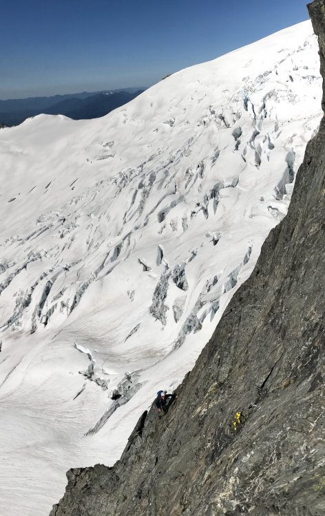 1 point
 -
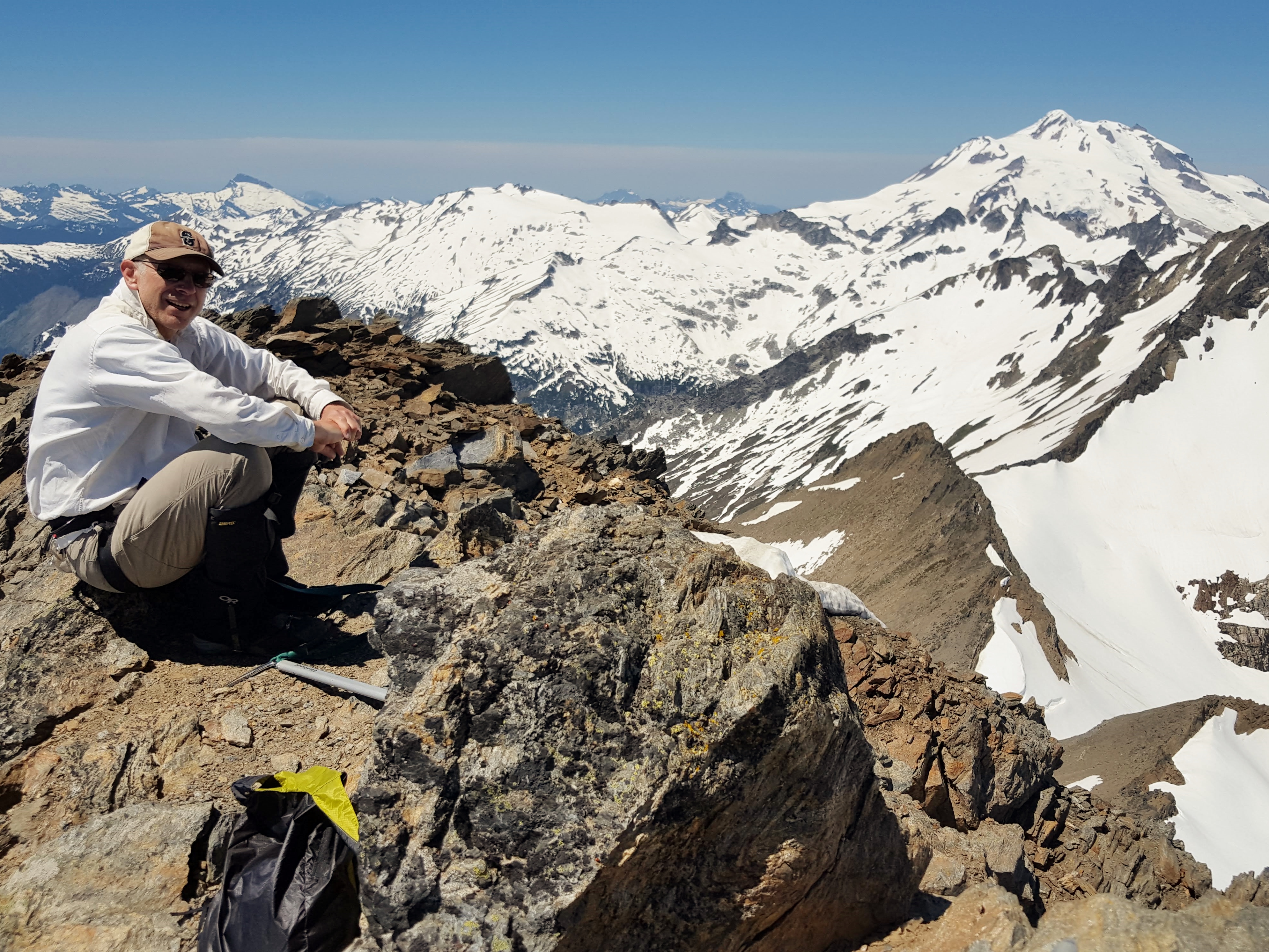
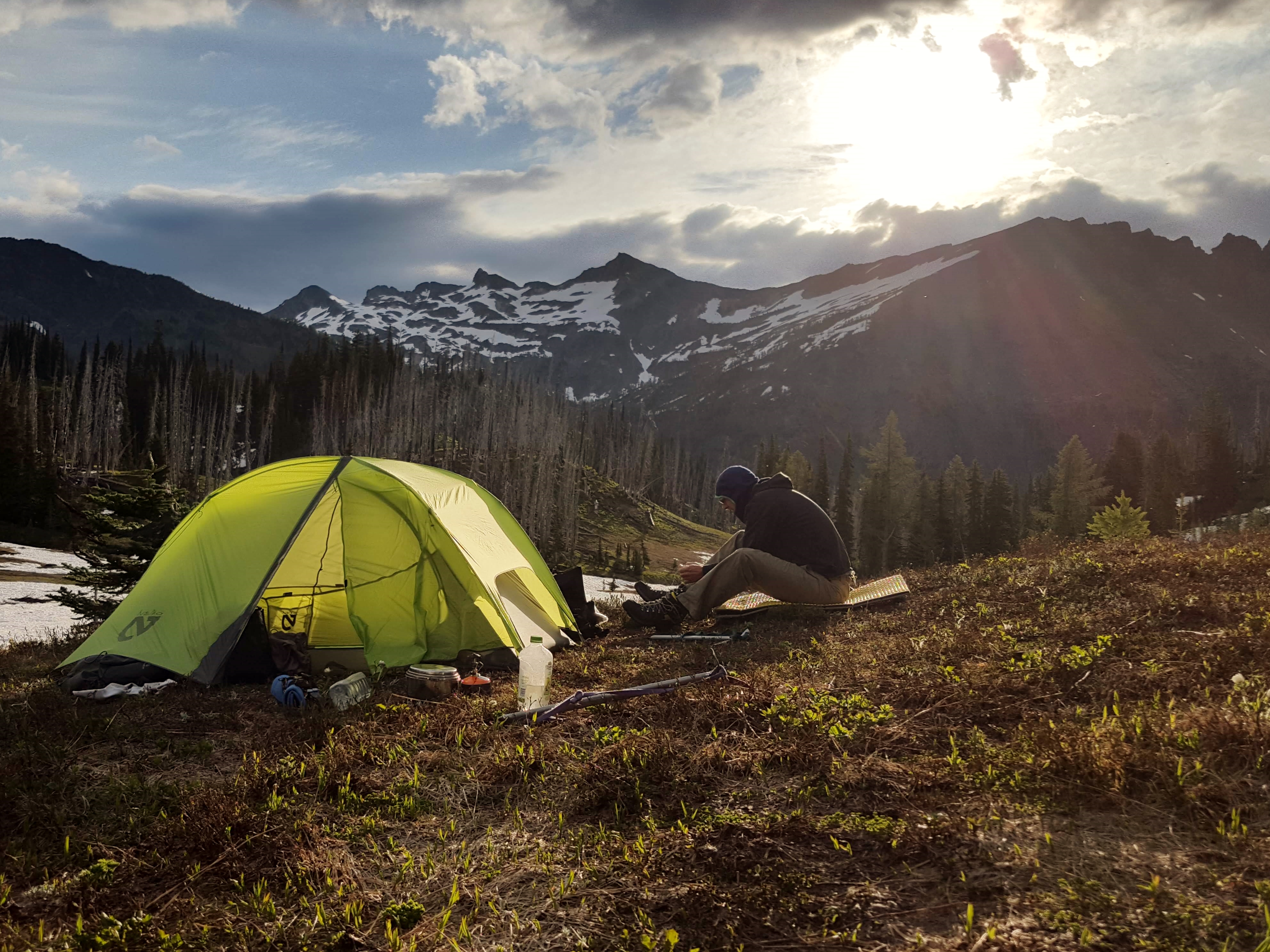
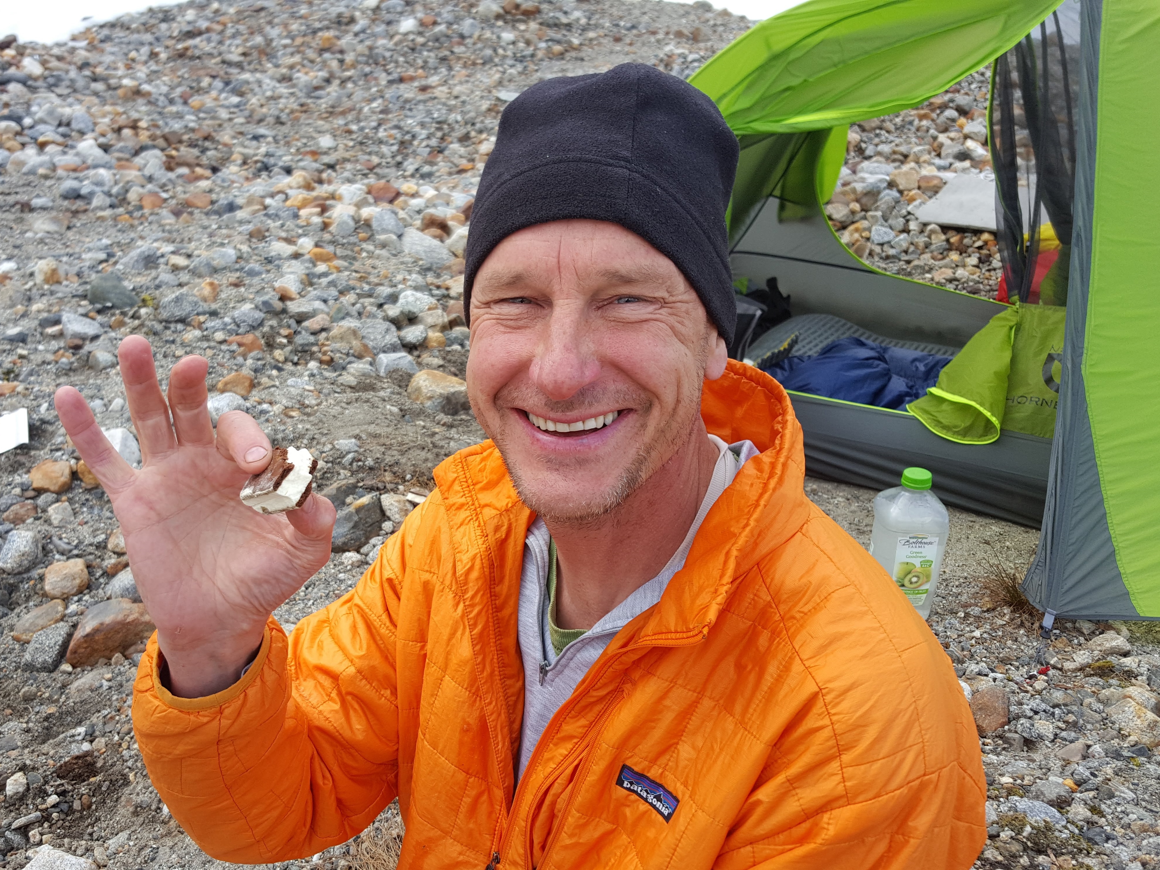
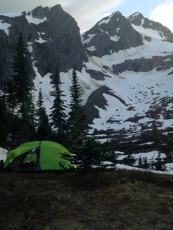
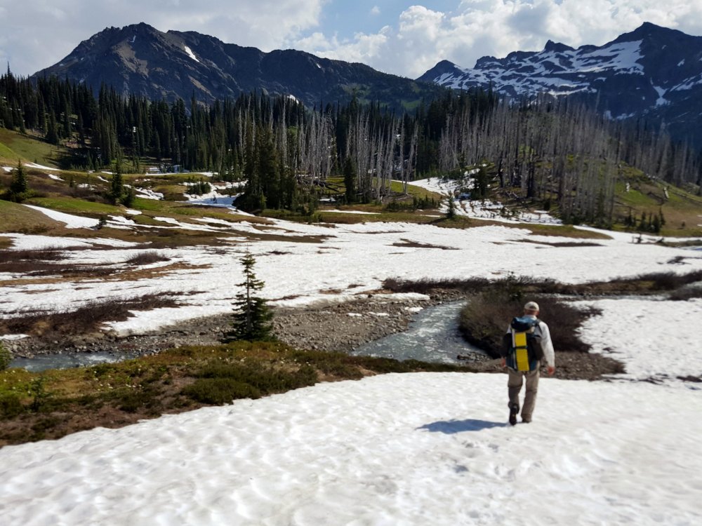
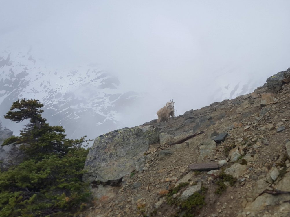
Trip: Dakobed/Napeequa Loop - Clark Mountain Trip Date: 07/04/2018 Trip Report: A few pics from a very scenic 5-day loop through the Dakobed Range in the Glacier Peak Wilderness. We picked it because it was one area neither Andy or I had been to and it had a pretty good forecast. From the White River trailhead, we camped at Boulder Pass, Butterfly Butte, Napeequa Basin and at the Thunder Creek/White River junction. You can connect the dots. Very sleepy area – we followed animal tracks nearly the whole way but ran into only one group of humans over a holiday weekend. Mostly off-trail travel and even parts of the 'trail' were pretty schwacky. A great trip through classic North Cascades terrain. On the trail to Boulder Pass, near the Sheepherder Trail takeoff View from Boulder Pass into the reclusive Napeequa Valley Walrus Glacier on Clark Mountain, in great early season condition. Clark summit with Dakobed Clark from Butterfly meadow camp. We descended the Richardson Glacier on the left Looking up the Pilz basin, Luahna up there somewhere.... Butterfly Camp with Buck Mountain in the distance Heading out of Butterfly camp to sidehill to Napeequa Basin Napeequa basin, very austere Freeze dried ice cream bar - Oh yeah! Climbing to the pass at 7750' Descending through the fog into Thunder Basin we spooked this nanny with her kid tucked behind. Pretty sure Andy was going to get gored for this photo! One piece of advice: Do not attempt this descent without the Routes and Rocks beta!! Thunder Basin with Tenpeak up on the ridge (maybe net time). Waterfalls everywhere and much lusher than Napeequa basin. Just in case you get the idea it was all lovely alpine rambling....it was not! Some big trees in the White River valley, ferocious skeets too. Gear Notes: Usual backcountry and glacier gear, beta (topos, Fred, Routes and Rocks). White cotton dress shirts provide stylish protection from sun, brush and bugs. Bug hood came in handy too. Approach Notes: It's all approach really
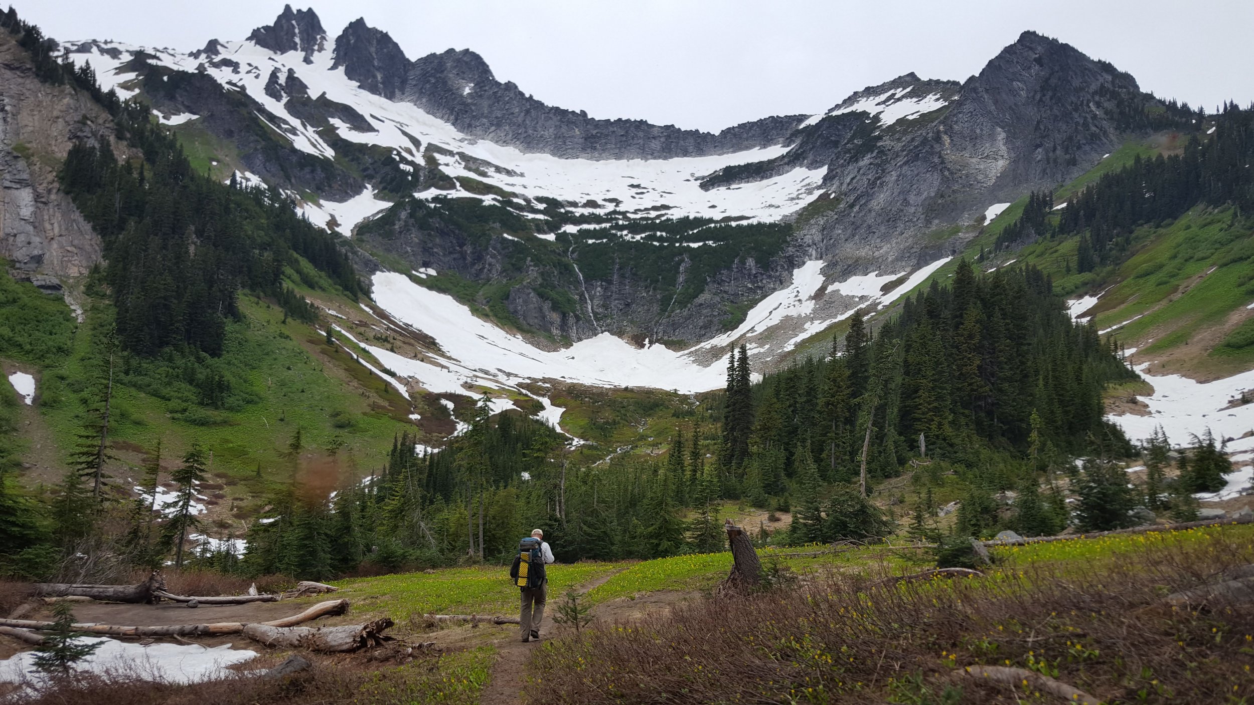


 1 point
 -
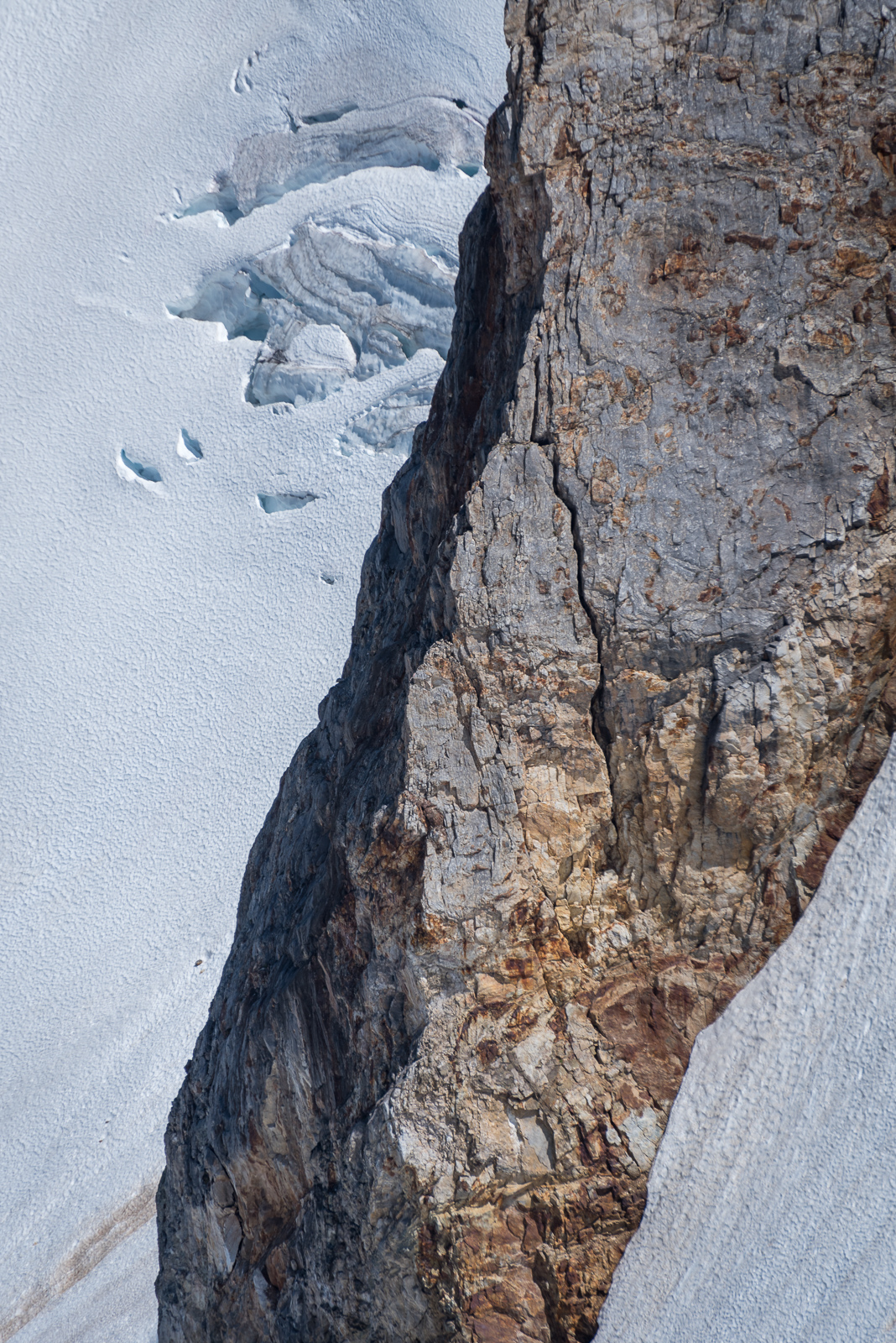
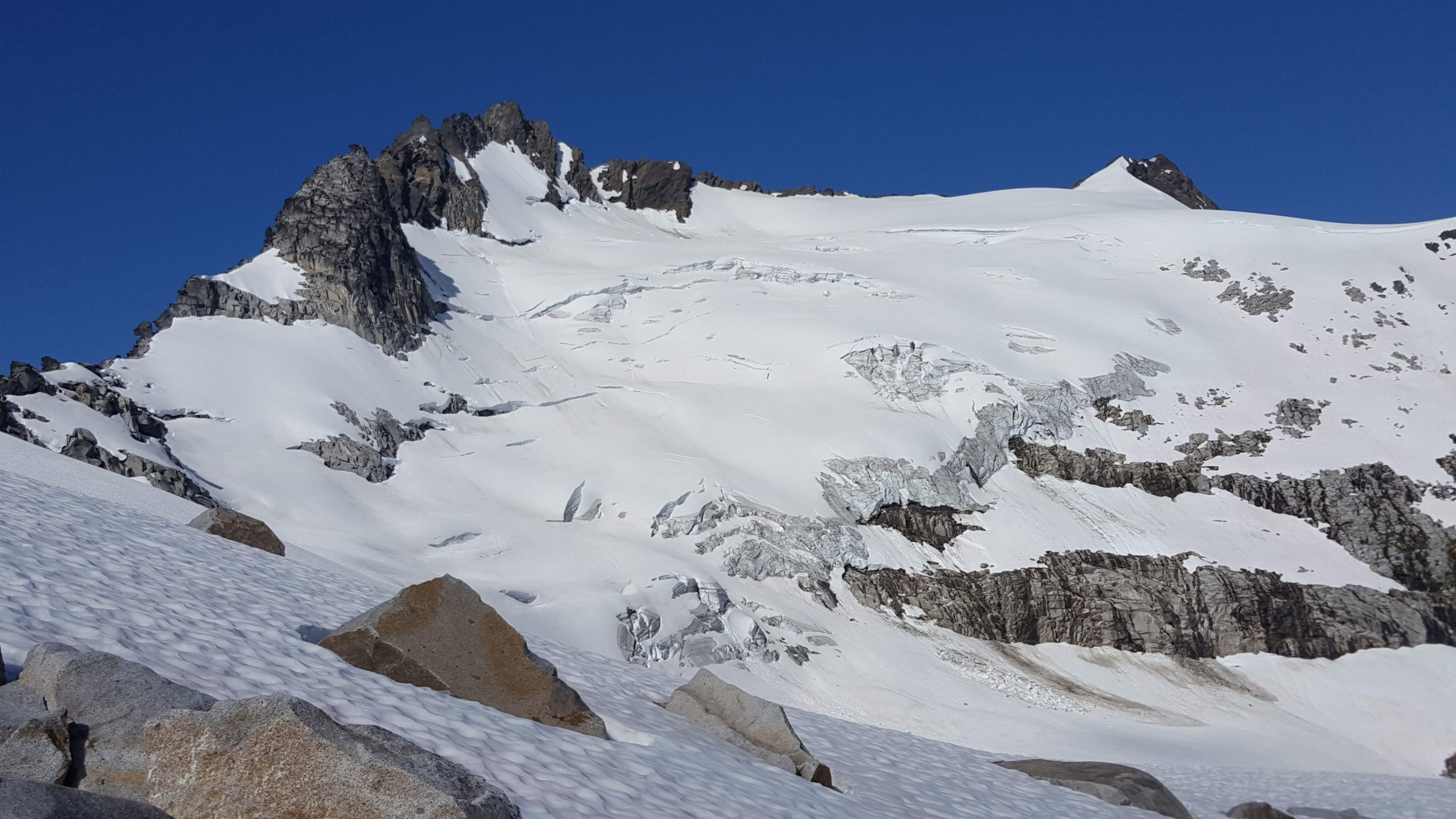
Trip: Boston - Buckner - Horseshoe - Boston - Buckner - Horseshoe Trip Date: 06/17/2018 Trip Report: Sean is always bitching at me to write up one of my adventures. So here it is, two day trip to tag Boston, Buckner, and Horseshoe. Happy?? I got a leisurely 930 am start at Eldo TH at MP 20 on Cascade River Road, up the Boston Basin climber's trail. Snow mostly melted out in the trees, almost complete snow coverage by 5800'. Brush on the old road grade at 3-4k made me glad I wasn't carrying skis. Continued up the Quien Sabe Glacier to reach the Boston-Sahale Col around 5 pm. From that vantage the S face of Boston looks improbable. I ended up ascending the ridge towards the false summit until the end of the snow and east-hanging cornices. Traversed around the east side but was continually nonplussed with descending or contouring. I opted to scramble back to the ridge crest near the saddle between the southern false summits which led me to a decent and short ledge system which deposited me on the upper reaches of the Boston Glacier. From this vantage the contours of the route on Boston became more apparent, and as I got closer I saw all the rap slings among the ledges. Dropped my pack and gave it a go, reaching the top a little before 7 pm. The exposure is unmistakable and thought provoking, especially with mountaineering boots. Due to all the choss reports on this peak I tested foot and hand holds extra deliberately. Fought my way past the plastic unicorn guarding the posh log and signed the first entry of this year. Whoever it was on CC or Peakbagger who said they downclimbed this route has balls of steel and the patience of a Thomas Pynchon reader. Rapped 3 pitches and headed down and across the Boston Glacier to bivy at 7300' below the N Face of Buckner, finally dropping my pack around 9 and dug in for the night. Up at 4:30 am and eventually moving at 5:40. There were a few cracks opening up, but as observed from Boston a clear route up the N Face. The snow had hardened overnight though was still a little punchy from where I started. When the slope steepened over 7800' it became more firm. It was quite secure on front points, with rest spots easy to kick in every now and then. Nothing like the bullet proof holy shit don't slip bowling alley lane that Sean and I encountered on the Nohokomeen Headwall 3 weeks prior. It was mostly straight up to about 8400' where I began a leftward ascending traverse along a snow finger to the main slope beneath the peaks. Then more straight up to the summit near the SW peak. Front dagger and front points almost the whole way. Glorious. Topped out around 745, fiddled around finding the ledge on the south side around the gendarme blocking access to the NE peak. Took a break at the top of both summits, both crawling with ladybugs. Oh my God am I glad I am here. If they had put these mountains in Texas it would be cockroaches instead. Following a boot track I believe may have been from 6-16 I started heading down to Horseshoe Basin around 10 am. I immediately regretted not leaving my crampons on since that aspect having only seen sun for a short while was still uncomfortably firm. More about persistence than safety I persisted, occasionally swallowing my pride and front pointing down the reasonably mellow slope. Eventually I reached more mellow terrain, contoured around 8200' over to the base of Horseshoe, dropped my pack, found the starting gully and ledge, and was quickly at the top. A rap got me back to the gully. Back across the Horseshoe Basin following the boot track to 6600' which again began ascending to a notch at the top of a steep snow finger. From here it is a quick ascending traverse along the rest of the big gully SE of the Sahale Glacier. This area is starting to melt out and there is some hang fire, so I was encouraged to move quickly. I found myself at the Sahale bivy sites around 3 facing a decision. Tag Sahale for extra credit, or reach my car 2 hours earlier to be reunited with my ice cold ciders? Down I went. I cut down across the Arm to around 6800', then continued down SW over continuous snow to find the sadistic Cascade Pass Trail. Back to the car by 6:30 pm where my love was waiting. Buckner (R) from top of Boston. Black center and Logan left. Buckner from Boston Glacier Forbidden Sunset Horseshoe Basin exit, crosses the rockfall streak to the wide snow finder at the base of the ridge, then crosses the bowling alley and up the steep snow left of the broken area. Gear Notes: Axe, ice tool, crampons, and rope for use. 2 pickets and a set of stoppers for character. Approach Notes: Trailrunners for the road and the trails below ~5k. Worth the weight.1 point
-
Fuck. Yeah.1 point
-
Trip: Mt. Baker - North Ridge Trip Date: 06/27/2018 Trip Report: Hey everyone, relatively new to cc. So far I have just been lurking and using the TR database for planning but I feel like it's time to add some content and write my first TR; so here it goes, hopefully it's not too bad. Michael and I drove up Tuesday afternoon to the TH and hike up to the hogsback and set up our camp for the night. We realized that we were going to have the North Ridge to ourselves as the only other party on the mountain was heading up the Coleman-Deming. The Coleman is in good condition and route finding was pretty straight forward and soon enough we were at the base of the ridge. We took the upper variation to get to the ice pitch. Here I racked up and off I went, it had been a couple months since I had last swung my tools so I was a little nervous. After the first 20 ft I got into my groove, the nerves went away and I started to have a lot of fun! I set up a belay a little bit before we got off of the ice and brought Michael up. From there I ran it out a full seventy meters before setting up one last belay on a couple of pickets. Once Michael got up to me we decided to simul-climb the rest of the way. We kept pretty close to the ridge crest, and after some fun climbing we crossed the schrund and were on the summit plateau. The group that had climbed the Coleman-Deming had already summited so we had the summit to ourselves for the ten or so minutes that we were up there. We sped down to our camp, drank our celebratory summit beer and took a quick nap. We packed up and started the hike out to the car, and then drove back to Bellingham to go to Kulshan Brewing. This route is awesome and truly deserves it's status as a classic. I am super stoked to have been able to knock it off my tick list! Gear Notes: 6 ice screws and 3 pickets Approach Notes: Coleman glacier still in pretty good conditions.1 point
-
Trip: Wine Spires - Silver Star and Chablis Spire Trip Date: 06/23/2018 Trip Report: My roommate and I had been looking to get into the North Cascades for a while but hadn’t been able to put a trip together. We finally got the chance this last weekend and drove from Portland up to Mazama on Thursday night. We got warmed up on the Liberty Bell and Concord Tower on Friday and decided that we wanted to camp somewhere high and pretty Saturday night. After a lot of back and forth, we decided to camp up near the Wine Spires and climb Chablis Spire. We started around noon on Saturday and make the trek up to the Burgandy Col. It took about three hours from the car to the camp, so we dropped our stuff and went over to Silver Star Mountain. View of the Liberty Bell group Not a bad campsite. There was still snow up on the east side of Burgandy Col, but it was pretty soft and made for easy going over to the Silver Star glacier. We didn’t know too much about the glacier, so we decided to rope up, which probably wasn’t necessary. Made it up to the top of the glacier and had a nice view into the Cascades. Snagtooth Ridge from the Glacier We opted out of the scramble to the true summit and turned around and headed back towards camp. We made some dinner and enjoyed a beautiful sunset and the view. You can see Glacier Peak hanging out in the distance. A few goats also decided that they liked the col campsite, and kept us company throughout the night. Not too early of a start and we headed down to the base of the Chablis Spire. There were a few cracks open on the snowfield below the base, so we roped up again and headed up the snow to the base of the route. The detached block is center left of this photo. The snow was still fairly high, so the “handrail” at the base of the route was still covered, so we started at a hand ramp up to the detached block. After an airy step-around (very awkward) and a cool short finger crack we headed up three pitches of wandering easy climbing. There’s a short unprotectable slab in the middle of the second pitch, to which Carmen managed to find a 5.11 finger crack variation. The last pitch ends at the notch between the bunny ears summits, and we climbed up to the true summit still roped up. It turns out there’s some rap anchors right at the summit, so we were able to rap off the top, which was nice. Looking down from the last pitch. Obligatory awkward summit selfie. 5 wandery 60 m raps brought us back to the snow. We headed up to the col, grabbed our overnight gear, and suffered through the long descent back to the car. After a quick hop in the Methow River and a burger and a beer in town, we made the haul back to Portland. Gear Notes: Single rack to 4, 60m rope, glacier gear Approach Notes: Park at the mile marker 166, find a log to cross the river, and then hike the well worn path to Burgandy Col.1 point
-
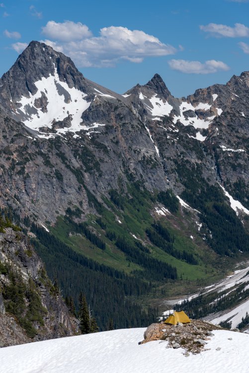
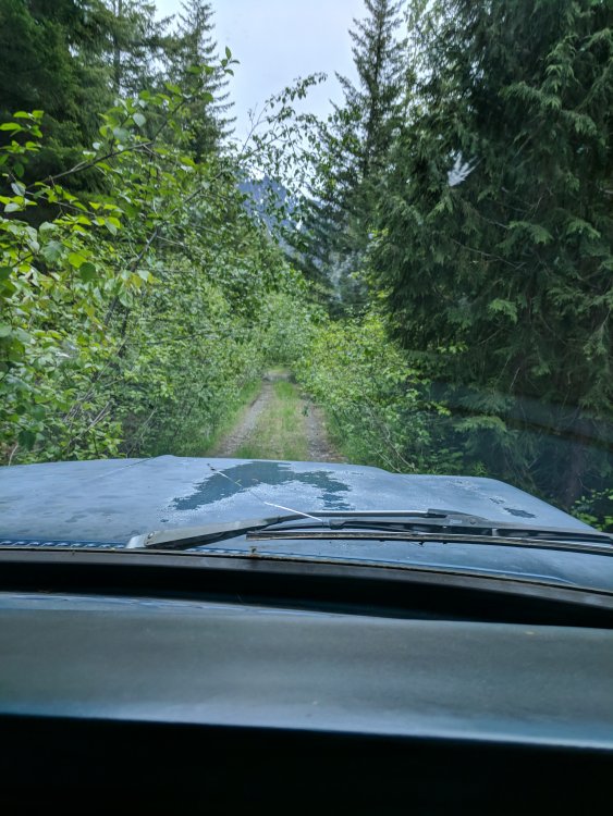
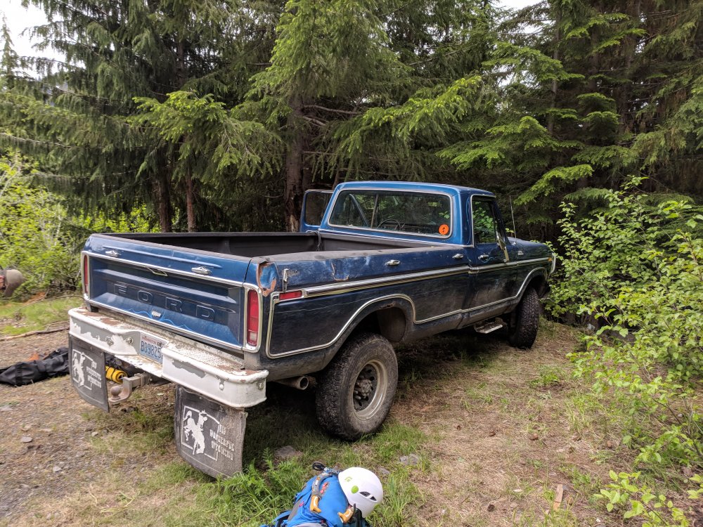
Trip: Lincoln Peak - Standard Route…I guess Trip Date: 06/11/2018 Trip Report: Trent texted Sunday night wanting to know if I was in for tomorrow. Uh, sure. For what? His partner bailed on his planned Lincoln Peak trip. Did I want to go. I haven't climbed any alpine in month's, out of climbing shape, drank all weekend with friends. Sure, I'll go. But I don't know anything about the route or approach, so Trent is the navigator on this one. We got a later start Monday so we didn't have to sit in camp for too long that afternoon. Left Burlington at 11am and drove up to the infamous FSR34. We had the secret weapon for FSR 34. Big Blue, a '79 Ford super duty beast of a truck. We drove up the road through brush and ruts to within 1 switchback of the end. Big Blue would not be denied. We then started the thrash up the old road bed. It is a thrash with plenty of slide alder, rock and an occasional trail. We broke off uphill after having enough of the road bed and enjoyed steep underbrush until finally breaking out onto snow. Surprisingly there was a fairly substantial layer of fresh snow, but travel was easy from there to high camp at the end of the ridge. We got from the car to camp in under 3 hours thanks to Blue. Great views of Lincoln and the route were enjoyed while sipping some whiskey and trying to stay warm. It was breezy and colder than we expected for the evening with clouds moving in and out. A 2am start got us to the top just after 6 for a cool sunrise. The shrund was negotiated with about 40' of steep s'nice climbing, then some crappy snow climbing with a 2" breakable crust with 4-5 inches of sugar underneath. We did have the occasional front pointing, but the large part of the climb was popping through the crust, unless you're bantamweight Trent who seemed to dance on top way more than clydesdale me. Route finding was pretty straightforward and the climbing consistently steep and enjoyable without being hairy. We broke out the rope for the final 10ft onto the summit. Great views with clear weather on top in fresh sunshine was perfect. One rappel off the summit and then we down climbed the entire route with the exception of the schrund, where we did one 30m rappel off of a picket. The steps I bitched about on the way up made for easy down climbing and back to camp. The thrash back down to Big Blue made us cuss and spit, but we made it back in 2 1/2 hours and licked our wounds with IPA spittle. All in all a great day out with Trent. The climb is really enjoyable with a bit of Rockies taste to it. If someone cut a path through that hell of an approach I think it would be a regular classic for its short climbing window. Some crappy cell phone pictures. No Jason G on this trip to capture the great images. I suck at photos. Gear Notes: 2 tools, rope, pickets, Hunters Approach Notes: Big Blue. Shwack, thrash, swear


 1 point