dberdinka
-
Posts
2252 -
Joined
-
Last visited
-
Days Won
16
Content Type
Profiles
Forums
Events
Everything posted by dberdinka
-
 So.....that’s a great fucking trip report......Jesus.....tell us more about the car! Insurance going to cover it? A now permanent fixture? Or are you in the hook to get it removed? glad you made it home safely, that gully approach is NOT daddy terrain.
 -
[TR] Twin Sisters Range - Green Creek (Lite) Circuit 08/28/2018
dberdinka replied to mtangeman's topic in North Cascades
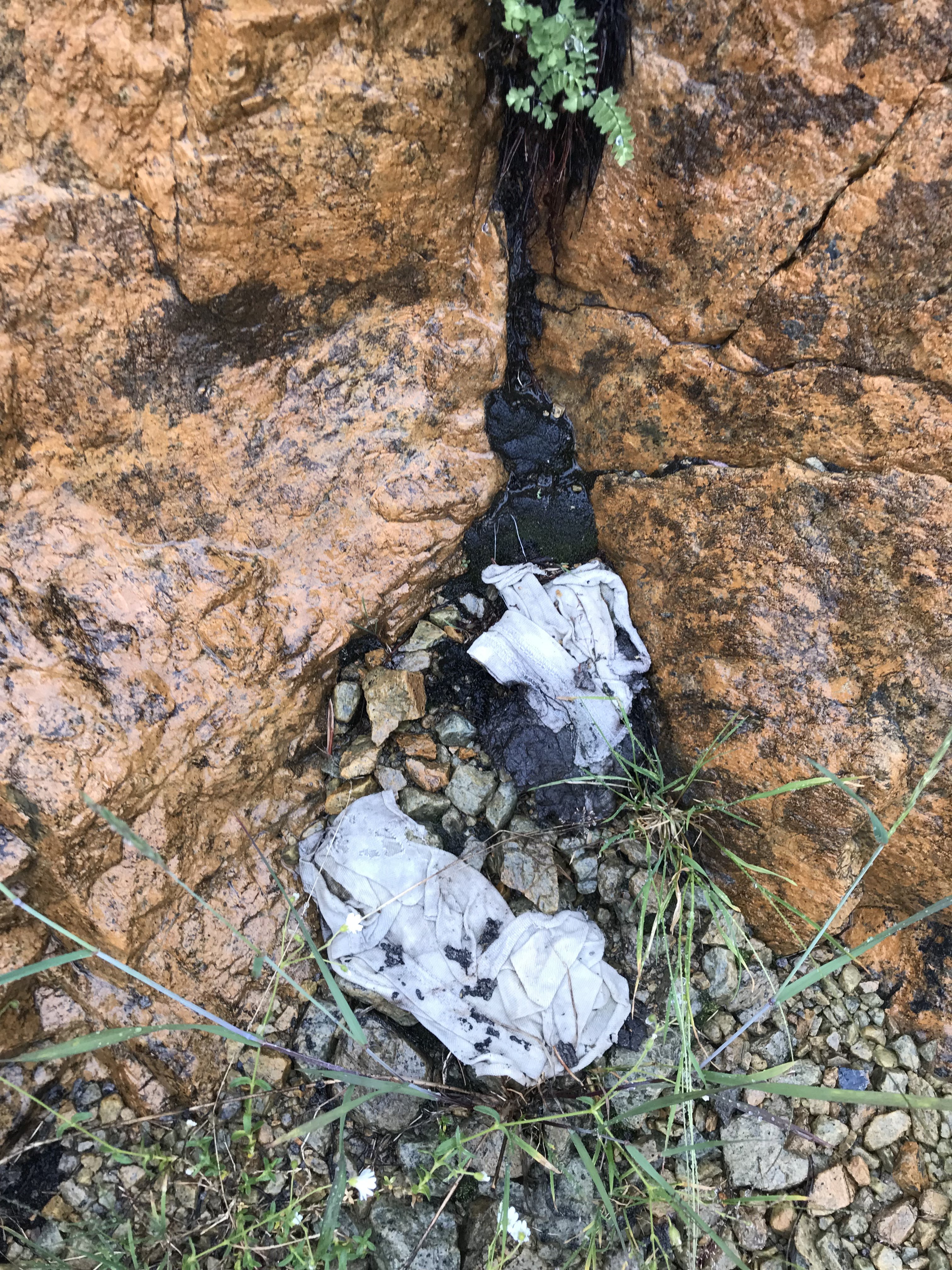
As it gets more popular I hope people work to keep it as pristine as they found it. Unfortunately in that sterile an environment it seems pretty easy to leave a lasting mess behind, witness the desicration I nearly stepped in on the “grassy benches” last weekend. Dig a hole! WTF!
-
[TR] Early Morning Spire - Southwest Face 08/18/2018
dberdinka replied to Rad's topic in North Cascades
I like you're TR a lot but before others follow you down the gully of doom I recall it being fairly straightforward to follow your "second option". Climb some broken rock to near Marble Needle where a couple short rappels put you on the Mccallister Glacier near the standard route on Dorado Needle. -
[TR] Early Morning Spire - Southwest Face 08/18/2018
dberdinka replied to Rad's topic in North Cascades
Maybe your epic was a result of all that photo taking. Great pics, looks like an awesome climb, wish I could remember it. -
Nice looking mountain you got there.
-
Another significant injury on forbidden. Climbed slipped and got wedged in moat. Broken back. Two hikers have fallen off bridges on Wonderland Trail and been swept away (dead). and of course the woman lost on Vesper Peak. 7 fatalities and 1 serious injury is a lot in one summer. probably still missing a couple.
-
Probably varies considerably by day. But check this for current conditions http://www.iciclechalet.com/webcam.html
-
We all were.
-
With all the interest on speed records in the mountains this summer I thought I'd point out this amazing story from 1913, 105 years ago!. The worlds changed, the trail is gone and this ascent could no longer be replicated but I'm just curious if people think there's really been any advancement in the sport. The following comes from an excellent read, published locally in Bellingham, called Komo Kulshan- The Story of Mount Baker by John C. Miles (2010). The original Mount Baker Marathon was a balls out race to the summit and back from Bellingham using cars or trains to access trailheads and back. Due to bad weather the third and final race ended in confusion and near disaster. A disgruntled local name A.M. Burnside challenged the winner Paul Westerlund to a rematch starting in the town of Glacier to the summit and back. At the time there was no road up Glacier Creek, only a roughly hewn trail that had been built two years earlier by locals as part of the first Mount Baker Marathon. The round trip distance was 28 miles. Here's the quote from the book "The rematch was run in early September, Burnside leading most of the way, only to be overtaken by Westerlund with just three miles to go. Westerlunds winning time was six hours and two minutes over the twenty-eight mile course with it's 9,700 foot elevation gain (and loss). He certainly dispelled any doubts about his strength, though Burnside later claimed to have had such a bad ankle that his doctor had advised him not to race." That's an average rate of just under 13 minutes per mile. Shitty trail, talus, presumably late season ice and hard snow. If modern speed freaks had to add 16 miles of trail and 3000' of gain/descent what would times look like now? For that matter what is the current non-ski C2C (so sad we base it off cars) record for Mt Baker from the Heliotrope TH?
-
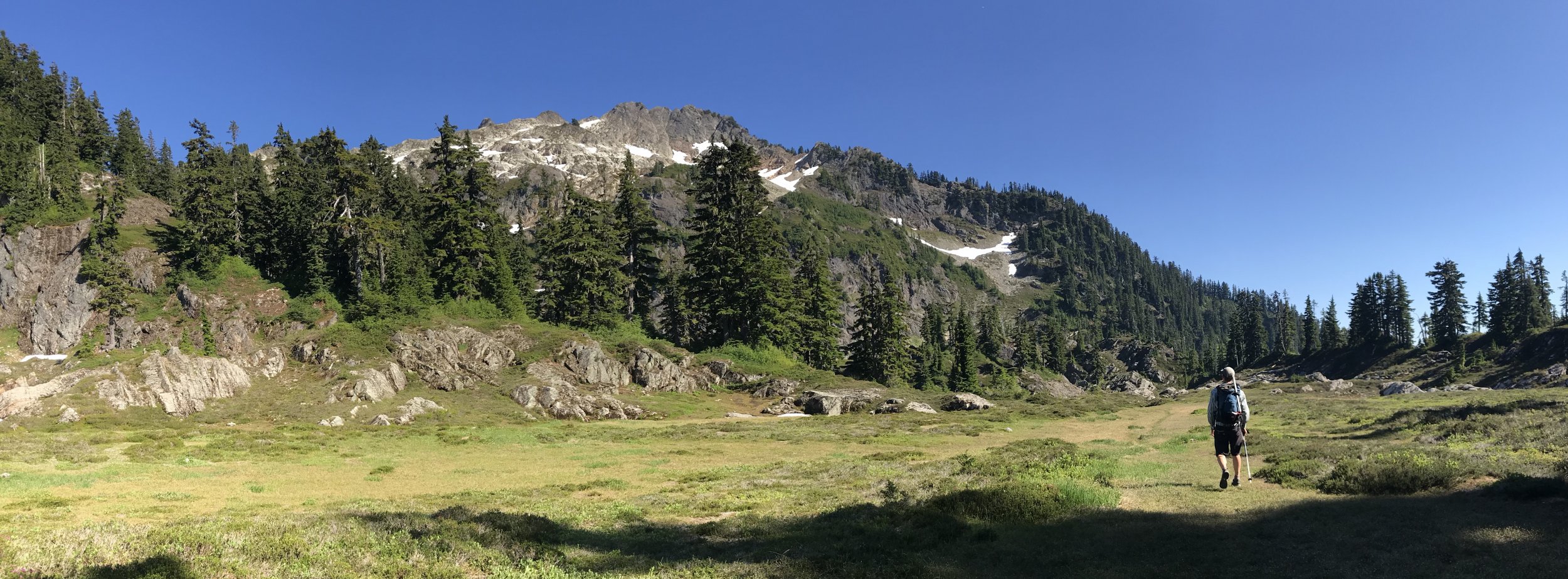
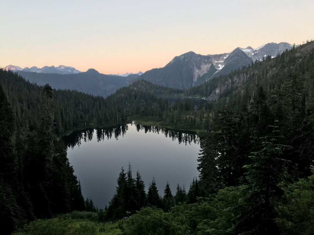
Trip: Watson - North Ridge Trip Date: 08/07/2018 Trip Report: Obscure, short and slabby with one of the mellowest approaches you’ll find in the North Cascades. Gloriously beautiful as well. Maybe not the highlight of your summer but possibly of your Tuesday evening. From the buttress toe a 150’ of 3rd or maybe 4th class rock leads to a more pronounced buttress. The original route climbs the obvious corner system on the north side (5.4 Kloke 1970’s). It’s also possible to move up left to the very crest and climb a full rope length of 5.6 on ridiculously clean and solid rock. A bit runout but gear (and/or fixed pins) show up where you need it. Continue on the crest, slightly dirtier rock, to the summit in one more pitch or wander off to either side. We descended east which involved some downclimbing, a rappel, a loose gully, a moat and some moderate snow. Supposedly a more straightforward descent might exist to the west if you carry over. Gear Notes: Small rack to 2.5”. 60m rope. Ice axe and possibly crampons. Approach Notes: Find you way to Upper Anderson Lake then faint path up gully at east side of first lake.


-
Ginsu? Thats a really good climb!
-
So is it true they were using dulfersitz because a rappel device was too heavy to carry? Seems a bit unreasonable to expect someone to risk their neck to save you when you cut your margins that thin. And then to leave yourself anchored to both chopper and wall. Yikes.
-
NW Face Forbidden - W ridge notch approach
dberdinka replied to JonParker's topic in Climber's Board
I made it in from the west ridge notch with a single 60 m rope years ago. I recall maybe two rappells on rock followed by another off a bollard and then maybe one off a picket to get to the ramp Jason mentioned. Definitely full on. I imagine it would be in no better or worse shape than ever. -
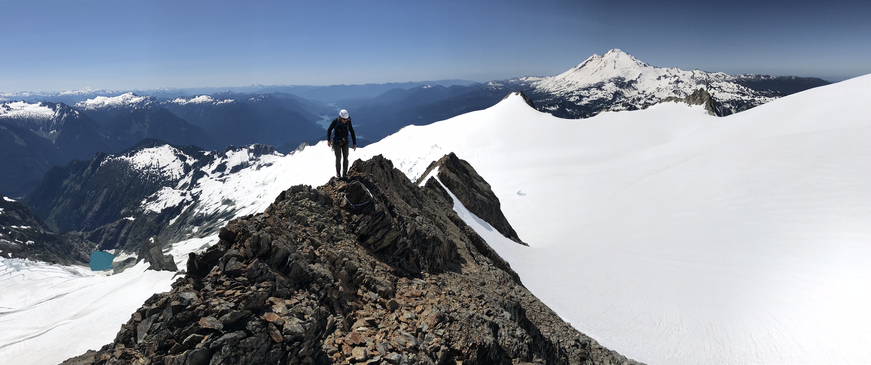
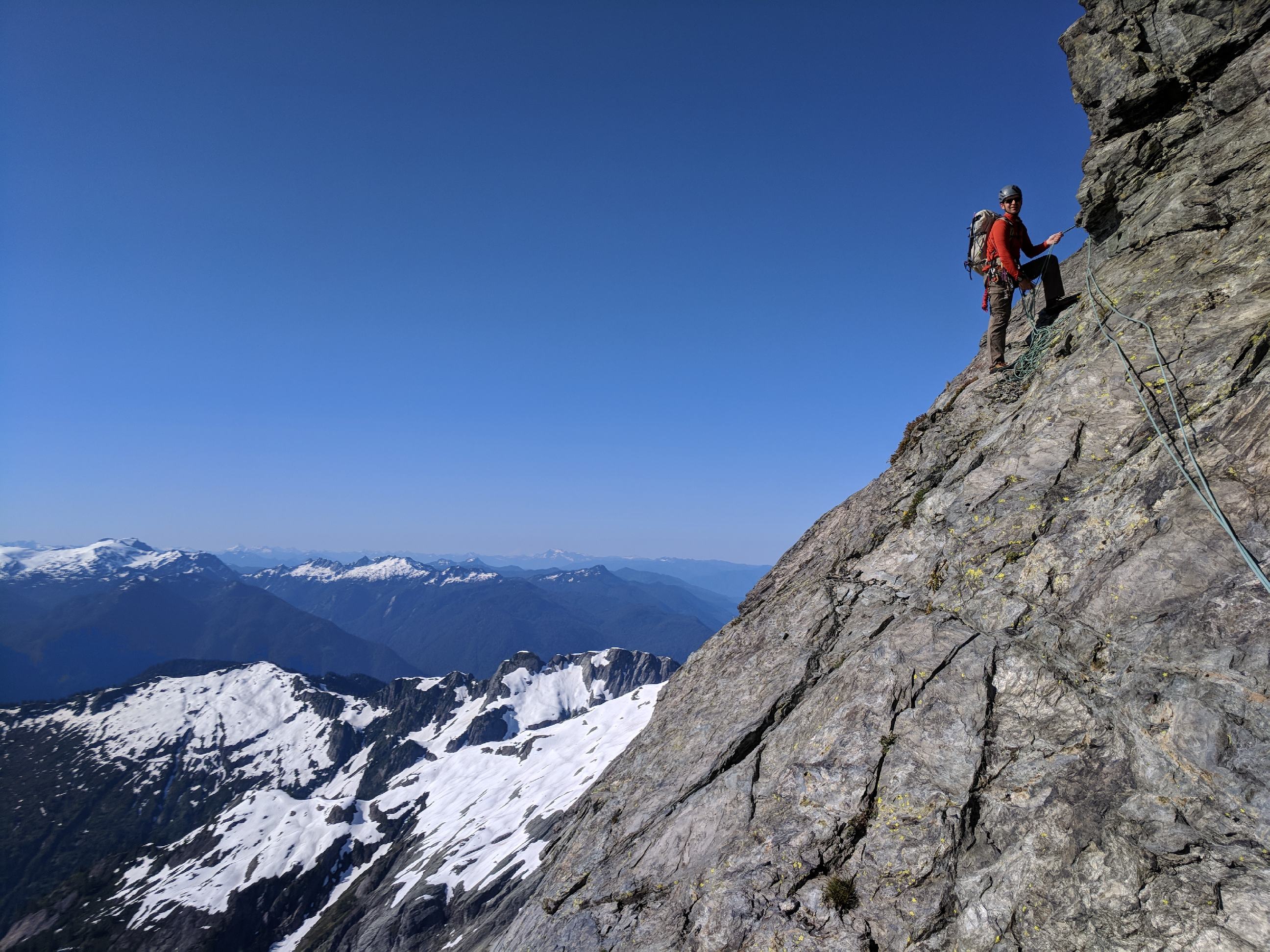
first ascent [TR] Mt Shuksan - No-Fo-O-Fo Ridge 07/14/2018
dberdinka posted a topic in North Cascades
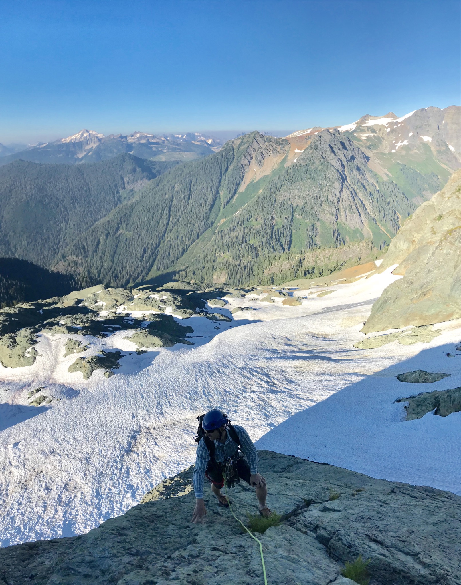
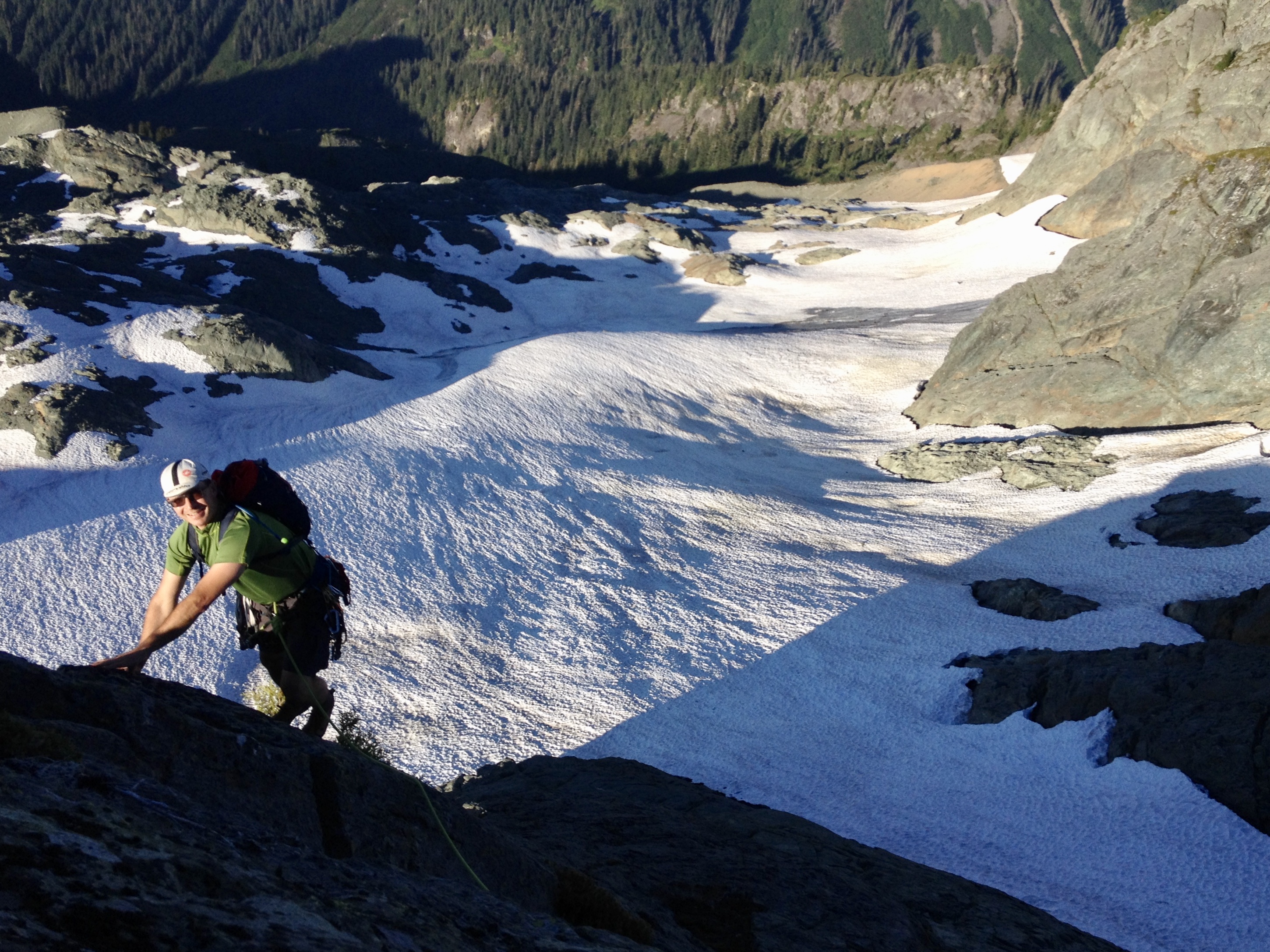
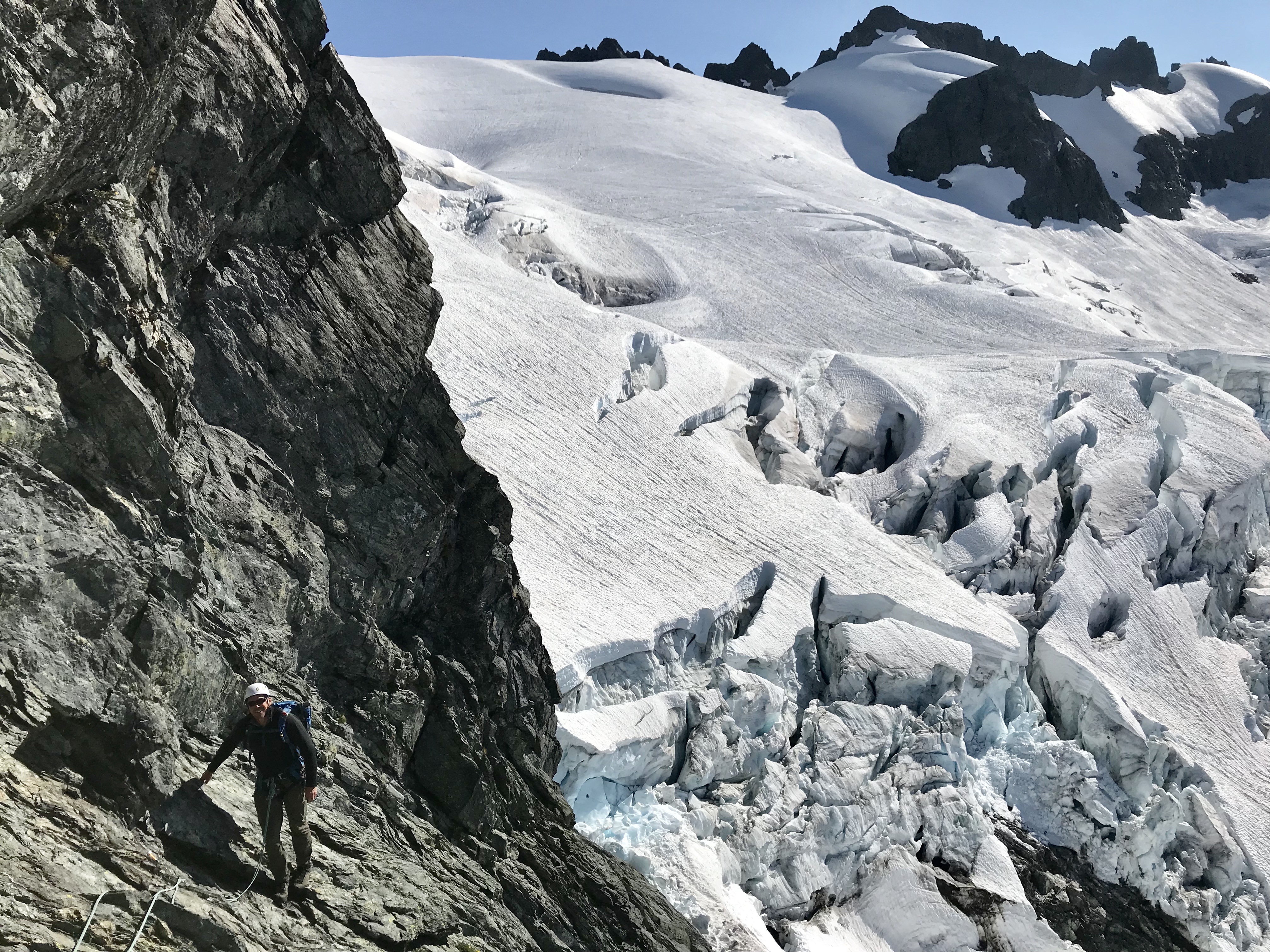
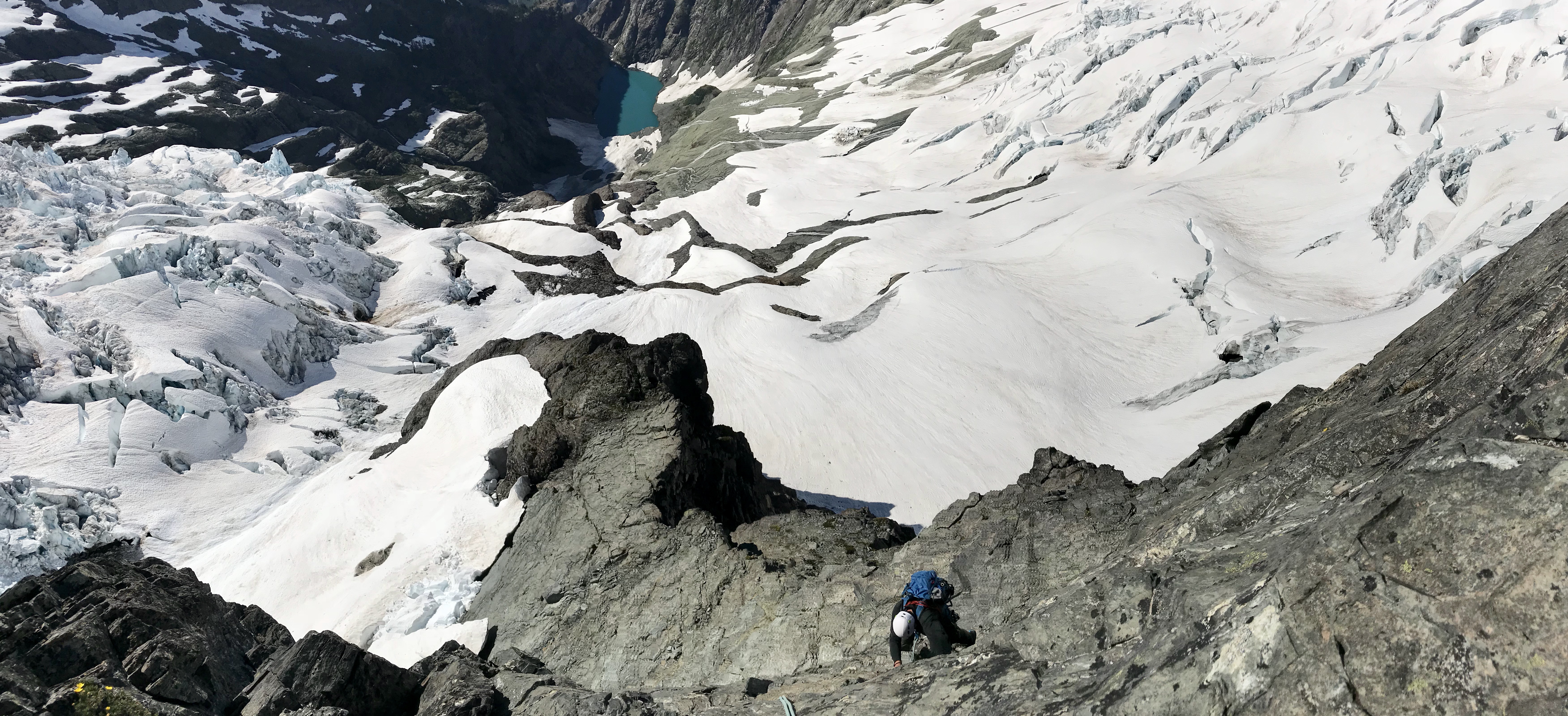
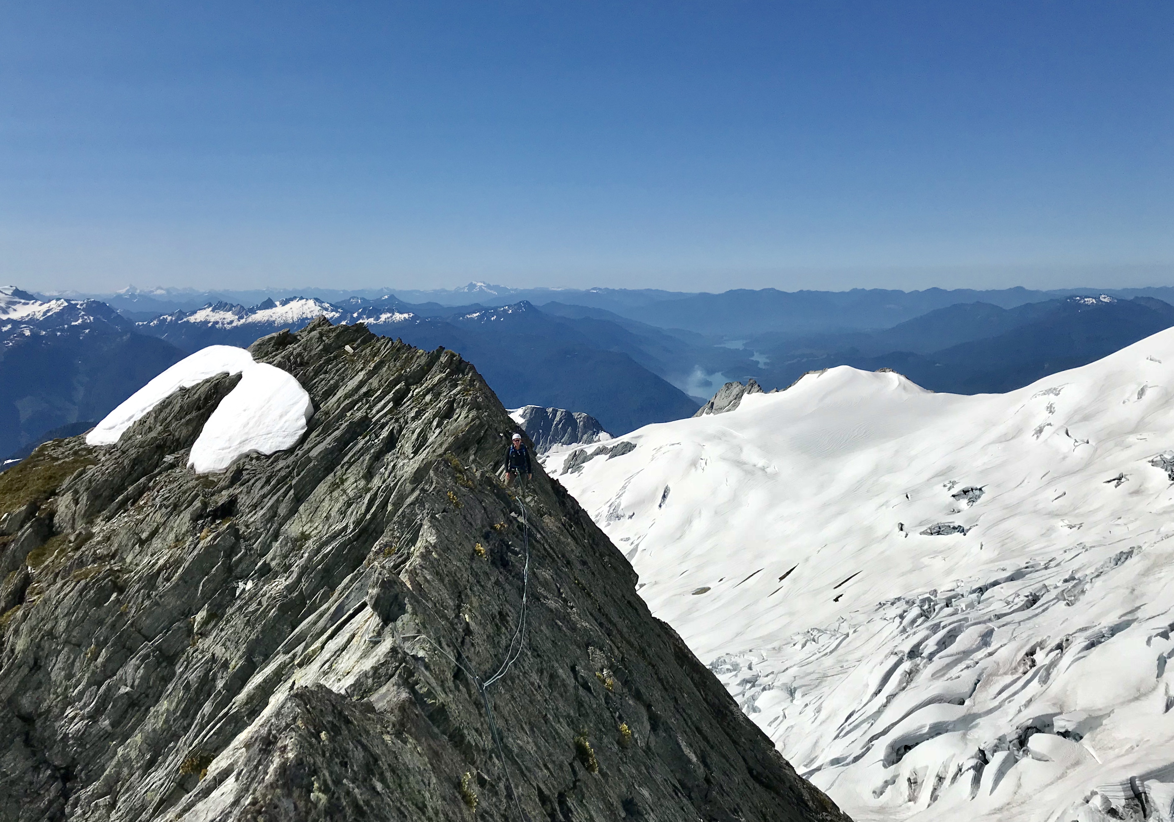
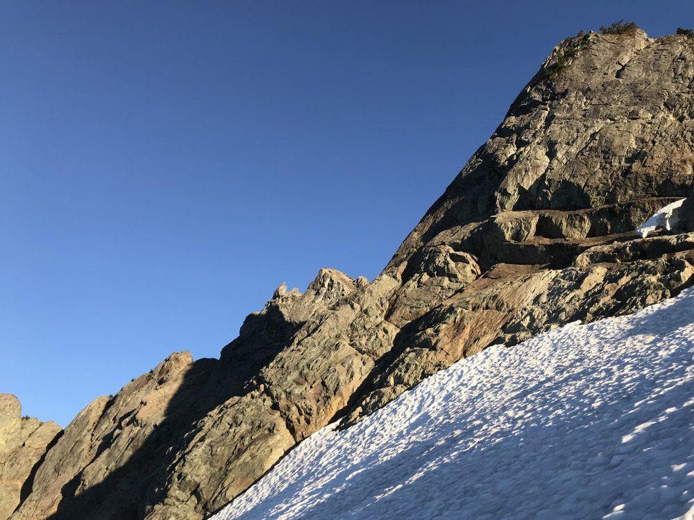
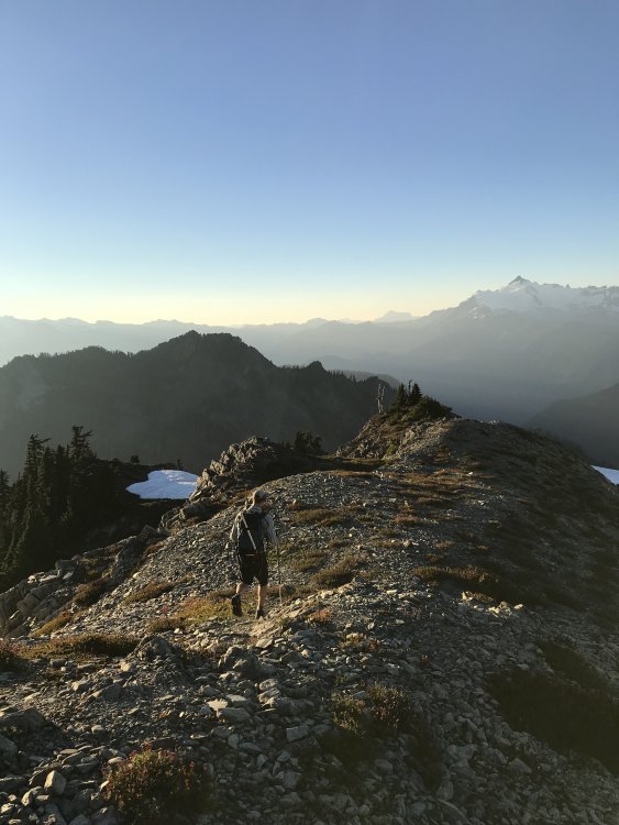
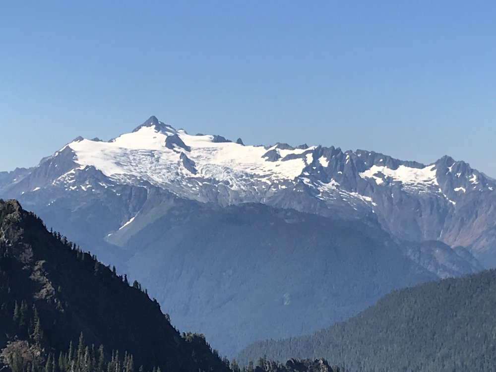
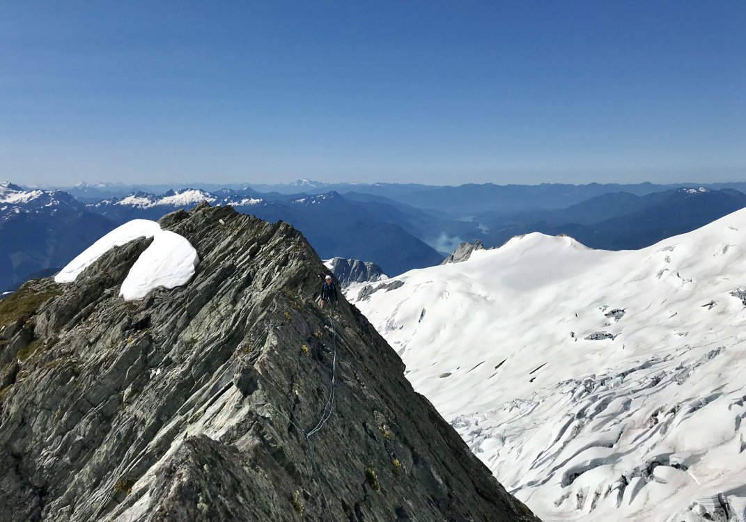
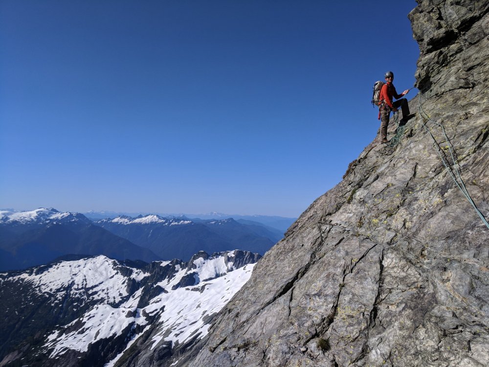
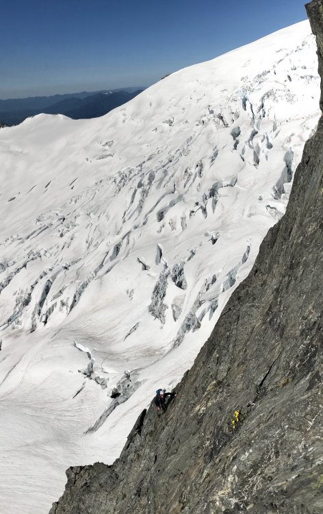
Trip: Mt Shuksan - No-Fo-O-Fo Ridge Trip Date: 07/14/2018 Trip Report: Ok maybe the name's just a personal joke. Call it the complete southeast spur of the mountain. With a day off and the desire to wander around in some alpine ambiance I was extremely fortunate to cross paths with Chris Martin (Cfire) who was amiable to my somewhat weird idea of climbing the entirety of the ridgeline separating the Sulphide and Crystal Glaciers. The finish of this feature is the frequently climbed southeast ridge of the summit pyramid. Access was a harrowing traverse underneath the terminus of the Sulphide Glacier. Seracs, debris piles, rushing water and thin fields of snow over downsloping slabs. We ran and Chris still managed to take a sizeable block of fortunately slow moving ice to the thigh. The ridge itself was a lot of fun. Generally good rock along some choss. Lots of 3rd and 4th class along with a stretch of very exposed 5th up an intimidating tower. Some down climbing, a rappel and a particularly incredible “a cheval” section. Of course the views down into the chaotic bases of the Crystal and Sulphide Glaciers were the highlight of the day, creaking, groaning with the occasional collapse both seen and unseen. Recommended for the incredible position as well as some pretty nice climbing on the lower and upper sections of the ridge. Looking down the crux pitch. Another view of the same with Sulphide Glacier in background. The amazing a cheval stretch. Photo doesn’t do it justice. Top of the second part. Description III 5.6 Start just right of the toe. Solid 4th class rock and a short bit of 5.0 choss is followed by a transition to grey shist(?) below a steep tower. Traverse to the base then follow a ramp back up left to the skyline, a short blocky bit leads to a decent belay ledge below the slabby headwall. Start on the left then traverse right (5.6?) to a hand crack then easier terrain. From the summit of the tower traverse an amazing a cheval section then downclimb a steep, featured 4th class slab to a notch by snow. Continue scrambling up the ridge line until a 40’ rappel drops onto the Crystal Glacier. Bypass a small nunataq then climb the second stretch of the ridge by its left skyline. Looks chossy but turns out to be reasonably nice 3rd class rock. From the tip of this feature a steep downclimb on snow leads to the broad bench below the summit pyramid. Follow the excellent SE ridge to the summit. Gear Notes: Small rack to 2”. A doubled up skinny 60m rope was adequate. Approach Notes: Traverse below Glacier will be slow and (more) dangerous once snow melts off rock slabs. Go early summer most years.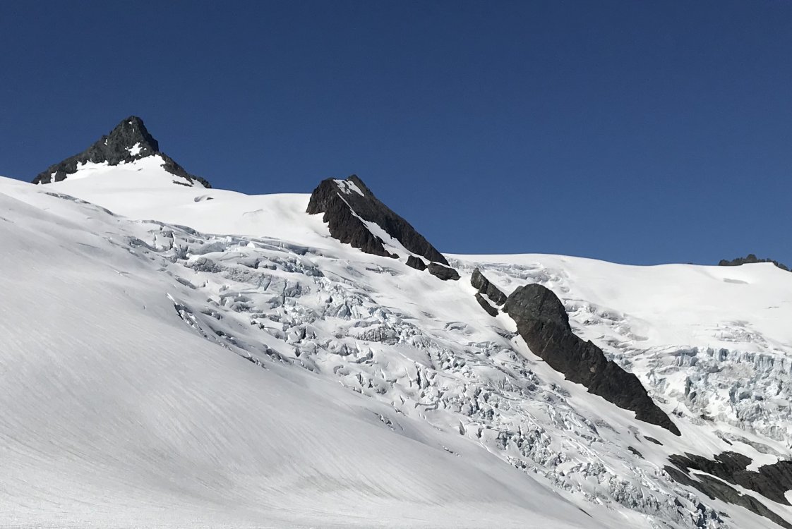


-
[TR] Lincoln Peak - Standard Route…I guess 06/11/2018
dberdinka replied to cfire's topic in North Cascades
great photos and nice looking conditions. So how did the dad with endless free time miss out on this one? -
What would you do for a week in the North Cascades?
dberdinka replied to dawuda's topic in Climber's Board
Boston Basin/Eldorado/Pickets all require permits from the Park Service which have become increasingly more difficult to get for anywhere. Plan on starting your trip on a day other than Friday or Saturday and get to the Backcountry Ranger Station super early to get your number. Ptarmigan Traverse/Dome Peak are outside the park. Personally I'd go do NE buttress of Goode for 3 days for a full-on mega-classic NC adventure without excessive levels of bullshit (permit required). Then 3 days for Eldorado/DoradoNeedle/Austera and out. -
I plan on climbing those waterfalls next January. Who's with me?
-
Thats different! Thanks for sharing.
-
free Free 1993 civic. 50 mpg. Great climbing trip car.
dberdinka replied to Brian O'Dell's topic in The Yard Sale
Could that be an upgrade for you Jason? -
If your skin glue is gummy but not filthy it's gotten infiltrated by H2O, use an iron directly on the glue to basically steam it out. It won't restore it completely but it definitely helps. I reglue my skins fairly frequently. Get a heat gun from Harbor Freight (~$10). On low setting really heat up about a foot of skin at a time and use an old credit card or similar thin, flexible scrapper to scrape the glue right of the skin. Done right this should remove 99% of the glue on your skins. Works way better than trying to soak the glue into paper bags. Get a tube of gold label skin glue, warm it up in a bowl of hot water. The apply to skin, again about a foot at a time, lay down some wavy lines and spread with an old credit card again. Use the heat gun again, this time more sparingly, to keep the skin/glue warm while you spread it. Try to get as thin a consistent layer as possible. Let dry 24-48hrs. Always use skin savers.
-
I'm not at all interested in the number of trail and area closures that are going to occur from this action. Amazing they can find 28 million for this but road wash outs go years without repair due to lack of funds (fyi Ruth Creek blew out the road shy of the Hannegan Pass TH this winter). Actually I'm beginning to think blown out roads are a good thing but thats a different topic.
-
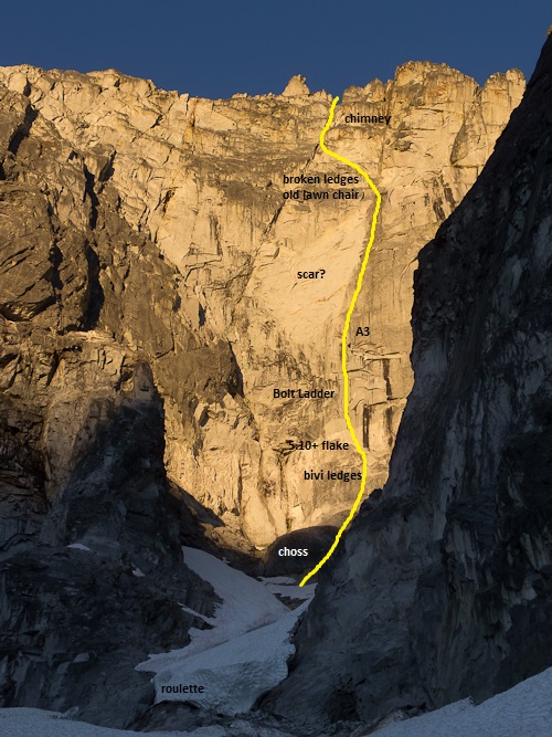
I once tried it. We had four days to do it in round trip. That is not nearly enough time! I believe Peter Doorish and Dale Farnham spent many weeks pulling that one off and I can understand why. Should mention when they did it the approach trail up the Chilliwack River was still in excellent shape and very popular. Day 1 we spent 11 hours getting to highcamp approaching form Chilliwack Lake. The trail through the lower valley is just about gone and there is A LOT of bushwacking. Day 2, carrying a wall rack, bivi gear and two days worth of water, we dropped down around the north side and climbed the steep snow gully below the face. We were totally destroyed at this point from the approach. We climbed two pitches of horribly loose and unprotected rock till we realized we weren't going to pull it off in 1.5 days. Retreated by bailing upwards on the Beckey North Buttress Route. Observations Dialing in the approach in advance to Bear Camp, maybe flagging and doing a bit of brush work will dramatically improve your chance of success. The approach gully is horribly dangerous. Timing is a challenge as well. The gully will melt out to absolute choss by early summer most years. I'd plan on late June/early July. Good news is early season there will be running water right near the base of the rock climbing so no need to carry water up there. It's basically a chossy version of the Sheriffs Badge. There appeared to possibly be some very large rock scars on the face though impossible to say if they preceded or followed the original ascent. I would get in at least one training climb on the Badge. Expect a fair bit of nailing. Above the choss we climbed the rock improves. There are some bivi ledges in that stretch just below a large, detached flake ("The 4th pitch climbs the right side of a split pillar 5.10+"). A 4" cam may or may not protect that, definitely wouldn't hurt to bring one large piece. The bolt ladder is 30 years old, hope it's there, consider bringing a minimal bolt kit. Above that the weaknesses it followed seemed reasonably apparent on not the most awesome looking rock. Dale Farnham (RIP) told me the final chimney pitches were very chossy. Ideally you'll climb to the low bivi ledges and fix two ropes above on D1. Day 2 power up to broken ledges near the top of the face. D3 summit. 2 ropes, gear to 5", selection of pins and the ability to replace bolts.
-
The west ridge of Stuart is a classic 5.4 climb. However I get the impression you're asking for short, multipitch recommendations. The w ridge from Stuart Lake would be a very, very long day with miles of exposed scrambling both up and down. Unfortunately the Stuart Lake Zone is a long ways from the Core Zone. From where the trail breaks to Colchuck lake its about 4 miles and 3500' of trail just to access the plateau of the core zone. West Ridge of Prusik (the classic easy moderate) is a couple miles away from there. Doable in a long day for a fit, fast party. Maybe that describes your family? Further west of Prusik Peak there are a number of short excellent low 5th class routes on Razorback, Comet Spire and other peaks. But that's not a possible day trip from where you'll be. Somewhere on this site there's a TR for an easy 3 pitch (5.6?) crag climb by colchuck lake. That might be your best bet for some alpine amibence. I couldn't find it. Maybe someone else can. Ultimately based on where you can camp I don't think you have many options. Maybe leave the gear in the car and enjoy the backpacking and scrambling. Then do some cragging in the leavenworth area. Midway on Castle Rock is the classic low-5th multipitch with a nice summit to boot.
-
Applauding risk acceptance beyond your own limits
dberdinka replied to glassgowkiss's topic in Climber's Board
Heck. I don't understand why I act the way I do much less someone else... More interested in the idea of why and should we applaud such high levels of risk taking. -
Applauding risk acceptance beyond your own limits
dberdinka replied to glassgowkiss's topic in Climber's Board
In an era of carefully crafted images Mark was entirely refreshing in his no-apologies attitude as just another dork from the PNW who loved climbing. Though his vision and abilities surpassed mine by many, many magnitudes, he always felt like one of us and I am sad for his passing. That said the only surprise here is that he died while climbing with a partner. However strong his technical skills may have been, it was readily apparent that caution was thrown far, far to the wind a long time ago. There's only so much loose rubble and thin ice you can speed solo, only so many bad anchors you can belay and rappel off of, before something gives. To wit in the obituaries I've read there are descriptions of collapsing ledges while he onsite-solos 5.11 rockies limestone and rappelling and jumaring off a single nut on Mt Chephren. There's no way that sort of attitude was going to end well. Yet the climbing community as a whole considers this an admirable quality! I think the point Bob tries to make is that the climbing industry has come to glorify excessive risk taking, primarily soloing. In the language ("scrambling", "cordless") in the advertisements, articles and feature length films. I'm not sure why that is. Maybe Alex Honnold was just really photogenic, or it's a reaction to the sterility and ubiquitous of gym climbing. Maybe it's that 12 year-olds can climb 5.15. What ever the reason there's undoubtedly a positive feedback loop of approval and achievement. I'm getting old, and I climb less and worry about my kids more. It's not hard to look at this culture and see something twisted in it's hierarchies and myths a sort of polarity that values either extreme difficulty or extreme risk but nothing in between. I don't have any direct exposure to paragliding culture but my impression is if you came down and said "I just thermaled to 30,000' in that thunder cloud!" you'd be taken to task. But when the climber comes down from the solo adulation increases with the risk and seriousness of consequences. So, yes grieve and grieve hard for the loss of a great friend. But as community maybe it's worth stepping back and reconsidering what we value and what kind of outcomes it leads too.