-
Posts
183 -
Joined
-
Last visited
-
Days Won
25
Everything posted by kmfoerster
-
-
-
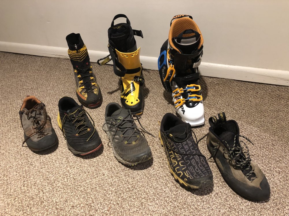
With work postponed due to smoke I thought I'd toss up a photo of my Chevro-legs that get regular use in the alpine. I've got a pair of G5's that I bought this winter. Haven't used em yet, bought them for a trip to Chamonix and to have a bit warmer boot as an option. I love the Sportiva Trango Ice Cubes and think that that class of a 4 season boot is all you really need in the Cascades. I size mine a half size bigger than my normal street shoe and wear a thick sock, helps with blood circulation. I love the old style of Vertical K (second from bottom right) and would buy ten pairs right now if I could. Note that there isn't a 3 season boot in the line up. Haven't used a 3 season boot for the last 2 years, and haven't felt a need to buy a new pair lately. Thats probably mostly based on the objectives I've been choosing.
- 12 replies
-
- 1
-

-
- trail running
- ice climbing
- (and 3 more)
-
Good article Kyle. I'm more or less on board with what you said. I almost always do the approach in trail runners or skis. The exception being that I've spent a lot of time/miles in approach shoes this season and have found them useful and not terrible to hike in. Obviously their usefulness depends on the objective and whether or not someone finds them good to hike long distances has too many factors to mention. I used to think they are a silly addition to a footwear quiver and that most people bought them to wear them around town. I've been reconsidering and appreciate the extra room in my pack or ability to use a smaller pack for carry over style climbs. Or even objectives that would require a bunch of change overs between footwear, i.e. circuits or link ups. They're way more grippy than any trail runner I use and allow me to move over slabby approaches quickly and confidently. I do still agree they are more so a jack of all trades and don't do one thing well, but I've found good use of them for me lately. I've been using the Scarpa Crux (normally a Sportiva guy). Good durability to weight ratio I think and not too bulky. Can usually find them dirt cheap every now and then too.
- 12 replies
-
- 1
-
-
- trail running
- ice climbing
- (and 3 more)
-
A super fun and scenic route! I agree with you on the east ledges, they have a way nastier reputation than they deserve.
-

[TR] Johannesburg - 1957 NE Rib 08/01/2020
kmfoerster replied to The Real Nick Sweeney's topic in North Cascades
Wow, if I'm counting right, that means that there were five parties to do NEB this year??? -
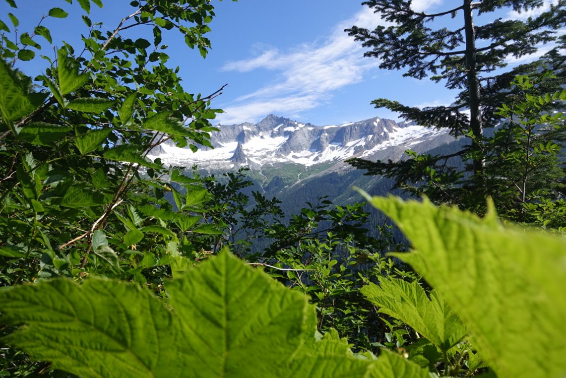
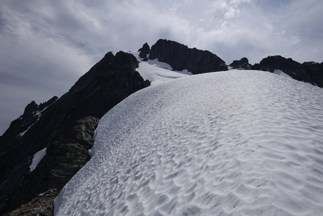
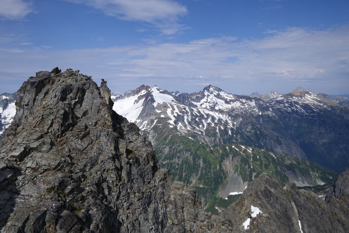
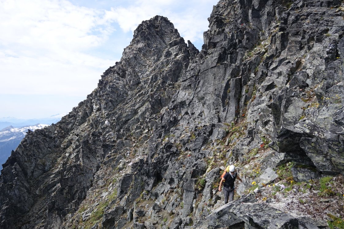
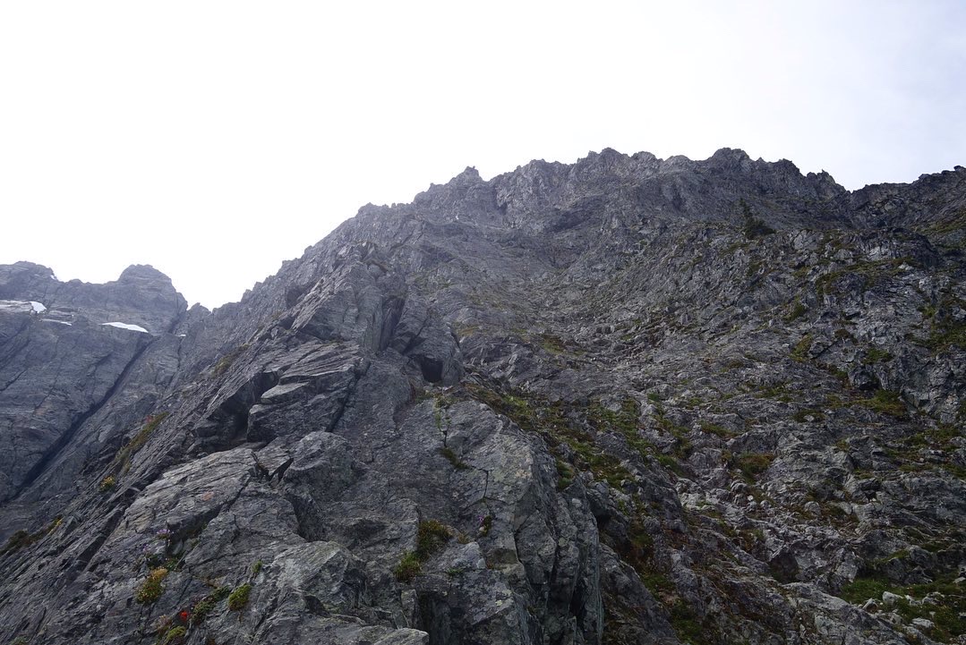
Trip: Inspiration Peak - East Ridge Trip Date: 08/16/2020 Trip Report: This weekend @willgovus and I climbed Inspiration Peak's East Ridge. We got started hiking from the trailhead around 11:30 or so Saturday. The trail up to terror basin is very straight forward, but boy is it steep. That coupled with the heat had me cramping quite bad towards the end and had to just lay down for a bit with my legs elevated. I was soaked with sweat for almost all of the way up the ridge before the trail starts traversing. Made it over to Terror Basin camp late afternoon. What a pleasant place to camp. Many flat spots, running water and an incredible view. We woke up around 3am Sunday morning and picked our way across the climbers path and slabs in the dark. Travel across the glacier was very straight forward with no complications. Reaching the start of the route up to the ridge was just a small hop down from snow to the base of the route, no problem. We did a mix of pitching out and simuling to gain the ridge, staying just climbers right of the major rightward trending ramp and gulley. After three-ish pitches we did a leftward traversing pitch that started off with just bit of down climbing to the East Ridge notch. A vertical step followed by some easy ridge scrambling gets you to the base of the lie back pitch and then the crux pitch. The crux pitch was pretty damn awesome! After that it was a few simul blocks on the north side of the ridge crest to the summit. The decent went well and ended up doing 7 double rope rappels with a bit of crazy exposed scrambling between the West Ridge and South Face. That first rap onto the south face is wild! Was very glad to be done rappelling and back onto the glacier to start the hike out. The hike down the Terror Basin trail is punishing but it goes quick, its really just controlled stumbling and running. At first I was glad to reach the part of the trail on the old road bed, but quickly found it miserable for some reason. Overall I'd say this is a good route in and incredible setting. Some great climbing sandwiched between some loose, forgettable climbing. Gear Notes: Single rack from .3 to 3, double 1 & 2. Some stoppers, useful for anchors before and after crux pitch. 6 alpine draws, 5 double length runners. 60m twin/half ropes. Ice axe, crampons. Bringing rap tat is a good idea. Approach Notes: Terror basin trail


-
[TR] Johannesburg - 1957 NE Rib 08/01/2020
kmfoerster replied to The Real Nick Sweeney's topic in North Cascades
Hell yeah Nick! Another great write up! -
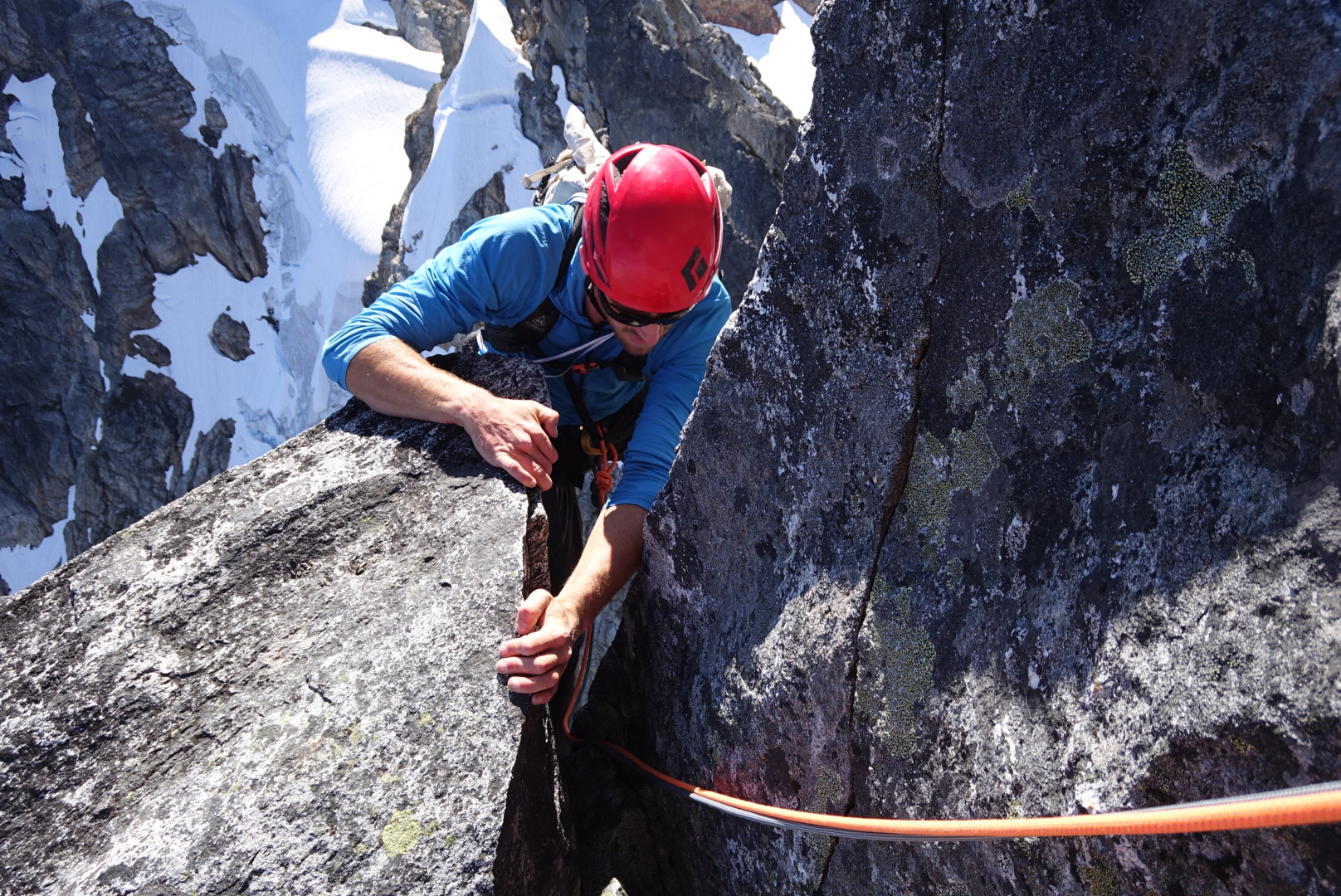
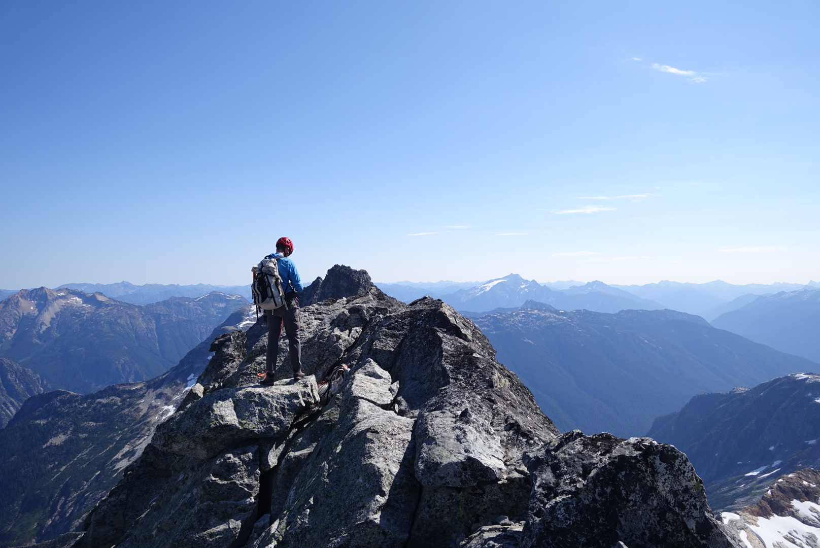
[TR] Johannesburg Mountain - NE Buttress 08/01/2020
kmfoerster replied to kmfoerster's topic in North Cascades
Perhaps next time, it'll be a while... Thanks for the recommendation, that part of the face is intriguing. -
Awesome! Incredible route/mountain. Using one 60m rope will involve just a small bit of down climbing.
-
[TR] Johannesburg Mountain - NE Buttress 08/01/2020
kmfoerster replied to kmfoerster's topic in North Cascades
My new ice axe.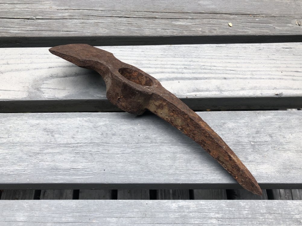
-
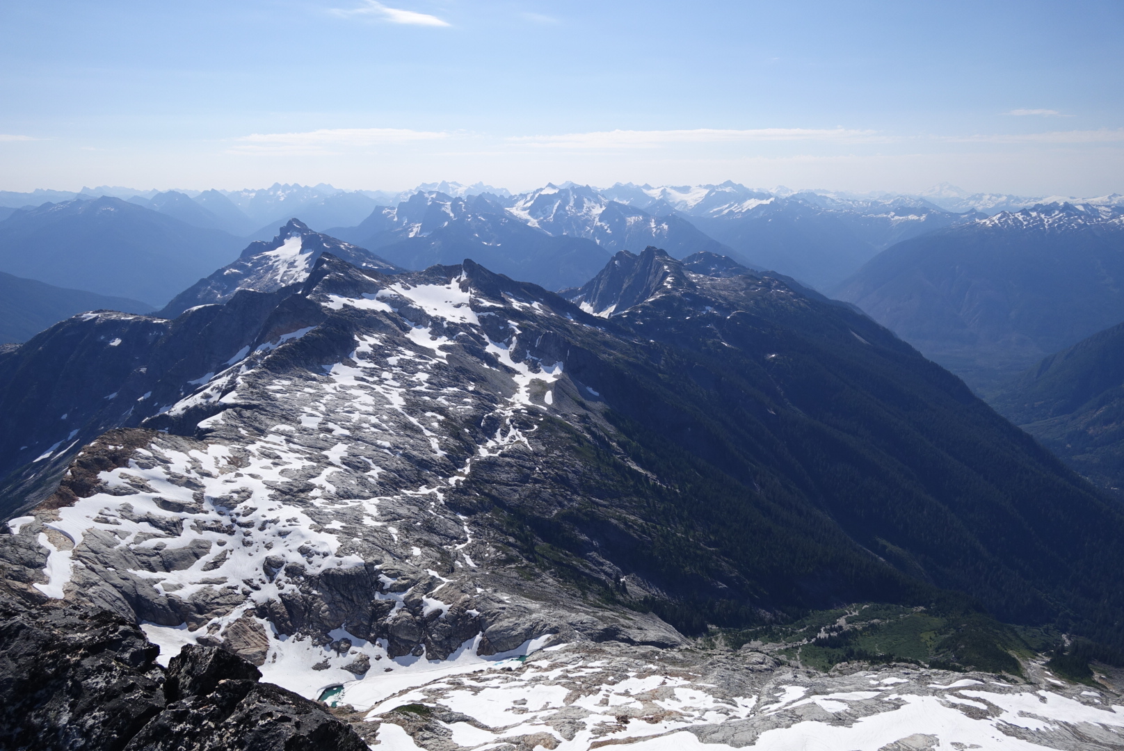
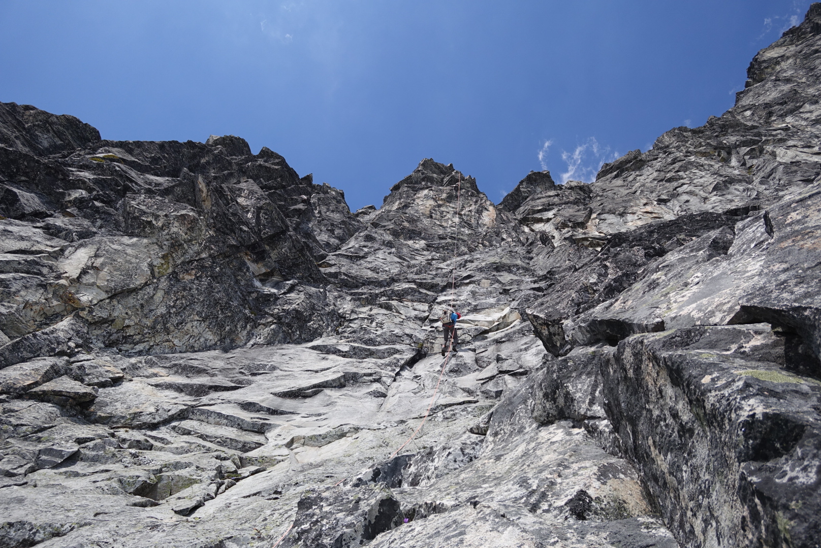
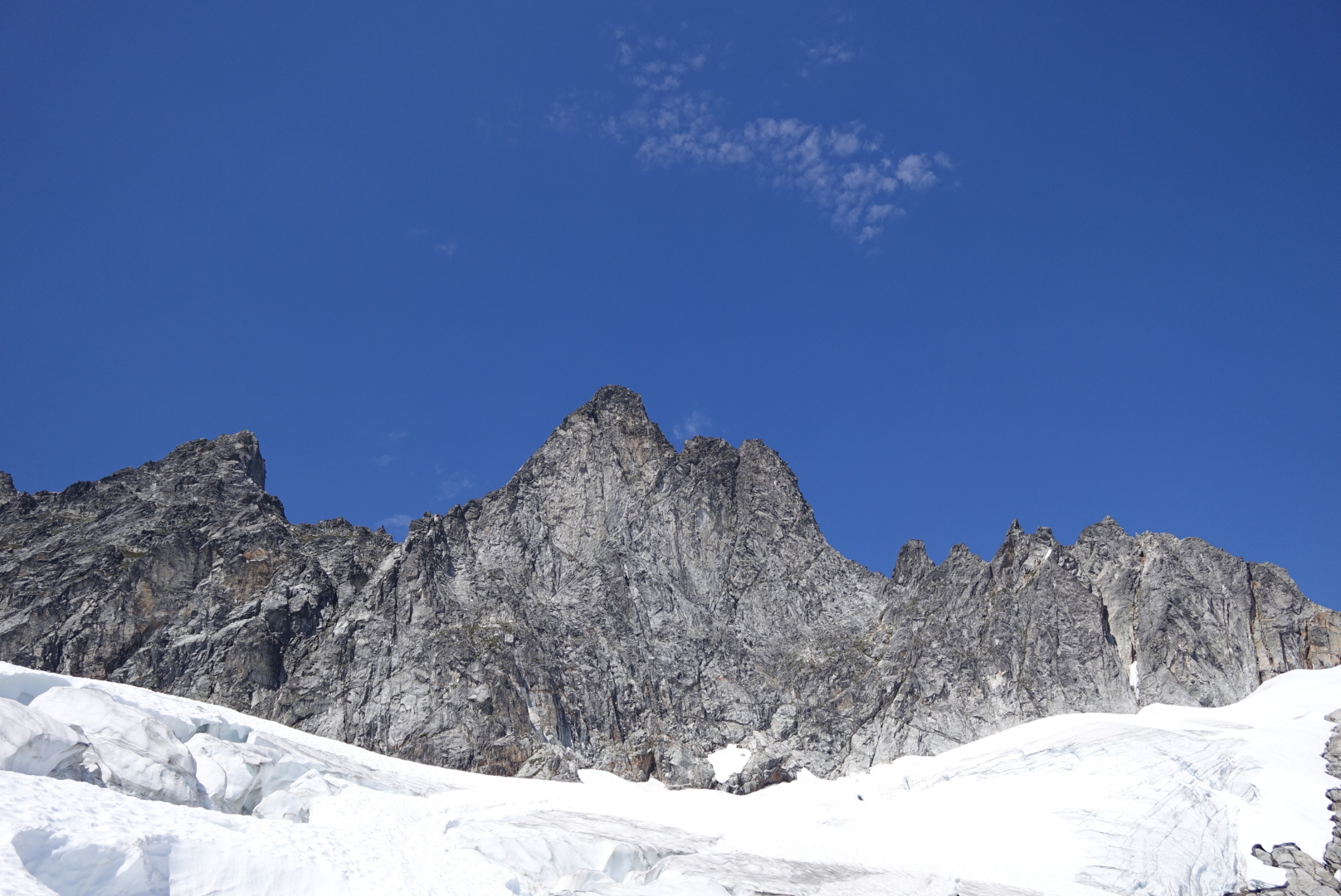
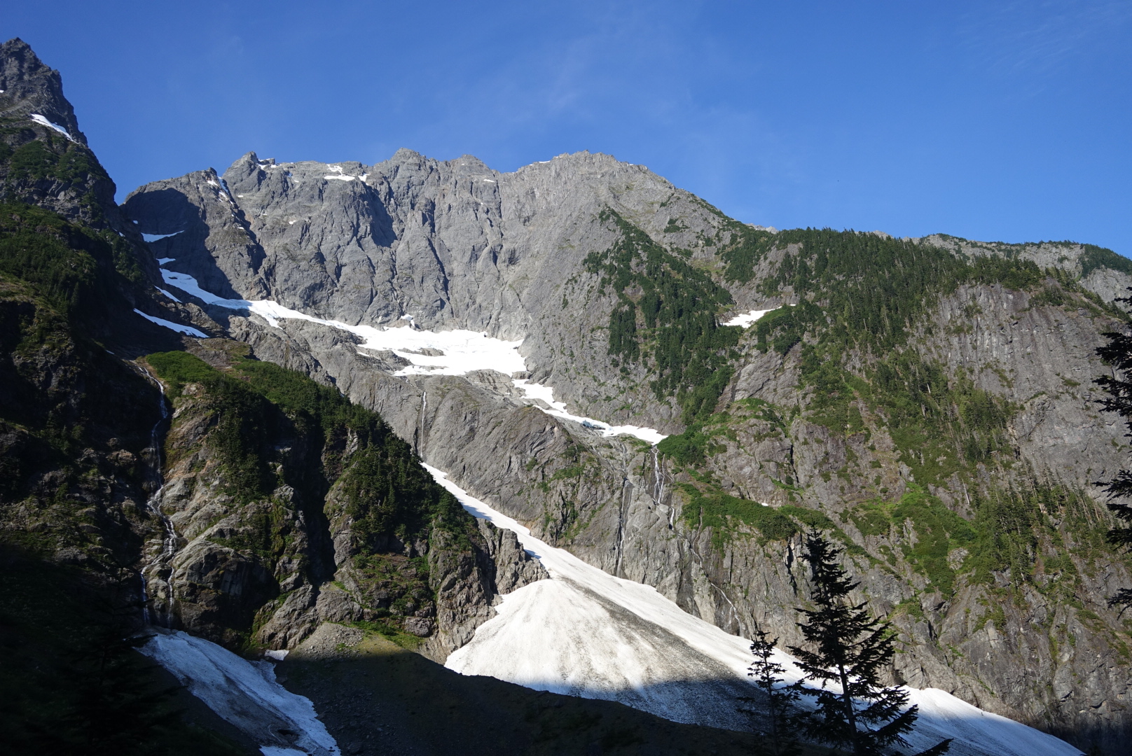
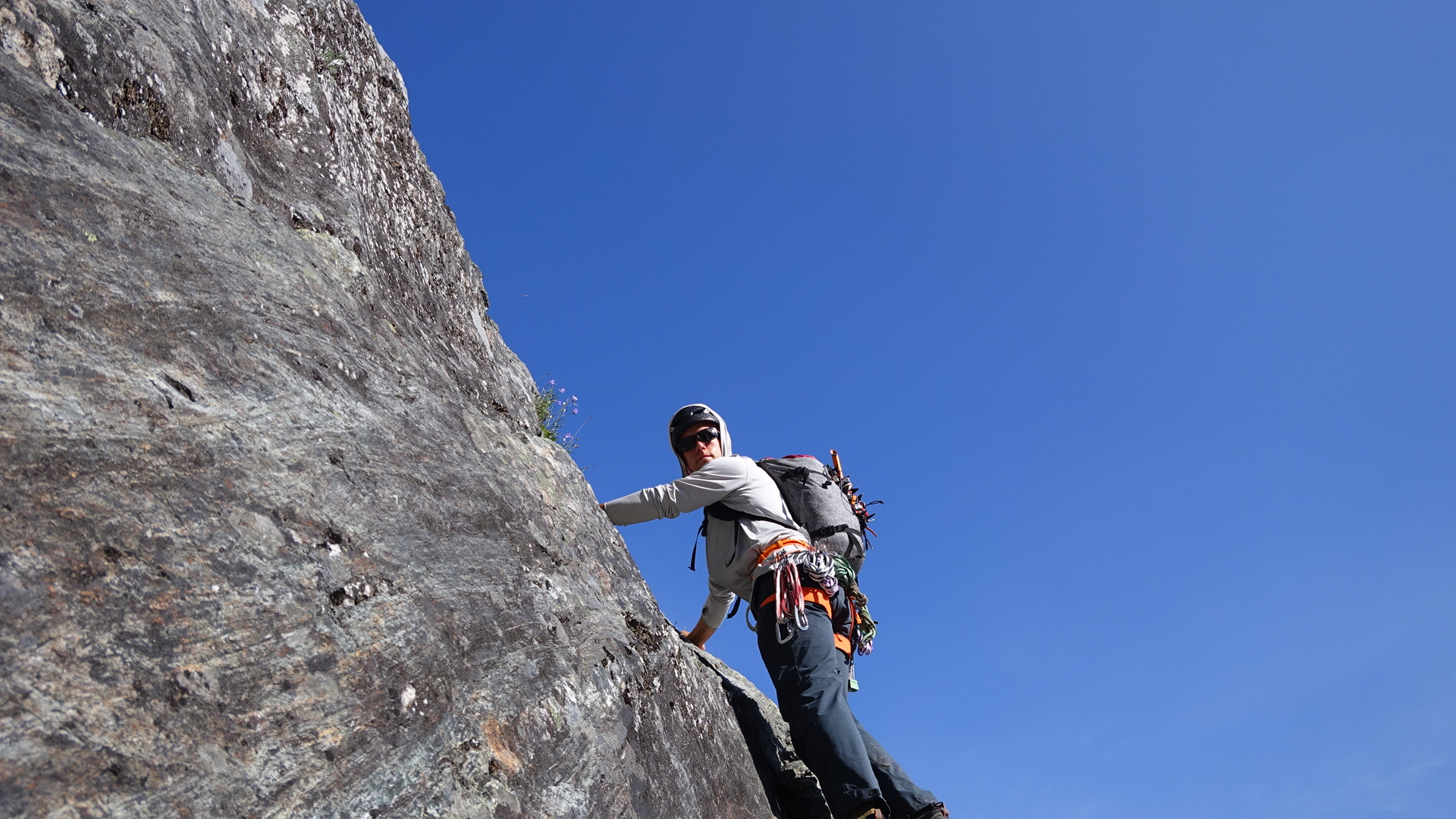
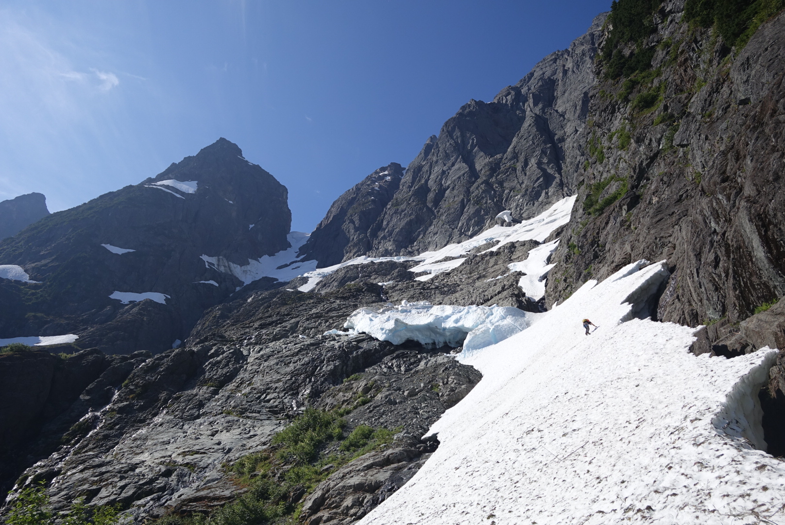
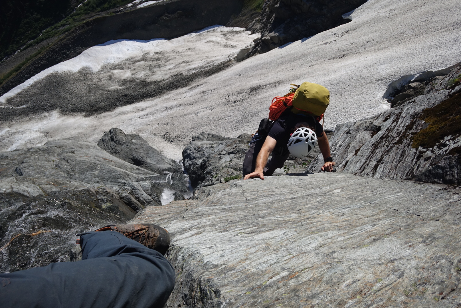
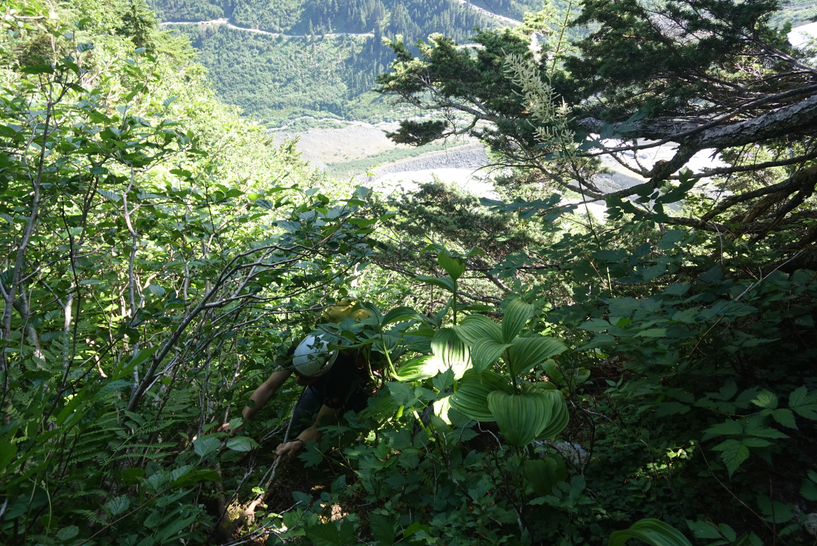
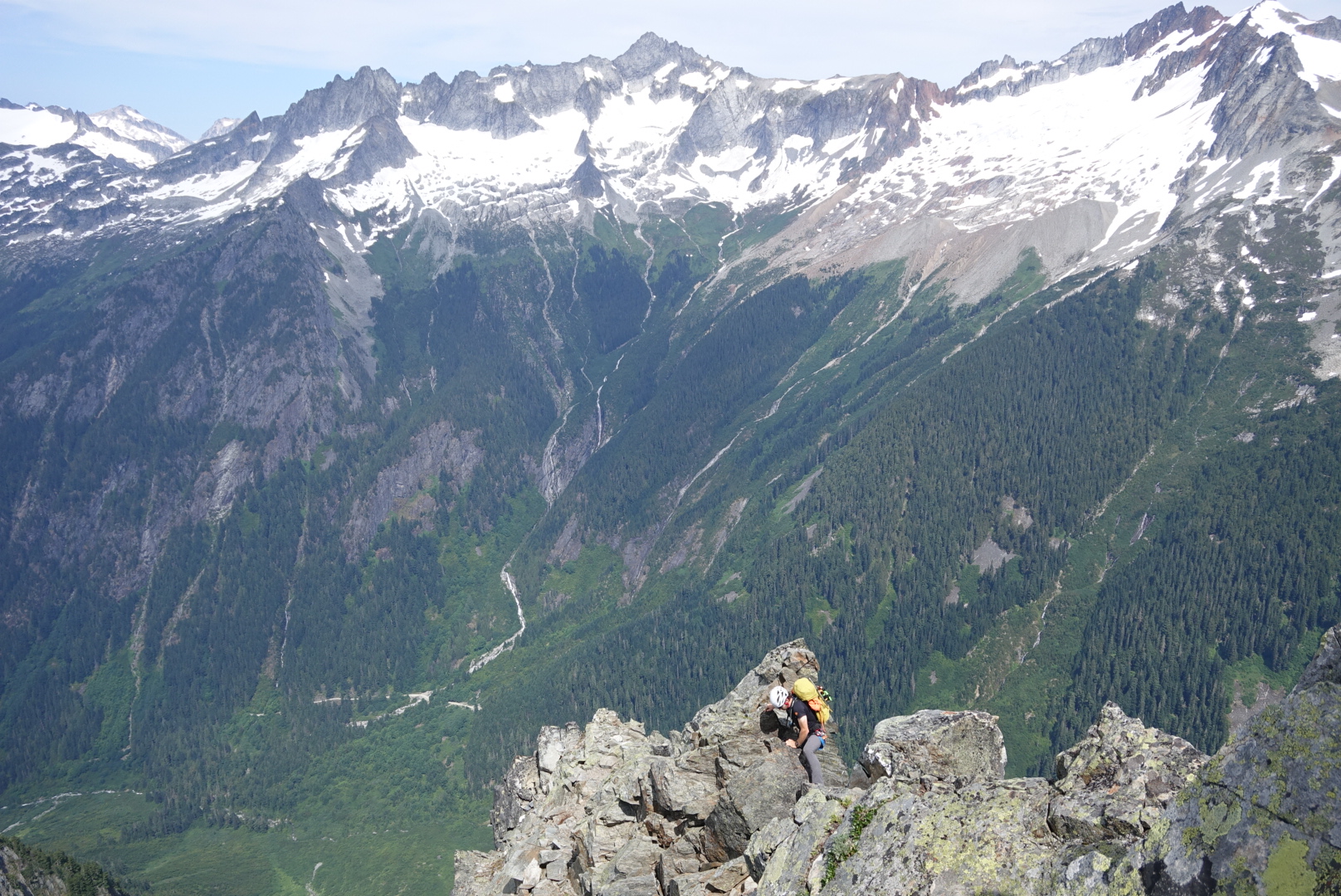
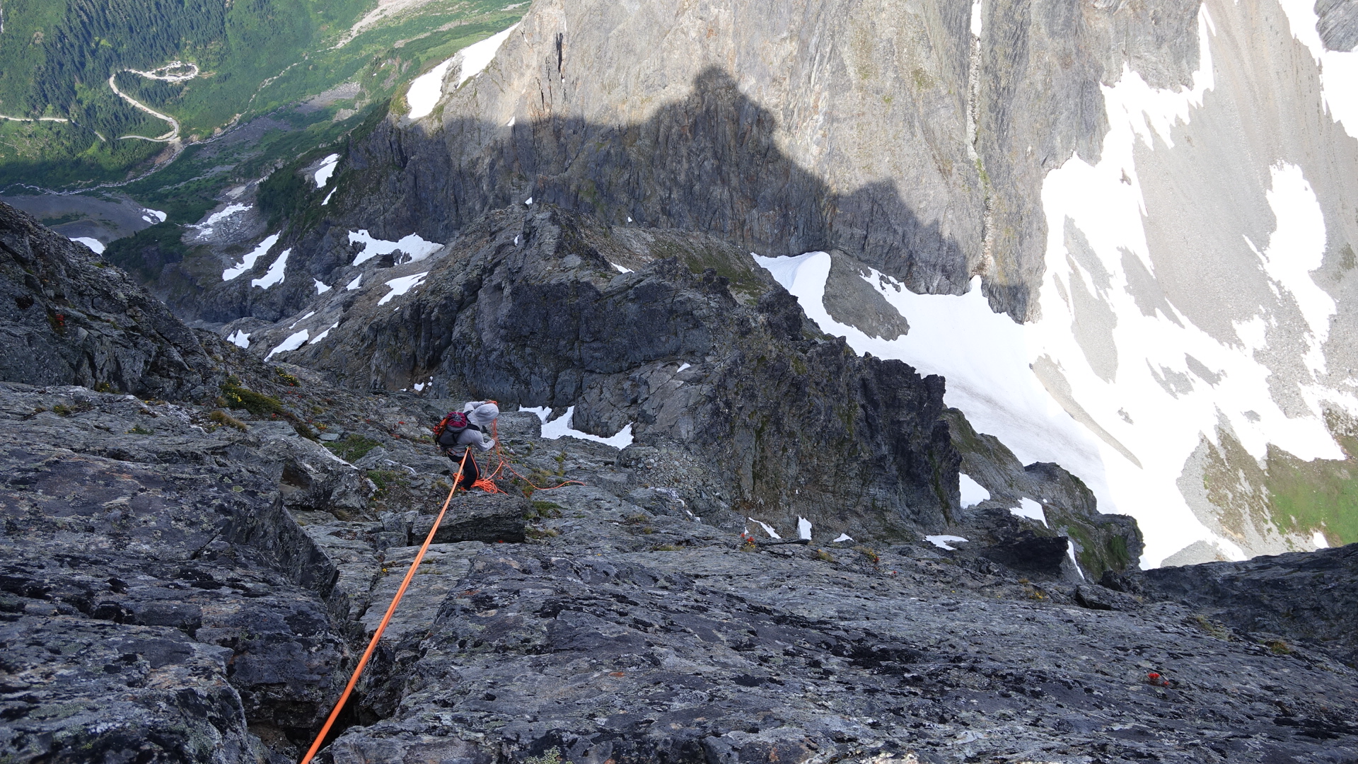
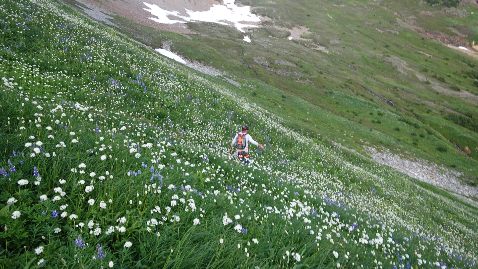
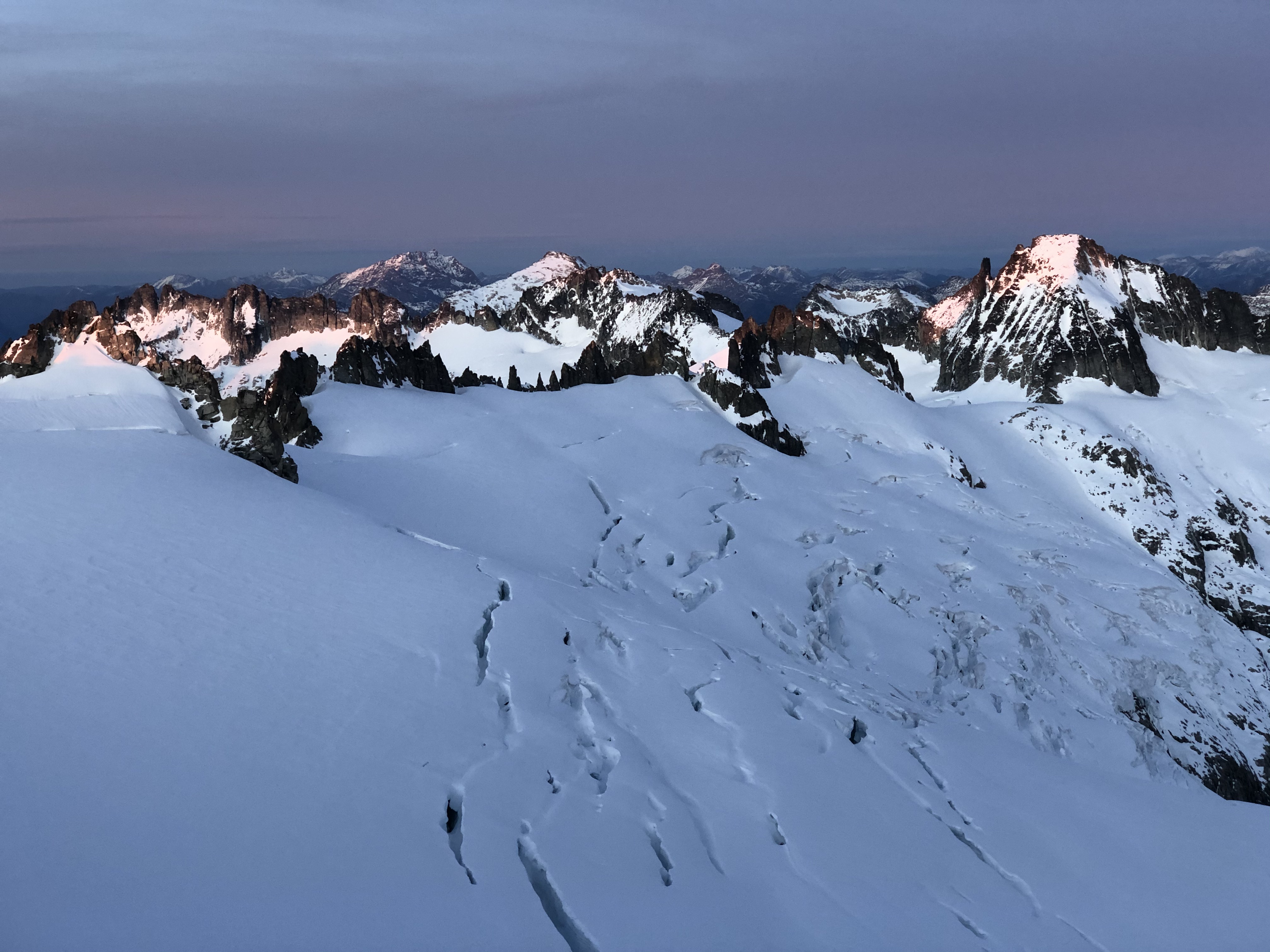
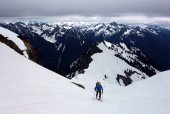
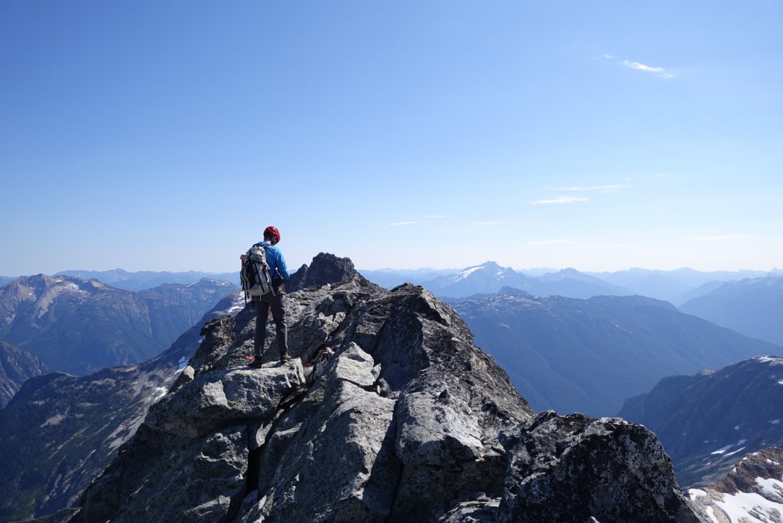
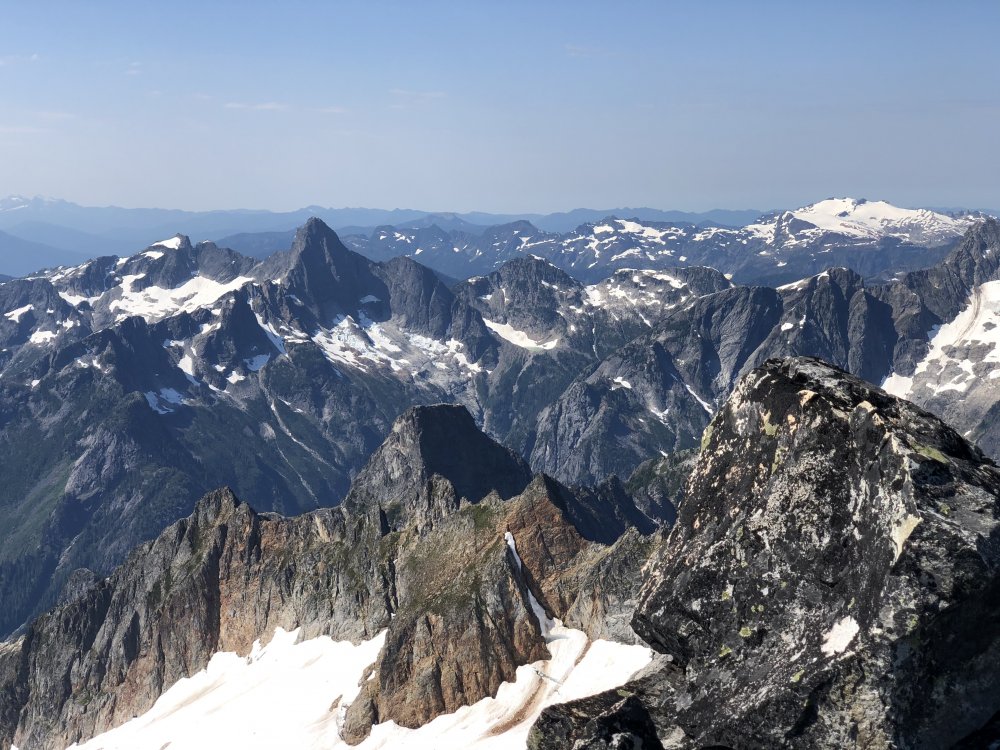
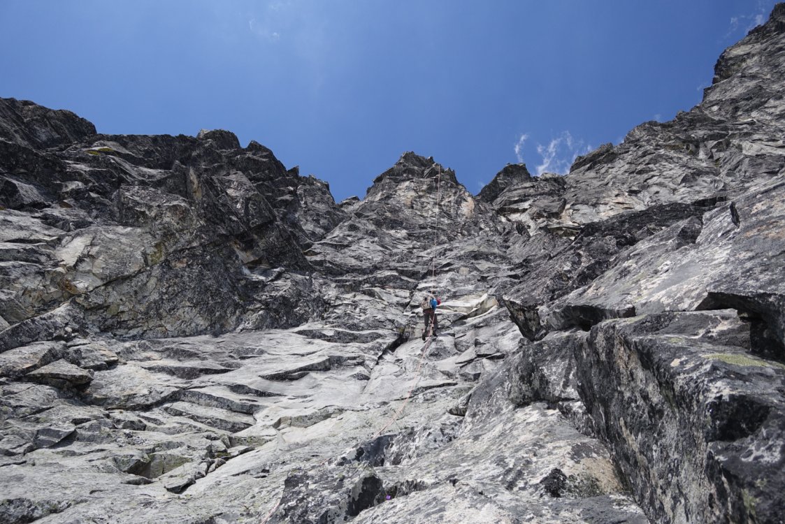
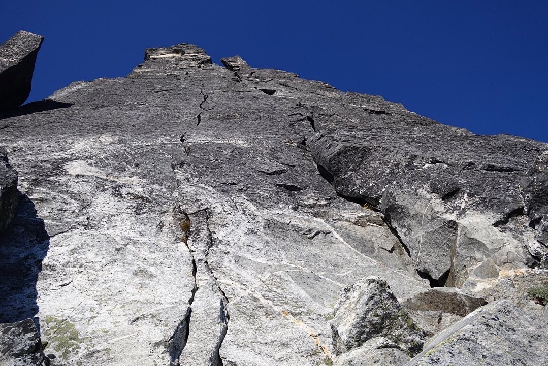
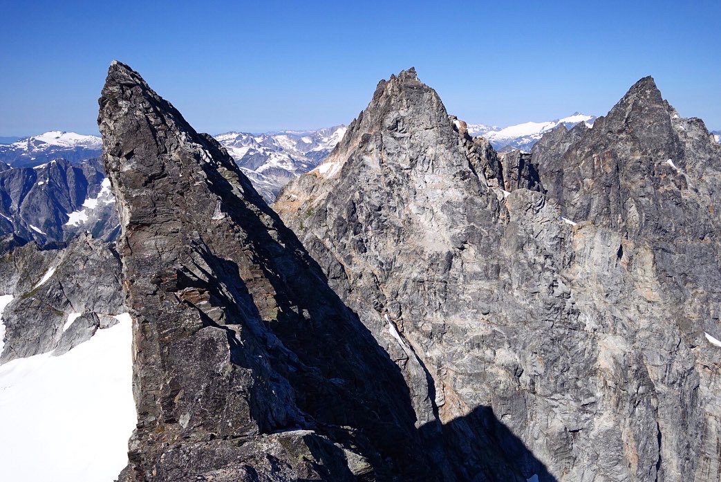
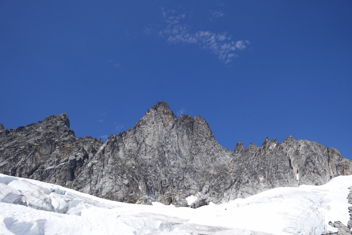
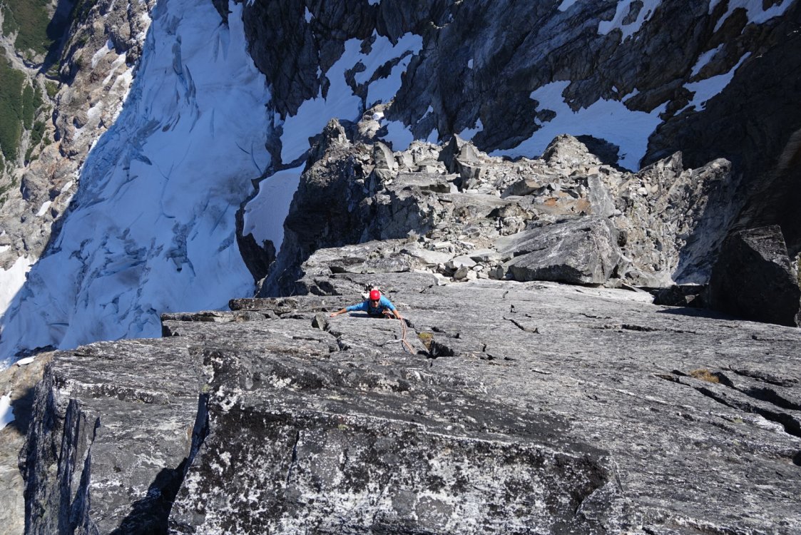
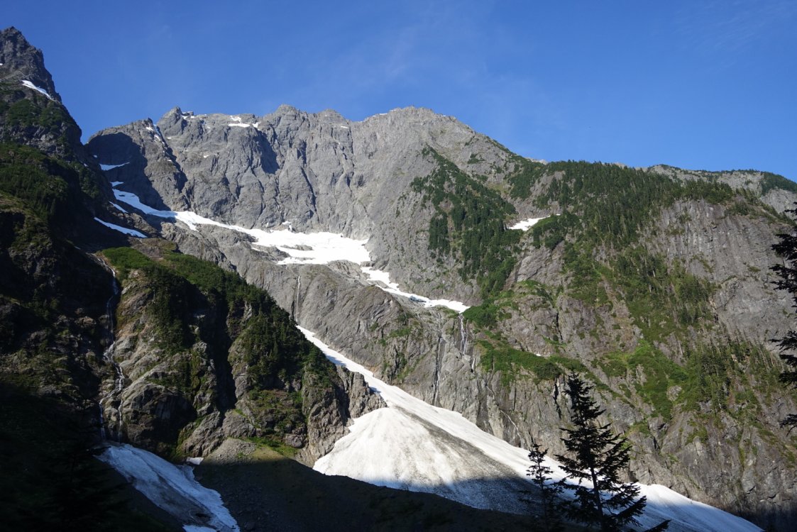
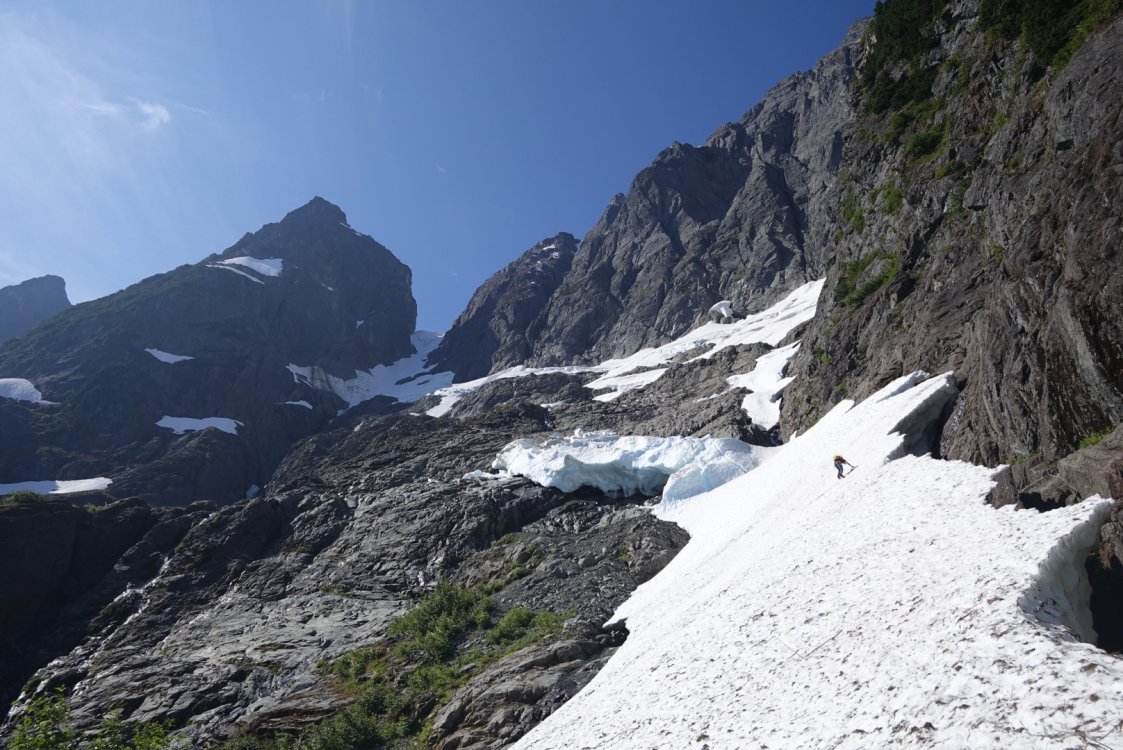
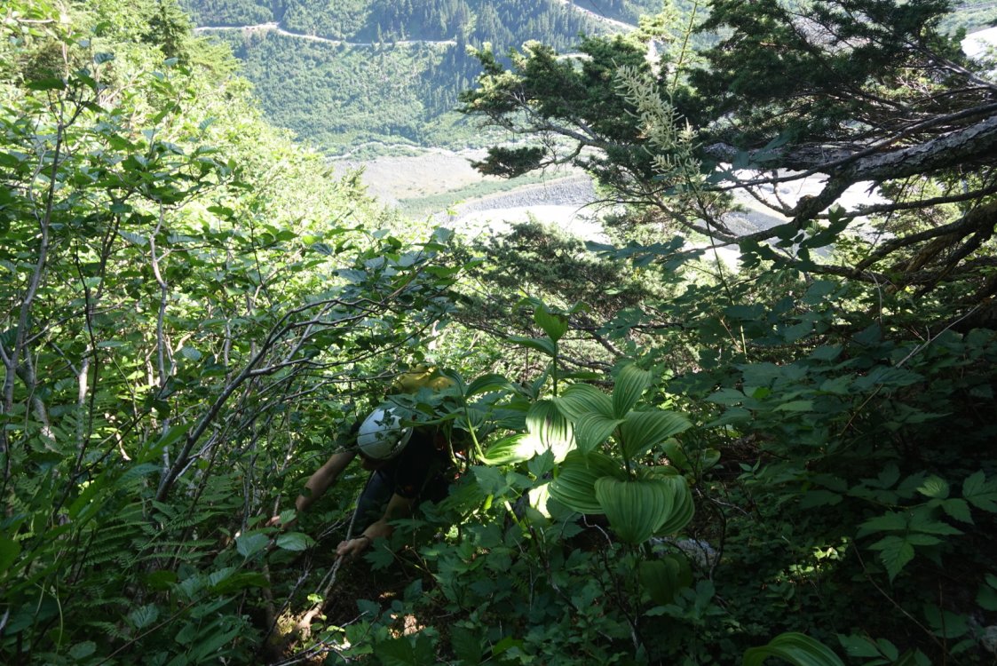
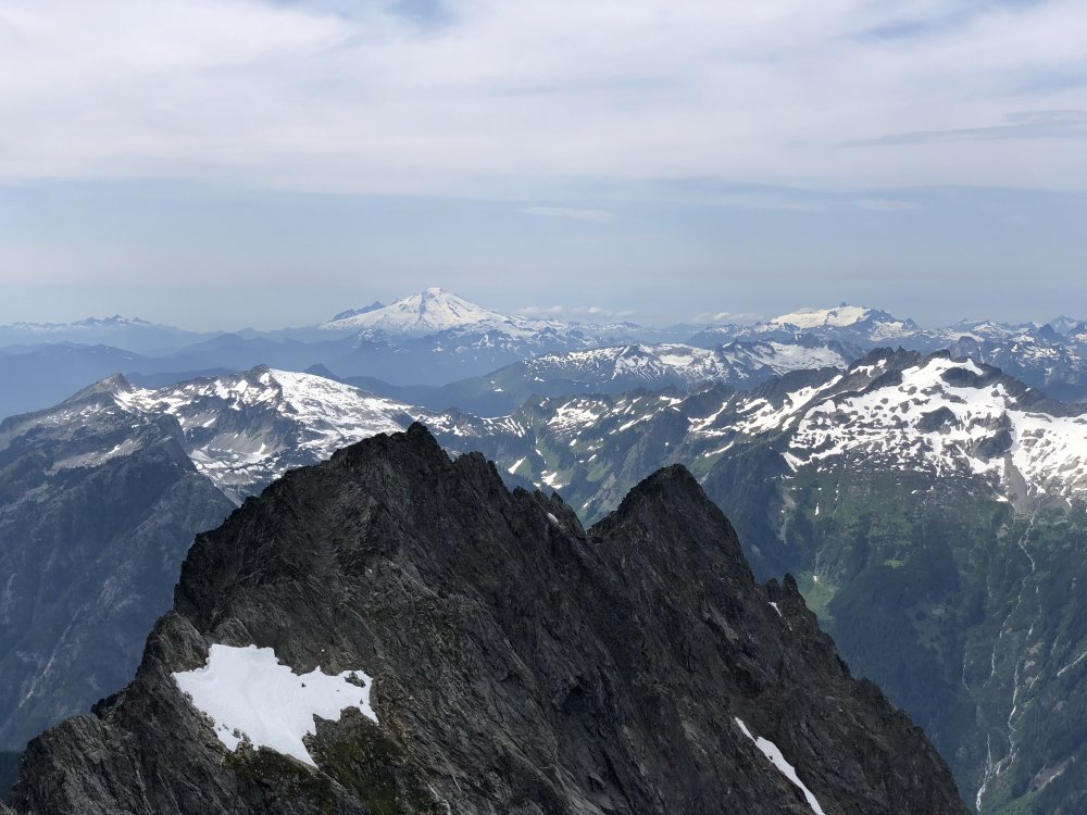
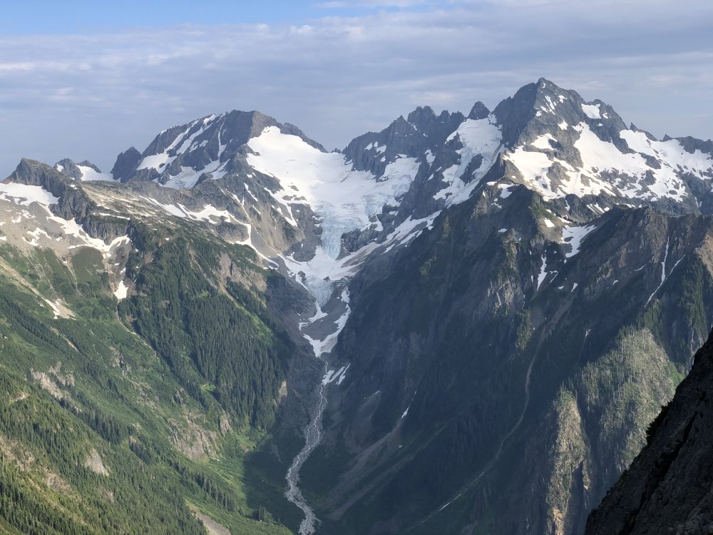
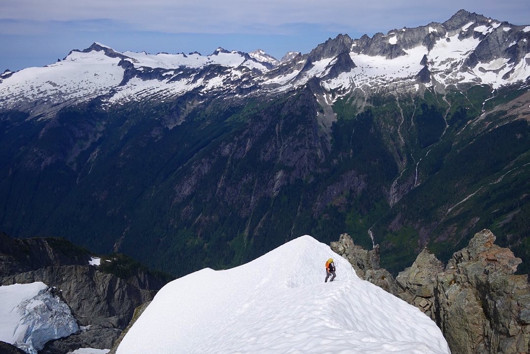
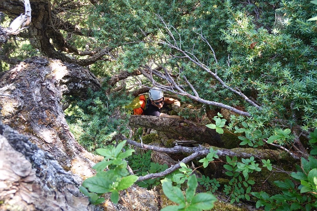
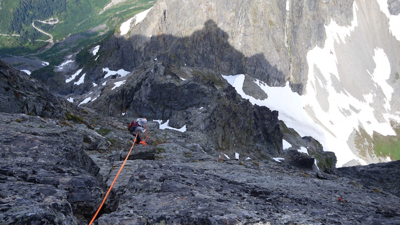
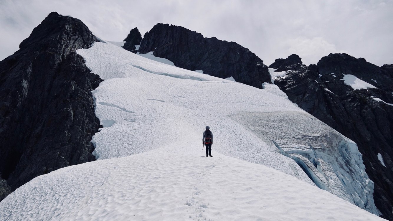
Trip: Johannesburg Mountain - NE Buttress Trip Date: 08/01/2020 Trip Report: Over the weekend my friend Matt and I climbed the NE Buttress of Jburg. I won't add too much beta-wise since theres a decent amount out there, and I wouldn't want to take any adventure out of it for those of you wanting to climb it. I'll just emphasize some key points and warnings, but Steph Abegg's write up is as comprehensive as it gets (as usual). I'll try and keep this chronological but expect some tangents and pauses for reflecting. We left Seattle around 5:30 and got to the Cascade Pass trailhead around 8am and started walking to the base of the route. We followed the slabs to the left of the left most waterfall at the constriction of the CJ couloir, per Steph's write up. Solid secure scrambling with a step of sketchy 5th class gets you up to the first snow patch. We then downward traversed over to a brushy bench to start the vertical schwack. We more or less found a route through the trees that felt relatively well traveled. It stayed More or less on the left side of the '51 rib. If you can see the CJ couloir faintly through the trees, you're doing fine. Some interesting moves through chimneys formed by krummholz. At any point you find yourself getting pissed off through the trees, just remember it the density of the brush thats your protection from tumbling off the mountain. We busted through the trees and into the steep heather and then finally onto the rock. Luckily it was all dry, I couldn't imagine doing this route a day after a rain. The initial scrambling was very secure and kind of steepened, became a bit more loose as we did a upward traverse to the '57 rib. We encountered nothing harder than 5.6 but simul soloed all of the rock. This being said, we didn't regret bringing the rock rack. We got up to the 7100' bivy a bit after 1pm and just decided to keep moving. I know, I can feel some of your rolling your eyes. We had perfectly soft snow through the ridge and headwall, which was nice since we were in trail runners/ approach shoes and universal crampons. We summited around 3pm and took some photos, signed the register (I don't always, but felt like I needed to on this one). The descent down the E ridge went smoothly thanks to the occasional cairn. We stayed about 40-50' below the crest the whole time until we got to the first rap station. We did about 5 or 6 raps with some down climbing to get us to the top of CJ couloir. The rap stations were looking a bit weathered and tired so we backed them up with gear on the first rap off of them or added slings. We were making great time so we thought to just try and c2c even though we had bivy gear. This would prove to be a bad idea. The traverse to Doug's Direct went a lot slower than expected. Side hilling through herbs. In the fading light we mis-identified the wrong location for DD. I was going off Steph's map, which I think has DD a bit too far up the ridge. Go off her photo/overlay, its spot on. The steep heather and loose scrambling up to the ridge is very time consuming as well. We got up to where we thought DD was and it was getting dark. I pulled my pack off to get my head lamp and I forgot I had my ice axe quick stowed through my pack shoulder strap. I heard one clink and I knew exactly what had just happened. I turned around to watch my ice axe tomahawk down the north side of Mixup. I was so angry at myself. We didn't feel we were at the right location so we investigated some near by notches. It was only getting darker. At one point a hold I was grabbing dislodged and sent me sliding down heather. I thought I was going to go for a long ride. Somehow while keeping the block off my head as I was sliding I was able to grab a fistful of heather and arrest my fall. I was okay. Things we spiraling out of control and we decided to just descend down to the lower angle heather and just bivy like we had planned. I consider myself a pretty calculated person, fatigue can strip that away from you no problem. We found a decent spot to bivy around 6300' directly under the actual DD late into the night. I mostly tossed and turned under a very bright moon and just thought about how I got a relatively cheap lesson on sticking to a plan and not forcing descent in the dark. Other thoughts were, "This trip was supposed to be about climbing a new mountain in a familiar place and get back to why you started getting out into the alpine in the first place." "Why were you trying to blast through it and force a car to car?" "How are you going to get out of here without an ice axe?" When I awoke I looked at the photo/overlay I had saved to my phone and saw the exact point for Doug's Direct. I felt so dumb. We ate and packed up and started heading up to DD. Miraculously, Matt found an old rusty pick axe head for me to use as an ice axe. Going down Dougs direct is mostly secure but I ABSOLUTELY wouldn't have wanted to do it in the dark. Then you're on the snow below Mixup and then the Ptarmigan Traverse route. Luckily the snow was low enough angle that I didn't have to use my trusty new axe. I was looking for my lost ice axe the entire time. It was so nice to be on low angle snow and then a trail finally. This was an incredible trip on an impressive mountain. Just enough asterisks/ near misses to have it permanently seared into my memory. Very humbling. Scrambling low on the route. Downward traverse to the trees. Shwacking. East ridge descent. Rapping towards CJ. Looks like "Sound of Music" but all I can hear is my feet sliding and ankles twisting. Gear Notes: Ice axe, Crampons, Approach shoes. 60m rope. Small rock rack. Work Gloves. Approach Notes: Spitting distance from the Cascade Pass trailhead.


-
[TR] Three O'Clock Rock - Silent Running 07/25/2020
kmfoerster replied to tanstaafl's topic in North Cascades
Wasn’t too busy on the south buttress. Just one other party rapping off the big tree as we were getting started. They were with the barking dog cooped up in a tent on the trail... -
[TR] Three O'Clock Rock - Silent Running 07/25/2020
kmfoerster replied to tanstaafl's topic in North Cascades
An awesome route! Was my first in Darrington. Was actually there later in the day on Saturday and climbed The Kone, fun knobby climbing! -
Sweet. An amazing mountain and route. Great photos!
- 1 reply
-
- 1
-

-
[TR] Prusik Peak - Der Sportsman 06/23/2020
kmfoerster replied to Michael Telstad's topic in Alpine Lakes
Sweet! Yeah, I've switched to TikTok for all my trip reports now. -
Its like every year I have a reason to put LR on the back burner. I appreciate the honest sentiment OlegV and DPS.
-
I should have noted the full movie is on YouTube!
-
This was just brought to my attention. Why has the climbing community kept this secret from me!?
-
[TR] Sherpa Peak North Ridge - North Ridge Variation 06/13/2020
kmfoerster replied to firebeard's topic in Alpine Lakes
I've noticed it makes links for the photos for me if I use the "Choose Files..." link. It will embed them normally for me when I drag them from my photo software. -
Camp / bivy sites in Inspiration Backcountry Zone
kmfoerster replied to jared_j's topic in North Cascades
I feel that usually wind tends to get ripping through col's depending on the orientation. I'm remembering the wind that was coming through the Eldo/Dean Col this last November and its about the same orientation. Would not want to camp there lol. But maybe there is a flatter section near Tepeh towers thats also blocked by the wind. If you're going to be there a couple of nights maybe bring an any shovel blade to dig out a tent platform in a wind free spot on the glacier?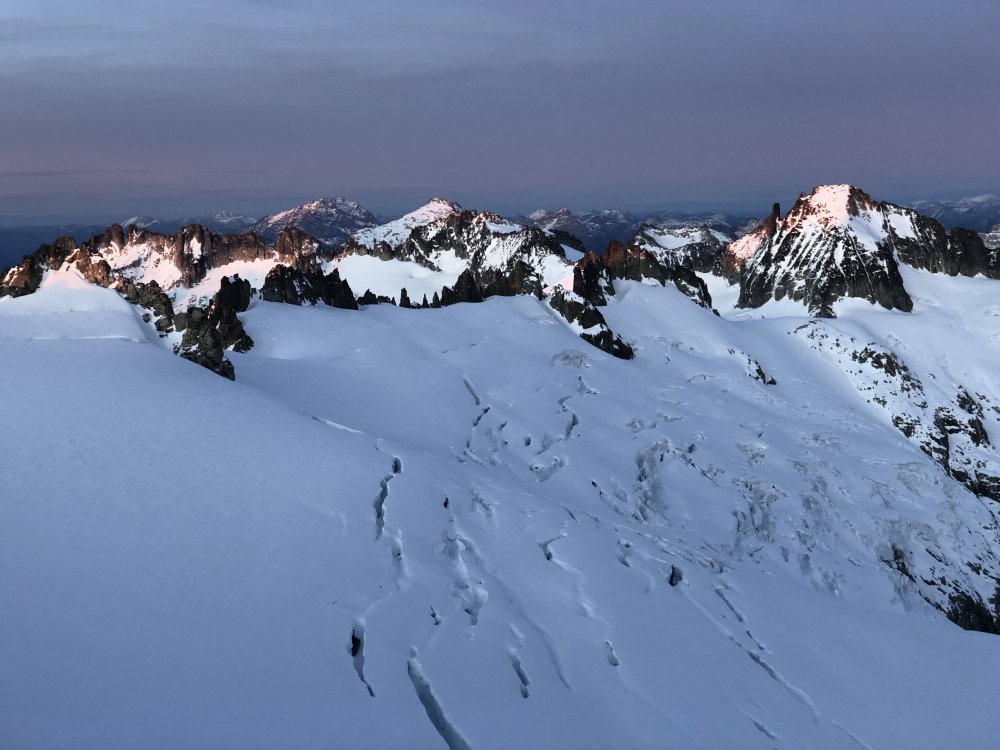
-
[TR] Mt. Stuart - Ice Cliff Glacier 05/24/2020
kmfoerster replied to kmfoerster's topic in Alpine Lakes
Oh I see which one you were talking about now! -
[TR] Mt. Stuart - Ice Cliff Glacier 05/24/2020
kmfoerster replied to kmfoerster's topic in Alpine Lakes
@Kuckuzka1 Yeah! I believe its called "Blue moon in June" in the brown Beckey. Up close it looked as if it had just fallen out of climbing shape, but definitely looks hard and out of my pay grade. Would've been interesting to see what kind of condition it would've been in early May. FA was on June 5th 1987. I couldn't Imagine it being climbed in June anymore. On the same note I think the timeframe for the ICG being moderate is getting shorter and shorter. Not long ago there were trip reports of it having cruiser conditions in July. -
[TR] Colchuck Peak - North Buttress Couloir 06/06/2020
kmfoerster replied to mrice1225's topic in Alpine Lakes
Awesome, looked like a beautiful day. For me, that route was a gateway drug for winter/spring mixed routes. Chose to do it in January years ago and it was a mini epic. -
[TR] Mt. Stuart - Ice Cliff Glacier 05/24/2020
kmfoerster replied to kmfoerster's topic in Alpine Lakes
@PorterM Yeah had pick weights on them and it was no problemo with the hard glacial ice. The set of them is close in weight to one of my nomics. I personally loved using the two Gullys. They will definitely be my choice from now on for the ambiguous AI2-3 with little to no mixed climbing.