Search the Community
Showing results for tags 'price'.
Found 2 results
-
I have a full year membership to the Portland Rock Gym in off of NE 12th Ave. I bought it right at the beginning of September, so I’m prorating it to be of cost as of now. It was originally $814, so you’re getting the rest of the year at an absolute steal. This is definitely something to consider if you want to save the cost of a membership, while still getting all of the full benefits.I am selling it for $600.I AM NOT AFFILIATED WITH THE GYM ITSELF. I AM TRYING TO SELL MY OWN INDIVIDUAL MEMBERSHIP.EMAIL ME AT cantrell2289@gmail.com IF INTERESTED
-
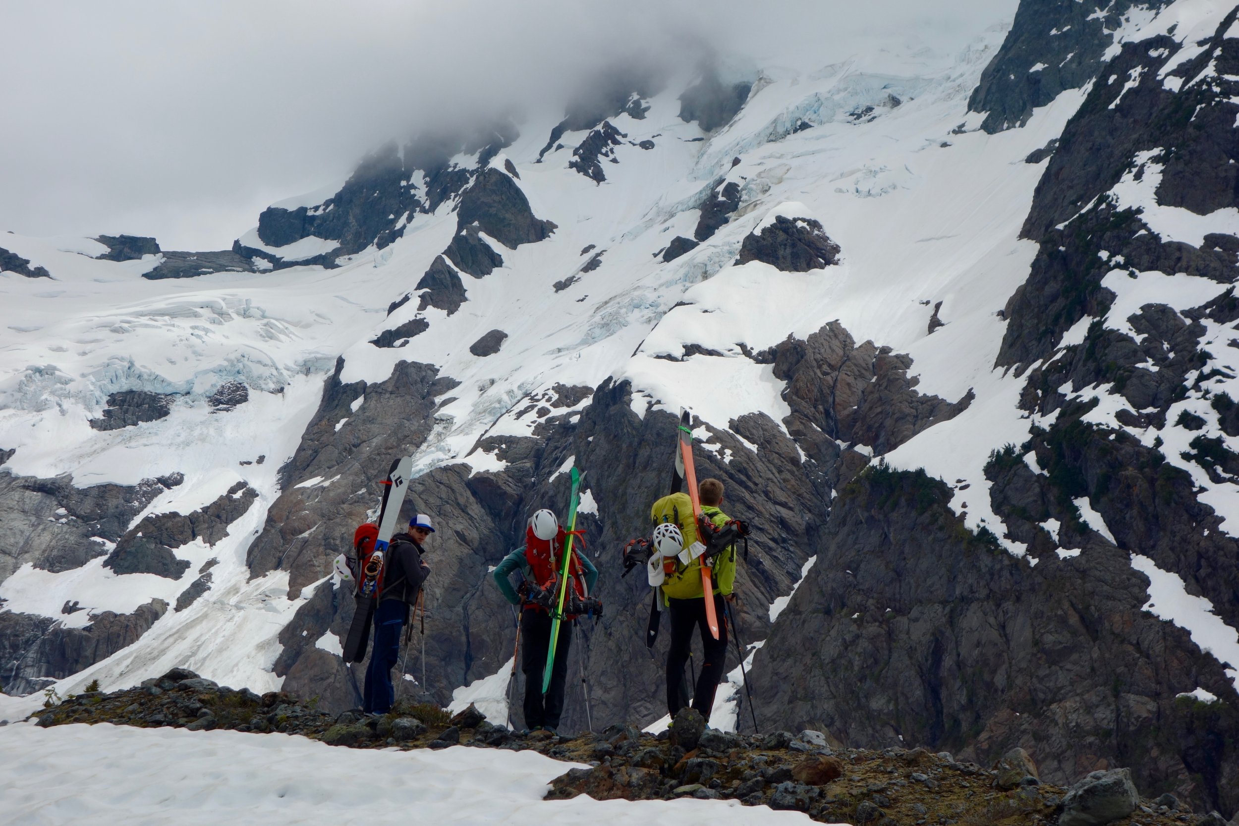
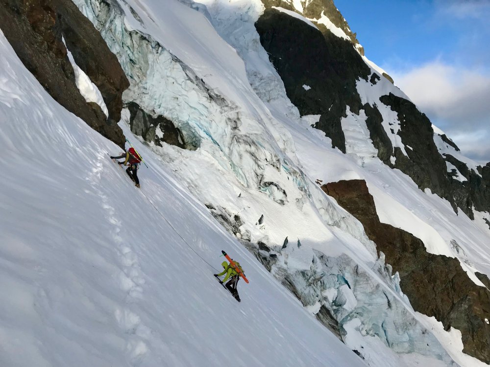
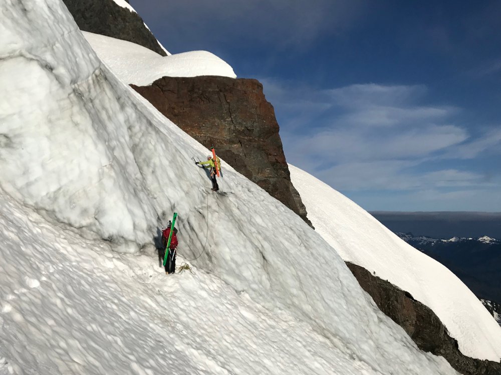
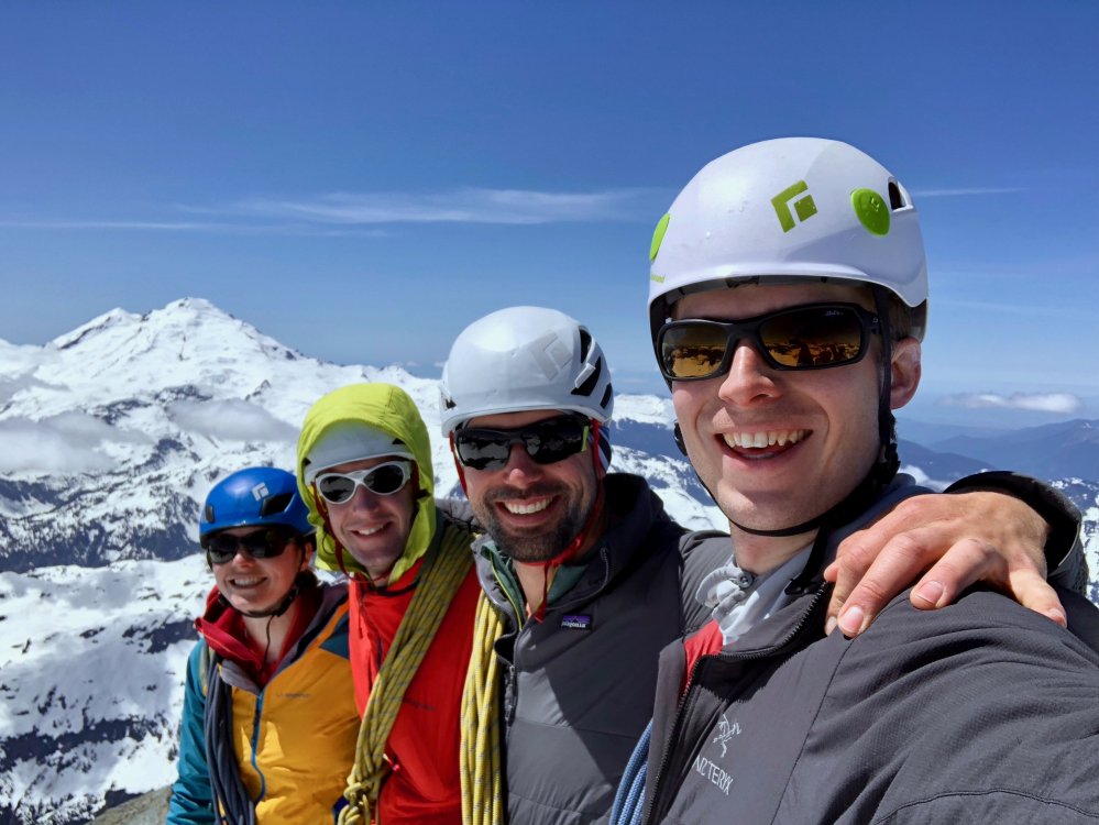
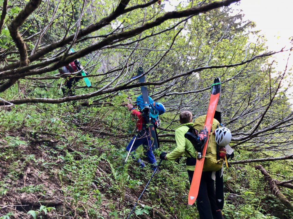
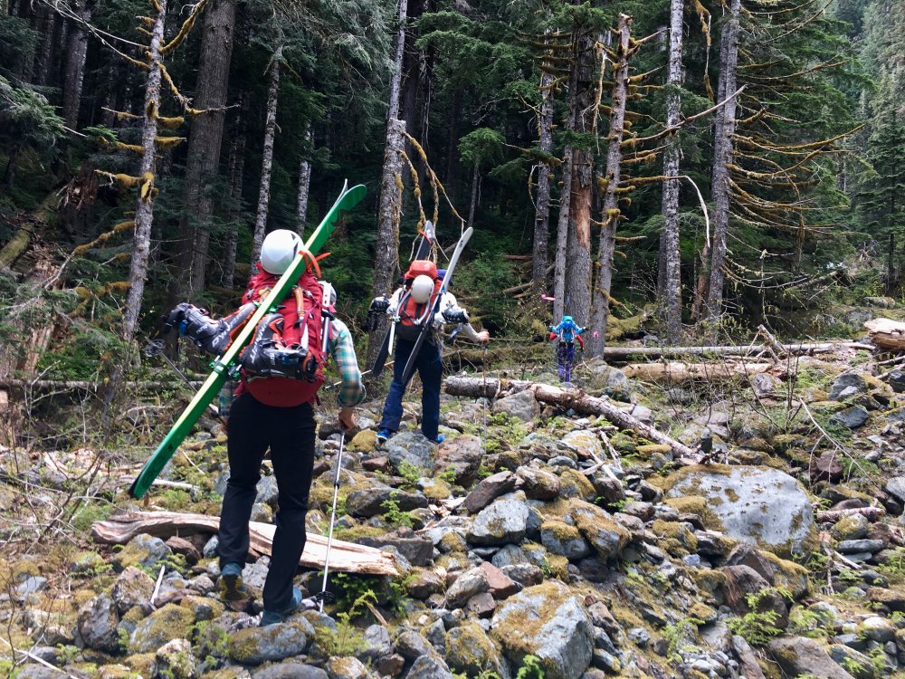
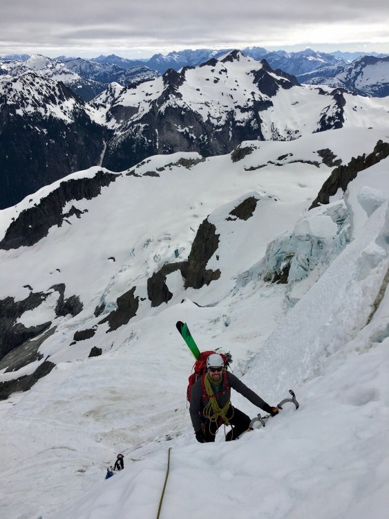
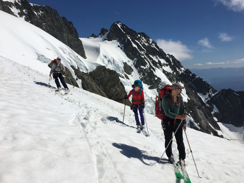
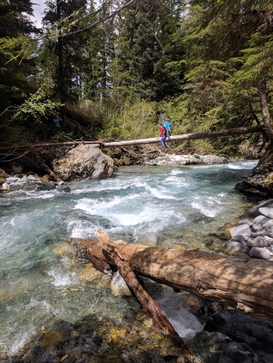
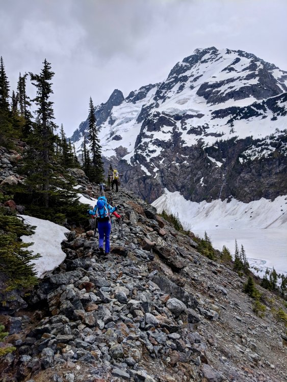
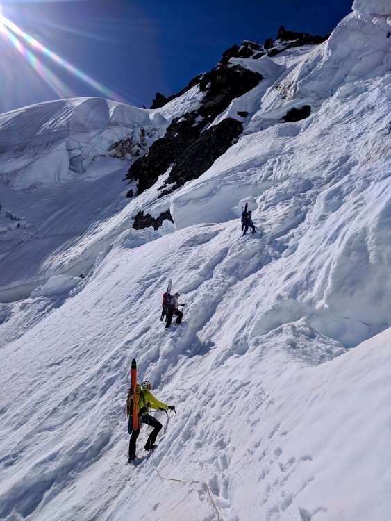
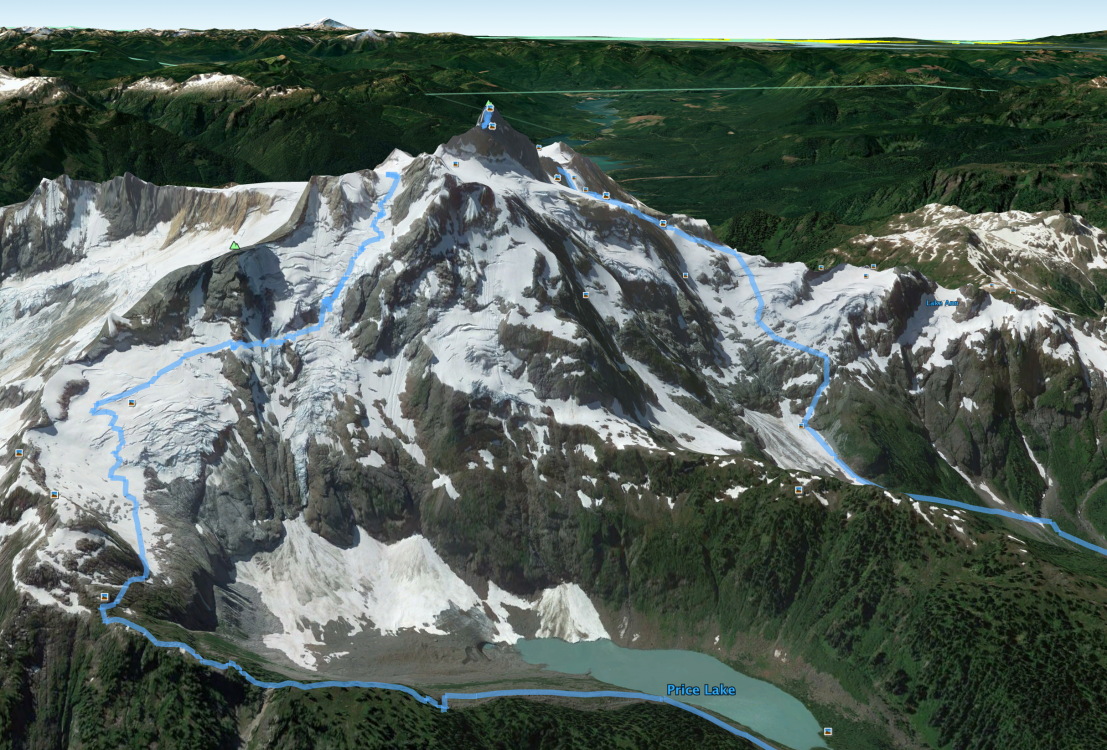
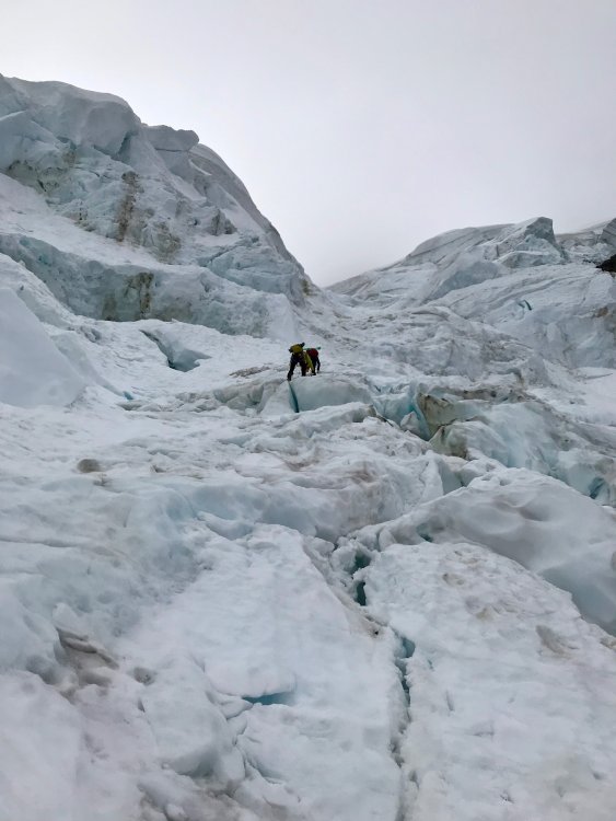
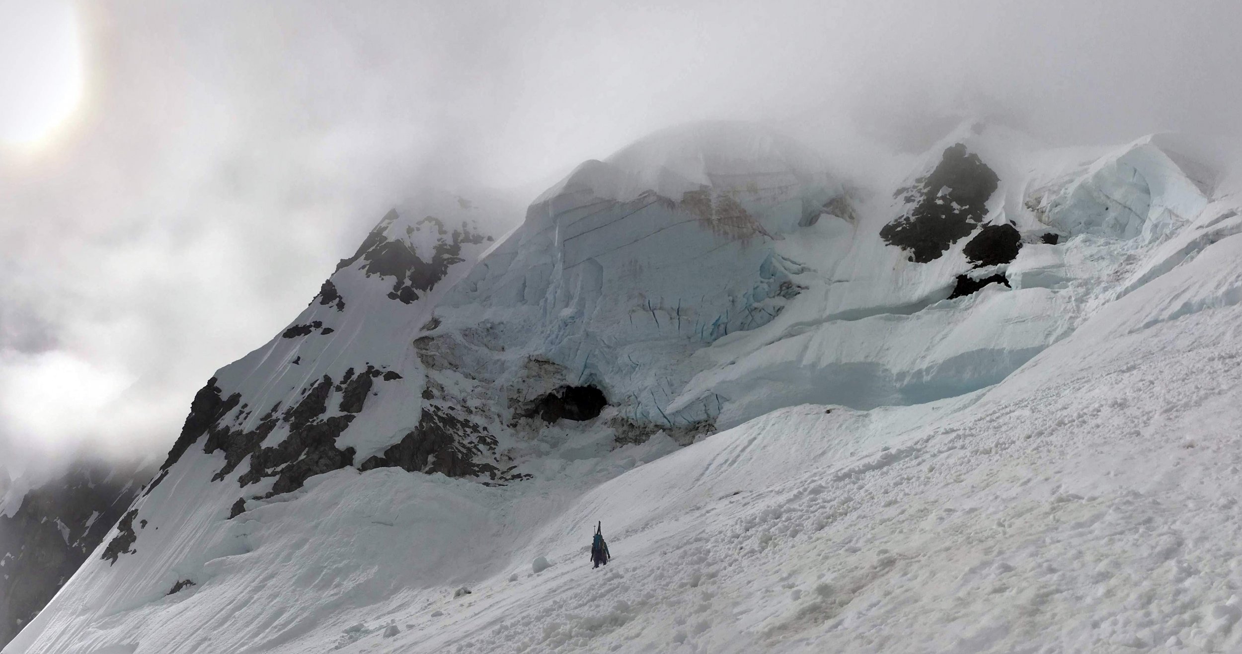
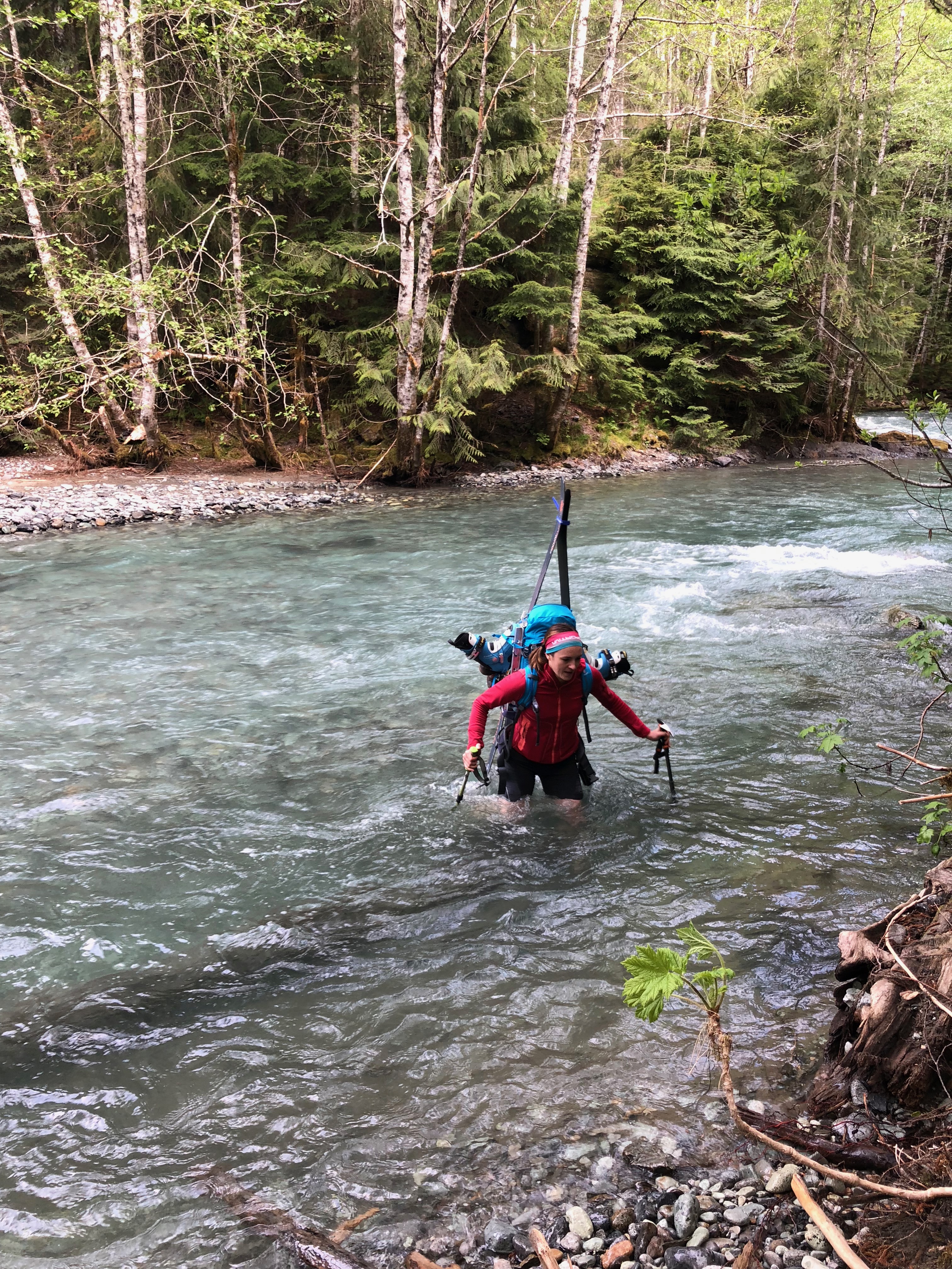
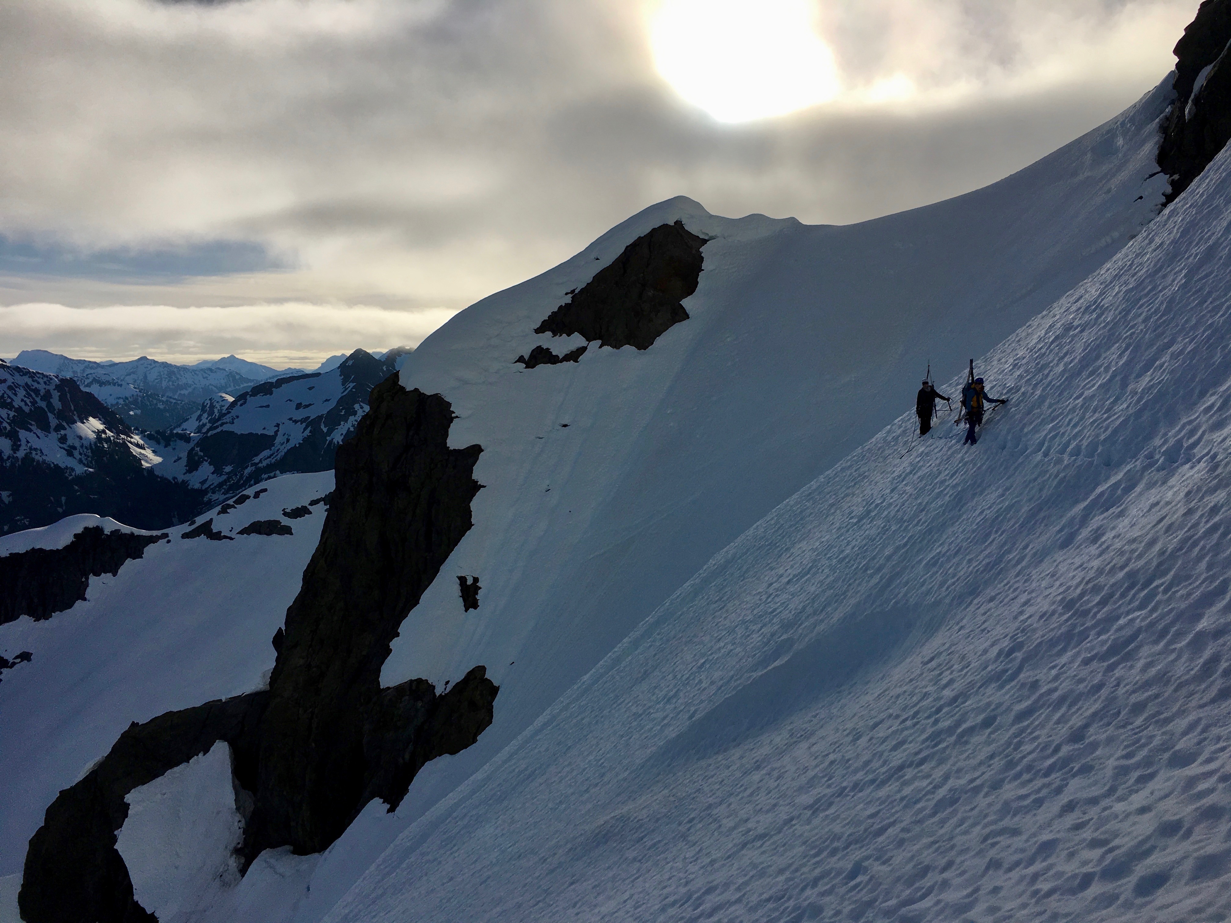
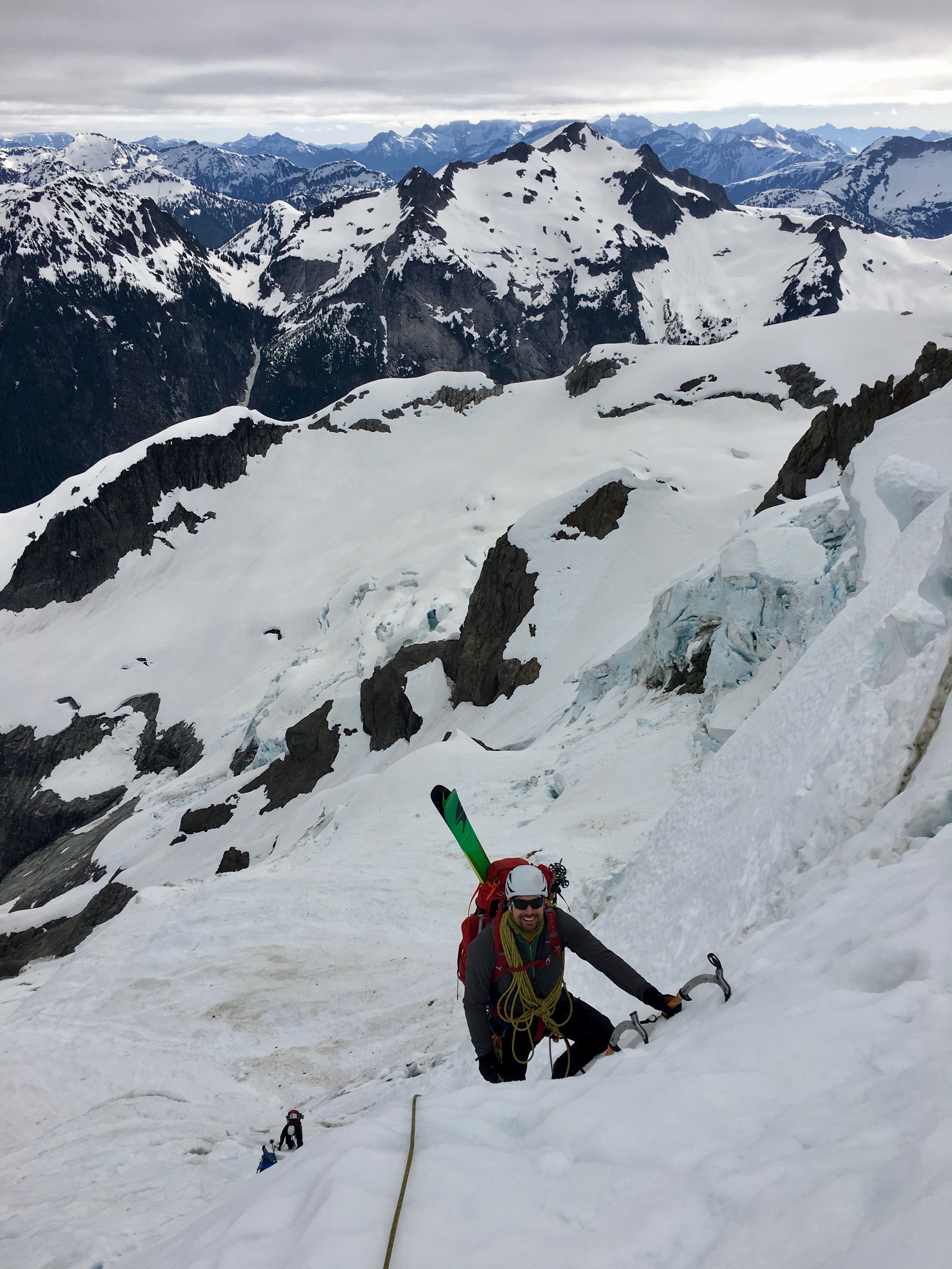
Trip: Mount Shuksan - Price Glacier Trip Date: 05/27/2018 Trip Report: A little more content is up on my site here: https://www.jeffreyjhebert.com/adventures/price-glacier-on-mount-shuksan The 50-classic Price Glacier on Shuksan had been high on my early summer alpine climb list for a number of years, but conditions, weather, and logistics hadn't yet aligned for an attempt. With Owen flying up to Seattle for a long weekend of climbing over Memorial Day weekend, it seemed like a worthy objective. During our research and planning, we were concerned that most trip reports had been from later in the season (typically July or even August), but it had been such an unseasonably warm spring that I figured the timetable was accelerated by roughly a month. I'd also been on Shuksan a few weeks earlier via the Sulphide and gotten a feel for the conditions. Our other concern was the recent wet slab activity on the persistent weak layer in the area (and even on the White Salmon—a similar aspect and at a lower angle) and the potential for warm temperatures and sunshine making the snow wet at best. About a week before, Eric decided to come up as well and we made it two parties of two on the adventure with Kelsey joining as well. We had a good group debate about the route selection as well as whether or not to bring skis—there was a good possibility of walking the skis in, carrying them while climbing technical ice in ski boots, and then 'schwacking them back out. In the end, we decided to do the Price and bring skis. Game on. We left Seattle on Saturday morning at 6:30am and stopped at the Ranger station in Glacier for our permit where we learned that the first log across Ruth Creek was out. Not the best way to start things off... We drove one car up to the gate just outside the White Salmon Ski Lodge parking lot and then headed down to the Nooksack Cirque Trailhead where we geared up and started off just shy of 11am. We immediately forded the river barefoot in shorts. It was invigorating, but not terrible. Just over an hour on the trail got us to a faint climber's trail heading down to the North Fork of the Nooksack. We followed flagging tape to the river and saw the famous log crossing upstream. After a nice lunch, we each shimmied across the log, which is nicely angled downhill and relatively smooth. Really well-set flagging tape marked the whole way up to Price Lake. We were expecting this portion of the approach to be pretty painful, so when we made it from the log crossing to the opening at Price Lake in only an hour and a half of pretty open, steep trail, we were pretty surprised and happy. We stuck to the moraine and started getting intimidating views of the mountain and Price itself, though a ceiling of clouds shrouded the top of the mountain and route. Kelsey fording Ruth Creek, the famous log crossing, and entering the trees on our way up to Price Lake After a ways up the moraine, we got onto consistent snow and decided to start skinning. At the first major rise on the ridge, we were worried that the snow wasn't continuous staying low as was suggested in some reports, so we headed up to the crest with skis on our backs again. This worked, but proved to be a bit of extra energy as we gained and lost some vert following the crest. At about 5,400 feet, we ran into a party of three also approaching for the Price, but without skis (we weren't expecting company on this route), and ended up following them across and down to gain the glacier at about 5,200 feet on what were likely rock slabs in the summer, but was continuous snow for us. After booting a ways, we switched back to skinning and went up to a nice flat area on the glacier at about 6,150 feet where we set up shop for the night after being on the move for about 7.5 hours. Ascending the moraine on the approach, catching our only views of the route before it got socked in for the rest of the day The cloud cover which had been covering the top of the route during the approach had slowly lowered during the afternoon and eventually socked in our campsite as well. Over dinner, we discussed our options and decision points in the morning. We also celebrated my birthday, including a pan of brownies with candles that Kelsey had hiked in. They were awesome! It was decided that we'd wake up at 3:30am and have a look. If we were still socked in, we'd snooze for an hour and then at least pack up and go to the saddle to see if it'd clear before bailing if we had to—none of us thought it wise to attempt the route in a whiteout after not being able to fully scope it out on the approach. At 3:30am, the sky was much clearer and, while there was a decent amount of cloud cover, it seemed like it'd go. We took our time packing up, hoping things would improve a little and knowing that the clouds would help keep the snow in better condition. We started moving at 5:30am and gained the saddle in 30 minutes from camp. We descended and traversed from the saddle, getting across some steep snow and broken ice to reach a patch of low-angled blue glacial ice that we'd scoped out during the approach as what seemed to be the path of least resistance. I took the ice pitch and had a lot of fun swinging the tools and plugging in screws. Traversing from the saddle to the ice step and going up the fun ice step From there, we traversed underneath some menacing ice cliffs and then decided an ice and snow gully going up and right looked like our best bet. It got us out of the direct objective hazard pretty quickly and was quite fun with mostly neve and some ice, protecting with an occasional screw when things got steeper. The gully continued up, across lots of broken terrain and through a series of steeper and gentler steps before depositing us on the upper glacier. We all breathed a momentary sigh of relief knowing that most of the danger and difficulty was behind us, with the key exception being the bergschrund. The steep snow and ice gully and getting close to the bergschrund Eric and Kelsey swung into the lead at this point, returning the favor of the boot pack and taking on the warming upper slopes. The clouds cleared and it got downright hot. We were really excited to see that the very left edge of the bergschund was sufficiently filled in to enable passage and let out some whoops as our line came into view and we knew we could get through the last bits before things got much warmer. A few switchbacks and steep snow got us onto the final slope to the saddle and then the saddle itself about 5 hours and 45 minutes from when we'd left camp at about 11:15am. Woo hoo! We regrouped briefly and then skinned around to the South side of the summit to get our last bit of steep snow done before things warmed further. The summit had baked out a lot since my trip up a few weeks earlier, but the gully was still mostly snow except for a few rock moves in the middle and then again at the top. We got to the summit at 1:30pm and took in the (thankfully) clear views of the range. The down-climb went smoothly and we clicked into our skis to begin our descent 9 hours after we'd started at 2:30pm. The turns were fun and pretty buttery down to and through Hell's Highway. We skinned up the Lower Curtis and then skied down to the camp above Whinnie's Slide, getting there at about 4:15pm. Summit! Skiing down the Upper Curtis Glacier on our way to the White Salmon We'd brought provisions to spend the night there, but were all pretty happy with the snow conditions to that point and knew we had lots of daylight left, so we decided to rest a bit there in the sun and then continue our descent. We left the camp area at 4:45pm and were down the whole White Salmon Glacier in less than 30 minutes, enjoying buttery snow the whole way, even on the wet slide debris lower down. The snow ended up being continuous and skiable all the way down to 3,150 feet, but we knew that there was some 'schwacking to be done from there on out. The 'schwack After refreshing ourselves with glacial melt and switching back to trail runners, we started battling the shrubbery. It wasn't too bad in the valley at first, but we never found the faint trail in the old timber and proceeded to battle slide alder, tight trees, and steep mossy slopes for about 1 hour and 45 minutes until we finally reached the road, exasperated but happy to be through the business. The cat track walk was quick and we reached the car shuttle with much-needed beers and snacks at 8:45pm, a little over 15 hours after we'd started. In my opinion, in the conditions we experienced, I can see why this route got the 50-classic nod. The Nooksack Cirque is gorgeous. The route is a very aesthetic and obvious line through steep, broken, glaciated terrain. Going point to point means traversing much of the mountain, regardless whether descending Fischer Chimneys or the White Salmon Glacier. There is some objective hazard on the route and it's clear that conditions can vary widely, making this a tough one to get just right. Thankfully, it seems that we did! Our track up and down the mountain Gear Notes: Brought 6 screws, 2 pickets, 4 cams, 3 pins, and a small set of nuts. Used 4 screws and 1 picket. Carried skis and lucked out with the amount we were able to skin and ski. Approach Notes: First log across Ruth Creek is out, requiring a ford. Pink and orange flagging tape mark the way off the trail, across the North Fork of the Nooksack, and up to Price Lake