mthorman
-
Posts
325 -
Joined
-
Last visited
-
Days Won
27
Everything posted by mthorman
-
I finally took the time to sit down and read your report and watch the videos. Wow, what a fantastic climb!! It is so cool that you were able to get such great footage. And that natural ice tunnel....looks like one of the most memorable pitches ever! Thanks for sharing and congrats on the climb.
-
Wait the way I read it the photo contest ended on March 2 at 10am. That was before you even posted this...... "Here's all of the "People's Choice" finalists in the Verti Call Photo Contest! The photo with the most amount of "likes" by Mar 2nd @ 10am EST wins the People's Choice! Prize is two Grandwall ice screws from Verti Call. Good luck!"
-
Really cool idea. The joker replacement is awesome! The piton is definitely my favorite suit. I am definitely going to order up a set!
-
Yea there is an insane amount of potential especially if you get a good cold year! If you want a copy of any of the pictures you are in, just send me an email (westbnsf@gmail.com).
-
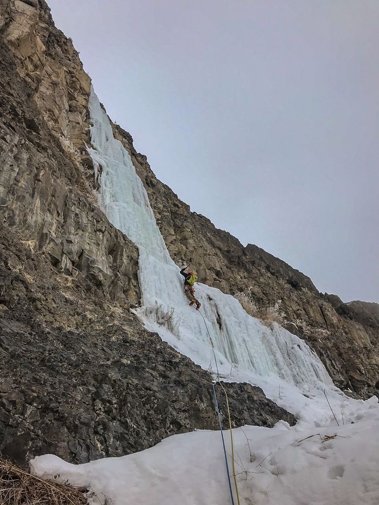
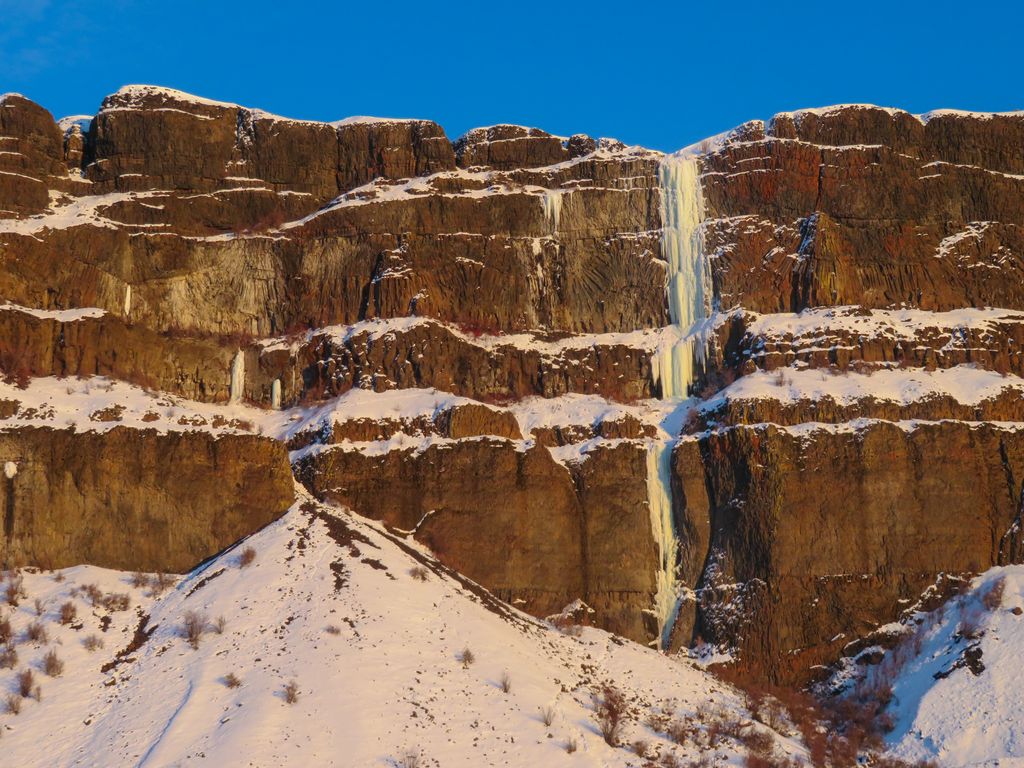
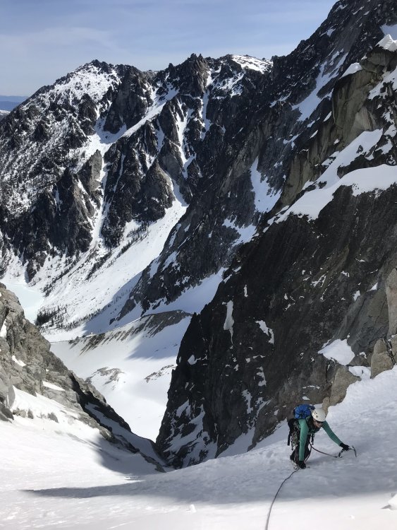
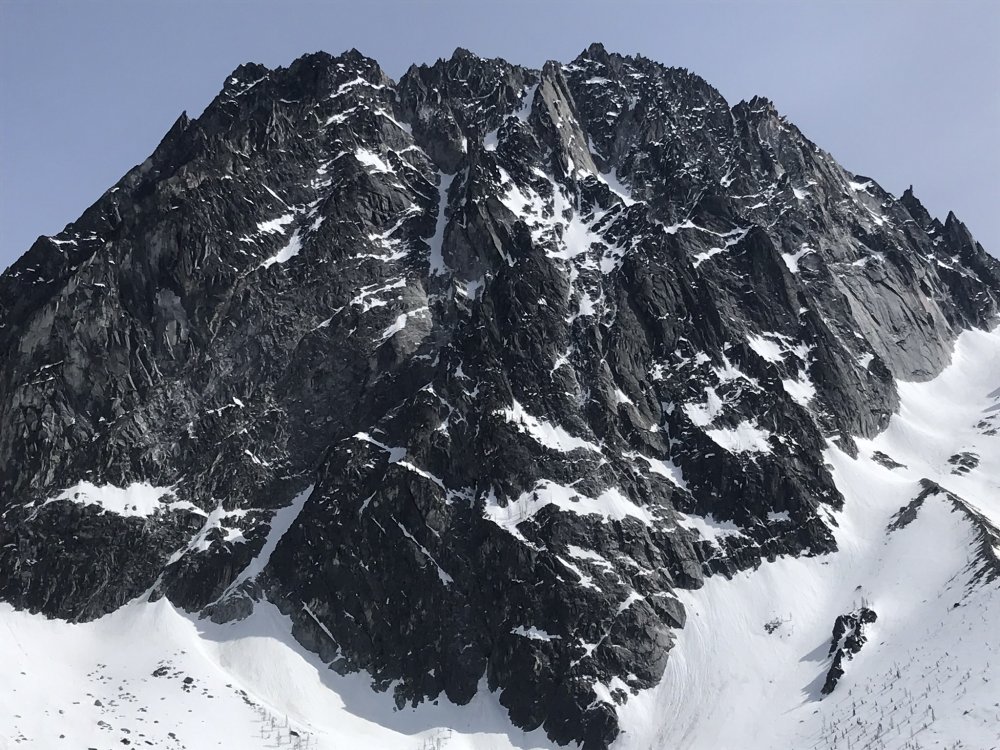
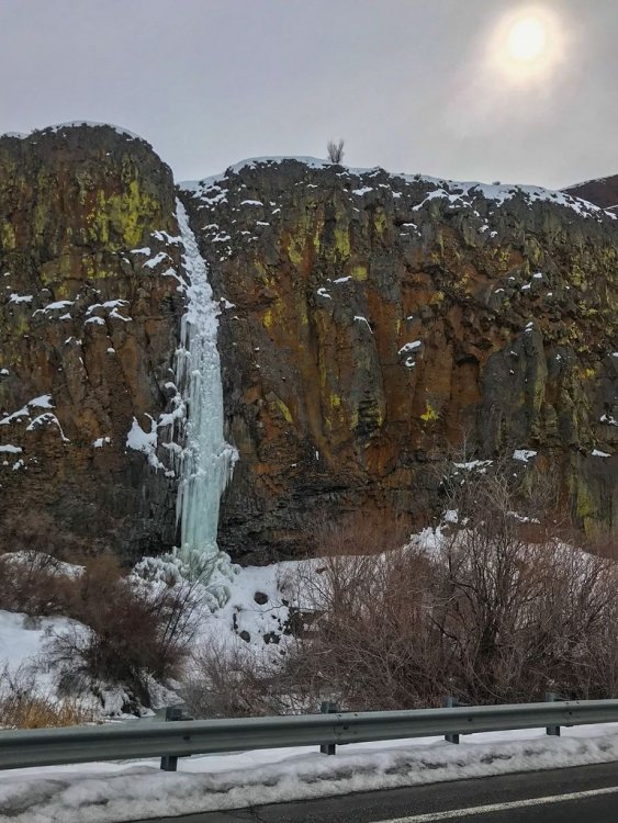
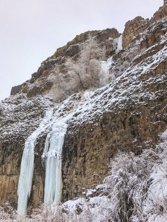
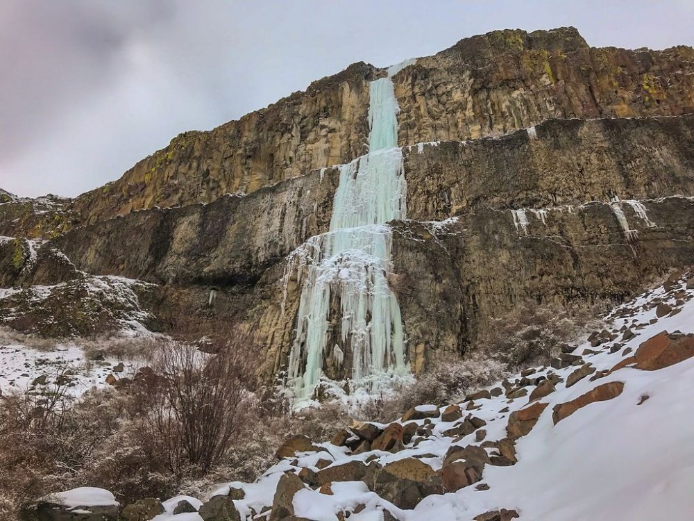
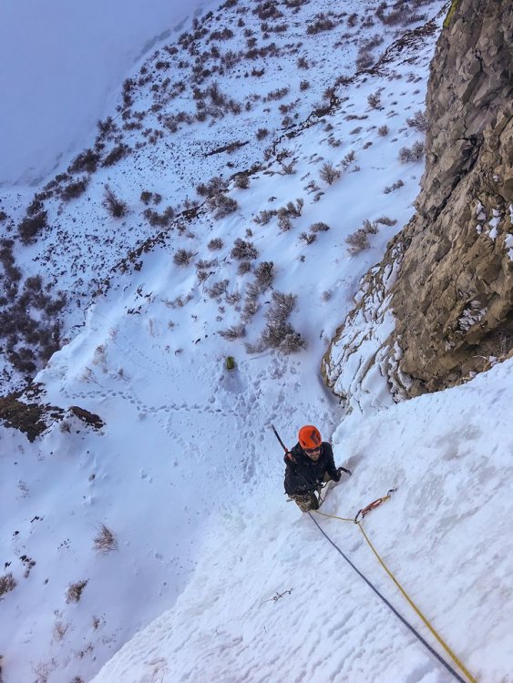
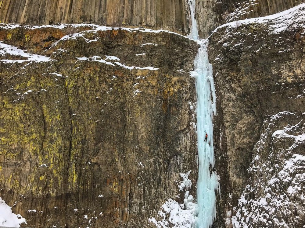
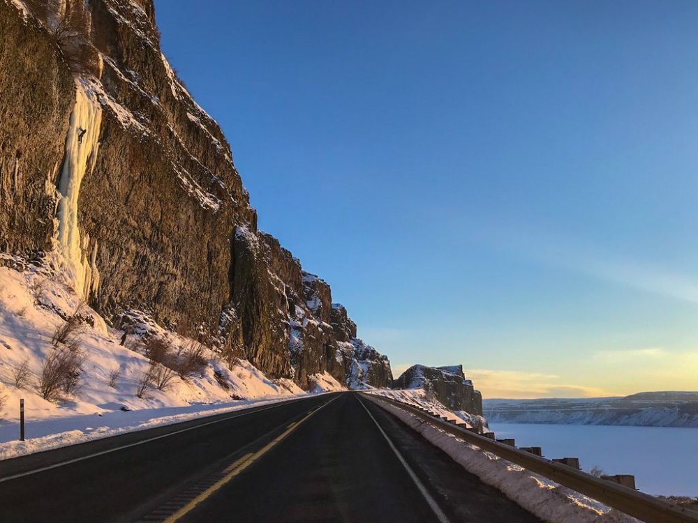
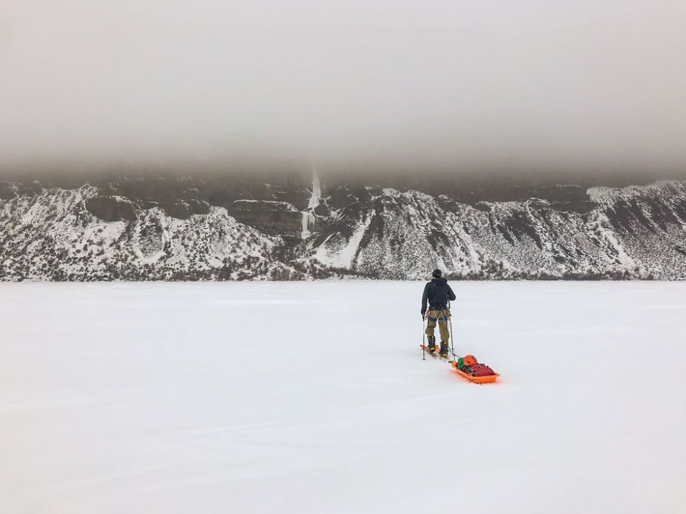
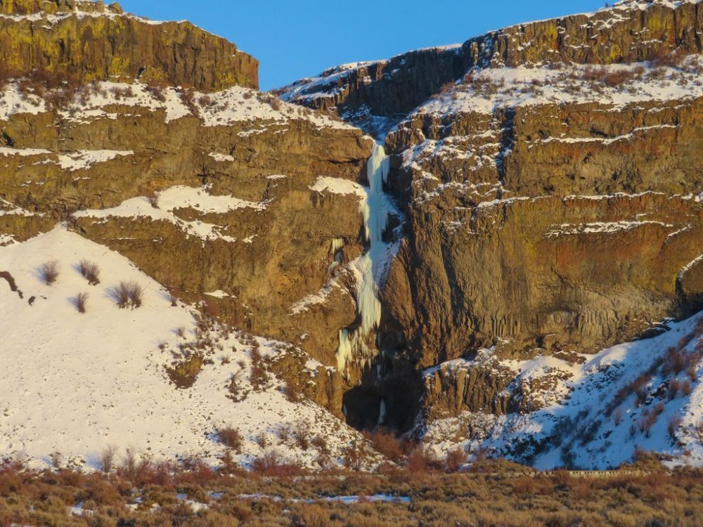
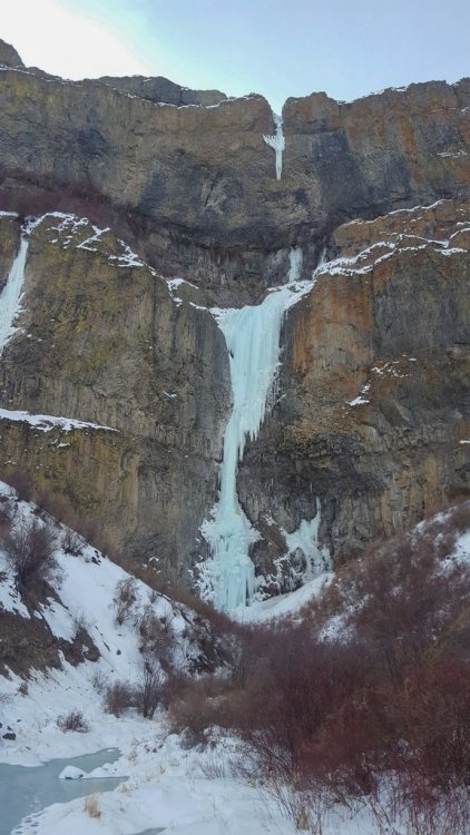
Figured I would post an update (May 4, 2019) on current conditions for those interested. The bad news.....there is little to no ice on the N. Face of Dragontail. I was really hoping that the freeze/thaw from the last couple weeks would work it's magic. The ice runnels on TC look like rock. We hiked in to climb Gerber Sink but it was mostly rock with just a couple of snowfields. Ended up doing the Northeast Couloir on Colchuck as a consolation prize. It was steep snow, even unconsolidated in places which was surprising. When the route cuts left at the top we took the smaller left hand couloir variation. It had a couple of easy ice steps and 1 short rock step.....better than the snowy slog up the right hand option. Came down the Colchuck Glacier which was super straight forward and actually quite soft in the afternoon....it was a nice 2500 ft glissade. Other notes.....the road is still gated. In fact there is still 4-6 inches of snow across the road for about 100 yards near the trailhead. Other than that it was a clear road. The trail is almost all snow starting right from the trailhead. In the morning the snow was hard and walking was easy. On the way down we were happy we had carried up snowshoes so we could avoid the postholing. We rode bikes from the truck to the trailhead which meant after our long day we didn't have to walk that road down. Trisha halfway up the Northeast couloir on Colchuck. Current view (5/4/19) of the N. Face of Dragontail.
-
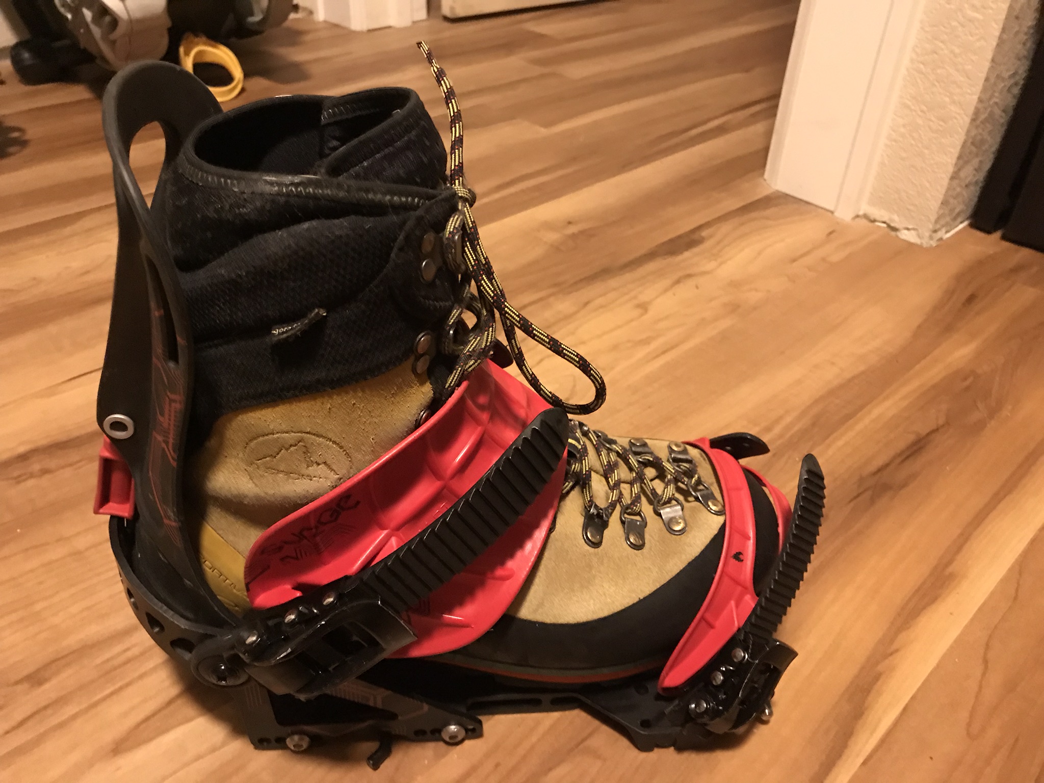
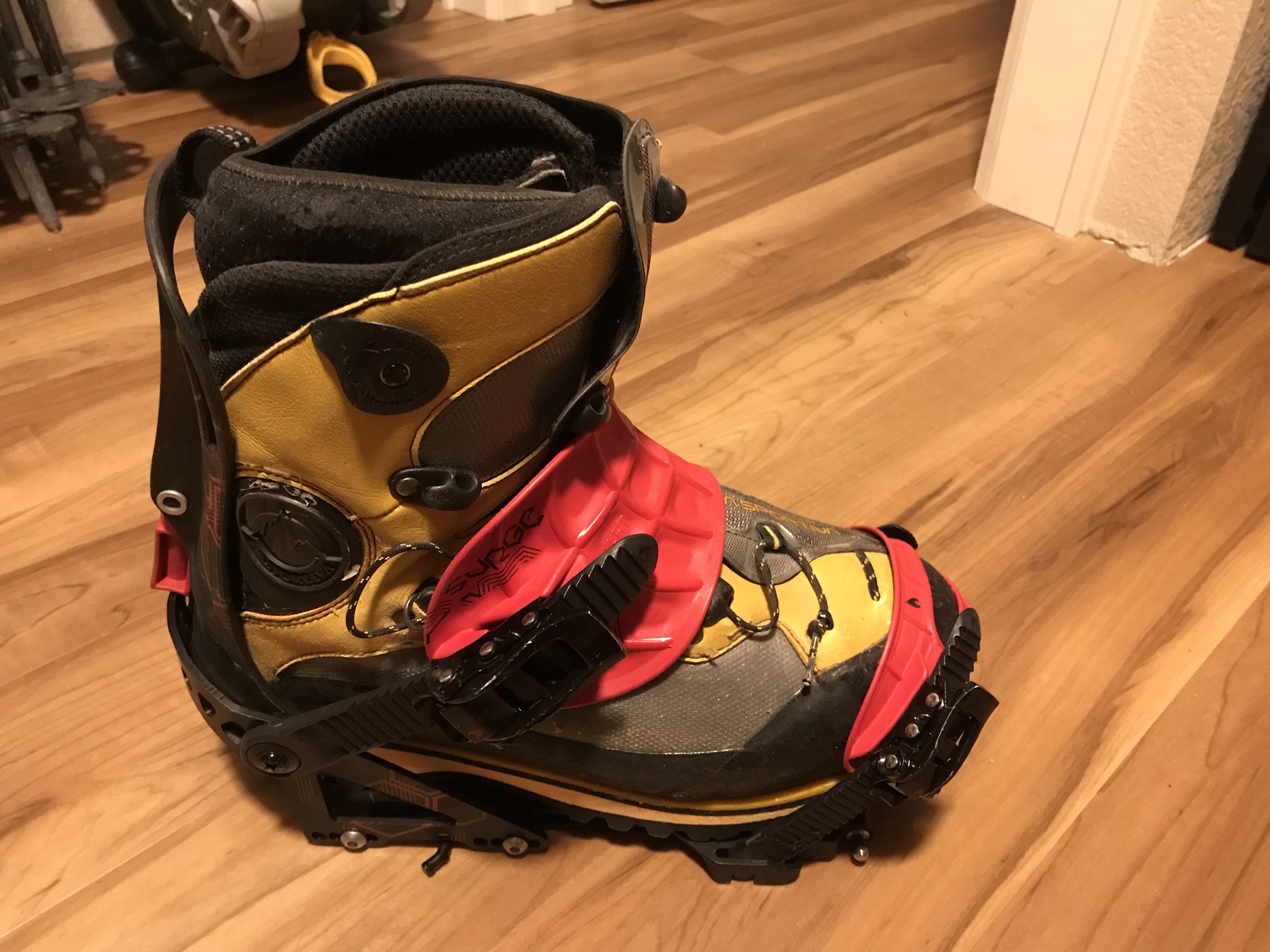
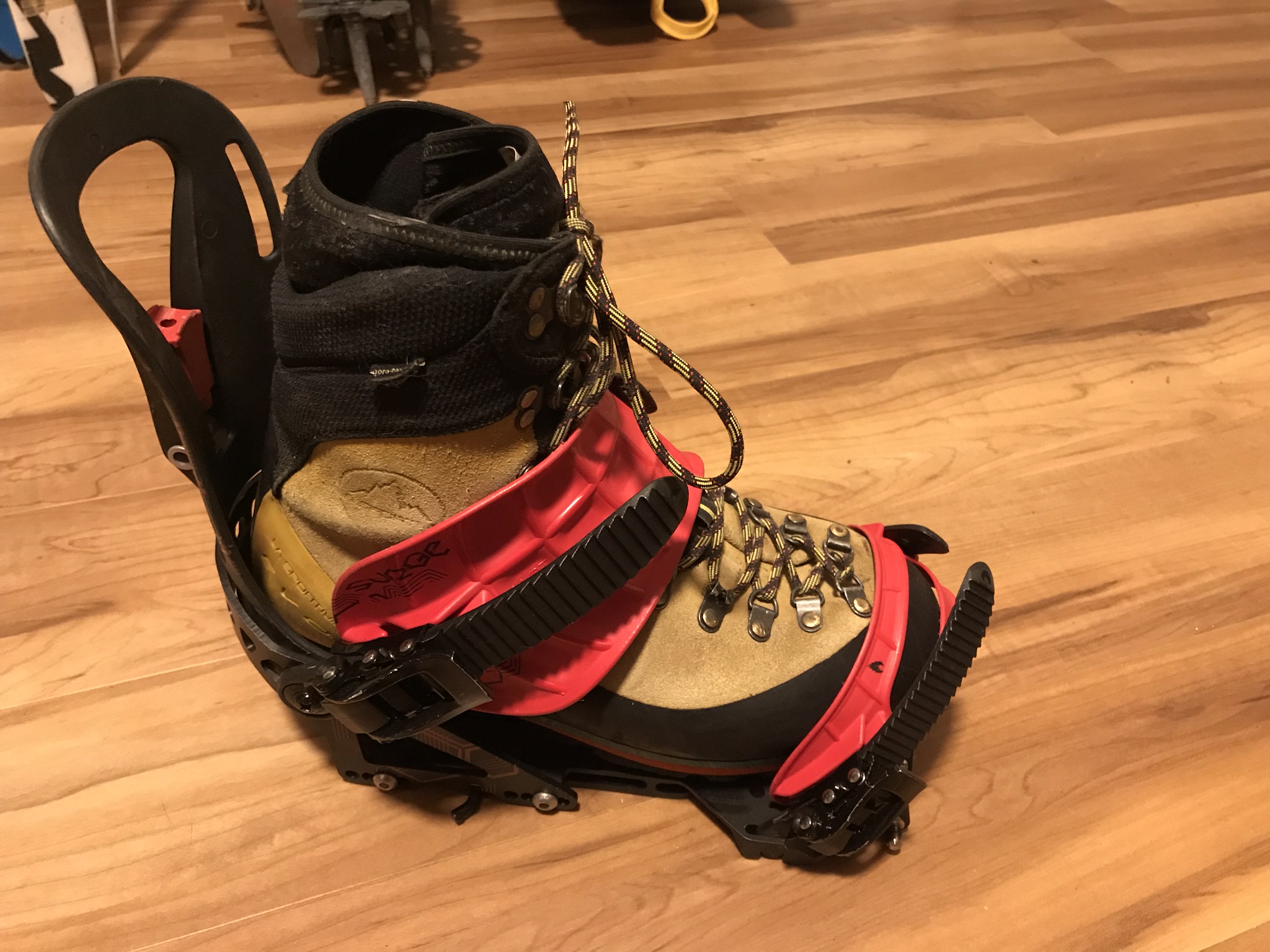
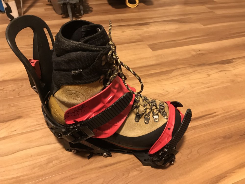
Hmm...I have never noticed that issue but you bring up a great point. I have definitely ridden a lot more in Spantiks than Nepals. I also think your suggestion to just walk is a great one. Especially to many of the popular routes there is a great boot pack this time of year. Here are a couple comparison pics. On the Spantik you can see the highback doesn't quite come to the top of the boot so definitely not a problem. On the Nepal it does come up higher than the boot by about 1 1/2". Again I have never noticed my calfs being sore or rubbing but I also have only done short decents like Aasgard Pass, Mt. Adams lower mountain and stuff in the Cabinets with them. I wonder if you could just flip the lever on the highback to give you more room? You would sacrifice performance but then again we are talking about efficiency of snow travel. This picture shows the lever flipped which creates several inches of room. Also I believe that Burton made a Lo-Back Binding that was significantly less than a traditional highback. Not sure they still do but maybe you could find an old used one.


-
I have had good luck with my mountaineering boots on a splitboard. If you get a small enough binding a La Sportiva Nepal works very well (definitely put in a dozen or more trips with that setup). I even used La Sportiva Spantiks with my splitboard up on Denali. I wouldn't want to ride those in the resort but as you stated you aren't looking for beautiful backcountry riding just efficient snow travel.
-
[TR] Dragontail Peak - Triple couloirs 03/31/2019
mthorman replied to kmfoerster's topic in Alpine Lakes
Overall was there much ice on the face? It seems like it took awhile to warm up this year and then suddenly freezing levels are super high. I am curious whether there will be enough freeze thaw to actually get good ice conditions on the north face of Dragontail this year. -
[TR] Mt Stuart - Stuart Glacier Couloir 04/05/2019
mthorman replied to Woodcutter's topic in Alpine Lakes
Thanks for the post! It brought back lots of memories from my trip of the SGC several years back. I also thought those West Ridge mixed pitches were some of the best I have climbed......so much rime ice! Propagating cracks on the Sherpa though....scary! Nice job! -
No problem Wayne. I was glad you guys got to climb it this year....it was so fat and awesome!! Nice running into you guys out there, and I am sure we will see you again in the future.
-
I knew you guys had been over there but didn't know the name. Thanks for the information Vern! Do you know if it is rated a 4 or a 5?
-
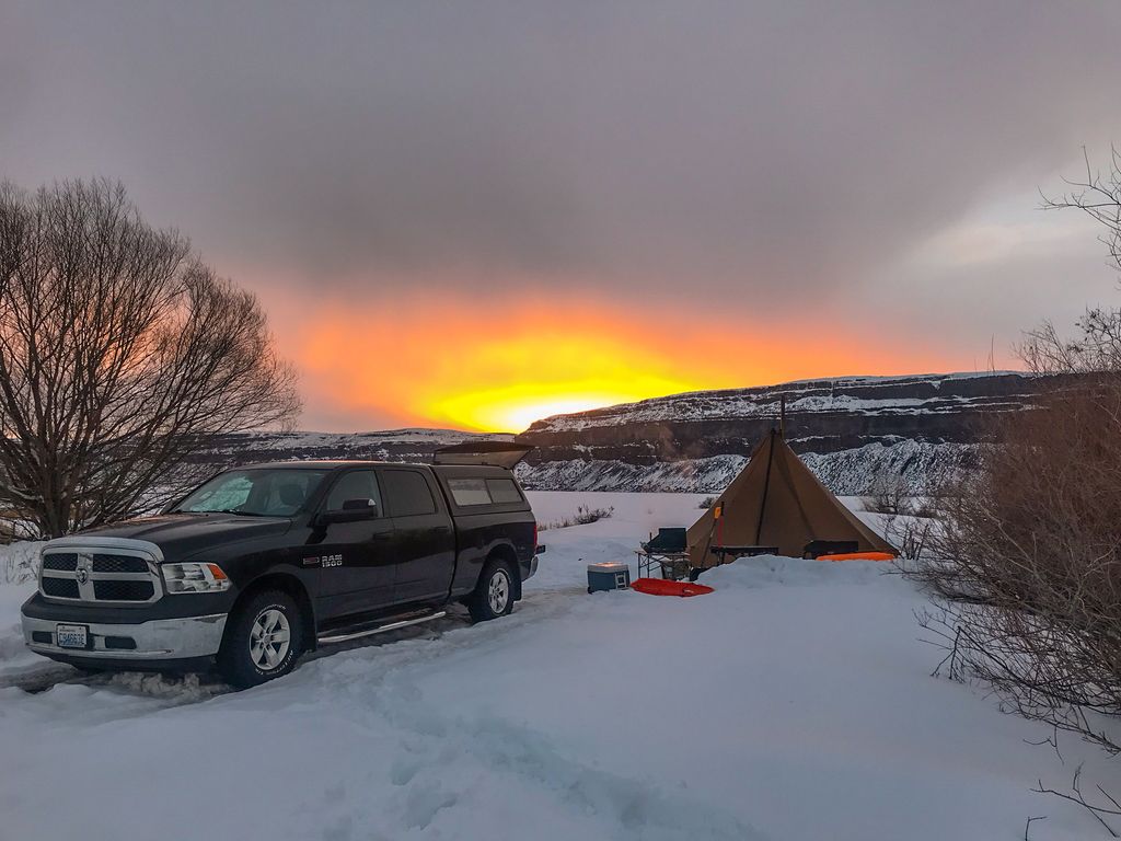
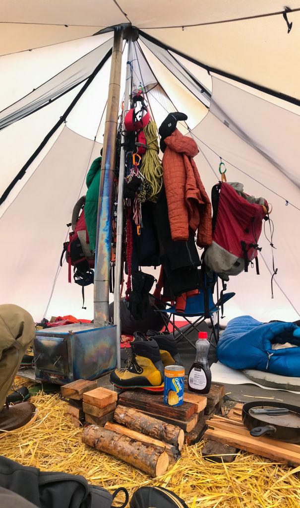
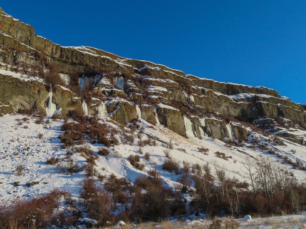
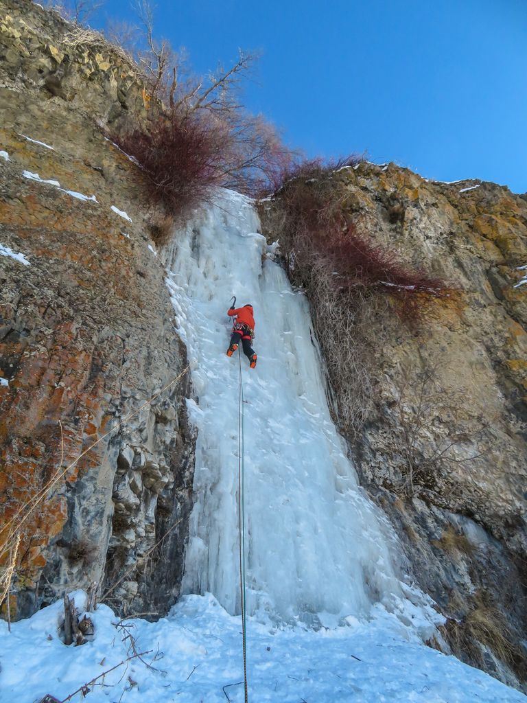
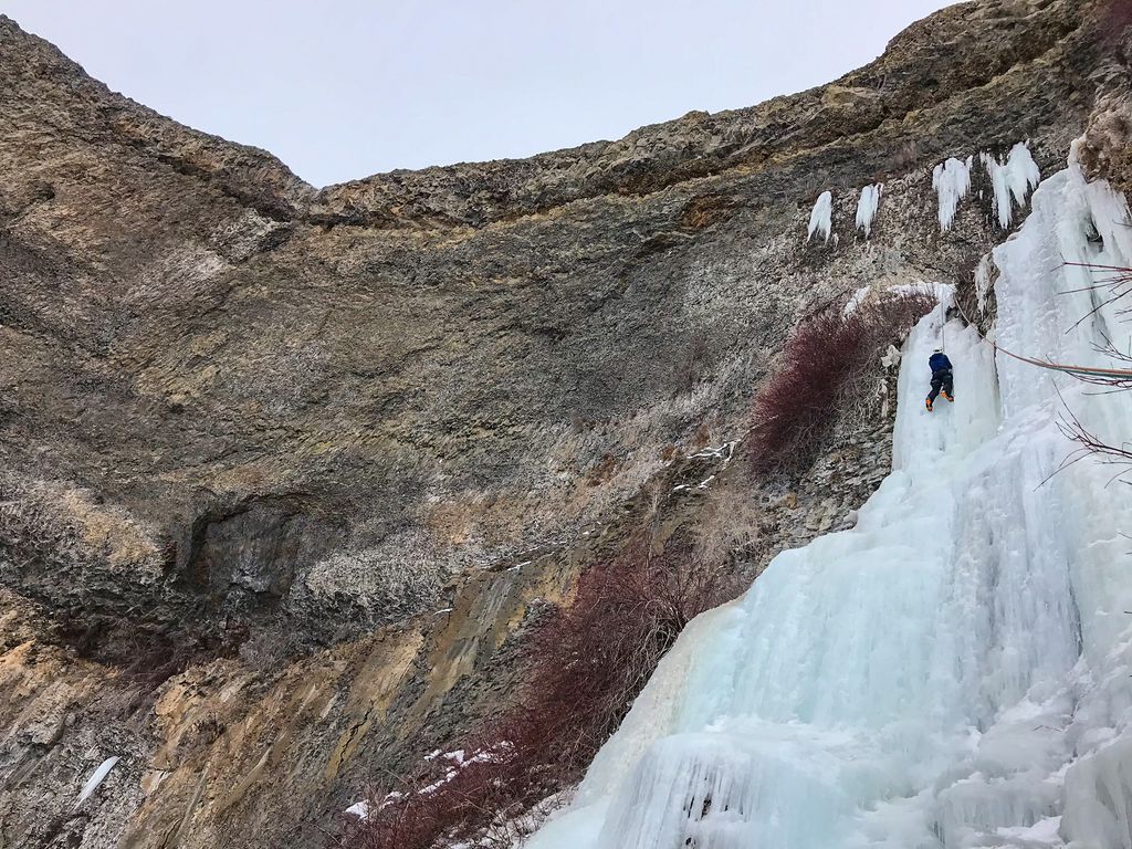
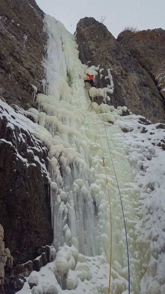
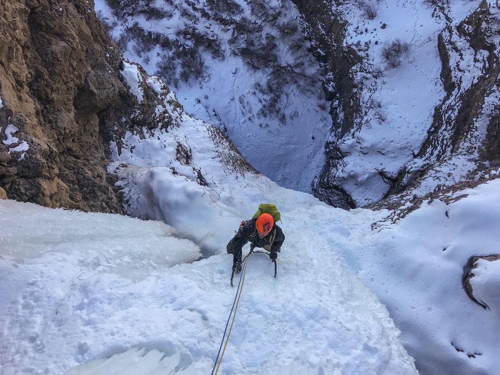
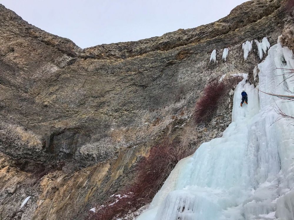
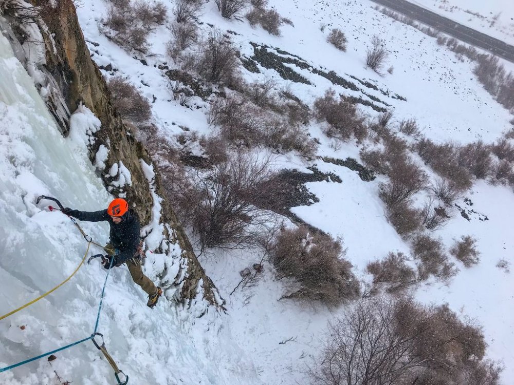
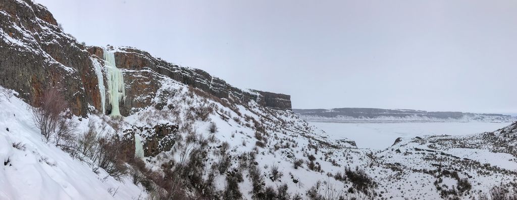
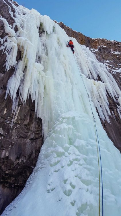
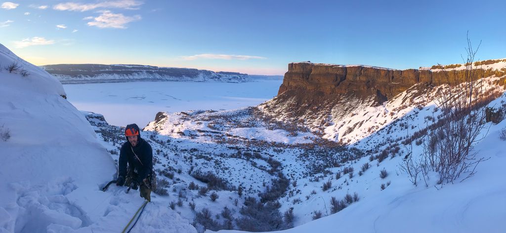
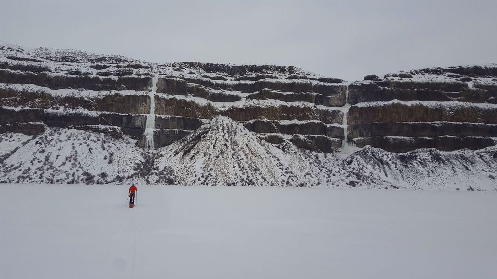
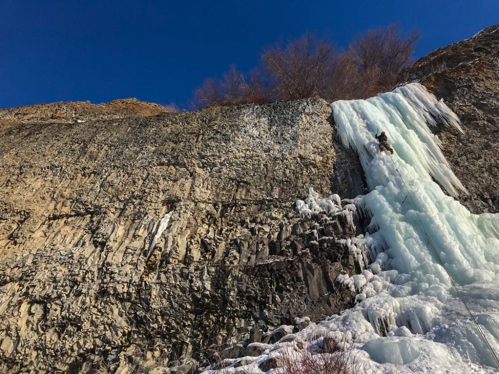
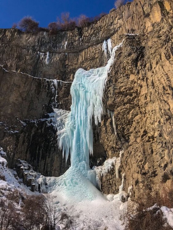
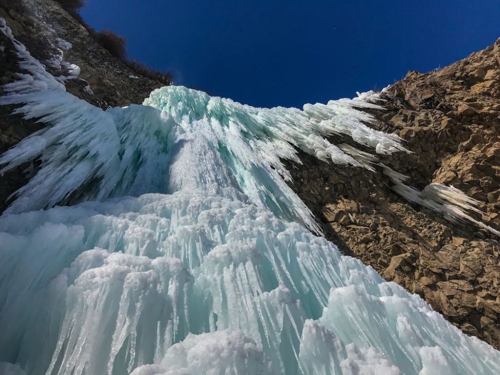
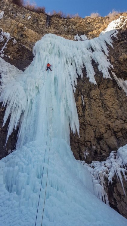
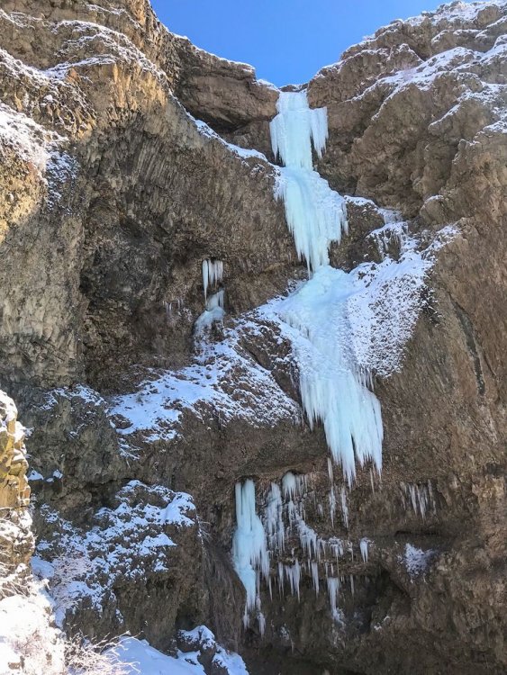
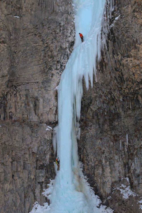
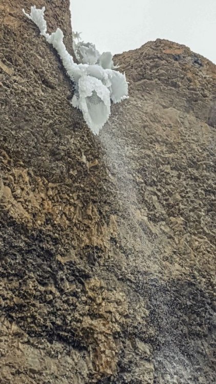
Trip: Banks Lake, WA - Zenith, Emerald, Cable, Razorblades plus others Trip Date: 03/03/2019 to 03/14/2019 Trip Report: With reports of an incredible season at Banks Lake, my partner (Joe Peters) and I decided we needed to get over there. We drove over on March 3 to find a good place to set up a camp. Joe had to finish a couple things at work, but my wife Trisha came out to climb for the 1st two days until Joe got back. Then Joe and I were able to spend another 9 days climbing some of the wildest ice I have ever been on. Banks lake is that good!! I didn't list any grades in this trip report. Banks is a funny place and I found that grades were tricky to judge. In the end I decided that Wayne Wallace was right when he said..."Grades don't matter, everything here is hard." We camped in Joe's tipi tent which is pretty luxurious complete with stove for heat and drying gear. The best spot we found to camp was right across from Salt and Pepper. Camping limit is 15 days, it was free, and there was a toilet. We were able to sit in camp and stare up at Salt and Pepper every evening. Evening light in our camp. The view of Salt and Pepper from camp. (photo credit Joe Peters) Living it up inside the tipi. With that stove we could be sitting around in a t-shirt. It was absolutely essential for drying out boots and other wet gear after climbing every day. Here is a brief overview of our trip. 3/4 - Peewees #2, 3, 4, 6, and 7 3/5 - Climb below Emerald, Trotsky's Folly and Trotsky's Revenge (also called Phase Transition) 3/6 - Peewees #1 and 5 3/7 - The Emerald and Satan's Panties (also called Absent Minded Professor) 3/8 - Tea 'n' the Sahara 3/9 - The Cable and H2O2 3/10 - Unnamed climb Butch Cassidy in Moses Coulee 3/11 - Bombs over Old Baghdad (the climb across Banks lake at MP3) 3/12 - Shitting Razorblades 3/13 - Salt and Pepper 3/14 - Zenith I will just let the pictures tell the rest of story with a few captions. Peewee's Playground. I referenced these from right to left starting with 1 and ending with 8. Me leading Peewee #4 on the 1st day. A great place to start getting used to Banks ice! (photo credit Trisha Thorman) Craig Pope had just put up this line which he thought was probably an FA. It transitioned from the ice through the rock and out to the hanging dagger. It is Peewee #2 and he named it Turn the Page. This is a couple guys from MT climbing it on TR in the beautiful afternoon sun. The next day Trisha and I climbed this little flow. It was fantastic steep climbing that eased off about half way up. It is right off the road at the Emerald Pullout. It is amazing to me that there are so many of these lines that don't have names. Anywhere else and these good pitches of ice would all be named! Trisha doing a TR lap on Trotsky's Revenge. Day 3 Trisha headed back home and Joe arrived. Here Joe is arriving at the top of the fantastic Peewee #1. This is Satan's Panties (also called Absent Minded Professor). Rumor is that it hasn't come in for multiple years. It was a really fun multi-tiered climb that was a great warmup for the bigger climbs at Banks. The Emerald sits tucked up in a small valley above the main Banks Lake proper. It was a fantastic steep pitch of excellent climbing. It even faced north so it didn't get any sun to ruin the ice! Me leading the Emerald. (photo credit Joe Peters) Joe topping out on the Emerald at the end of a great day! With a cloudy day we decided to brave the lake and head across for some of the bigger lines. Thankfully the lake ice was thick and solid with no noises. The climb directly above me is Tea 'n' the Sahara. The one to my right is unknown.....it never came in this year unfortunately (or at least the dagger never touched down). (Photo credit Joe Peters). A closer view of Tea 'n' the Sahara. This was definitely my favorite climb of the trip. It consisted of 4 steep pitches each about 90-120 feet in length. The ice was typical Banks with plenty of excavating but the position and length of the climbing make it a classic for sure. Joe climbing the final steep 4th pitch. Looking back up at pitch 4 of Tea 'n' the Sahara from rappel. We were able to rappel the entire route with 2 rope stretching 70m rappels......take 70m ropes! (photo credit Joe Peters) The Cable....it is such an amazing, steep, crazy, gymnastic, different route. An absolute must do at Banks. Here Brian Williams is a little past halfway up the long pitch. Me leading the Cable. It is so good......just go do it! (photo credit Joe Peters) The Cable in the setting sun. Next we went to climb H2O2. Here are a couple of unknown climbers on it the night before. Yet another great pitch of climbing right next to the road. Here Joe is putting up H2O2 in the evening sun. The following day we drove over to Moses Coulee. Unfortunately Butch Cassidy and the Sundance Kid were pretty wrecked by the sun. This is an unnamed climb on the same road about 1/2 mile before Butch Cassidy. After reviewing the guidebook and talking with several other people this is actually Butch Cassidy. The climb between Butch and Sundance Kid is unnamed (although climbed). The WA ice guidebook has the wrong mileage to these climbs. Looking up at Unnamed route Butch Cassidy was awe inspiring. There were so many hanging daggers through the steep upper roofs. I gave it a go on lead but ended up sitting on a screw in the roof. I found out I wasn't fit enough to lock off on a tool and clean hanging daggers for that long. Still an awesome experience! Me approaching the large ice roof of hanging icicles. (Photo credit Joe Peters) The next day was cloudy so we headed back across the lake. This climb is right across from MP3. It isn't in the WA ice book and nobody seems to know what it is called. After staring at it disappearing into the fog above we decided to call it Stairway to Heaven. (Edit: sounds like it is called Bombs over old Baghdad) Here is Joe leading up pitch 2. The next day was time to get on Razorblades. This is a climb that had been on my list to do for a while and it didn't disappoint. Some years the first pitch isn't in or so thin that you can't protect it well. This year it was fat! Me leading up the crux first pitch of Razorblades. I don't think I have ever climbed ice by pulling on ice mushrooms with my hands instead of swinging my tools into the ice....fun but funky! (Photo credit Joe Peters) Finally after staring at Salt and Pepper every night for a week, we decided we needed to go and do it. The guidebook made the 1st pitch sound hard and scary. It climbs the loose rock on the left and traverses up the snow ramp to the ice. It was loose, but I found a decent pin and a couple cam placements. You definitely don't need a #3 C4. I would take a couple of KB pins and a set of cams from BD .3 to #1. The crux step of rock is easy 5th but it is loose and a fall would be very bad. Joe climbing up the steep ice of Salt and Pepper. It was a fantastic climb with big exposure. This is looking straight down for about 300 feet. We wrapped up our trip with Zenith. A fitting end to a fantastic trip. It was very fat this year but still steep and long! (Photo credit Joe Peters) Joe and I on Zenith. Being a roadside crag, many times a few people stop and watch. Sue Tebow was one such person but she was kind enough to leave us her contact information so we could get a couple pictures she took. It is always a treat to get both the leader and the follower in the same picture. Thanks Sue! (Photo credit Sue Tebow) A final parting shot of the huge deathcicle above Zenith. It was so fascinating to look up at but we wasted no time in getting out of there. It consisted of a thin hollow tube of ice that extended 30 feet or so below the cliff. Out of the center poured a huge amount of water. (Photo credit Joe Peters) Gear Notes: Ice screws and 70m ropes Approach Notes: Short and easy unless you are crossing the lake!


-
Wow...great job! Taking smash and grab to the next level! Awesome pictures....and what a great route!!
-
Sorry I can help with identification, but I am curious how you felt the crossing was....spooky or pretty solid?
-
I have used the FF Osprey UL 30 for quite a few years. The Osprey has served me well throughout the Cascades in Spring, Summer, and Fall. I have pushed it down to 10F several times and been alright (it is custom to a 25F bag...see below). It has held up super well, packs down really small and barely weighs more than my big down puffy! Even took it up on Denali and doubled it with a Marmot 0F. I also own a -10 Eider and would definitely recommend FF bags. FYI you can have Feathered Friends "overfill" a sleeping bag to increase a rating. My Osprey is actually overfilled with a couple more ounces to make it a 25F bag instead of a 30F. Just call the Seattle store and ask them about it.
-
ice climbing 2018/2019 OR/WA Ice Conditions
mthorman replied to ggres335's topic in Ice Climbing Forum
I had friends out there over the weekend. They said many routes were in and some even fat. -
As others have said, you can eat really well on the West Butt. I definitely took my fair share of dehydrated meals but on those weather or rest days it was nice to cook something good. My biggest recommendation is take a frying pan and lid which you can convert into a makeshift oven. I made pizza, cookies, and biscuits in there not to mention frying all sorts of stuff. Well worth the extra weight. You can't really have too many tortilla shells or cheese in my opinion. Oh and if you can figure out a way to get crackers up to 14k camp without them crumbling you can trade it for just about anything. Last piece of advice is take food you like....duh but just because somebody says x, y, or z is a great food with lots of calories doesn't mean you will like it. Try it at home first, you don't want to cart the weight all the way up to 14k camp only to realize you don't like it. Here is my spreadsheet. Overall I was aiming for 3000-3500 calories. I thought that worked out well for me. Breakfast Lunch Dinner Extra *Also not on the above list was 2 tubes of biscuits, 3 tubes of pringles, cookie dough, and hard candy. **A lot of those dinners were dehydrated as I wasn't going to cook up beans for a chili! The extras soups I mostly made for a hot meal mid day and the puddings I made into hot chocolate drinks either morning or night. ***A "snack bag" was the following all cut up into tiny bit sized squares, mixed together and covered in powdered sugar (made it easy to melt in mouth if frozen, and the chocolate didn't make as much of a mess if left in the sun.) 1 of each: Cliff bar, protein bar, Milky Way, Snickers, and granola bar.

-
How long is your Smartwool or Icebreaker lasting?
mthorman replied to jon's topic in Climber's Board
I have about 5 years of pretty hard use on multiple pieces and they are all full of holes and in need of replacement. I would be pysched to get 10 years! -
ice climbing 2018/2019 OR/WA Ice Conditions
mthorman replied to ggres335's topic in Ice Climbing Forum
I haven't been out to Banks yet, but judging from Spokane temps I doubt there is much yet. We have been highs in the upper 30s or lower 40s and lows just barely below freezing until late last week. The last several days have been colder finally but things definitely seem to be getting a slow start this year. -
Awesome report! That climb has been on my list for awhile. The car incident reminds me of last winter when we came out from 3 nights backcountry skiing to an empty parking lot (truck was stolen). Yea the RCMP said the same thing..."It happens all the time up there".....and I was like "maybe you should think about putting up some cameras or patrolling it more often". Thankfully I got it back a couple weeks later though.
-
Wooden training ice tools - not thei Dryice ones!
mthorman replied to Woodcutter's topic in Climber's Board
Found them randomly on Instagram. https://www.hexclimbing.com/ -
Wooden training ice tools - not thei Dryice ones!
mthorman replied to Woodcutter's topic in Climber's Board
The only other option I have seen is this one. It isn't a different ax but lets you use your normal tools with these picks. I haven't tried it personally but know someone who has and liked them. https://www.escapeclimbing.com/product/dry-tool-picks/ -
Thanks for posting Scott! And congrats on one big adventure.....man running until you are sweaty and then sleeping until your cold sounds awful!
-
[TR] Mount Rainier - Ptarmigan Ridge 05/28/2018
mthorman replied to Eric Gilbertson's topic in Mount Rainier NP
Nice job and thanks for the report! It sounds like you guys had a fun time up there. Crazy how much drier things are this year. -
Mt. Adams can still be climbed in a day trip even if the road is closer lower down. I did it several years ago in March from one of the lower snow parks. It makes for a much longer day but the plus is fewer people! Of course you could easily turn it into an overnight or even a 3 day. It really depends on what you want. If you are looking for good skiing then you might be happier just staying slightly lower as the upper mountain can get pretty hard and windswept....obviously condition dependent. I think it is worth the effort and I honestly had a lot more fun being the only person on the mountain than when I went back later in the season and walked up the ant line of people.