KaskadskyjKozak
-
Posts
17312 -
Joined
-
Last visited
-
Days Won
23
Everything posted by KaskadskyjKozak
-

Climbing this spring (and maybe summer)
KaskadskyjKozak replied to Bronco's topic in Climber's Board
Shhhhh no AR-14s allowed! -
Climbing this spring (and maybe summer)
KaskadskyjKozak replied to Bronco's topic in Climber's Board
we will all need fences to ward off the zombie apocalypse -
Climbing this spring (and maybe summer)
KaskadskyjKozak replied to Bronco's topic in Climber's Board
sorry. my old eyes, addled by the lack of any rejunevating green exposure saw "northwest". peace. -
-
Climbing this spring (and maybe summer)
KaskadskyjKozak replied to Bronco's topic in Climber's Board
No dayhiking either: https://www.fs.usda.gov/detail/mbs/news-events/?cid=FSEPRD717080 All trails closed until 9/30 unless rescinded earlier. DNR lands are closed to hiking too. -
-
Glory days....
-
-
it looked thin by mid June already from the summit of Fernow...
-
[TR] Big Chiwakum and Snowgrass - via Grace Lakes 07/06/2019
KaskadskyjKozak replied to JasonG's topic in North Cascades
Nice! My son and I bagged Big Jim a few weeks ago C2C, roundtripping it up side from Badlands and down to Augusta (17 mi, 6K gain, 12 hours). We were eyeballing Chiwaukum and Snowgrass as a future visit! -
suffering is good for you. it makes you appreciate leisure time better
-
good tip on 4th of July pass! There were a couple of recent TRs on nwhikers for the area plus Bulger hunting is getting more popular so it may account for the traffic.
-
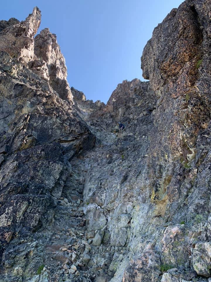
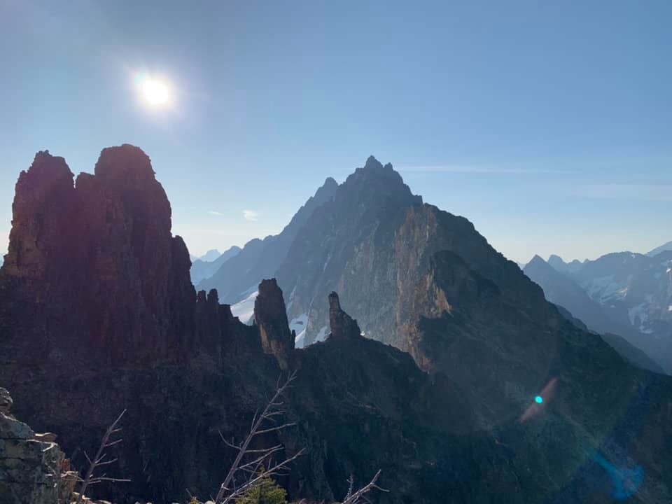
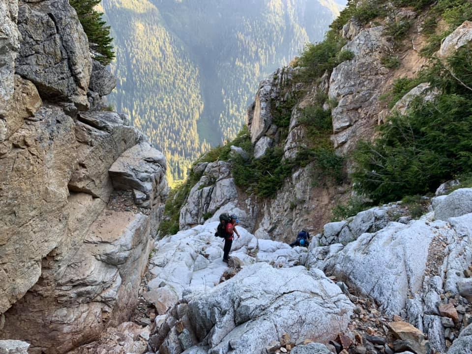
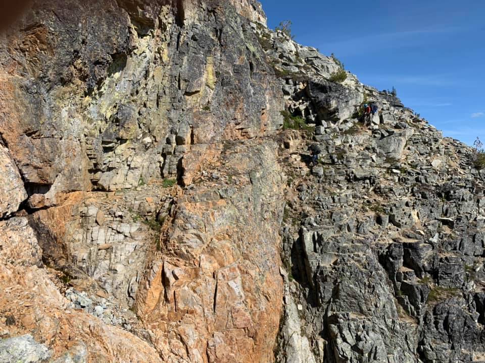
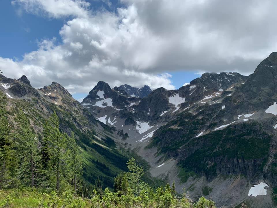
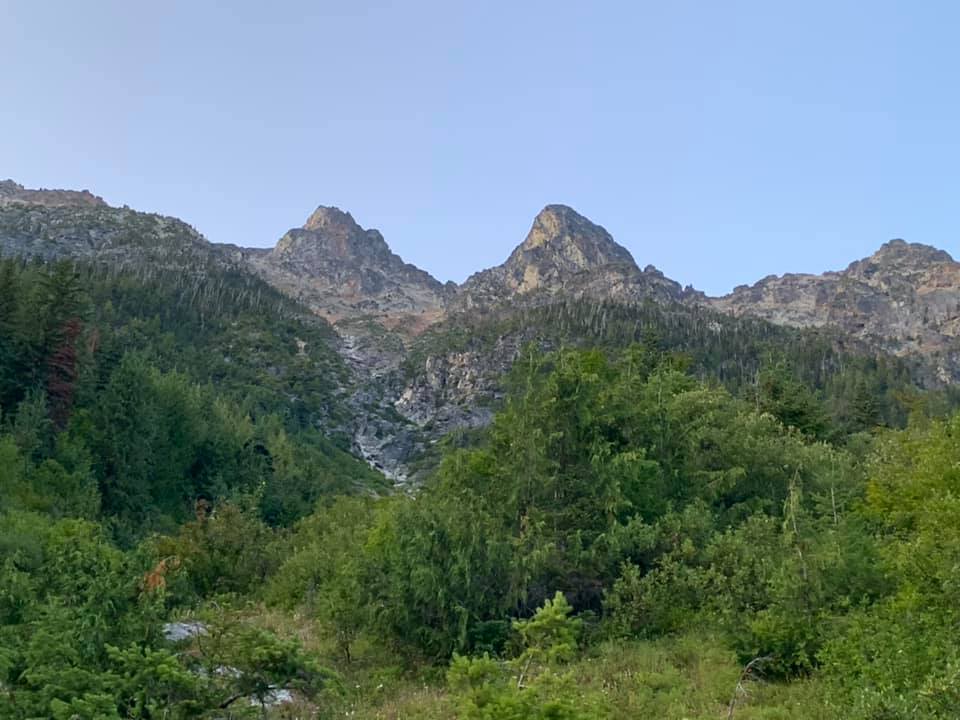
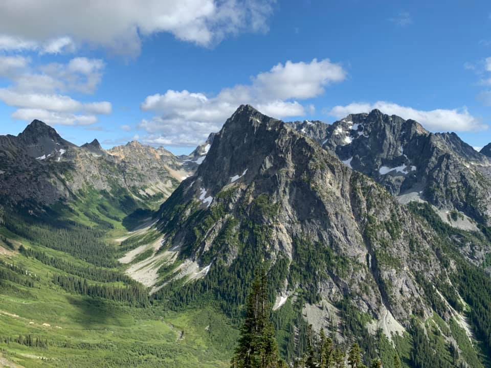
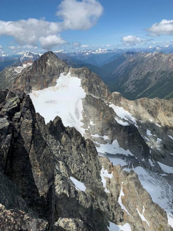
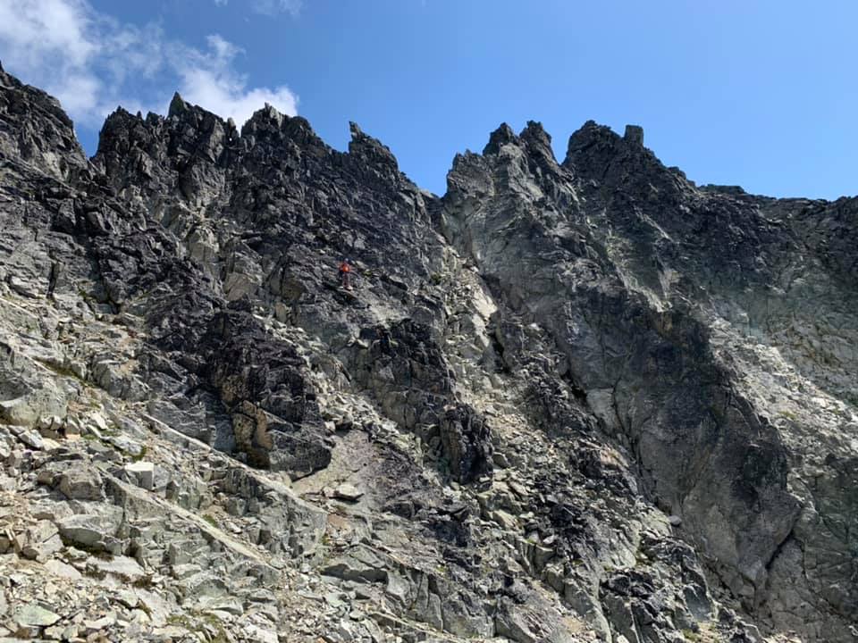
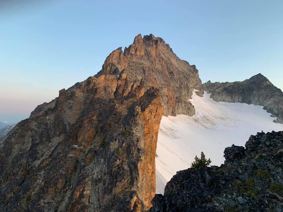
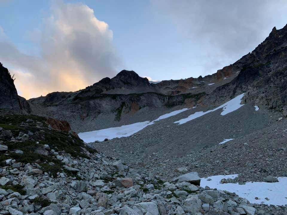
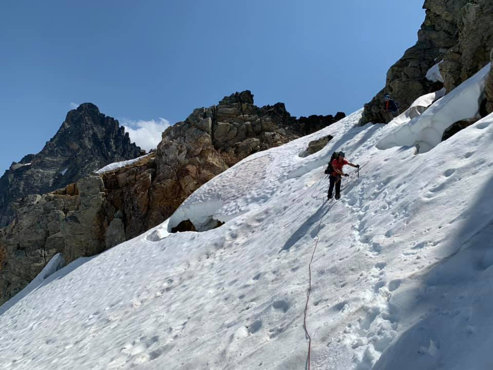
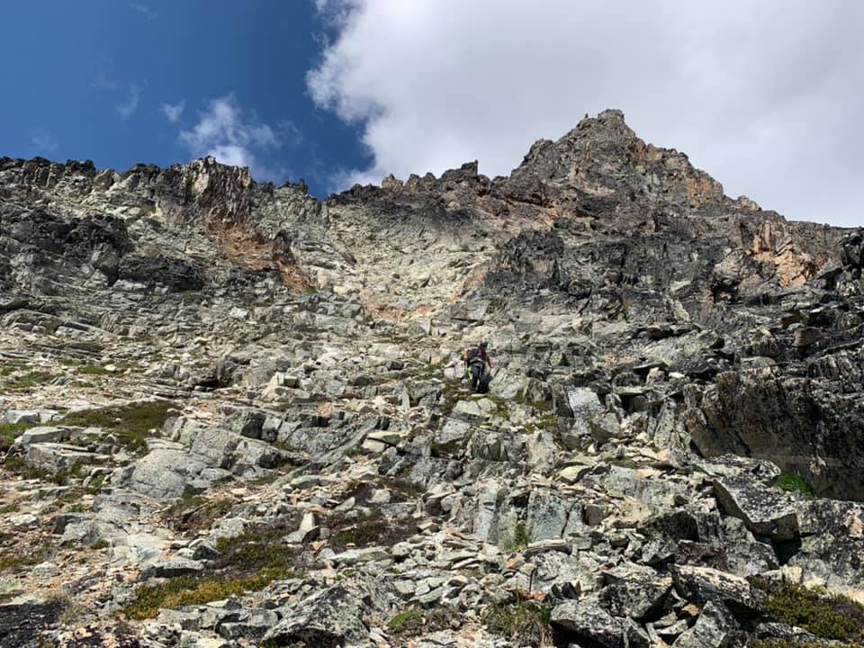
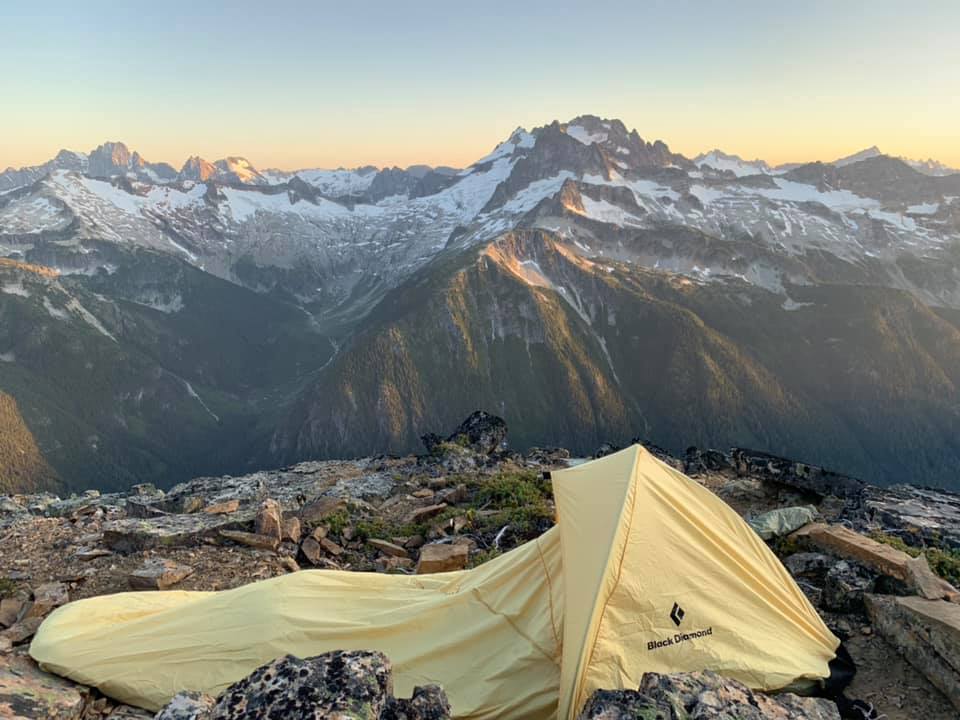
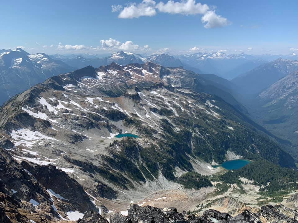
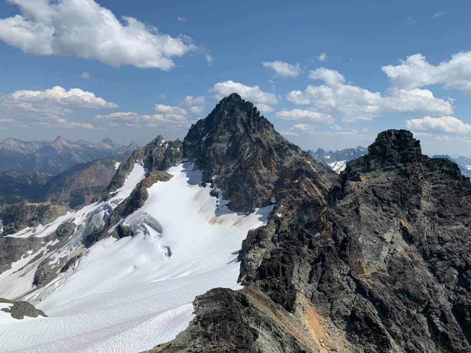
Trip: Ragged Ridge - Mesahchie, Katsuk, Kimtah, Cosho - Standards Trip Date: 07/27/2019 Trip Report: It seems that this year every one of my trip plans has gone south for one reason or another and this was no exception. Initially hoping to get Challenger a weather blip got worse and worse as the week prior to the climb progressed. Not wishing to fuck around in a white out on Eiley-Wiley ridge and uncertain about Bergschrund conditions in this weird snow/snowmelt summer, we converted our four-day Pickets adventure into a three day Ragged Ridge consolation prize. Saturday still had a weather blip when we settled on the Chinook Slam and sure enough there was some rain and overcast skies as we drove to Marblemount and then Easy Pass TH early Saturday morning. The ranger station was the typical clusterfuck even at 8:30 am when we arrived and took a number. With permit secured we continued to the TH where it briefly dumped rain on us. With the next sucker window we headed up. As forecast the weather got better and better as we hiked in. Two parties of two with lighter packs and footwear passed us and we were concerned about choss bottlenecks and limited camping options. We made quick work of the hike to Easy Pass, then traversed around 6700' to the basin under Mesahchie and Pt 7430. To our surprise only a single tent was setup there and we threw down bivy sacks away from it on a decently flat spot. Later we spied folks descending from Mesachchie and Katsuk and chatted them up for beta. They were a party of three (so now there are 10 people up there total in four parties) who had arrived a day earlier and planned a 4 day climb with two separate twin-peak-bagging forays rather than a carryover traverse. Views back towards Easy Pass from the traverse towards Mesahchie: The basin we camped in on the first night. Running water right by camp: We set alarms for 4:30 am and got a great night's rest under clear skies. In the morning we broke camp and hauled heavy packs up to 7400' then stashed the overnight gear just above a cornice on the ridge and climbed Mesahchie, then Katsuk. The routes were as espected - loose rock, class 3-4. Great views on both summits. The "crux" section of gully up Mesahchie Peak: We then dropped back to our packs and began traversing the multitude of ribs and gullies on our way towards (we hoped) the E side of Thieves Peak, with a third summit on the way (Kimtah). Alas, this was not to be. About an hour along the traverse we ran into one of the parties of two we had seen a day earlier who were headed back home and reported they were "chasmed out". We soon got to said "chasm" and struggled to commit to the crossing ourselves. Basically there is an exposed 30' traverse with one horrible step on loose eroding dirt and no handholds. After scoping it out with no full packs for a long time and vacillating on what to do, I finally got out my small rack and we build a fixed line. All in all that cost us about 2 hours. It's funny how mental fatigue (this was 8 or more hours into the day already with a lot of exposed scrambling and traversing) can affect decision-making. The "chasm" crossing" Once past this crux we crossed one chossy rib and gully after another and wondered when the hell we'd ever see the Grotesque Gendarmes. At this point we ran into the party of three from camp returning from their summits of Kimtah and Cosho. They told us we had a ways to go and might consider bivying. They were right. We ended up arriving at the final gully before said gendarmes at 7:30 and set up a gorgeous bivy with spectacular views. Also, we had time to eat and get enough sleep to start early again. Our awesome bivy site: Alarms went off at 4:30 on the third day and we again broke camp and headed out. Despite all our beta and some cairns we still took some time to get through the gendarmes and find the upper red ledge. It took longer than we would have liked - that is for sure. We then crossed another seemingly endless series of ribs and gullies until we were finally directly below Kimtah. We dropped packs completely and headed up this short (800') scramble. We were surprised about how blocky this was and it took more than we would have liked but there was nothing super challenging about route-finding - just sniff your way up. From GPS tracks we had studied we knew most people would go up one gully and head down another. We saw why - pretty obvious from above how to go on easier terrain down. View from camp of the Grotesque Gendarmes and Kimtah: View back to the Grotesque Gendarmes and Katsuk: Ascending Kimtah: Once back at the packs we continue on another series of gullies and ribs (does this shite every fucking end?) to the final gully below the E side of Thieves Peak. We lost whatever bootpath we were following and ended up sniffing out a route to the col. From chatting with the team of three we knew the glacier was easily accessible. We roped up (30 m rope) and crossed to the col on the other side of Thieves peak, then dropped backs and scrambled up Cosho. there was a nice snow field giving access to a gully on Cosho making for easy travel. Accessing the glacier from the col E of Thieves Peak: Kimtah from Cosho: View W of Cosho summit: After five minutes on the summit of Cosho we headed back to our packs. We had a nice food and water break, then noted the time: 3:30pm. We were in for a long hike out. The gully below Cosho is honestly the worst place I have ever been. I'd rather be castrated with a dull butterknife than be there again. We methodically descended bullet proof dirt covered in loose rocks, polished slabs covered in loose rocks, waterfalls (some over and some around). We repeatedly fell on our asses and dealt with exposed face-in downclimbing or dirt/veggie bypasses with bad runout. Nearing dusk we finally got to the bottom and schwacked down a dry stream bed towards Fisher Creek. Finally at 9 we found the bridge crossing. After watering up we headed out - the wrong way. After 5 minutes, we realized our error and went the other way. Then we got confused because the trail on both sides of the bridge headed W and we wanted E. Finally after consultation of a map we determined the trail on the N side of the bridge is correct and must just start W and then turn N and E. That proved correct. One of many waterfalls that could be face-in downclimbed: View up the central gully to Cosho: We covered 6 miles in 3 hours arriving at the switchbacks up. Then we took 4 more to ascend to Easy Pass and down to the cars. Time? 4:30 am. A 24 hour day. Why do I do this shit? I dunno, but it did not prevent me from making it to a Slipknot concert that night and drinking copious amounts of beer. Gear Notes: Ice Axe, Crampons, 30m rope, Minimal rack Approach Notes: Very few bugs

- 4 replies
-
- 3
-

-
- ragged ridge
- easy pass
- (and 5 more)
-
I climbed the E ridge of Fernow. The rock is par for the course for the Cascades. I did not find it too bad/unsavory. I've been on much worse.
-
"Think I'll just sit here and drink"
-
yeah, I was on Fernow a couple weeks ago, saw this view, and said "fuck that". The traverse looks sketch balls
-
Thanks for the link. It's encouraging that there is that much snow on the S side. Still I wonder abou the N. Also saw a pic of cache col from weeks ago which made it appear that the area around the approach gully to Mixup is melting down to rock already, which seems early for those conditions
-
Anyone have recent beta on Buckner? With the low snowpack and quick melt this spring and summer, I'm wondering how it is holding up. I saw the reports from over a month ago - anything more recent? Even if just a picture from the summit of Sahale, Forbidden, etc?
-
Interesting. I climbed these four peaks with my son a couple years ago and we rated them very differently: Pinnacle: 3 stars Cardinal: 0 stars (what a POS with no snow!) Emerald: 3 stars Saska: 2 stars (he would probably say 1 - but I liked the finish) Strong work!
-
I checked out a game last night. First time in a long time - the $30 seat deal is pretty cool. Fun game with three homers and a W (despite the Es)
-
[TR] Mount Chaval - Standard Western Ramp 09/28/2018
KaskadskyjKozak replied to JasonG's topic in North Cascades
Yes! I found boots on the ground on the schwack from the lower basin camp (5400') to the upper one (5800') en route to climbing Tupshin. Two old, but usuable sturdy backpacking boots. -
[TR] South Spectacle Butte - SW Ridge 10/21/2018
KaskadskyjKozak replied to KaskadskyjKozak's topic in North Cascades
It's a fun one! Hope you get it in a year or three BRW - loved your TR for Chaval. I need to get back that way myself -
Trip: South Spectacle Butte - SW Ridge Trip Date: 10/21/2018 Trip Report: I thought my trip to the Pasayten last month would be my final hurrah in 2018, but this Indian summer brought a welcome extension to the season. I chose a two-day jaunt into the Glacier Peak Wilderness with my son and dog for some offtrail/nontechnical alpine goodness. We drove up to Phelps TH Saturday morning arriving at 9. It was 28 degrees out but clear. The lot was partially full already - nowhere near how it is in the height of summer though. We hiked the Carne Mountain trail (fairly crowded) then began the High Traverse over to Ice Lakes. We were treated to much larch goodness and spectacular views on this bluebird day. View N from the summit of Carne Mountain. The high traverse to Maude is in left of the frame. Typical views on the traverse: The final slopes to Maude: Upper Ice Lake and the Spectacle Buttes: Lower Ice Lake: Approaching S Spectacle Butte A gendarme on the SW ridge of S Spectacle. Lots of class 3 and interesting route-finding on this route. I found the choss factor to be suprisingly low and the scrambling overall was quite enjoyable. My son topping out on the summit Views W from the summit. Maude and Ice lakes are center of frame: Gear Notes: Helmet Approach Notes: Neglible snow/ice patches. Easily travelled or avoided.
-
[TR] Johannesburg - NE Rib 1957 10/13/2018
KaskadskyjKozak replied to dave schultz's topic in North Cascades
dood! this is awesome! -
[TR] Lost Peak and Carru - Standards 09/23/2018
KaskadskyjKozak replied to KaskadskyjKozak's topic in North Cascades
looks aside, Vizslas are the best hiking dog!