KaskadskyjKozak
-
Posts
17312 -
Joined
-
Last visited
-
Days Won
23
Everything posted by KaskadskyjKozak
-

[TR] Mount Clark - Standard 08/09/2021
KaskadskyjKozak replied to KaskadskyjKozak's topic in Olympic Peninsula
I take nothing for granted. Every day out in the mountains is a blessing! -
There is also a way from Whatcom Pass where you traverse the glacier. When we did our trip to Easy Mox we met a party at Whatcom Pass that had just climbed Challenger via this approach and they said the glacier was not that bad.
-
[TR] Mount Clark - Standard 08/09/2021
KaskadskyjKozak replied to KaskadskyjKozak's topic in Olympic Peninsula
7:15 cars to summit. 14:10 C2C. (18.70 miles, 5780' gain) -
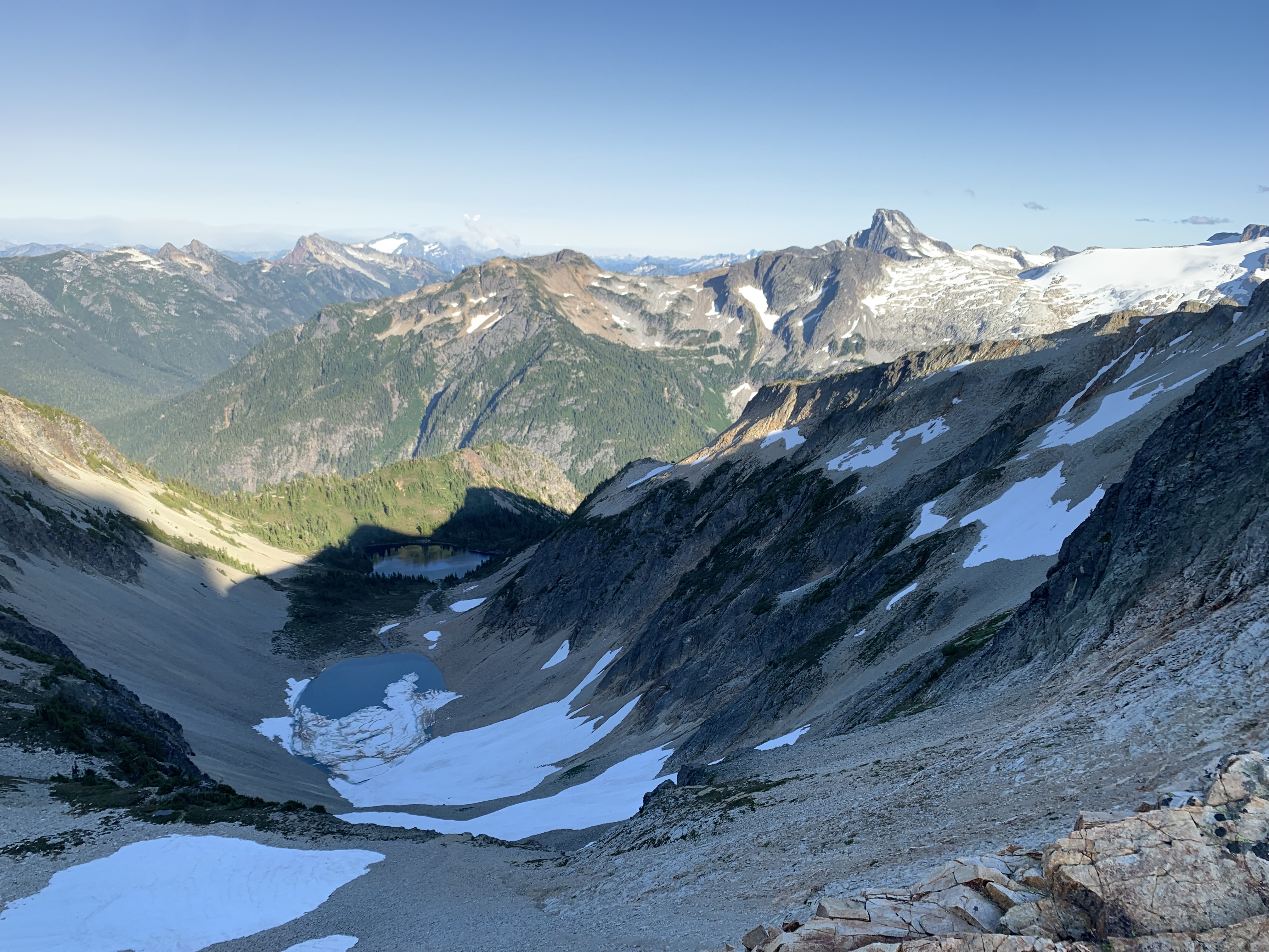
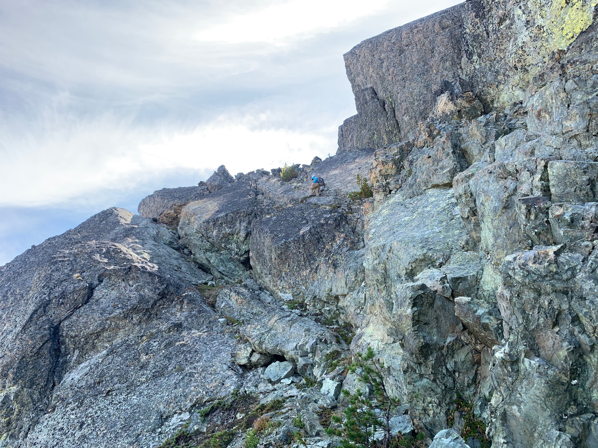
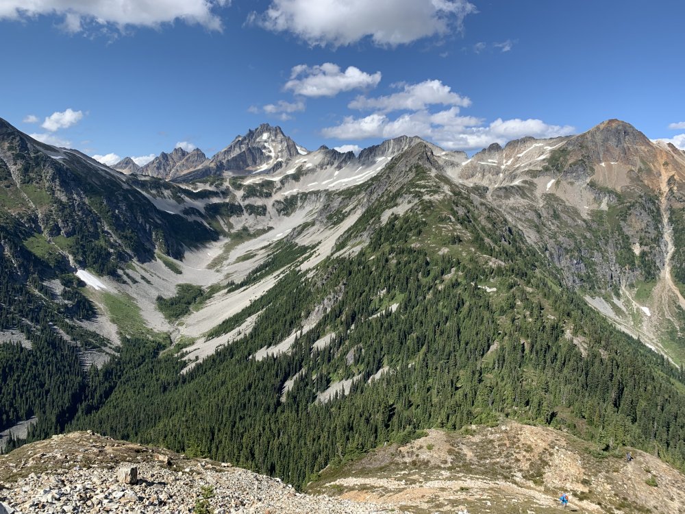
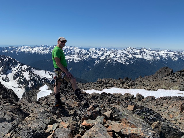
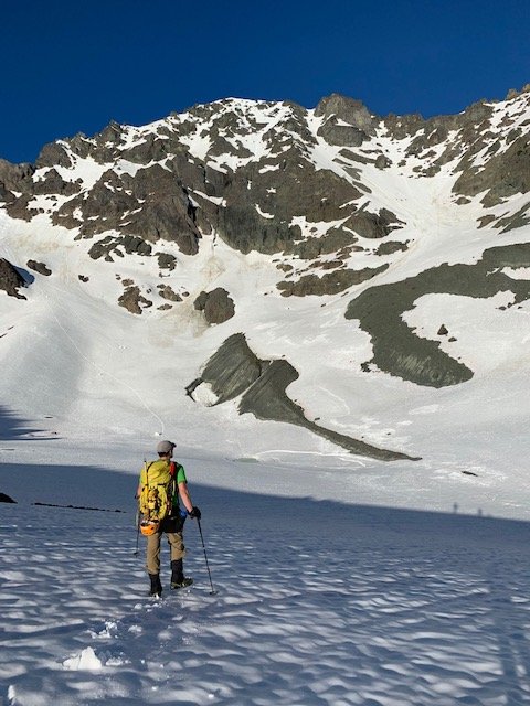
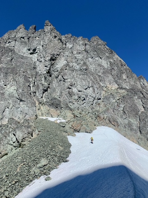
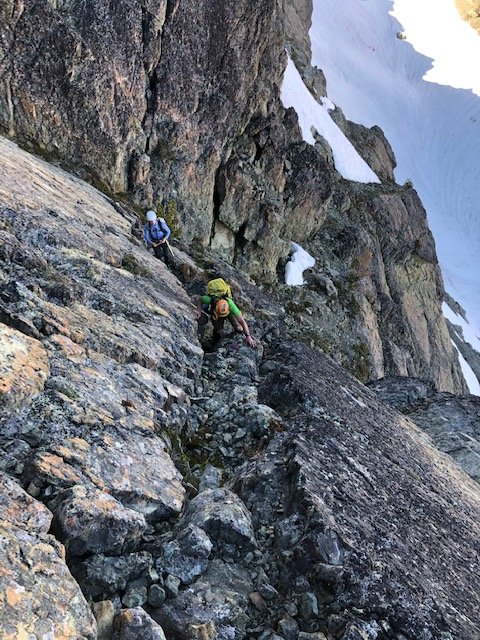
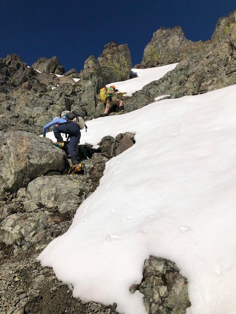
Trip: Mount Clark - Standard Trip Date: 08/09/2021 Trip Report: We attempted Clark back in June as part of a three day trip, which included a summit of Mount Deception and two nights at Royal Lake. After cancelling our plans this weekend (Terror Basin, with advanced permits) due to "meh" weather we opted for a cleanup trip, and allocated Monday for it, C2C. We drove up Sunday night and slept in our cars at the trailhead, setting alarms for 5:30 am. After breakfast and packing up we headed up the Upper Dungeness trail at just after 6:30. Overall we kept a decent pace and summitted Clark without issue at around 1:45, took a quick break and headed back down. The only snow we encountered was in Surprise Basin, which made for a nice break from tedious boulder hopping (the snow was continuous in the basin). The snow at the summit block back in June was totally melted out. The first part of the final block was loose and a bit unsavory class 3. The finish is a nice crack that pushes the limit of class 3 - it's quite steep but has great holds. Mount Deception looking a lot more melted out than it was in June. Glad we did this with snow coverage! View towards Clark from the tarn in upper Royal Basin: View towards upper Royal Basin from the base of Surprise Basin: Continuous snow in Surprise Basin: Traversing on the east side of Clark. This exposed section is one of two 'attention getting' parts. (great holds) Summit Stoke: 91/100 for me, 40/100 for my son (Smoots) Royal Lake as viewed on the way out: Here's to another one in the books! Prost! Gear Notes: Light crampons, approach shoes Approach Notes: Trail in excellent shape - no blowdowns. Snow free except for Surprise Basin.


-
after this trip he said he's done bulger hunting but i'm sure he'll forget and be back. he solo'd the gardners earlier this year
-
Thanks man. This list was hateful. But it gave me so much, I can not even express it. What a way to finish. I'll never forget this trip. Ever.
-
I went on a Friday evening once, arriving at 2:45 pm and had a permit by 3:30. It's busy in the afternoon too, unfortunately
-
Thanks, man! When the border is open you can get in there as a 3-day trip. 4 days can get you 2-4 summits depending on which ones and your speed/efficiency (I am old and slow). Word is the border may open soon. FWIW Spickard is the easiest, with Rahm and Custer a close second. Custer is a POS though and only worth doing to finish the bulger list.
-
I can appreciate your experience a bit, despite not having tried the Perry Creek approach. I attempted the Silver Creek approach last year and turned around at the headwall, thwarted. In addition to the green hell/schwack we had the pleasure of many hornet stings as our trip was in early September when the queen dies and they become much more aggressive and territorial. Way to persevere and HTFU for a spectacular experience. TFPU!
-
Just 10 Smoots to go!
-
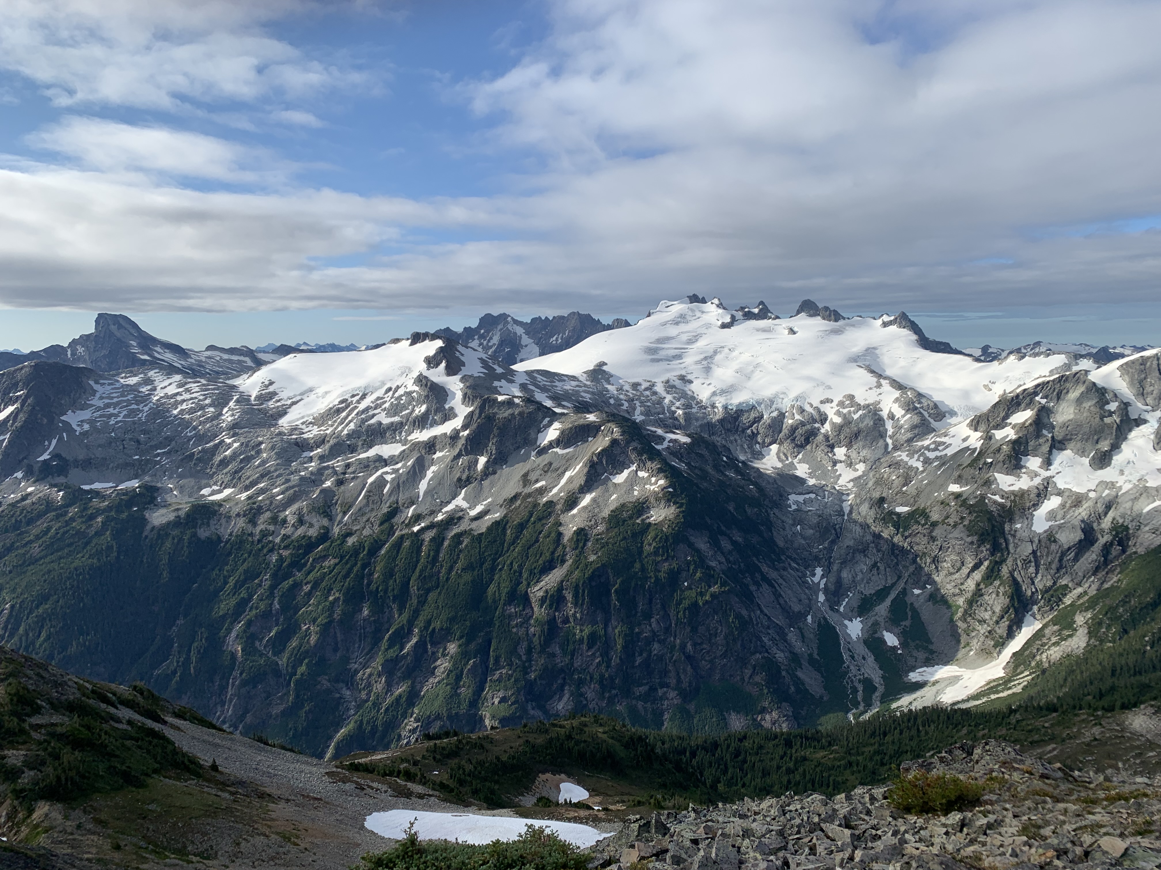
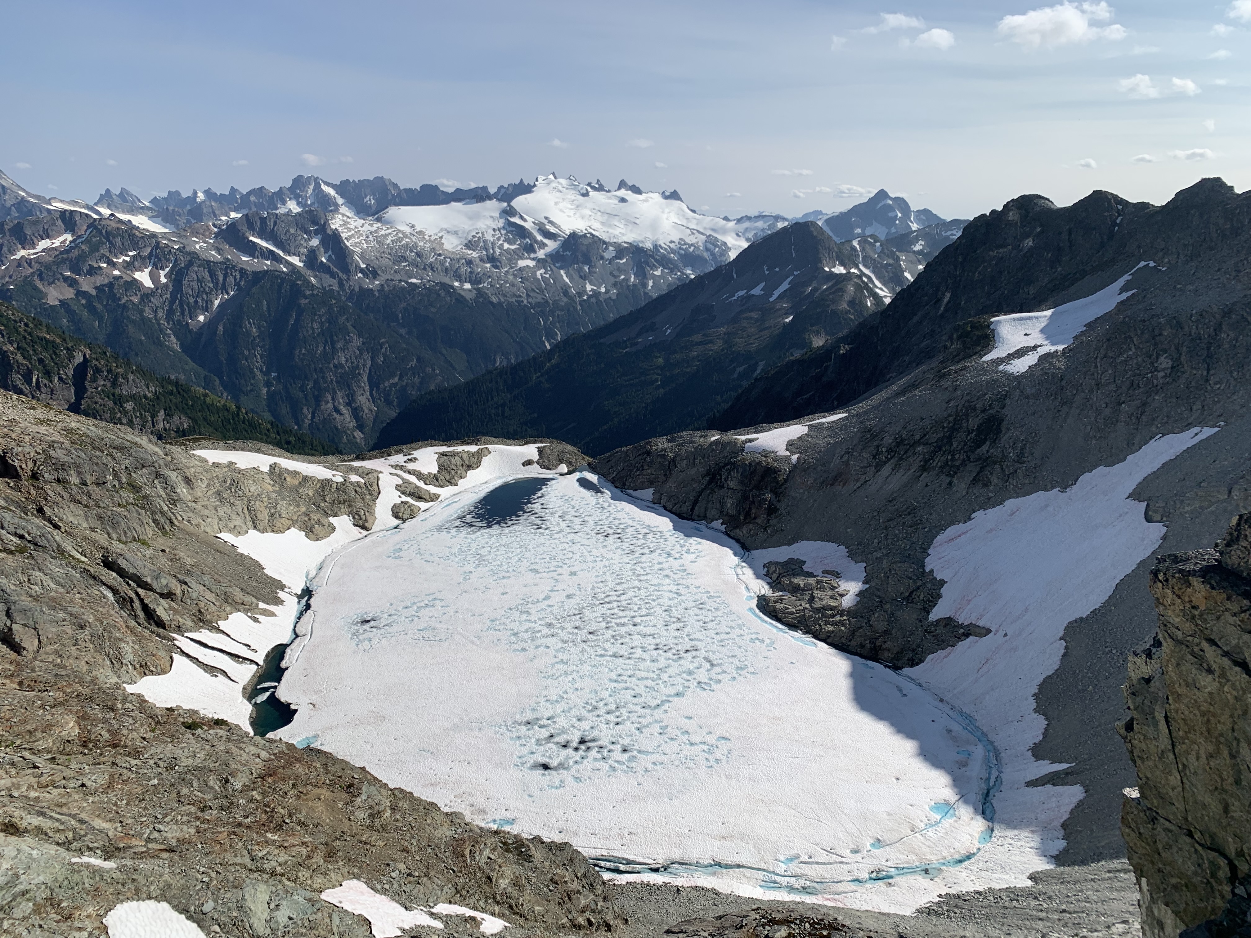
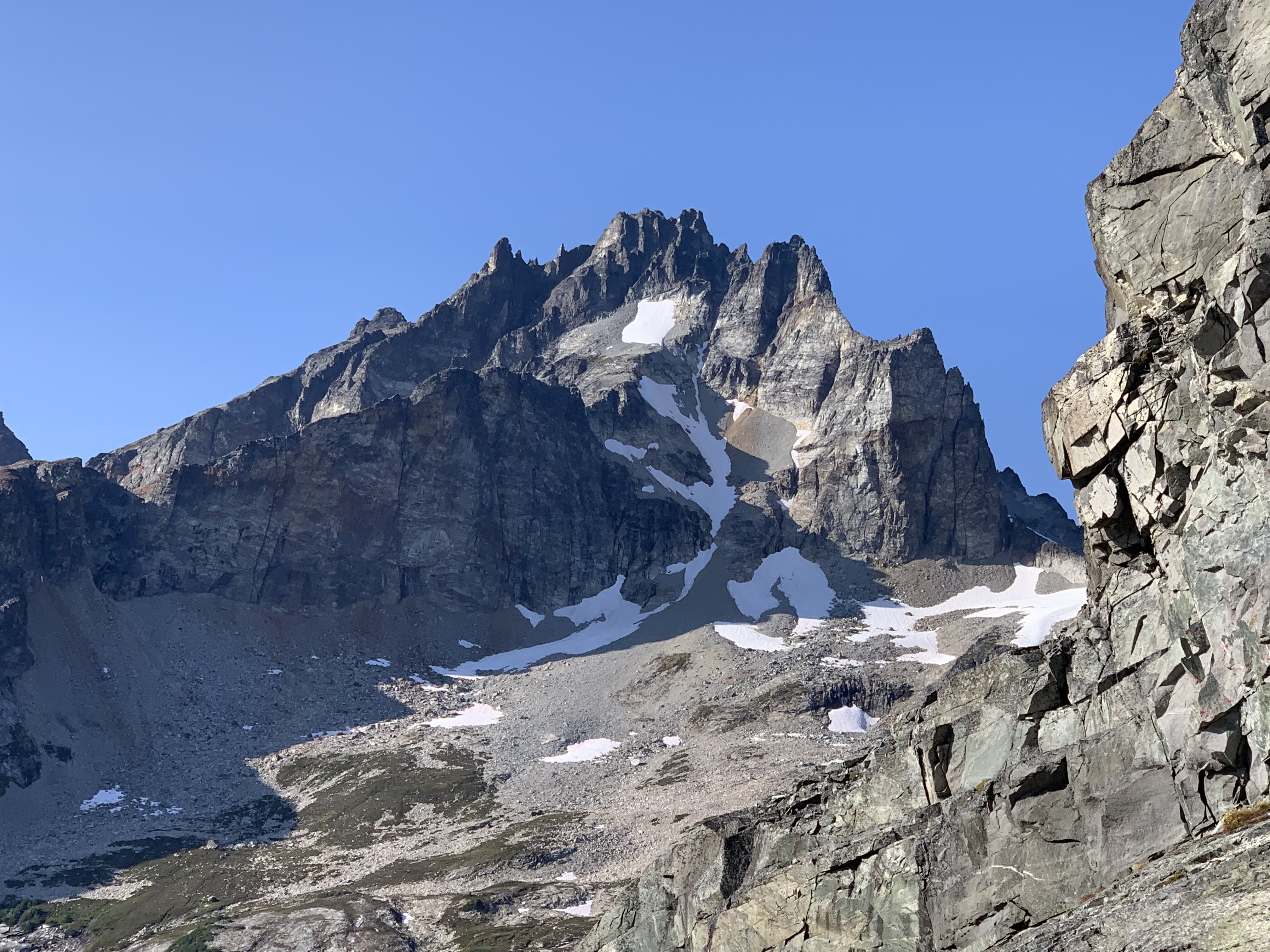
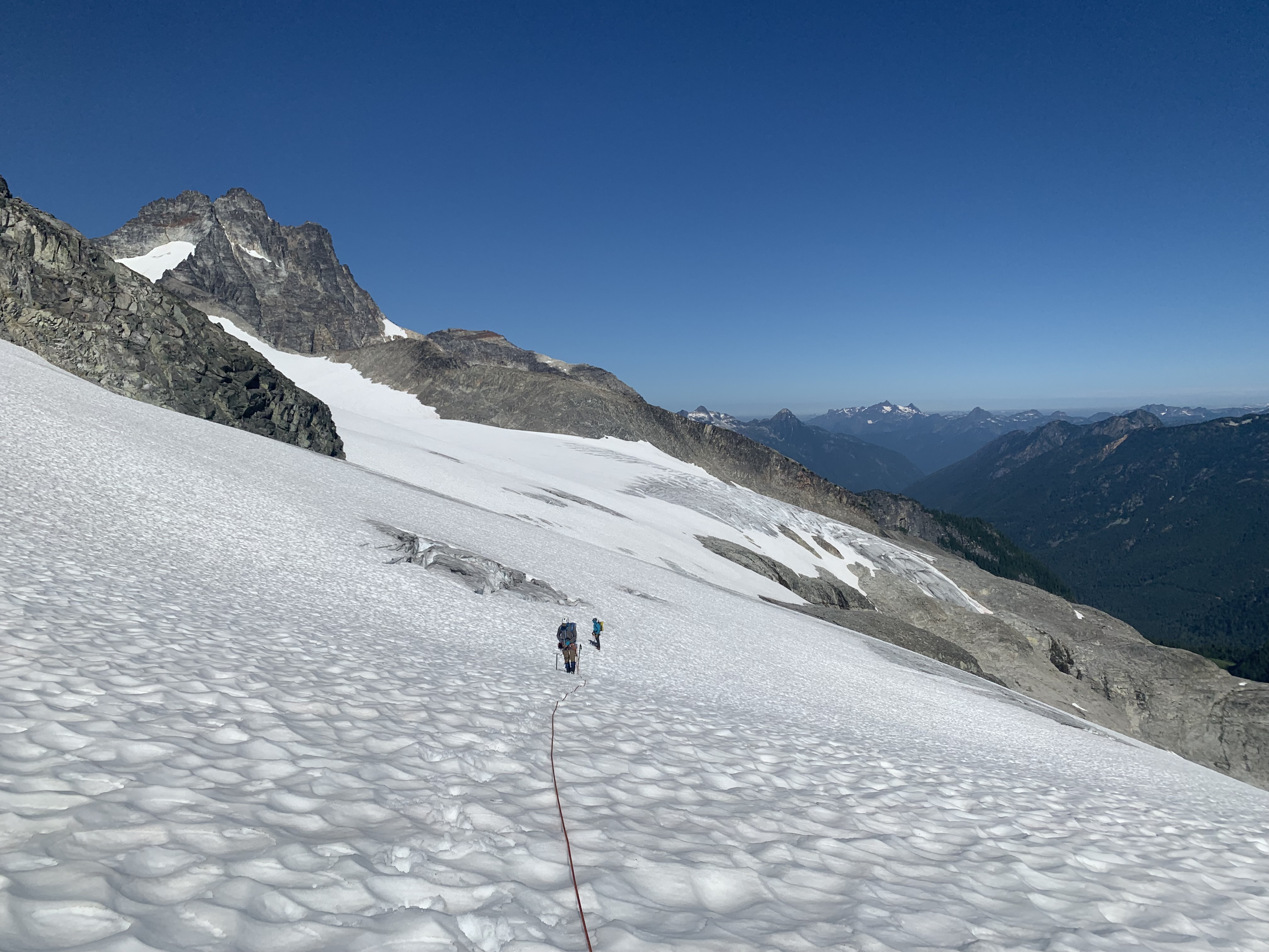
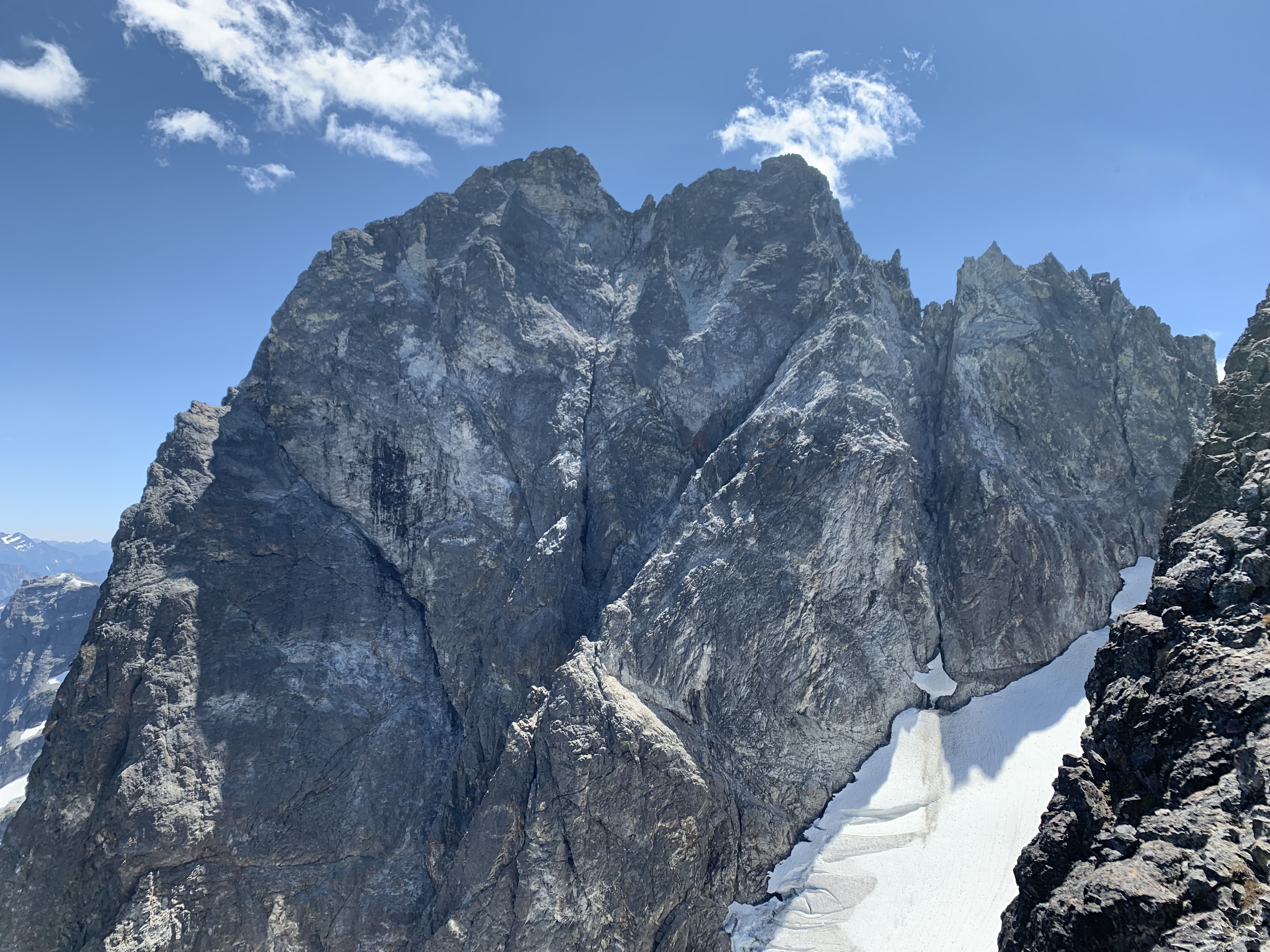
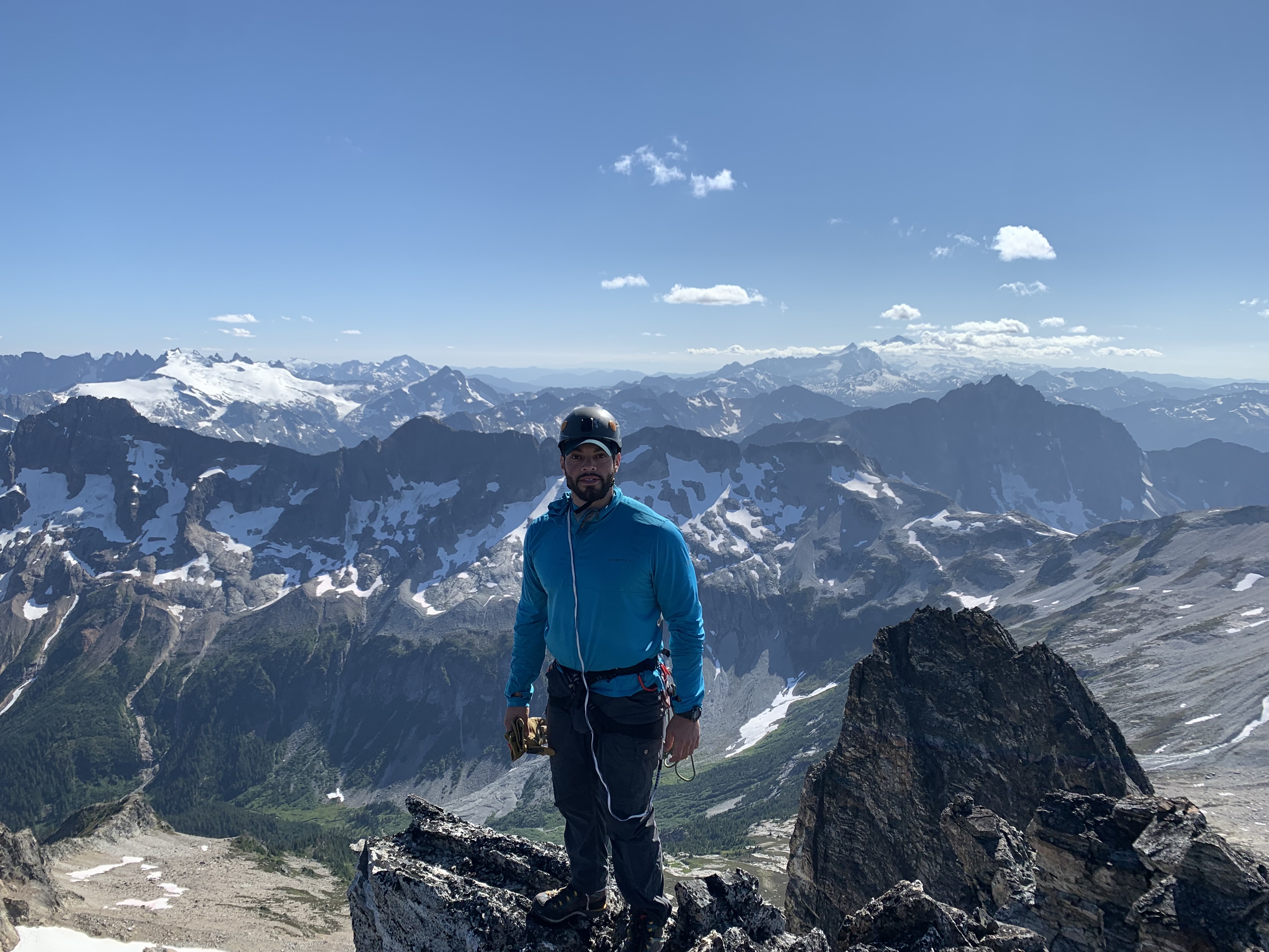
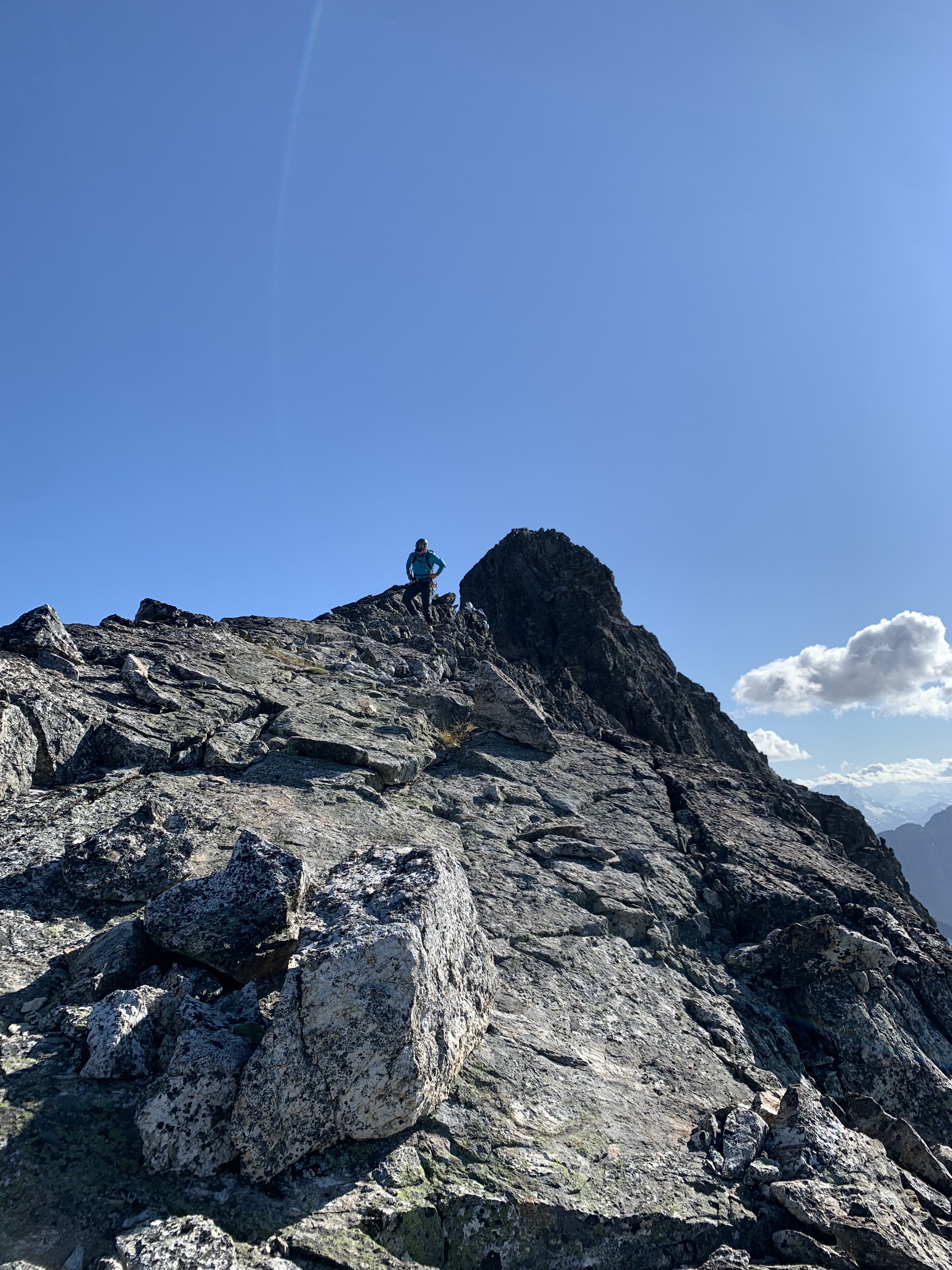
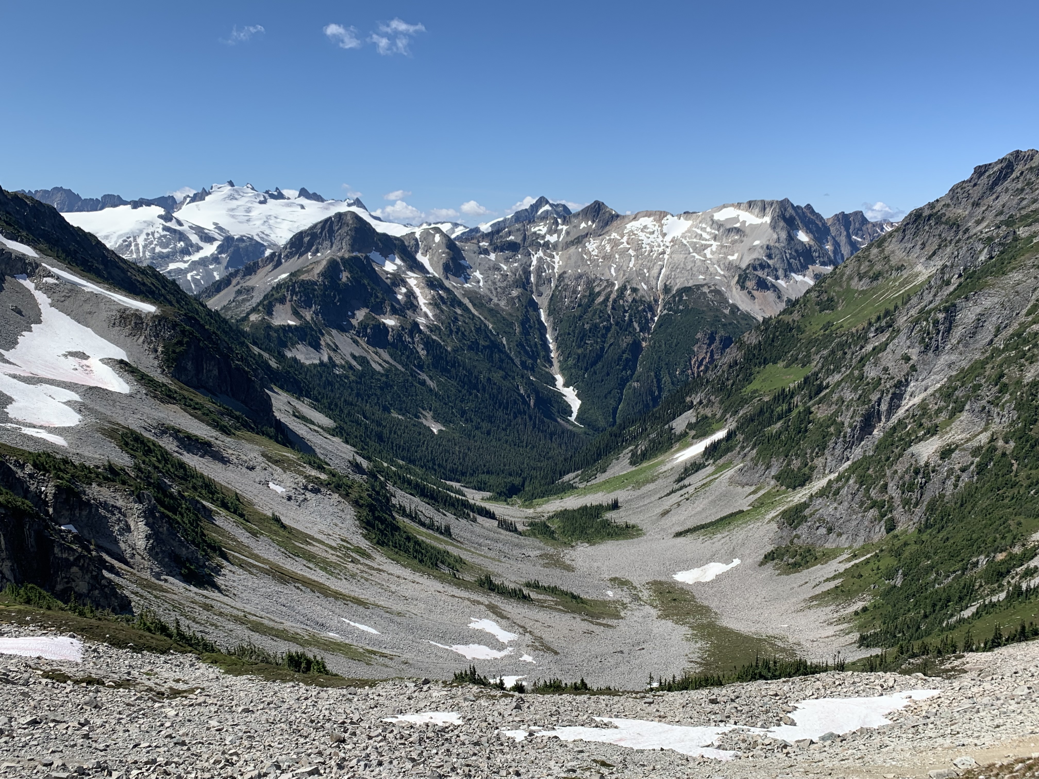
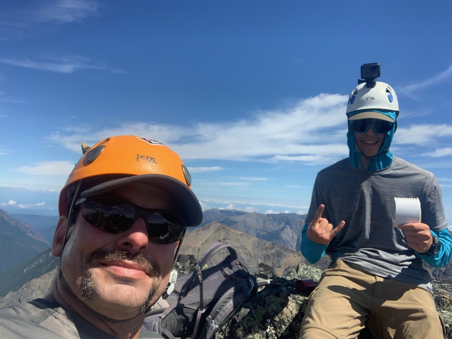
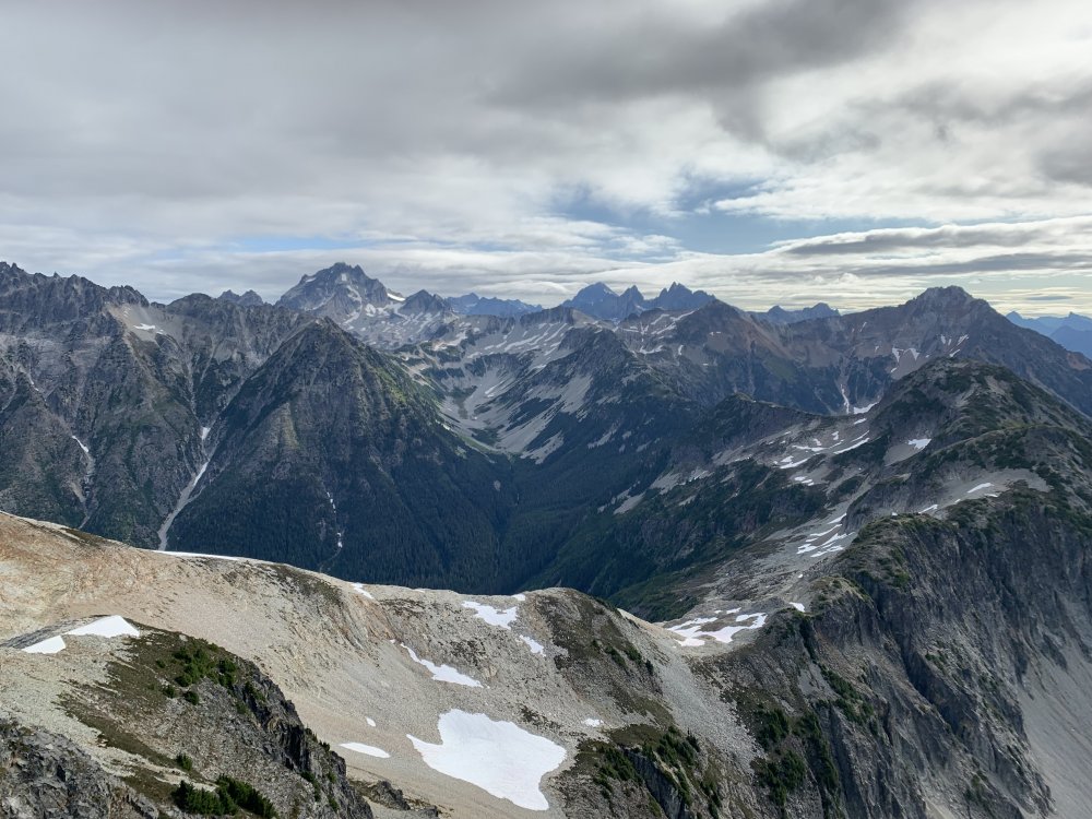
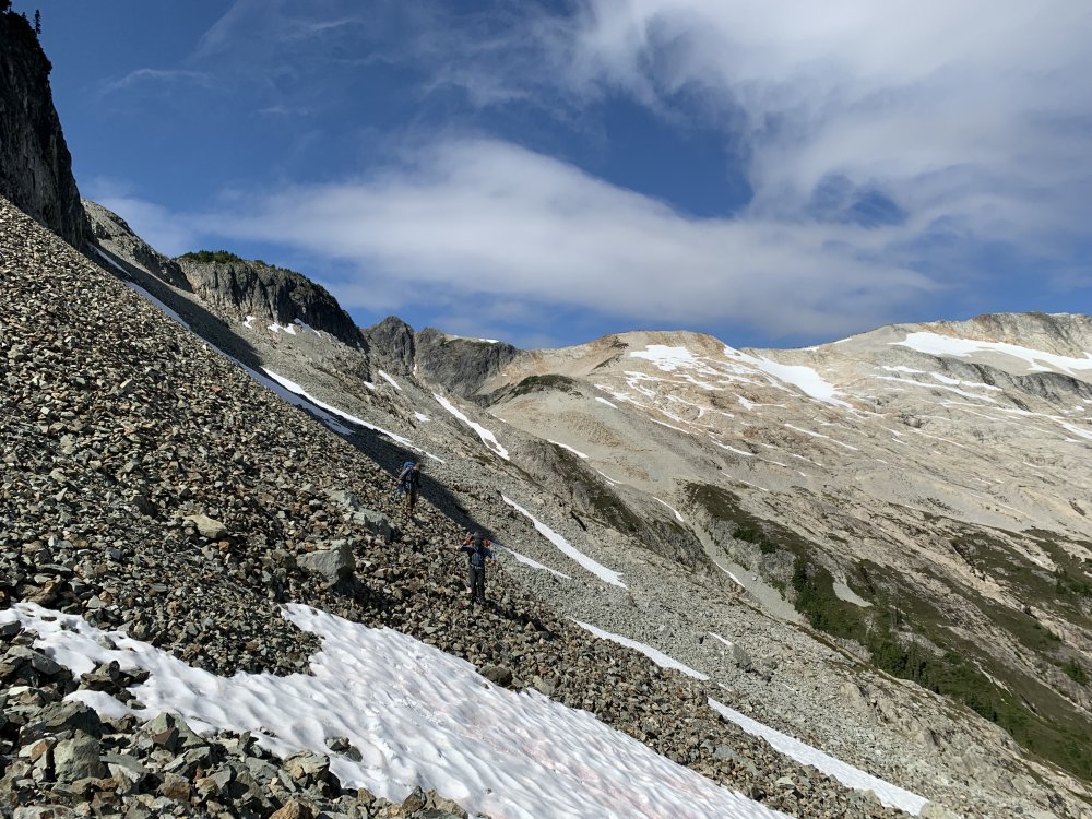
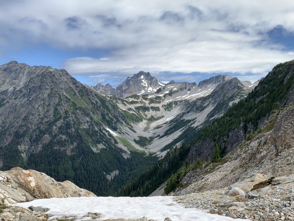
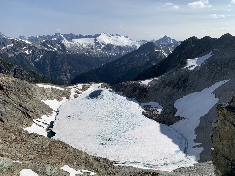
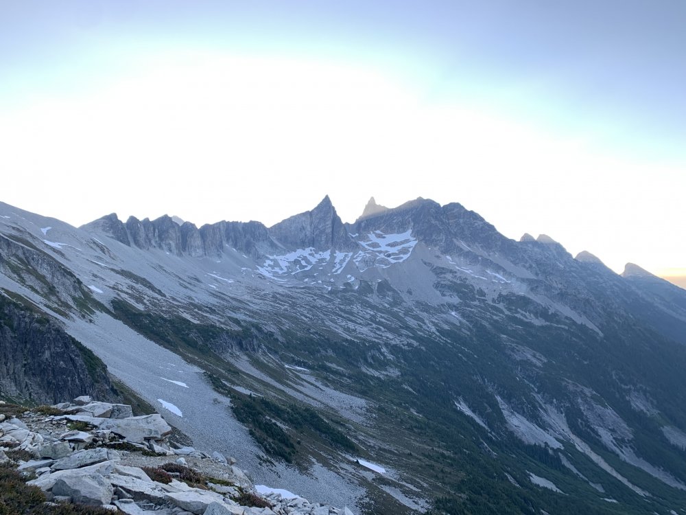
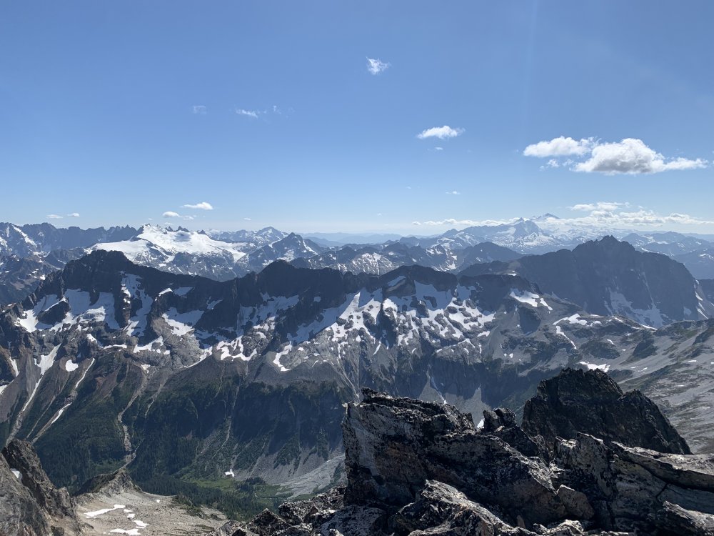
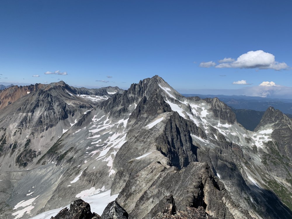
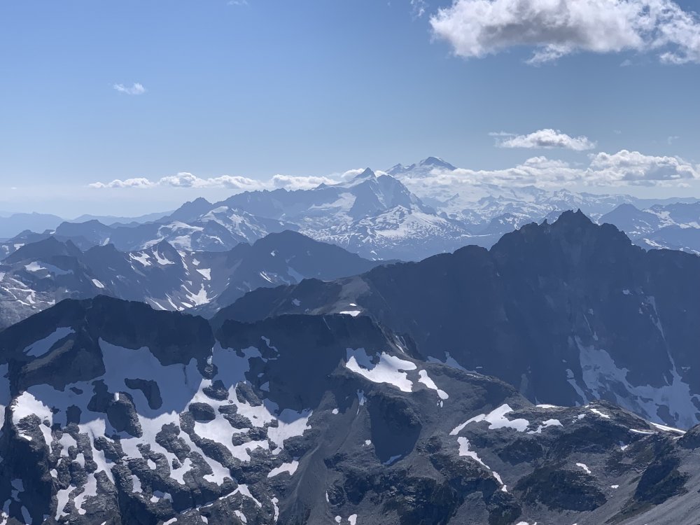
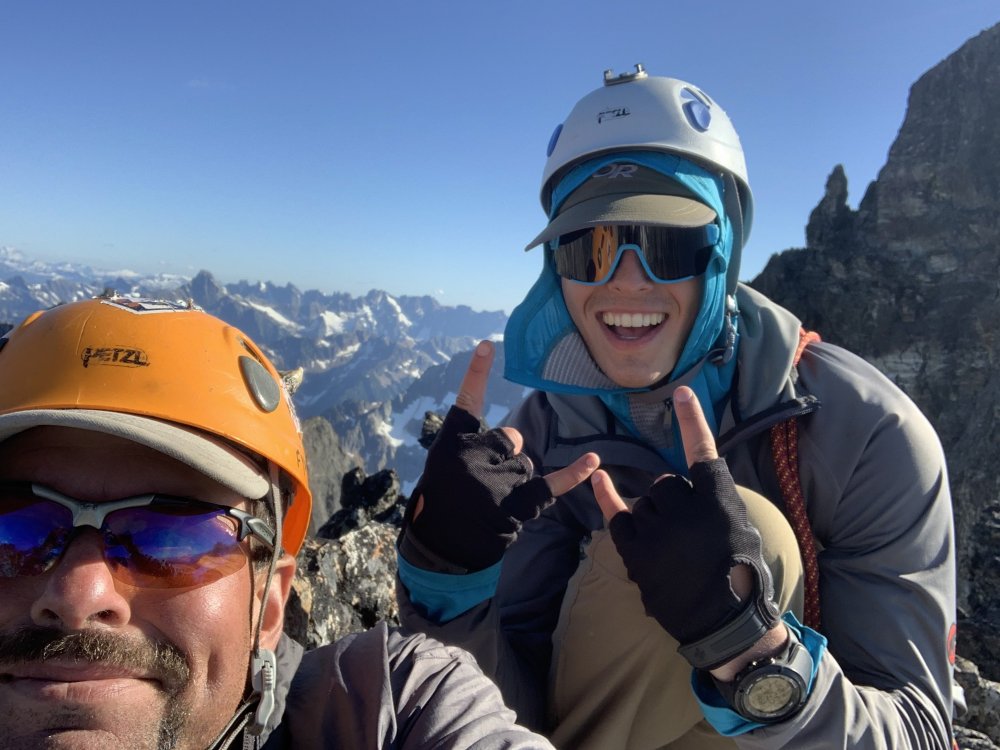
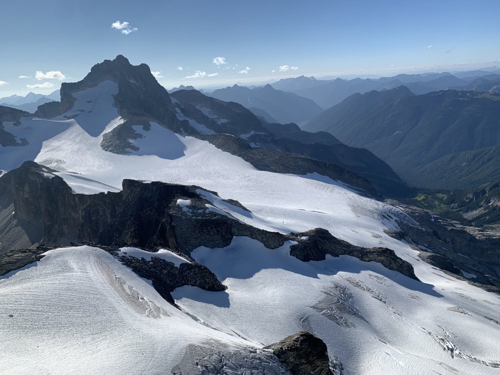
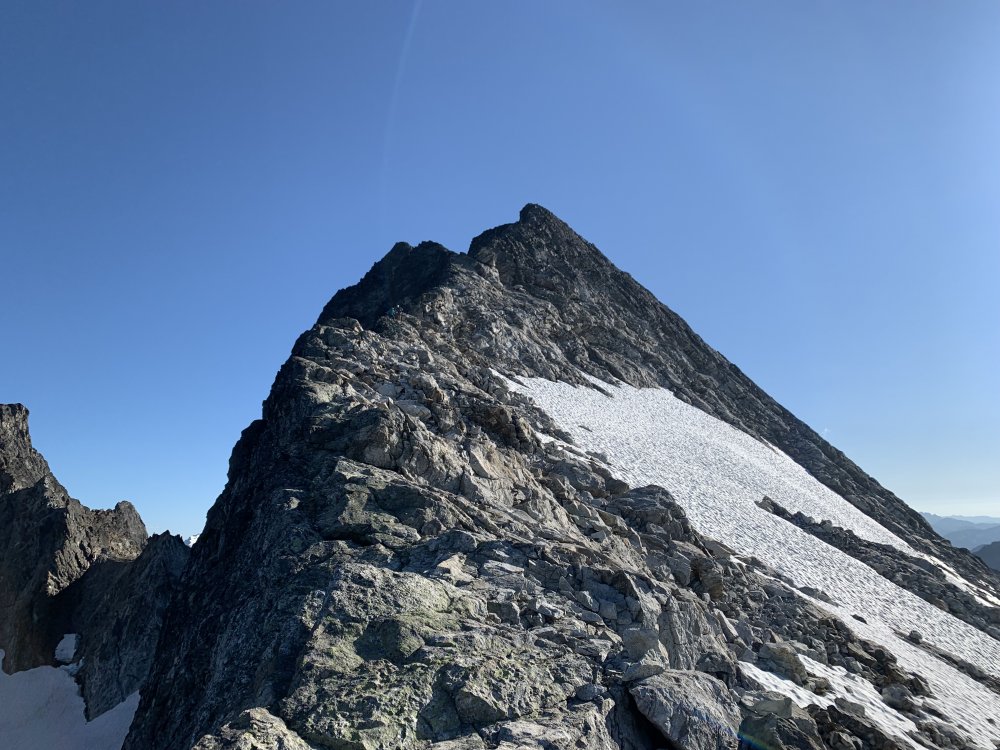
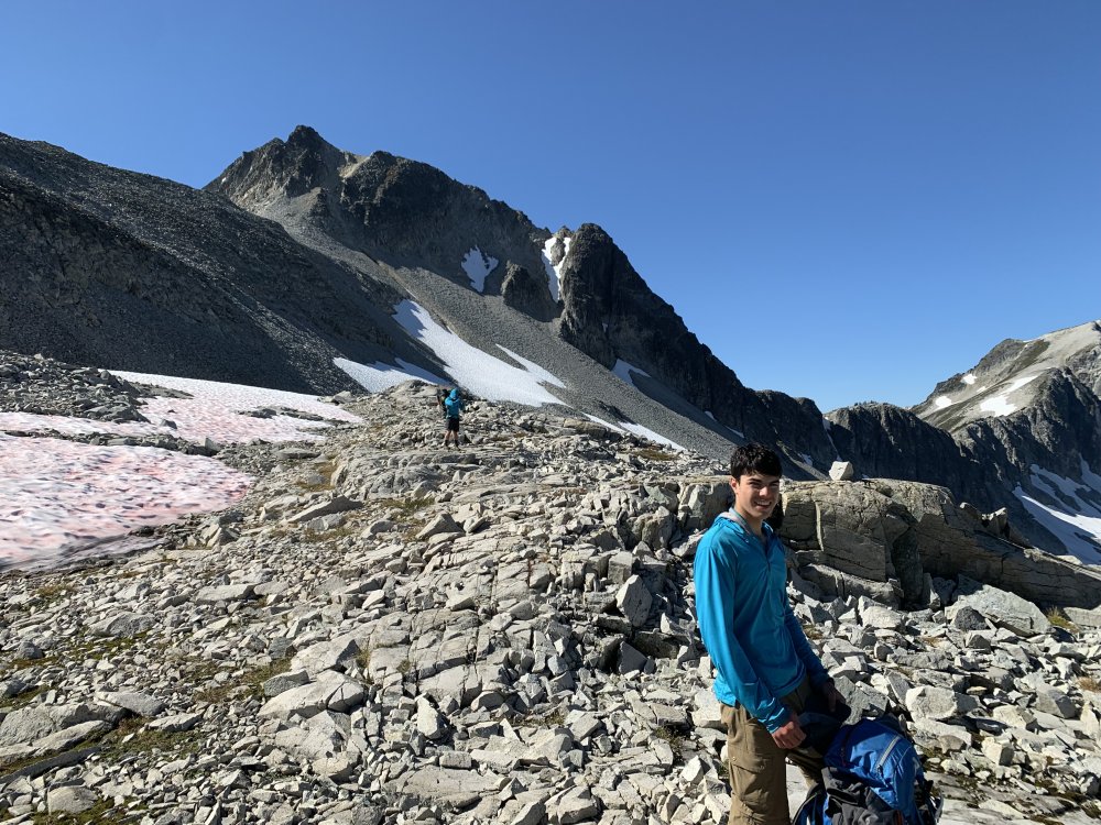
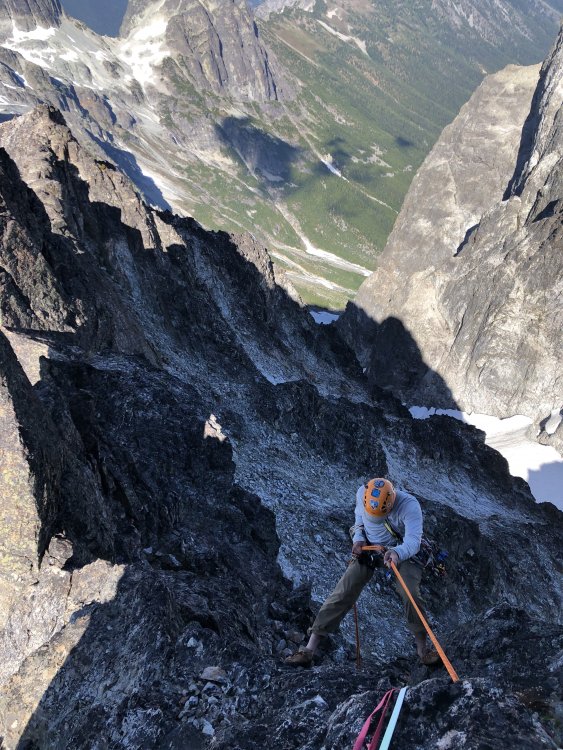
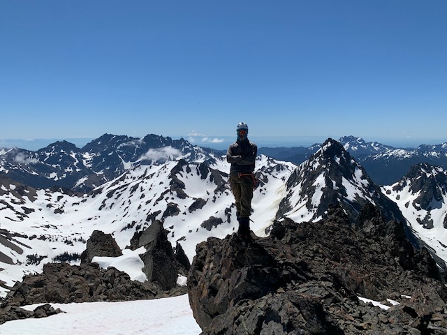
Trip: Mox Peaks - NW Peak (Easy Mox) - NE Ridge Trip Date: 07/24/2021 Team: @Stefan B @KaskadskyjKozak Trip Report: It's been a long journey tackling the Bulger list. And what a way to end it - with a long journey! A long fucking journey! In 2019 I was committed to slaying the beast, tackling 14 of 16 remaining Bulgers only to get blocked in late August in the Chilliwacks when we cut the trip a day - and a Mox - short due to an injury. Oh, well, that just left me with just two peaks to clean up in 2020 - Buckner and Easy Mox. Easy enough. Then there was COVID. As the border closure continued into June 2020, I began researching approaches from the US side for Easy Mox. No option seemed appealing, but two stood out as viable options: a high traverse via Whatcom or approaching via Silver Creek. I procrastinated, hoping the border would reopen, then finally tried each - and failed - in late summer. I utterly underestimated what these approaches would take, and despite being in great shape by that time of year, fell short. Oh well, I could just do the standard approach in July 2021, right? When it was obvious the border would not reopen in July, I began planning again. I coaxed and wheedled friends to try to join me for weeks - after all, who wouldn't jump on such an opportunity, especially to take multiple days off of work for a death march? The amazing weather we have seen in July held and held and held. The stars aligned on climbing partners. I pulled the trigger. There were three of us: my son, Jorge, and me. Applying lessons from my failed attempt in August 2020, I split this trip into a 5.5 day itinerary, which went as follows: Day 1: Evening hike to camp at Hannegan Pass. Not much to say here except we arrived later due to traffic and started up at 8 pm. So glad I built in buffer to my itinerary! Day 2: Got up early-ish and hiked trails to Whatcom Pass, then took by-trail towards Middle Lakes, camping by a small tarn with awesome views of Challenger and Whatcom. The tarn was warm and we even got to clean up before dinner. (7:15am - 5:15pm). Day 3: Got up early and did the high traverse, camping on slabs above Bear Lake, SW of the saddle extending below the SW-trending ridge extending from the SE peak of Redoubt (6 am to 7:30 pm). We had a small pool with running water *at* camp. The high traverse was inspired by a TR from a few years ago. In summary, we summitted Taps mountain, then traversed ridges NE-ly to the lake below Cave Mountain (Pass Lake?). We then traversed NW towards Bear, then NE towards Redoubt. Our biggest time sink on this day was due to bush-whacking through hideous, thick trees on steep slopes getting to the upper basin above the Pass Creek drainage. We took 3 hours in this section. Day 4: Long fucking day (6 am to midnight). This involved traversing to the ridge on the Depot-Redoubt Divide, traversing the Redoubt glacier, climbing the route, then doing it all in reverse. Some detail on our long climbing day: We ascended the SW ridge of the SE peak of Redoubt until about 7200', then downclimbed about 100-200' to talus and traversed to the first point we could cross on the E ridge of the SE Peak of Redoubt, roped up, then walked the glacier over to a fine snow ramp leading towards the low point on the NE ridge of Easy Mox. I led a full 60m pitch up the slabs above the snow ramp, only to be stopped about 30 feet short of scramble terrain, and then led a very short second pitch to the top rap anchor. We then scrambled the ridge. Holy shit, what an amazingly exposed, improbable ridge! We found the gully off the ridge easily and scouted out the final pitch and settled on two options. I tried the easier one (we had a picture from an online TR that made it look like the right start) but it dead-ended on the ridge so I downclimbed. Jorge then led the other option (which was correct) and set up a belay at the bottom rap sling. We then solo'd the final 25 feet or so (up to the higher rap anchor). We did two rappels, downclimbed the ridge, then did two more rappels. We were super careful to not get any ropes stuck on our pulls! It was now around 8 pm. We roped up and crossed the glacier which was very soft after a full-day of sun exposure. We essentially retraced our boot path, but punched through opening crevasses twice (on the eastern lobe of the glacier). As we rounded the rock spur to get to the W part of the glacier, the sun set and we unroped by headlamp. We then miraculously scrambled boulders, talus, and scree back to camp with minimal issues. Day 5: Slept in (8 am) and did the traverse back to our camp from Day 2. We got a late start due to the previous long day. It was hot and sunny - the hottest day so far, and we were grateful for lingering snow patches and fresh running water in many places. We followed a much better contour from the upper Pass Creek drainage back to the NE ridge of Peak 6874 which took us less than half the time to do. Bugs were bad at camp - noticeably the worst of the trip so far. (10 am to 8:30 pm) Day 6: Got up early and did the full 17.5+ mi hike out to Hannegan Pass. Bugs were hideous in the final few miles to Hannegan Pass. (6:30 am to 6:30 pm). Bulgers done. 100/100. Now for the pics! View of high traverse from the summit of Taps Mountain. Redoubt looks *far* from here: Views South from Taps Mountain. We were surrounded by these amazing views above treeline continuously for four days: Looking back at the first part of the high traverse from near and below Peak 6874 Indian Creek Drainage from the traverse. Bear Mountain on left: Traversing the lake above Pass Creek and below Cave Mountain. I believe it is called Pass Lake: Nearing the end of our traverse and camp. Redoubt is finally close! Summit Day taken just above our camp. The Moxes still look far. We had a lot of talus to traverse just to get to the glacier! Finally on the Redoubt Glacier! Looking down P1: Hard Mox as viewed along the N ridge of Easy Mox. The exposure and views are unbelievable! Summit views from Mox back towards our traverse: Spickard, Custer, Rahm. Been there, done those: Shuksan, Baker. Ruth looks far! TBH, I was not looking forward to the long walk back to Hannegan when I took this pic: Jorge on the summit: My son and I on the summit. KK rappelling. This, along with one I have from Storm King are my two favorite rap photos ever! Redoubt as the sun got lower in the sky and we downclimbed. The sidewalk in the sky: Longer view up the NE ridge: At camp on day 5, getting ready to traverse back to Middle Lakes: Looking down the Indian Creek drainage. Taken on the traverse back to Middle Lakes: Taken from a point about 6400' - the high point on the NE ridge of Peak 6874 that we climbed after the traverse above the Pass Creek drainage (right of frame, mostly out of view, blocked by the ridge): East Lakes as viewed on the traverse, near Taps Mountain: Descending to upper Middle Lake: Gear Notes: 60m rope, mid-sized rack, helmets, glacier climbing gear Approach Notes: Long, brutal, epic.


-
I generally see deer on roads or near established camp sites (deer know there is pee to lick up there). Sometimes I see them off fairly popular trails (like cascade pass trail).
-
[TR] Mount Deception - Standard 06/20/2021
KaskadskyjKozak replied to KaskadskyjKozak's topic in Olympic Peninsula
This is awesome! My son's first "interesting" alpine summit (and Bulger) was Cashmere. He was 10 at the time and didn't look much different than you and your brother Great to start the kids early - sure wish I had the opportunity myself growing up -
We are entering a weekend with a heat wave and 17K freezing level. That's about the highest I've ever seen in our area (usually 14-15.5K is the high for freezing level in a warm stretch in WA state)
-
[TR] Mount Terror - West Ridge 06/20/2021
KaskadskyjKozak replied to Ian Lauder's topic in North Cascades
I don't do well in high temps. I may be sitting out this weekend myself. Good luck in whatever you do (if you go) -
[TR] Mount Terror - West Ridge 06/20/2021
KaskadskyjKozak replied to Ian Lauder's topic in North Cascades
thanks! Yeah, I hear you on stream crossings - they'll be really raging this coming weekend -
[TR] Anderson - Eel Glacier 05/30/2021
KaskadskyjKozak replied to KaskadskyjKozak's topic in Olympic Peninsula
do you happen to have a picture you can share of the slope up to Flypaper Pass now (with the rock bands)? You've piqued my curiosity on how much has melted out. -
[TR] Mount Terror - West Ridge 06/20/2021
KaskadskyjKozak replied to Ian Lauder's topic in North Cascades
Cool trip and beta! Where did the snow level start in earnest up there? The last update I saw on the NP website says "4000'" (from a week ago). Of course we have a heat wave this week, which could melt a lot of snow, but still would love to hear where you encountered consistent snow pack. -
[TR] Mount Deception - Standard 06/20/2021
KaskadskyjKozak replied to KaskadskyjKozak's topic in Olympic Peninsula
Yeah, it's an awesome place. I will go back for sure. -
[TR] Mount Deception - Standard 06/20/2021
KaskadskyjKozak replied to KaskadskyjKozak's topic in Olympic Peninsula
tea bag? Well, one old dude did go skinny dipping in the lake -
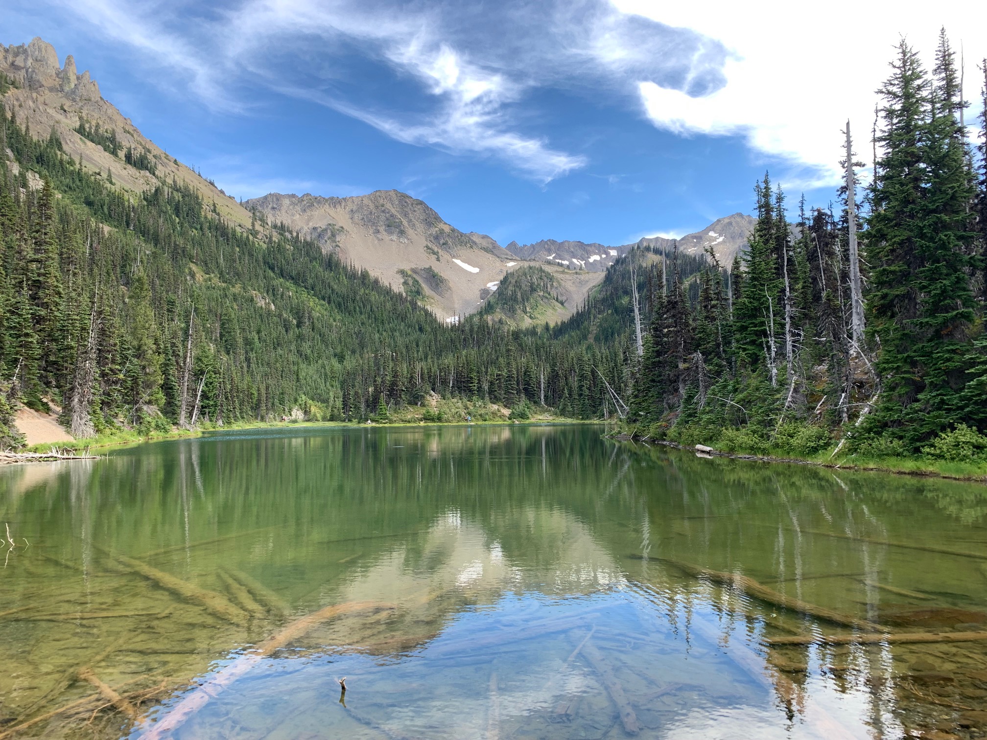
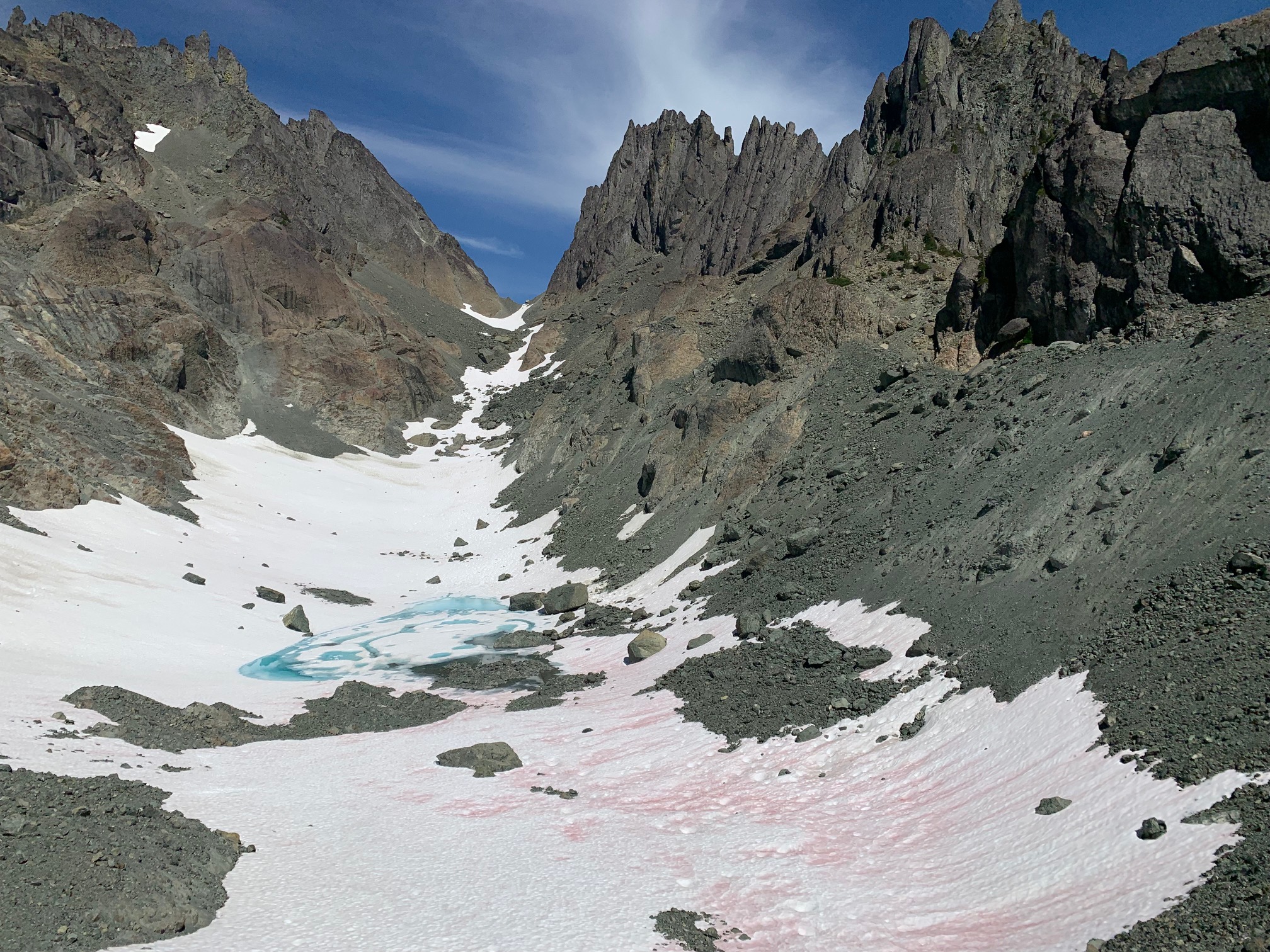
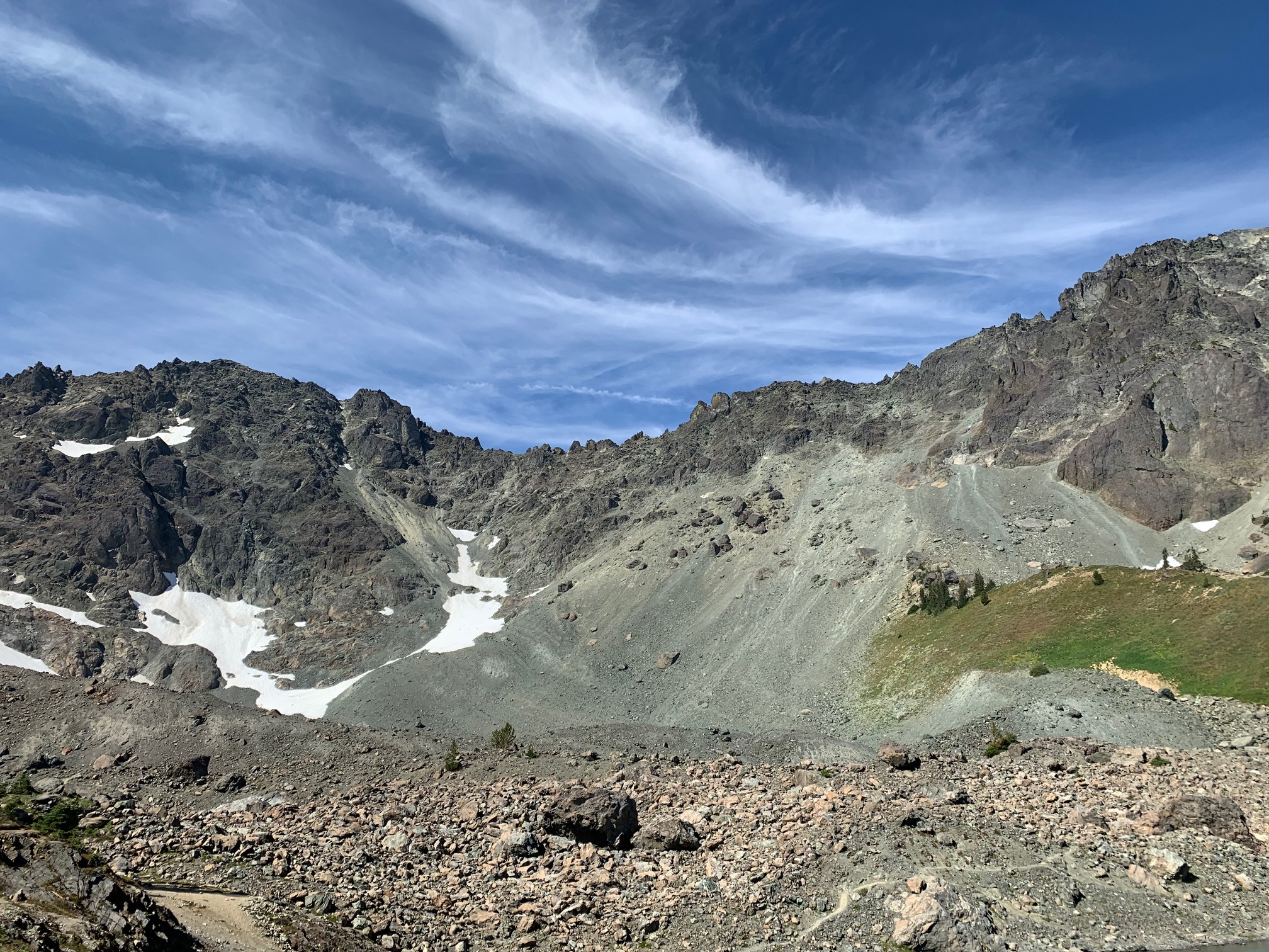
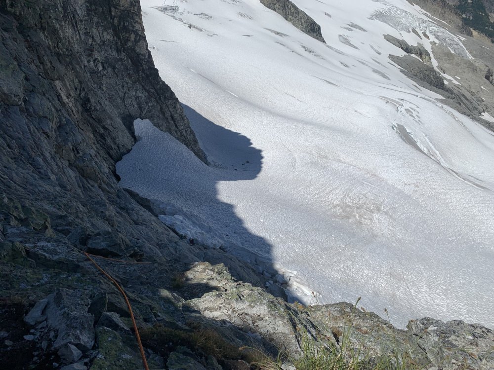
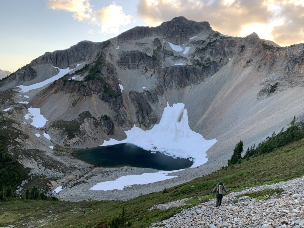
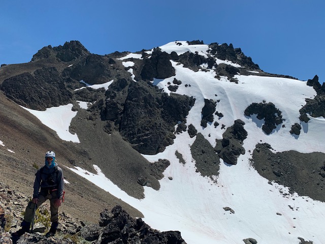
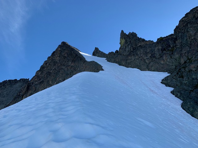
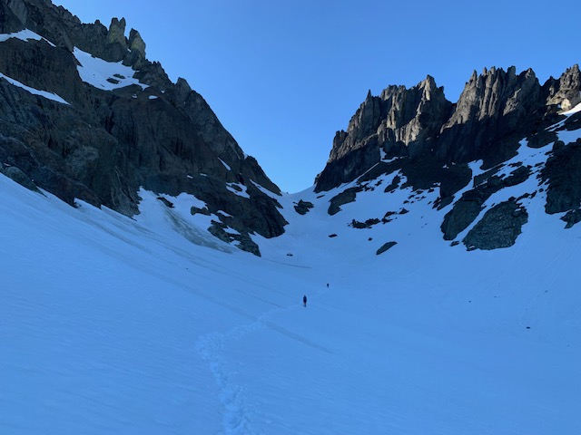
Trip: Mount Deception - Standard Trip Date: 06/20/2021 Trip Report: We were back in the Olympics this weekend - this time for a three day trip up to the Royal Lake area. Our three-person team included my son to help me celebrate Father's Day in the place where I like to be the most - in the mountains. Kudos to him for mustering the energy after a mid-week trip to the Gardners with friend and a one-day rest in-between (ah, to be 19!!). Not much to say about the approach - we took about four hours with a 30 min lunch break and arrived at 2. We had read some recent TRs warning about shin deep puddles and several feet of snow about 4500', but that has melted. The trail was almost snow free to the lake and most campsites were dry (two had some snow or a puddle in the platforms). Sunday was our big day. We headed up at 5:20 am, went to the upper basin, then picked a line up to the Deception-Martin saddle. We mostly stayed on snow, and the upper rock bands - that are reported in some sources as very loose and dangerous class 3 - were almost all under snow. The top consisted of 400 feet or so of snow (45 degree slopes, sustained, +/- 5 degrees in places). From the saddle we dropped down and left to the glacier, and traversed under Gilhooley tower, (the 'bypass' route). We climbed to the ridge on the far side of Gilhooley and took the trail to the summit (mostly snow-free until the very top hundred feet or so). Total time up was about 5:20. Looking up the Deception-Martin saddle: Steep snow just below the Deception-Martin saddle: On the ridge near Gilhooley Tower: Happy Father's Day to me (summit of Deception): My son on the summit of Deception: After enjoying the summit we retraced our steps until we hit ~6100' . We then contoured above the upper Royal Basin to pick up Surprise Basin, and then ascended to the saddle at its top. We were encouraged by the ledges - snow free - and headed up. Unfortunately just before the final 100' or so, we hit a snow patch with very poor runout. With it being late in the day (5:30) and the snow soft, we were not comfortable soloing this terrain, so we called it a day and headed back to camp (8:15). We spent another night at camp and hiked out in the morning. Upper Slopes of Surprise Basin: The start of the ledges on Clark: A short downclimb while traversing ledges around Clark: The last bit - steep snow with poor run-out to cliffs: Morning Reflection before we hiked out from Royal Lake on Monday: Gear Notes: Ice axe, crampons, helmet. Approach Notes: 99% snow-free to Royal Lake. Mostly snow-covered beyond.

-
[TR] Anderson - Eel Glacier 05/30/2021
KaskadskyjKozak replied to KaskadskyjKozak's topic in Olympic Peninsula
Four groups: parties of 2, 3, 4, and 4 (we were the 3) -
current North Sister conditions beta
KaskadskyjKozak replied to wingclimber's topic in Oregon Cascades
Oh I thought this was about the peak west of Baker in WA.... -
current North Sister conditions beta
KaskadskyjKozak replied to wingclimber's topic in Oregon Cascades
my guess is it's in prime shape right now - including the N face. go get it and let us all know how it went! -
[TR] Whitehorse - Lone Tree Pass 05/22/2021
KaskadskyjKozak replied to KaskadskyjKozak's topic in North Cascades
On my second ascent of Whitehorse, I took the glacier route. We solo'd the ramp up and down. One of my partners, downclimbed part way, then decided to glissade. His slide immediately turned into a human starfish/pinwheel. I thought for sure we would be calling a helicopter. Somehow he stopped, got up, grinned, said he was ok, and continued down on foot.