


olyclimber
-
Posts
26930 -
Joined
-
Days Won
113
Everything posted by olyclimber
-

[TR] Eldorado Peak - West Arete 7/26/2025
olyclimber replied to Nick Sweeney's topic in North Cascades
It’s all about belaying, not about the climbing. -
"Route 66" V 5.10 AI2 FA on the NE face of Johannesburg
olyclimber replied to Sam Boyce's topic in North Cascades
Wow!!! -
https://www.mountaineers.org/blog/registers-canisters-a-grand-northwest-tradition hopefully people are replacing the actual register rather than taking to container down… I mean I think they are cool. Sometimes you see notable names in them, or a name of a now deceased climber of note.
-
That sucks…especially those old brass Mountie registers. Is it possible the Mounties are retrieving them themselves? But probably not unless the replace it with a modern container…
-
[TR] Despair (south peak) - East / SE side 09/12/2025
olyclimber replied to JonParker's topic in North Cascades
Tedious! ?. If tedious is the bar to get those views, sign me up for tedious. -
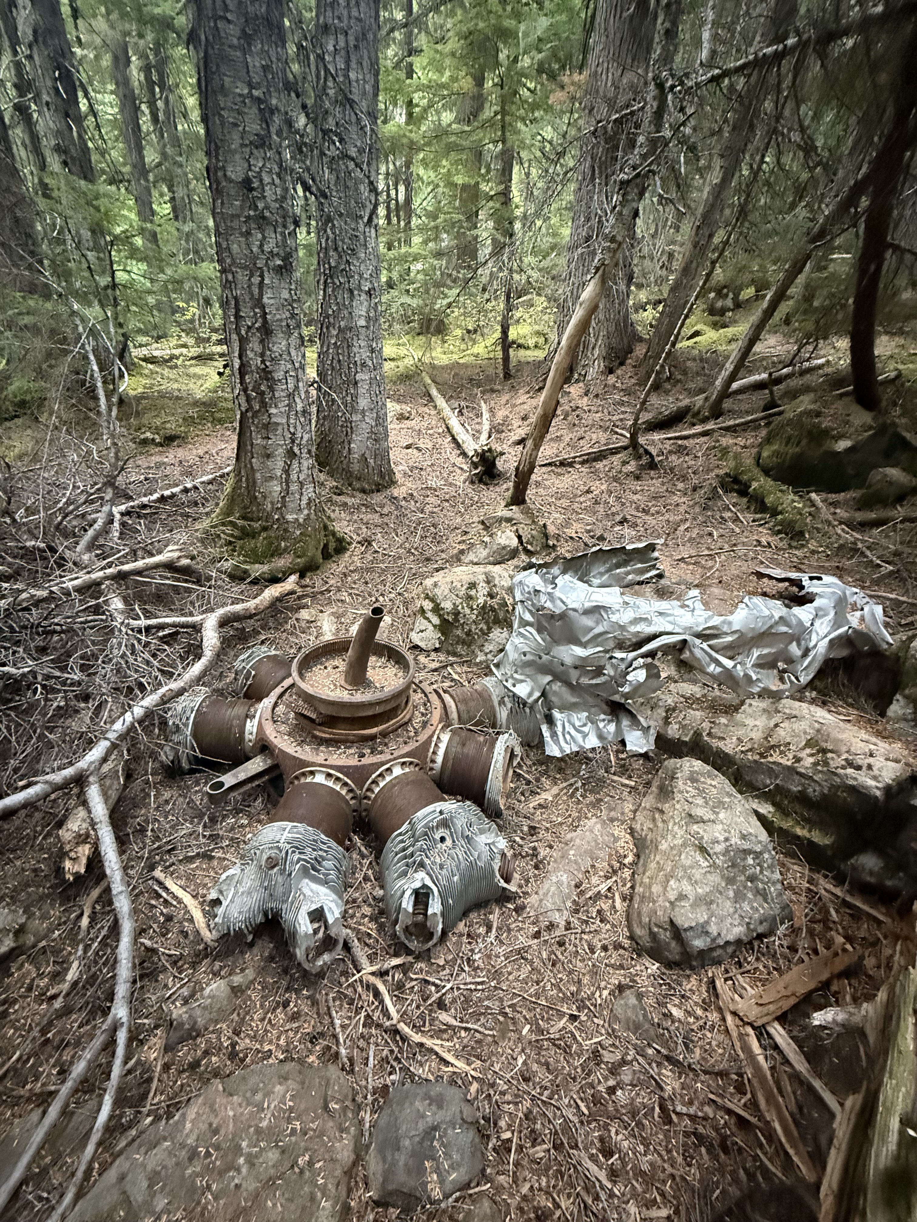
Went up there again. The smoke from the Bear Gulch spoiled the views to the south but we had a good time anyway. Was gonna camp on Hawk Peak but ended up going down to the plane wreck in Tull Canyon to get out of the smoke. plol


-
Unfortunately NWAlpine is calling it quits. Not sure what the plan is there, but taking the advert down. If you like their stuff (quality, made in a America) then get in on their going out of business sale here: https://www.nwalpine.com/ All the best to all....
- 1 reply
-
- 1
-

-
Now you’re on to something. Fire all the statisticians, force the team to give the US government 20% ownership of the team, make it so you can only buy tickets to the games with Trumpcoins. Deport any player with a batting average under .200.
-
best of cc.com [TR] Cascade Volcanoes - Bike-athon 06/06/2025
olyclimber replied to traildirt's topic in Mount Rainier NP
Damn! That’s impressive!! Let’s see a picture of the bike. definitely best of! -
Just brutal. Brutal. Are we cursed?
-
https://www.strava.com/routes/3399070454153677378
-
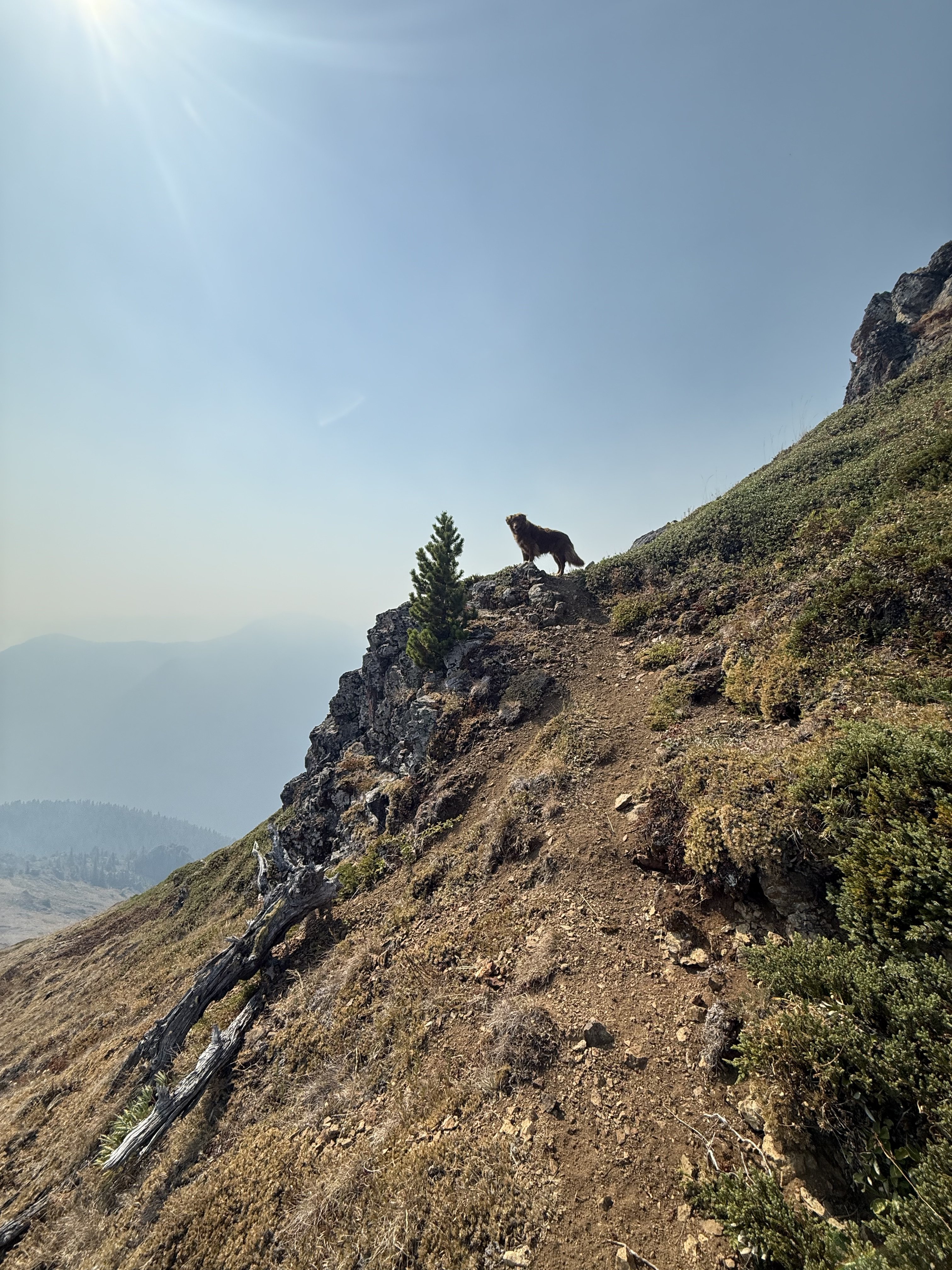
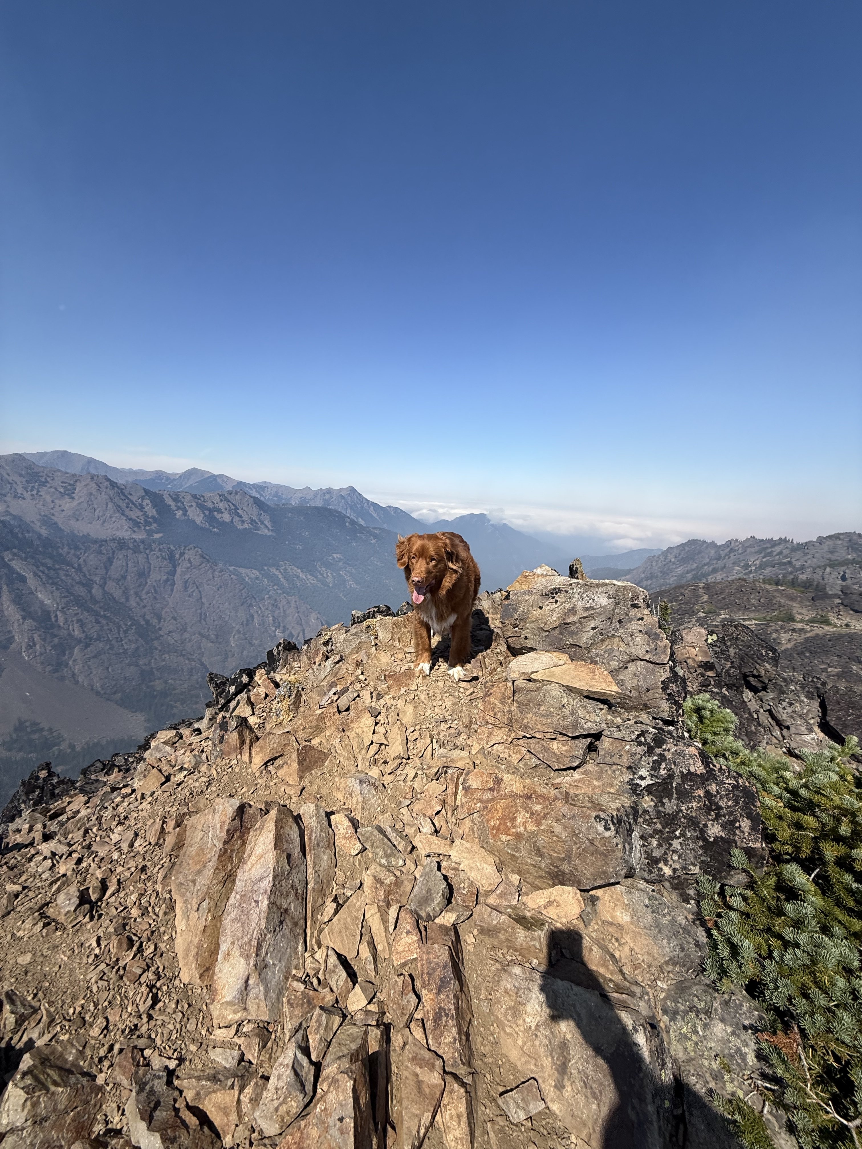
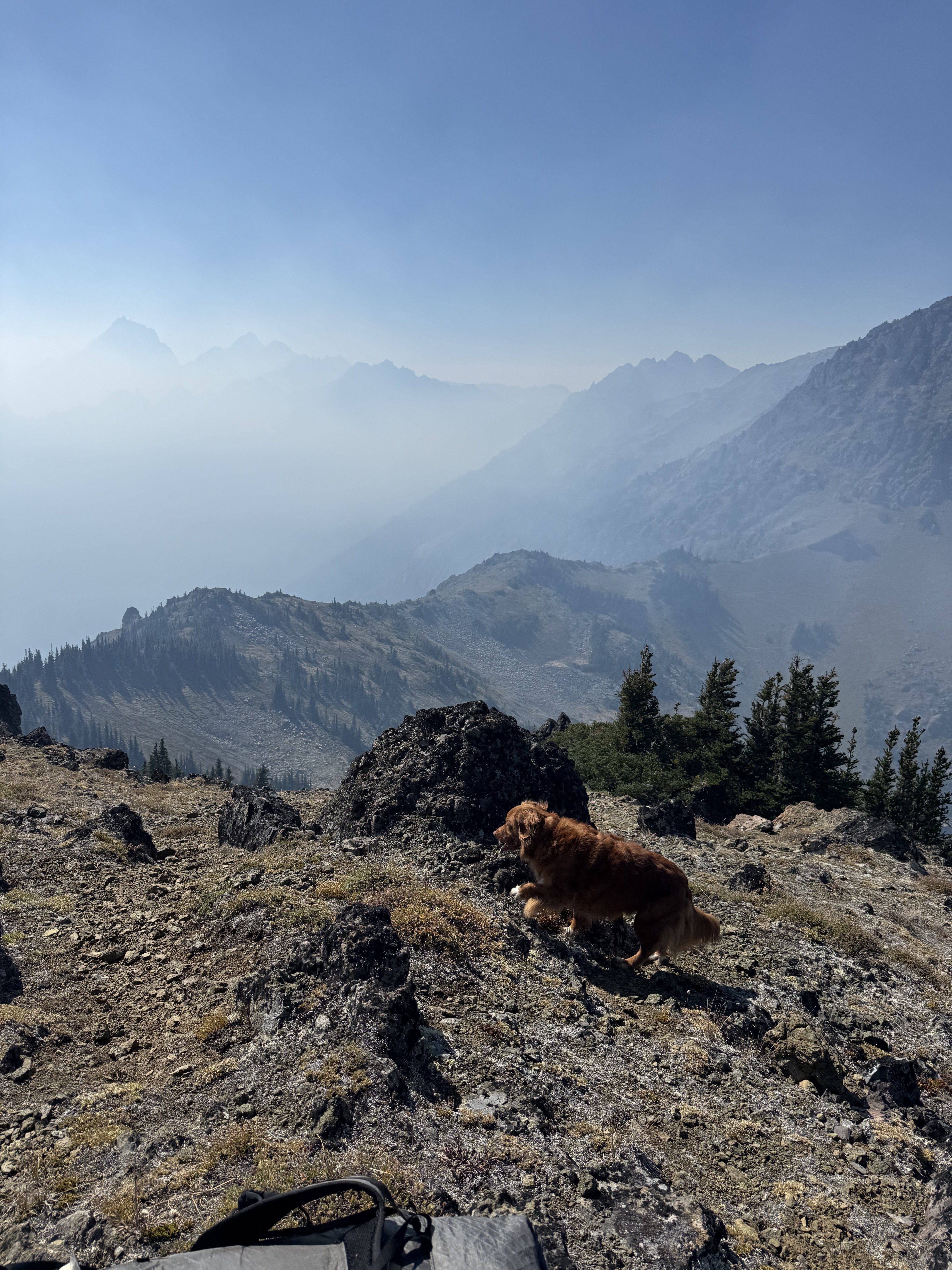
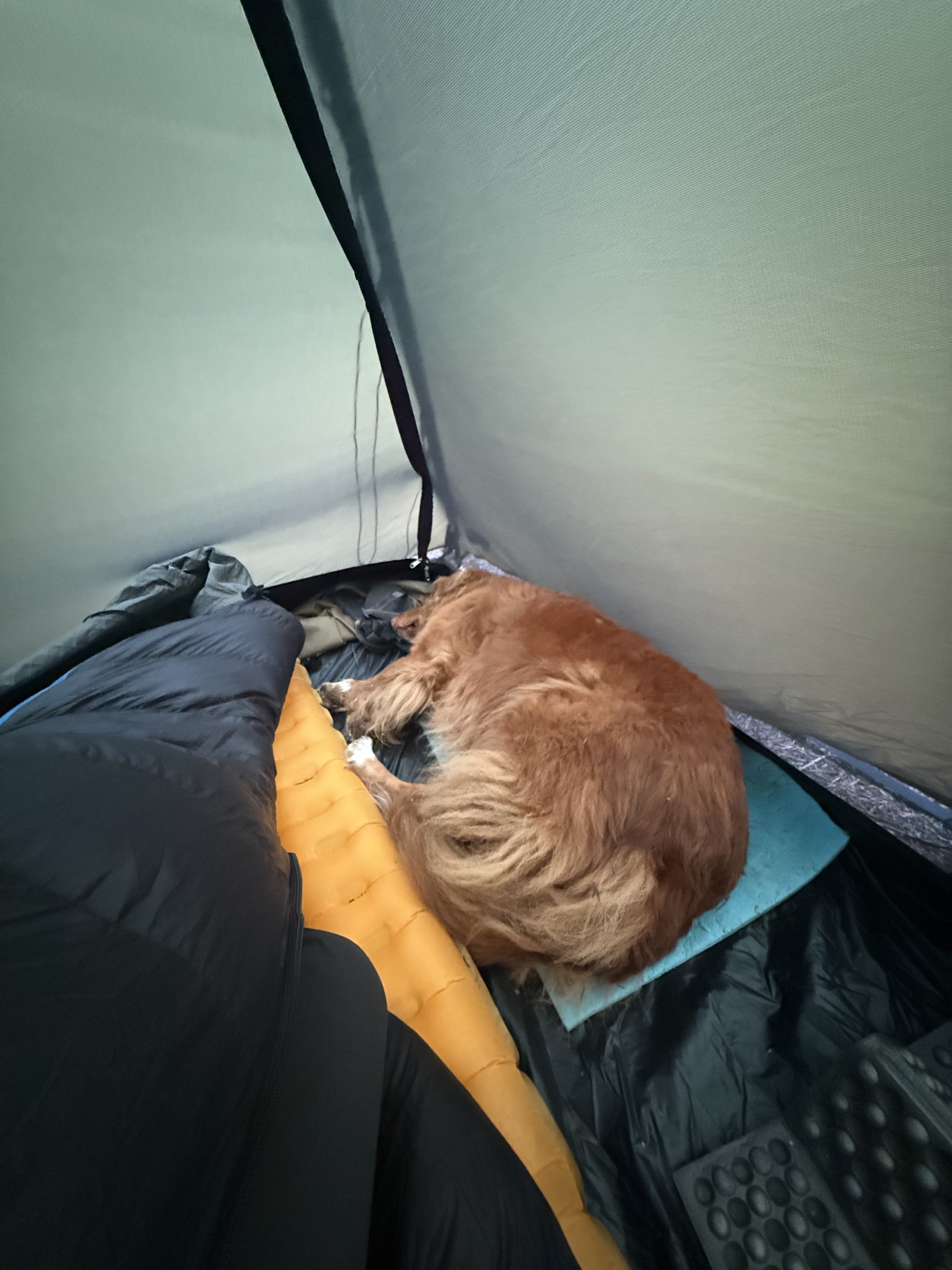
I don’t think I deviated much for the standard approach, if at all. I think I may have the tracks, I believe I have my trip on Strava. Im glad I did it, but I was super worried about Kiba going up and coming down. Perhaps only for a short section, but it was stressful. I’m definitely by far not the only person to take my dog up there, and after this I got Kiba a proper climbing harness. Just fyi. But happy to share whatever I got.
-
Nah Jason that is just a leaf my man. Joe Biden’s leaf.

-
it is indeed a waste of time! ?
-
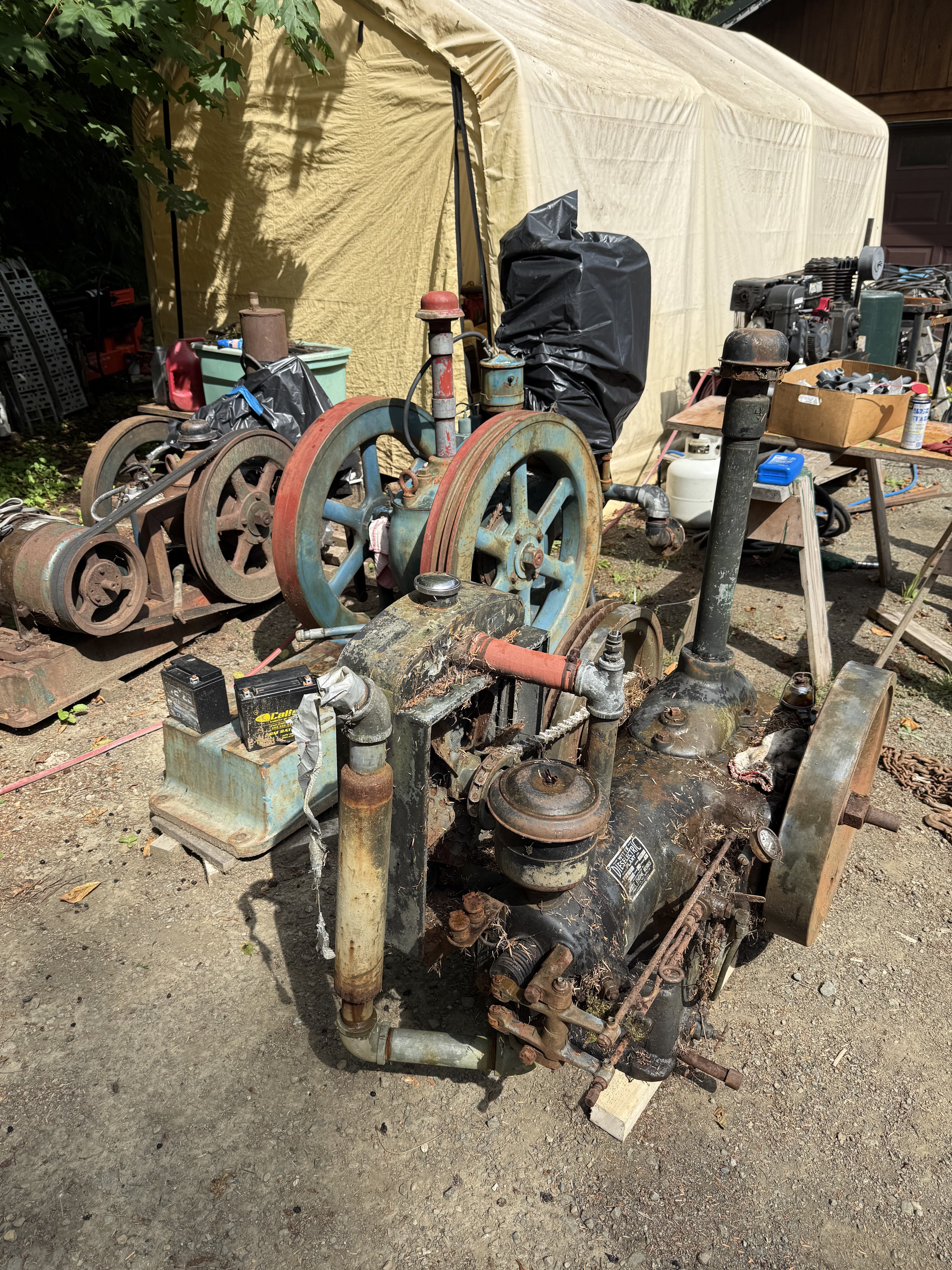
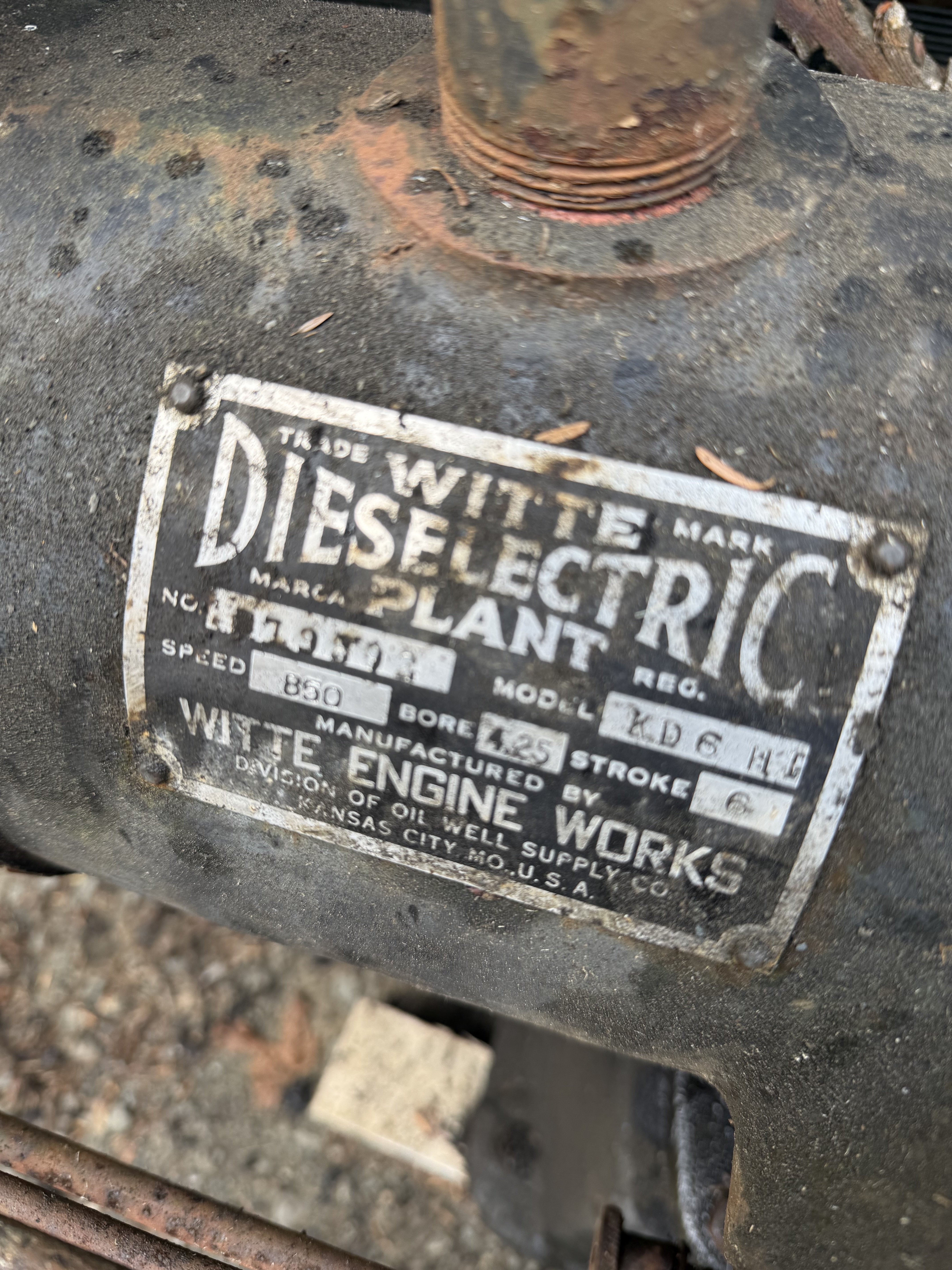
Oh Brian. Poor Brian. Is that the best you got? Sad. I just don’t feel like engaging in the battle of wits with someone so unarmed and so boring. We get it. You’re so brave with your knee bent before your orange master. So much “winning”, you’re full of glee to see your “enemies “ suffer. Sad. I have much better things to do. As far as emotion, yes. I have it. I am human. I love this country. It is a cruel time, a vindictive time where an authoritarian is stepping on the throats of people who barely get by as it is. Where the military, which is supposed to defend our country is instead being used to intimidate its own citizens for political purposes. I realize you don’t see this. Cult members don’t. I’m logging out to help my dad work on this engine…in the spirit of spray: get back to gobbling up those orange turds you so love
-
Yes your words are clear Brian. You buy into the orange clown show. You see the grift and you endorse it. 95% of it. Your words. Enjoy the orange koolaid. I’m out on the thread till I feel like talking to a follower again.
-
Guzzle that orange koolaid. Slobber it down. Man you really have bought into the cult haven’t you?
-
This thread is your hysteria. Look how worked up you are ?. Are those people storming the capitol? Trying to actually overthrow the federal government? If you can’t see the difference you are blind. Let’s see…arming the military and send them into the streets isn’t authoritarian? The list goes on but you must be blind and deaf, so why bother listing them. You clearly must be incapable. So Joe was simultaneously “authoritarian “ and “napping “? Now that is hysterical. Which is it Brian? Authoritarian napping? Glad to see you’ve own up to living in the cult Brian. Even got the prescribed vocabulary going I see.
-
Oh no! Someone showed a a flag on their off hours in a public park!!! Sounds like a ringing endorsement of treason to me!


-
How many times have the democrats done what happened on January 6th? Are you showing your support of the orange turd? You’ve been very careful to avoid doing that this far. So you consider that event an act of patriotism eh?
-
It’s just me reading the TRs 1000s of times
-
Good luck with that. That FA was put up by a badass.
-
They really should deploy the military to do this selective enforcement of the law. I believe that is what the American people wanted when they elected a convicted felon and gave him a mandate to prohibit self expression on free time.
-
Home to Dome - 7 day bike to climb on the southern end of the Ptarmy
olyclimber replied to Lucas Ng's topic in North Cascades
Different people! Not to say anything of Mr Ng’s ability or potential. Maybe we all want to spot the next jeans wearing Cheamclimber, but I think it best just to encourage and help out the youth who clamor for the hills in our little community here. No sense in saddling expectations or projecting where someone is going. He will find his own way, and I hope his motivations are always his own. I do enjoy the TRs! Thanks Lucas! -
@JasonG when you printing up “I’m tired” tshirts? I think the motto has legs!


