Otto
-
Posts
503 -
Joined
-
Last visited
-
Days Won
24
Everything posted by Otto
-
After looking more closely at the available topos and guidebook, I realized that pitch 5 is part of Big Tree 2000. In Weekend Rock, David Whitelaw clearly shows it so on his topo, and includes it in the text description of Big Tree 2000.
-
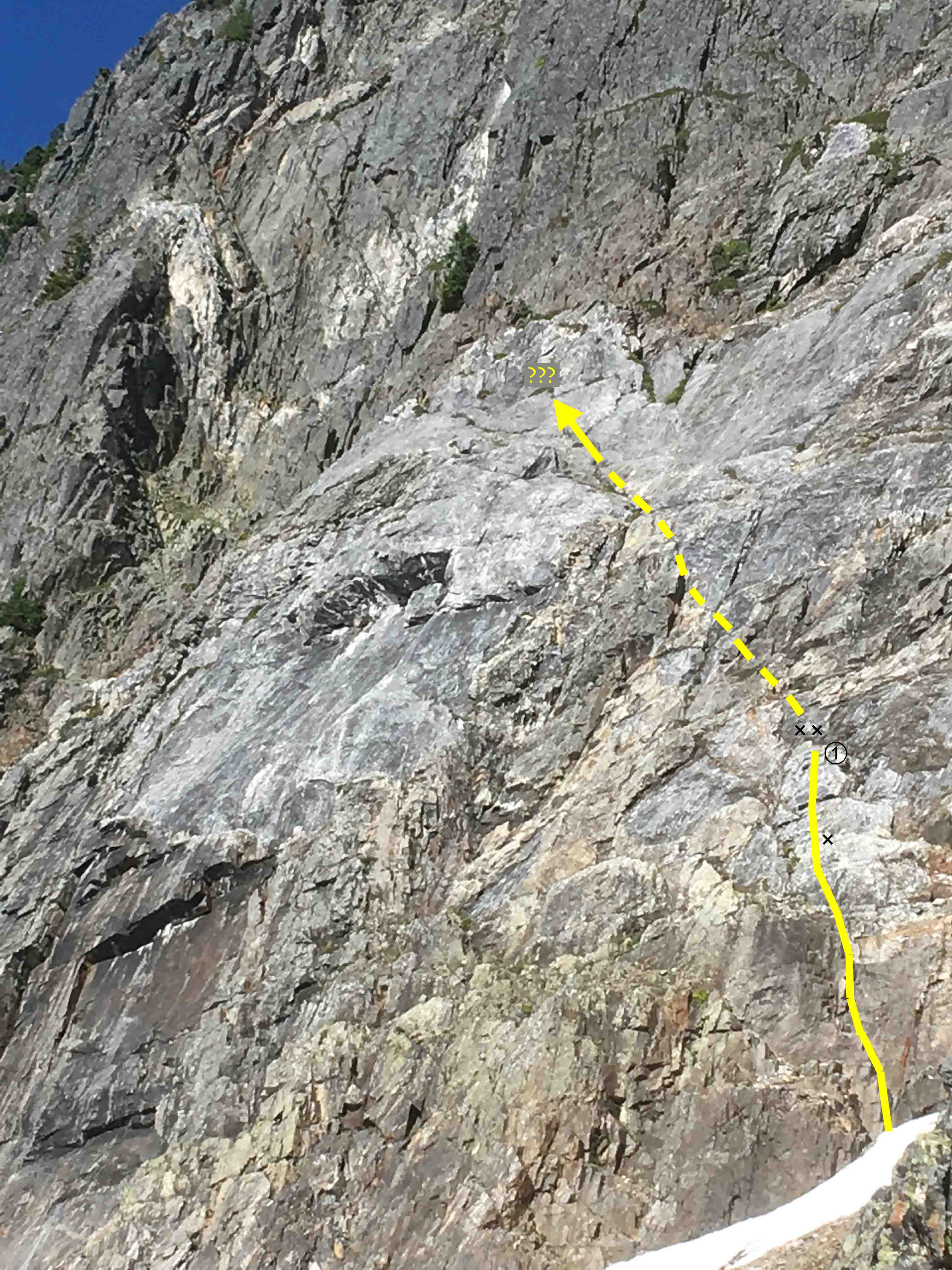
The tat loaded on the anchor of pitch 3 has been removed, replaced with SS chains and rings. This is the higher of the two anchors, up and right of the dihedral containing most of the pitch. Sorry I didn't take a photo of the new steel. Also, the pitch above the Big Tree has received new bolts, 3/8" SS of course, with Mad Rock hangers. No pictures of them either, sorry. Two weeks ago I looked over at this pitch 5 after reaching the nearby top anchor of Shake, Rattle and Roll. I could not believe seeing a beautiful slab with Leeper hangers still on it. And a couple of SMC hangers, all on quarter-inch rusty bolts. Doesn't anyone go up there? So the next week I returned with Robin who sat patiently while I drilled out four of them. There were more to do, so I returned yesterday via rope solo to get the last one out. While I was there, I tested my new uAscend and Microtraxion to top-rope the pitch (worked great, and safely!) and found it to be delightful, knobby climbing. It seemed to have some 5.9 at the start, and eases to 5.8 the rest of the way for a good 55m pitch. Thanks DavidW and MattP for putting this up.

-
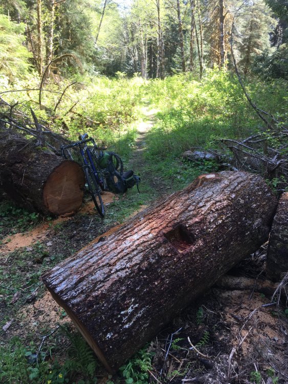
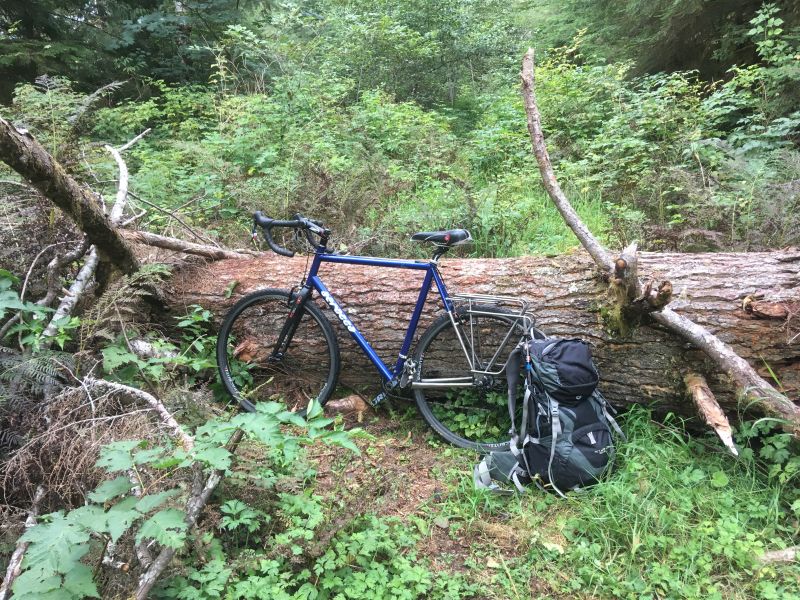
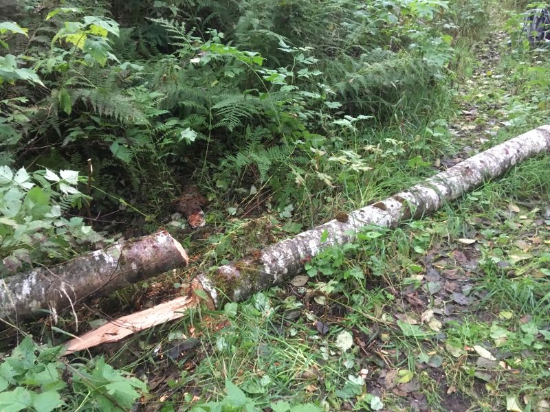
I went out for a bike ride and found some good person with a big saw has taken out the big fir from the Squire Creek road! Many thanks to the unknown logger.
-
Thanks for the report, tanstaafl, this must be done soon. And the thread includes a topo, cool!
-
Nice slab-climbing photo! Two seconds on belay at once, love it.
-
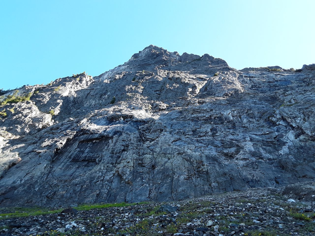
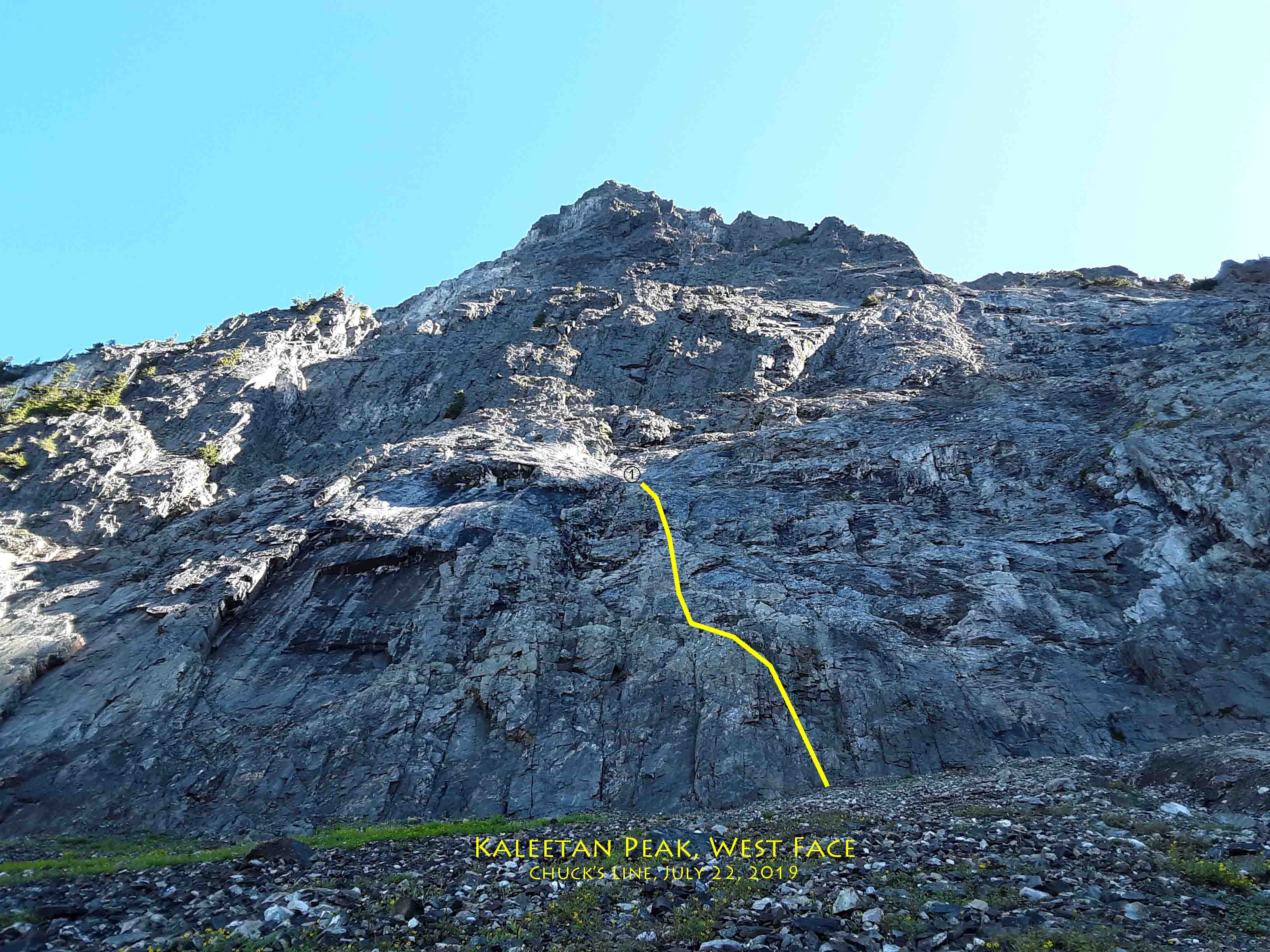
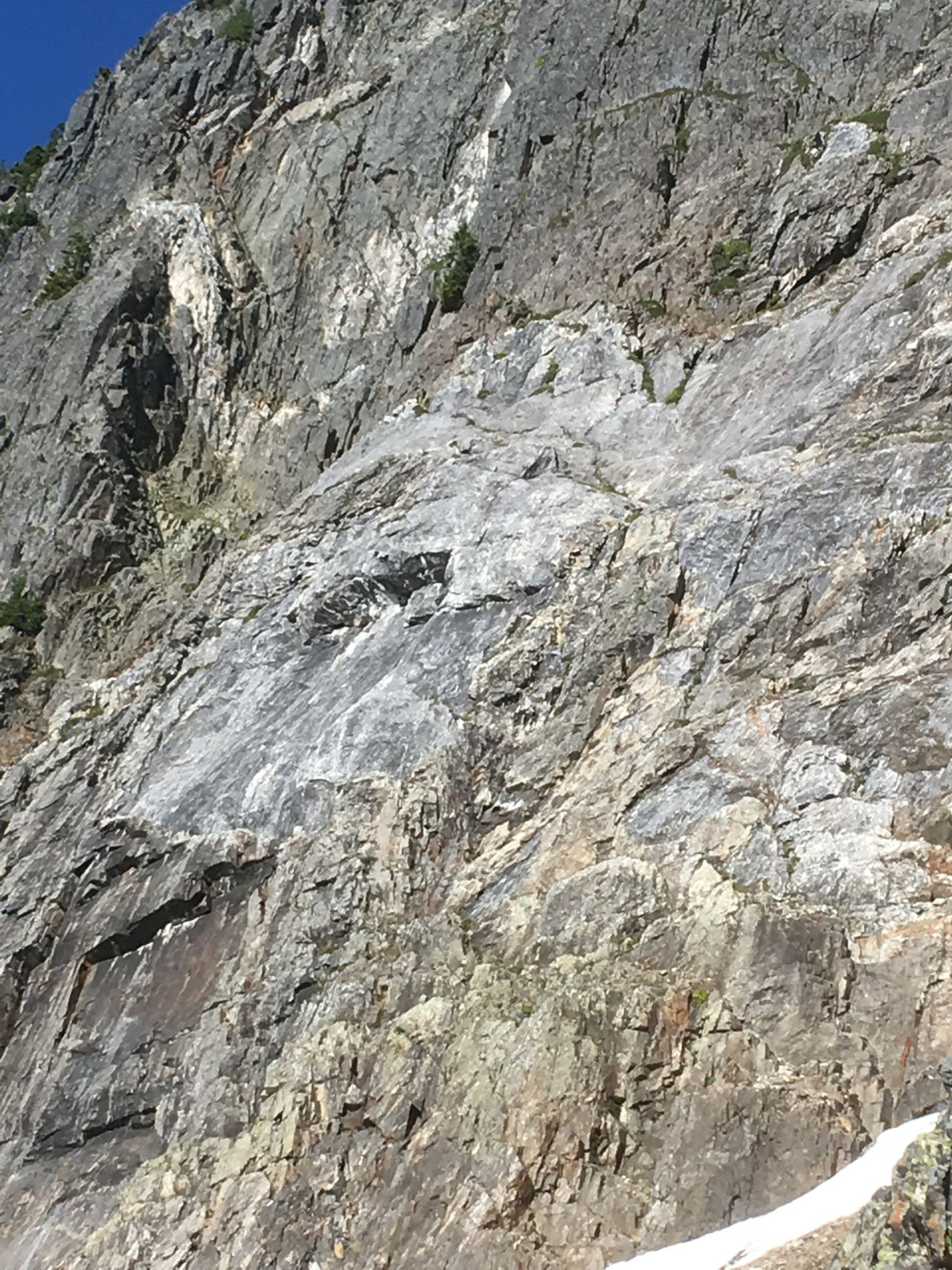
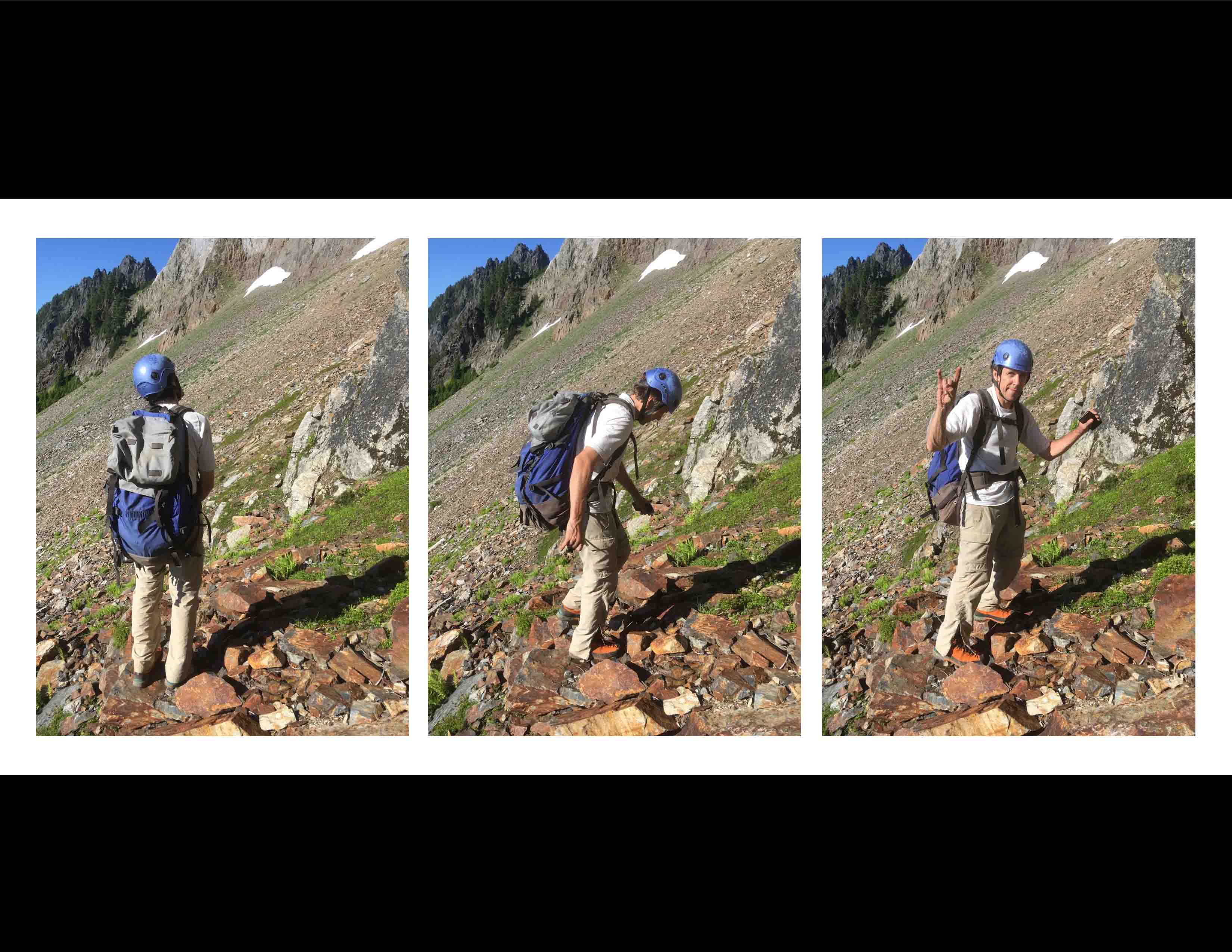
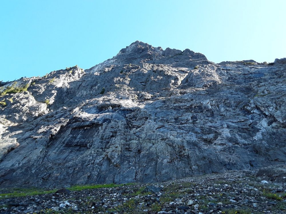
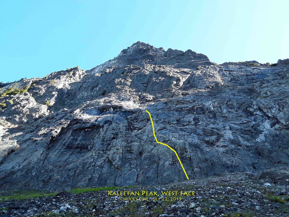
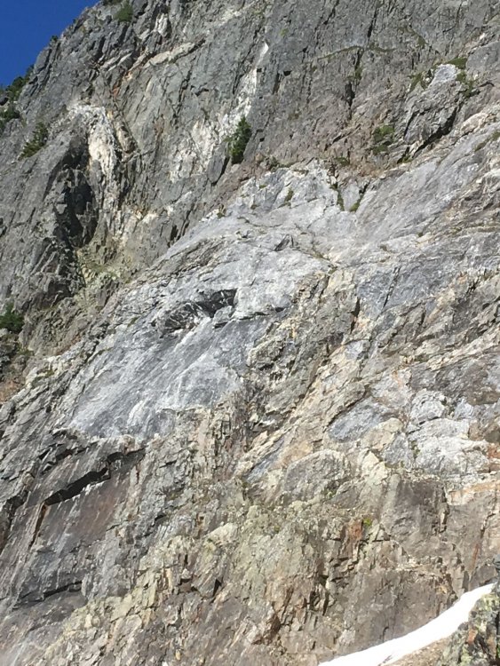
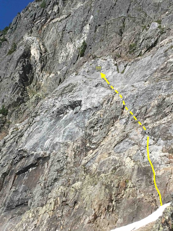
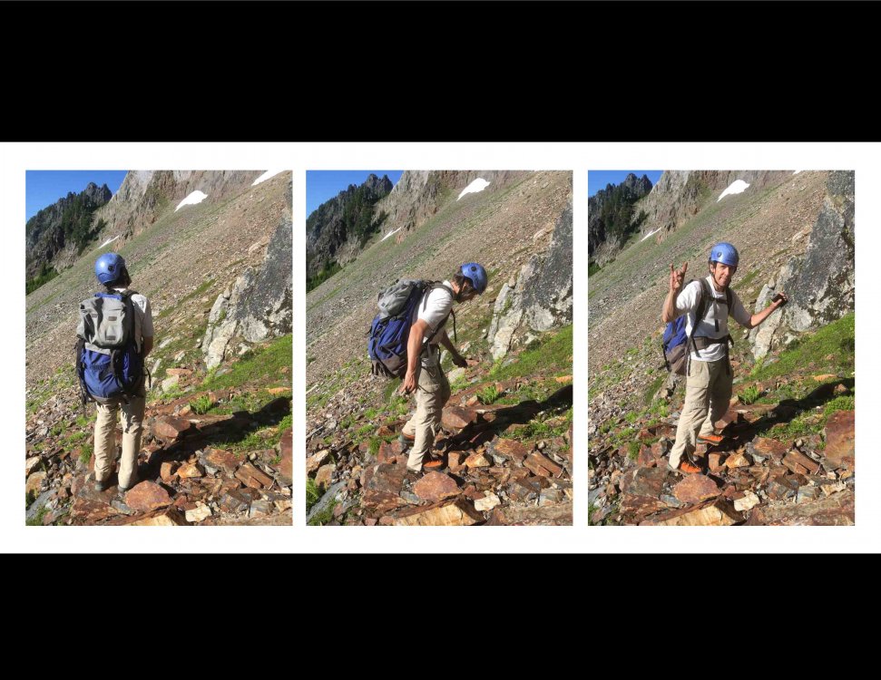
Kaleetan Peak, July 7, 2019 Chuck's Line, one pitch, 5.7, 1x The last outing I did with Chuck Spiekerman was a visit to Kaleetan Peak on 7/22/2019. He had been working on me to get away from Darrington, and sold me on this unclimbed 600-foot West Face. The only problem was the four-hour approach hike. But since I'd been doing that nearly every summer weekend for the last several years, I agreed to help. Chuck had done the research, scoping the face on an earlier solo trip up the North Ridge. He'd returned to work out the approach from Melakwa Lake and the best place to leave the climbers' track to contour around to the west side. He'd found the "magic gully" that leads down from the south shoulder to the west face smoothly. Now he'd invited me to join him on a rock climb of discovery on the west face itself. I was skeptical that there could be a good, unclimbed cliff in a busy, popular hiking area. At the same time, I was skeptical of all the work to hump in the required gear. Surely these two factors opposed themselves and would cancel out! So I agreed, and we'd have the place to ourselves for a day. We brought two 60m ropes, a single rack with wires and cams to 3", my bolt kit with 3 bolts and hangers, drill and hammer, and no bivy gear. It is in the Alpine Lakes Wilderness Area, so no power drills are allowed. We would have to allow four hours of hiking time to get back to Denny Creek trailhead, and set our turn-around time. I didn't want to hike out in the dark. Being on a strict timeline, I didn't stop for photos much. Wanting to document the wall itself, I took shots of the cliff but not of Chuck leading out. He drilled his first ever bolt on lead, protecting a steep short wall on a limestone patch. It only took him about 8 minutes to drill. The climbing on the limestone patches was phenomenal: sharp, sticky, and fun. Then he got in another bolt at the belay anchor, which is in quartzite, or perhaps andesite, much harder, and it took 20 minutes. It's a "pre-Tertiary melange" up there! He brought me up, and I drilled the second anchor bolt. Agreeing to go up and left toward a big tree for Pitch 2 next time, we rapped off. It was late afternoon and time to get out of there. On the talus on the way out I took these three photos of Chuck. Rest in peace, my friend. There is gravel strewn over every ledge and hold, but the rock is sound. We didn't experience any loose rock or rockfall. The talus slope at the base is very loose and littered with bright, white quartz rhomboids. It is a wide wall; there are doubtless better places to start. Indeed, there is a good crack in a left-facing corner directly below our line that could be used as a more direct start at a higher grade. For our continuation, we were going to angle left to the big tree aimed at by the arrow in the annotated photo. We spoke of staying in the light-grey limestone as much as possible, as the climbing there is excellent. If someone hankers for an adventure route, feel free to use Chuck's Line as a first pitch and go from there.
-
OK so I got the local photo upload figured out. At first, it didn't seem like making an "attachment" was what I wanted, but now I do. Thank you! I haven't had any success linking to photos on Drive. Does anyone have the specifics on doing this? Thanks again, Bill
-
I figured out the local photo upload. One of the alders: The other one: The remaining big tree and the bike. This is just below the first culvert crossing. I hope someone with a big chainsaw comes up! Here's to next year, huzzah!
-
Thanks, JasonG. I would like to do this, but I can't find a menu item or button to upload to cc.com. Can you please describe where it is? I use the Chrome browser if that matters. There used to be a Main menu item for "Gallery" but no more. Where to start? Bill
-
1) I gather there is no longer a Gallery. I'm guessing we have to use a photo-hosting site like photobucket.com or something. What are people doing to get photos onto cc.com? 2) I use Google Drive for some things. Does anyone know if it is possible, in a post, to link to photos stored in there? If so, can you point me to, or post, some sample code? I have some trip reports for new routes, with photos, that I'd like to post soon. Any help on posting photos will be appreciated. Thanks, Bill Enger
-
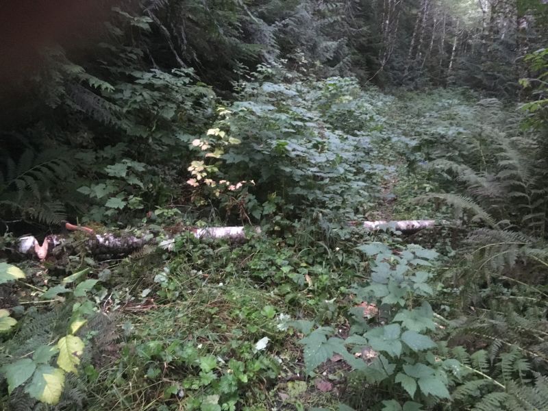
I was surprised that two alder logs lay across the Squire Creek Trail #654 all summer long. They interfered with my bike ride. So on Thursday, 9/12, I brought up my old Boy Scout hatchet. After the cut, I dragged them off the road. Sadly, a big hemlock log remains, bigger than the hatchet could handle in a day! As tall as my bike frame, it has been there for two summers. I have some nice photos of this, but I can no longer upload photos here. I'm asking about that in the "cc.com news" forum. Bill Enger
-
Don't forget the Boulder River Wilderness, home of some long alpine slab routes in the Darrington area.
-
Thanks for for lovely photo trip report. Alpine goodness in November.
-

best content Help identifying the best content on CC.com
Otto replied to olyclimber's topic in Climber's Board
There should be a First Ascent tag on this TR for Oso Rodeo, in the North Cascades section: Oso Rodeo Thanks, Bill -
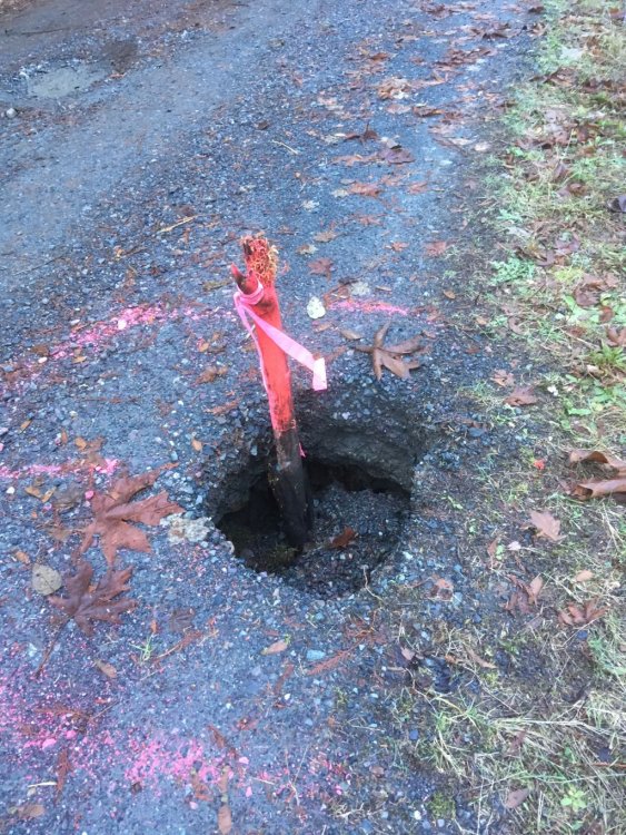
This new hole in the road has been marked; thanks to the road crew for making it so noticeable. If the stake disappears, drivers be warned.
-
It was the maiden voyage for my new belay device, an Edelrid Eddy, with the rope stuffed in a small backpack. Very pleased that it ran smoothly through the device, without locking up.
-
Trip: Three O'Clock Rock - various Trip Date: 11/19/2018 Trip Report: Wanting to see some rock before the snows came, I went up to Three O'Clock Rock yesterday, Monday, Nov. 19. First light comes late in this season so I enjoyed the luxury of sleeping in until five, left Seattle at six. Still a very cold morning in Darrington, I pulled in to the Shell station for a pit stop to let the day warm up a bit. I didn't tarry long, however, as the old pre-climb excitement took hold, didn't even go in the store, and motored on up the Clear Creek Road. The road is in good shape, with a new coat of gravel on the lower section. Thanks to the "Darrington Collaborative" for that! Besides the fairly alarming tilt of the roadbed in a couple of places, one new hazard is apparent: The trail is in the best condition I've ever seen it. Thank you to the work party earlier this year. Especially appreciated is the ramp up off the old miner's road: Years ago we had to cross over this log on the steps provided: Full sun was pulling me out of the frost toward the North Buttress: But I had designs on some easy pitches on the South Buttress: I wanted to warm up with Under the Bored Walk: Dry and clean, the knobs accepted my passage: Pointy elbows in the sun: Rapping off: That was actually scary enough that I decided against staying there to do Charly Chan's Number One Suspect. I moved gear over to Cornucopia Flake. Stout trees are plentiful under the route: It was fun placing gear again, so late in the season: I had only planned to do single pitches, no multi-pitch, but this looked so good and had to pass it up: Obligatory Exfoliation Dome shot: Feeling better about friction moves with lots of rope out, I decided to do the first pitch of The Kone. I saved time by using the same anchor tree. It was 1:30 and the sun was already going around the corner! From near the top of the first pitch of The Kone: On each of these pitches, I fixed the lead rope, rapped, and jugged up with a second rope for rappel. Last rappel of the day, from The Kone: I felt lucky to be out there for a beautiful day in November. Gear Notes: Minimal rack of cams. Two 60m ropes. Approach Notes: Thanks to the Washington Climbers Coalition and the Darrington Collaborative for the road work, and for the recent trail work.
-
Great photos. Thank you for posting. I'm glad the rebolting on Till Broad Daylight is appreciated, having been part of that effort a few years ago. The anchor above the Great Arch was thought provoking! I was up there two days later than you, on Monday. Amazing to get some warm rock in November. Cheers! And many thanks to the Darrington Collaborative for keeping the access nice!
-
Squire Creek Road is clear to the new (as of last year) parking lot. This winter saw further erosion, another cave-in, 20 feet upstream from the one which cut off the old parking lot. It can no longer be driven around. There is a new sign, but nothing blocking the road. Bill Enger
-
Here is the original report, with the gear list: Oso Rodeo original report Agreeing with Chuck, standard rack to 3", and there is a place for a big cam on the first pitch. In the report, DavidW says it is #5 Camalot. I do remember hanging it up on the anchor atop pitch 1, picked up on the return. But it was not always used by us; I got used to leading the pitch without it. Have fun on it, Bill
-
[TR] Darrington - Three O'Clock Rock - 'Till Broad Daylight 8/25/2017
Otto replied to mattp's topic in Rock Climbing Forum
Way to go, Matt! Thanks for the community service. Bill -
I went up to the 8 Mile trail on Clear Creek road on Saturday just to check out the road and trail. There are two new holes developing in the middle of the road. They are deeper than the photos can show, and seem to open up a bit below. The first one points downhill so it is obvious on the way in. Odometer showed it 2.0 miles from Mountain Loop Highway turnoff. The second one is located beyond the concrete spillway recently patched by Hanman. Someone put a stick in it. Odometer showed it 3.5 miles from Mountain Loop Highway turnoff.
-
OK, thanks, thought so. It will be replaced, anyway. Thanks for the nice pics.
-
Nice going getting across p4 in the rain! That would be dicey when wet. Is that last shot out of sequence? Or was that taken on the Tidbits rappel?
-
Was there a road repair project in progress, before the fire?