Leaderboard


Popular Content
Showing content with the highest reputation on 05/27/21 in all areas
-
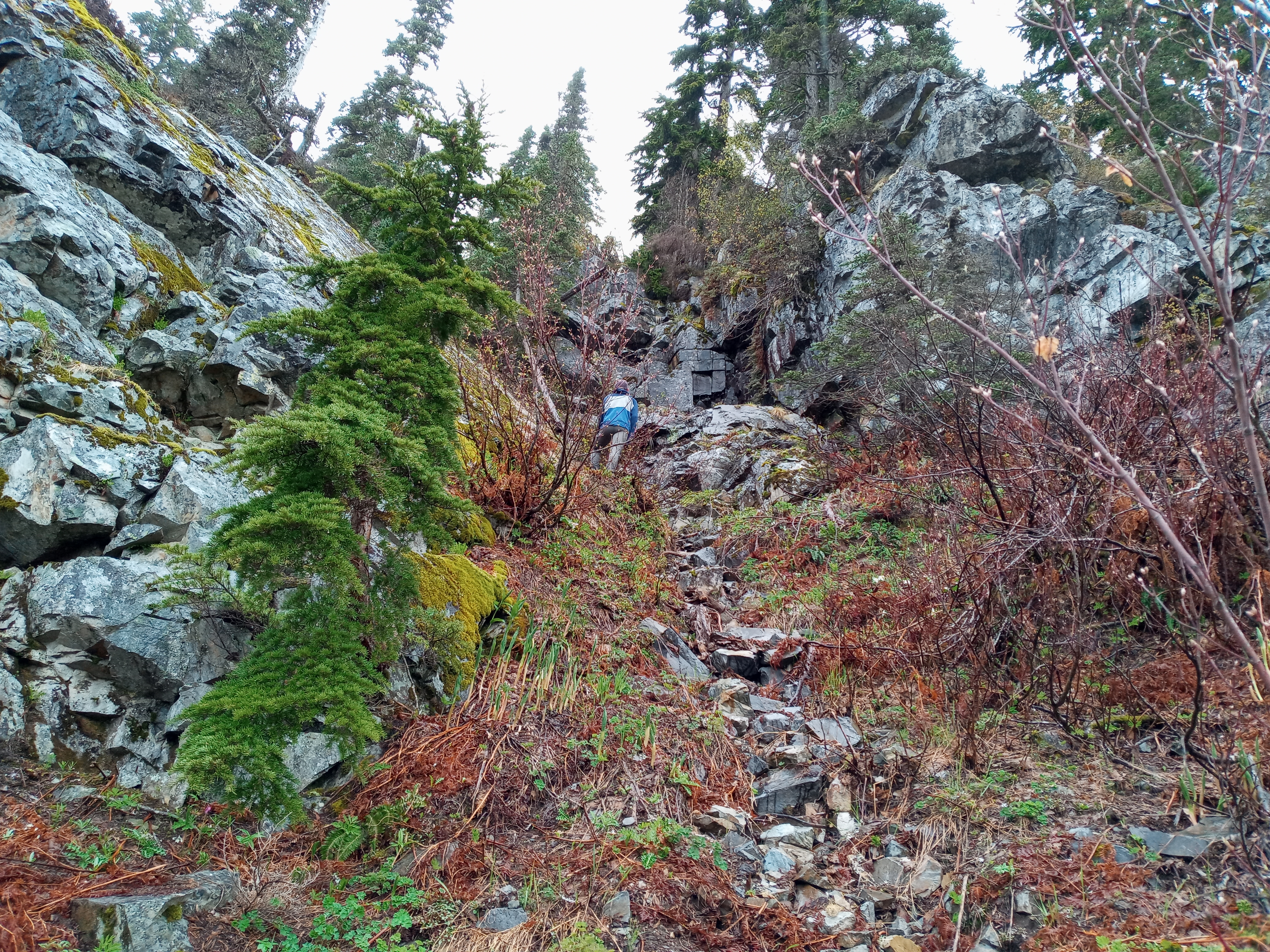
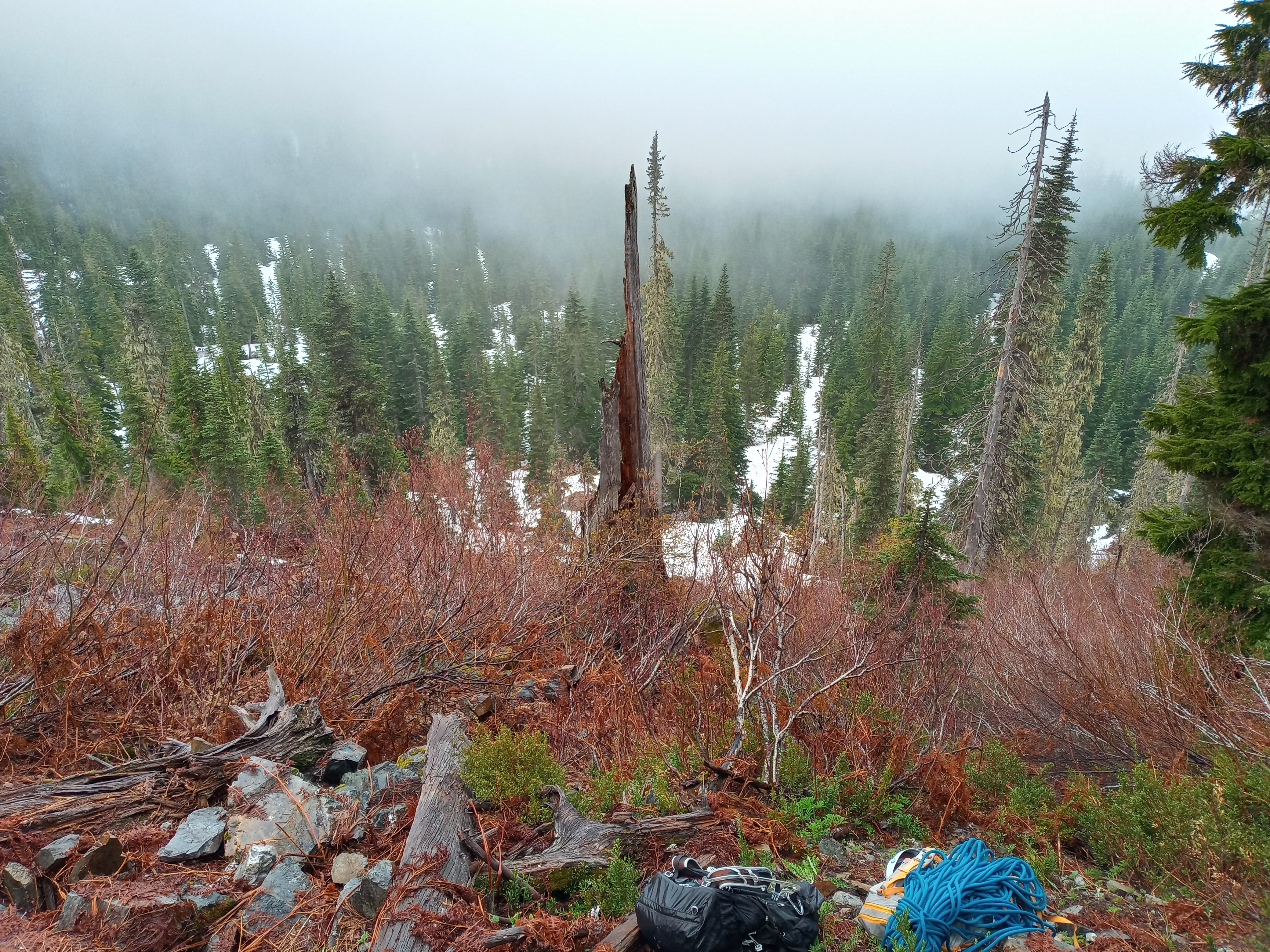
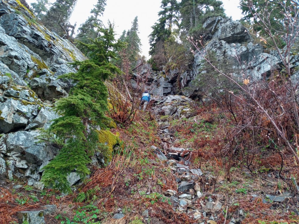
Trip: Guye Peak - South Rib Trip Date: 05/25/2021 Trip Report: Yeah we climbed it in the rain. Why? Who knows. Something something 'save the real routes for sunshine' lol. I won't be doing that again. Guye has been on my summit list for a while, but I was thinking it would be a hike/scramble to bag it, until the right partner came along. Zach wants to hit the Improbable Traverse; I am skeptical of hoe much fun that would be. Instead (since it's raining) we decided on the south rib, listed as a 'practice climb' in big brown beckey. That means it can't be too good, as we discovered. Weather forecast slowly got worse as we drove out. It was rather foggy arriving at the Sahale ski club, where I obtrusively stuck my beat to hell truck on the road. Immediately I wished for microspikes on the snow. The schwack was nothin' doin', a few feet of slide alder and a talus field. We found that random sport route on the side of Guye too. Hardware looked incredible. We pitched out the first 4th class bit cause the rock was soaked. I led too far up onto a big slab running out of rope with no pro. Note to self, return those approach shoes, they can't smear on wet slabs! I found one miniature .75 placement and told Zach not to fall. This is not as dramatic as it sounds. Zach led a simul block up around bulges on the slab and into a gully. Patiently awaiting his maneuvers below I almost got domed by a toaster block or three. Guye's rock fractures just like the worst basalt at Vantage, it's fucken weird. We took stock of our routefinding at the top of the gully/corner/waterfall. From there we each made two longer simul blocks up through dirt, trees and a few 3rd class rock steps. Gotta say this was not the most interesting climbing. 250 feet of 3rd and 4th, a chossy death gully, and then a bunch of mossy trees. Oh well. Took a short break for Zach to have a phone interview (don't ask....) and eventually summitted. Still no views. The north side of each block had a good amount of snow. Foregoing the ice axe was a very poor choice. Thus rappelling into the SE couloir (fairly fresh tat/rings) and kicking mushy steps into a 80 degree snow finger with the whole couloir below us was...sporting. Descent was uneventful, besides long, slippery, and wet. Clouds cleared up at that point though. On approach Gear Notes: Light rack, helmets, should've had ice axe for summit/descent Approach Notes: Up the Sahale Ski club thing, snow covered but easy, then right around the base of Guye.1 point
-
Looks like a character building experience! Thanks for posting.1 point
-
This TR wins the blue collar climbing award of the week! Love it- the style of the report, the climbing, the photos.... the entire package.1 point
-
Classic cascades experience. Glad you persisted and came out on top. Thanks for persevering and posting all the photos too.1 point
-
Good points. I retract my recommendation!1 point
-
Not the route From the base (haha slide alder w/no leaves!)
 1 point
 -
and I have see it in late july with 4 wall to wall crevasses that had sketch bridges that failed before our return back from summit. the hydro dynamics of glacier flow through that notch guarantee that there are crevasses that you may or not see. if one was forced at gun point to solo a glacier, the sulphide glacier on shuksan would be a better choice. or eldorado pk. traveling on glaciers in late august thru september is very enlightening to exactly what one has walked over just 2 months previous. recommending a glacier as "chill" without seeing that same glacier bare of winter coverage is reckless advice.1 point
-
Did you guys make it past the big ass gate on FS Rd. 38 that has the warning about being video monitored? There is some BS notation about a wildlife closure 12-1 thru 6-15 on some maps. Climbing in whiteouts is fun, it's like entering a parallel universe where you get to wander around inside the mind of Joe Biden when he's trying to read a teleprompter.1 point
-
Trip: Robinson Mountain (8726') - Northeast Ridge Trip Date: 05/22/2021 Trip Report: I climbed Robinson Mountain (8726’) outside Mazama, Northeast Ridge Route. I started the climb from the Robinson Creek Trailhead, a little over 9 miles down Lost River Rd. from Mazama. I decided to head East over Hwy 20 to see how much snow is in the Eastern Cascades. There is a lot less snow on the east side, but still a decent amount depending on the peak. Robinson Mountain has melted out faster than the surrounding peaks by quite a bit. The weather was perfect. Clear skies and warm. I was prepared for a long day on the mountain so I started up the trail around 5:30am to leave plenty of time before dark. You will cross two bridges on the main trail heading up. About 40 feet after the 2nd bridge (that crosses Beauty Creek) look for the climber’s trial on the right side of the trail heading uphill (about an hour up the trail depending on your speed). The climber’s trail heading up towards Robinson Mountain is fantastic. It is one of the nicest climber’s trails I have ever climbed up. I’ve been on trails that are on maps that are not as nice as this climber’s trail. Snow started at around 4600’, patchy at first, then pretty solid until you turn to go up the grassy slope (5200’). The grassy slope is snow free up until about 6000’. 6000’ to the top of the ridge is all snow. The last running water I came across was a small waterfall right below the lake. The lake (6750’) is still snow covered with a couple spots of water opening up. Water up before going up to the ridge or be prepared to melt snow. From the lake I went up the snow covered slope to the left (south) to gain the ridge. I followed that ridge to the main Northeast ridge that leads to the summit. Most of the ridge is snow free. The climbing is mostly class 2 with a short section of class 3 here and there. The section going up the false summit is the most difficult being exposed 3rd class for about 50 feet. Coming back from the summit I decided to go straight down the snow bowl toward the lake. The snow had been in direct sun for hours so it was perfect for plunge stepping. Overall this is a very nice early season climb. The snow melts off the peak early and the views are awesome. 6100’ of climbing gives you a good workout to boot. Some Tips and Notes: 1. This is a long day trip. Took me 11.5 hours total time. Average fit climber pace. 2. The last running water is right below the lake. 3. An ice axe would be a good idea to bring along, as the snow gets somewhat steep in sections. 4. Snow starts at 4600’ 5. The ridge to the summit is mostly snow free. Travel Time for reference: Car to Summit 6.5 hours – Summit to car 4.5 hours Bridge over Beauty Creek. Start of the climber's trail after Beauty Creek Bridge. Look for the broken off tree stump. Climber's trail. Nice enough to be on a trail map. Lake and snow bowl leading to the ridge. Heading up to the ridge on the left (south) side of the lake. Looking down to the lake while heading up to the ridge. Looking up the Northeast ridge to the summit. Looking down the Northeast ridge from the summit. The views from the summit are fantastic! You can see almost all of the major peaks in the Cascades. Gear Notes: Whippet, Ice Axe & Helmet. Brought crampons but didn’t need them. Approach Notes: Robinson Creek Trailhead start location. Head up the climber's trail about 40' past the Beauty Creek bridge.1 point